Portsmouth to Portsmouth Grand Voyage
Portsmouth to Portsmouth Grand Voyage
Cruise overview
WHY BOOK WITH US?
- ✔ The Deluxe Cruises’ team has extensive experience in ultra-luxury cruising.
- ✔ Call now to speak to our helpful and experienced Cruise Concierge team.
- ✔ Enjoy our Unique Deluxe Cruises Bonus for substantial savings.
- ✔ Our team will tailor your holiday to your exacting requirements.
- ✔ As agents, we work under the protection of each cruise lines ABTA / ATOL licences
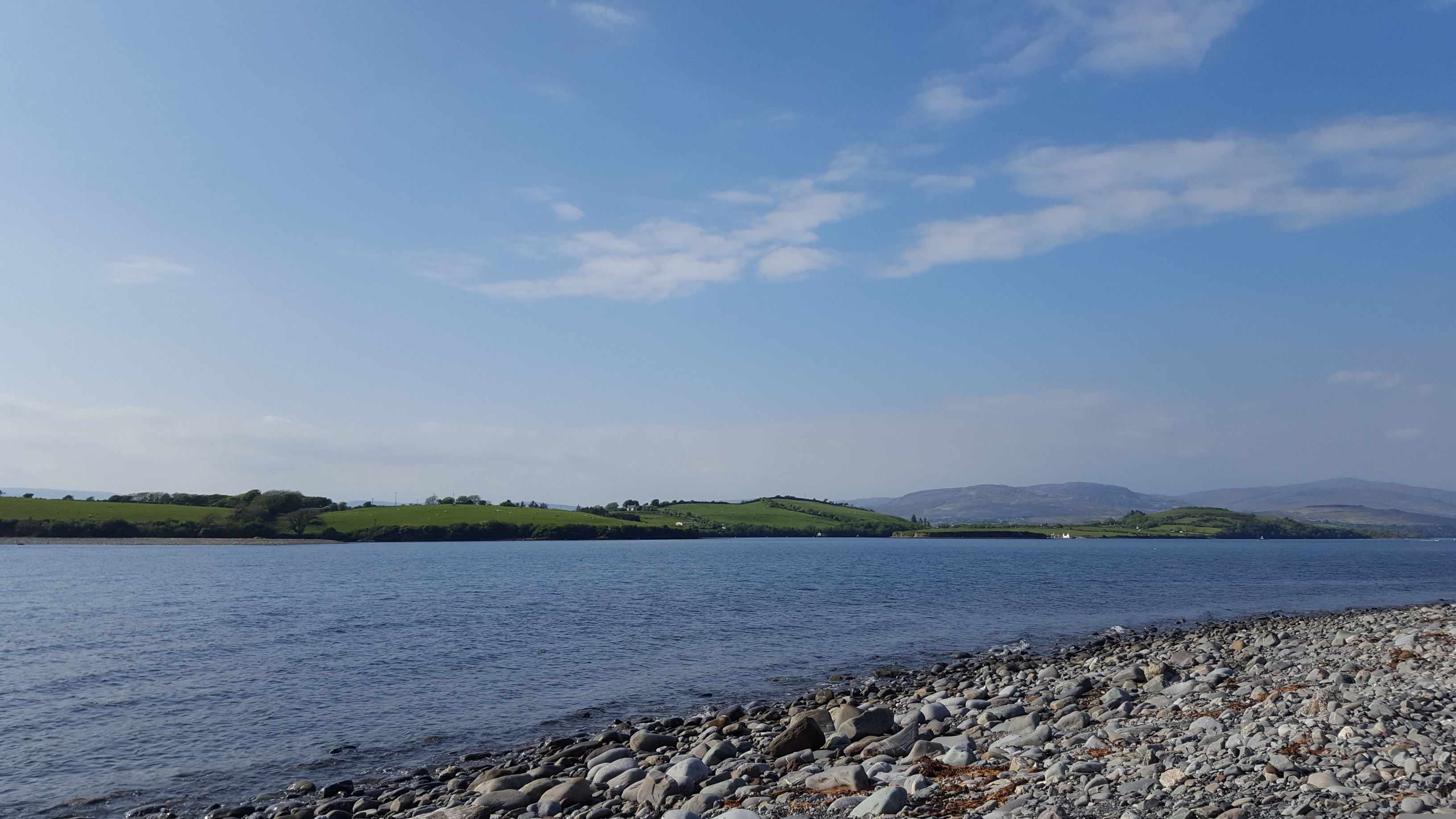
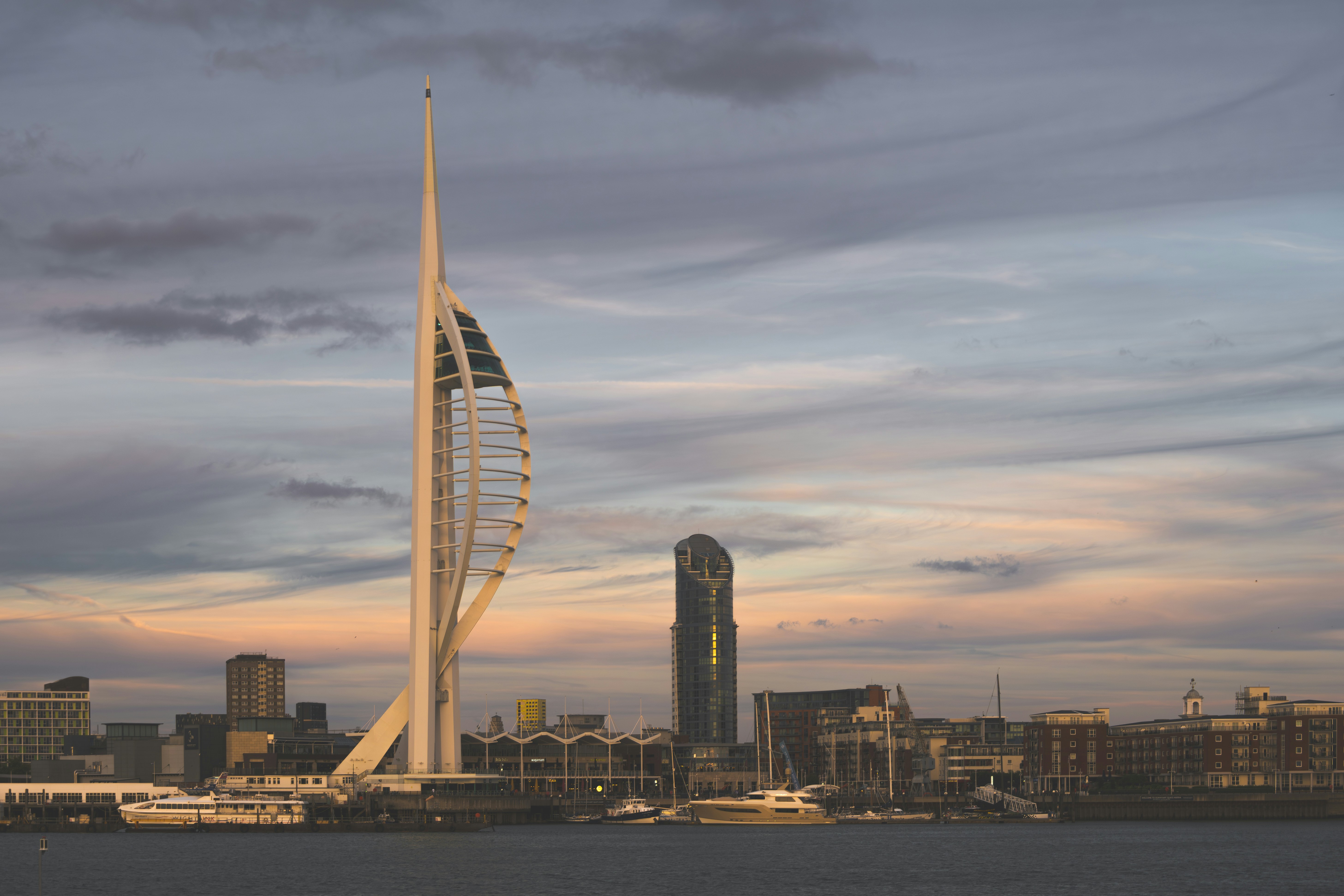
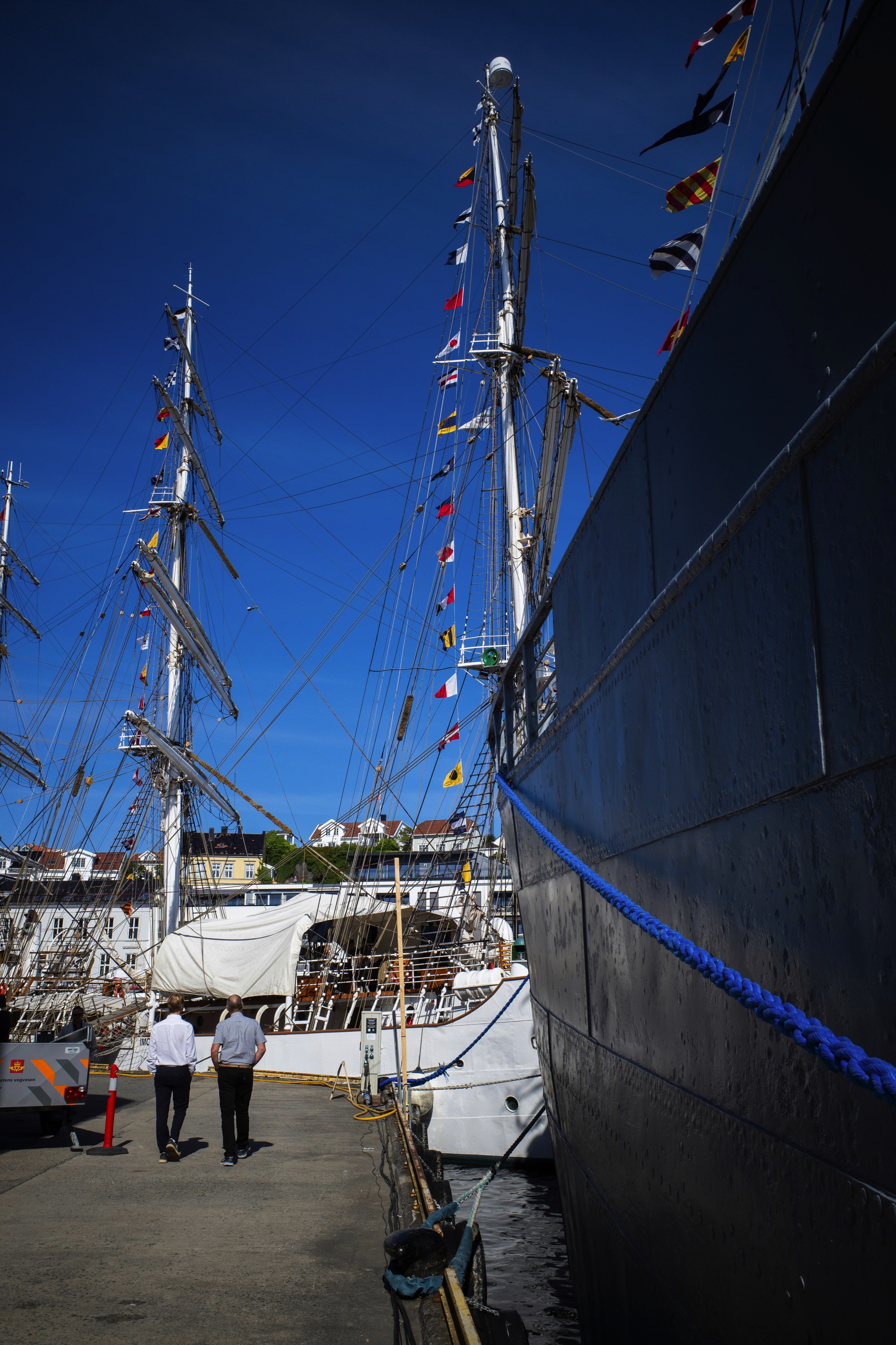
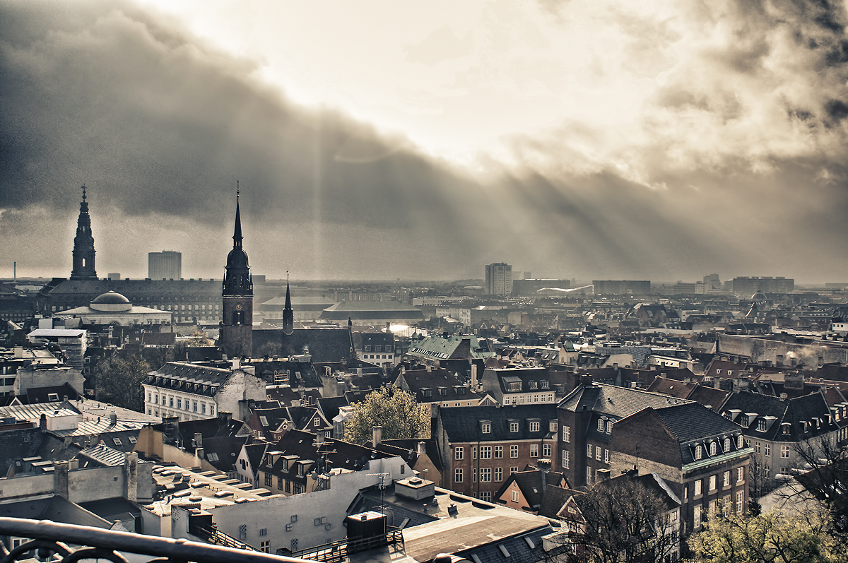
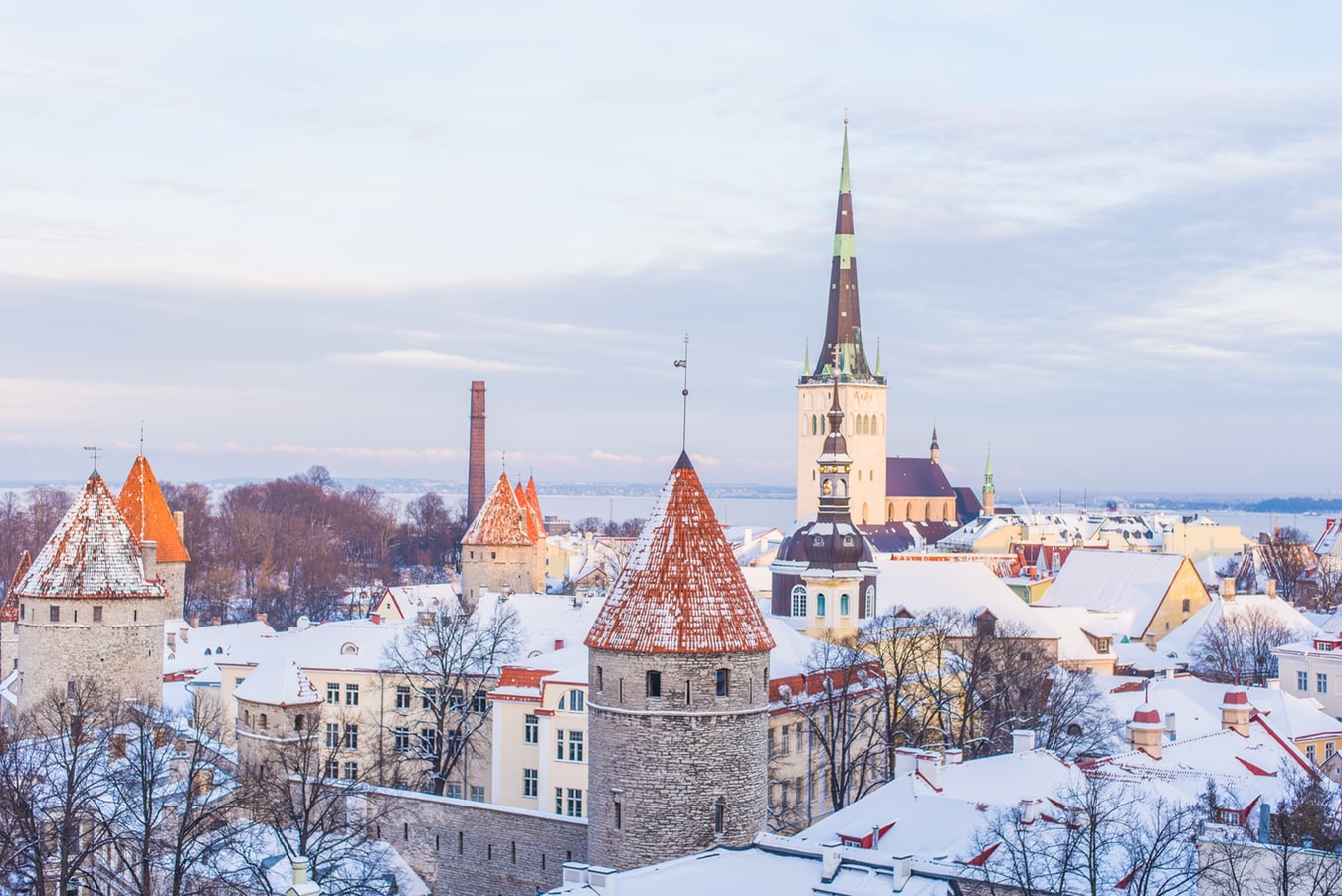
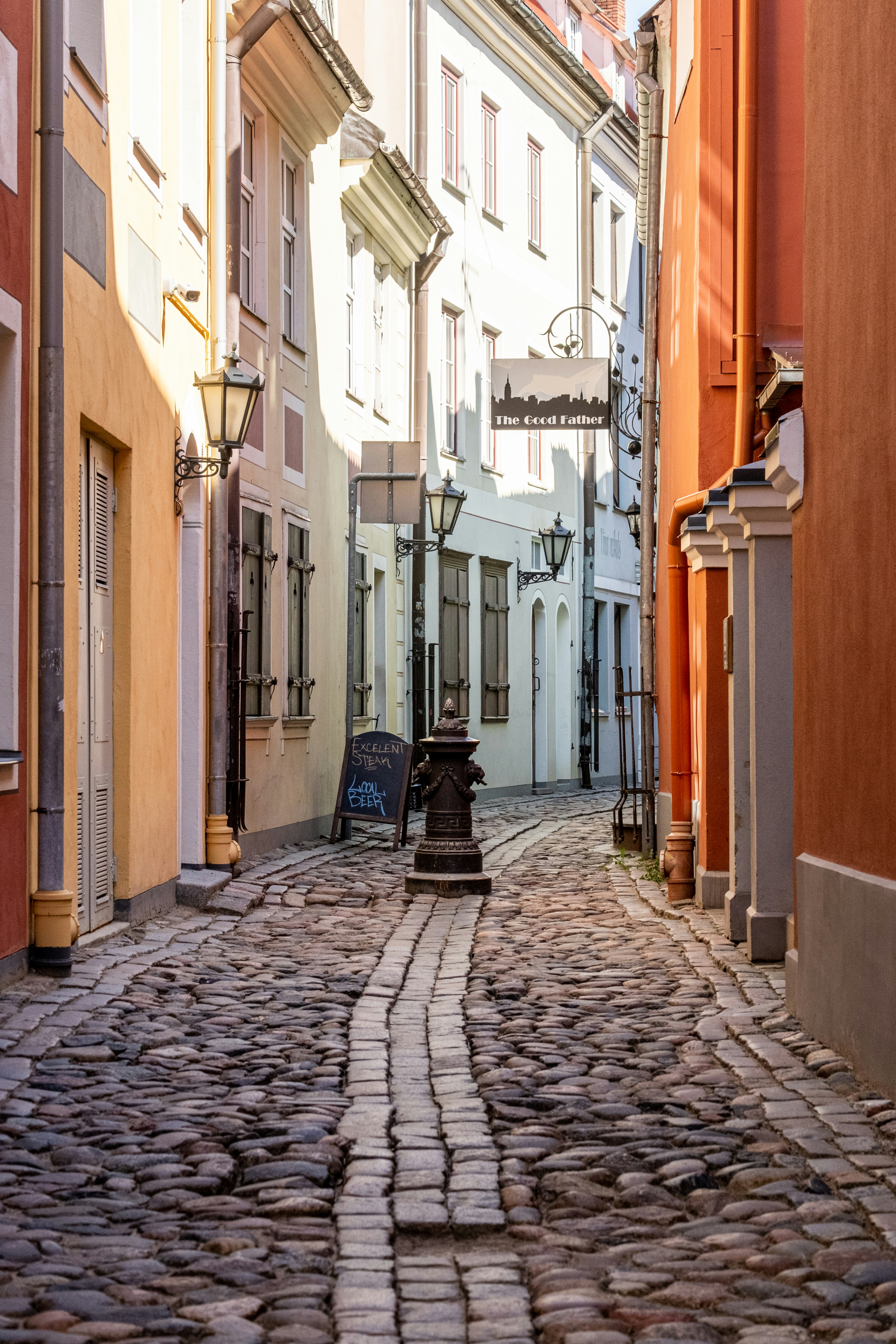
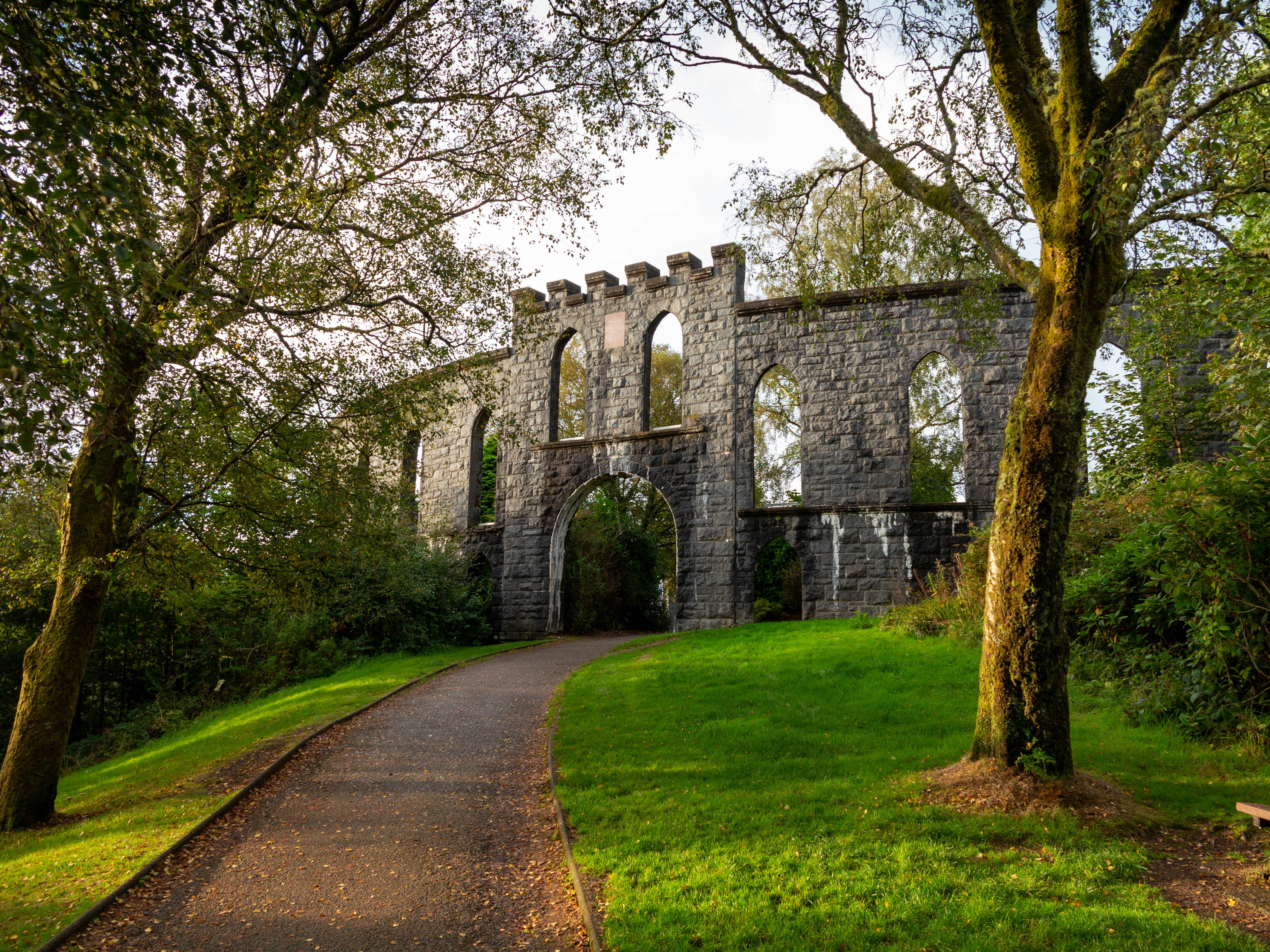
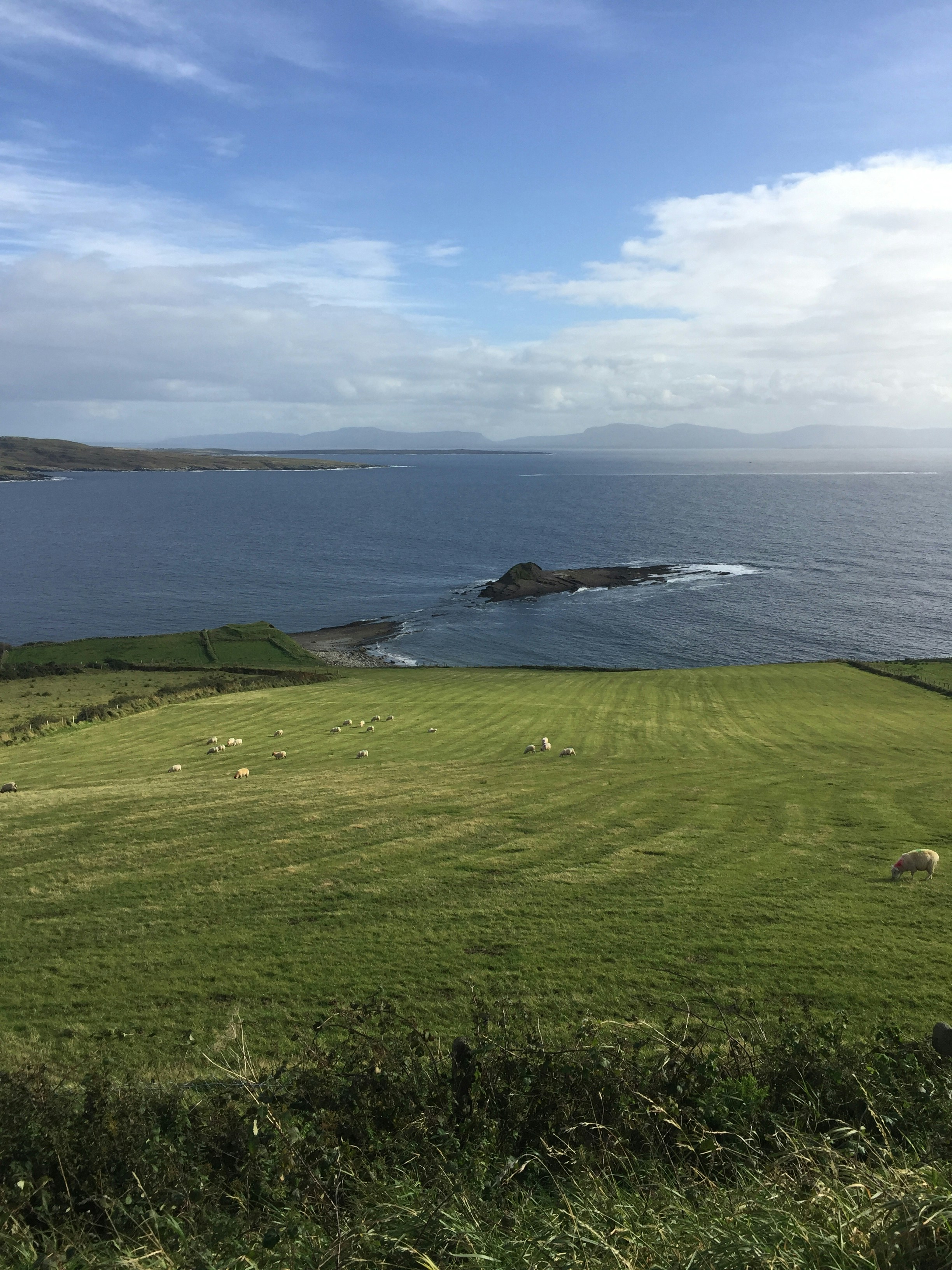
About Portsmouth
Portsmouth is one of the most densely populated cities in Southern England, and is unusual as most of its built-up area occupies Portsea Island, linked to the mainland by road and rail bridges. Although there is a Roman fort at nearby Portchester, occupied later by the Saxons and Normans, there was no settlement on the site of Portsmouth at the time of the 1086 Domesday Book. The town developed in medieval times and received its first charter in 1194 from King Richard I; soon afterwards it became a major naval base. It has the world’s oldest dry dock, and is home to several famous ships, including HMS Victory, HMS Warrior and the Mary Rose, raised from the Solent in 1982. Portsmouth remains an important naval base and is home to a large proportion of the British service fleet. The waterfront area is now dominated by the Spinnaker Tower, 560 feet high, the United Kingdom’s tallest building outside London. Other things to see in the city include the house where Charles Dickens was born, and the City Museum, which contains a permanent exhibition devoted to another famous writer, Sir Arthur Conan Doyle, who lived in the town.
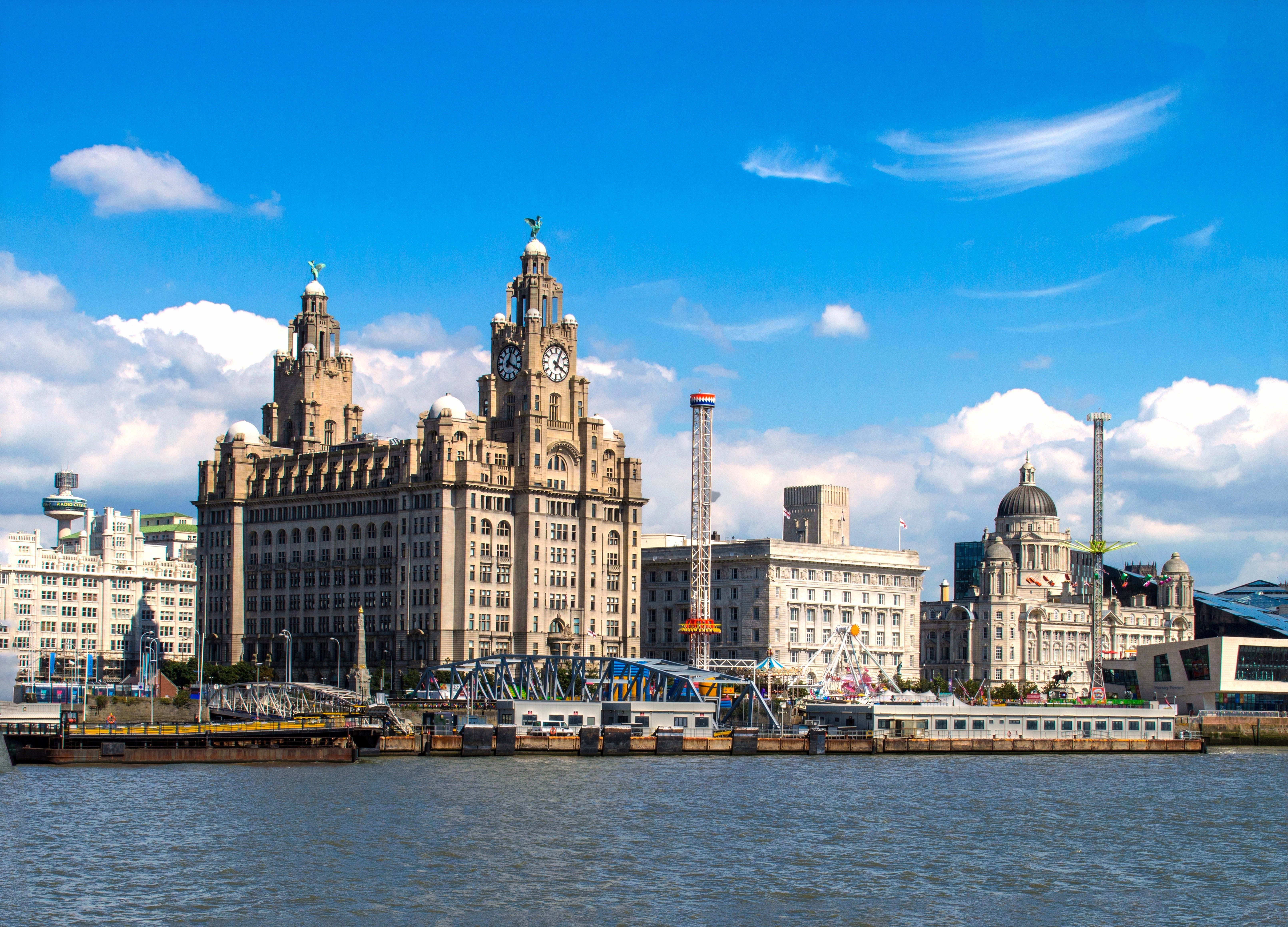
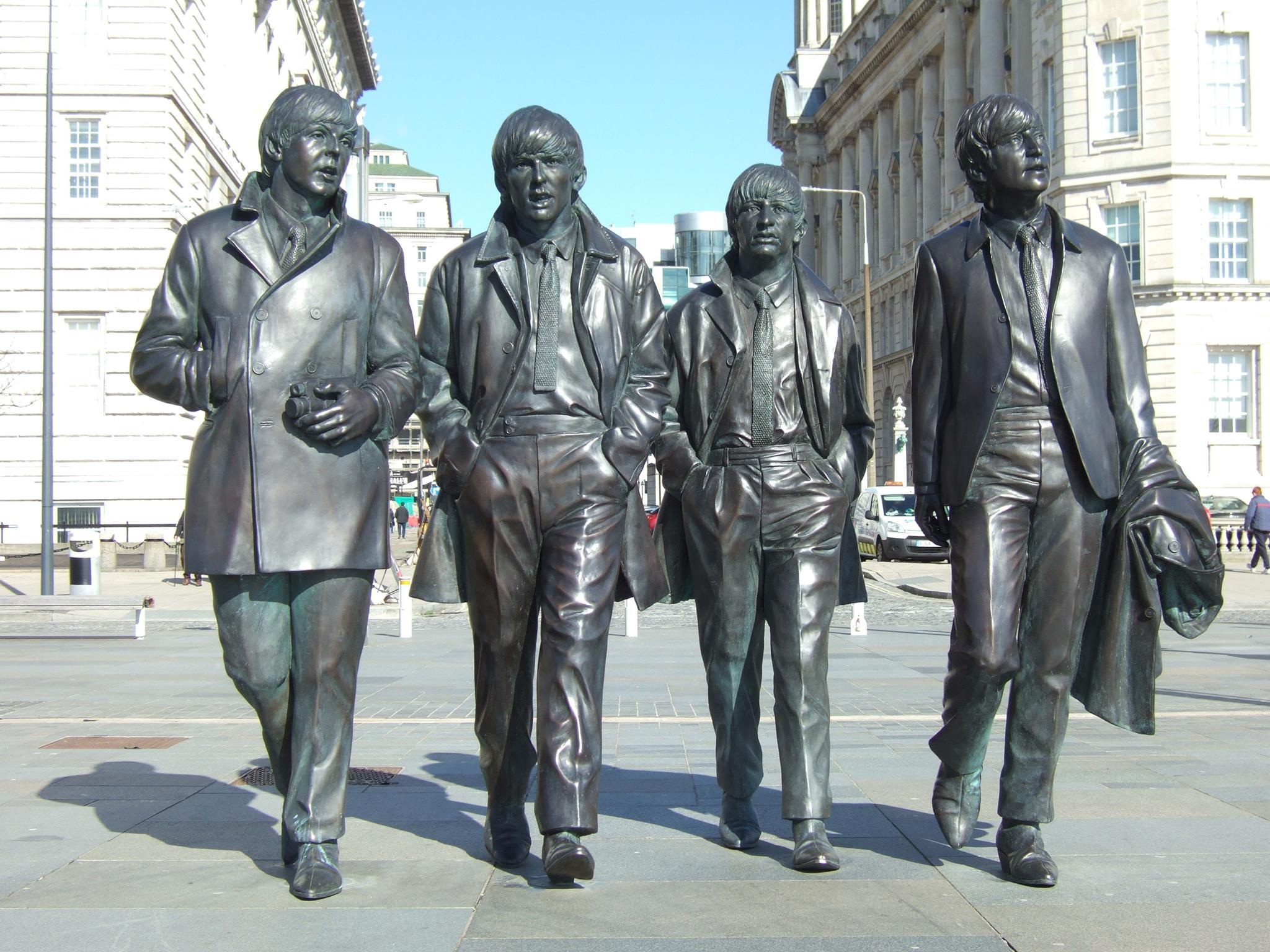
About Liverpool
From world-class attractions and sports to legendary music, Liverpool offers old-world charm with modern sophistication, underpinned by a rich cultural history.
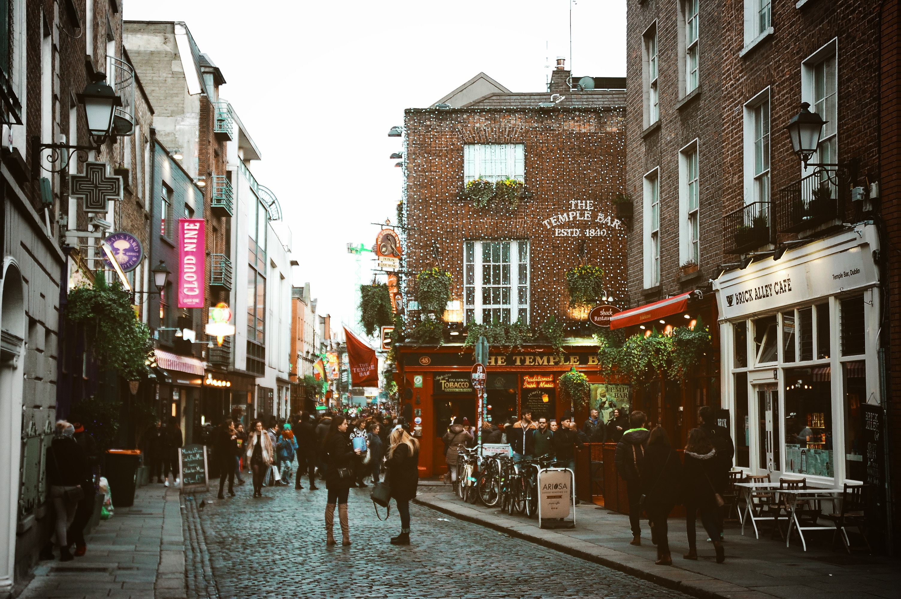
About Dublin
Dublin is making a comeback. The decade-long "Celtic Tiger" boom era was quickly followed by the Great Recession, but The Recovery has finally taken a precarious hold. For visitors, this newer and wiser Dublin has become one of western Europe's most popular and delightful urban destinations. Whether or not you're out to enjoy the old or new Dublin, you'll find it a colossally entertaining city, all the more astonishing considering its intimate size.It is ironic and telling that James Joyce chose Dublin as the setting for his famous Ulysses, Dubliners, and A Portrait of the Artist as a Young Man because it was a "center of paralysis" where nothing much ever changed. Which only proves that even the greats get it wrong sometimes. Indeed, if Joyce were to return to his once-genteel hometown today—disappointed with the city's provincial outlook, he left it in 1902 at the age of 20—and take a quasi-Homeric odyssey through the city (as he so famously does in Ulysses), would he even recognize Dublin as his "Dear Dirty Dumpling, foostherfather of fingalls and dotthergills"?For instance, what would he make of Temple Bar—the city's erstwhile down-at-the-heels neighborhood, now crammed with cafés and trendy hotels and suffused with a nonstop, international-party atmosphere? Or the simple sophistication of the open-air restaurants of the tiny Italian Quarter (named Quartier Bloom after his own creation), complete with sultry tango lessons? Or of the hot–cool Irishness, where every aspect of Celtic culture results in sold-out theaters, from Once, the cult indie movie and Broadway hit, to Riverdance, the old Irish mass-jig recast as a Las Vegas extravaganza? Plus, the resurrected Joyce might be stirred by the songs of Hozier, fired up by the sultry acting of Michael Fassbender, and moved by the award-winning novels of Colum McCann. As for Ireland's capital, it's packed with elegant shops and hotels, theaters, galleries, coffeehouses, and a stunning variety of new, creative little restaurants can be found on almost every street in Dublin, transforming the provincial city that suffocated Joyce into a place almost as cosmopolitan as the Paris to which he fled. And the locals are a hell of a lot more fun! Now that the economy has finally turned a corner, Dublin citizens can cast a cool eye over the last 20 crazy years. Some argue that the boomtown transformation of their heretofore-tranquil city has permanently affected its spirit and character. These skeptics (skepticism long being a favorite pastime in the capital city) await the outcome of "Dublin: The Sequel," and their greatest fear is the possibility that the tattered old lady on the Liffey has become a little less unique, a little more like everywhere else.Oh ye of little faith: the rare ole gem that is Dublin is far from buried. The fundamentals—the Georgian elegance of Merrion Square, the Norman drama of Christ Church Cathedral, the foamy pint at an atmospheric pub—are still on hand to gratify. Most of all, there are the locals themselves: the nod and grin when you catch their eye on the street, the eagerness to hear half your life story before they tell you all of theirs, and their paradoxically dark but warm sense of humor. It's expected that 2016 will be an extra-special year in the capital, as centenary celebrations of the fateful 1916 Easter Rising will dominate much of the cultural calendar.
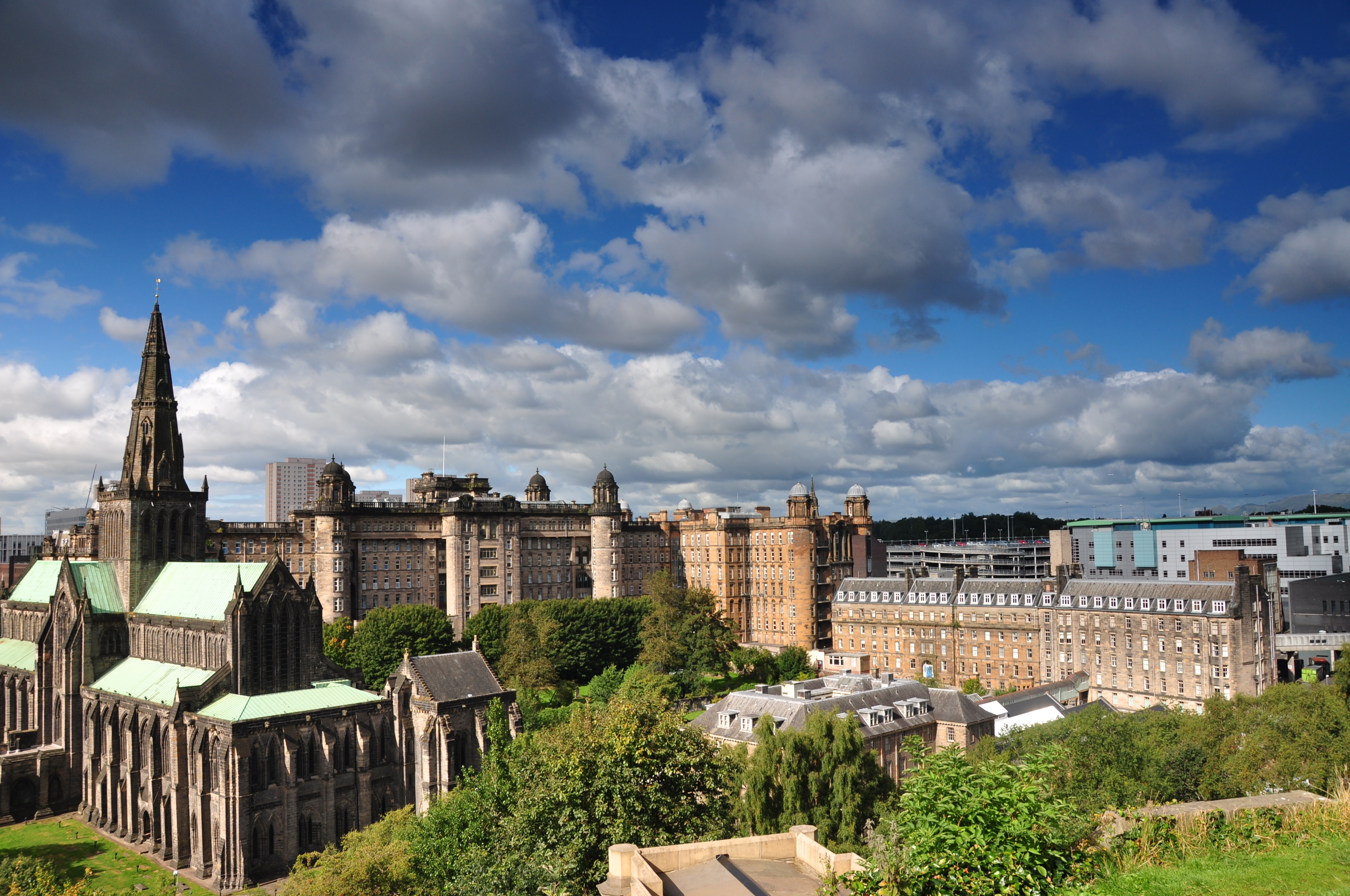
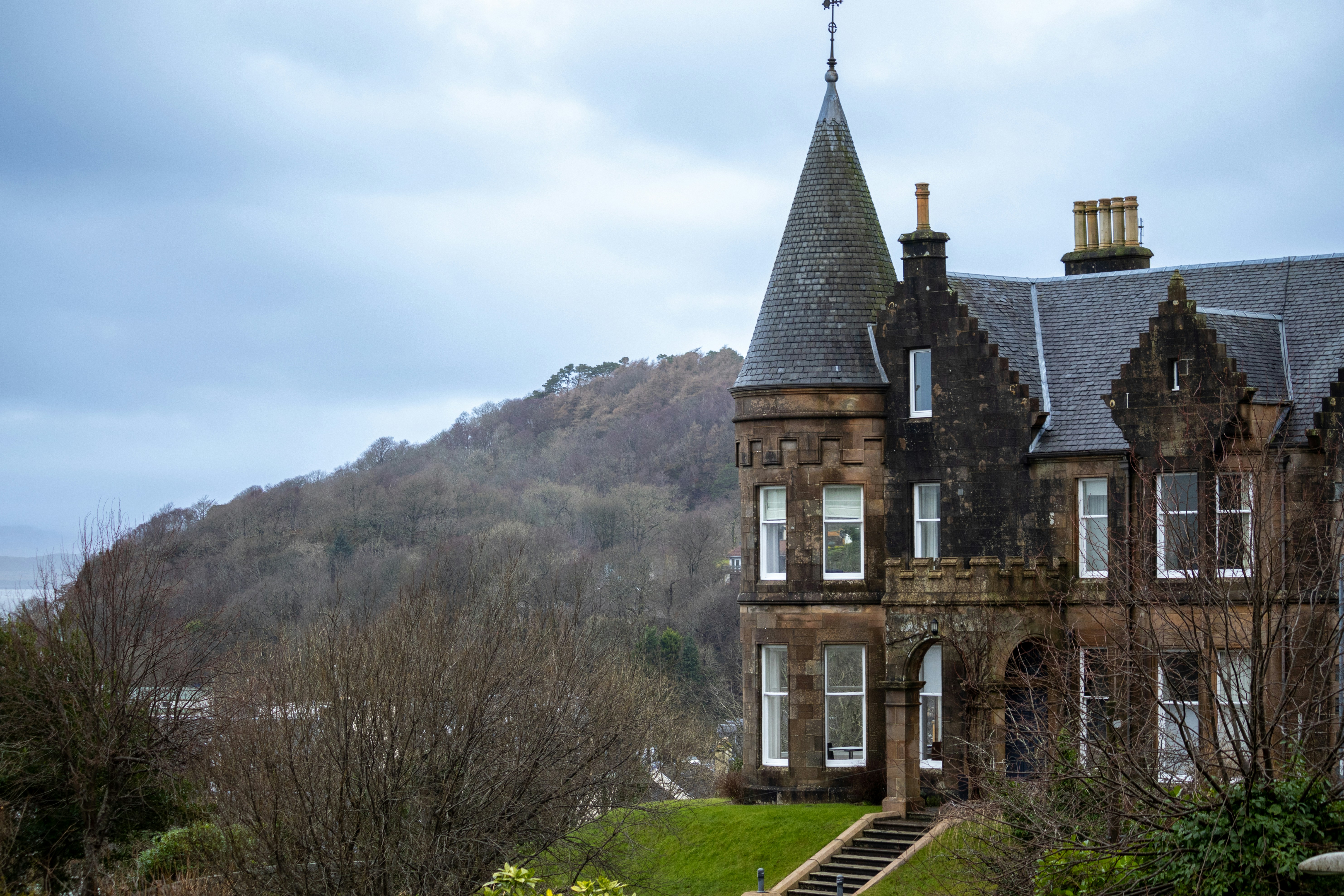
About Glasgow
Start your adventure in Scotland’s largest city, Glasgow which is overflowing with historic landmarks and a vibrant culture. The distinct architecture is reminiscent classic 19th-century fused together with modern early 20th-century dubbed ‘Glasgow Style’. The checkerboard layout makes the city easy to navigate with lively street entertainment around every corner.
About Douglas
The Isle of Man, situated in the Irish Sea off the west coast of England, is a mountainous, cliff-fringed island and one of Britain’s most beautiful spots. Measuring just 30 miles by 13 miles, the Isle of Man remains semi-autonomous. With its own postage stamps, laws, currency, and the Court of Tynwald (the world’s oldest democratic parliament), the Isle of Man is rich with history and lore.Inhabited from Neolithic times, the island became a refuge for Irish missionaries after the 5th Century. Norsemen took the island during the 9th Century and sold it to Scotland in 1266. However, since the 14th Century, it has been held by England. Manx, the indigenous Celtic language, is still spoken by a small minority. The Isle of Man has no income tax, which has encouraged many Britains to regard the island as a refuge. Otherwise, it is populated by Gaelic farmers, fishermen, and the famous tailless manx cats. The varied landscape features austere moorlands and wooded glens, interspersed by fine castles, narrow-gauge railways, and scores of standing stones with Celtic crosses. The hilly terrain rises to a height of 2,036 feet at Mount Snaefell, which dominates the center of the island.
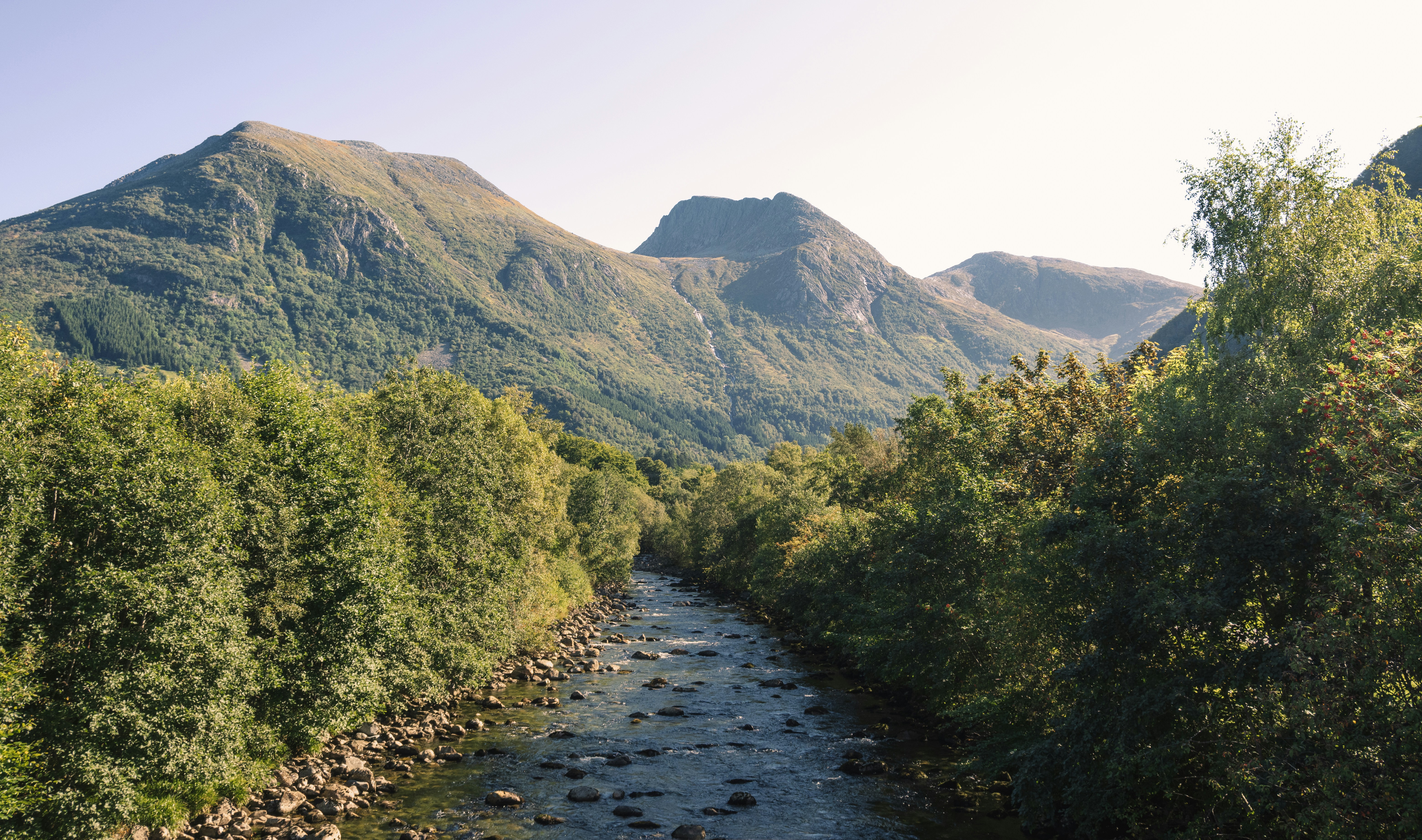
About Invergordon
The port of Invergordon is your gateway to the Great Glen, an area of Scotland that includes Loch Ness and the city of Inverness. Inverness, the capital of the Highlands, has the flavor of a Lowland town, its winds blowing in a sea-salt air from the Moray Firth. The Great Glen is also home to one of the world's most famous monster myths: in 1933, during a quiet news week, the editor of a local paper decided to run a story about a strange sighting of something splashing about in Loch Ness. But there's more to look for here besides Nessie, including inland lochs, craggy and steep-sided mountains, rugged promontories, deep inlets, brilliant purple and emerald moorland, and forests filled with astonishingly varied wildlife, including mountain hares, red deer, golden eagles, and ospreys.
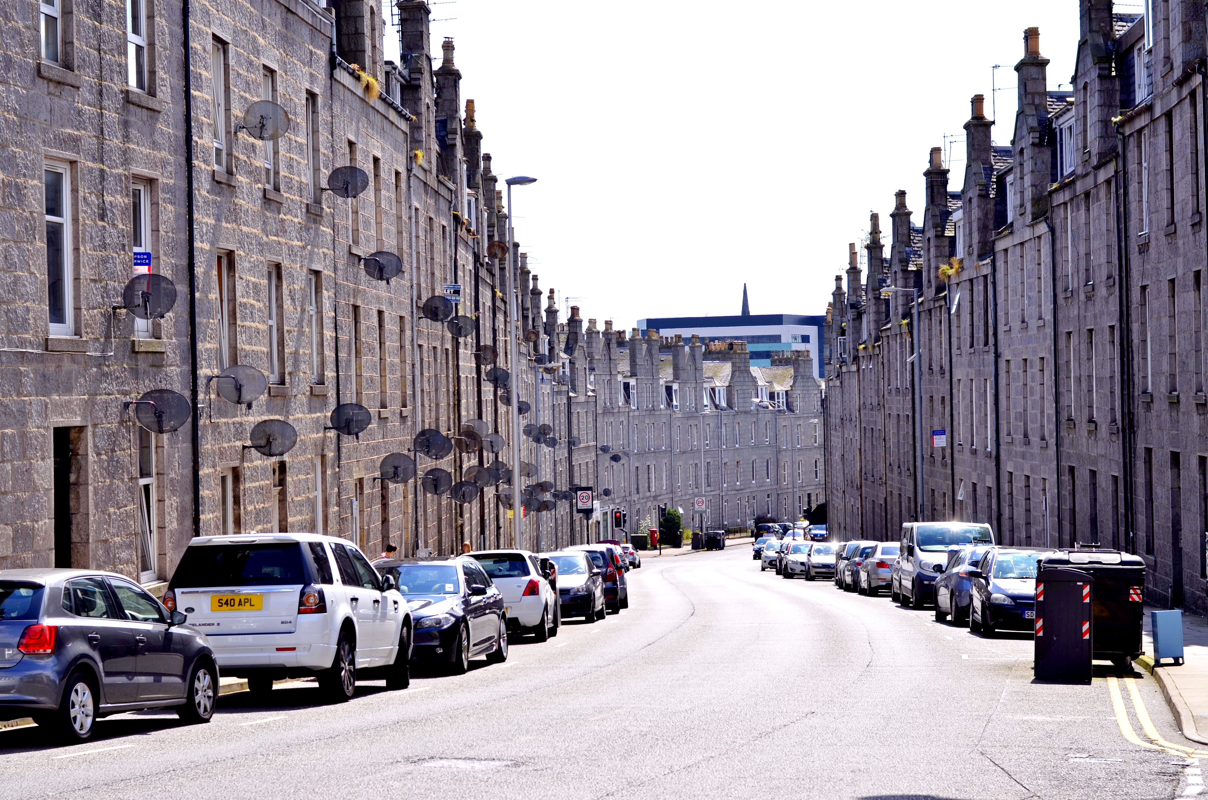
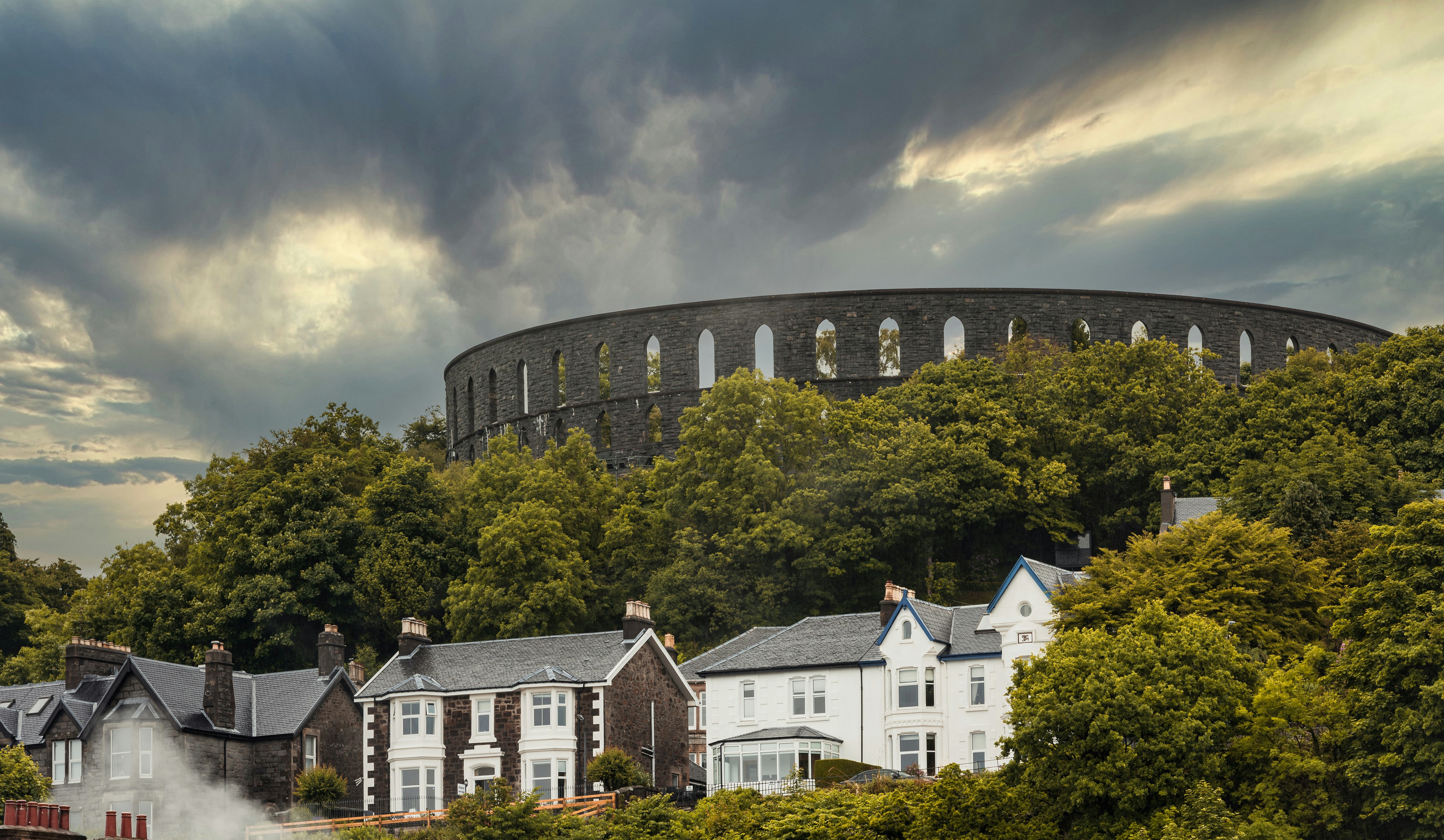
About Aberdeen
With close to 220,000 inhabitants, Aberdeen is Scotland's third most populous city. Locally quarried grey granite was used during the mid-18th to mid-20th centuries for many of Aberdeen's buildings, and hence the nicknames it has earned as the Granite City, or the Grey City. Aberdeen granite was also used to build the terraces of the Houses of Parliament and Waterloo Bridge in London. Since the discovery of North Sea oil in the 1970s, Aberdeen has also been called the Oil Capital of Europe or the Energy Capital of Europe. It is no wonder that because of the oil fields in the North Sea, Aberdeen's seaport is very important. The Heliport with its flights to the oil fields is one of the busiest commercial heliports in the world.
About Dundee
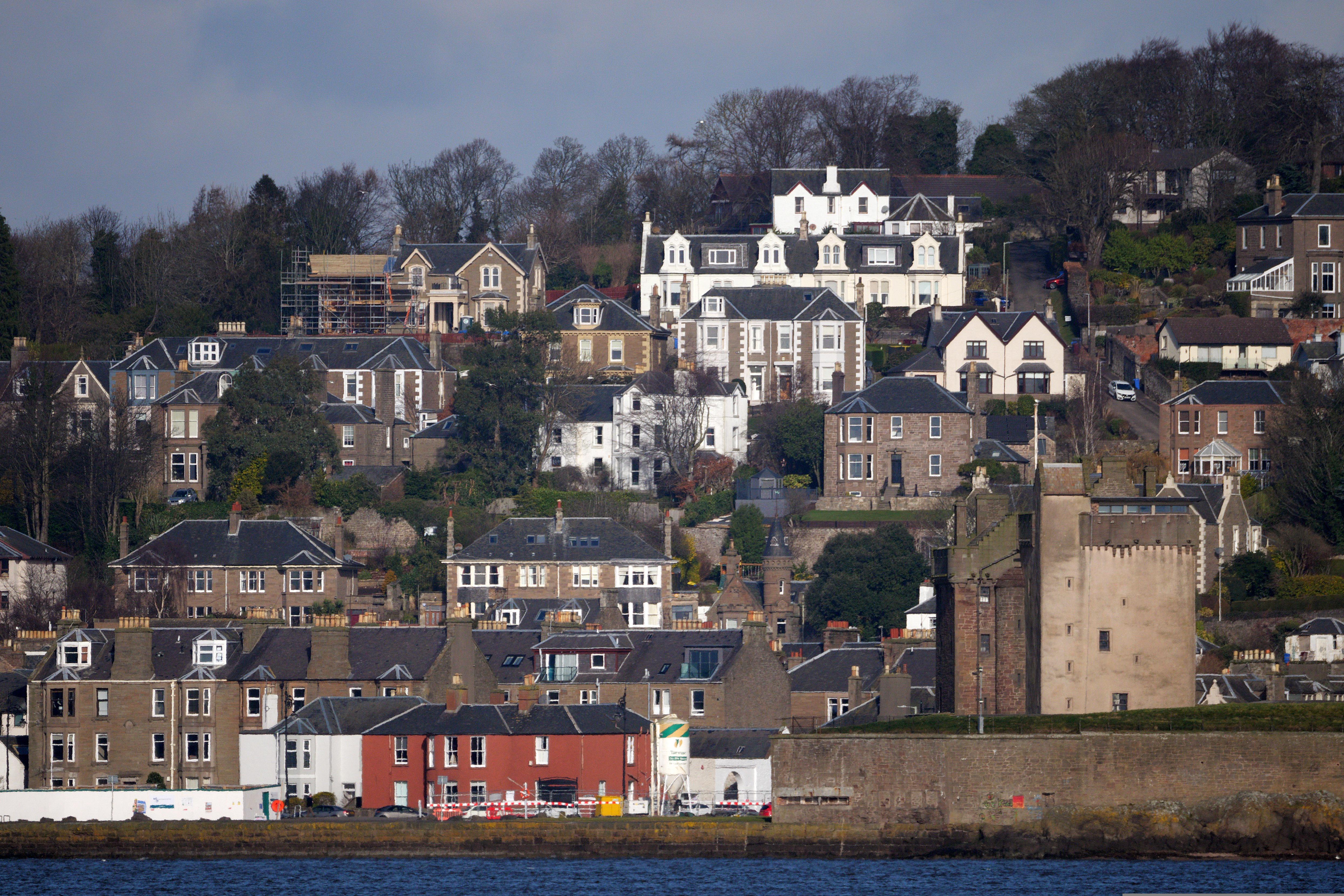
About Dundee
About Leith
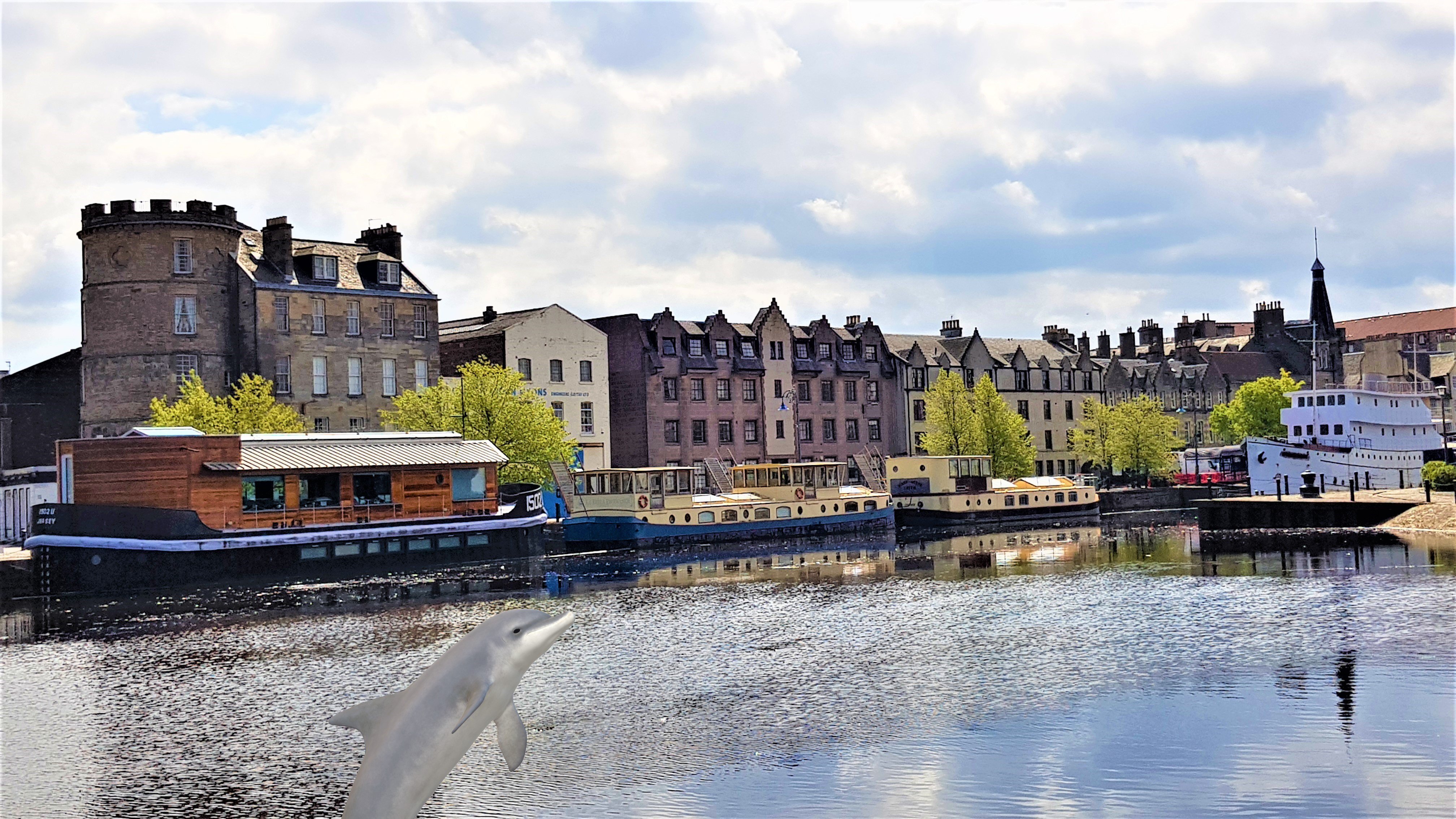
About Leith
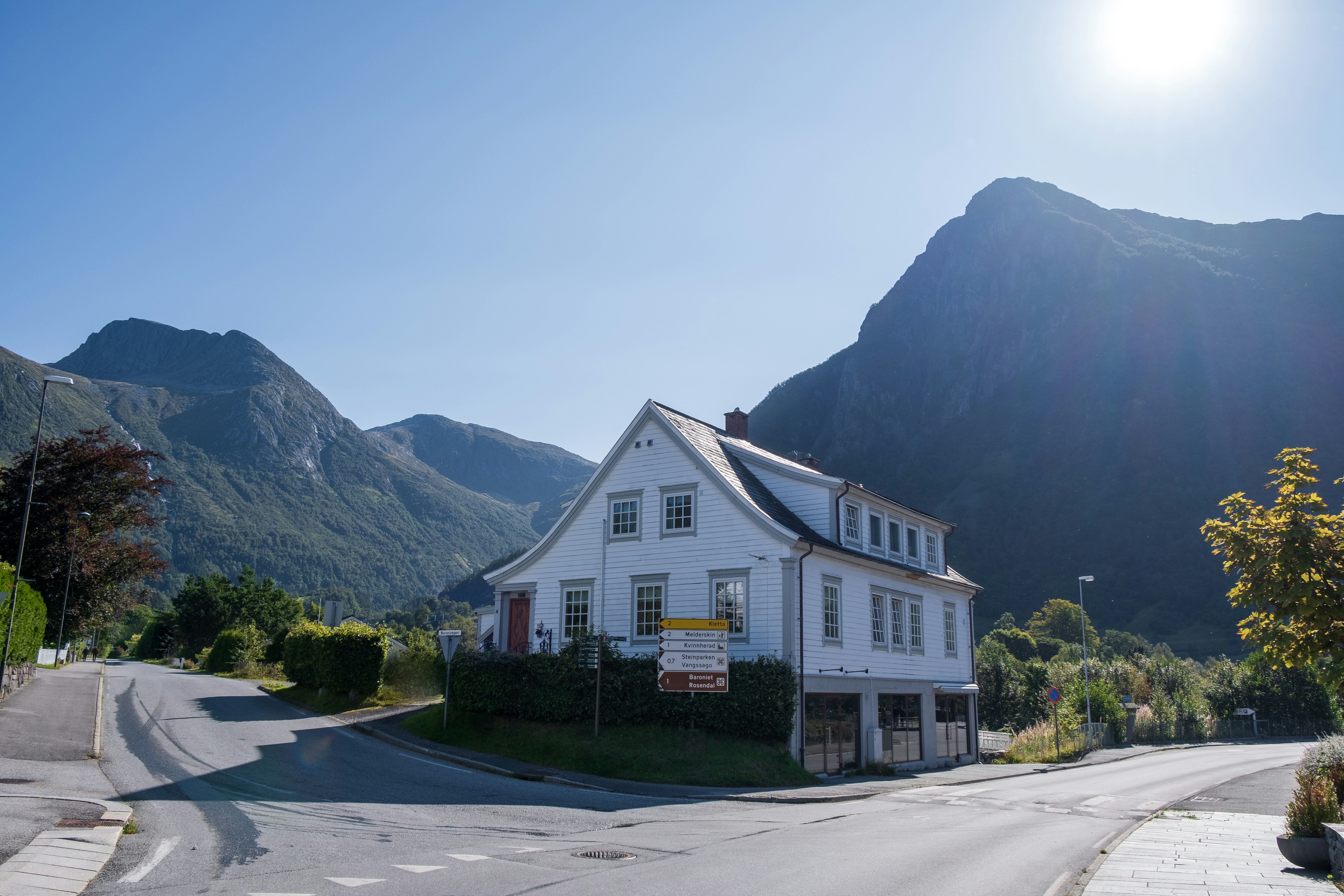
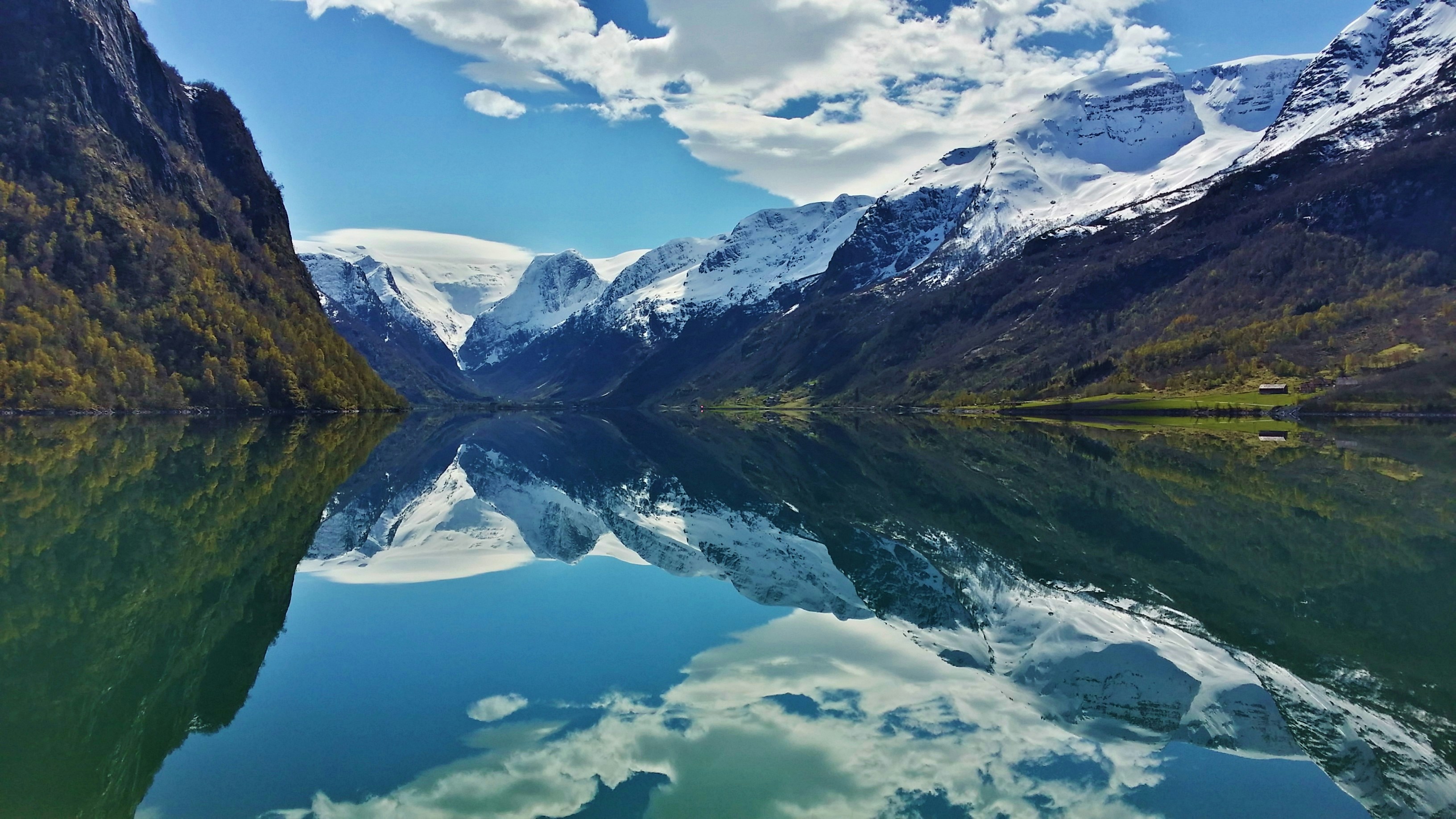
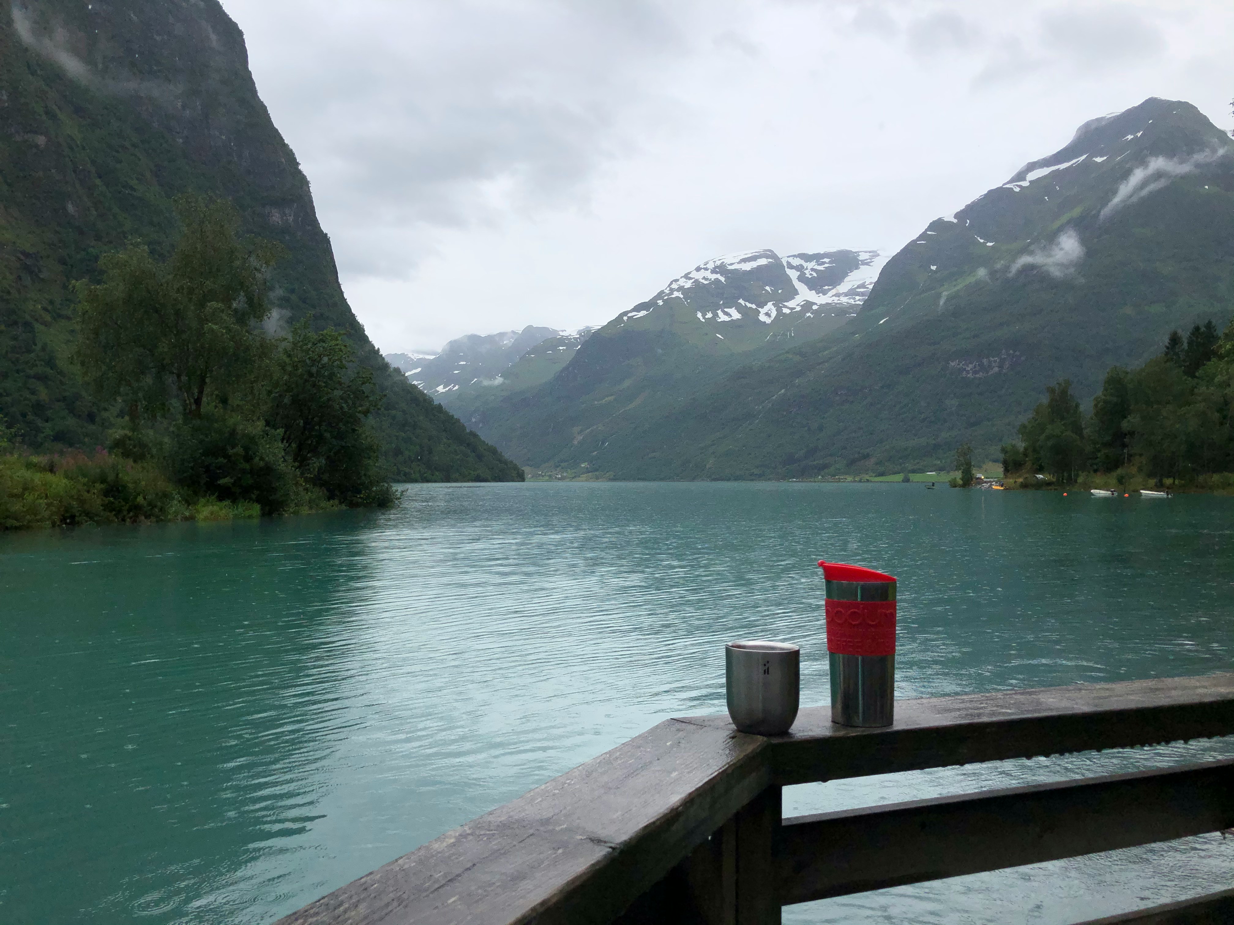
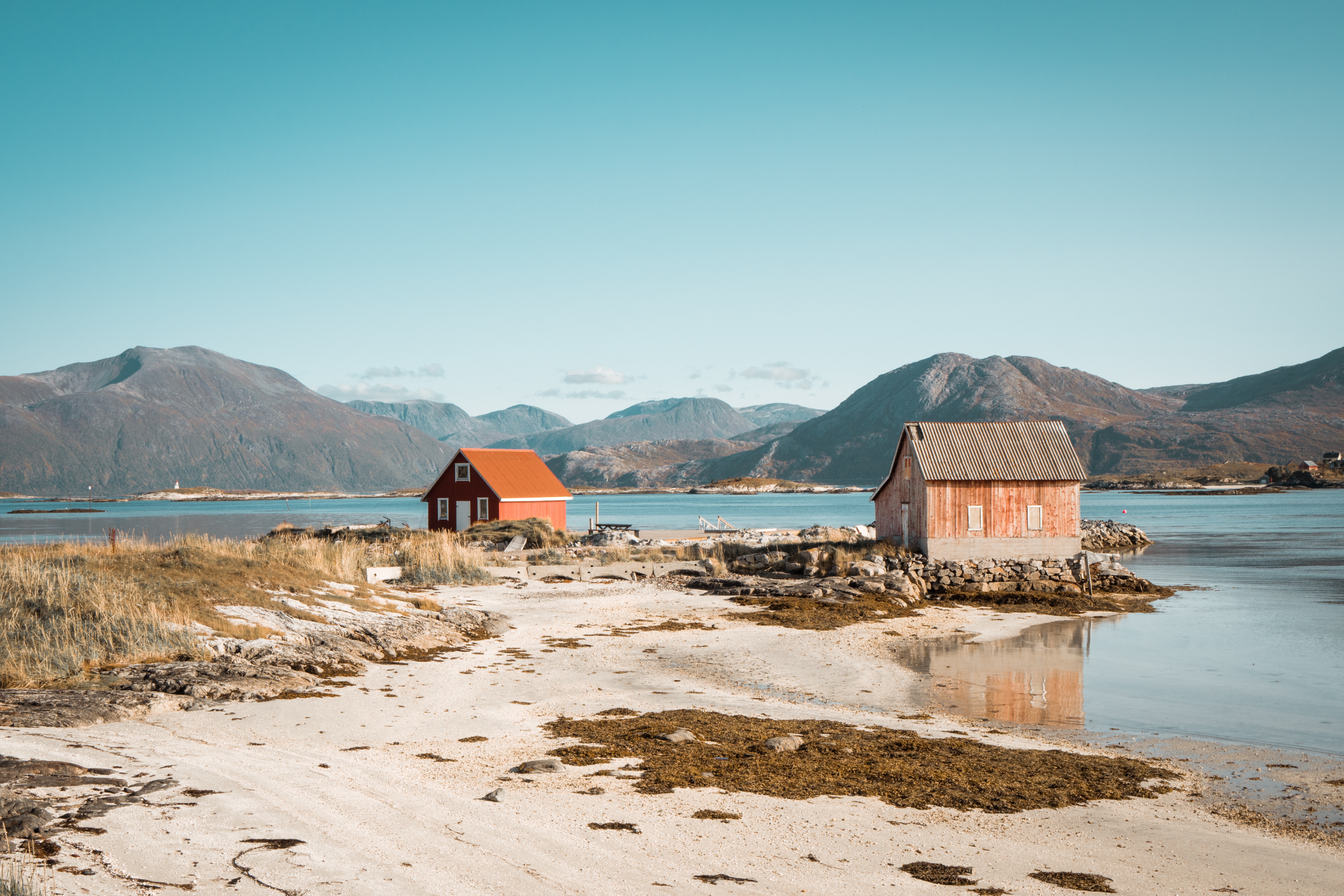
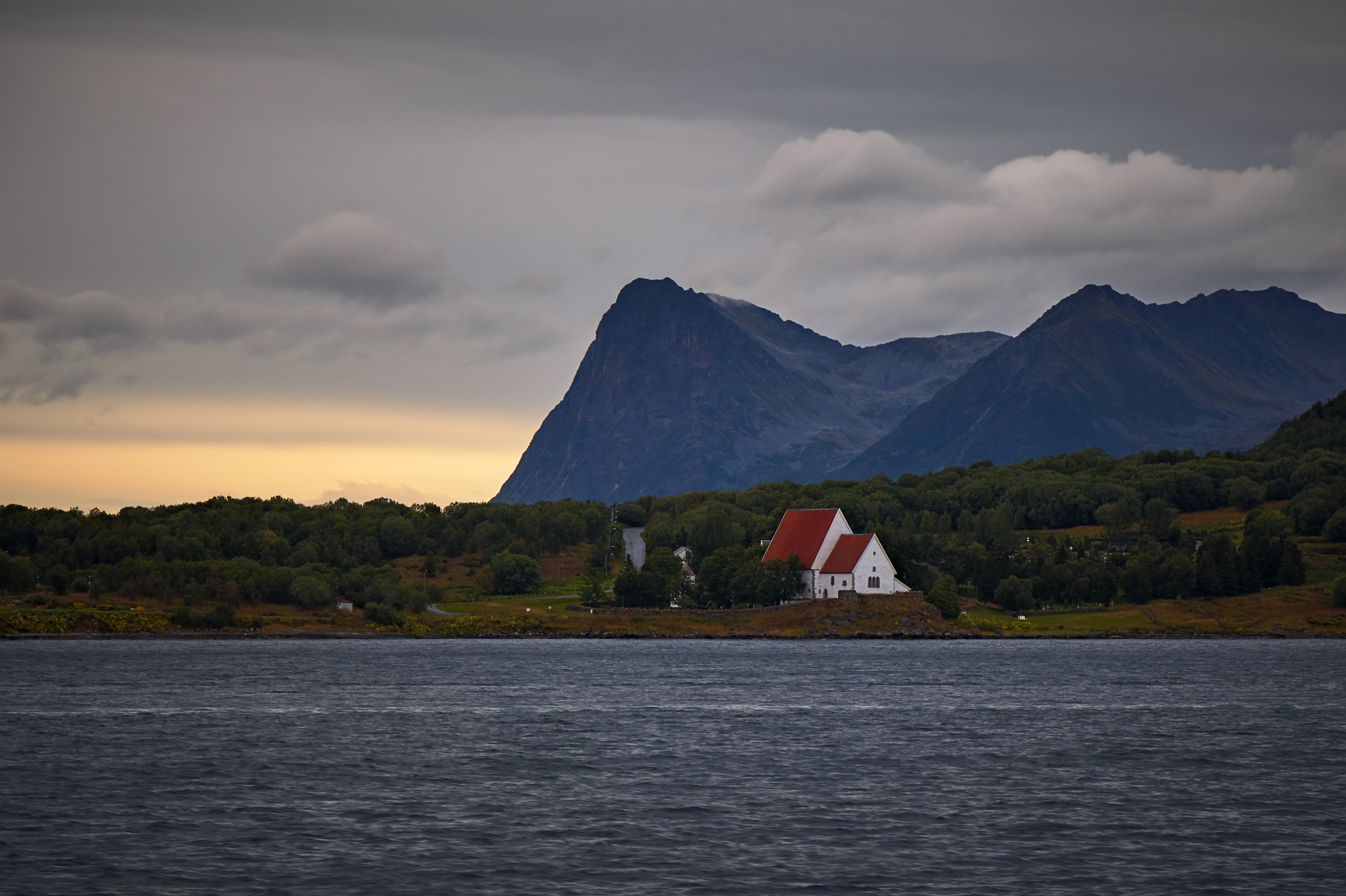
About Rosendal
About Olden
See the aqua blue ice of the Jostedal Glacier cascading down the stunning Oldedalen Valley, as you navigate the spindly fjords of Norway. Feel your breath catching in your throat, as you sail into this world of wonder, and the dramatic fjord scenery and interlocking valleys inspire you. The village of Olden opens up some of Norway's most majestic natural wonders, from the glacier - which is mainland Europe's largest - to the sloshing waterfalls that run off it, and the bowing forests that sway all around it. A visit to picturesque Olden is all thrilling panoramas and hikes through wildflower sprinkled trails. The Briksdalsbreen arm of ice, reaches out from the main glacier, and sits around an hour's stroll from the village of Olden itself - regular busses can also take you there. Snaking through steep-sided valleys, you can enjoy a walk close to the foot of the ice, and feel the spray of the waterfalls that plummet nearby, as you breathe in some of the freshest air you’ve ever tasted. The crisp glacial meltwater is so clean and pure that it’s bottled up to be sold across Norway.
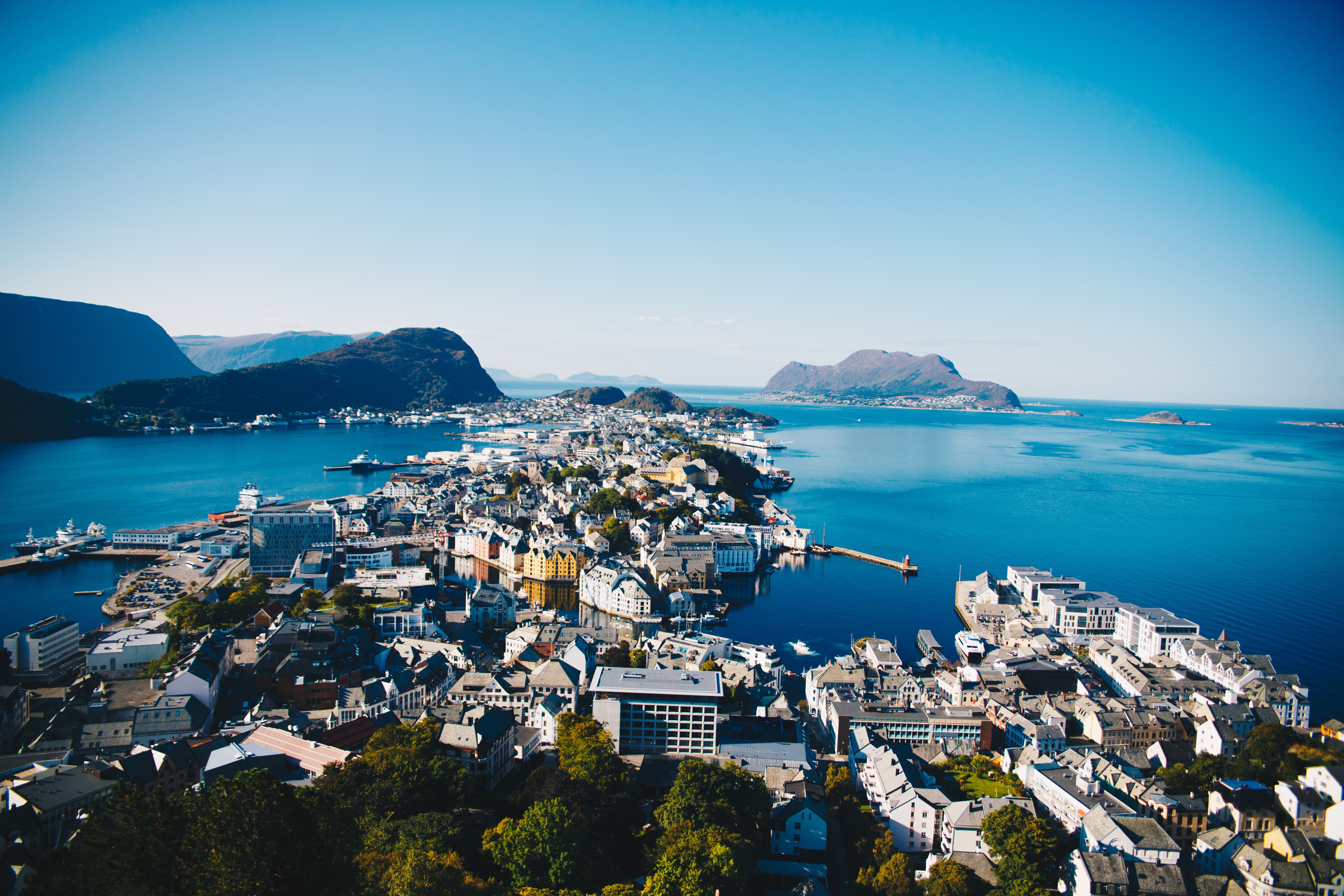
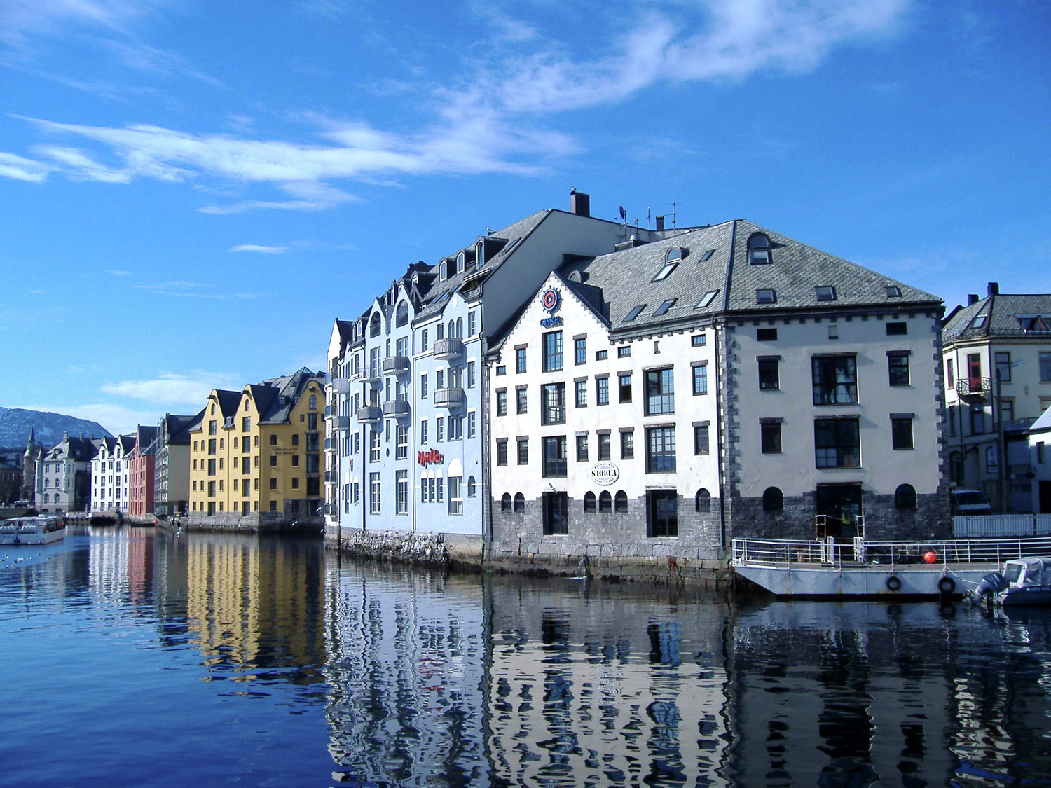
About Ålesund
The coastal town of Ålesund is the commercial capital of the Møre og Romsdal district. But more important, it is noted for its characteristic Jugendstil (Art Nouveau) buildings, which some claim make Ålesund one of the most beautiful towns in Norway. This Art Nouveau style emerged when the town was completely rebuilt after a devastating fire in 1904 destroyed nearly 800 buildings and left 10,000 residents homeless. It is said that the fire started by a tipped oil lamp. Rebuilding was carried out with the help of many young, foreign architects who added their own flourishes to the architectural blend of German Jugendstil and Viking roots. Today, narrow streets are crammed with buildings topped with turrets, spires and gables that bear decorations of dragonheads and curlicues. As one of the few remaining Art Nouveau towns in the world, in 1998 Ålesund was awarded the coveted Houens National Memorial Prize for the preservation of its unique architecture.

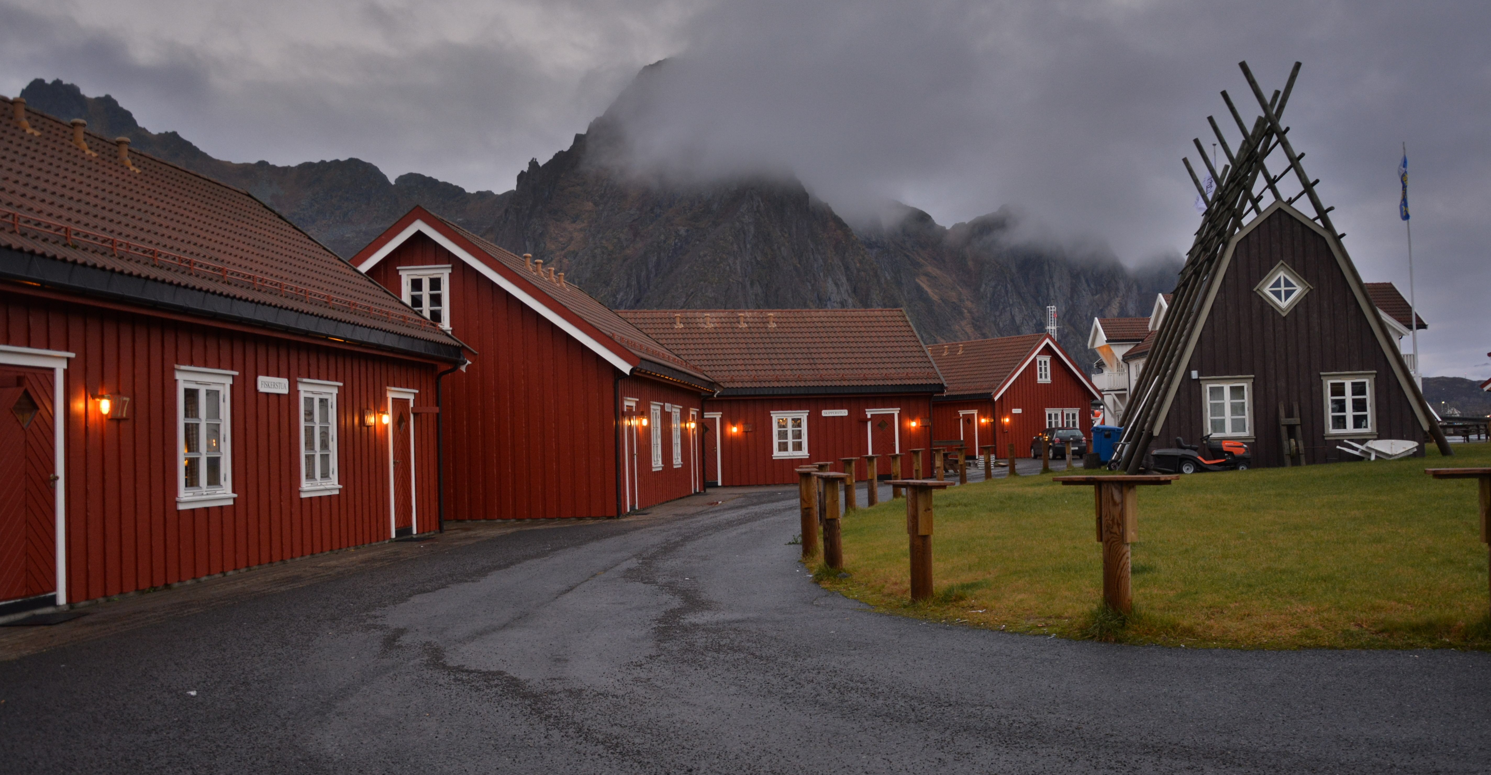
About Svolvær
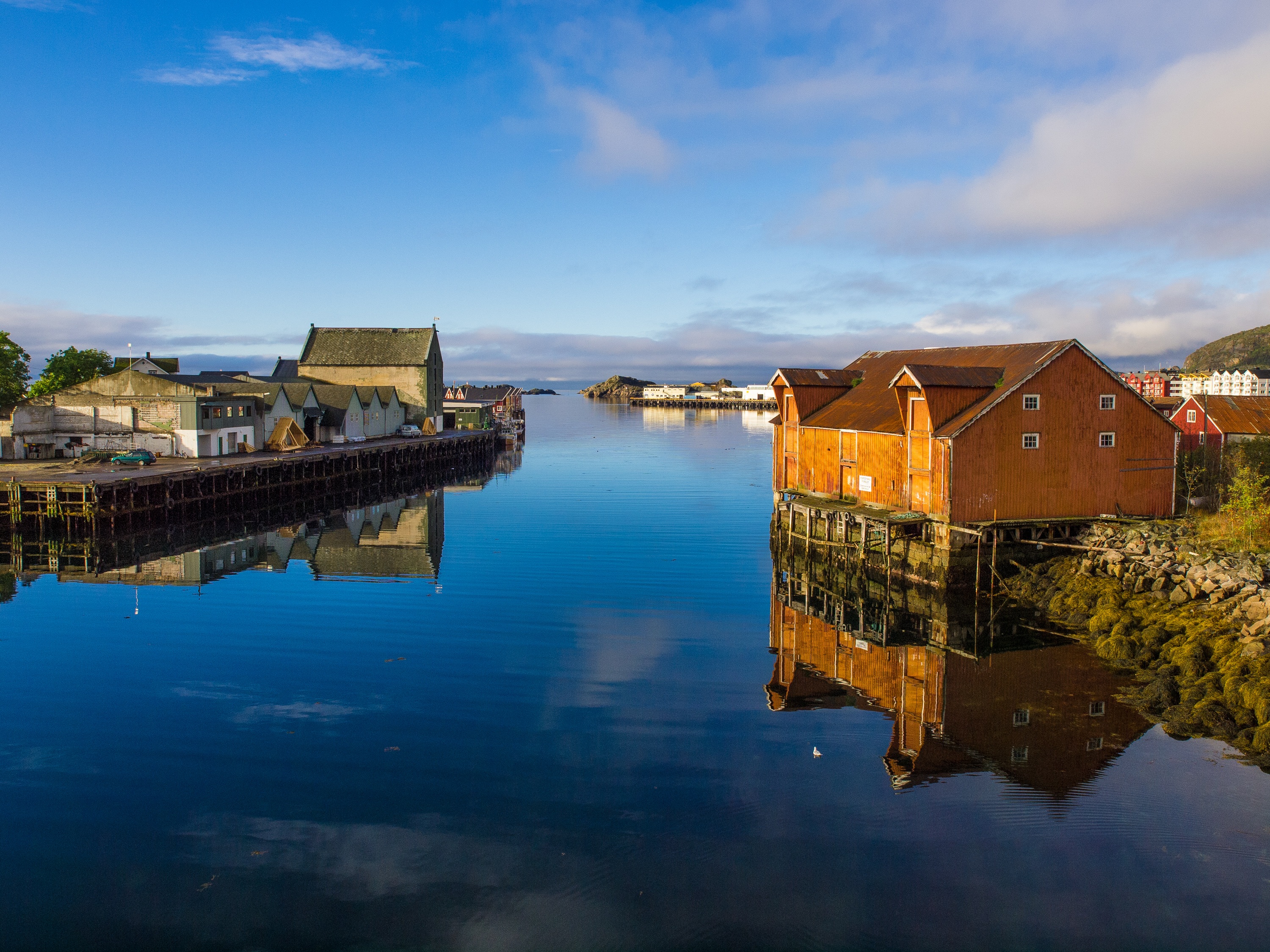
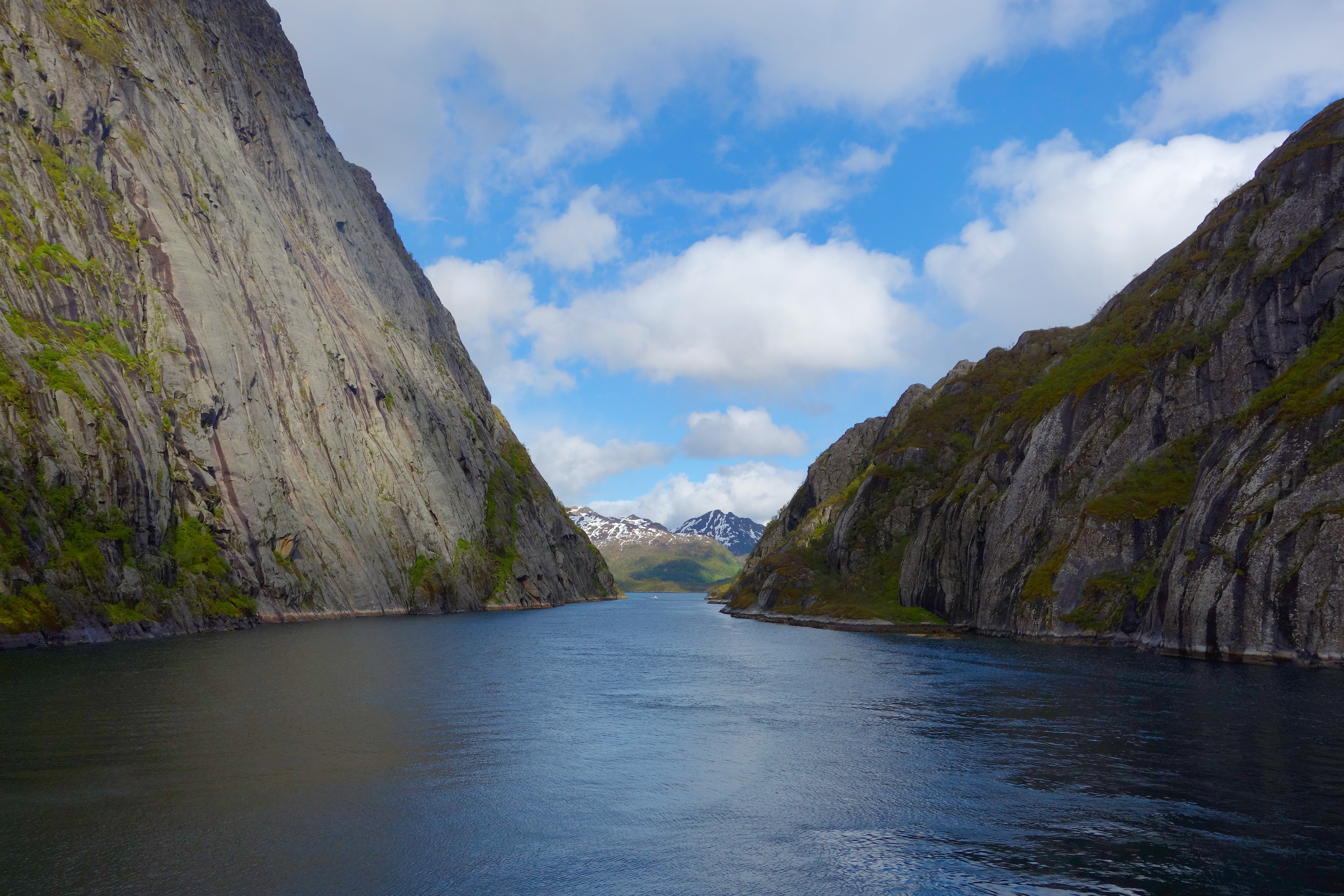
About Trollfjord
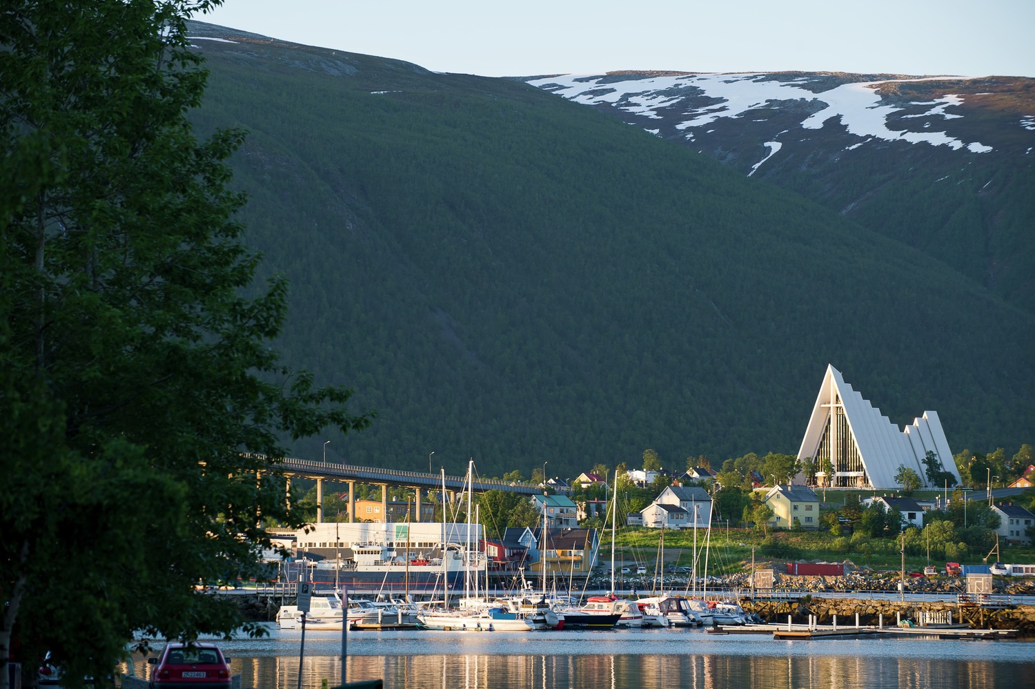
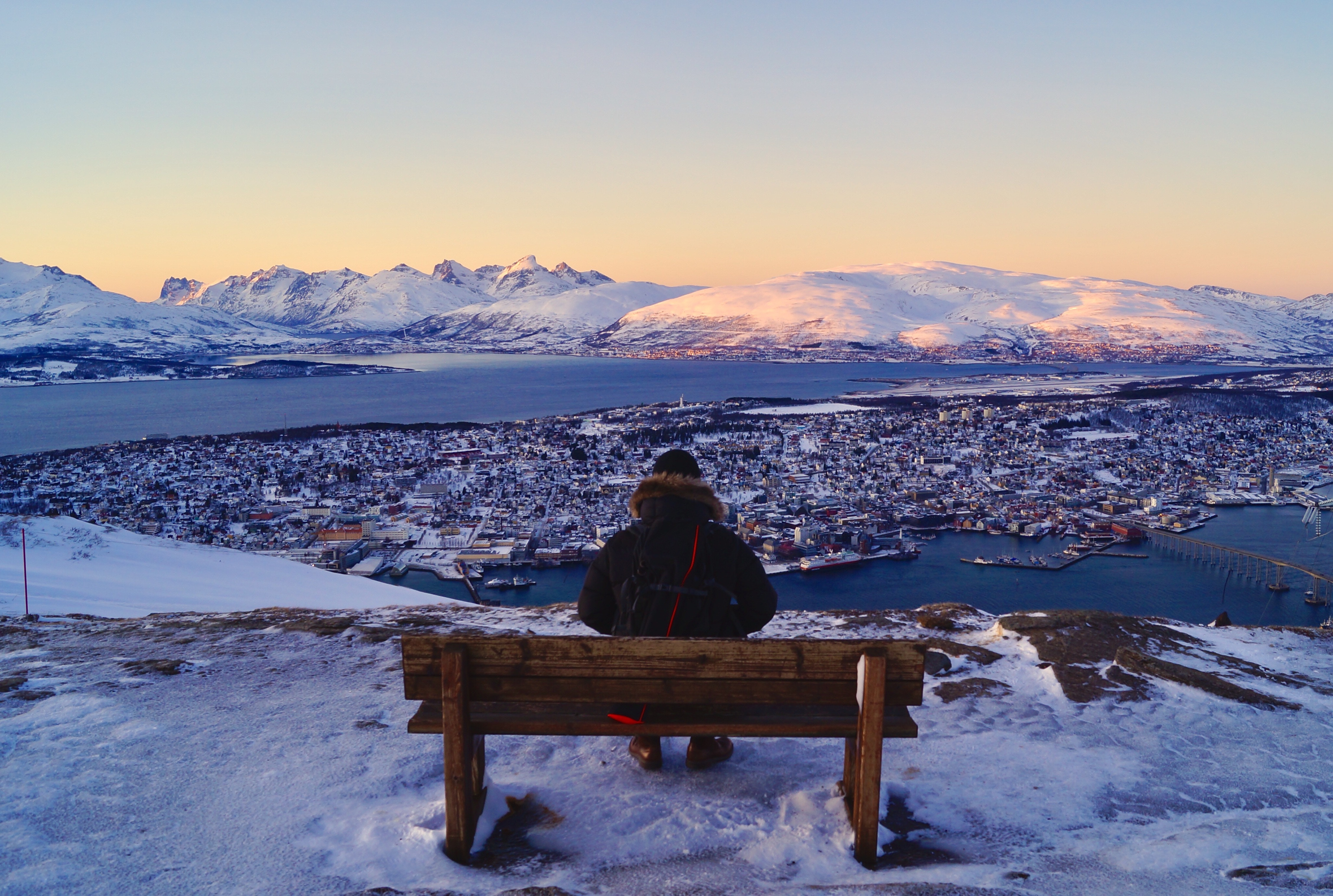
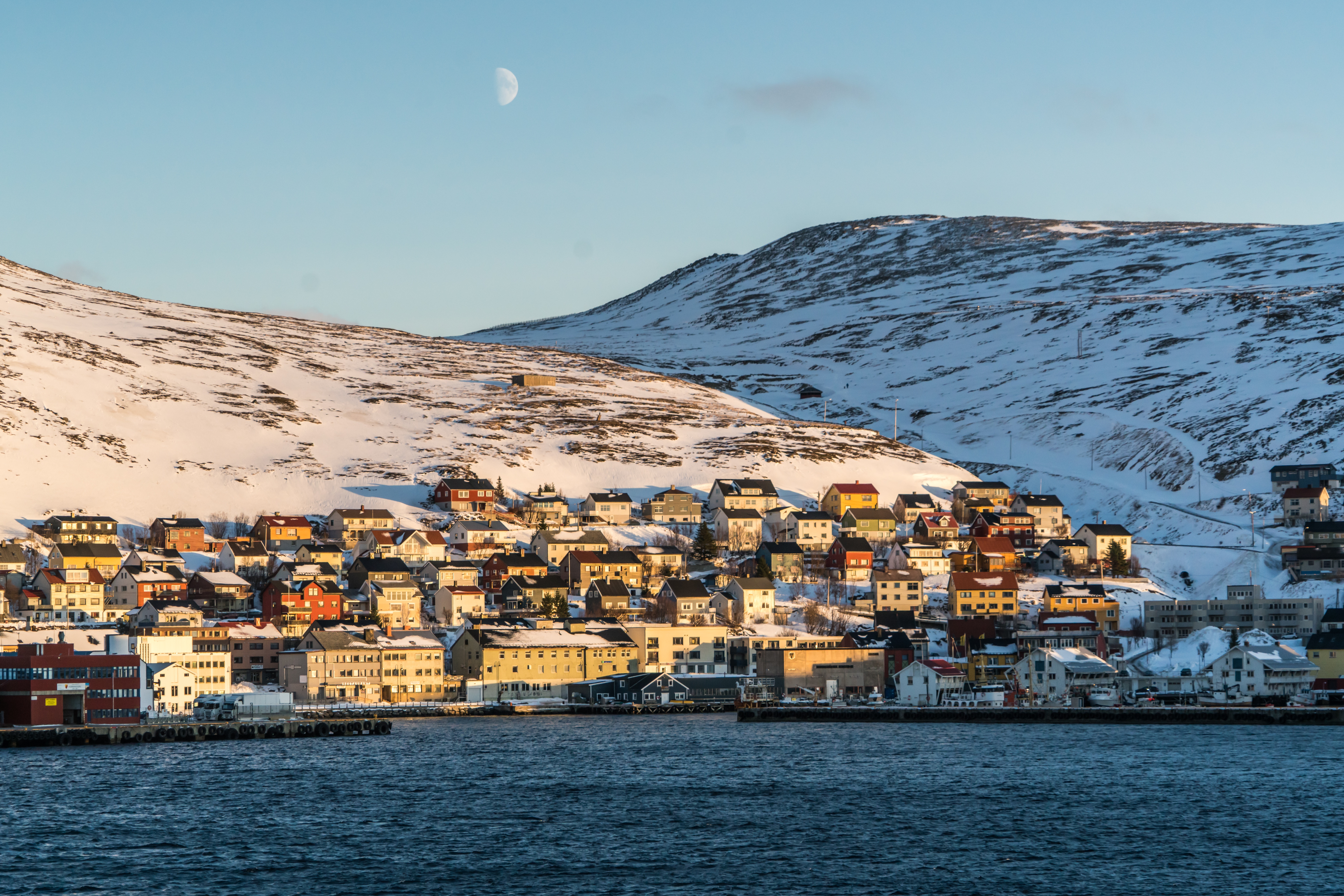
About Tromsø
With its centre located on the island of Tromsø, the municipality of Tromsø is more than five times the size of Norway’s capital, Oslo, and is the world’s northernmost university city. Lying 200 miles inside the Arctic Circle, it is known as the 'Gateway to the Arctic' because it was used as a starting point for hunters looking for Arctic foxes, polar bears and seals. In the 19th century it was a base for explorers on Arctic expeditions – a history that is remembered in the city’s Polar Museum, which you can visit on an excursion. Also commemorated in the area is the history of Norway’s indigenous people, the Sami. Visitors can learn about the traditions, heritage and modern preservation of the Sami culture at the Tromsø Museum. Nowadays, Tromsø is a charming mix of old and new, with wooden buildings sitting alongside contemporary architecture such as the impressive glacier-like Arctic Cathedral, which features one of the largest stained glass windows in Europe. Looking down on the city is Mount Storsteinen, and a cable car runs to the top, giving wonderful views over the surrounding countryside of forested peaks and reindeer pastures.
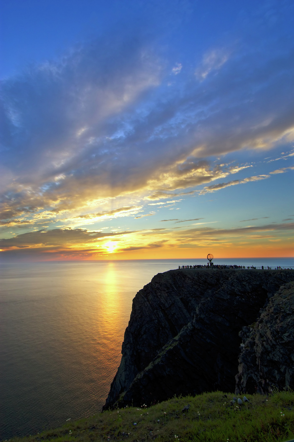
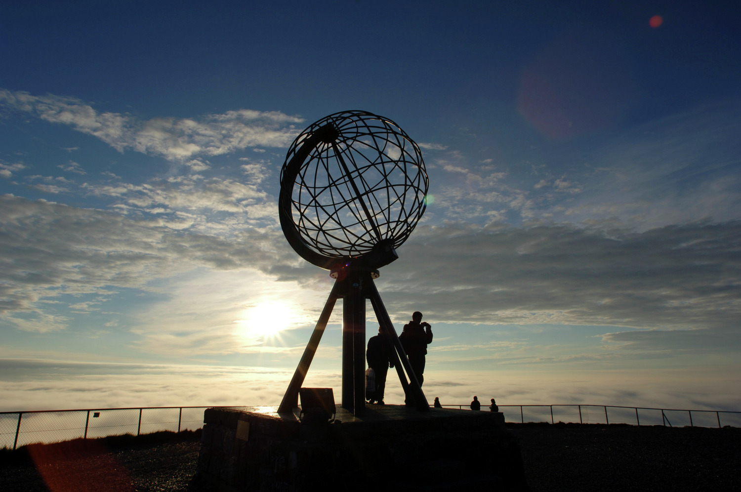
About Honningsvåg
Searching in 1553 for a northeast passage to India, British navigator Richard Chancellor came upon a crag 307 yards above the Barents Sea. He named the jut of rock North Cape, or Nordkapp. Today Europe's northernmost point is a rite-of-passage journey for nearly all Scandinavians and many others. Most cruise passengers visit Nordkapp from Honningsvåg, a fishing village on Magerøya Island. The journey from Honningsvåg to Nordkapp covers about 35 km (22 miles) across a landscape characterized by rocky tundra and grazing reindeer, which are rounded up each spring by Sami herdsmen in boats. The herdsmen herd the reindeer across a mile-wide channel from their winter home on the mainland. Honningvåg's northerly location makes for long, dark winter nights and perpetually sun-filled summer days. The village serves as the gateway to Arctic exploration and the beautiful Nordkapp Plateau, a destination that calls to all visitors of this region. Most of those who journey to Nordkapp (North Cape), the northernmost tip of Europe, are in it for a taste of this unique, otherworldly, rugged yet delicate landscape. You'll see an incredible treeless tundra, with crumbling mountains and sparse dwarf plants. The subarctic environment is very vulnerable, so don't disturb the plants. Walk only on marked trails and don't remove stones, leave car marks, or make campfires. Because the roads are closed in winter, the only access is from the tiny fishing village of Skarsvåg via Sno-Cat, a thump-and-bump ride that's as unforgettable as the desolate view.
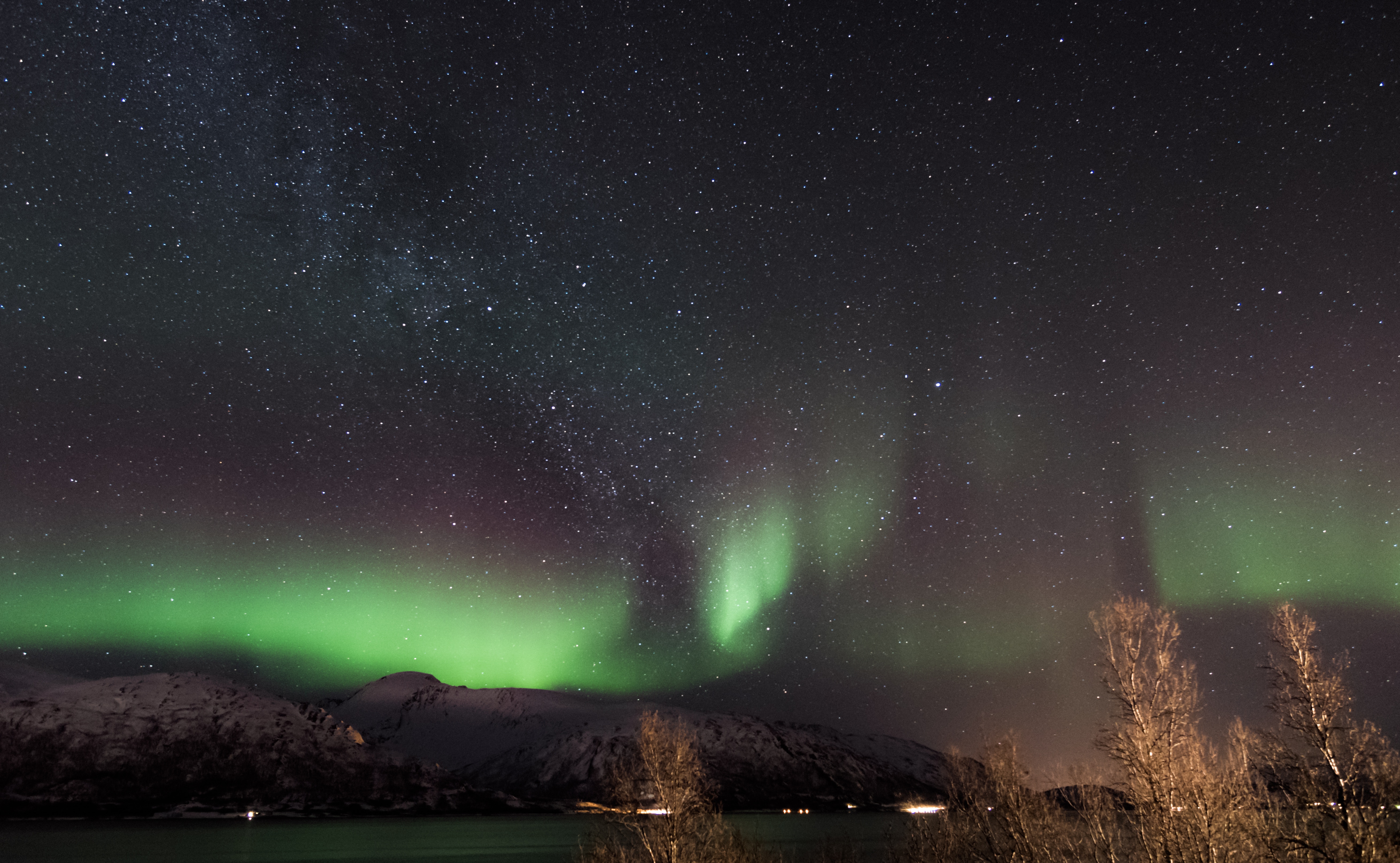
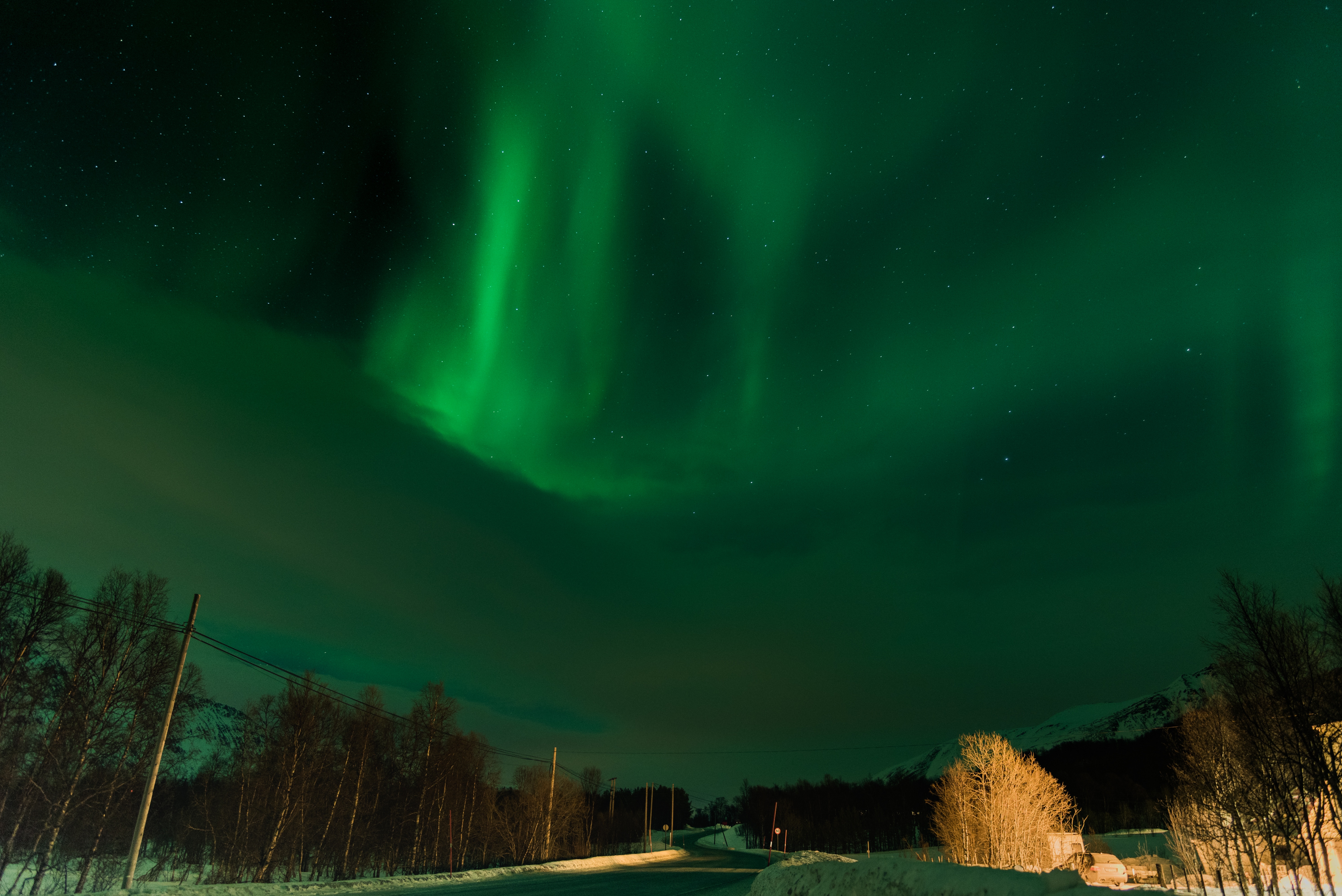
About Alta
People have been attracted to the community of Alta for thousands of years, and prehistoric rock carvings discovered in 1973 can be seen at the Alta Museum. Situated at the head of the Altafjord, it is a lush, green and hospitable shelter in the otherwise cold and windswept Finnmark landscape. Halfway between the grim, barren mountain plateau and the wet, stormy coast, Alta offers tree-clad valleys, pleasant temperatures and no more rain than the Sahara. However at 70 degrees North it is quite a different story in winter, when heavy snowfalls and sub-zero temperatures are the order of the day, and clear dark night skies become the arena for dazzling displays of the elusive Aurora Borealis, also referred to as 'the temperamental lady' by Laplanders. The world’s first Northern Lights Observatory, which played an important role in the development of geophysical and meteorological research during the first half of the 20th century, is located just 12 miles from Alta. Perched atop Haldde Mountain, it towers almost 3,000 feet above Kafjord, where the battleship Tirpitz was based during the Second World War.
About Harstad
About Bodø
The capital of Nordland is a peaceful city, but beneath the surface lies a fascinating and colourful military past. During the Cold War it was an important NATO base, stationing fighter jets to intercept Soviet naval vessels and aircraft. The situation culminated when Premier Kruschev threatened to destroy Bodø with nuclear weapons after a CIA U-2 spy plane bound for the city was shot down over the Soviet Union. You can learn more about the city's Cold War history at the Norwegian Aviation Museum, which is uniquely designed to resemble a biplane and houses an intact U-2 plane, a Spitfire, a rare Hønningstad C-5 polar seaplane and many other interesting exhibits. As well as its military heritage, Bodø boasts the world's strongest maelstrom at Saltstraumen, which attracts a host of visitors every year.
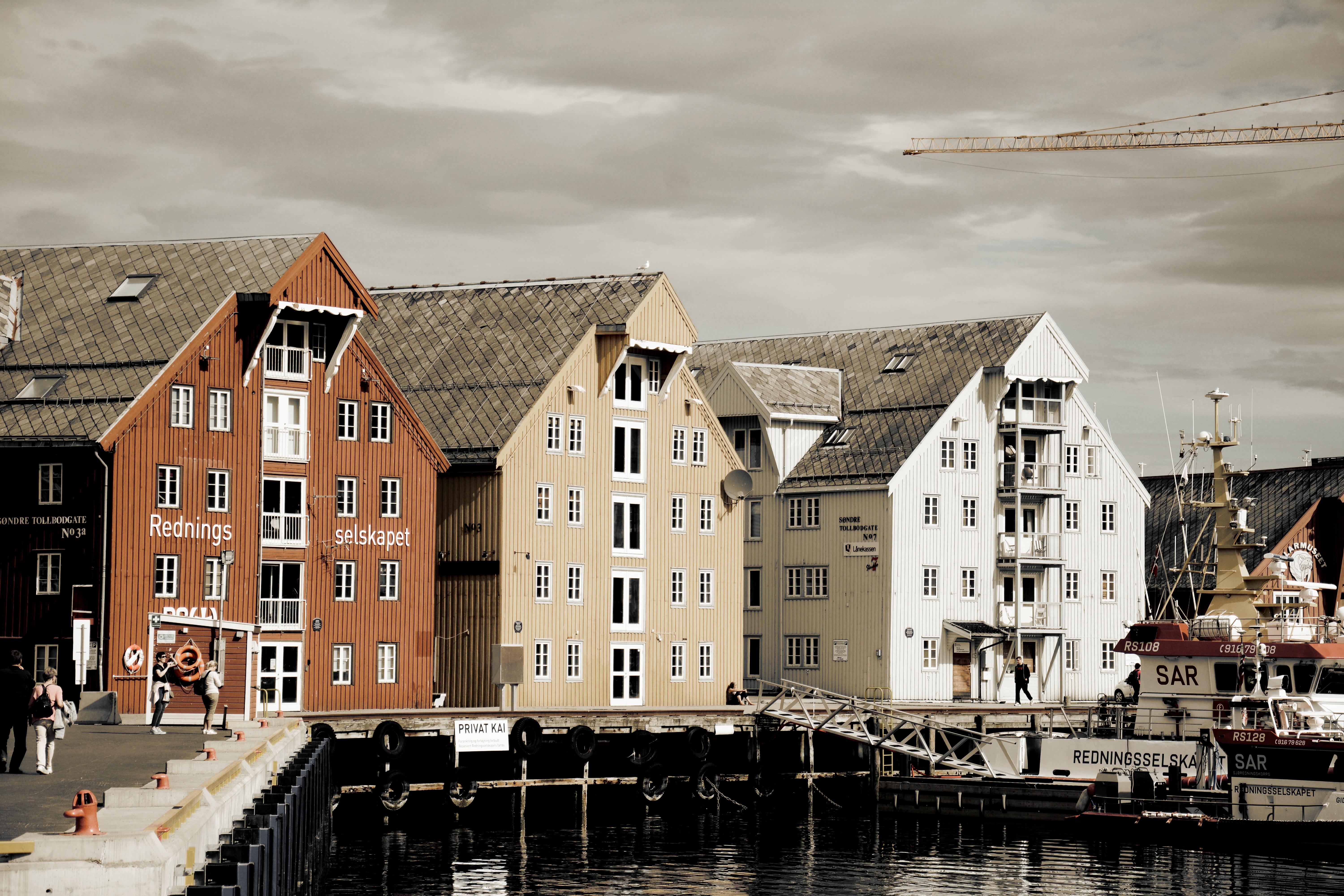
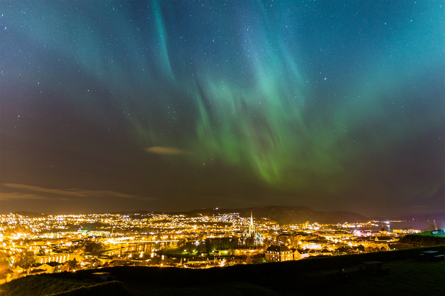
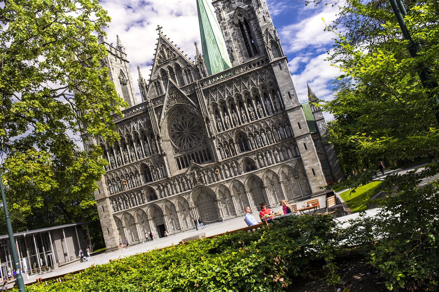
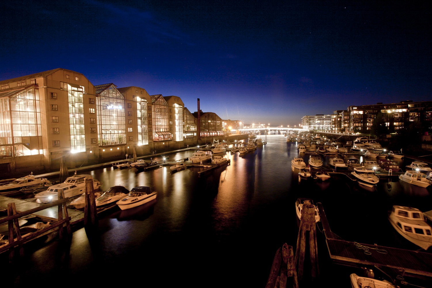
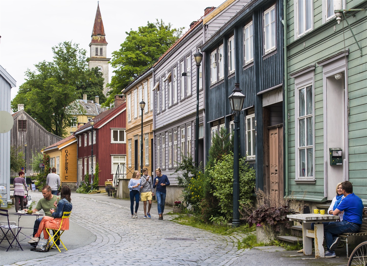
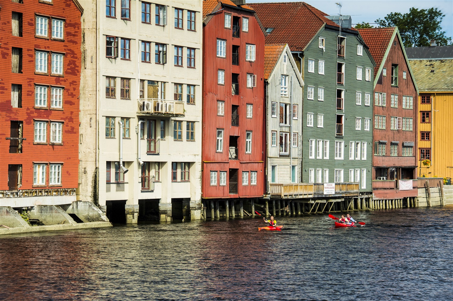
About Trondheim
One of Scandinavia's oldest cities, Trondheim was the first capital of Norway, from AD 997 to 1380. Founded in 997 by Viking king Olav Tryggvason, it was first named Nidaros (still the name of the cathedral), a composite word referring to the city's location at the mouth of the Nidelva River. Today, it's Central Norway's largest (and Norway's third largest) city, with a population of 150,000. The wide streets of the historic city center remain lined with brightly painted wood houses and striking warehouses. But it's no historic relic: it's also the home to NTNU (Norwegian University of Science and Technology) and is Norway's technological capital.
About Kristiansand
Nicknamed "Sommerbyen" ("Summer City"), Norway's fifth-largest city has 78,000 inhabitants. Norwegians come here for its sun-soaked beaches and beautiful harbor. Kristiansand has also become known internationally for the outdoor Quart Festival, which hosts local and international rock bands every July. According to legend, in 1641 King Christian IV marked the four corners of Kristiansand with his walking stick, and within that framework the grid of wide streets was laid down. The center of town, called the Kvadraturen, still retains the grid, even after numerous fires. In the northeast corner is Posebyen, one of northern Europe's largest collections of low, connected wooden house settlements, and there's a market here every Saturday in summer. Kristiansand's Fisketorvet (fish market) is near the south corner of the town's grid, right on the sea.
About Arendal
You’ll weave between glowing lighthouses and picturesque islands, as you approach the quaint Norwegian town of Arendal. Set on the southern coast, and spanning seven islands, Arendal is a place to slow the pace, and unwind surrounded by Norway’s easy-going beauty. Ferries – and boat hiring opportunities - make exploring easy, or you can get out on foot or two wheels to throw yourself into the thick of the area’s outstanding natural beauty. Arendal's twin lighthouses are the first thing you'll see, as your ship leaves the open ocean, and heads to Arendal itself. The perfect focal point for any photo, Store Torungen is still in working order - witness it flashing its warnings to passing ships, as they navigate the tricky islands and skerries that are scattered across the waters. Cafes and shell-fish sellers welcome you to the city centre as you step off the ship, and you’re immediately well placed to slow the pace, and wander beside glistening water. Or, why not stretch your legs by escaping to the countryside and cycling along wooden pathways that skirt glistening lakes?


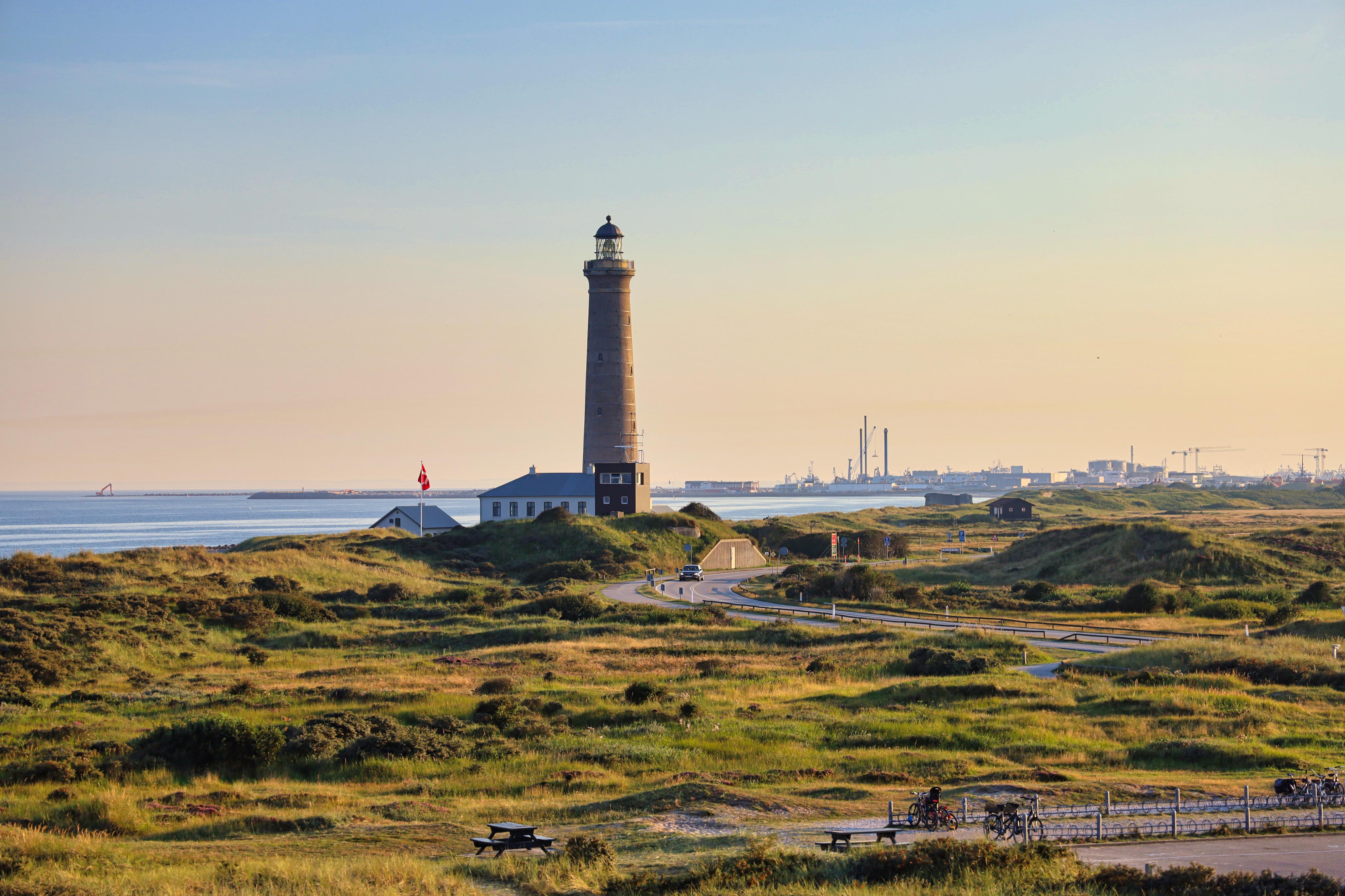
About Skagen
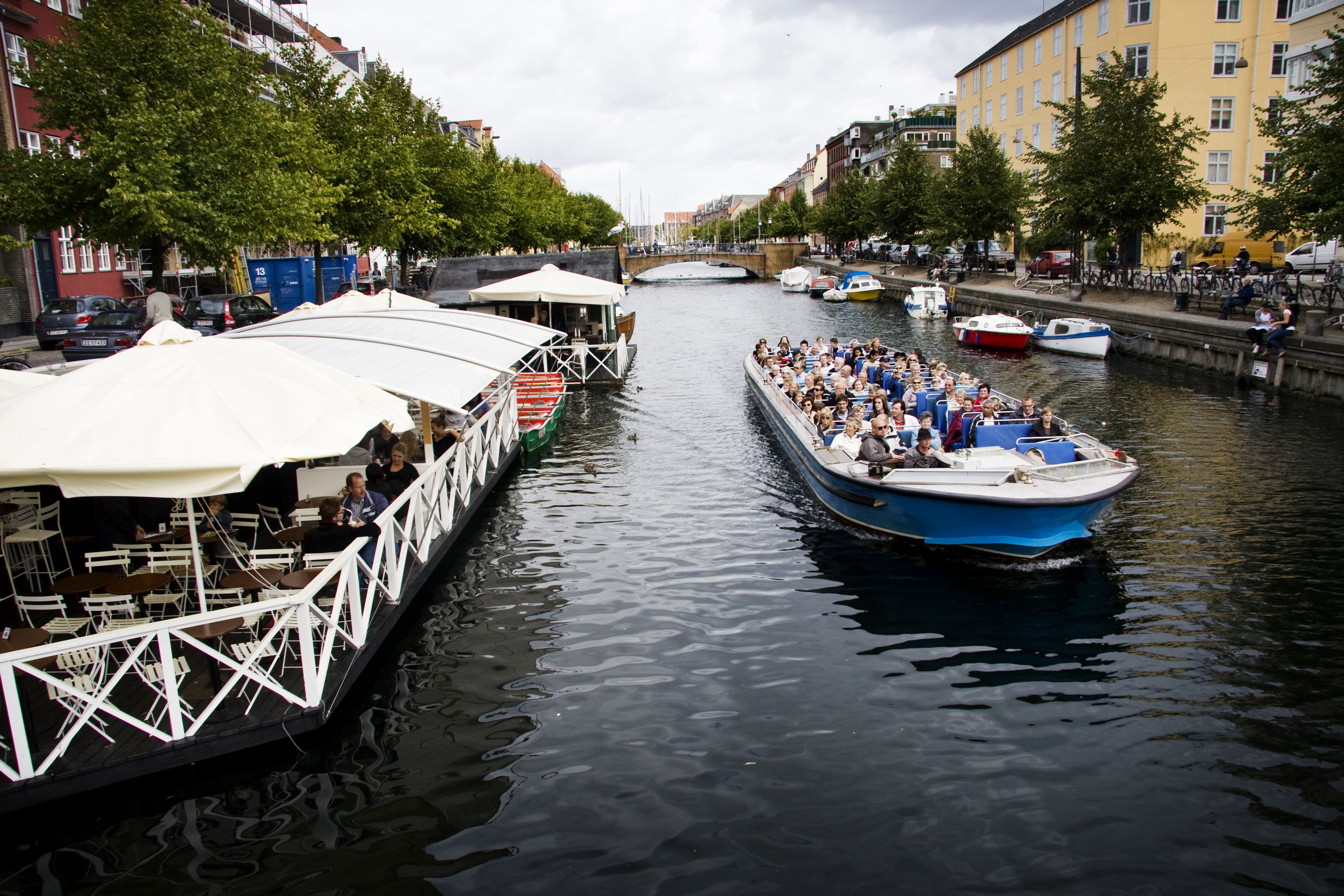
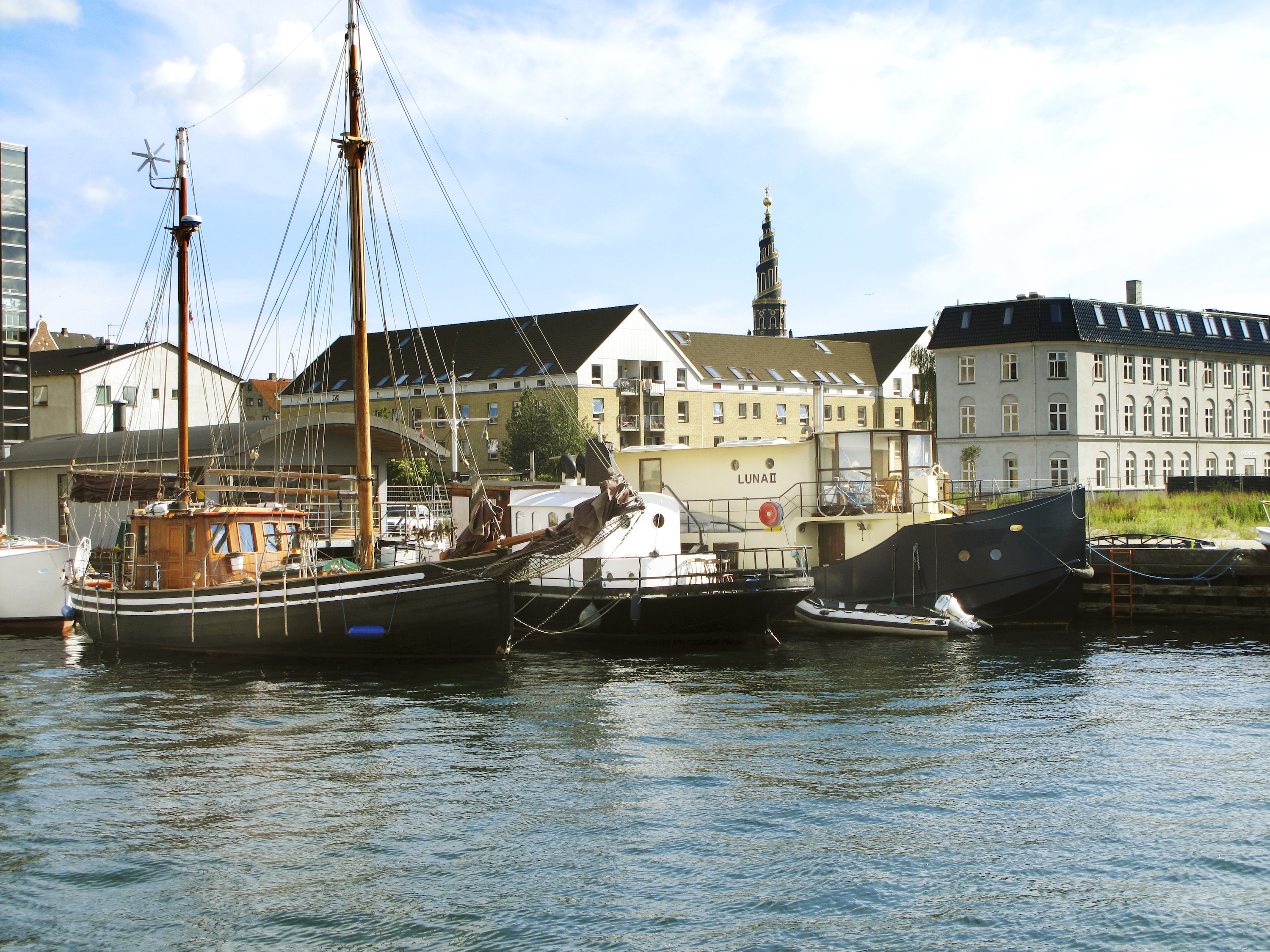
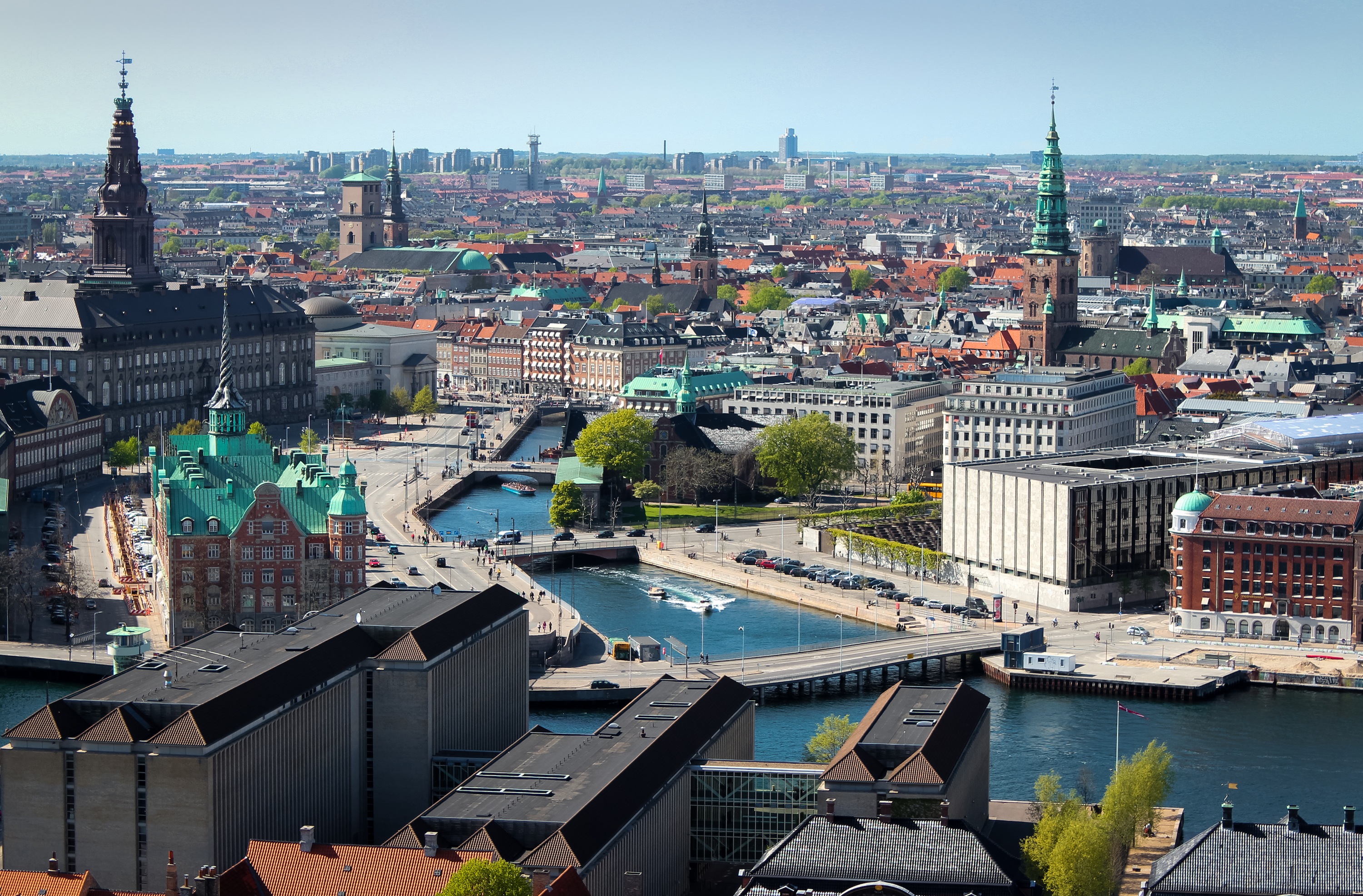
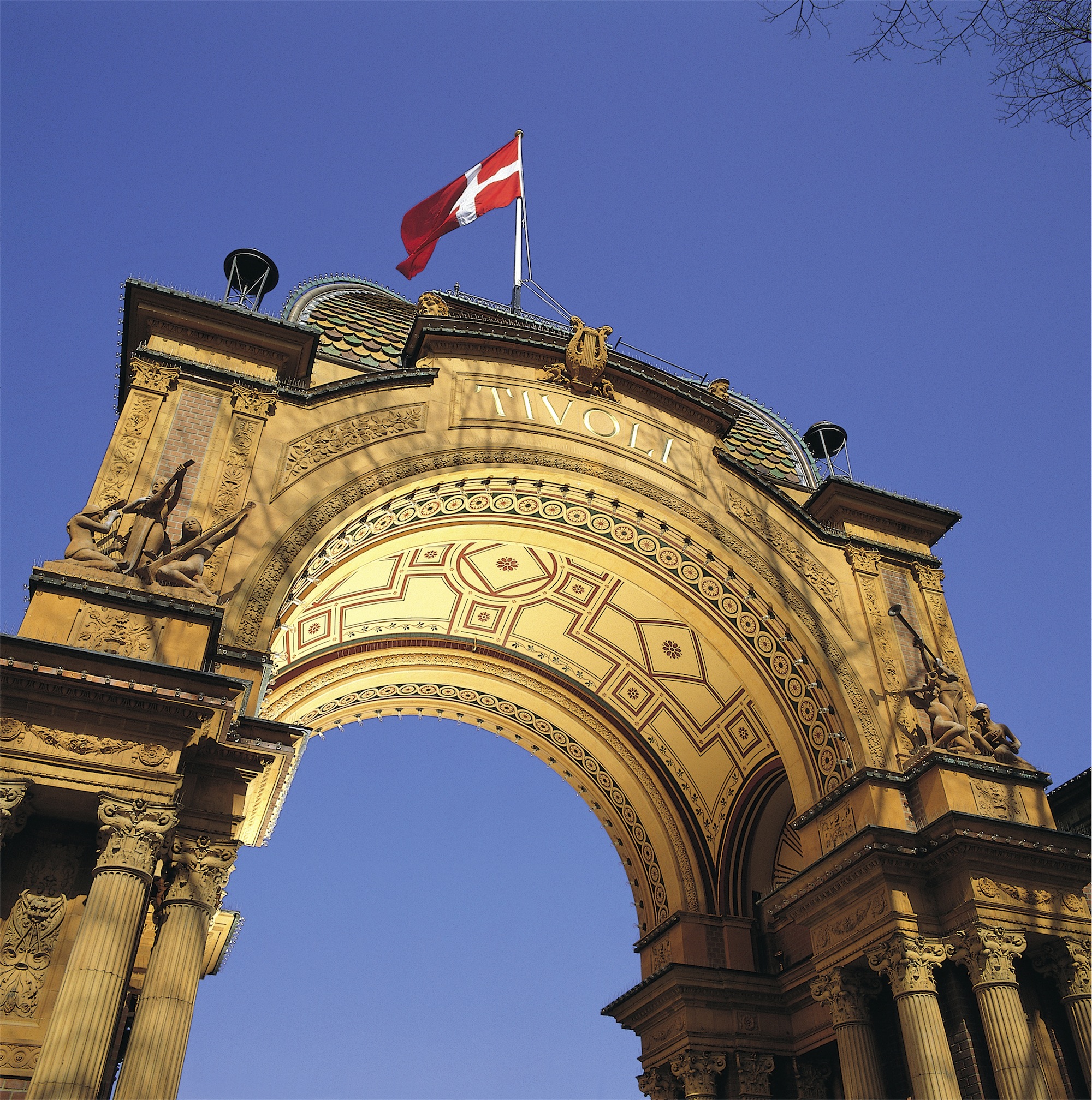
About Copenhagen
By the 11th century, Copenhagen was already an important trading and fishing centre and today you will find an attractive city which, although the largest in Scandinavia, has managed to retain its low-level skyline. Discover some of the famous attractions including Gefion Fountain and Amalienborg Palace, perhaps cruise the city’s waterways, visit Rosenborg Castle or explore the medieval fishing village of Dragoer. Once the home of Hans Christian Andersen, Copenhagen features many reminders of its fairytale heritage and lives up to the reputation immortalised in the famous song ‘Wonderful Copenhagen’.
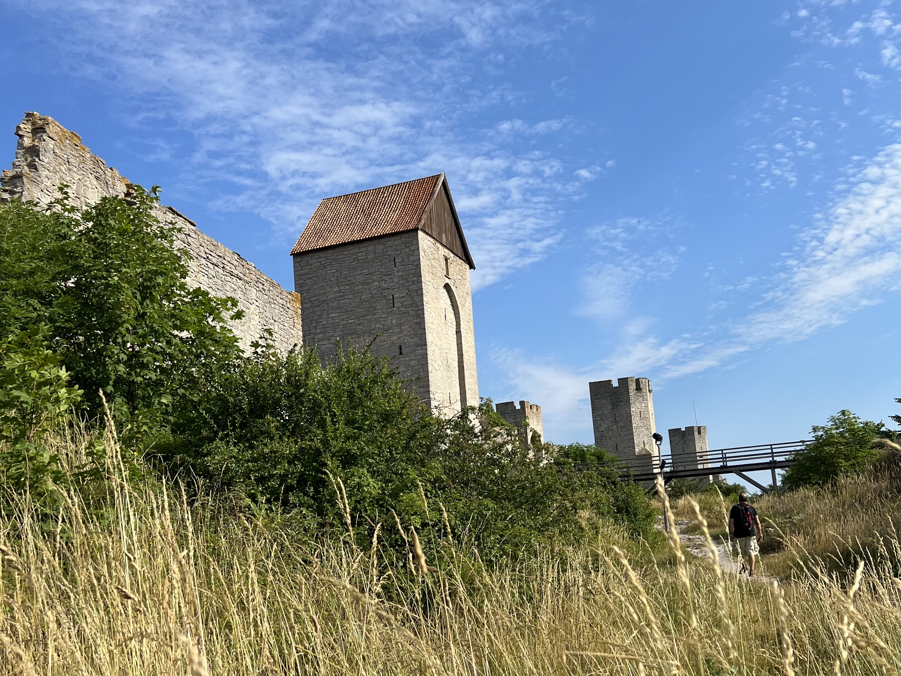
About Visby
Gotland is Sweden's main holiday island, a place of ancient history, a relaxed summer-party vibe, wide sandy beaches, and wild cliff formations called raukar (the remnants of reefs formed more than 400 million years ago). Measuring 125 km (78 miles) long and 52 km (32 miles) at its widest point, Gotland is where Swedish sheep farming has its home. In its charming glades, 35 varieties of wild orchids thrive, attracting botanists from all over the world.
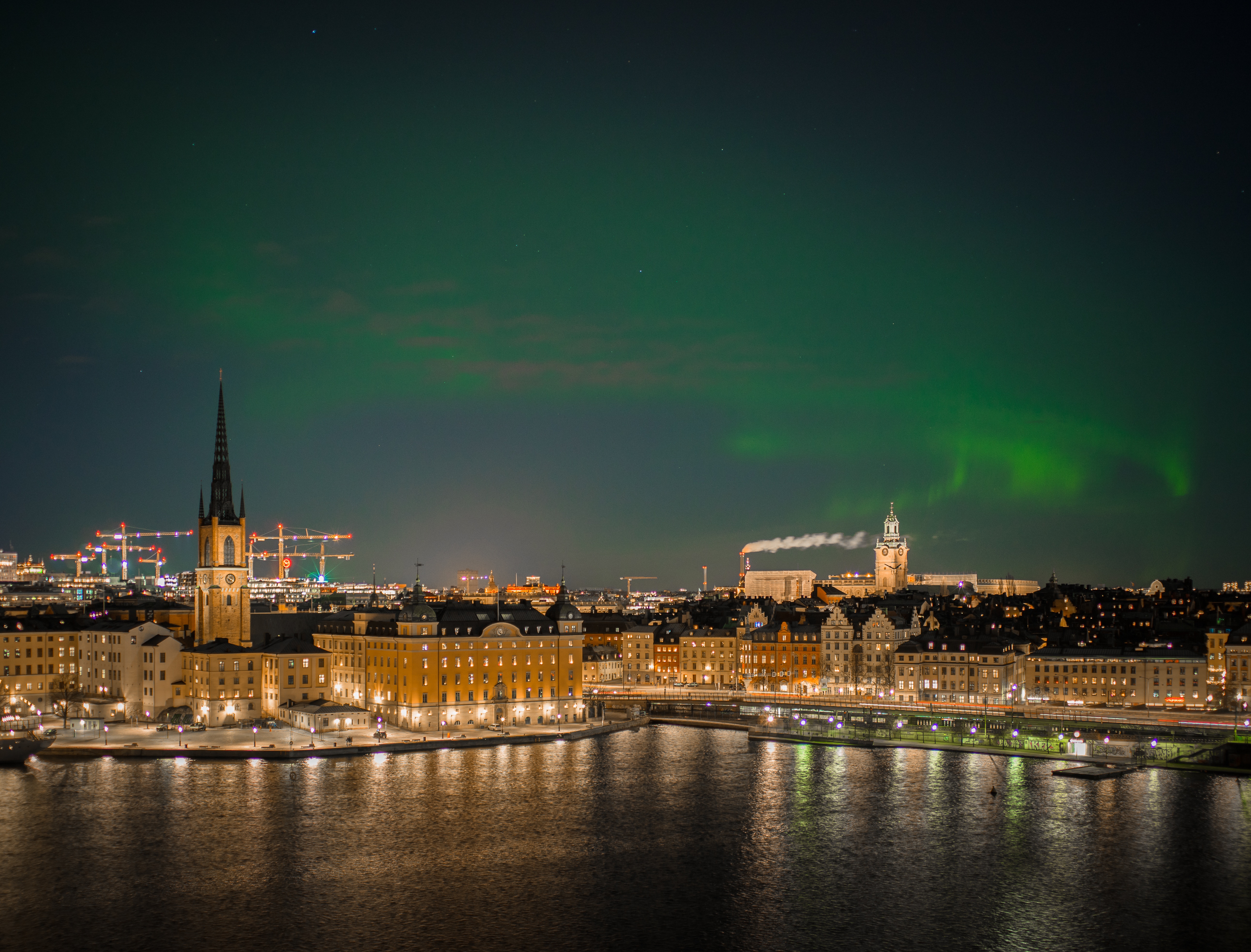
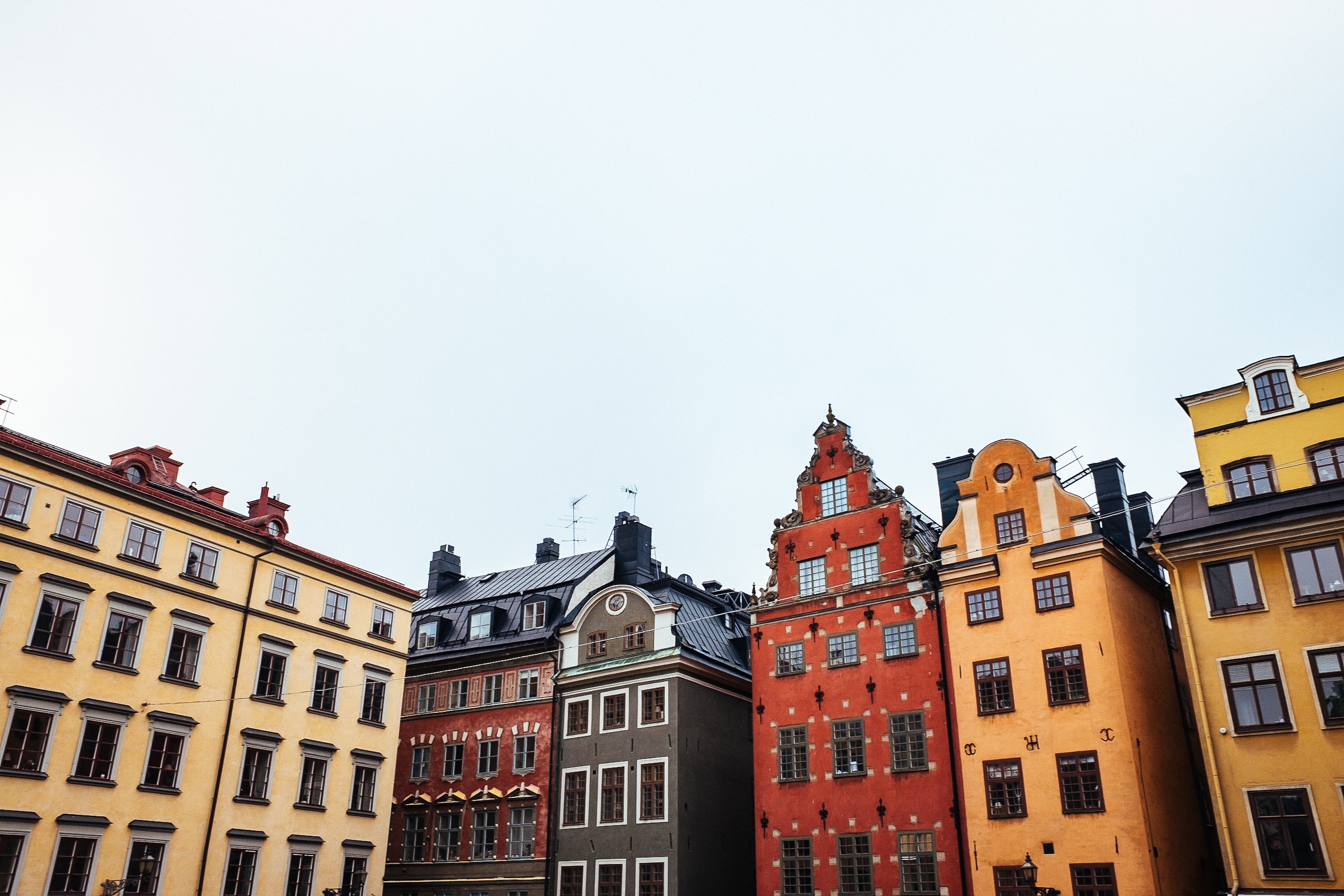
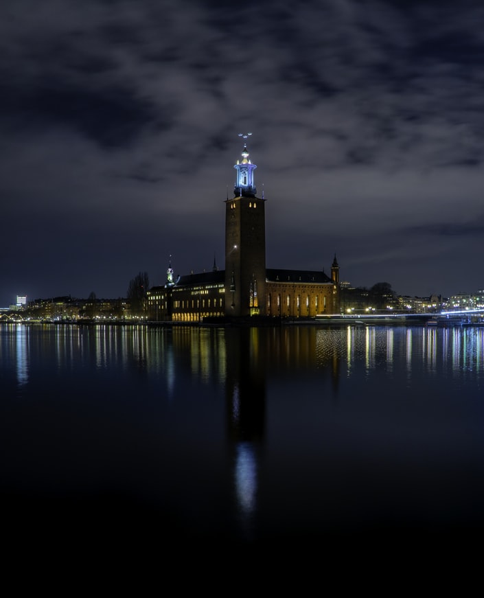
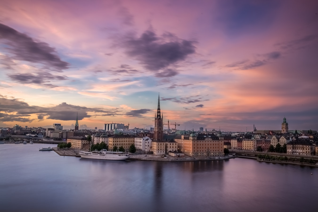
About Stockholm
Stockholm is a city in the flush of its second youth. Since the mid-1990s, Sweden's capital has emerged from its cold, Nordic shadow to take the stage as a truly international city. What started with entry into the European Union in 1995 gained pace with the extraordinary IT boom of the late 1990s, strengthened with the Skype-led IT second wave of 2003, and solidified with the hedge-fund invasion that is still happening today as Stockholm gains even more global confidence. And despite more recent economic turmoil, Stockholm's 1 million or so inhabitants have, almost as one, realized that their city is one to rival Paris, London, New York, or any other great metropolis.With this realization comes change. Stockholm has become a city of design, fashion, innovation, technology, and world-class food, pairing homegrown talent with an international outlook. The streets are flowing with a young and confident population keen to drink in everything the city has to offer. The glittering feeling of optimism, success, and living in the here and now is rampant in Stockholm.Stockholm also has plenty of history. Positioned where the waters of Lake Mälaren rush into the Baltic, it’s been an important trading site and a wealthy international city for centuries. Built on 14 islands joined by bridges crossing open bays and narrow channels, Stockholm boasts the story of its history in its glorious medieval old town, grand palaces, ancient churches, sturdy edifices, public parks, and 19th-century museums—its history is soaked into the very fabric of its airy boulevards, built as a public display of trading glory.
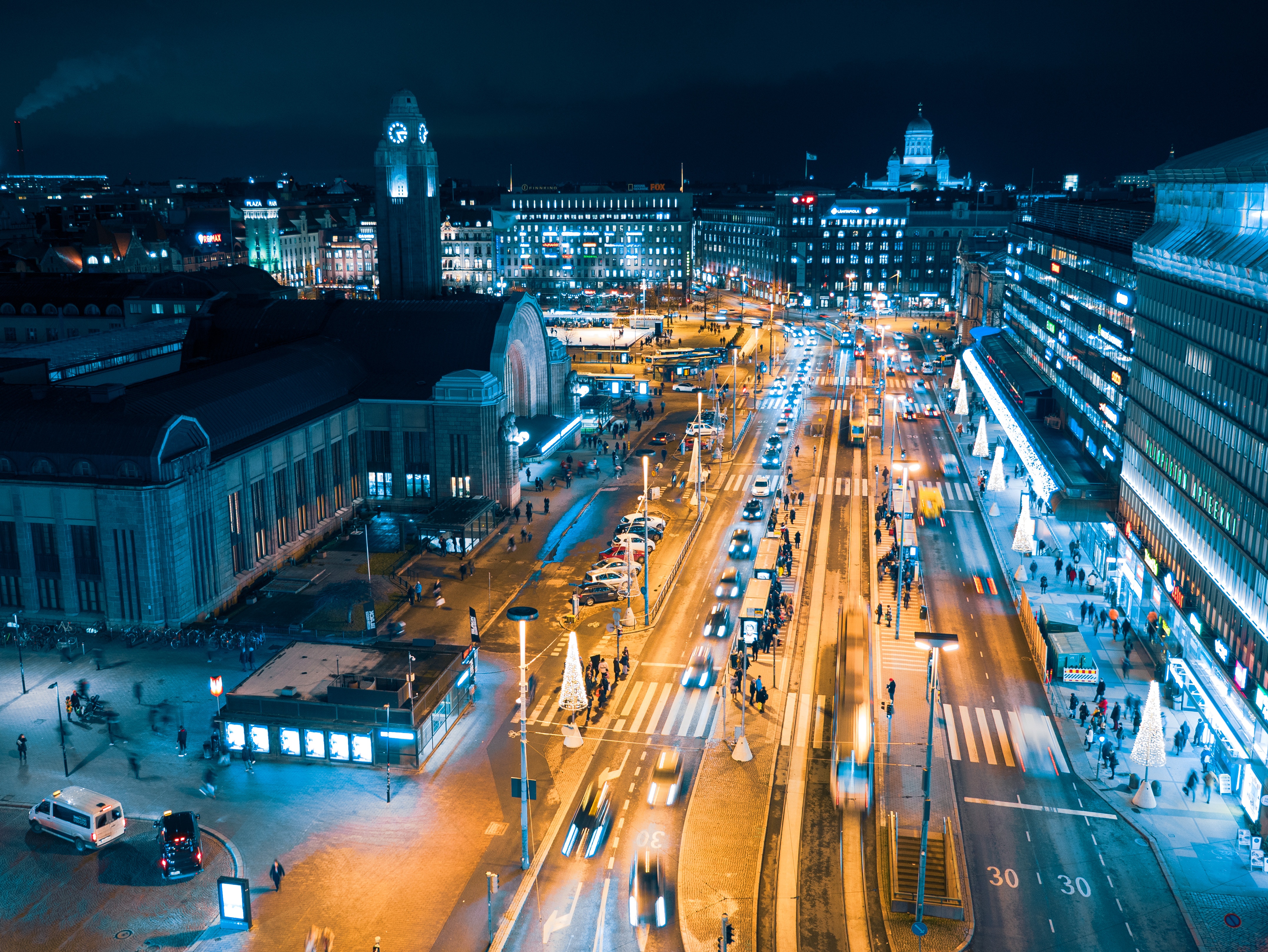
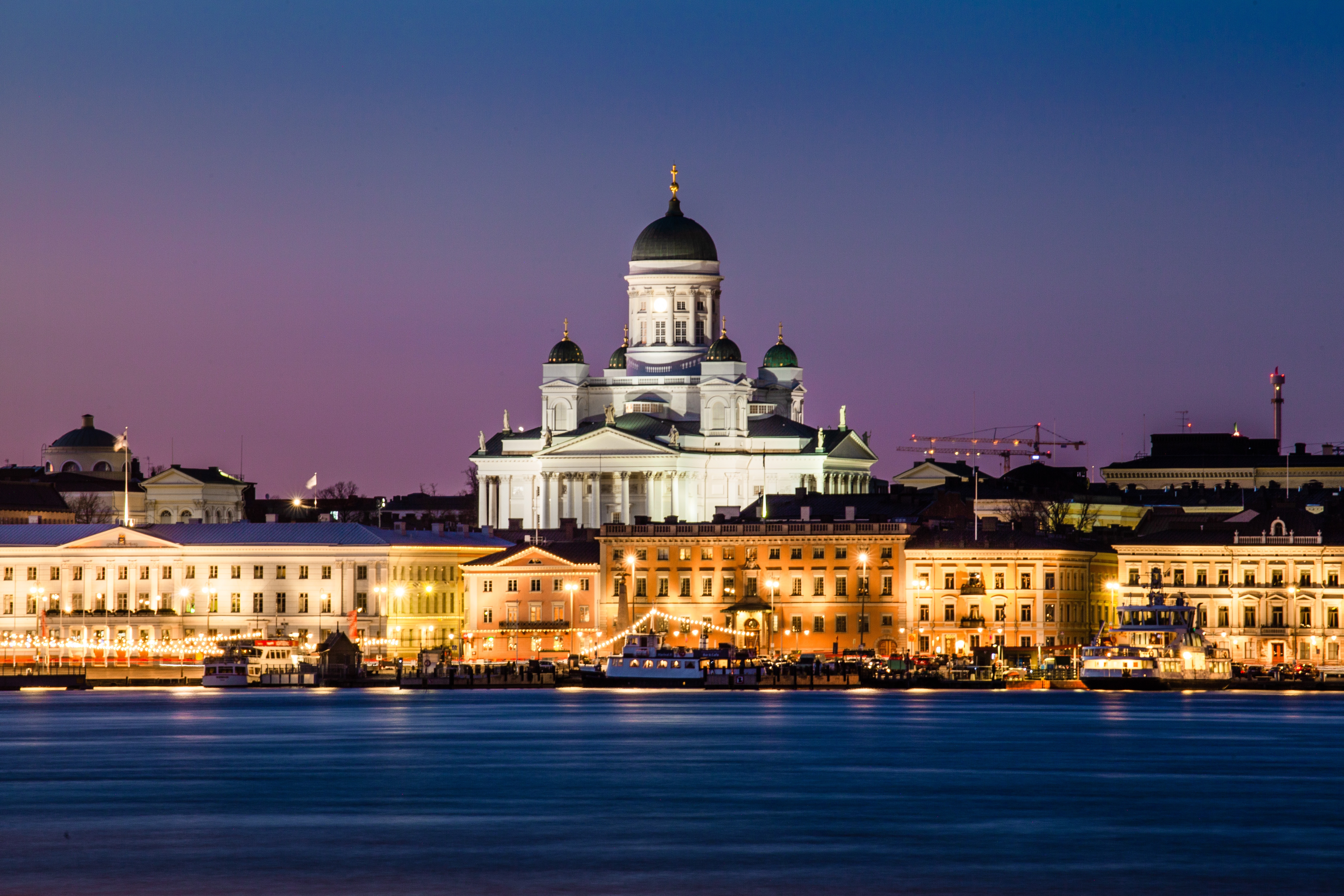
About Helsinki
A city of the sea, Helsinki was built along a series of oddly shaped peninsulas and islands jutting into the Baltic coast along the Gulf of Finland. Streets and avenues curve around bays, bridges reach to nearby islands, and ferries ply among offshore islands.Having grown dramatically since World War II, Helsinki now absorbs more than one-tenth of the Finnish population. The metro area covers 764 square km (474 square miles) and 315 islands. Most sights, hotels, and restaurants cluster on one peninsula, forming a compact central hub. The greater Helsinki metropolitan area, which includes Espoo and Vantaa, has a total population of more than a million people.Helsinki is a relatively young city compared with other European capitals. In the 16th century, King Gustav Vasa of Sweden decided to woo trade from the Estonian city of Tallinn and thus challenge the Hanseatic League's monopoly on Baltic trade. Accordingly, he commanded the people of four Finnish towns to pack up their belongings and relocate to the rapids on the River Vantaa. The new town, founded on June 12, 1550, was named Helsinki.For three centuries, Helsinki (Helsingfors in Swedish) had its ups and downs as a trading town. Turku, to the west, remained Finland's capital and intellectual center. However, Helsinki's fortunes improved when Finland fell under Russian rule as an autonomous grand duchy. Czar Alexander I wanted Finland's political center closer to Russia and, in 1812, selected Helsinki as the new capital. Shortly afterward, Turku suffered a disastrous fire, forcing the university to move to Helsinki. The town's future was secure.Just before the czar's proclamation, a fire destroyed many of Helsinki's traditional wooden structures, precipitating the construction of new buildings suitable for a nation's capital. The German-born architect Carl Ludvig Engel was commissioned to rebuild the city, and as a result, Helsinki has some of the purest neoclassical architecture in the world. Add to this foundation the influence of Stockholm and St. Petersburg with the local inspiration of 20th-century Finnish design, and the result is a European capital city that is as architecturally eye-catching as it is distinct from other Scandinavian capitals. You are bound to discover endless engaging details—a grimacing gargoyle; a foursome of males supporting a balcony's weight on their shoulders; a building painted in striking colors with contrasting flowers in the windows. The city's 400 or so parks make it particularly inviting in summer.Today, Helsinki is still a meeting point of eastern and western Europe, which is reflected in its cosmopolitan image, the influx of Russians and Estonians, and generally multilingual population. Outdoor summer bars ("terrassit" as the locals call them) and cafés in the city center are perfect for people watching on a summer afternoon.
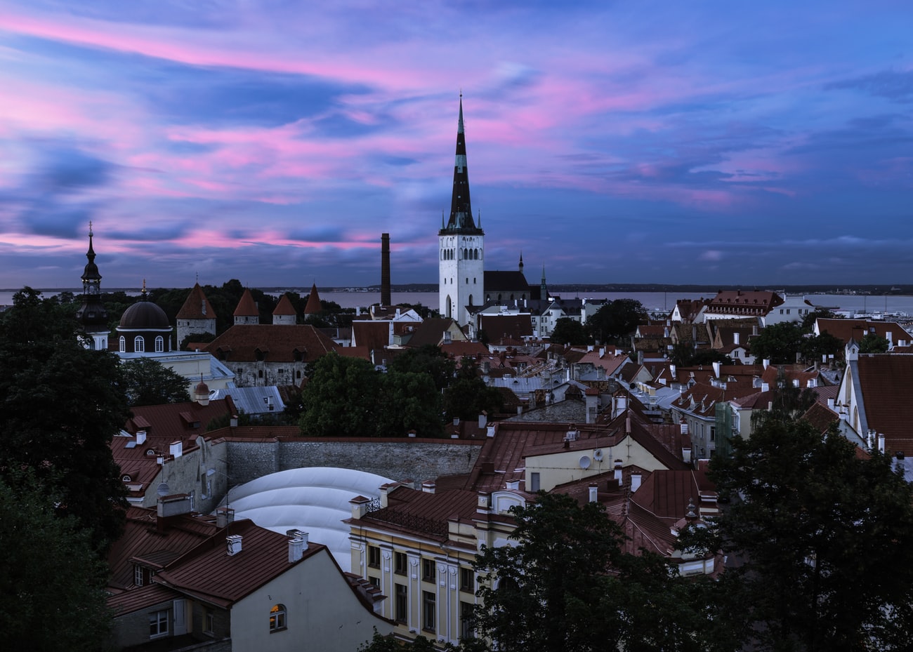
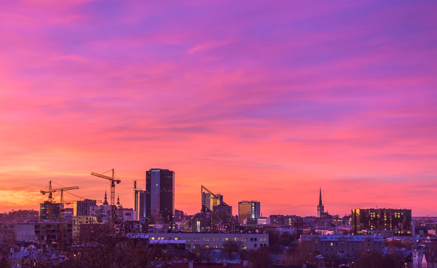
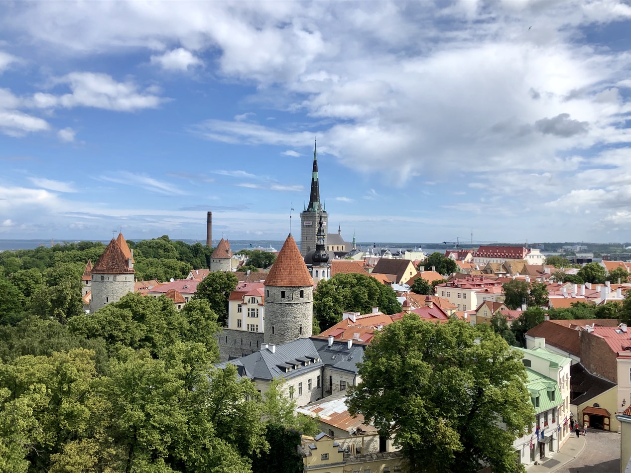
About Tallinn
Estonia's history is sprinkled liberally with long stretches of foreign domination, beginning in 1219 with the Danes, followed without interruption by the Germans, Swedes, and Russians. Only after World War I, with Russia in revolutionary wreckage, was Estonia able to declare its independence. Shortly before World War II, in 1940, that independence was usurped by the Soviets, who—save for a brief three-year occupation by Hitler's Nazis—proceeded to suppress all forms of national Estonian pride for the next 50 years. Estonia finally regained independence in 1991. In the early 1990s, Estonia's own Riigikogu (Parliament), not some other nation's puppet ruler, handed down from the Upper City reforms that forced Estonia to blaze its post-Soviet trail to the European Union. Estonia has been a member of the EU since 2004, and in 2011, the country and its growing economy joined the Eurozone. Tallinn was also named the European City of Culture in 2011, cementing its growing reputation as a cultural hot spot.
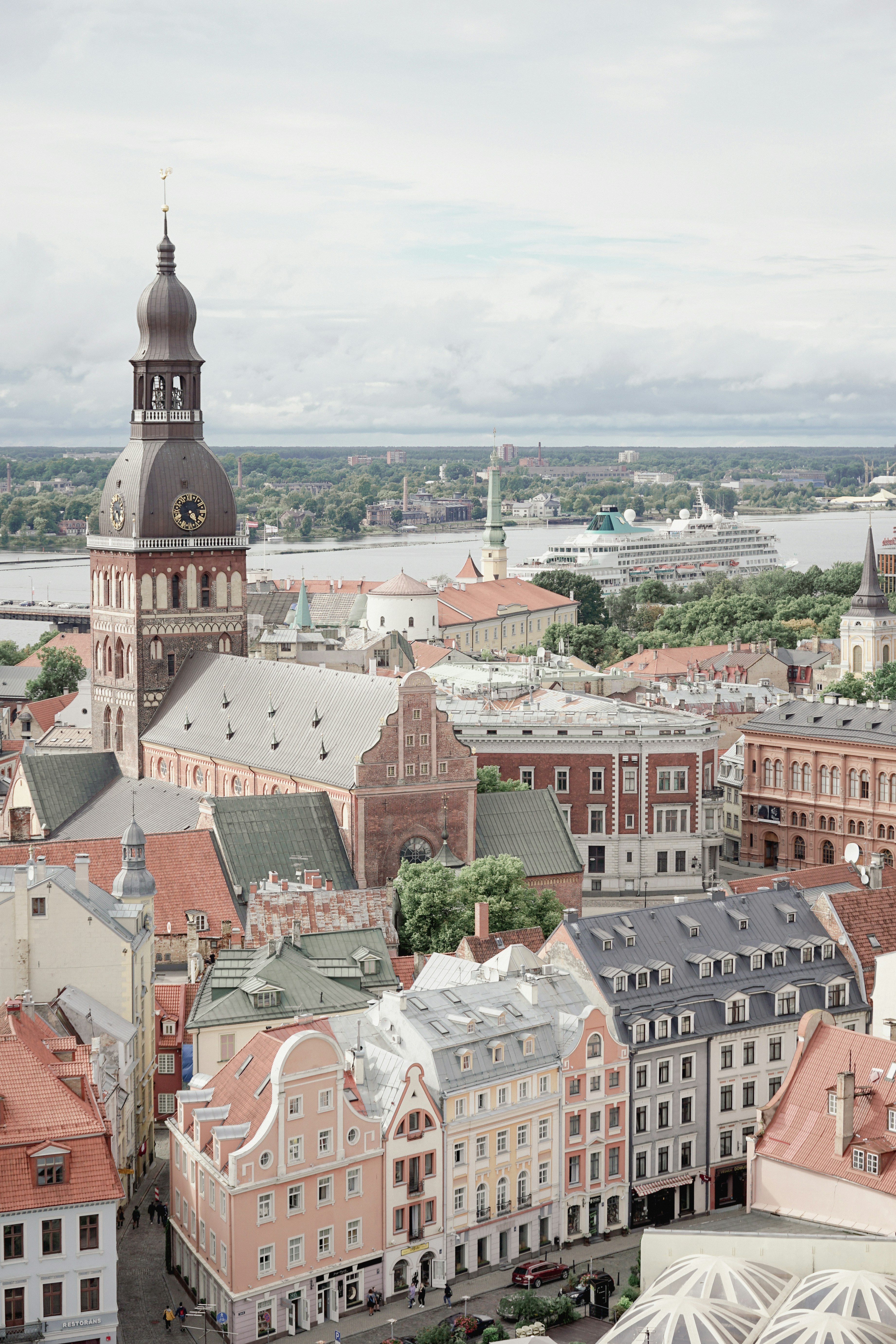
About Riga
Rīga has an upscale, big-city feel unmatched in the region. The capital (almost as large as Tallinn and Vilnius combined) is the business center of the area while original, high-quality restaurants and hotels have earned Rīga some bragging rights among its Western European counterparts. The city also doesn't lack for beauty—Rīga's Old Town (now a UNESCO World Heritage site) is one of Europe’s most striking examples of the art nouveau architectural style. Long avenues of complex and sometimes whimsical Jugendstil facades hint at Rīga's grand past. Many were designed by Mikhail Eisenstein, the father of Soviet director Sergei. This style dominates the city center. In many ways, the wonder of Rīga resides less in its individual attractions and more in the fabric of the town itself. In the medieval Old Town, an ornate gable or architrave catches the eye at every turn. The somber and the flamboyant are both represented in this quarter's 1,000 years of architectural history. Don't hesitate to just follow where your desire leads—the Old Town is compact and bounded by canals, so it's difficult to get totally lost. When the Old Town eventually became too crowded, the city burst out into the newer inner suburbs. The rich could afford to leave and build themselves fine fashionable mansions in the style of the day; consequently, city planners created a whole new Rīga. Across the narrow canal, you'll find the Esplanāde, a vast expanse of parkland with formal gardens and period mansions where the well-heeled stroll and play. Surrounding this is the art nouveau district. Encompassing avenues of splendid family homes (now spruced up in the postcommunist era), the collection has been praised by UNESCO as Europe's finest in the art nouveau style. The best examples are at Alberta 2, 2a, 4, 6, 8, and 13; Elizabetes 10b; and Strēlnieku 4a. If the weather permits, eschew public transport and stroll between the two districts, taking in the varied skylines and multifaceted facades, and perhaps stopping at a café or two as you go. The city has churches in five Christian denominations and more than 50 museums, many of which cater to eclectic or specialist tastes.
About Klaipeda
About Gdansk
About Rønne
About Copenhagen
By the 11th century, Copenhagen was already an important trading and fishing centre and today you will find an attractive city which, although the largest in Scandinavia, has managed to retain its low-level skyline. Discover some of the famous attractions including Gefion Fountain and Amalienborg Palace, perhaps cruise the city’s waterways, visit Rosenborg Castle or explore the medieval fishing village of Dragoer. Once the home of Hans Christian Andersen, Copenhagen features many reminders of its fairytale heritage and lives up to the reputation immortalised in the famous song ‘Wonderful Copenhagen’.
About Gothenburg
Don't tell the residents of Göteborg that they live in Sweden's "second city," but not because they will get upset (people here are known for their amiability and good humor). They just may not understand what you are talking about. People who call Göteborg (pronounced YOO-teh-bor; most visitors stick with the simpler "Gothenburg") home seem to forget that the city is diminutive in size and status compared to Stockholm.Spend a couple of days here and you'll forget, too. You'll find it's easier to ask what Göteborg hasn't got to offer rather than what it has. Culturally it is superb, boasting a fine opera house and theater, one of the country's best art museums, as well as a fantastic applied-arts museum. There's plenty of history to soak up, from the ancient port that gave the city its start to the 19th-century factory buildings and workers' houses that helped put it on the commercial map. For those looking for nature, the wild-west coast and tame green fields are both within striking distance. And don't forget the food. Since its inception in 1983, more than half of the "Swedish Chef of the Year" competition winners were cooking in Göteborg.
About Leith
About Leith
About Dundee
About Aberdeen
With close to 220,000 inhabitants, Aberdeen is Scotland's third most populous city. Locally quarried grey granite was used during the mid-18th to mid-20th centuries for many of Aberdeen's buildings, and hence the nicknames it has earned as the Granite City, or the Grey City. Aberdeen granite was also used to build the terraces of the Houses of Parliament and Waterloo Bridge in London. Since the discovery of North Sea oil in the 1970s, Aberdeen has also been called the Oil Capital of Europe or the Energy Capital of Europe. It is no wonder that because of the oil fields in the North Sea, Aberdeen's seaport is very important. The Heliport with its flights to the oil fields is one of the busiest commercial heliports in the world.
About Dundee
About Invergordon
The port of Invergordon is your gateway to the Great Glen, an area of Scotland that includes Loch Ness and the city of Inverness. Inverness, the capital of the Highlands, has the flavor of a Lowland town, its winds blowing in a sea-salt air from the Moray Firth. The Great Glen is also home to one of the world's most famous monster myths: in 1933, during a quiet news week, the editor of a local paper decided to run a story about a strange sighting of something splashing about in Loch Ness. But there's more to look for here besides Nessie, including inland lochs, craggy and steep-sided mountains, rugged promontories, deep inlets, brilliant purple and emerald moorland, and forests filled with astonishingly varied wildlife, including mountain hares, red deer, golden eagles, and ospreys.
About Oban
Oban, "little bay" in Gaelic, today has a resident population of 8,500 and is the unofficial capital of the West Highlands - the "Gateway to the Isles." The panoramic views of the mountains, lochs and islands which have captivated artists, authors, composers, and poets for centuries are as striking now as they were when Dunollie Castle, a ruined keep which has stood sentinel over the narrow entrance to the sheltered bay for around six hundred years, was the northern outpost of the Dalriadic Scots. It is no surprise to find Oban in the 21st-century remains a magnet for travellers from all over the world. The town's present day popularity owes much to the Victorians, and as early as 1812, when the Comet steamship linked Oban with Glasgow, the town played host to intrepid travellers touring Staffa - the inspiration for Mendelssohn's Hebridean Overture - and Iona - home of Scottish Christianity since St Columba stepped ashore in AD563. Indeed once Oban had the royal seal of approval from Queen Victoria, who called it "one of the finest spots we have seen," the town's destiny as an endearingly enchanting holiday destination was as firmly set as the lava columns of Fingal's Cave in Oban is justifiably known as the “gateway to the Isles.” The town's south pier is the embarkation point for car ferries to Mull, Coll, Tiree, Barra, South Uist, Colonsay, Lismore and Islay. From these islands you can travel further a field to Iona, Staffa and to many of the smaller less well known isles.

About Glasgow
Start your adventure in Scotland’s largest city, Glasgow which is overflowing with historic landmarks and a vibrant culture. The distinct architecture is reminiscent classic 19th-century fused together with modern early 20th-century dubbed ‘Glasgow Style’. The checkerboard layout makes the city easy to navigate with lively street entertainment around every corner.
About Douglas
The Isle of Man, situated in the Irish Sea off the west coast of England, is a mountainous, cliff-fringed island and one of Britain’s most beautiful spots. Measuring just 30 miles by 13 miles, the Isle of Man remains semi-autonomous. With its own postage stamps, laws, currency, and the Court of Tynwald (the world’s oldest democratic parliament), the Isle of Man is rich with history and lore.Inhabited from Neolithic times, the island became a refuge for Irish missionaries after the 5th Century. Norsemen took the island during the 9th Century and sold it to Scotland in 1266. However, since the 14th Century, it has been held by England. Manx, the indigenous Celtic language, is still spoken by a small minority. The Isle of Man has no income tax, which has encouraged many Britains to regard the island as a refuge. Otherwise, it is populated by Gaelic farmers, fishermen, and the famous tailless manx cats. The varied landscape features austere moorlands and wooded glens, interspersed by fine castles, narrow-gauge railways, and scores of standing stones with Celtic crosses. The hilly terrain rises to a height of 2,036 feet at Mount Snaefell, which dominates the center of the island.
About Dublin
Dublin is making a comeback. The decade-long "Celtic Tiger" boom era was quickly followed by the Great Recession, but The Recovery has finally taken a precarious hold. For visitors, this newer and wiser Dublin has become one of western Europe's most popular and delightful urban destinations. Whether or not you're out to enjoy the old or new Dublin, you'll find it a colossally entertaining city, all the more astonishing considering its intimate size.It is ironic and telling that James Joyce chose Dublin as the setting for his famous Ulysses, Dubliners, and A Portrait of the Artist as a Young Man because it was a "center of paralysis" where nothing much ever changed. Which only proves that even the greats get it wrong sometimes. Indeed, if Joyce were to return to his once-genteel hometown today—disappointed with the city's provincial outlook, he left it in 1902 at the age of 20—and take a quasi-Homeric odyssey through the city (as he so famously does in Ulysses), would he even recognize Dublin as his "Dear Dirty Dumpling, foostherfather of fingalls and dotthergills"?For instance, what would he make of Temple Bar—the city's erstwhile down-at-the-heels neighborhood, now crammed with cafés and trendy hotels and suffused with a nonstop, international-party atmosphere? Or the simple sophistication of the open-air restaurants of the tiny Italian Quarter (named Quartier Bloom after his own creation), complete with sultry tango lessons? Or of the hot–cool Irishness, where every aspect of Celtic culture results in sold-out theaters, from Once, the cult indie movie and Broadway hit, to Riverdance, the old Irish mass-jig recast as a Las Vegas extravaganza? Plus, the resurrected Joyce might be stirred by the songs of Hozier, fired up by the sultry acting of Michael Fassbender, and moved by the award-winning novels of Colum McCann. As for Ireland's capital, it's packed with elegant shops and hotels, theaters, galleries, coffeehouses, and a stunning variety of new, creative little restaurants can be found on almost every street in Dublin, transforming the provincial city that suffocated Joyce into a place almost as cosmopolitan as the Paris to which he fled. And the locals are a hell of a lot more fun! Now that the economy has finally turned a corner, Dublin citizens can cast a cool eye over the last 20 crazy years. Some argue that the boomtown transformation of their heretofore-tranquil city has permanently affected its spirit and character. These skeptics (skepticism long being a favorite pastime in the capital city) await the outcome of "Dublin: The Sequel," and their greatest fear is the possibility that the tattered old lady on the Liffey has become a little less unique, a little more like everywhere else.Oh ye of little faith: the rare ole gem that is Dublin is far from buried. The fundamentals—the Georgian elegance of Merrion Square, the Norman drama of Christ Church Cathedral, the foamy pint at an atmospheric pub—are still on hand to gratify. Most of all, there are the locals themselves: the nod and grin when you catch their eye on the street, the eagerness to hear half your life story before they tell you all of theirs, and their paradoxically dark but warm sense of humor. It's expected that 2016 will be an extra-special year in the capital, as centenary celebrations of the fateful 1916 Easter Rising will dominate much of the cultural calendar.
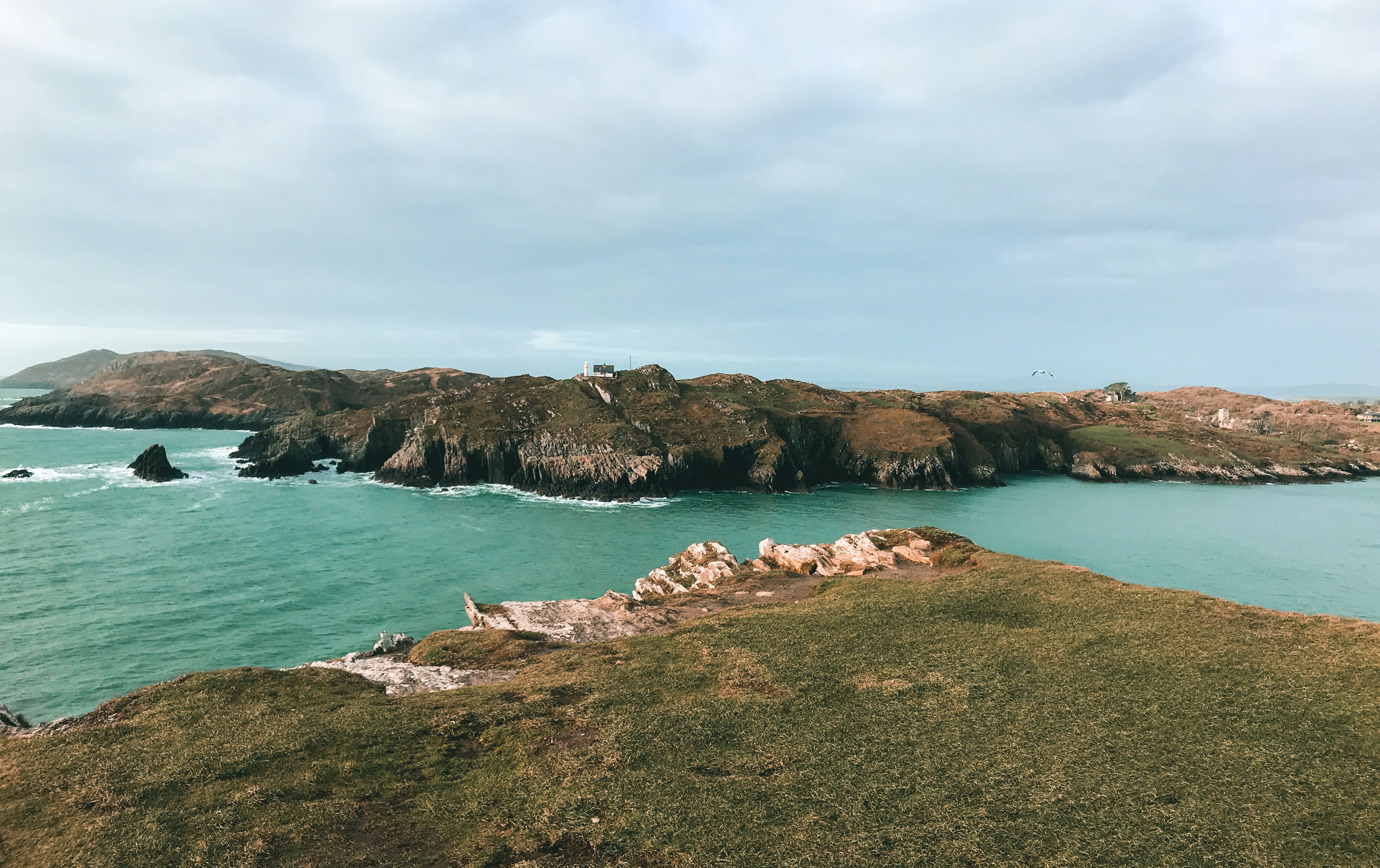
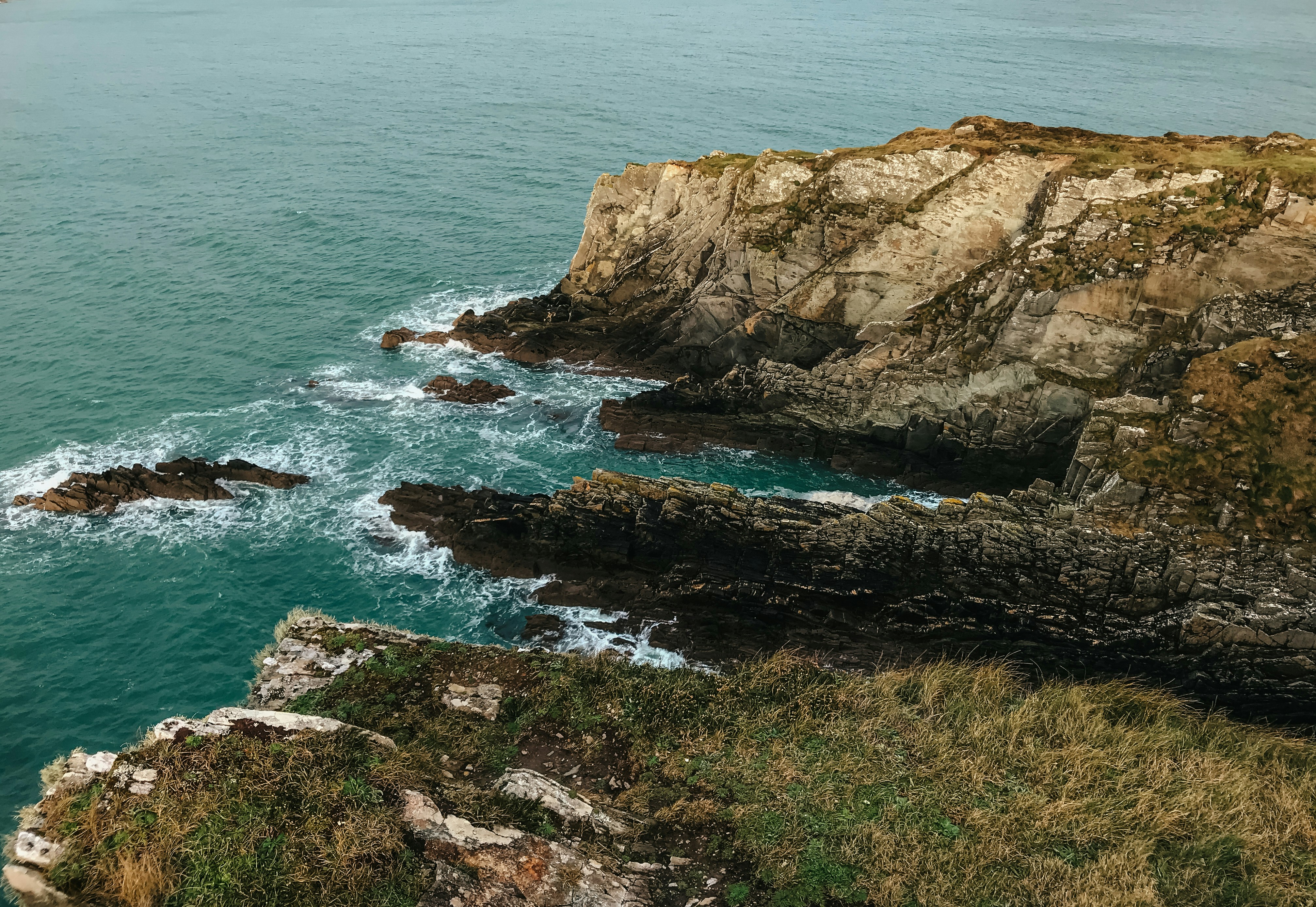
About Cork
Cork City received its first charter in 1185 from Prince John of Norman England, and it takes its name from the Irish word corcaigh, meaning "marshy place." The original 6th-century settlement was spread over 13 small islands in the River Lee. Major development occurred during the 17th and 18th centuries with the expansion of the butter trade, and many attractive Georgian-design buildings with wide bowfront windows were constructed during this time. As late as 1770 Cork's present-day main streets—Grand Parade, Patrick Street, and the South Mall—were submerged under the Lee. Around 1800, when the Lee was partially dammed, the river divided into two streams that now flow through the city, leaving the main business and commercial center on an island, not unlike Paris's Île de la Cité. As a result, the city has a number of bridges and quays, which, although initially confusing, add greatly to the port's unique character. Cork can be very "Irish" (hurling, Gaelic football, televised plowing contests, music pubs, and peat smoke). But depending on what part of town you're in, Cork can also be distinctly un-Irish—the sort of place where hippies, gays, and farmers drink at the same pub.
About Bantry
About Foynes
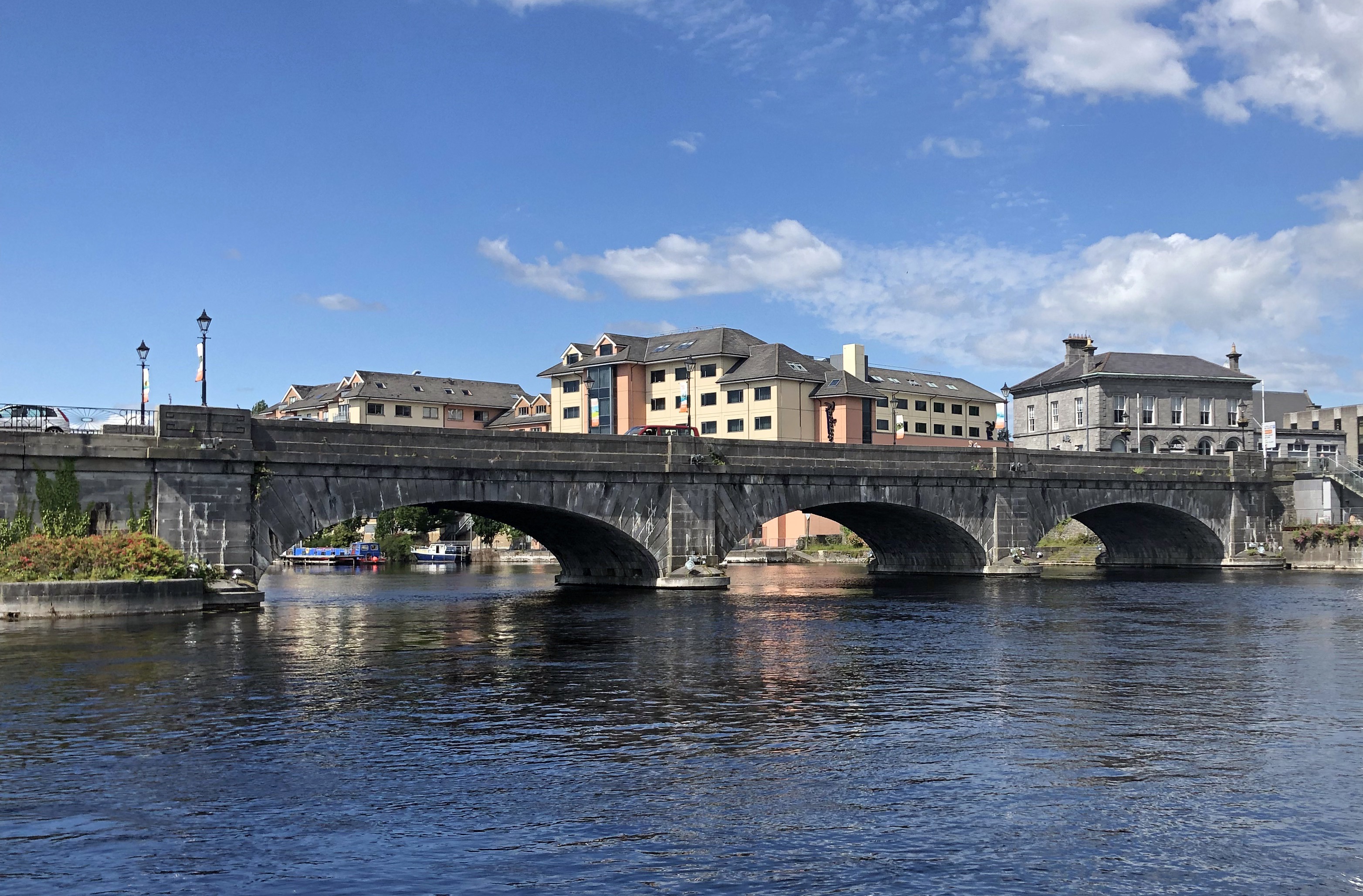
About Galway
Galway is a city in the West of Ireland in the province of Connacht. It lies on the River Corrib between Lough Corrib and Galway Bay and is surrounded by County Galway. It is the fourth most populous urban area in the Republic of Ireland and the sixth most populous city in the island of Ireland. It is both a picturesque and lively city with a wonderful avant-garde culture and a fascinating mixture of locally owned speciality shops, often featuring locally made crafts. Indeed local handcrafts are a feature of the entire region including hand knits, pottery, glass, jewellery and woodwork. The city’s hub is 18th-century Eyre Square, a popular meeting spot surrounded by shops, and traditional pubs that often offer live Irish folk music. Nearby, stone-clad cafes, boutiques and art galleries line the winding lanes of the Latin Quarter, which retains portions of the medieval city walls. The city bears the nickname "The City of the Tribes" because "fourteen tribes" of merchant families led the city in its Hiberno-Norman period. The merchants would have seen themselves as Irish gentry and loyal to the King. They later adopted the term as a badge of honour and pride in defiance of the town's Cromwellian occupier.
About Killybegs
Killybegs The days start early in Killybegs, as this quiet fishing town rumbles to life, and ships with red and blue paint peeling from their hulls quietly depart, ready for a morning's hard work at sea. Located in a scenic part of County Donegal, Killybegs is Ireland's fishing capital, and the salty breeze and pretty streets serve as a revitalising medicine for visitors. The town is also your gateway to some of the country's most majestic coastal scenery, which is dotted with flashing white lighthouses, keeping watch over invigorating seascapes. Killybegs enjoys a privileged position on the coast of north west of Ireland, close to the spectacular Slieve League - a titanic mountain, which explodes upwards from frothing ocean. Walk as close as you dare to the coastline’s sheer drops, or admire the folding cliffs from the best vantage point, down on the water.
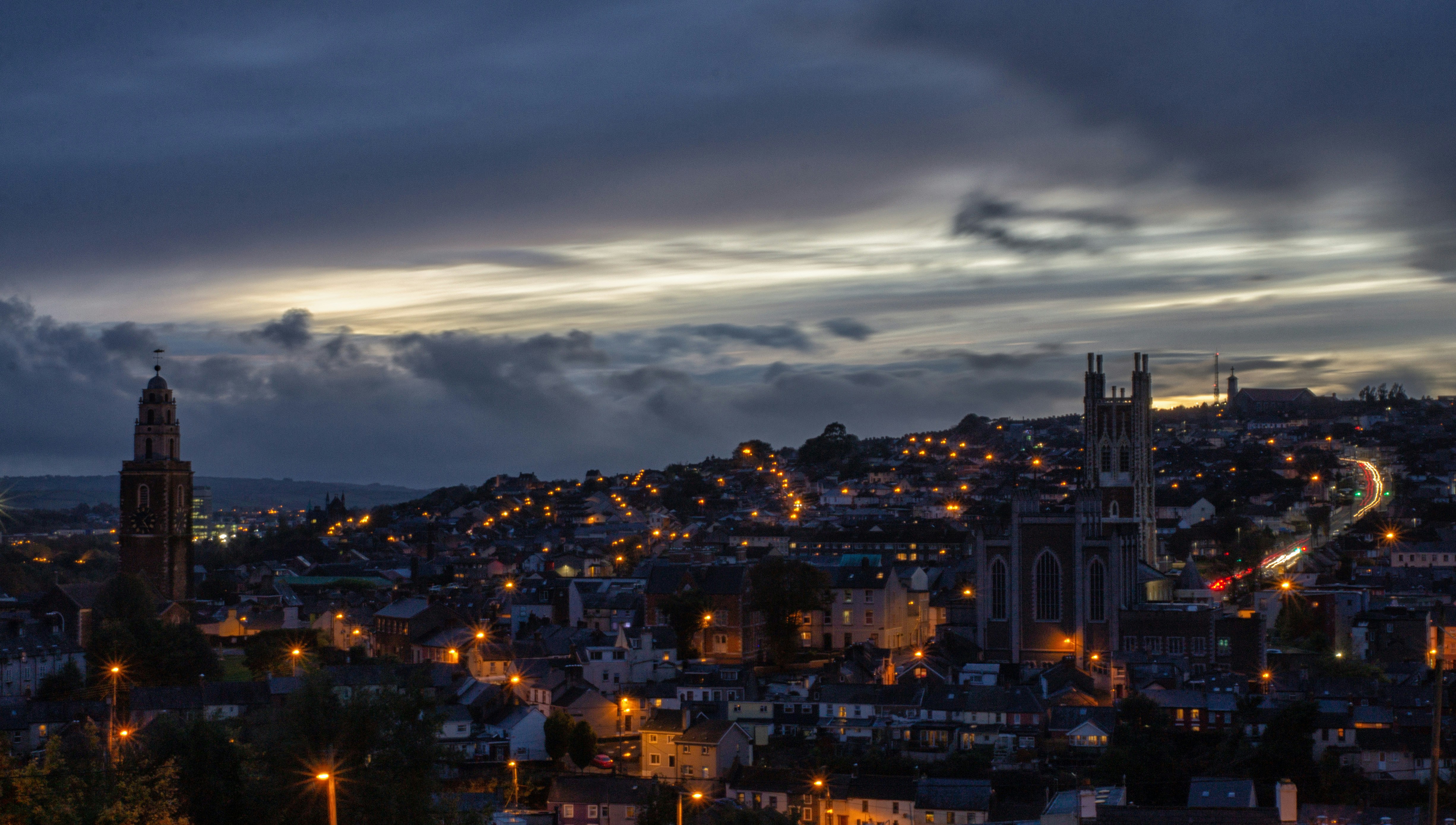
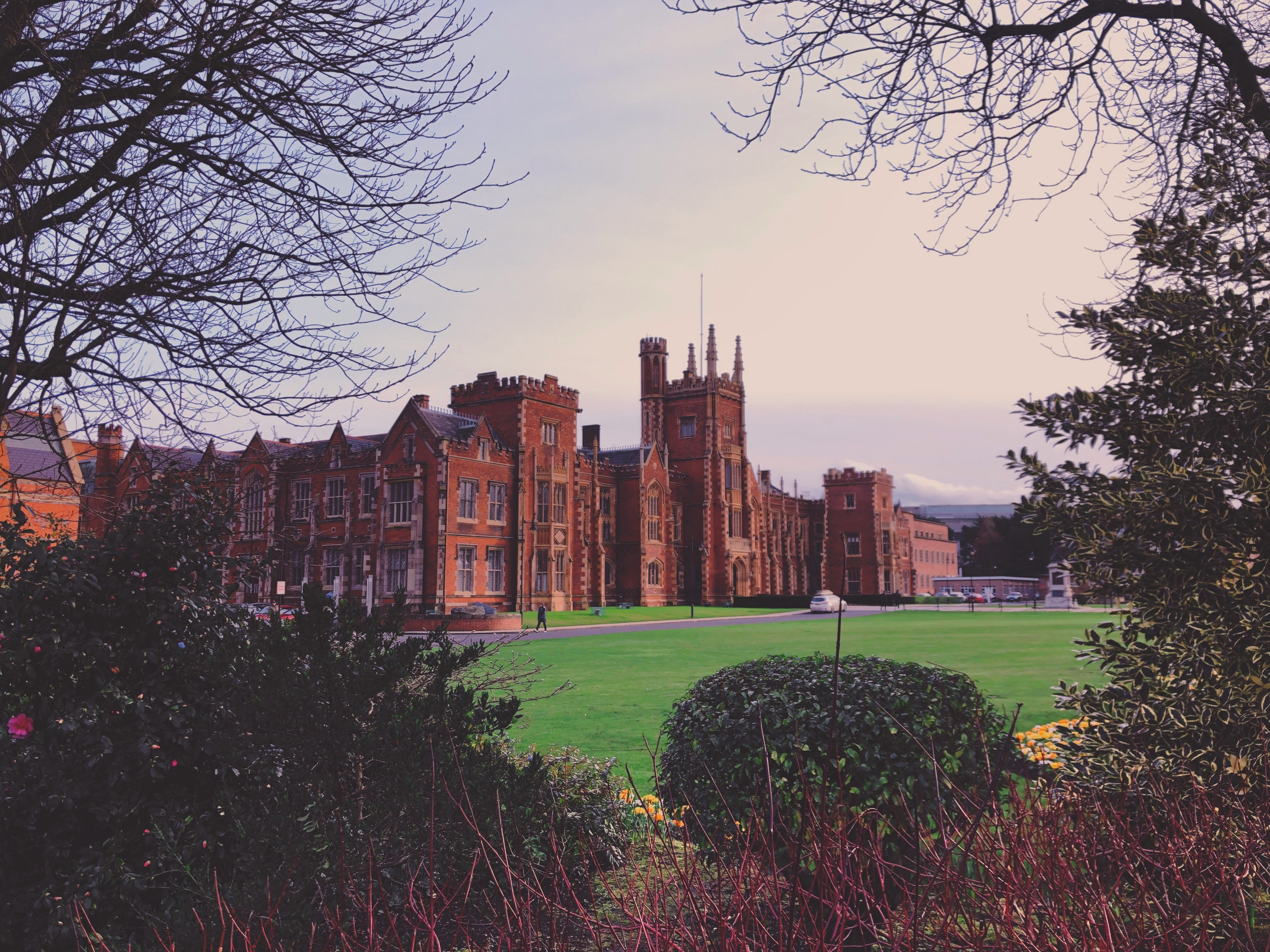
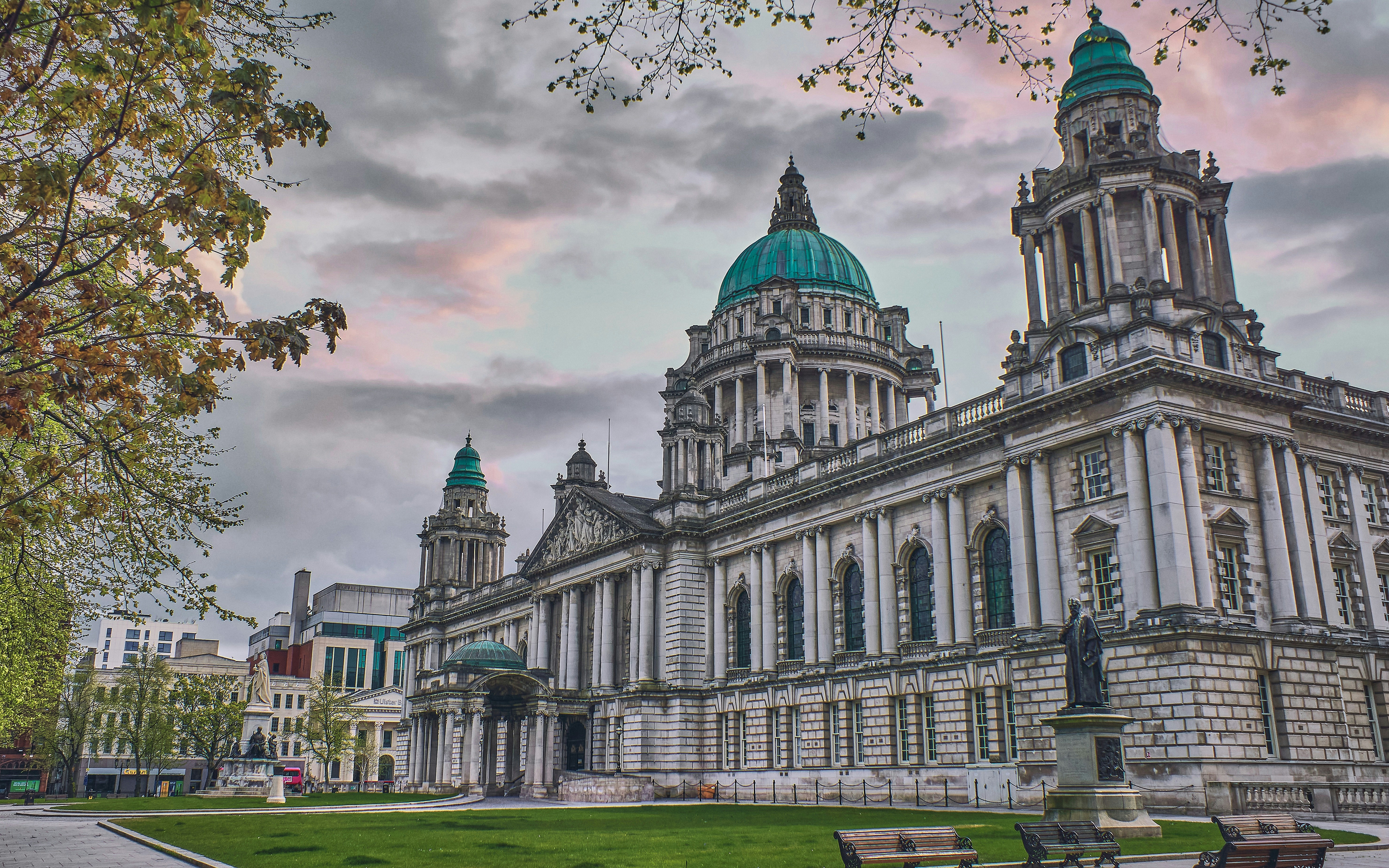
About Belfast
Before English and Scottish settlers arrived in the 1600s, Belfast was a tiny village called Béal Feirste ("sandbank ford") belonging to Ulster's ancient O'Neill clan. With the advent of the Plantation period (when settlers arrived in the 1600s), Sir Arthur Chichester, from Devon in southwestern England, received the city from the English Crown, and his son was made Earl of Donegall. Huguenots fleeing persecution from France settled near here, bringing their valuable linen-work skills. In the 18th century, Belfast underwent a phenomenal expansion—its population doubled every 10 years, despite an ever-present sectarian divide. Although the Anglican gentry despised the Presbyterian artisans—who, in turn, distrusted the native Catholics—Belfast's growth continued at a dizzying speed. The city was a great Victorian success story, an industrial boomtown whose prosperity was built on trade, especially linen and shipbuilding. Famously (or infamously), the Titanic was built here, giving Belfast, for a time, the nickname "Titanic Town." Having laid the foundation stone of the city's university in 1845, Queen Victoria returned to Belfast in 1849 (she is recalled in the names of buildings, streets, bars, monuments, and other places around the city), and in the same year, the university opened under the name Queen's College. Nearly 40 years later, in 1888, Victoria granted Belfast its city charter. Today its population is nearly 300,000, tourist numbers have increased, and this dramatically transformed city is enjoying an unparalleled renaissance.This is all a welcome change from the period when news about Belfast meant reports about "the Troubles." Since the 1994 ceasefire, Northern Ireland's capital city has benefited from major hotel investment, gentrified quaysides (or strands), a sophisticated new performing arts center, and major initiatives to boost tourism. Although the 1996 bombing of offices at Canary Wharf in London disrupted the 1994 peace agreement, the ceasefire was officially reestablished on July 20, 1997, and this embattled city began its quest for a newfound identity.Since 2008, the city has restored all its major public buildings such as museums, churches, theaters, City Hall, Ulster Hall—and even the glorious Crown Bar—spending millions of pounds on its built heritage. A gaol that at the height of the Troubles held some of the most notorious murderers involved in paramilitary violence is now a major visitor attraction.Belfast's city center is made up of three roughly contiguous areas that are easy to navigate on foot. From the south end to the north, it's about an hour's leisurely walk.
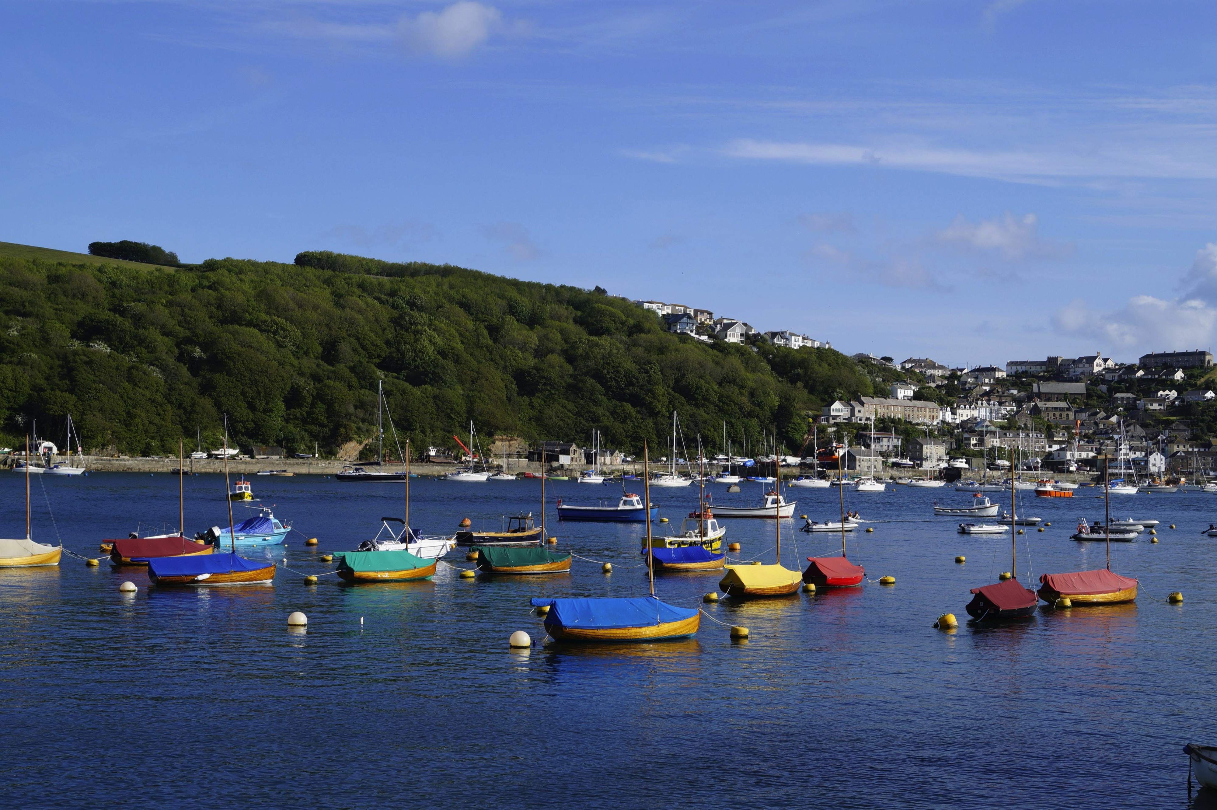
About Fowey
Nestled in the mouth of a wooded estuary, Fowey (pronounced Foy) is still very much a working china-clay port as well as a focal point for the sailing fraternity. Increasingly, it's also a favored home of the rich and famous. Good and varied dining and lodging options abound; these are most in demand during Regatta Week in mid- to late August and the annual Fowey Festival of Words and Music in mid-May. The Bodinnick and Polruan ferries take cars as well as foot passengers across the river for the coast road on to Looe.A few miles west of Fowey are a pair of very different gardens: the Eden Project, a futuristic display of plants from around the world, and the Lost Gardens of Heligan, a revitalized reminder of the Victorian age.
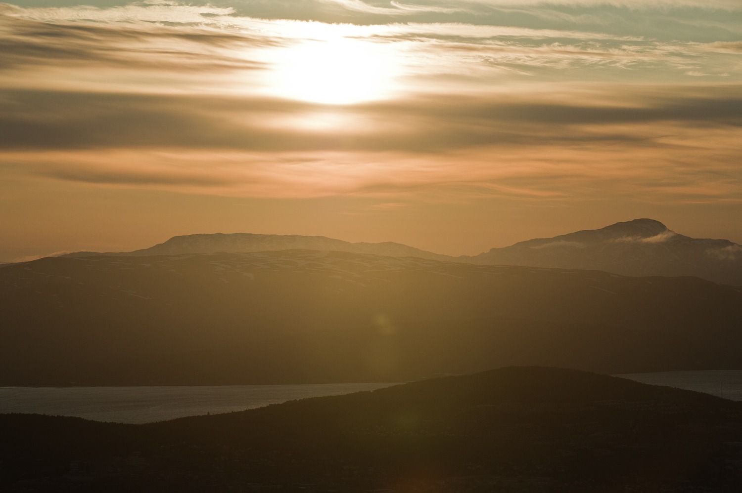
About Portsmouth
Portsmouth is one of the most densely populated cities in Southern England, and is unusual as most of its built-up area occupies Portsea Island, linked to the mainland by road and rail bridges. Although there is a Roman fort at nearby Portchester, occupied later by the Saxons and Normans, there was no settlement on the site of Portsmouth at the time of the 1086 Domesday Book. The town developed in medieval times and received its first charter in 1194 from King Richard I; soon afterwards it became a major naval base. It has the world’s oldest dry dock, and is home to several famous ships, including HMS Victory, HMS Warrior and the Mary Rose, raised from the Solent in 1982. Portsmouth remains an important naval base and is home to a large proportion of the British service fleet. The waterfront area is now dominated by the Spinnaker Tower, 560 feet high, the United Kingdom’s tallest building outside London. Other things to see in the city include the house where Charles Dickens was born, and the City Museum, which contains a permanent exhibition devoted to another famous writer, Sir Arthur Conan Doyle, who lived in the town.
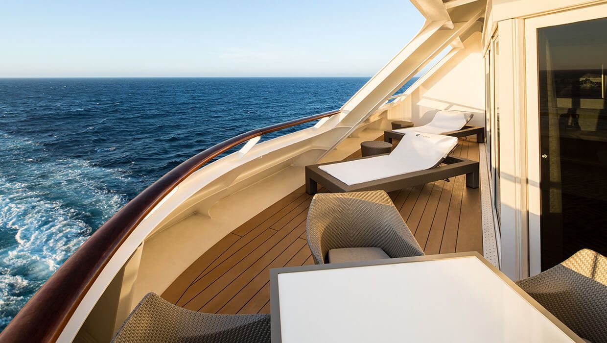
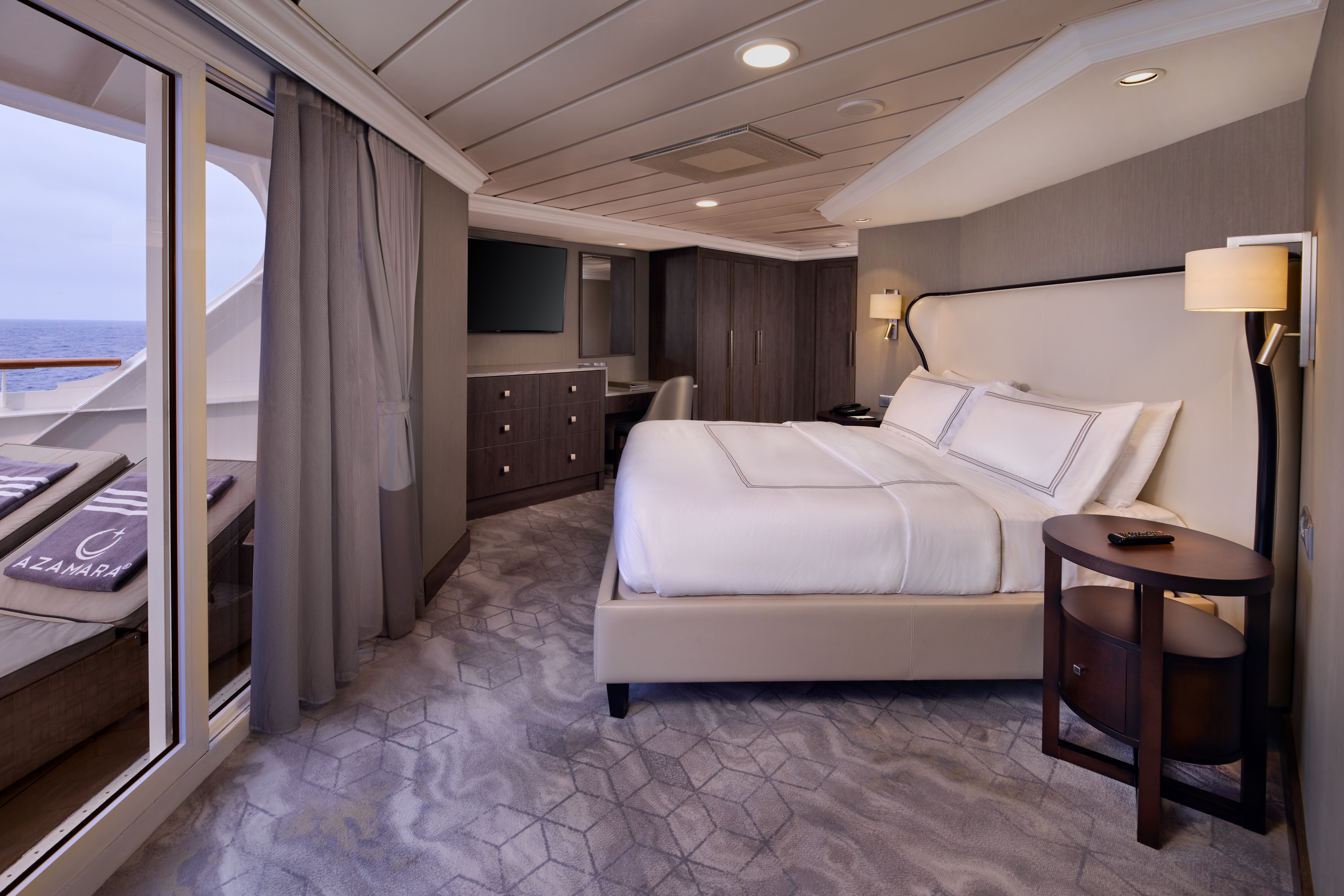
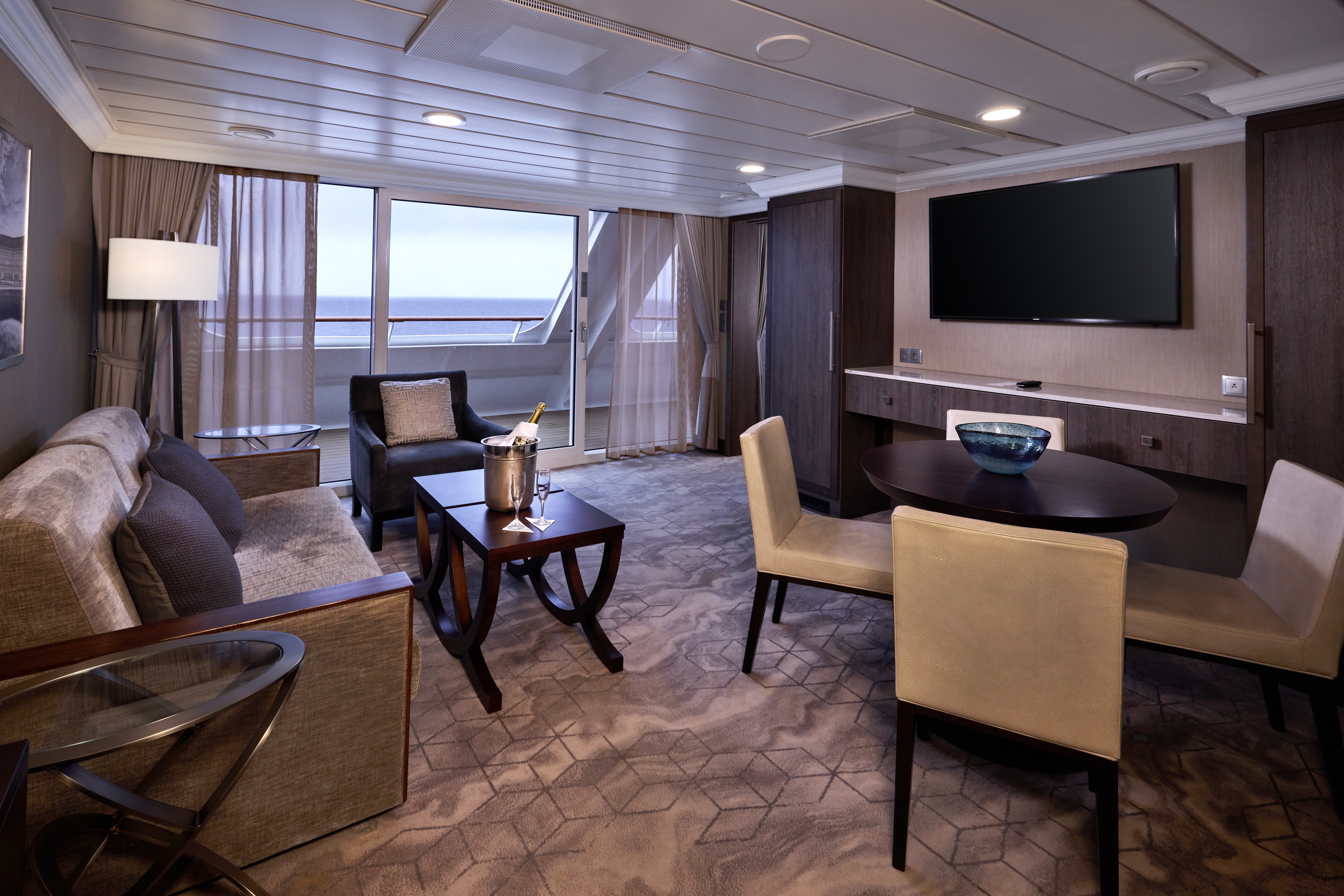
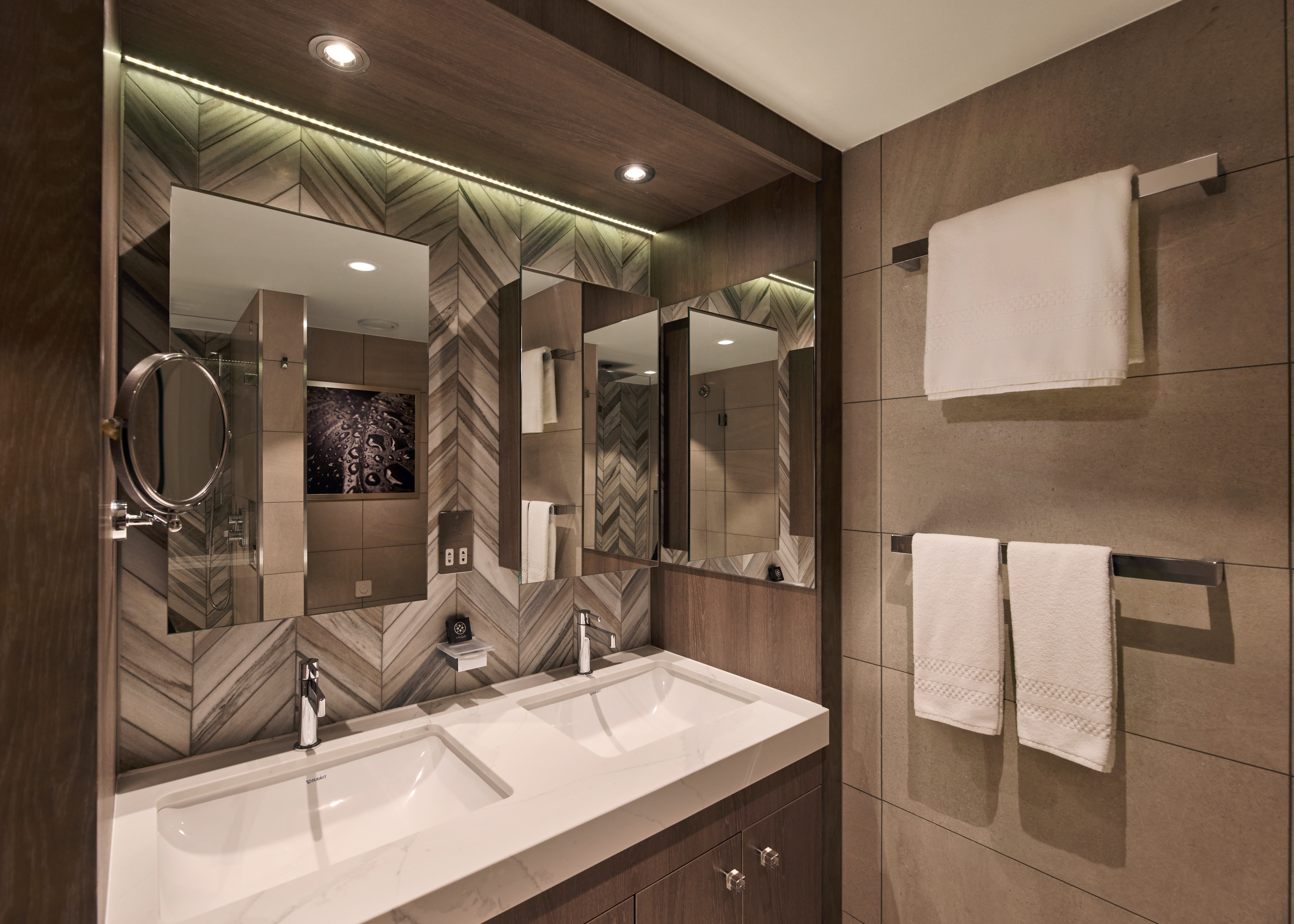
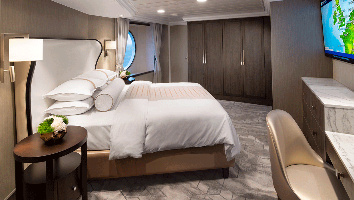
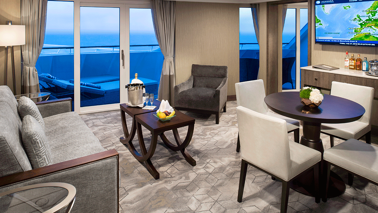
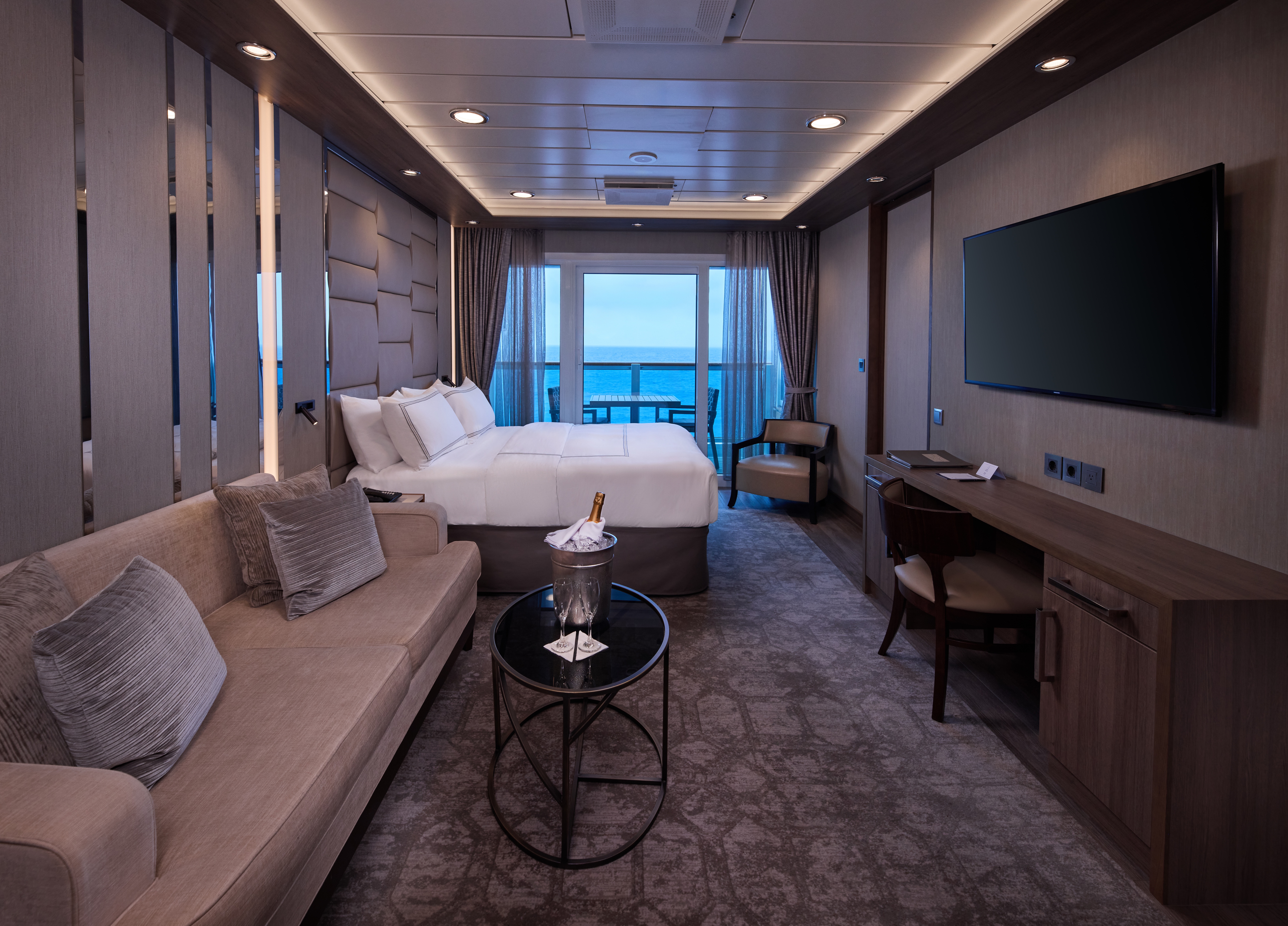
A signature expression of Azamara Cruises’ refined luxury, the World Owner’s Suite features a spacious layout, a separate bedroom, and a large private veranda. Thoughtfully designed for guests who value privacy, comfort, and elevated living.
Suite Features
- Spacious living room with a separate master bedroom
- Master bedroom with one queen size bed and a flat-screen television
- Flat-screen television in living room
- Marble master bathroom with shower. Journey, Onward, and Quest suites feature a tub.
- Dressing room with vanity and ample closet space
- Floor-to-ceiling sliding glass doors in living room and master bedroom
- Mini-bar
- Thermostat-controlled air conditioner
- Direct-dial telephone with voice mail
- Writing desk
- In-room safe
- Hand-held hair dryer
- Stateroom: 560 sq. ft. (52 sq. m.) Veranda: 233 sq. ft. (21.7 sq. m.)
Included Amenities
- Ultimate Beverage Package
- Unlimited Standard Starlink Wi-Fi
- Unlimited Wash and Press
- Dedicated butler and concierge service
- Full in-suite dining and daily evening hors d’oeuvres
- Complimentary Specialty Dining and exclusive breakfast at Aqualina
- In-room premium spirits and champagne
- Thalassotherapy Pool access
- Personalized assistance planning spa appointments and shore excursions
- Priority check-in
- Luxurious cotton bed linens with duvet
- Terry bathrobes
- 24-hour room service
- Tote bag
- Use of umbrella
- Shoeshine service
- Turndown treats
- Afternoon In-Suite Tea Service

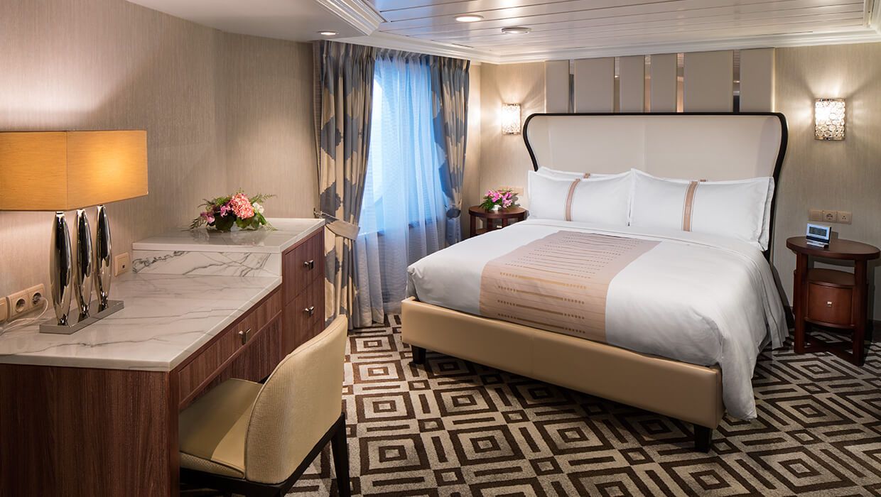
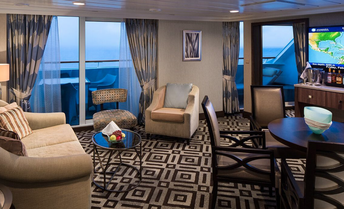
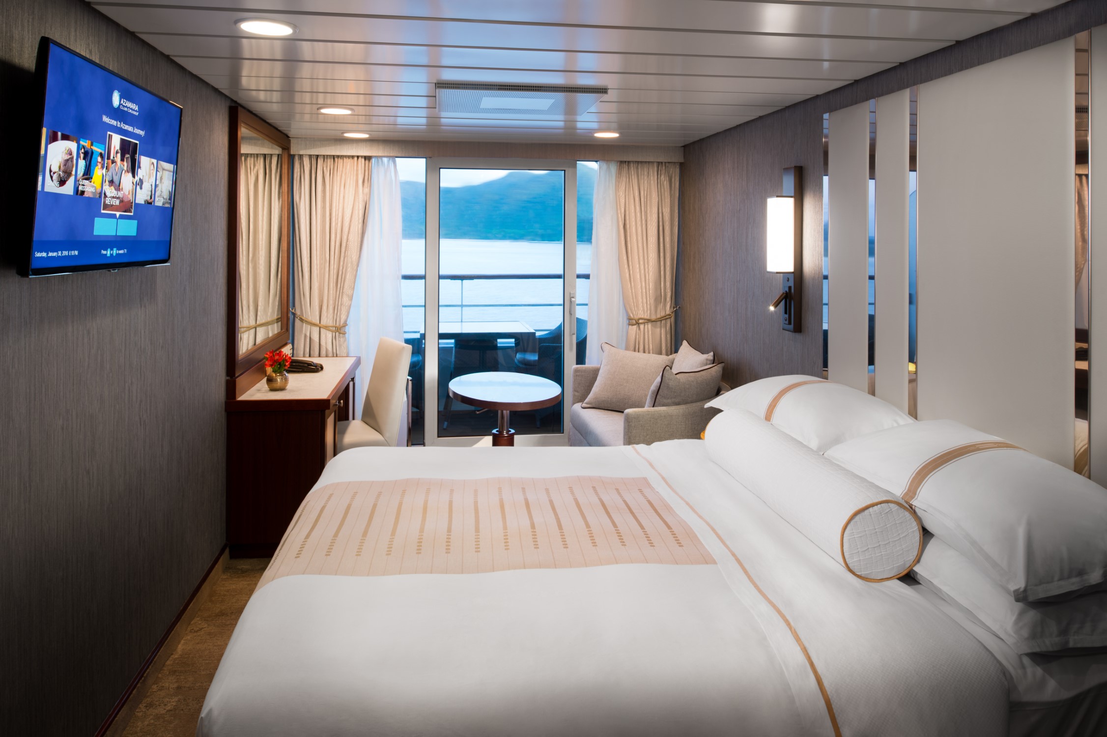
The Ocean Suite offers generous space to relax, with a separate living area, a dedicated bedroom, and a private veranda. An inviting retreat that balances comfort, functionality, and classic suite-style living.
Suite Features
- Spacious living room with a separate master bedroom
- Master bedroom with one queen size bed with a flat-screen television
- Flat-screen television in living room
- Marble master bathroom with shower. Journey and Quest suites feature a tub.
- Dressing room with vanity and ample closet space
- Floor-to-ceiling sliding glass doors in living room and master bedroom
- Mini-bar
- Thermostat-controlled air conditioner
- Direct-dial telephone with voice mail
- Writing desk
- In-room safe
- Hand-held hair dryer
- Stateroom: 440–501 sq. ft. (40.9-46.5 sq. m.) Veranda: 233 sq. ft. (21.7 sq. m.)
Included Amenities
- Ultimate Beverage Package
- Unlimited Standard Starlink Wi-Fi
- Unlimited Wash and Press
- Dedicated butler and concierge service
- Full in-suite dining and daily evening hors d’oeuvres
- Complimentary Specialty Dining and exclusive breakfast at Aqualina
- In-room premium spirits and champagne
- Thalassotherapy Pool access
- Personalized assistance planning spa appointments and shore excursions
- Priority check-in
- Luxurious cotton bed linens with duvet
- Terry bathrobes
- 24-hour room service
- Tote bag
- Use of umbrella
- Shoeshine service
- Turndown treats
- Afternoon In-Suite Tea Service
Designed for relaxation and renewal, the Spa Suite features a spacious layout with spa-inspired touches, including a glass-enclosed soaking tub and convenient access to the spa. A calming retreat ideal for wellness-focused travelers.
Suite Features
- Two lower beds convertible to one queen size bed
- Spacious glass-enclosed bathtub
- Separate rain shower
- Comfortable sitting area
- Flat-screen television in sitting area
- Floor-to-ceiling sliding glass doors
- Veranda
- Mini-bar
- Thermostat-controlled air conditioner
- Direct-dial telephone with voice mail
- Writing desk
- In-room safe
- Hand-held hair dryer
- Stateroom: 414 sq. ft. (38.5 sq. m.) Veranda: 40 sq. ft. (3.7 sq. m.)
Included Amenities
- Ultimate Beverage Package
- Unlimited Standard Starlink Wi-Fi
- Unlimited Wash and Press
- Dedicated butler and concierge service
- Full in-suite dining and daily evening hors d’oeuvres
- Complimentary Specialty Dining and exclusive breakfast at Aqualina
- In-room premium spirits and champagne
- Thalassotherapy Pool access
- Personalized assistance planning spa appointments and shore excursions
- Priority check-in
- Luxurious cotton bed linens with duvet
- Terry bathrobes
- 24-hour room service
- Tote bag
- Use of umbrella
- Shoeshine service
- Turndown treats
- Afternoon In-Suite Tea Service

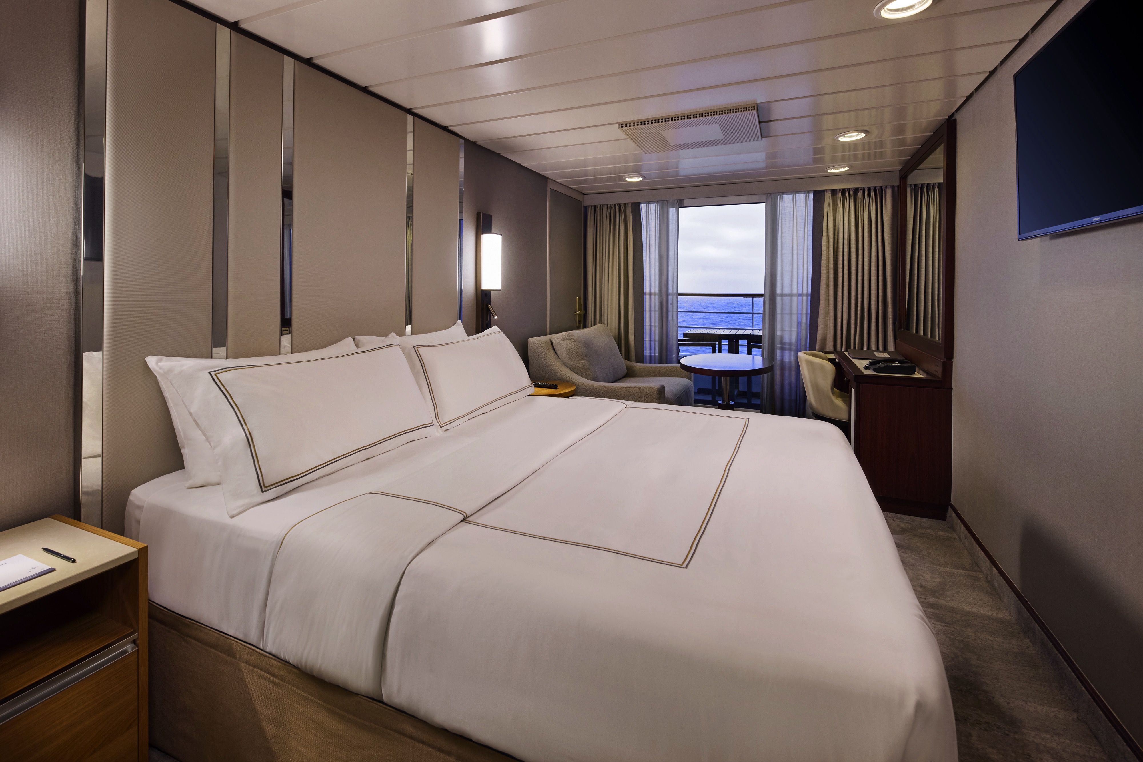
The Continent Suite offers a comfortable and well-appointed space with a private veranda, a welcoming seating area, and a generous bathroom. An inviting option for guests seeking suite-style accommodations with essential comforts.
Suite Features
- Two lower beds convertible to one queen size bed
- Spacious and comfortable seating area
- Flat-screen television in sitting area
- Roomy bathroom with shower. Some also feature a tub.
- Floor-to-ceiling sliding glass doors
- Veranda
- Mini-bar
- Thermostat-controlled air conditioner
- Direct-dial telephone with voice mail
- Writing desk
- In-room safe
- Hand-held hair dryer
- Stateroom: 266 sq. ft. (24.7 sq. m.) Veranda: 60 sq. ft. (5.6 sq. m.)
Included Amenities
- Unlimited Basic Starlink Wi-Fi
- 2 laundry bags (wash and press) per stateroom, per 7 nights
- Dedicated butler and concierge service
- Full in-suite dining and daily evening hors d’oeuvres
- Complimentary Specialty Dining and exclusive breakfast at Aqualina
- In-room premium spirits and champagne
- Thalassotherapy Pool access
- Personalized assistance planning spa appointments and shore excursions
- Priority check-in
- Luxurious cotton bed linens with duvet
- Terry bathrobes
- 24-hour room service
- Tote bag
- Use of umbrella
- Shoeshine-service
- Turndown treats
- Afternoon In-Suite Tea Service

The suite offers a comfortable and well-appointed space with a private veranda, a welcoming seating area, and a generous bathroom. An inviting option for guests seeking suite-style accommodations with essential comforts.


Enjoy open-air living with sweeping ocean and destination views, plus added perks designed to elevate your onboard experience. It’s everything you love about a Veranda Stateroom, with a little extra—at exceptional value.
Stateroom Features
- Veranda
- Two lower beds convertible to one Queen size bed
- Sitting area with flat-screen TV
- Mini-bar
- Thermostat-controlled air conditioner
- Direct-dial telephone with voice mail
- Writing desk
- In-room safe
- Hand-held hairdryer
- USB ports under bedside reading lamps
- Stateroom: 175 sq. ft. (16.3 sq. m.) | Veranda: 46–64 sq. ft. (4.3-6 sq. m.)
Included Stateroom Amenities
- Complimentary AzAmazing Evenings® event (on most voyages)
- Gratuities
- Luxurious cotton bed linens with duvet
- Terry bathrobes and slippers
- Select standard spirits, international beers and wine
- 24-hour room service
- Bottled water, soft drinks, specialty coffees and teas
- Self-service laundry
- Tote bag
- Shuttle service to and from port communities, wher
- Use of umbrella
- Concierge services for personal guidance and reservations
- Shoe shine-service
- Turndown treats
- Daily news bulletin
- Complimentary Internet (120 minutes or 25% off the unlimited internet package) per guest
- One free bag of laundry service per stateroom, every seven days
- One night of complimentary specialty dining for two, every seven days
- Priority embarkation and debarkation
- Complimentary in-room spirits
Enjoy open-air living with sweeping ocean and destination views, plus added perks designed to elevate your onboard experience. It’s everything you love about a Veranda Stateroom, with a little extra—at exceptional value.
Step outside to your private veranda and take in fresh sea breezes and ever-changing views. Thoughtful design, polished finishes, and attentive service create a relaxing retreat between immersive days ashore.
Stateroom Features
- Veranda
- Two lower beds convertible to one Queen size bed
- Sitting area with flat-screen TV
- Refrigerator with mini-bar
- Thermostat-controlled air conditioner
- Direct-dial telephone with voicemail
- Writing desk
- In-room safe
- Hand-held hairdryer
- USB ports under bedside reading lamps
- Stateroom: 175 sq. ft. (16.3 sq. m.) | Veranda: 40 sq. ft. (3.7 sq. m.)
Included Stateroom Amenities
- Complimentary AzAmazing Evenings® event (on most voyages)
- Luxurious cotton bed linens with duvet
- Gratuities
- Terry bathrobes
- Select standard spirits, international beers and wine
- 24-hour room service
- Self-service laundry
- Tote bag
- Shuttle service to and from port communities, where available
- Use of umbrella
- Concierge services for personal guidance and reserervations
- Shoe shine-service
- Turndown treats
- Daily news bulletin
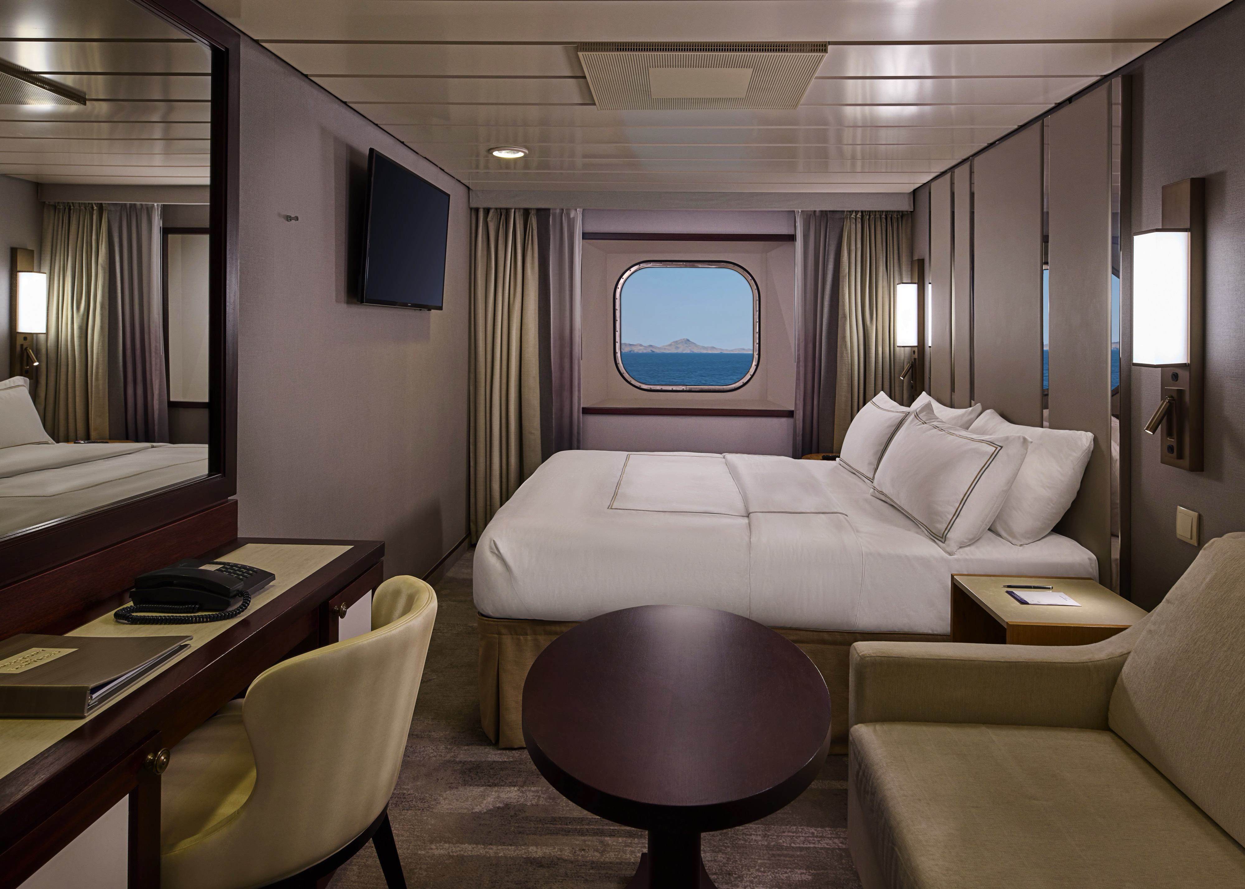
Wake up to natural light and picturesque ocean views from your window. Featuring contemporary design and well-appointed comforts, these staterooms offer a serene and stylish place to unwind at sea.
Stateroom Features
- Two lower beds convertible to one Queen size bed
- Some staterooms feature sofa bed
- Flat-screen TV
- Refrigerator with mini-bar
- Thermostat-controlled air conditioner
- Direct-dial telephone with voicemail
- Writing desk
- In-room safe
- Hand-held hairdryer
- USB ports under bedside reading lamps
- 143 sq. ft. (13.3 sq m)
Included Stateroom Amenities
- Complimentary AzAmazing Evenings® event (on most voyages)
- Gratuities
- Luxurious cotton bed linens with duvet
- Terry bathrobes and slippers
- Select standard spirits, international beers and wine
- 24-hour room service
- Bottled water, soft drinks, specialty coffees and teas
- Self-service laundry
- Tote bag
- Shuttle service to and from port communities, wher
- Use of umbrella
- Concierge services for personal guidance and reservations
- Shoe shine-service
- Turndown treats
Wake up to natural light and picturesque ocean views from your window. Featuring contemporary design and well-appointed comforts, these staterooms offer a serene and stylish place to unwind at sea.
A quiet, comfortable retreat designed for restful nights and relaxing moments between adventures. With refined décor, plush amenities, and personalized service, it’s boutique-hotel comfort at sea.
Stateroom Features
- Two lower beds convertible to one Queen size bed
- Flat-screen television
- Refrigerator with mini-bar
- Thermostat-controlled air conditioner
- Direct-dial telephone with voicemail
- Writing desk
- In-room safe
- Hand-held hairdryer
- USB ports under bedside reading lamps
- Stateroom: 158 sq. ft. (14.7 sq. m.)
Included Stateroom Amenities
- Complimentary AzAmazing Evenings® event (on most voyages)
- Gratuities
- Luxurious cotton bed linens with duvet
- Terry bathrobes and slippers
- Select standard spirits, international beers and wine
- 24-hour room service
- Bottled water, soft drinks, specialty coffees and teas
- Self-service laundry
- Tote bag
- Shuttle service to and from port communities, wher
- Use of umbrella
- Concierge services for personal guidance and reservations
- Shoe shine-service
- Turndown treats
- Daily news bulletin
A quiet, comfortable retreat designed for restful nights and relaxing moments between adventures. With refined décor, plush amenities, and personalized service, it’s boutique-hotel comfort at sea.
Azamara Journey
A luxurious boutique hotel at sea, the Azamara Journey is a mid-sized ship with a deck plan that’s intimate but never crowded, and offers everything modern cruisers are looking for—plus some unexpected extras.
Ship Facts
| Launch Year | 2000 | ||||||||||
| Refit Year | 2016 | ||||||||||
| Language | en-US | ||||||||||
| Gross Tonnage | 30277 | ||||||||||
| Length | 182 | ||||||||||
| Width | 25 | ||||||||||
| Currency | USD | ||||||||||
| Speed | 18 | ||||||||||
| Capacity | 690 | ||||||||||
| Crew Count | 408 | ||||||||||
| Deck Count | 8 | ||||||||||
| Cabin Count | 355 | ||||||||||
| Large Cabin Count | N/A | ||||||||||
| Wheelchair Cabin Count | 6 | ||||||||||
| Electrical Plugs |
|
Deck 11
- Sun Deck
- Shuffle Board

Deck 10
- The Living Room
- Card Room
- In Touch
- Elevators
- Table Tennis
- Jogging Track
- The Drawing Room
- Prime C Speciality Dining
- Aqualina Speciality Dining

Deck 9
- The Sanctum Spa Terrace
- Salon
- The Sanctum Spa
- Fitness Center
- Pool
- Pool Bar
- Elevators
- Swirl & Top
- The Patio
- Windows Café
- Sunset Bar
- Spa Suites
Deck 8
- Veranda Plus Staterooms
- World Owner's Suite
- Continent Suite
- Interior Staterooms

Deck 7
- Veranda Plus Staterooms
- World Owner's Suite
- Ocean Suite
- Veranda Staterooms
- Oceanview Staterooms
- Interior Staterooms
- Self Service Laundry
Deck 6
- Veranda Plus Staterooms
- Veranda Staterooms
- World Owner's Suite
- Continent Suite
- Ocean Suite
- Oceanview Staterooms
- Interior Staterooms

Deck 5
- Cabaret Lounge
- Elevators
- Shore Excursions
- Cruise Again
- The Den
- Photo Shop
- The Journey Shops
- Indulgences
- Mosaic Café
- Discoveries Bar
- Discoveries Restaurant

Deck 4
- Oceanview Staterooms
- Interior Staterooms
- Medical Facility
- Guest Relations
- Concierge

Azamara offers a choice of six distinctive dining options, including room service. Whether you’re a fan of haute cuisine or down-home cooking, expect the same delicious quality. Bon appétit! Buon appetito! ¡Buen provecho! No matter how you say it, you’re in for a real treat.
Pre-Cruise Specialty Dining Reservations
All guests can now book pre-cruise reservations for Prime C, Aqualina, or Chef’s Table—our most sought-after specialty dining experiences.
Priority Access
Pre-cruise dining reservations open 150 days before sailing for suite guests and Azamara Circle Discoverer-level and above. All other guests may begin booking 140 days prior.
Aqualina
At Aqualina, you’ll find some of Italy’s most authentic dishes. Pastas made from scratch, traditional recipes, and scrumptious vegetarian dishes that make sure there’s something for everyone. Plus our famous desserts: Sorrento lemon liqueur mousse, hazelnut chocolate soufflé and more.
Prime C
Your choice of steak, cooked to perfection. Herb-coated rack of lamb, duck confit and Chilean sea bass—all paired with savory sides. At Prime C, you’re in for more than delectable dining. Expect a great evening with stunning views and lush décor.
Discoveries Restaurant
Discover the world through dishes and flavors from the places we visit. Of course, you’ll also enjoy a wide variety of nightly selections such as filet mignon with black truffle sauce. Choose being seated at a table for two or as part of a larger group of fellow guests.
Windows Café
Our daily themed dinner often takes its inspiration from the region we’re visiting—Indian, Mexican, Spanish, Italian. We also create an extra live station made from local ingredients purchased in port: Greek salad made with local feta (Greece), pasta prepared with local mushrooms (Italy), fresh Mussels served with garlic bread (Netherlands).
The Patio And Swirl & Top
Casual “pool grill” by day. A sit-down al fresco dining experience by night. Taste your way around the world with exclusive personalized dishes using local flavors of the places we visit. Plus a self-serve frozen yogurt station—Swirl & Top. With a variety of flavors and your choice of toppings, it’s the perfect way to cool off.
Mosaic Café
Stylish and cozy, Mosaic offers your favorite coffee drinks exactly as you like them. Relax in a comfortable seat and enjoy. It’s the perfect spot to start or end your day, and it just might become your favorite place on the ship.
Room Service
The best time for room service? Whenever you say it is, 24-hours a day. Order from the full breakfast menu between 6:30 AM and 10:00 AM, and we’ll deliver at your appointed time. Lunch and dinner room service features a menu of hearty soups, fresh salads, gourmet sandwiches, pizzas and desserts.
Sit back and enjoy your evenings on a high note with our onboard entertainment. From local cultural shows to our playbill that features a variety of amazing performances to keep you entertained while onboard.
Bars, Lounges & Gathering Spots
A cozy nook to sip coffee. An intimate space to raise a glass and celebrate. A lively setting to catch the latest shows and international entertainment. Watch the world go by, drink in hand from any of Azamara’s bars, lounges, and gathering spaces.
White Night
Join Azamara officers and crew for our signature dinner and entertainment event hosted al fresco on the pool deck (weather permitting). With an array of delicious food and engaging entertainment, your White Night experience will almost certainly be one of the most memorable times from your cruise. And don’t forget to bring something white to wear for the evening.
Club Crooner
Step into a swanky nightclub as the great songs of the most magnificent artists come alive on stage. From classic crooners such as Frank Sinatra and Tony Bennett, to current songbirds such as Natalie Cole and Michael Bublé, there’s a song for every time and everyone. Enjoy a beverage, sit back, and be serenaded by the melodies of our lives with CLUB CROONER!
The Living Room
The idea of the Living Room is just that. To “live in” and to enjoy time with friends and fellow guests! Much of the room is furnished as a living room, with clusters of large comfortable chairs and sofas....
Discoveries Lounge
This congenial bar is a favorite gathering place for great conversations and delicious drinks. Bar service includes a full selection of fine wines, mixed drinks, and premium spirits…plus the entertaining banter of Azamara’s friendly bartenders.
Cabaret Lounge
Enjoy live performances of professional full-stage musical revues, classical soloists, bands and other entertainment in a cabaret nightclub with a full bar and cozy tables.
Sunset Bar
Adjacent to Windows Café, the Sunset Bar is a welcoming outdoor patio with covered and open-air seating, and a bar. It's the perfect place for dining alfresco, enjoying a refreshing drink, taking in the sights of your favourite port, or simply watching the world sail by.
Mosaic Cafe & Mosaic Cafe @ Night
Our onboard coffee corner may very well become your favorite nook on the ship. With elegant and comfortable furniture, it's bound to be one of the the most stylish places, too. Find all your favorite coffee drinks crafted just the way you like. Slip right into a comfortable seat and sip for a while—you never know who'll walk by.
Pool Bar
Our Pool Bar serves refreshments while enjoying the Pool during the day, and cocktails of your choice in the evening.
The Wine Cellar
You’ll be hard-pressed to find such a collection of limited production, small label and rare vintage wines anywhere on the high seas! And with vintages from France to California, and Argentina to South Africa, you’re sure to find a wine to suit your palate and your journey. Our knowledgeable sommeliers can help you pick the perfect wines for your evening meal.
Performances
And the Beat Goes On
Join your Signature Singers and Dancers as they commemorate the greatest hits of all time in And the Beat Goes On. The night celebrates a wide variety of musical genres while exploring the influence of mainstream media in honoring the iconic cultural trends throughout the years. Featuring music from The Beatles, Earth Wind and Fire, Journey, Madonna, Ricky Martin, Katy Perry and much more. We will be sure to have you singing and dancing all night long in AND THE BEAT GOES ON!
Six Strings
The guitars are tuned, the amps are cranked up and the microphones are hot as Azamara prepares you for a night of energetic dancing, powerful vocals and iconic guitar riffs in Six Strings. The evening guarantees a Good Time with ultimate nostalgia as our Signature Singers and Dancers celebrate the most renowned classic rock artists such as Aerosmith, The Beatles, Pat Benatar, The Rolling Stones, Queen and more. Don’t miss SIX STRINGS!
Oh, What A Night
Get ready to be transported to the world’s most beloved travel destinations in one exhilarating night. As we explore all four seasons in a new city, travel along with our dynamic Signature Singers & Dancers as they sing and dance their way through an eclectic mix of music from around the world. Come and experience Oh, What A Night!
The Pool
While spending daytime sun-drenched and relaxed by the pool, don’t think of missing Azamara’s famous White Night party held at least once on every cruise (weather permitting). Colourful décor and linen-draped tables, a fabulous buffet feast, and boutique wines on the house make this an event like no other. Not to forget the fun and fast-paced show our entertainment team puts on.
The Ship Shop
Pick up sundries, casual wear and swim fashions, sunglasses, accessories, music and shipboard keepsakes. This is a great place for small gifts to take back home.
Indulgences
Aptly named, Indulgences will satisfy your desires for the finer things in life. If you are looking for designer jewellery, it's the perfect place to window shop or to find that extra special purchase.
Photo Shop
Our photographers capture both fun and professional photos throughout the voyage, whether it is your portrait, or photos of the destinations you visit. You can also find an assortment of supplies for your own photographic endeavours.