
Best of the Mediterranean Cruise: Crete, Sicily, Corsica & Majorca
Best of the Mediterranean Cruise: Crete, Sicily, Corsica & Majorca
Cruise overview
WHY BOOK WITH US?
- ✔ The Deluxe Cruises’ team has extensive experience in ultra-luxury cruising.
- ✔ Call now to speak to our helpful and experienced Cruise Concierge team.
- ✔ Enjoy our Unique Deluxe Cruises Bonus for substantial savings.
- ✔ Our team will tailor your holiday to your exacting requirements.
- ✔ As agents, we work under the protection of each cruise lines ABTA / ATOL licences
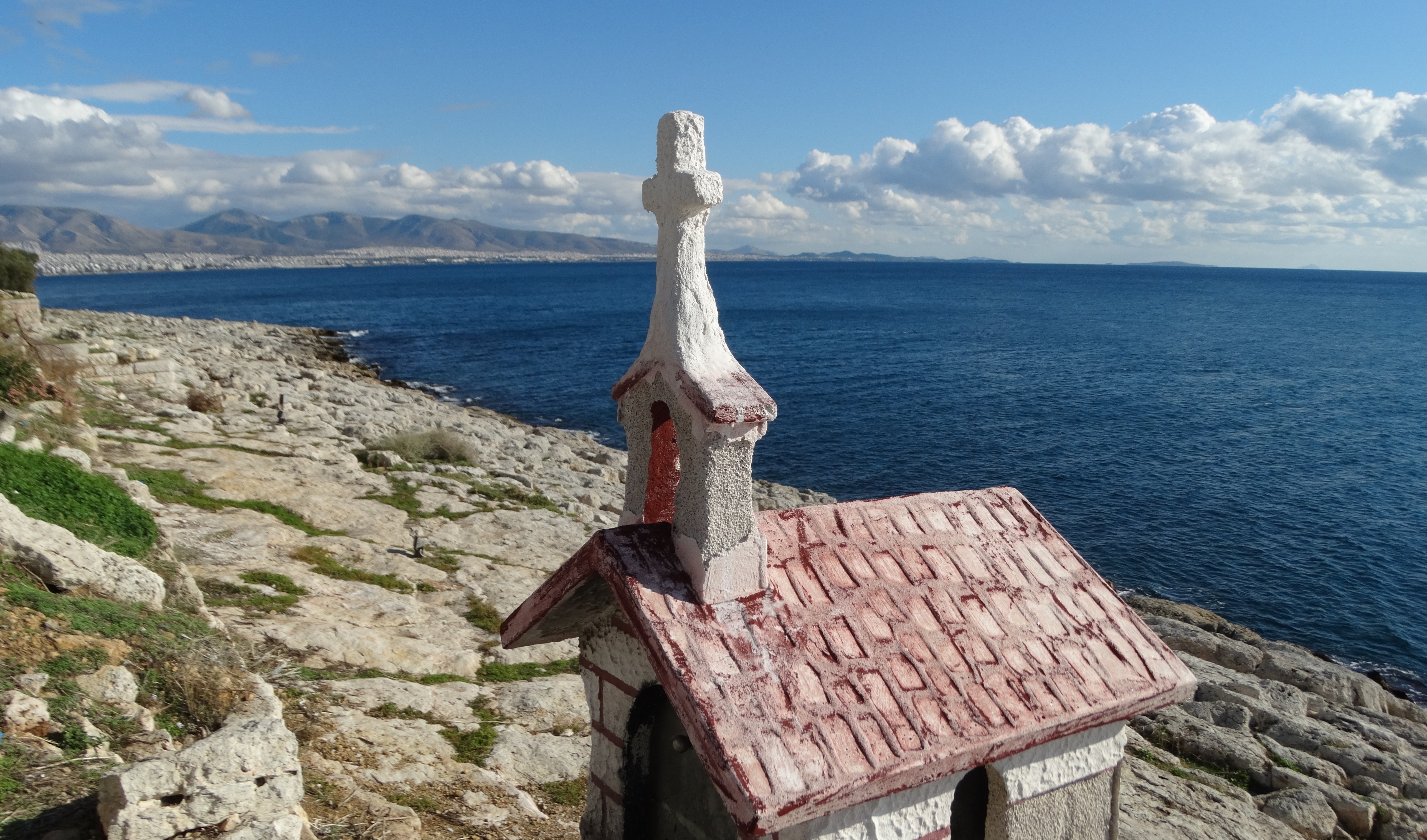
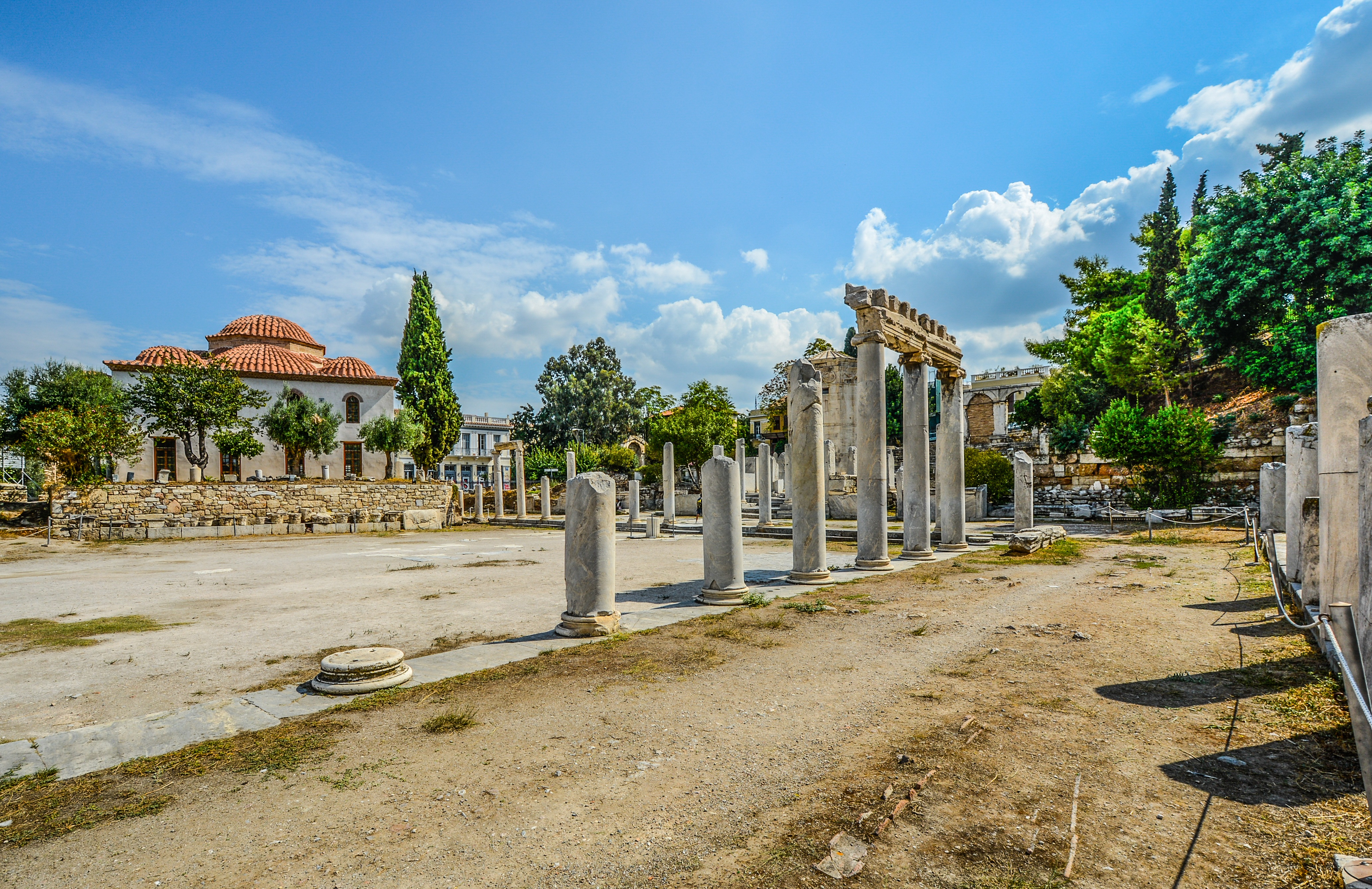
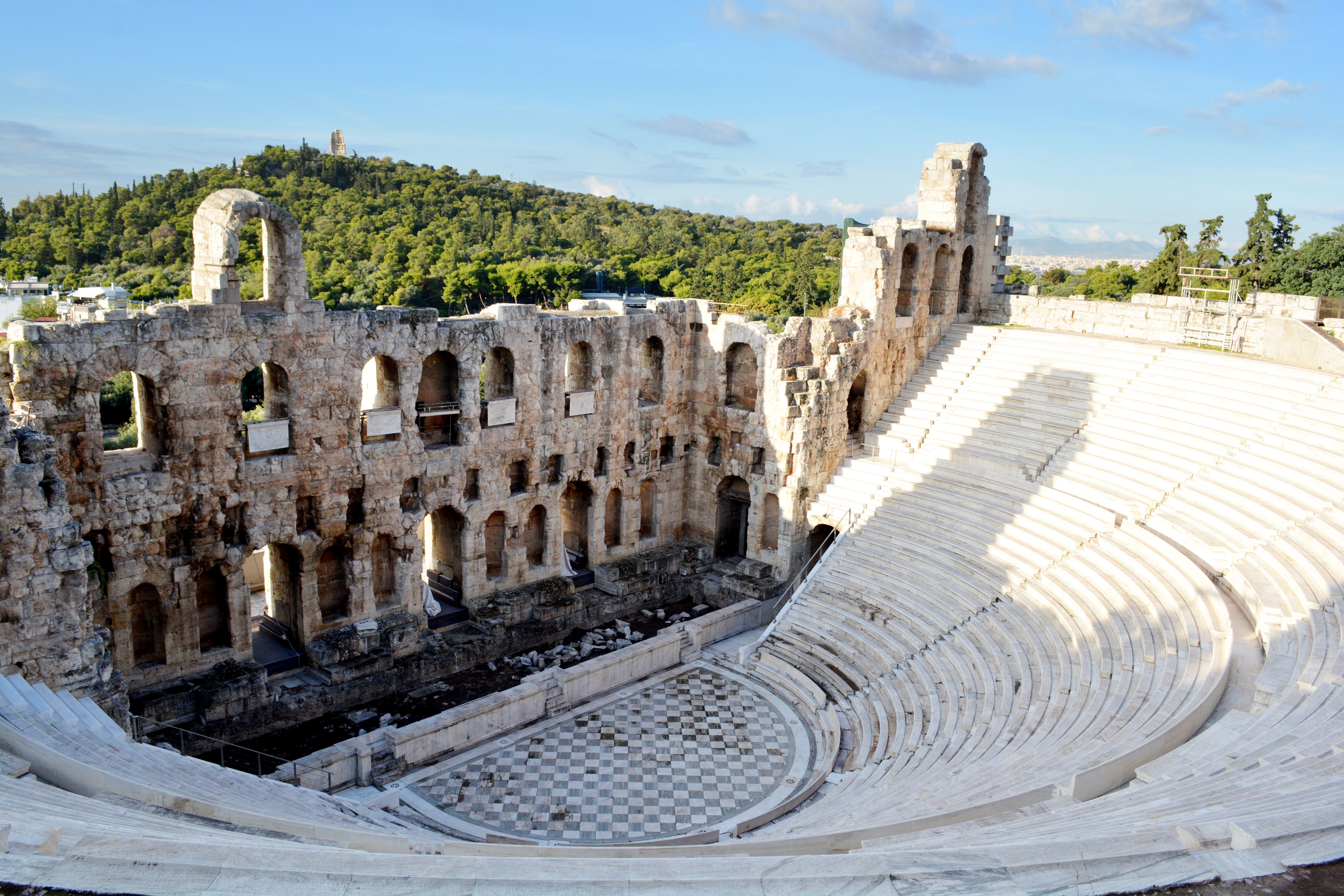
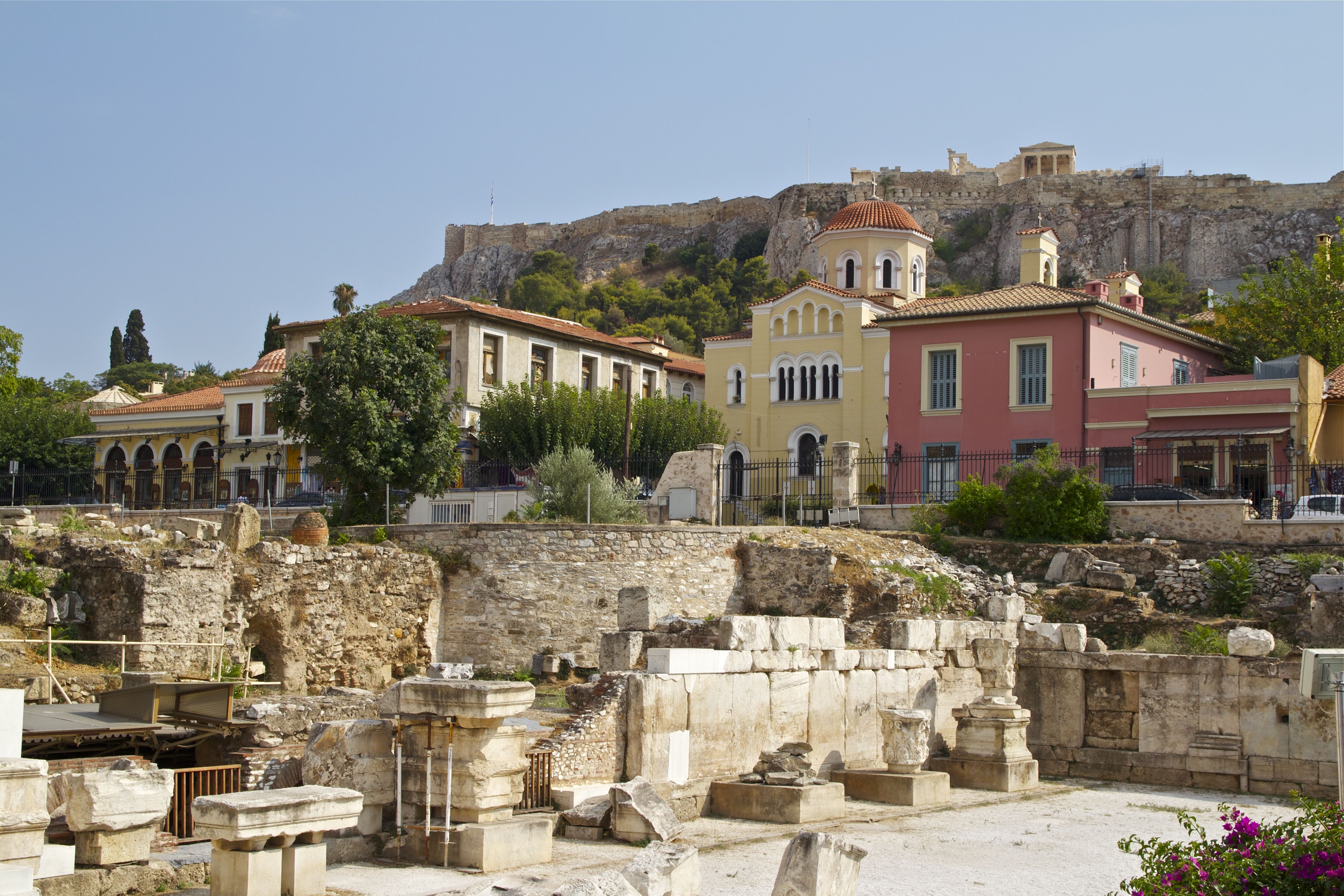
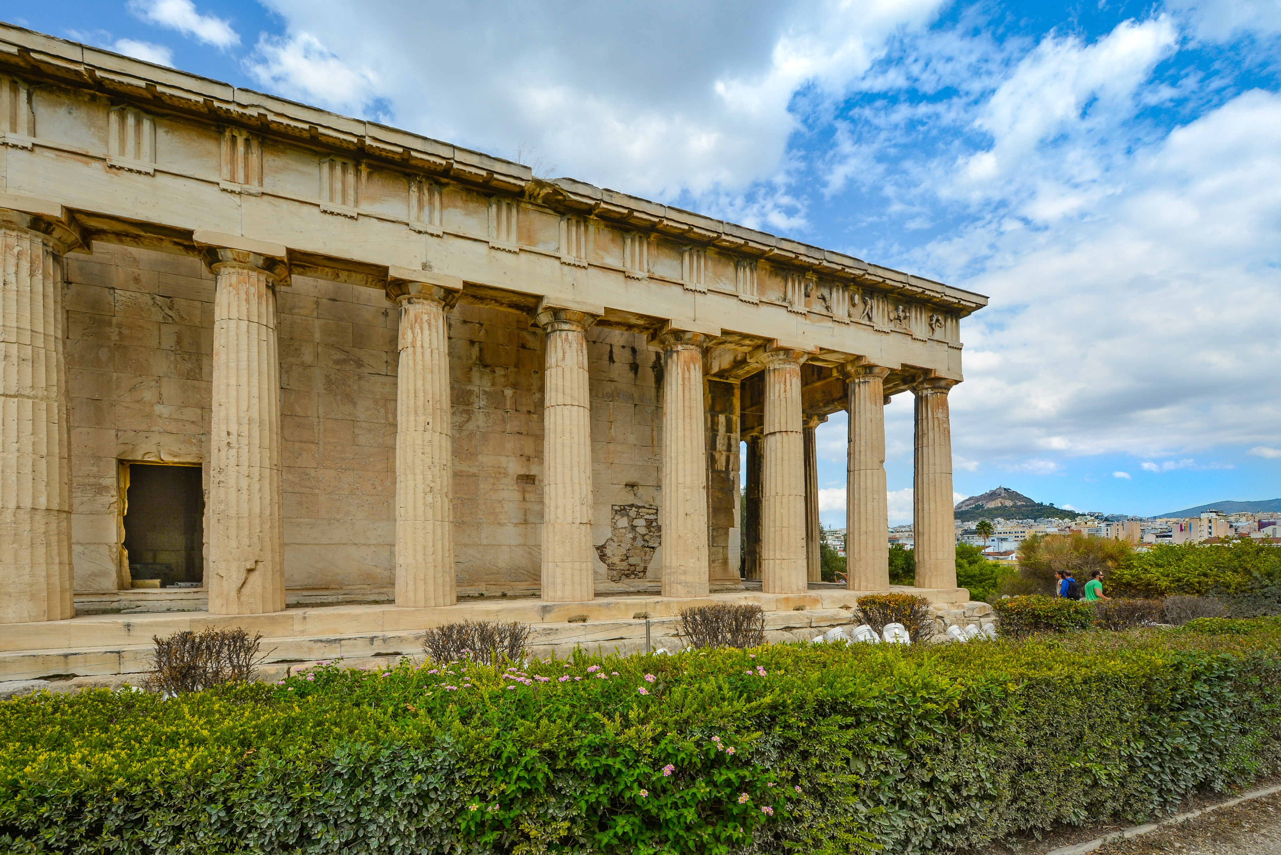
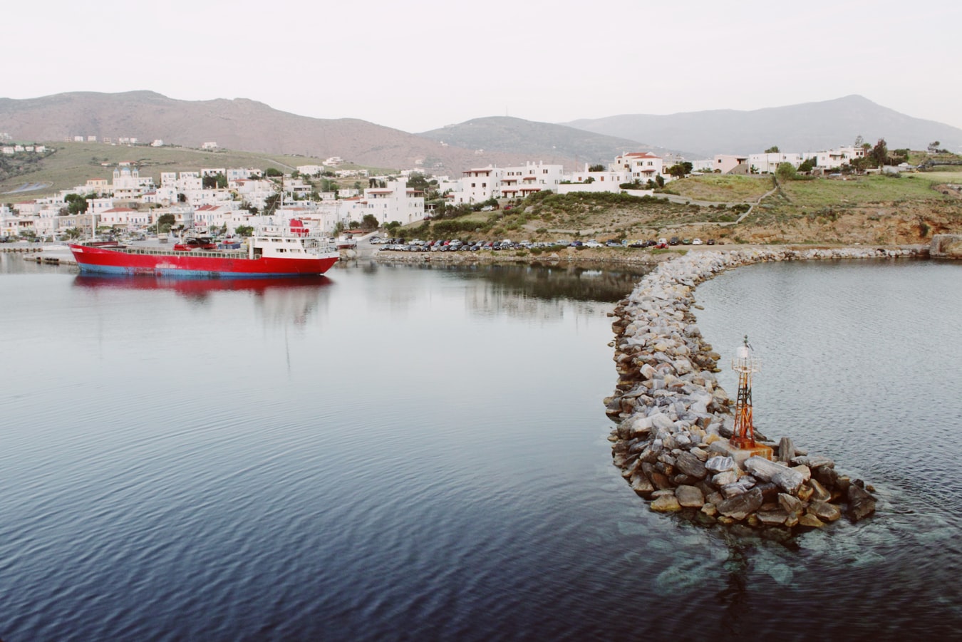
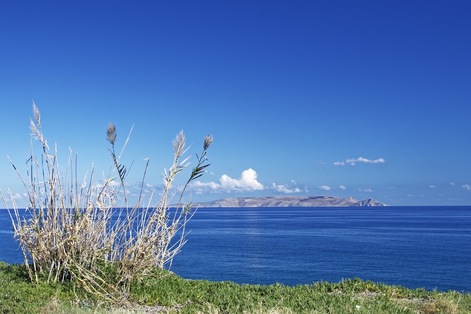
About Athens

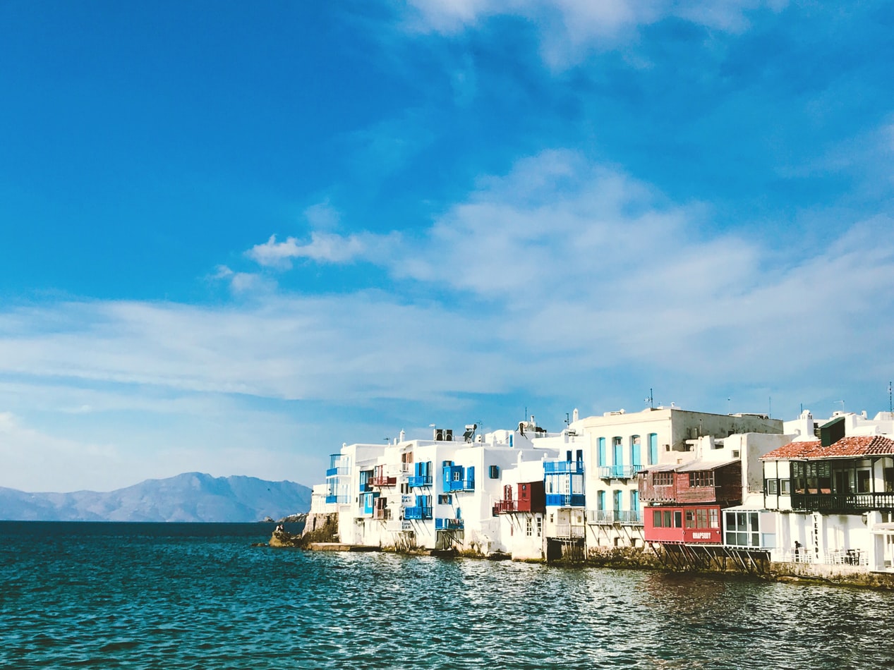
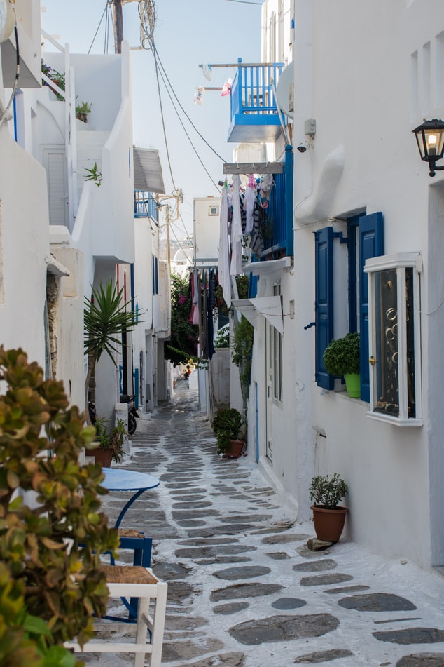
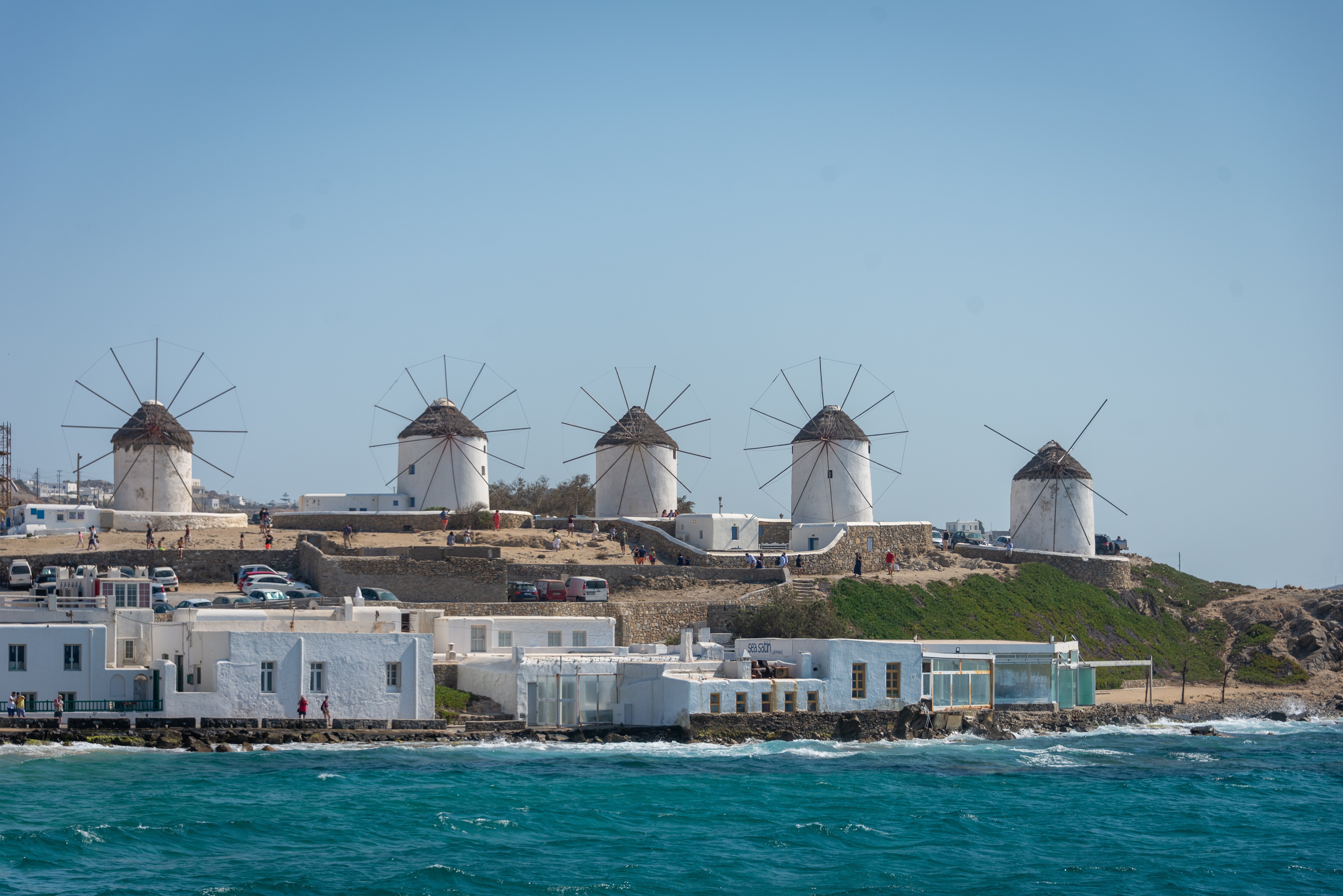
About Mykonos
Although the fishing boats still go out in good weather, Mykonos largely makes its living from tourism these days. The summer crowds have turned one of the poorest islands in Greece into one of the richest. Old Mykonians complain that their young, who have inherited stores where their grandfathers once sold eggs or wine, get so much rent that they have lost ambition, and in summer sit around pool bars at night with their friends, and hang out in Athens in winter when island life is less scintillating. Put firmly on the map by Jackie O in the 1960s, Mykonos town—called Hora by the locals—remains the Saint-Tropez of the Greek islands. The scenery is memorable, with its whitewashed streets, Little Venice, the Kato Myli ridge of windmills, and Kastro, the town's medieval quarter. Its cubical two- or three-story houses and churches, with their red or blue doors and domes and wooden balconies, have been long celebrated as some of the best examples of classic Cycladic architecture. Luckily, the Greek Archaeological Service decided to preserve the town, even when the Mykonians would have preferred to rebuild, and so the Old Town has been impressively preserved. Pink oleander, scarlet hibiscus, and trailing green pepper trees form a contrast amid the dazzling whiteness, whose frequent renewal with whitewash is required by law. Any visitor who has the pleasure of getting lost in its narrow streets (made all the narrower by the many outdoor stone staircases, which maximize housing space in the crowded village) will appreciate how its confusing layout was designed to foil pirates—if it was designed at all. After Mykonos fell under Turkish rule in 1537, the Ottomans allowed the islanders to arm their vessels against pirates, which had a contradictory effect: many of them found that raiding other islands was more profitable than tilling arid land. At the height of Aegean piracy, Mykonos was the principal headquarters of the corsair fleets—the place where pirates met their fellows, found willing women, and filled out their crews. Eventually the illicit activity evolved into a legitimate and thriving trade network. Morning on Mykonos town's main quay is busy with deliveries, visitors for the Delos boats, lazy breakfasters, and street cleaners dealing with the previous night's mess. In late morning the cruise-boat people arrive, and the shops are all open. In early afternoon, shaded outdoor tavernas are full of diners eating salads (Mykonos's produce is mostly imported); music is absent or kept low. In mid- and late afternoon, the town feels sleepy, since so many people are at the beach, on excursions, or sleeping in their air-conditioned rooms; even some tourist shops close for siesta. By sunset, people have come back from the beach, having taken their showers and rested. At night, the atmosphere in Mykonos ramps up. The cruise-boat people are mostly gone, coughing three-wheelers make no deliveries in the narrow streets, and everyone is dressed sexy for summer and starting to shimmy with the scene. Many shops stay open past midnight, the restaurants fill up, and the bars and discos make ice cubes as fast as they can. Ready to dive in? Begin your tour of Mykonos town (Hora) by starting out at its heart: Mando Mavrogenous Square.
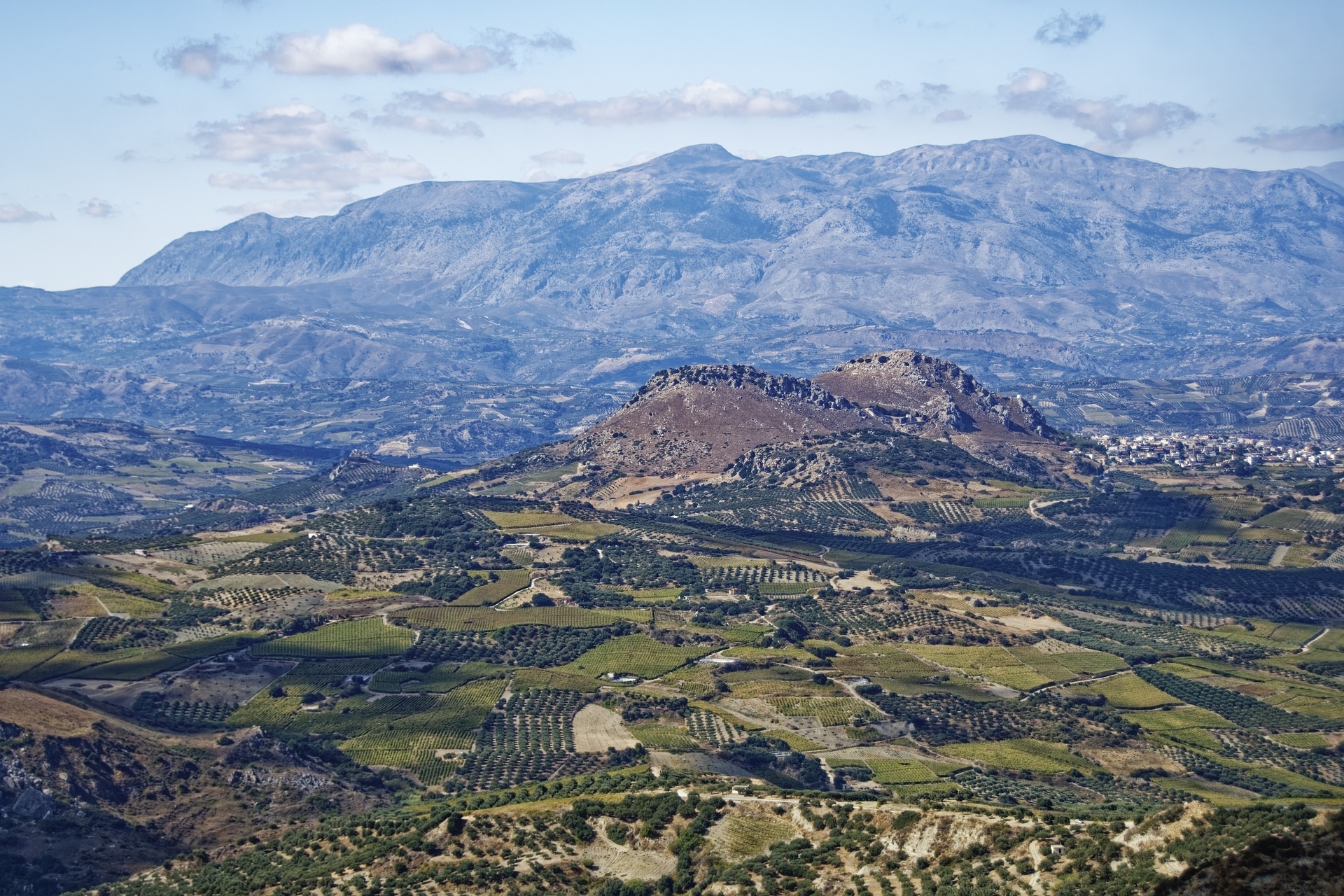
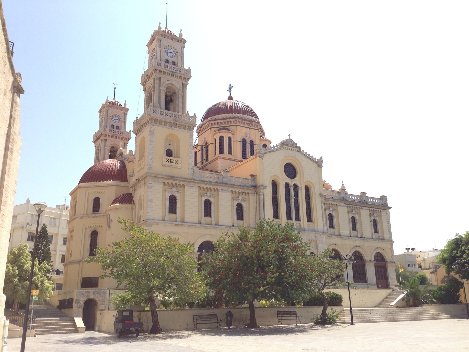
About Heraklion (Iraklion), Crete
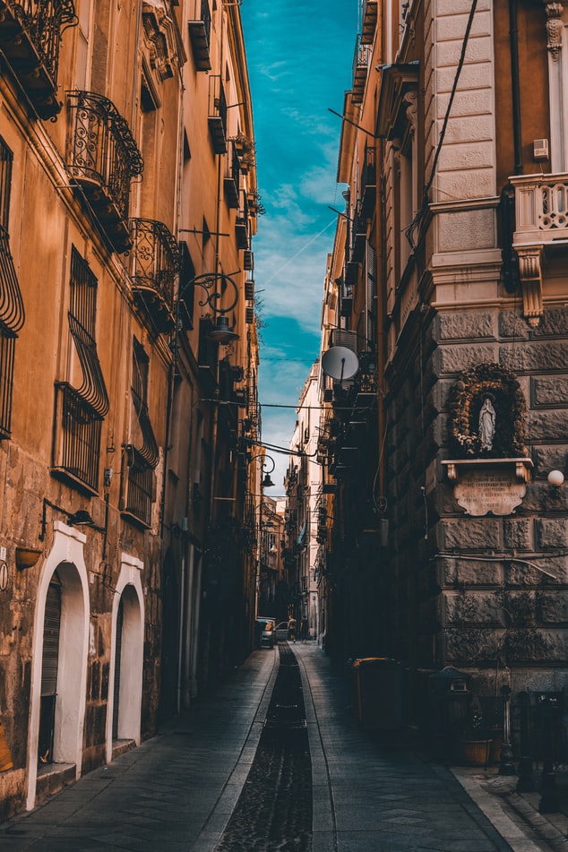
Having been controlled by Arabic, Venetian and Ottoman empires over the years - it's no surprise that Heraklion is a diverse patchwork of exotic cultures and historical treasures. Celebrated as the birthplace of the Spanish Renaissance artist, El Greco, you can visit to explore the storied ruins of the Minoan empire's capital, and unearth the rich cultural treasures that Crete’s bustling modern capital has to offer.
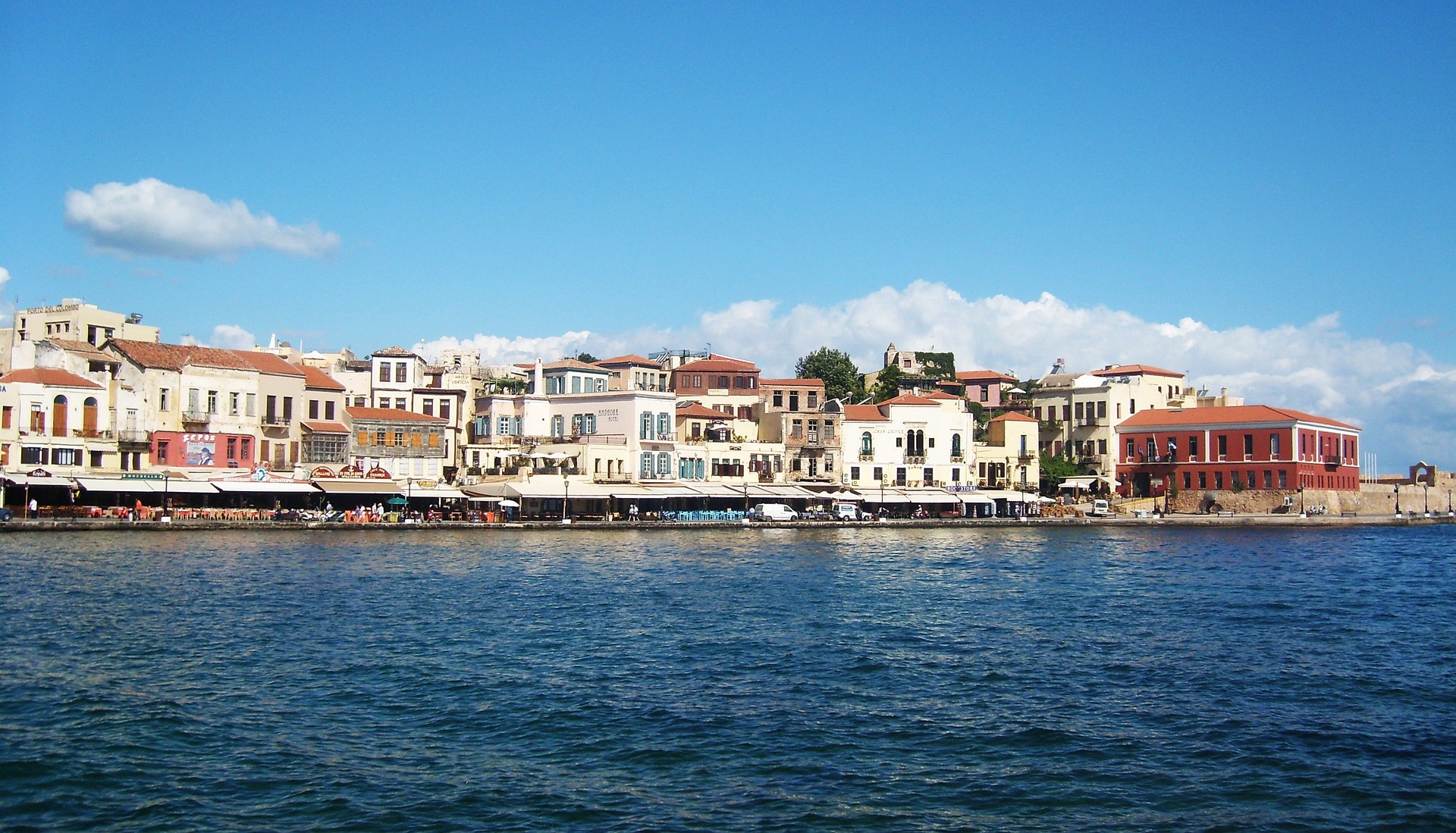
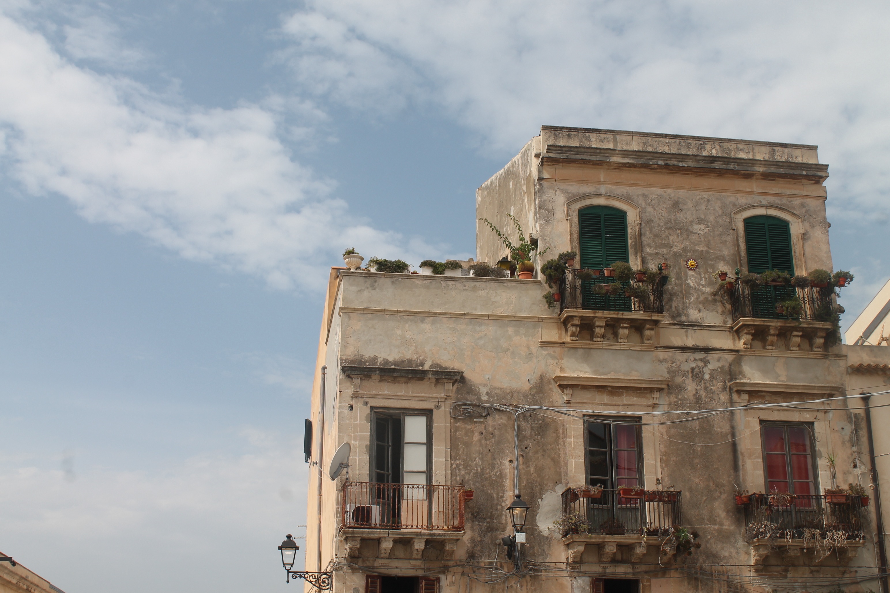
About Siracuse, Sicily
Siracusa, known to English speakers as Syracuse, is a wonder to behold. One of the great ancient capitals of Western civilization, the city was founded in 734 BC by Greek colonists from Corinth and soon grew to rival, and even surpass, Athens in splendor and power. It became the largest, wealthiest city-state in the West and a bulwark of Greek civilization. Although Siracusa lived under tyranny, rulers such as Dionysius filled their courts with Greeks of the highest cultural stature—among them the playwrights Aeschylus and Euripides, and the philosopher Plato. The Athenians, who didn't welcome Siracusa's rise, set out to conquer Sicily, but the natives outsmarted them in what was one of the greatest military campaigns in ancient history (413 BC). The city continued to prosper until it was conquered two centuries later by the Romans.Present-day Siracusa still has some of the finest examples of Baroque art and architecture; dramatic Greek and Roman ruins; and a Duomo that's the stuff of legend—a microcosm of the city's entire history in one building. The modern city also has a wonderful, lively, Baroque old town worthy of extensive exploration, as well as pleasant piazzas, outdoor cafés and bars, and a wide assortment of excellent seafood. There are essentially two areas to explore in Siracusa: the Parco Archeologico (Archaeological Zone), on the mainland; and the island of Ortygia, the ancient city first inhabited by the Greeks, which juts out into the Ionian Sea and is connected to the mainland by two small bridges. Ortygia is becoming increasingly popular with tourists, and is starting to lose its old-fashioned charm in favor of modern boutiques.Siracusa's old nucleus of Ortygia, a compact area, is a pleasure to amble around without getting unduly tired. In contrast, mainland Siracusa is a grid of wider avenues. At the northern end of Corso Gelone, above Viale Paolo Orsi, the orderly grid gives way to the ancient quarter of Neapolis, where the sprawling Parco Archeologico is accessible from Viale Teracati (an extension of Corso Gelone). East of Viale Teracati, about a 10-minute walk from the Parco Archeologico, the district of Tyche holds the archaeological museum and the church and catacombs of San Giovanni, both off Viale Teocrito (drive or take a taxi or city bus from Ortygia). Coming from the train station, it's a 15-minute trudge to Ortygia along Via Francesco Crispi and Corso Umberto. If you're not up for that, take one of the free electric buses leaving every 10 minutes from the bus station around the corner.
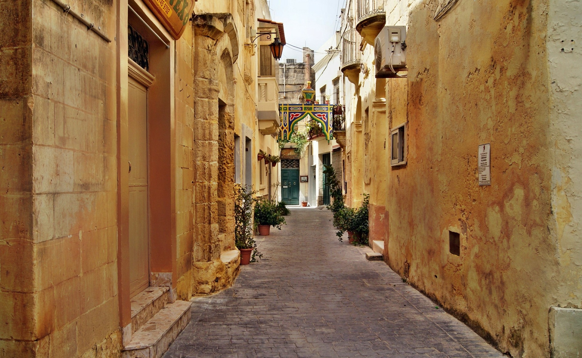
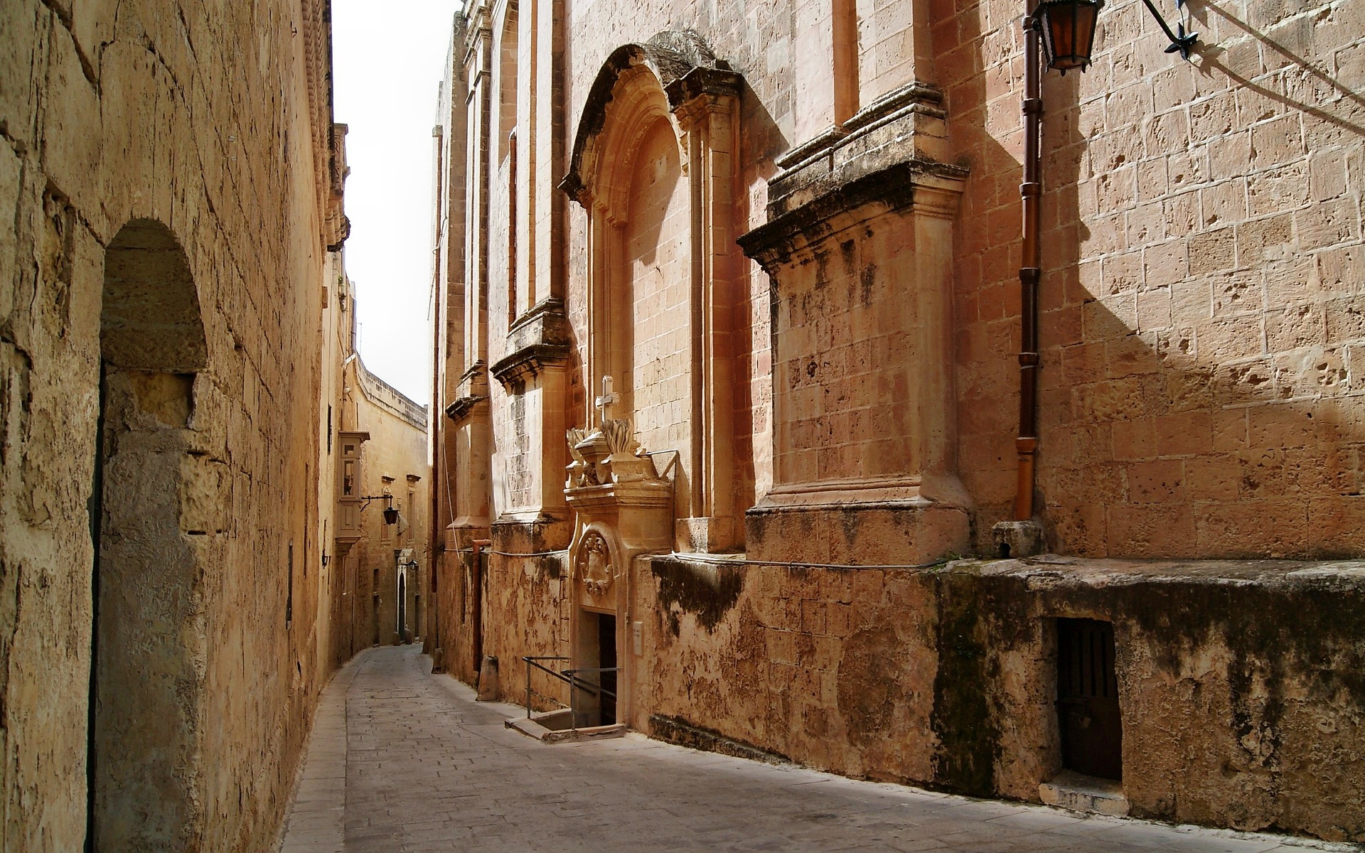
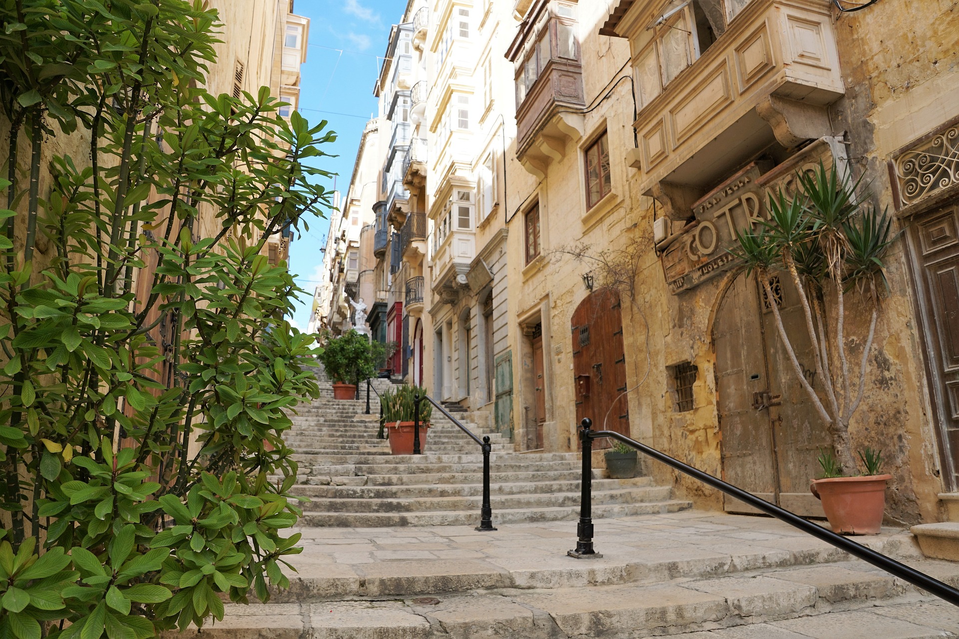
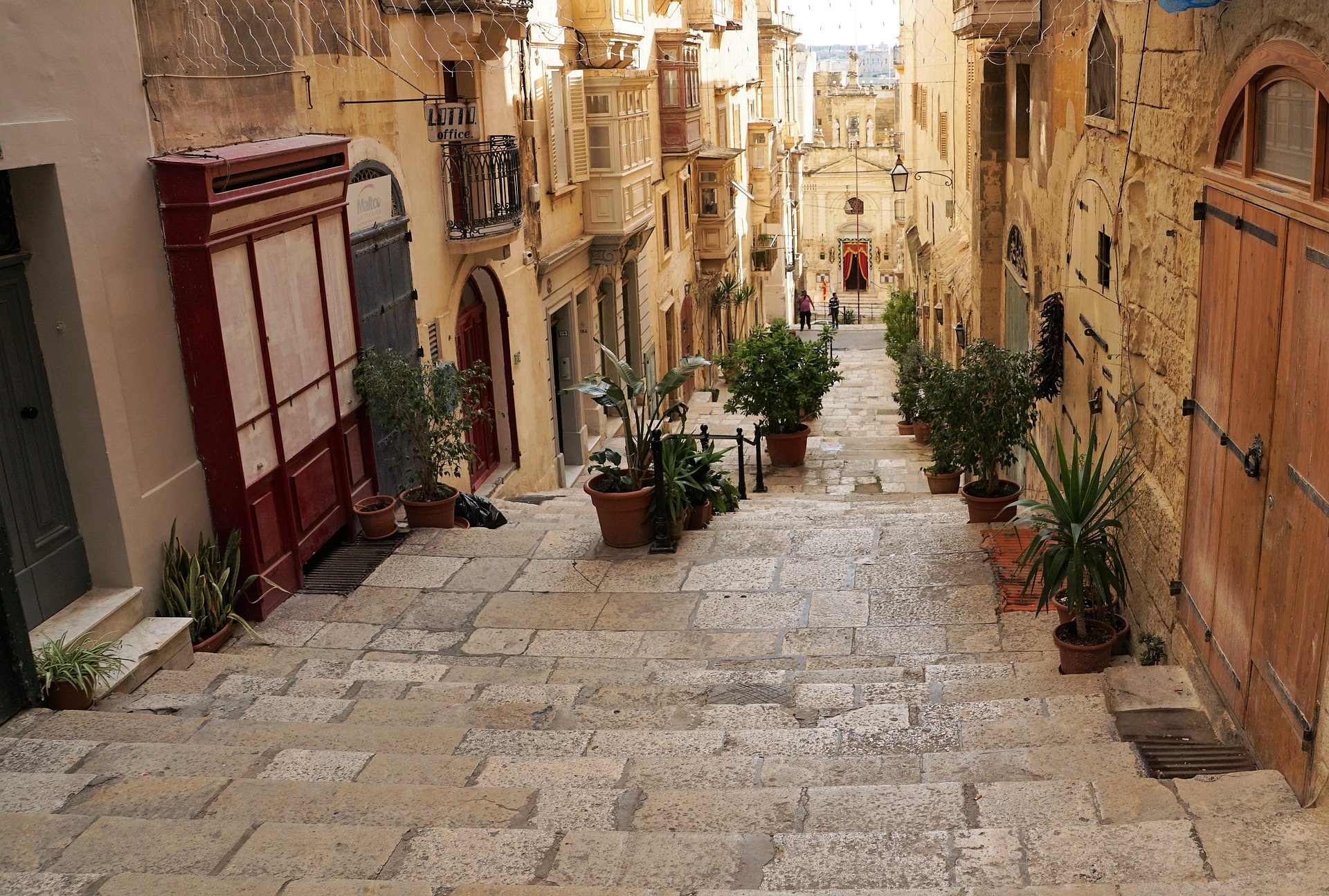
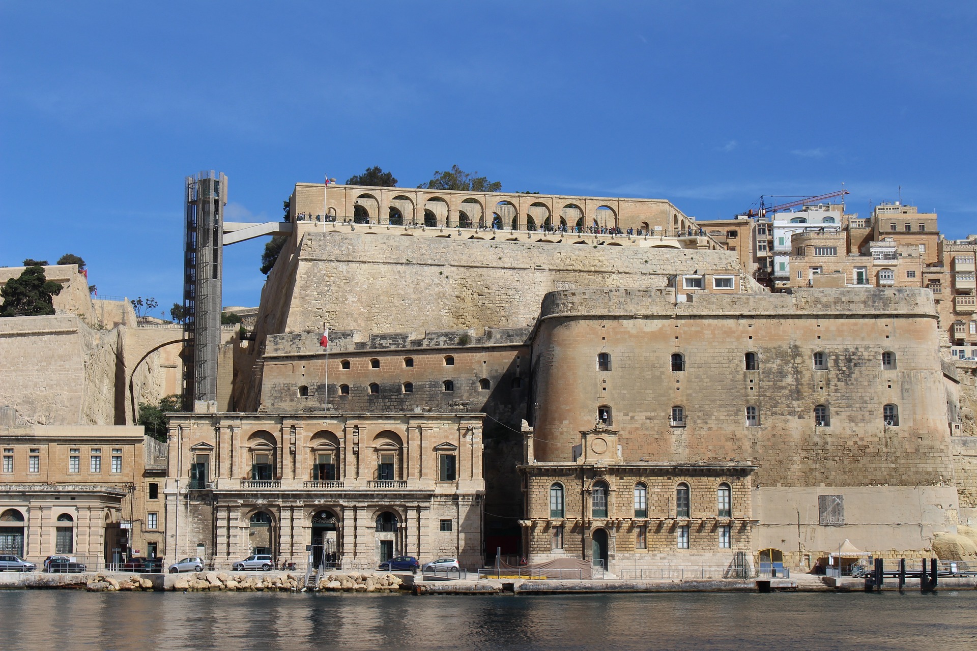
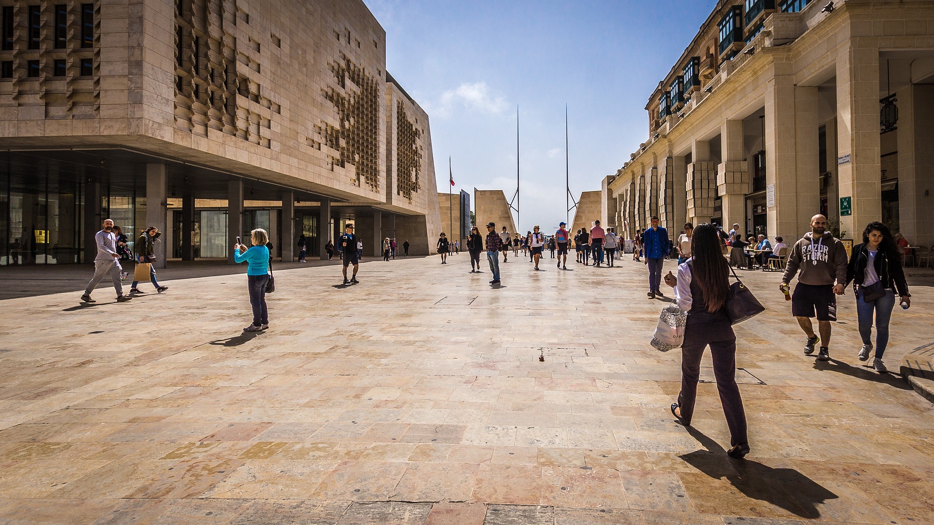
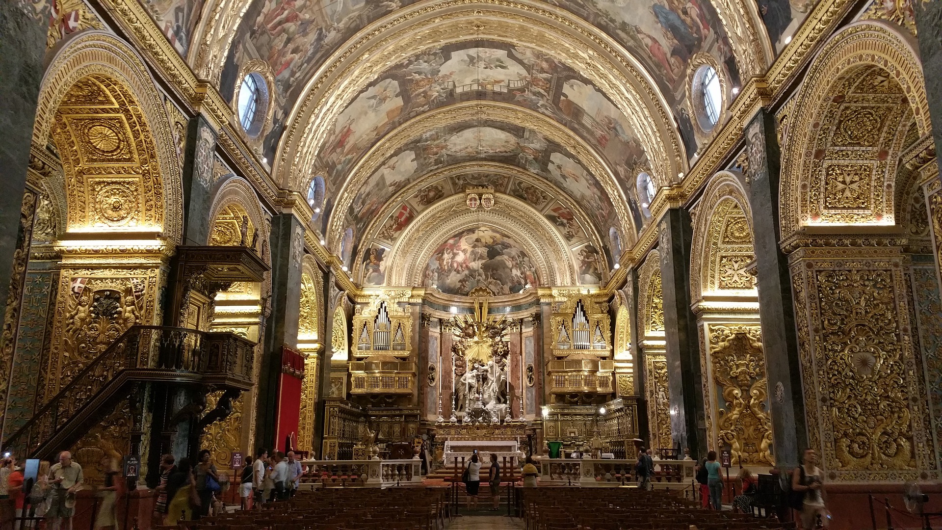
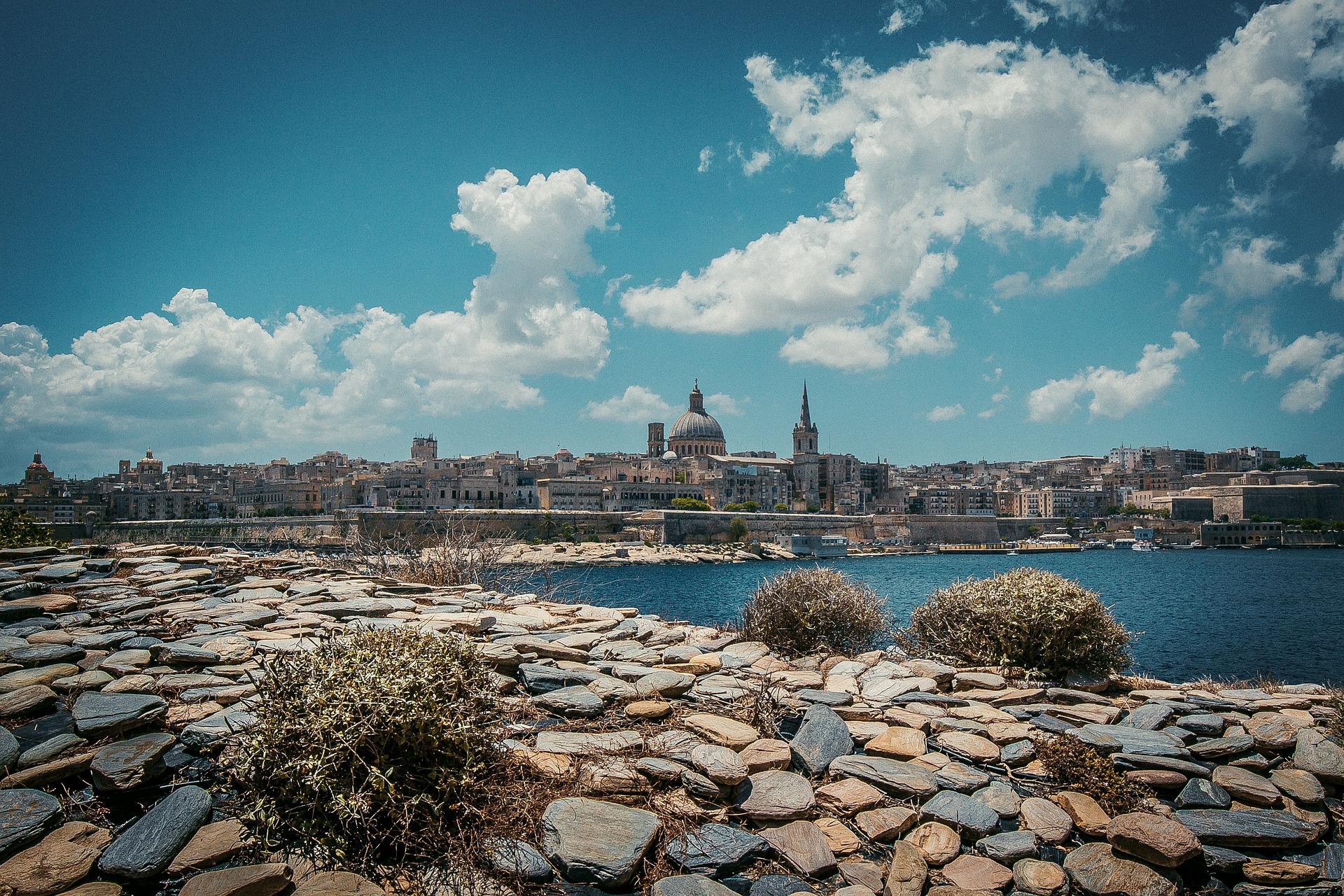
About Valletta
Malta's capital, the minicity of Valletta, has ornate palaces and museums protected by massive fortifications of honey-color limestone. Houses along the narrow streets have overhanging wooden balconies for people-watching from indoors. Generations ago they gave housebound women a window on the world of the street. The main entrance to town is through the City Gate (where all bus routes end), which leads onto Triq Repubblika (Republic Street), the spine of the grid-pattern city and the main shopping street. Triq Mercante (Merchant Street) parallels Repubblika to the east and is also good for strolling. From these two streets, cross streets descend toward the water; some are stepped. Valletta's compactness makes it ideal to explore on foot. City Gate and the upper part of Valletta are experiencing vast redevelopment that includes a new Parliament Building and open-air performance venue. The complex, completed mid-2013, has numerous pedestrian detours in place along with building noise and dust. Before setting out along Republic Street, stop at the tourist information office on Merchant Street for maps and brochures.
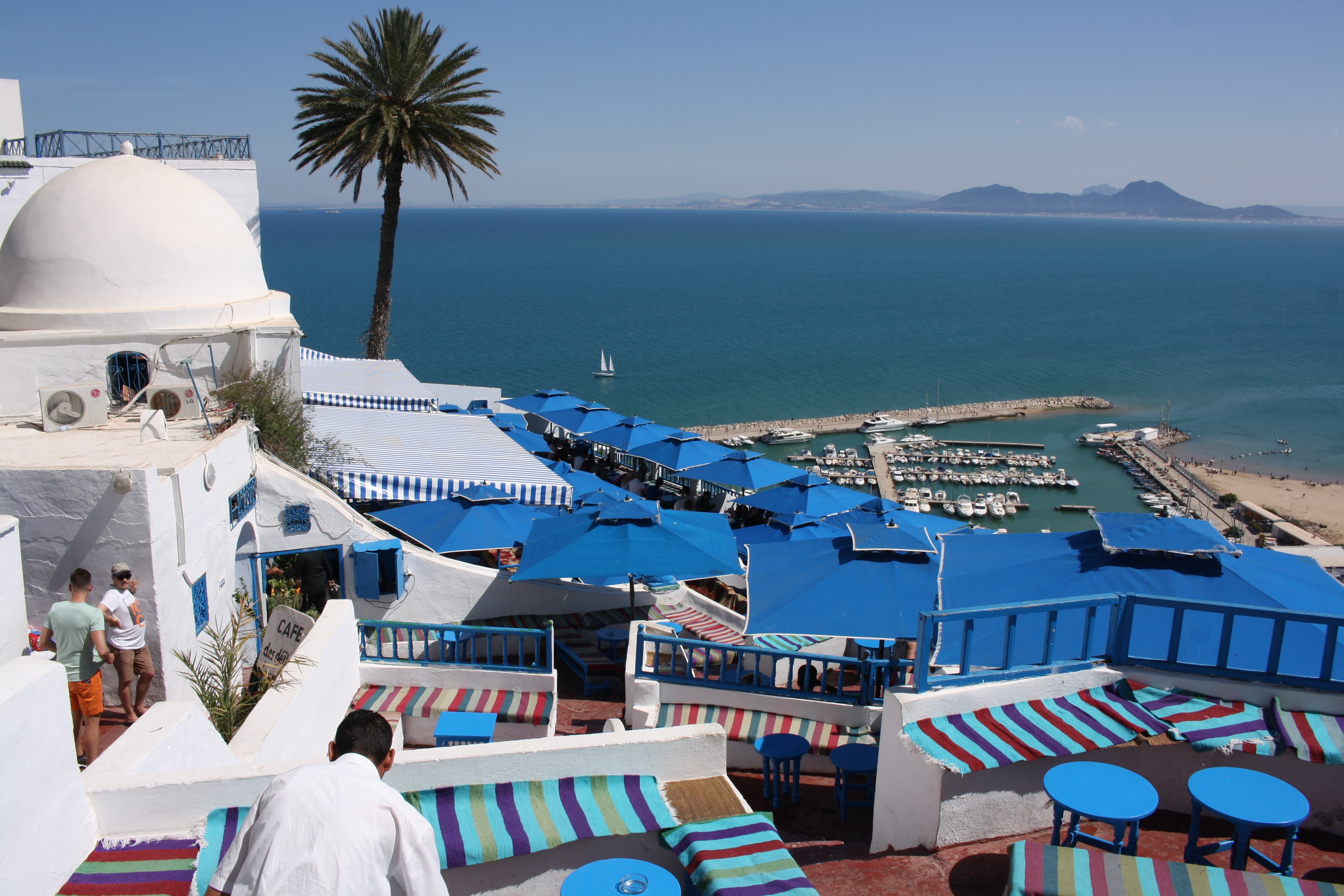
About La Goulette
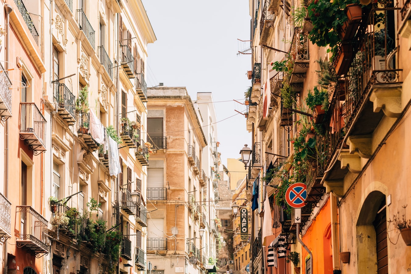
About Cagliari
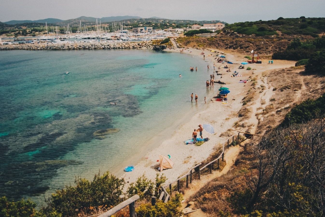
Known in Sardinia as Casteddu, the island's capital has steep streets and impressive Italianate architecture, from modern to medieval. This city of nearly 160,000 people is characterized by a busy commercial center and waterfront with broad avenues and arched arcades, as well as by the typically narrow streets of the old hilltop citadel (called, simply, “Castello”). The Museo Archeologico makes a good starting point to a visit. The imposing Bastione di Saint Remy and Mercato di San Benedetto (one of the best fish markets in Italy) are both musts.
About Porto, Corsica
About Ajaccio, Corsica
Considered Corsica’s primary commercial and cultural hub, the largest city and regional capital of Ajaccio is situated on the west coast of the island, approximately 644 km (400 miles) southeast of Marseille, France. Founded in 1492, vestiges of ancient Corsica in this ville impériale revolve around the city’s most famous son, Napoléon Bonaparte, whose family home—now the national museum Maison Bonaparte—pays tribute to the emperor’s historical influence.Remnants from what was originally a 12th-century Genoese colony are still visible around the Old Town near the imposing citadel and watchtower. Perfect for exploring, the luminous seaside city surrounded by snowcapped mountains and pretty beaches offers numerous sites, eateries, side streets, and a popular harbor, where sailboats and fishing vessels moor in the picturesque Tino Rossi port lined with well-established restaurants and cafés serving fresh local fare.
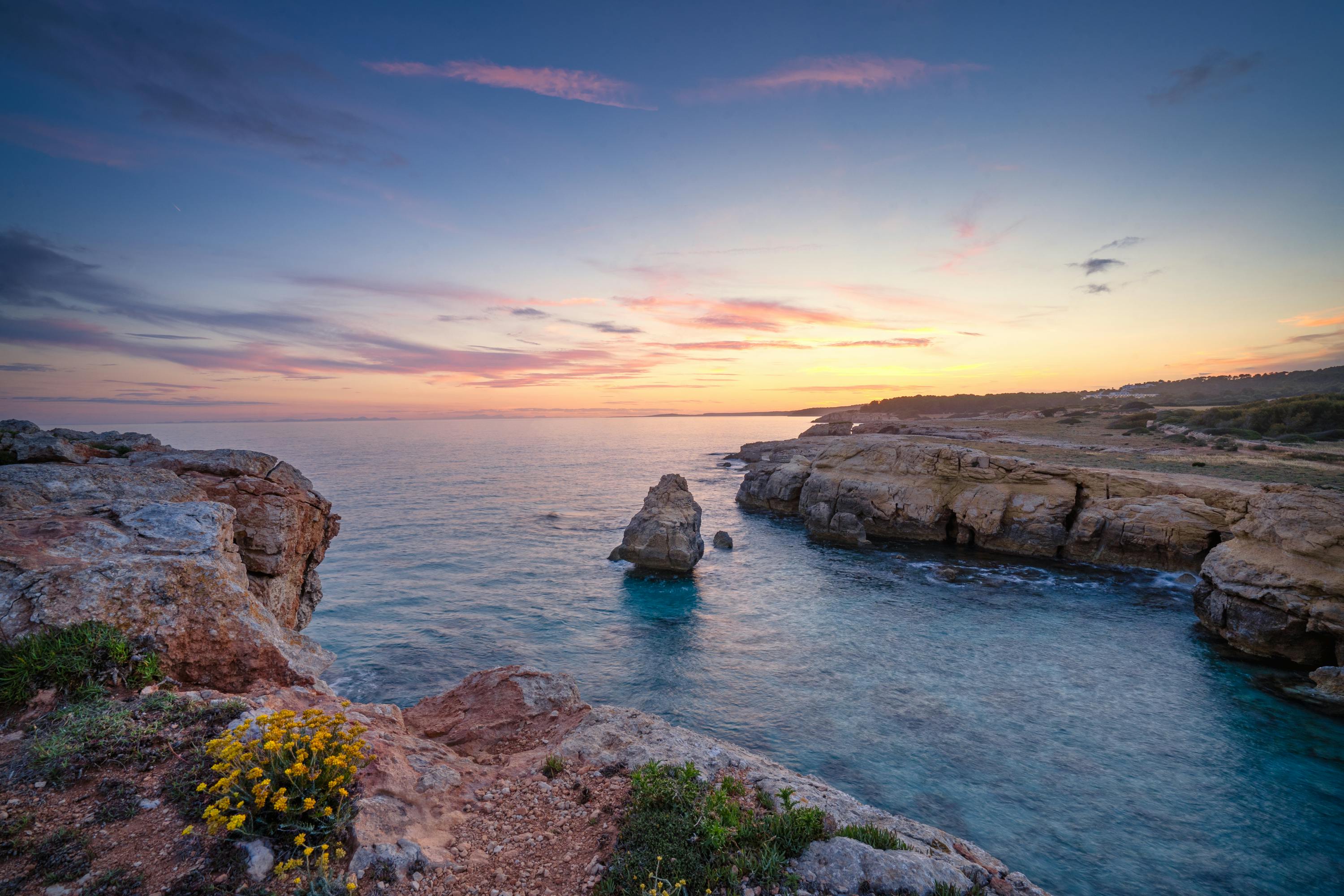
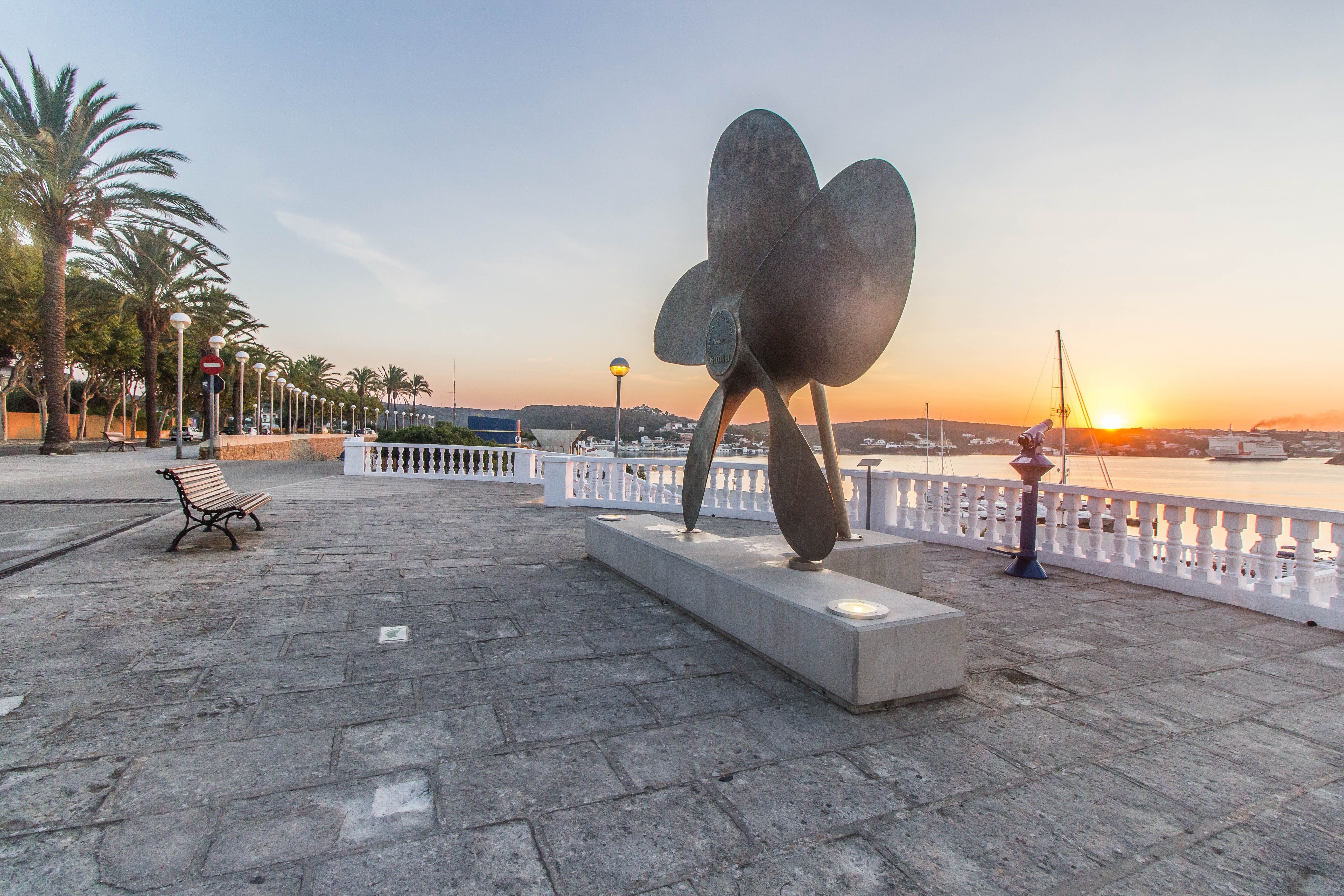
About Mahón, Menorca
The capital of Menorca since 1721, Mahon has a impressive natural deep water harbour, which is one of the largest in the world. This, coupled with its strategic location, has made it a stronghold for many nations throughout history. Mahon has an abundance of historical buildings, the oldest being the Arch of Saint Roc which is all that remains of the wall that once encircled the whole town. The island was occupied by the British during the 18th century and Lord Nelson is thought to have stayed there. Indeed, San Antoni Mansion, located on the north side of the harbour, houses a collection of Nelson memorabilia. The legacy of colonial rule can be seen in the muted Georgian style of some of the buildings, but Mahon still boasts attractive examples of neo-Classical, Baroque and Romanesque architecture. With narrow streets to explore, pleasant shaded squares and welcoming pavement cafés, there is something for everyone to enjoy. Please be aware that most shops in town close for a siesta between 1330 and 1730.

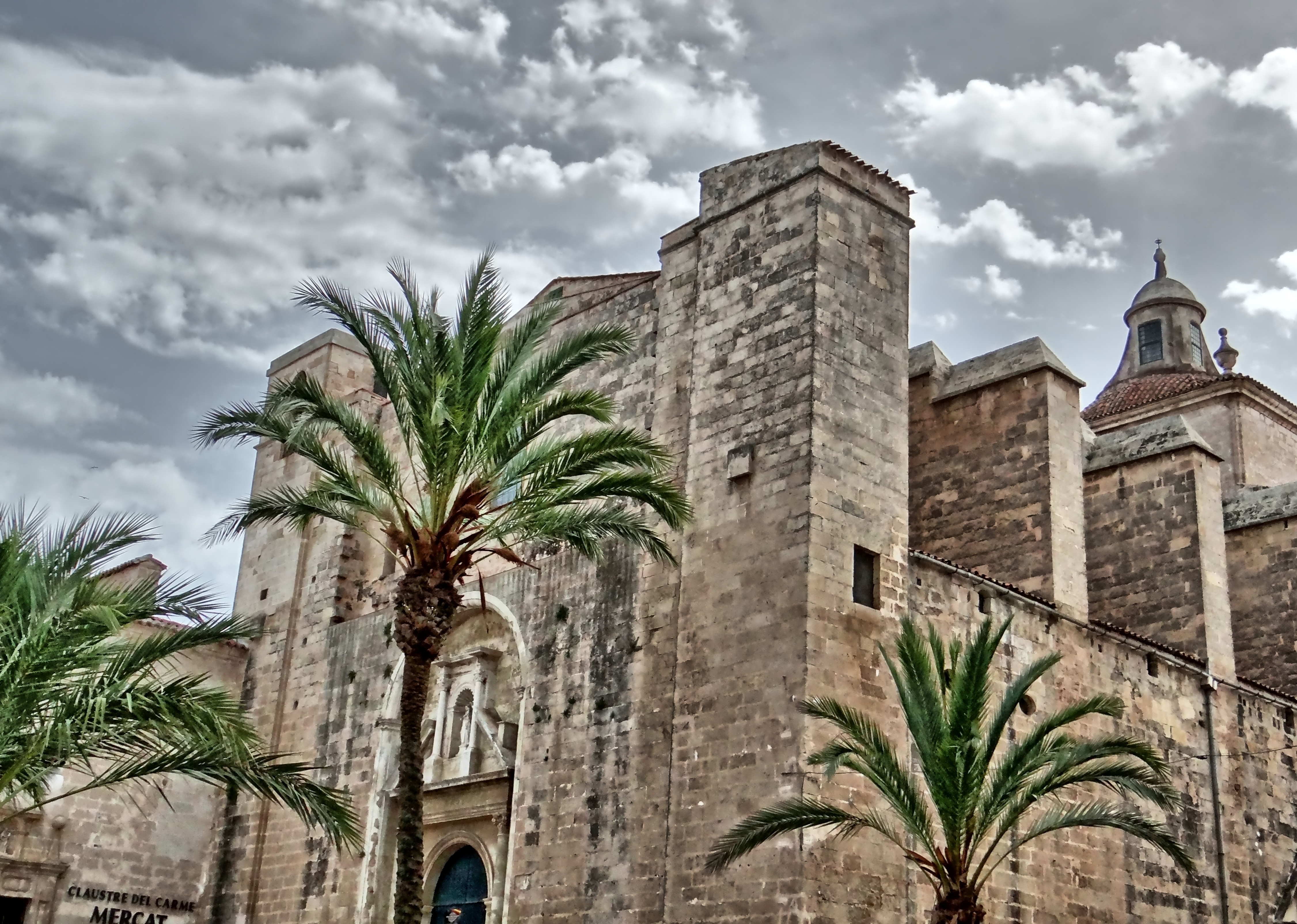
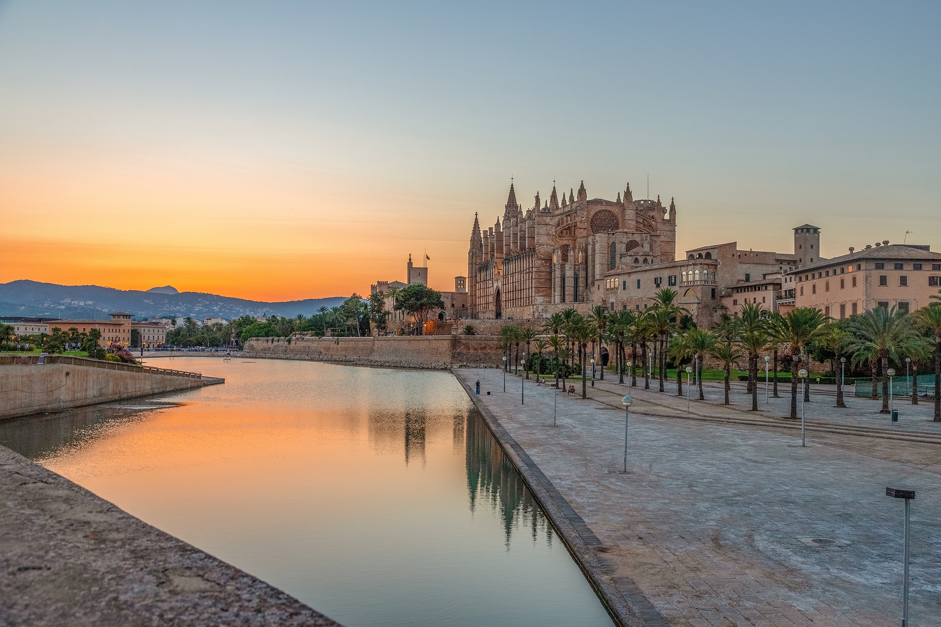
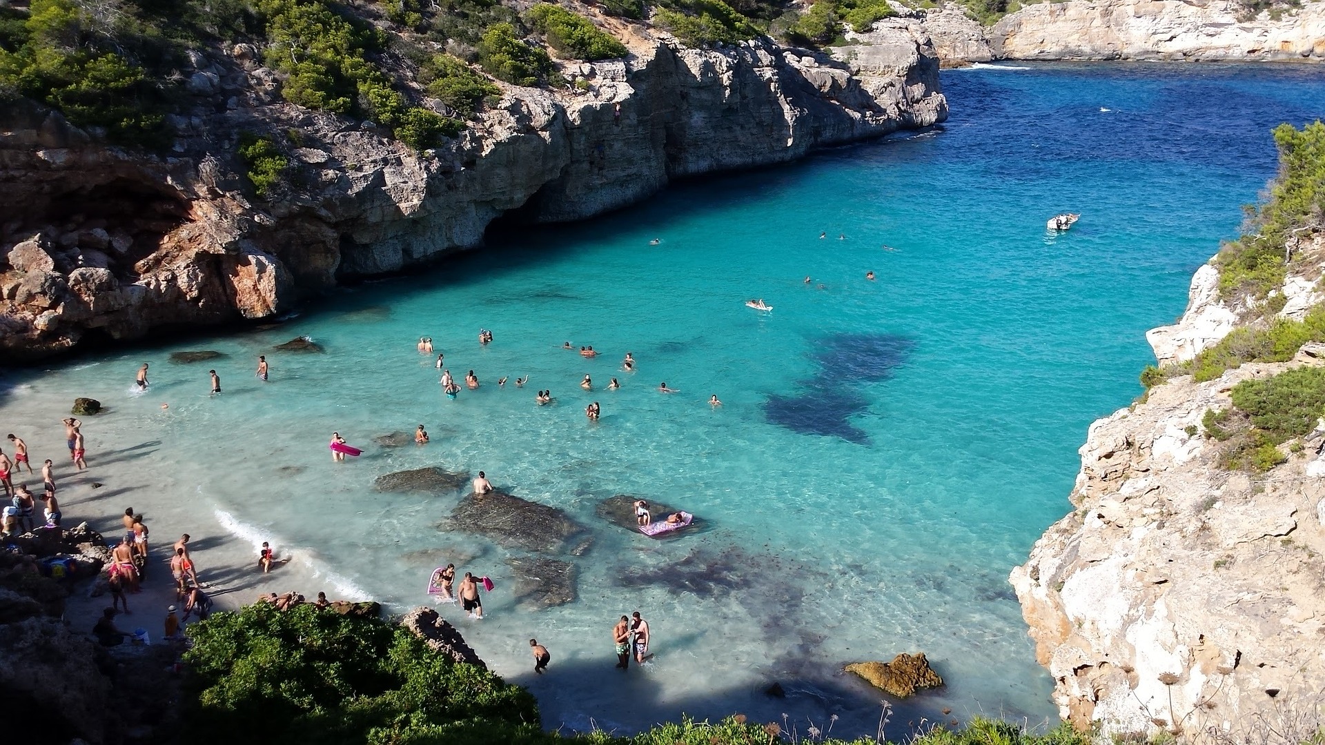
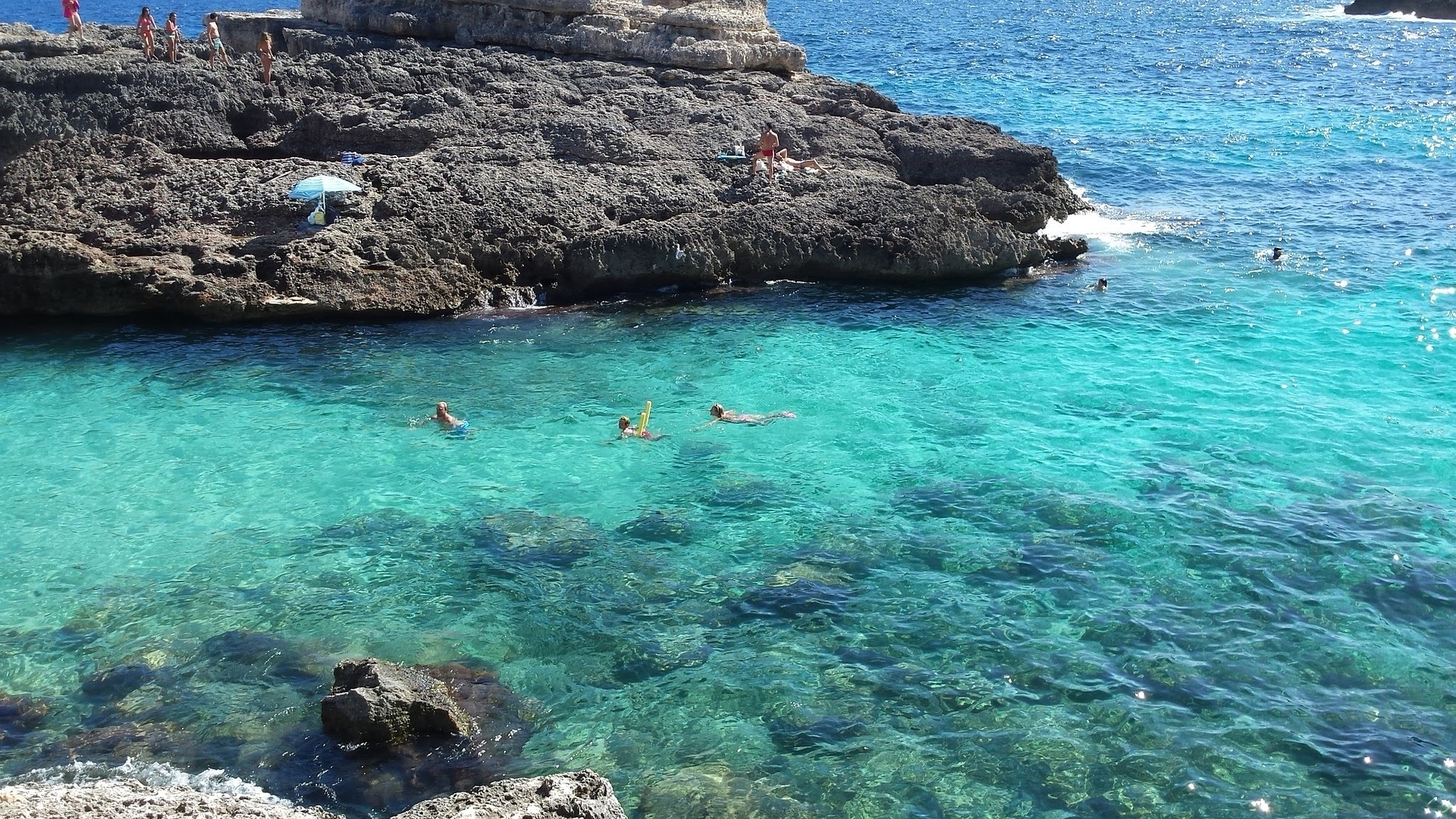
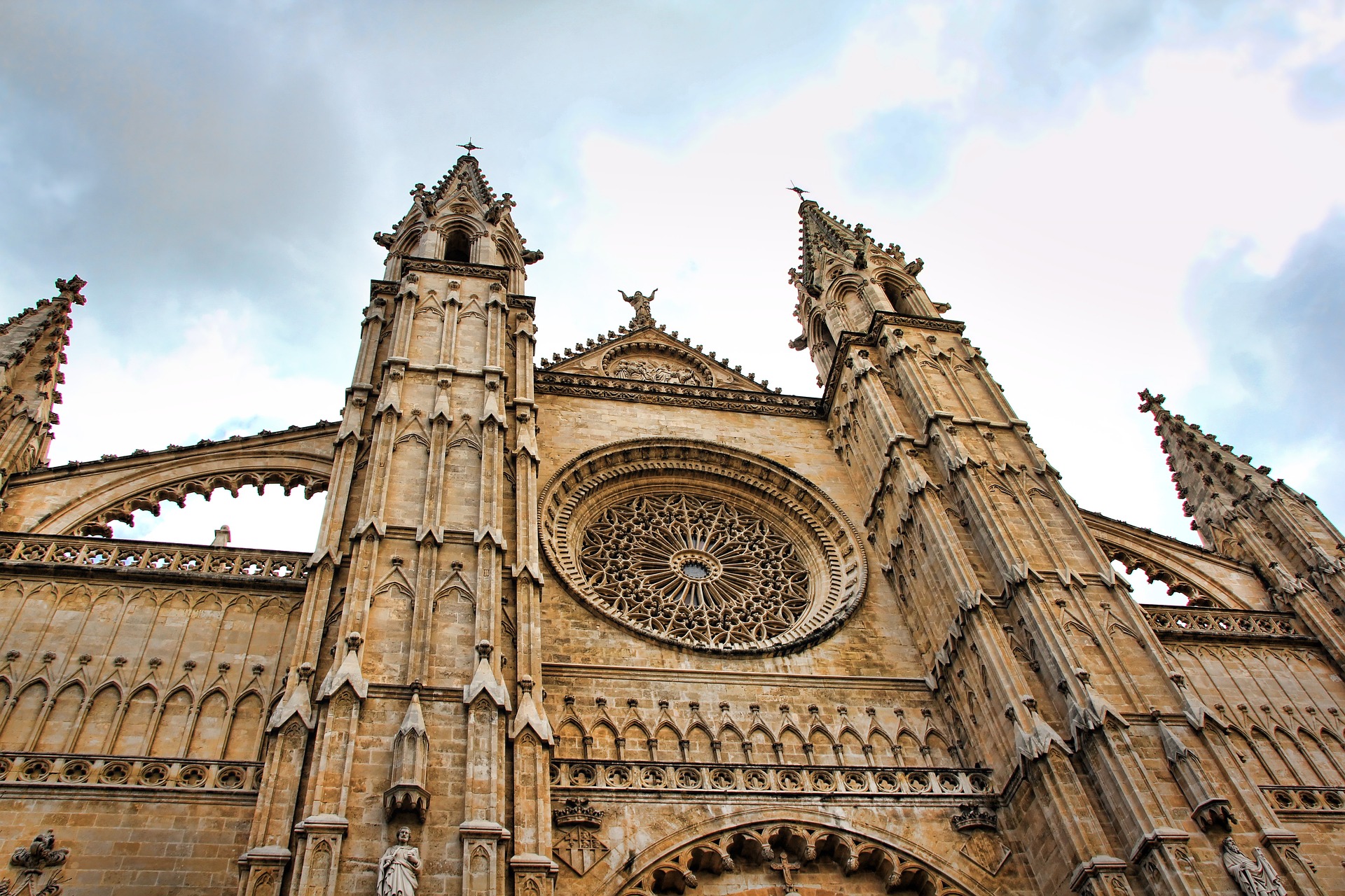
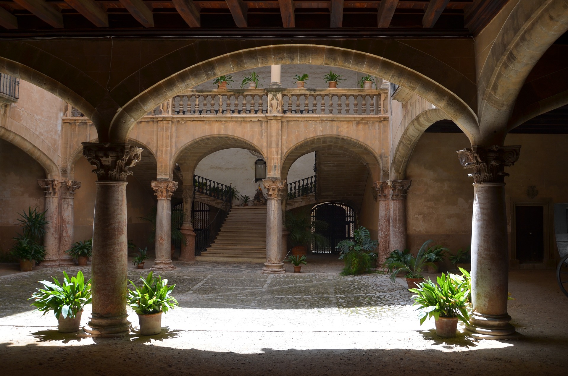
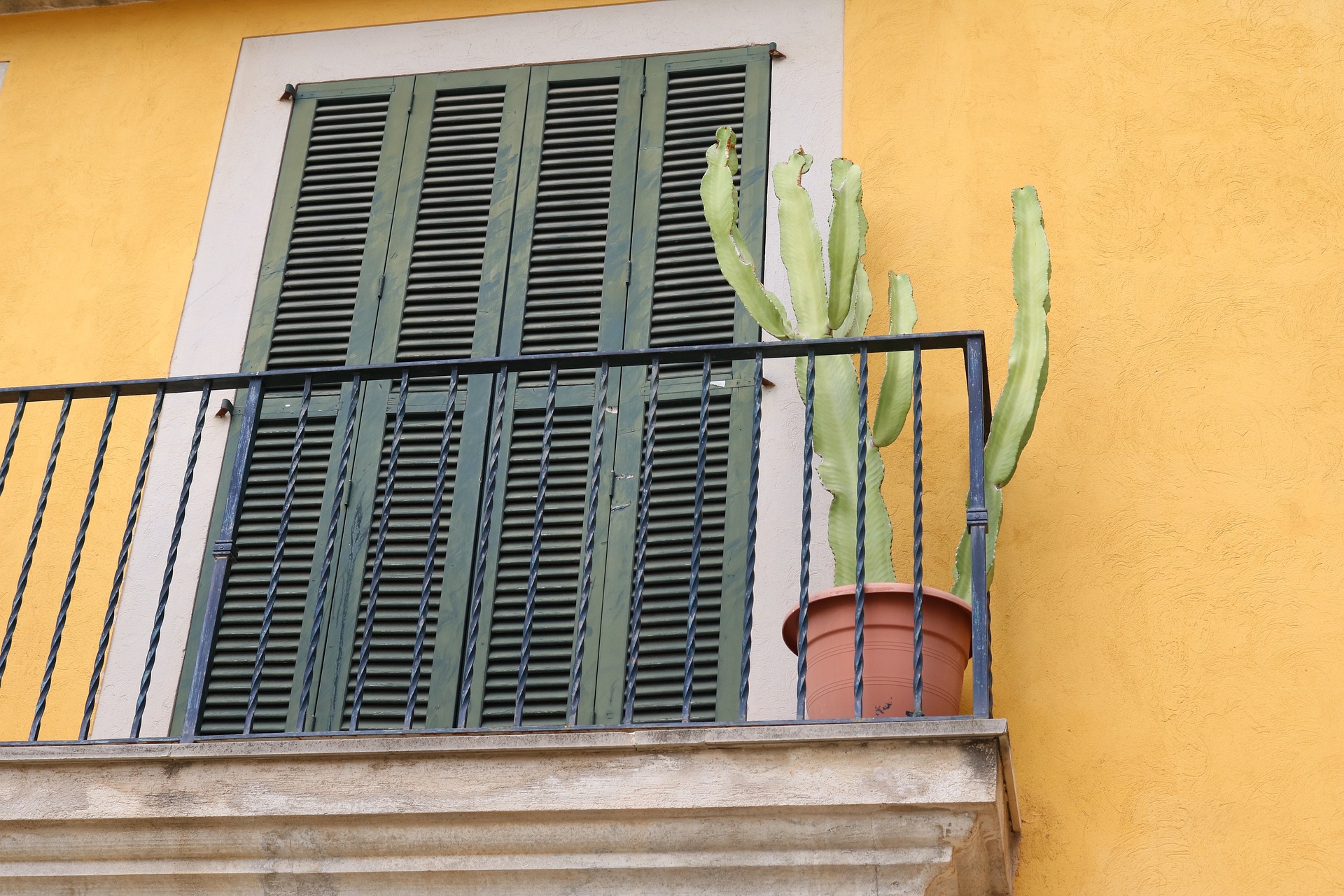
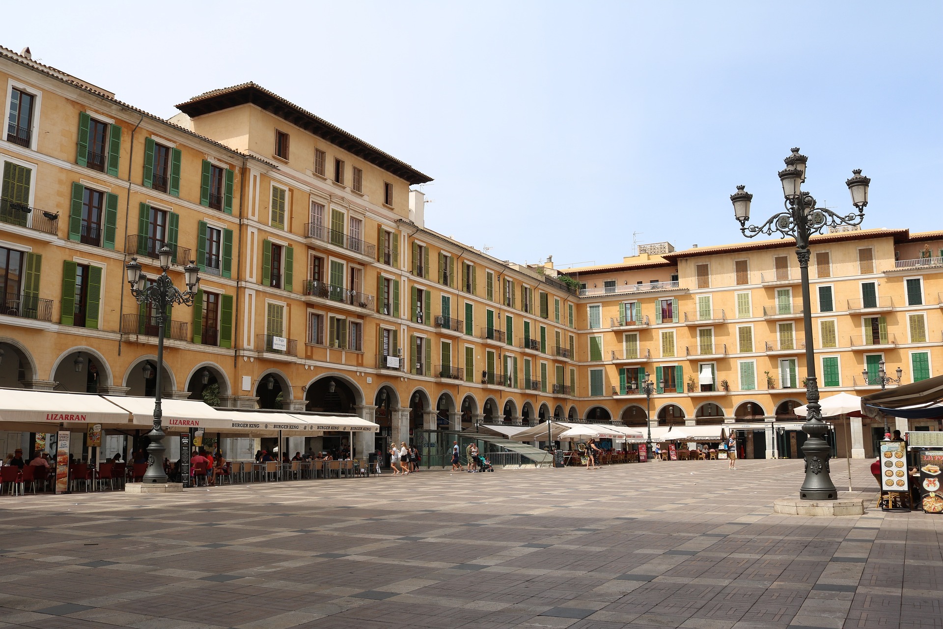
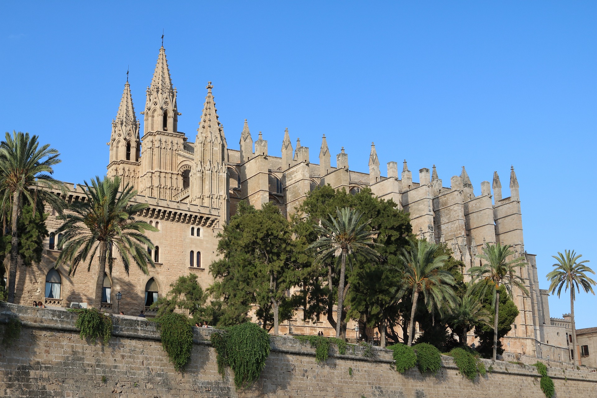
About Palma de Mallorca
If you look north of the cathedral (La Seu, or the seat of the bishopric, to Mallorcans) on a map of the city of Palma, you can see around the Plaça Santa Eulàlia a jumble of tiny streets that made up the earliest settlement. Farther out, a ring of wide boulevards traces the fortifications built by the Moors to defend the larger city that emerged by the 12th century. The zigzags mark the bastions that jutted out at regular intervals. By the end of the 19th century, most of the walls had been demolished; the only place where you can still see the massive defenses is at Ses Voltes, along the seafront west of the cathedral.A torrent (streambed) used to run through the middle of the old city, dry for most of the year but often a raging flood in the rainy season. In the 17th century it was diverted to the east, along the moat that ran outside the city walls. Two of Palma's main arteries, La Rambla and the Passeig d'es Born, now follow the stream's natural course. The traditional evening paseo (promenade) takes place on the Born.If you come to Palma by car, park in the garage beneath the Parc de la Mar (the ramp is just off the highway from the airport, as you reach the cathedral) and stroll along the park. Beside it run the huge bastions guarding the Almudaina Palace; the cathedral, golden and massive, rises beyond. Where you exit the garage, there's a ceramic mural by the late Catalan artist and Mallorca resident Joan Miró, facing the cathedral across the pool that runs the length of the park.If you begin early enough, a walk along the ramparts at Ses Voltes from the mirador beside the cathedral is spectacular. The first rays of the sun turn the upper pinnacles of La Seu bright gold and then begin to work their way down the sandstone walls. From the Parc de la Mar, follow Avinguda Antoni Maura past the steps to the palace. Just below the Plaça de la Reina, where the Passeig d'es Born begins, turn left on Carrer de la Boteria into the Plaça de la Llotja (if the Llotja itself is open, don't miss a chance to visit—it's the Mediterranean's finest Gothic-style civic building). From there stroll through the Plaça Drassana to the Museu d'Es Baluard, at the end of Carrer Sant Pere. Retrace your steps to Avinguda Antoni Maura. Walk up the Passeig d'es Born to Plaça Joan Carles I, then right on Avenida de La Unió.
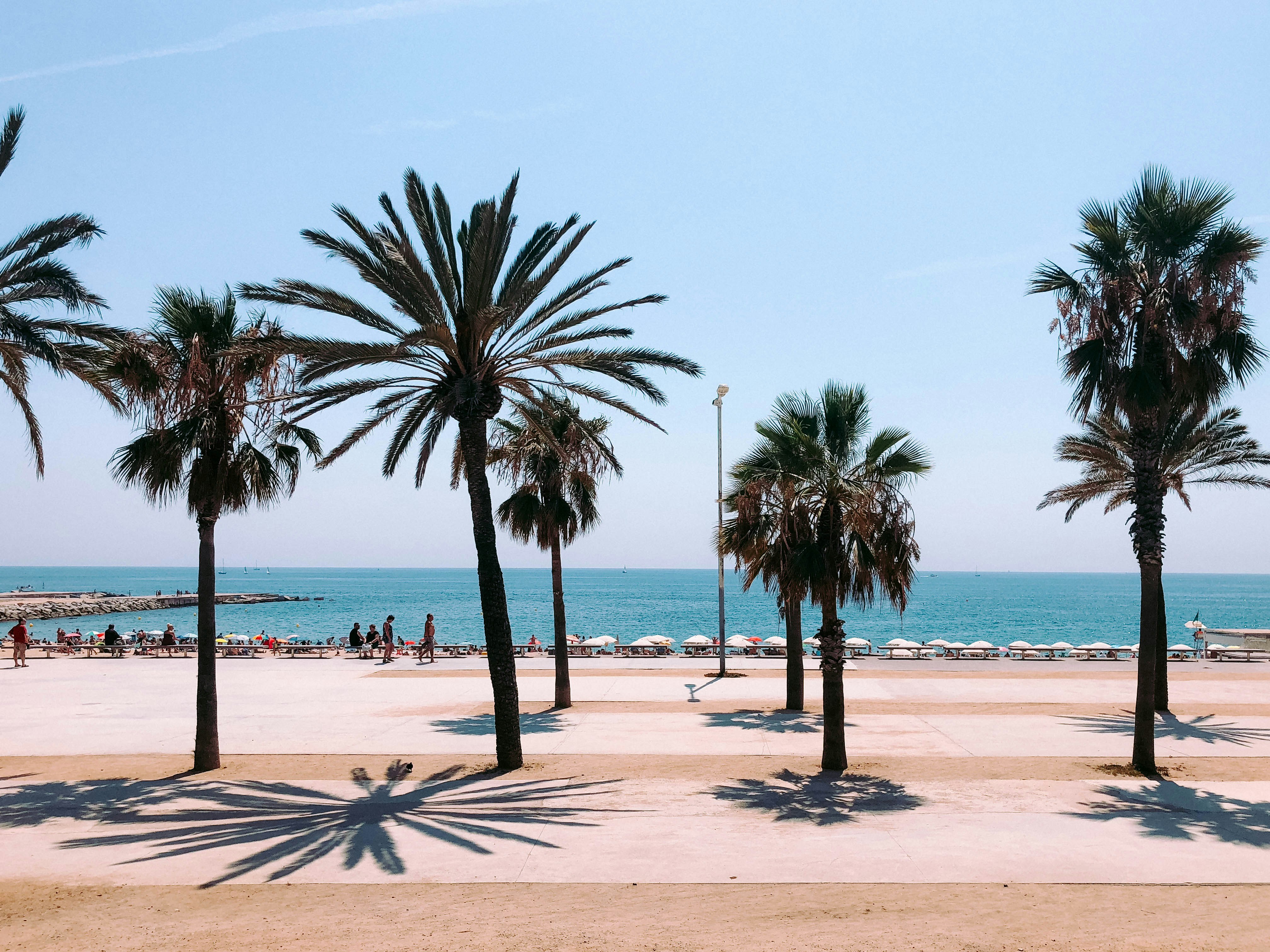
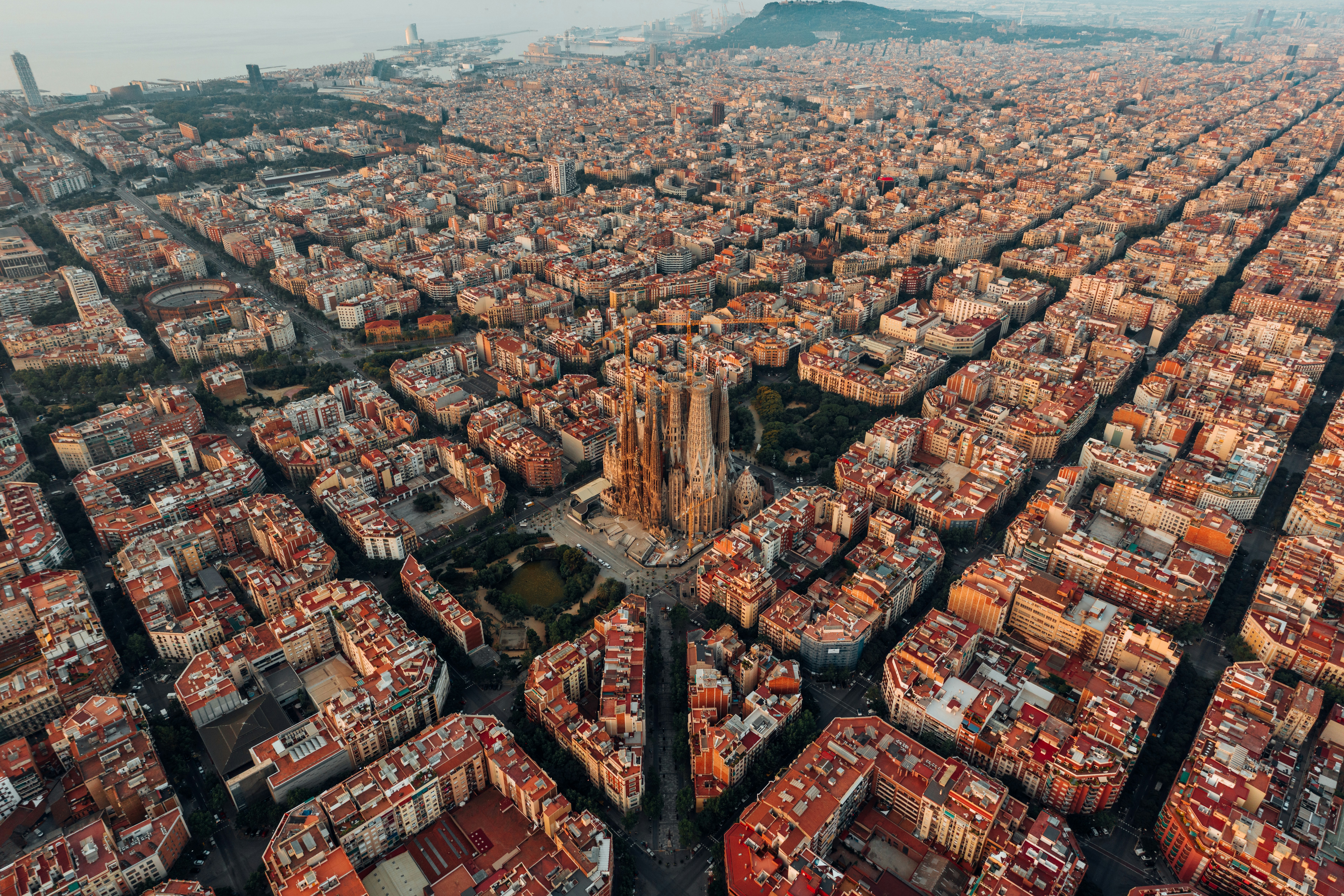
About Barcelona
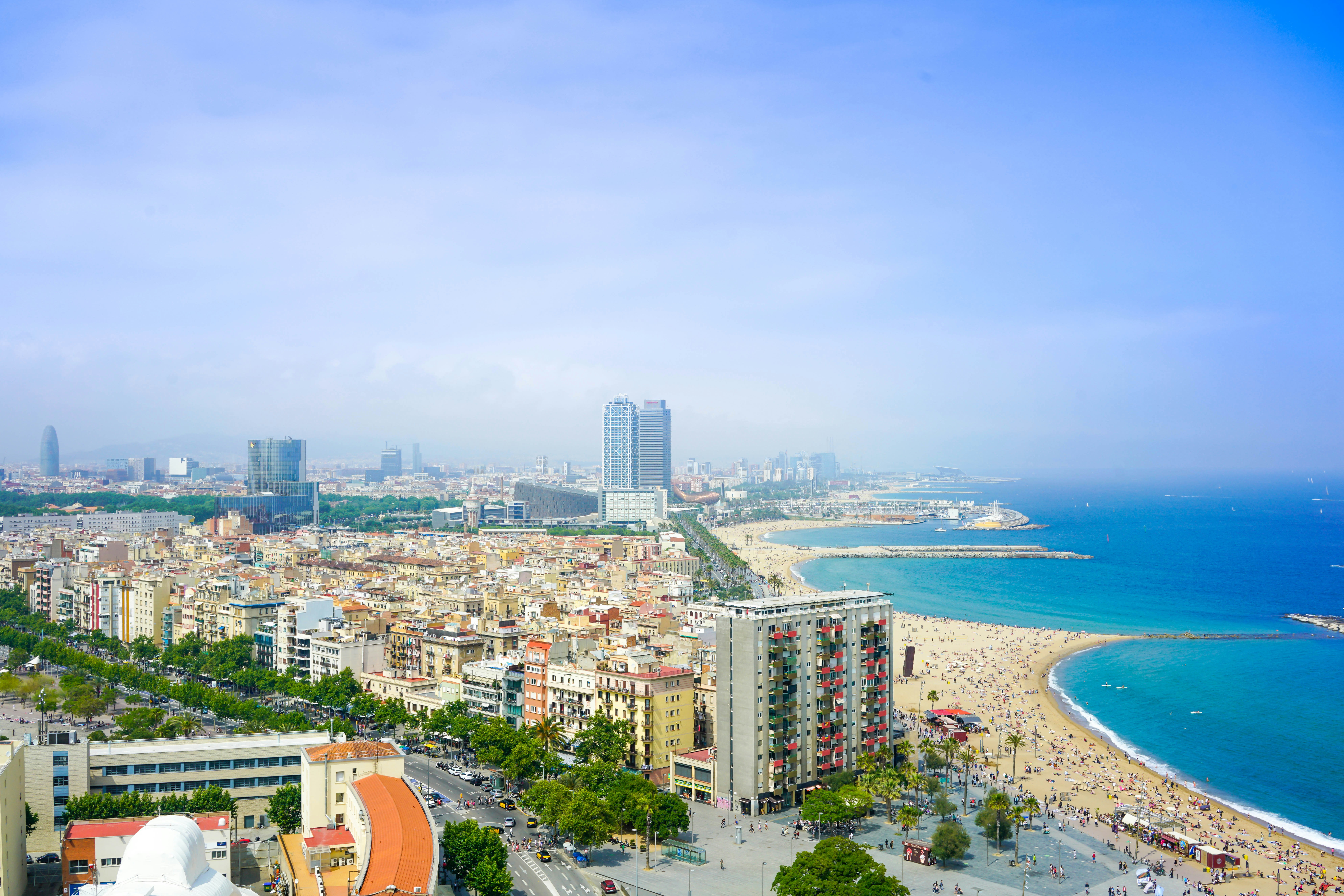
The infinite variety of street life, the nooks and crannies of the medieval Barri Gòtic, the ceramic tile and stained glass of Art Nouveau facades, the art and music, the throb of street life, the food (ah, the food!)—one way or another, Barcelona will find a way to get your full attention. The capital of Catalonia is a banquet for the senses, with its beguiling mix of ancient and modern architecture, tempting cafés and markets, and sun-drenched Mediterranean beaches. A stroll along La Rambla and through waterfront Barceloneta, as well as a tour of Gaudí's majestic Sagrada Famíliaand his other unique creations, are part of a visit to Spain's second-largest city. Modern art museums and chic shops call for attention, too. Barcelona's vibe stays lively well into the night, when you can linger over regional wine and cuisine at buzzing tapas bars.

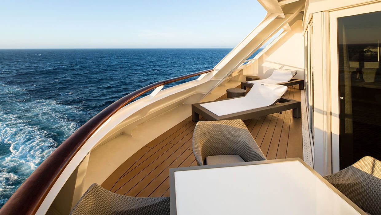
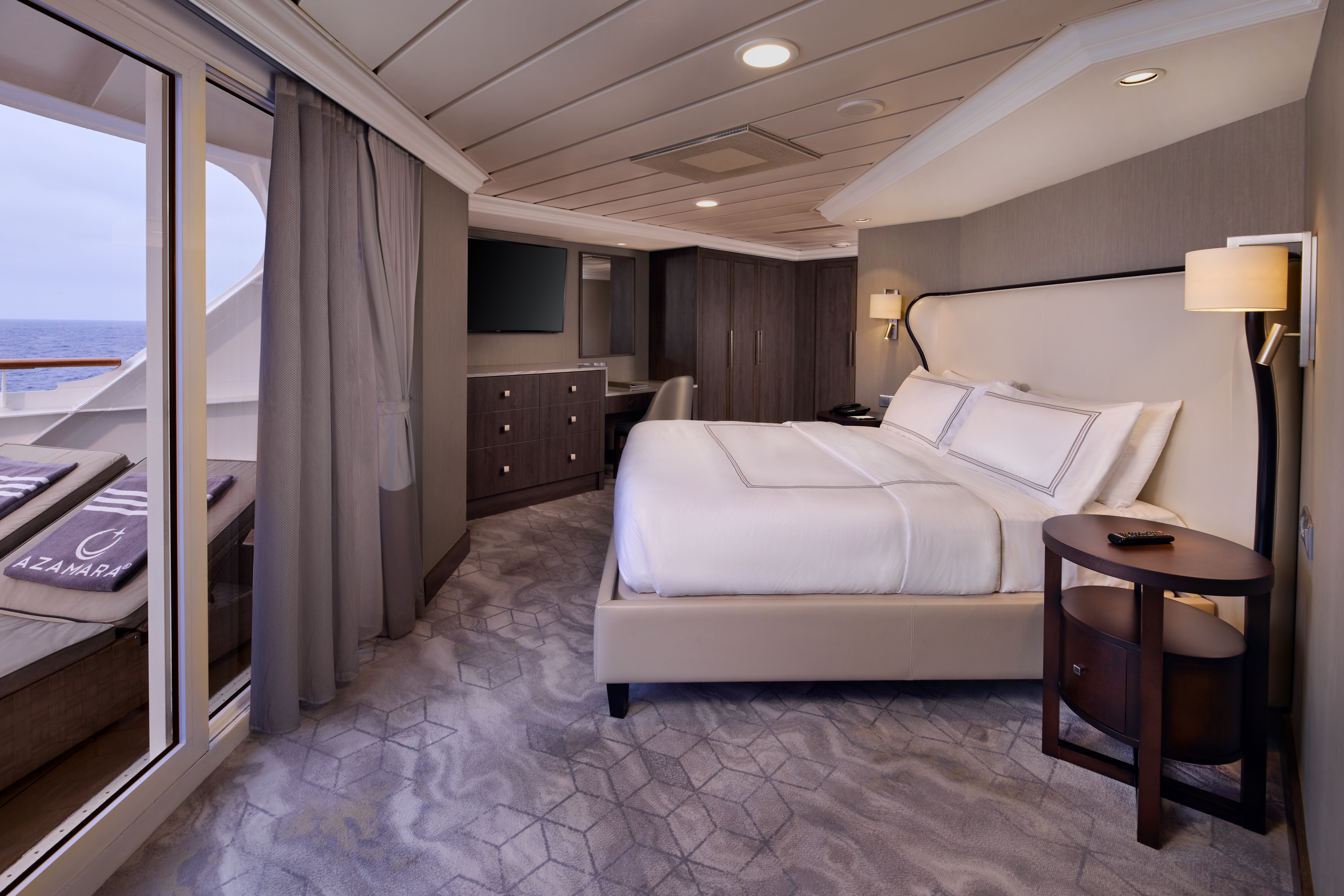
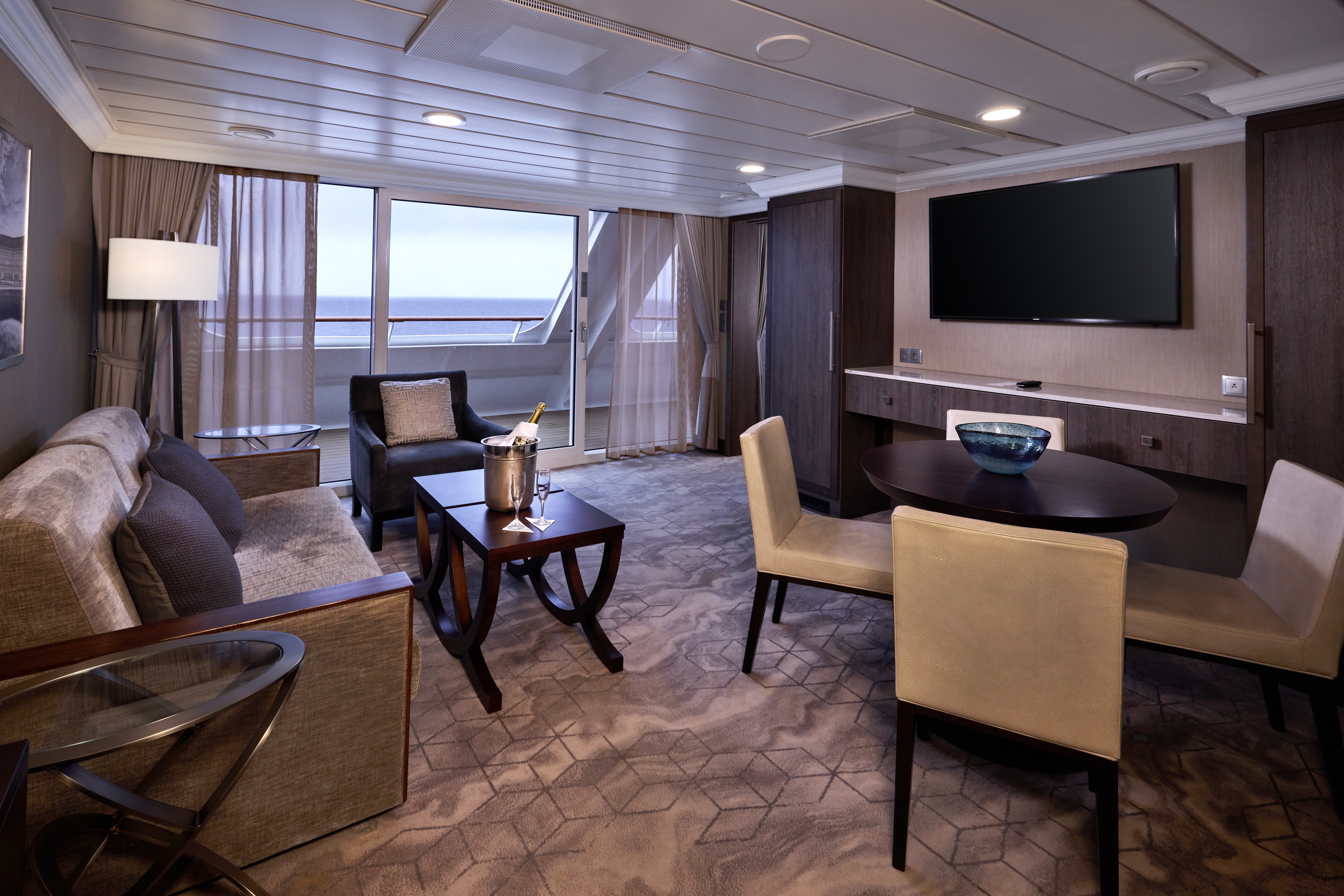
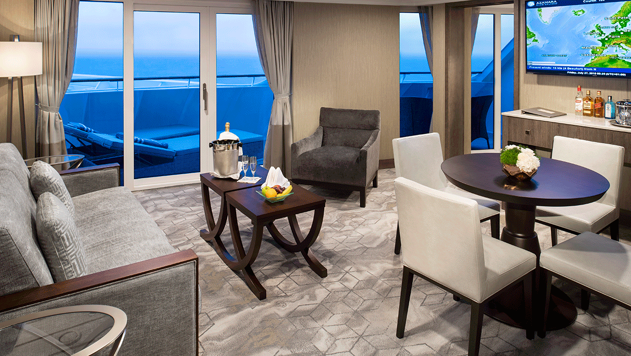
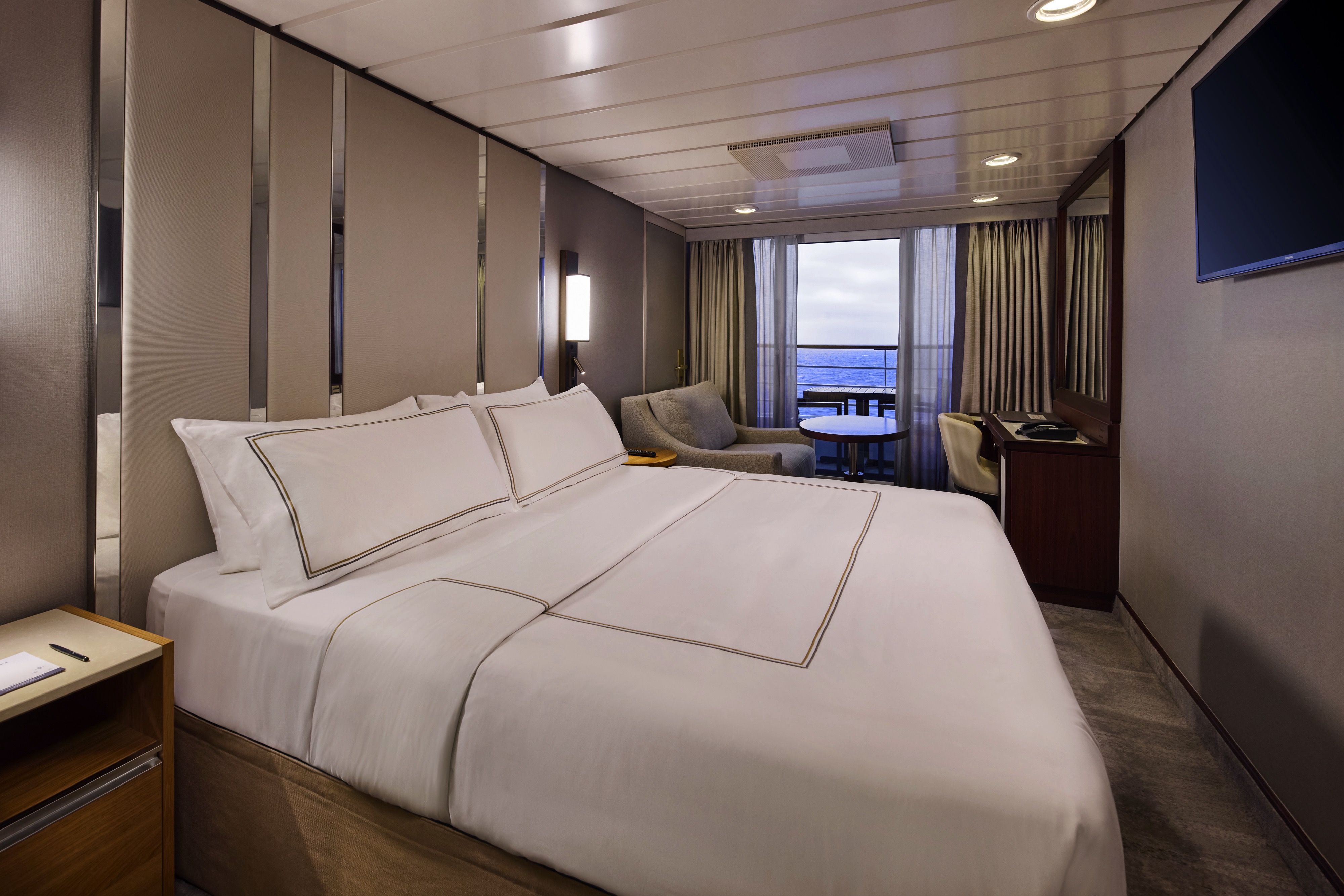
A signature expression of Azamara Cruises’ refined luxury, the World Owner’s Suite features a spacious layout, a separate bedroom, and a large private veranda. Thoughtfully designed for guests who value privacy, comfort, and elevated living.
Suite Features
- Spacious living room with a separate master bedroom
- Master bedroom with one queen size bed and a flat-screen television
- Flat-screen television in living room
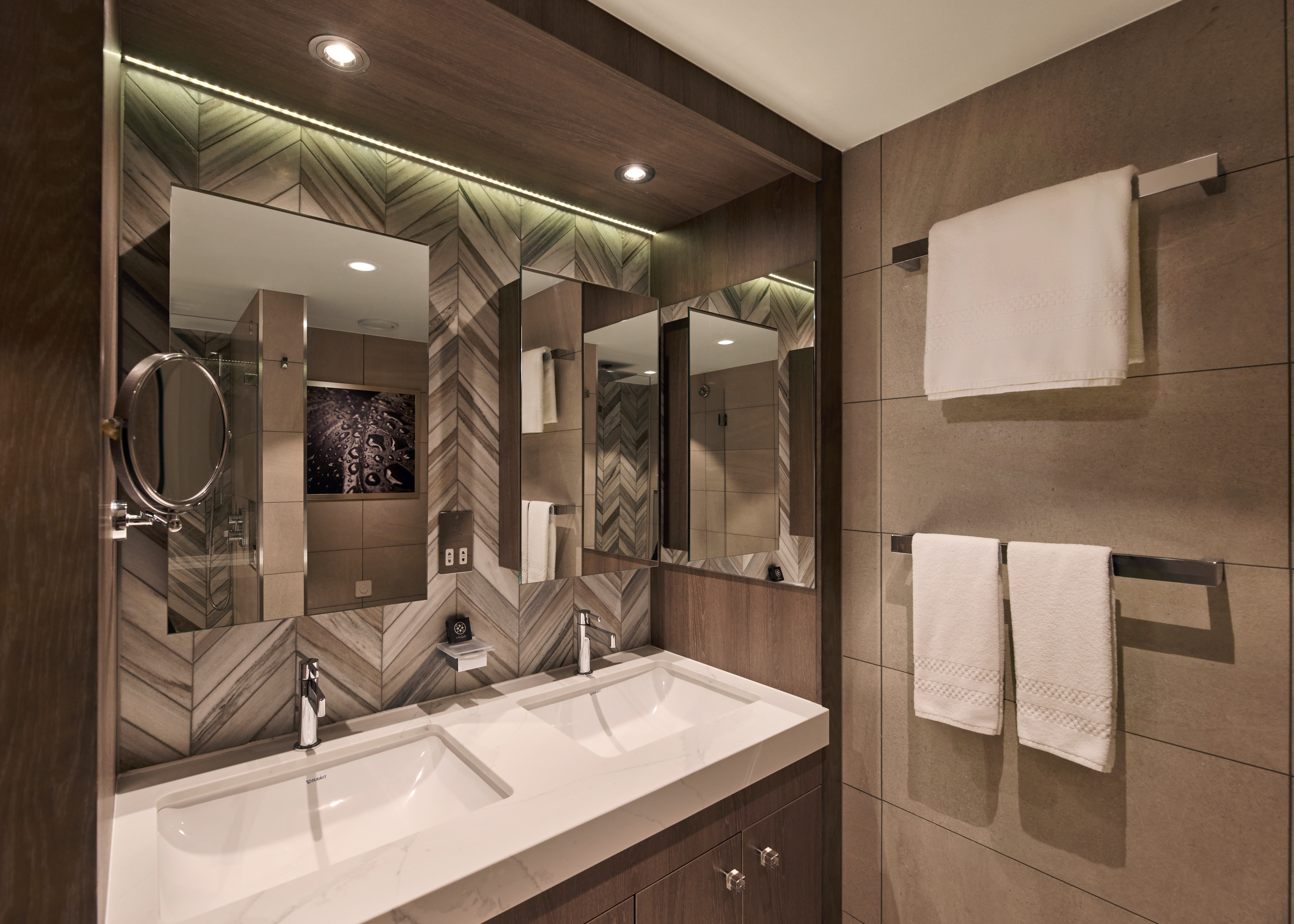
- Marble master bathroom with shower. Journey, Onward, and Quest suites feature a tub.
- Dressing room with vanity and ample closet space
- Floor-to-ceiling sliding glass doors in living room and master bedroom
- Mini-bar
- Thermostat-controlled air conditioner
- Direct-dial telephone with voice mail
- Writing desk
- In-room safe
- Hand-held hair dryer
- Stateroom: 560 sq. ft. (52 sq. m.) Veranda: 233 sq. ft. (21.7 sq. m.)
Included Amenities
- Ultimate Beverage Package
- Unlimited Standard Starlink Wi-Fi
- Unlimited Wash and Press
- Dedicated butler and concierge service
- Full in-suite dining and daily evening hors d’oeuvres
- Complimentary Specialty Dining and exclusive breakfast at Aqualina
- In-room premium spirits and champagne
- Thalassotherapy Pool access
- Personalized assistance planning spa appointments and shore excursions
- Priority check-in
- Luxurious cotton bed linens with duvet
- Terry bathrobes
- 24-hour room service
- Tote bag
- Use of umbrella
- Shoeshine service
- Turndown treats
- Afternoon In-Suite Tea Service

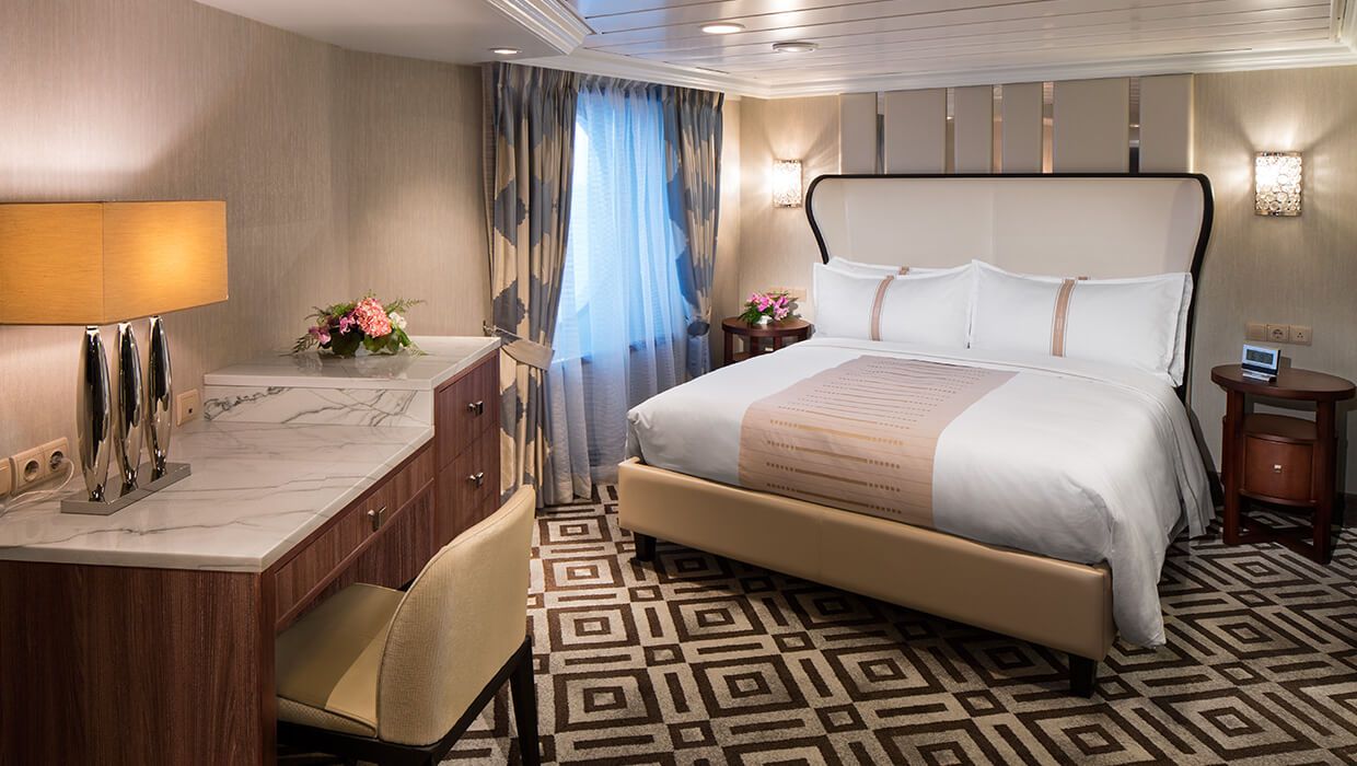
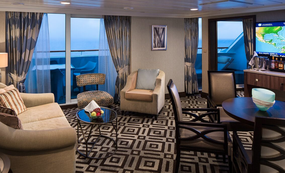
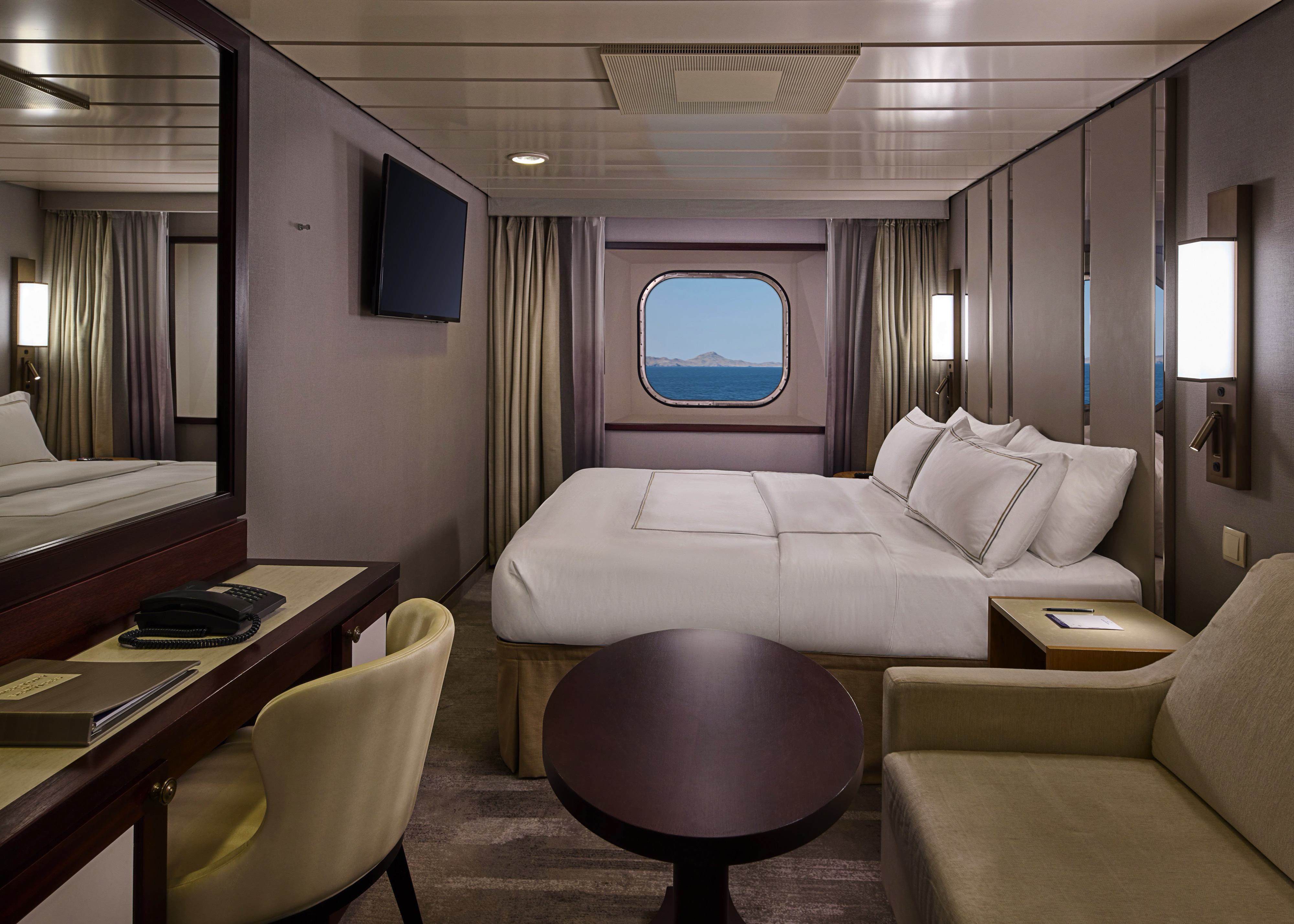
The Ocean Suite offers generous space to relax, with a separate living area, a dedicated bedroom, and a private veranda. An inviting retreat that balances comfort, functionality, and classic suite-style living.
Suite Features
- Spacious living room with a separate master bedroom
- Master bedroom with one queen size bed with a flat-screen television
- Flat-screen television in living room
- Marble master bathroom with shower. Journey and Quest suites feature a tub.
- Dressing room with vanity and ample closet space
- Floor-to-ceiling sliding glass doors in living room and master bedroom
- Mini-bar
- Thermostat-controlled air conditioner
- Direct-dial telephone with voice mail
- Writing desk
- In-room safe
- Hand-held hair dryer
- Stateroom: 440–501 sq. ft. (40.9-46.5 sq. m.) Veranda: 233 sq. ft. (21.7 sq. m.)
Included Amenities
- Ultimate Beverage Package
- Unlimited Standard Starlink Wi-Fi
- Unlimited Wash and Press
- Dedicated butler and concierge service
- Full in-suite dining and daily evening hors d’oeuvres
- Complimentary Specialty Dining and exclusive breakfast at Aqualina
- In-room premium spirits and champagne
- Thalassotherapy Pool access
- Personalized assistance planning spa appointments and shore excursions
- Priority check-in
- Luxurious cotton bed linens with duvet
- Terry bathrobes
- 24-hour room service
- Tote bag
- Use of umbrella
- Shoeshine service
- Turndown treats
- Afternoon In-Suite Tea Service
Designed for relaxation and renewal, the Spa Suite features a spacious layout with spa-inspired touches, including a glass-enclosed soaking tub and convenient access to the spa. A calming retreat ideal for wellness-focused travelers.
Suite Features
- Two lower beds convertible to one queen size bed
- Spacious glass-enclosed bathtub
- Separate rain shower
- Comfortable sitting area
- Flat-screen television in sitting area
- Floor-to-ceiling sliding glass doors
- Veranda
- Mini-bar
- Thermostat-controlled air conditioner
- Direct-dial telephone with voice mail
- Writing desk
- In-room safe
- Hand-held hair dryer
- Stateroom: 414 sq. ft. (38.5 sq. m.) Veranda: 40 sq. ft. (3.7 sq. m.)
Included Amenities
- Ultimate Beverage Package
- Unlimited Standard Starlink Wi-Fi
- Unlimited Wash and Press
- Dedicated butler and concierge service
- Full in-suite dining and daily evening hors d’oeuvres
- Complimentary Specialty Dining and exclusive breakfast at Aqualina
- In-room premium spirits and champagne
- Thalassotherapy Pool access
- Personalized assistance planning spa appointments and shore excursions
- Priority check-in
- Luxurious cotton bed linens with duvet
- Terry bathrobes
- 24-hour room service
- Tote bag
- Use of umbrella
- Shoeshine service
- Turndown treats
- Afternoon In-Suite Tea Service

The Continent Suite offers a comfortable and well-appointed space with a private veranda, a welcoming seating area, and a generous bathroom. An inviting option for guests seeking suite-style accommodations with essential comforts.
Suite Features
- Two lower beds convertible to one queen size bed
- Spacious and comfortable seating area
- Flat-screen television in sitting area
- Roomy bathroom with shower. Some also feature a tub.
- Floor-to-ceiling sliding glass doors
- Veranda
- Mini-bar
- Thermostat-controlled air conditioner
- Direct-dial telephone with voice mail
- Writing desk
- In-room safe
- Hand-held hair dryer
- Stateroom: 266 sq. ft. (24.7 sq. m.) Veranda: 60 sq. ft. (5.6 sq. m.)
Included Amenities
- Unlimited Basic Starlink Wi-Fi
- 2 laundry bags (wash and press) per stateroom, per 7 nights
- Dedicated butler and concierge service
- Full in-suite dining and daily evening hors d’oeuvres
- Complimentary Specialty Dining and exclusive breakfast at Aqualina
- In-room premium spirits and champagne
- Thalassotherapy Pool access
- Personalized assistance planning spa appointments and shore excursions
- Priority check-in
- Luxurious cotton bed linens with duvet
- Terry bathrobes
- 24-hour room service
- Tote bag
- Use of umbrella
- Shoeshine-service
- Turndown treats
- Afternoon In-Suite Tea Service

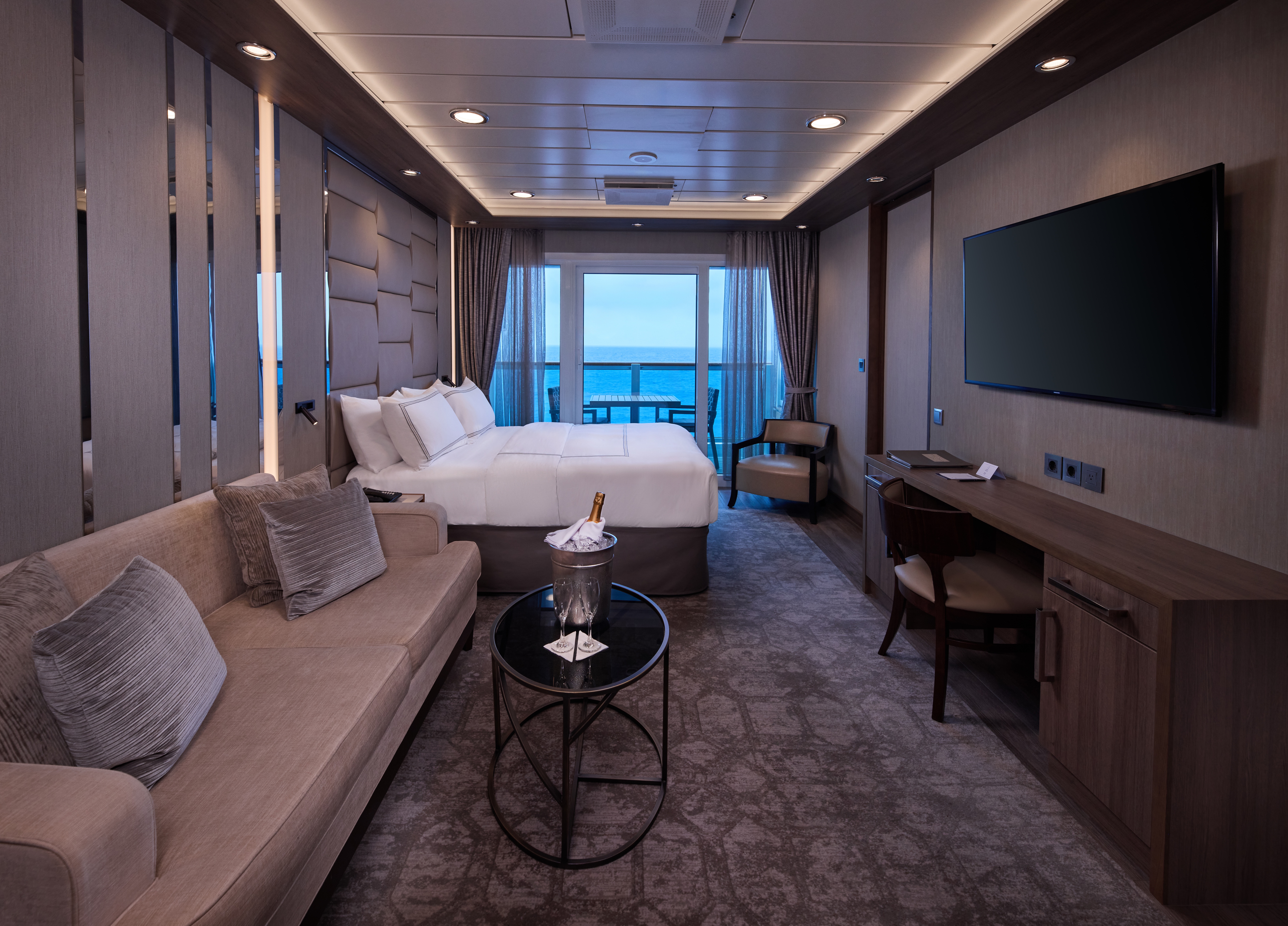
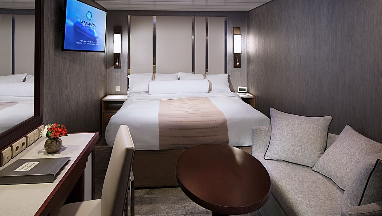
The suite offers a comfortable and well-appointed space with a private veranda, a welcoming seating area, and a generous bathroom. An inviting option for guests seeking suite-style accommodations with essential comforts.


Enjoy open-air living with sweeping ocean and destination views, plus added perks designed to elevate your onboard experience. It’s everything you love about a Veranda Stateroom, with a little extra—at exceptional value.
Stateroom Features
- Veranda
- Two lower beds convertible to one Queen size bed
- Sitting area with flat-screen TV
- Mini-bar
- Thermostat-controlled air conditioner
- Direct-dial telephone with voice mail
- Writing desk
- In-room safe
- Hand-held hairdryer
- USB ports under bedside reading lamps
- Stateroom: 175 sq. ft. (16.3 sq. m.) | Veranda: 46–64 sq. ft. (4.3-6 sq. m.)
Included Stateroom Amenities
- Complimentary AzAmazing Evenings® event (on most voyages)
- Gratuities
- Luxurious cotton bed linens with duvet
- Terry bathrobes and slippers
- Select standard spirits, international beers and wine
- 24-hour room service
- Bottled water, soft drinks, specialty coffees and teas
- Self-service laundry
- Tote bag
- Shuttle service to and from port communities, wher
- Use of umbrella
- Concierge services for personal guidance and reservations
- Shoe shine-service
- Turndown treats
- Daily news bulletin
- Complimentary Internet (120 minutes or 25% off the unlimited internet package) per guest
- One free bag of laundry service per stateroom, every seven days
- One night of complimentary specialty dining for two, every seven days
- Priority embarkation and debarkation
- Complimentary in-room spirits
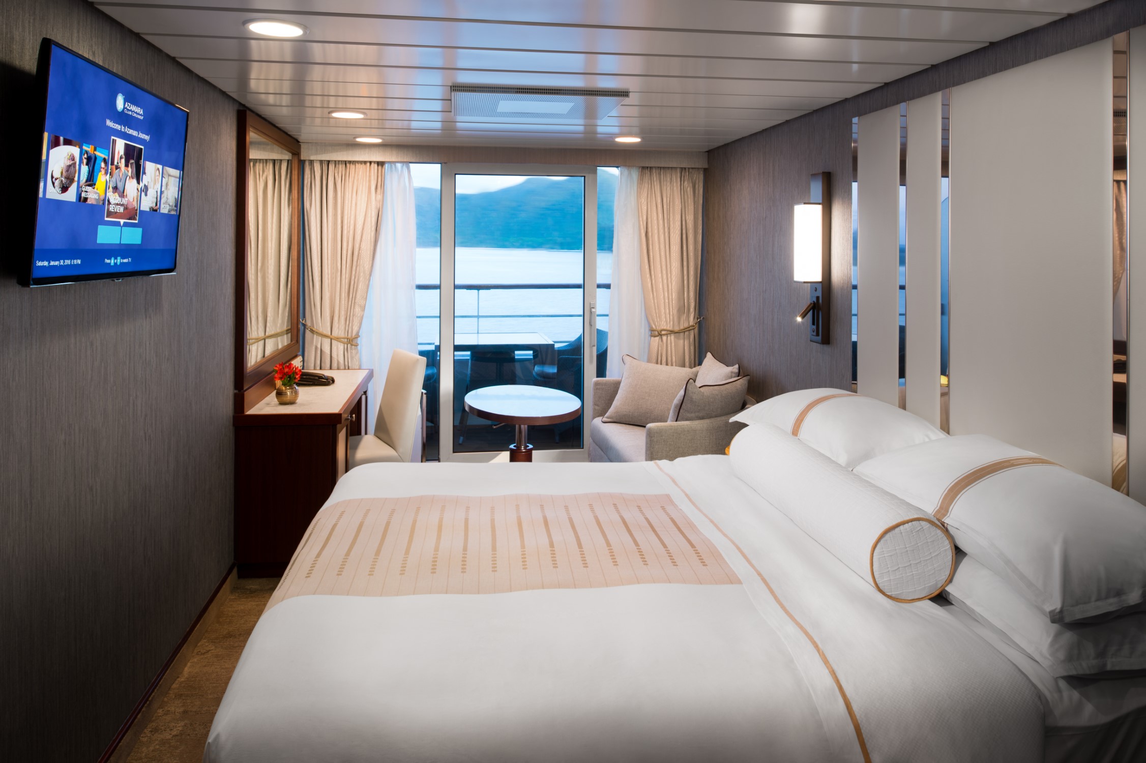
Enjoy open-air living with sweeping ocean and destination views, plus added perks designed to elevate your onboard experience. It’s everything you love about a Veranda Stateroom, with a little extra—at exceptional value.
Step outside to your private veranda and take in fresh sea breezes and ever-changing views. Thoughtful design, polished finishes, and attentive service create a relaxing retreat between immersive days ashore.
Stateroom Features
- Veranda
- Two lower beds convertible to one Queen size bed
- Sitting area with flat-screen TV
- Refrigerator with mini-bar
- Thermostat-controlled air conditioner
- Direct-dial telephone with voicemail
- Writing desk
- In-room safe
- Hand-held hairdryer
- USB ports under bedside reading lamps
- Stateroom: 175 sq. ft. (16.3 sq. m.) | Veranda: 40 sq. ft. (3.7 sq. m.)
Included Stateroom Amenities
- Complimentary AzAmazing Evenings® event (on most voyages)
- Luxurious cotton bed linens with duvet
- Gratuities
- Terry bathrobes
- Select standard spirits, international beers and wine
- 24-hour room service
- Self-service laundry
- Tote bag
- Shuttle service to and from port communities, where available
- Use of umbrella
- Concierge services for personal guidance and reserervations
- Shoe shine-service
- Turndown treats
- Daily news bulletin
Wake up to natural light and picturesque ocean views from your window. Featuring contemporary design and well-appointed comforts, these staterooms offer a serene and stylish place to unwind at sea.
Stateroom Features
- Two lower beds convertible to one Queen size bed
- Some staterooms feature sofa bed
- Flat-screen TV
- Refrigerator with mini-bar
- Thermostat-controlled air conditioner
- Direct-dial telephone with voicemail
- Writing desk
- In-room safe
- Hand-held hairdryer
- USB ports under bedside reading lamps
- 143 sq. ft. (13.3 sq m)
Included Stateroom Amenities
- Complimentary AzAmazing Evenings® event (on most voyages)
- Gratuities
- Luxurious cotton bed linens with duvet
- Terry bathrobes and slippers
- Select standard spirits, international beers and wine
- 24-hour room service
- Bottled water, soft drinks, specialty coffees and teas
- Self-service laundry
- Tote bag
- Shuttle service to and from port communities, wher
- Use of umbrella
- Concierge services for personal guidance and reservations
- Shoe shine-service
- Turndown treats
Wake up to natural light and picturesque ocean views from your window. Featuring contemporary design and well-appointed comforts, these staterooms offer a serene and stylish place to unwind at sea.
A quiet, comfortable retreat designed for restful nights and relaxing moments between adventures. With refined décor, plush amenities, and personalized service, it’s boutique-hotel comfort at sea.
Stateroom Features
- Two lower beds convertible to one Queen size bed
- Flat-screen television
- Refrigerator with mini-bar
- Thermostat-controlled air conditioner
- Direct-dial telephone with voicemail
- Writing desk
- In-room safe
- Hand-held hairdryer
- USB ports under bedside reading lamps
- Stateroom: 158 sq. ft. (14.7 sq. m.)
Included Stateroom Amenities
- Complimentary AzAmazing Evenings® event (on most voyages)
- Gratuities
- Luxurious cotton bed linens with duvet
- Terry bathrobes and slippers
- Select standard spirits, international beers and wine
- 24-hour room service
- Bottled water, soft drinks, specialty coffees and teas
- Self-service laundry
- Tote bag
- Shuttle service to and from port communities, wher
- Use of umbrella
- Concierge services for personal guidance and reservations
- Shoe shine-service
- Turndown treats
- Daily news bulletin
A quiet, comfortable retreat designed for restful nights and relaxing moments between adventures. With refined décor, plush amenities, and personalized service, it’s boutique-hotel comfort at sea.
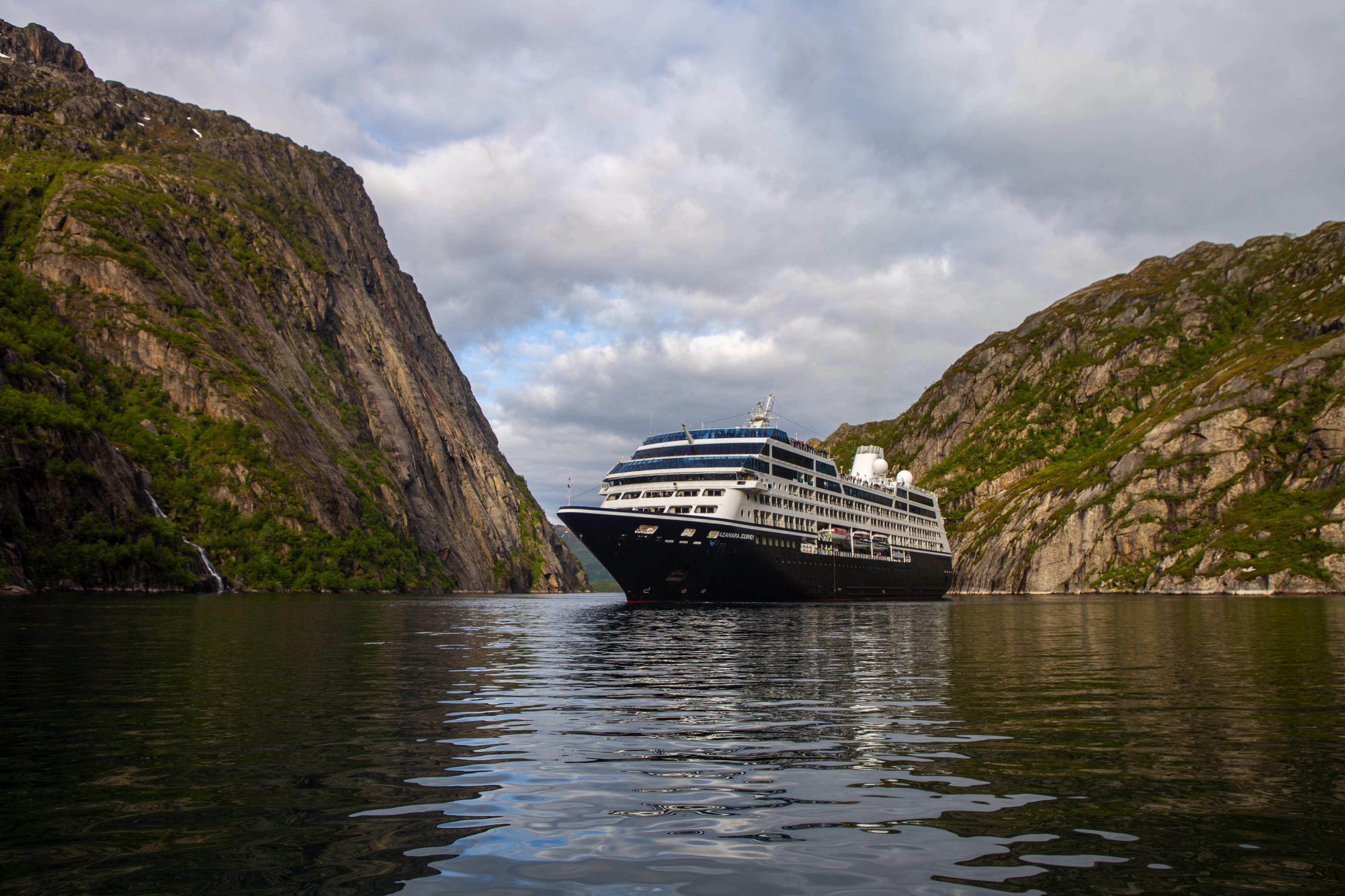
Azamara Journey
A luxurious boutique hotel at sea, the Azamara Journey is a mid-sized ship with a deck plan that’s intimate but never crowded, and offers everything modern cruisers are looking for—plus some unexpected extras.
Ship Facts
| Launch Year | 2000 | ||||||||||
| Refit Year | 2016 | ||||||||||
| Language | en-US | ||||||||||
| Gross Tonnage | 30277 | ||||||||||
| Length | 182 | ||||||||||
| Width | 25 | ||||||||||
| Currency | USD | ||||||||||
| Speed | 18 | ||||||||||
| Capacity | 690 | ||||||||||
| Crew Count | 408 | ||||||||||
| Deck Count | 8 | ||||||||||
| Cabin Count | 355 | ||||||||||
| Large Cabin Count | N/A | ||||||||||
| Wheelchair Cabin Count | 6 | ||||||||||
| Electrical Plugs |
|
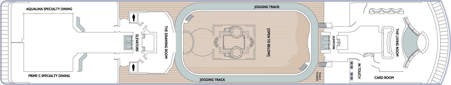
Deck 11
- Sun Deck
- Shuffle Board

Deck 10
- The Living Room
- Card Room
- In Touch
- Elevators
- Table Tennis
- Jogging Track
- The Drawing Room
- Prime C Speciality Dining
- Aqualina Speciality Dining
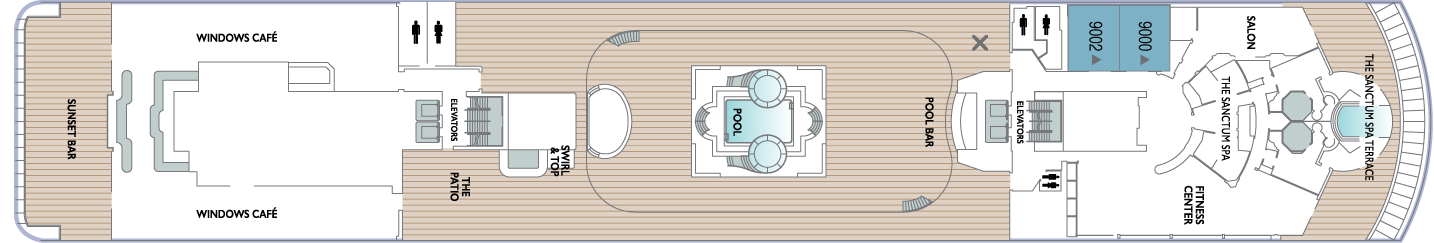
Deck 9
- The Sanctum Spa Terrace
- Salon
- The Sanctum Spa
- Fitness Center
- Pool
- Pool Bar
- Elevators
- Swirl & Top
- The Patio
- Windows Café
- Sunset Bar
- Spa Suites
Deck 8
- Veranda Plus Staterooms
- World Owner's Suite
- Continent Suite
- Interior Staterooms

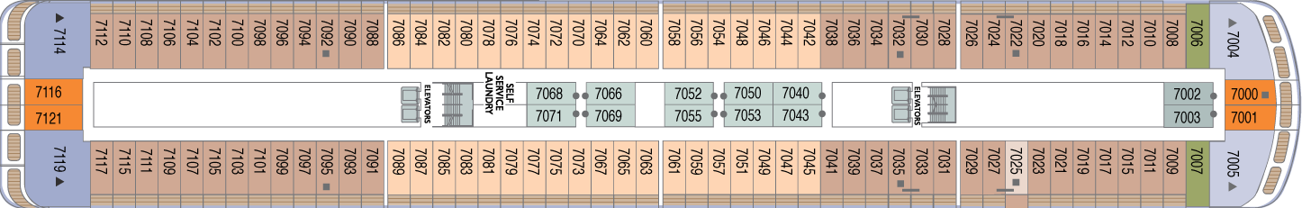
Deck 7
- Veranda Plus Staterooms
- World Owner's Suite
- Ocean Suite
- Veranda Staterooms
- Oceanview Staterooms
- Interior Staterooms
- Self Service Laundry
Deck 6
- Veranda Plus Staterooms
- Veranda Staterooms
- World Owner's Suite
- Continent Suite
- Ocean Suite
- Oceanview Staterooms
- Interior Staterooms

Deck 5
- Cabaret Lounge
- Elevators
- Shore Excursions
- Cruise Again
- The Den
- Photo Shop
- The Journey Shops
- Indulgences
- Mosaic Café
- Discoveries Bar
- Discoveries Restaurant

Deck 4
- Oceanview Staterooms
- Interior Staterooms
- Medical Facility
- Guest Relations
- Concierge

Azamara offers a choice of six distinctive dining options, including room service. Whether you’re a fan of haute cuisine or down-home cooking, expect the same delicious quality. Bon appétit! Buon appetito! ¡Buen provecho! No matter how you say it, you’re in for a real treat.
Pre-Cruise Specialty Dining Reservations
All guests can now book pre-cruise reservations for Prime C, Aqualina, or Chef’s Table—our most sought-after specialty dining experiences.
Priority Access
Pre-cruise dining reservations open 150 days before sailing for suite guests and Azamara Circle Discoverer-level and above. All other guests may begin booking 140 days prior.
Aqualina
At Aqualina, you’ll find some of Italy’s most authentic dishes. Pastas made from scratch, traditional recipes, and scrumptious vegetarian dishes that make sure there’s something for everyone. Plus our famous desserts: Sorrento lemon liqueur mousse, hazelnut chocolate soufflé and more.
Prime C
Your choice of steak, cooked to perfection. Herb-coated rack of lamb, duck confit and Chilean sea bass—all paired with savory sides. At Prime C, you’re in for more than delectable dining. Expect a great evening with stunning views and lush décor.
Discoveries Restaurant
Discover the world through dishes and flavors from the places we visit. Of course, you’ll also enjoy a wide variety of nightly selections such as filet mignon with black truffle sauce. Choose being seated at a table for two or as part of a larger group of fellow guests.
Windows Café
Our daily themed dinner often takes its inspiration from the region we’re visiting—Indian, Mexican, Spanish, Italian. We also create an extra live station made from local ingredients purchased in port: Greek salad made with local feta (Greece), pasta prepared with local mushrooms (Italy), fresh Mussels served with garlic bread (Netherlands).
The Patio And Swirl & Top
Casual “pool grill” by day. A sit-down al fresco dining experience by night. Taste your way around the world with exclusive personalized dishes using local flavors of the places we visit. Plus a self-serve frozen yogurt station—Swirl & Top. With a variety of flavors and your choice of toppings, it’s the perfect way to cool off.
Mosaic Café
Stylish and cozy, Mosaic offers your favorite coffee drinks exactly as you like them. Relax in a comfortable seat and enjoy. It’s the perfect spot to start or end your day, and it just might become your favorite place on the ship.
Room Service
The best time for room service? Whenever you say it is, 24-hours a day. Order from the full breakfast menu between 6:30 AM and 10:00 AM, and we’ll deliver at your appointed time. Lunch and dinner room service features a menu of hearty soups, fresh salads, gourmet sandwiches, pizzas and desserts.
Sit back and enjoy your evenings on a high note with our onboard entertainment. From local cultural shows to our playbill that features a variety of amazing performances to keep you entertained while onboard.
Bars, Lounges & Gathering Spots
A cozy nook to sip coffee. An intimate space to raise a glass and celebrate. A lively setting to catch the latest shows and international entertainment. Watch the world go by, drink in hand from any of Azamara’s bars, lounges, and gathering spaces.
White Night
Join Azamara officers and crew for our signature dinner and entertainment event hosted al fresco on the pool deck (weather permitting). With an array of delicious food and engaging entertainment, your White Night experience will almost certainly be one of the most memorable times from your cruise. And don’t forget to bring something white to wear for the evening.
Club Crooner
Step into a swanky nightclub as the great songs of the most magnificent artists come alive on stage. From classic crooners such as Frank Sinatra and Tony Bennett, to current songbirds such as Natalie Cole and Michael Bublé, there’s a song for every time and everyone. Enjoy a beverage, sit back, and be serenaded by the melodies of our lives with CLUB CROONER!
The Living Room
The idea of the Living Room is just that. To “live in” and to enjoy time with friends and fellow guests! Much of the room is furnished as a living room, with clusters of large comfortable chairs and sofas....
Discoveries Lounge
This congenial bar is a favorite gathering place for great conversations and delicious drinks. Bar service includes a full selection of fine wines, mixed drinks, and premium spirits…plus the entertaining banter of Azamara’s friendly bartenders.
Cabaret Lounge
Enjoy live performances of professional full-stage musical revues, classical soloists, bands and other entertainment in a cabaret nightclub with a full bar and cozy tables.
Sunset Bar
Adjacent to Windows Café, the Sunset Bar is a welcoming outdoor patio with covered and open-air seating, and a bar. It's the perfect place for dining alfresco, enjoying a refreshing drink, taking in the sights of your favourite port, or simply watching the world sail by.
Mosaic Cafe & Mosaic Cafe @ Night
Our onboard coffee corner may very well become your favorite nook on the ship. With elegant and comfortable furniture, it's bound to be one of the the most stylish places, too. Find all your favorite coffee drinks crafted just the way you like. Slip right into a comfortable seat and sip for a while—you never know who'll walk by.
Pool Bar
Our Pool Bar serves refreshments while enjoying the Pool during the day, and cocktails of your choice in the evening.
The Wine Cellar
You’ll be hard-pressed to find such a collection of limited production, small label and rare vintage wines anywhere on the high seas! And with vintages from France to California, and Argentina to South Africa, you’re sure to find a wine to suit your palate and your journey. Our knowledgeable sommeliers can help you pick the perfect wines for your evening meal.
Performances
And the Beat Goes On
Join your Signature Singers and Dancers as they commemorate the greatest hits of all time in And the Beat Goes On. The night celebrates a wide variety of musical genres while exploring the influence of mainstream media in honoring the iconic cultural trends throughout the years. Featuring music from The Beatles, Earth Wind and Fire, Journey, Madonna, Ricky Martin, Katy Perry and much more. We will be sure to have you singing and dancing all night long in AND THE BEAT GOES ON!
Six Strings
The guitars are tuned, the amps are cranked up and the microphones are hot as Azamara prepares you for a night of energetic dancing, powerful vocals and iconic guitar riffs in Six Strings. The evening guarantees a Good Time with ultimate nostalgia as our Signature Singers and Dancers celebrate the most renowned classic rock artists such as Aerosmith, The Beatles, Pat Benatar, The Rolling Stones, Queen and more. Don’t miss SIX STRINGS!
Oh, What A Night
Get ready to be transported to the world’s most beloved travel destinations in one exhilarating night. As we explore all four seasons in a new city, travel along with our dynamic Signature Singers & Dancers as they sing and dance their way through an eclectic mix of music from around the world. Come and experience Oh, What A Night!
The Pool
While spending daytime sun-drenched and relaxed by the pool, don’t think of missing Azamara’s famous White Night party held at least once on every cruise (weather permitting). Colourful décor and linen-draped tables, a fabulous buffet feast, and boutique wines on the house make this an event like no other. Not to forget the fun and fast-paced show our entertainment team puts on.
The Ship Shop
Pick up sundries, casual wear and swim fashions, sunglasses, accessories, music and shipboard keepsakes. This is a great place for small gifts to take back home.
Indulgences
Aptly named, Indulgences will satisfy your desires for the finer things in life. If you are looking for designer jewellery, it's the perfect place to window shop or to find that extra special purchase.
Photo Shop
Our photographers capture both fun and professional photos throughout the voyage, whether it is your portrait, or photos of the destinations you visit. You can also find an assortment of supplies for your own photographic endeavours.