Athens to Lisbon Grand Voyage
Athens to Lisbon Grand Voyage
Cruise overview
WHY BOOK WITH US?
- ✔ The Deluxe Cruises’ team has extensive experience in ultra-luxury cruising.
- ✔ Call now to speak to our helpful and experienced Cruise Concierge team.
- ✔ Enjoy our Unique Deluxe Cruises Bonus for substantial savings.
- ✔ Our team will tailor your holiday to your exacting requirements.
- ✔ As agents, we work under the protection of each cruise lines ABTA / ATOL licences
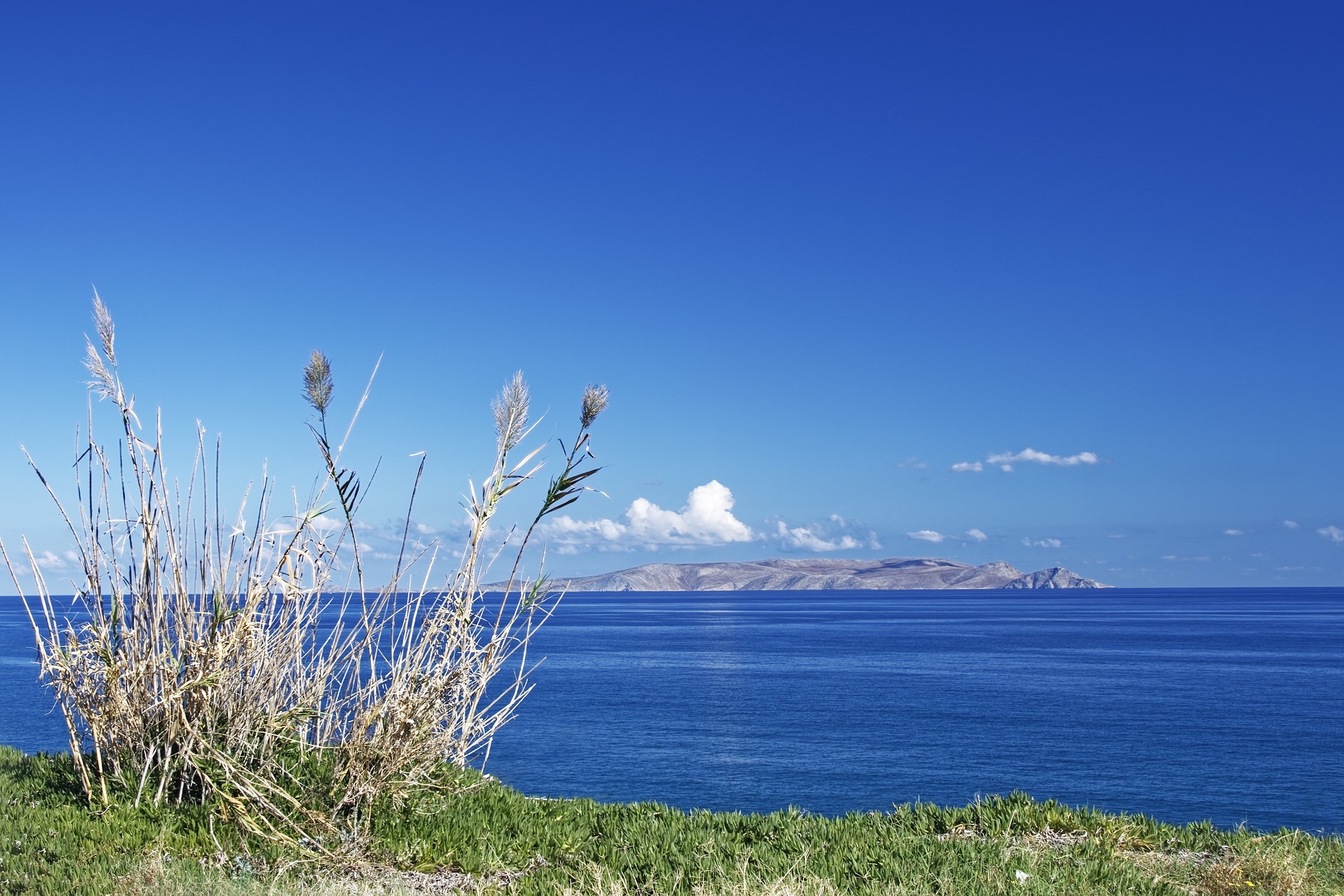
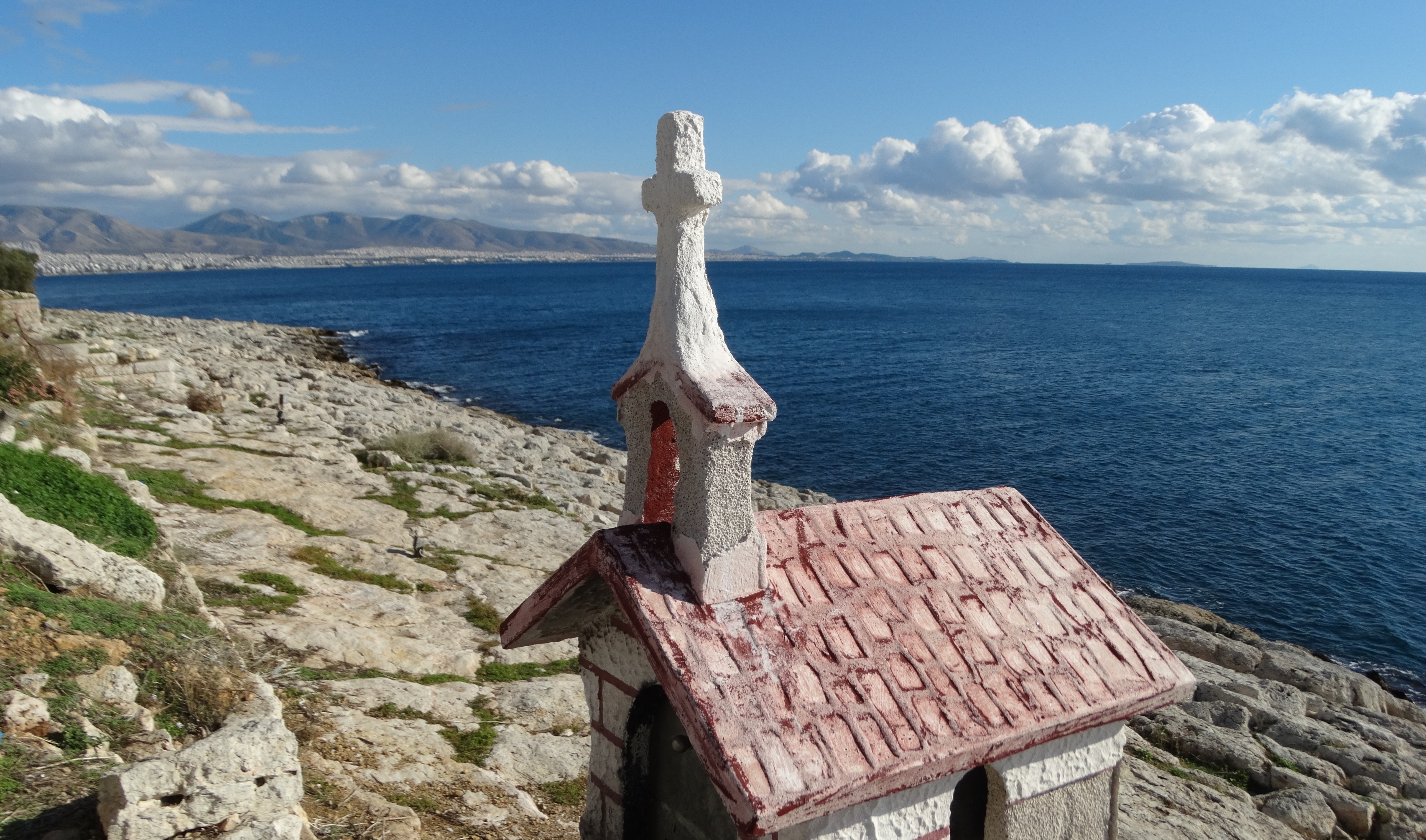
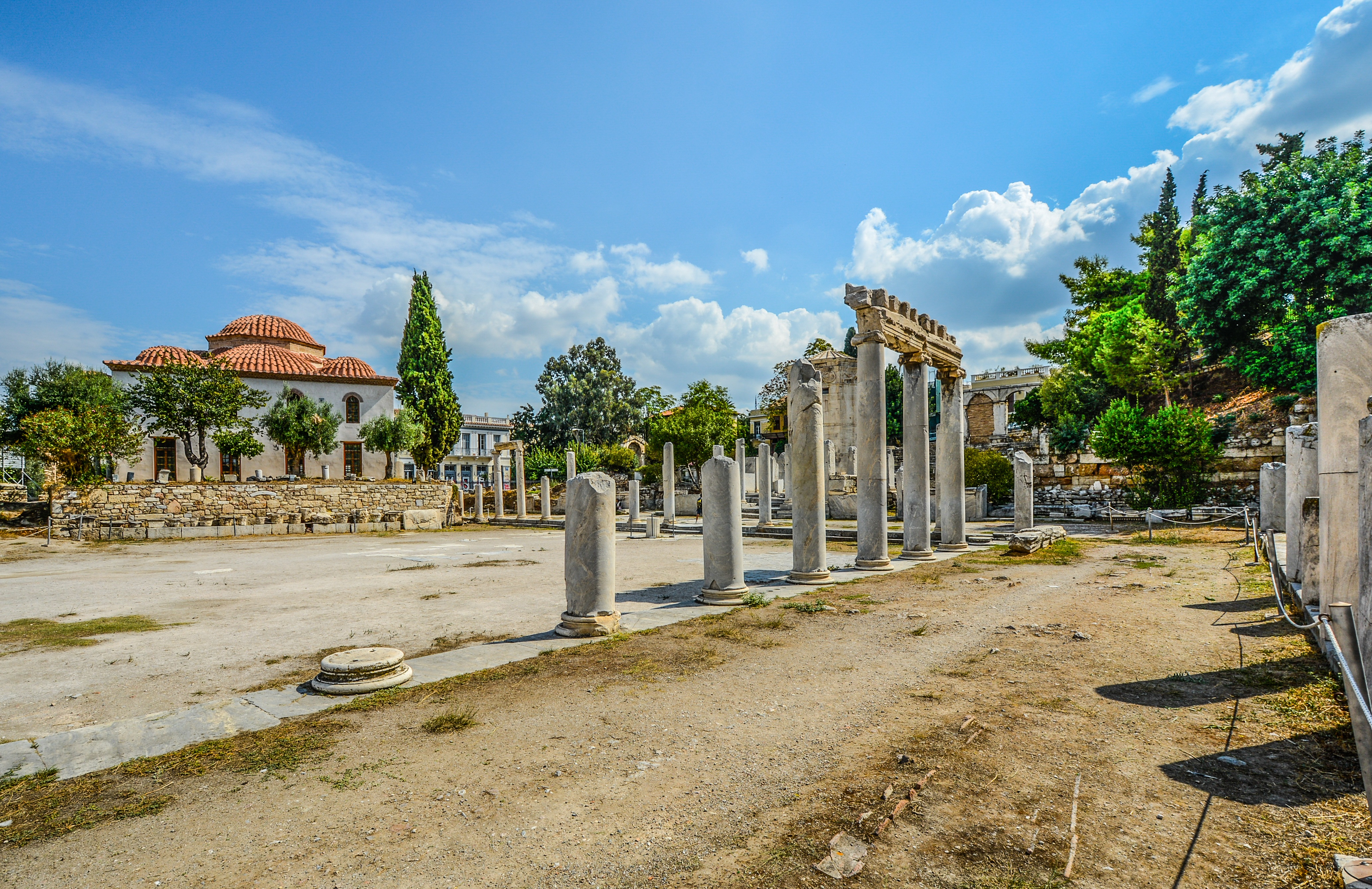
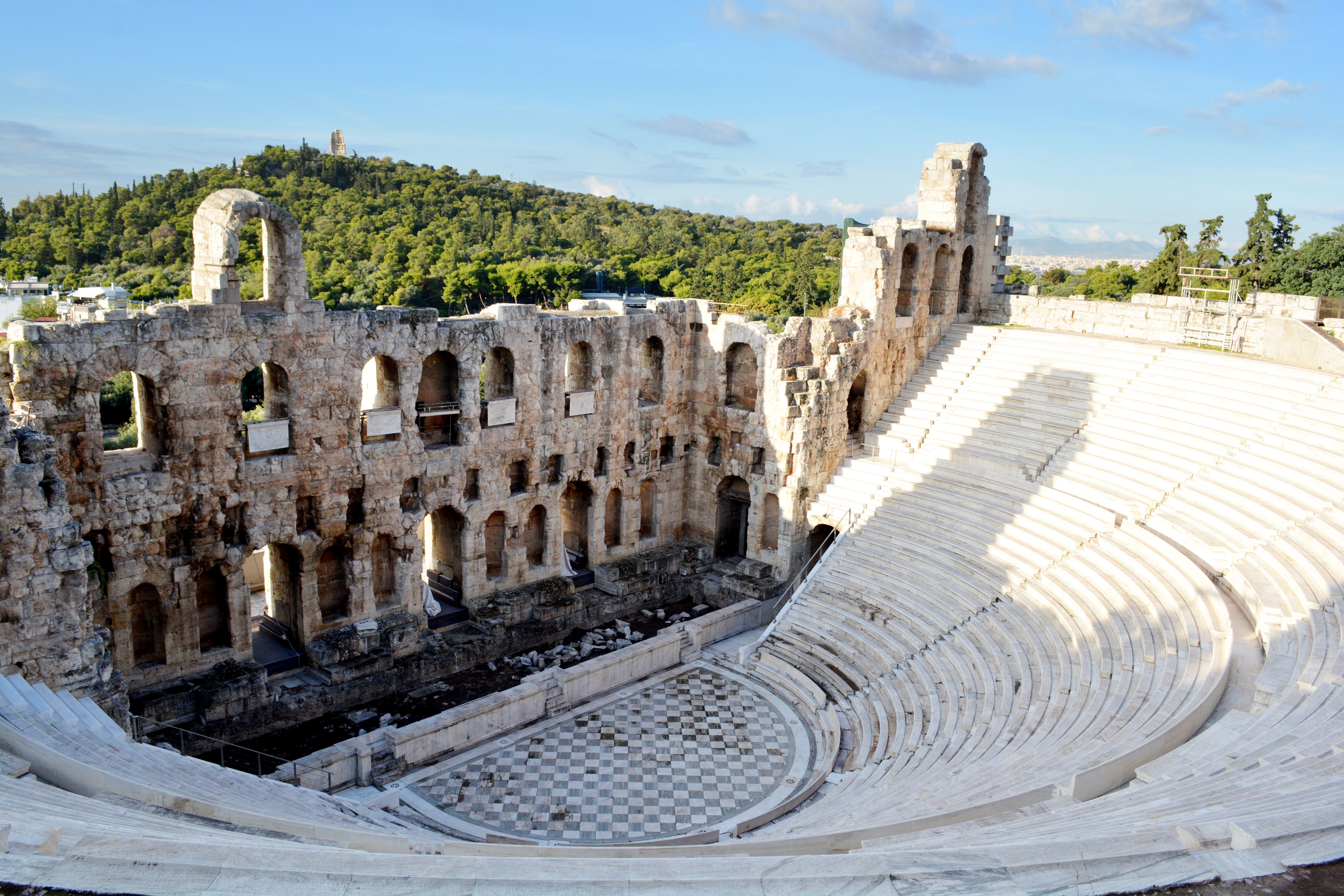
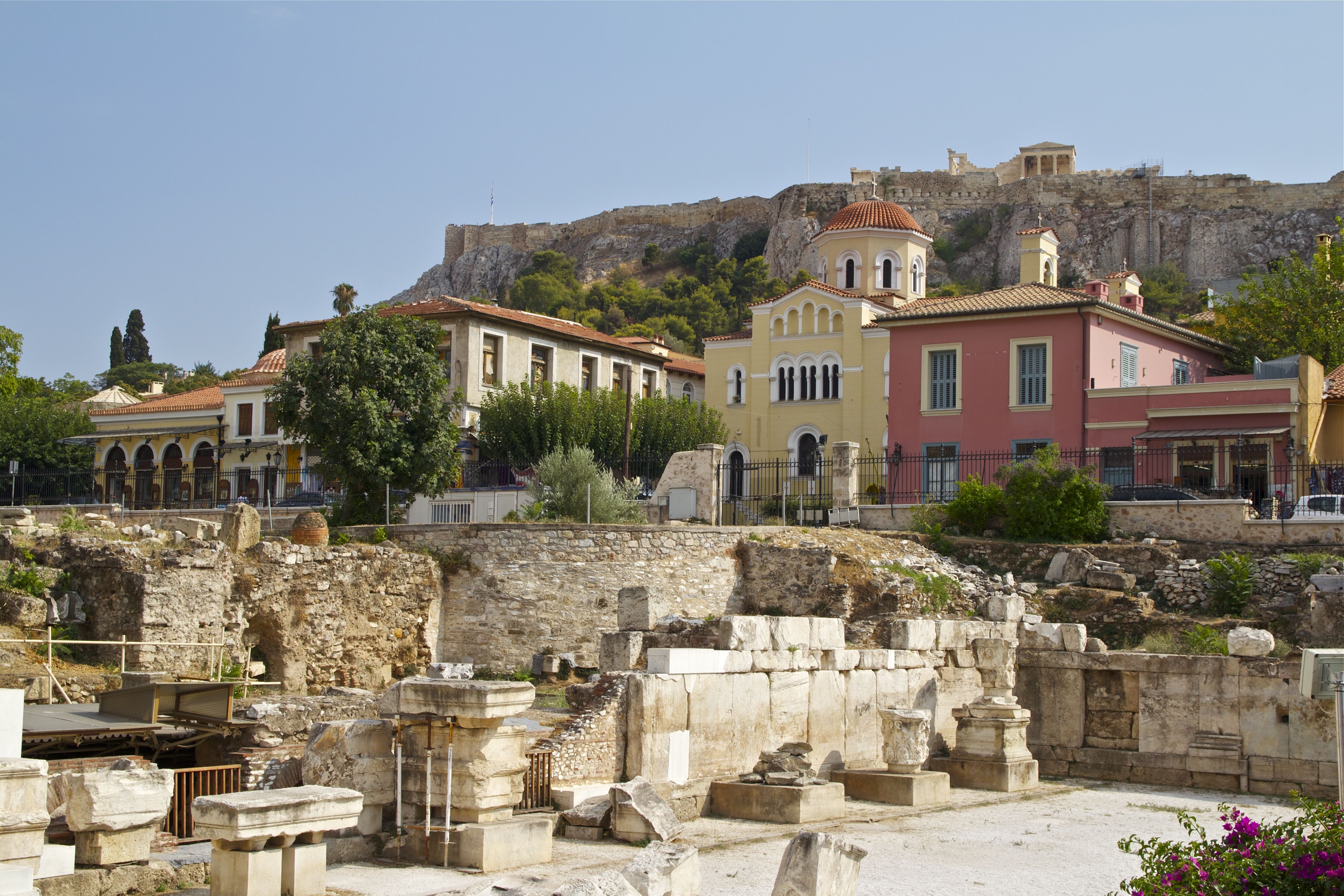
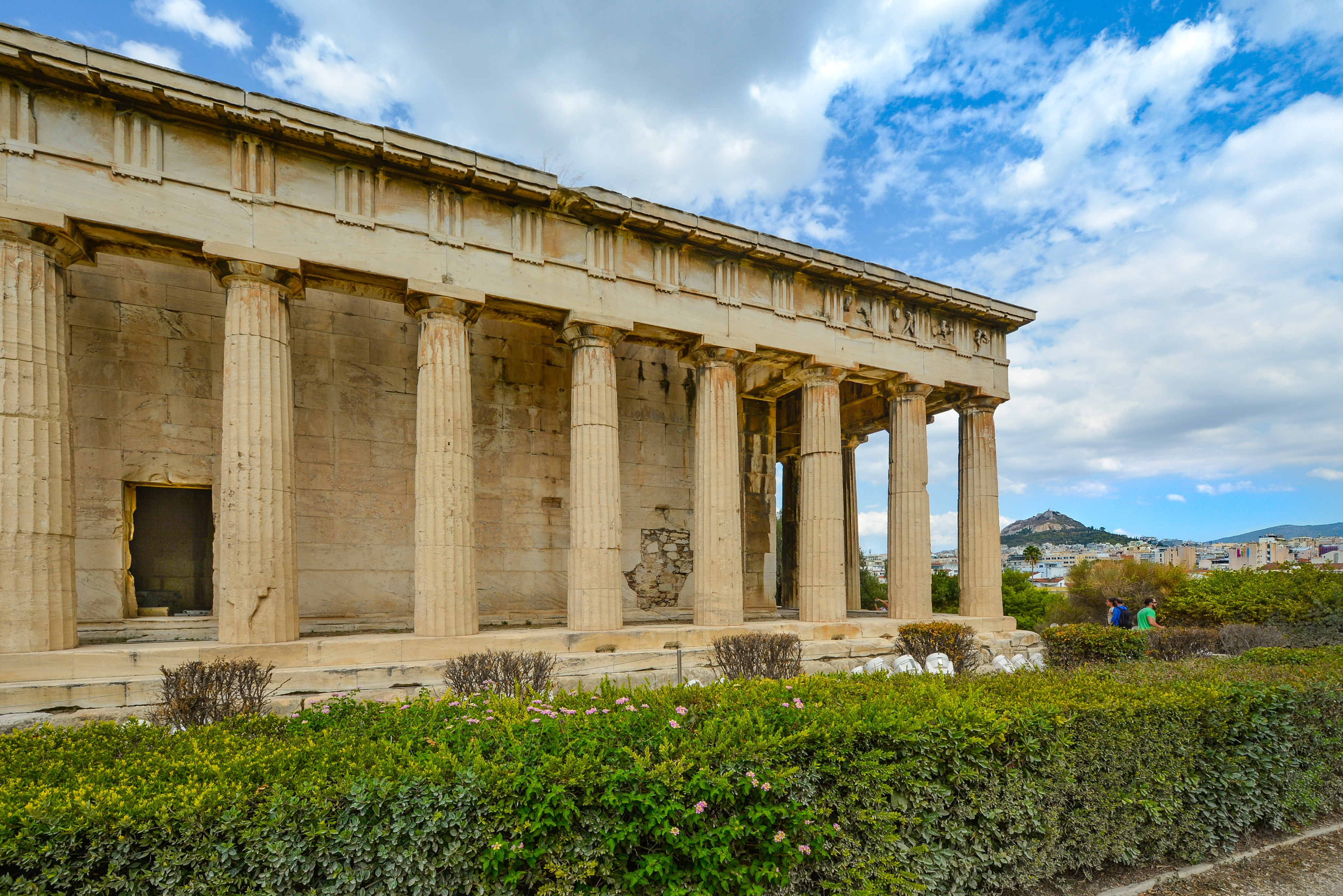
About Athens

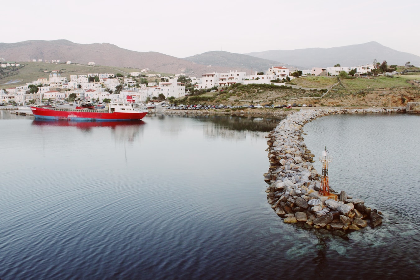
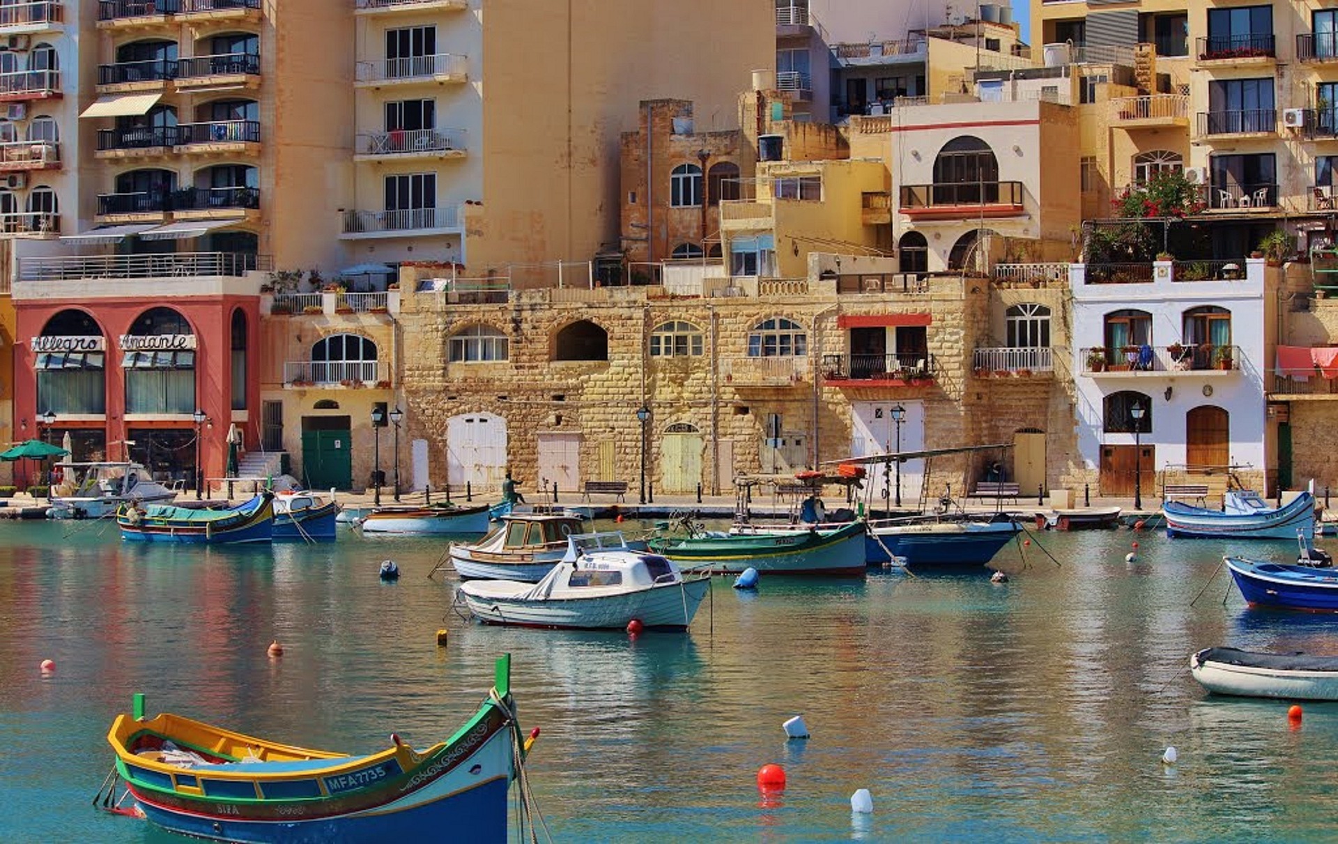
About Ermoupoli, Syra
Syros is an island in the Aegean Sea, 78 miles (125 kilometres) southeast of Athens, and the administrative, commercial, intellectual and cultural centre of the Cyclades. Syros is 32 square miles (82.8 square kilometres) in area. Its largest towns are Ermoupoli, the capital of the island and Cyclades, Ano Syros and Vari. Although Syros belongs to the Cyclades islands, its architecture is more medieval than Cycladic. The beaches of Syros are especially inviting, and surrounded by many tourist facilities and accommodations.
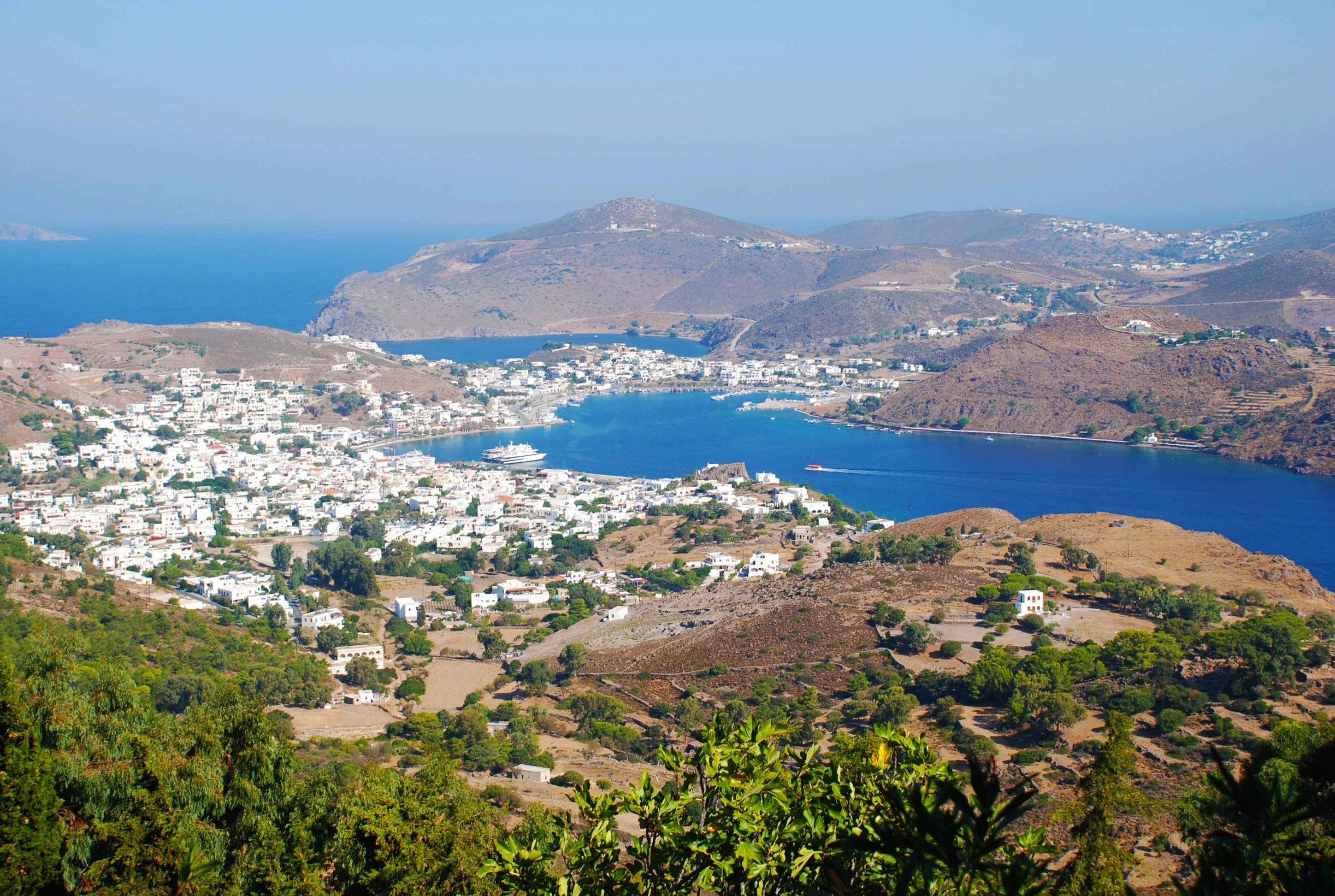
About Pátmos
For better or worse, it can be difficult to reach Patmos—for many travelers, this lack of access is definitely for the better, since the island retains the air of an unspoiled retreat. Rocky and barren, the small, 34-square-km (21-square-mi) island lies beyond the islands of Kalymnos and Leros, northwest of Kos. Here on a hillside is the Monastery of the Apocalypse, which enshrines the cave where St. John received the Revelation in AD 95. Scattered evidence of Mycenaean presence remains on Patmos, and walls of the classical period indicate the existence of a town near Skala. Most of the island's approximately 2,800 people live in three villages: Skala, medieval Chora, and the small rural settlement of Kambos. The island is popular among the faithful making pilgrimages to the monastery as well as with vacationing Athenians and a newly growing community of international trendsetters—designers, artists, poets, and “taste gurus” (to quote Vogue’s July 2011 write-up of the island)—who have bought homes in Chora. These stylemeisters followed in the footsteps of Alexandrian John Stefanidis and the English artist Teddy Millington-Drake who, in the early ’60s, set about creating what eventually became hailed as one of the most gorgeous island homes in the world. The word soon spread thanks to their many guests (who included Jacqueline Kennedy Onassis) but, happily, administrators have carefully contained development, and as a result, Patmos retains its charm and natural beauty—even in the busy month of August.

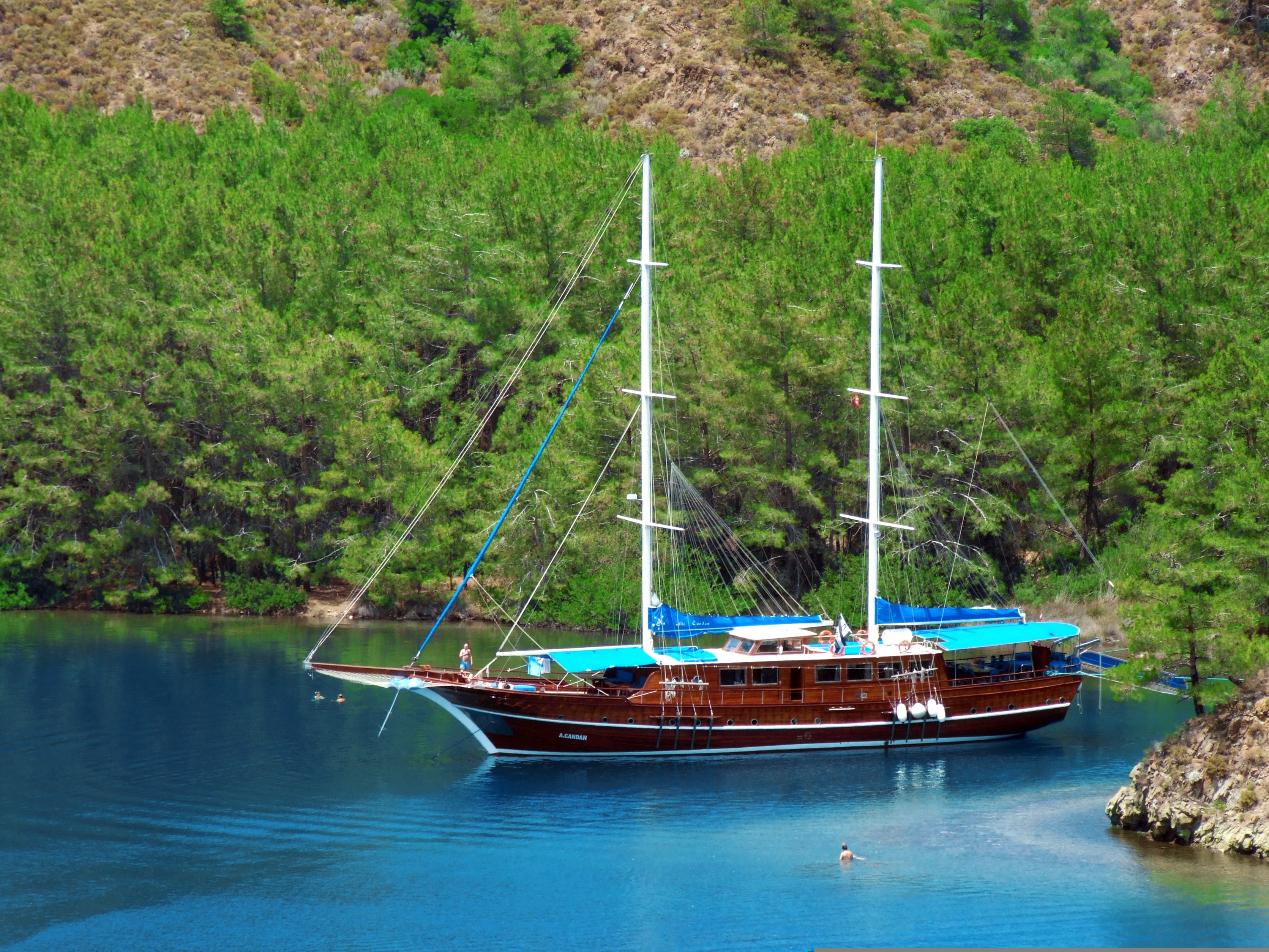
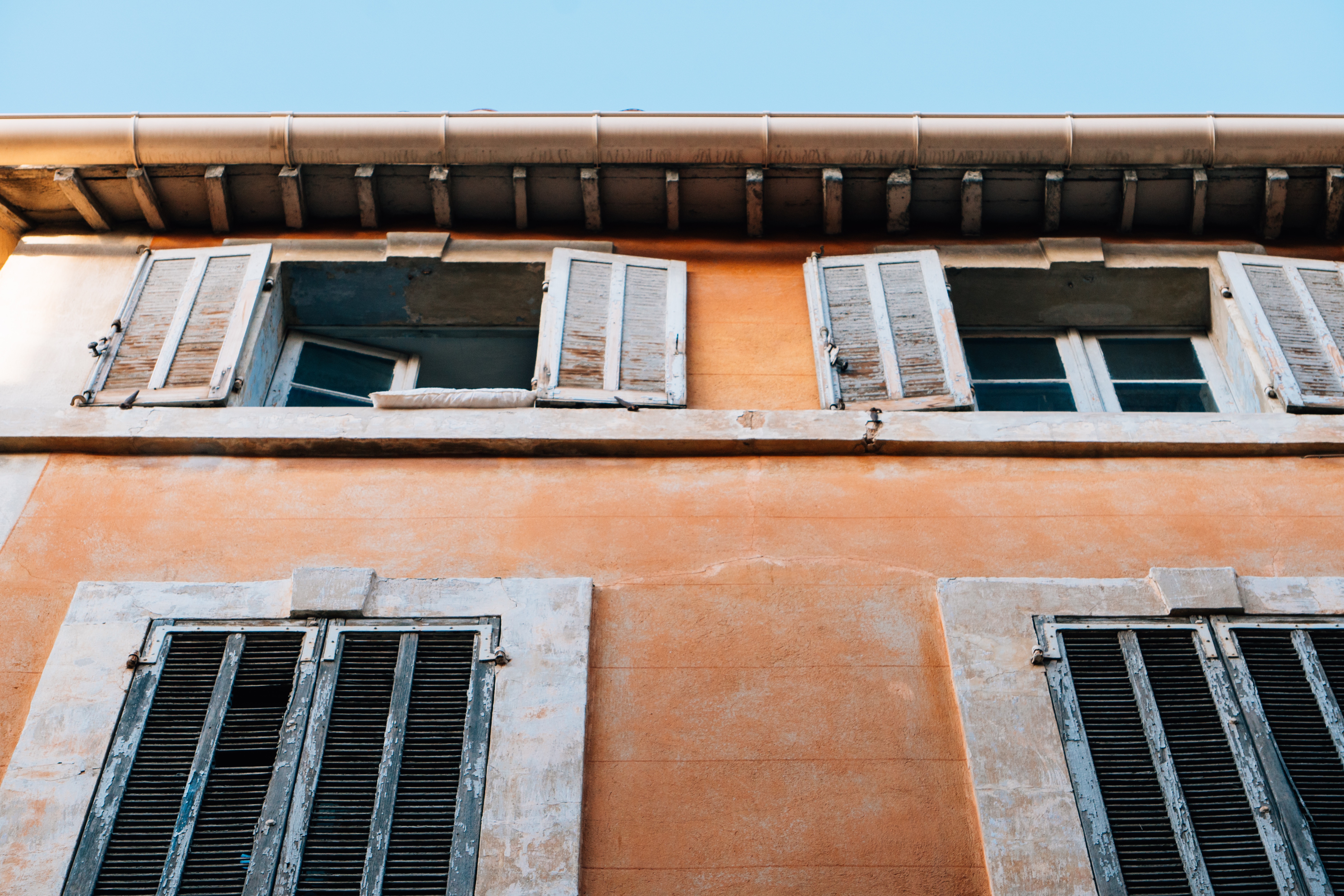
About Marmaris
This big, brash resort city has two faces, and they're hard to reconcile. From the sea, a line of hotels stretches around the northern edge of a great bay, the whole encircled by a magical necklace of pine-clad mountains. Behind those same hotels, however, the city has been overwhelmed by boxy concrete development and streets lined with a hundred generically named eateries. An annual horde of European tourists descends on these workaday establishments, but for the international traveler, there is little about Marmaris that can’t be savored elsewhere in Turkey. Although it is a pretty spot, there isn’t much reason to linger unless you are meeting a yacht, traveling on to the Greek island of Rhodes, or perhaps snapping up an unbeatable deal at one of the top resorts, some of which are spectacular worlds unto themselves.
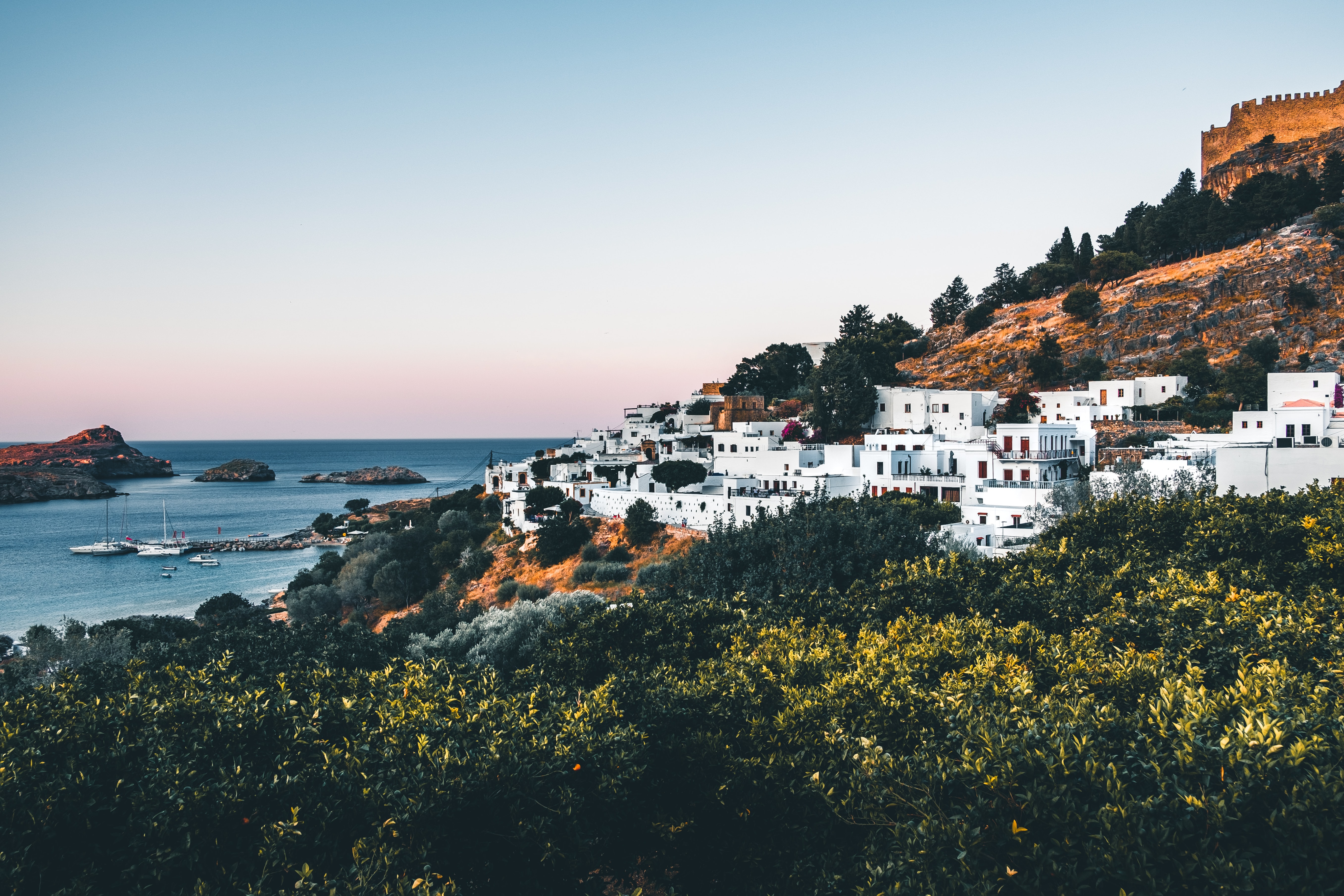
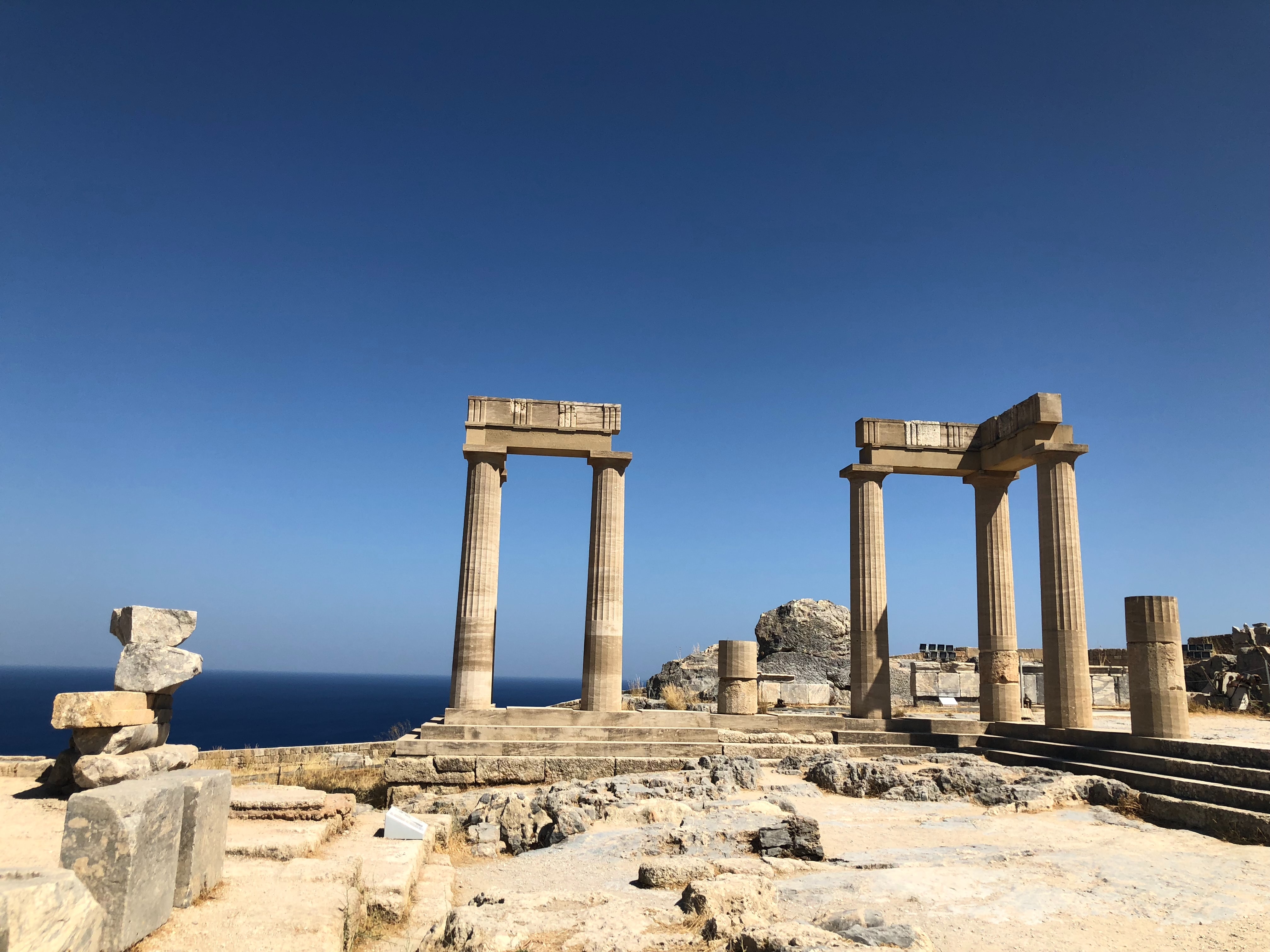
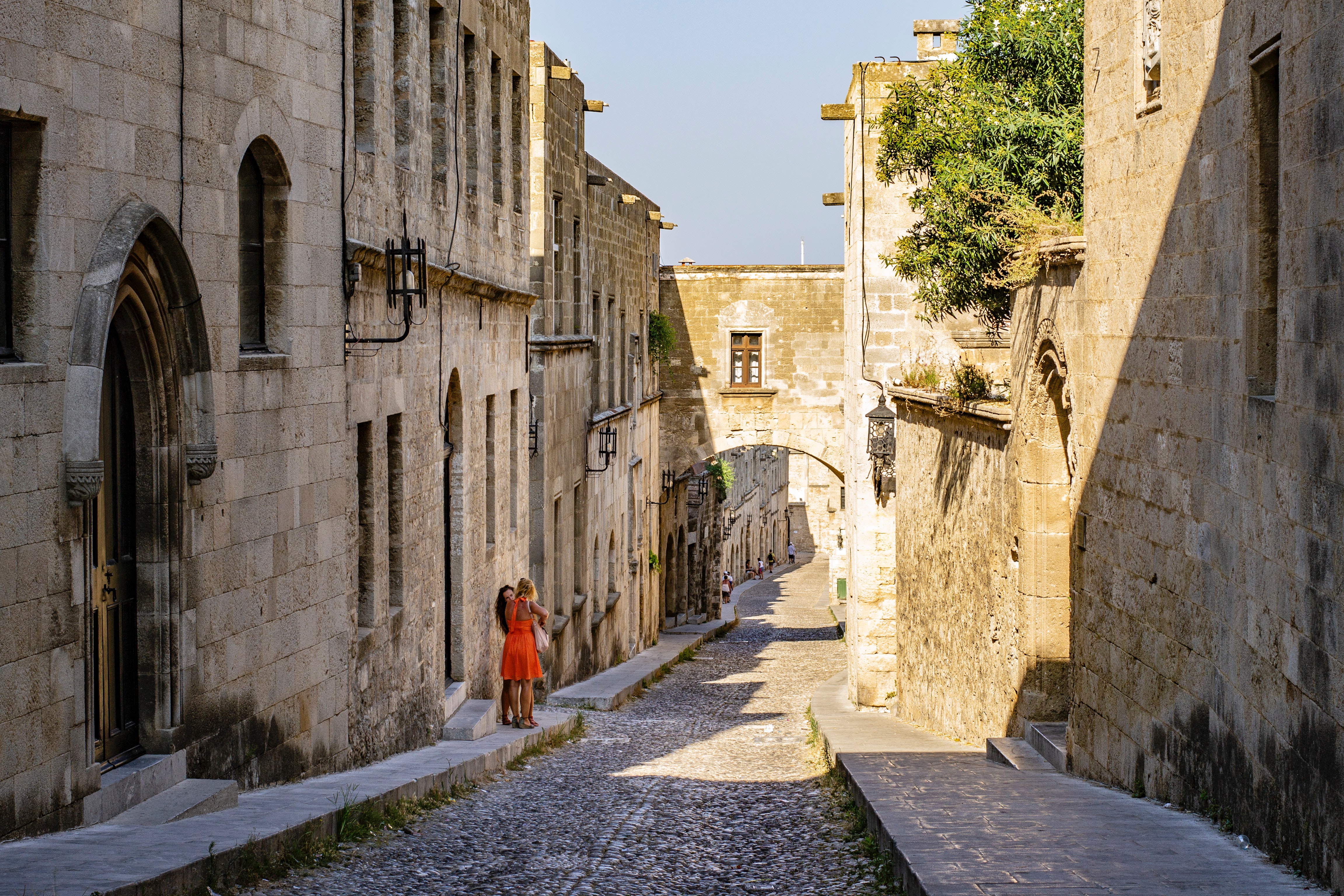
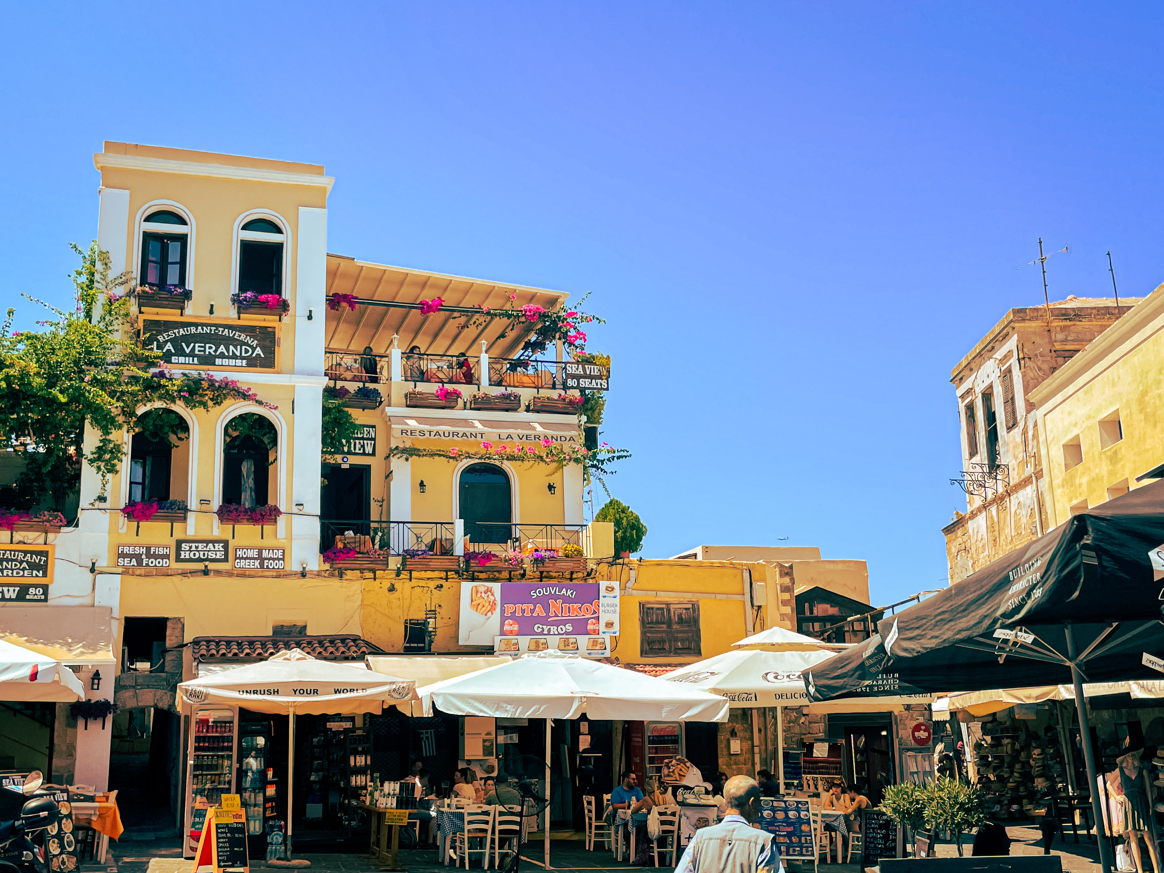
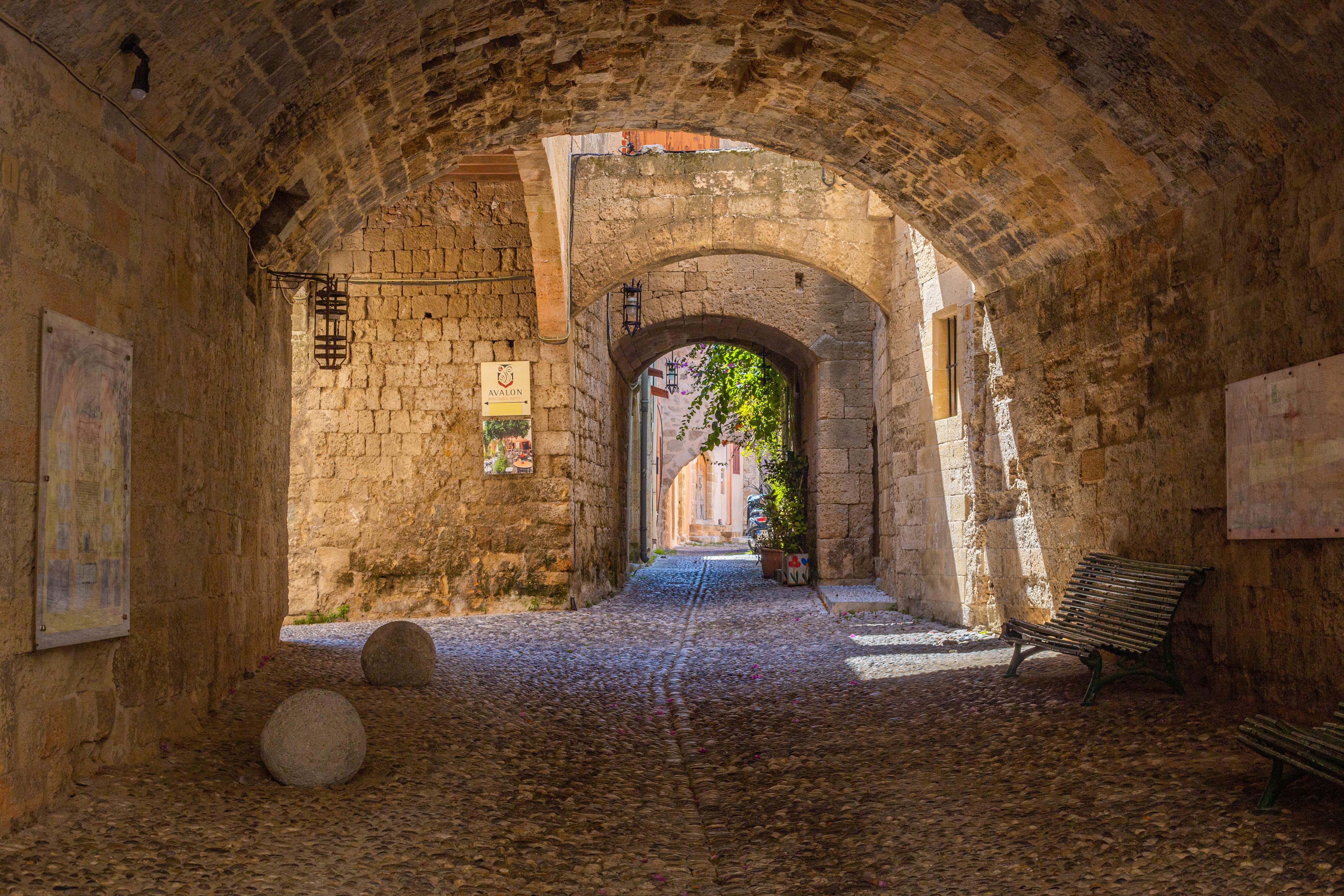
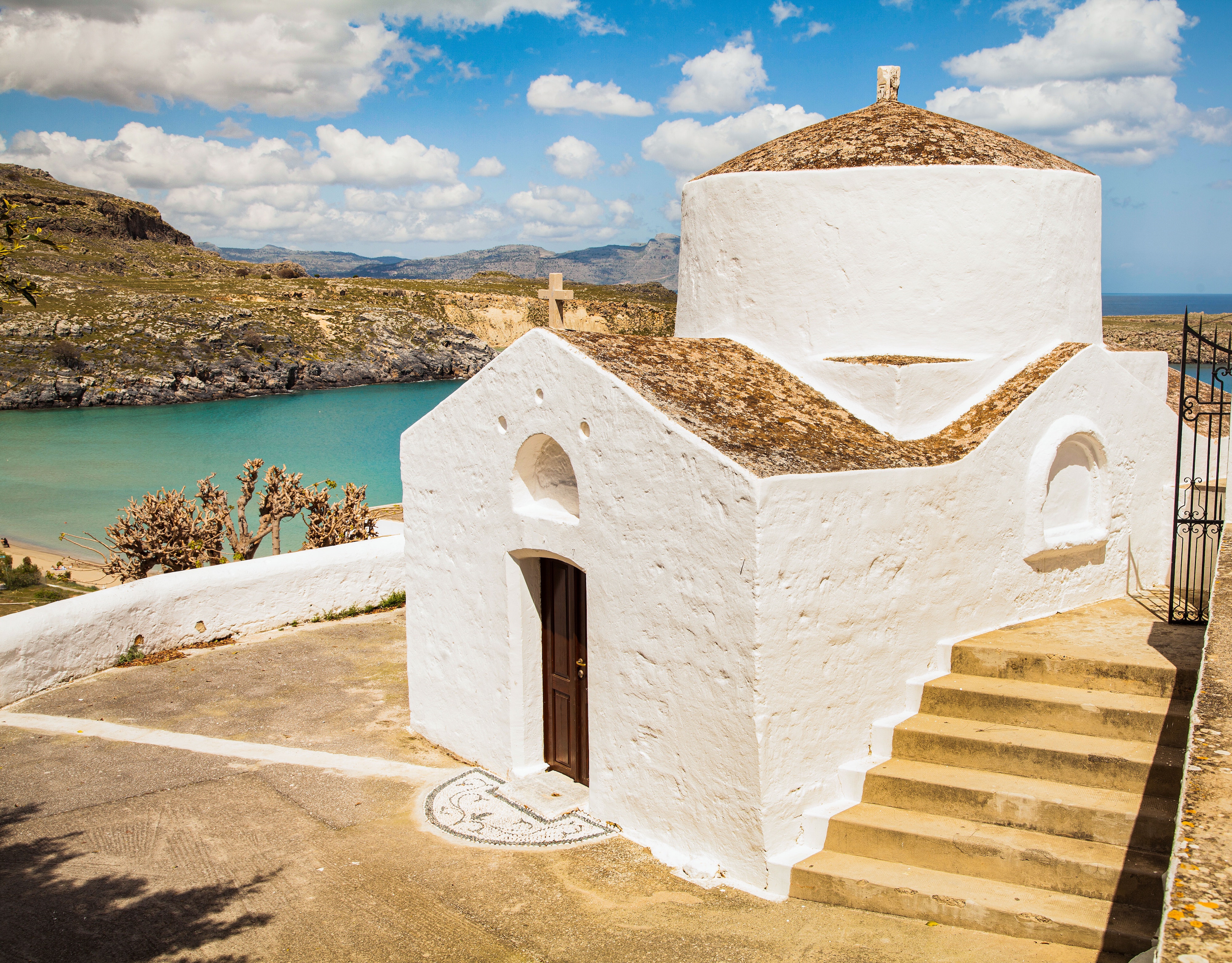
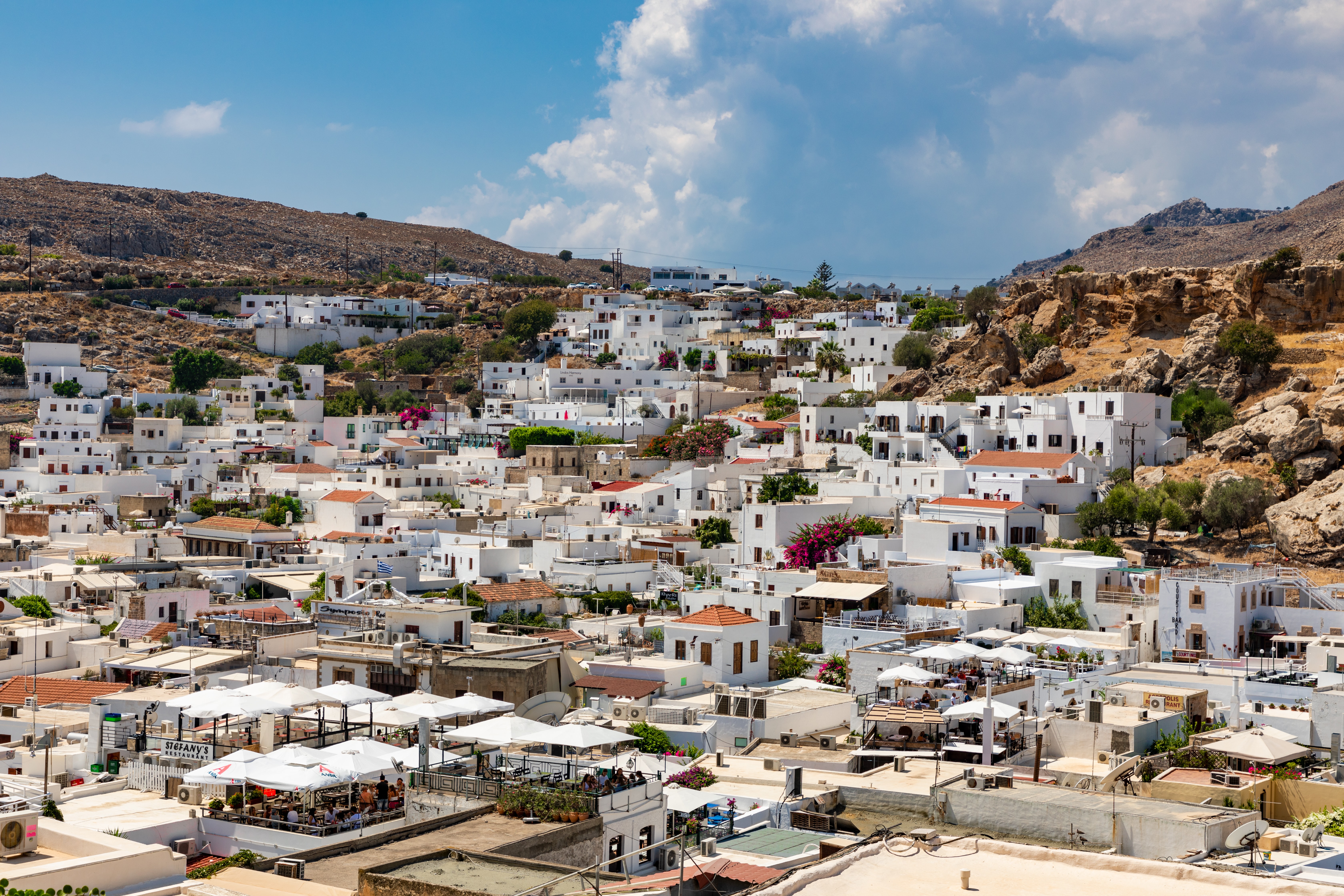
About Rhodes
Early travelers described Rhodes as a town of two parts: a castle or high town (Collachium) and a lower city. Today Rhodes town—sometimes referred to as Ródos town—is still a city of two parts: the Old Town, a UNESCO World Heritage site that incorporates the high town and lower city, and the modern metropolis, or New Town, spreading away from the walls that encircle the Old Town. The narrow streets of the Old Town are for the most part closed to cars and are lined with Orthodox and Catholic churches, Turkish houses (some of which follow the ancient orthogonal plan), and medieval public buildings with exterior staircases and facades elegantly constructed of well-cut limestone from Lindos. Careful reconstruction in recent years has enhanced the harmonious effect.
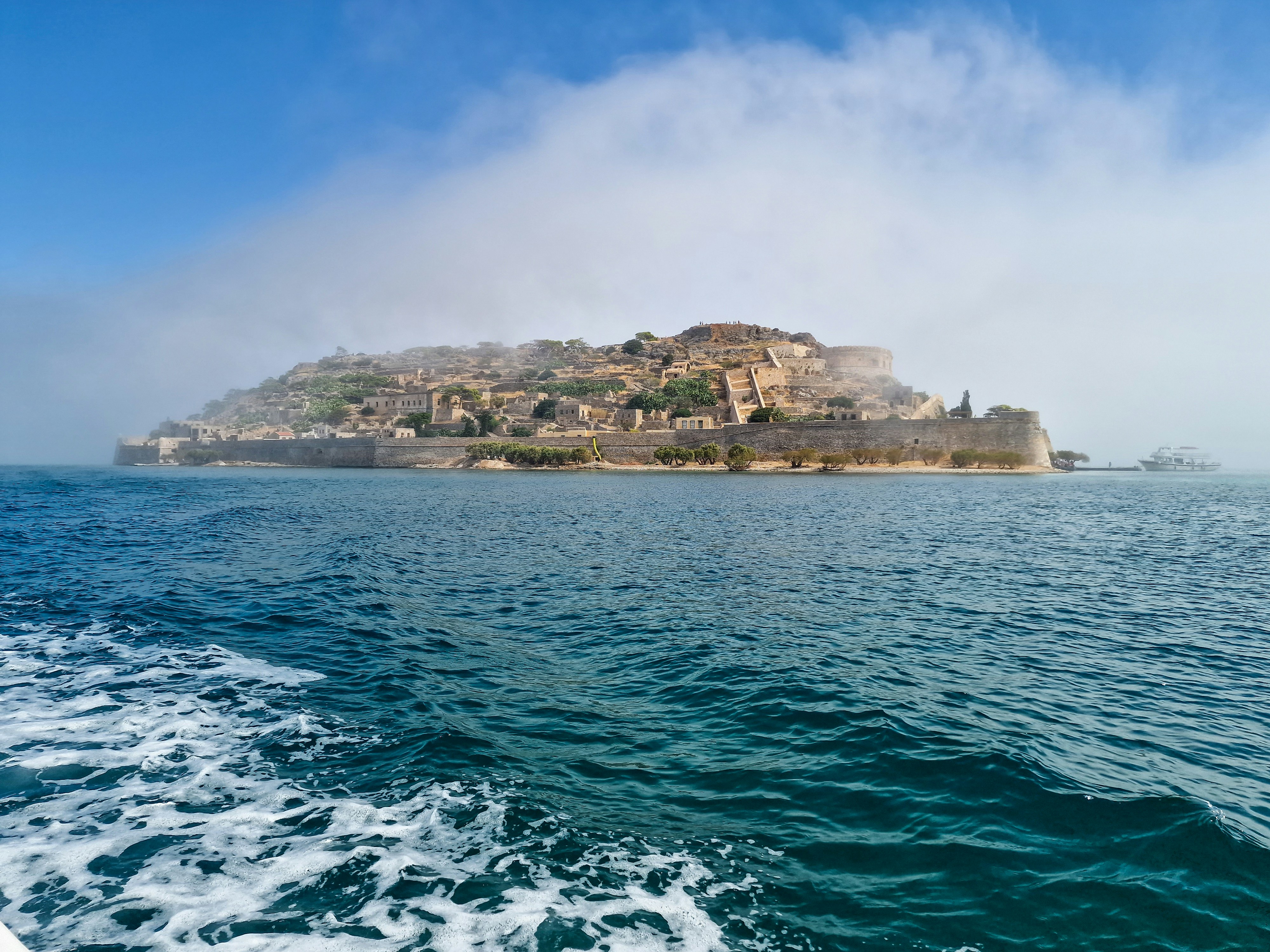
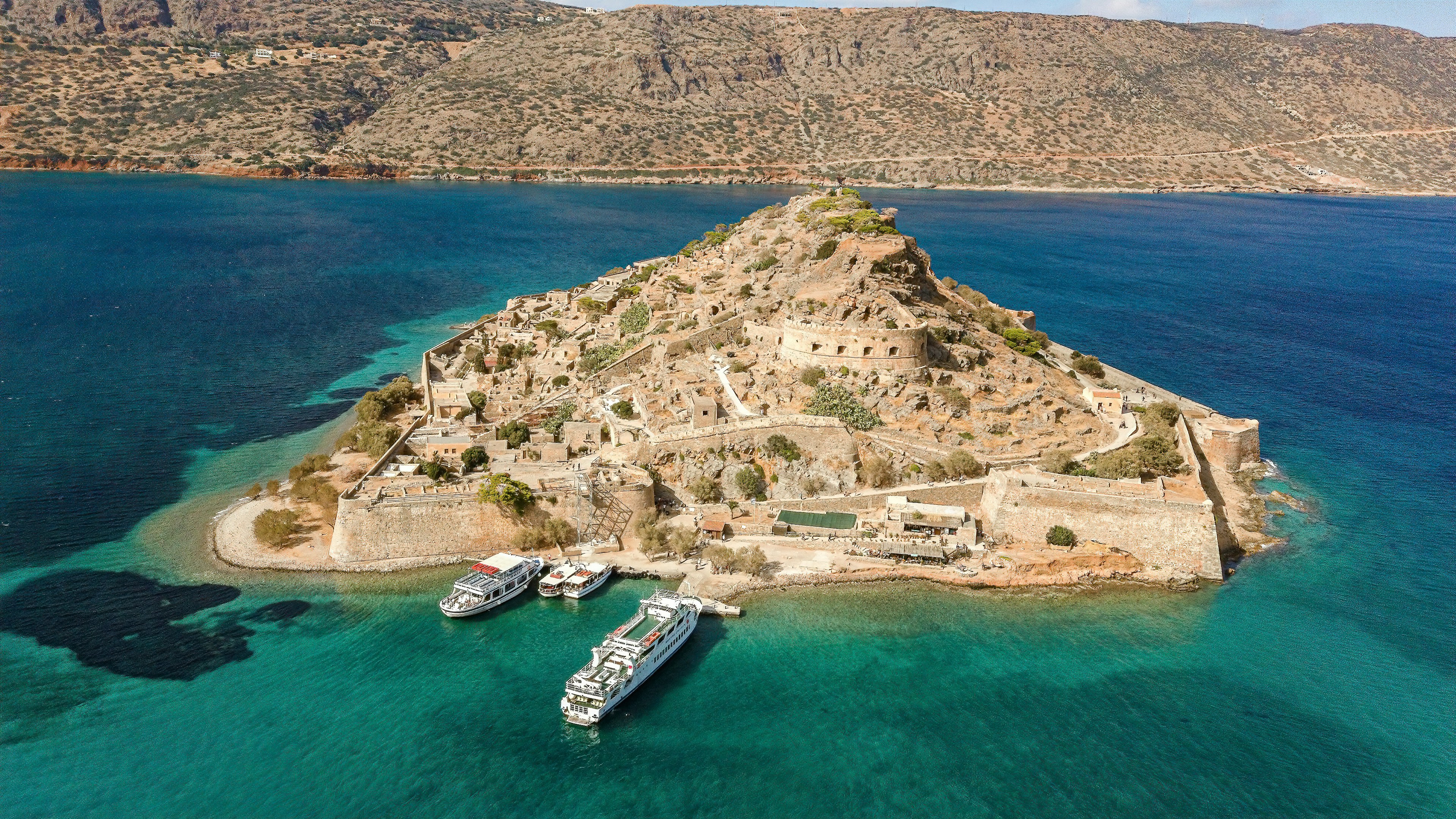
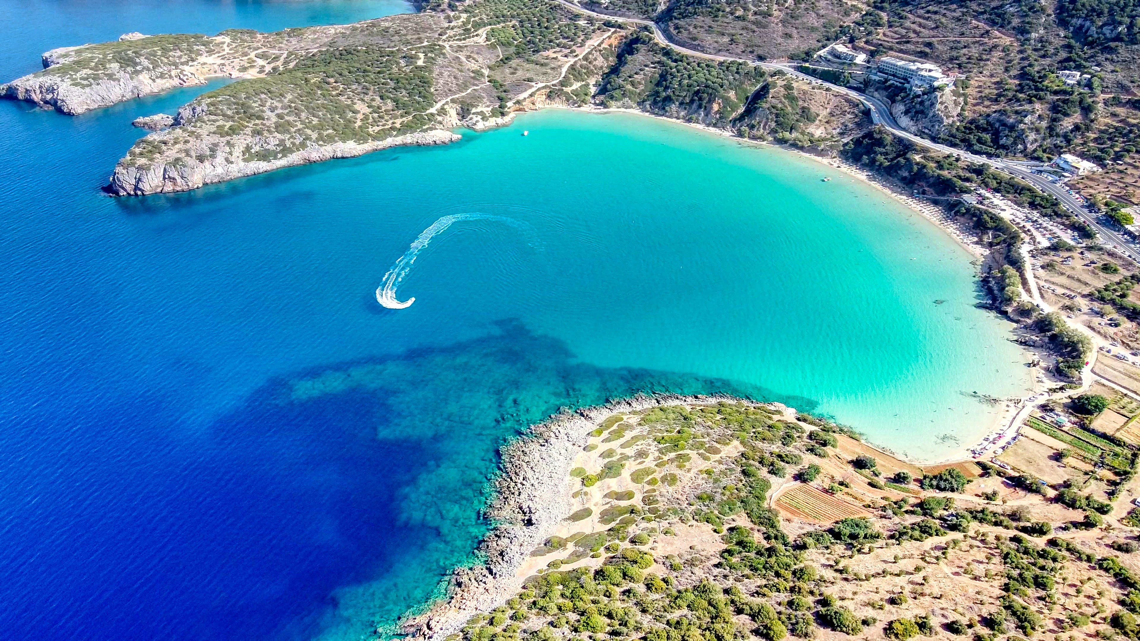
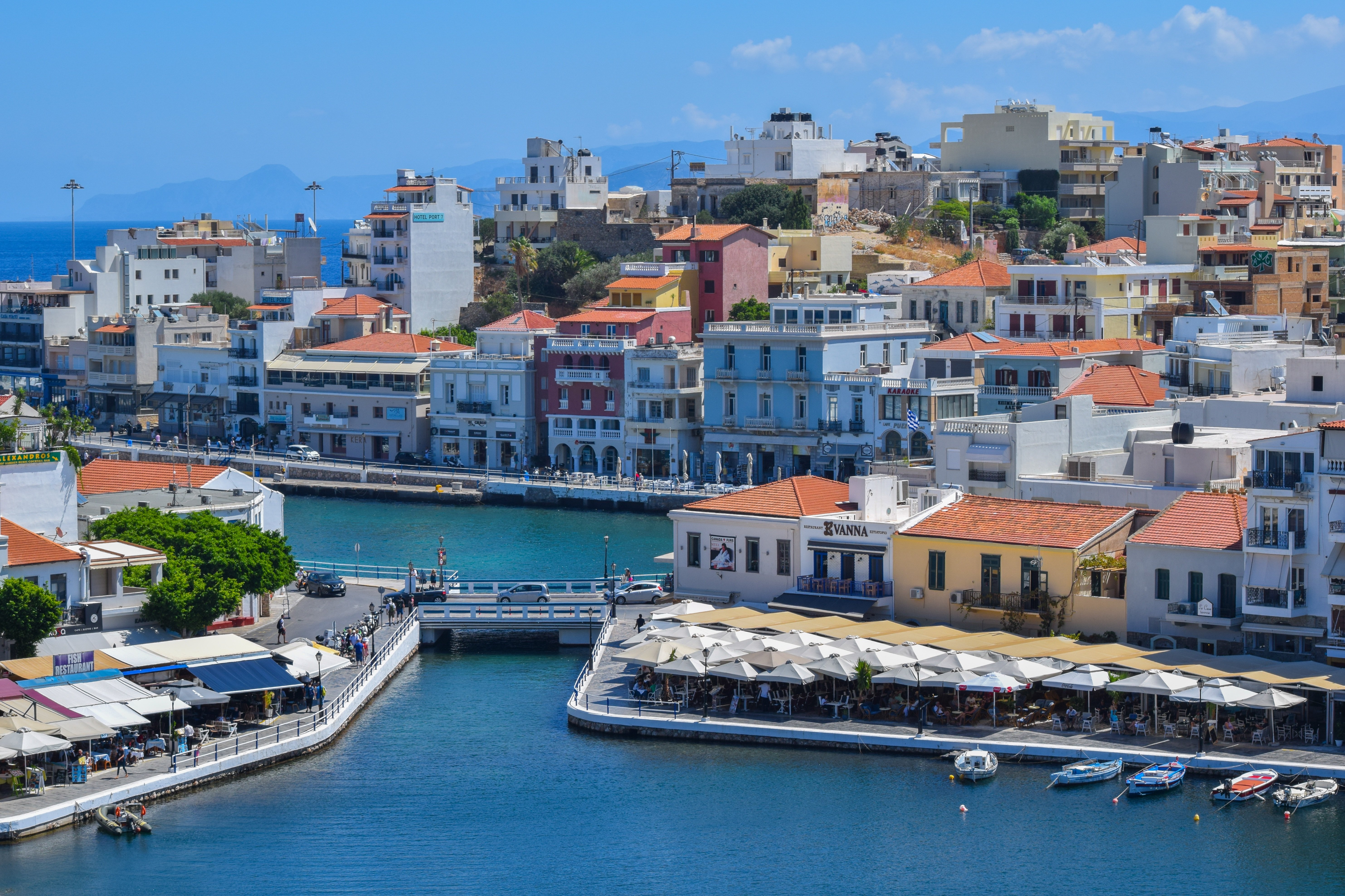
About Agios Nikólaos, Kríti

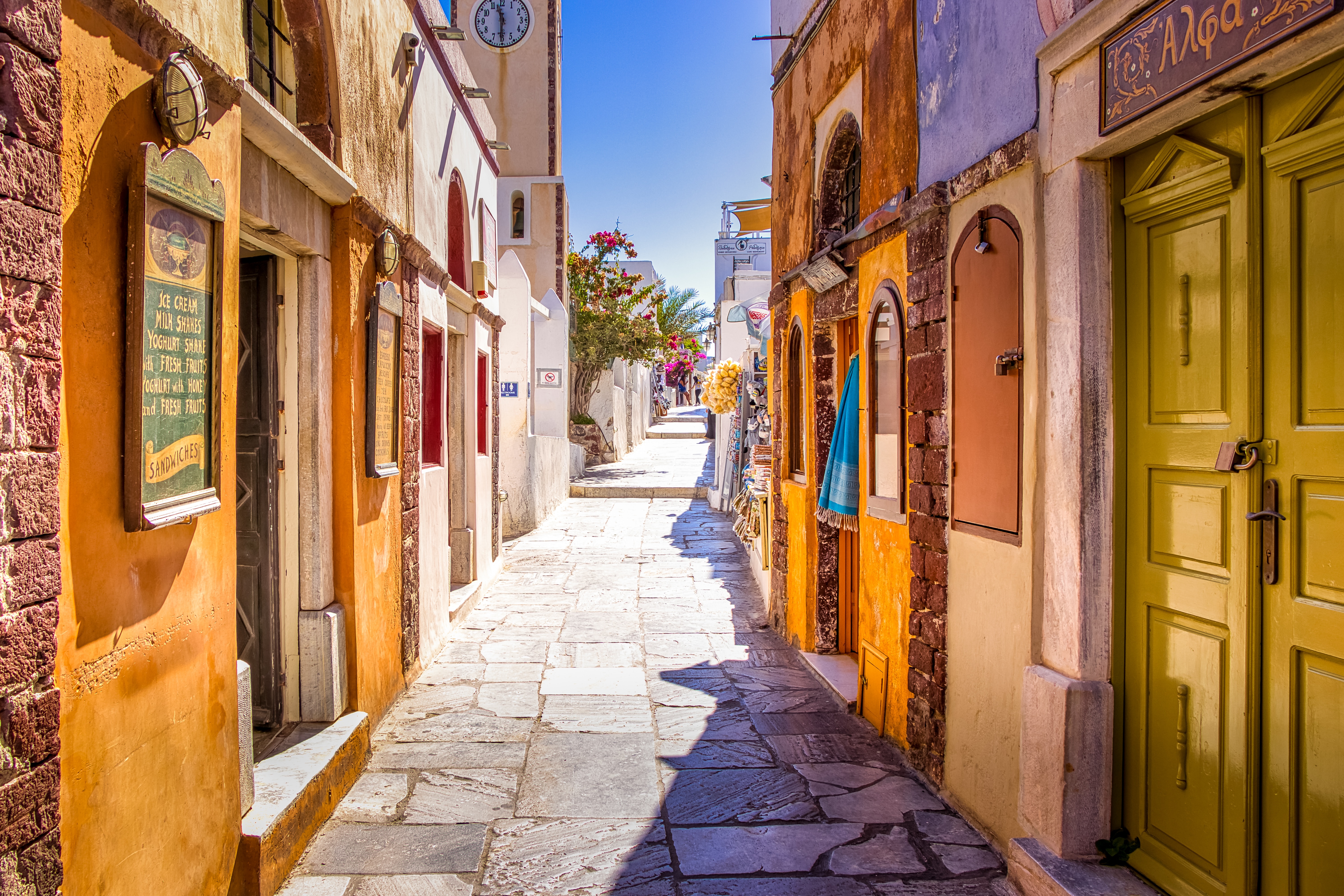
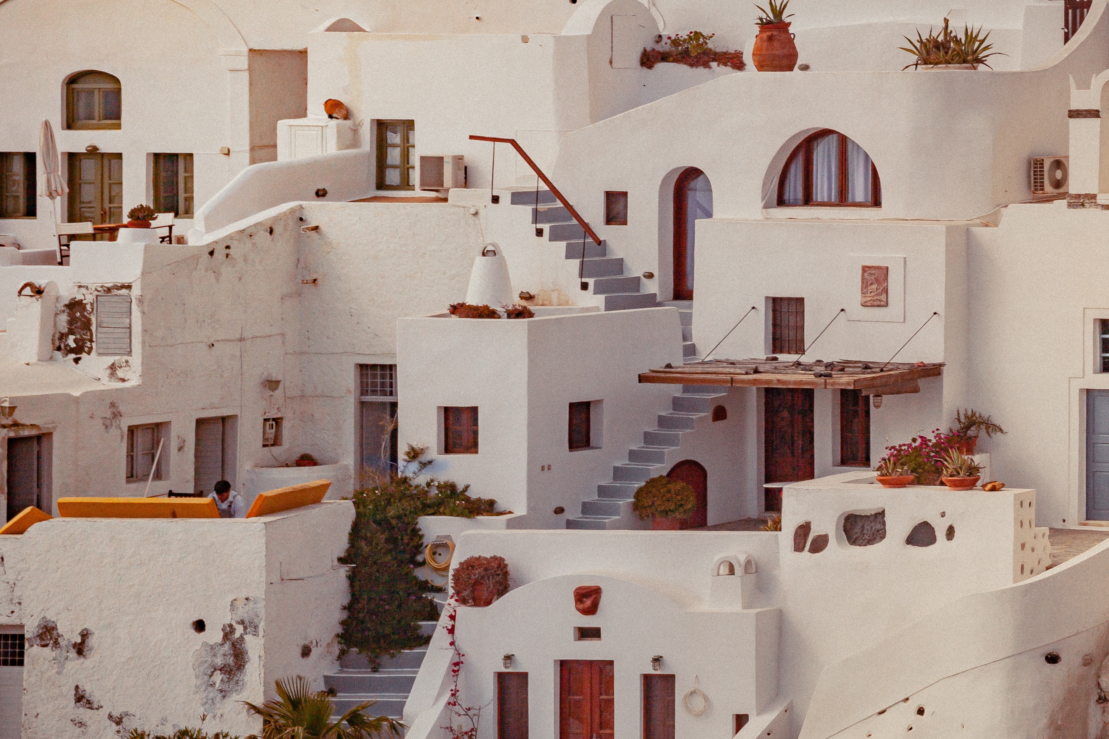
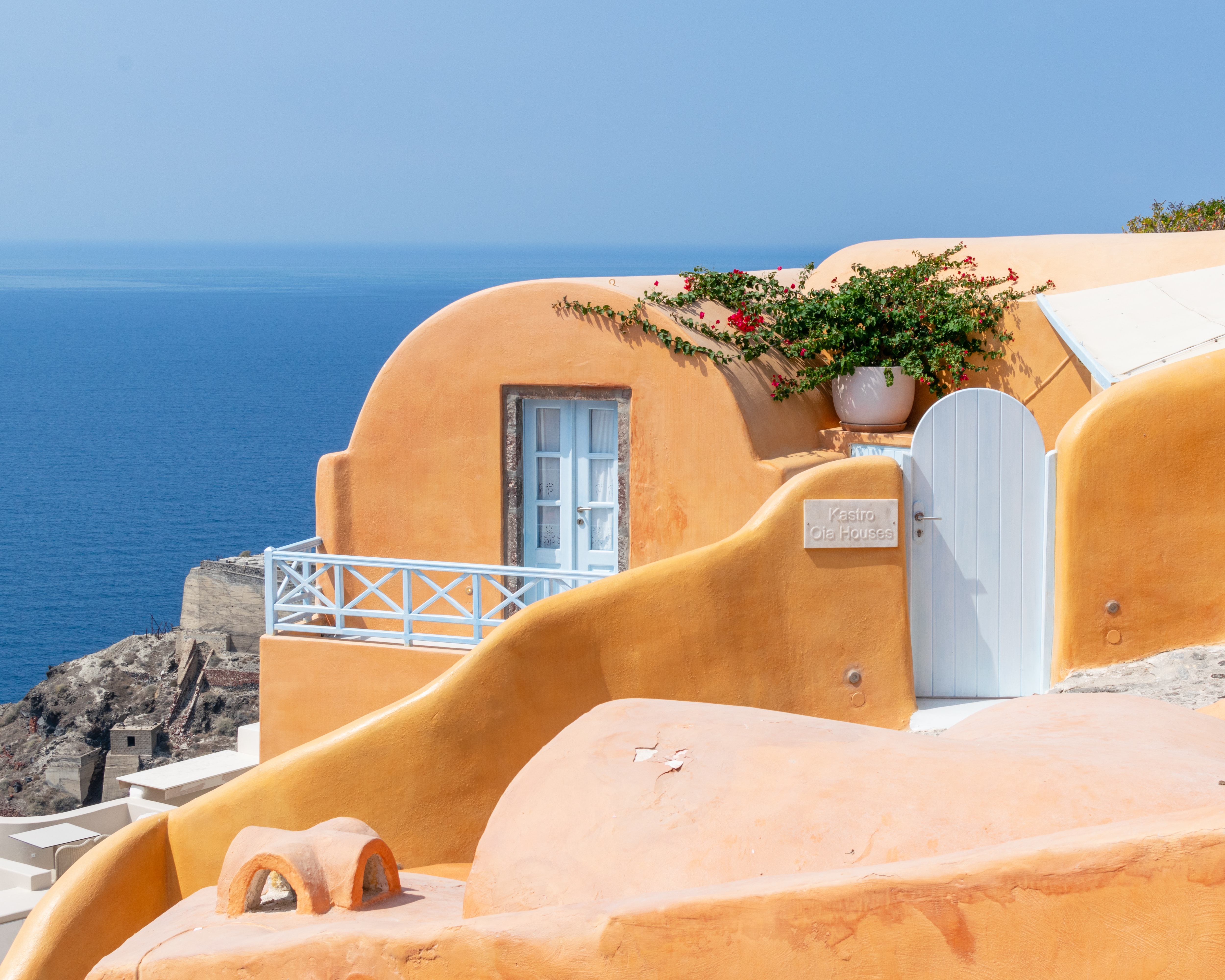
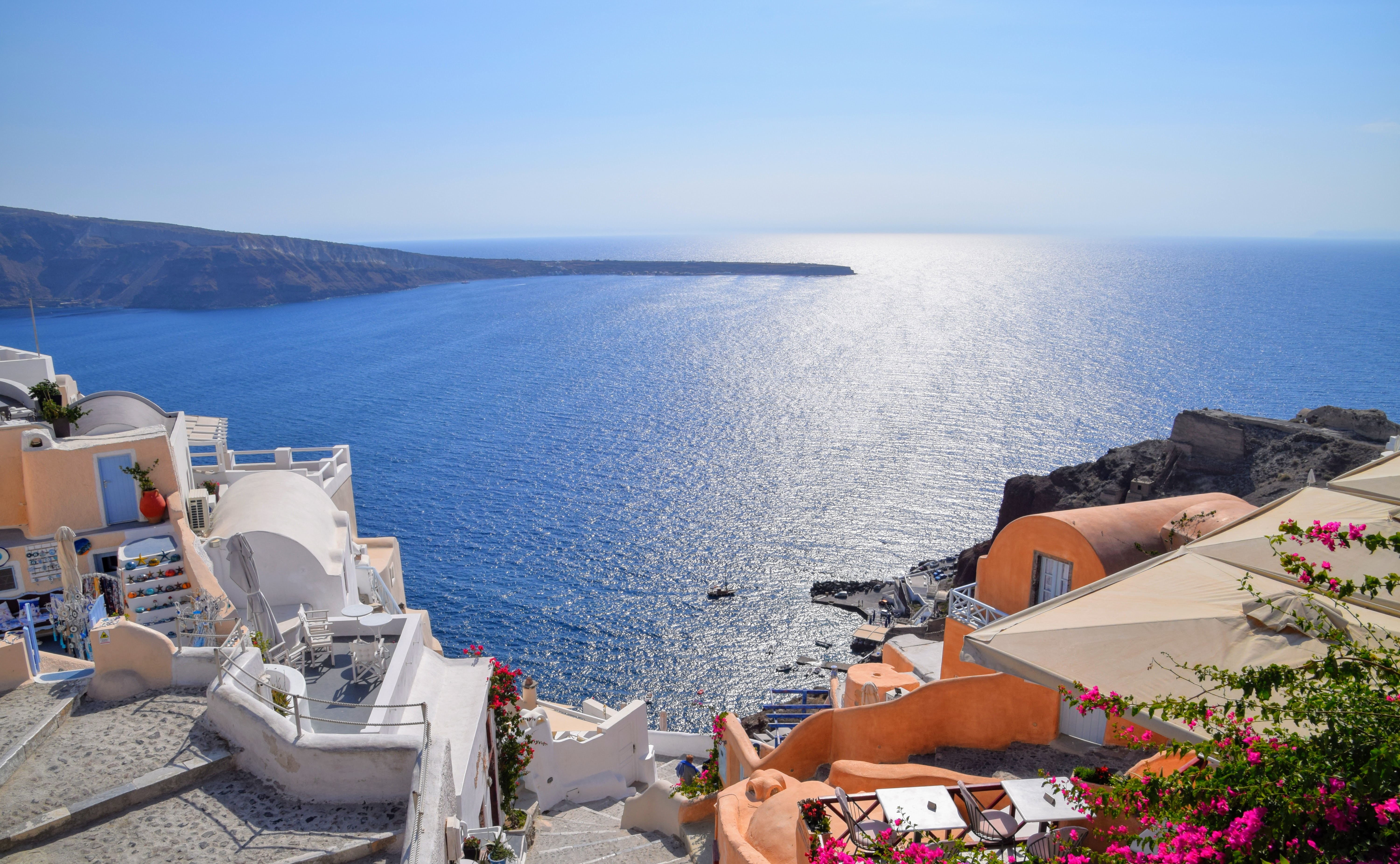
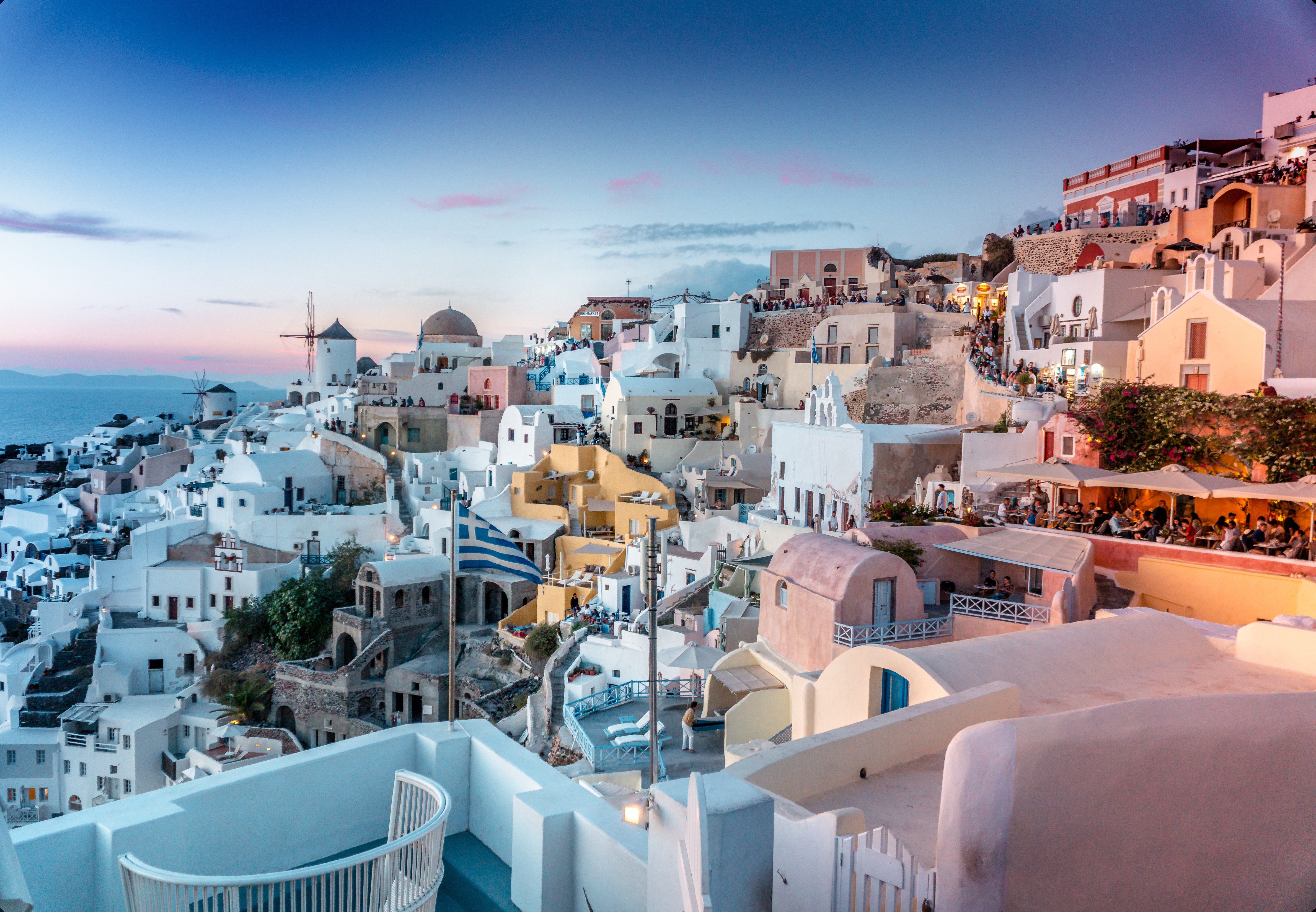
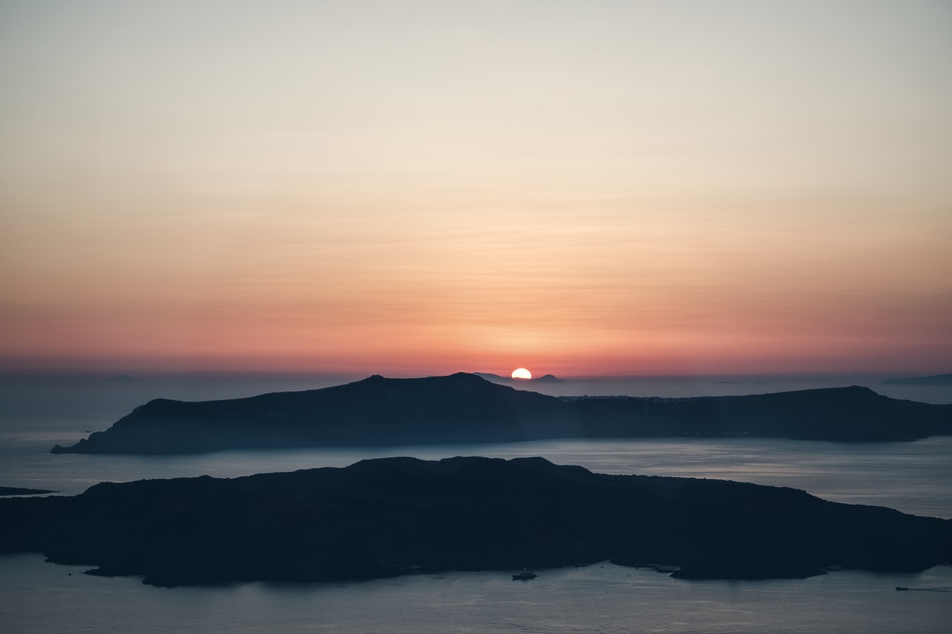
About Santorini
Undoubtedly the most extraordinary island in the Aegean, crescent-shape Santorini remains a mandatory stop on the Cycladic tourist route—even if it's necessary to enjoy the sensational sunsets from Ia, the fascinating excavations, and the dazzling white towns with a million other travelers. Called Kállisti (the "Loveliest") when first settled, the island has now reverted to its subsequent name of Thira, after the 9th-century-BC Dorian colonizer Thiras. The place is better known, however, these days as Santorini, a name derived from its patroness, St. Irene of Thessaloniki, the Byzantine empress who restored icons to Orthodoxy and died in 802. You can fly conveniently to Santorini, but to enjoy a true Santorini rite of passage, opt instead for the boat trip here, which provides a spectacular introduction. After the boat sails between Sikinos and Ios, your deck-side perch approaches two close islands with a passage between them. The bigger one on the left is Santorini, and the smaller on the right is Thirassia. Passing between them, you see the village of Ia adorning Santorini's northernmost cliff like a white geometric beehive. You are in the caldera (volcanic crater), one of the world's truly breathtaking sights: a demilune of cliffs rising 1,100 feet, with the white clusters of the towns of Fira and Ia perched along the top. The bay, once the high center of the island, is 1,300 feet in some places, so deep that when boats dock in Santorini's shabby little port of Athinios, they do not drop anchor. The encircling cliffs are the ancient rim of a still-active volcano, and you are sailing east across its flooded caldera. On your right are the Burnt isles, the White isle, and other volcanic remnants, all lined up as if some outsize display in a geology museum. Hephaestus's subterranean fires smolder still—the volcano erupted in 198 BC, about 735, and there was an earthquake in 1956. Indeed, Santorini and its four neighboring islets are the fragmentary remains of a larger landmass that exploded about 1600 BC: the volcano's core blew sky high, and the sea rushed into the abyss to create the great bay, which measures 10 km by 7 km (6 mi by 4½ mi) and is 1,292 feet deep. The other pieces of the rim, which broke off in later eruptions, are Thirassia, where a few hundred people live, and deserted little Aspronissi ("White isle"). In the center of the bay, black and uninhabited, two cones, the Burnt Isles of Palea Kameni and Nea Kameni, appeared between 1573 and 1925. There has been too much speculation about the identification of Santorini with the mythical Atlantis, mentioned in Egyptian papyri and by Plato (who says it's in the Atlantic), but myths are hard to pin down. This is not true of old arguments about whether tidal waves from Santorini's cataclysmic explosion destroyed Minoan civilization on Crete, 113 km (70 mi) away. The latest carbon-dating evidence, which points to a few years before 1600 BC for the eruption, clearly indicates that the Minoans outlasted the eruption by a couple of hundred years, but most probably in a weakened state. In fact, the island still endures hardships: since antiquity, Santorini has depended on rain collected in cisterns for drinking and irrigating—the well water is often brackish—and the serious shortage is alleviated by the importation of water. However, the volcanic soil also yields riches: small, intense tomatoes with tough skins used for tomato paste (good restaurants here serve them); the famous Santorini fava beans, which have a light, fresh taste; barley; wheat; and white-skin eggplants.
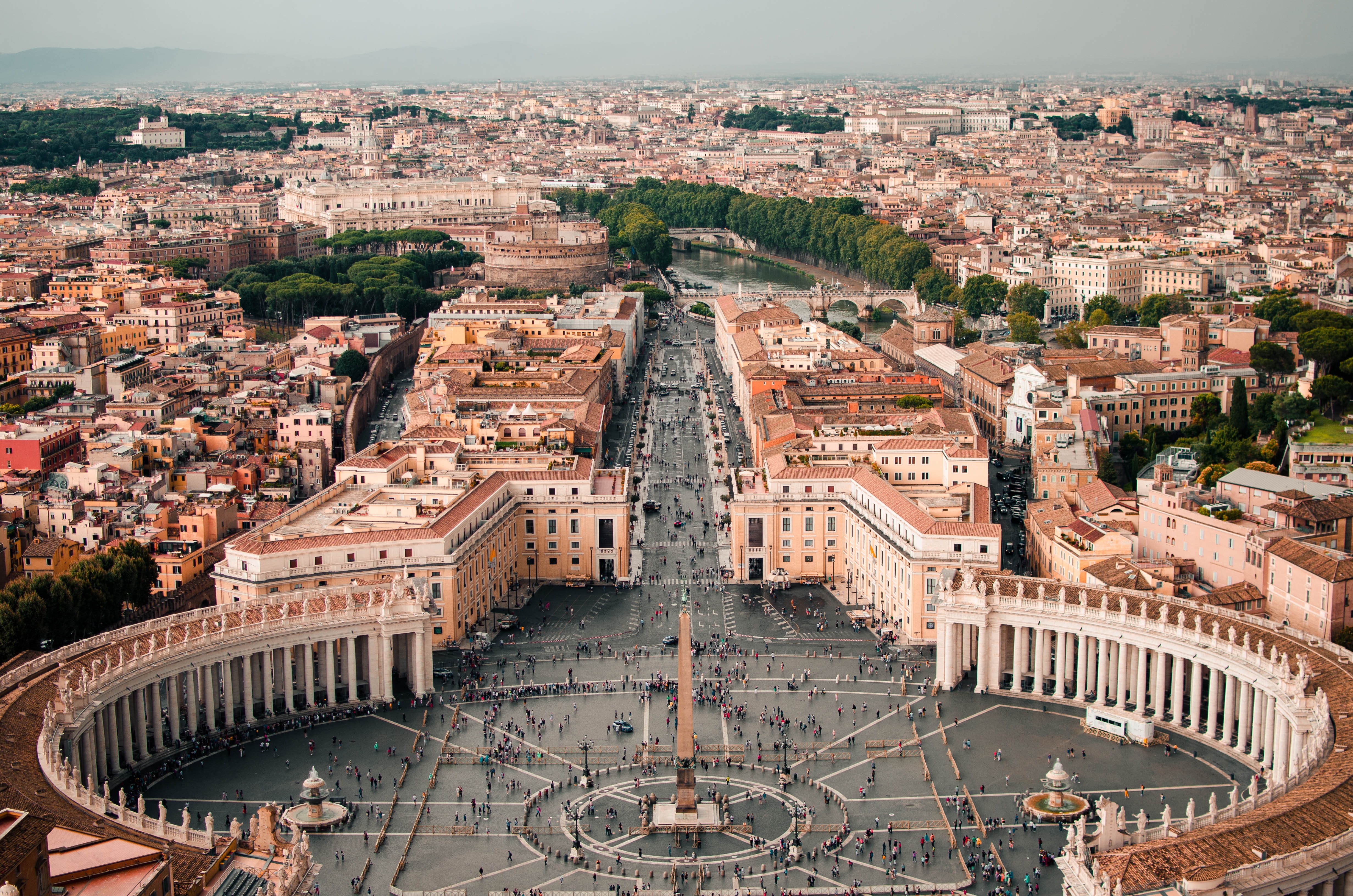
About Athens
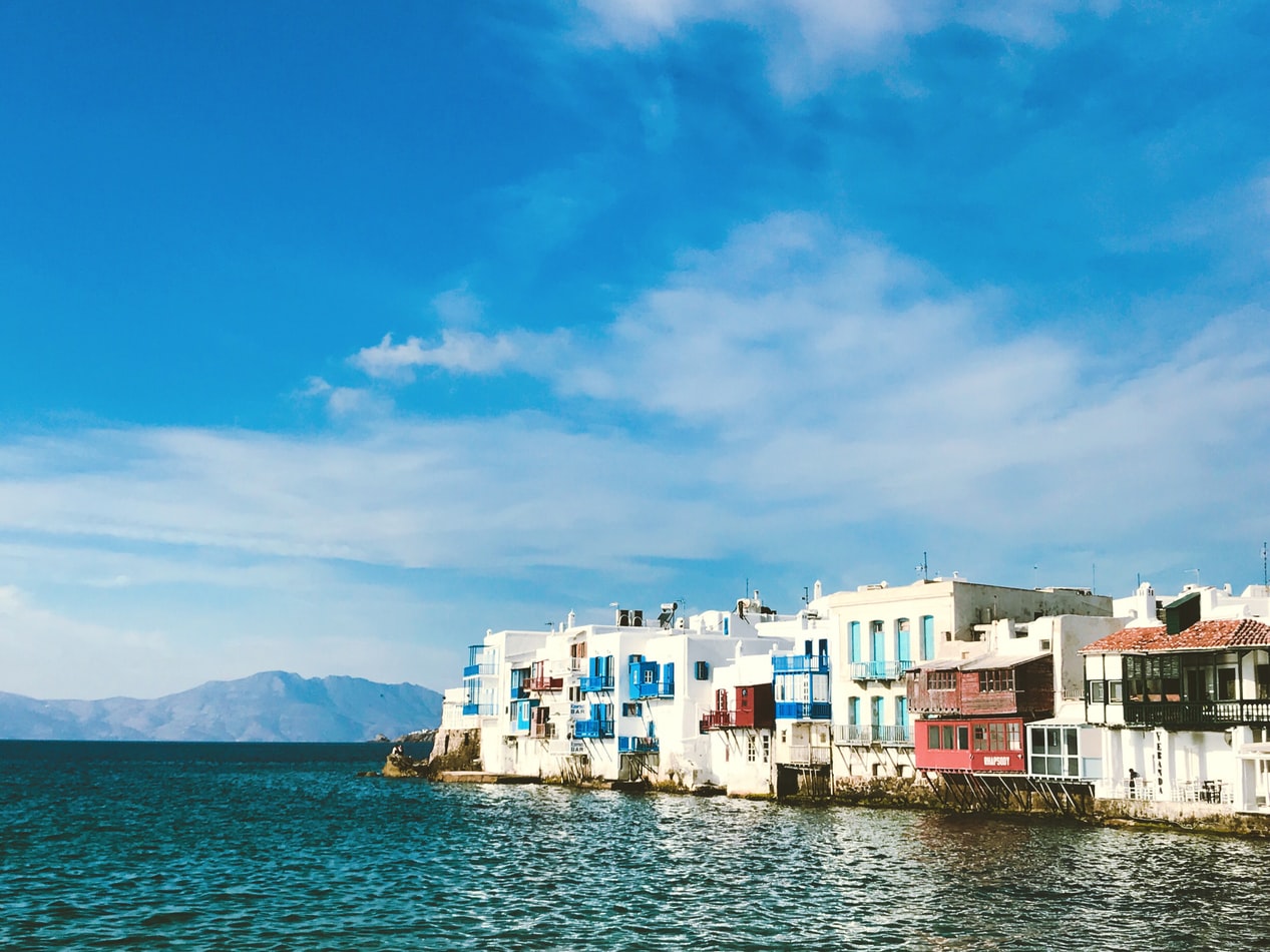
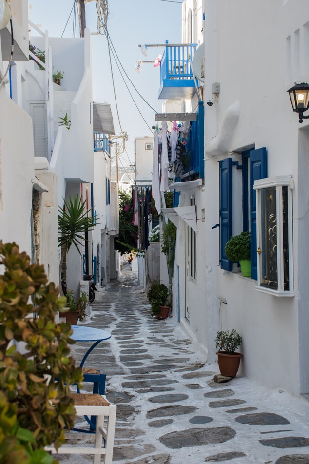
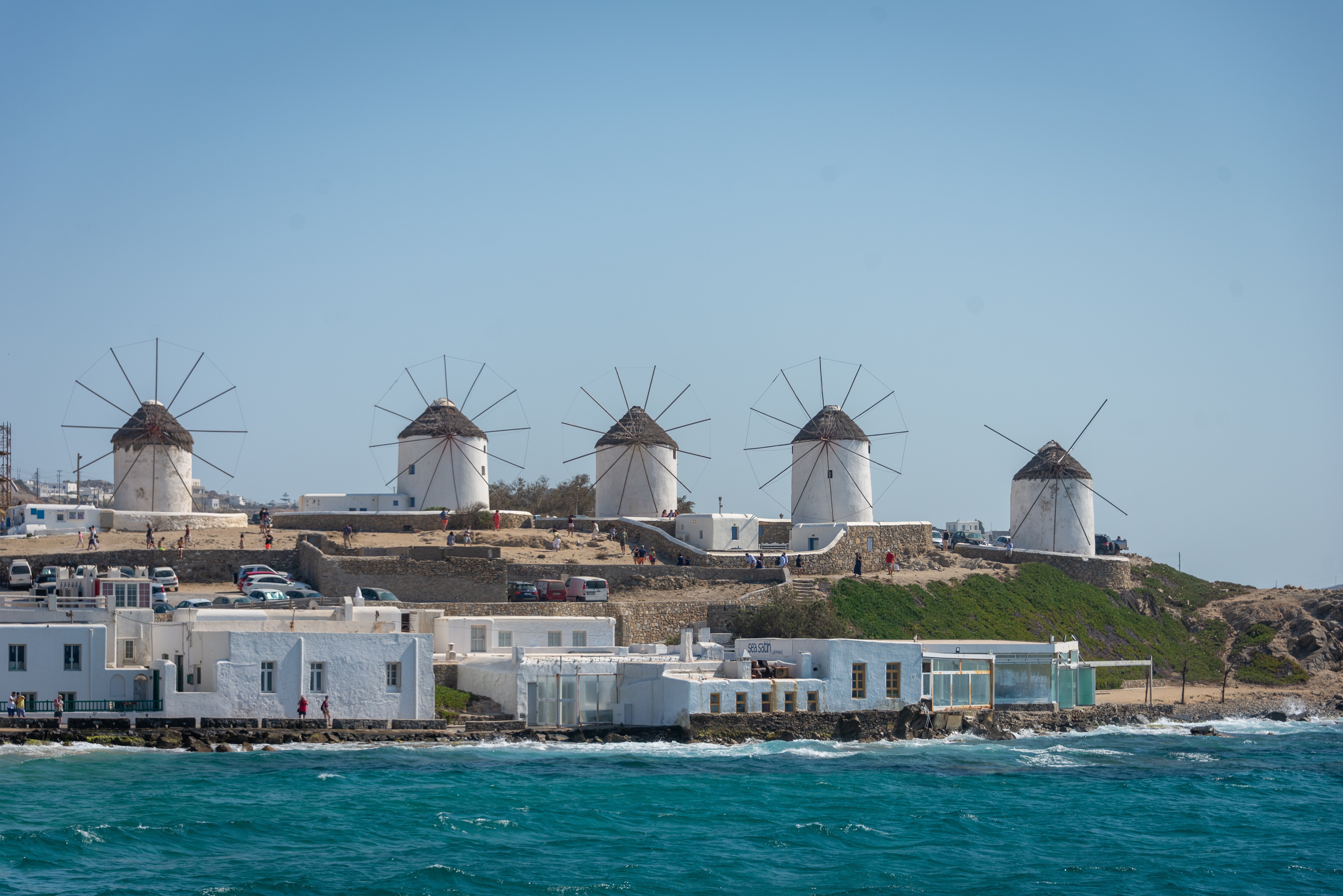
About Mykonos
Although the fishing boats still go out in good weather, Mykonos largely makes its living from tourism these days. The summer crowds have turned one of the poorest islands in Greece into one of the richest. Old Mykonians complain that their young, who have inherited stores where their grandfathers once sold eggs or wine, get so much rent that they have lost ambition, and in summer sit around pool bars at night with their friends, and hang out in Athens in winter when island life is less scintillating. Put firmly on the map by Jackie O in the 1960s, Mykonos town—called Hora by the locals—remains the Saint-Tropez of the Greek islands. The scenery is memorable, with its whitewashed streets, Little Venice, the Kato Myli ridge of windmills, and Kastro, the town's medieval quarter. Its cubical two- or three-story houses and churches, with their red or blue doors and domes and wooden balconies, have been long celebrated as some of the best examples of classic Cycladic architecture. Luckily, the Greek Archaeological Service decided to preserve the town, even when the Mykonians would have preferred to rebuild, and so the Old Town has been impressively preserved. Pink oleander, scarlet hibiscus, and trailing green pepper trees form a contrast amid the dazzling whiteness, whose frequent renewal with whitewash is required by law. Any visitor who has the pleasure of getting lost in its narrow streets (made all the narrower by the many outdoor stone staircases, which maximize housing space in the crowded village) will appreciate how its confusing layout was designed to foil pirates—if it was designed at all. After Mykonos fell under Turkish rule in 1537, the Ottomans allowed the islanders to arm their vessels against pirates, which had a contradictory effect: many of them found that raiding other islands was more profitable than tilling arid land. At the height of Aegean piracy, Mykonos was the principal headquarters of the corsair fleets—the place where pirates met their fellows, found willing women, and filled out their crews. Eventually the illicit activity evolved into a legitimate and thriving trade network. Morning on Mykonos town's main quay is busy with deliveries, visitors for the Delos boats, lazy breakfasters, and street cleaners dealing with the previous night's mess. In late morning the cruise-boat people arrive, and the shops are all open. In early afternoon, shaded outdoor tavernas are full of diners eating salads (Mykonos's produce is mostly imported); music is absent or kept low. In mid- and late afternoon, the town feels sleepy, since so many people are at the beach, on excursions, or sleeping in their air-conditioned rooms; even some tourist shops close for siesta. By sunset, people have come back from the beach, having taken their showers and rested. At night, the atmosphere in Mykonos ramps up. The cruise-boat people are mostly gone, coughing three-wheelers make no deliveries in the narrow streets, and everyone is dressed sexy for summer and starting to shimmy with the scene. Many shops stay open past midnight, the restaurants fill up, and the bars and discos make ice cubes as fast as they can. Ready to dive in? Begin your tour of Mykonos town (Hora) by starting out at its heart: Mando Mavrogenous Square.
About Bodrum

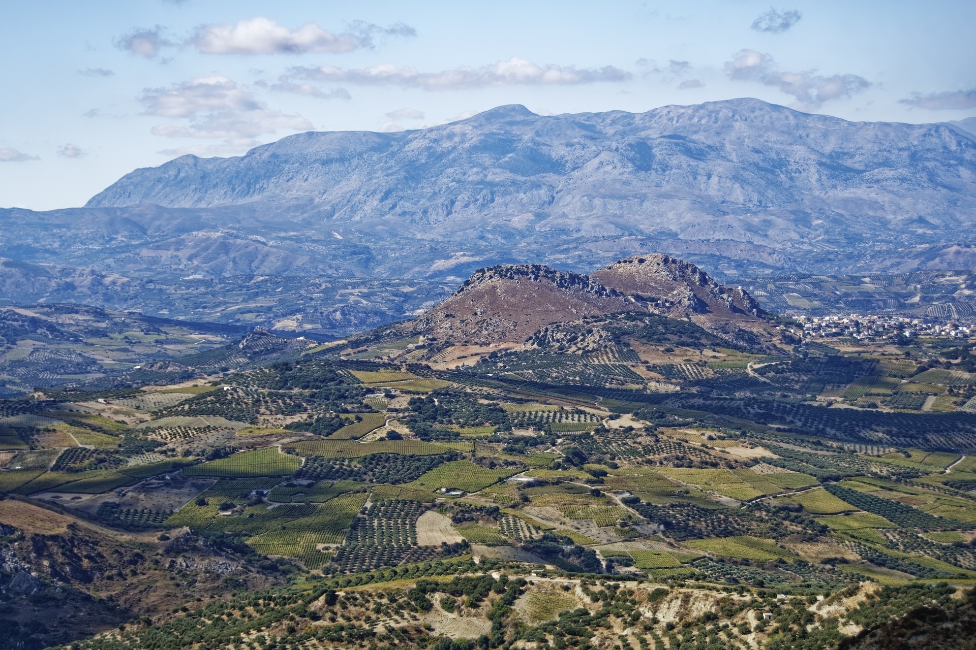
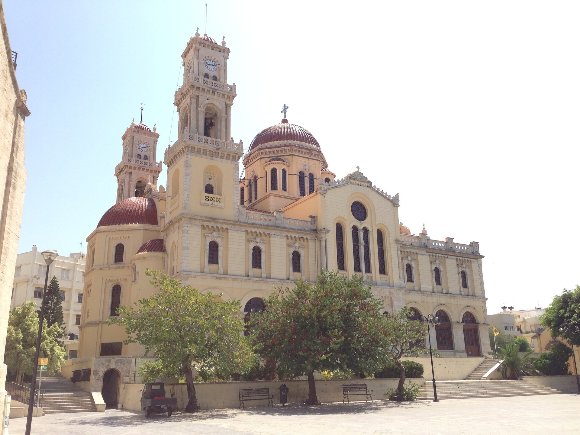
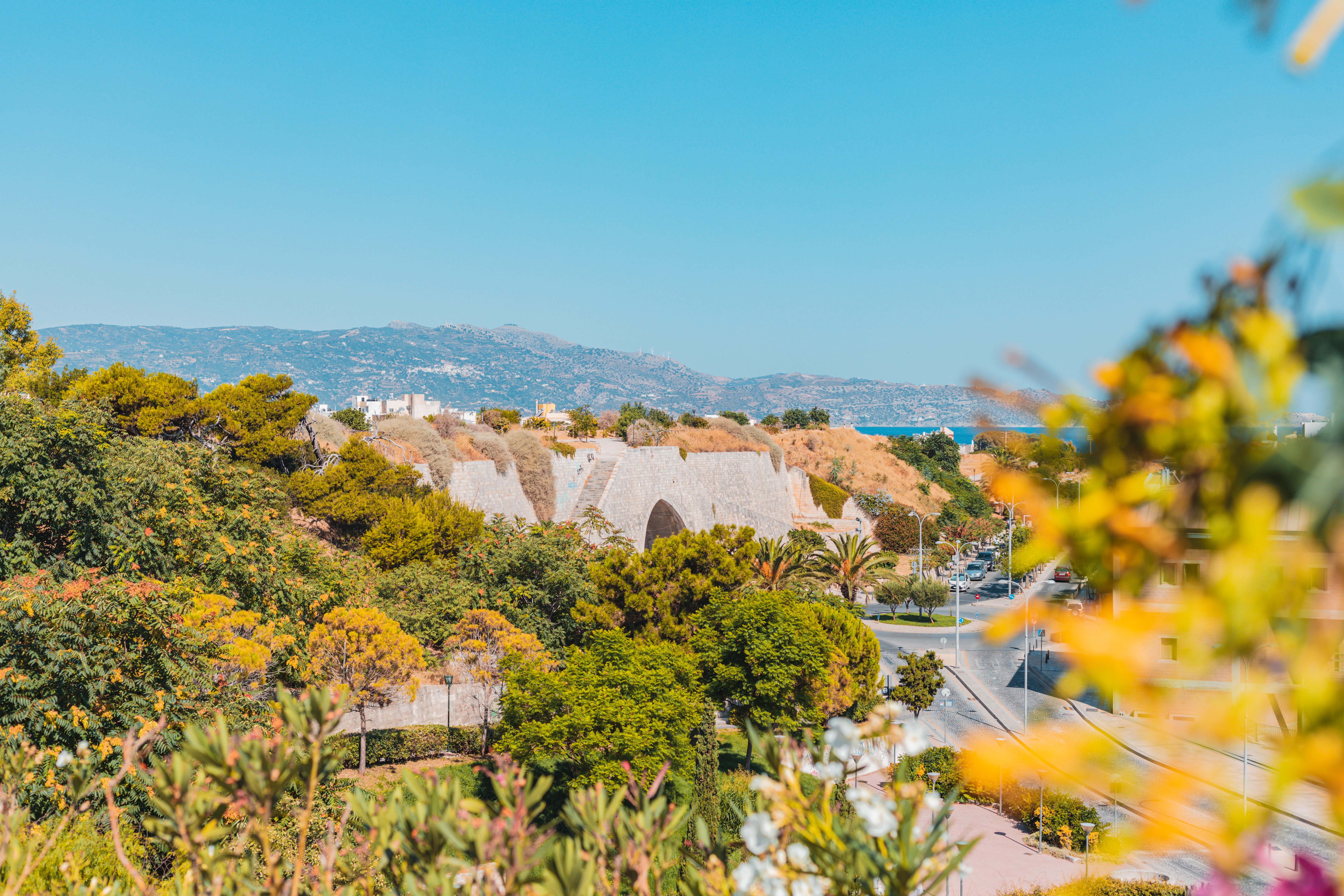
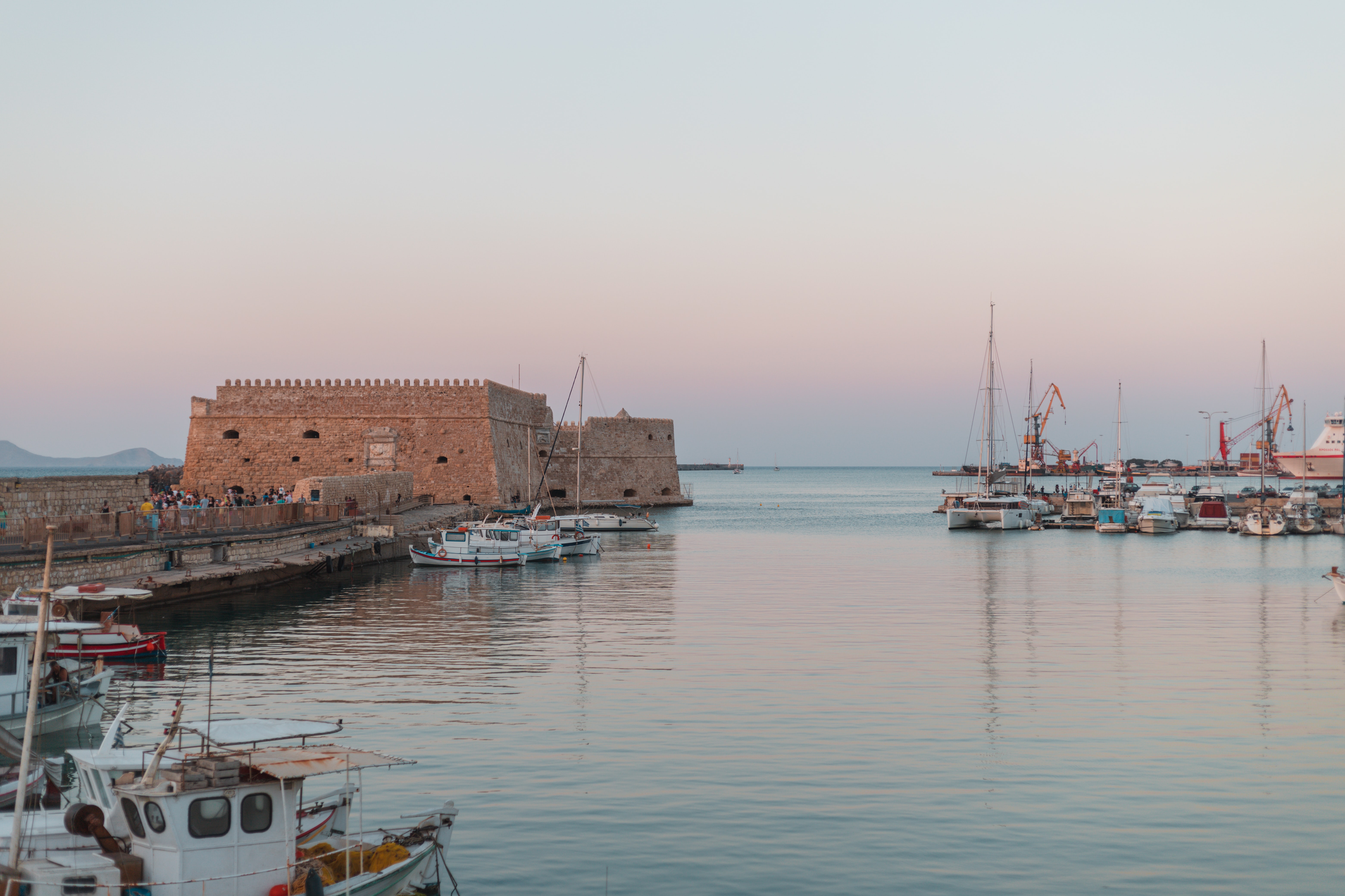
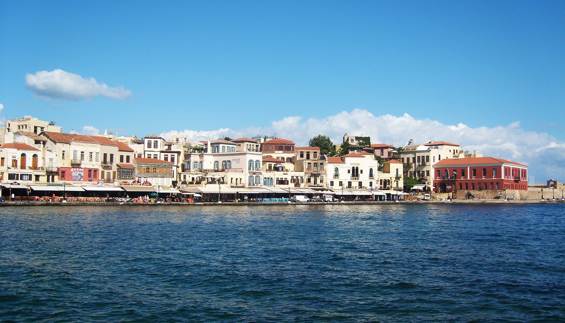
About Heraklion (Iraklion), Crete
Having been controlled by Arabic, Venetian and Ottoman empires over the years - it's no surprise that Heraklion is a diverse patchwork of exotic cultures and historical treasures. Celebrated as the birthplace of the Spanish Renaissance artist, El Greco, you can visit to explore the storied ruins of the Minoan empire's capital, and unearth the rich cultural treasures that Crete’s bustling modern capital has to offer.
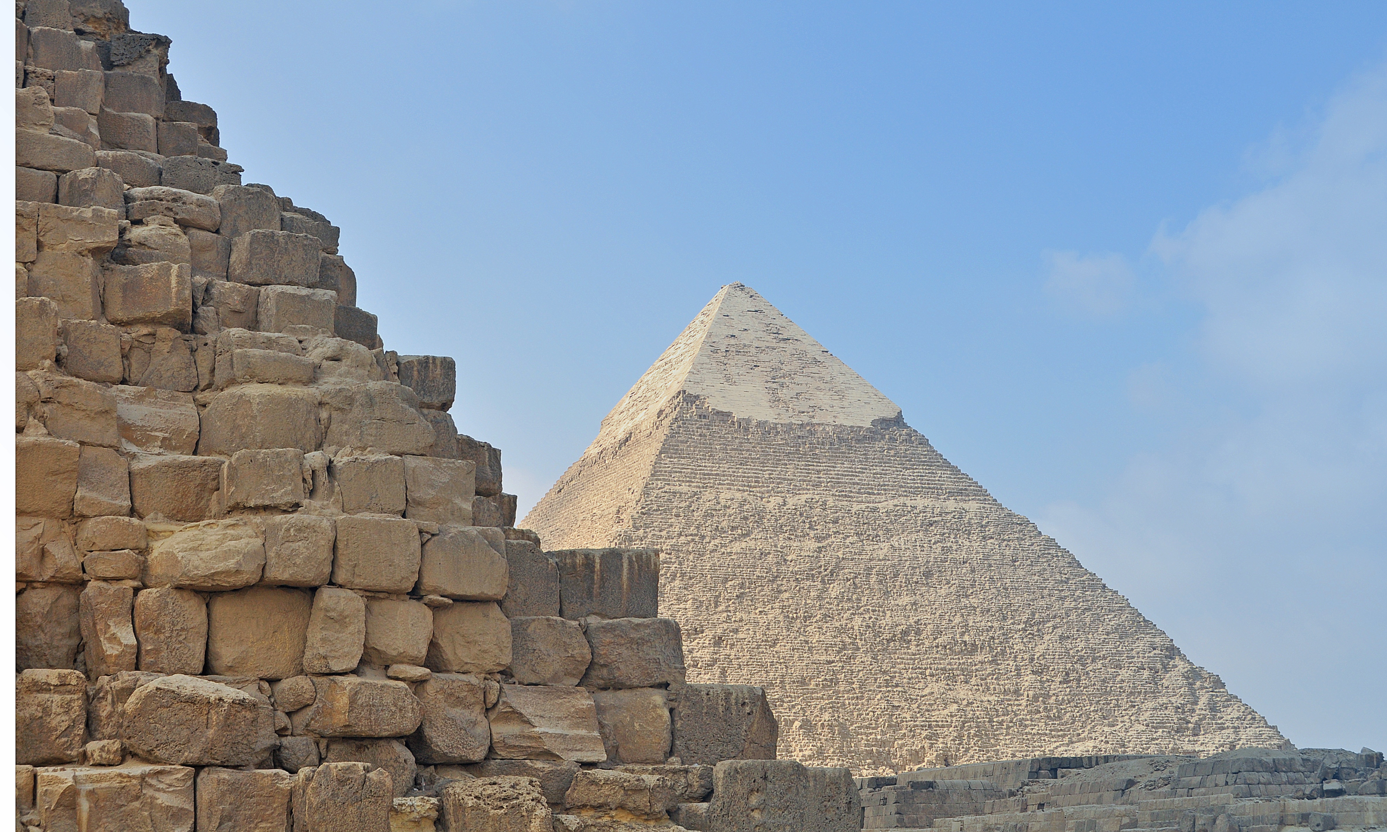
About Alexandria
Founded by Alexander the Great, Alexandria was Egypt's capital for over 1,000 years. Now, it is visited by tourists looking to enjoy some diving and those interested in the Great Library, one of the Seven Wonders of the Ancient World.
About Alexandria
Founded by Alexander the Great, Alexandria was Egypt's capital for over 1,000 years. Now, it is visited by tourists looking to enjoy some diving and those interested in the Great Library, one of the Seven Wonders of the Ancient World.
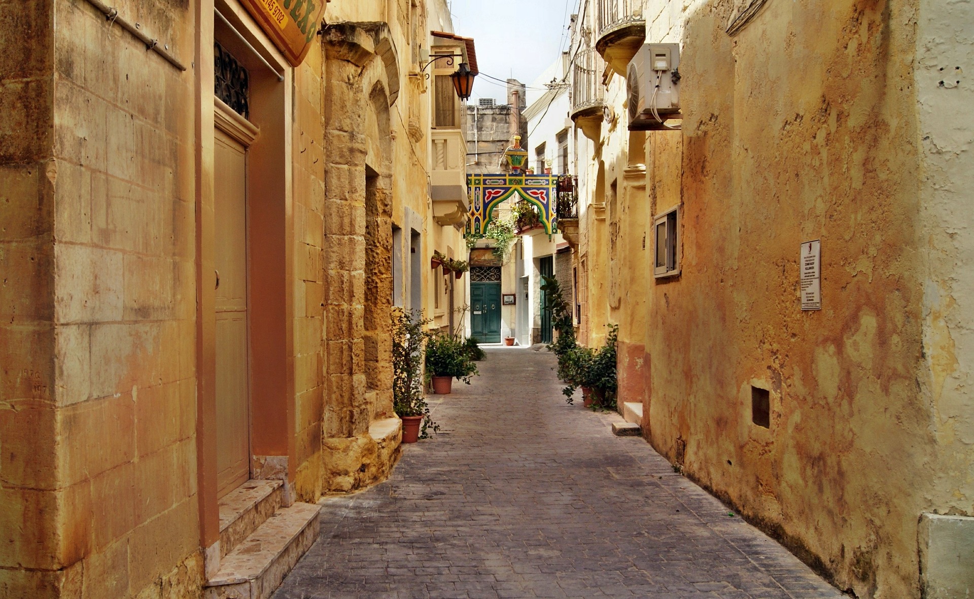
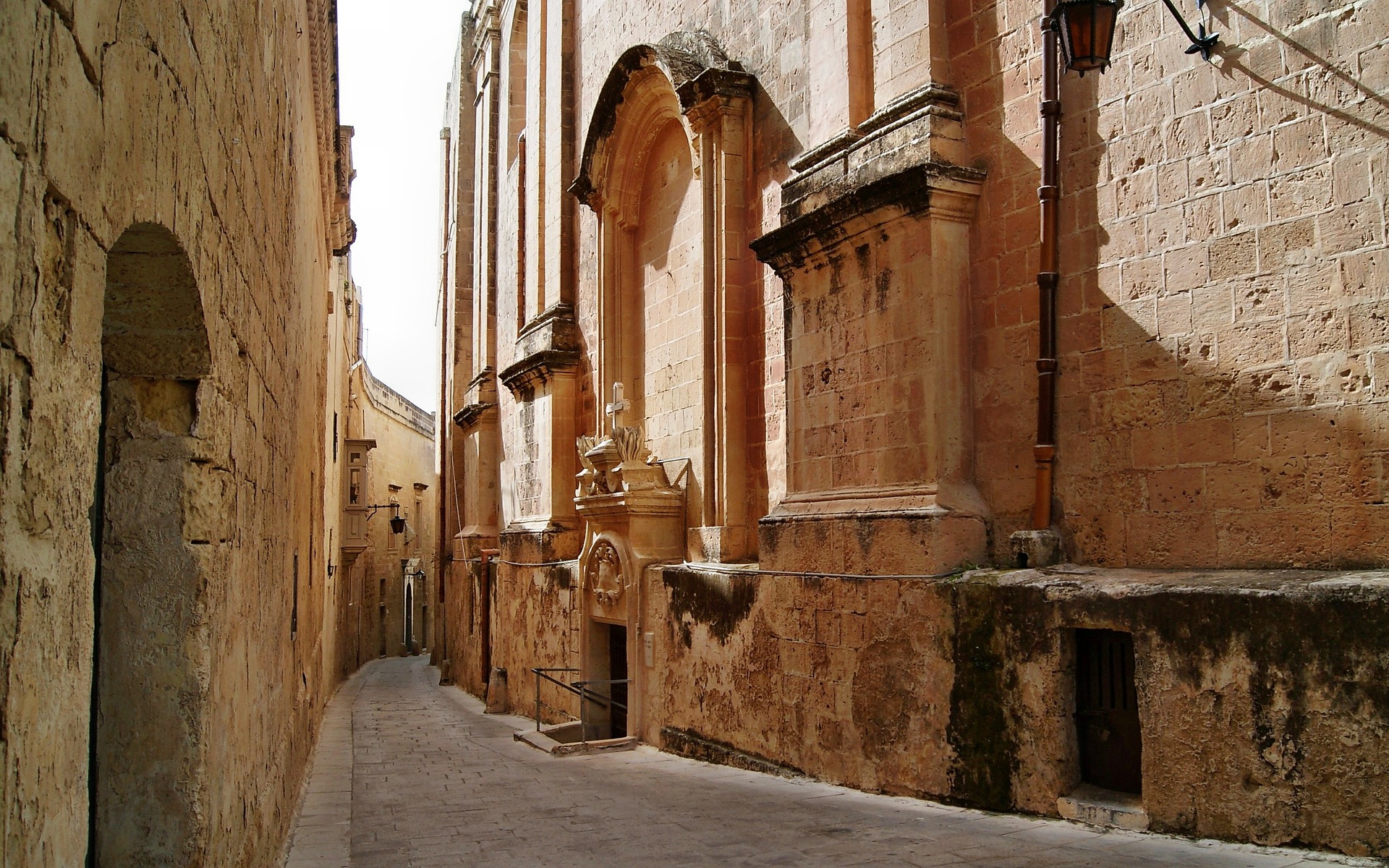
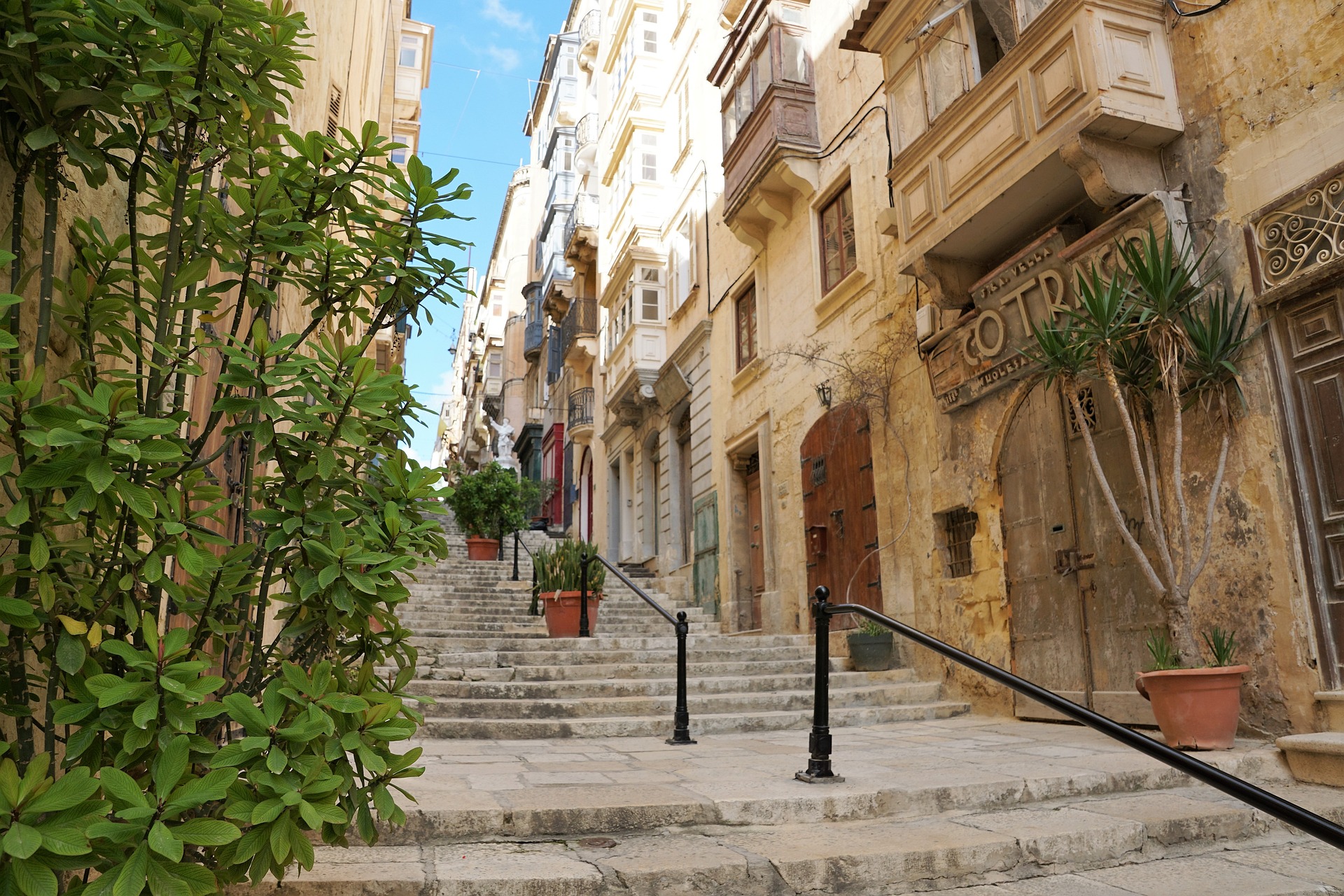
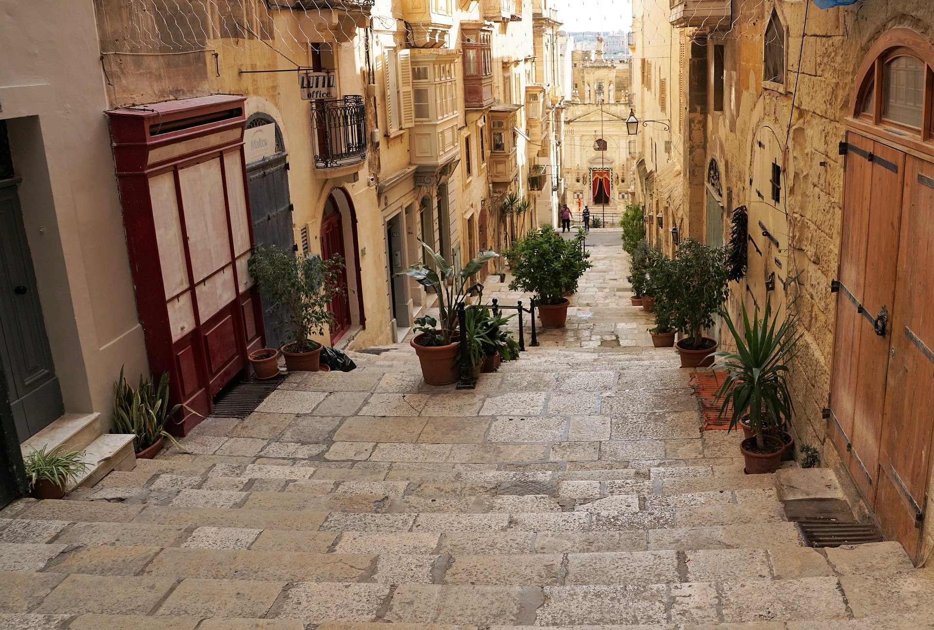
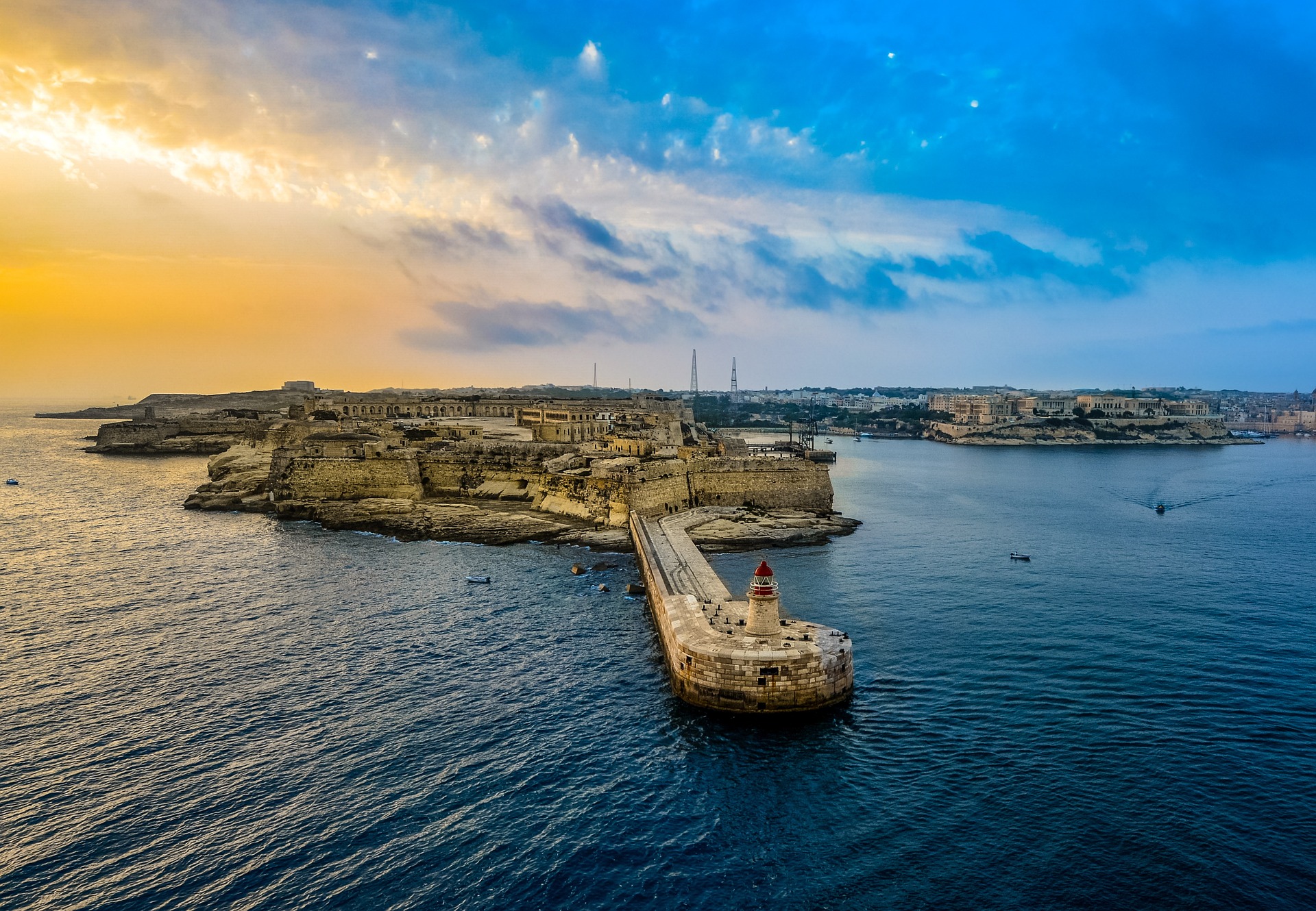
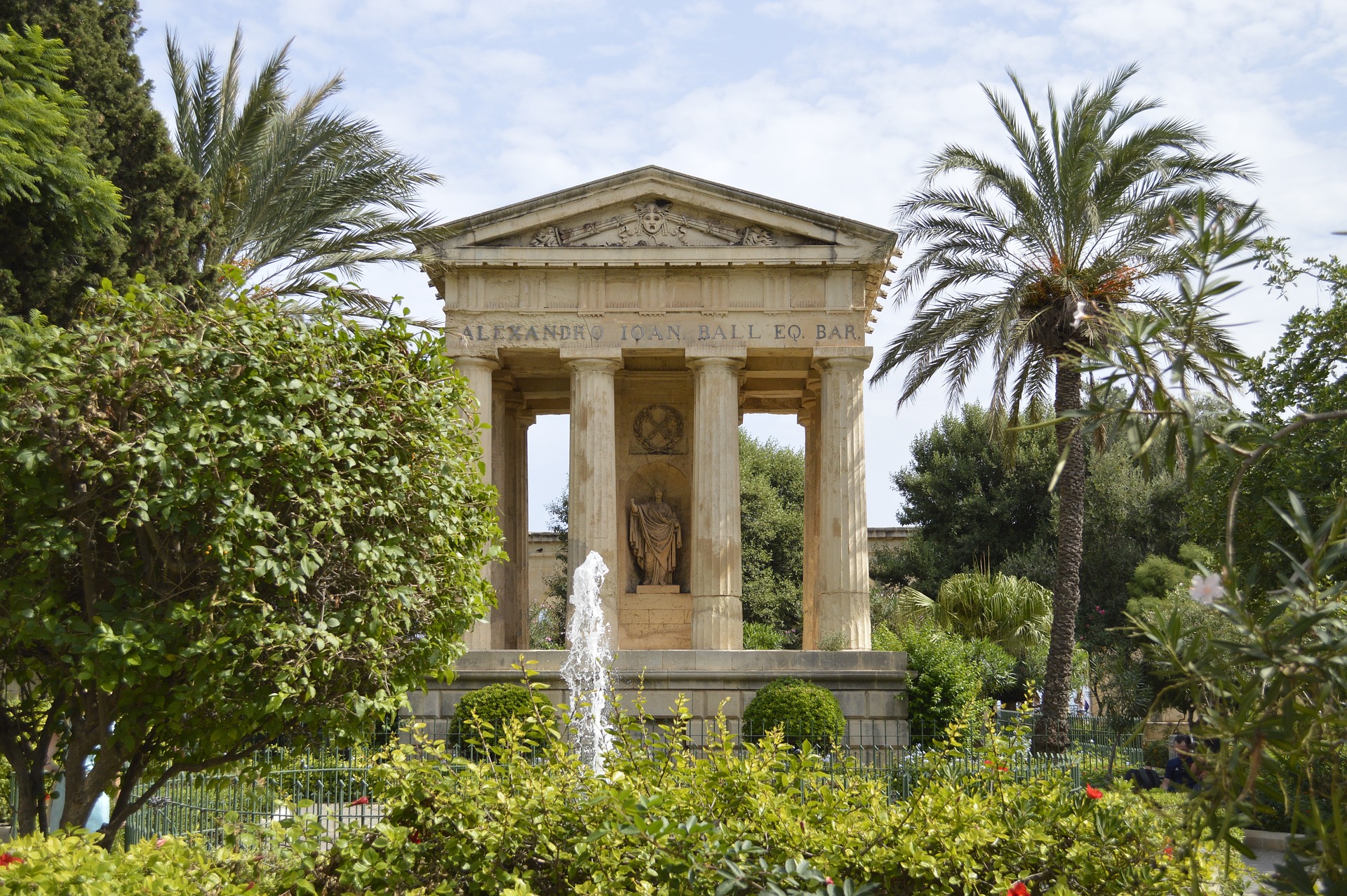
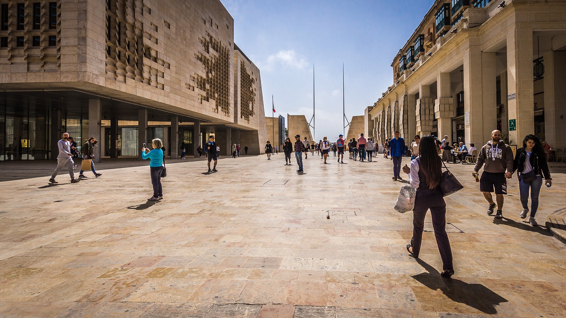
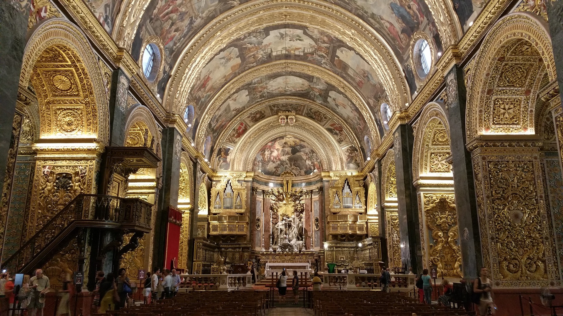
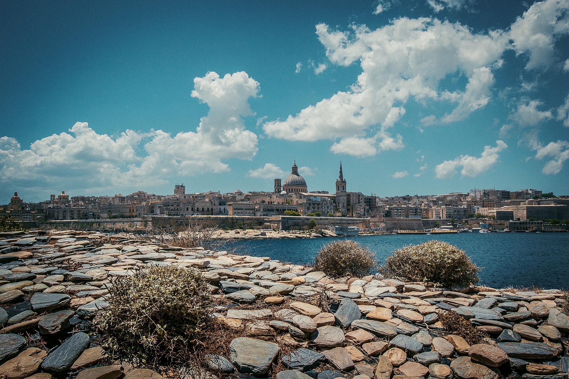
About Valletta
Malta's capital, the minicity of Valletta, has ornate palaces and museums protected by massive fortifications of honey-color limestone. Houses along the narrow streets have overhanging wooden balconies for people-watching from indoors. Generations ago they gave housebound women a window on the world of the street. The main entrance to town is through the City Gate (where all bus routes end), which leads onto Triq Repubblika (Republic Street), the spine of the grid-pattern city and the main shopping street. Triq Mercante (Merchant Street) parallels Repubblika to the east and is also good for strolling. From these two streets, cross streets descend toward the water; some are stepped. Valletta's compactness makes it ideal to explore on foot. City Gate and the upper part of Valletta are experiencing vast redevelopment that includes a new Parliament Building and open-air performance venue. The complex, completed mid-2013, has numerous pedestrian detours in place along with building noise and dust. Before setting out along Republic Street, stop at the tourist information office on Merchant Street for maps and brochures.
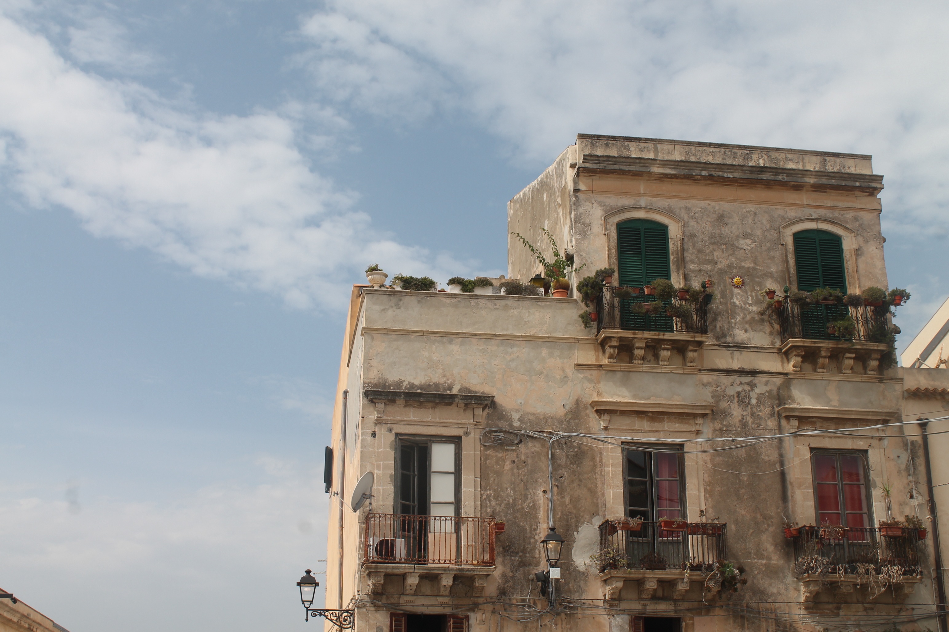
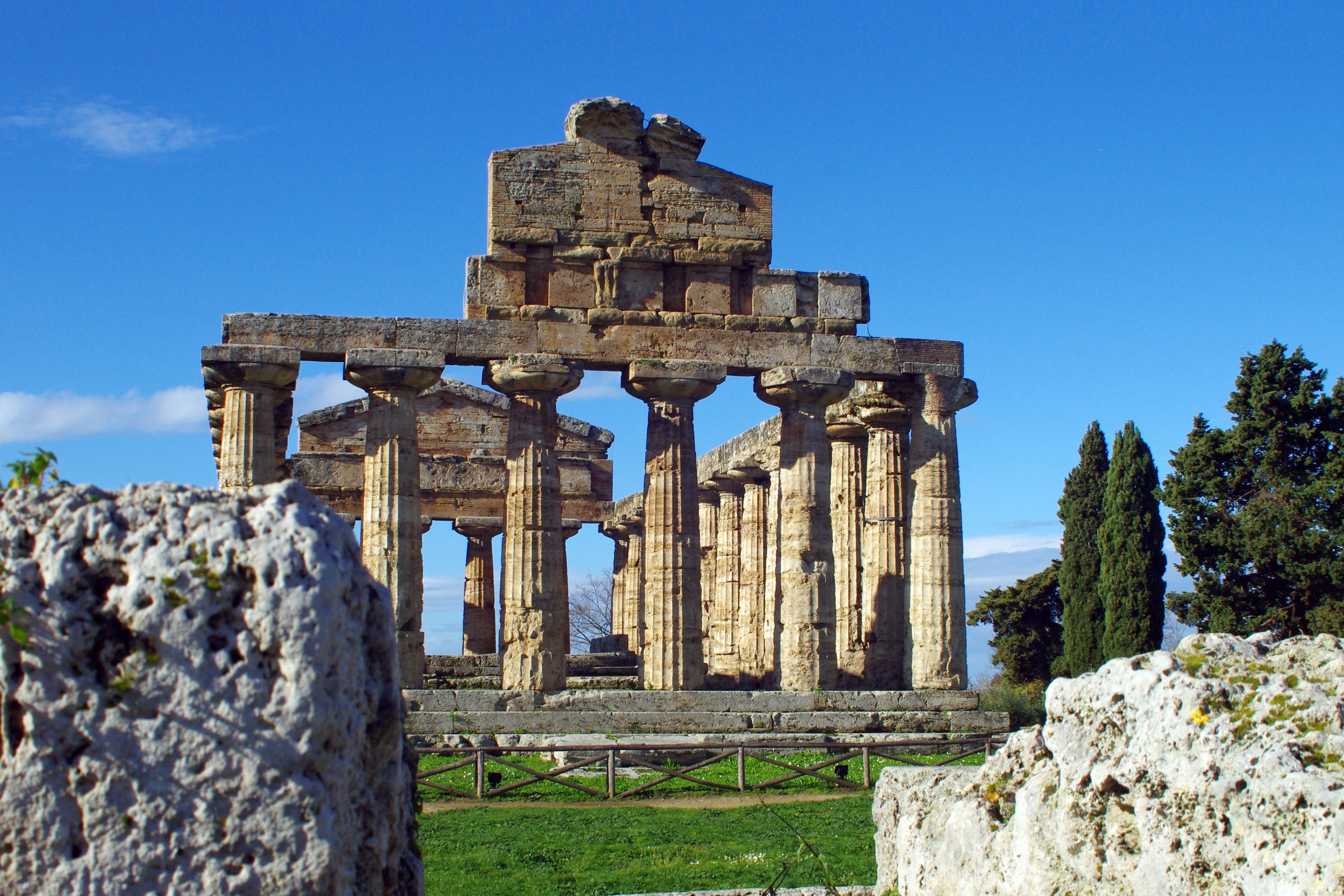
About Siracuse, Sicily
Siracusa, known to English speakers as Syracuse, is a wonder to behold. One of the great ancient capitals of Western civilization, the city was founded in 734 BC by Greek colonists from Corinth and soon grew to rival, and even surpass, Athens in splendor and power. It became the largest, wealthiest city-state in the West and a bulwark of Greek civilization. Although Siracusa lived under tyranny, rulers such as Dionysius filled their courts with Greeks of the highest cultural stature—among them the playwrights Aeschylus and Euripides, and the philosopher Plato. The Athenians, who didn't welcome Siracusa's rise, set out to conquer Sicily, but the natives outsmarted them in what was one of the greatest military campaigns in ancient history (413 BC). The city continued to prosper until it was conquered two centuries later by the Romans.Present-day Siracusa still has some of the finest examples of Baroque art and architecture; dramatic Greek and Roman ruins; and a Duomo that's the stuff of legend—a microcosm of the city's entire history in one building. The modern city also has a wonderful, lively, Baroque old town worthy of extensive exploration, as well as pleasant piazzas, outdoor cafés and bars, and a wide assortment of excellent seafood. There are essentially two areas to explore in Siracusa: the Parco Archeologico (Archaeological Zone), on the mainland; and the island of Ortygia, the ancient city first inhabited by the Greeks, which juts out into the Ionian Sea and is connected to the mainland by two small bridges. Ortygia is becoming increasingly popular with tourists, and is starting to lose its old-fashioned charm in favor of modern boutiques.Siracusa's old nucleus of Ortygia, a compact area, is a pleasure to amble around without getting unduly tired. In contrast, mainland Siracusa is a grid of wider avenues. At the northern end of Corso Gelone, above Viale Paolo Orsi, the orderly grid gives way to the ancient quarter of Neapolis, where the sprawling Parco Archeologico is accessible from Viale Teracati (an extension of Corso Gelone). East of Viale Teracati, about a 10-minute walk from the Parco Archeologico, the district of Tyche holds the archaeological museum and the church and catacombs of San Giovanni, both off Viale Teocrito (drive or take a taxi or city bus from Ortygia). Coming from the train station, it's a 15-minute trudge to Ortygia along Via Francesco Crispi and Corso Umberto. If you're not up for that, take one of the free electric buses leaving every 10 minutes from the bus station around the corner.
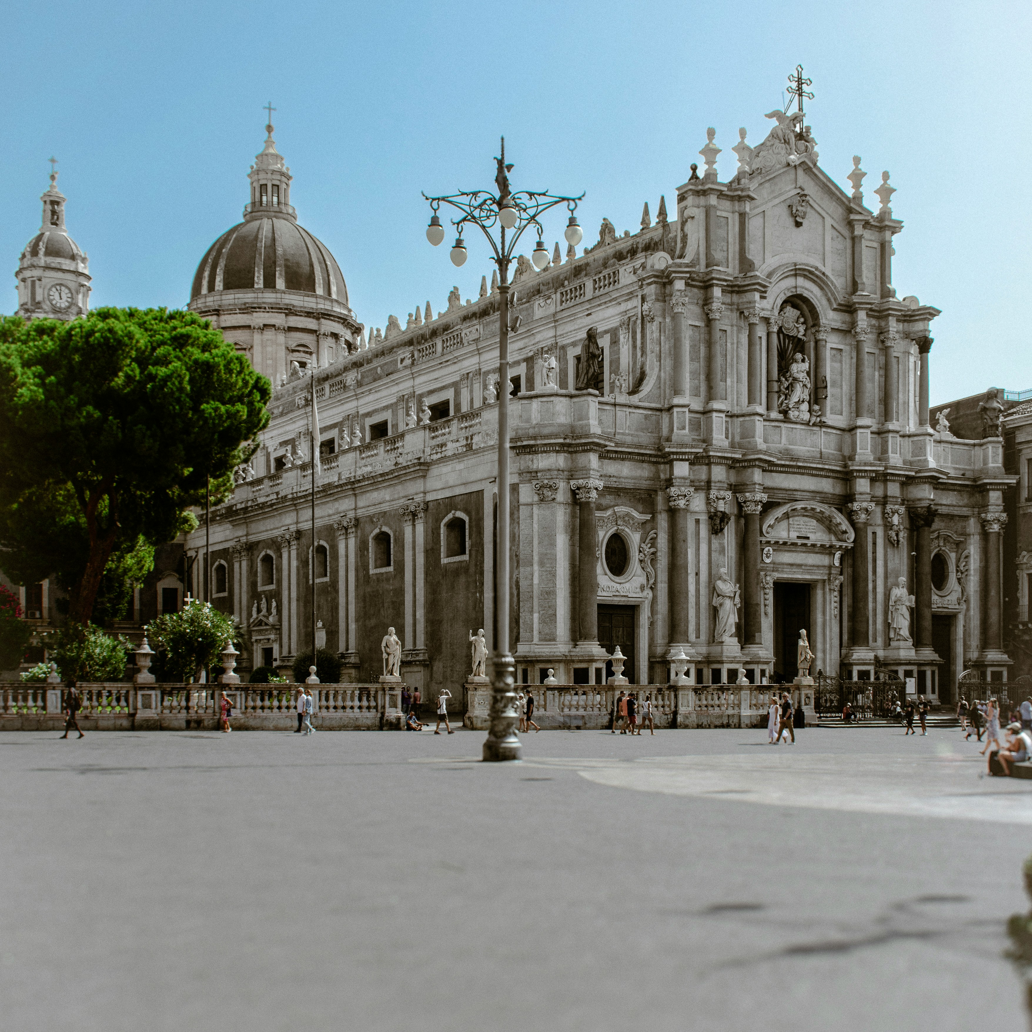
About Catania
Catania is an ancient port city on Sicily's east coast. It sits at the foot of Mt. Etna, an active volcano with trails leading up to the summit. The city's wide central square, Piazza del Duomo, features the whimsical Fontana dell'Elefante statue and richly decorated Catania Cathedral. In the southwest corner of the square, La Pescheria weekday fish market is a rowdy spectacle surrounded by seafood restaurants.
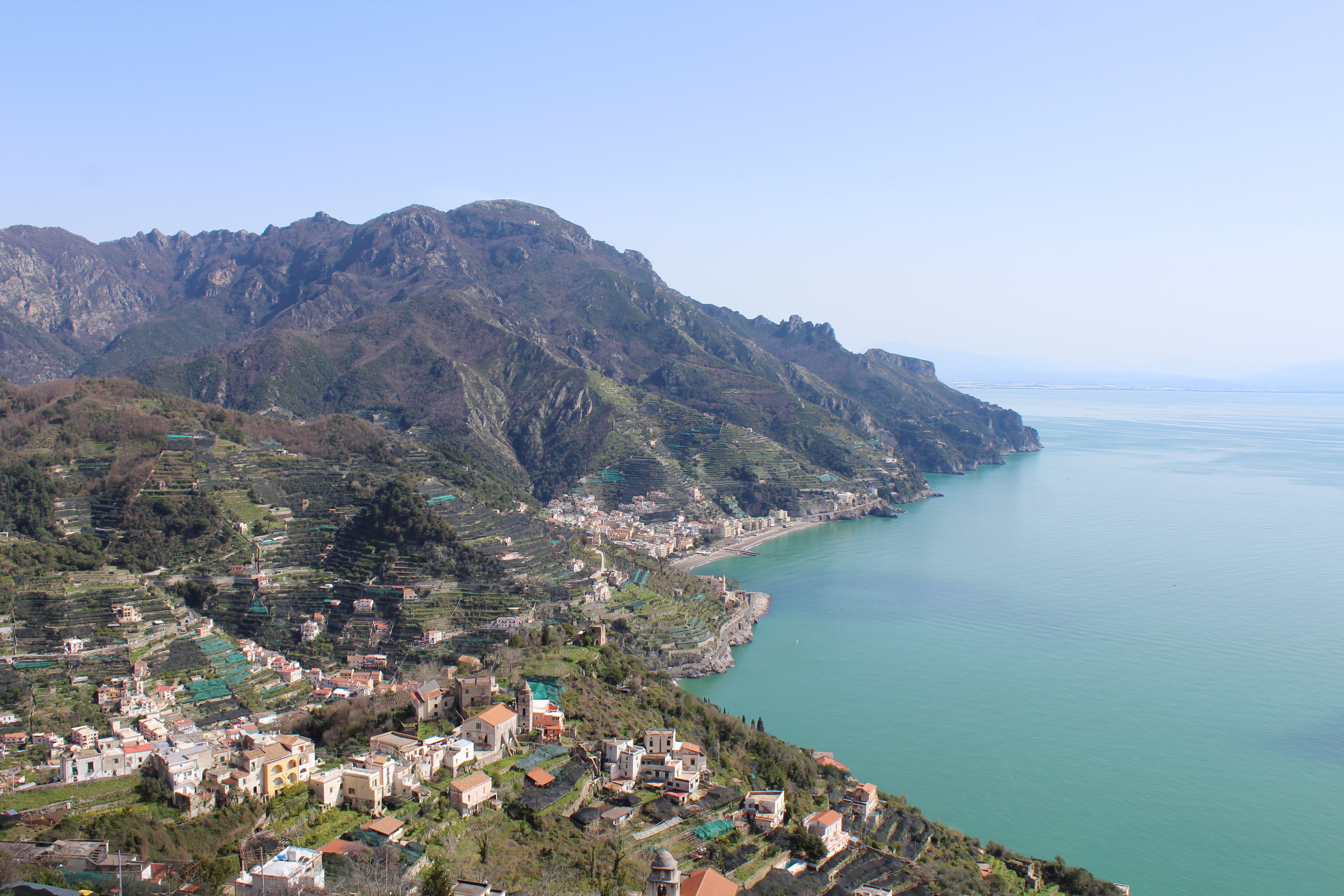
About Salerno
Salerno is an Italian city located on the Gulf of Salerno. Famous for being home to the first medical university, Salerno is a great destination for anyone looking for gorgeous sea views filled with sunshine and Italian food.
About Salerno
Salerno is an Italian city located on the Gulf of Salerno. Famous for being home to the first medical university, Salerno is a great destination for anyone looking for gorgeous sea views filled with sunshine and Italian food.
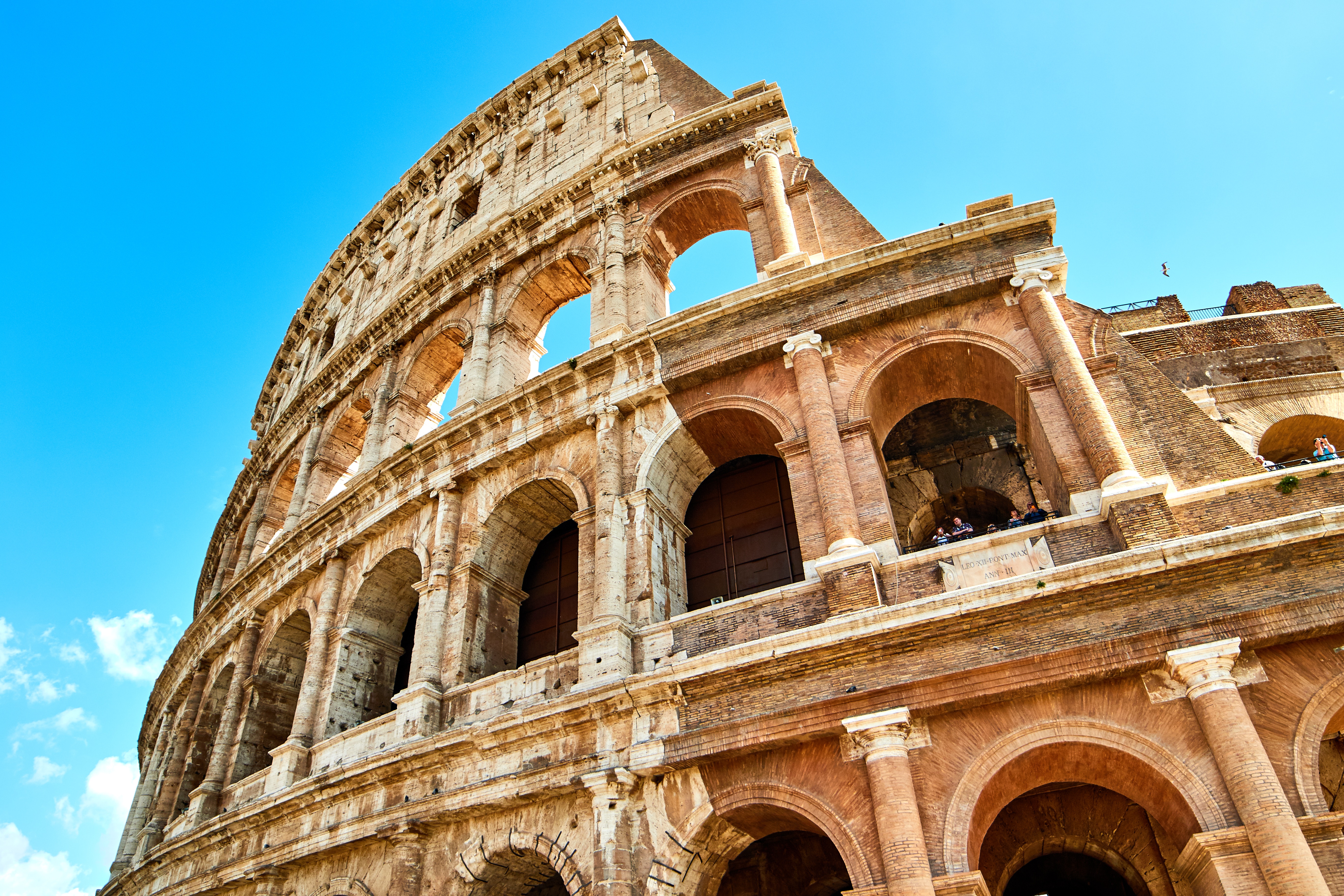
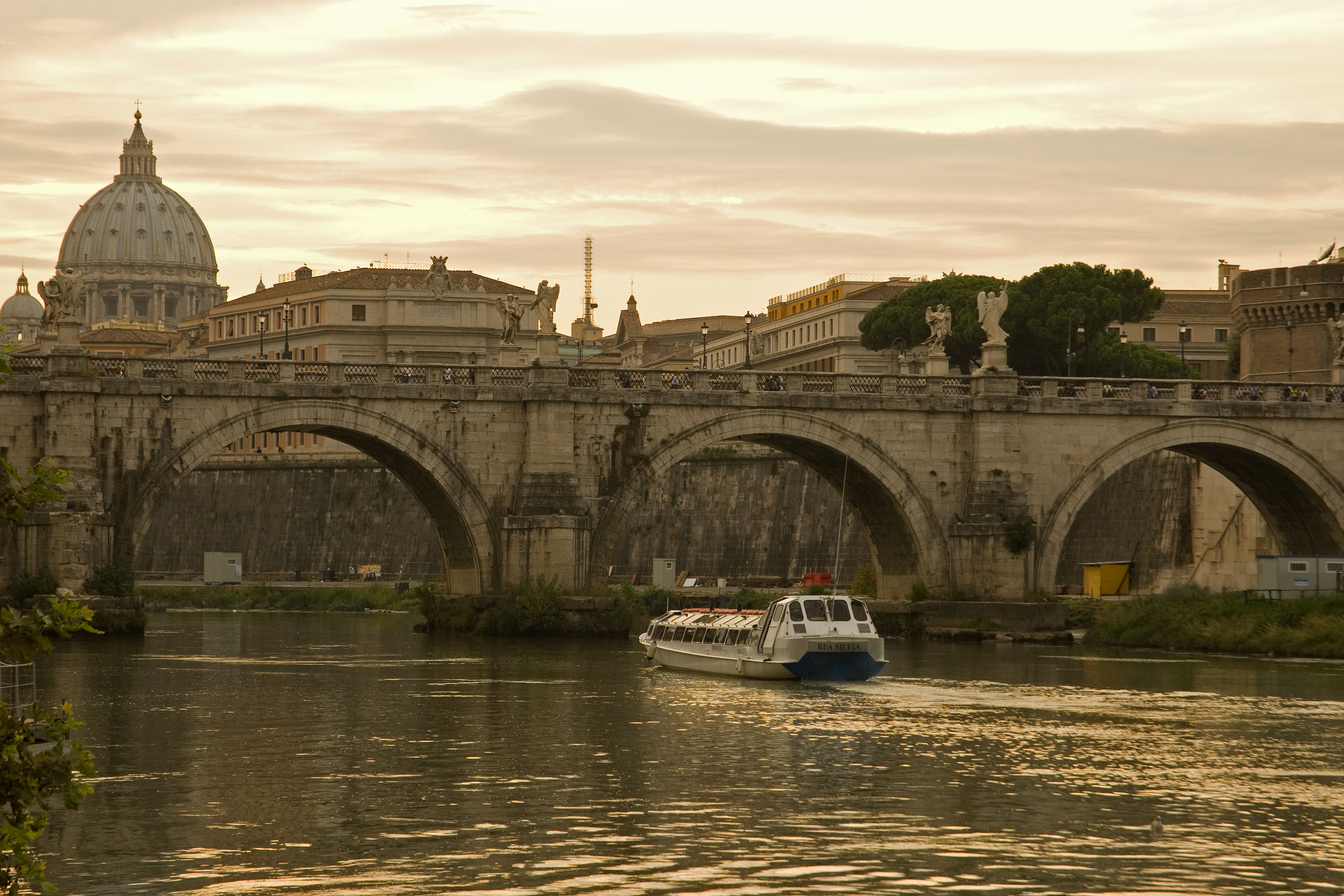
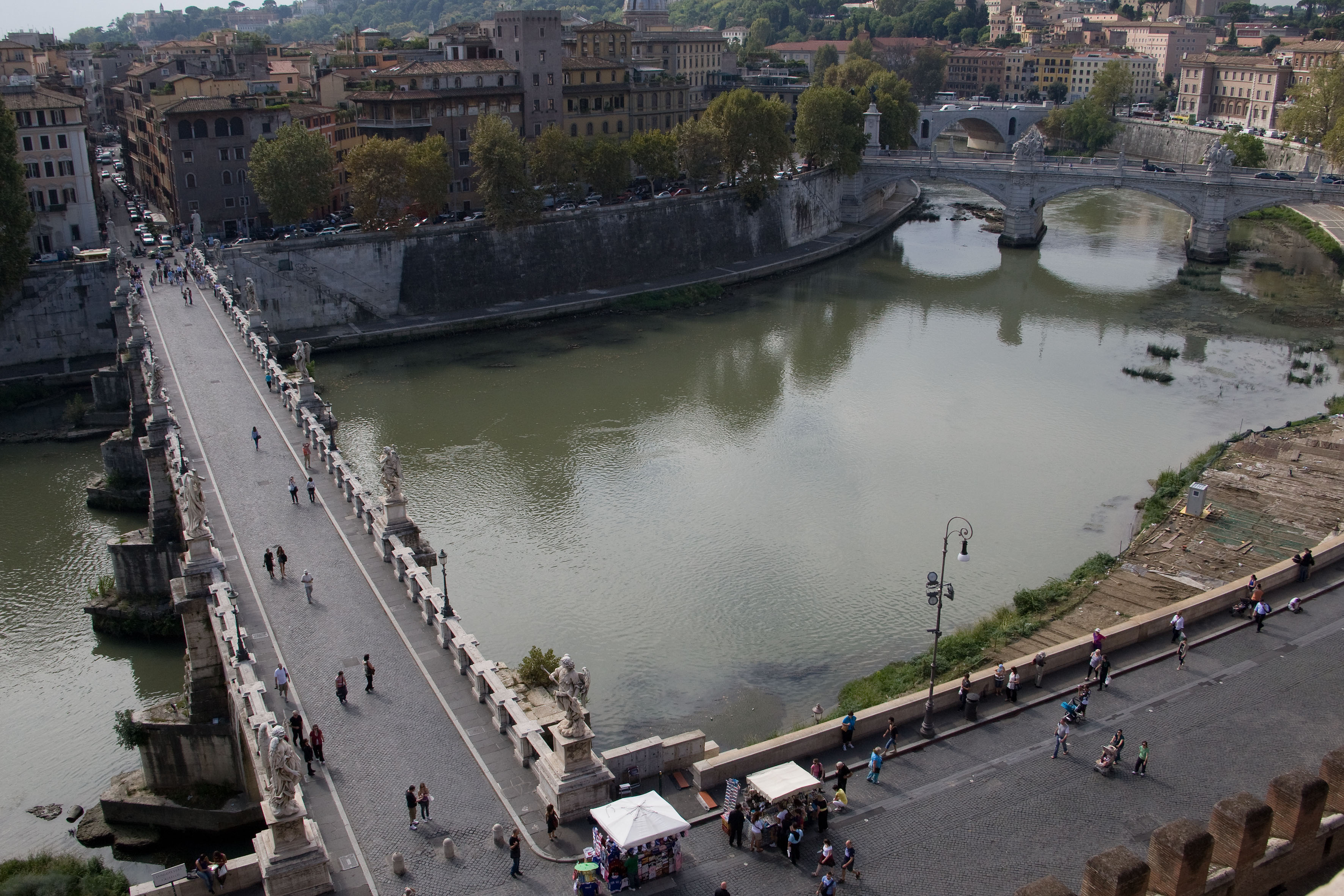
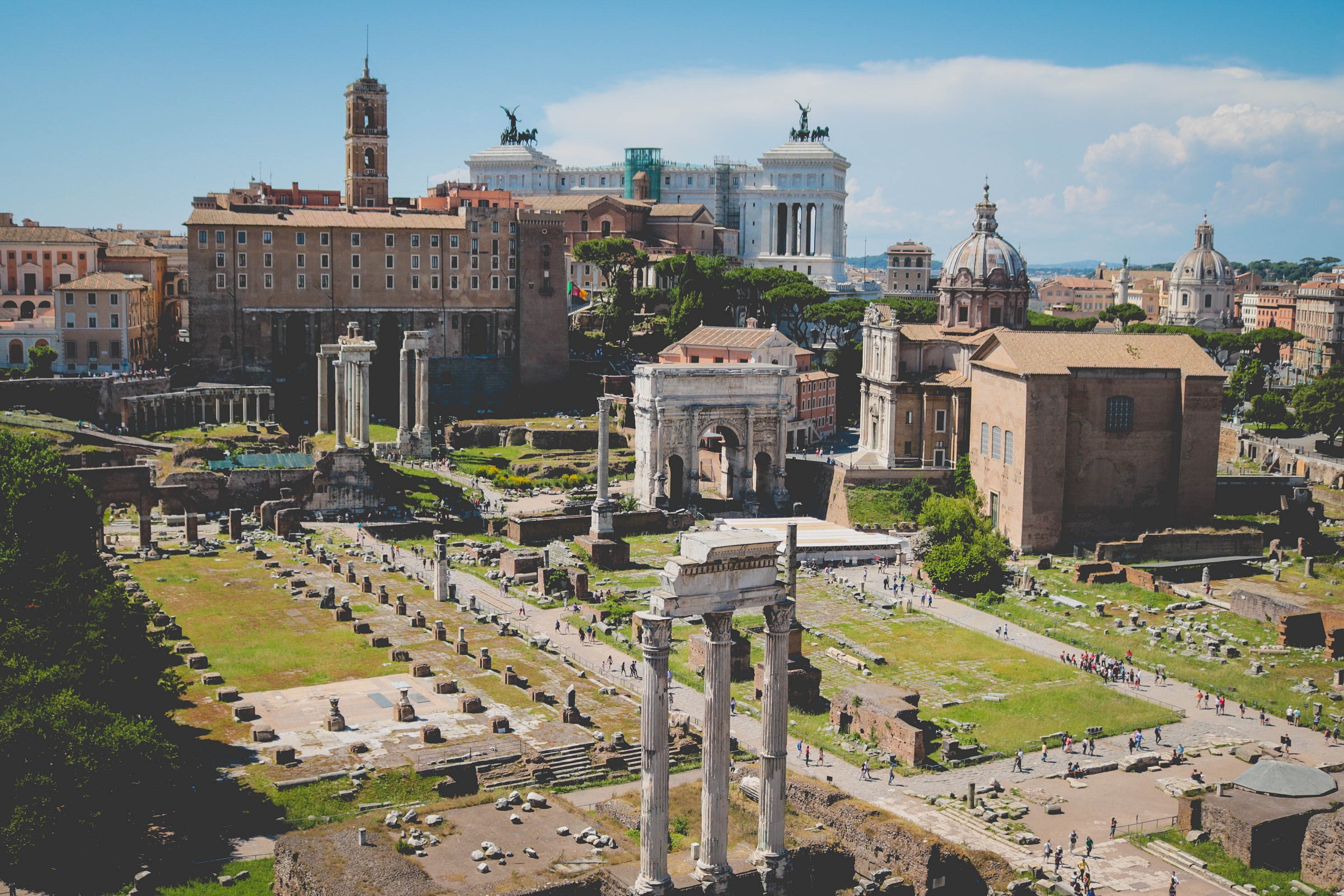
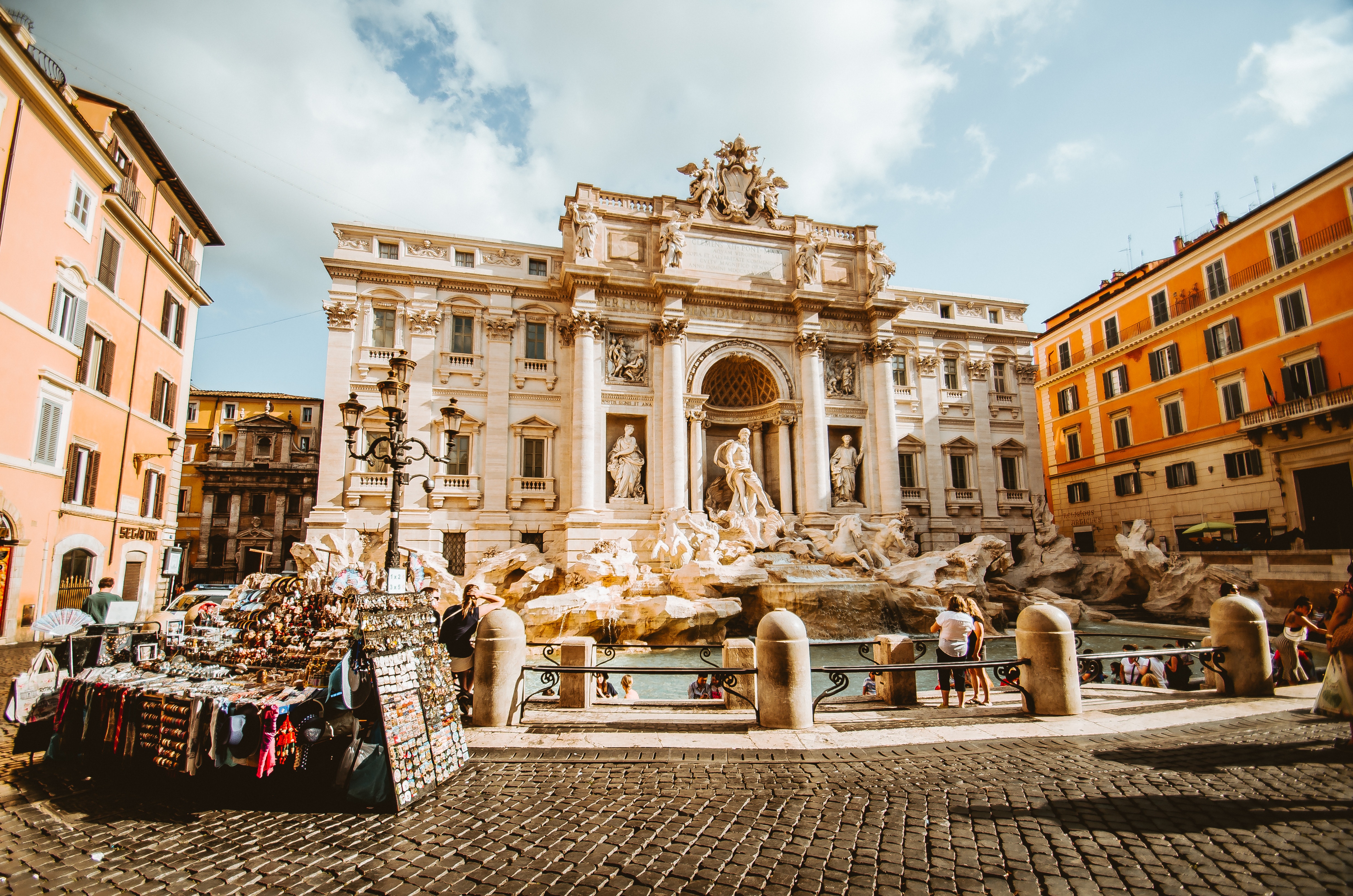
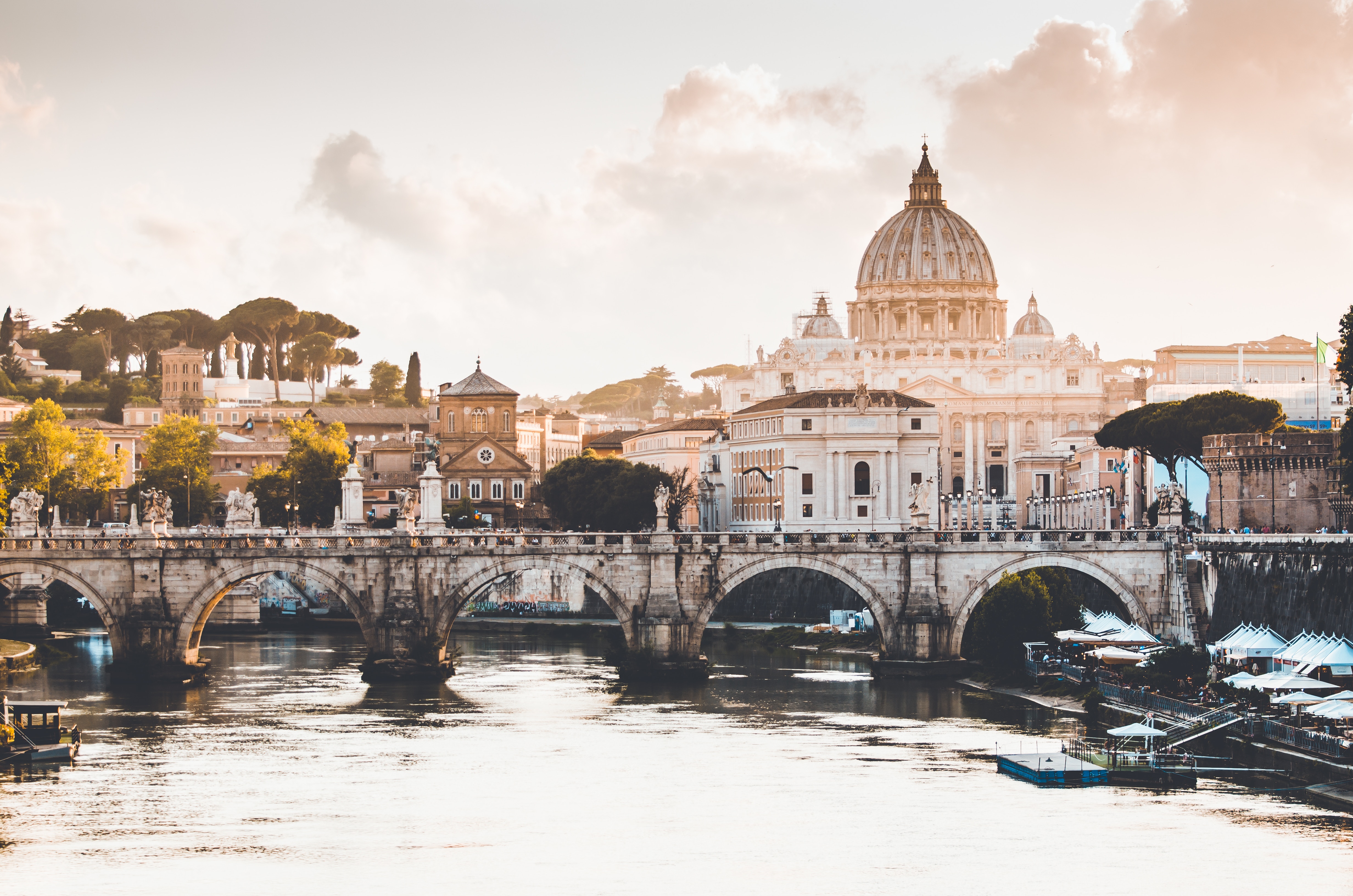
About Civitavecchia
Italy's vibrant capital lives in the present, but no other city on earth evokes its past so powerfully. For over 2,500 years, emperors, popes, artists, and common citizens have left their mark here. Archaeological remains from ancient Rome, art-stuffed churches, and the treasures of Vatican City vie for your attention, but Rome is also a wonderful place to practice the Italian-perfected il dolce far niente, the sweet art of idleness. Your most memorable experiences may include sitting at a caffè in the Campo de' Fiori or strolling in a beguiling piazza.
About Livorno
Livorno is a gritty city with a long and interesting history. In the early Middle Ages it alternately belonged to Pisa and Genoa. In 1421 Florence, seeking access to the sea, bought it. Cosimo I (1519–74) started construction of the harbor in 1571, putting Livorno on the map. After Ferdinando I de' Medici (1549–1609) proclaimed Livorno a free city, it became a haven for people suffering from religious persecution; Roman Catholics from England and Jews and Moors from Spain and Portugal, among others, settled here. The Quattro Mori (Four Moors), also known as the Monument to Ferdinando I, commemorates this. (The statue of Ferdinando I dates from 1595, the bronze Moors by Pietro Tacca from the 1620s.)In the following centuries, and particularly in the 18th, Livorno boomed as a port. In the 19th century the town drew a host of famous Britons passing through on their grand tours. Its prominence continued up to World War II, when it was heavily bombed. Much of the town's architecture, therefore, postdates the war, and it's somewhat difficult to imagine what it might have looked like before. Livorno has recovered from the war, however, as it's become a huge point of departure for container ships, as well as the only spot in Tuscany for cruise ships to dock for the day.Most of Livorno's artistic treasures date from the 17th century and aren't all that interesting unless you dote on obscure baroque artists. Livorno's most famous native artist, Amedeo Modigliani (1884–1920), was of much more recent vintage. Sadly, there's no notable work by him in his hometown.There may not be much in the way of art, but it's still worth strolling around the city. The Mercato Nuovo, which has been around since 1894, sells all sorts of fruits, vegetables, grains, meat, and fish. Outdoor markets nearby are also chock-full of local color. The presence of Camp Darby, an American military base just outside town, accounts for the availability of many American products.If you have time, Livorno is worth a stop for lunch or dinner at the very least.
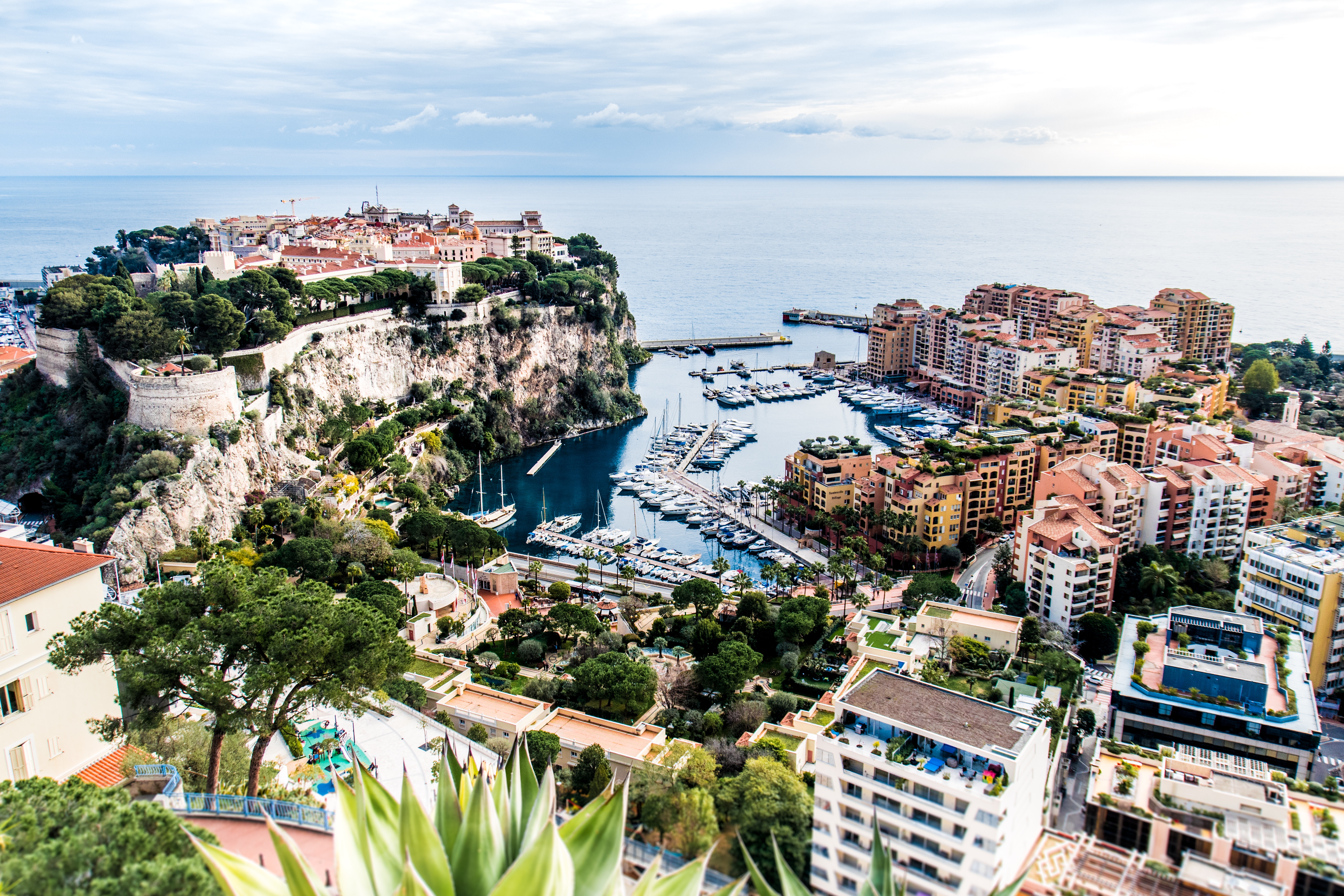
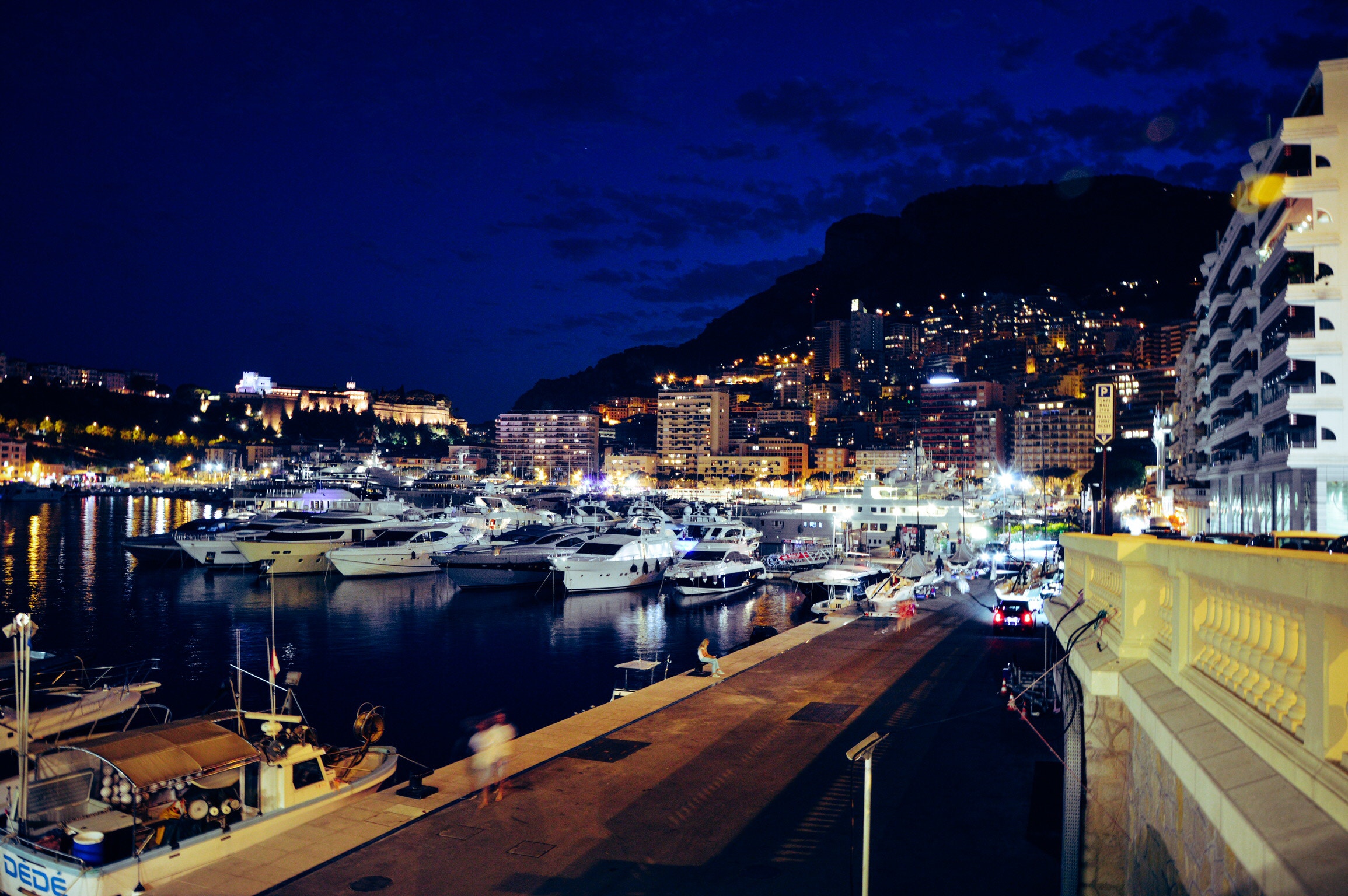
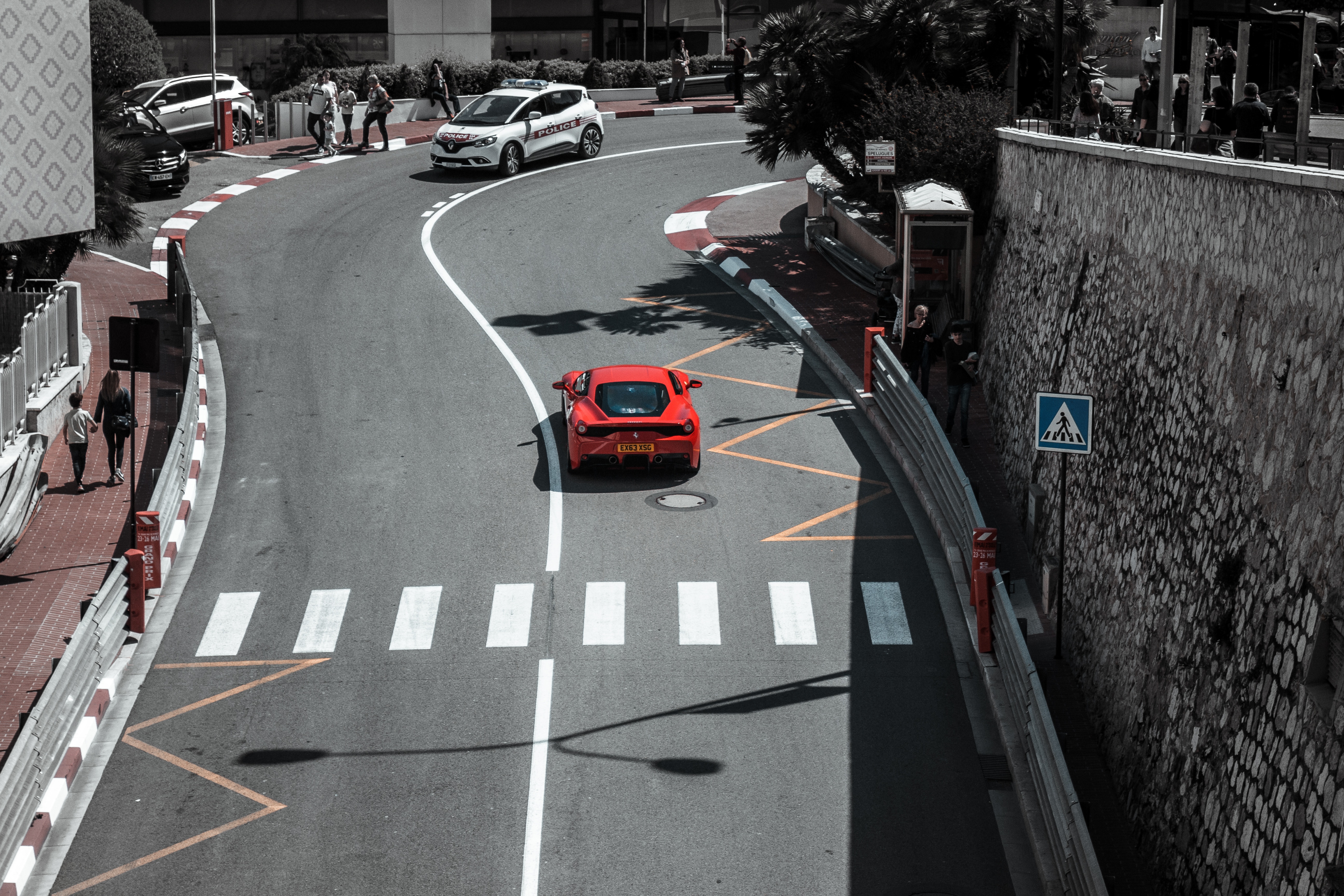
About Monte-Carlo
On one of the best stretches of the Mediterranean, this classic luxury destination is one of the most sought-after addresses in the world. With all the high-rise towers you have to look hard to find the Belle Époque grace of yesteryear. But if you head to the town's great 1864 landmark Hôtel de Paris—still a veritable crossroads of the buffed and befurred Euro-gentry—or enjoy a grand bouffe at its famous Louis XV restaurant, or attend the opera, or visit the ballrooms of the casino, you may still be able to conjure up Monaco's elegant past. Prince Albert II, a political science graduate from Amherst College, traces his ancestry to Otto Canella, who was born in 1070. The Grimaldi dynasty began with Otto's great-great-great-grandson, Francesco Grimaldi, also known as Frank the Rogue. Expelled from Genoa, Frank and his cronies disguised themselves as monks and in 1297 seized the fortified medieval town known today as Le Rocher (the Rock). Except for a short break under Napoléon, the Grimaldis have been here ever since, which makes them the oldest reigning family in Europe. In the 1850s a Grimaldi named Charles III made a decision that turned the Rock into a giant blue chip. Needing revenue but not wanting to impose additional taxes on his subjects, he contracted with a company to open a gambling facility. The first spin of the roulette wheel was on December 14, 1856. There was no easy way to reach Monaco then—no carriage roads or railroads—so no one came. Between March 15 and March 20, 1857, one person entered the casino—and won two francs. In 1868, however, the railroad reached Monaco, and it was filled with Englishmen who came to escape the London fog. The effects were immediate. Profits were so great that Charles eventually abolished all direct taxes. Almost overnight, a threadbare principality became an elegant watering hole for European society. Dukes (and their mistresses) and duchesses (and their gigolos) danced and dined their way through a world of spinning roulette wheels and bubbling champagne—preening themselves for nights at the opera, where such artists as Vaslav Nijinsky, Sarah Bernhardt, and Enrico Caruso came to perform. Along with the tax system, its sensational position on a broad, steep peninsula that bulges into the Mediterranean—its harbor sparkling with luxury cruisers, its posh mansions angling awnings toward the nearly perpetual sun—continues to draw the rich and famous. One of the latest French celebrities to declare himself "Monégasque," thus giving up his French passport, is superchef Alain Ducasse, who said that he made the choice out of affection for Monaco rather than tax reasons. Pleasure boats vie with luxury cruisers in their brash beauty and Titanic scale, and teams of handsome young men—themselves dyed blond and tanned to match—scour and polish every gleaming surface. As you might expect, all this glitz doesn't come cheap. Eating is expensive, and even the most modest hotels cost more here than in nearby Nice or Menton. As for taxis, they don't even have meters so you are completely at the driver's mercy (with prices skyrocketing during events such as the Grand Prix). For the frugal, Monaco is the ultimate day-trip, although parking is as coveted as a room with a view. At the very least you can afford a coffee at Starbucks. The harbor district, known as La Condamine, connects the new quarter, officially known as Monte Carlo with Monaco-Ville (or Le Rocher), a medieval town on the Rock, topped by the palace, the cathedral, and the Oceanography Museum. Have no fear that you'll need to climb countless steps to get to Monaco-Ville, as there are plenty of elevators and escalators climbing the steep cliffs. But shuttling between the lovely casino grounds of Monte Carlo and Old Monaco, separated by a vast port, is a daunting proposition for ordinary mortals without wings, so hop on the No. 1 bus from Saint Roman, or No. 2 from the Jardin Exotique - Both stop at Place du Casino and come up to Monaco Ville.
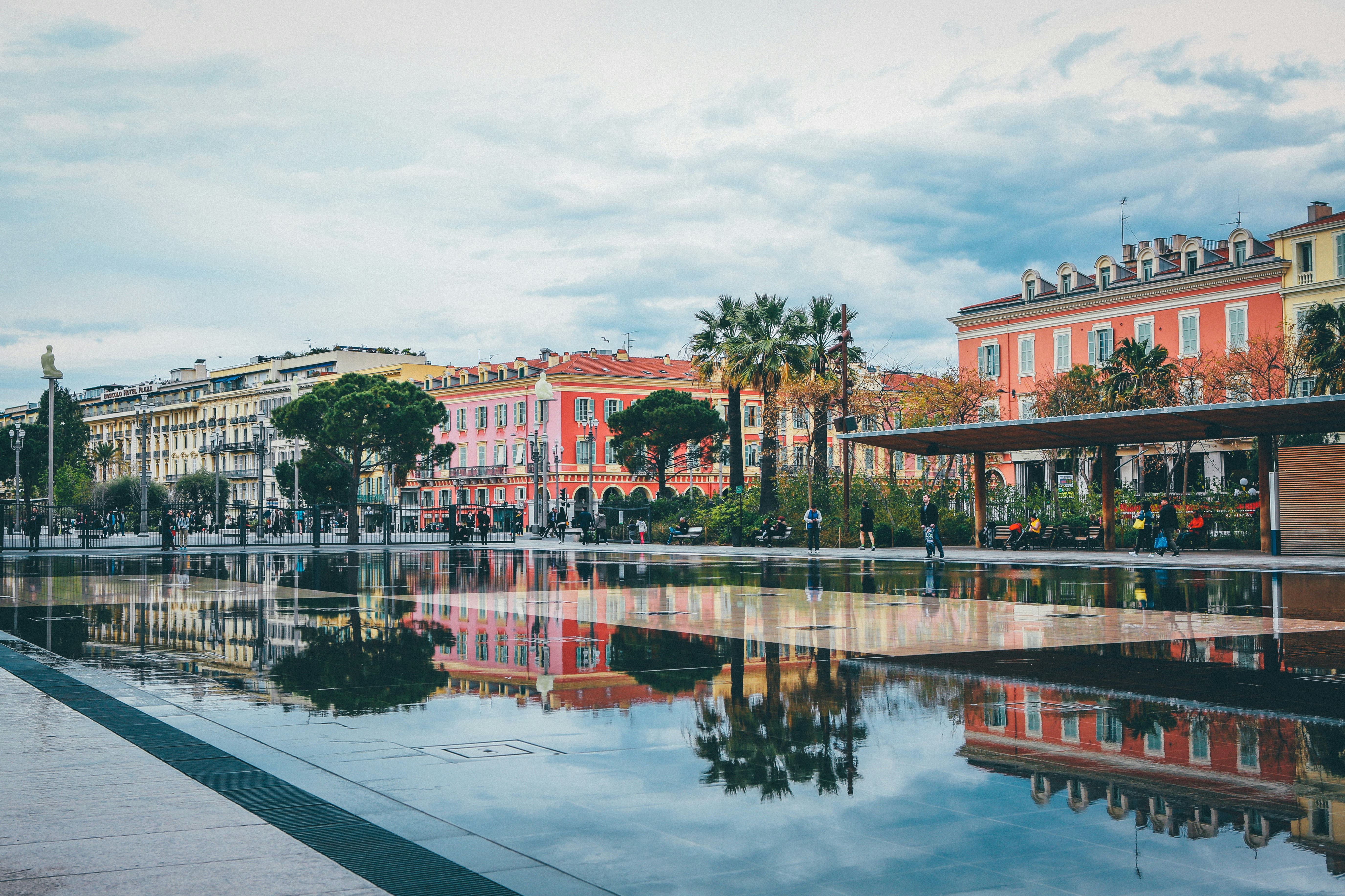
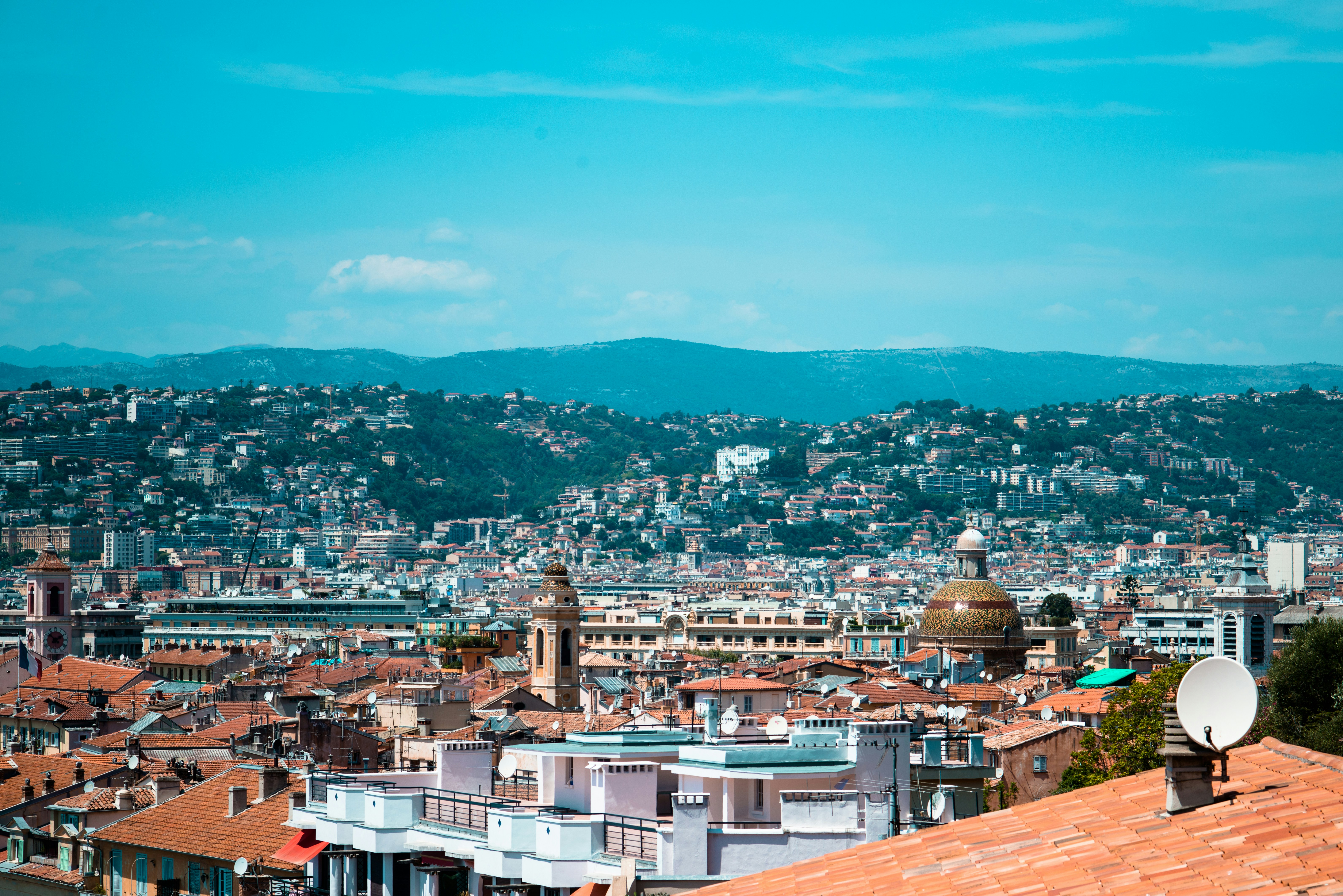
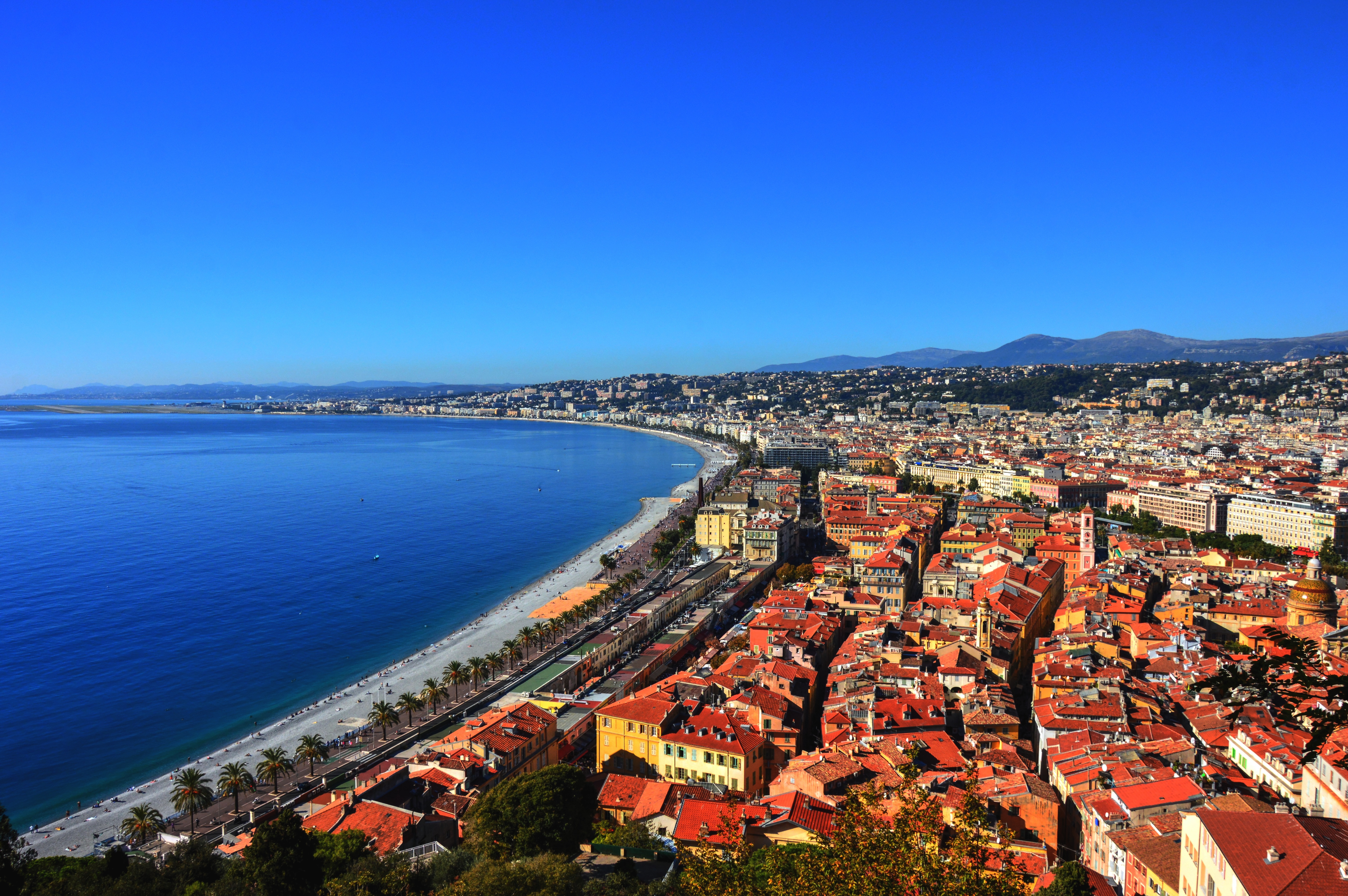
About Nice
United with France only since 1860, Nice has its own history and atmosphere, which dates back 230,000 years. It was on Colline du Château (now château-less) and at the Plage des Ponchettes, in front of the Old Town, that the Greeks established a market-port in 350 BC and named it Nikaia, which would become Marseilles' chief coastal rival. The Romans established themselves a little later on the hills of Cimiez (Cemenelum), already previously occupied by Ligurians and Celts, and quickly overshadowed the waterfront port. After falling to the Saracen invasions, Nice regained power as an independent state, becoming an important port in the early Middle Ages.So cocksure did it become that in 1388, Nice, along with the hill towns behind, effectively seceded from the county of Provence, under Louis d'Anjou, and allied itself with Savoie. Thus began its liaison with the House of Savoy, and through it with Piedmont and Sardinia, it was the Comté de Nice (Nice County). This relationship lasted some 500 years, tinting the culture, architecture, and dialect in rich Italian hues.By the 19th century Nice was flourishing commercially, locked in rivalry with the neighboring shipping port of Genoa. Another source of income: the dawning of tourism, as first the English, then the Russian nobility, discovered its extraordinary climate and superb waterfront position. A parade of fine stone mansions and hotels closed into a nearly solid wall of masonry, separated from the smooth-round rocks of the beach by what was originally named Camin deis Anglés (the English Way), which of course is now the famous Promenade des Anglais. This magnificent crescent, which is seeking UNESCO recognition, is one of the noblest in France. Many of Nice's most delightful attractions—the Cours Saleya market, the Old Town streets, the Hotel Negresco, and the Palais Masséna—are on or close to this 10-km (6-mile) waterfront, making it the first stop for most visitors, while the redevelopment of Nice's port, around the other side of the Colline du Château, makes it easier for amblers who want to take in the Genoese architecture or peruse the antiques at the Puces de Nice, now part of the Promenade des 100 Antiquaires, along Quai Papacino. Nice also has the distinction of the "Family Plus" label, with free strollers, play areas, and restaurants with child-friendly activities.
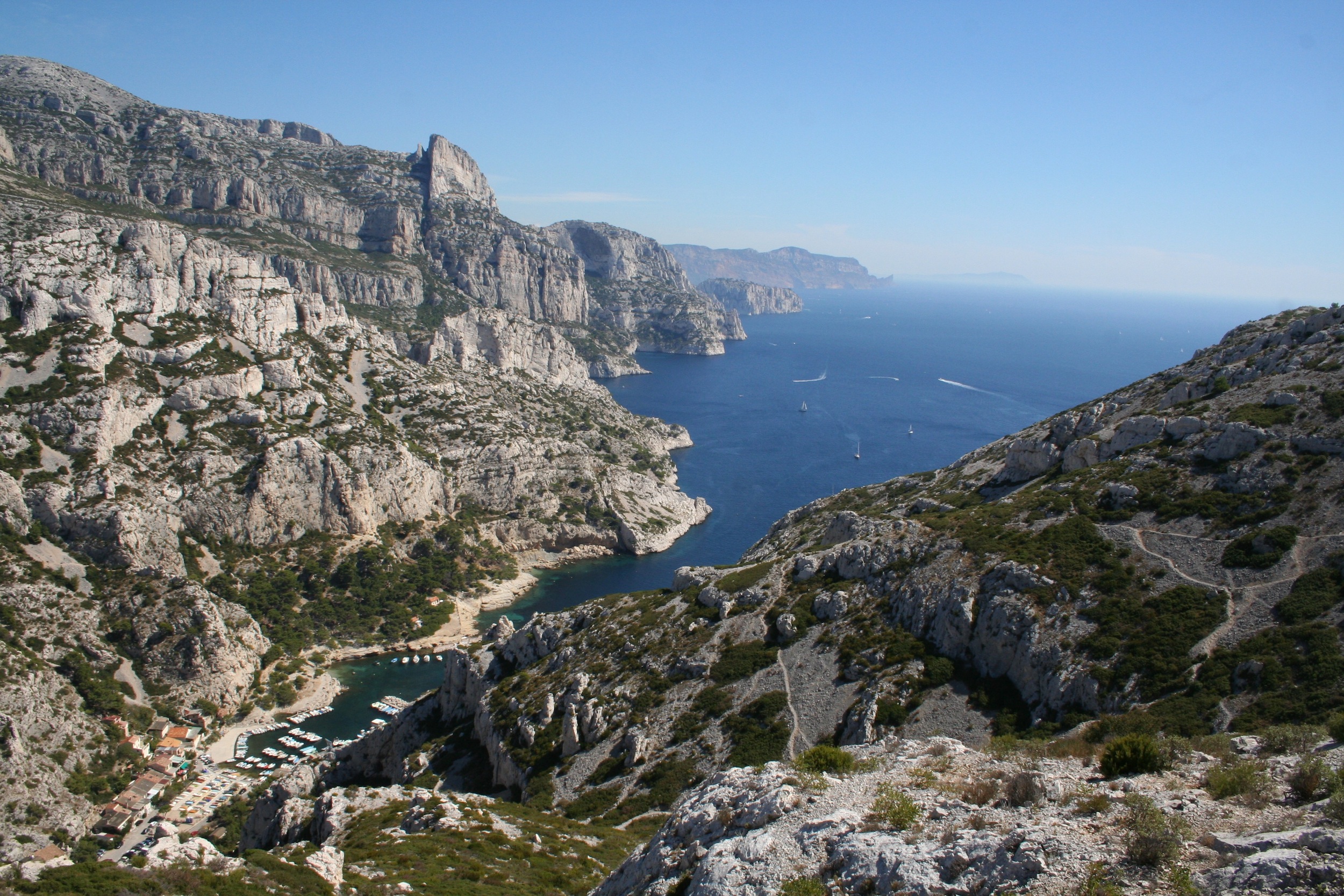
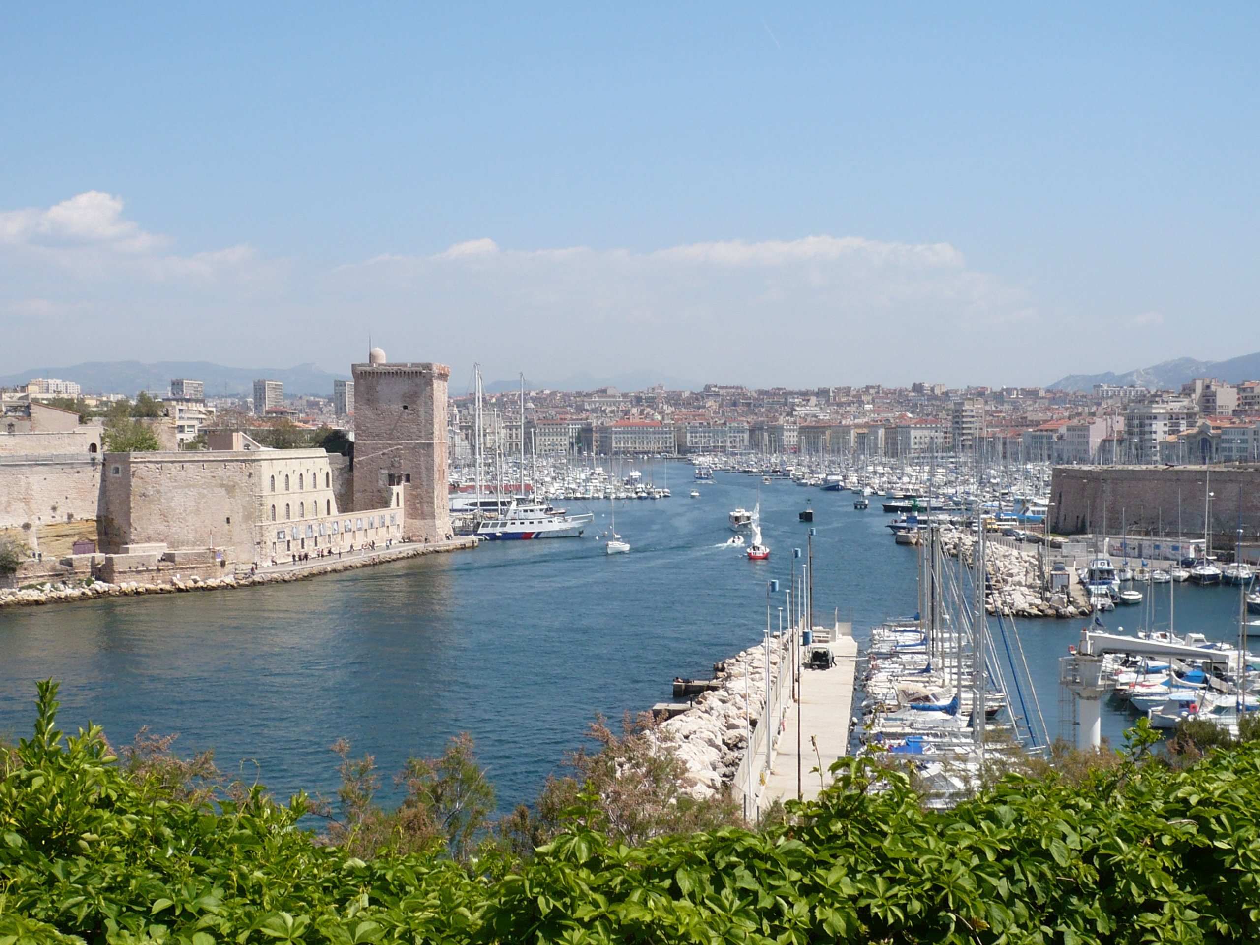
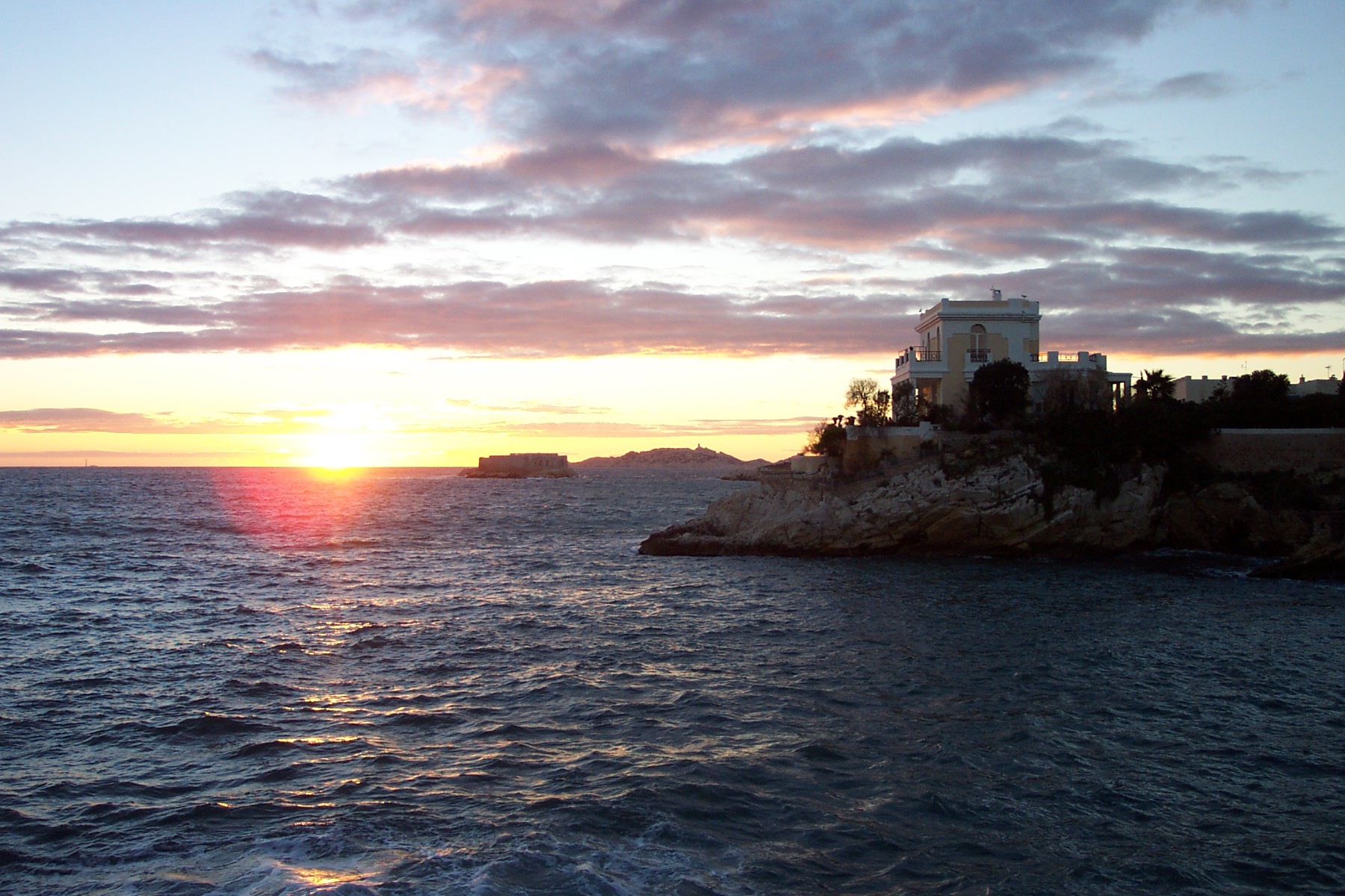
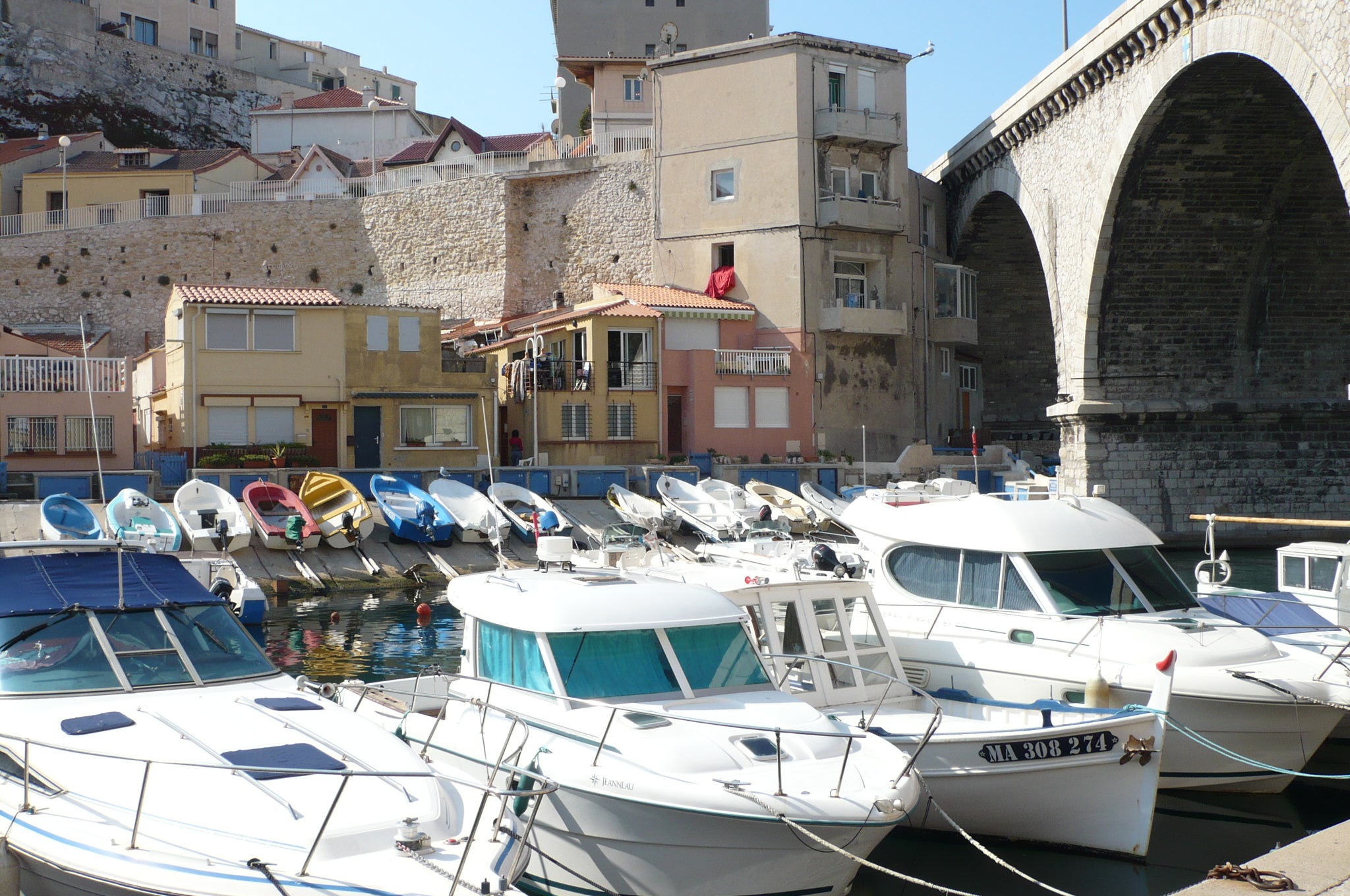
About Marseille
Since being designated a European Capital of Culture for 2013, with an estimated €660 million of funding in the bargain, Marseille has been in the throes of an extraordinary transformation, with no fewer than five major new arts centers, a beautifully refurbished port, revitalized neighborhoods, and a slew of new shops and restaurants. Once the underdog, this time-burnished city is now welcoming an influx of weekend tourists who have colonized entire neighborhoods and transformed them into elegant pieds-à-terre (or should we say, mer). The second-largest city in France, Marseille is one of Europe's most vibrant destinations. Feisty and fond of broad gestures, it is also as complicated and as cosmopolitan now as it was when a band of Phoenician Greeks first sailed into the harbor that is today's Vieux Port in 600 BC. Legend has it that on that same day a local chieftain's daughter, Gyptis, needed to choose a husband, and her wandering eyes settled on the Greeks' handsome commander Protis. Her dowry brought land near the mouth of the Rhône, where the Greeks founded Massalia, the most important Continental shipping port in antiquity. The port flourished for some 500 years as a typical Greek city, enjoying the full flush of classical culture, its gods, its democratic political system, its sports and theater, and its naval prowess. Caesar changed all that, besieging the city in 49 BC and seizing most of its colonies. In 1214 Marseille was seized again, this time by Charles d'Anjou, and was later annexed to France by Henri IV in 1481, but it was not until Louis XIV took the throne that the biggest transformations of the port began; he pulled down the city walls in 1666 and expanded the port to the Rive Neuve (New Riverbank). The city was devastated by plague in 1720, losing more than half its population. By the time of the Revolution, Marseille was on the rebound once again, with industries of soap manufacturing and oil processing flourishing, encouraging a wave of immigration from Provence and Italy. With the opening of the Suez Canal in 1869, Marseille became the greatest boomtown in 19th-century Europe. With a large influx of immigrants from areas as exotic as Tangiers, the city quickly acquired the multicultural population it maintains to this day.
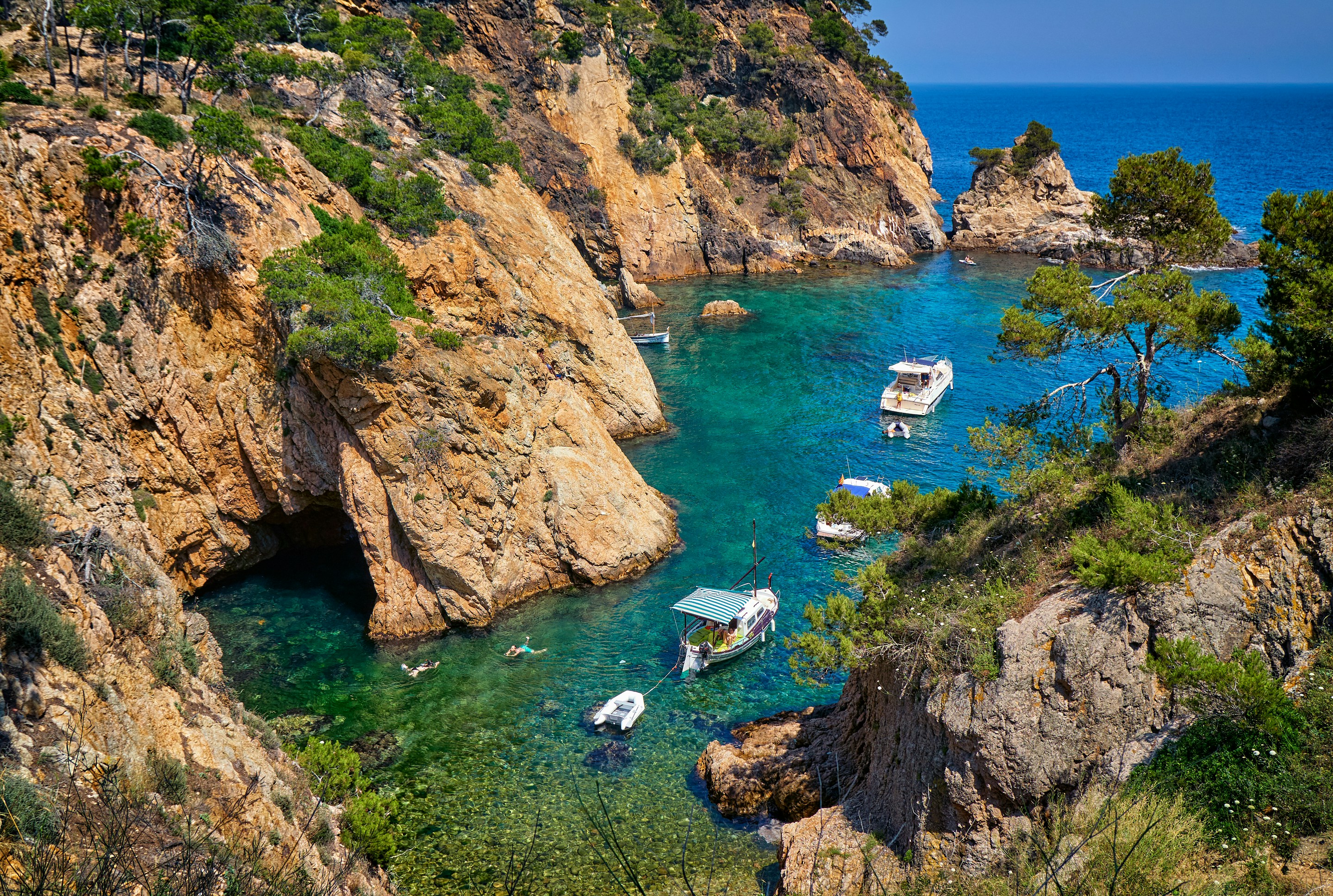
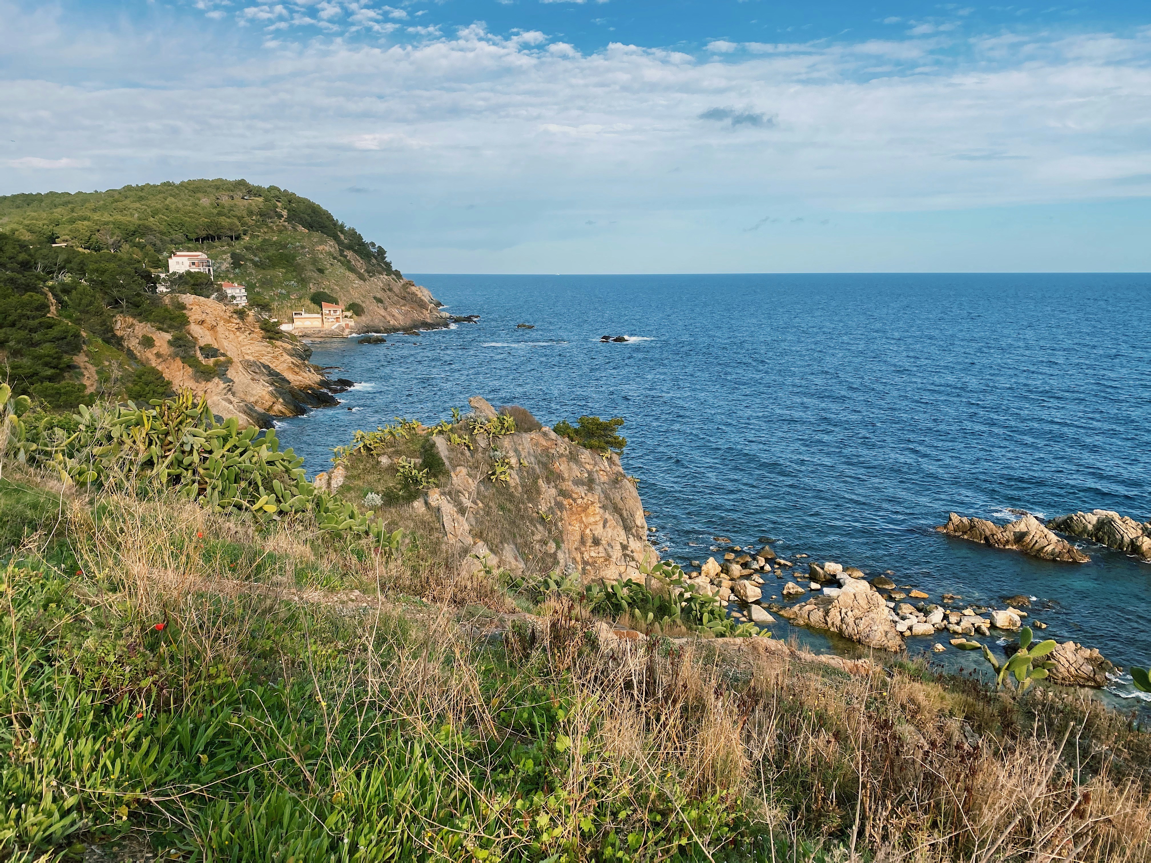
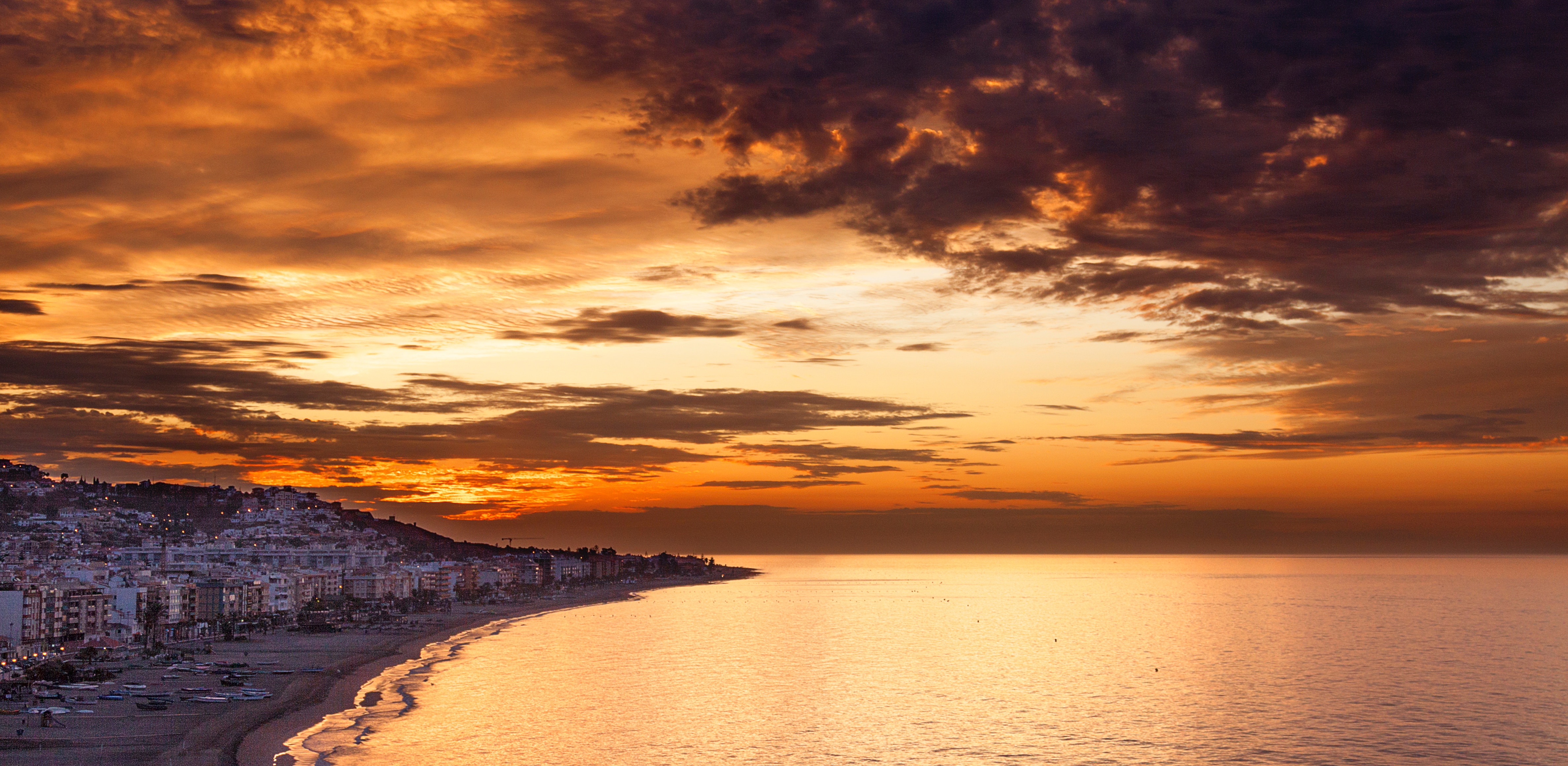
About Palamós
One of the best ways to arrive in Catalonia is by sea, especially via the Costa Brava. This coastline, also known as the Rugged or Wild Coast, stretches from Blanes to the French border. Its name aptly refers to the steep cliff of ancient twisted rocks, which runs its entire length and is bounded inland by the Catalan mountain ranges. The intensity of the coast’s colour, the ruggedness of the rocks and the scent of the plants all combine to add to its attraction. The history of this region is long and varied. Traces can be found of the advanced culture of the Iberians, Greeks, Romans, Visigoths and Arabs. With Wilfred I and the independence of Catalan countries, the Catalan dynasty was born. Later, in 1479, Catalonia became a part of unified Spain following the marriage of Isabel, Queen of Castile, and Fernando, King of Aragon. The port of Palamos, some 36 miles northeast of Barcelona, has been in existence for nearly 700 years thanks to its location on one of the deepest natural bays in the western Mediterranean. The town itself is the southernmost of a series of resorts popular with sun worshippers. For the most part, Palamos has managed to retain some of the charm of a fishing village. The port also serves as a gateway to such inland locations as Girona, the capital of the province. Art lovers may want to visit Figueras, famous for its bizarre Teatre-Museu Dali, the foremost of a series of sites associated with the eccentric surrealist artist, Salvador Dali. If you choose to stay in Palamos, you can enjoy the pleasant atmosphere of the town or spend some time at a nearby beach. The town has a long seagoing tradition and busy harbour. The fish auction, prompted by the arrival of the fishing boats, is a spectacle worth seeing. The Fishing Museum illustrates the history and the life of the families who live off the sea.

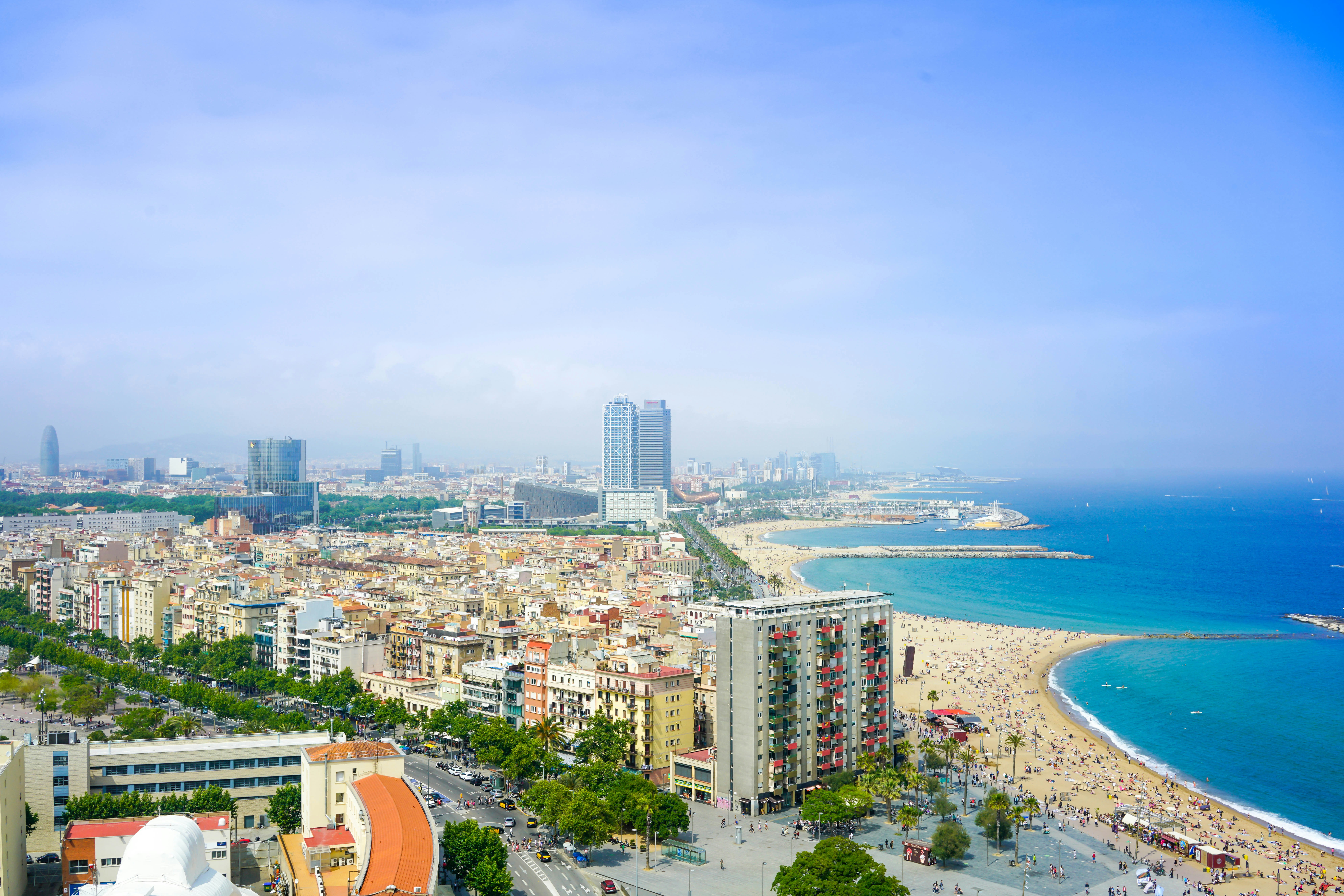
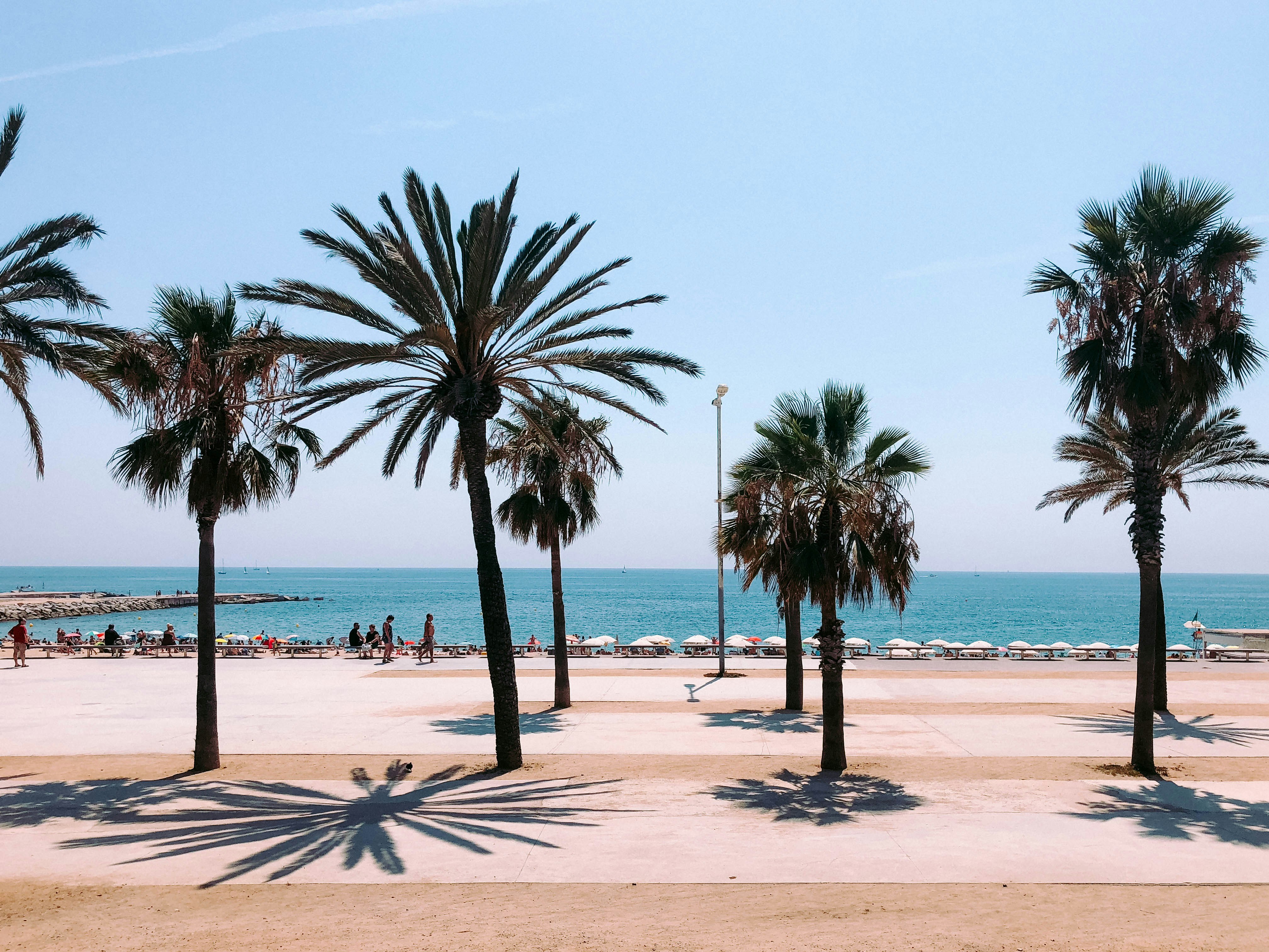
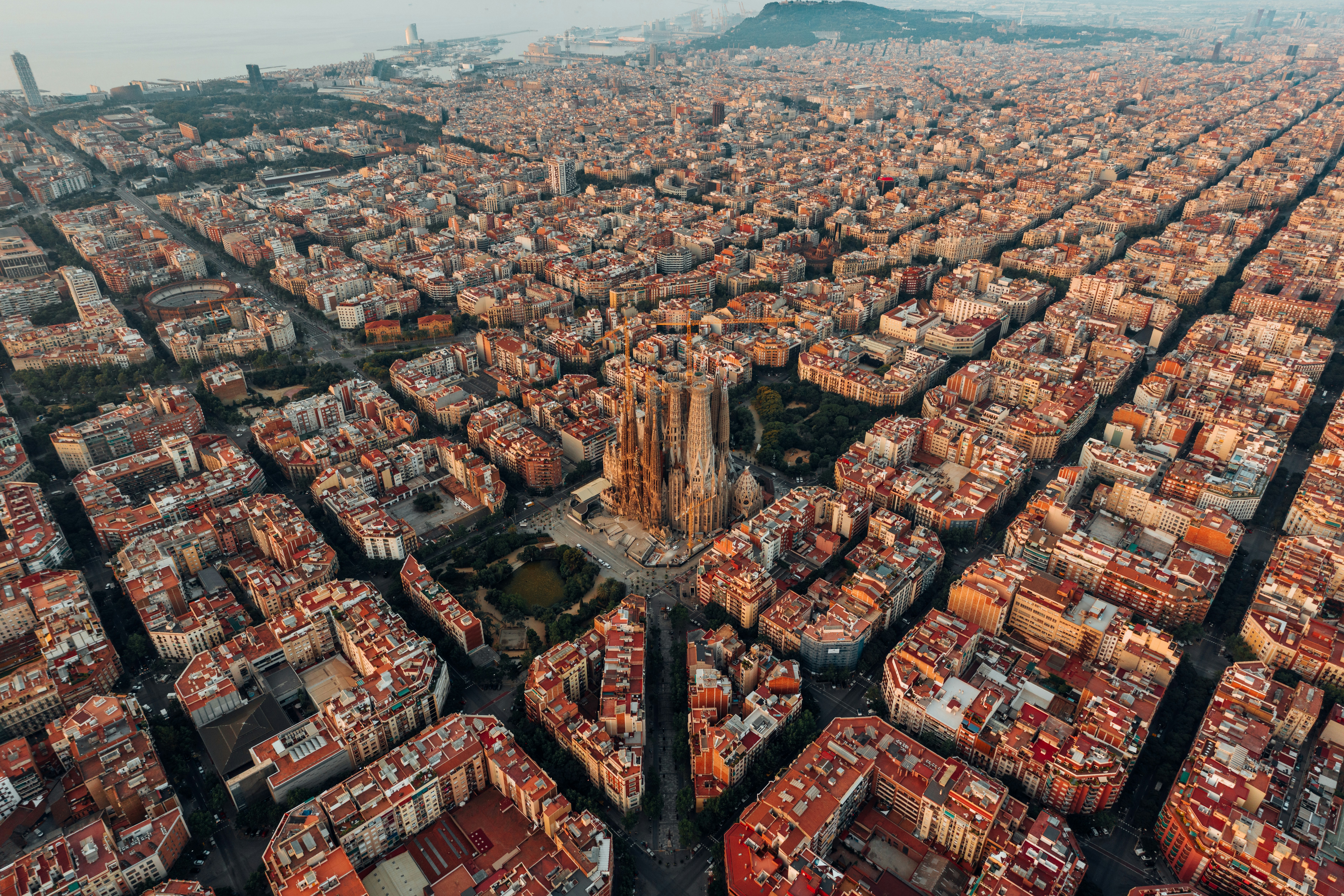
About Barcelona
The infinite variety of street life, the nooks and crannies of the medieval Barri Gòtic, the ceramic tile and stained glass of Art Nouveau facades, the art and music, the throb of street life, the food (ah, the food!)—one way or another, Barcelona will find a way to get your full attention. The capital of Catalonia is a banquet for the senses, with its beguiling mix of ancient and modern architecture, tempting cafés and markets, and sun-drenched Mediterranean beaches. A stroll along La Rambla and through waterfront Barceloneta, as well as a tour of Gaudí's majestic Sagrada Famíliaand his other unique creations, are part of a visit to Spain's second-largest city. Modern art museums and chic shops call for attention, too. Barcelona's vibe stays lively well into the night, when you can linger over regional wine and cuisine at buzzing tapas bars.

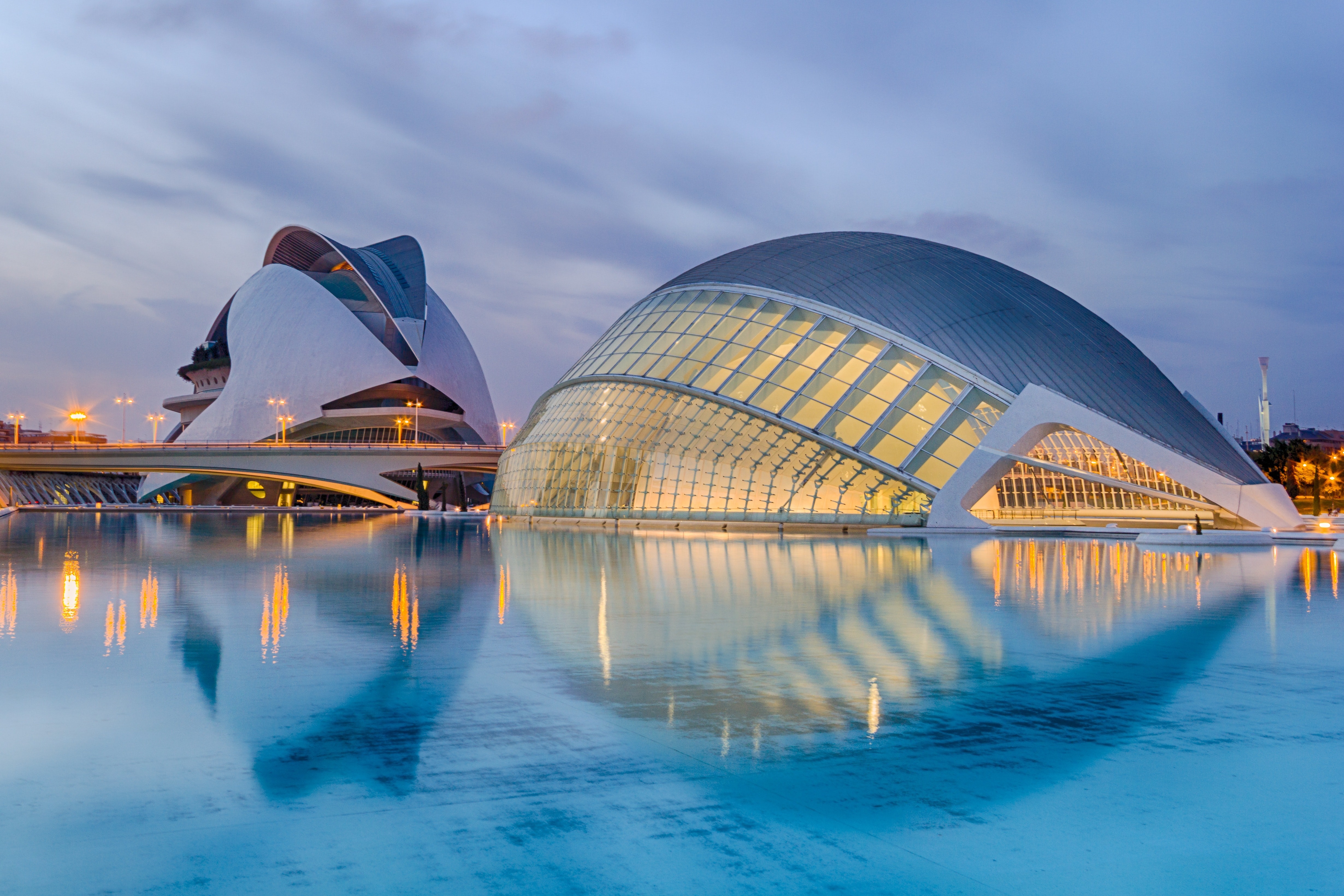
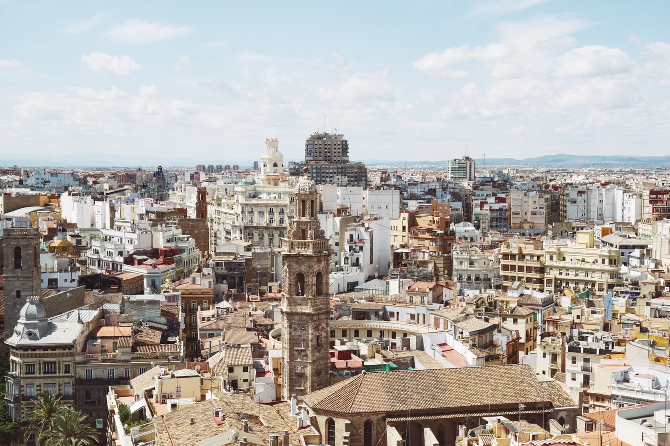
About Valencia
Valencia, Spain's third-largest municipality, is a proud city with a thriving nightlife and restaurant scene, quality museums, and spectacular contemporary architecture, juxtaposed with a thoroughly charming historic quarter, making it a popular destination year in year out. During the Civil War, it was the last seat of the Republican Loyalist government (1935–36), holding out against Franco’s National forces until the country fell to 40 years of dictatorship. Today it represents the essence of contemporary Spain—daring design and architecture along with experimental cuisine—but remains deeply conservative and proud of its traditions. Though it faces the Mediterranean, Valencia's history and geography have been defined most significantly by the River Turia and the fertile huerta that surrounds it.The city has been fiercely contested ever since it was founded by the Greeks. El Cid captured Valencia from the Moors in 1094 and won his strangest victory here in 1099: he died in the battle, but his corpse was strapped into his saddle and so frightened the besieging Moors that it caused their complete defeat. In 1102 his widow, Jimena, was forced to return the city to Moorish rule; Jaume I finally drove them out in 1238. Modern Valencia was best known for its frequent disastrous floods until the River Turia was diverted to the south in the late 1950s. Since then the city has been on a steady course of urban beautification. The lovely bridges that once spanned the Turia look equally graceful spanning a wandering municipal park, and the spectacularly futuristic Ciutat de les Arts i les Ciències (City of Arts and Sciences), most of it designed by Valencia-born architect Santiago Calatrava, has at last created an exciting architectural link between this river town and the Mediterranean. If you're in Valencia, an excursion to Albufera Nature Park is a worthwhile day trip.
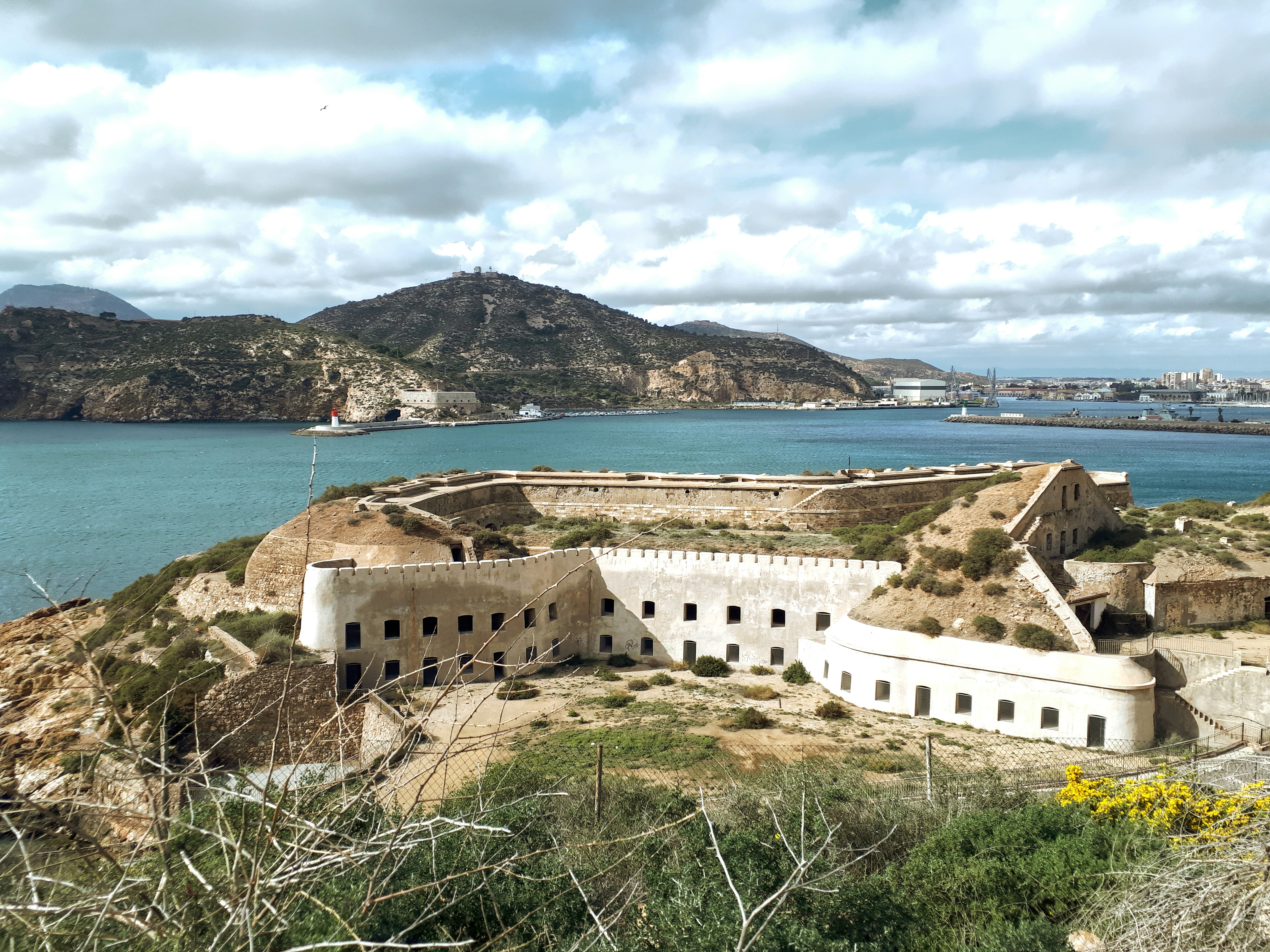
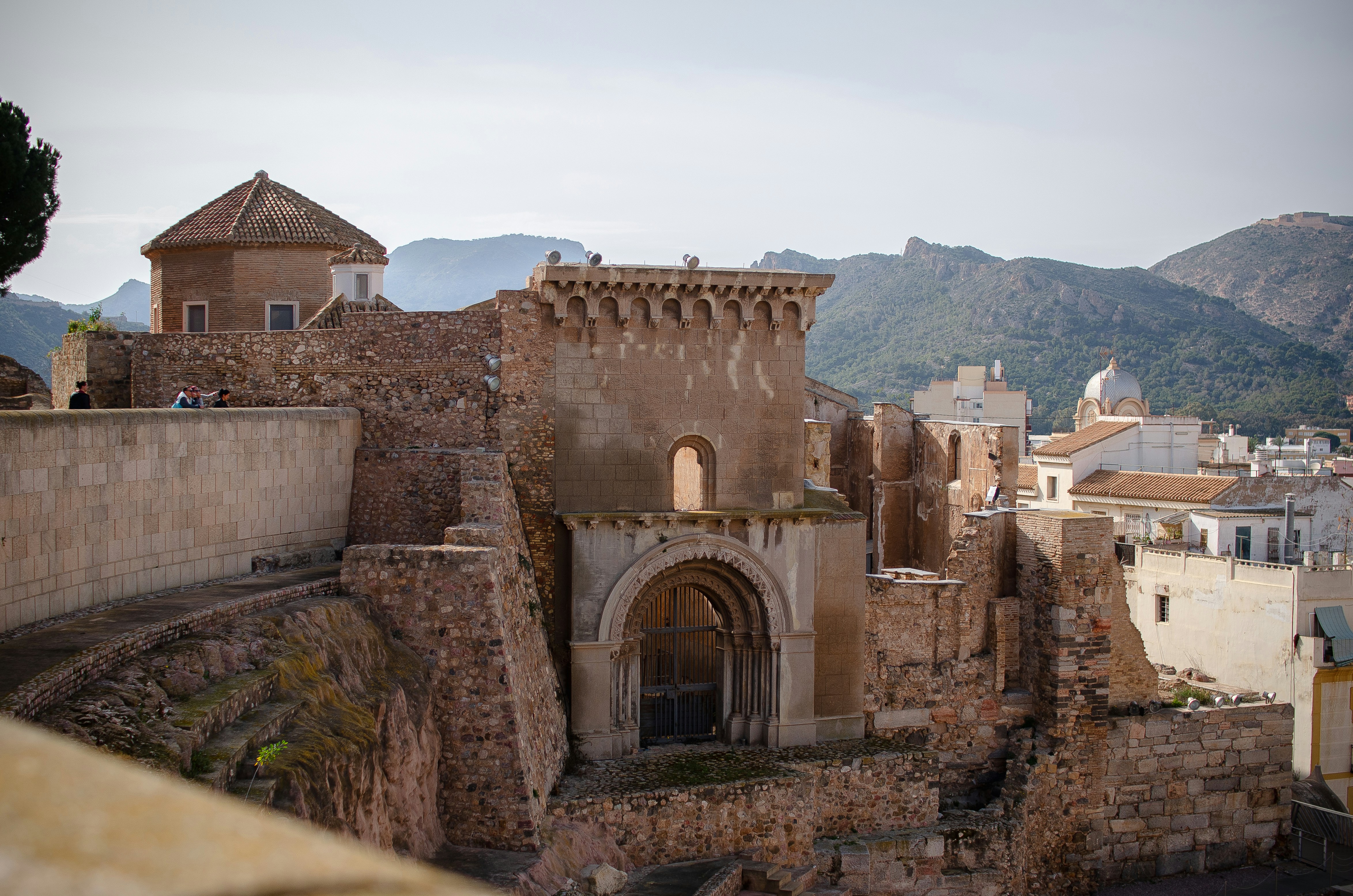
About Cartagena
A Mediterranean city and naval station located in the Region of Murcia, southeastern Spain, Cartagena’s sheltered bay has attracted sailors for centuries. The Carthaginians founded the city in 223BC and named it Cartago Nova; it later became a prosperous Roman colony, and a Byzantine trading centre. The city has been the main Spanish Mediterranean naval base since the reign of King Philip II, and is still surrounded by walls built during this period. Cartagena’s importance grew with the arrival of the Spanish Bourbons in the 18th century, when the Navidad Fortress was constructed to protect the harbour. In recent years, traces of the city’s fascinating past have been brought to light: a well-preserved Roman Theatre was discovered in 1988, and this has now been restored and opened to the public. During your free time, you may like to take a mini-cruise around Cartagena's historic harbour: these operate several times a day, take approximately 40 minutes and do not need to be booked in advance. Full details will be available at the port.
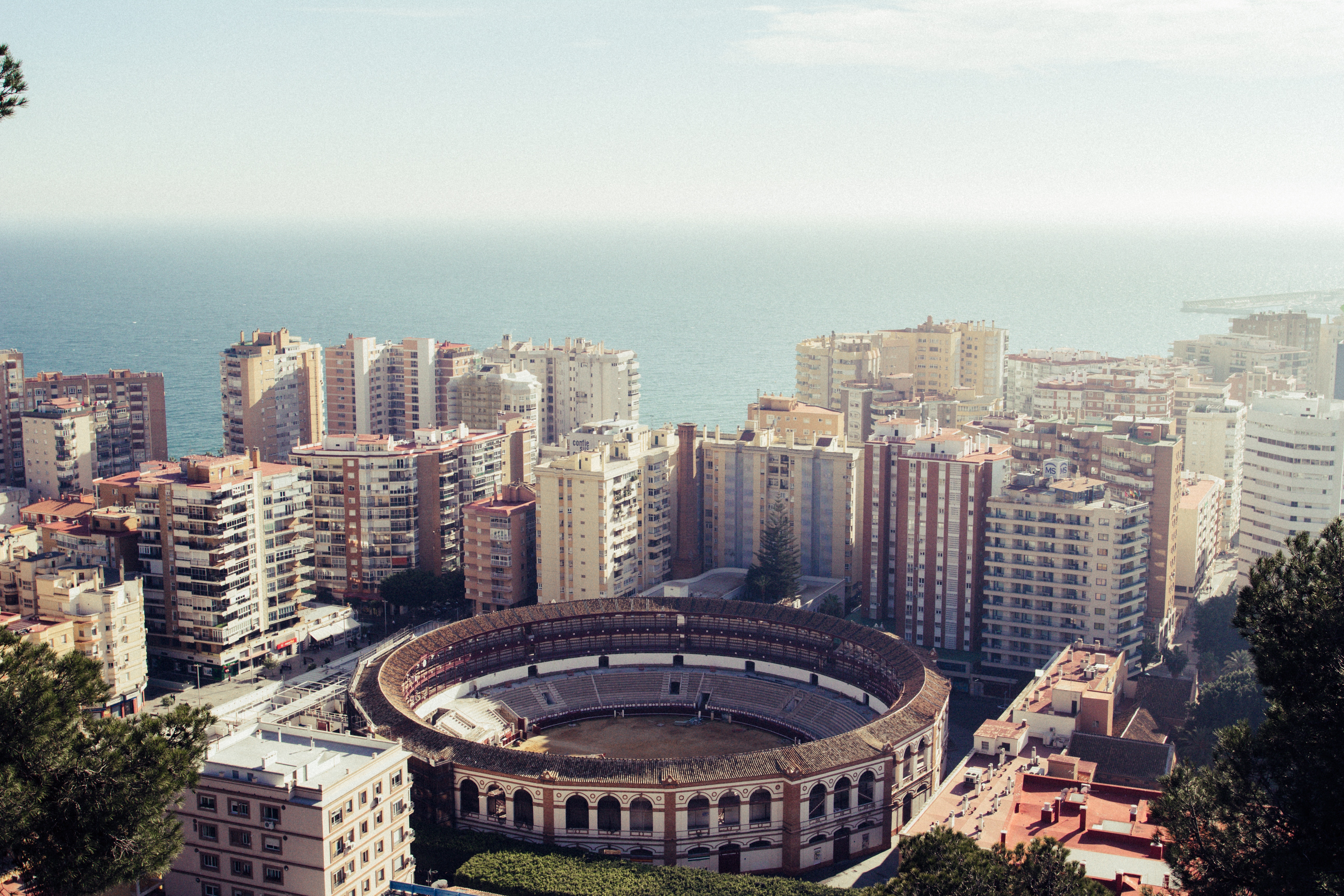
About Málaga
As you sail into Malaga you will notice what an idyllic setting the city enjoys on the famous Costa del Sol. To the east of this provincial capital, the coast along the region of La Axarqua is scattered with villages, farmland and sleepy fishing hamlets - the epitome of traditional rural Spain. To the west stretches a continuous city where the razzmatazz and bustle creates a colourful contrast that is easily recognisable as the Costa del Sol. Surrounding the region, the Penibéetica Mountains provide an attractive backdrop overlooking the lower terraced slopes which yield olives and almonds. This spectacular mountain chain shelters the province from cold northerly winds, giving it a reputation as a therapeutic and exotic place in which to escape from cold northern climes. Malaga is also the gateway to many of Andalusia's enchanting historic villages, towns and cities.
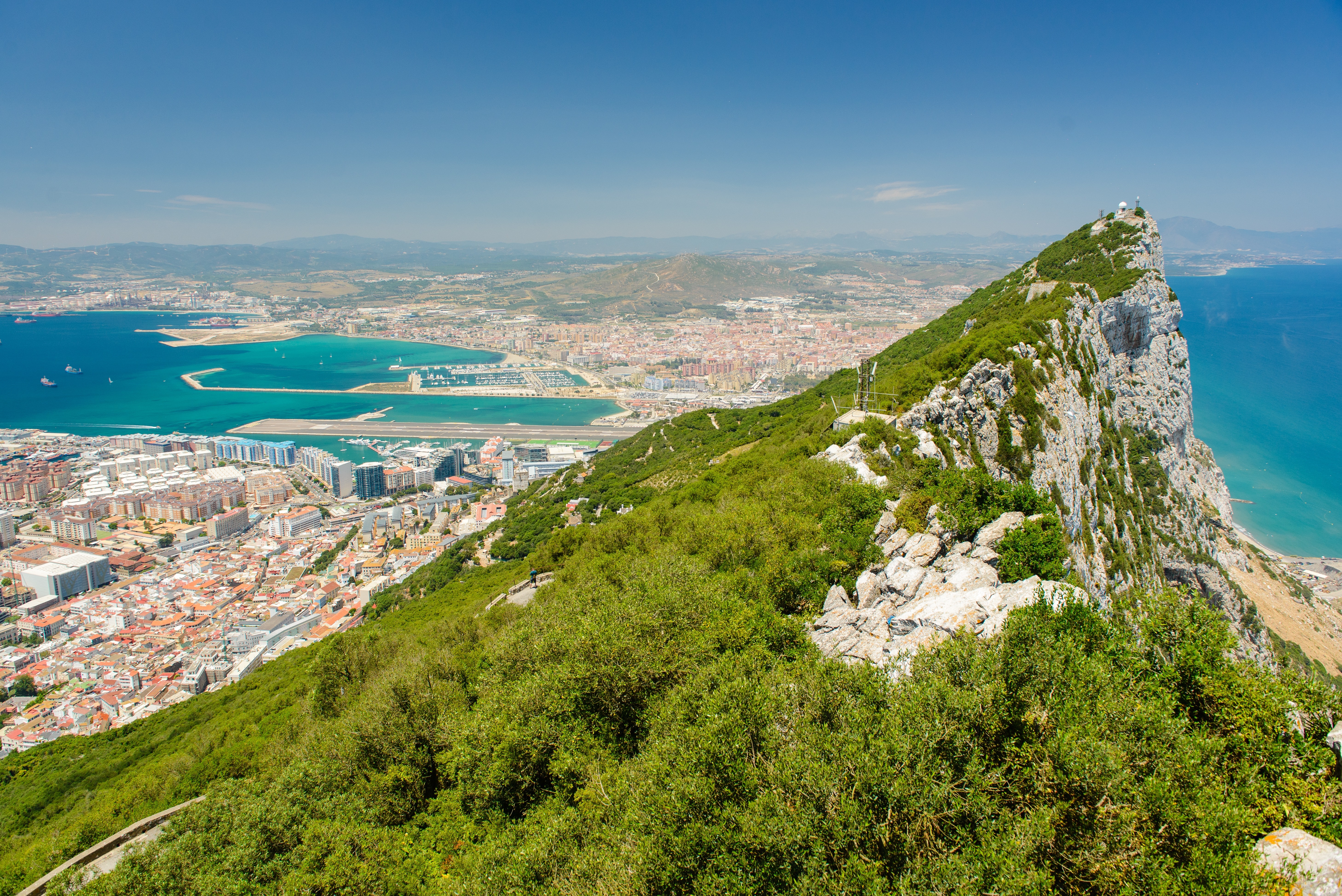
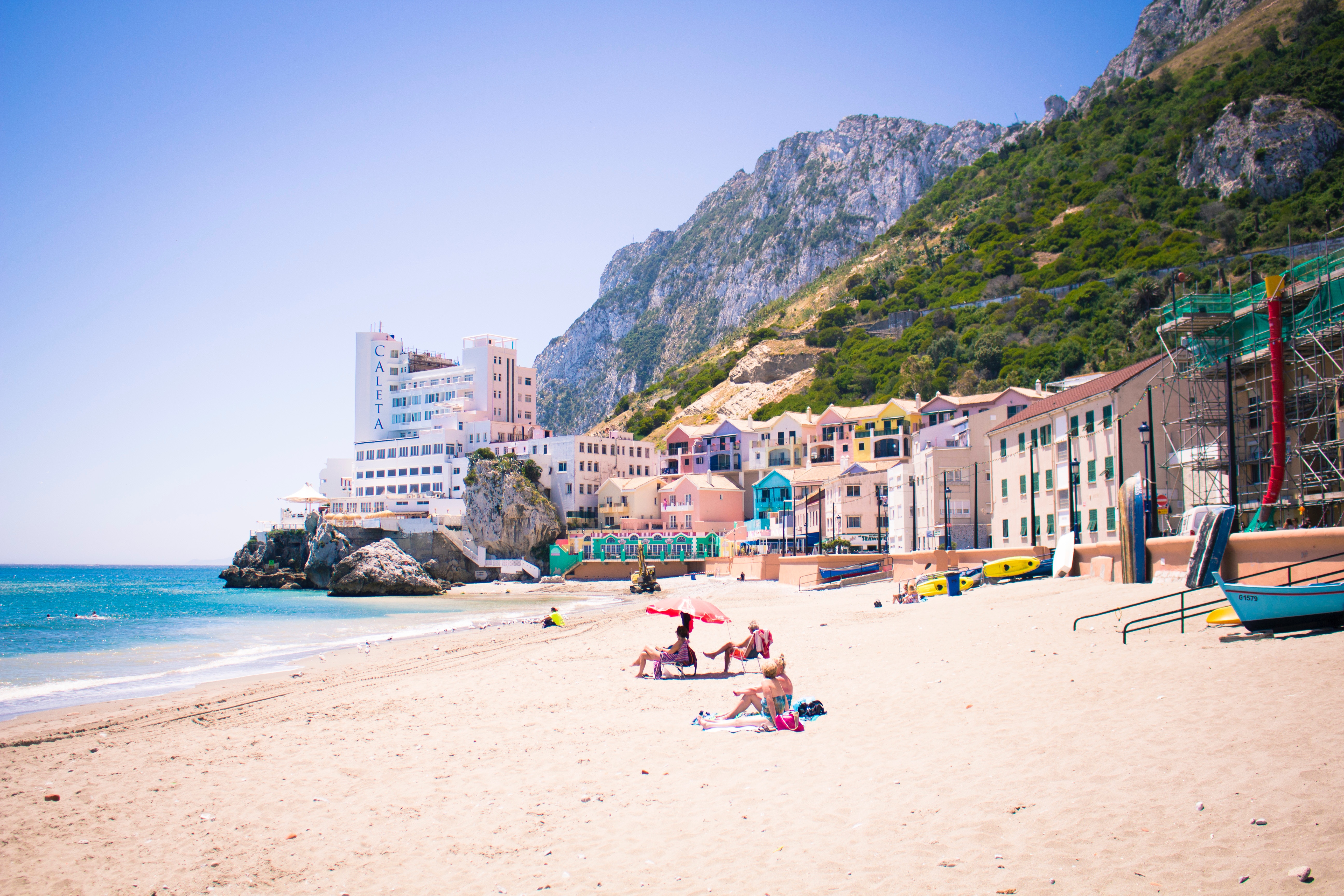
About Gibraltar
Tagged on to the end of Iberia, the intriguing British outpost of Gibraltar is dominated by a sandy peninsula and the stunning 1,400-feet-high limestone Rock. Although small, Gibraltar has always been seen as having great strategic importance on account of its advantageous position where the Atlantic meets the Mediterranean, just 12 miles from the coast of Africa. Ever popular with British holidaymakers, Gibraltar is very much a home from home, boasting excellent duty-free shopping in many familiar British high street shops. Please note: Gibraltar’s small size and narrow winding roads mean that excursions are operated by 22-seater mini-buses, accompanied by a driver/guide. Local health and safety regulations prohibit the carriage of walking aids and collapsible wheelchairs on these vehicles. If you do wish to bring a mobility aid, we can arrange the Rock Tour by taxi, which has extra space. If this suits your requirements, please advise the Tours and Travel office when you join the ship, as numbers are limited.

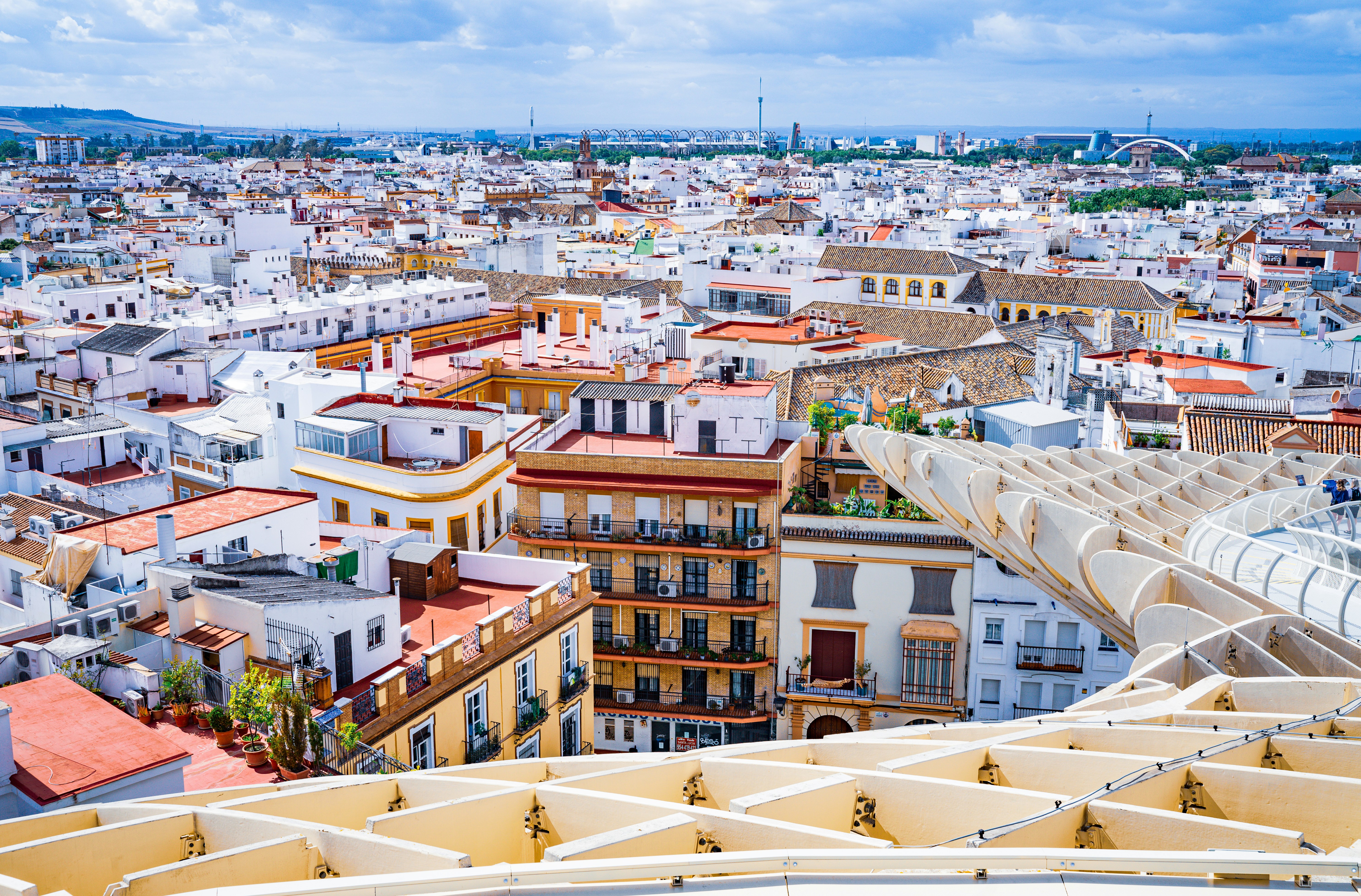
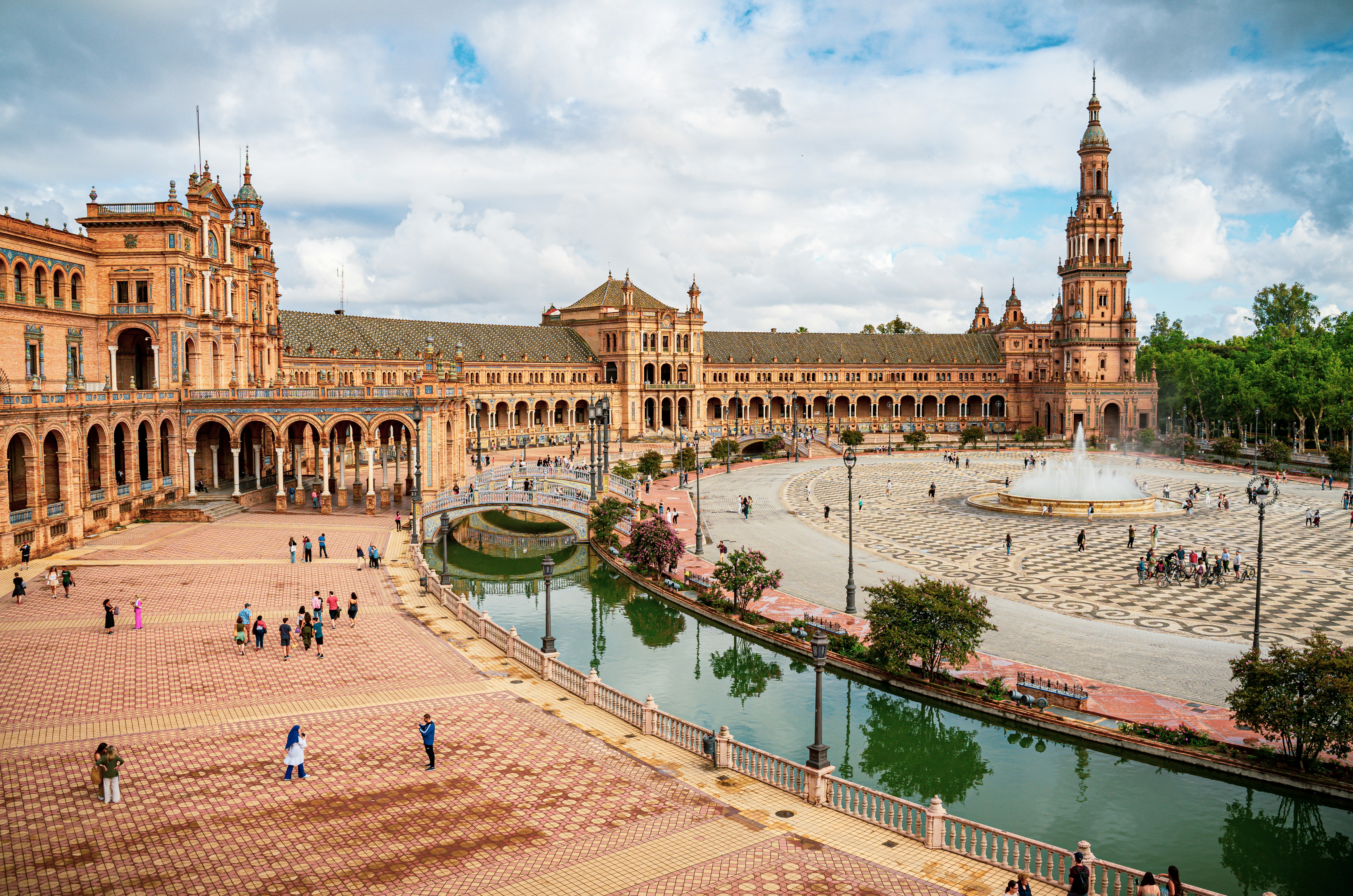
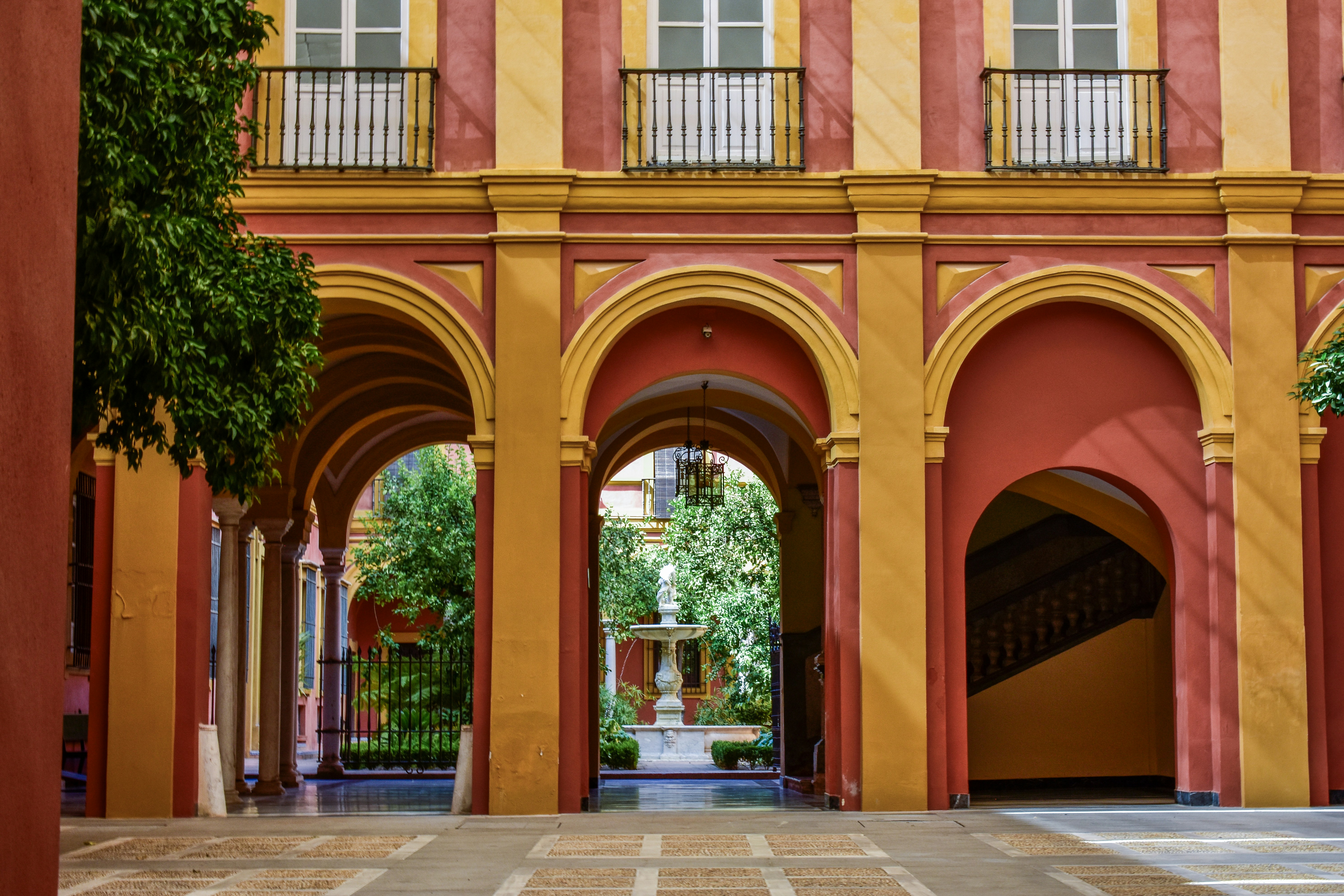
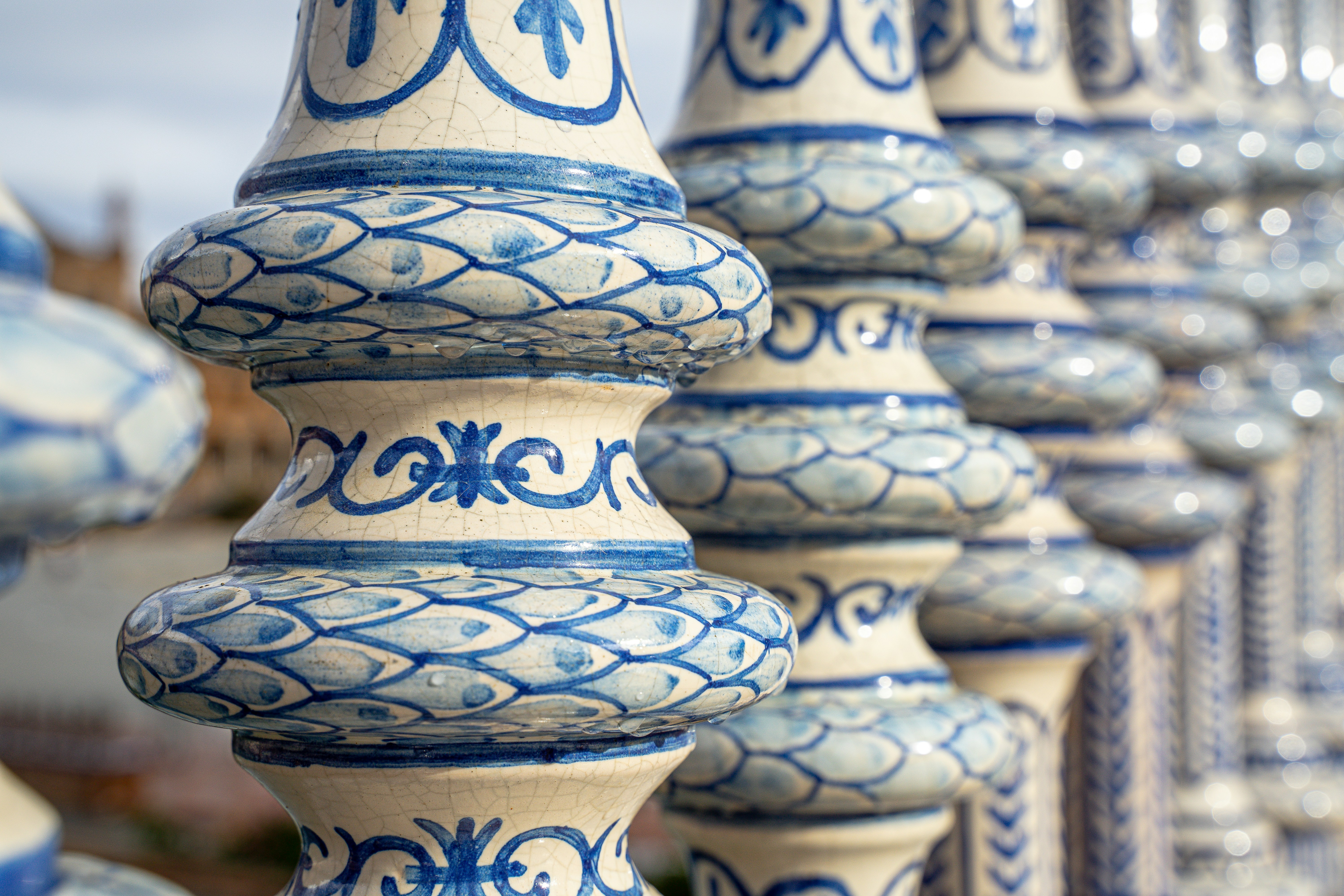
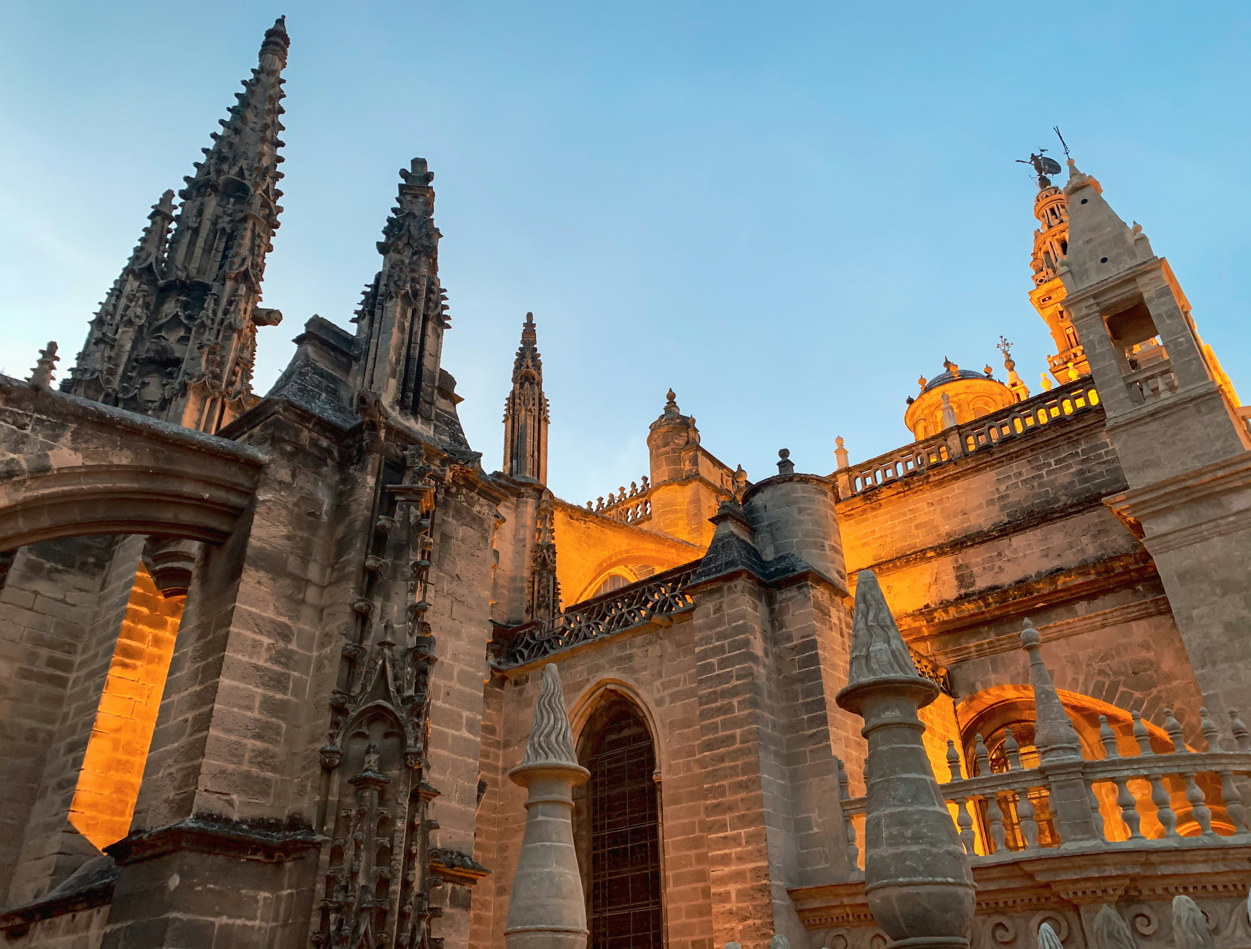
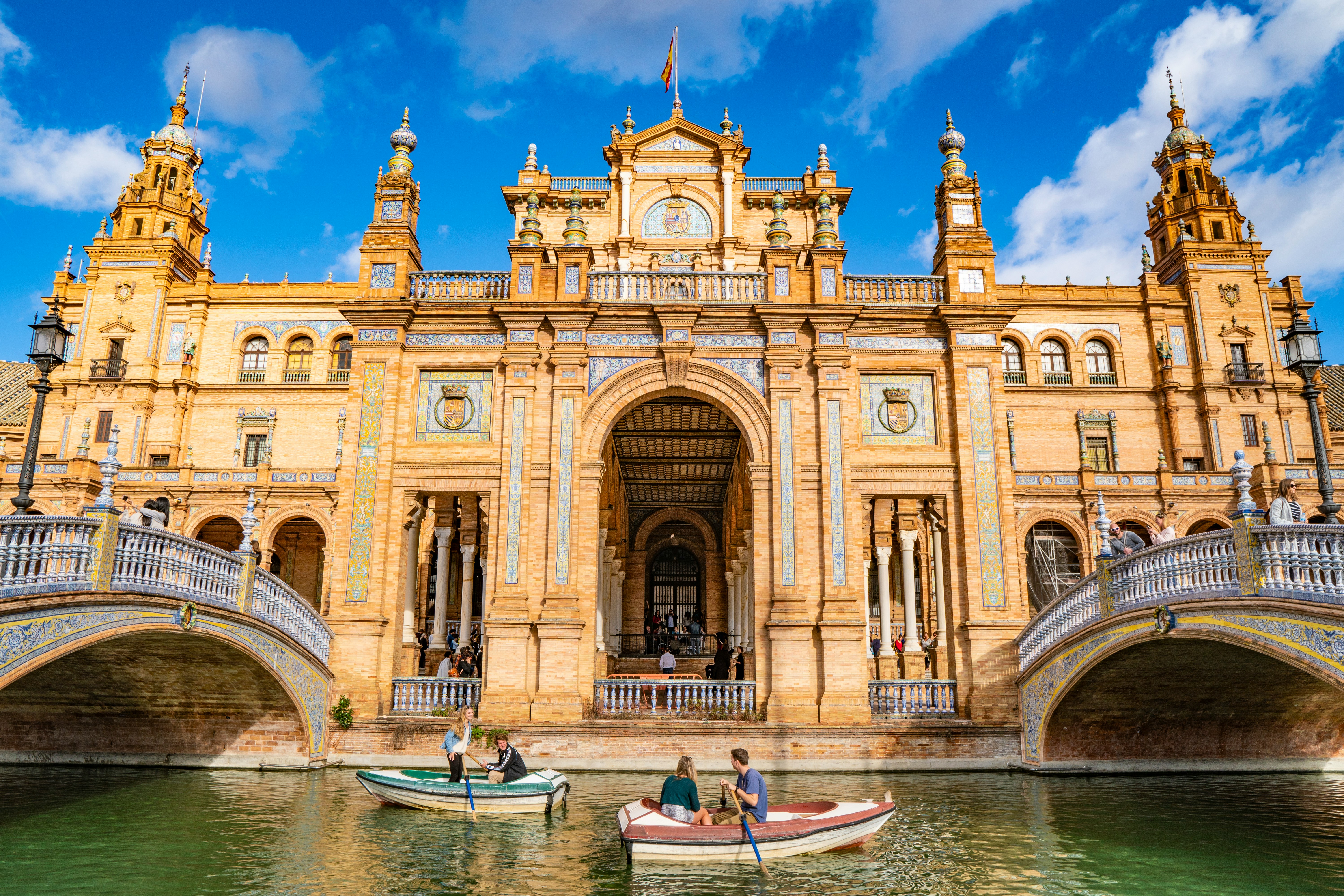
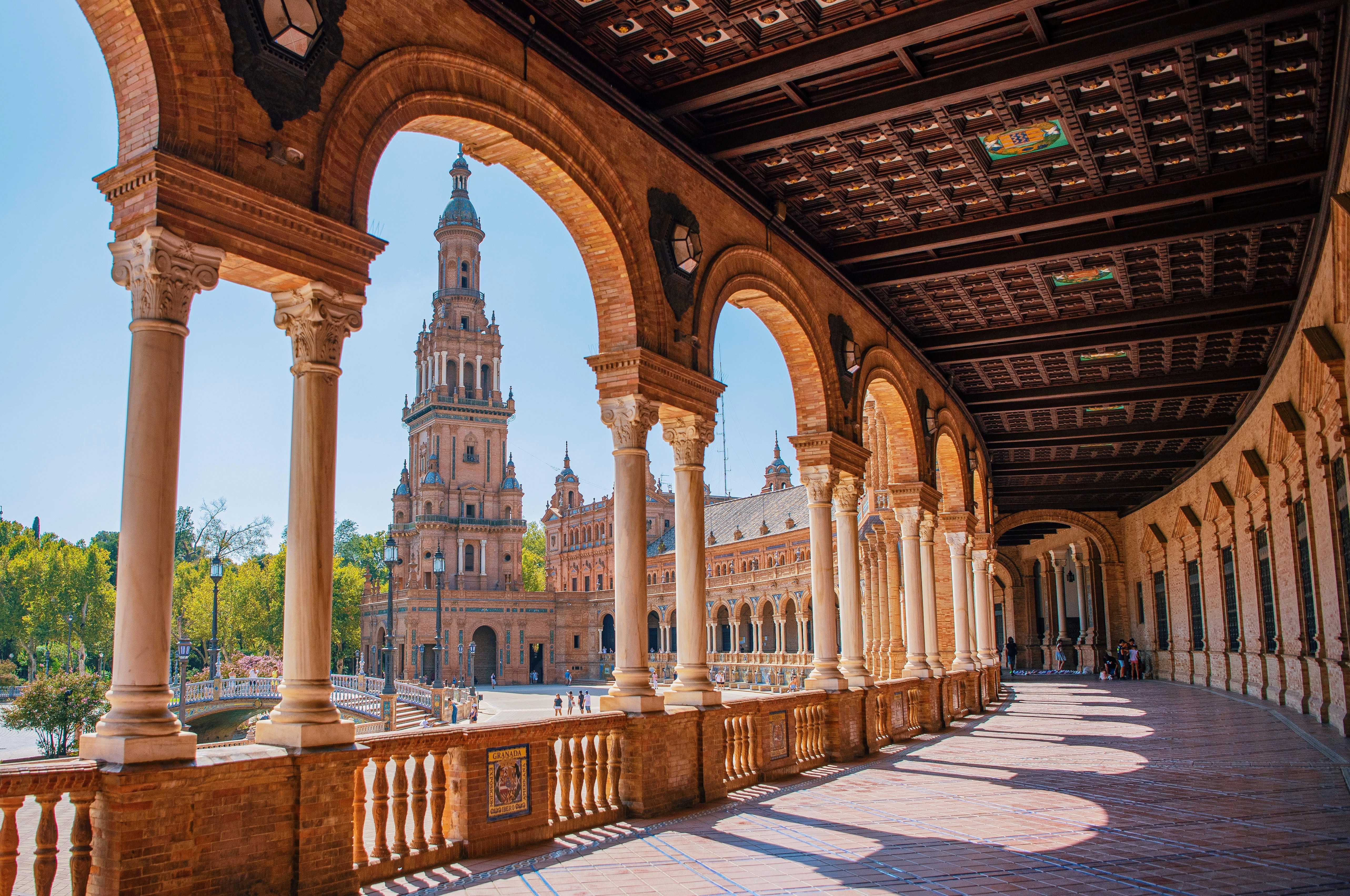
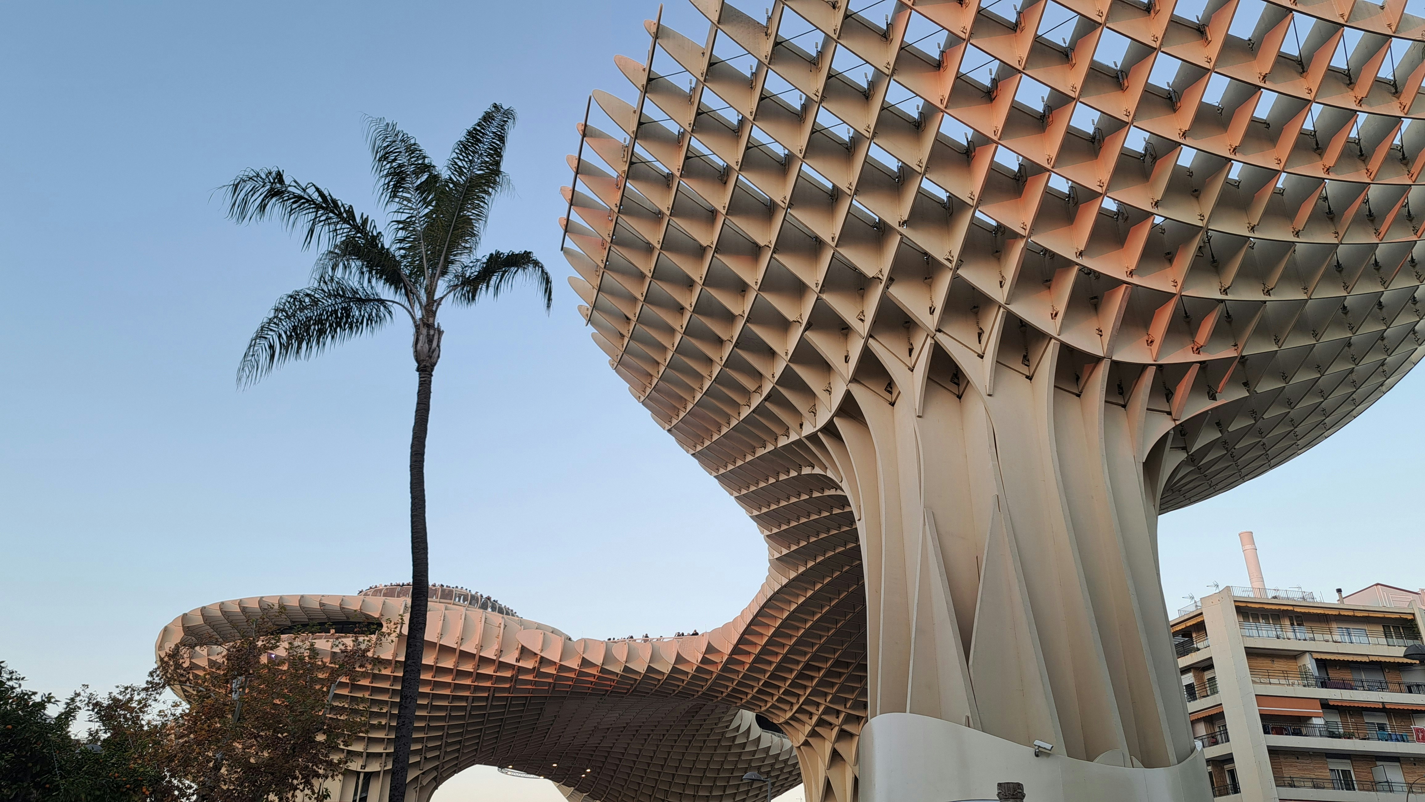
About Seville
Whether you pronounce it Seville or Sevilla, this gorgeous Spanish town is most certainly the stuff of dreams. Over 2,200 years old, Seville has a mutli-layered personality; home to Flamenco, high temperatures and three UNESCO-World Heritage Sites, there is a noble ancestry to the southern Spanish town. Not forgetting that it is the birthplace of painter Diego Velazquez, the resting place of Christopher Columbus, the inspiration for Bizet’s Carmen and a location for Game of Thrones filming, Seville is truly more than just a sum of its parts. This city is a full on experience, a beguiling labyrinth of centuries old streets, tiny tapas restaurants serving possibly the best dishes you’ll taste south of Madrid and a paradise of Mudejar architecture and tranquil palm trees and fountain-filled gardens.
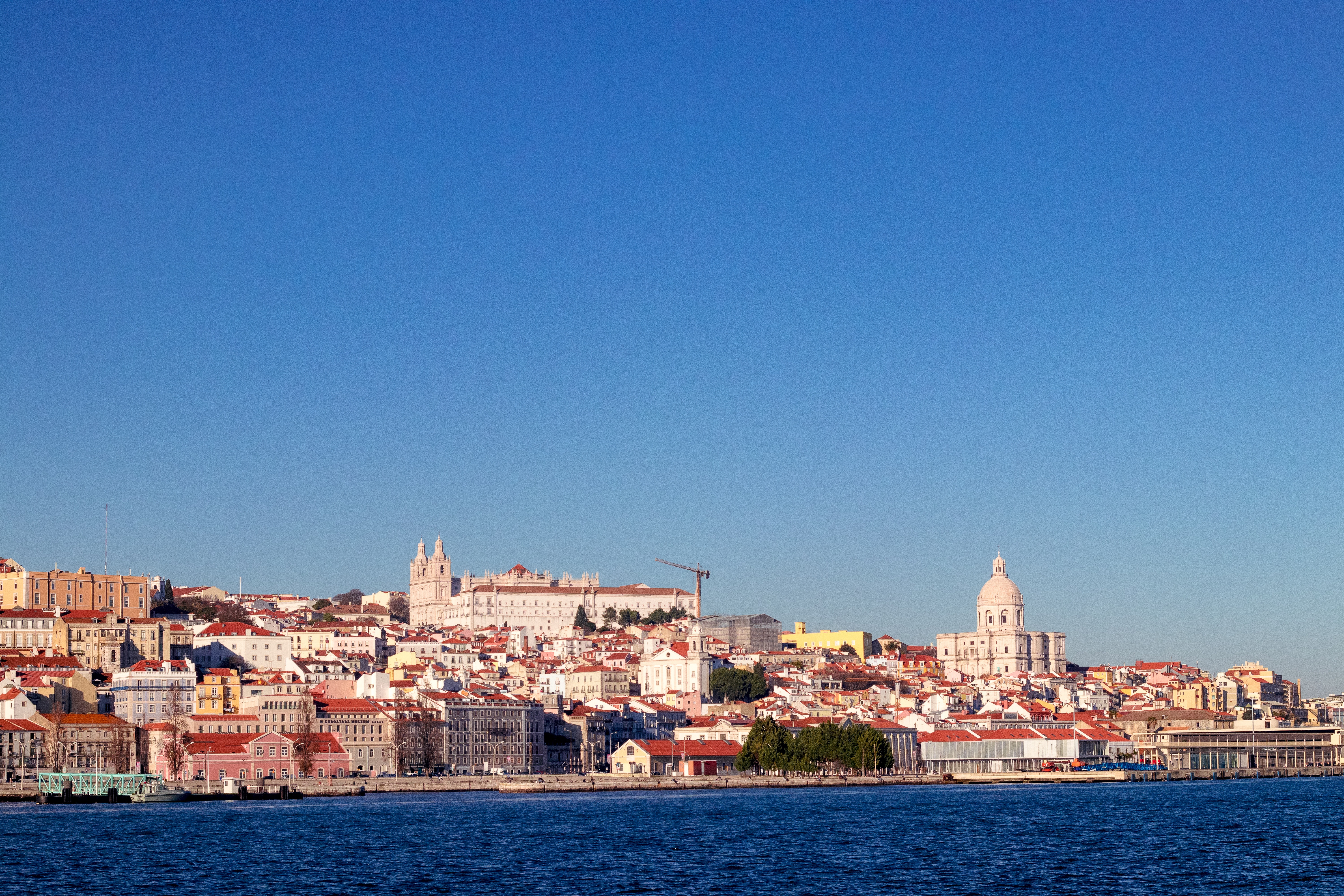
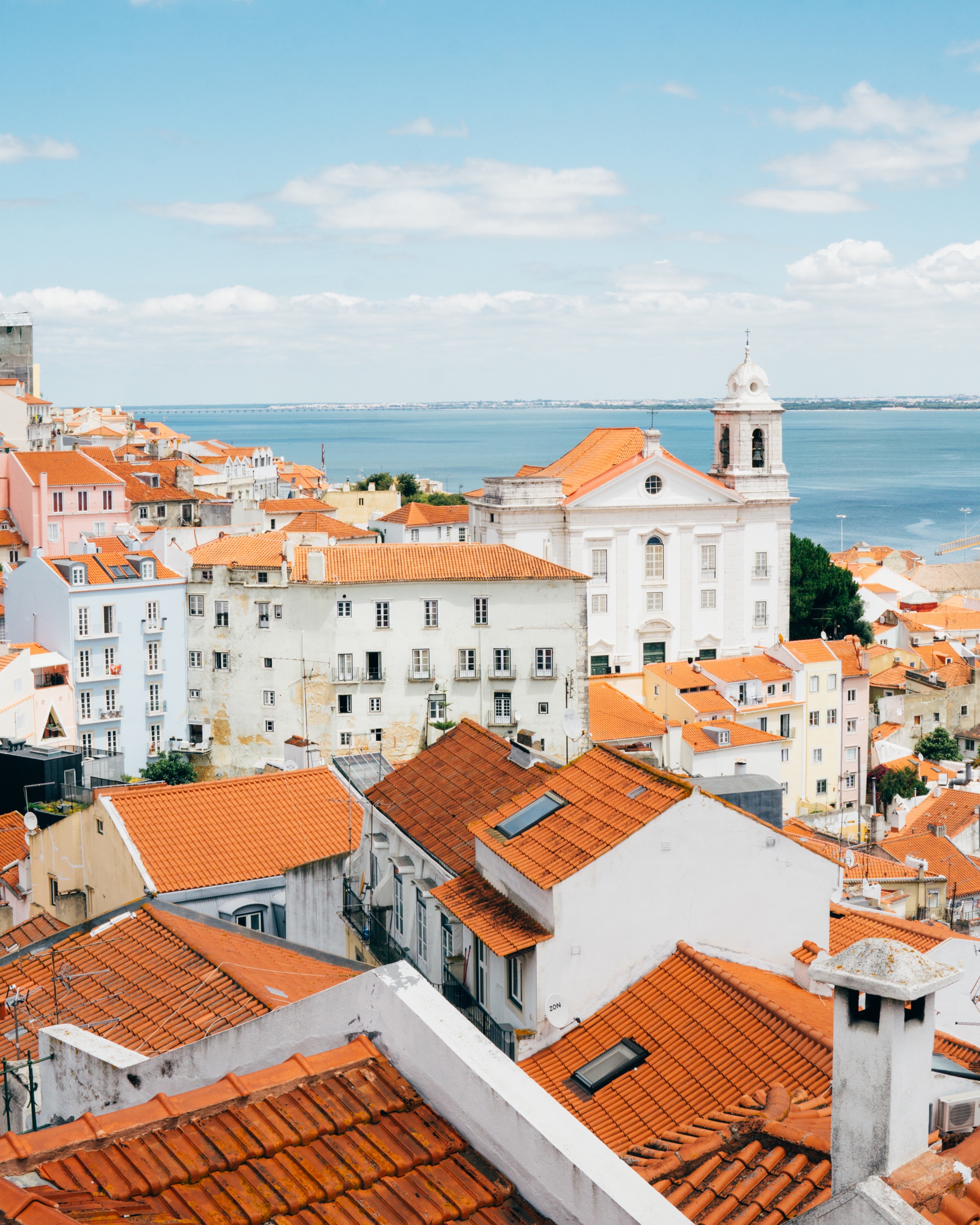
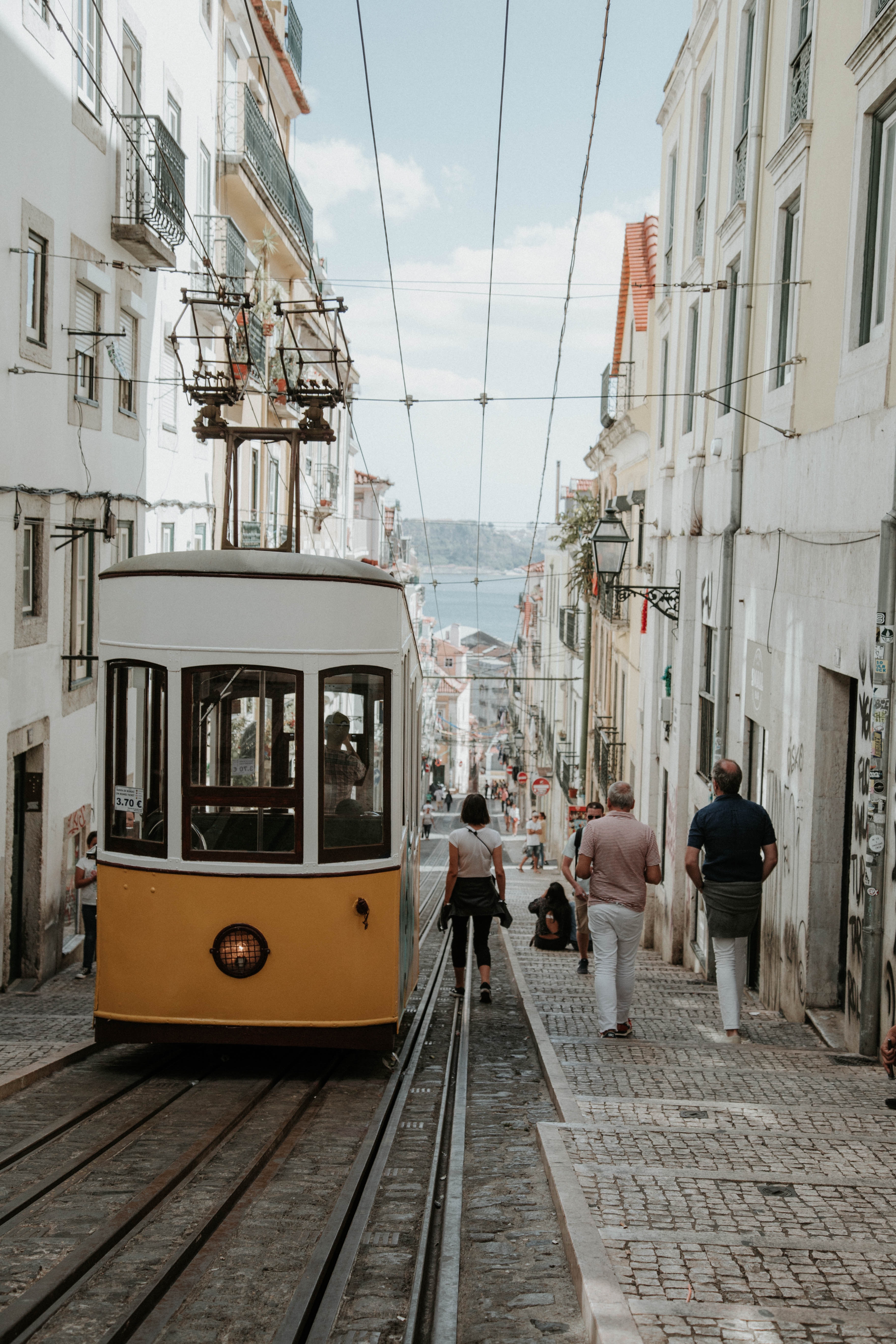
About Lisbon
Set on seven hills on the banks of the River Tagus, Lisbon has been the capital of Portugal since the 13th century. It is a city famous for its majestic architecture, old wooden trams, Moorish features and more than twenty centuries of history. Following disastrous earthquakes in the 18th century, Lisbon was rebuilt by the Marques de Pombal who created an elegant city with wide boulevards and a great riverfront and square, Praça do Comércio. Today there are distinct modern and ancient sections, combining great shopping with culture and sightseeing in the Old Town, built on the city's terraced hillsides. The distance between the ship and your tour vehicle may vary. This distance is not included in the excursion grades.
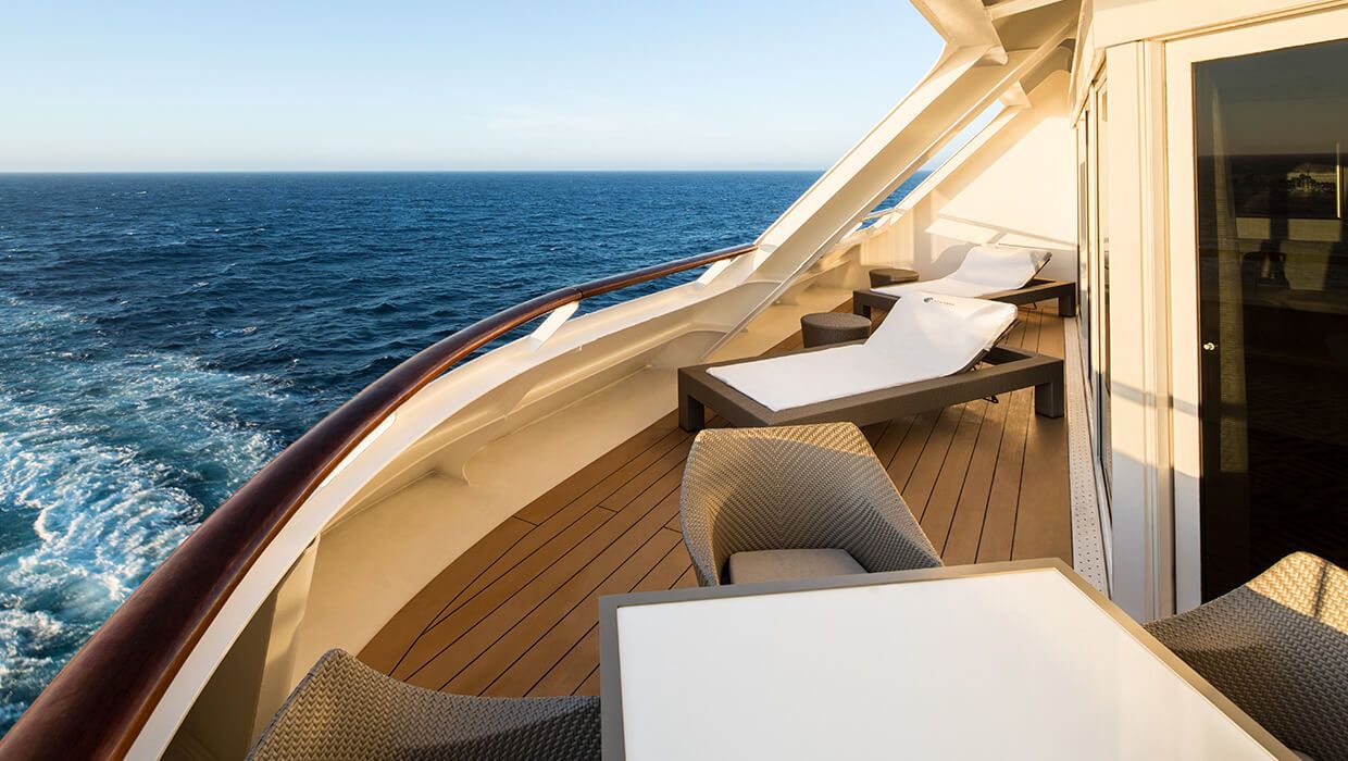
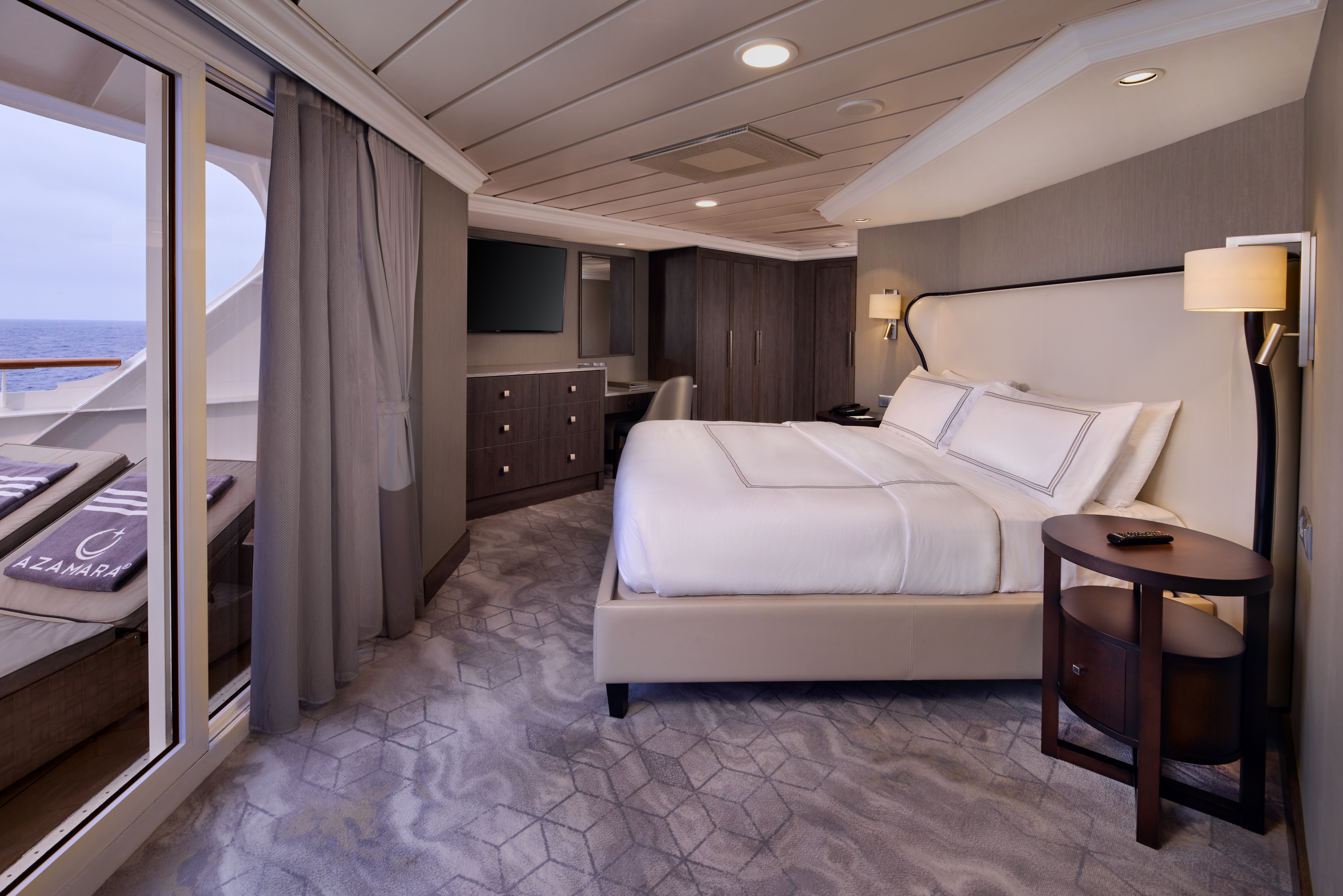
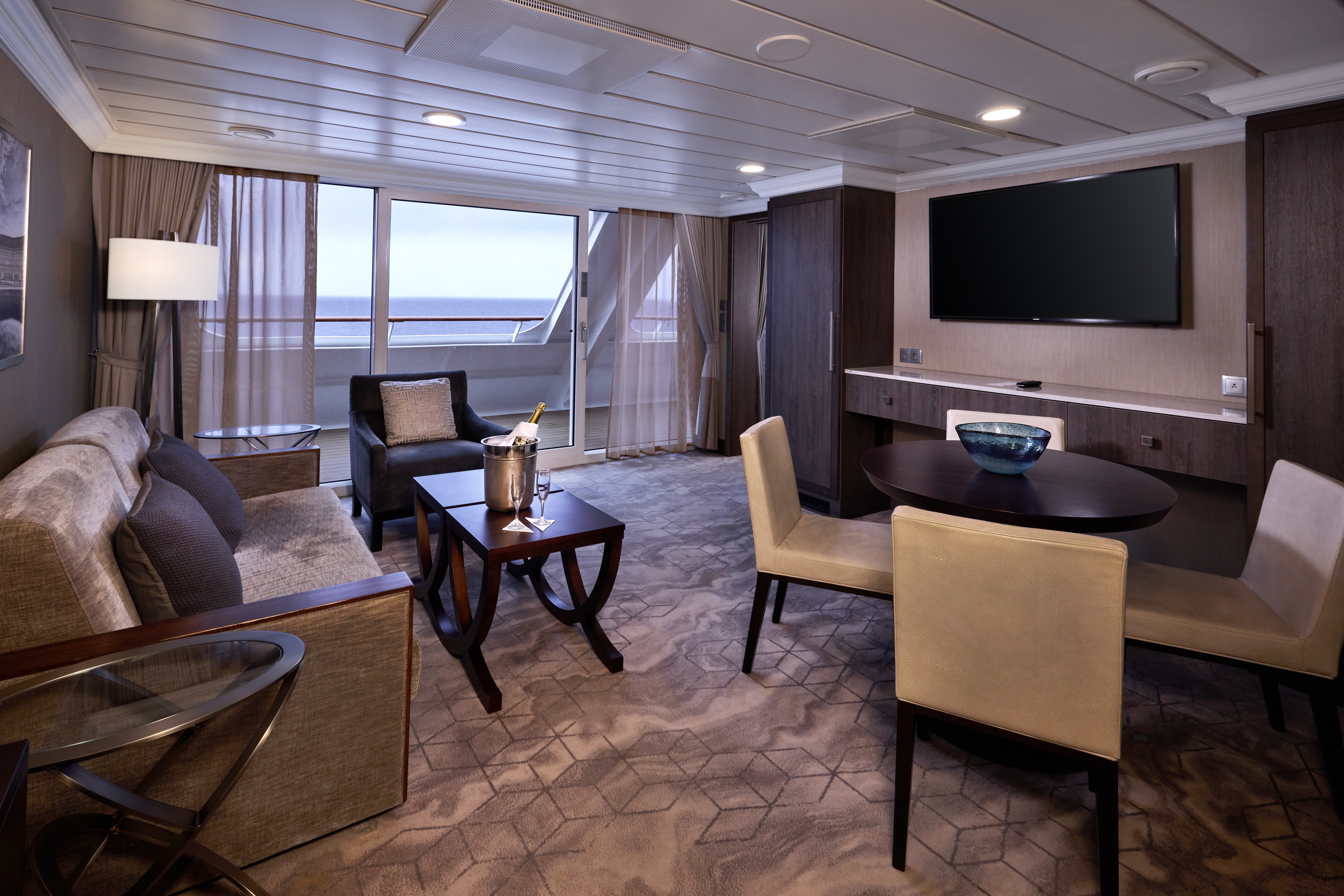
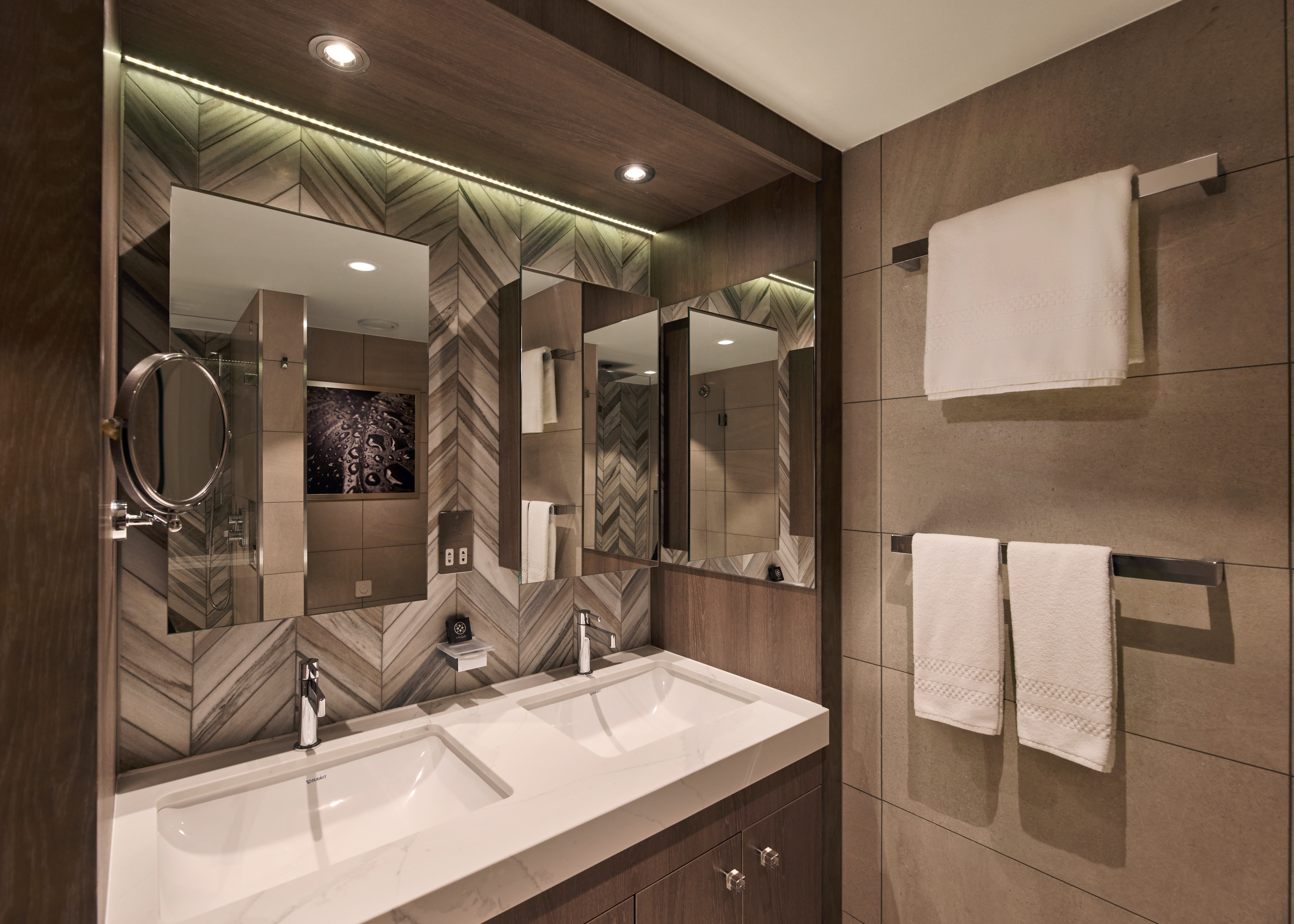
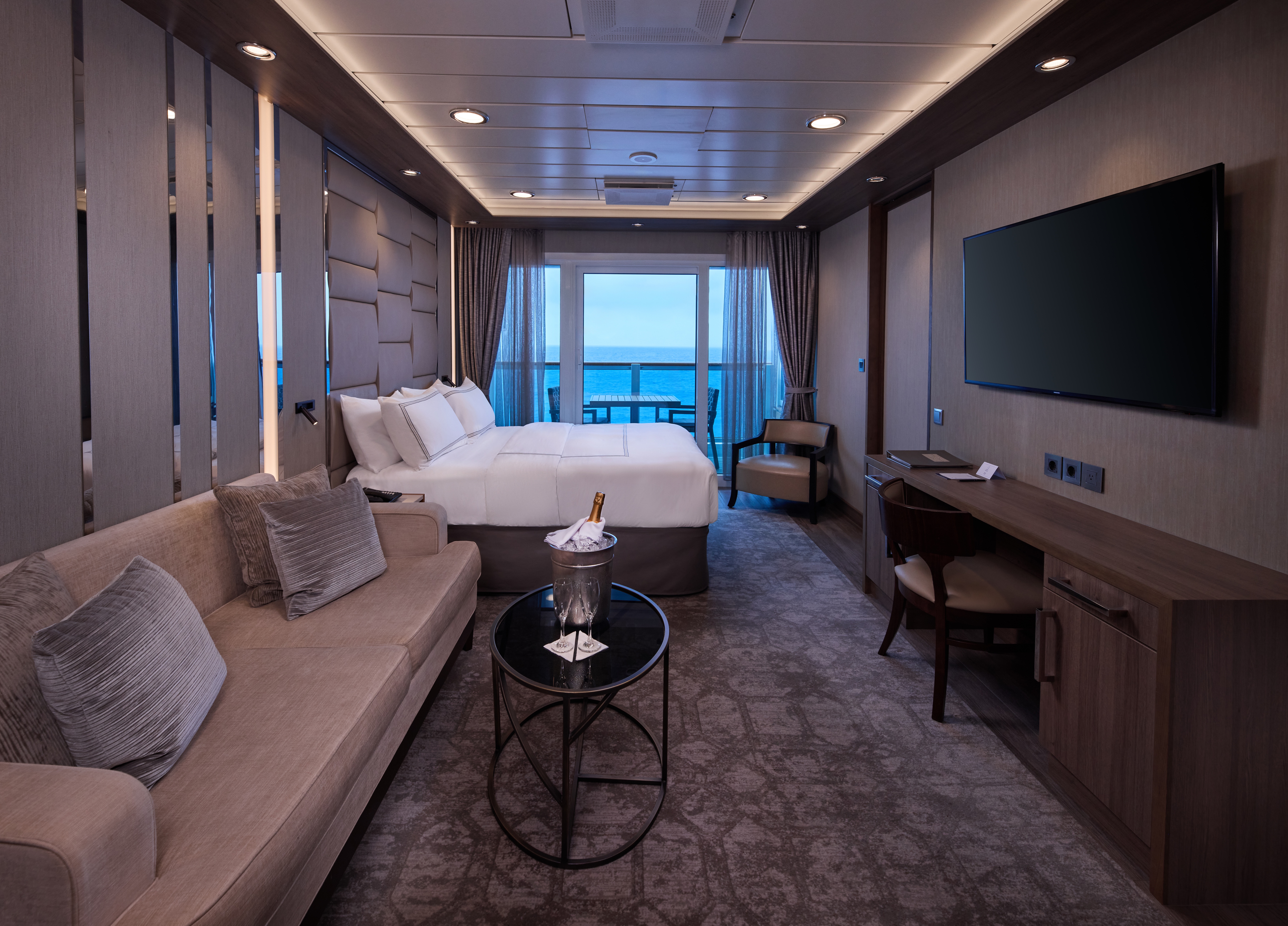
A signature expression of Azamara Cruises’ refined luxury, the World Owner’s Suite features a spacious layout, a separate bedroom, and a large private veranda. Thoughtfully designed for guests who value privacy, comfort, and elevated living.
Suite Features
- Spacious living room with a separate master bedroom
- Master bedroom with one queen size bed and a flat-screen television
- Flat-screen television in living room
- Marble master bathroom with shower. Journey, Onward, and Quest suites feature a tub.
- Dressing room with vanity and ample closet space
- Floor-to-ceiling sliding glass doors in living room and master bedroom
- Mini-bar
- Thermostat-controlled air conditioner
- Direct-dial telephone with voice mail
- Writing desk
- In-room safe
- Hand-held hair dryer
- Stateroom: 560 sq. ft. (52 sq. m.) Veranda: 233 sq. ft. (21.7 sq. m.)
Included Amenities
- Ultimate Beverage Package
- Unlimited Standard Starlink Wi-Fi
- Unlimited Wash and Press
- Dedicated butler and concierge service
- Full in-suite dining and daily evening hors d’oeuvres
- Complimentary Specialty Dining and exclusive breakfast at Aqualina
- In-room premium spirits and champagne
- Thalassotherapy Pool access
- Personalized assistance planning spa appointments and shore excursions
- Priority check-in
- Luxurious cotton bed linens with duvet
- Terry bathrobes
- 24-hour room service
- Tote bag
- Use of umbrella
- Shoeshine service
- Turndown treats
- Afternoon In-Suite Tea Service

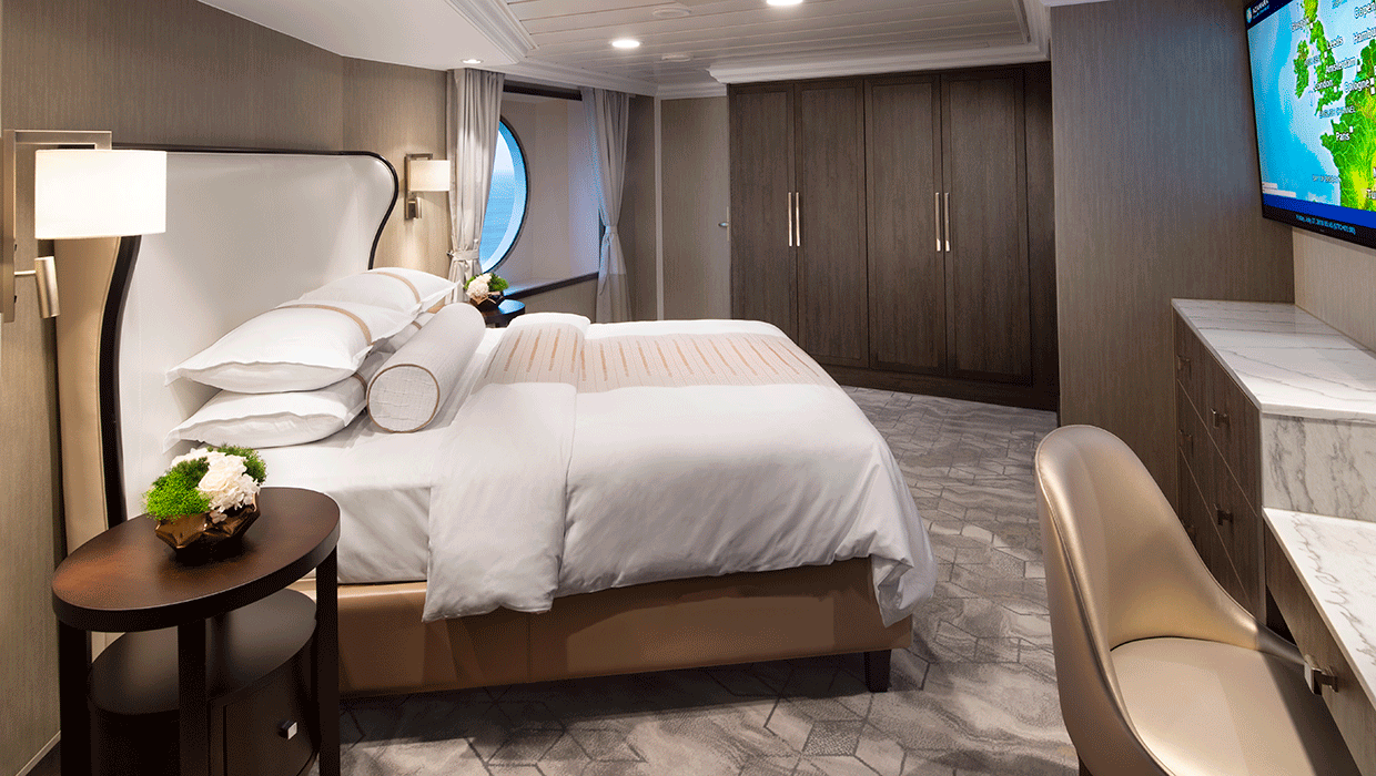
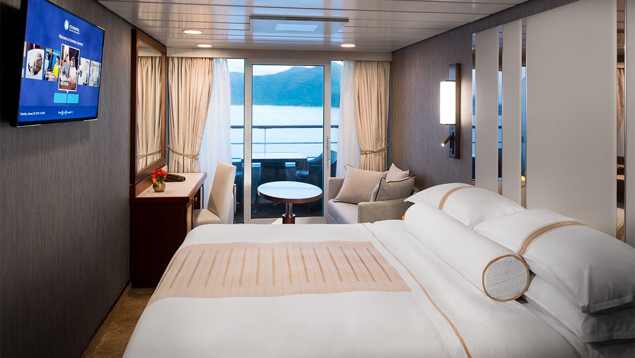
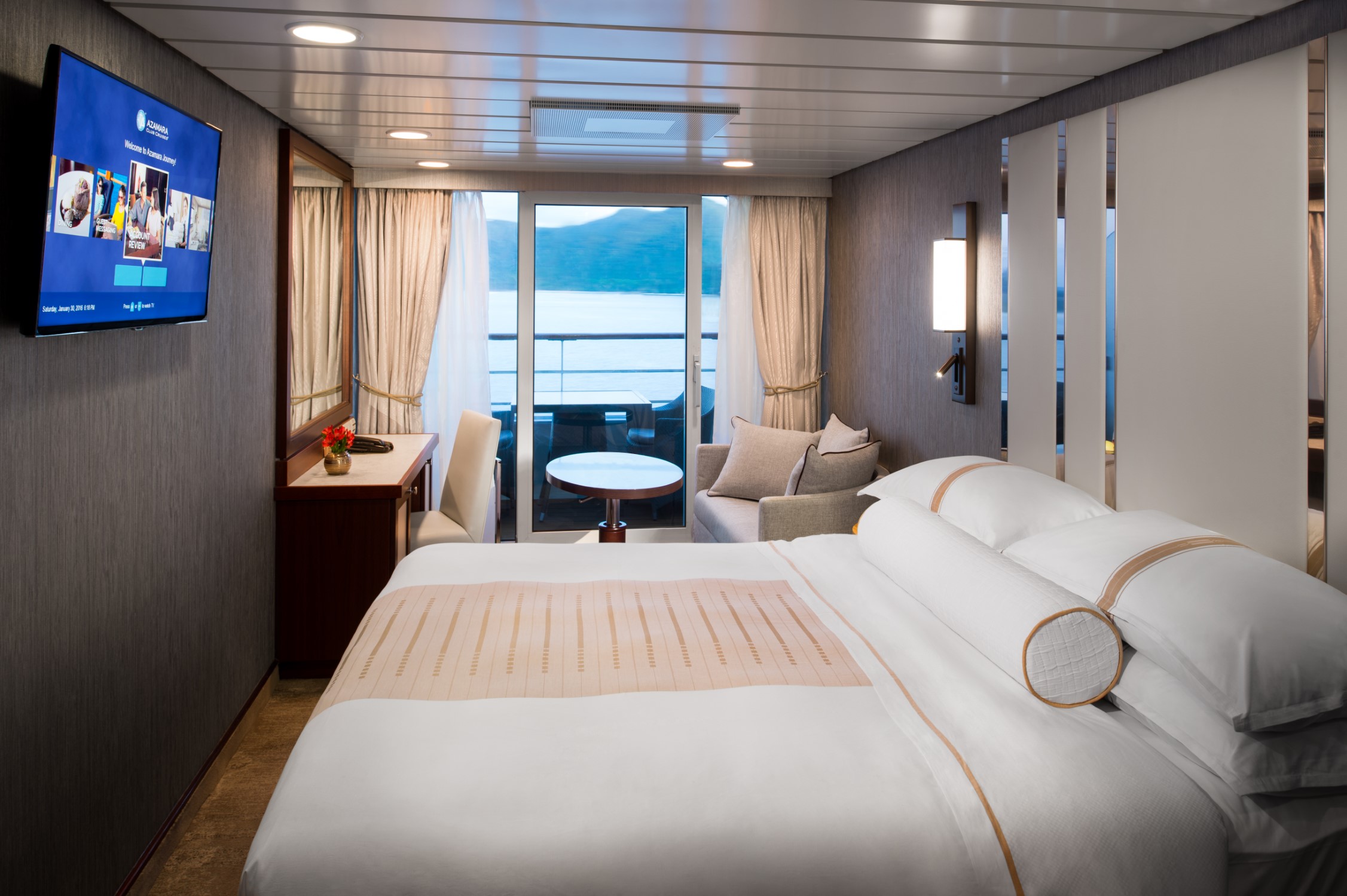
The Ocean Suite offers generous space to relax, with a separate living area, a dedicated bedroom, and a private veranda. An inviting retreat that balances comfort, functionality, and classic suite-style living.
Suite Features
- Spacious living room with a separate master bedroom
- Master bedroom with one queen size bed with a flat-screen television
- Flat-screen television in living room
- Marble master bathroom with shower. Journey and Quest suites feature a tub.
- Dressing room with vanity and ample closet space
- Floor-to-ceiling sliding glass doors in living room and master bedroom
- Mini-bar
- Thermostat-controlled air conditioner
- Direct-dial telephone with voice mail
- Writing desk
- In-room safe
- Hand-held hair dryer
- Stateroom: 440–501 sq. ft. (40.9-46.5 sq. m.) Veranda: 233 sq. ft. (21.7 sq. m.)
Included Amenities
- Ultimate Beverage Package
- Unlimited Standard Starlink Wi-Fi
- Unlimited Wash and Press
- Dedicated butler and concierge service
- Full in-suite dining and daily evening hors d’oeuvres
- Complimentary Specialty Dining and exclusive breakfast at Aqualina
- In-room premium spirits and champagne
- Thalassotherapy Pool access
- Personalized assistance planning spa appointments and shore excursions
- Priority check-in
- Luxurious cotton bed linens with duvet
- Terry bathrobes
- 24-hour room service
- Tote bag
- Use of umbrella
- Shoeshine service
- Turndown treats
- Afternoon In-Suite Tea Service
Designed for relaxation and renewal, the Spa Suite features a spacious layout with spa-inspired touches, including a glass-enclosed soaking tub and convenient access to the spa. A calming retreat ideal for wellness-focused travelers.
Suite Features
- Two lower beds convertible to one queen size bed
- Spacious glass-enclosed bathtub
- Separate rain shower
- Comfortable sitting area
- Flat-screen television in sitting area
- Floor-to-ceiling sliding glass doors
- Veranda
- Mini-bar
- Thermostat-controlled air conditioner
- Direct-dial telephone with voice mail
- Writing desk
- In-room safe
- Hand-held hair dryer
- Stateroom: 414 sq. ft. (38.5 sq. m.) Veranda: 40 sq. ft. (3.7 sq. m.)
Included Amenities
- Ultimate Beverage Package
- Unlimited Standard Starlink Wi-Fi
- Unlimited Wash and Press
- Dedicated butler and concierge service
- Full in-suite dining and daily evening hors d’oeuvres
- Complimentary Specialty Dining and exclusive breakfast at Aqualina
- In-room premium spirits and champagne
- Thalassotherapy Pool access
- Personalized assistance planning spa appointments and shore excursions
- Priority check-in
- Luxurious cotton bed linens with duvet
- Terry bathrobes
- 24-hour room service
- Tote bag
- Use of umbrella
- Shoeshine service
- Turndown treats
- Afternoon In-Suite Tea Service

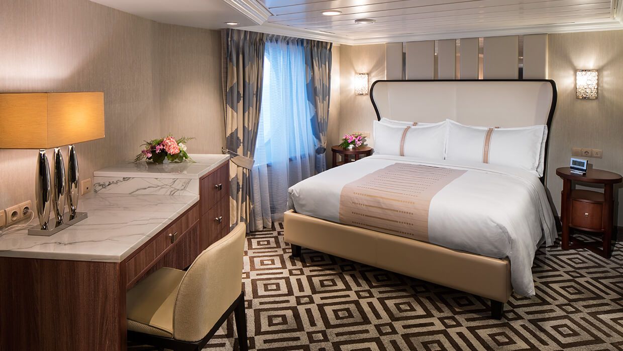
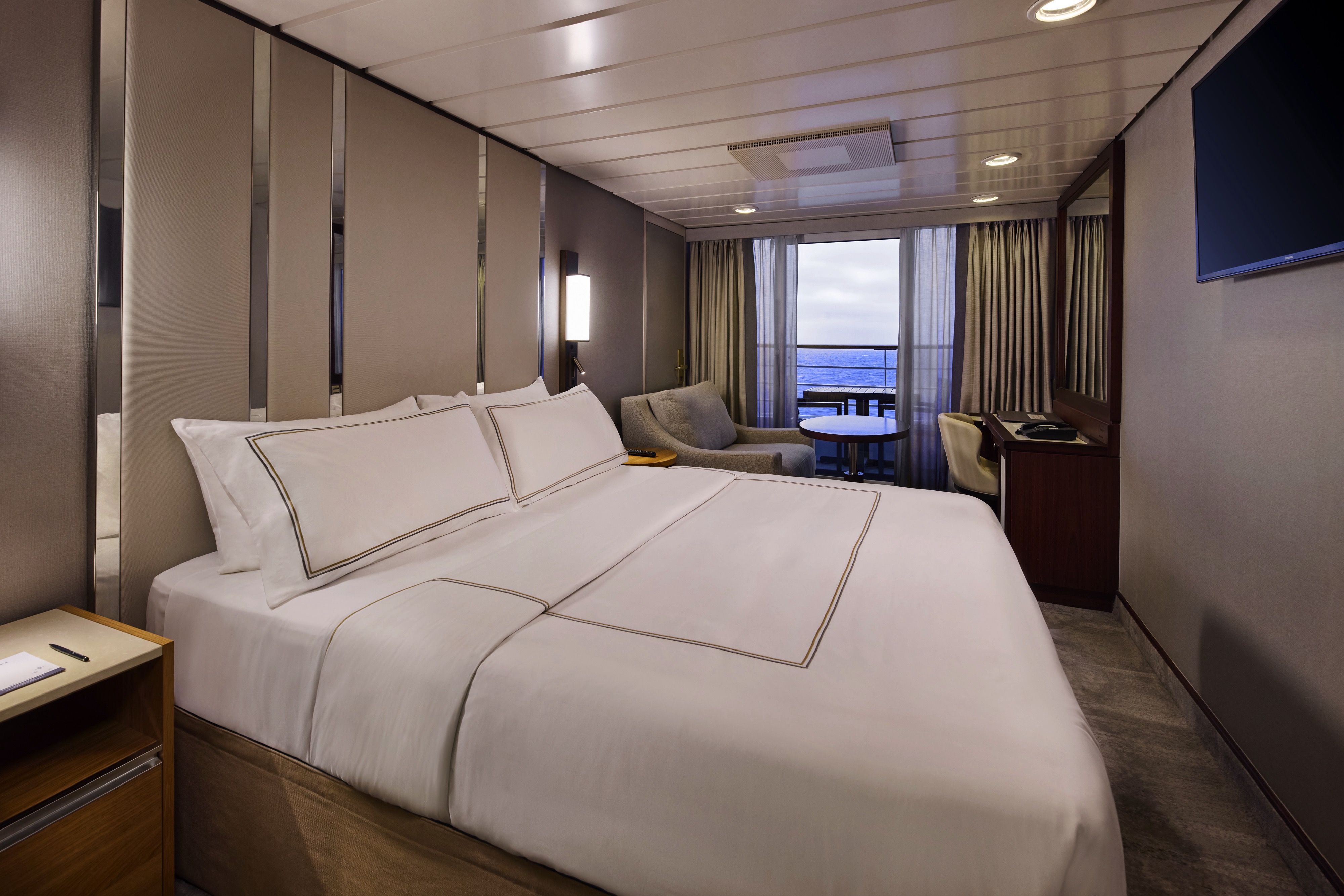
The Continent Suite offers a comfortable and well-appointed space with a private veranda, a welcoming seating area, and a generous bathroom. An inviting option for guests seeking suite-style accommodations with essential comforts.
Suite Features
- Two lower beds convertible to one queen size bed
- Spacious and comfortable seating area
- Flat-screen television in sitting area
- Roomy bathroom with shower. Some also feature a tub.
- Floor-to-ceiling sliding glass doors
- Veranda
- Mini-bar
- Thermostat-controlled air conditioner
- Direct-dial telephone with voice mail
- Writing desk
- In-room safe
- Hand-held hair dryer
- Stateroom: 266 sq. ft. (24.7 sq. m.) Veranda: 60 sq. ft. (5.6 sq. m.)
Included Amenities
- Unlimited Basic Starlink Wi-Fi
- 2 laundry bags (wash and press) per stateroom, per 7 nights
- Dedicated butler and concierge service
- Full in-suite dining and daily evening hors d’oeuvres
- Complimentary Specialty Dining and exclusive breakfast at Aqualina
- In-room premium spirits and champagne
- Thalassotherapy Pool access
- Personalized assistance planning spa appointments and shore excursions
- Priority check-in
- Luxurious cotton bed linens with duvet
- Terry bathrobes
- 24-hour room service
- Tote bag
- Use of umbrella
- Shoeshine-service
- Turndown treats
- Afternoon In-Suite Tea Service


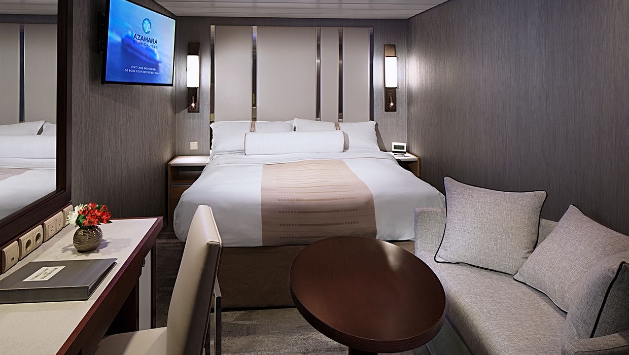
The suite offers generous space to relax, with a separate living area, a dedicated bedroom, and a private veranda. An inviting retreat that balances comfort, functionality, and classic suite-style living.
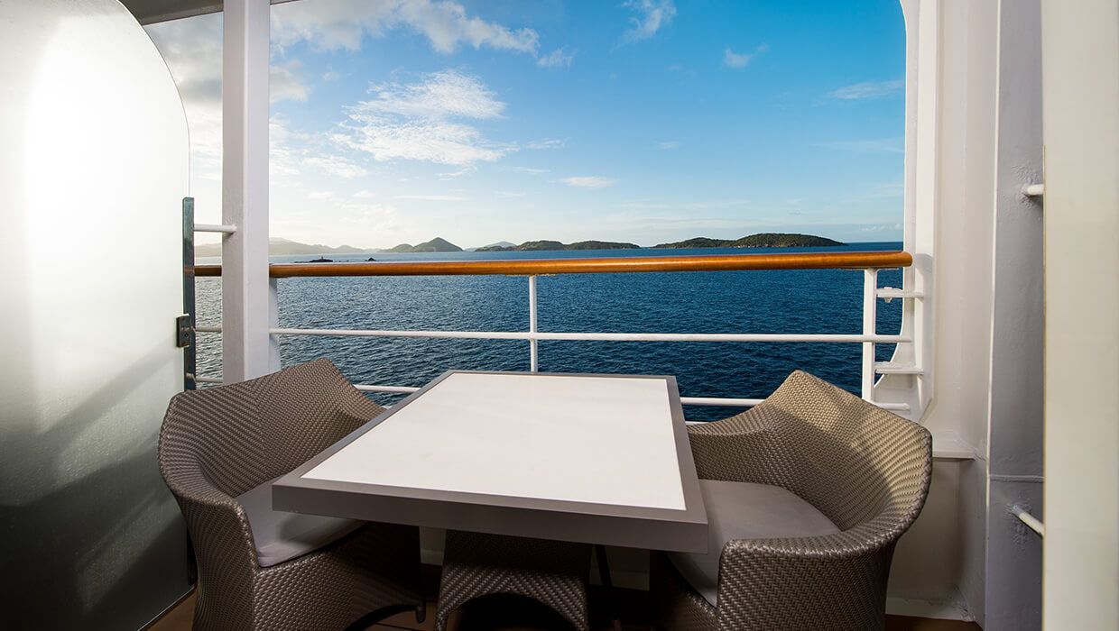
Enjoy open-air living with sweeping ocean and destination views, plus added perks designed to elevate your onboard experience. It’s everything you love about a Veranda Stateroom, with a little extra—at exceptional value.
Stateroom Features
- Veranda
- Two lower beds convertible to one Queen size bed
- Sitting area with flat-screen TV
- Mini-bar
- Thermostat-controlled air conditioner
- Direct-dial telephone with voice mail
- Writing desk
- In-room safe
- Hand-held hairdryer
- USB ports under bedside reading lamps
- Stateroom: 175 sq. ft. (16.3 sq. m.) | Veranda: 46–64 sq. ft. (4.3-6 sq. m.)
Included Stateroom Amenities
- Complimentary AzAmazing Evenings® event (on most voyages)
- Gratuities
- Luxurious cotton bed linens with duvet
- Terry bathrobes and slippers
- Select standard spirits, international beers and wine
- 24-hour room service
- Bottled water, soft drinks, specialty coffees and teas
- Self-service laundry
- Tote bag
- Shuttle service to and from port communities, wher
- Use of umbrella
- Concierge services for personal guidance and reservations
- Shoe shine-service
- Turndown treats
- Daily news bulletin
- Complimentary Internet (120 minutes or 25% off the unlimited internet package) per guest
- One free bag of laundry service per stateroom, every seven days
- One night of complimentary specialty dining for two, every seven days
- Priority embarkation and debarkation
- Complimentary in-room spirits
Enjoy open-air living with sweeping ocean and destination views, plus added perks designed to elevate your onboard experience. It’s everything you love about a Veranda Stateroom, with a little extra—at exceptional value.
Step outside to your private veranda and take in fresh sea breezes and ever-changing views. Thoughtful design, polished finishes, and attentive service create a relaxing retreat between immersive days ashore.
Stateroom Features
- Veranda
- Two lower beds convertible to one Queen size bed
- Sitting area with flat-screen TV
- Refrigerator with mini-bar
- Thermostat-controlled air conditioner
- Direct-dial telephone with voicemail
- Writing desk
- In-room safe
- Hand-held hairdryer
- USB ports under bedside reading lamps
- Stateroom: 175 sq. ft. (16.3 sq. m.) | Veranda: 40 sq. ft. (3.7 sq. m.)
Included Stateroom Amenities
- Complimentary AzAmazing Evenings® event (on most voyages)
- Luxurious cotton bed linens with duvet
- Gratuities
- Terry bathrobes
- Select standard spirits, international beers and wine
- 24-hour room service
- Self-service laundry
- Tote bag
- Shuttle service to and from port communities, where available
- Use of umbrella
- Concierge services for personal guidance and reserervations
- Shoe shine-service
- Turndown treats
- Daily news bulletin
Step outside to your private veranda and take in fresh sea breezes and ever-changing views. Thoughtful design, polished finishes, and attentive service create a relaxing retreat between immersive days ashore.
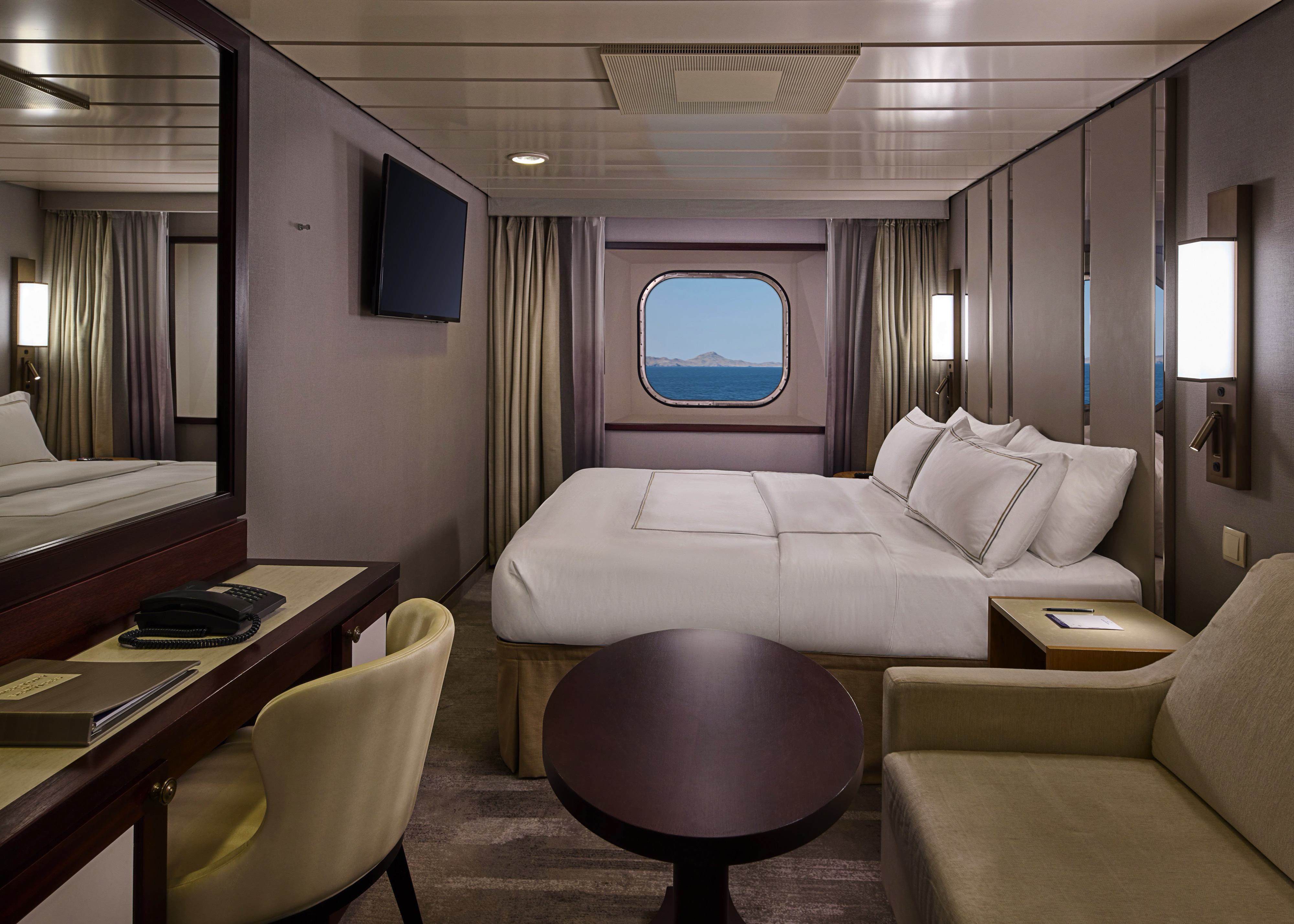
Wake up to natural light and picturesque ocean views from your window. Featuring contemporary design and well-appointed comforts, these staterooms offer a serene and stylish place to unwind at sea.
Stateroom Features
- Two lower beds convertible to one Queen size bed
- Some staterooms feature sofa bed
- Flat-screen TV
- Refrigerator with mini-bar
- Thermostat-controlled air conditioner
- Direct-dial telephone with voicemail
- Writing desk
- In-room safe
- Hand-held hairdryer
- USB ports under bedside reading lamps
- 143 sq. ft. (13.3 sq m)
Included Stateroom Amenities
- Complimentary AzAmazing Evenings® event (on most voyages)
- Gratuities
- Luxurious cotton bed linens with duvet
- Terry bathrobes and slippers
- Select standard spirits, international beers and wine
- 24-hour room service
- Bottled water, soft drinks, specialty coffees and teas
- Self-service laundry
- Tote bag
- Shuttle service to and from port communities, wher
- Use of umbrella
- Concierge services for personal guidance and reservations
- Shoe shine-service
- Turndown treats
Wake up to natural light and picturesque ocean views from your window. Featuring contemporary design and well-appointed comforts, these staterooms offer a serene and stylish place to unwind at sea.
A quiet, comfortable retreat designed for restful nights and relaxing moments between adventures. With refined décor, plush amenities, and personalized service, it’s boutique-hotel comfort at sea.
Stateroom Features
- Two lower beds convertible to one Queen size bed
- Flat-screen television
- Refrigerator with mini-bar
- Thermostat-controlled air conditioner
- Direct-dial telephone with voicemail
- Writing desk
- In-room safe
- Hand-held hairdryer
- USB ports under bedside reading lamps
- Stateroom: 158 sq. ft. (14.7 sq. m.)
Included Stateroom Amenities
- Complimentary AzAmazing Evenings® event (on most voyages)
- Gratuities
- Luxurious cotton bed linens with duvet
- Terry bathrobes and slippers
- Select standard spirits, international beers and wine
- 24-hour room service
- Bottled water, soft drinks, specialty coffees and teas
- Self-service laundry
- Tote bag
- Shuttle service to and from port communities, wher
- Use of umbrella
- Concierge services for personal guidance and reservations
- Shoe shine-service
- Turndown treats
- Daily news bulletin
A quiet, comfortable retreat designed for restful nights and relaxing moments between adventures. With refined décor, plush amenities, and personalized service, it’s boutique-hotel comfort at sea.

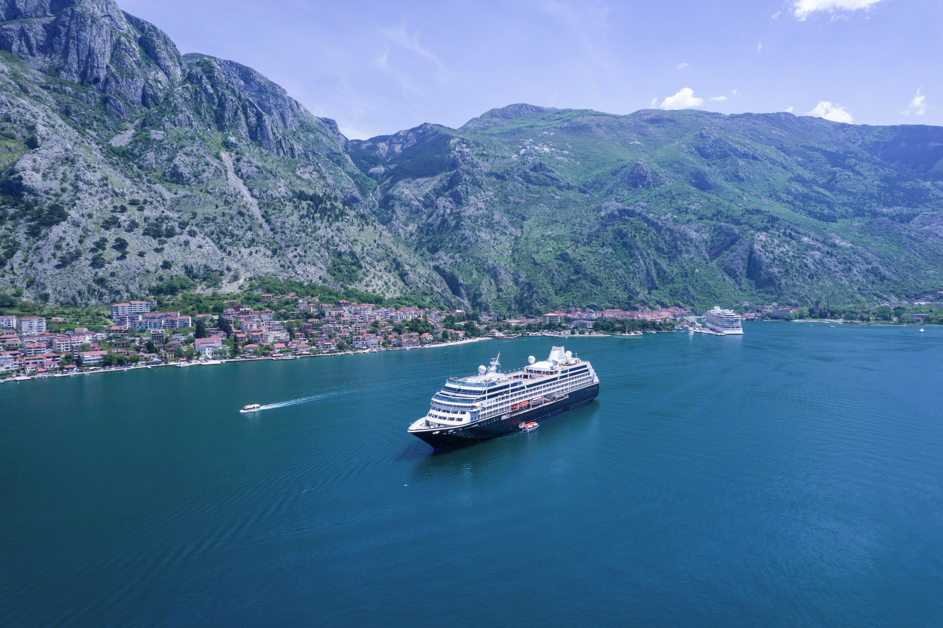
Azamara Onward
Built to cross oceans, cruise along scenic waterways and dock at locations larger ships can’t access — this small ship cruising experience is unlike any other.
Ship Facts
| Launch Year | 1999 | ||||||||||
| Refit Year | 2022 | ||||||||||
| Language | en | ||||||||||
| Gross Tonnage | 30277 | ||||||||||
| Length | 180 | ||||||||||
| Width | 25 | ||||||||||
| Currency | USD | ||||||||||
| Speed | 19 | ||||||||||
| Capacity | 692 | ||||||||||
| Crew Count | 375 | ||||||||||
| Deck Count | 11 | ||||||||||
| Cabin Count | 338 | ||||||||||
| Large Cabin Count | N/A | ||||||||||
| Wheelchair Cabin Count | 5 | ||||||||||
| Electrical Plugs |
|
Deck 11
- Shuffle Board
- Sun Deck

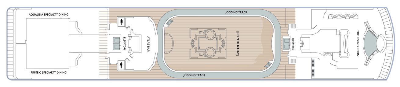
Deck 10
- The Living Room
- Card Room
- In Touch
- Elevators
- Table Tennis
- Jogging Track
- Atlas Bar
- Aqualina Specialty Dining
- Prime C Specialty Dining
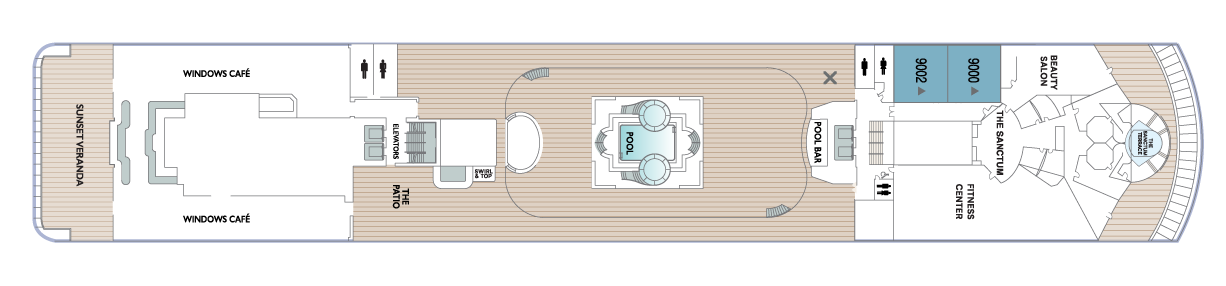
Deck 9
- Club Spa Suites
- The Patio
- Swirl & Top
- Windows Café
- Sunset Veranda
- Pool
- Pool Bar
- Fitness Centre
- Beauty Salon
- The Sanctum Terrace
- The Sanctum
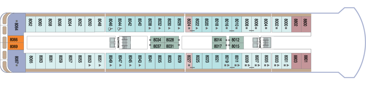
Deck 8
- Veranda Plus Staterooms
- World Owner's Suite
- Continent Suite (x2 Accessible Staterooms)
- Interior
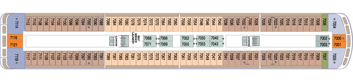
Deck 7
- World Owner's Suite
- Ocean Suite
- Veranda Staterooms
- Oceanview Staterooms
- Interior Staterooms
- Veranda Plus Staterooms
- Self Service Laundry
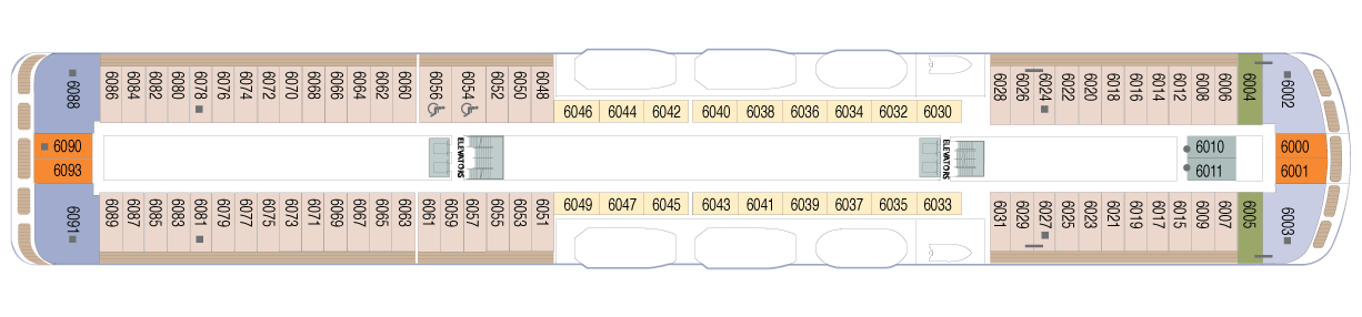
Deck 6
- Veranda Plus Staterooms
- Veranda Staterooms (x2 Accessible Staterooms)
- World Owner's Suite
- Continent Suite
- Ocean Suite
- Oceanview Staterooms
- Interior Staterooms
Deck 5
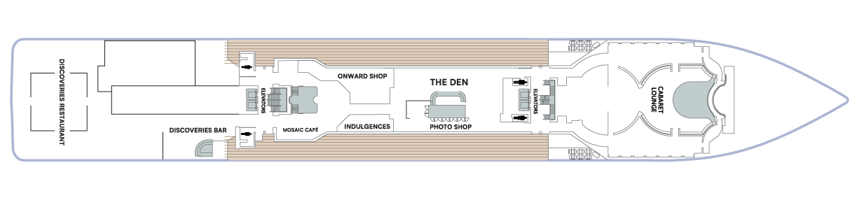
- Cabaret Lounge
- The Den
- Photo Shop
- Onward Shop
- Indulgences
- Mosaic Café
- Discoveries Bar
- Discoveries Restaurant
Deck 4
- Medical Facility
- Guest Relations
- Concierge
- Oceanview Staterooms
- Interior Staterooms (x3 Accessible Staterooms)

Azamara offers a choice of six distinctive dining options, including room service. Whether you’re a fan of haute cuisine or down-home cooking, expect the same delicious quality. Bon appétit! Buon appetito! ¡Buen provecho! No matter how you say it, you’re in for a real treat.
Pre-Cruise Specialty Dining Reservations
All guests can now book pre-cruise reservations for Prime C, Aqualina, or Chef’s Table—our most sought-after specialty dining experiences.
Priority Access
Pre-cruise dining reservations open 150 days before sailing for suite guests and Azamara Circle Discoverer-level and above. All other guests may begin booking 140 days prior.
Aqualina
At Aqualina, you’ll find some of Italy’s most authentic dishes. Pastas made from scratch, traditional recipes, and scrumptious vegetarian dishes that make sure there’s something for everyone. Plus our famous desserts: Sorrento lemon liqueur mousse, hazelnut chocolate soufflé and more.
Prime C
Your choice of steak, cooked to perfection. Herb-coated rack of lamb, duck confit and Chilean sea bass—all paired with savory sides. At Prime C, you’re in for more than delectable dining. Expect a great evening with stunning views and lush décor.
Discoveries Restaurant
Discover the world through dishes and flavors from the places we visit. Of course, you’ll also enjoy a wide variety of nightly selections such as filet mignon with black truffle sauce. Choose being seated at a table for two or as part of a larger group of fellow guests.
The Patio and Swirl & Top
Casual “pool grill” by day. A sit-down al fresco dining experience by night. Taste your way around the world with exclusive personalized dishes using local flavors of the places we visit. Plus a self-serve frozen yogurt station—Swirl & Top. With a variety of flavors and your choice of toppings, it’s the perfect way to cool off.
Windows Café
Our daily themed dinner often takes its inspiration from the region we’re visiting—Indian, Mexican, Spanish, Italian. We also create an extra live station made from local ingredients purchased in port: Greek salad made with local feta (Greece), pasta prepared with local mushrooms (Italy), fresh Mussels served with garlic bread (Netherlands).
Mosaic Café
Stylish and cozy, Mosaic offers your favorite coffee drinks exactly as you like them. Relax in a comfortable seat and enjoy. It’s the perfect spot to start or end your day, and it just might become your favorite place on the ship.
Room Service
The best time for room service? Whenever you say it is, 24-hours a day. Order from the full breakfast menu between 6:30 AM and 10:00 AM, and we’ll deliver at your appointed time. Lunch and dinner room service features a menu of hearty soups, fresh salads, gourmet sandwiches, pizzas and desserts.
Sit back and enjoy your evenings on a high note with our onboard entertainment. From local cultural shows to our playbill that features a variety of amazing performances to keep you entertained while onboard.
Bars, Lounges & Gathering Spots
A cozy nook to sip coffee. An intimate space to raise a glass and celebrate. A lively setting to catch the latest shows and international entertainment. Watch the world go by, drink in hand from any of Azamara’s bars, lounges, and gathering spaces.
Club Crooner
Step into a swanky nightclub as the great songs of the most magnificent artists come alive on stage. From classic crooners such as Frank Sinatra and Tony Bennett, to current songbirds such as Natalie Cole and Michael Bublé, there’s a song for every time and everyone. Enjoy a beverage, sit back, and be serenaded by the melodies of our lives with CLUB CROONER!
White Night
Join Azamara officers and crew for our signature dinner and entertainment event hosted al fresco on the pool deck (weather permitting). With an array of delicious food and engaging entertainment, your White Night experience will almost certainly be one of the most memorable times from your cruise. And don’t forget to bring something white to wear for the evening.
Atlas Bar
Atlas Bar is a unique concept offering artisanal cocktails created using the latest one-of-a-kind techniques. These crafted beverages are as delightful to drink as they are to watch being made! In addition, an exotic menu of small plates, both hot and cold, are offered.
The Living Room
The idea of the Living Room is just that. To “live in” and to enjoy time with friends and fellow guests! Much of the room is furnished as a living room, with clusters of large comfortable chairs and sofas....
The Den
By day, The Den is a cozy, inviting space perfect for planning your next adventure—home to the Cruise Again desk and photo gallery, and filled with destination inspiration. By night, it transforms into a lively piano bar with craft cocktails, a talented live pianist, and a warm, social atmosphere. Whether you're mapping out future travels or enjoying the music with a nightcap in hand, The Den is where stories begin, and where many guests return night after night.
Discoveries Lounge
This congenial bar is a favorite gathering place for great conversations and delicious drinks. Bar service includes a full selection of fine wines, mixed drinks, and premium spirits…plus the entertaining banter of Azamara’s friendly bartenders.
Cabaret Lounge
Enjoy live performances of professional full-stage musical revues, classical soloists, bands and other entertainment in a cabaret nightclub with a full bar and cozy tables.
Sunset Bar
Adjacent to Windows Café, the Sunset Bar is a welcoming outdoor patio with covered and open-air seating, and a bar. It's the perfect place for dining alfresco, enjoying a refreshing drink, taking in the sights of your favorite port, or simply watching the world sail by.
Mosaic Café & Mosaic @ Night
Our onboard coffee corner may very well become your favorite nook on the ship. With elegant and comfortable furniture, it's bound to be one of the the most stylish places, too. Find all your favorite coffee drinks crafted just the way you like. Slip right into a comfortable seat and sip for a while—you never know who'll walk by.
The Drawing Room
This library is one of the quiet jewels of Azamara, a peaceful and beautifully appointed space for reading or relaxing after dinner. Browse the collection and feel free to borrow the library books. Or simply relax in the tranquil atmosphere.
Pool Bar
Our Pool Bar serves refreshments while enjoying the Pool during the day, and cocktails of your choice in the evening.
The Pool
While spending daytime sun-drenched and relaxed by the pool, don’t think of missing Azamara’s famous White Night party held at least once on every cruise (weather permitting). Colourful décor and linen-draped tables, a fabulous buffet feast, and boutique wines on the house make this an event like no other. Not to forget the fun and fast-paced show our entertainment team puts on.
Performances
Oh, What A Night
Get ready to be transported to the world’s most beloved travel destinations in one exhilarating night. As we explore all four seasons in a new city, travel along with our dynamic Signature Singers & Dancers as they sing and dance their way through an eclectic mix of music from around the world. Come and experience Oh, What A Night!
Amped Up!
The sounds of the 70’s is happening on Azamara! An all new, edgy, and fun evening full of classic rock hits! From David Bowie to Heart, Queen to Pat Benatar, this night is sure to strike a chord and have you on your feet! Don’t miss our Signature Singers & Dancers as they present AMPED UP!
Groove Tonight
Get ready to groove as we take you on a journey that is ALL disco, ALL the time! The stage is set, and the mirror ball is illuminated as we feature far out fashions, a retro club, and an out of sight, psychedelic soundtrack that will have every Casanova and Disco Diva on their feet! Put on your platforms and leisure suit and meet our Signature Singers & Dancers on the dance floor as we get ready to GROOVE TONIGHT!
The Ship Shop
Pick up sundries, casual wear and swim fashions, sunglasses, accessories, music and shipboard keepsakes. This is a great place for small gifts to take back home.
Indulgences
Aptly named, Indulgences will satisfy your desires for the finer things in life. If you are looking for designer jewellery, it's the perfect place to window shop or to find that extra special purchase.
Photo Shop
Our photographers capture both fun and professional photos throughout the voyage, whether it is your portrait, or photos of the destinations you visit. You can also find an assortment of supplies for your own photographic endeavours.