Eastern Caribbean Cruise: San Juan, St. John's & Bridgetown
Eastern Caribbean Cruise: San Juan, St. John's & Bridgetown
Cruise overview
WHY BOOK WITH US?
- ✔ The Deluxe Cruises’ team has extensive experience in ultra-luxury cruising.
- ✔ Call now to speak to our helpful and experienced Cruise Concierge team.
- ✔ Enjoy our Unique Deluxe Cruises Bonus for substantial savings.
- ✔ Our team will tailor your holiday to your exacting requirements.
- ✔ As agents, we work under the protection of each cruise lines ABTA / ATOL licences
About San Juan (Puerto Rico)
If you associate Puerto Rico's capital with the colonial streets of Old San Juan, then you know only part of the picture. San Juan is a major metropolis, radiating out from the bay on the Atlantic Ocean that was discovered by Juan Ponce de León. More than a third of the island's nearly 4 million citizens proudly call themselves sanjuaneros. The city may be rooted in the past, but it has its eye on the future. Locals go about their business surrounded by colonial architecture and towering modern structures.By 1508 the explorer Juan Ponce de León had established a colony in an area now known as Caparra, southeast of present-day San Juan. He later moved the settlement north to a more hospitable peninsular location. In 1521, after he became the first colonial governor, Ponce de León switched the name of the island—which was then called San Juan Bautista in honor of St. John the Baptist—with that of the settlement of Puerto Rico ("rich port").Defended by the imposing Castillo San Felipe del Morro (El Morro) and Castillo San Cristóbal, Puerto Rico's administrative and population center remained firmly in Spain's hands until 1898, when it came under U.S. control after the Spanish-American War. Centuries of Spanish rule left an indelible imprint on the city, particularly in the walled area now known as Old San Juan. The area is filled with cobblestone streets and brightly painted, colonial-era structures, and its fortifications have been designated a UNESCO World Heritage Site.Old San Juan is a monument to the past, but most of the rest of the city is planted firmly in the 21st century and draws migrants island-wide and from farther afield to jobs in its businesses and industries. The city captivates residents and visitors alike with its vibrant lifestyle as well as its balmy beaches, pulsing nightclubs, globe-spanning restaurants, and world-class museums. Once you set foot in this city, you may never want to leave.

About Charlotte Amalie
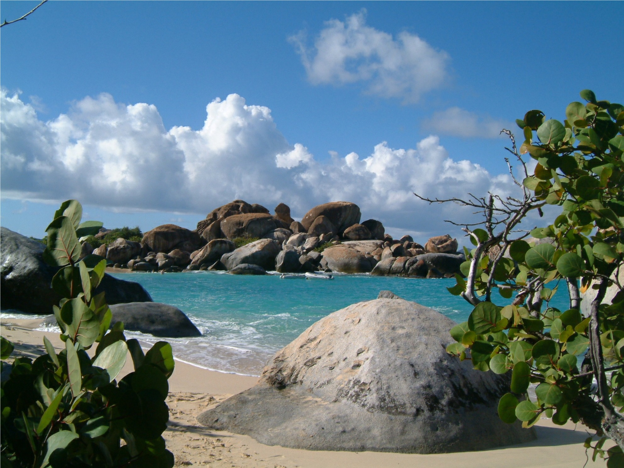
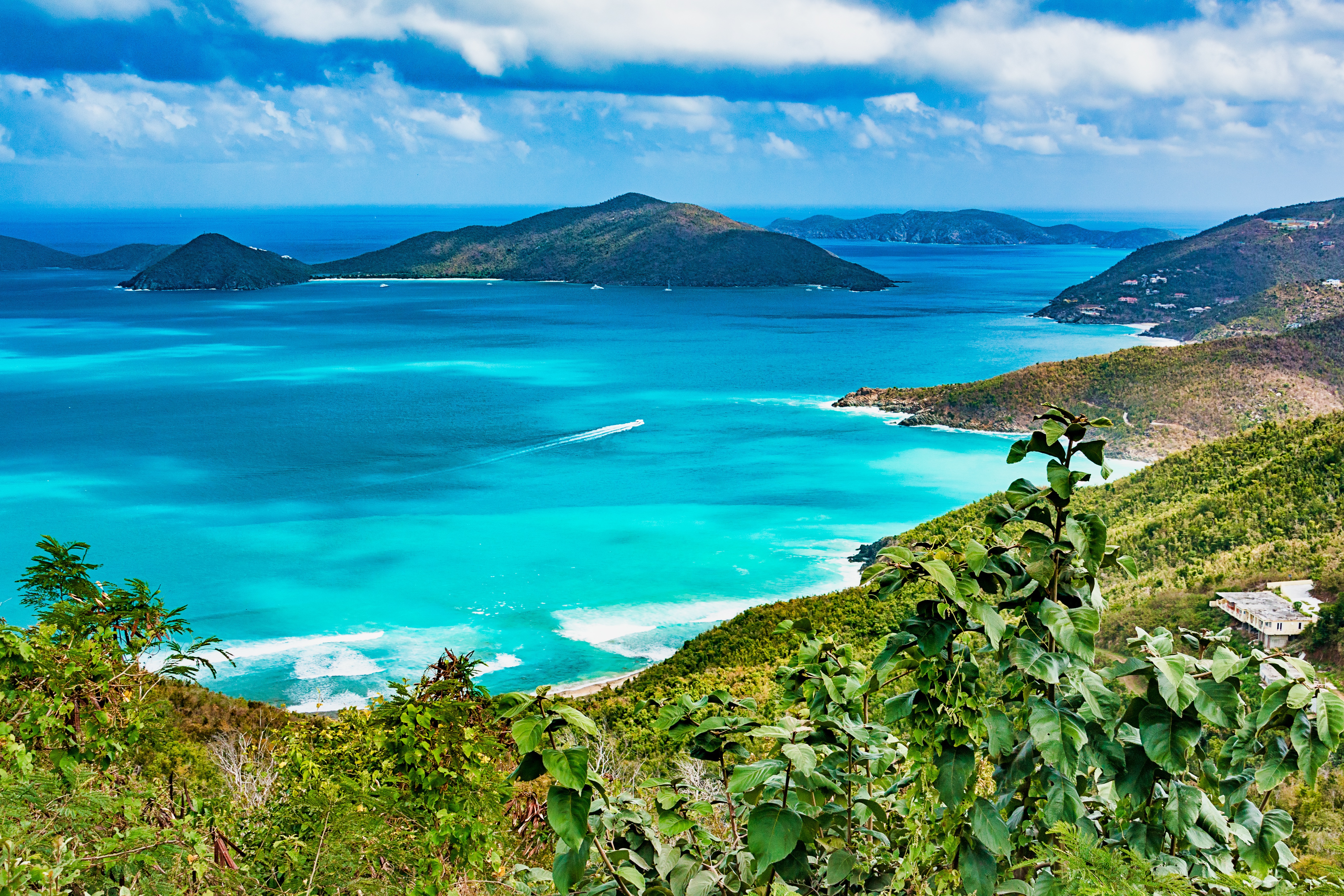
About Virgin Gorda
About Saint John's
With its superb beaches, historical attractions and beautiful coral reefs, Antigua provides a host of diversions. It is said that the island contains 365 beaches, one for every day of the year. Antigua maintains its traditional West Indian character, with gingerbread-house style architecture, calypso music and carnival festivities. St John’s has been the administrative capital since the island’s colonisation in 1632, and has been the seat of government since it gained independence in 1981. From the port you can explore the colourful Redcliffe district, with its restored wooden houses, and Heritage Quay with its shopping mall and craft shops. The city has some fine examples of Colonial architecture, including the twin-towered cathedral, built in 1845 and considered one of the finest church buildings in the Caribbean. All coaches in Antigua are operated by smaller vehicles, and commentary will be given by a driver/guide.
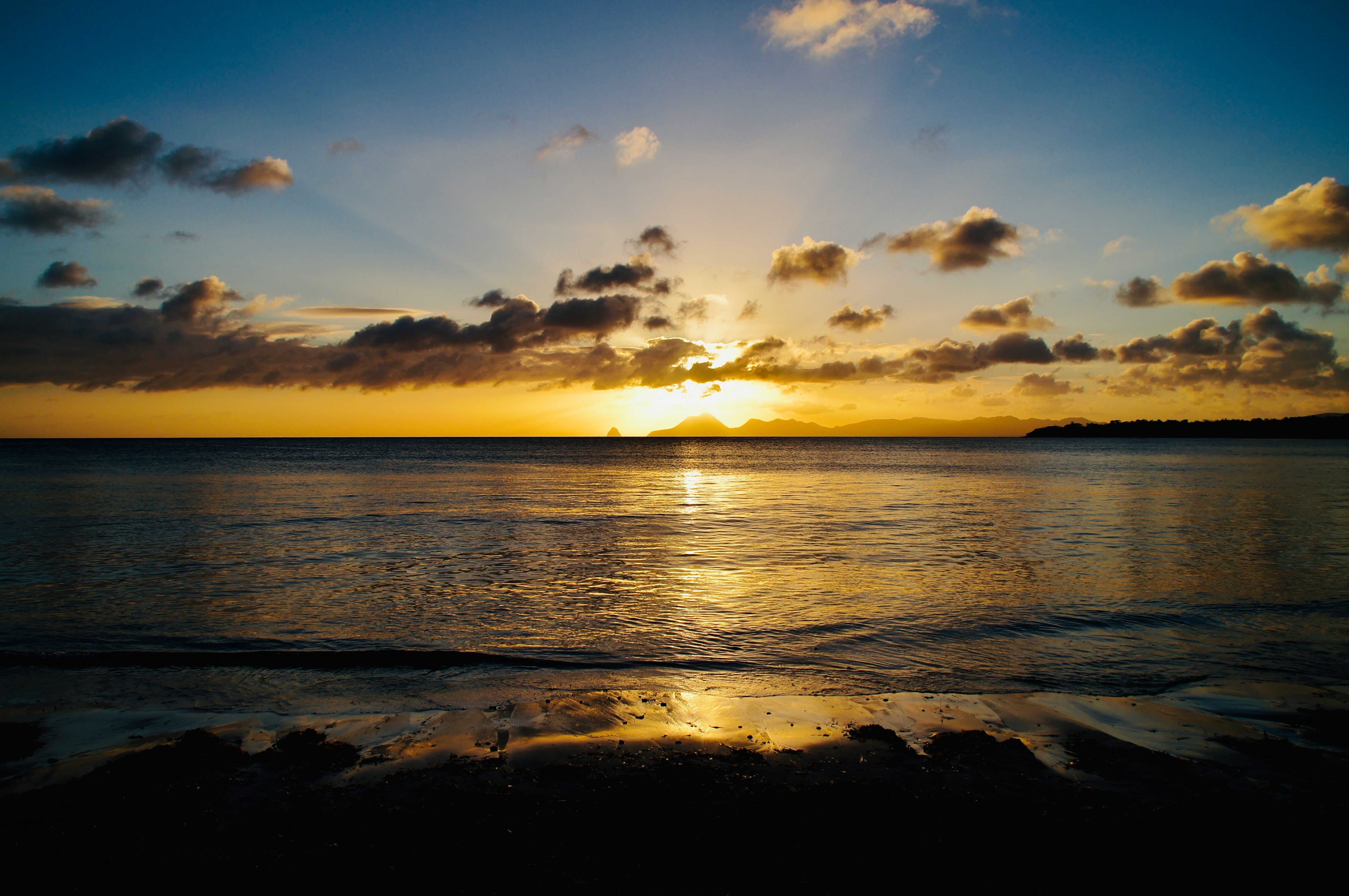
About Saint Pierre
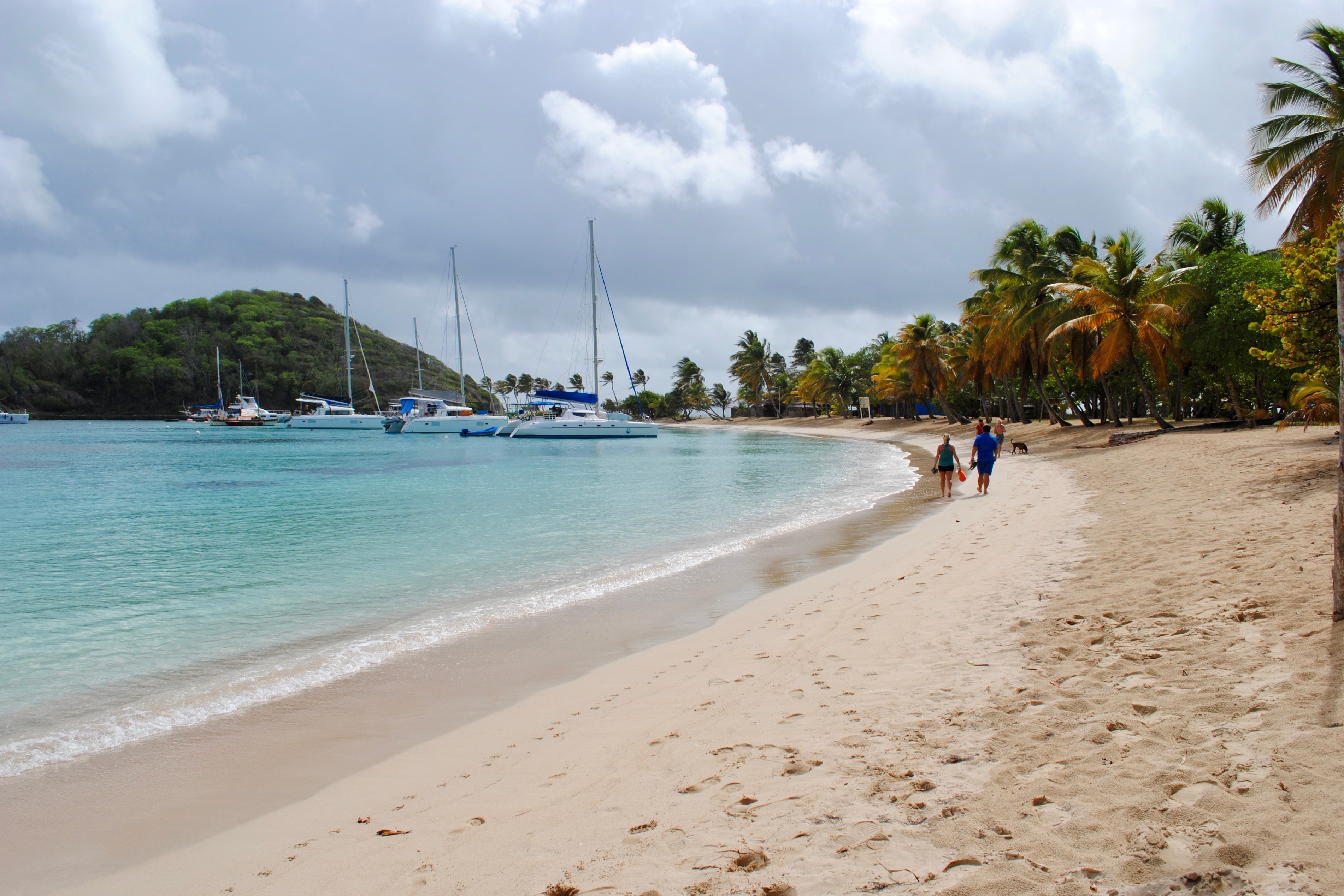
About Port Elizabeth, Bequia
Bequia is a Carib word meaning "island of the cloud." Hilly and green with several golden-sand beaches, Bequia is 9 miles (14½ km) south of St. Vincent's southwestern shore; with a population of 5,000, it's the largest of the Grenadines. Although boatbuilding, whaling, and fishing have been the predominant industries here for generations, sailing has now become almost synonymous with Bequia. Admiralty Bay is a favored anchorage for both privately owned and chartered yachts. Lodgings range from comfortable resorts and villas to cozy West Indian—style inns. Bequia's airport and the frequent ferry service from St. Vincent make this a favorite destination for day-trippers, as well. The ferry docks in Port Elizabeth, a tiny town with waterfront bars, restaurants, and shops where you can buy handmade souvenirs—including the exquisitely detailed model sailboats that are a famous Bequia export. The Easter Regatta is held during the four-day Easter weekend, when revelers gather to watch boat races and celebrate the island's seafaring traditions with food, music, dancing, and competitive games.To see the views, villages, beaches, and boatbuilding sites around Bequia, hire a taxi at the jetty in Port Elizabeth. Several usually line up under the almond trees to meet each ferry from St. Vincent.
About Scarborough
Together, the islands of Trinidad and Tobago make up a state and as such are an independent member of the British Commonwealth. Located just off the coast of Venezuela, both islands are excellent getaways offering different attractions. While Trinidad pulses with life, the smaller and unspoiled island of Tobago is the place for a restful and relaxing holiday. Most of its appeal lies in the beautiful scenery and the availability of outdoor activities. The tourist area is concentrated on the southwestern end, about six miles from the island’s capital of Scarborough. The recently completed deep water harbor with its new cruise terminal has helped to spruce up the town a bit. Although not warranting an extended visit, Scarborough features interesting Botanic Gardens, a few historical buildings and the well-maintained Fort King George, located above the town. The primary appeal, however, lies without doubt in the great outdoors - swimming, snorkeling, diving, fishing, golfing, playing tennis or simply relaxing on Tobago's glorious beaches.
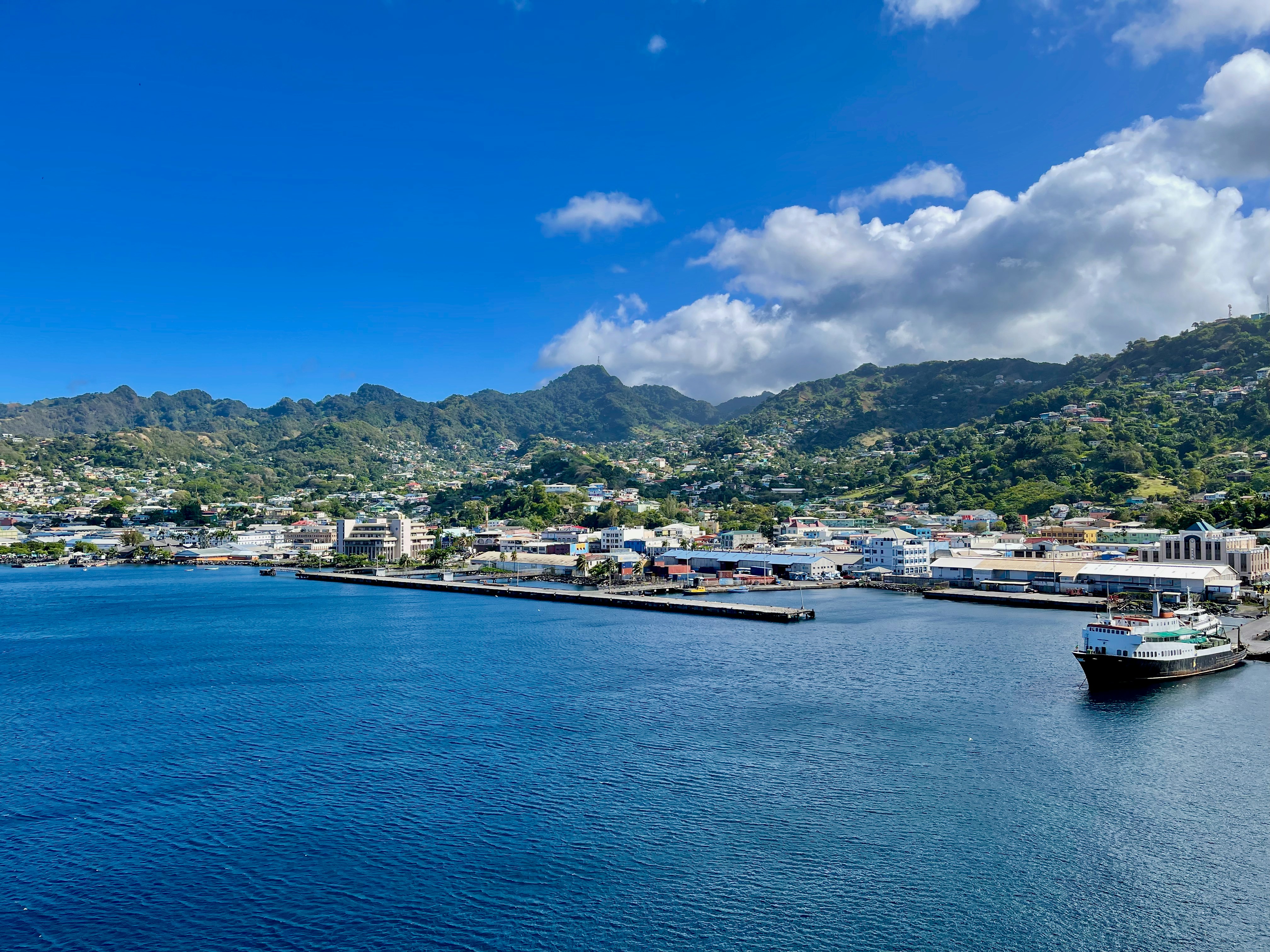
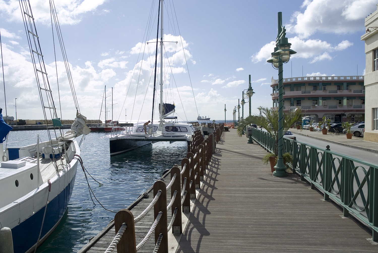
About Bridgetown
Located beside the island’s only natural harbour, the capital of Barbados combines modern and colonial architecture with glorious palm tree-lined beaches and a number of historical attractions. Experience the relaxed culture of the city renowned for its British-style parliament buildings and vibrant beach life, and seek out the Anglican church and the 19th-century Barbados Garrison. The distance between the ship and your tour vehicle may vary. This distance is not included in the excursion grades.
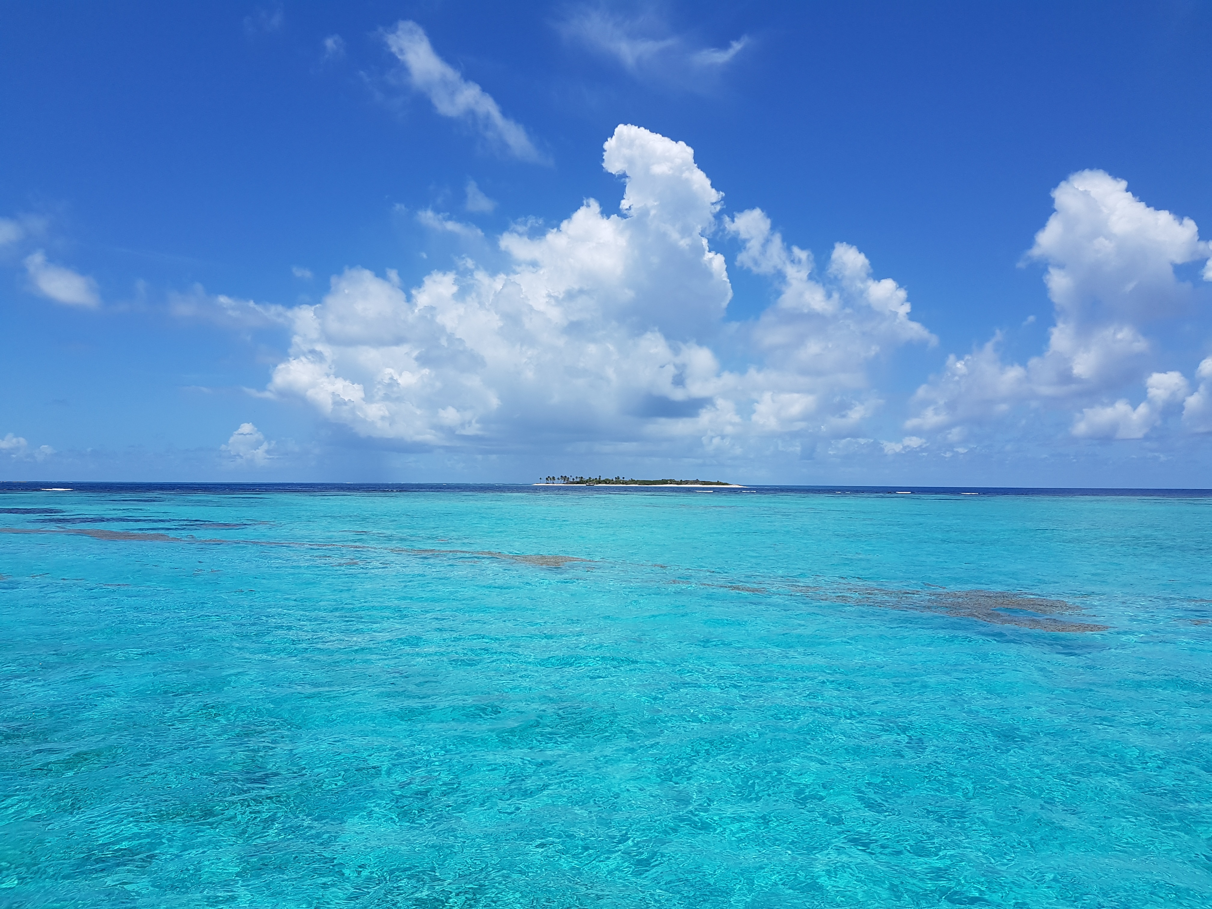
About Mayreau Island
The small island of Mayreau, just one and 1/2 square miles in area (3.9 square kilometres) is the smallest inhabited island of The Grenadines, and is part of the independent state of St.Vincent in the eastern Caribbean Sea. Two of the best known islands in The Grenadines are Mustique and Bequia, the second largest island in this group. The Grenadine Islands are strung out in a gentle sweep between St.Vincent and Grenada. Most visitors to Mayreau arrive from cruise ships, on the regular ferry, or by yacht. There are no proper roads on the island, only a few vehicles, no airport and only a single unnamed village. Mayreau and the neighboring Tobago Cays are very popular for divers and snorkellers. Saline Bay, on the west coast of the island, has a wonderful broad beach and a few local vendors selling T-shirts and local craft. A climb up the road to the hilltop village on the island provides breathtaking views across Mayreau, Canouan, the Tobago Cays and Carriacou.
About Castries
The typical image of a lush tropical paradise comes to life on the friendly island of St Lucia. Despite its small size – just 27 miles long and 14 miles wide – St Lucia is rich in natural splendour with dense emerald rainforest, banana plantations and orchards of coconut, mango and papaya trees. The twin peaks of Les Pitons, now a UNESCO World Heritage Site rise dramatically 2,000 feet into the sky and dominate the island. Look out for unusual birds with brilliant plumage such as the St Lucia parrot, see a surprising diversity of exotic flora and enjoy the warm hospitality of the islanders in the small villages and open-air markets. Please be aware that St Lucia is a small, mountainous island, with steep, winding and bumpy roads. Customers with back and neck problems should take this into consideration when booking an excursion.
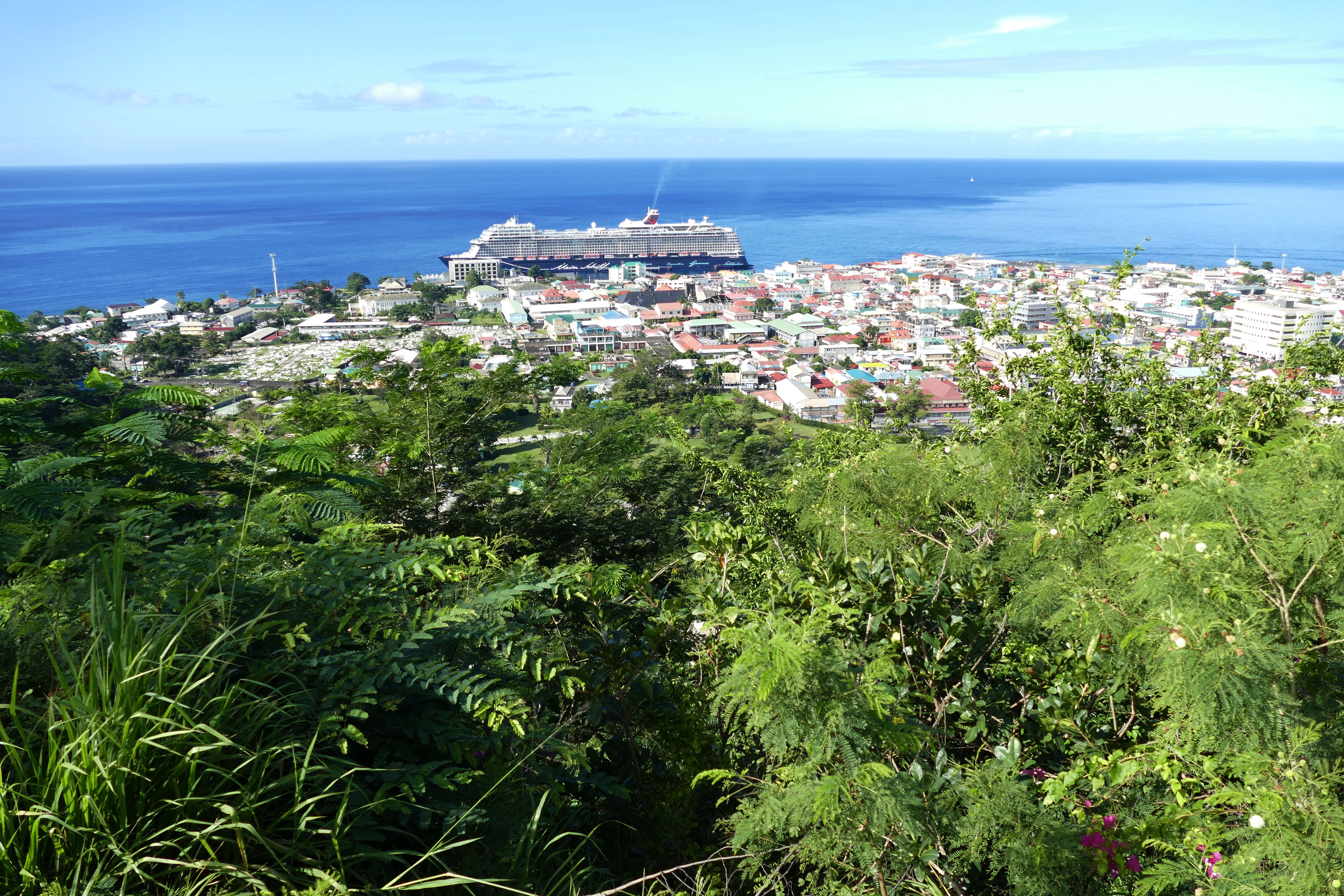
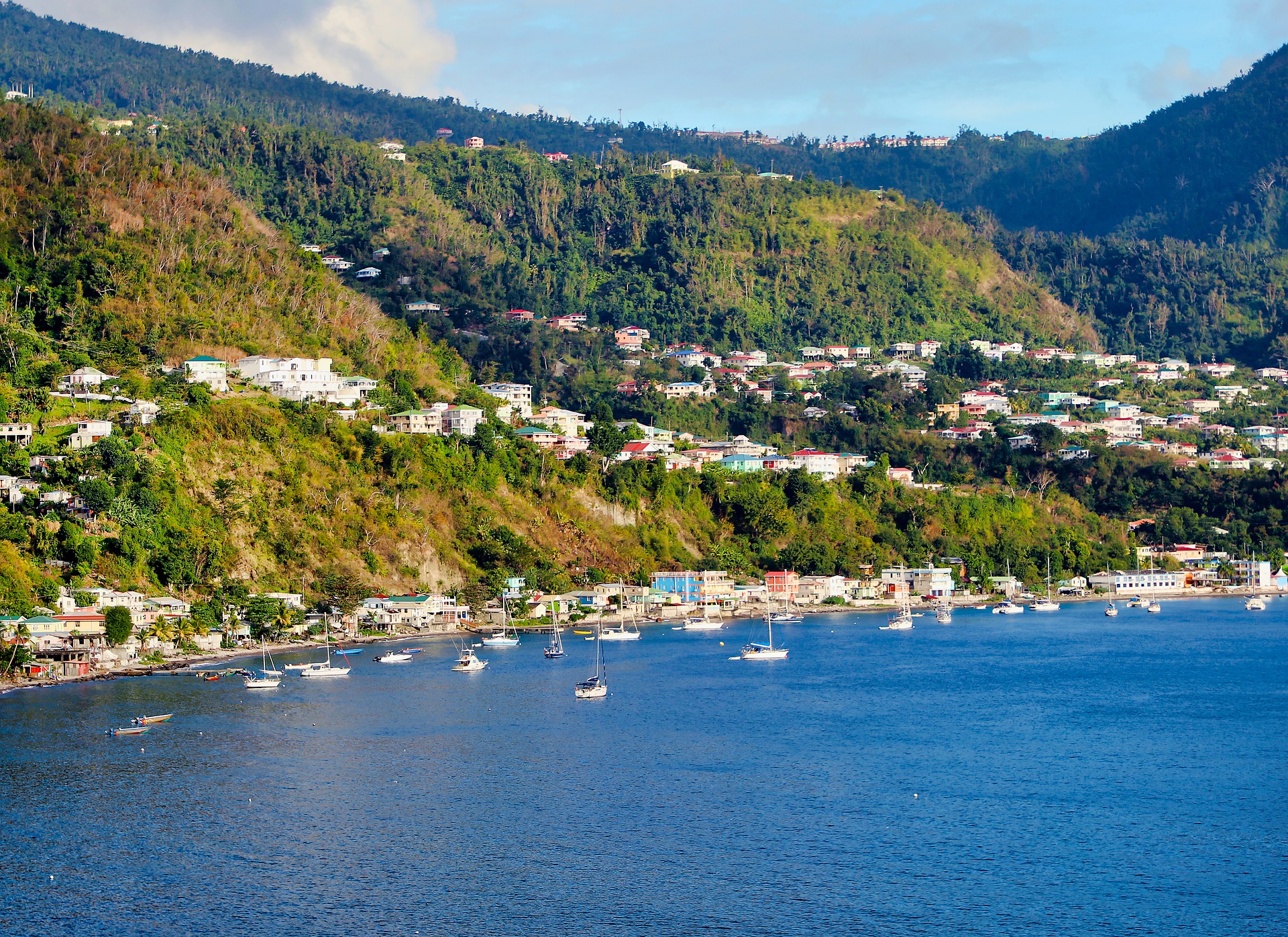
About Roseau
Although it's one of the smallest capitals in the Caribbean, Roseau has the highest concentration of inhabitants of any town in the eastern Caribbean. Caribbean vernacular architecture and a bustling marketplace transport visitors back in time. Although you can walk the entire town in about an hour, you'll get a much better feel for the place on a leisurely stroll. For some years now, the Society for Historical Architectural Preservation and Enhancement (SHAPE) has organized programs and projects to preserve the city's architectural heritage. Several interesting buildings have already been restored. Lilac House, on Kennedy Avenue, has three types of gingerbread fretwork, latticed verandah railings, and heavy hurricane shutters. The J.W. Edwards Building, at the corner of Old and King George V sreets, has a stone base and a wooden second-floor gallery. The Old Market Plaza is the center of Roseau's historic district, which was laid out by the French on a radial plan rather than a grid, so streets such as Hanover, King George V, and Old radiate from this area. South of the marketplace is the Fort Young Hotel, built as a British fort in the 18th century; the nearby statehouse, public library, and Anglican cathedral are also worth a visit. New developments at the bay front on Dame M.E. Charles Boulevard have brightened up the waterfront.
About Basseterre, Saint Kitts
Mountainous St. Kitts, the first English settlement in the Leeward Islands, crams some stunning scenery into its 65 square miles (168 square km). Vast, brilliant green fields of sugarcane (the former cash crop, now slowly being replanted) run to the shore. The fertile, lush island has some fascinating natural and historical attractions: a rain forest replete with waterfalls, thick vines, and secret trails; a central mountain range dominated by the 3,792-foot Mt. Liamuiga, whose crater has long been dormant; and Brimstone Hill, known in the 18th century as the Gibraltar of the West Indies. St. Kitts and Nevis, along with Anguilla, achieved self-government as an associated state of Great Britain in 1967. In 1983 St. Kitts and Nevis became an independent nation. English with a strong West Indian lilt is spoken here. People are friendly but shy; always ask before you take photographs. Also, be sure to wear wraps or shorts over beach attire when you're in public places.
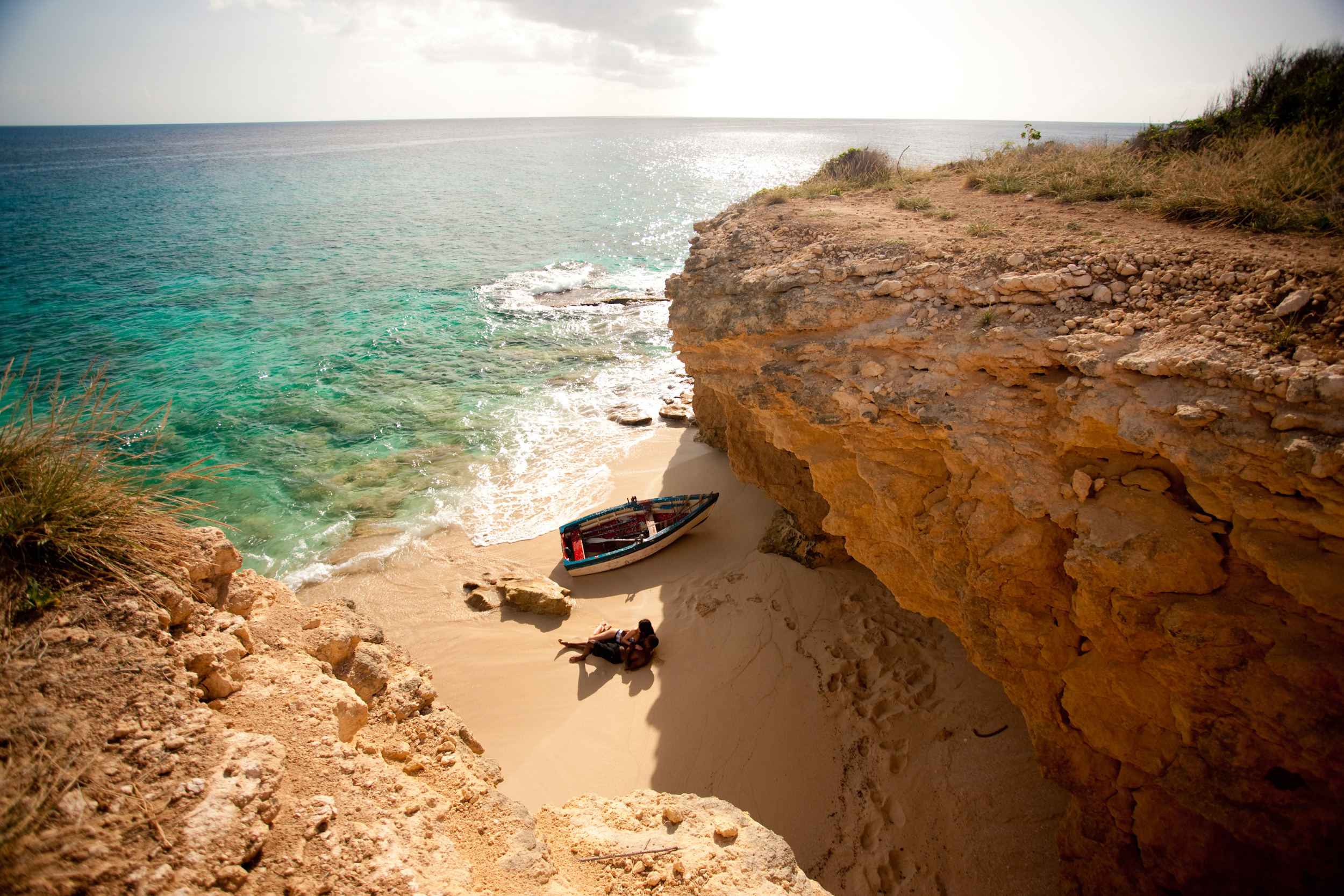
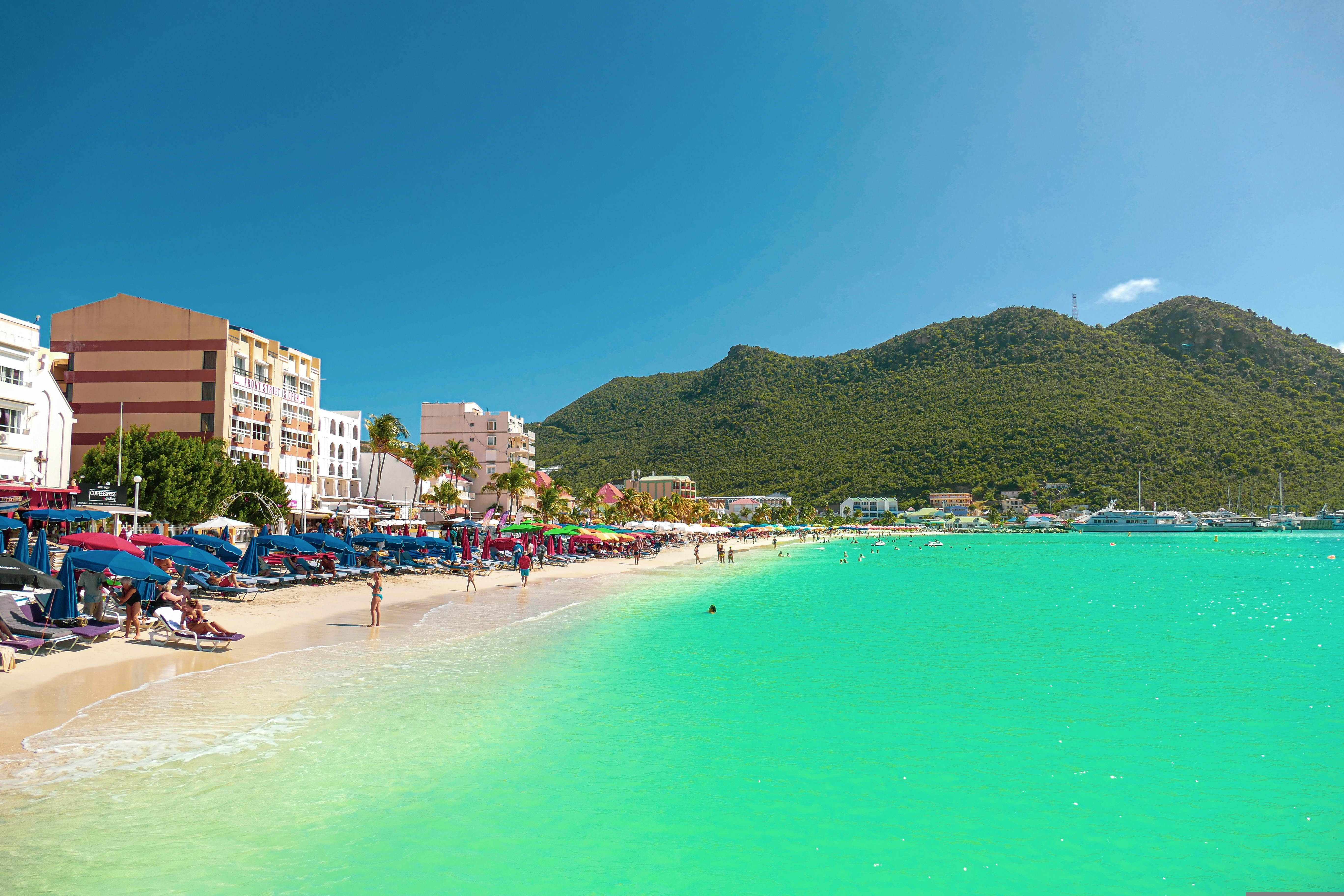
About Philipsburg
The capital of Dutch St. Maarten stretches about a mile (1½ km) along an isthmus between Great Bay and the Salt Pond and has five parallel streets. Most of the village's dozens of shops and restaurants are on Front Street, narrow and cobblestone, closest to Great Bay. It's generally congested when cruise ships are in port, because of its many duty-free shops and several casinos. Little lanes called steegjes connect Front Street with Back Street, which has fewer shops and considerably less congestion. Along the beach is a ½-mile-long (1-km-long) boardwalk with restaurants and several Wi-Fi hot spots.Wathey Square (pronounced watty) is in the heart of the village. Directly across from the square are the town hall and the courthouse, in a striking white building with cupola. The structure was built in 1793 and has served as the commander's home, a fire station, a jail, and a post office. The streets surrounding the square are lined with hotels, duty-free shops, restaurants, and cafés. The Captain Hodge Pier, just off the square, is a good spot to view Great Bay and the beach that stretches alongside.
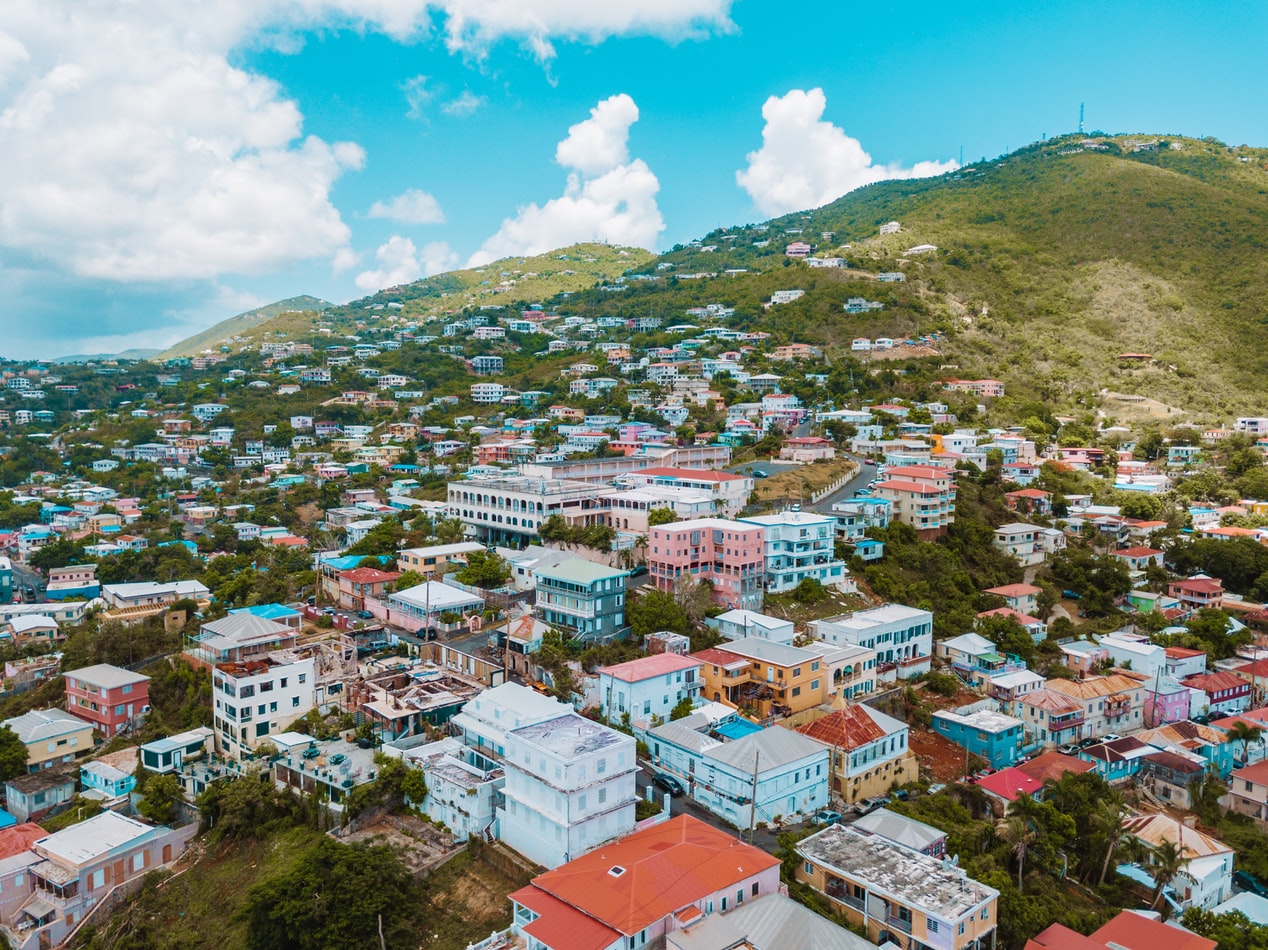
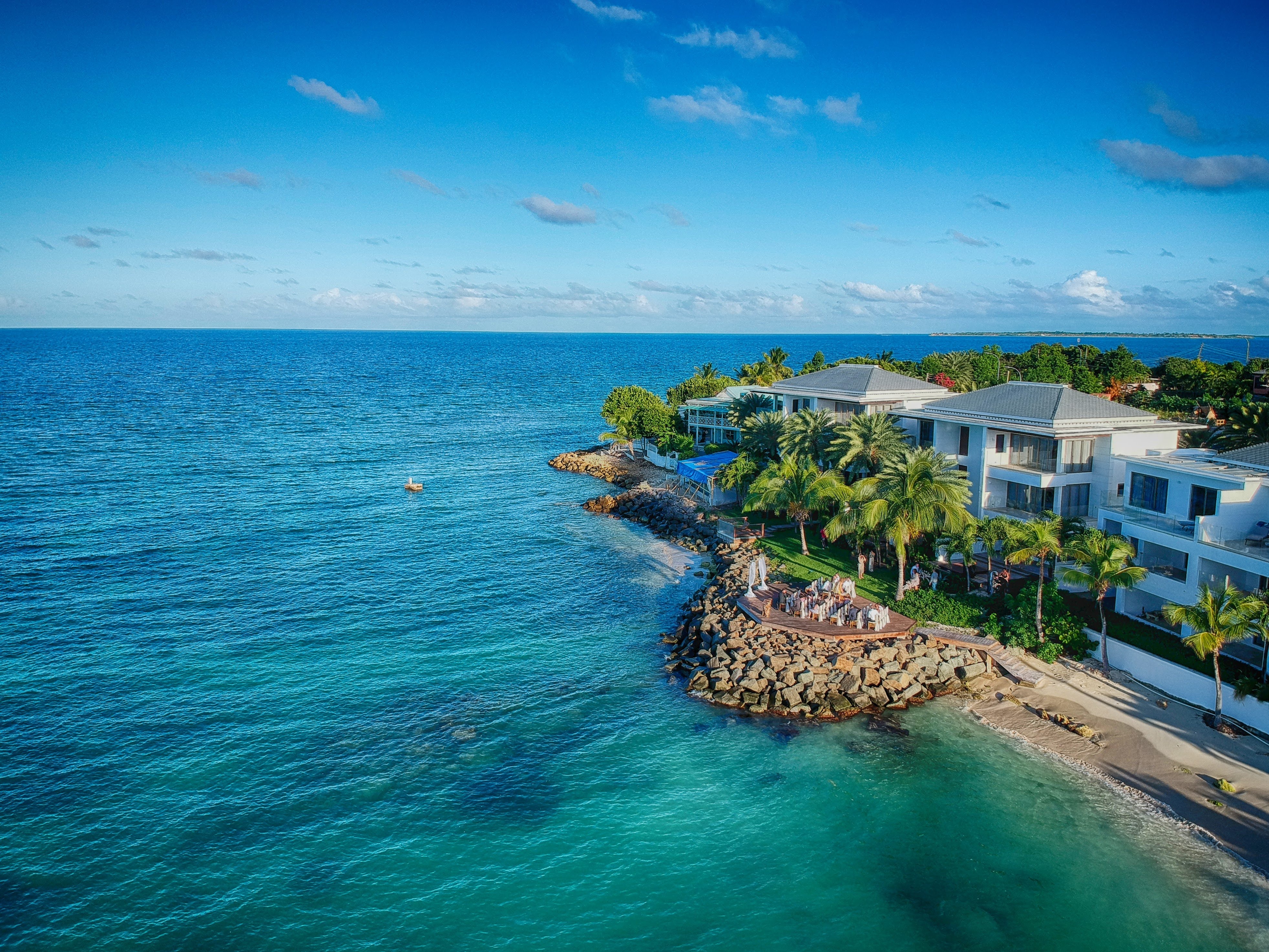
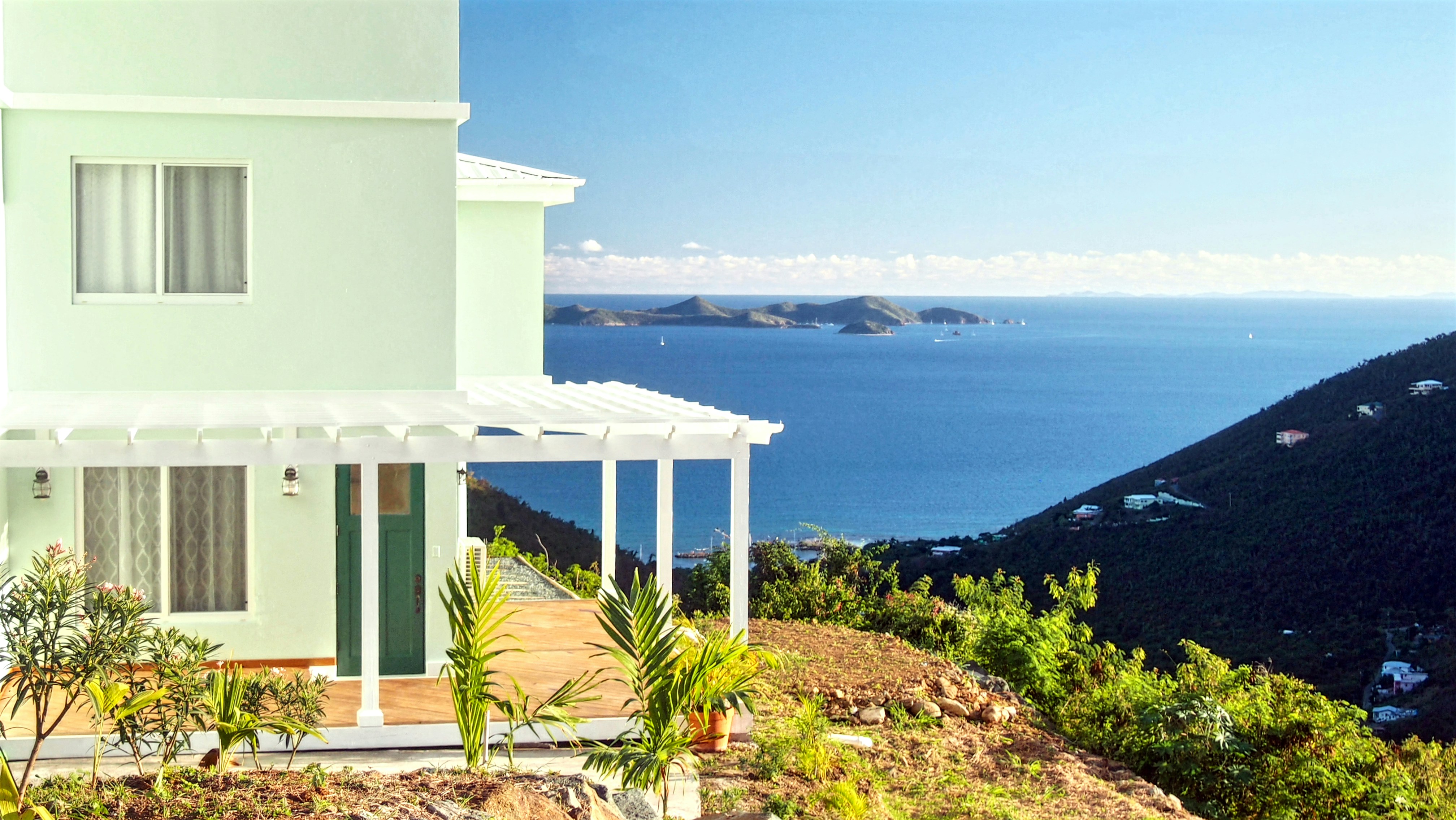
About Road Town, Tortola
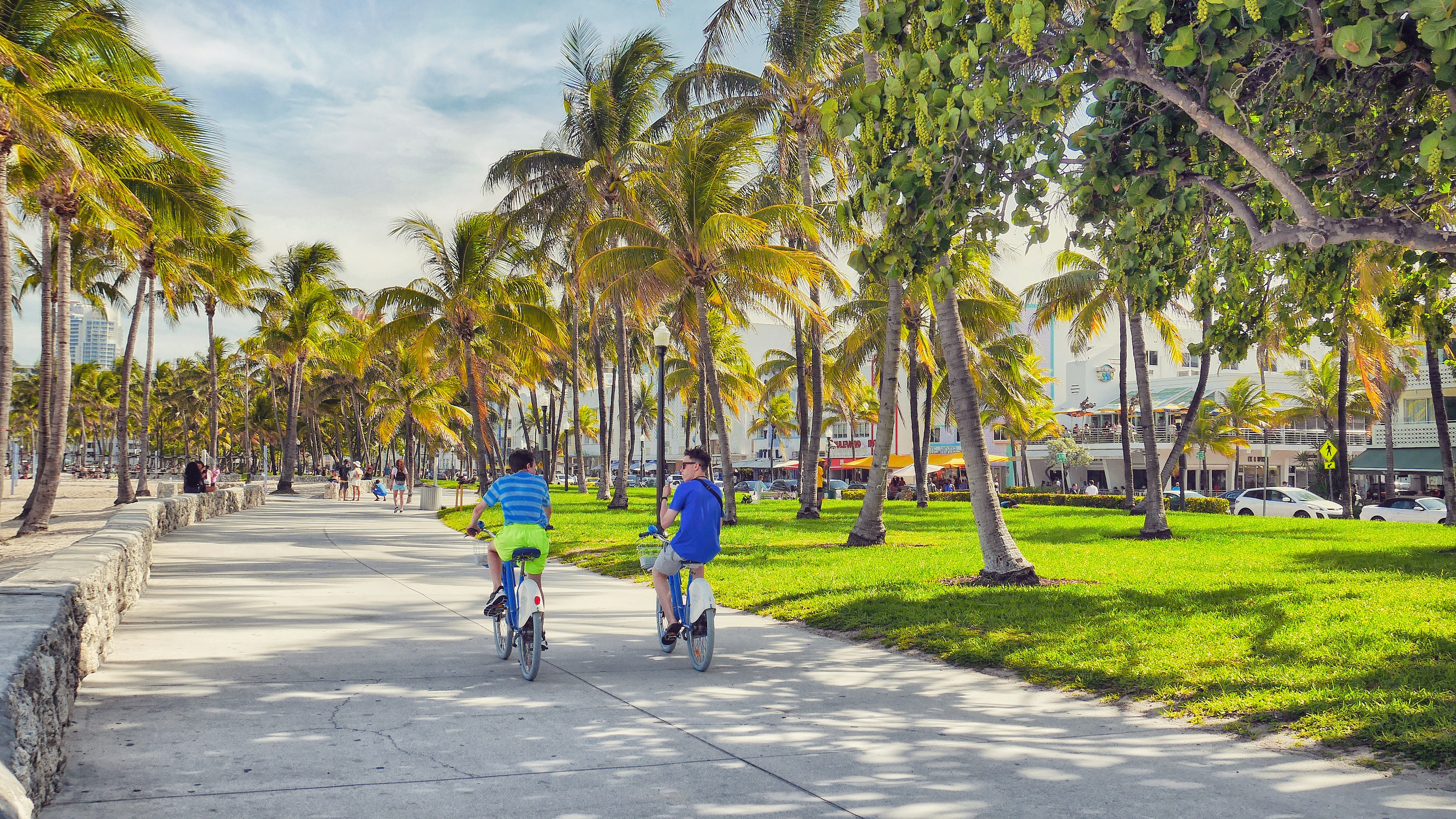
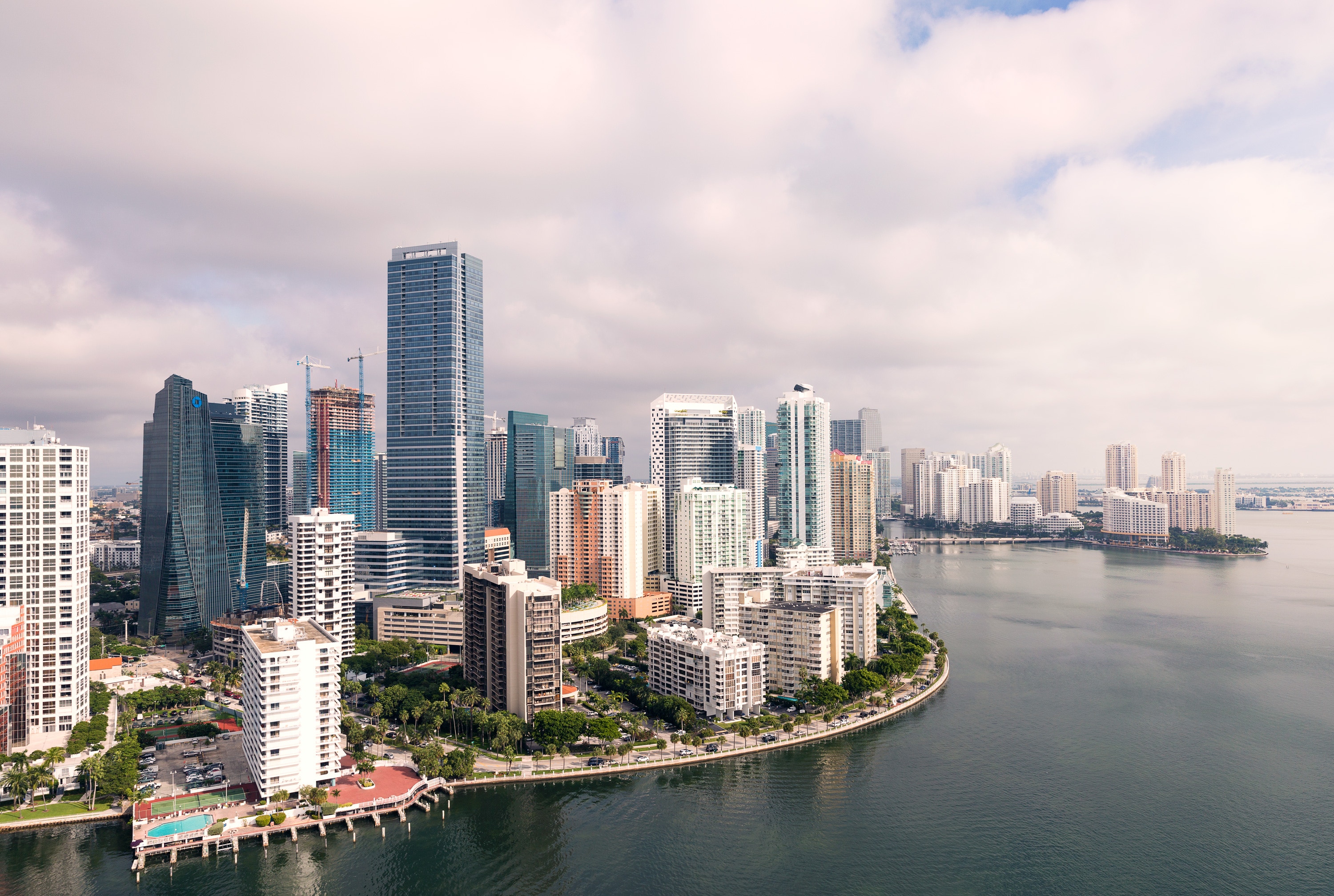
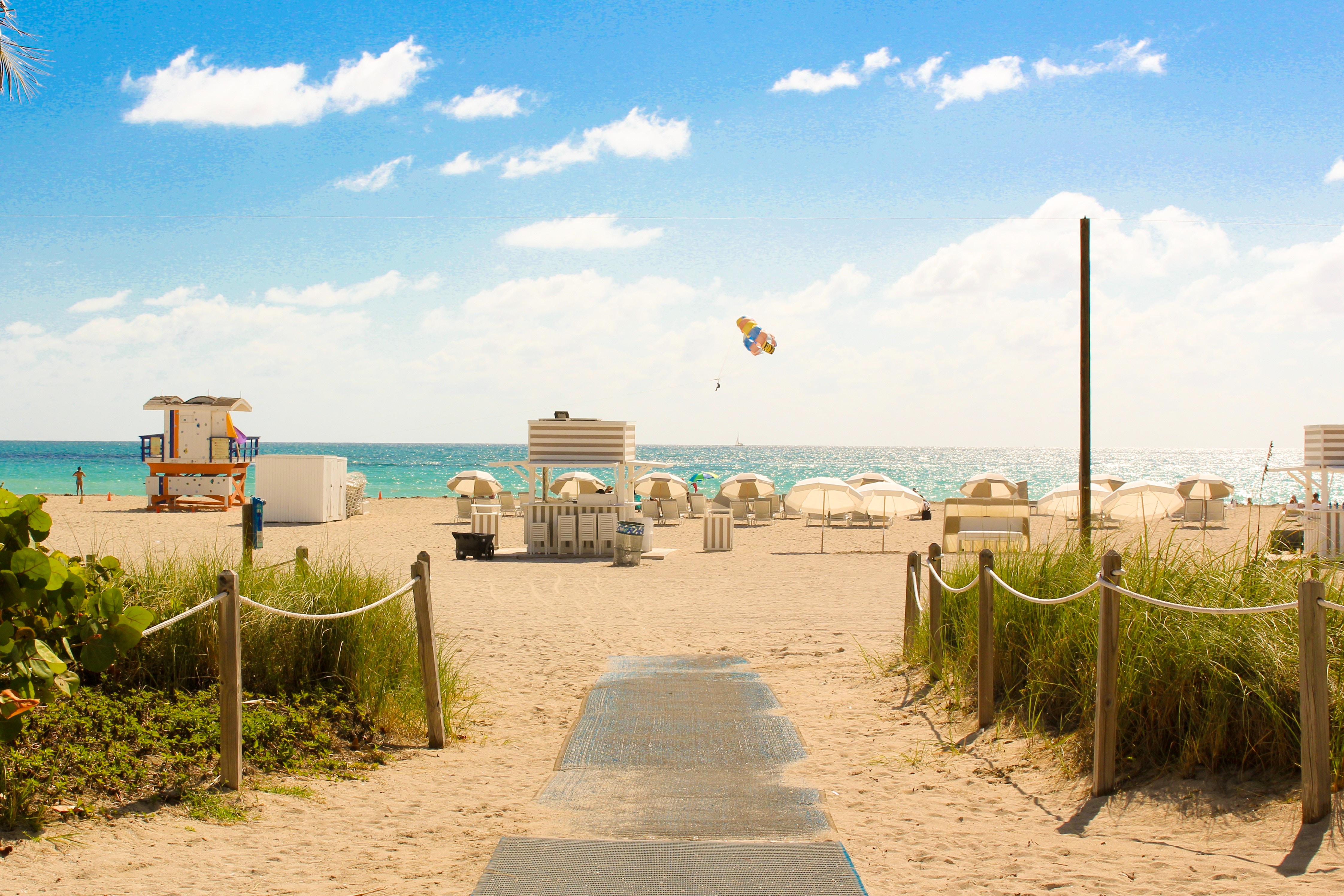
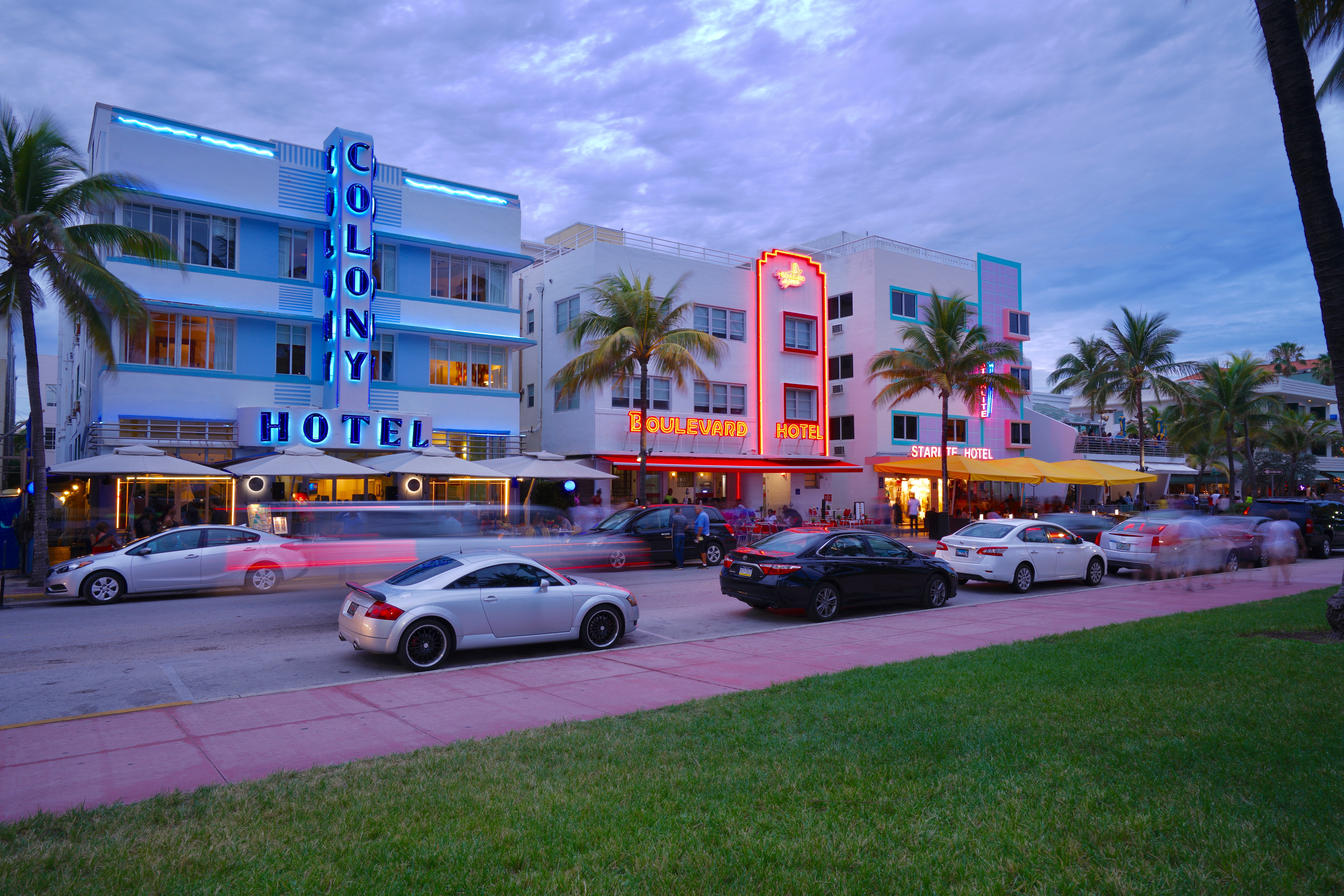
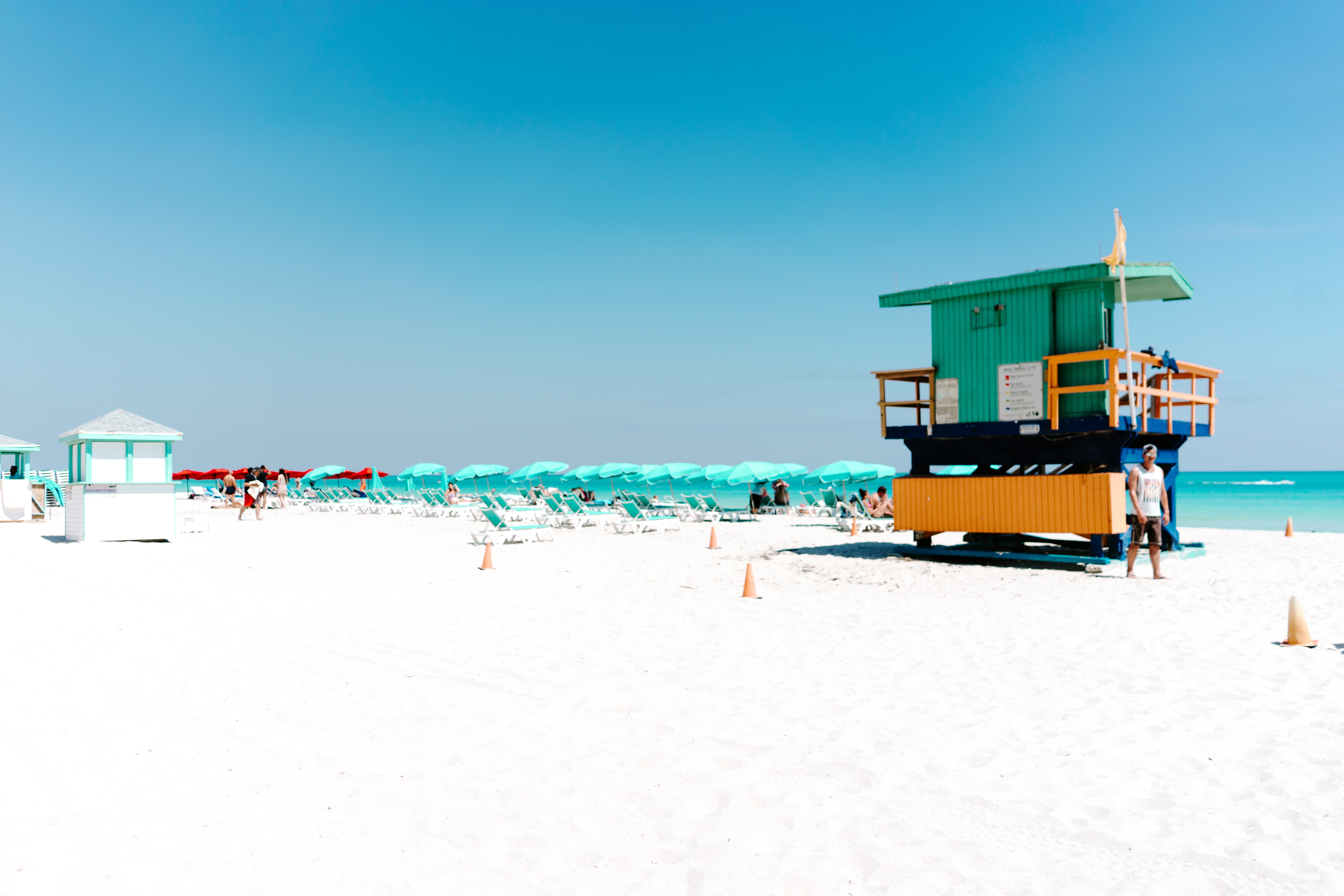
About Miami, Florida
Miami is one of the world’s most popular holiday spots. It has so much to offer; from its countless beach areas, to culture and museums, from spa and shopping days out, to endless cuban restaurants and cafes. Miami is a multicultural city that has something to offer to everyone.
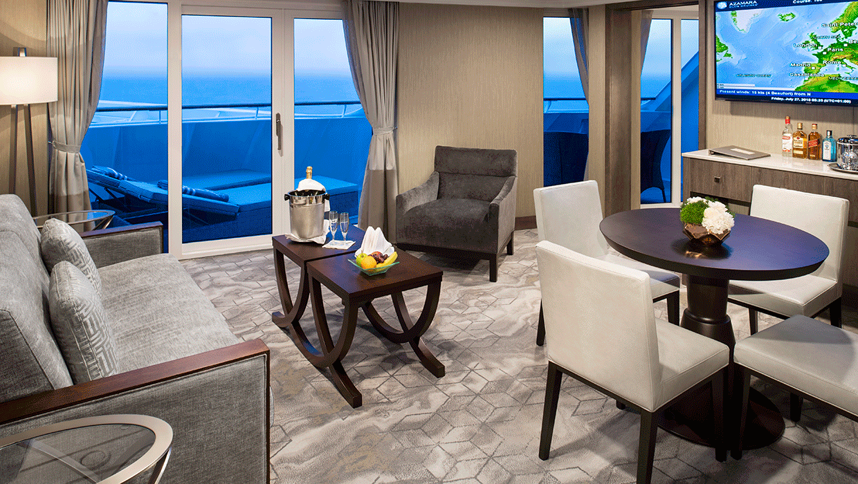
Our largest suites have been transformed with contemporary design elements that are both elegant and organic, with design that draws inspiration from nature- a sandy cliff, flowing river beds, exquisite white sand beaches, and rustling grasses. Enjoy a spacious living room, separate bedroom and all the amenities that come with our most luxurious suite.
Suite Features
- Spacious living room with a separate master bedroom
- Master bedroom with one queen size bed and a flat-
- screen television
- Flat-screen television in living room
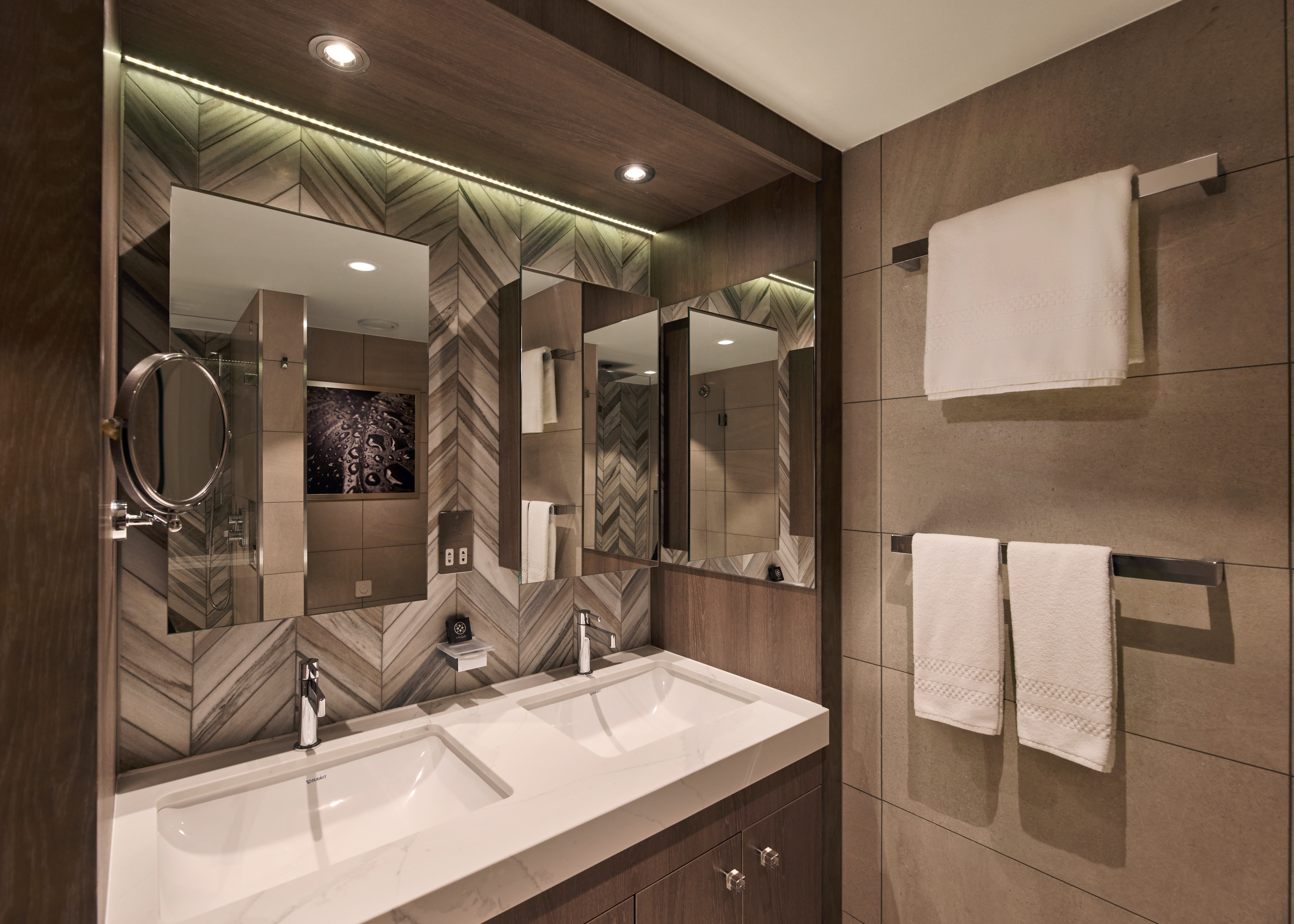
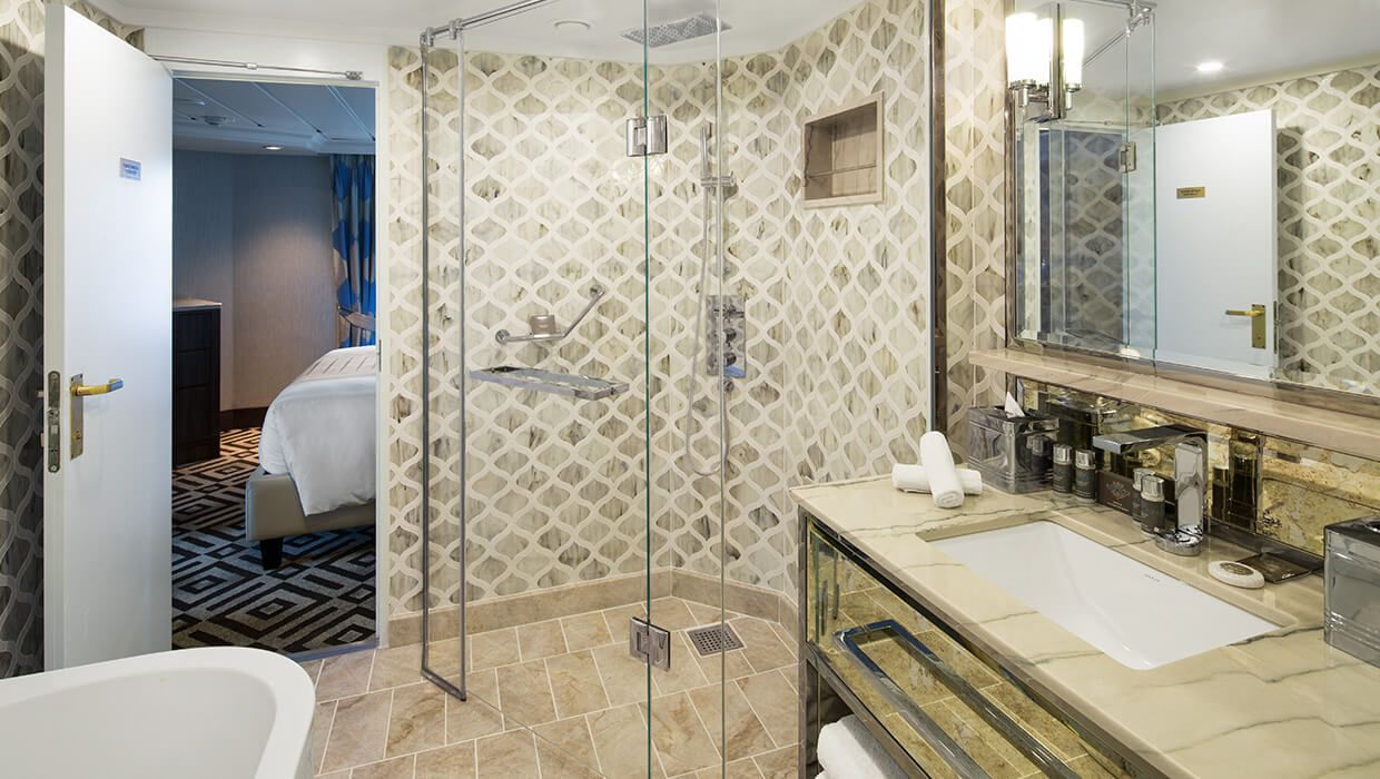
- Marble master bathroom with shower. Journey and Quest suites feature a tub.
- Dressing room with vanity and ample closet space
- Floor-to-ceiling sliding glass doors in living room and master bedroom
- Mini-bar
- Thermostat-controlled air conditioner
- Direct-dial telephone with voice mail
- Writing desk
- In-room safe
- Hand-held hair dryer
- Stateroom: 560 sq. ft. (52 sq. m.) Veranda: 233 sq. ft (21.7 sq. m.)
Included Suite Amenities (For cruises sailing before April 1, 2026)
- $300 Onboard Credit
- Unlimited Standard Wi-Fi
- Laundry - 2 bags/stateroom/week
- Exclusive Acamar Experience Dinner
- Dedicated butler and concierge service
- Full in-suite dining and daily evening hors d'oeuvres
- Complimentary Specialty Dining and exclusive breakfast at Aqualina
- In-room premium spirits and champagne
- Thalassotherapy Pool access
- Personalized assistance planning spa appointments and shore excursions
- Priority check-in
- News delivery
- Luxurious cotton bed linens with duvet
- Terry bathrobes
- 24-hour room service
- Tote bag
- Use of umbrella
- Shoeshine service
- Turndown treats
Included Suite Amenities (For cruises on or after April 1, 2026)
- Ultimate Beverage Package
- Unlimited Standard Starlink Wi-Fi
- Unlimited Laundry
- Exclusive Acamar Experience Dinner
- Dedicated butler and concierge service
- Full in-suite dining and daily evening hors d'oeuvres
- Complimentary Specialty Dining and exclusive breakfast at Aqualina
- In-room premium spirits and champagne
- Thalassotherapy Pool access
- Personalized assistance planning spa appointments and shore excursions
- Priority check-in
- News delivery
- Luxurious cotton bed linens with duvet
- Terry bathrobes
- 24-hour room service
- Tote bag
- Use of umbrella
- Shoeshine service
- Turndown treats
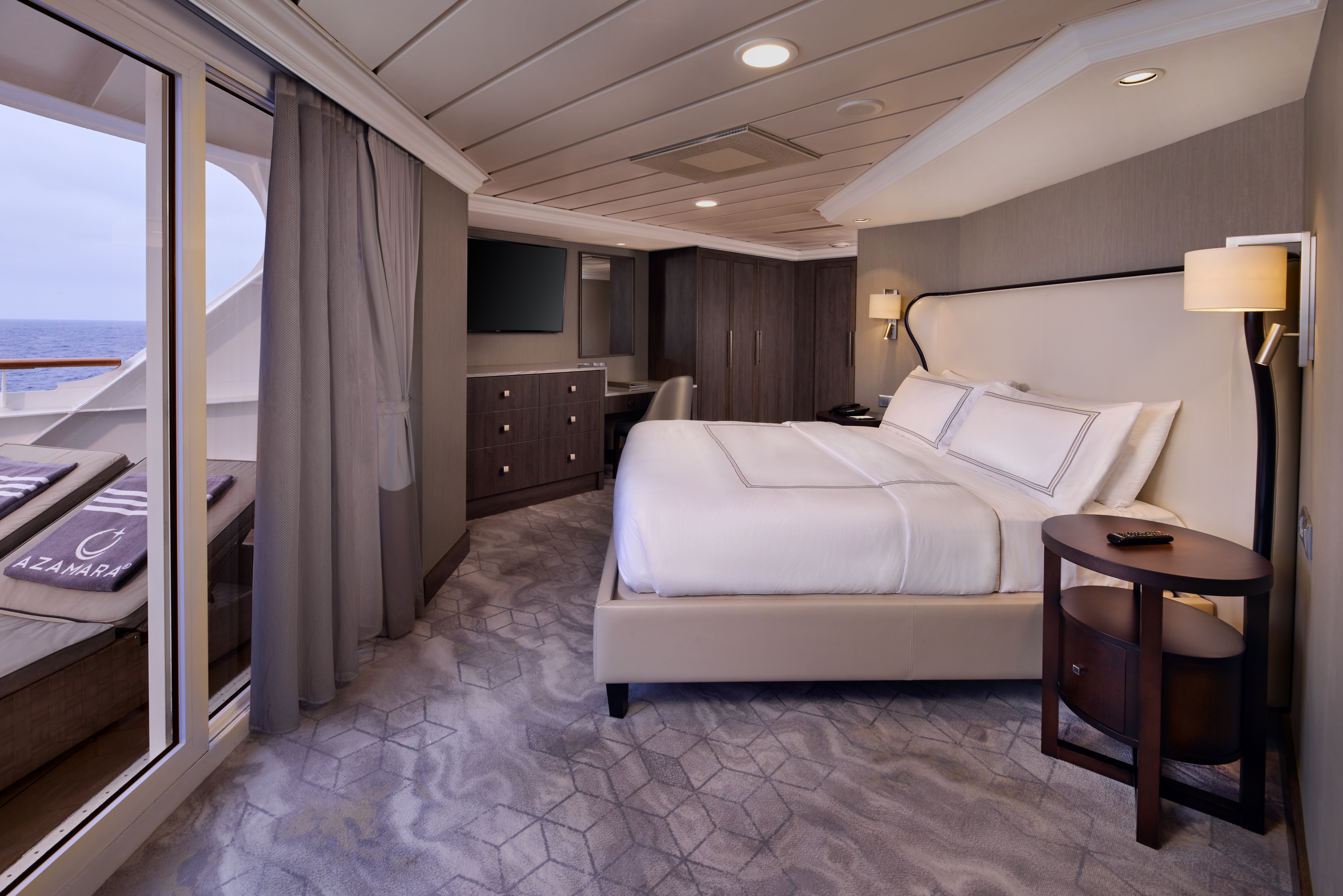

With a large living room and a separate bedroom —plus your own private veranda —your suite offers a restful retreat after your immersive experiences on land. Enjoy elegant, contemporary d6cor, and rich marble touches. You'll be spoiled by the attention to detail in these beautiful suites, and of course, all the pampering too.
Suite Features
- Spacious living room with a separate master bedroom
- Master bedroom with one queen size bed with a flat-screen television
- Flat-screen television in living room
- Marble master bathroom with shower. Journey and Quest suites feature a tub.
- Dressing room with vanity and ample closet space
- Floor-to-ceiling sliding glass doors in living room and master bedroom
- Mini-bar
- Thermostat-controlled air conditioner
- Direct-dial telephone with voice mail
- Writing desk
- In-room safe
- Hand-held hair dryer
- Stateroom: 440-501 sq. ft. (40.9-46.5 sq. m.) Veranda: 233 sq. ft. (21.7 sq. m.)
Included Suite Amenities (For cruises sailing before April 1, 2026)
- $300 Onboard Credit
- Unlimited Standard Wi-Fi
- Laundry - 2 bags/stateroom/week
- Exclusive Acamar Experience Dinner
- Dedicated butler and concierge service
- Full in-suite dining and daily evening hors d'oeuvres
- Complimentary Specialty Dining and exclusive breakfast at Aqualina
- In-room premium spirits and champagne
- Thalassotherapy Pool access
- Personalized assistance planning spa appointments and shore excursions
- Priority check-in
- News delivery
- Luxurious cotton bed linens with duvet
- Terry bathrobes
- 24-hour room service
- Tote bag
- Use of umbrella
- Shoeshine service
- Turndown treats
Included Suite Amenities (For cruises on or after April 1, 2026)
- Ultimate Beverage Package
- Unlimited Standard Starlink Wi-Fi
- Unlimited Laundry
- Exclusive Acamar Experience Dinner
- Dedicated butler and concierge service
- Full in-suite dining and daily evening hors d'oeuvres
- Complimentary Specialty Dining and exclusive breakfast at Aqualina
- In-room premium spirits and champagne
- Thalassotherapy Pool access
- Personalized assistance planning spa appointments and shore excursions
- Priority check-in
- News delivery
- Luxurious cotton bed linens with duvet
- Terry bathrobes
- 24-hour room service
- Tote bag
- Use of umbrella
- Shoeshine service
- Turndown treats
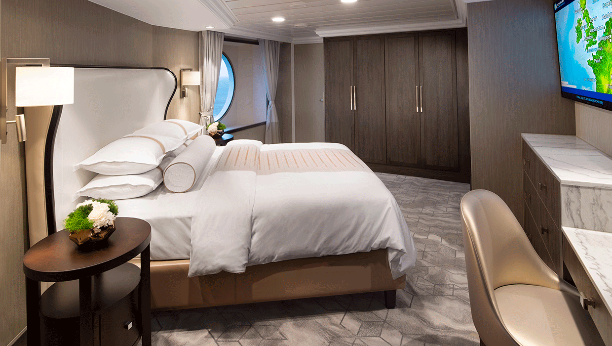
Located next to the tranquil Sanctum Spa. our newest suites are the ultimate in contemporary design, comfort and pampering. With easy access to the Spa open decks, swimming pool and our great restaurants, the Club Spa Suites surround you with organic, elegant décor, and the finest, most soothing amenities. Suites feature comfortable sitting area, daily delivery of healthy snacks, Frette plush robes, and in-room spa music. For the ultimate in serene surroundings, the spacious glass-enclosed spa soaking tub and separate rain shower bring the outside in, with views to the endless seas beyond.
Suite Features
- Two lower beds convertible to one queen size bed
- Spacious glass-enclosed bathtub
- Separate rain shower
- Comfortable sitting area
- Flat-screen television in sitting area
- Floor-to-ceiling sliding glass doors
- Veranda
- Mini-bar
- Thermostat-controlled air conditioner
- Direct-dial telephone with voice mail
- Writing desk
- In-room safe
- Hand-held hair dryer
- Stateroom: 414 sq. ft. (38.5 sq. m.) Veranda: 40 sq. ft. (3.7 sq. m.)
Included Suite Amenities (For cruises sailing before April 1, 2026)
- $300 Onboard Credit
- Unlimited Standard Wi-Fi
- Laundry - 2 bags/stateroom/week
- Exclusive Acamar Experience Dinner
- Dedicated butler and concierge service
- Full in-suite dining and daily evening hors d'oeuvres
- Complimentary Specialty Dining and exclusive breakfast at Aqualina
- In-room premium spirits and champagne
- Thalassotherapy Pool access
- Personalized assistance planning spa appointments and shore excursions
- Priority check-in
- News delivery
- Luxurious cotton bed linens with duvet
- Terry bathrobes
- 24-hour room service
- Tote bag
- Use of umbrella
- Shoeshine service
- Turndown treats
Included Suite Amenities (For cruises on or after April 1, 2026)
- Ultimate Beverage Package
- Unlimited Standard Starlink Wi-Fi
- Unlimited Laundry
- Exclusive Acamar Experience Dinner
- Dedicated butler and concierge service
- Full in-suite dining and daily evening hors d'oeuvres
- Complimentary Specialty Dining and exclusive breakfast at Aqualina
- In-room premium spirits and champagne
- Thalassotherapy Pool access
- Personalized assistance planning spa appointments and shore excursions
- Priority check-in
- News delivery
- Luxurious cotton bed linens with duvet
- Terry bathrobes
- 24-hour room service
- Tote bag
- Use of umbrella
- Shoeshine service
- Turndown treats

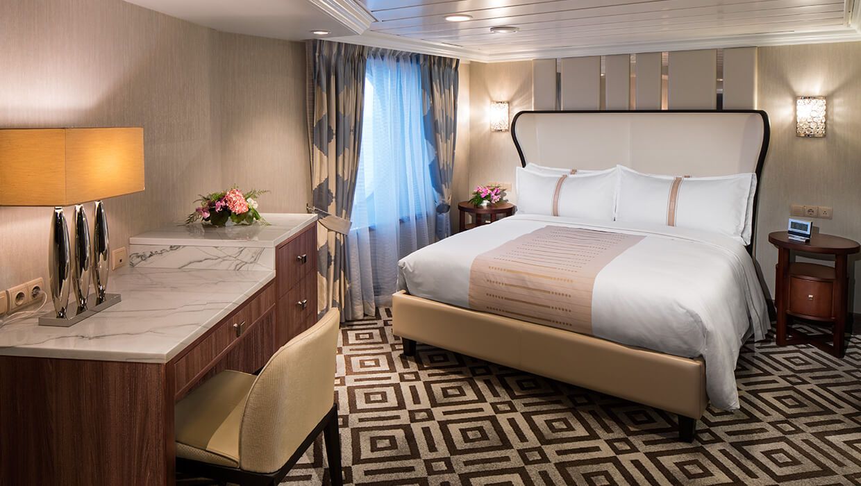
Spacious and comfortable, our Club Continent Suites feature fresh new décor inspired by natural elements. With two beds convertible to a queen, a cozy sitting area, breezy balcony and refreshed bathroom with a bathtub or shower, this is your wonderful, refined home away from home.
Suite Features
- Two lower beds convertible to one queen size bed
- Spacious and comfortable sitting area
- Flat-screen television in sitting area
- Roomy bathroom with shower. Some also feature a tub.
- Floor-to-ceiling sliding glass doors
- Veranda
- Mini-bar
- Thermostat-controlled air conditioner
- Direct-dial telephone with voice mail
- Writing desk
- In-room safe
- Hand-held hair dryer
- Stateroom: 266 sq. ft. (24.7 sq. m.) Veranda: 60 sq. ft. (5.6 sq. m.)
Included Suite Amenities (For cruises sailing before April 1, 2026)
- 240 Minutes Standard Wi-Fi
- Laundry - 2 bags/stateroom/week
- Dedicated butler and concierge service
- Exclusive breakfast at Aqualina
- In-room premium spirits and champagne
- Thalassotherapy Pool access
- Personalized assistance planning spa appointments and shore excursions
- Priority check-in
- News delivery
- Luxurious cotton bed linens with duvet
- Terry bathrobes
- 24-hour room service
- Tote bag
- Use of umbrella
- Shoeshine-service
- Turndown treats
Included Suite Amenities (For cruises on or after April 1, 2026)
- Unlimited Basic Starlink Wi-Fi
- Laundry - 2 bags/stateroom/week
- Exclusive Acamar Experience Dinner
- Dedicated butler and concierge service
- Full in-suite dining and daily evening hors d'oeuvres
- Complimentary Specialty Dining and exclusive breakfast at Aqualina
- In-room premium spirits and champagne
- Thalassotherapy Pool access
- Personalized assistance planning spa appointments and shore excursions
- Priority check-in
- News delivery
- Luxurious cotton bed linens with duvet
- Terry bathrobes
- 24-hour room service
- Tote bag
- Use of umbrella
- Shoeshine-service
- Turndown treats


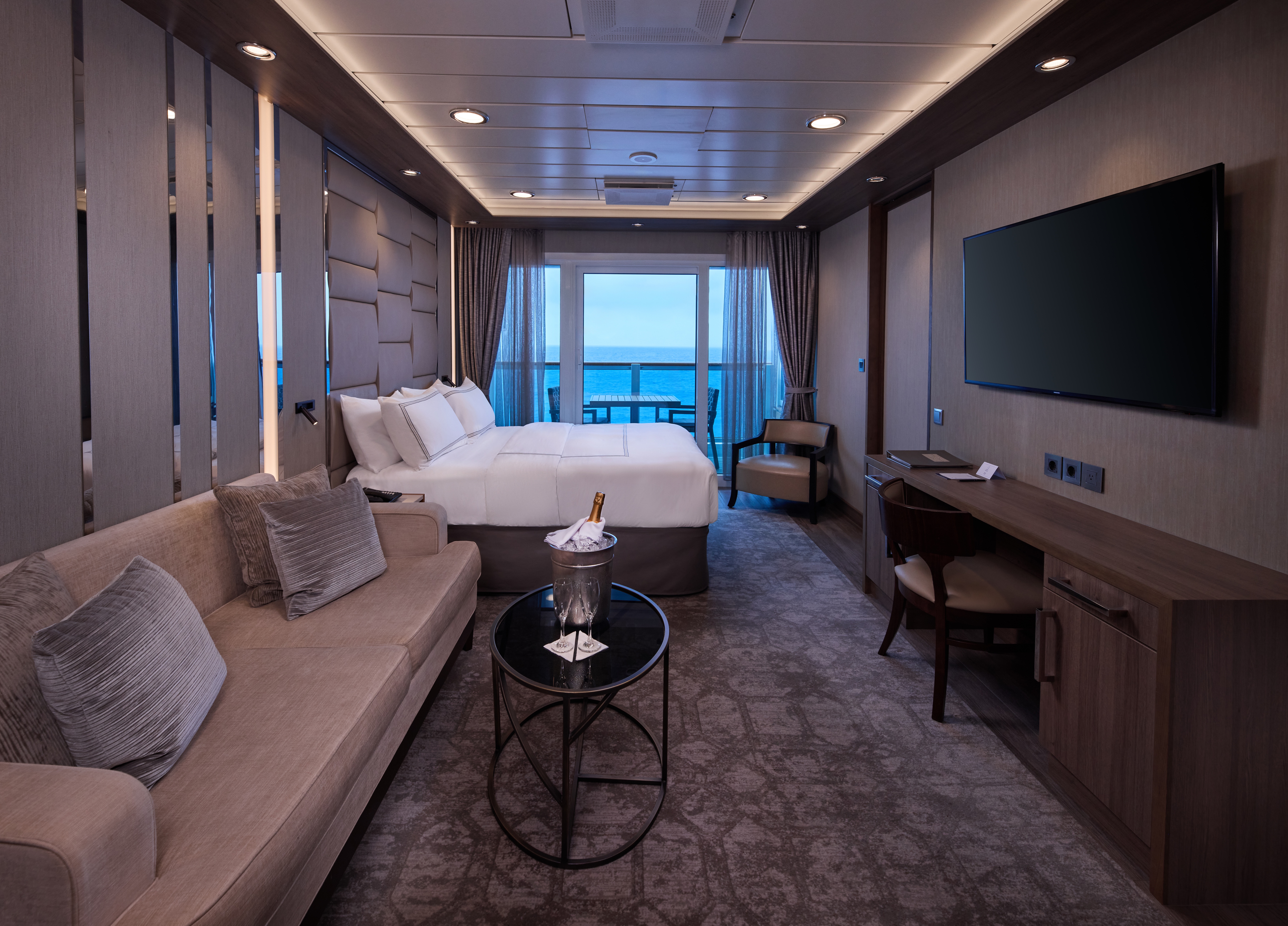
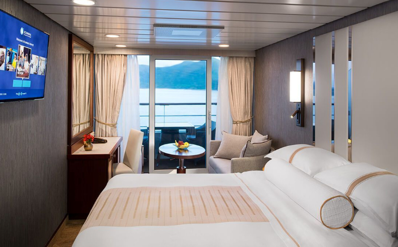
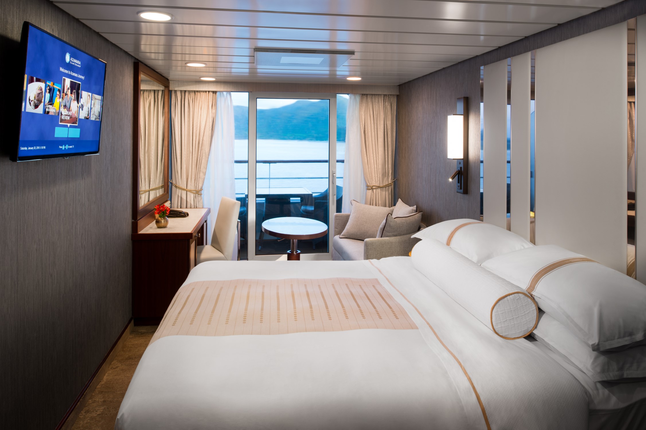
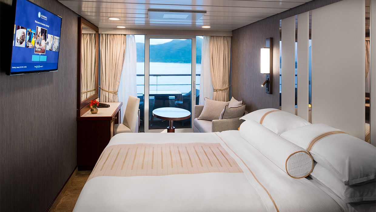
Introducing a new way to see the world with Azamara@. With our Club Veranda Plus Staterooms, enjoy spectacular ocean and destination views, plus a host of guest-favorite amenities—all at a great value. Everything you love about our Club Veranda Staterooms is included, plus extra perks and amenities to elevate your time on board.
With our Club Veranda Plus Staterooms, enjoy spectacular ocean and destination views, plus a host of guest-favourite amenities-all at a great value. Everything you love about our Club Veranda Staterooms is included, plus extra perks and amenities to elevate your time on board
Stateroom Features
- Veranda
- Two lower beds convertible to one Queen size bed
- Sitting area with flat-screen TV
- Mini-bar
- Thermostat-controlled air conditioner
- Direct-dial telephone with voice mail
- Writing desk
- In-room safe
- Hand-held hairdryer
- USB ports under bedside reading lamps
- Stateroom: 175 sq. ft. (16.3 sq. m.) Veranda: 46-64 sq. ft. (4.3-6 sq. m.)
Included Stateroom Amenities
- Complimentary AzAmazing Evenings® event (on most voyages)
- Gratuities
- Luxurious cotton bed linens with duvet
- Terry bathrobes and slippers
- Select standard spirits, international beers and wine
- 24-hour room service
- Bottled water, soft drinks, specialty coffees and teas
- Fresh-cut flowers
- Self-service laundry
- Tote bag
- Shuttle service to and from port communities, wher
- Use of umbrella
- Concierge services for personal guidance and reservations
- Shoe shine-service
- Turndown treats
- Daily news bulletin
- Complimentary Internet (120 minutes or 25% off the unlimited internet package) per guest
- One free bag of laundry service per stateroom, every seven days
- One night of complimentary specialty dining for two, every seven days
- Priority embarkation and debarkation
- Complimentary in-room spirits
Spacious and comfortable, our Club Continent Suites feature fresh new décor inspired by natural elements. With two beds convertible to a queen, a cozy sitting area, breezy balcony and refreshed bathroom with a bathtub or shower, this is your wonderful, refined home away from home.
Suite Features
- Two lower beds convertible to one queen size bed
- Spacious and comfortable sitting area
- Flat-screen television in sitting area
- Roomy bathroom with shower. Some also feature a tub.
- Floor-to-ceiling sliding glass doors
- Veranda
- Mini-bar
- Thermostat-controlled air conditioner
- Direct-dial telephone with voice mail
- Writing desk
- In-room safe
- Hand-held hair dryer
- Stateroom: 266 sq. ft. (24.7 sq. m.) Veranda: 60 sq. ft. (5.6 sq. m.)
Included Suite Amenities
- Luxurious cotton bed linens with duvet
- Terry bathrobes
- 24-hour room service
- Tote bag
- Use of umbrella
- Shoe shine-service
- Turndown treats
- Daily news bulletin
- Complimentary 240 minutes of Basic Wi-Fi or 50% off the Unlimited Basic Wi-Fi package, per person.
- One free bag of laundry service per suite, each seven days*
- Complimentary specialty dining
- Complimentary access to the Thalassotherapy pool and spa deck
Refreshing sea breezes and stunning destination views come standard in our staterooms that offer your own private veranda. Greet
the day with room service on your balcony, or toast to another stunning sunset. Polished touches and professional service
perfectly compliment the warm, friendly attention you'll receive from our staff and crew.
Stateroom Features
- Veranda
- Two lower beds convertible to one Queen size bed
- Sitting area with 40" flat-screen TV
- Refrigerator with mini-bar
- Thermostat-controlled air conditioner
- Direct-dial telephone with voicemail
- Writing desk
- In-room safe
- Hand-held hairdryer
- USB ports under bedside reading lamps
- Stateroom: 175 sq. ft. (16.3 sq. m.) I Veranda: 40 sq. ft. (3.7 sq. m.)
Included Stateroom Amenities
- Luxurious cotton bed linens with duvet
- Terry bathrobes and slippers
- 24-hour room service
- Fresh -cut flowers
- Tote bag
- Use of umbrella
- Shoe shine-service
- Turndown treats
- Daily news bulletin


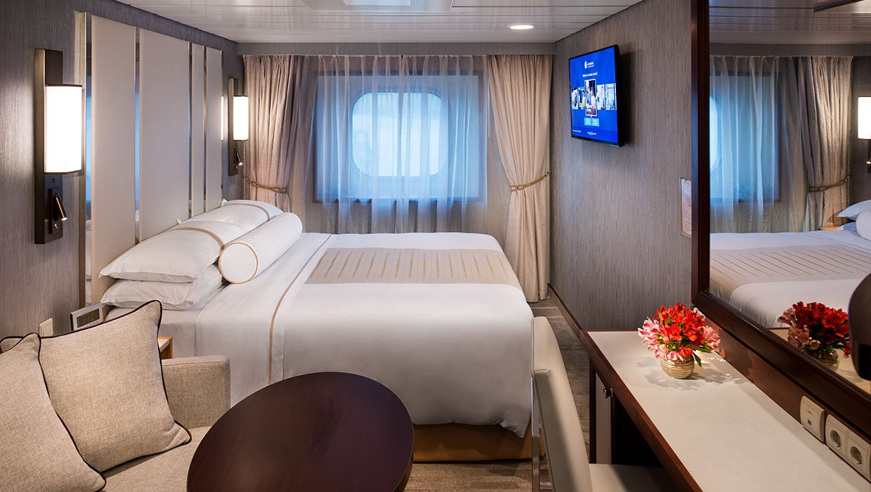
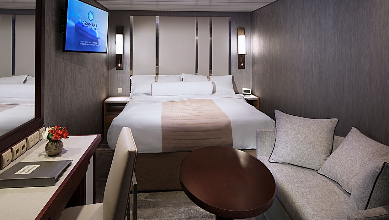
Introducing a new way to see the world with Azamara@. With our Club Veranda Plus Staterooms, enjoy spectacular ocean and destination views, plus a host of guest-favorite amenities—all at a great value. Everything you love about our Club Veranda Staterooms is included, plus extra perks and amenities to elevate your time on board.
With our Club Veranda Plus Staterooms, enjoy spectacular ocean and destination views, plus a host of guest-favourite amenities-all at a great value. Everything you love about our Club Veranda Staterooms is included, plus extra perks and amenities to elevate your time on board
Stateroom Features
- Veranda
- Two lower beds convertible to one Queen size bed
- Sitting area with flat-screen TV
- Mini-bar
- Thermostat-controlled air conditioner
- Direct-dial telephone with voice mail
- Writing desk
- In-room safe
- Hand-held hairdryer
- USB ports under bedside reading lamps
- Stateroom: 175 sq. ft. (16.3 sq. m.) Veranda: 46-64 sq. ft. (4.3-6 sq. m.)
Included Stateroom Amenities
- Luxurious cotton bed linens with duvet
- Terry bathrobes
- 24-hour room service
- Tote bag
- Use of umbrella
- Shoe shine-service
- Turndown treats
- Daily news bulletin
- Complimentary Internet (120 minutes or 25% off the unlimited internet package) per guest
- One free bag of laundry service per stateroom, every seven days
- One night of complimentary specialty dining for two, every seven days
- Priority embarkation and debarkation
- Complimentary in-room spirits
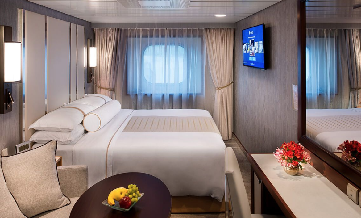
Refreshing sea breezes and stunning destination views come standard in our staterooms that offer your own private veranda. Greet the day with room service on your balcony, or toast to another stunning sunset. Polished touches and professional service perfectly compliment the warm, friendly attention you'll receive from our staff and crew.
Enjoy ocean views a sea breezes on your private veranda. Stateroom price based on deck and location of the ship.
Refreshing sea breezes and stunning destination views come standard in our staterooms that offer your own private veranda. Greet the day with room service on your balcony, or toast to another stunning sunset.
Stateroom Features
- Veranda
- Two lower beds convertible to one Queen size bed
- Sitting area with flat-screen IV
- Refrigerator with mini-bar
- Thermostat-controlled air conditioner
- Direct-dial telephone with voicemail
- Writing desk
- In-room safe
- Hand-held hairdryer
- USB ports under bedside reading lamps
- Stateroom: 175 sq. ft. (16.3 sq. m.) Veranda: 40 sq. ft (3.7 sq. m.)
Included Stateroom Amenities
- Luxurious cotton bed linens with duvet
- Terry bathrobes
- 24-hour room service
- Tote bag
- Use of umbrella
- Shoe shine-service
- Turndown treats
- Daily news bulletin
A vacation home with an ocean view, our Club Oceanview Staterooms offer all the style and amenities of a boutique hotel. Relax with plush cotton robes, slippers upon request, French bath products, and 24-hour room service.
Revel in the polished style and stellar service of your own private retreat, boasting a modern and contemporary décor. Enjoy picturesque ocean views outside your window, and all the finer touches included in every stateroom.
Stateroom Features
- Two lower beds convertible to one Queen size bed
- Some staterooms feature sofa bed
- Flat-screen TV
- Refrigerator with mini-bar
- Thermostat-controlled air conditioner
- Direct-dial telephone with voicemail
- Writing desk
- In-room safe
- Hand-held hairdryer
- USB ports under bedside reading lamps
- 143 sq. ft. (13.3 sq m)
Included Stateroom Amenities
- Complimentary AzAmazing Evenings® event (on most voyages)
- Gratuities
- Luxurious cotton bed linens with duvet
- Terry bathrobes and slippers
- Select standard spirits, international beers and wine
- 24-hour room service
- Bottled water, soft drinks, specialty coffees and teas
- Fresh-cut flowers
- Self-service laundry
- Tote bag
- Shuttle service to and from port communities, wher
- Use of umbrella
- Concierge services for personal guidance and reservations
- Shoe shine-service
- Turndown treats
With the polished style and stellar service of a Club Interior Stateroom, you'll enjoy our plush cotton robes, slippers upon request, French bath products, and 24-hour room service.
Explore the world in comfort and luxury in this stylish, elegant stateroom featuring all the amenities of a boutique hotel at sea. Relax with plush cotton robes, 24-hour room service, and more.
Stateroom Features
- Two lower beds convertible to one Queen size bed
- Flat-screen television
- Refrigerator with mini-bar
- Thermostat-controlled air conditioner
- Direct-dial telephone with voicemail
- Writing desk
- In-room safe
- Hand-held hairdryer
- USB ports under bedside reading lamps
- Stateroom: 158 sq. ft. (14.7 sq. m.)
Included Stateroom Amenities
- Complimentary AzAmazing Evenings® event (on most voyages)
- Gratuities
- Luxurious cotton bed linens with duvet
- Terry bathrobes and slippers
- Select standard spirits, international beers and wine
- 24-hour room service
- Bottled water, soft drinks, specialty coffees and teas
- Fresh-cut flowers
- Self-service laundry
- Tote bag
- Shuttle service to and from port communities, wher
- Use of umbrella
- Concierge services for personal guidance and reservations
- Shoe shine-service
- Turndown treats
- Daily news bulletin

Azamara Quest
The Azamara Quest is a mid-sized ship with a deck plan that’s intimate but never crowded, and offers everything modern voyagers are looking for—plus some unexpected extras.
Your boutique hotel at sea, the Azamara Pursuit® is a mid-sized ship with a deck plan that’s intimate but never crowded, and offers everything modern voyagers are looking for—plus some unexpected extras.
Seven restaurants, cafes, and lounges, a refreshing pool, sun-drenched decks, a revitalising spa…the list goes on. With so many areas to explore onboard Azamara Pursuit, it’s a good thing we have deck plans.
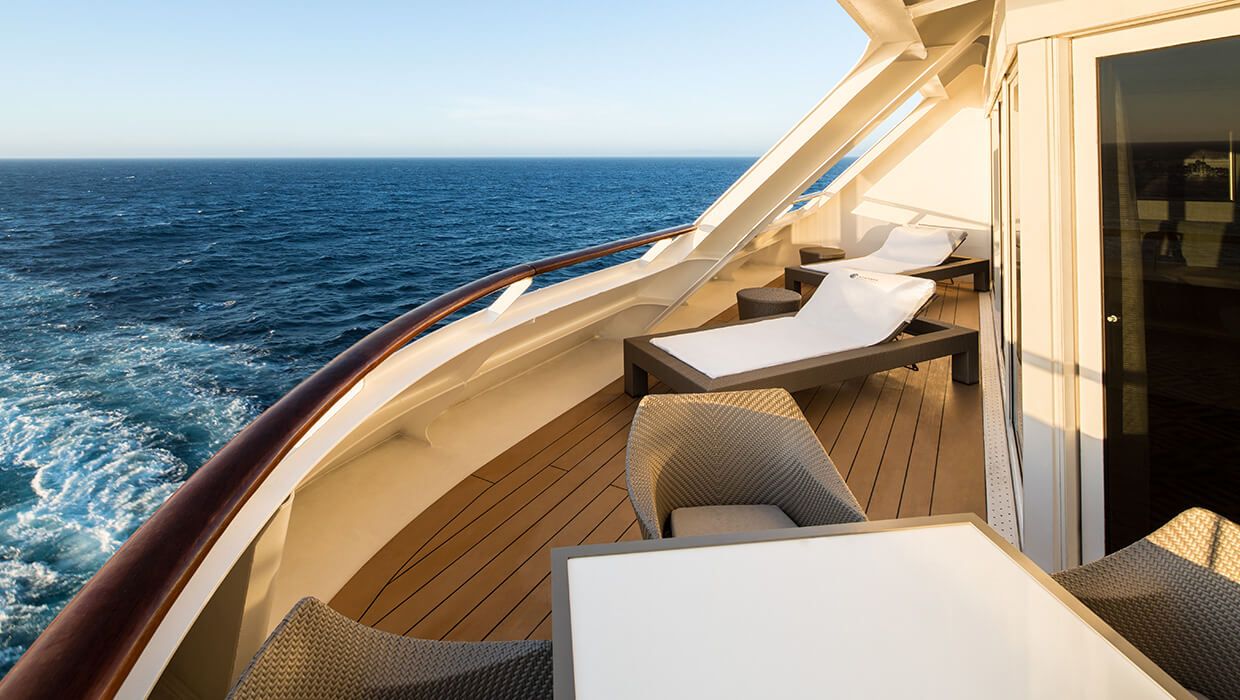
One of the best ways to experience the jaw-dropping sights of the Fjords of Norway, and the mesmerising Mediterranean Sea coast lines is from your private veranda. It’s just one of the many benefits exclusive to your wonderfully spacious suite aboard Azamara Pursuit.
Escape to a private retreat of polished style, featuring contemporary décor, luxurious linens, plush cotton robes and slippers, French bath products, fresh flowers, turndown treats, and 24-hour room service. (Perhaps we should arrange for a wake-up call
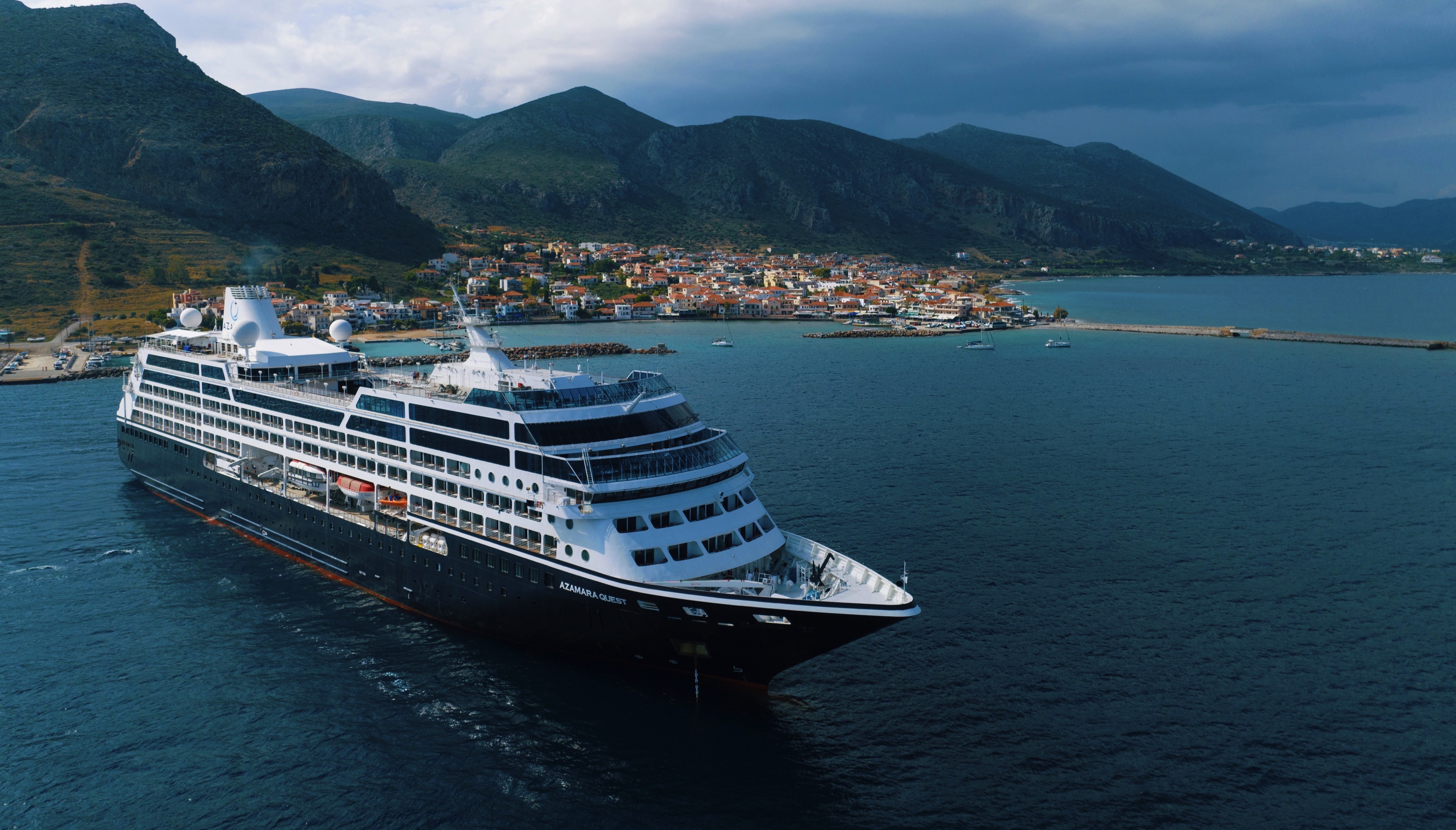
Ship Facts
| Launch Year | 2000 | ||||||||||
| Refit Year | 2019 | ||||||||||
| Language | en-US | ||||||||||
| Gross Tonnage | 30277 | ||||||||||
| Length | 180 | ||||||||||
| Width | 25 | ||||||||||
| Currency | USD | ||||||||||
| Speed | 18 | ||||||||||
| Capacity | 704 | ||||||||||
| Crew Count | 408 | ||||||||||
| Deck Count | 8 | ||||||||||
| Cabin Count | 352 | ||||||||||
| Large Cabin Count | N/A | ||||||||||
| Wheelchair Cabin Count | 6 | ||||||||||
| Electrical Plugs |
|
Deck 11
- Sun Deck
- Shuffle Board

Deck 10
- The Living Room
- Card Room
- In Touch
- Table Tennis
- Jogging Track
- The Drawing Room
- Aqualina Speciality Dining
- Prime C Speciality Dining

Deck 9
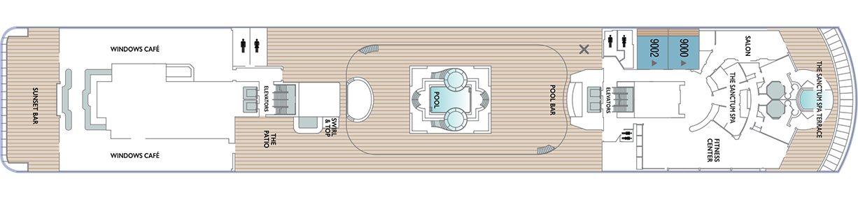
- The Sanctum Spa Terrace
- Salon
- Fitness Centre
- The Sanctum Spa
- Pool Bar
- Pool
- Swirl & Top
- The Patio
- Windows Café
- Sunset Bar
- Spa Suites
Deck 8
- Continent Suites
- World Owner's Suites
- Veranda Plus Staterooms
- Interior Stateroom

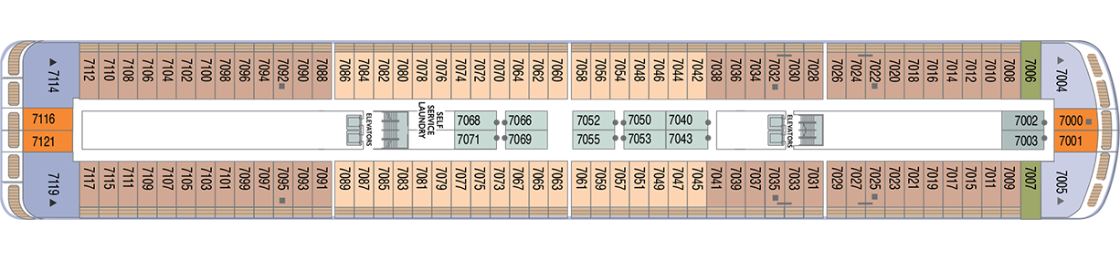
Deck 7
- Veranda Plus Staterooms
- Veranda Staterooms
- Ocean Suites
- Oceanview Staterooms
- Interior Staterooms
- Self Service Laundry
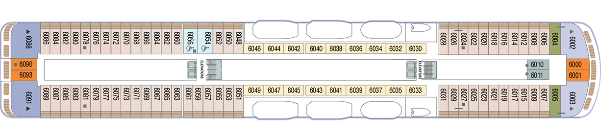
Deck 6
- Veranda Plus Staterooms
- Veranda Staterooms
- Ocean Suites
- World Owner's Suites
- Continent Suite
- Oceanview Staterooms
- Interior Stateroom
Deck 5
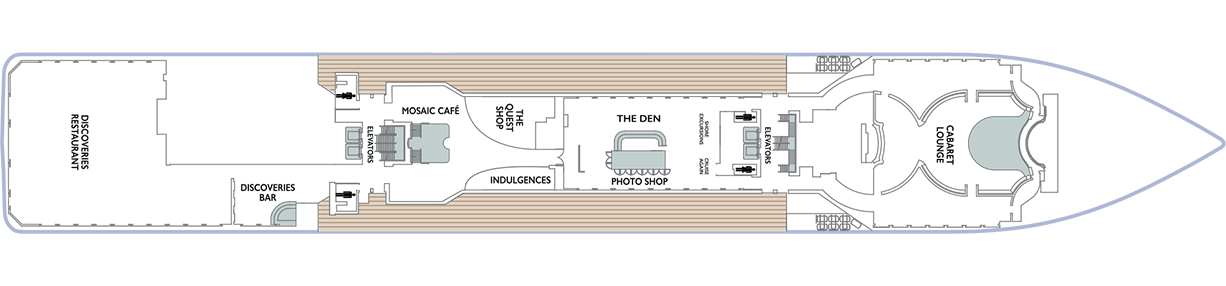
- Cabaret Lounge
- Shore Excursions
- Cruise Again
- The Quest Shop
- The Den
- Photo Shop
- Indulgences
- Mosaic Café
- Discoveries Bar
- Discoveries Restaurant
Deck 4
- Ocean View Staterooms (x2 Accessible Staterooms)
- Interior Staterooms (x3 Accessible Staterooms)
- Guest Relations
- Concierge Desk
- Medical Facility

Fresh ingredients, careful preparation and a variety of menu choices. Azamara offers a choice of six distinctive dining options, including room service. Whether you’re a fan of haute cuisine or down-home cooking, expect the same delicious quality. Bon appétit! Buon appetito! ¡Buen provecho! No matter how you say it, you’re in for a real treat.
We’re excited to share that starting 1 December 2025 you’ll be able to reserve your specialty dining experiences 150 days prior to your upcoming cruise — including selecting the day and time that works best for you! Whether you’re savouring authentic Italian flavours at Aqualina, indulging in perfectly grilled steaks at Prime C, or enjoying a world of tastes at The Chef’s Table, booking early gives you the perfect opportunity to plan and enjoy each culinary moment at your convenience.
Aqualina
At Aqualina, you’ll find some of Italy’s most authentic dishes. Pastas made from scratch, traditional recipes, and scrumptious vegetarian dishes that make sure there’s something for everyone. Plus our famous desserts: Sorrento lemon liqueur mousse, hazelnut chocolate soufflé and more.
If you're in the mood for fantastic Italian- inspired cuisine, make a reservation at Aqualina, one of our onboard specialty restaurants. Aqualina will satisfy your taste for sumptuous fare in a relaxed yet positively chic atmosphere.
Prime C
Your choice of steak, cooked to perfection. Herb-coated rack of lamb, duck confit and Chilean sea bass—all paired with savoury sides. At Prime C, you’re in for more than delectable dining. Expect a great evening with stunning views and lush décor.
Your choice of steak, cooked to perfection. Crab & lobster cakes with fennel-aioli. Herb-coated rack of lamb, duck confit and Chilean sea bass - all paired with savoury sides. At Prime C, you're in for more than delectable dining. Expect an great evening with stunning views and lush décor.
And, if our chef has made a visit to a local market. you'll also have an authentic local dish to look forward to.*
The Wine Cellar
You’ll be hard-pressed to find such a collection of limited production, small label and rare vintage wines anywhere on the high seas! And with vintages from France to California, and Argentina to South Africa, you’re sure to find a wine to suit your palate and your journey. Our knowledgeable sommeliers can help you pick the perfect wines for your evening meal.
Discoveries Restaurant
Discover the world through dishes and flavours from the places we visit. Of course, you’ll also enjoy a wide variety of nightly selections such as filet mignon with black truffle sauce. Reservations are not accepted. Choose being seated at a table for two or as part of a larger group of fellow guests.
With open seating and delicious nightly selections, our main restaurant is not to be missed. You'll find all your classic dinner favourites, very likely with a different twist, like gulf shrimp with cognac and garlic or a filet mignon with black truffle sauce.
The Patio and Swirl & Top
Casual “pool grill” by day. A sit-down al fresco dining experience by night. Taste your way around the world with exclusive personalised dishes using local flavours of the places we visit. Plus a self-serve frozen yogurt station—Swirl & Top. With a variety of flavours and your choice of toppings, it’s the perfect way to cool off.
While a casual "pool grill" during the day, in the evening this venue will be completely transformed into a sit-down al fresco dining experience. Nice tablecloths and candles will set the mood while a reimagined menu will be served by our Pool Grill wait staff. In addition, a self-serve frozen yogurt station Swirl & Top - can conclude your meal with a variety of flavours and your choice of toppings.
Mosaic Cafe
Stylish and cozy, Mosaic offers your favourite coffee drinks exactly as you like them. Relax in a comfortable seat and enjoy. It’s the perfect spot to start or end your day, and it just might become your favourite place on the ship.
Windows Café
Our daily themed dinner often takes its inspiration from the region we’re visiting—Indian, Mexican, Spanish, Italian. We also create an extra live station made from local ingredients purchased in port: Greek salad made with local feta (Greece), pasta prepared with local mushrooms (Italy), fresh Mussels served with garlic bread (Netherlands).
Take in the fresh breeze at an outdoor table in Windows Café, our casual buffet offering made- to-order breakfasts and a large variety of lunch and dinner options. Choices change daily and include fresh sushi, stir-frys and pastas, salads, an assortment of entrees and sides, a carving station and sumptuous desserts.
Room Service
The best time for room service? Whenever you say it is, 24-hours a day. Order from the full breakfast menu between 6:30 AM and 10:00 AM, and we’ll deliver at your appointed time. Lunch and dinner room service features a menu of hearty soups, fresh salads, gourmet sandwiches, pizzas and desserts.
The Azamara experience doesn’t pause when you depart a destination, it continues onboard with our top-tier dining, world-class entertainment and relaxing spa experiences.
Bars, Lounges & Gathering Spots
A cozy nook to sip coffee. An intimate space to raise a glass and celebrate. A lively setting to catch the latest shows and international entertainment. Watch the world go by, drink in hand from any of Azamara’s bars, lounges, and gathering spaces.
SOME OF THE MOST STYLISH WATERING HOLES ANYWHERE, CONVENIENTLY LOCATED AT SEA.
From port to port, our onboard venues are the perfect place to unwind after a day of onshore discovery, to connect over drinks both before and after dinner, or take in a one of a kind show. And, with Azamara’s Beverage Packages you can indulge in a superb collection of fine wines, premium spirits, and more—without reaching for your wallet.
Lounges - From port to port, our onboard venues are the perfect place to unwind after a day of onshore discovery, to connect over drinks both before and after dinner, or take in a one of a kind show. And, with Azamara’s Beverage Packages you can indulge in a superb collection of fine wines, premium spirits, and more—without reaching for your wallet.
Entertainment & Activities
Sit back and enjoy your evenings on a high note with our onboard entertainment. From local cultural shows to our playbill that features a variety of amazing performances to keep you entertained while onboard.
From the music that makes your heartstrings sing to the best of Broadway, Azamara's Signature Singers & Dancers are guaranteed to entertain. Plus a little shopping as a bonus.
Onboard Shopping
You’ll find a tasteful collection of merchandise, beautiful jewellery and watches—and the promise of discovery and delight—in our signature shops. Window shop or select gifts for friends and family. Then, indulge yourself as you encounter the ideal memento of your truly extraordinary luxury cruise experience. Watch your daily news for specials and one-time offers that make shopping even more fun.
Mosaic @ Night
Our onboard coffee corner may very well become your favourite nook on the ship. With elegant and comfortable furniture, it's bound to be one of the the most stylish places, too. Find all your favourite coffee drinks crafted just the way you like. Slip right into a comfortable seat and sip for a while—you never know who'll walk by.
Discoveries Lounge
Located just outside Azamara’s main restaurant, this congenial bar is a favourite gathering place for pre- and post-dinner conversation and drinks. Bar service includes a full selection of fine wines, mixed drinks, and premium spirits…plus the entertaining banter of Azamara’s friendly bartenders.
The Living Room
The idea of the Living Room is just that. To “live in” and to enjoy time with friends and fellow guests! Much of the room is furnished as a living room, with clusters of large comfortable chairs and sofas....
It's the perfect space for guests throughout the day and evening to engage in lively conversations, take in interesting speakers, peruse art, play a game of cards, enjoy a cup of tea or coffee, wines & tapas, delightful music, or simply relax with a good book.
Card Room & In Touch
On the starboard side of the Living Room, guests will find the Card Room for those who love a round of Bridge or other games. Four computers and interactive table tops are available for guest use during the voyage.
Cabaret Lounge
Enjoy live performances of professional full-stage musical revues, classical soloists, bands and other entertainment in our Cabaret Lounge featuring a full bar. You could see as many as four distinctly different shows while onboard. And considering the cost of theatre and entertainment tickets back home, isn't that nice?
The Den
This lounge exemplifies our dedication to Destination Immersion® experiences. The Den inspires you with tools to travel to all corners of the world with tools to travel to all corners of the world with travel books, guides, and destination-focused activities.
The Drawing Room
This library is one of the quiet jewels of Azamara, a peaceful and beautifully appointed space for reading or relaxing after dinner. Browse the collection and feel free to borrow the library books. Or simply relax in the tranquil atmosphere. But our library goes beyond just paper, we have interactive digital tabletops so you can make your own postcards and post to social media to share your adventures with the folks back home. The library is also home to our impressive Inspiration Center—a digital way to explore the world with Azamara and gain inspiration for your next voyage.
The Drawing Room turns into a gorgeous dining room on the evening of the elegant Best of the Best dinner for Owner’s Suite guests.
Onboard Fun
A little friendly competition is healthy. Unwind with our stellar selection of onboard activities aimed at stoking your inner competitor. Go head-to-head with friends and other ship guests with a collection of tournaments that include darts, ping pong, shuffle board and more. Test your pop culture knowledge at trivia, your luck at bingo, or hone your creativity with arts & crafts. From line dancing classes to Q&A sessions—and everything in between—the greatest fun happens to be at sea.
Live Music
From our cocktail pianist in The Den, to our Quartet in the Living Room, there is music for every taste. Our five-piece band will entertain you every night. You can enjoy a myriad of music genres, even on request. Late night in the Living Room is when the DJ features great dance music and the occasional karaoke night.
White Night
Join Azamara officers and crew for our signature dinner and entertainment event hosted al fresco on the pool deck (weather permitting). With an array of delicious food and engaging entertainment, your White Night experience will almost certainly be one of the most memorable times from your voyage. And don’t forget to bring something white to wear for the evening.
AzAmazing Celebrations
Authentic Experiences! - In 2011, we launched AzAmazing Evenings as an experiential way for our guests to dive deeper into cultures and traditions around the world. Since then, these bespoke one-of-a-kind events, exclusively created for and attended by our guests, are one of the Destination Immersion® highlights of an Azamara Cruise.
Unforgettable Performances - This year, we’ve expanded our portfolio by adding over 30 new celebrations in the most spectacular ports. Be captivated by an enchanting operatic experience in the village of San Pantaleo in Sardinia or go back in time as you step into a vibrant medieval festival with knights and jesters in the historic Dover Castle in the English countryside. No matter the voyage, these unparalleled experiences will be the highlight of your trip.
This One's On Us - Best of all, AzAmazing Evenings are included, with our compliments, on all cruises except transatlantic crossings and voyages that are less than seven nights long. Reserve your seat by accessing the Shore Excursions section of your reservation at no additional cost.
Sun Deck
This deck is available for guests enjoying the sun and views from high up. It is also a beautiful vantage point for sunsets (or sunrises), and a quiet stroll at night. For those who love shuffle board, this is the place to go.
The Pool
Join Azamara officers and crew for our signature dinner and entertainment event hosted al fresco on the pool deck (weather permitting). With an array of delicious food and engaging entertainment, your White Night experience will almost certainly be one of the most memorable times from your voyage. And don’t forget to bring something white to wear for the evening.
Pool Bar
Our Pool Bar serves refreshments while enjoying the Pool during the day, and cocktails of your choice in the evening.
Sunset Bar
Adjacent to Windows Café, the Sunset Bar is a welcoming outdoor patio with covered and open -air seating, and a bar. It's the perfect place for dining alfresco, enjoying a refreshing drink, taking in the sights of your favourite port, or simply watching the world sail by.
Photo Shop
Our photographers capture both fun and professional photos throughout the voyage, whether it is your portrait, or photos of the destinations you visit. You can also find an assortment of supplies for your own photographic endeavours.
Indulgences
Aptly named, Indulgences will satisfy your desires for the finer things in life. If you are looking for designer jewellery, it's the perfect place to window shop or to find that extra special purchase.
The Quest Shop
It's one-stop shopping in The Pursuit Shop. Apparel, sundries, handbags, candies, souvenirs and lots more await. If you find that you forgot to pack something, chances are you'll find it in The Pursuit Shop.
Performances
Our playbill features a variety of amazing performances to keep you entertained while onboard. Sit back and enjoy your evenings on a high note with our onboard entertainment.
Club Crooner
Step into a swanky nightclub as the great songs of the most magnificent artists come alive on stage. From classic crooners such as Frank Sinatra and Tony Bennett, to current songbirds such as Natalie Cole and Michael Bublé, there’s a song for every time and everyone. Enjoy a beverage, sit back, and be serenaded by the melodies of our lives with CLUB CROONER!
Oh, What A Night
Get ready to be transported to the world’s most beloved travel destinations in one exhilarating night. As we explore all four seasons in a new city, travel along with our dynamic Signature Singers & Dancers as they sing and dance their way through an eclectic mix of music from around the world. Come and experience Oh, What A Night!
Take Two
Get ready to grab your clicker and turn up the volume as we take a trip down memory lane celebrating the most cherished movie soundtracks of all time. As we flip through the channels together, you will be taken back to a time when stars were born, the ring is open, and yes... ghosts really do exist. We invite you to sit back, relax and enjoy the music of the movies! Lights... Camera... ACTION! TAKE TWO!
Britrock!
Join your Signature Singers and Dancers, along with your Azamara band, to celebrate the music that includes famous British musical artists such as Adele, Dusty Springfield, Elton John, George Michael, The Beatles and more! Azamara invites you to sing along, as we hit the playback button and take a stroll down memory lane to relive the music that is BRITROCK!
Guest Entertainment
Imagine an authentic slice of the Big Apple on board your boutique hotel at sea. The Cabaret Lounge features amazing entertainers in an intimate, engaging atmosphere. It all makes for one inspiring Broadway experience. But it doesn’t stop there. Add in a few magic tricks, a little bit of comedy and unique instrumentalists, and you have something to delight everyone.