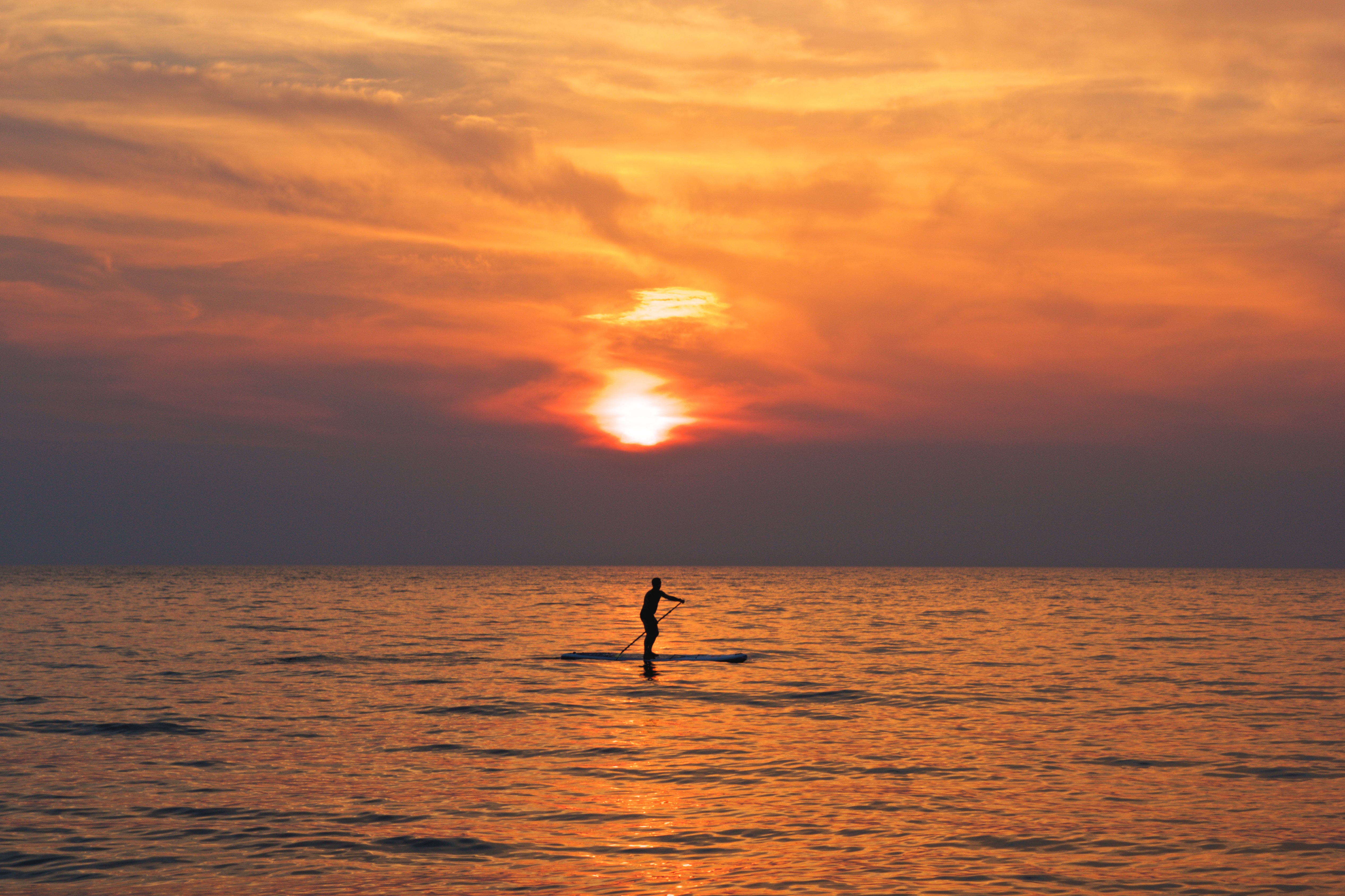
Athens to Miami Grand Voyage
Athens to Miami Grand Voyage
Cruise overview
WHY BOOK WITH US?
- ✔ The Deluxe Cruises’ team has extensive experience in ultra-luxury cruising.
- ✔ Call now to speak to our helpful and experienced Cruise Concierge team.
- ✔ Enjoy our Unique Deluxe Cruises Bonus for substantial savings.
- ✔ Our team will tailor your holiday to your exacting requirements.
- ✔ As agents, we work under the protection of each cruise lines ABTA / ATOL licences
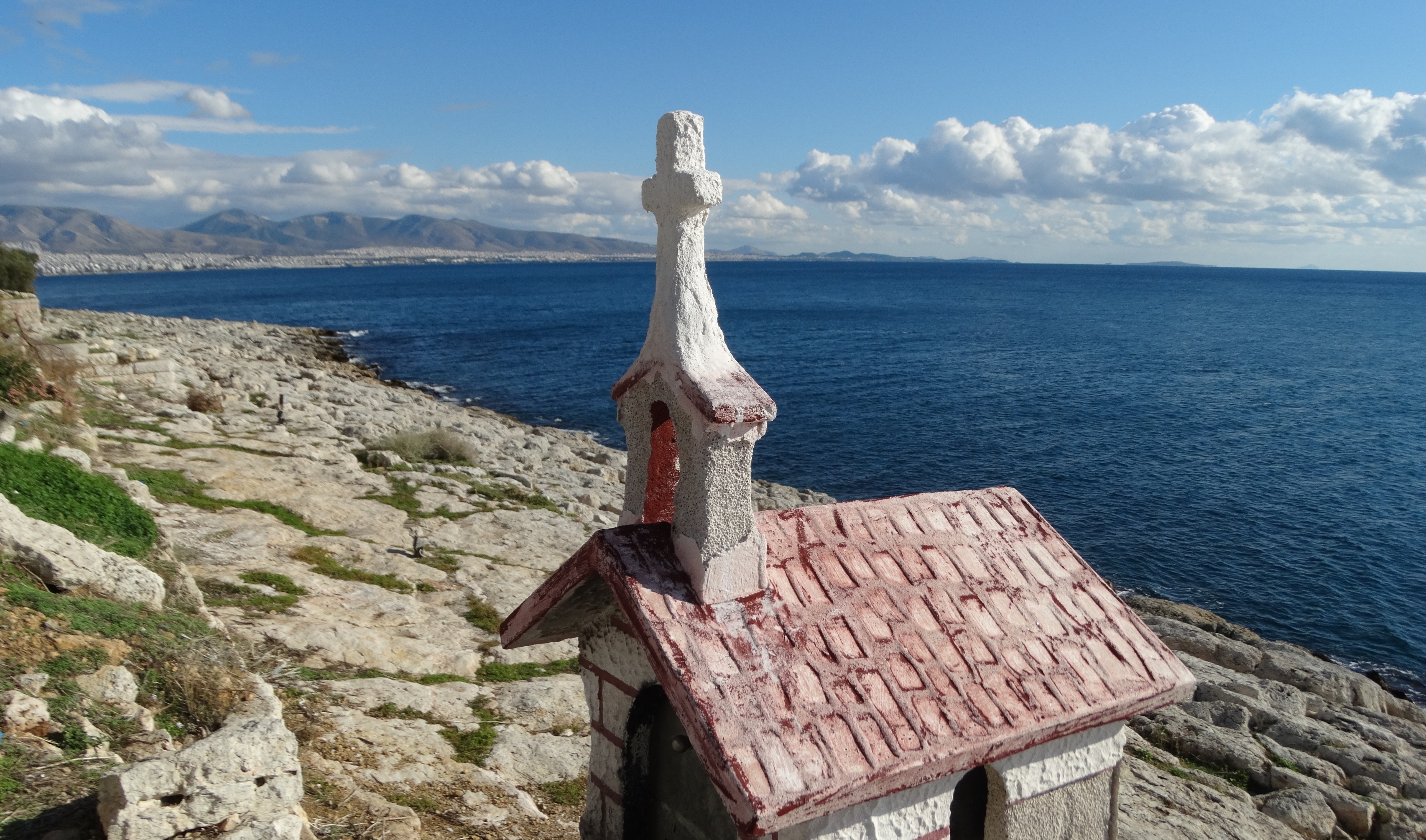
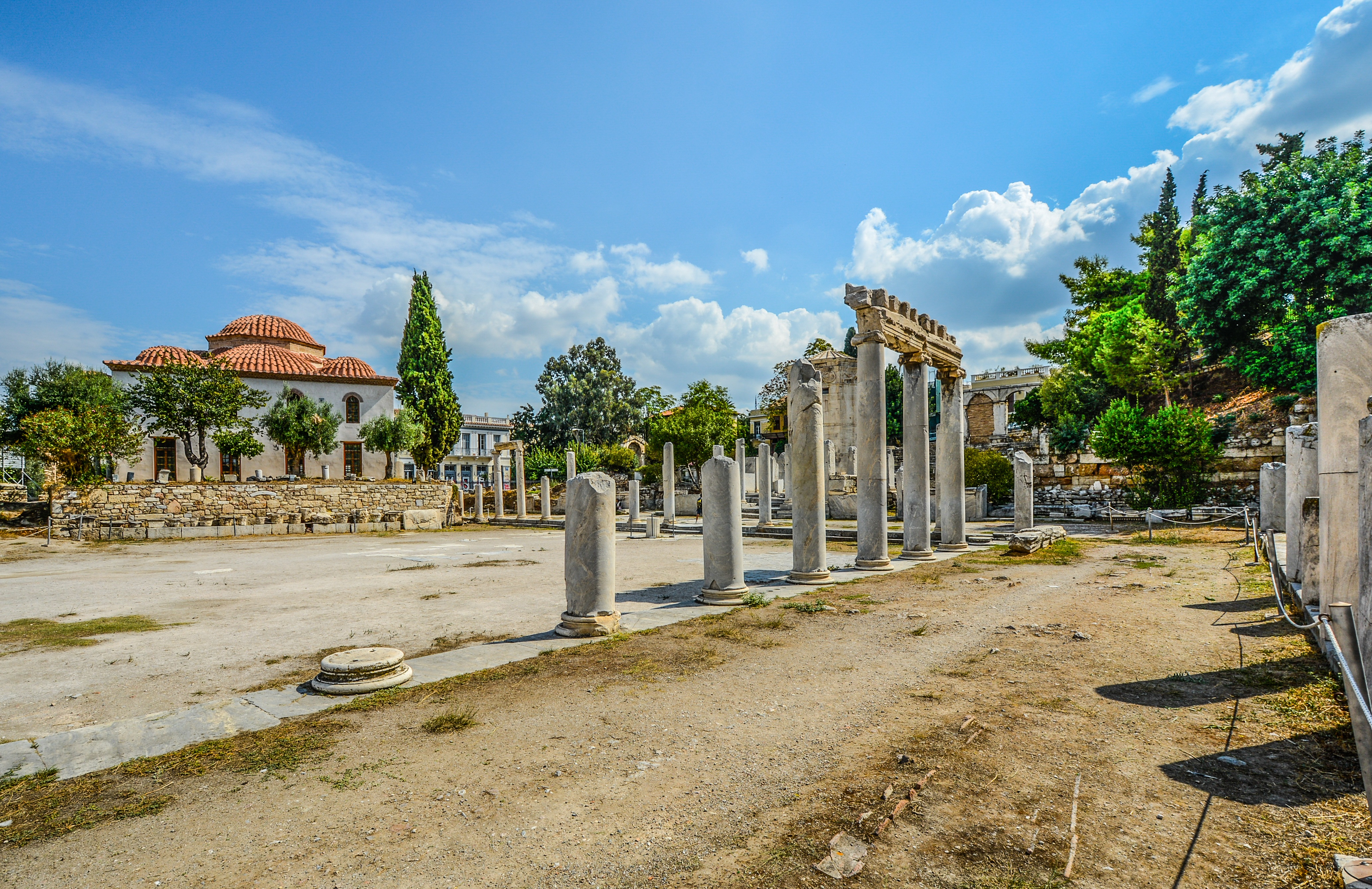
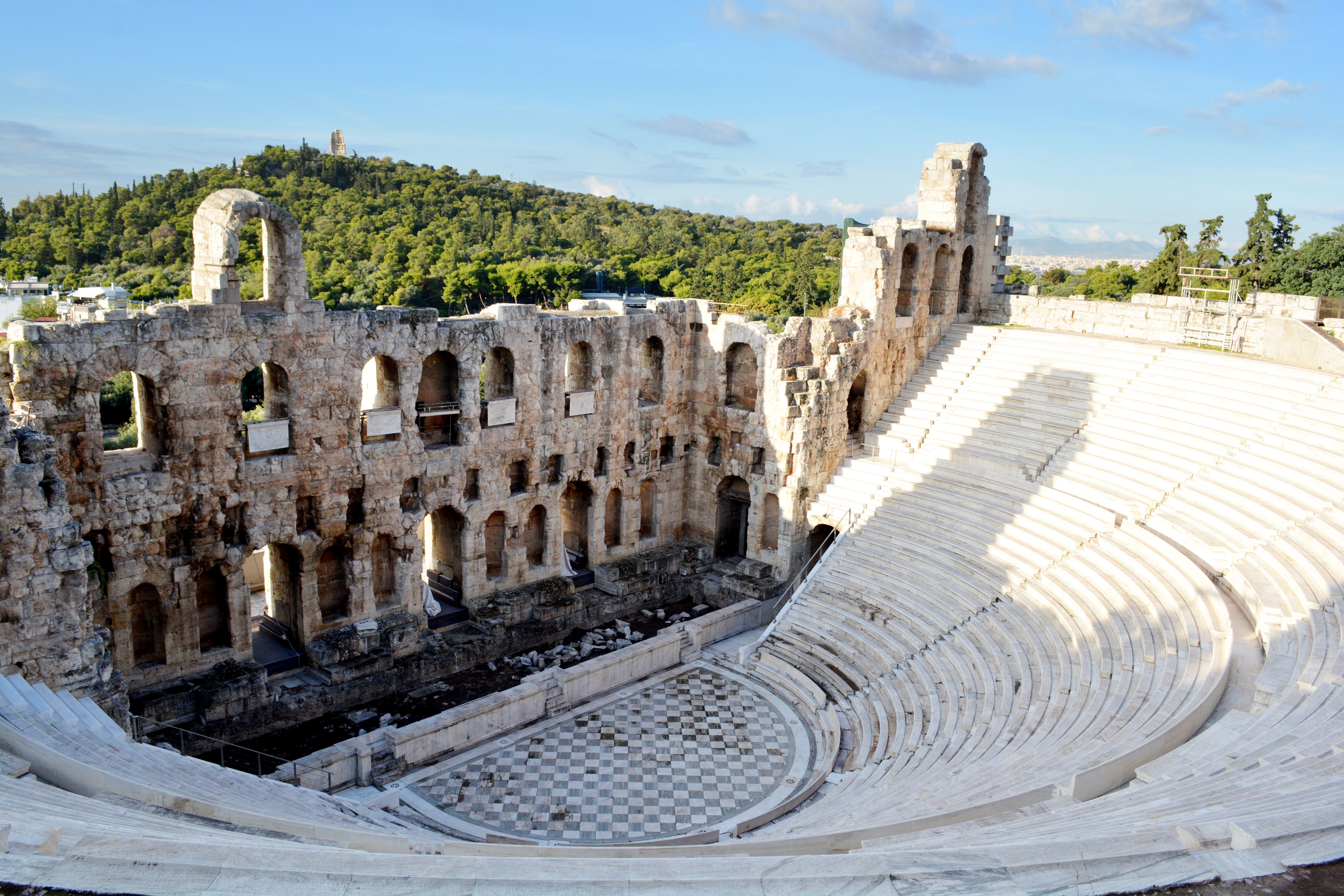
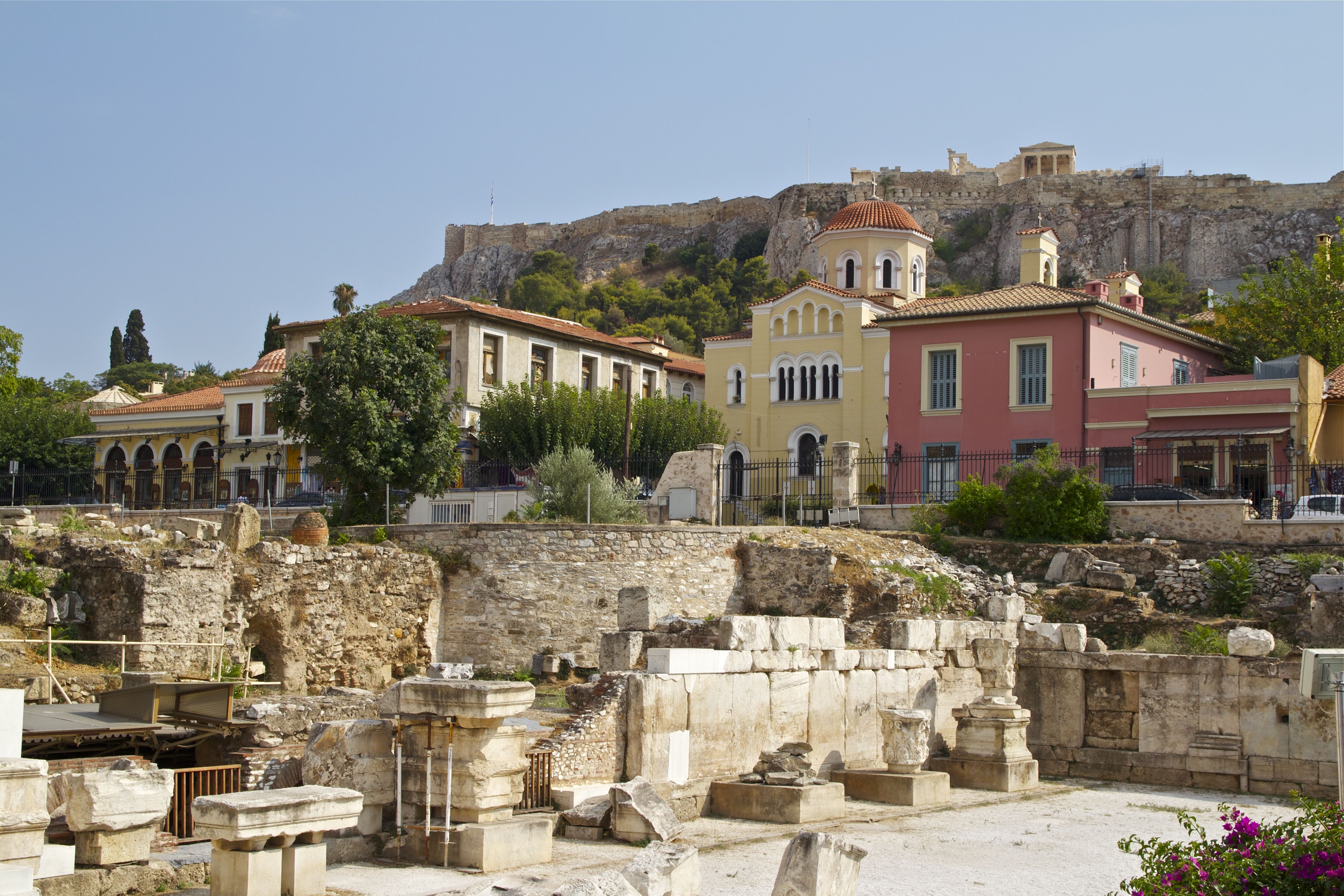
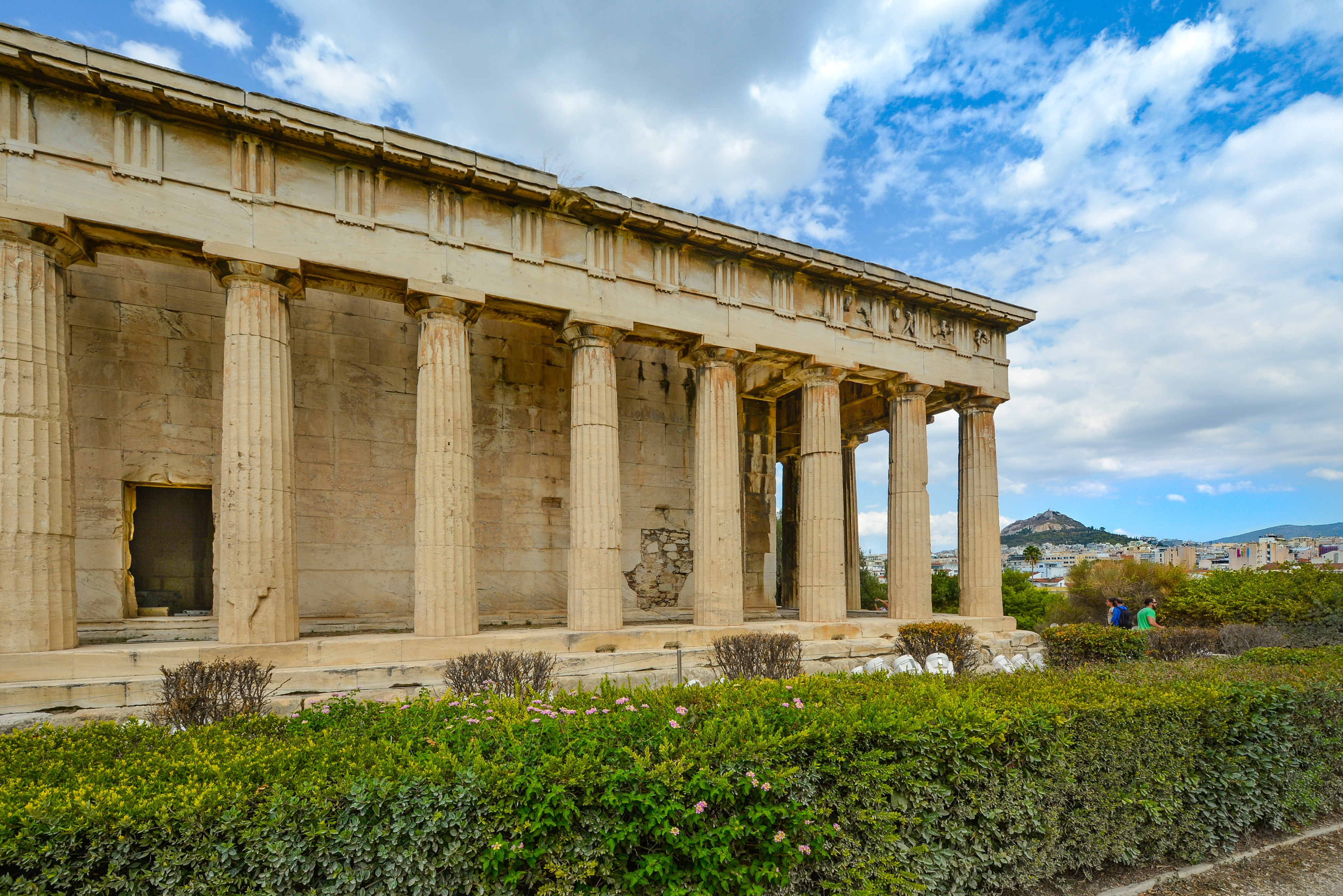
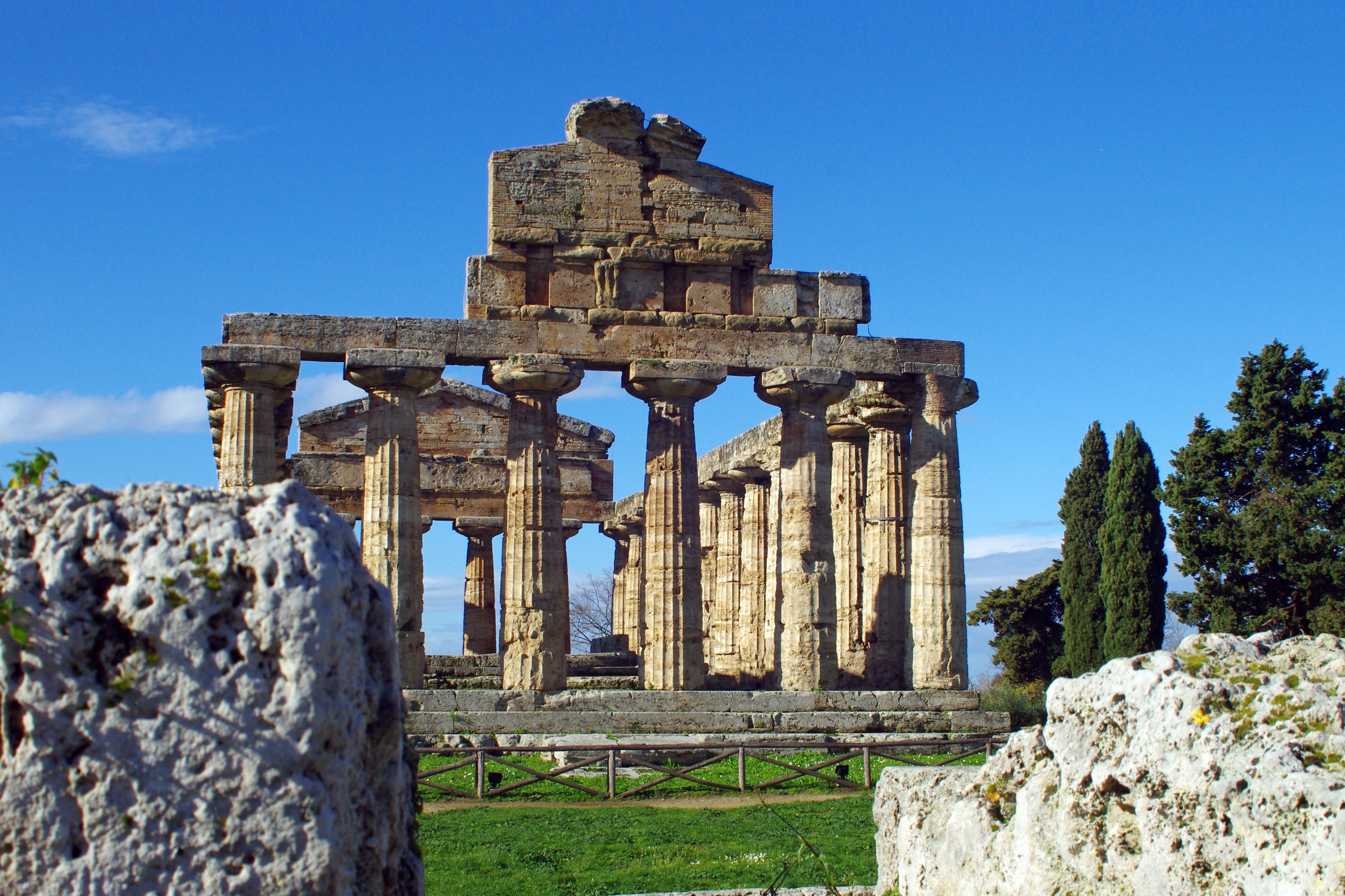
About Athens

About Katakolon
Katakolon could not seem less of a cruise port if it tried. A tiny enclave clinging to the western Peloponnese coast, it's a sleepy place except when ships dock. But it's a popular cruise destination because of its proximity to Olympia. Ancient Olympia was one of the most important cities in classical Greece. The Sanctuary of Zeus was the city's raison d'être, and attracted pilgrims from around the eastern Mediterranean, and later the city played host to Olympic Games, the original athletic games that were the inspiration for today's modern sporting pan-planetary meet. At the foot of the tree-covered Kronion hill, in a valley near two rivers, Katakolon is today one of the most popular ancient sites in Greece. If you don't want to make the trip to Olympia, then Katakolon is an ideal place for a leisurely Greek lunch while you watch the fishermen mend their nets, but there's just not much else to do there.
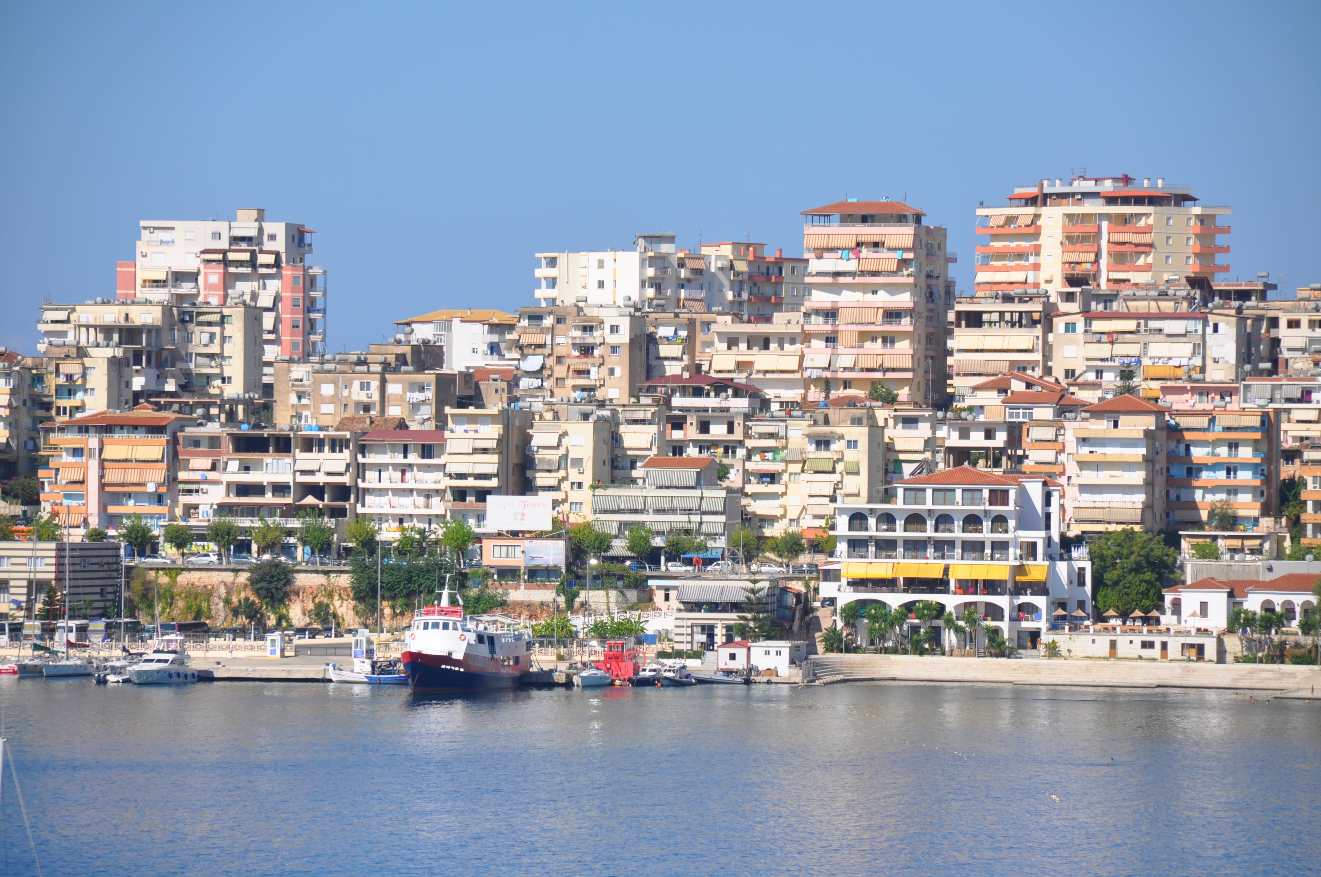
About Sarandë
Sarandë is a city in southern Albania on the coast of the Ionian Sea. Sarandë can be reached easily from the Greek island of Corfu by ferry. An early Christian monastery dedicated to 40 saints (Santi Quaranta) gave Sarandë its name. The city center of Sarandë has been scarred by communist architecture but since the fall of communism many small shops and bars have sprung up which give it a Mediterranean feel. This southernmost harbour of Albania was once the ancient port of Onchesmos. Today, Sarandë’s main attractions are its sunny climate and the nearby ruins of Butrint. Please Note: For your convenience, shore excursions offered for this port of call are available to reserve in advance at www.silversea.com, unless otherwise noted in the description. The deadline to reserve these tours is August 19, after which they will be available for purchase on board, unless otherwise noted in the description. Pier Information The ship is scheduled to anchor at Main Pier. The town center is 875 yards from the pier. Taxis are generally available at the pier. Shopping Typical souvenirs include t-shirts, postcards, wood carvings and dolls in national costume. Cuisine Albanian cuisine has been strongly influenced by Turkey. Grilled meats like shisqubap (shish kebab), romstek (minced meat patties) and gofte (meat balls) are served all across the Balkans. Some local dishes include comlek (meat and onion stew), fërges (a rich beef stew), rosto me salcë kosi (roast beef with sour cream) and tavë kosi (mutton with yoghurt. Lake Shkodra carp and Lake Ohrid trout are the most common fish dishes. Try the ice cream (akullore), which is popular everywhere. Other Sites Blue Eye Spring The iridescent blue water gushes from the depths of the earth and feeds the Bistrica River. Catacombs Recently discovered catacombs of the church of the Forty Saints can also be explored. Private arrangements for independent sightseeing may be requested through the Tour Office on board.
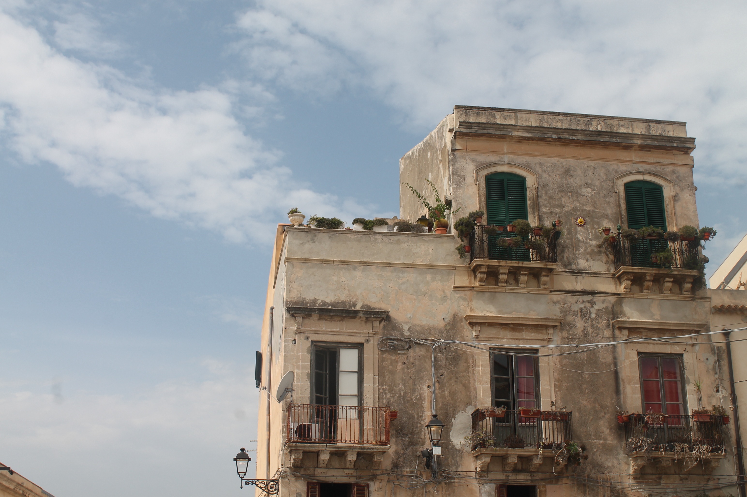
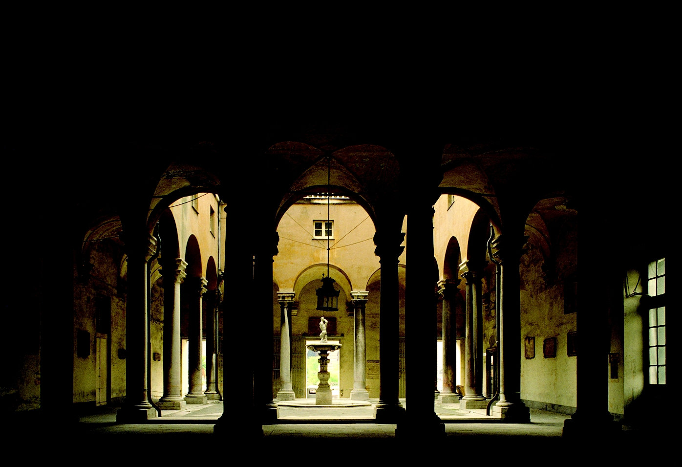
About Siracuse, Sicily
Siracusa, known to English speakers as Syracuse, is a wonder to behold. One of the great ancient capitals of Western civilization, the city was founded in 734 BC by Greek colonists from Corinth and soon grew to rival, and even surpass, Athens in splendor and power. It became the largest, wealthiest city-state in the West and a bulwark of Greek civilization. Although Siracusa lived under tyranny, rulers such as Dionysius filled their courts with Greeks of the highest cultural stature—among them the playwrights Aeschylus and Euripides, and the philosopher Plato. The Athenians, who didn't welcome Siracusa's rise, set out to conquer Sicily, but the natives outsmarted them in what was one of the greatest military campaigns in ancient history (413 BC). The city continued to prosper until it was conquered two centuries later by the Romans.Present-day Siracusa still has some of the finest examples of Baroque art and architecture; dramatic Greek and Roman ruins; and a Duomo that's the stuff of legend—a microcosm of the city's entire history in one building. The modern city also has a wonderful, lively, Baroque old town worthy of extensive exploration, as well as pleasant piazzas, outdoor cafés and bars, and a wide assortment of excellent seafood. There are essentially two areas to explore in Siracusa: the Parco Archeologico (Archaeological Zone), on the mainland; and the island of Ortygia, the ancient city first inhabited by the Greeks, which juts out into the Ionian Sea and is connected to the mainland by two small bridges. Ortygia is becoming increasingly popular with tourists, and is starting to lose its old-fashioned charm in favor of modern boutiques.Siracusa's old nucleus of Ortygia, a compact area, is a pleasure to amble around without getting unduly tired. In contrast, mainland Siracusa is a grid of wider avenues. At the northern end of Corso Gelone, above Viale Paolo Orsi, the orderly grid gives way to the ancient quarter of Neapolis, where the sprawling Parco Archeologico is accessible from Viale Teracati (an extension of Corso Gelone). East of Viale Teracati, about a 10-minute walk from the Parco Archeologico, the district of Tyche holds the archaeological museum and the church and catacombs of San Giovanni, both off Viale Teocrito (drive or take a taxi or city bus from Ortygia). Coming from the train station, it's a 15-minute trudge to Ortygia along Via Francesco Crispi and Corso Umberto. If you're not up for that, take one of the free electric buses leaving every 10 minutes from the bus station around the corner.
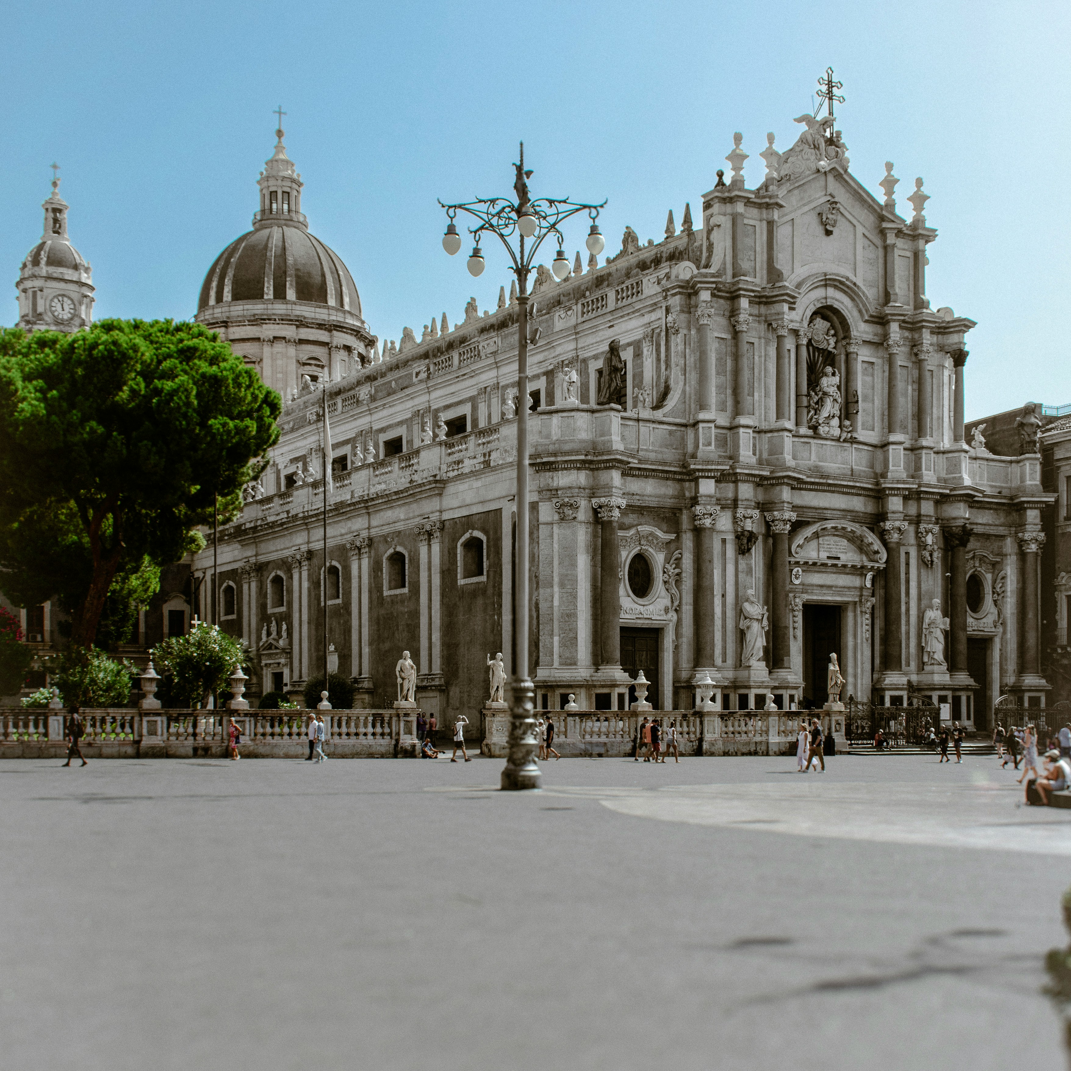
About Catania
Catania is an ancient port city on Sicily's east coast. It sits at the foot of Mt. Etna, an active volcano with trails leading up to the summit. The city's wide central square, Piazza del Duomo, features the whimsical Fontana dell'Elefante statue and richly decorated Catania Cathedral. In the southwest corner of the square, La Pescheria weekday fish market is a rowdy spectacle surrounded by seafood restaurants.
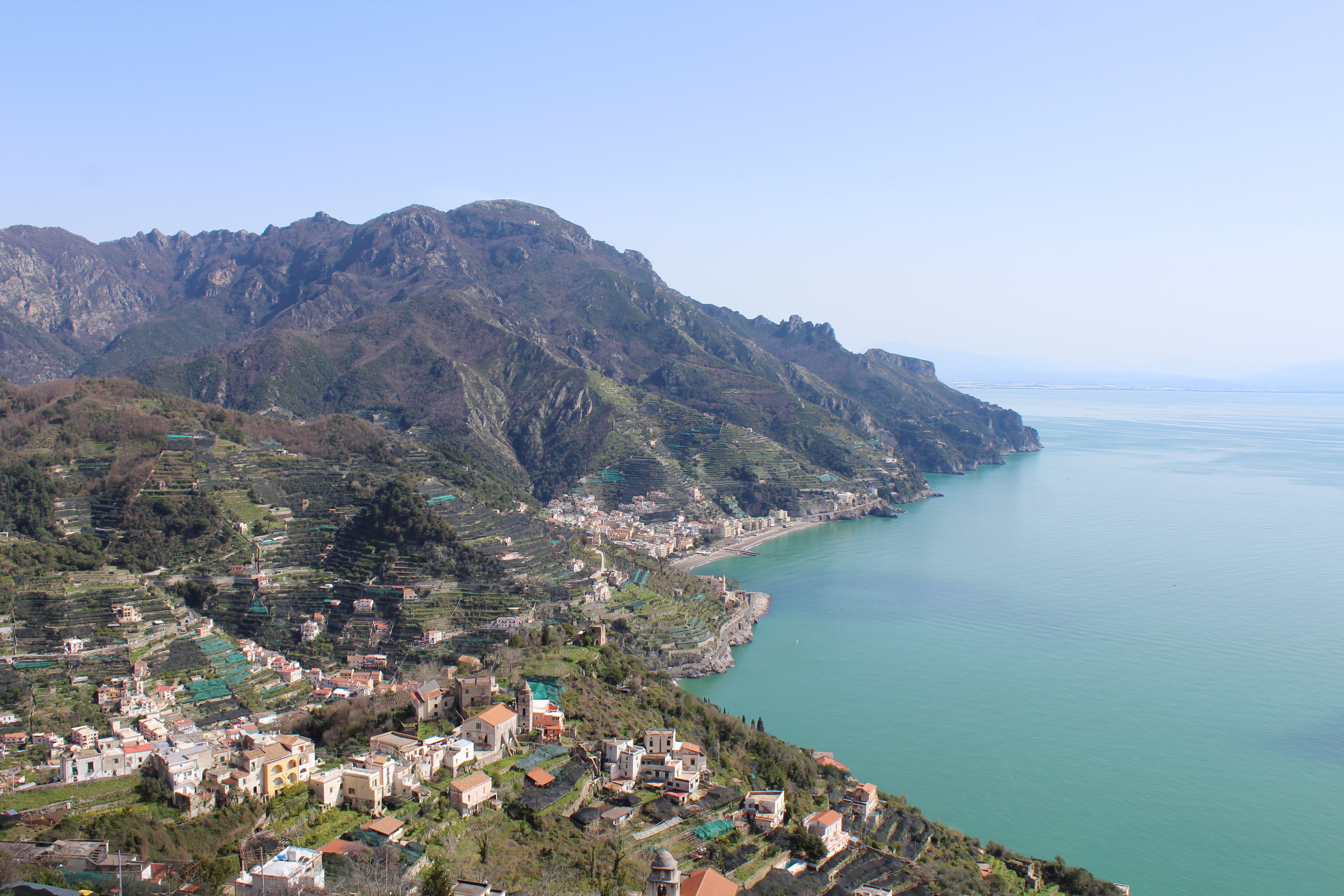
About Salerno
Salerno is an Italian city located on the Gulf of Salerno. Famous for being home to the first medical university, Salerno is a great destination for anyone looking for gorgeous sea views filled with sunshine and Italian food.
About Salerno
Salerno is an Italian city located on the Gulf of Salerno. Famous for being home to the first medical university, Salerno is a great destination for anyone looking for gorgeous sea views filled with sunshine and Italian food.
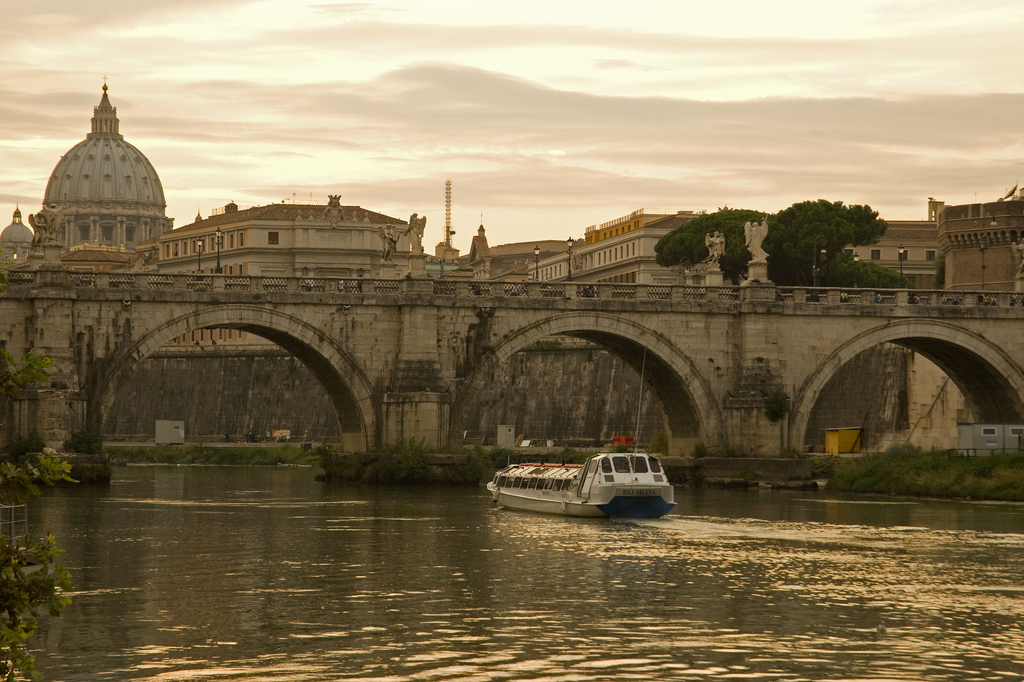
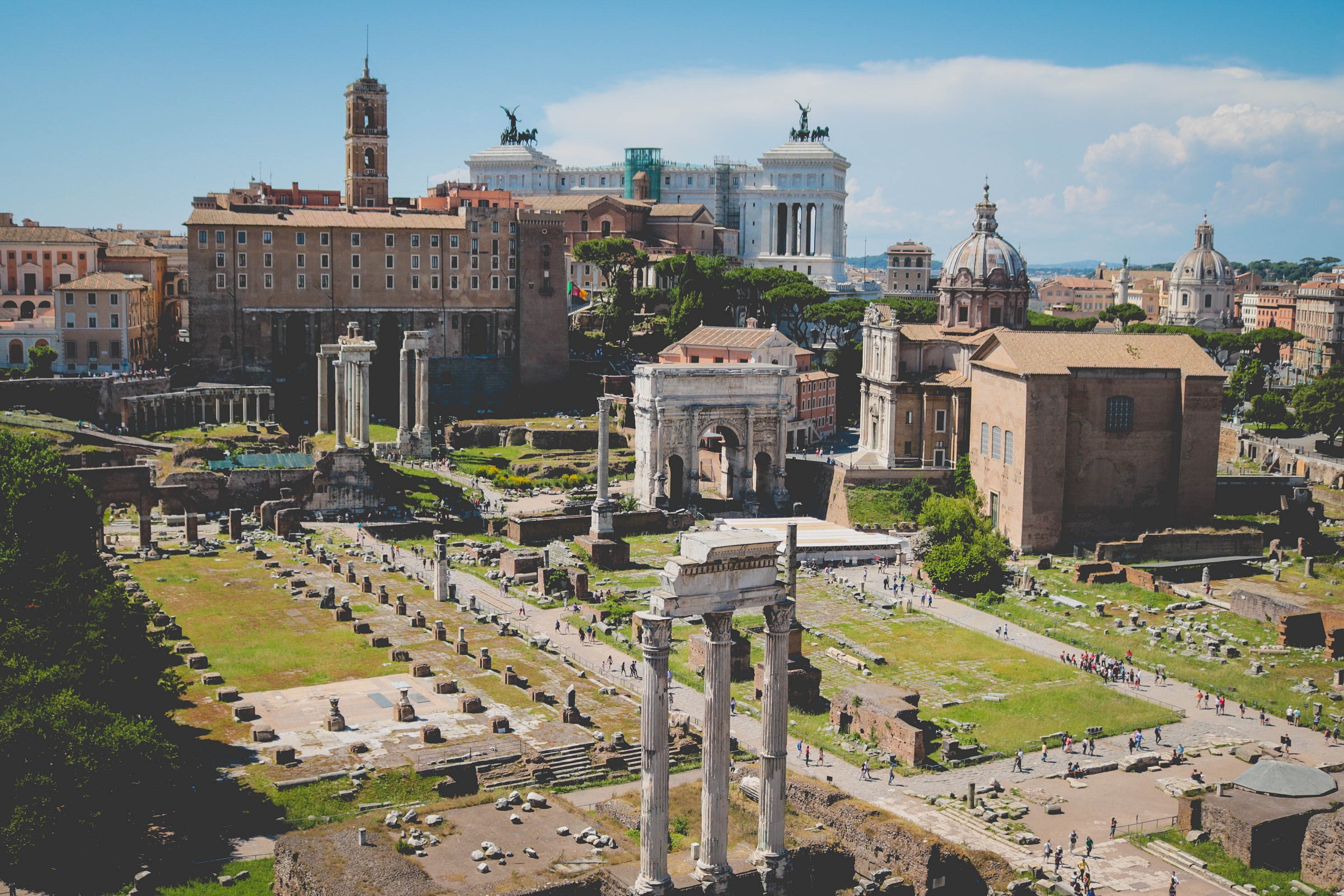
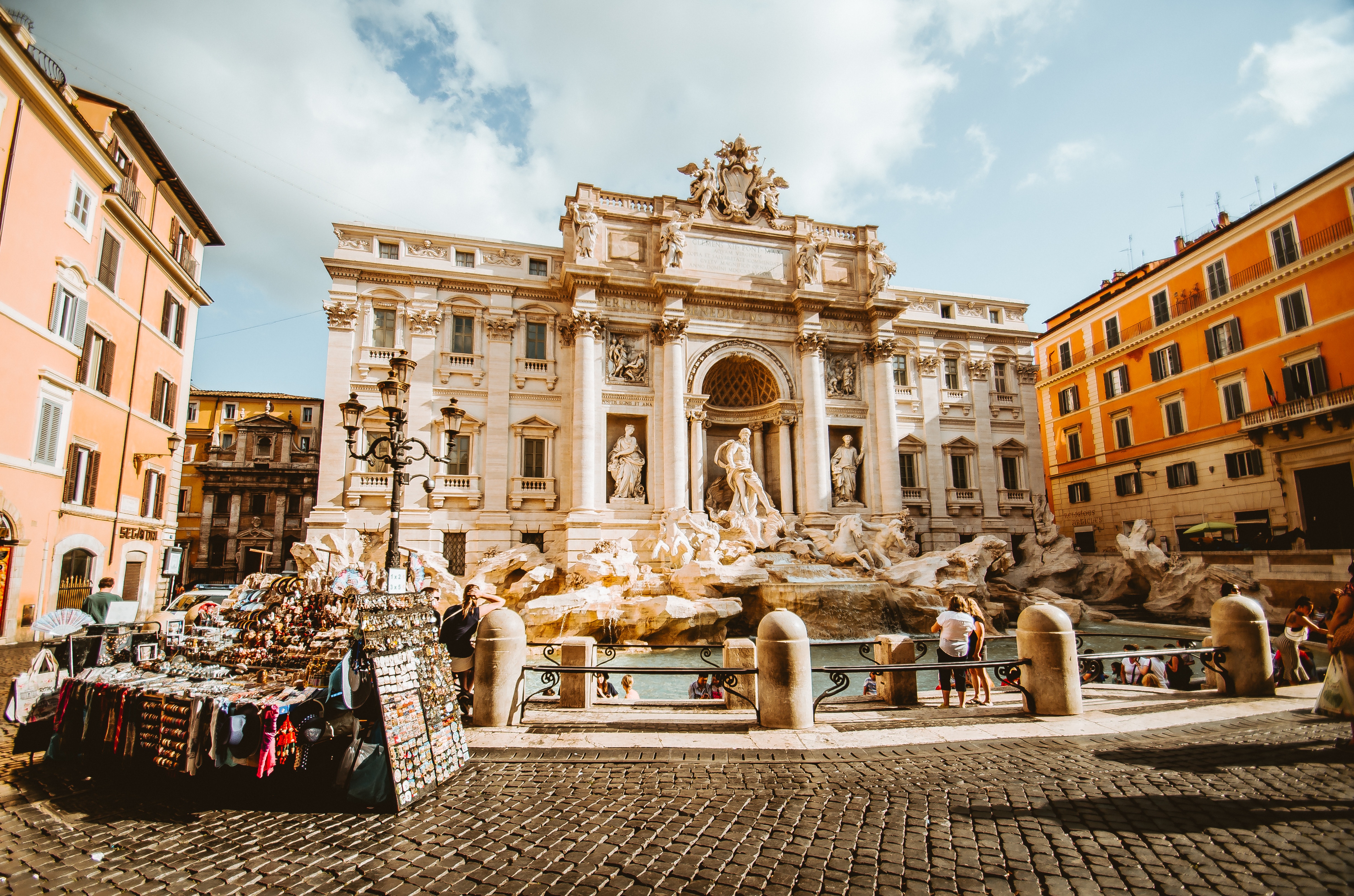
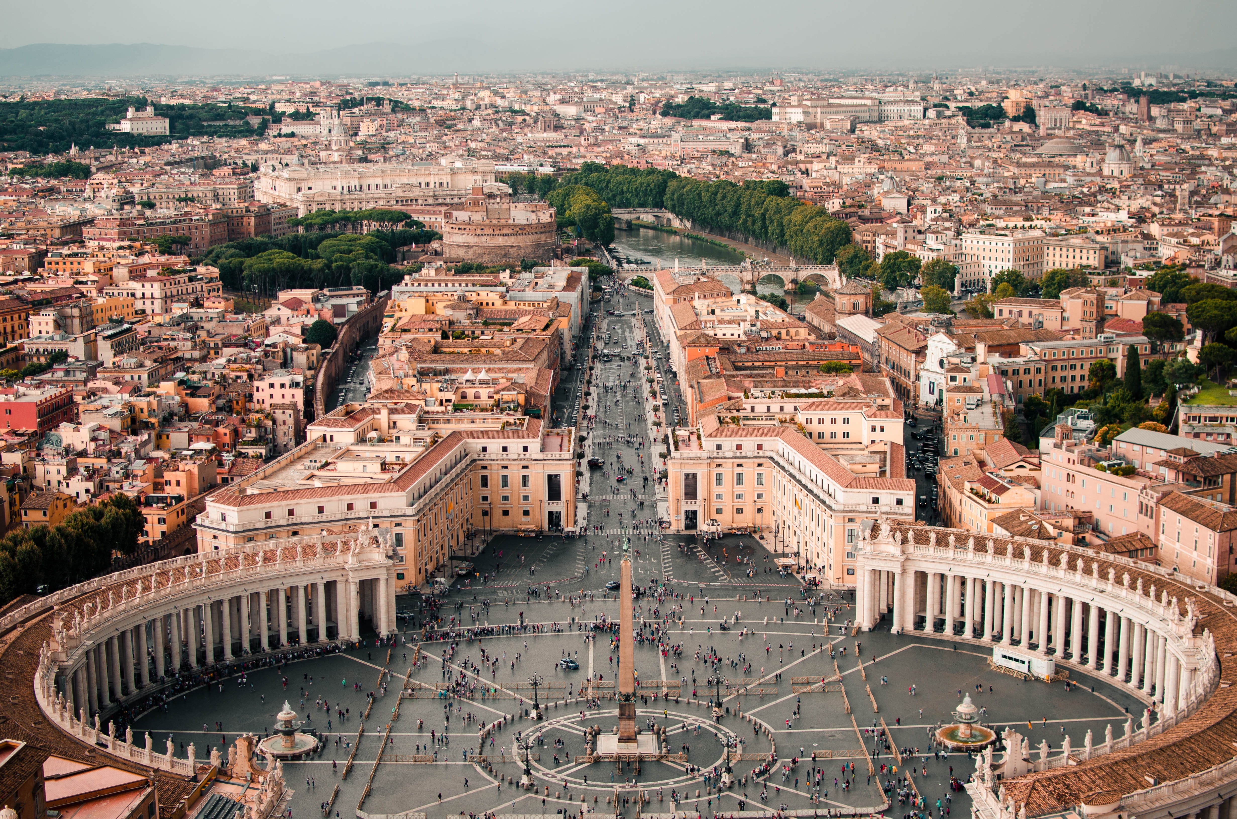
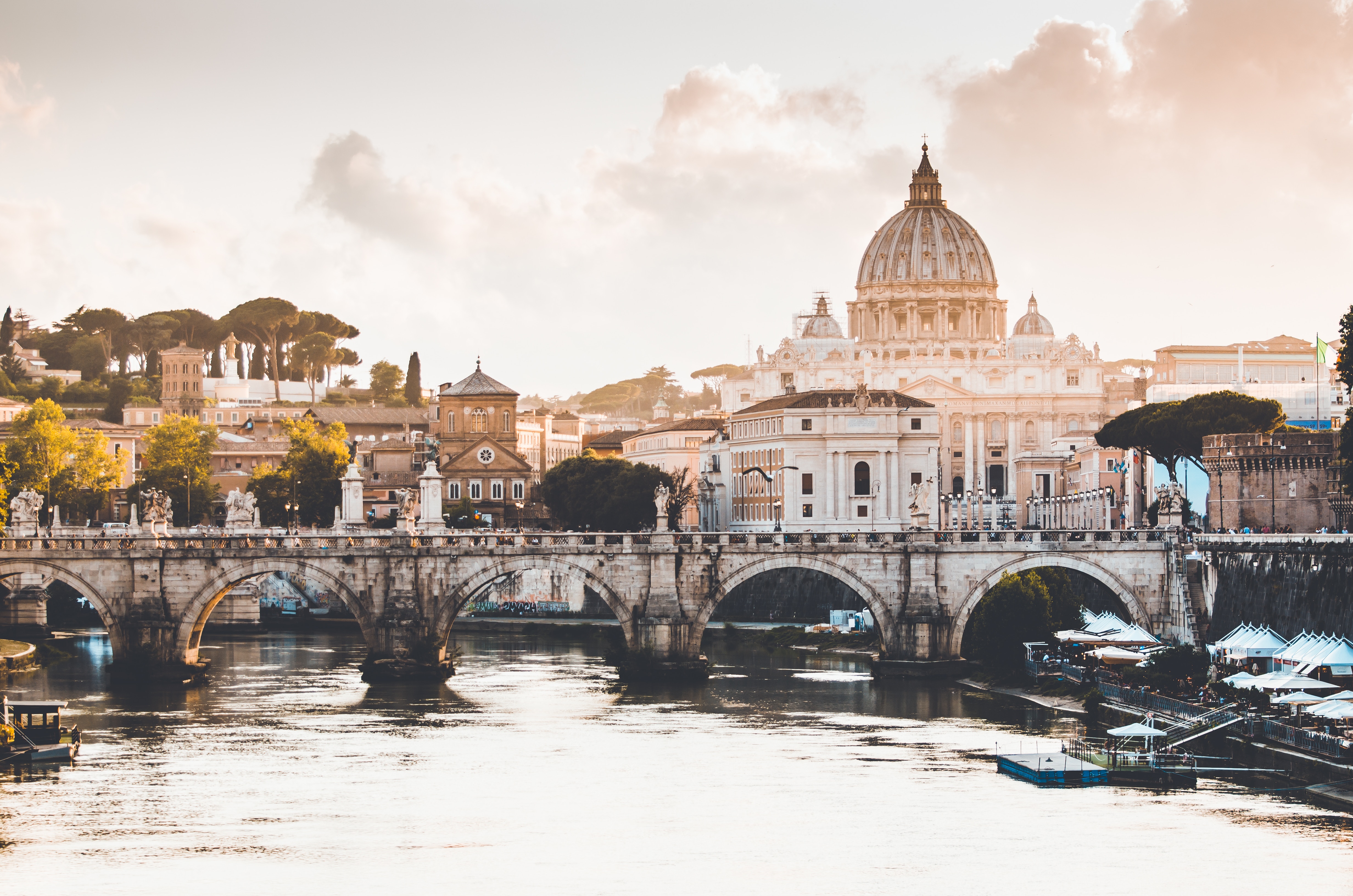
About Civitavecchia
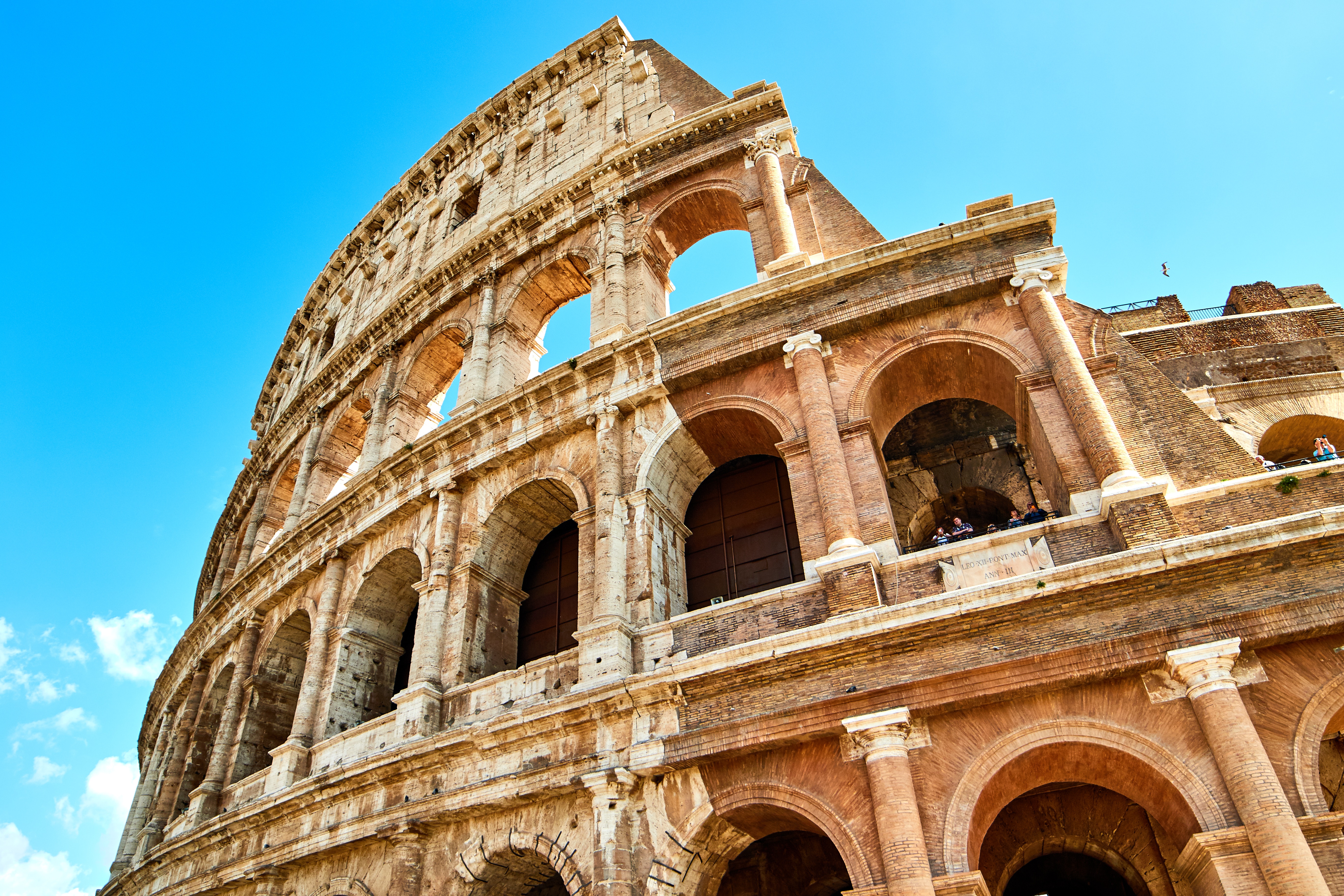
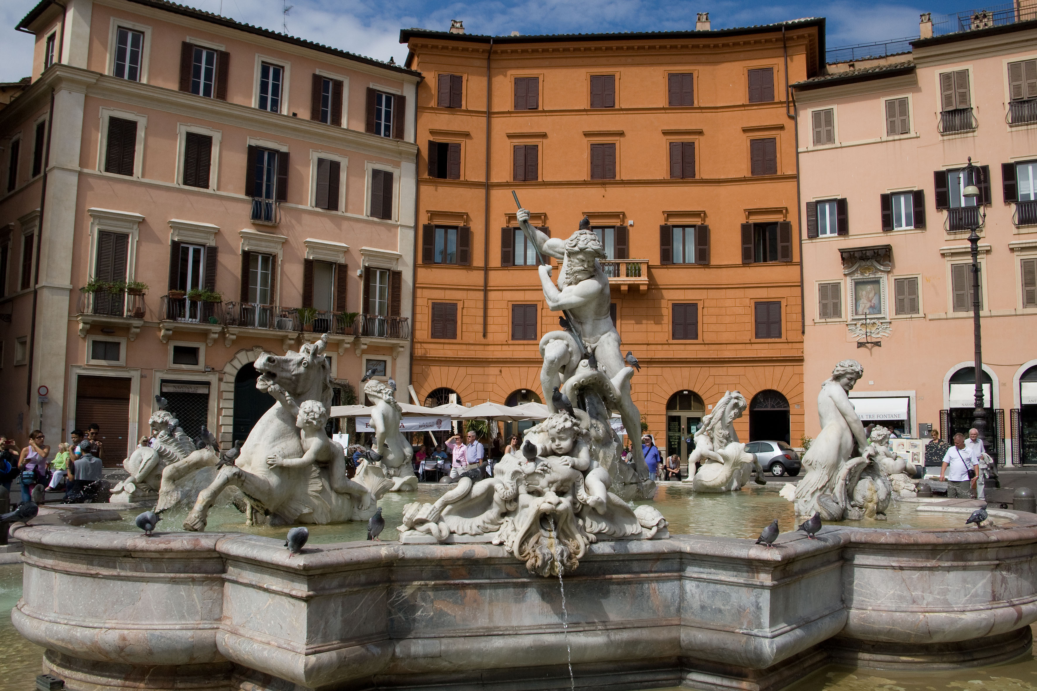
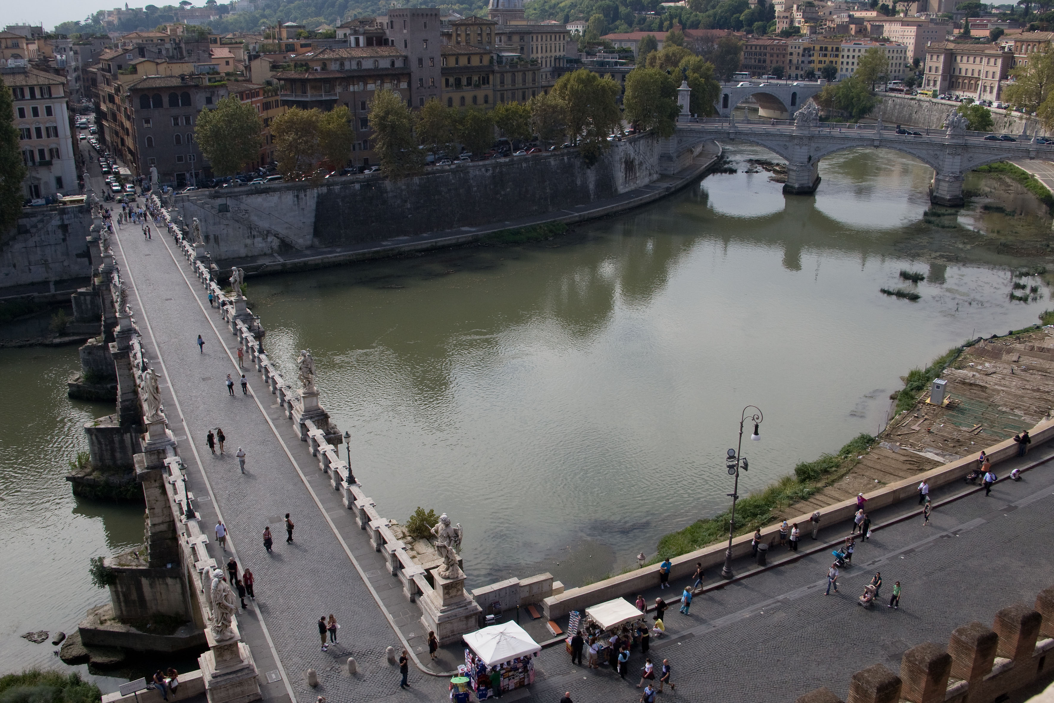
Italy's vibrant capital lives in the present, but no other city on earth evokes its past so powerfully. For over 2,500 years, emperors, popes, artists, and common citizens have left their mark here. Archaeological remains from ancient Rome, art-stuffed churches, and the treasures of Vatican City vie for your attention, but Rome is also a wonderful place to practice the Italian-perfected il dolce far niente, the sweet art of idleness. Your most memorable experiences may include sitting at a caffè in the Campo de' Fiori or strolling in a beguiling piazza.
About Livorno
Livorno is a gritty city with a long and interesting history. In the early Middle Ages it alternately belonged to Pisa and Genoa. In 1421 Florence, seeking access to the sea, bought it. Cosimo I (1519–74) started construction of the harbor in 1571, putting Livorno on the map. After Ferdinando I de' Medici (1549–1609) proclaimed Livorno a free city, it became a haven for people suffering from religious persecution; Roman Catholics from England and Jews and Moors from Spain and Portugal, among others, settled here. The Quattro Mori (Four Moors), also known as the Monument to Ferdinando I, commemorates this. (The statue of Ferdinando I dates from 1595, the bronze Moors by Pietro Tacca from the 1620s.)In the following centuries, and particularly in the 18th, Livorno boomed as a port. In the 19th century the town drew a host of famous Britons passing through on their grand tours. Its prominence continued up to World War II, when it was heavily bombed. Much of the town's architecture, therefore, postdates the war, and it's somewhat difficult to imagine what it might have looked like before. Livorno has recovered from the war, however, as it's become a huge point of departure for container ships, as well as the only spot in Tuscany for cruise ships to dock for the day.Most of Livorno's artistic treasures date from the 17th century and aren't all that interesting unless you dote on obscure baroque artists. Livorno's most famous native artist, Amedeo Modigliani (1884–1920), was of much more recent vintage. Sadly, there's no notable work by him in his hometown.There may not be much in the way of art, but it's still worth strolling around the city. The Mercato Nuovo, which has been around since 1894, sells all sorts of fruits, vegetables, grains, meat, and fish. Outdoor markets nearby are also chock-full of local color. The presence of Camp Darby, an American military base just outside town, accounts for the availability of many American products.If you have time, Livorno is worth a stop for lunch or dinner at the very least.
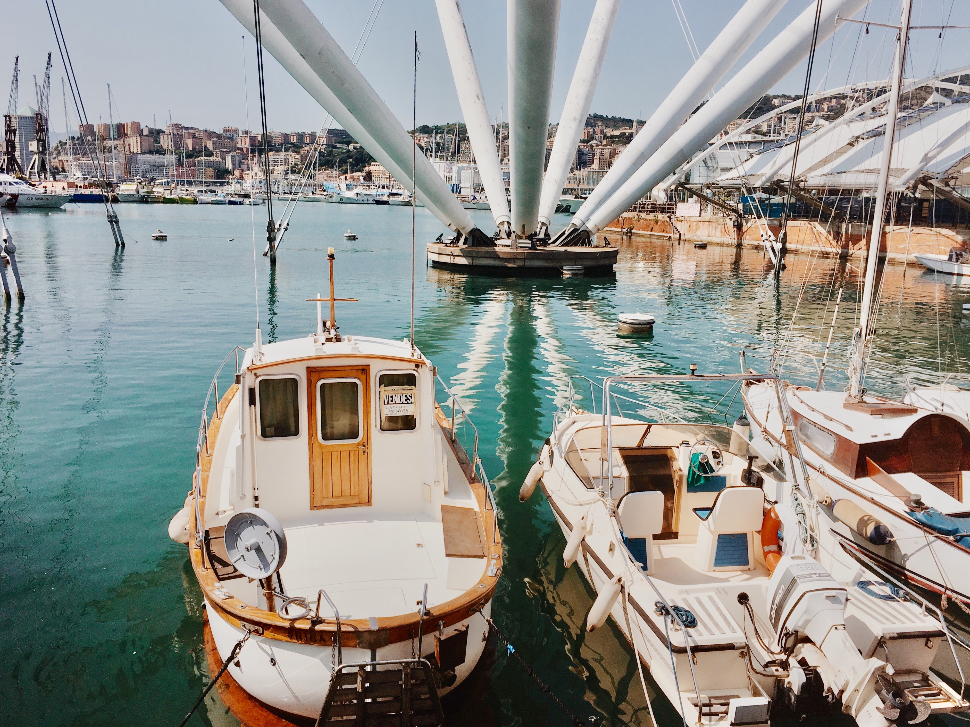
About Genoa
Genoa is a port city in the Northwest of Italy. Home to the Genoa Aquarium, famous for having the largest exposition of biodiversity in Europe, the city is also a great place to visit for anyone interested in architecture.
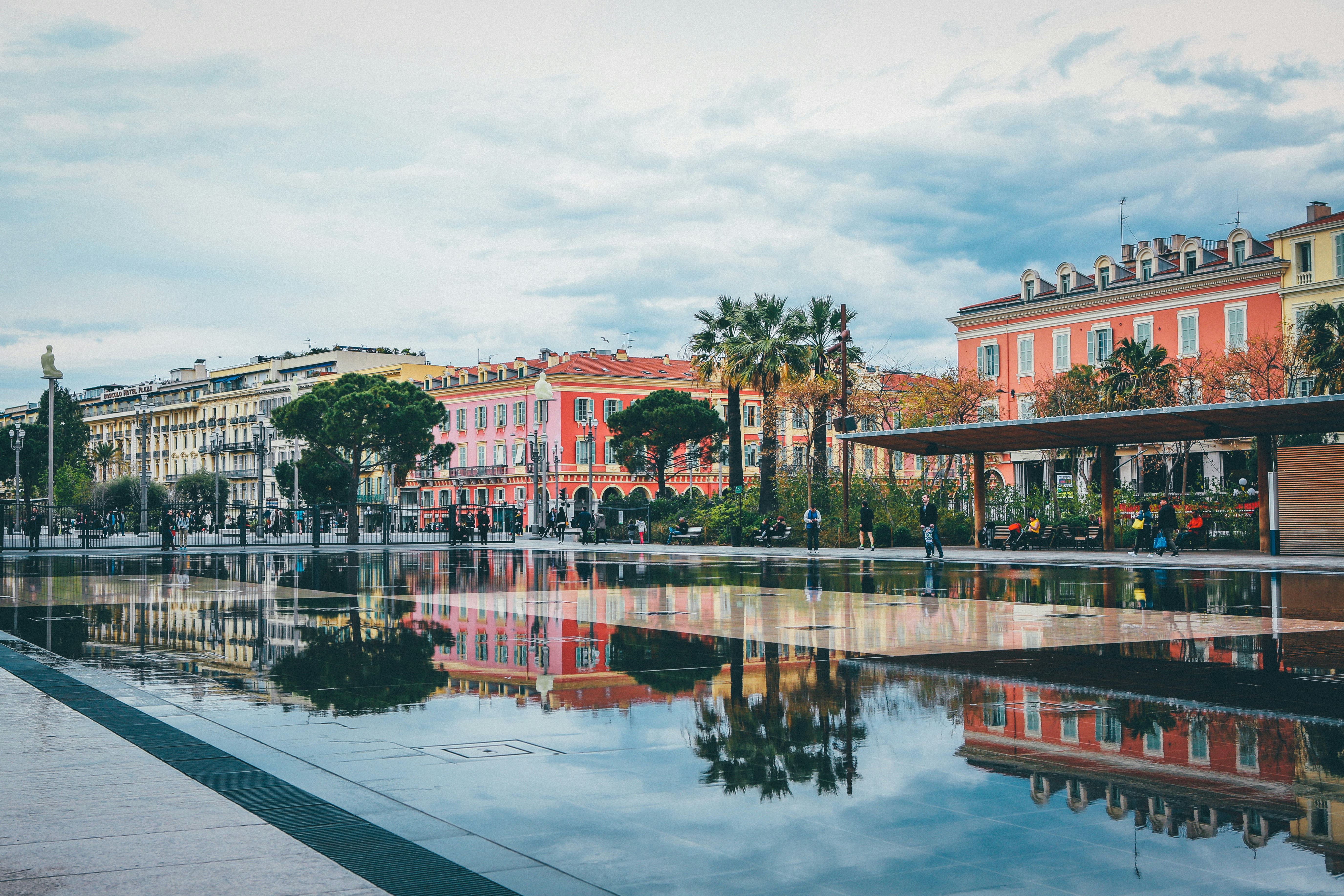
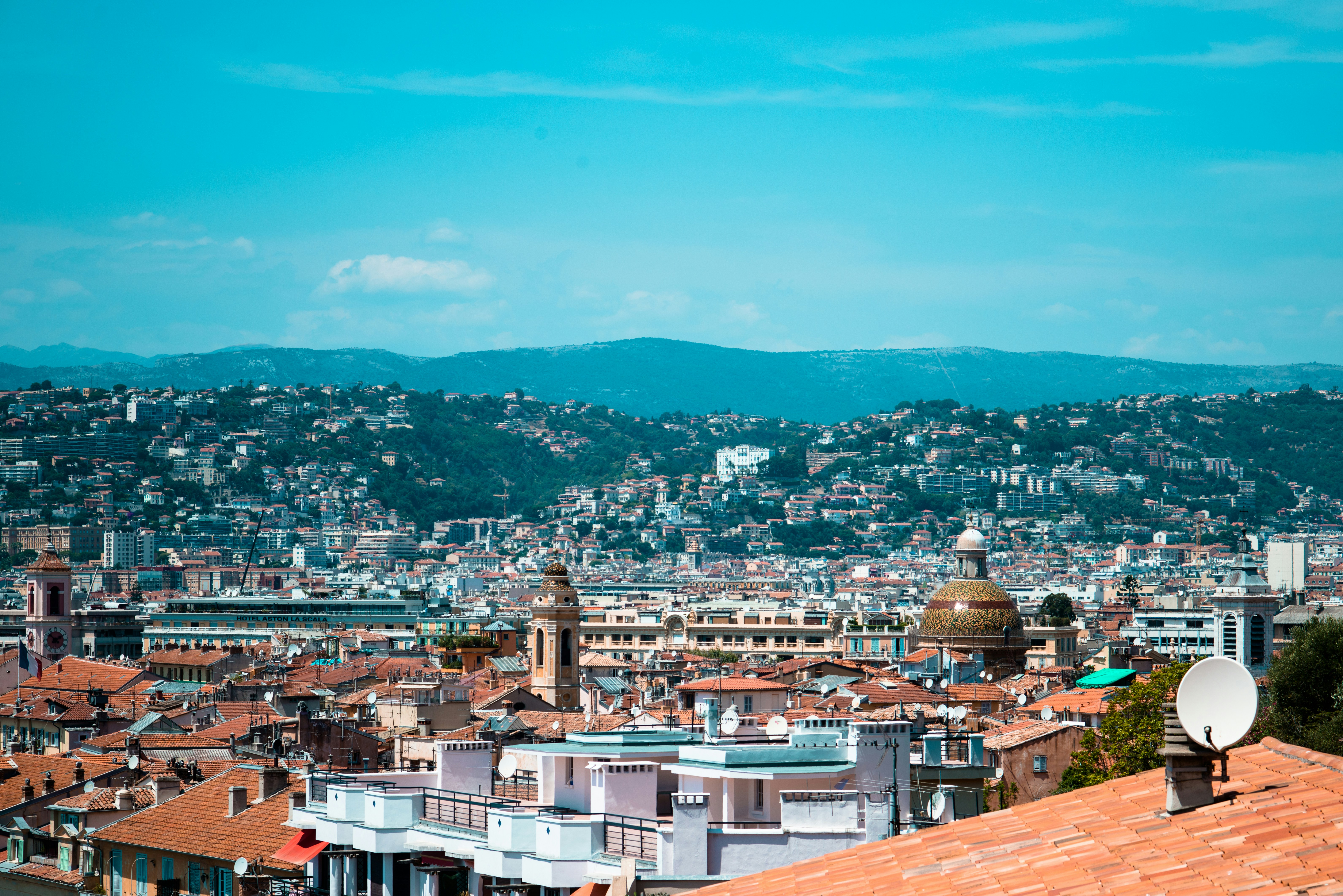
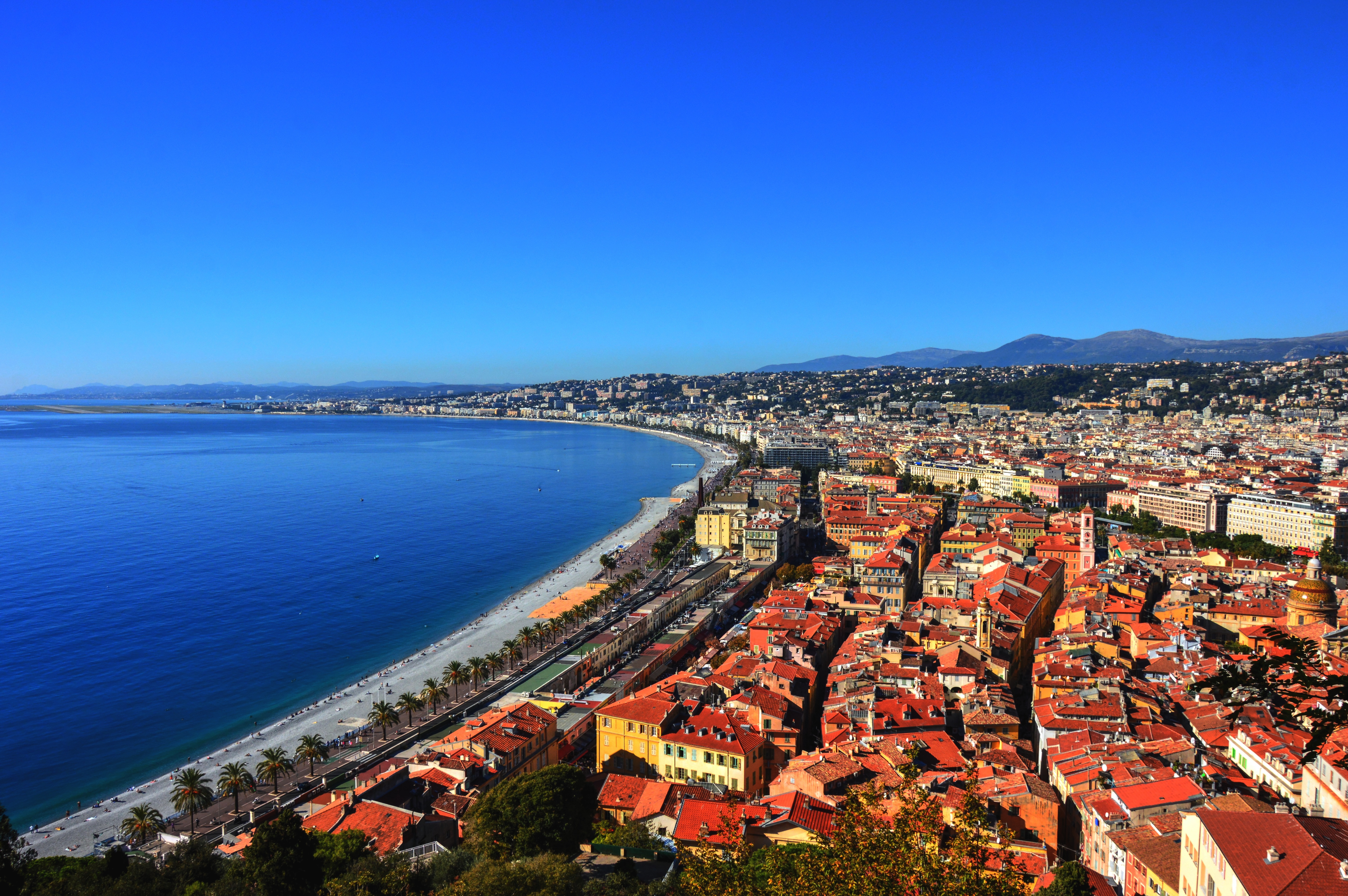
About Nice
United with France only since 1860, Nice has its own history and atmosphere, which dates back 230,000 years. It was on Colline du Château (now château-less) and at the Plage des Ponchettes, in front of the Old Town, that the Greeks established a market-port in 350 BC and named it Nikaia, which would become Marseilles' chief coastal rival. The Romans established themselves a little later on the hills of Cimiez (Cemenelum), already previously occupied by Ligurians and Celts, and quickly overshadowed the waterfront port. After falling to the Saracen invasions, Nice regained power as an independent state, becoming an important port in the early Middle Ages.So cocksure did it become that in 1388, Nice, along with the hill towns behind, effectively seceded from the county of Provence, under Louis d'Anjou, and allied itself with Savoie. Thus began its liaison with the House of Savoy, and through it with Piedmont and Sardinia, it was the Comté de Nice (Nice County). This relationship lasted some 500 years, tinting the culture, architecture, and dialect in rich Italian hues.By the 19th century Nice was flourishing commercially, locked in rivalry with the neighboring shipping port of Genoa. Another source of income: the dawning of tourism, as first the English, then the Russian nobility, discovered its extraordinary climate and superb waterfront position. A parade of fine stone mansions and hotels closed into a nearly solid wall of masonry, separated from the smooth-round rocks of the beach by what was originally named Camin deis Anglés (the English Way), which of course is now the famous Promenade des Anglais. This magnificent crescent, which is seeking UNESCO recognition, is one of the noblest in France. Many of Nice's most delightful attractions—the Cours Saleya market, the Old Town streets, the Hotel Negresco, and the Palais Masséna—are on or close to this 10-km (6-mile) waterfront, making it the first stop for most visitors, while the redevelopment of Nice's port, around the other side of the Colline du Château, makes it easier for amblers who want to take in the Genoese architecture or peruse the antiques at the Puces de Nice, now part of the Promenade des 100 Antiquaires, along Quai Papacino. Nice also has the distinction of the "Family Plus" label, with free strollers, play areas, and restaurants with child-friendly activities.
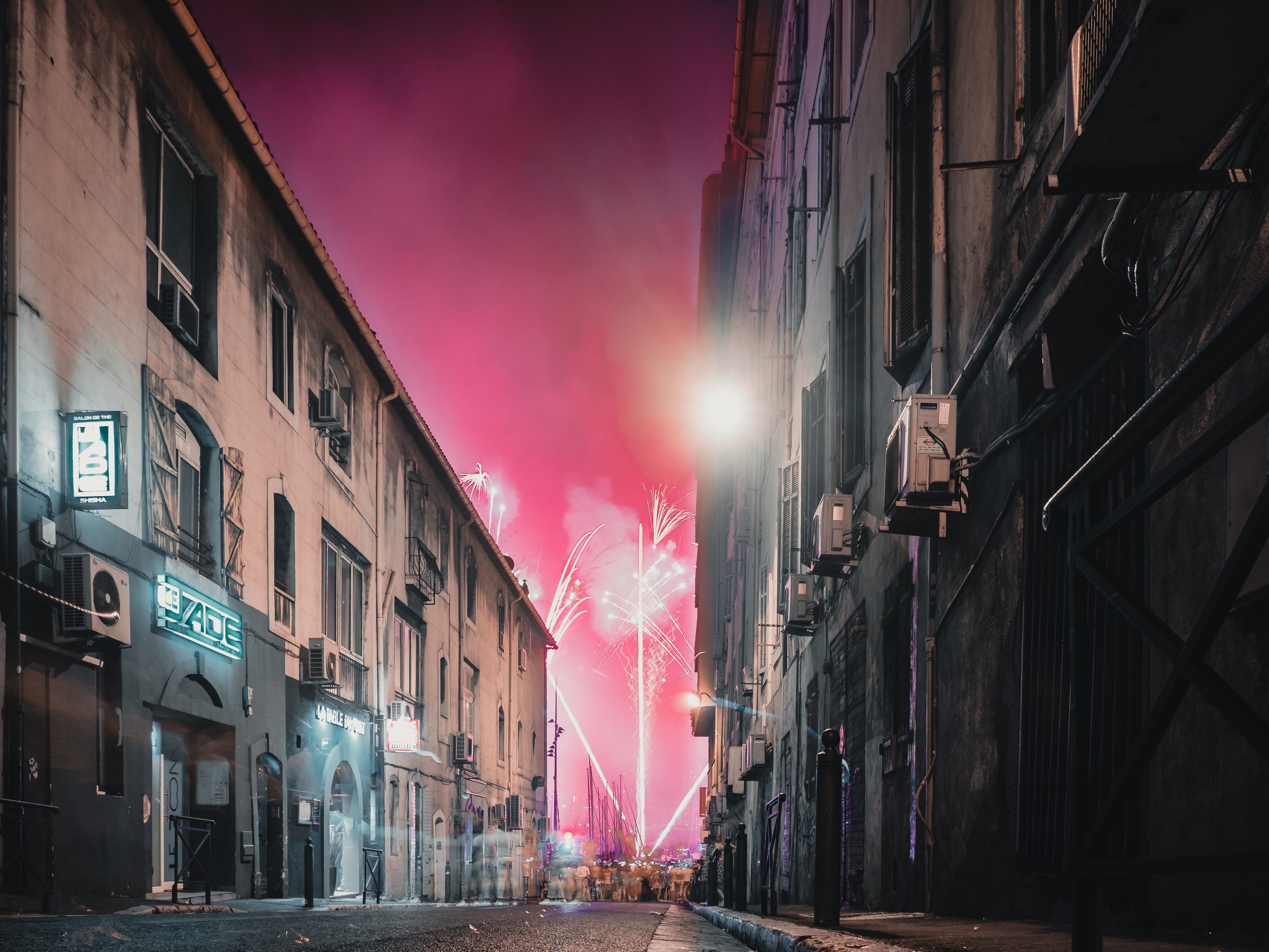
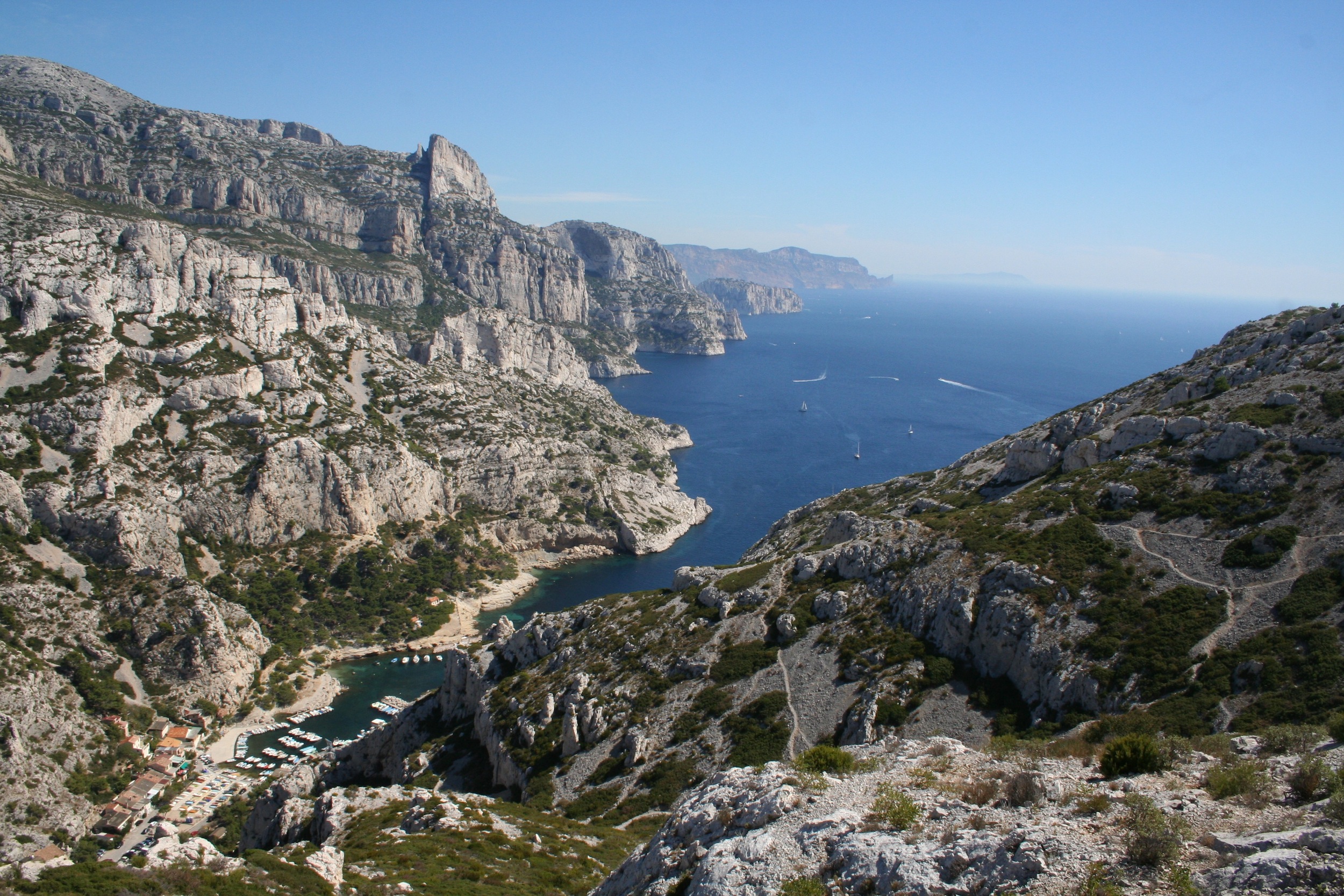
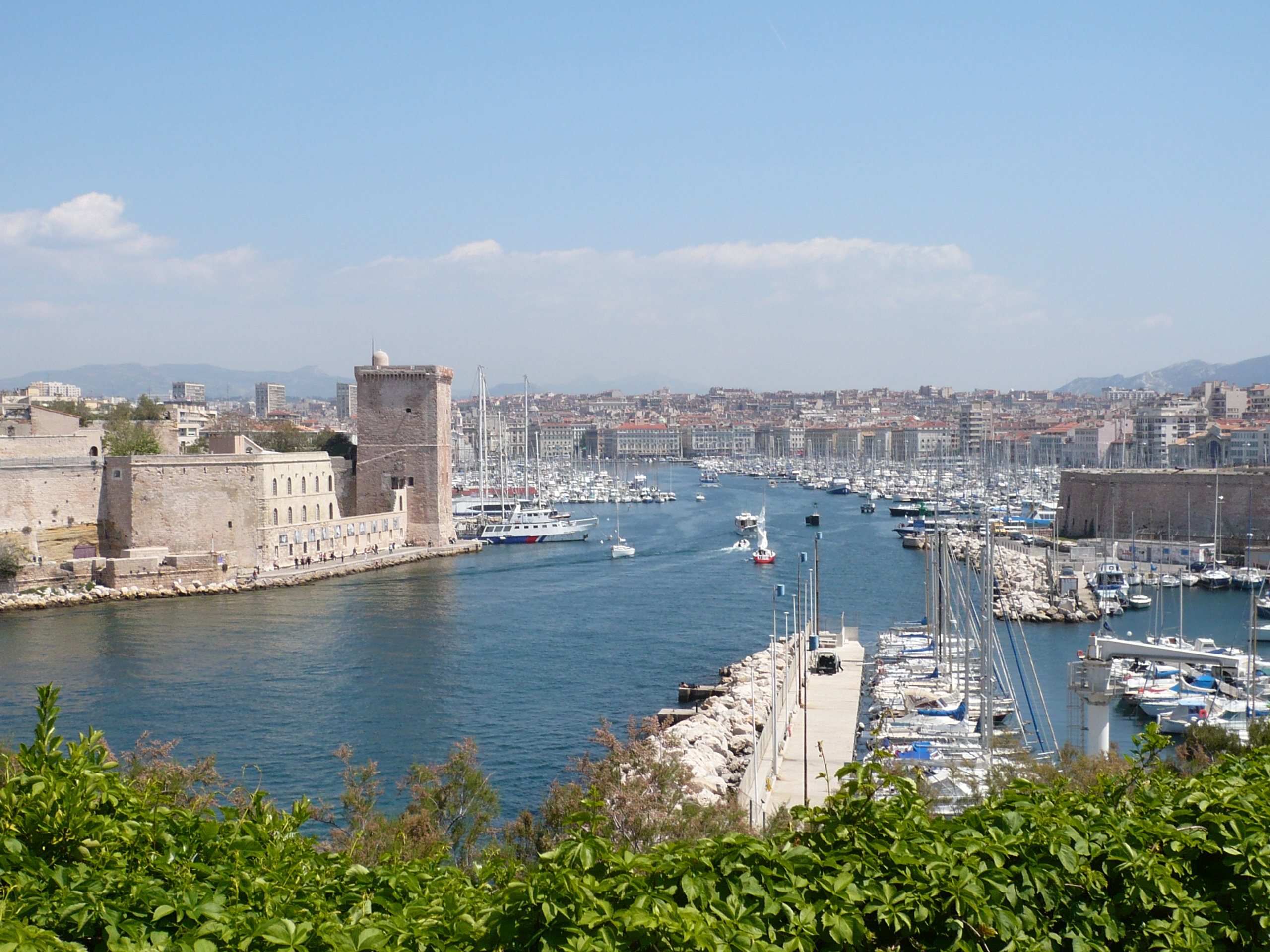
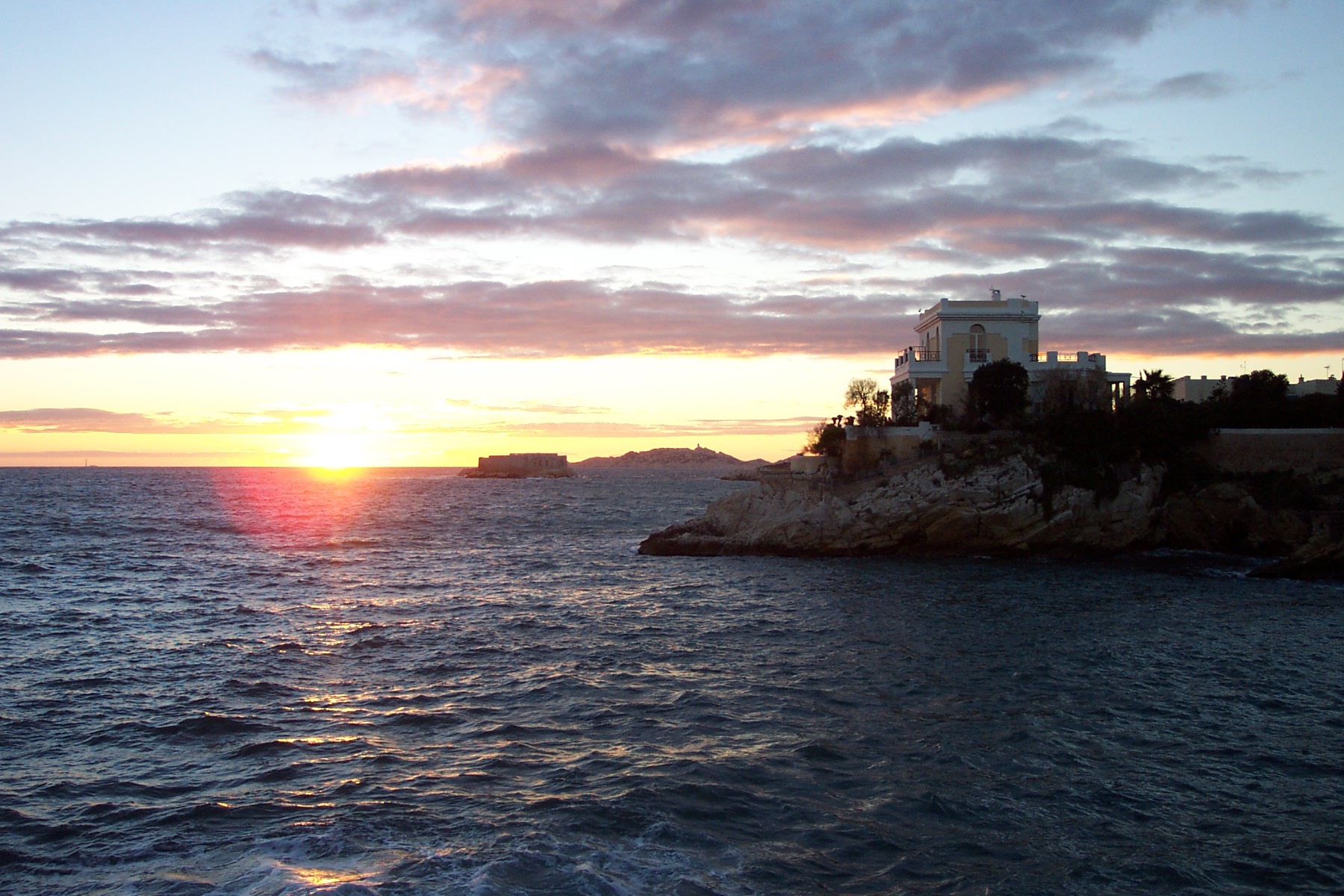
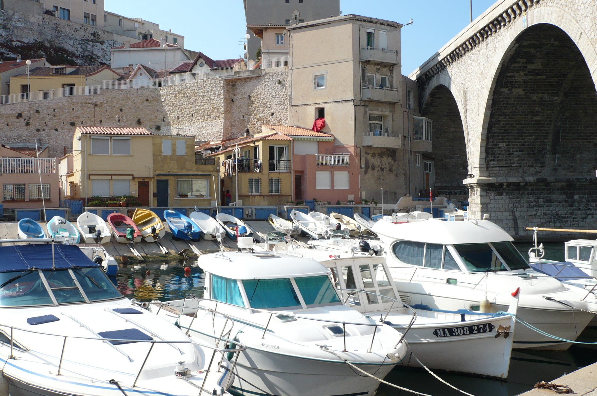
About Marseille
Since being designated a European Capital of Culture for 2013, with an estimated €660 million of funding in the bargain, Marseille has been in the throes of an extraordinary transformation, with no fewer than five major new arts centers, a beautifully refurbished port, revitalized neighborhoods, and a slew of new shops and restaurants. Once the underdog, this time-burnished city is now welcoming an influx of weekend tourists who have colonized entire neighborhoods and transformed them into elegant pieds-à-terre (or should we say, mer). The second-largest city in France, Marseille is one of Europe's most vibrant destinations. Feisty and fond of broad gestures, it is also as complicated and as cosmopolitan now as it was when a band of Phoenician Greeks first sailed into the harbor that is today's Vieux Port in 600 BC. Legend has it that on that same day a local chieftain's daughter, Gyptis, needed to choose a husband, and her wandering eyes settled on the Greeks' handsome commander Protis. Her dowry brought land near the mouth of the Rhône, where the Greeks founded Massalia, the most important Continental shipping port in antiquity. The port flourished for some 500 years as a typical Greek city, enjoying the full flush of classical culture, its gods, its democratic political system, its sports and theater, and its naval prowess. Caesar changed all that, besieging the city in 49 BC and seizing most of its colonies. In 1214 Marseille was seized again, this time by Charles d'Anjou, and was later annexed to France by Henri IV in 1481, but it was not until Louis XIV took the throne that the biggest transformations of the port began; he pulled down the city walls in 1666 and expanded the port to the Rive Neuve (New Riverbank). The city was devastated by plague in 1720, losing more than half its population. By the time of the Revolution, Marseille was on the rebound once again, with industries of soap manufacturing and oil processing flourishing, encouraging a wave of immigration from Provence and Italy. With the opening of the Suez Canal in 1869, Marseille became the greatest boomtown in 19th-century Europe. With a large influx of immigrants from areas as exotic as Tangiers, the city quickly acquired the multicultural population it maintains to this day.

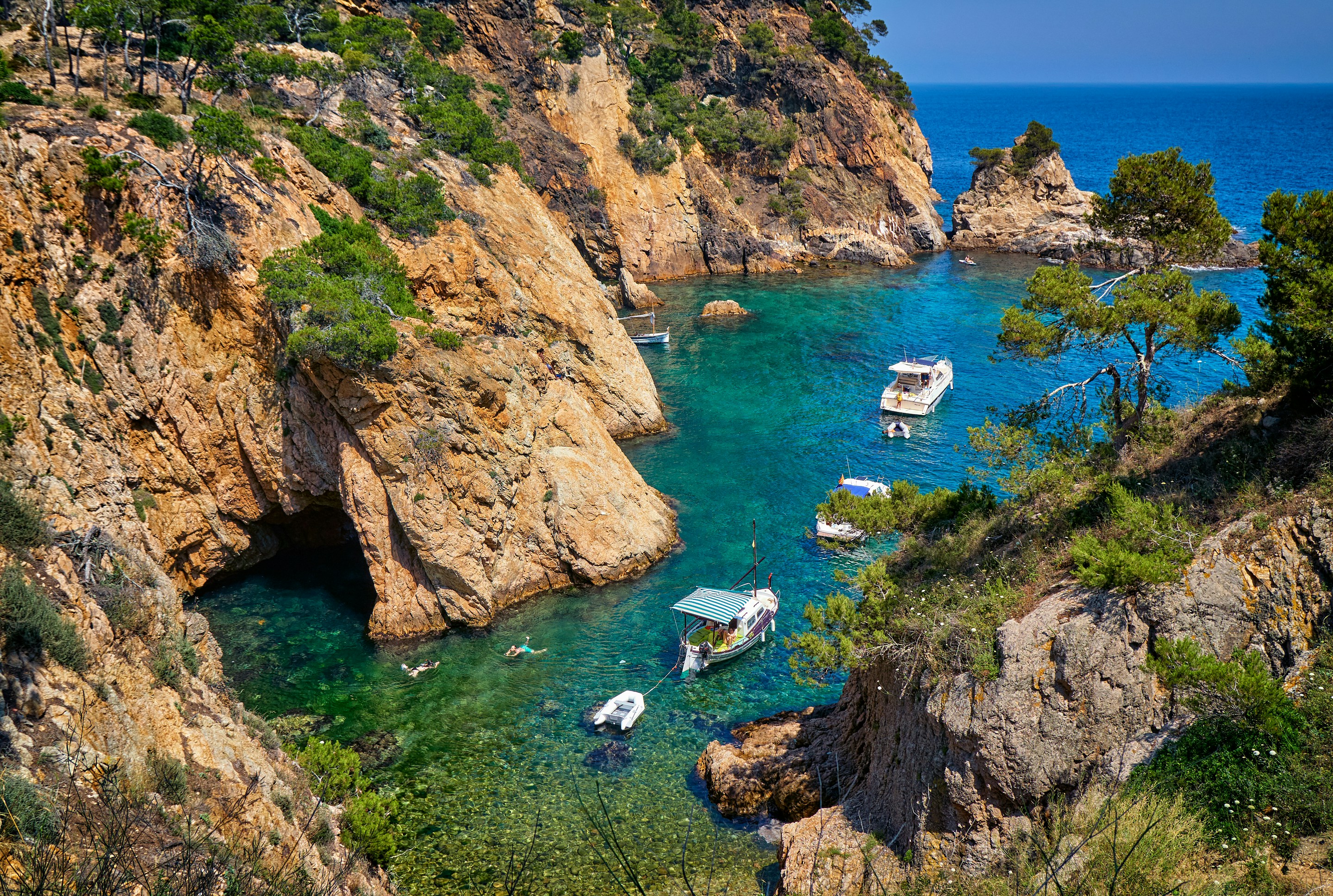
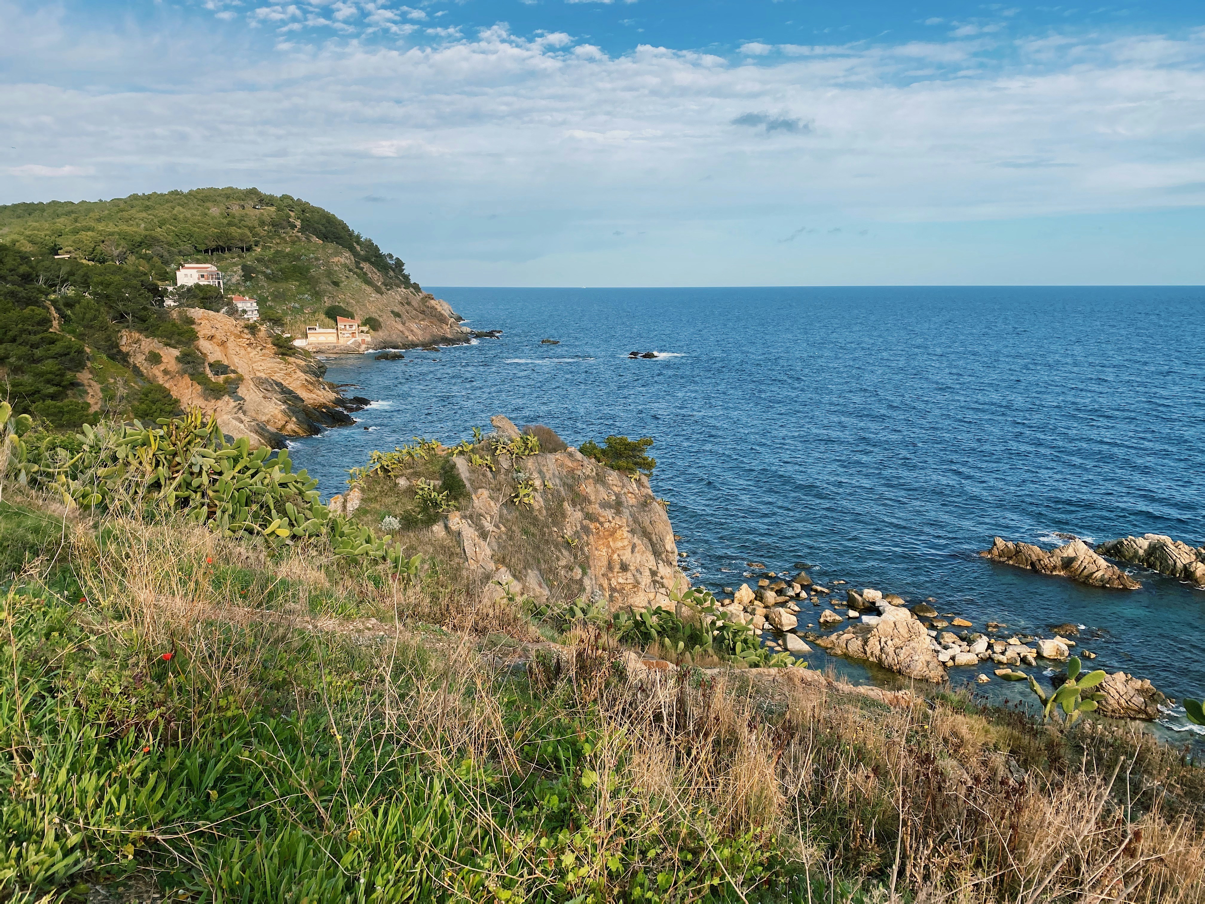
About Palamós
One of the best ways to arrive in Catalonia is by sea, especially via the Costa Brava. This coastline, also known as the Rugged or Wild Coast, stretches from Blanes to the French border. Its name aptly refers to the steep cliff of ancient twisted rocks, which runs its entire length and is bounded inland by the Catalan mountain ranges. The intensity of the coast’s colour, the ruggedness of the rocks and the scent of the plants all combine to add to its attraction. The history of this region is long and varied. Traces can be found of the advanced culture of the Iberians, Greeks, Romans, Visigoths and Arabs. With Wilfred I and the independence of Catalan countries, the Catalan dynasty was born. Later, in 1479, Catalonia became a part of unified Spain following the marriage of Isabel, Queen of Castile, and Fernando, King of Aragon. The port of Palamos, some 36 miles northeast of Barcelona, has been in existence for nearly 700 years thanks to its location on one of the deepest natural bays in the western Mediterranean. The town itself is the southernmost of a series of resorts popular with sun worshippers. For the most part, Palamos has managed to retain some of the charm of a fishing village. The port also serves as a gateway to such inland locations as Girona, the capital of the province. Art lovers may want to visit Figueras, famous for its bizarre Teatre-Museu Dali, the foremost of a series of sites associated with the eccentric surrealist artist, Salvador Dali. If you choose to stay in Palamos, you can enjoy the pleasant atmosphere of the town or spend some time at a nearby beach. The town has a long seagoing tradition and busy harbour. The fish auction, prompted by the arrival of the fishing boats, is a spectacle worth seeing. The Fishing Museum illustrates the history and the life of the families who live off the sea.

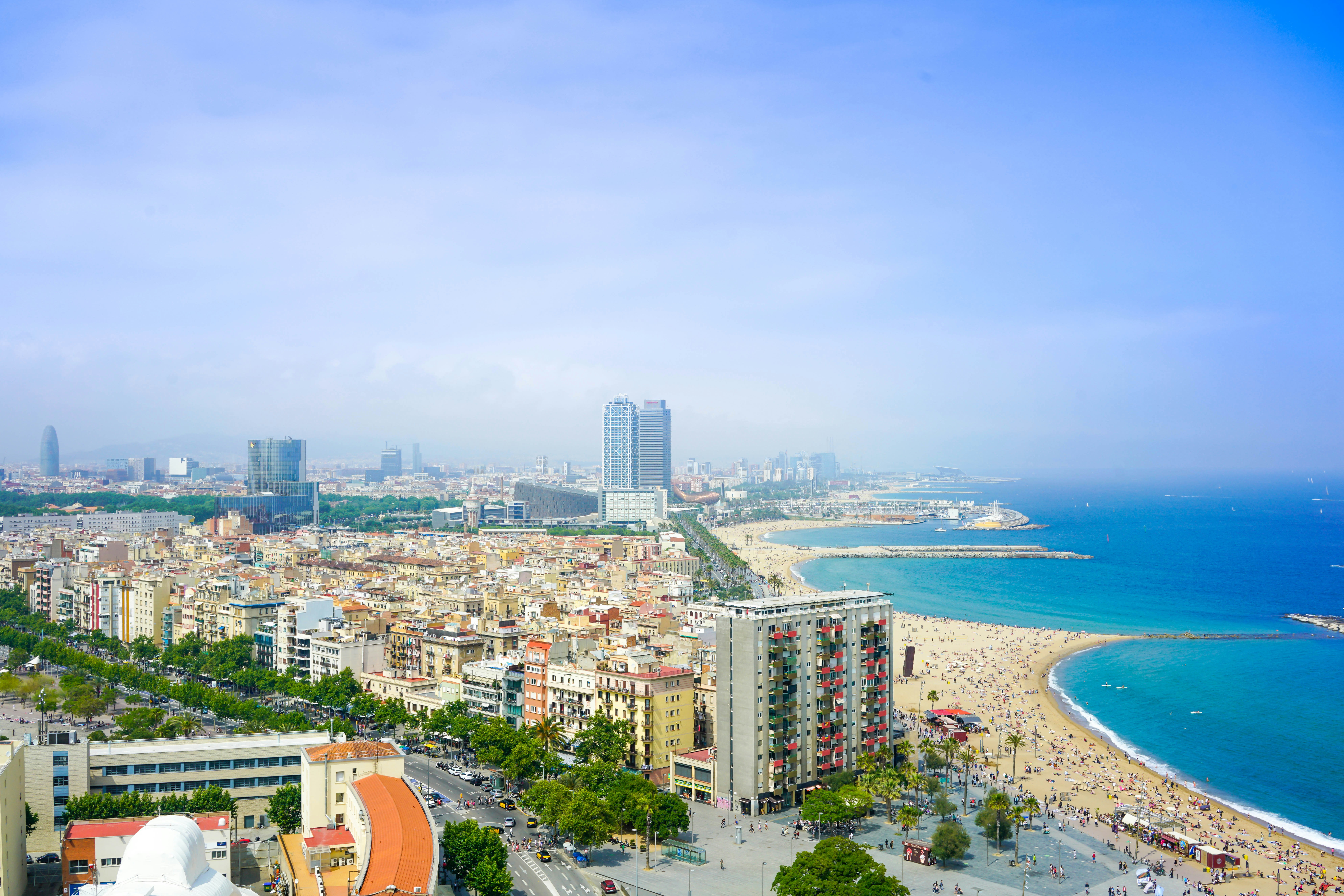
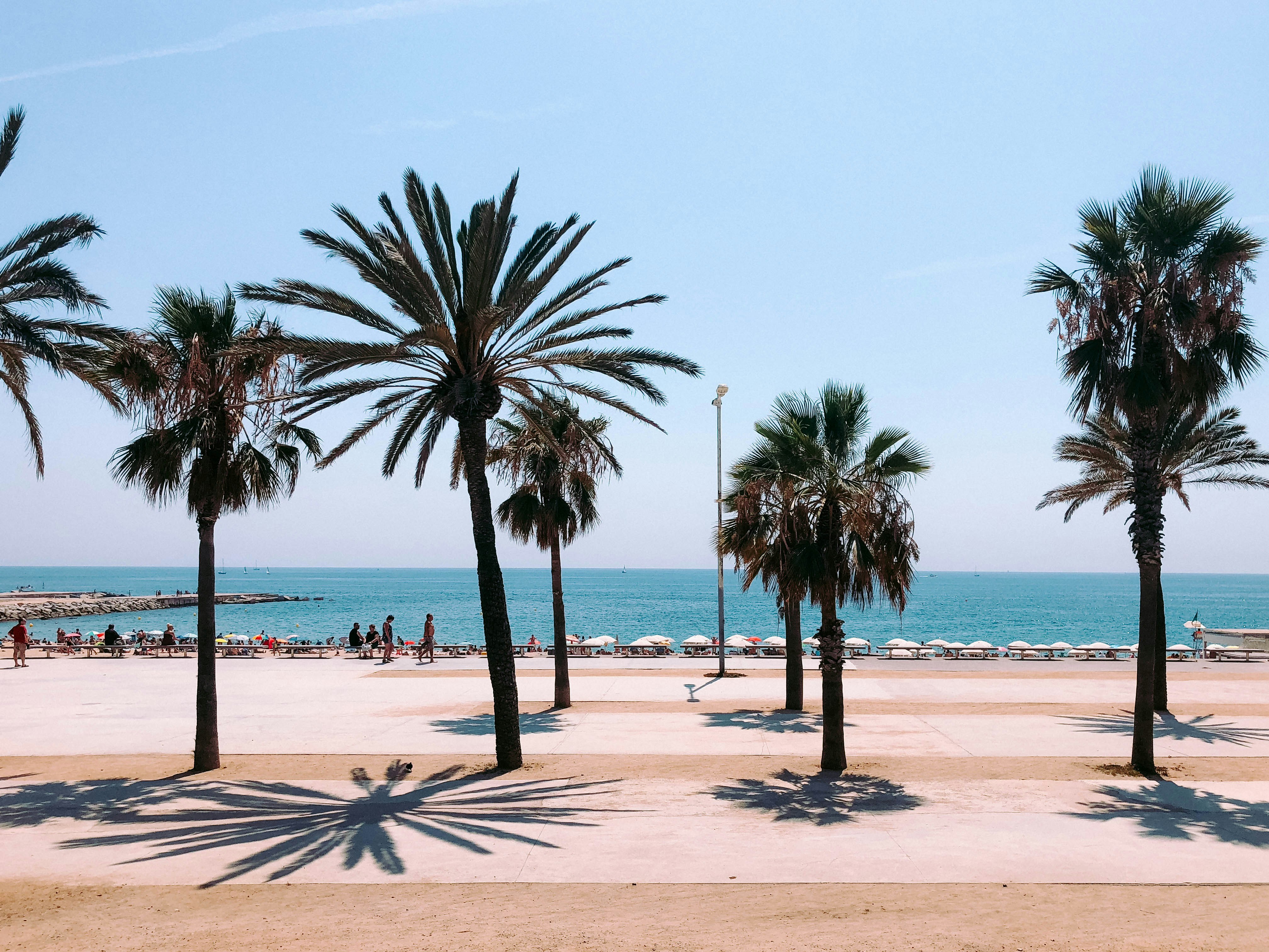
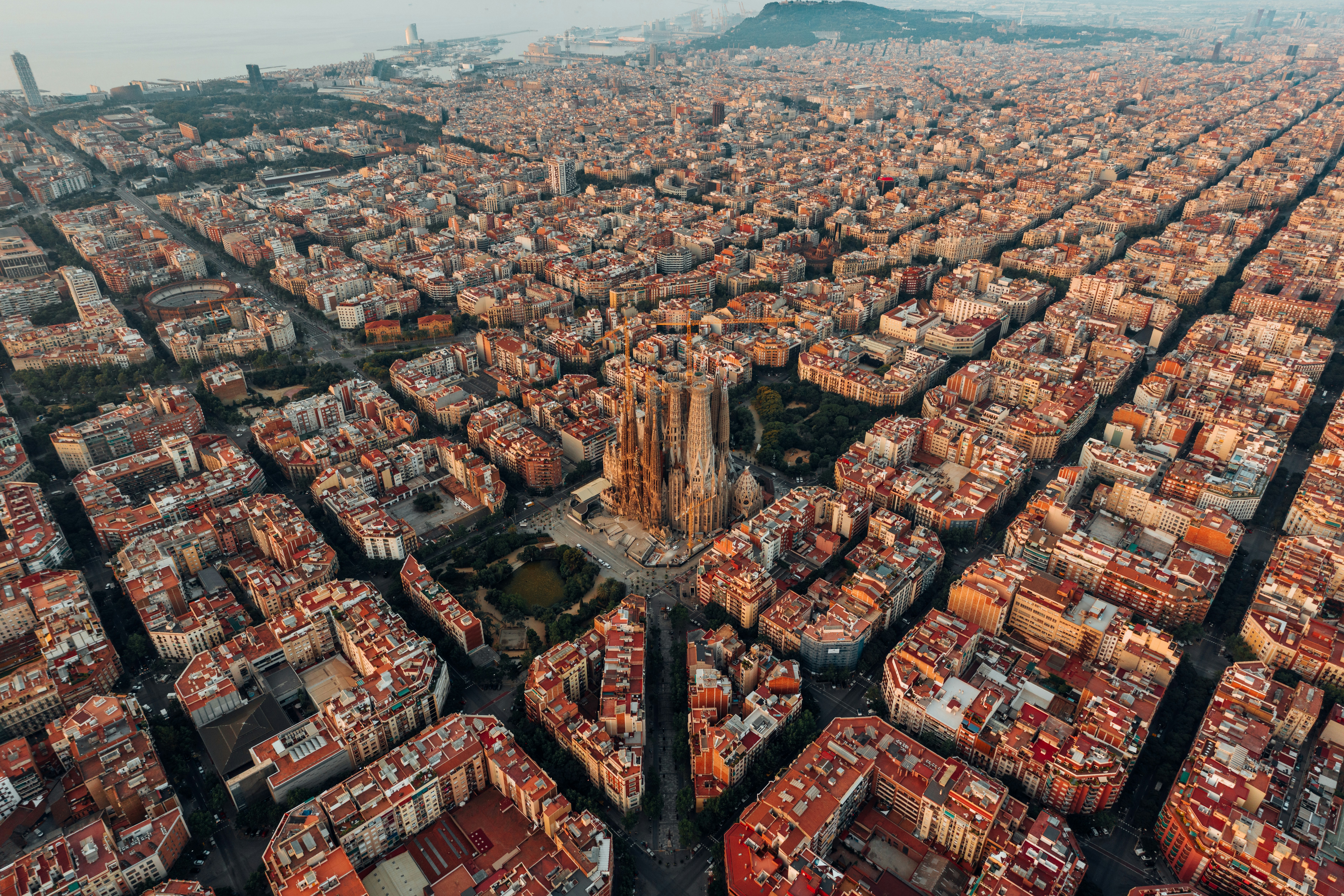
About Barcelona
The infinite variety of street life, the nooks and crannies of the medieval Barri Gòtic, the ceramic tile and stained glass of Art Nouveau facades, the art and music, the throb of street life, the food (ah, the food!)—one way or another, Barcelona will find a way to get your full attention. The capital of Catalonia is a banquet for the senses, with its beguiling mix of ancient and modern architecture, tempting cafés and markets, and sun-drenched Mediterranean beaches. A stroll along La Rambla and through waterfront Barceloneta, as well as a tour of Gaudí's majestic Sagrada Famíliaand his other unique creations, are part of a visit to Spain's second-largest city. Modern art museums and chic shops call for attention, too. Barcelona's vibe stays lively well into the night, when you can linger over regional wine and cuisine at buzzing tapas bars.

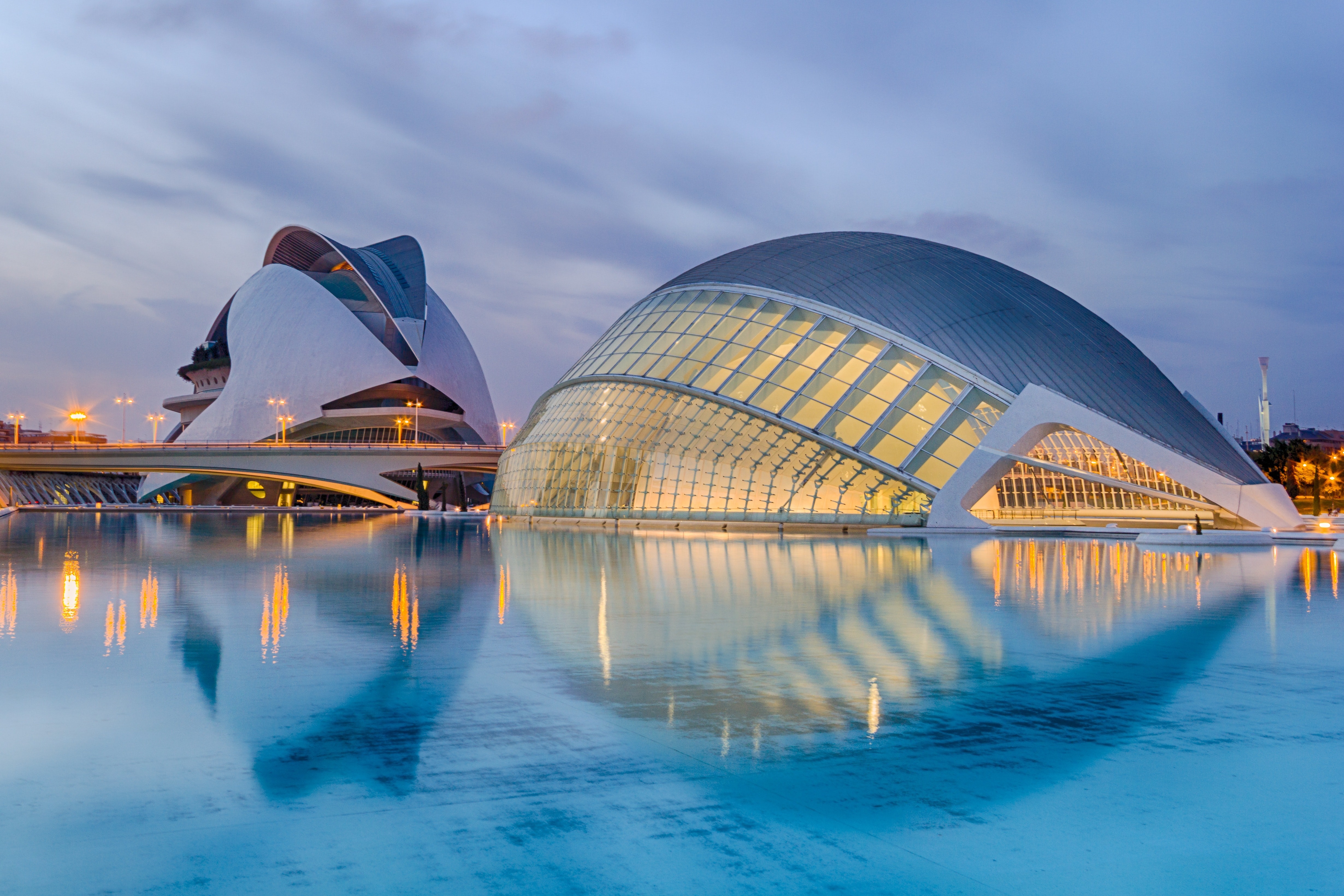
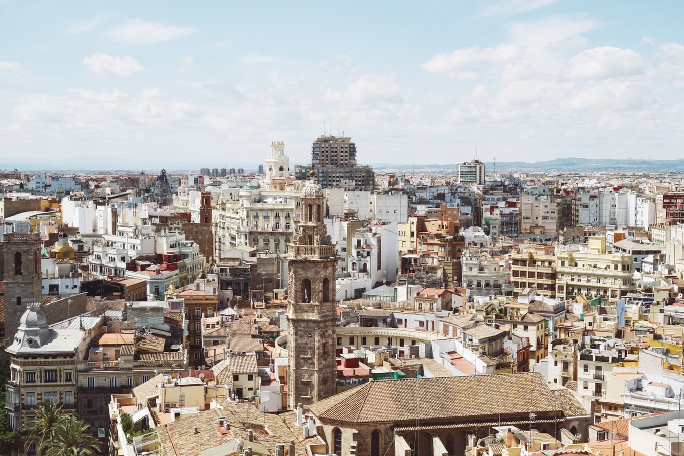
About Valencia
Valencia, Spain's third-largest municipality, is a proud city with a thriving nightlife and restaurant scene, quality museums, and spectacular contemporary architecture, juxtaposed with a thoroughly charming historic quarter, making it a popular destination year in year out. During the Civil War, it was the last seat of the Republican Loyalist government (1935–36), holding out against Franco’s National forces until the country fell to 40 years of dictatorship. Today it represents the essence of contemporary Spain—daring design and architecture along with experimental cuisine—but remains deeply conservative and proud of its traditions. Though it faces the Mediterranean, Valencia's history and geography have been defined most significantly by the River Turia and the fertile huerta that surrounds it.The city has been fiercely contested ever since it was founded by the Greeks. El Cid captured Valencia from the Moors in 1094 and won his strangest victory here in 1099: he died in the battle, but his corpse was strapped into his saddle and so frightened the besieging Moors that it caused their complete defeat. In 1102 his widow, Jimena, was forced to return the city to Moorish rule; Jaume I finally drove them out in 1238. Modern Valencia was best known for its frequent disastrous floods until the River Turia was diverted to the south in the late 1950s. Since then the city has been on a steady course of urban beautification. The lovely bridges that once spanned the Turia look equally graceful spanning a wandering municipal park, and the spectacularly futuristic Ciutat de les Arts i les Ciències (City of Arts and Sciences), most of it designed by Valencia-born architect Santiago Calatrava, has at last created an exciting architectural link between this river town and the Mediterranean. If you're in Valencia, an excursion to Albufera Nature Park is a worthwhile day trip.
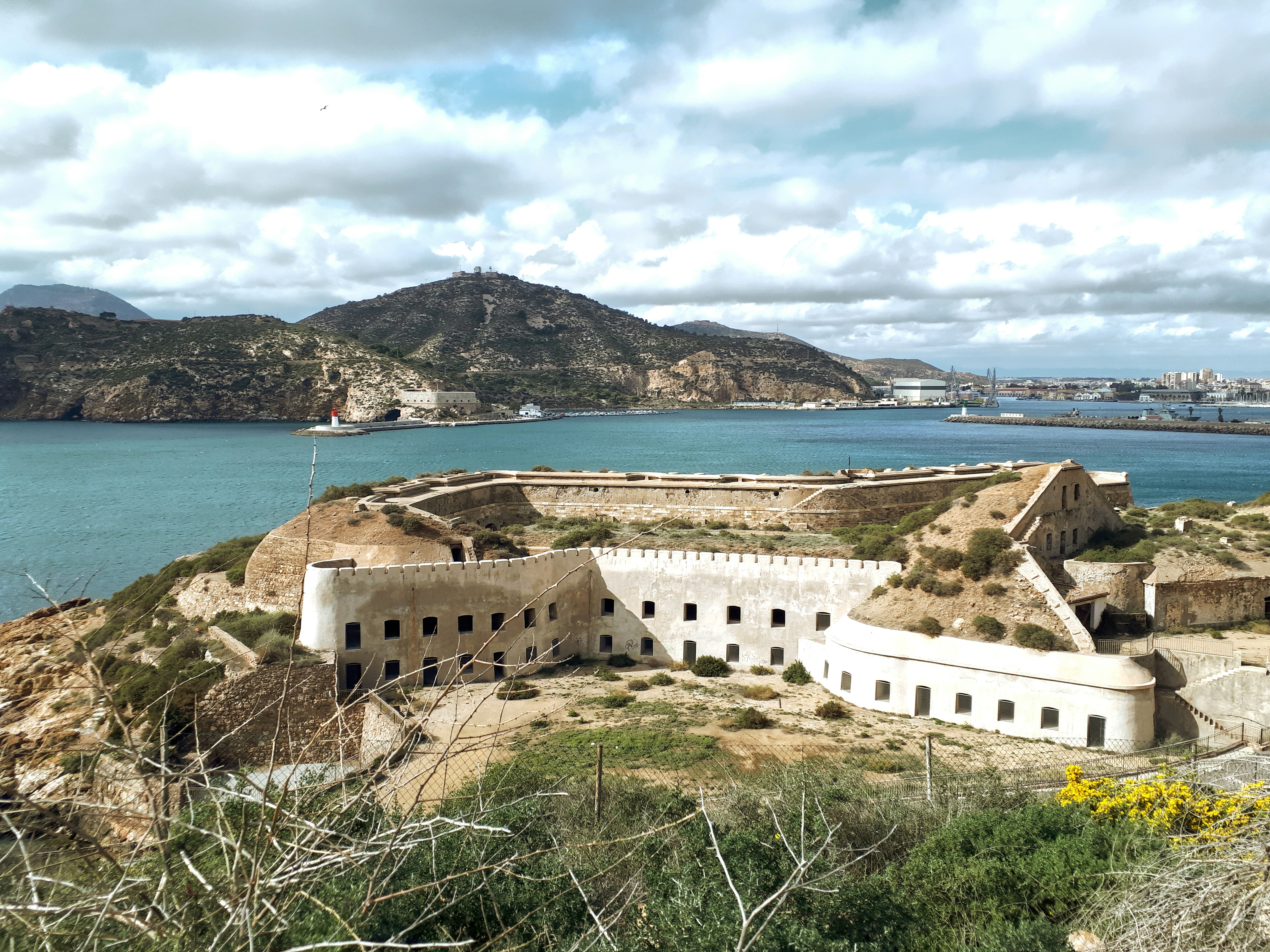
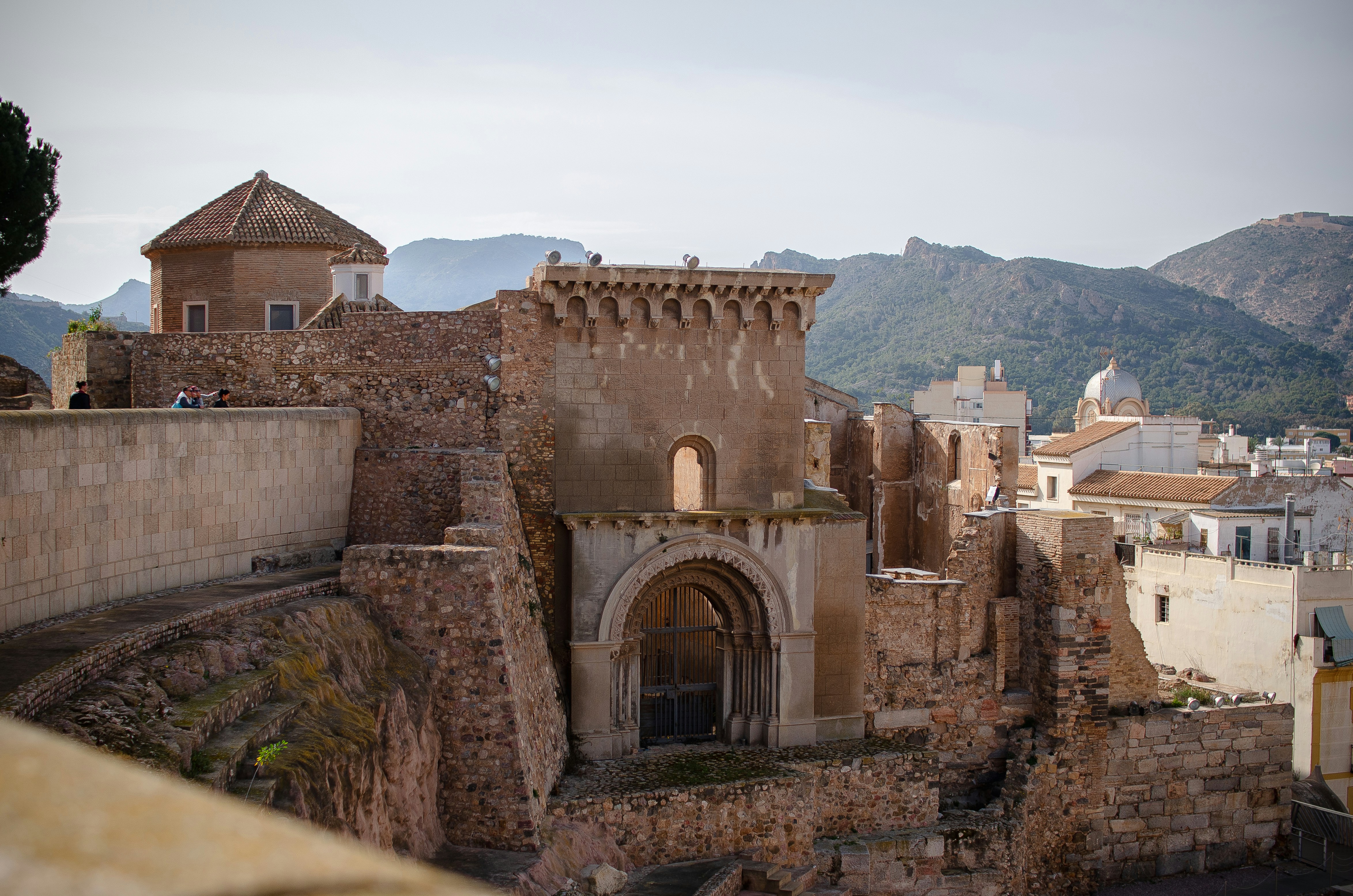
About Cartagena
A Mediterranean city and naval station located in the Region of Murcia, southeastern Spain, Cartagena’s sheltered bay has attracted sailors for centuries. The Carthaginians founded the city in 223BC and named it Cartago Nova; it later became a prosperous Roman colony, and a Byzantine trading centre. The city has been the main Spanish Mediterranean naval base since the reign of King Philip II, and is still surrounded by walls built during this period. Cartagena’s importance grew with the arrival of the Spanish Bourbons in the 18th century, when the Navidad Fortress was constructed to protect the harbour. In recent years, traces of the city’s fascinating past have been brought to light: a well-preserved Roman Theatre was discovered in 1988, and this has now been restored and opened to the public. During your free time, you may like to take a mini-cruise around Cartagena's historic harbour: these operate several times a day, take approximately 40 minutes and do not need to be booked in advance. Full details will be available at the port.
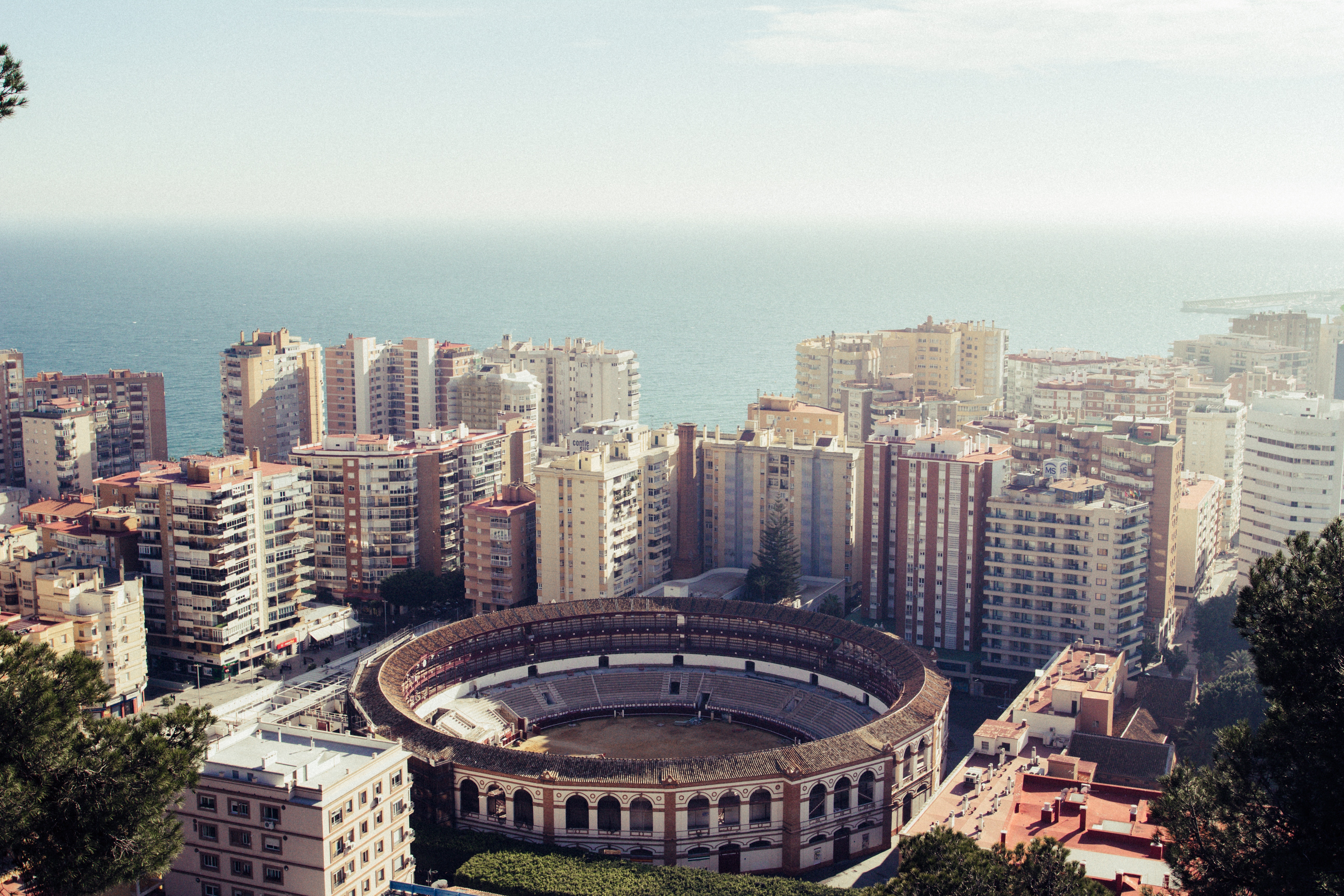
About Málaga
As you sail into Malaga you will notice what an idyllic setting the city enjoys on the famous Costa del Sol. To the east of this provincial capital, the coast along the region of La Axarqua is scattered with villages, farmland and sleepy fishing hamlets - the epitome of traditional rural Spain. To the west stretches a continuous city where the razzmatazz and bustle creates a colourful contrast that is easily recognisable as the Costa del Sol. Surrounding the region, the Penibéetica Mountains provide an attractive backdrop overlooking the lower terraced slopes which yield olives and almonds. This spectacular mountain chain shelters the province from cold northerly winds, giving it a reputation as a therapeutic and exotic place in which to escape from cold northern climes. Malaga is also the gateway to many of Andalusia's enchanting historic villages, towns and cities.
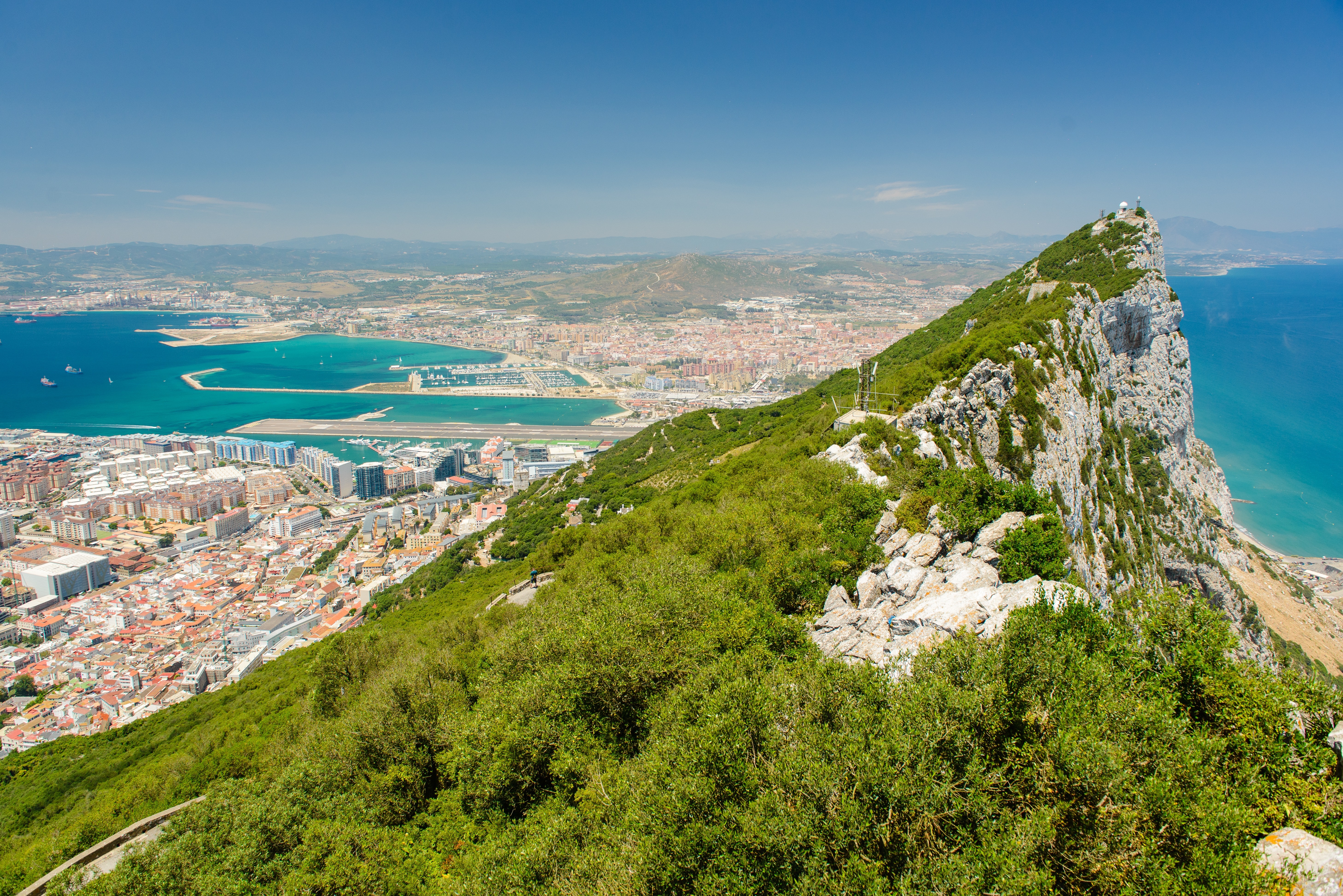
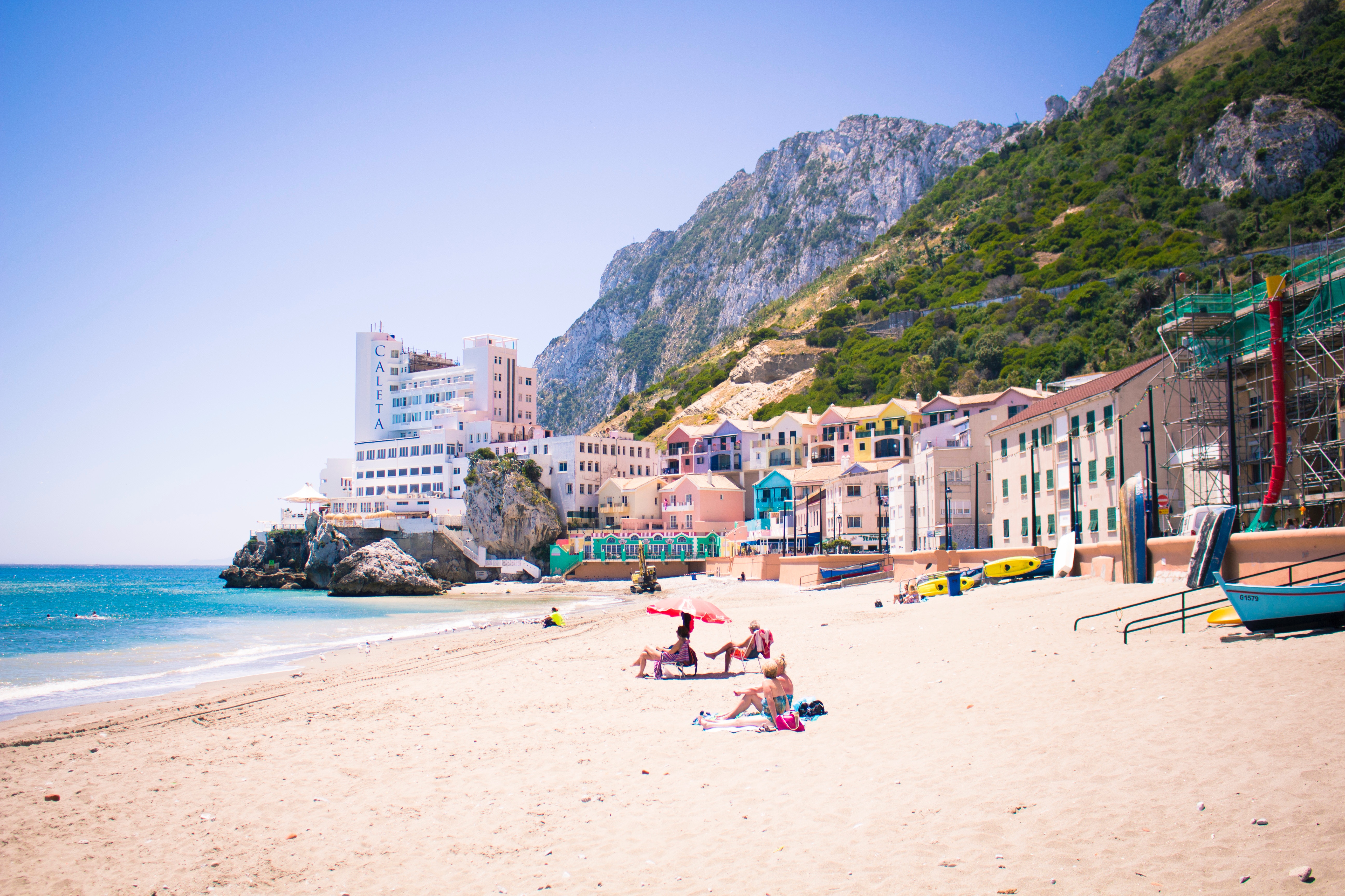
About Gibraltar
Tagged on to the end of Iberia, the intriguing British outpost of Gibraltar is dominated by a sandy peninsula and the stunning 1,400-feet-high limestone Rock. Although small, Gibraltar has always been seen as having great strategic importance on account of its advantageous position where the Atlantic meets the Mediterranean, just 12 miles from the coast of Africa. Ever popular with British holidaymakers, Gibraltar is very much a home from home, boasting excellent duty-free shopping in many familiar British high street shops. Please note: Gibraltar’s small size and narrow winding roads mean that excursions are operated by 22-seater mini-buses, accompanied by a driver/guide. Local health and safety regulations prohibit the carriage of walking aids and collapsible wheelchairs on these vehicles. If you do wish to bring a mobility aid, we can arrange the Rock Tour by taxi, which has extra space. If this suits your requirements, please advise the Tours and Travel office when you join the ship, as numbers are limited.

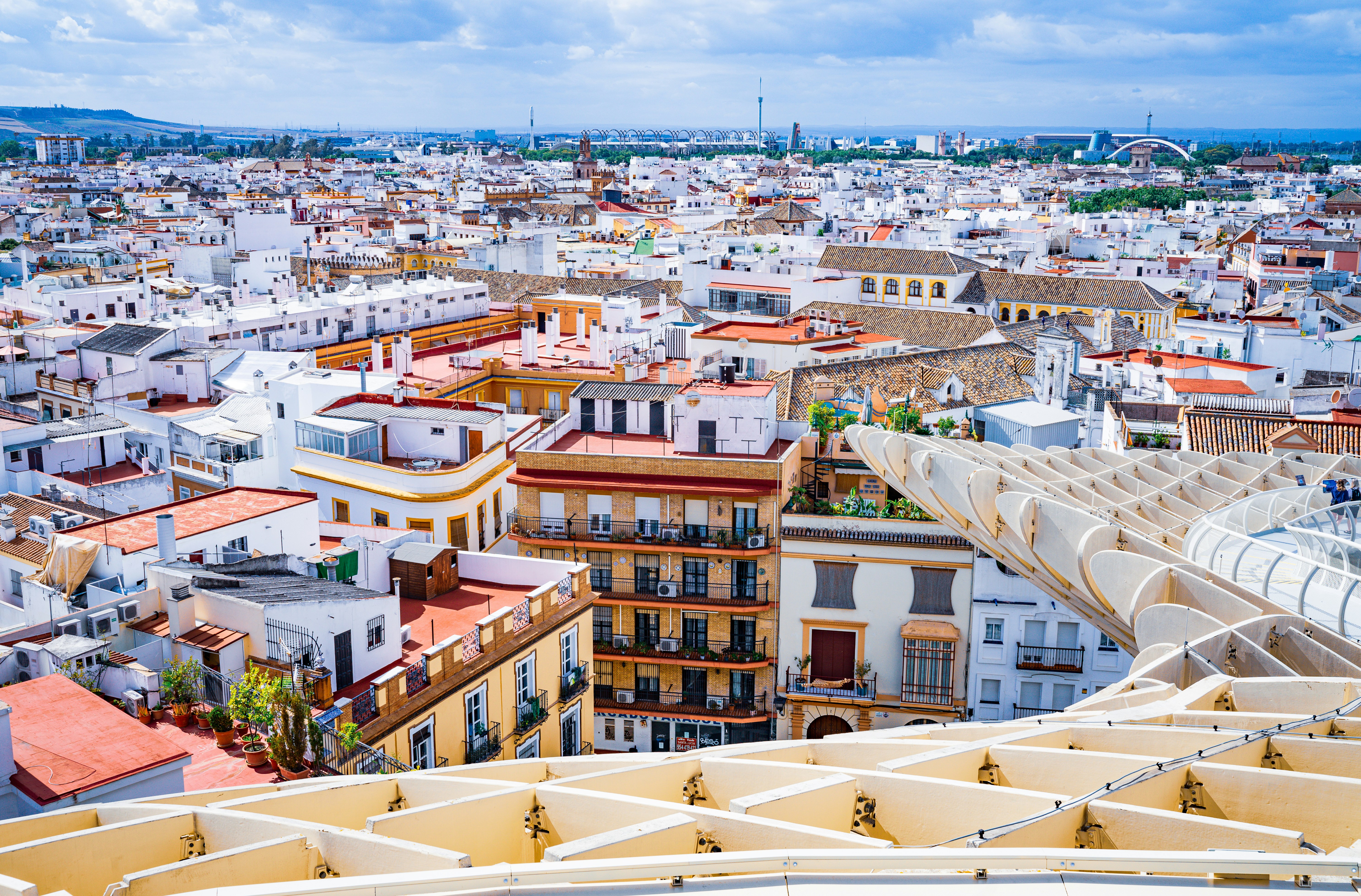
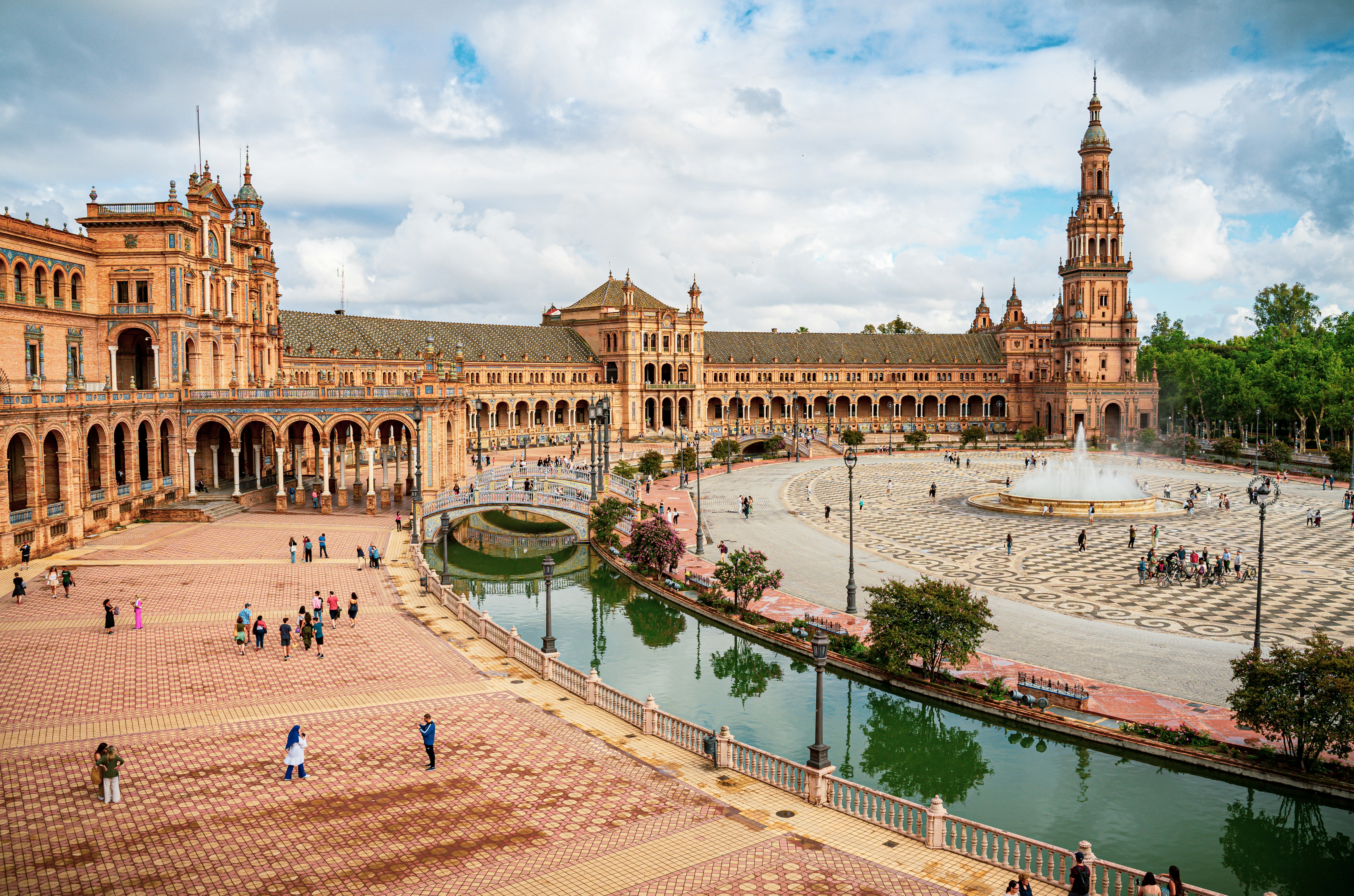
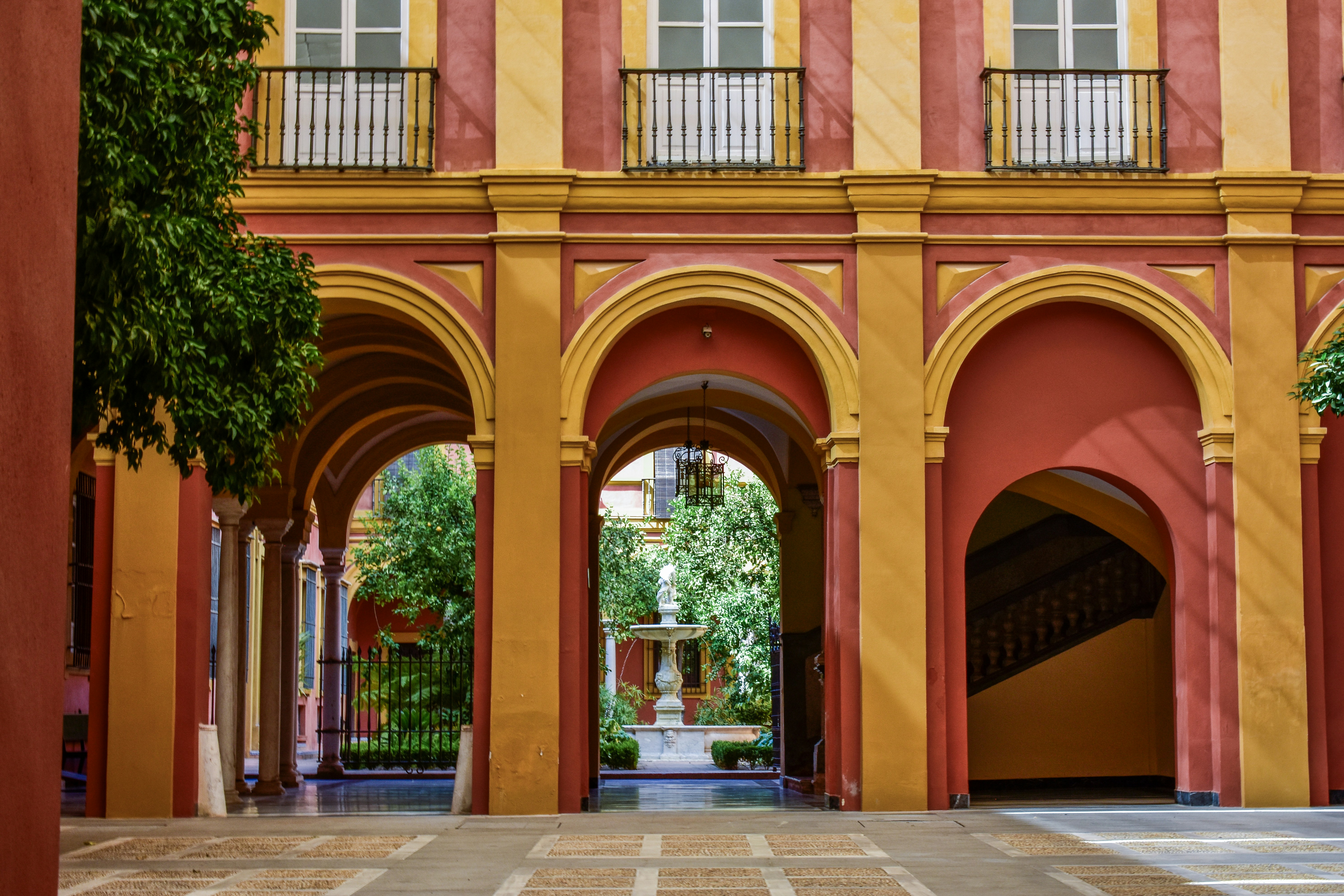
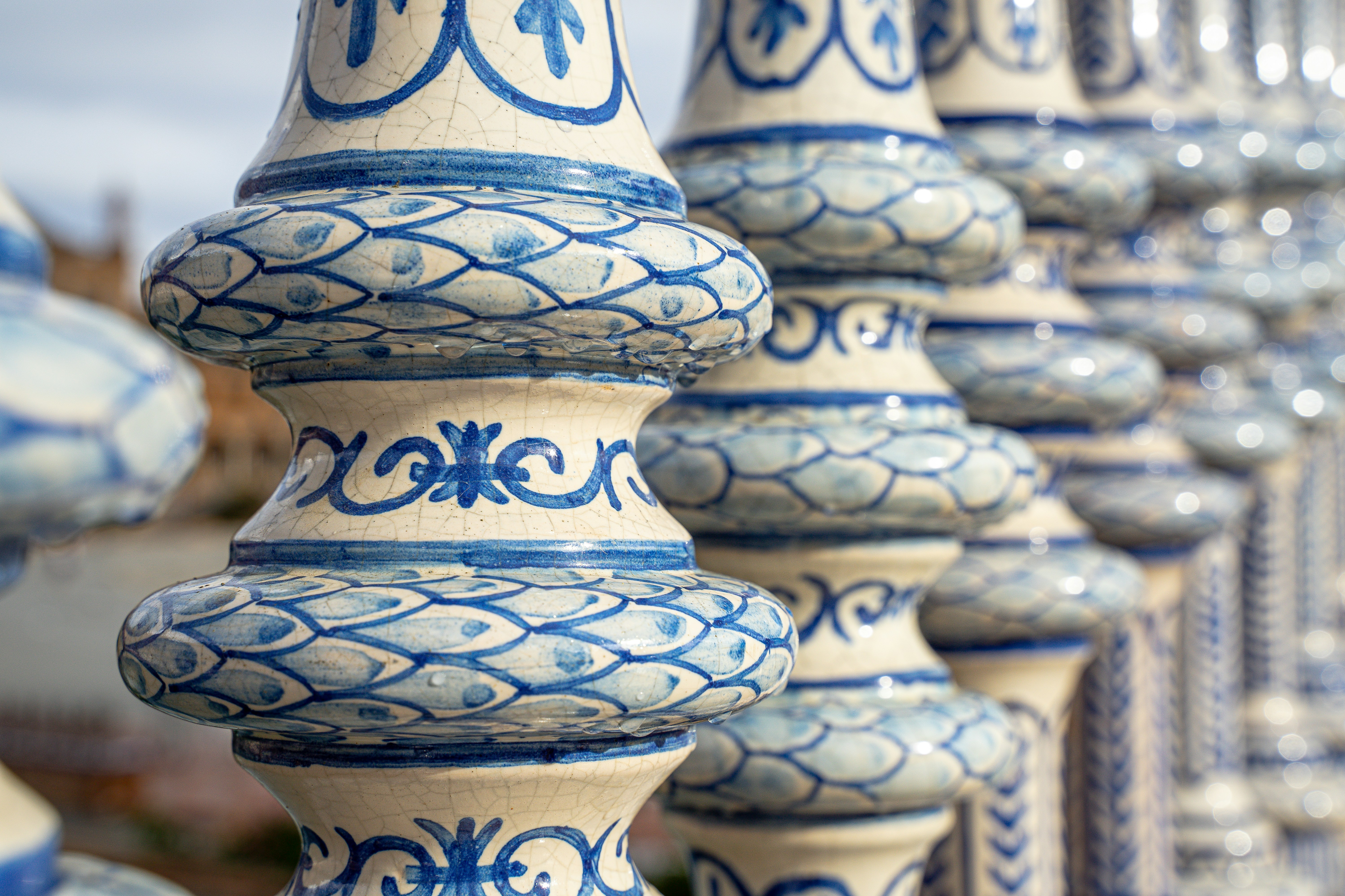
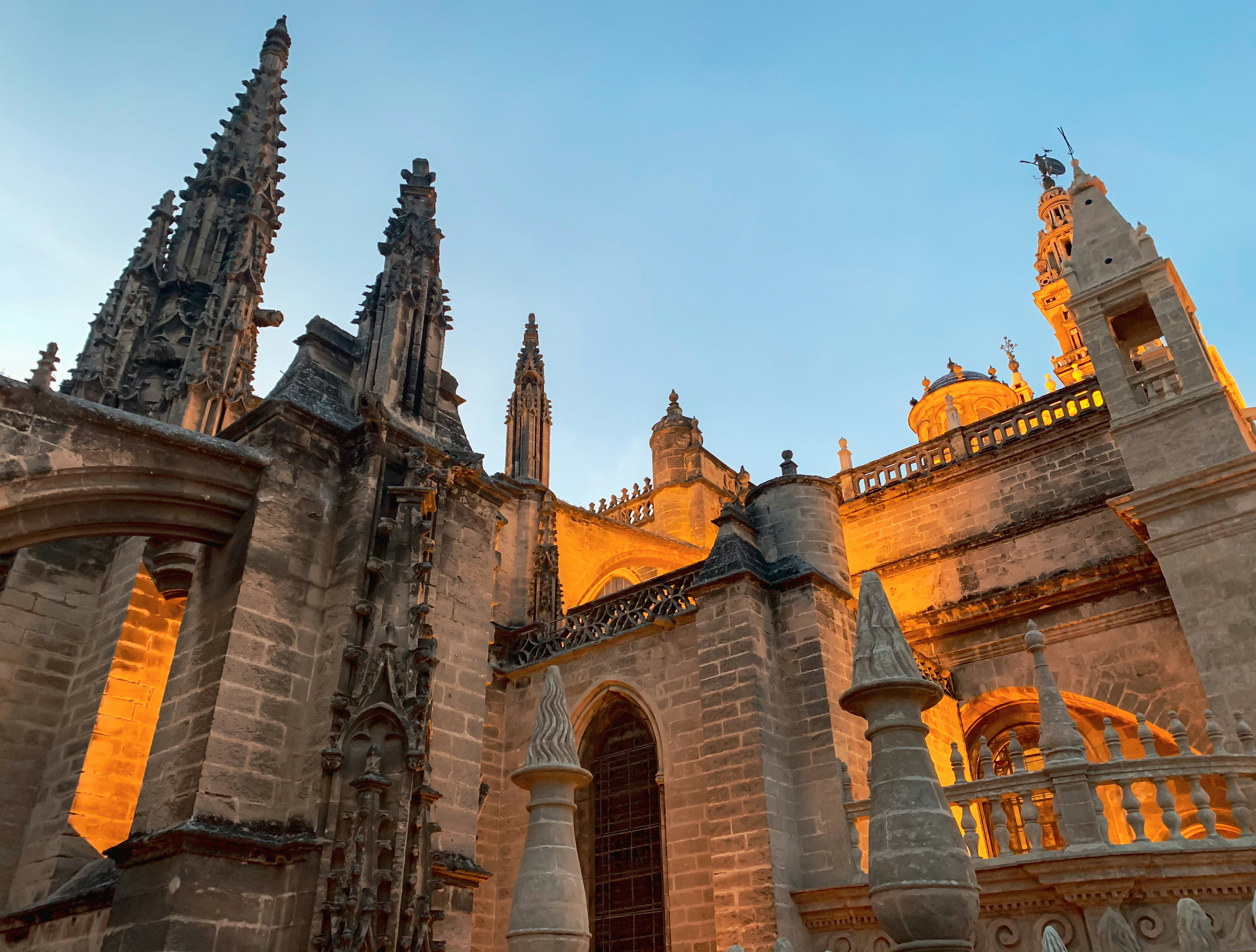
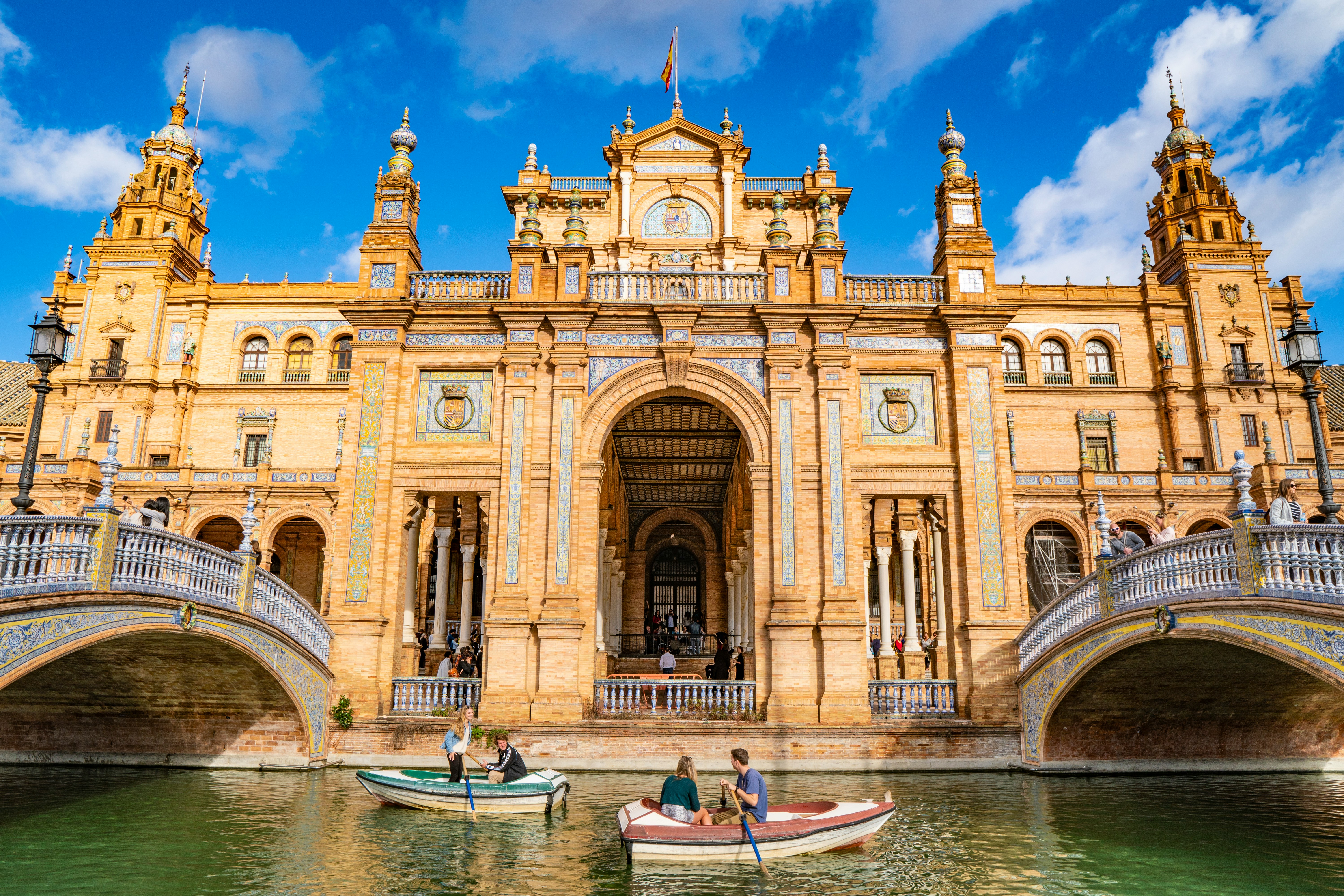
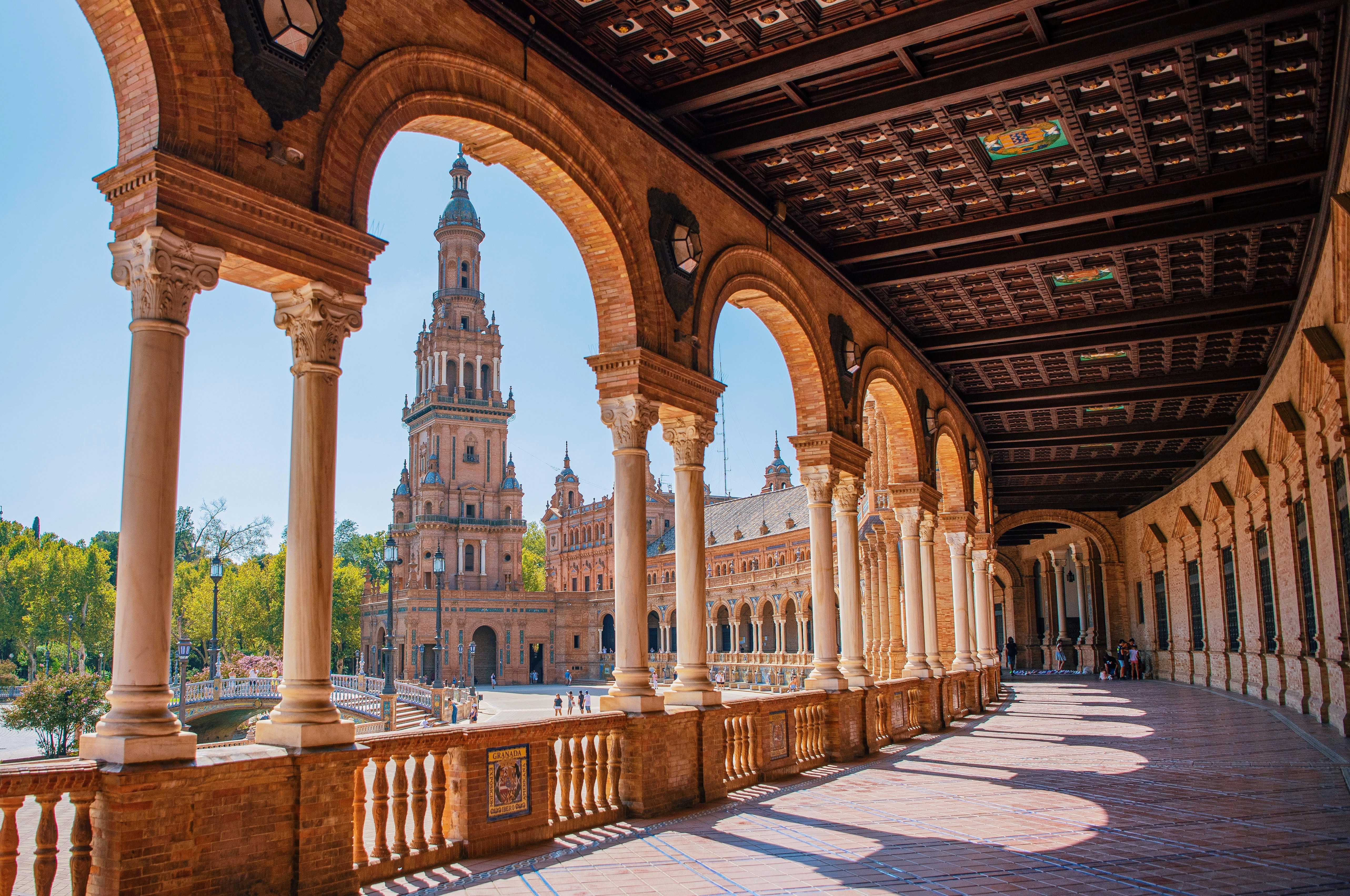
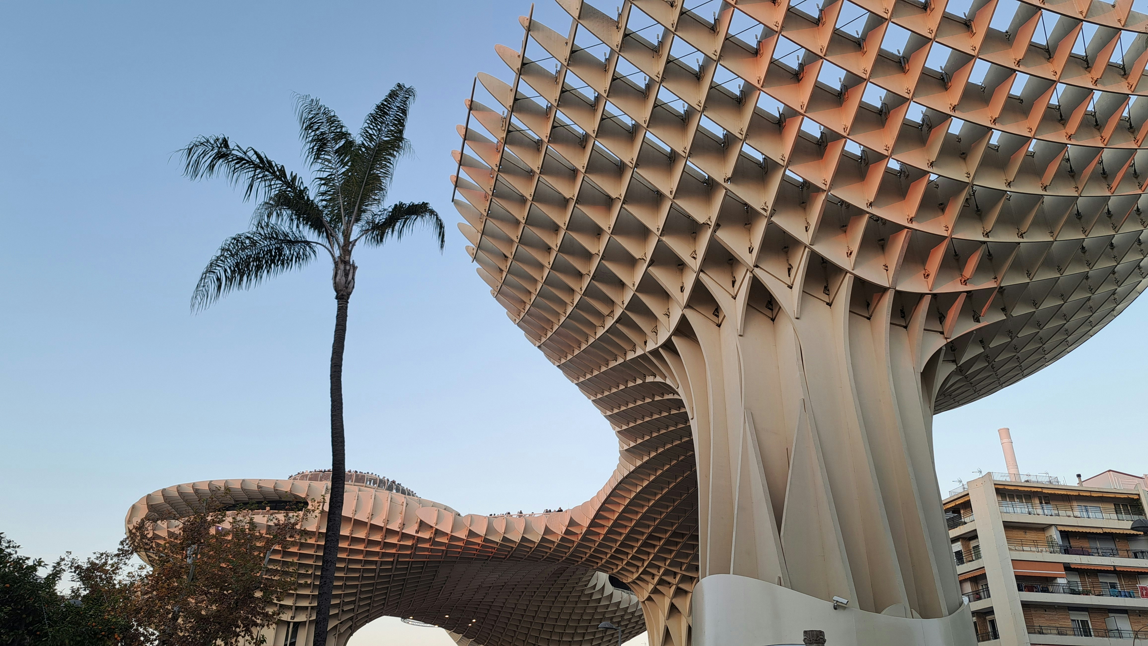
About Seville
Whether you pronounce it Seville or Sevilla, this gorgeous Spanish town is most certainly the stuff of dreams. Over 2,200 years old, Seville has a mutli-layered personality; home to Flamenco, high temperatures and three UNESCO-World Heritage Sites, there is a noble ancestry to the southern Spanish town. Not forgetting that it is the birthplace of painter Diego Velazquez, the resting place of Christopher Columbus, the inspiration for Bizet’s Carmen and a location for Game of Thrones filming, Seville is truly more than just a sum of its parts. This city is a full on experience, a beguiling labyrinth of centuries old streets, tiny tapas restaurants serving possibly the best dishes you’ll taste south of Madrid and a paradise of Mudejar architecture and tranquil palm trees and fountain-filled gardens.
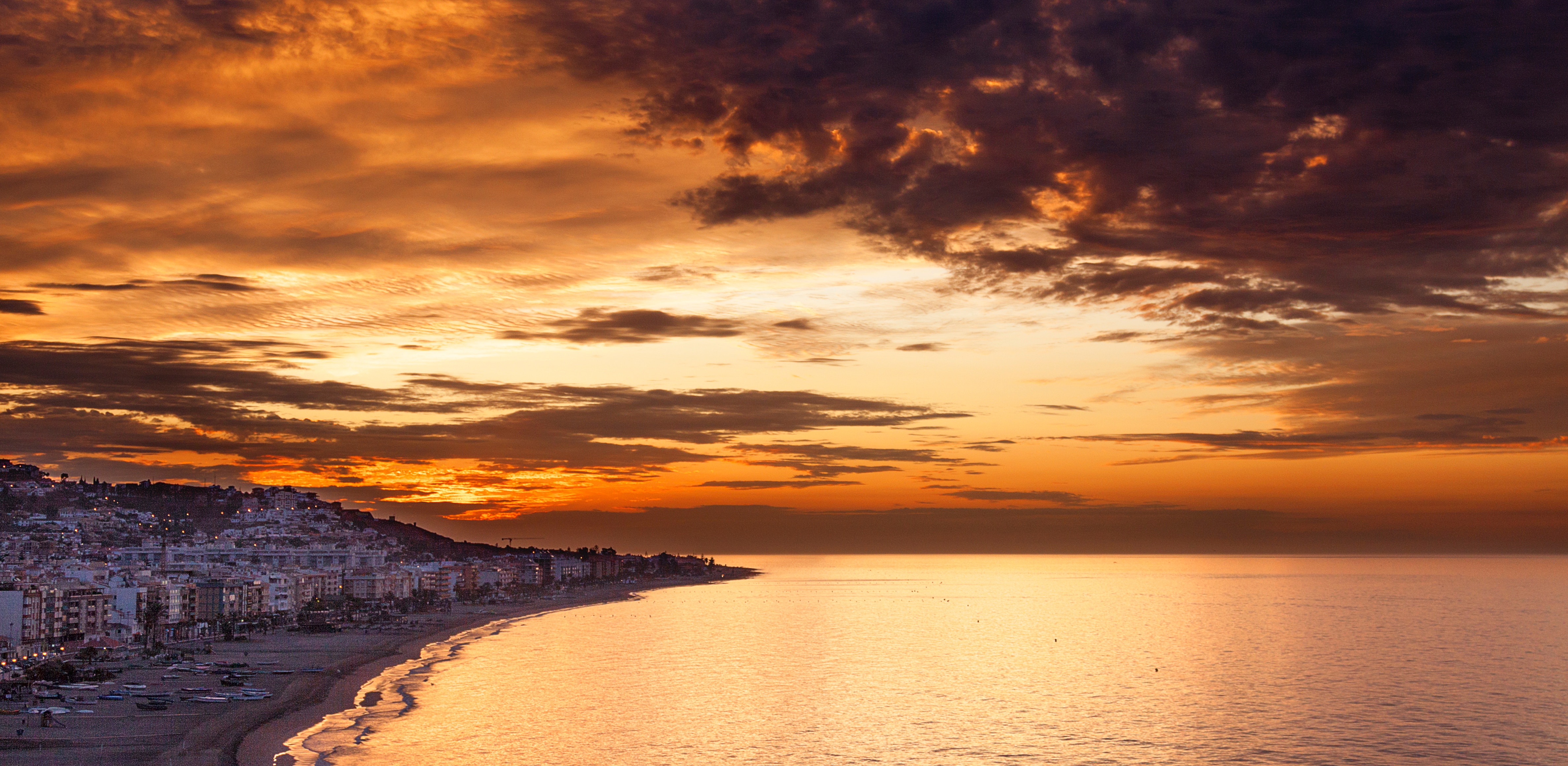
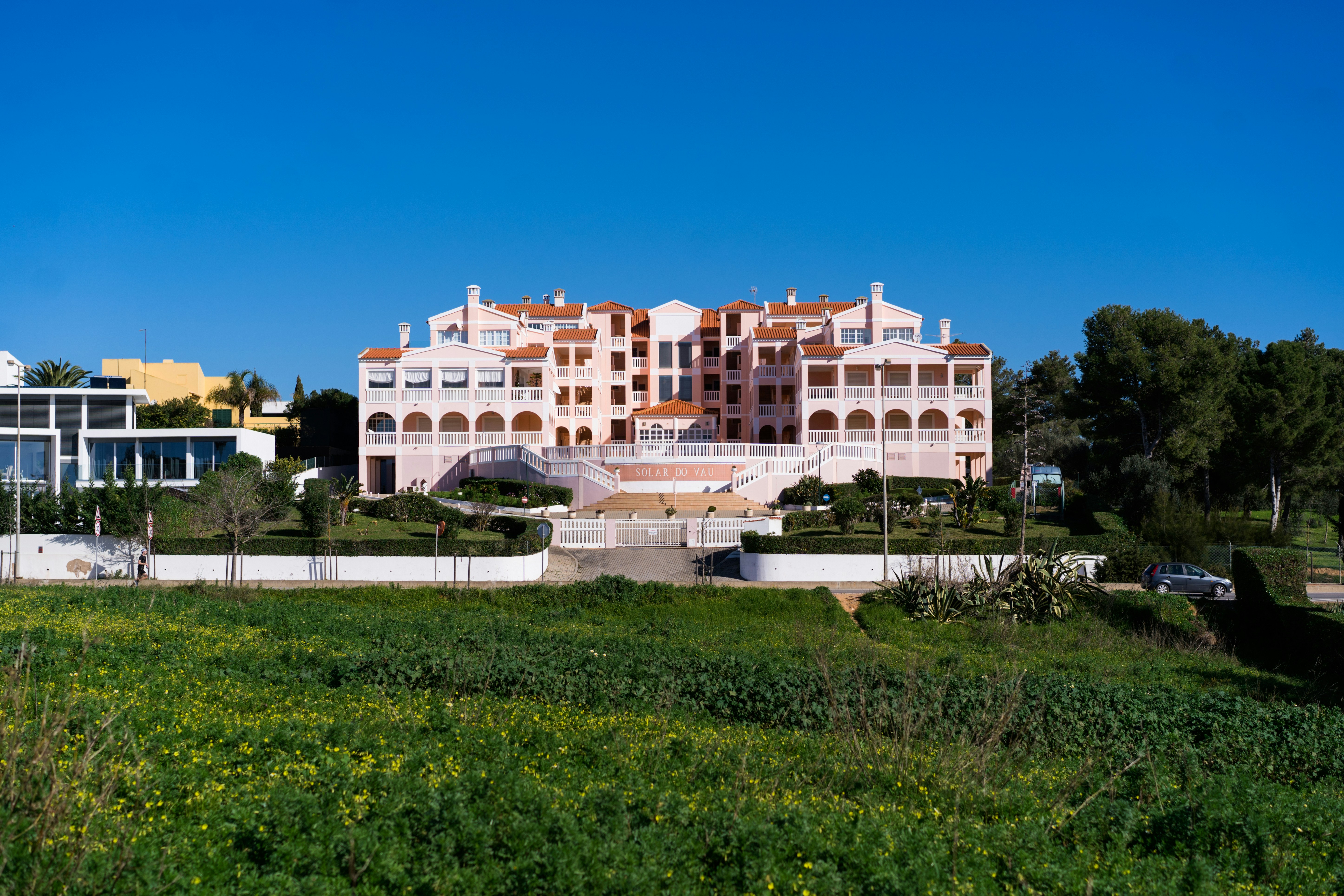
About Portimão
Portimão is a major fishing port, and significant investment has been poured into transforming it into an attractive cruise port as well. The city itself is spacious and has several good shopping streets—though sadly many of the more traditional retailers have closed in the wake of the global economic crisis. There is also a lovely riverside area that just begs to be strolled (lots of the coastal cruises depart from here). Don’t leave without stopping for an alfresco lunch at the Doca da Sardinha ("sardine dock") between the old bridge and the railway bridge. You can sit at one of many inexpensive establishments, eating charcoal-grilled sardines (a local specialty) accompanied by chewy fresh bread, simple salads, and local wine.
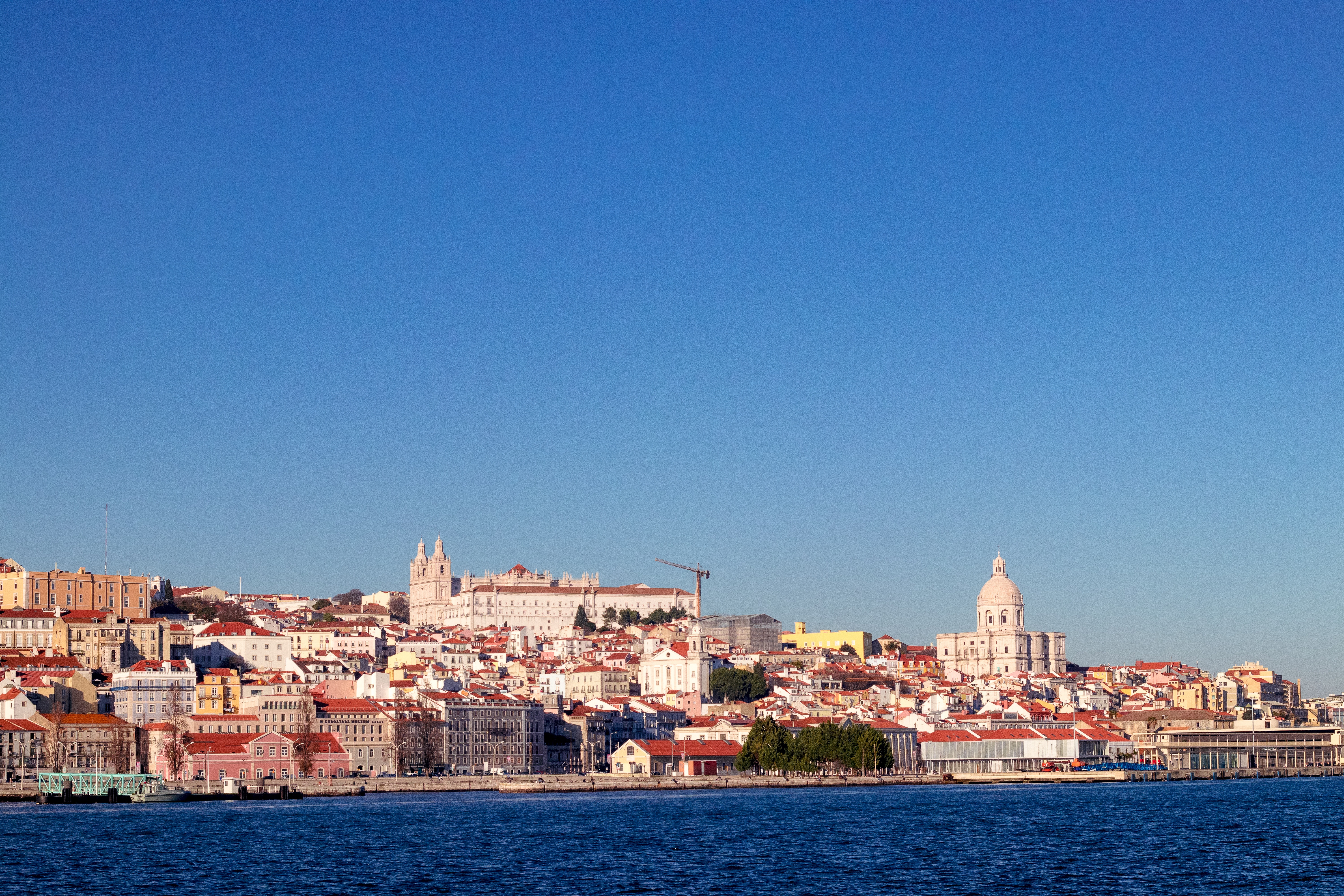
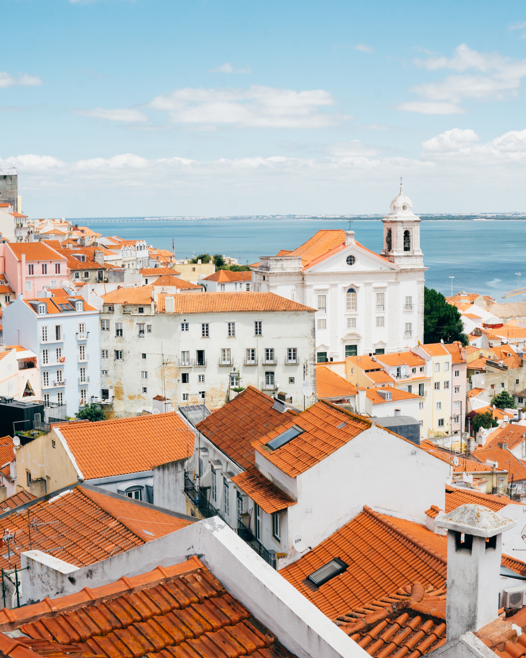
About Lisbon
Set on seven hills on the banks of the River Tagus, Lisbon has been the capital of Portugal since the 13th century. It is a city famous for its majestic architecture, old wooden trams, Moorish features and more than twenty centuries of history. Following disastrous earthquakes in the 18th century, Lisbon was rebuilt by the Marques de Pombal who created an elegant city with wide boulevards and a great riverfront and square, Praça do Comércio. Today there are distinct modern and ancient sections, combining great shopping with culture and sightseeing in the Old Town, built on the city's terraced hillsides. The distance between the ship and your tour vehicle may vary. This distance is not included in the excursion grades.

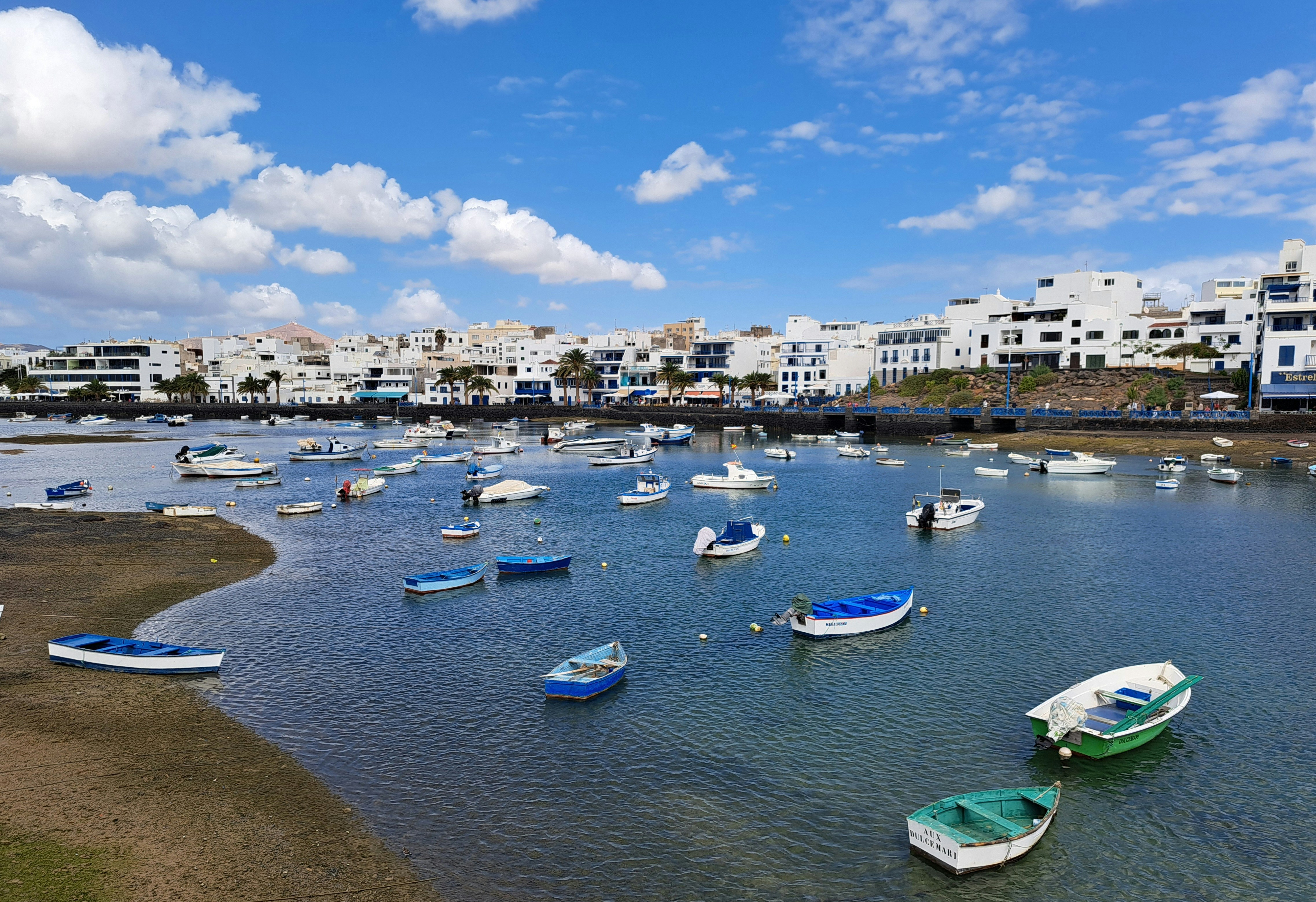
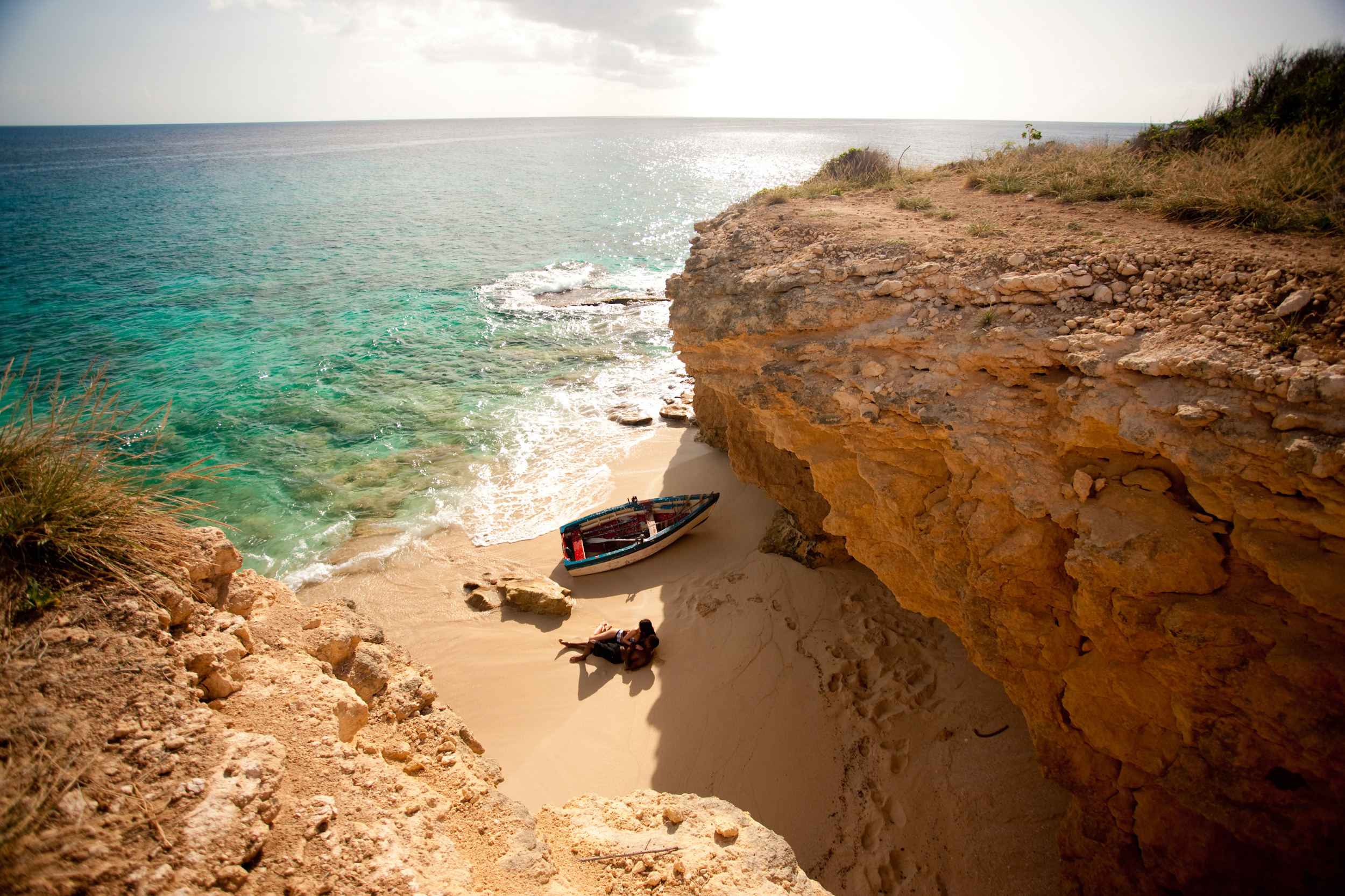
About Arrecife, Lanzarote
A volcanic island designated a UNESCO Biosphere Reserve, Lanzarote’s dramatic landscapes were shaped by an explosive past. Today, its pretty beaches and virtual absence of rain together with duty-free shopping make the island an extremely desirable destination. The main port and capital, Arrecife, is a pleasant town with a modern seafront and colourful gardens. Outside the capital there is plenty to explore, from the dazzling white salt flats of Janubio and the rugged terrain of Fire Mountain to the eerie caves of Los Verdes and an array of unspoilt fishing villages scattered around the coast. The island is home to a great selection of restaurants and local specialities including garbanzos compuestos – a chickpea stew; papas arrugadas – potatoes with carrots, peas, ham and green pepper; and of course, plenty of fresh seafood. Please note that those planning to participate in one of the shore excursions from this port may need to take an early lunch on board ship to suit the excursion schedules.
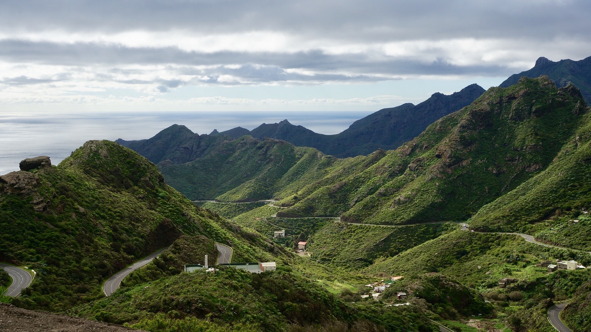
About Tenerife
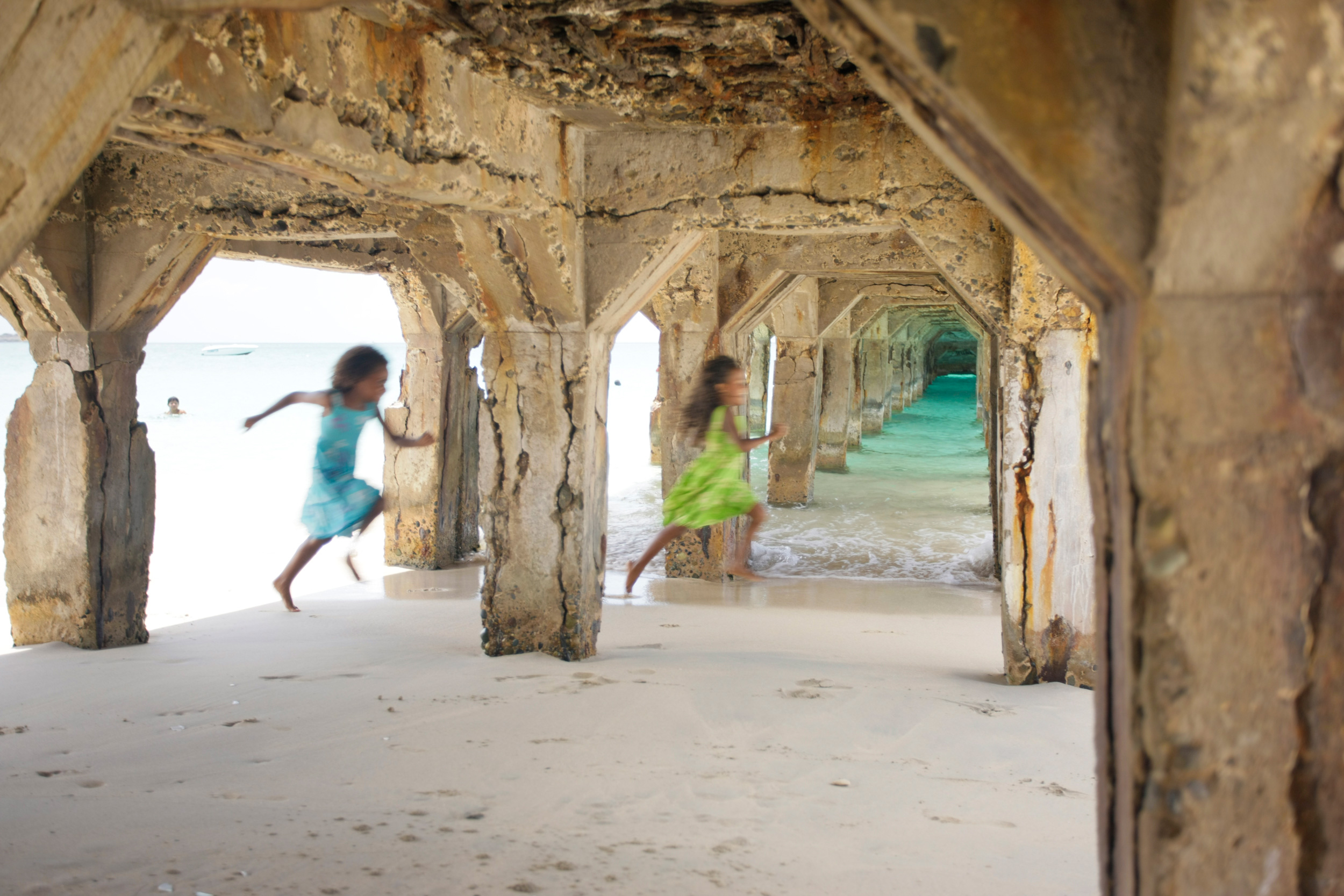
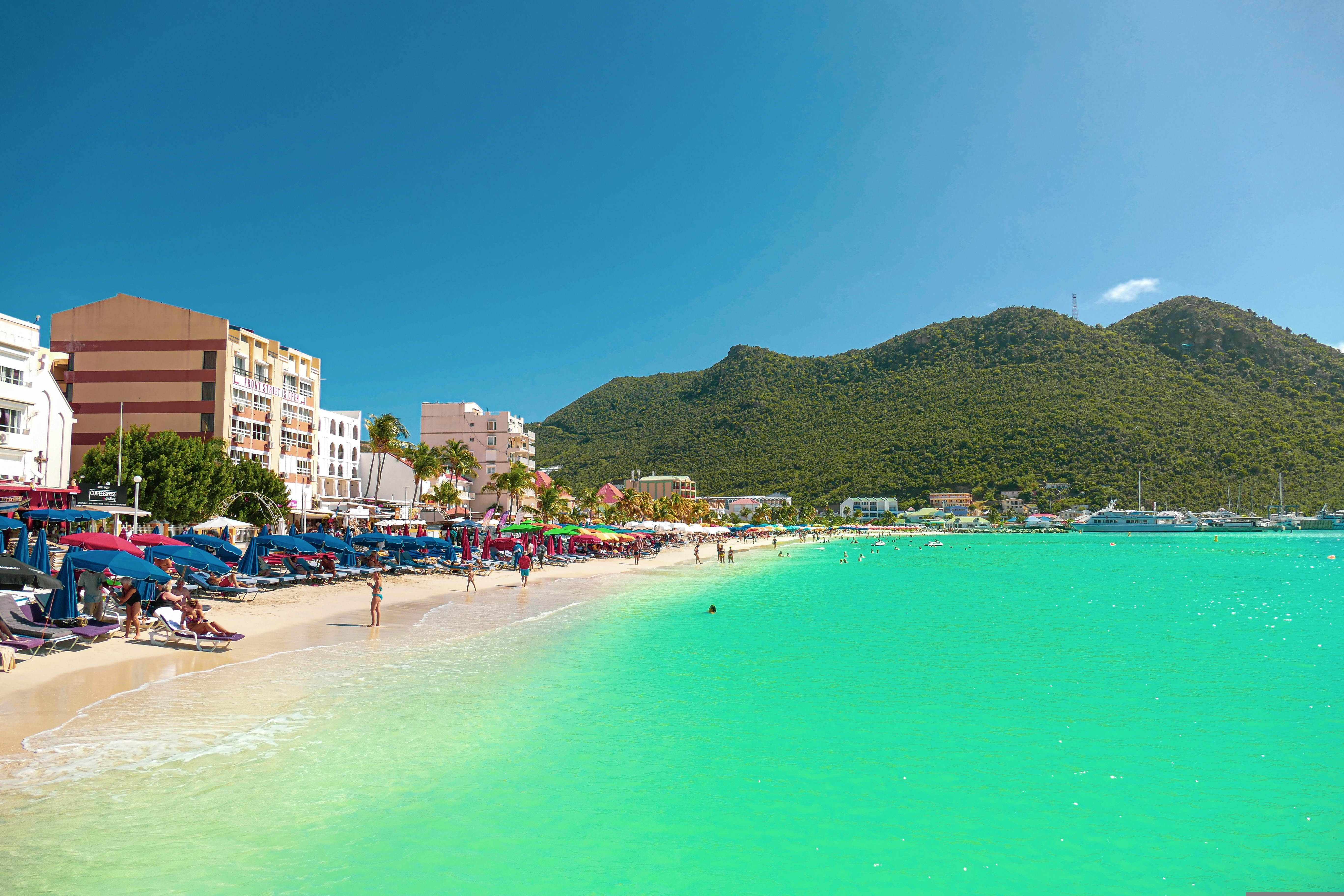
About Philipsburg
The capital of Dutch St. Maarten stretches about a mile (1½ km) along an isthmus between Great Bay and the Salt Pond and has five parallel streets. Most of the village's dozens of shops and restaurants are on Front Street, narrow and cobblestone, closest to Great Bay. It's generally congested when cruise ships are in port, because of its many duty-free shops and several casinos. Little lanes called steegjes connect Front Street with Back Street, which has fewer shops and considerably less congestion. Along the beach is a ½-mile-long (1-km-long) boardwalk with restaurants and several Wi-Fi hot spots.Wathey Square (pronounced watty) is in the heart of the village. Directly across from the square are the town hall and the courthouse, in a striking white building with cupola. The structure was built in 1793 and has served as the commander's home, a fire station, a jail, and a post office. The streets surrounding the square are lined with hotels, duty-free shops, restaurants, and cafés. The Captain Hodge Pier, just off the square, is a good spot to view Great Bay and the beach that stretches alongside.
About Charlotte Amalie
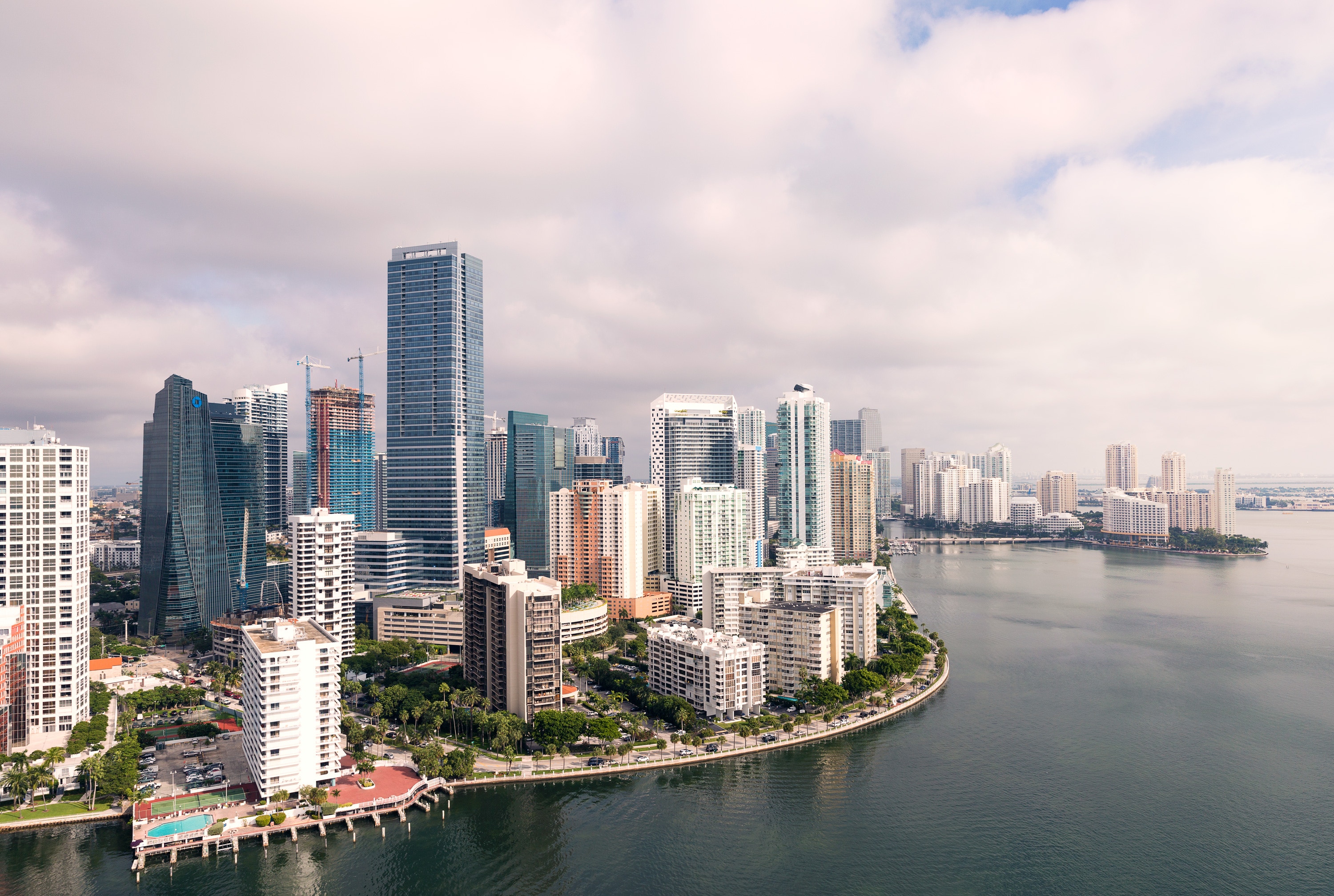
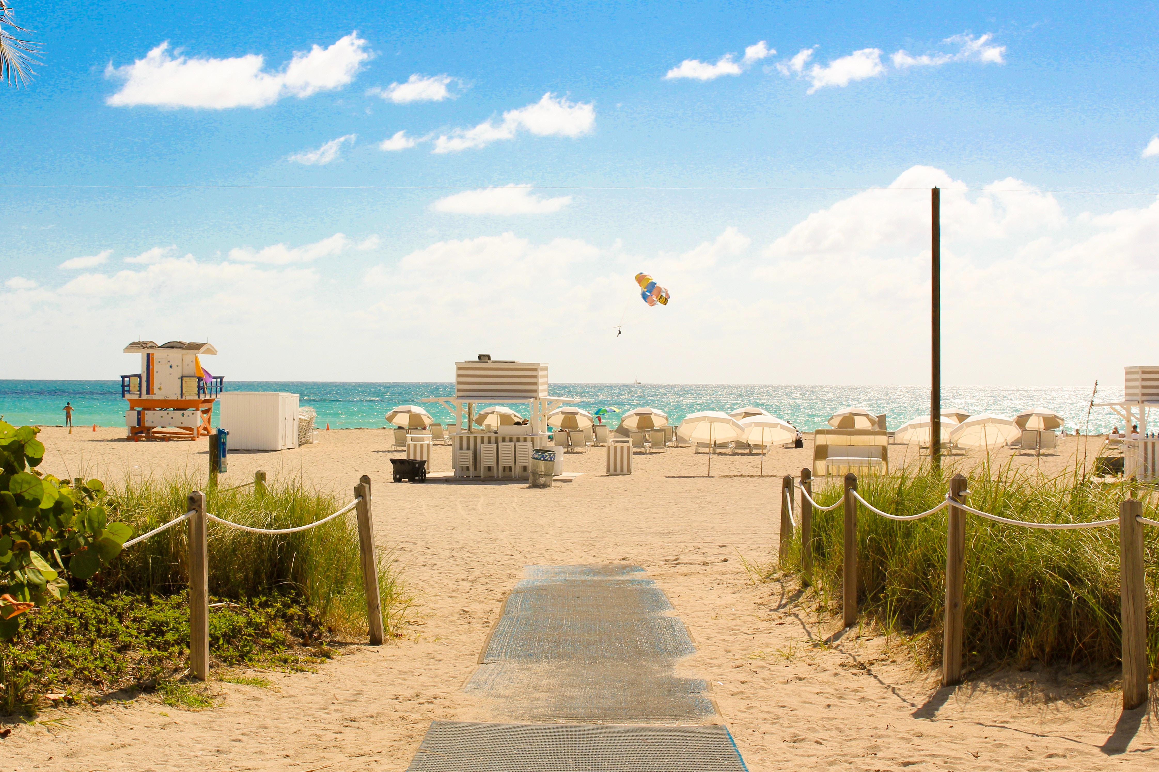
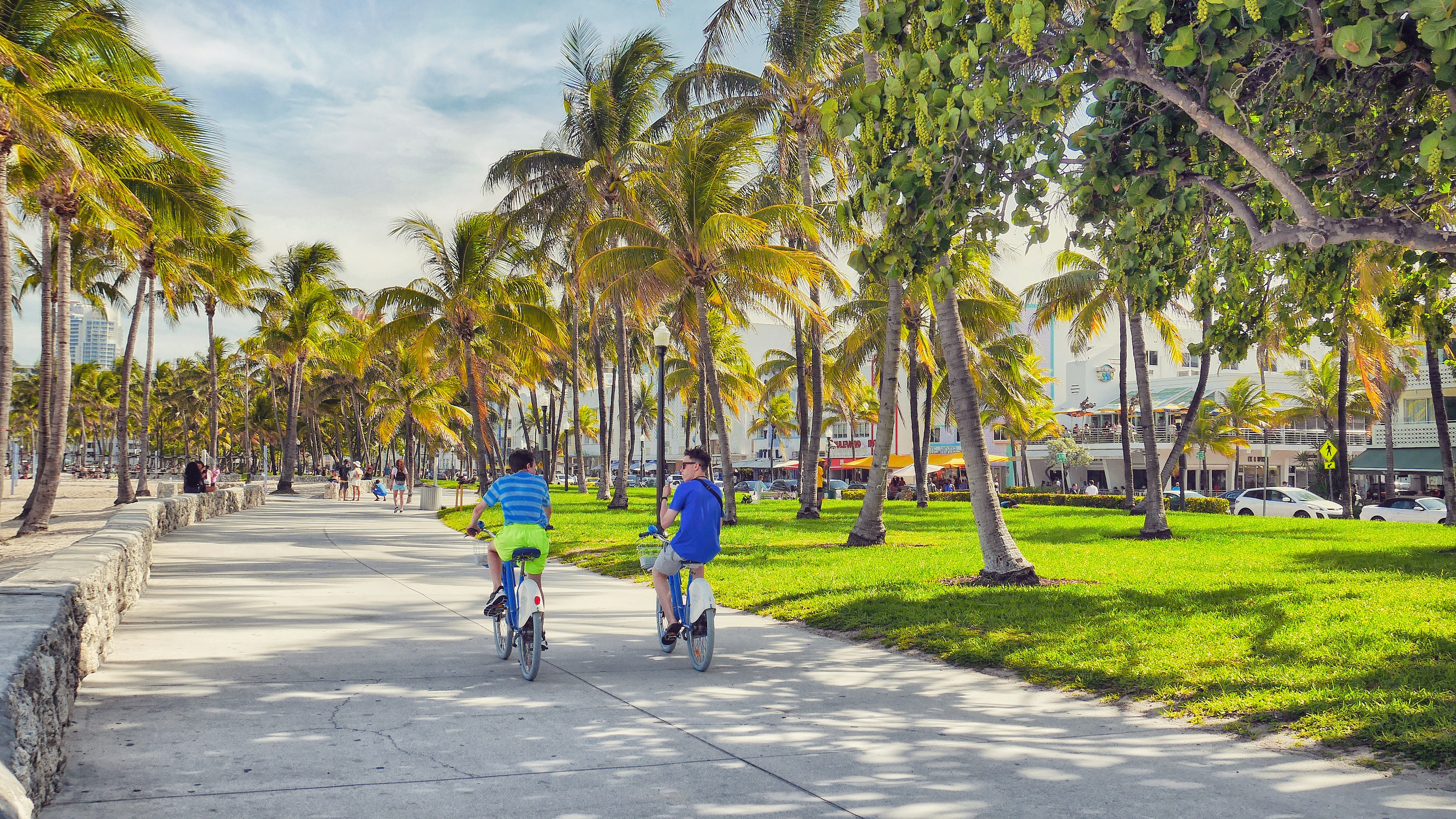
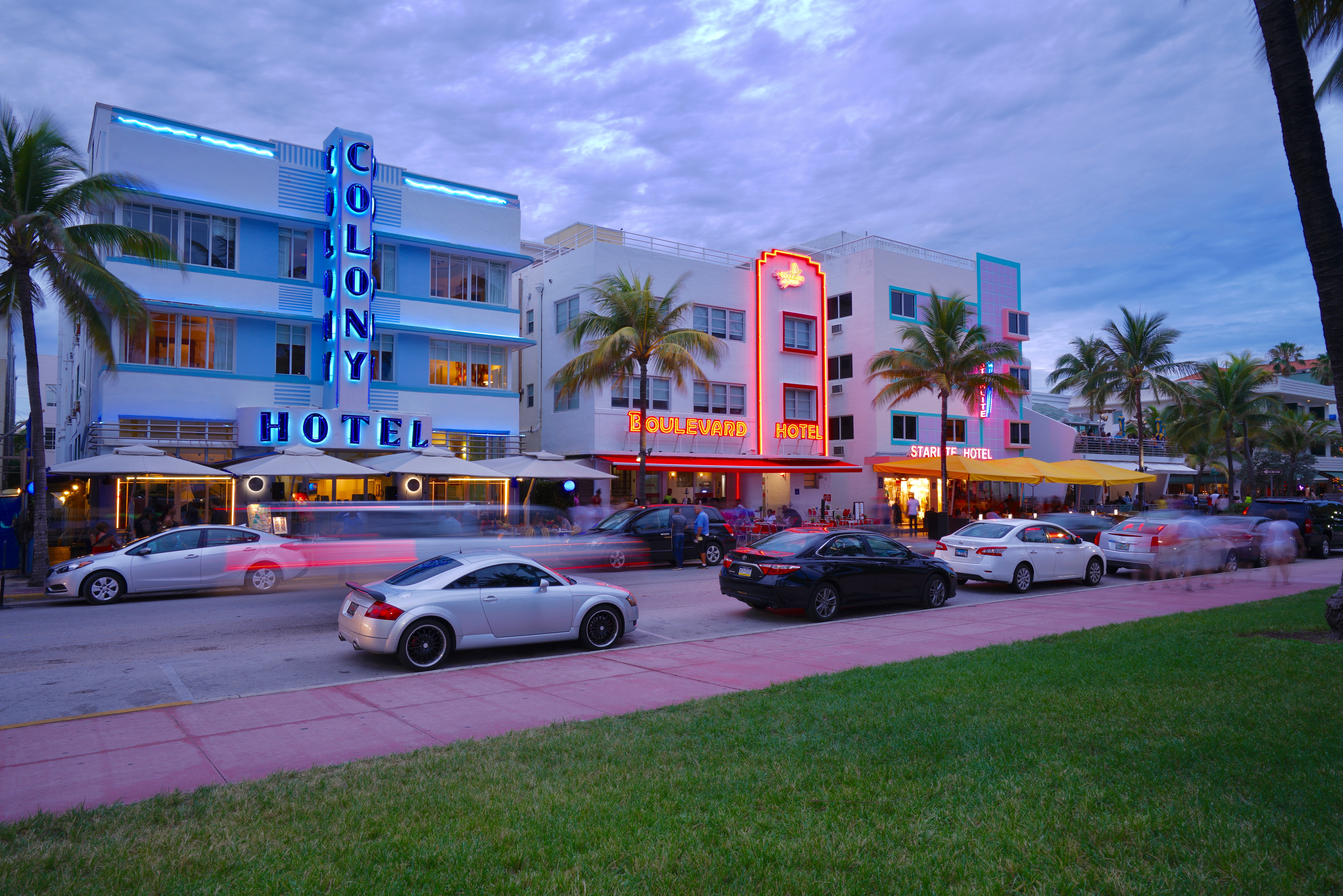
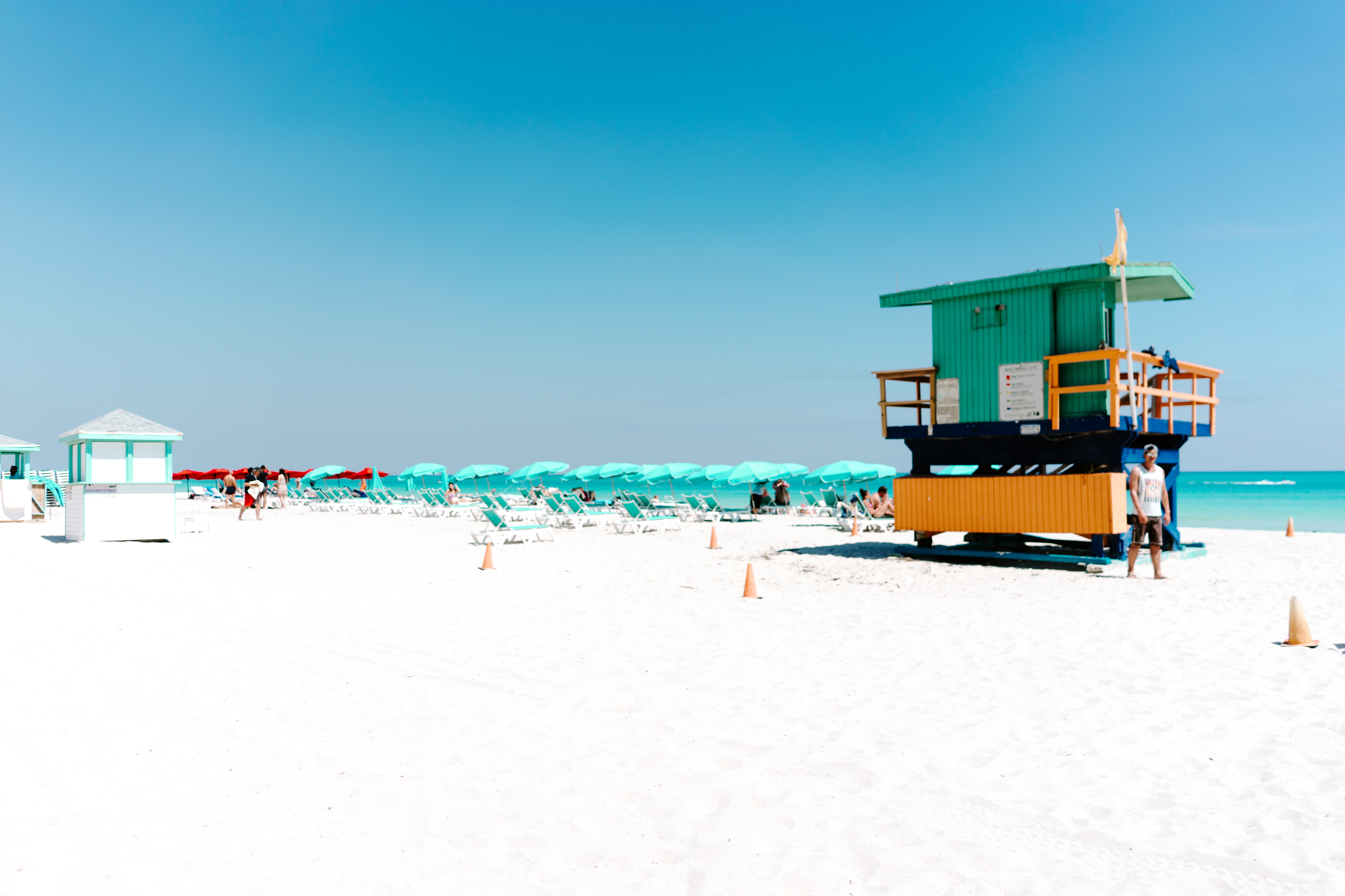
About Miami, Florida
Miami is one of the world’s most popular holiday spots. It has so much to offer; from its countless beach areas, to culture and museums, from spa and shopping days out, to endless cuban restaurants and cafes. Miami is a multicultural city that has something to offer to everyone.
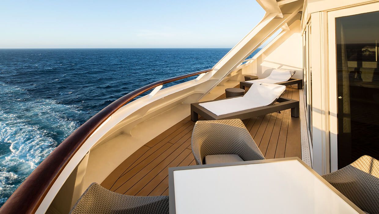
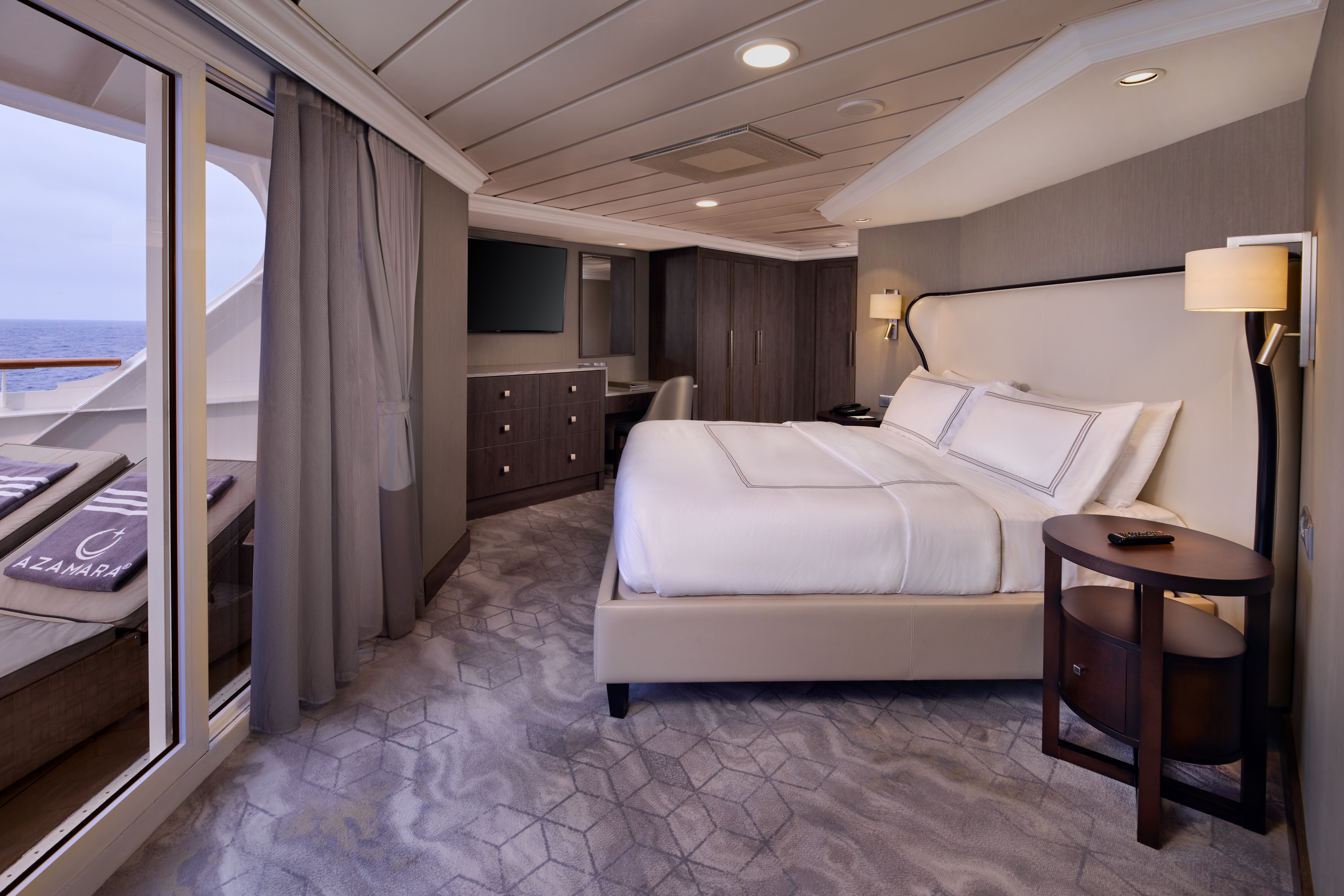
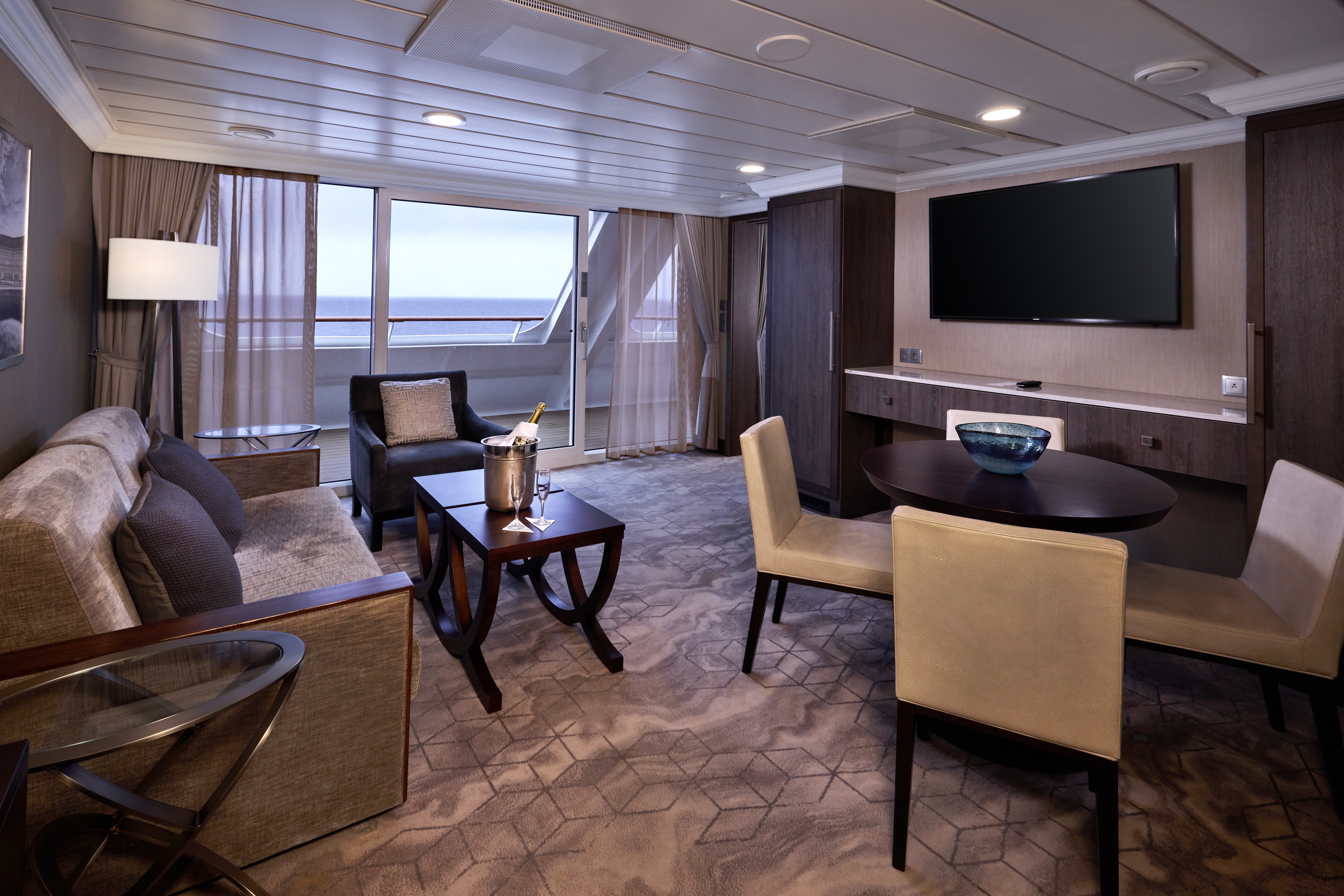
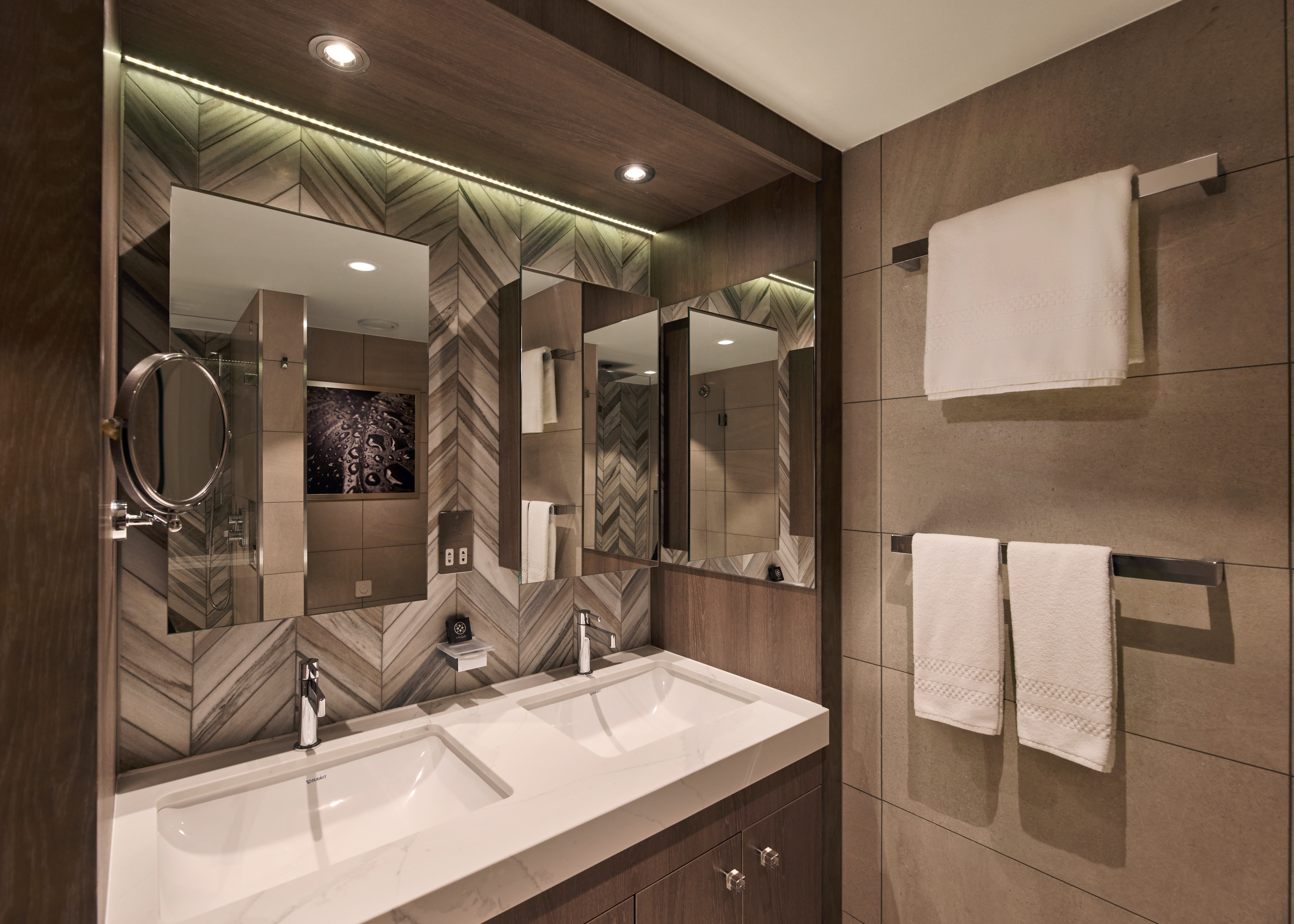
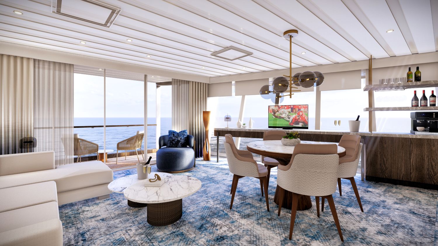
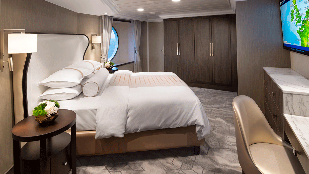
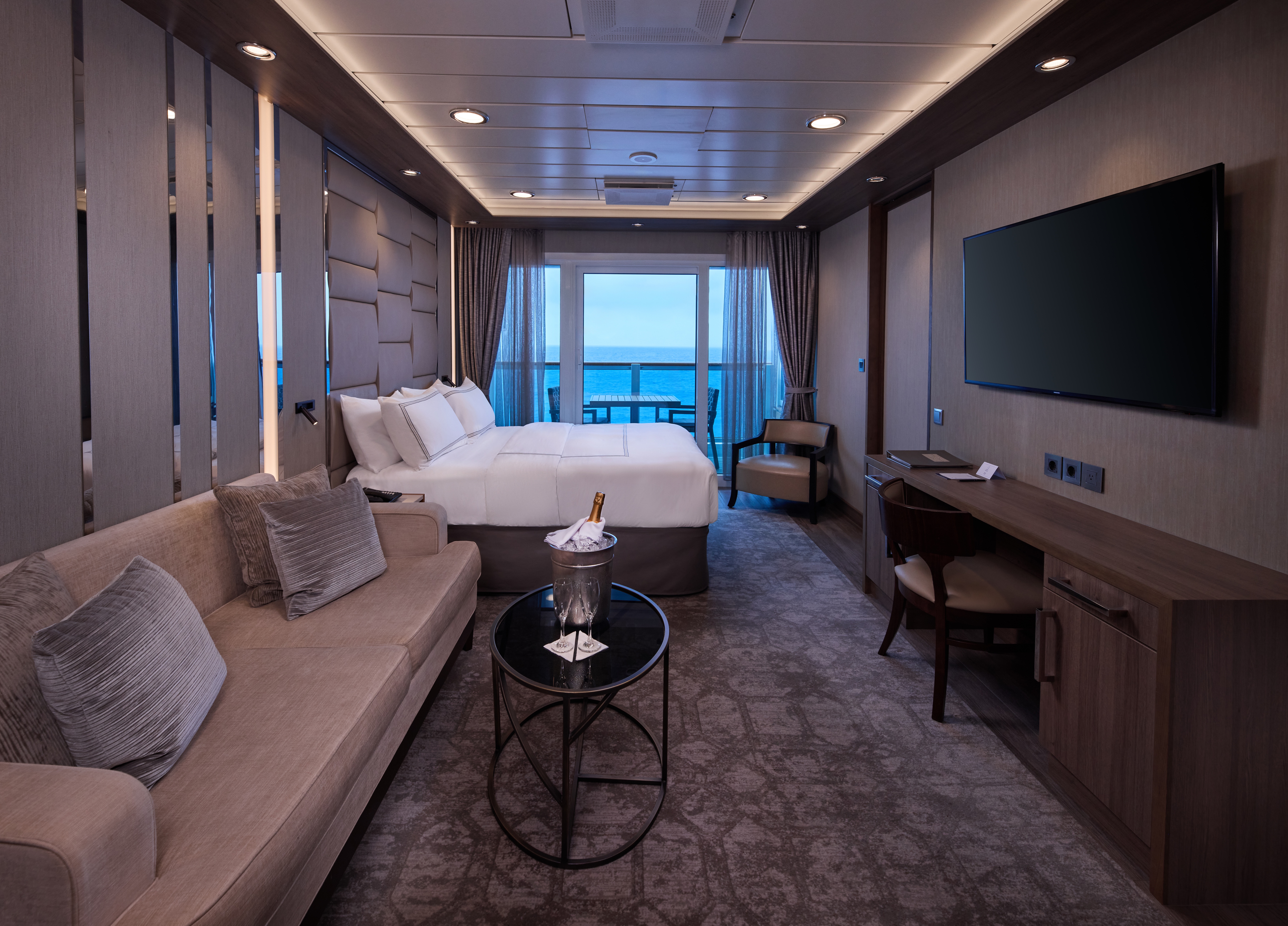
A signature expression of Azamara Cruises' refined luxury, the World Owner's Suite features a spacious layout, a separate bedroom, and a large private veranda. Thoughtfully designed for guests who value privacy, comfort, and elevated living.
Suite Features
- Spacious living room with a separate master bedroom
- Master bedroom with one queen size bed and a flatscreen television
- Flat-screen television in living room
- Marble master bathroom with shower. Journey, Onward, and Quest suites feature a tub.
- Dressing room with vanity and ample closet space
- Floor-to-ceiling sliding glass doors in living room and master bedroom
- Mini-bar
- Thermostat-controlled air conditioner
- Direct-dial telephone with voice mail
- Writing desk
- In-room safe
- Hand-held hair dryer
- Stateroom: 560 sq. ft. (52 sq. m.) Veranda: 233 sq. ft. (21.7 sq. m.)
Included Amenities
- Ultimate Beverage Package
- Unlimited Standard Starlink Wi-Fi
- Unlimited Wash and Press
- Dedicated butler and concierge service
- Full in-suite dining and daily evening hors d'oeuvres
- Complimentary Specialty Dining and exclusive breakfast at Aqualina
- In-room premium spirits and champagne
- Thalassotherapy Pool access
- Personalized assistance planning spa appointments and shore excursions
- Priority check-in
- Luxurious cotton bed linens with duvet
- Terry bathrobes
- 24-hour room service
- Tote bag
- Use of umbrella
- Shoeshine service
- Turndown treats
- Afternoon In-Suite Tea Service

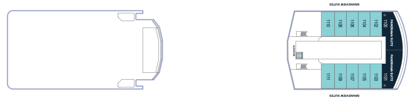
The Panorama Suite introduces a new pinnacle of onboard living, offering expansive interiors, generous living and dining space, and sweeping panoramic views. Designed for guests seeking the most immersive and elevated suite experience at sea.
Suite Features
Spacious living room with a separate master bedroom
- Master bedroom with one queen size bed with a 55" flatscreen television
- 55" flat-screen television in living room
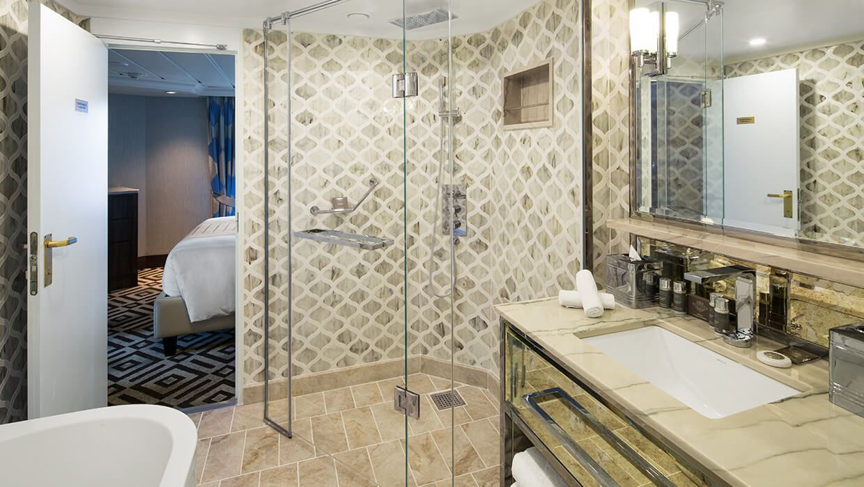
- Marble master bathroom with shower.
- Dressing room with vanity and ample closet space
- Floor-to-ceiling sliding glass doors in living room and master bedroom
- Mini-bar
- Thermostat-controlled air conditioner
- Direct-dial telephone with voice mail
- Writing desk
- In-room safe
- Hand-held hair dryer
- Stateroom: 656 sq. ft. (61 sq. m.) Veranda: 63.5 sq. ft. (5.9 sq. m.)
- Ultimate Beverage Package
- Personalized assistance planning spa appointments and
- Unlimited Standard Starlink Wi-Fi shore excursions
- Unlimited Wash and Press
- Priority check-in
- Luxurious cotton bed linens with duvet
- Dedicated butler and concierge service
- Terry bathrobes
- Full in-suite dining and daily evening hors d'oeuvres
- 24-hour room service
- Complimentary Specialty Dining and exclusive breakfast at Aqualina
- Tote bag
- Use of umbrella
- In-room premium spirits and champagne
- Shoeshine service
- Thalassotherapy Pool access
- Turndown treats
- Afternoon In-Suite Tea Service
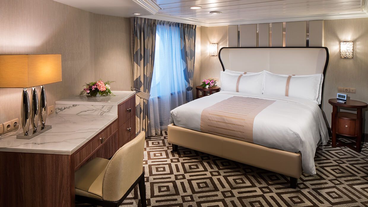
The Ocean Suite offers generous space to relax, with a separate living area, a dedicated bedroom, and a private veranda. An inviting retreat that balances comfort, functionality, and classic suite-style living.
Suite Features
- Spacious living room with a separate master bedroom
- Master bedroom with one queen size bed with a flatscreen television
- Flat-screen television in living room
- Marble master bathroom with shower. Journey and Quest suites feature a tub.
- Dressing room with vanity and ample closet space
- Floor-to-ceiling sliding glass doors in living room and master bedroom
- Mini-bar
- Thermostat-controlled air conditioner
- Direct-dial telephone with voice mail
- Writing desk
- In-room safe
- Hand-held hair dryer
- Stateroom: 440-501 sq. ft. (40.9-46.5 sq. m.) Veranda: 233 sq. ft. (21.7 sq. m.)
Included Amenities
- Ultimate Beverage Package
- Unlimited Standard Starlink Wi-Fi
- Personalized assistance planning spa appointments and shore excursions
- Unlimited Wash and Press
- Priority check-in
- Luxurious cotton bed linens with duvet
- Dedicated butler and concierge service
- Terry bathrobes
- Full in-suite dining and daily evening hors d'oeuvres
- 24-hour room service
- Complimentary Specialty Dining and exclusive breakfast at Aqualina
- Tote bag
- Use of umbrella
- In-room premium spirits and champagne
- Shoeshine service
- Thalassotherapy Pool access
- Turndown treats
- Afternoon In-Suite Tea Service
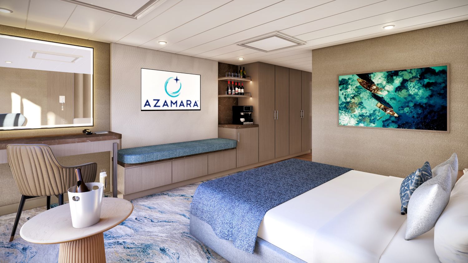
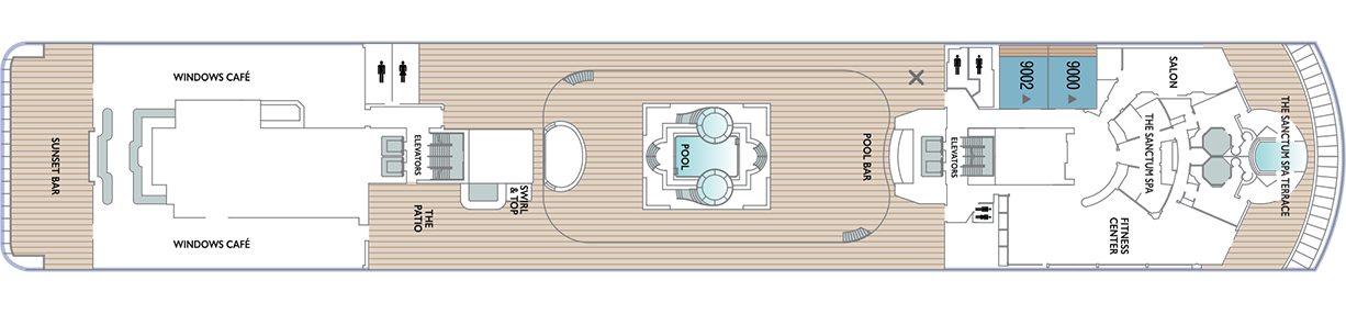
Designed for relaxation and renewal, the Spa Suite features a spacious layout with spa-inspired touches, including a glass-enclosed soaking tub and convenient access to the spa. A calming retreat ideal for wellness- focused travelers.
Suite Features
- Two lower beds convertible to one queen size bed
- Thermostat-controlled air conditioner
- Spacious glass-enclosed bathtub
- Direct-dial telephone with voice mail
- Separate rain shower
- Writing desk
- Comfortable sitting area
- In-room safe
- Flat-screen television in sitting area
- Hand-held hair dryer
- Floor-to-ceiling sliding glass doors
- Stateroom: 414 sq. ft. (38.5 sq. m.) Veranda: 40 sq. ft. (3.7 sq. m.)
- Mini-bar
Included Amenities
- Ultimate Beverage Package
- Unlimited Standard Starlink Wi-Fil
- Unlimited Wash and Press
- Dedicated butler and concierge service
- Full in-suite dining and daily evening hors d'oeuvres
- Complimentary Specialty Dining and exclusive breakfast at Aqualina
- In-room premium spirits and champagne
- Thalassotherapy Pool access
- Personalized assistance planning spa appointments and shore excursions
- Priority check-in
- Luxurious cotton bed linens with duvet
- Terry bathrobes
- 24-hour room service
- Tote bag
- Use of umbrella
- Shoeshine service
- Turndown treats
- Afternoon In-Suite Tea Service

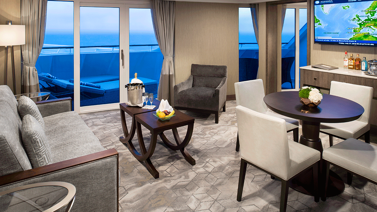
Spacious and comfortable, our Club Continent Suites feature fresh new décor inspired by natural elements. With two beds convertible to a queen, a cozy sitting area, breezy balcony and refreshed bathroom with a bathtub or shower, this is your wonderful, refined home away from home.
Suite Features
- Two lower beds convertible to one queen size bed
- Spacious and comfortable sitting area
- Flat-screen television in sitting area
- Roomy bathroom with shower. Some also feature a tub.
- Floor-to-ceiling sliding glass doors
- Veranda
- Mini-bar
- Thermostat-controlled air conditioner
- Direct-dial telephone with voice mail
- Writing desk
- In-room safe
- Hand-held hair dryer
- Stateroom: 266 sq. ft. (24.7 sq. m.) Veranda: 60 sq. ft. (5.6 sq. m.)
Included Amenities
- Unlimited Basic Starlink Wi-Fi
- 2 laundry bags (wash and press per stateroom, per 7 nights)
- Dedicated butler and concierge service
- Full in-suite dining and daily evening hors d'oeuvres
- Complimentary Specialty Dining and exclusive breakfast at Aqualina
- In-room premium spirits and champagne
- Thalassotherapy Pool access
- Personalized assistance planning spa appointments and shore excursions
- Priority check-in
- Luxurious cotton bed linens with duvet
- Terry bathrobes
- 24-hour room service
- Tote bag
- Use of umbrella
- Shoeshine-service
- Turndown treats
- Afternoon In-Suite Tea Service

The Grandview Suite blends refined contemporary design with floor-to-ceiling views and an expanded, spa-like bathroom. Thoughtfully designed to maximize light and comfort, offering a modern suite experience with select amenities.
Suite Features
- Spacious suite with king-sized bed
- Comfortable sitting area
- Flat-screen television in sitting area
- Roomy bathroom with shower
- Floor-to-ceiling sliding glass doors.
- Veranda
- Mini-bar
- Thermostat-controlled air conditioner
- Direct-dial telephone with voice mail
- Writing desk
- In-room safe
- Hand-held hair dryer
- 243.15 sq. ft. (22.59 sq. m.) Veranda: 60 sq. ft. (5.6 sq.m.)
Included Suite Amenities
- Unlimited Basic Starlink Wi-Fi
- 2 laundry bags (wash and press) per stateroom, per 7 nights
- Dedicated butler and concierge service
- Full in-suite dining and daily evening hors d'oeuvres
- Complimentary Specialty Dining and exclusive breakfast at Aqualina
- In-room premium spirits and champagne
- Thalassotherapy Pool access
- Personalized assistance planning spa appointments and shore excursions
- Priority check-in
- Luxurious cotton bed linens with duvet
- Terry bathrobes
- 24-hour room service
- Tote bag
- Use of umbrella
- Shoeshine-service
- Turndown treats
- Afternoon In- Suite Tea Service
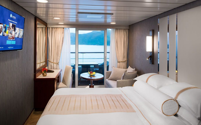
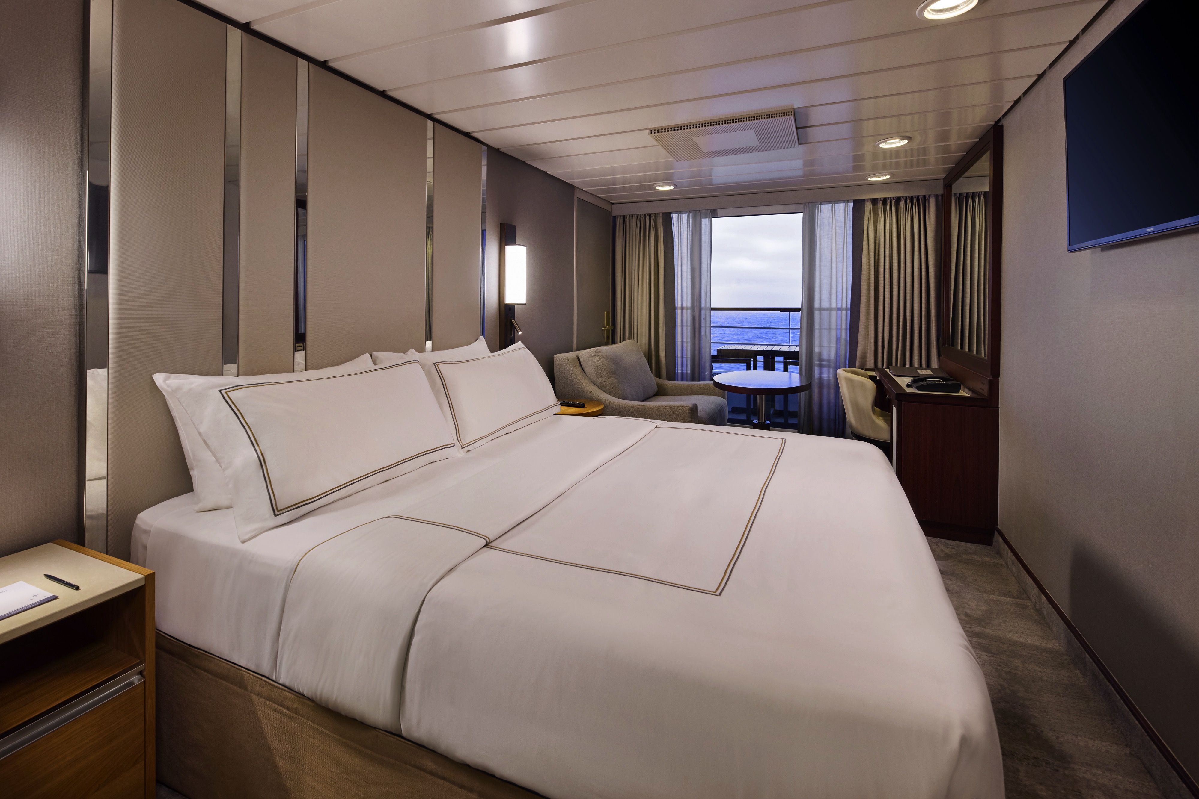
The suites offer a generous space to relax, with a separate living area, a dedicated bedroom, and a private veranda. An inviting retreat that balances comfort, functionality, and classic suite-style living.


Enjoy open-air living with sweeping ocean and destination views, plus added perks designed to elevate your onboard experience. It's everything you love about a Veranda Stateroom, with a little extra - at exceptional value.
Stateroom Features
- Veranda
- Two lower beds convertible to one Queen size bed
- Sitting area with flat - screen TV
- Mini-bar
- Thermostat-controlled air conditioner
- Direct-dial telephone with voice mail
- Writing desk
- In-room safe
- Hand-held hairdryer
- USB ports under bedside reading lamps
- Stateroom: 175 sq. ft. (16.3 sq. m.) | Veranda: 46-64 sq. ft. (4.3-6 sq. m.)
Included Stateroom Amenities
- Complimentary AzAmazing Evenings® event (on most voyages)
- Gratuities
- Luxurious cotton bed linens with duvet
- Terry bathrobes and slippers
- Select standard spirits, international beers and wine
- 24-hour room service
- Bottled water, soft drinks, specialty coffees and teas
- Self-service laundry
- Tote bag
- Shuttle service to and from port communities, wher
- Use of umbrella
- Concierge services for personal guidance and reservations
- Shoe shine-service
- Turndown treats
- Daily news bulletin
- Complimentary Internet (120 minutes or 25% off the unlimited internet package) per guest
- One free bag of laundry service per stateroom, every seven days
- One night of complimentary specialty dining for two, every seven days
- Priority embarkation and debarkation
- Complimentary in- room spirits
Enjoy open-air living with sweeping ocean and destination views, plus added perks designed to elevate your onboard experience. It's everything you love about a Veranda Stateroom, with a little extra - at exceptional value.
Step outside to your private veranda and take in fresh sea breezes and ever-changing views. Thoughtful design, polished finishes, and attentive service create a relaxing retreat between immersive days ashore.
Stateroom Features
- Veranda
- Writing desk
- Two lower beds convertible to one Queen size bed
- Sitting area with flat-screen TV
- In-room safe
- Hand-held hairdryer
- Refrigerator with mini-bar
- USB ports under bedside reading lamps
- Thermostat-controlled air conditioner
- Stateroom: 175 sq. ft. (16.3 sq. m.) | Veranda: 40 sq. ft.
- Direct-dial telephone with voicemail (3.7 sq. m.)
Included Stateroom Amenities
- Complimentary AzAmazing Evenings® event (on most voyages)
- Luxurious cotton bed linens with duvet
- Gratuities
- Terry bathrobes
- Shuttle service to and from port communities, where available
- Use of umbrella
- Concierge services for personal guidance and reserervations
- Select standard spirits, international beers and wine
- 24-hour room service
- Self-service laundry
- Tote bag
- Shoe shine-service
- Turndown treats
- Daily news bulletin
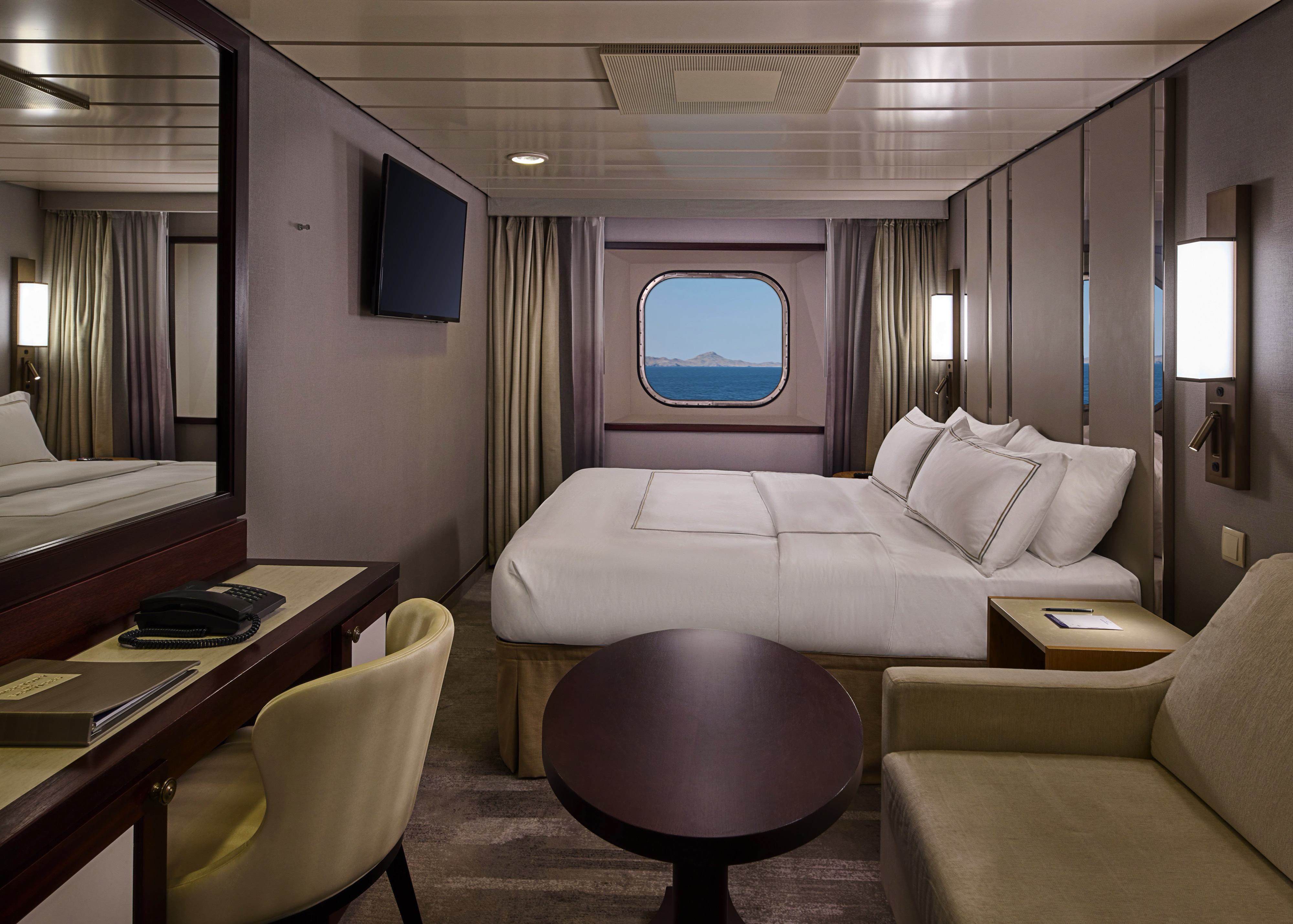
Step outside to your private veranda and take in fresh sea breezes and ever-changing views. Thoughtful design, polished finishes, and attentive service create a relaxing retreat between immersive days ashore.
Wake up to natural light and picturesque ocean views from your window.
Featuring contemporary design and well-appointed comforts, these staterooms offer a serene and stylish place to unwind at sea.
Stateroom Features
- Two lower beds convertible to one Queen size bed
- Some staterooms feature sofa bed
- Flat-screen TV
- Refrigerator with mini-bar
- Thermostat-controlled air conditioner
- Direct-dial telephone with voicemail
- Writing desk
- In-room safe
- Hand-held hairdryer
- USB ports under bedside reading lamps
- 143 sq. ft. (13.3 sq m)
Included Stateroom Amenities
- Complimentary AzAmazing Evenings® event (on most voyages)
- Self-service laundry
- Tote bag
- Gratuities
- Shuttle service to and from port communities, wher
- Luxurious cotton bed linens with duvet
- Use of umbrella
- Terry bathrobes and slippers
- Concierge services for personal guidance and
- Select standard spirits, international beers and winereservations
- 24-hour room service
- Shoe shine-service
- Bottled water, soft drinks, specialty coffees and teas
- Turndown treats
Wake up to natural light and picturesque ocean views from your window.
Featuring contemporary design and well-appointed comforts, these staterooms offer a serene and stylish place to unwind at sea.
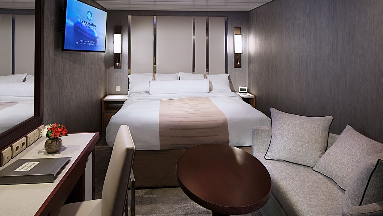
A quiet, comfortable retreat designed for restful nights and relaxing moments between adventures. With refined décor, plush amenities, and personalized service, it's boutique-hotel comfort at sea.
Stateroom Features
- Two lower beds convertible to one Queen size bed
- Flat-screen television
- Refrigerator with mini-bar
- Thermostat-controlled air conditioner
- Direct-dial telephone with voicemail
- Writing desk
- In-room safe
- Hand-held hairdryer
- USB ports under bedside reading lamps
- Stateroom: 158 sq. ft. (14.7 sq. m.)
Included Stateroom Amenities
- Complimentary AzAmazing Evenings® event (on most voyages
- Gratuities
- Luxurious cotton bed linens with duvet
- Terry bathrobes and slippers
- Select standard spirits, international beers and wine
- 24-hour room service
- Bottled water, soft drinks, specialty coffees and teas
- Self-service laundry
- Tote bag
- Shuttle service to and from port communities, wher
- Use of umbrella
- Concierge services for personal guidance and reservations
- Shoe shine-service
- Turndown treats
- Daily news bulletin
A quiet, comfortable retreat designed for restful nights and relaxing moments between adventures. With refined décor, plush amenities, and personalized service, it's boutique-hotel comfort at sea.

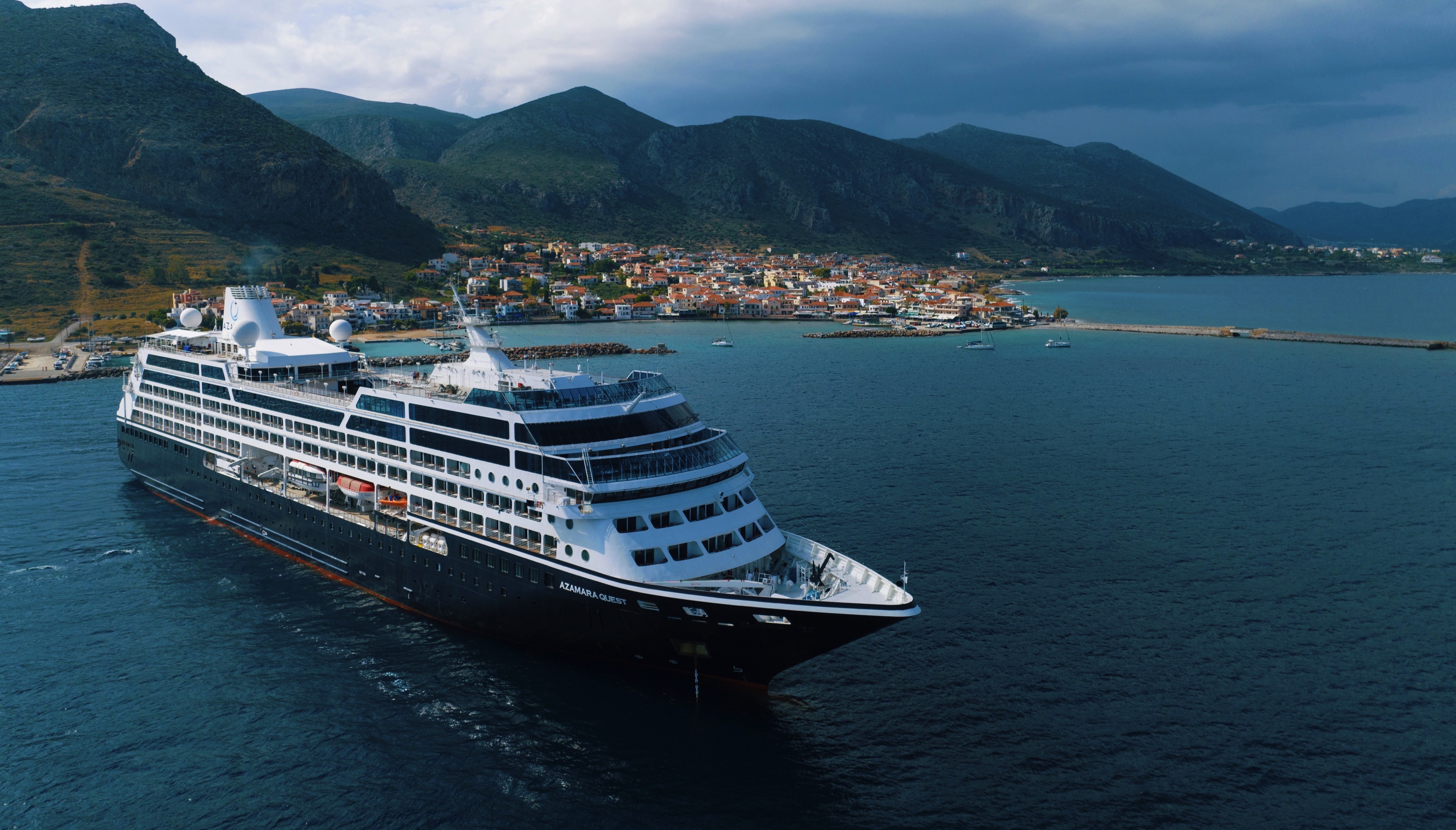
Azamara Quest
The Azamara Quest is a mid-sized ship with a deck plan that’s intimate but never crowded, and offers everything modern cruisers are looking for—plus some unexpected extras.
Ship Facts
| Launch Year | 2000 | ||||||||||
| Refit Year | 2019 | ||||||||||
| Language | en-US | ||||||||||
| Gross Tonnage | 30277 | ||||||||||
| Length | 180 | ||||||||||
| Width | 25 | ||||||||||
| Currency | USD | ||||||||||
| Speed | 18 | ||||||||||
| Capacity | 704 | ||||||||||
| Crew Count | 408 | ||||||||||
| Deck Count | 8 | ||||||||||
| Cabin Count | 352 | ||||||||||
| Large Cabin Count | N/A | ||||||||||
| Wheelchair Cabin Count | 6 | ||||||||||
| Electrical Plugs |
|
Deck 12
- Sun Deck

Deck 11
- Grandview Suites
- Panaroma Suites
- Elevator
Deck 10
- The Living Room
- Card Room
- In Touch
- Table Tennis
- Jogging Track
- The Drawing Room
- Aqualina Speciality Dining
- Prime C Speciality Dining

Deck 9
- The Sanctum Spa Terrace
- Salon
- Fitness Centre
- The Sanctum Spa
- Pool Bar
- Pool
- Swirl & Top
- The Patio
- Windows Café
- Sunset Bar
- Spa Suites
Deck 8
- Continent Suites
- World Owner's Suites
- Veranda Plus Staterooms
- Interior Stateroom

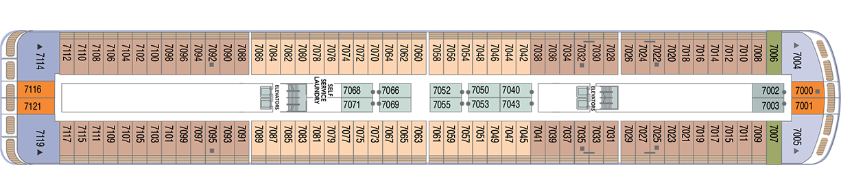
Deck 7
- Veranda Plus Staterooms
- Veranda Staterooms
- Ocean Suites
- Oceanview Staterooms
- Interior Staterooms
- Self Service Laundry
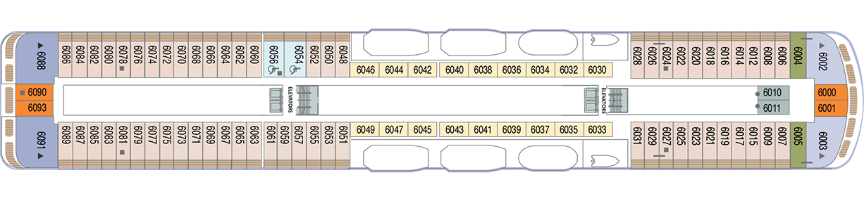
Deck 6
- Veranda Plus Staterooms
- Veranda Staterooms
- Ocean Suites
- World Owner's Suites
- Continent Suite
- Oceanview Staterooms
- Interior Stateroom
Deck 5
- Cabaret Lounge
- Shore Excursions
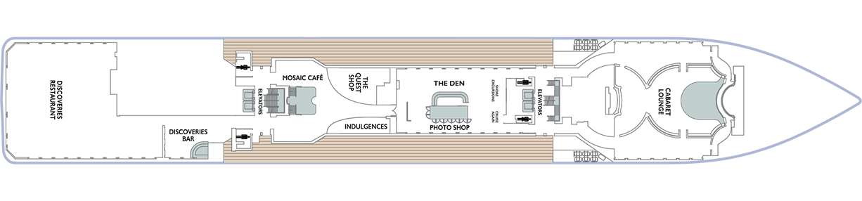
- Cruise Again
- The Quest Shop
- The Den
- Photo Shop
- Indulgences
- Mosaic Café
- Discoveries Bar
- Discoveries Restaurant
Deck 4
- Ocean View Staterooms (x2 Accessible Staterooms)
- Interior Staterooms (x3 Accessible Staterooms)
- Guest Relations
- Concierge Desk
- Medical Facility

Azamara offers a choice of six distinctive dining options, including room service. Whether you’re a fan of haute cuisine or down-home cooking, expect the same delicious quality. Bon appétit! Buon appetito! ¡Buen provecho! No matter how you say it, you’re in for a real treat.
Pre-Cruise Specialty Dining Reservations
All guests can now book pre-cruise reservations for Prime C, Aqualina, or Chef’s Table—our most sought-after specialty dining experiences.
Priority Access
Pre-cruise dining reservations open 150 days before sailing for suite guests and Azamara Circle Discoverer-level and above. All other guests may begin booking 140 days prior.
Aqualina
At Aqualina, you’ll find some of Italy’s most authentic dishes. Pastas made from scratch, traditional recipes, and scrumptious vegetarian dishes that make sure there’s something for everyone. Plus our famous desserts: Sorrento lemon liqueur mousse, hazelnut chocolate soufflé and more.
Prime C
Your choice of steak, cooked to perfection. Herb-coated rack of lamb, duck confit and Chilean sea bass—all paired with savory sides. At Prime C, you’re in for more than delectable dining. Expect a great evening with stunning views and lush décor.
Discoveries Restaurant
Discover the world through dishes and flavors from the places we visit. Of course, you’ll also enjoy a wide variety of nightly selections such as filet mignon with black truffle sauce. Choose being seated at a table for two or as part of a larger group of fellow guests.
The Patio and Swirl & Top
Casual “pool grill” by day. A sit-down al fresco dining experience by night. Taste your way around the world with exclusive personalized dishes using local flavors of the places we visit. Plus a self-serve frozen yogurt station—Swirl & Top. With a variety of flavors and your choice of toppings, it’s the perfect way to cool off.
Mosaic Cafe
Stylish and cozy, Mosaic offers your favorite coffee drinks exactly as you like them. Relax in a comfortable seat and enjoy. It’s the perfect spot to start or end your day, and it just might become your favorite place on the ship.
Windows Café
Our daily themed dinner often takes its inspiration from the region we’re visiting—Indian, Mexican, Spanish, Italian. We also create an extra live station made from local ingredients purchased in port: Greek salad made with local feta (Greece), pasta prepared with local mushrooms (Italy), fresh Mussels served with garlic bread (Netherlands).
Room Service
The best time for room service? Whenever you say it is, 24-hours a day. Order from the full breakfast menu between 6:30 AM and 10:00 AM, and we’ll deliver at your appointed time. Lunch and dinner room service features a menu of hearty soups, fresh salads, gourmet sandwiches, pizzas and desserts.
Sit back and enjoy your evenings on a high note with our onboard entertainment. From local cultural shows to our playbill that features a variety of amazing performances to keep you entertained while onboard.
Bars, Lounges & Gathering Spots
A cozy nook to sip coffee. An intimate space to raise a glass and celebrate. A lively setting to catch the latest shows and international entertainment. Watch the world go by, drink in hand from any of Azamara’s bars, lounges, and gathering spaces.
White Night
Join Azamara officers and crew for our signature dinner and entertainment event hosted al fresco on the pool deck (weather permitting). With an array of delicious food and engaging entertainment, your White Night experience will almost certainly be one of the most memorable times from your cruise. And don’t forget to bring something white to wear for the evening.
The Living Room
The idea of the Living Room is just that. To “live in” and to enjoy time with friends and fellow guests! Much of the room is furnished as a living room, with clusters of large comfortable chairs and sofas....
Club Crooner
Step into a swanky nightclub as the great songs of the most magnificent artists come alive on stage. From classic crooners such as Frank Sinatra and Tony Bennett, to current songbirds such as Natalie Cole and Michael Bublé, there’s a song for every time and everyone. Enjoy a beverage, sit back, and be serenaded by the melodies of our lives with CLUB CROONER
Mosaic @ Night
Our onboard coffee corner may very well become your favorite nook on the ship. With elegant and comfortable furniture, it's bound to be one of the the most stylish places, too. Find all your favorite coffee drinks crafted just the way you like. Slip right into a comfortable seat and sip for a while—you never know who'll walk by.
Discoveries Lounge
This congenial bar is a favorite gathering place for great conversations and delicious drinks. Bar service includes a full selection of fine wines, mixed drinks, and premium spirits…plus the entertaining banter of Azamara’s friendly bartenders.
Cabaret Lounge
Enjoy live performances of professional full-stage musical revues, classical soloists, bands and other entertainment in a cabaret nightclub with a full bar and cozy tables.
The Den
By day, The Den is a cozy, inviting space perfect for planning your next adventure—home to the Cruise Again desk and photo gallery, and filled with destination inspiration. By night, it transforms into a lively piano bar with craft cocktails, a talented live pianist, and a warm, social atmosphere. Whether you're mapping out future travels or enjoying the music with a nightcap in hand, The Den is where stories begin, and where many guests return night after night.
The Drawing Room
This library is one of the quiet jewels of Azamara, a peaceful and beautifully appointed space for reading or relaxing after dinner. Browse the collection and feel free to borrow the library books. Or simply relax in the tranquil atmosphere.
The Pool
Join Azamara officers and crew for our signature dinner and entertainment event hosted al fresco on the pool deck (weather permitting). With an array of delicious food and engaging entertainment, your White Night experience will almost certainly be one of the most memorable times from your voyage. And don’t forget to bring something white to wear for the evening.
Pool Bar
Our Pool Bar serves refreshments while enjoying the Pool during the day, and cocktails of your choice in the evening.
Sunset Bar
Adjacent to Windows Café, the Sunset Bar is a welcoming outdoor patio with covered and open -air seating, and a bar. It's the perfect place for dining alfresco, enjoying a refreshing drink, taking in the sights of your favourite port, or simply watching the world sail by.
Performances
Oh, What A Night
Get ready to be transported to the world’s most beloved travel destinations in one exhilarating night. As we explore all four seasons in a new city, travel along with our dynamic Signature Singers & Dancers as they sing and dance their way through an eclectic mix of music from around the world. Come and experience Oh, What A Night!
Take Two
Get ready to grab your clicker and turn up the volume as we take a trip down memory lane celebrating the most cherished movie soundtracks of all time. As we flip through the channels together, you will be taken back to a time when stars were born, the ring is open, and yes... ghosts really do exist. We invite you to sit back, relax and enjoy the music of the movies! Lights... Camera... ACTION! TAKE TWO!
Britrock!
Join your Signature Singers and Dancers, along with your Azamara band, to celebrate the music that includes famous British musical artists such as Adele, Dusty Springfield, Elton John, George Michael, The Beatles and more! Azamara invites you to sing along, as we hit the playback button and take a stroll down memory lane to relive the music that is BRITROCK!
The Quest Shop
It's one-stop shopping in The Pursuit Shop. Apparel, sundries, handbags, candies, souvenirs and lots more await. If you find that you forgot to pack something, chances are you'll find it in The Pursuit Shop.
Photo Shop
Our photographers capture both fun and professional photos throughout the voyage, whether it is your portrait, or photos of the destinations you visit. You can also find an assortment of supplies for your own photographic endeavours.
Indulgences
Aptly named, Indulgences will satisfy your desires for the finer things in life. If you are looking for designer jewellery, it's the perfect place to window shop or to find that extra special purchase.