Transpacific Cruise: Tokyo, Alaska & Vancouver
Transpacific Cruise: Tokyo, Alaska & Vancouver
Cruise overview
WHY BOOK WITH US?
- ✔ The Deluxe Cruises’ team has extensive experience in ultra-luxury cruising.
- ✔ Call now to speak to our helpful and experienced Cruise Concierge team.
- ✔ Enjoy our Unique Deluxe Cruises Bonus for substantial savings.
- ✔ Our team will tailor your holiday to your exacting requirements.
- ✔ As agents, we work under the protection of each cruise lines ABTA / ATOL licences
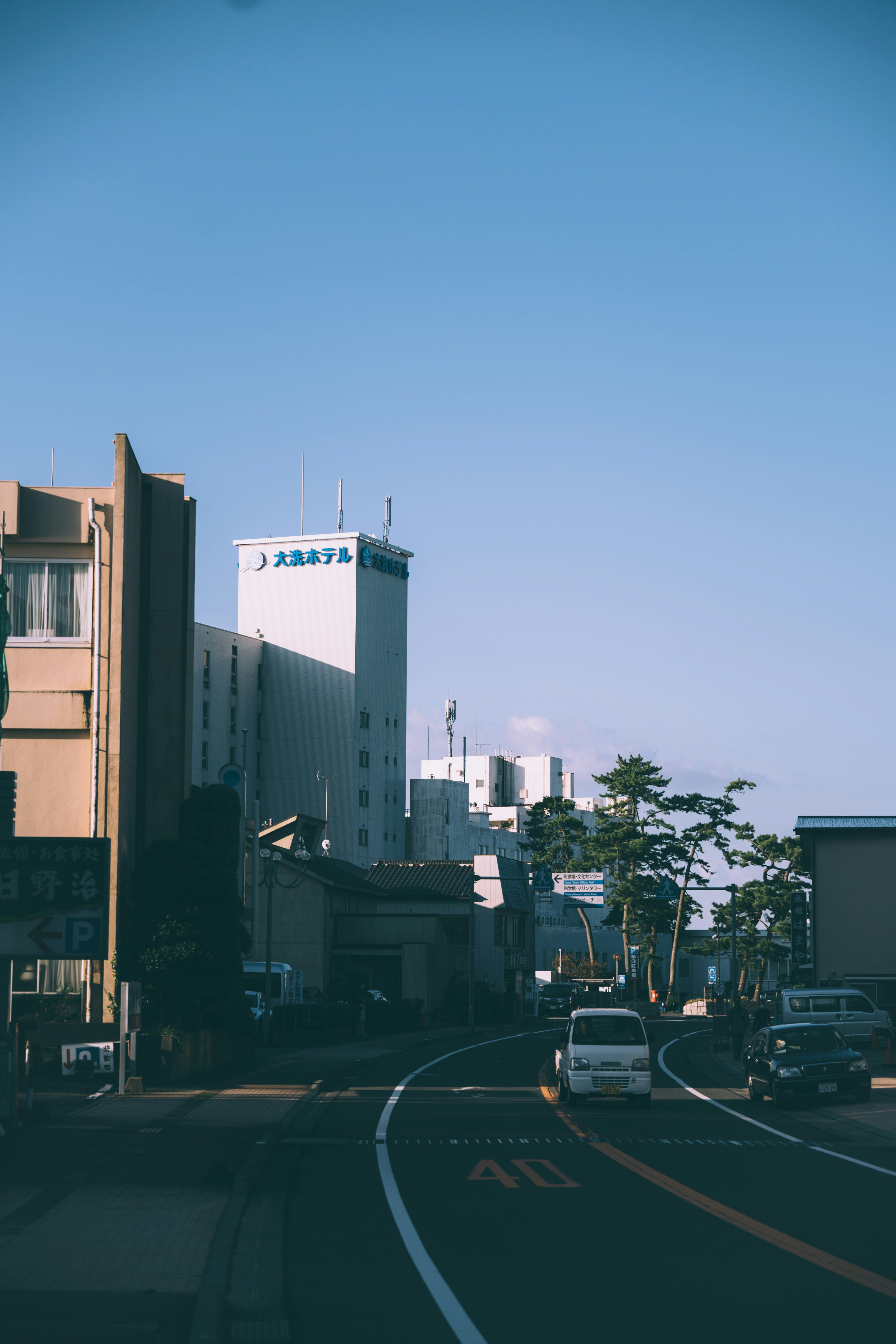
About Tokyo
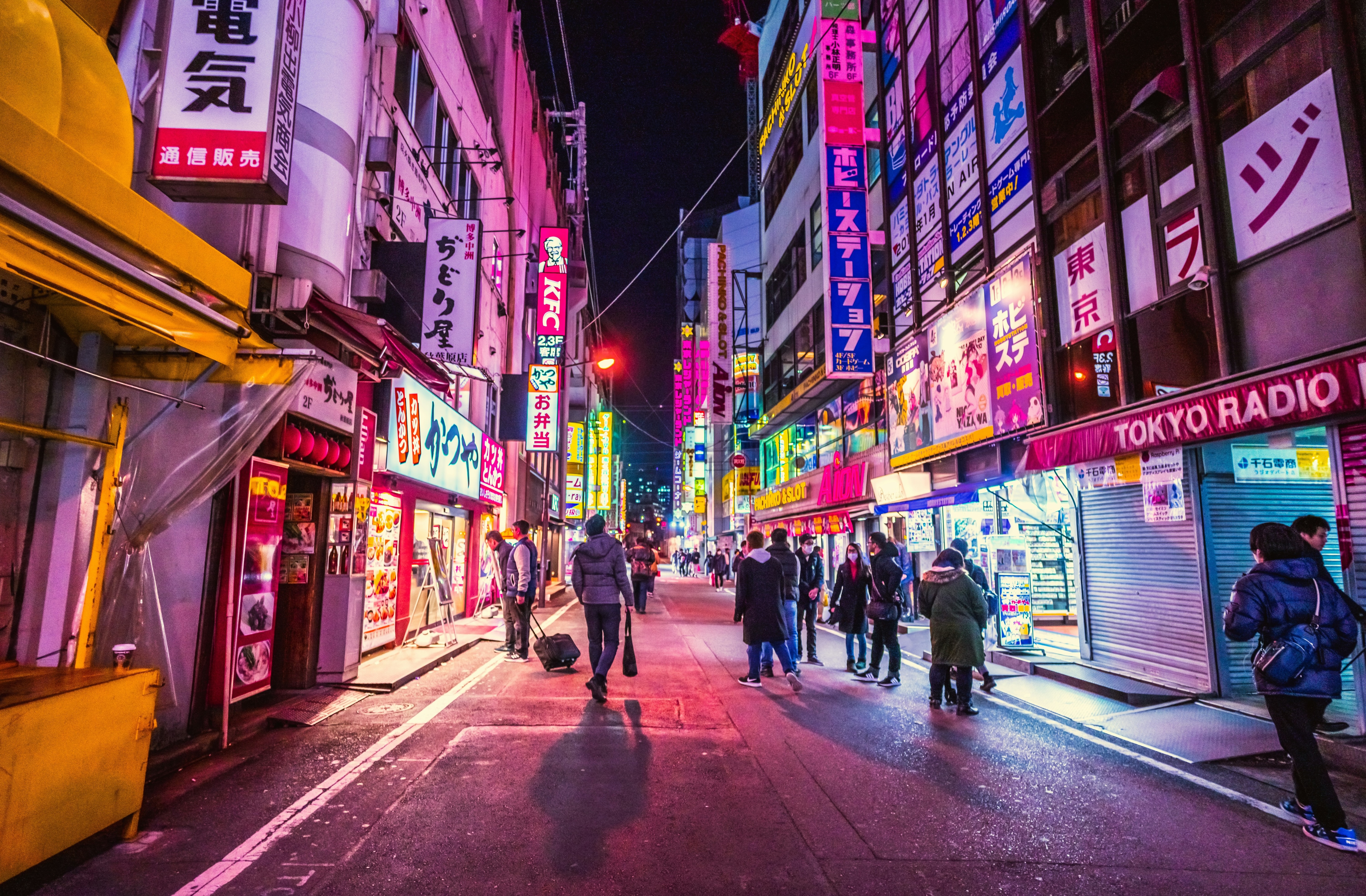
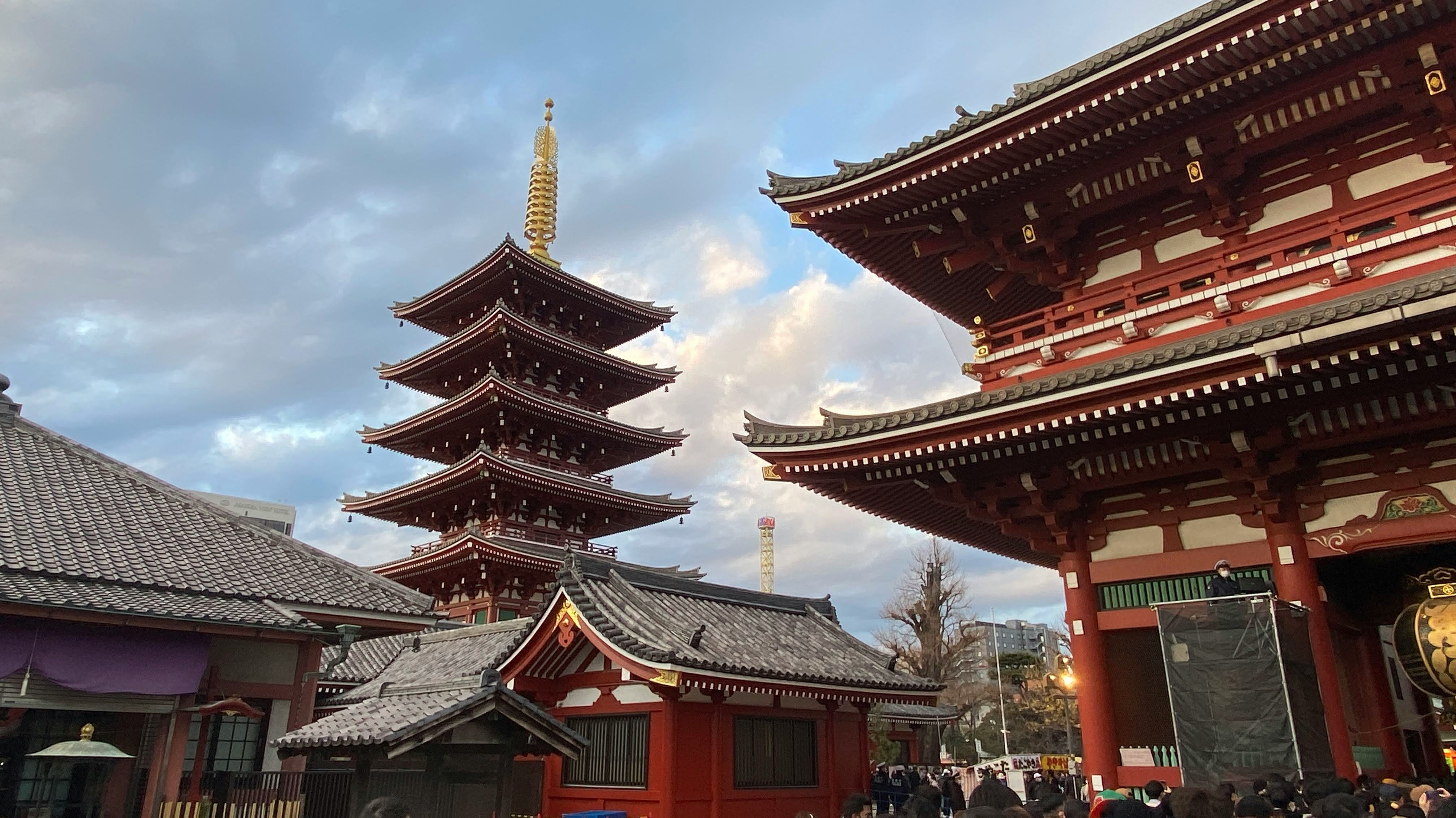
Lights, sushi, manga! Sprawling, frenetic, and endlessly fascinating, Japan’s capital is a city of contrasts. Shrines and gardens are pockets of calm between famously crowded streets and soaring office buildings. Mom-and-pop noodle houses share street space with Western-style chain restaurants and exquisite fine dining. Shopping yields lovely folk arts as well as the newest electronics. And nightlife kicks off with karaoke or sake and continues with techno clubs and more. Whether you seek the traditional or the cutting edge, Tokyo will provide it.

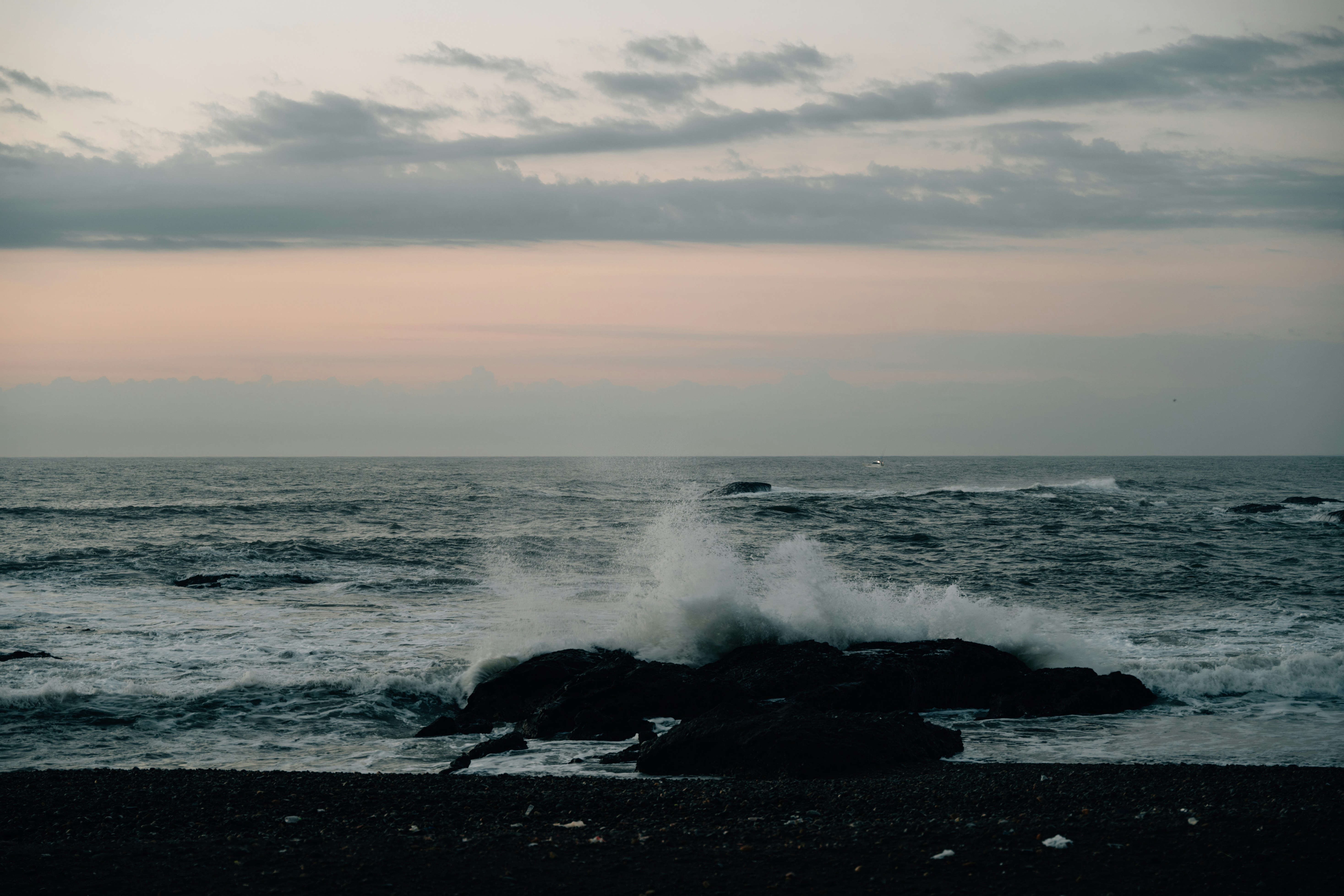
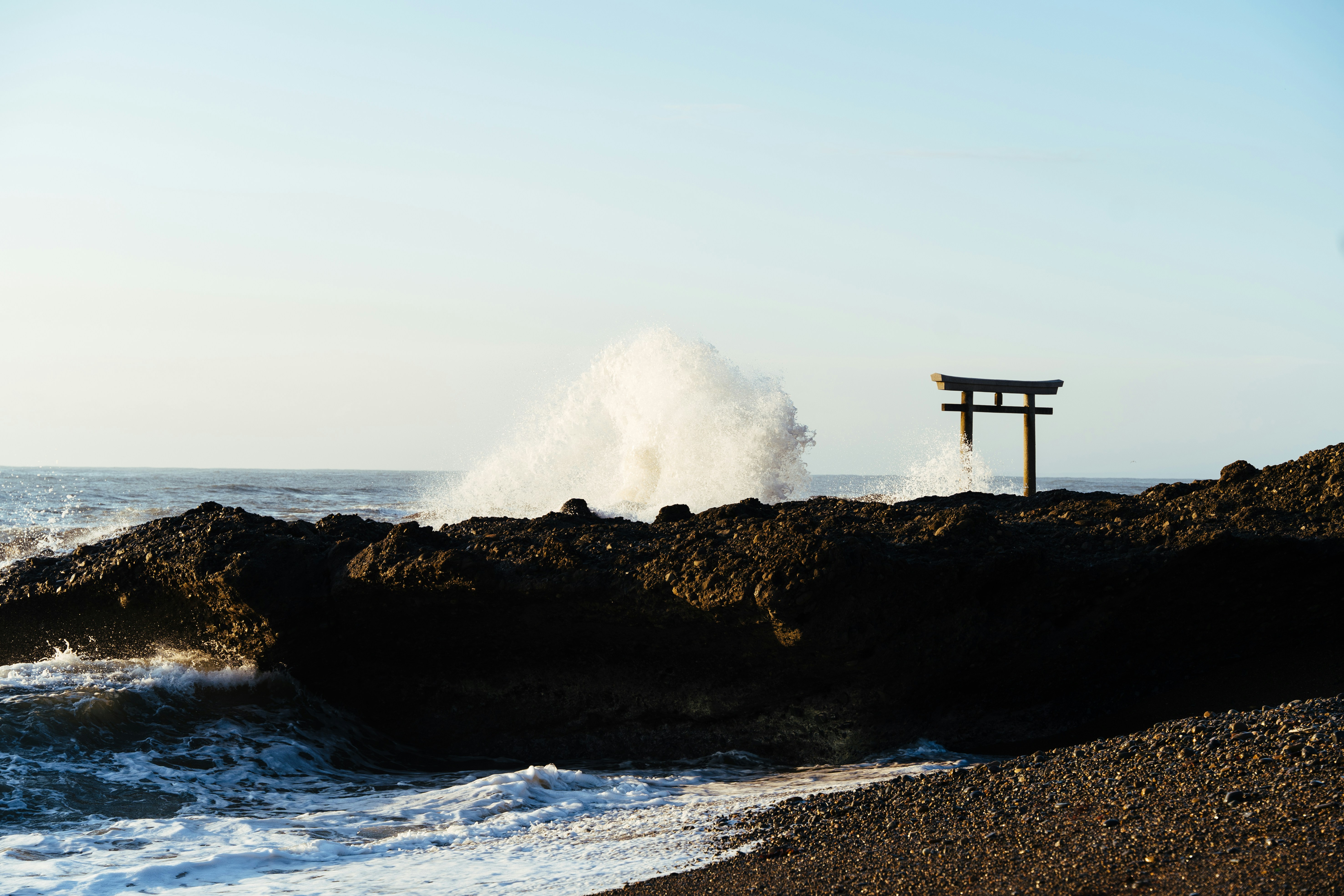
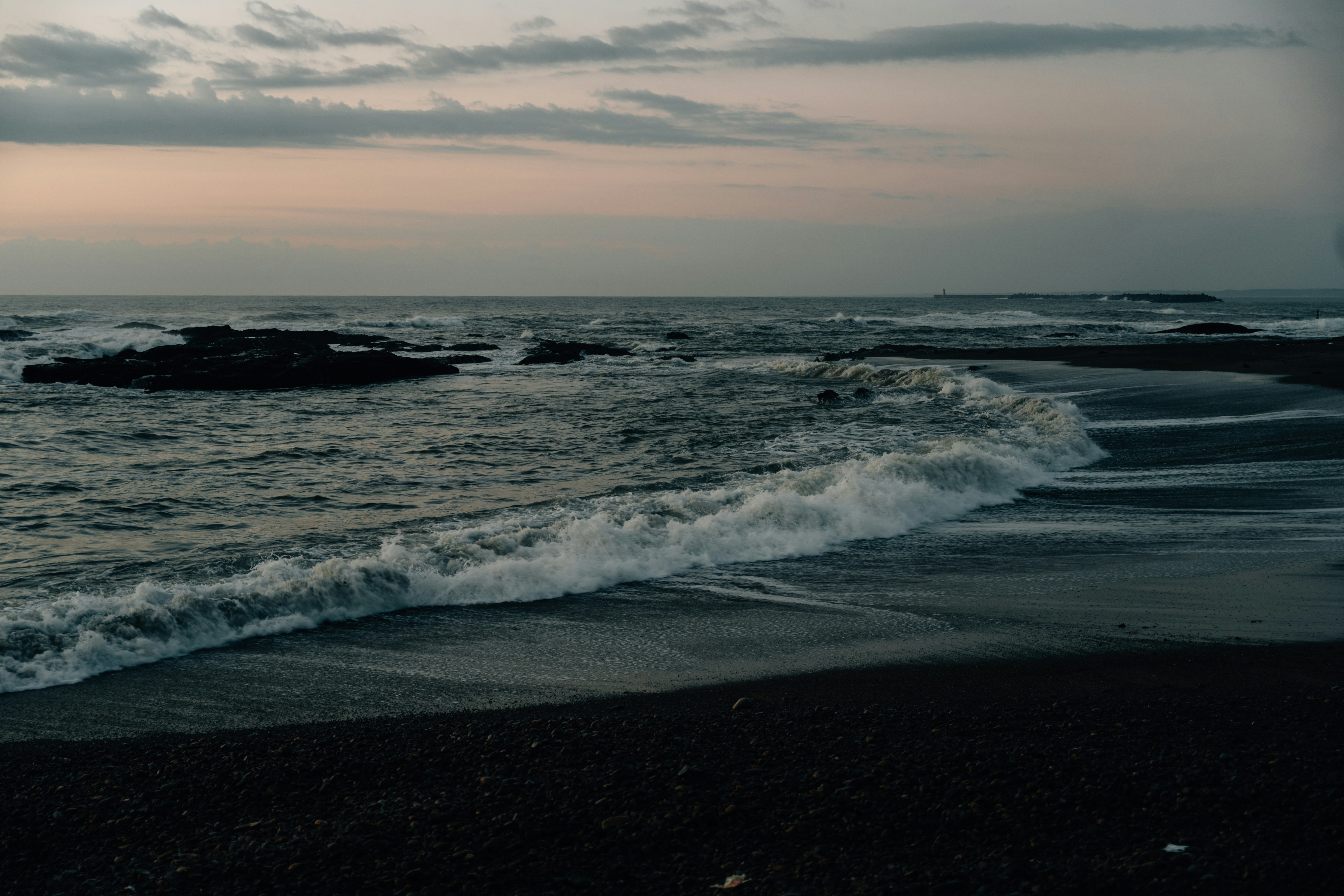
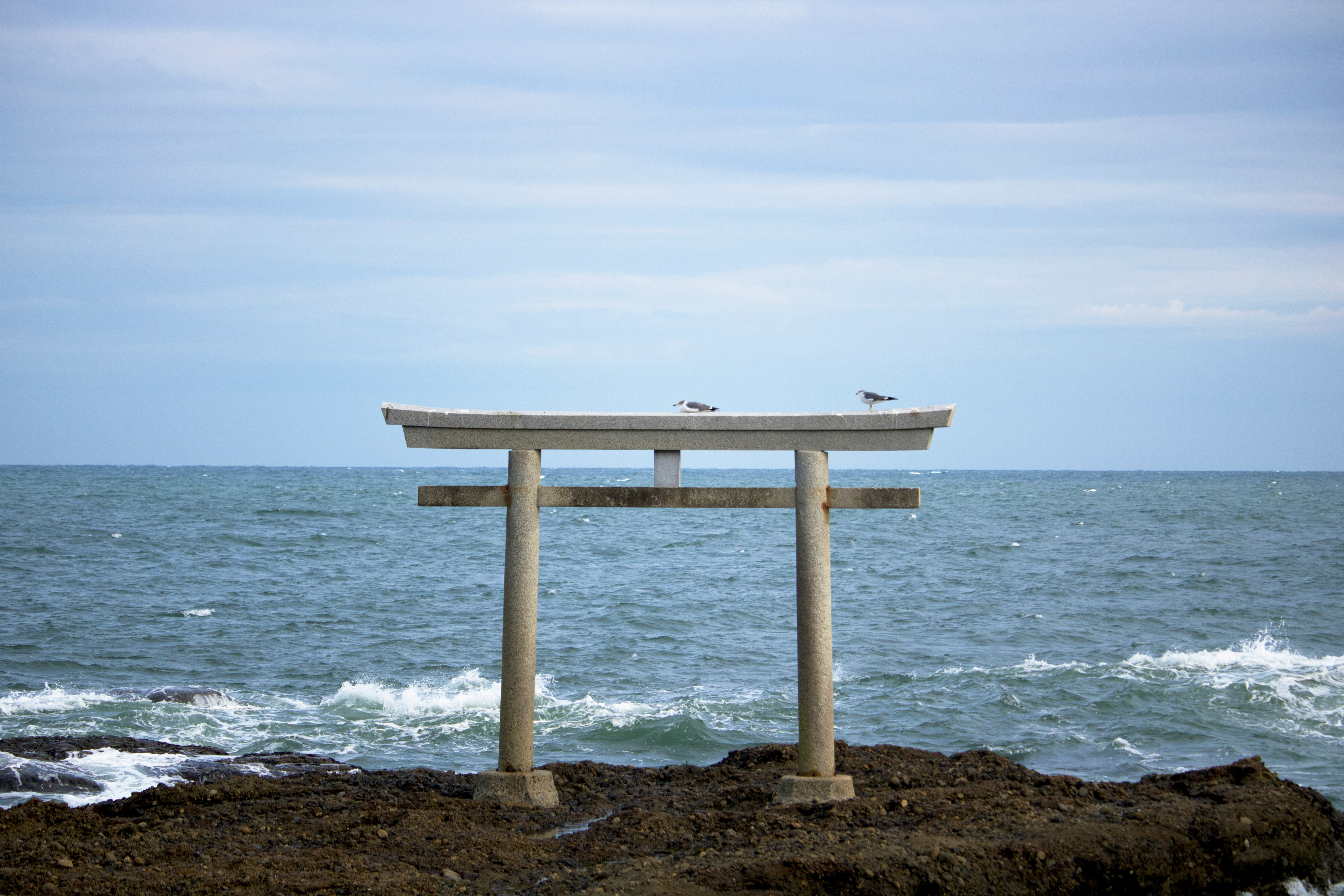
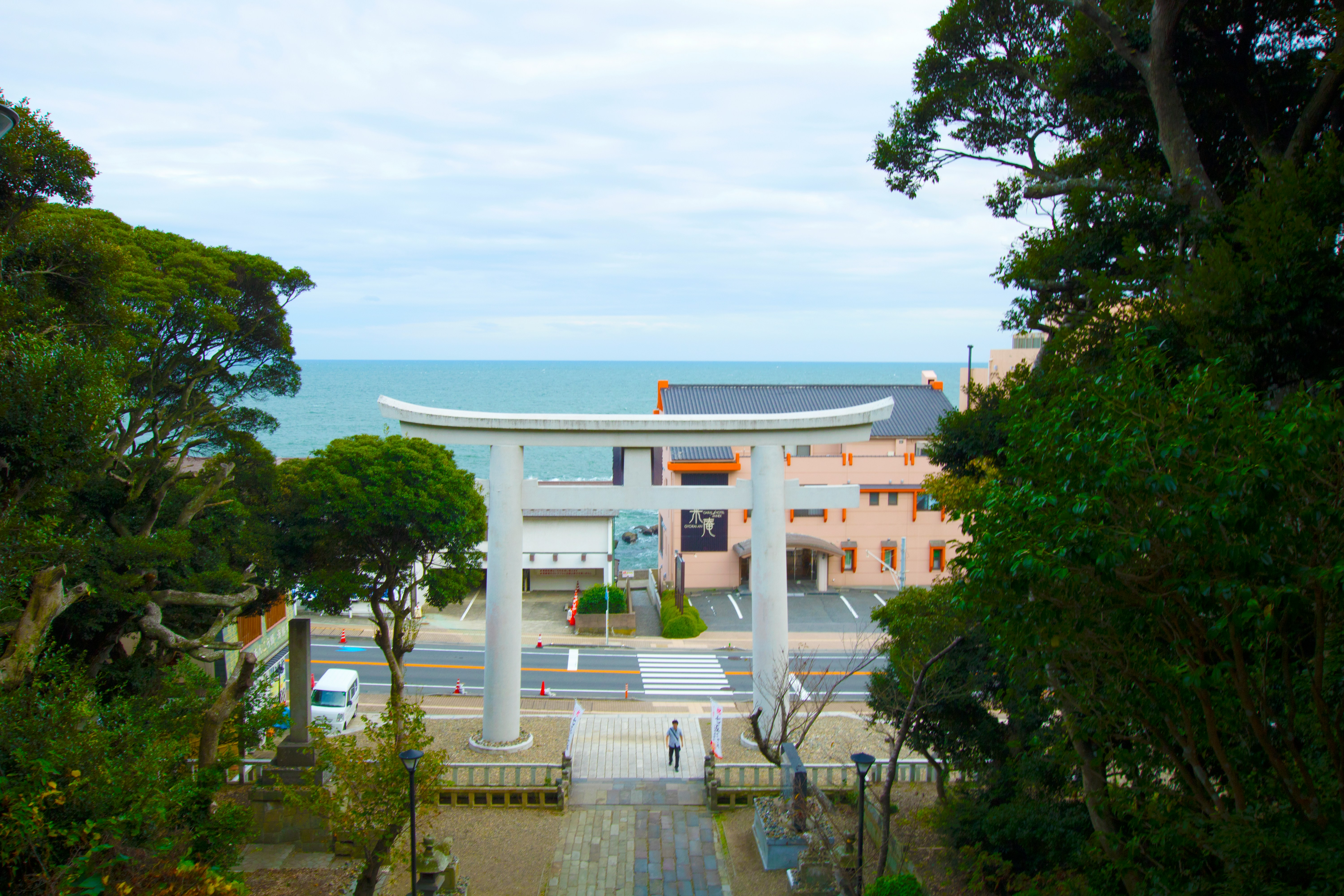
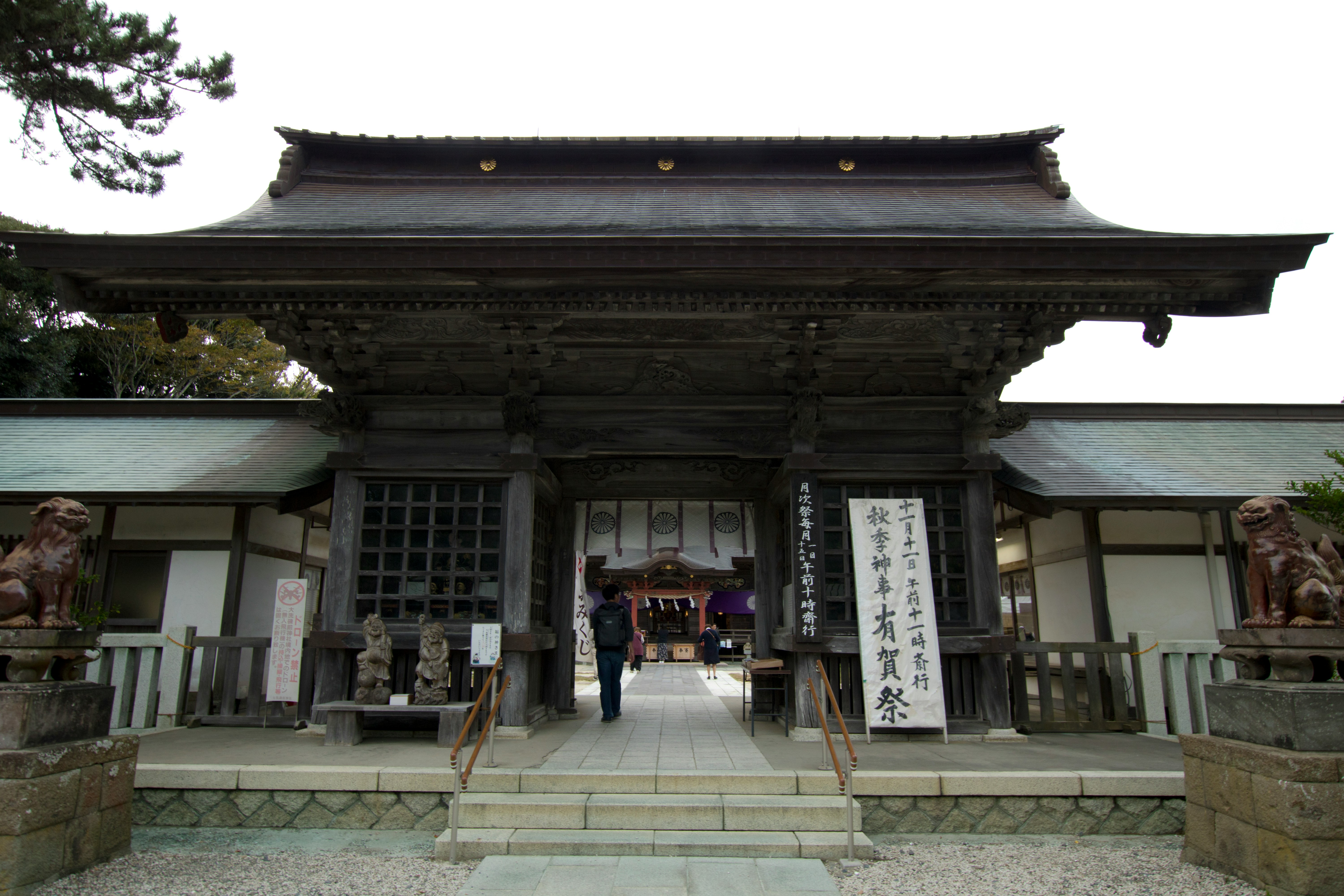
About Oarai

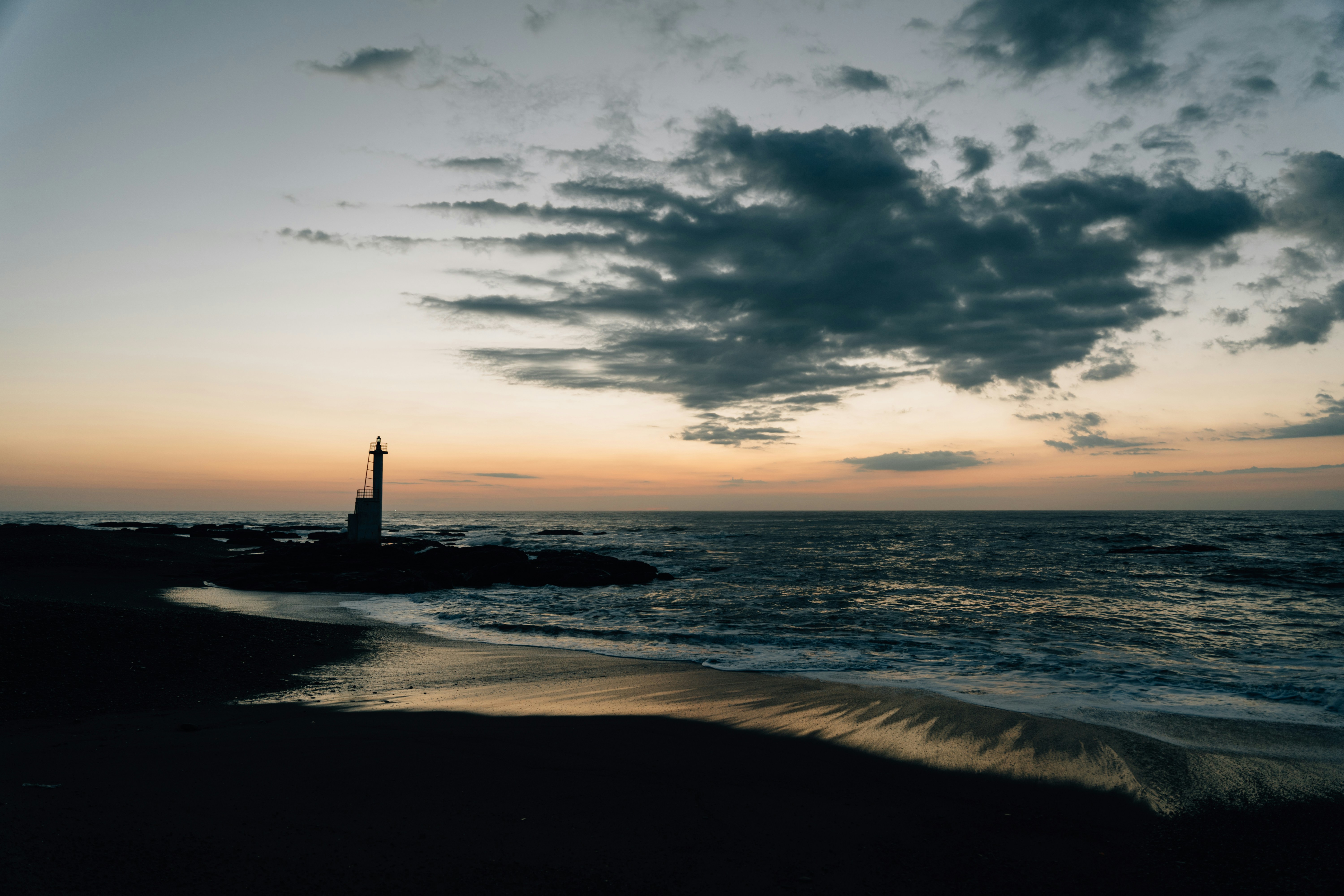
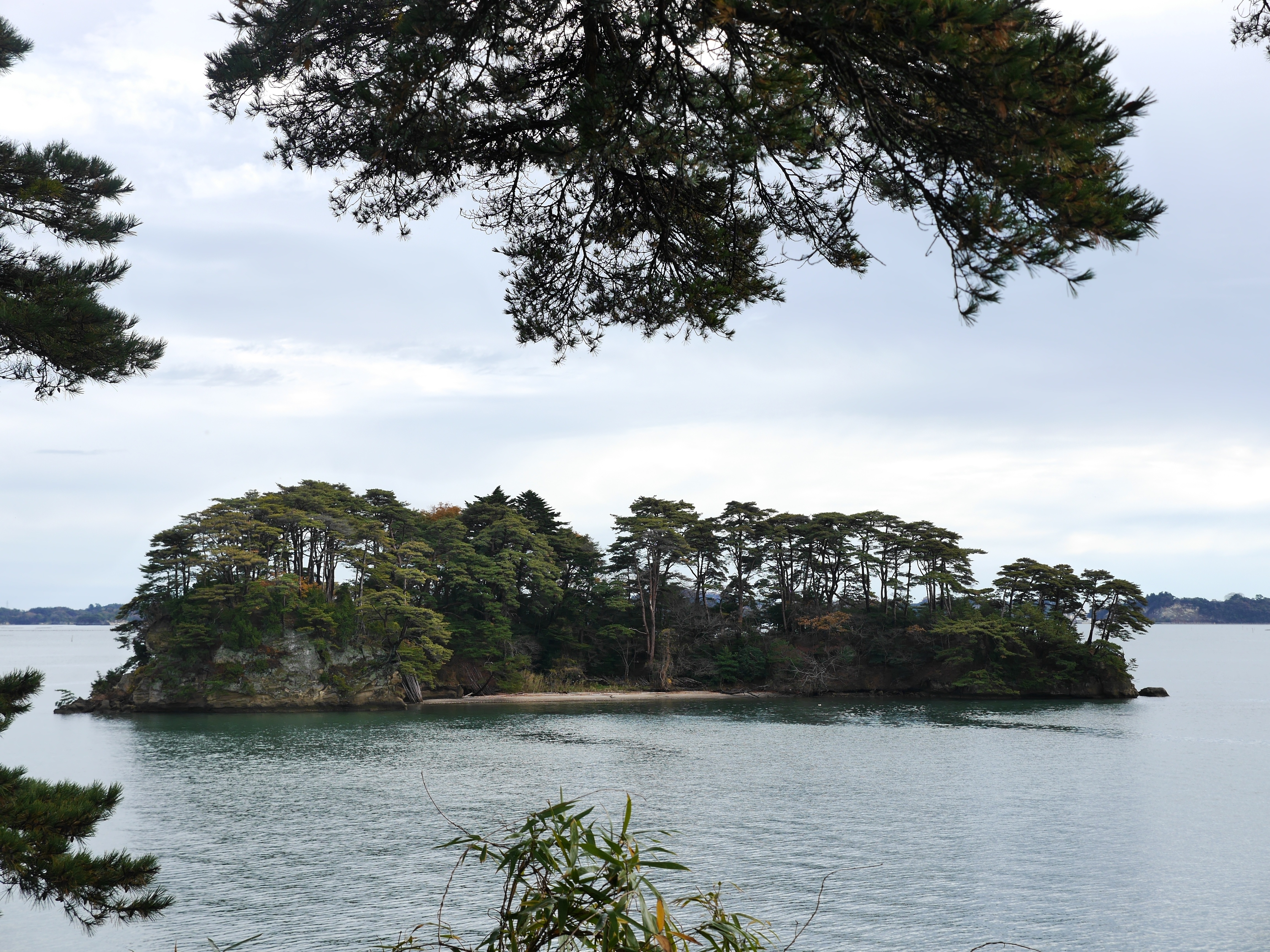
About Miyako, Iwate
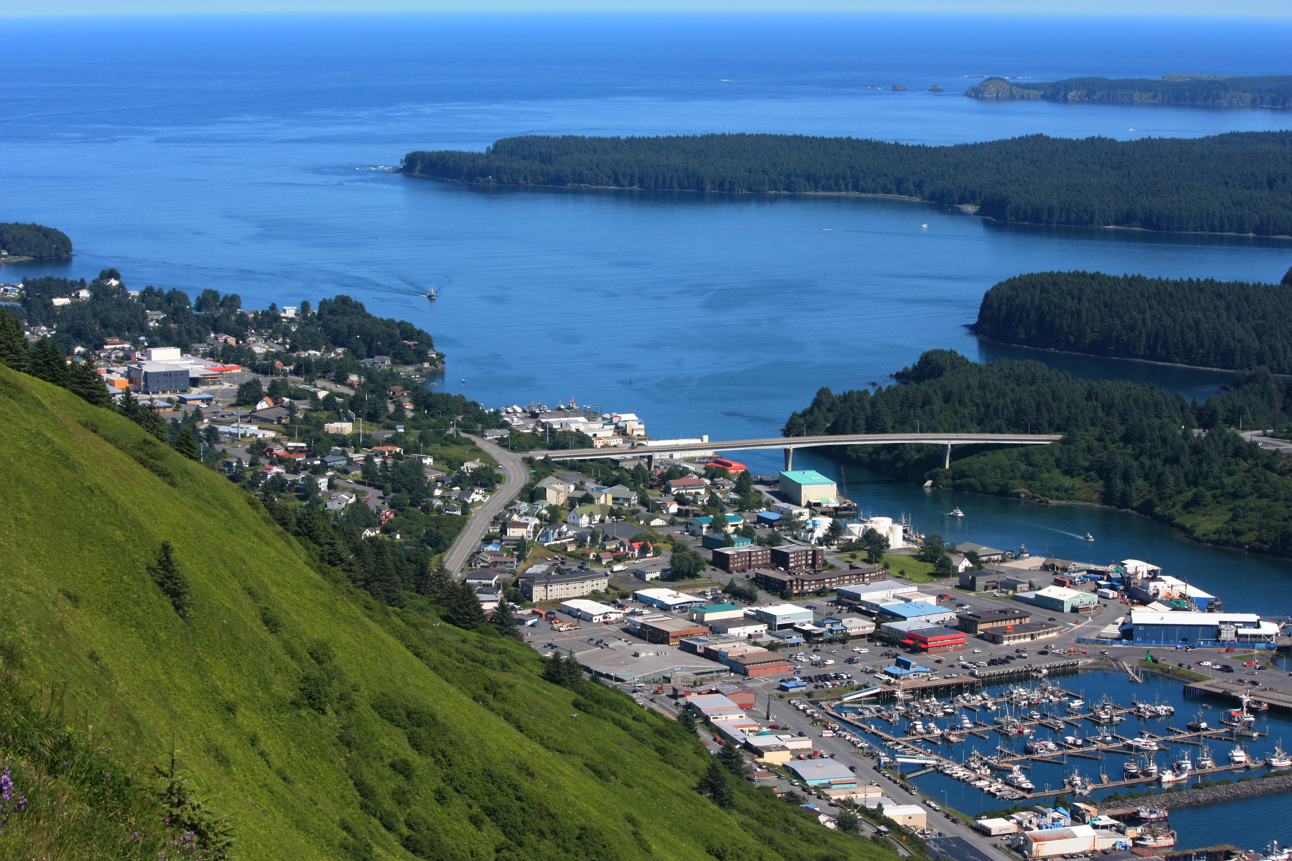
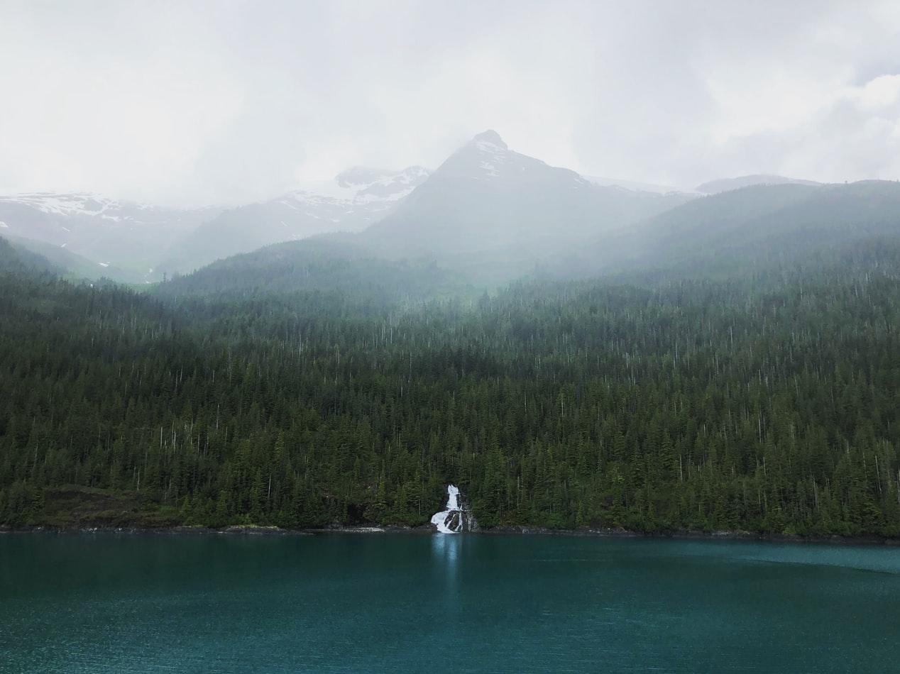
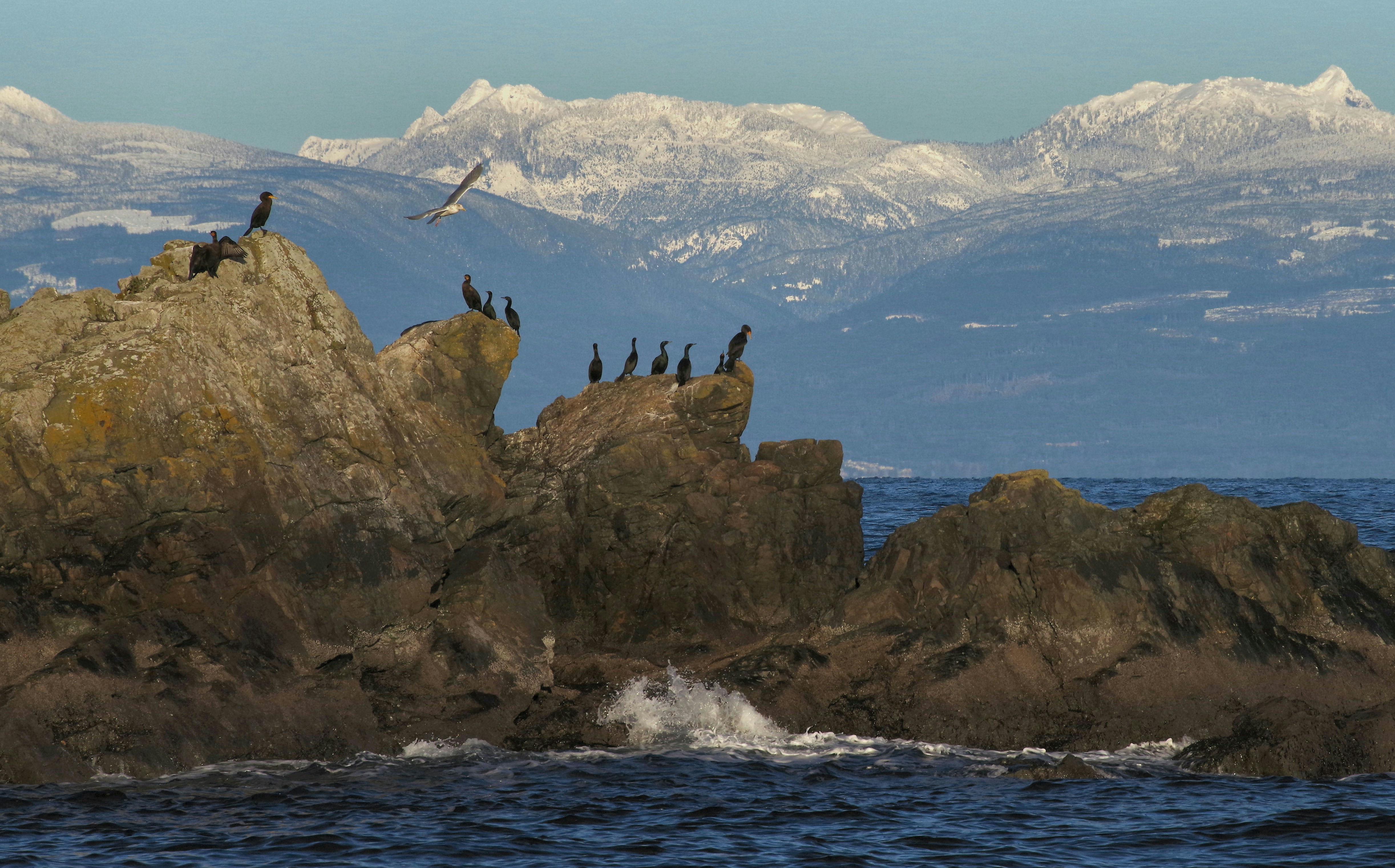
About Kodiak, Alaska
Today, commercial fishing is king in Kodiak. Despite its small population—about 6,475 people scattered among the several islands in the Kodiak group—the city is among the busiest fishing ports in the United States. The harbor is also an important supply point for small communities on the Aleutian Islands and the Alaska Peninsula.Visitors to the island tend to follow one of two agendas: either immediately fly out to a remote lodge for fishing, kayaking, or bear viewing; or stay in town and access whatever pursuits they can reach from the limited road system. If the former is too pricey an option, consider combining the two: drive the road system to see what can be seen inexpensively, then add a fly-out or charter-boat excursion to a remote lodge or wilderness access point.Floatplane and boat charters are available from Kodiak to many remote attractions, chief among them the Kodiak National Wildlife Refuge , which covers four islands in the Gulf of Alaska: Kodiak, Afognak, Ban, and Uganik.
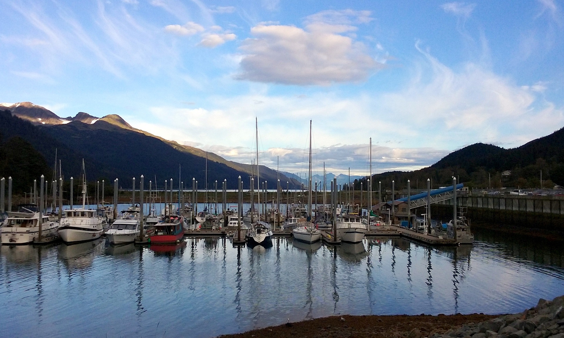
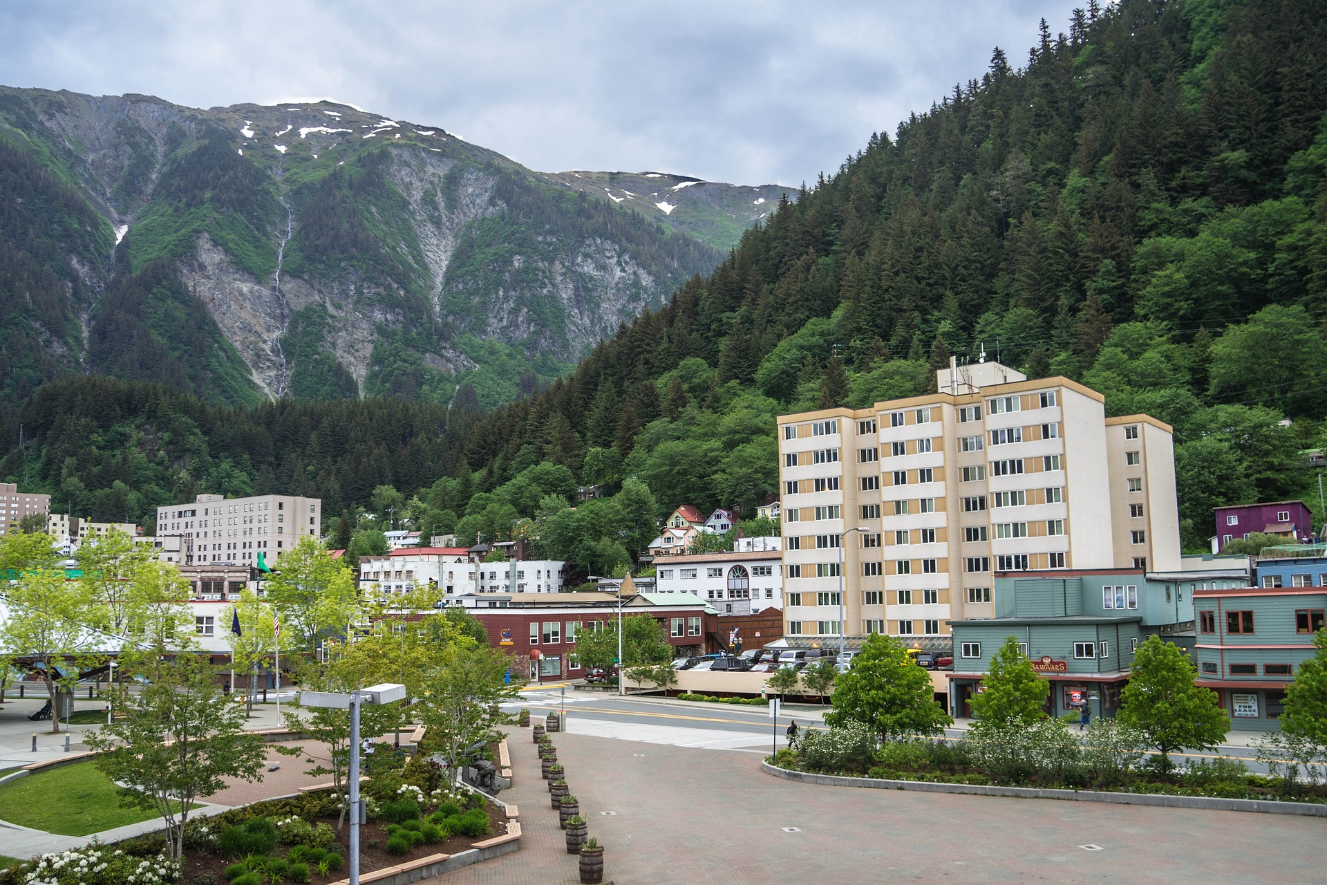
About Juneau, Alaska
Juneau, Alaska's capital and third-largest city, is on the North American mainland but can't be reached by road. Bounded by steep mountains and water, the city’s geographic isolation and compact size make it much more akin to an island community such as Sitka than to other Alaskan urban centers, such as Fairbanks or Anchorage. Juneau is full of contrasts. Its dramatic hillside location and historic downtown buildings provide a frontier feeling, but the city's cosmopolitan nature comes through in fine museums, noteworthy restaurants, and a literate and outdoorsy populace. The finest of the museums, the Alaska State Museum, is scheduled to reopen in May 2016 on its old site as the expanded Alaska State Library, Archives, and Museum (SLAM) following several years of planning and exhibit research. Another new facility, the Walter Soboleff Center, offers visitors a chance to learn about the indigenous cultures of Southeast Alaska–-Tlingit, Haida, and Tsimshian. Other highlights include the Mt. Roberts Tramway, plenty of densely forested wilderness areas, quiet bays for sea kayaking, and even a famous drive-up glacier, Mendenhall Glacier. For goings-on, pick up the Juneau Empire (www.juneauempire.com), which keeps tabs on state politics, business, sports, and local news.


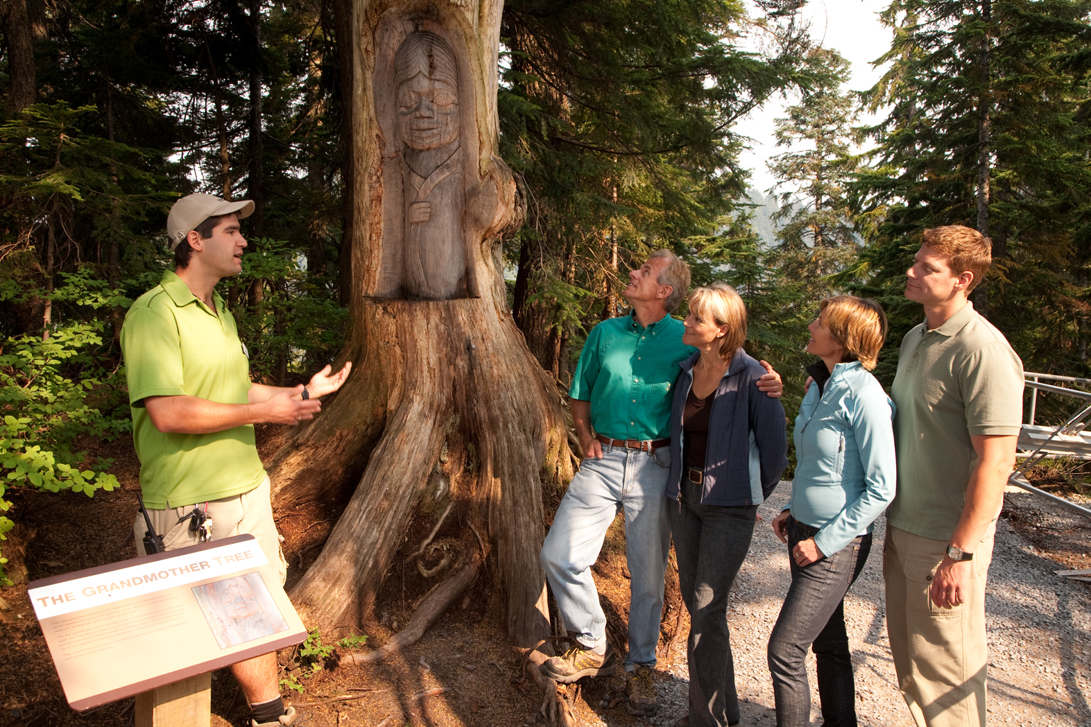
About Icy Strait Point
Since Icy Strait Point opened in 2004, Hoonah has attracted more visitors, particularly those who arrive by cruise ship. The port is centered around the restored salmon cannery, which now houses a museum, local arts and crafts shops, restaurants, and a mid-1930s cannery line display. Outside is the world’s largest and highest zip line at 5,330 feet long, featuring a 1,300-foot vertical drop—a thrilling ride with fantastic views of the surrounding mountains and ocean. If you're looking for more relaxing mountaintop views, book a gondola ride that will whisk you up into the mountains for some leisurely hiking and stellar sightseeing. Icy Strait Point houses several restaurants where visitors can dine on freshly caught seafood while taking in the waterfront views. A range of excursions are available at Icy Strait Point catering primarily to cruise ship passengers, from Alaska Native dance performances to bear viewing and whale watching.

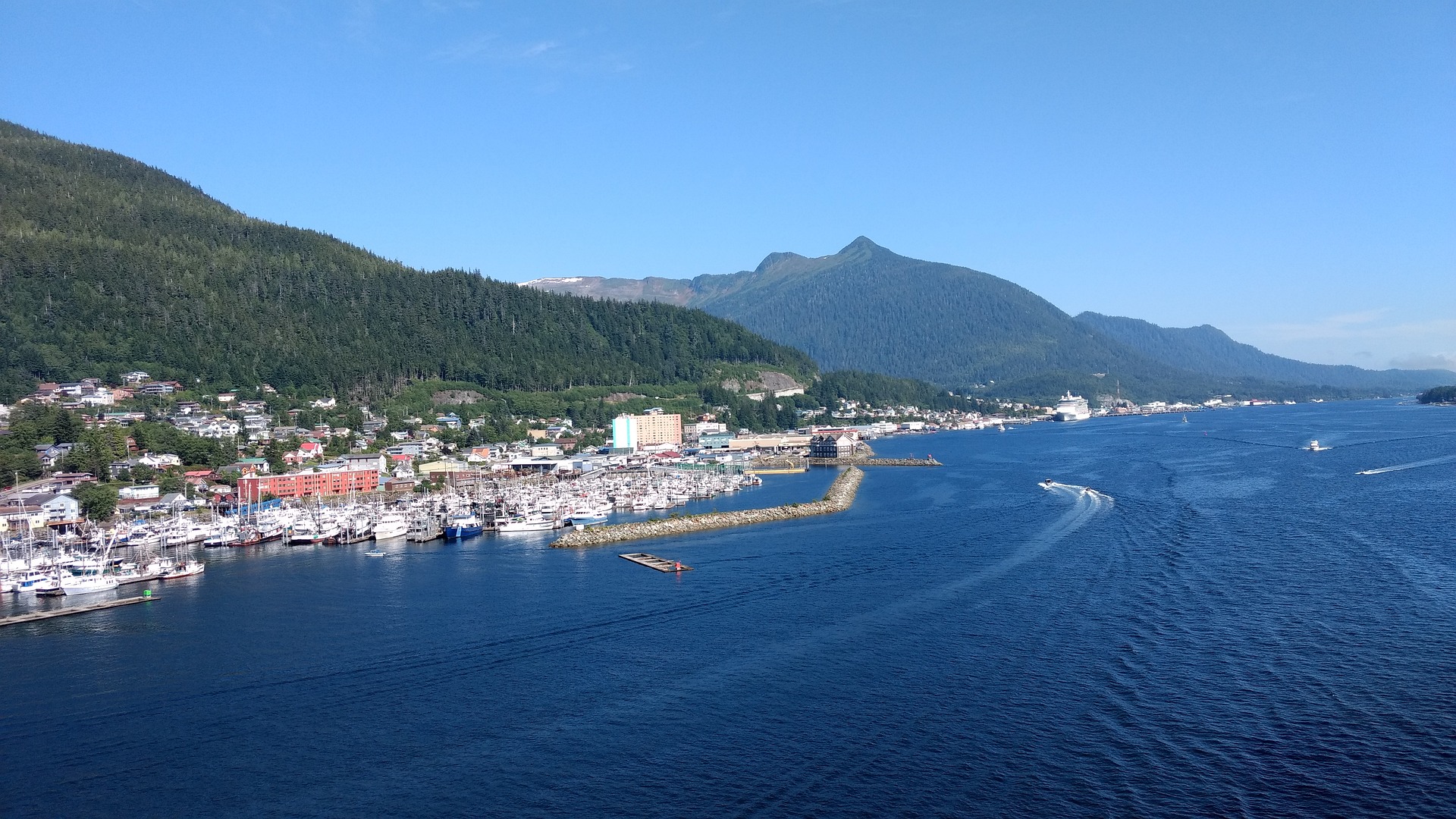
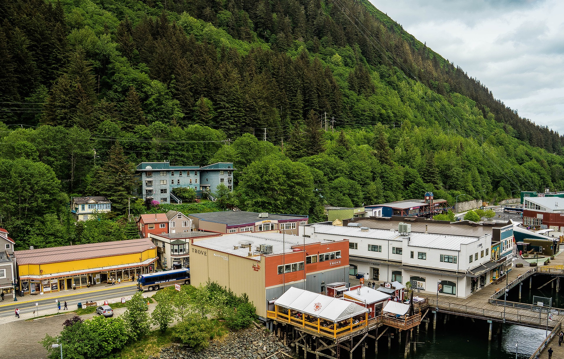
About Ketchikan, Alaska
Ketchikan is famous for its colorful totem poles, rainy skies, steep–as–San Francisco streets, and lush island setting. Some 13,500 people call the town home, and, in the summer, cruise ships crowd the shoreline, floatplanes depart noisily for Misty Fiords National Monument, and salmon-laden commercial fishing boats motor through Tongass Narrows. In the last decade Ketchikan's rowdy, blue-collar heritage of logging and fishing has been softened by the loss of many timber-industry jobs and the dramatic rise of cruise-ship tourism. With some effort, though, visitors can still glimpse the rugged frontier spirit that once permeated this hardscrabble cannery town. Art lovers should make a beeline for Ketchikan: the arts community here is very active. Travelers in search of the perfect piece of Alaska art will find an incredible range of pieces to choose from.The town is at the foot of 3,000-foot Deer Mountain, near the southeastern corner of Revillagigedo (locals shorten it to Revilla) Island. Prior to the arrival of white miners and fishermen in 1885, the Tlingit used the site at the mouth of Ketchikan Creek as a summer fish camp. Gold discoveries just before the turn of the 20th century brought more immigrants, and valuable timber and commercial fishing resources spurred new industries. By the 1930s the town bragged that it was the "salmon-canning capital of the world." You will still find some of Southeast's best salmon fishing around here. Ketchikan is the first bite of Alaska that many travelers taste. Despite its imposing backdrop, hillside homes, and many staircases, the town is relatively easy to walk through. Favorite downtown stops include the Spruce Mill Development shops and Creek Street. A bit farther away you'll find the Totem Heritage Center. Out of town (but included on most bus tours) are two longtime favorites: Totem Bight State Historical Park to the north and Saxman Totem Park to the south.


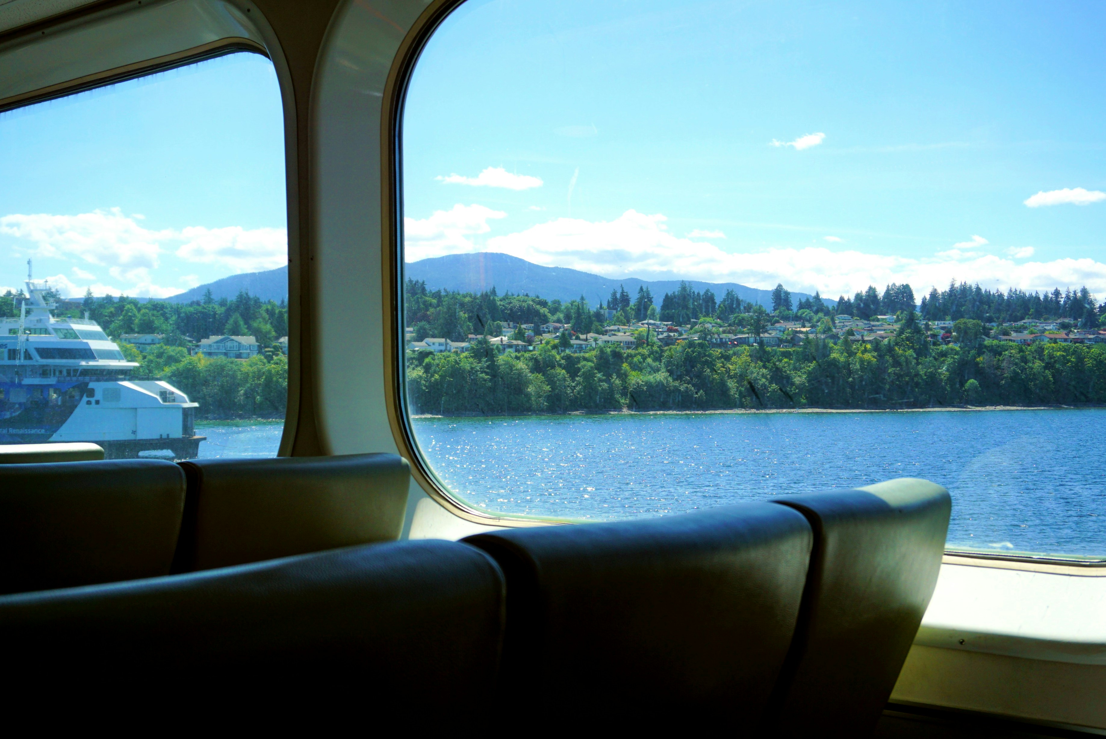
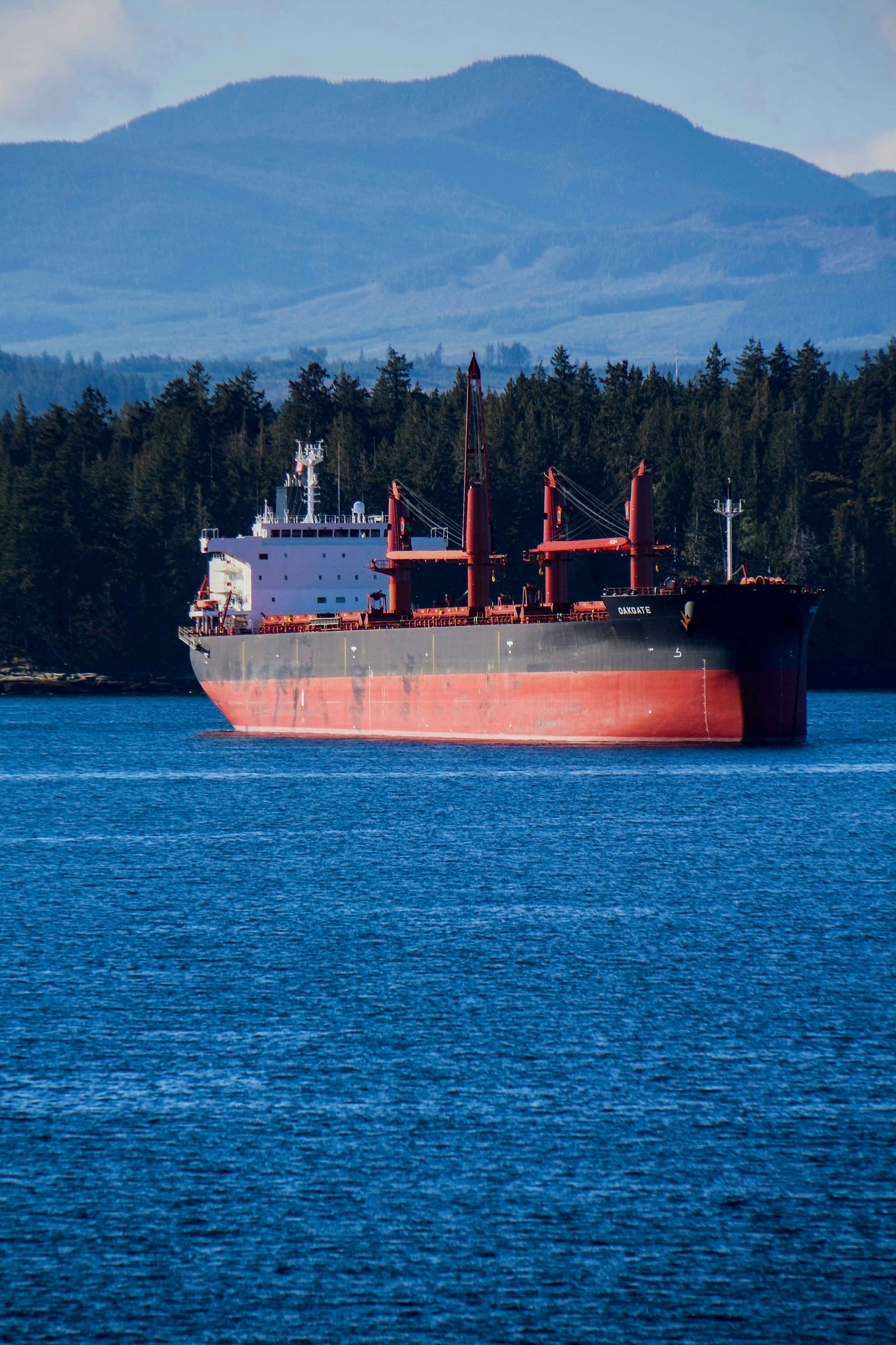
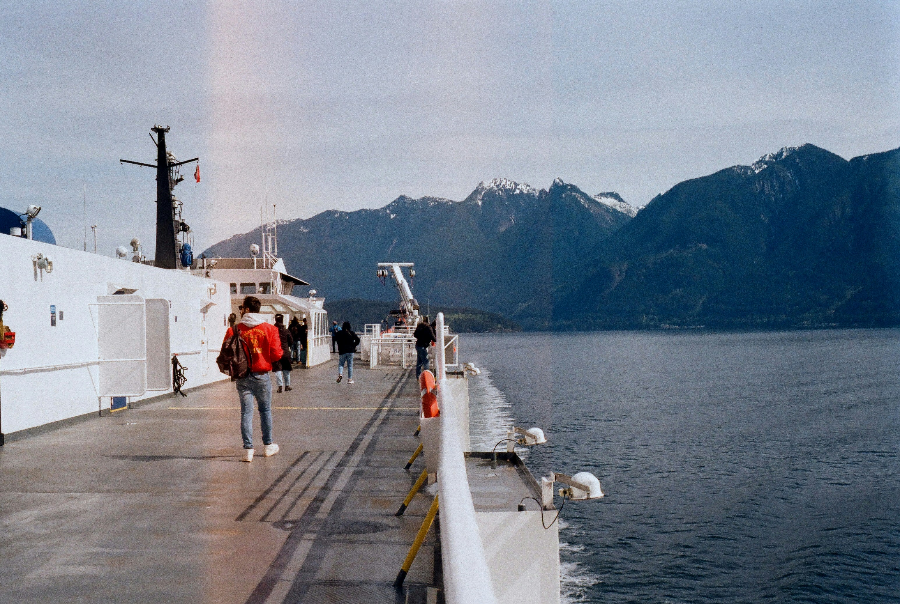
About Nanaimo, British Columbia
Nanaimo is located on the east coast of Vancouver Island in British Columbia, Canada, about 70.2 miles (113 kilometres) northwest of Victoria and 34.1 miles (55 kilometres) west of Vancouver. The 'Harbour City' of Nanaimo is separated by the Strait of Georgia, and linked to Vancouver via the Horseshoe Bay BC Ferries terminal in West Vancouver. As the site of the main ferry terminal, Nanaimo is the gateway to many other destinations both on the northern part of the island, such as Tofino, Comox Valley, Parksville, Campbell River, Port Alberni, and Rathtrevor Beach Provincial Park. Offshore islands accessible via Nanaimo include Newcastle Island, Protection Island, Gabriola Island, Valdes Island, and many other Gulf Islands. Nanaimo is also the headquarters of the Regional District of Nanaimo.


About Vancouver, British Columbia
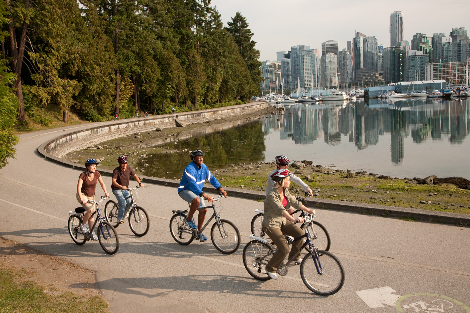
Vancouver is a delicious juxtaposition of urban sophistication and on-your-doorstep wilderness adventure. The mountains and seascape make the city an outdoor playground for hiking, skiing, kayaking, cycling, and sailing—and so much more—while the cuisine and arts scenes are equally diverse, reflecting the makeup of Vancouver's ethnic (predominantly Asian) mosaic. Vancouver is consistently ranked as one of the world's most livable cities, and it's easy for visitors to see why. It's beautiful, it's outdoorsy, and there's a laidback West Coast vibe. On the one hand, there's easy access to a variety of outdoor activities, a fabulous variety of beaches, and amazing parks. At the same time, the city has a multicultural vitality and cosmopolitan flair. The attraction is as much in the range of food choices—the fresh seafood and local produce are some of North America's best—as it is in the museums, shopping, and nightlife.Vancouver's landscaping also adds to the city's walking appeal. In spring, flowerbeds spill over with tulips and daffodils while sea breezes scatter scented cherry blossoms throughout Downtown; in summer office workers take to the beaches, parks, and urban courtyards for picnic lunches and laptop meetings. More than 8 million visitors each year come to Vancouver, Canada's third-largest metropolitan area. Because of its peninsula location, traffic flow is a contentious issue. Thankfully, Vancouver is wonderfully walkable, especially in the downtown core. The North Shore is a scoot across the harbor, and the rapid-transit system to Richmond and the airport means that staying in the more affordable ’burbs doesn't have to be synonymous with sacrificing convenience. The mild climate, exquisite natural scenery, and relaxed outdoor lifestyle keep attracting residents, and the number of visitors is increasing for the same reasons. People often get their first glimpse of Vancouver when catching an Alaskan cruise, and many return at some point to spend more time here.

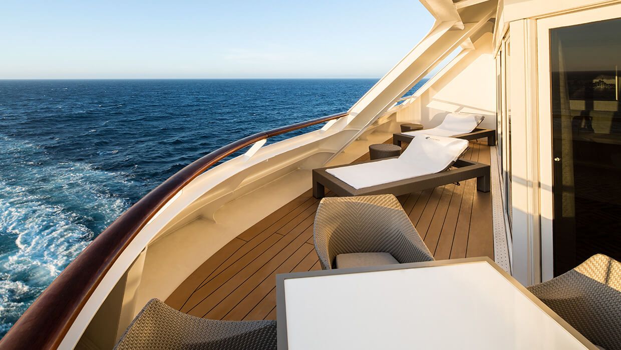
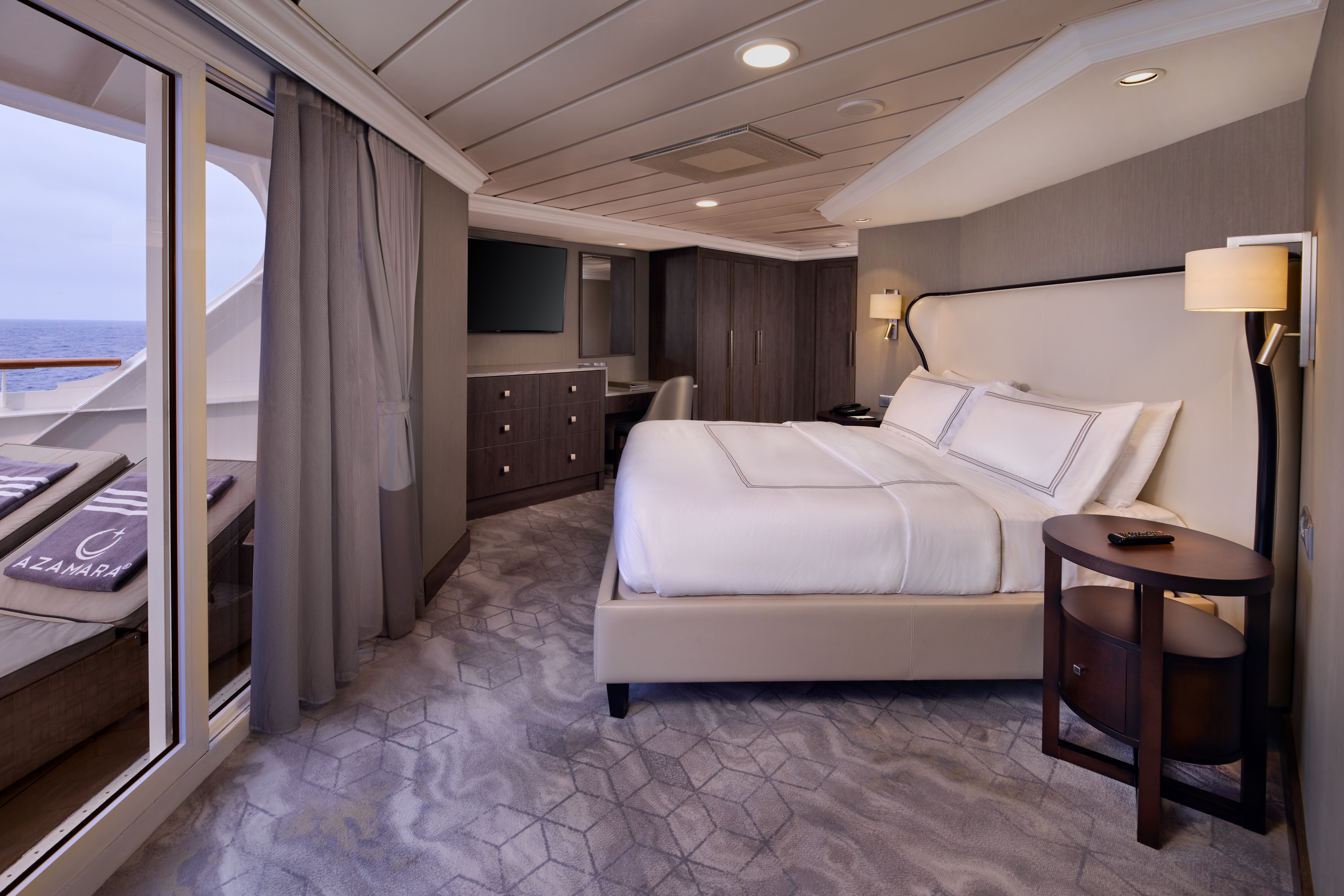
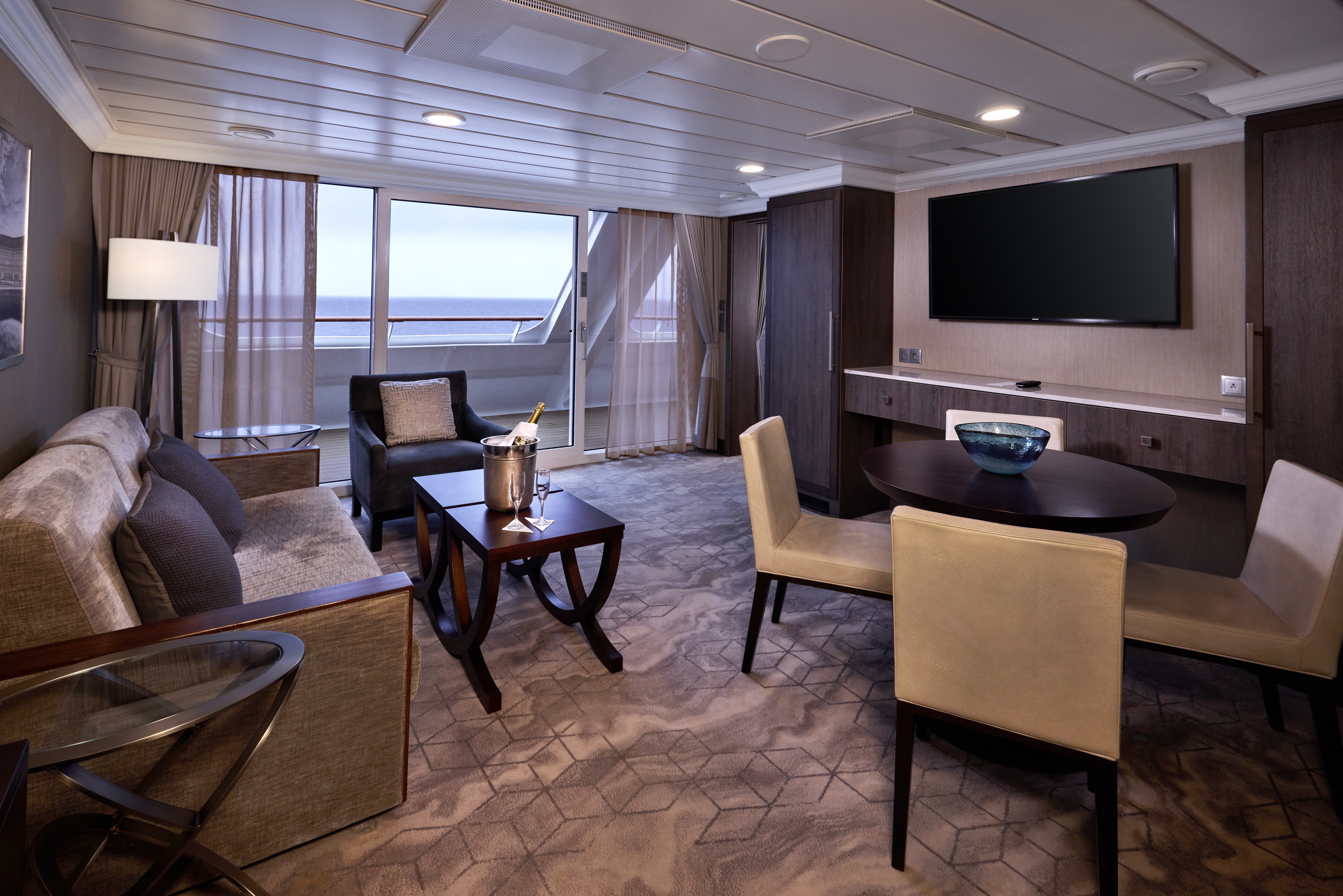
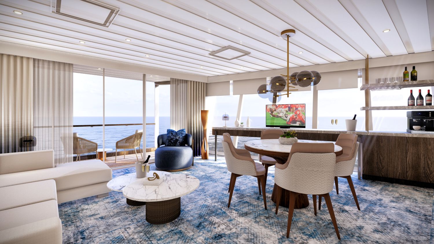
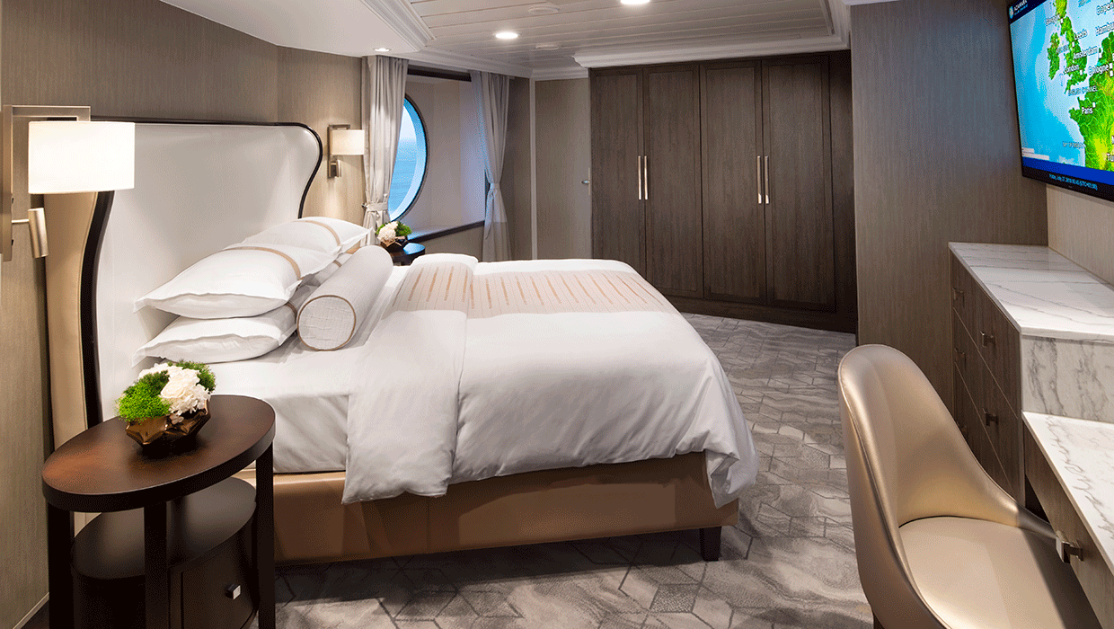
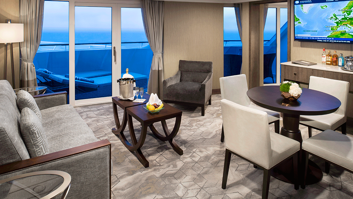
A signature expression of Azamara Cruises' refined luxury, the World Owner's Suite features a spacious layout, a separate bedroom, and a large private veranda. Thoughtfully designed for guests who value privacy, comfort, and elevated living.
Suite Features
- Spacious living room with a separate master bedroom
- Master bedroom with one queen size bed and a flatscreen television
- Flat-screen television in living room
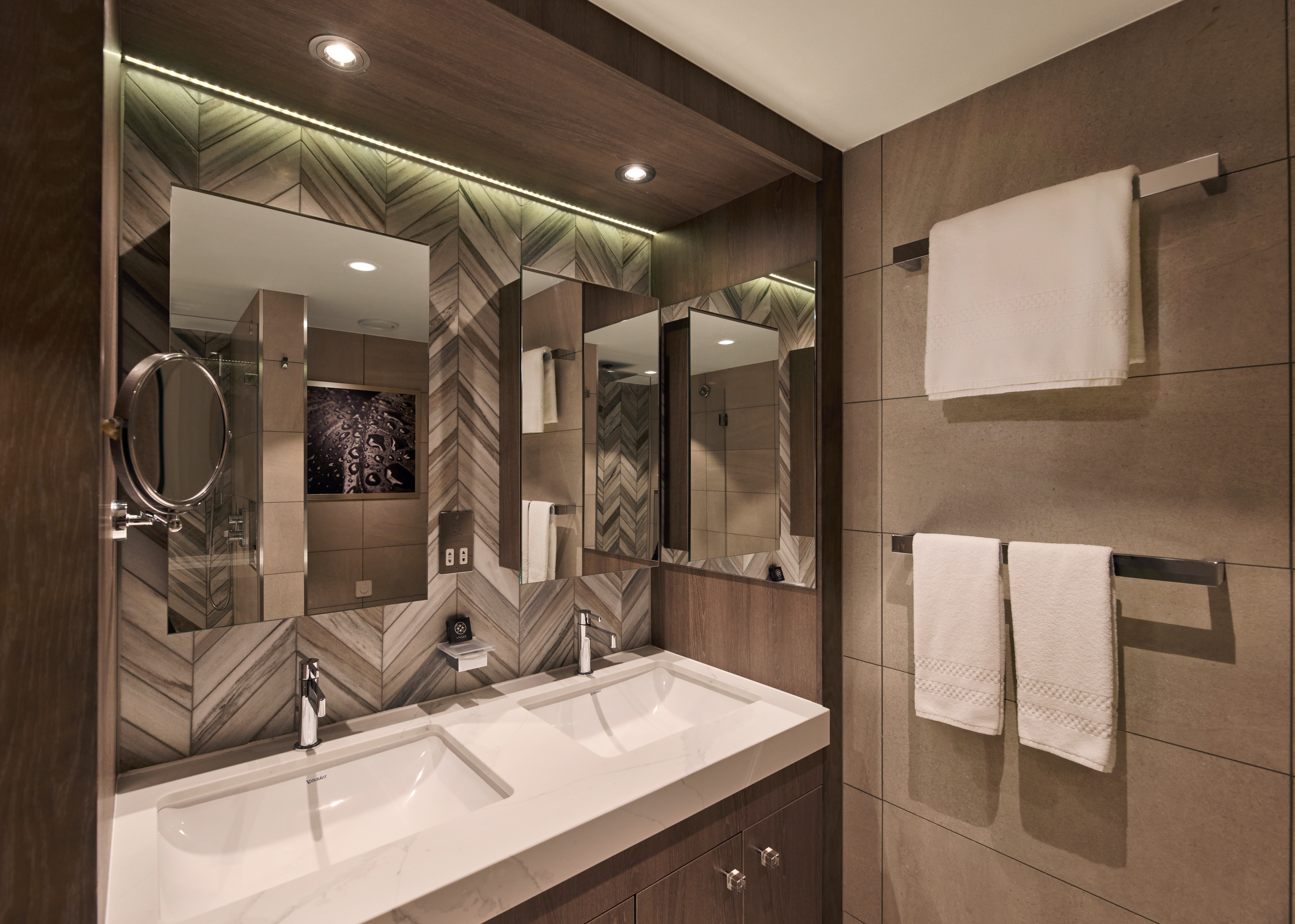
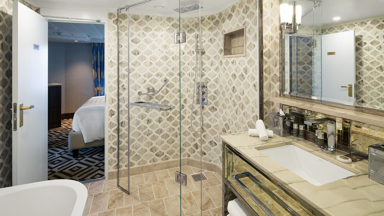
- Marble master bathroom with shower. Journey, Onward, and Quest suites feature a tub.
- Dressing room with vanity and ample closet space
- Floor-to-ceiling sliding glass doors in living room and master bedroom
- Mini-bar
- Thermostat-controlled air conditioner
- Direct-dial telephone with voice mail
- Writing desk
- In-room safe
- Hand-held hair dryer
- Stateroom: 560 sq. ft. (52 sq. m.) Veranda: 233 sq. ft. (21.7 sq. m.)
Included Amenities
- Ultimate Beverage Package
- Unlimited Standard Starlink Wi-Fi
- Unlimited Wash and Press
- Dedicated butler and concierge service
- Full in-suite dining and daily evening hors d'oeuvres
- Complimentary Specialty Dining and exclusive breakfast at Aqualina
- In-room premium spirits and champagne
- Thalassotherapy Pool access
- Personalized assistance planning spa appointments and shore excursions
- Priority check-in
- Luxurious cotton bed linens with duvet
- Terry bathrobes
- 24-hour room service
- Tote bag
- Use of umbrella
- Shoeshine service
- Turndown treats
- Afternoon In-Suite Tea Service

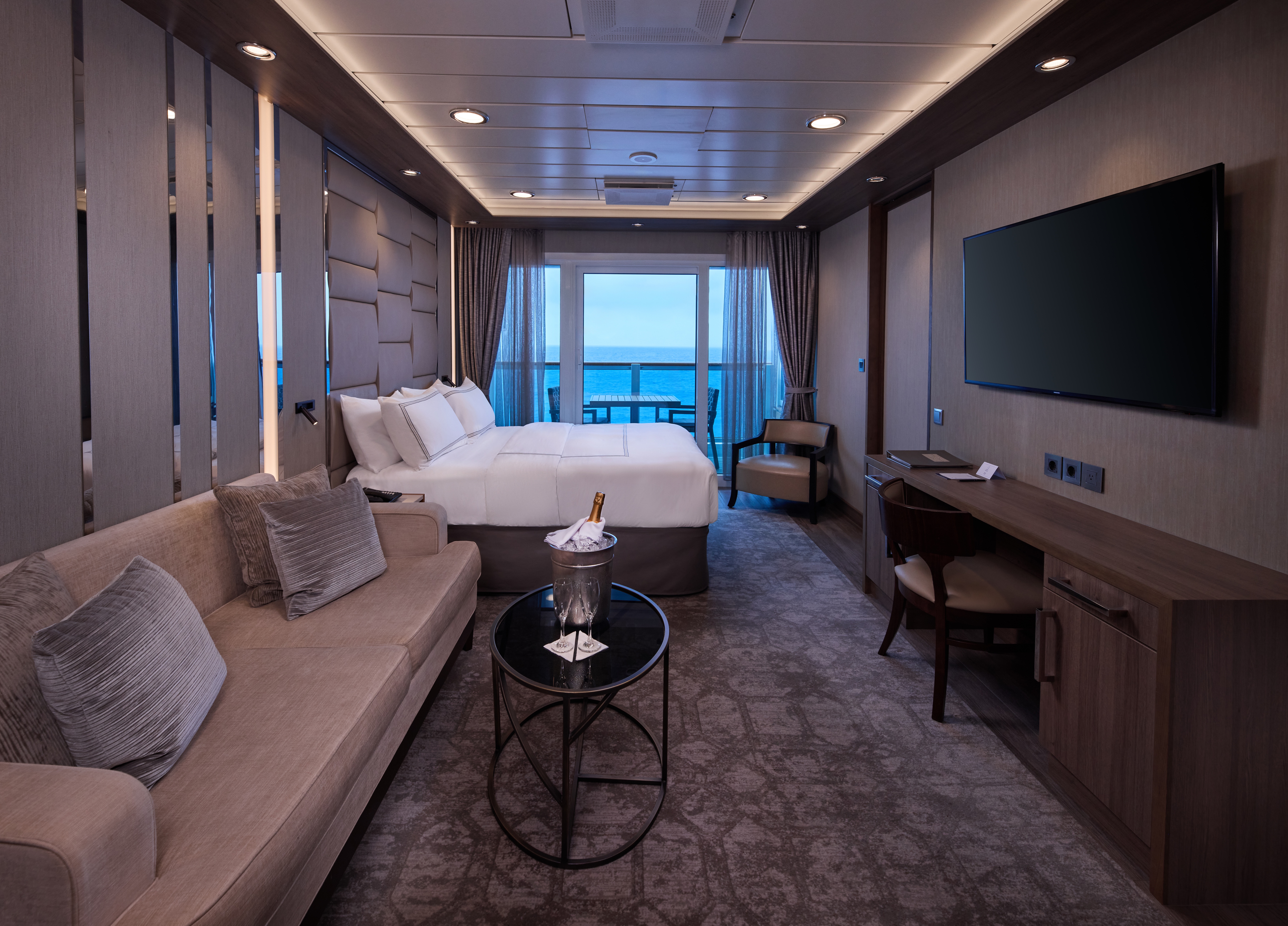
The Panorama Suite introduces a new pinnacle of onboard living, offering expansive interiors, generous living and dining space, and sweeping panoramic views. Designed for guests seeking the most immersive and elevated suite experience at sea.
Suite Features
Spacious living room with a separate master bedroom
- Master bedroom with one queen size bed with a 55" flatscreen television
- 55" flat-screen television in living room
- Marble master bathroom with shower.
- Dressing room with vanity and ample closet space
- Floor-to-ceiling sliding glass doors in living room and master bedroom
- Mini-bar
- Thermostat-controlled air conditioner
- Direct-dial telephone with voice mail
- Writing desk
- In-room safe
- Hand-held hair dryer
- Stateroom: 656 sq. ft. (61 sq. m.) Veranda: 63.5 sq. ft. (5.9 sq. m.)
- Ultimate Beverage Package
- Personalized assistance planning spa appointments and
- Unlimited Standard Starlink Wi-Fi shore excursions
- Unlimited Wash and Press
- Priority check-in
- Luxurious cotton bed linens with duvet
- Dedicated butler and concierge service
- Terry bathrobes
- Full in-suite dining and daily evening hors d'oeuvres
- 24-hour room service
- Complimentary Specialty Dining and exclusive breakfast at Aqualina
- Tote bag
- Use of umbrella
- In-room premium spirits and champagne
- Shoeshine service
- Thalassotherapy Pool access
- Turndown treats
- Afternoon In-Suite Tea Service
The Ocean Suite offers generous space to relax, with a separate living area, a dedicated bedroom, and a private veranda. An inviting retreat that balances comfort, functionality, and classic suite-style living.
Suite Features
- Spacious living room with a separate master bedroom
- Master bedroom with one queen size bed with a flatscreen television
- Flat-screen television in living room
- Marble master bathroom with shower. Journey and Quest suites feature a tub.
- Dressing room with vanity and ample closet space
- Floor-to-ceiling sliding glass doors in living room and master bedroom
- Mini-bar
- Thermostat-controlled air conditioner
- Direct-dial telephone with voice mail
- Writing desk
- In-room safe
- Hand-held hair dryer
- Stateroom: 440-501 sq. ft. (40.9-46.5 sq. m.) Veranda: 233 sq. ft. (21.7 sq. m.)
Included Amenities
- Ultimate Beverage Package
- Unlimited Standard Starlink Wi-Fi
- Personalized assistance planning spa appointments and shore excursions
- Unlimited Wash and Press
- Priority check-in
- Luxurious cotton bed linens with duvet
- Dedicated butler and concierge service
- Terry bathrobes
- Full in-suite dining and daily evening hors d'oeuvres
- 24-hour room service
- Complimentary Specialty Dining and exclusive breakfast at Aqualina
- Tote bag
- Use of umbrella
- In-room premium spirits and champagne
- Shoeshine service
- Thalassotherapy Pool access
- Turndown treats
- Afternoon In-Suite Tea Service
Designed for relaxation and renewal, the Spa Suite features a spacious layout with spa-inspired touches, including a glass-enclosed soaking tub and convenient access to the spa. A calming retreat ideal for wellness- focused travelers.
Suite Features
- Two lower beds convertible to one queen size bed
- Thermostat-controlled air conditioner
- Spacious glass-enclosed bathtub
- Direct-dial telephone with voice mail
- Separate rain shower
- Writing desk
- Comfortable sitting area
- In-room safe
- Flat-screen television in sitting area
- Hand-held hair dryer
- Floor-to-ceiling sliding glass doors
- Stateroom: 414 sq. ft. (38.5 sq. m.) Veranda: 40 sq. ft. (3.7 sq. m.)
- Mini-bar
Included Amenities
- Ultimate Beverage Package
- Unlimited Standard Starlink Wi-Fil
- Unlimited Wash and Press
- Dedicated butler and concierge service
- Full in-suite dining and daily evening hors d'oeuvres
- Complimentary Specialty Dining and exclusive breakfast at Aqualina
- In-room premium spirits and champagne
- Thalassotherapy Pool access
- Personalized assistance planning spa appointments and shore excursions
- Priority check-in
- Luxurious cotton bed linens with duvet
- Terry bathrobes
- 24-hour room service
- Tote bag
- Use of umbrella
- Shoeshine service
- Turndown treats
- Afternoon In-Suite Tea Service

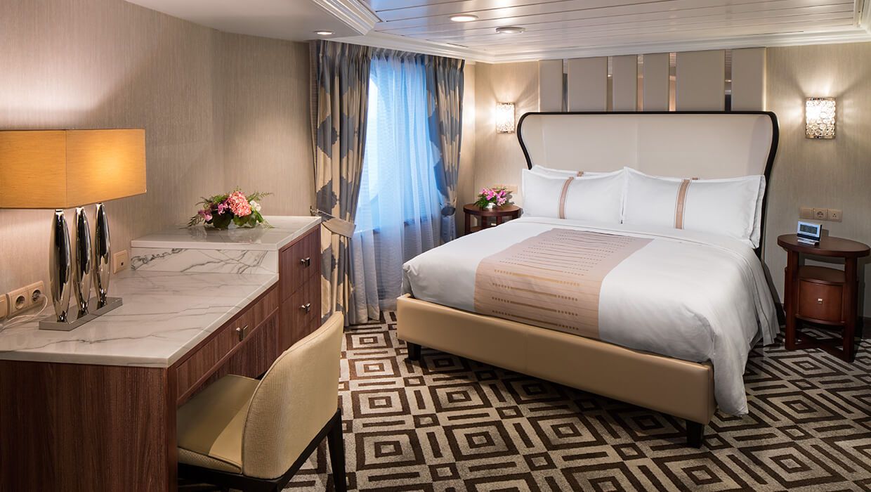
Spacious and comfortable, our Club Continent Suites feature fresh new décor inspired by natural elements. With two beds convertible to a queen, a cozy sitting area, breezy balcony and refreshed bathroom with a bathtub or shower, this is your wonderful, refined home away from home.
Suite Features
- Two lower beds convertible to one queen size bed
- Spacious and comfortable sitting area
- Flat-screen television in sitting area
- Roomy bathroom with shower. Some also feature a tub.
- Floor-to-ceiling sliding glass doors
- Veranda
- Mini-bar
- Thermostat-controlled air conditioner
- Direct-dial telephone with voice mail
- Writing desk
- In-room safe
- Hand-held hair dryer
- Stateroom: 266 sq. ft. (24.7 sq. m.) Veranda: 60 sq. ft. (5.6 sq. m.)
Included Amenities
- Unlimited Basic Starlink Wi-Fi
- 2 laundry bags (wash and press per stateroom, per 7 nights)
- Dedicated butler and concierge service
- Full in-suite dining and daily evening hors d'oeuvres
- Complimentary Specialty Dining and exclusive breakfast at Aqualina
- In-room premium spirits and champagne
- Thalassotherapy Pool access
- Personalized assistance planning spa appointments and shore excursions
- Priority check-in
- Luxurious cotton bed linens with duvet
- Terry bathrobes
- 24-hour room service
- Tote bag
- Use of umbrella
- Shoeshine-service
- Turndown treats
- Afternoon In-Suite Tea Service

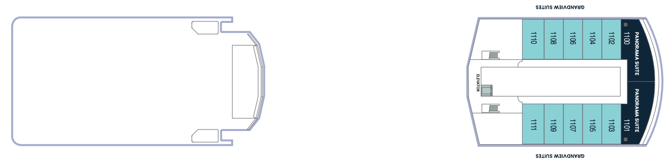
The Grandview Suite blends refined contemporary design with floor-to-ceiling views and an expanded, spa-like bathroom. Thoughtfully designed to maximize light and comfort, offering a modern suite experience with select amenities.
Suite Features
- Spacious suite with king-sized bed
- Comfortable sitting area
- Flat-screen television in sitting area
- Roomy bathroom with shower
- Floor-to-ceiling sliding glass doors.
- Veranda
- Mini-bar
- Thermostat-controlled air conditioner
- Direct-dial telephone with voice mail
- Writing desk
- In-room safe
- Hand-held hair dryer
- 243.15 sq. ft. (22.59 sq. m.) Veranda: 60 sq. ft. (5.6 sq.m.)
Included Suite Amenities
- Unlimited Basic Starlink Wi-Fi
- 2 laundry bags (wash and press) per stateroom, per 7 nights
- Dedicated butler and concierge service
- Full in-suite dining and daily evening hors d'oeuvres
- Complimentary Specialty Dining and exclusive breakfast at Aqualina
- In-room premium spirits and champagne
- Thalassotherapy Pool access
- Personalized assistance planning spa appointments and shore excursions
- Priority check-in
- Luxurious cotton bed linens with duvet
- Terry bathrobes
- 24-hour room service
- Tote bag
- Use of umbrella
- Shoeshine-service
- Turndown treats
- Afternoon In- Suite Tea Service
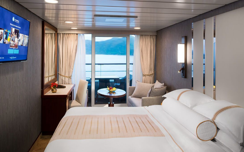
The suites offer a generous space to relax, with a separate living area, a dedicated bedroom, and a private veranda. An inviting retreat that balances comfort, functionality, and classic suite-style living.


Enjoy open-air living with sweeping ocean and destination views, plus added perks designed to elevate your onboard experience. It's everything you love about a Veranda Stateroom, with a little extra - at exceptional value.
Stateroom Features
- Veranda
- Two lower beds convertible to one Queen size bed
- Sitting area with flat - screen TV
- Mini-bar
- Thermostat-controlled air conditioner
- Direct-dial telephone with voice mail
- Writing desk
- In-room safe
- Hand-held hairdryer
- USB ports under bedside reading lamps
- Stateroom: 175 sq. ft. (16.3 sq. m.) | Veranda: 46-64 sq. ft. (4.3-6 sq. m.)
Included Stateroom Amenities
- Complimentary AzAmazing Evenings® event (on most voyages)
- Gratuities
- Luxurious cotton bed linens with duvet
- Terry bathrobes and slippers
- Select standard spirits, international beers and wine
- 24-hour room service
- Bottled water, soft drinks, specialty coffees and teas
- Self-service laundry
- Tote bag
- Shuttle service to and from port communities, wher
- Use of umbrella
- Concierge services for personal guidance and reservations
- Shoe shine-service
- Turndown treats
- Daily news bulletin
- Complimentary Internet (120 minutes or 25% off the unlimited internet package) per guest
- One free bag of laundry service per stateroom, every seven days
- One night of complimentary specialty dining for two, every seven days
- Priority embarkation and debarkation
- Complimentary in- room spirits
Enjoy open-air living with sweeping ocean and destination views, plus added perks designed to elevate your onboard experience. It's everything you love about a Veranda Stateroom, with a little extra - at exceptional value.
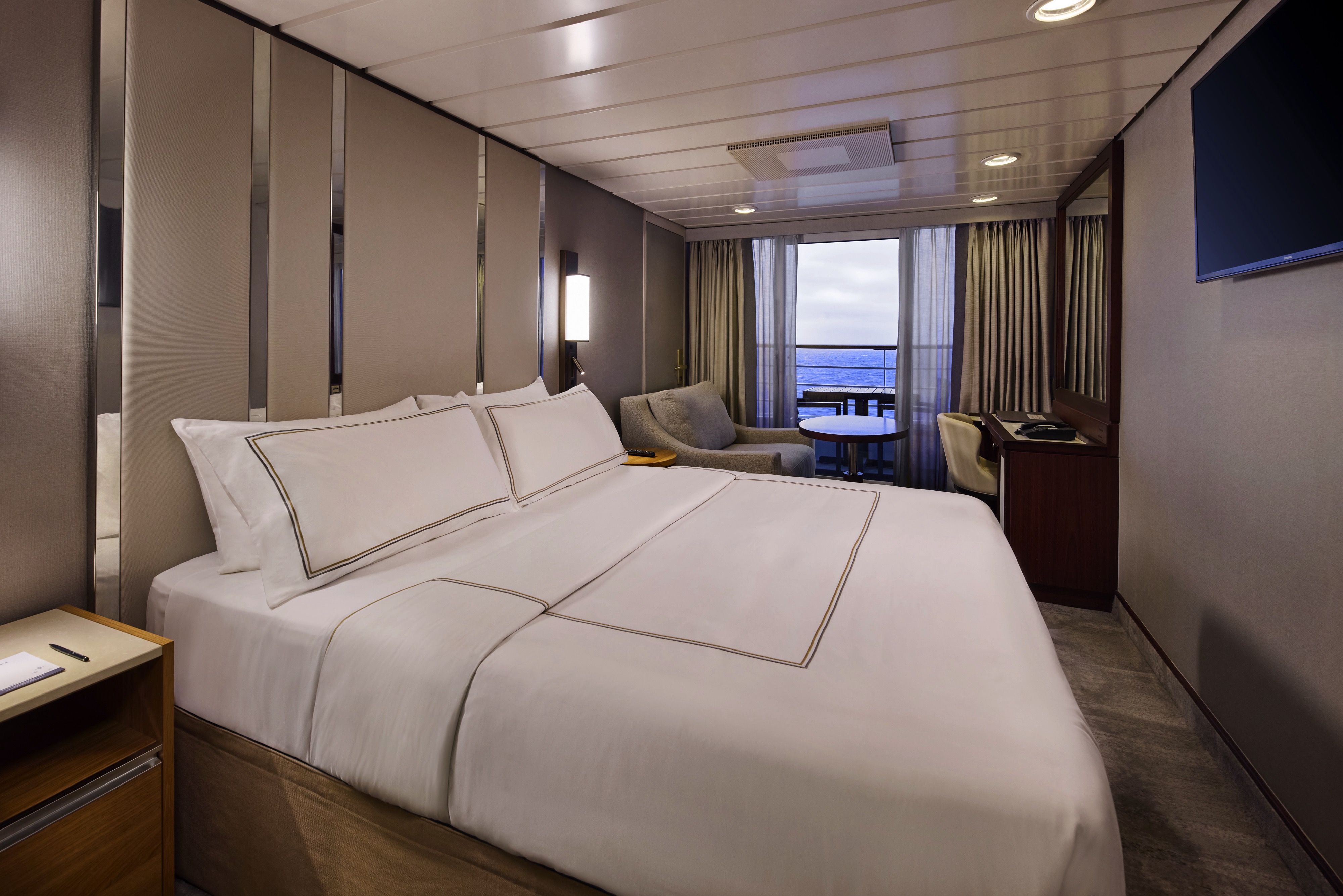
Step outside to your private veranda and take in fresh sea breezes and ever-changing views. Thoughtful design, polished finishes, and attentive service create a relaxing retreat between immersive days ashore.
Stateroom Features
- Veranda
- Writing desk
- Two lower beds convertible to one Queen size bed
- Sitting area with flat-screen TV
- In-room safe
- Hand-held hairdryer
- Refrigerator with mini-bar
- USB ports under bedside reading lamps
- Thermostat-controlled air conditioner
- Stateroom: 175 sq. ft. (16.3 sq. m.) | Veranda: 40 sq. ft.
- Direct-dial telephone with voicemail (3.7 sq. m.)
Included Stateroom Amenities
- Complimentary AzAmazing Evenings® event (on most voyages)
- Luxurious cotton bed linens with duvet
- Gratuities
- Terry bathrobes
- Shuttle service to and from port communities, where available
- Use of umbrella
- Concierge services for personal guidance and reserervations
- Select standard spirits, international beers and wine
- 24-hour room service
- Self-service laundry
- Tote bag
- Shoe shine-service
- Turndown treats
- Daily news bulletin
Step outside to your private veranda and take in fresh sea breezes and ever-changing views. Thoughtful design, polished finishes, and attentive service create a relaxing retreat between immersive days ashore.
Wake up to natural light and picturesque ocean views from your window.
Featuring contemporary design and well-appointed comforts, these staterooms offer a serene and stylish place to unwind at sea.
Stateroom Features
- Two lower beds convertible to one Queen size bed
- Some staterooms feature sofa bed
- Flat-screen TV
- Refrigerator with mini-bar
- Thermostat-controlled air conditioner
- Direct-dial telephone with voicemail
- Writing desk
- In-room safe
- Hand-held hairdryer
- USB ports under bedside reading lamps
- 143 sq. ft. (13.3 sq m)
Included Stateroom Amenities
- Complimentary AzAmazing Evenings® event (on most voyages)
- Self-service laundry
- Tote bag
- Gratuities
- Shuttle service to and from port communities, wher
- Luxurious cotton bed linens with duvet
- Use of umbrella
- Terry bathrobes and slippers
- Concierge services for personal guidance and
- Select standard spirits, international beers and winereservations
- 24-hour room service
- Shoe shine-service
- Bottled water, soft drinks, specialty coffees and teas
- Turndown treats
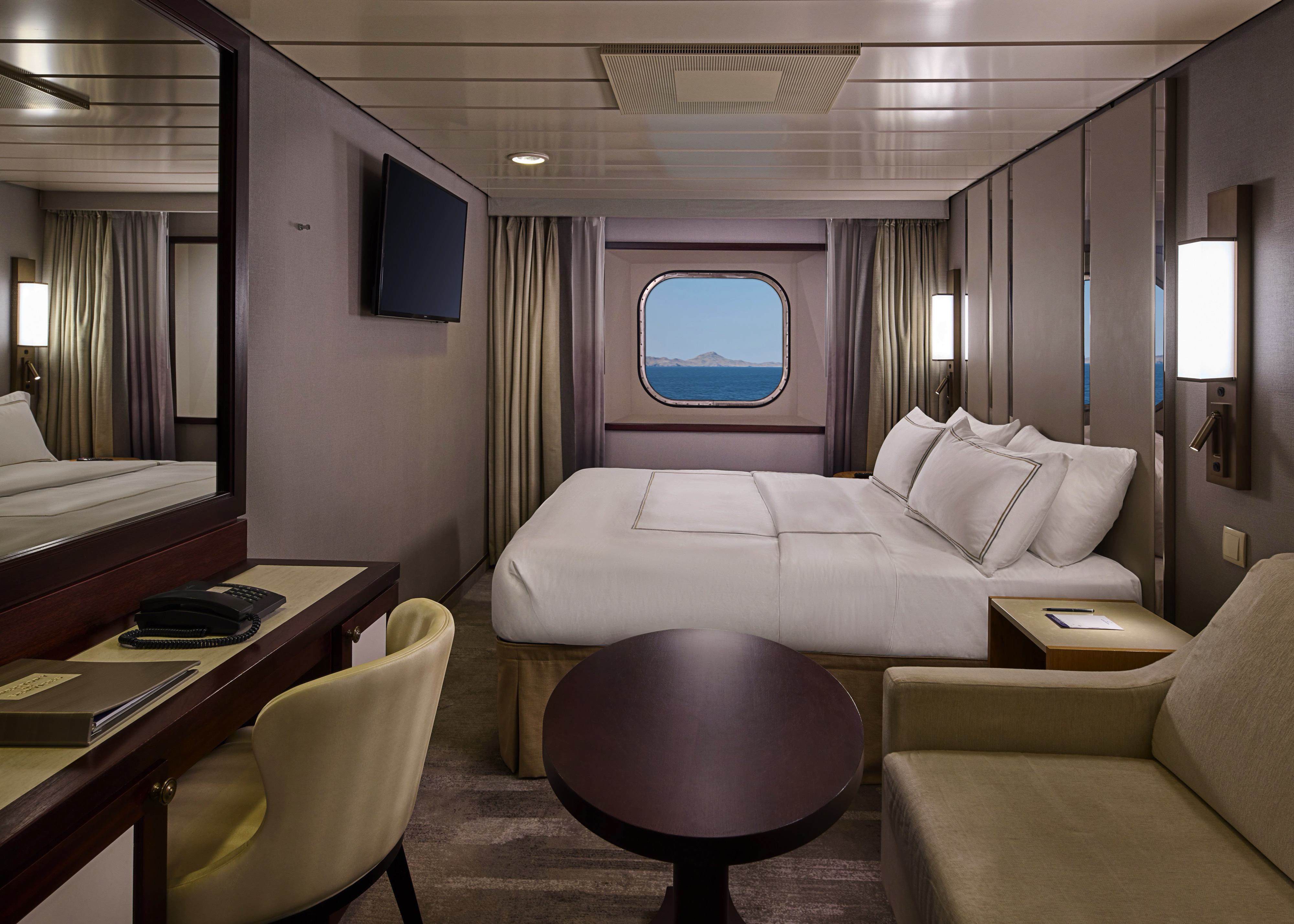
Wake up to natural light and picturesque ocean views from your window.
Featuring contemporary design and well-appointed comforts, these staterooms offer a serene and stylish place to unwind at sea.
A quiet, comfortable retreat designed for restful nights and relaxing moments between adventures. With refined décor, plush amenities, and personalized service, it's boutique-hotel comfort at sea.
Stateroom Features
- Two lower beds convertible to one Queen size bed
- Flat-screen television
- Refrigerator with mini-bar
- Thermostat-controlled air conditioner
- Direct-dial telephone with voicemail
- Writing desk
- In-room safe
- Hand-held hairdryer
- USB ports under bedside reading lamps
- Stateroom: 158 sq. ft. (14.7 sq. m.)
Included Stateroom Amenities
- Complimentary AzAmazing Evenings® event (on most voyages
- Gratuities
- Luxurious cotton bed linens with duvet
- Terry bathrobes and slippers
- Select standard spirits, international beers and wine
- 24-hour room service
- Bottled water, soft drinks, specialty coffees and teas
- Self-service laundry
- Tote bag
- Shuttle service to and from port communities, wher
- Use of umbrella
- Concierge services for personal guidance and reservations
- Shoe shine-service
- Turndown treats
- Daily news bulletin
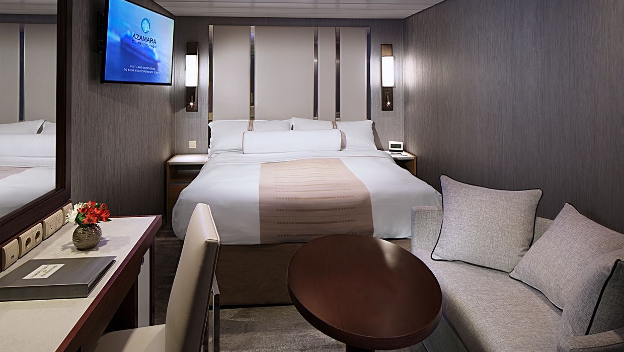
A quiet, comfortable retreat designed for restful nights and relaxing moments between adventures. With refined décor, plush amenities, and personalized service, it's boutique-hotel comfort at sea.

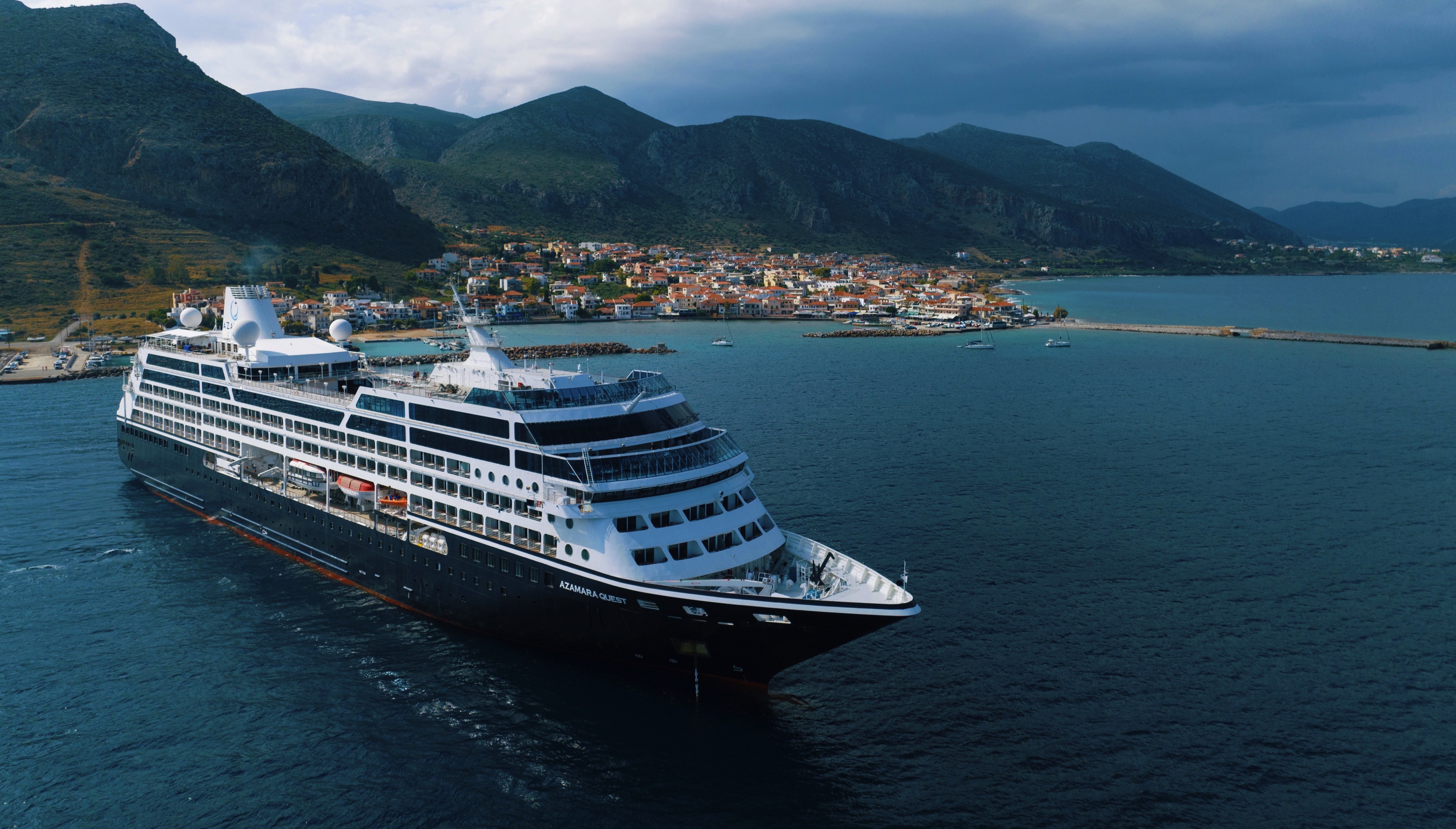
Azamara Quest
The Azamara Quest is a mid-sized ship with a deck plan that’s intimate but never crowded, and offers everything modern cruisers are looking for—plus some unexpected extras.
Ship Facts
| Launch Year | 2000 | ||||||||||
| Refit Year | 2019 | ||||||||||
| Language | en-US | ||||||||||
| Gross Tonnage | 30277 | ||||||||||
| Length | 180 | ||||||||||
| Width | 25 | ||||||||||
| Currency | USD | ||||||||||
| Speed | 18 | ||||||||||
| Capacity | 704 | ||||||||||
| Crew Count | 408 | ||||||||||
| Deck Count | 8 | ||||||||||
| Cabin Count | 352 | ||||||||||
| Large Cabin Count | N/A | ||||||||||
| Wheelchair Cabin Count | 6 | ||||||||||
| Electrical Plugs |
|
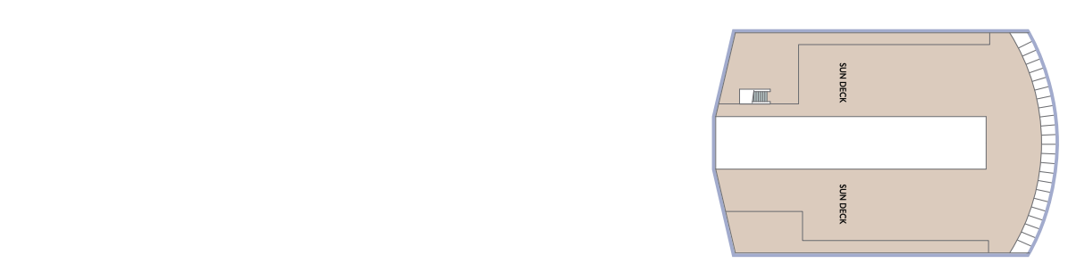
Deck 12
- Sun Deck
Deck 11
- Grandview Suites
- Panaroma Suites
- Elevator
Deck 10
- The Living Room
- Card Room
- In Touch
- Table Tennis
- Jogging Track
- The Drawing Room
- Aqualina Speciality Dining
- Prime C Speciality Dining

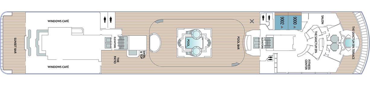
Deck 9
- The Sanctum Spa Terrace
- Salon
- Fitness Centre
- The Sanctum Spa
- Pool Bar
- Pool
- Swirl & Top
- The Patio
- Windows Café
- Sunset Bar
- Spa Suites
Deck 8
- Continent Suites
- World Owner's Suites
- Veranda Plus Staterooms
- Interior Stateroom

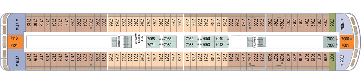
Deck 7
- Veranda Plus Staterooms
- Veranda Staterooms
- Ocean Suites
- Oceanview Staterooms
- Interior Staterooms
- Self Service Laundry
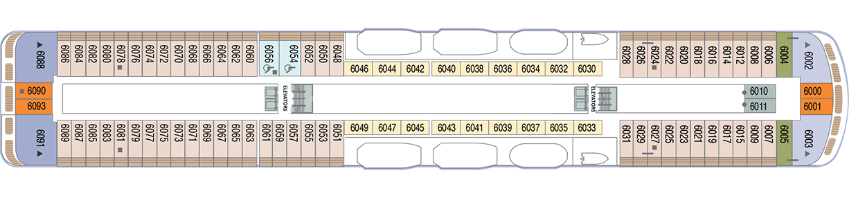
Deck 6
- Veranda Plus Staterooms
- Veranda Staterooms
- Ocean Suites
- World Owner's Suites
- Continent Suite
- Oceanview Staterooms
- Interior Stateroom
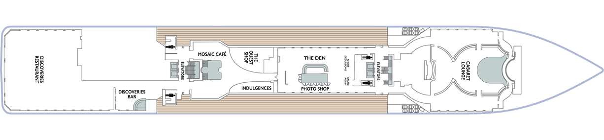
Deck 5
- Cabaret Lounge
- Shore Excursions
- Cruise Again
- The Quest Shop
- The Den
- Photo Shop
- Indulgences
- Mosaic Café
- Discoveries Bar
- Discoveries Restaurant
Deck 4
- Ocean View Staterooms (x2 Accessible Staterooms)
- Interior Staterooms (x3 Accessible Staterooms)
- Guest Relations
- Concierge Desk
- Medical Facility

Azamara offers a choice of six distinctive dining options, including room service. Whether you’re a fan of haute cuisine or down-home cooking, expect the same delicious quality. Bon appétit! Buon appetito! ¡Buen provecho! No matter how you say it, you’re in for a real treat.
Pre-Cruise Specialty Dining Reservations
All guests can now book pre-cruise reservations for Prime C, Aqualina, or Chef’s Table—our most sought-after specialty dining experiences.
Priority Access
Pre-cruise dining reservations open 150 days before sailing for suite guests and Azamara Circle Discoverer-level and above. All other guests may begin booking 140 days prior.
Aqualina
At Aqualina, you’ll find some of Italy’s most authentic dishes. Pastas made from scratch, traditional recipes, and scrumptious vegetarian dishes that make sure there’s something for everyone. Plus our famous desserts: Sorrento lemon liqueur mousse, hazelnut chocolate soufflé and more.
Prime C
Your choice of steak, cooked to perfection. Herb-coated rack of lamb, duck confit and Chilean sea bass—all paired with savory sides. At Prime C, you’re in for more than delectable dining. Expect a great evening with stunning views and lush décor.
Discoveries Restaurant
Discover the world through dishes and flavors from the places we visit. Of course, you’ll also enjoy a wide variety of nightly selections such as filet mignon with black truffle sauce. Choose being seated at a table for two or as part of a larger group of fellow guests.
The Patio and Swirl & Top
Casual “pool grill” by day. A sit-down al fresco dining experience by night. Taste your way around the world with exclusive personalized dishes using local flavors of the places we visit. Plus a self-serve frozen yogurt station—Swirl & Top. With a variety of flavors and your choice of toppings, it’s the perfect way to cool off.
Mosaic Cafe
Stylish and cozy, Mosaic offers your favorite coffee drinks exactly as you like them. Relax in a comfortable seat and enjoy. It’s the perfect spot to start or end your day, and it just might become your favorite place on the ship.
Windows Café
Our daily themed dinner often takes its inspiration from the region we’re visiting—Indian, Mexican, Spanish, Italian. We also create an extra live station made from local ingredients purchased in port: Greek salad made with local feta (Greece), pasta prepared with local mushrooms (Italy), fresh Mussels served with garlic bread (Netherlands).
Room Service
The best time for room service? Whenever you say it is, 24-hours a day. Order from the full breakfast menu between 6:30 AM and 10:00 AM, and we’ll deliver at your appointed time. Lunch and dinner room service features a menu of hearty soups, fresh salads, gourmet sandwiches, pizzas and desserts.
Sit back and enjoy your evenings on a high note with our onboard entertainment. From local cultural shows to our playbill that features a variety of amazing performances to keep you entertained while onboard.
Bars, Lounges & Gathering Spots
A cozy nook to sip coffee. An intimate space to raise a glass and celebrate. A lively setting to catch the latest shows and international entertainment. Watch the world go by, drink in hand from any of Azamara’s bars, lounges, and gathering spaces.
White Night
Join Azamara officers and crew for our signature dinner and entertainment event hosted al fresco on the pool deck (weather permitting). With an array of delicious food and engaging entertainment, your White Night experience will almost certainly be one of the most memorable times from your cruise. And don’t forget to bring something white to wear for the evening.
The Living Room
The idea of the Living Room is just that. To “live in” and to enjoy time with friends and fellow guests! Much of the room is furnished as a living room, with clusters of large comfortable chairs and sofas....
Club Crooner
Step into a swanky nightclub as the great songs of the most magnificent artists come alive on stage. From classic crooners such as Frank Sinatra and Tony Bennett, to current songbirds such as Natalie Cole and Michael Bublé, there’s a song for every time and everyone. Enjoy a beverage, sit back, and be serenaded by the melodies of our lives with CLUB CROONER
Mosaic @ Night
Our onboard coffee corner may very well become your favorite nook on the ship. With elegant and comfortable furniture, it's bound to be one of the the most stylish places, too. Find all your favorite coffee drinks crafted just the way you like. Slip right into a comfortable seat and sip for a while—you never know who'll walk by.
Discoveries Lounge
This congenial bar is a favorite gathering place for great conversations and delicious drinks. Bar service includes a full selection of fine wines, mixed drinks, and premium spirits…plus the entertaining banter of Azamara’s friendly bartenders.
Cabaret Lounge
Enjoy live performances of professional full-stage musical revues, classical soloists, bands and other entertainment in a cabaret nightclub with a full bar and cozy tables.
The Den
By day, The Den is a cozy, inviting space perfect for planning your next adventure—home to the Cruise Again desk and photo gallery, and filled with destination inspiration. By night, it transforms into a lively piano bar with craft cocktails, a talented live pianist, and a warm, social atmosphere. Whether you're mapping out future travels or enjoying the music with a nightcap in hand, The Den is where stories begin, and where many guests return night after night.
The Drawing Room
This library is one of the quiet jewels of Azamara, a peaceful and beautifully appointed space for reading or relaxing after dinner. Browse the collection and feel free to borrow the library books. Or simply relax in the tranquil atmosphere.
The Pool
Join Azamara officers and crew for our signature dinner and entertainment event hosted al fresco on the pool deck (weather permitting). With an array of delicious food and engaging entertainment, your White Night experience will almost certainly be one of the most memorable times from your voyage. And don’t forget to bring something white to wear for the evening.
Pool Bar
Our Pool Bar serves refreshments while enjoying the Pool during the day, and cocktails of your choice in the evening.
Sunset Bar
Adjacent to Windows Café, the Sunset Bar is a welcoming outdoor patio with covered and open -air seating, and a bar. It's the perfect place for dining alfresco, enjoying a refreshing drink, taking in the sights of your favourite port, or simply watching the world sail by.
Performances
Oh, What A Night
Get ready to be transported to the world’s most beloved travel destinations in one exhilarating night. As we explore all four seasons in a new city, travel along with our dynamic Signature Singers & Dancers as they sing and dance their way through an eclectic mix of music from around the world. Come and experience Oh, What A Night!
Take Two
Get ready to grab your clicker and turn up the volume as we take a trip down memory lane celebrating the most cherished movie soundtracks of all time. As we flip through the channels together, you will be taken back to a time when stars were born, the ring is open, and yes... ghosts really do exist. We invite you to sit back, relax and enjoy the music of the movies! Lights... Camera... ACTION! TAKE TWO!
Britrock!
Join your Signature Singers and Dancers, along with your Azamara band, to celebrate the music that includes famous British musical artists such as Adele, Dusty Springfield, Elton John, George Michael, The Beatles and more! Azamara invites you to sing along, as we hit the playback button and take a stroll down memory lane to relive the music that is BRITROCK!
The Quest Shop
It's one-stop shopping in The Pursuit Shop. Apparel, sundries, handbags, candies, souvenirs and lots more await. If you find that you forgot to pack something, chances are you'll find it in The Pursuit Shop.
Photo Shop
Our photographers capture both fun and professional photos throughout the voyage, whether it is your portrait, or photos of the destinations you visit. You can also find an assortment of supplies for your own photographic endeavours.
Indulgences
Aptly named, Indulgences will satisfy your desires for the finer things in life. If you are looking for designer jewellery, it's the perfect place to window shop or to find that extra special purchase.