
San Diego to London Grand Voyage
San Diego to London Grand Voyage
Cruise overview
WHY BOOK WITH US?
- ✔ The Deluxe Cruises’ team has extensive experience in ultra-luxury cruising.
- ✔ Call now to speak to our helpful and experienced Cruise Concierge team.
- ✔ Enjoy our Unique Deluxe Cruises Bonus for substantial savings.
- ✔ Our team will tailor your holiday to your exacting requirements.
- ✔ As agents, we work under the protection of each cruise lines ABTA / ATOL licences
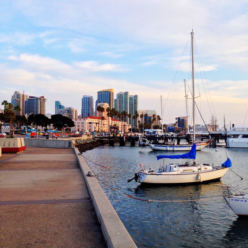
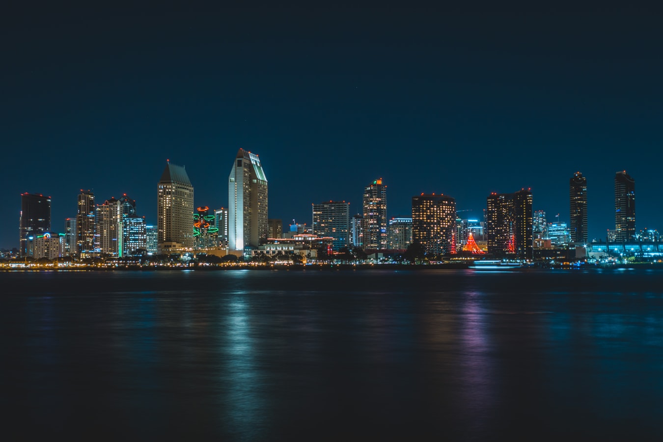
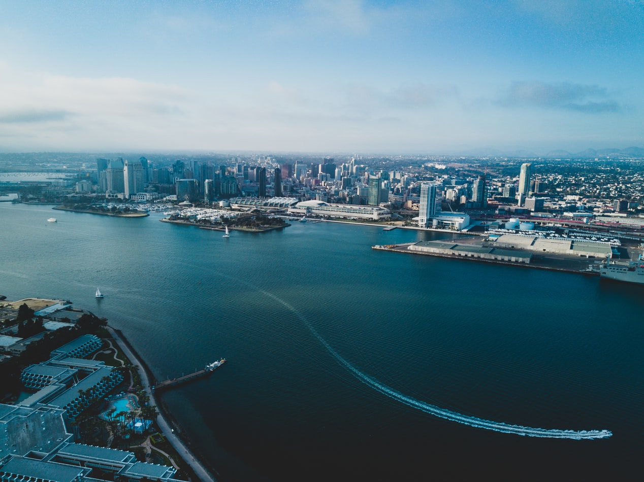
About San Diego, California
San Diego is a vacationer's paradise, with year-round temperatures in the seventies and near-constant sunshine. One of America's most family-friendly cities, San Diego is home to LEGOLAND, the New Children's Museum, and the famous San Diego Zoo. Sunbathers and surfers are guaranteed to find their perfect beach, and foodies find delights in artisanal breweries, local bistros, and gourmet restaurants. From the Broadway excitement of La Jolla Playhouse to the European feel of Little Italy to the nouveau-chic of the Gaslamp Quarter, San Diego has something for everyone.
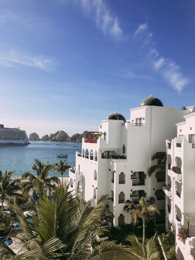
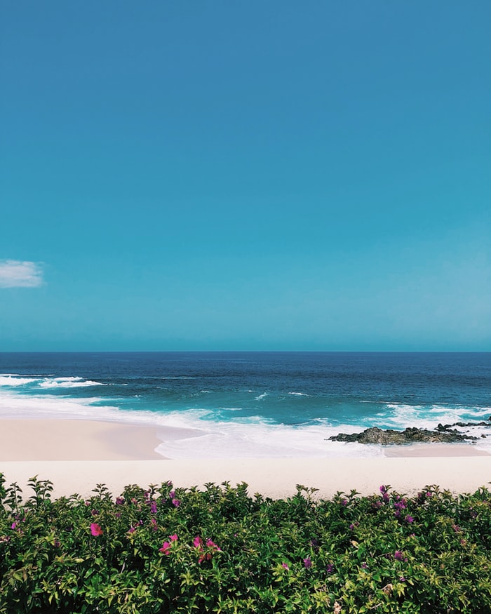
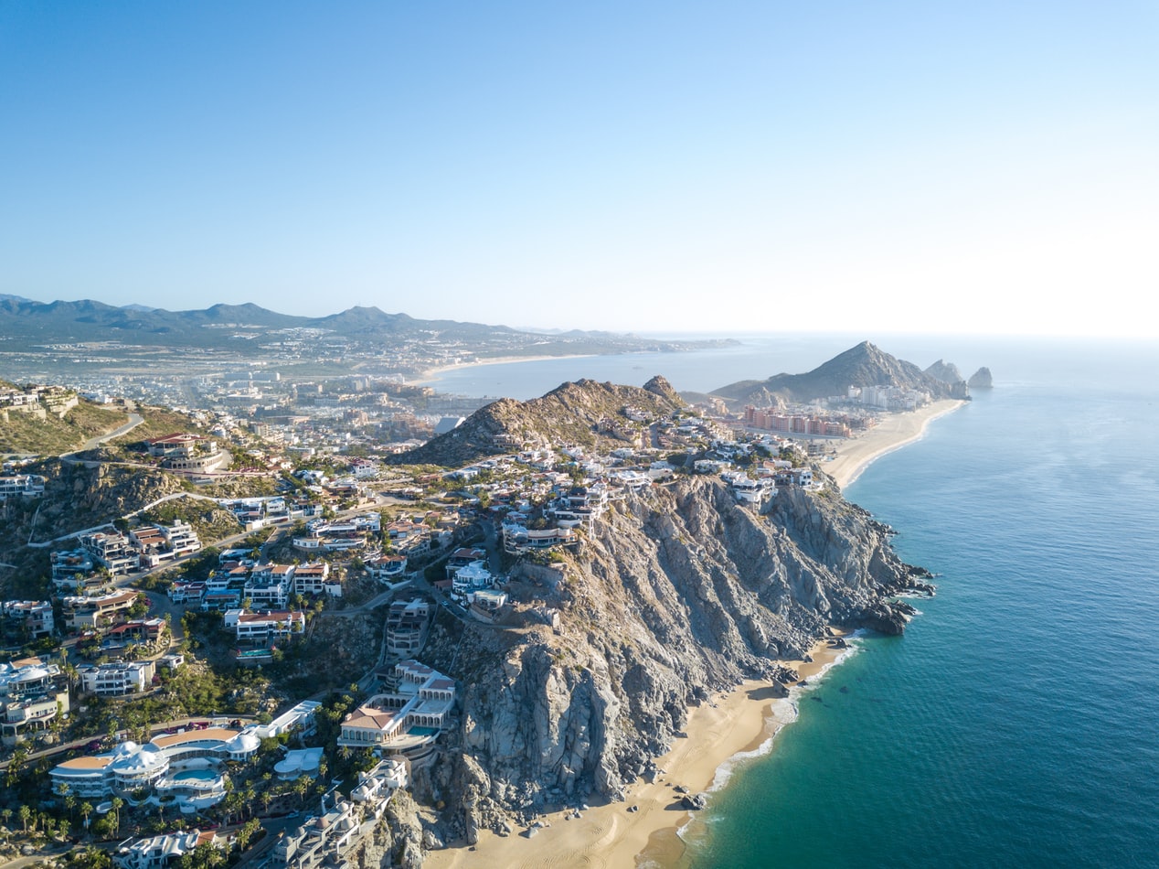
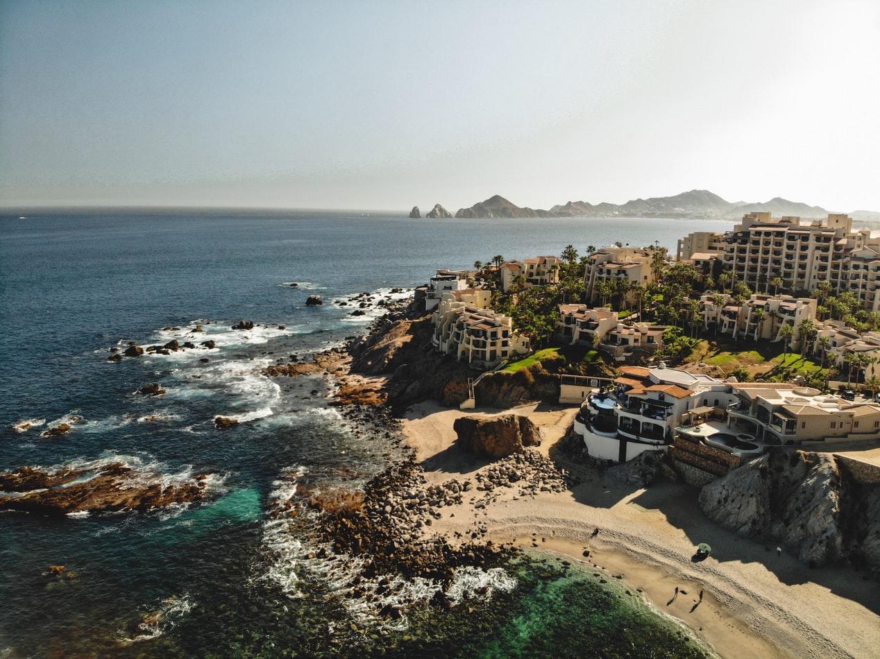
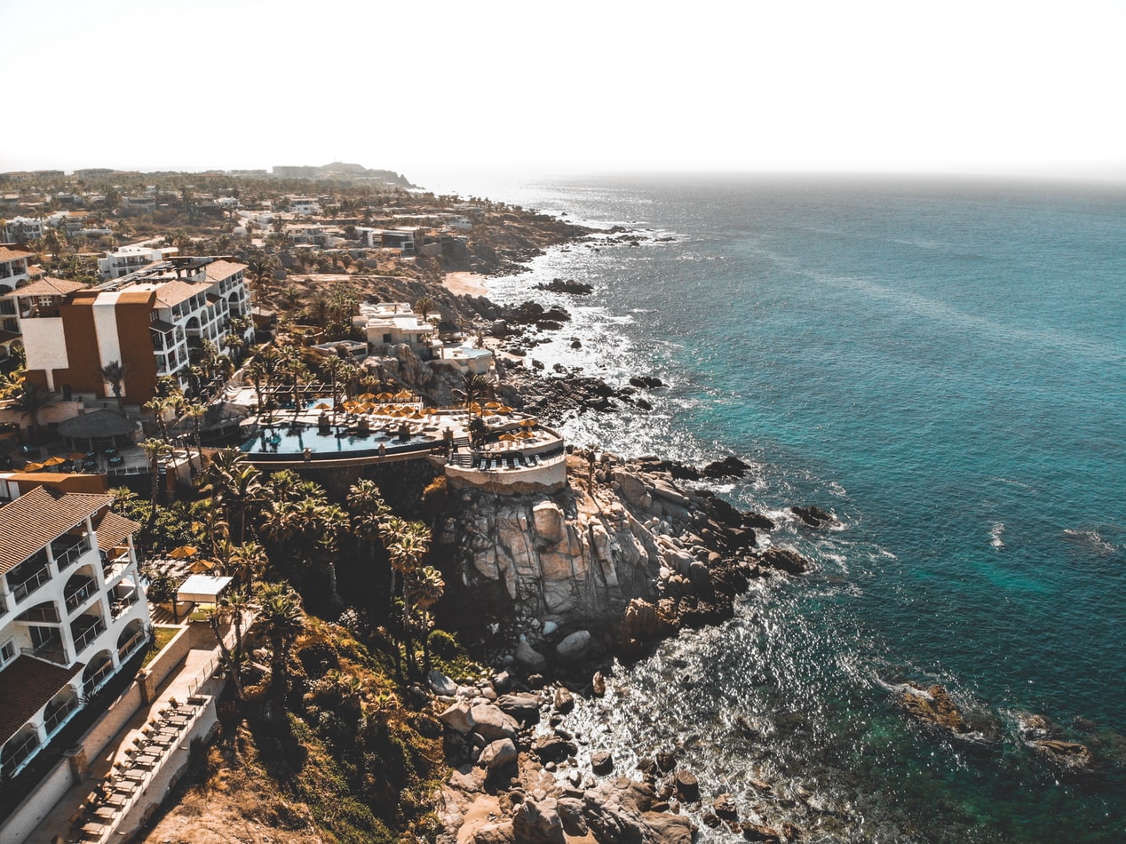
About Cabo San Lucas
Cabo San Lucas, a resort city on the southern tip of Mexico’s Baja California peninsula, is known for its beaches, water-based activities and nightlife. Playa El Médano is Cabo’s main beach, with outdoor restaurants and numerous bars. Past the marina is Land's End promontory, site of Playa del Amor (Lover's Beach) and El Arco, a natural archway in the seacliffs.
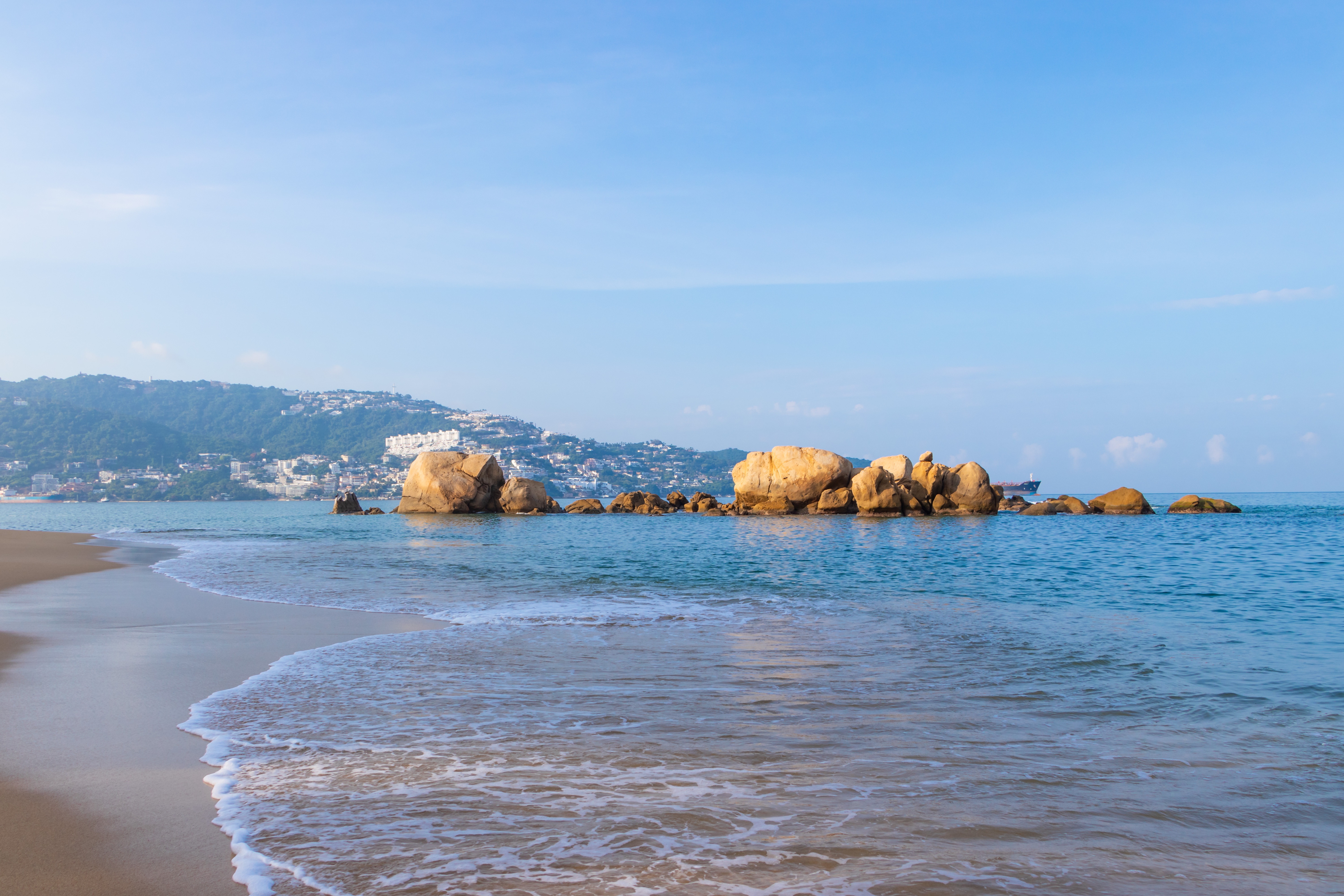
About Acapulco
Acapulco is a major seaport on the scenic Pacific coast of Mexico, located on a deep semi-circular bay with sandy beaches and blue waters. It was a popular destination for many movie stars during the Golden Age of Hollywood, including Elvis Presley and Elizabeth Taylor.
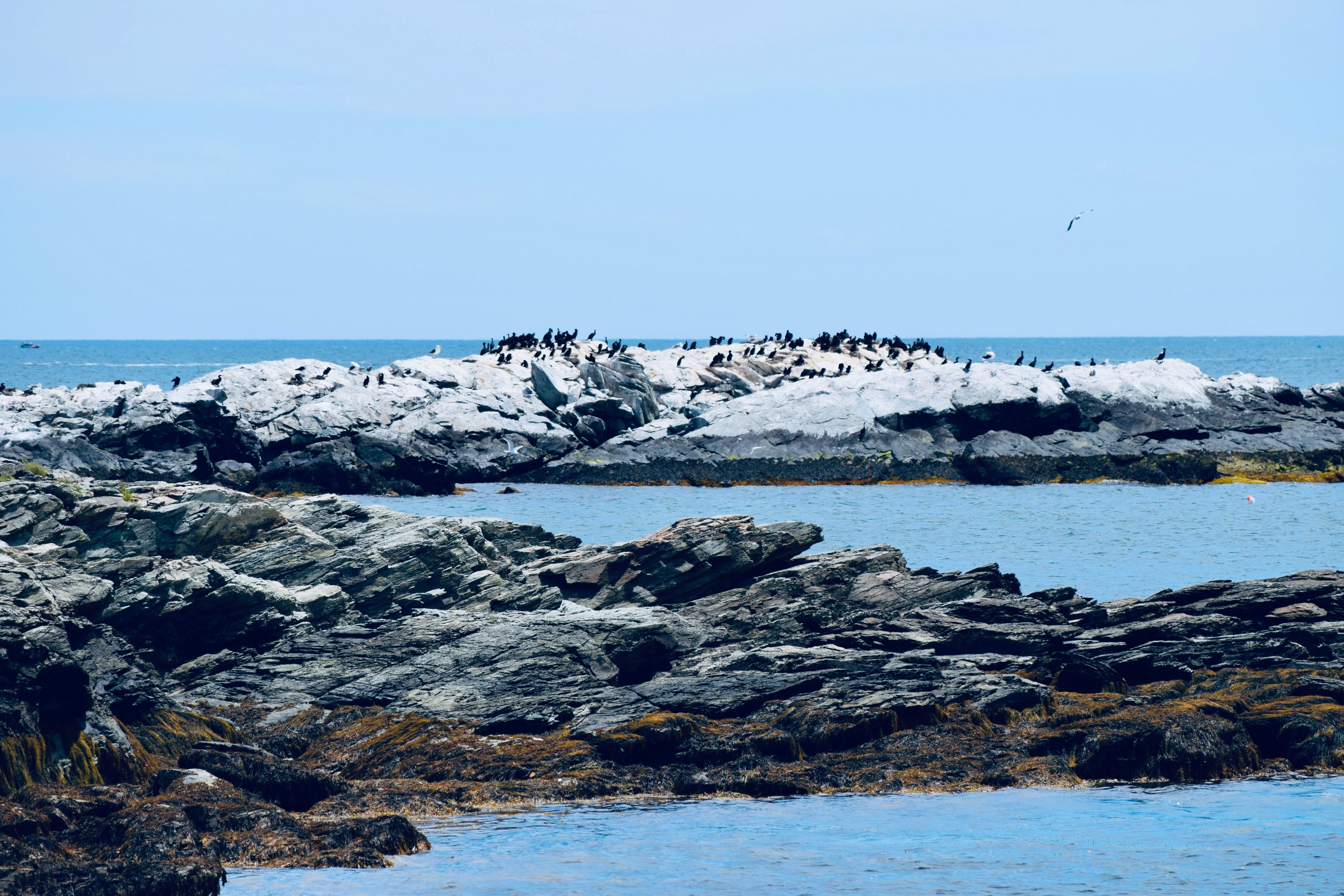
About Puerto Quetzal
Puerto Quetzal is Guatemala's largest Pacific Ocean port. It is important for both cargo traffic and as a stop-off point for cruise liners

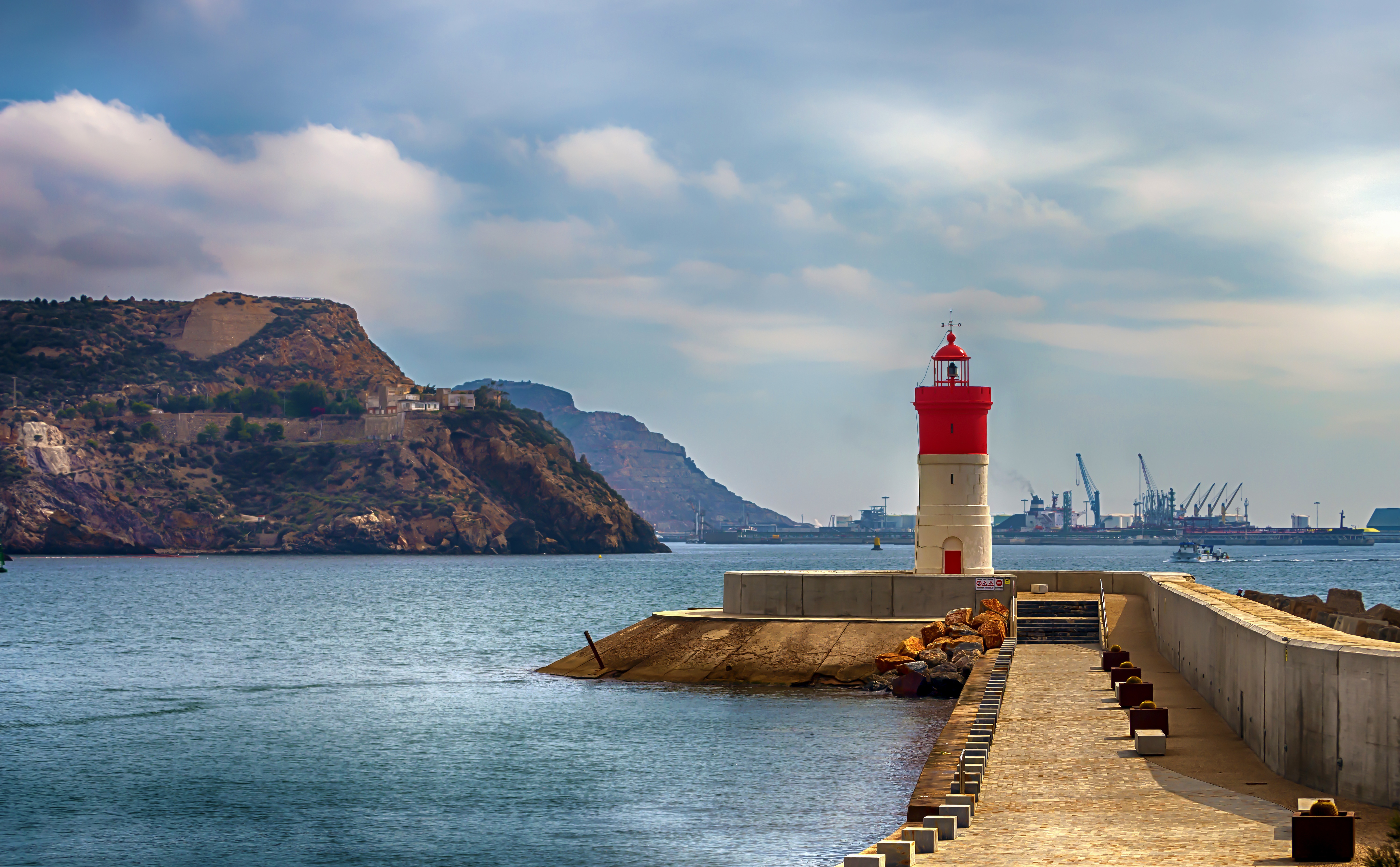
About Acajutla

About Puntarenas
This town is not on the Nicoya Peninsula, but rather on Costa Rica's mainland. It is best known as a cruise-ship port and launching pad for ferries heading southeast to the coast of the Nicoya Peninsula and for cruises sailing out on the Gulf of Nicoya. Puntarenas is also a major fishing port with a lively fish market. The town’s reputation suffers from the unimpressive parts you see from your car as you roll through town on the way to the ferry dock. But the town has a lot of character off the main drag, thanks to its illustrious past as an affluent port town and principal vacation spot for San José's wealthy, who arrived by train in the last century. Once the port was moved and roads opened to other beaches, Puntarenas's economy crashed, but it's making a comeback. Sitting on a narrow spit of sand—punta de arenas literally means "point of sand"—that protrudes into the Gulf of Nicoya, the town boasts a beautifully groomed, wide Blue Flag beach with views of the Nicoya Peninsula and spectacular sunsets, along with a public swimming pool, the San Lucas Beach Club, and a marine-life museum. Ticos arrive by bus and car to enjoy the beach and stroll the Paseo de los Turistas, a beachfront promenade lined with tree-shaded concrete benches and seafood restaurants. Crowds of locals, called porteños, cruise by on bicycles, the town’s most popular form of transport.

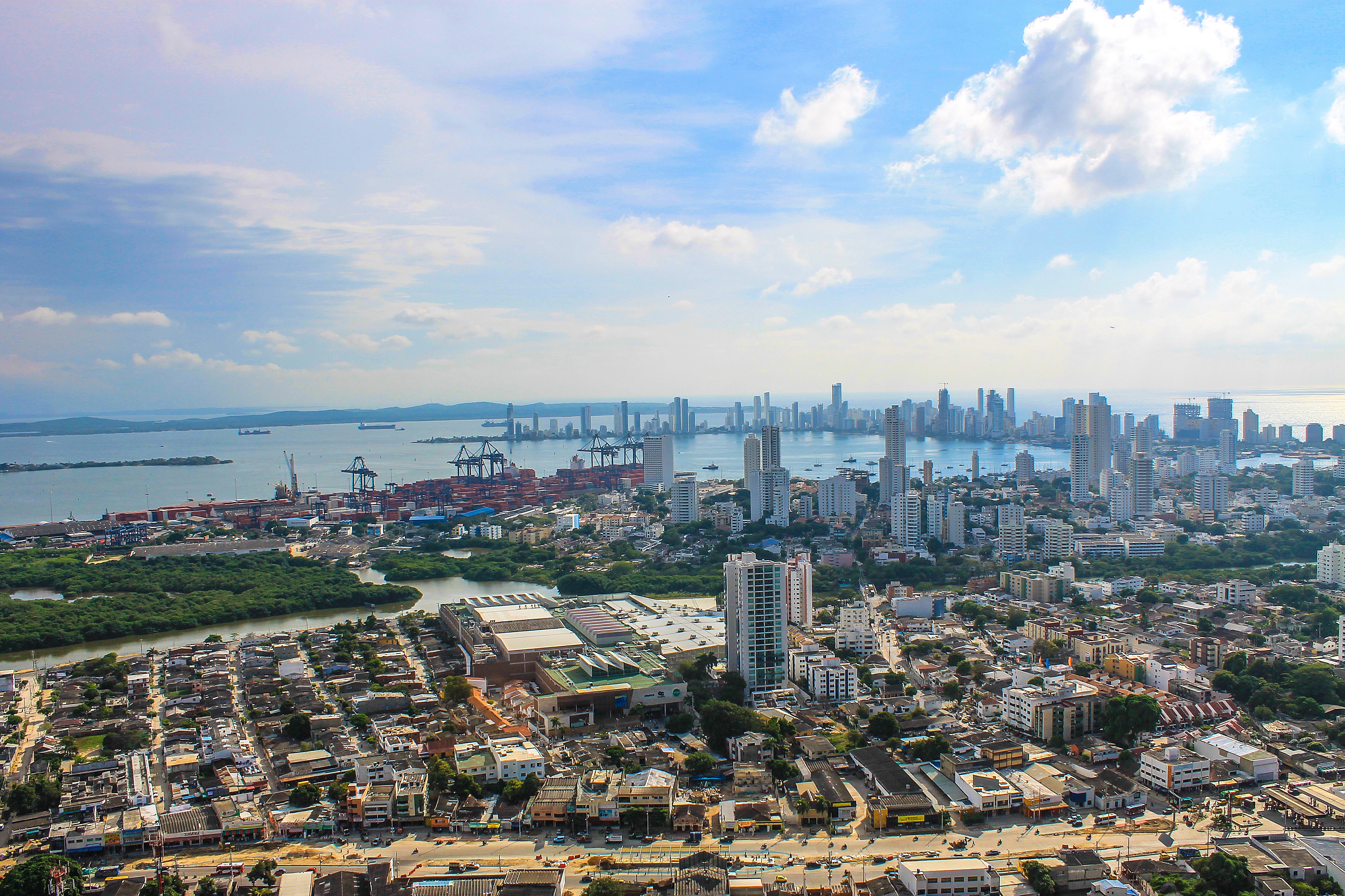
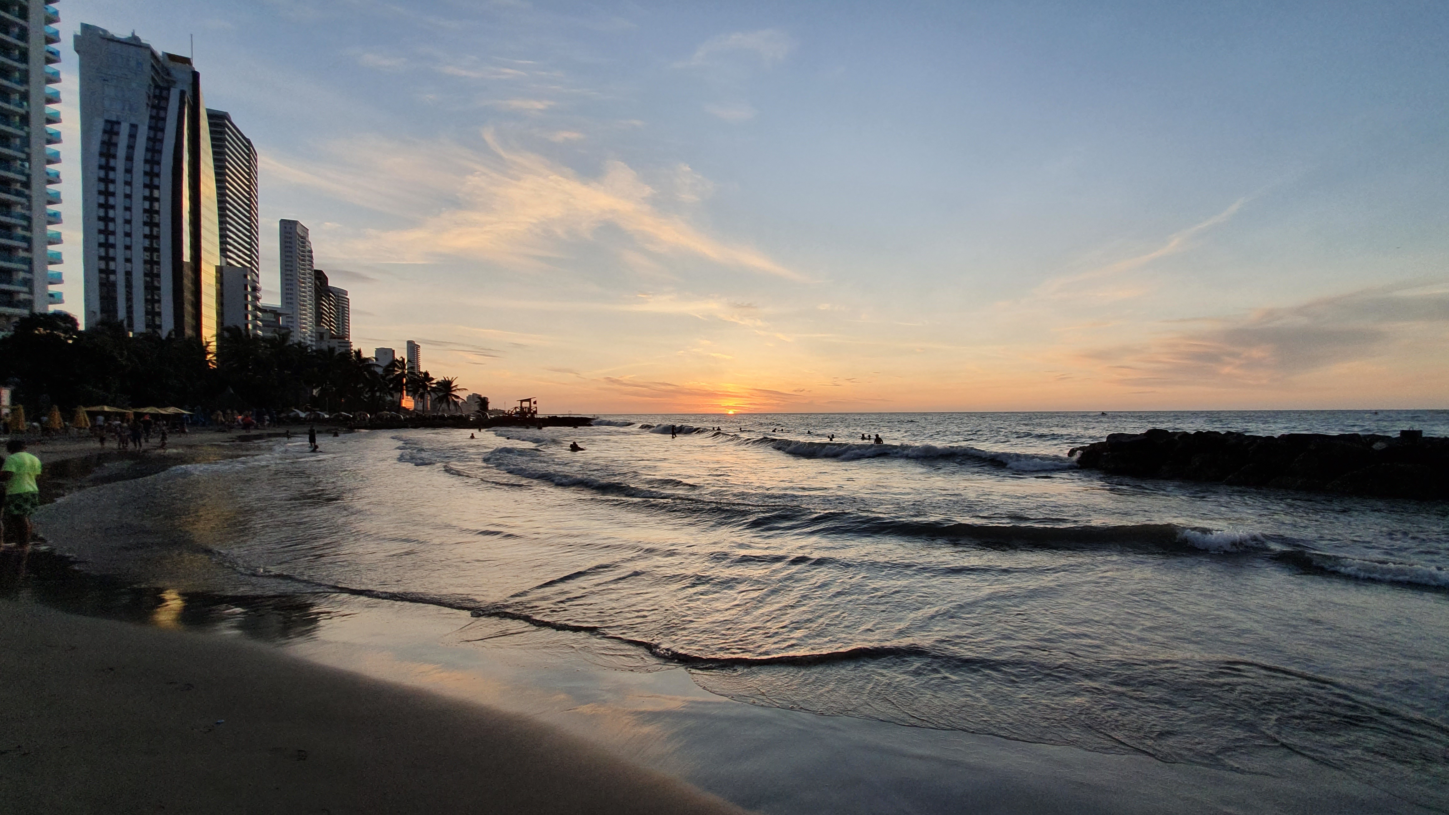
About Cartagena
Cartagena's magnificent city walls and fortresses, now a UNESCO World Heritage Site, enclose a well-restored historic center (the Cuidad Amurallada, or walled city) with plazas, churches, museums, and shops that have made it a lively coastal vacation spot for South Americans and others. New hotels and restaurants make the walled city a desirable place to stay, and the formerly down-at-the-heels Getsemaní neighborhood attracts those seeking a bohemian buzz. The historic center is a small section of Cartagena; many hotels are in the Bocagrande district, an elongated peninsula where high-rise hotels overlook a long, gray-sand beach.When it was founded in 1533 by Spanish conquistador Pedro de Heredia, Cartagena was the only port on the South American mainland. Gold and silver looted from indigenous peoples passed through here en route to Spain and attracted pirates, including Sir Francis Drake, who in 1586 torched 200 buildings. Cartagena's walls protected the city's riches as well as the New World's most important African slave market.
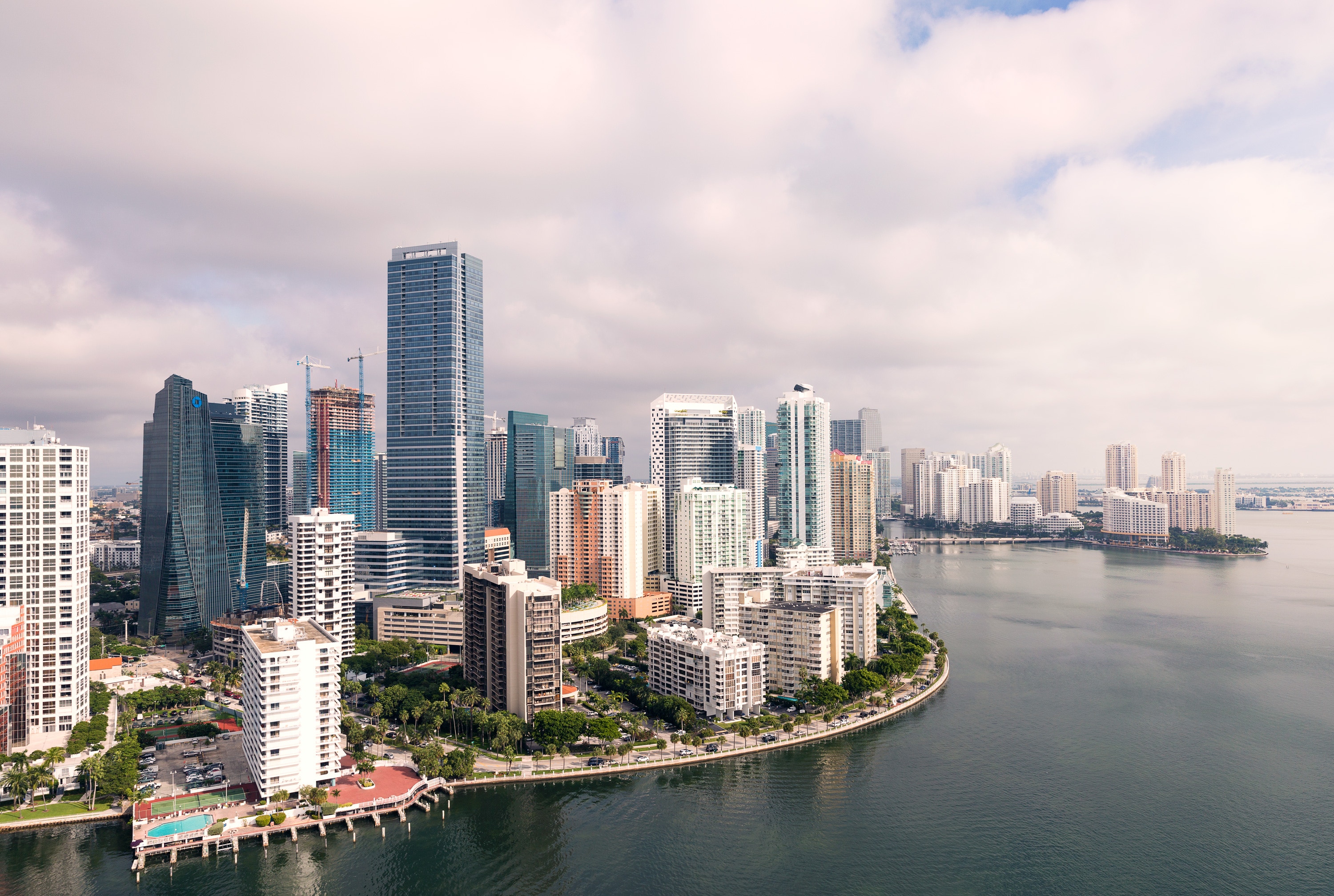
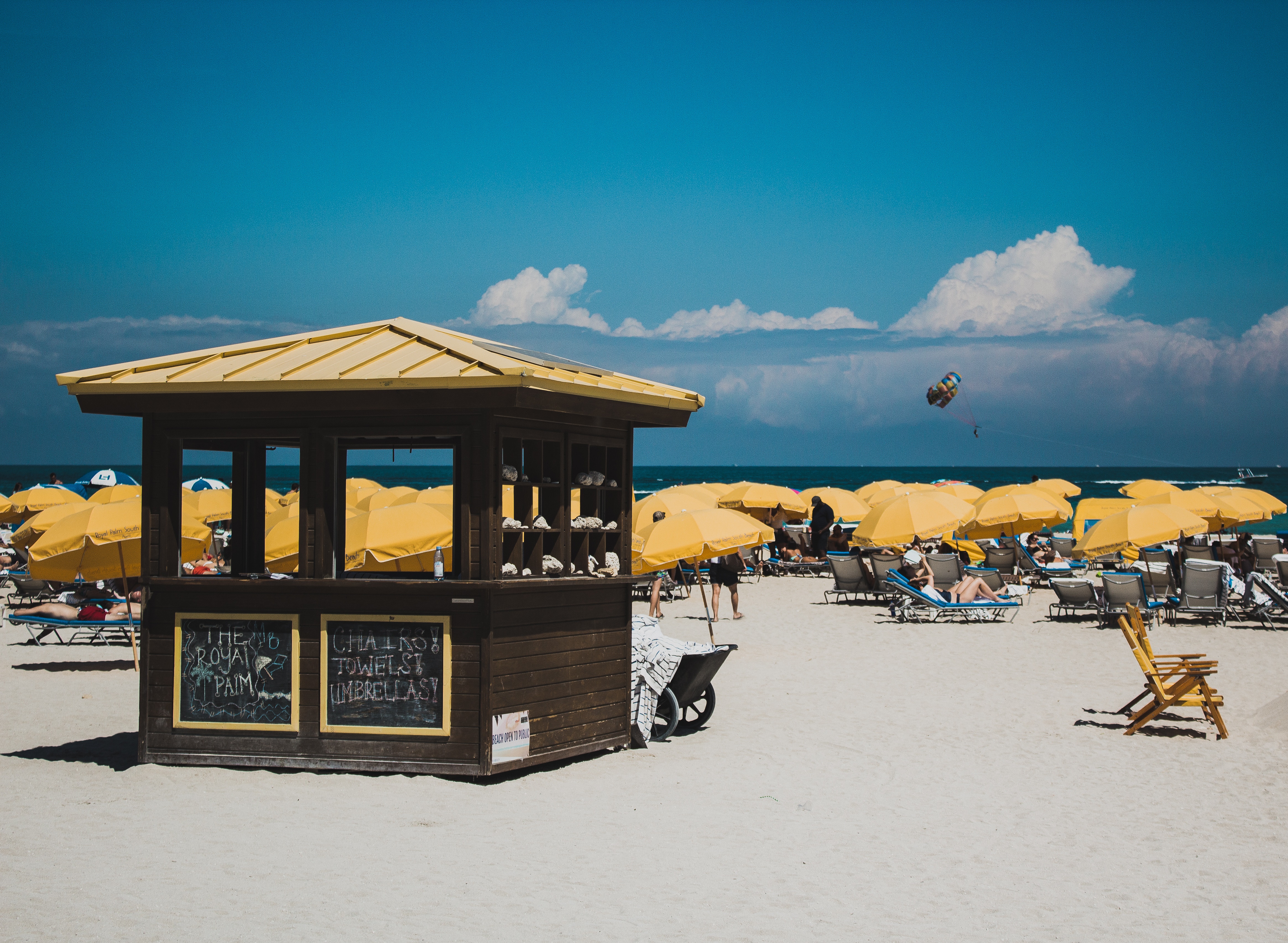
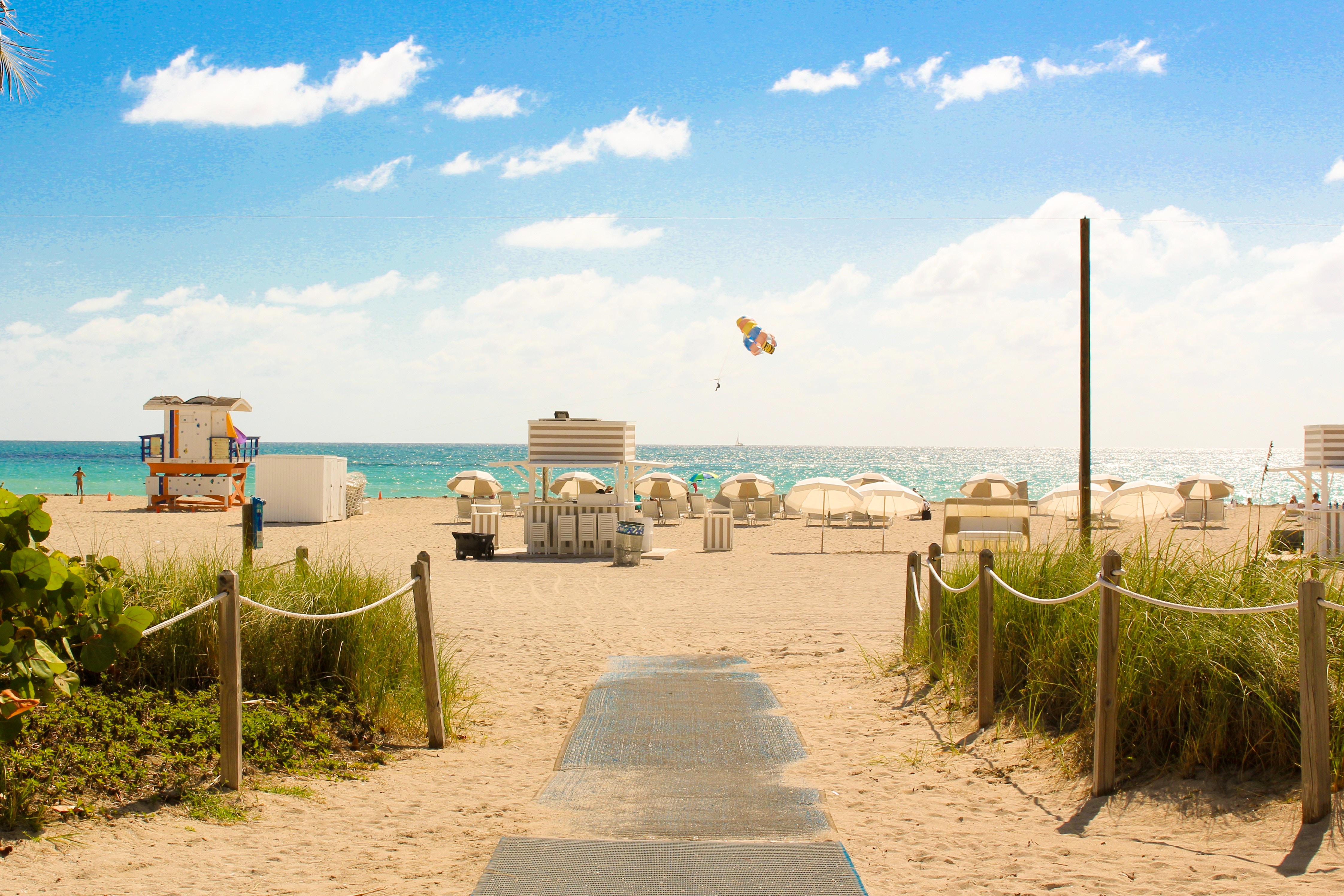
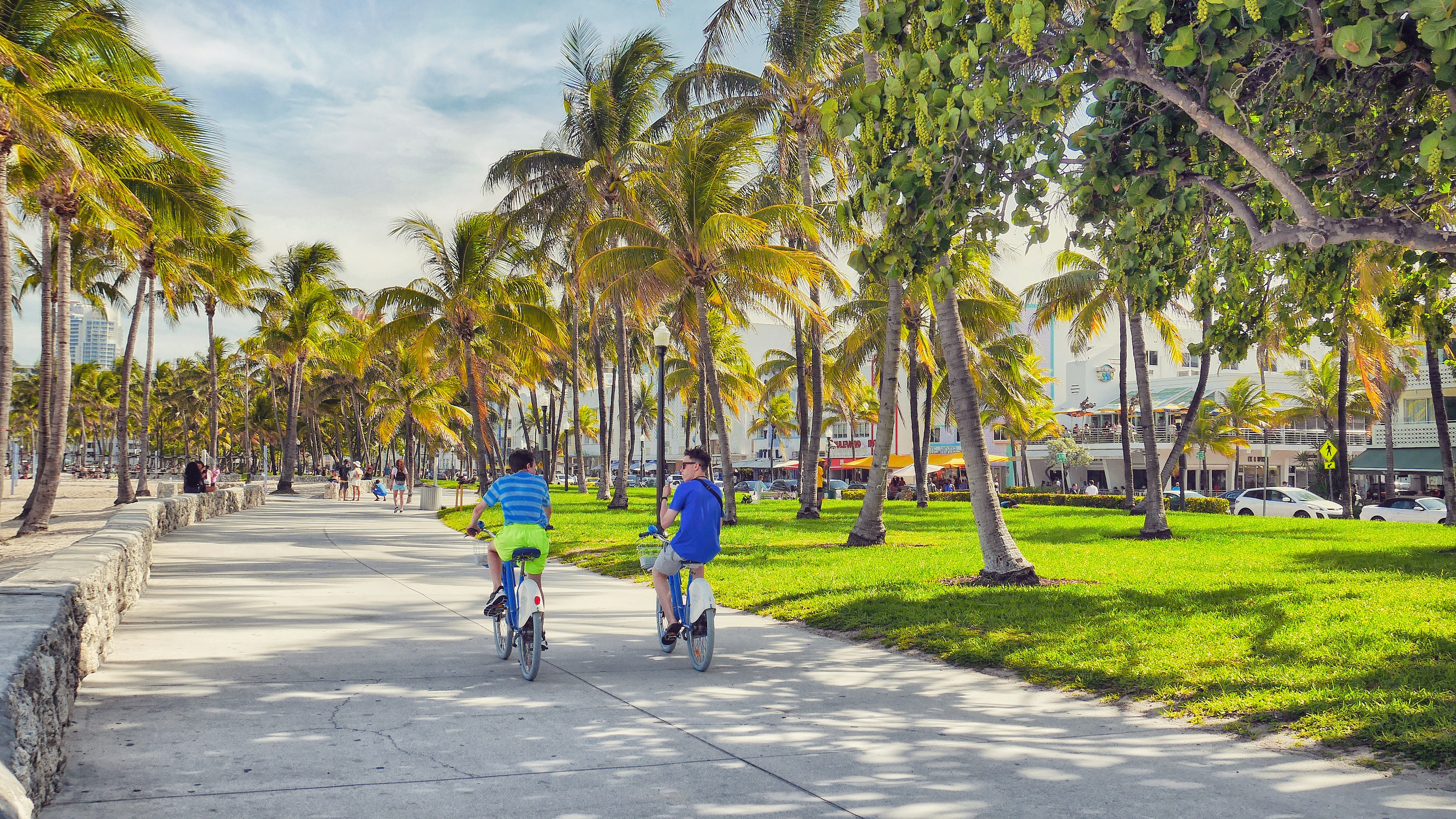
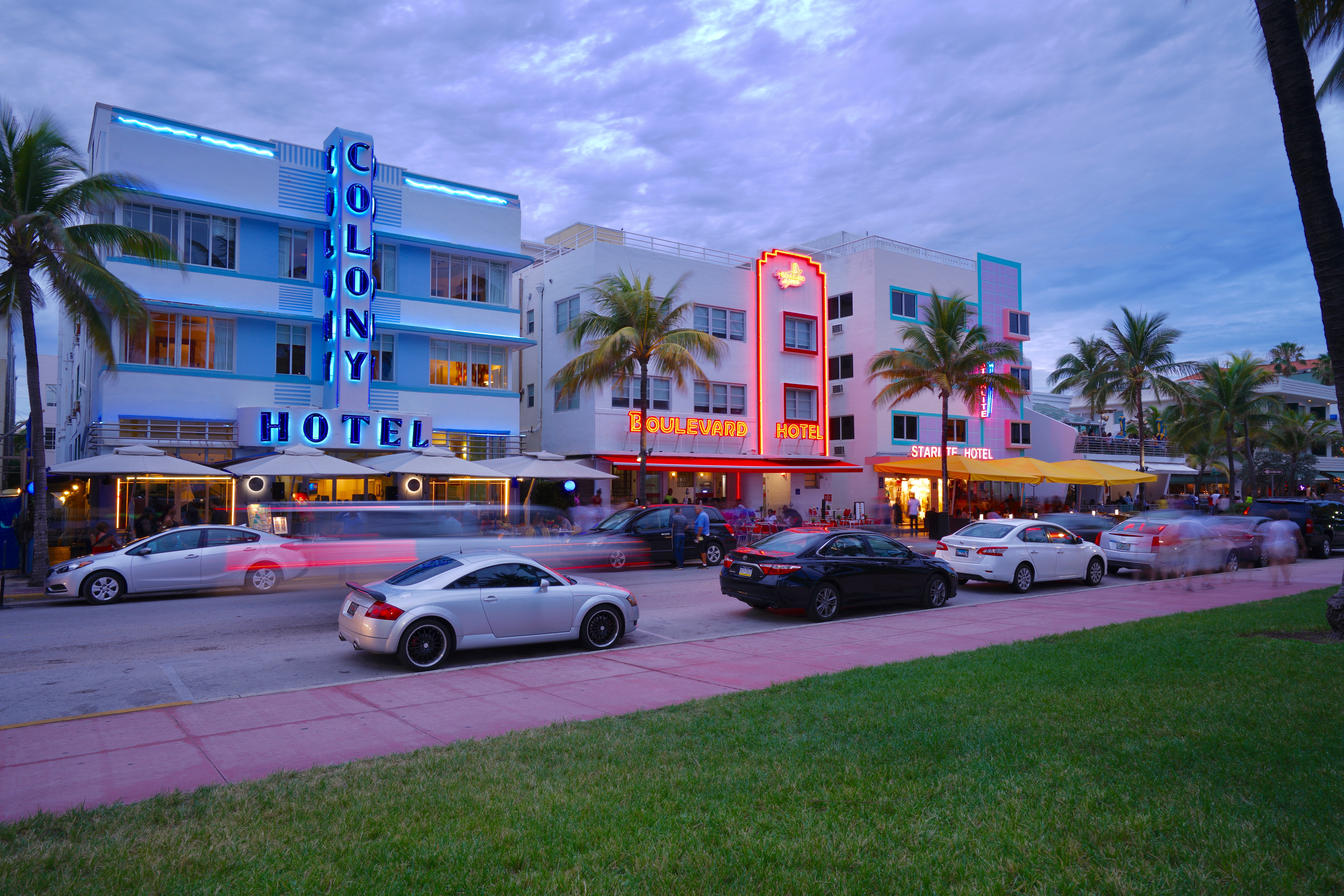
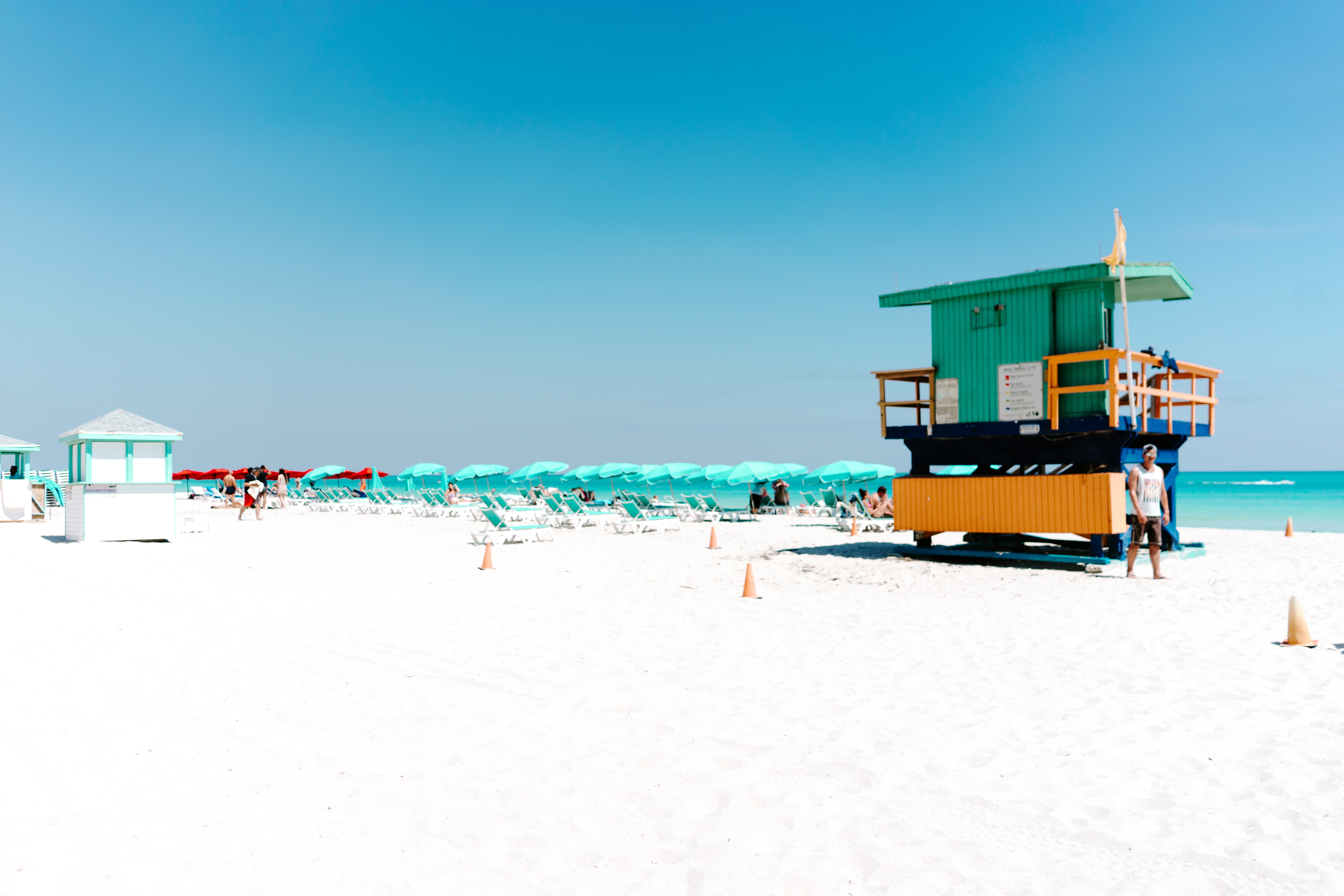
About Miami, Florida
Miami is one of the world’s most popular holiday spots. It has so much to offer; from its countless beach areas, to culture and museums, from spa and shopping days out, to endless cuban restaurants and cafes. Miami is a multicultural city that has something to offer to everyone.
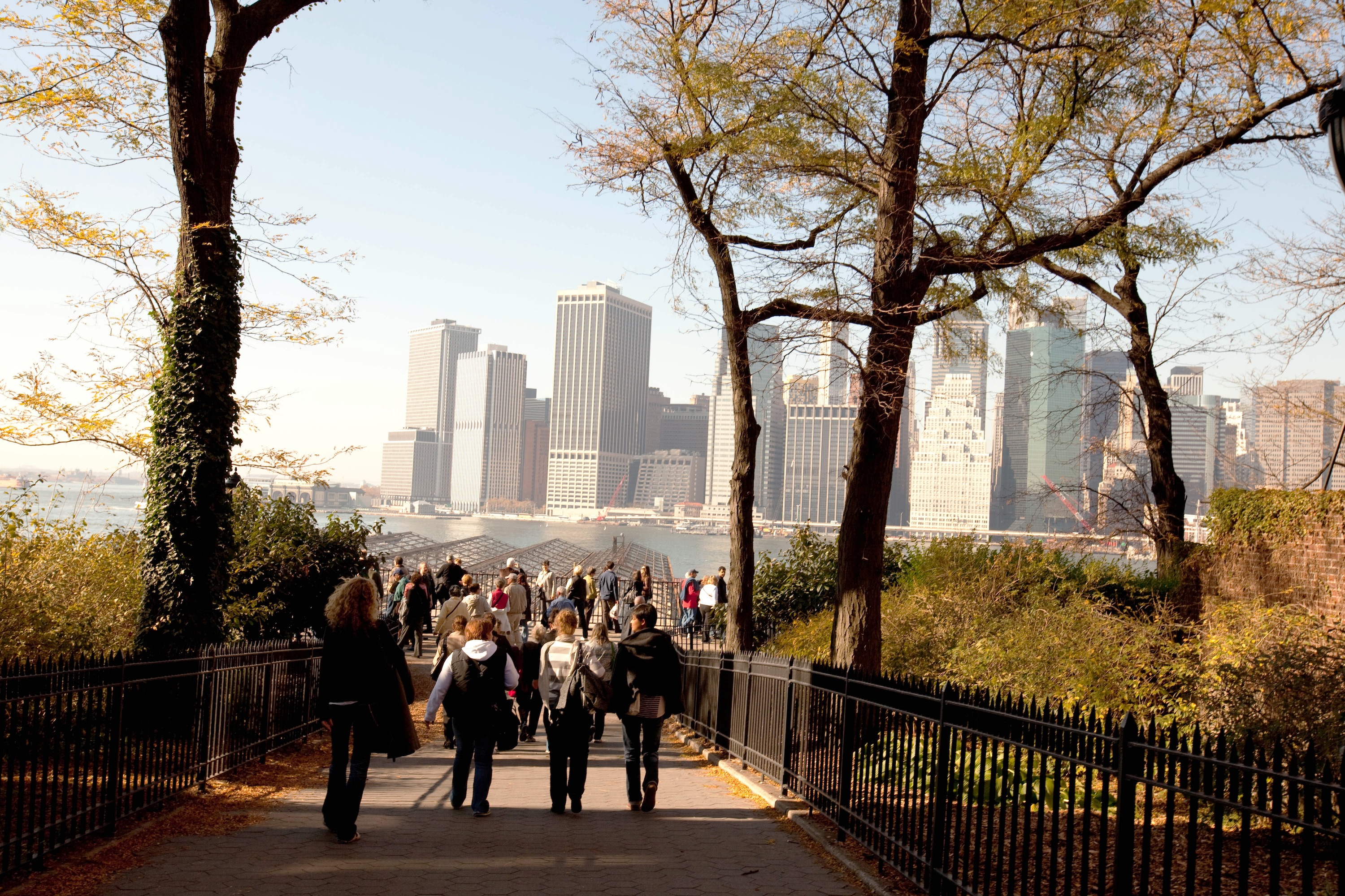
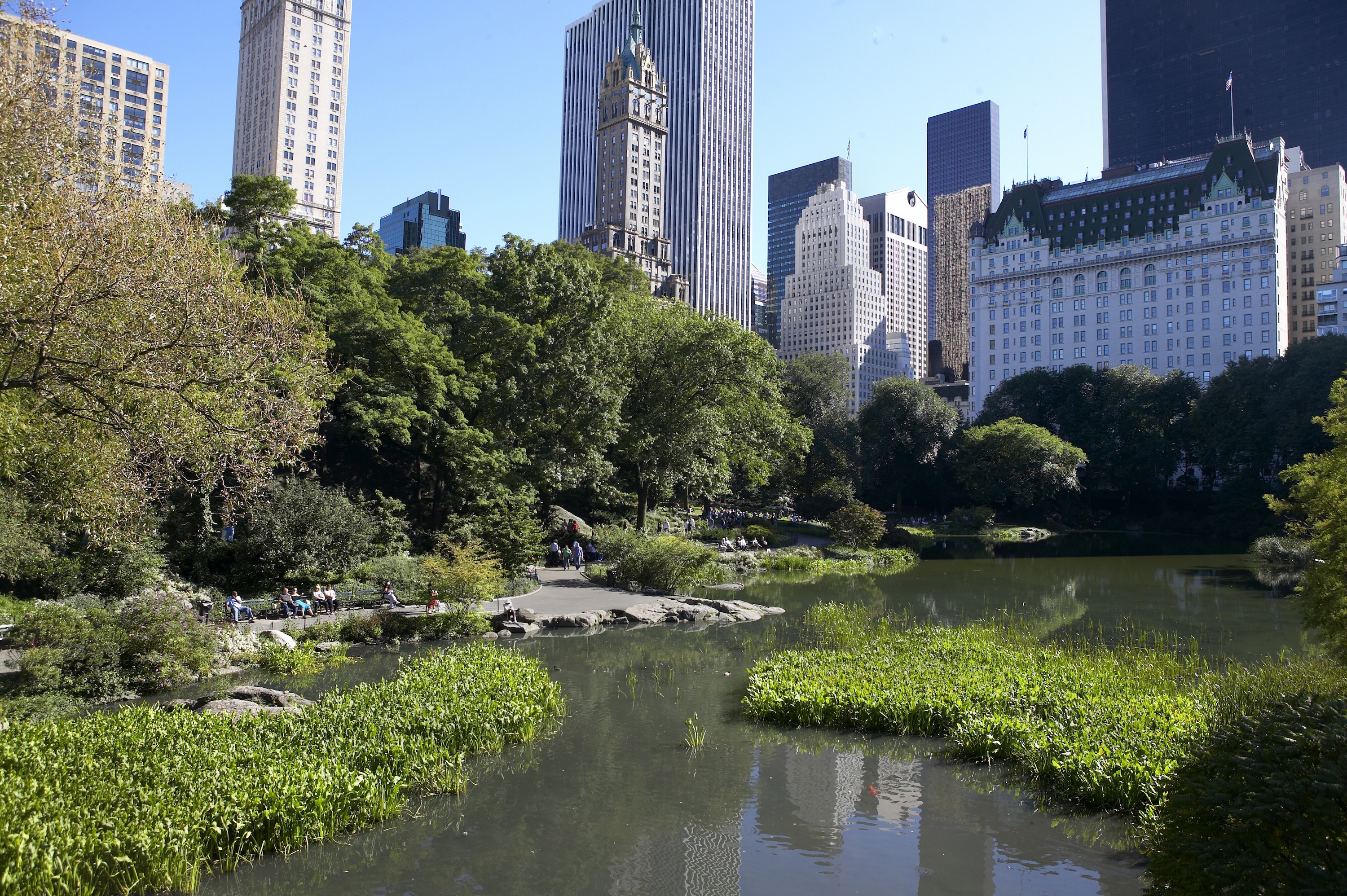
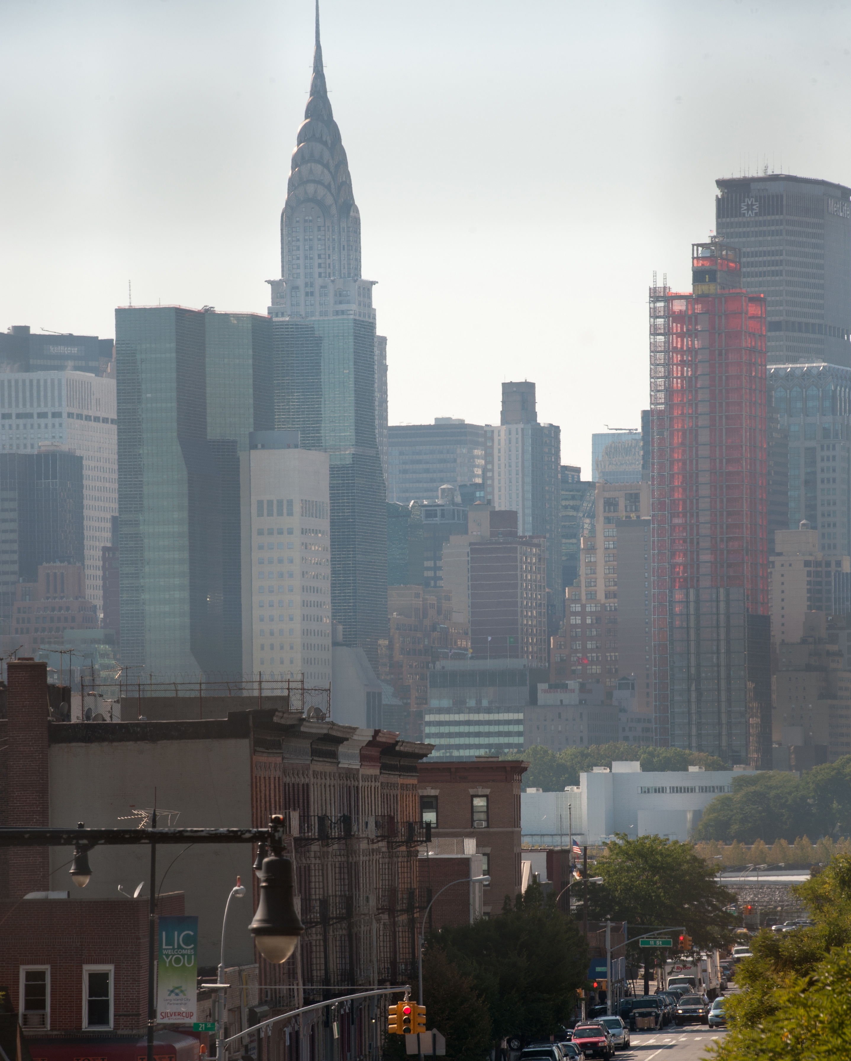
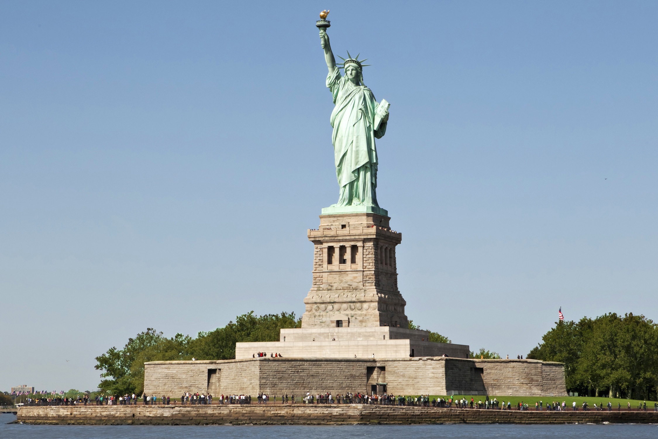
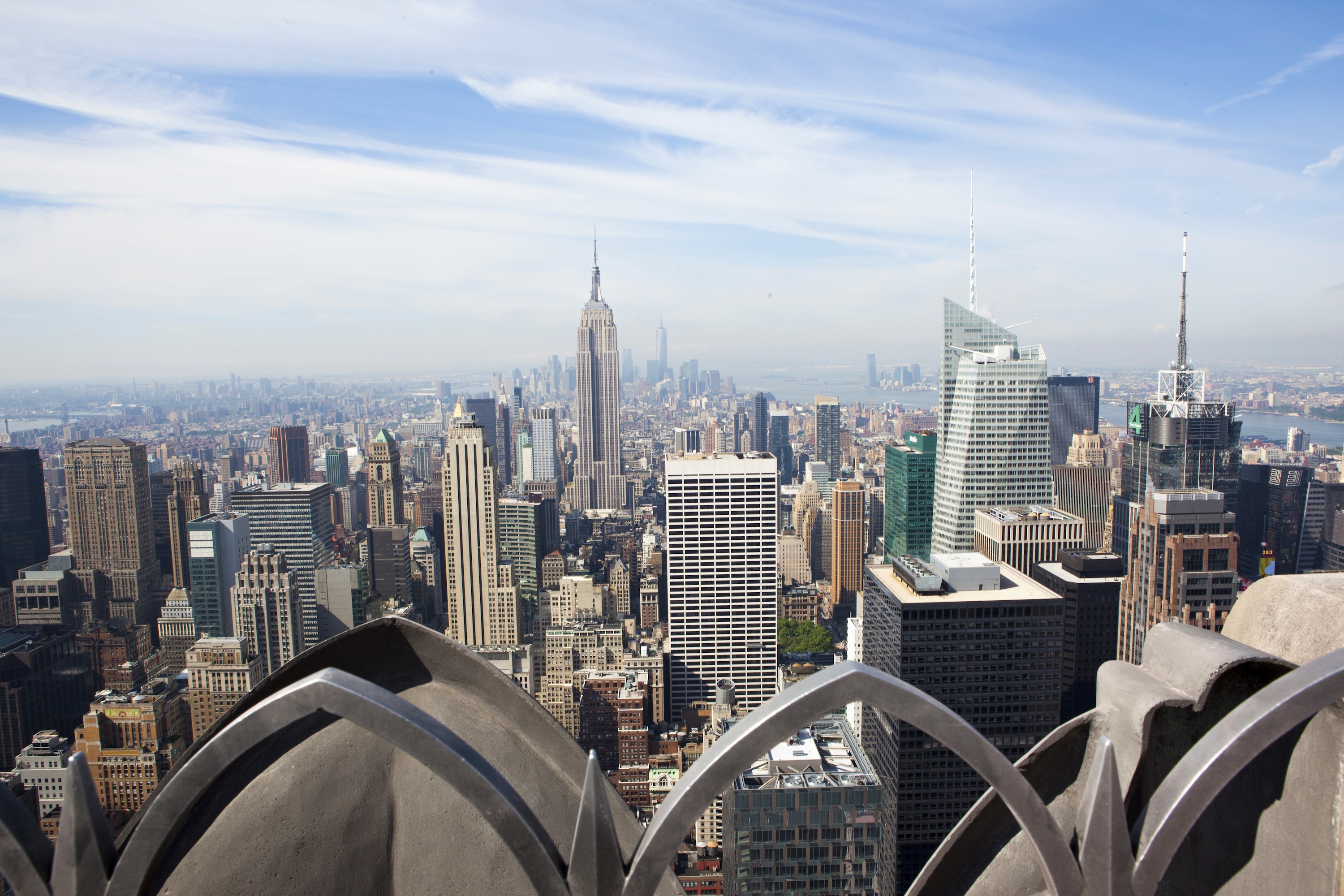
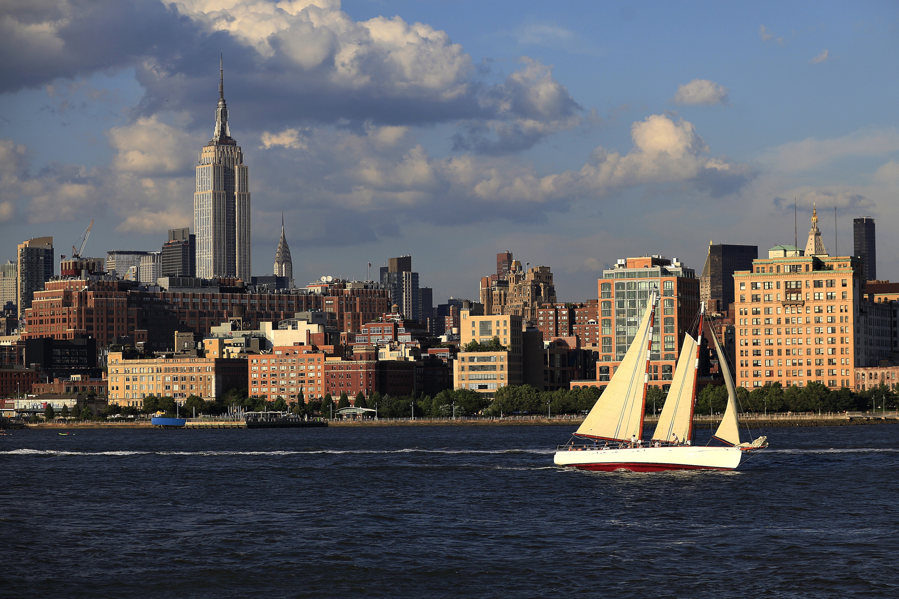
About New York, New York
From Wall Street's skyscrapers to the neon of Times Square to Central Park's leafy paths, New York City pulses with an irrepressible energy. History meets hipness in this global center of entertainment, fashion, media, and finance. World-class museums like MoMA and unforgettable icons like the Statue of Liberty beckon, but discovering the subtler strains of New York's vast ambition is equally rewarding: ethnic enclaves and shops, historic streets of dignified brownstones, and trendy bars and eateries all add to the urban buzz.

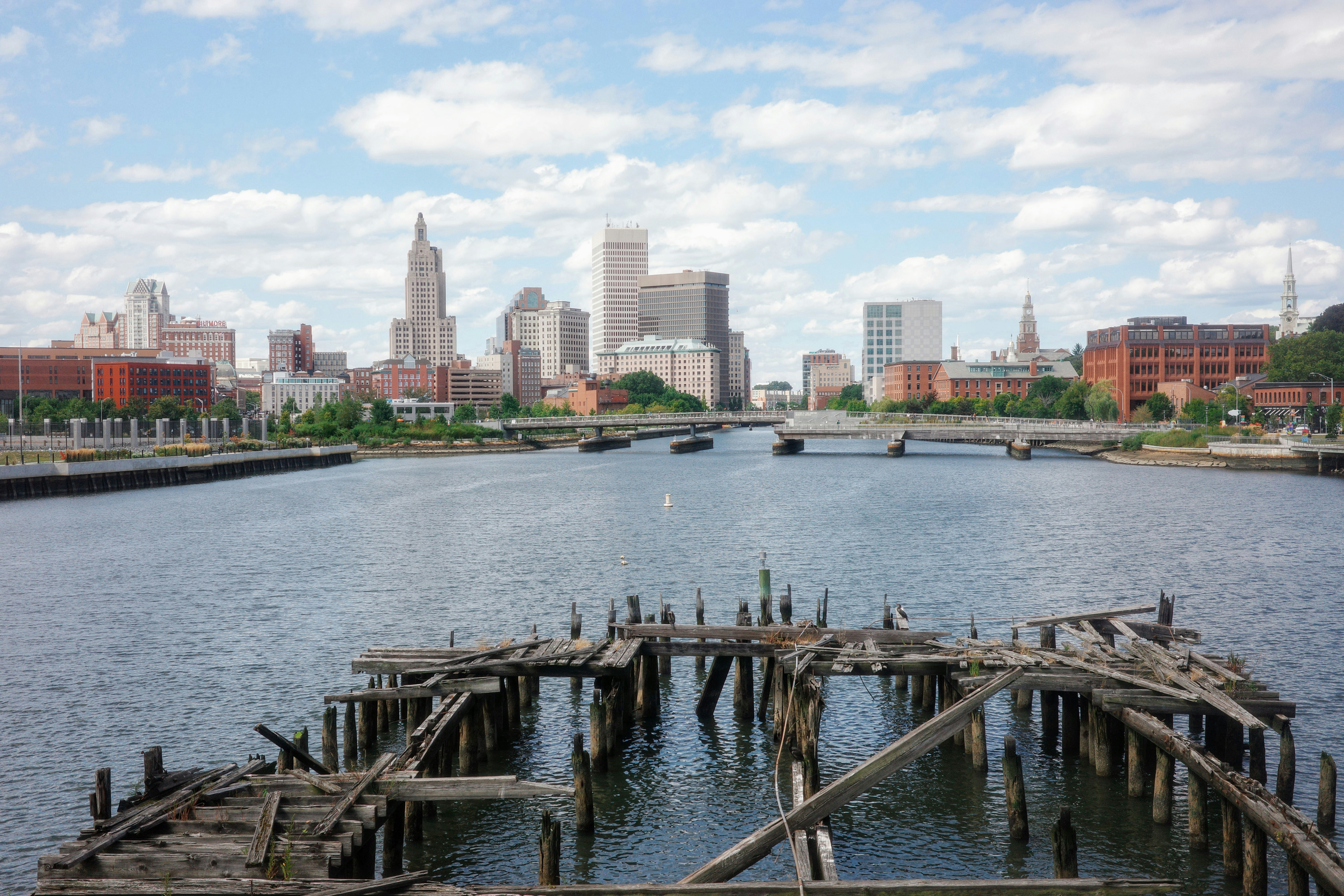
About Newport, Rhode Island
Established in 1639 by a small band of religious dissenters led by William Coddington and Nicholas Easton, the city by the sea became a haven for those who believed in religious freedom. Newport’s deepwater harbor at the mouth of Narragansett Bay ensured its success as a leading Colonial port, and a building boom produced hundreds of houses and many landmarks that still survive today. These include the Wanton-Lyman-Hazard House and the White Horse Tavern, both built during the 17th century, plus Trinity Church, Touro Synagogue, the Colony House, and the Redwood Library, all built in the 18th century.British troops occupied Newport from 1776–1779, causing half the city’s population to flee and ending a golden age of prosperity. The economic downturn that followed may not have been so great for its citizens but it certainly was for preserving Newport’s architectural heritage, as few had the capital to raze buildings and replace them with bigger and better ones. By the mid-19th century the city had gained a reputation as the summer playground for the very wealthy, who built enormous mansions overlooking the Atlantic. These so-called "summer cottages," occupied for only six to eight weeks a year by the Vanderbilts, Berwinds, Astors, and Belmonts, helped establish the best young American architects. The presence of these wealthy families also brought the New York Yacht Club, which made Newport the venue for the America’s Cup races beginning in 1930 until the 1983 loss to the Australians.The Gilded Age mansions of Bellevue Avenue are what many people associate most with Newport. These late-19th-century homes are almost obscenely grand, laden with ornate rococo detail and designed with a determined one-upmanship.Pedestrian-friendly Newport has so much else to offer in a relatively small geographical area— beaches, seafood restaurants, galleries, shopping, and cultural life. Summer can be crowded, but fall and spring are increasingly popular times of the year to visit.
About Boston, Massachusetts
There’s history and culture around every bend in Boston—skyscrapers nestle next to historic hotels while modern marketplaces line the antique cobblestone streets. But to Bostonians, living in a city that blends yesterday and today is just another day in beloved Beantown.


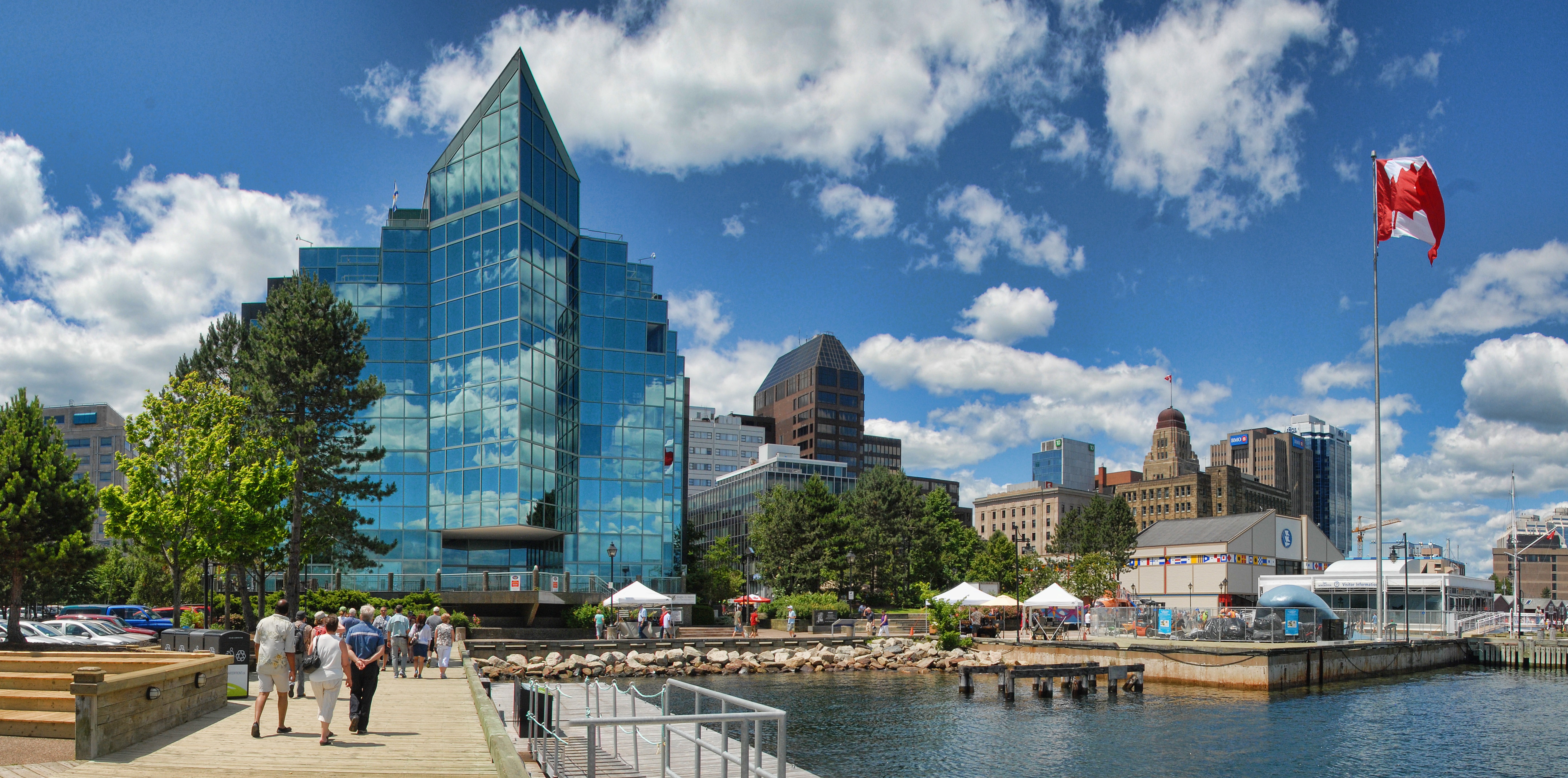
About Halifax, Nova Scotia
Surrounded by natural treasures and glorious seascapes, Halifax is an attractive and vibrant hub with noteworthy historic and modern architecture, great dining and shopping, and a lively nightlife and festival scene. The old city manages to feel both hip and historic. Previous generations had the foresight to preserve the cultural and architectural integrity of the city, yet students from five local universities keep it lively and current. It's a perfect starting point to any tour of the Atlantic provinces, but even if you don't venture beyond its boundaries, you will get a real taste of the region.It was Halifax’s natural harbor—the second largest in the world after Sydney, Australia’s—that first drew the British here in 1749, and today most major sites are conveniently located either along it or on the Citadel-crowned hill overlooking it. That’s good news for visitors because this city actually covers quite a bit of ground.Since amalgamating with Dartmouth (directly across the harbor) and several suburbs in 1996, Halifax has been absorbed into the Halifax Regional Municipality, and the HRM, as it is known, has around 415,000 residents. That may not sound like a lot by U.S. standards, but it makes Nova Scotia’s capital the most significant Canadian urban center east of Montréal.There's easy access to the water, and despite being the focal point of a busy commercial port, Halifax Harbour doubles as a playground, with one of the world's longest downtown boardwalks. It's a place where container ships, commuter ferries, cruise ships, and tour boats compete for space, and where workaday tugs and fishing vessels tie up beside glitzy yachts. Like Halifax as a whole, the harbor represents a blend of the traditional and the contemporary.
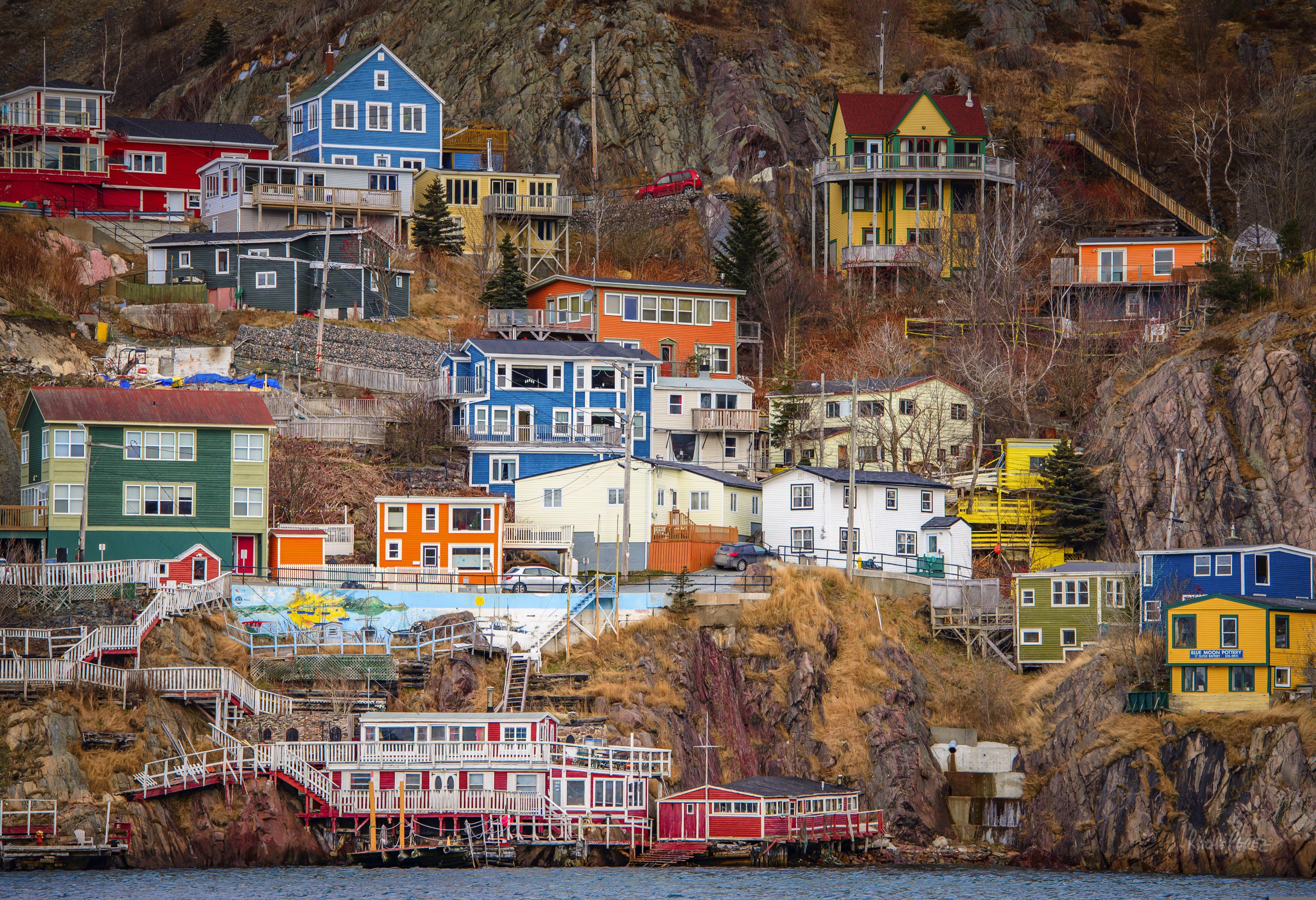
About Saint-John's, Newfoundland and Labrador
Old meets new in the province's capital (metro-area population a little more than 200,000), with modern office buildings surrounded by heritage shops and colorful row houses. St. John's mixes English and Irish influences, Victorian architecture and modern convenience, and traditional music and rock and roll into a heady brew. The arts scene is lively, but overall the city moves at a relaxed pace.For centuries, Newfoundland was the largest supplier of salt cod in the world, and St. John's Harbour was the center of the trade. As early as 1627, the merchants of Water Street—then known as the Lower Path—were doing a thriving business buying fish, selling goods, and supplying alcohol to soldiers and sailors.
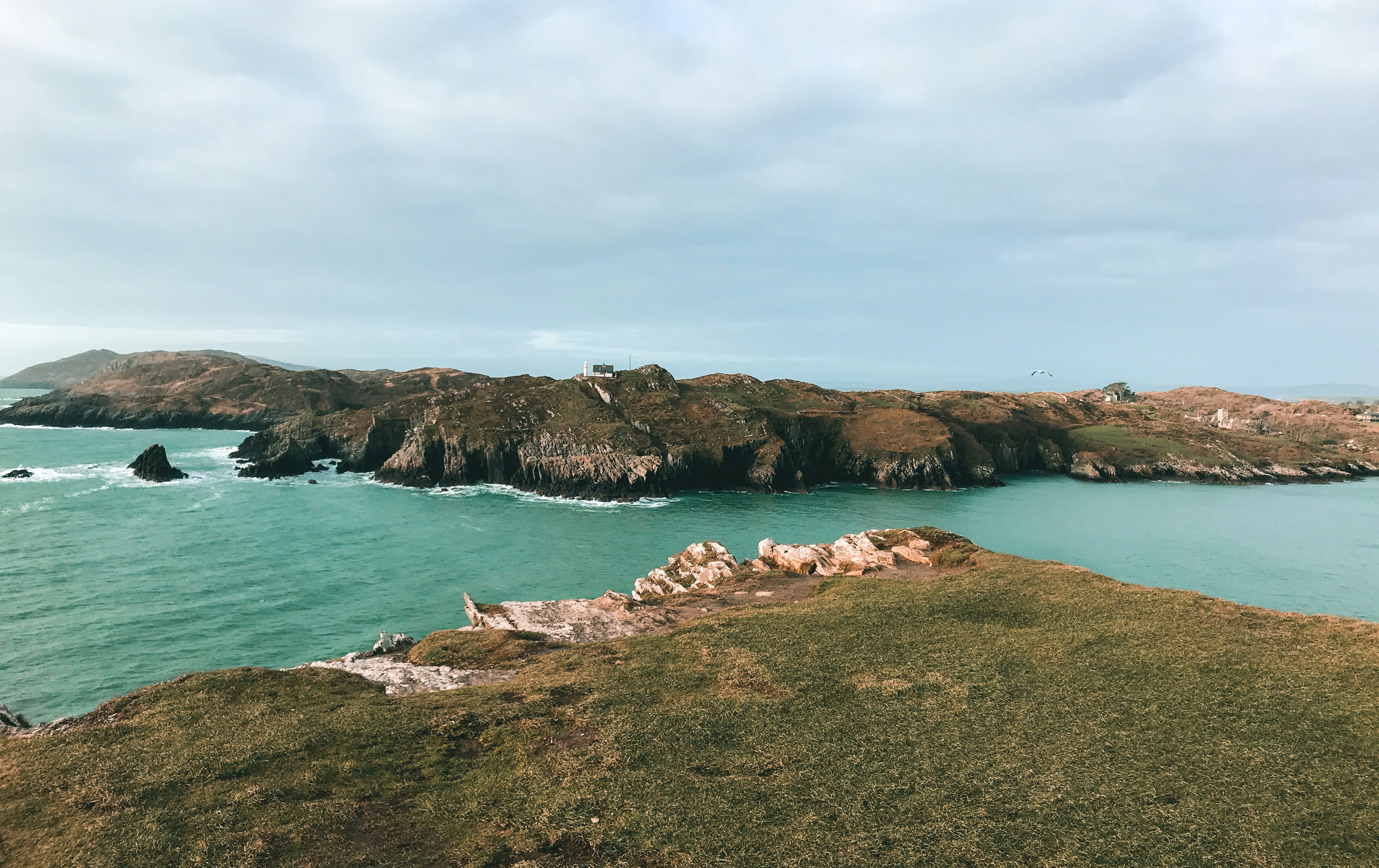
About Cork
Cork City received its first charter in 1185 from Prince John of Norman England, and it takes its name from the Irish word corcaigh, meaning "marshy place." The original 6th-century settlement was spread over 13 small islands in the River Lee. Major development occurred during the 17th and 18th centuries with the expansion of the butter trade, and many attractive Georgian-design buildings with wide bowfront windows were constructed during this time. As late as 1770 Cork's present-day main streets—Grand Parade, Patrick Street, and the South Mall—were submerged under the Lee. Around 1800, when the Lee was partially dammed, the river divided into two streams that now flow through the city, leaving the main business and commercial center on an island, not unlike Paris's Île de la Cité. As a result, the city has a number of bridges and quays, which, although initially confusing, add greatly to the port's unique character. Cork can be very "Irish" (hurling, Gaelic football, televised plowing contests, music pubs, and peat smoke). But depending on what part of town you're in, Cork can also be distinctly un-Irish—the sort of place where hippies, gays, and farmers drink at the same pub.
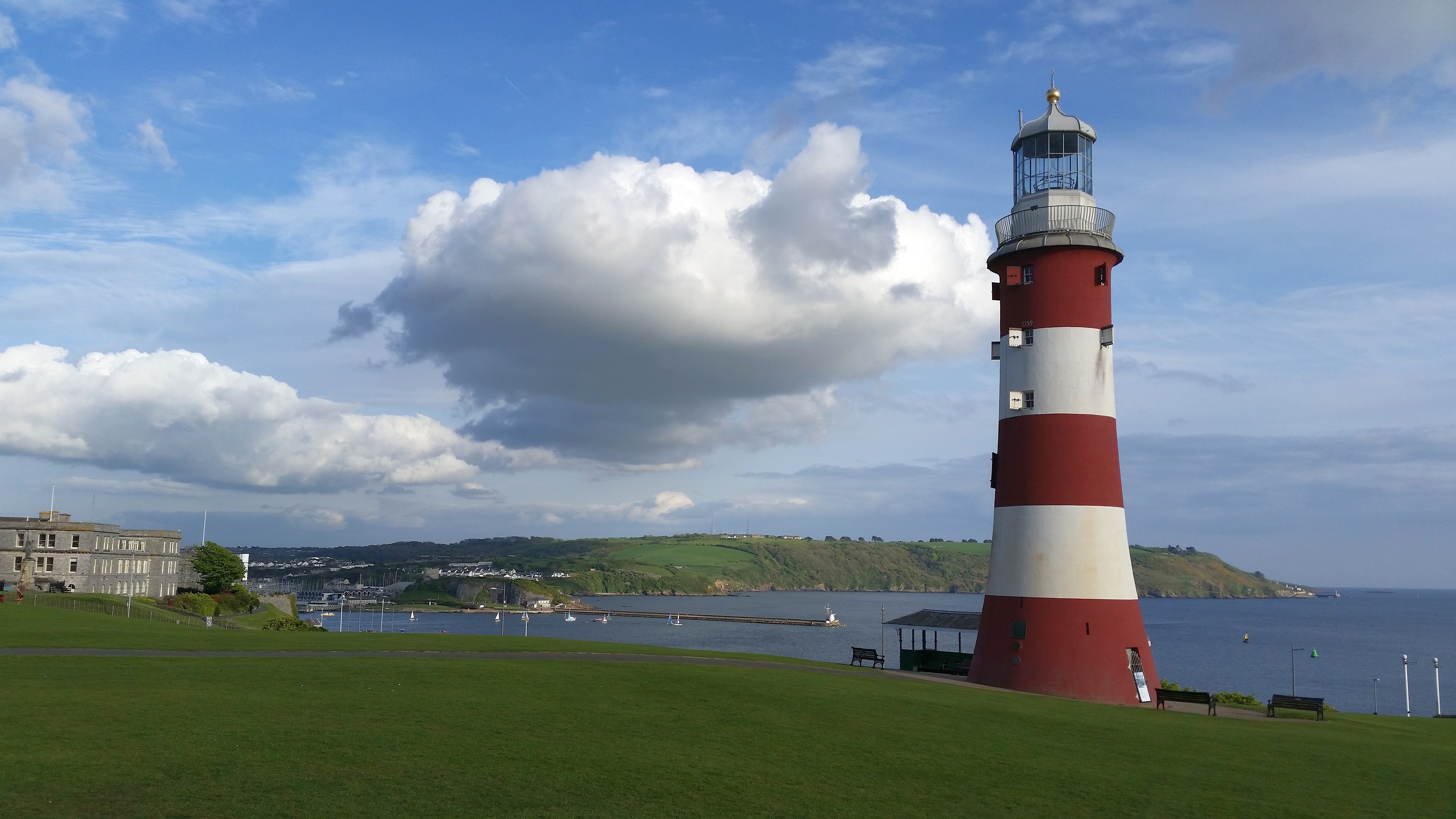
About Plymouth
Best known as the port from which Sir Francis Drake and the port which the Pilgrim Fathers set sail from, Plymouth is awash with history. Walk down its cobbled streets, step back in time and discover the historical landmarks and sites.
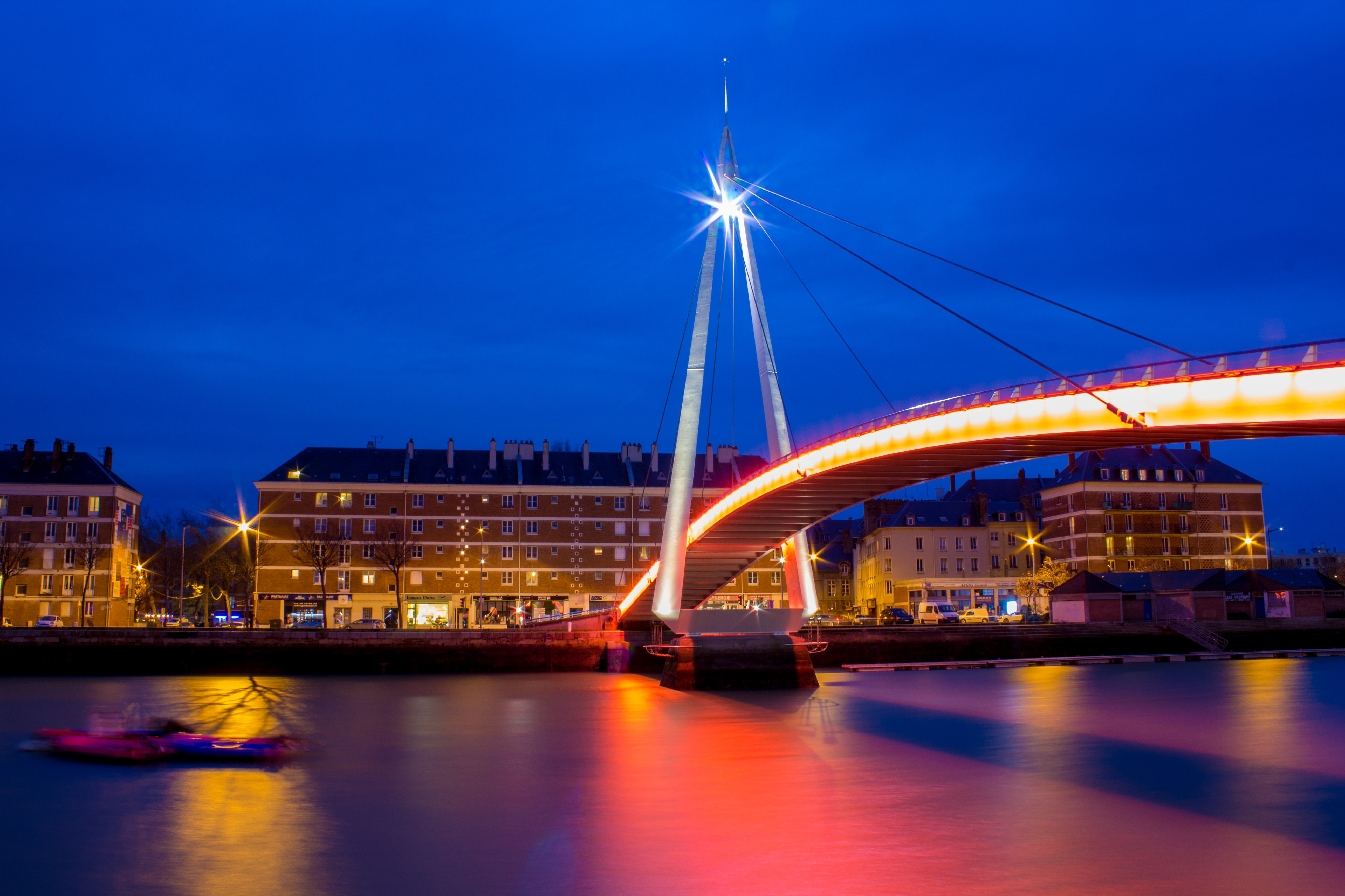
About Le Havre
Le Havre, founded by King Francis I of France in 1517, is located inUpper Normandy on the north bank of the mouth of the River Seine, which isconsidered the most frequented waterway in the world. Its port is ranked thesecond largest in France. The city was originally built on marshland andmudflats that were drained in the 1500’s. During WWII most of Le Havre wasdestroyed by Allied bombing raids. Post war rebuilding of the city followed thedevelopment plans of the well-known Belgian architect Auguste Perre. Thereconstruction was so unique that the entire city was listed as a UNESCO WorldHeritage Site in 2005.
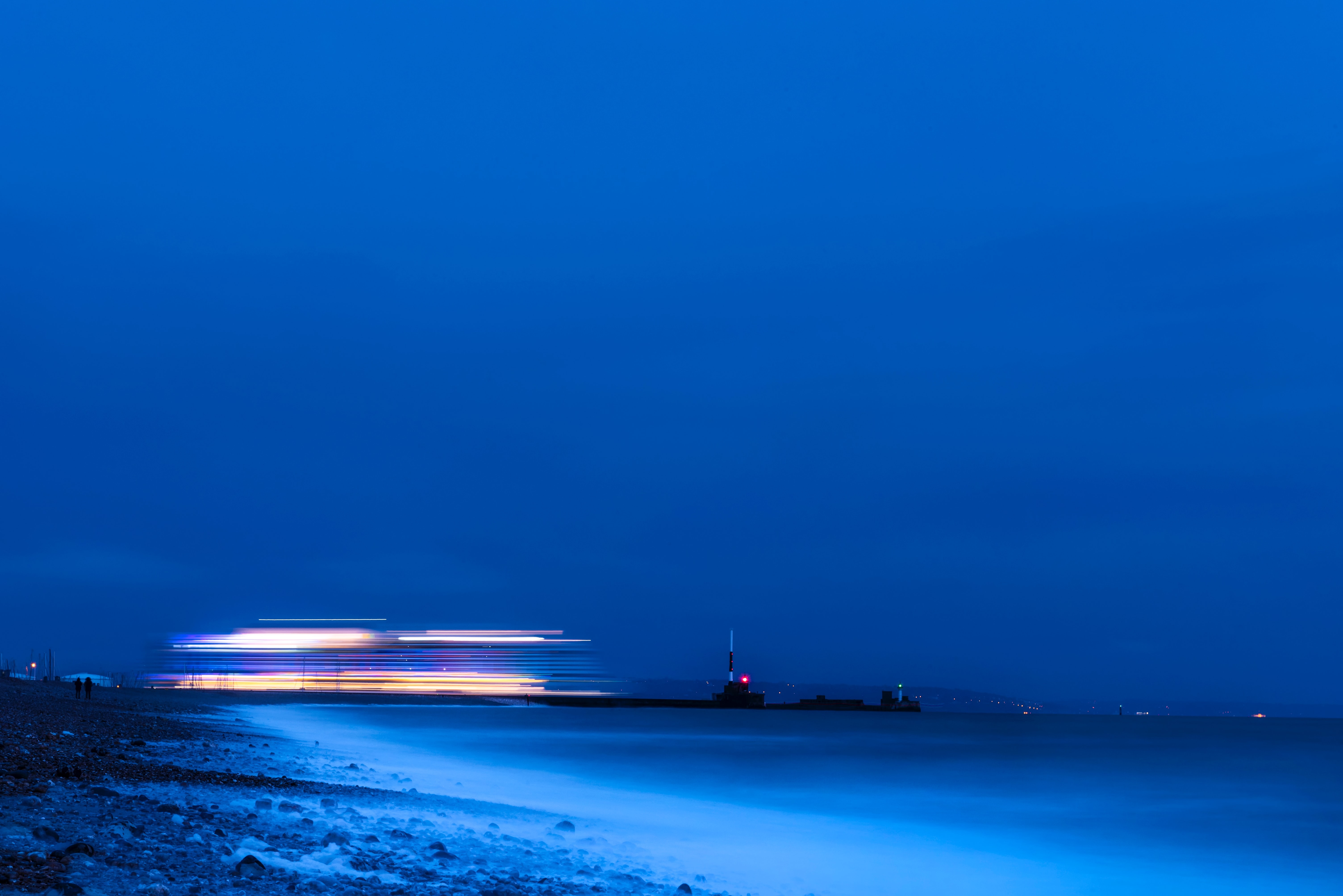
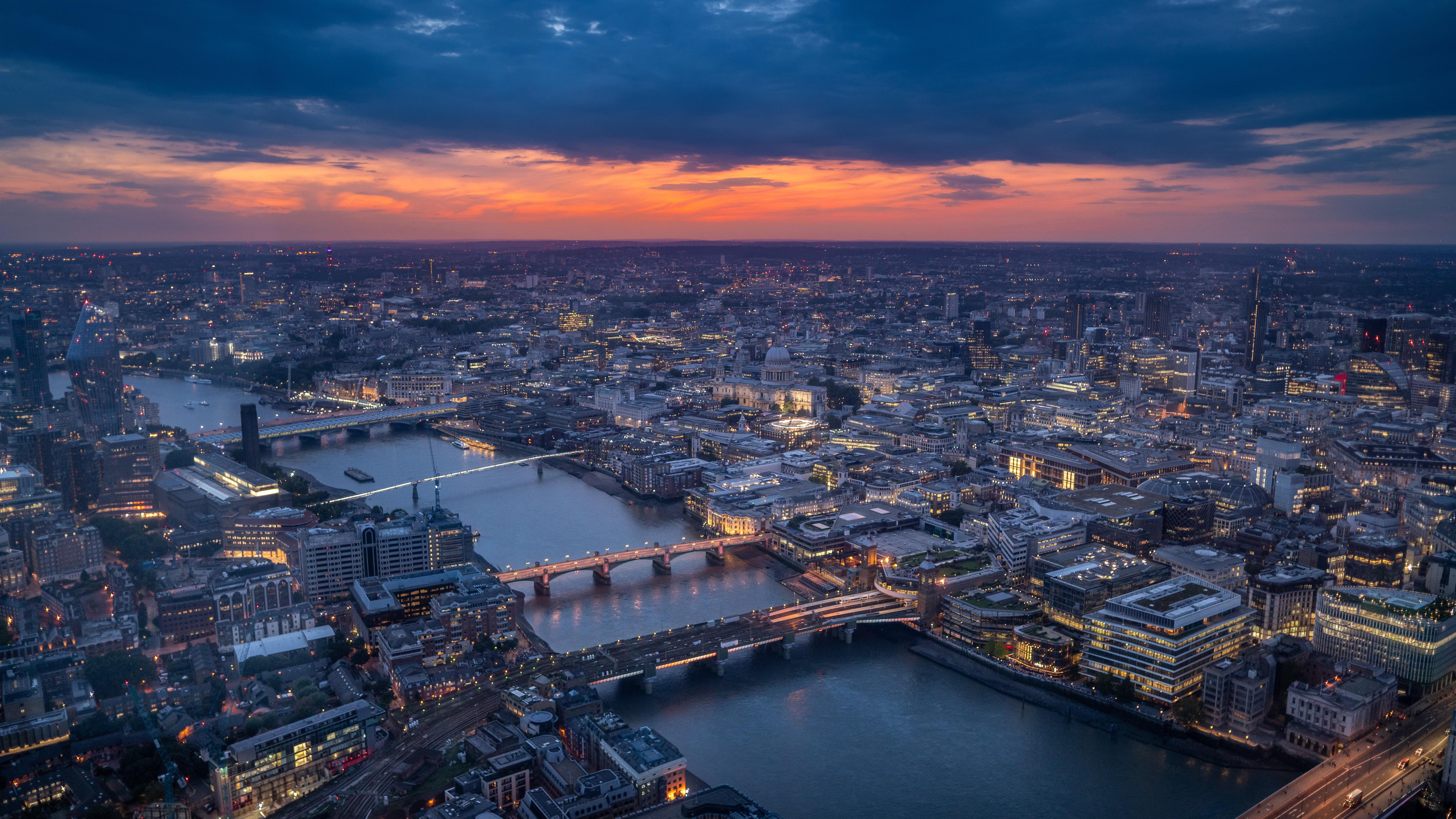
About Tilbury
Just 22 nautical miles down river from the Tower Bridge in London, Tilbury is a popular turnaround port for cruises visiting Baltic and Northern European destinations.
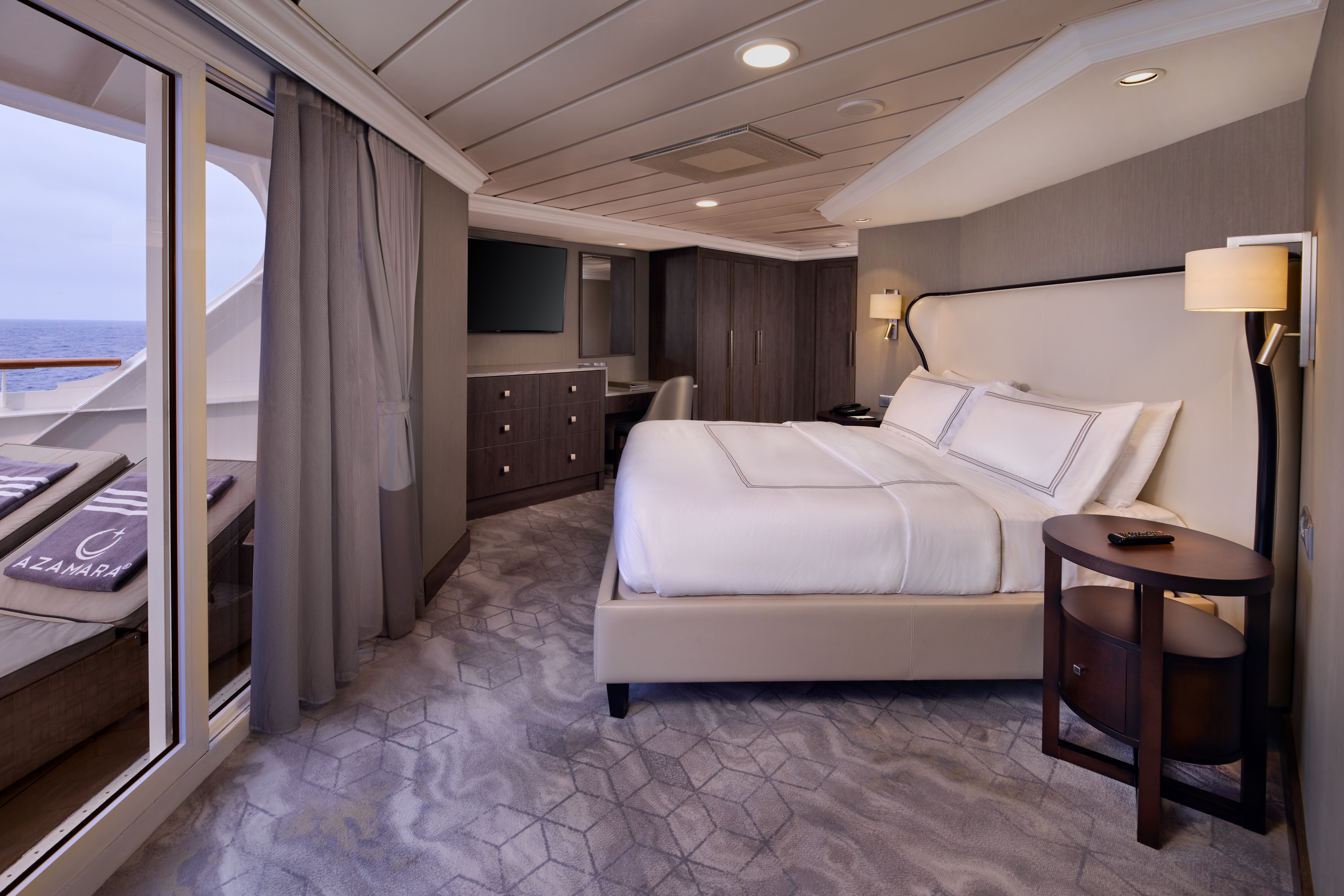
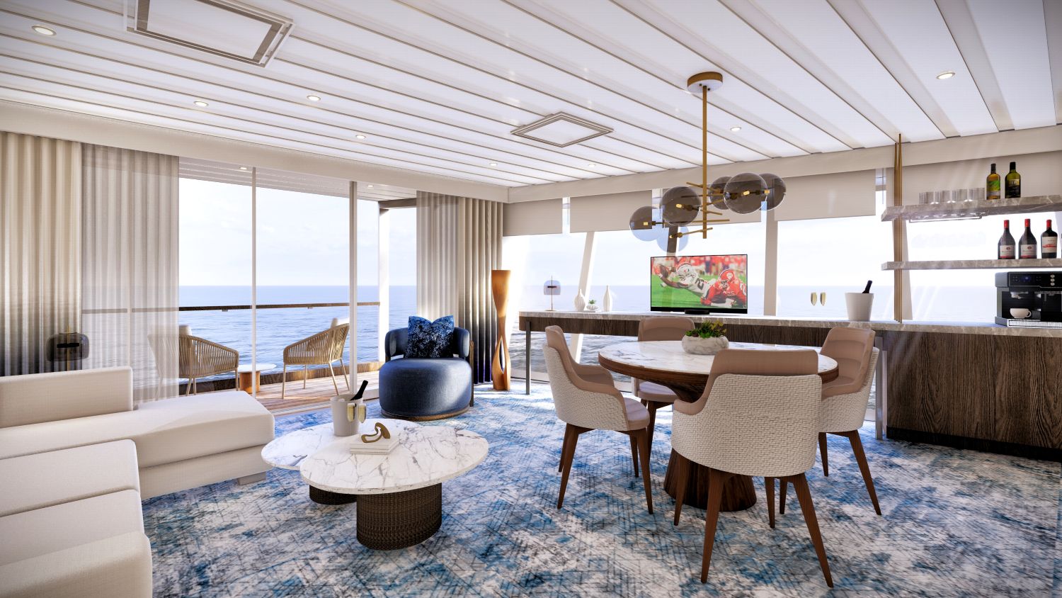
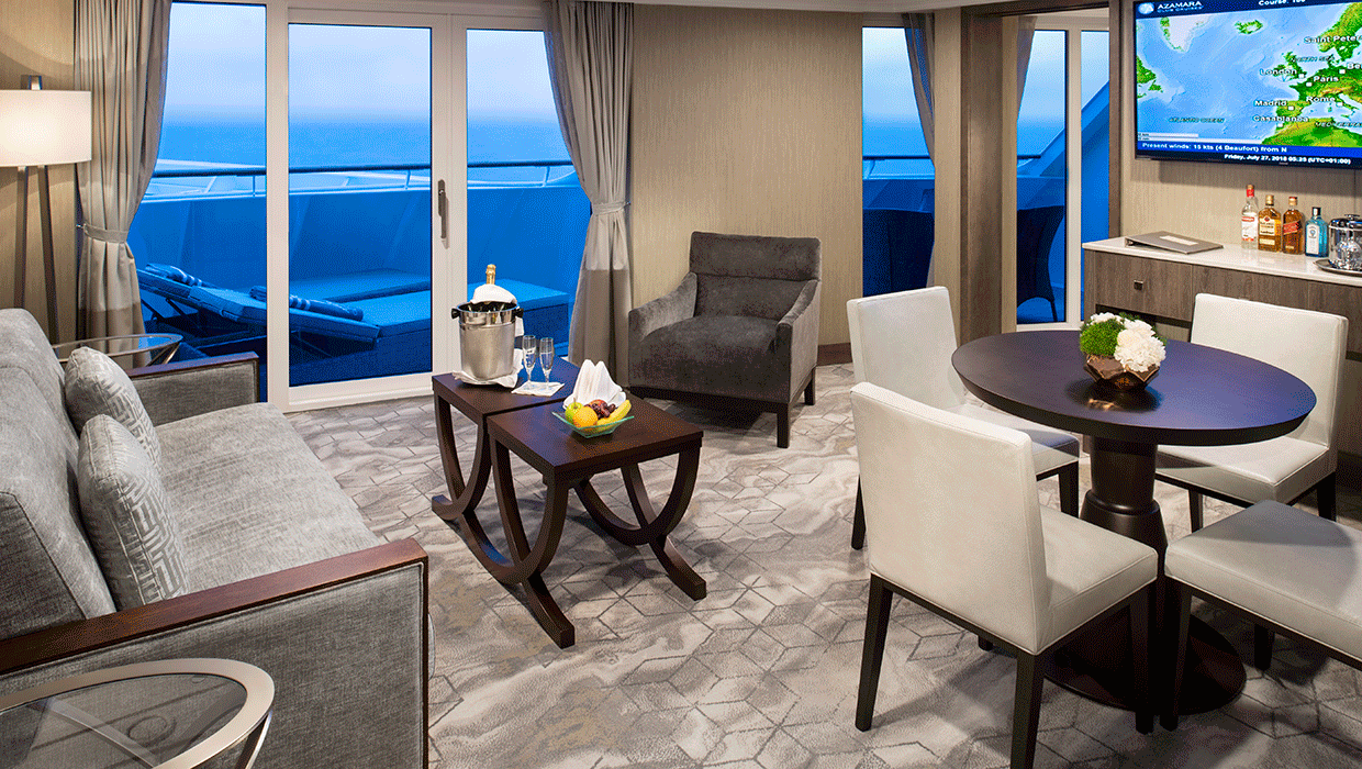
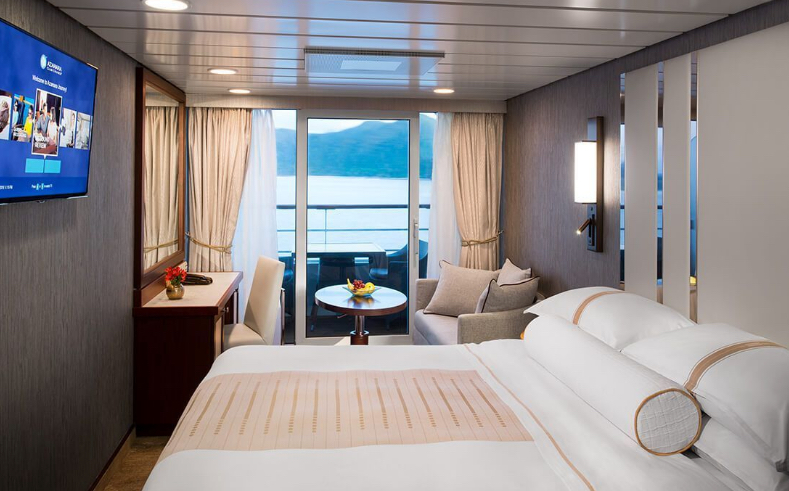
A signature expression of Azamara Cruises' refined luxury, the World Owner's Suite features a spacious layout, a separate bedroom, and a large private veranda. Thoughtfully designed for guests who value privacy, comfort, and elevated living.
Suite Features
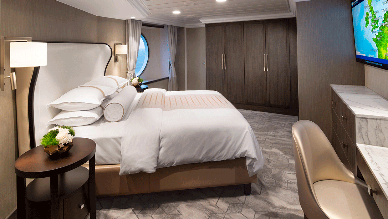
- Spacious living room with a separate master bedroom
- Master bedroom with one queen size bed and a flatscreen television
- Flat-screen television in living room
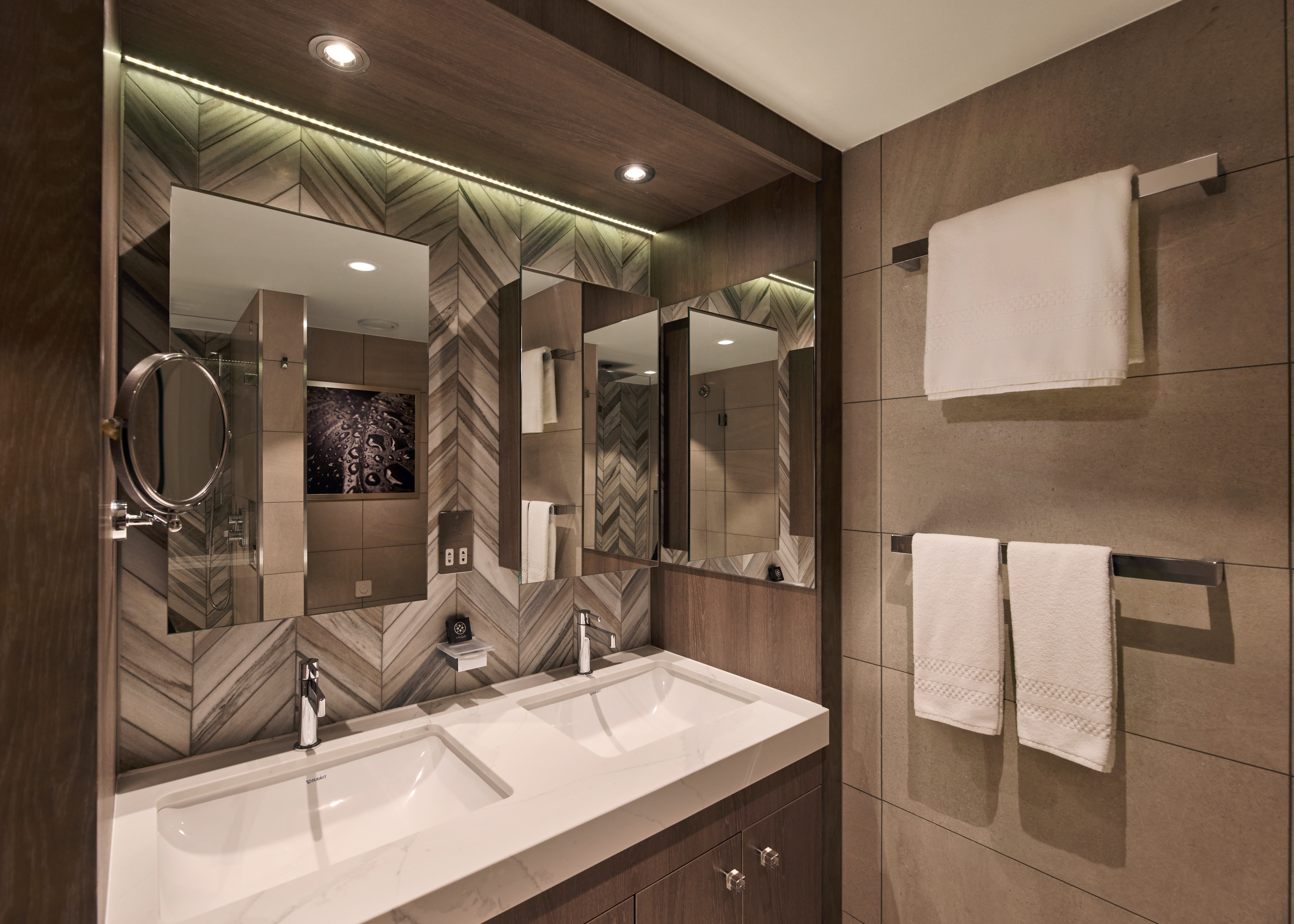
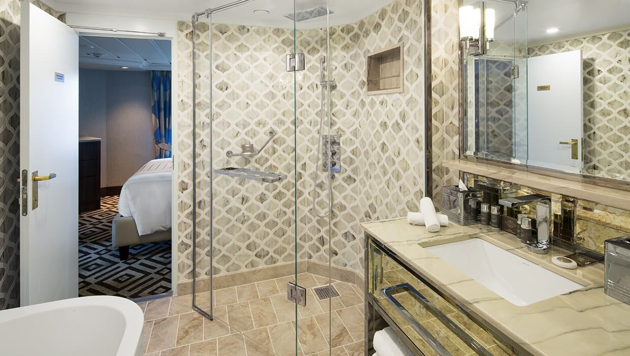
- Marble master bathroom with shower. Journey, Onward, and Quest suites feature a tub.
- Dressing room with vanity and ample closet space
- Floor-to-ceiling sliding glass doors in living room and master bedroom
- Mini-bar
- Thermostat-controlled air conditioner
- Direct-dial telephone with voice mail
- Writing desk
- In-room safe
- Hand-held hair dryer
- Stateroom: 560 sq. ft. (52 sq. m.) Veranda: 233 sq. ft. (21.7 sq. m.)
Included Amenities
- Ultimate Beverage Package
- Unlimited Standard Starlink Wi-Fi
- Unlimited Wash and Press
- Dedicated butler and concierge service
- Full in-suite dining and daily evening hors d'oeuvres
- Complimentary Specialty Dining and exclusive breakfast at Aqualina
- In-room premium spirits and champagne
- Thalassotherapy Pool access
- Personalized assistance planning spa appointments and shore excursions
- Priority check-in
- Luxurious cotton bed linens with duvet
- Terry bathrobes
- 24-hour room service
- Tote bag
- Use of umbrella
- Shoeshine service
- Turndown treats
- Afternoon In-Suite Tea Service
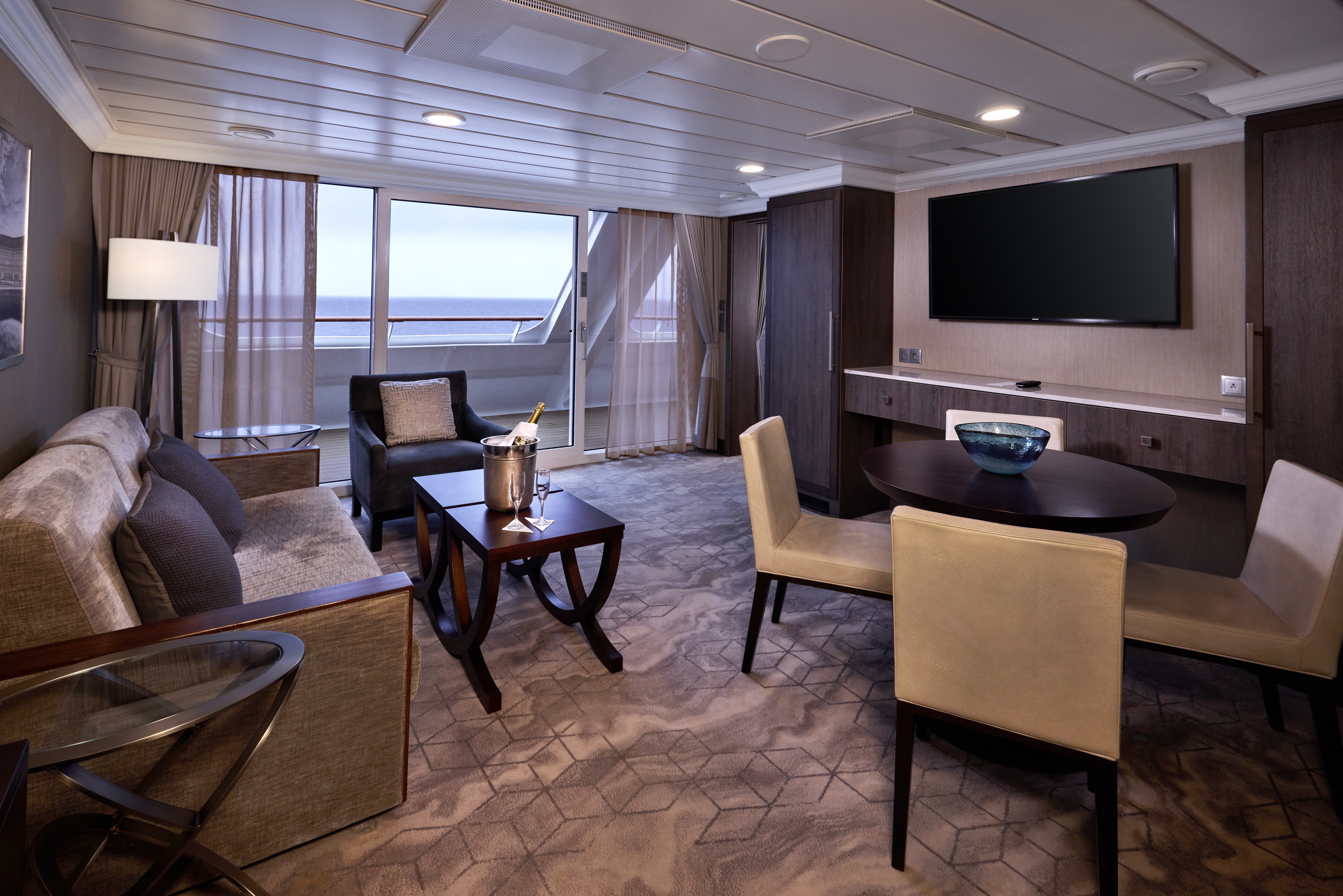

The Panorama Suite introduces a new pinnacle of onboard living, offering expansive interiors, generous living and dining space, and sweeping panoramic views. Designed for guests seeking the most immersive and elevated suite experience at sea.
Suite Features
Spacious living room with a separate master bedroom
- Master bedroom with one queen size bed with a 55" flatscreen television
- 55" flat-screen television in living room
- Marble master bathroom with shower.
- Dressing room with vanity and ample closet space
- Floor-to-ceiling sliding glass doors in living room and master bedroom
- Mini-bar
- Thermostat-controlled air conditioner
- Direct-dial telephone with voice mail
- Writing desk
- In-room safe
- Hand-held hair dryer
- Stateroom: 656 sq. ft. (61 sq. m.) Veranda: 63.5 sq. ft. (5.9 sq. m.)
- Ultimate Beverage Package
- Personalized assistance planning spa appointments and
- Unlimited Standard Starlink Wi-Fi shore excursions
- Unlimited Wash and Press
- Priority check-in
- Luxurious cotton bed linens with duvet
- Dedicated butler and concierge service
- Terry bathrobes
- Full in-suite dining and daily evening hors d'oeuvres
- 24-hour room service
- Complimentary Specialty Dining and exclusive breakfast at Aqualina
- Tote bag
- Use of umbrella
- In-room premium spirits and champagne
- Shoeshine service
- Thalassotherapy Pool access
- Turndown treats
- Afternoon In-Suite Tea Service
The Ocean Suite offers generous space to relax, with a separate living area, a dedicated bedroom, and a private veranda. An inviting retreat that balances comfort, functionality, and classic suite-style living.
Suite Features
- Spacious living room with a separate master bedroom
- Master bedroom with one queen size bed with a flatscreen television
- Flat-screen television in living room
- Marble master bathroom with shower. Journey and Quest suites feature a tub.
- Dressing room with vanity and ample closet space
- Floor-to-ceiling sliding glass doors in living room and master bedroom
- Mini-bar
- Thermostat-controlled air conditioner
- Direct-dial telephone with voice mail
- Writing desk
- In-room safe
- Hand-held hair dryer
- Stateroom: 440-501 sq. ft. (40.9-46.5 sq. m.) Veranda: 233 sq. ft. (21.7 sq. m.)
Included Amenities
- Ultimate Beverage Package
- Unlimited Standard Starlink Wi-Fi
- Personalized assistance planning spa appointments and shore excursions
- Unlimited Wash and Press
- Priority check-in
- Luxurious cotton bed linens with duvet
- Dedicated butler and concierge service
- Terry bathrobes
- Full in-suite dining and daily evening hors d'oeuvres
- 24-hour room service
- Complimentary Specialty Dining and exclusive breakfast at Aqualina
- Tote bag
- Use of umbrella
- In-room premium spirits and champagne
- Shoeshine service
- Thalassotherapy Pool access
- Turndown treats
- Afternoon In-Suite Tea Service
Designed for relaxation and renewal, the Spa Suite features a spacious layout with spa-inspired touches, including a glass-enclosed soaking tub and convenient access to the spa. A calming retreat ideal for wellness- focused travelers.
Suite Features
- Two lower beds convertible to one queen size bed
- Thermostat-controlled air conditioner
- Spacious glass-enclosed bathtub
- Direct-dial telephone with voice mail
- Separate rain shower
- Writing desk
- Comfortable sitting area
- In-room safe
- Flat-screen television in sitting area
- Hand-held hair dryer
- Floor-to-ceiling sliding glass doors
- Stateroom: 414 sq. ft. (38.5 sq. m.) Veranda: 40 sq. ft. (3.7 sq. m.)
- Mini-bar
Included Amenities
- Ultimate Beverage Package
- Unlimited Standard Starlink Wi-Fil
- Unlimited Wash and Press
- Dedicated butler and concierge service
- Full in-suite dining and daily evening hors d'oeuvres
- Complimentary Specialty Dining and exclusive breakfast at Aqualina
- In-room premium spirits and champagne
- Thalassotherapy Pool access
- Personalized assistance planning spa appointments and shore excursions
- Priority check-in
- Luxurious cotton bed linens with duvet
- Terry bathrobes
- 24-hour room service
- Tote bag
- Use of umbrella
- Shoeshine service
- Turndown treats
- Afternoon In-Suite Tea Service

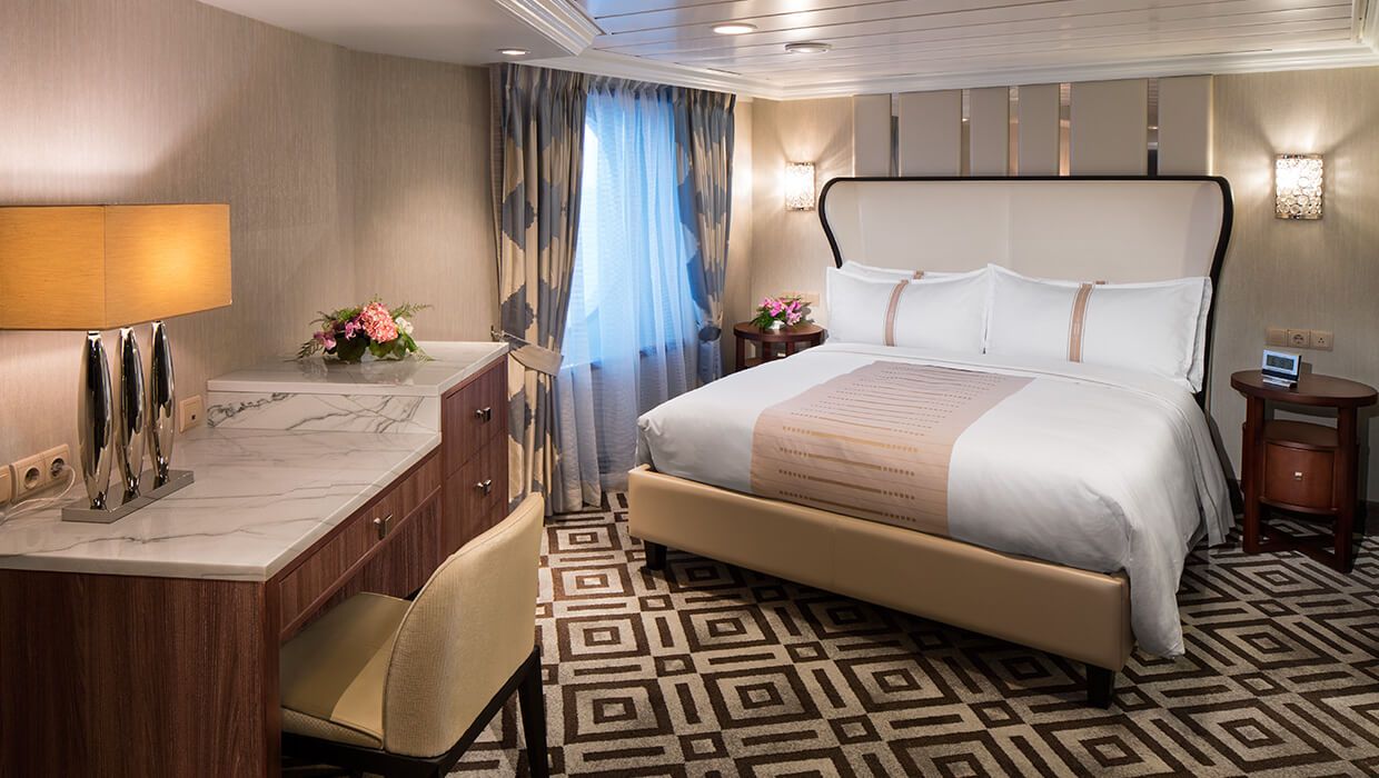
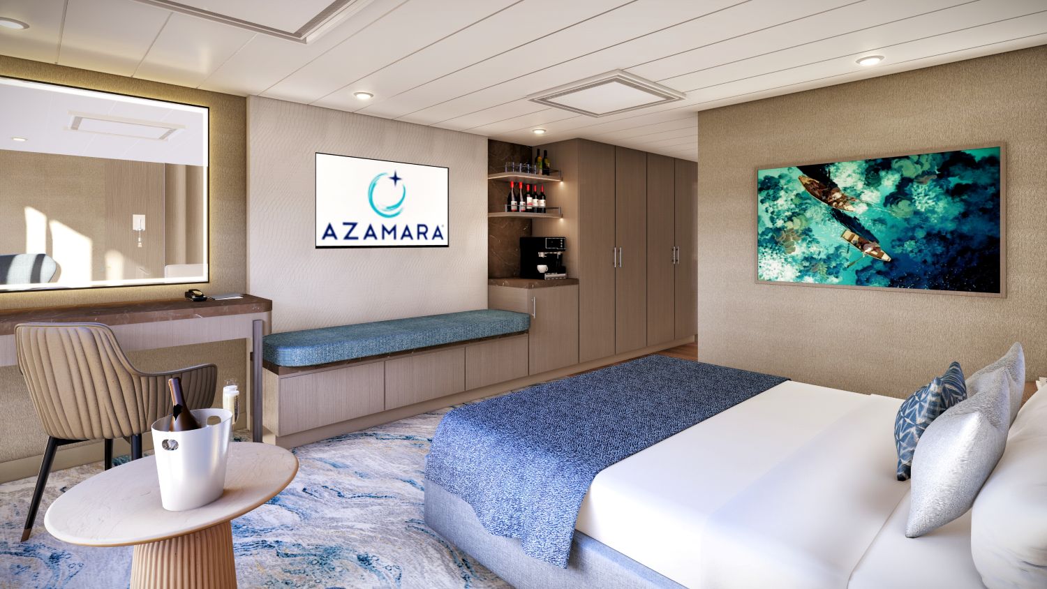
Spacious and comfortable, our Club Continent Suites feature fresh new décor inspired by natural elements. With two beds convertible to a queen, a cozy sitting area, breezy balcony and refreshed bathroom with a bathtub or shower, this is your wonderful, refined home away from home.
Suite Features
- Two lower beds convertible to one queen size bed
- Spacious and comfortable sitting area
- Flat-screen television in sitting area
- Roomy bathroom with shower. Some also feature a tub.
- Floor-to-ceiling sliding glass doors
- Veranda
- Mini-bar
- Thermostat-controlled air conditioner
- Direct-dial telephone with voice mail
- Writing desk
- In-room safe
- Hand-held hair dryer
- Stateroom: 266 sq. ft. (24.7 sq. m.) Veranda: 60 sq. ft. (5.6 sq. m.)
Included Amenities
- Unlimited Basic Starlink Wi-Fi
- 2 laundry bags (wash and press per stateroom, per 7 nights)
- Dedicated butler and concierge service
- Full in-suite dining and daily evening hors d'oeuvres
- Complimentary Specialty Dining and exclusive breakfast at Aqualina
- In-room premium spirits and champagne
- Thalassotherapy Pool access
- Personalized assistance planning spa appointments and shore excursions
- Priority check-in
- Luxurious cotton bed linens with duvet
- Terry bathrobes
- 24-hour room service
- Tote bag
- Use of umbrella
- Shoeshine-service
- Turndown treats
- Afternoon In-Suite Tea Service

The Grandview Suite blends refined contemporary design with floor-to-ceiling views and an expanded, spa-like bathroom. Thoughtfully designed to maximize light and comfort, offering a modern suite experience with select amenities.
Suite Features
- Spacious suite with king-sized bed
- Comfortable sitting area
- Flat-screen television in sitting area
- Roomy bathroom with shower
- Floor-to-ceiling sliding glass doors.
- Veranda
- Mini-bar
- Thermostat-controlled air conditioner
- Direct-dial telephone with voice mail
- Writing desk
- In-room safe
- Hand-held hair dryer
- 243.15 sq. ft. (22.59 sq. m.) Veranda: 60 sq. ft. (5.6 sq.m.)
Included Suite Amenities
- Unlimited Basic Starlink Wi-Fi
- 2 laundry bags (wash and press) per stateroom, per 7 nights
- Dedicated butler and concierge service
- Full in-suite dining and daily evening hors d'oeuvres
- Complimentary Specialty Dining and exclusive breakfast at Aqualina
- In-room premium spirits and champagne
- Thalassotherapy Pool access
- Personalized assistance planning spa appointments and shore excursions
- Priority check-in
- Luxurious cotton bed linens with duvet
- Terry bathrobes
- 24-hour room service
- Tote bag
- Use of umbrella
- Shoeshine-service
- Turndown treats
- Afternoon In- Suite Tea Service
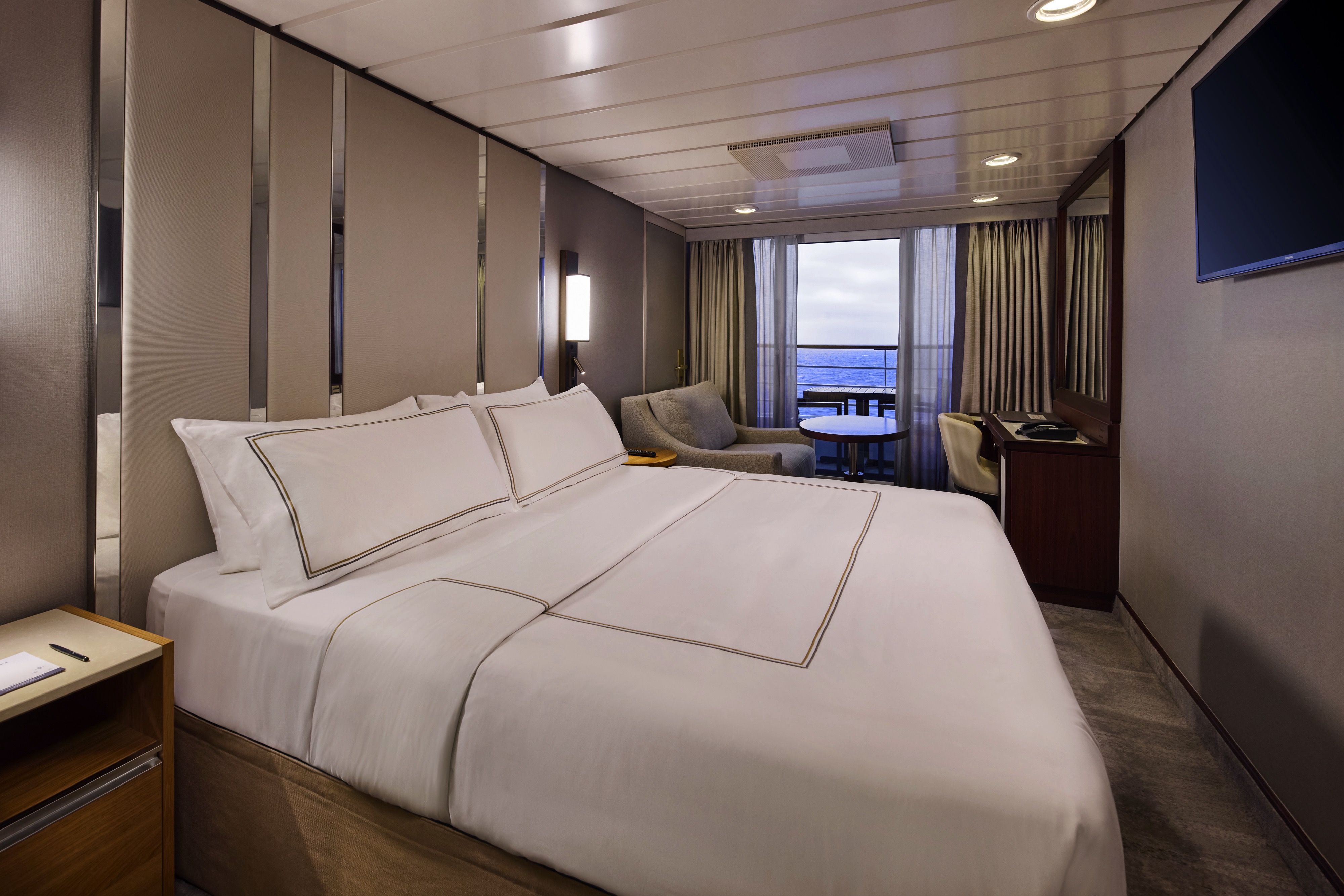
The suites offer a generous space to relax, with a separate living area, a dedicated bedroom, and a private veranda. An inviting retreat that balances comfort, functionality, and classic suite-style living.


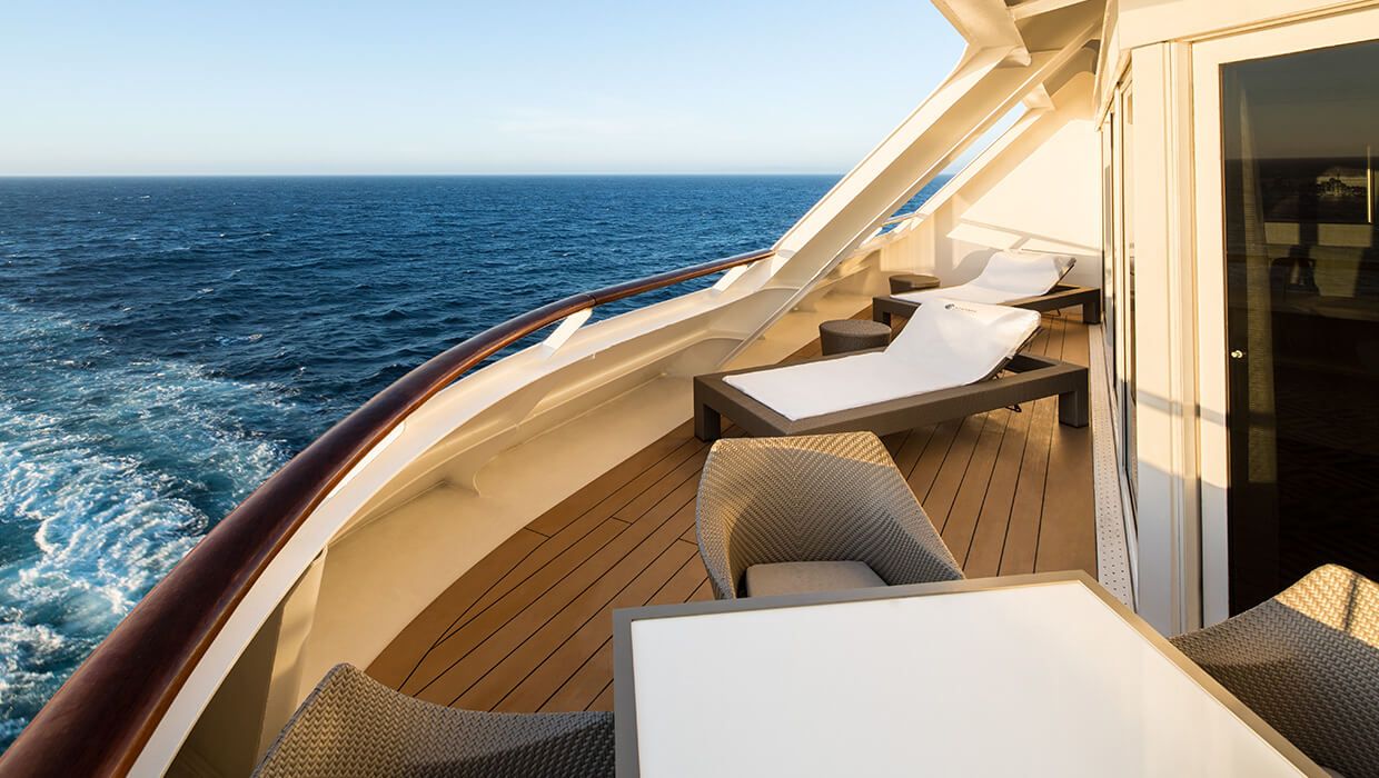
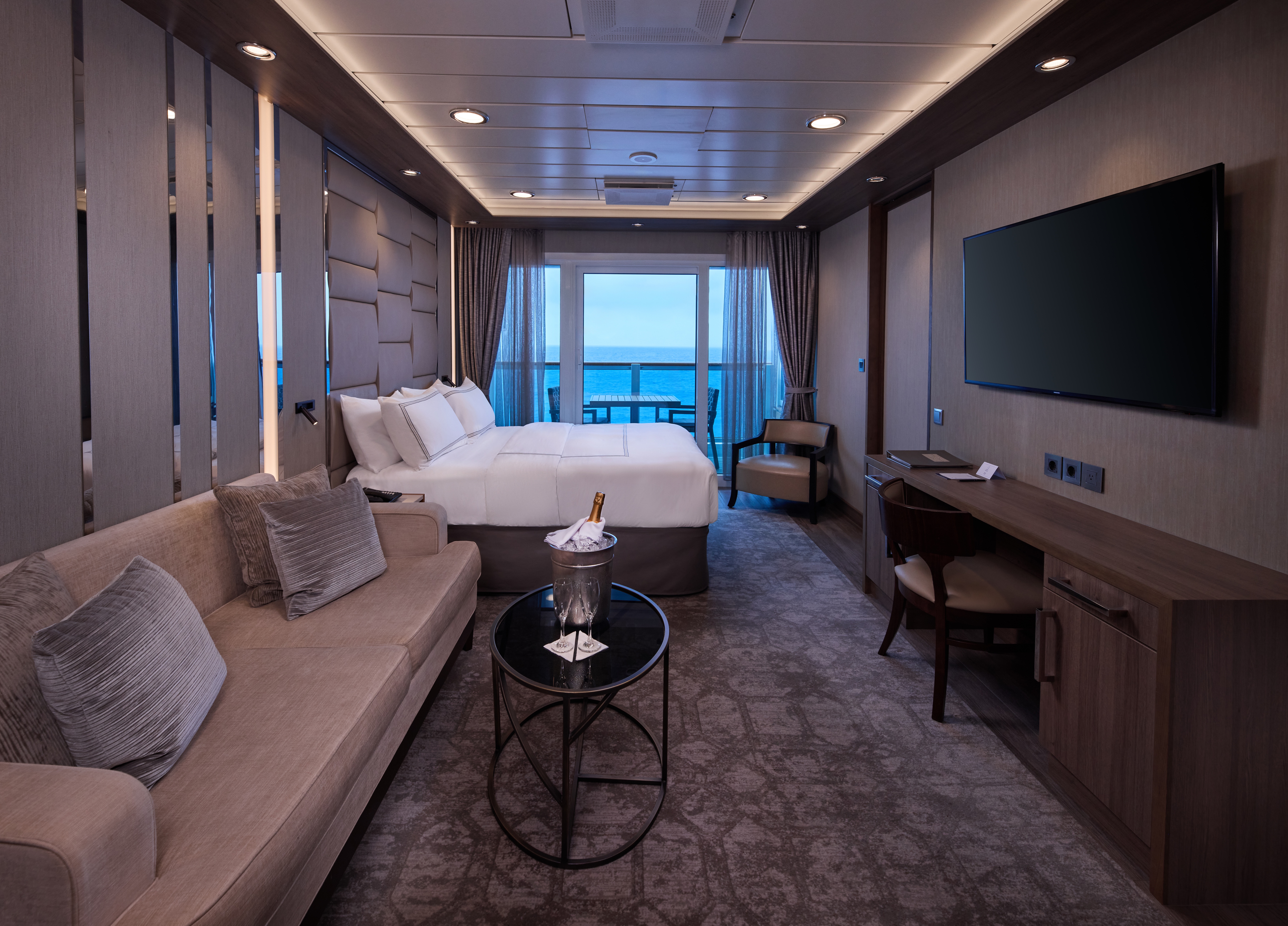
Enjoy open-air living with sweeping ocean and destination views, plus added perks designed to elevate your onboard experience. It's everything you love about a Veranda Stateroom, with a little extra - at exceptional value.
Stateroom Features
- Veranda
- Two lower beds convertible to one Queen size bed
- Sitting area with flat - screen TV
- Mini-bar
- Thermostat-controlled air conditioner
- Direct-dial telephone with voice mail
- Writing desk
- In-room safe
- Hand-held hairdryer
- USB ports under bedside reading lamps
- Stateroom: 175 sq. ft. (16.3 sq. m.) | Veranda: 46-64 sq. ft. (4.3-6 sq. m.)
Included Stateroom Amenities
- Complimentary AzAmazing Evenings® event (on most voyages)
- Gratuities
- Luxurious cotton bed linens with duvet
- Terry bathrobes and slippers
- Select standard spirits, international beers and wine
- 24-hour room service
- Bottled water, soft drinks, specialty coffees and teas
- Self-service laundry
- Tote bag
- Shuttle service to and from port communities, wher
- Use of umbrella
- Concierge services for personal guidance and reservations
- Shoe shine-service
- Turndown treats
- Daily news bulletin
- Complimentary Internet (120 minutes or 25% off the unlimited internet package) per guest
- One free bag of laundry service per stateroom, every seven days
- One night of complimentary specialty dining for two, every seven days
- Priority embarkation and debarkation
- Complimentary in- room spirits
Enjoy open-air living with sweeping ocean and destination views, plus added perks designed to elevate your onboard experience. It's everything you love about a Veranda Stateroom, with a little extra - at exceptional value.
Step outside to your private veranda and take in fresh sea breezes and ever-changing views. Thoughtful design, polished finishes, and attentive service create a relaxing retreat between immersive days ashore.
Stateroom Features
- Veranda
- Writing desk
- Two lower beds convertible to one Queen size bed
- Sitting area with flat-screen TV
- In-room safe
- Hand-held hairdryer
- Refrigerator with mini-bar
- USB ports under bedside reading lamps
- Thermostat-controlled air conditioner
- Stateroom: 175 sq. ft. (16.3 sq. m.) | Veranda: 40 sq. ft.
- Direct-dial telephone with voicemail (3.7 sq. m.)
Included Stateroom Amenities
- Complimentary AzAmazing Evenings® event (on most voyages)
- Luxurious cotton bed linens with duvet
- Gratuities
- Terry bathrobes
- Shuttle service to and from port communities, where available
- Use of umbrella
- Concierge services for personal guidance and reserervations
- Select standard spirits, international beers and wine
- 24-hour room service
- Self-service laundry
- Tote bag
- Shoe shine-service
- Turndown treats
- Daily news bulletin
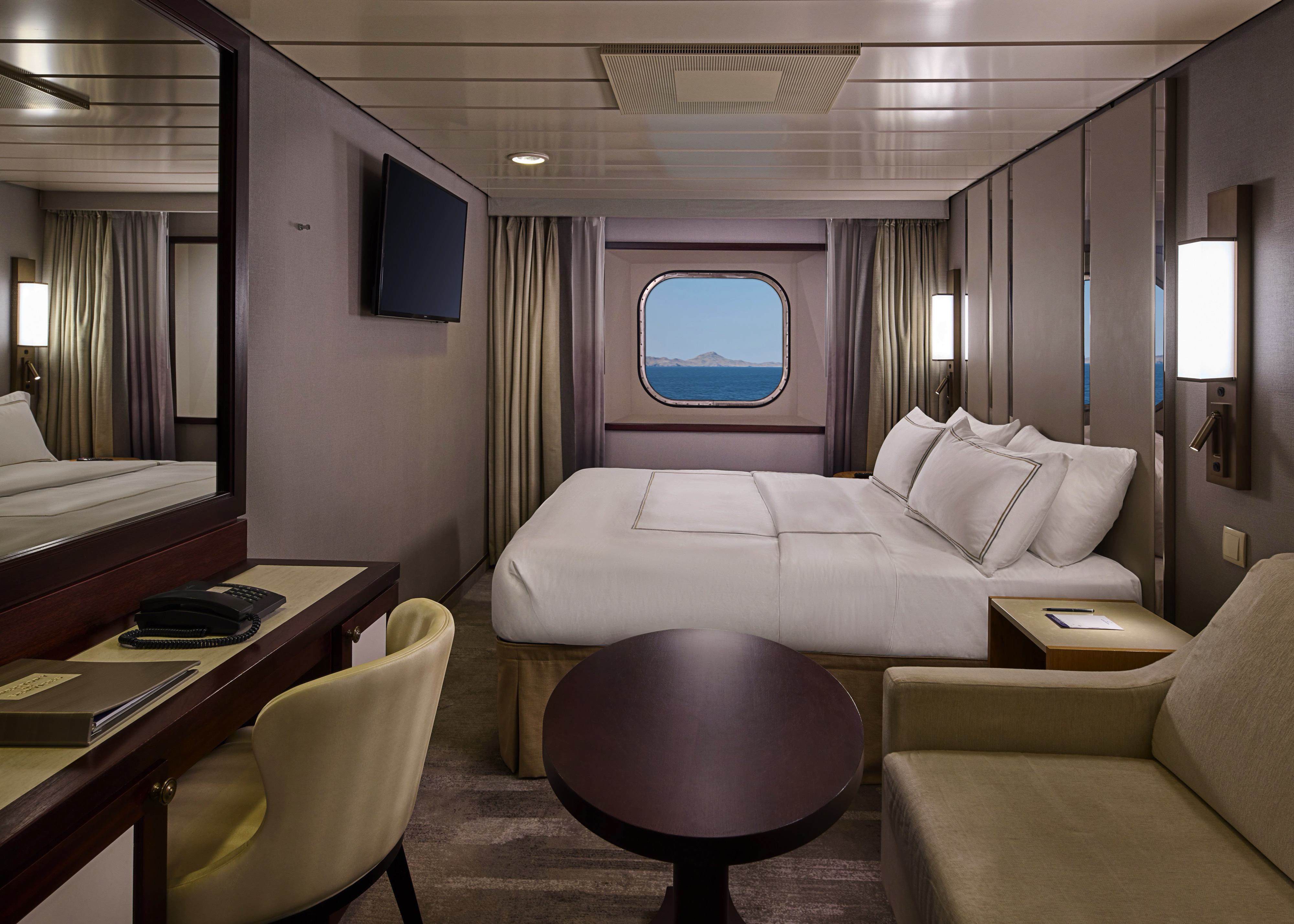
Step outside to your private veranda and take in fresh sea breezes and ever-changing views. Thoughtful design, polished finishes, and attentive service create a relaxing retreat between immersive days ashore.
Wake up to natural light and picturesque ocean views from your window.
Featuring contemporary design and well-appointed comforts, these staterooms offer a serene and stylish place to unwind at sea.
Stateroom Features
- Two lower beds convertible to one Queen size bed
- Some staterooms feature sofa bed
- Flat-screen TV
- Refrigerator with mini-bar
- Thermostat-controlled air conditioner
- Direct-dial telephone with voicemail
- Writing desk
- In-room safe
- Hand-held hairdryer
- USB ports under bedside reading lamps
- 143 sq. ft. (13.3 sq m)
Included Stateroom Amenities
- Complimentary AzAmazing Evenings® event (on most voyages)
- Self-service laundry
- Tote bag
- Gratuities
- Shuttle service to and from port communities, wher
- Luxurious cotton bed linens with duvet
- Use of umbrella
- Terry bathrobes and slippers
- Concierge services for personal guidance and
- Select standard spirits, international beers and winereservations
- 24-hour room service
- Shoe shine-service
- Bottled water, soft drinks, specialty coffees and teas
- Turndown treats
Wake up to natural light and picturesque ocean views from your window.
Featuring contemporary design and well-appointed comforts, these staterooms offer a serene and stylish place to unwind at sea.
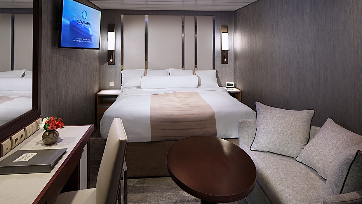
A quiet, comfortable retreat designed for restful nights and relaxing moments between adventures. With refined décor, plush amenities, and personalized service, it's boutique-hotel comfort at sea.
Stateroom Features
- Two lower beds convertible to one Queen size bed
- Flat-screen television
- Refrigerator with mini-bar
- Thermostat-controlled air conditioner
- Direct-dial telephone with voicemail
- Writing desk
- In-room safe
- Hand-held hairdryer
- USB ports under bedside reading lamps
- Stateroom: 158 sq. ft. (14.7 sq. m.)
Included Stateroom Amenities
- Complimentary AzAmazing Evenings® event (on most voyages
- Gratuities
- Luxurious cotton bed linens with duvet
- Terry bathrobes and slippers
- Select standard spirits, international beers and wine
- 24-hour room service
- Bottled water, soft drinks, specialty coffees and teas
- Self-service laundry
- Tote bag
- Shuttle service to and from port communities, wher
- Use of umbrella
- Concierge services for personal guidance and reservations
- Shoe shine-service
- Turndown treats
- Daily news bulletin
A quiet, comfortable retreat designed for restful nights and relaxing moments between adventures. With refined décor, plush amenities, and personalized service, it's boutique-hotel comfort at sea.

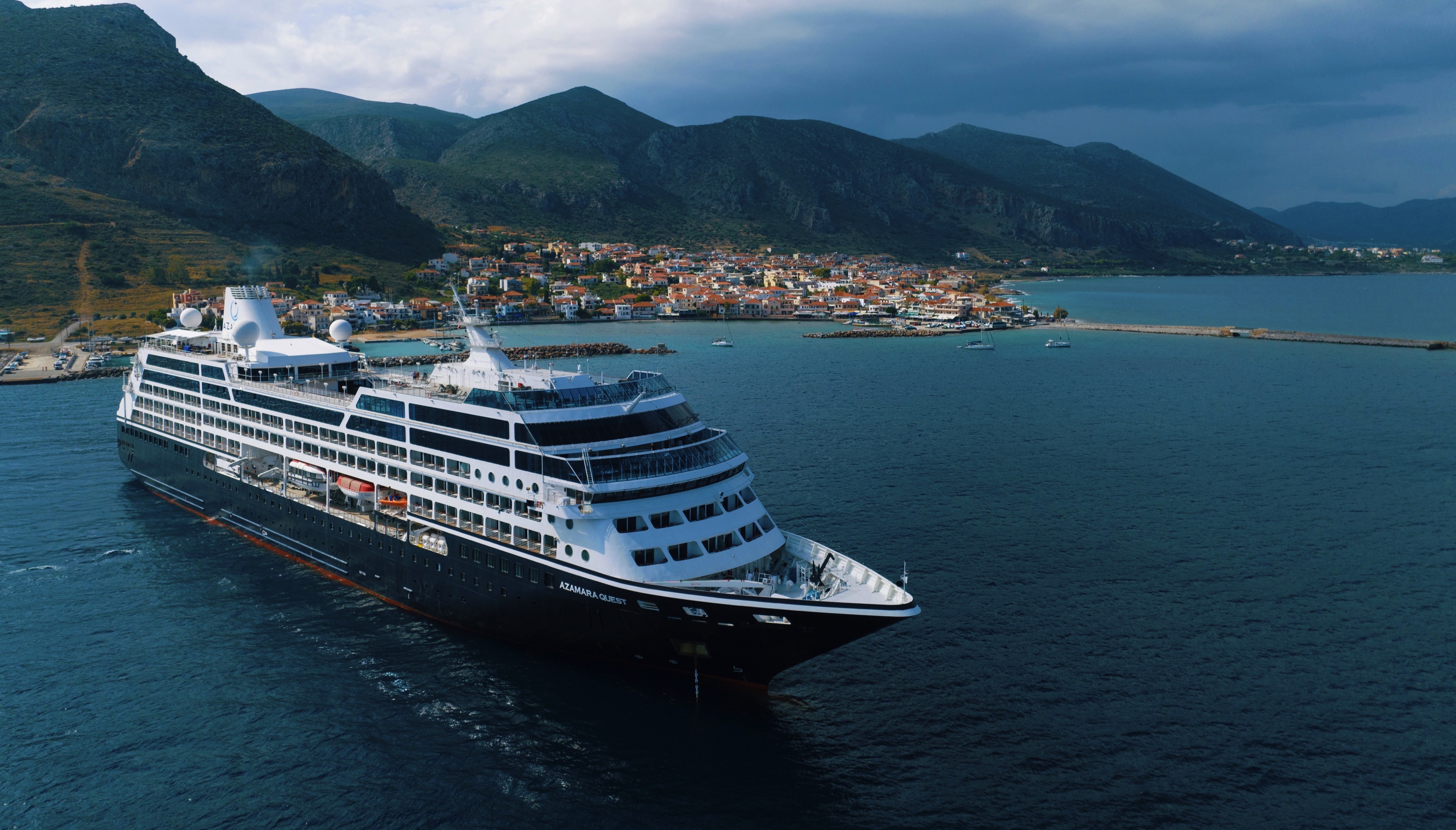
Azamara Quest
The Azamara Quest is a mid-sized ship with a deck plan that’s intimate but never crowded, and offers everything modern cruisers are looking for—plus some unexpected extras.
Ship Facts
| Launch Year | 2000 | ||||||||||
| Refit Year | 2019 | ||||||||||
| Language | en-US | ||||||||||
| Gross Tonnage | 30277 | ||||||||||
| Length | 180 | ||||||||||
| Width | 25 | ||||||||||
| Currency | USD | ||||||||||
| Speed | 18 | ||||||||||
| Capacity | 704 | ||||||||||
| Crew Count | 408 | ||||||||||
| Deck Count | 8 | ||||||||||
| Cabin Count | 352 | ||||||||||
| Large Cabin Count | N/A | ||||||||||
| Wheelchair Cabin Count | 6 | ||||||||||
| Electrical Plugs |
|
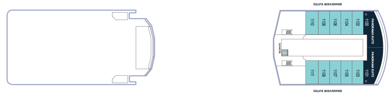
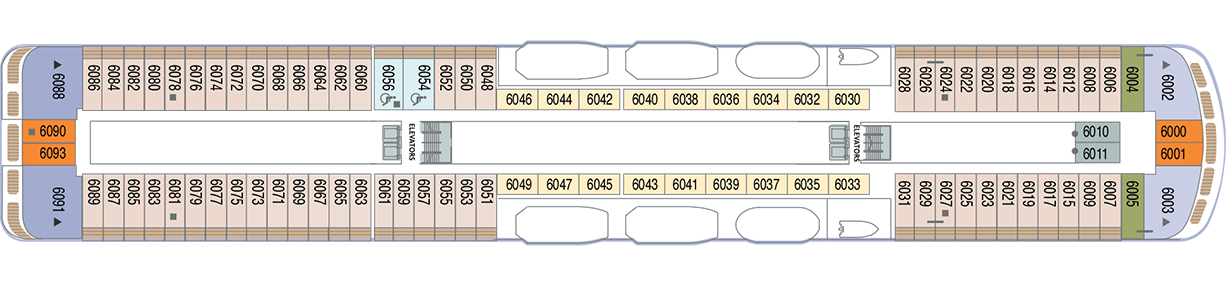
Deck 12
- Sun Deck

Deck 11
- Grandview Suites
- Panaroma Suites
- Elevator
Deck 10
- The Living Room
- Card Room
- In Touch
- Table Tennis
- Jogging Track
- The Drawing Room
- Aqualina Speciality Dining
- Prime C Speciality Dining

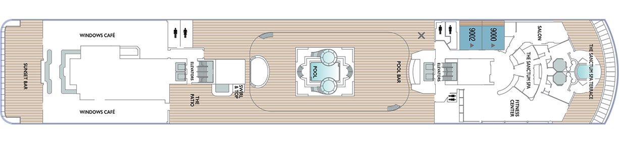
Deck 9
- The Sanctum Spa Terrace
- Salon
- Fitness Centre
- The Sanctum Spa
- Pool Bar
- Pool
- Swirl & Top
- The Patio
- Windows Café
- Sunset Bar
- Spa Suites
Deck 8
- Continent Suites
- World Owner's Suites
- Veranda Plus Staterooms
- Interior Stateroom

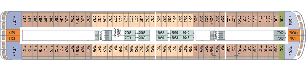
Deck 7
- Veranda Plus Staterooms
- Veranda Staterooms
- Ocean Suites
- Oceanview Staterooms
- Interior Staterooms
- Self Service Laundry
Deck 6
- Veranda Plus Staterooms
- Veranda Staterooms
- Ocean Suites
- World Owner's Suites
- Continent Suite
- Oceanview Staterooms
- Interior Stateroom
Deck 5
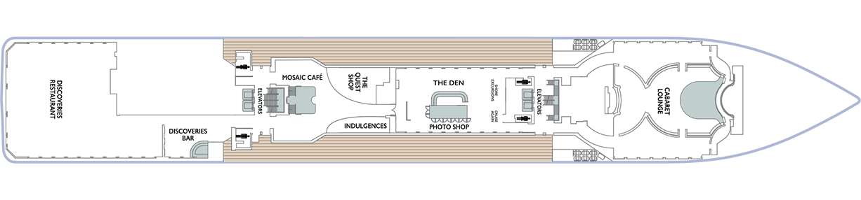
- Cabaret Lounge
- Shore Excursions
- Cruise Again
- The Quest Shop
- The Den
- Photo Shop
- Indulgences
- Mosaic Café
- Discoveries Bar
- Discoveries Restaurant
Deck 4
- Ocean View Staterooms (x2 Accessible Staterooms)
- Interior Staterooms (x3 Accessible Staterooms)
- Guest Relations
- Concierge Desk
- Medical Facility

Azamara offers a choice of six distinctive dining options, including room service. Whether you’re a fan of haute cuisine or down-home cooking, expect the same delicious quality. Bon appétit! Buon appetito! ¡Buen provecho! No matter how you say it, you’re in for a real treat.
Pre-Cruise Specialty Dining Reservations
All guests can now book pre-cruise reservations for Prime C, Aqualina, or Chef’s Table—our most sought-after specialty dining experiences.
Priority Access
Pre-cruise dining reservations open 150 days before sailing for suite guests and Azamara Circle Discoverer-level and above. All other guests may begin booking 140 days prior.
Aqualina
At Aqualina, you’ll find some of Italy’s most authentic dishes. Pastas made from scratch, traditional recipes, and scrumptious vegetarian dishes that make sure there’s something for everyone. Plus our famous desserts: Sorrento lemon liqueur mousse, hazelnut chocolate soufflé and more.
Prime C
Your choice of steak, cooked to perfection. Herb-coated rack of lamb, duck confit and Chilean sea bass—all paired with savory sides. At Prime C, you’re in for more than delectable dining. Expect a great evening with stunning views and lush décor.
Discoveries Restaurant
Discover the world through dishes and flavors from the places we visit. Of course, you’ll also enjoy a wide variety of nightly selections such as filet mignon with black truffle sauce. Choose being seated at a table for two or as part of a larger group of fellow guests.
The Patio and Swirl & Top
Casual “pool grill” by day. A sit-down al fresco dining experience by night. Taste your way around the world with exclusive personalized dishes using local flavors of the places we visit. Plus a self-serve frozen yogurt station—Swirl & Top. With a variety of flavors and your choice of toppings, it’s the perfect way to cool off.
Mosaic Cafe
Stylish and cozy, Mosaic offers your favorite coffee drinks exactly as you like them. Relax in a comfortable seat and enjoy. It’s the perfect spot to start or end your day, and it just might become your favorite place on the ship.
Windows Café
Our daily themed dinner often takes its inspiration from the region we’re visiting—Indian, Mexican, Spanish, Italian. We also create an extra live station made from local ingredients purchased in port: Greek salad made with local feta (Greece), pasta prepared with local mushrooms (Italy), fresh Mussels served with garlic bread (Netherlands).
Room Service
The best time for room service? Whenever you say it is, 24-hours a day. Order from the full breakfast menu between 6:30 AM and 10:00 AM, and we’ll deliver at your appointed time. Lunch and dinner room service features a menu of hearty soups, fresh salads, gourmet sandwiches, pizzas and desserts.
Sit back and enjoy your evenings on a high note with our onboard entertainment. From local cultural shows to our playbill that features a variety of amazing performances to keep you entertained while onboard.
Bars, Lounges & Gathering Spots
A cozy nook to sip coffee. An intimate space to raise a glass and celebrate. A lively setting to catch the latest shows and international entertainment. Watch the world go by, drink in hand from any of Azamara’s bars, lounges, and gathering spaces.
White Night
Join Azamara officers and crew for our signature dinner and entertainment event hosted al fresco on the pool deck (weather permitting). With an array of delicious food and engaging entertainment, your White Night experience will almost certainly be one of the most memorable times from your cruise. And don’t forget to bring something white to wear for the evening.
The Living Room
The idea of the Living Room is just that. To “live in” and to enjoy time with friends and fellow guests! Much of the room is furnished as a living room, with clusters of large comfortable chairs and sofas....
Club Crooner
Step into a swanky nightclub as the great songs of the most magnificent artists come alive on stage. From classic crooners such as Frank Sinatra and Tony Bennett, to current songbirds such as Natalie Cole and Michael Bublé, there’s a song for every time and everyone. Enjoy a beverage, sit back, and be serenaded by the melodies of our lives with CLUB CROONER
Mosaic @ Night
Our onboard coffee corner may very well become your favorite nook on the ship. With elegant and comfortable furniture, it's bound to be one of the the most stylish places, too. Find all your favorite coffee drinks crafted just the way you like. Slip right into a comfortable seat and sip for a while—you never know who'll walk by.
Discoveries Lounge
This congenial bar is a favorite gathering place for great conversations and delicious drinks. Bar service includes a full selection of fine wines, mixed drinks, and premium spirits…plus the entertaining banter of Azamara’s friendly bartenders.
Cabaret Lounge
Enjoy live performances of professional full-stage musical revues, classical soloists, bands and other entertainment in a cabaret nightclub with a full bar and cozy tables.
The Den
By day, The Den is a cozy, inviting space perfect for planning your next adventure—home to the Cruise Again desk and photo gallery, and filled with destination inspiration. By night, it transforms into a lively piano bar with craft cocktails, a talented live pianist, and a warm, social atmosphere. Whether you're mapping out future travels or enjoying the music with a nightcap in hand, The Den is where stories begin, and where many guests return night after night.
The Drawing Room
This library is one of the quiet jewels of Azamara, a peaceful and beautifully appointed space for reading or relaxing after dinner. Browse the collection and feel free to borrow the library books. Or simply relax in the tranquil atmosphere.
The Pool
Join Azamara officers and crew for our signature dinner and entertainment event hosted al fresco on the pool deck (weather permitting). With an array of delicious food and engaging entertainment, your White Night experience will almost certainly be one of the most memorable times from your voyage. And don’t forget to bring something white to wear for the evening.
Pool Bar
Our Pool Bar serves refreshments while enjoying the Pool during the day, and cocktails of your choice in the evening.
Sunset Bar
Adjacent to Windows Café, the Sunset Bar is a welcoming outdoor patio with covered and open -air seating, and a bar. It's the perfect place for dining alfresco, enjoying a refreshing drink, taking in the sights of your favourite port, or simply watching the world sail by.
Performances
Oh, What A Night
Get ready to be transported to the world’s most beloved travel destinations in one exhilarating night. As we explore all four seasons in a new city, travel along with our dynamic Signature Singers & Dancers as they sing and dance their way through an eclectic mix of music from around the world. Come and experience Oh, What A Night!
Take Two
Get ready to grab your clicker and turn up the volume as we take a trip down memory lane celebrating the most cherished movie soundtracks of all time. As we flip through the channels together, you will be taken back to a time when stars were born, the ring is open, and yes... ghosts really do exist. We invite you to sit back, relax and enjoy the music of the movies! Lights... Camera... ACTION! TAKE TWO!
Britrock!
Join your Signature Singers and Dancers, along with your Azamara band, to celebrate the music that includes famous British musical artists such as Adele, Dusty Springfield, Elton John, George Michael, The Beatles and more! Azamara invites you to sing along, as we hit the playback button and take a stroll down memory lane to relive the music that is BRITROCK!
The Quest Shop
It's one-stop shopping in The Pursuit Shop. Apparel, sundries, handbags, candies, souvenirs and lots more await. If you find that you forgot to pack something, chances are you'll find it in The Pursuit Shop.
Photo Shop
Our photographers capture both fun and professional photos throughout the voyage, whether it is your portrait, or photos of the destinations you visit. You can also find an assortment of supplies for your own photographic endeavours.
Indulgences
Aptly named, Indulgences will satisfy your desires for the finer things in life. If you are looking for designer jewellery, it's the perfect place to window shop or to find that extra special purchase.