San Diego to Callao (Lima)
San Diego to Callao (Lima)
Cruise overview
WHY BOOK WITH US?
- ✔ The Deluxe Cruises’ team has extensive experience in ultra-luxury cruising.
- ✔ Call now to speak to our helpful and experienced Cruise Concierge team.
- ✔ Enjoy our Unique Deluxe Cruises Bonus for substantial savings.
- ✔ Our team will tailor your holiday to your exacting requirements.
- ✔ As agents, we work under the protection of each cruise lines ABTA / ATOL licences
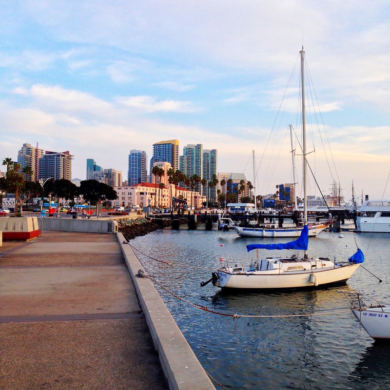
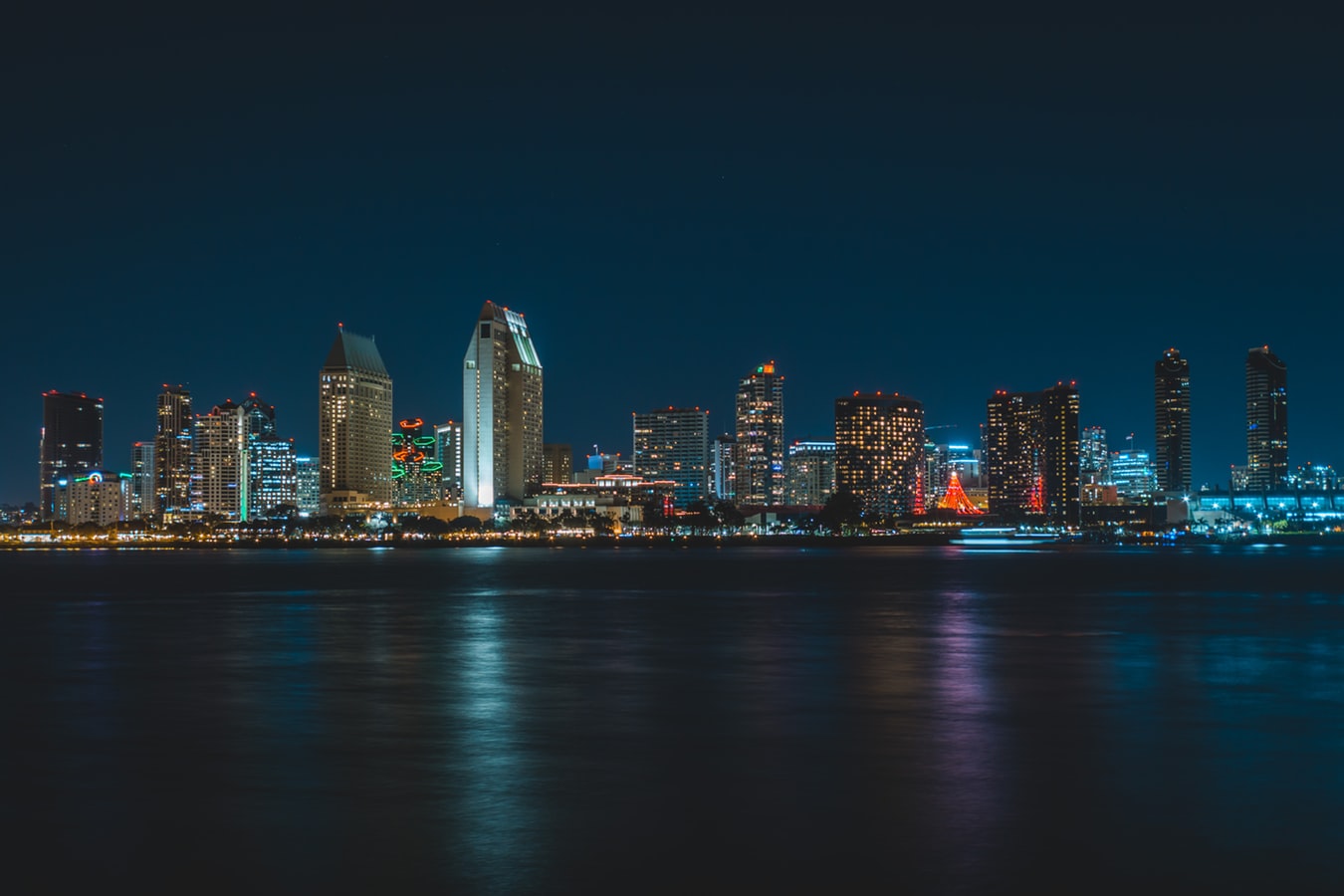
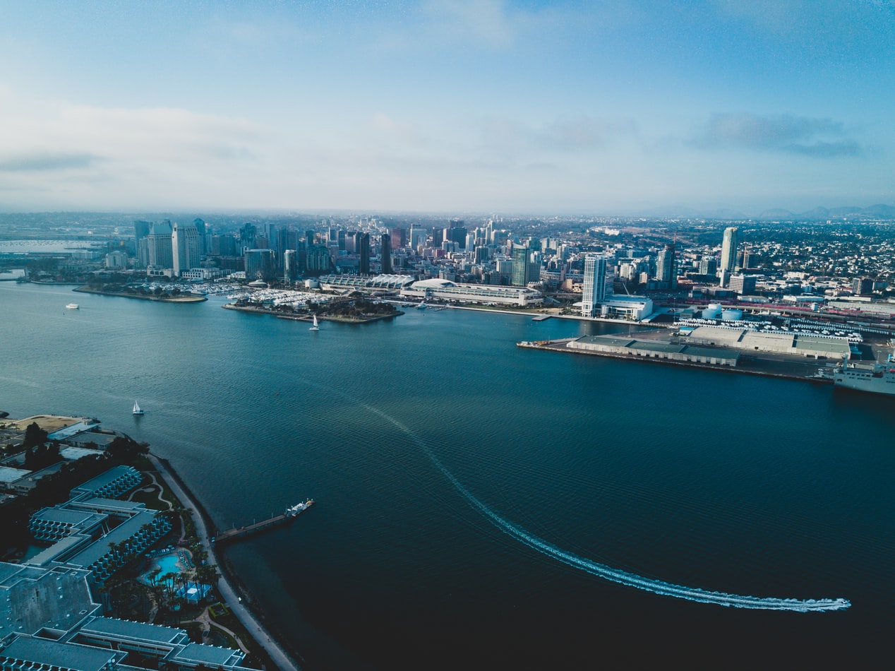
About San Diego, California
San Diego is a vacationer's paradise, with year-round temperatures in the seventies and near-constant sunshine. One of America's most family-friendly cities, San Diego is home to LEGOLAND, the New Children's Museum, and the famous San Diego Zoo. Sunbathers and surfers are guaranteed to find their perfect beach, and foodies find delights in artisanal breweries, local bistros, and gourmet restaurants. From the Broadway excitement of La Jolla Playhouse to the European feel of Little Italy to the nouveau-chic of the Gaslamp Quarter, San Diego has something for everyone.
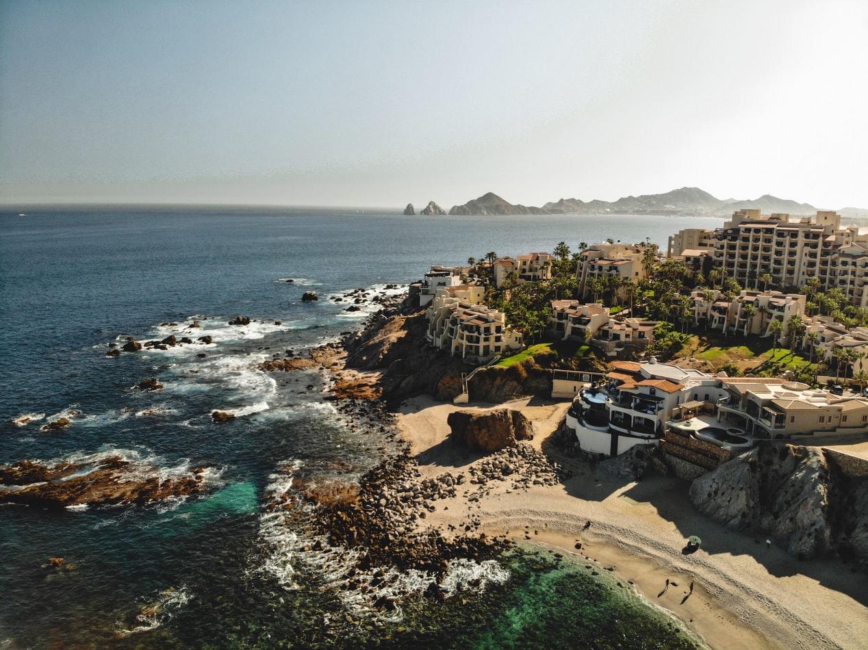
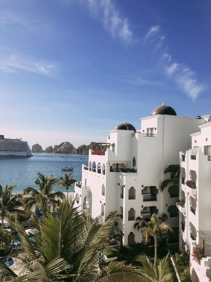
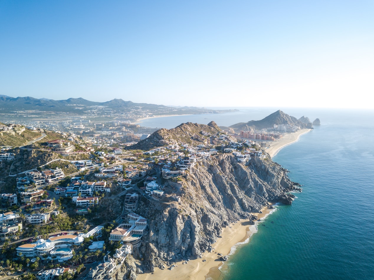
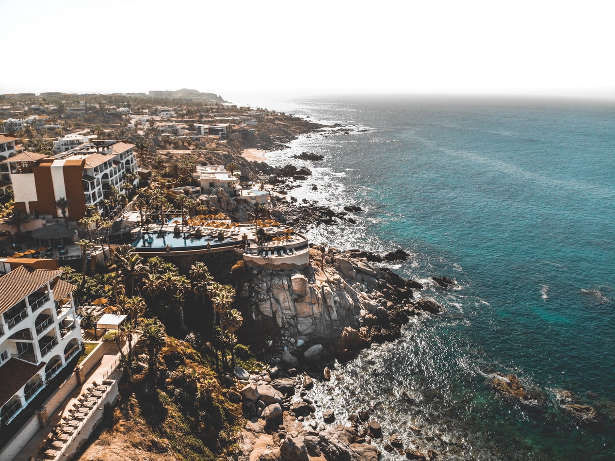
About Cabo San Lucas
Cabo San Lucas, a resort city on the southern tip of Mexico’s Baja California peninsula, is known for its beaches, water-based activities and nightlife. Playa El Médano is Cabo’s main beach, with outdoor restaurants and numerous bars. Past the marina is Land's End promontory, site of Playa del Amor (Lover's Beach) and El Arco, a natural archway in the seacliffs.
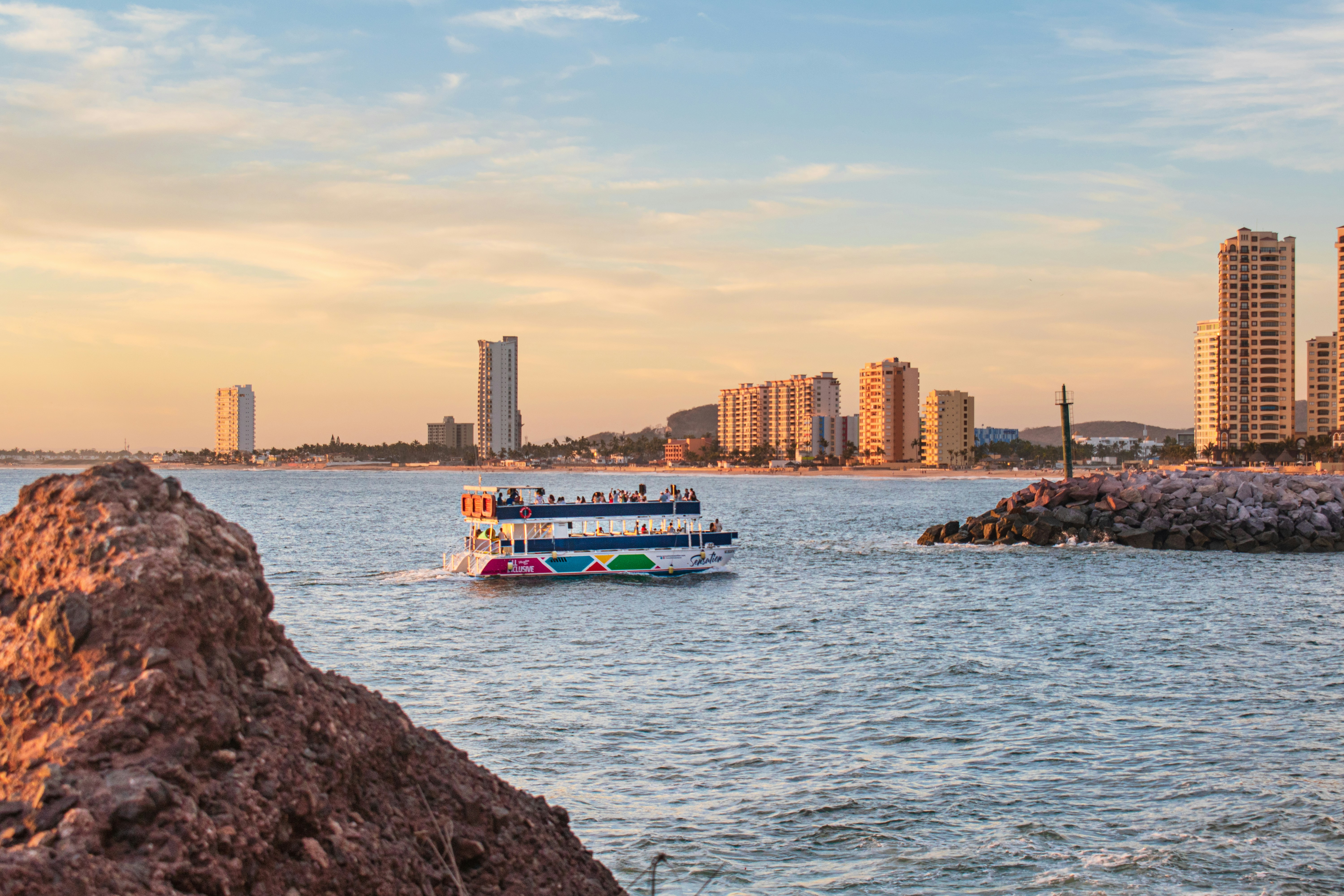
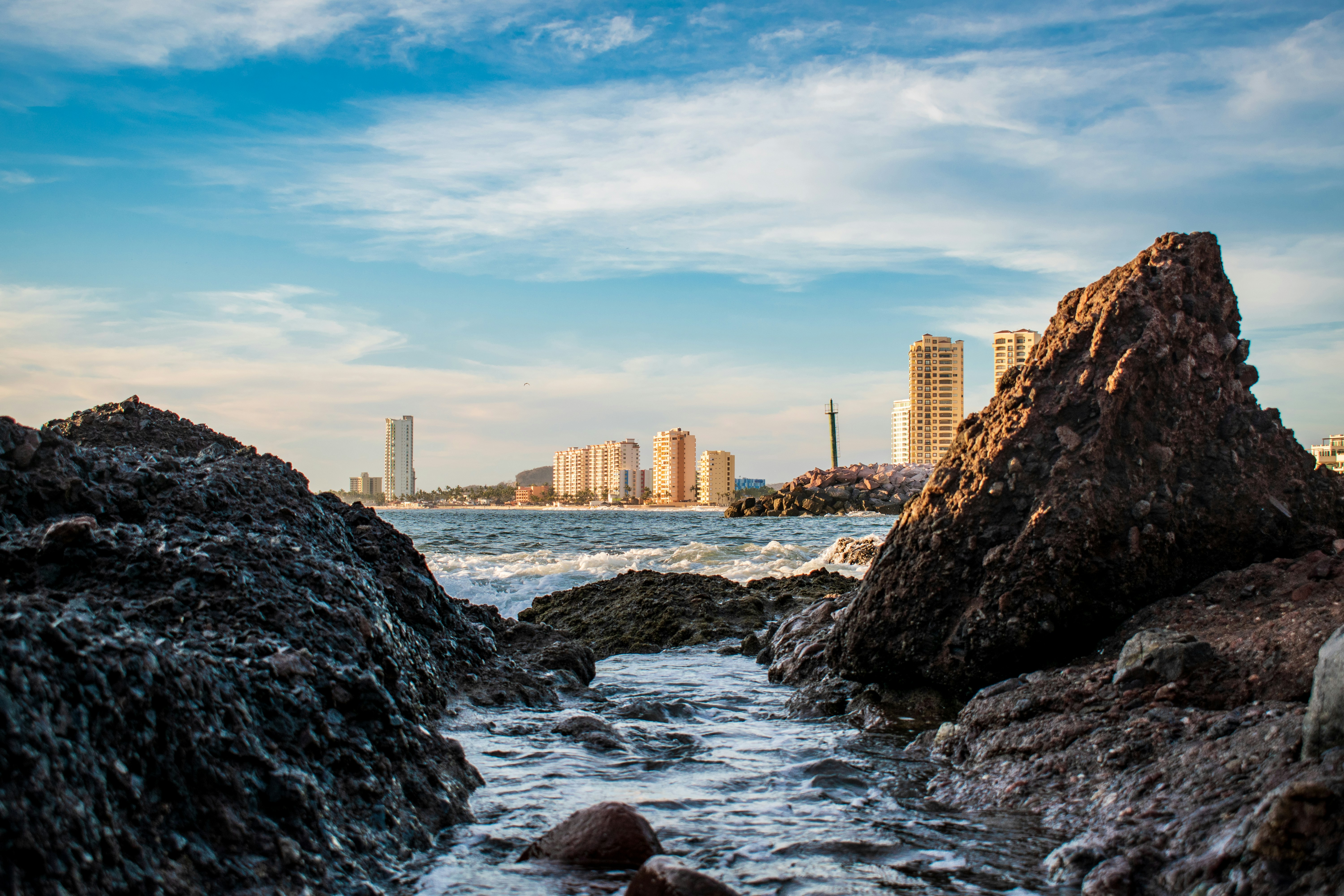
About Mazatlán
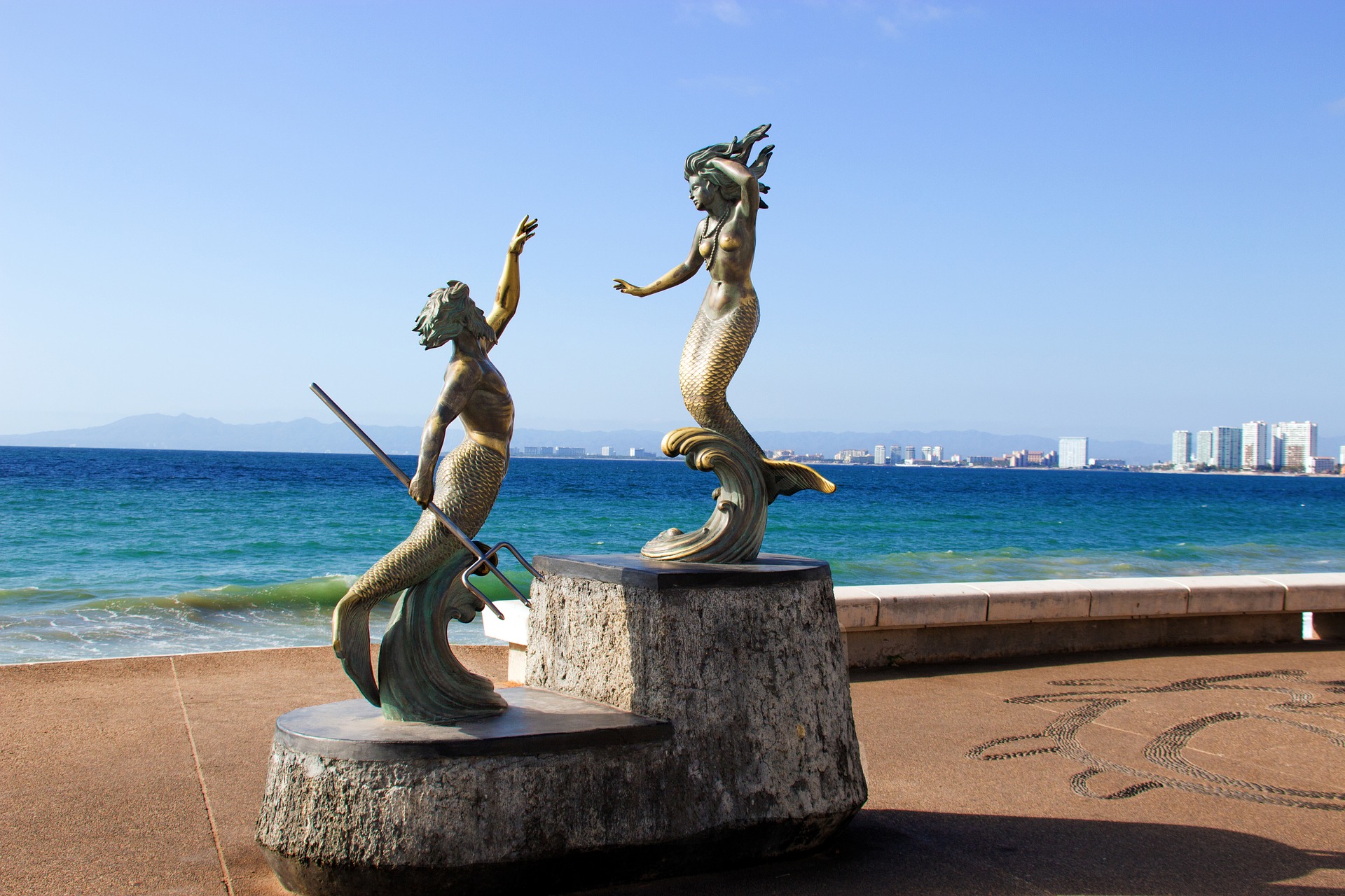
About Puerto Vallarta
Puerto Vallarta is a resort town on Mexico’s Pacific coast, in Jalisco state. It is known for its beaches, water sports and nightlife scene. Its cobblestone center is home to the ornate Nuestra Señora de Guadalupe church, boutique shops and a range of restaurants and bars. El Malecón is a beachside promenade with contemporary sculptures, as well as bars, lounges and nightclubs.
About Acajutla

About Playa Flamingo
About Puntarenas
This town is not on the Nicoya Peninsula, but rather on Costa Rica's mainland. It is best known as a cruise-ship port and launching pad for ferries heading southeast to the coast of the Nicoya Peninsula and for cruises sailing out on the Gulf of Nicoya. Puntarenas is also a major fishing port with a lively fish market. The town’s reputation suffers from the unimpressive parts you see from your car as you roll through town on the way to the ferry dock. But the town has a lot of character off the main drag, thanks to its illustrious past as an affluent port town and principal vacation spot for San José's wealthy, who arrived by train in the last century. Once the port was moved and roads opened to other beaches, Puntarenas's economy crashed, but it's making a comeback. Sitting on a narrow spit of sand—punta de arenas literally means "point of sand"—that protrudes into the Gulf of Nicoya, the town boasts a beautifully groomed, wide Blue Flag beach with views of the Nicoya Peninsula and spectacular sunsets, along with a public swimming pool, the San Lucas Beach Club, and a marine-life museum. Ticos arrive by bus and car to enjoy the beach and stroll the Paseo de los Turistas, a beachfront promenade lined with tree-shaded concrete benches and seafood restaurants. Crowds of locals, called porteños, cruise by on bicycles, the town’s most popular form of transport.
About Manta
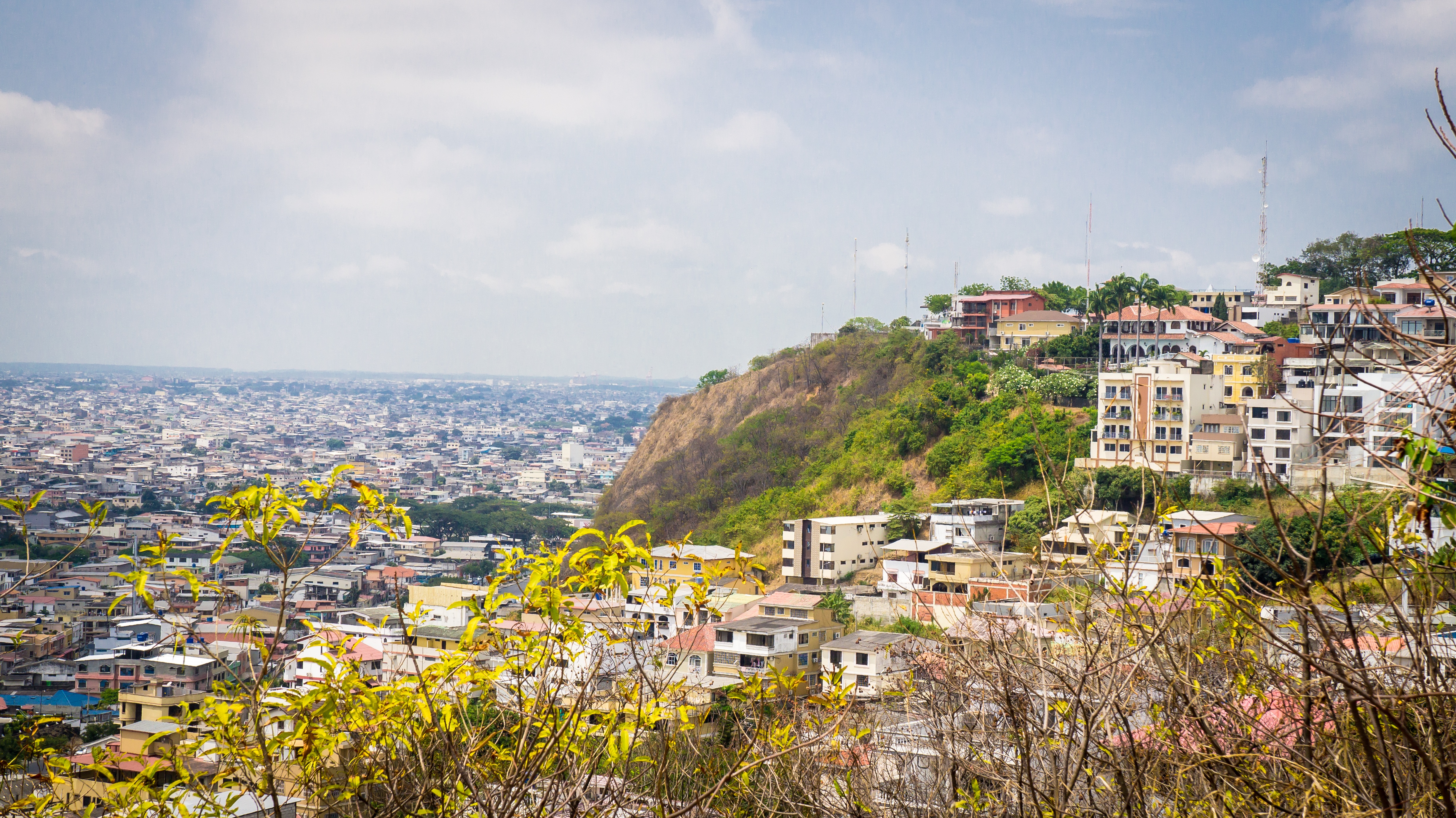
About Guayaquil
The second major jumping off point for the Galapagos Islands after Quito, this is a little city with a big heart. A sea port first and foremost, the city’s personality has been founded on that, and all the better it is for it too. Almost Caribbean in feeling, the clement climate coupled with the intermingling rhythms floating from the windows and abundance of fresh seafood make this a very tropical destination. Once not even considered by the travel books as a potential destination in its own right, the city has undergone something of a resurgence in the past few years. Proud Guayaquileños will not hestitate to point out the Malecón or the exciting new riverfront promenade, once a no-go area after dark, now happily (and hippily) lined with museums, restaurants, shops, and ongoing entertainment. The new airport and urban transportation network are also lauded to the happy tourists who find themselves here. As the largest and most populous city in Ecuador as well as being the commercial centre, it would only be natural that the city would have some kind of modern architecture, but it is the colourful favelas, or to use their real name guasmos, that cling to the side of the hillside like limpets that really catch your eye. A blend of old and new, the first inhabitants can be traced back to 1948 when the government cleared the area for affordable housing, these shanty towns are witness to the social and political particularities that Guayaquil has faced in the past.
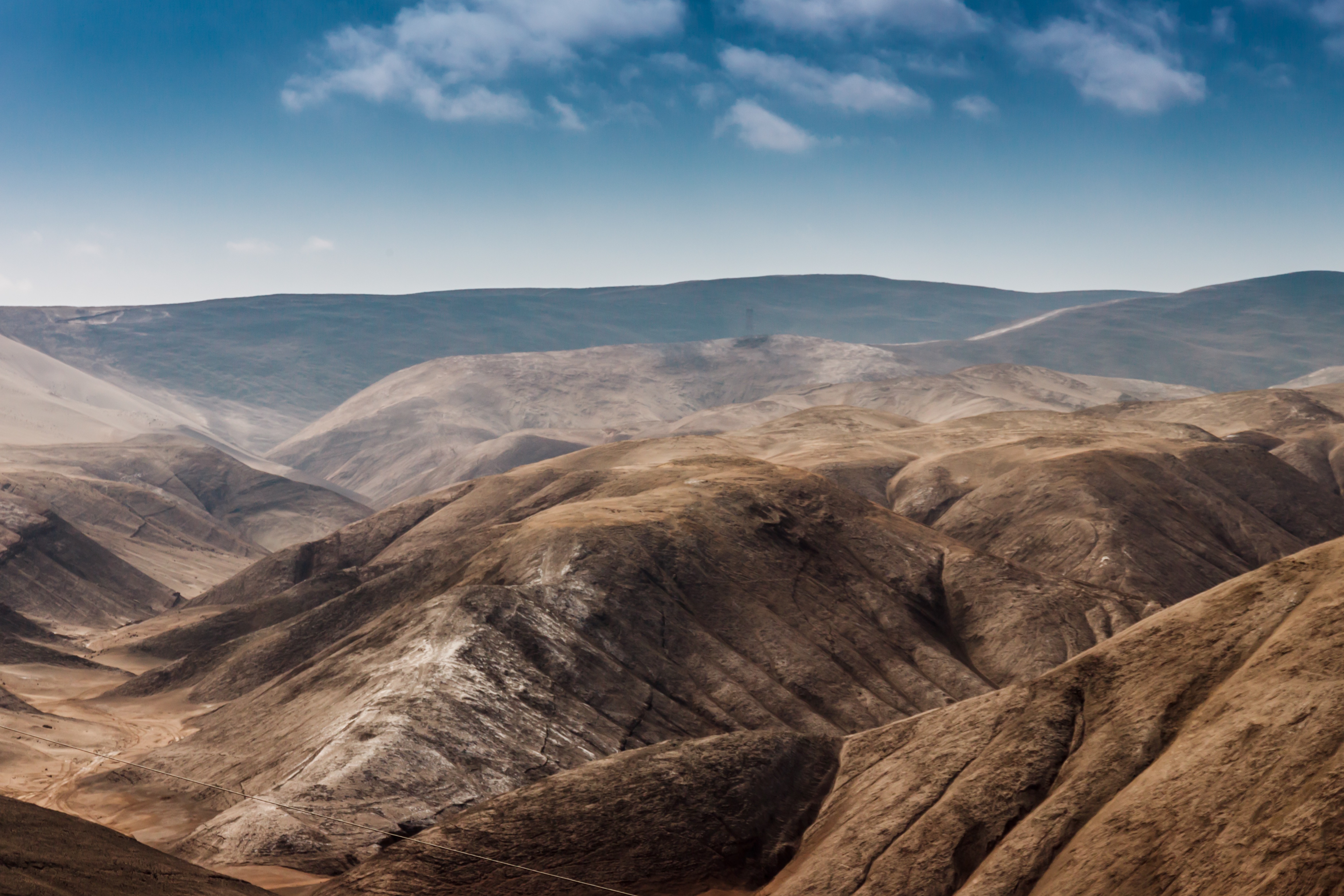
About Salaverry
Located about nine hours north of Lima, Trujillo was founded in 1534 by the Spanish conquistador Pizarro. The attractive, colonial city retains much of its original charm with elegant casonas, or mansions, lining the streets. Nearby is Chan Chan, the ancient capital of the Chimú, a local Indian tribe who came under the rule of the Incas. The area has several other Chimú sites, some dating back about 1500 years. The region is also famous as the home of the Peruvian Paso horses, as well as excellent beaches offering world-class surfing and other water sports.
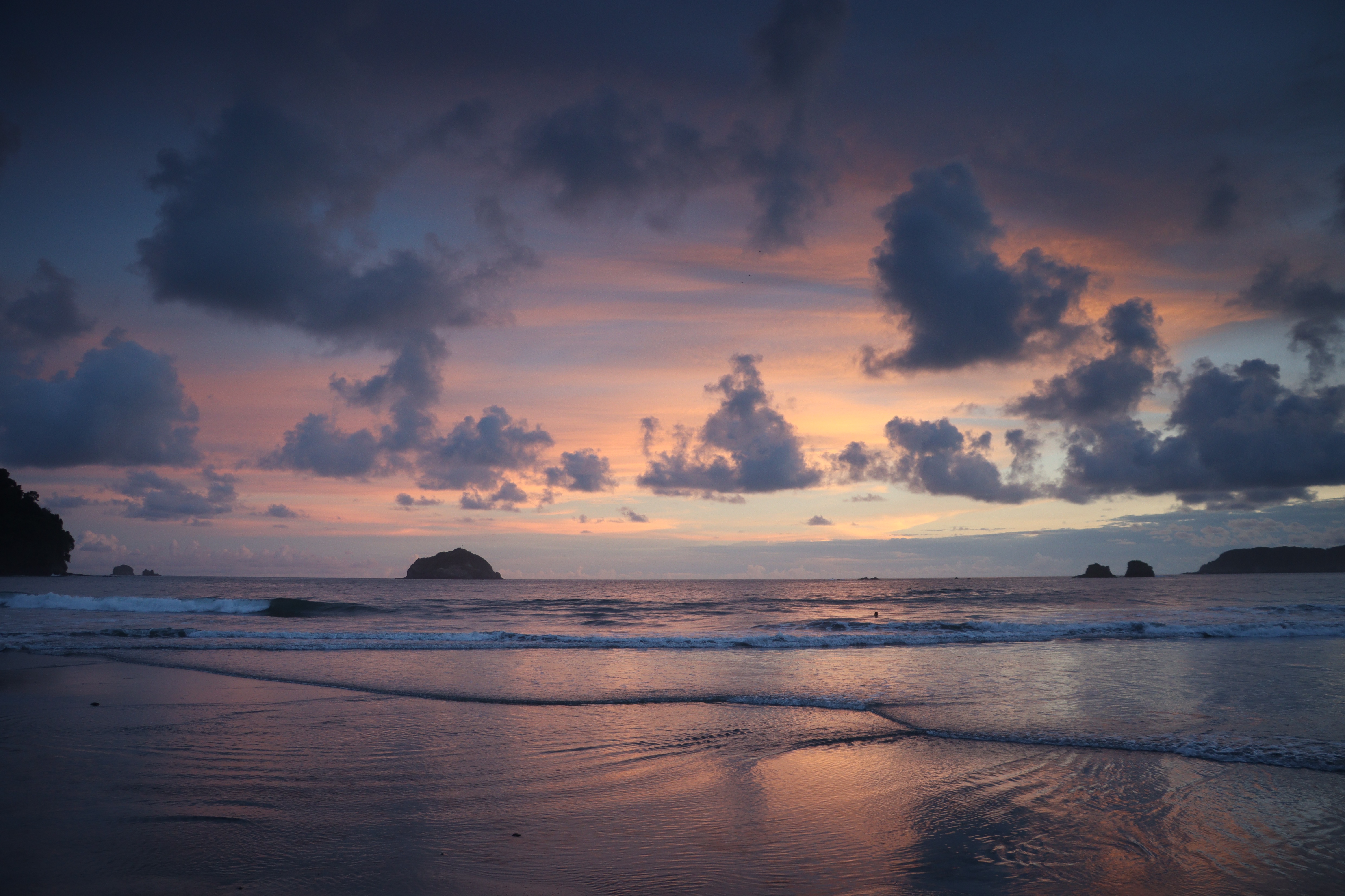
About Callao
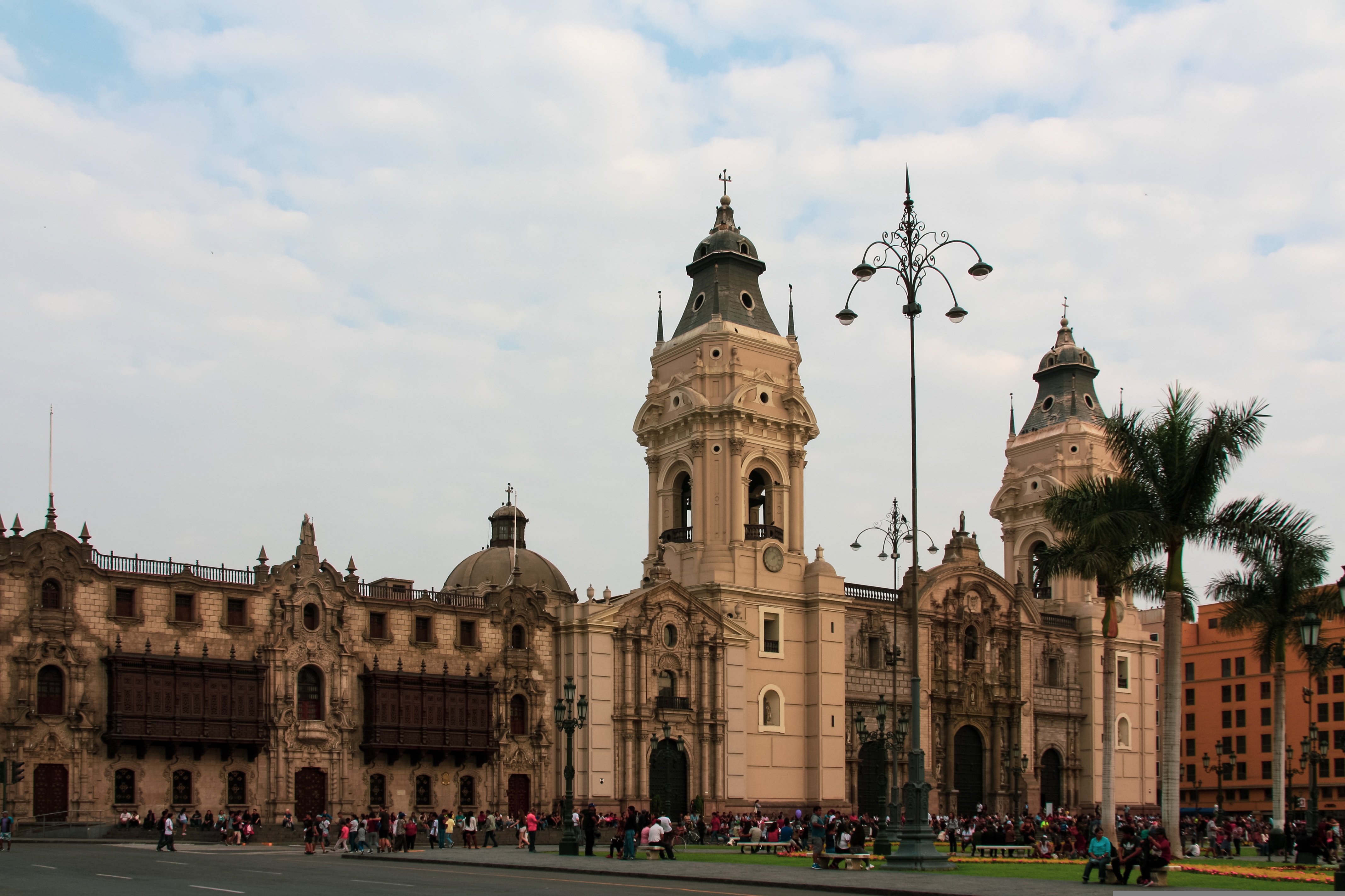
When people discuss great South American cities, Lima is often overlooked. But Peru's capital can hold its own against its neighbors. It has an oceanfront setting, colonial-era splendor, sophisticated dining, and nonstop nightlife.It's true that the city—clogged with traffic and choked with fumes—doesn't make a good first impression, especially since the airport is in an industrial neighborhood. But wander around the regal edifices surrounding the Plaza de Armas, among the gnarled olive trees of San Isidro's Parque El Olivar, or along the winding lanes in the coastal community of Barranco, and you'll find yourself charmed.In 1535 Francisco Pizarro found the perfect place for the capital of Spain's colonial empire. On a natural port, the so-called Ciudad de los Reyes (City of Kings) allowed Spain to ship home all the gold the conquistador plundered from the Inca. Lima served as the capital of Spain's South American empire for 300 years, and it's safe to say that no other colonial city enjoyed such power and prestige during this period.When Peru declared its independence from Spain in 1821, the declaration was read in the square that Pizarro had so carefully designed. Many of the colonial-era buildings around the Plaza de Armas are standing today. Walk a few blocks in any direction for churches and elegant houses that reveal just how wealthy this city once was. But the poor state of most buildings attests to the fact that the country's wealthy families have moved to neighborhoods to the south over the past century.The walls that surrounded the city were demolished in 1870, making way for unprecedented growth. A former hacienda became the graceful residential neighborhood of San Isidro. In the early 1920s the construction of tree-lined Avenida Arequipa heralded the development of neighborhoods such as bustling Miraflores and bohemian Barranco.Almost a third of the country's population of 29 million lives in the metropolitan area, many of them in relatively poor conos: newer neighborhoods on the outskirts of the city. Most residents of those neighborhoods moved there from mountain villages during the political violence and poverty that marked the 1980s and ’90s, when crime increased dramatically. During the past decade the country has enjoyed peace and steady economic growth, which have been accompanied by many improvements and refurbishment in the city. Residents who used to steer clear of the historic center now stroll along its streets. And many travelers who once would have avoided the city altogether now plan to spend a day here and end up staying two or three.
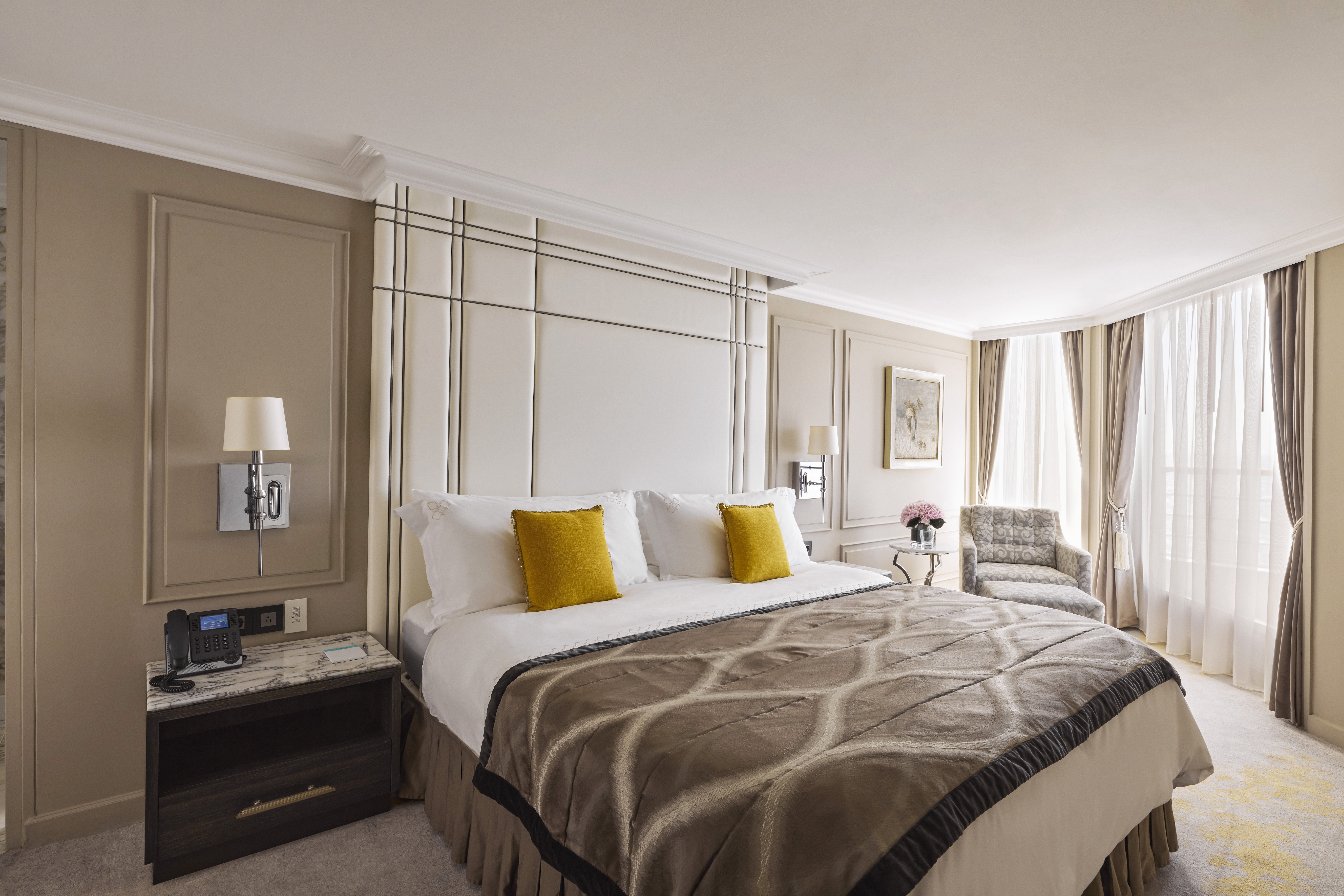
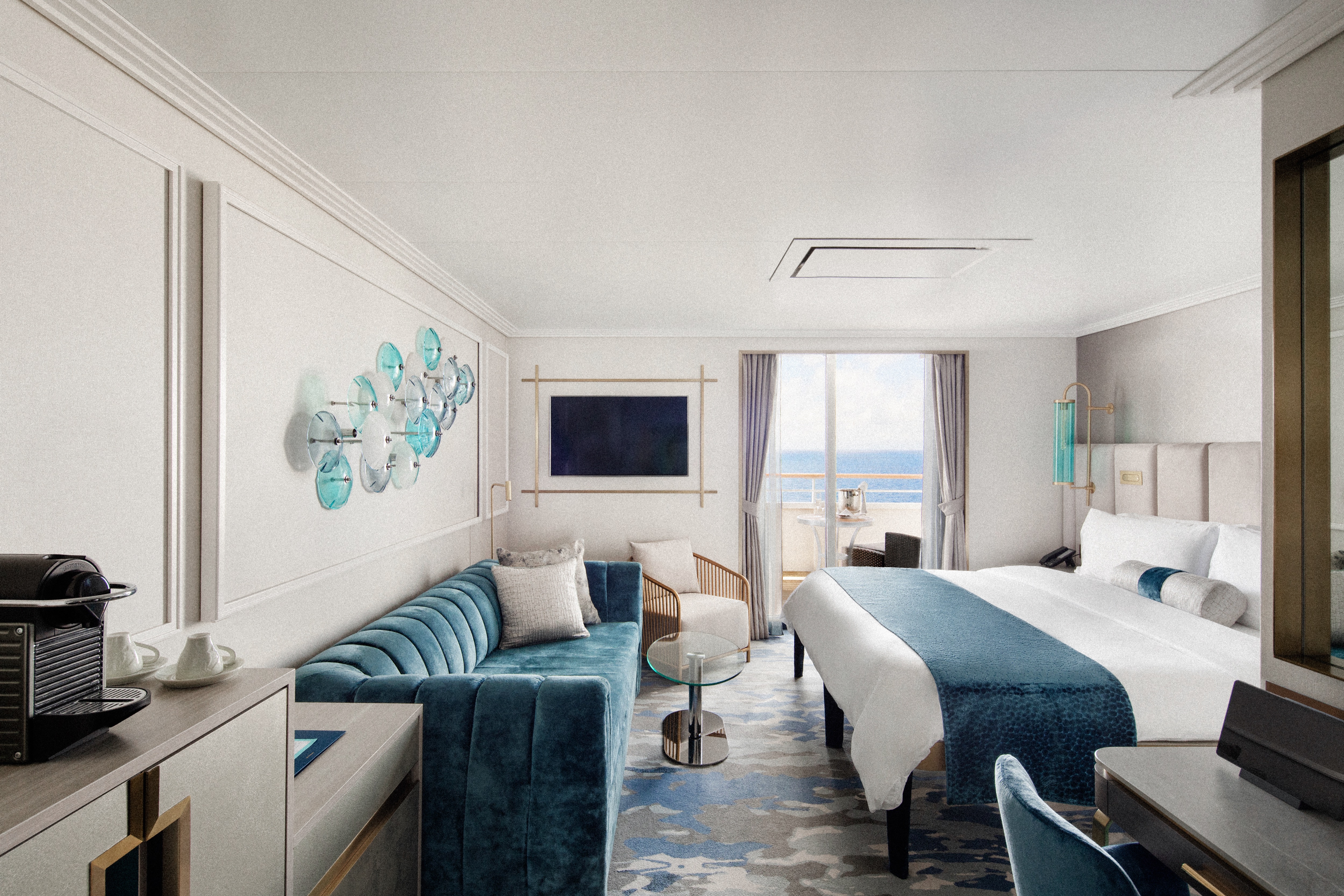
DETAILS
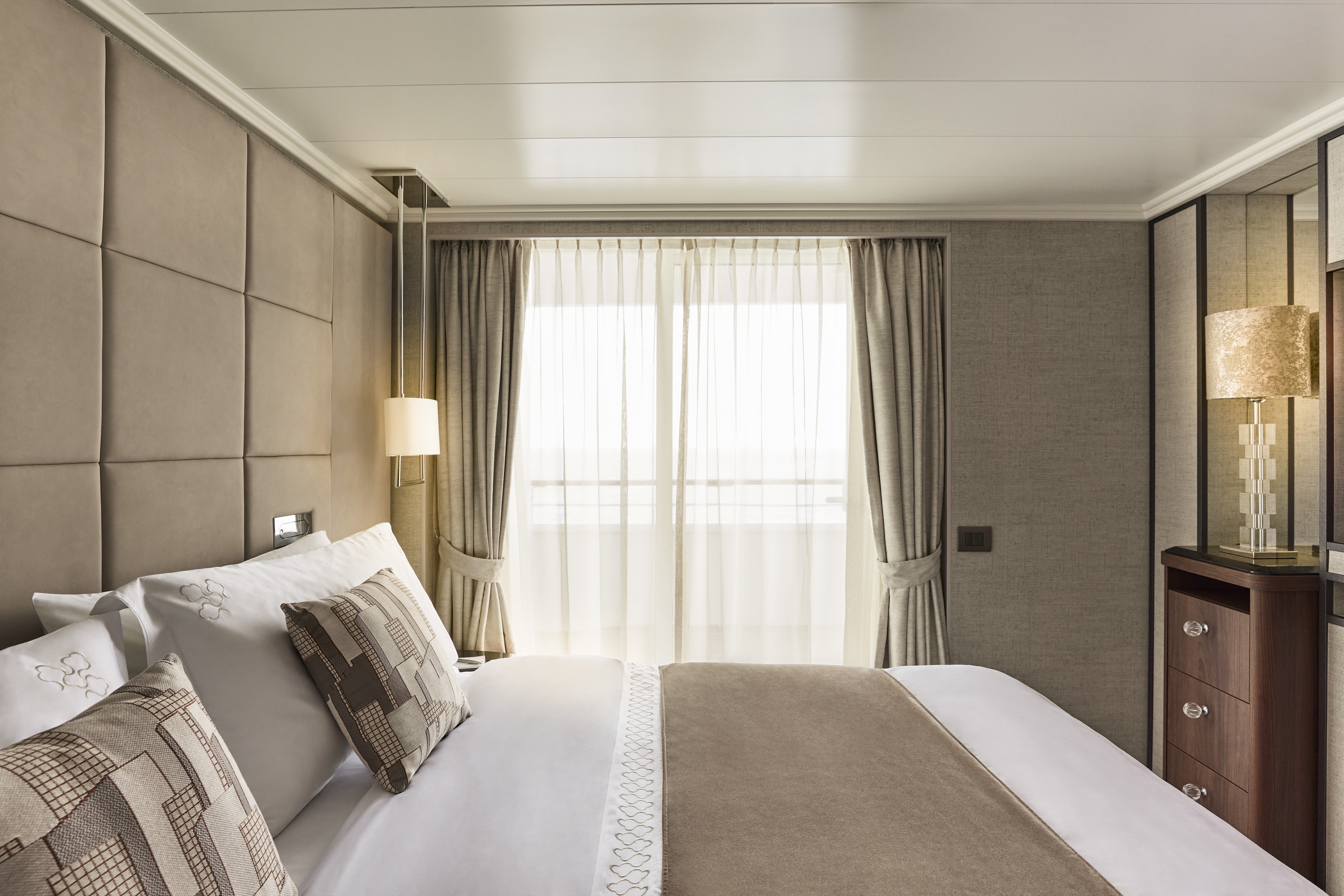
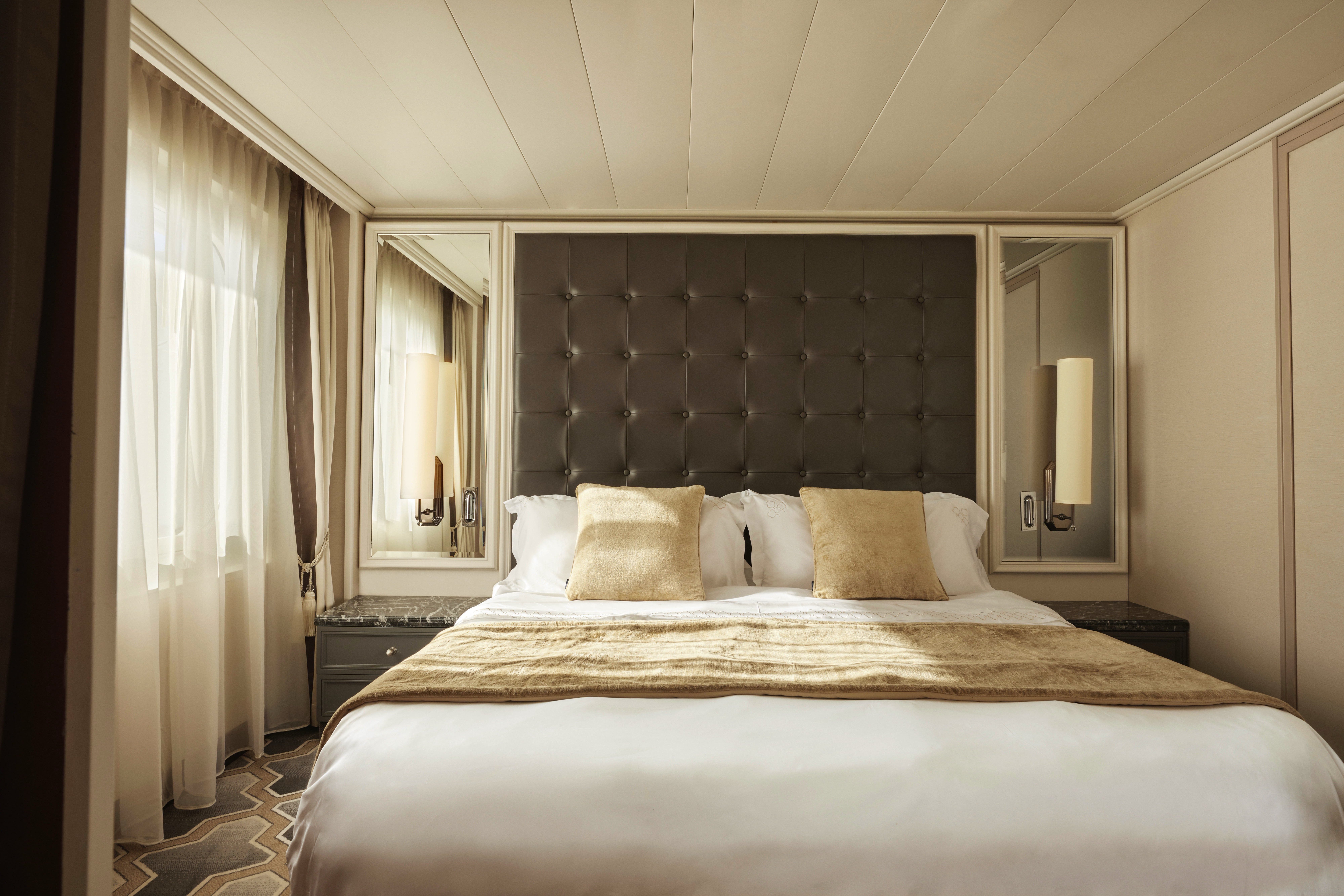
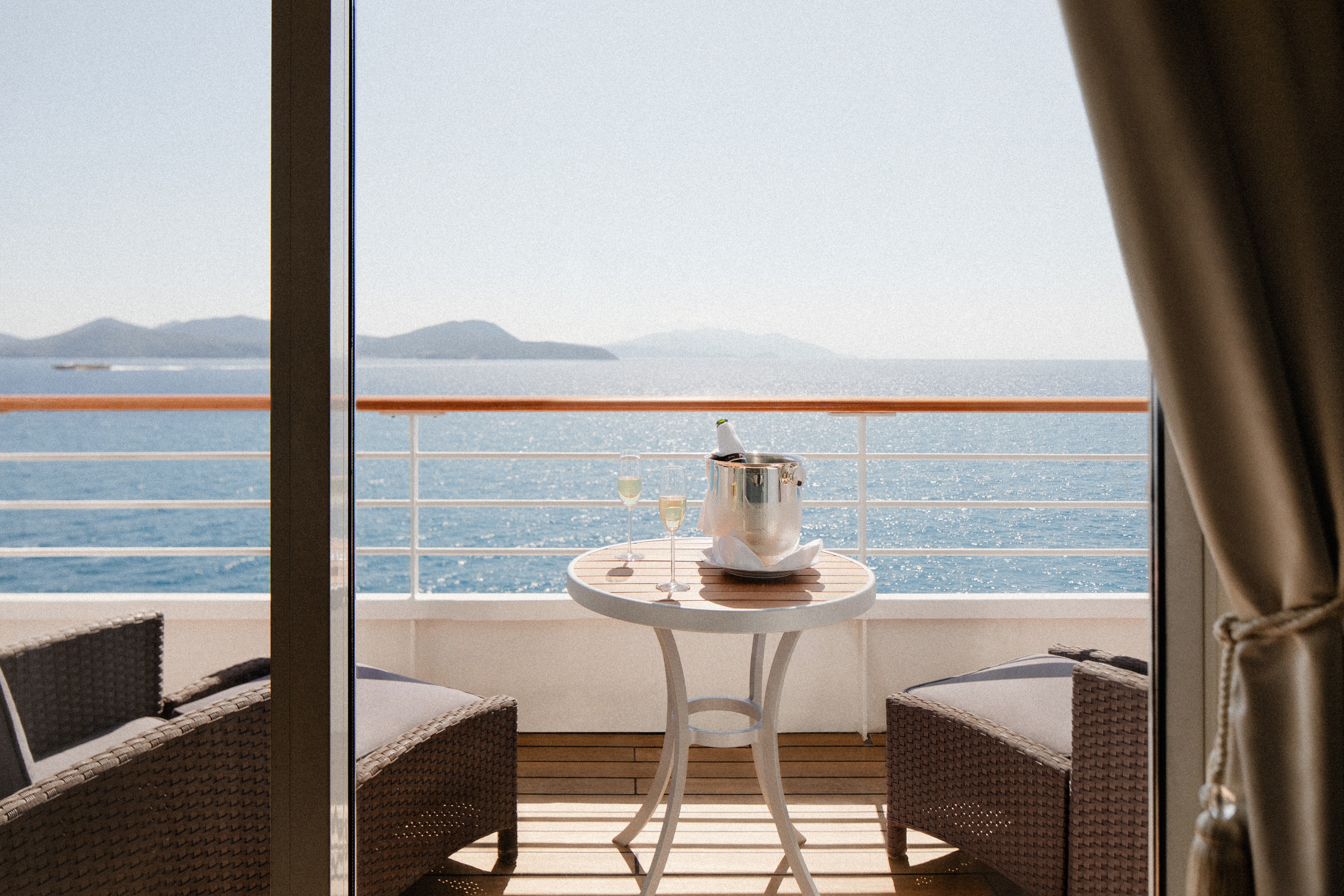
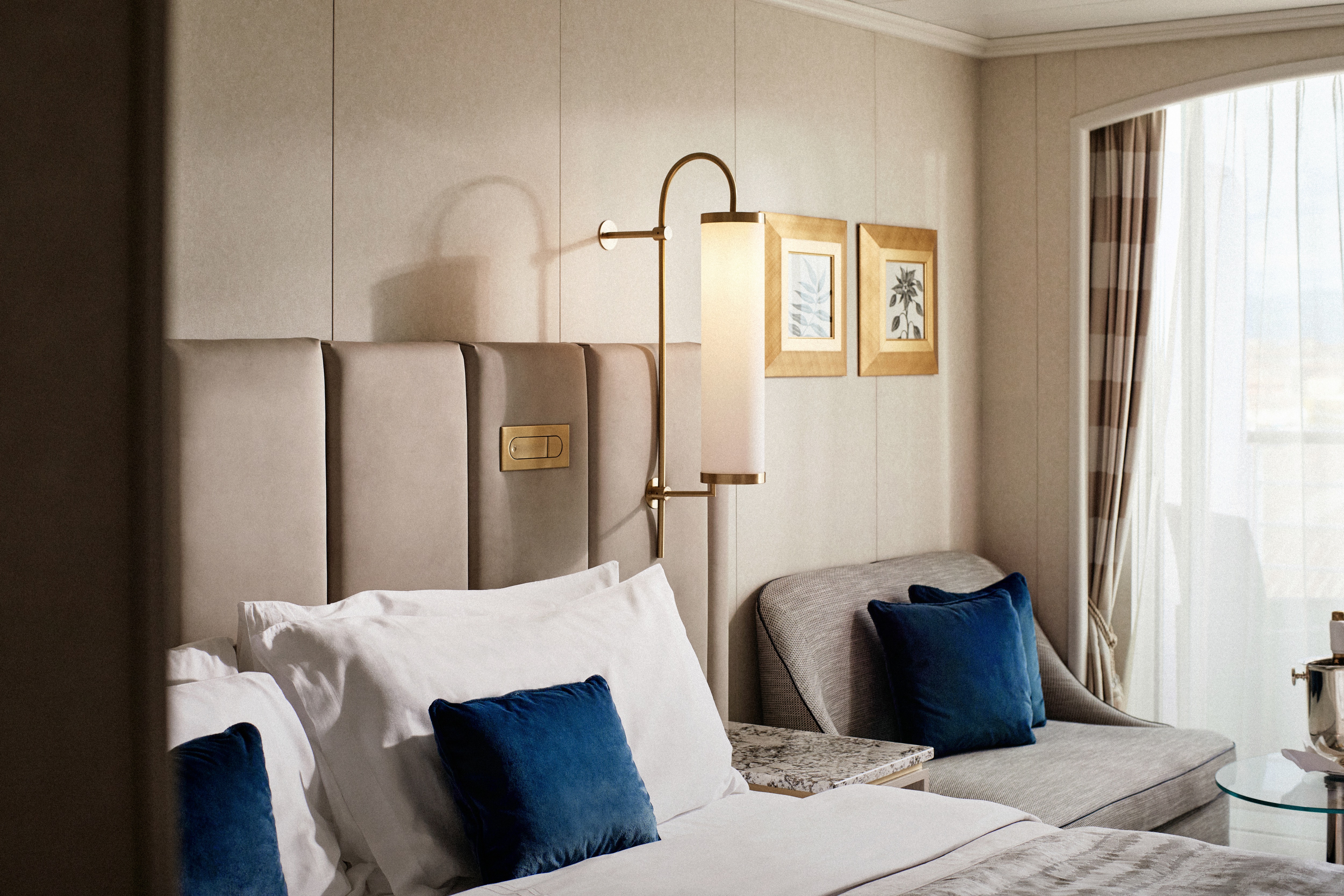
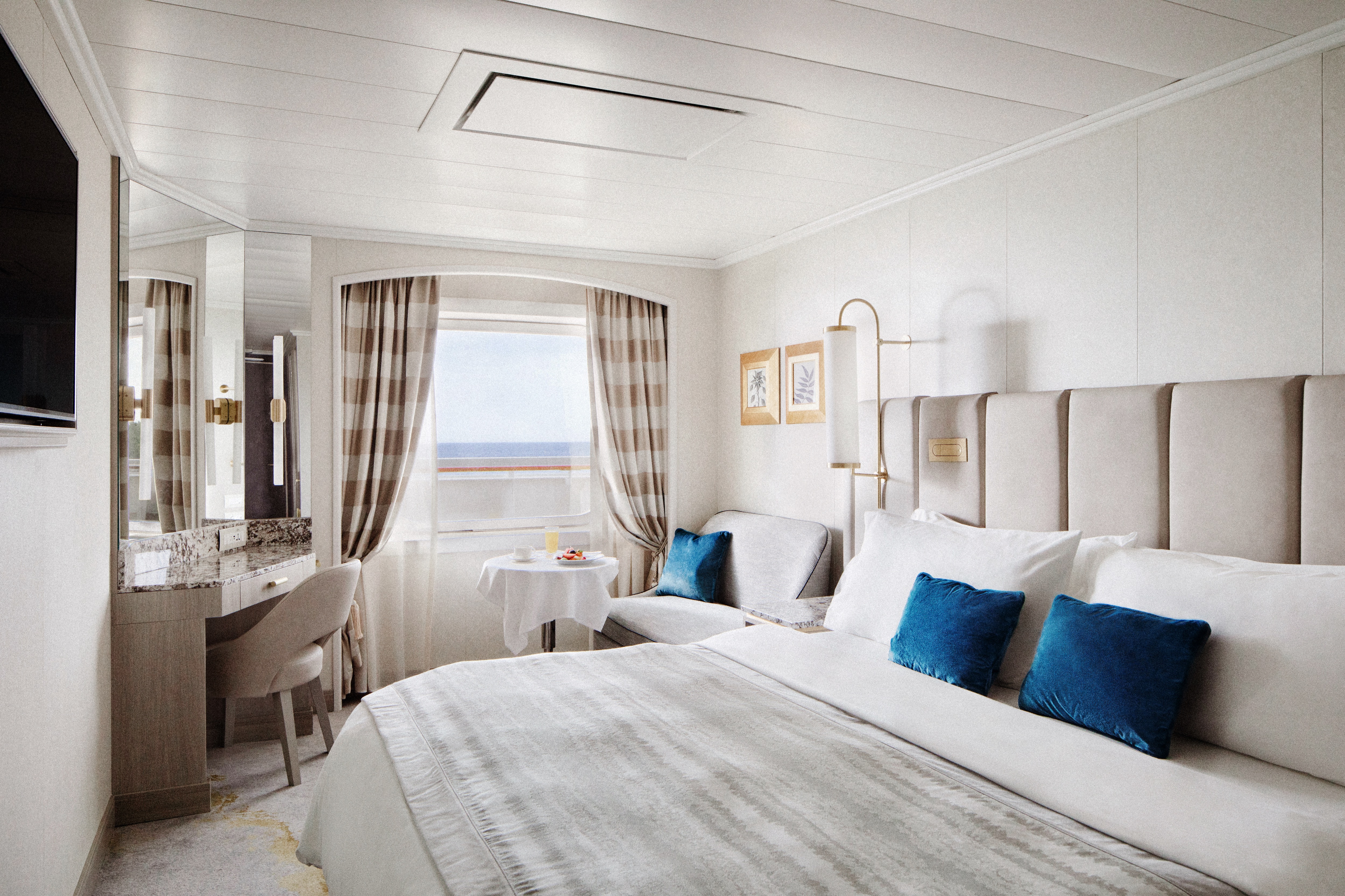
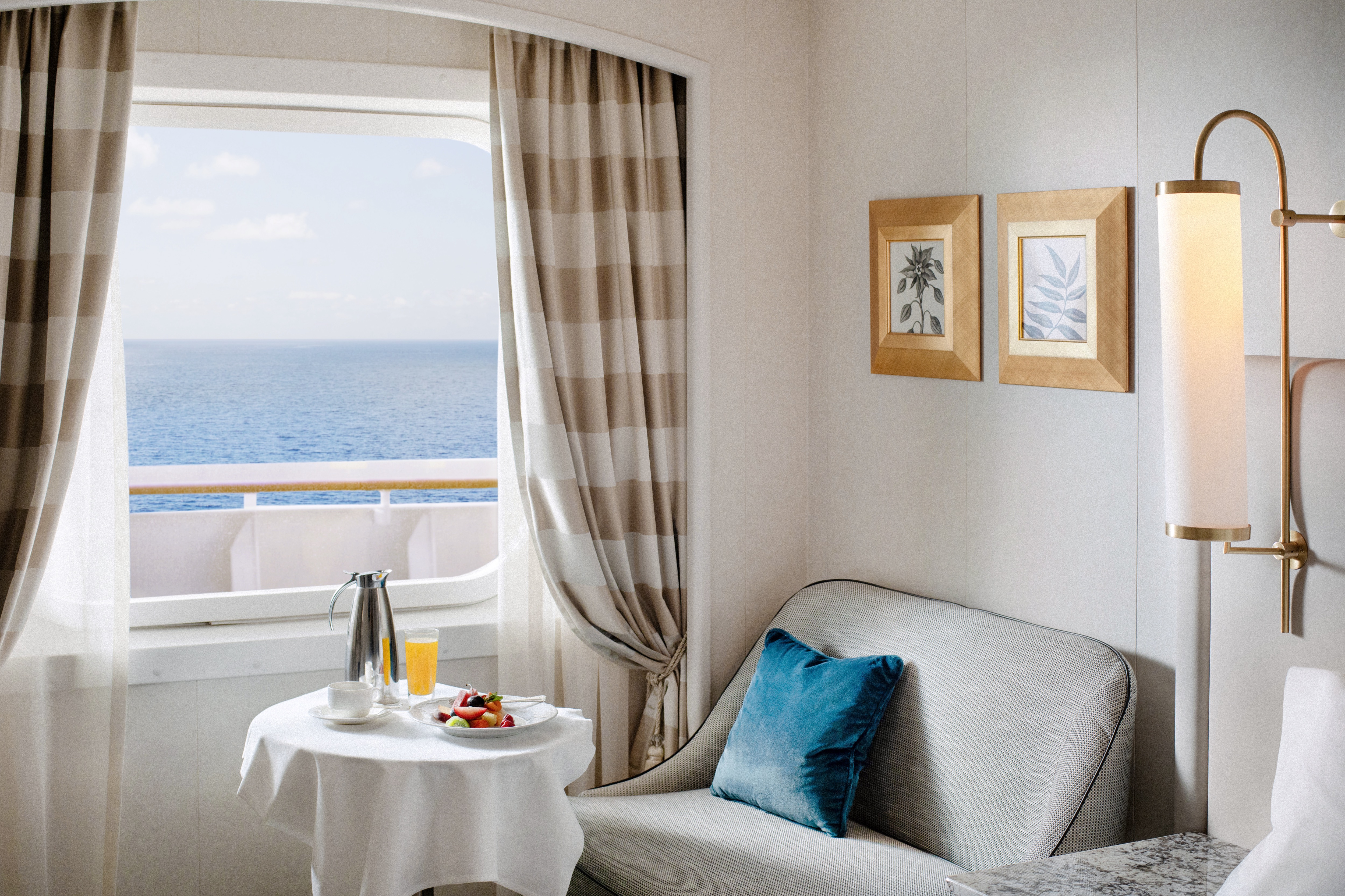
- Large private veranda with teak furniture
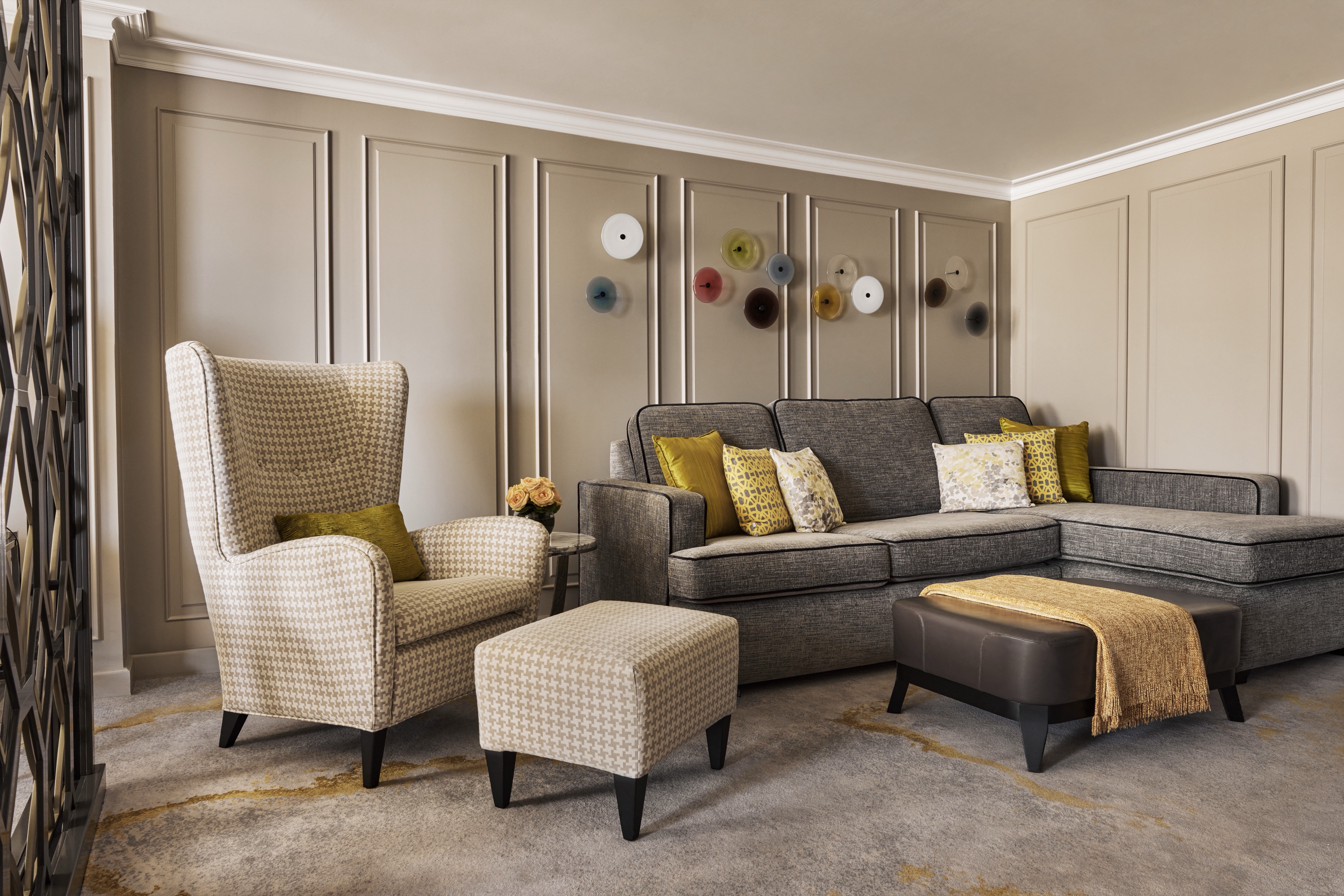
- Spacious living room with TV, custom wool carpets, walnut floors, cabinetry and Swarovski® chandelier
- Dining area with panoramic ocean views
- Separate study
- Custom built-in bar
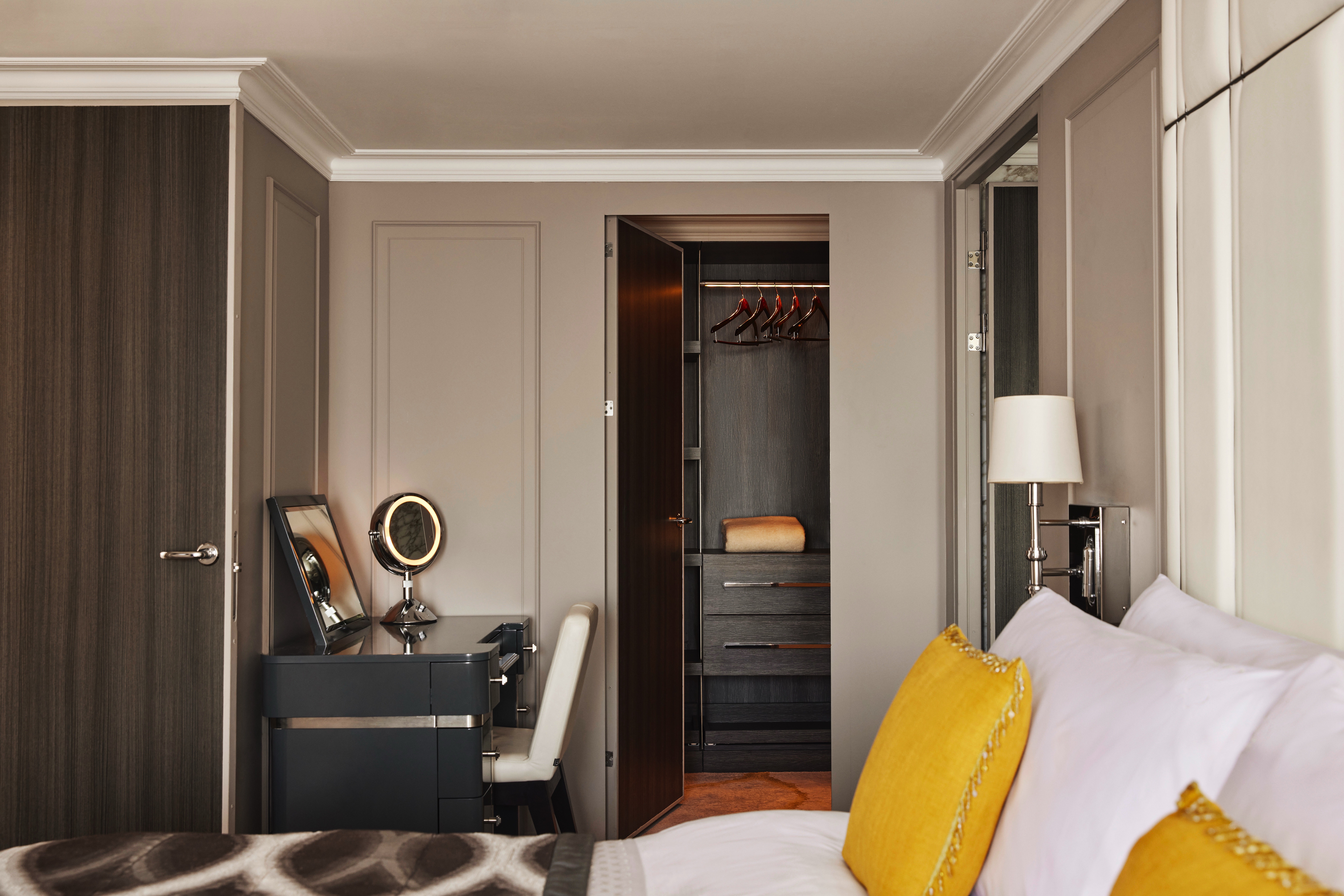
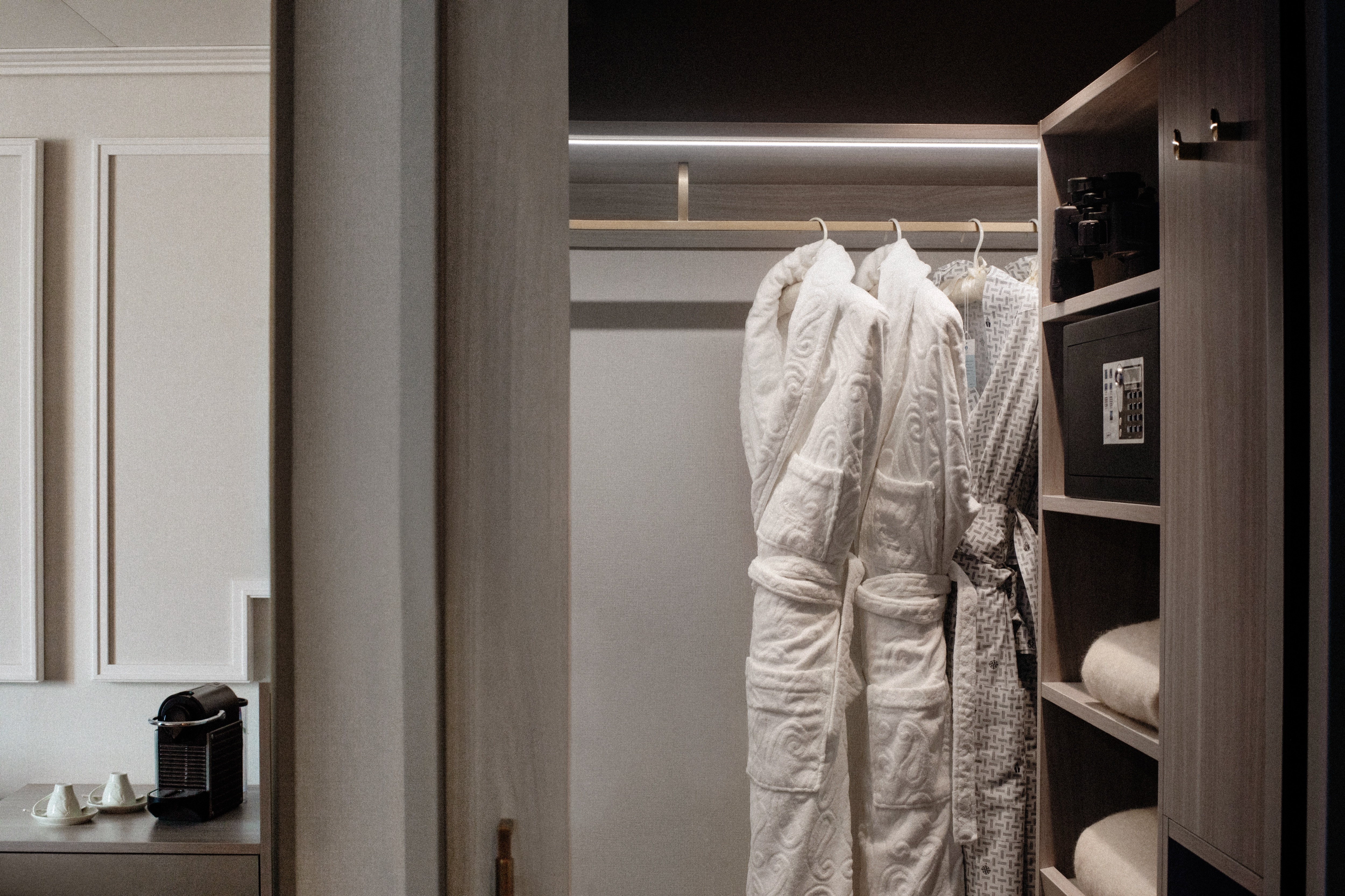
- Large bedroom with queen-size bed or twins, plus his and hers walk-in closets and TV
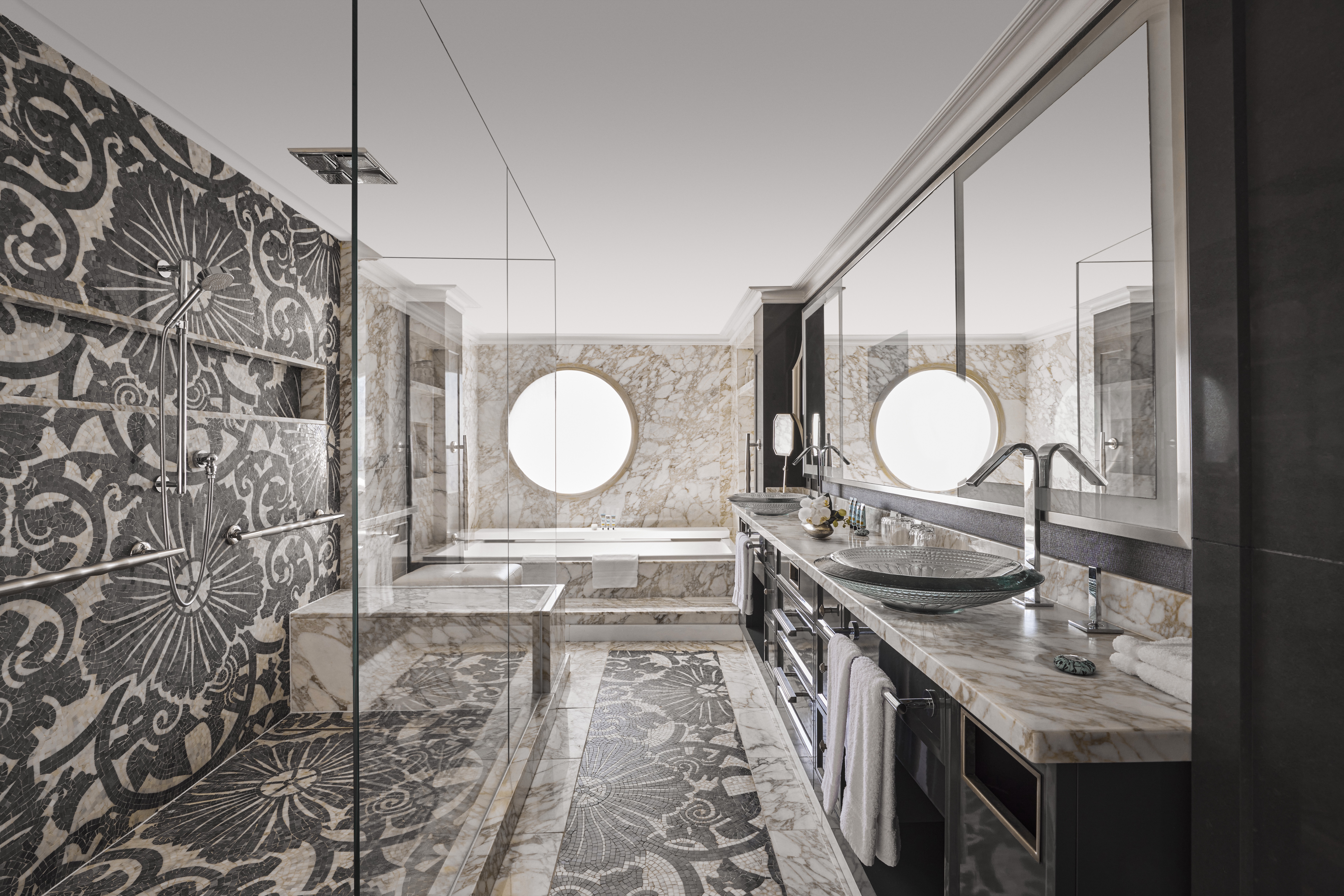
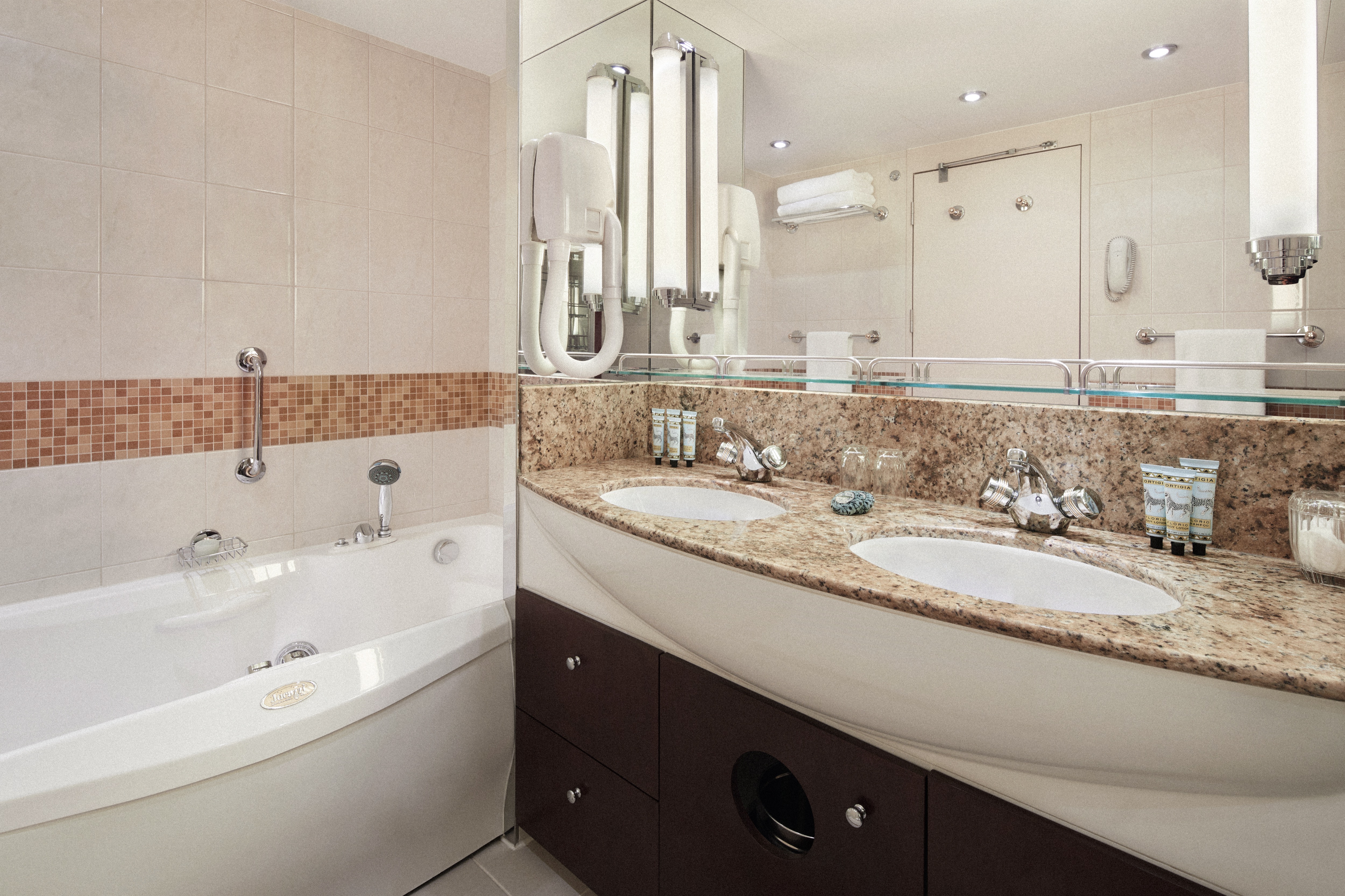
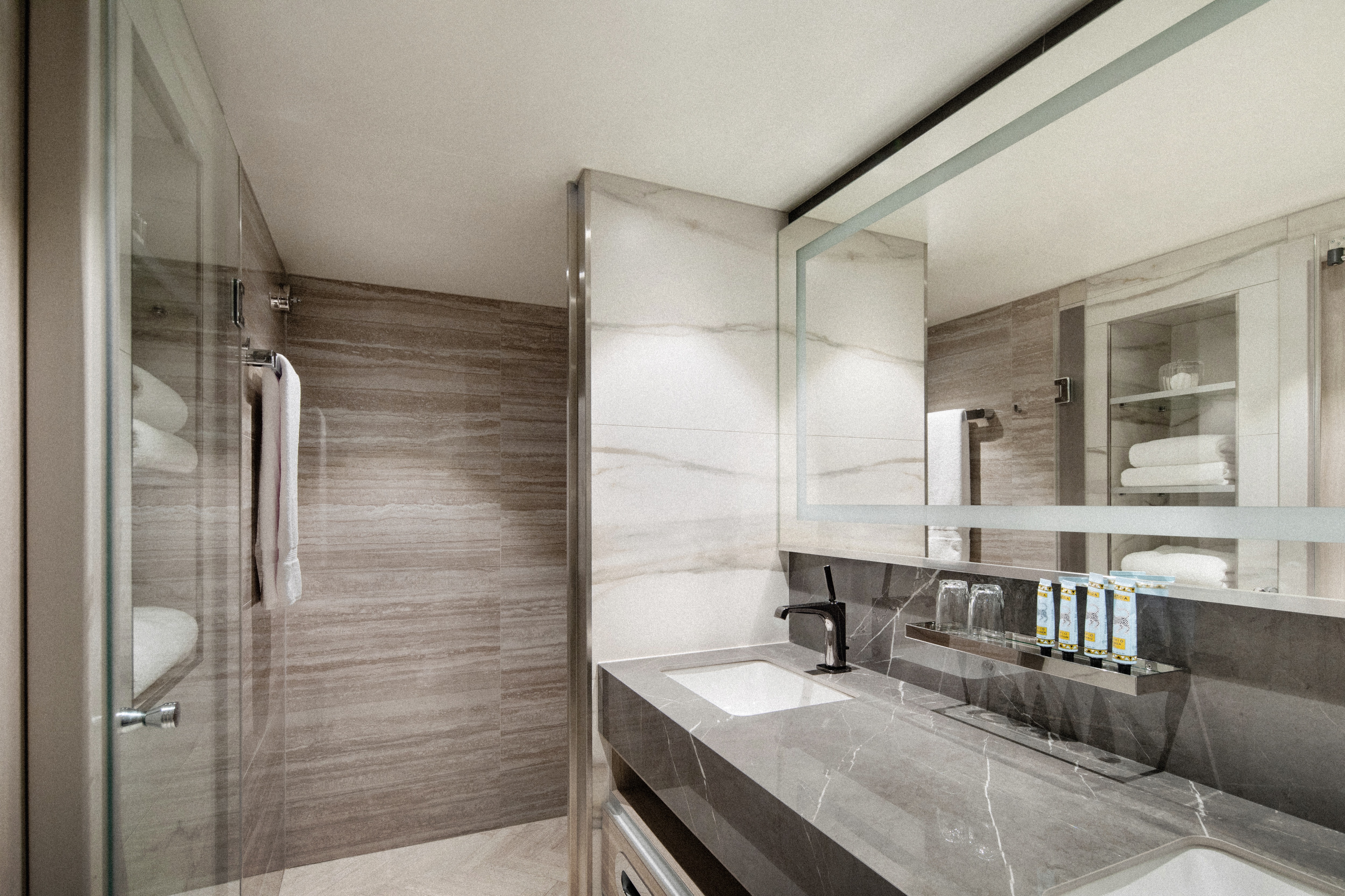
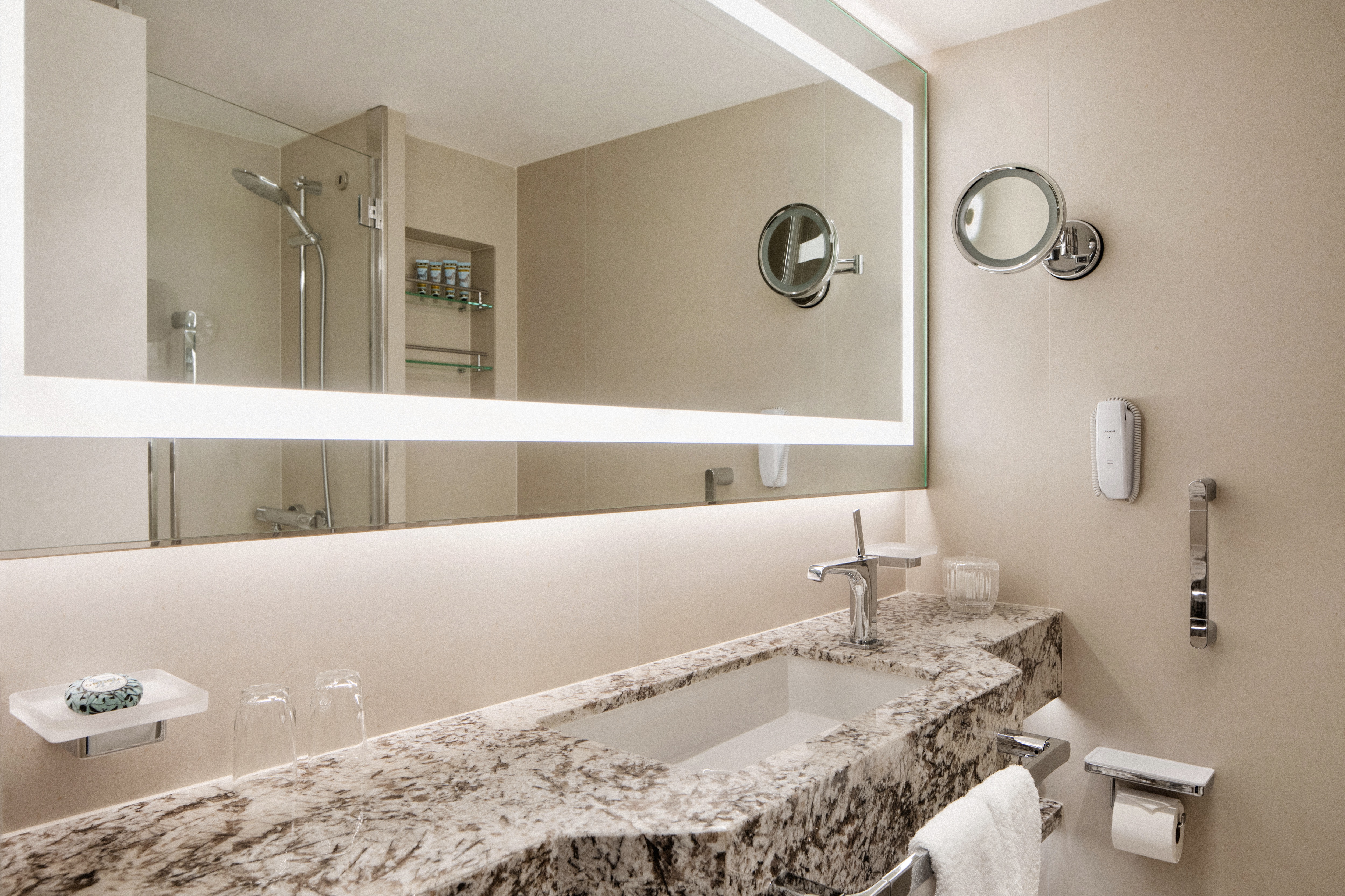
- Master bath with jacuzzi, ocean view, crystal sconces and Calacatta marble floors, separate shower and bidet
- Guest bathroom
SERVICES
- 24 hour in-suite dining
- Unlimited room service from Osteria D'Ovidio and Umi Uma
- Unlimited dining in Osteria D'Ovidio and Umi Uma
- Turndown service with handmade truffles
- Shoeshine service
- Assistance with packing and unpacking
- Free unlimited laundry and dry cleaning, 2nd day service
- In-suite cocktail parties
- Private transfer to and from ship up to 50 miles
AMENITIES
- Welcome champagne
- Complimentary wine and spirits from set menu
- Complimentary soft drinks
- Flowers
- Fresh fruits, daily change, on request only
- Pillow menu (selection from a variety of pillow types)
- Afternoon canapés
- Coffee maker
- Binoculars
- Complimentary unlimited standard WiFi
- In-suite safe
- Interactive tablet for news, updates, and reservations
- Hair dryer
- Hair iron (available upon request)
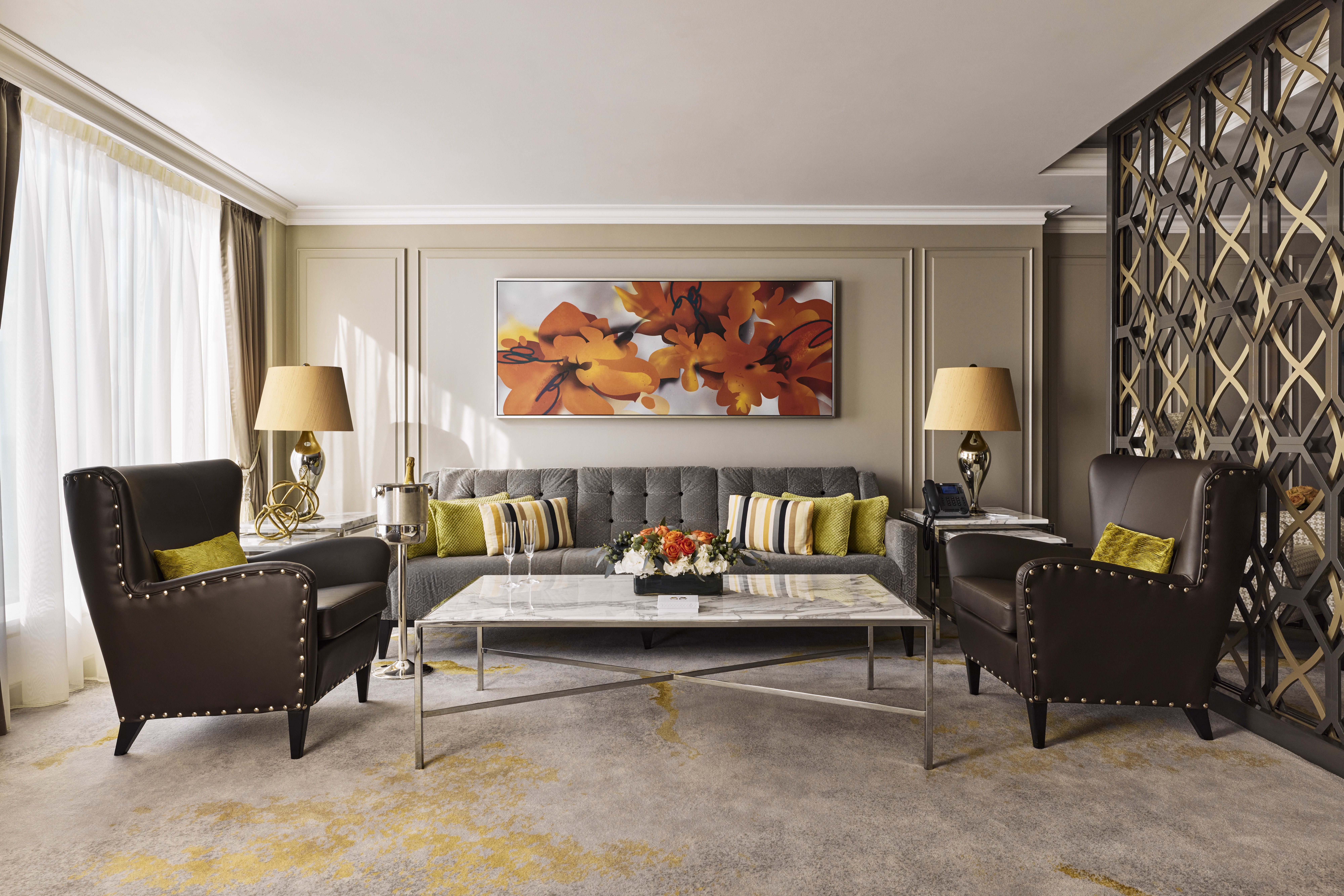
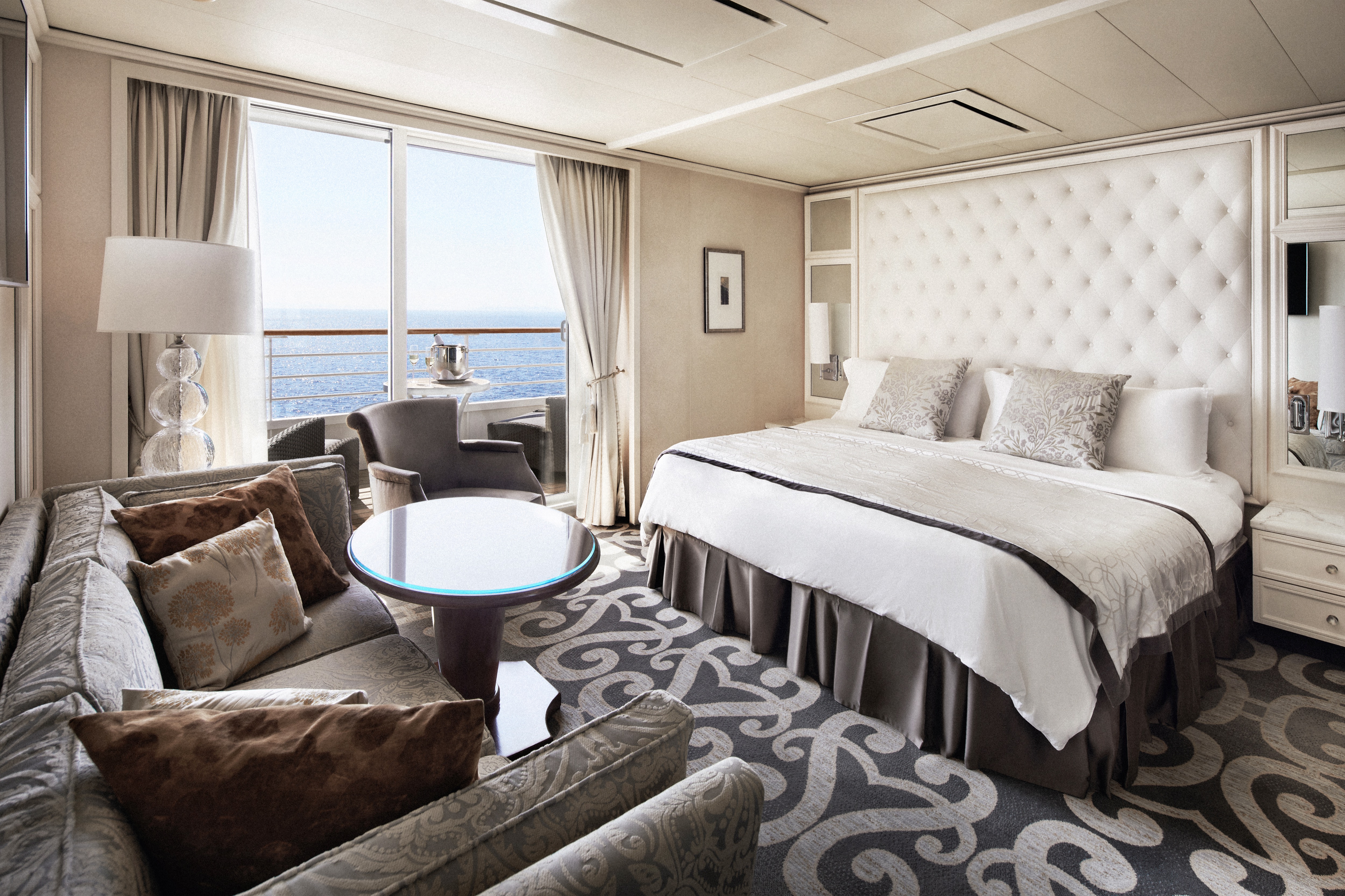
Redesigned in 2023, this luxurious suite features a walk-in wardrobe, separate living room and dining area, Jacuzzi bathtub, separate shower, bidet, and guest bathroom. Guests staying in this stylish home away from home enjoy unlimited dining at specialty restaurants, unlimited laundry services, afternoon canapés, flowers, binoculars, and a coffee maker.
DETAILS
- Large private veranda
- Spacious living room
- Dining area
- Two TV's
- Sophisticated one-touch lighting and surround-sound system
- Separate bedroom area
- Vanity in bedroom
- Queen-size bed or twin beds with sumptuous bedding, and third berth
- Walk-in closet
- Refrigerator
SERVICES
- 24 hour in-suite dining
- Unlimited room service from Osteria D'Ovidio and Umi Uma
- Unlimited dining in Osteria D'Ovidio and Umi Uma
- Turndown service with handmade truffles
- Shoeshine service
- Assistance with packing and unpacking
- Free unlimited laundry and dry cleaning, 2nd day service
- In-suite cocktail parties
- Private transfer to and from ship up to 50 miles
AMENITIES
- Welcome champagne
- Complimentary wine and spirits from set menu
- Complimentary soft drinks
- Flowers
- Fresh fruits, daily change, on request only
- Pillow menu (selection from a variety of pillow types)
- Afternoon canapés
- Coffee maker
- Binoculars
- Complimentary unlimited standard WiFi
- In-suite safe
- Interactive tablet for news, updates, and reservations
- Hair dryer
- Hair iron (available upon request)
DETAILS
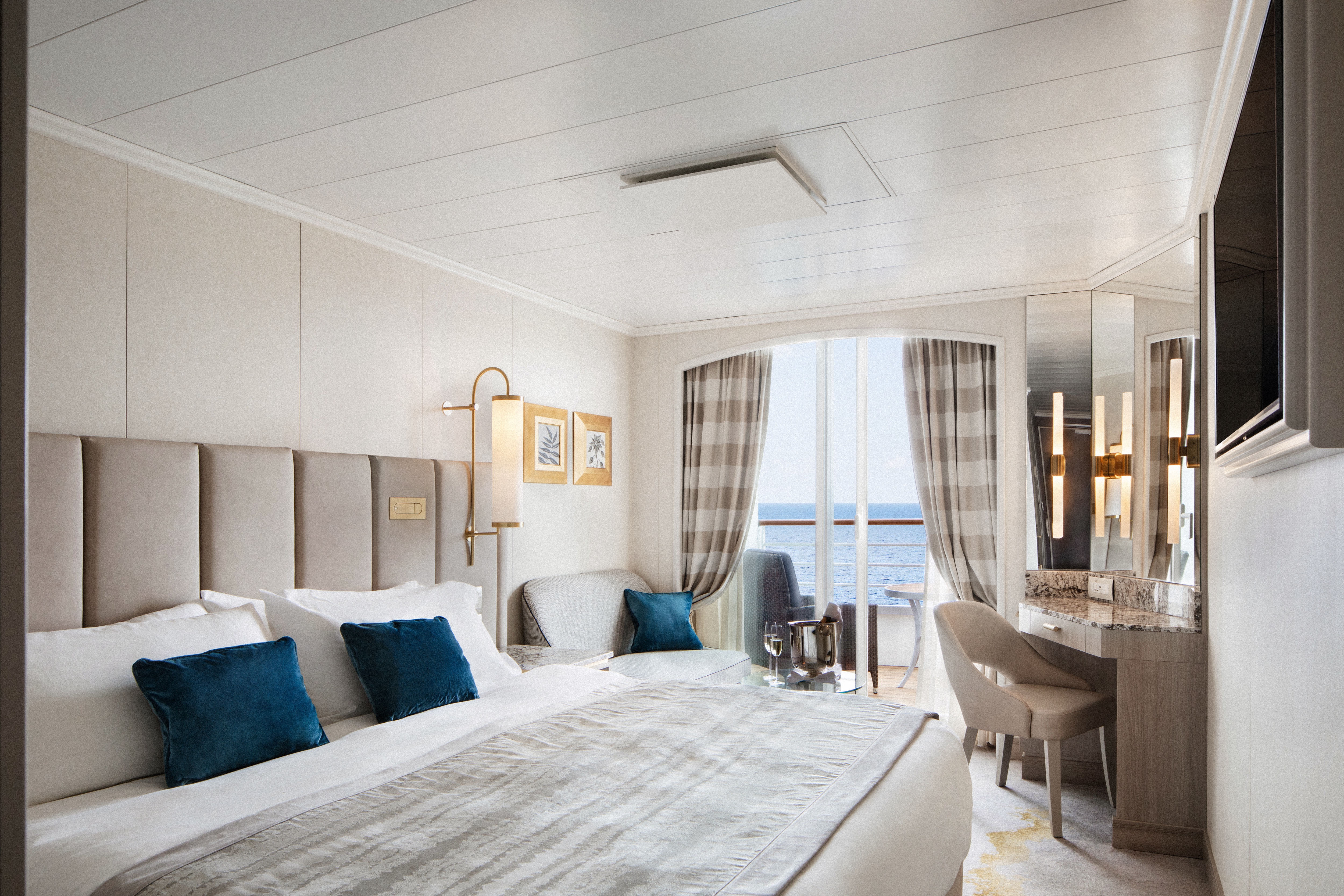
- Private veranda
- Spacious living room
- Queen-size bed or twin beds with sumptuous bedding, and third berth
- Walk-in closet
- Two TV's
SERVICES
- 24 hour in-suite dining
- Shoeshine service
- Assistance with packing and unpacking
- Dry cleaning for five pieces plus one bag of free laundry every 10 cruise days, 2nd day service
- Free pressing (5pcs/day), 2nd day service
AMENITIES
- Welcome champagne
- Complimentary wine and spirits from set menu
- Complimentary soft drinks
- Flowers
- Fresh fruits, daily change, on request only
- Pillow menu (selection from a variety of pillow types)
- Afternoon canapés
- Coffee maker
- Binoculars
- Complimentary unlimited standard WiFi
- In-suite safe
- Interactive tablet for news, updates, and reservations
- Hair dryer
- Hair iron (available upon request)
DETAILS
- Private veranda
- Sizeable living area
- Queen-size bed or twin beds with sumptuous bedding
- Vanity in dressing area
- Walk-in closet
- TV
- Sophisticated one-touch lighting and surround-sound system
SERVICES
- 24 hour in-suite dining
- Turndown service
- Shoeshine service
- Assistance with packing and unpacking
AMENITIES
- Welcome champagne
- Complimentary wine and spirits from set menu
- Complimentary soft drinks
- Fresh fruits, daily change, on request only
- Pillow menu (selection from a variety of pillow types)
- Afternoon canapés
- Coffee maker
- Binoculars
- Complimentary unlimited standard WiFi
- In-suite safe
- Interactive tablet for news, updates, and reservations
- Hair dryer
- Hair iron (available upon request)
- Free pressing (5pcs/day), 2nd day service
DETAILS
- Private veranda
- Spacious living area with sofa
- Queen-size bed or twin beds with sumptuous bedding
- Walk-in shower
- TV
SERVICES
- 24 hour in-suite dining
- Turndown service
- Shoeshine service
- Assistance with packing and unpacking
AMENITIES
- Welcome champagne
- Complimentary wine and spirits from set menu
- Complimentary soft drinks
- Fresh fruits, daily change, on request only
- Pillow menu (selection from a variety of pillow types)
- Complimentary unlimited standard WiFi
- In-suite safe
- Interactive tablet for news, updates, and reservations
- Hair dryer
- Hair iron (available upon request)
DETAILS
- Large picture window
- Sizeable living area with sofa
- Queen-size bed or twin beds with sumptuous bedding
- Walk-in shower
- TV
SERVICES
- 24 hour in-suite dining
- Turndown service
- Shoeshine service
- Assistance with packing and unpacking
AMENITIES
- Welcome champagne
- Complimentary wine and spirits from set menu
- Complimentary soft drinks
- Fresh fruits, daily change, on request only
- Pillow menu (selection from a variety of pillow types)
- Complimentary unlimited standard WiFi
- In-suite safe
- Interactive tablet for news, updates, and reservations
- Hair dryer
- Hair iron (available upon request)
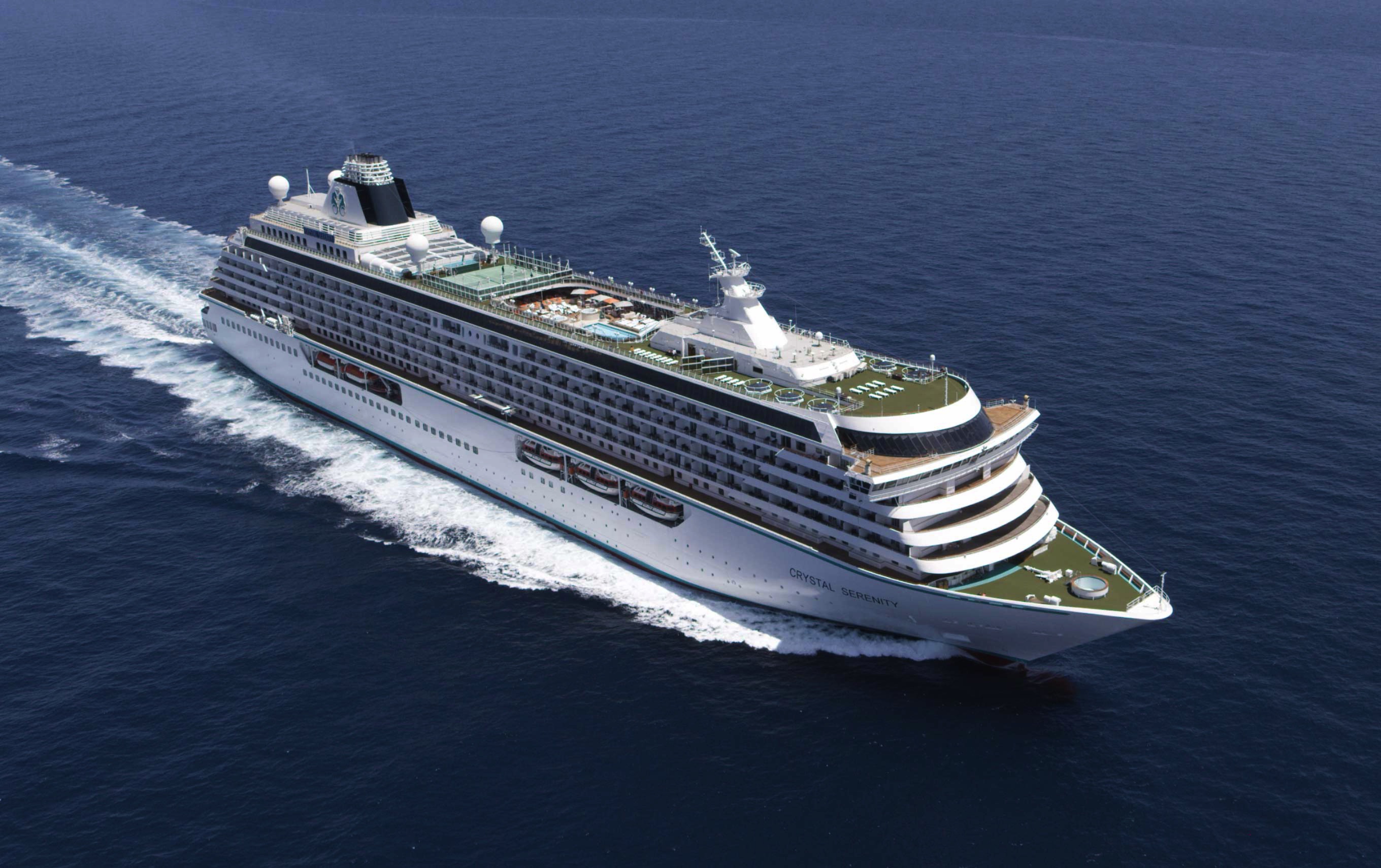
Crystal Serenity
With an industry-leading space to guest ratio across an array of social areas, Crystal Serenity offers the utmost comfort, quality, personalization and choice.
Ship Facts
| Launch Year | 2003 | ||||||||
| Refit Year | 2023 | ||||||||
| Language | en-US | ||||||||
| Gross Tonnage | 68870 | ||||||||
| Length | 250 | ||||||||
| Width | 32 | ||||||||
| Currency | USD | ||||||||
| Speed | 22 | ||||||||
| Capacity | 740 | ||||||||
| Crew Count | 600 | ||||||||
| Deck Count | 9 | ||||||||
| Cabin Count | 545 | ||||||||
| Large Cabin Count | 0 | ||||||||
| Wheelchair Cabin Count | 8 | ||||||||
| Electrical Plugs |
|
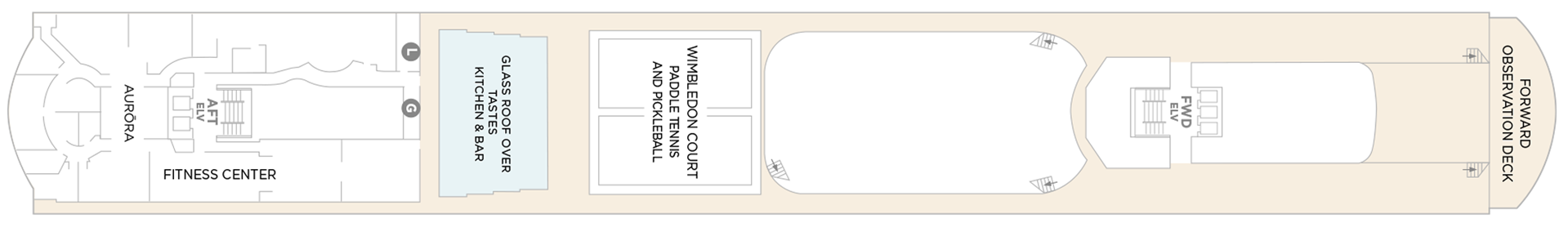
Deck 13
- Sauna + Steam Room
- Aurora
- Fitness Center
- Glass Roof Over Beefbar
- Wimbledon Court Paddle Tennis And Pickleball
- Forward Observation Deck
- Elevator
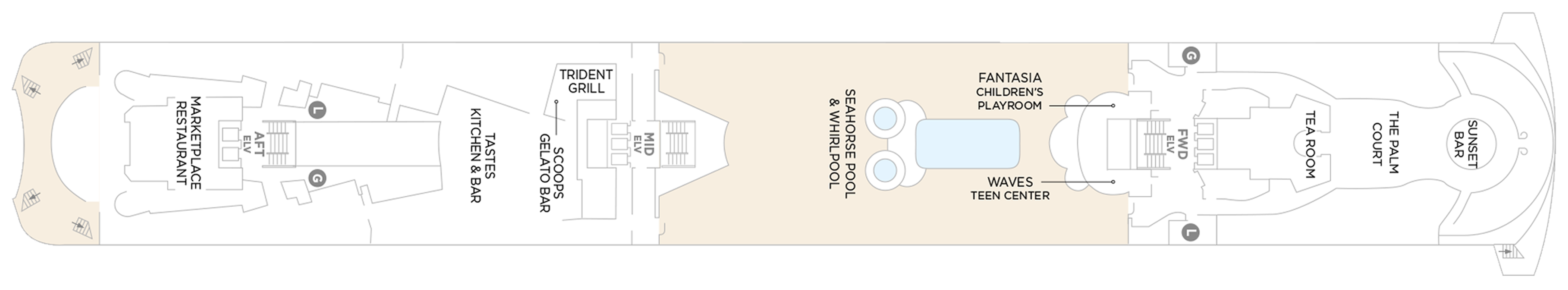
Deck 12
- Marketplace Restaurant
- Washroom
- Beefbar
- Trident Grill
- Scoops Gelato Bar
- Seahorse Pool & Whirlpool
- Fantasia Children's Playroom
- Waves Teen Center
- Tea Room
- The Palm Court
- Sunset Bar
- Elevator
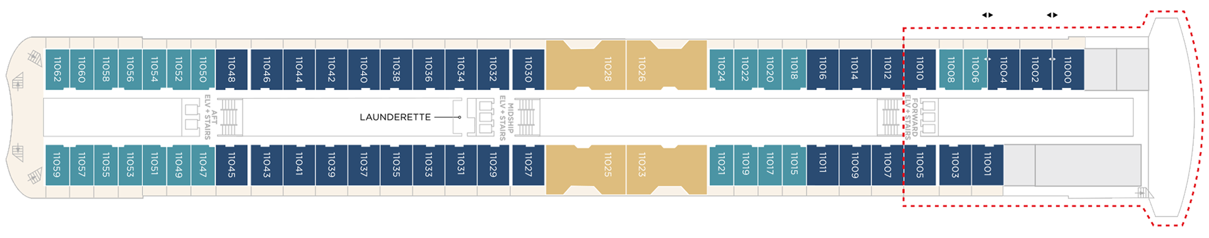
Deck 11
- Crystal Penthouse Suite
- Sapphire Veranda Suite
- Aquamarine Veranda Suite
Launderette
- Elevator
Suites & Guest Rooms Beyond The Forward Elevators Are Subject To Alternative Pricing
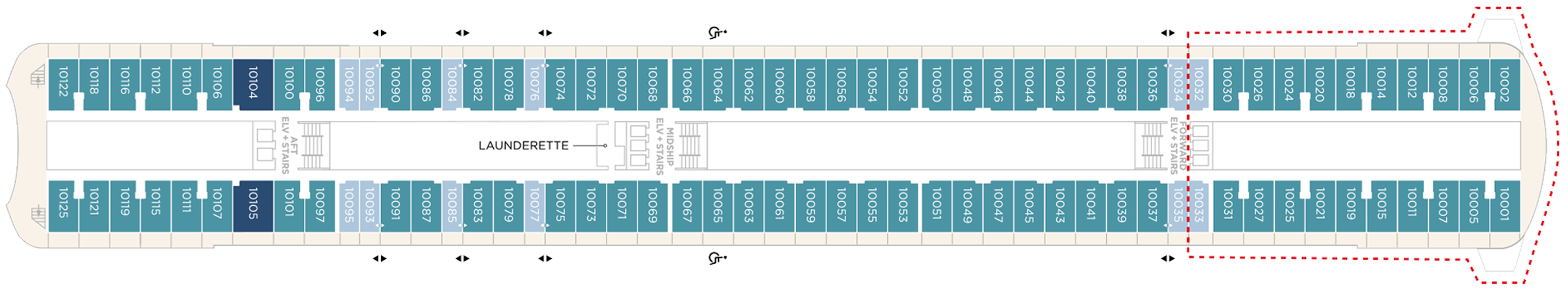
Deck 10
- Sapphire Veranda Suite
- Double Guest Room with Veranda
- Aquamarine Veranda Suite
Launderette
- Elevator
Suites & Guest Rooms Beyond The Forward Elevators Are Subject To Alternative Pricing
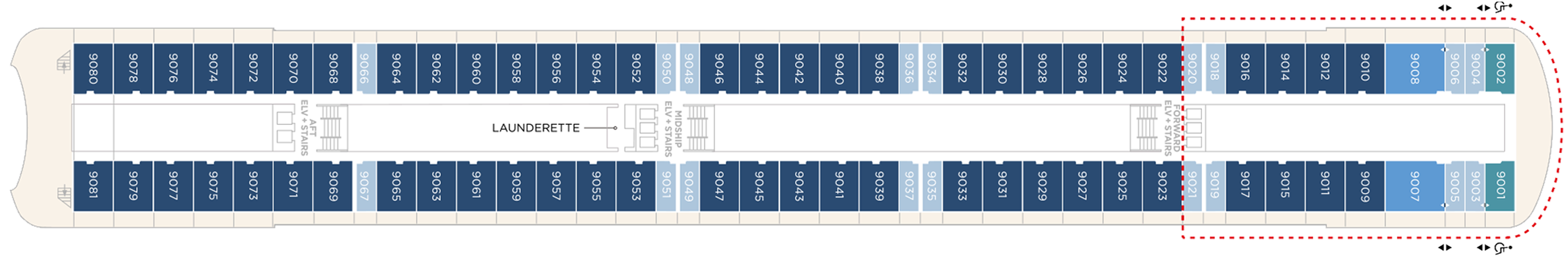
Deck 9
- Junior Crystal Penthouse Suite
- Sapphire Veranda Suite
- Double Guest Room with Veranda
- Aquamarine Veranda Suite
- Launderette
- Elevator
Suites & Guest Rooms Beyond The Forward Elevators Are Subject To Alternative Pricing
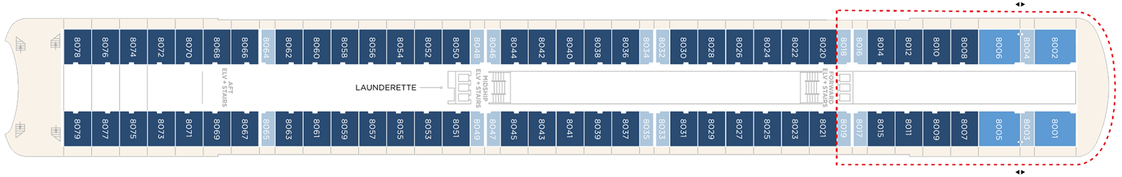
Deck 8
- Junior Crystal Penthouse Suite
- Double Guest Room with Veranda
- Sapphire Veranda Suite
- Launderette
- Elevator
Suites & Guest Rooms Beyond The Forward Elevators Are Subject To Alternative Pricing
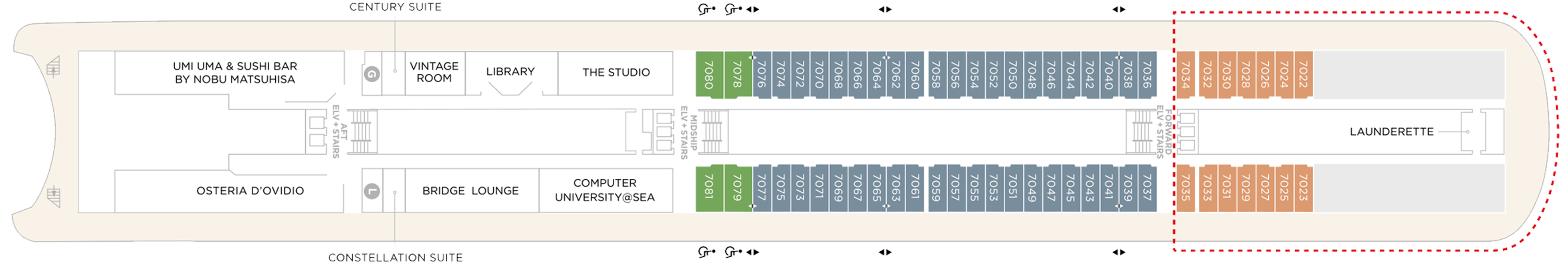
Deck 7
- Aquamarine Ocean View Suite (Accessible Suites)
- Double Guest Room With Veranda
- Single Guest Room, Ocean View
- Century Suite
- Cashier
- Uma Uma & Sushi Bar by Nobu Matsuhisa
- Bridge Lounge
- Vintage Room
- Library
- Osteria D'Ovidio
- Computer University@Sea
- The Studio
- Elevators
Suites & Guest Rooms Beyond The Forward Elevators Are Subject To Alternative Pricing
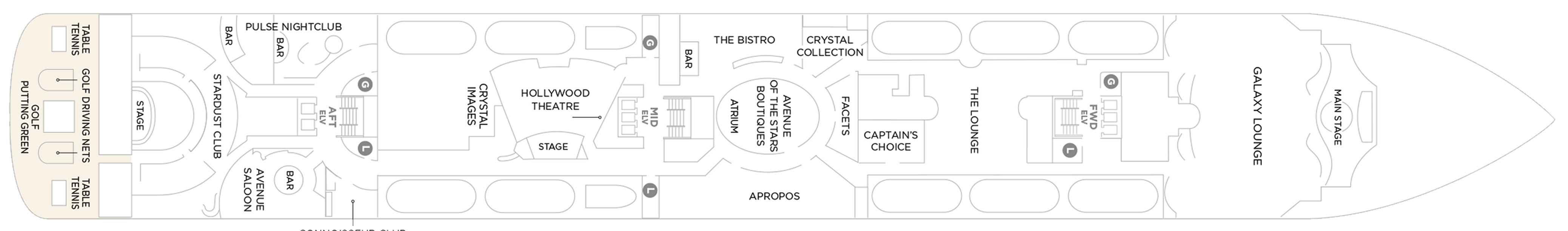
Deck 6
- Main Stage
- Apropos
- Facets
- Avenue Of The Stars Boutiques
- Atrium
- Avenue Saloon
- Connoisseur Club
- Crystal Images
- Golf Driving Nets
- Pulse Night Club
- Elevators
- Stardust Club
- Stage
- Table Tennis
- Putting Green
- Hollywood Theatre
- Galaxy Lounge
- The Lounge
- Crystal Collection
- The Bistro
Deck 5
- Medical Center
- Bar
- Concierge Desk
- Crystal Cove
- Elevators
- Future Cruises & Loyalty Manager
- Reception
- Shore Excursion Desk
- Crystal Plaza
- Waterside Restaurant

Our award-winning cuisine is created and influenced by pioneers in the global food scene, with nine distinct complimentary venues to choose from. Open seating with extensive dining options are tailored around the personal preferences of our guests, allowing them to choose exactly what they want at a time that works for them. Whether that be a late breakfast, six-course wine pairing lunch, or dinner in our exclusive Osteria d’Ovidio or Umi Uma.
All inclusive – however its one complimentary reservation in each specialty restaurant (Umi Uma and Osteria) is included on sailings of 11 days or less, two reservations on sailings between 12 and 22 days, three reservations on sailings 23 days or more, and unlimited reservations for all full World Cruise guests”. However guests can pay to dine outside of their allowance at £50 pp which is great value for these 2 specialist restaurants
Waterside Restaurant
Waterside is where the art of fine dining is elevated to breathtaking heights. Classic dishes are updated with a contemporary twist.
The main dining room features open seating and tables for two, four, and eight guests. Open for breakfast, lunch, and dinner. No reservations are required.
Umi Uma
UMI UMA is one of Crystal's award-winning specialty dining offerings. Set in an elegantly modern setting and created by legendary Master Chef Nobuyuki (Nobu) Matsuhisa, dishes are inspired by the exotic array and traditions of the Orient.
Guests will again be able to dine on signature entrées such as Nobu-Style Black Cod, Grilled Chilean Sea Bass, Wagyu Beef Filet Steak, and some of the freshest sushi available at sea.
Beefbar
The most exciting flavors from the global street-food scene – Beef, Reef and Leaf – are fashioned from the freshest ingredients by creative chefs and served for sharing in stylish surroundings.
Beefbar’s curated menu features prime cuts from renowned regions, including Wagyu from Australia, Black Angus from the United States and and the flavorful Kobe beef from Japan. Each cut is meticulously chosen for its quality and flavor profile, ensuring a unique dining experience for every meat lover. Join us at sea to savor the finest beef, prepared with expert craftsmanship and served the Beefbar way, onboard Crystal’s ships.
- Beefbar is open for lunch and dinner
- Reservations are required for dinner
Osteria D'Ovidio
It’s the moment we’ve been waiting for – our new menu for Osteria d’Ovidio has arrived on Crystal Symphony and on Crystal Serenity. This exclusive collaboration with the Alajmo brothers signals a prestigious new era for our signature Italian restaurant. Massimiliano, the youngest chef ever to be awarded three Michelin stars, and Raffaele, CEO of the celebrated Alajmo restaurants in Italy, which include Le Calandre in Rubano, and Gran Caffè Quadri and Ristorante Quadri in St. Mark’s Square, Venice, have brought their unparalleled expertise to specialty dining on both ships. We can’t wait for you to try their dishes – exclusively on Crystal.
An unparalleled fine-dining experience courtesy of the Michelin-rated Alajmo brothers takes center stage at Osteria d'Ovidio. Named for our owner, Manfredi Lefebvre d'Ovidio, this restaurant specializes in show-stopping Italian cuisine. Reservations are required and are limited per sailing.
Every dish embodies passion, precision, and prestige, blending traditional Italian flavors with Chef Alajmo's culinary approach, which emphasizes lightness and depth of flavor. You can choose from authentic regional dishes, signature creations from Le Calandre, and dishes inspired by Venetian cuisine. From a refined carbonara to lamb chops with a herb crust, there's something to delight every palate.
Trident Grill
Enjoy a burger with a view. Our pool restaurant and grill offer a comfortable terrace highlighted by an elegant design, making it the perfect spot for outdoor dining.
The Trident serves lunch and snacks throughout the day - burgers, melts and strip steak cooked to order, crispy fries and salads.
The Bistro
A nod to the mythic bars and bistros of Paris. Celebrate the classics in this spacious and airy café that serves light bites from dawn to dusk.
The Bistro is a delightful daytime relaxing cafe that offers delicious light meals, with panoramic views of the sparkling sea.
The Vintage Room
The Vintage Room offers guided pairings and dinners highlighting the vast selection of wines in the ship’s onboard cellar. This intimate, innovative concept offers guests an education in fine wine and cuisine, allowing them to gain privileged insights into the art of enology. In addition to daytime tastings and discussions, guests may enjoy a variety of private wine-themed lunches and dinners by special arrangement with the Head Sommelier.
Scoops Gelato Bar
Enjoy authentic Italian gelato with a sea view, hand-crafted by the celebrated artisans at Badiani, using expertise perfected over generations since its founding in Florence, Italy, in 1932. Choose from more than 20 signature flavors, slow-churned with natural ingredients, including Buontalenti, Cioccolatissimo, and Stracciatella, as well as refreshing fruit sorbets.
Marketplace
This sophisticated buffet-style restaurant features a dizzying array of hot and cold choices for those who like a little of everything.
24 Hours In-Suite Dining
Enjoy a meal from the comfort of your suite while relaxing in Crystal comfort. Select from our inspired menu to delight you while you stay in, watch a movie or read a favorite book.
Tea Time
Tastes Kitchen & Bar
A new definition of traveling with taste. Sumptuous, regionally inspired tapas-style cuisine is the perfect combination of sophisticated style and casual dining.
Each evening Crystal brings together a cast of world-class performers, entertainers and hosts. Whether you’re looking for theatrical entertainment or the latest Hollywood release, our lounges, ballrooms, night clubs and screening rooms can cater to your every mood.
Our two elegant vessels host an equally exceptional offering including world-renowned restaurants, restorative spas and endless opportunity for inspiration and enrichment, tied together by unparalleled personal service.
Casino De Monte-Carlo
Le Casino de Monte-Carlo is offering a new and unique experience onboard. Place your bets on table games with the unique savoir-faire of Monaco’s world-famous casino or get excited to a dynamic range of slots to hit the jackpot. An ultimate way to embrace the thrill of the game in an elegant atmosphere adorned in the hues of the historical building.
Crystal Cove
An ideal refreshment stop any time of the day, and the perfect place to meet friends for a pre-dinner cocktail. Enjoy a variety of musical styles as the day turns into night.
Library
A well-stocked library containing over 2,000 books on a range of subjects from classics to popular biographies, history to contemporary mysteries. Plus enjoy an ample selection of magazines and board games perfect for poolside reading
Palm Court
Featuring large sky lights, floor-to-ceiling windows and a fabulous 270-degree forward view, this venue is perfect for afternoon tea, social gatherings and dancing.
Seahorse Pool
Our Seahorse Pool, with plenty of surrounding deck space to sunbathe, relax and read while enjoying a cool drink in the afternoon.
Apropos & Facets Onboard Shopping
Heighten the experience on board with a selection of fine jewelry, watches and cruise wear available in our arcade, alongside designer apparel. Make the most of being at sea with a selection of duty free items available.
Stardust Club and Supper Club
On selected evenings before and after dinner, this entertainment lounge features dancing, production spot shows, cabaret performances and other themed events. Additionally, on select nights, Stardust will open the doors for Supper Club for up to 116 guests to enjoy an evening show where they can dine and dance at the same time. Supper Club is by reservation only.
Pulse Night Club
An intimate lounge for a late-night drink, dancing or a place to let loose with karaoke.
Galaxy Lounge
Performances are the focal point here, with appearances by fantastic Broadway-style performers and headline entertainers. Drink service provided before each show.
Hollywood Theatre
The ship's sleek cinema for recent-released movies, live sport events, guest lectures and religious services.
Connoisseur Club
An elegant space to indulge in the finest cigars and cognacs.
Computer University@Sea
Our innovative Computer lab onboard led by a team of tech experts.
Crystal Plaza
Crystal Plaza can be found on Deck 5.
Avenue Saloon
Signature piano bar with an intimate ambience. The perfect setting for a cocktail before and after dinner.
Bridge Lounge
The Bridge Lounge can be found on Deck 7.
Reception & Atrium
The Reception can be found on Deck 5.
Observation Deck
More information coming soon.