Hong Kong to Tokyo
Hong Kong to Tokyo
Cruise overview
WHY BOOK WITH US?
- ✔ The Deluxe Cruises’ team has extensive experience in ultra-luxury cruising.
- ✔ Call now to speak to our helpful and experienced Cruise Concierge team.
- ✔ Enjoy our Unique Deluxe Cruises Bonus for substantial savings.
- ✔ Our team will tailor your holiday to your exacting requirements.
- ✔ As agents, we work under the protection of each cruise lines ABTA / ATOL licences
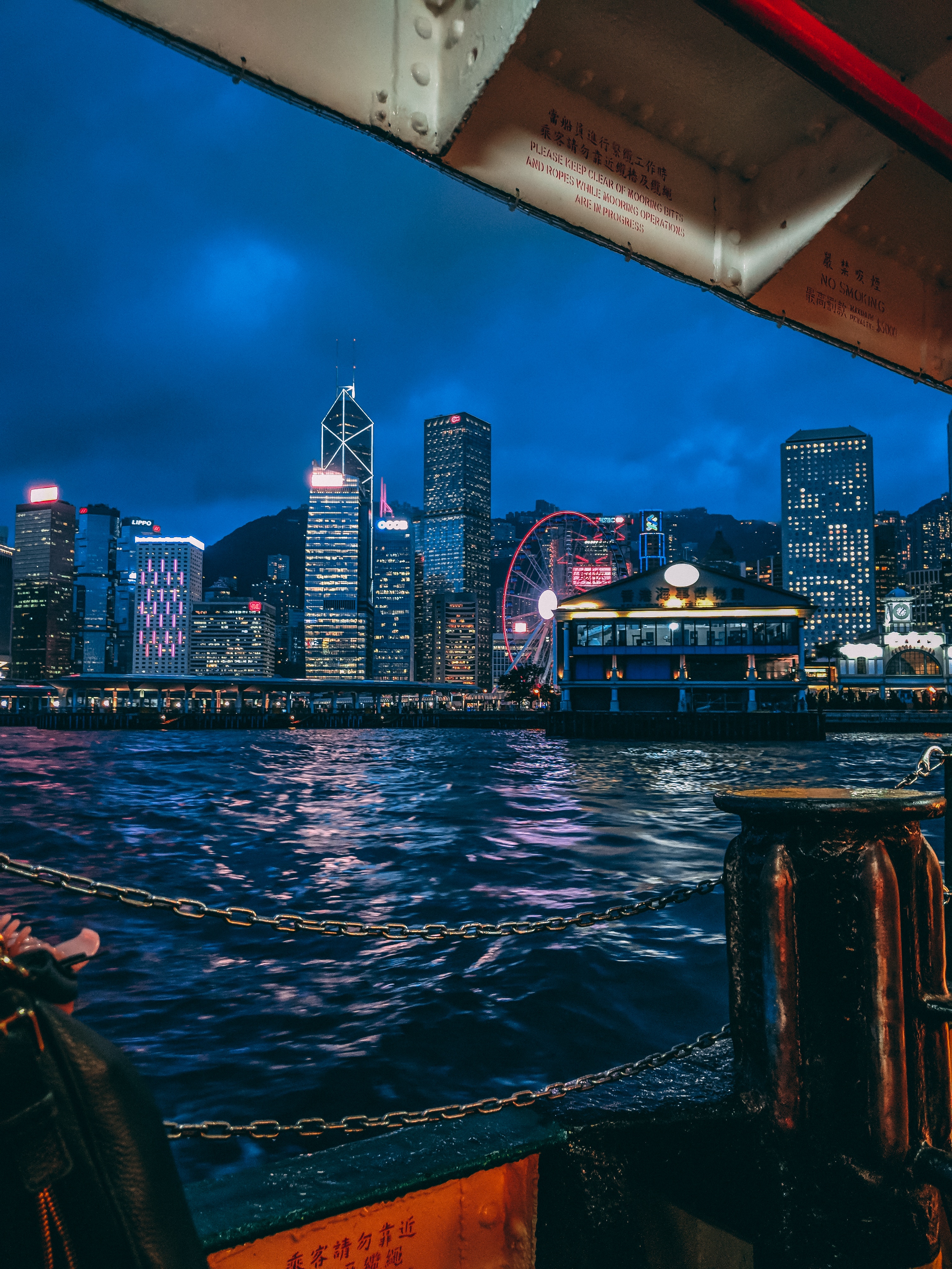
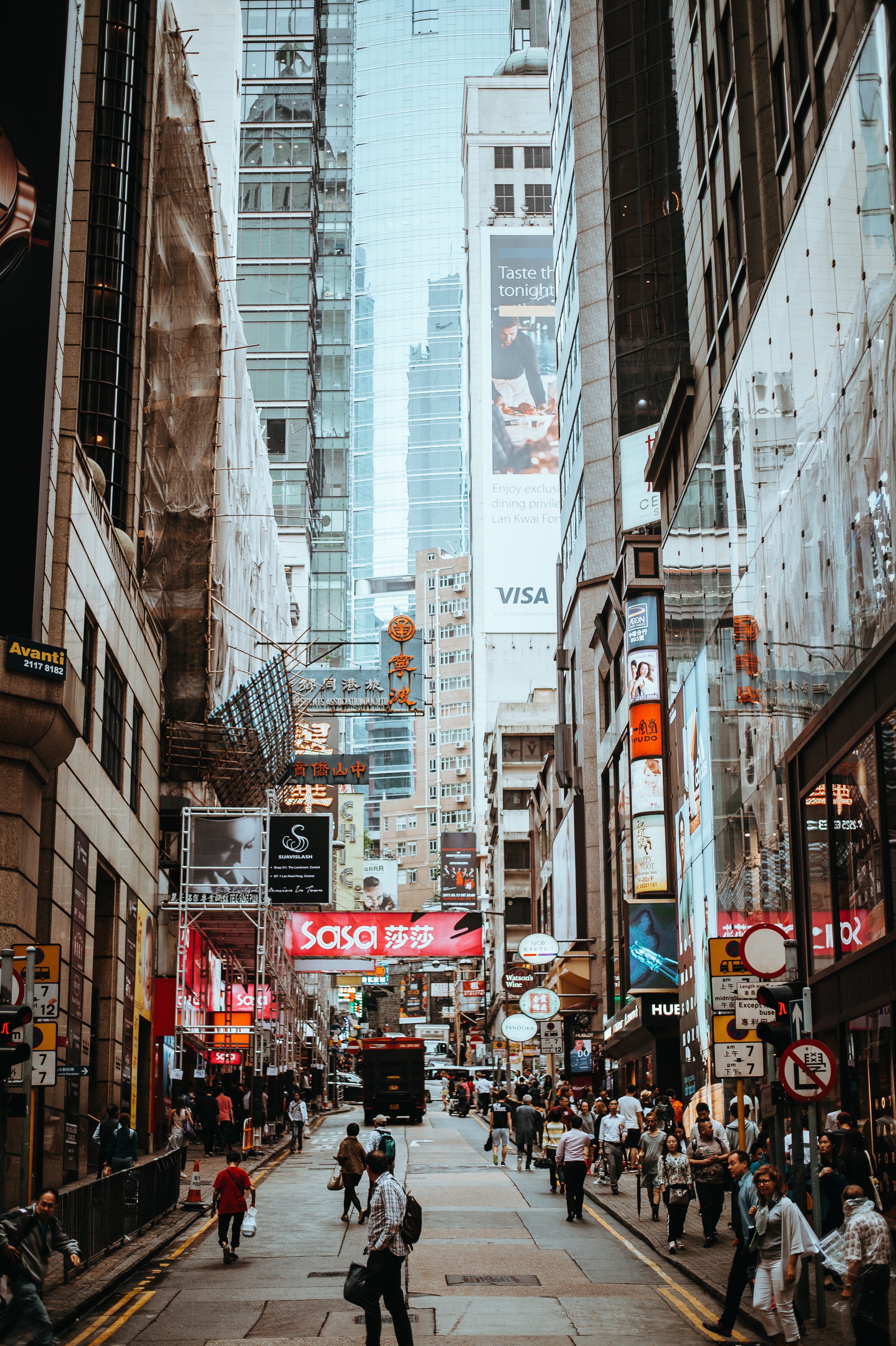
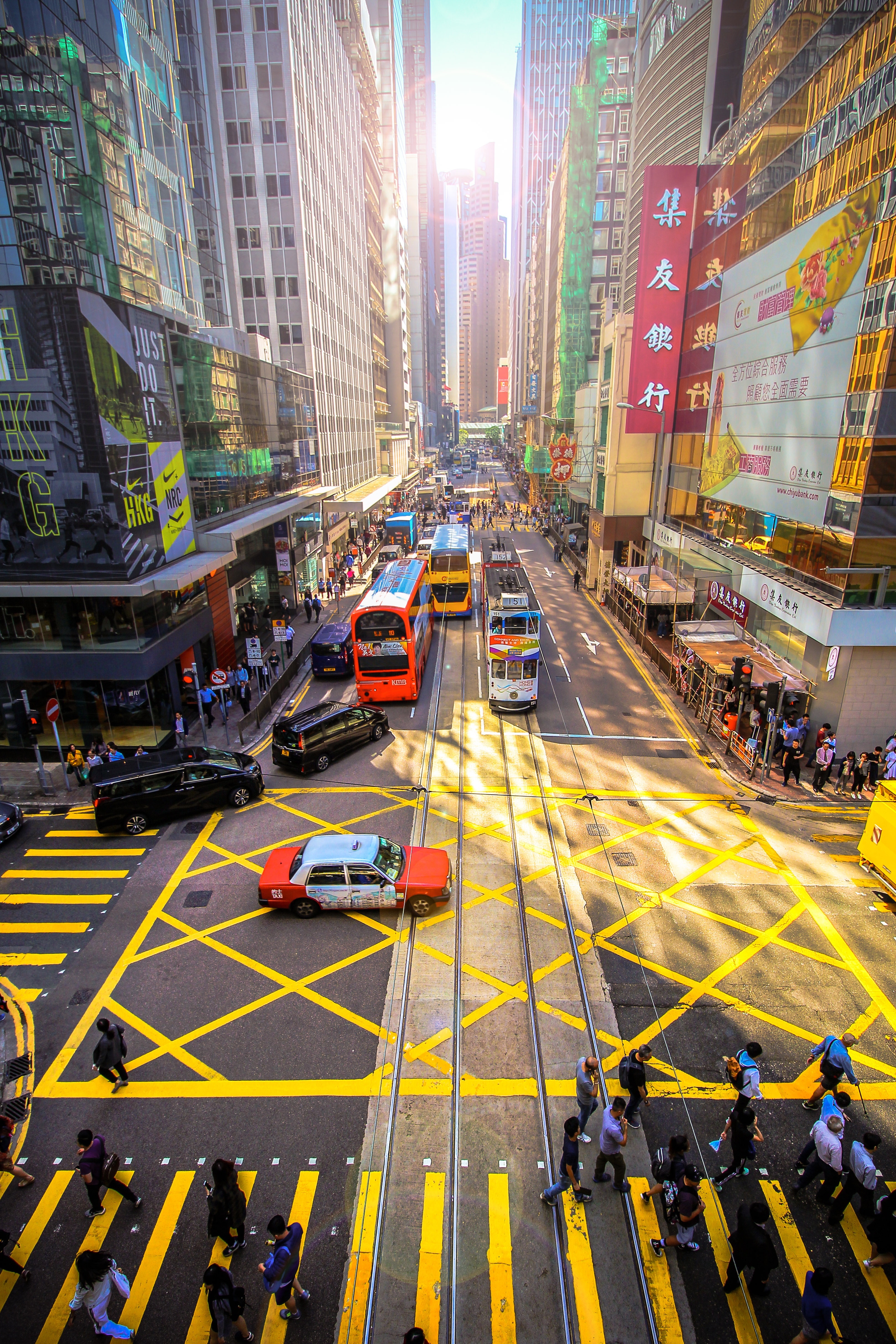
About Hong Kong
The Hong Kong Island skyline, with its ever-growing number of skyscrapers, speaks to ambition and money. Paris, London, even New York were centuries in the making, while Hong Kong's towers, bright lights, and glitzy shopping emporia weren't yet part of the urban scene when many of the young investment bankers who fuel one of the world's leading financial centers were born. Commerce is concentrated in the glittering high-rises of Central, tucked between Victoria Harbor and forested peaks on Hong Kong Island's north shore. While it's easy to think all the bright lights are the sum of today's Hong Kong, you need only walk or board a tram for the short jaunt west into Western to discover a side of Hong Kong that is more traditionally Chinese but no less high-energy. You'll discover the real Hong Kong to the east of Central, too, in Wan Chai, Causeway Bay, and beyond. Amid the residential towers are restaurants, shopping malls, bars, convention centers, a nice smattering of museums, and—depending on fate and the horse you wager on—one of Hong Kong's luckiest or unluckiest spots, the Happy Valley Racecourse. Kowloon sprawls across a generous swath of the Chinese mainland across Victoria Harbour from Central. Tsim Sha Tsui, at the tip of Kowloon peninsula, is packed with glitzy shops, first-rate museums, and eye-popping views of the skyline across the water. Just to the north are the teeming market streets of Mong Kok and in the dense residential neighborhoods beyond, two of Hong Kong's most enchanting spiritual sights, Wong Tai Sin Temple and Chi Lin Nunnery. As you navigate this huge metropolis (easy to do on the excellent transportation network), keep in mind that streets are usually numbered odd on one side, even on the other. There's no baseline for street numbers and no block-based numbering system, but street signs indicate building numbers for any given block.
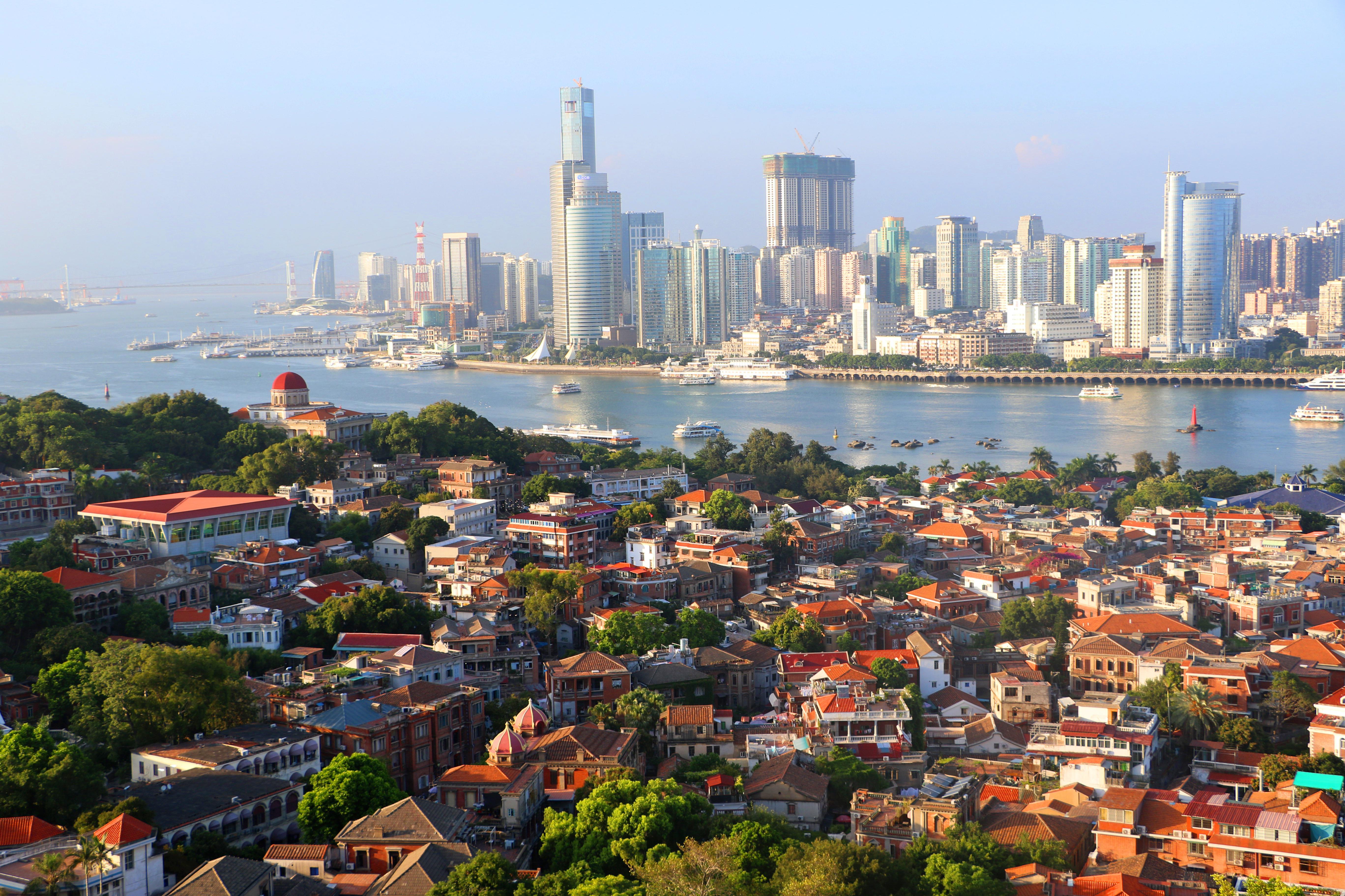
About Xiamen
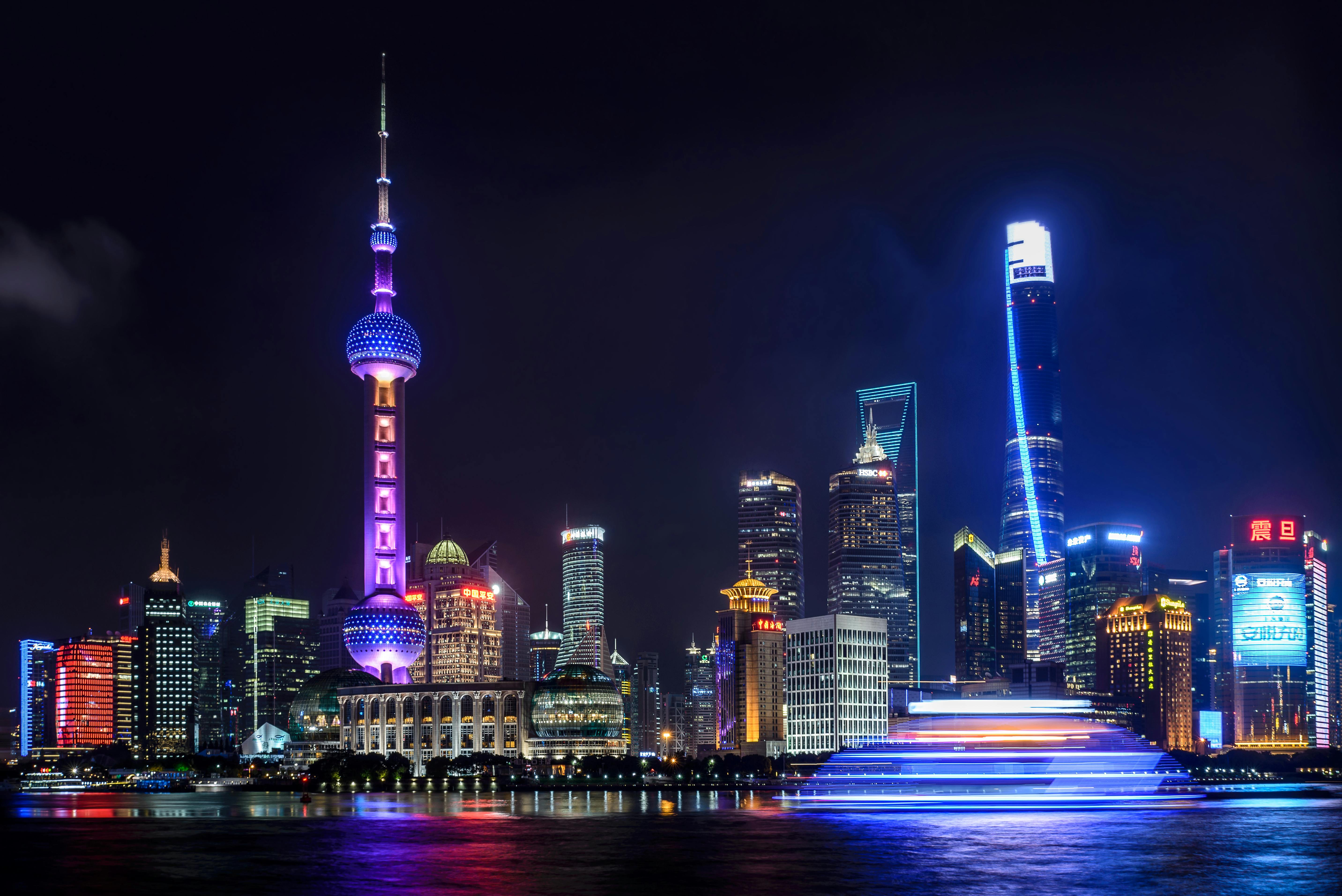
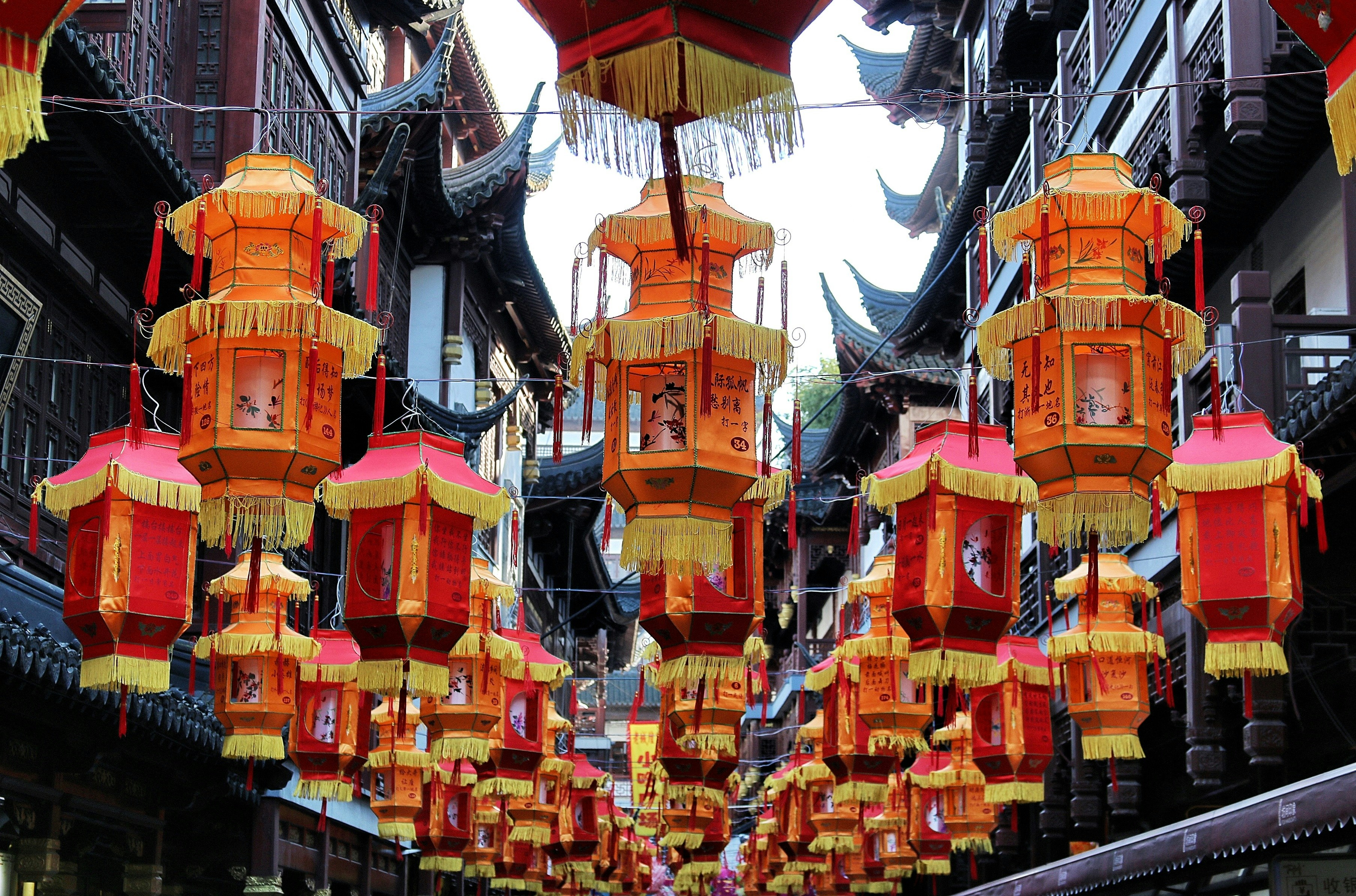
About Shanghai
Shanghai is a city of two faces. It is home to some of the world’s tallest skyscrapers, miles of luxury goods shops, and scores of trendy bars and restaurants. But look just beyond the main streets and you’ll find narrow alleyways packed with traditional lane houses, where laundry billows from bamboo poles, and local communities are alive and well.Shanghai has always been China’s most Westernized city. In its heyday, Shanghai had the best nightlife, the greatest architecture, and the strongest business in Asia. Nearly a century later, after extreme tumult and political upheaval, it’s back on top.Shanghai’s charm lies not in a list of must-see sites, but in quiet, tree-lined streets, the Bund’s majestic colonial buildings, sweet boutiques, and a dizzying array of places to eat and drink, from literal hole-in-the-walls to celebrity chef restaurants.Today, Shanghai has nearly 24 million people, the skyscrapers keep getting taller, the metro keeps getting longer, and the historical buildings continue to evade the wrecking ball. For how much longer is anyone’s guess.
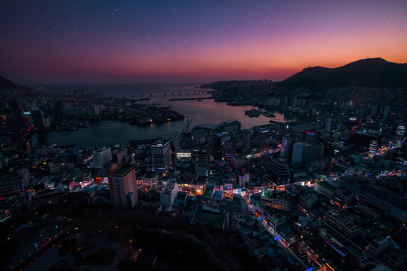
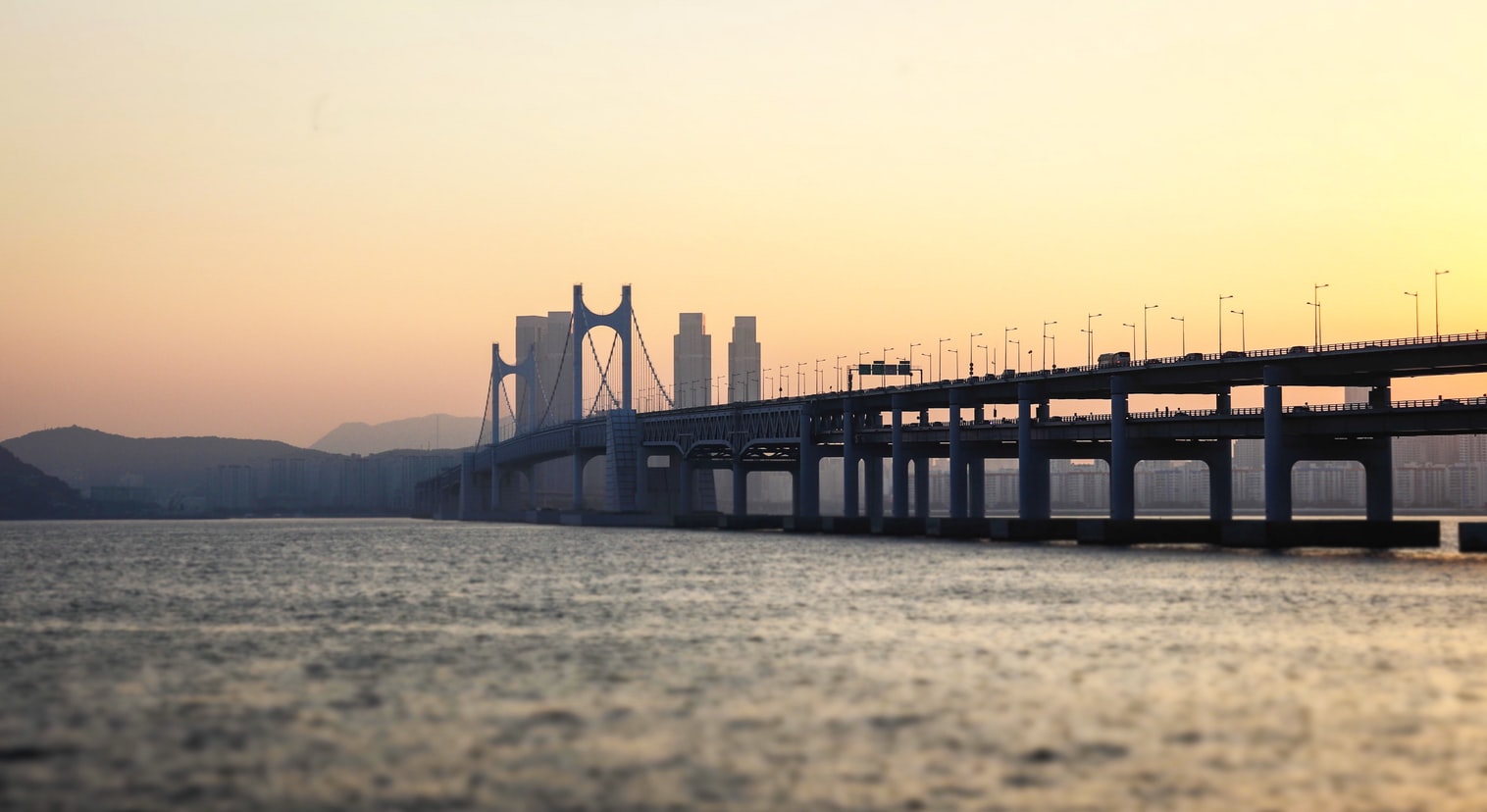
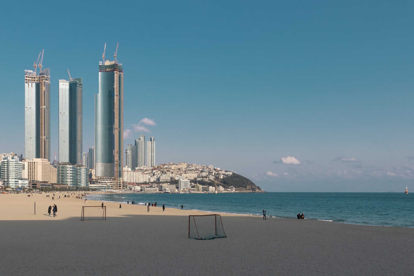
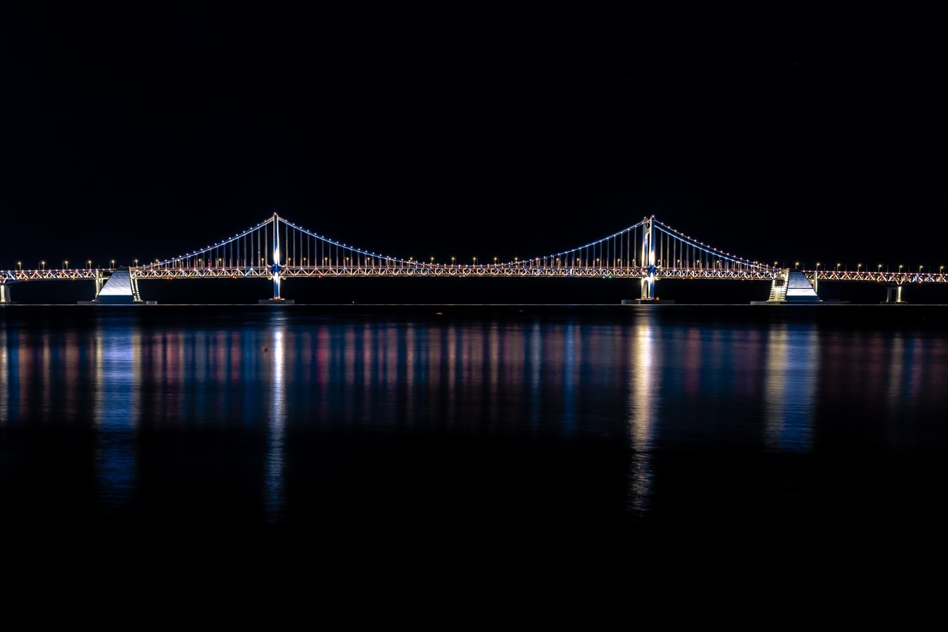
About Busan
White-sand city beaches and hot-spring resorts may not be everyone's first image of Korea, but these are what Koreans flock to Busan for all year. And there are plenty of opportunities for rest, relaxation, retail therapy, and even a touch of glamour every October with the Busan International Film Festival. Busan's beaches are the big summertime draw but there is plenty to be seen year round. Quintessential experiences include taking some rest and relaxation at a local spa and exploring the Beomeosa temple complex.
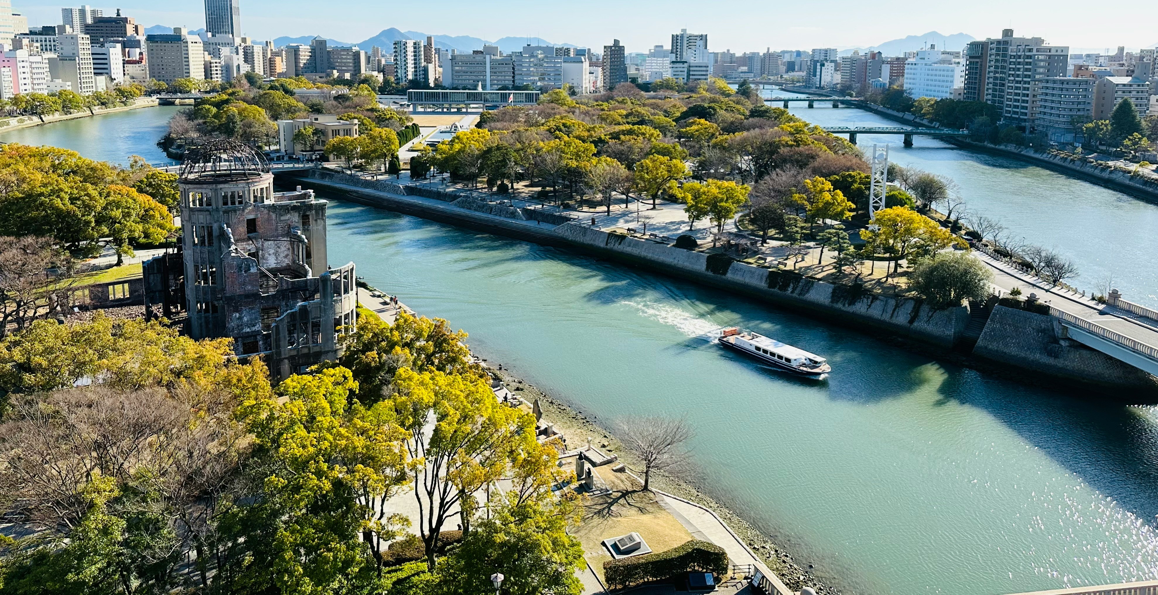
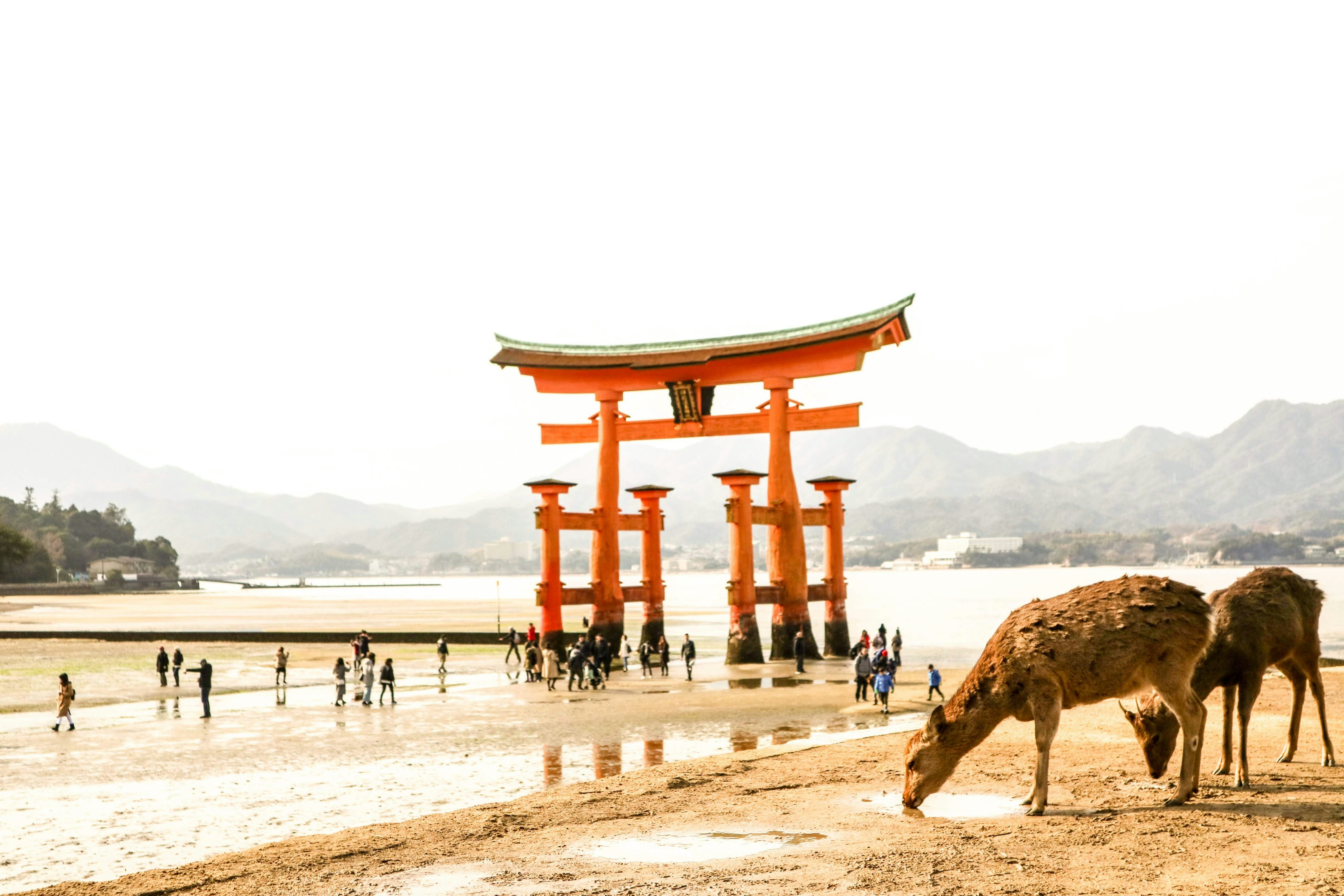
About Hiroshima
History buffs will want to write home Hiroshima. Despite being devastated in 1945, this Japanese city is known to all for its commitment peace – its ruin on the 6th August 1945 led to the end of the war and today, the Peace Memorial (a UNESCO World Heritage Site) , is a constant reminder of the destruction that war brings. A walk in the leafy boulevards of Peace Memorial Park brings quiet contemplation. The Flames of Peace – set in the park’s central feature pond – burn brightly and will continue to do so until all the nuclear bombs I the world have been destroyed. There are many other inspiring messages of hope around the city too; the Children’s’ Peace Monument just north of the park is a homage to little Sadako Sasaki, who was just two in 1945. When she developed leukemia in 1956, she believed that if she folded 1,000 paper cranes – a symbol of longevity and happiness in Japan – she would recover. Sadly she died before she finished her task but her classmates finished the rest. It is impossible to ignore the events of 1945 in Hiroshima, but this is far from a depressing place. The great efforts that have been made in rebuilding of the city over the years have given Hiroshima a vibrant, eclectic edge, with the downtown shopping area and street food stalls being well worth a visit. The proximity to Miyajima and its iconic, impressive, Torii gate should not be overlooked either. If you are lucky enough to visit during the unpredictable and short-lived Sakura (cherry blossom) season, then the extraordinary sight of the delicate pink blossom floating across the water to the red gate, means you can consider yourself one of the luckiest people on the planet.
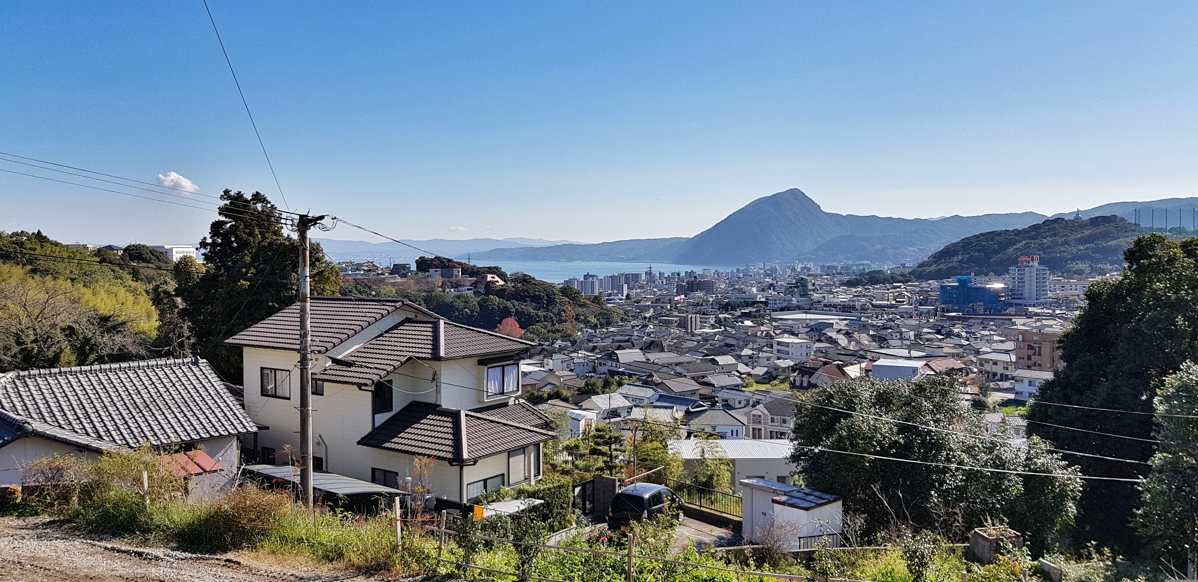
About Beppu, Kyushu Island, Oita
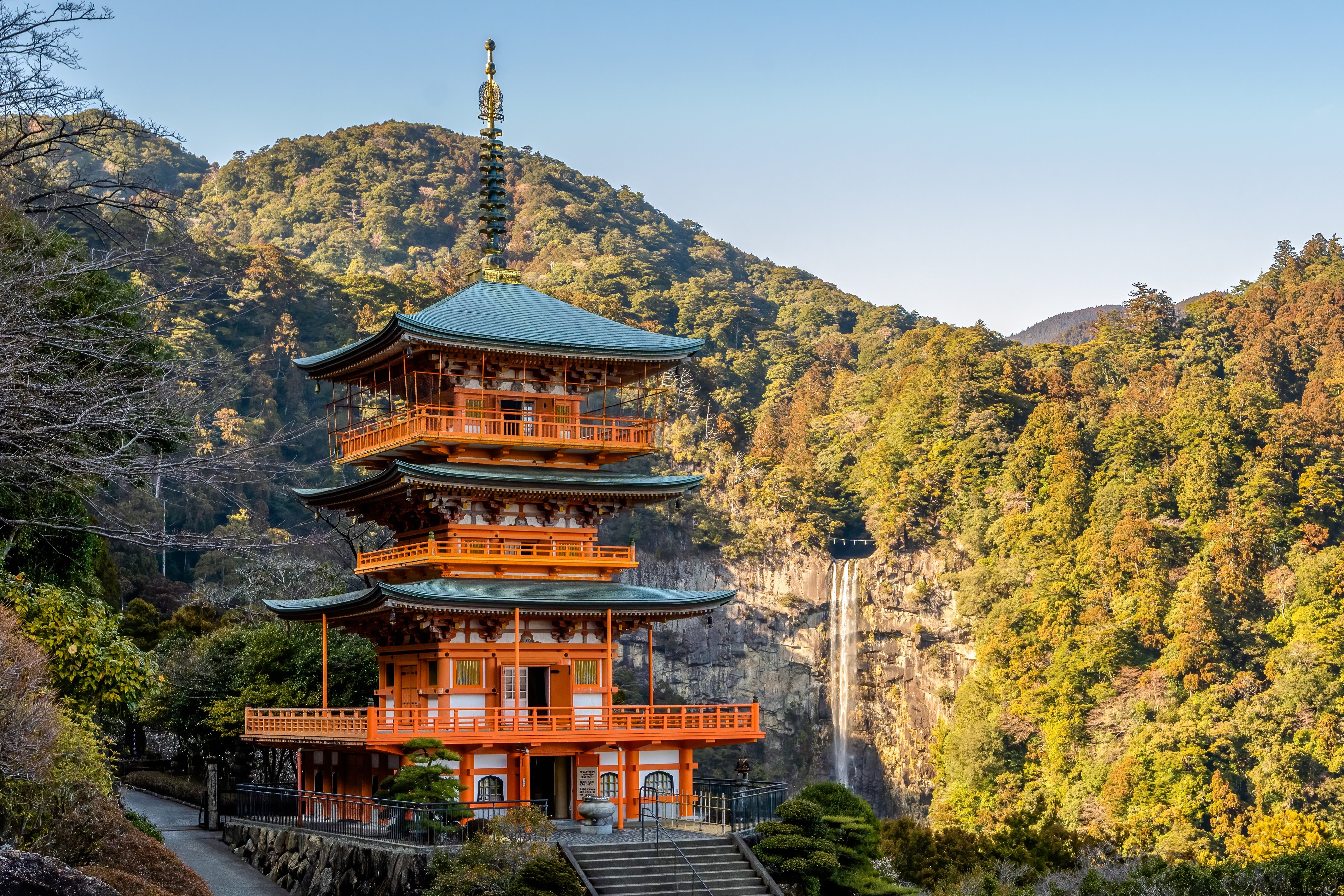
About Wakayama
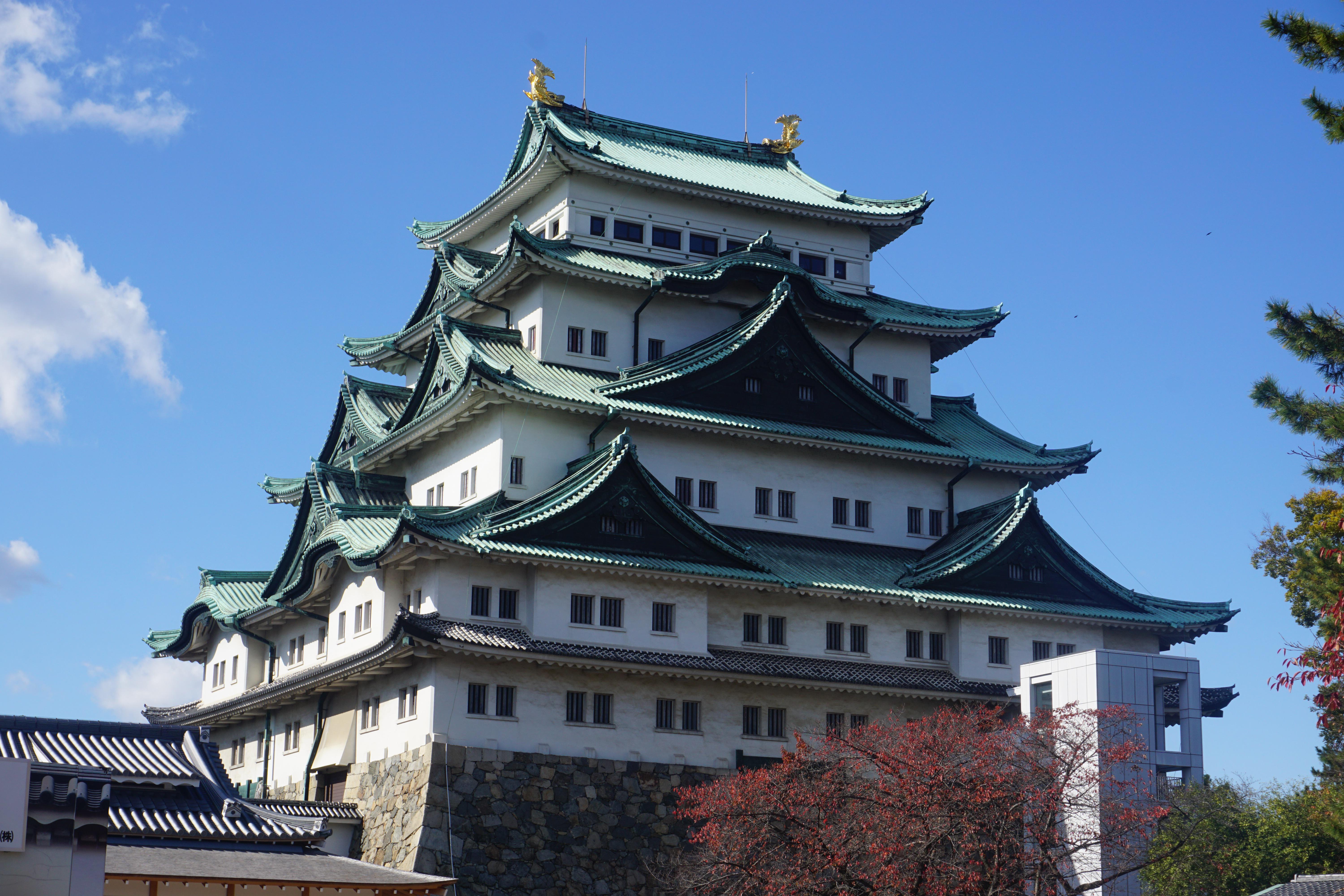
About Nagoya
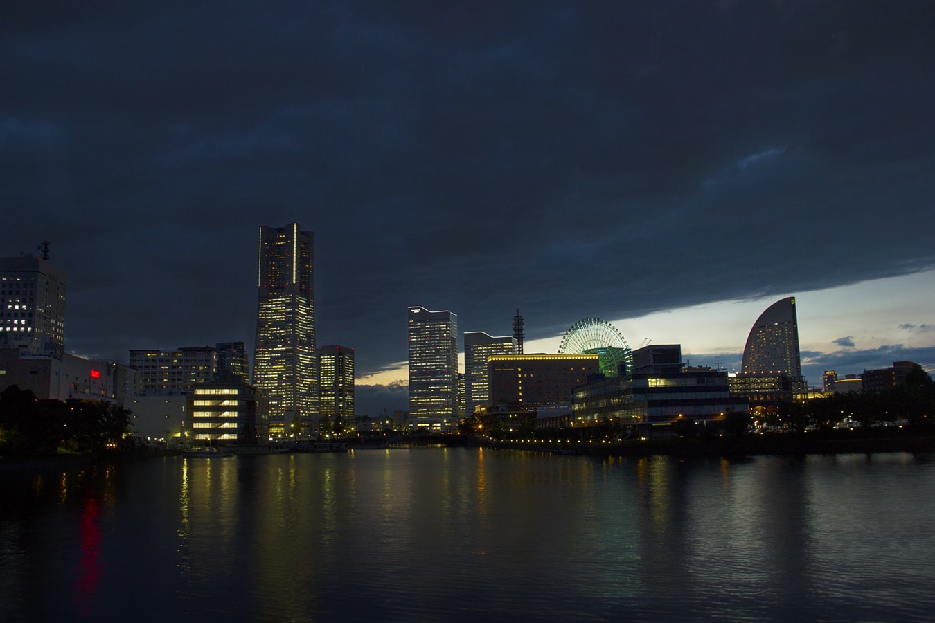
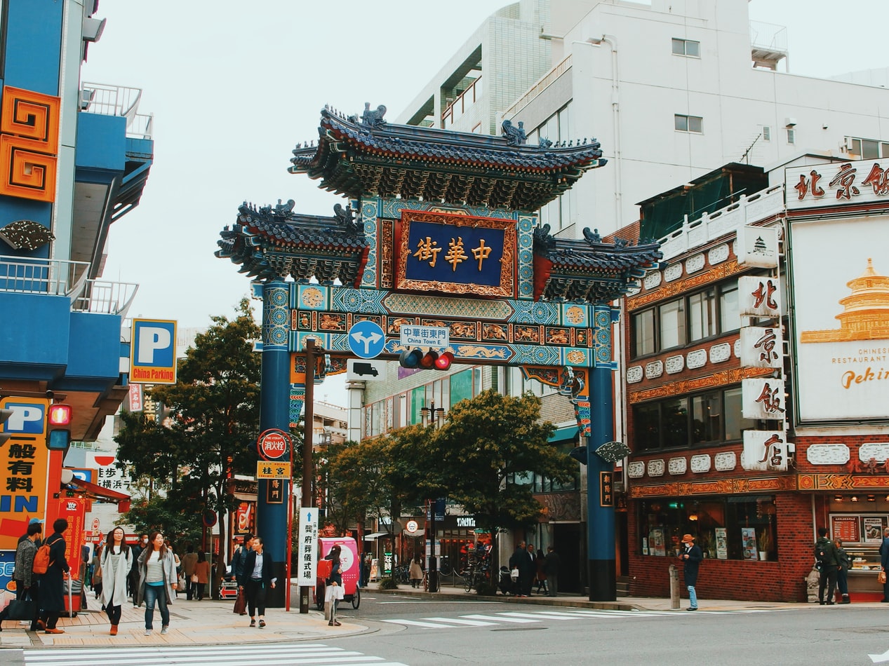
About Yokohama
In 1853, a fleet of four American warships under Commodore Matthew Perry sailed into the bay of Tokyo (then Edo) and presented the reluctant Japanese with the demands of the U.S. government for the opening of diplomatic and commercial relations. The following year Perry returned and first set foot on Japanese soil at Yokohama—then a small fishing village on the mudflats of Tokyo bay. Two years later New York businessman Townsend Harris became America's first diplomatic representative to Japan. In 1858 he was finally able to negotiate a commercial treaty between the two countries; part of the deal designated four locations—one of them Yokohama—as treaty ports. In 1859 the shogunate created a special settlement in Yokohama for the growing community of merchants, traders, missionaries, and other assorted adventurers drawn to this exotic new land of opportunity. The foreigners (predominantly Chinese and British, plus a few French, Americans, and Dutch) were confined here to a guarded compound about 5 square km (2 square miles)—placed, in effect, in isolation—but not for long. Within a few short years the shogunal government collapsed, and Japan began to modernize. Western ideas were welcomed, as were Western goods, and the little treaty port became Japan's principal gateway to the outside world. In 1872 Japan's first railway was built, linking Yokohama and Tokyo. In 1889 Yokohama became a city; by then the population had grown to some 120,000. As the city prospered, so did the international community and by the early 1900s Yokohama was the busiest and most modern center of international trade in all of East Asia. Then Yokohama came tumbling down. On September 1, 1923, the Great Kanto Earthquake devastated the city. The ensuing fires destroyed some 60,000 homes and took more than 40,000 lives. During the six years it took to rebuild the city, many foreign businesses took up quarters elsewhere, primarily in Kobe and Osaka, and did not return. Over the next 20 years Yokohama continued to grow as an industrial center—until May 29, 1945, when in a span of four hours, some 500 American B-29 bombers leveled nearly half the city and left more than half a million people homeless. When the war ended, what remained became—in effect—the center of the Allied occupation. General Douglas MacArthur set up headquarters here, briefly, before moving to Tokyo; the entire port facility and about a quarter of the city remained in the hands of the U.S. military throughout the 1950s. By the 1970s Yokohama was once more rising from the debris; in 1978 it surpassed Osaka as the nation's second-largest city, and the population is now inching up to the 3.5 million mark. Boosted by Japan's postwar economic miracle, Yokohama has extended its urban sprawl north to Tokyo and south to Kamakura—in the process creating a whole new subcenter around the Shinkansen Station at Shin-Yokohama. The development of air travel and the competition from other ports have changed the city's role in Japan's economy. The great liners that once docked at Yokohama's piers are now but a memory, kept alive by a museum ship and the occasional visit of a luxury vessel on a Pacific cruise. Modern Large as Yokohama is, the central area is very negotiable. As with any other port city, much of what it has to offer centers on the waterfront—in this case, on the west side of Tokyo Bay. The downtown area is called Kannai (literally, "within the checkpoint"); this is where the international community was originally confined by the shogunate. Though the center of interest has expanded to include the waterfront and Ishikawa-cho, to the south, Kannai remains the heart of town. Think of that heart as two adjacent areas. One is the old district of Kannai, bounded by Basha-michi on the northwest and Nippon-odori on the southeast, the Keihin Tohoku Line tracks on the southwest, and the waterfront on the northeast. This area contains the business offices of modern Yokohama. The other area extends southeast from Nippon-odori to the Moto-machi shopping street and the International Cemetery, bordered by Yamashita Koen and the waterfront to the northeast; in the center is Chinatown, with Ishikawa-cho Station to the southwest. This is the most interesting part of town for tourists. Whether you're coming from Tokyo, Nagoya, or Kamakura, make Ishikawa-cho Station your starting point. Take the South Exit from the station and head in the direction of the waterfront.
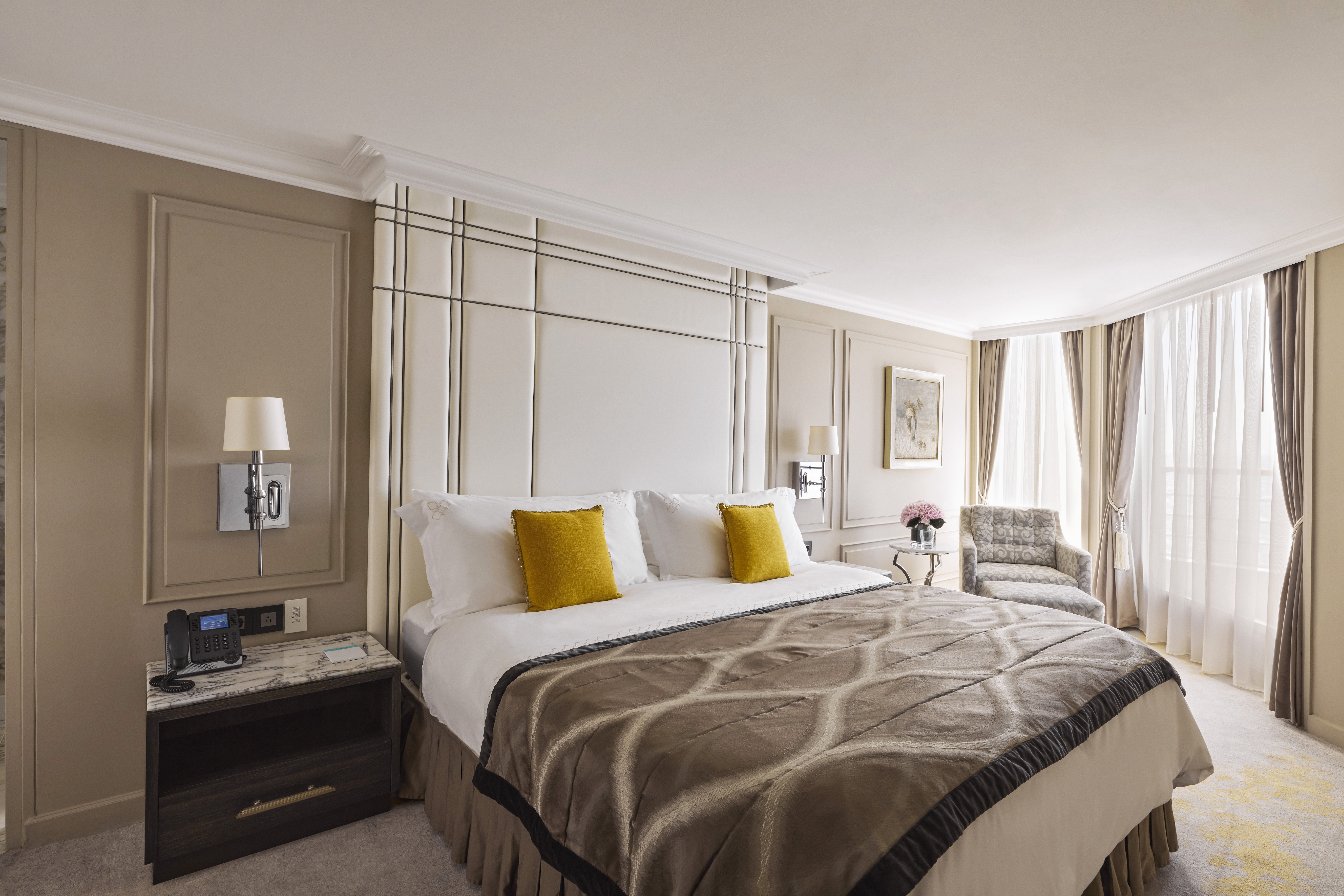
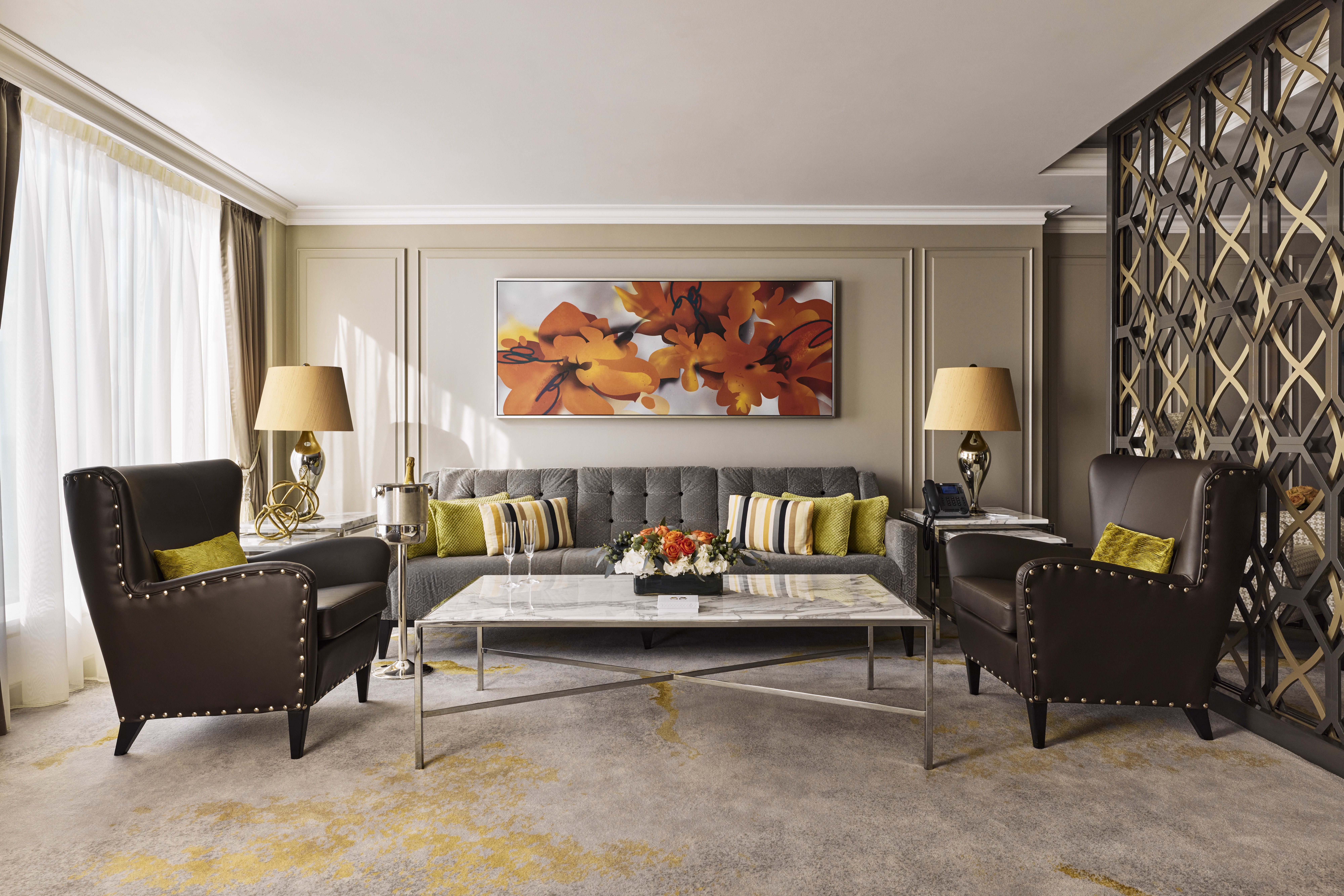
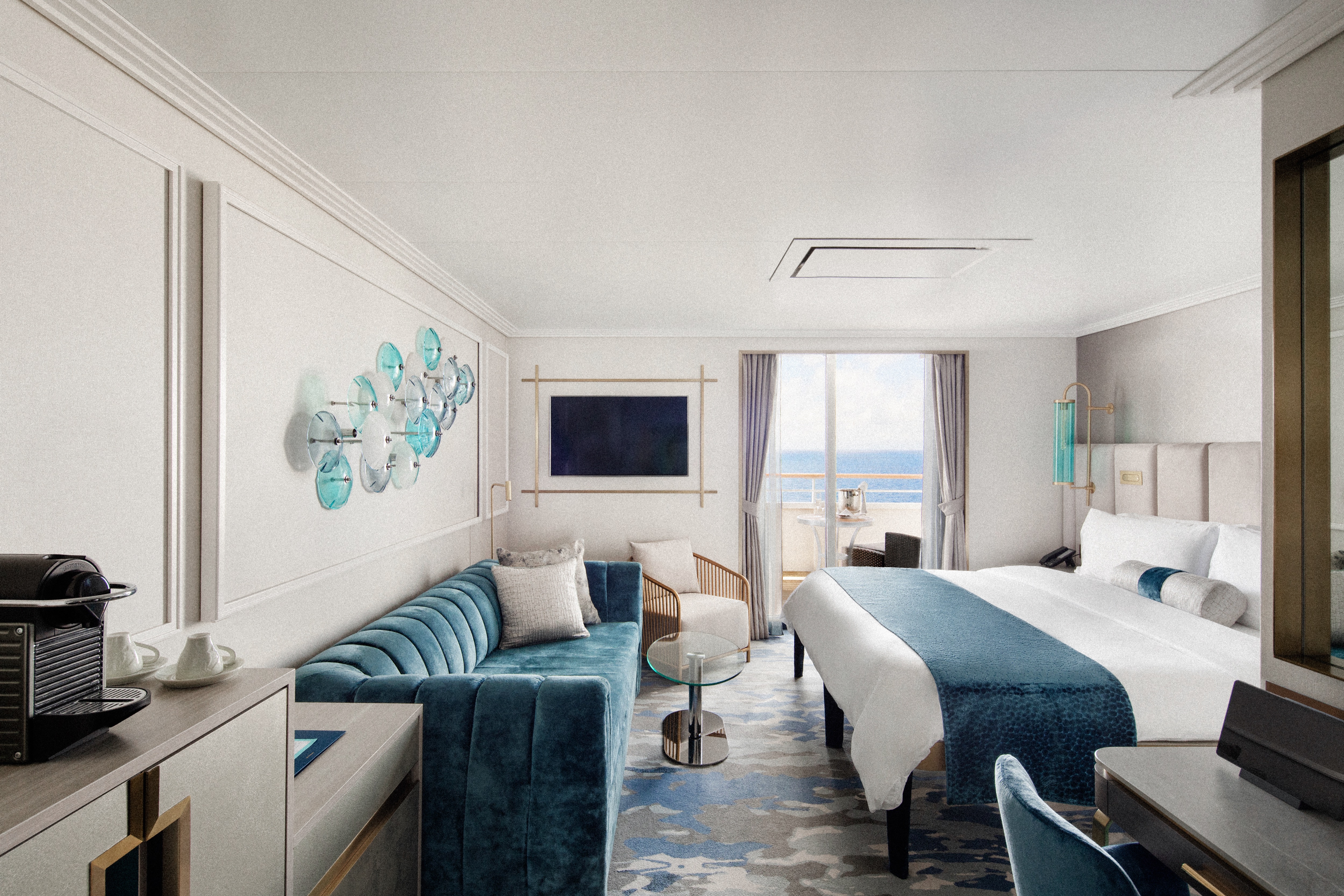
DETAILS
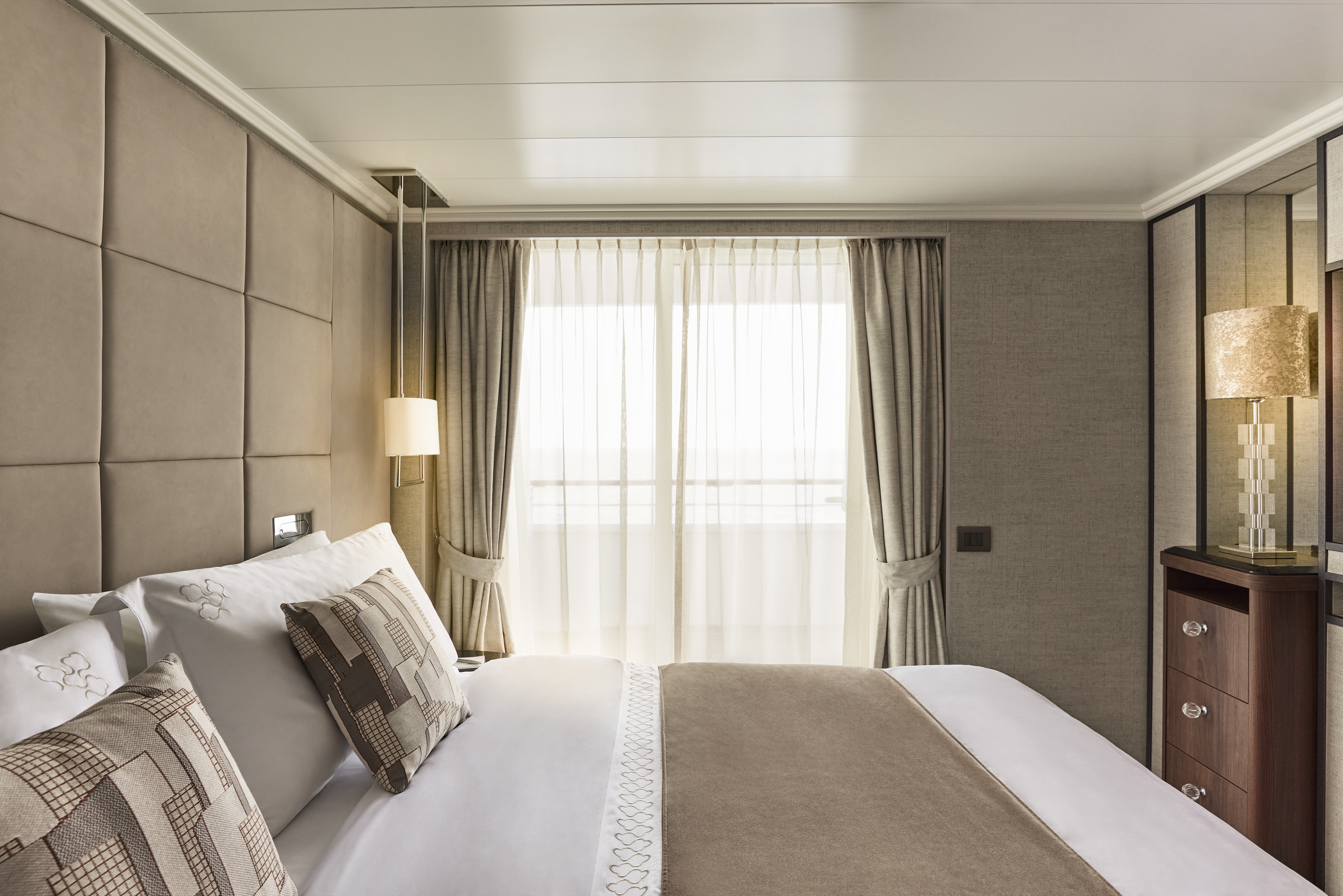
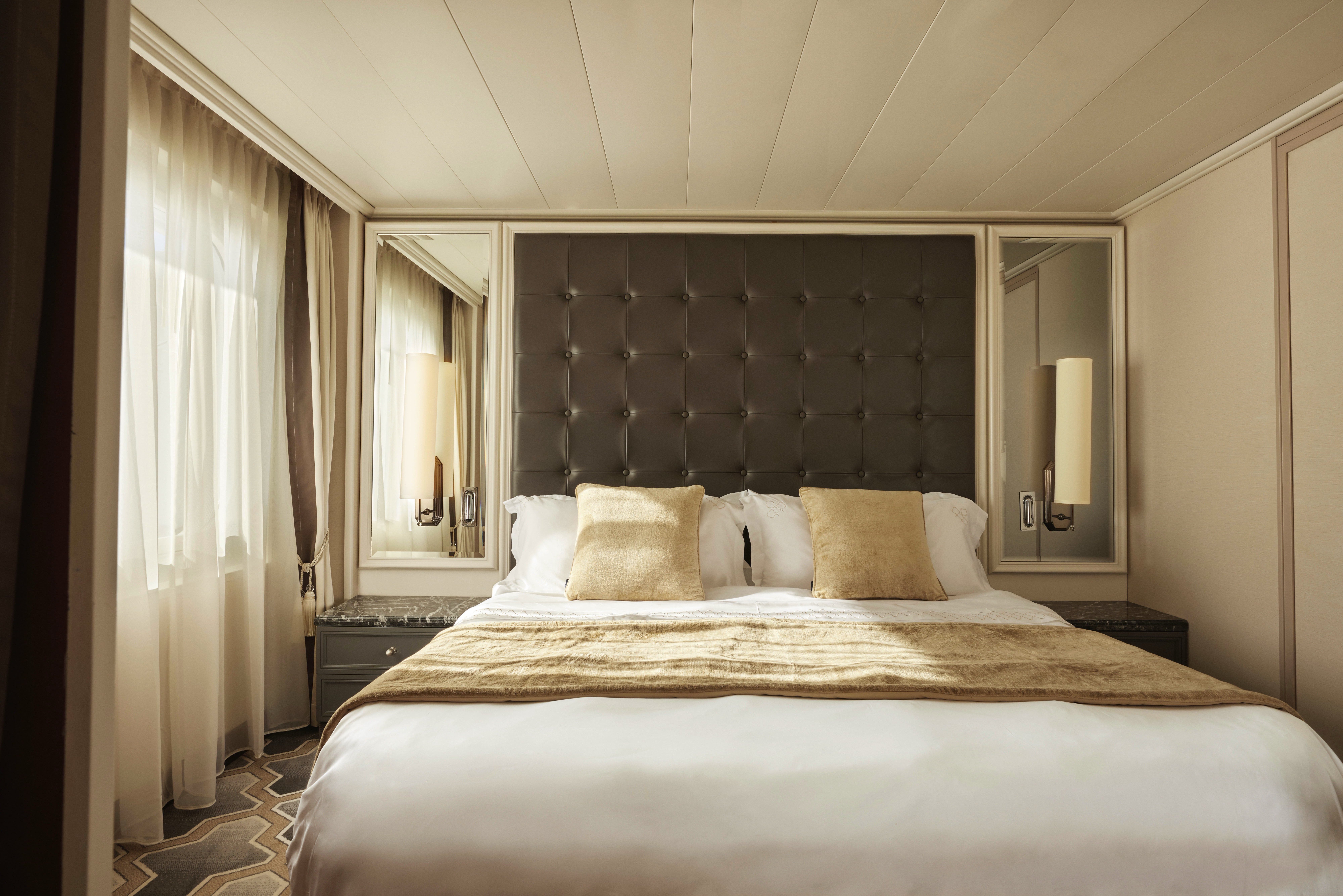
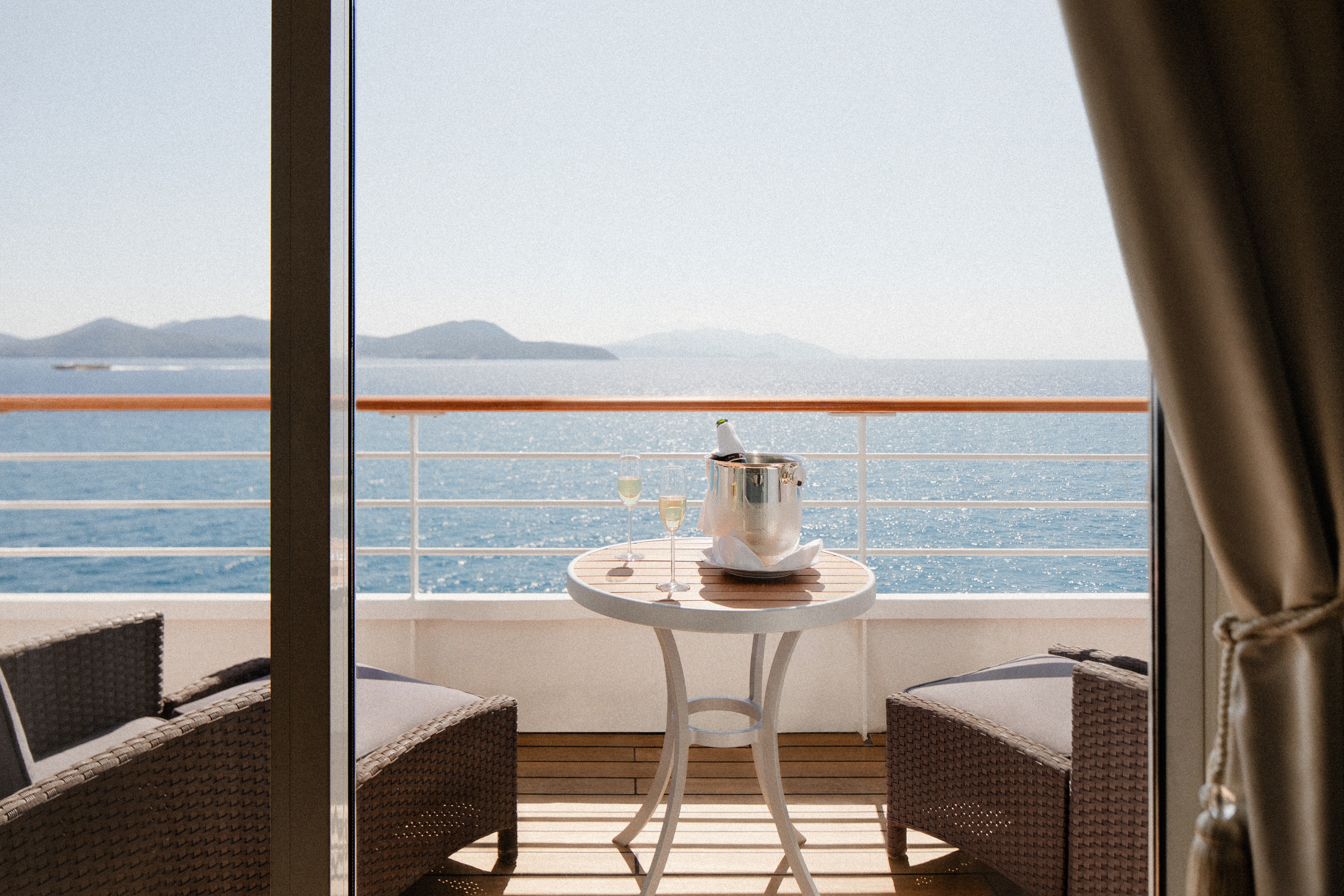
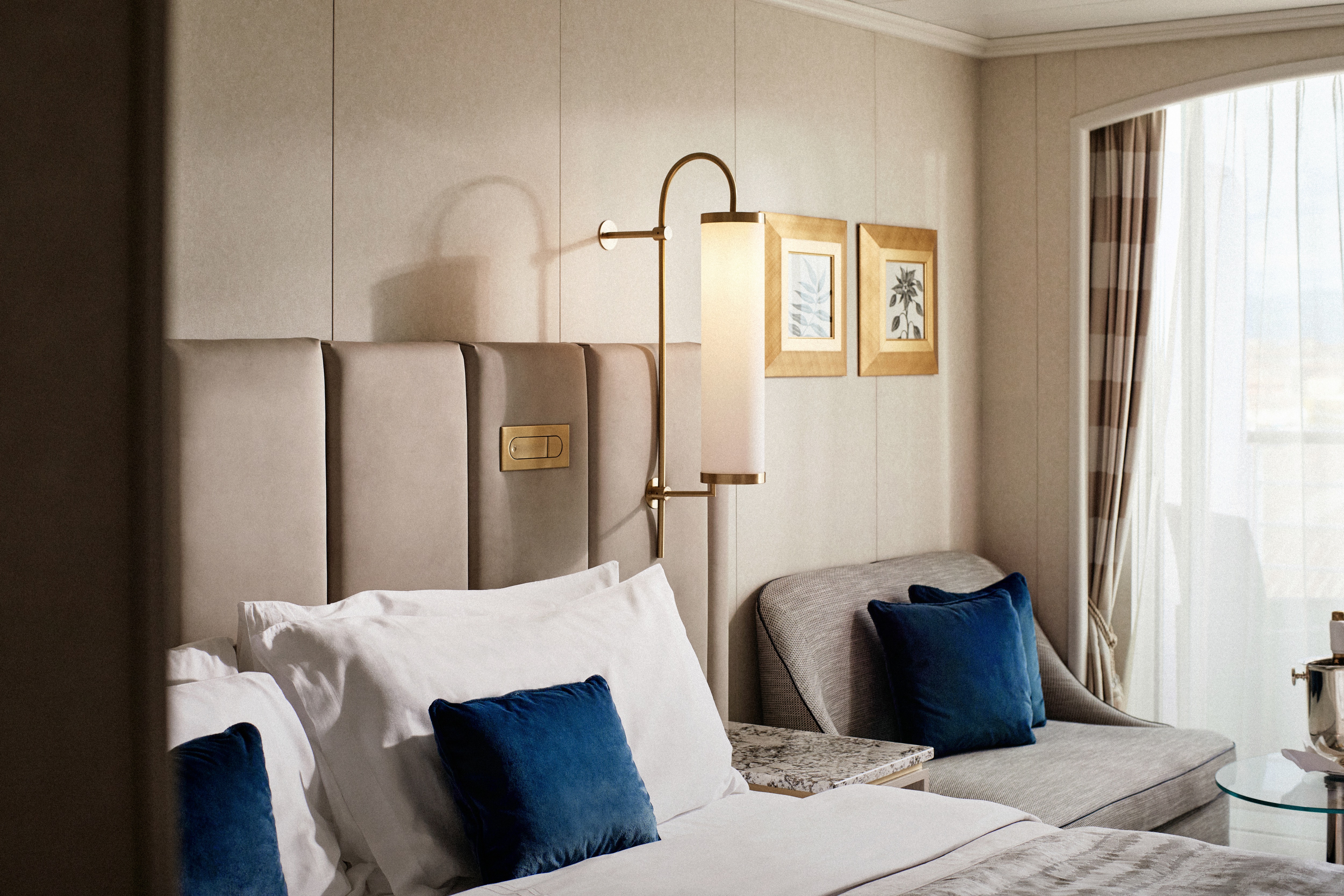
- Large private veranda with teak furniture
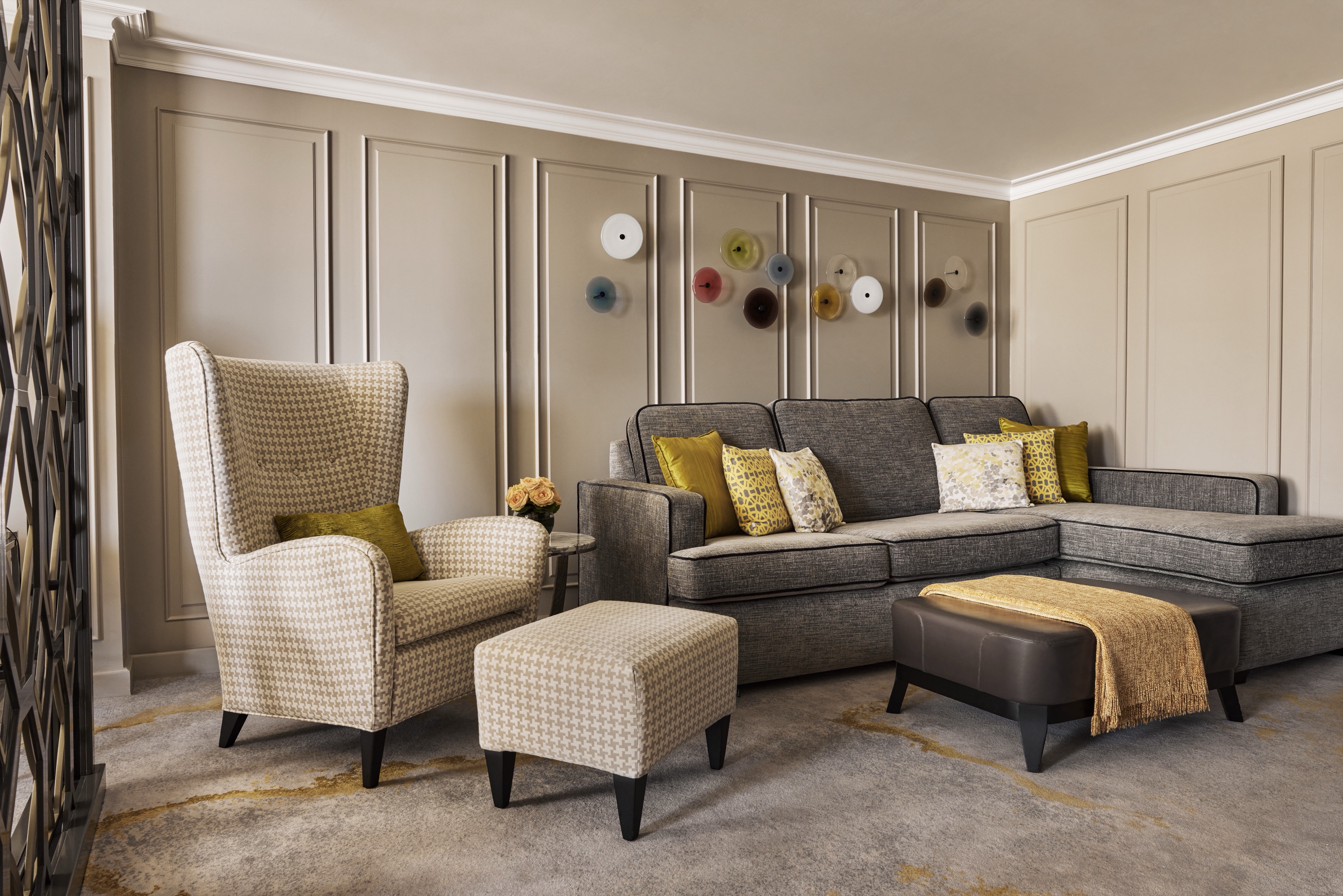
- Spacious living room with TV, custom wool carpets, walnut floors, cabinetry and Swarovski® chandelier
- Dining area with panoramic ocean views
- Separate study
- Custom built-in bar
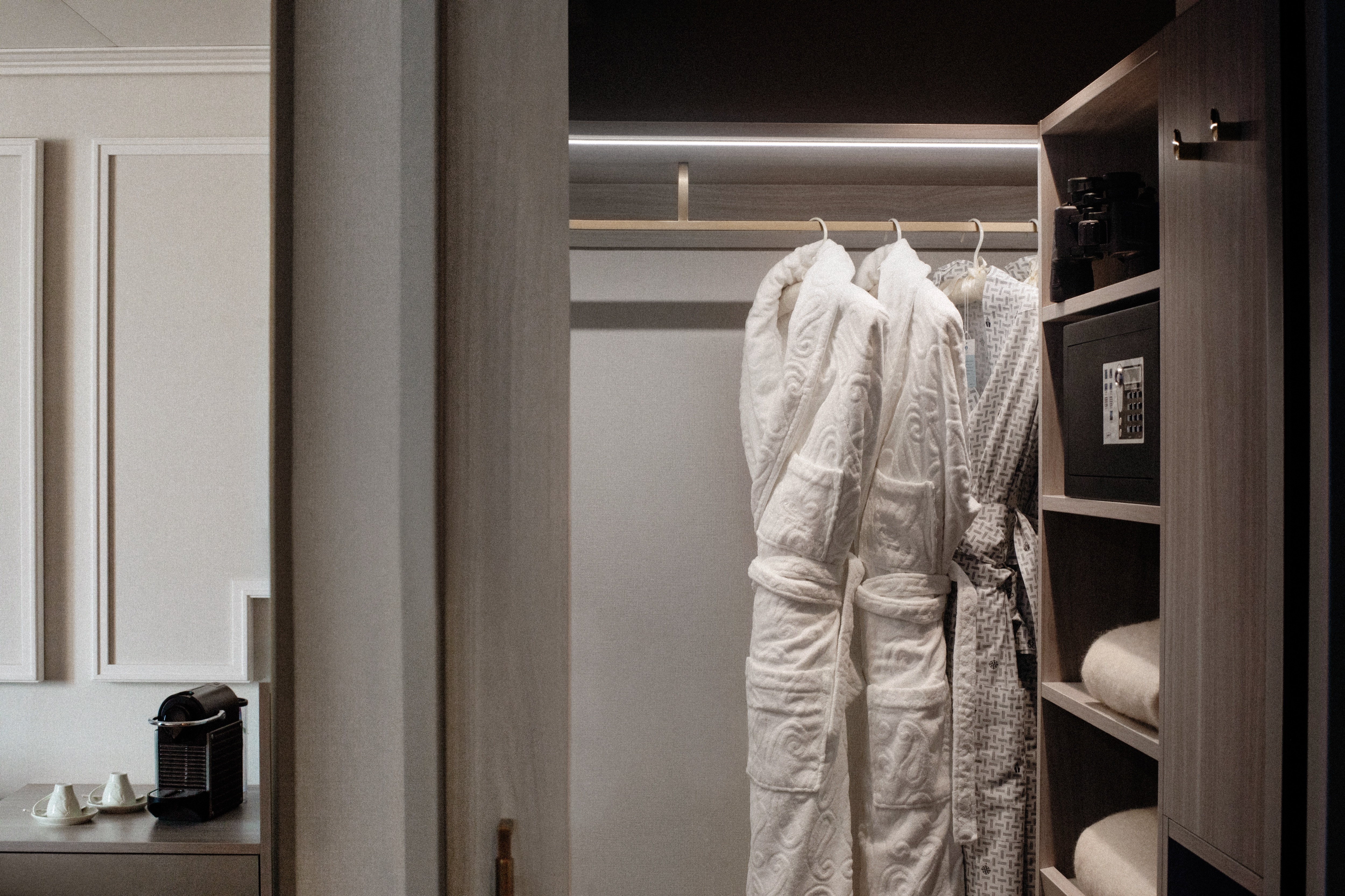
- Large bedroom with queen-size bed or twins, plus his and hers walk-in closets and TV
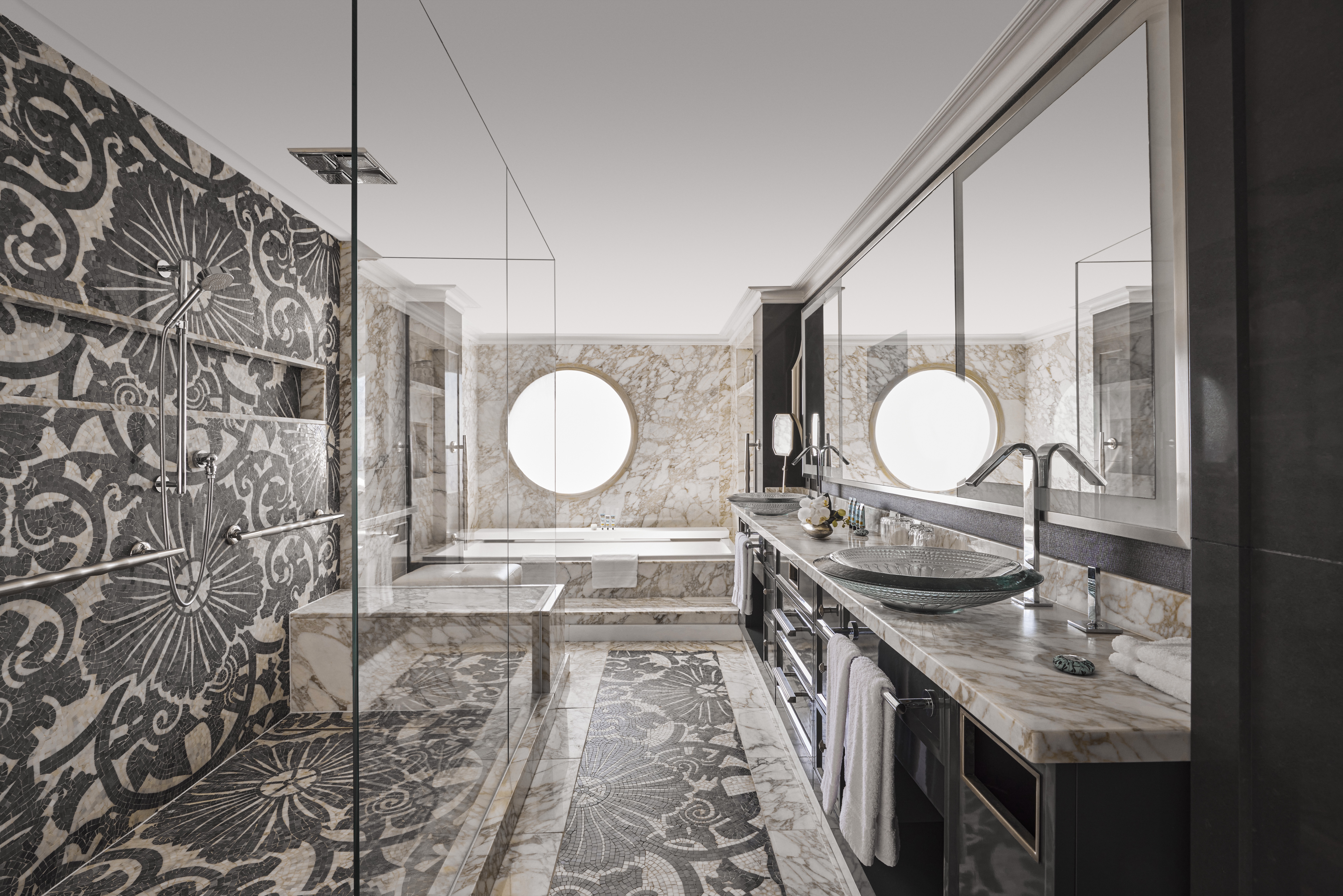
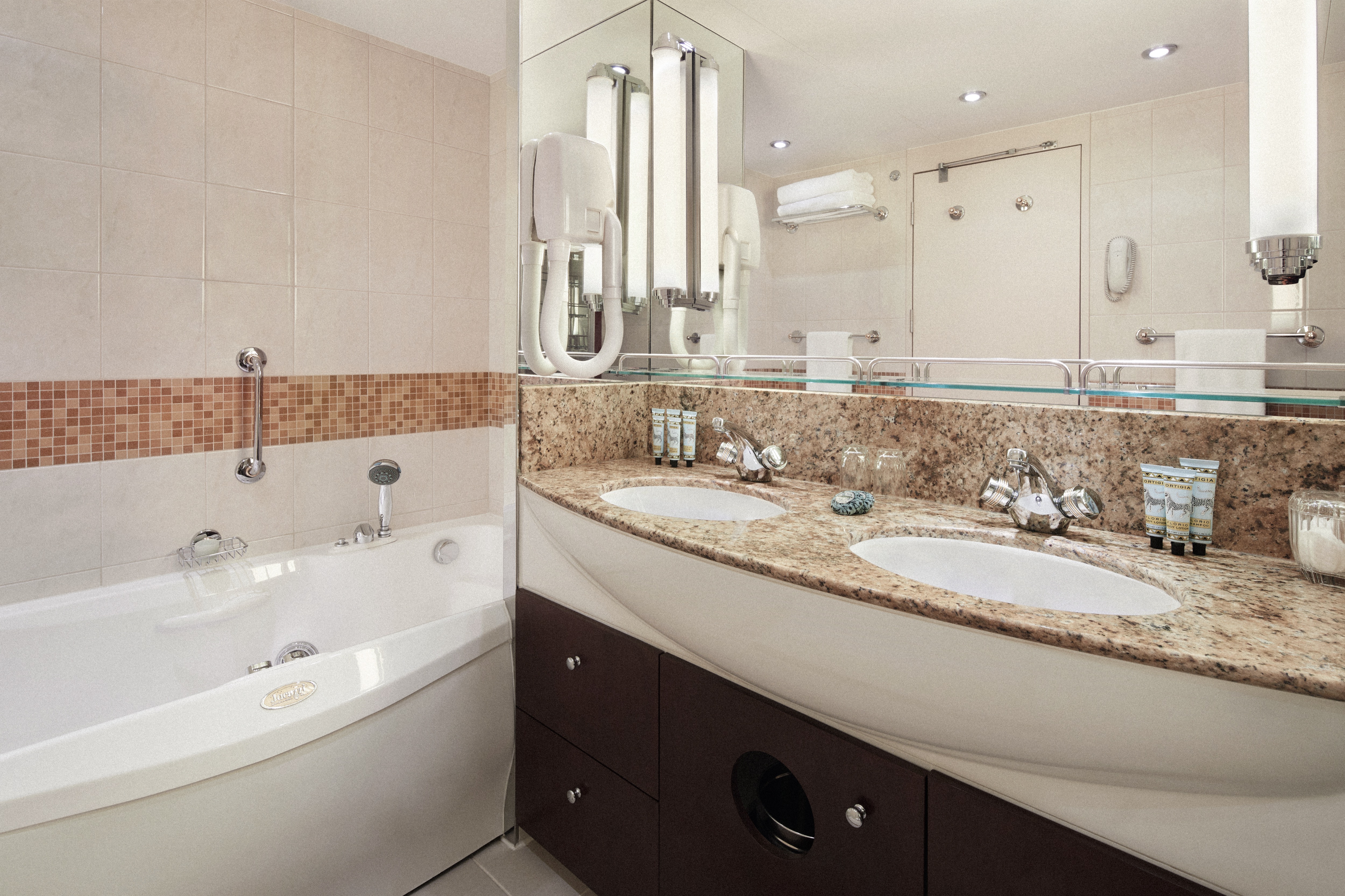
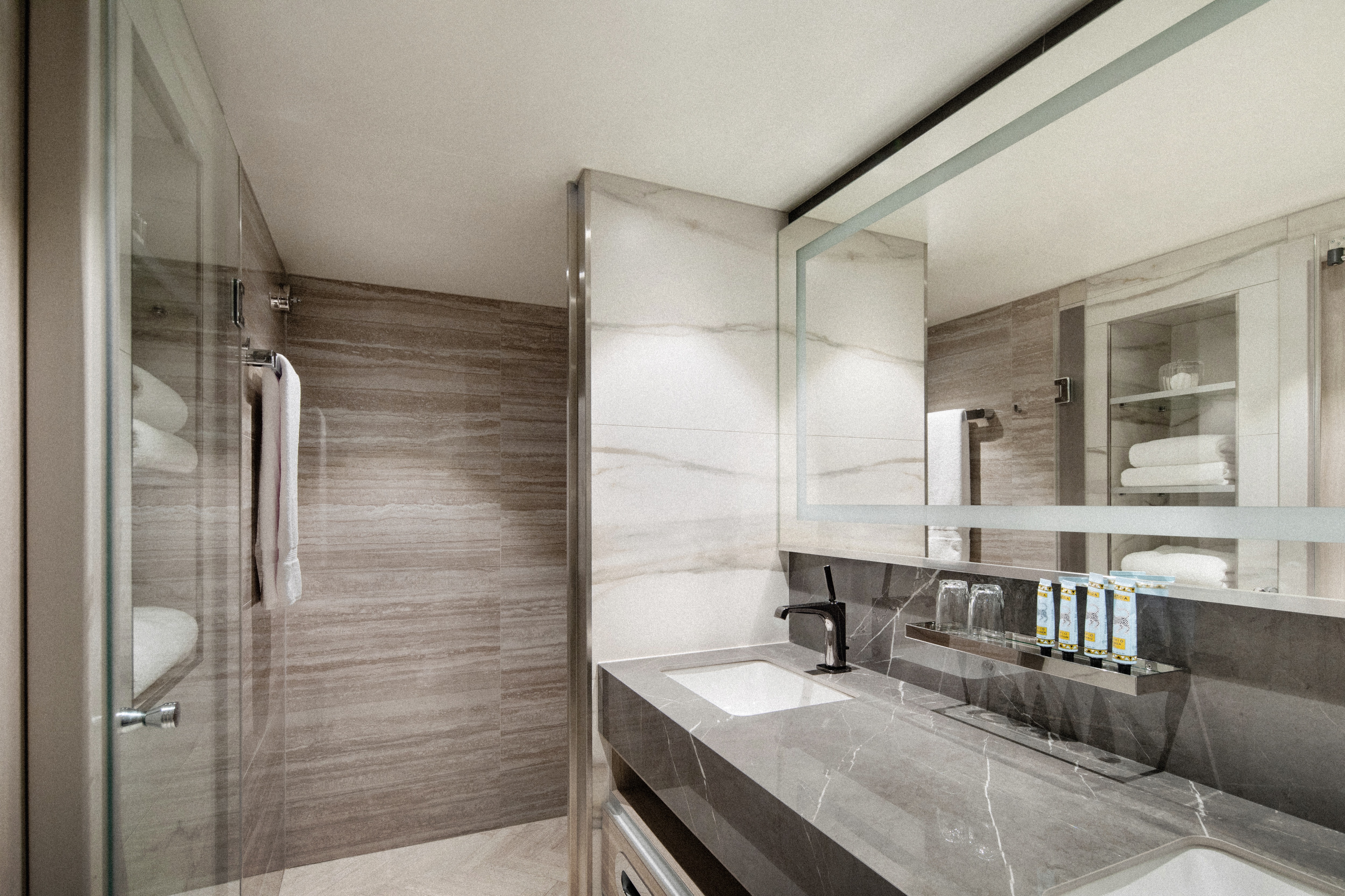
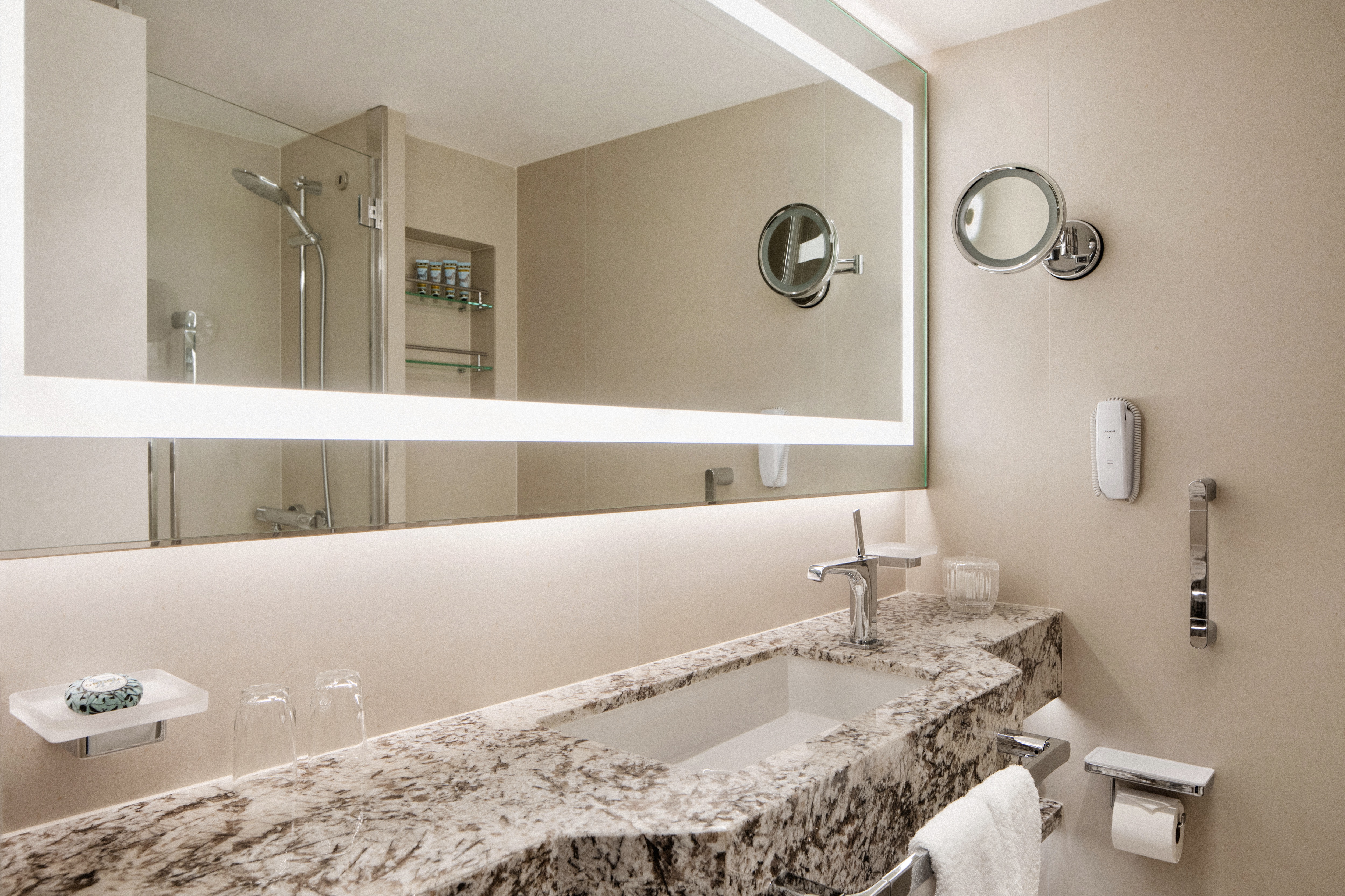
- Master bath with jacuzzi, ocean view, crystal sconces and Calacatta marble floors, separate shower and bidet
- Guest bathroom
SERVICES
- 24 hour in-suite dining
- Unlimited room service from Osteria D'Ovidio and Umi Uma
- Unlimited dining in Osteria D'Ovidio and Umi Uma
- Turndown service with handmade truffles
- Shoeshine service
- Assistance with packing and unpacking
- Free unlimited laundry and dry cleaning, 2nd day service
- In-suite cocktail parties
- Private transfer to and from ship up to 50 miles
AMENITIES
- Welcome champagne
- Complimentary wine and spirits from set menu
- Complimentary soft drinks
- Flowers
- Fresh fruits, daily change, on request only
- Pillow menu (selection from a variety of pillow types)
- Afternoon canapés
- Coffee maker
- Binoculars
- Complimentary unlimited standard WiFi
- In-suite safe
- Interactive tablet for news, updates, and reservations
- Hair dryer
- Hair iron (available upon request)
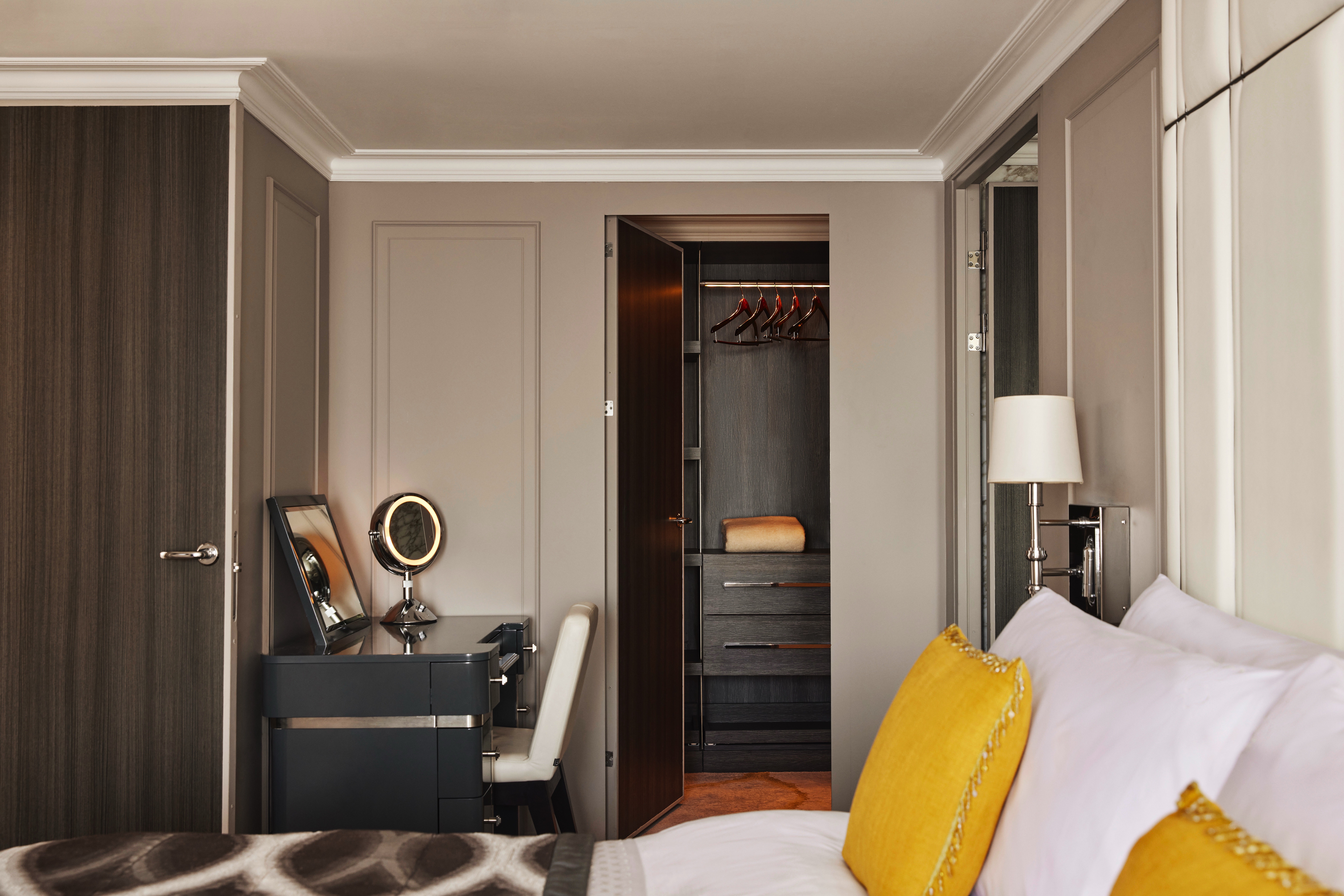
Redesigned in 2023, this luxurious suite features a walk-in wardrobe, separate living room and dining area, Jacuzzi bathtub, separate shower, bidet, and guest bathroom. Guests staying in this stylish home away from home enjoy unlimited dining at specialty restaurants, unlimited laundry services, afternoon canapés, flowers, binoculars, and a coffee maker.
DETAILS
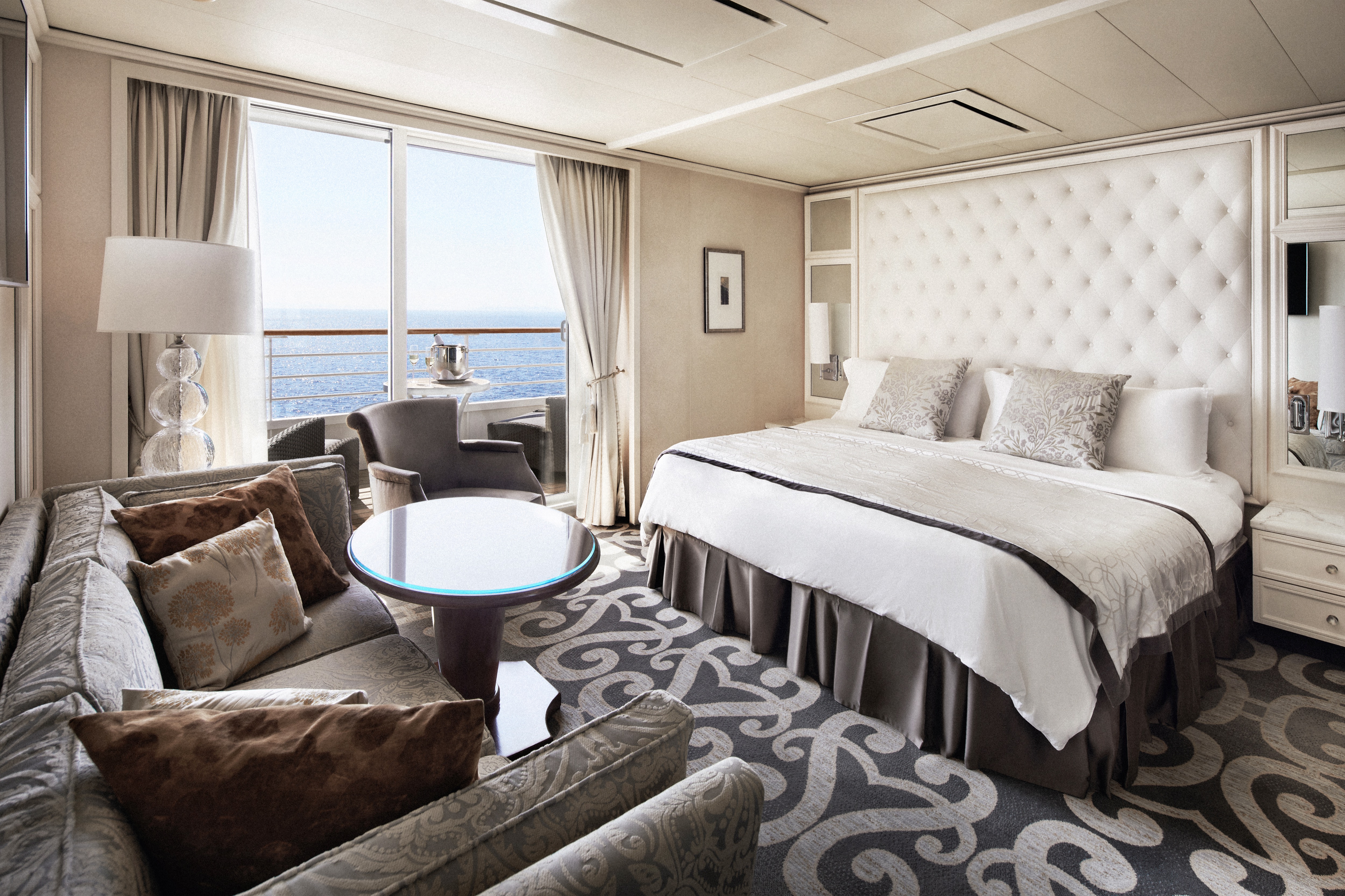
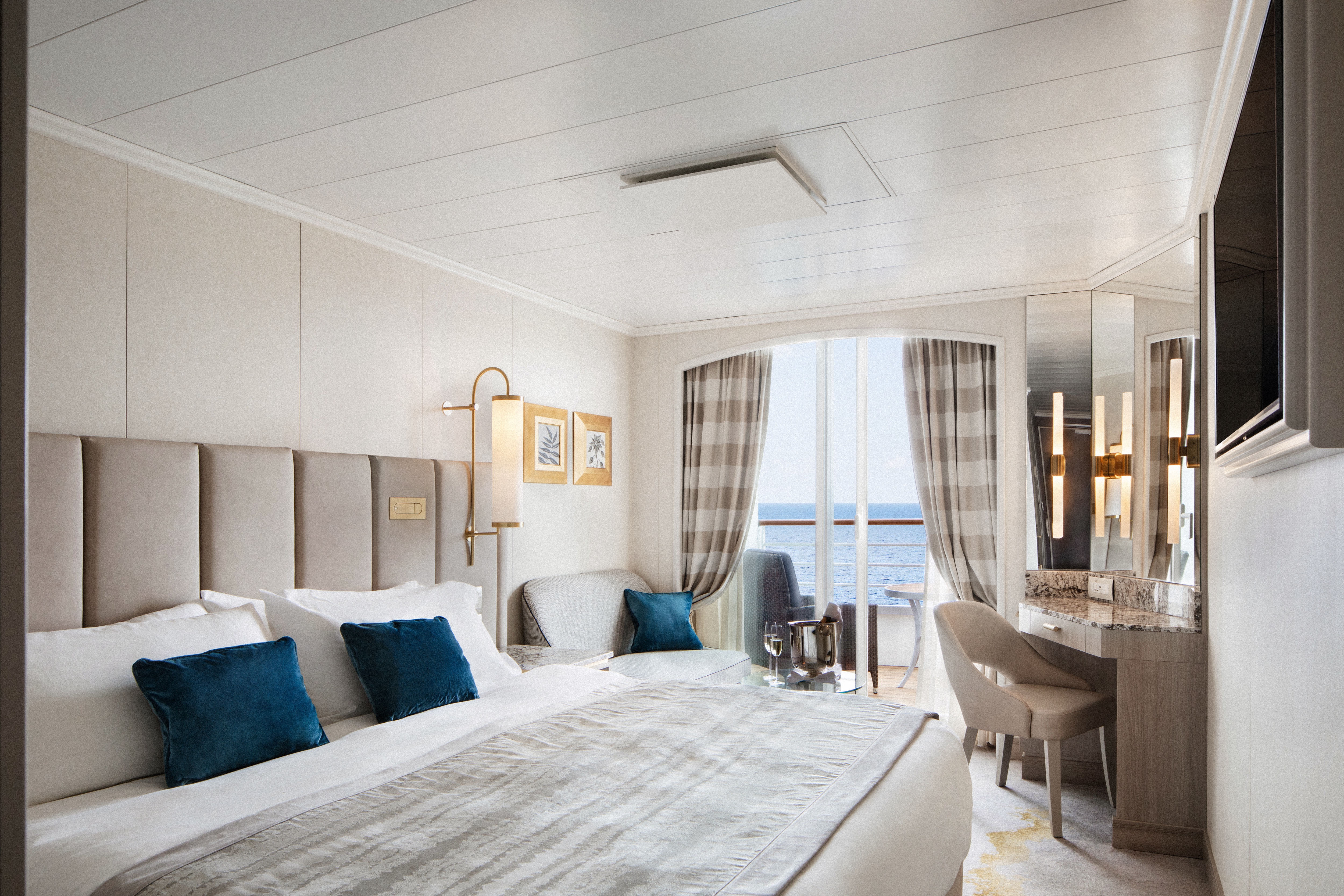
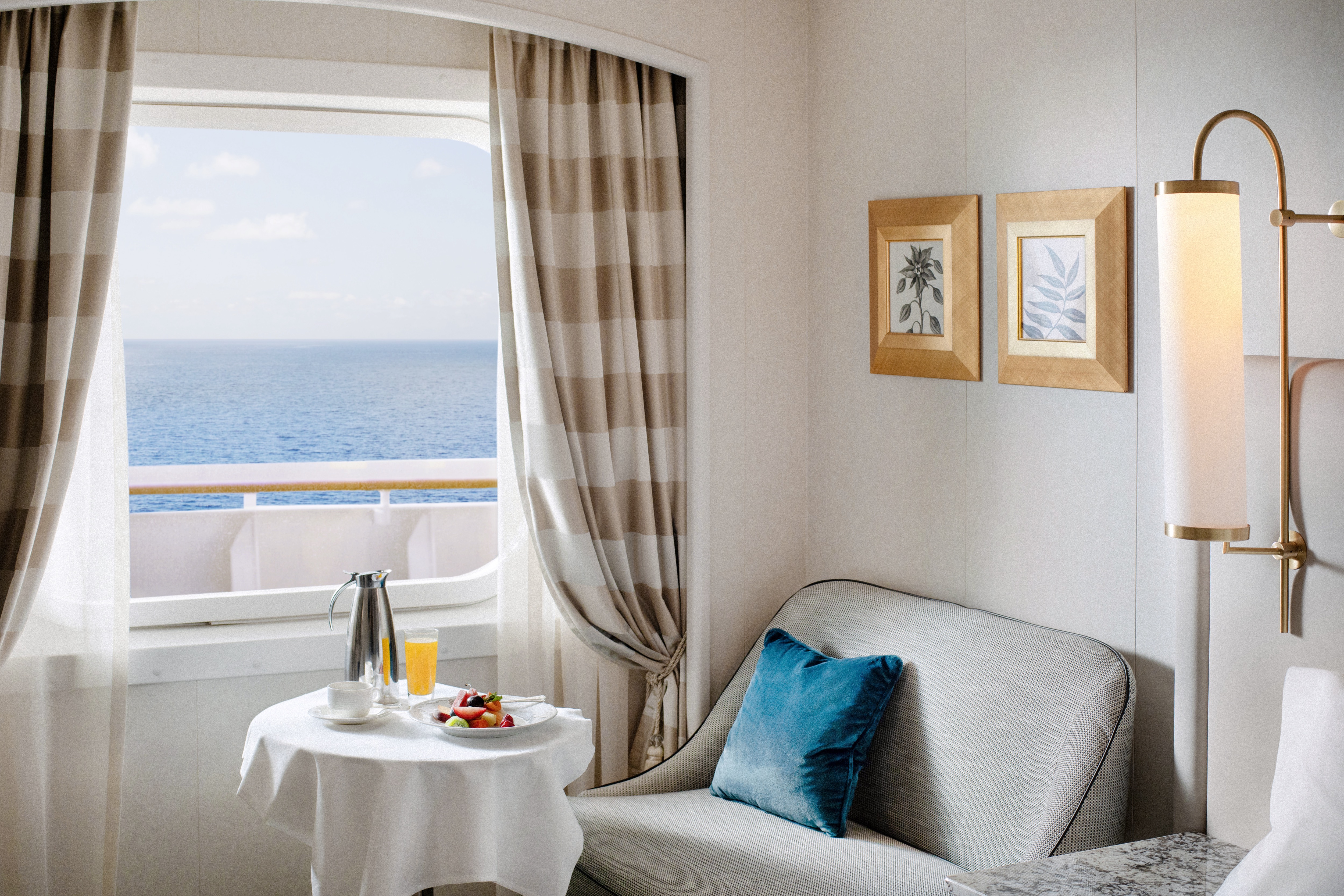
- Large private veranda
- Spacious living room
- Dining area
- Two TV's
- Sophisticated one-touch lighting and surround-sound system
- Separate bedroom area
- Vanity in bedroom
- Queen-size bed or twin beds with sumptuous bedding, and third berth
- Walk-in closet
- Refrigerator
SERVICES
- 24 hour in-suite dining
- Unlimited room service from Osteria D'Ovidio and Umi Uma
- Unlimited dining in Osteria D'Ovidio and Umi Uma
- Turndown service with handmade truffles
- Shoeshine service
- Assistance with packing and unpacking
- Free unlimited laundry and dry cleaning, 2nd day service
- In-suite cocktail parties
- Private transfer to and from ship up to 50 miles
AMENITIES
- Welcome champagne
- Complimentary wine and spirits from set menu
- Complimentary soft drinks
- Flowers
- Fresh fruits, daily change, on request only
- Pillow menu (selection from a variety of pillow types)
- Afternoon canapés
- Coffee maker
- Binoculars
- Complimentary unlimited standard WiFi
- In-suite safe
- Interactive tablet for news, updates, and reservations
- Hair dryer
- Hair iron (available upon request)
DETAILS
- Private veranda
- Spacious living room
- Queen-size bed or twin beds with sumptuous bedding, and third berth
- Walk-in closet
- Two TV's
SERVICES
- 24 hour in-suite dining
- Shoeshine service
- Assistance with packing and unpacking
- Dry cleaning for five pieces plus one bag of free laundry every 10 cruise days, 2nd day service
- Free pressing (5pcs/day), 2nd day service
AMENITIES
- Welcome champagne
- Complimentary wine and spirits from set menu
- Complimentary soft drinks
- Flowers
- Fresh fruits, daily change, on request only
- Pillow menu (selection from a variety of pillow types)
- Afternoon canapés
- Coffee maker
- Binoculars
- Complimentary unlimited standard WiFi
- In-suite safe
- Interactive tablet for news, updates, and reservations
- Hair dryer
- Hair iron (available upon request)
DETAILS
- Private veranda
- Sizeable living area
- Queen-size bed or twin beds with sumptuous bedding
- Vanity in dressing area
- Walk-in closet
- TV
- Sophisticated one-touch lighting and surround-sound system
SERVICES
- 24 hour in-suite dining
- Turndown service
- Shoeshine service
- Assistance with packing and unpacking
AMENITIES
- Welcome champagne
- Complimentary wine and spirits from set menu
- Complimentary soft drinks
- Fresh fruits, daily change, on request only
- Pillow menu (selection from a variety of pillow types)
- Afternoon canapés
- Coffee maker
- Binoculars
- Complimentary unlimited standard WiFi
- In-suite safe
- Interactive tablet for news, updates, and reservations
- Hair dryer
- Hair iron (available upon request)
- Free pressing (5pcs/day), 2nd day service
DETAILS
- Private veranda
- Spacious living area with sofa
- Queen-size bed or twin beds with sumptuous bedding
- Walk-in shower
- TV
SERVICES
- 24 hour in-suite dining
- Turndown service
- Shoeshine service
- Assistance with packing and unpacking
AMENITIES
- Welcome champagne
- Complimentary wine and spirits from set menu
- Complimentary soft drinks
- Fresh fruits, daily change, on request only
- Pillow menu (selection from a variety of pillow types)
- Complimentary unlimited standard WiFi
- In-suite safe
- Interactive tablet for news, updates, and reservations
- Hair dryer
- Hair iron (available upon request)
DETAILS
- Large picture window
- Sizeable living area with sofa
- Queen-size bed or twin beds with sumptuous bedding
- Walk-in shower
- TV
SERVICES
- 24 hour in-suite dining
- Turndown service
- Shoeshine service
- Assistance with packing and unpacking
AMENITIES
- Welcome champagne
- Complimentary wine and spirits from set menu
- Complimentary soft drinks
- Fresh fruits, daily change, on request only
- Pillow menu (selection from a variety of pillow types)
- Complimentary unlimited standard WiFi
- In-suite safe
- Interactive tablet for news, updates, and reservations
- Hair dryer
- Hair iron (available upon request)
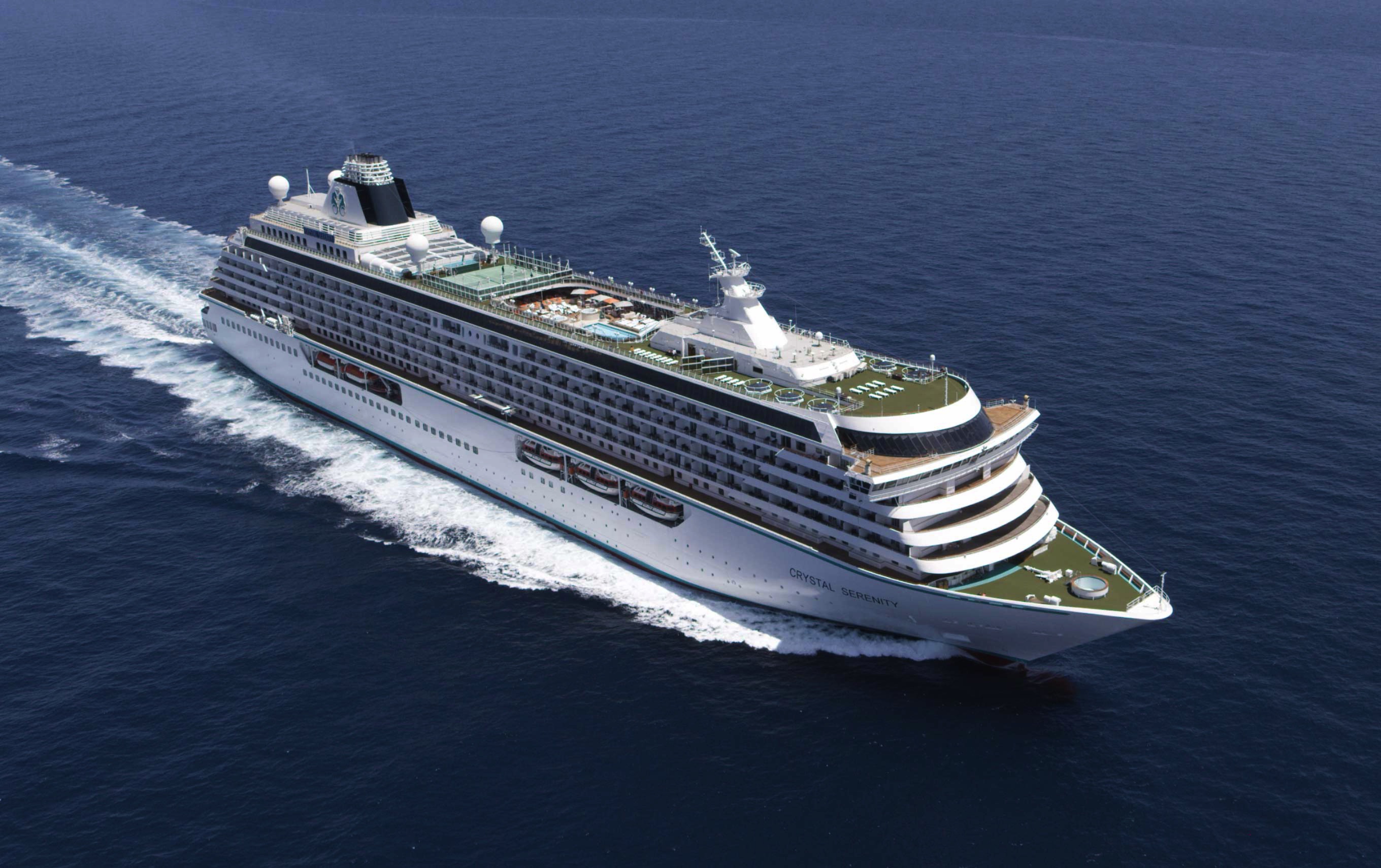
Crystal Serenity
With an industry-leading space to guest ratio across an array of social areas, Crystal Serenity offers the utmost comfort, quality, personalization and choice.
Ship Facts
| Launch Year | 2003 | ||||||||
| Refit Year | 2023 | ||||||||
| Language | en-US | ||||||||
| Gross Tonnage | 68870 | ||||||||
| Length | 250 | ||||||||
| Width | 32 | ||||||||
| Currency | USD | ||||||||
| Speed | 22 | ||||||||
| Capacity | 740 | ||||||||
| Crew Count | 600 | ||||||||
| Deck Count | 9 | ||||||||
| Cabin Count | 545 | ||||||||
| Large Cabin Count | 0 | ||||||||
| Wheelchair Cabin Count | 8 | ||||||||
| Electrical Plugs |
|
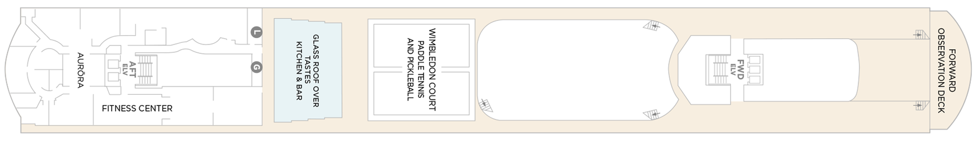
Deck 13
- Sauna + Steam Room
- Aurora
- Fitness Center
- Glass Roof Over Beefbar
- Wimbledon Court Paddle Tennis And Pickleball
- Forward Observation Deck
- Elevator
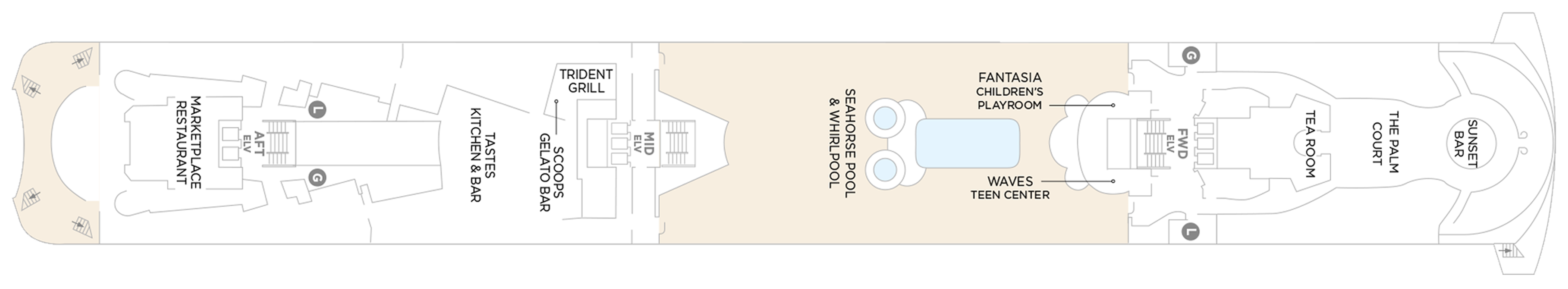
Deck 12
- Marketplace Restaurant
- Washroom
- Beefbar
- Trident Grill
- Scoops Gelato Bar
- Seahorse Pool & Whirlpool
- Fantasia Children's Playroom
- Waves Teen Center
- Tea Room
- The Palm Court
- Sunset Bar
- Elevator
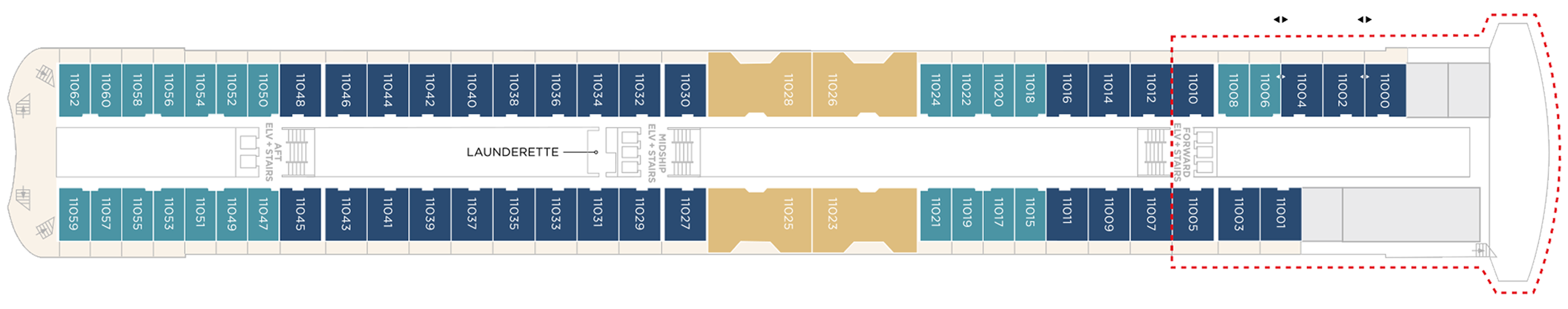
Deck 11
- Crystal Penthouse Suite
- Sapphire Veranda Suite
- Aquamarine Veranda Suite
Launderette
- Elevator
Suites & Guest Rooms Beyond The Forward Elevators Are Subject To Alternative Pricing
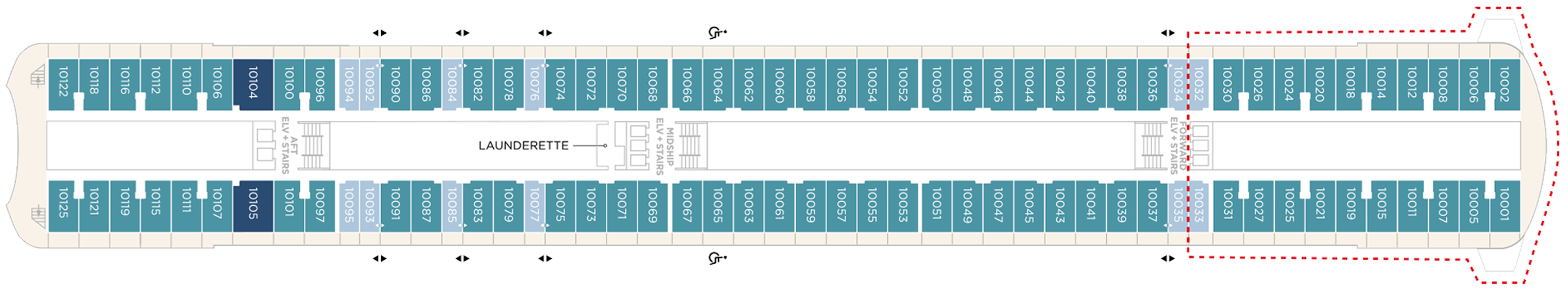
Deck 10
- Sapphire Veranda Suite
- Double Guest Room with Veranda
- Aquamarine Veranda Suite
Launderette
- Elevator
Suites & Guest Rooms Beyond The Forward Elevators Are Subject To Alternative Pricing
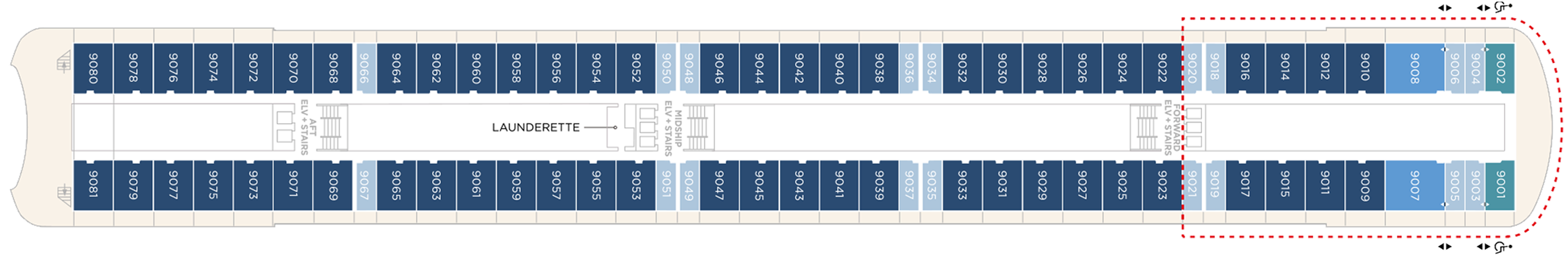
Deck 9
- Junior Crystal Penthouse Suite
- Sapphire Veranda Suite
- Double Guest Room with Veranda
- Aquamarine Veranda Suite
- Launderette
- Elevator
Suites & Guest Rooms Beyond The Forward Elevators Are Subject To Alternative Pricing
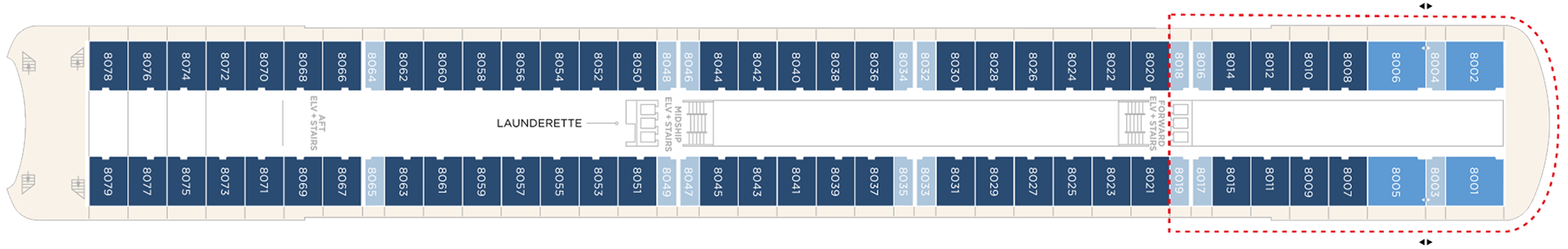
Deck 8
- Junior Crystal Penthouse Suite
- Double Guest Room with Veranda
- Sapphire Veranda Suite
- Launderette
- Elevator
Suites & Guest Rooms Beyond The Forward Elevators Are Subject To Alternative Pricing
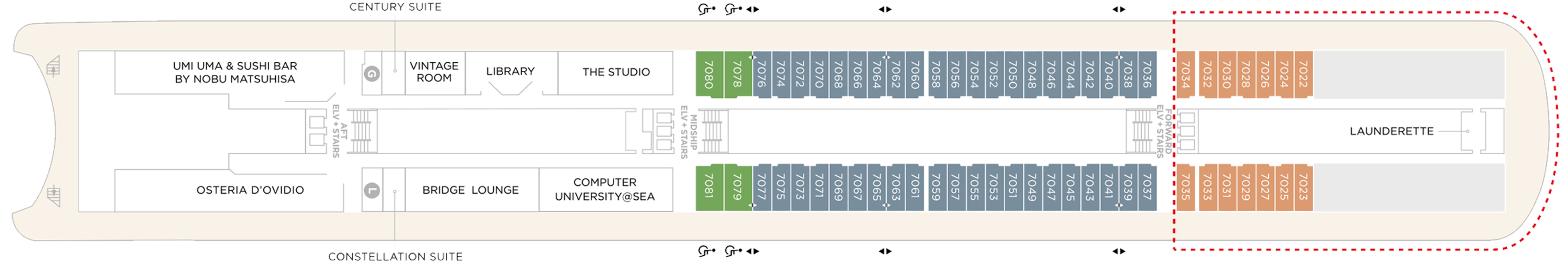
Deck 7
- Aquamarine Ocean View Suite (Accessible Suites)
- Double Guest Room With Veranda
- Single Guest Room, Ocean View
- Century Suite
- Cashier
- Uma Uma & Sushi Bar by Nobu Matsuhisa
- Bridge Lounge
- Vintage Room
- Library
- Osteria D'Ovidio
- Computer University@Sea
- The Studio
- Elevators
Suites & Guest Rooms Beyond The Forward Elevators Are Subject To Alternative Pricing
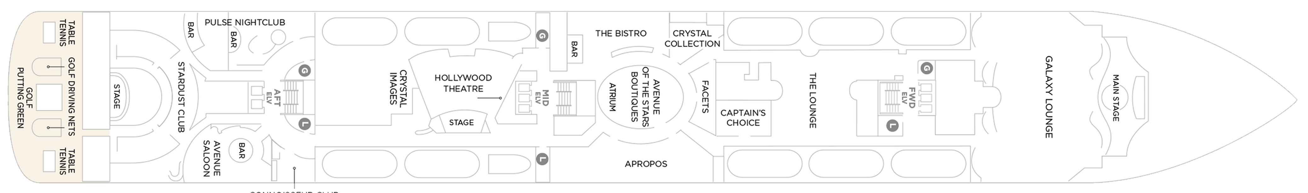
Deck 6
- Main Stage
- Apropos
- Facets
- Avenue Of The Stars Boutiques
- Atrium
- Avenue Saloon
- Connoisseur Club
- Crystal Images
- Golf Driving Nets
- Pulse Night Club
- Elevators
- Stardust Club
- Stage
- Table Tennis
- Putting Green
- Hollywood Theatre
- Galaxy Lounge
- The Lounge
- Crystal Collection
- The Bistro
Deck 5
- Medical Center
- Bar
- Concierge Desk
- Crystal Cove
- Elevators
- Future Cruises & Loyalty Manager
- Reception
- Shore Excursion Desk
- Crystal Plaza
- Waterside Restaurant

Our award-winning cuisine is created and influenced by pioneers in the global food scene, with nine distinct complimentary venues to choose from. Open seating with extensive dining options are tailored around the personal preferences of our guests, allowing them to choose exactly what they want at a time that works for them. Whether that be a late breakfast, six-course wine pairing lunch, or dinner in our exclusive Osteria d’Ovidio or Umi Uma.
All inclusive – however its one complimentary reservation in each specialty restaurant (Umi Uma and Osteria) is included on sailings of 11 days or less, two reservations on sailings between 12 and 22 days, three reservations on sailings 23 days or more, and unlimited reservations for all full World Cruise guests”. However guests can pay to dine outside of their allowance at £50 pp which is great value for these 2 specialist restaurants
Waterside Restaurant
Waterside is where the art of fine dining is elevated to breathtaking heights. Classic dishes are updated with a contemporary twist.
The main dining room features open seating and tables for two, four, and eight guests. Open for breakfast, lunch, and dinner. No reservations are required.
Umi Uma
UMI UMA is one of Crystal's award-winning specialty dining offerings. Set in an elegantly modern setting and created by legendary Master Chef Nobuyuki (Nobu) Matsuhisa, dishes are inspired by the exotic array and traditions of the Orient.
Guests will again be able to dine on signature entrées such as Nobu-Style Black Cod, Grilled Chilean Sea Bass, Wagyu Beef Filet Steak, and some of the freshest sushi available at sea.
Beefbar
The most exciting flavors from the global street-food scene – Beef, Reef and Leaf – are fashioned from the freshest ingredients by creative chefs and served for sharing in stylish surroundings.
Beefbar’s curated menu features prime cuts from renowned regions, including Wagyu from Australia, Black Angus from the United States and and the flavorful Kobe beef from Japan. Each cut is meticulously chosen for its quality and flavor profile, ensuring a unique dining experience for every meat lover. Join us at sea to savor the finest beef, prepared with expert craftsmanship and served the Beefbar way, onboard Crystal’s ships.
- Beefbar is open for lunch and dinner
- Reservations are required for dinner
Osteria D'Ovidio
It’s the moment we’ve been waiting for – our new menu for Osteria d’Ovidio has arrived on Crystal Symphony and on Crystal Serenity. This exclusive collaboration with the Alajmo brothers signals a prestigious new era for our signature Italian restaurant. Massimiliano, the youngest chef ever to be awarded three Michelin stars, and Raffaele, CEO of the celebrated Alajmo restaurants in Italy, which include Le Calandre in Rubano, and Gran Caffè Quadri and Ristorante Quadri in St. Mark’s Square, Venice, have brought their unparalleled expertise to specialty dining on both ships. We can’t wait for you to try their dishes – exclusively on Crystal.
An unparalleled fine-dining experience courtesy of the Michelin-rated Alajmo brothers takes center stage at Osteria d'Ovidio. Named for our owner, Manfredi Lefebvre d'Ovidio, this restaurant specializes in show-stopping Italian cuisine. Reservations are required and are limited per sailing.
Every dish embodies passion, precision, and prestige, blending traditional Italian flavors with Chef Alajmo's culinary approach, which emphasizes lightness and depth of flavor. You can choose from authentic regional dishes, signature creations from Le Calandre, and dishes inspired by Venetian cuisine. From a refined carbonara to lamb chops with a herb crust, there's something to delight every palate.
Trident Grill
Enjoy a burger with a view. Our pool restaurant and grill offer a comfortable terrace highlighted by an elegant design, making it the perfect spot for outdoor dining.
The Trident serves lunch and snacks throughout the day - burgers, melts and strip steak cooked to order, crispy fries and salads.
The Bistro
A nod to the mythic bars and bistros of Paris. Celebrate the classics in this spacious and airy café that serves light bites from dawn to dusk.
The Bistro is a delightful daytime relaxing cafe that offers delicious light meals, with panoramic views of the sparkling sea.
The Vintage Room
The Vintage Room offers guided pairings and dinners highlighting the vast selection of wines in the ship’s onboard cellar. This intimate, innovative concept offers guests an education in fine wine and cuisine, allowing them to gain privileged insights into the art of enology. In addition to daytime tastings and discussions, guests may enjoy a variety of private wine-themed lunches and dinners by special arrangement with the Head Sommelier.
Scoops Gelato Bar
Enjoy authentic Italian gelato with a sea view, hand-crafted by the celebrated artisans at Badiani, using expertise perfected over generations since its founding in Florence, Italy, in 1932. Choose from more than 20 signature flavors, slow-churned with natural ingredients, including Buontalenti, Cioccolatissimo, and Stracciatella, as well as refreshing fruit sorbets.
Marketplace
This sophisticated buffet-style restaurant features a dizzying array of hot and cold choices for those who like a little of everything.
24 Hours In-Suite Dining
Enjoy a meal from the comfort of your suite while relaxing in Crystal comfort. Select from our inspired menu to delight you while you stay in, watch a movie or read a favorite book.
Tea Time
Tastes Kitchen & Bar
A new definition of traveling with taste. Sumptuous, regionally inspired tapas-style cuisine is the perfect combination of sophisticated style and casual dining.
Each evening Crystal brings together a cast of world-class performers, entertainers and hosts. Whether you’re looking for theatrical entertainment or the latest Hollywood release, our lounges, ballrooms, night clubs and screening rooms can cater to your every mood.
Our two elegant vessels host an equally exceptional offering including world-renowned restaurants, restorative spas and endless opportunity for inspiration and enrichment, tied together by unparalleled personal service.
Casino De Monte-Carlo
Le Casino de Monte-Carlo is offering a new and unique experience onboard. Place your bets on table games with the unique savoir-faire of Monaco’s world-famous casino or get excited to a dynamic range of slots to hit the jackpot. An ultimate way to embrace the thrill of the game in an elegant atmosphere adorned in the hues of the historical building.
Crystal Cove
An ideal refreshment stop any time of the day, and the perfect place to meet friends for a pre-dinner cocktail. Enjoy a variety of musical styles as the day turns into night.
Library
A well-stocked library containing over 2,000 books on a range of subjects from classics to popular biographies, history to contemporary mysteries. Plus enjoy an ample selection of magazines and board games perfect for poolside reading
Palm Court
Featuring large sky lights, floor-to-ceiling windows and a fabulous 270-degree forward view, this venue is perfect for afternoon tea, social gatherings and dancing.
Seahorse Pool
Our Seahorse Pool, with plenty of surrounding deck space to sunbathe, relax and read while enjoying a cool drink in the afternoon.
Apropos & Facets Onboard Shopping
Heighten the experience on board with a selection of fine jewelry, watches and cruise wear available in our arcade, alongside designer apparel. Make the most of being at sea with a selection of duty free items available.
Stardust Club and Supper Club
On selected evenings before and after dinner, this entertainment lounge features dancing, production spot shows, cabaret performances and other themed events. Additionally, on select nights, Stardust will open the doors for Supper Club for up to 116 guests to enjoy an evening show where they can dine and dance at the same time. Supper Club is by reservation only.
Pulse Night Club
An intimate lounge for a late-night drink, dancing or a place to let loose with karaoke.
Galaxy Lounge
Performances are the focal point here, with appearances by fantastic Broadway-style performers and headline entertainers. Drink service provided before each show.
Hollywood Theatre
The ship's sleek cinema for recent-released movies, live sport events, guest lectures and religious services.
Connoisseur Club
An elegant space to indulge in the finest cigars and cognacs.
Computer University@Sea
Our innovative Computer lab onboard led by a team of tech experts.
Crystal Plaza
Crystal Plaza can be found on Deck 5.
Avenue Saloon
Signature piano bar with an intimate ambience. The perfect setting for a cocktail before and after dinner.
Bridge Lounge
The Bridge Lounge can be found on Deck 7.
Reception & Atrium
The Reception can be found on Deck 5.
Observation Deck
More information coming soon.