
Oslo to Reykjavik
Oslo to Reykjavik
Cruise overview
WHY BOOK WITH US?
- ✔ The Deluxe Cruises’ team has extensive experience in ultra-luxury cruising.
- ✔ Call now to speak to our helpful and experienced Cruise Concierge team.
- ✔ Enjoy our Unique Deluxe Cruises Bonus for substantial savings.
- ✔ Our team will tailor your holiday to your exacting requirements.
- ✔ As agents, we work under the protection of each cruise lines ABTA / ATOL licences
About Oslo
Oslo is the capital of Norway and is also its largest city, situated at the head of Oslo Fjord and surrounded by hills and forests. Home to some 50 museums and full of galleries, cafés, a sculpture park and the Royal Palace, this vibrant city with its handsome 19th-century buildings and wide streets has much to offer. Its history dates back 1,000 years, and includes a rich seafaring heritage that ranges from the Viking era to Thor Heyerdahl’s Kon Tiki expedition. Discover more about this exciting city on our varied selection of excursions.


About Kristiansand
Nicknamed "Sommerbyen" ("Summer City"), Norway's fifth-largest city has 78,000 inhabitants. Norwegians come here for its sun-soaked beaches and beautiful harbor. Kristiansand has also become known internationally for the outdoor Quart Festival, which hosts local and international rock bands every July. According to legend, in 1641 King Christian IV marked the four corners of Kristiansand with his walking stick, and within that framework the grid of wide streets was laid down. The center of town, called the Kvadraturen, still retains the grid, even after numerous fires. In the northeast corner is Posebyen, one of northern Europe's largest collections of low, connected wooden house settlements, and there's a market here every Saturday in summer. Kristiansand's Fisketorvet (fish market) is near the south corner of the town's grid, right on the sea.
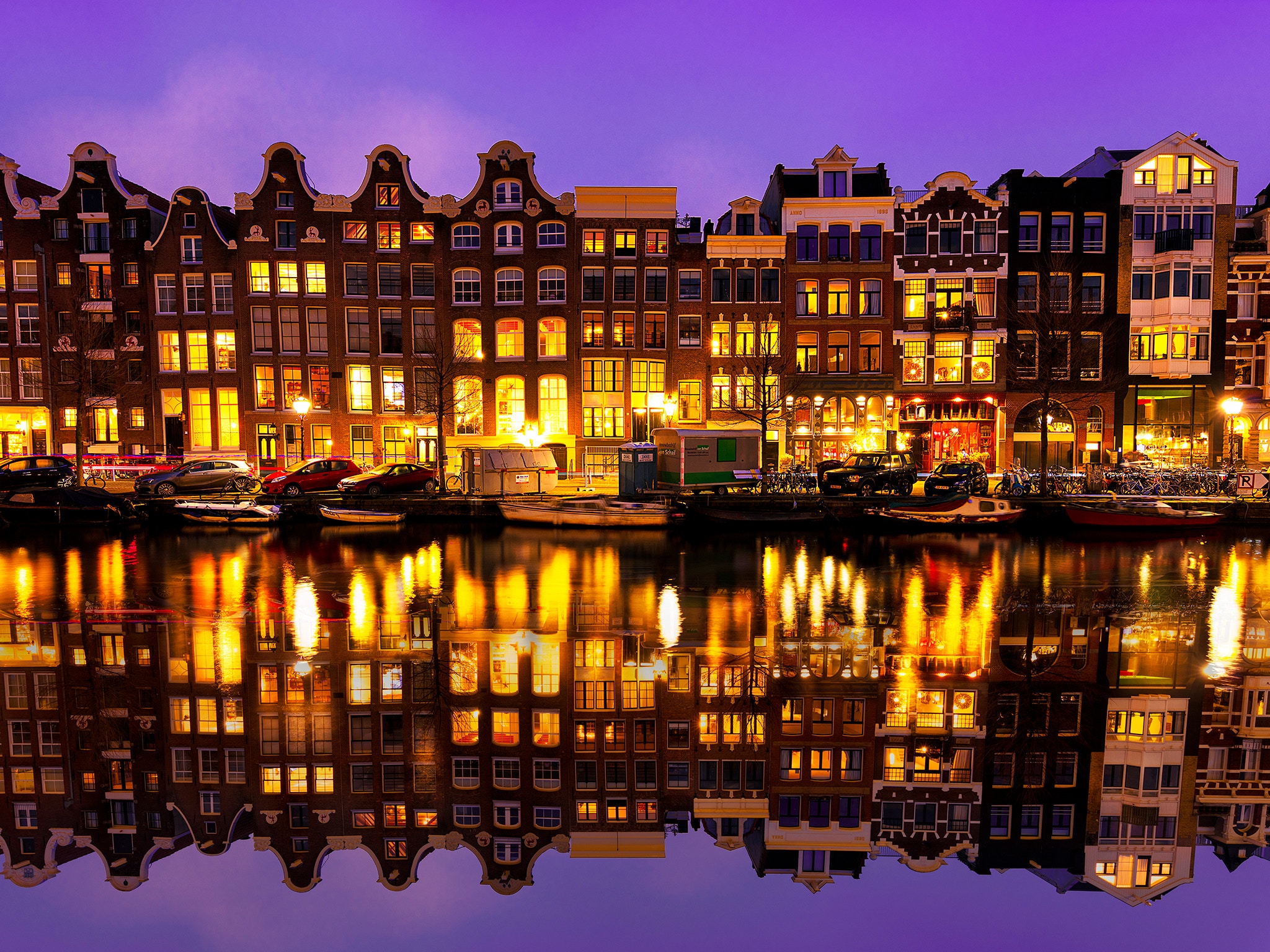
About Amsterdam
Amsterdam combines the unrivaled beauty of the 17th-century Golden Age city center with plenty of museums and art of the highest order, not to mention a remarkably laid-back atmosphere. It all comes together to make this one of the world's most appealing and offbeat metropolises in the world. Built on a latticework of concentric canals like an aquatic rainbow, Amsterdam is known as the City of Canals—but it's no Venice, content to live on moonlight serenades and former glory. Quite the contrary: on nearly every street here you'll find old and new side by side—quiet corners where time seems to be holding its breath next to streets like neon-lit Kalverstraat, and Red Light ladies strutting by the city's oldest church. Indeed, Amsterdam has as many lovely facets as a 40-carat diamond polished by one of the city's gem cutters. It's certainly a metropolis, but a rather small and very accessible one. Locals tend to refer to it as a big village, albeit one that happens to pack the cultural wallop of a major world destination. There are scores of concerts every day, numerous museums, summertime festivals, and, of course, a legendary year-round party scene. It's pretty much impossible to resist Amsterdam's charms. With 7,000 registered monuments, most of which began as the residences and warehouses of humble merchants, set on 160 man-made canals, and traversed by 1,500 or so bridges, Amsterdam has the largest historical inner city in Europe. Its famous circle of waterways, the grachtengordel, was a 17th-century urban expansion plan for the rich and is a lasting testament to the city’s Golden Age. This town is endearing because of its kinder, gentler nature—but a reputation for championing sex, drugs, and rock ’n’ roll does not alone account for Amsterdam's being one of the most popular destinations in Europe: consider that within a single square mile the city harbors some of the greatest achievements in Western art, from Rembrandt to Van Gogh. Not to mention that this is one of Europe's great walking cities, with so many of its treasures in the untouted details: tiny alleyways barely visible on the map, hidden garden courtyards, shop windows, floating houseboats, hidden hofjes(courtyards with almshouses), sudden vistas of church spires, and gabled roofs that look like so many unframed paintings. And don’t forget that the joy lies in details: elaborate gables and witty gable stones denoting the trade of a previous owner. Keep in mind that those XXX symbols you see all over town are not a mark of the city's triple-X reputation. They're part of Amsterdam's official coat of arms—three St. Andrew's crosses, believed to represent the three dangers that have traditionally plagued the city: flood, fire, and pestilence. The coat's motto ("Valiant, determined, compassionate") was introduced in 1947 by Queen Wilhelmina in remembrance of the 1941 February Strike in Amsterdam—the first time in Europe that non-Jewish people protested against the persecution of Jews by the Nazi regime.
About Dover
Known as the gateway of England, Dover welcomes millions of visitors from all over the globe each year in its role as the ferry capital of the world and the second busiest cruise port in the UK. The White Cliffs Country has a rich heritage. Within the walls of the town’s iconic castle, over 2,000 years of history waits to be explored, whilst the town’s museum is home to the Dover Bronze Age Boat, the world’s oldest known seagoing vessel. The town’s cliffs that are a welcome sight for today's cross-channel travellers also served as the control centre for the Dunkirk evacuation in 1940.
About Plymouth
Best known as the port from which Sir Francis Drake and the port which the Pilgrim Fathers set sail from, Plymouth is awash with history. Walk down its cobbled streets, step back in time and discover the historical landmarks and sites.

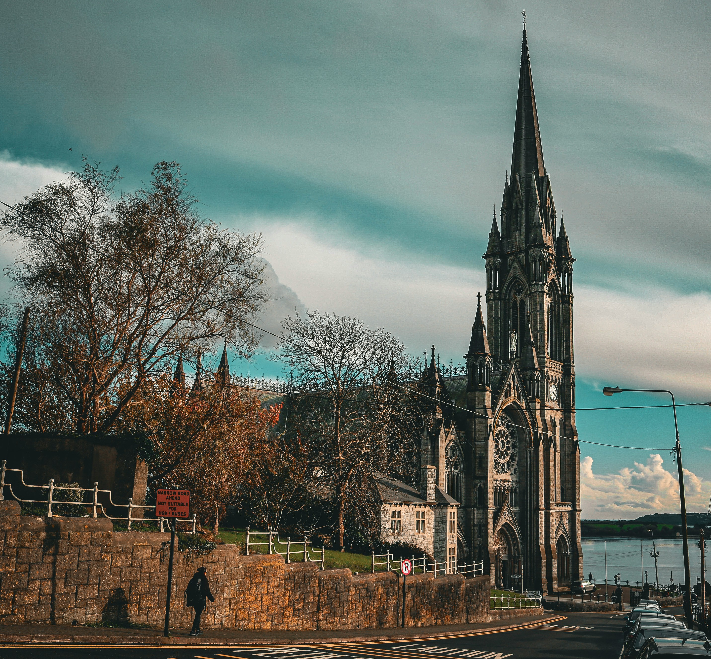
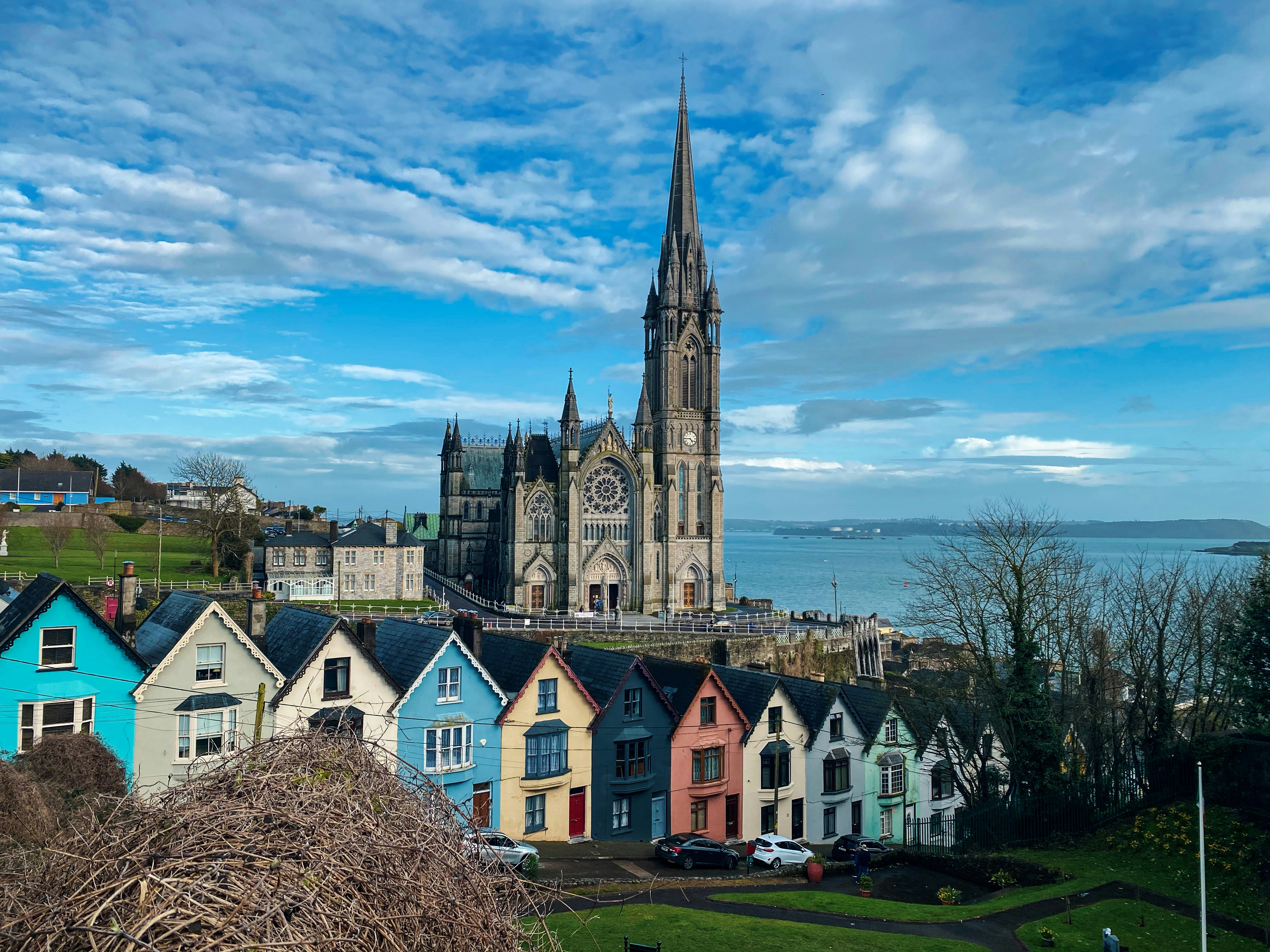
About Cobh
Cork City's nearby harbor district has seen plenty of history. Cork Harbour's draws include Fota Island—with an arboretum, a wildlife park, and the Fota House ancestral estate—and the fishing port of Cobh.
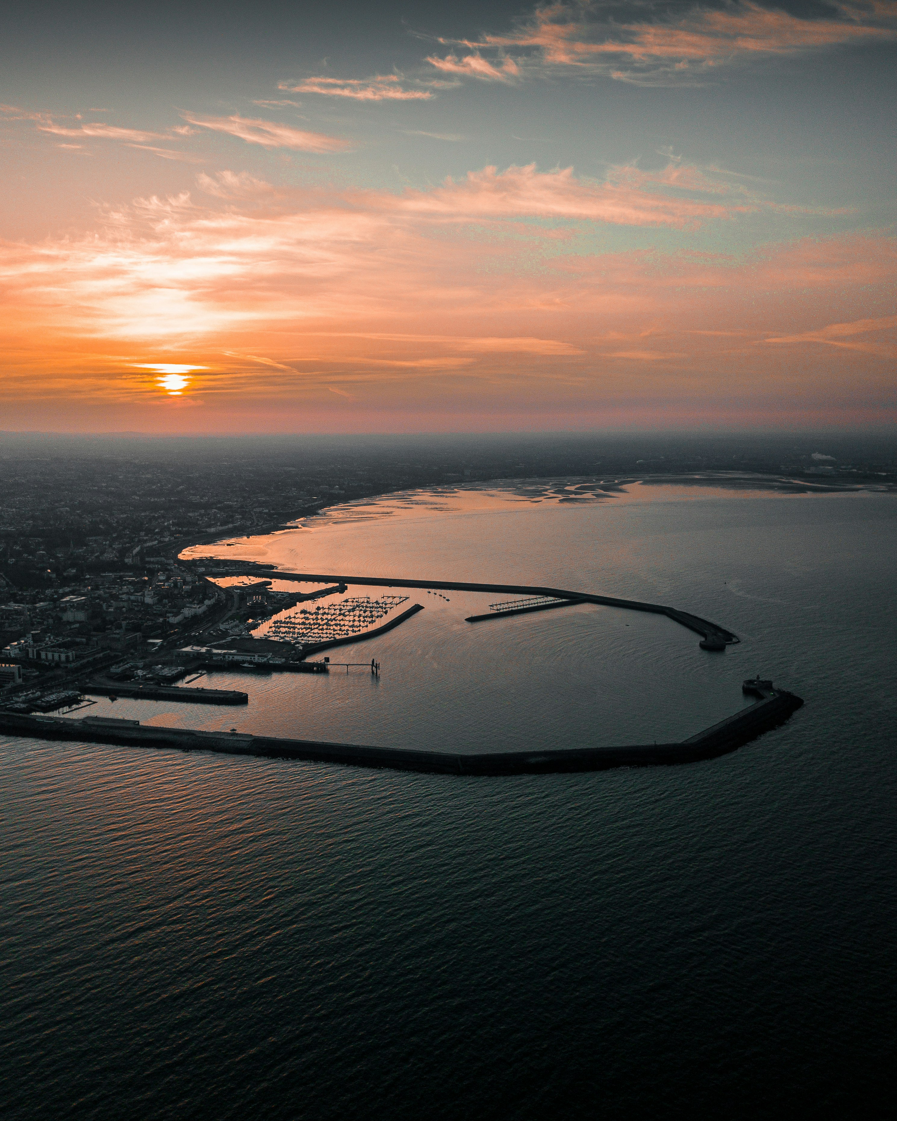
About Dun Laoghaire


About Liverpool
From world-class attractions and sports to legendary music, Liverpool offers old-world charm with modern sophistication, underpinned by a rich cultural history.


About Douglas
The Isle of Man, situated in the Irish Sea off the west coast of England, is a mountainous, cliff-fringed island and one of Britain’s most beautiful spots. Measuring just 30 miles by 13 miles, the Isle of Man remains semi-autonomous. With its own postage stamps, laws, currency, and the Court of Tynwald (the world’s oldest democratic parliament), the Isle of Man is rich with history and lore.Inhabited from Neolithic times, the island became a refuge for Irish missionaries after the 5th Century. Norsemen took the island during the 9th Century and sold it to Scotland in 1266. However, since the 14th Century, it has been held by England. Manx, the indigenous Celtic language, is still spoken by a small minority. The Isle of Man has no income tax, which has encouraged many Britains to regard the island as a refuge. Otherwise, it is populated by Gaelic farmers, fishermen, and the famous tailless manx cats. The varied landscape features austere moorlands and wooded glens, interspersed by fine castles, narrow-gauge railways, and scores of standing stones with Celtic crosses. The hilly terrain rises to a height of 2,036 feet at Mount Snaefell, which dominates the center of the island.

About Greencastle
About Lerwick, Shetland Islands
Founded by Dutch fishermen in the 17th century, Lerwick today is a busy town and administrative center. Handsome stone buildings—known as lodberries—line the harbor; they provided loading bays for goods, some of them illegal. The town's twisting flagstone lanes and harbor once heaved with activity, and Lerwick is still an active port today. This is also where most visitors to Shetland dock, spilling out of cruise ships, allowing passengers to walk around the town.

About Kirkwall, Orkney Islands
In bustling Kirkwall, the main town on Orkney, there's plenty to see in the narrow, winding streets extending from the harbor. The cathedral and some museums are highlights.

About Thorshavn
More than 600 miles (nearly 1,000 kilometres) from Denmark’s west coast lie the Faroes, a triangle of eighteen windswept islands, seventeen of which are inhabited. Only 48,500 people plus some 70,000 sheep roam these remote lands. Much of the islands’ heritage reflects a medieval past, beginning with the arrival of farmers from western Norway who settled here in the 9th century. Evidence of this Scandinavian heritage is preserved through centuries of isolation; ancient structures can still be seen in villages clustered around old churches. Sheer cliffs and waterfalls carve Streymoy, the largest of the islands, where Torshavn is one of the world’s smallest capitals with about 12,400 inhabitants, plus another 5,000 living in the suburbs of Argir and Hoyvik. Visitors find interesting museums, churches, monuments and all the amenities of a modern town and thriving harbour here. The world’s oldest, still active parliament was founded in the Viking age. Today, it houses the main offices of the local government. Many of the attractions are found outside of Torshavn in the rugged beauty of Streymoy. There are fields with grazing ponies and sheep, tiny hamlets where residents live in half-timbered houses topped by green grass roofs, and dramatic rock formations. Birds by the thousands populate the craggy seaside cliffs, which make an ideal stopover for migratory gannets, guillemots and puffins. The Faroes' climate is generally wet and windy. Because of the Gulf Stream, the temperature is a good deal more moderate than the latitude might imply; it also helps to keep Faroe harbours ice-free year-round.

About Seydisfjørdur
Seyðisfjörður, a beautiful 19th-century Norwegian village on the east coast of Iceland, is regarded by many as one of Iceland's most picturesque towns, not only due to its impressive environment, but also because nowhere in Iceland has a community of old wooden buildings been preserved so well as here. Poet Matthías Johannessen called Seyðisfjörður a 'pearl enclosed in a shell'. The community owes its origins to foreign merchants, mainly Danes, who started trading in the fjord in the mid-19th century. But the crucial factor in the evolution of the village was the establishment of the Icelandic herring fishery by Norwegians in 1870-1900. The Norwegians built up a number of herring-fishing facilities, and in a matter of years the little community grew into a boom town. Today, about 800 people live in Seyðisfjörður. The local economy has long been based on the fisheries, while light industry also flourishes. Tourism is playing a growing role, as the picturesque town in its spectacular surroundings attracts more and more visitors. The car/passenger ferry Norrøna, which plies between continental Europe and Iceland every summer, docks at Seyðisfjörður every Thursday. Seyðisfjörður has been a cosmopolitan community from its foundation, and the ferry service has contributed to ensuring that it remains so.

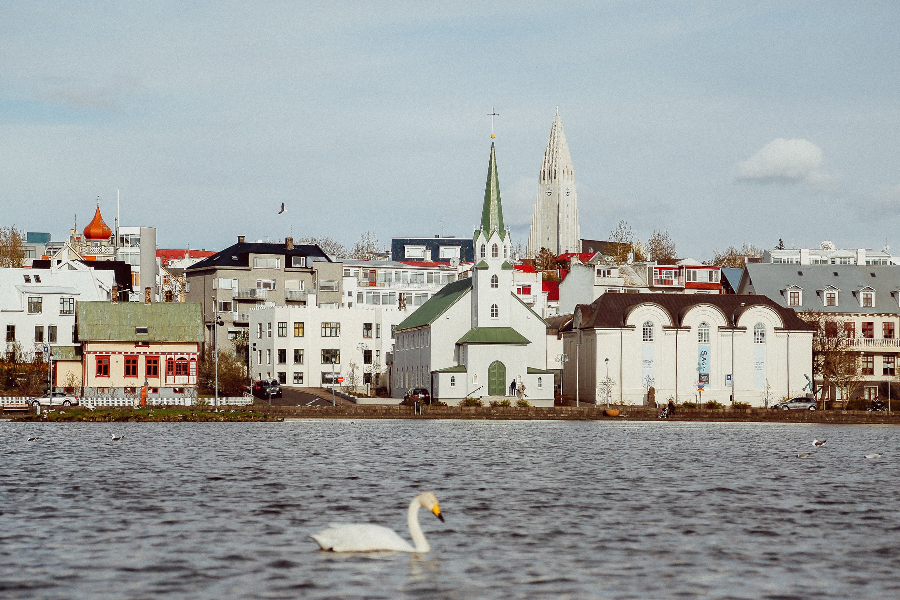
About Reykjavík
Sprawling Reykjavík, the nation's nerve center and government seat, is home to half the island's population. On a bay overlooked by proud Mt. Esja (pronounced eh-shyuh), with its ever-changing hues, Reykjavík presents a colorful sight, its concrete houses painted in light colors and topped by vibrant red, blue, and green roofs. In contrast to the almost treeless countryside, Reykjavík has many tall, native birches, rowans, and willows, as well as imported aspen, pines, and spruces.Reykjavík's name comes from the Icelandic words for smoke, reykur, and bay, vík. In AD 874, Norseman Ingólfur Arnarson saw Iceland rising out of the misty sea and came ashore at a bay eerily shrouded with plumes of steam from nearby hot springs. Today most of the houses in Reykjavík are heated by near-boiling water from the hot springs. Natural heating avoids air pollution; there's no smoke around. You may notice, however, that the hot water brings a slight sulfur smell to the bathroom.Prices are easily on a par with other major European cities. A practical option is to purchase a Reykjavík City Card at the Tourist Information Center or at the Reykjavík Youth Hostel. This card permits unlimited bus usage and admission to any of the city's seven pools, the Family Park and Zoo, and city museums. The cards are valid for one (ISK 3,300), two (ISK 4,400), or three days (ISK 4,900), and they pay for themselves after three or four uses a day. Even lacking the City Card, paying admission (ISK 500, or ISK 250 for seniors and people with disabilities) to one of the city art museums (Hafnarhús, Kjarvalsstaðir, or Ásmundarsafn) gets you free same-day admission to the other two.


Where You'll Go


