Los Angeles to Singapore
Los Angeles to Singapore
Cruise overview
WHY BOOK WITH US?
- ✔ The Deluxe Cruises’ team has extensive experience in ultra-luxury cruising.
- ✔ Call now to speak to our helpful and experienced Cruise Concierge team.
- ✔ Enjoy our Unique Deluxe Cruises Bonus for substantial savings.
- ✔ Our team will tailor your holiday to your exacting requirements.
- ✔ As agents, we work under the protection of each cruise lines ABTA / ATOL licences
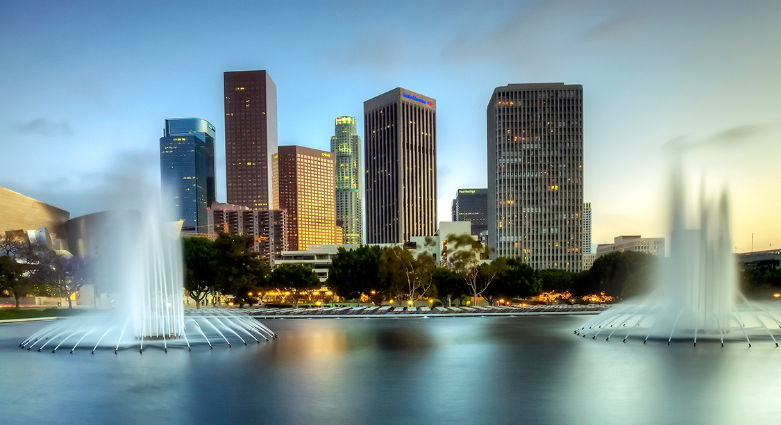
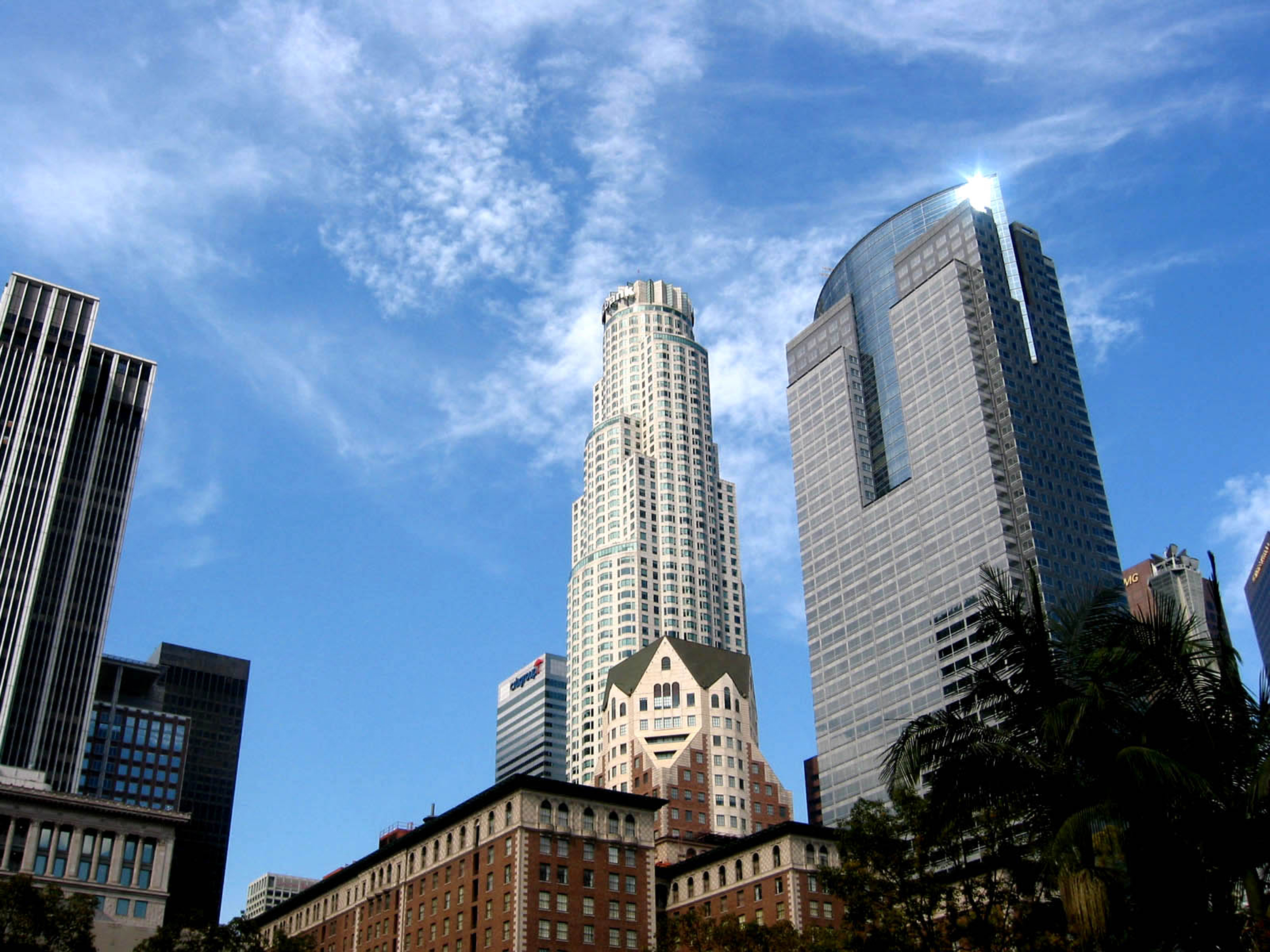
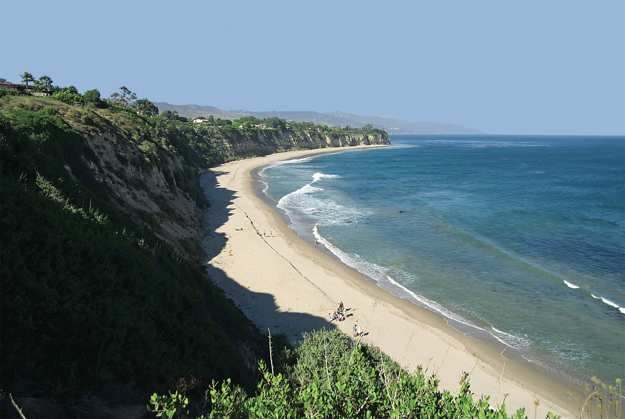
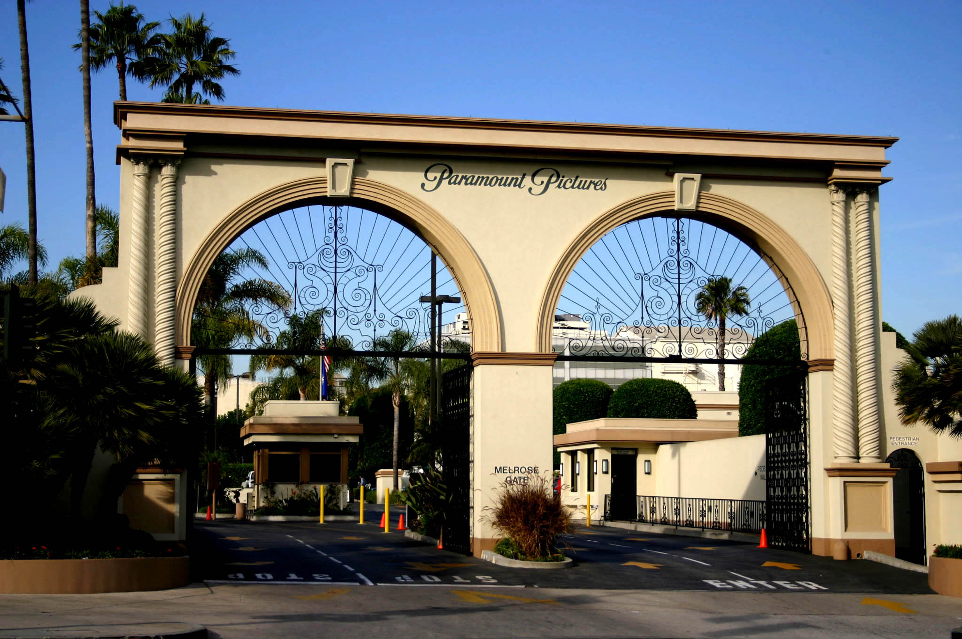
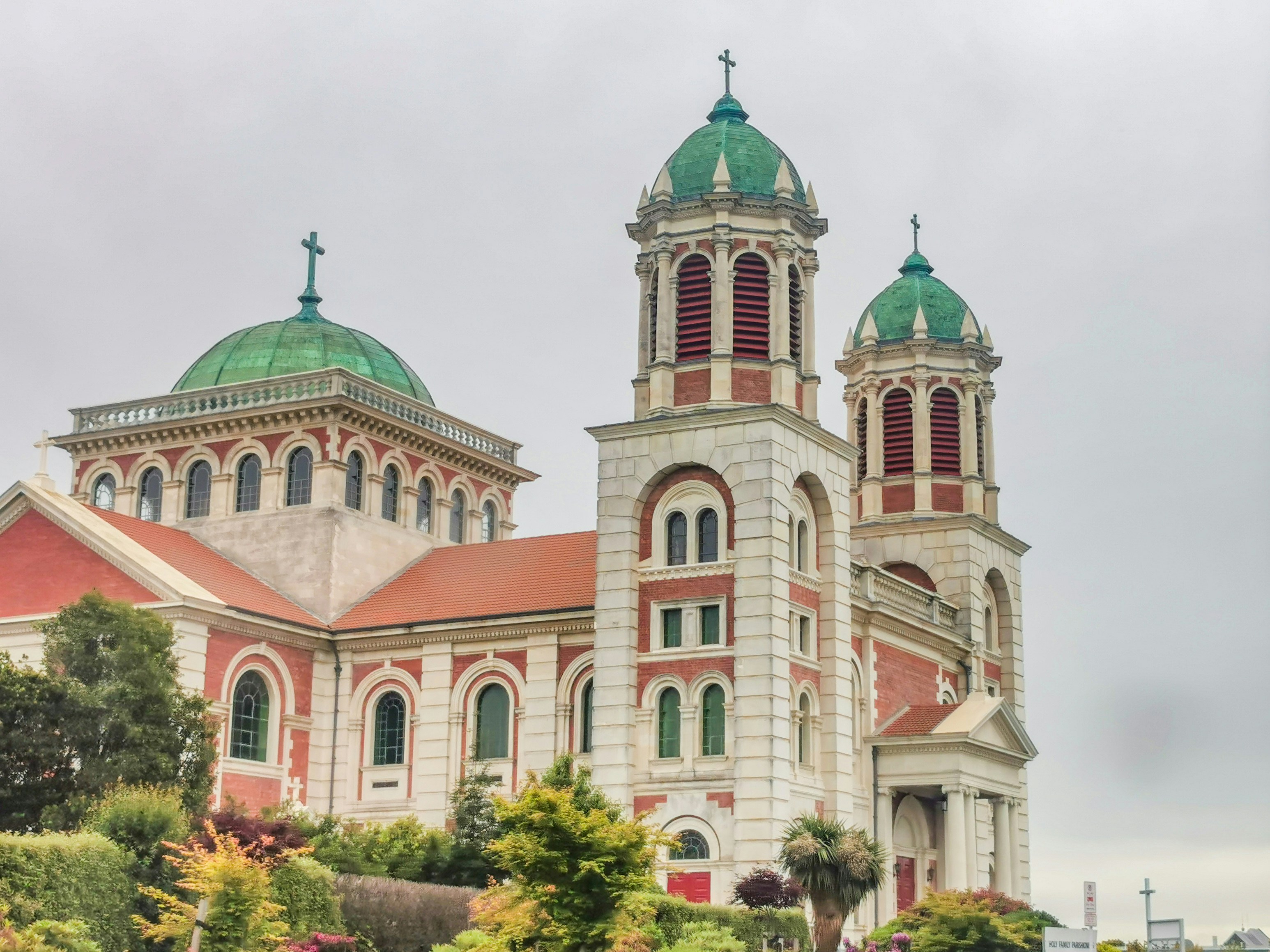
About Los Angeles, California
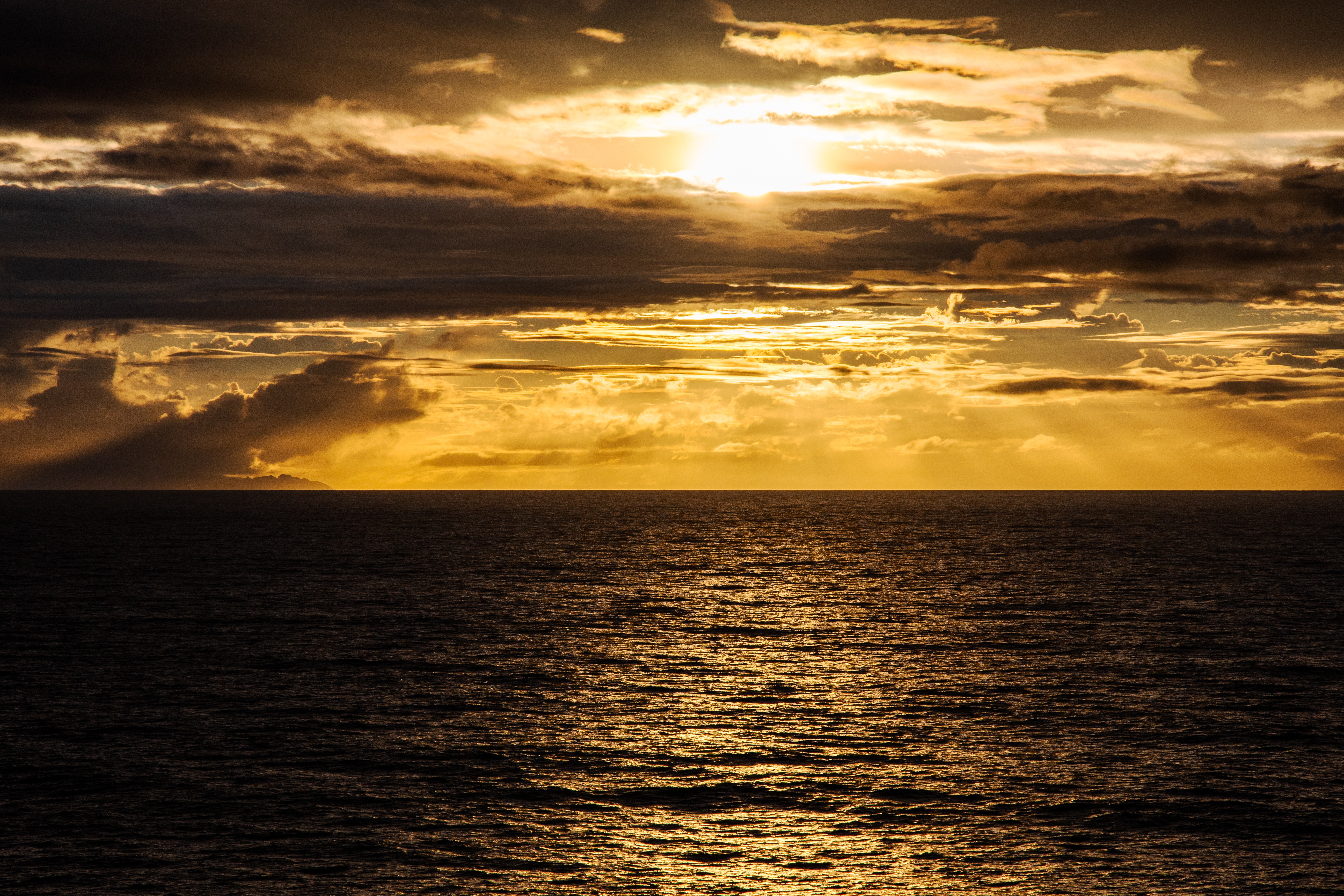
Home of the famous Hollywood sign and Walk of Fame, Los Angeles is the place to visit for anyone interested in film and television and hoping to get a glimpse at some famous actors and artists. Stroll down the Walk and enjoy the glamorous atmosphere and famous surroundings, or take a break on the Santa Monica pier and watch the sun set on the sea.


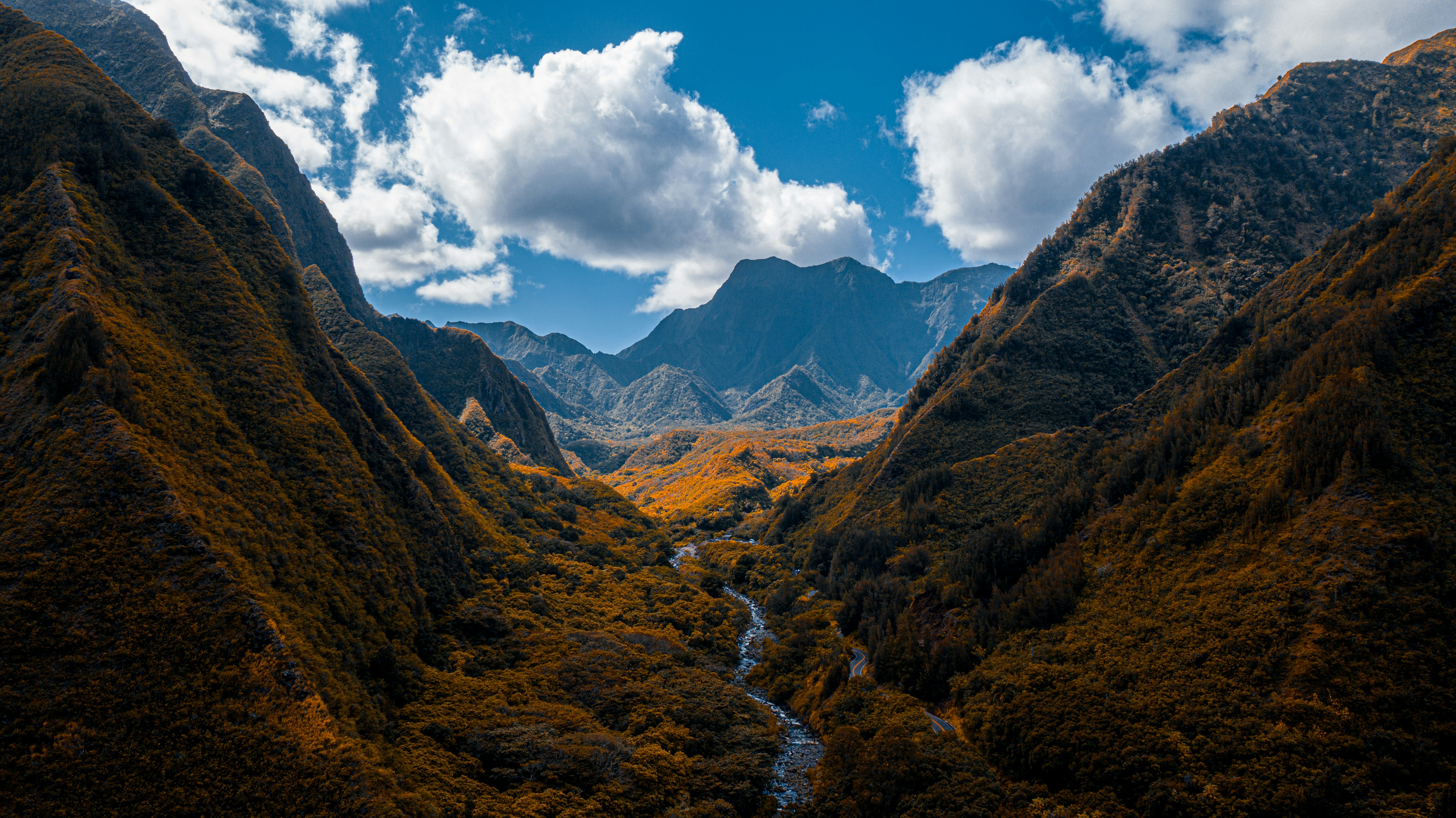
About Kahului-Maui, Hawaii
About Honolulu, Hawaii
Capital of Hawaii, and a popular tourist destination, Honolulu is known for surfing and water sports. However, there's more to the city than surfing; with museums, the only royal palace in the country, and a mall, there's bound to be something of interest for any visitor.
About Nuku Hiva Island
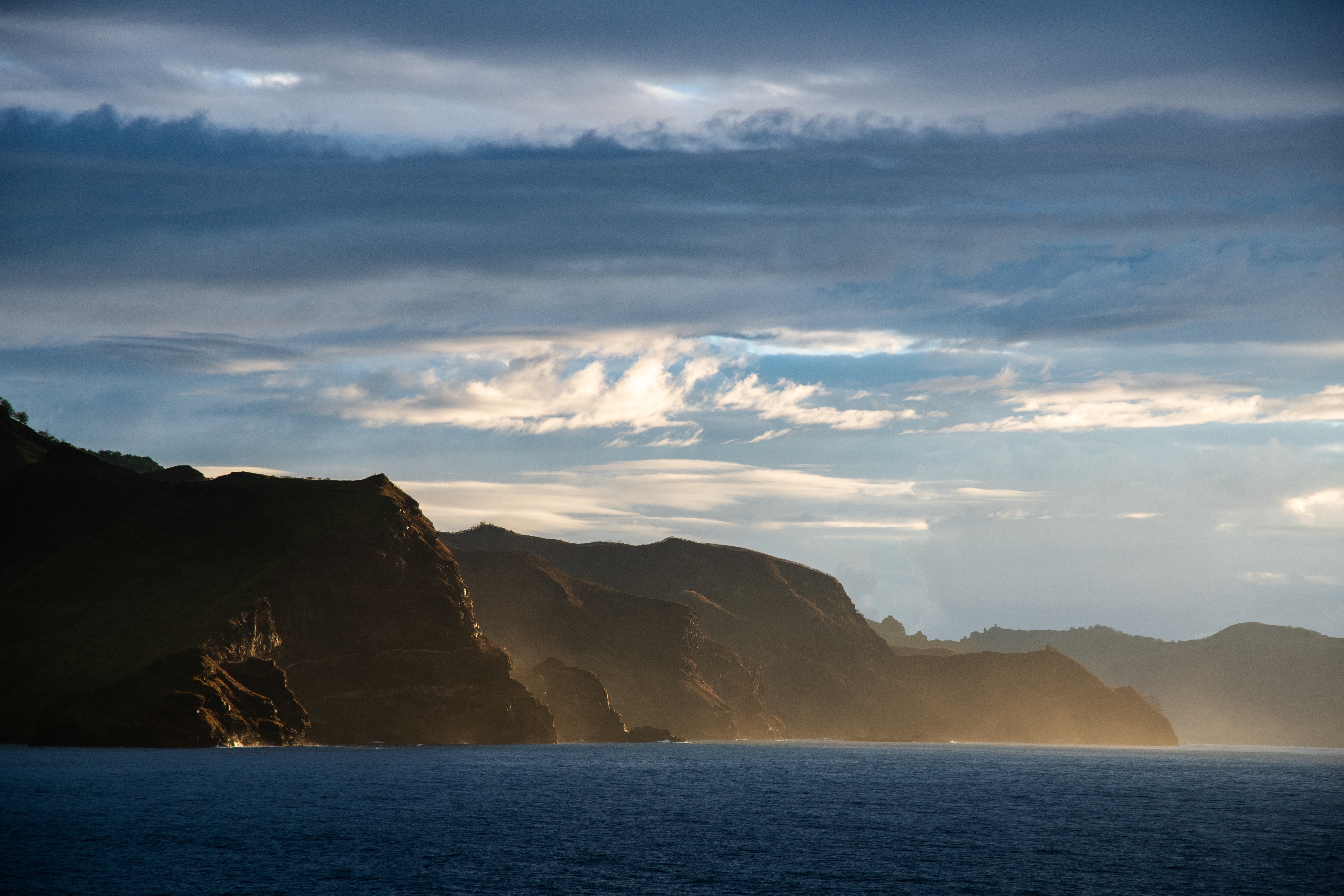
About Nuku Hiva Island
About Fakarava
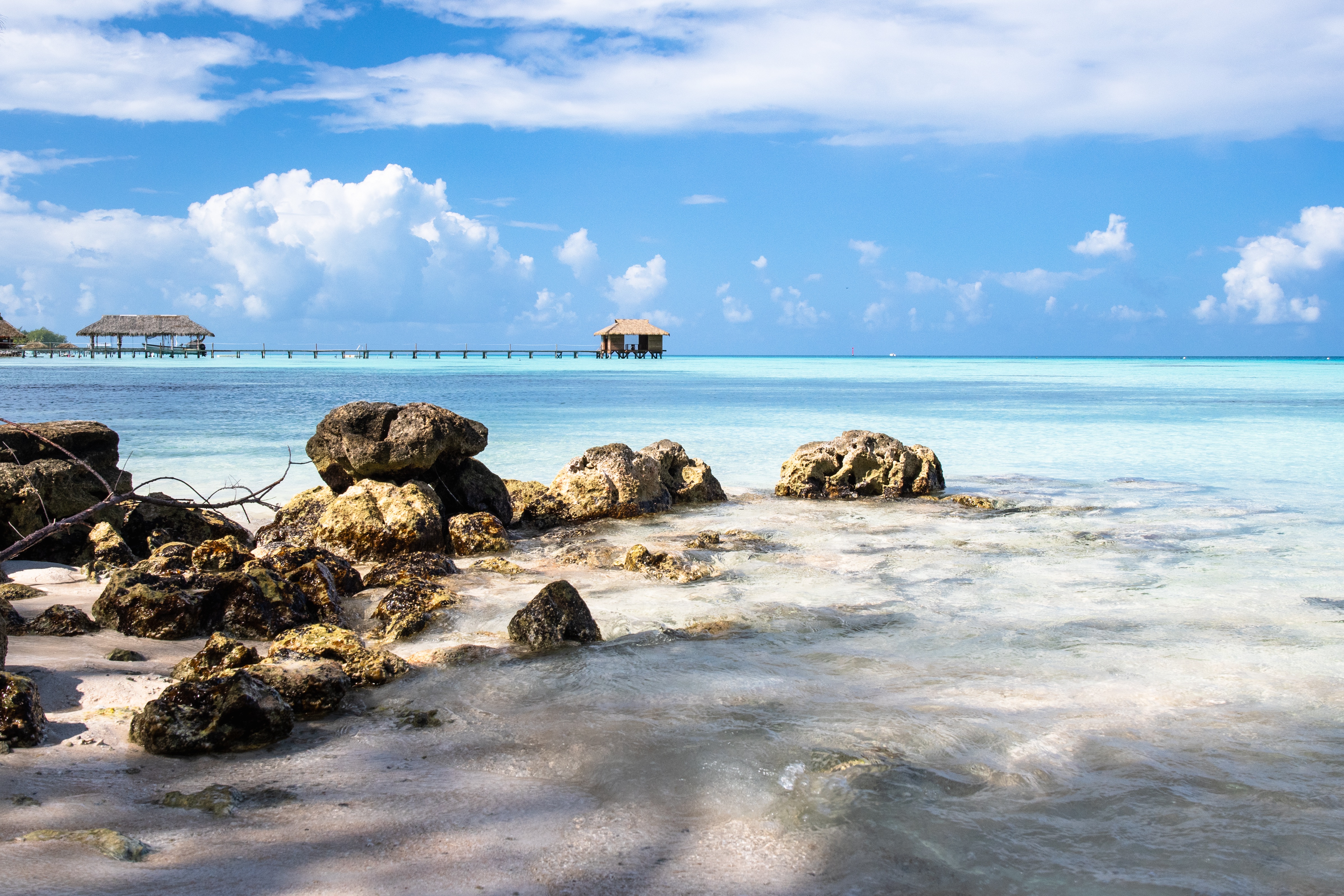
About Rangiroa
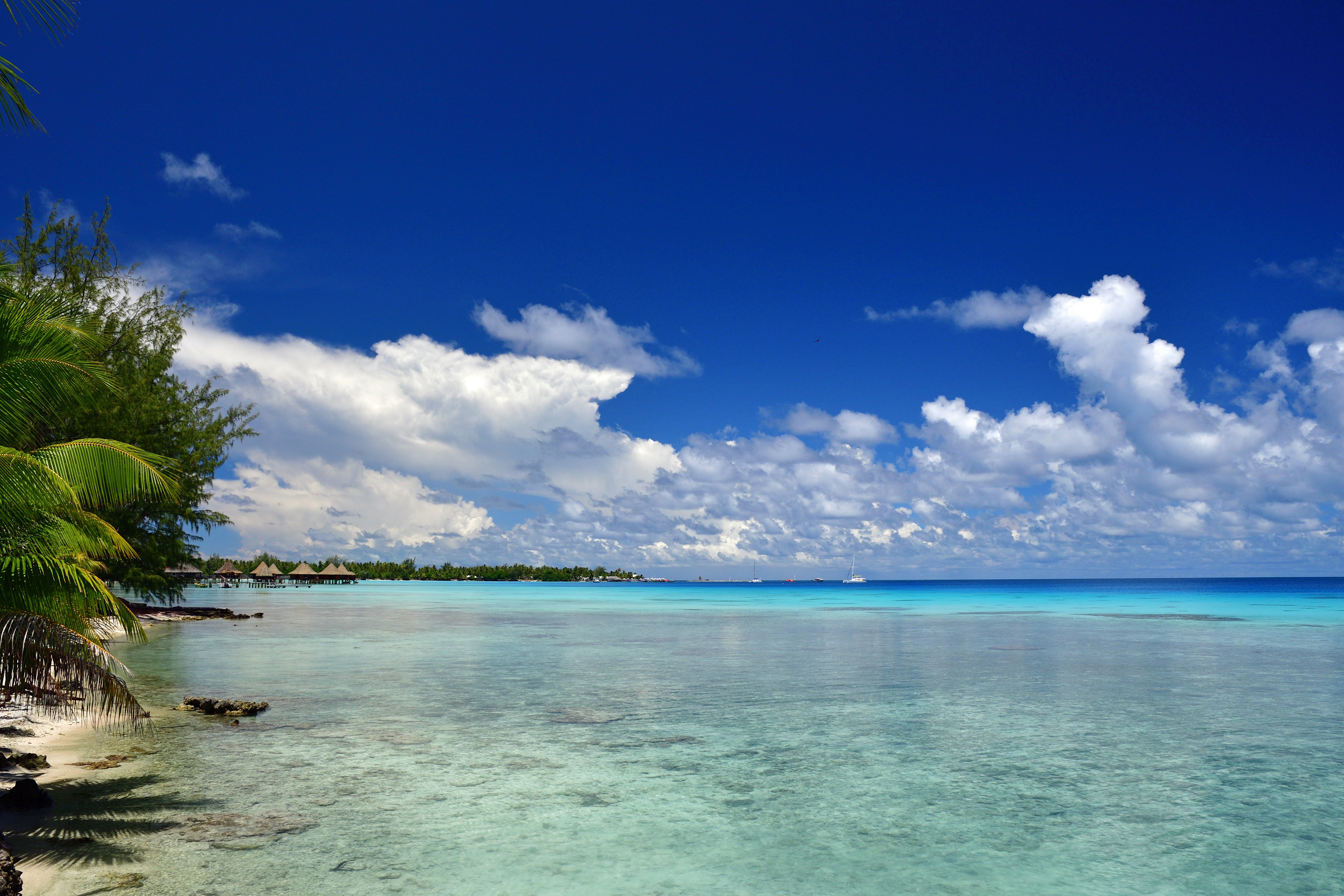
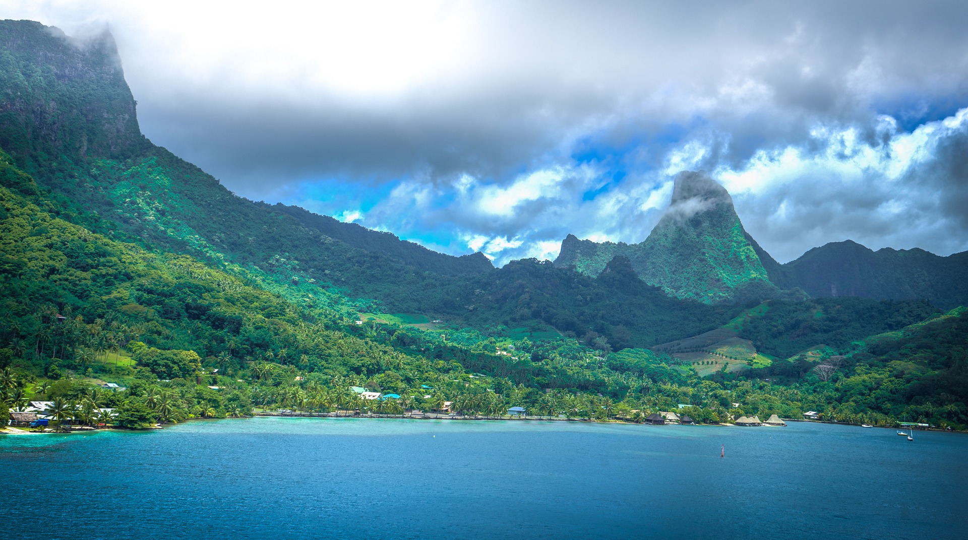
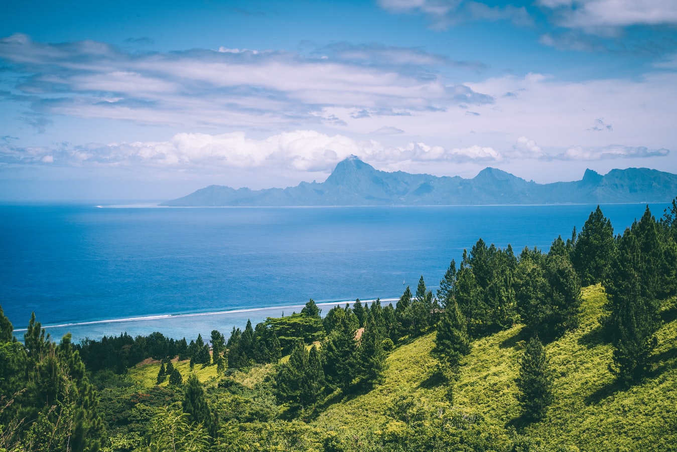
About Moorea
Mo’orea is one of the Society Islands of the French Polynesia. Located in the South Pacific, it is considered a magical island thanks to its majestic volcanic mountains, set against warm lagoon waters and green meadows. It is an island that attracts visitors of all abilities wanting to explore both above and below the ocean waters.
About Papeete, Tahiti
Papeete will be your gateway to the tropical paradise of French Polynesia, where islands fringed with gorgeous beaches and turquoise ocean await to soothe the soul. This spirited city is the capital of French Polynesia, and serves as a superb base for onward exploration of Tahiti – an island of breathtaking landscapes and oceanic vistas. Wonderful lagoons of crisp, clear water beg to be snorkelled, stunning black beaches and blowholes pay tribute to the island's volcanic heritage, and lush green mountains beckon you inland on adventures, as you explore extraordinary Tahiti. Visit to relax inside picturesque stilted huts, which stand out over shimmering water, as you settle into the intoxicating rhythm of life, in this Polynesian paradise.
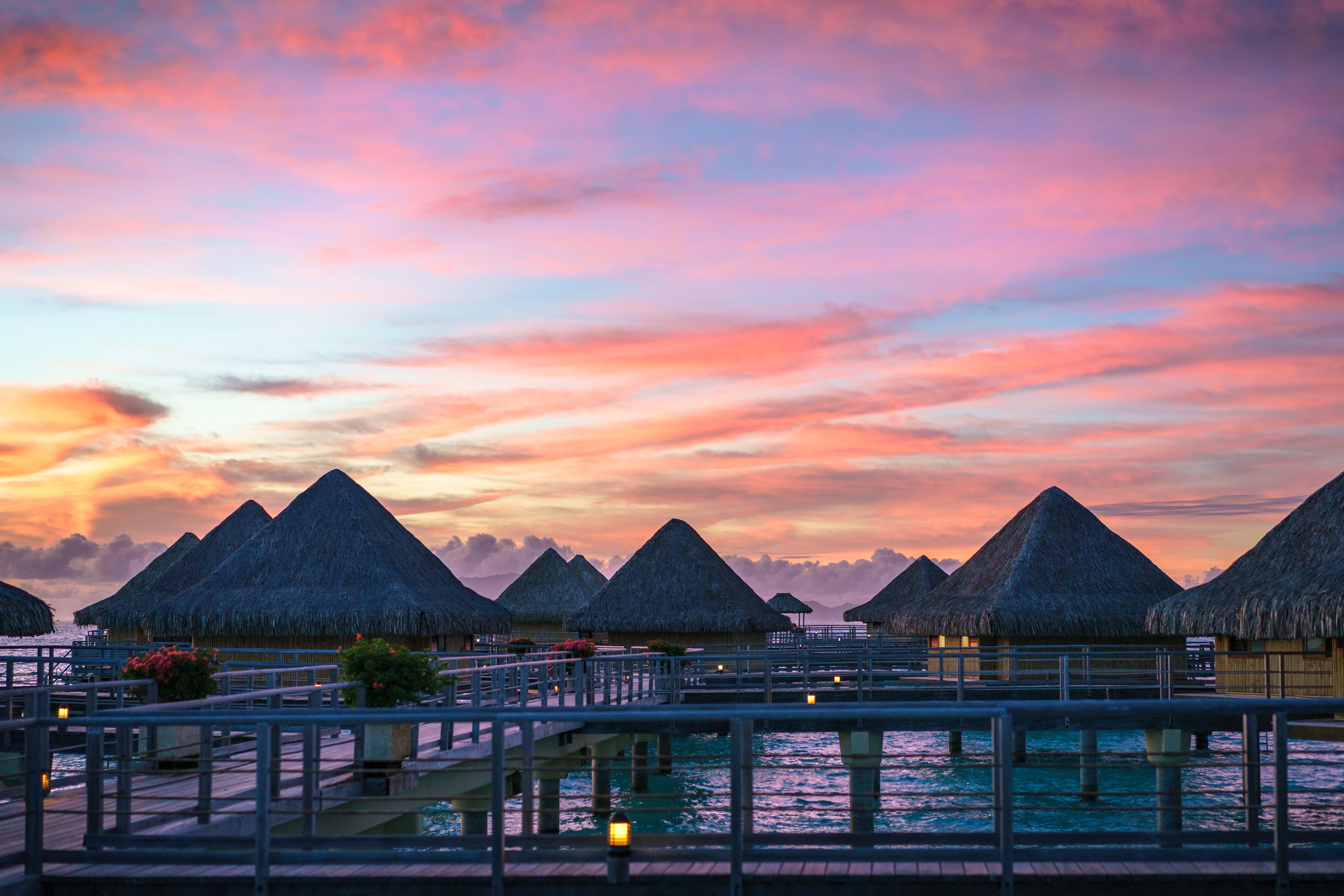
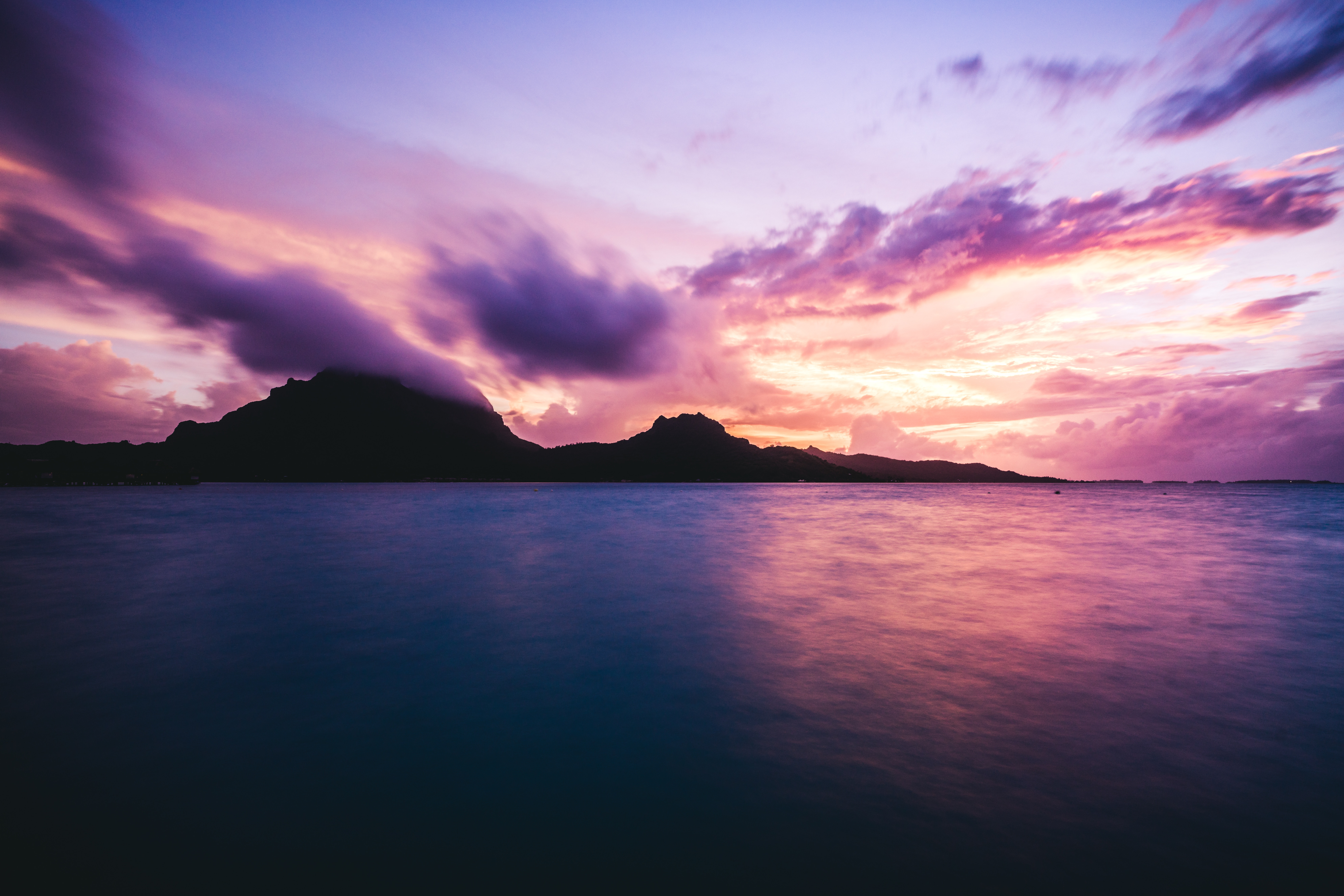
About Bora-Bora
Simply saying the name Bora Bora is usually enough to induce gasps of jealousy, as images of milky blue water, sparkling white beaches and casually leaning palm trees immediately spring to mind. The imagination doesn't lie, either, and if you visit, you’ll soon realise this island is every bit as gorgeous as you ever imagined. Thatched wooden huts stand out over shallow, sparkling seawater, with vivid fish swirling just below. Soak up the sun, scuba dive, or simply revel in the opulent luxury of one of the island's many magnificent resorts. If blissful inactivity doesn't appeal, then get active, and hike the greenery of the sharp Mount Pahia.
About Rarotonga
Life is laid back on Rarotonga, the most populous of the Cook Islands, but the residents are still an active bunch. Though there are plenty of white sandy beaches on which to laze—and people do, with plenty of napping— locals love to get out and move. Join them in snorkeling, diving, riding—bikes, horses, scooters—fishing, bush walking, and playing squash and tennis. Another popular, if odd, and favorite activity is lining up along the sea wall adjacent to the airport's runway to be jetblasted.

About Nuku'alofa
Nukualofa is the capital city of the Kingdom of Tonga, a group of islands in the South Pacific. The islands of Tonga are lined with coral reefs and white sand beaches, and are protected by picturesque lagoons and limestone cliffs. Tonga is also one of the very few places in the world where visitors have the opportunity to swim with whales in the tropical ocean waters.
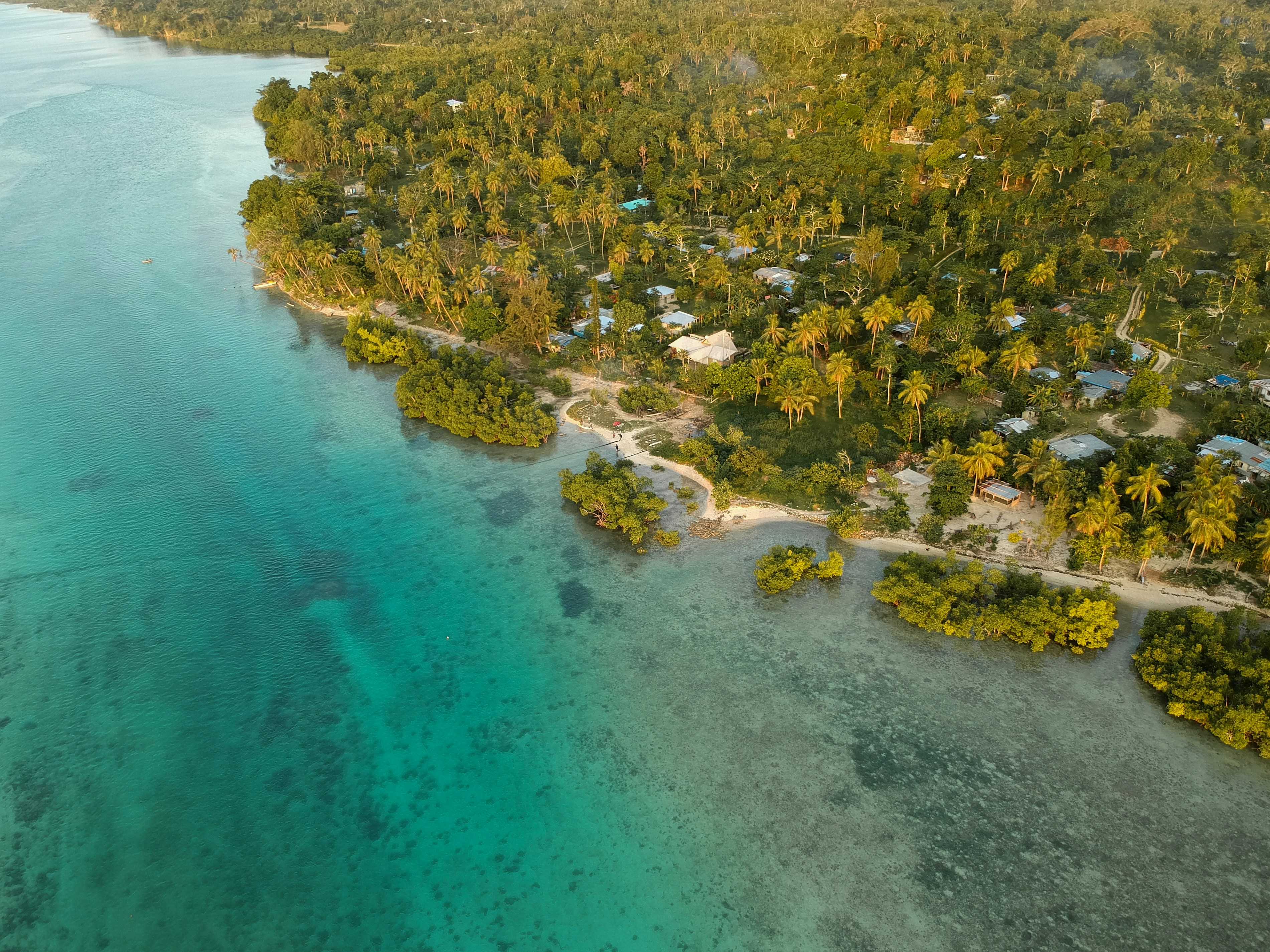
About Savusavu
Suva, a multiracial city, is the pulsing heart of the South Pacific. Its location is on a hilly peninsula in the southeast corner of Viti Levu Island, the largest in the Fijian archipelago. Suva was named the country's capital in 1882; the former capital was Luvuka. Suva's natural harbour was no doubt a deciding factor that prompted the change. Its port is the country's main shipping facility, accommodating vessels from all over the world. The town is backed by the lush green hills of the Suva-Rewa range. The waterfront district, much of which is built on land reclaimed from tangled mangrove swamps, provides the hub for much of Suva's activities. The downtown centre is a hodgepodge of high-rise office buildings, colonial houses with second-story verandas, parks and government structures. The northern and western mountains catch the trade winds, with the result being damp conditions year-round and frequent tropical downpours. Despite the ever-present possibility of showers, Suva is an excellent place to explore on foot. Many points of interest are located on Victoria Parade and along tree-shaded Queen Elizabeth Drive. Suva's botanical park is lush with flowering plants, trees and green lawns. In its centre stands the Fiji Museum, where objects reflect 3,000 years of Fijian history. The museum boasts a fine collection of Melanesian artefacts and various exhibits that reflect on Fiji's maritime era. Government House stands on a hillside surrounded by landscaped grounds. A stern, uniformed sentry guards the pillared gate entrance. The monthly Changing of the Guard is executed with almost as much pomp and ceremony as at London's Buckingham Palace. Friendly Fiji will charm you; here Melanesia mixes with Polynesia, ancient India with Oceania and tradition with the modern world. The Fijian greeting "Bula!" is extended warmly to strangers on city streets and country roads. Fiji is one of the South Pacific's most hospitable countries and a holiday destination that has much to offer in recreational activities, shopping and joyous celebrations.
About Lautoka
North of Nadi through sugarcane plantations and past the Sabeto Mountains is Lautoka, nicknamed the Sugar City for the local agriculture and its big processing mill. With a population of around 50,000, it's the only city besides Suva and, like the capital, has a pleasant waterfront. It's the sailing point for Blue Lagoon and Beachcomber Cruises but is otherwise unremarkable for tourists, itself having few hotels and fewer good restaurants. Locals recommend the city as a less-expensive place to shop for clothing, but note that it can take as long as 45 minutes to drive here. Legend has it that Lautoka acquired its name when two chiefs engaged in combat and one hit the other with a spear. He proclaimed "lau toka" (spear hit) and thus the future town was named.
About Suva
Fiji is a collection of tropical islands in the South Pacific and is well known for soft coral diving, white sandy beaches, and idyllic and peaceful surroundings. Because of its paradisiac surroundings, Fiji is a popular location for weddings and honeymoons. Suva is the capital of the Fiji archipelago, located on the southeastern coast of the island of Viti Levu and is the second most populated city of Fiji.
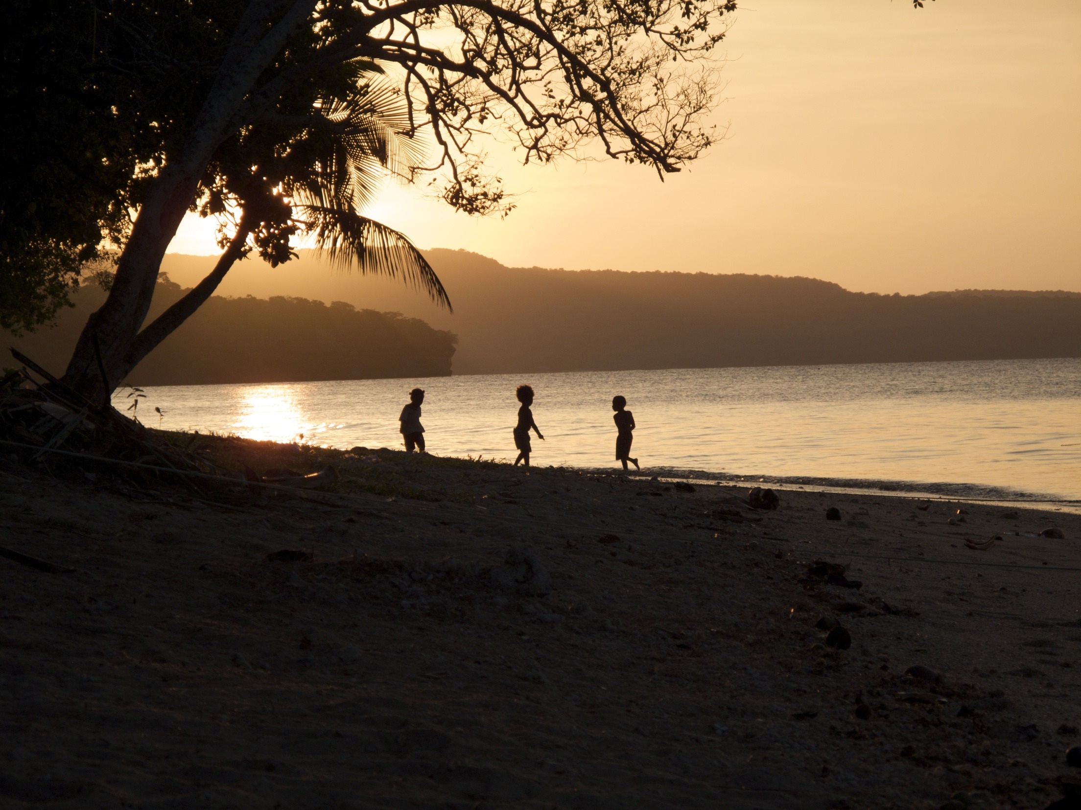
About Mystery Island (Inyeug)
About Port Vila
Vanuatu is an island nation located in the southern Pacific Ocean. The archipelago, which is of volcanic origin, is approximately 1,090 miles (about 1,750 kilometres) east of northern Australia, approximately 310 miles (about 500 kilometres) northeast of New Caledonia, west of Fiji and southeast of the Solomon Islands, near New Guinea. Located on Mélé Bay along the southwest coast of Éfaté, Port Vila is the capital and largest city of Vanuatu, as well as its commercial and economic centre. Although Port Vila's British and French influences are apparent, its multinational population includes ni-Vanuatu, British, French, Chinese, and Vietnamese citizens. An active commercial port, the city is home to hospitals, hotels, casinos, markets and shopping districts, a sports stadium, cultural centre, teacher-training institution, campus of the University of the South Pacific, and several meat- and fish-processing plants. The municipality of Port Vila is divided into four wards, Malapoa-Tagabe, Anabrou-Melcofe-Tassiriki, Centre and South. The area occupied by Port Vila has been inhabited by Melanesian people for thousands of years. In 2004, an archaeological expedition unearthed a burial site with 25 tombs, skeletons and pieces of ceramic pottery dating from 1300 B.C. The Vanuatu Islands first had contact with Europeans in 1606 with the arrival of Portuguese explorer Pedro Fernandes de Queirós. Europeans did not return until 1768, when Louis Antoine de Bougainville rediscovered the islands. In 1774, Captain Cook called the islands the 'New Hebrides', a name that would last until their independence in 1980. In 1825, sandalwood was discovered on the island of Erromango, prompting a rush of immigrants that included Catholic and Protestant missionaries from European and North America, as well as settlers looking for land to farm cotton, coffee, cocoa, bananas, and coconuts. British subjects from Australia made up the majority of settlers, but the establishment of the Caledonian Company of the New Hebrides in 1882 attracted more French subjects. The land around Port Vila was converted into the municipality of Franceville in 1889. By the start of the 20th century, the French outnumbered the British, and the two nations agreed to govern the islands jointly by way of the British-French Condominium. During World War II, Port Vila was an American and Australian airbase. The New Hebrides National Party was established in the early-1970s. Renamed Vanua'aku Pati in 1974, the party pushed for independence. In 1980, amidst the brief Coconut War, the Republic of Vanuatu was created. The economies of Port Vila and Vanuatu are supported by the agriculture, offshore financial services and cattle industries. However, the abundant tropical beauty of Vanuatu has made Port Vila a popular tourist destination for outdoor and nature enthusiasts alike. Renowned for its tropical climate and exquisite, white-sand beaches and world-class fishing, the archipelago is a region of spectacular geographic diversity that includes spectacular volcanoes, mountains and valleys, along with idyllic jungles, rainforests, botanical gardens, mineral springs, and waterfalls. What's more, Port Vila offers easy access to exploring the city, Vanuatu and the offshore islands that comprise this wonderful South Pacific island chain. Port Vila consists of a diverse blend of Melanesian, Eastern and Western cultures that presents a unique opportunity to discover the people, traditions and history of Vanuatu. Cultural village tours are a fantastic way to meet the locals and experience indigenous lifestyles and customs through storytelling, music, dance, kava-tasting, and a traditional Melanesian feast. The evolution of Port Vila and Vanuatu can be explored during visits to the Vanuatu Cultural Centre and Museum features a collection of historical artefacts from the Vanuatu Island. Additional historic landmarks include Independence Park, the French and British residencies, Supreme Court, Georges Pompidou Building, World War I and II memorials, Tanna Coffee-Roasting Factory, and more. Vanuatu's verdant canyons, jungle-covered mountain peaks, volcanoes, waterfalls, botanical gardens, mineral springs, white-sand beaches, and rainforests invite a wide array of picturesque, memorable and exciting sightseeing venues for outdoor enthusiasts. Land-based excursions include bird-watching, bicycling and motor-biking, eco-tours, hiking through jungle and rainforest nature trails, horseback-riding at the nearby Sea Horse Ranch or Club Hippique Adventure Park, helicopter or seaplane flight-seeing, dune-bugging the beaches and jungles, 'zorbing' down the hillsides, abseiling down a cascading waterfall, volcano trekking and sandboarding, zip-lining through the jungle canopy, and golfing at the stunningly beautiful Port Vila Golf and Country Club, the only 18-hole championship course in Vanuatu and home to the PGA-sanctioned Vanuatu Open. Picturesque and fun-filled water-based excursions include swimming, boating and sailing along the exquisite coast of Port Vila and Vanuatu, deep-sea fishing for enormous dolphin, marlin, wahoo, dorado, tuna, swordfish, and sailfish, jet-skiing and high-speed jet-boating, stand-up paddle-boarding, surfing, kite-surfing, and parasailing. The archipelago also offers some of the world's finest snorkelling and diving at venues such as the Hideaway Islands Marine Reserves, JoJo Beach Club, Havannah Beach and Boat Club, and Iririki Island.Due to its compact size, Port Vila can be easily explored in just a single day.
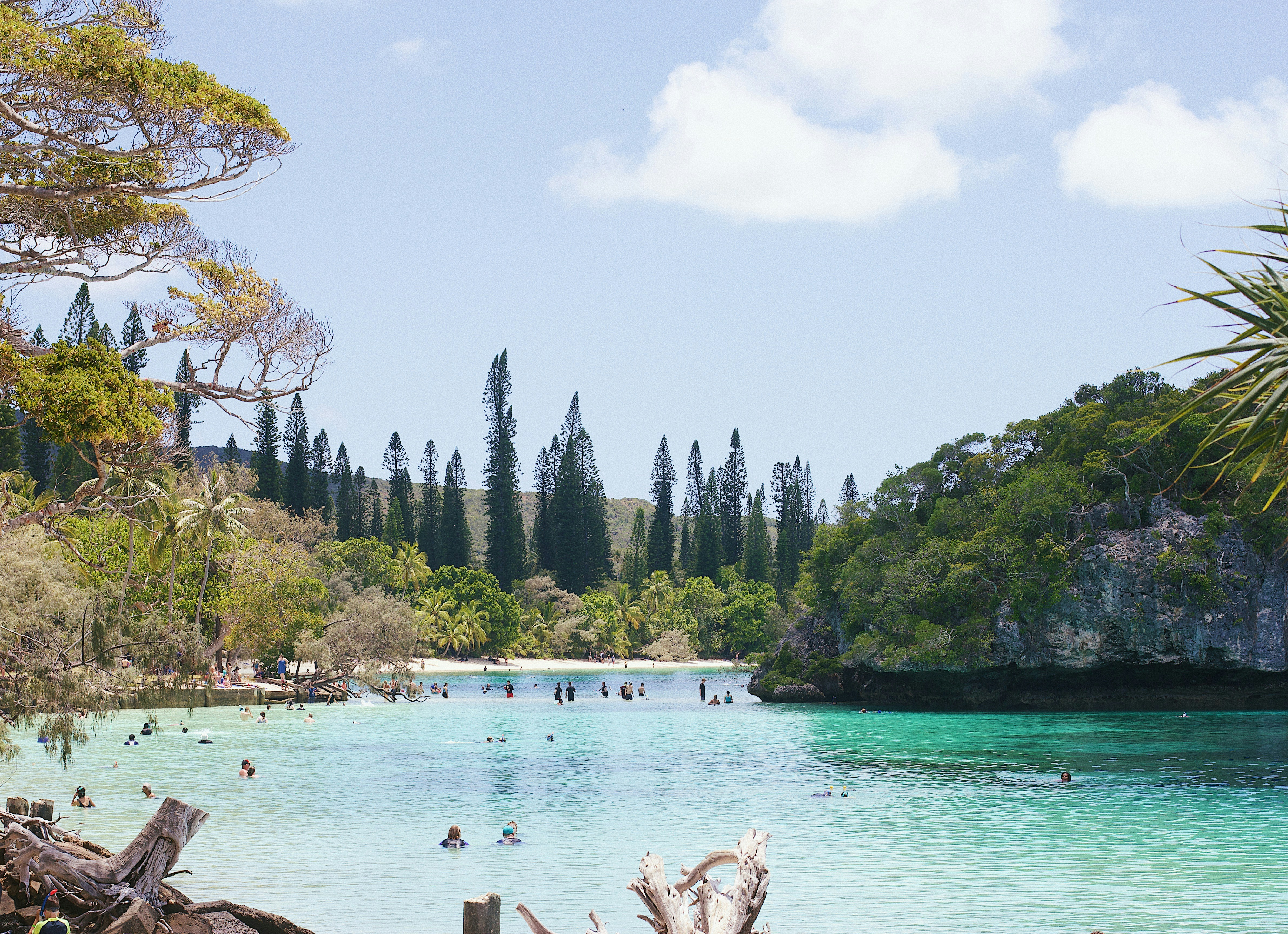
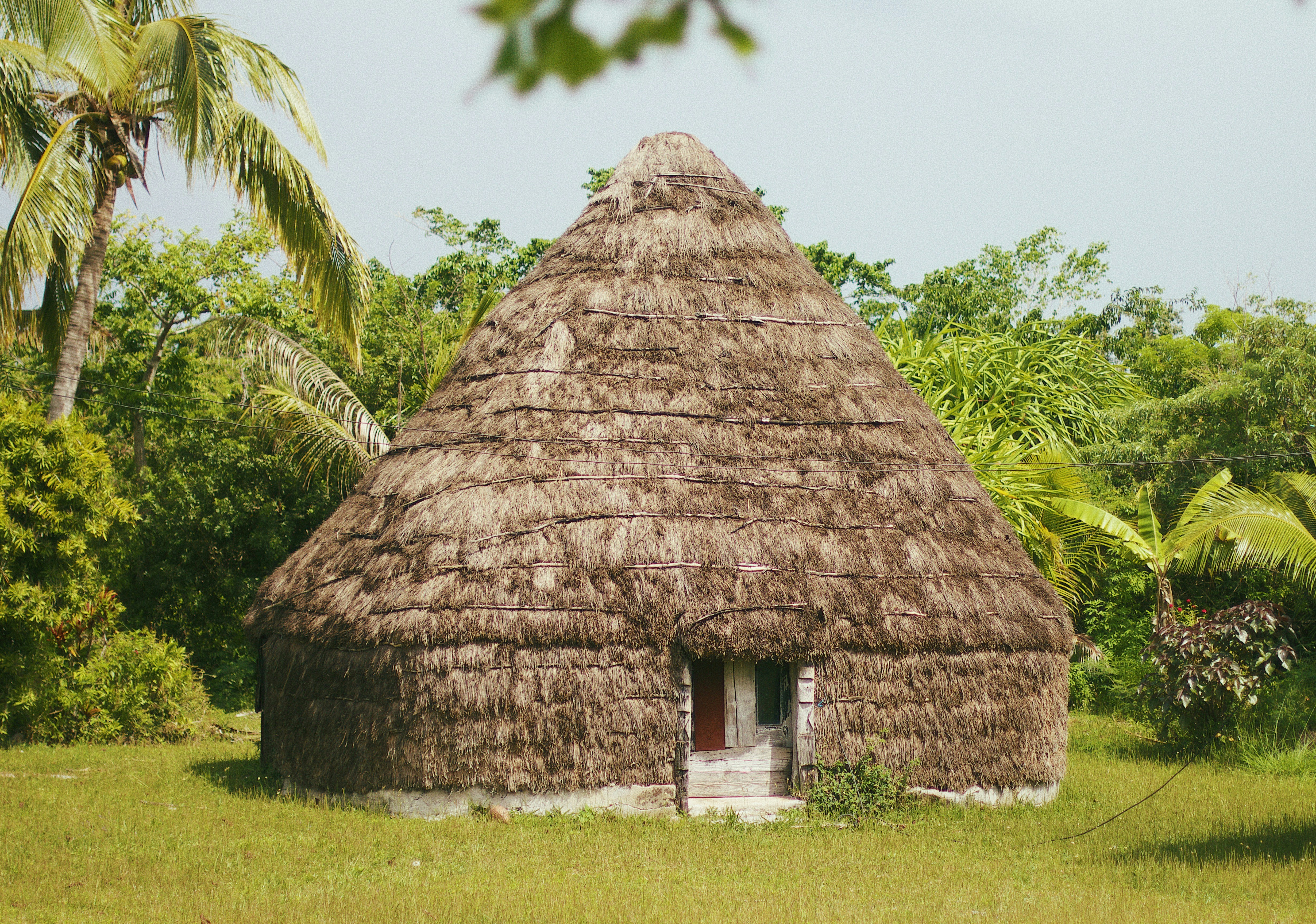
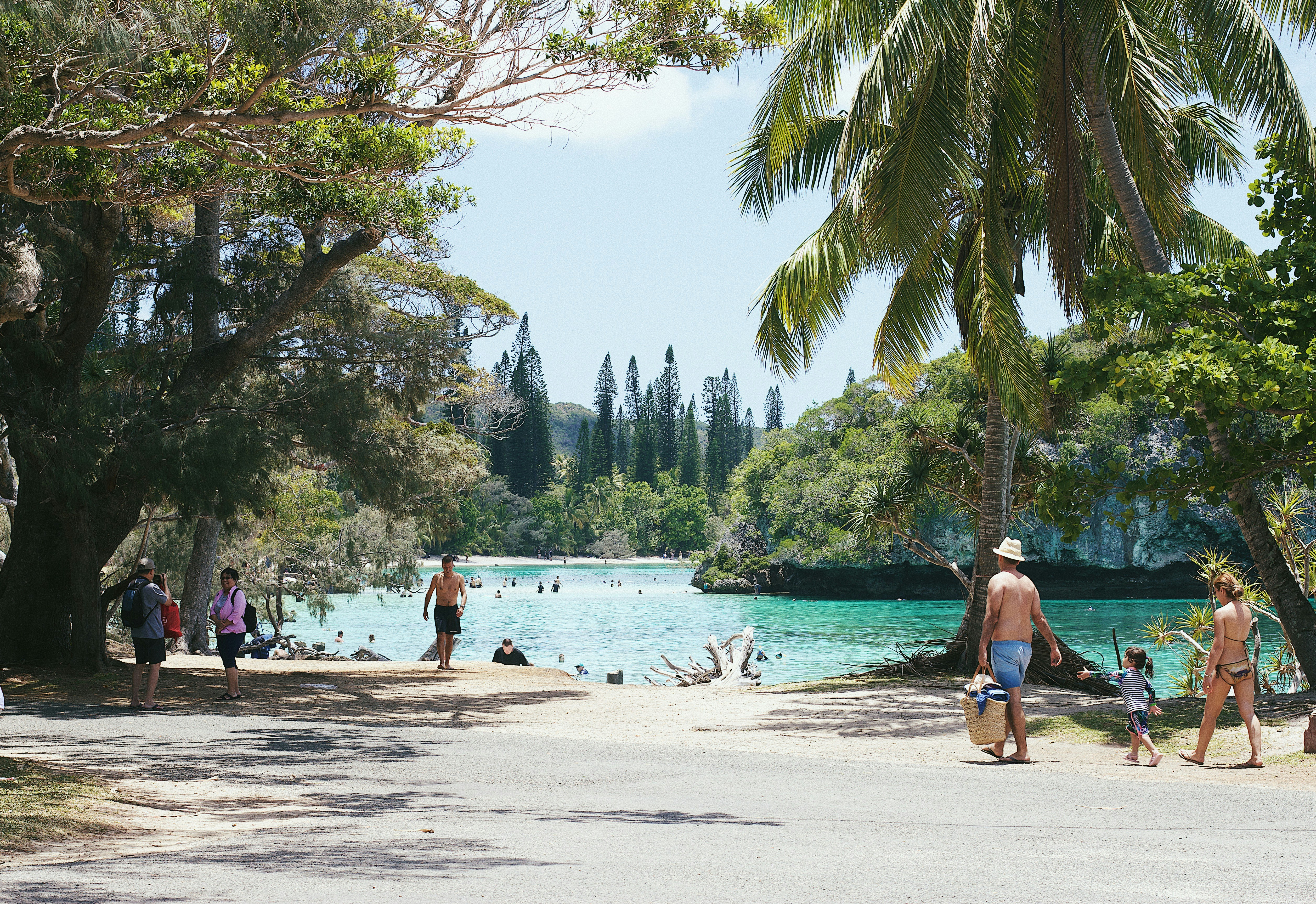
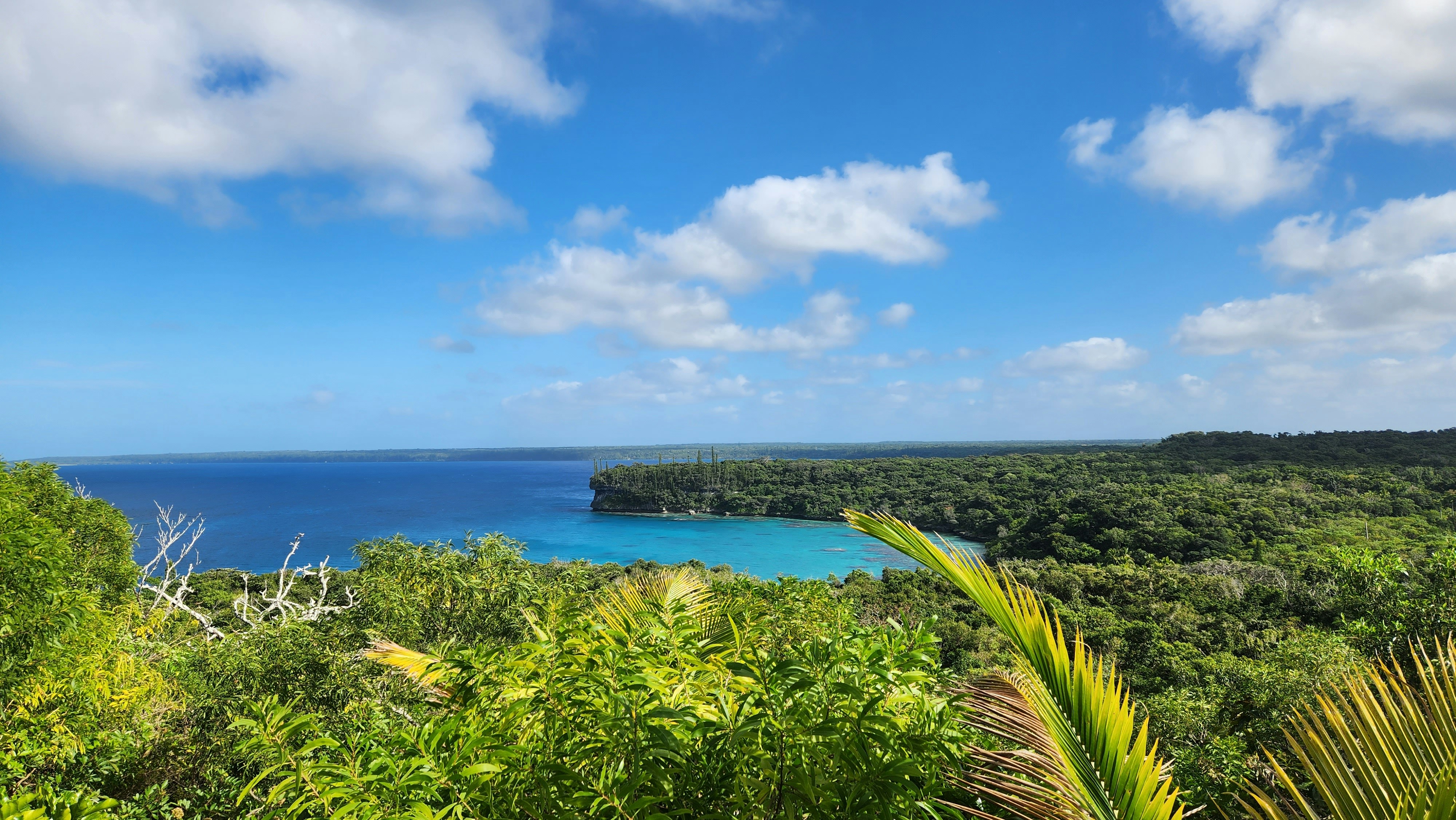
About Lifou Island
Lifou is a commune of France in the Loyalty Islands of New Caledonia. Lifou is made up of two main islands - Lifou Island and Tiga Island- in additional to a number of uninhabited islets. Lifou Isand is the largest atoll in the world. The island is actually made of fossilized coral - known as a makatea. Lifou island does not have any surface water and it relies on a freshwater reservoir accessed by caves. Lifou Island is best known for its vast atoll (the largest in the world). This ring-shaped coral reef affords some of the best snorkelling in the world. Popular activities on this island include scenic walks, relaxing days on the beach, swimming and snorkelling. There are no organized tours being offered during this call to Lifou Island, guests may explore on their own.
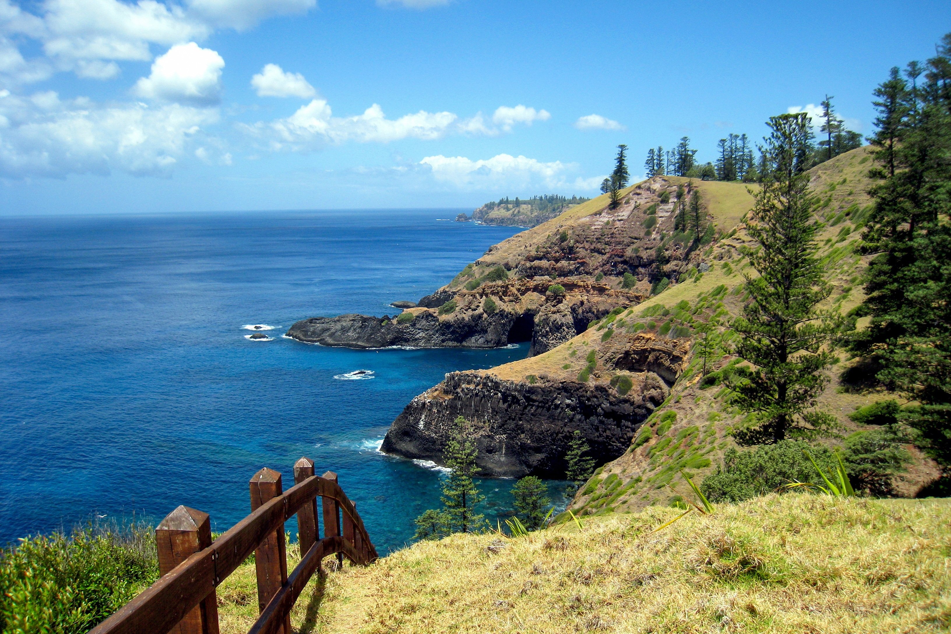
About Norfolk Island
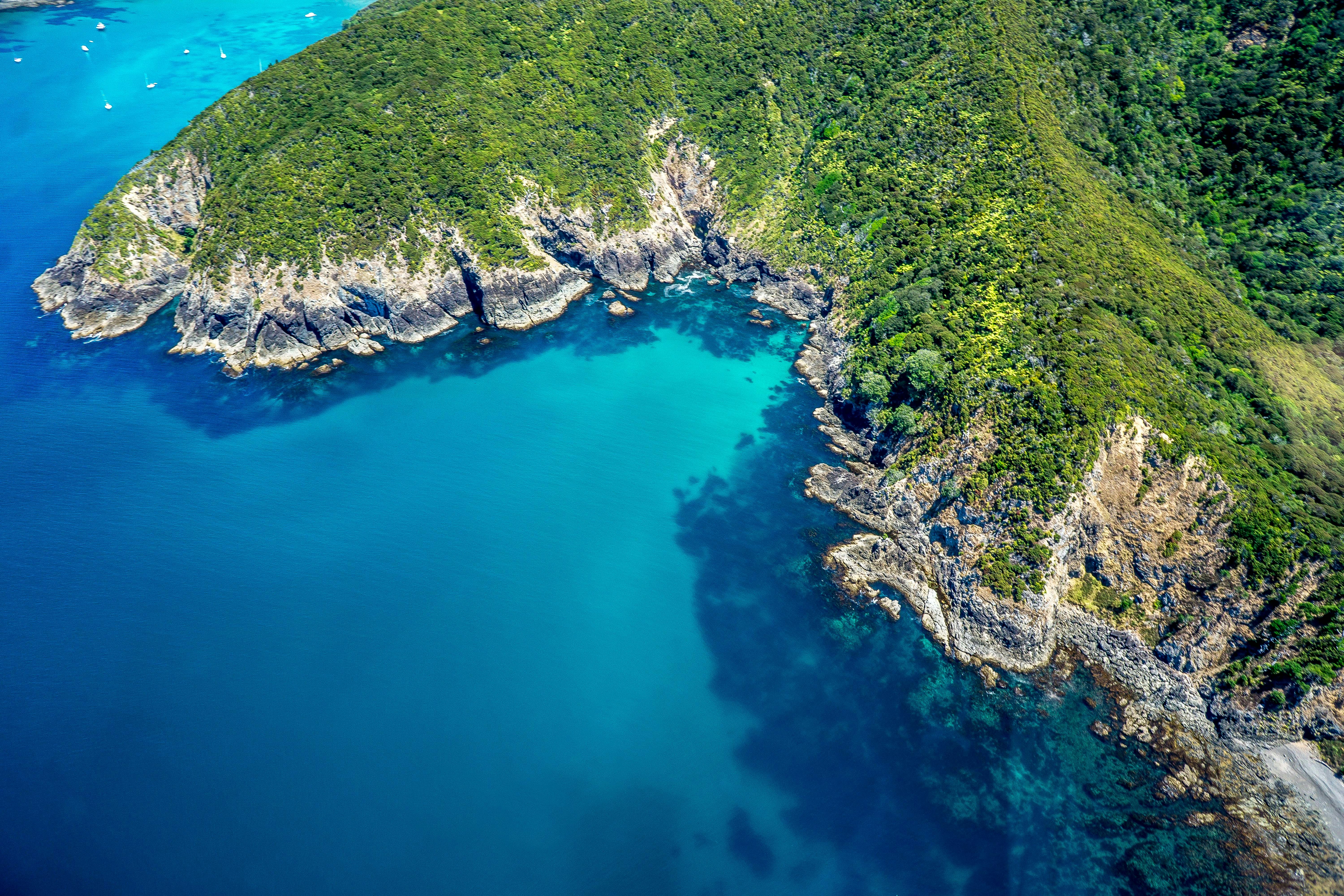
About Bay of Islands
The Tasman Sea on the west and the Pacific Ocean on the east meet at thetop of North Island at Cape Reinga. No matter what route you take, you'll passfarms and forests, marvellous beaches, and great open spaces. The East Coast,up to the Bay of Islands, is Northland's most densely populated, often withrefugees from bigger cities—looking for a more relaxed life—clustered aroundbreathtaking beaches. The first decision on the drive north comes at the footof the Brynderwyn Hills. Turning left will take you up the West Coast throughareas once covered with forests and now used for either agricultural orhorticulture. Driving over "the Brynderwyns," as they are known,takes you to Whangarei, the only city in Northland. If you're in the mood for adiversion, you can slip to the beautiful coastline and take in Waipu Cove, anarea settled by Scots, and Laings Beach, where million-dollar homes sit next tosmall Kiwi beach houses.An hour's drive farther north is the Bay of Islands, known all over theworld for its beauty. There you will find lush forests, splendid beaches, andshimmering harbors. The Treaty of Waitangi was signed here in 1840 betweenMāoriand the British Crown, establishing the basis for the modern New Zealandstate. Every year on February 6, the extremely beautiful Waitangi Treaty Ground(the name means weeping waters) is the sight of a celebration of the treaty andprotests by Māori unhappy with it. Continuing north on the East Coast, theagricultural backbone of the region is even more evident and a series ofwinding loop roads off the main highway will take you to beaches that are bothbeautiful and isolated where you can swim, dive, picnic, or just laze. .The West Coast is even less populated, and the coastline is rugged andwindswept. In the Waipoua Forest, you will find some of New Zealand's oldestand largest kauri trees; the winding road will also take you past mangroveswamps. Crowning the region is the spiritually significant Cape Reinga, theheadland at the top of the vast stretch of 90 Mile Beach, where it's believedMāori souls depart after death. Today Māori make up roughly a quarter of thearea's population (compared with the national average of about 15%). The legendaryMāori navigator Kupe was said to have landed on the shores of Hokianga Harbour,where the first arrivals made their home. Many different wi (tribes) livedthroughout Northland, including Ngapuhi (the largest), Te Roroa, Ngati Wai,Ngati Kuri, Te Aupouri, Ngaitakoto, Ngati Kahu, and Te Rarawa. Many Māoriherecan trace their ancestry to the earliest inhabitants
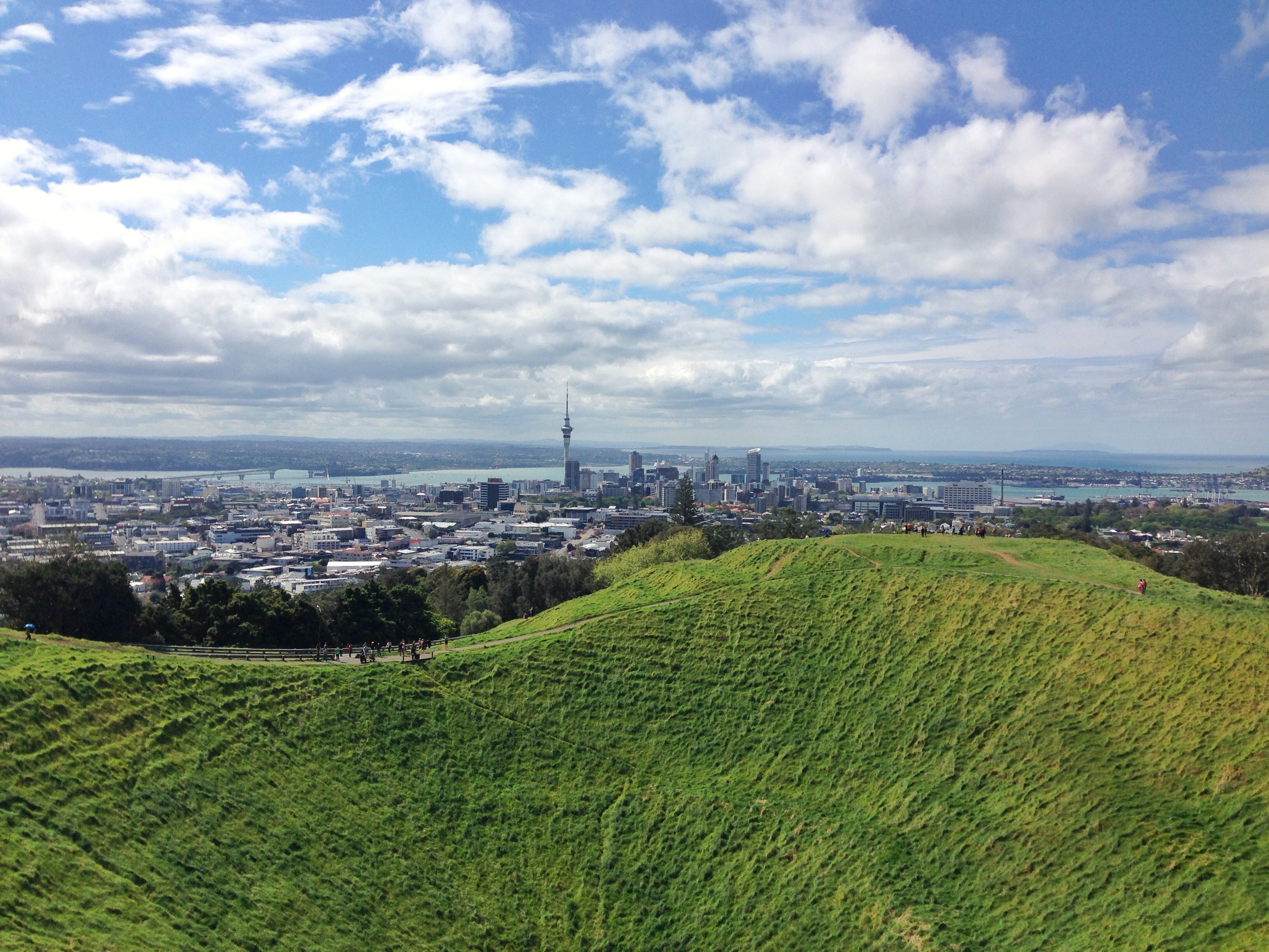
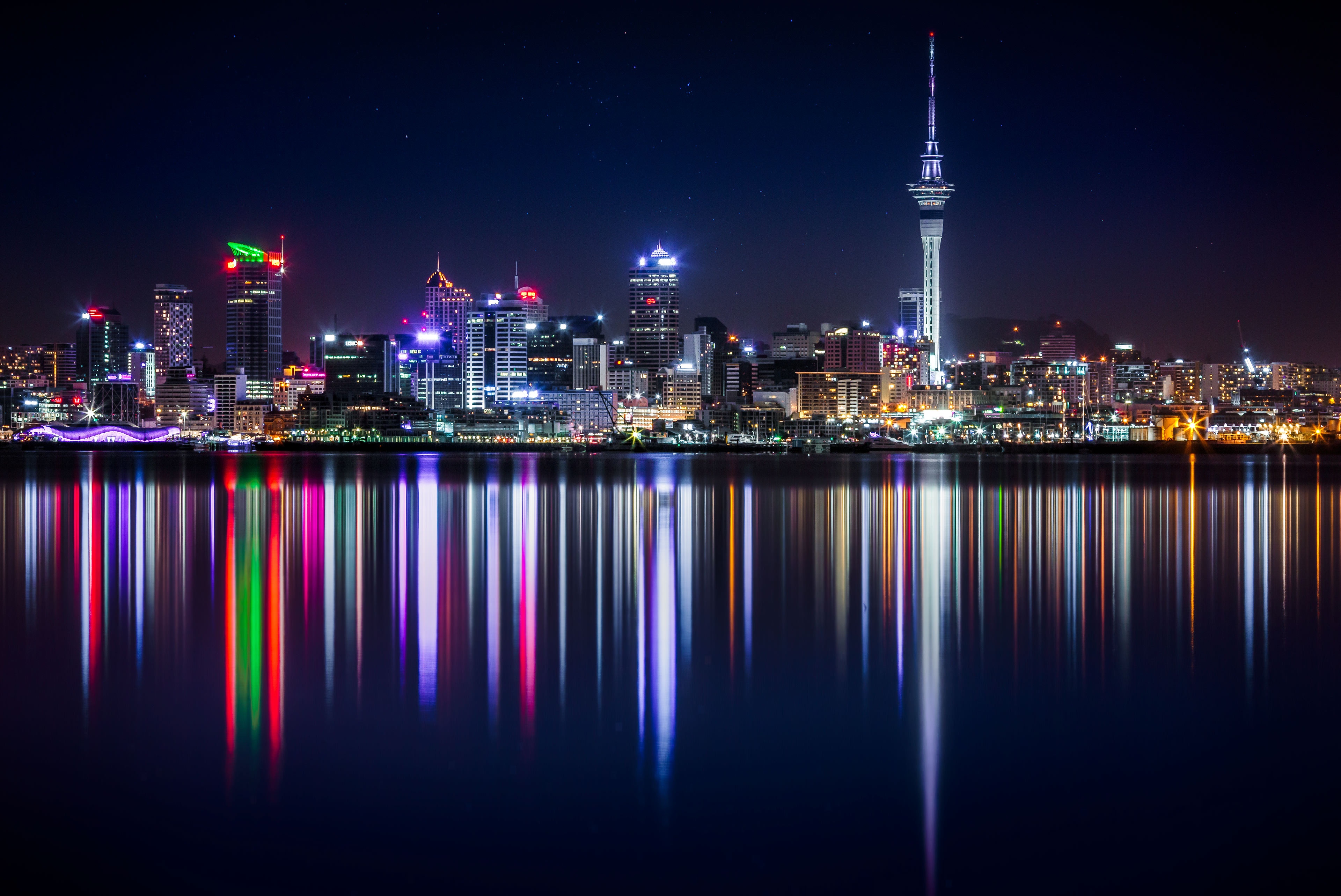
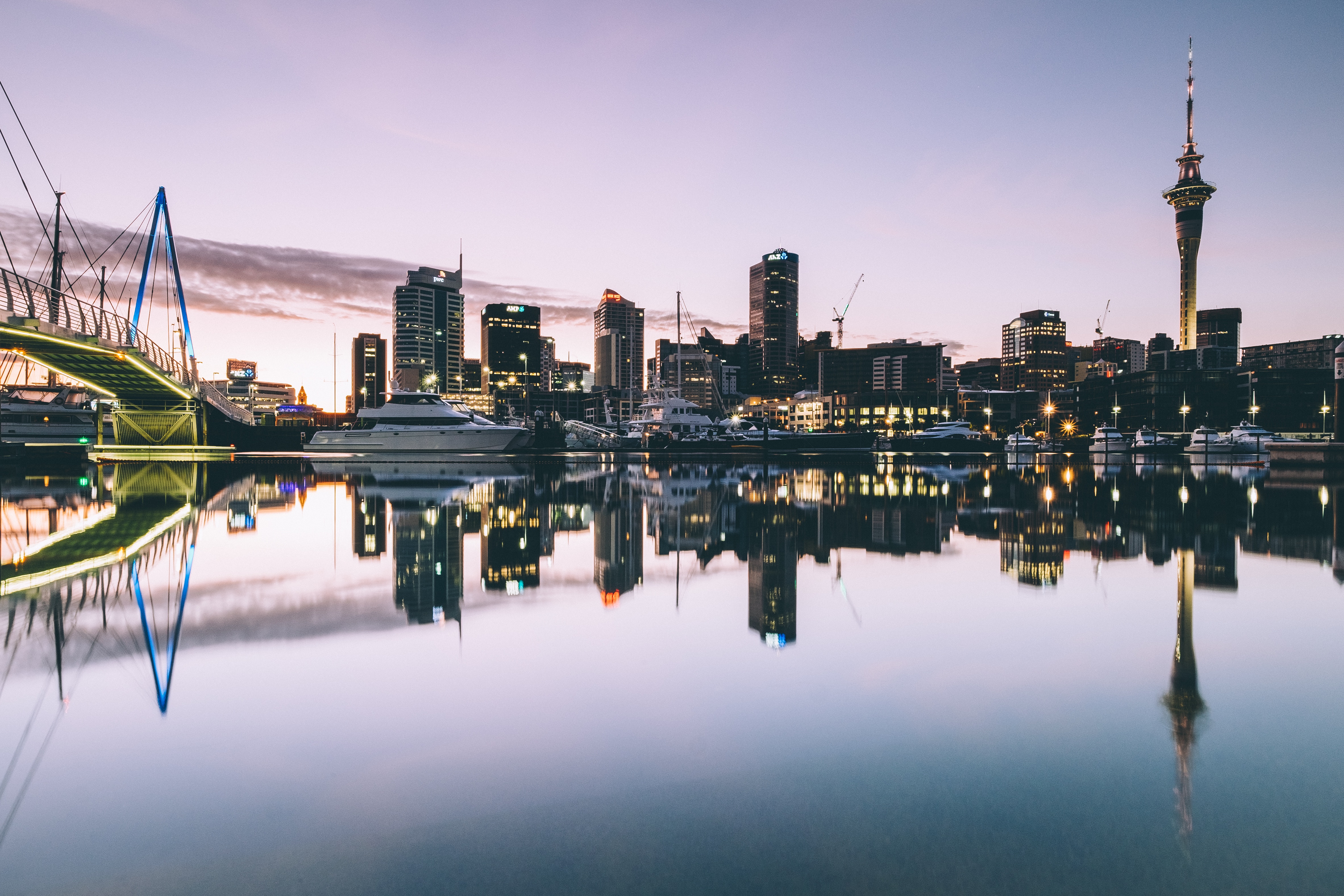
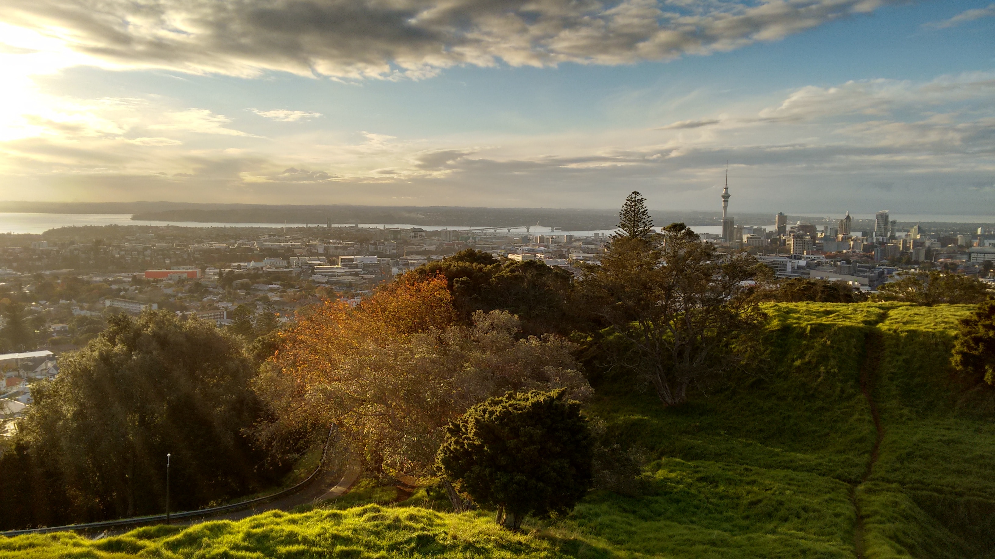
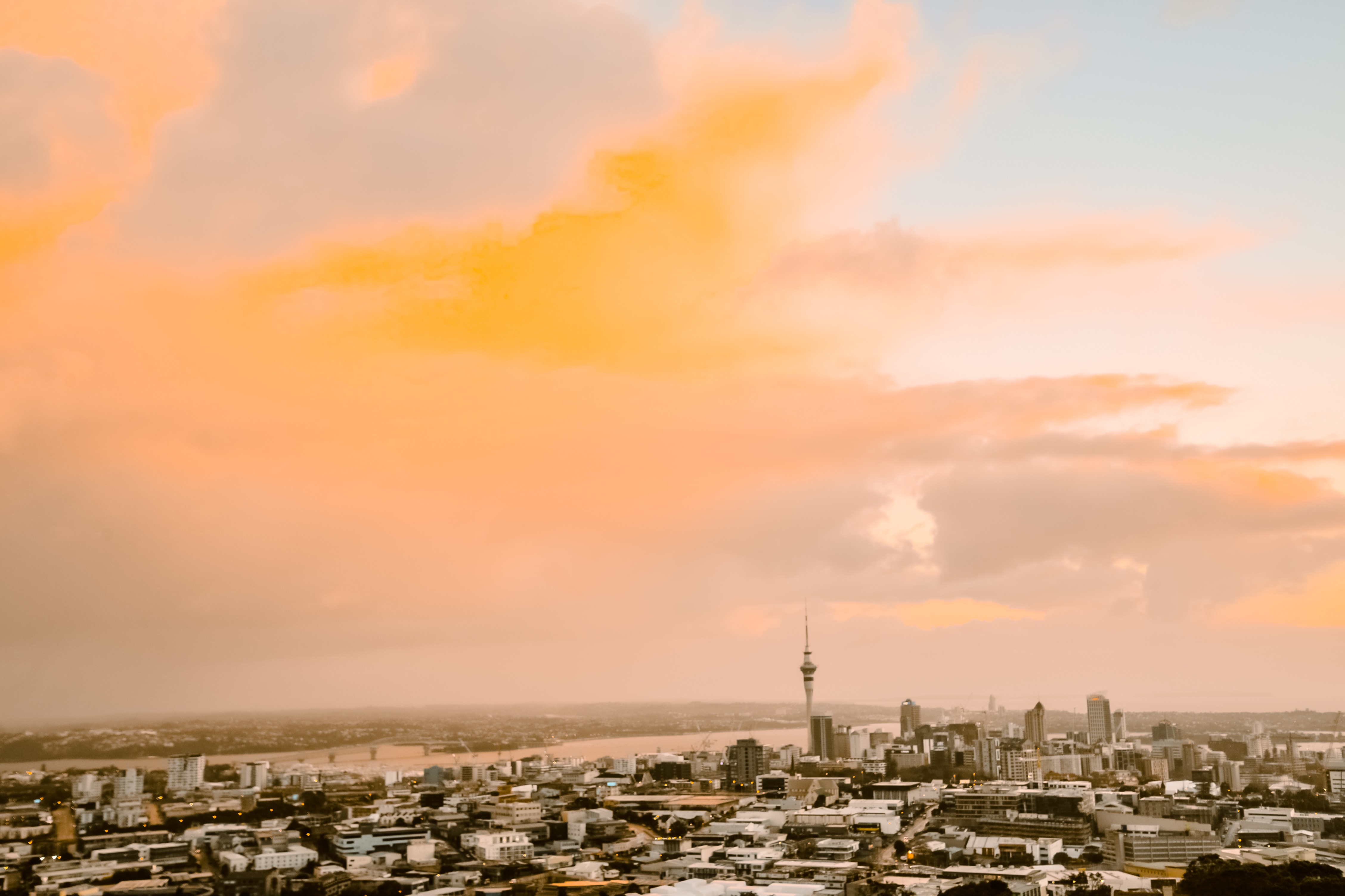
About Auckland
Auckland is called the City of Sails, and visitors flying in will see why. On the East Coast is the Waitemata Harbour—a Māori word meaning sparkling waters—which is bordered by the Hauraki Gulf, an aquatic playground peppered with small islands where many Aucklanders can be found "mucking around in boats."Not surprisingly, Auckland has some 70,000 boats. About one in four households in Auckland has a seacraft of some kind, and there are 102 beaches within an hour's drive; during the week many are quite empty. Even the airport is by the water; it borders the Manukau Harbour, which also takes its name from the Māori language and means solitary bird.According to Māori tradition, the Auckland isthmus was originally peopled by a race of giants and fairy folk. When Europeans arrived in the early 19th century, however, the Ngāti-Whātua tribe was firmly in control of the region. The British began negotiations with the Ngāti-Whātua in 1840 to purchase the isthmus and establish the colony's first capital. In September of that year the British flag was hoisted to mark the township's foundation, and Auckland remained the capital until 1865, when the seat of government was moved to Wellington. Aucklanders expected to suffer from the shift; it hurt their pride but not their pockets. As the terminal for the South Sea shipping routes, Auckland was already an established commercial center. Since then the urban sprawl has made this city of approximately 1.3 million people one of the world's largest geographically.A couple of days in the city will reveal just how developed and sophisticated Auckland is—the Mercer City Survey 2012 saw it ranked as the third-highest city for quality of life—though those seeking a New York in the South Pacific will be disappointed. Auckland is more get-up and go-outside than get-dressed-up and go-out. That said, most shops are open daily, central bars and a few nightclubs buzz well into the wee hours, especially Thursday through Saturday, and a mix of Māori, Pacific people, Asians, and Europeans contributes to the cultural milieu. Auckland has the world's largest single population of Pacific Islanders living outside their home countries, though many of them live outside the central parts of the city and in Manukau to the south. The Samoan language is the second most spoken in New Zealand. Most Pacific people came to New Zealand seeking a better life. When the plentiful, low-skilled work that attracted them dried up, the dream soured, and the population has suffered with poor health and education. Luckily, policies are now addressing that, and change is slowly coming. The Pacifica Festival in March is the region's biggest cultural event, attracting thousands to Western Springs. The annual Pacific Island Secondary Schools’ Competition, also in March, sees young Pacific Islander and Asian students compete in traditional dance, drumming, and singing. This event is open to the public.At the geographical center of Auckland city is the 1,082-foot Sky Tower, a convenient landmark for those exploring on foot and some say a visible sign of the city's naked aspiration. It has earned nicknames like the Needle and the Big Penis—a counterpoint to a poem by acclaimed New Zealand poet James K. Baxter, which refers to Rangitoto Island as a clitoris in the harbor.The Waitemata Harbour has become better known since New Zealand staged its first defense of the America's Cup in 2000 and the successful Louis Vuitton Pacific Series in early 2009. The first regatta saw major redevelopment of the waterfront. The area, where many of the city's most popular bars, cafés, and restaurants are located, is now known as Viaduct Basin or, more commonly, the Viaduct. A recent expansion has created another area, Wynyard Quarter, which is slowly adding restaurants.These days, Auckland is still considered too bold and brash for its own good by many Kiwis who live "south of the Bombay Hills," the geographical divide between Auckland and the rest of New Zealand (barring Northland). "Jafa," an acronym for "just another f—ing Aucklander," has entered the local lexicon; there's even a book out called Way of the Jafa: A Guide to Surviving Auckland and Aucklanders. A common complaint is that Auckland absorbs the wealth from the hard work of the rest of the country. Most Aucklanders, on the other hand, still try to shrug and see it as the parochial envy of those who live in small towns. But these internal identity squabbles aren't your problem. You can enjoy a well-made coffee in almost any café, or take a walk on a beach—knowing that within 30 minutes' driving time you could be cruising the spectacular harbor, playing a round at a public golf course, or even walking in subtropical forest while listening to the song of a native tûî bird.
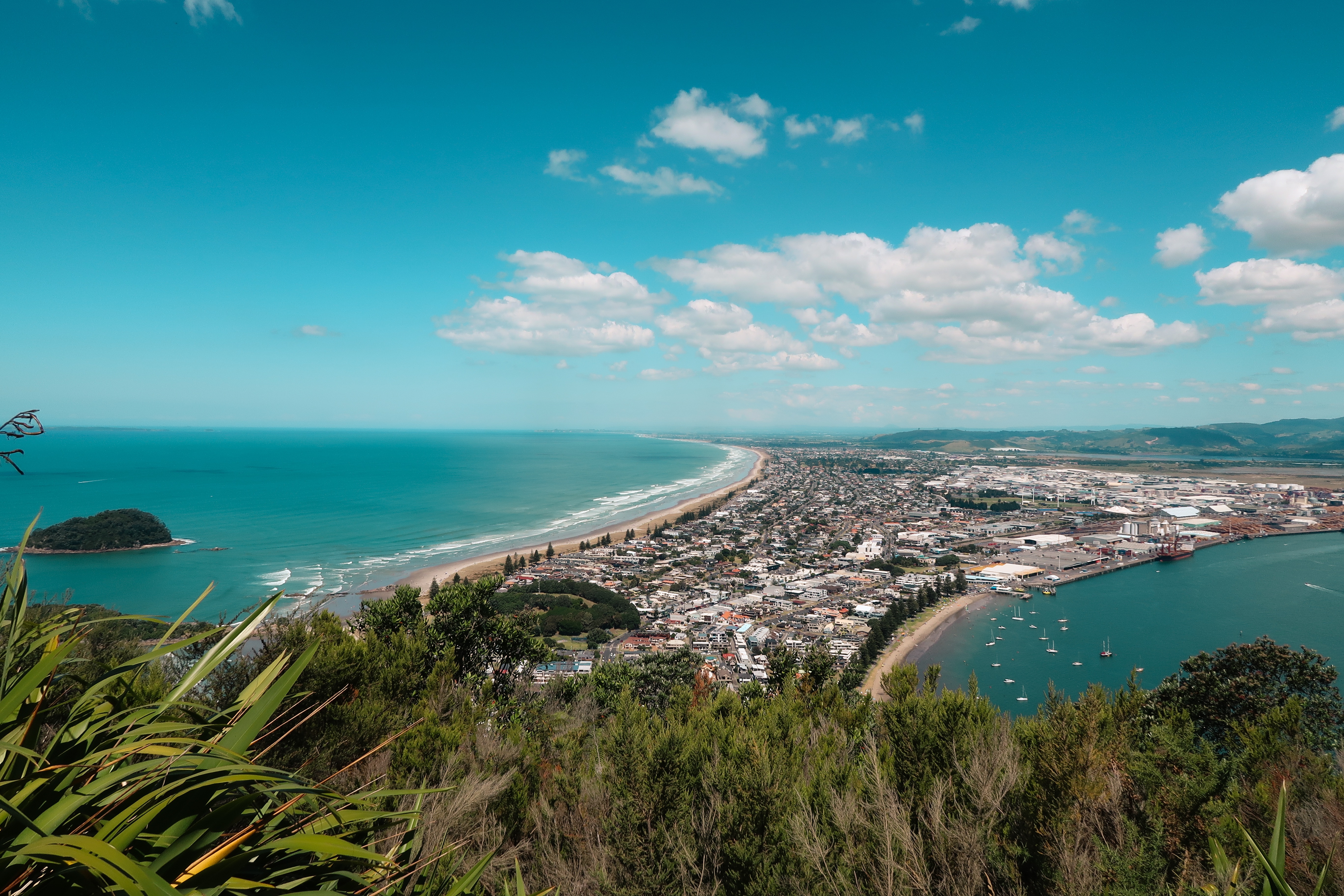
About Tauranga
The population center of the Bay of Plenty, Tauranga is one of New Zealand's fastest-growing cities. Along with its neighbor, Whakatane, this seaside city claims to be one of the country's sunniest towns. Unlike most local towns, Tauranga doesn't grind to a halt in the off-season, because it has one of the busiest ports in the country, and the excellent waves at the neighboring beach resort of Mount Maunganui—just across Tauranga's harbor bridge—always draw surfers and holiday folk.
About Timaru
Situated almost equidistant between Christchurch and Dunedin, Timaru has oft been overlooked by those just needing to get from one city to another but more fool them! The town’s name comes from the Māori name Te Maru, meaning ‘place of shelter’ and the pretty town reveals not only stunning Middle Earth landscape and views to write home about, but an intact Victorian / Edwardian shopping precinct with many of the building being built in local volcanic bluestone. Understandably, beach life is very important here and the long ribbons of white sandy beaches and clean seas are perfect for a swimming, sunning and spoiling yourself! Voted one of New Zealand’s top 10 most loved beaches, Caroline Bay is simply a treasure. Built on the rolling hills created from the lava flows of the extinct Mt Horrible volcano, Timaru is a melting pot of culture, history, adventure and dramatic scenery. Art lovers too will not be left wanting as the city’s art gallery holds the third largest public art collection in the South Island. Walking enthusiasts will not want to miss one of the many walks along the coast or rivers that vary from short paved paths – ideal for pushchairs and wheelchairs to longer, more strenuous hikes. Well signposted and maintained, these tracks are especially beautiful in the autumn when the leaves are turning colour. And do not forget to be on the lookout for penguins, which will happily waddle alongside you some of the way!

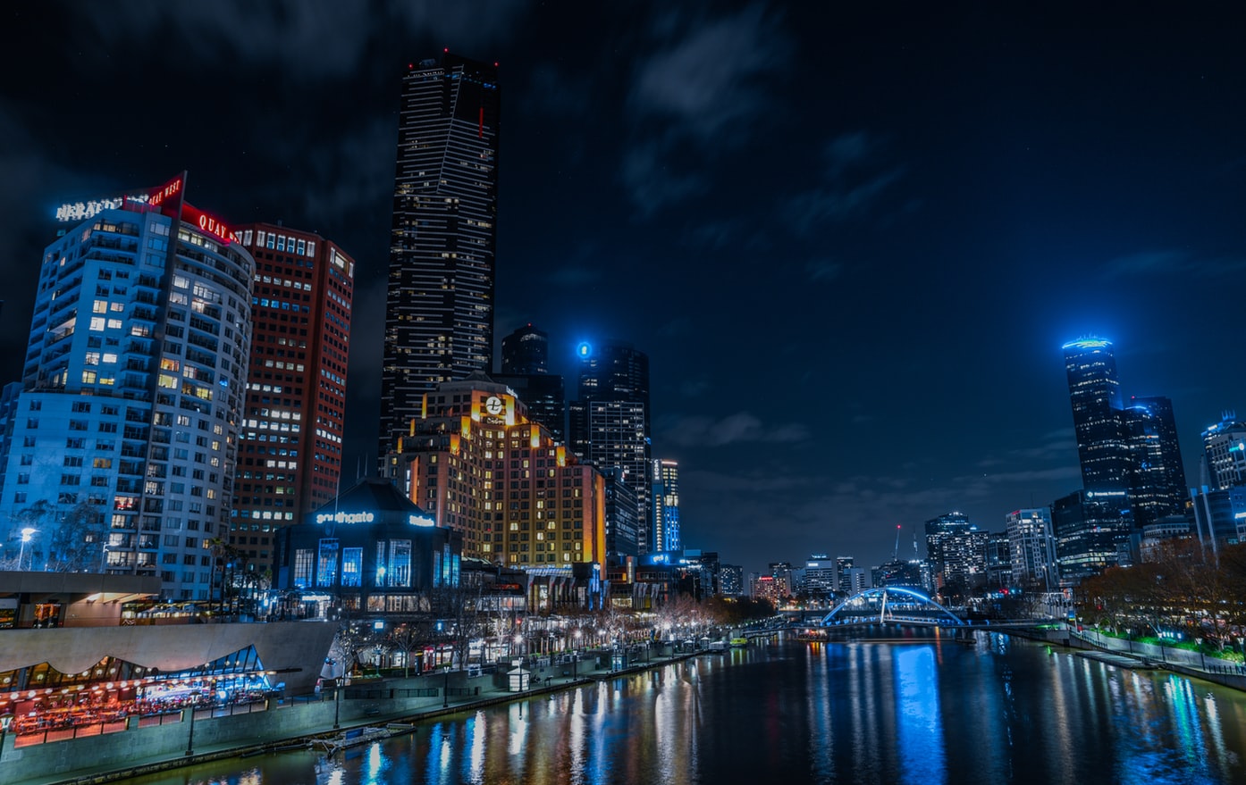
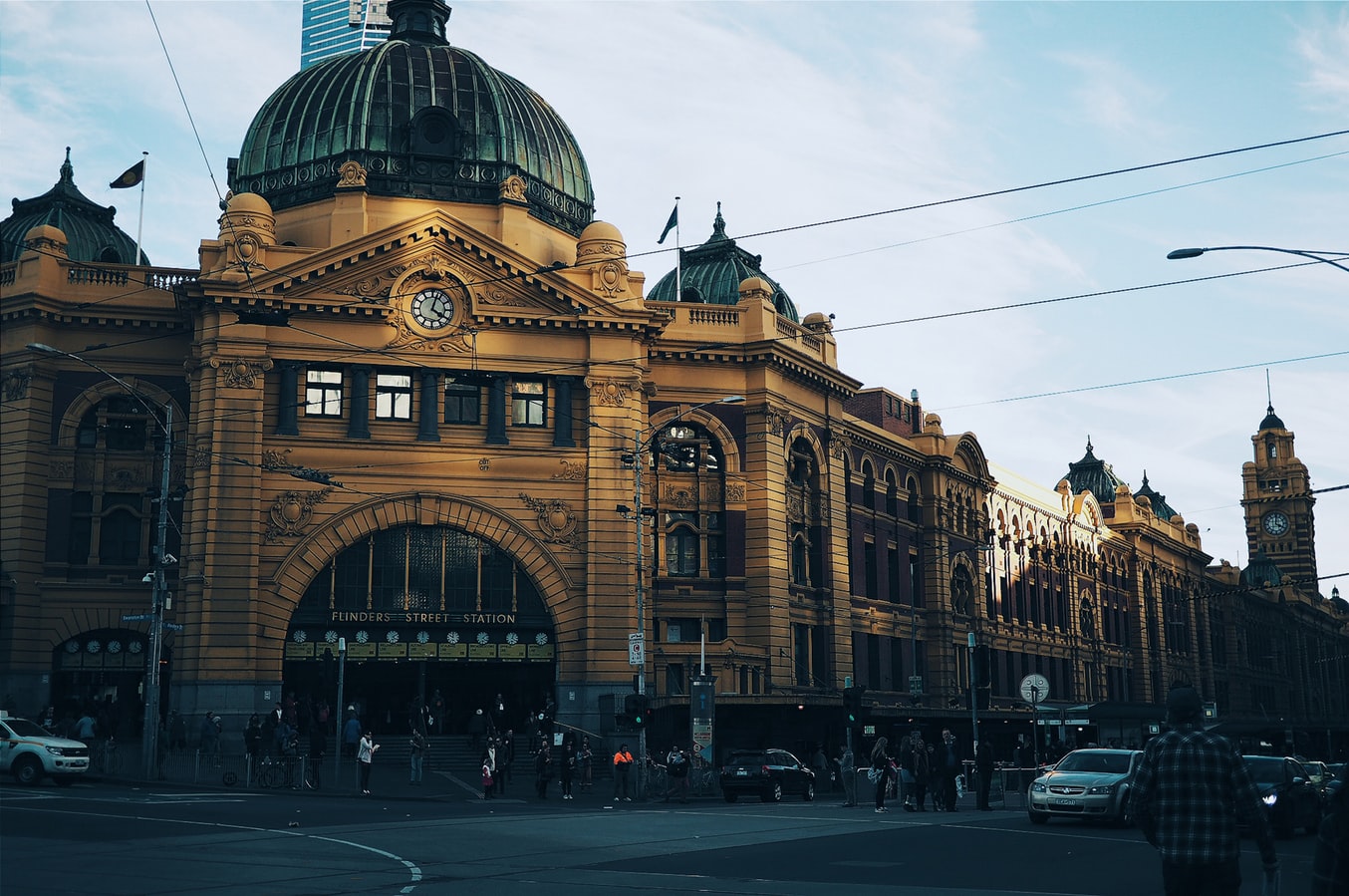
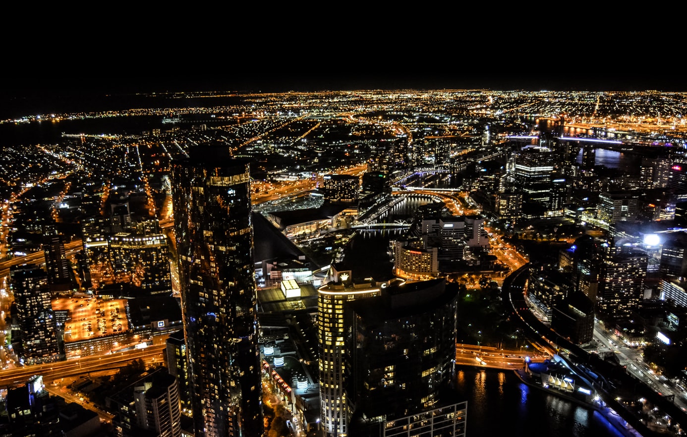
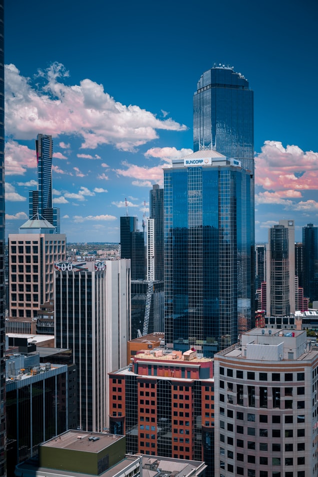
About Melbourne, Victoria
Consistently rated among the "world's most livable cities" in quality-of-life surveys, Melbourne is built on a coastal plain at the top of the giant horseshoe of Port Phillip Bay. The city center is an orderly grid of streets where the state parliament, banks, multinational corporations, and splendid Victorian buildings that sprang up in the wake of the gold rush now stand. This is Melbourne's heart, which you can explore at a leisurely pace in a couple of days.In Southbank, one of the newer precincts south of the city center, the Southgate development of bars, restaurants, and shops has refocused Melbourne's vision on the Yarra River. Once a blighted stretch of factories and run-down warehouses, the southern bank of the river is now a vibrant, exciting part of the city, and the river itself is finally taking its rightful place in Melbourne's psyche.Just a hop away, Federation Square—with its host of galleries—has become a civic landmark for Melburnians. Stroll along the Esplanade in the suburb of St. Kilda, amble past the elegant houses of East Melbourne, enjoy the shops and cafés in Fitzroy or Carlton, rub shoulders with locals at the Victoria Market, nip into the Windsor for afternoon tea, or rent a canoe at Studley Park to paddle along one of the prettiest stretches of the Yarra—and you may discover Melbourne's soul as well as its heart.
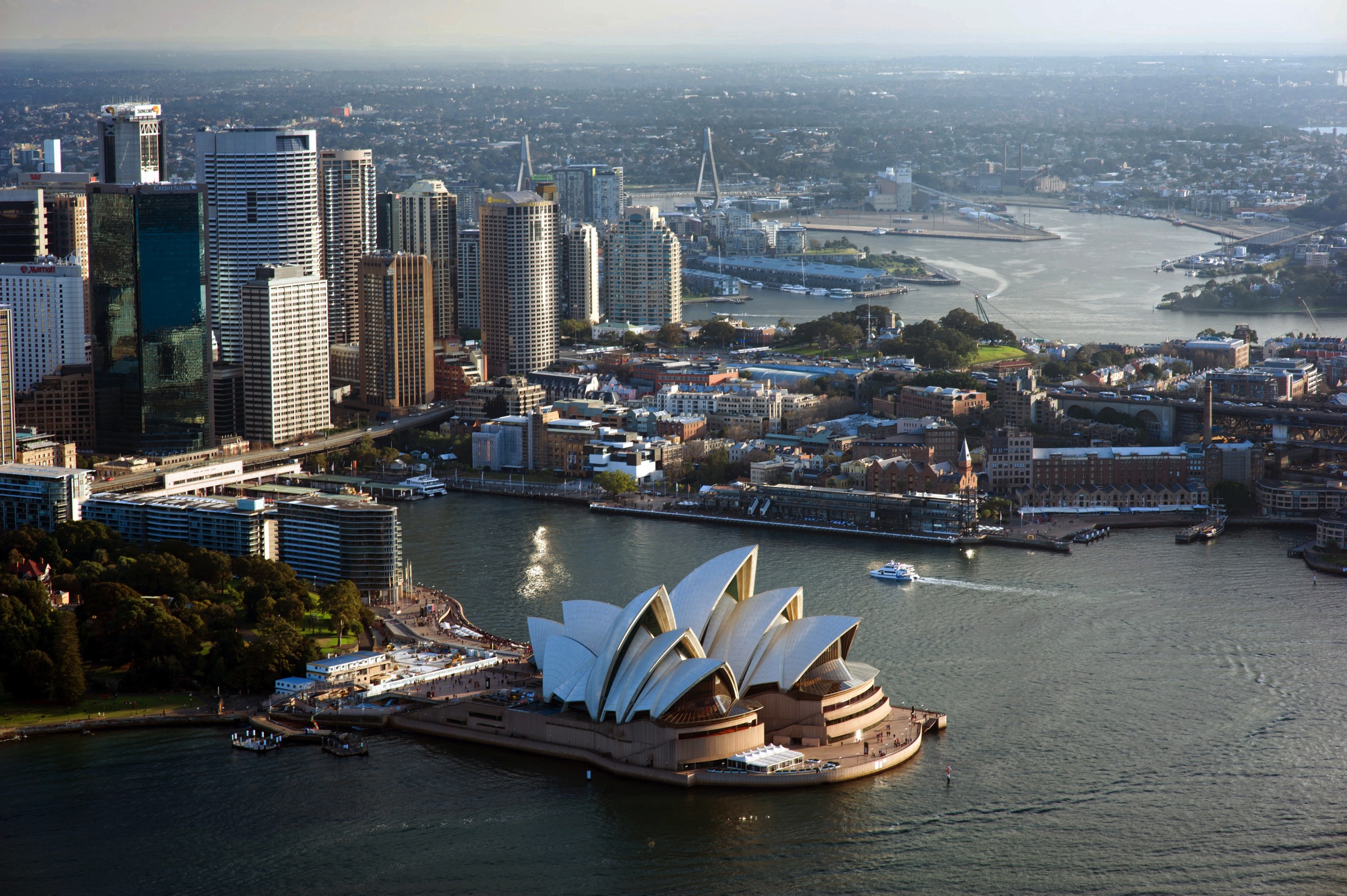
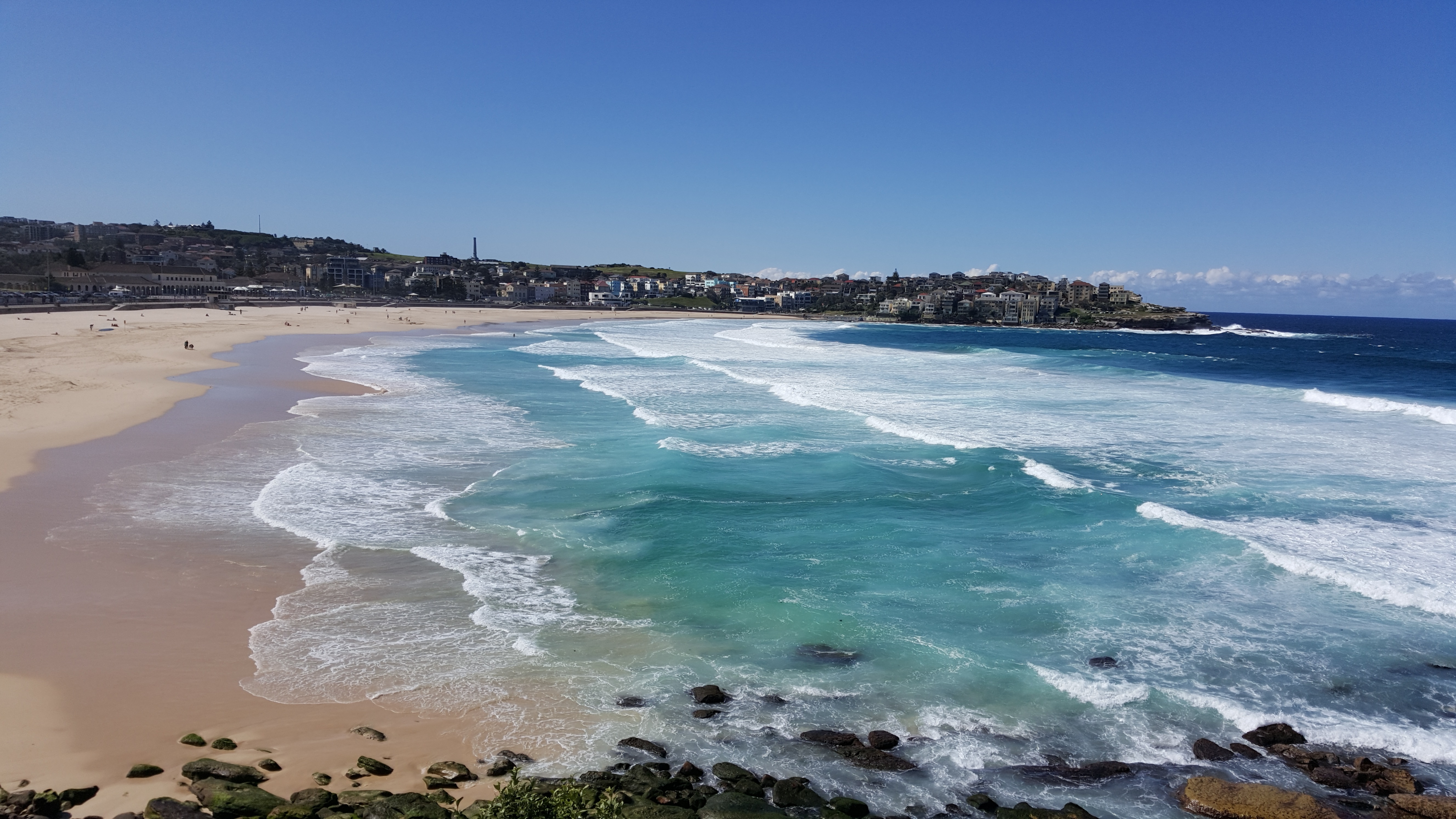
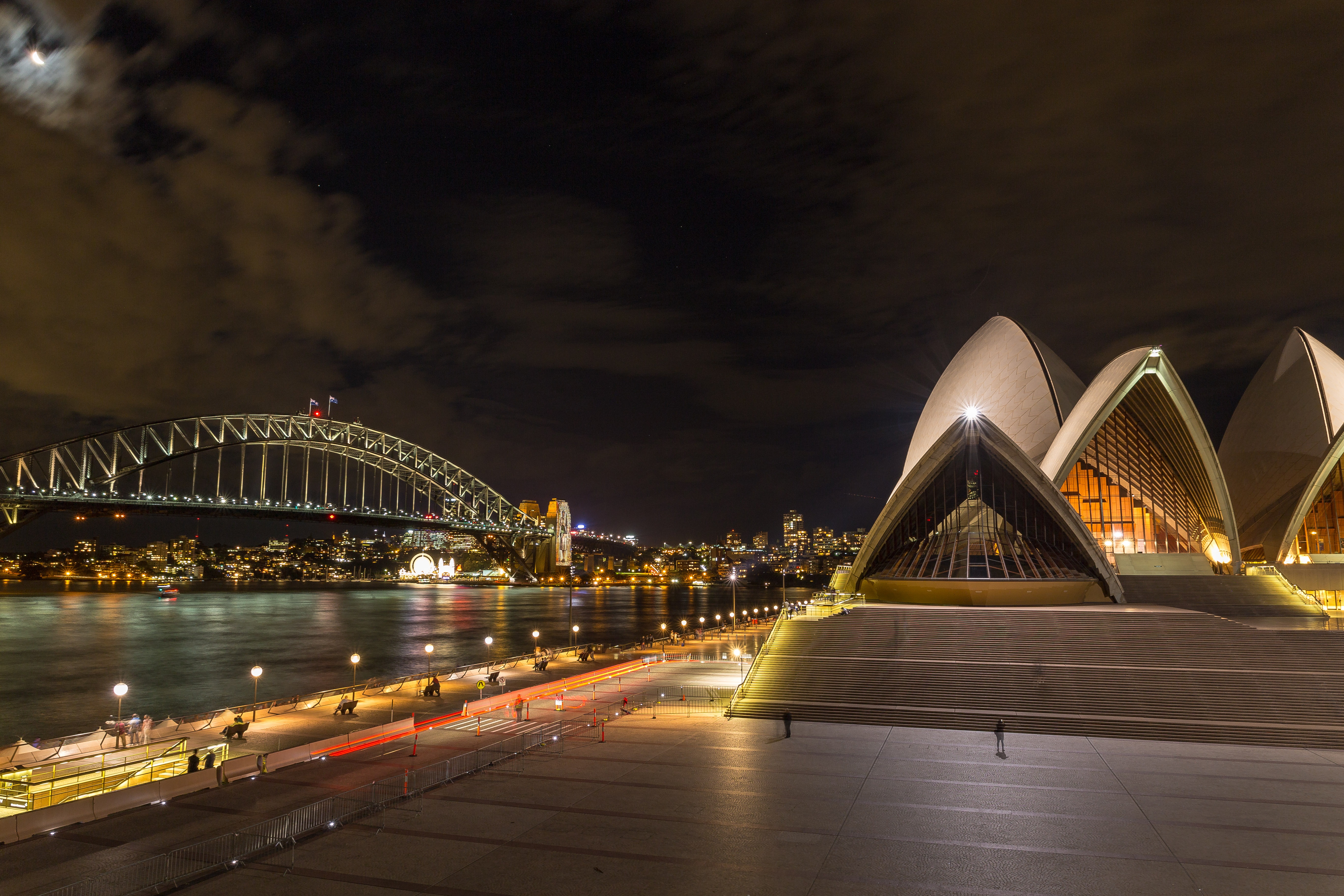
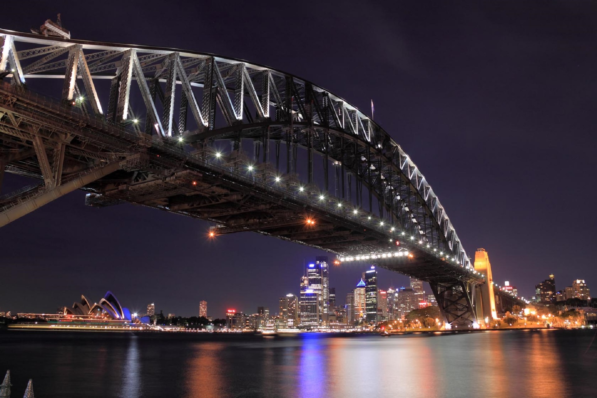
About Sydney, New South Wales
Sydney belongs to the exclusive club of cities that generate excitement. At the end of a marathon flight there's renewed vitality in the cabin as the plane circles the city, where thousands of yachts are suspended on the dark water and the sails of the Opera House glisten in the distance. Blessed with dazzling beaches and a sunny climate, Sydney is among the most beautiful cities on the planet.With 4.6 million people, Sydney is the biggest and most cosmopolitan city in Australia. A wave of immigration from the 1950s has seen the Anglo-Irish immigrants who made up the city's original population joined by Italians, Greeks, Turks, Lebanese, Chinese, Vietnamese, Thais, and Indonesians. This intermingling has created a cultural vibrancy and energy—and a culinary repertoire—that was missing only a generation ago.Sydneysiders embrace their harbor with a passion. Indented with numerous bays and beaches, Sydney Harbour is the presiding icon for the city, and urban Australia. Captain Arthur Phillip, commander of the 11-ship First Fleet, wrote in his diary when he first set eyes on the harbor on January 26, 1788: "We had the satisfaction of finding the finest harbor in the world."Although a visit to Sydney is an essential part of an Australian experience, the city is no more representative of Australia than Los Angeles is of the United States. Sydney has joined the ranks of the great cities whose characters are essentially international. What Sydney offers is style, sophistication, and great looks—an exhilarating prelude to the continent at its back door.
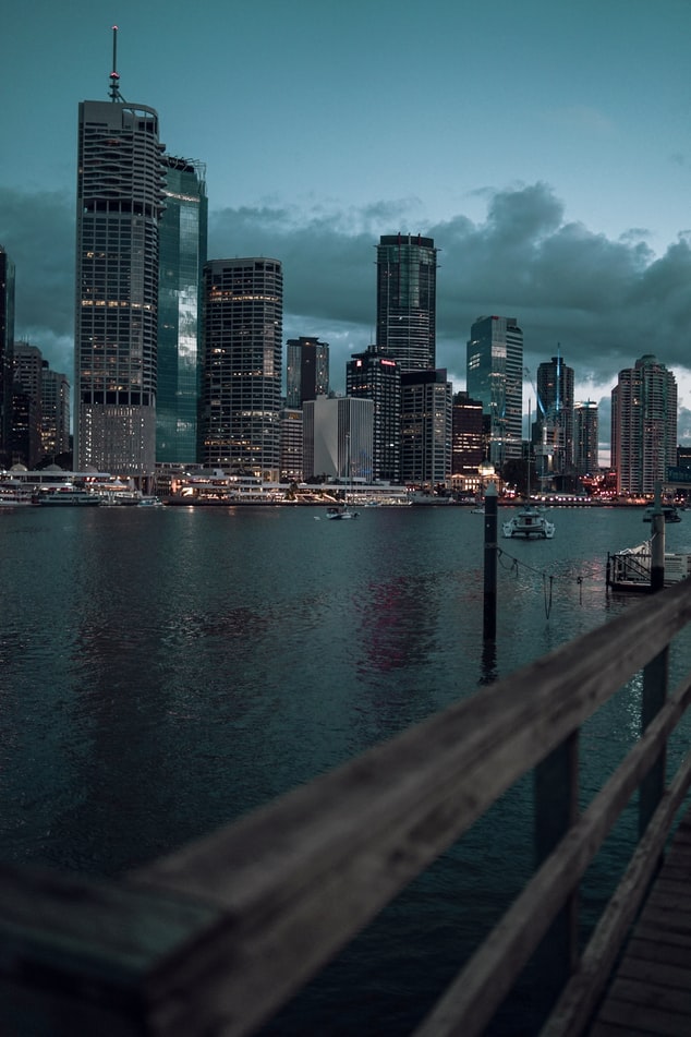
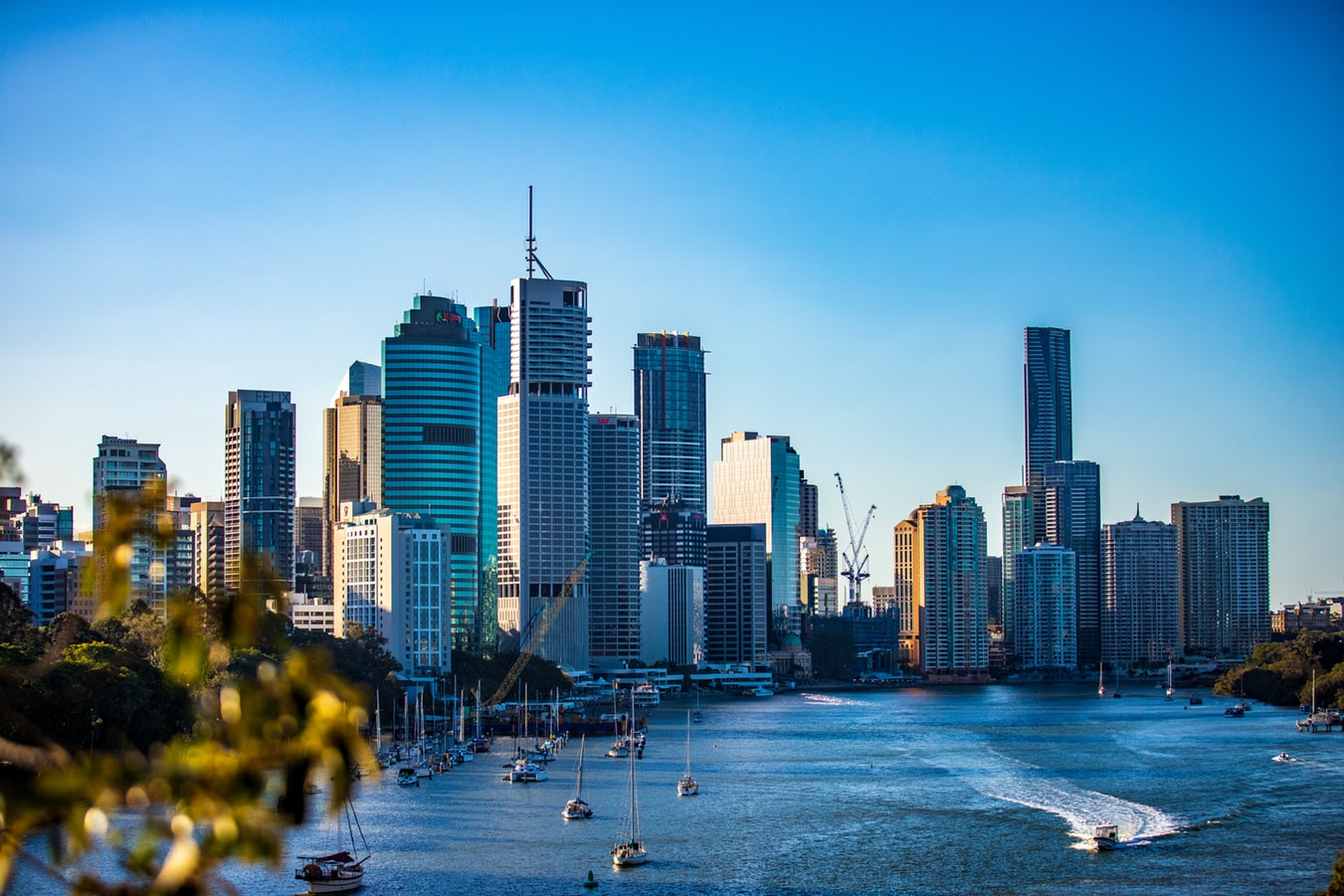
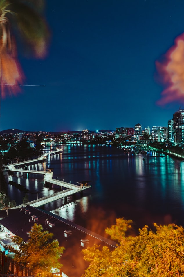
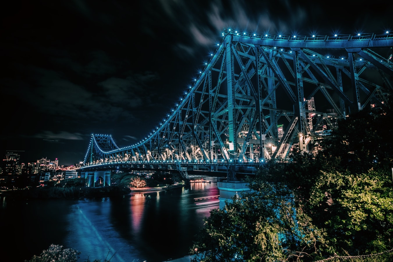
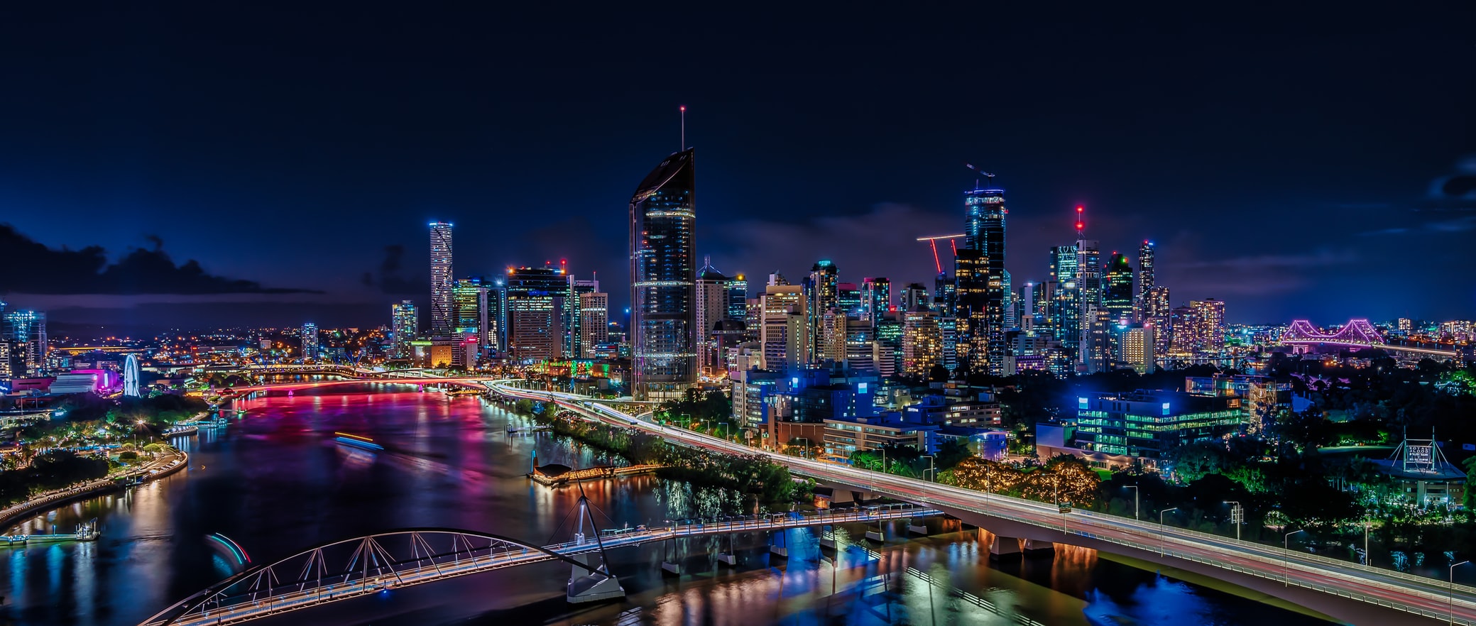
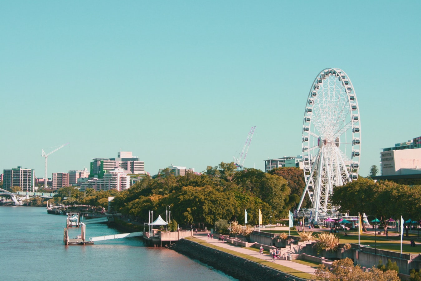
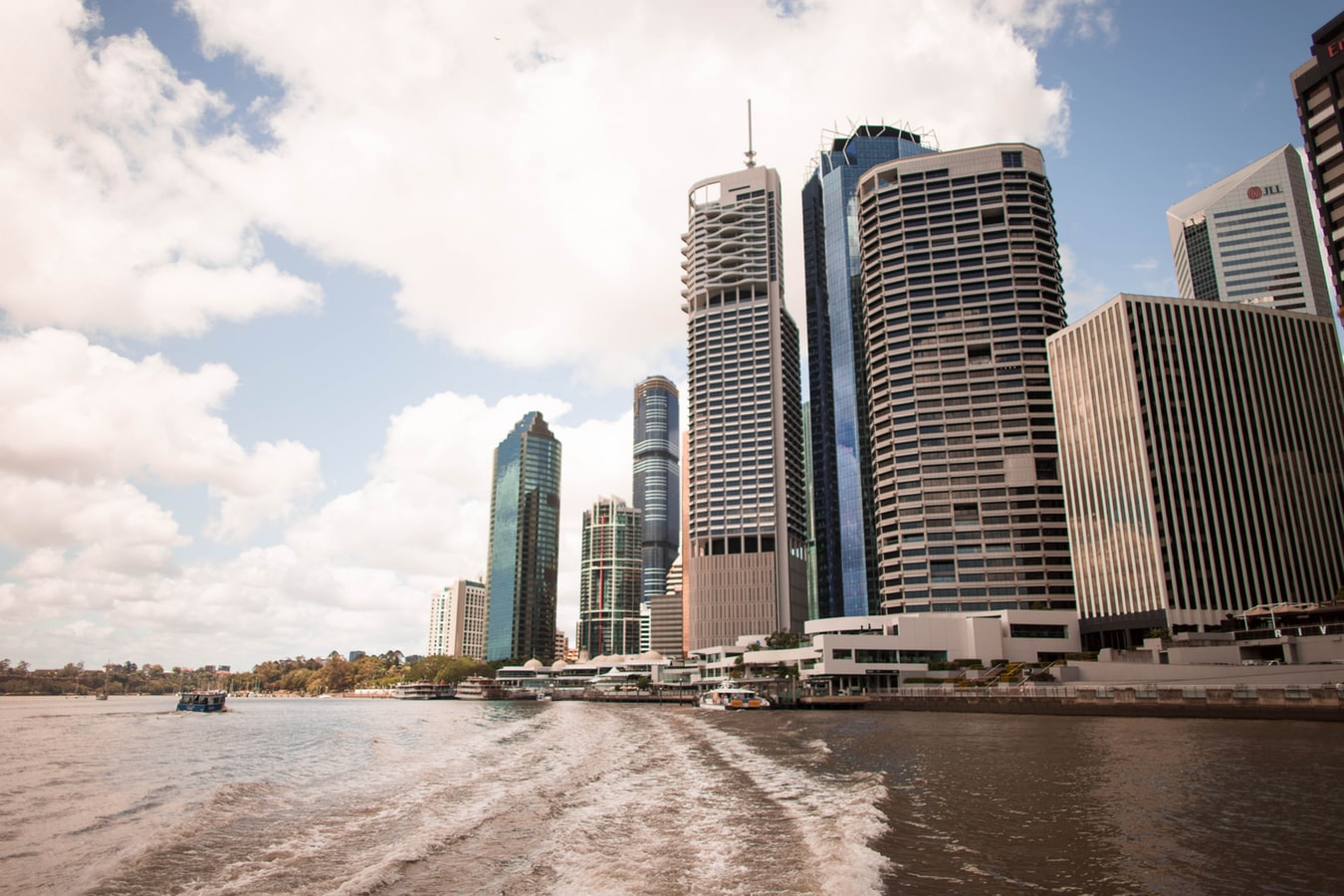
About Brisbane, Queensland
Founded in 1824 on the banks of the wide, meandering Brisbane River, the former penal colony of Brisbane was for many years regarded as just a big country town. Many beautiful timber Queenslander homes, built in the 1800s, still dot the riverbanks and inner suburbs, and in spring the city's numerous parks erupt in a riot of colorful jacaranda, poinciana, and bougainvillea blossoms. Today the Queensland capital is one of Australia's most up-and-coming cities: glittering high-rises mark its polished business center, slick fashion boutiques and restaurants abound, and numerous outdoor attractions beckon. In summer, temperatures here are broilingly hot and days are often humid, a reminder that this city is part of a subtropical region. Wear SPF 30-plus sunscreen and a broad-brimmed hat outdoors, even on overcast days.Brisbane's inner suburbs, a 5- to 10-minute drive or 15- to 20-minute walk from the city center, have a mix of intriguing eateries and quiet accommodations. Fortitude Valley combines Chinatown with a cosmopolitan mix of clubs, cafés, and boutiques. Spring Hill has several high-quality hotels, and Paddington, New Farm, Petrie Terrace, West End, and Woolloongabba are full of an eclectic mix of restaurants and bars. Brisbane is also a convenient base for trips to the Sunshine and Gold coasts, the mountainous hinterlands, and the Moreton Bay islands.
About Airlie Beach
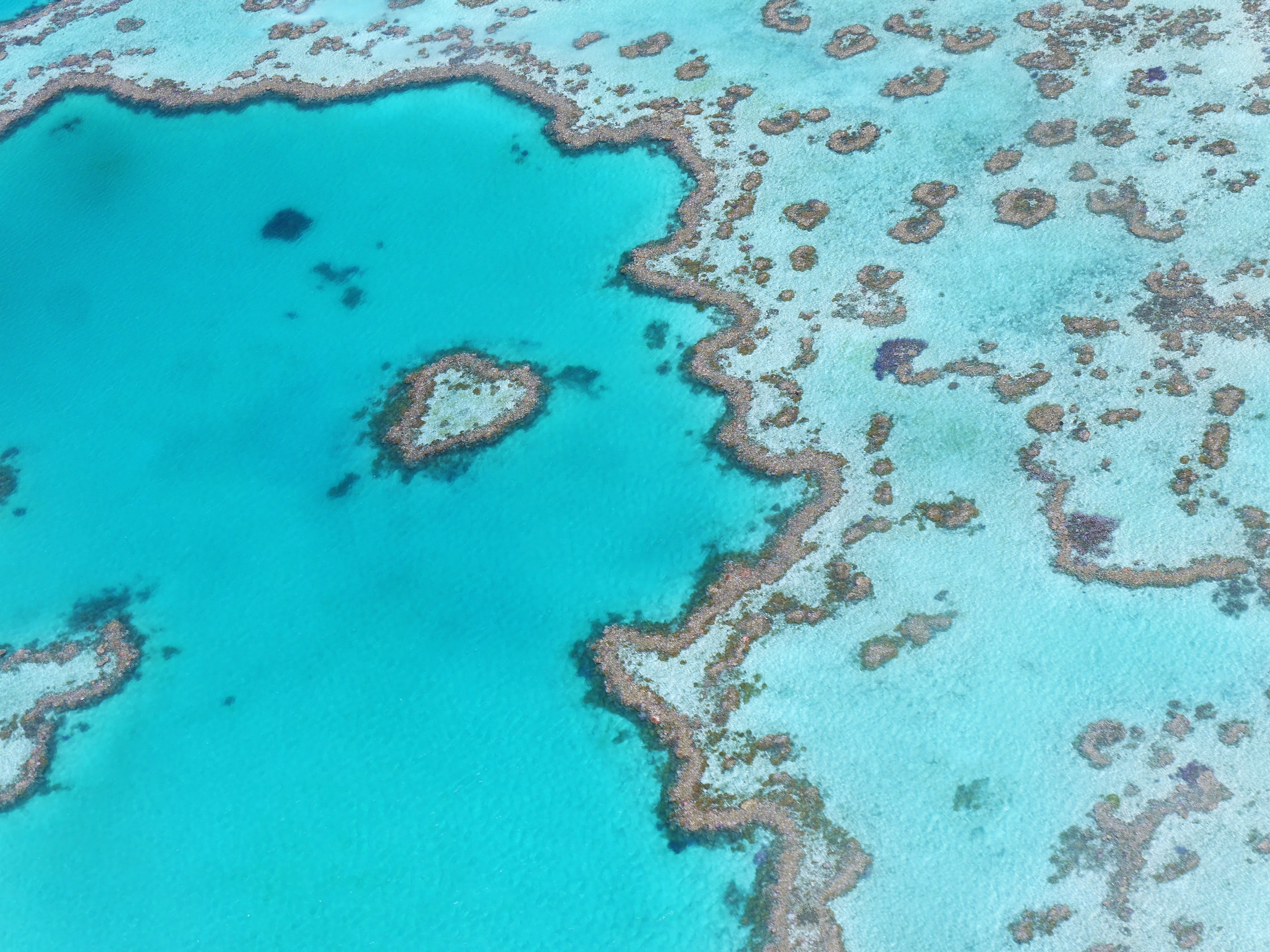
About Cairns, Queensland
Tourism is the lifeblood of Cairns (pronounced Caans). The city makes a good base for exploring the wild top half of Queensland, and tens of thousands of international travelers use it as a jumping-off point for activities such as scuba diving and snorkeling trips to the Barrier Reef, as well as boating, fishing, parasailing, scenic flights, and rain-forest treks.It's a tough environment, with intense heat and fierce wildlife. Along with wallabies and grey kangaroos in the savannah and tree kangaroos in the rain forest, you'll find stealthy saltwater crocodiles, venomous snakes, and jellyfish so deadly they put the region’s stunning beaches off- limits to swimmers for nearly half the year. Yet despite this formidable setting, Cairns and tropical North Queensland are far from intimidating places. The people are warm and friendly, the sights spectacular, and—at the right time of year—the beachside lounging is world-class.
About Thursday Island, Queensland
About Darwin, Northern Territory
Darwin is Australia's most colorful, and exotic, capital city. Surrounded on three sides by the turquoise waters of the Timor Sea, the streets are lined with tropical flowers and trees. Warm and dry in winter, hot and steamy in summer, it's a relaxed and casual place, as well as a beguiling blend of tropical frontier outpost and Outback hardiness. Thanks to its close proximity to Southeast Asia and its multicultural population it also seems more like Asia than the rest of Australia. Darwin is a city that has always had to fight for its survival. The seductiveness of contemporary Darwin lifestyles belies a history of failed attempts that date from 1824 when Europeans attempted to establish an enclave in this harsh, unyielding climate. The original 1869 settlement, called Palmerston, was built on a parcel of mangrove wetlands and scrub forest that had changed little in 15 million years. It was not until 1911, after it had already weathered the disastrous cyclones of 1878, 1882, and 1897, that the town was named after the scientist who had visited Australia's shores aboard the Beagle in 1839. During World War II it was bombed more than 60 times, as the harbor full of warships was a prime target for the Japanese war planes. Then, on the night of Christmas Eve 1974, the city was almost completely destroyed by Cyclone Tracy, Australia’s greatest natural disaster. It's a tribute to those who stayed and to those who have come to live here after Tracy that the rebuilt city now thrives as an administrative and commercial center for northern Australia. Old Darwin has been replaced by something of an edifice complex—such buildings as Parliament House and the Supreme Court all seem very grand for such a small city, especially one that prides itself on its casual, outdoor-centric lifestyle. Today Darwin is the best place from which to explore Australia's Top End, with its wonders of Kakadu and the Kimberley region.
About Kupang
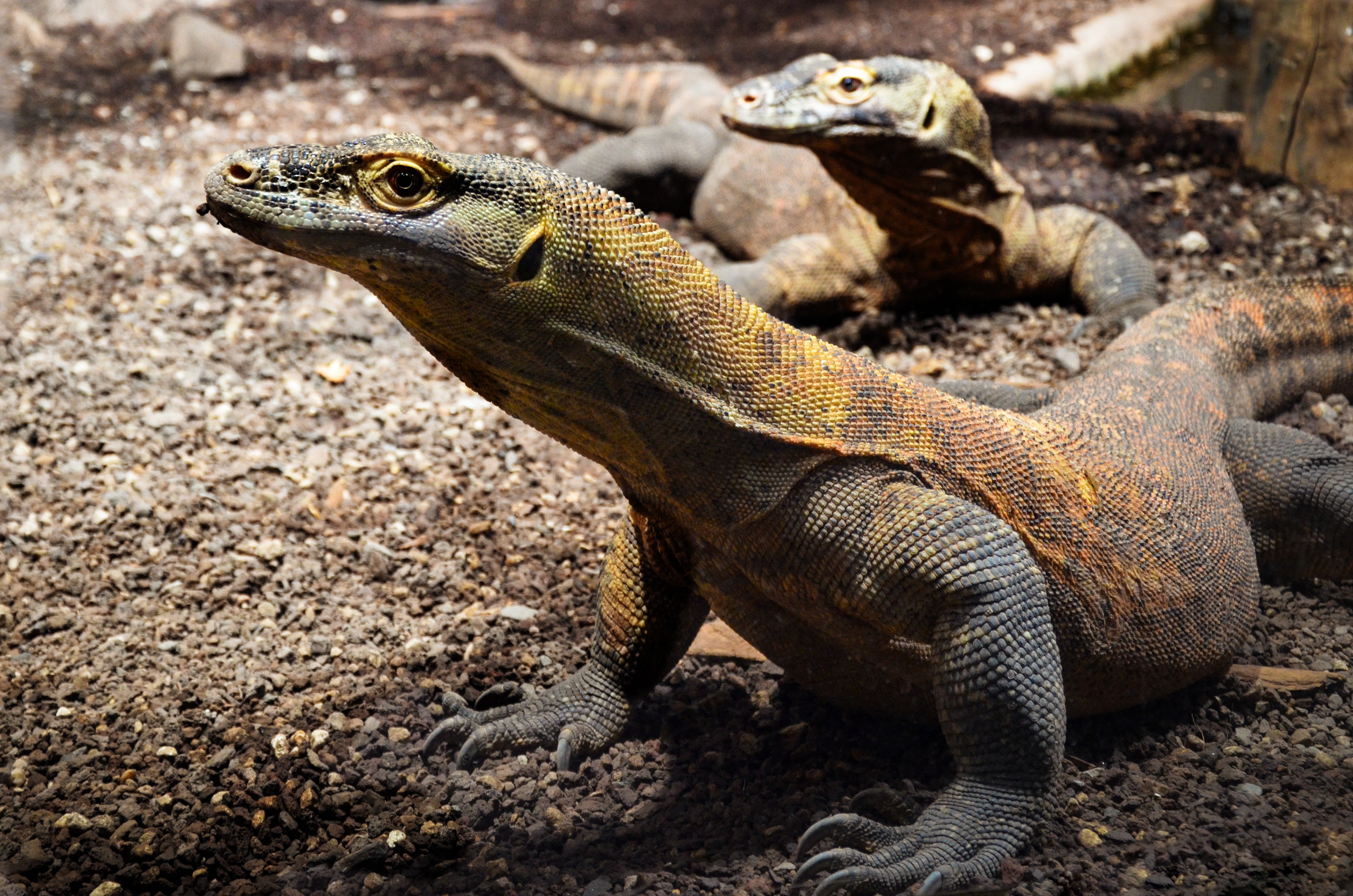
About Komodo Island
Pink Beach earned its name for the way the beach can appear to have a rosy hue in certain lights. The color comes from small flecks of red coral mixed in with the fine white reef sand. With a few trees along the beach for shade, this stretch of coast makes a fine place to relax or enjoy a snorkel or dive in the crystal clear waters. It is possible to spot a striped clown fish nestled among the protective tentacles of its sea anemone host, or to see a grouper lazily swimming by a flamboyant soft coral. The reef here is now protected by law and the maturing corals are a joy to behold.
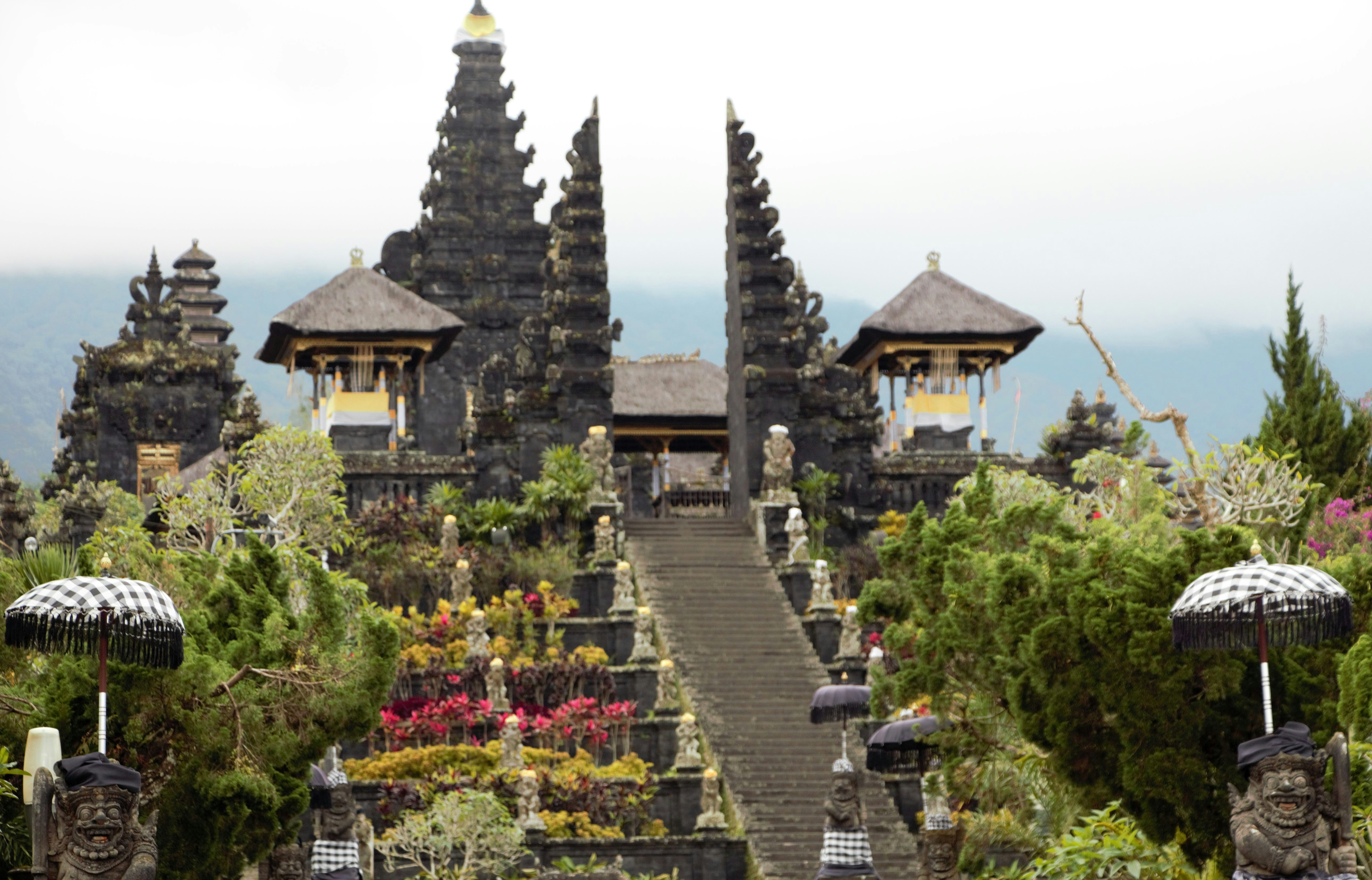
About Bali
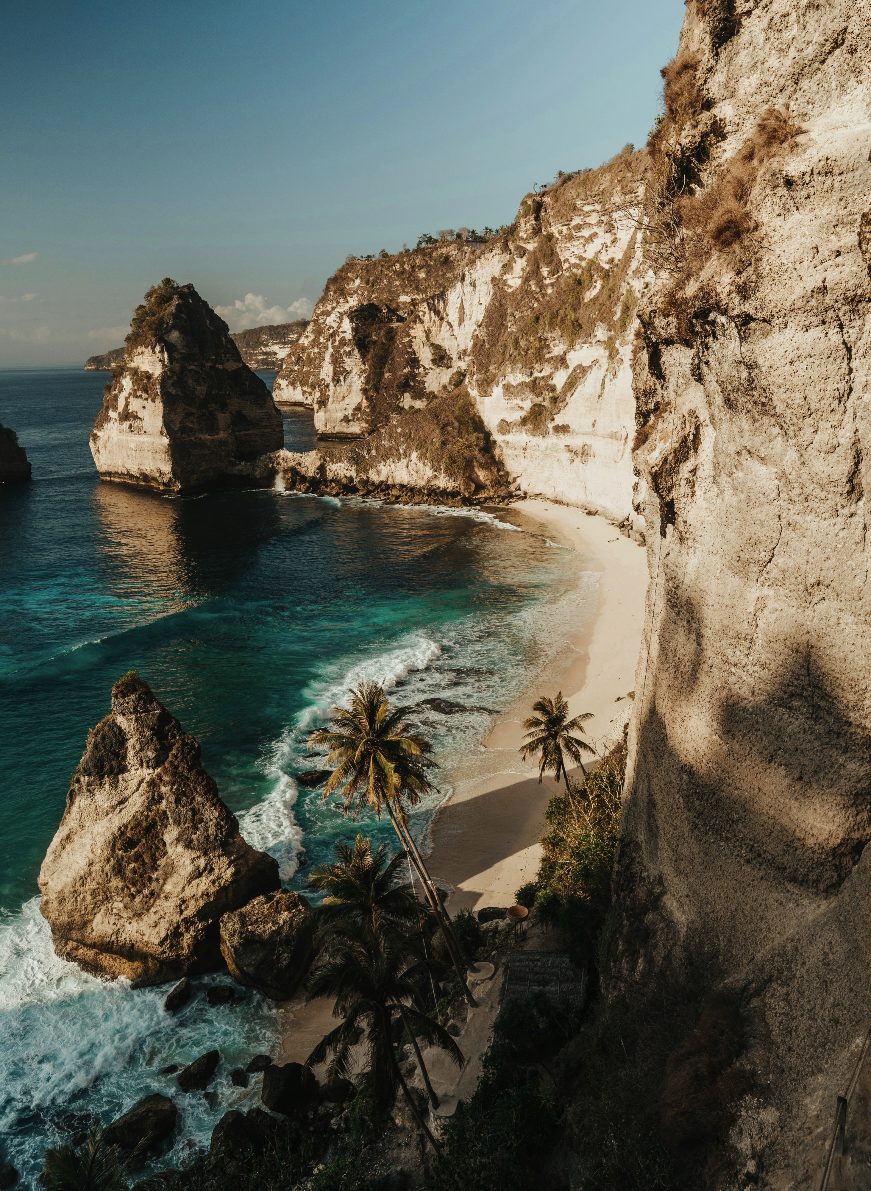
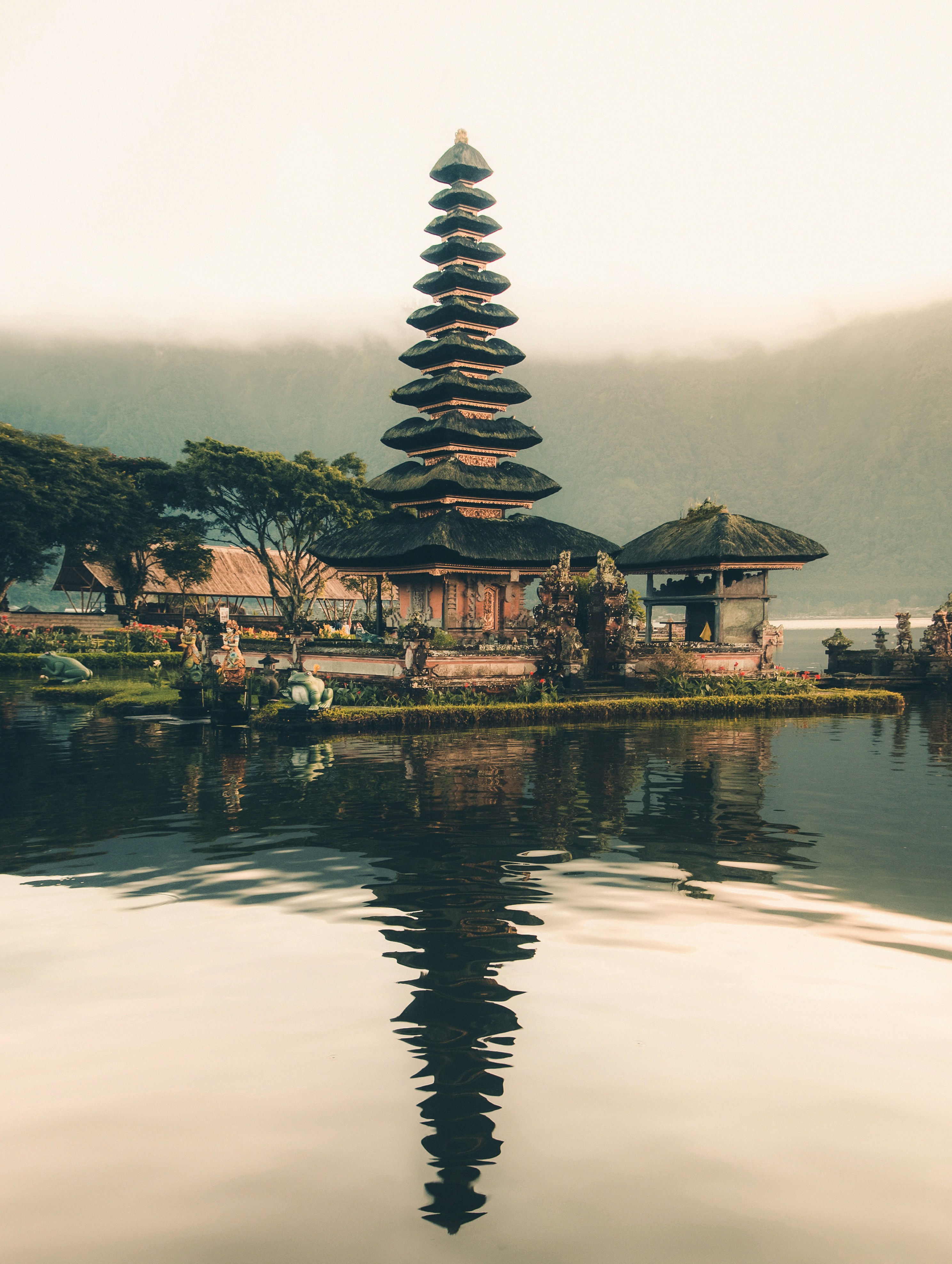
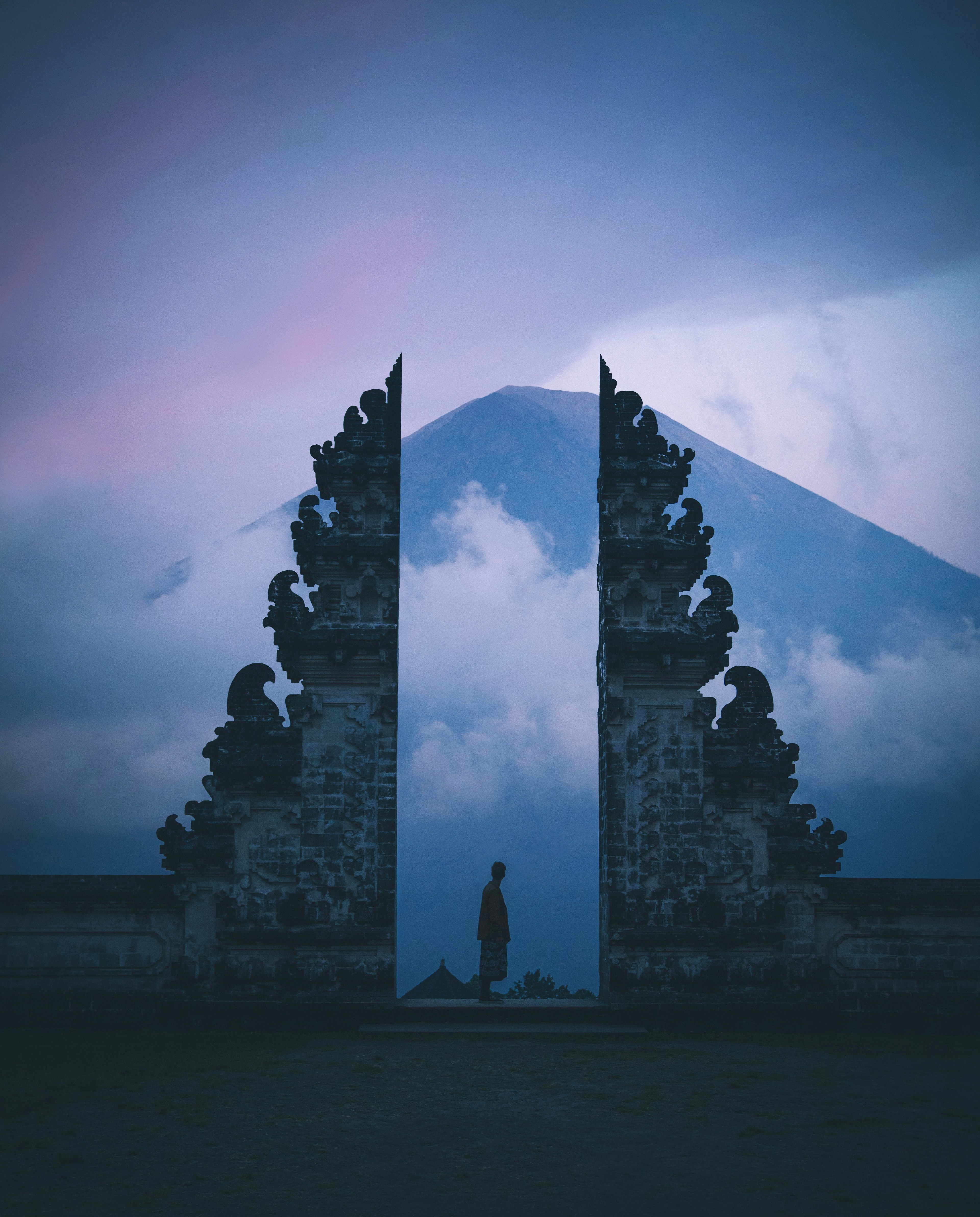
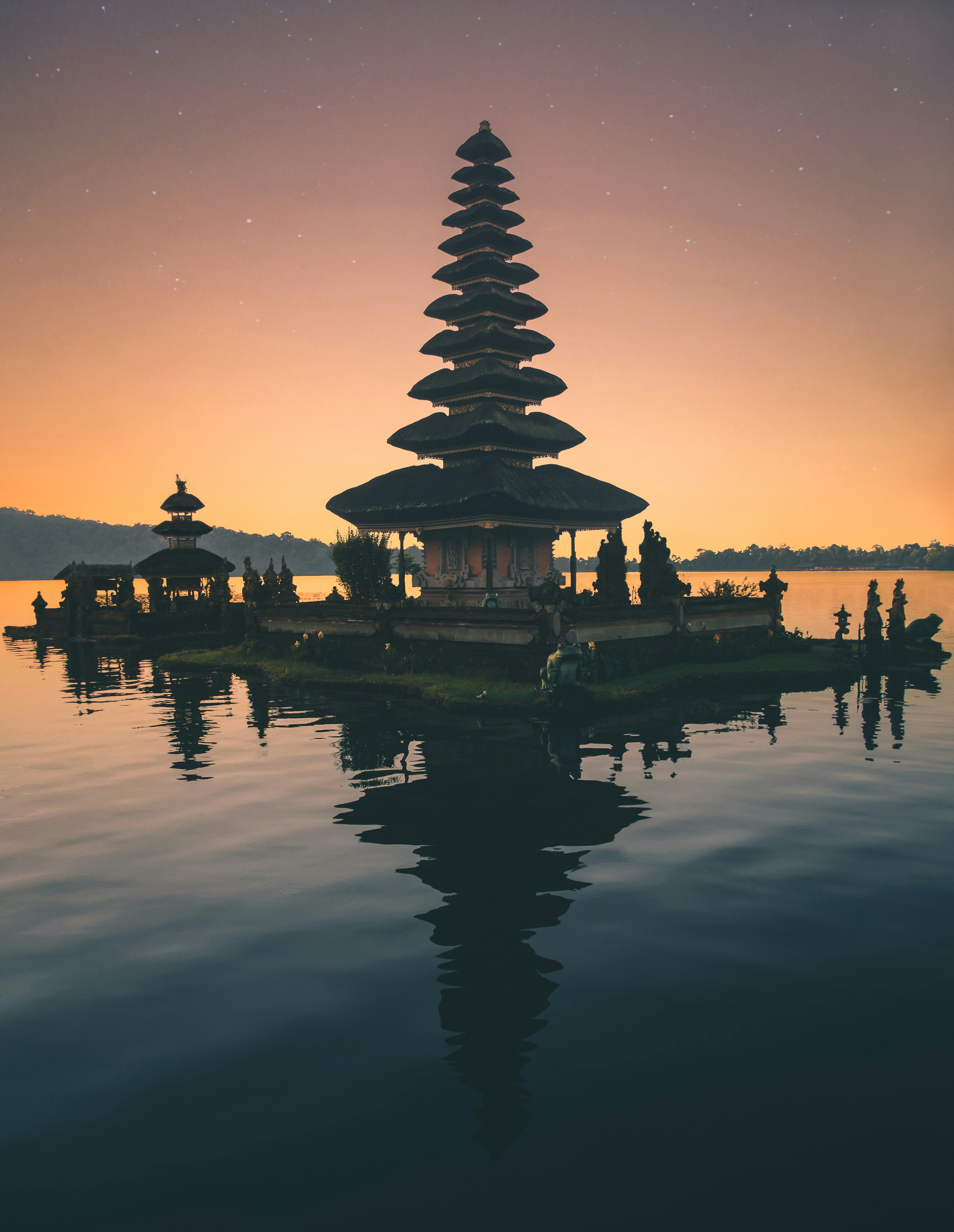
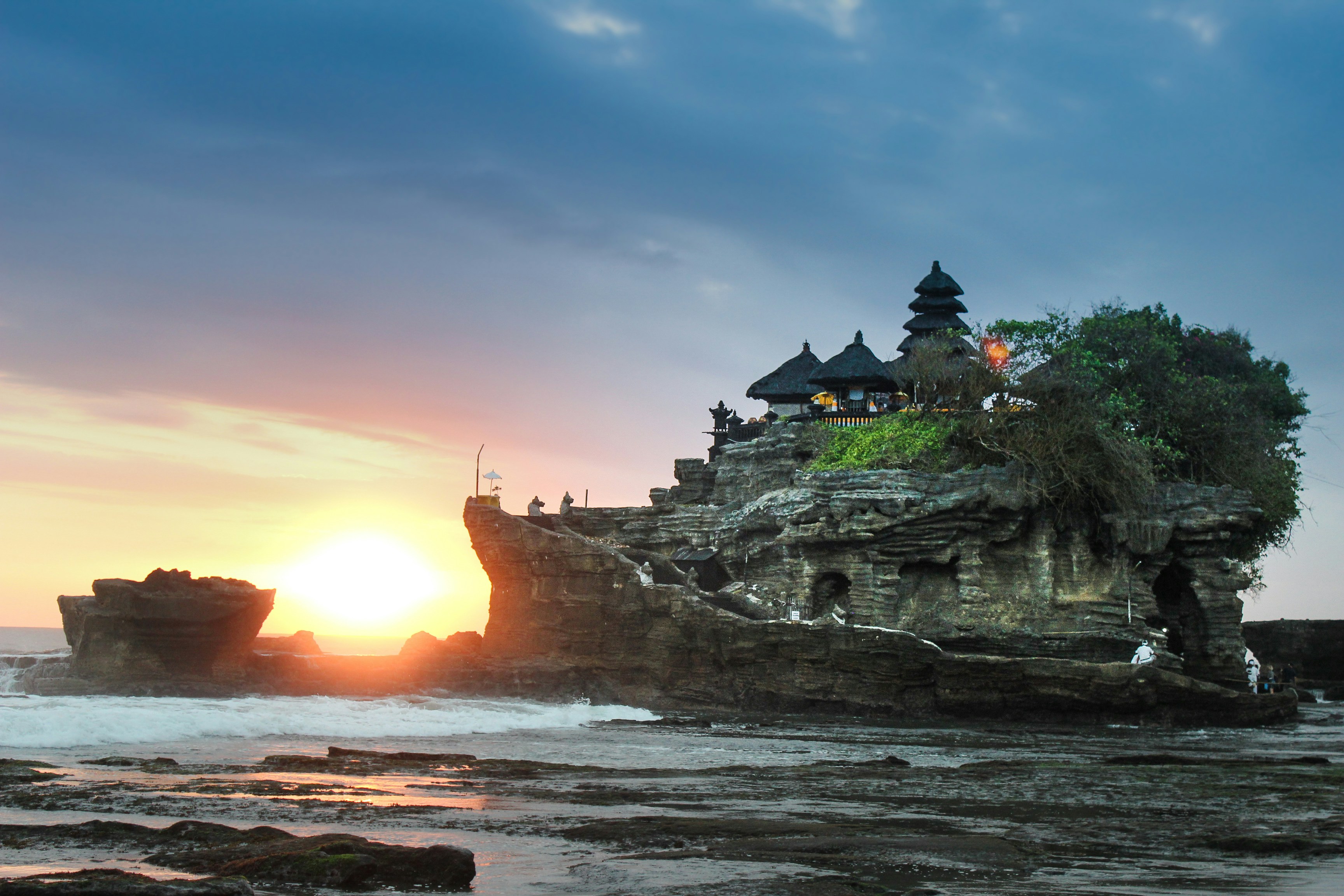
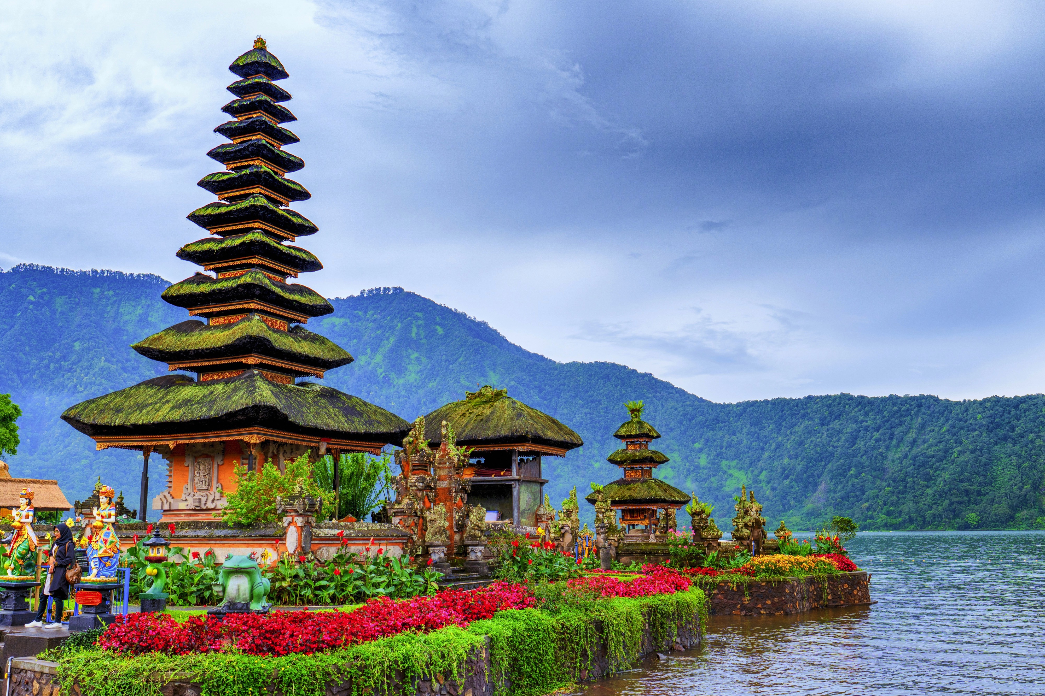
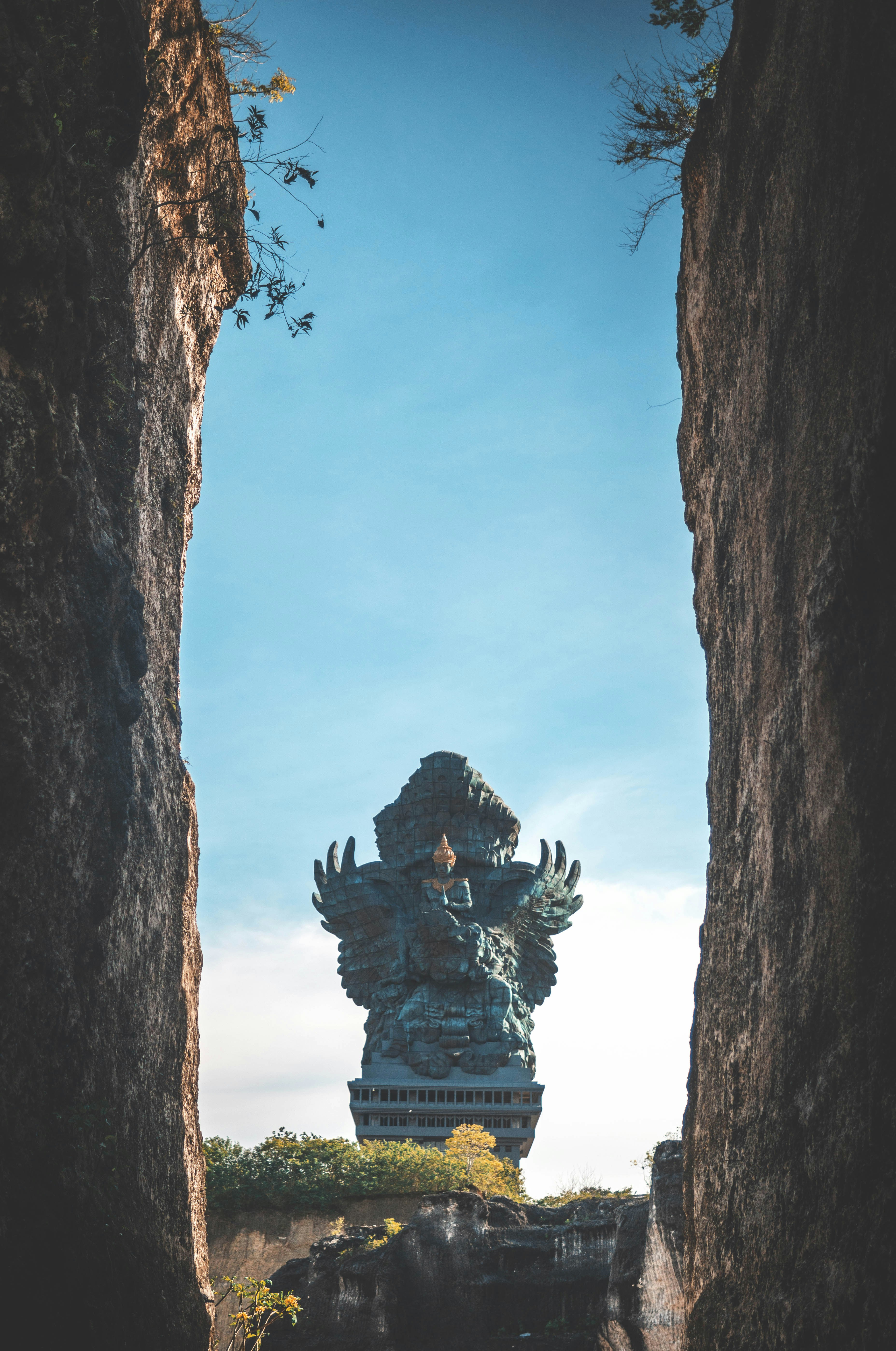
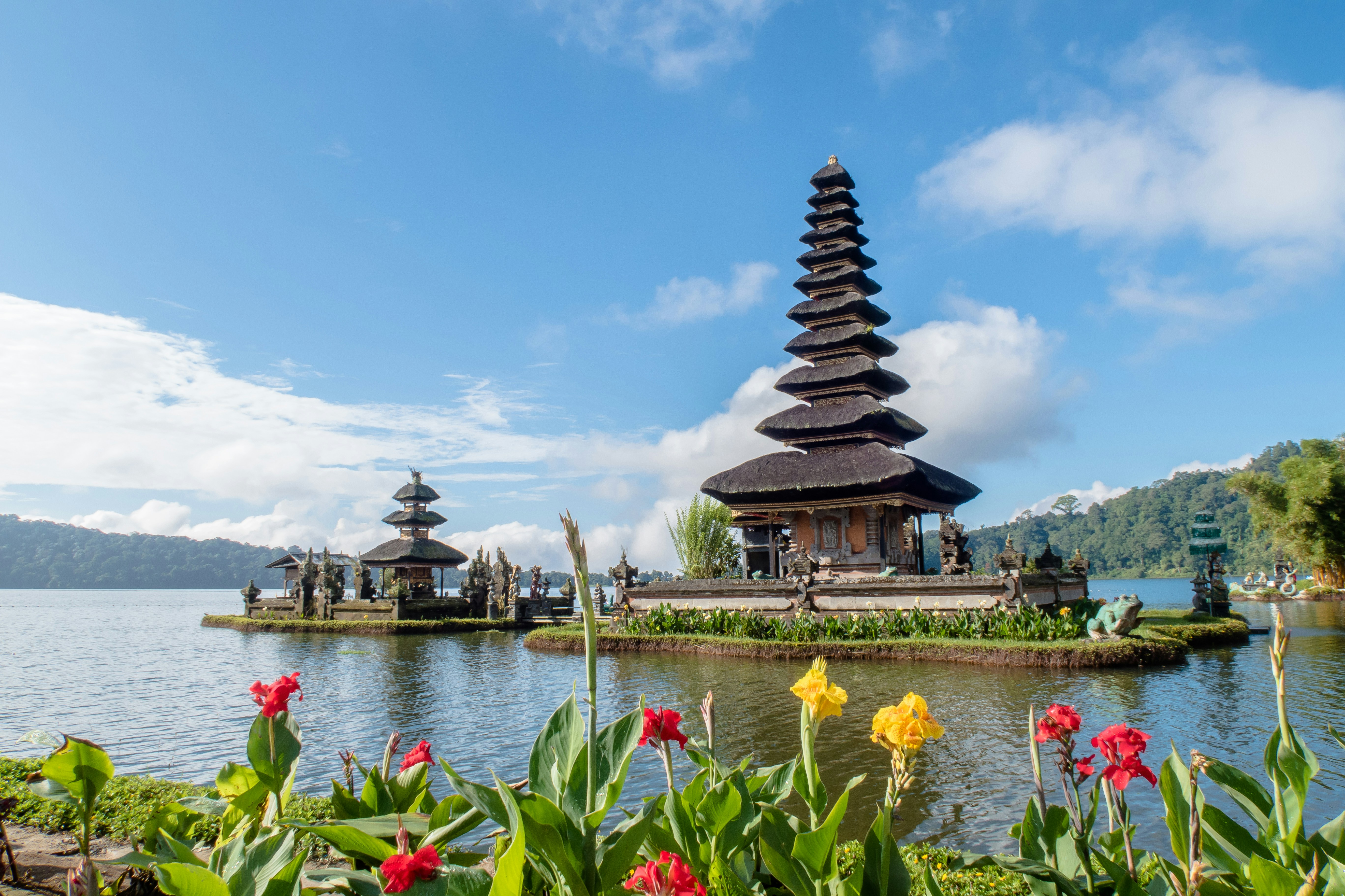
About Bali
About Makassar
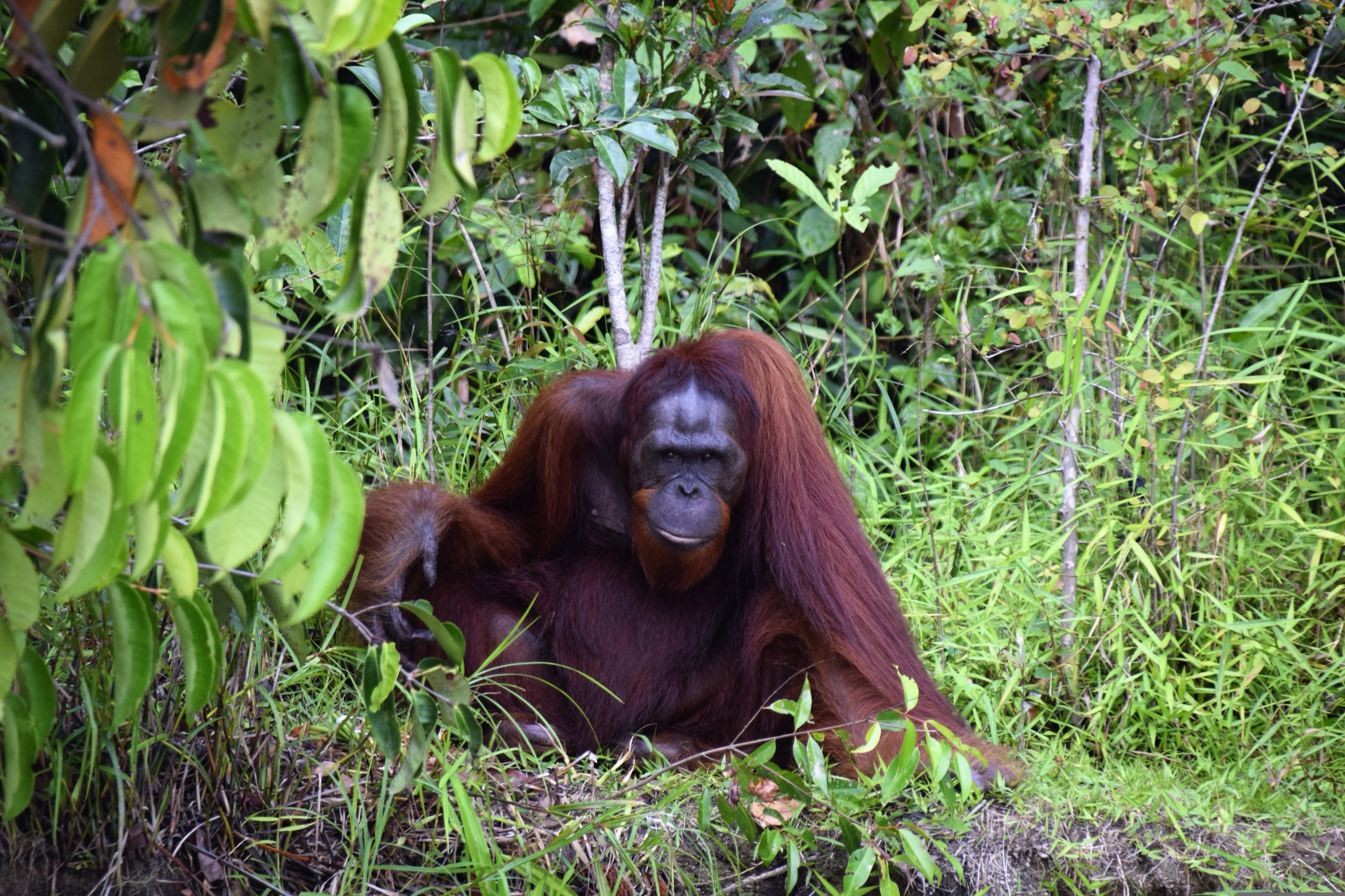
About Sandakan, Sabah
Borneo's forbidding interior made it less attractive to early traders and explorers than neighboring areas, so what is now the state of Sabah remained unexploited by the British until the late 19th century, although traders long visited for exotic items such as bird's nests (for the celebrated Chinese soup). In 1963, Sabah joined Sarawak, Malaya, and Singapore (which later seceded) in forming the Federation of Malaysia. Known as the "Land Below the Wind" because it's south of the typhoon belt, Sabah occupies Borneo's northern tip. It shares its southwestern border with Sarawak and the rest of its southern border with the Indonesian province of East Kalimantan. Today vast tracts of forest have been replaced by oil-palm plantations, and a sizable portion of remaining forest land is protected in national parks or conservation areas.On the shore of a deep bay, Sandakan was the capital of British North Borneo and one of the most important towns in Southeast Asia from the 1880s through the 1930s. But Japanese occupation during World War II and allied bombing virtually destroyed the town, and the capital was transferred to Jesselton (now Kota Kinabalu) in 1946. Sandakan enjoyed a revival in the 1970s as the center of the region's logging industry. Logging has since declined, but Sandakan is still worth visiting for its rich history and proximity to some of Borneo's most accessible wildlife attractions. Sandakan's downtown, much of it built on landfill, is squeezed between a steep promontory and Sandakan Bay. In recent years, this city of 450,000 (counting its extensive suburbs) has begun redeveloping its downtown waterfront into a shopping and nightlife hub. Its working harbor area for passengers and cargo is 6 km (4 miles) west of downtown.
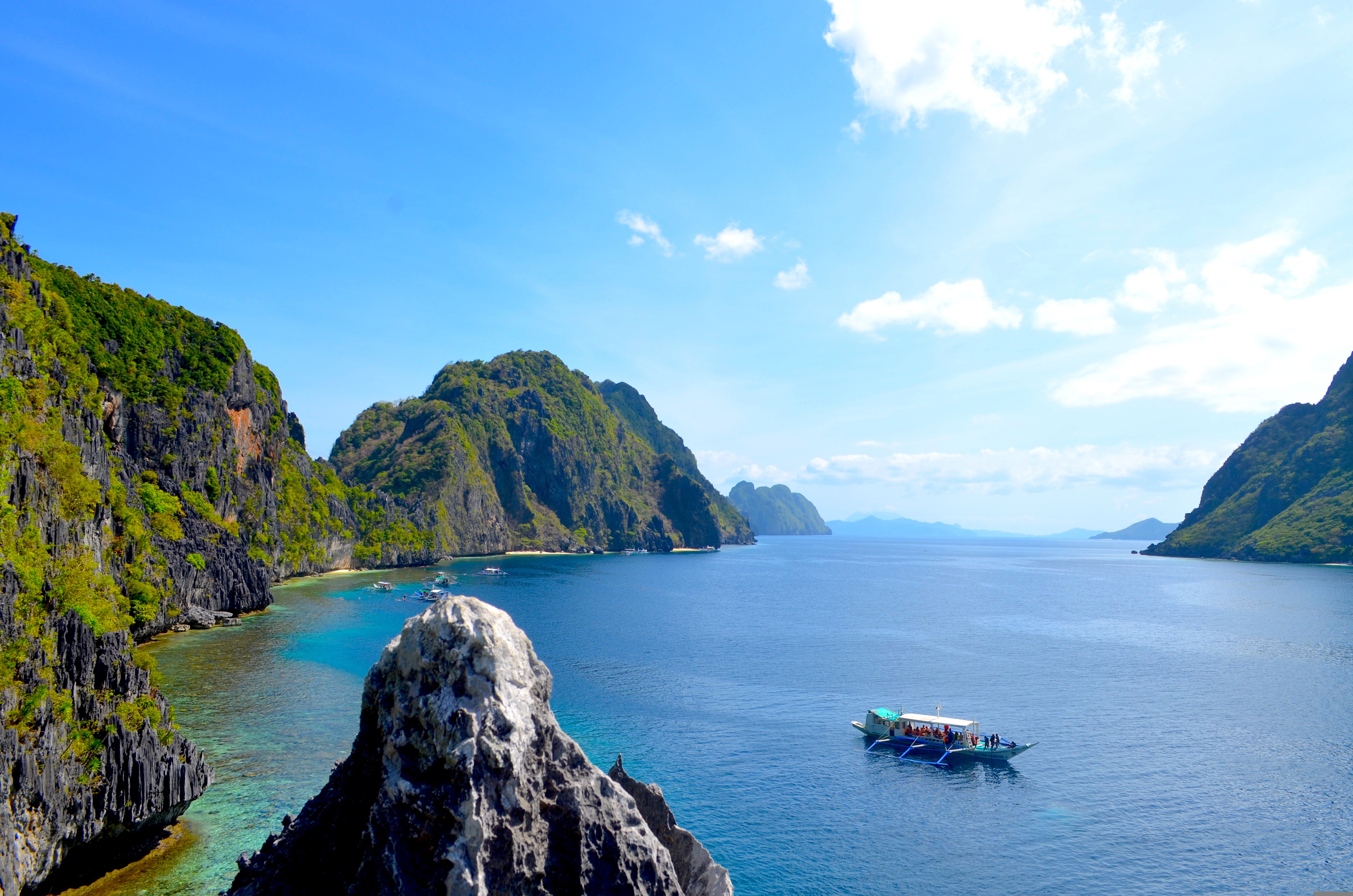
About Puerto Princesa, Palawan
The Spanish arrived at this beautiful corner of the world in March of 1872, founding the city, that would eventually become the Capital of Palawan. In 2011, the area received a huge boost, when New7 announced its list of the 7 Wonders of Nature – counting 500 million votes in the process. Puerto Princesa’s stunning underground river - complete with a cavernous, sunken lagoon - beat off wonderful sites like the Great Barrier Reef, to claim a spot on the final, prestigious list. Set sail across the glowing green water, on a journey into the gaping mouth of the limestone caves at Puerto Princesa. Known for being one of the least densely populated, cleanest and most environmentally friendly cities in the Philippines, there’s a raft of natural wonders to explore - from diving hotspots to towering limestone cliffs, and the entrancing underworld of the underground river.
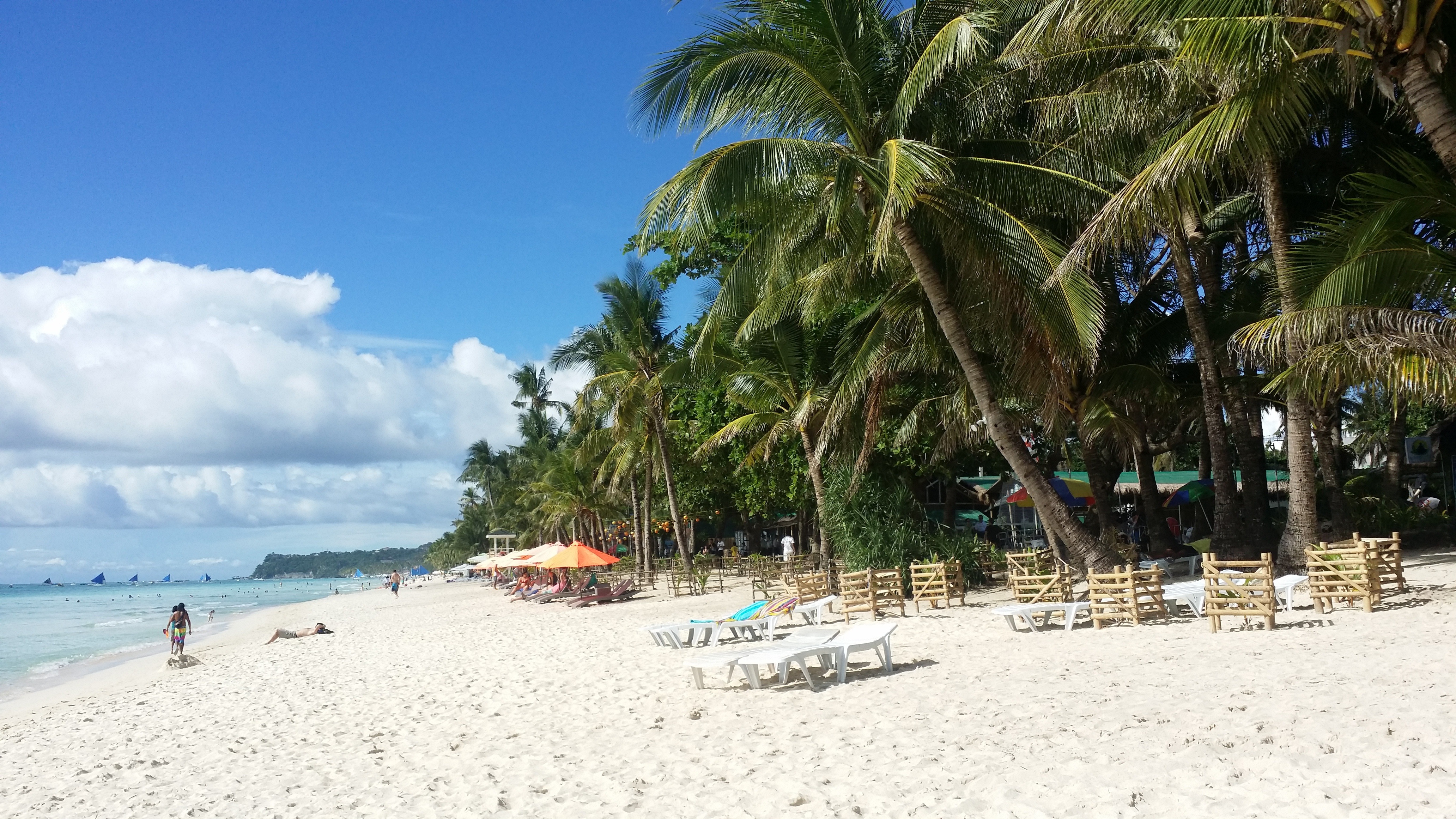
About Boracay Island
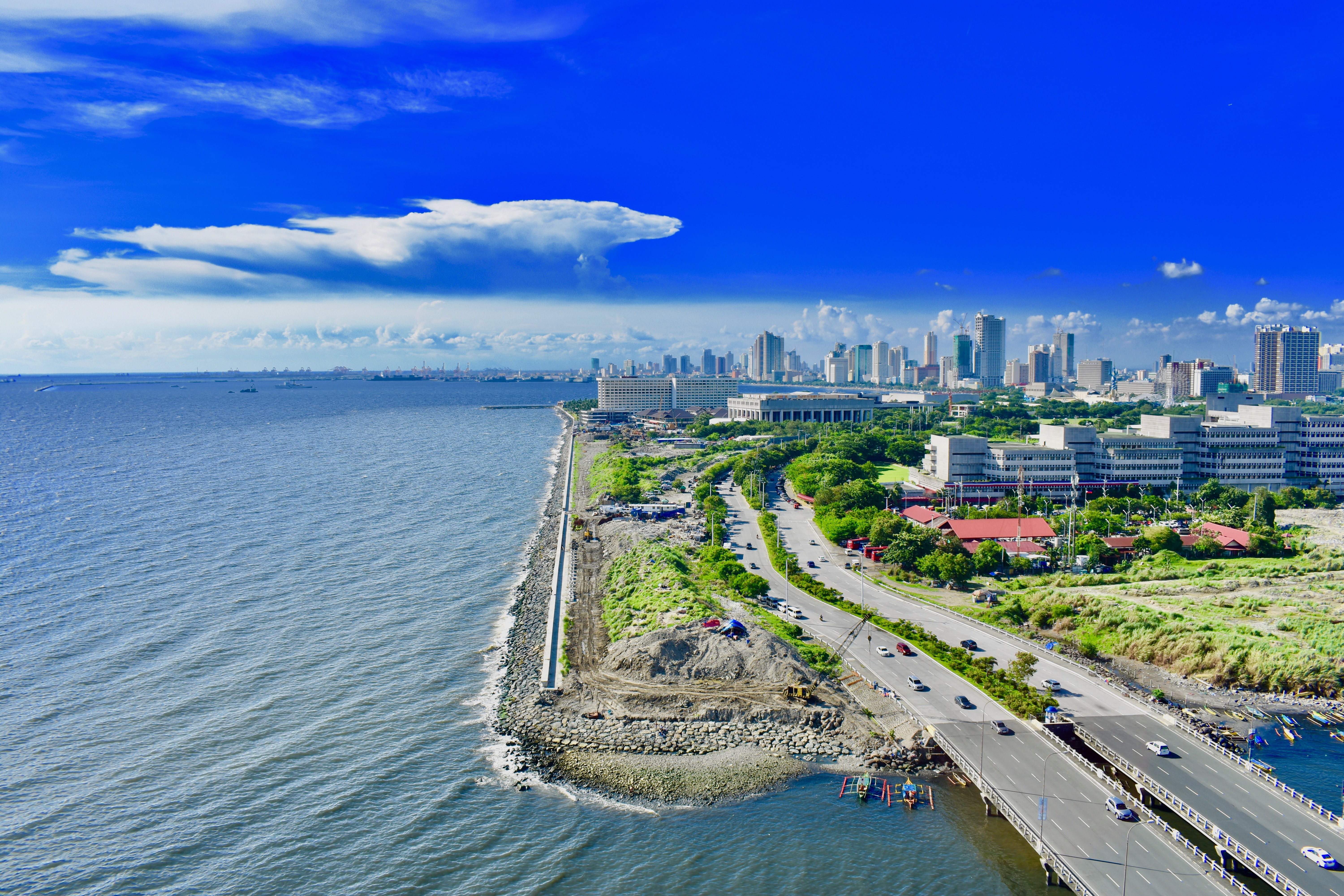
About Manila
MANILA, the capital city of the Philippines, was founded in, 1571 by Spanish conquistador Miguel López de Legazpi. It is one of the oldest cities in the country and was the seat of power for most of the colonial rules of the Philippines. It is situated on the eastern shore of Manila Bay and contains a multitude of landmarks, some of which date back to the 16th century. It is home to the baroque 16th-century San Agustin Church as well as Fort Santiago, a storied citadel and military prison. In the 19th century Manila became one of the most modern cities in Asia. Before the Spanish–American War, Manila saw the rise of the Philippine Revolution. Under the American rule following the Spanish-American War, the United States changed the official language from Spanish to English. Towards the end of World War II, during the Battle of Manila, most of the city was flattened by intensive aerial bombardment. Today, tourism is a vital industry in Manila. Major shopping malls and bazaars thrive around Manila.
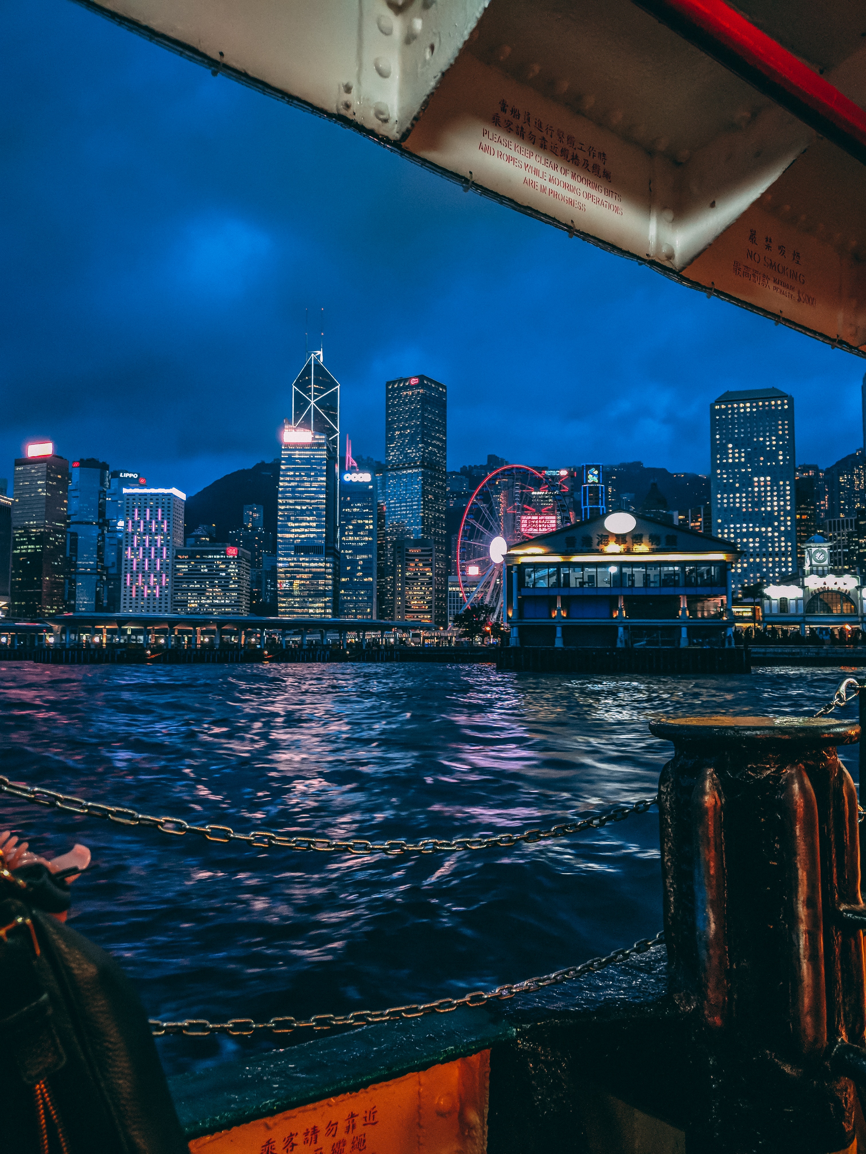
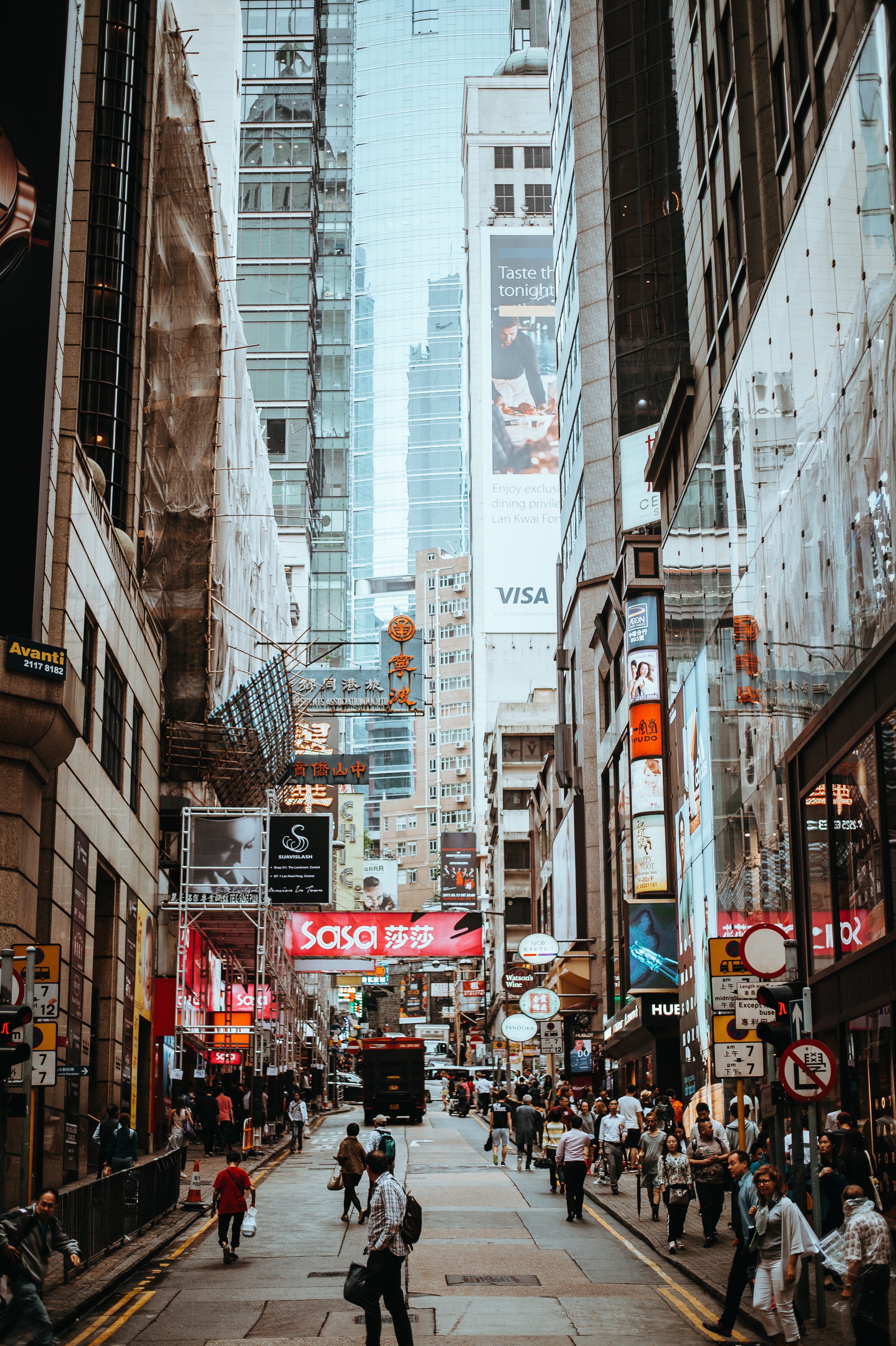
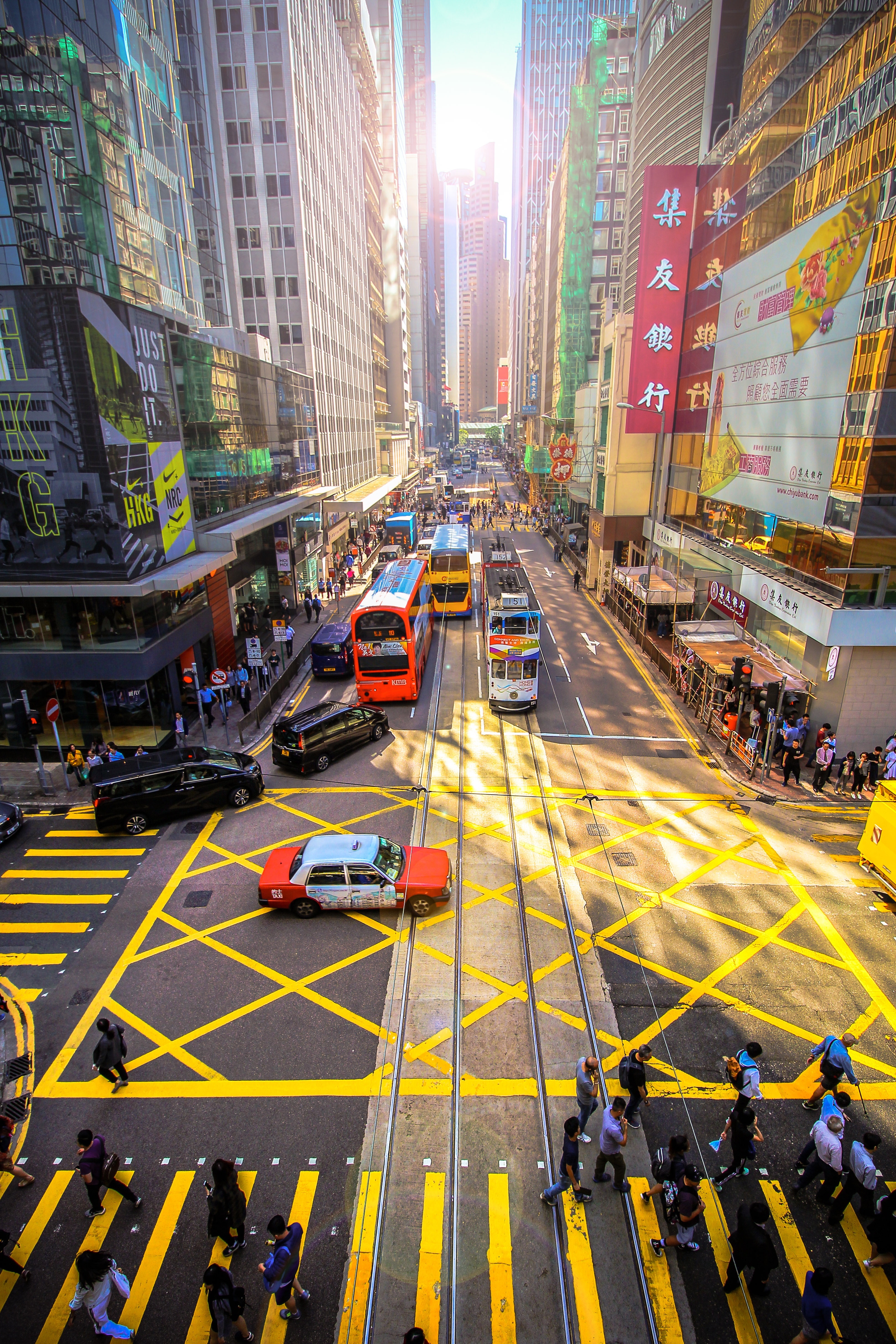
About Hong Kong
The Hong Kong Island skyline, with its ever-growing number of skyscrapers, speaks to ambition and money. Paris, London, even New York were centuries in the making, while Hong Kong's towers, bright lights, and glitzy shopping emporia weren't yet part of the urban scene when many of the young investment bankers who fuel one of the world's leading financial centers were born. Commerce is concentrated in the glittering high-rises of Central, tucked between Victoria Harbor and forested peaks on Hong Kong Island's north shore. While it's easy to think all the bright lights are the sum of today's Hong Kong, you need only walk or board a tram for the short jaunt west into Western to discover a side of Hong Kong that is more traditionally Chinese but no less high-energy. You'll discover the real Hong Kong to the east of Central, too, in Wan Chai, Causeway Bay, and beyond. Amid the residential towers are restaurants, shopping malls, bars, convention centers, a nice smattering of museums, and—depending on fate and the horse you wager on—one of Hong Kong's luckiest or unluckiest spots, the Happy Valley Racecourse. Kowloon sprawls across a generous swath of the Chinese mainland across Victoria Harbour from Central. Tsim Sha Tsui, at the tip of Kowloon peninsula, is packed with glitzy shops, first-rate museums, and eye-popping views of the skyline across the water. Just to the north are the teeming market streets of Mong Kok and in the dense residential neighborhoods beyond, two of Hong Kong's most enchanting spiritual sights, Wong Tai Sin Temple and Chi Lin Nunnery. As you navigate this huge metropolis (easy to do on the excellent transportation network), keep in mind that streets are usually numbered odd on one side, even on the other. There's no baseline for street numbers and no block-based numbering system, but street signs indicate building numbers for any given block.
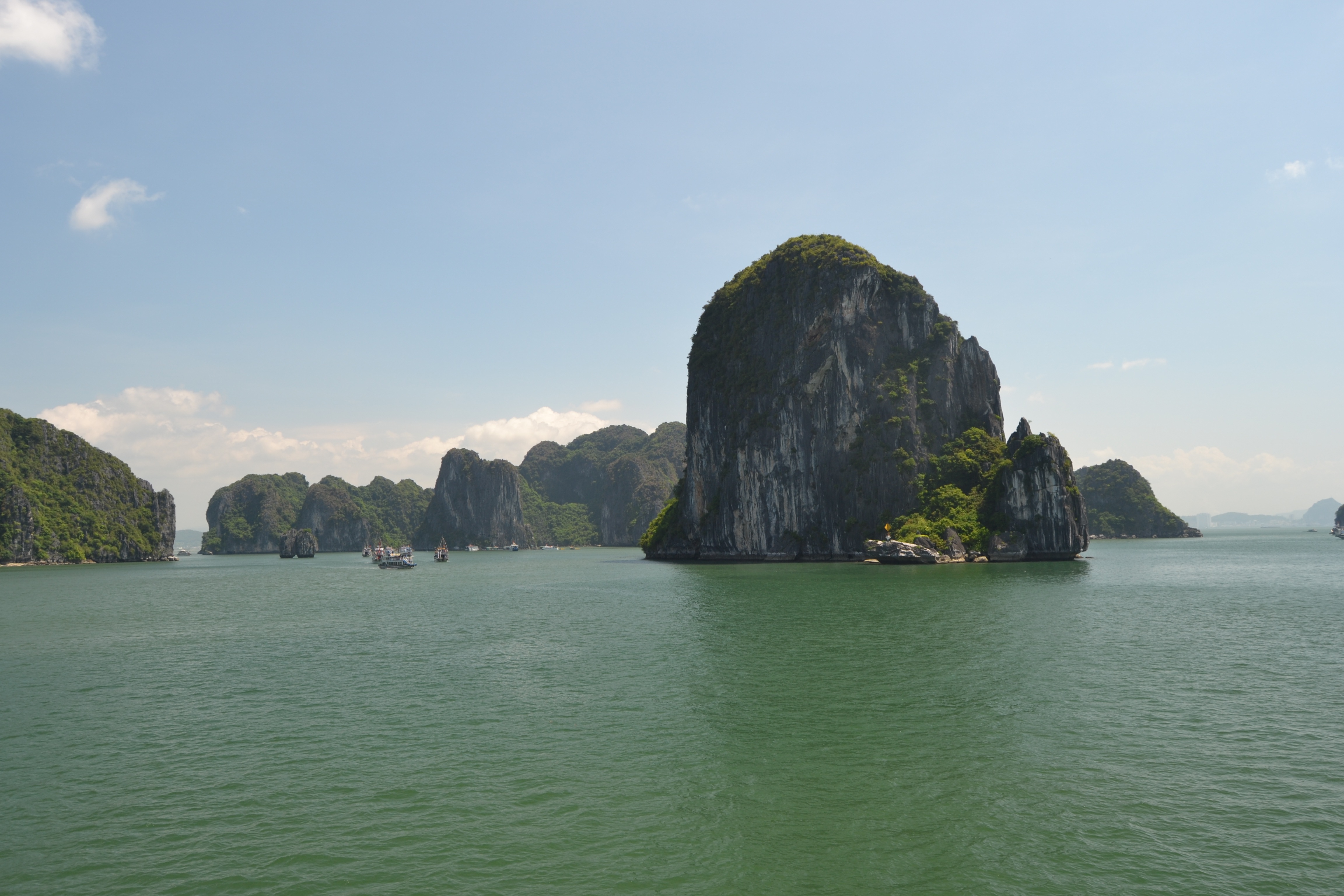
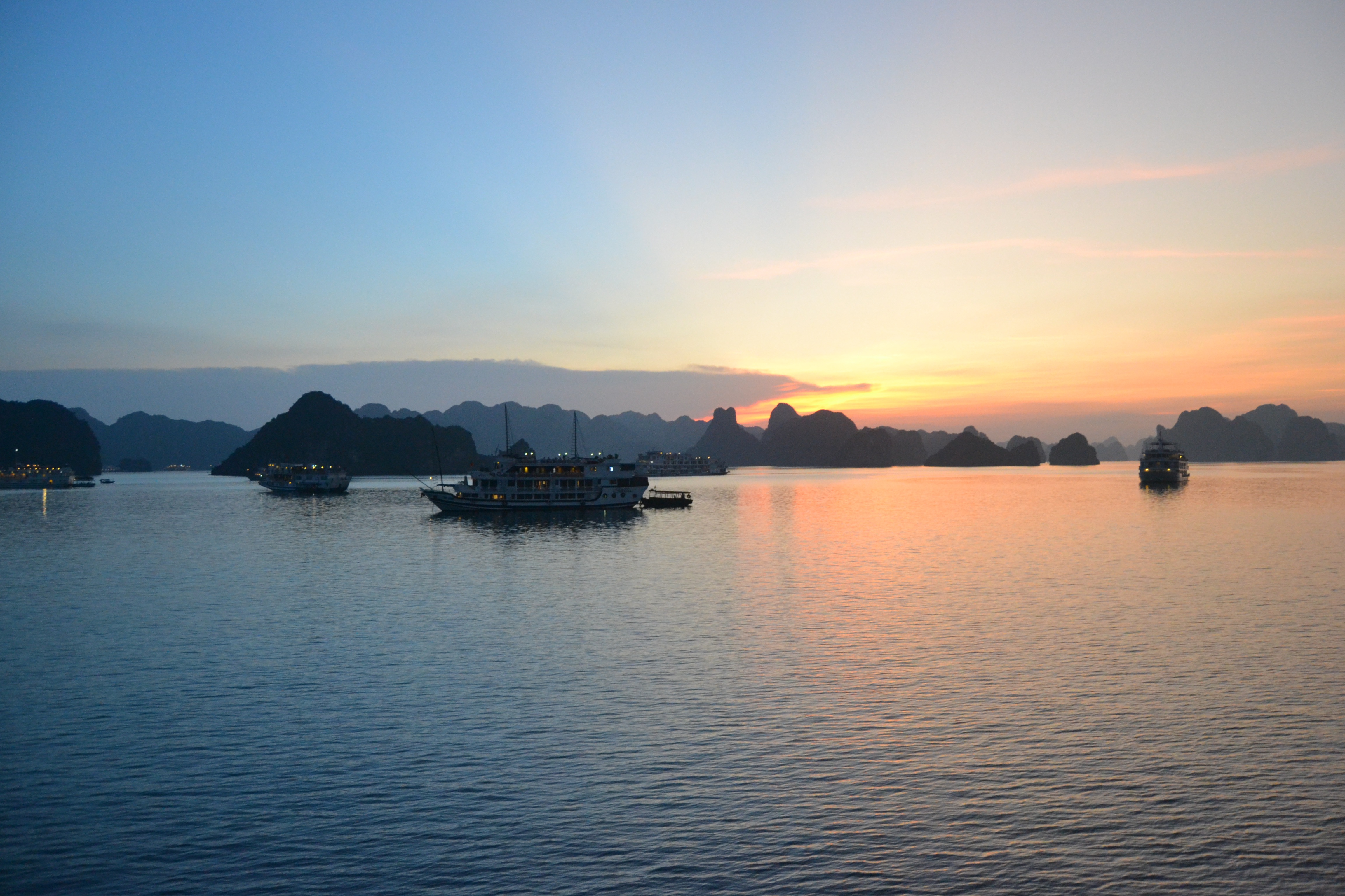
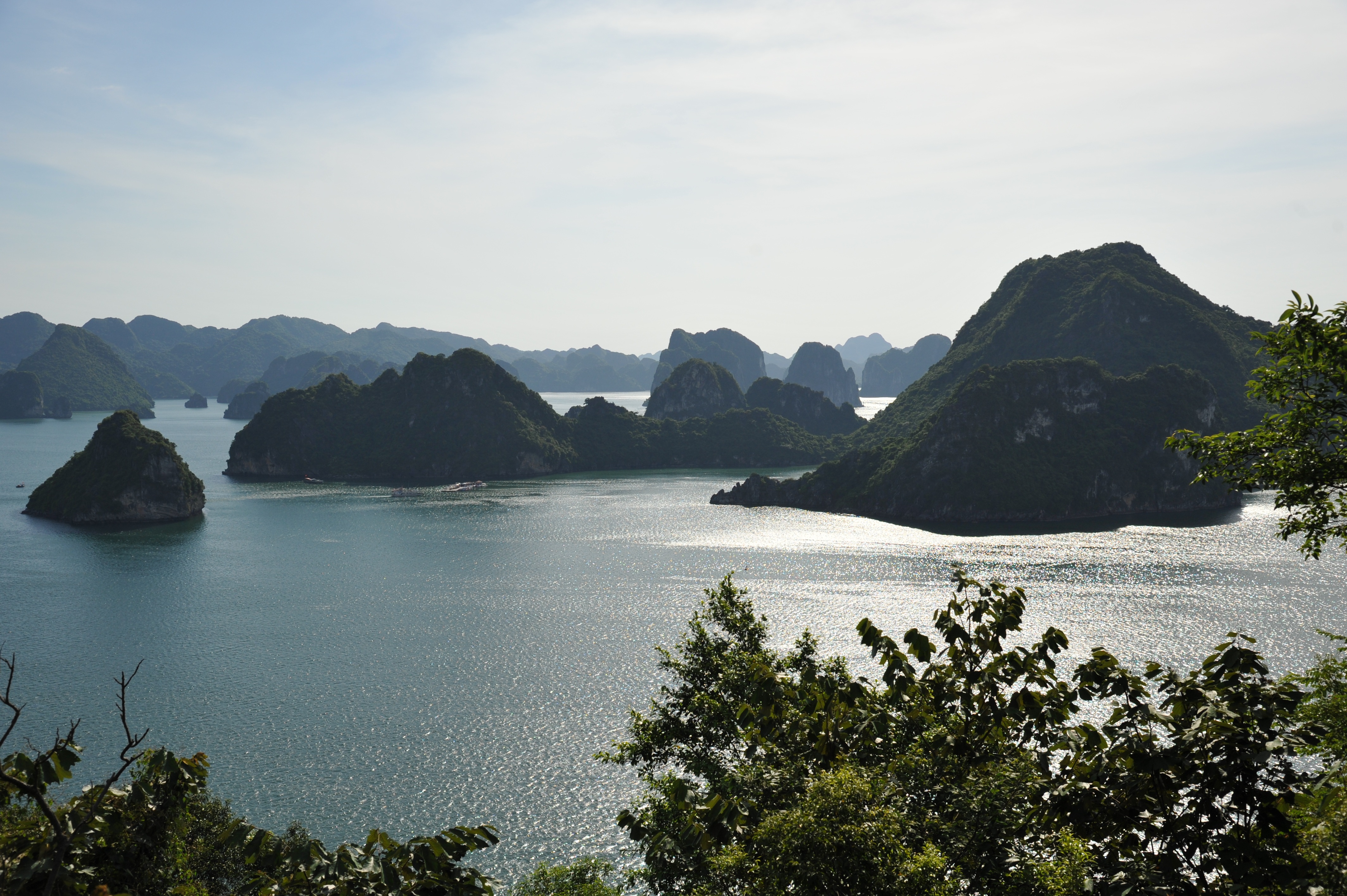
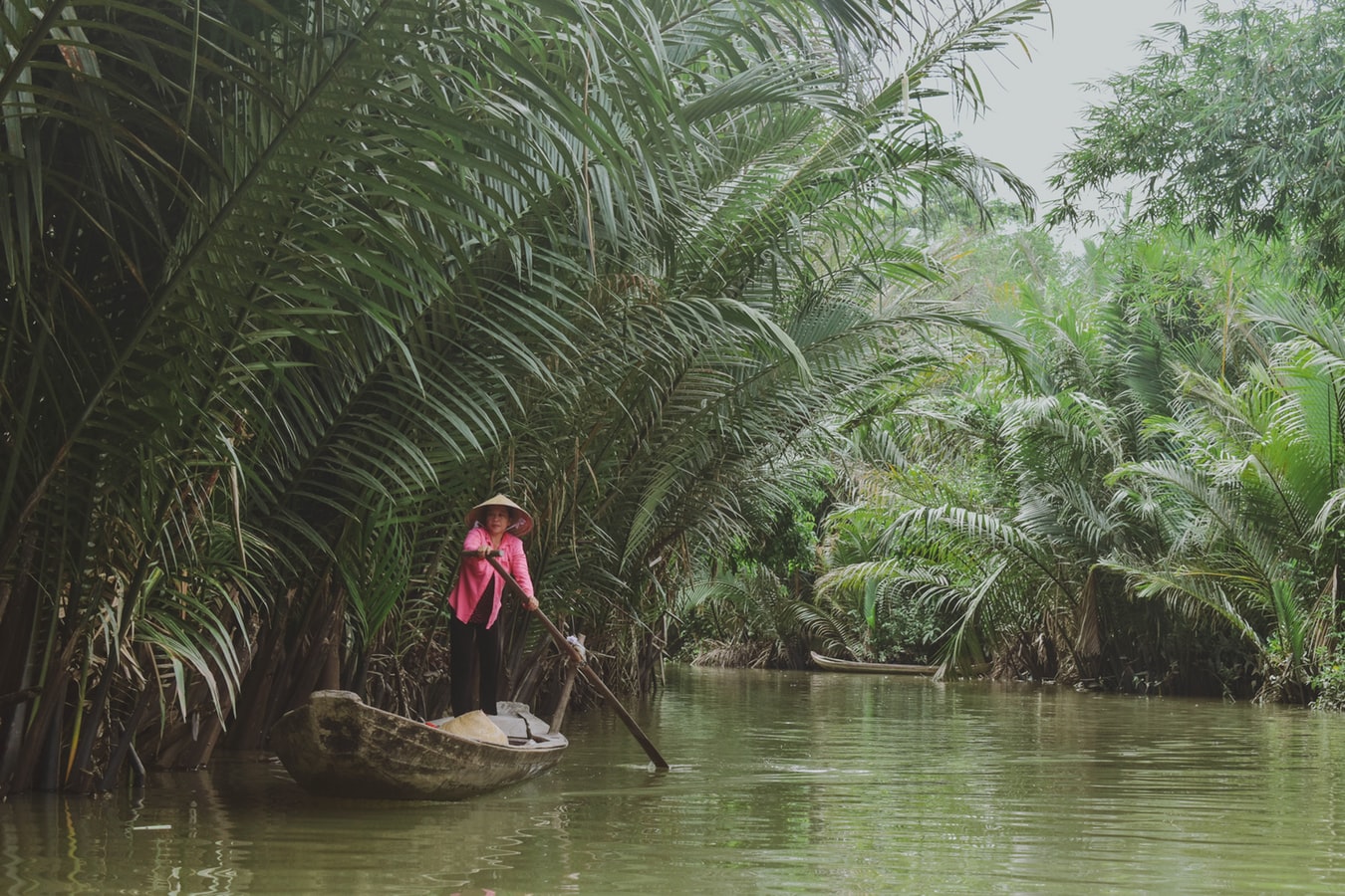
About Ha Long Bay
A visit to the north is not complete without a trip to Halong Bay, where placid waters give way to more than 3,000 limestone karsts and wind-sculpted limestone formations that jut from foggy lagoons. Dotting the bay are tiny islands bordered by white sandy coves and hidden caves, adding to the majestic landscape of this UNESCO World Heritage Site. Adding to this naturalist’s dream is the biodiversity of islets, grottos, and Cat Ba Island National Park. The bay, however, shows tourism’s impact: the clearing of mangrove forests to make way for jetties and piers, marine life threatened by game fishing, and garbage from passenger boats and fishing villages washed up on the shores.Beyond its geological uniqueness are activities like hiking, kayaking, rock climbing, or exploring one of the many floating villages where fishermen bring in their daily catch. The downside to all this allure is the large number of unlicensed boats it draws to the bay each day.Boat trips out onto the bay are the main tourism stock in trade farther north, but a more multifaceted side of the area can be experienced at Cat Ba Island. The largest island in Halong Bay, Cat Ba is very much its own entity. Its national park offers incredible biodiversity, with more than a thousand species of plants having been recorded here. Animal life is slightly thinner on the ground, but alert visitors may spy inhabitants such as the endangered golden-headed langur, wild boar, deer, civets, and several species of squirrel. Trekking through the wilderness is a highlight with a number of fascinating trails to follow.Cat Ba Island has also become a firm favorite with the adventure sports set. Indeed, along with Railay Beach in Thailand, it is recognized as one of the top spots in the region for rock climbing. Other outdoor pursuits include sailing and kayaking around the karsts. Although Halong Bay has arguably been tainted by over-exposure, Bai Tu Long Bay farther east toward China, retains all the majesty of Vietnam’s premier bucket-list natural attraction but sees a fraction of the traffic of its immediate neighbor to the west. Here, visitors will find islands of substantial size with deserted beaches and untamed jungle. Halong Bay's 3,000 islands of dolomite and limestone cover a 1,500-square-km (580-square-mile) area, extending across the Gulf of Tonkin nearly to the Chinese border. According to legend, this breathtaking land- and seascape was formed by a giant dragon that came barreling out of the mountains toward the ocean—hence the name (Halong translates into "descent of the dragon"). Geologists are more likely to attribute the formations to sedimentary limestone that formed here between 300 and 500 million years ago, in the Paleozoic Era. Over millions of years water receded and exposed the limestone to wind, rain, and tidal erosion.Today the limestone formations are exposed to hordes of tourists—but don't let that discourage you. Hundreds of fishing trawlers and tour boats share space on these crystal waters, yet there seems to be room for everyone. Most people use the main population center, Halong City, as a base from which to venture into the bay. Although it's now officially one municipality, Halong City was, until 1996, two separate towns: Bai Chay is now Halong City West, where Halong Road winds its way around the coast and past the lifeless central beach; Hon Gai is the grimier Halong City East, where a coal transportation depot dominates the center of town and covers nearby roads and buildings with a sooty film. Locals still refer to the towns by their old names, but they are now inexorably lassoed together by a bridge. Boat trips through Halong Bay are the main attraction. Little of the majesty of this region can be found in the city, so head out onto the water and start exploring. Countless 10- and 30-foot fishing boats have been converted into Halong Bay's formidable tourist-boat fleet. Hotels or travel agencies in Halong City or Hanoi can arrange boat trips for you (often they are part of organized tours from Hanoi). It is still possible to go down to the wharf and bargain yourself onto a boat for the day, but you are likely to be charged (sometimes significantly) more than you would pay for a prebooked tour, so this is not advised. Self-sufficient travelers have fallen victim to the old bait-and-switch: they've arranged a next-day boat tour with local fishermen, only to be told in no uncertain terms the following morning that they could not board their chosen boat, but they could take a different one for quite a bit more money. You may have no choice in the end. Usually travel agencies, however, have their tried-and-true favorites.
About Da Nang
Da Nang is the third largest city in Vietnam with the land area of 1283 square kilometre and the population of approximately 1million people. Da Nang is growing into one of the most organized urban area, with attractive beach front villas on the one side and Han River flowing on the other. Of the few attractions that belong to the city, Museum of Cham stands out with its rich collection of Cham artefacts. For those who crave for more outdoors activities, My Khe beach is a good place to spend time, either by yourself or with your loved ones. Da Nang is in close proximity to Hue- 3 hours North and Hoi An- 30 minutes south, which makes it a perfect stop point for those who need a break from touristy areas. Hue was once the Royal Capital of Viet Nam. The city represents the outstanding demonstration of the power of the vanished Vietnamese feudal empire, including a complex of monuments, tombs and pagodas that attract tourists coming from all over the world. Hoi An has to this days well preserved its most sacred treasure, the centuries-old architecture. The town used to harbour foreign traders back in the 17-18th, and once is an important heavily-frequented trading port in Southeast Asia.
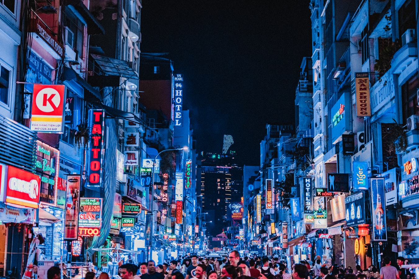
About Ho Chi Minh City
Romantically referred to by the French as the Pearl of the Orient, Ho Chi Minh City today is a super-charged city of sensory overload. Motorbikes zoom day and night along the wide boulevards, through the narrow back alleys and past vendors pushing handcarts hawking goods of all descriptions. Still called Saigon by most residents, this is Vietnam's largest city and the engine driving the country's current economic resurgence, but despite its frenetic pace, it's a friendlier place than Hanoi and locals will tell you the food—simple, tasty, and incorporating many fresh herbs—is infinitely better than in the capital.This is a city full of surprises. The madness of the city's traffic—witness the oddball things that are transported on the back of motorcycles—is countered by tranquil pagodas, peaceful parks, quirky coffee shops, and whole neighborhoods hidden down tiny alleyways, although some of these quiet spots can be difficult to track down. Life in Ho Chi Minh City is lived in public: on the back of motorcycles, on the sidewalks, and in the parks. Even when its residents are at home, they're still on display. With many living rooms opening onto the street, grandmothers napping, babies being rocked, and food being prepared, are all in full view of passersby.Icons of the past endure in the midst of the city’s headlong rush into capitalism. The Hotel Continental, immortalized in Graham Greene's The Quiet American, continues to stand on the corner of old Indochina's most famous thoroughfare, the rue Catinat, known to American G.I.s during the Vietnam War as Tu Do (Freedom) Street and renamed Dong Khoi (Uprising) Street by the Communists. The city still has its ornate opera house and its old French city hall, the Hôtel de Ville. The broad colonial boulevards leading to the Saigon River and the gracious stucco villas are other remnants of the French colonial presence. Grisly reminders of the more recent past can be seen at the city's war-related museums. Residents, however, prefer to look forward rather than back and are often perplexed by tourists' fascination with a war that ended 40 years ago.The Chinese influence on the country is still very much in evidence in the Cholon district, the city's Chinatown, but the modern office towers and international hotels that mark the skyline symbolize Vietnam's fixation on the future.
About Laem Chabang
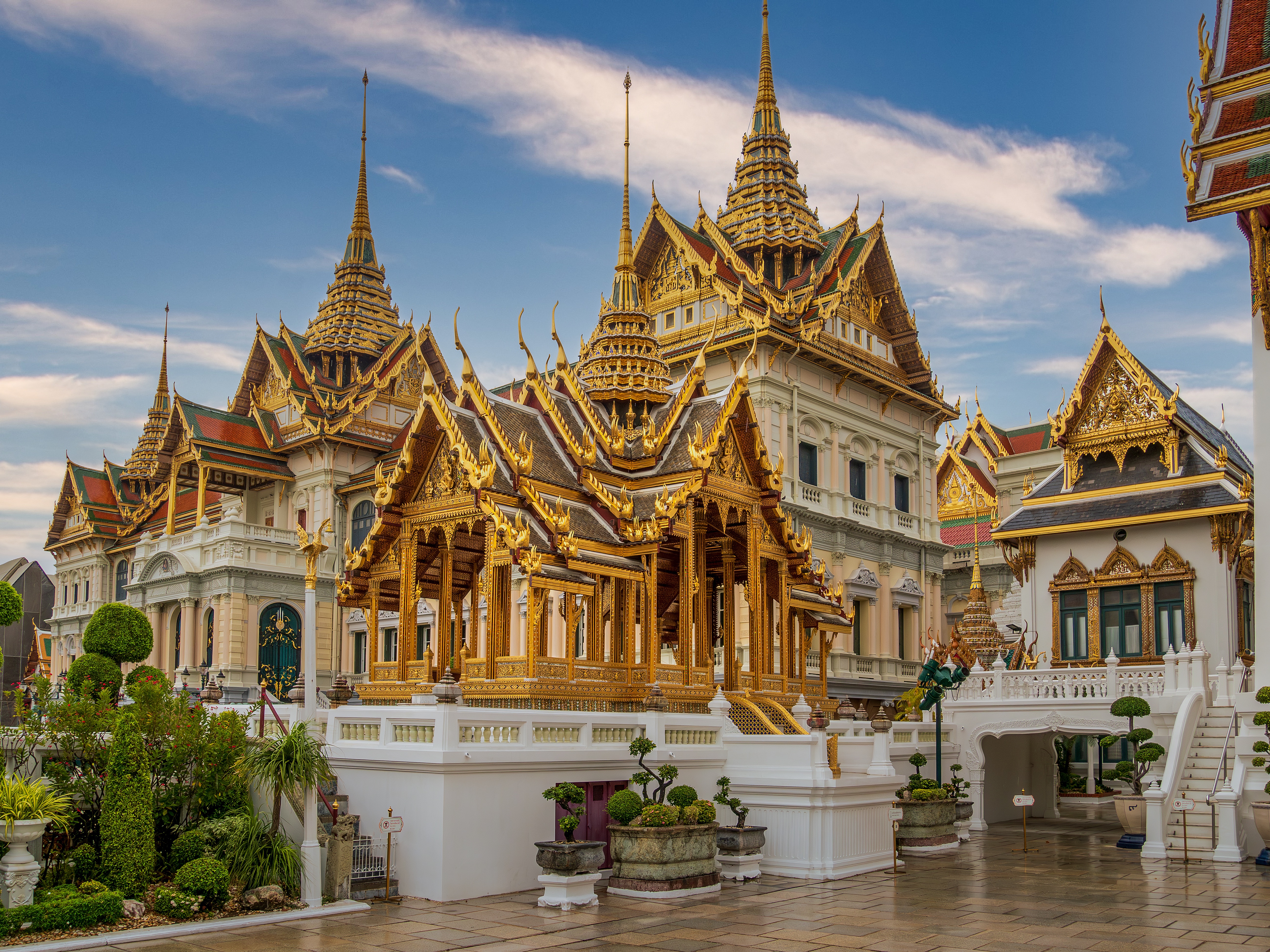
There are two Bangkoks, the ancient soul of Thailand with its long and fascinating history and the frantic, modern metropolis that embraces the latest trends both Eastern and Western. The two blend together remarkably well—even the most jarring juxtapositions of old and new somehow make sense. Bangkok is not only the biggest city in Thailand, but also the most mesmerizing, with some of the country's most beautiful temples and shrines. The city's energy is palpable, especially at night, when traffic opens up a bit, its famous markets get going, and everything seems lit up—from its proudest monuments to its seediest streets. When Ayutthaya was besieged and pillaged by the Burmese in 1766, Thonburi became Thailand's capital. The Thais call Bangkok Krung Thep (City of Angels), and in 1782 King Rama I moved his capital here, just across the Chao Praya River. Laem Chabang is approximately 130 km (81 mi) from Bangkok.
About Laem Chabang
There are two Bangkoks, the ancient soul of Thailand with its long and fascinating history and the frantic, modern metropolis that embraces the latest trends both Eastern and Western. The two blend together remarkably well—even the most jarring juxtapositions of old and new somehow make sense. Bangkok is not only the biggest city in Thailand, but also the most mesmerizing, with some of the country's most beautiful temples and shrines. The city's energy is palpable, especially at night, when traffic opens up a bit, its famous markets get going, and everything seems lit up—from its proudest monuments to its seediest streets. When Ayutthaya was besieged and pillaged by the Burmese in 1766, Thonburi became Thailand's capital. The Thais call Bangkok Krung Thep (City of Angels), and in 1782 King Rama I moved his capital here, just across the Chao Praya River. Laem Chabang is approximately 130 km (81 mi) from Bangkok.
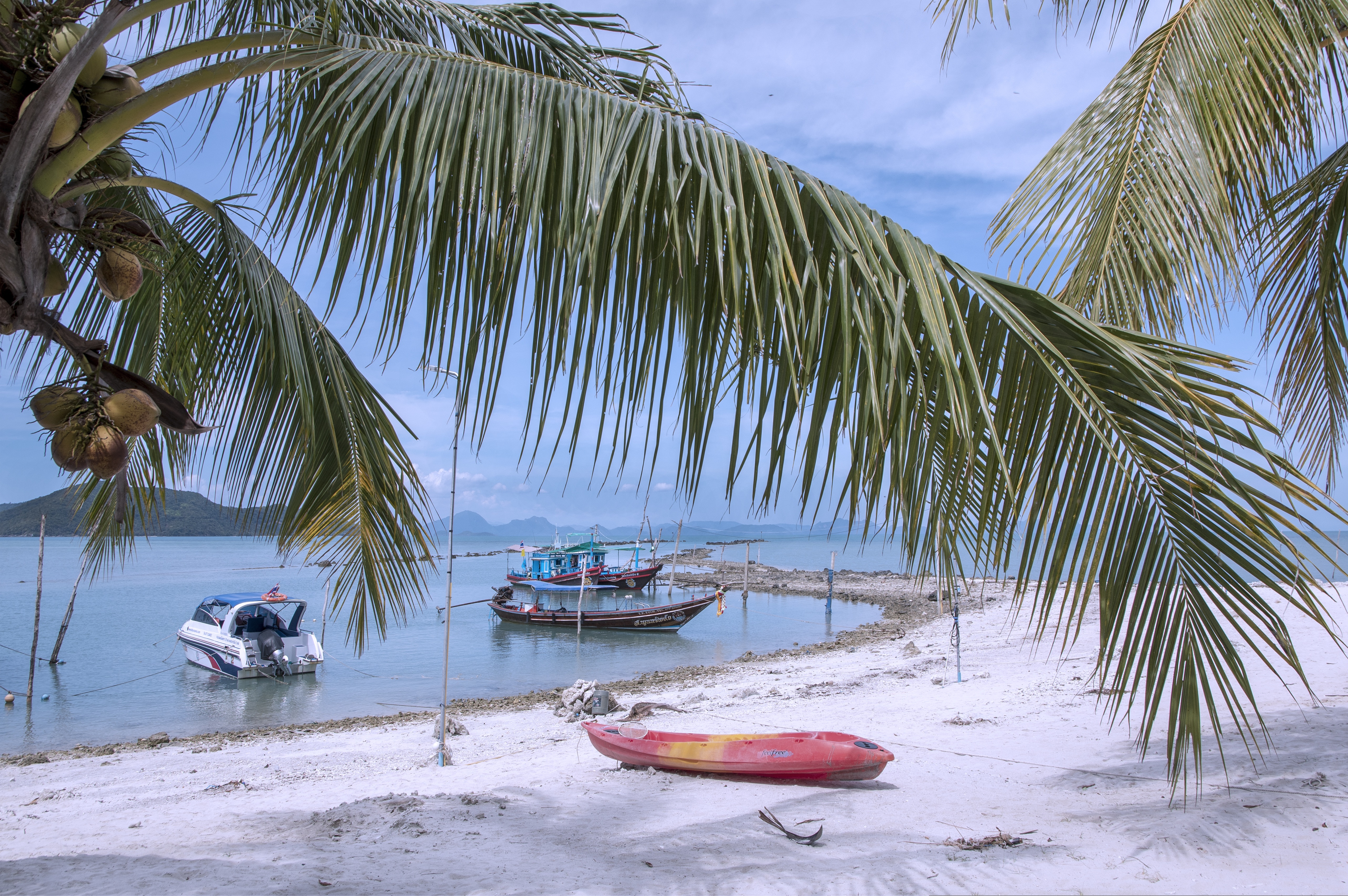
About Ko Samui
Koh Samui is the most popular tourist destination on the Western Gulf coast, which isn't surprising, considering the island's gorgeous beaches, perfect weather, and sparkling blue, almost turquoise, water. Koh Samui has seen rapid development since the 1990s, and you'll encounter hotels in all price ranges.Koh Samui is half the size of Phuket, so you could easily drive around it in a day. But Koh Samui is best appreciated by those who take a slower, more casual approach. Most people come for the sun and sea, so they head straight to their hotel and rarely venture beyond its beach. But it's worth exploring beyond your lodging. Every beach has its own character, and you might find the perfect one for you. One beach many visitors find to their liking is Chawaeng. On Koh Samui's east coast, this stretch of glistening white sand is divided into two main sections—Chawaeng Yai (yai means "big") and Chawaeng Noi (noi means "little"). You'll find the greatest variety of hotels, restaurants, and bars here. Despite the crowds, Chawaeng is no Pattaya or Patong—the mood is very laid-back. A rocky headland separates Chawaeng Lamai Beach, whose clear water and long stretch of sand were the first place on the island to attract developers. More budget accommodations are available here than in Chawaeng, and there are some happening nightclubs.On the west coast of Koh Samui, Na Thon is the island's primary port and the spot where ferries arrive from the mainland. It's home to the island's governmental offices, including the Tourism Authority of Thailand, and there are banks, foreign-exchange booths, travel agents, shops, restaurants, and cafés by the ferry pier. A few places rent rooms, but there's really no reason to stay here—nicer accommodations can be found a short songthaew ride away.To the north and east of Na Thon lie a few beaches worthy of exploration. Laem Yai, 5 km (3 miles) north, has great seafood. East of here, a small headland separates two low-key communities on the northern shore, Mae Nam and Bophut Beach. Mae Nam is also the departure point for boats bound for Koh Phangan and Koh Tao . Just south of the Samui's northeastern tip you'll find sandy Choengmon Beach, a good area for swimming that's not overdeveloped.
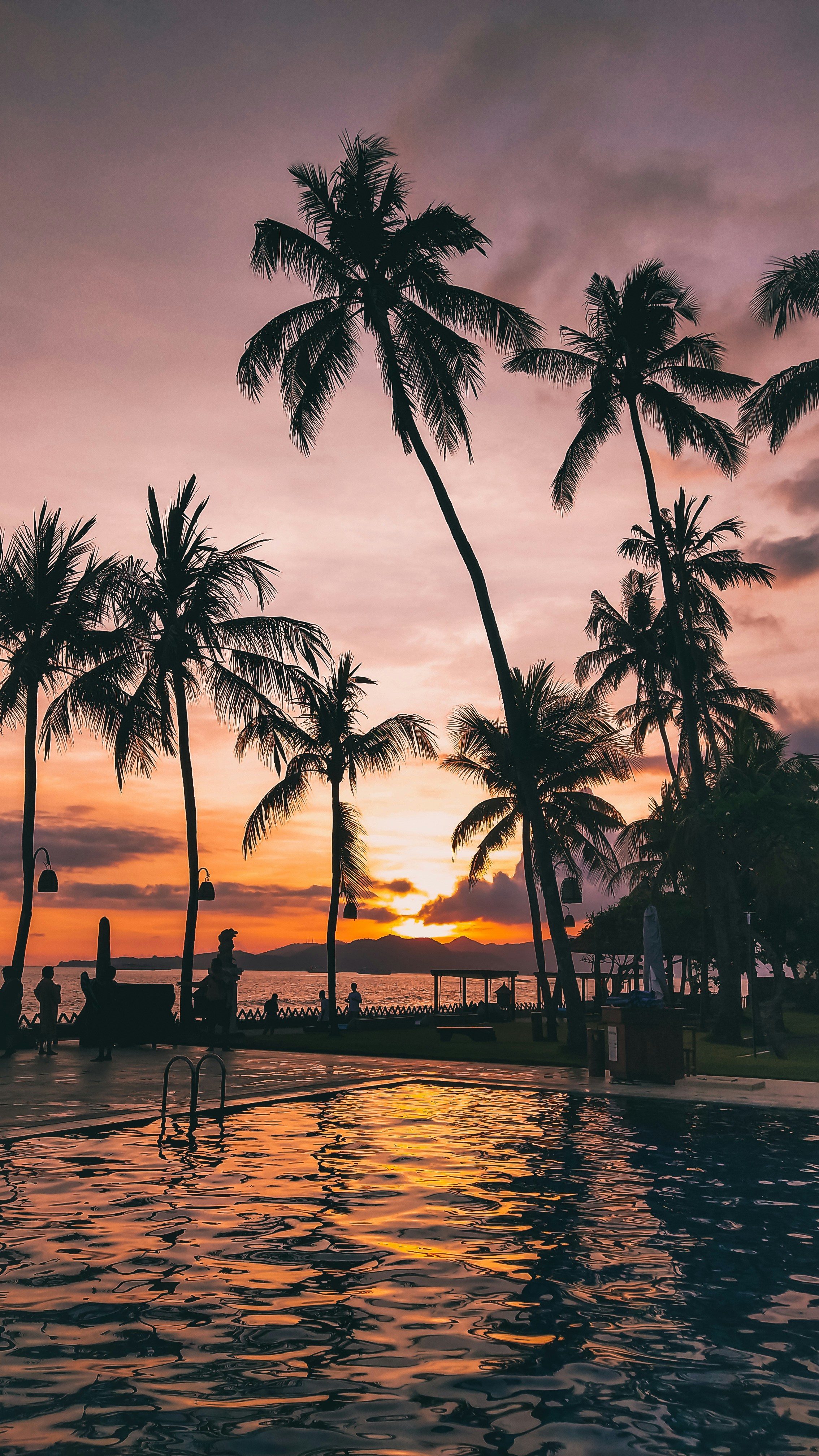
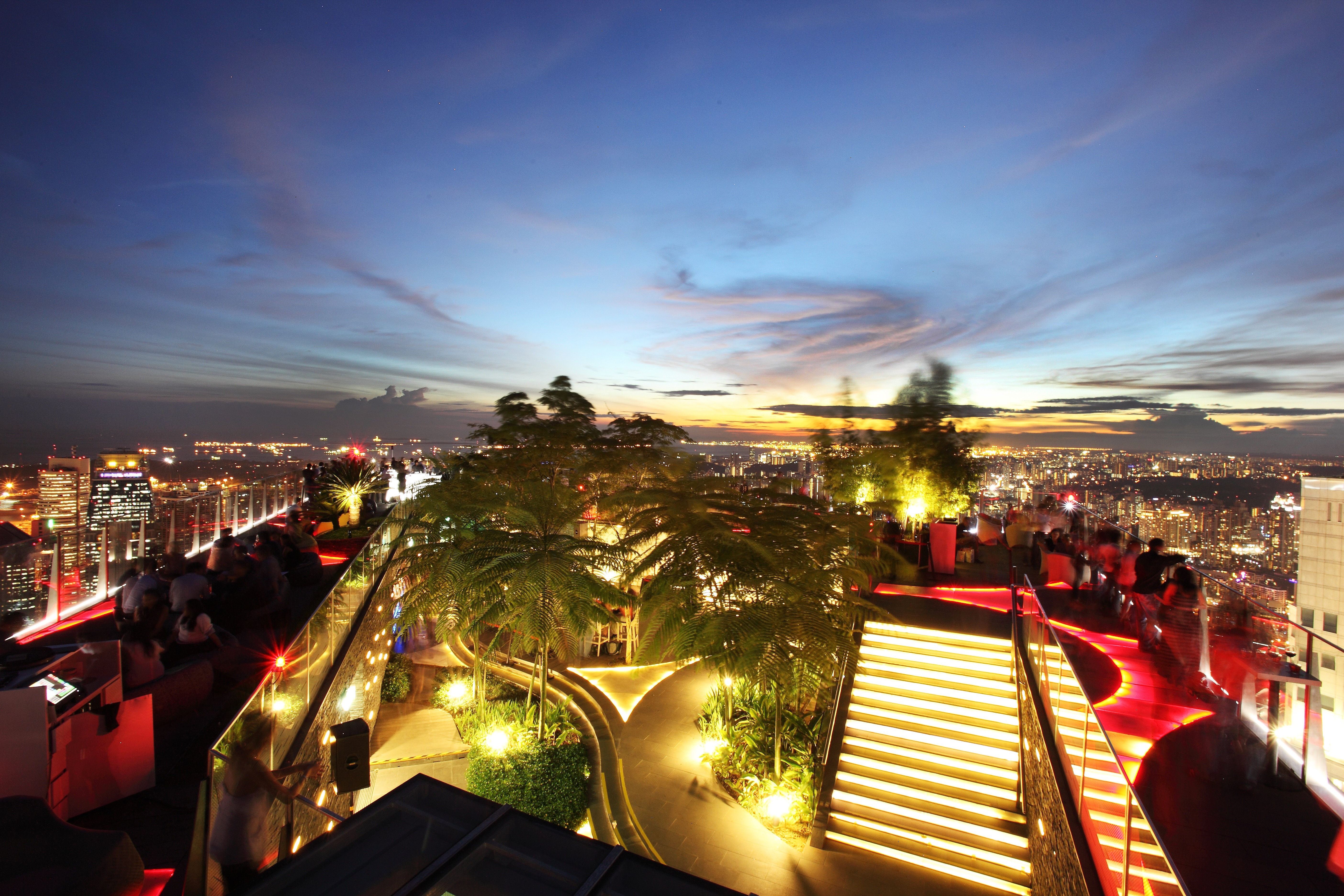
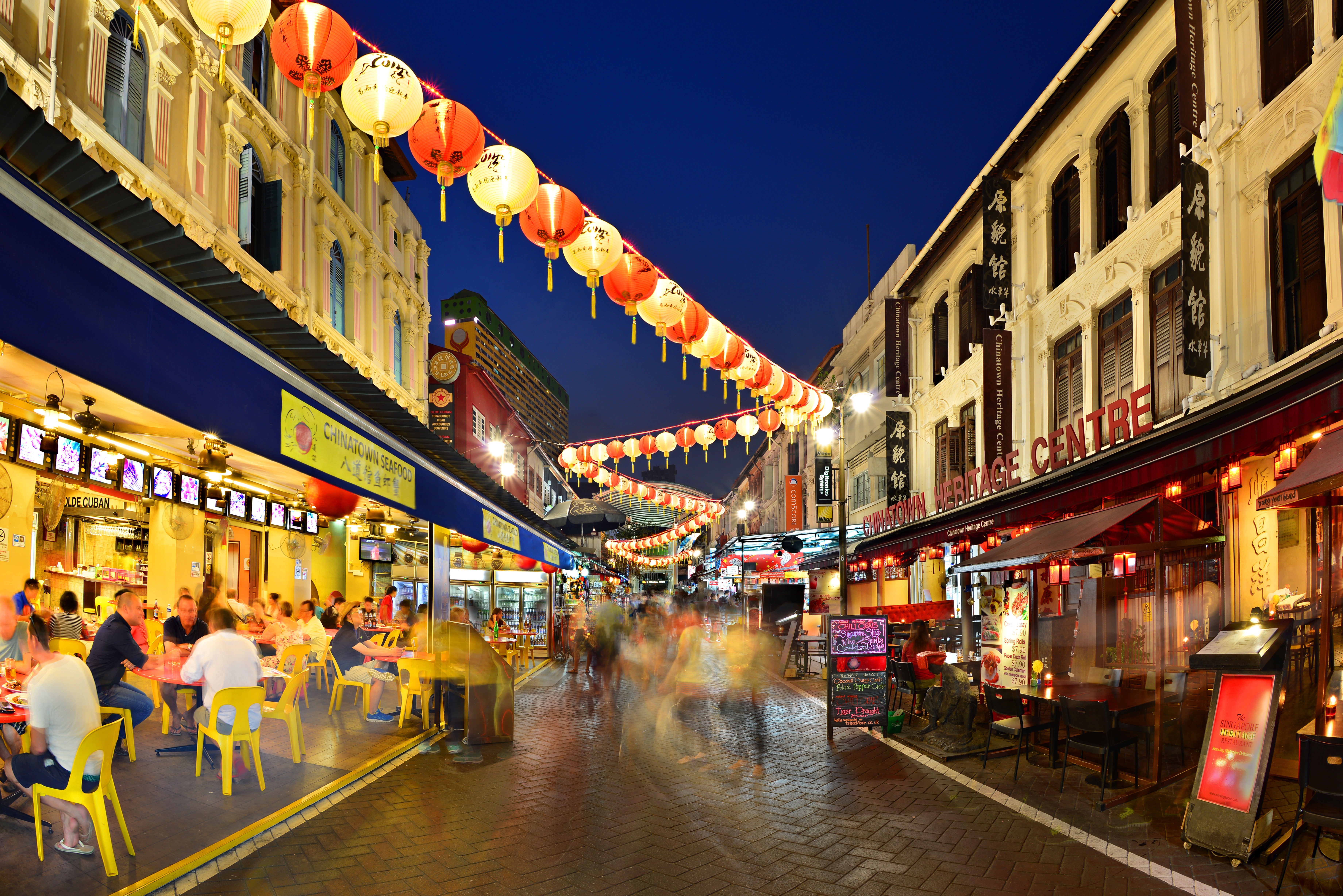
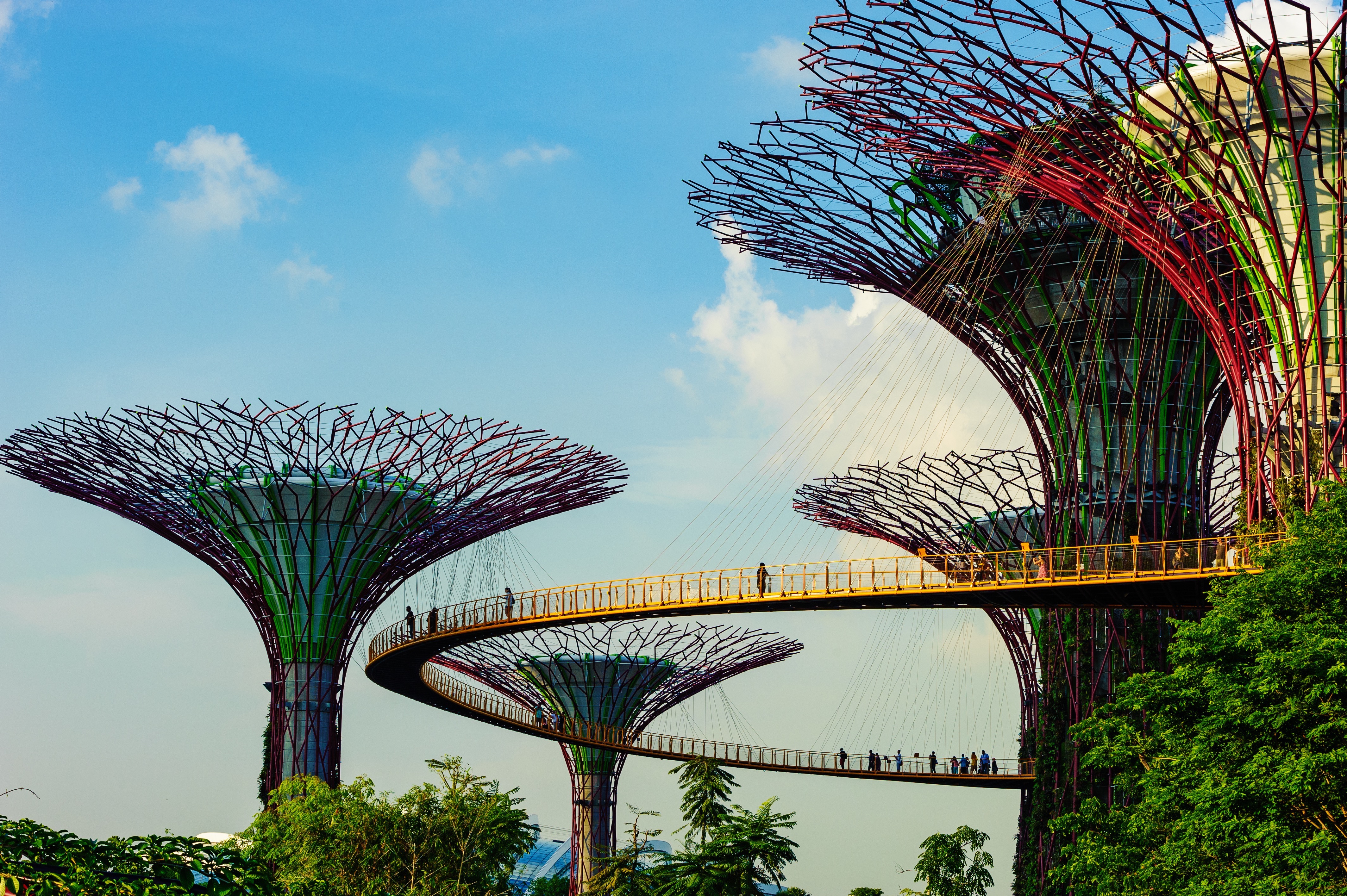
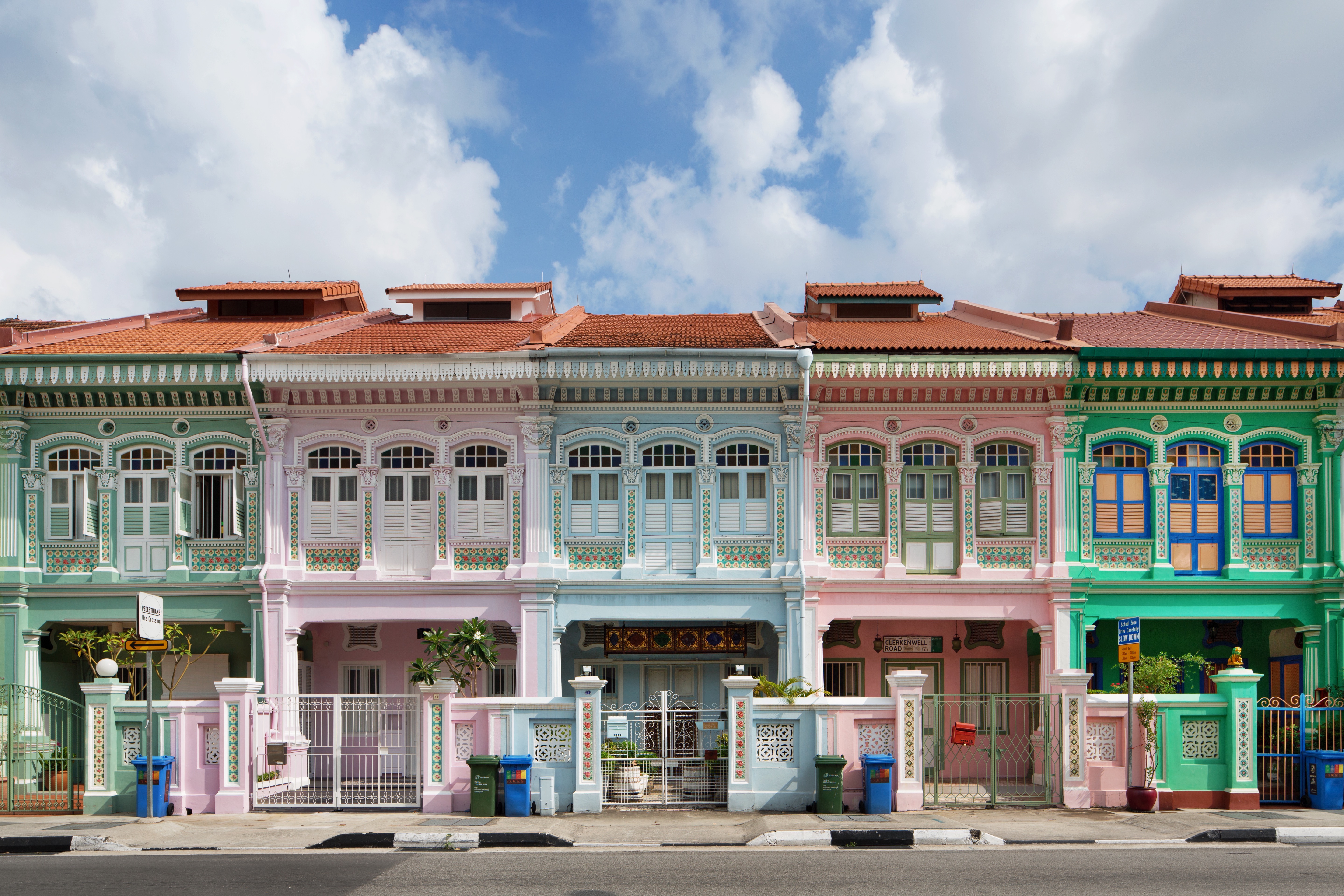
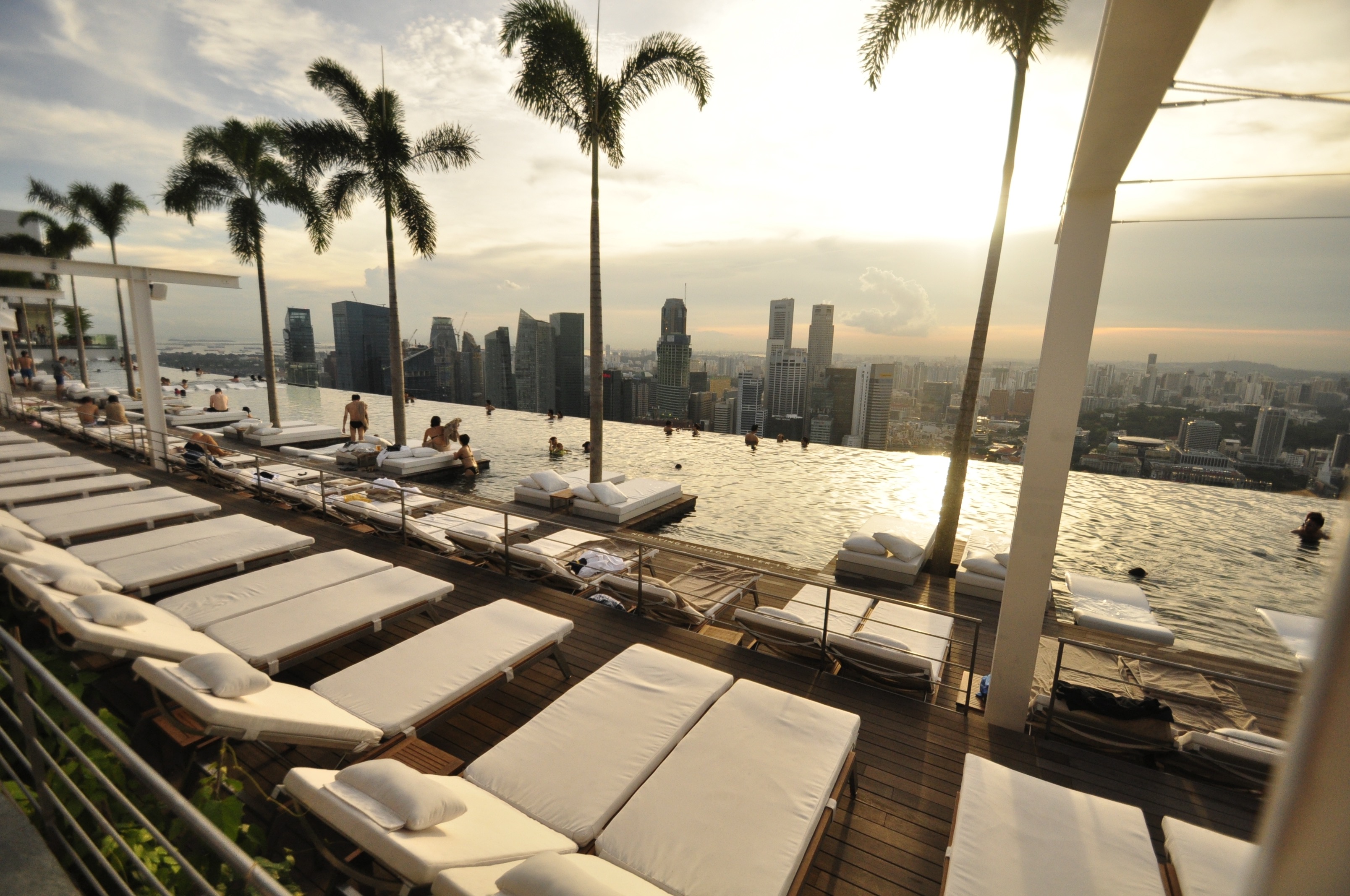
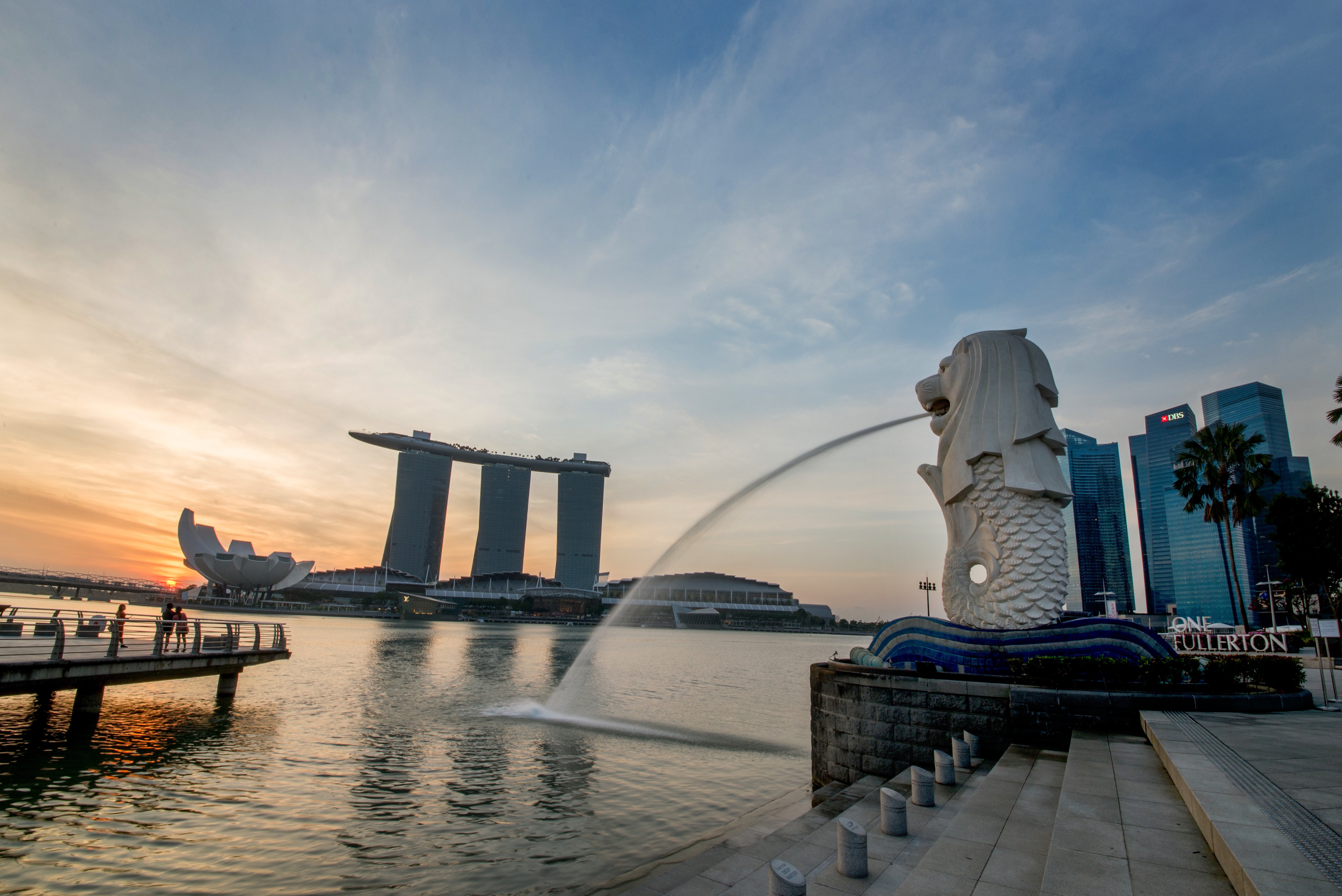
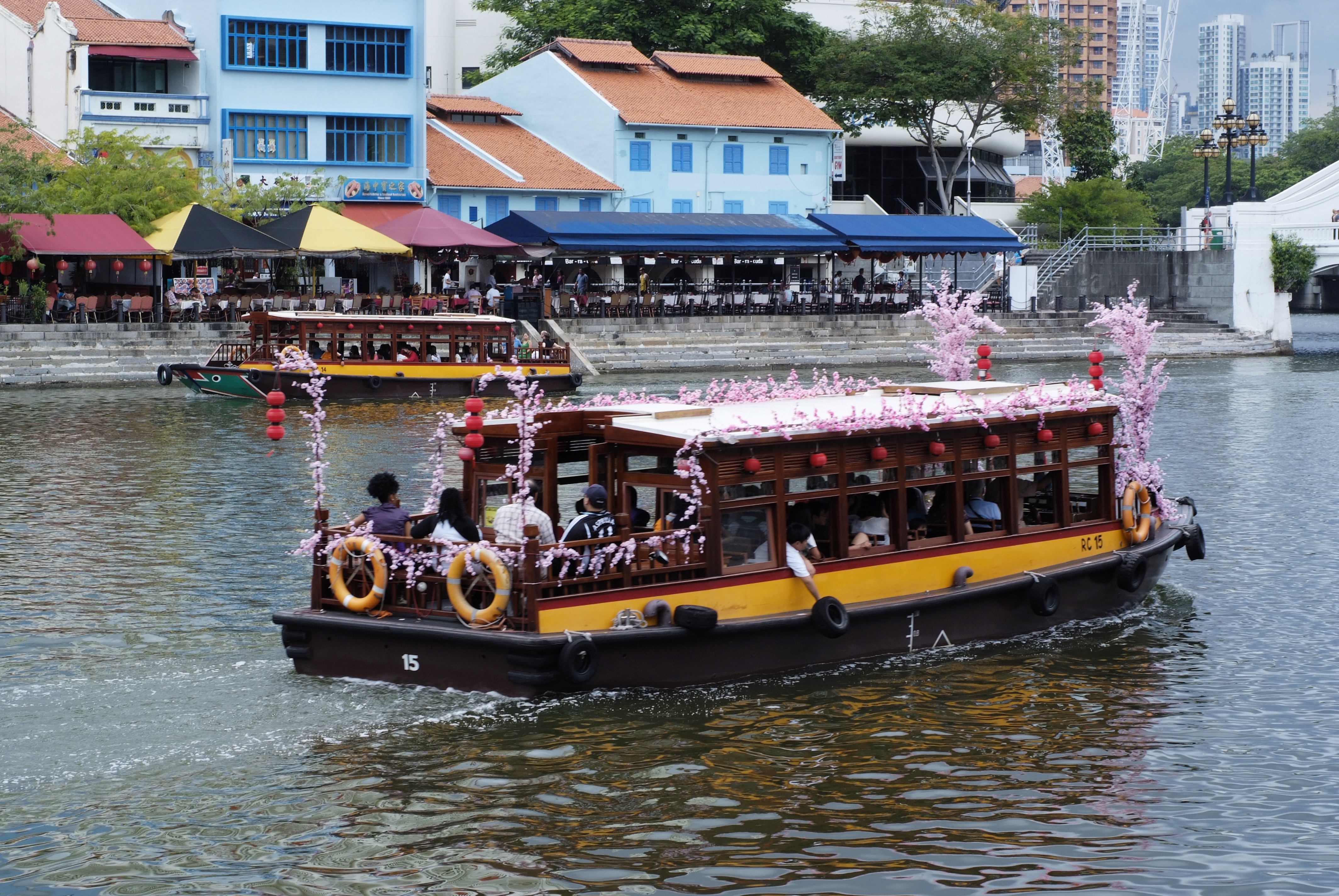
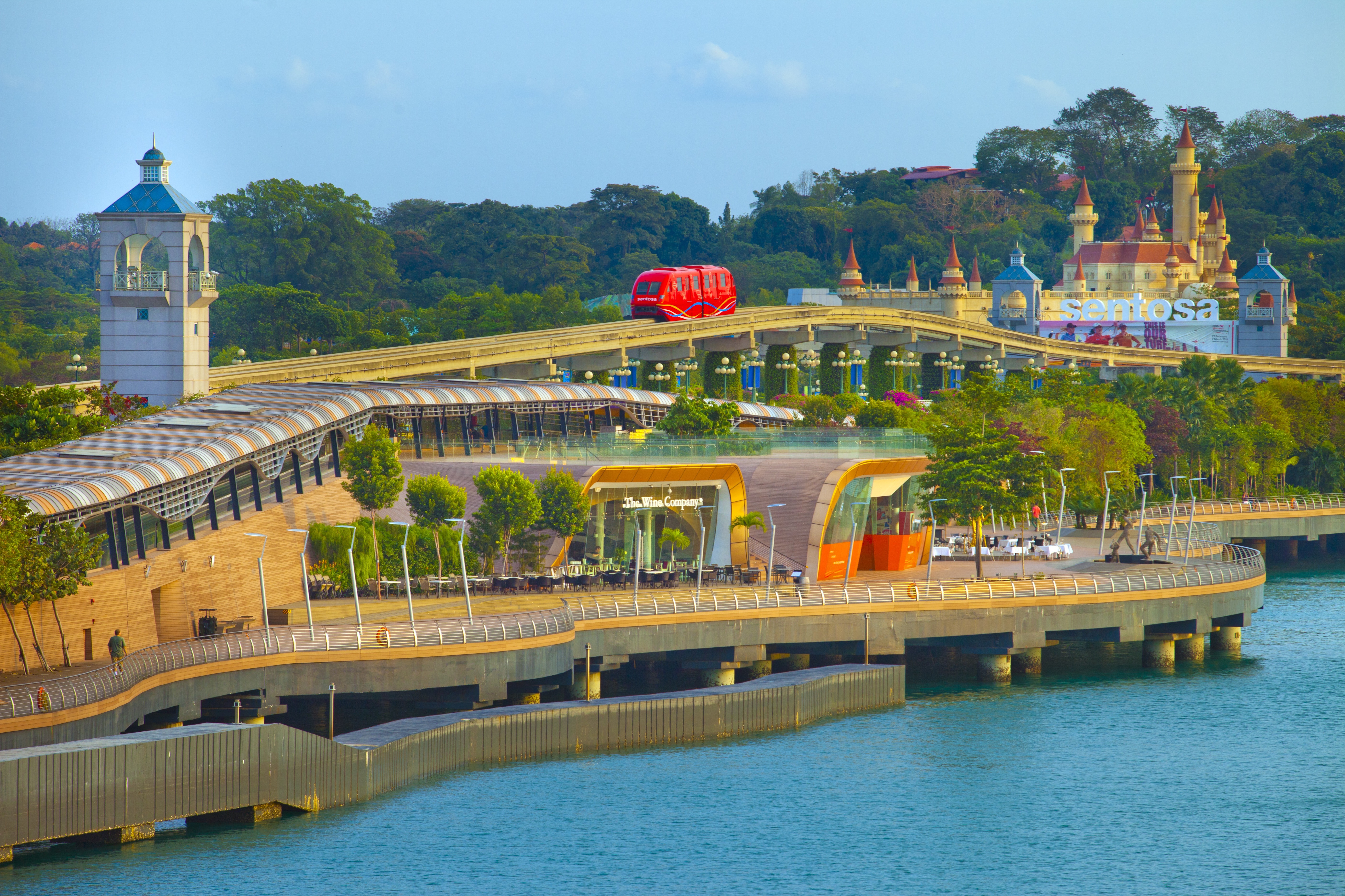
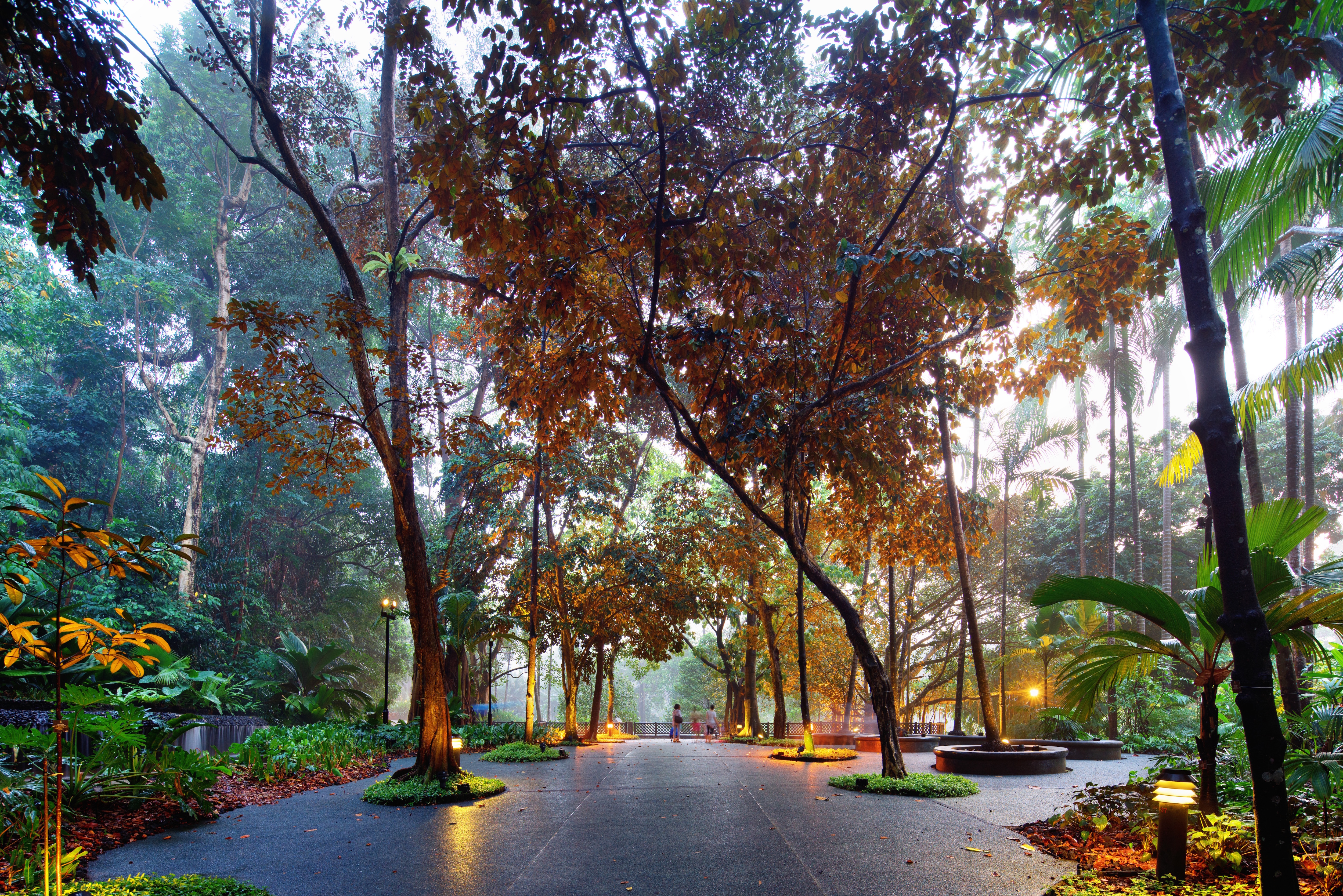
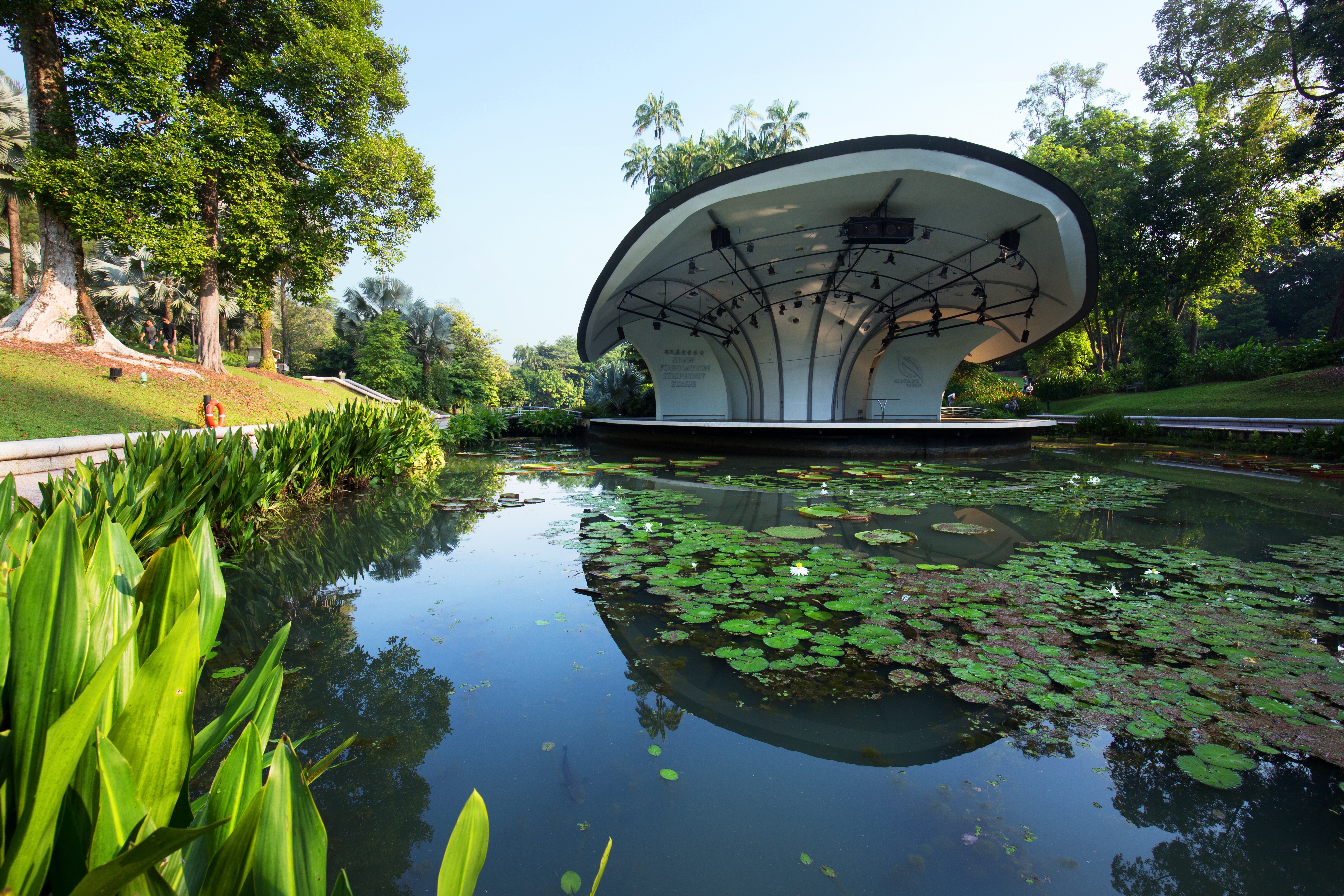
About Singapore
The main island of Singapore is shaped like a flattened diamond, 42 km (26 miles) east to west and 23 km (14 miles) north to south. Near the northern peak is the causeway leading to West Malaysia—Kuala Lumpur is less than four hours away by car. It is at the southern foot where you will find most of the city-state’s action, with its gleaming office towers, working docks, and futuristic "supertrees," which are solar-powered and serve as vertical gardens. Offshore are Sentosa and over 60 smaller islands, most uninhabited, that serve as bases for oil refining or as playgrounds and beach escapes from the city. To the east is Changi International Airport, connected to the city by metro, bus, and a tree-lined parkway. Of the island's total land area, more than half is built up, with the balance made up of parkland, farmland, plantations, swamp areas, and rain forest. Well-paved roads connect all parts of the island, and Singapore city has an excellent, and constantly expanding, public transportation system. The heart of Singapore's history and its modern wealth are in and around the Central Business District. The area includes the skyscrapers in the Central Business District, the 19th-century Raffles Hotel, the convention centers of Marina Square, on up to the top of Ft. Canning. Although most of old Singapore has been knocked down to make way for the modern city, most colonial landmarks have been preserved in the CBD, including early-19th-century buildings designed by the Irish architect George Coleman.
DETAILS
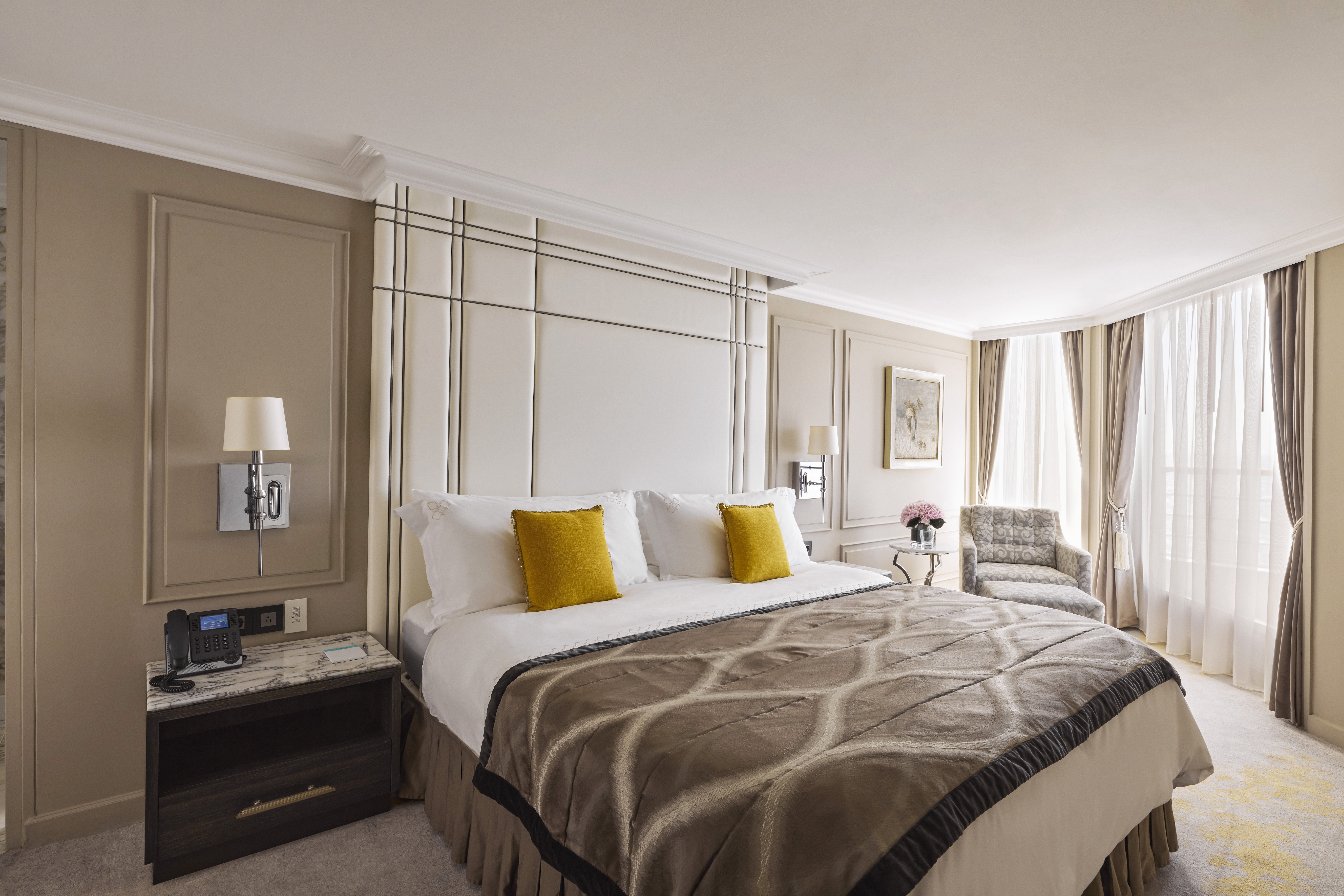
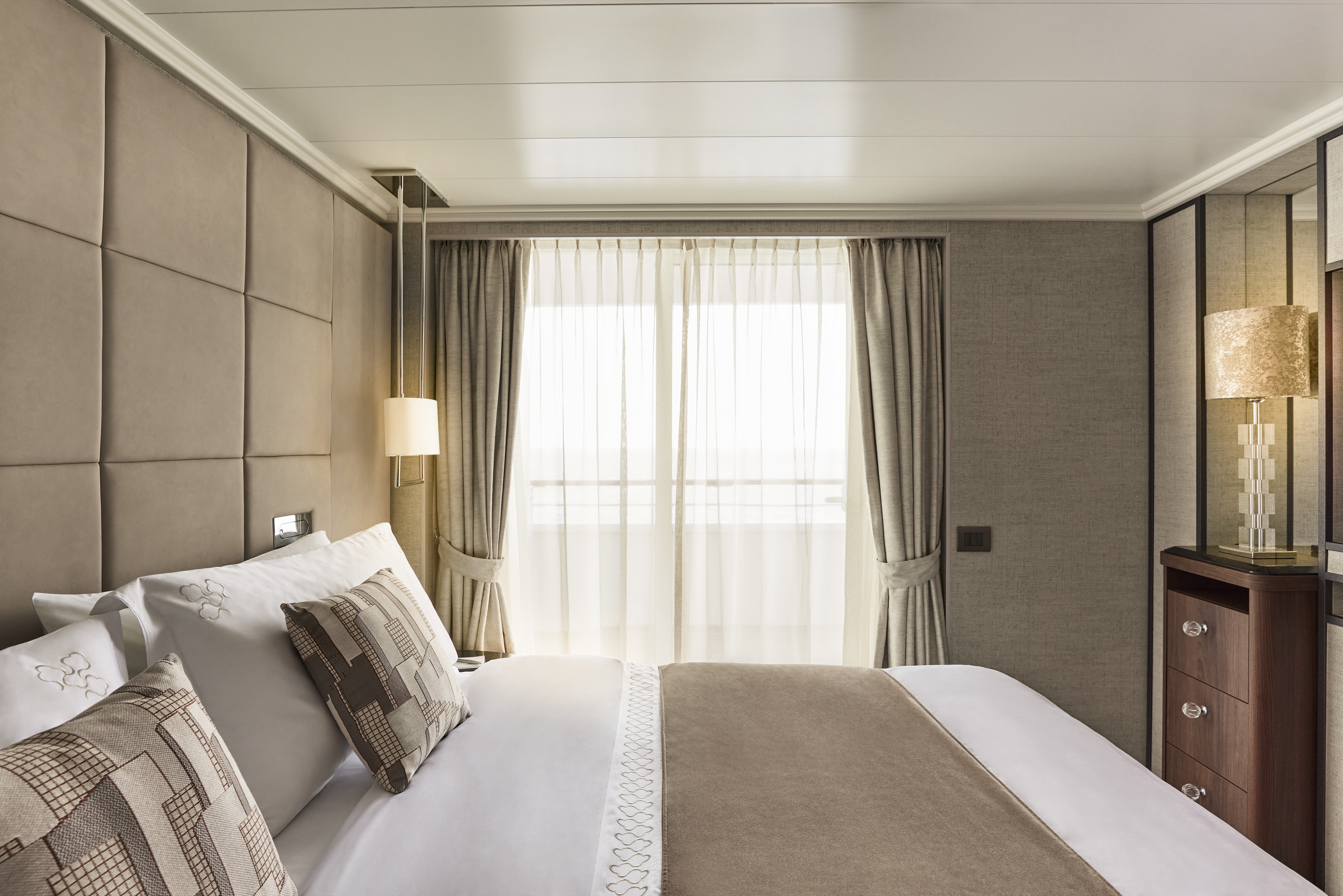
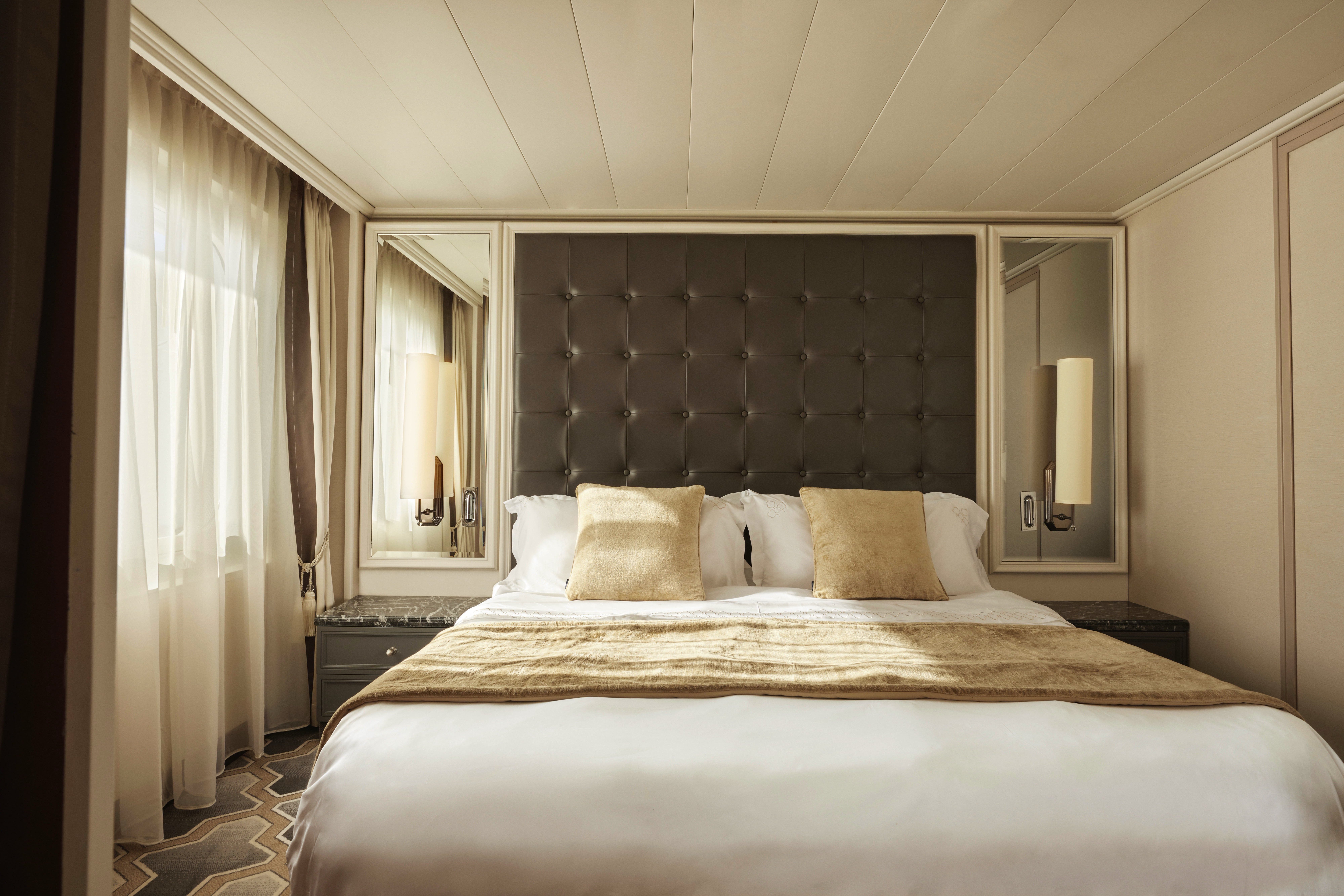
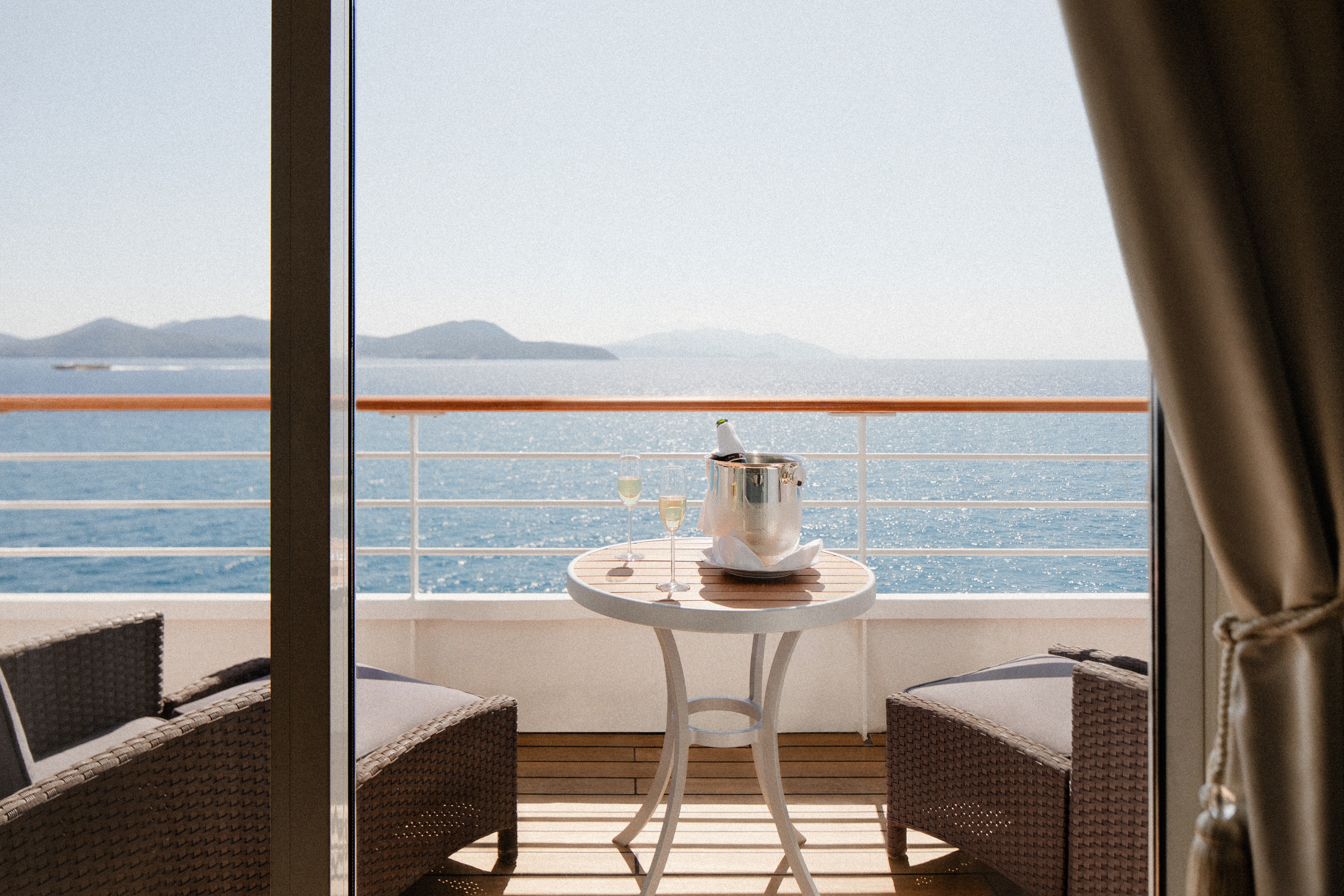
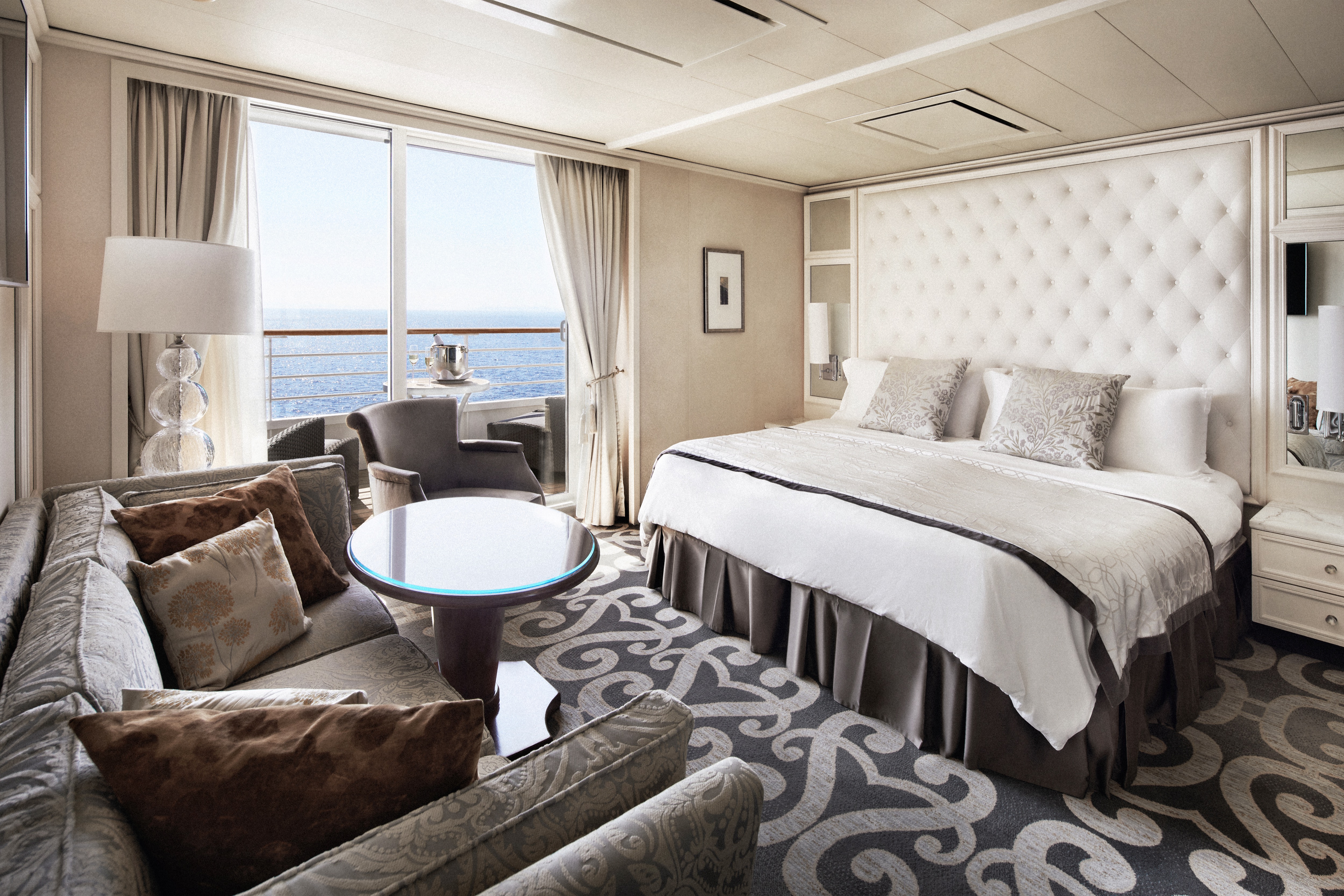
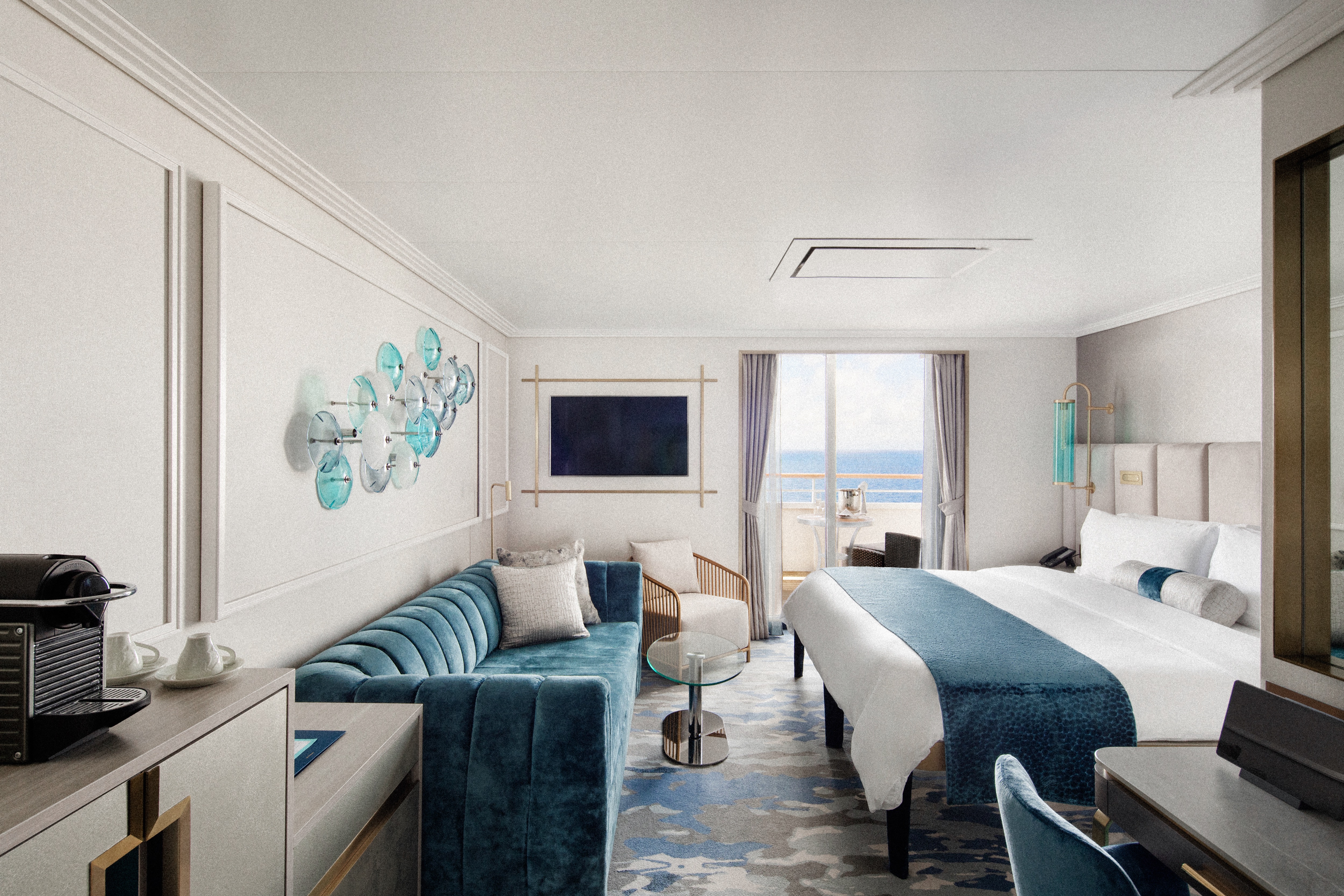
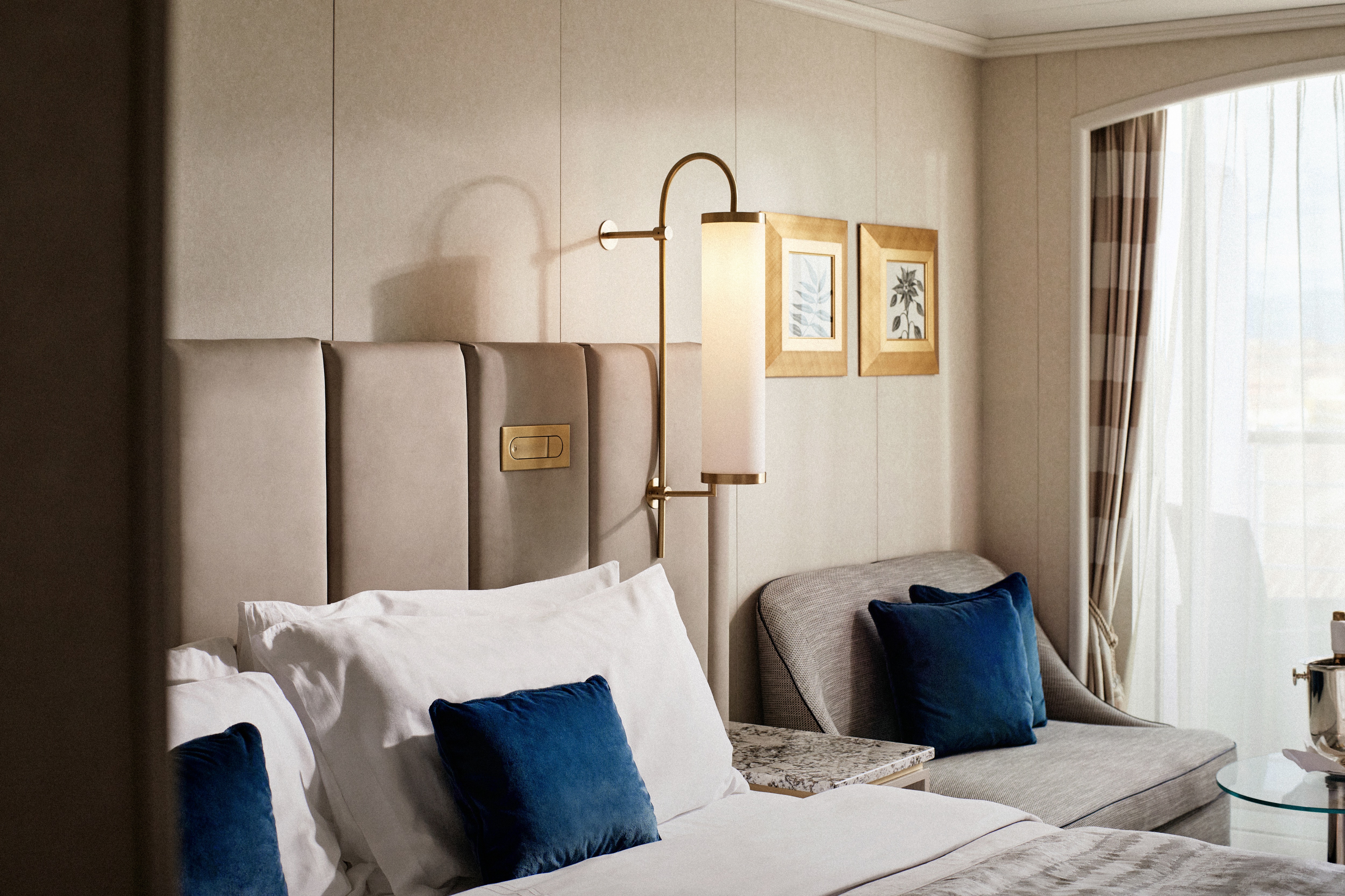
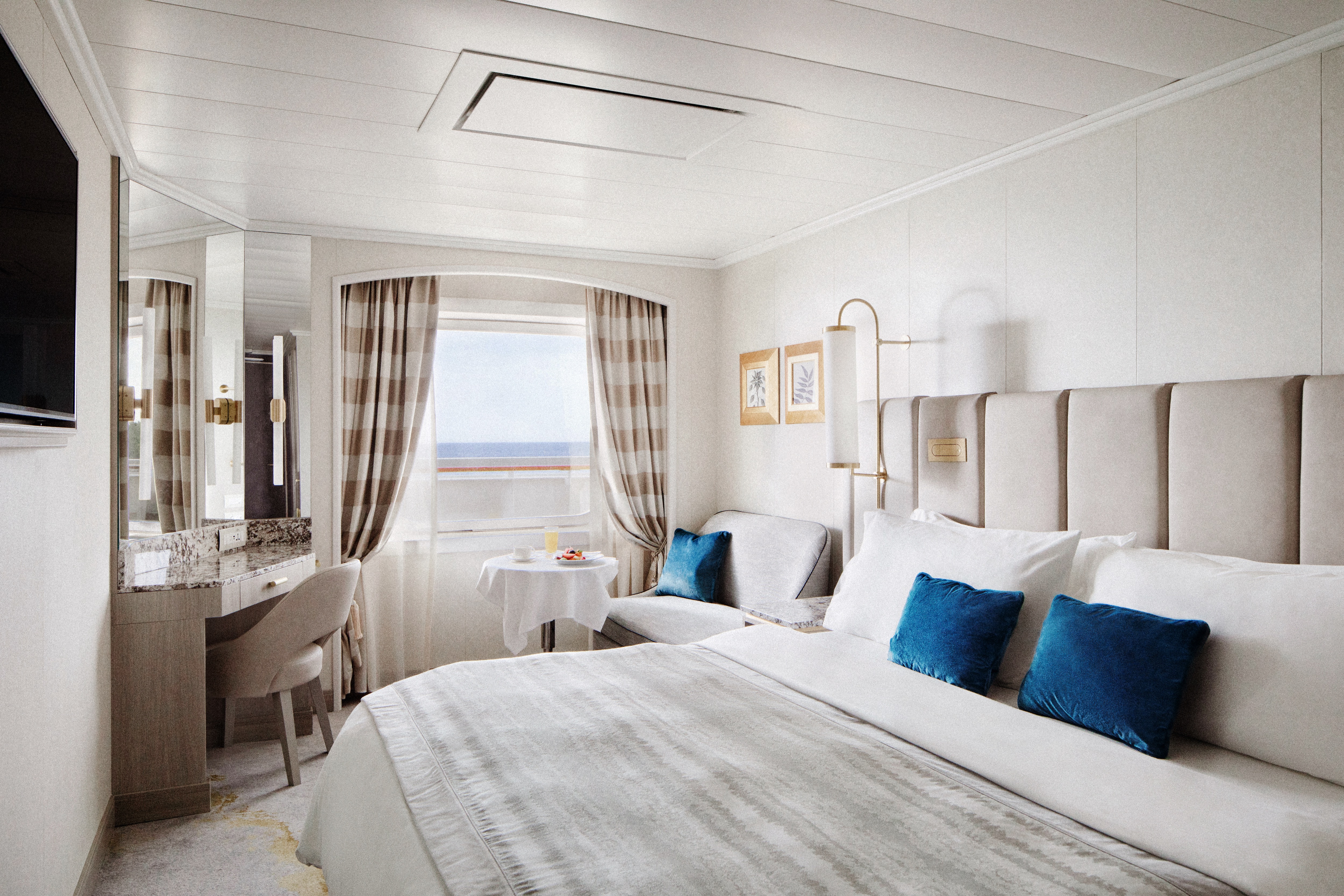
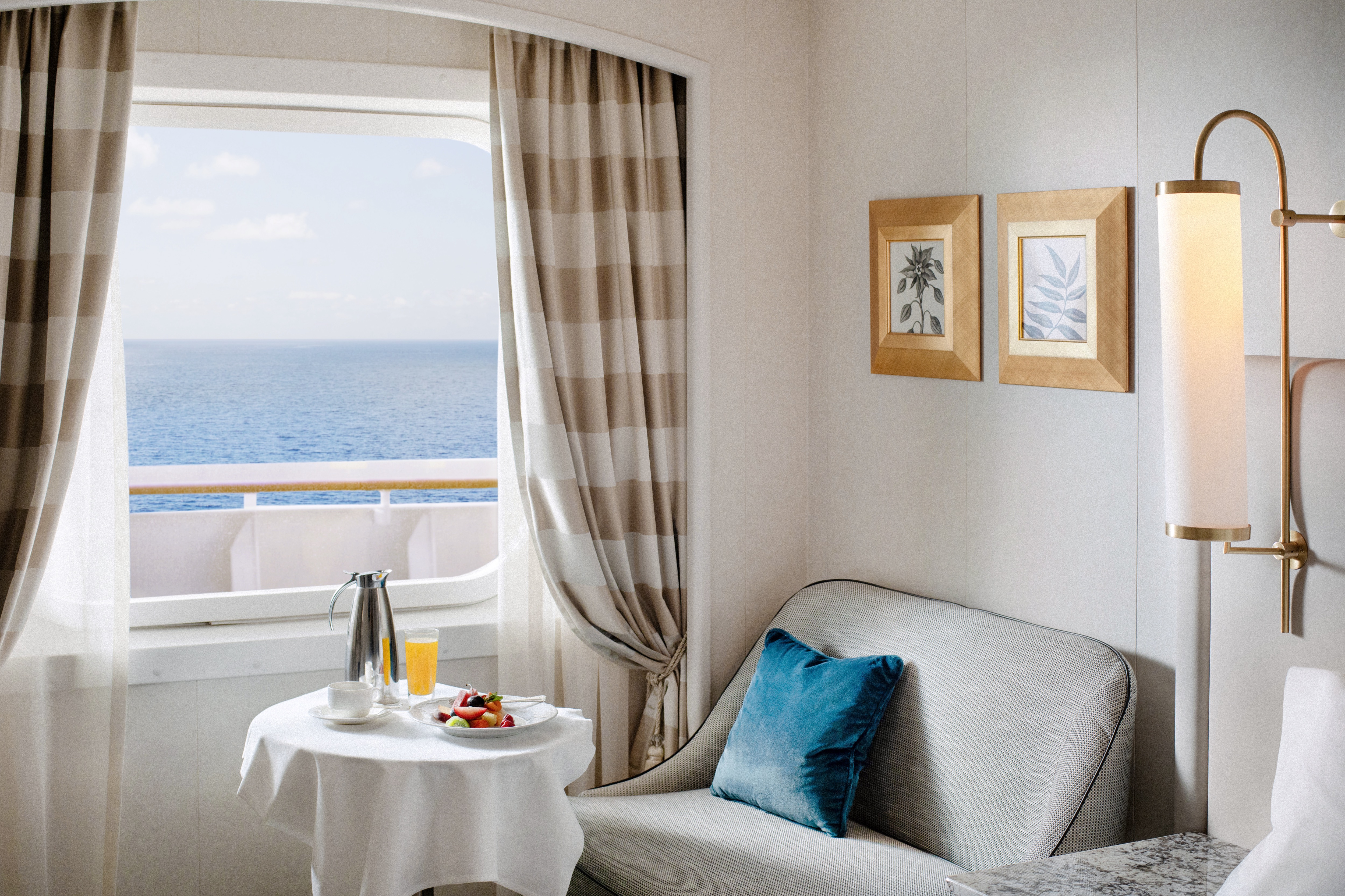
- Large private veranda with teak furniture
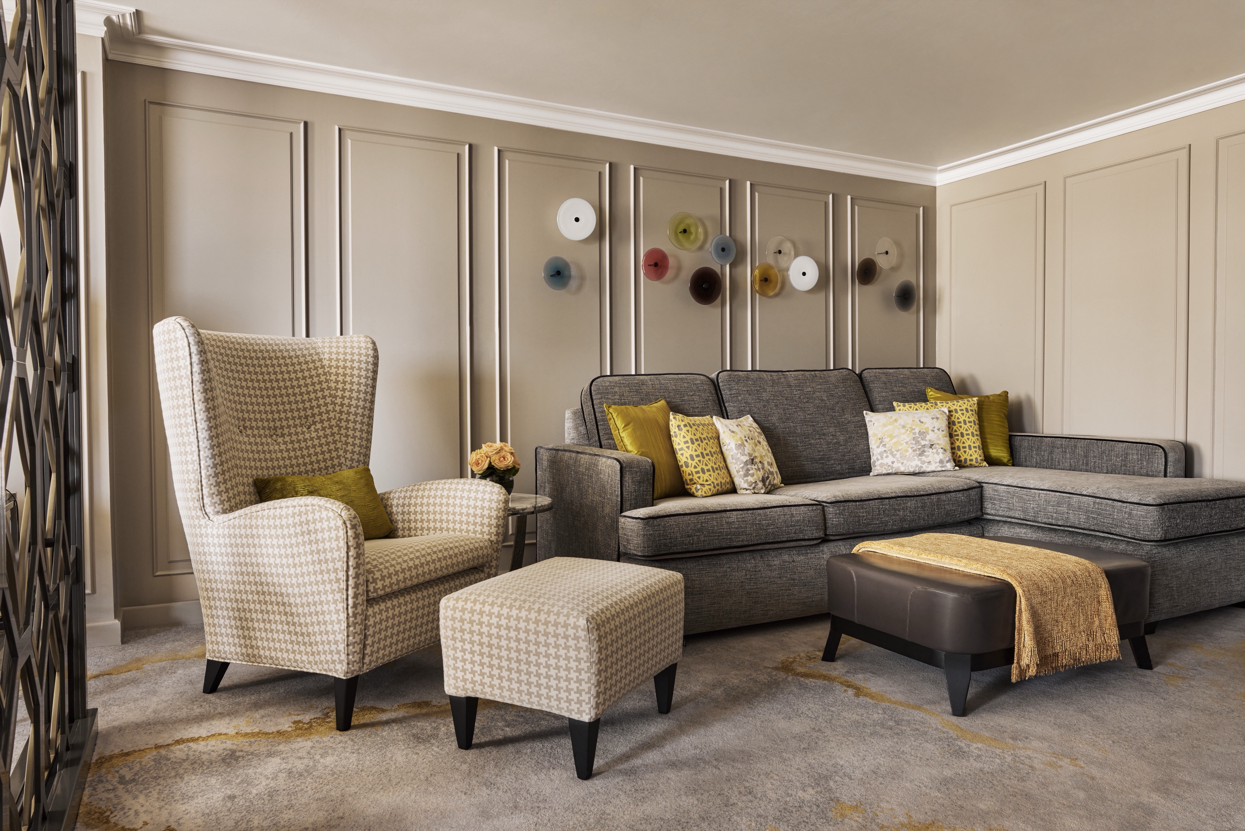
- Spacious living room with TV, custom wool carpets, walnut floors, cabinetry and Swarovski® chandelier
- Dining area with panoramic ocean views
- Separate study
- Custom built-in bar
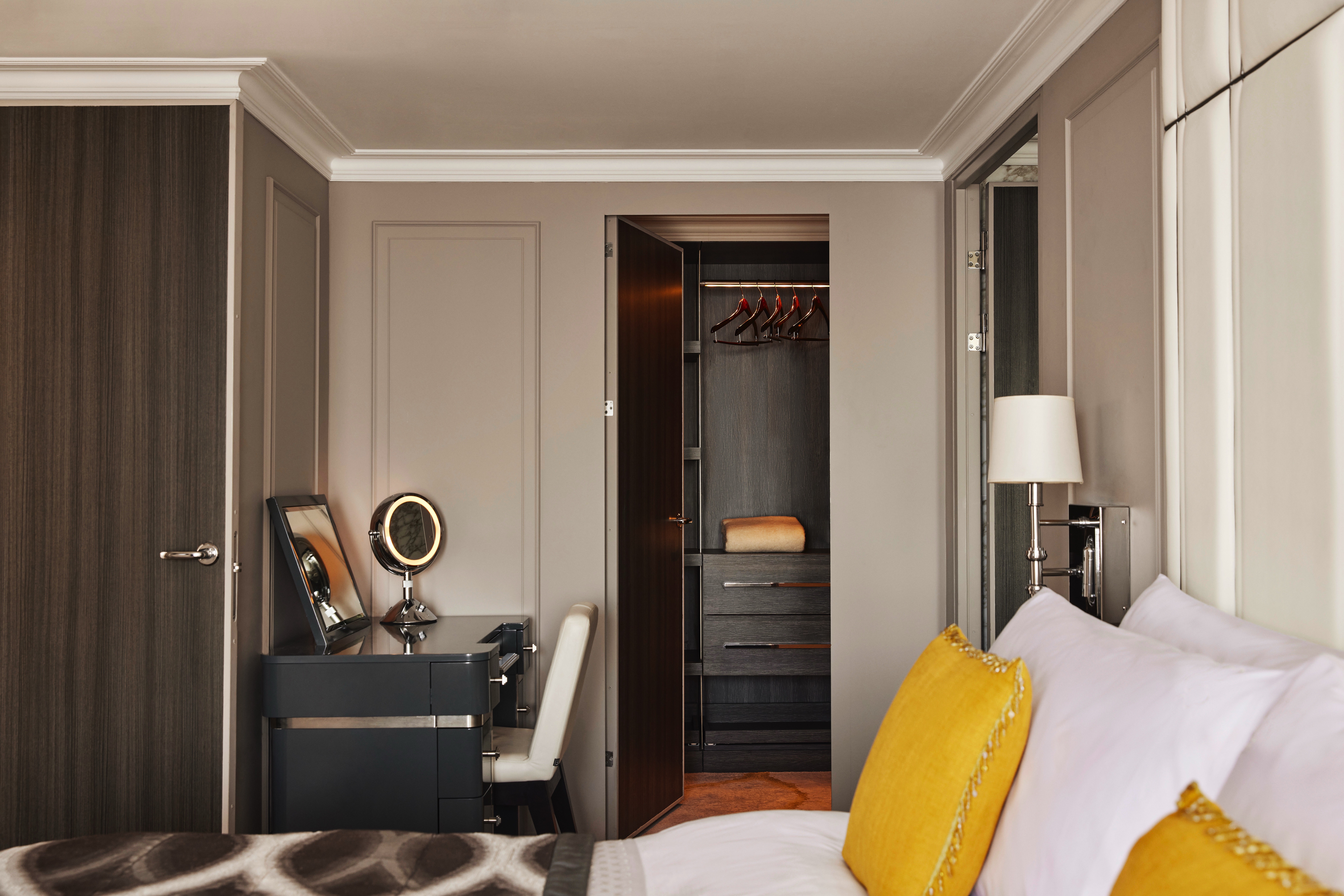
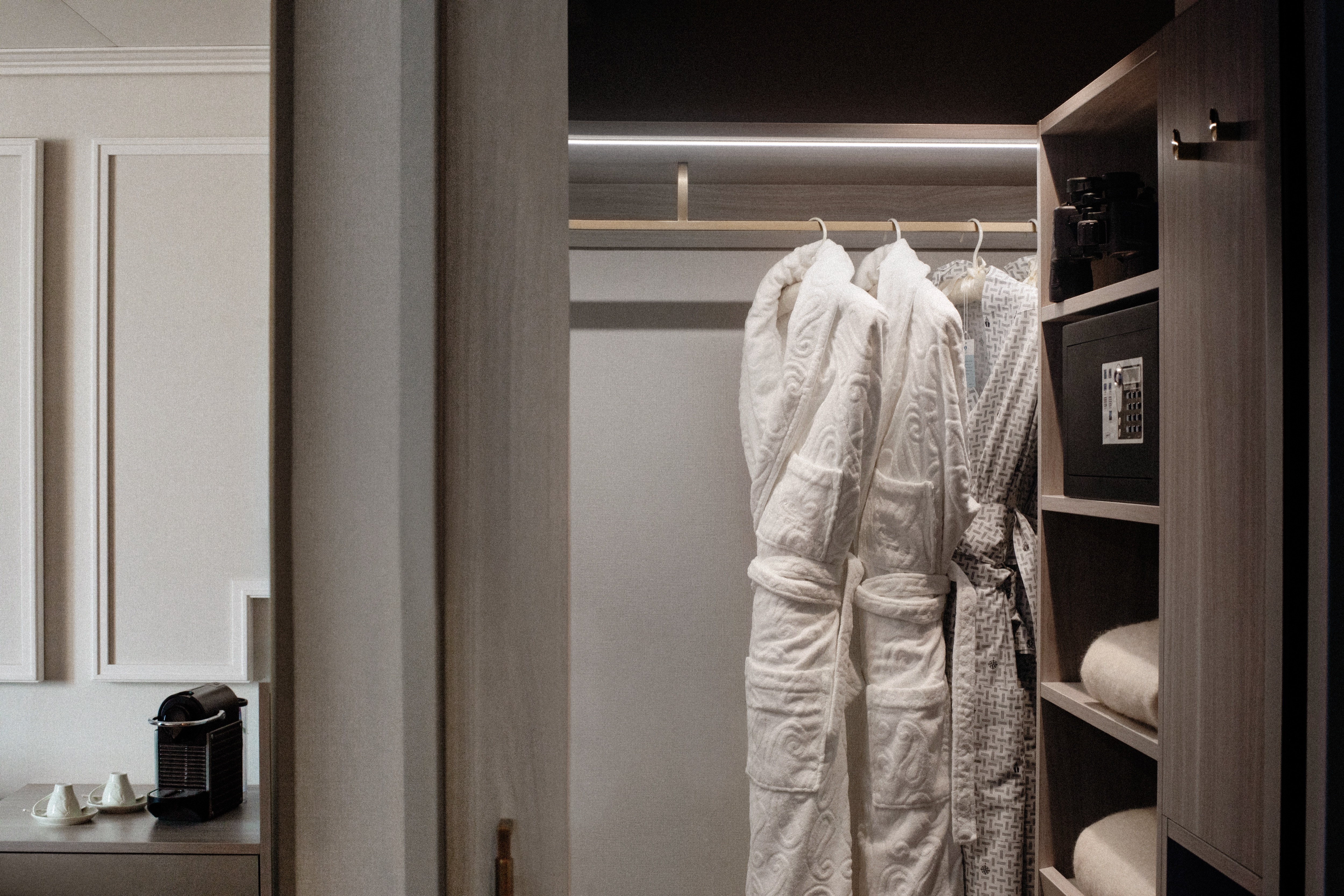
- Large bedroom with queen-size bed or twins, plus his and hers walk-in closets and TV
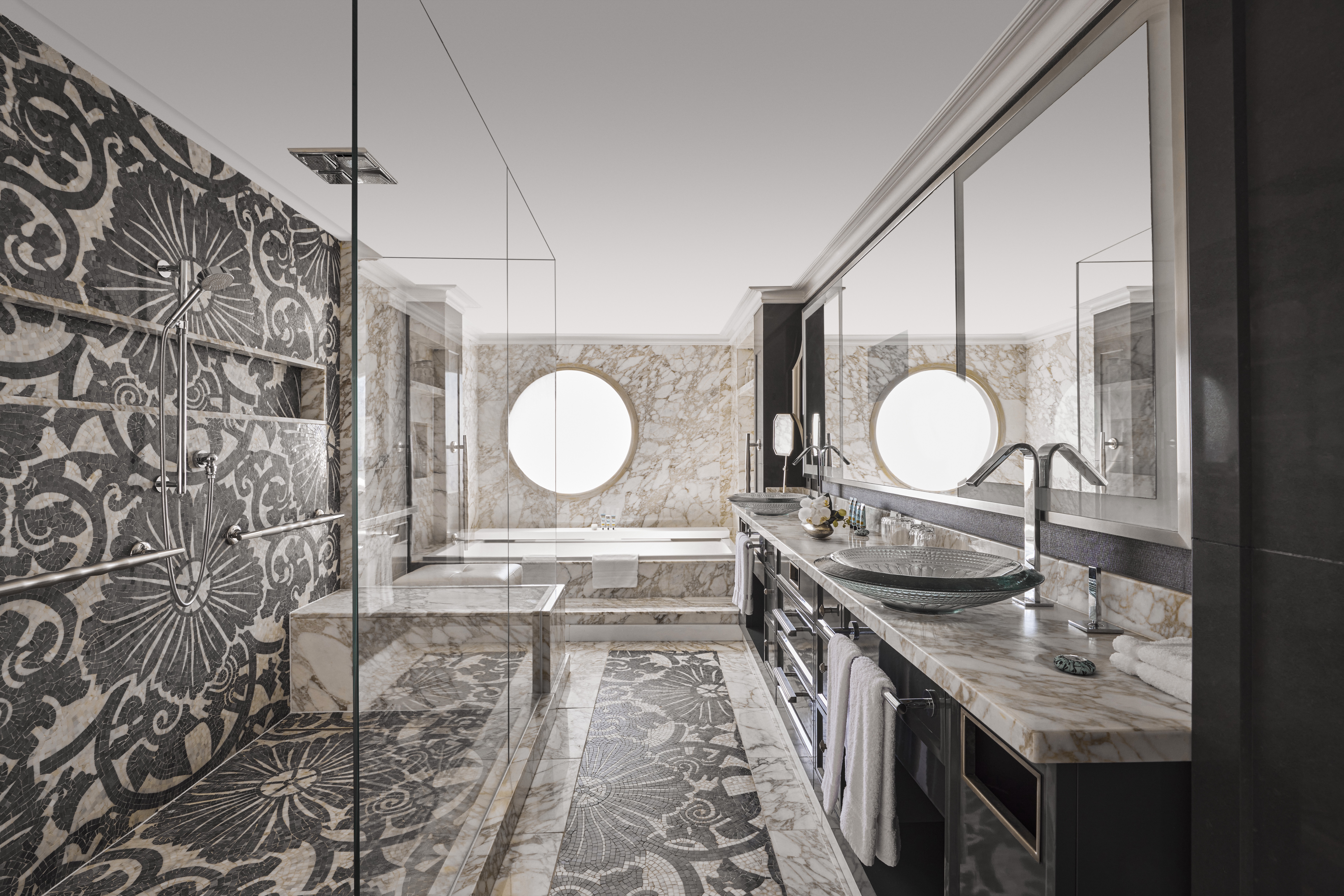
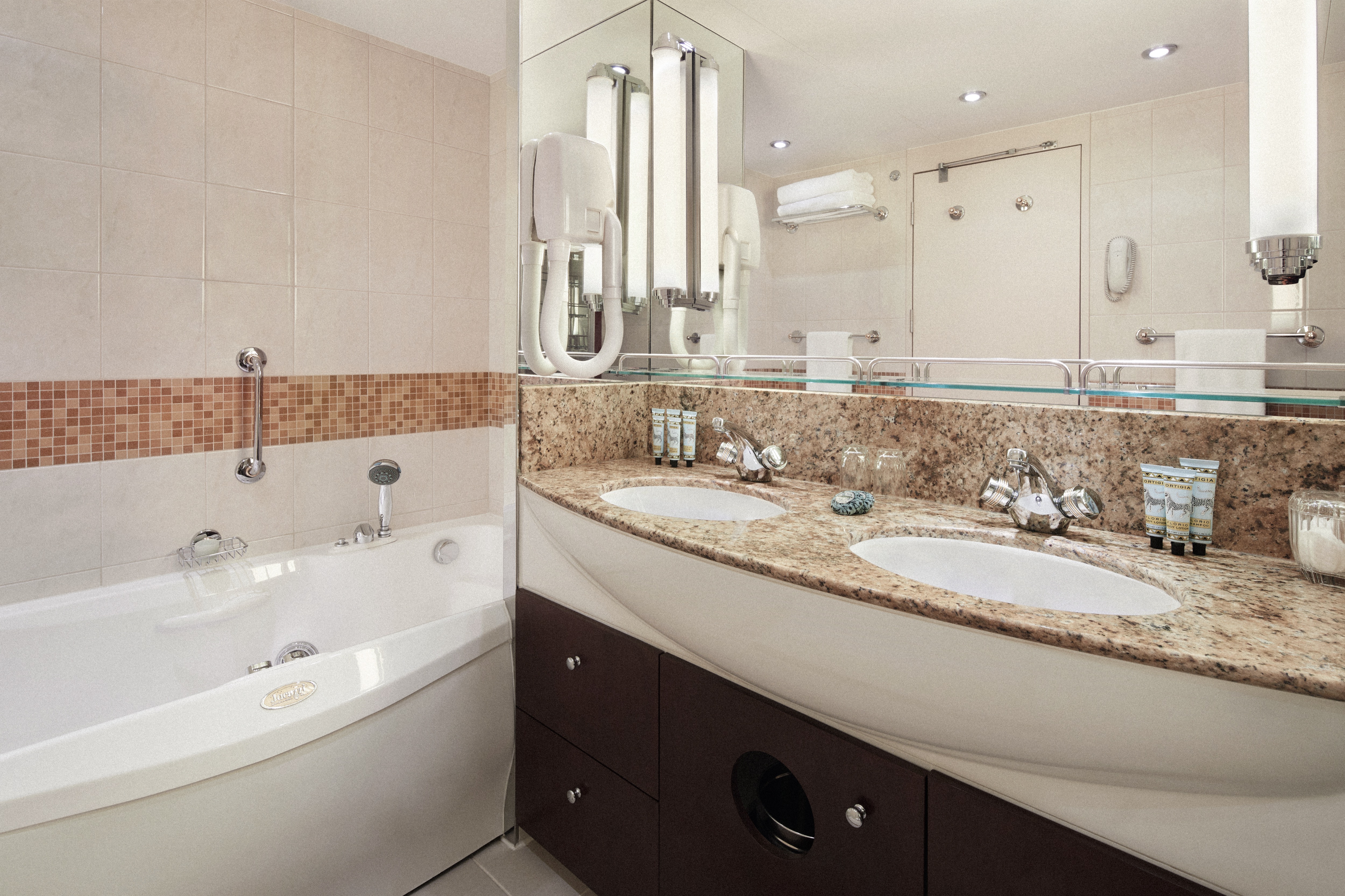
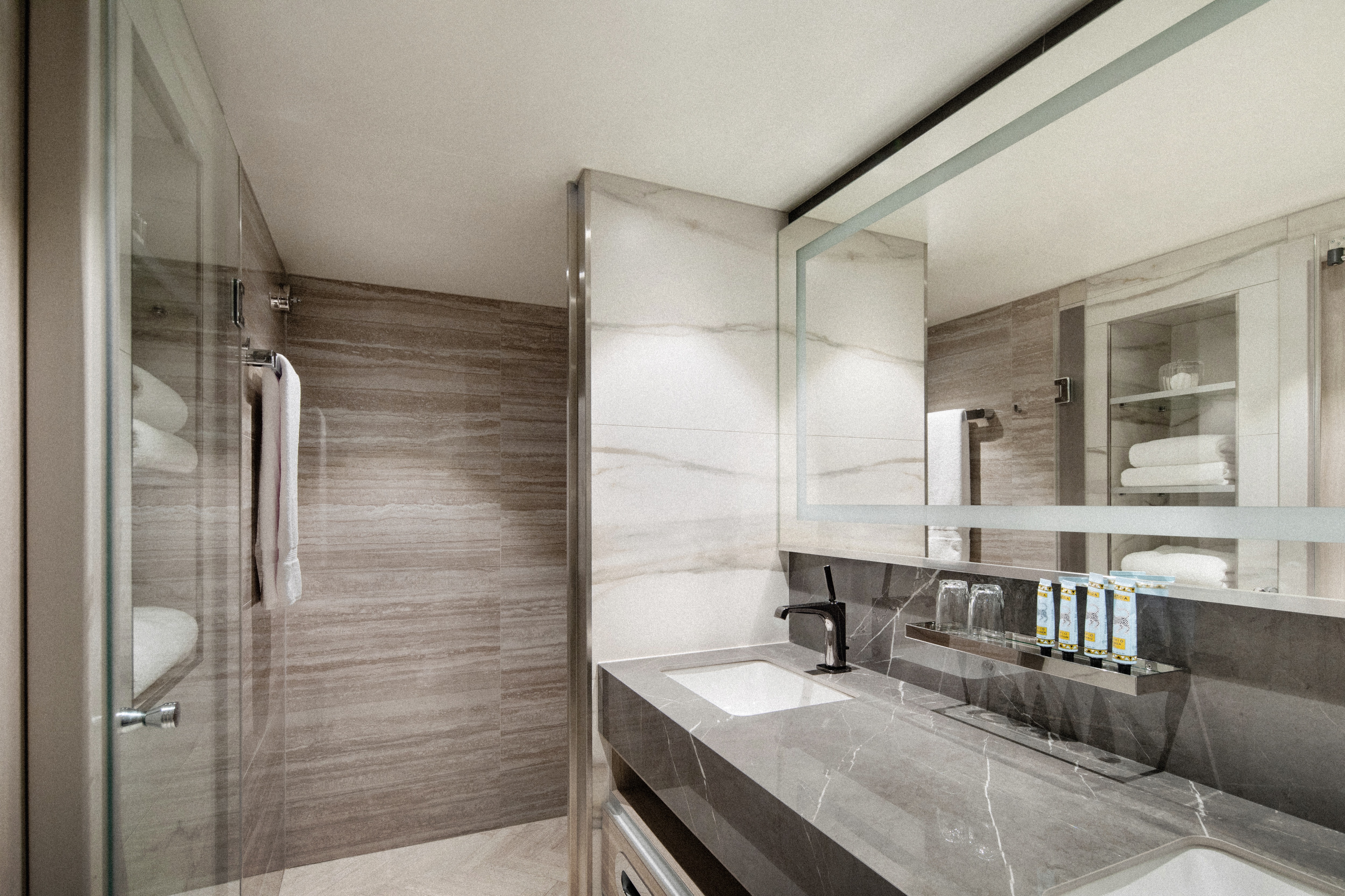
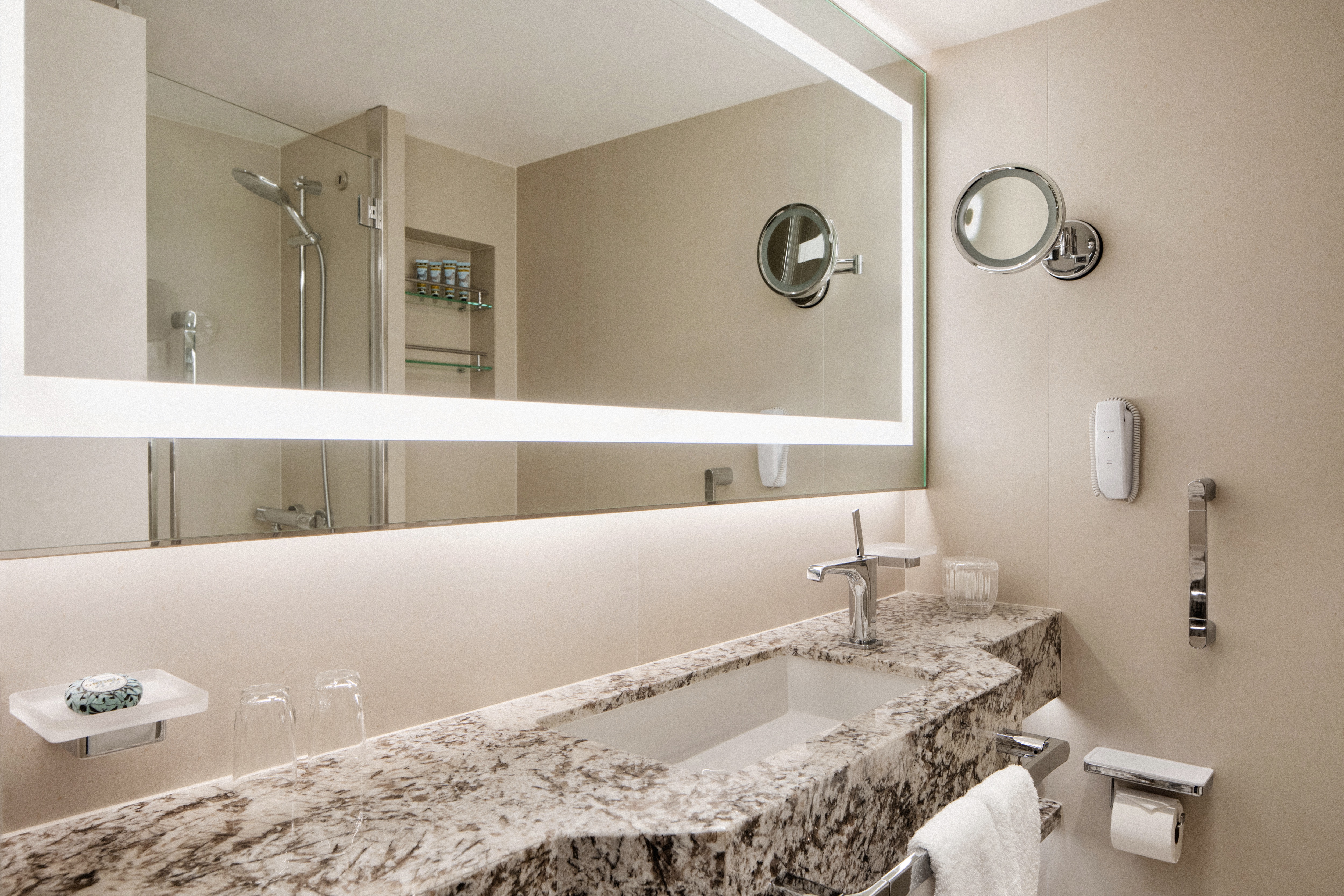
- Master bath with jacuzzi, ocean view, crystal sconces and Calacatta marble floors, separate shower and bidet
- Guest bathroom
SERVICES
- 24 hour in-suite dining
- Unlimited room service from Osteria D'Ovidio and Umi Uma
- Unlimited dining in Osteria D'Ovidio and Umi Uma
- Turndown service with handmade truffles
- Shoeshine service
- Assistance with packing and unpacking
- Free unlimited laundry and dry cleaning, 2nd day service
- In-suite cocktail parties
- Private transfer to and from ship up to 50 miles
AMENITIES
- Welcome champagne
- Complimentary wine and spirits from set menu
- Complimentary soft drinks
- Flowers
- Fresh fruits, daily change, on request only
- Pillow menu (selection from a variety of pillow types)
- Afternoon canapés
- Coffee maker
- Binoculars
- Complimentary unlimited standard WiFi
- In-suite safe
- Interactive tablet for news, updates, and reservations
- Hair dryer
- Hair iron (available upon request)
Redesigned in 2023, this luxurious suite features a walk-in wardrobe, separate living room and dining area, Jacuzzi bathtub, separate shower, bidet, and guest bathroom. Guests staying in this stylish home away from home enjoy unlimited dining at specialty restaurants, unlimited laundry services, afternoon canapés, flowers, binoculars, and a coffee maker.
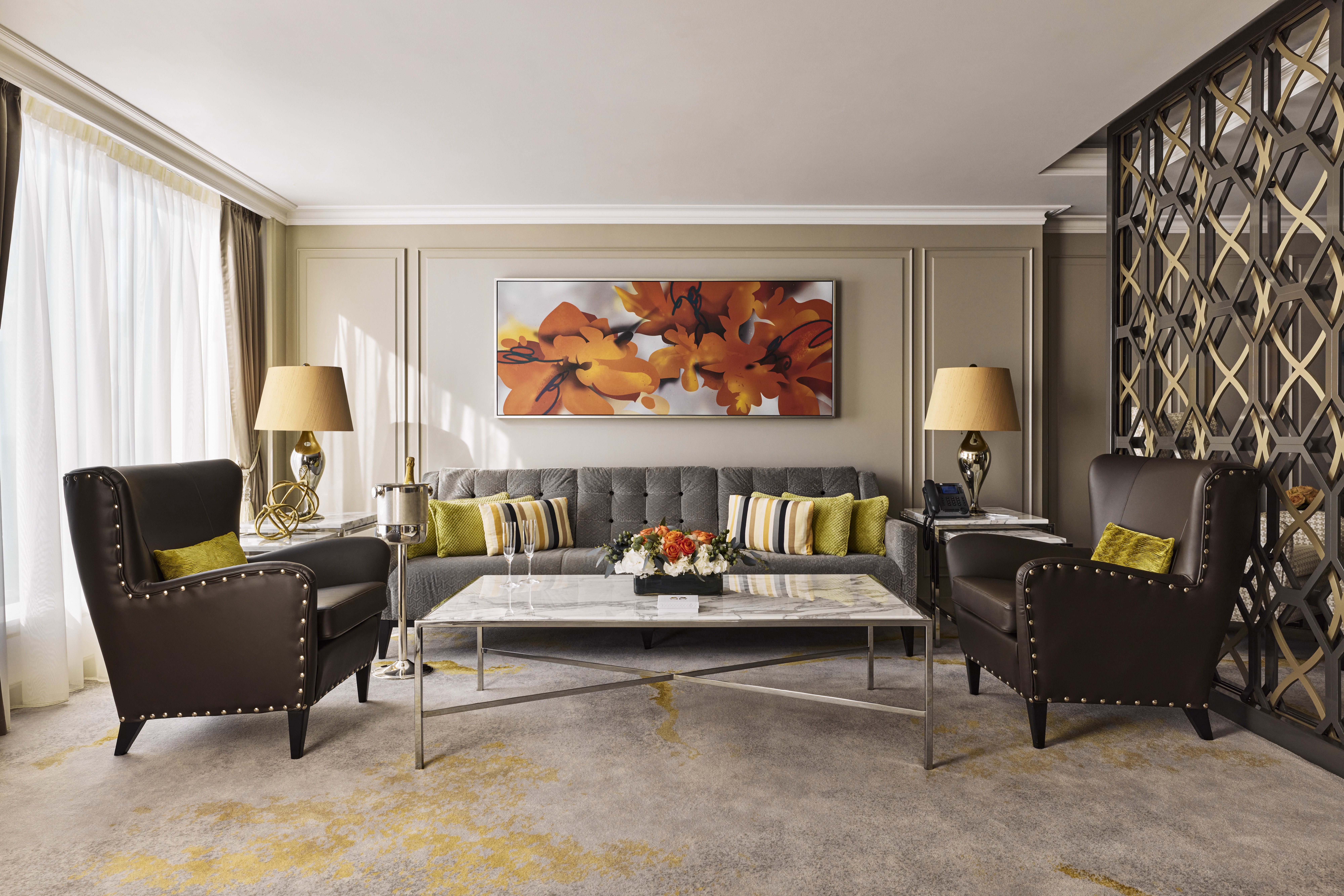
DETAILS
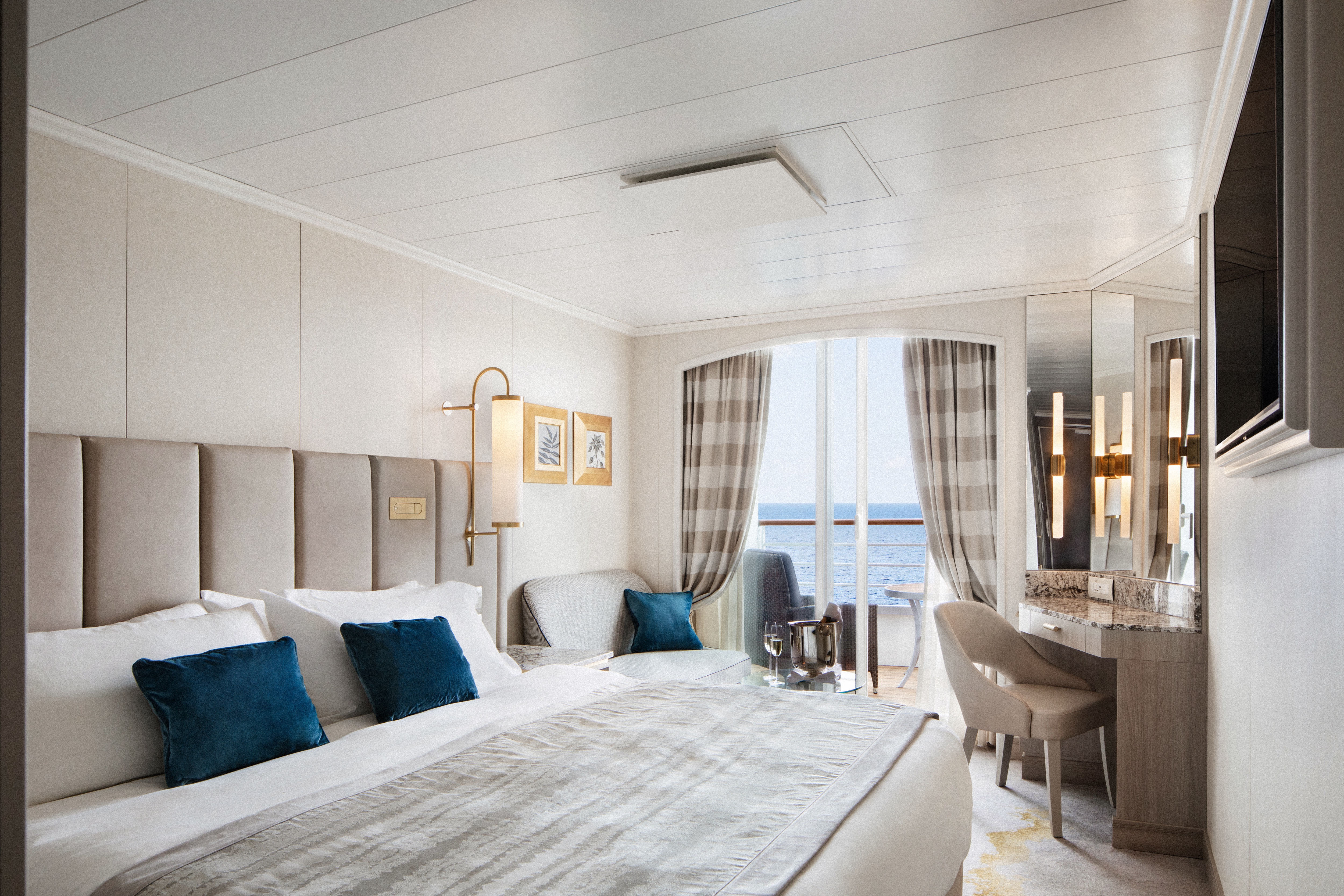
- Large private veranda
- Spacious living room
- Dining area
- Two TV's
- Sophisticated one-touch lighting and surround-sound system
- Separate bedroom area
- Vanity in bedroom
- Queen-size bed or twin beds with sumptuous bedding, and third berth
- Walk-in closet
- Refrigerator
SERVICES
- 24 hour in-suite dining
- Unlimited room service from Osteria D'Ovidio and Umi Uma
- Unlimited dining in Osteria D'Ovidio and Umi Uma
- Turndown service with handmade truffles
- Shoeshine service
- Assistance with packing and unpacking
- Free unlimited laundry and dry cleaning, 2nd day service
- In-suite cocktail parties
- Private transfer to and from ship up to 50 miles
AMENITIES
- Welcome champagne
- Complimentary wine and spirits from set menu
- Complimentary soft drinks
- Flowers
- Fresh fruits, daily change, on request only
- Pillow menu (selection from a variety of pillow types)
- Afternoon canapés
- Coffee maker
- Binoculars
- Complimentary unlimited standard WiFi
- In-suite safe
- Interactive tablet for news, updates, and reservations
- Hair dryer
- Hair iron (available upon request)
DETAILS
- Private veranda
- Spacious living room
- Queen-size bed or twin beds with sumptuous bedding, and third berth
- Walk-in closet
- Two TV's
SERVICES
- 24 hour in-suite dining
- Shoeshine service
- Assistance with packing and unpacking
- Dry cleaning for five pieces plus one bag of free laundry every 10 cruise days, 2nd day service
- Free pressing (5pcs/day), 2nd day service
AMENITIES
- Welcome champagne
- Complimentary wine and spirits from set menu
- Complimentary soft drinks
- Flowers
- Fresh fruits, daily change, on request only
- Pillow menu (selection from a variety of pillow types)
- Afternoon canapés
- Coffee maker
- Binoculars
- Complimentary unlimited standard WiFi
- In-suite safe
- Interactive tablet for news, updates, and reservations
- Hair dryer
- Hair iron (available upon request)
DETAILS
- Private veranda
- Sizeable living area
- Queen-size bed or twin beds with sumptuous bedding
- Vanity in dressing area
- Walk-in closet
- TV
- Sophisticated one-touch lighting and surround-sound system
SERVICES
- 24 hour in-suite dining
- Turndown service
- Shoeshine service
- Assistance with packing and unpacking
AMENITIES
- Welcome champagne
- Complimentary wine and spirits from set menu
- Complimentary soft drinks
- Fresh fruits, daily change, on request only
- Pillow menu (selection from a variety of pillow types)
- Afternoon canapés
- Coffee maker
- Binoculars
- Complimentary unlimited standard WiFi
- In-suite safe
- Interactive tablet for news, updates, and reservations
- Hair dryer
- Hair iron (available upon request)
- Free pressing (5pcs/day), 2nd day service
DETAILS
- Private veranda
- Spacious living area with sofa
- Queen-size bed or twin beds with sumptuous bedding
- Walk-in shower
- TV
SERVICES
- 24 hour in-suite dining
- Turndown service
- Shoeshine service
- Assistance with packing and unpacking
AMENITIES
- Welcome champagne
- Complimentary wine and spirits from set menu
- Complimentary soft drinks
- Fresh fruits, daily change, on request only
- Pillow menu (selection from a variety of pillow types)
- Complimentary unlimited standard WiFi
- In-suite safe
- Interactive tablet for news, updates, and reservations
- Hair dryer
- Hair iron (available upon request)
DETAILS
- Large picture window
- Sizeable living area with sofa
- Queen-size bed or twin beds with sumptuous bedding
- Walk-in shower
- TV
SERVICES
- 24 hour in-suite dining
- Turndown service
- Shoeshine service
- Assistance with packing and unpacking
AMENITIES
- Welcome champagne
- Complimentary wine and spirits from set menu
- Complimentary soft drinks
- Fresh fruits, daily change, on request only
- Pillow menu (selection from a variety of pillow types)
- Complimentary unlimited standard WiFi
- In-suite safe
- Interactive tablet for news, updates, and reservations
- Hair dryer
- Hair iron (available upon request)
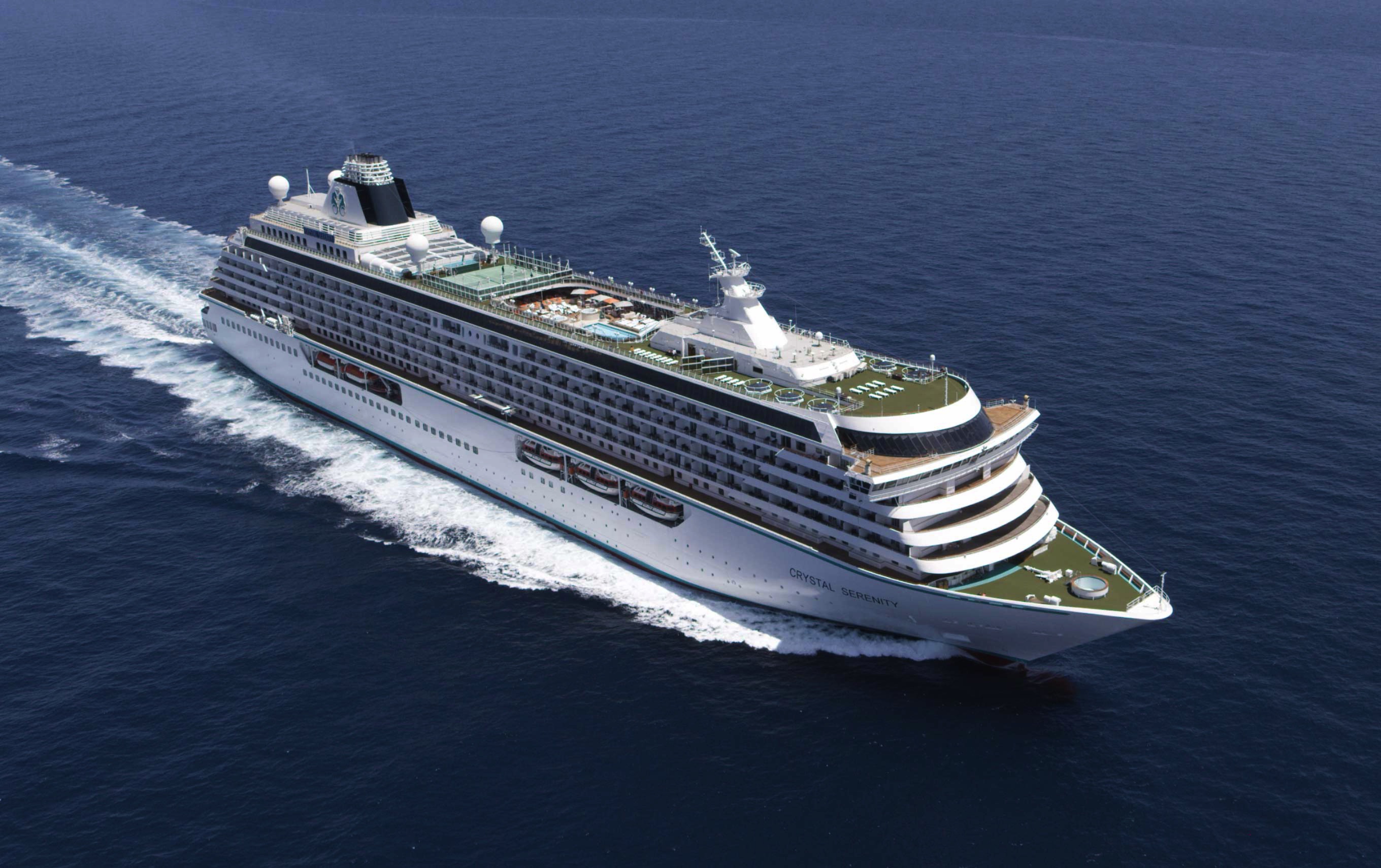
Crystal Serenity
With an industry-leading space to guest ratio across an array of social areas, Crystal Serenity offers the utmost comfort, quality, personalization and choice.
Ship Facts
| Launch Year | 2003 | ||||||||
| Refit Year | 2023 | ||||||||
| Language | en-US | ||||||||
| Gross Tonnage | 68870 | ||||||||
| Length | 250 | ||||||||
| Width | 32 | ||||||||
| Currency | USD | ||||||||
| Speed | 22 | ||||||||
| Capacity | 740 | ||||||||
| Crew Count | 600 | ||||||||
| Deck Count | 9 | ||||||||
| Cabin Count | 545 | ||||||||
| Large Cabin Count | 0 | ||||||||
| Wheelchair Cabin Count | 8 | ||||||||
| Electrical Plugs |
|
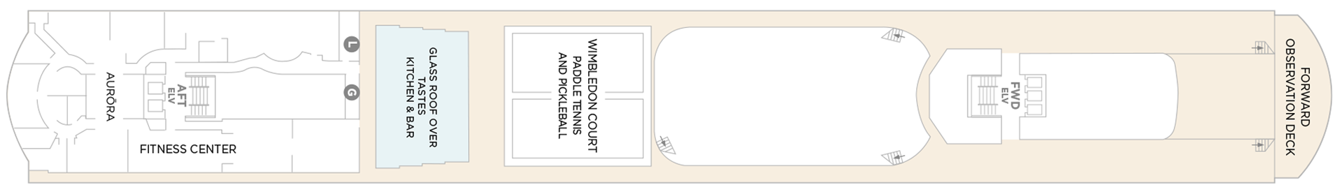
Deck 13
- Sauna + Steam Room
- Aurora
- Fitness Center
- Glass Roof Over Beefbar
- Wimbledon Court Paddle Tennis And Pickleball
- Forward Observation Deck
- Elevator
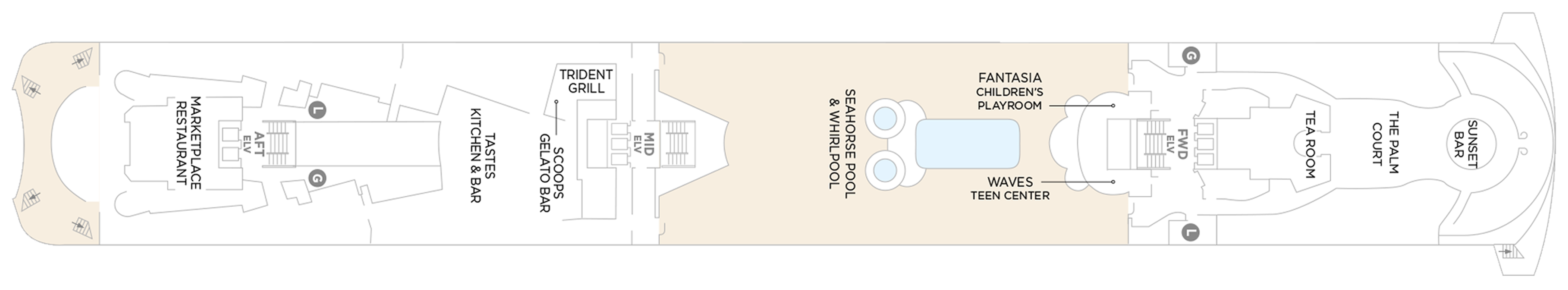
Deck 12
- Marketplace Restaurant
- Washroom
- Beefbar
- Trident Grill
- Scoops Gelato Bar
- Seahorse Pool & Whirlpool
- Fantasia Children's Playroom
- Waves Teen Center
- Tea Room
- The Palm Court
- Sunset Bar
- Elevator
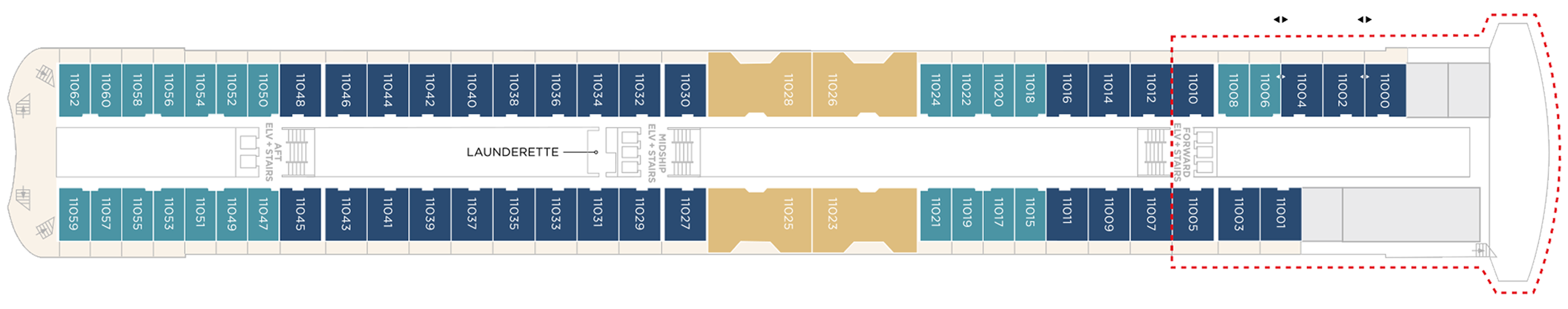
Deck 11
- Crystal Penthouse Suite
- Sapphire Veranda Suite
- Aquamarine Veranda Suite
Launderette
- Elevator
Suites & Guest Rooms Beyond The Forward Elevators Are Subject To Alternative Pricing
Deck 10
- Sapphire Veranda Suite
- Double Guest Room with Veranda
- Aquamarine Veranda Suite
Launderette
- Elevator
Suites & Guest Rooms Beyond The Forward Elevators Are Subject To Alternative Pricing
Deck 9
- Junior Crystal Penthouse Suite
- Sapphire Veranda Suite
- Double Guest Room with Veranda
- Aquamarine Veranda Suite
- Launderette
- Elevator
Suites & Guest Rooms Beyond The Forward Elevators Are Subject To Alternative Pricing
Deck 8
- Junior Crystal Penthouse Suite
- Double Guest Room with Veranda
- Sapphire Veranda Suite
- Launderette
- Elevator
Suites & Guest Rooms Beyond The Forward Elevators Are Subject To Alternative Pricing
Deck 7
- Aquamarine Ocean View Suite (Accessible Suites)
- Double Guest Room With Veranda
- Single Guest Room, Ocean View
- Century Suite
- Cashier
- Uma Uma & Sushi Bar by Nobu Matsuhisa
- Bridge Lounge
- Vintage Room
- Library
- Osteria D'Ovidio
- Computer University@Sea
- The Studio
- Elevators
Suites & Guest Rooms Beyond The Forward Elevators Are Subject To Alternative Pricing
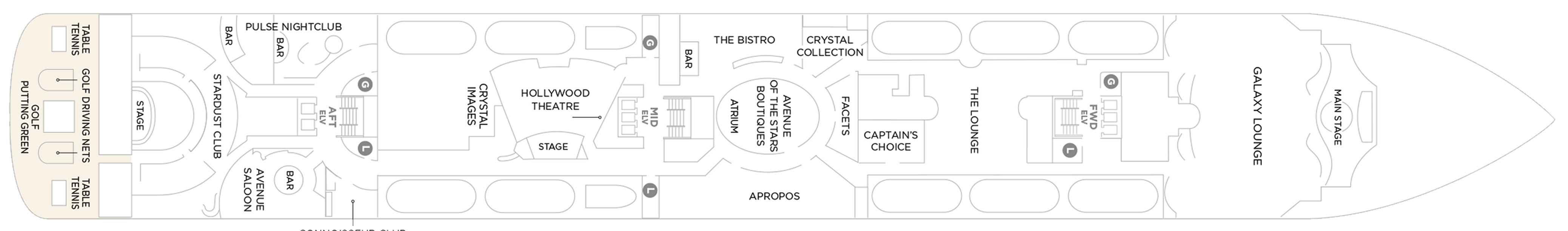
Deck 6
- Main Stage
- Apropos
- Facets
- Avenue Of The Stars Boutiques
- Atrium
- Avenue Saloon
- Connoisseur Club
- Crystal Images
- Golf Driving Nets
- Pulse Night Club
- Elevators
- Stardust Club
- Stage
- Table Tennis
- Putting Green
- Hollywood Theatre
- Galaxy Lounge
- The Lounge
- Crystal Collection
- The Bistro
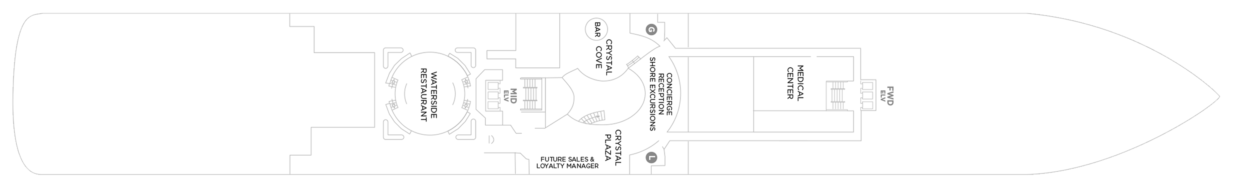
Deck 5
- Medical Center
- Bar
- Concierge Desk
- Crystal Cove
- Elevators
- Future Cruises & Loyalty Manager
- Reception
- Shore Excursion Desk
- Crystal Plaza
- Waterside Restaurant
Our award-winning cuisine is created and influenced by pioneers in the global food scene, with nine distinct complimentary venues to choose from. Open seating with extensive dining options are tailored around the personal preferences of our guests, allowing them to choose exactly what they want at a time that works for them. Whether that be a late breakfast, six-course wine pairing lunch, or dinner in our exclusive Osteria d’Ovidio or Umi Uma.
All inclusive – however its one complimentary reservation in each specialty restaurant (Umi Uma and Osteria) is included on sailings of 11 days or less, two reservations on sailings between 12 and 22 days, three reservations on sailings 23 days or more, and unlimited reservations for all full World Cruise guests”. However guests can pay to dine outside of their allowance at £50 pp which is great value for these 2 specialist restaurants
Waterside Restaurant
Waterside is where the art of fine dining is elevated to breathtaking heights. Classic dishes are updated with a contemporary twist.
The main dining room features open seating and tables for two, four, and eight guests. Open for breakfast, lunch, and dinner. No reservations are required.
Umi Uma
UMI UMA is one of Crystal's award-winning specialty dining offerings. Set in an elegantly modern setting and created by legendary Master Chef Nobuyuki (Nobu) Matsuhisa, dishes are inspired by the exotic array and traditions of the Orient.
Guests will again be able to dine on signature entrées such as Nobu-Style Black Cod, Grilled Chilean Sea Bass, Wagyu Beef Filet Steak, and some of the freshest sushi available at sea.
Beefbar
The most exciting flavors from the global street-food scene – Beef, Reef and Leaf – are fashioned from the freshest ingredients by creative chefs and served for sharing in stylish surroundings.
Beefbar’s curated menu features prime cuts from renowned regions, including Wagyu from Australia, Black Angus from the United States and and the flavorful Kobe beef from Japan. Each cut is meticulously chosen for its quality and flavor profile, ensuring a unique dining experience for every meat lover. Join us at sea to savor the finest beef, prepared with expert craftsmanship and served the Beefbar way, onboard Crystal’s ships.
- Beefbar is open for lunch and dinner
- Reservations are required for dinner
Osteria D'Ovidio
It’s the moment we’ve been waiting for – our new menu for Osteria d’Ovidio has arrived on Crystal Symphony and on Crystal Serenity. This exclusive collaboration with the Alajmo brothers signals a prestigious new era for our signature Italian restaurant. Massimiliano, the youngest chef ever to be awarded three Michelin stars, and Raffaele, CEO of the celebrated Alajmo restaurants in Italy, which include Le Calandre in Rubano, and Gran Caffè Quadri and Ristorante Quadri in St. Mark’s Square, Venice, have brought their unparalleled expertise to specialty dining on both ships. We can’t wait for you to try their dishes – exclusively on Crystal.
An unparalleled fine-dining experience courtesy of the Michelin-rated Alajmo brothers takes center stage at Osteria d'Ovidio. Named for our owner, Manfredi Lefebvre d'Ovidio, this restaurant specializes in show-stopping Italian cuisine. Reservations are required and are limited per sailing.
Every dish embodies passion, precision, and prestige, blending traditional Italian flavors with Chef Alajmo's culinary approach, which emphasizes lightness and depth of flavor. You can choose from authentic regional dishes, signature creations from Le Calandre, and dishes inspired by Venetian cuisine. From a refined carbonara to lamb chops with a herb crust, there's something to delight every palate.
Trident Grill
Enjoy a burger with a view. Our pool restaurant and grill offer a comfortable terrace highlighted by an elegant design, making it the perfect spot for outdoor dining.
The Trident serves lunch and snacks throughout the day - burgers, melts and strip steak cooked to order, crispy fries and salads.
The Bistro
A nod to the mythic bars and bistros of Paris. Celebrate the classics in this spacious and airy café that serves light bites from dawn to dusk.
The Bistro is a delightful daytime relaxing cafe that offers delicious light meals, with panoramic views of the sparkling sea.
The Vintage Room
The Vintage Room offers guided pairings and dinners highlighting the vast selection of wines in the ship’s onboard cellar. This intimate, innovative concept offers guests an education in fine wine and cuisine, allowing them to gain privileged insights into the art of enology. In addition to daytime tastings and discussions, guests may enjoy a variety of private wine-themed lunches and dinners by special arrangement with the Head Sommelier.
Scoops Gelato Bar
Enjoy authentic Italian gelato with a sea view, hand-crafted by the celebrated artisans at Badiani, using expertise perfected over generations since its founding in Florence, Italy, in 1932. Choose from more than 20 signature flavors, slow-churned with natural ingredients, including Buontalenti, Cioccolatissimo, and Stracciatella, as well as refreshing fruit sorbets.
Marketplace
This sophisticated buffet-style restaurant features a dizzying array of hot and cold choices for those who like a little of everything.
24 Hours In-Suite Dining
Enjoy a meal from the comfort of your suite while relaxing in Crystal comfort. Select from our inspired menu to delight you while you stay in, watch a movie or read a favorite book.
Tea Time
Tastes Kitchen & Bar
A new definition of traveling with taste. Sumptuous, regionally inspired tapas-style cuisine is the perfect combination of sophisticated style and casual dining.
Each evening Crystal brings together a cast of world-class performers, entertainers and hosts. Whether you’re looking for theatrical entertainment or the latest Hollywood release, our lounges, ballrooms, night clubs and screening rooms can cater to your every mood.
Our two elegant vessels host an equally exceptional offering including world-renowned restaurants, restorative spas and endless opportunity for inspiration and enrichment, tied together by unparalleled personal service.
Casino De Monte-Carlo
Le Casino de Monte-Carlo is offering a new and unique experience onboard. Place your bets on table games with the unique savoir-faire of Monaco’s world-famous casino or get excited to a dynamic range of slots to hit the jackpot. An ultimate way to embrace the thrill of the game in an elegant atmosphere adorned in the hues of the historical building.
Crystal Cove
An ideal refreshment stop any time of the day, and the perfect place to meet friends for a pre-dinner cocktail. Enjoy a variety of musical styles as the day turns into night.
Library
A well-stocked library containing over 2,000 books on a range of subjects from classics to popular biographies, history to contemporary mysteries. Plus enjoy an ample selection of magazines and board games perfect for poolside reading
Palm Court
Featuring large sky lights, floor-to-ceiling windows and a fabulous 270-degree forward view, this venue is perfect for afternoon tea, social gatherings and dancing.
Seahorse Pool
Our Seahorse Pool, with plenty of surrounding deck space to sunbathe, relax and read while enjoying a cool drink in the afternoon.
Apropos & Facets Onboard Shopping
Heighten the experience on board with a selection of fine jewelry, watches and cruise wear available in our arcade, alongside designer apparel. Make the most of being at sea with a selection of duty free items available.
Stardust Club and Supper Club
On selected evenings before and after dinner, this entertainment lounge features dancing, production spot shows, cabaret performances and other themed events. Additionally, on select nights, Stardust will open the doors for Supper Club for up to 116 guests to enjoy an evening show where they can dine and dance at the same time. Supper Club is by reservation only.
Pulse Night Club
An intimate lounge for a late-night drink, dancing or a place to let loose with karaoke.
Galaxy Lounge
Performances are the focal point here, with appearances by fantastic Broadway-style performers and headline entertainers. Drink service provided before each show.
Hollywood Theatre
The ship's sleek cinema for recent-released movies, live sport events, guest lectures and religious services.
Connoisseur Club
An elegant space to indulge in the finest cigars and cognacs.
Computer University@Sea
Our innovative Computer lab onboard led by a team of tech experts.
Crystal Plaza
Crystal Plaza can be found on Deck 5.
Avenue Saloon
Signature piano bar with an intimate ambience. The perfect setting for a cocktail before and after dinner.
Bridge Lounge
The Bridge Lounge can be found on Deck 7.
Reception & Atrium
The Reception can be found on Deck 5.
Observation Deck
More information coming soon.