Manila to Incheon (Seoul)
Manila to Incheon (Seoul)
Cruise overview
WHY BOOK WITH US?
- ✔ The Deluxe Cruises’ team has extensive experience in ultra-luxury cruising.
- ✔ Call now to speak to our helpful and experienced Cruise Concierge team.
- ✔ Enjoy our Unique Deluxe Cruises Bonus for substantial savings.
- ✔ Our team will tailor your holiday to your exacting requirements.
- ✔ As agents, we work under the protection of each cruise lines ABTA / ATOL licences
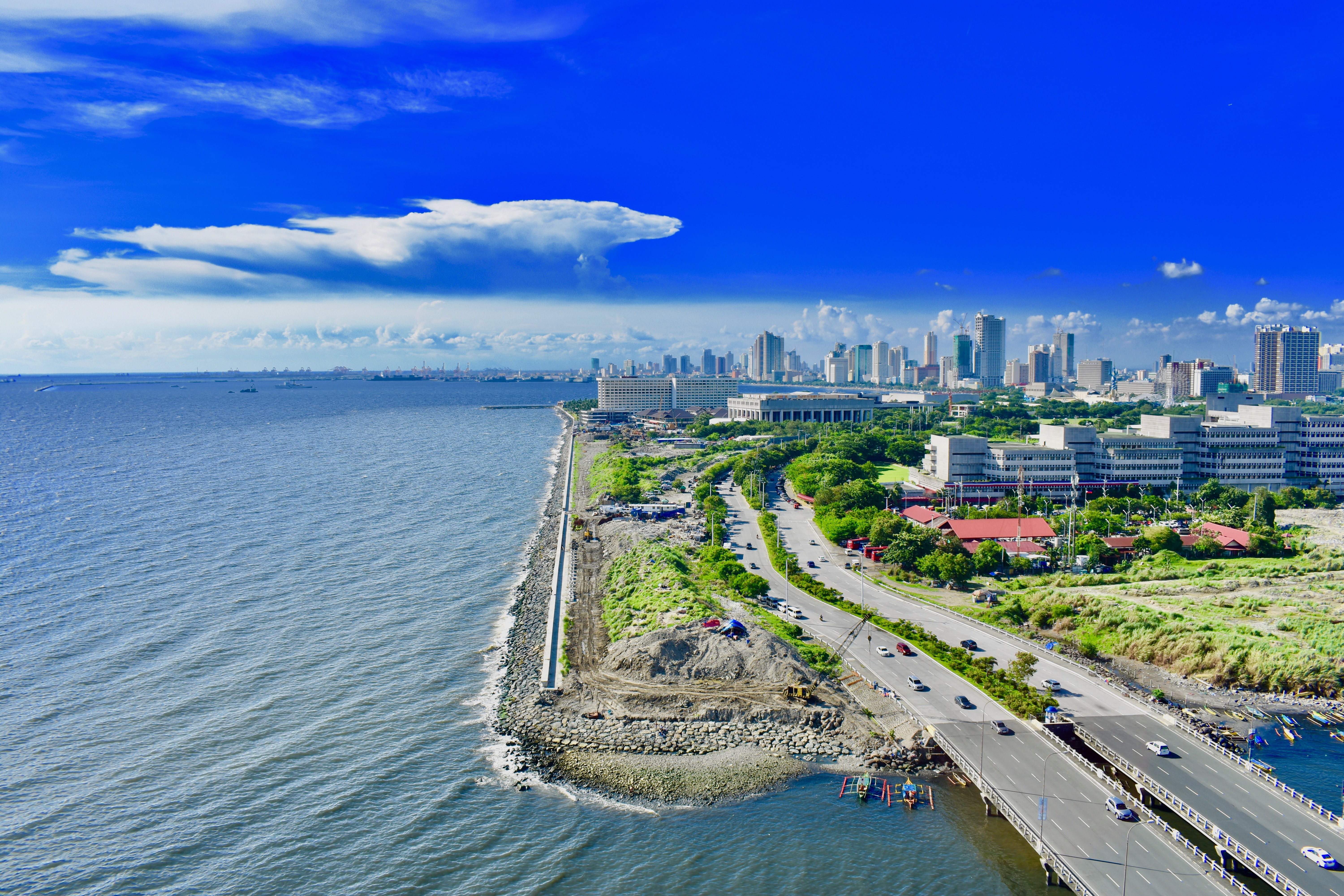
About Manila
MANILA, the capital city of the Philippines, was founded in, 1571 by Spanish conquistador Miguel López de Legazpi. It is one of the oldest cities in the country and was the seat of power for most of the colonial rules of the Philippines. It is situated on the eastern shore of Manila Bay and contains a multitude of landmarks, some of which date back to the 16th century. It is home to the baroque 16th-century San Agustin Church as well as Fort Santiago, a storied citadel and military prison. In the 19th century Manila became one of the most modern cities in Asia. Before the Spanish–American War, Manila saw the rise of the Philippine Revolution. Under the American rule following the Spanish-American War, the United States changed the official language from Spanish to English. Towards the end of World War II, during the Battle of Manila, most of the city was flattened by intensive aerial bombardment. Today, tourism is a vital industry in Manila. Major shopping malls and bazaars thrive around Manila.
About Subic Bay
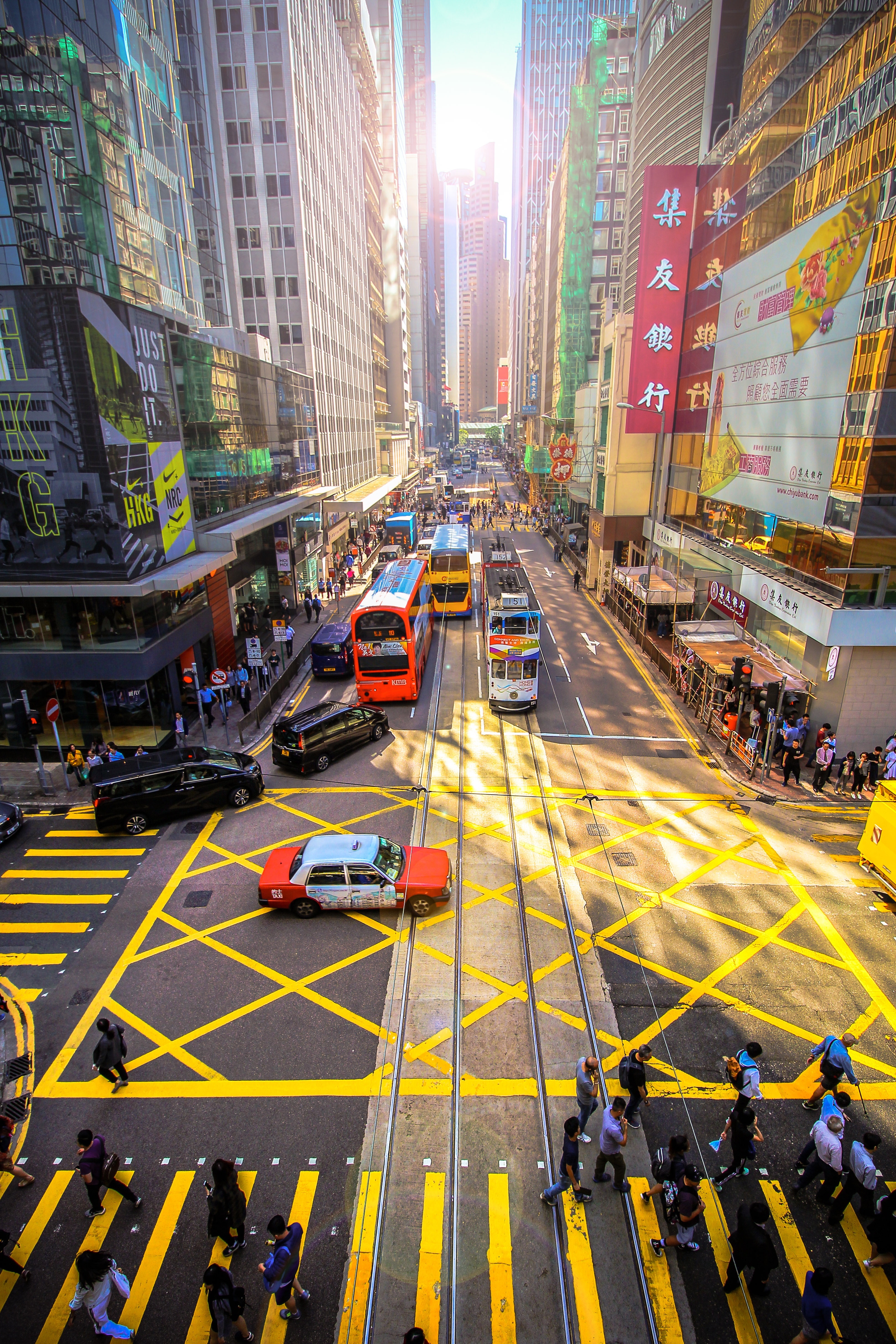
About Hong Kong
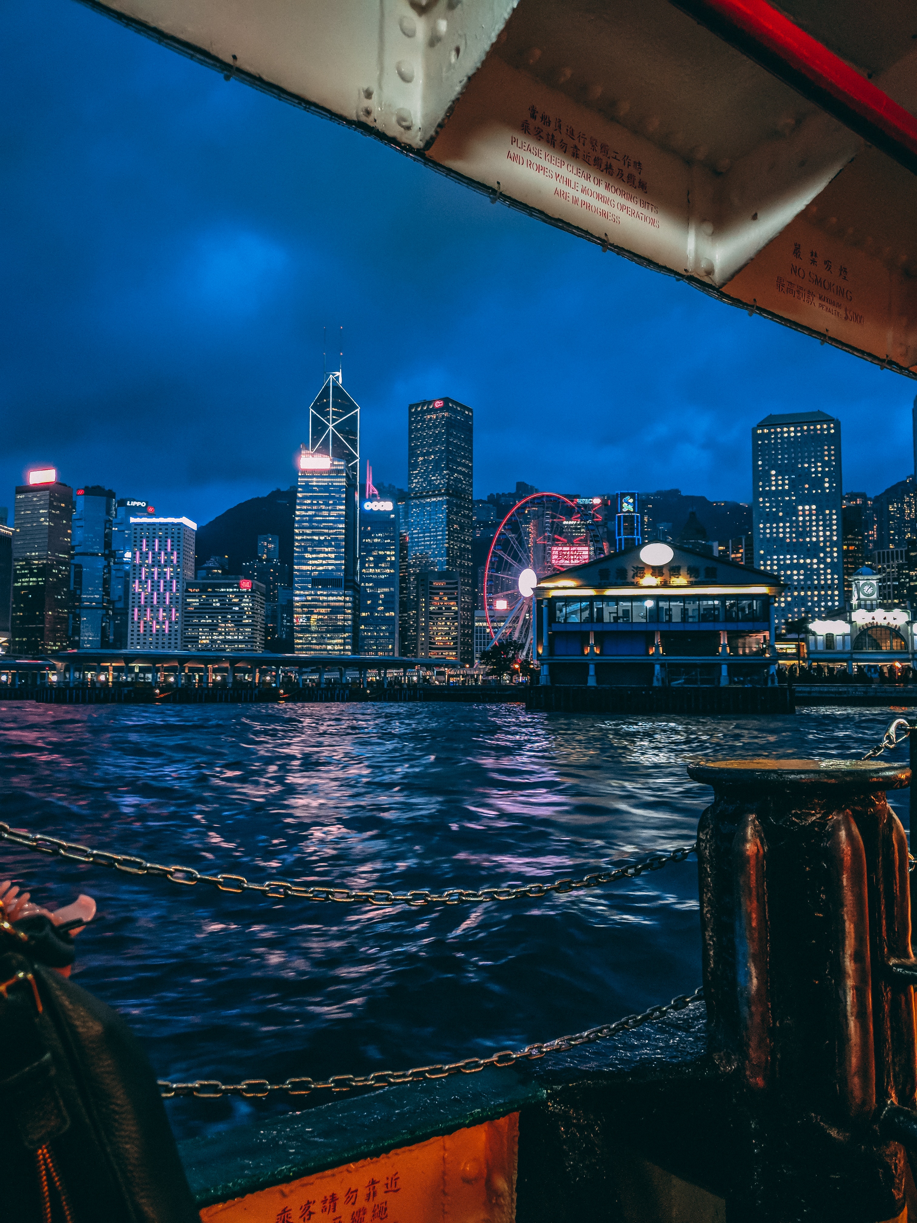
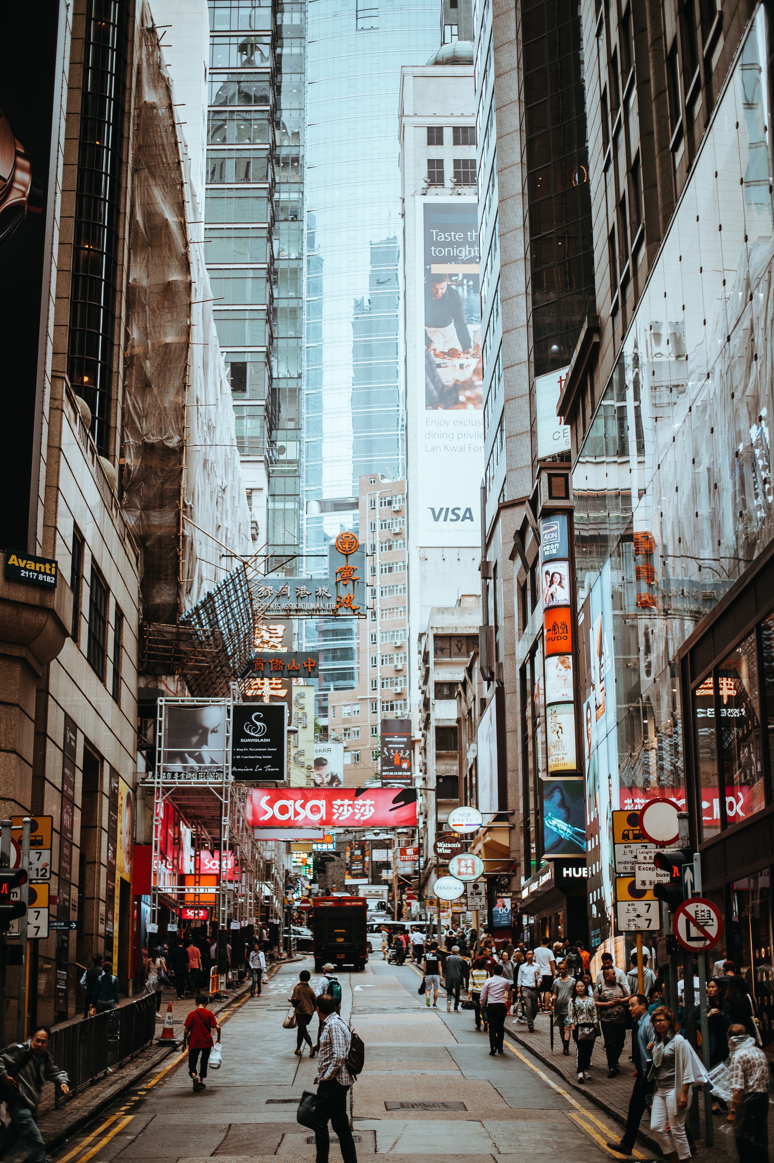
The Hong Kong Island skyline, with its ever-growing number of skyscrapers, speaks to ambition and money. Paris, London, even New York were centuries in the making, while Hong Kong's towers, bright lights, and glitzy shopping emporia weren't yet part of the urban scene when many of the young investment bankers who fuel one of the world's leading financial centers were born. Commerce is concentrated in the glittering high-rises of Central, tucked between Victoria Harbor and forested peaks on Hong Kong Island's north shore. While it's easy to think all the bright lights are the sum of today's Hong Kong, you need only walk or board a tram for the short jaunt west into Western to discover a side of Hong Kong that is more traditionally Chinese but no less high-energy. You'll discover the real Hong Kong to the east of Central, too, in Wan Chai, Causeway Bay, and beyond. Amid the residential towers are restaurants, shopping malls, bars, convention centers, a nice smattering of museums, and—depending on fate and the horse you wager on—one of Hong Kong's luckiest or unluckiest spots, the Happy Valley Racecourse. Kowloon sprawls across a generous swath of the Chinese mainland across Victoria Harbour from Central. Tsim Sha Tsui, at the tip of Kowloon peninsula, is packed with glitzy shops, first-rate museums, and eye-popping views of the skyline across the water. Just to the north are the teeming market streets of Mong Kok and in the dense residential neighborhoods beyond, two of Hong Kong's most enchanting spiritual sights, Wong Tai Sin Temple and Chi Lin Nunnery. As you navigate this huge metropolis (easy to do on the excellent transportation network), keep in mind that streets are usually numbered odd on one side, even on the other. There's no baseline for street numbers and no block-based numbering system, but street signs indicate building numbers for any given block.
About Hong Kong
The Hong Kong Island skyline, with its ever-growing number of skyscrapers, speaks to ambition and money. Paris, London, even New York were centuries in the making, while Hong Kong's towers, bright lights, and glitzy shopping emporia weren't yet part of the urban scene when many of the young investment bankers who fuel one of the world's leading financial centers were born. Commerce is concentrated in the glittering high-rises of Central, tucked between Victoria Harbor and forested peaks on Hong Kong Island's north shore. While it's easy to think all the bright lights are the sum of today's Hong Kong, you need only walk or board a tram for the short jaunt west into Western to discover a side of Hong Kong that is more traditionally Chinese but no less high-energy. You'll discover the real Hong Kong to the east of Central, too, in Wan Chai, Causeway Bay, and beyond. Amid the residential towers are restaurants, shopping malls, bars, convention centers, a nice smattering of museums, and—depending on fate and the horse you wager on—one of Hong Kong's luckiest or unluckiest spots, the Happy Valley Racecourse. Kowloon sprawls across a generous swath of the Chinese mainland across Victoria Harbour from Central. Tsim Sha Tsui, at the tip of Kowloon peninsula, is packed with glitzy shops, first-rate museums, and eye-popping views of the skyline across the water. Just to the north are the teeming market streets of Mong Kok and in the dense residential neighborhoods beyond, two of Hong Kong's most enchanting spiritual sights, Wong Tai Sin Temple and Chi Lin Nunnery. As you navigate this huge metropolis (easy to do on the excellent transportation network), keep in mind that streets are usually numbered odd on one side, even on the other. There's no baseline for street numbers and no block-based numbering system, but street signs indicate building numbers for any given block.
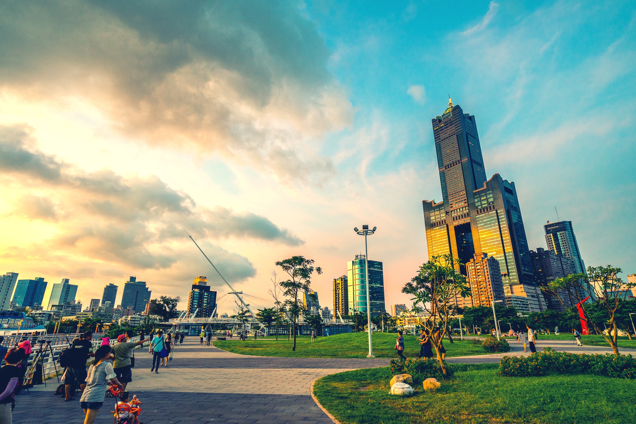
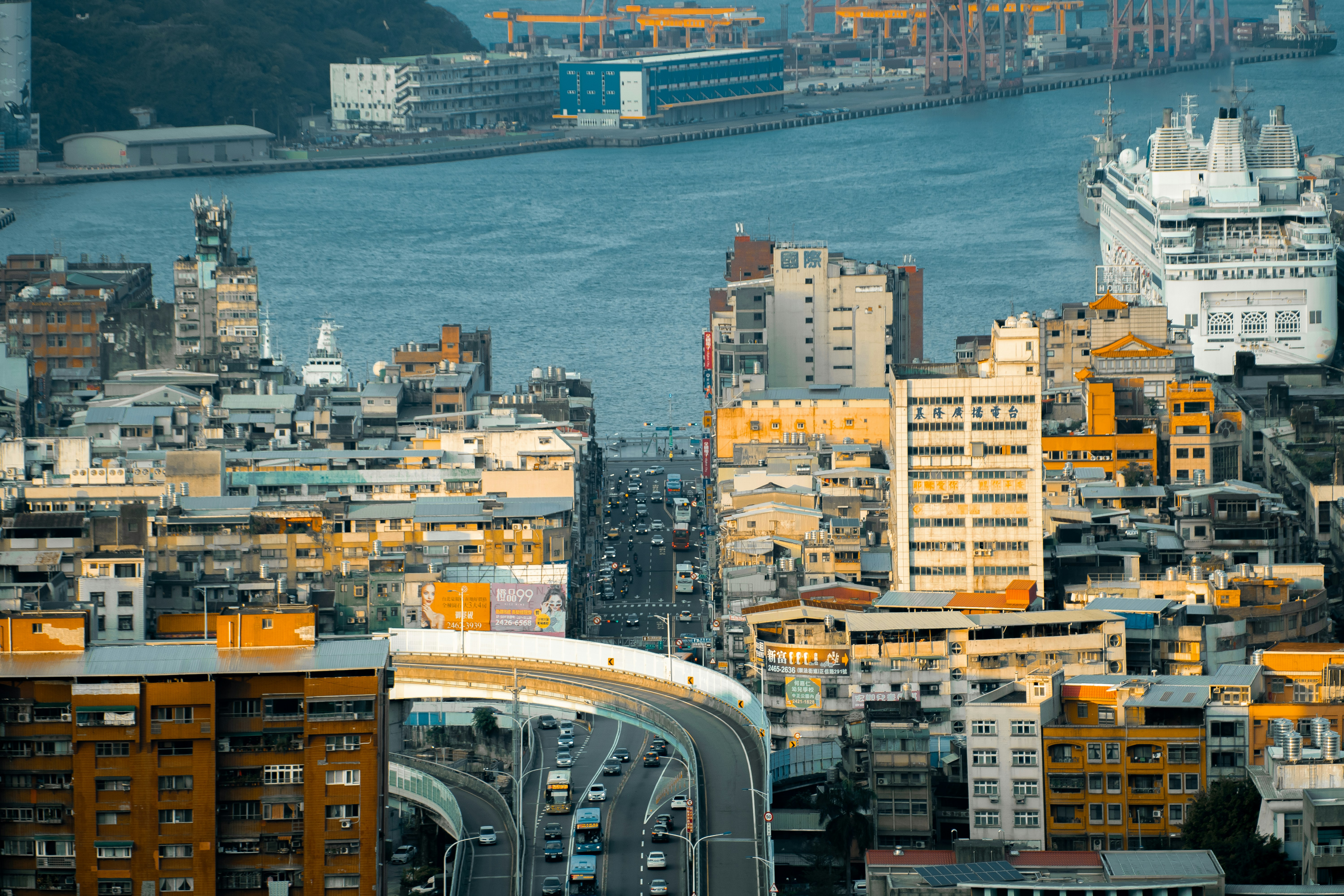
About Kaohsiung
Kaohsiung is Taiwan’s second largest city, its biggest seaport, and the world’s fourth largest container port. It entered the 21st century as a newly emerging international metropolis. In the forefront of Taiwan’s expansion and modernisation efforts are the China Steel Corporation and China Shipbuilding. They are perfect examples of what Taiwan’s export-oriented economy is all about. The Love River, which has seen some recent landscaping, adds to the beauty of the city. Coffee shops along its banks offer good opportunities to view the river’s activities and enjoy a nice breeze. A 495-feet (150 metres)-long urban corridor of light, known as Urban Spotlight, was designed by local artists who wanted to make light and shadows the theme of the hall. The result is an urban space in the Central Park area teeming with artistic vision. A very important event in Taiwan’s recent history occurred here in 1979, and is known as the Kaohsiung Incident. It was the day of the first major human rights celebration on the island. Until that time, the authorities had never allowed any expression of discontent. When the day came, however, the celebration ended in chaos when police encircled the peaceful crowd and started using teargas, and pro-government instigators incited violence. Kuomintang (KMT) authorities used this as an excuse to round up all well-known opposition leaders and imprison them. Although it was hardly noticed internationally, it is recognised locally as an important turning point in the island’s transition to democracy, and it galvanised the Taiwanese people into action.
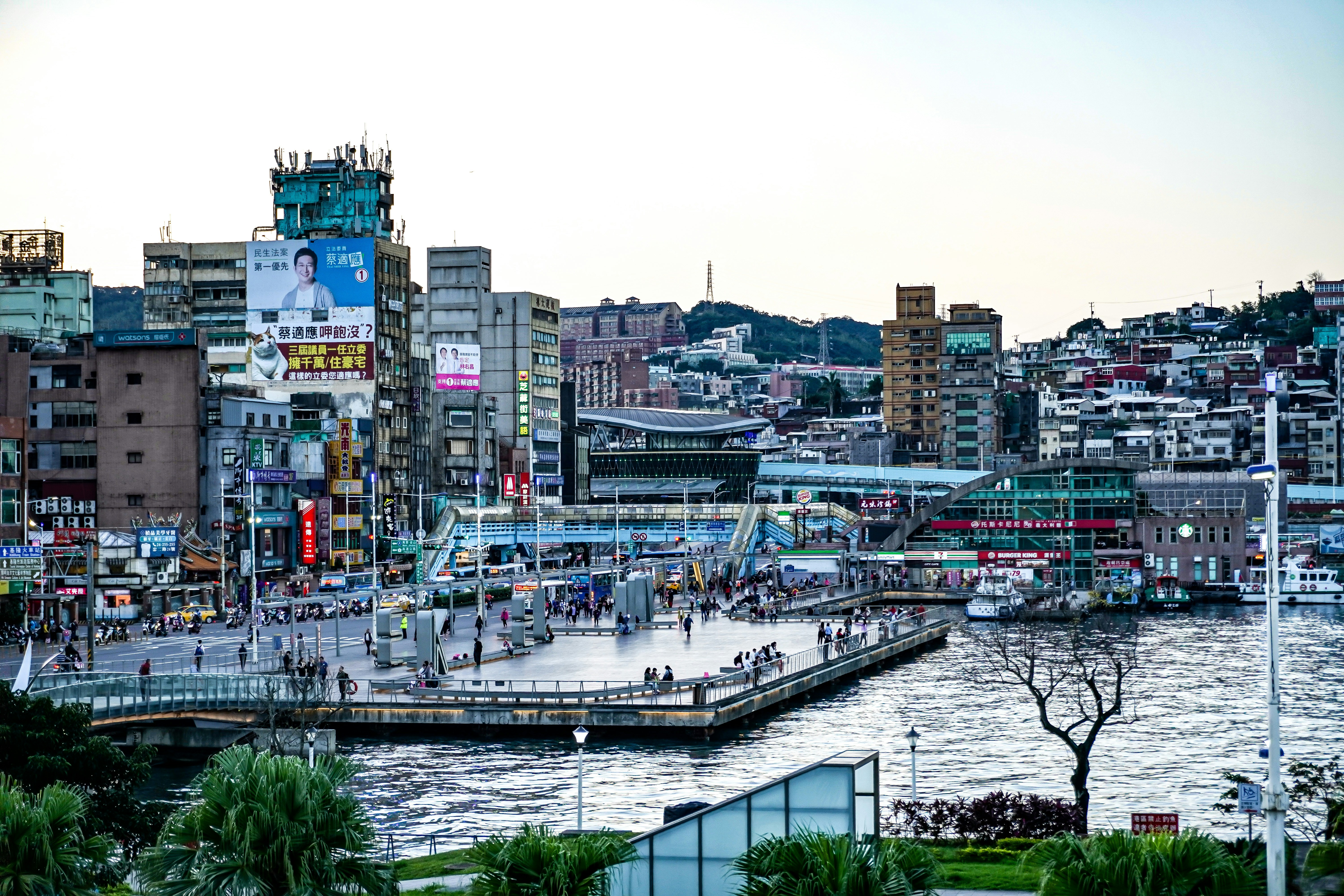
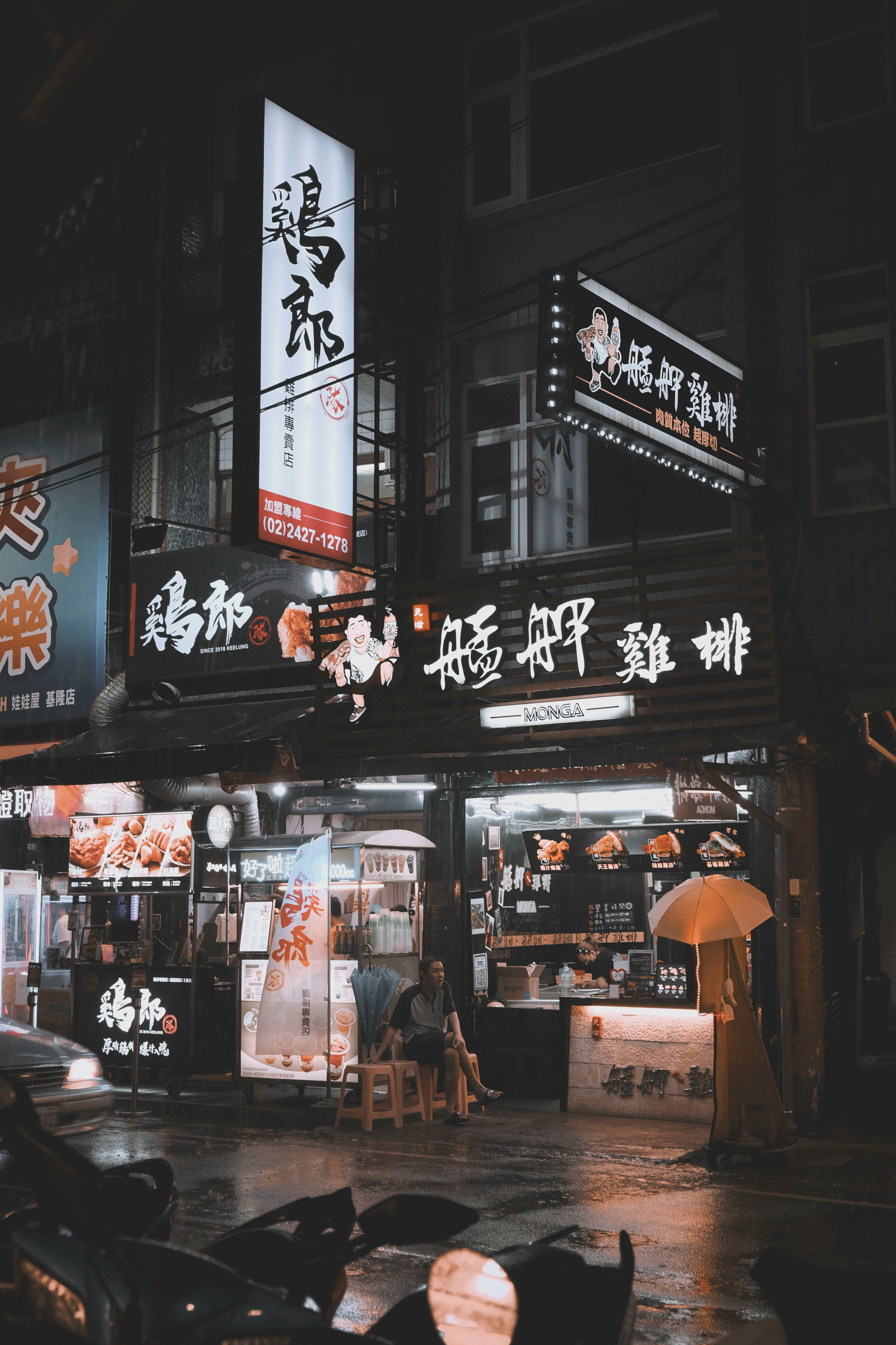
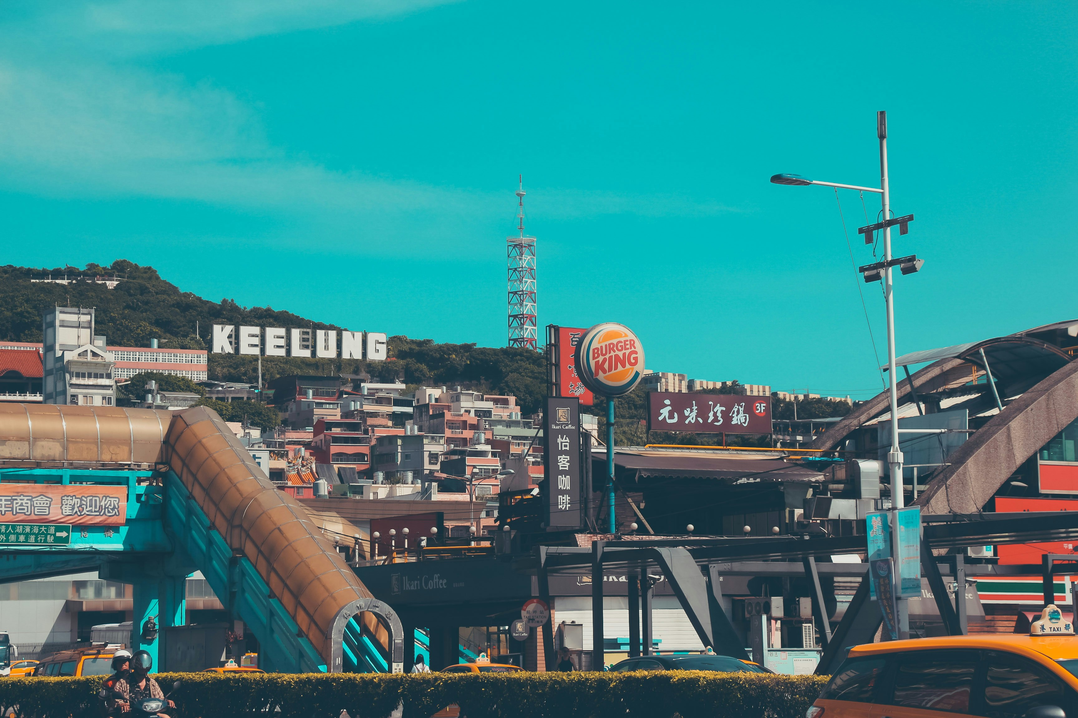
About Keelung (Chilung)
With the glittering lights of Taipei - a futuristic metropolis of culture and ideas - sparkling nearby, Keelung is the first calling point for many visitors arriving in Taiwan. While this port city essentially serves as Taipei's ocean gateway, you shouldn’t be too hasty in dashing off to Taipei's neon-lit magic – first it’s well worth spending some time exploring the famous glowing night market, which hums with life each evening and is famous for its local seafood.

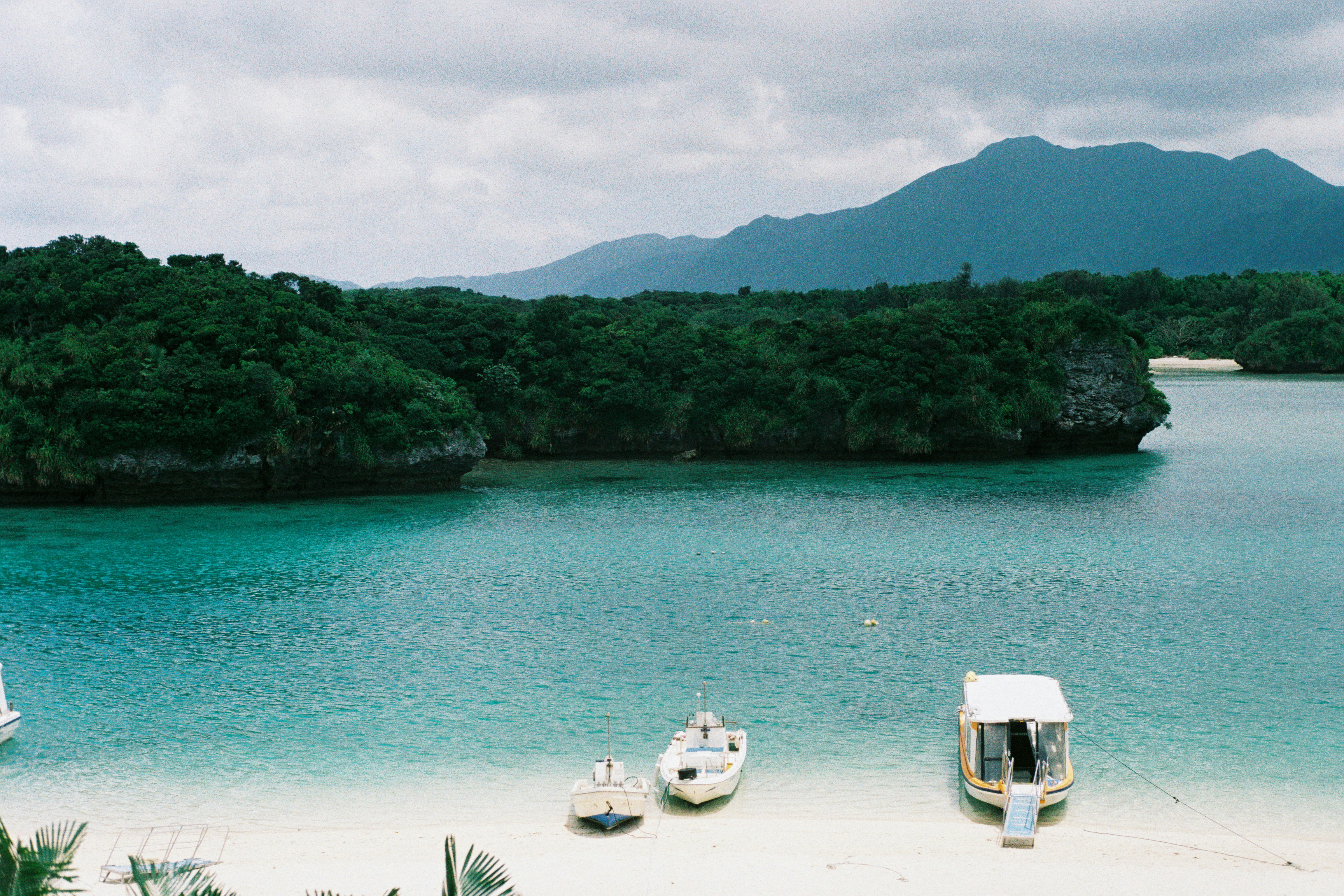
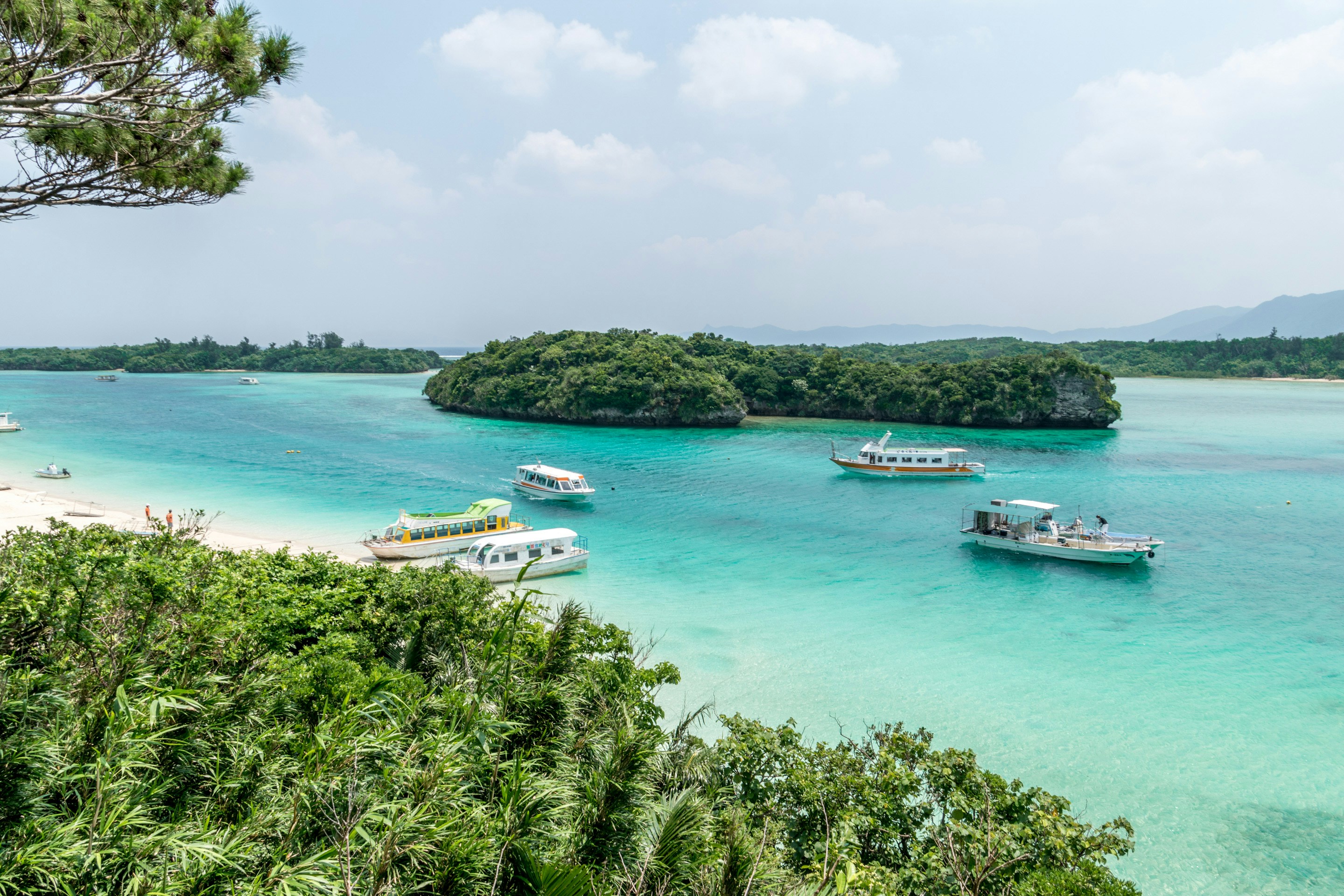
About Ishigaki
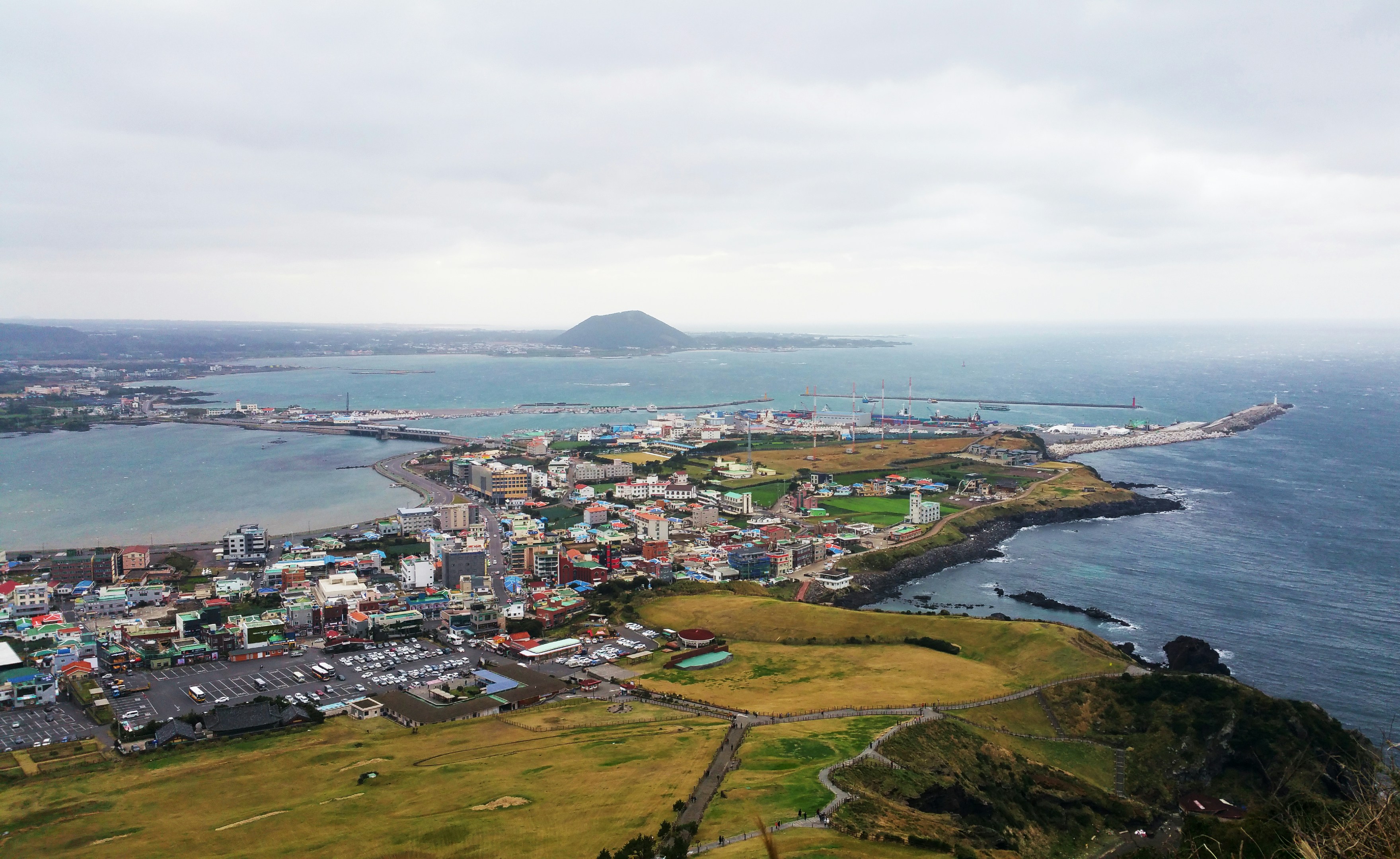
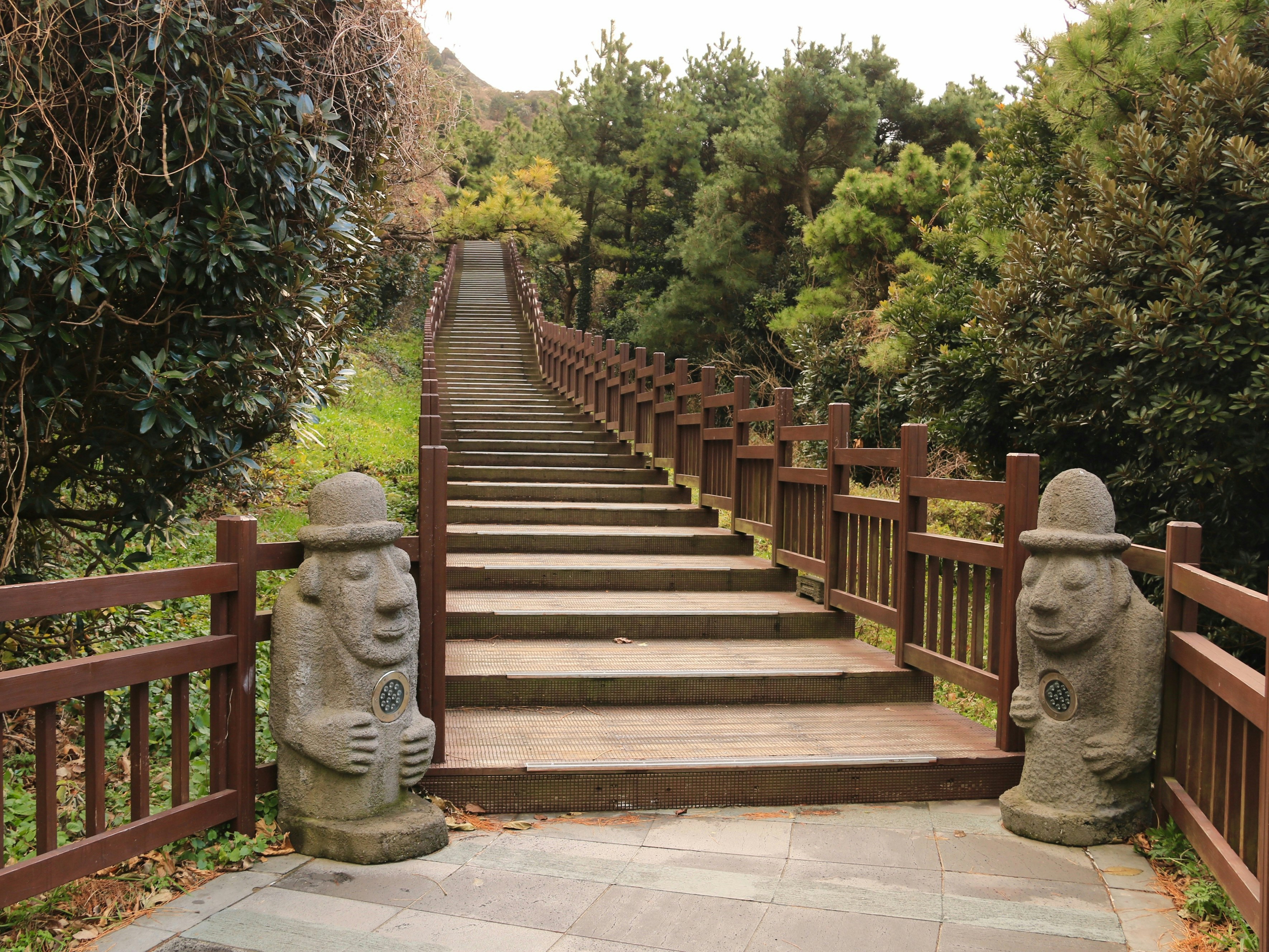
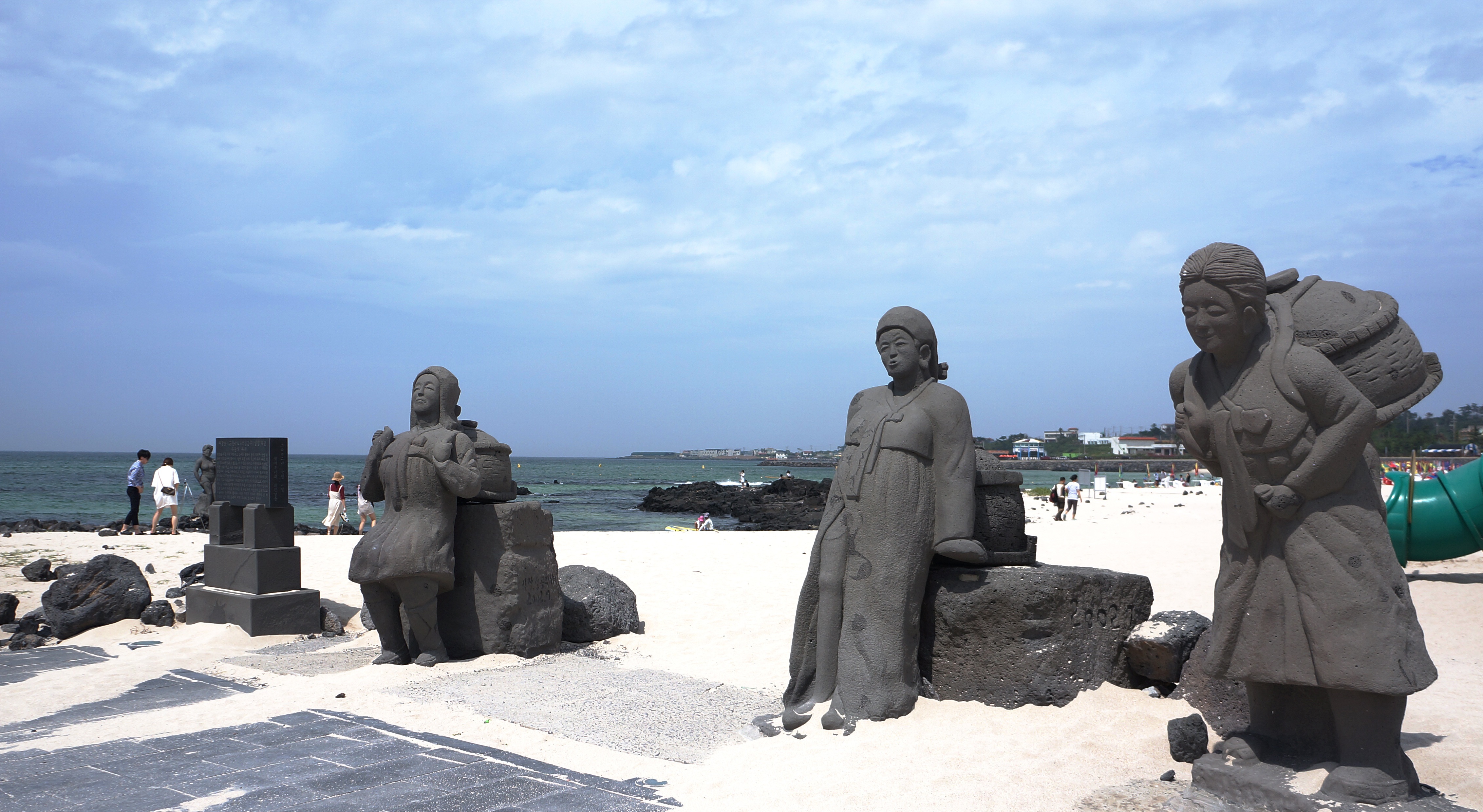
About Jeju Island
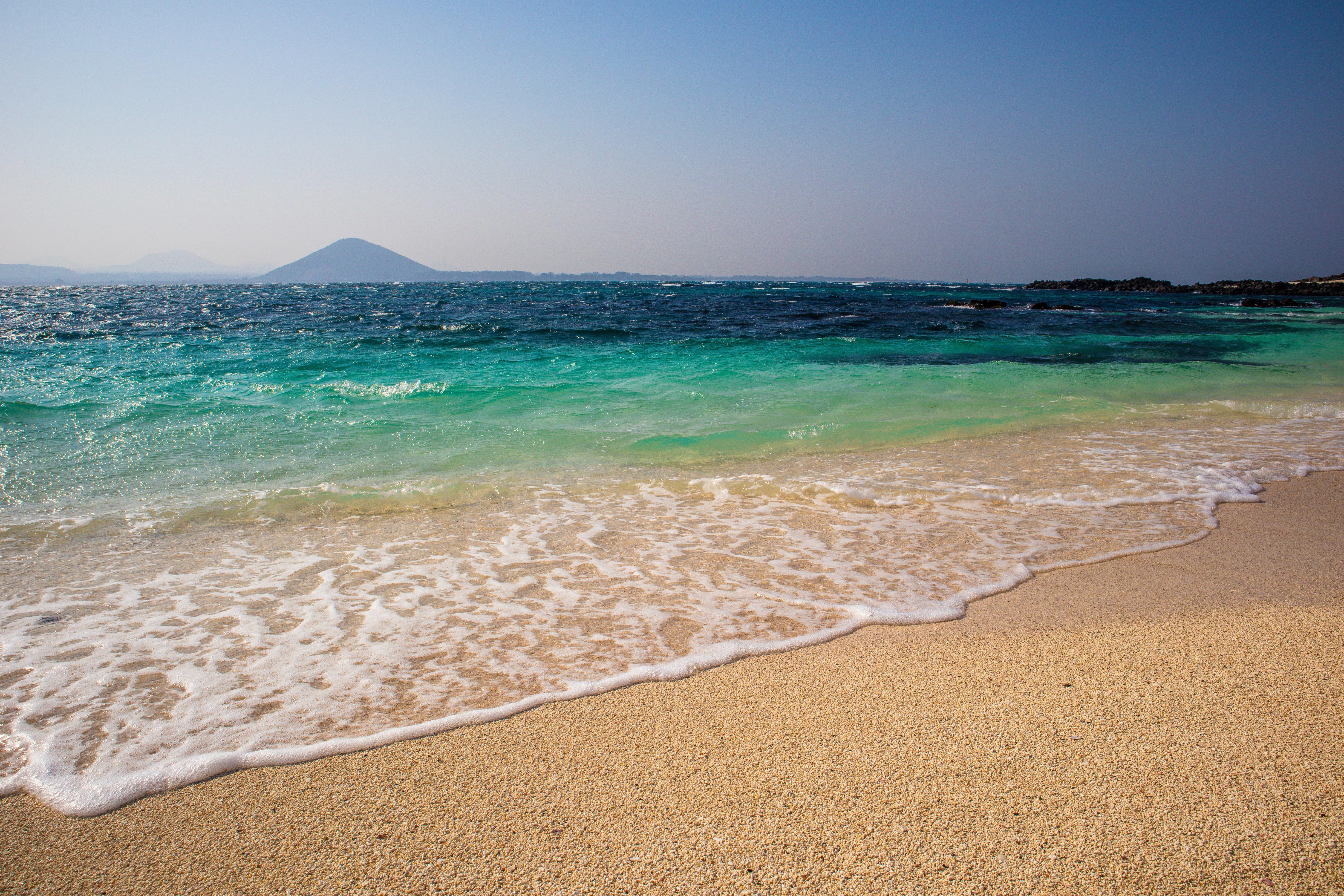
About Yeosu
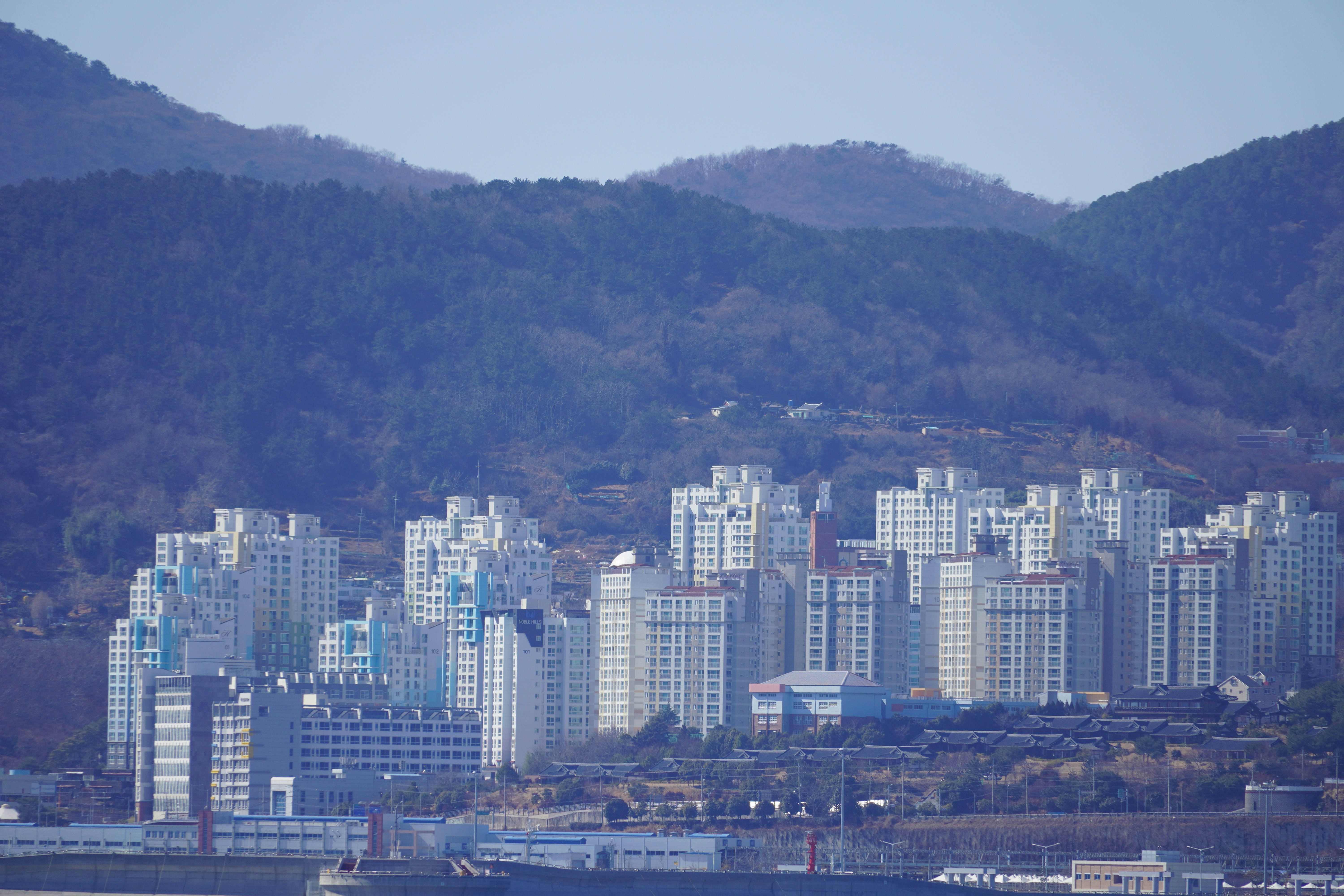


About Incheon
About Incheon
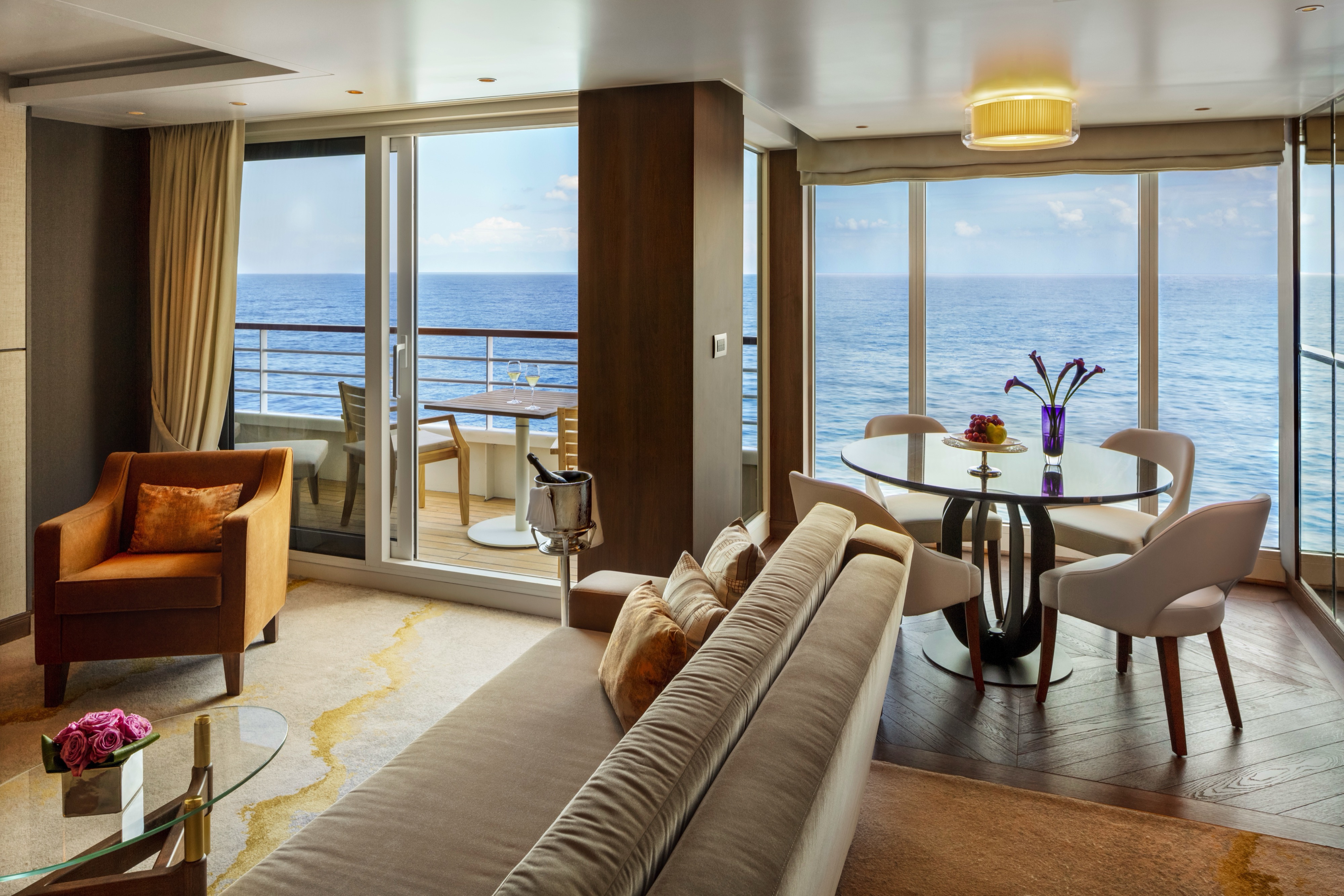
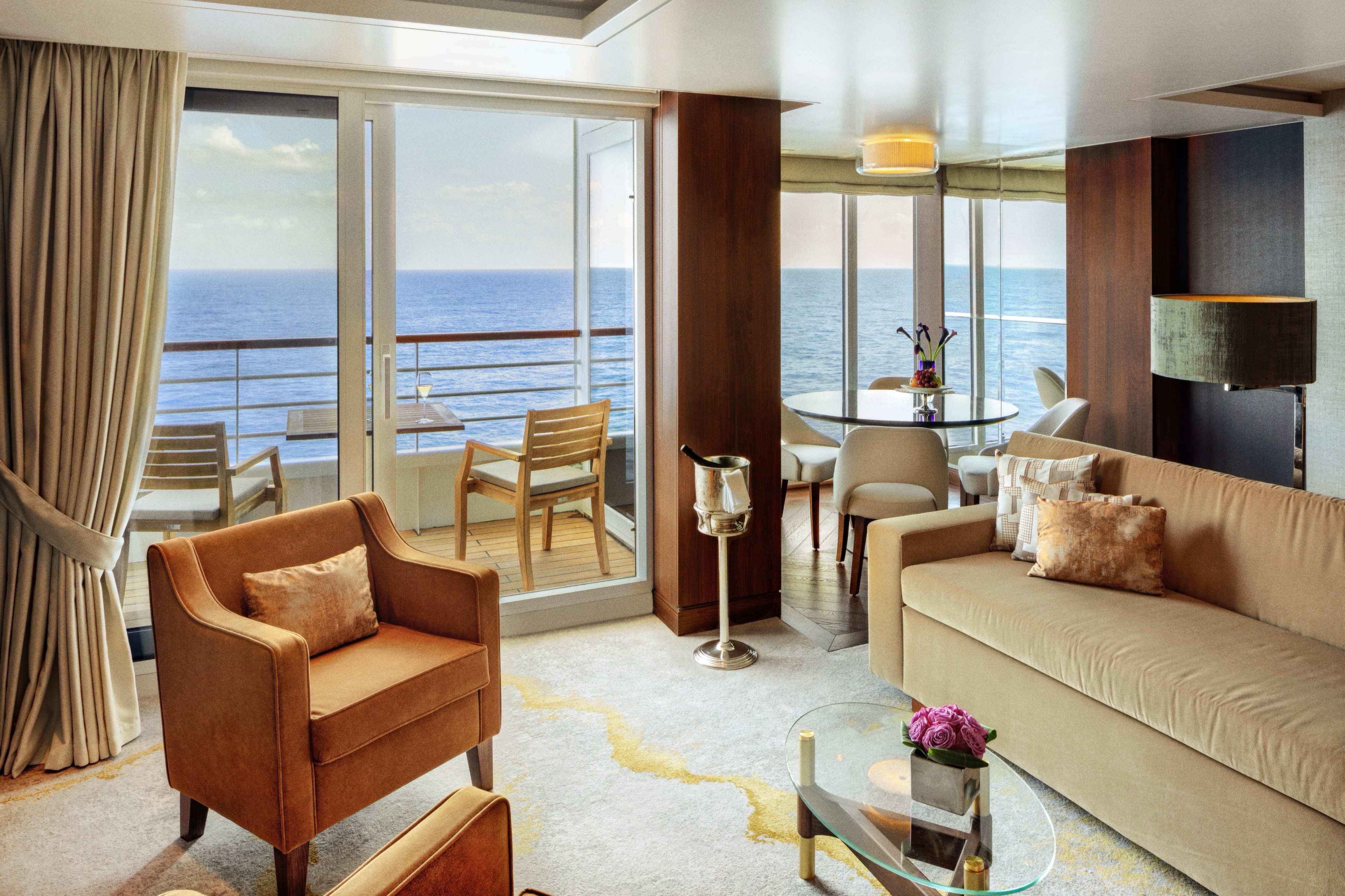
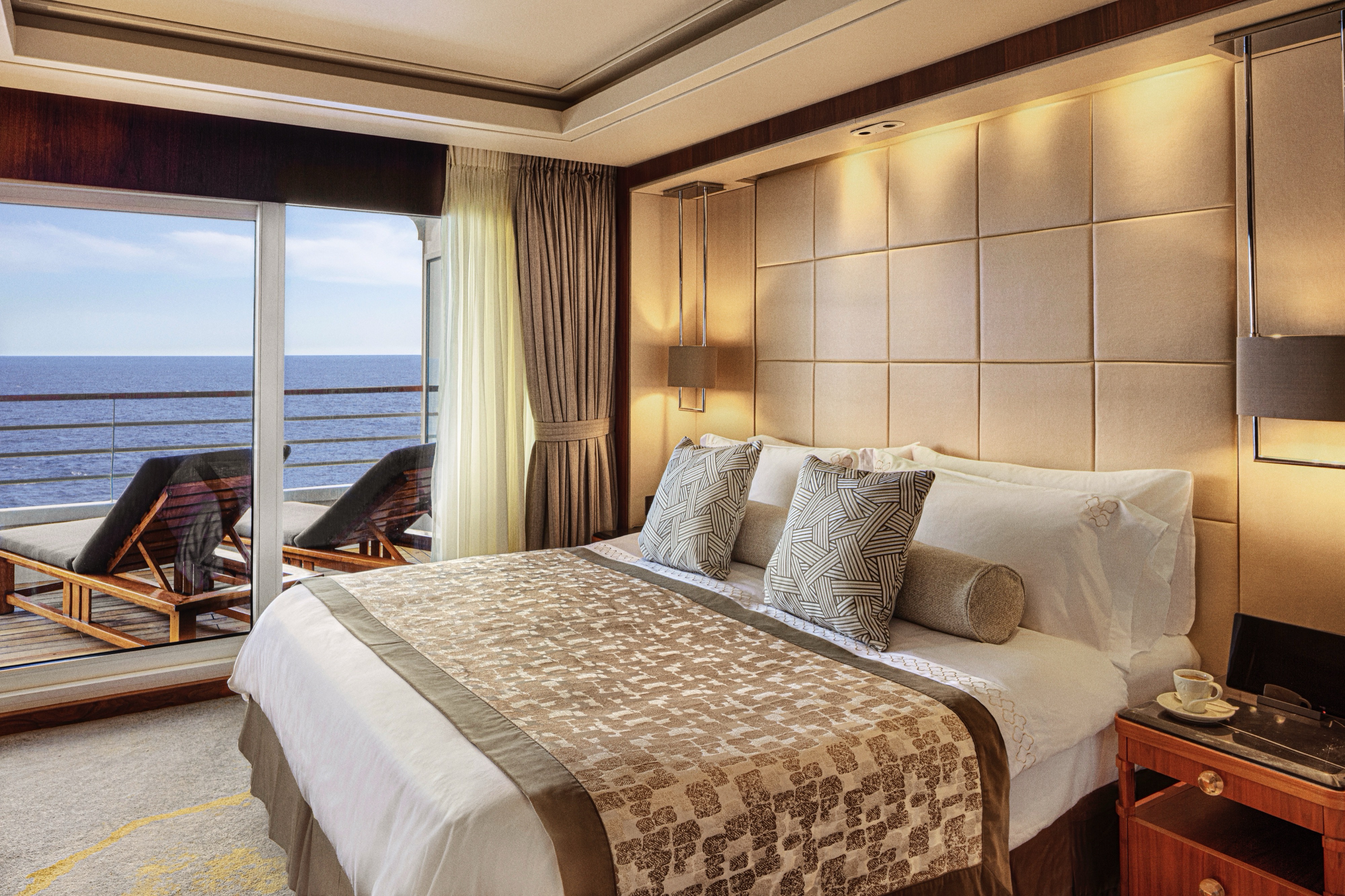
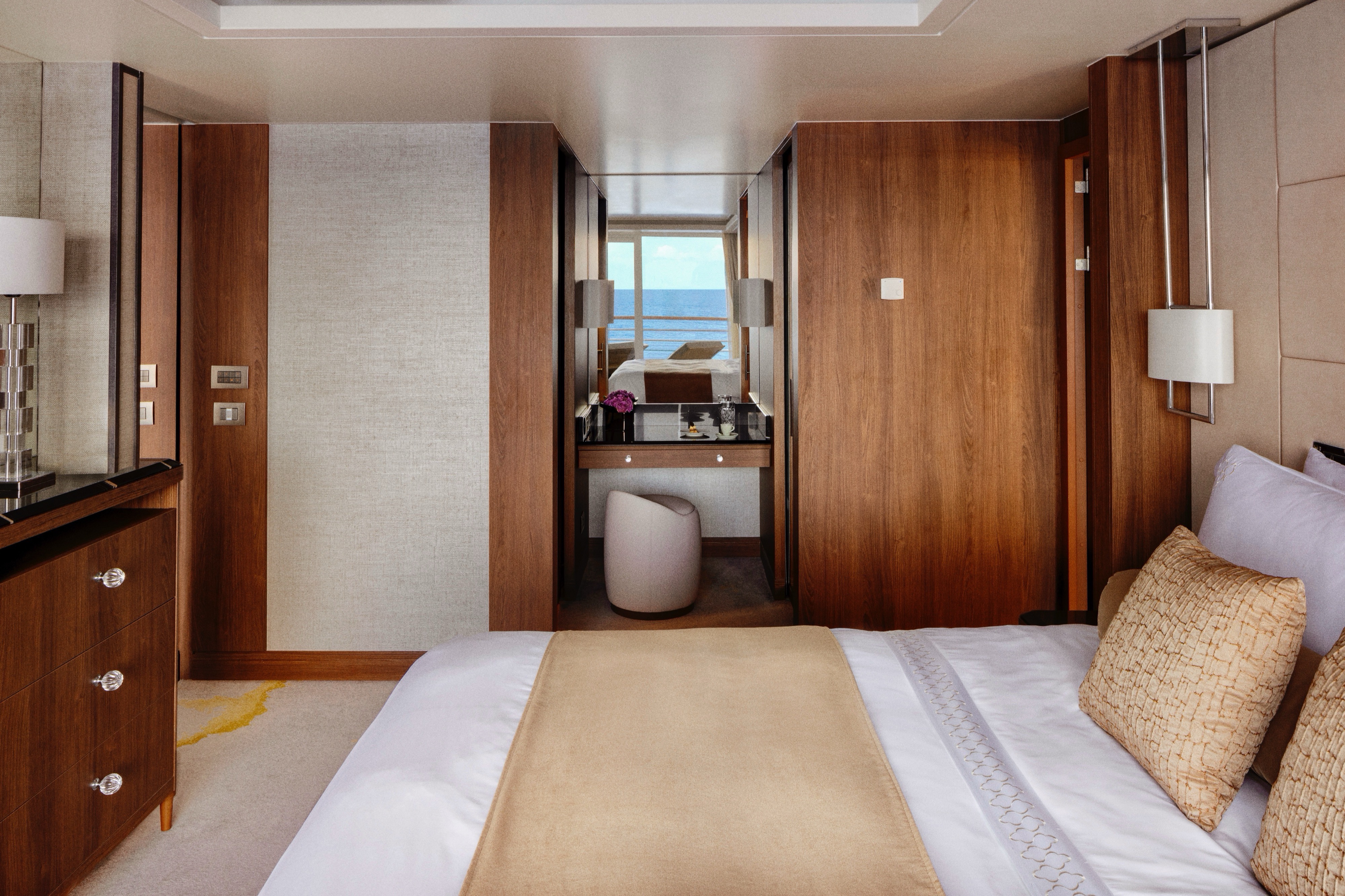
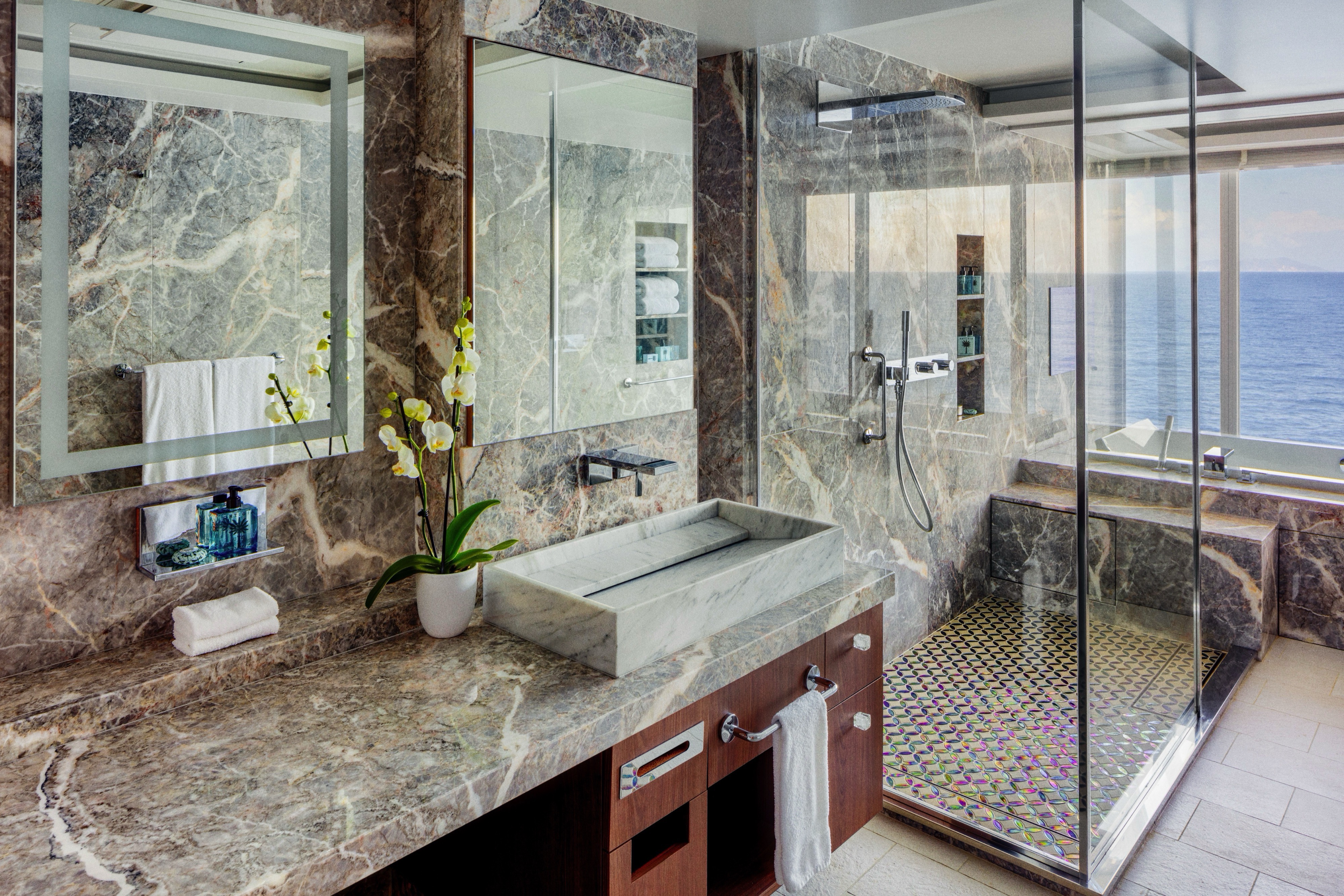
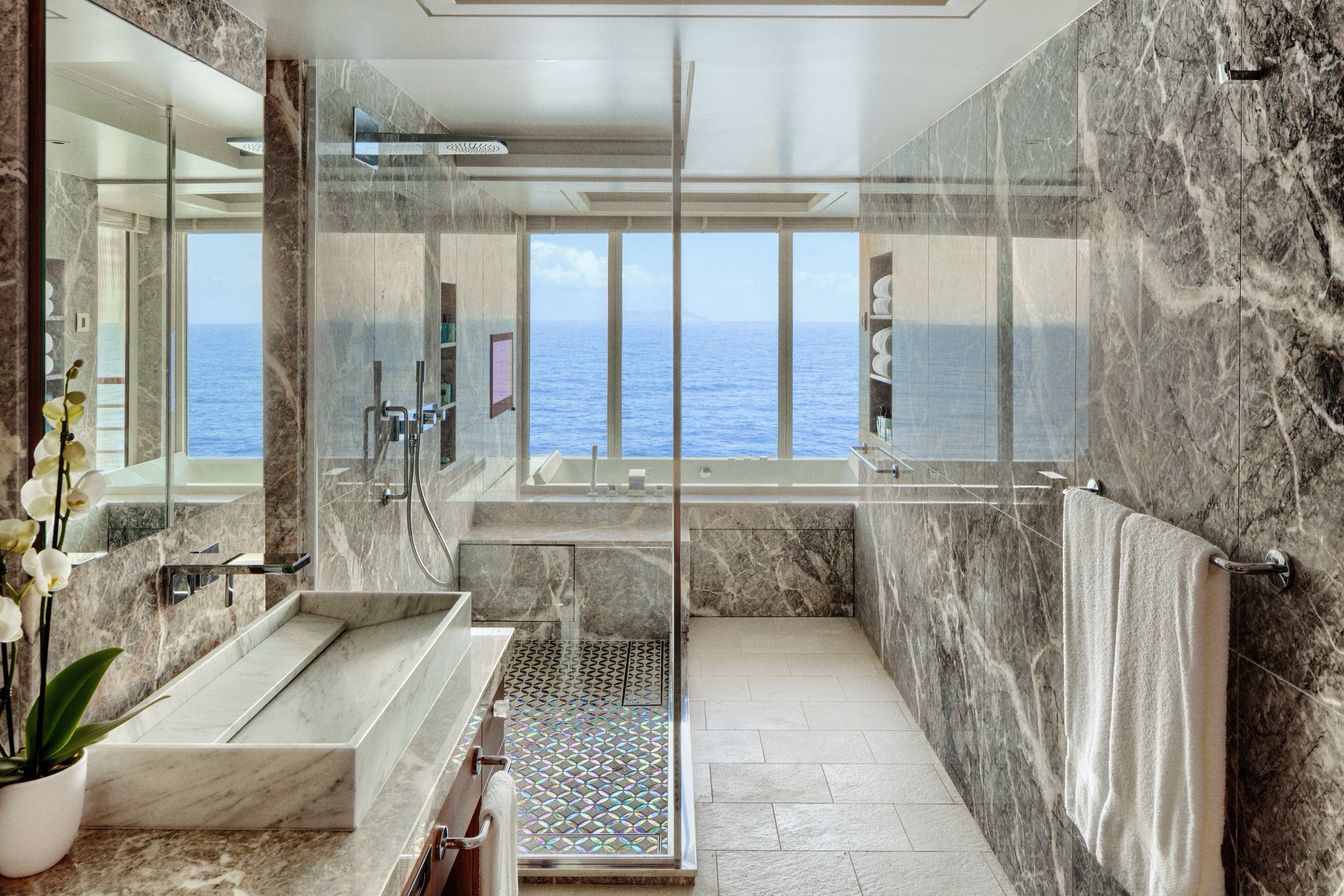
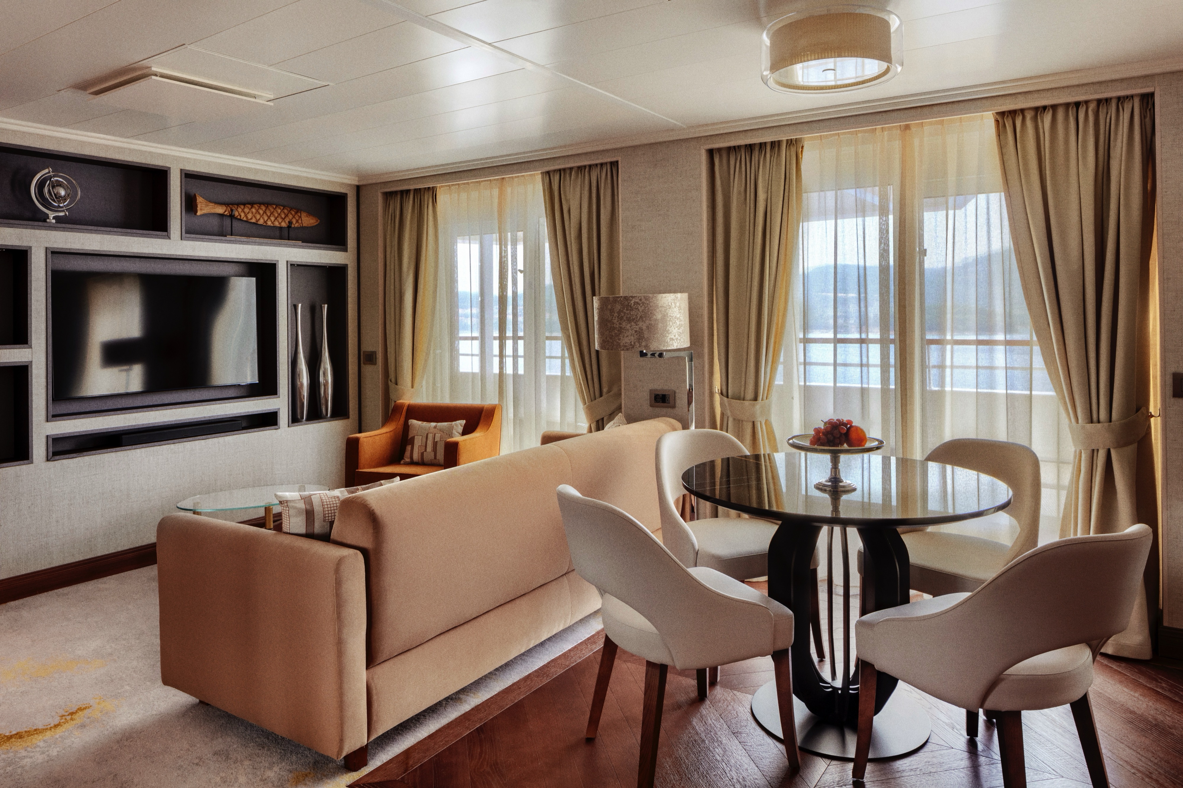
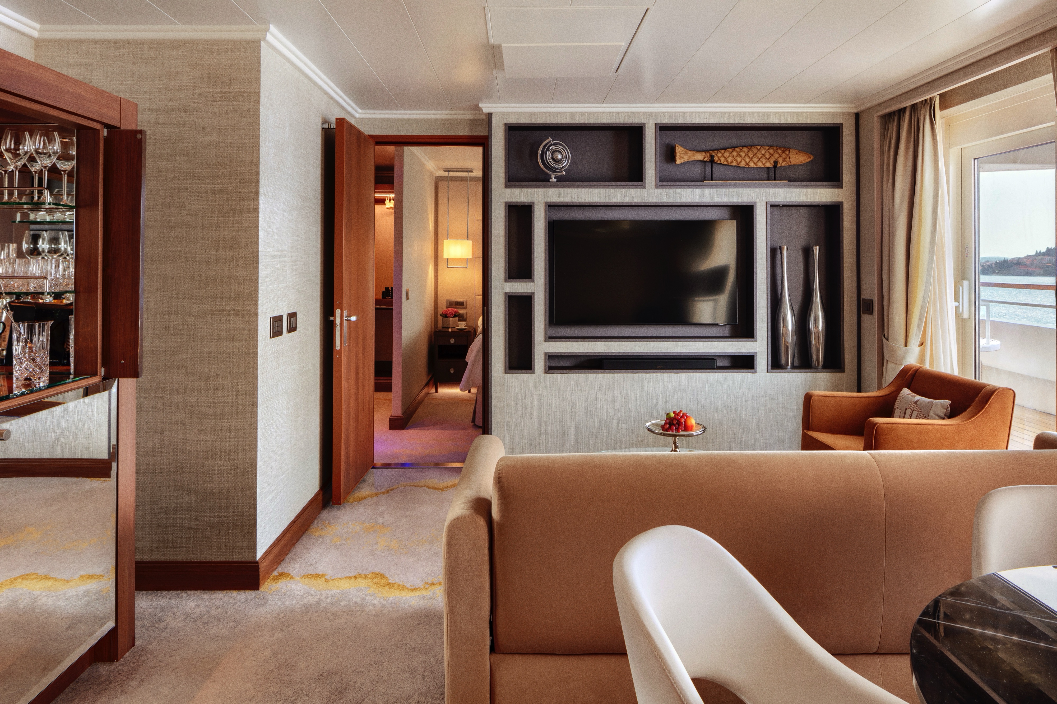
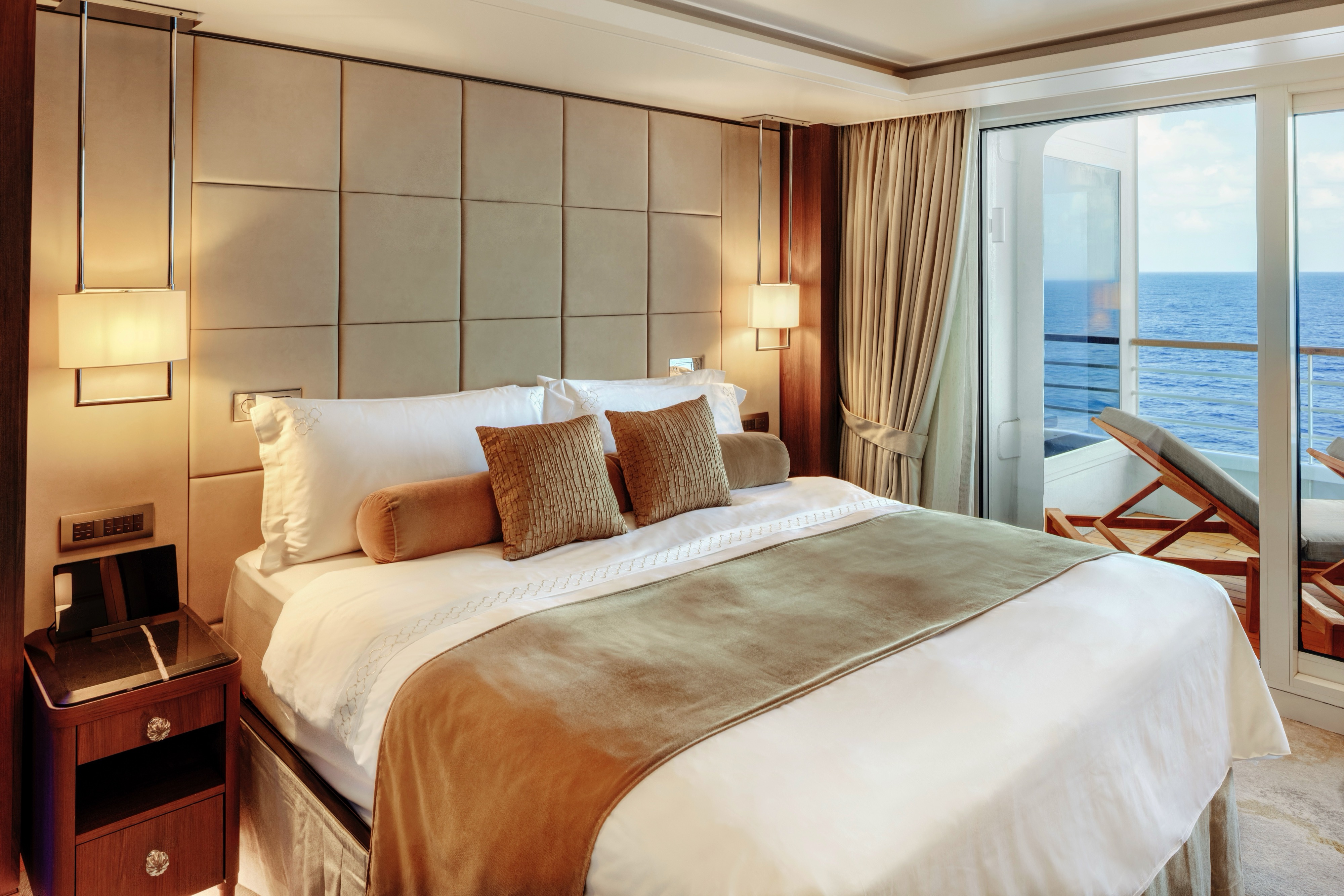
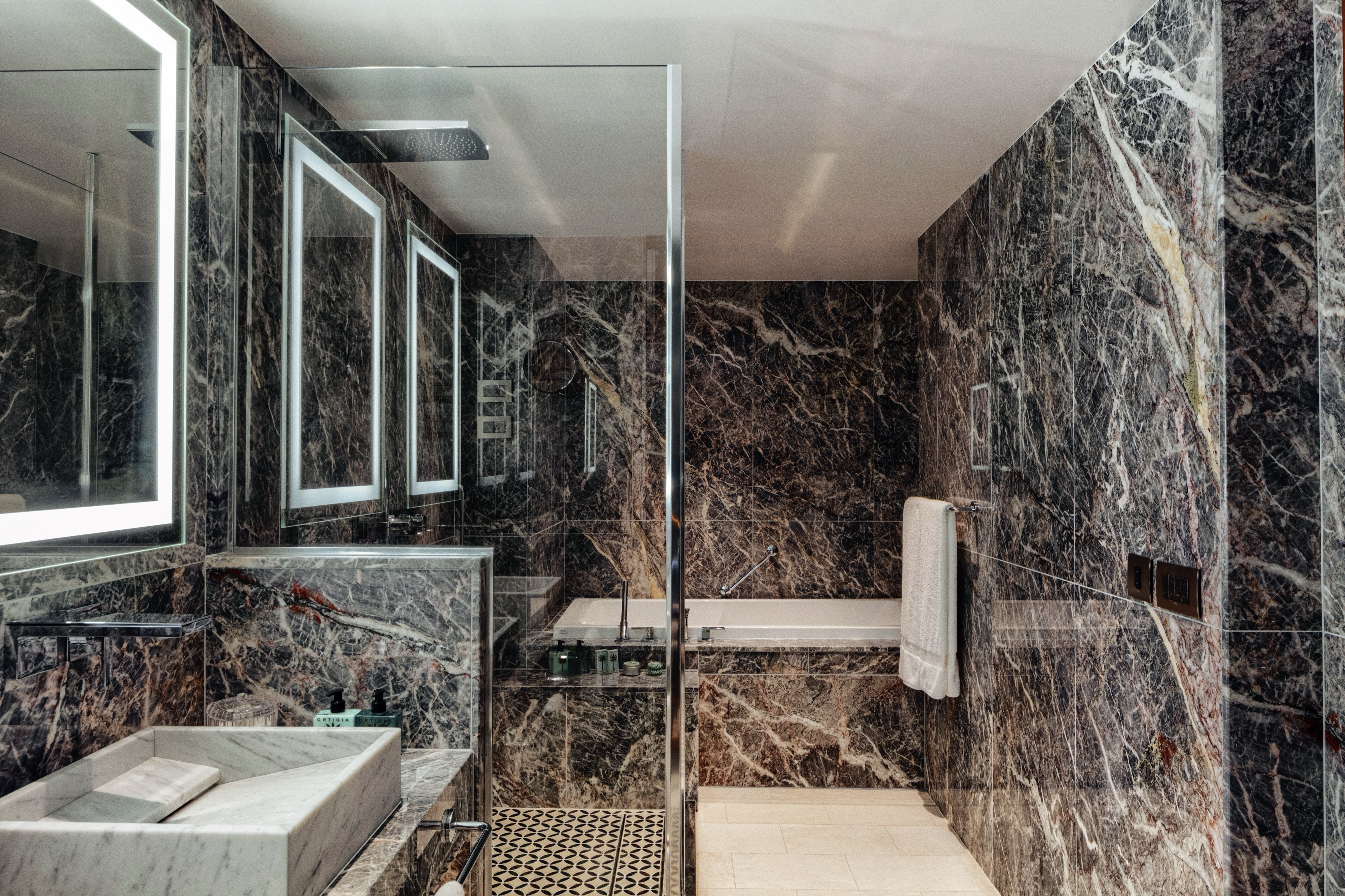
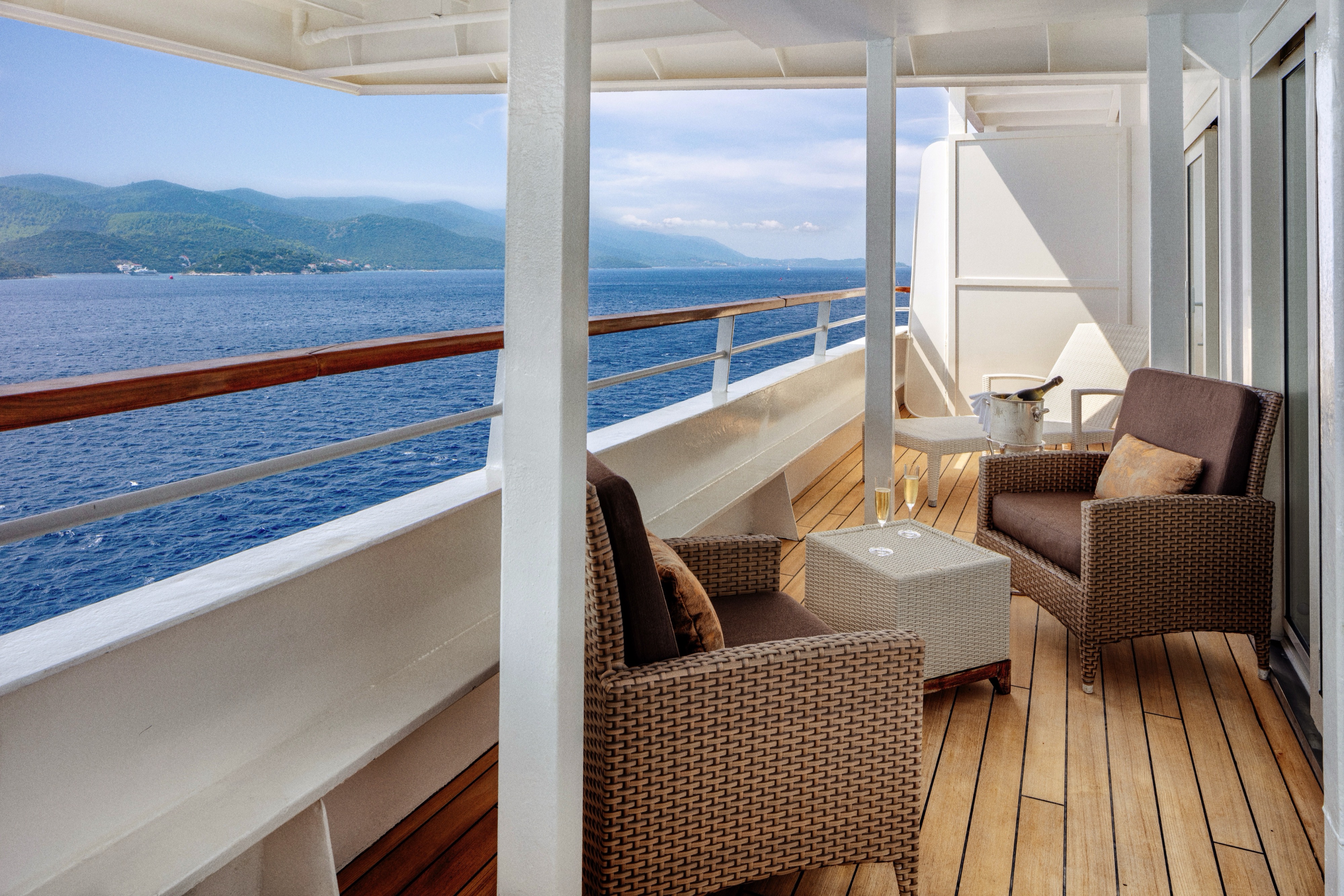
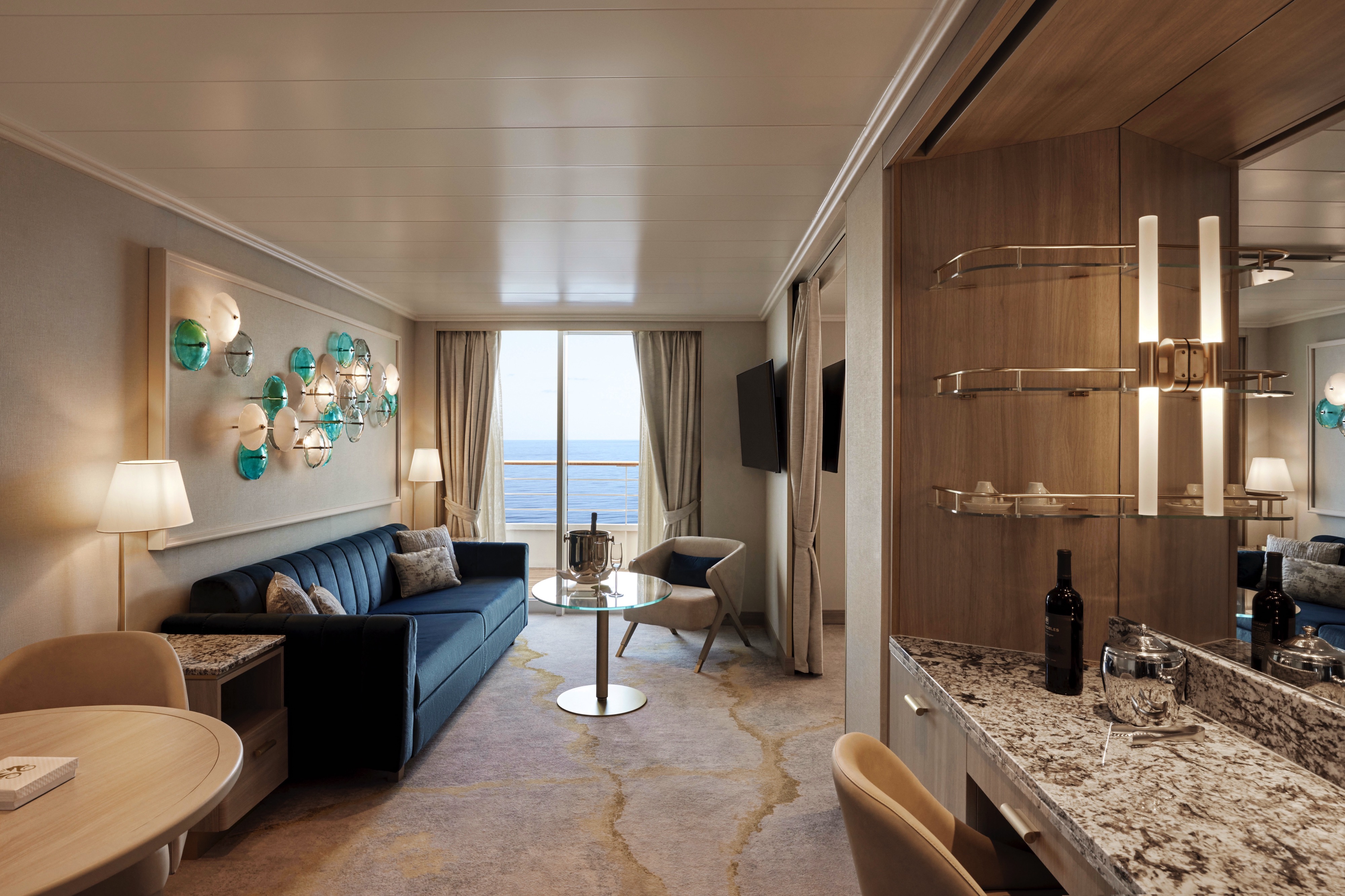
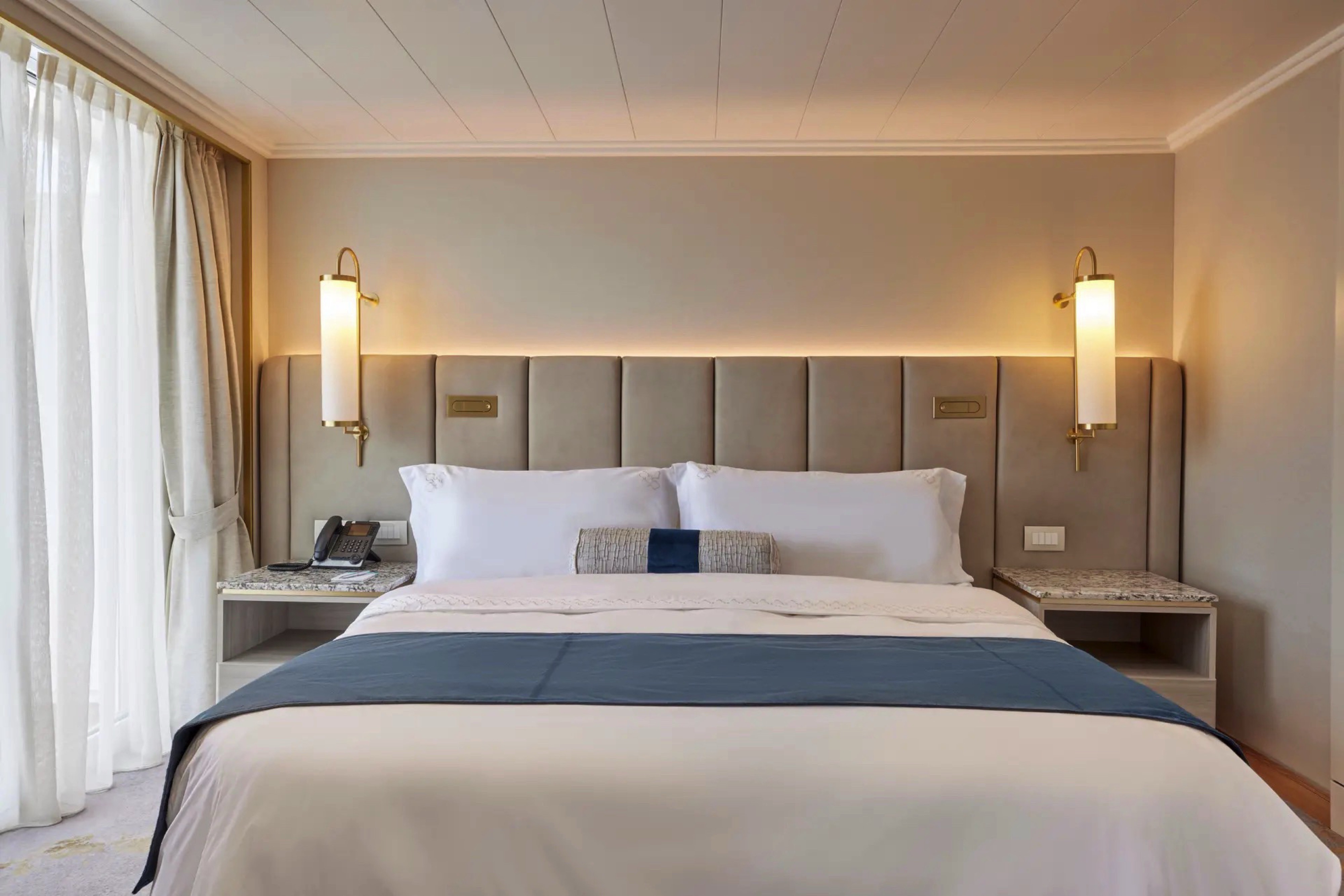
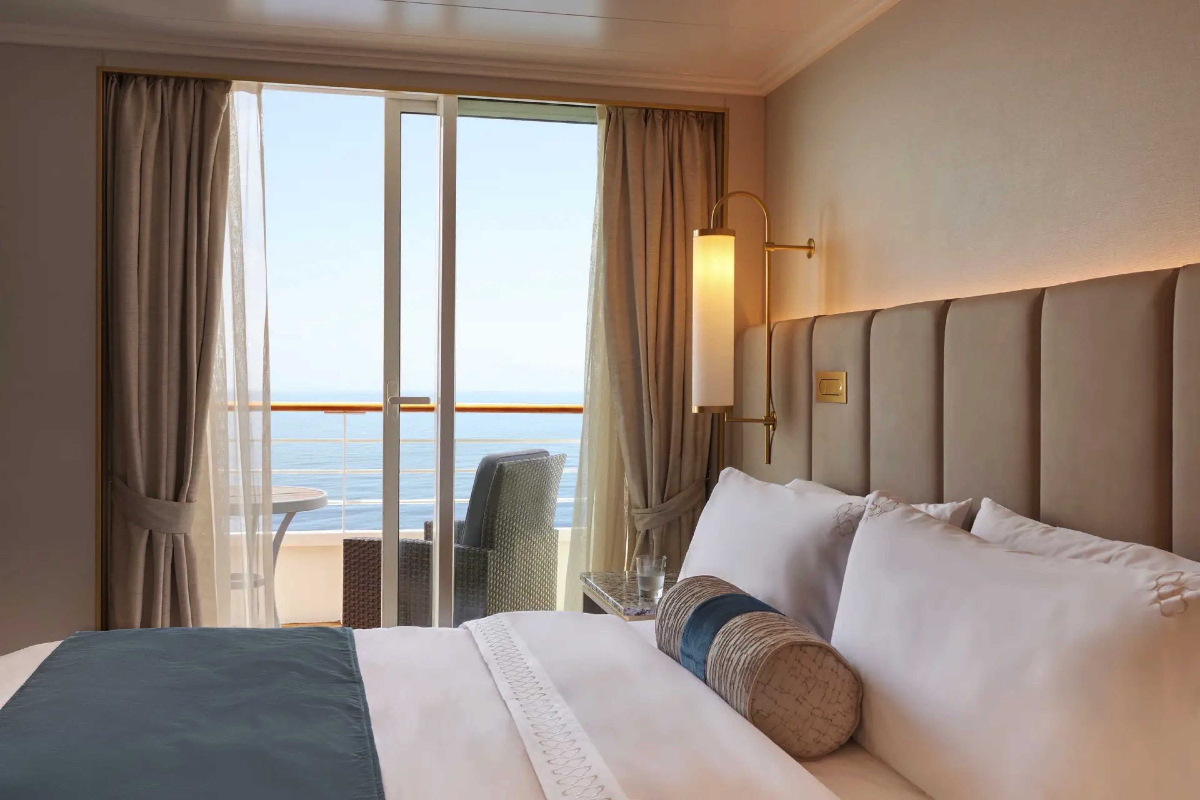
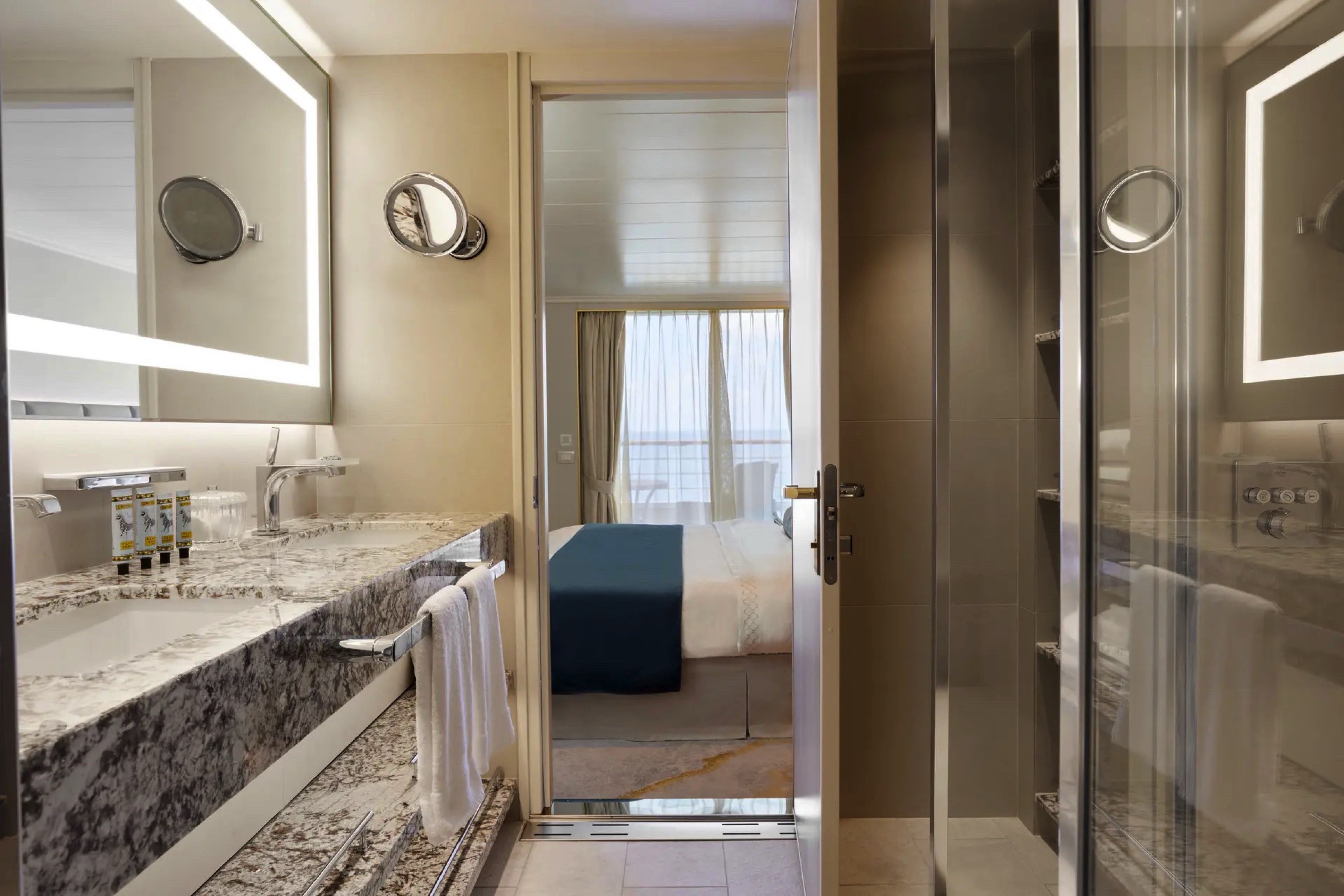
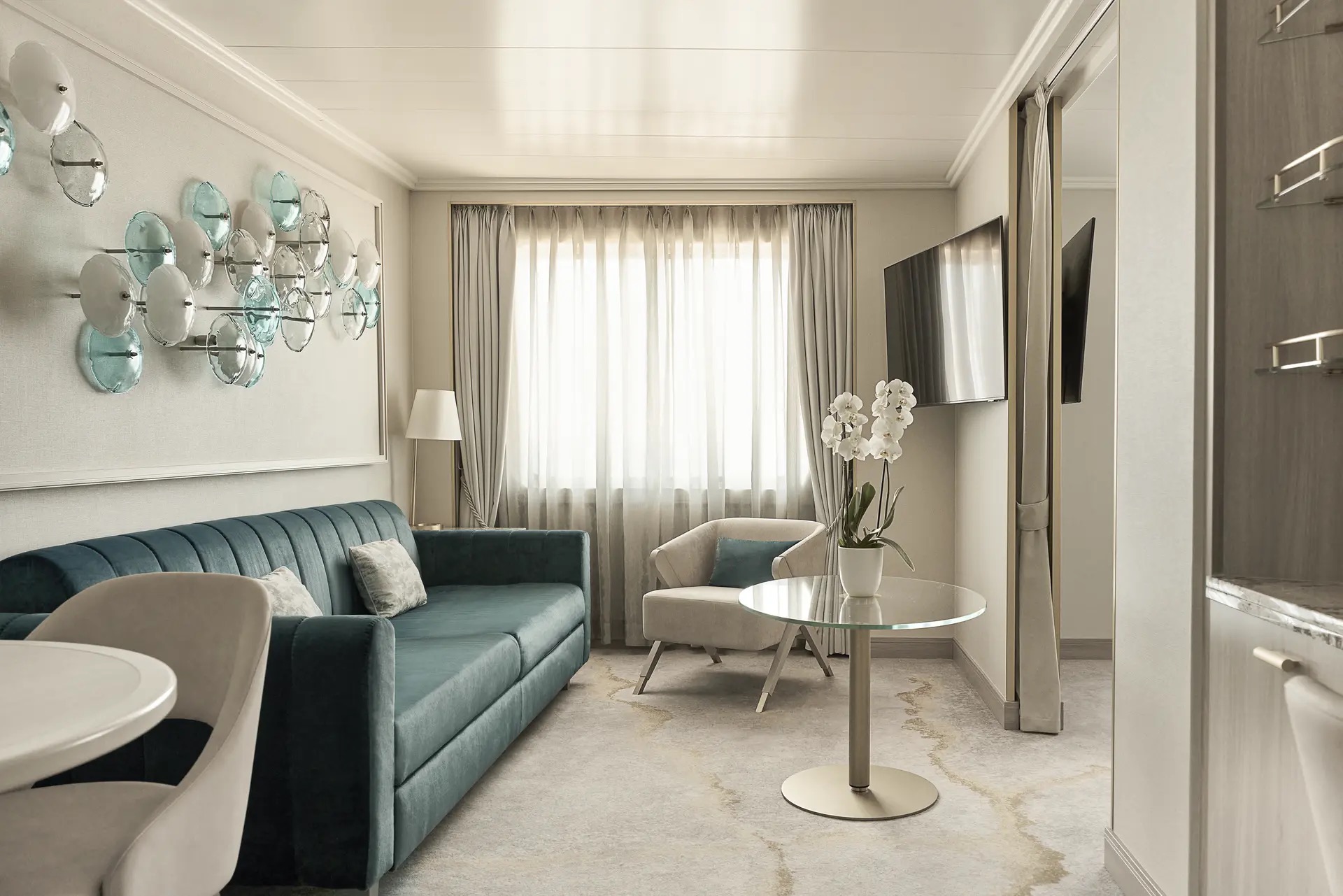
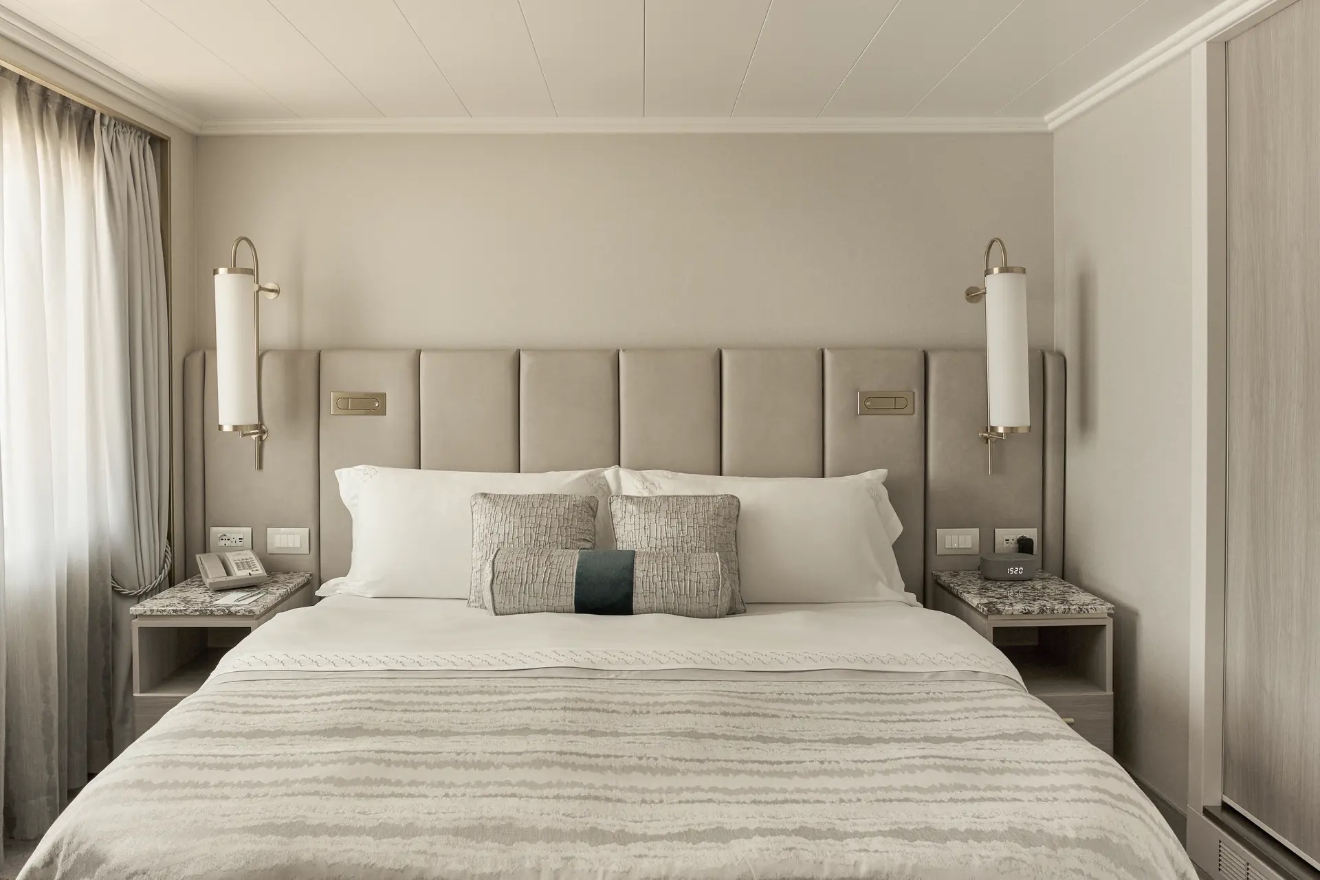
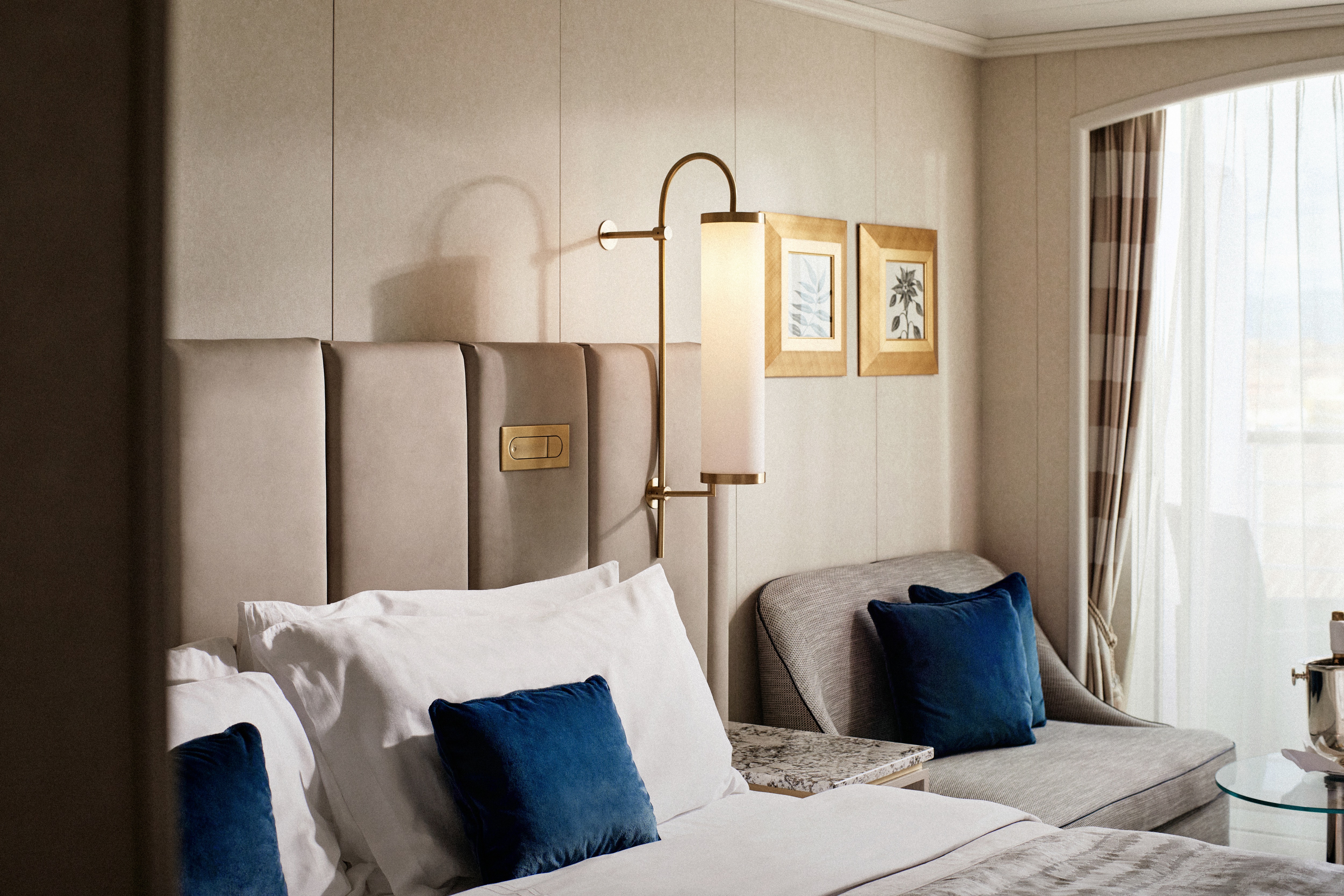
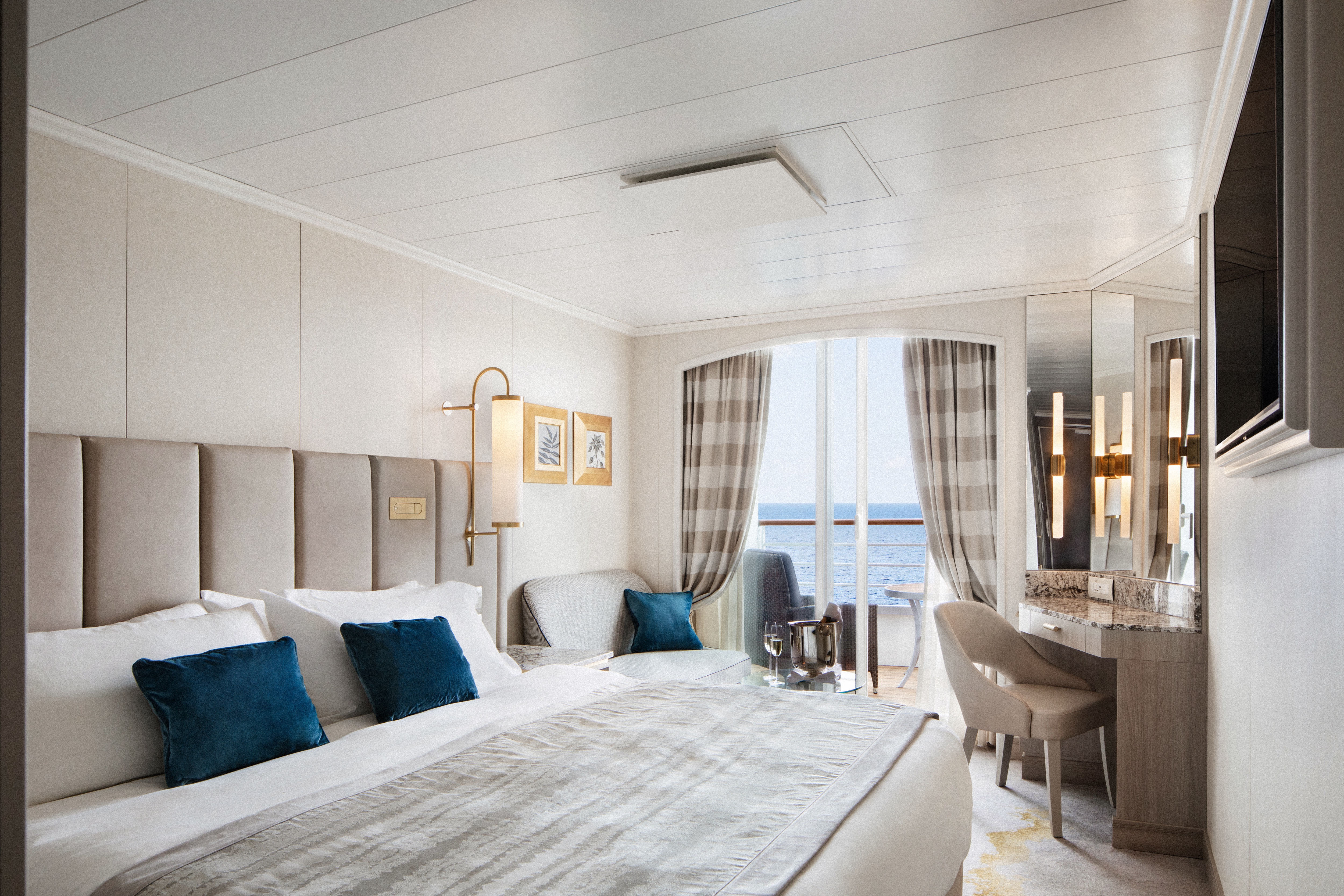
Our largest suite, available in 2023 or 2020 designs, offers two walk-in wardrobes, separate living and dining areas with panoramic ocean views, a study, and a custom built-in bar. There is also a Jacuzzi bathtub with ocean views, separate shower, bidet, and guest bathroom. Enjoy unlimited dining at specialty restaurants, unlimited laundry services, and more.
Details
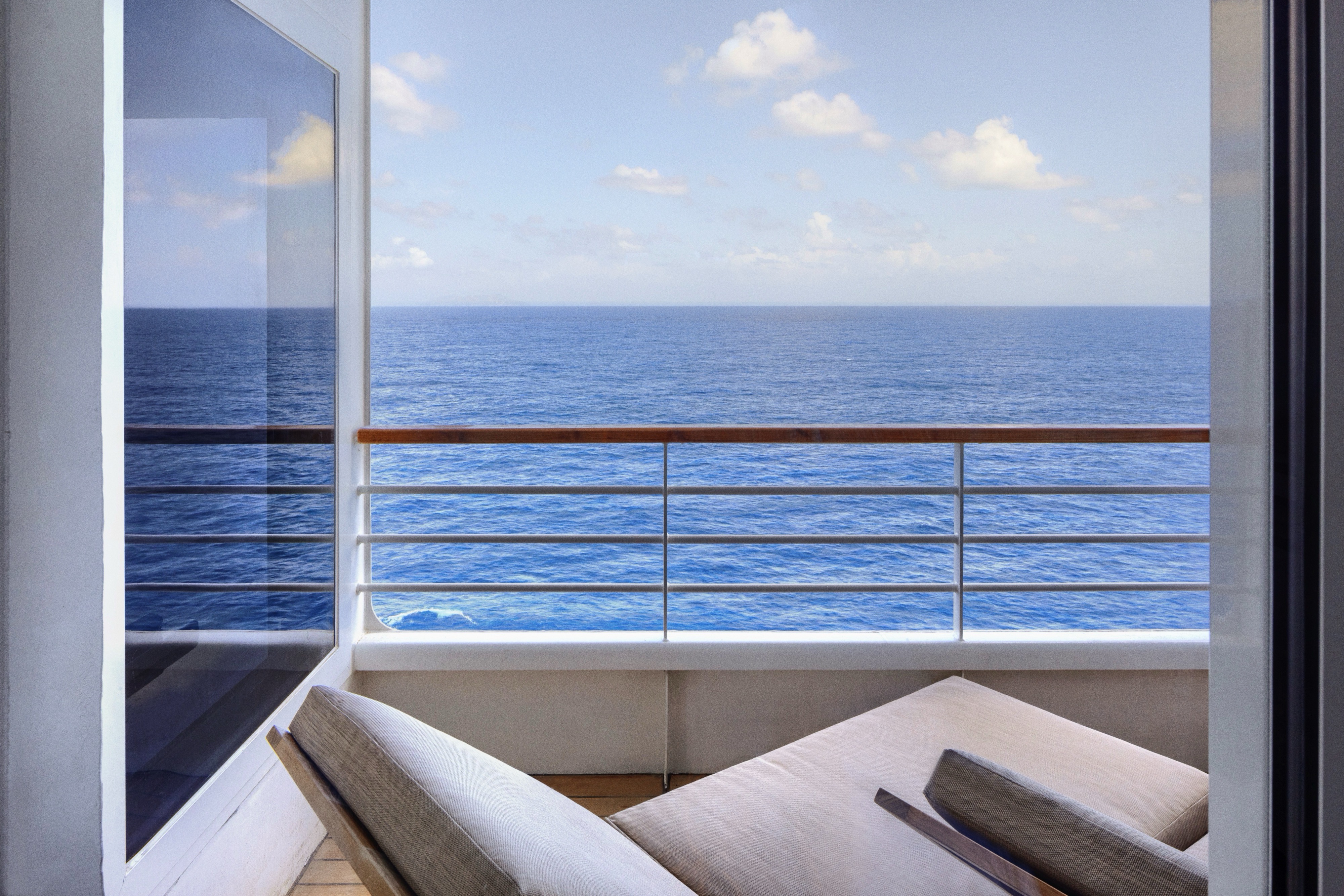
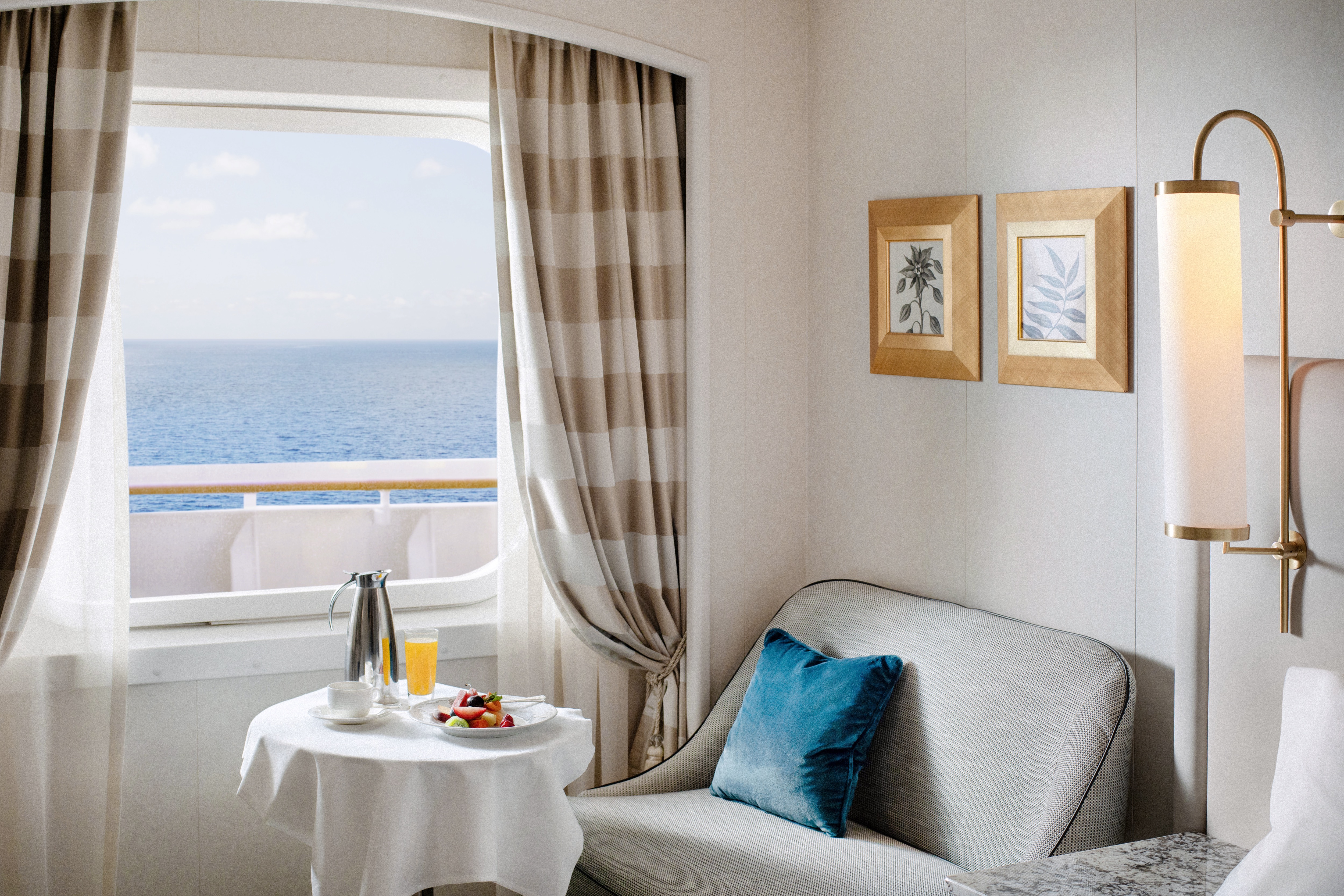
- Large private veranda with teak furniture
- Spacious living room with TV, custom wool carpets, walnut floors, cabinetry and Swarovski® chandelier
- Dining area with panoramic ocean views
- Separate study
- Custom built-in bar
- Large bedroom with queen-size bed or twins, plus his and hers walk-in closets and TV
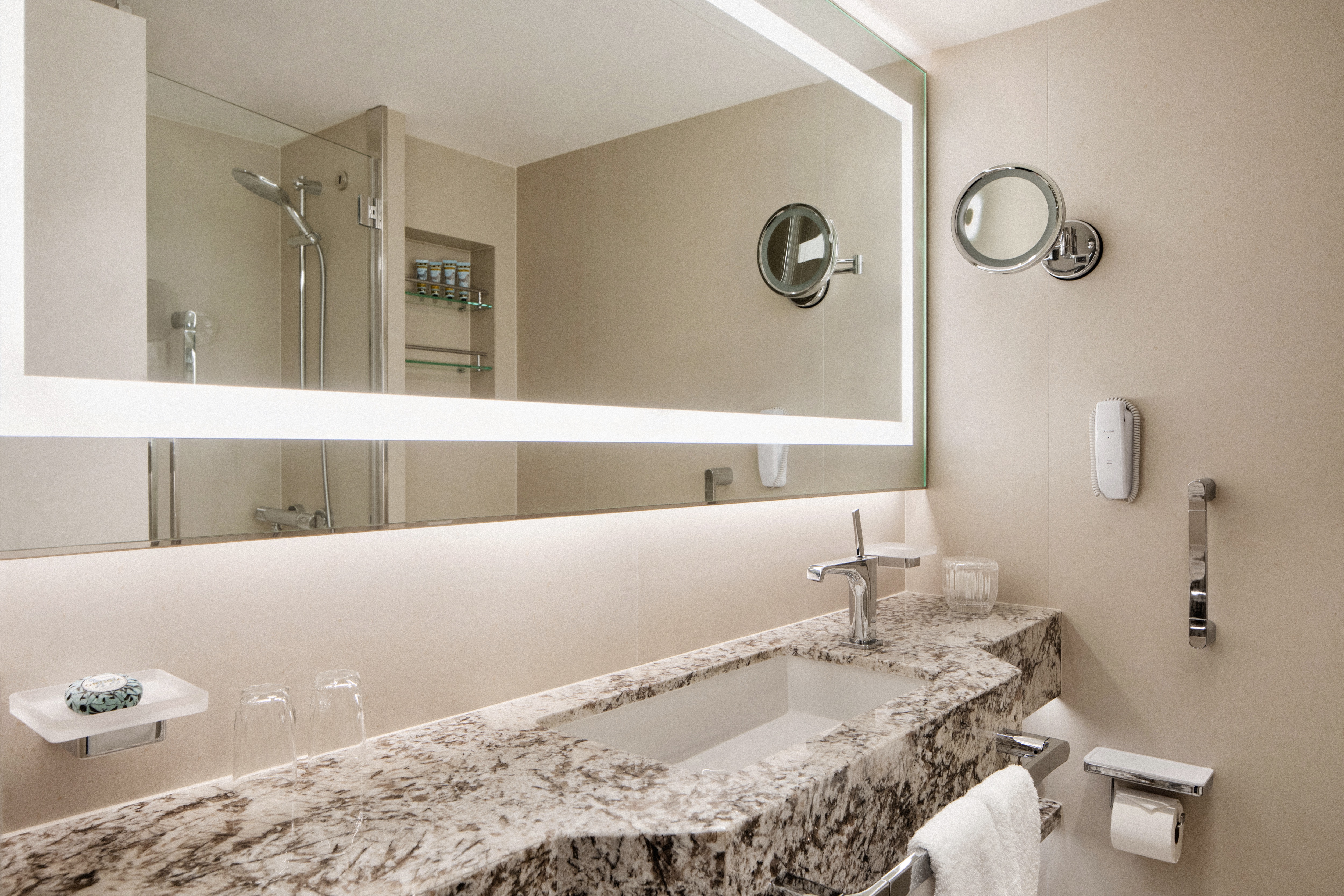
- Master bath with jacuzzi, ocean view, crystal sconces and Calacatta marble floors, separate shower and bidet
- Guest bathroom
Services
- 24 hour in-suite dining
- Unlimited room service from Osteria D'Ovidio and Umi Uma
- Unlimited dining in Osteria D'Ovidio and Umi Uma
- Shoeshine service
- Assistance with packing and unpacking
- Free unlimited laundry and dry cleaning, 2nd day service
- In-Suite cocktail parties
- Private transfer to and from ship up to 50 miles
Amenities
- Welcome champagne
- Complimentary wine and spirits from set menu
- Complimentary soft drinks
- Flowers
- Fresh fruits, daily change, on request only
- Turndown service with handmade truffles
- Pillow menu (selection from a variety of pillow types)
- Afternoon canapés
- Coffee maker
- Binoculars
- Complimentary unlimited standard WiFi
- In-suite safe
- Interactive tablet for news, updates, and reservations
- Hair dryer
- Hair iron (available upon request)
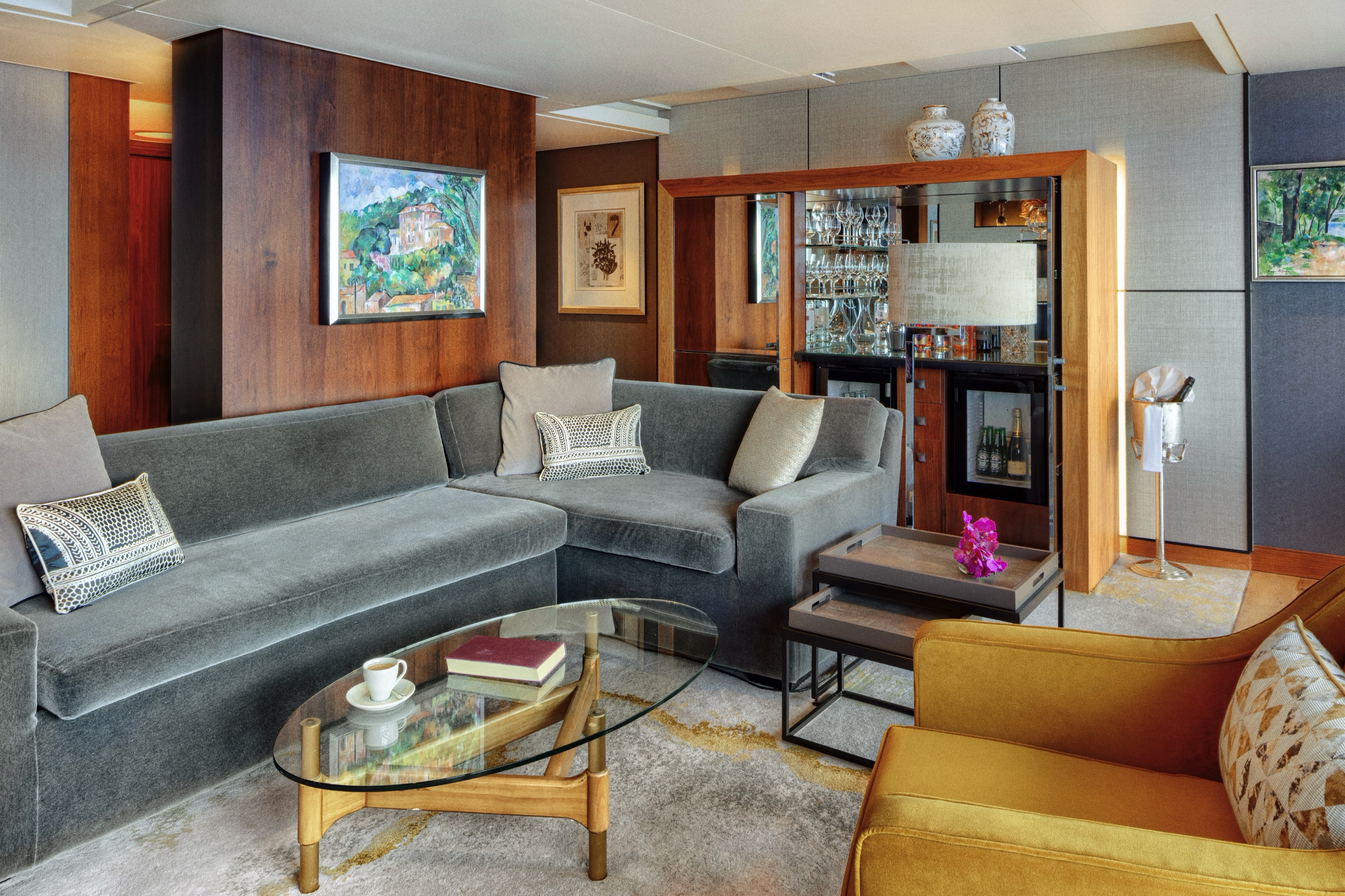
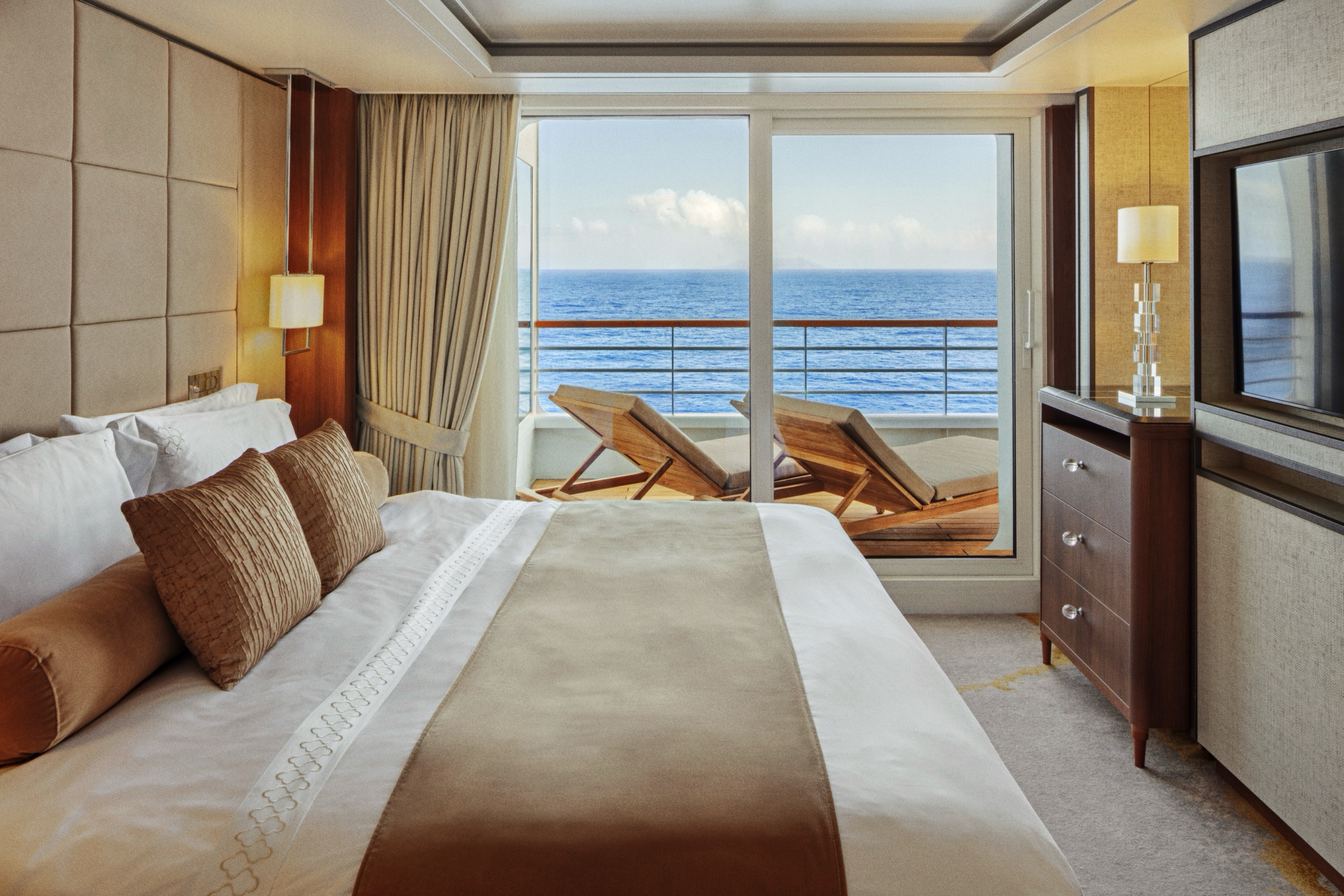
Redesigned in 2023, this luxurious suite features a walk-in wardrobe, separate living room and dining area, Jacuzzi bathtub, separate shower, bidet, and guest bathroom. Guests staying in this stylish home away from home enjoy unlimited dining at specialty restaurants, unlimited laundry services, afternoon canapés, flowers, binoculars, and a coffee maker.
Details
- Large private veranda
- Spacious living room
- Dining area
- Two TV's
- Separate bedroom area
- Vanity in bedroom
- Queen-size bed or twin beds with sumptuous bedding, and third berth
- Full jacuzzi bathtub with separate shower and bidet
- Walk-in closet
Services
- 24 hour in-suite dining
- Unlimited room service from Osteria D'Ovidio and Umi Uma
- Unlimited dining in Osteria D'Ovidio and Umi Uma
- Turndown service with handmade truffles
- Shoeshine service
- Assistance with packing and unpacking
- Free unlimited laundry and dry cleaning, 2nd day service
- In-suite cocktail parties
- Private transfer to and from ship up to 50 miles
Amenities
- Welcome champagne
- Complimentary wine and spirits from set menu
- Complimentary soft drinks
- Flowers
- Fresh fruits, daily change, on request only
- Pillow menu (selection from a variety of pillow types)
- Afternoon canapés
- Coffee maker
- Binoculars
- Complimentary unlimited standard WiFi
- In-suite safe
- Interactive tablet for news, updates, and reservations
- Hair dryer
- Hair iron (available upon request)
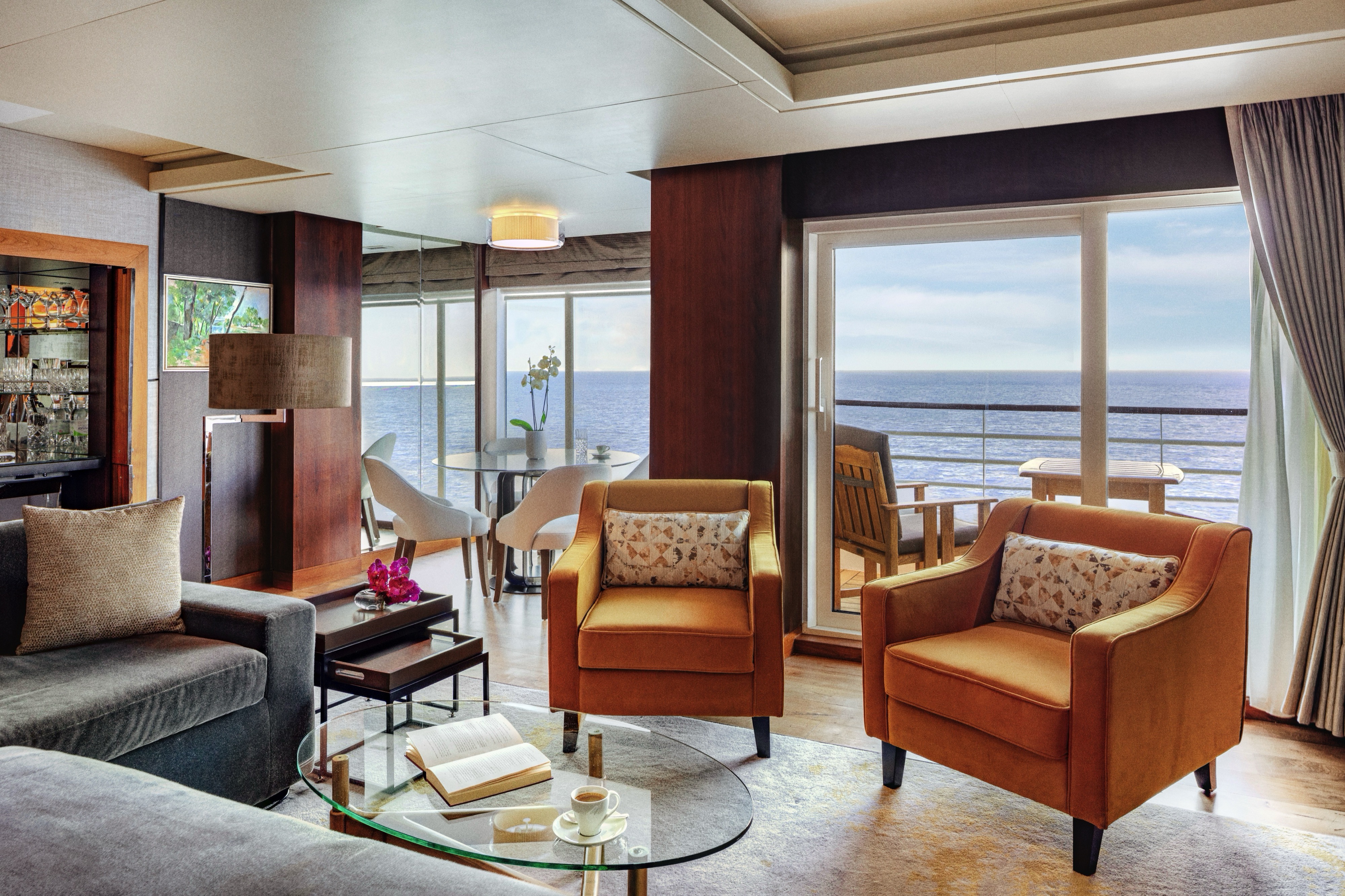
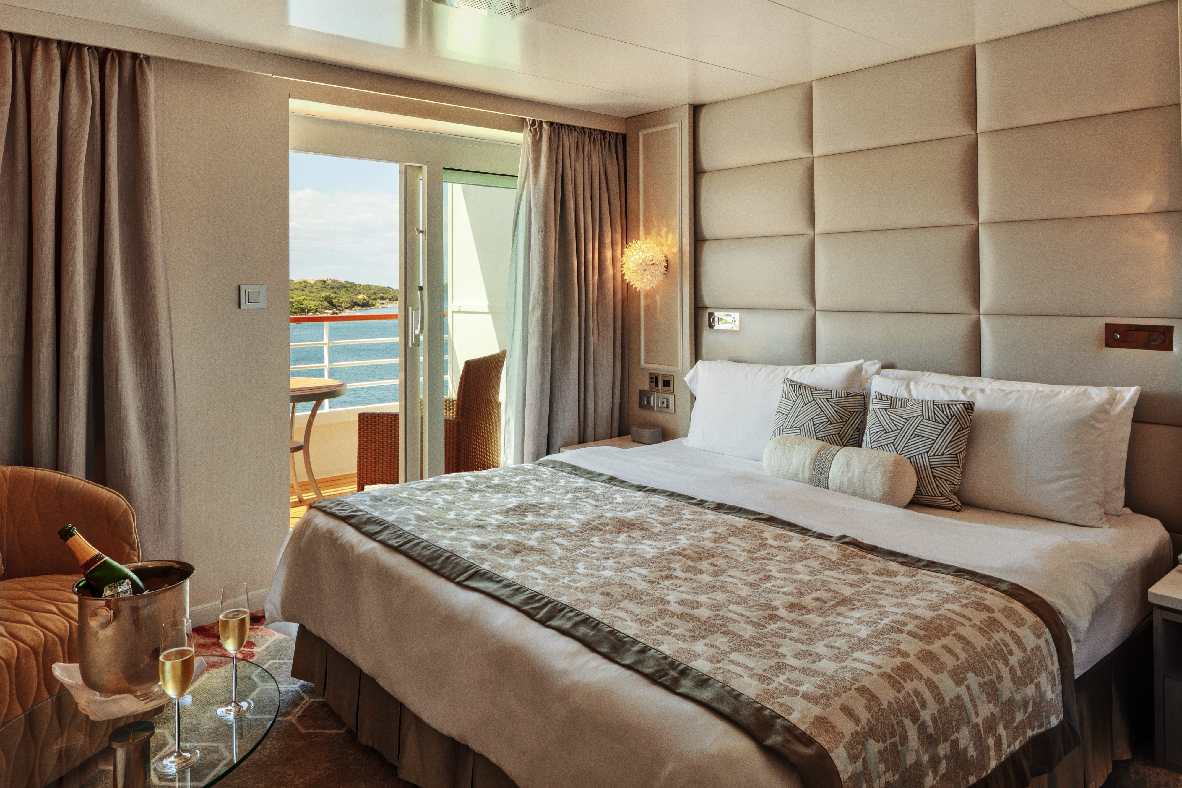
Available in either a newly redesigned style with a walk-in shower or a classic design with a separate shower and bath, this elegant suite features a walk-in wardrobe, separate living room with sofa and dining area, and a private veranda. Enjoy special touches such as afternoon canapés, binoculars, a coffee maker, and complimentary laundry, dry cleaning, and pressing services.
Details
- Private veranda
- Spacious living room and dining area
- Queen-size bed or twin beds with sumptuous bedding, and third berth
- Walk-in closet
- Two TV's
- Washer and Dryer Combo available in select suites
Services
- 24 hour in-suite dining
- Turndown service with handmade truffles
- Shoeshine service
- Assistance with packing and unpacking
- Dry cleaning for five pieces plus one bag of free laundry every 10 cruise days, 2nd day service
- Free pressing (5pcs/day), 2nd day service
Amenities
- Welcome champagne
- Complimentary wine and spirits from set menu
- Complimentary soft drinks
- Fresh fruits, daily change, on request only
- Pillow menu (selection from a variety of pillow types)
- Afternoon canapés
- Coffee maker
- Binoculars
- Complimentary unlimited standard WiFi
- In-suite safe
- Interactive tablet for news, updates, and reservations
- Hair dryer
Redesigned in 2023, this elegant suite offers a walk-in wardrobe, separate living room with sofa and dining area, walk-in shower, and two large picture windows. Enjoy special touches such as afternoon canapés, binoculars, a coffee maker, and complimentary laundry, dry cleaning, and pressing services.DETAILS
- Large Picture Window
- Spacious living room and dining area
- Queen-size bed or twin beds with sumptuous bedding, and third berth
- Walk-in closet
- Two TV's
SERVICES
- 24 hour in-suite dining
- Turndown service with handmade truffles
- Shoeshine service
- Assistance with packing and unpacking
- Complimentary dry cleaning (5 pieces every 10 days, 2nd day service)
- Complimentary laundry (1 bag every 10 days, 2nd day service)
- Complimentary pressing (5 pieces per day, 2nd day service)
AMENITIES
- Welcome champagne
- Complimentary wine and spirits from set menu
- Complimentary soft drinks
- Fresh fruits, daily change, on request only
- Pillow menu (selection from a variety of pillow types)
- Afternoon canapés
- Coffee maker
- Binoculars
- Complimentary unlimited standard WiFi
- In-suite safe
- Interactive tablet for news, updates, and reservations
- Hair dryer
- Hair iron (available upon request)
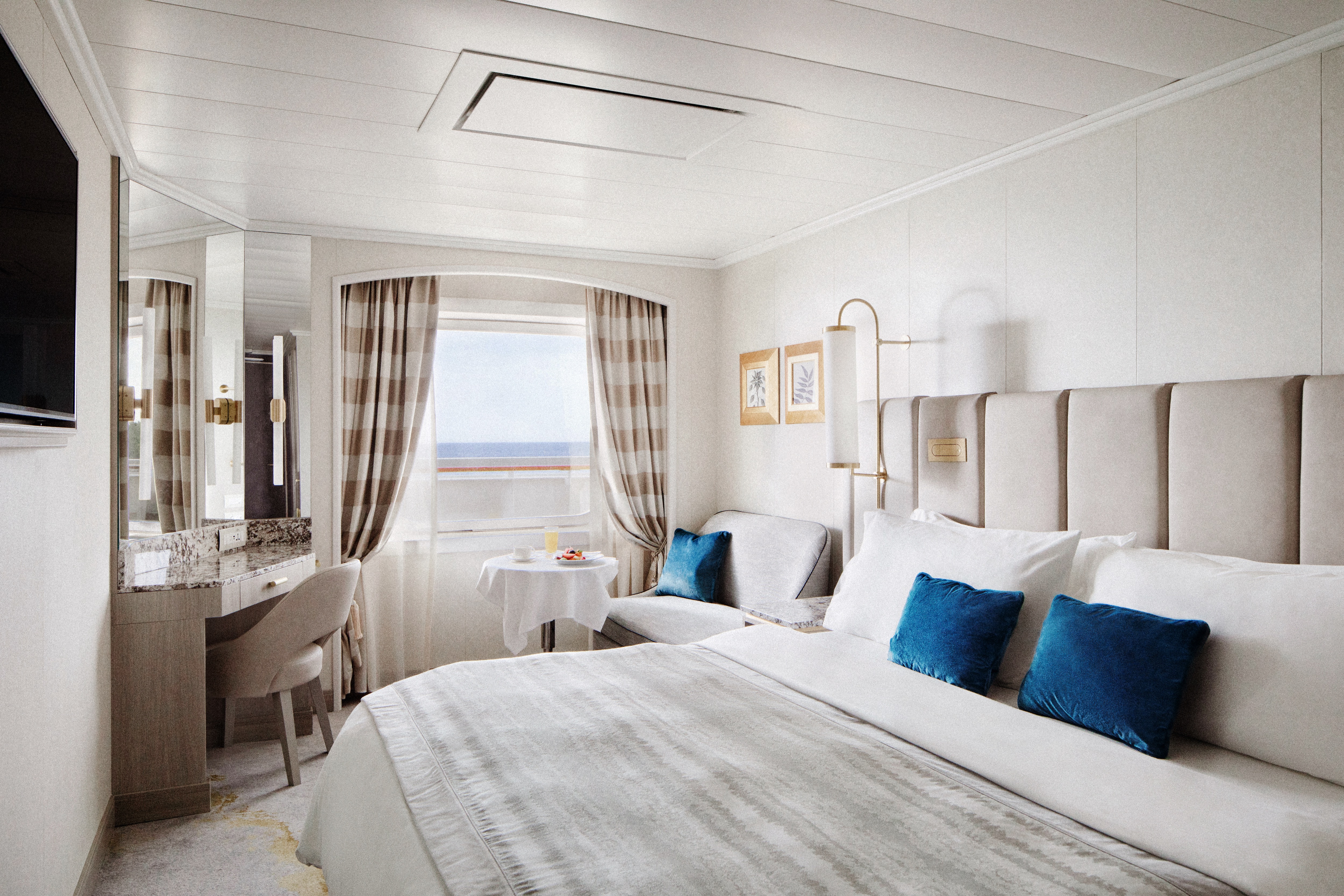
Available in either a newly redesigned style with a walk-in shower or a classic design with a separate shower and bath, this spacious suite features a private veranda, walk-in wardrobe, comfortable living area with sofa, and complimentary pressing service.
DETAILS
- Private veranda
- Sizeable living area
- Queen-size bed or twin beds with sumptuous bedding
- Vanity in dressing area
- TV
- Walk-in closet
SERVICES
- 24 hour in-suite dining
- Turndown service
- Shoeshine service
- Assistance with packing and unpacking
AMENITIES
- Welcome champagne
- Complimentary wine and spirits from set menu
- Complimentary soft drinks
- Fresh fruits, daily change, on request only
- Afternoon canapés
- Coffee maker
- Binoculars
- Complimentary unlimited standard WiFi
- In-suite safe
- Interactive tablet for news, updates, and reservations
- Hair dryer
- Hair iron (available upon request)
Free pressing (5pcs/day), 2nd day service
Redesigned in 2023 exclusively for solo occupancy, this stylish guest room offers a comfortable living area with sofa, large picture window, walk-in shower, and a sleek built-in wardrobe.
DETAILS
- Large picture window
- Sizeable living area with sofa
- Queen-size bed or twin beds with sumptuous bedding
- TV
- Walk-in shower
SERVICES
- 24 hour in-suite dining
- Turndown service
- Shoeshine service
- Assistance with packing and unpacking
AMENITIES
- Welcome champagne
- Complimentary wine and spirits from set menu
- Complimentary soft drinks
- Fresh fruits, daily change, on request only
- Pillow menu (selection from a variety of pillow types)
- Complimentary unlimited standard WiFi
- In-suite safe
- Interactive tablet for news, updates, and reservations
- Hair dryer
- Hair iron (available upon request)
Redesigned in 2023, this elegant guest room offers a private veranda, comfortable living area with sofa, walk-in shower, and a built-in wardrobe.
DETAILS
- Private veranda
- Sizeable living area with sofa
- Queen-size bed or twin beds with sumptuous bedding
- TV
- Walk-in shower
SERVICES
- 24 hour in-suite dining
- Turndown Service
- Shoeshine service
- Assistance with packing and unpacking
AMENITIES
- Welcome champagne
- Complimentary wine and spirits from set menu
- Complimentary soft drinks
- Fresh fruits, daily change, on request only
- Pillow menu (selection from a variety of pillow types)
- Complimentary unlimited standard WiFi
- In-suite safe
- Interactive tablet for news, updates, and reservations
- Hair dryer
- Hair iron (available upon request)
Redesigned in 2023, this stylish guest room features a comfortable living area with sofa, large picture window, walk-in shower, and a sleek built-in wardrobe.
DETAILS
- Large picture window
- Sizeable living area with sofa
- Queen-size bed or twin beds with sumptuous bedding
- TV
- Walk-in shower
SERVICES
- 24 hour in-suite dining
- Turndown service
- Shoeshine service
- Assistance with packing and unpacking
AMENITIES
- Welcome champagne
- Complimentary wine and spirits from set menu
- Complimentary soft drinks
- Fresh fruits, daily change, on request only
- Pillow menu (selection from a variety of pillow types)
- Complimentary unlimited standard WiFi
- In-suite safe
- Interactive tablet for news, updates, and reservations
- Hair dryer
- Hair iron (available upon request)
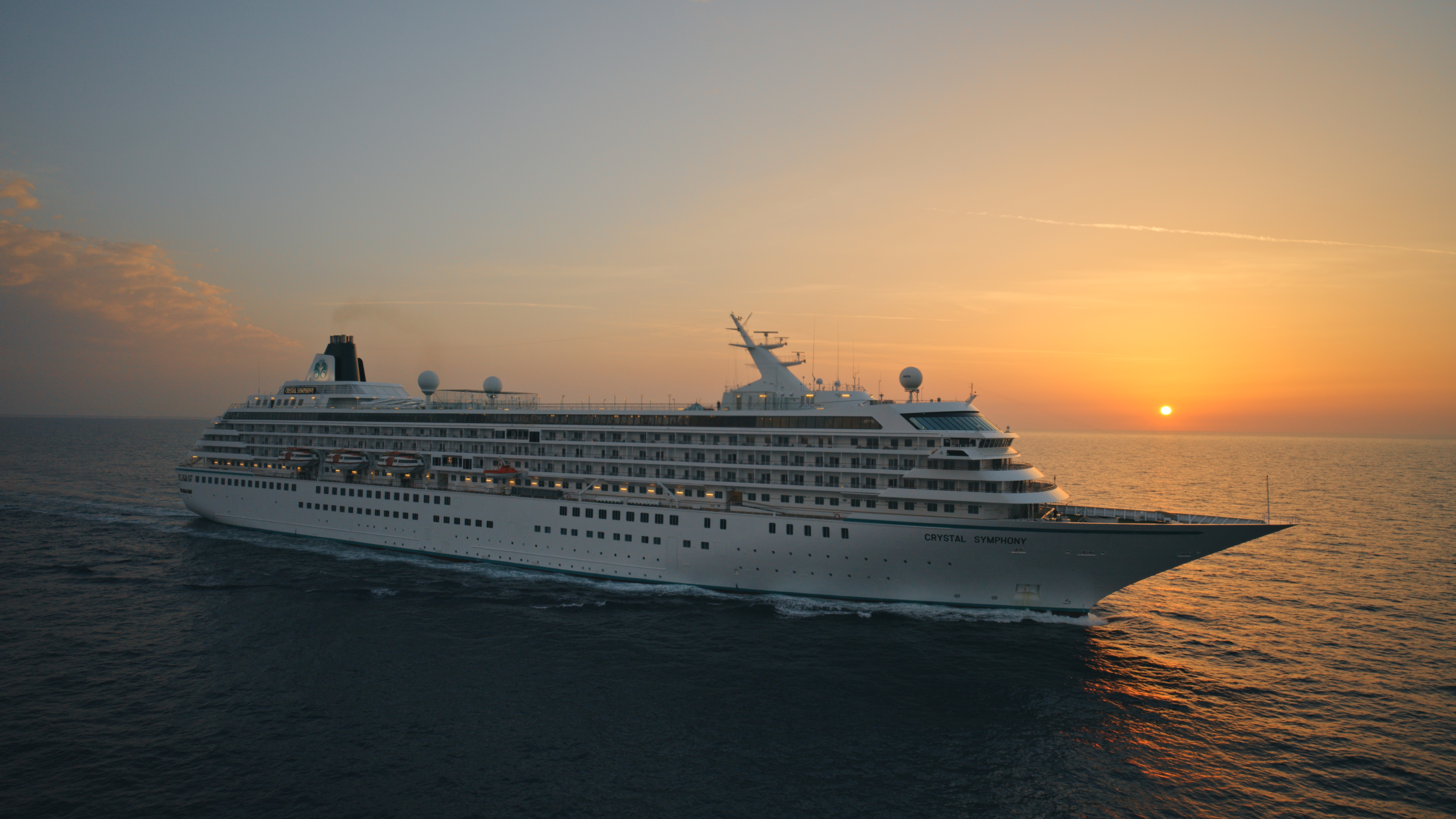
Crystal Symphony
With elegant lines and sweeping ocean views, our intimate ship houses expansive suites and guest rooms, alongside a world-class choice of dining, wellness and entertainment.
Ship Facts
| Launch Year | 1995 | ||||||||
| Refit Year | 2023 | ||||||||
| Language | en | ||||||||
| Gross Tonnage | 51068 | ||||||||
| Length | 238 | ||||||||
| Width | 30 | ||||||||
| Currency | USD | ||||||||
| Speed | 20 | ||||||||
| Capacity | 606 | ||||||||
| Crew Count | 499 | ||||||||
| Deck Count | 8 | ||||||||
| Cabin Count | 477 | ||||||||
| Large Cabin Count | 0 | ||||||||
| Wheelchair Cabin Count | 4 | ||||||||
| Electrical Plugs |
|
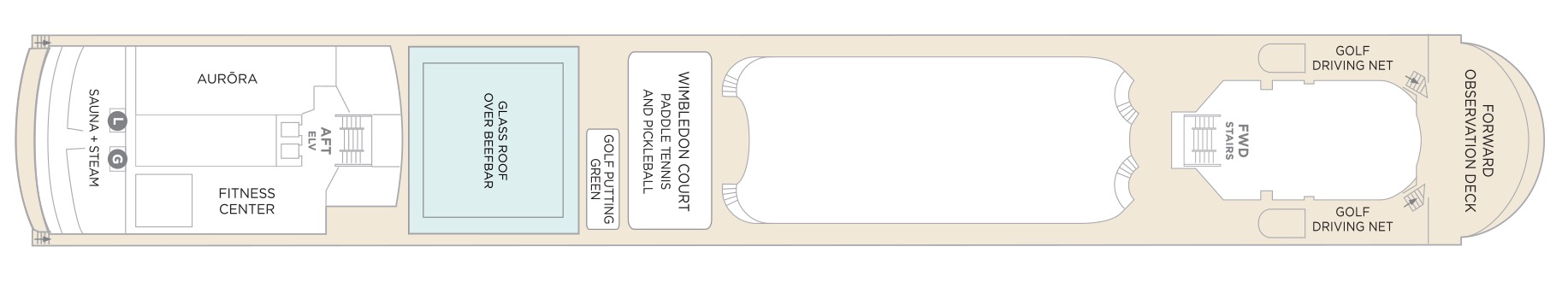
Deck 12
- Sauna + Steam room
- AURÖRA
- Fitness Center
- Glass Roof Over Beefbar
- Golf Putting Green
- Wimbledon Court (Paddle Tennis & Pickle Ball)
- Golf Driving Nets
- Forward Observation Deck
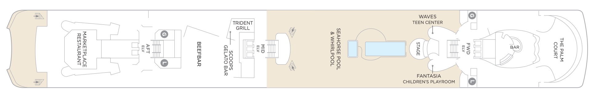
Deck 11
- The Palm Court
- Fantasia Children's Playroom
- Stage
- Waves Teen Centre
- Seahorse Pool & Whirlpool
- Trident Grill
- Scoops Gelato Bar
- Beefbar
- Marketplace Restaurant
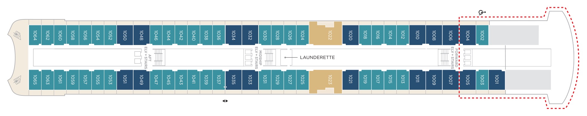
Deck 10
- Aquamarine Veranda Suite
- Sapphire Veranda Suite
- Crystal Penthouse Suite
- Launderette
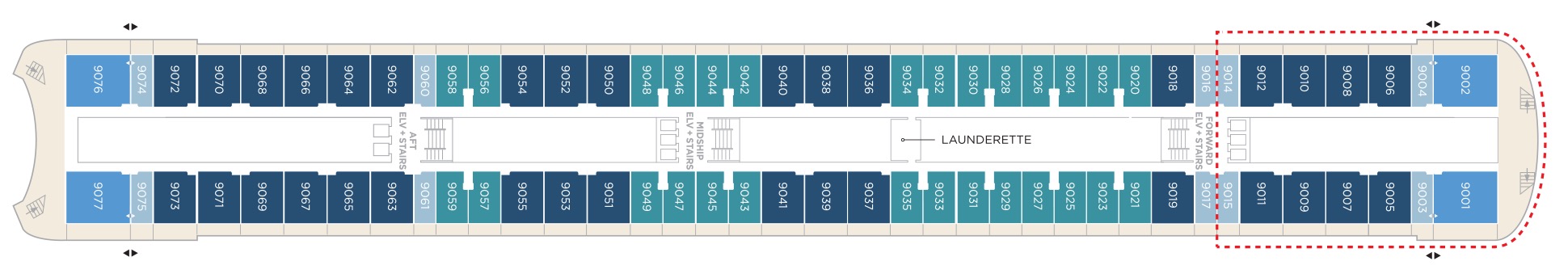
Deck 9
- Junior Crystal Penthouse Suite
- Aquamarine Veranda Suite
- Sapphire Veranda Suite
- Double Guest Room with Veranda
- Launderette
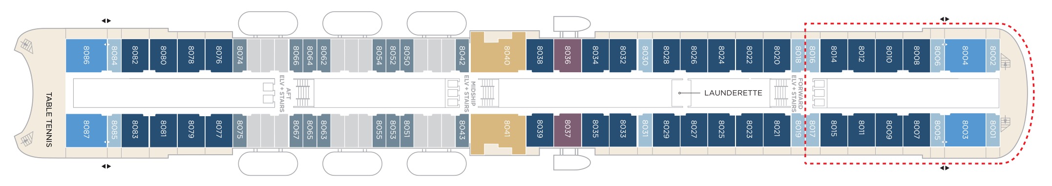
Deck 8
- Crystal Penthouse Suite
- Sapphire Veranda Suite
- Double Guest Room with Veranda
- Junior Crystal Penthouse Suite
- Sapphire Ocean View Suite
- Double Guest Room with Ocean View
- Table Tennis
- Launderette
Suites & Guest Rooms Beyond The Forward Elevators Are subject To Alternative Pricing
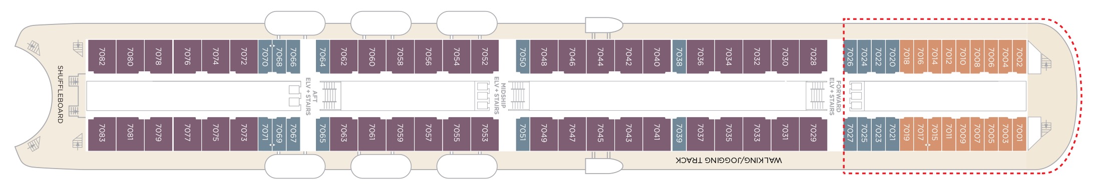
Deck 7
- Sapphire Ocean View Suite
- Single Guest Room with Ocean View
- Double Guest Room with Ocean View
- Shuffleboard
- Walking/Jogging Track
- Elevator & Stairs
Suites & Guest Rooms Beyond The Forward Elevators Are subject To Alternative Pricing
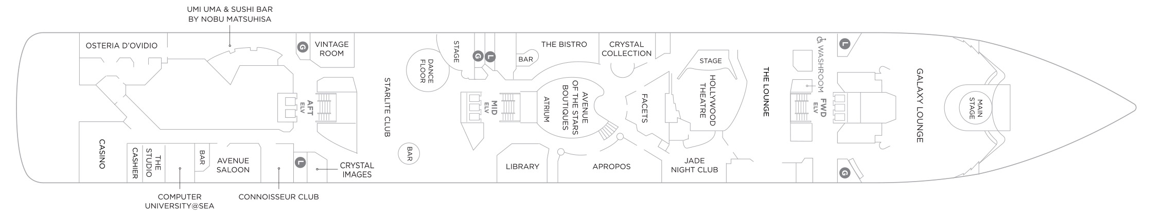
Deck 6
- Main Stage
- Galaxy Lounge
- The Lounge
- Hollywood Theatre
- Jade Nightclub
- Crystal Collection
- Facets
- Aprops
- Avenue of the Star Boutique
- The Bistro
- Atrium
- Library
- Stage
- Starlite Club
- Vintage Room
- Crystal Images
- Uma Uma & Sushi Bar by Nobu Matsuhisa
- Connoisseur Club
- Avenue Saloon
- Computer University @Sea
- The Studio
- Casino
- Osteria D'Ovidio
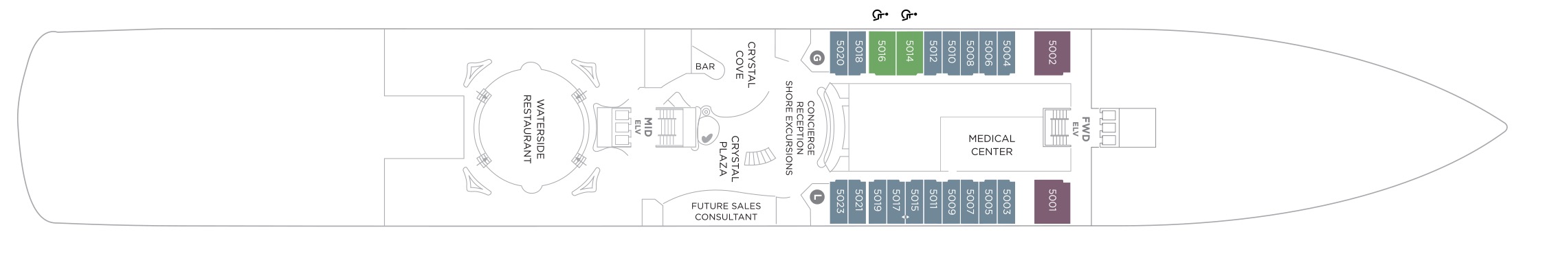
Deck 5
- Sapphire Ocean View Suite
- Double Guest Room with Ocean View
- Medical Centre
- Concierge
- Reception
- Shore Excursions
- Crystal Cove
- Future Sales Consultant
- Crystal Plaza
- Waterside Restaurant
Our award-winning cuisine is created and influenced by pioneers in the global food scene, with nine distinct complimentary venues to choose from. Open seating with extensive dining options are tailored around the personal preferences of our guests, allowing them to choose exactly what they want at a time that works for them. Whether that be a late breakfast, six-course wine pairing lunch, or dinner in our exclusive Osteria d’Ovidio or Umi Uma.
Waterside Restaurant
Take your tastebuds on a tour of our modern, international cuisine options. Enjoy creative, seasonal dishes in an elegant setting with beautiful ocean views.
Umi Uma
Few restaurants can boast a creative vision of contemporary cuisine as Nobu. Prepare to lose yourself in the beautiful décor and signature Japanese-Peruvian dishes. Reservations required and limited per sailing.
Beefbar
The most exciting flavours from the global street-food scene are fashioned from the freshest ingredients by creative chefs and served for sharing in stylish surroundings.
Trident Grill
Enjoy a burger with a view. Our pool restaurant and grill offer a comfortable terrace highlighted by an elegant design, making it the perfect spot for outdoor dining.
Osteria D'Ovidio
Named for our owner, Manfredi Lefebvre d'Ovidio, this restaurant specializes in show-stopping Italian cuisine, in collaboration with the Michelin-rated Alajmo brothers. Reservations are required and are limited per sailing.
The Bistro
A nod to the mythic bars and bistros of Paris. Celebrate the classics in this spacious and airy café that serves light bites from dawn to dusk.
The Vintage Room
A unique gourmet food and wine pairing restaurant that offers an educational dining experience while enjoying some of the best vintages at sea.
Scoops Gelato Bar
Enjoy the finest authentic Italian gelato with a sea view at our pool-deck gelato bar, Scoops. Choose from must-try innovative flavors or traditional favorites in partnership with prestigious Florence artisan, Badiani.
Marketplace
This sophisticated buffet-style restaurant features a dizzying array of hot and cold choices for those who like a little of everything.
24 Hours In-Suite Dining
Enjoy a meal from the comfort of your suite while relaxing in Crystal comfort. Select from our inspired menu to delight you while you stay in, watch a movie or read a favorite book.
Tea Time
More information coming soon.
Tastes Kitchen & Bar
A new definition of traveling with taste. Sumptuous, regionally inspired tapas-style cuisine is the perfect combination of sophisticated style and casual dining.
Our two elegant vessels host an equally exceptional offering including world-renowned restaurants, restorative spas and endless opportunity for inspiration and enrichment, tied together by unparalleled personal service.
Each evening Crystal brings together a cast of world-class performers, entertainers and hosts. Whether you’re looking for theatrical entertainment or the latest Hollywood release, our lounges, ballrooms, night clubs and screening rooms can cater to your every mood.
Casino De Monte-Carlo
Le Casino de Monte-Carlo is offering a new and unique experience onboard. Place your bets on table games with the unique savoir-faire of Monaco’s world-famous casino or get excited to a dynamic range of slots to hit the jackpot. An ultimate way to embrace the thrill of the game in an elegant atmosphere adorned in the hues of the historical building.
Apropos & Facets Onboard Shopping
Heighten the experience on board with a selection of fine jewelry, watches and cruise wear available in our arcade, alongside designer apparel. Make the most of being at sea with a selection of duty free items available.
Atrium
The central meeting place on the ship where you can visit the front desk, concierge, shore excursion desk, or sip on a casual drink at the Crystal Cove.
Computer University@Sea
Our innovative Computer lab onboard led by a team of tech experts.
Connoisseur Club
An elegant space to indulge in the finest cigars and cognacs.
Crystal Collection
Offers fine perfumes and colognes, cosmetics, purses, sun glasses, and jewellery.
Crystal Cove
An ideal refreshment stop any time of the day, and the perfect place to meet friends for a pre-dinner cocktail. Enjoy a variety of musical styles as the day turns into night.
Library
A well-stocked library containing over 2,000 books on a range of subjects from classics to popular biographies, history to contemporary mysteries. Plus enjoy an ample selection of magazines and board games perfect for poolside reading
Palm Court
Featuring large sky lights, floor-to-ceiling windows and a fabulous 270-degree forward view, this venue is perfect for afternoon tea, social gatherings and dancing.
Seahorse Pool
Our Seahorse Pool, with plenty of surrounding deck space to sunbathe, relax and read while enjoying a cool drink in the afternoon.
Starlite Club
On selected evenings before and after dinner, this entertainment lounge features dancing, production spot shows, cabaret performances and other themed events.
Jade Night Club
An intimate lounge for a late-night drink, dancing or a place to let loose with karaoke.
Hollywood Theatre
The ship's sleek cinema for recent-released movies, live sport events, guest lectures and religious services.
Galaxy Lounge
Performances are the focal point here, with appearances by fantastic Broadway-style performers and headline entertainers. Drink service provided before each show.
Avenue Saloon
Signature piano bar with an intimate ambience. The perfect setting for a cocktail before and after dinner.