Roundtrip Fort Lauderdale
Roundtrip Fort Lauderdale
Cruise overview
WHY BOOK WITH US?
- ✔ The Deluxe Cruises’ team has extensive experience in ultra-luxury cruising.
- ✔ Call now to speak to our helpful and experienced Cruise Concierge team.
- ✔ Enjoy our Unique Deluxe Cruises Bonus for substantial savings.
- ✔ Our team will tailor your holiday to your exacting requirements.
- ✔ As agents, we work under the protection of each cruise lines ABTA / ATOL licences
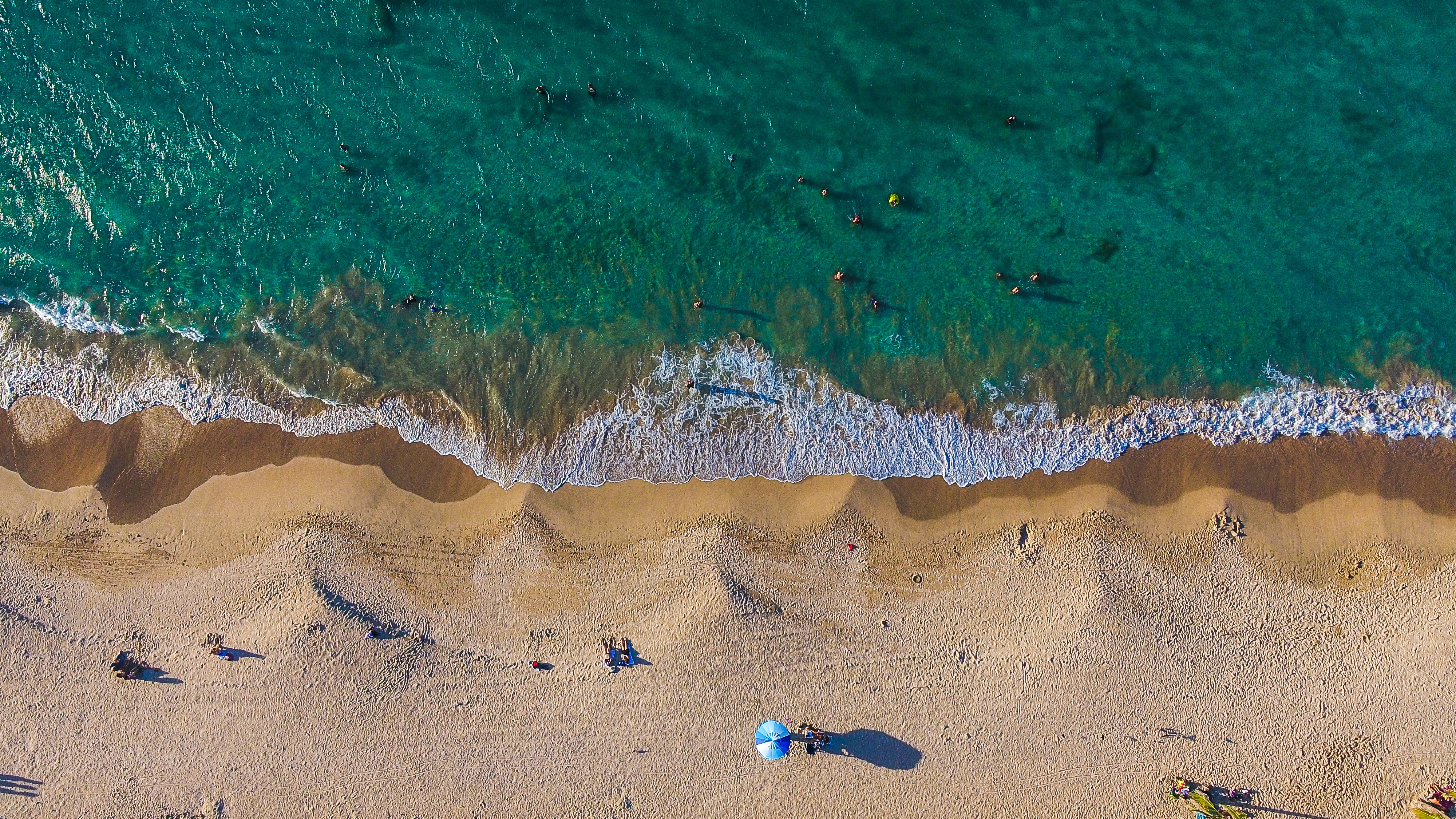
About Fort Lauderdale, Florida
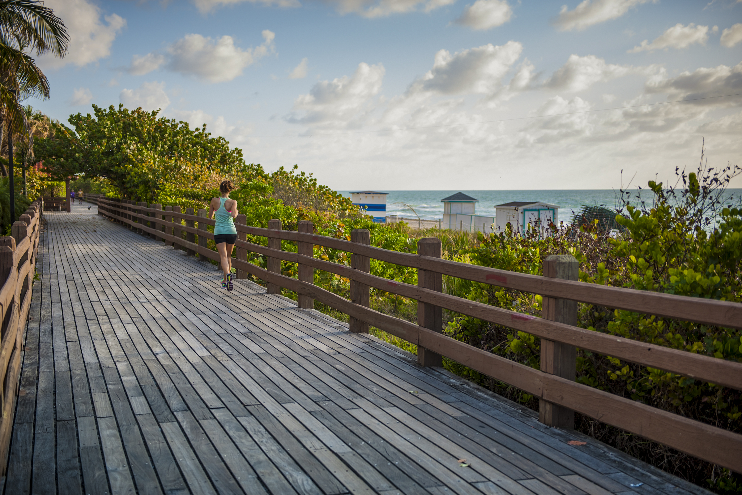
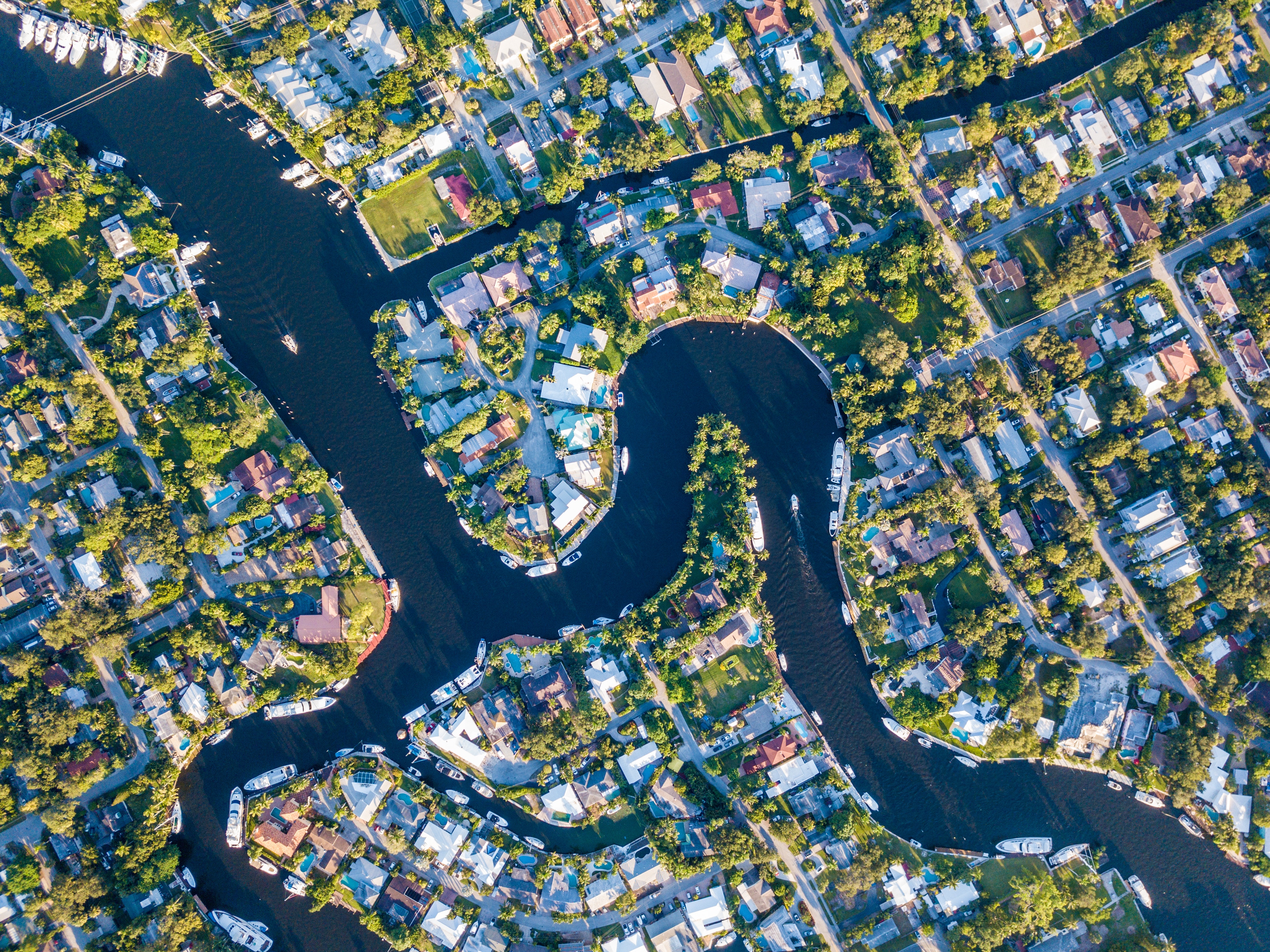
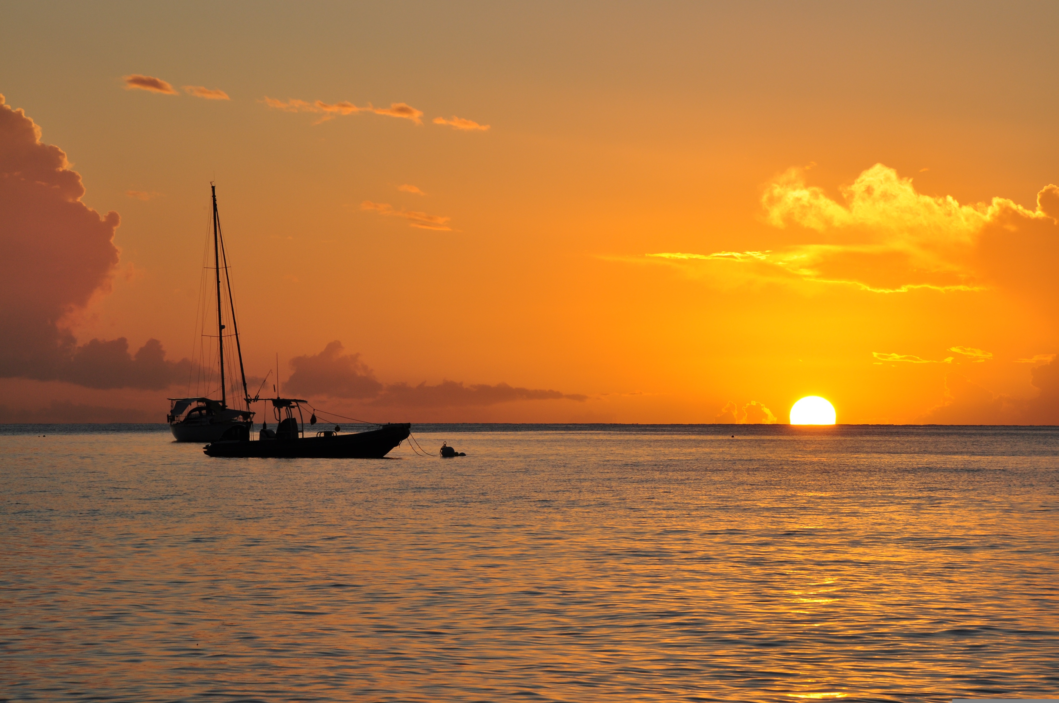
Like many southeast Florida neighbors, Fort Lauderdale has long been revitalizing. In a state where gaudy tourist zones often stand aloof from workaday downtowns, Fort Lauderdale exhibits consistency at both ends of the 2-mile Las Olas corridor. The sparkling look results from upgrades both downtown and on the beachfront. Matching the downtown's innovative arts district, cafés, and boutiques is an equally inventive beach area, with hotels, cafés, and shops facing an undeveloped shoreline, and new resort-style hotels replacing faded icons of yesteryear. Despite wariness of pretentious overdevelopment, city leaders have allowed a striking number of glittering high-rises. Nostalgic locals and frequent visitors fret over the diminishing vision of sailboats bobbing in waters near downtown; however, Fort Lauderdale remains the yachting capital of the world, and the water toys don’t seem to be going anywhere.
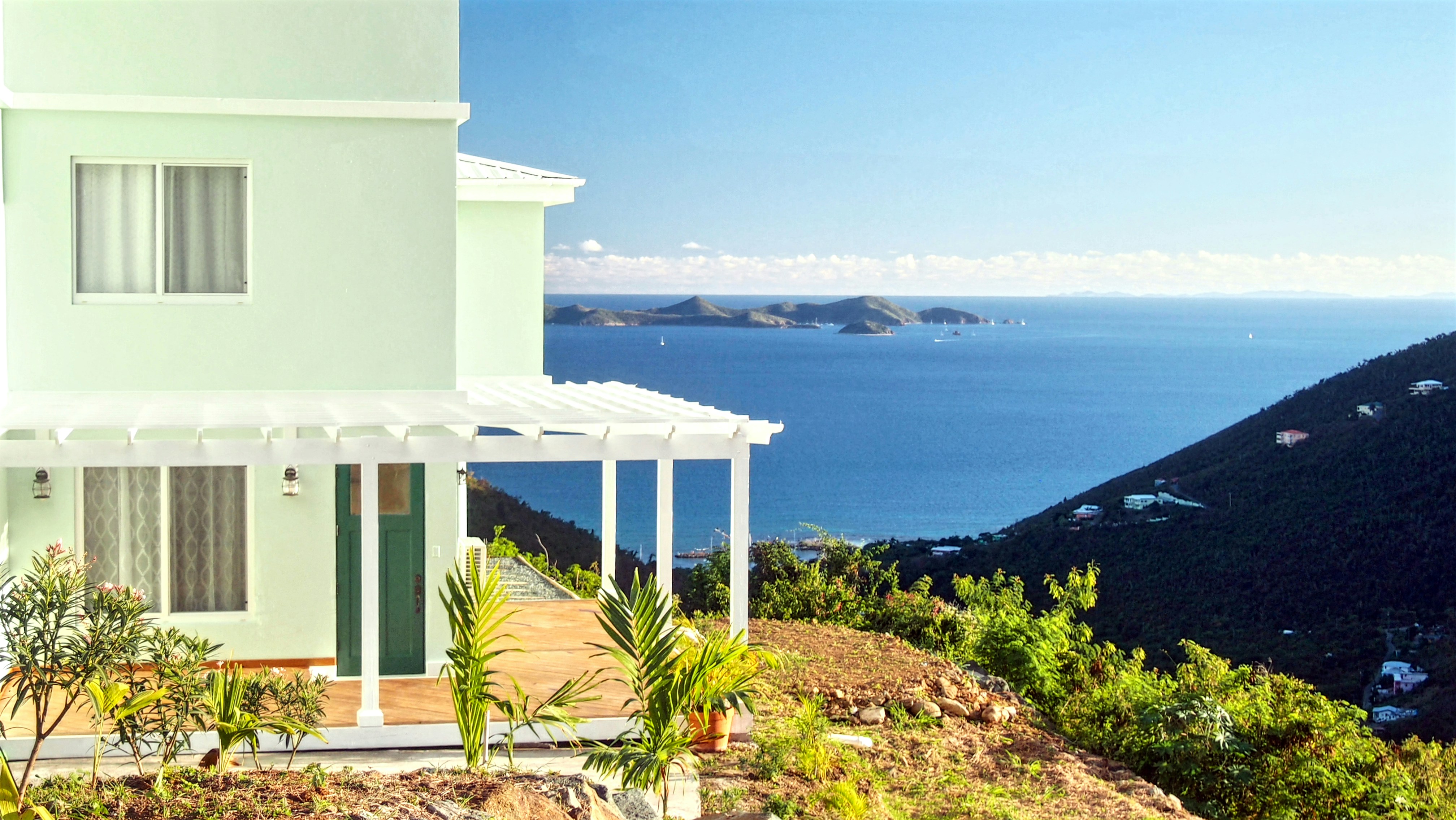
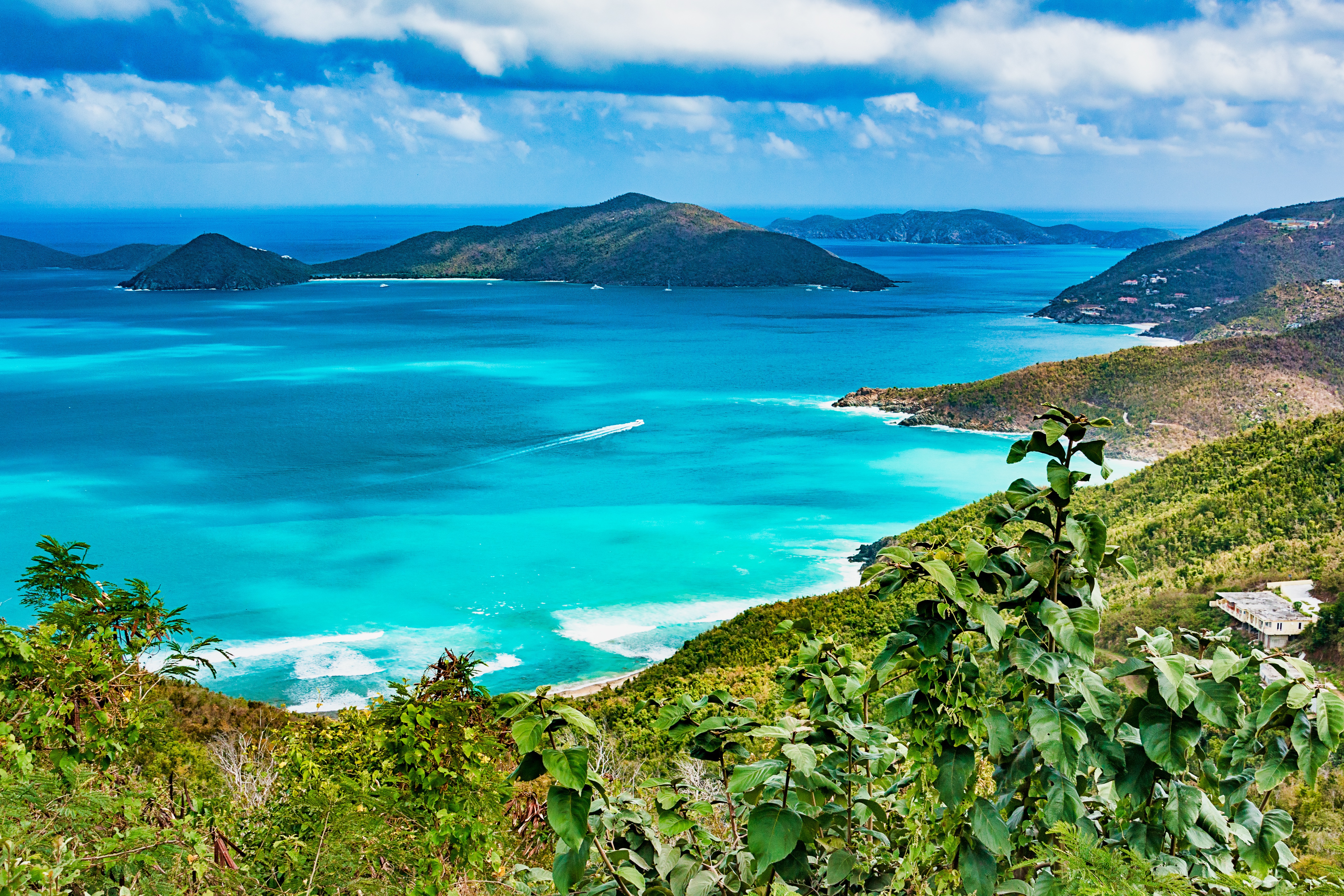
About Road Town, Tortola
About Saint John's
With its superb beaches, historical attractions and beautiful coral reefs, Antigua provides a host of diversions. It is said that the island contains 365 beaches, one for every day of the year. Antigua maintains its traditional West Indian character, with gingerbread-house style architecture, calypso music and carnival festivities. St John’s has been the administrative capital since the island’s colonisation in 1632, and has been the seat of government since it gained independence in 1981. From the port you can explore the colourful Redcliffe district, with its restored wooden houses, and Heritage Quay with its shopping mall and craft shops. The city has some fine examples of Colonial architecture, including the twin-towered cathedral, built in 1845 and considered one of the finest church buildings in the Caribbean. All coaches in Antigua are operated by smaller vehicles, and commentary will be given by a driver/guide.
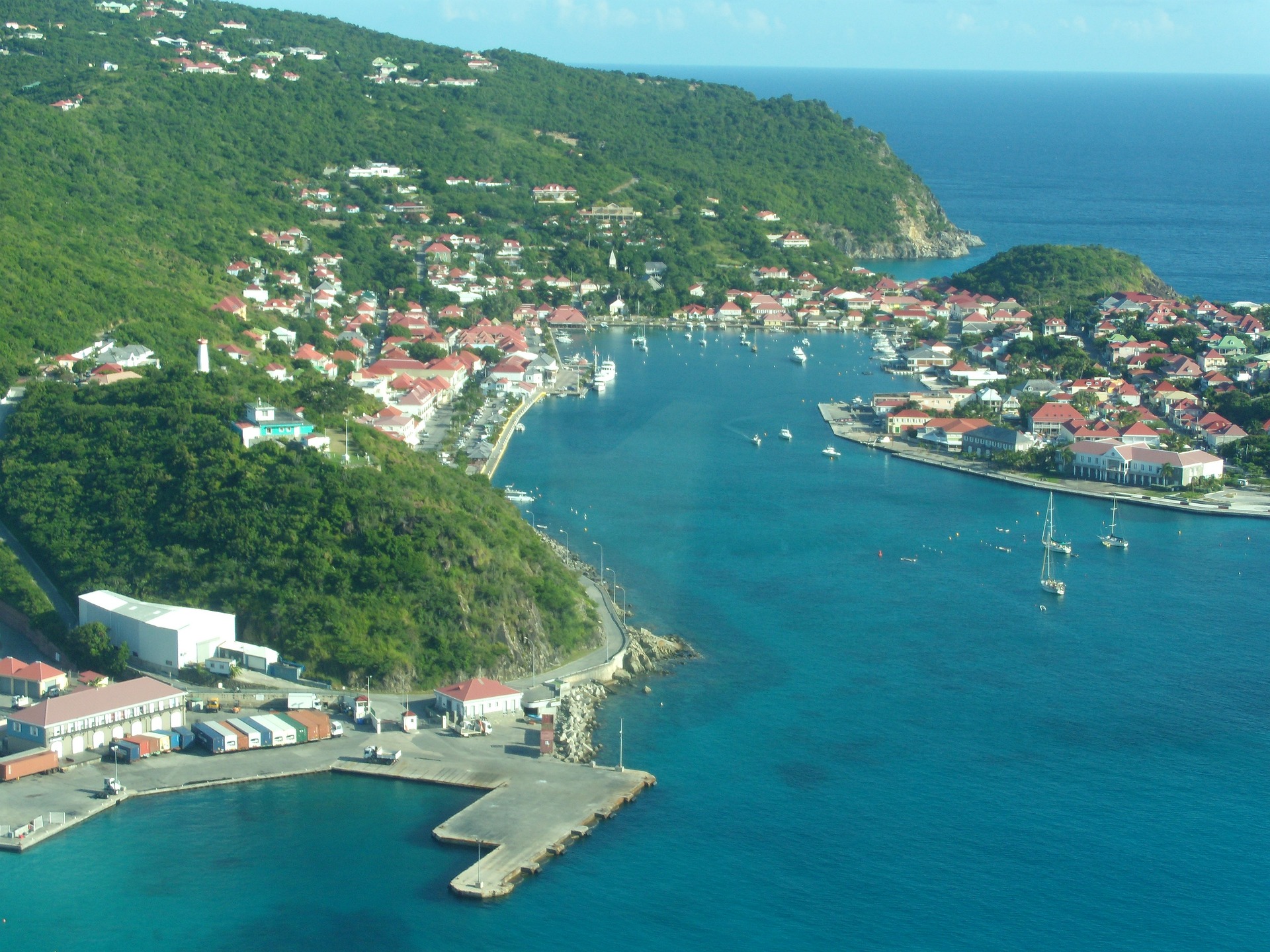
About Gustavia
You can easily explore all of Gustavia during a two-hour stroll. Some shops close from noon to 3 or 4, so plan lunch accordingly, but stores stay open past 7 in the evening. Parking in Gustavia is a challenge, especially during vacation times. A good spot to park is rue de la République, alongside the catamarans, yachts, and sailboats.
About Îles des Saintes
This small group of islands lies opposite the western part of Guadeloupe. They were discovered in November 1493 by Columbus, who named them Los Santos. French settlers established themselves in 1648 and changed the name to Iles des Saintes, commonly known as Les Saintes. Since then the islands have been closely connected with Guadeloupe. Until a recent influx of tourism, Les Saintes were among the Caribbean’s most unspoiled destinations. Only two of the eight islands are inhabited: Terre-de-Bas and Terre-de-Haut. The latter is known for its impressive Fort Napoleon built in the early 19th century to replace an earlier 17th-century fort. From its vantage point there are fine views of the many tiny islets scattered in the bay and across to Guadeloupe. Terre-de-Haut is the main island of Les Saintes, with steeply scarped hills, scenic valleys, hidden coves and beautiful beaches. Its main settlement consists of a charming village of red-roofed houses situated along a curving bay. A number of small boutiques and gift shops invite browsing. Quaint cafés and restaurants offer food and drink. To the east of the village lies Grande Anse, a fine sand beach. Most of the attractions on this small island can be seen on foot. With just a few vehicles on the island, there are no organized tours possible. Time ashore here is at your leisure.
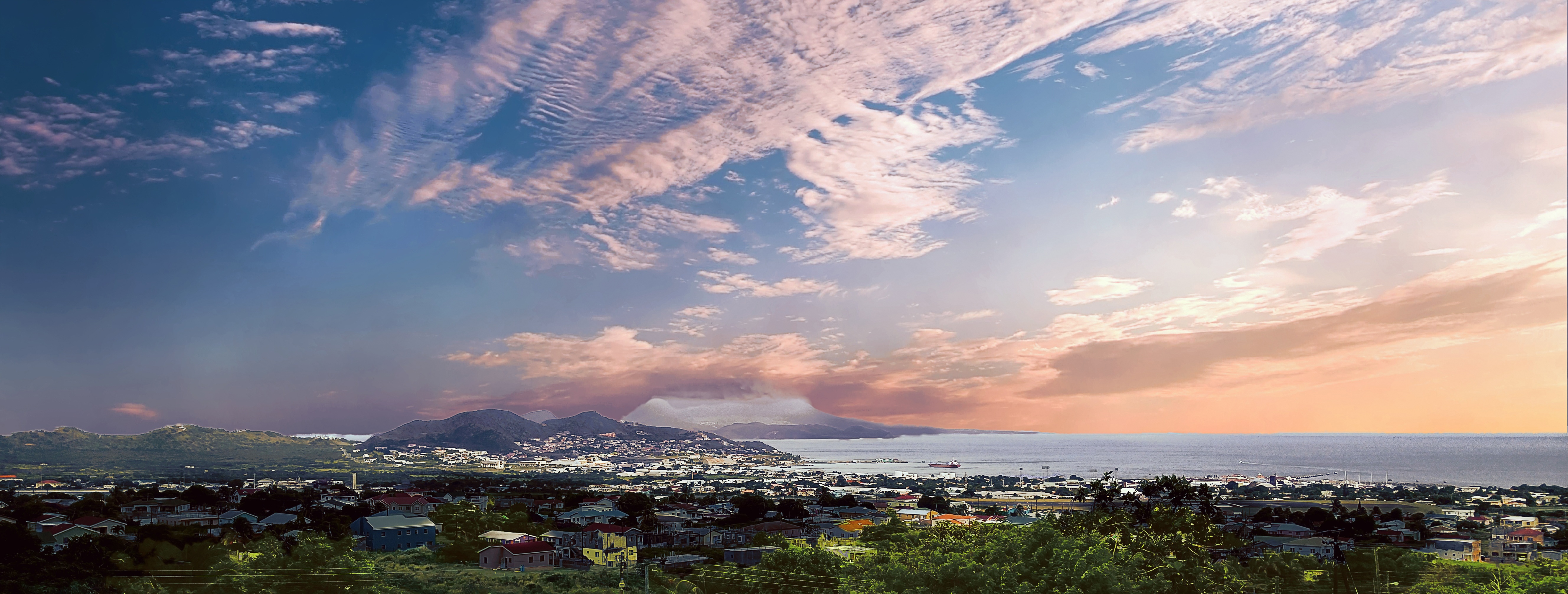
About Basseterre, Saint Kitts
Mountainous St. Kitts, the first English settlement in the Leeward Islands, crams some stunning scenery into its 65 square miles (168 square km). Vast, brilliant green fields of sugarcane (the former cash crop, now slowly being replanted) run to the shore. The fertile, lush island has some fascinating natural and historical attractions: a rain forest replete with waterfalls, thick vines, and secret trails; a central mountain range dominated by the 3,792-foot Mt. Liamuiga, whose crater has long been dormant; and Brimstone Hill, known in the 18th century as the Gibraltar of the West Indies. St. Kitts and Nevis, along with Anguilla, achieved self-government as an associated state of Great Britain in 1967. In 1983 St. Kitts and Nevis became an independent nation. English with a strong West Indian lilt is spoken here. People are friendly but shy; always ask before you take photographs. Also, be sure to wear wraps or shorts over beach attire when you're in public places.
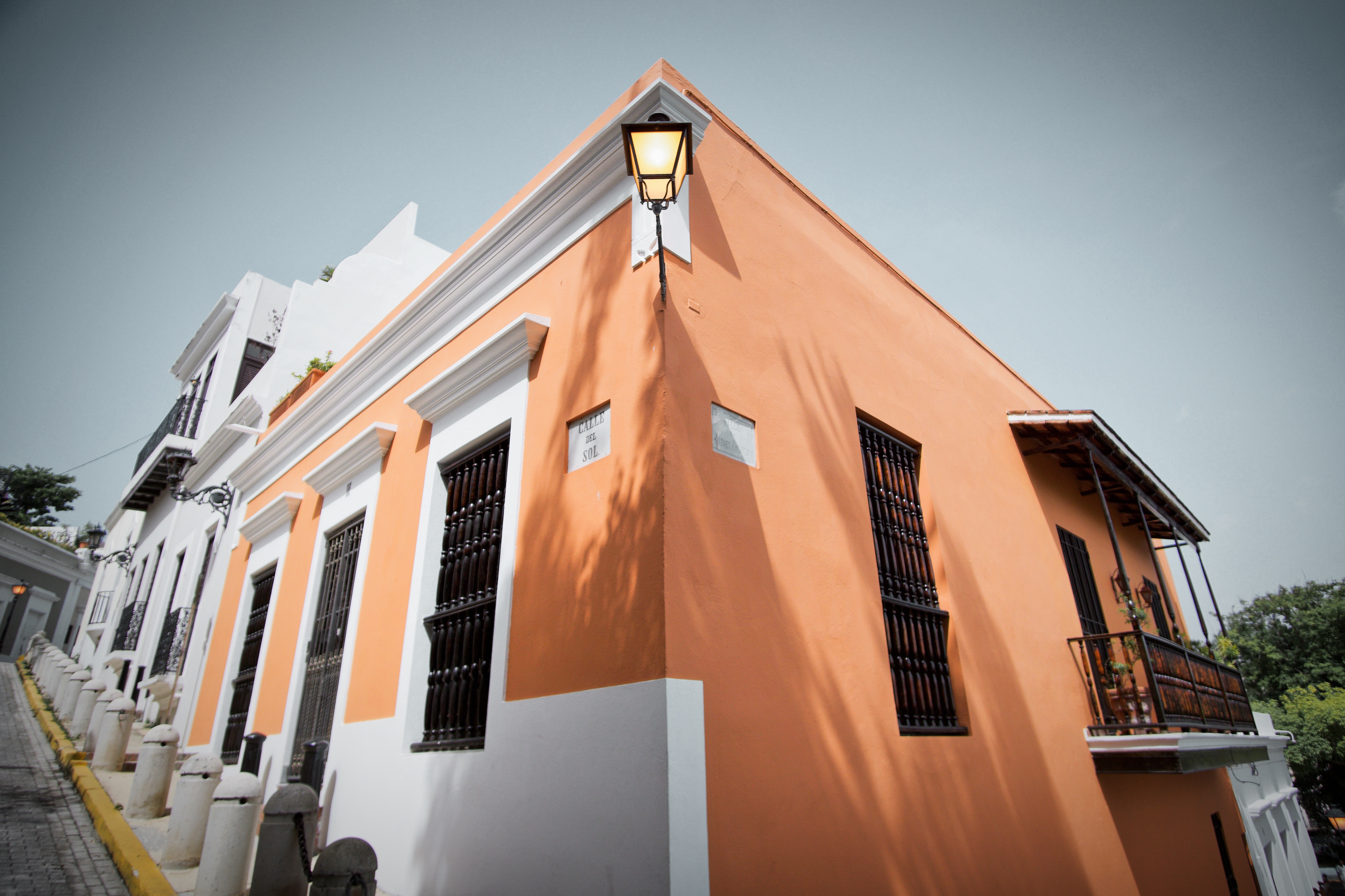
About San Juan (Puerto Rico)
If you associate Puerto Rico's capital with the colonial streets of Old San Juan, then you know only part of the picture. San Juan is a major metropolis, radiating out from the bay on the Atlantic Ocean that was discovered by Juan Ponce de León. More than a third of the island's nearly 4 million citizens proudly call themselves sanjuaneros. The city may be rooted in the past, but it has its eye on the future. Locals go about their business surrounded by colonial architecture and towering modern structures.By 1508 the explorer Juan Ponce de León had established a colony in an area now known as Caparra, southeast of present-day San Juan. He later moved the settlement north to a more hospitable peninsular location. In 1521, after he became the first colonial governor, Ponce de León switched the name of the island—which was then called San Juan Bautista in honor of St. John the Baptist—with that of the settlement of Puerto Rico ("rich port").Defended by the imposing Castillo San Felipe del Morro (El Morro) and Castillo San Cristóbal, Puerto Rico's administrative and population center remained firmly in Spain's hands until 1898, when it came under U.S. control after the Spanish-American War. Centuries of Spanish rule left an indelible imprint on the city, particularly in the walled area now known as Old San Juan. The area is filled with cobblestone streets and brightly painted, colonial-era structures, and its fortifications have been designated a UNESCO World Heritage Site.Old San Juan is a monument to the past, but most of the rest of the city is planted firmly in the 21st century and draws migrants island-wide and from farther afield to jobs in its businesses and industries. The city captivates residents and visitors alike with its vibrant lifestyle as well as its balmy beaches, pulsing nightclubs, globe-spanning restaurants, and world-class museums. Once you set foot in this city, you may never want to leave.

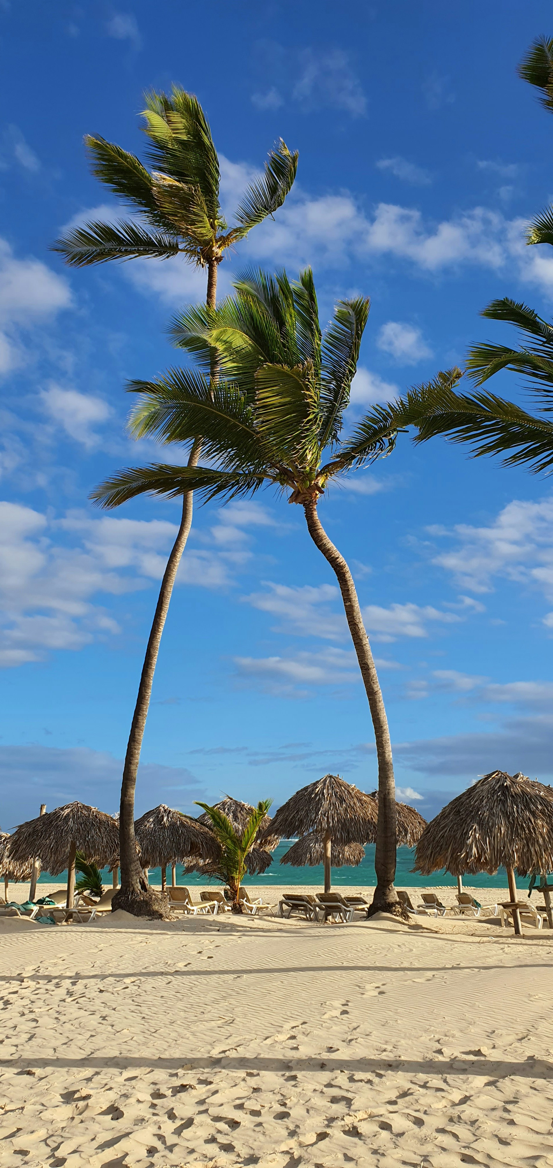
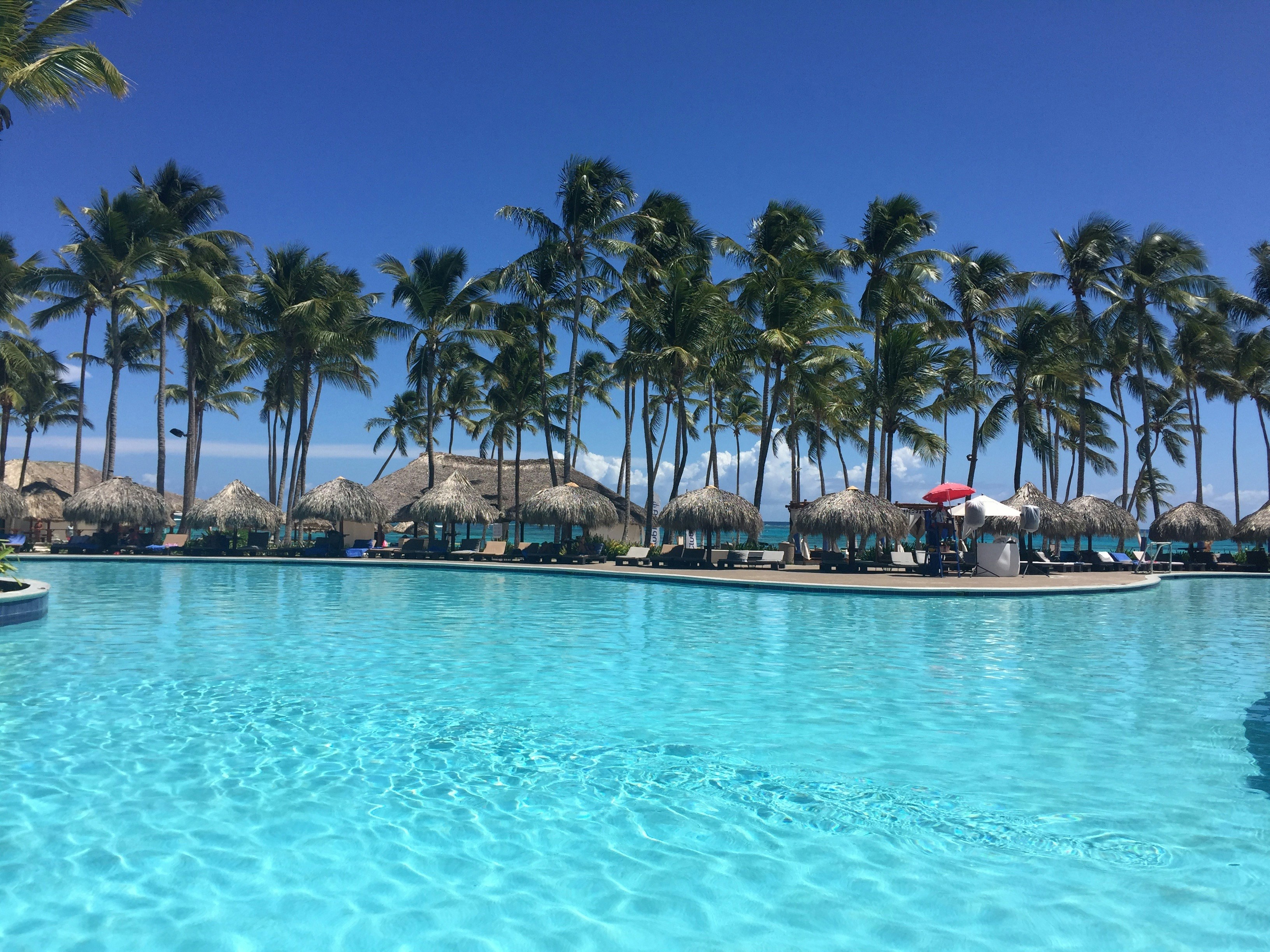
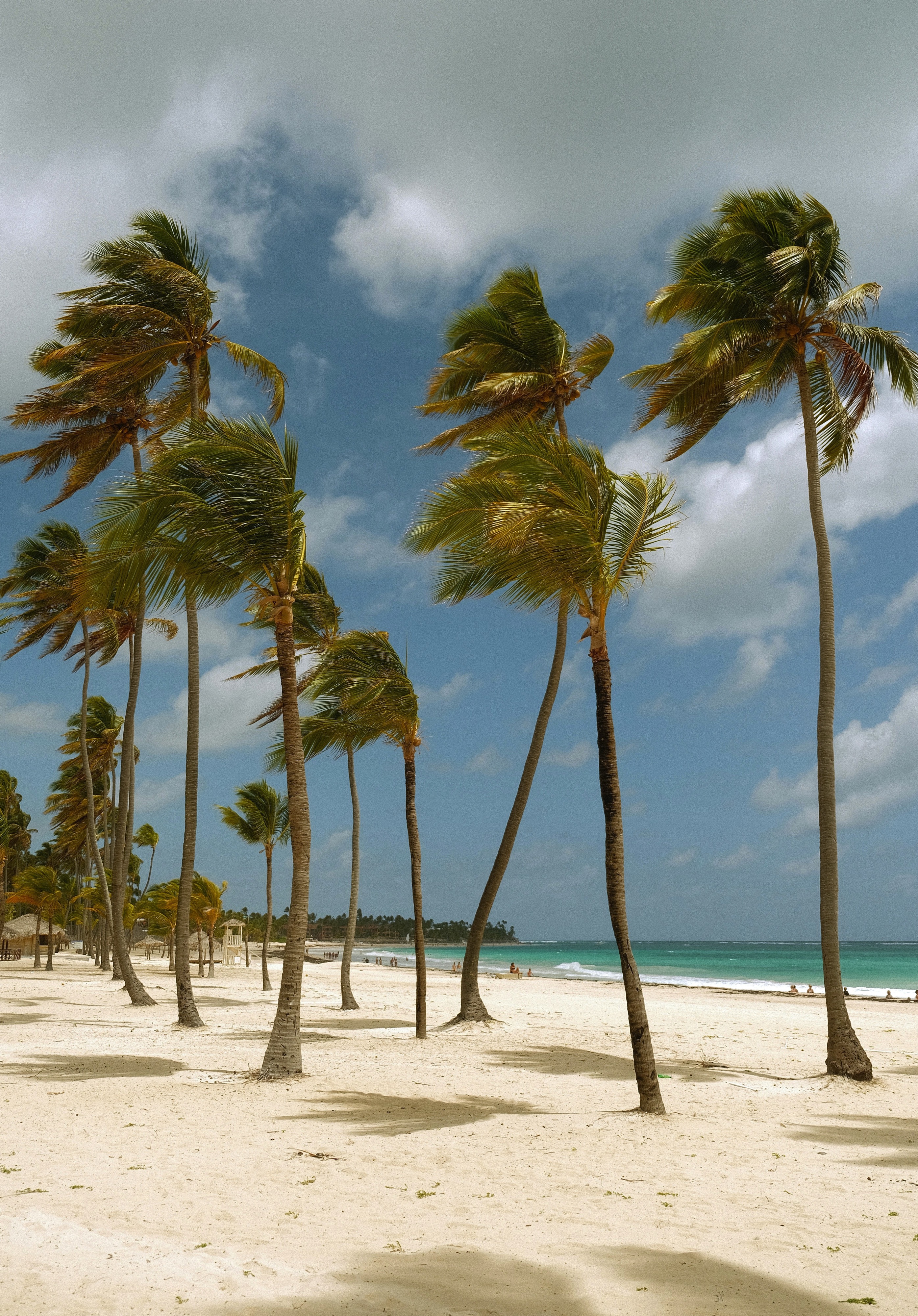
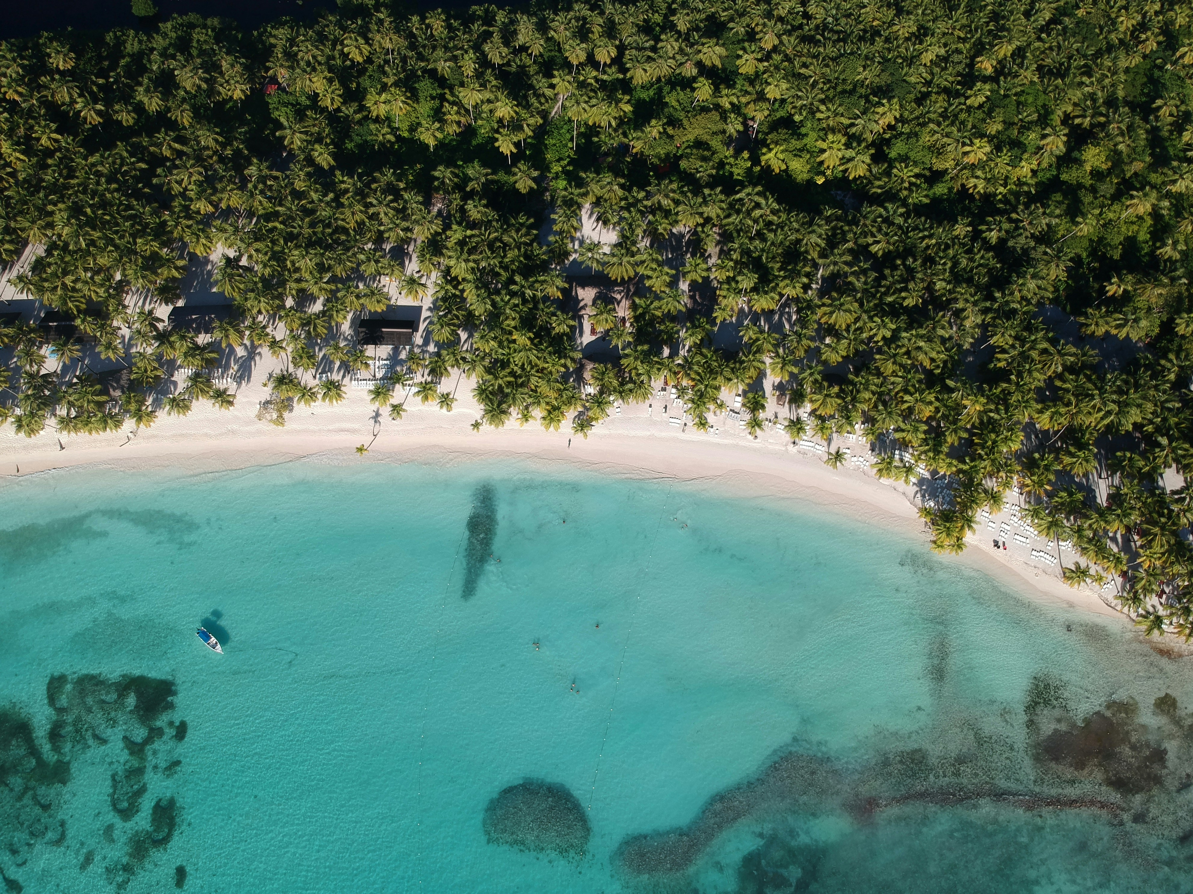
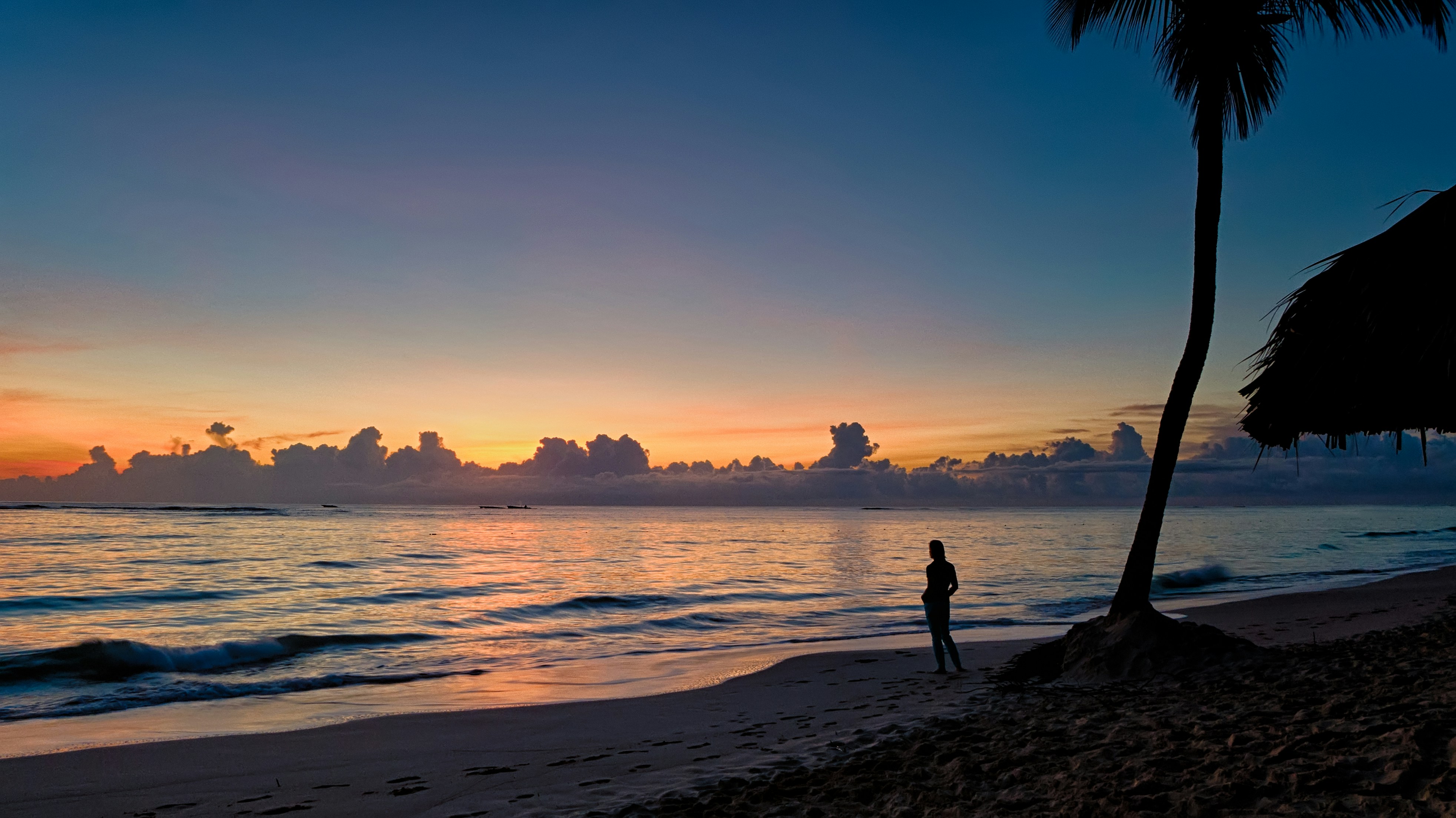
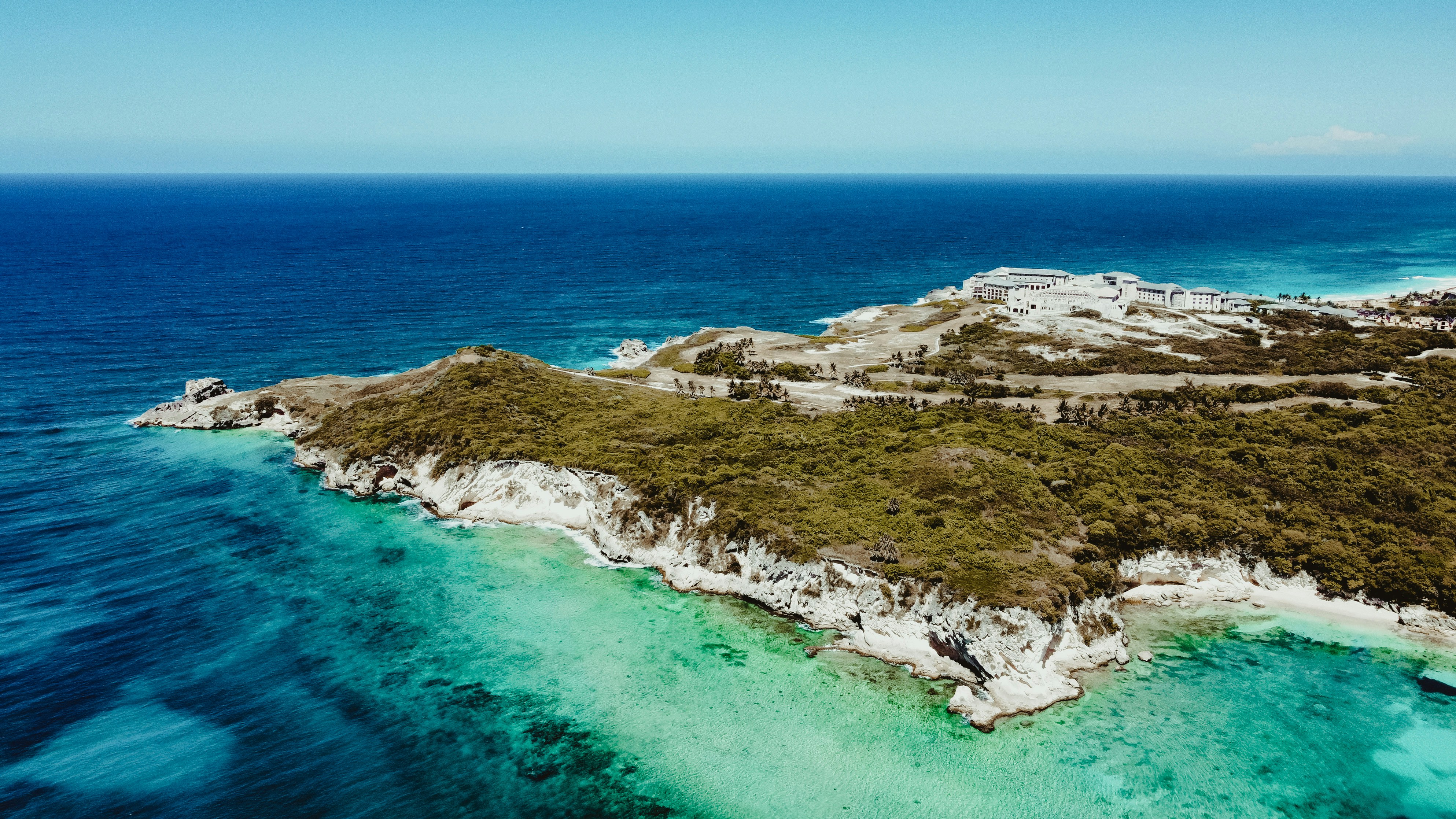
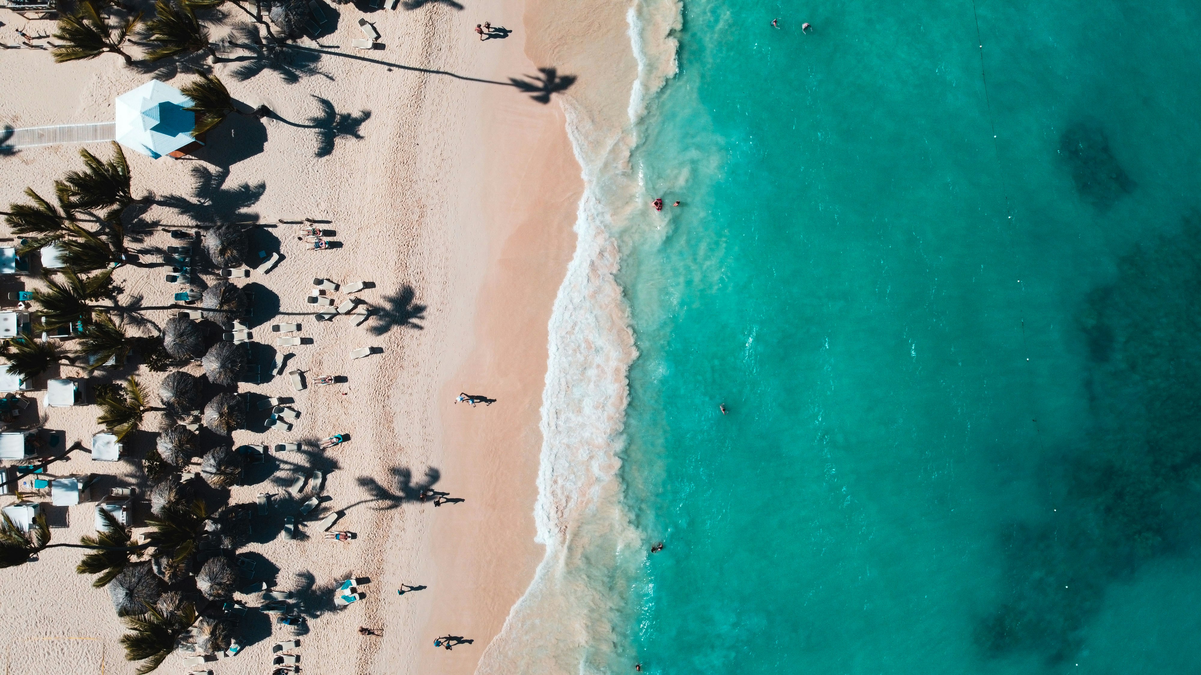
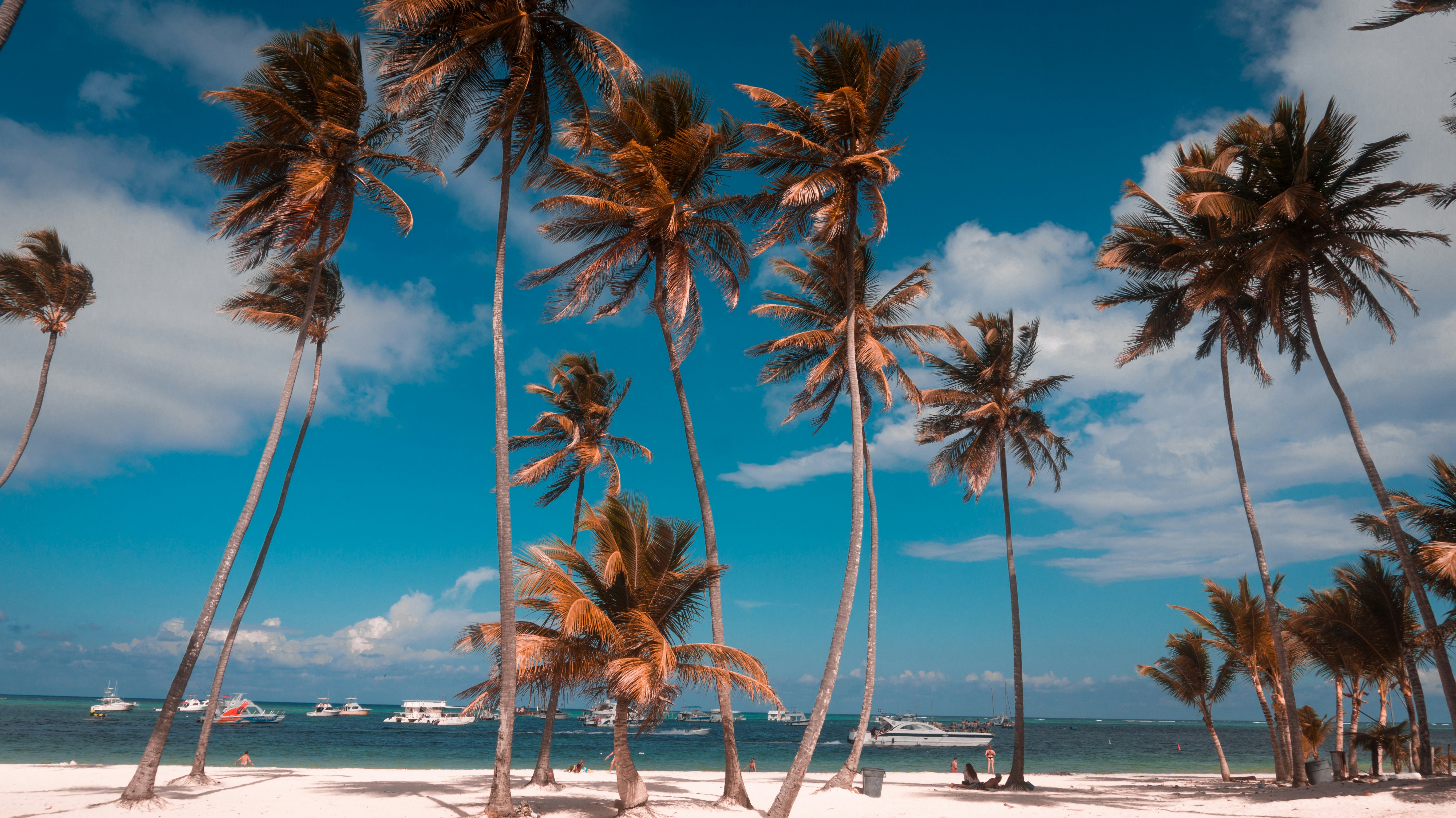
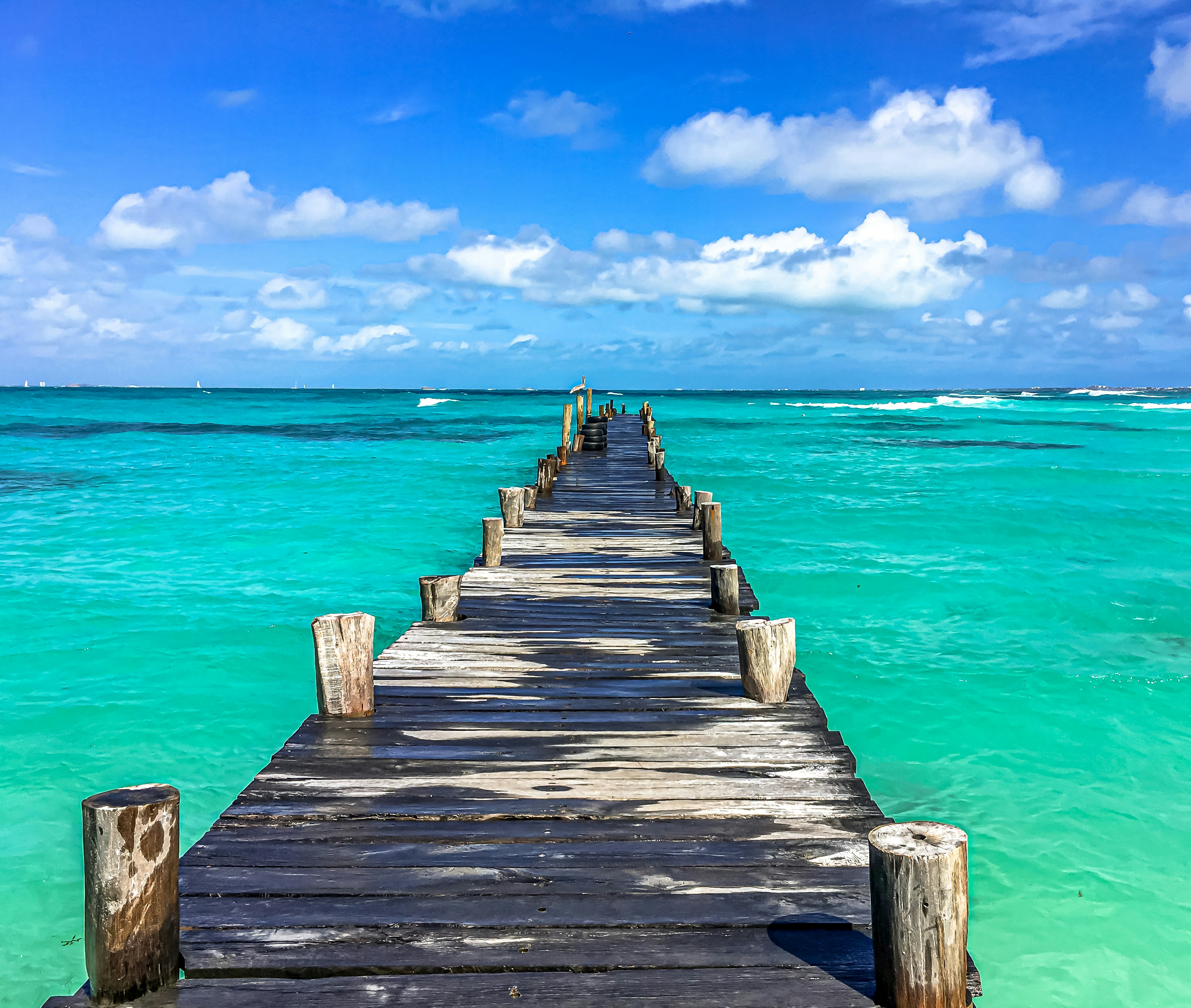
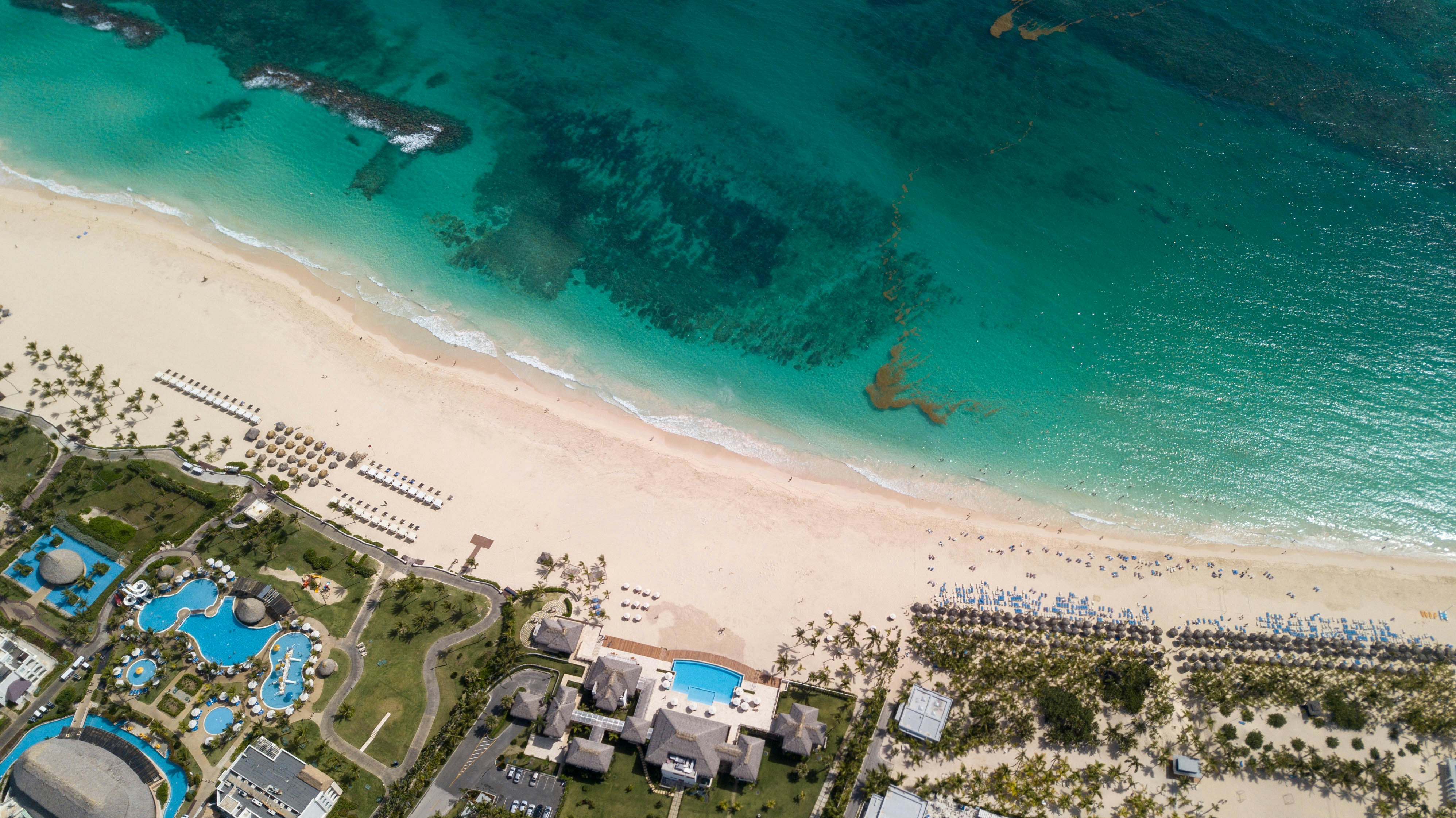
About Punta Cana
About Santo Domingo
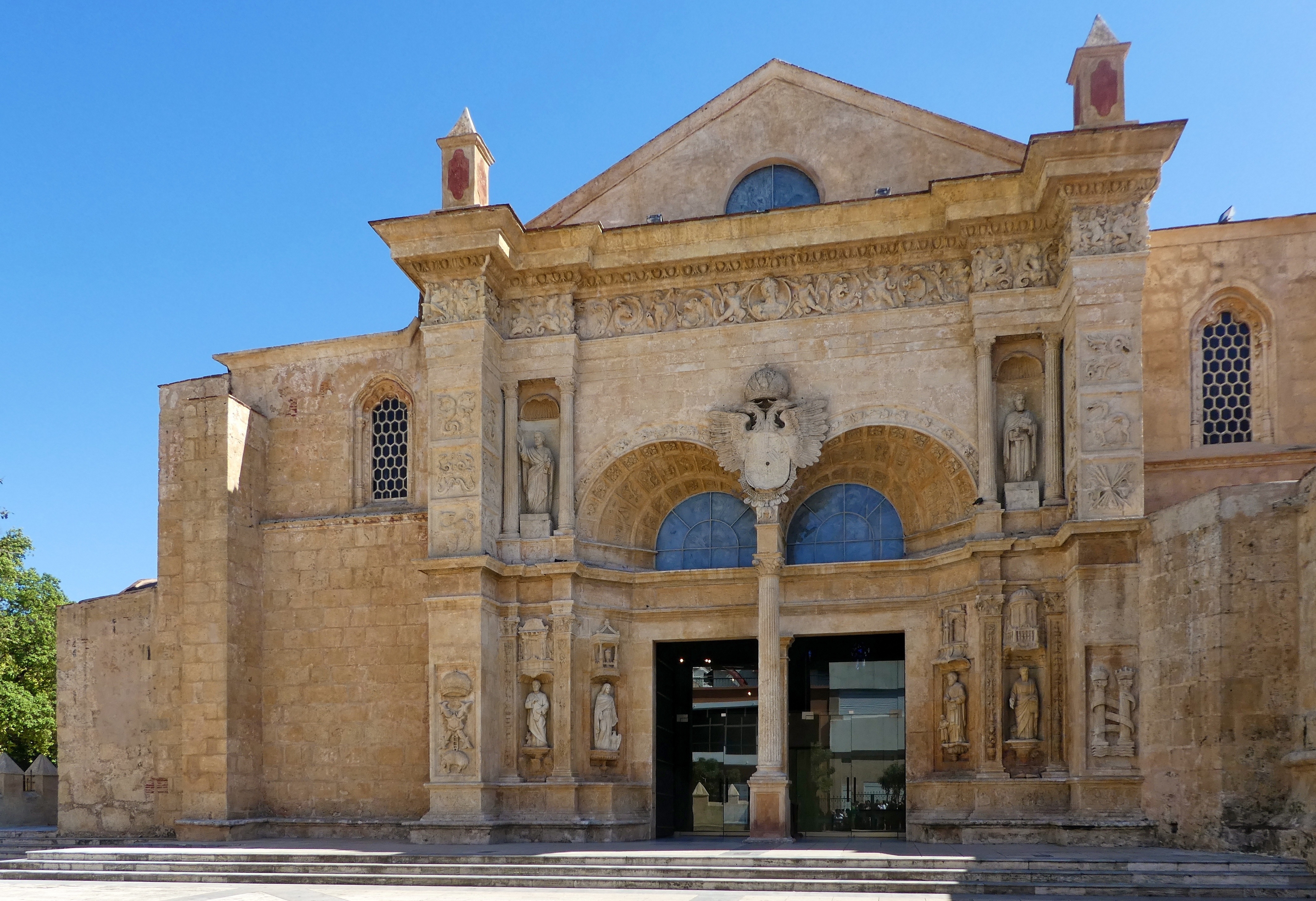
About Santo Domingo
About Port Antonio
Port Antonio, on the Northeast coast of Jamaica, is the islands third largest port, mainly for bananas and coconuts. It is also an important tourist destination. In fact, it has been featured as a model of paradise in several famous Hollywood films such as Club Paradise and Cocktail. Port Antonio was a sleepy coastal town until the 1880s, when Lorenzo Dow Baker, an American businessman, started the banana trade in Jamaica and promoted Port Antonio as a vacation spot for wealthy Americans. "Portie", as it is nicknamed, became a boom town. Even the movie star Errol Flynn was enamoured and ended up buying property here after his yacht washed ashore in 1946. Today it is still a major destination with plenty to do and see, from stunning scenery, creative arts and crafts, and cultural and historical sites.
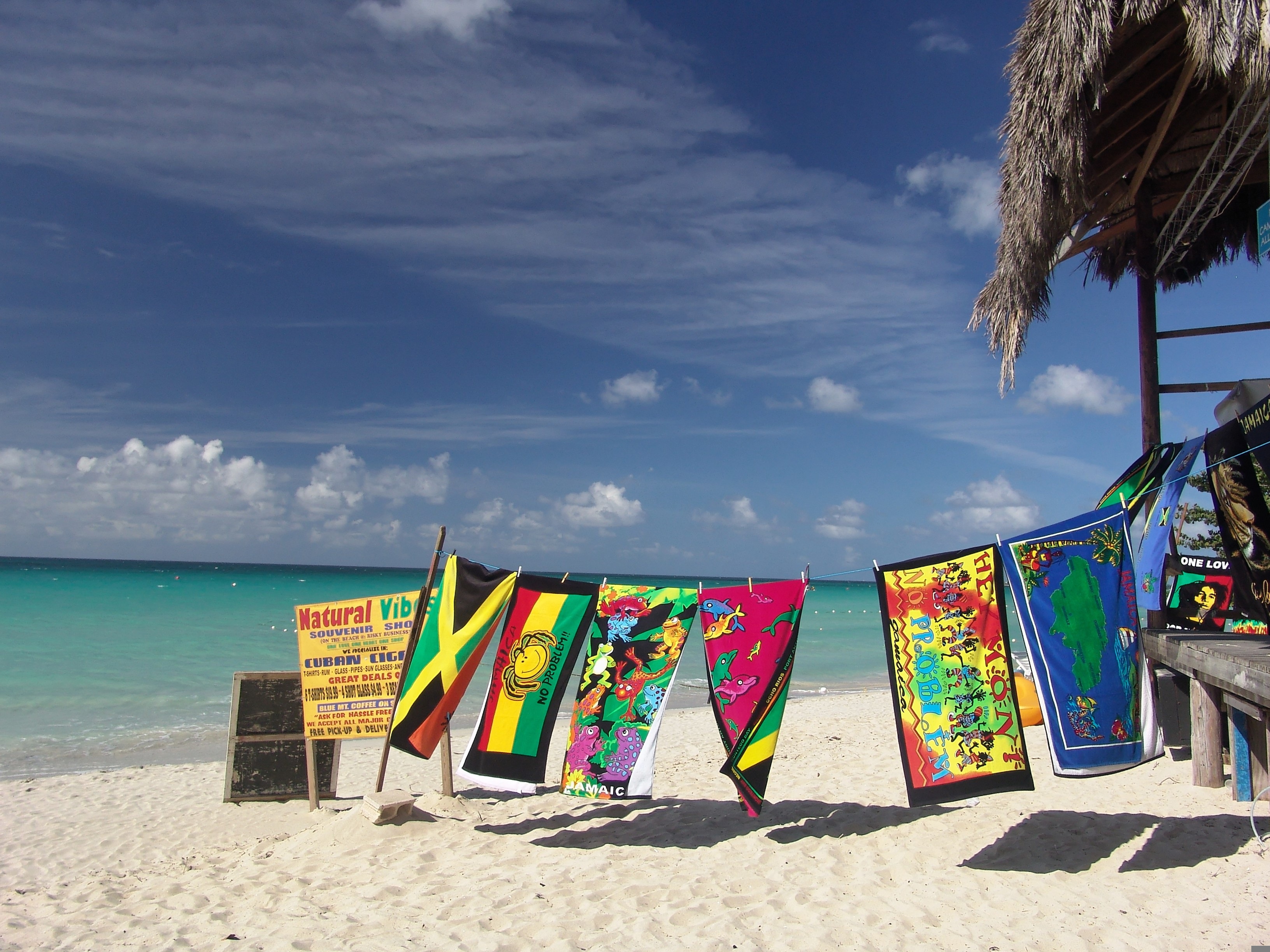
About Montego Bay
One of Jamaica's largest resort cities, Montego Bay offers a range of activities bound to interest an array of visitors, from arts enthusiasts to the more adventurous type.

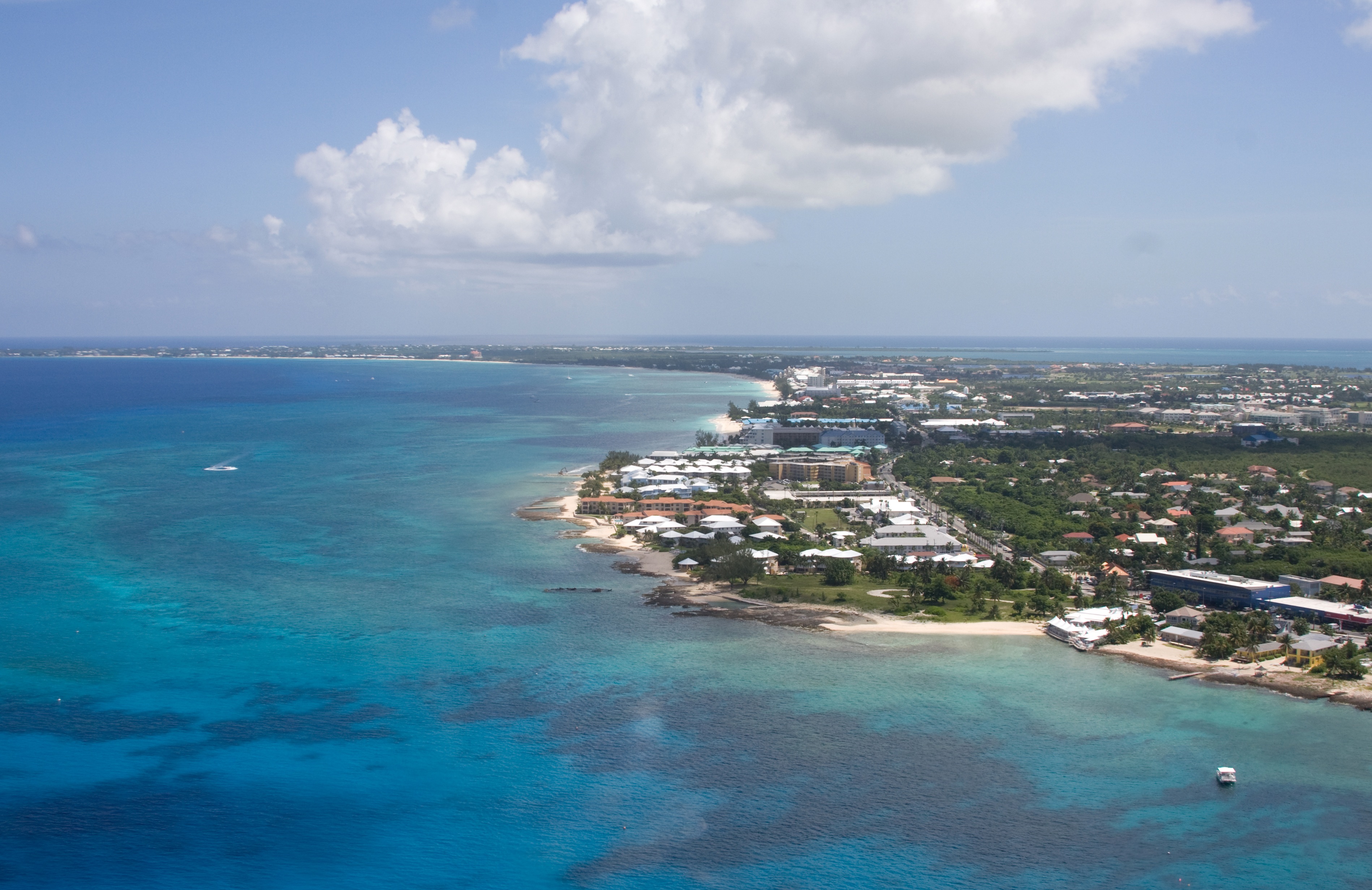
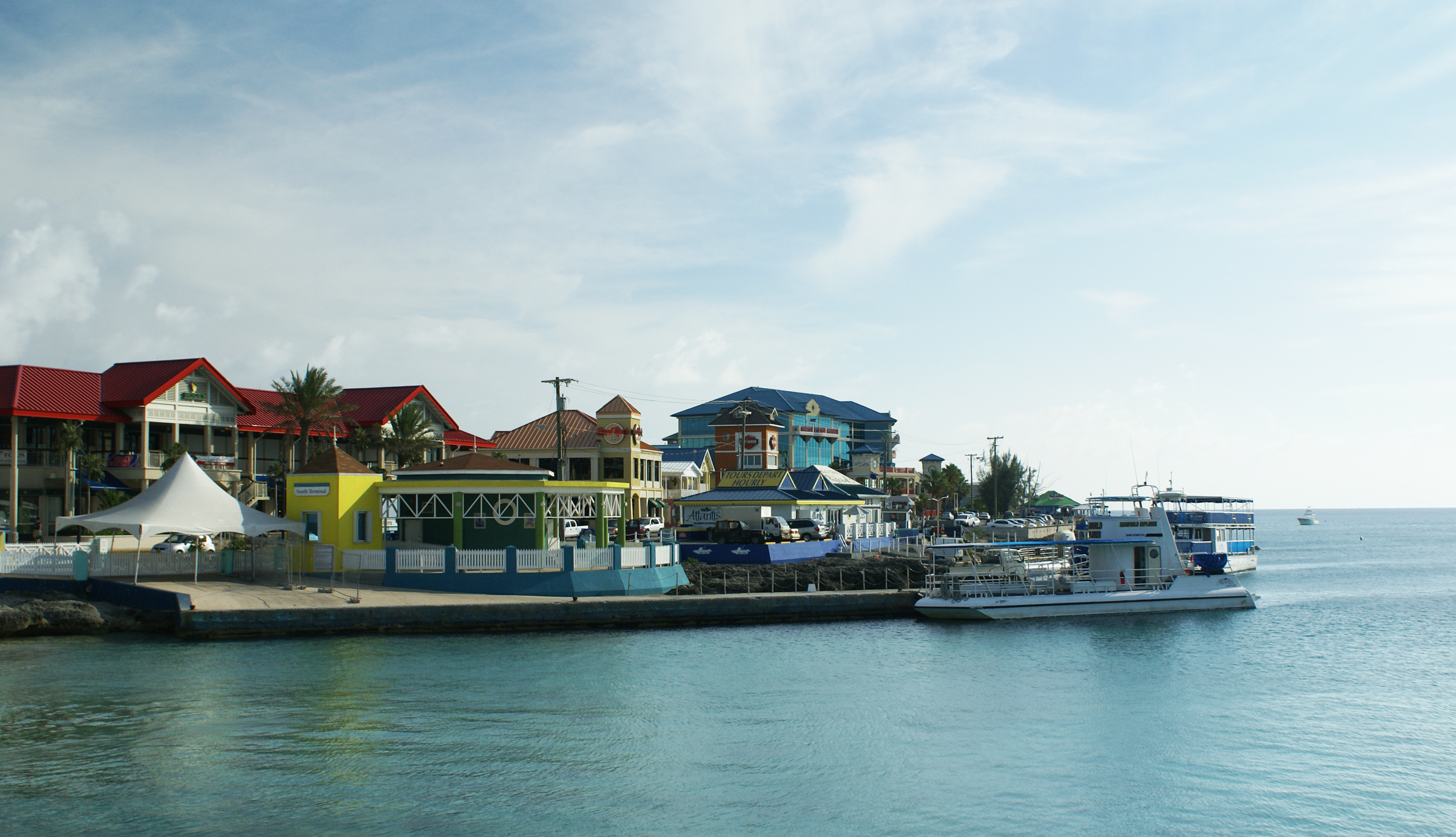
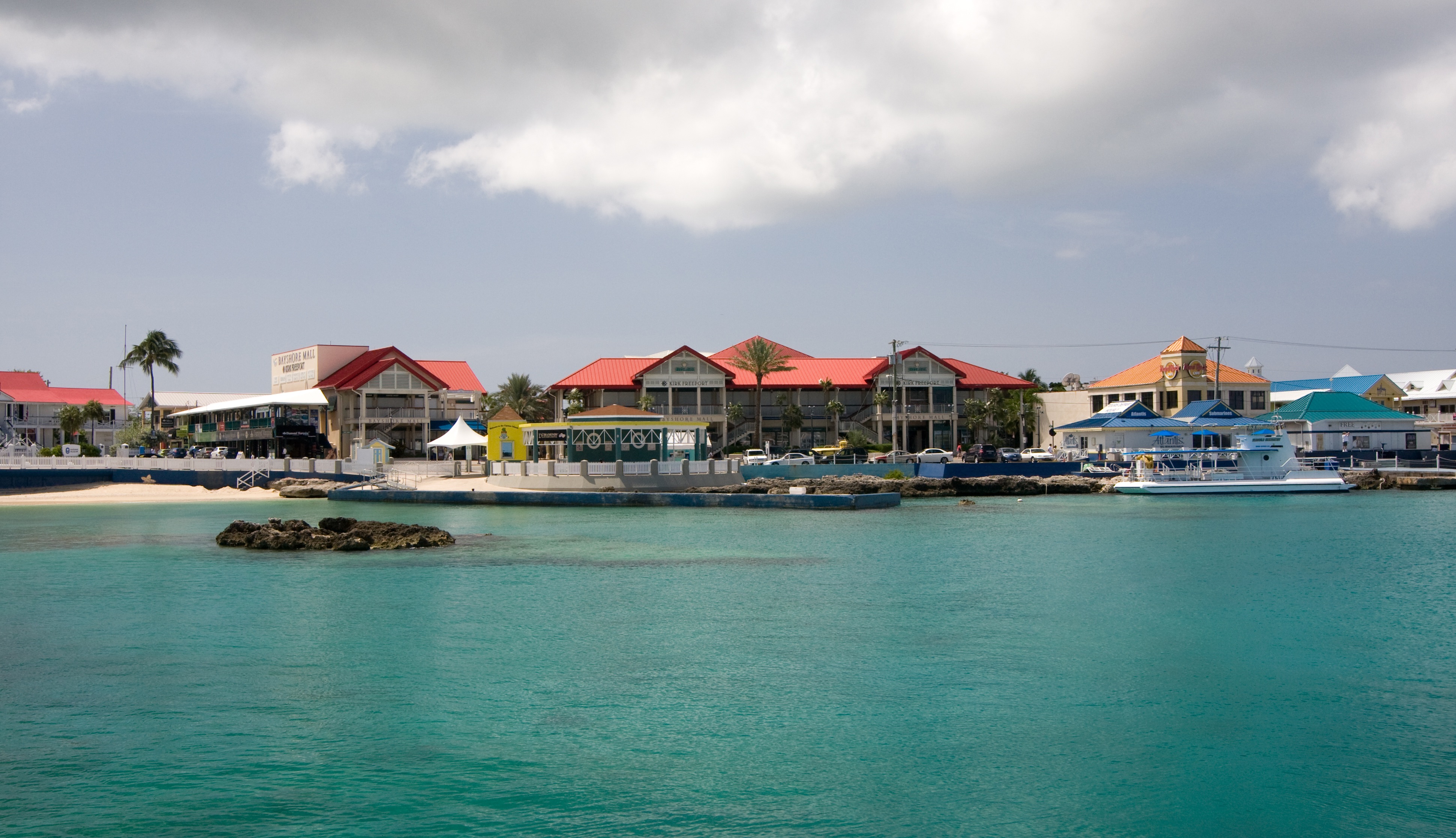
About Georgetown, Grand Cayman
Begin exploring the capital by strolling along the waterfront Harbour Drive to Elmslie Memorial United Church, named after the first Presbyterian missionary to serve in Cayman. Its vaulted ceiling, wooden arches, and sedate nave reflect the religious nature of island residents. In front of the court building, in the center of town, names of influential Caymanians are inscribed on the Wall of History, which commemorates the islands' quincentennial in 2003. Across the street is the Cayman Islands Legislative Assembly Building, next door to the 1919 Peace Memorial Building. In the middle of the financial district is the General Post Office, built in 1939. Let the kids pet the big blue iguana statues.
About Fort Lauderdale, Florida
Like many southeast Florida neighbors, Fort Lauderdale has long been revitalizing. In a state where gaudy tourist zones often stand aloof from workaday downtowns, Fort Lauderdale exhibits consistency at both ends of the 2-mile Las Olas corridor. The sparkling look results from upgrades both downtown and on the beachfront. Matching the downtown's innovative arts district, cafés, and boutiques is an equally inventive beach area, with hotels, cafés, and shops facing an undeveloped shoreline, and new resort-style hotels replacing faded icons of yesteryear. Despite wariness of pretentious overdevelopment, city leaders have allowed a striking number of glittering high-rises. Nostalgic locals and frequent visitors fret over the diminishing vision of sailboats bobbing in waters near downtown; however, Fort Lauderdale remains the yachting capital of the world, and the water toys don’t seem to be going anywhere.
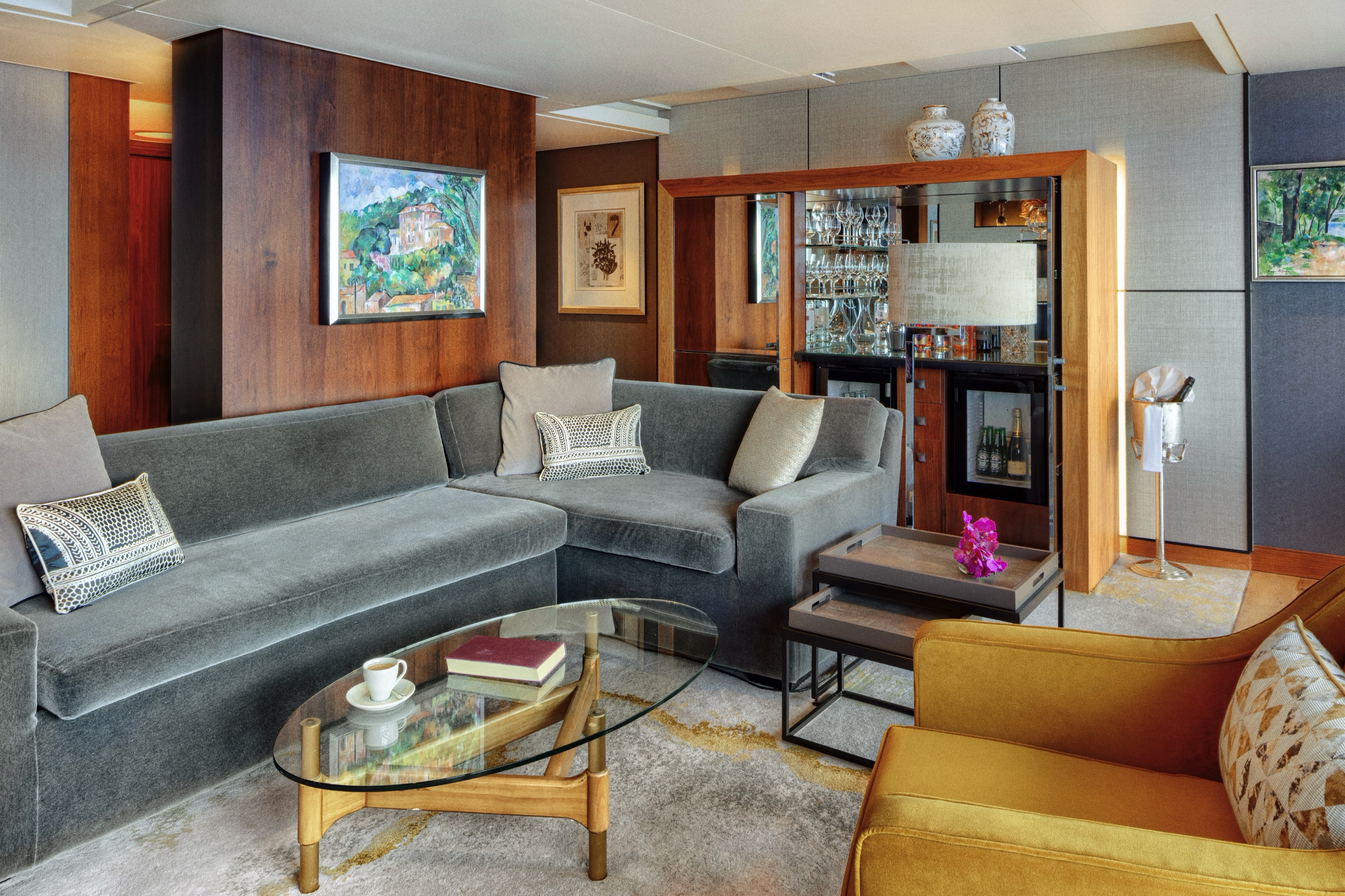
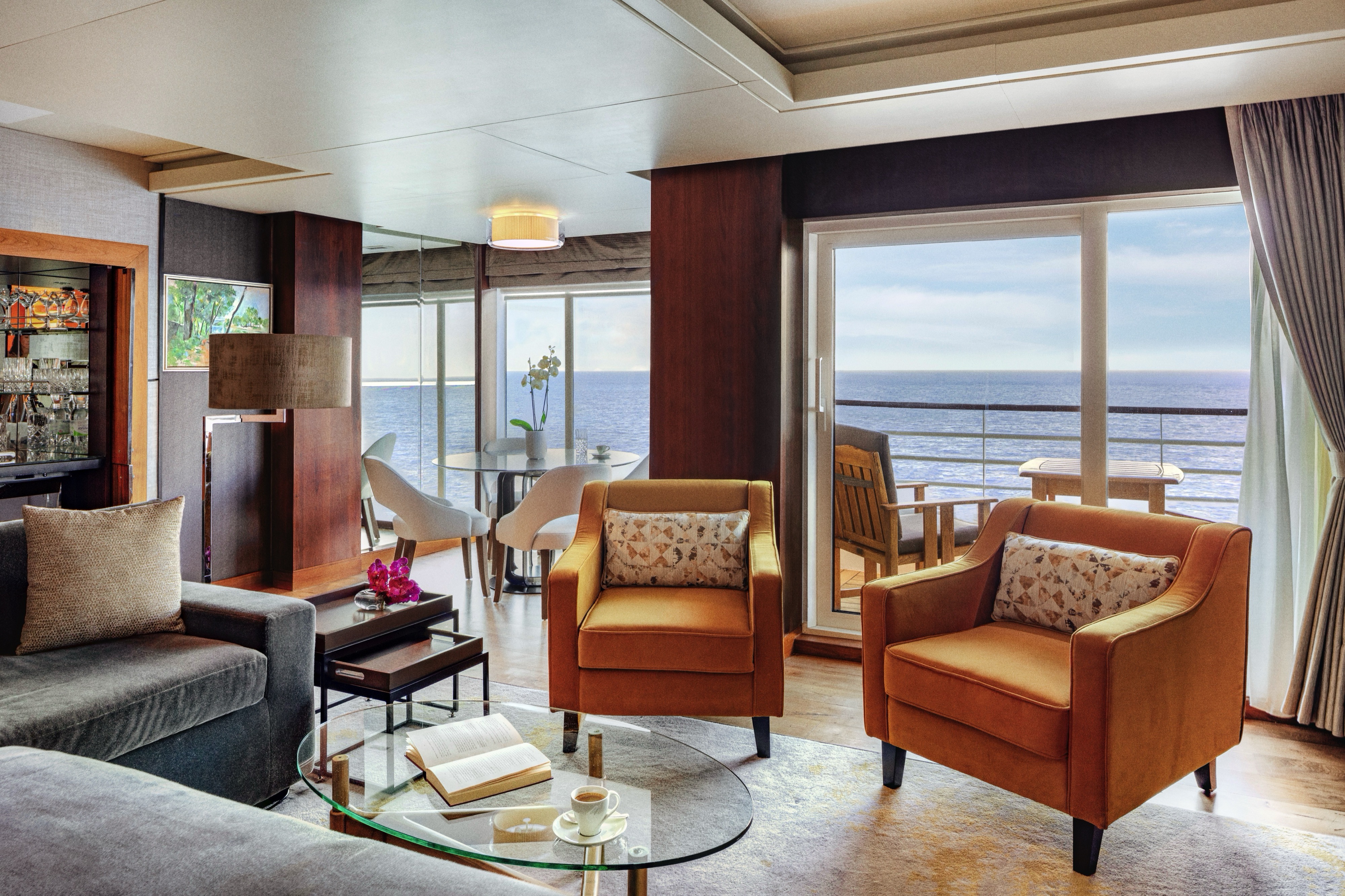
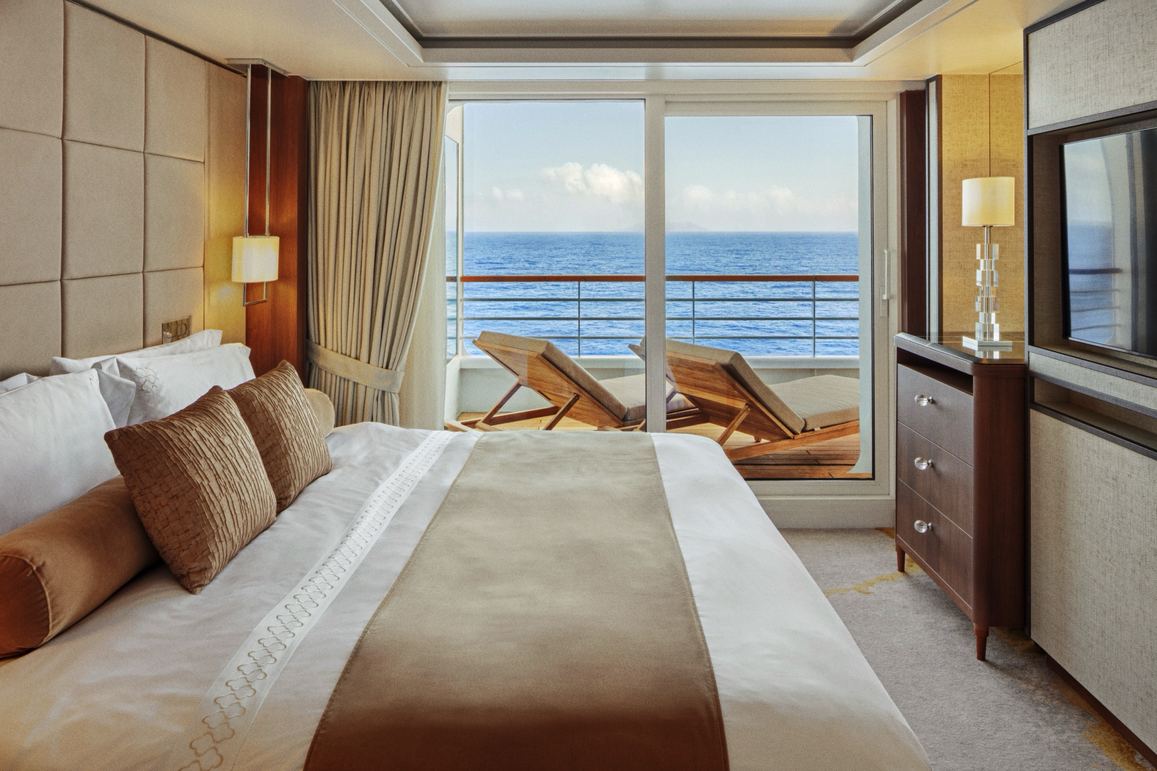
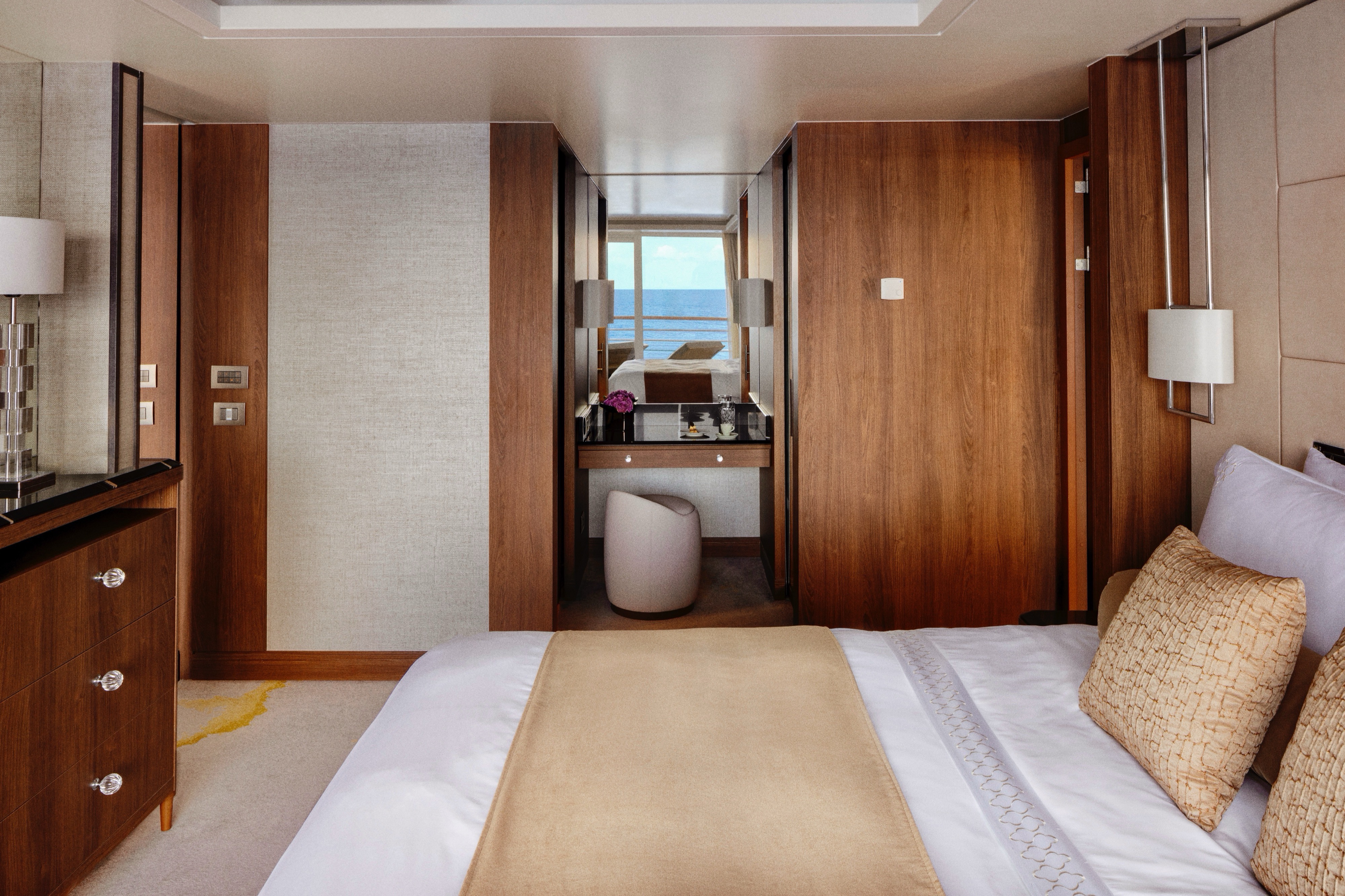
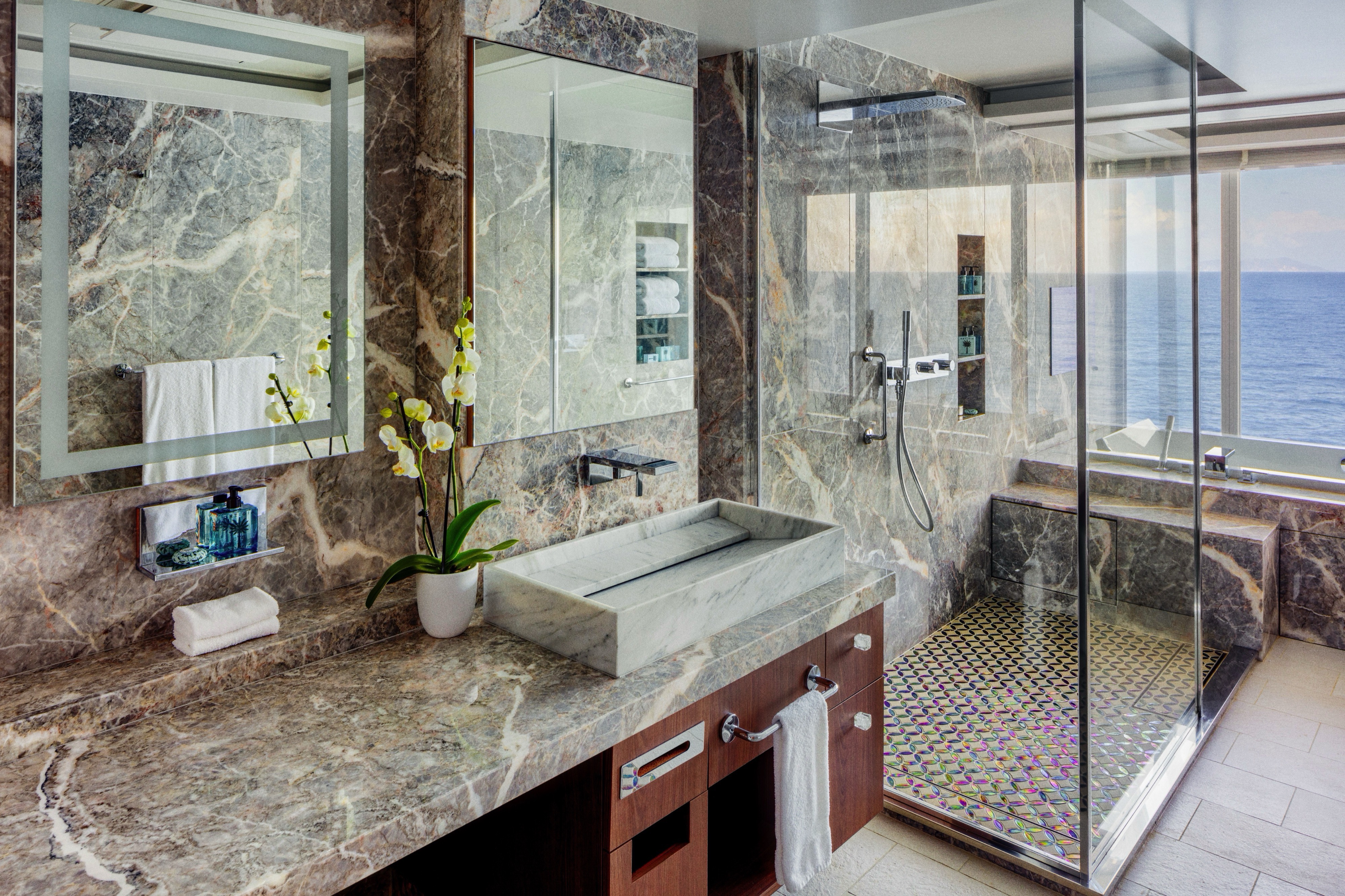
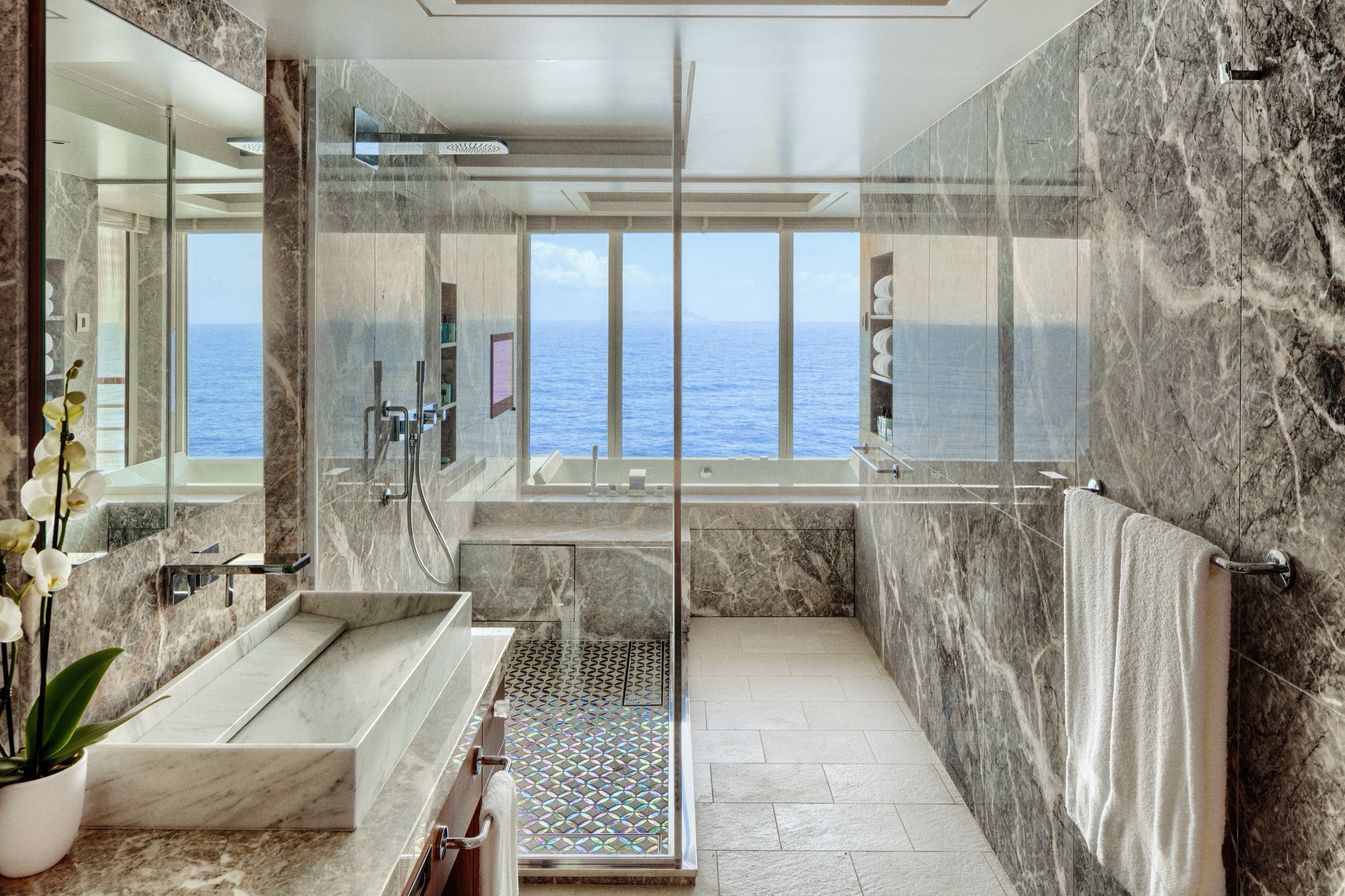
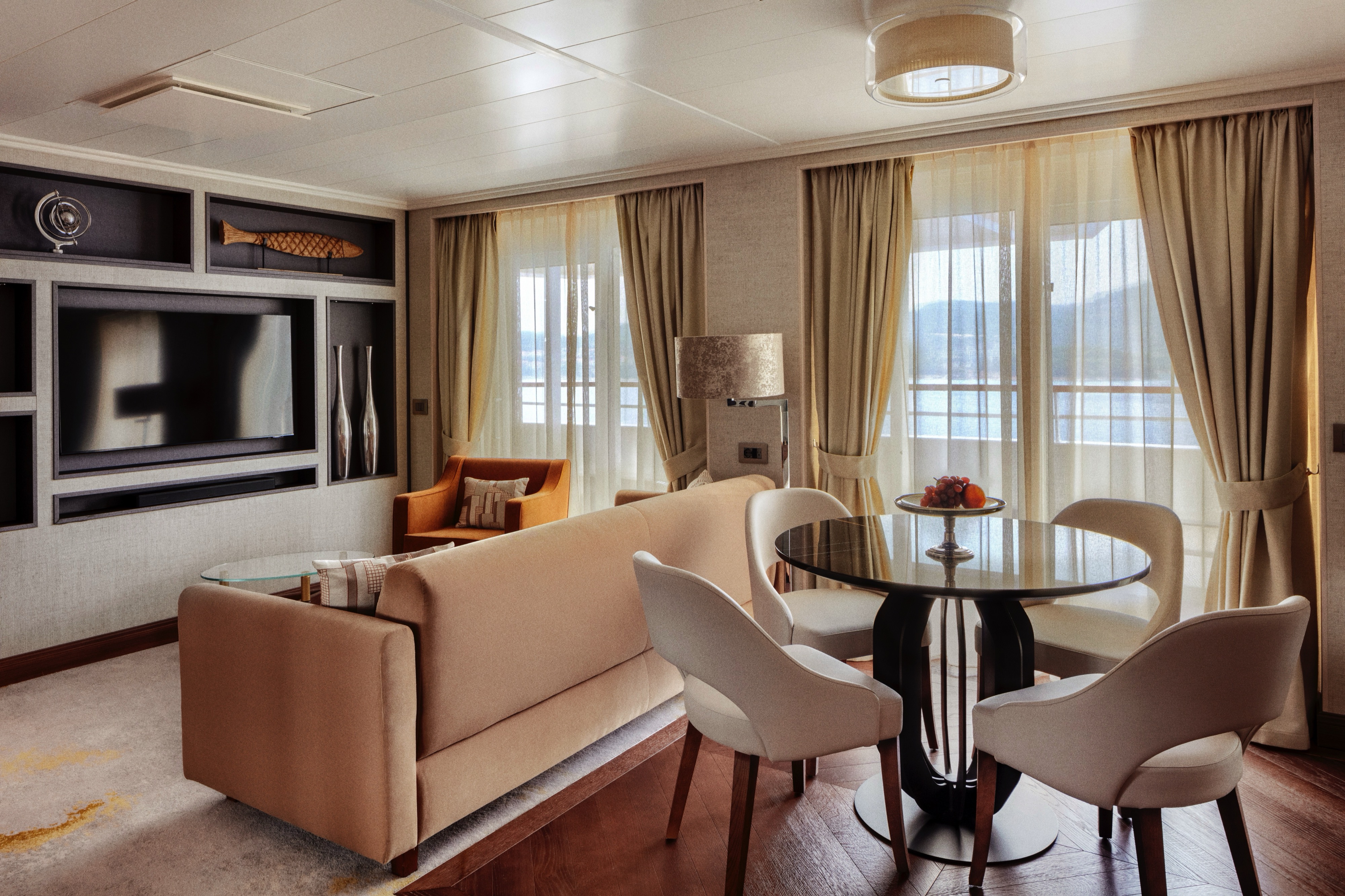
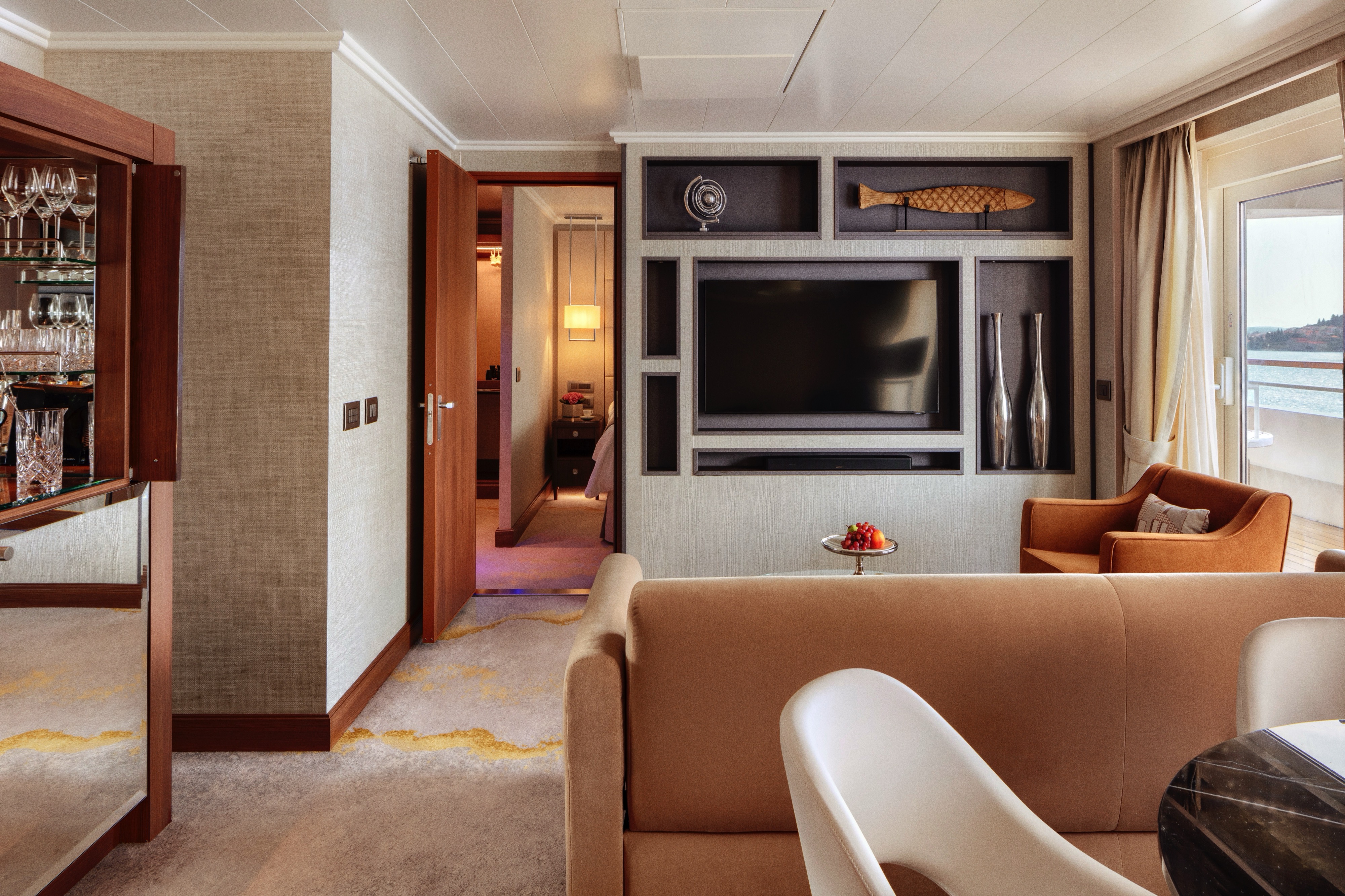
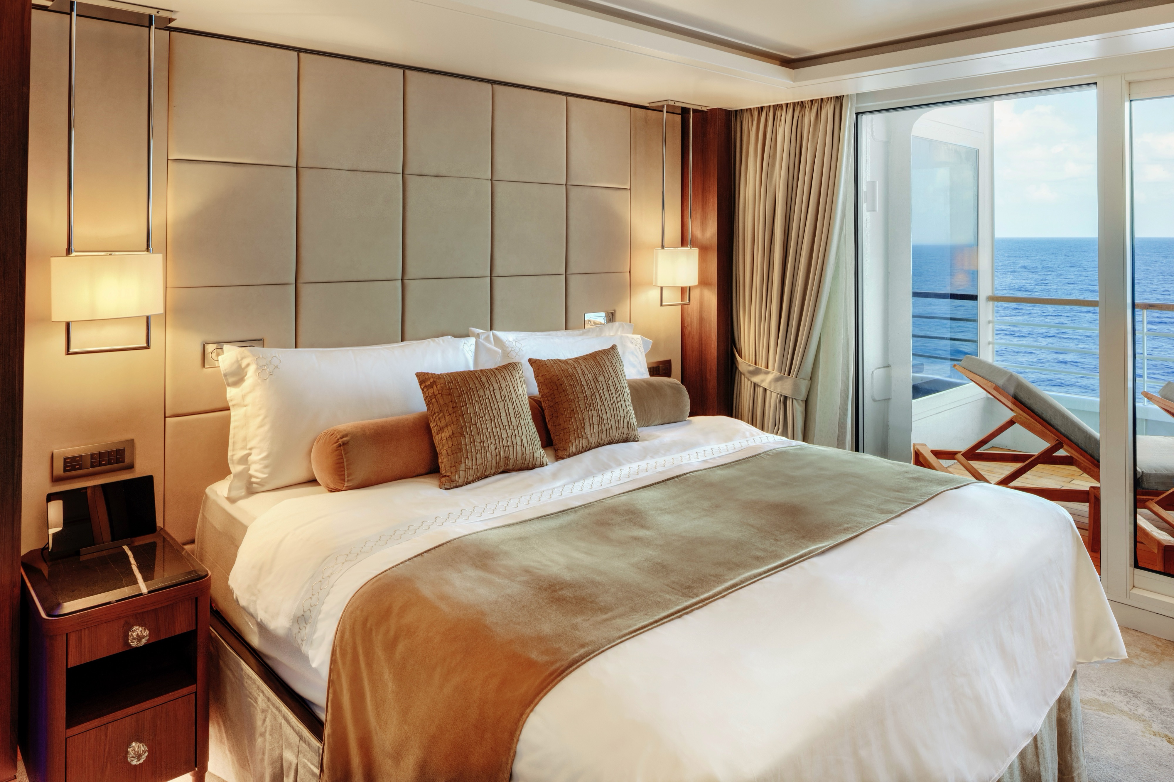
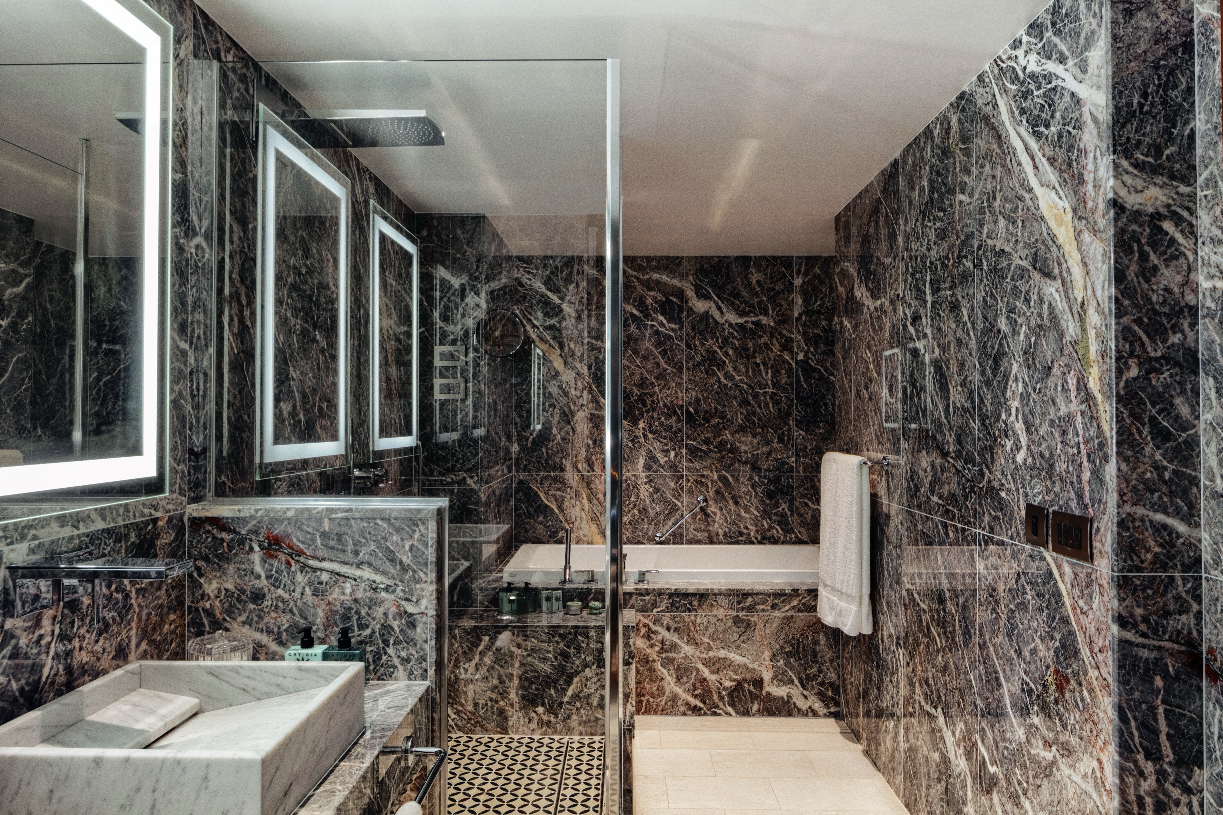
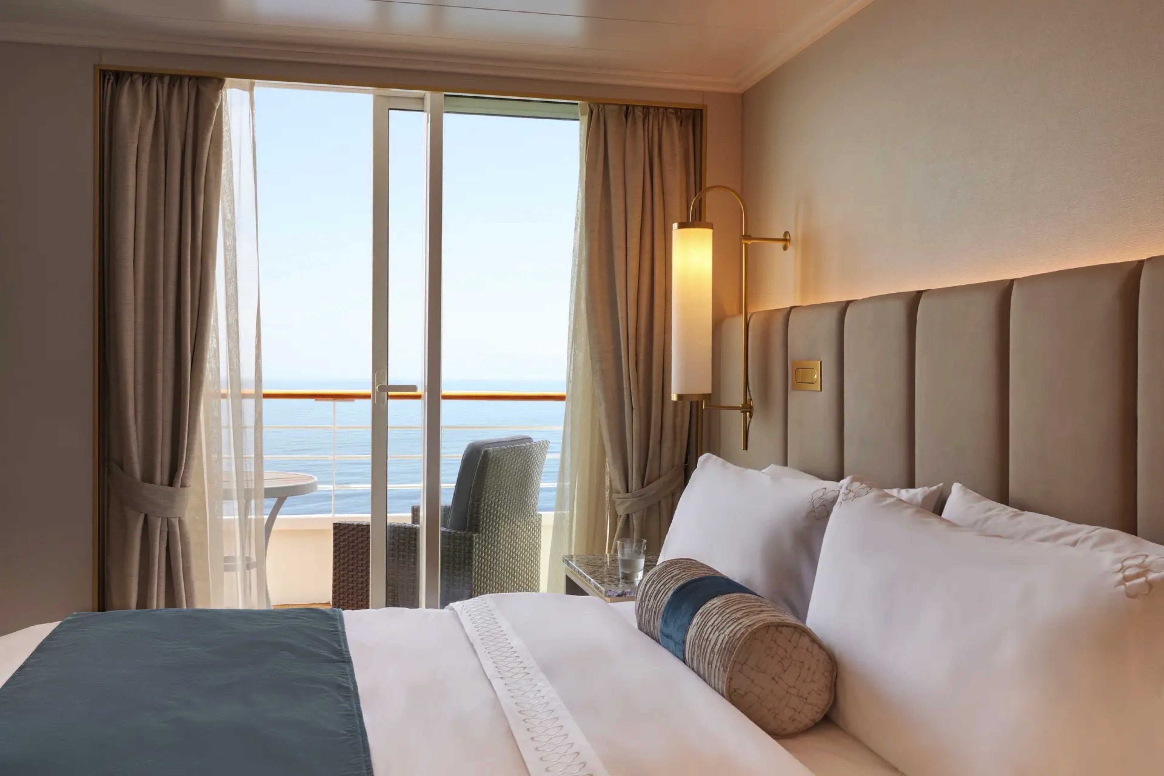
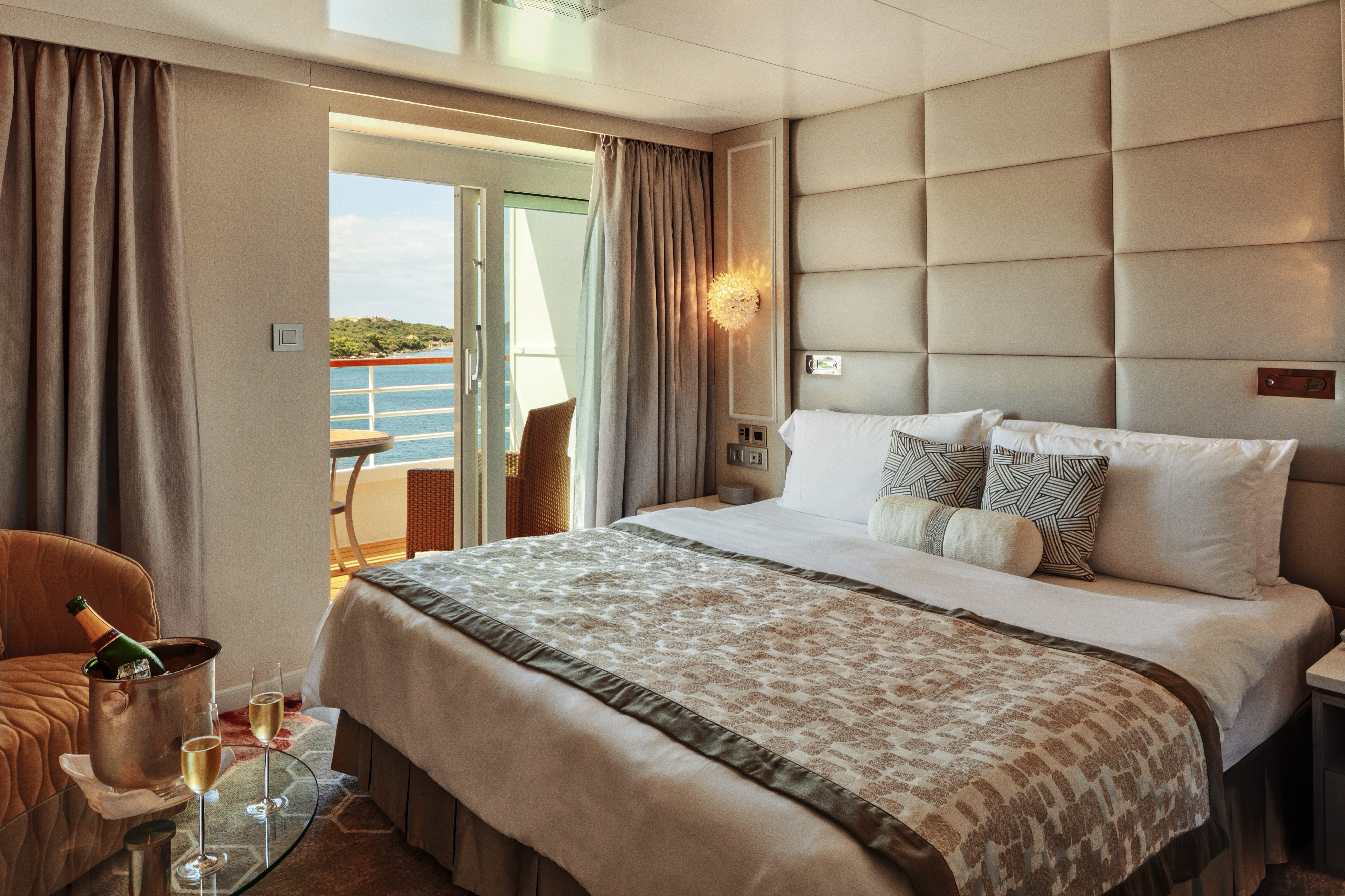
Our largest suite, available in 2023 or 2020 designs, offers two walk-in wardrobes, separate living and dining areas with panoramic ocean views, a study, and a custom built-in bar. There is also a Jacuzzi bathtub with ocean views, separate shower, bidet, and guest bathroom. Enjoy unlimited dining at specialty restaurants, unlimited laundry services, and more.
Details
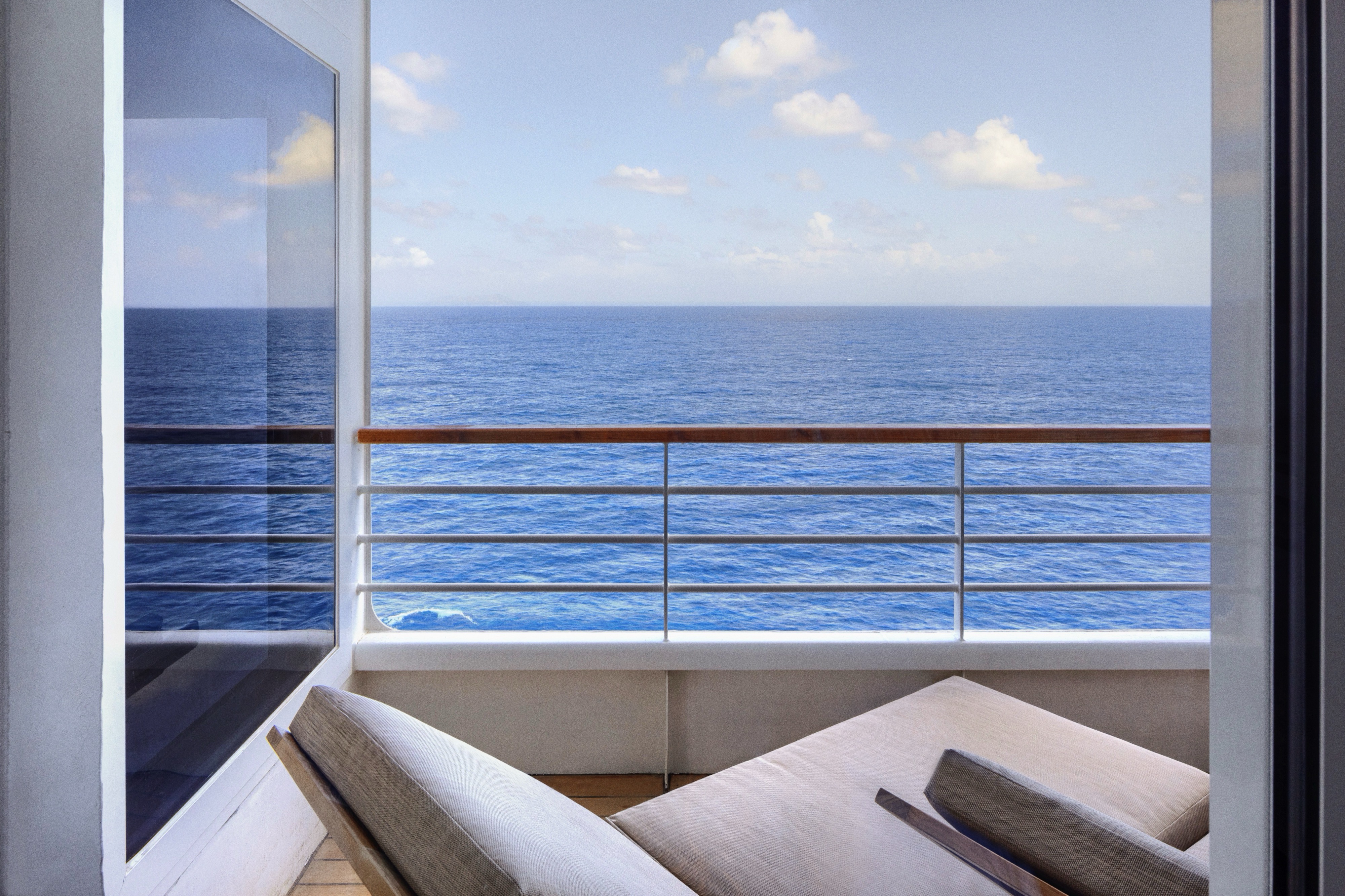
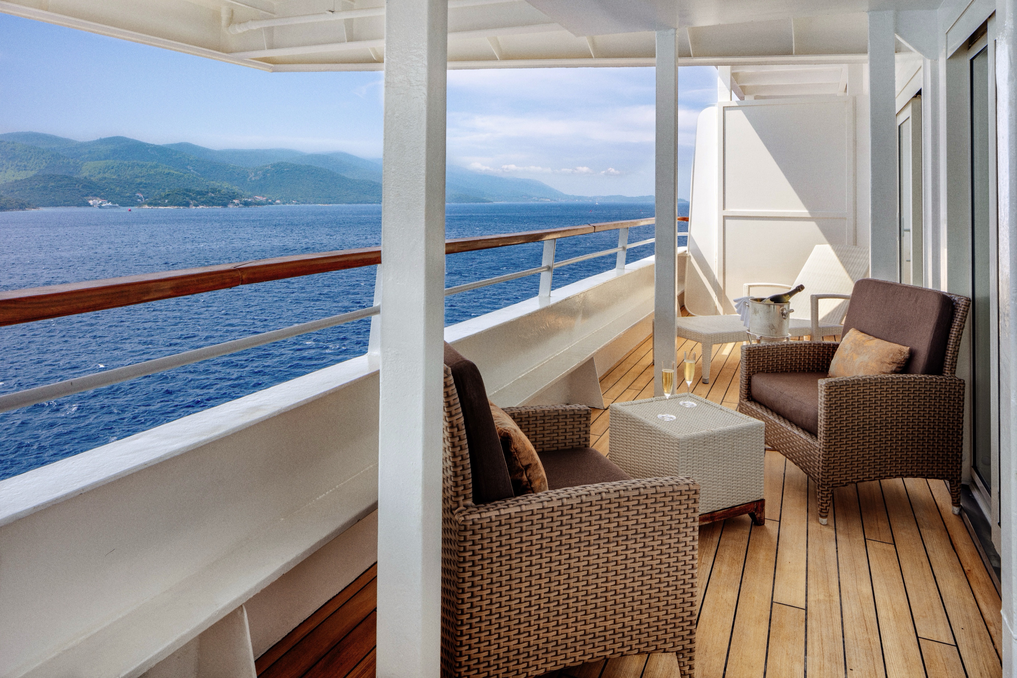
- Large private veranda with teak furniture
- Spacious living room with TV, custom wool carpets, walnut floors, cabinetry and Swarovski® chandelier
- Dining area with panoramic ocean views
- Separate study
- Custom built-in bar
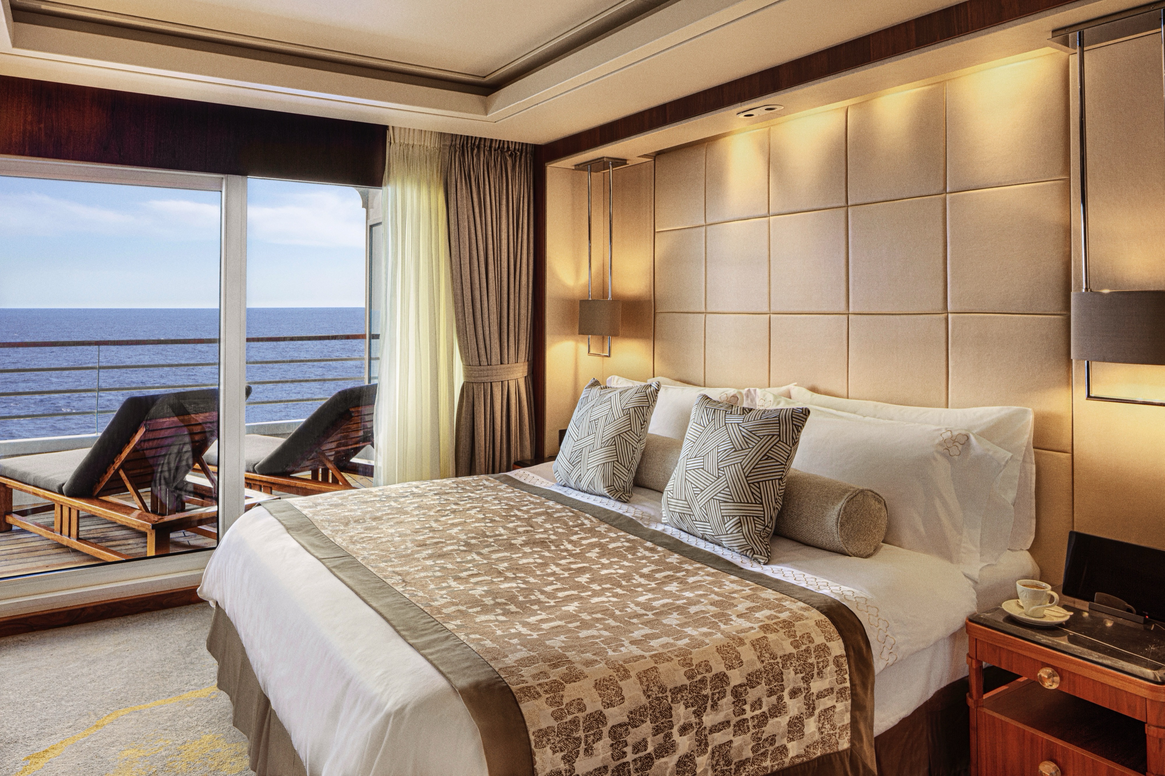
- Large bedroom with queen-size bed or twins, plus his and hers walk-in closets and TV
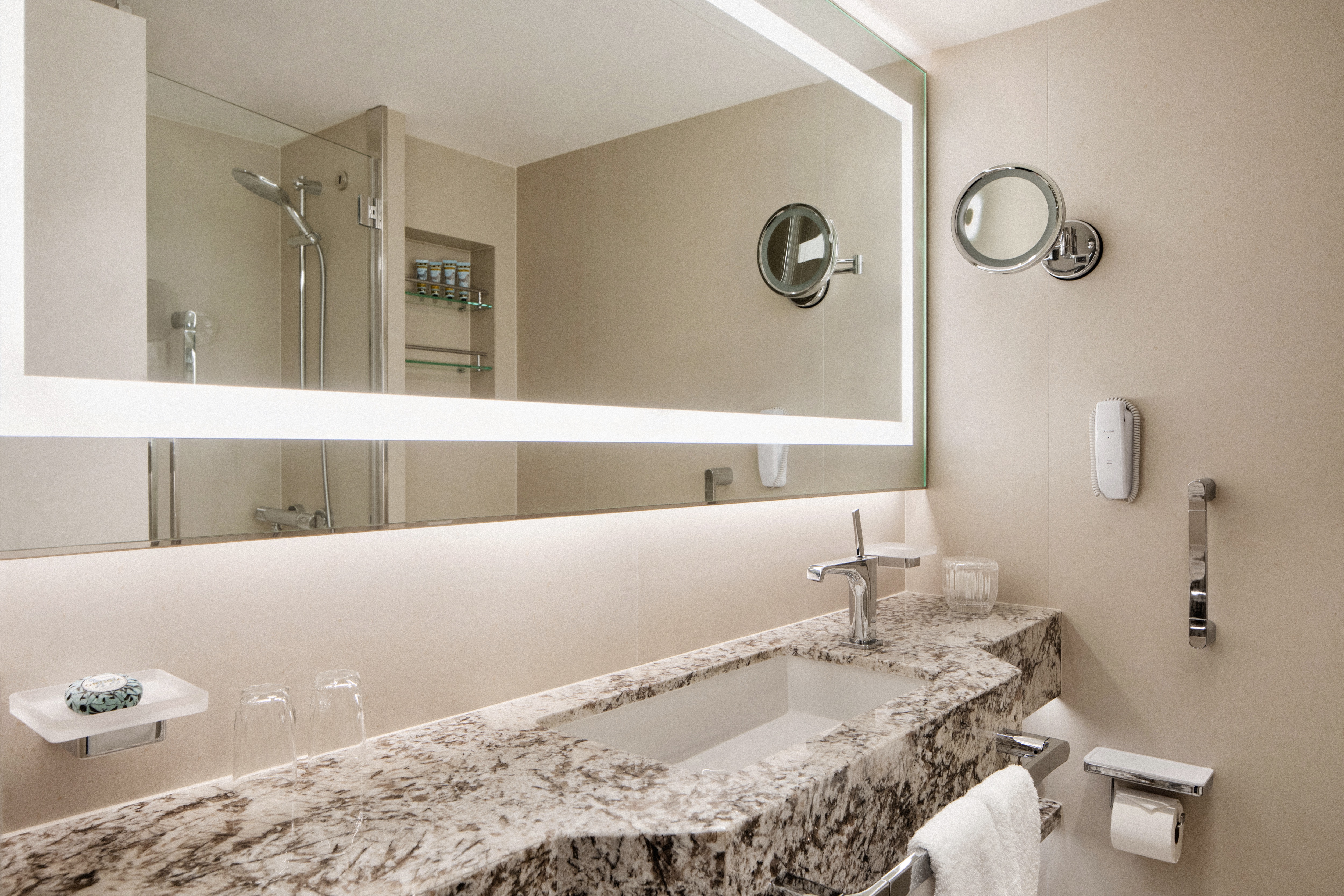
- Master bath with jacuzzi, ocean view, crystal sconces and Calacatta marble floors, separate shower and bidet
- Guest bathroom
Services
- 24 hour in-suite dining
- Unlimited room service from Osteria D'Ovidio and Umi Uma
- Unlimited dining in Osteria D'Ovidio and Umi Uma
- Shoeshine service
- Assistance with packing and unpacking
- Free unlimited laundry and dry cleaning, 2nd day service
- In-Suite cocktail parties
- Private transfer to and from ship up to 50 miles
Amenities
- Welcome champagne
- Complimentary wine and spirits from set menu
- Complimentary soft drinks
- Flowers
- Fresh fruits, daily change, on request only
- Turndown service with handmade truffles
- Pillow menu (selection from a variety of pillow types)
- Afternoon canapés
- Coffee maker
- Binoculars
- Complimentary unlimited standard WiFi
- In-suite safe
- Interactive tablet for news, updates, and reservations
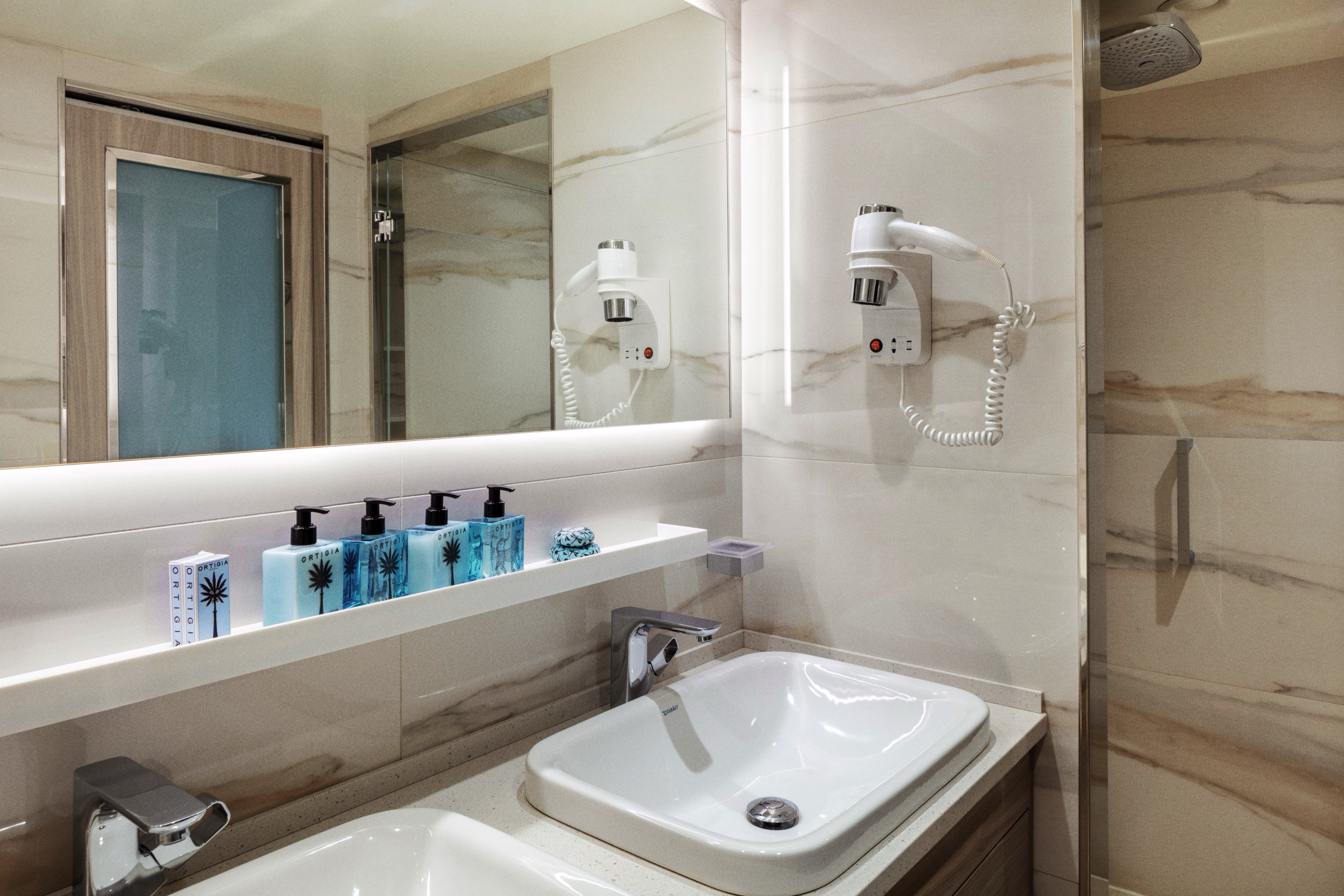
- Hair dryer
- Hair iron (available upon request)
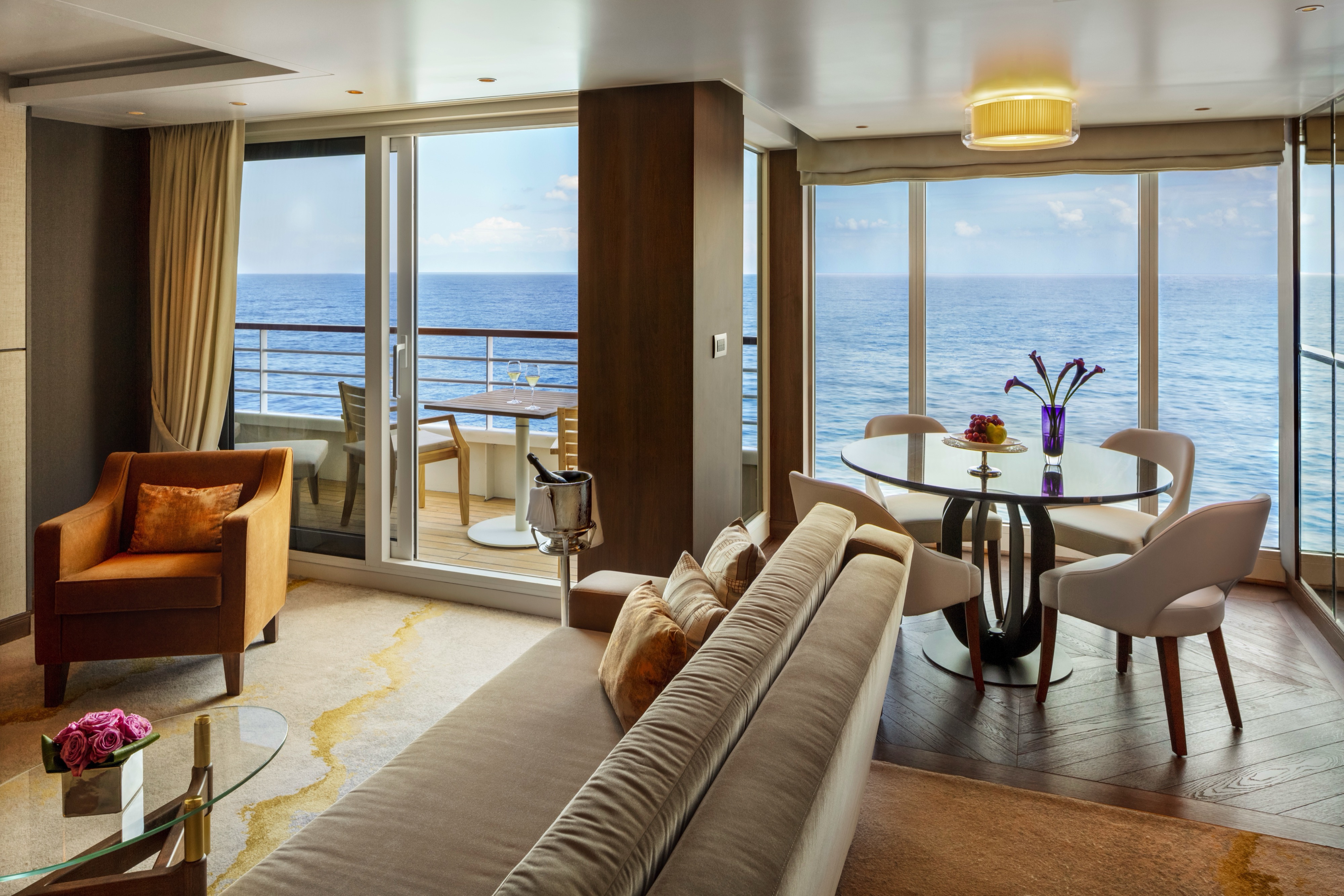
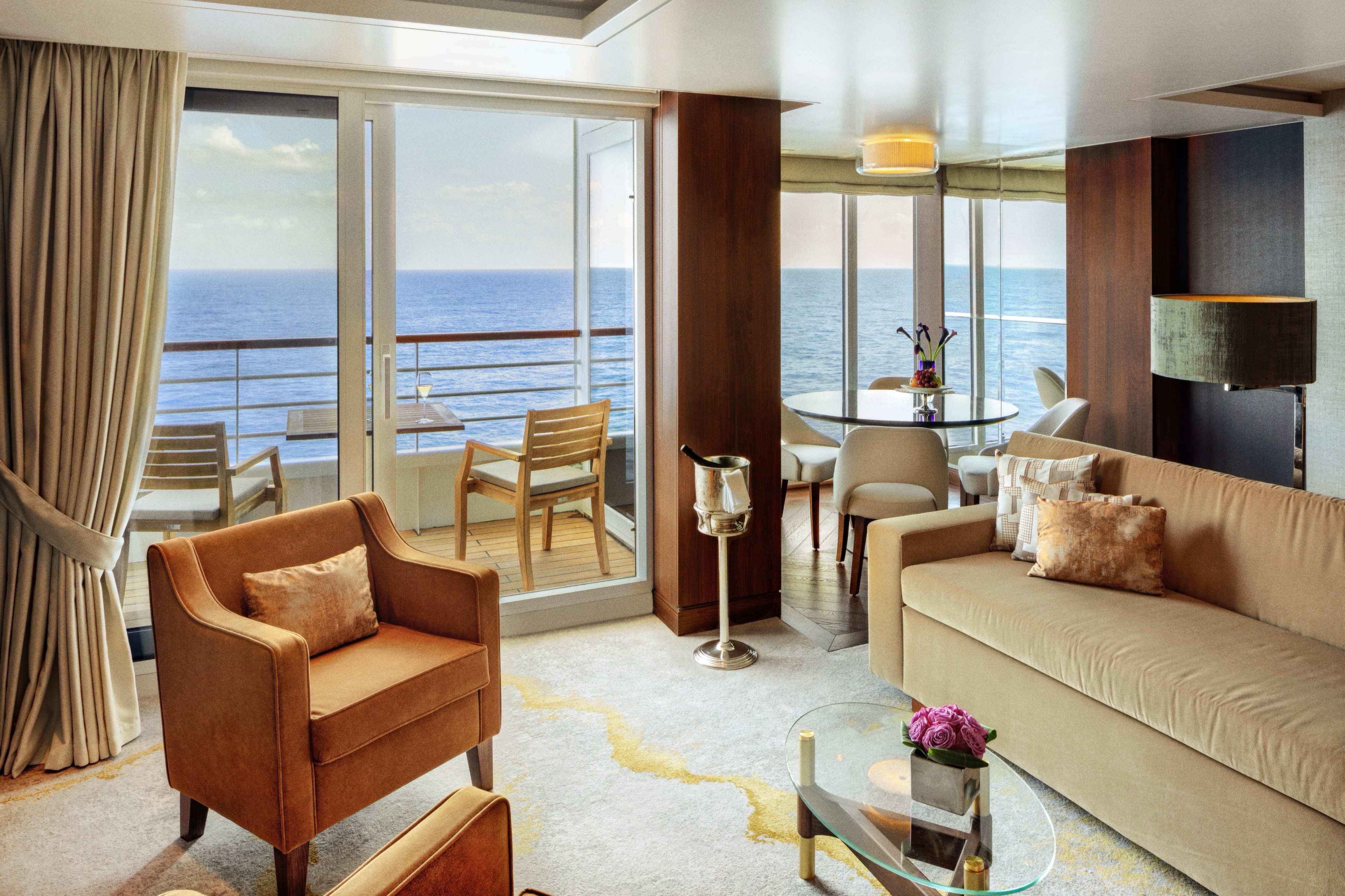
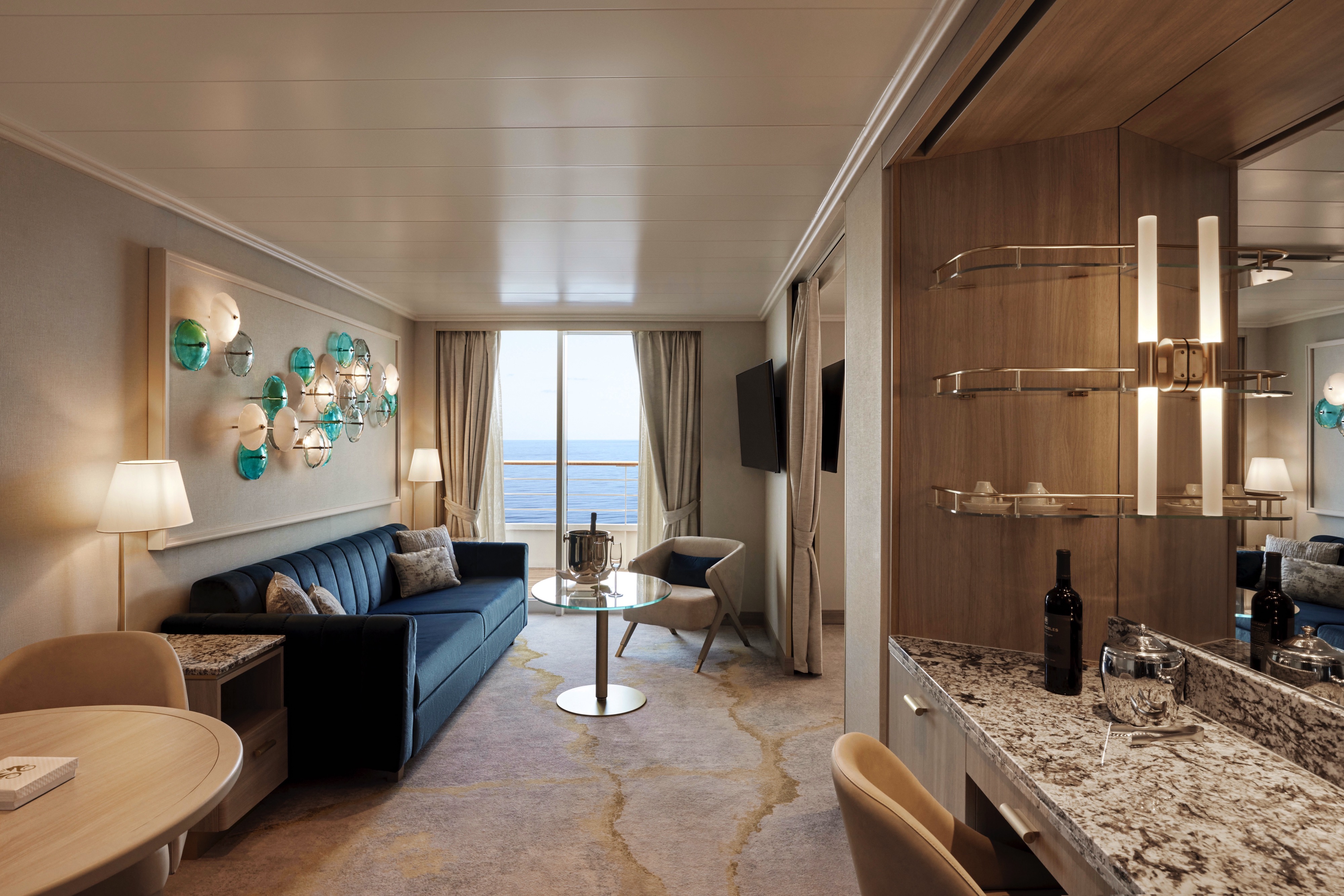
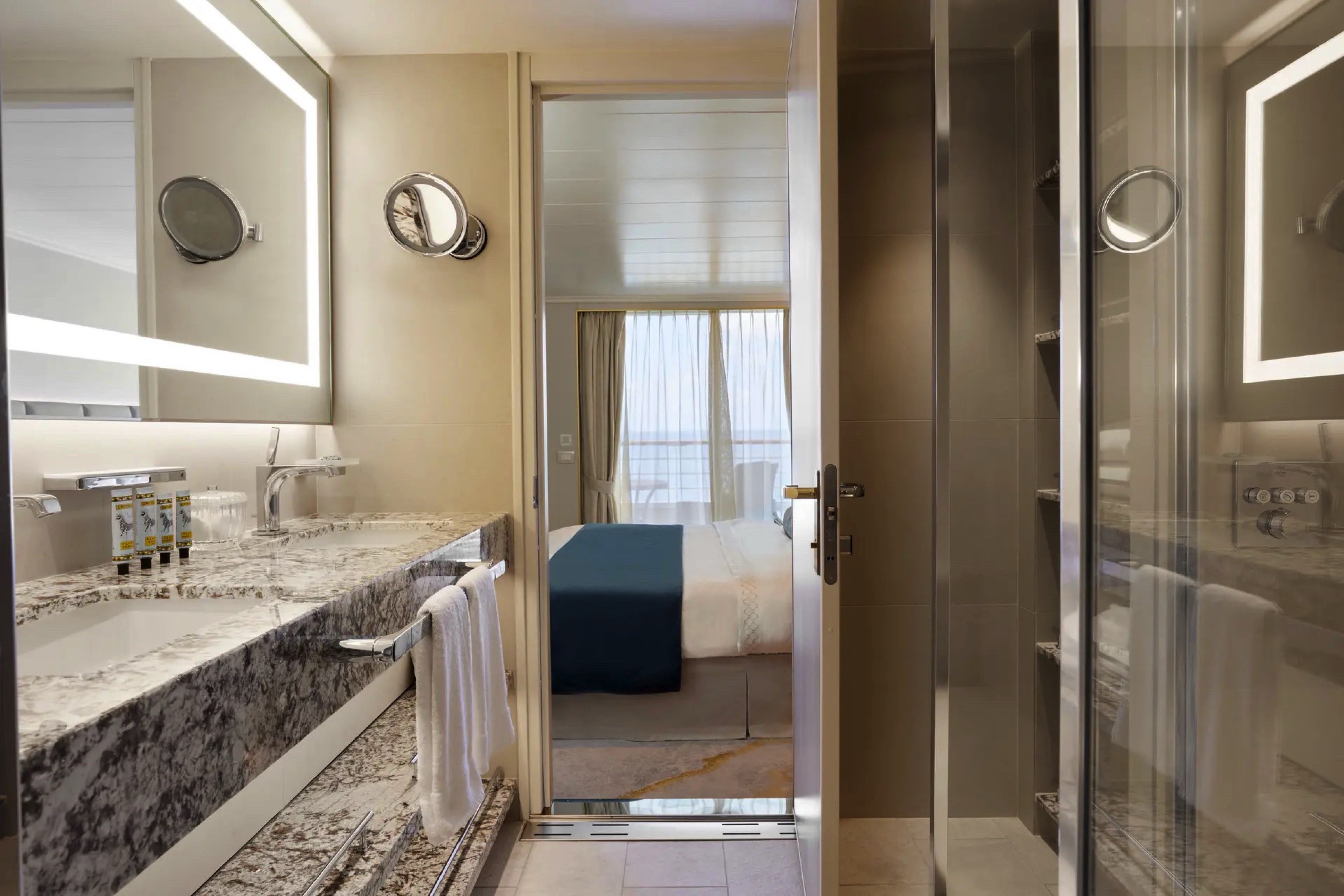
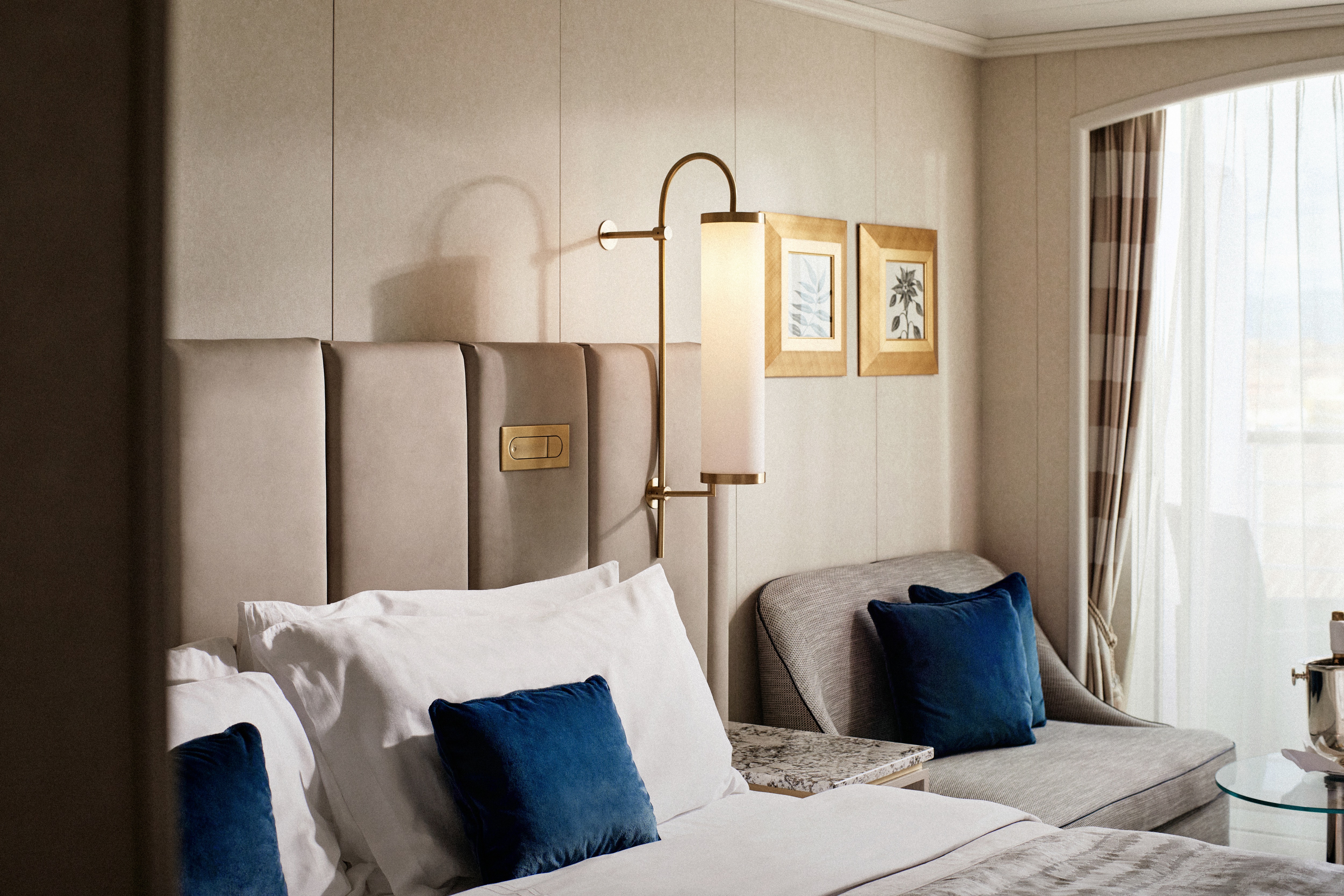
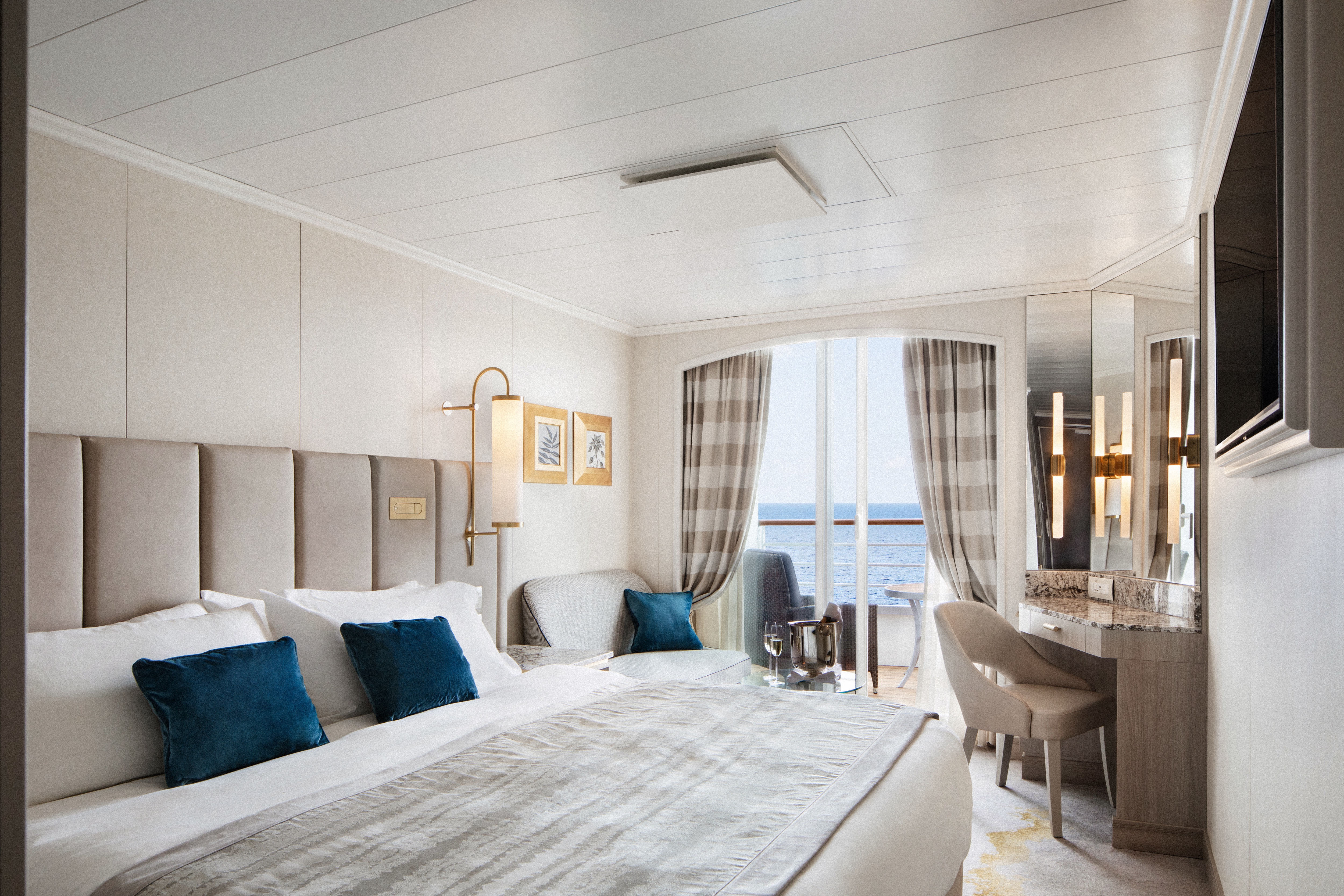
Redesigned in 2023, this luxurious suite features a walk-in wardrobe, separate living room and dining area, Jacuzzi bathtub, separate shower, bidet, and guest bathroom. Guests staying in this stylish home away from home enjoy unlimited dining at specialty restaurants, unlimited laundry services, afternoon canapés, flowers, binoculars, and a coffee maker.
Details
- Large private veranda
- Spacious living room
- Dining area
- Two TV's
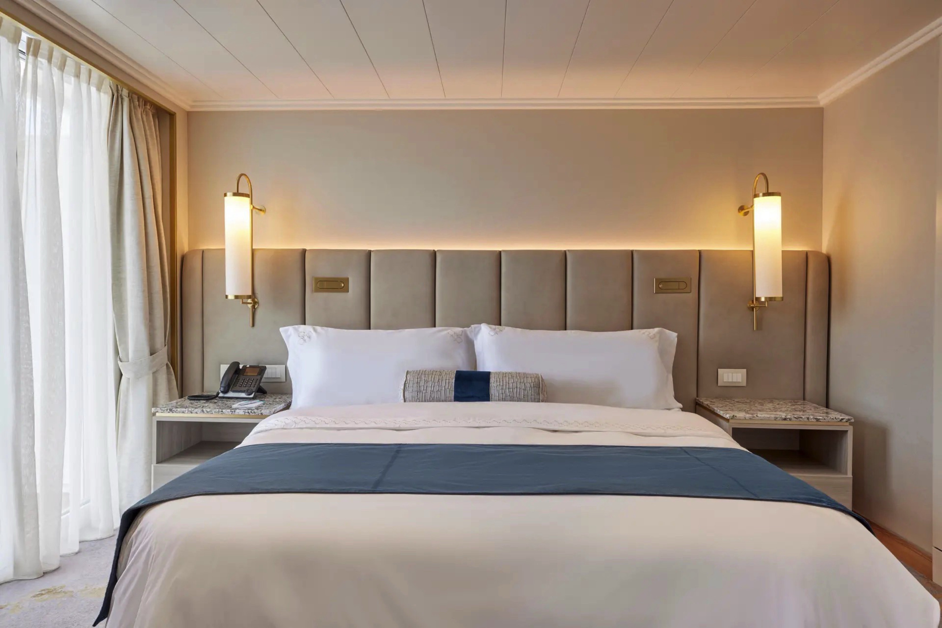
- Separate bedroom area
- Vanity in bedroom
- Queen-size bed or twin beds with sumptuous bedding, and third berth
- Full jacuzzi bathtub with separate shower and bidet
- Walk-in closet
Services
- 24 hour in-suite dining
- Unlimited room service from Osteria D'Ovidio and Umi Uma
- Unlimited dining in Osteria D'Ovidio and Umi Uma
- Turndown service with handmade truffles
- Shoeshine service
- Assistance with packing and unpacking
- Free unlimited laundry and dry cleaning, 2nd day service
- In-suite cocktail parties
- Private transfer to and from ship up to 50 miles
Amenities
- Welcome champagne
- Complimentary wine and spirits from set menu
- Complimentary soft drinks
- Flowers
- Fresh fruits, daily change, on request only
- Pillow menu (selection from a variety of pillow types)
- Afternoon canapés
- Coffee maker
- Binoculars
- Complimentary unlimited standard WiFi
- In-suite safe
- Interactive tablet for news, updates, and reservations
- Hair dryer
- Hair iron (available upon request)
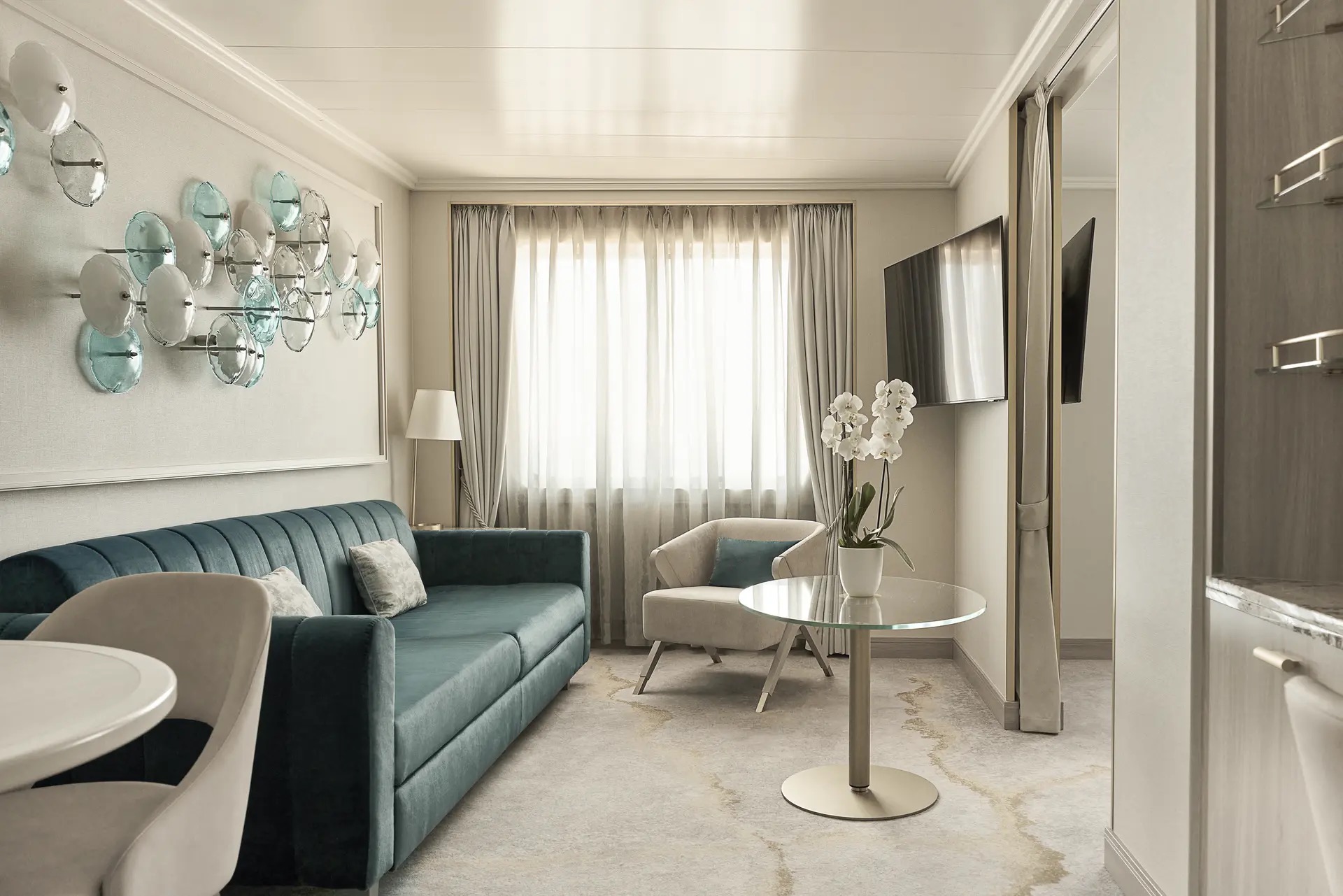
Available in either a newly redesigned style with a walk-in shower or a classic design with a separate shower and bath, this elegant suite features a walk-in wardrobe, separate living room with sofa and dining area, and a private veranda. Enjoy special touches such as afternoon canapés, binoculars, a coffee maker, and complimentary laundry, dry cleaning, and pressing services.
Details
- Private veranda
- Spacious living room and dining area
- Queen-size bed or twin beds with sumptuous bedding, and third berth
- Walk-in closet
- Two TV's
- Washer and Dryer Combo available in select suites
Services
- 24 hour in-suite dining
- Turndown service with handmade truffles
- Shoeshine service
- Assistance with packing and unpacking
- Dry cleaning for five pieces plus one bag of free laundry every 10 cruise days, 2nd day service
- Free pressing (5pcs/day), 2nd day service
Amenities
- Welcome champagne
- Complimentary wine and spirits from set menu
- Complimentary soft drinks
- Fresh fruits, daily change, on request only
- Pillow menu (selection from a variety of pillow types)
- Afternoon canapés
- Coffee maker
- Binoculars
- Complimentary unlimited standard WiFi
- In-suite safe
- Interactive tablet for news, updates, and reservations
- Hair dryer
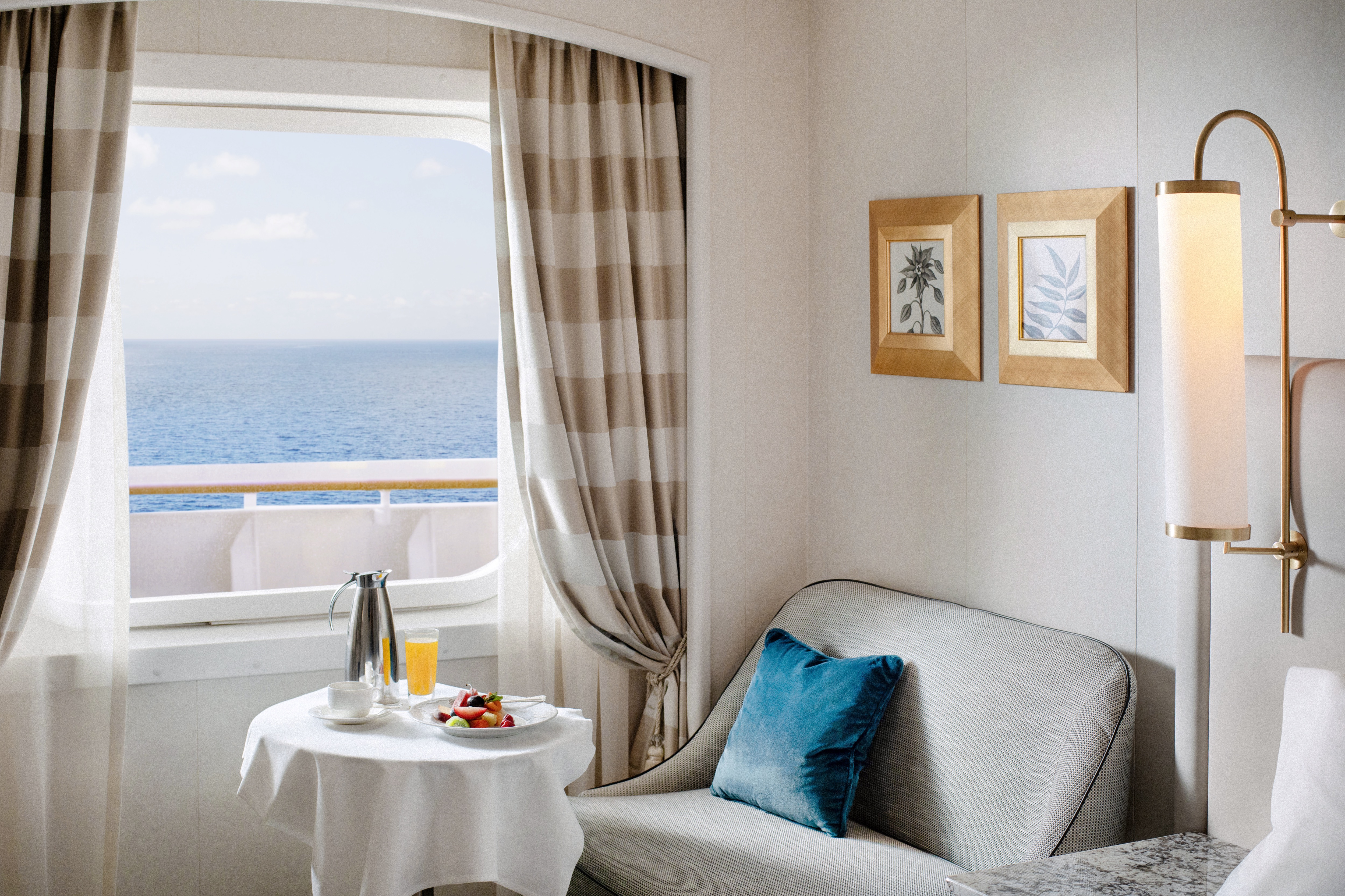
Redesigned in 2023, this elegant suite offers a walk-in wardrobe, separate living room with sofa and dining area, walk-in shower, and two large picture windows. Enjoy special touches such as afternoon canapés, binoculars, a coffee maker, and complimentary laundry, dry cleaning, and pressing services.DETAILS
- Large Picture Window
- Spacious living room and dining area
- Queen-size bed or twin beds with sumptuous bedding, and third berth
- Walk-in closet
- Two TV's
SERVICES
- 24 hour in-suite dining
- Turndown service with handmade truffles
- Shoeshine service
- Assistance with packing and unpacking
- Complimentary dry cleaning (5 pieces every 10 days, 2nd day service)
- Complimentary laundry (1 bag every 10 days, 2nd day service)
- Complimentary pressing (5 pieces per day, 2nd day service)
AMENITIES
- Welcome champagne
- Complimentary wine and spirits from set menu
- Complimentary soft drinks
- Fresh fruits, daily change, on request only
- Pillow menu (selection from a variety of pillow types)
- Afternoon canapés
- Coffee maker
- Binoculars
- Complimentary unlimited standard WiFi
- In-suite safe
- Interactive tablet for news, updates, and reservations
- Hair dryer
- Hair iron (available upon request)
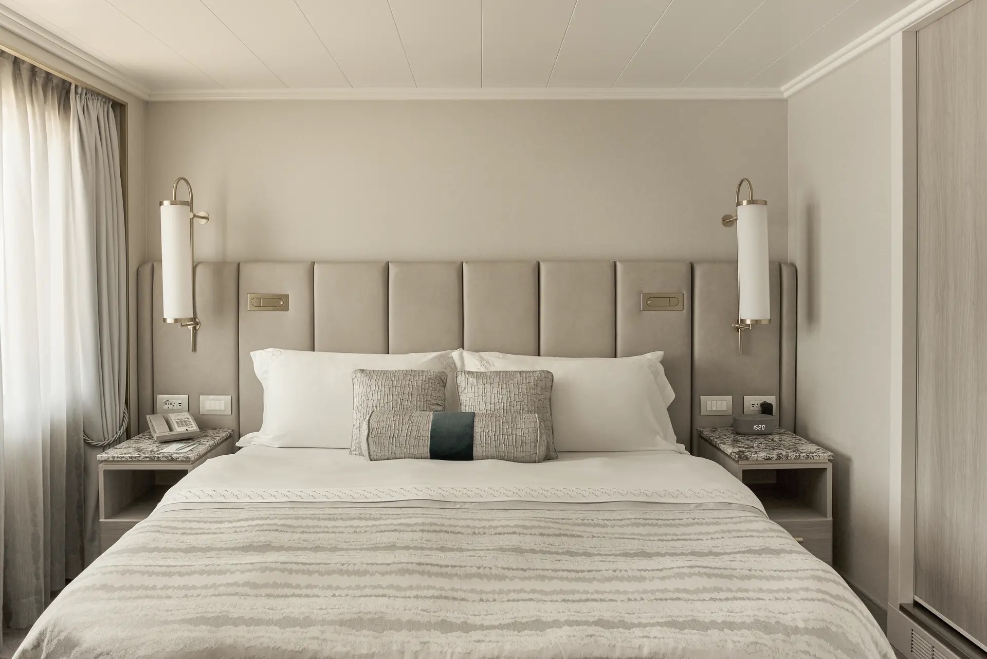
Available in either a newly redesigned style with a walk-in shower or a classic design with a separate shower and bath, this spacious suite features a private veranda, walk-in wardrobe, comfortable living area with sofa, and complimentary pressing service.
DETAILS
- Private veranda
- Sizeable living area
- Queen-size bed or twin beds with sumptuous bedding
- Vanity in dressing area
- TV
- Walk-in closet
SERVICES
- 24 hour in-suite dining
- Turndown service
- Shoeshine service
- Assistance with packing and unpacking
AMENITIES
- Welcome champagne
- Complimentary wine and spirits from set menu
- Complimentary soft drinks
- Fresh fruits, daily change, on request only
- Afternoon canapés
- Coffee maker
- Binoculars
- Complimentary unlimited standard WiFi
- In-suite safe
- Interactive tablet for news, updates, and reservations
- Hair dryer
- Hair iron (available upon request)
Free pressing (5pcs/day), 2nd day service
Redesigned in 2023 exclusively for solo occupancy, this stylish guest room offers a comfortable living area with sofa, large picture window, walk-in shower, and a sleek built-in wardrobe.
DETAILS
- Large picture window
- Sizeable living area with sofa
- Queen-size bed or twin beds with sumptuous bedding
- TV
- Walk-in shower
SERVICES
- 24 hour in-suite dining
- Turndown service
- Shoeshine service
- Assistance with packing and unpacking
AMENITIES
- Welcome champagne
- Complimentary wine and spirits from set menu
- Complimentary soft drinks
- Fresh fruits, daily change, on request only
- Pillow menu (selection from a variety of pillow types)
- Complimentary unlimited standard WiFi
- In-suite safe
- Interactive tablet for news, updates, and reservations
- Hair dryer
- Hair iron (available upon request)
Redesigned in 2023, this elegant guest room offers a private veranda, comfortable living area with sofa, walk-in shower, and a built-in wardrobe.
DETAILS
- Private veranda
- Sizeable living area with sofa
- Queen-size bed or twin beds with sumptuous bedding
- TV
- Walk-in shower
SERVICES
- 24 hour in-suite dining
- Turndown Service
- Shoeshine service
- Assistance with packing and unpacking
AMENITIES
- Welcome champagne
- Complimentary wine and spirits from set menu
- Complimentary soft drinks
- Fresh fruits, daily change, on request only
- Pillow menu (selection from a variety of pillow types)
- Complimentary unlimited standard WiFi
- In-suite safe
- Interactive tablet for news, updates, and reservations
- Hair dryer
- Hair iron (available upon request)
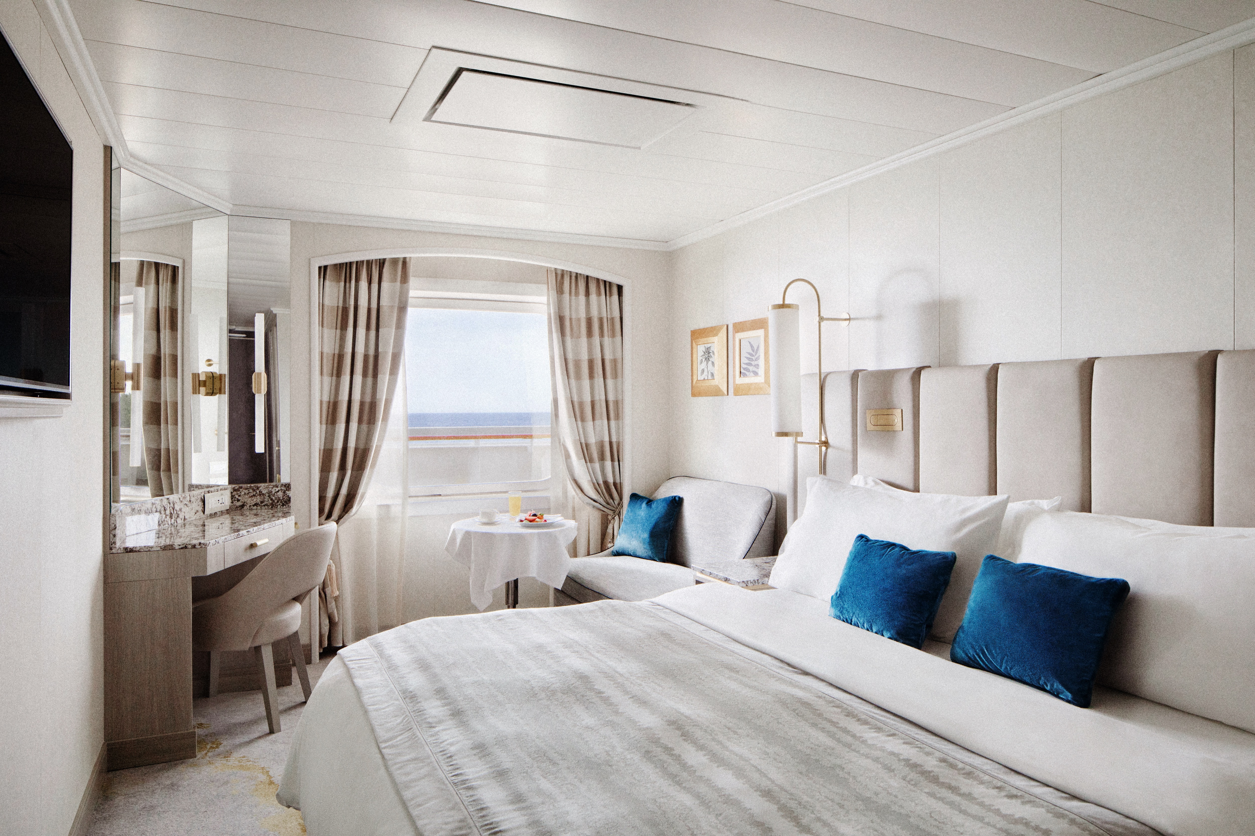
Redesigned in 2023, this stylish guest room features a comfortable living area with sofa, large picture window, walk-in shower, and a sleek built-in wardrobe.
DETAILS
- Large picture window
- Sizeable living area with sofa
- Queen-size bed or twin beds with sumptuous bedding
- TV
- Walk-in shower
SERVICES
- 24 hour in-suite dining
- Turndown service
- Shoeshine service
- Assistance with packing and unpacking
AMENITIES
- Welcome champagne
- Complimentary wine and spirits from set menu
- Complimentary soft drinks
- Fresh fruits, daily change, on request only
- Pillow menu (selection from a variety of pillow types)
- Complimentary unlimited standard WiFi
- In-suite safe
- Interactive tablet for news, updates, and reservations
- Hair dryer
- Hair iron (available upon request)
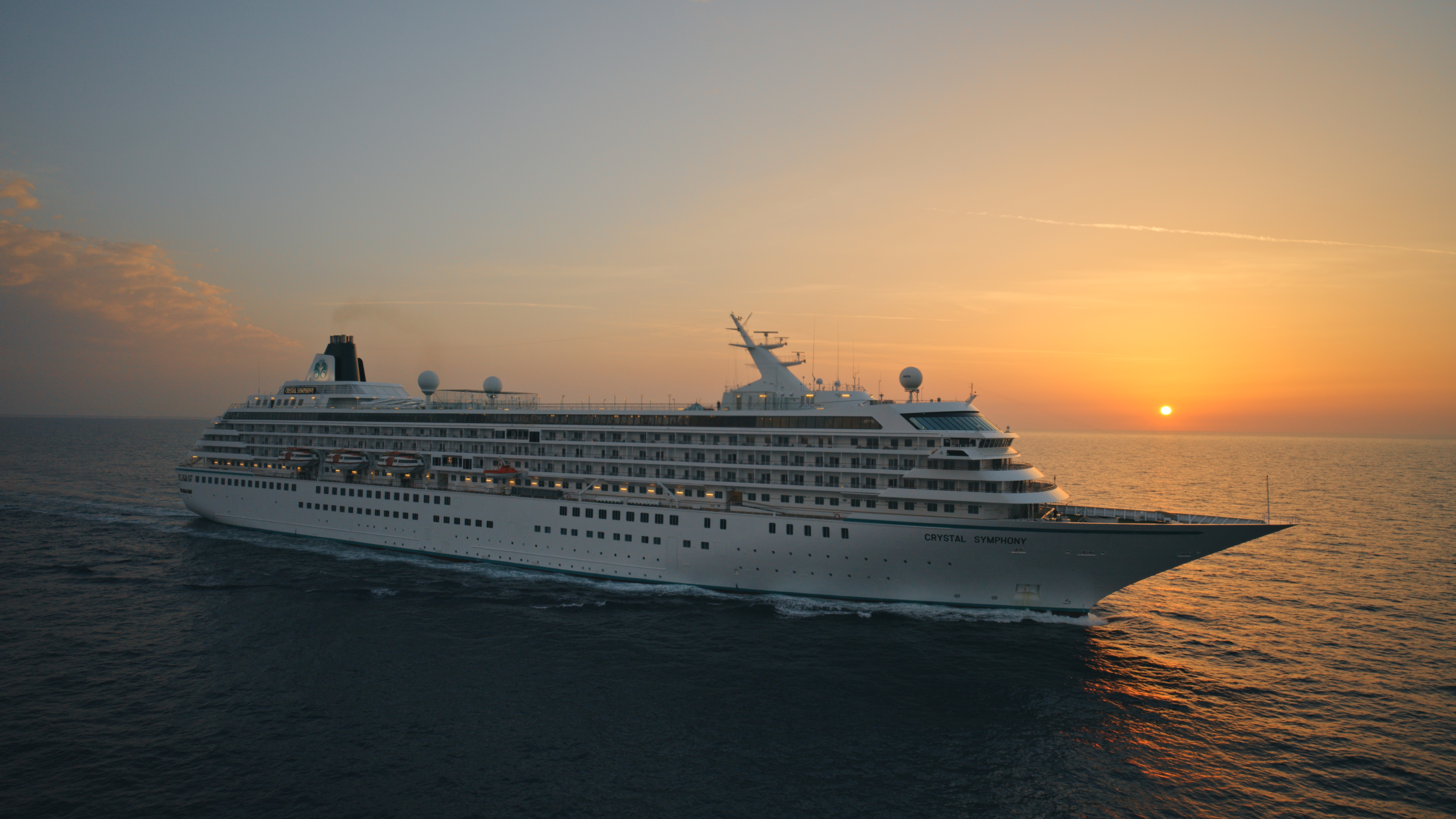
Crystal Symphony
With elegant lines and sweeping ocean views, our intimate ship houses expansive suites and guest rooms, alongside a world-class choice of dining, wellness and entertainment.
Ship Facts
| Launch Year | 1995 | ||||||||
| Refit Year | 2023 | ||||||||
| Language | en | ||||||||
| Gross Tonnage | 51068 | ||||||||
| Length | 238 | ||||||||
| Width | 30 | ||||||||
| Currency | USD | ||||||||
| Speed | 20 | ||||||||
| Capacity | 606 | ||||||||
| Crew Count | 499 | ||||||||
| Deck Count | 8 | ||||||||
| Cabin Count | 477 | ||||||||
| Large Cabin Count | 0 | ||||||||
| Wheelchair Cabin Count | 4 | ||||||||
| Electrical Plugs |
|
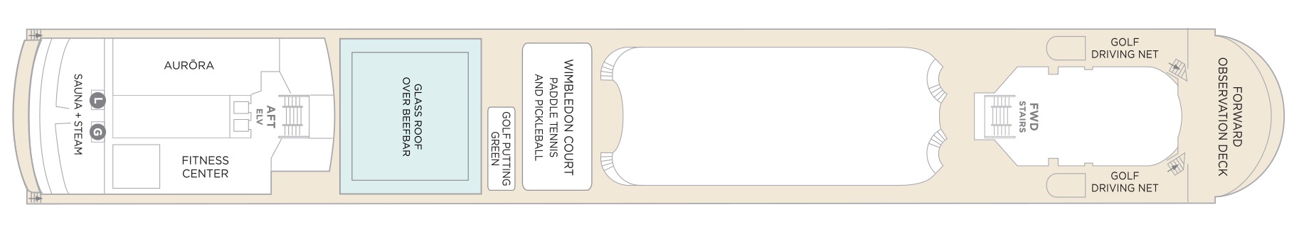
Deck 12
- Sauna + Steam room
- AURÖRA
- Fitness Center
- Glass Roof Over Beefbar
- Golf Putting Green
- Wimbledon Court (Paddle Tennis & Pickle Ball)
- Golf Driving Nets
- Forward Observation Deck
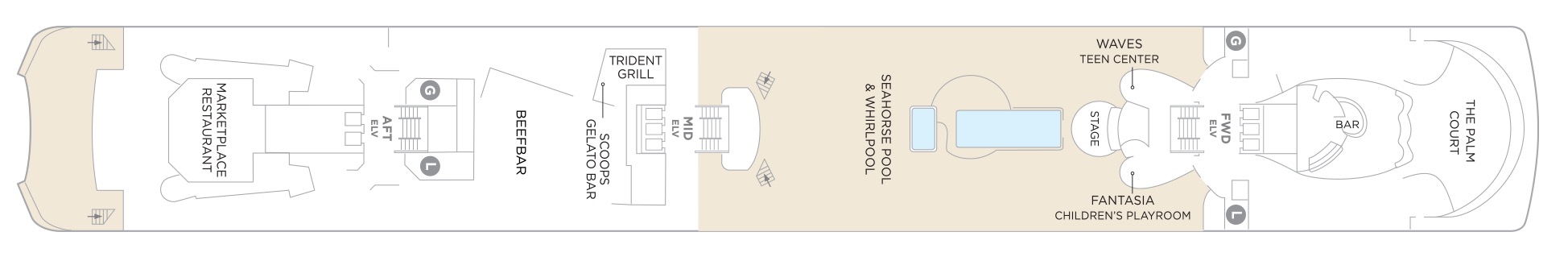
Deck 11
- The Palm Court
- Fantasia Children's Playroom
- Stage
- Waves Teen Centre
- Seahorse Pool & Whirlpool
- Trident Grill
- Scoops Gelato Bar
- Beefbar
- Marketplace Restaurant
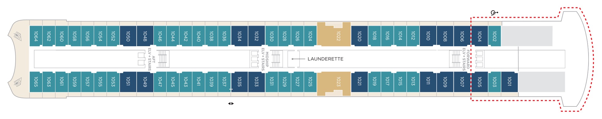
Deck 10
- Aquamarine Veranda Suite
- Sapphire Veranda Suite
- Crystal Penthouse Suite
- Launderette
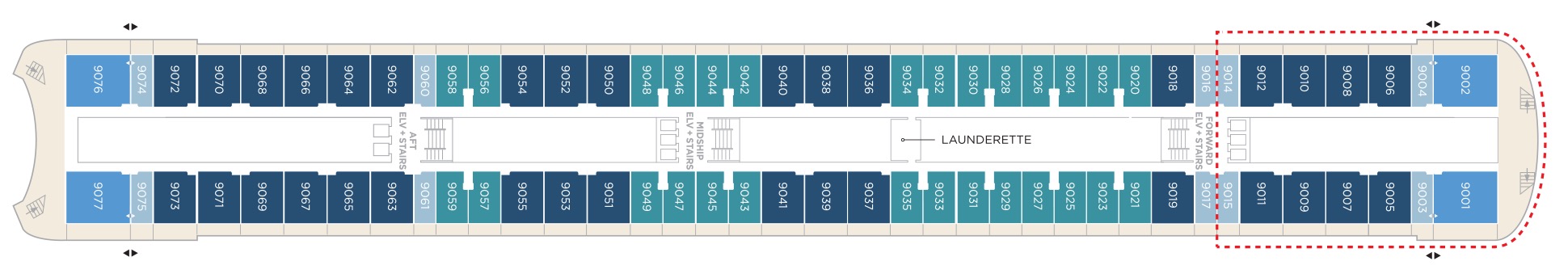
Deck 9
- Junior Crystal Penthouse Suite
- Aquamarine Veranda Suite
- Sapphire Veranda Suite
- Double Guest Room with Veranda
- Launderette
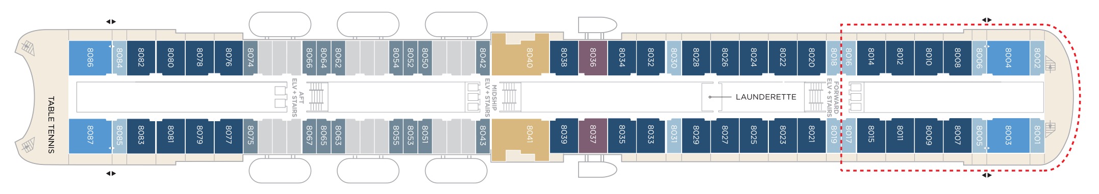
Deck 8
- Crystal Penthouse Suite
- Sapphire Veranda Suite
- Double Guest Room with Veranda
- Junior Crystal Penthouse Suite
- Sapphire Ocean View Suite
- Double Guest Room with Ocean View
- Table Tennis
- Launderette
Suites & Guest Rooms Beyond The Forward Elevators Are subject To Alternative Pricing
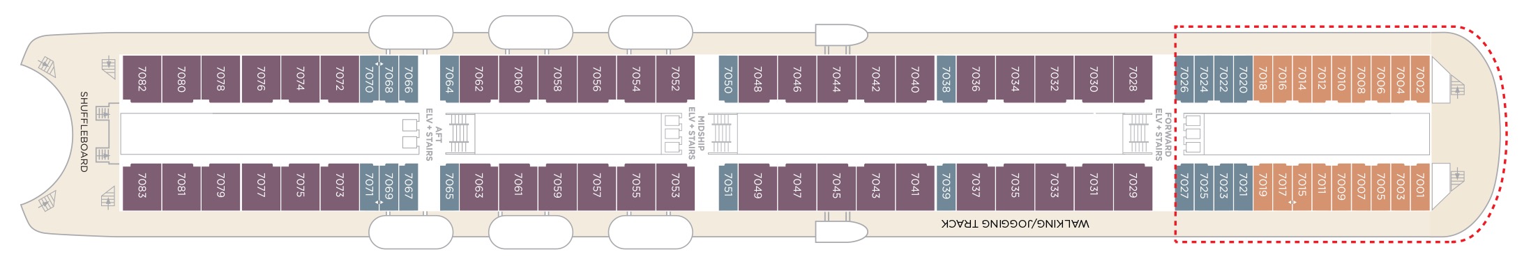
Deck 7
- Sapphire Ocean View Suite
- Single Guest Room with Ocean View
- Double Guest Room with Ocean View
- Shuffleboard
- Walking/Jogging Track
- Elevator & Stairs
Suites & Guest Rooms Beyond The Forward Elevators Are subject To Alternative Pricing
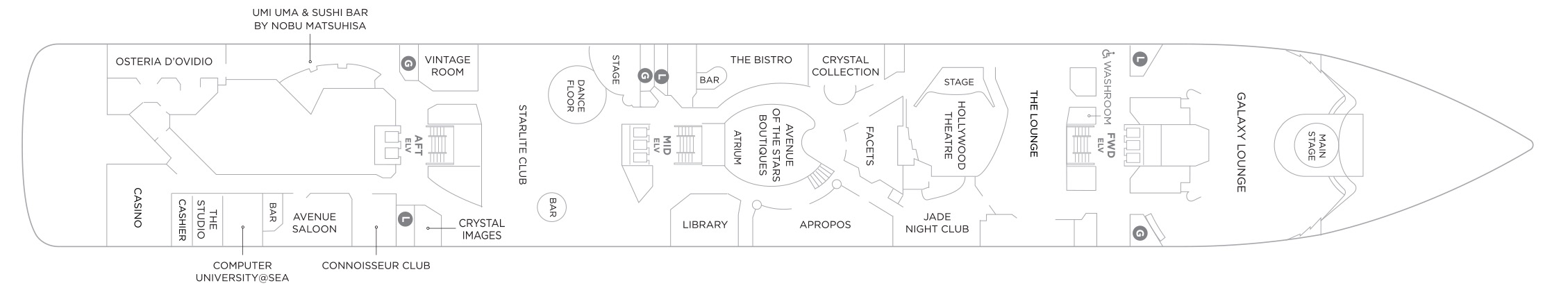
Deck 6
- Main Stage
- Galaxy Lounge
- The Lounge
- Hollywood Theatre
- Jade Nightclub
- Crystal Collection
- Facets
- Aprops
- Avenue of the Star Boutique
- The Bistro
- Atrium
- Library
- Stage
- Starlite Club
- Vintage Room
- Crystal Images
- Uma Uma & Sushi Bar by Nobu Matsuhisa
- Connoisseur Club
- Avenue Saloon
- Computer University @Sea
- The Studio
- Casino
- Osteria D'Ovidio
Deck 5
- Sapphire Ocean View Suite
- Double Guest Room with Ocean View
- Medical Centre
- Concierge
- Reception
- Shore Excursions
- Crystal Cove
- Future Sales Consultant
- Crystal Plaza
- Waterside Restaurant

Our award-winning cuisine is created and influenced by pioneers in the global food scene, with nine distinct complimentary venues to choose from. Open seating with extensive dining options are tailored around the personal preferences of our guests, allowing them to choose exactly what they want at a time that works for them. Whether that be a late breakfast, six-course wine pairing lunch, or dinner in our exclusive Osteria d’Ovidio or Umi Uma.
Waterside Restaurant
Take your tastebuds on a tour of our modern, international cuisine options. Enjoy creative, seasonal dishes in an elegant setting with beautiful ocean views.
Umi Uma
Few restaurants can boast a creative vision of contemporary cuisine as Nobu. Prepare to lose yourself in the beautiful décor and signature Japanese-Peruvian dishes. Reservations required and limited per sailing.
Beefbar
The most exciting flavours from the global street-food scene are fashioned from the freshest ingredients by creative chefs and served for sharing in stylish surroundings.
Trident Grill
Enjoy a burger with a view. Our pool restaurant and grill offer a comfortable terrace highlighted by an elegant design, making it the perfect spot for outdoor dining.
Osteria D'Ovidio
Named for our owner, Manfredi Lefebvre d'Ovidio, this restaurant specializes in show-stopping Italian cuisine, in collaboration with the Michelin-rated Alajmo brothers. Reservations are required and are limited per sailing.
The Bistro
A nod to the mythic bars and bistros of Paris. Celebrate the classics in this spacious and airy café that serves light bites from dawn to dusk.
The Vintage Room
A unique gourmet food and wine pairing restaurant that offers an educational dining experience while enjoying some of the best vintages at sea.
Scoops Gelato Bar
Enjoy the finest authentic Italian gelato with a sea view at our pool-deck gelato bar, Scoops. Choose from must-try innovative flavors or traditional favorites in partnership with prestigious Florence artisan, Badiani.
Marketplace
This sophisticated buffet-style restaurant features a dizzying array of hot and cold choices for those who like a little of everything.
24 Hours In-Suite Dining
Enjoy a meal from the comfort of your suite while relaxing in Crystal comfort. Select from our inspired menu to delight you while you stay in, watch a movie or read a favorite book.
Tea Time
More information coming soon.
Tastes Kitchen & Bar
A new definition of traveling with taste. Sumptuous, regionally inspired tapas-style cuisine is the perfect combination of sophisticated style and casual dining.
Our two elegant vessels host an equally exceptional offering including world-renowned restaurants, restorative spas and endless opportunity for inspiration and enrichment, tied together by unparalleled personal service.
Each evening Crystal brings together a cast of world-class performers, entertainers and hosts. Whether you’re looking for theatrical entertainment or the latest Hollywood release, our lounges, ballrooms, night clubs and screening rooms can cater to your every mood.
Casino De Monte-Carlo
Le Casino de Monte-Carlo is offering a new and unique experience onboard. Place your bets on table games with the unique savoir-faire of Monaco’s world-famous casino or get excited to a dynamic range of slots to hit the jackpot. An ultimate way to embrace the thrill of the game in an elegant atmosphere adorned in the hues of the historical building.
Apropos & Facets Onboard Shopping
Heighten the experience on board with a selection of fine jewelry, watches and cruise wear available in our arcade, alongside designer apparel. Make the most of being at sea with a selection of duty free items available.
Atrium
The central meeting place on the ship where you can visit the front desk, concierge, shore excursion desk, or sip on a casual drink at the Crystal Cove.
Computer University@Sea
Our innovative Computer lab onboard led by a team of tech experts.
Connoisseur Club
An elegant space to indulge in the finest cigars and cognacs.
Crystal Collection
Offers fine perfumes and colognes, cosmetics, purses, sun glasses, and jewellery.
Crystal Cove
An ideal refreshment stop any time of the day, and the perfect place to meet friends for a pre-dinner cocktail. Enjoy a variety of musical styles as the day turns into night.
Library
A well-stocked library containing over 2,000 books on a range of subjects from classics to popular biographies, history to contemporary mysteries. Plus enjoy an ample selection of magazines and board games perfect for poolside reading
Palm Court
Featuring large sky lights, floor-to-ceiling windows and a fabulous 270-degree forward view, this venue is perfect for afternoon tea, social gatherings and dancing.
Seahorse Pool
Our Seahorse Pool, with plenty of surrounding deck space to sunbathe, relax and read while enjoying a cool drink in the afternoon.
Starlite Club
On selected evenings before and after dinner, this entertainment lounge features dancing, production spot shows, cabaret performances and other themed events.
Jade Night Club
An intimate lounge for a late-night drink, dancing or a place to let loose with karaoke.
Hollywood Theatre
The ship's sleek cinema for recent-released movies, live sport events, guest lectures and religious services.
Galaxy Lounge
Performances are the focal point here, with appearances by fantastic Broadway-style performers and headline entertainers. Drink service provided before each show.
Avenue Saloon
Signature piano bar with an intimate ambience. The perfect setting for a cocktail before and after dinner.