Roundtrip Civitavecchia (Rome)
Roundtrip Civitavecchia (Rome)
Cruise overview
WHY BOOK WITH US?
- ✔ The Deluxe Cruises’ team has extensive experience in ultra-luxury cruising.
- ✔ Call now to speak to our helpful and experienced Cruise Concierge team.
- ✔ Enjoy our Unique Deluxe Cruises Bonus for substantial savings.
- ✔ Our team will tailor your holiday to your exacting requirements.
- ✔ As agents, we work under the protection of each cruise lines ABTA / ATOL licences
About Civitavecchia
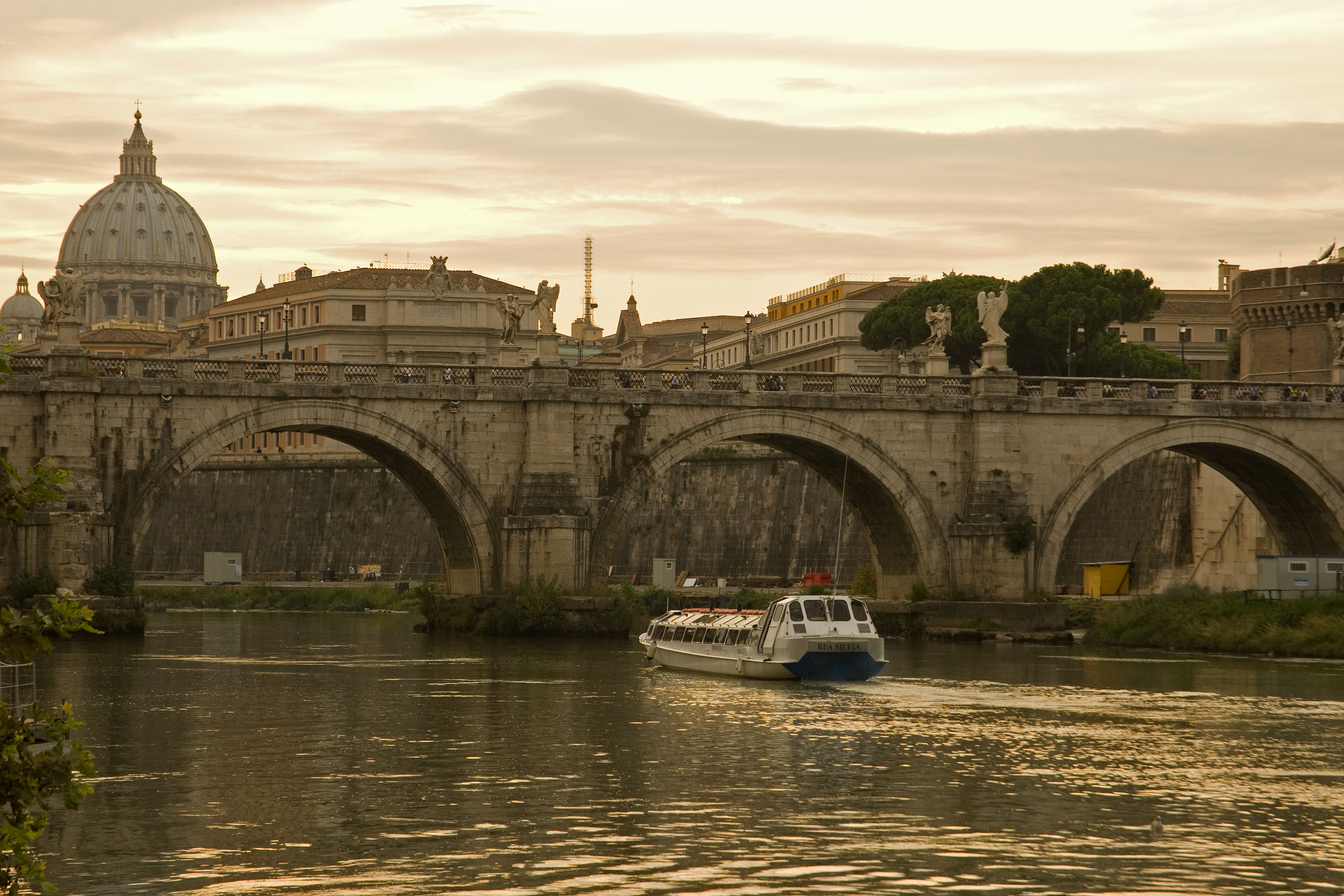
Italy's vibrant capital lives in the present, but no other city on earth evokes its past so powerfully. For over 2,500 years, emperors, popes, artists, and common citizens have left their mark here. Archaeological remains from ancient Rome, art-stuffed churches, and the treasures of Vatican City vie for your attention, but Rome is also a wonderful place to practice the Italian-perfected il dolce far niente, the sweet art of idleness. Your most memorable experiences may include sitting at a caffè in the Campo de' Fiori or strolling in a beguiling piazza.
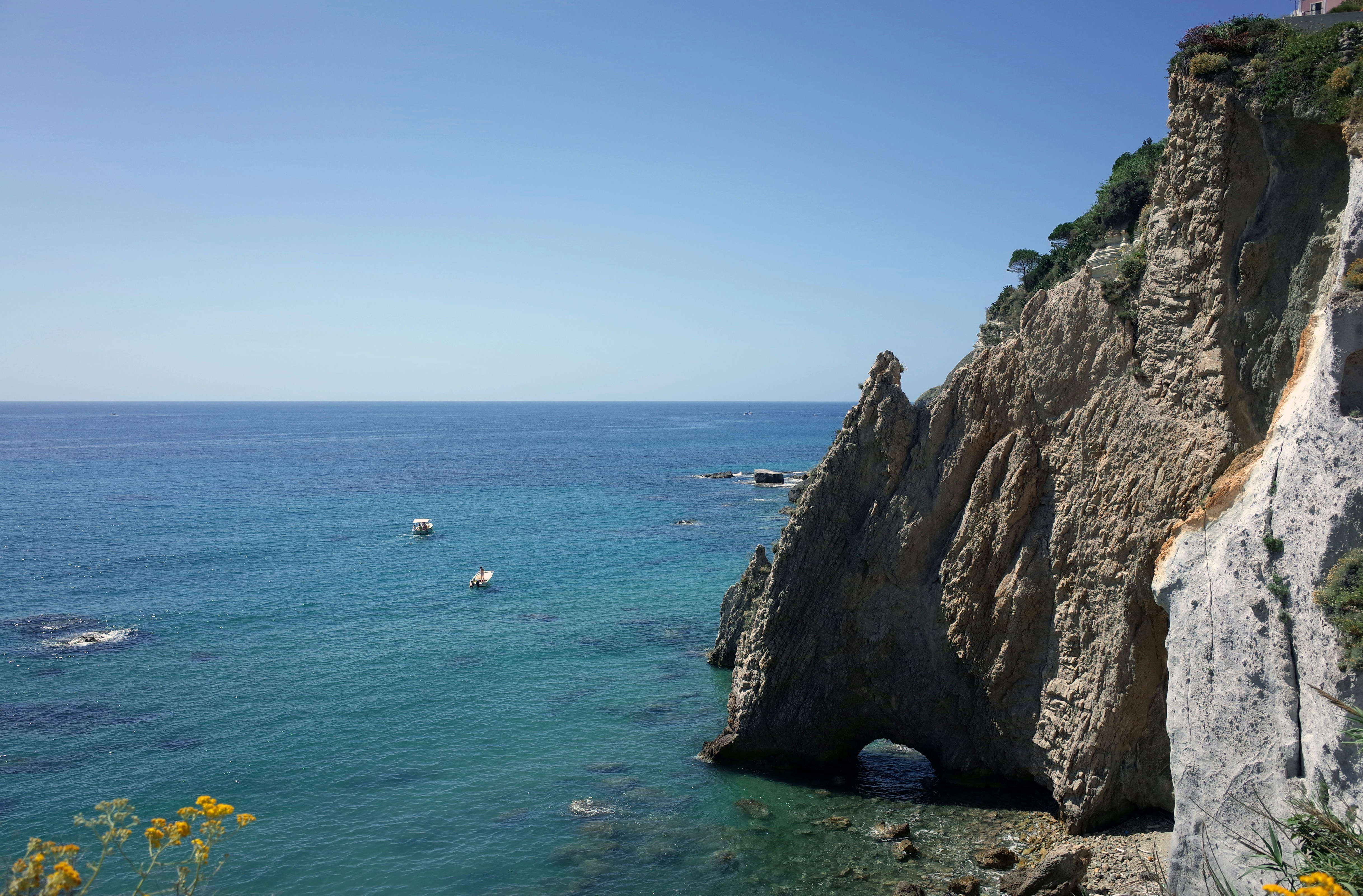
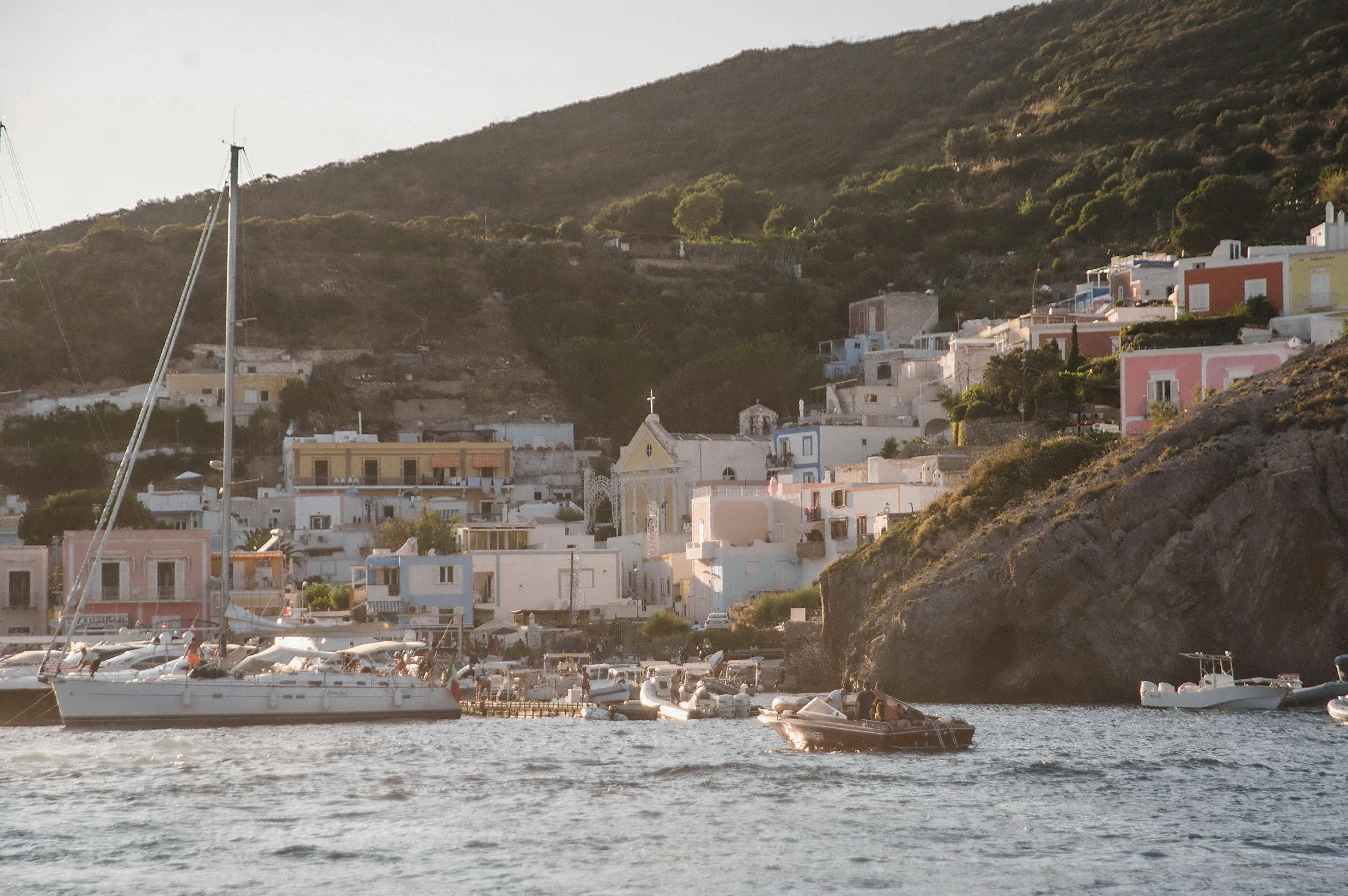
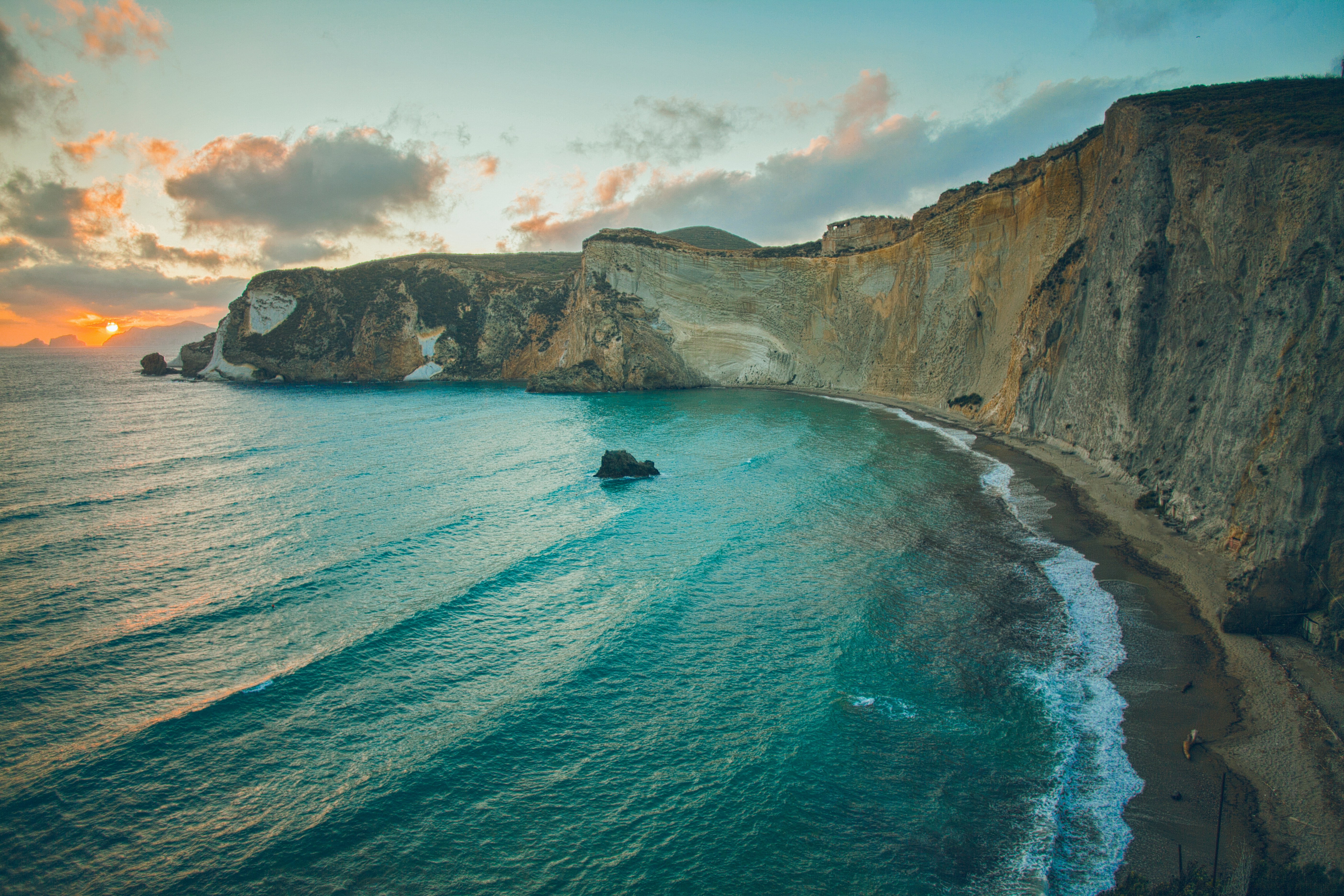
About Ponza Island
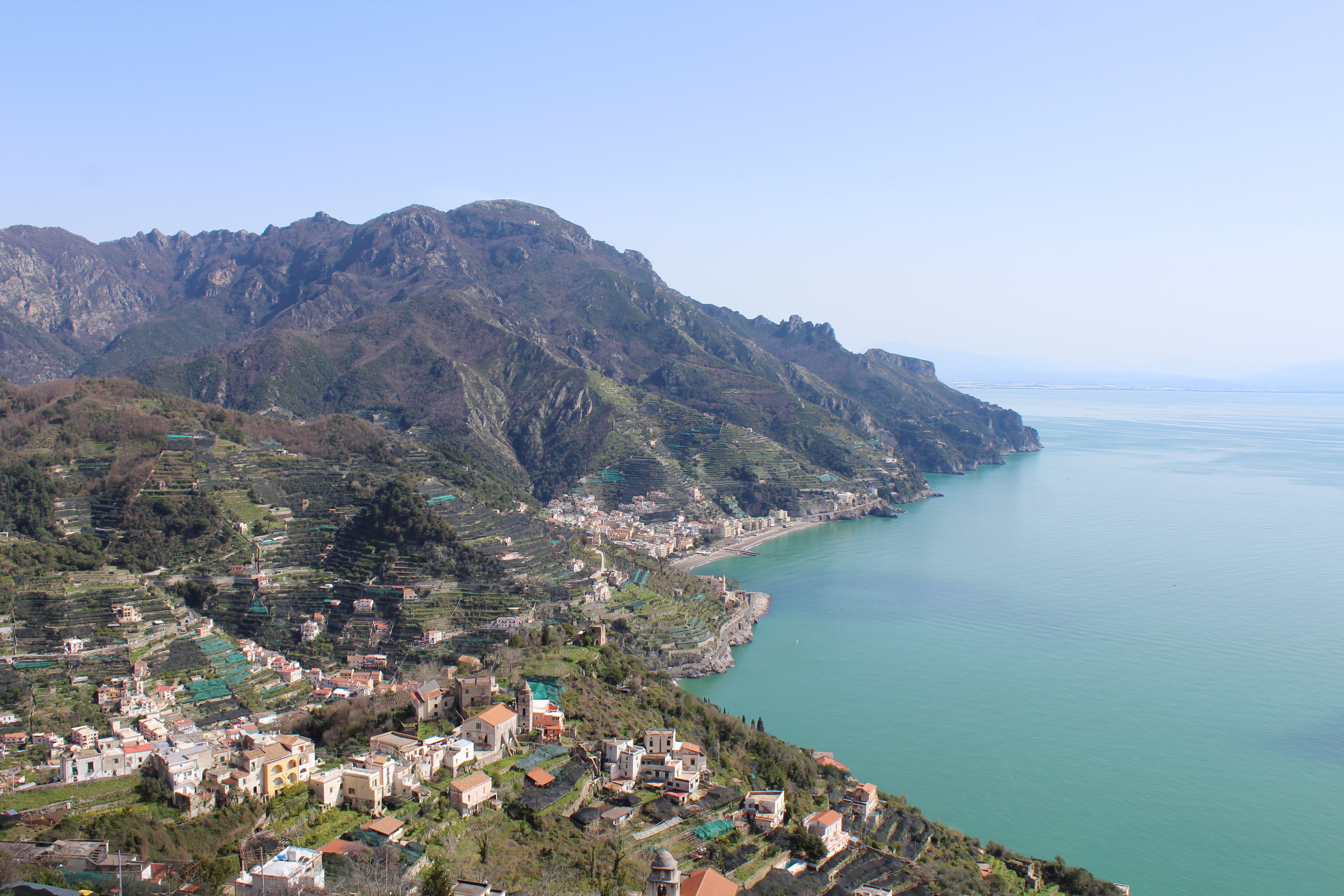
About Salerno
Salerno is an Italian city located on the Gulf of Salerno. Famous for being home to the first medical university, Salerno is a great destination for anyone looking for gorgeous sea views filled with sunshine and Italian food.
About Siracuse, Sicily
Siracusa, known to English speakers as Syracuse, is a wonder to behold. One of the great ancient capitals of Western civilization, the city was founded in 734 BC by Greek colonists from Corinth and soon grew to rival, and even surpass, Athens in splendor and power. It became the largest, wealthiest city-state in the West and a bulwark of Greek civilization. Although Siracusa lived under tyranny, rulers such as Dionysius filled their courts with Greeks of the highest cultural stature—among them the playwrights Aeschylus and Euripides, and the philosopher Plato. The Athenians, who didn't welcome Siracusa's rise, set out to conquer Sicily, but the natives outsmarted them in what was one of the greatest military campaigns in ancient history (413 BC). The city continued to prosper until it was conquered two centuries later by the Romans.Present-day Siracusa still has some of the finest examples of Baroque art and architecture; dramatic Greek and Roman ruins; and a Duomo that's the stuff of legend—a microcosm of the city's entire history in one building. The modern city also has a wonderful, lively, Baroque old town worthy of extensive exploration, as well as pleasant piazzas, outdoor cafés and bars, and a wide assortment of excellent seafood. There are essentially two areas to explore in Siracusa: the Parco Archeologico (Archaeological Zone), on the mainland; and the island of Ortygia, the ancient city first inhabited by the Greeks, which juts out into the Ionian Sea and is connected to the mainland by two small bridges. Ortygia is becoming increasingly popular with tourists, and is starting to lose its old-fashioned charm in favor of modern boutiques.Siracusa's old nucleus of Ortygia, a compact area, is a pleasure to amble around without getting unduly tired. In contrast, mainland Siracusa is a grid of wider avenues. At the northern end of Corso Gelone, above Viale Paolo Orsi, the orderly grid gives way to the ancient quarter of Neapolis, where the sprawling Parco Archeologico is accessible from Viale Teracati (an extension of Corso Gelone). East of Viale Teracati, about a 10-minute walk from the Parco Archeologico, the district of Tyche holds the archaeological museum and the church and catacombs of San Giovanni, both off Viale Teocrito (drive or take a taxi or city bus from Ortygia). Coming from the train station, it's a 15-minute trudge to Ortygia along Via Francesco Crispi and Corso Umberto. If you're not up for that, take one of the free electric buses leaving every 10 minutes from the bus station around the corner.
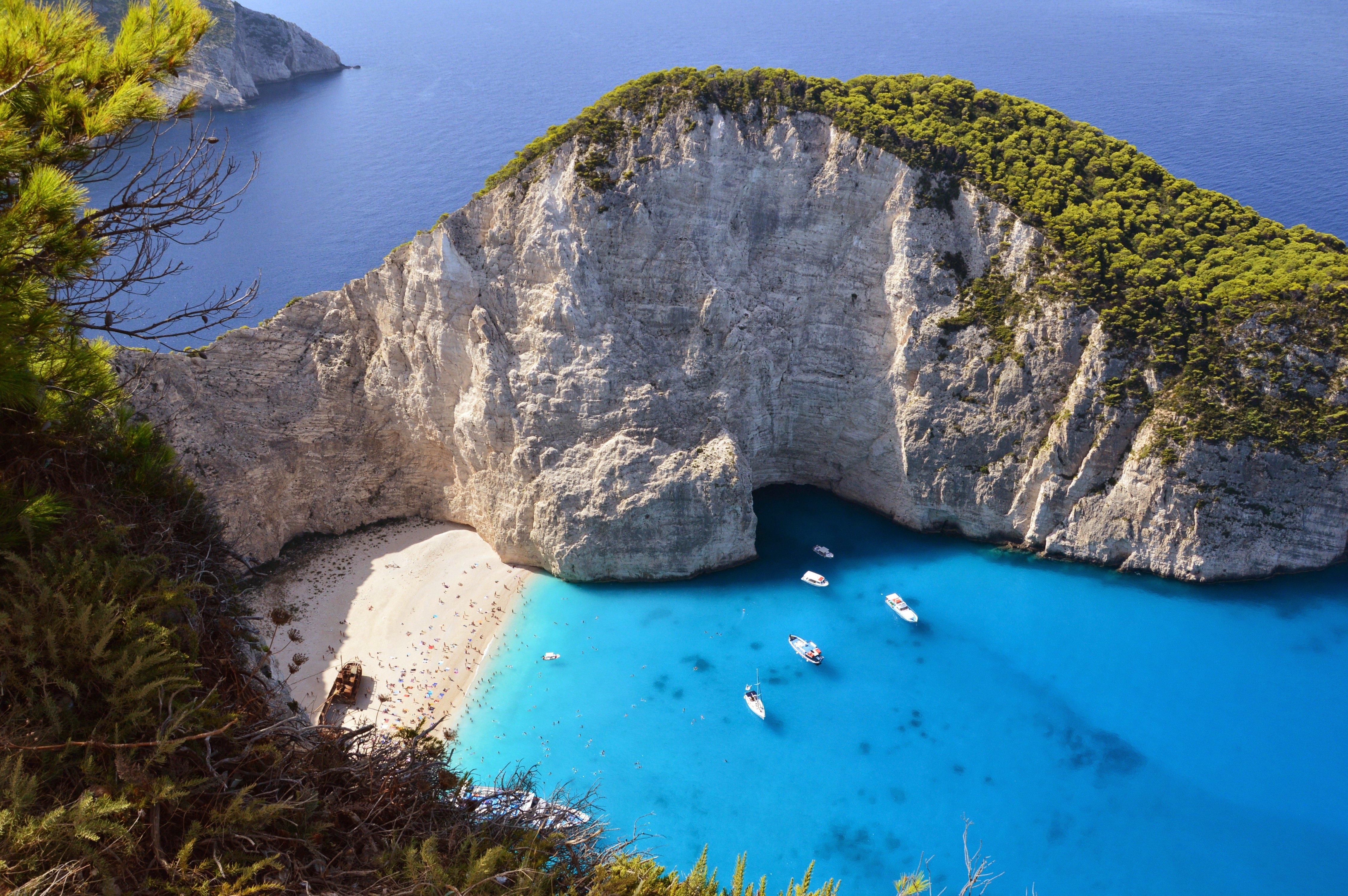
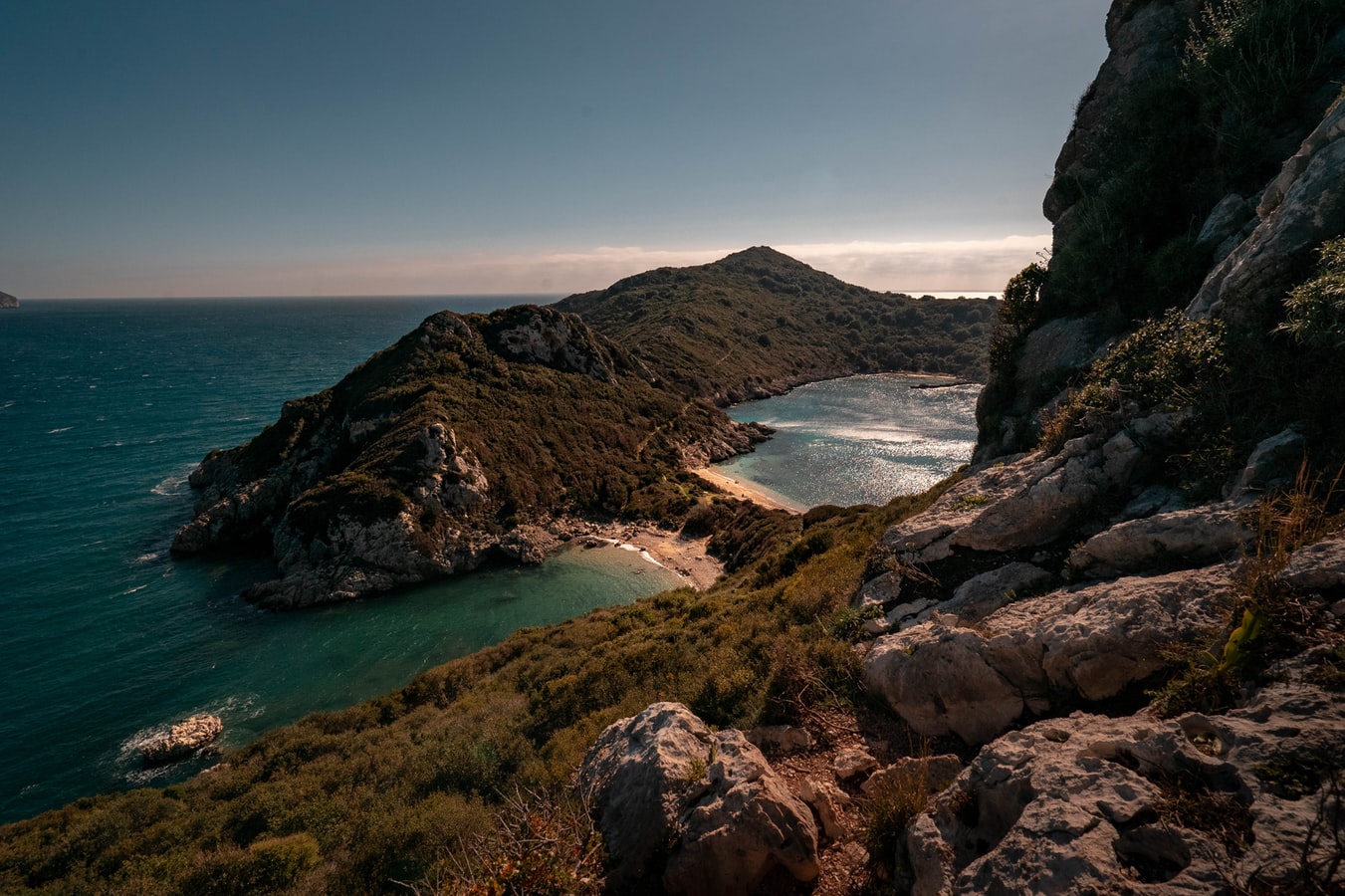
About Zakynthos
About Soúda, Crete
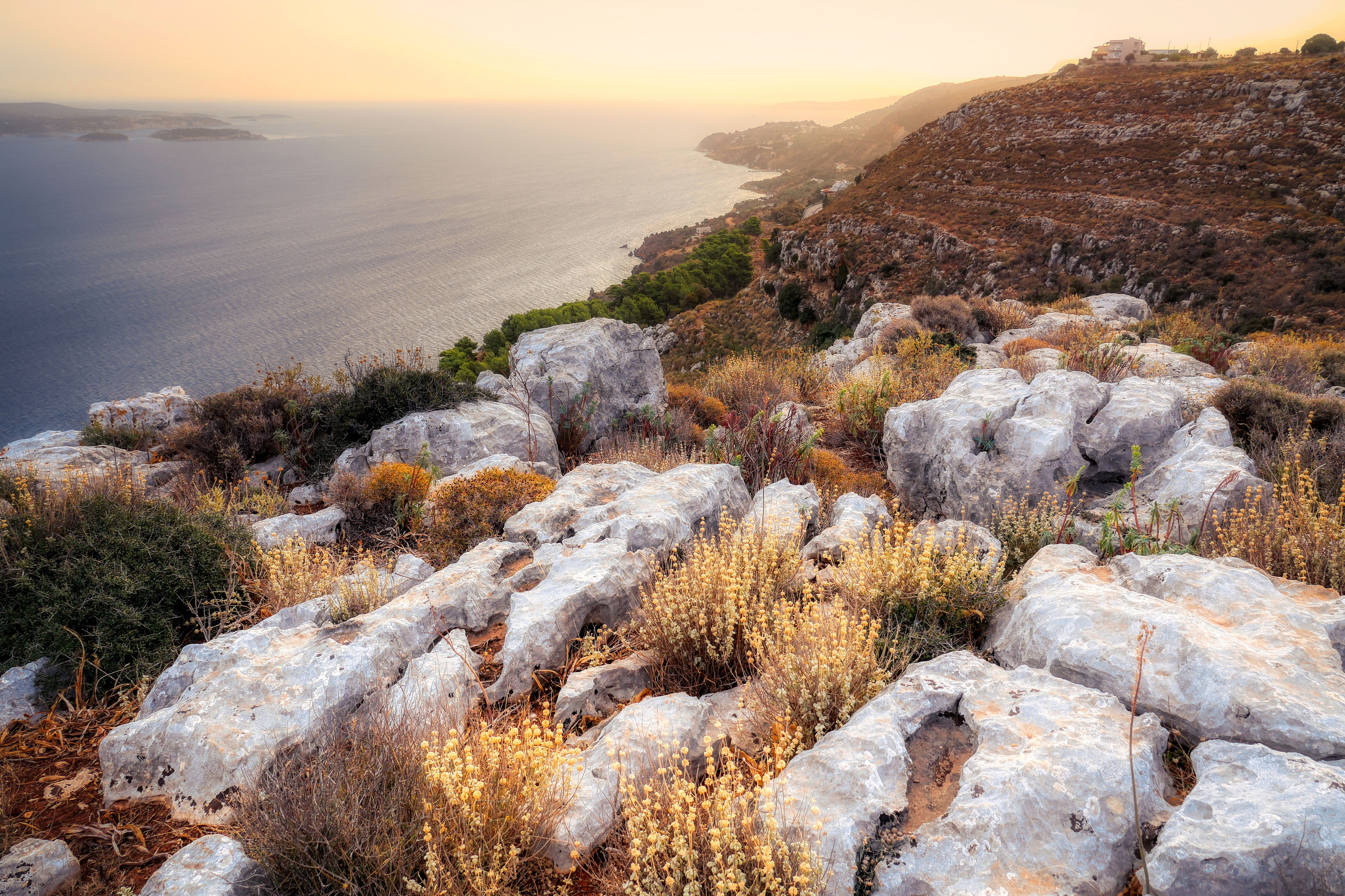
About Spetses
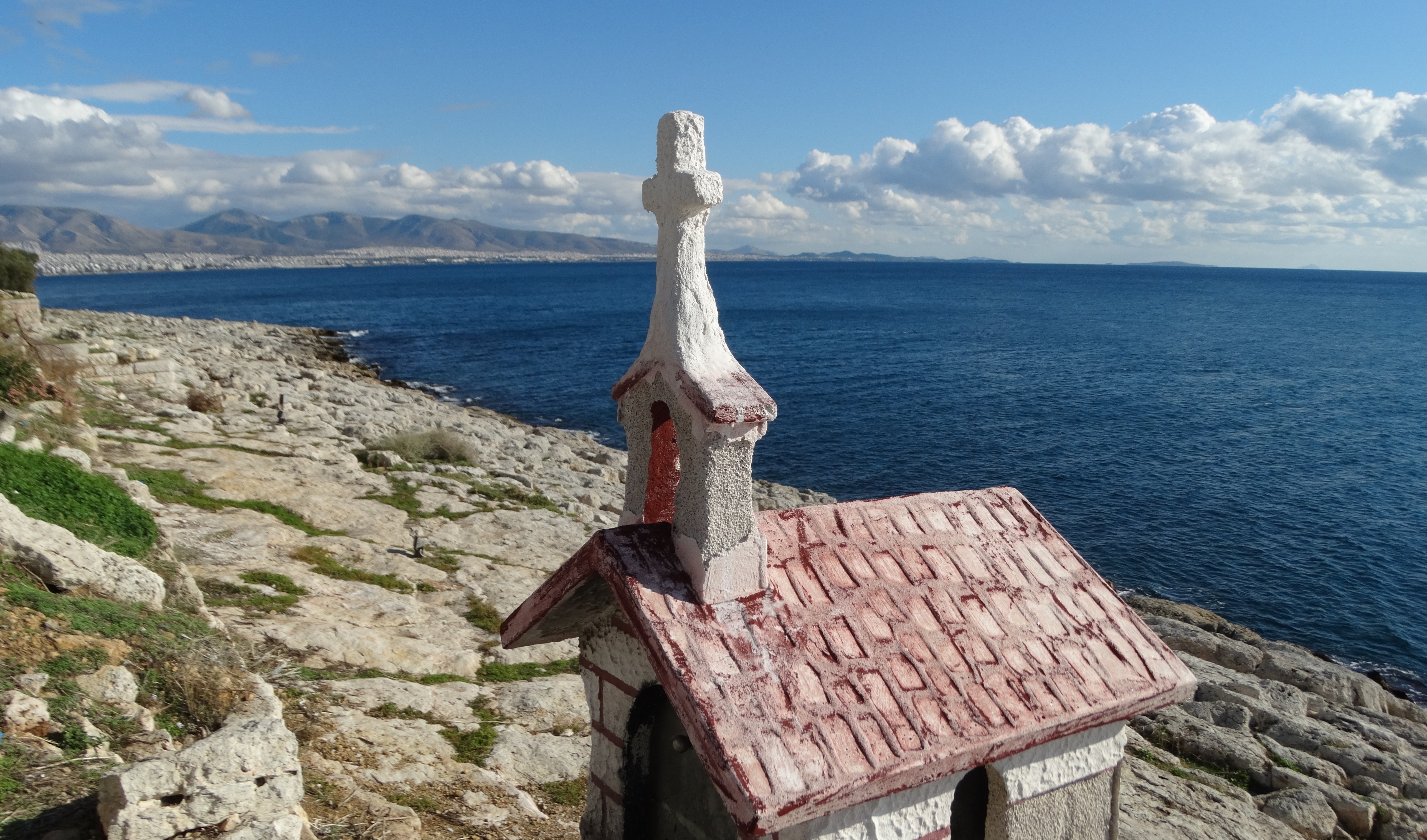
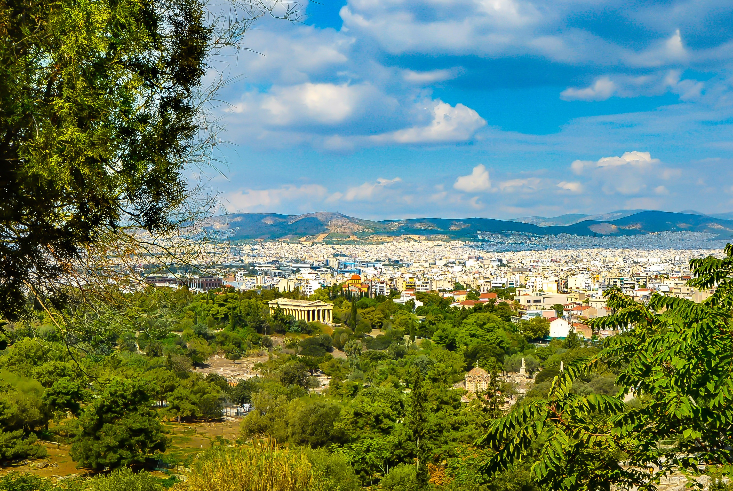
About Piraeus
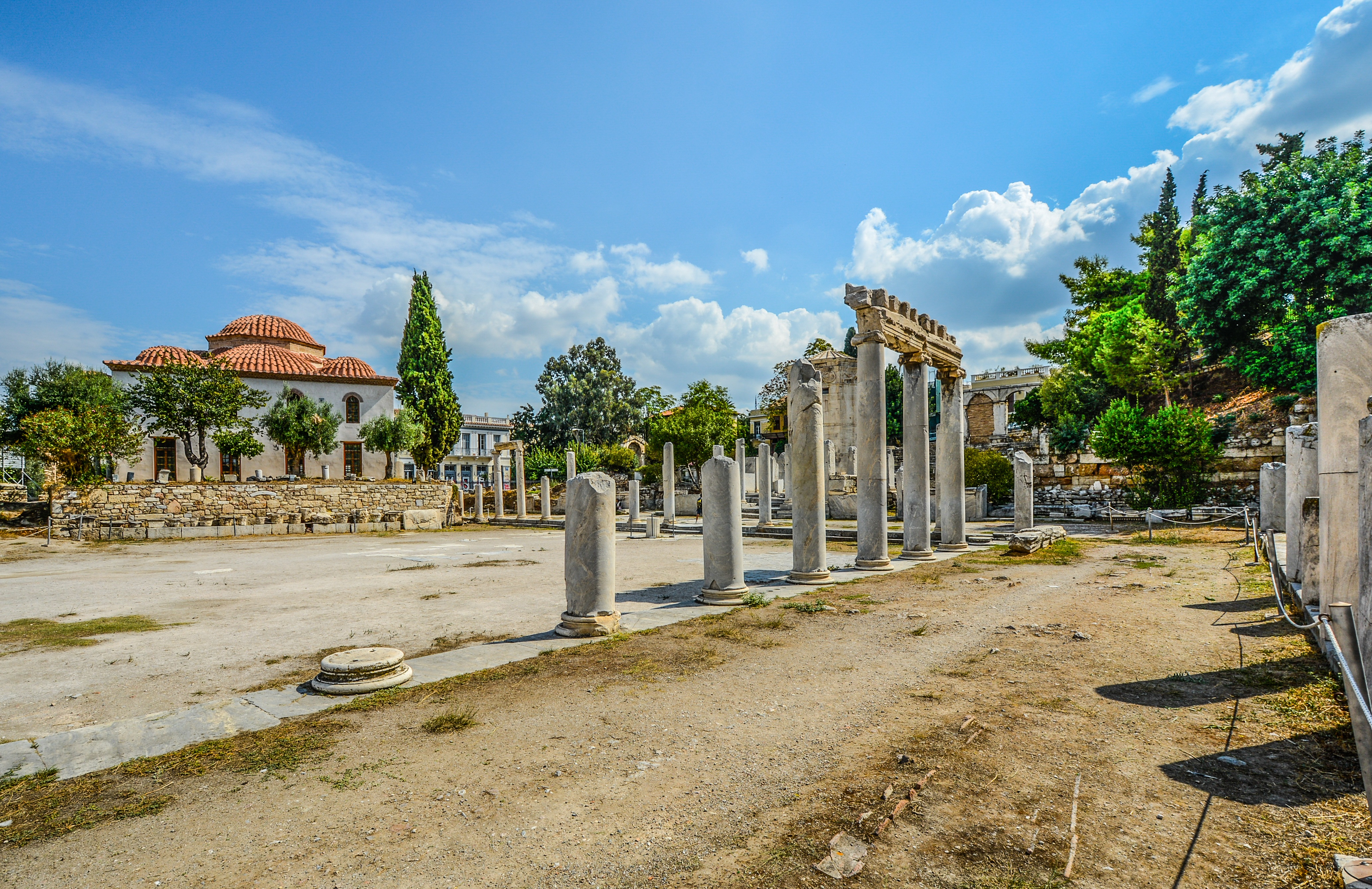
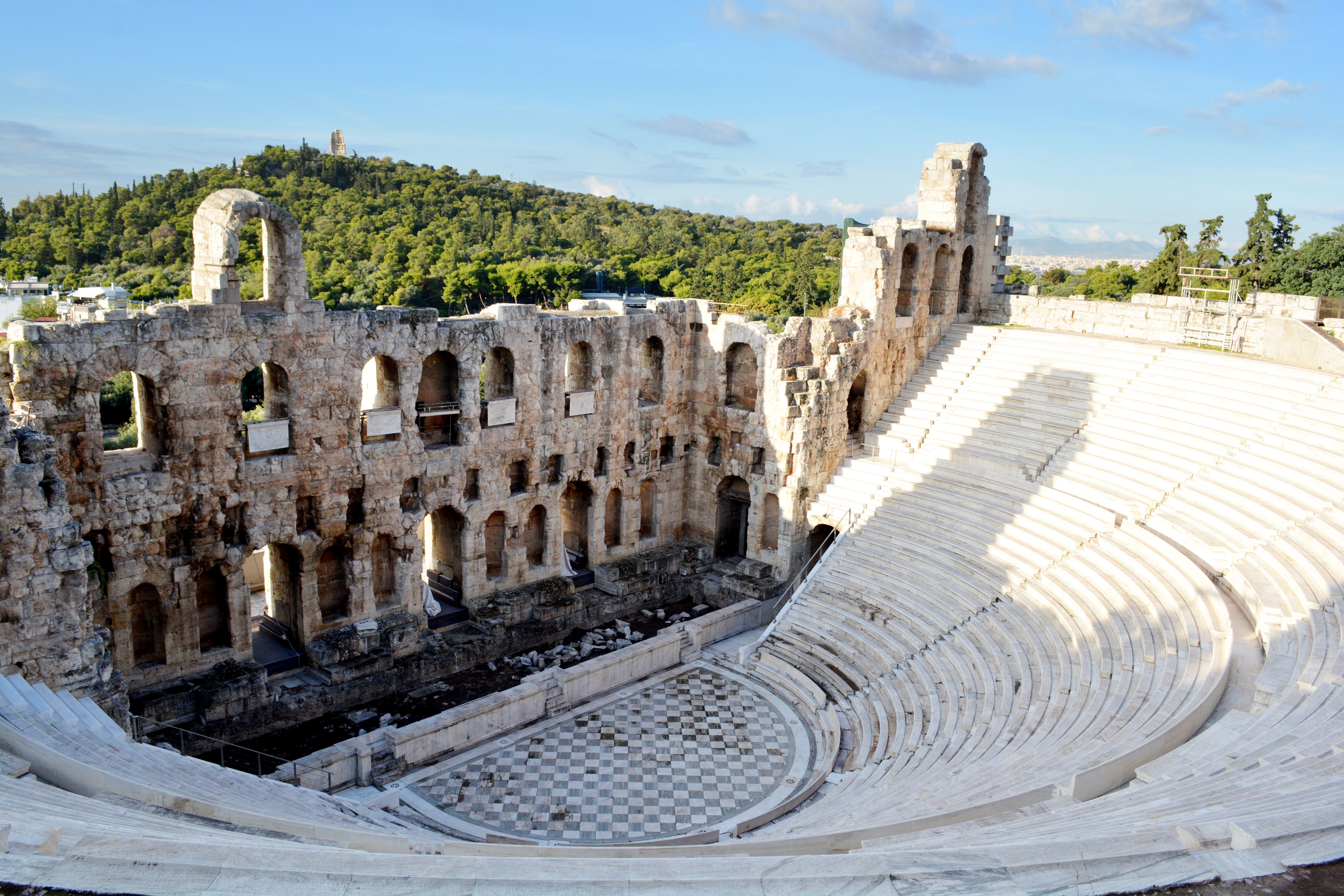
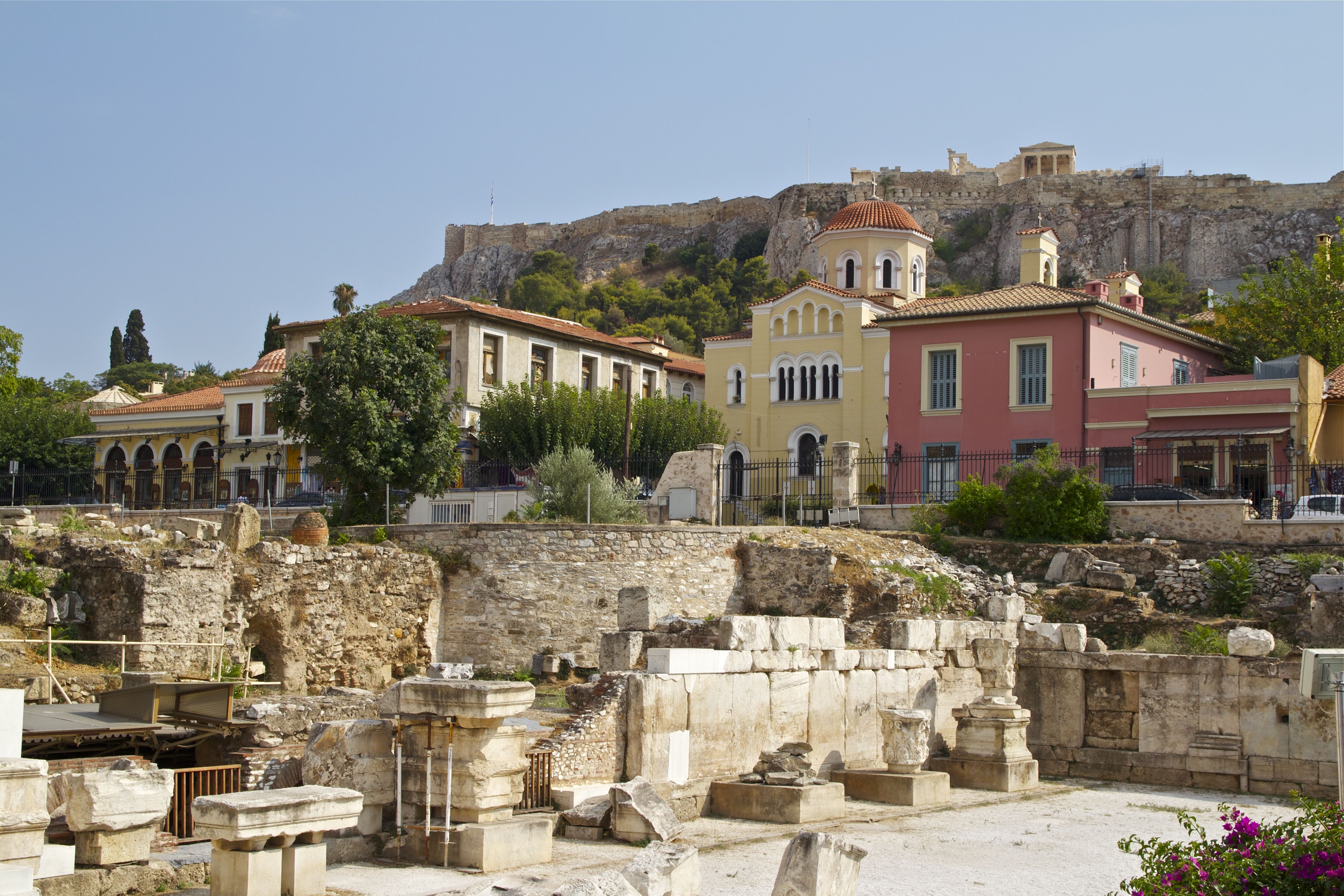
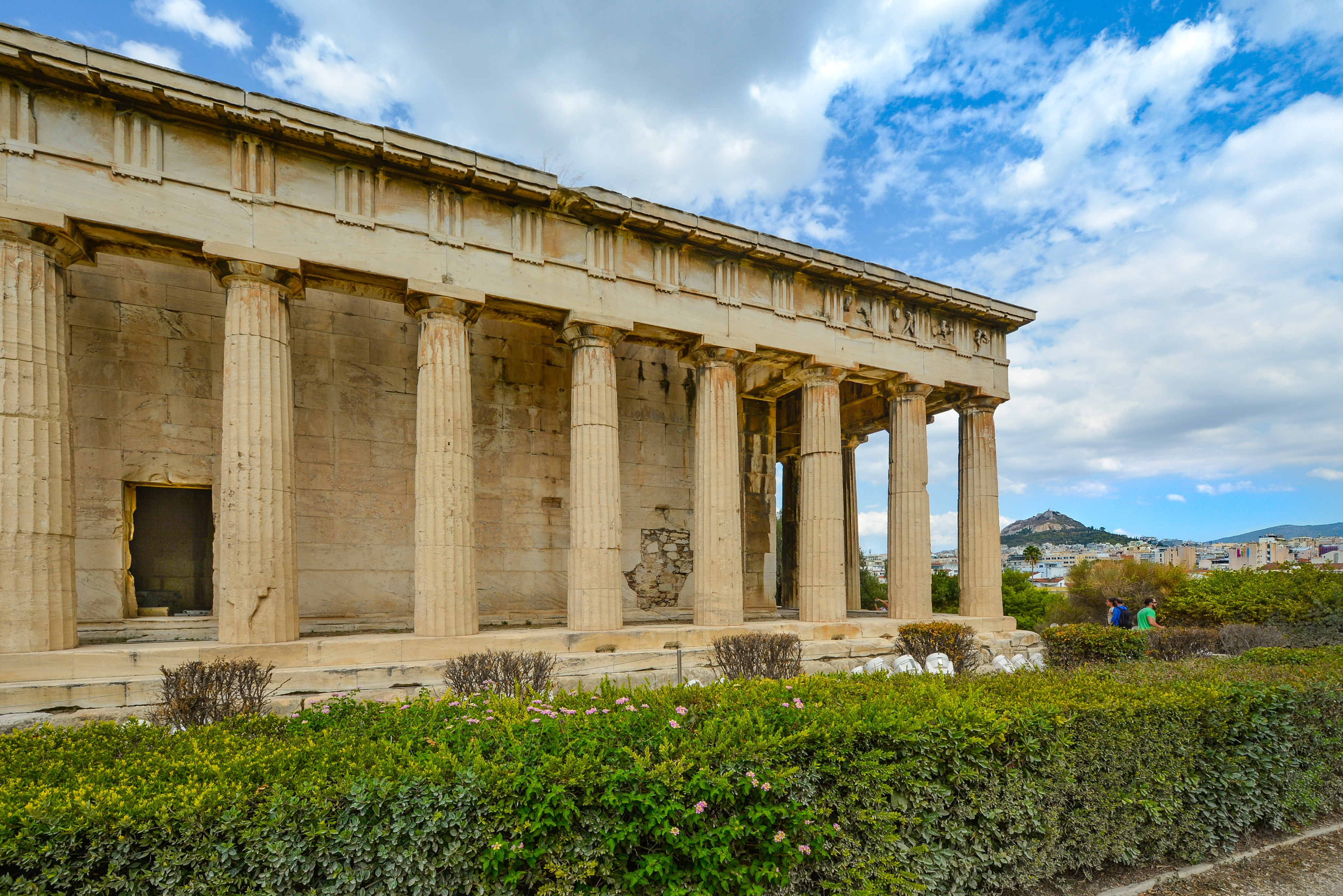
It's no wonder that all roads lead to the fascinating and maddening metropolis of Athens. Lift your eyes 200 feet above the city to the Parthenon, its honey-color marble columns rising from a massive limestone base, and you behold architectural perfection that has not been surpassed in 2,500 years. But, today, this shrine of classical form dominates a 21st-century boomtown. To experience Athens—Athína in Greek—fully is to understand the essence of Greece: ancient monuments surviving in a sea of cement, startling beauty amid the squalor, tradition juxtaposed with modernity. Locals depend on humor and flexibility to deal with the chaos; you should do the same. The rewards are immense. Although Athens covers a huge area, the major landmarks of the ancient Greek, Roman, and Byzantine periods are close to the modern city center. You can easily walk from the Acropolis to many other key sites, taking time to browse in shops and relax in cafés and tavernas along the way. From many quarters of the city you can glimpse "the glory that was Greece" in the form of the Acropolis looming above the horizon, but only by actually climbing that rocky precipice can you feel the impact of the ancient settlement. The Acropolis and Filopappou, two craggy hills sitting side by side; the ancient Agora (marketplace); and Kerameikos, the first cemetery, form the core of ancient and Roman Athens. Along the Unification of Archaeological Sites promenade, you can follow stone-paved, tree-lined walkways from site to site, undisturbed by traffic. Cars have also been banned or reduced in other streets in the historical center. In the National Archaeological Museum, vast numbers of artifacts illustrate the many millennia of Greek civilization; smaller museums such as the Goulandris Museum of Cycladic Art Museum and the Byzantine and Christian Museum illuminate the history of particular regions or periods. Athens may seem like one huge city, but it is really a conglomeration of neighborhoods with distinctive characters. The Eastern influences that prevailed during the 400-year rule of the Ottoman Empire are still evident in Monastiraki, the bazaar area near the foot of the Acropolis. On the northern slope of the Acropolis, stroll through Plaka (if possible by moonlight), an area of tranquil streets lined with renovated mansions, to get the flavor of the 19th-century's gracious lifestyle. The narrow lanes of Anafiotika, a section of Plaka, thread past tiny churches and small, color-washed houses with wooden upper stories, recalling a Cycladic island village. In this maze of winding streets, vestiges of the older city are everywhere: crumbling stairways lined with festive tavernas; dank cellars filled with wine vats; occasionally a court or diminutive garden, enclosed within high walls and filled with magnolia trees and the flaming trumpet-shaped flowers of hibiscus bushes. Formerly run-down old quarters, such as Thission, Gazi and Psirri, popular nightlife areas filled with bars and mezedopoleia (similar to tapas bars), are now in the process of gentrification, although they still retain much of their original charm, as does the colorful produce and meat market on Athinas. The area around Syntagma Square, the tourist hub, and Omonia Square, the commercial heart of the city about 1 km (½ mi) northwest, is distinctly European, having been designed by the court architects of King Otho, a Bavarian, in the 19th century. The chic shops and bistros of ritzy Kolonaki nestle at the foot of Mt. Lycabettus, Athens's highest hill (909 feet). Each of Athens's outlying suburbs has a distinctive character: in the north is wealthy, tree-lined Kifissia, once a summer resort for aristocratic Athenians, and in the south and southeast lie Glyfada, Voula, and Vouliagmeni, with their sandy beaches, seaside bars, and lively summer nightlife. Just beyond the city's southern fringes is Piraeus, a bustling port city of waterside fish tavernas and Saronic Gulf views.

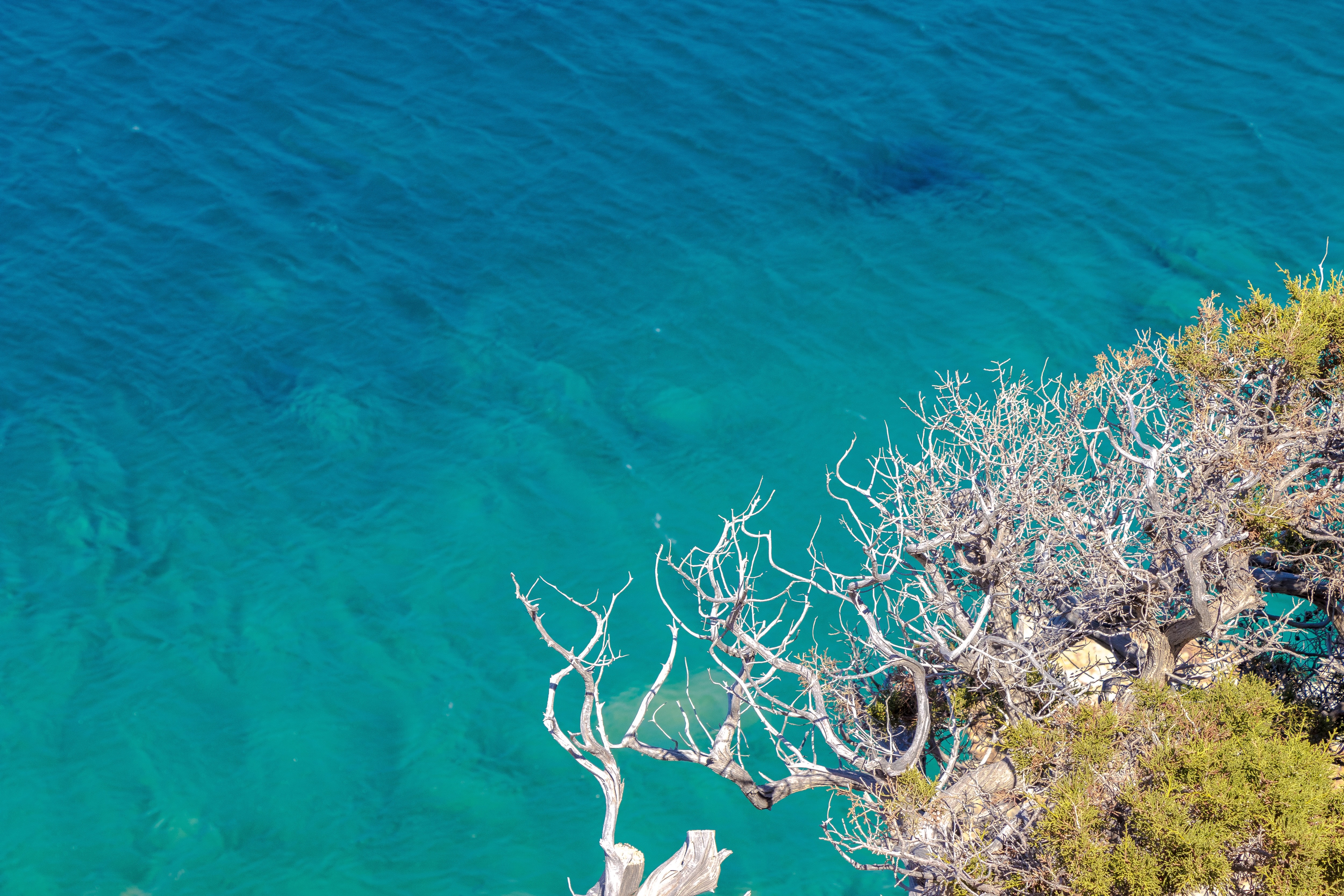
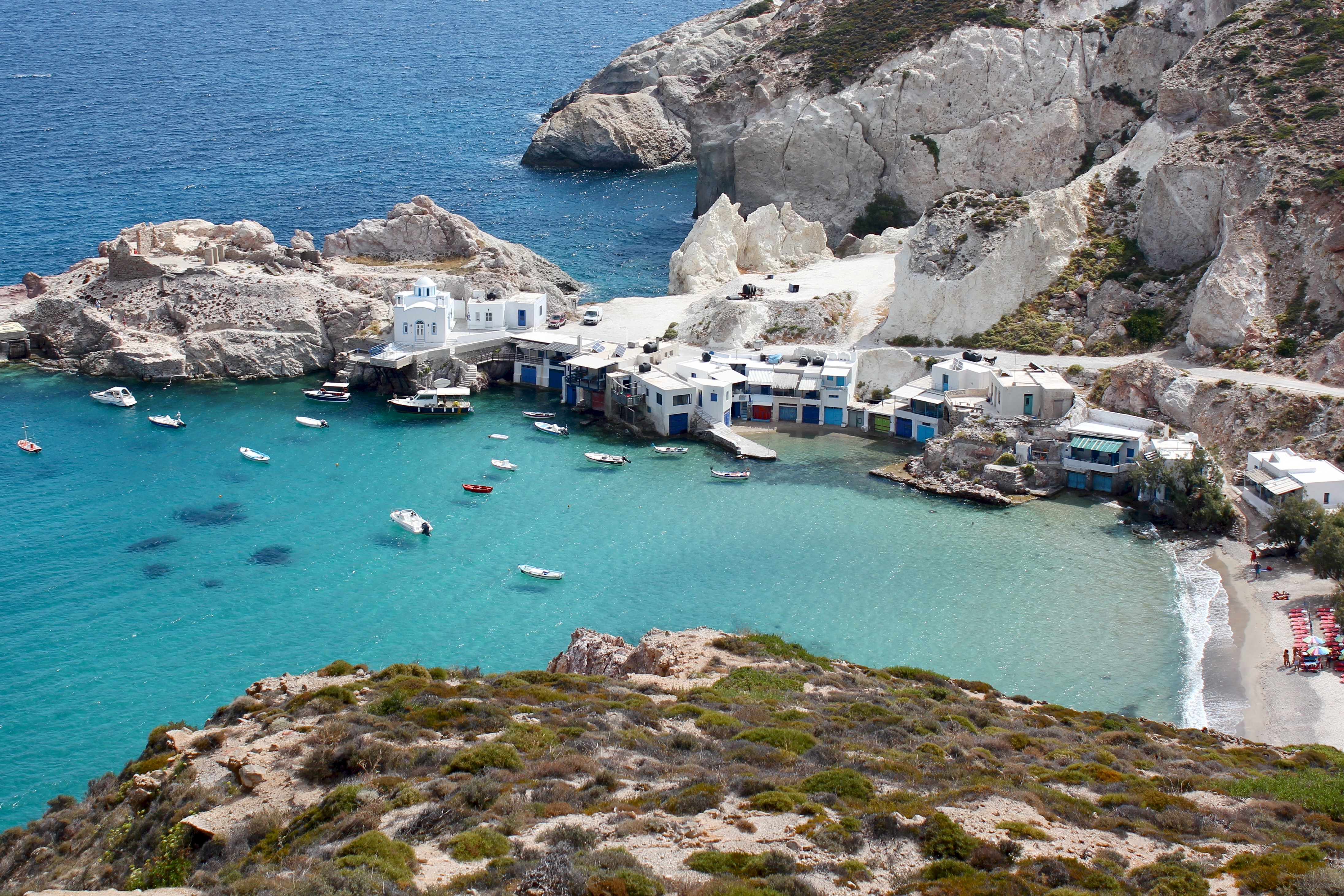
About Milos
Milos or Melos is a volcanic Greek island in the Aegean Sea, just north of the Sea of Crete. Milos is the southwesternmost island in the Cyclades group. The Venus de Milo and the Asclepius of Milos were both found on the island, as were a Poseidon and an archaic Apollo now in Athens.
About Kalamáta
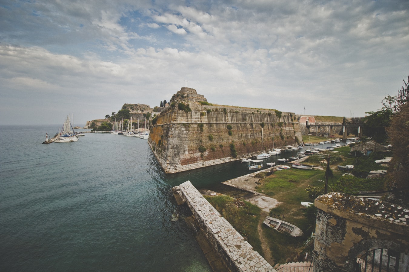
About Corfu
Corfu town today is a vivid tapestry of cultures—a sophisticated weave, where charm, history, and natural beauty blend. Located about midway along the island's east coast, this spectacularly lively capital is the cultural heart of Corfu and has a remarkable historic center that UNESCO designated as a World Heritage Site in 2007. All ships and planes dock or land near Corfu town, which occupies a small peninsula jutting into the Ionian Sea.Whether arriving by ferry from mainland Greece or Italy, from another island, or directly by plane, catch your breath by first relaxing with a coffee or a gelato in Corfu town's shaded Liston Arcade, then stroll the narrow lanes of its pedestrians-only quarter. For an overview of the immediate area, and a quick tour of Mon Repos palace, hop on the little tourist train that runs from May to September. Corfu town has a different feel at night, so book a table at one of its famed tavernas to savor the island's unique cuisine.The best way to get around Corfu town is on foot. The town is small enough so that you can easily walk to every sight. There are local buses, but they do not thread their way into the streets (many now car-free) of the historic center. If you are arriving by ferry or plane, it's best to take a taxi to your hotel. Expect to pay about €10 from the airport or ferry terminal to a hotel in Corfu town. If there are no taxis waiting, you can call for one.
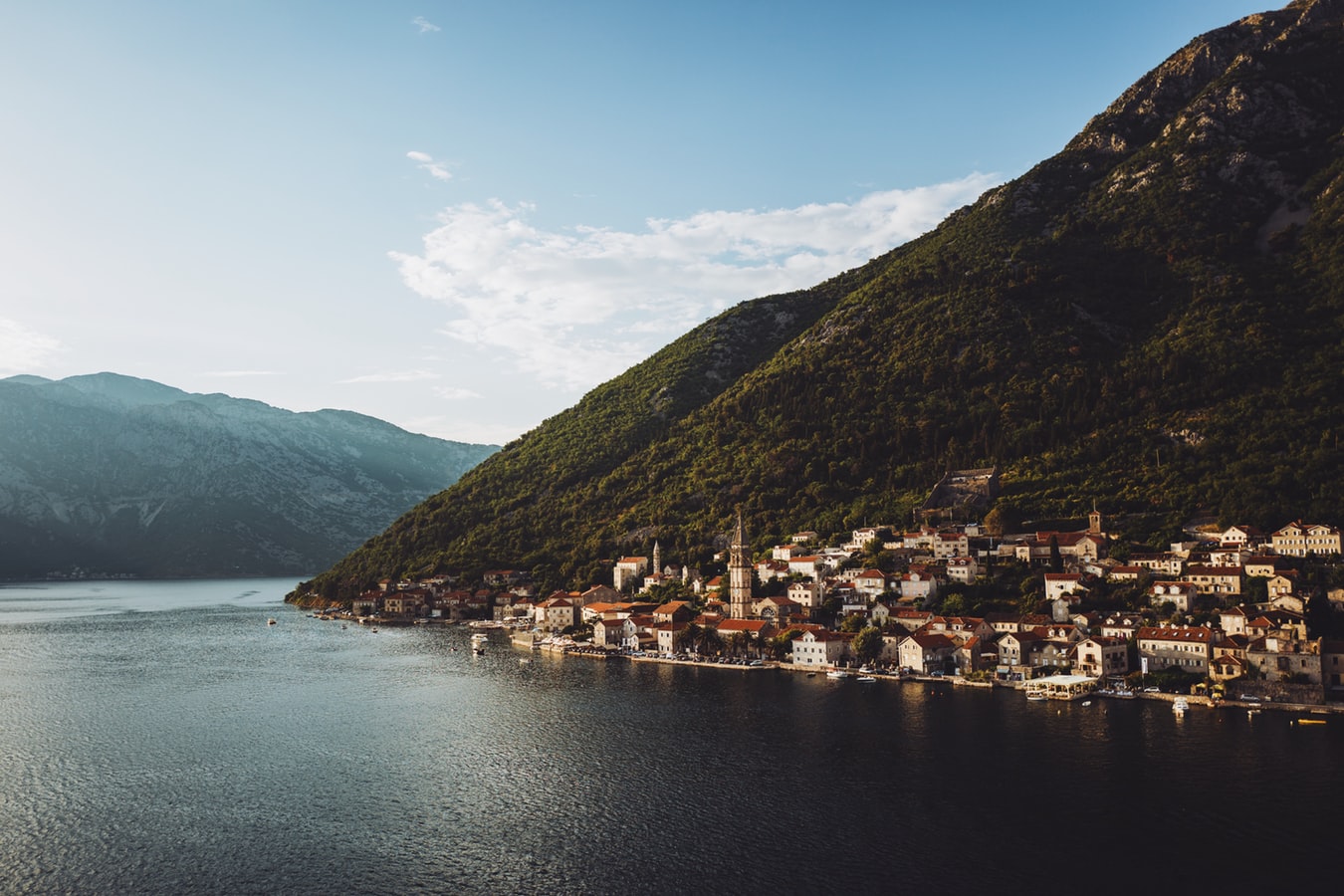
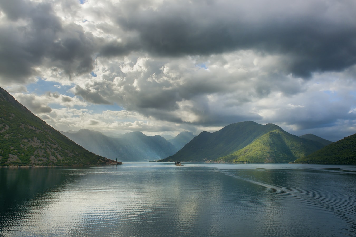
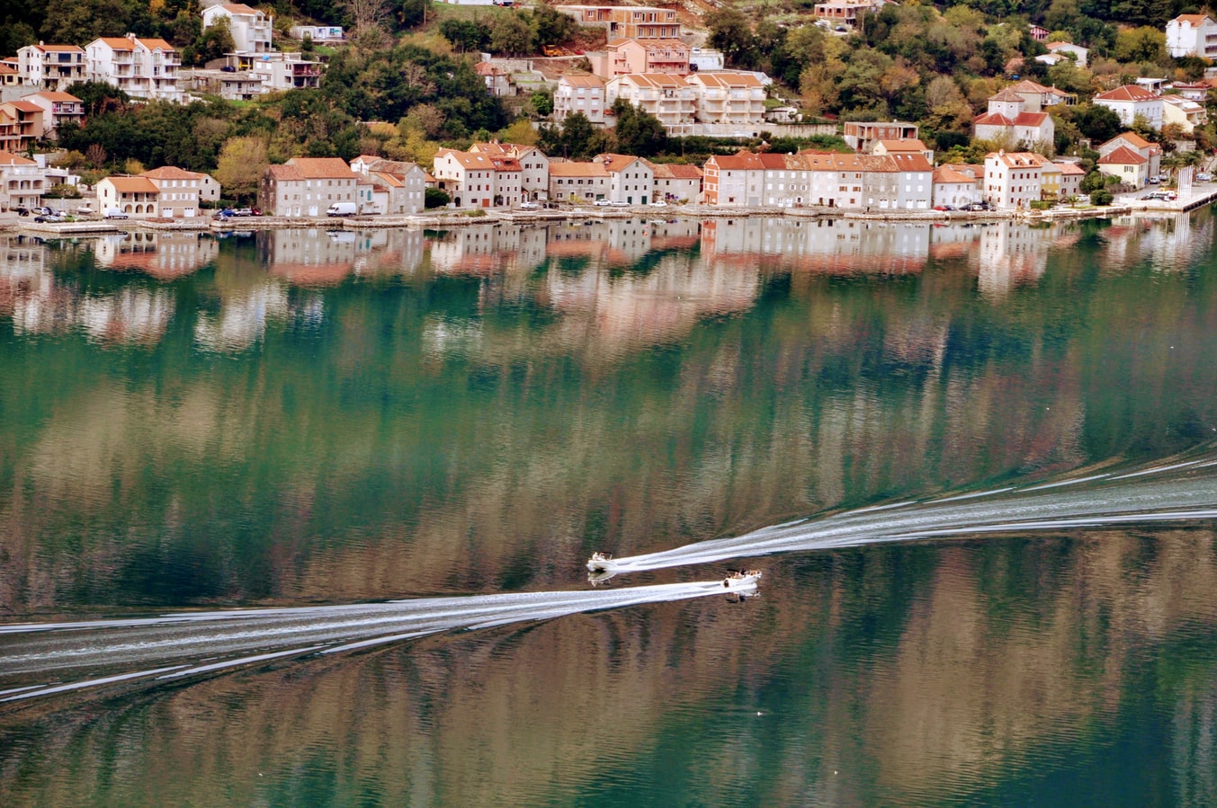
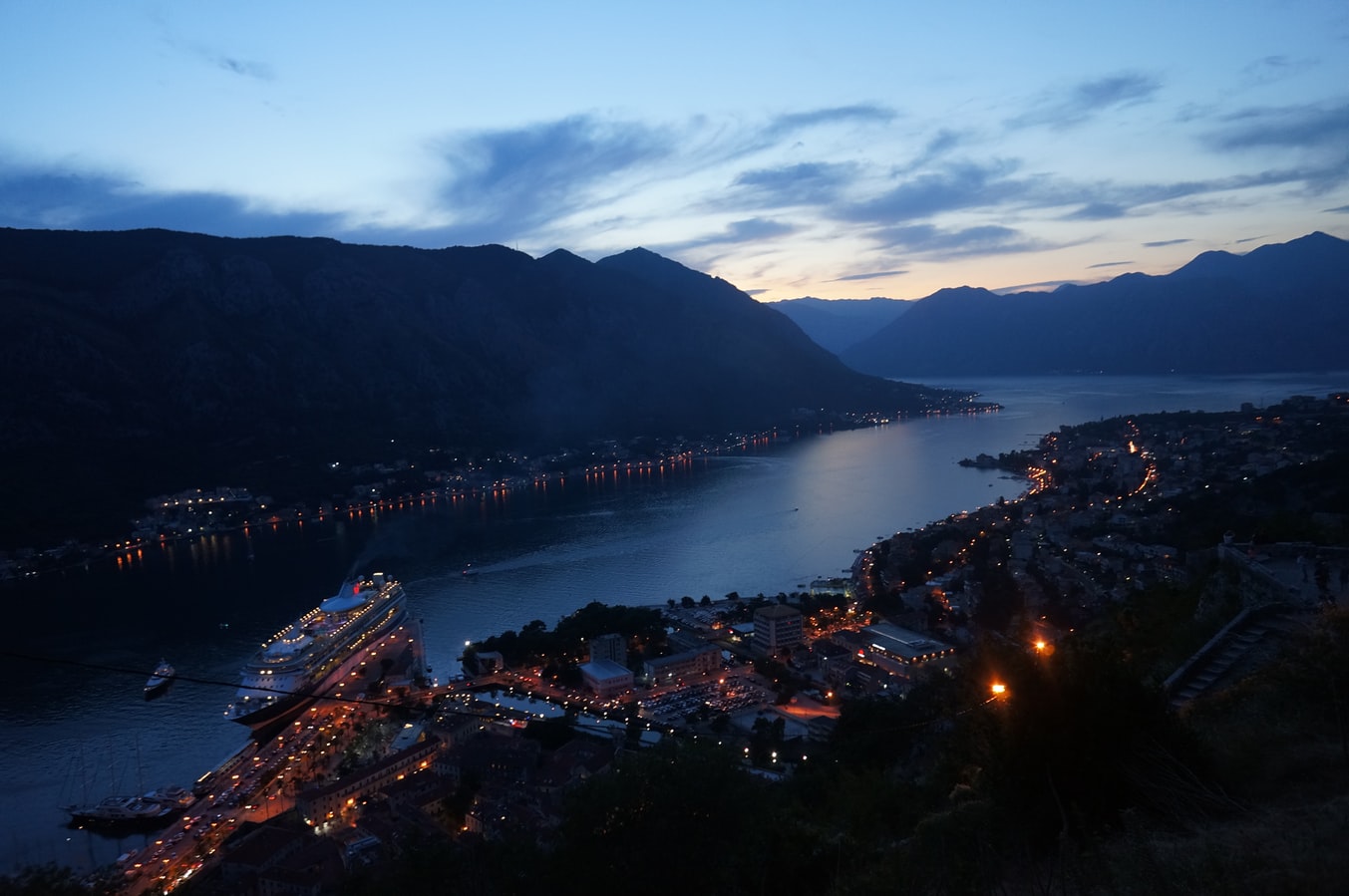
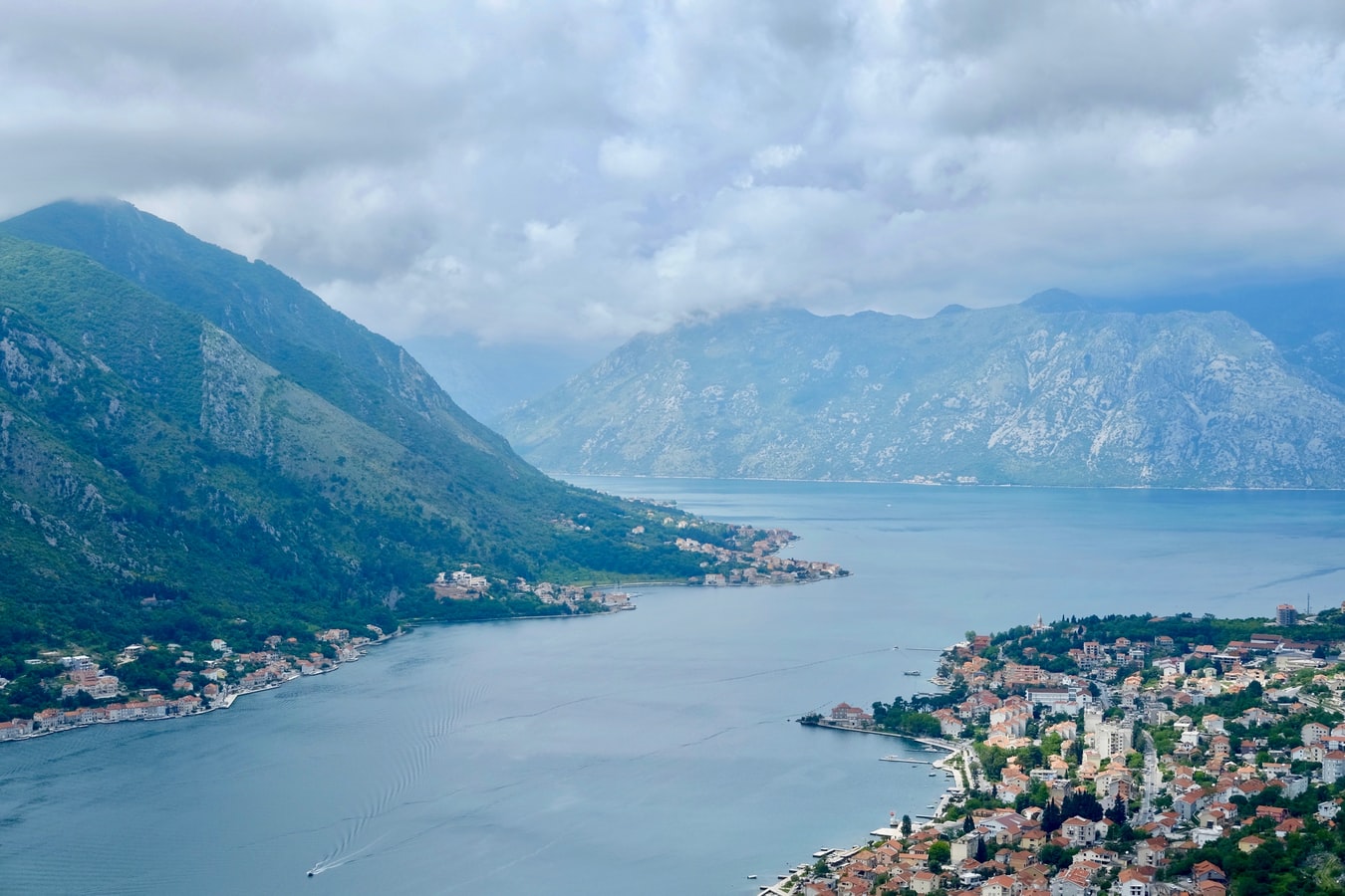
About Kotor
Backed by imposing mountains, tiny Kotor lies hidden from the open sea, tucked into the deepest channel of the Bokor Kotorska (Kotor Bay), which is Europe's most southerly fjord. To many, this town is more charming than its sister UNESCO World Heritage Site, Dubrovnik, retaining more authenticity, but with fewer tourists and spared the war damage and subsequent rebuilding which has given Dubrovnik something of a Disney feel.Kotor's medieval Stari Grad (Old Town) is enclosed within well-preserved defensive walls built between the 9th and 18th centuries and is presided over by a proud hilltop fortress. Within the walls, a labyrinth of winding cobbled streets leads through a series of splendid paved piazzas, rimmed by centuries-old stone buildings. The squares are now haunted by strains from buskers but although many now house trendy cafés and chic boutiques, directions are still given medieval-style by reference to the town’s landmark churches.In the Middle Ages, as Serbia's chief port, Kotor was an important economic and cultural center with its own highly regarded schools of stonemasonry and iconography. From 1391 to 1420 it was an independent city-republic and later, it spent periods under Venetian, Austrian, and French rule, though it was undoubtedly the Venetians who left the strongest impression on the city's architecture. Since the breakup of Yugoslavia, some 70% of the stone buildings in the romantic Old Town have been snapped up by foreigners, mostly Brits and Russians. Porto Montenegro, a new marina designed to accommodate some of the world’s largest super yachts, opened in nearby Tivat in 2011, and along the bay are other charming seaside villages, all with better views of the bay than the vista from Kotor itself where the waterside is congested with cruise ships and yachts. Try sleepy Muo or the settlement of Prčanj in one direction around the bay, or Perast and the Roman mosaics of Risan in the other direction.
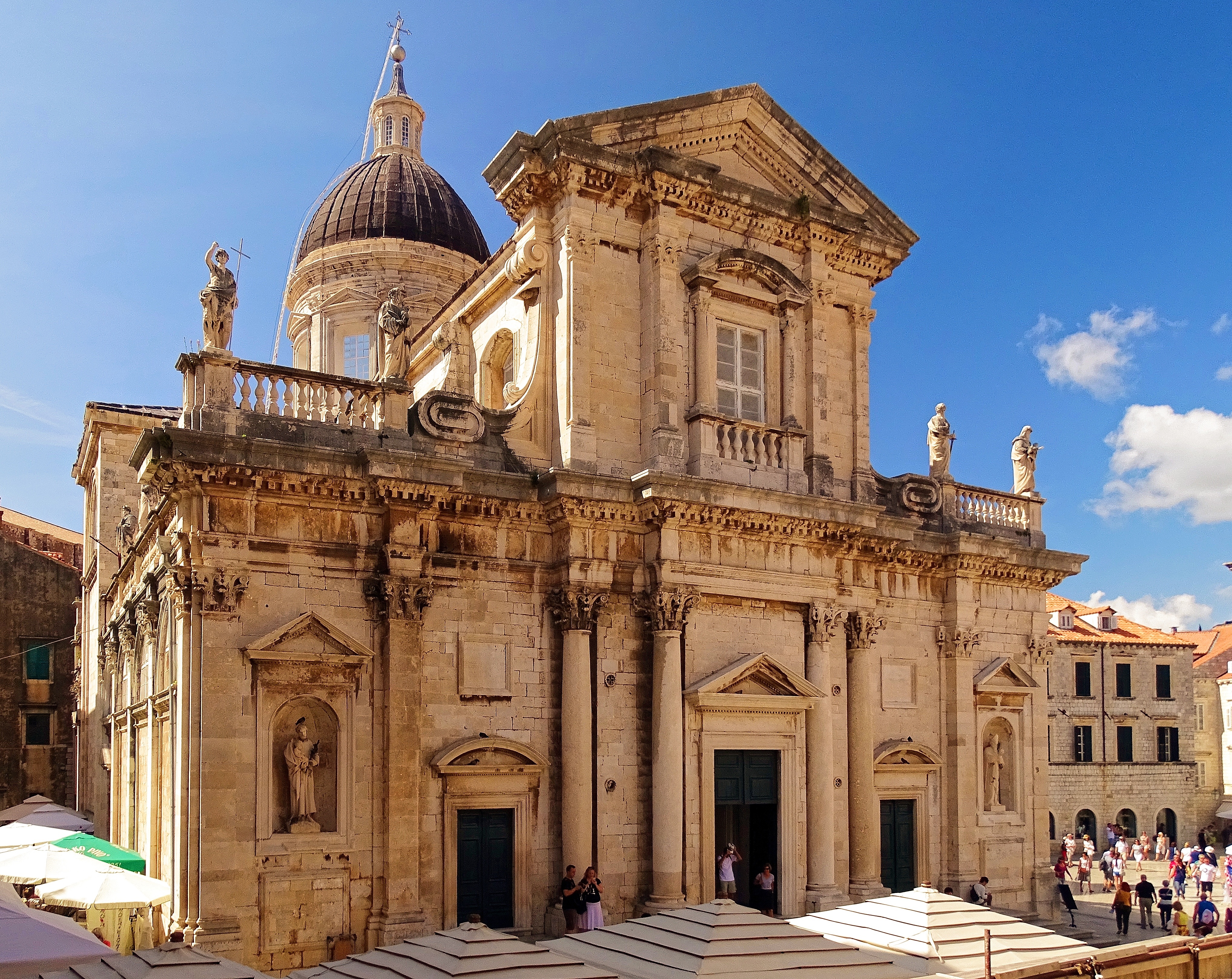
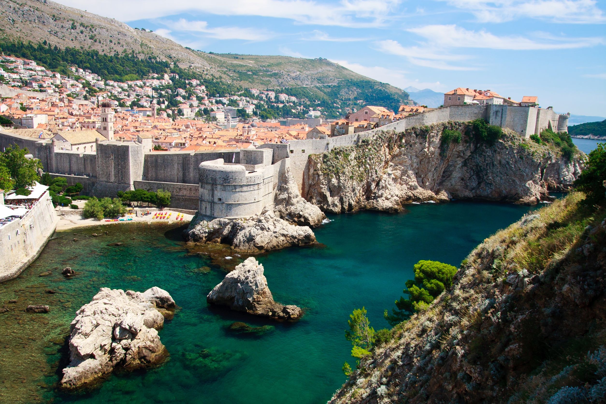
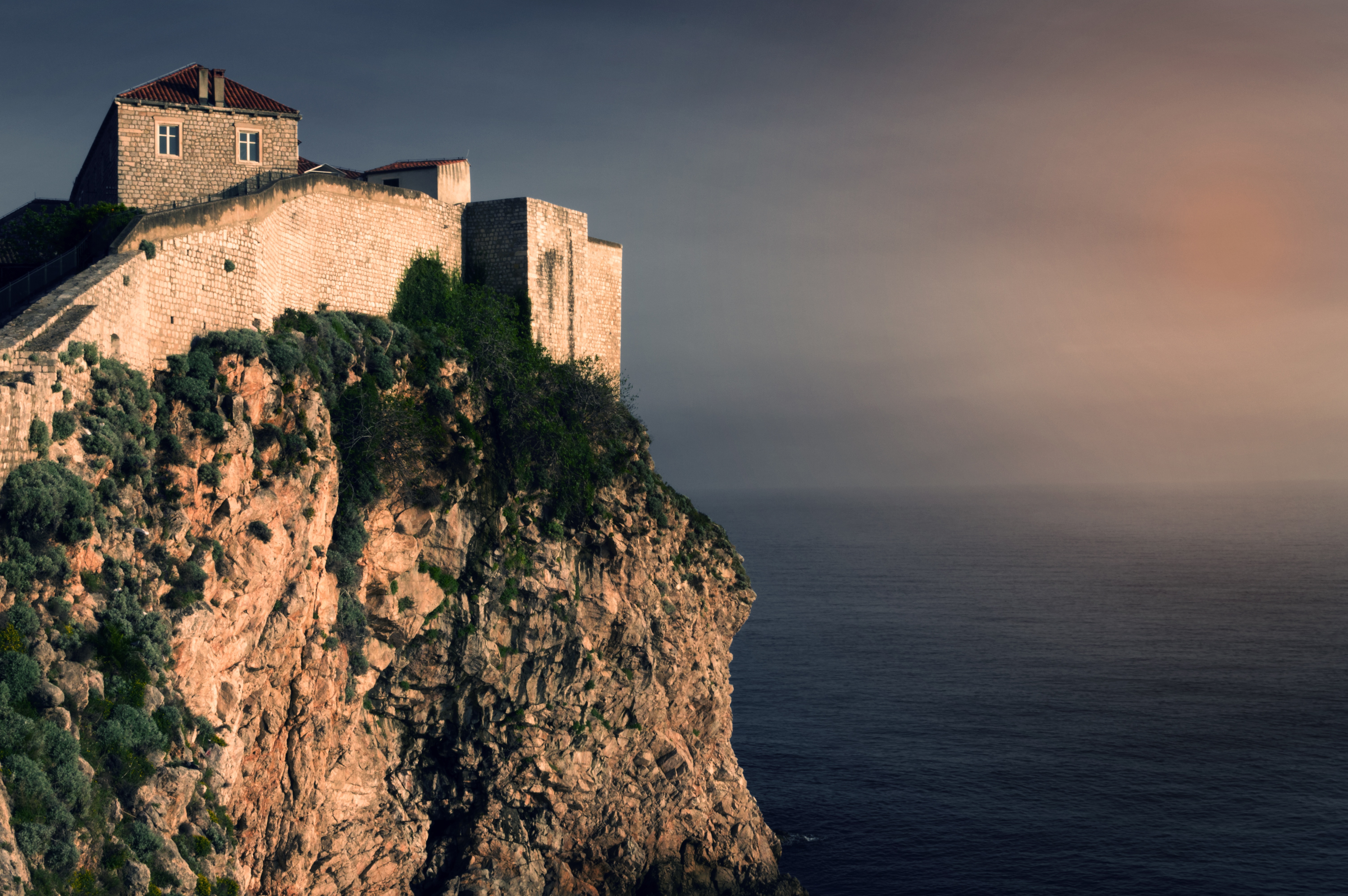
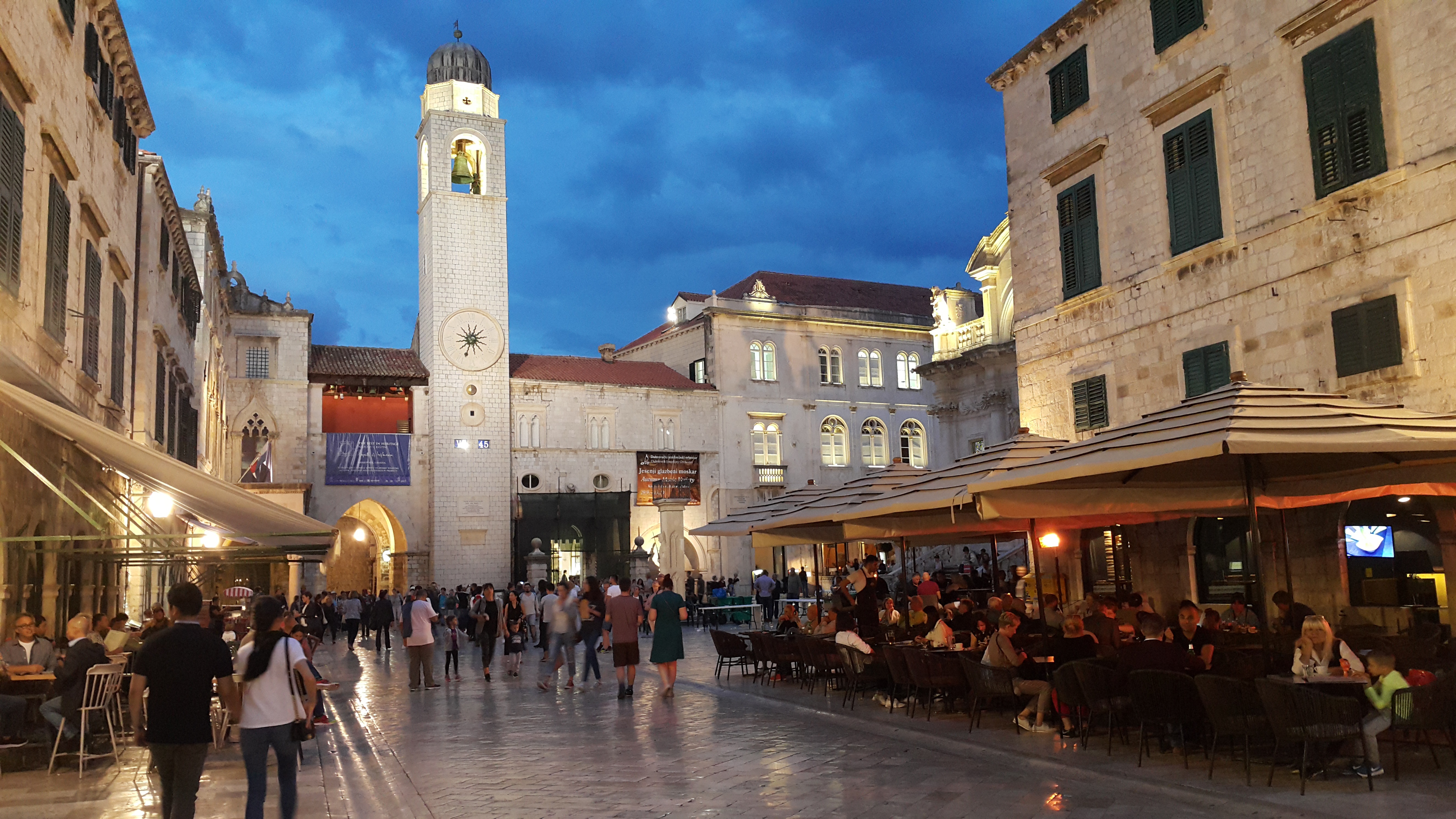
About Dubrovnik
Nothing can prepare you for your first sight of Dubrovnik. Lying 216 km (135 miles) southeast of Split and commanding a jaw-dropping coastal location, it is one of the world's most beautiful fortified cities. Its massive stone ramparts and fortress towers curve around a tiny harbor, enclosing graduated ridges of sun-bleached orange-tiled roofs, copper domes, and elegant bell towers. Your imagination will run wild picturing what it looked like seven centuries ago when the walls were built, without any suburbs or highways around it, just this magnificent stone city rising out of the sea.In the 7th century AD, residents of the Roman city Epidaurum (now Cavtat) fled the Avars and Slavs of the north and founded a new settlement on a small rocky island, which they named Laus, and later Ragusa. On the mainland hillside opposite the island, the Slav settlement called Dubrovnik grew up. In the 12th century the narrow channel separating the two settlements was filled in (now the main street through the Old Town, called Stradun), and Ragusa and Dubrovnik became one. The city was surrounded by defensive walls during the 13th century, and these were reinforced with towers and bastions in the late 15th century.From 1358 to 1808 the city thrived as a powerful and remarkably sophisticated independent republic, reaching its golden age during the 16th century. In 1667 many of its splendid Gothic and Renaissance buildings were destroyed by an earthquake. The defensive walls survived the disaster, and the city was rebuilt in baroque style.Dubrovnik lost its independence to Napoléon in 1808, and in 1815 passed to Austria-Hungary. During the 20th century, as part of Yugoslavia, the city became a popular tourist destination, and in 1979 it was listed as a UNESCO World Heritage Site. During the war for independence, it came under heavy siege. Thanks to careful restoration, few traces of damage remain; however, there are maps inside the Pile and Ploče Gates illustrating the points around the city where damage was done. It’s only when you experience Dubrovnik yourself that you can understand what a treasure the world nearly lost
About Fusina
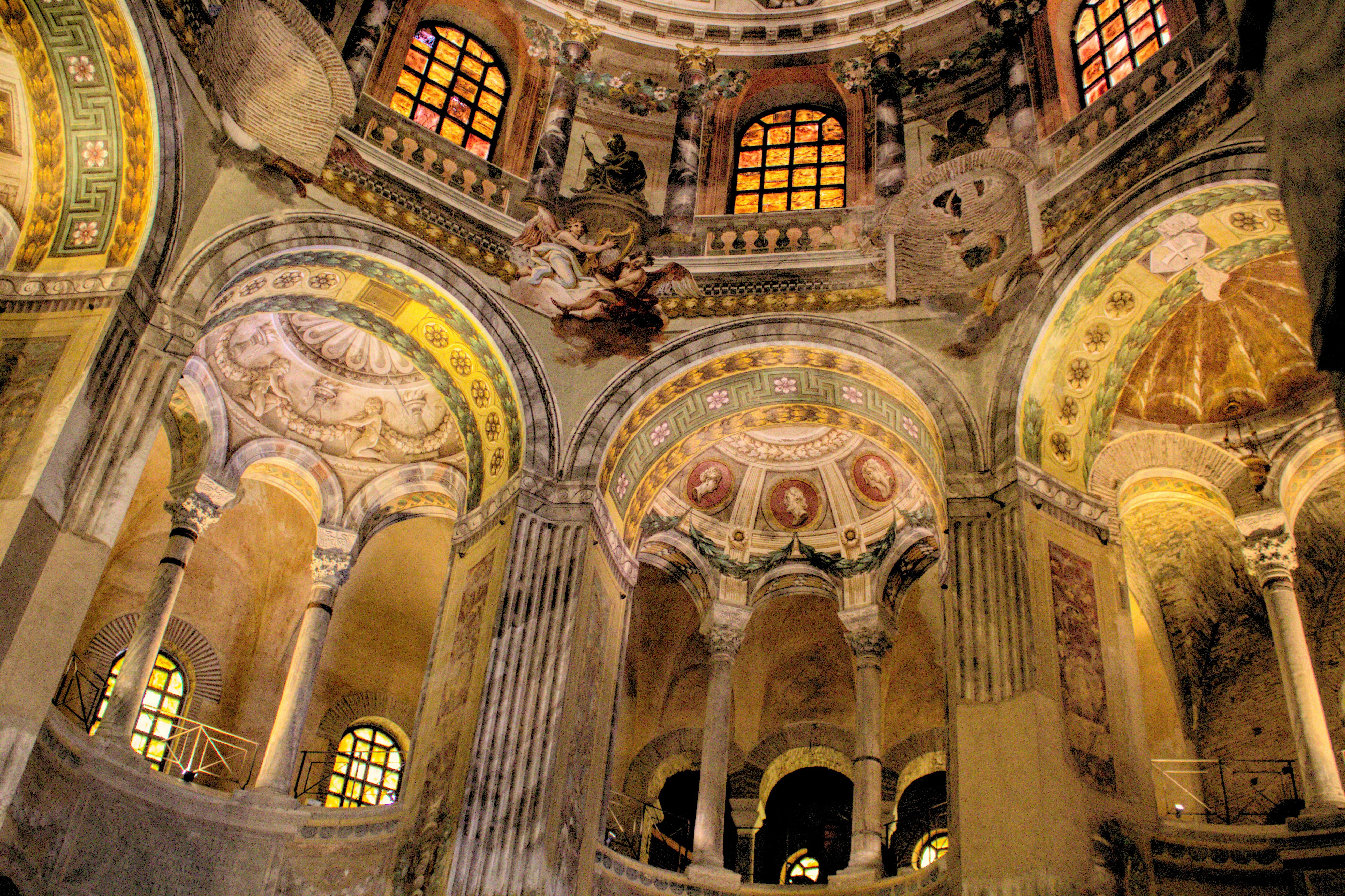
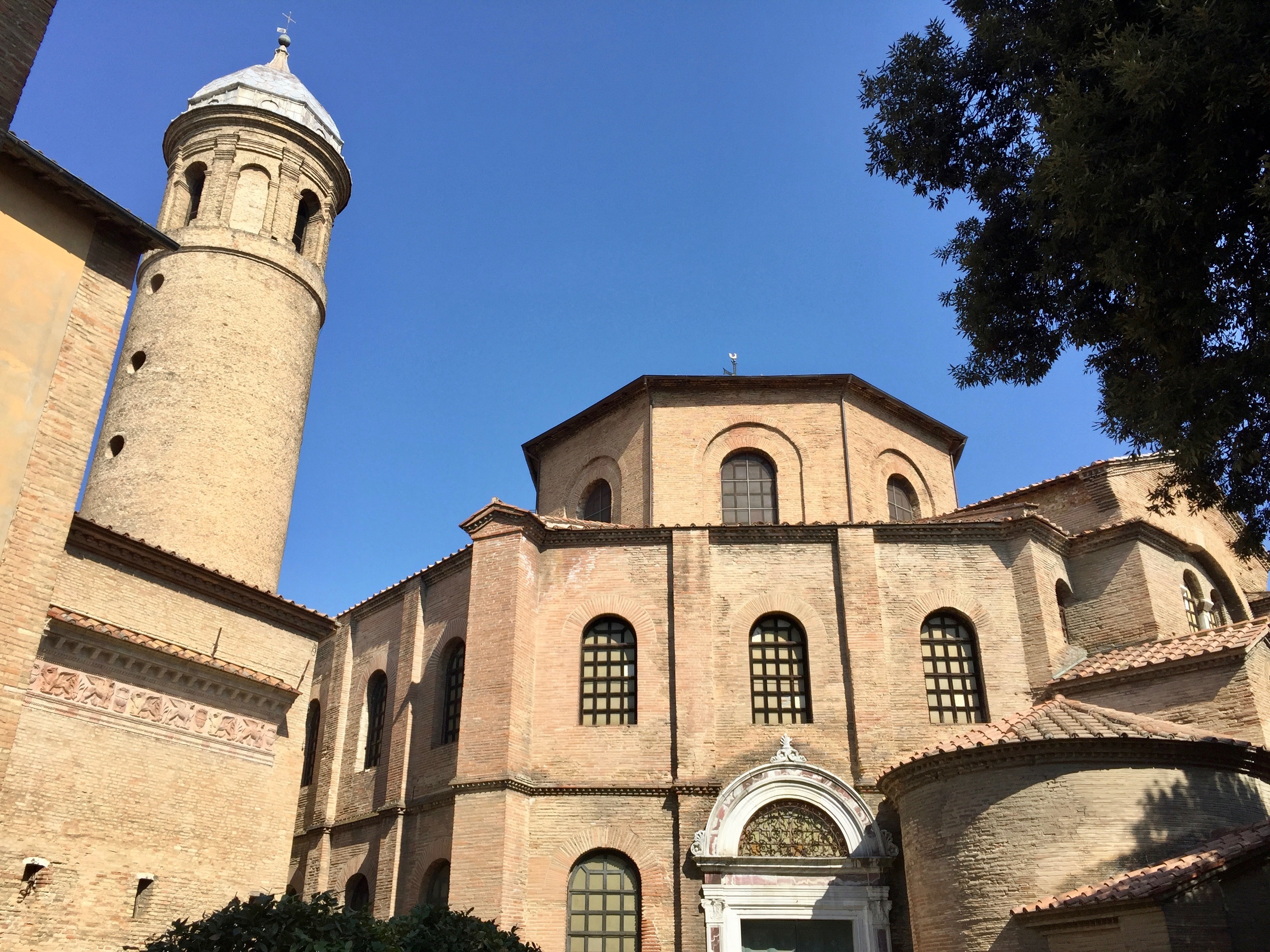
About Ravenna
A small, quiet, well-heeled city, Ravenna has brick palaces, cobblestone streets, magnificent monuments, and spectacular Byzantine mosaics. The high point in its civic history occurred in the 5th century, when Pope Honorious moved his court here from Rome. Gothic kings Odoacer and Theodoric ruled the city until it was conquered by the Byzantines in AD 540. Ravenna later fell under the sway of Venice, and then, inevitably, the Papal States.Because Ravenna spent much of its past looking east, its greatest art treasures show that Byzantine influence. Churches and tombs with the most unassuming exteriors contain within them walls covered with sumptuous mosaics. These beautifully preserved Byzantine mosaics put great emphasis on nature, which you can see in the delicate rendering of sky, earth, and animals. Outside Ravenna, the town of Classe hides even more mosaic gems.
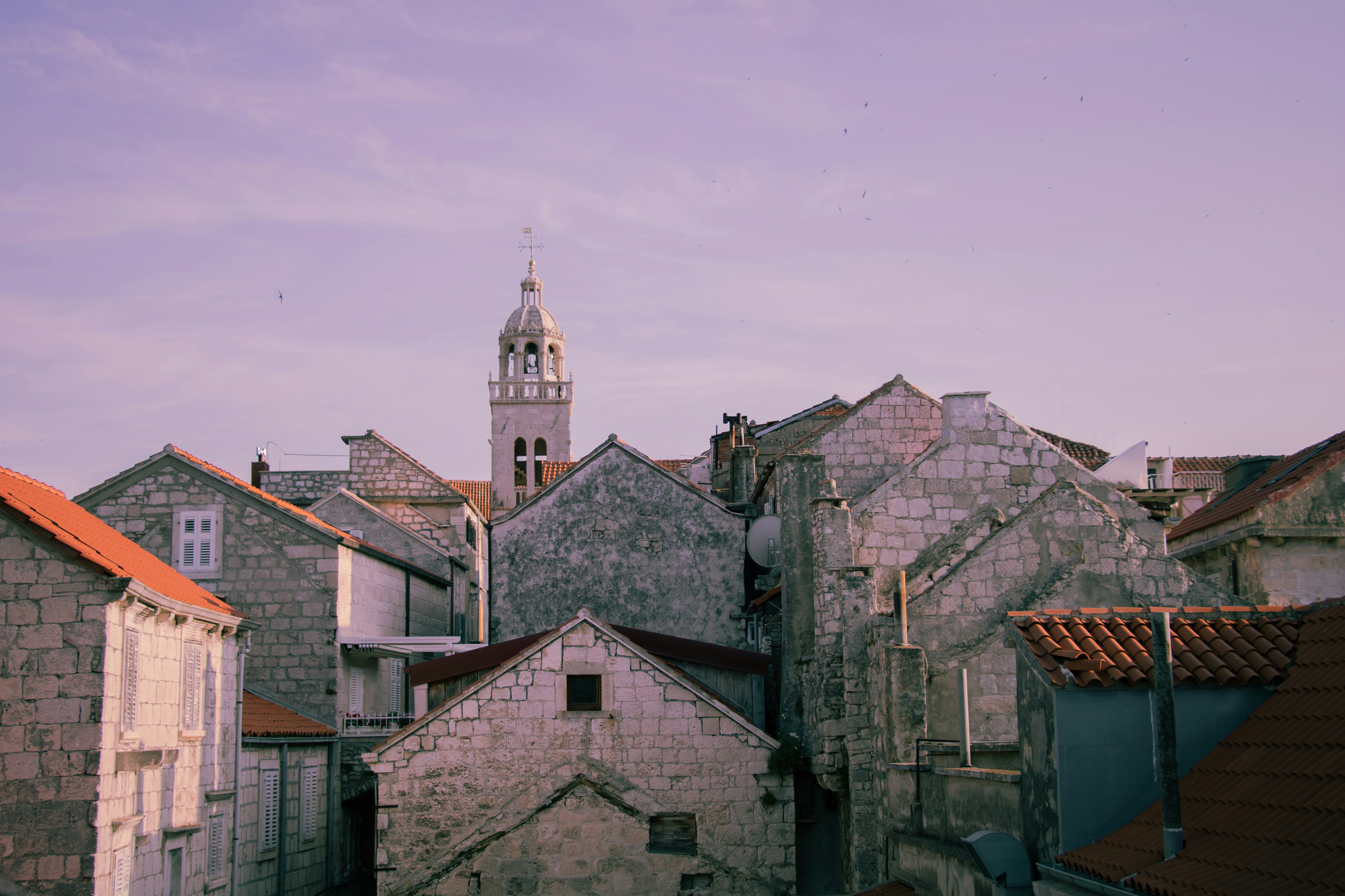
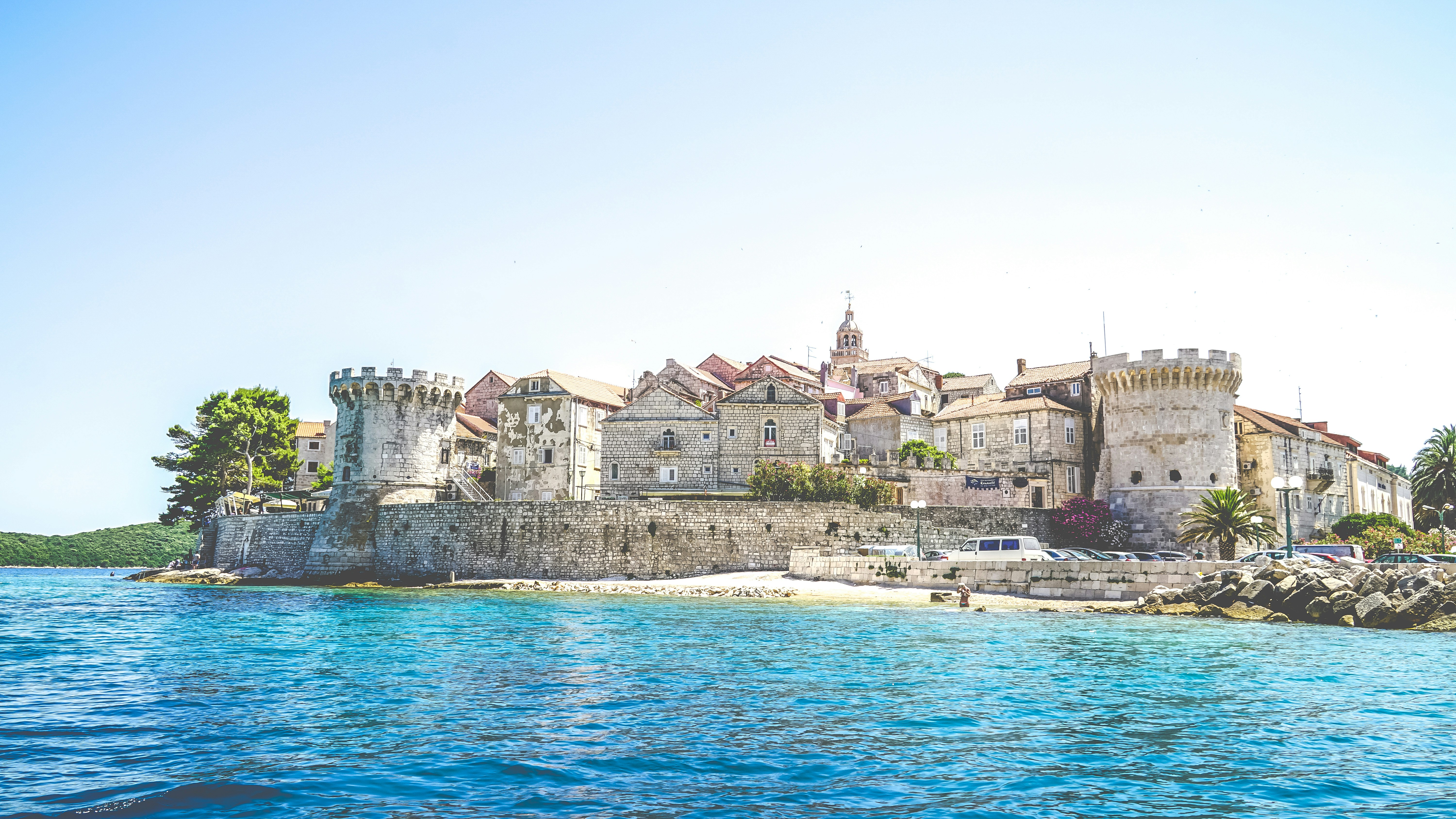
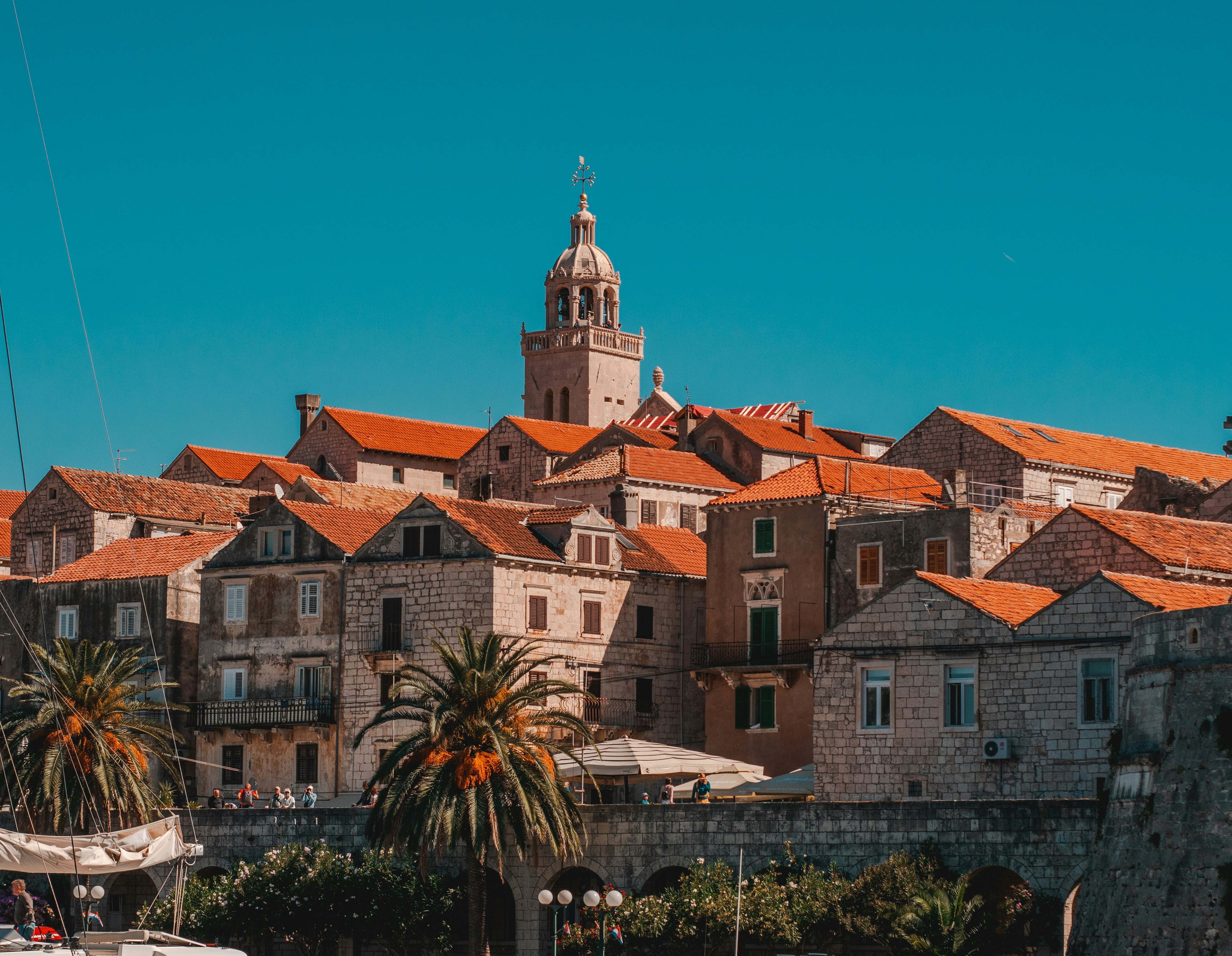
About Korčula
Off the coast of Croatia in the southern Adriatic Sea lie some thousand islands and the largest of them, Korçula, is considered the most beautiful. With an average of 3,000 hours of sunshine per annum, which guarantees a wide assortment of Mediterranean vegetation, it is not difficult to understand why seasoned travelers compare Korçula to a latter-day Eden. Separated from the mainland by a channel of only one mile, Korçula's main town, named the same as the island, ranks among the best preserved medieval towns in the Mediterranean. It is the island's main tourist, economic and cultural center. Thanks to its strategic location along the sea trade routes, Korçula has always attracted travelers and settlers. Korcula was founded by Greek colonists, who were followed by Illyrians, Romans and finally the Croats. The Korçula Statute of 1214 is one of the oldest legal documents to have been adopted in this part of Europe. The same century saw the birth of the famous world traveler, Marco Polo. The house said to be his birthplace can be seen in town. Korçulans have always been known as keen seafarers, excellent shipbuilders, stonemasons and artists. From their many voyages, sailors brought back new ideas, which eventually mixed with local customs. To this day, Korçula has maintained the tradition of performing knightly games such as the chivalrous Moreska dance, which has been in existence for more than 400 years. Visitors to Korçula enjoy its stunning location, natural beauty and medieval ambiance. And if that's not enough, the town offers numerous attractions that are within walking distance from the pier, including the City Museum and the Bishop's Treasury.
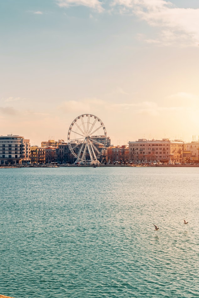
About Bari
Bari, capital of the province of Apulia, lies on southern Italy's Adriatic coast. Its busy port is a leading commercial and industrial centre as well as a transit point for travellers catching ferries across the Adriatic to Greece. Bari comprises a new and an old town. To the north, on a promontory between the old and new harbours, lies the picturesque old town, or Citta Vecchia, with a maze of narrow, crooked streets. To the south is the spacious and regularly planned new town, which has developed considerably since 1930, when the Levant Fair was first held here. The heart of the modern town is Piazza della Liberta. The busy thoroughfare, Corso Vittorio Emanuele II, separates the new town from the old. At the eastern end of the Corso begins the Lungomare Nazario Sauro, a magnificent seafront promenade that runs along the old harbour. Bari and the Apulian region were long recognized for their strategic location, attracting a succession of colonizers such as the Normans, Moors and Spaniards, each leaving their mark.
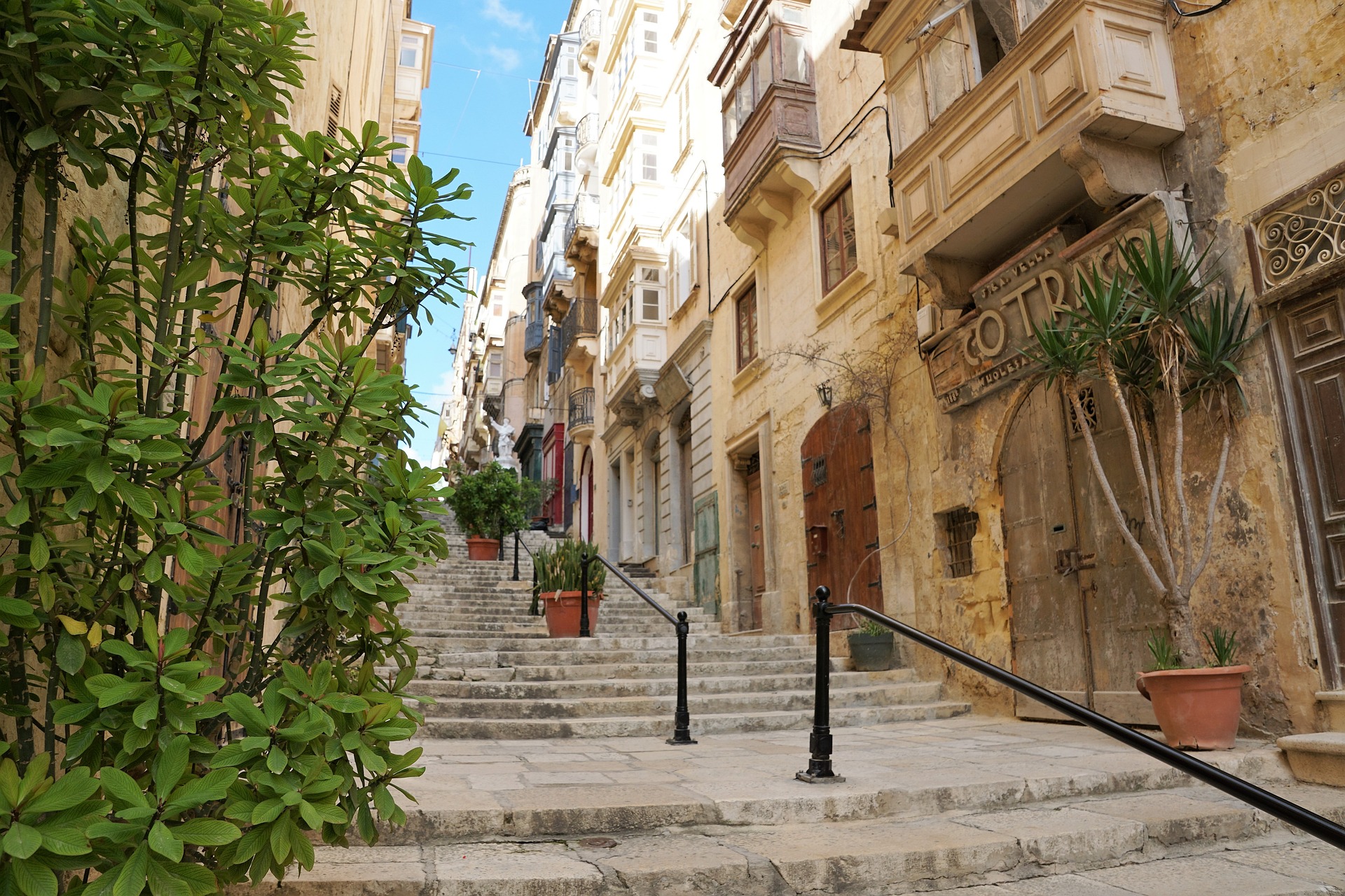
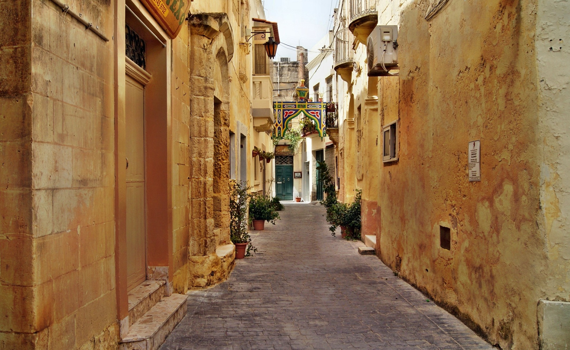
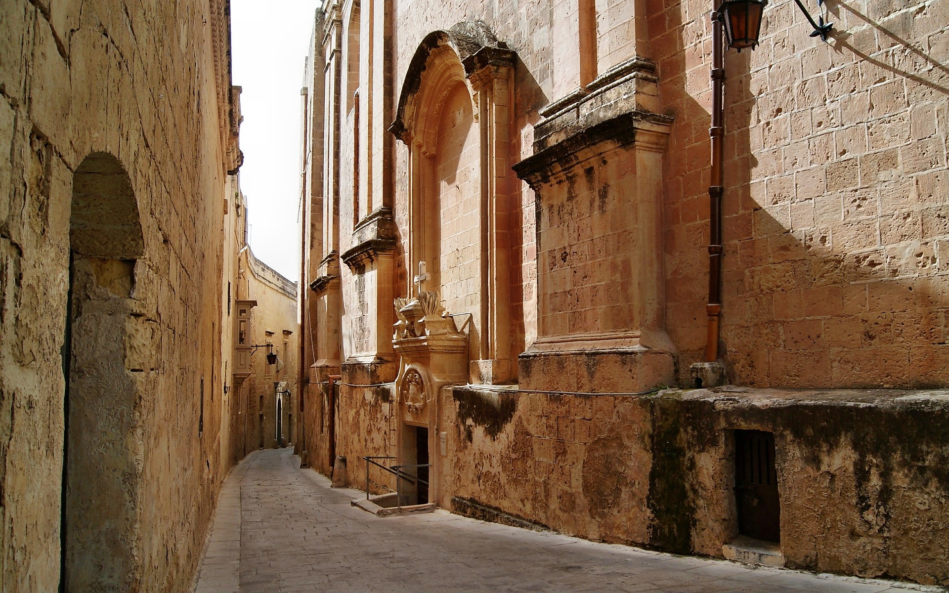
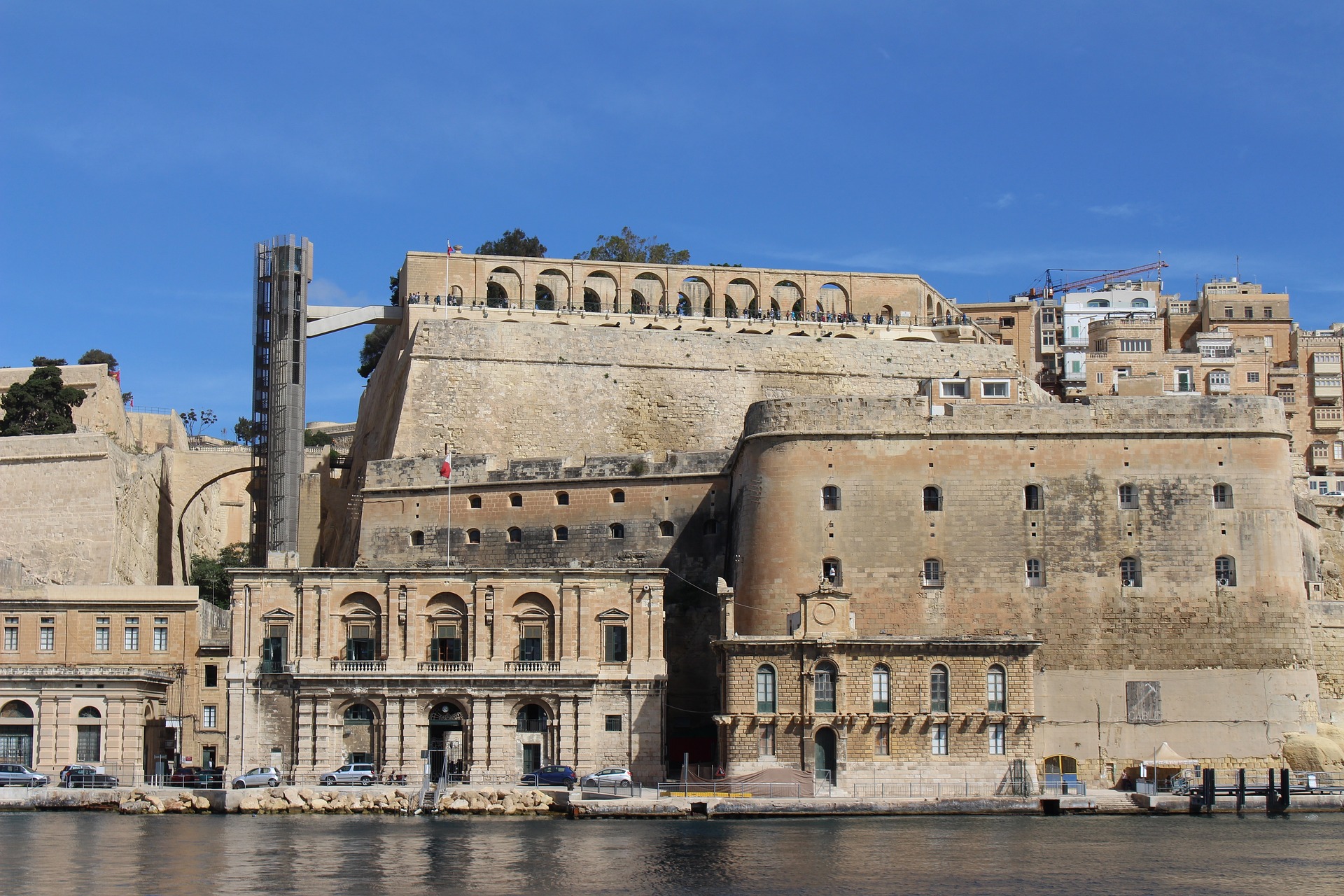
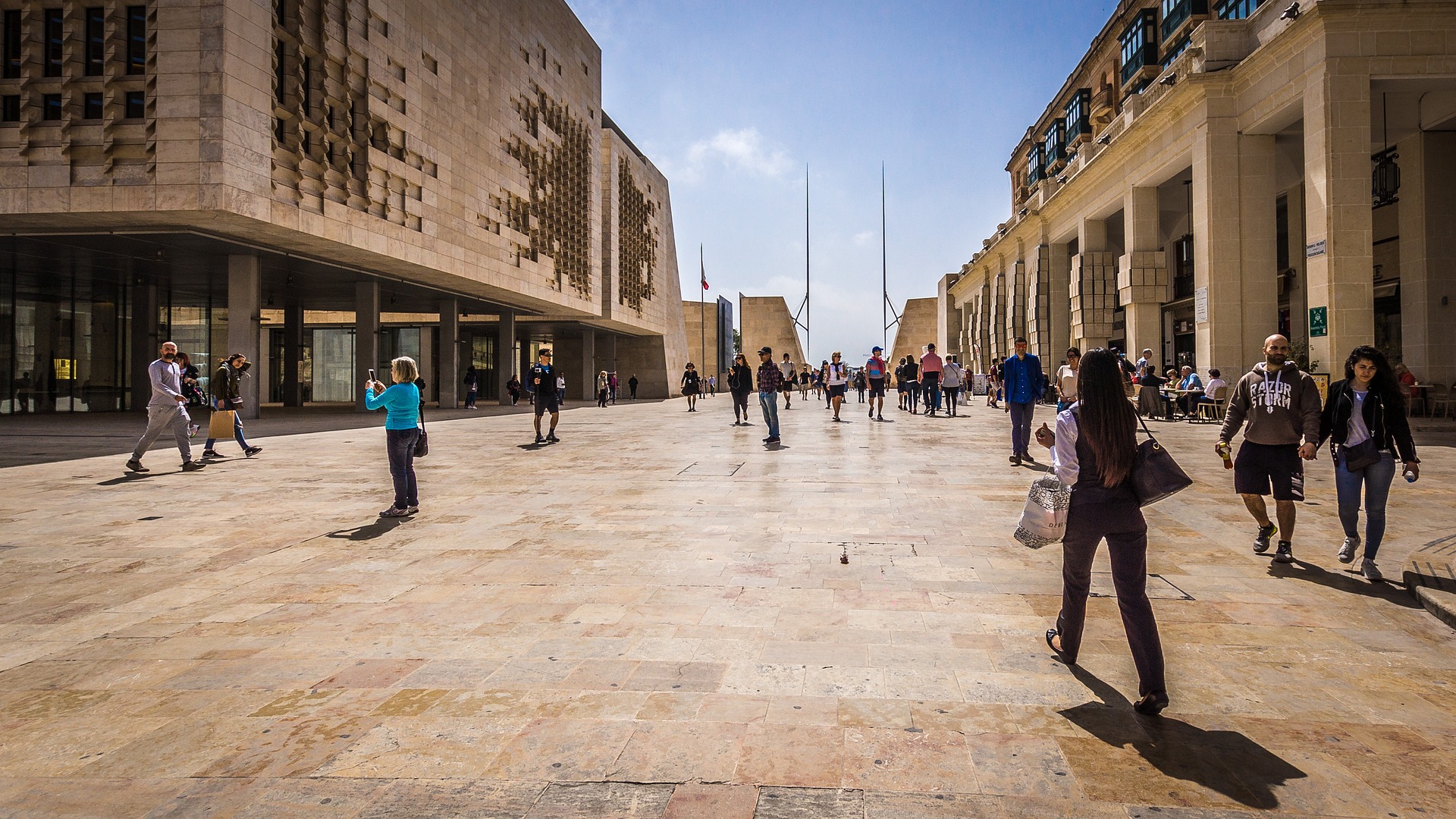
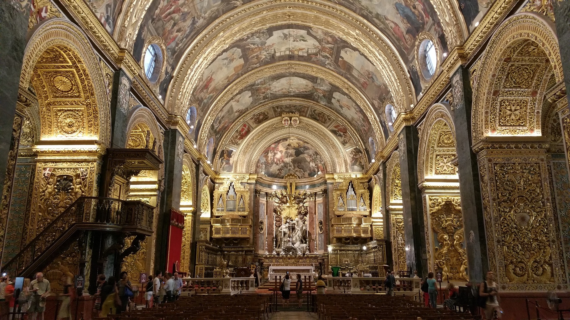
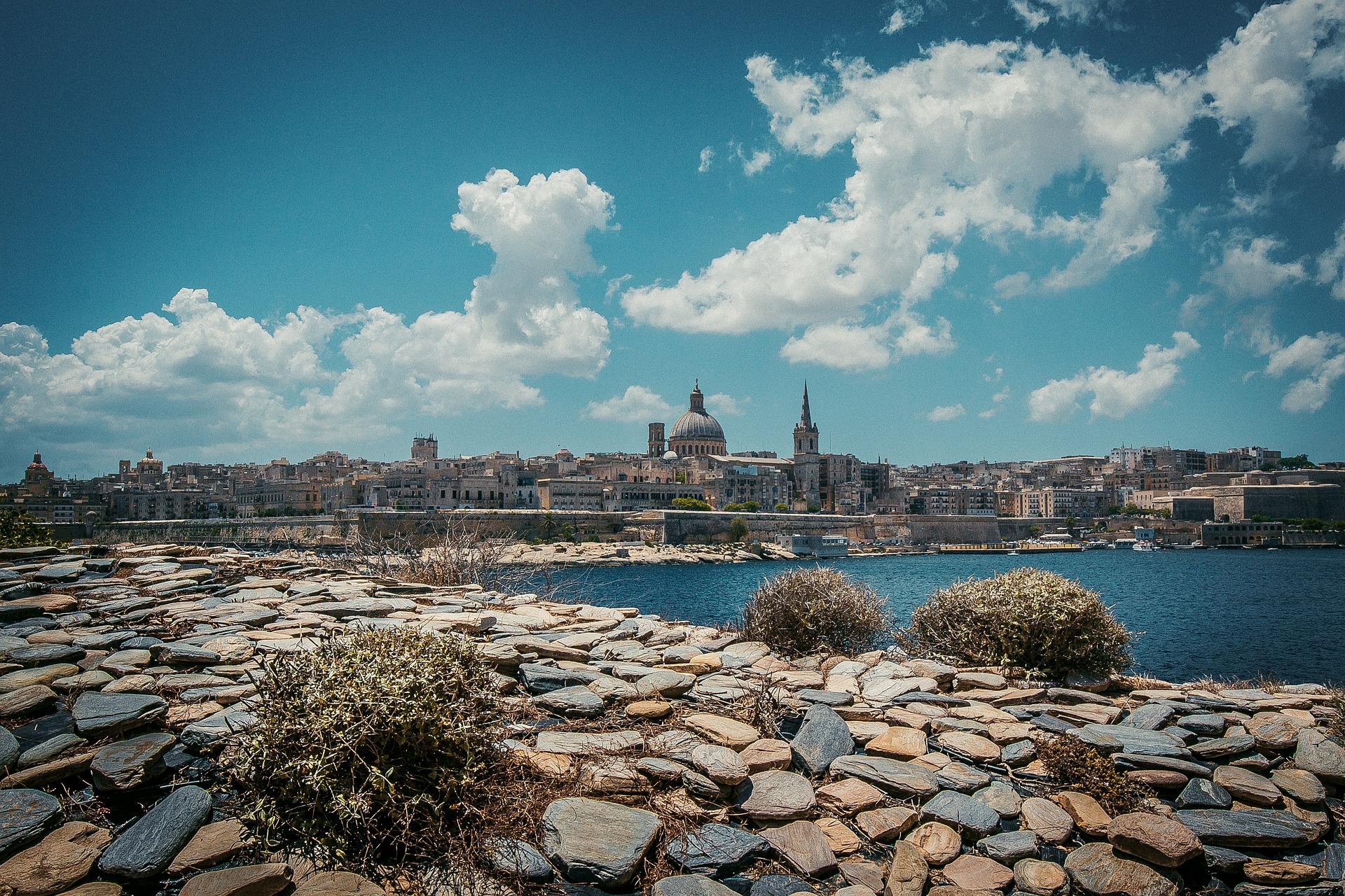
About Valletta
Malta's capital, the minicity of Valletta, has ornate palaces and museums protected by massive fortifications of honey-color limestone. Houses along the narrow streets have overhanging wooden balconies for people-watching from indoors. Generations ago they gave housebound women a window on the world of the street. The main entrance to town is through the City Gate (where all bus routes end), which leads onto Triq Repubblika (Republic Street), the spine of the grid-pattern city and the main shopping street. Triq Mercante (Merchant Street) parallels Repubblika to the east and is also good for strolling. From these two streets, cross streets descend toward the water; some are stepped. Valletta's compactness makes it ideal to explore on foot. City Gate and the upper part of Valletta are experiencing vast redevelopment that includes a new Parliament Building and open-air performance venue. The complex, completed mid-2013, has numerous pedestrian detours in place along with building noise and dust. Before setting out along Republic Street, stop at the tourist information office on Merchant Street for maps and brochures.
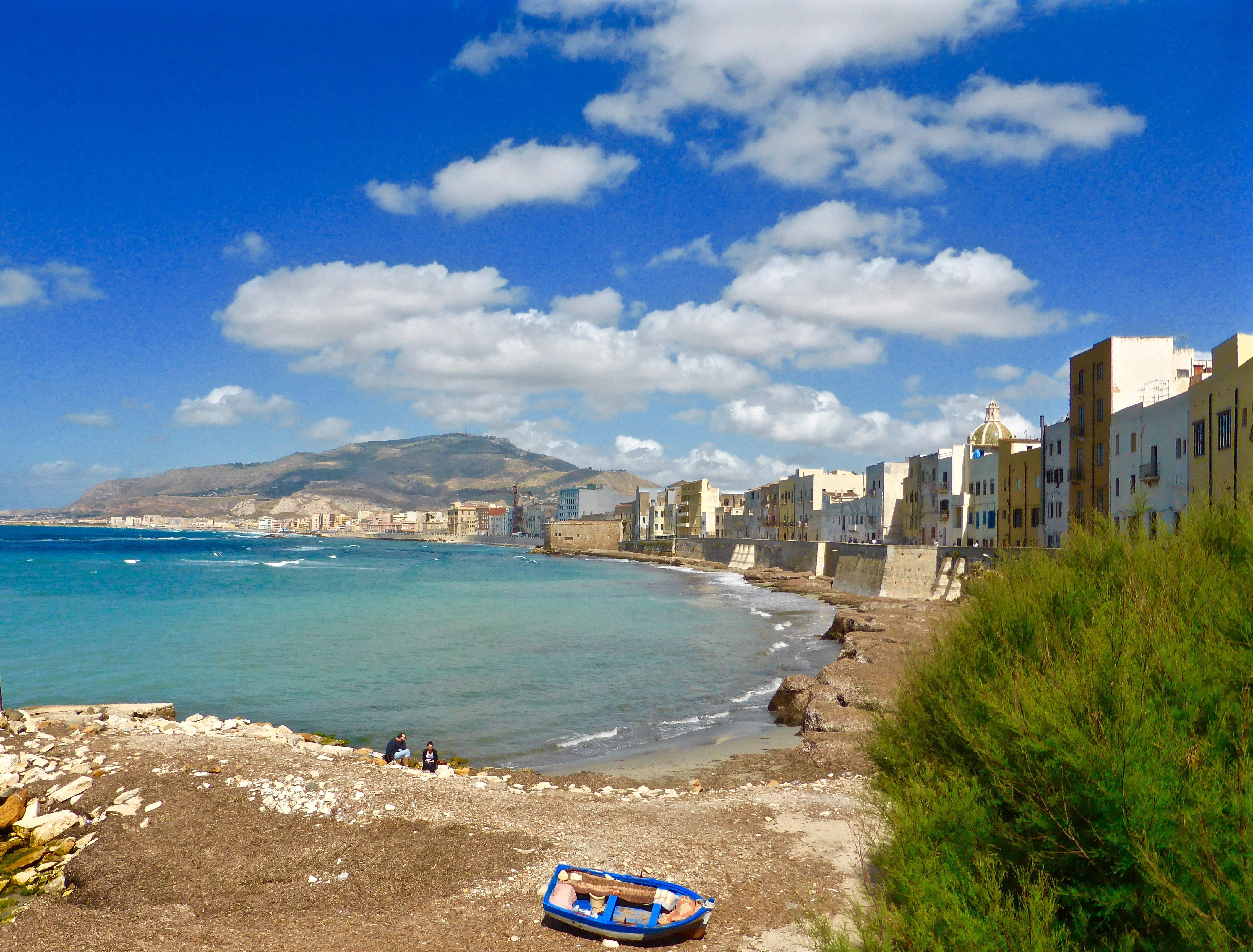
About Trapani, Sicily
Trapani, the most important town on Sicily’s west coast, lies below the headland of Mount Erice and offers stunning views of the Egadi Islands on a clear day. Trapani’s Old District occupies a scimitarshaped promontory between the open sea on the north and the salt marshes to the south. The ancient industry of extracting salt from the marshes has recently been revived, and it is documented in the Museo delle Saline. In addition to the salt marshes,Trapani’s other interesting environs include the beautiful little hill town of Erice, the promontory of Capo San Vito stretching north beyond the splendid headland of Monte Cofano, the lovely island of Motya and the town of Marsala. Trips farther afield will take you to the magnificent site of Segesta or the Egadi Islands, reached by boat or hydrofoil from Trapani Port.
About Naples
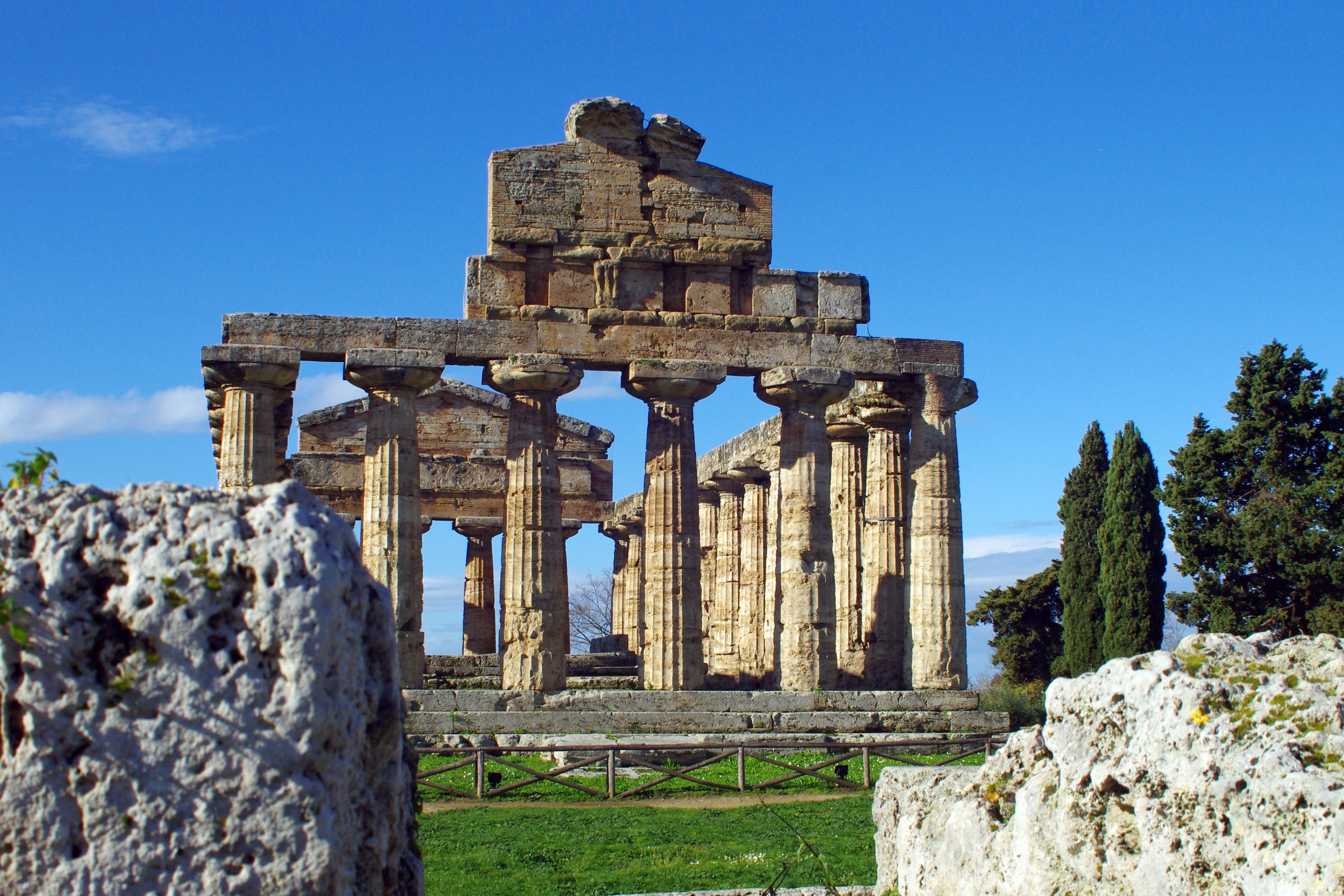
Naples, in the Campania region, is Italy's third largest city. Its claim to fame is the spectacular location along one of the world's most splendid bays, backed by the perfect cone of Mount Vesuvius. In addition to its beautiful setting, Naples' surprises with other outstanding attractions such as the Royal Palace, San Carlos Opera House, the impressive National Archaeological Museum and the Castel Nuovo, dating from the 13th-century. The city's central area is best explored on foot. Chaotic traffic conditions make driving around the city a very frustrating experience. Naples provides a convenient starting point for trips to such favored destinations as Pompeii, Herculaneum and Mount Vesuvius. The Isle of Capri can be reached via a 45-minute hydrofoil service. The region of Campania was home to Greeks settlers some 300 years before Rome was founded. Pompeii, too, was a Greek town before being conquered by the Romans during the 5th century BC. It was under the Romans that Pompeii flourished and grew prosperous. When Mount Vesuvius erupted in 79 AD, the population of 20,000 was wiped out, but dozens of buildings were preserved under layers of cinder more than 20 feet deep. The most important finds from Pompeii are displayed in Naples' National Archaeological Museum. A visit here will no doubt enhance a visit to ancient Pompeii.

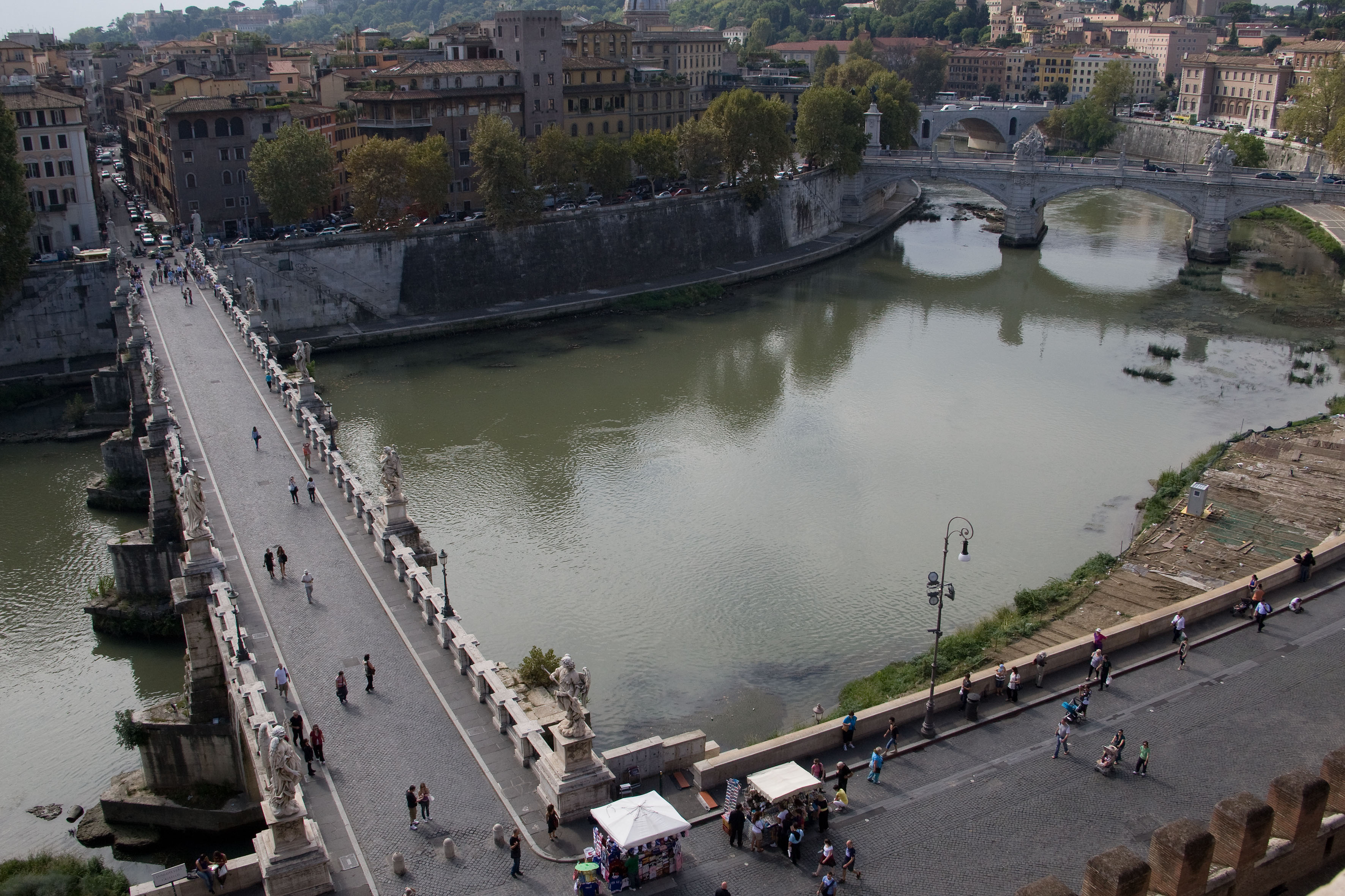
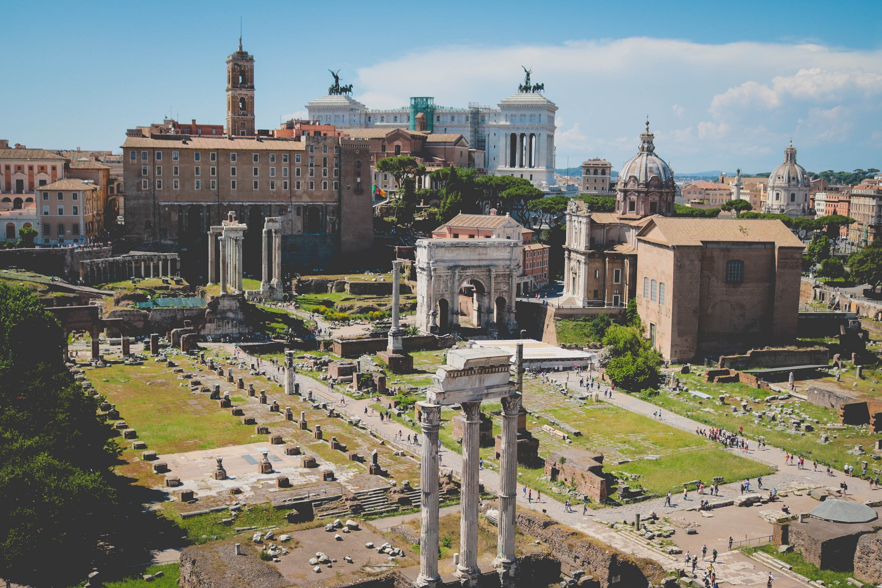
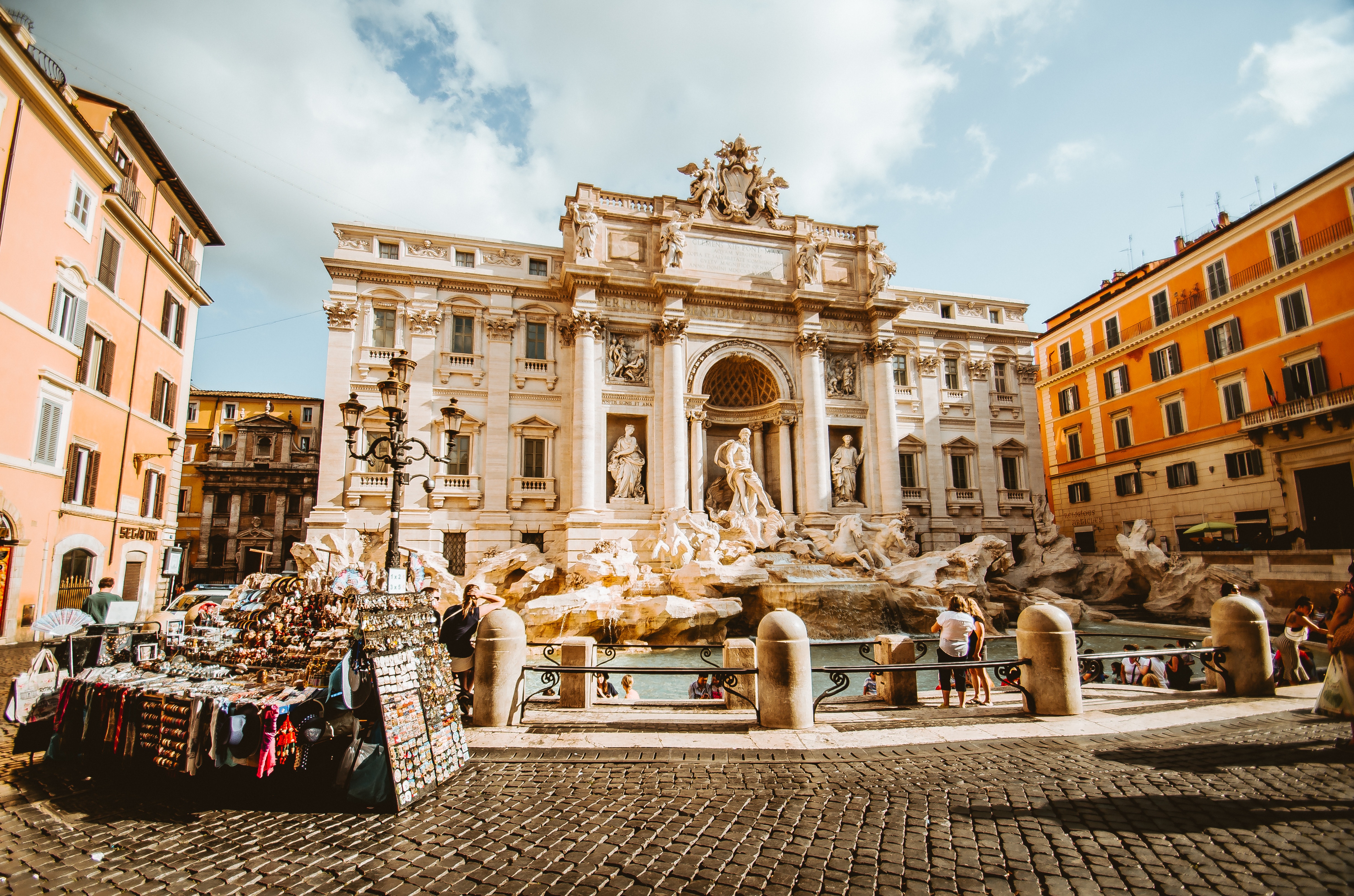
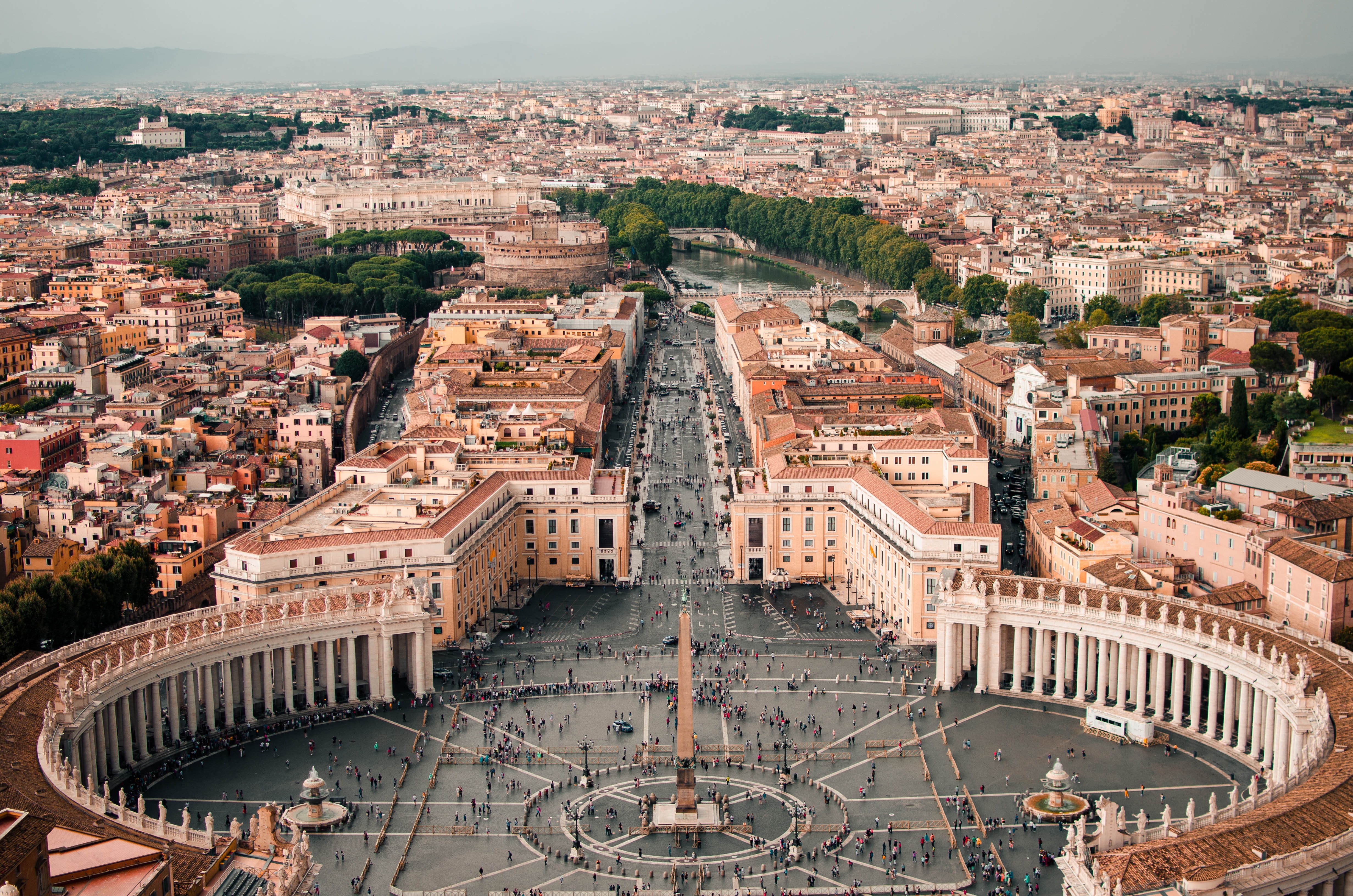
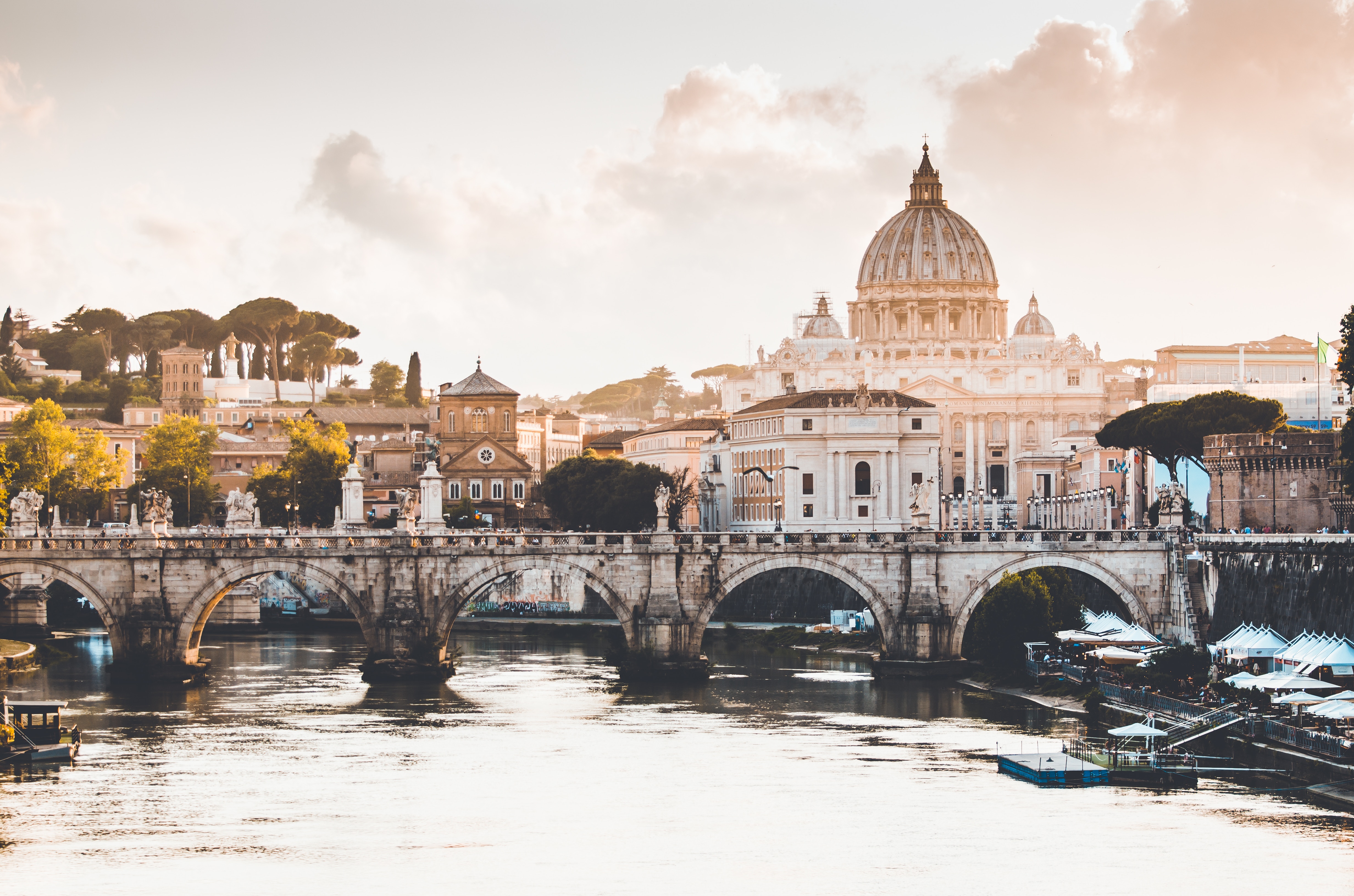
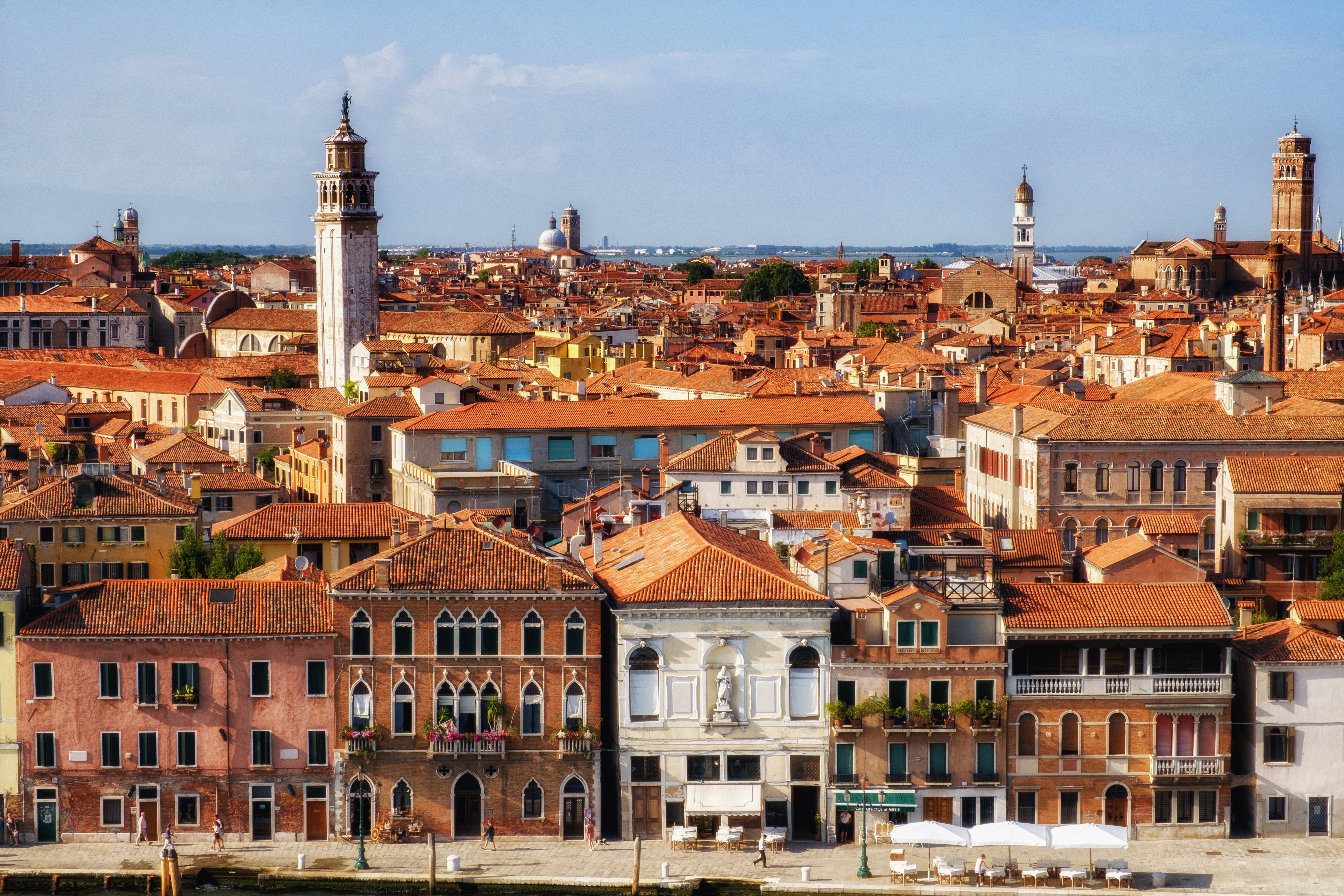
About Civitavecchia
Italy's vibrant capital lives in the present, but no other city on earth evokes its past so powerfully. For over 2,500 years, emperors, popes, artists, and common citizens have left their mark here. Archaeological remains from ancient Rome, art-stuffed churches, and the treasures of Vatican City vie for your attention, but Rome is also a wonderful place to practice the Italian-perfected il dolce far niente, the sweet art of idleness. Your most memorable experiences may include sitting at a caffè in the Campo de' Fiori or strolling in a beguiling piazza.
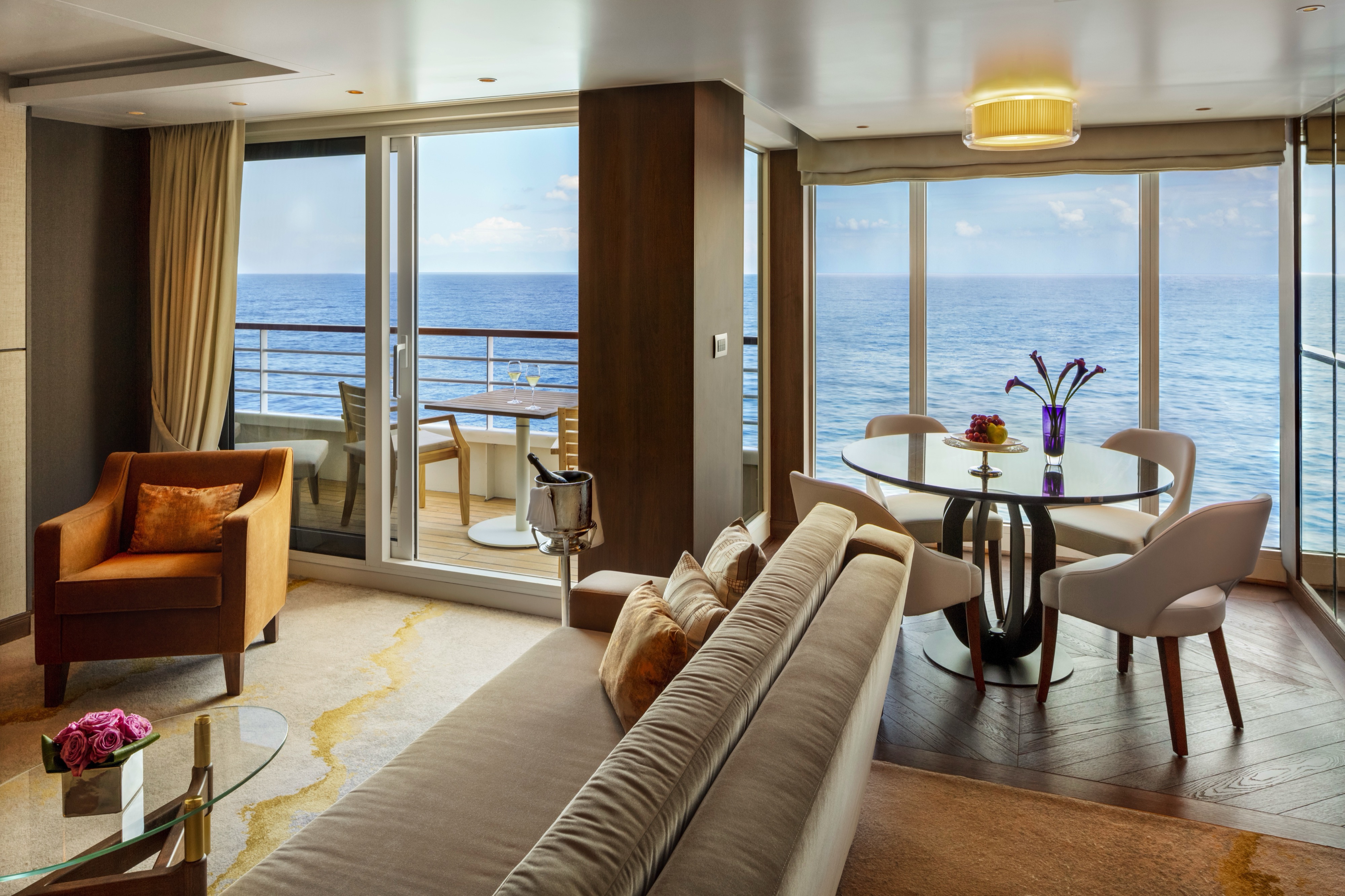
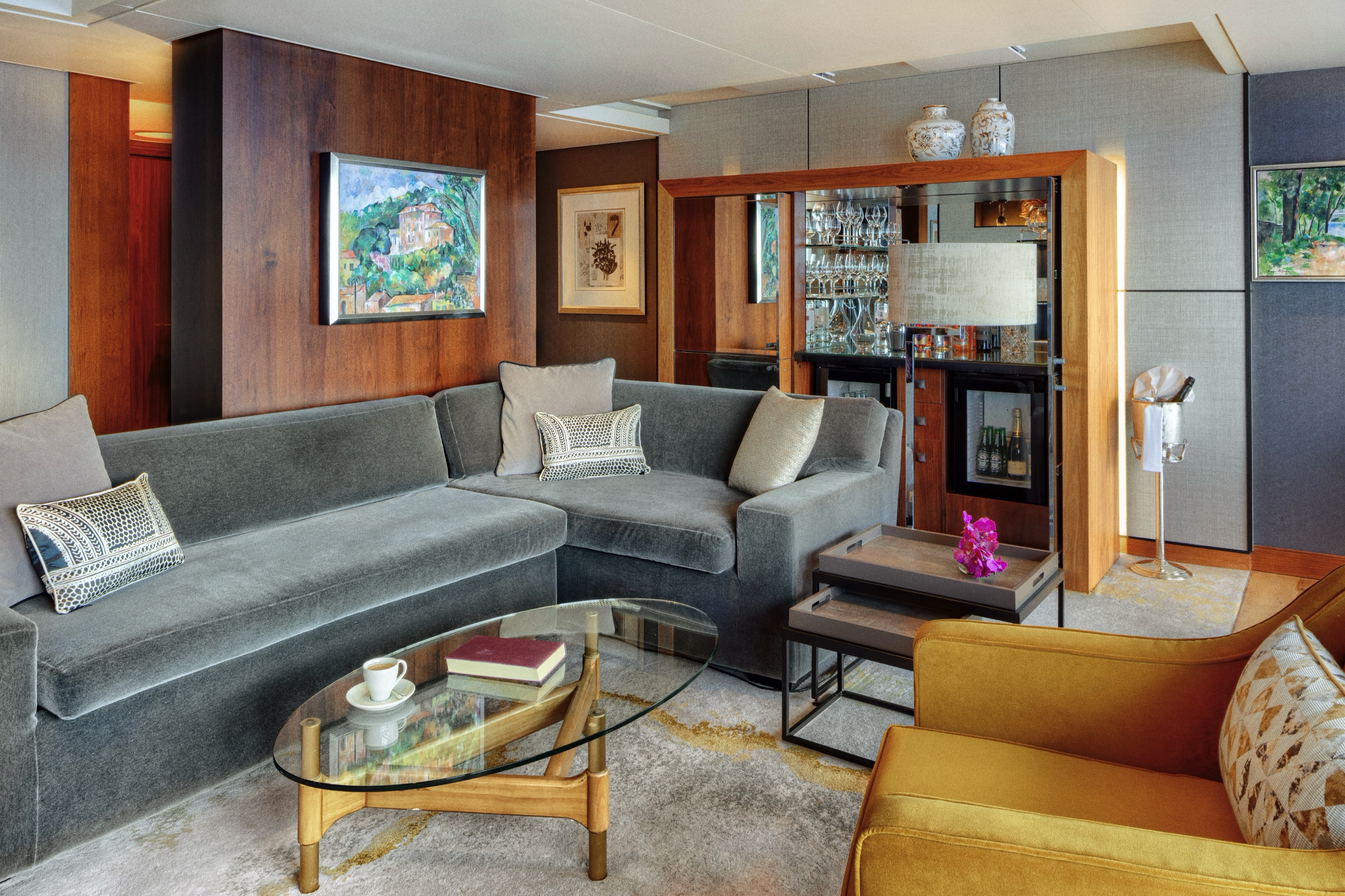
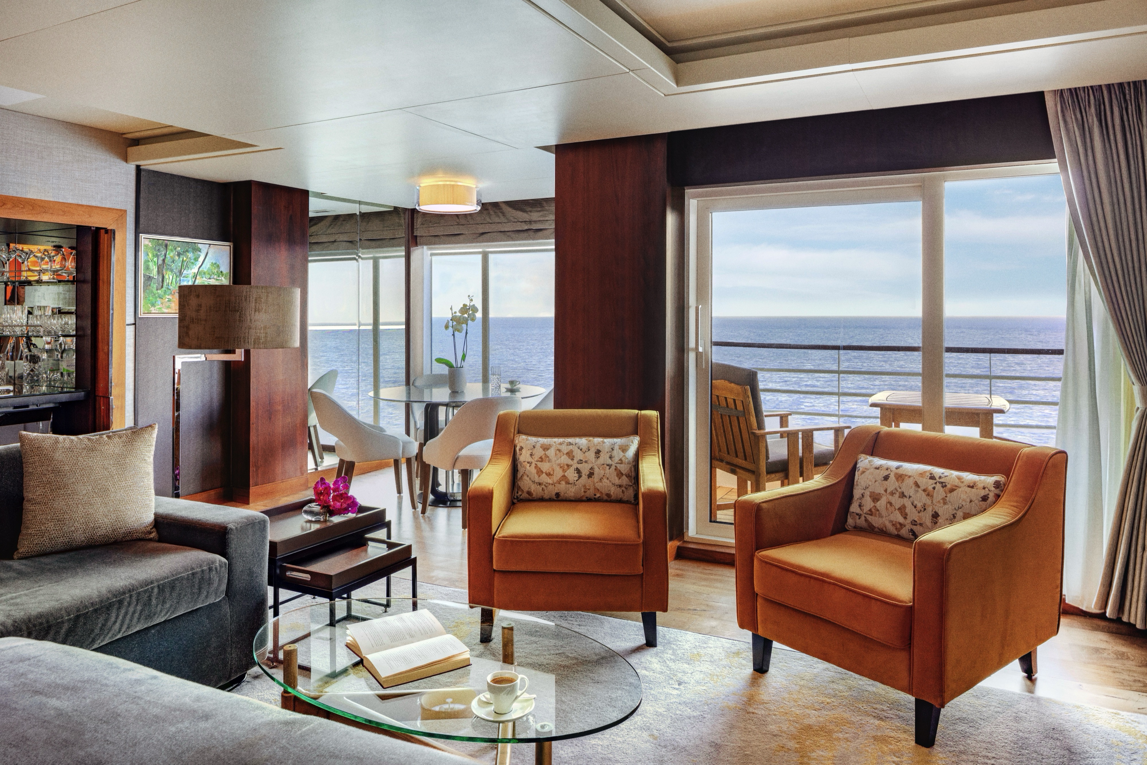
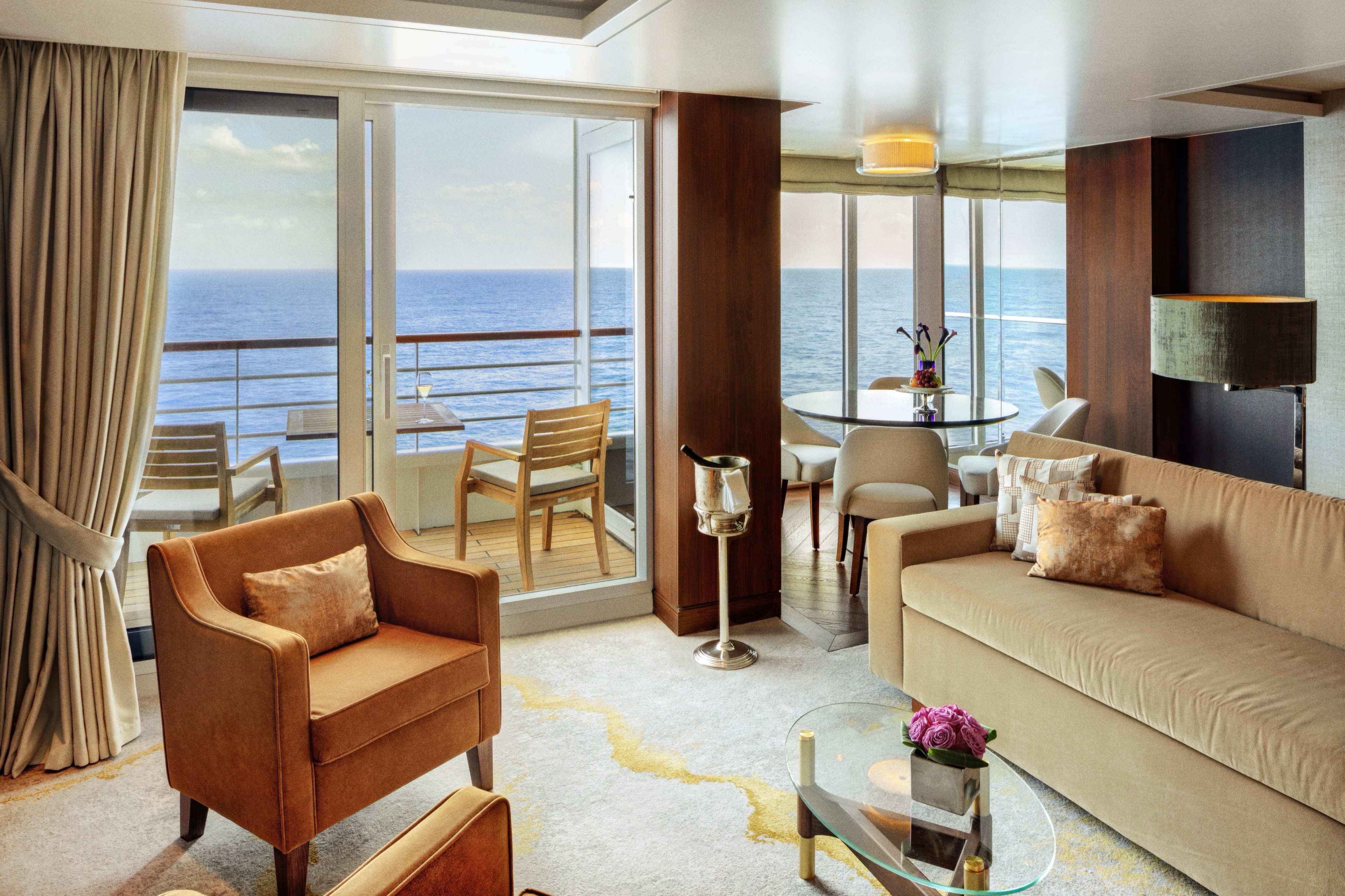
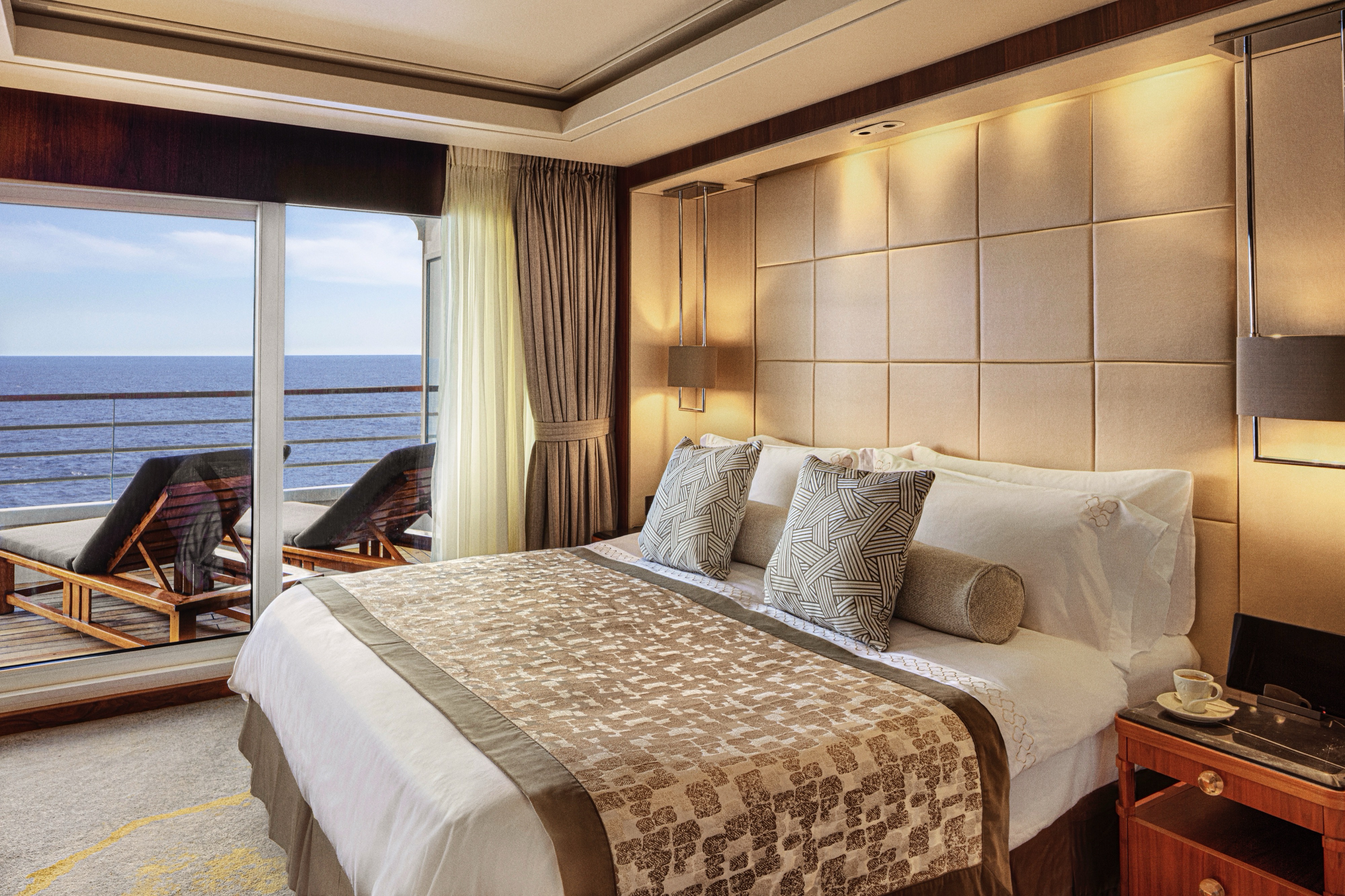
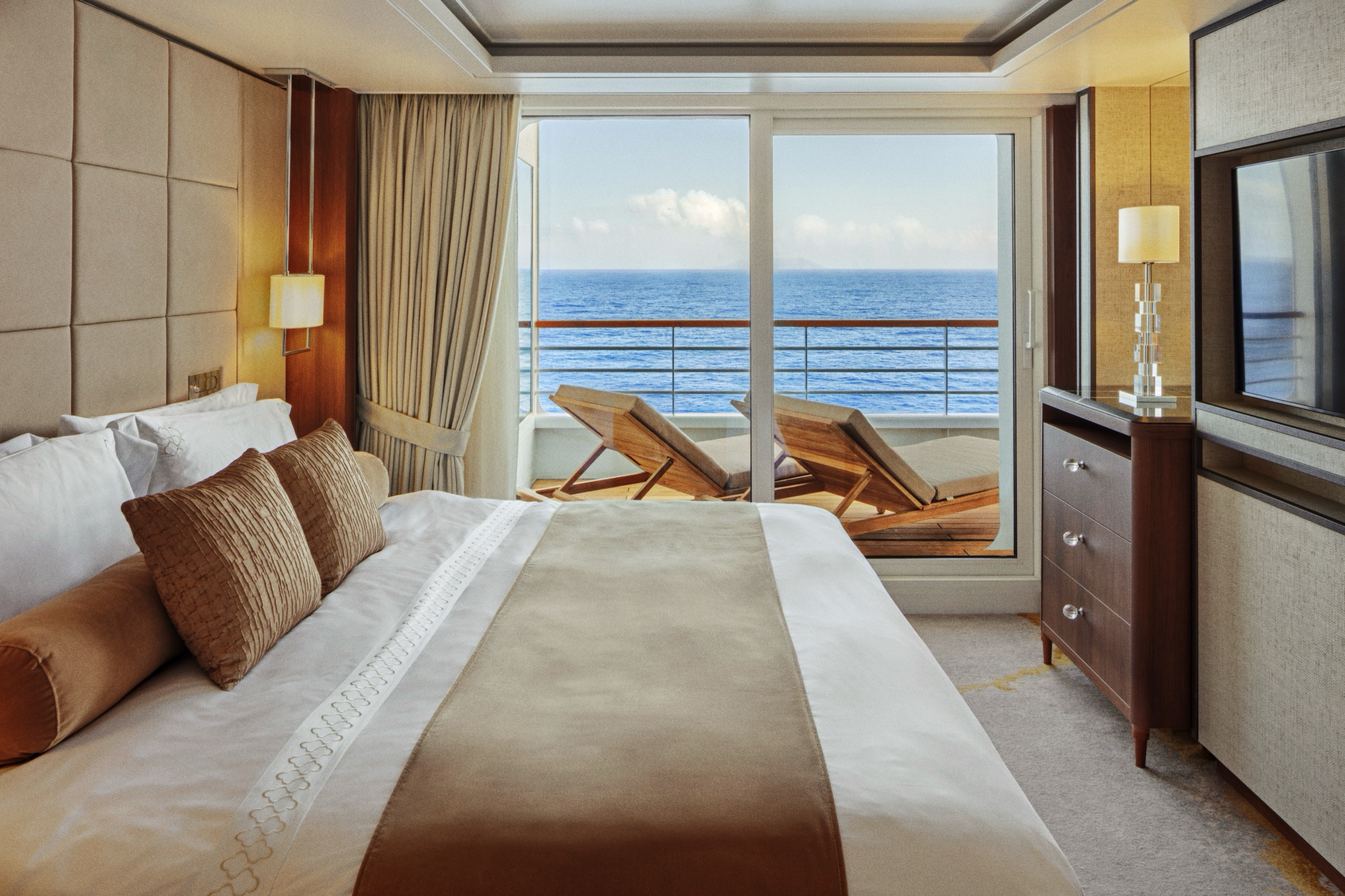
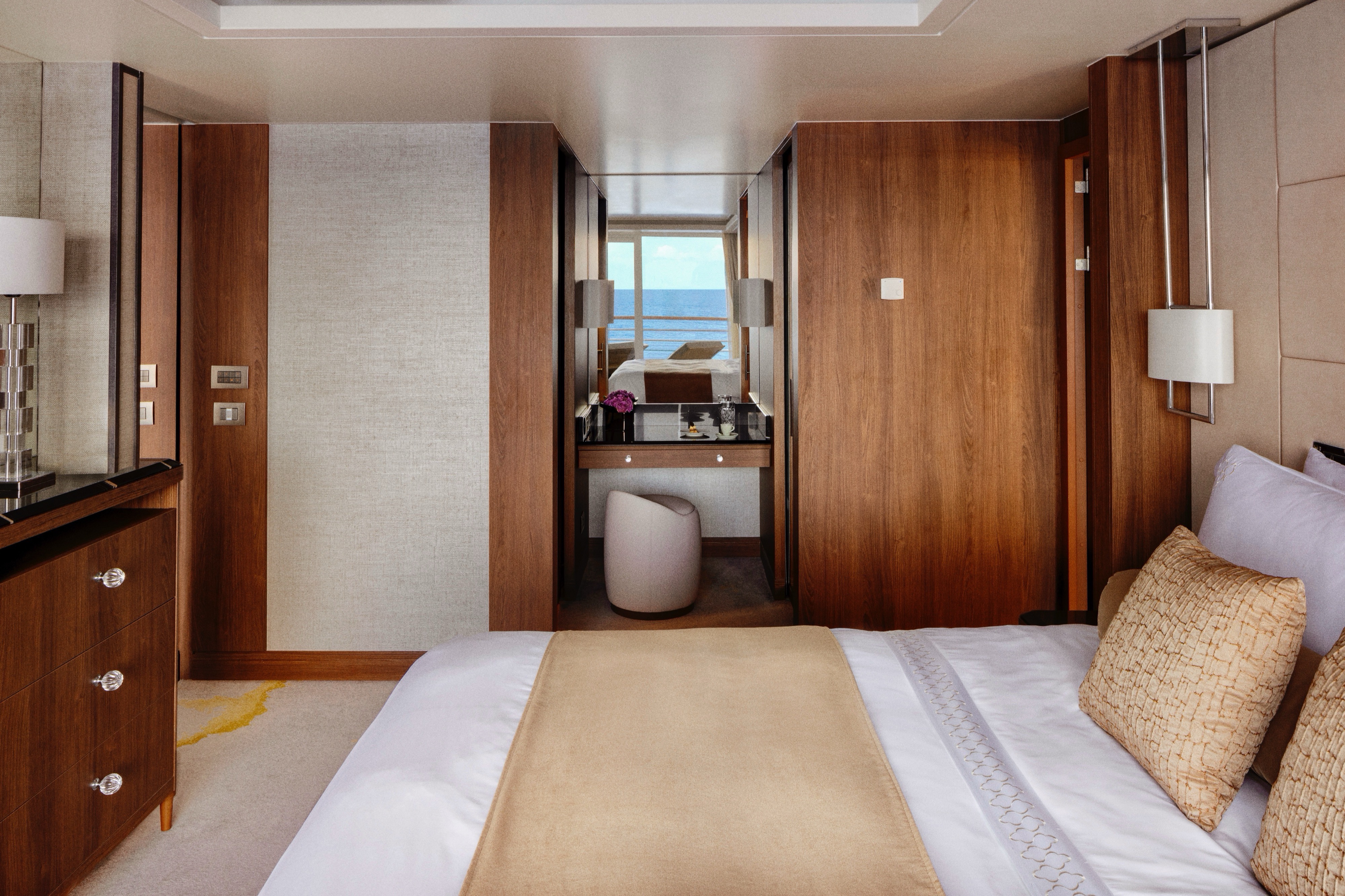
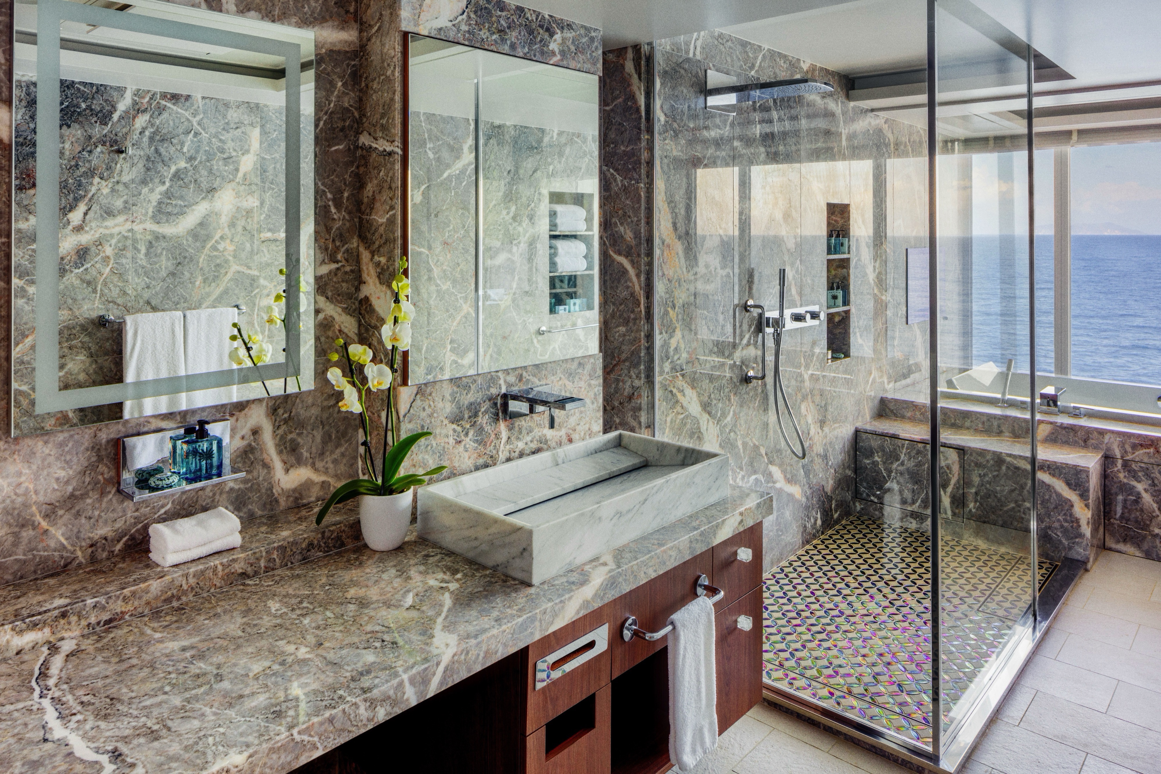
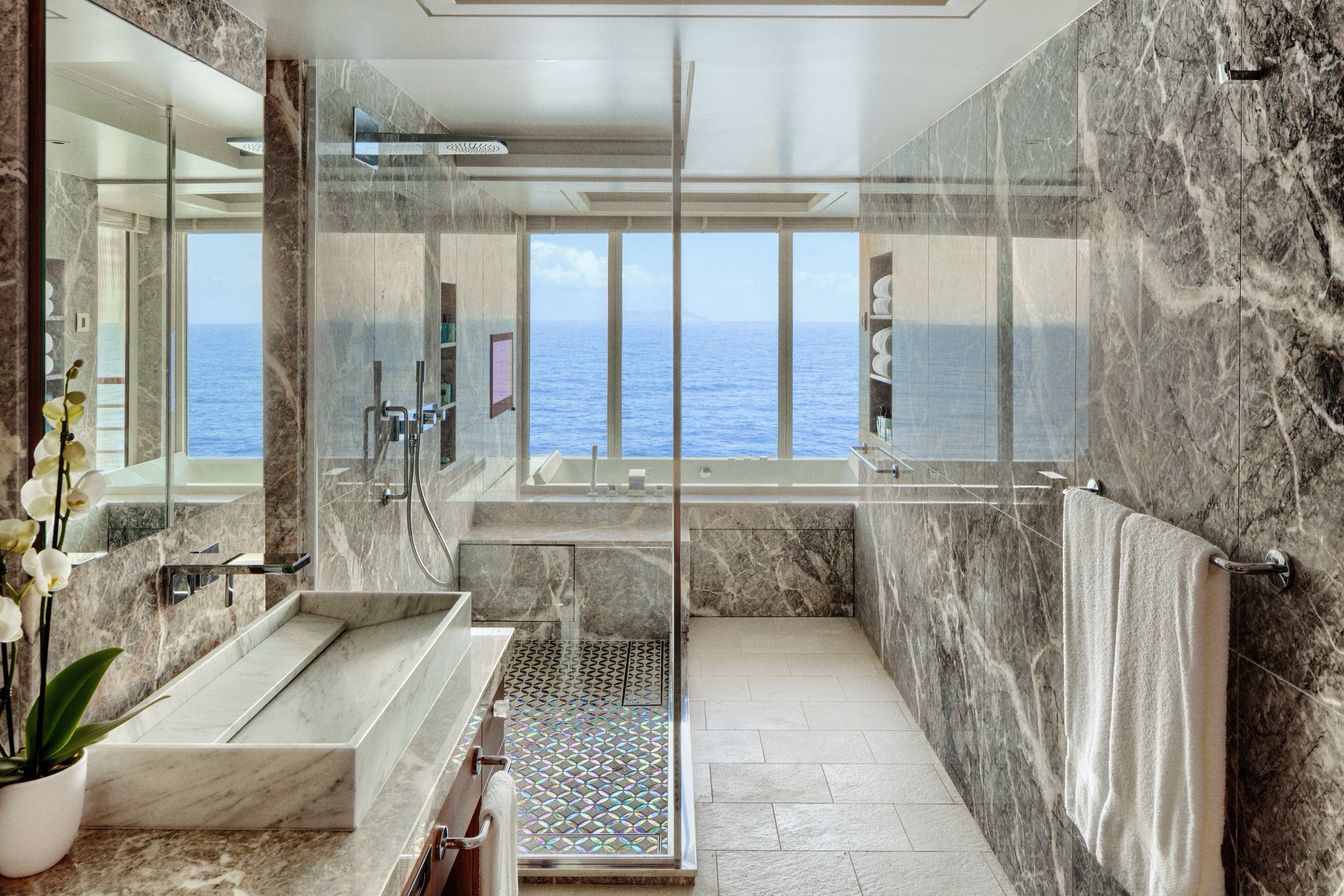
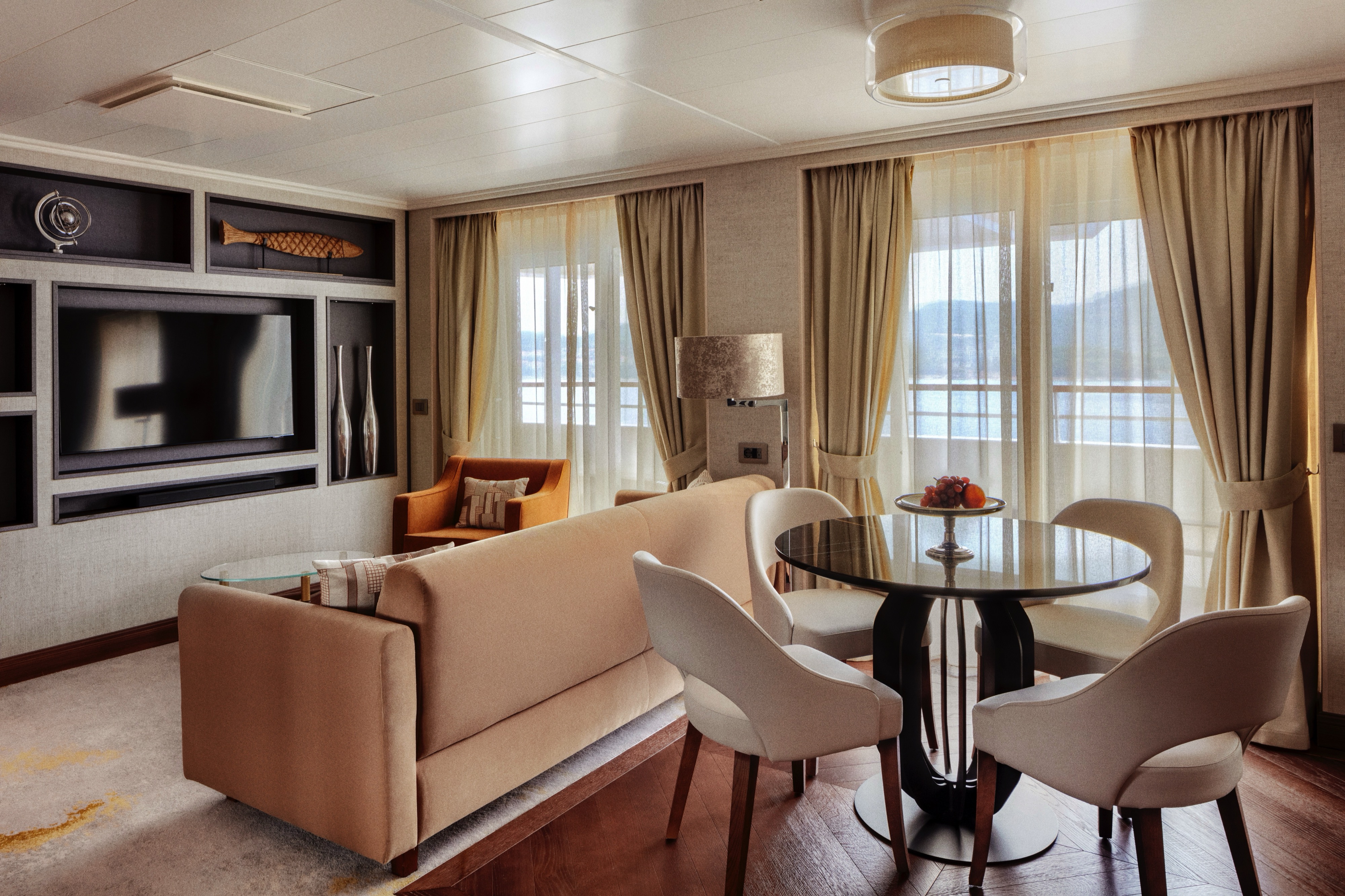
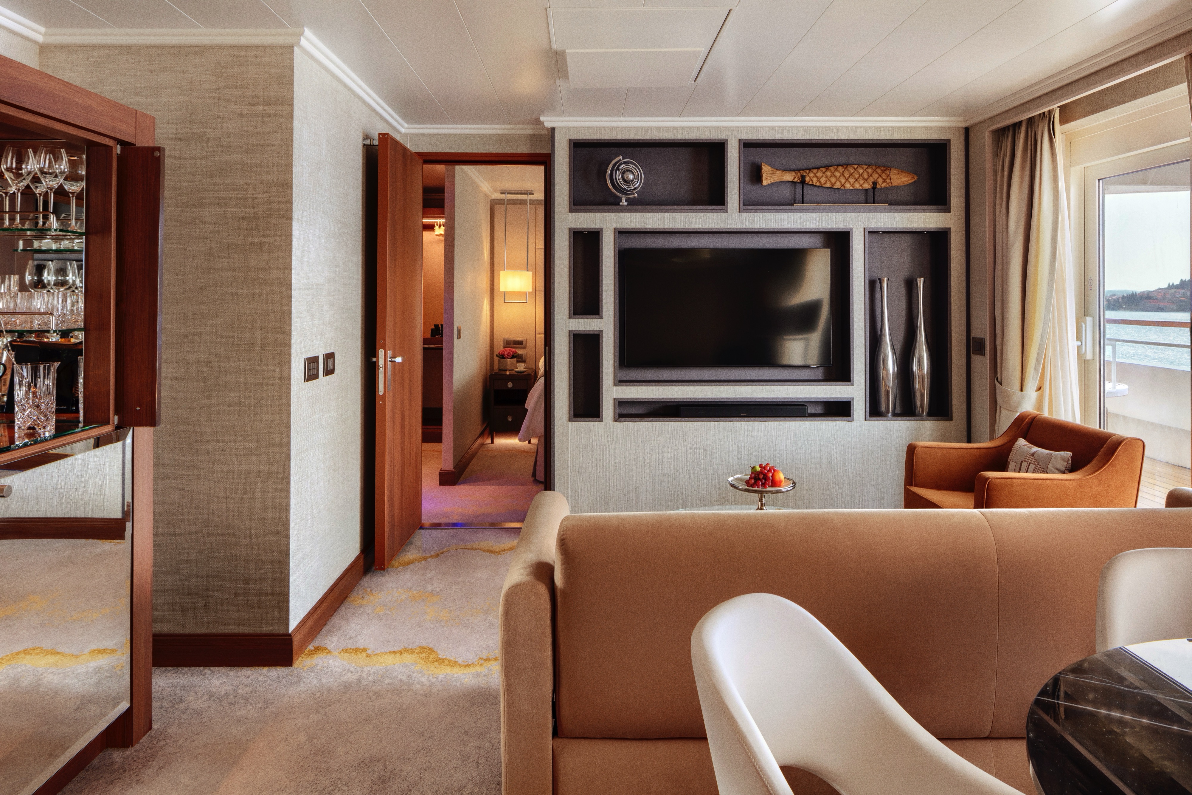
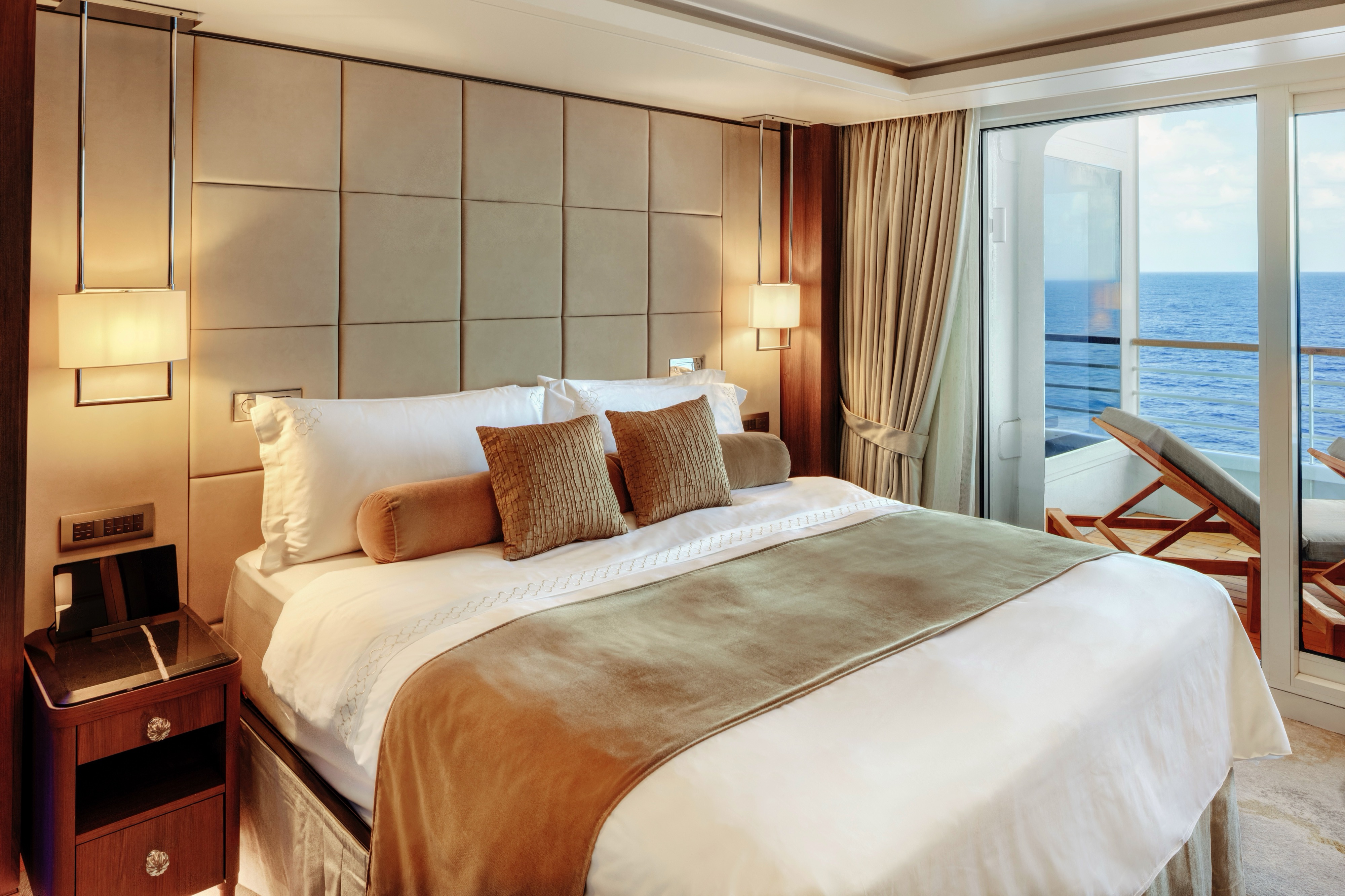
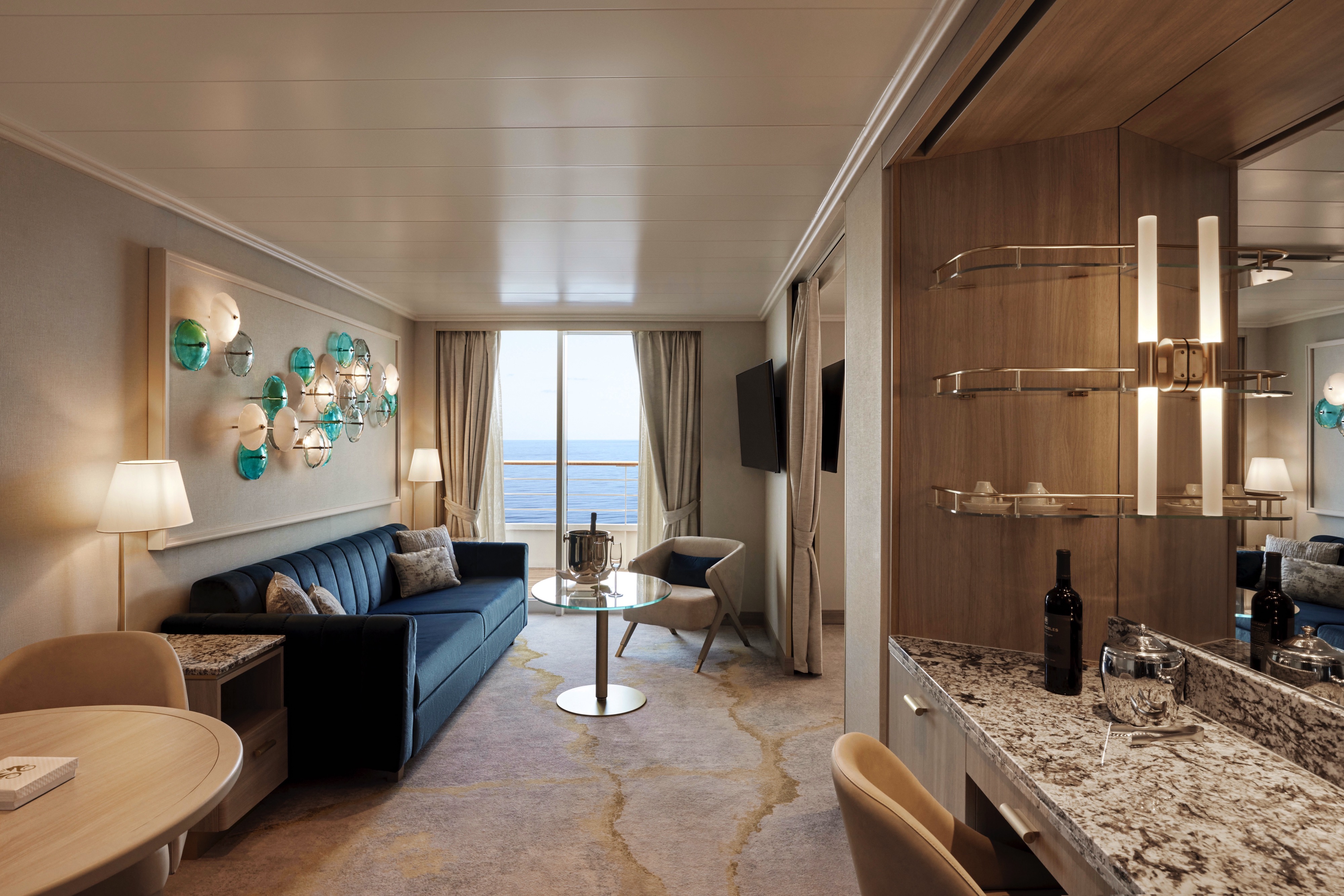
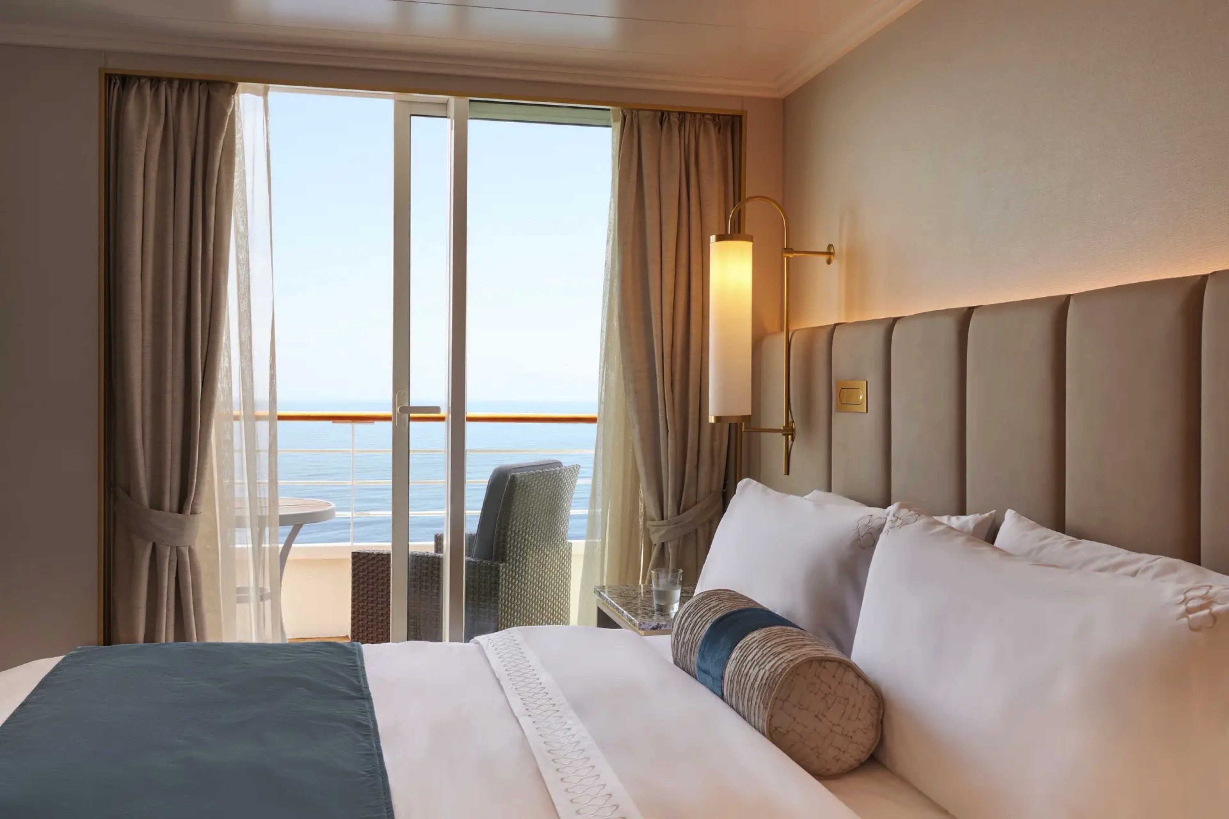
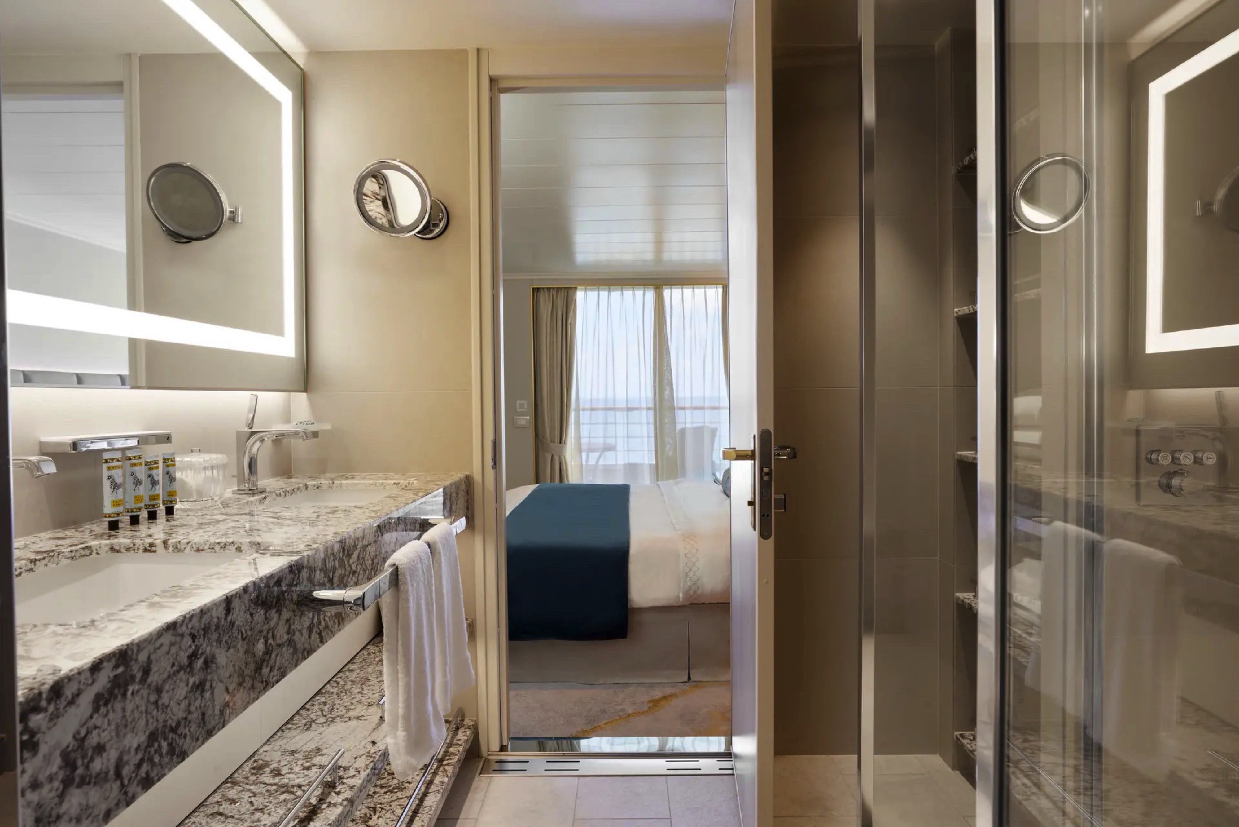
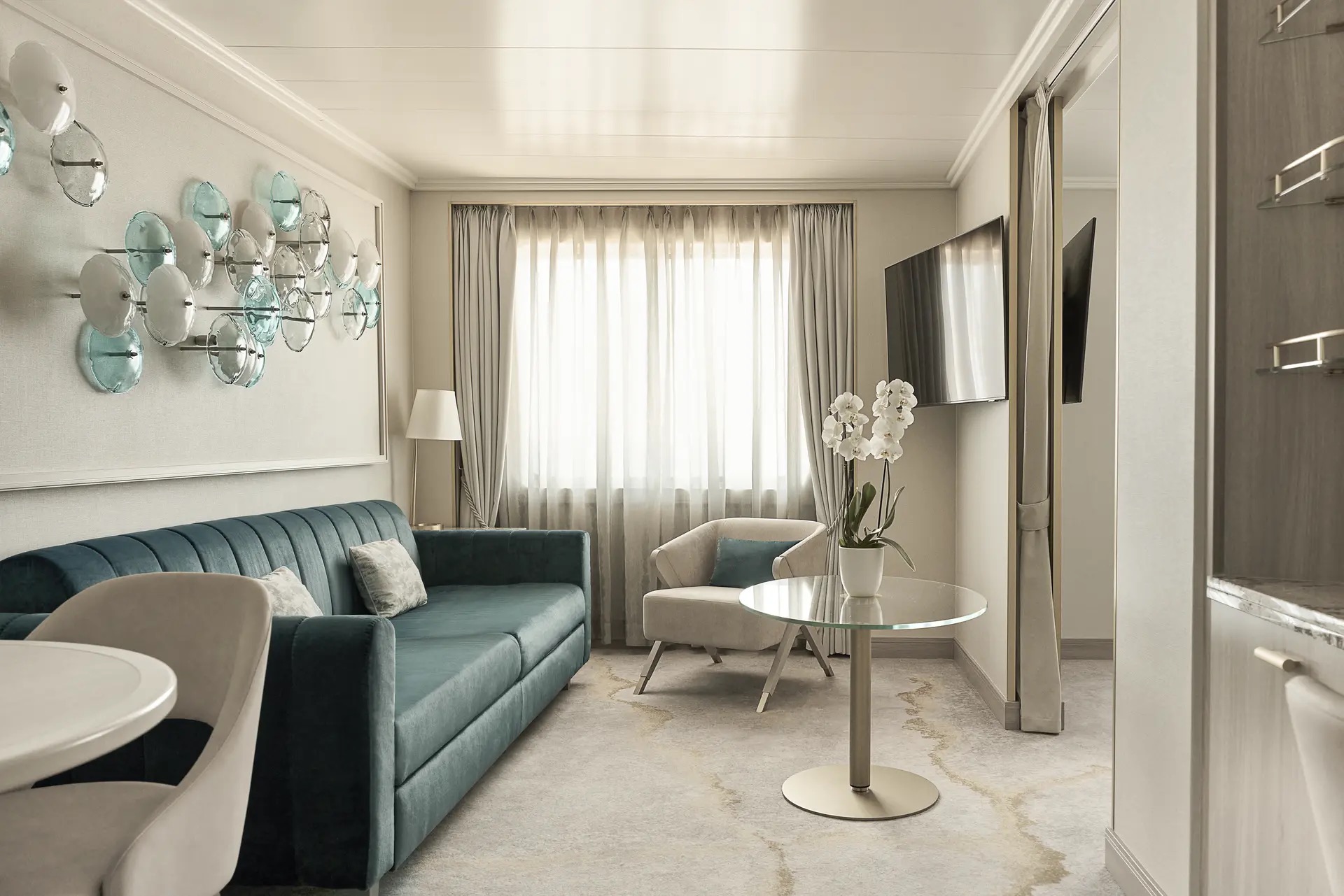
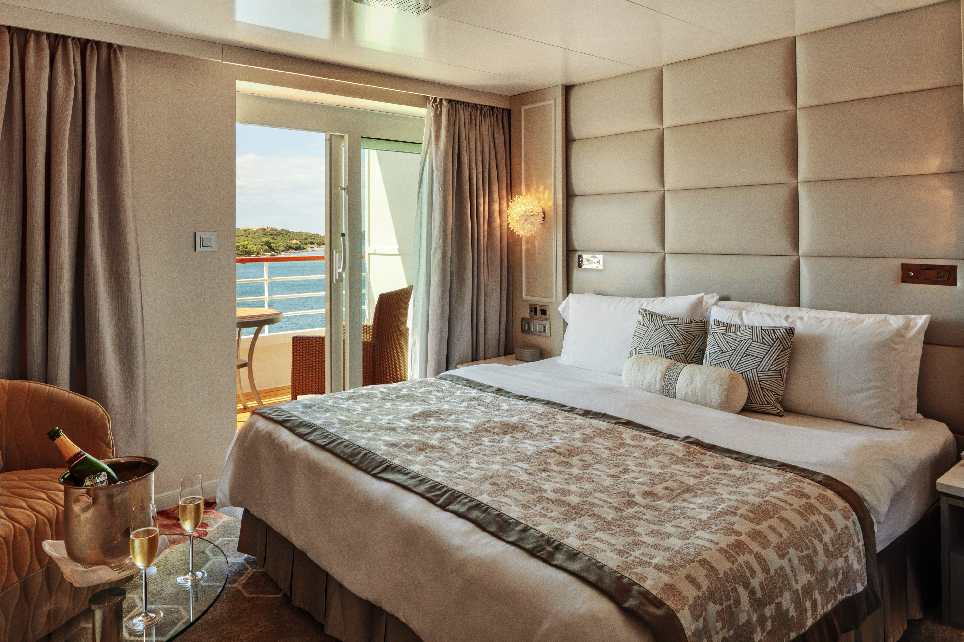
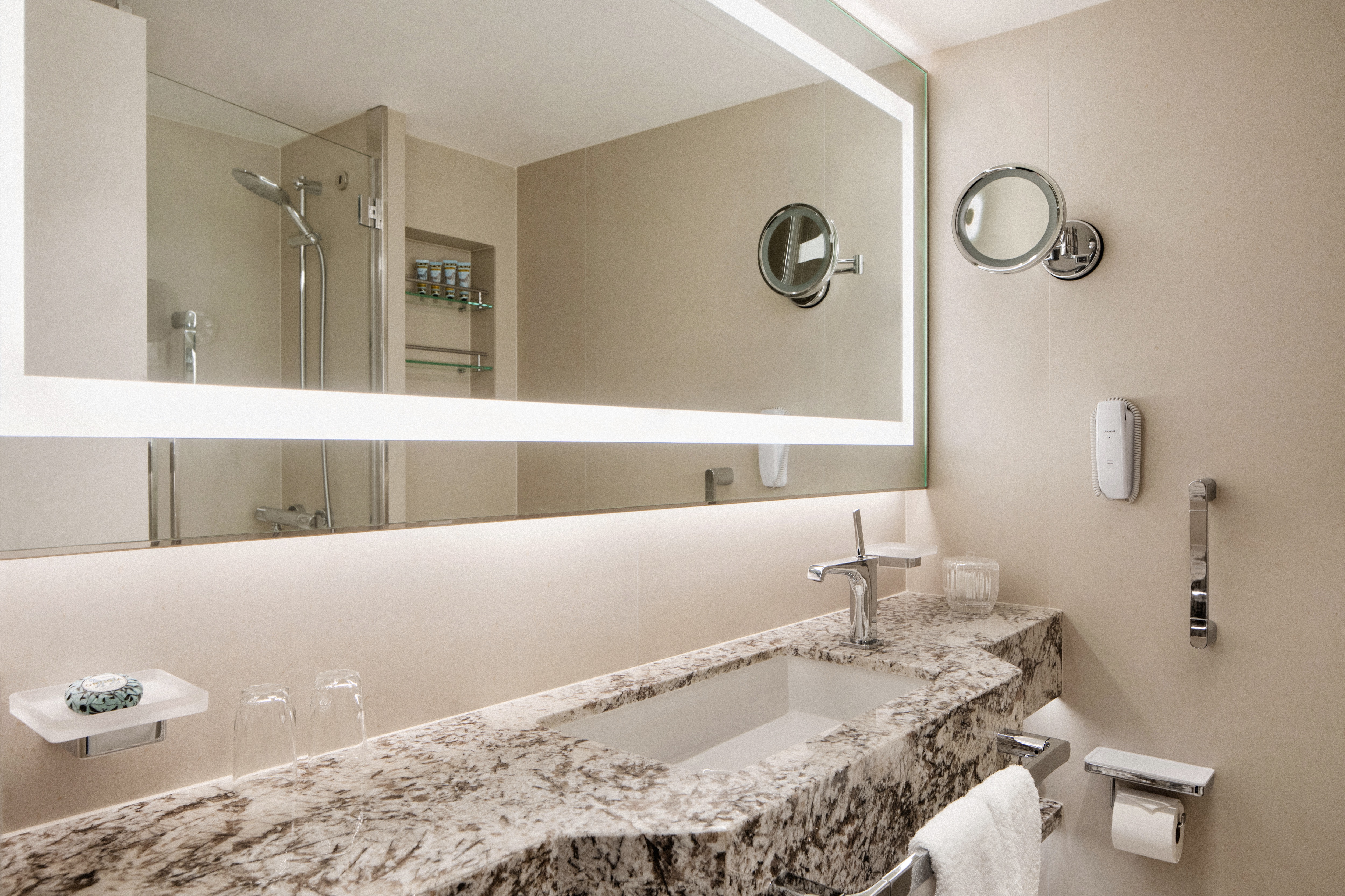
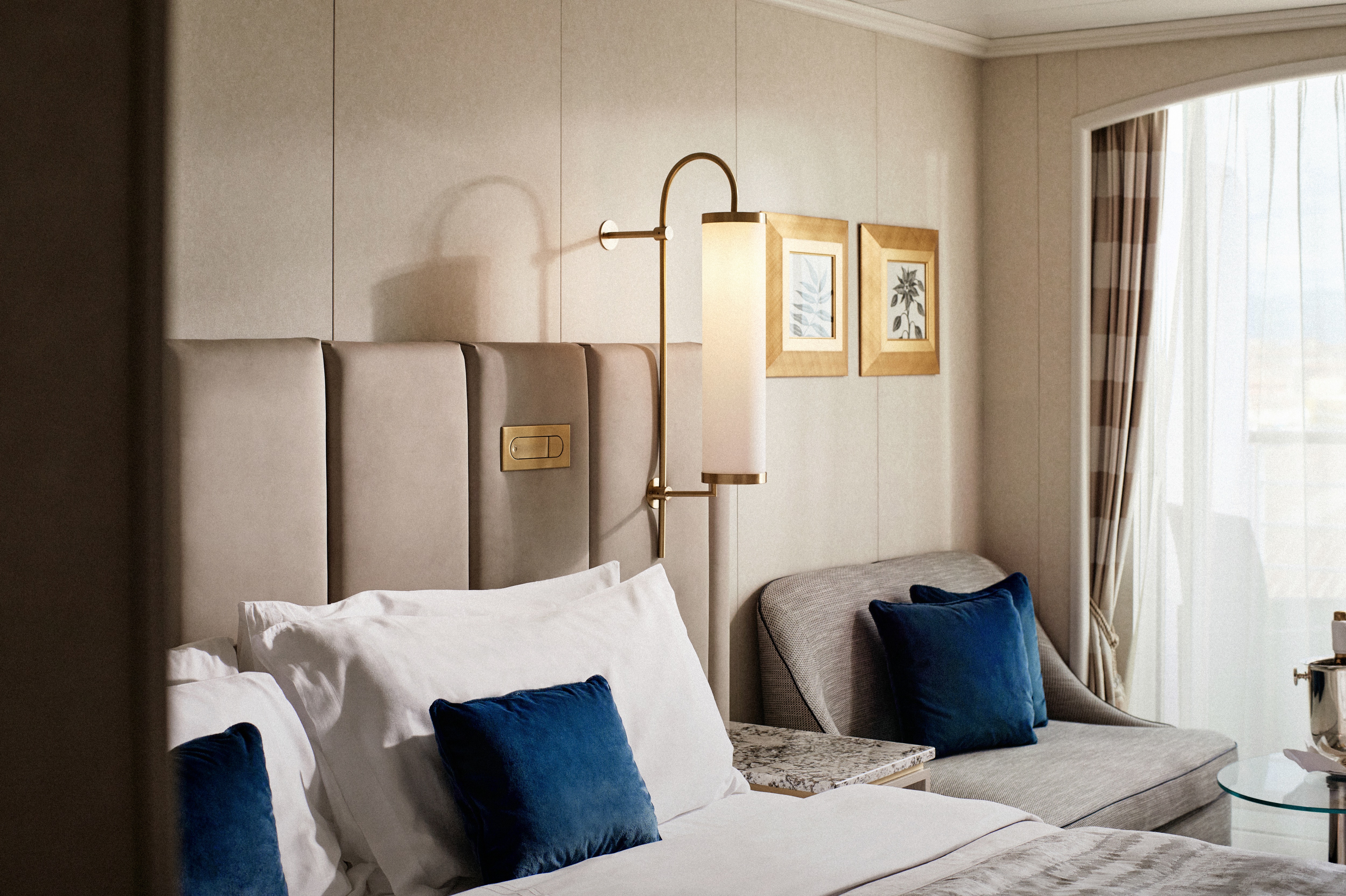
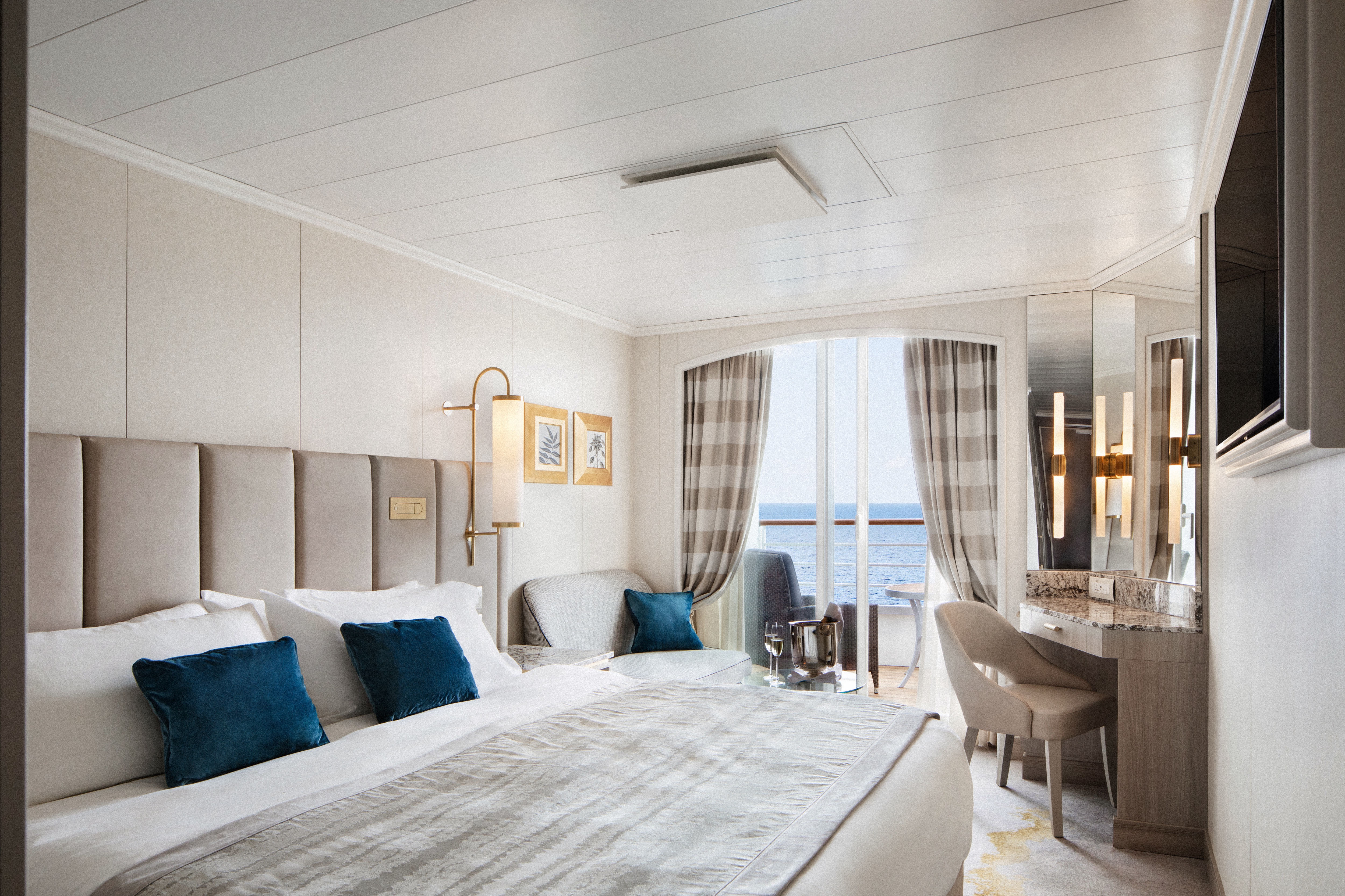
Our largest suite, available in 2023 or 2020 designs, offers two walk-in wardrobes, separate living and dining areas with panoramic ocean views, a study, and a custom built-in bar. There is also a Jacuzzi bathtub with ocean views, separate shower, bidet, and guest bathroom. Enjoy unlimited dining at specialty restaurants, unlimited laundry services, and more.
Details
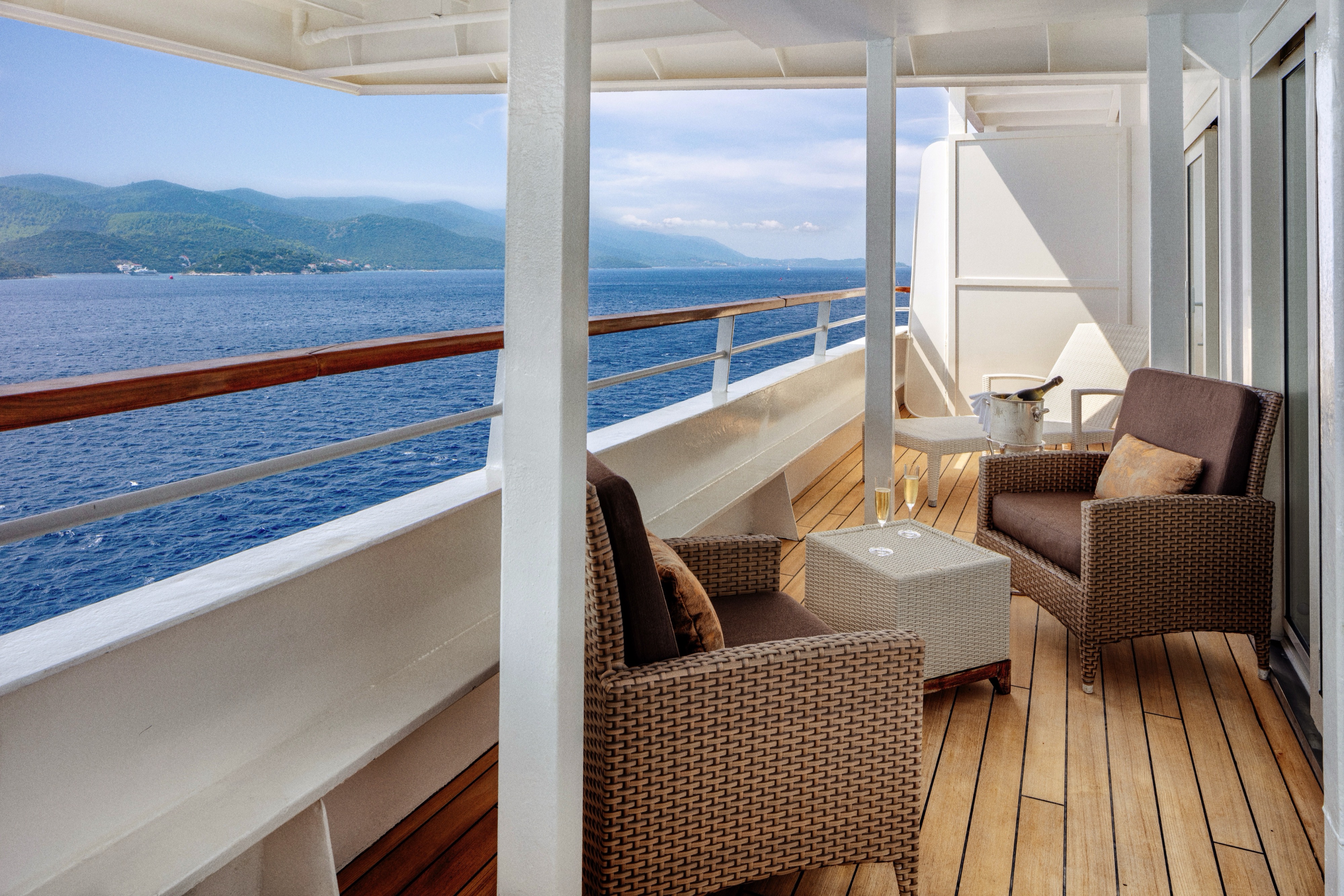
- Large private veranda with teak furniture
- Spacious living room with TV, custom wool carpets, walnut floors, cabinetry and Swarovski® chandelier
- Dining area with panoramic ocean views
- Separate study
- Custom built-in bar
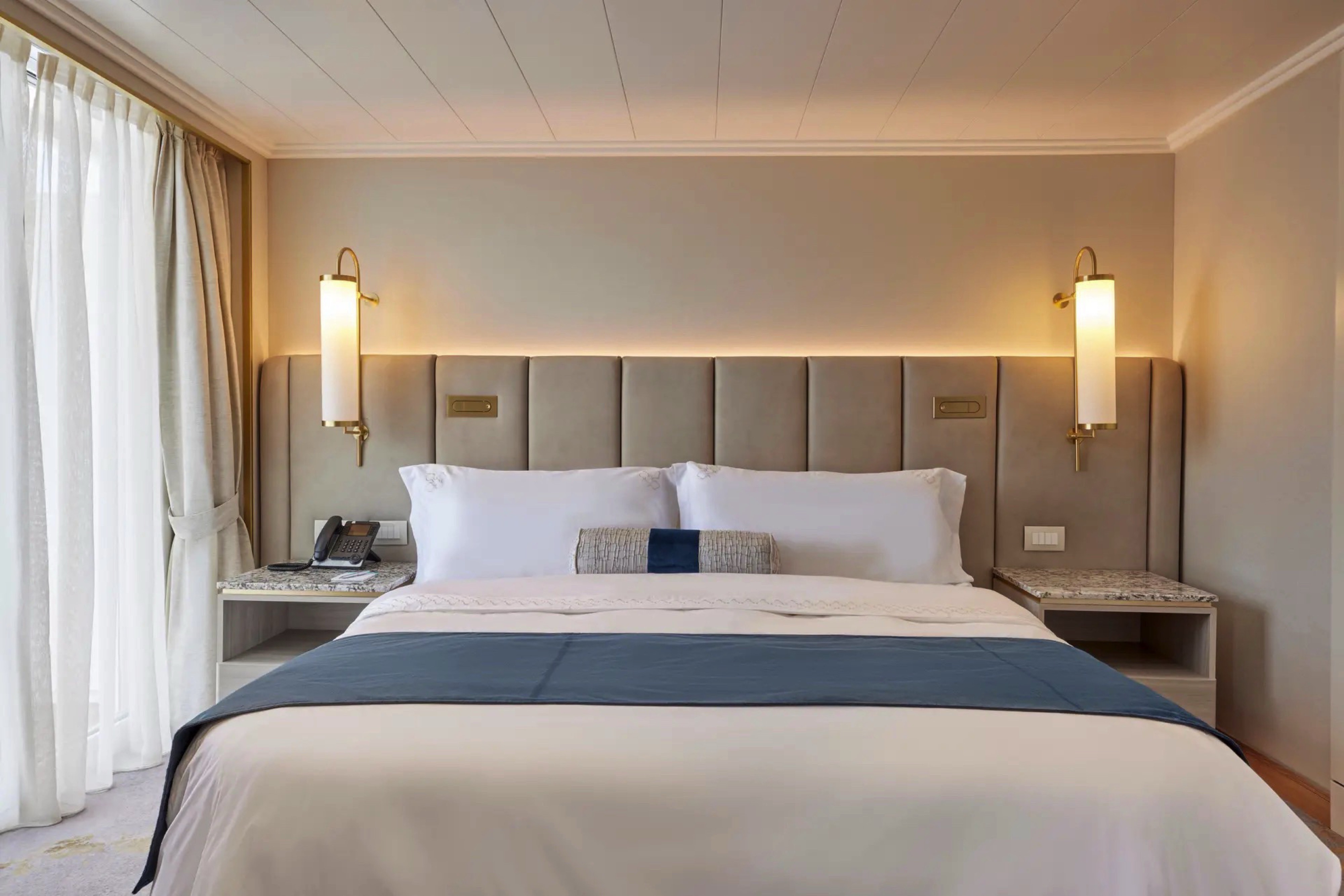
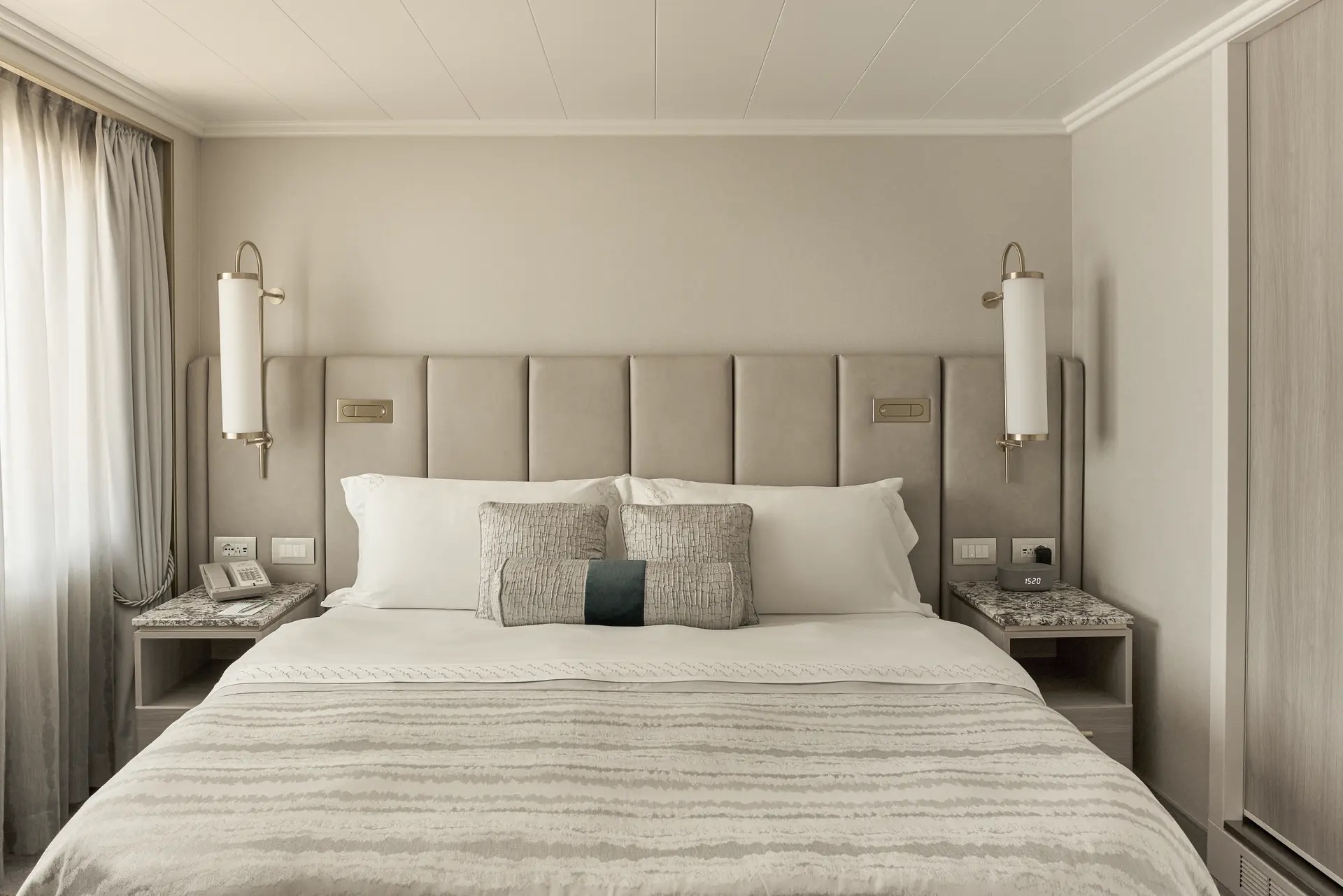
- Large bedroom with queen-size bed or twins, plus his and hers walk-in closets and TV
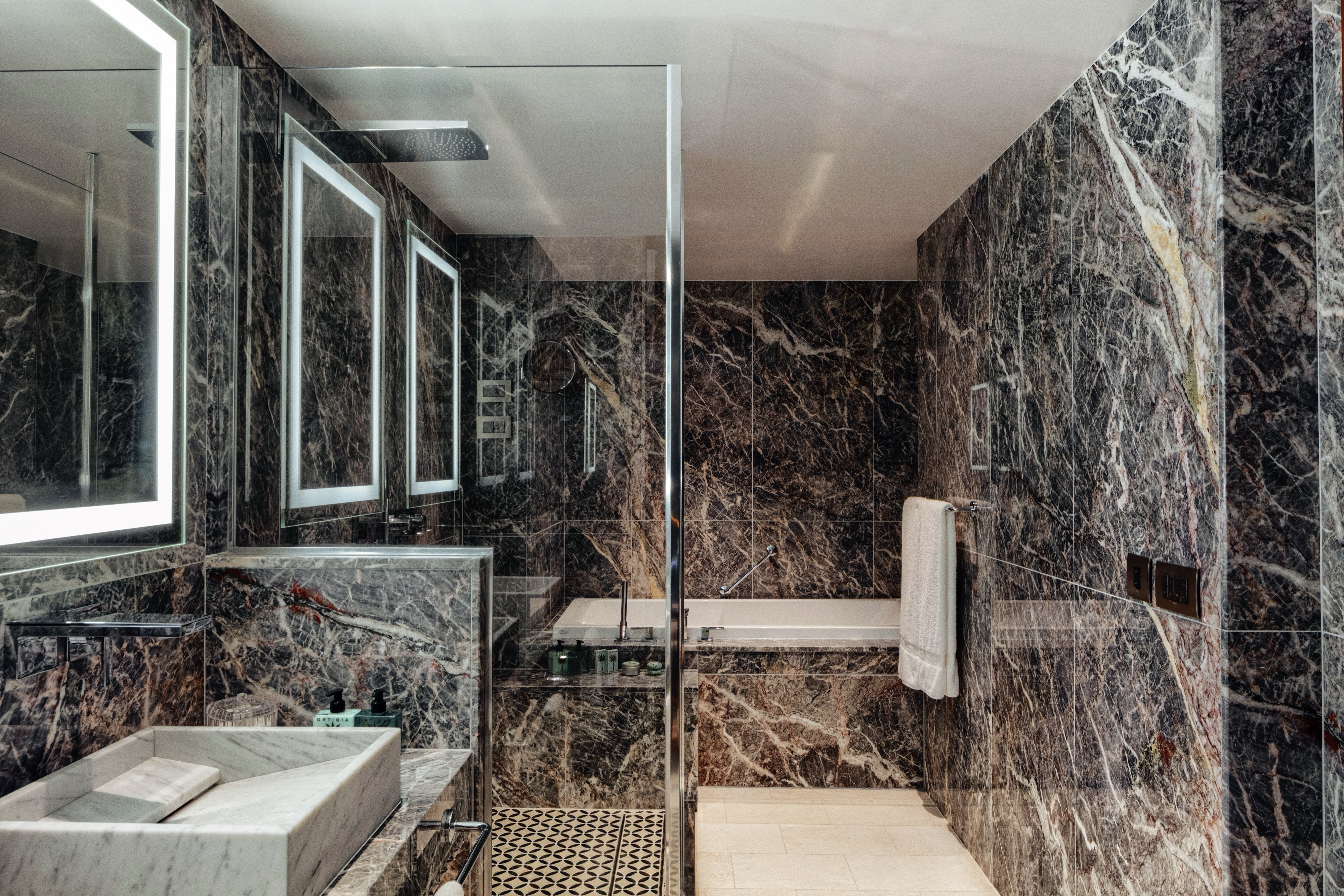
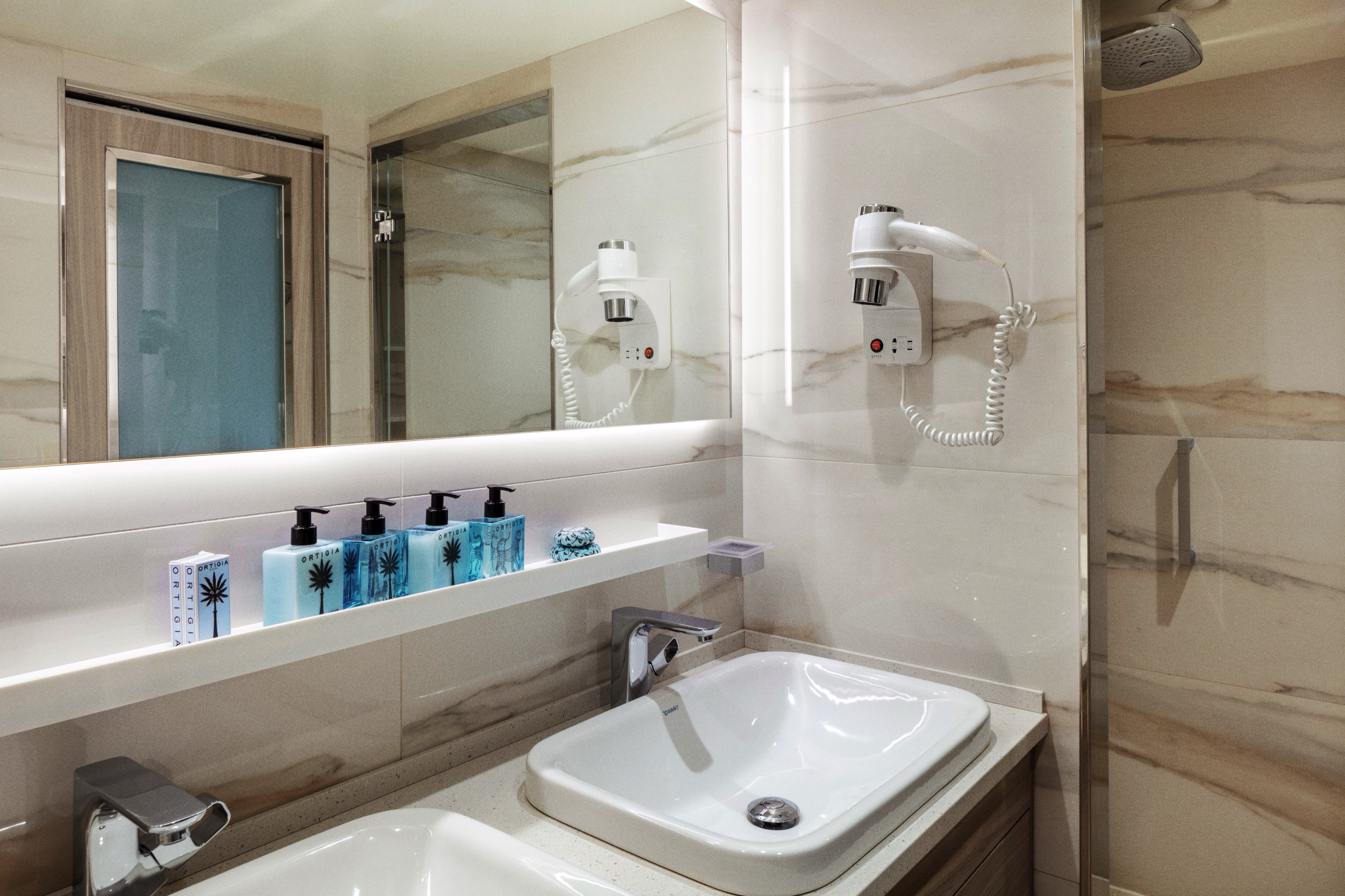
- Master bath with jacuzzi, ocean view, crystal sconces and Calacatta marble floors, separate shower and bidet
- Guest bathroom
Services
- 24 hour in-suite dining
- Unlimited room service from Osteria D'Ovidio and Umi Uma
- Unlimited dining in Osteria D'Ovidio and Umi Uma
- Shoeshine service
- Assistance with packing and unpacking
- Free unlimited laundry and dry cleaning, 2nd day service
- In-Suite cocktail parties
- Private transfer to and from ship up to 50 miles
Amenities
- Welcome champagne
- Complimentary wine and spirits from set menu
- Complimentary soft drinks
- Flowers
- Fresh fruits, daily change, on request only
- Turndown service with handmade truffles
- Pillow menu (selection from a variety of pillow types)
- Afternoon canapés
- Coffee maker
- Binoculars
- Complimentary unlimited standard WiFi
- In-suite safe
- Interactive tablet for news, updates, and reservations
- Hair dryer
- Hair iron (available upon request)
Redesigned in 2023, this luxurious suite features a walk-in wardrobe, separate living room and dining area, Jacuzzi bathtub, separate shower, bidet, and guest bathroom. Guests staying in this stylish home away from home enjoy unlimited dining at specialty restaurants, unlimited laundry services, afternoon canapés, flowers, binoculars, and a coffee maker.
Details
- Large private veranda
- Spacious living room
- Dining area
- Two TV's
- Separate bedroom area
- Vanity in bedroom
- Queen-size bed or twin beds with sumptuous bedding, and third berth
- Full jacuzzi bathtub with separate shower and bidet
- Walk-in closet
Services
- 24 hour in-suite dining
- Unlimited room service from Osteria D'Ovidio and Umi Uma
- Unlimited dining in Osteria D'Ovidio and Umi Uma
- Turndown service with handmade truffles
- Shoeshine service
- Assistance with packing and unpacking
- Free unlimited laundry and dry cleaning, 2nd day service
- In-suite cocktail parties
- Private transfer to and from ship up to 50 miles
Amenities
- Welcome champagne
- Complimentary wine and spirits from set menu
- Complimentary soft drinks
- Flowers
- Fresh fruits, daily change, on request only
- Pillow menu (selection from a variety of pillow types)
- Afternoon canapés
- Coffee maker
- Binoculars
- Complimentary unlimited standard WiFi
- In-suite safe
- Interactive tablet for news, updates, and reservations
- Hair dryer
- Hair iron (available upon request)
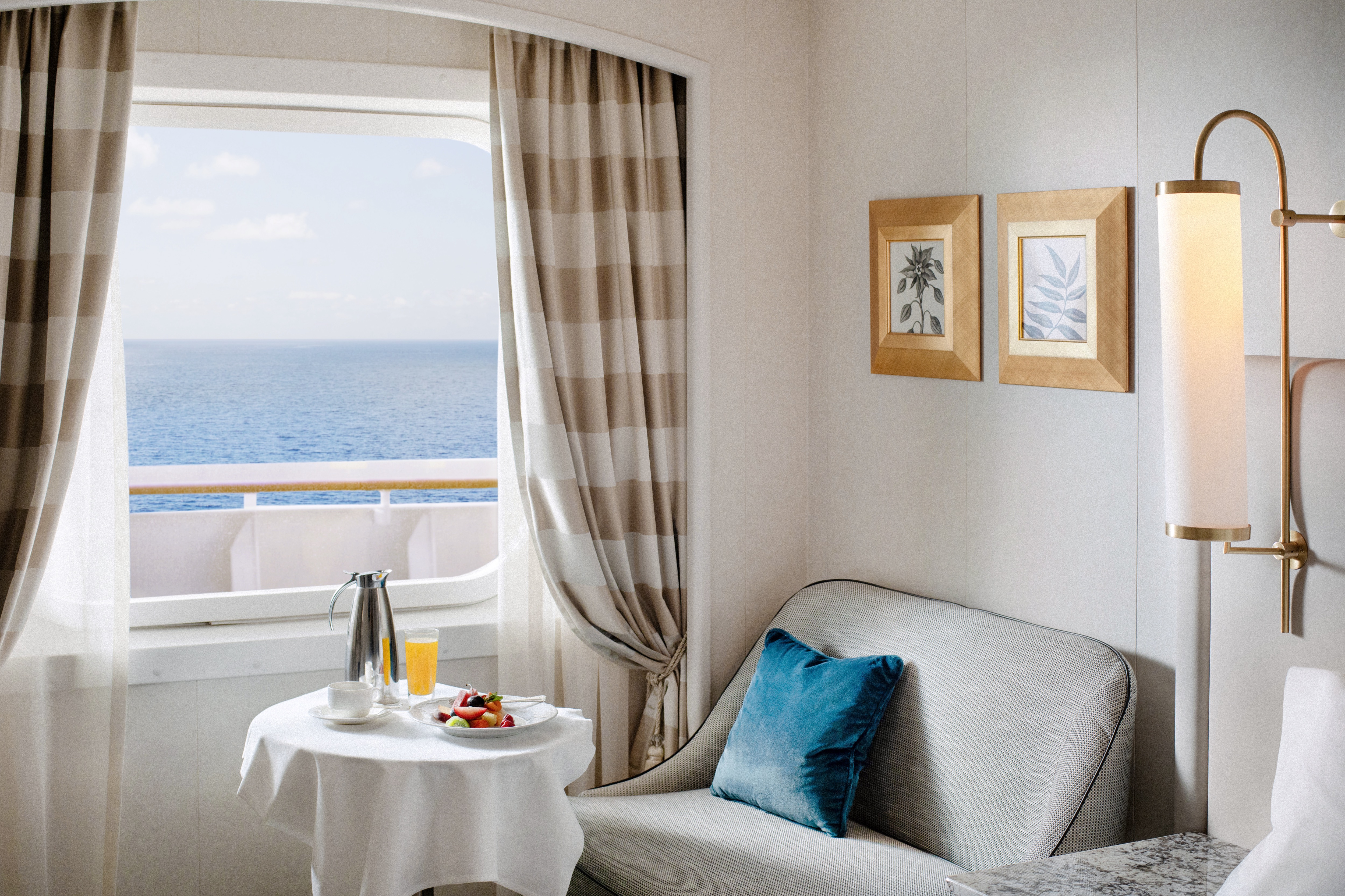
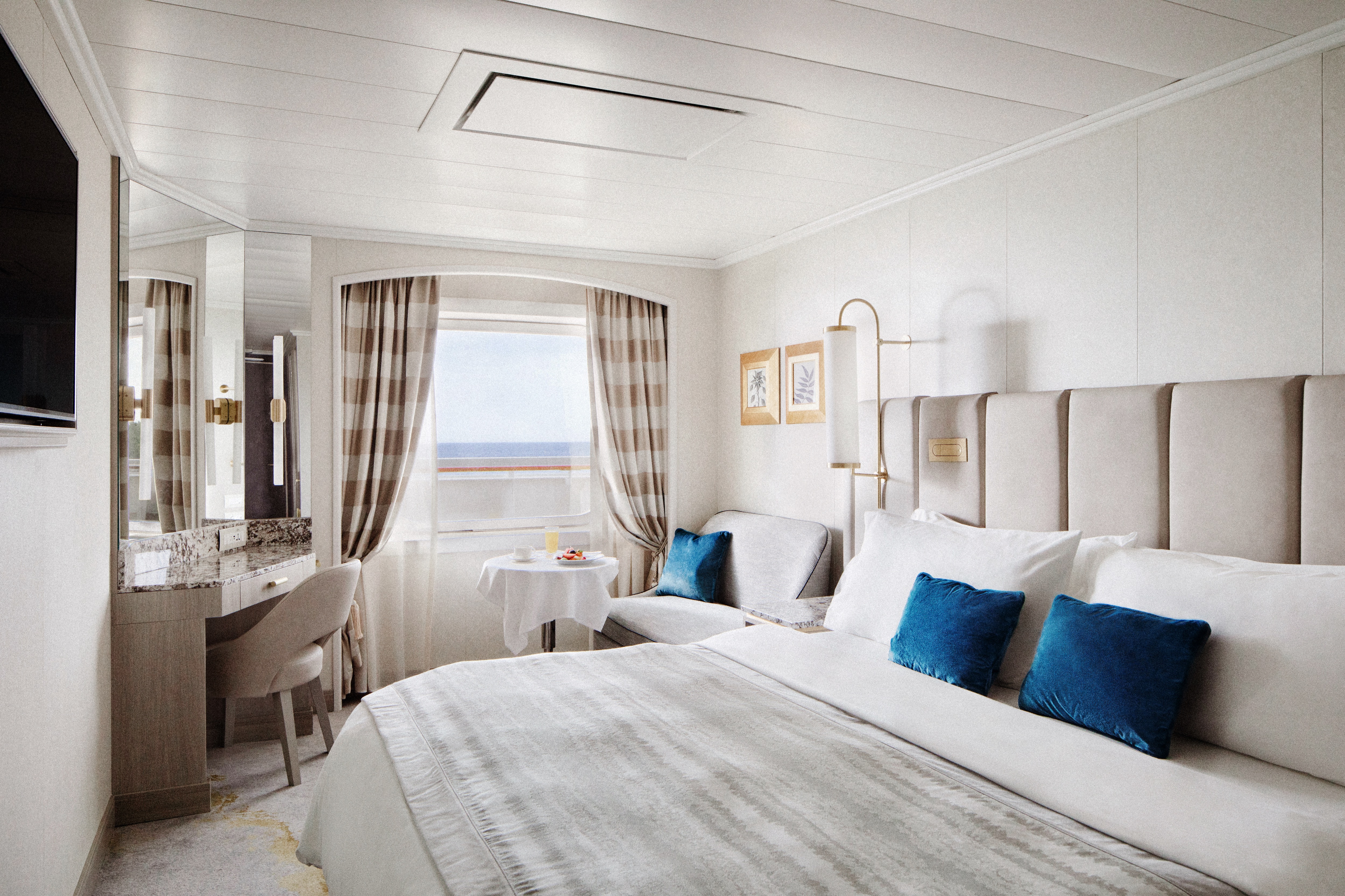
Available in either a newly redesigned style with a walk-in shower or a classic design with a separate shower and bath, this elegant suite features a walk-in wardrobe, separate living room with sofa and dining area, and a private veranda. Enjoy special touches such as afternoon canapés, binoculars, a coffee maker, and complimentary laundry, dry cleaning, and pressing services.
Details
- Private veranda
- Spacious living room and dining area
- Queen-size bed or twin beds with sumptuous bedding, and third berth
- Walk-in closet
- Two TV's
- Washer and Dryer Combo available in select suites
Services
- 24 hour in-suite dining
- Turndown service with handmade truffles
- Shoeshine service
- Assistance with packing and unpacking
- Dry cleaning for five pieces plus one bag of free laundry every 10 cruise days, 2nd day service
- Free pressing (5pcs/day), 2nd day service
Amenities
- Welcome champagne
- Complimentary wine and spirits from set menu
- Complimentary soft drinks
- Fresh fruits, daily change, on request only
- Pillow menu (selection from a variety of pillow types)
- Afternoon canapés
- Coffee maker
- Binoculars
- Complimentary unlimited standard WiFi
- In-suite safe
- Interactive tablet for news, updates, and reservations
- Hair dryer
Redesigned in 2023, this elegant suite offers a walk-in wardrobe, separate living room with sofa and dining area, walk-in shower, and two large picture windows. Enjoy special touches such as afternoon canapés, binoculars, a coffee maker, and complimentary laundry, dry cleaning, and pressing services.DETAILS
- Large Picture Window
- Spacious living room and dining area
- Queen-size bed or twin beds with sumptuous bedding, and third berth
- Walk-in closet
- Two TV's
SERVICES
- 24 hour in-suite dining
- Turndown service with handmade truffles
- Shoeshine service
- Assistance with packing and unpacking
- Complimentary dry cleaning (5 pieces every 10 days, 2nd day service)
- Complimentary laundry (1 bag every 10 days, 2nd day service)
- Complimentary pressing (5 pieces per day, 2nd day service)
AMENITIES
- Welcome champagne
- Complimentary wine and spirits from set menu
- Complimentary soft drinks
- Fresh fruits, daily change, on request only
- Pillow menu (selection from a variety of pillow types)
- Afternoon canapés
- Coffee maker
- Binoculars
- Complimentary unlimited standard WiFi
- In-suite safe
- Interactive tablet for news, updates, and reservations
- Hair dryer
- Hair iron (available upon request)
Available in either a newly redesigned style with a walk-in shower or a classic design with a separate shower and bath, this spacious suite features a private veranda, walk-in wardrobe, comfortable living area with sofa, and complimentary pressing service.
DETAILS
- Private veranda
- Sizeable living area
- Queen-size bed or twin beds with sumptuous bedding
- Vanity in dressing area
- TV
- Walk-in closet
SERVICES
- 24 hour in-suite dining
- Turndown service
- Shoeshine service
- Assistance with packing and unpacking
AMENITIES
- Welcome champagne
- Complimentary wine and spirits from set menu
- Complimentary soft drinks
- Fresh fruits, daily change, on request only
- Afternoon canapés
- Coffee maker
- Binoculars
- Complimentary unlimited standard WiFi
- In-suite safe
- Interactive tablet for news, updates, and reservations
- Hair dryer
- Hair iron (available upon request)
Free pressing (5pcs/day), 2nd day service
Redesigned in 2023 exclusively for solo occupancy, this stylish guest room offers a comfortable living area with sofa, large picture window, walk-in shower, and a sleek built-in wardrobe.
DETAILS
- Large picture window
- Sizeable living area with sofa
- Queen-size bed or twin beds with sumptuous bedding
- TV
- Walk-in shower
SERVICES
- 24 hour in-suite dining
- Turndown service
- Shoeshine service
- Assistance with packing and unpacking
AMENITIES
- Welcome champagne
- Complimentary wine and spirits from set menu
- Complimentary soft drinks
- Fresh fruits, daily change, on request only
- Pillow menu (selection from a variety of pillow types)
- Complimentary unlimited standard WiFi
- In-suite safe
- Interactive tablet for news, updates, and reservations
- Hair dryer
- Hair iron (available upon request)
Redesigned in 2023, this elegant guest room offers a private veranda, comfortable living area with sofa, walk-in shower, and a built-in wardrobe.
DETAILS
- Private veranda
- Sizeable living area with sofa
- Queen-size bed or twin beds with sumptuous bedding
- TV
- Walk-in shower
SERVICES
- 24 hour in-suite dining
- Turndown Service
- Shoeshine service
- Assistance with packing and unpacking
AMENITIES
- Welcome champagne
- Complimentary wine and spirits from set menu
- Complimentary soft drinks
- Fresh fruits, daily change, on request only
- Pillow menu (selection from a variety of pillow types)
- Complimentary unlimited standard WiFi
- In-suite safe
- Interactive tablet for news, updates, and reservations
- Hair dryer
- Hair iron (available upon request)
Redesigned in 2023, this stylish guest room features a comfortable living area with sofa, large picture window, walk-in shower, and a sleek built-in wardrobe.
DETAILS
- Large picture window
- Sizeable living area with sofa
- Queen-size bed or twin beds with sumptuous bedding
- TV
- Walk-in shower
SERVICES
- 24 hour in-suite dining
- Turndown service
- Shoeshine service
- Assistance with packing and unpacking
AMENITIES
- Welcome champagne
- Complimentary wine and spirits from set menu
- Complimentary soft drinks
- Fresh fruits, daily change, on request only
- Pillow menu (selection from a variety of pillow types)
- Complimentary unlimited standard WiFi
- In-suite safe
- Interactive tablet for news, updates, and reservations
- Hair dryer
- Hair iron (available upon request)
Crystal Symphony
With elegant lines and sweeping ocean views, our intimate ship houses expansive suites and guest rooms, alongside a world-class choice of dining, wellness and entertainment.
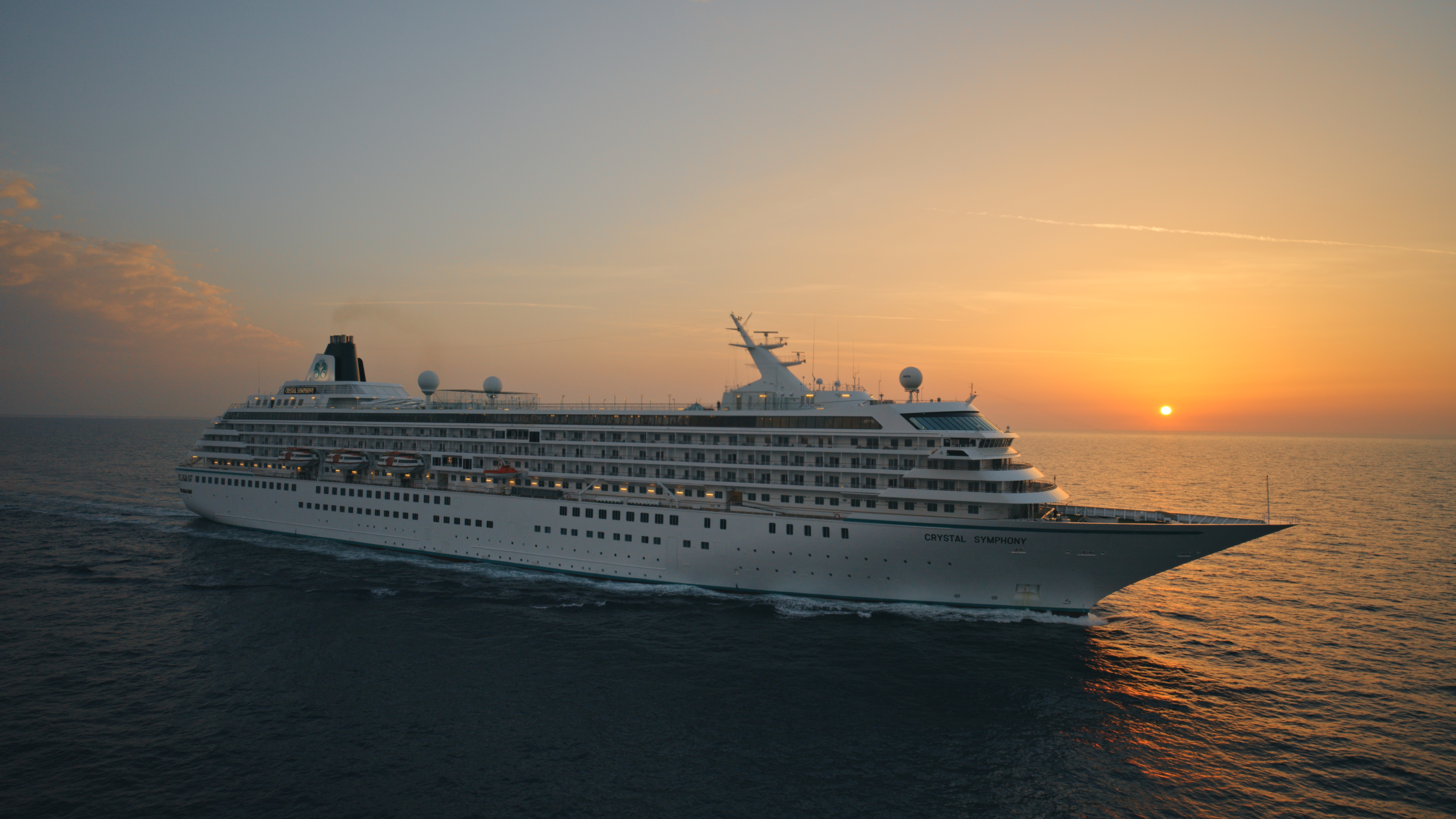
Ship Facts
| Launch Year | 1995 | ||||||||
| Refit Year | 2023 | ||||||||
| Language | en | ||||||||
| Gross Tonnage | 51068 | ||||||||
| Length | 238 | ||||||||
| Width | 30 | ||||||||
| Currency | USD | ||||||||
| Speed | 20 | ||||||||
| Capacity | 606 | ||||||||
| Crew Count | 499 | ||||||||
| Deck Count | 8 | ||||||||
| Cabin Count | 477 | ||||||||
| Large Cabin Count | 0 | ||||||||
| Wheelchair Cabin Count | 4 | ||||||||
| Electrical Plugs |
|
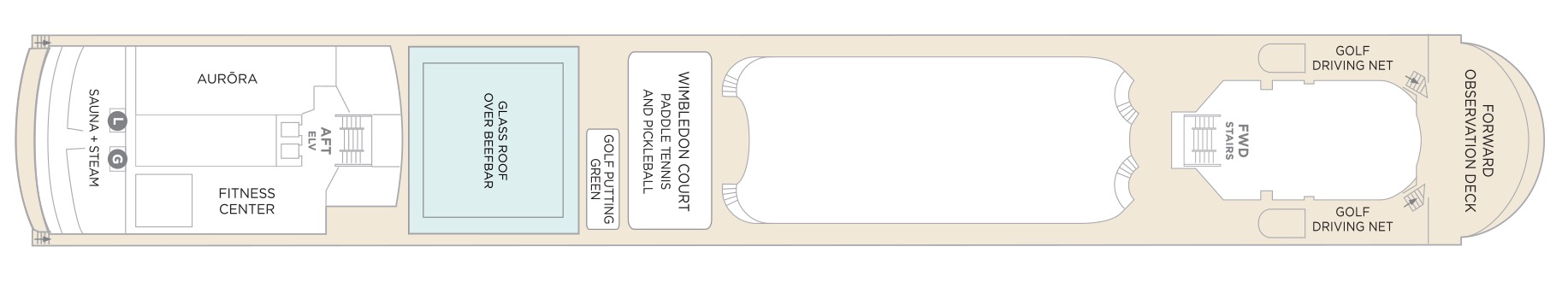
Deck 12
- Sauna + Steam room
- AURÖRA
- Fitness Center
- Glass Roof Over Beefbar
- Golf Putting Green
- Wimbledon Court (Paddle Tennis & Pickle Ball)
- Golf Driving Nets
- Forward Observation Deck
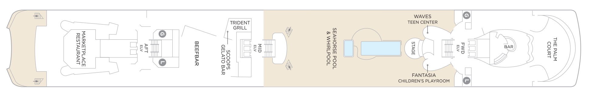
Deck 11
- The Palm Court
- Fantasia Children's Playroom
- Stage
- Waves Teen Centre
- Seahorse Pool & Whirlpool
- Trident Grill
- Scoops Gelato Bar
- Beefbar
- Marketplace Restaurant
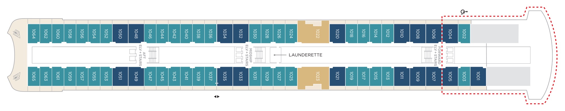
Deck 10
- Aquamarine Veranda Suite
- Sapphire Veranda Suite
- Crystal Penthouse Suite
- Launderette
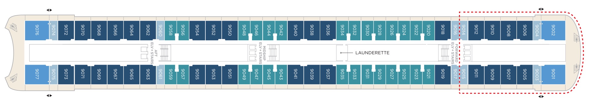
Deck 9
- Junior Crystal Penthouse Suite
- Aquamarine Veranda Suite
- Sapphire Veranda Suite
- Double Guest Room with Veranda
- Launderette
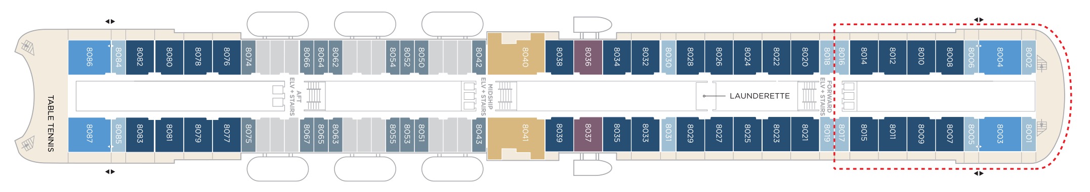
Deck 8
- Crystal Penthouse Suite
- Sapphire Veranda Suite
- Double Guest Room with Veranda
- Junior Crystal Penthouse Suite
- Sapphire Ocean View Suite
- Double Guest Room with Ocean View
- Table Tennis
- Launderette
Suites & Guest Rooms Beyond The Forward Elevators Are subject To Alternative Pricing
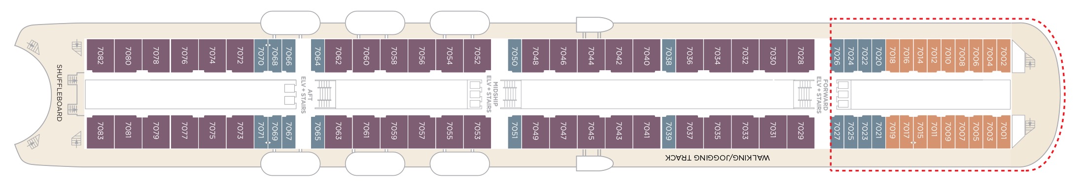
Deck 7
- Sapphire Ocean View Suite
- Single Guest Room with Ocean View
- Double Guest Room with Ocean View
- Shuffleboard
- Walking/Jogging Track
- Elevator & Stairs
Suites & Guest Rooms Beyond The Forward Elevators Are subject To Alternative Pricing
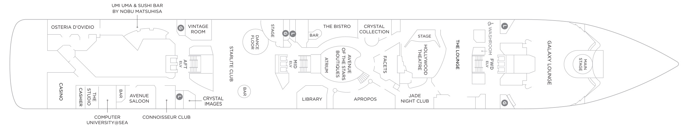
Deck 6
- Main Stage
- Galaxy Lounge
- The Lounge
- Hollywood Theatre
- Jade Nightclub
- Crystal Collection
- Facets
- Aprops
- Avenue of the Star Boutique
- The Bistro
- Atrium
- Library
- Stage
- Starlite Club
- Vintage Room
- Crystal Images
- Uma Uma & Sushi Bar by Nobu Matsuhisa
- Connoisseur Club
- Avenue Saloon
- Computer University @Sea
- The Studio
- Casino
- Osteria D'Ovidio
Deck 5
- Sapphire Ocean View Suite
- Double Guest Room with Ocean View
- Medical Centre
- Concierge
- Reception
- Shore Excursions
- Crystal Cove
- Future Sales Consultant
- Crystal Plaza
- Waterside Restaurant

Our award-winning cuisine is created and influenced by pioneers in the global food scene, with nine distinct complimentary venues to choose from. Open seating with extensive dining options are tailored around the personal preferences of our guests, allowing them to choose exactly what they want at a time that works for them. Whether that be a late breakfast, six-course wine pairing lunch, or dinner in our exclusive Osteria d’Ovidio or Umi Uma.
Waterside Restaurant
Take your tastebuds on a tour of our modern, international cuisine options. Enjoy creative, seasonal dishes in an elegant setting with beautiful ocean views.
Umi Uma
Few restaurants can boast a creative vision of contemporary cuisine as Nobu. Prepare to lose yourself in the beautiful décor and signature Japanese-Peruvian dishes. Reservations required and limited per sailing.
Beefbar
The most exciting flavours from the global street-food scene are fashioned from the freshest ingredients by creative chefs and served for sharing in stylish surroundings.
Trident Grill
Enjoy a burger with a view. Our pool restaurant and grill offer a comfortable terrace highlighted by an elegant design, making it the perfect spot for outdoor dining.
Osteria D'Ovidio
Named for our owner, Manfredi Lefebvre d'Ovidio, this restaurant specializes in show-stopping Italian cuisine, in collaboration with the Michelin-rated Alajmo brothers. Reservations are required and are limited per sailing.
The Bistro
A nod to the mythic bars and bistros of Paris. Celebrate the classics in this spacious and airy café that serves light bites from dawn to dusk.
The Vintage Room
A unique gourmet food and wine pairing restaurant that offers an educational dining experience while enjoying some of the best vintages at sea.
Scoops Gelato Bar
Enjoy the finest authentic Italian gelato with a sea view at our pool-deck gelato bar, Scoops. Choose from must-try innovative flavors or traditional favorites in partnership with prestigious Florence artisan, Badiani.
Marketplace
This sophisticated buffet-style restaurant features a dizzying array of hot and cold choices for those who like a little of everything.
24 Hours In-Suite Dining
Enjoy a meal from the comfort of your suite while relaxing in Crystal comfort. Select from our inspired menu to delight you while you stay in, watch a movie or read a favorite book.
Tea Time
More information coming soon.
Tastes Kitchen & Bar
A new definition of traveling with taste. Sumptuous, regionally inspired tapas-style cuisine is the perfect combination of sophisticated style and casual dining.
Our two elegant vessels host an equally exceptional offering including world-renowned restaurants, restorative spas and endless opportunity for inspiration and enrichment, tied together by unparalleled personal service.
Each evening Crystal brings together a cast of world-class performers, entertainers and hosts. Whether you’re looking for theatrical entertainment or the latest Hollywood release, our lounges, ballrooms, night clubs and screening rooms can cater to your every mood.
Casino De Monte-Carlo
Le Casino de Monte-Carlo is offering a new and unique experience onboard. Place your bets on table games with the unique savoir-faire of Monaco’s world-famous casino or get excited to a dynamic range of slots to hit the jackpot. An ultimate way to embrace the thrill of the game in an elegant atmosphere adorned in the hues of the historical building.
Apropos & Facets Onboard Shopping
Heighten the experience on board with a selection of fine jewelry, watches and cruise wear available in our arcade, alongside designer apparel. Make the most of being at sea with a selection of duty free items available.
Atrium
The central meeting place on the ship where you can visit the front desk, concierge, shore excursion desk, or sip on a casual drink at the Crystal Cove.
Computer University@Sea
Our innovative Computer lab onboard led by a team of tech experts.
Connoisseur Club
An elegant space to indulge in the finest cigars and cognacs.
Crystal Collection
Offers fine perfumes and colognes, cosmetics, purses, sun glasses, and jewellery.
Crystal Cove
An ideal refreshment stop any time of the day, and the perfect place to meet friends for a pre-dinner cocktail. Enjoy a variety of musical styles as the day turns into night.
Library
A well-stocked library containing over 2,000 books on a range of subjects from classics to popular biographies, history to contemporary mysteries. Plus enjoy an ample selection of magazines and board games perfect for poolside reading
Palm Court
Featuring large sky lights, floor-to-ceiling windows and a fabulous 270-degree forward view, this venue is perfect for afternoon tea, social gatherings and dancing.
Seahorse Pool
Our Seahorse Pool, with plenty of surrounding deck space to sunbathe, relax and read while enjoying a cool drink in the afternoon.
Starlite Club
On selected evenings before and after dinner, this entertainment lounge features dancing, production spot shows, cabaret performances and other themed events.
Jade Night Club
An intimate lounge for a late-night drink, dancing or a place to let loose with karaoke.
Hollywood Theatre
The ship's sleek cinema for recent-released movies, live sport events, guest lectures and religious services.
Galaxy Lounge
Performances are the focal point here, with appearances by fantastic Broadway-style performers and headline entertainers. Drink service provided before each show.
Avenue Saloon
Signature piano bar with an intimate ambience. The perfect setting for a cocktail before and after dinner.