Norway And Northern Lights, 12 Nights
Norway And Northern Lights, 12 Nights
Cruise overview
WHY BOOK WITH US?
- ✔ The Deluxe Cruises’ team has extensive experience in ultra-luxury cruising.
- ✔ Call now to speak to our helpful and experienced Cruise Concierge team.
- ✔ Enjoy our Unique Deluxe Cruises Bonus for substantial savings.
- ✔ Our team will tailor your holiday to your exacting requirements.
- ✔ As agents, we work under the protection of each cruise lines ABTA / ATOL licences
About Southampton
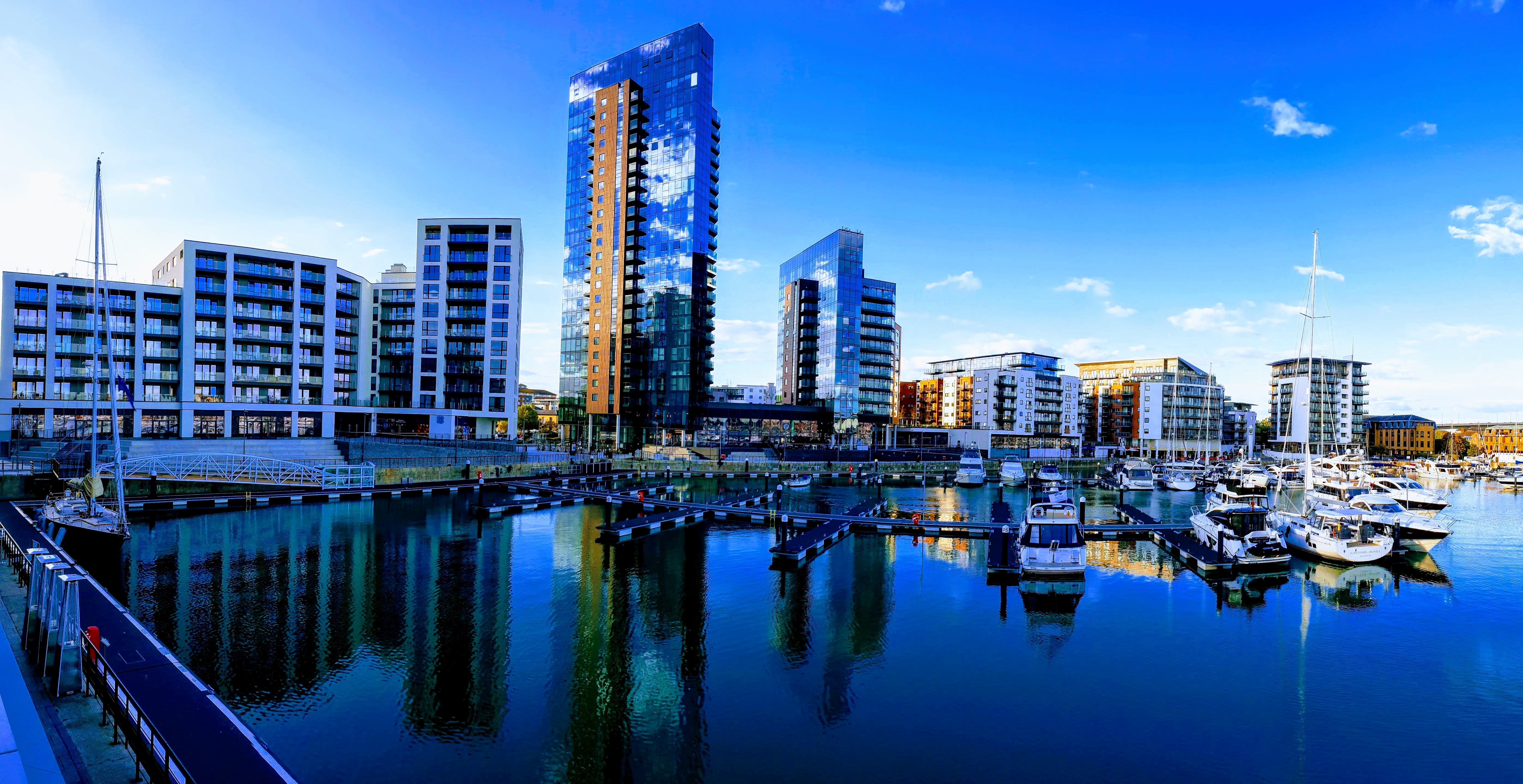
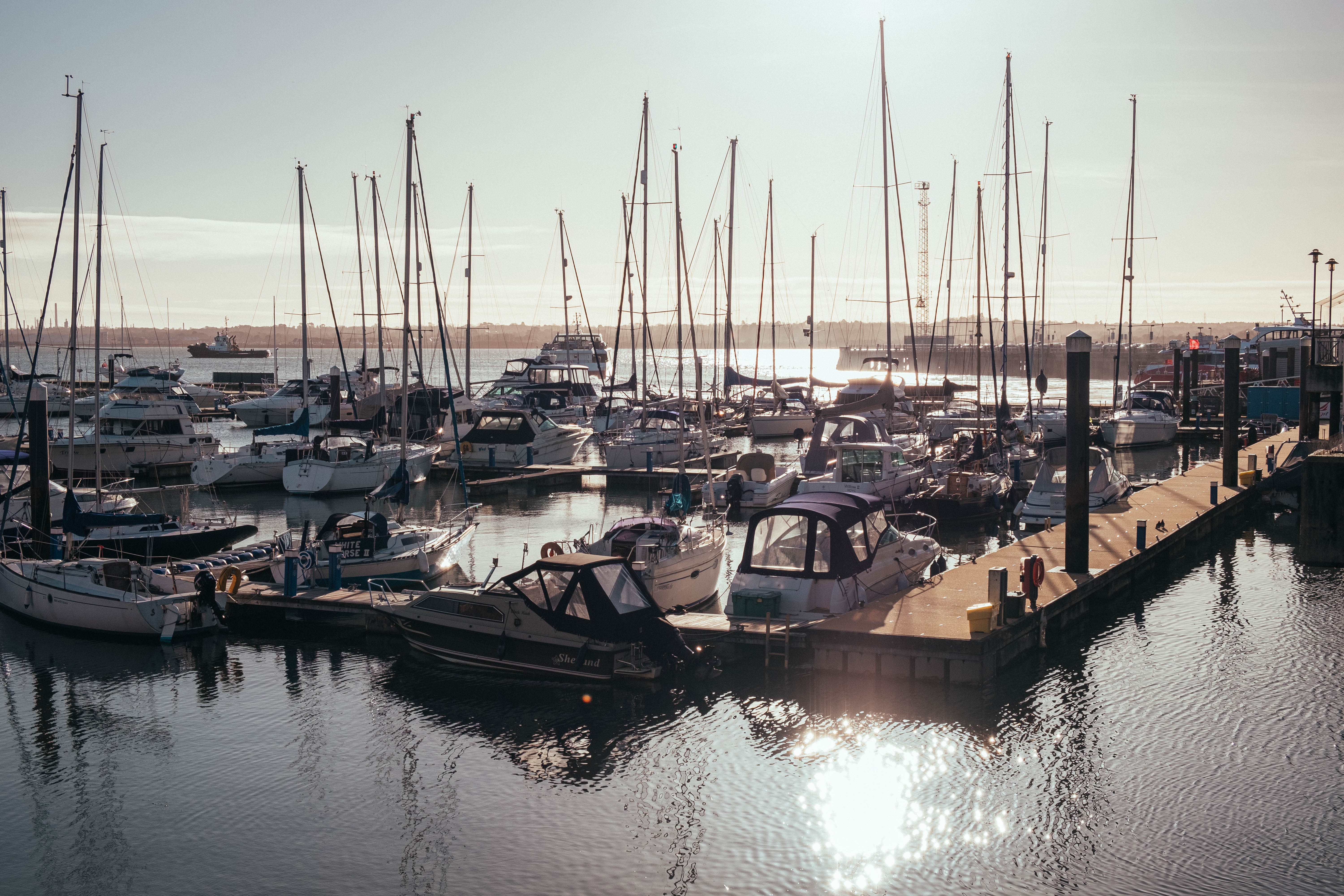
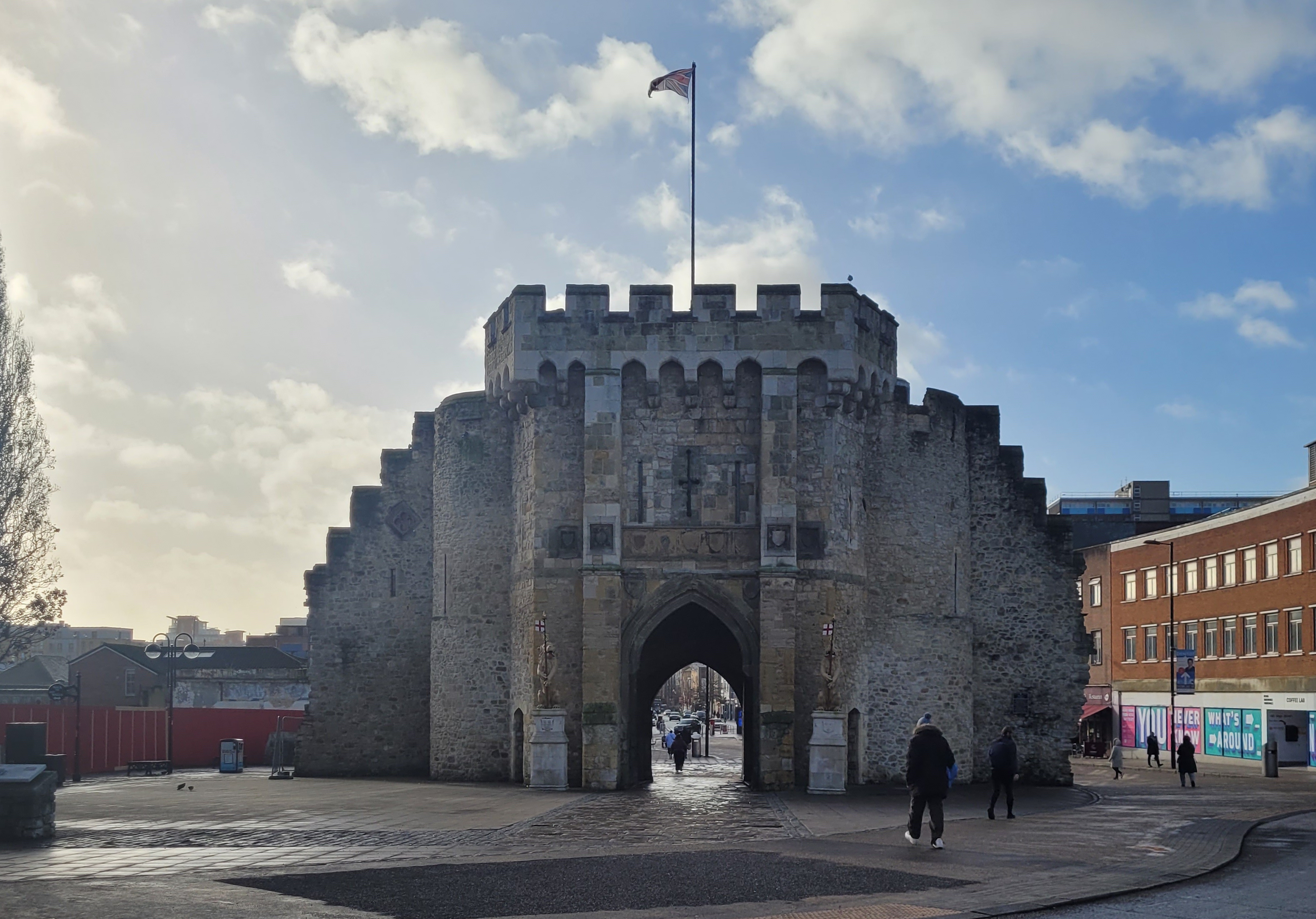
Lying near the head of Southampton Water, a peninsula between the estuaries of the Rivers Test and Itchen, Southampton is Britain’s largest cruise port. It has been one of England’s major ports since the Middle Ages, when it exported wool and hides from the hinterland and imported wine from Bordeaux. The city suffered heavy damage during World War Two and as a result the centre has been extensively rebuilt, but there are still some interesting medieval buildings including the Bargate, one of the finest city gatehouses in England.

About Ålesund
The coastal town of Ålesund is the commercial capital of the Møre og Romsdal district. But more important, it is noted for its characteristic Jugendstil (Art Nouveau) buildings, which some claim make Ålesund one of the most beautiful towns in Norway. This Art Nouveau style emerged when the town was completely rebuilt after a devastating fire in 1904 destroyed nearly 800 buildings and left 10,000 residents homeless. It is said that the fire started by a tipped oil lamp. Rebuilding was carried out with the help of many young, foreign architects who added their own flourishes to the architectural blend of German Jugendstil and Viking roots. Today, narrow streets are crammed with buildings topped with turrets, spires and gables that bear decorations of dragonheads and curlicues. As one of the few remaining Art Nouveau towns in the world, in 1998 Ålesund was awarded the coveted Houens National Memorial Prize for the preservation of its unique architecture.


About Tromsø
With its centre located on the island of Tromsø, the municipality of Tromsø is more than five times the size of Norway’s capital, Oslo, and is the world’s northernmost university city. Lying 200 miles inside the Arctic Circle, it is known as the 'Gateway to the Arctic' because it was used as a starting point for hunters looking for Arctic foxes, polar bears and seals. In the 19th century it was a base for explorers on Arctic expeditions – a history that is remembered in the city’s Polar Museum, which you can visit on an excursion. Also commemorated in the area is the history of Norway’s indigenous people, the Sami. Visitors can learn about the traditions, heritage and modern preservation of the Sami culture at the Tromsø Museum. Nowadays, Tromsø is a charming mix of old and new, with wooden buildings sitting alongside contemporary architecture such as the impressive glacier-like Arctic Cathedral, which features one of the largest stained glass windows in Europe. Looking down on the city is Mount Storsteinen, and a cable car runs to the top, giving wonderful views over the surrounding countryside of forested peaks and reindeer pastures.
About Narvik
At 68 degrees North, Narvik lies 140 miles inside the Arctic Circle. Its history as a settlement began in the Stone Age, and Vikings are also known to have lived in the area. The modern town came into existence in the 1870s to serve the needs of the iron industry. Iron ore is mined in neighbouring Sweden and, as an ice-free port, Narvik was chosen as the ideal export location. The LKAB mining corporation is still a major employer and landowner in the area, shipping some 25,000,000 tons of iron ore from the port annually. This industrial heritage has shaped the town and now forms the basis of some of its most popular tourist attractions. In 1883 a co-owned British-Swedish company was given permission to build a railway connecting the Swedish iron mines in Kiruna to Narvik. It opened in 1902 and the town, then christened Victoriahavn, grew up around it. Unfortunately much of Narvik was destroyed in World War II. Invaded by the Nazis on 9 April 1940, it was later retaken by the Allies, representing the first military defeat of Hitler’s troops, but was evacuated as part of Operation Alphabet when it came under German occupation again. The local war museum documents the turbulent history of this period.
About Stavanger
Overlooking the Atlantic Ocean, Stavanger flourished in the 19th century as a fishing port. While other towns in Norway have suffered with the decline of this industry, Stavanger has kept its economy booming by diversifying, first into shipbuilding and now into oil. These two contrasting industries have created a city of two halves – a modern area of high-rise buildings and a historic centre with cobbled streets and old wooden houses. The city centre was the birthplace of Alexander Kielland, one of the great 19th-century Norwegian novelists. Stavanger Cathedral, dating from 1125, is an impressive building and the only medieval cathedral in Norway that has not been substantially altered since it was first built. From Stavanger you can explore the attractive blue waters of Lysefjord, surrounded by cliffs and striking rock formations, and also visit Hafrsfjord where the Viking King Harald won an important battle that started the Unification of Norway. Those preferring to explore on their own may wish to visit the interesting Petroleum Museum.

About Southampton
Lying near the head of Southampton Water, a peninsula between the estuaries of the Rivers Test and Itchen, Southampton is Britain’s largest cruise port. It has been one of England’s major ports since the Middle Ages, when it exported wool and hides from the hinterland and imported wine from Bordeaux. The city suffered heavy damage during World War Two and as a result the centre has been extensively rebuilt, but there are still some interesting medieval buildings including the Bargate, one of the finest city gatehouses in England.


Where You'll Go


