
Hong Kong to Southampton
Hong Kong to Southampton
Cruise overview
WHY BOOK WITH US?
- ✔ The Deluxe Cruises’ team has extensive experience in ultra-luxury cruising.
- ✔ Call now to speak to our helpful and experienced Cruise Concierge team.
- ✔ Enjoy our Unique Deluxe Cruises Bonus for substantial savings.
- ✔ Our team will tailor your holiday to your exacting requirements.
- ✔ As agents, we work under the protection of each cruise lines ABTA / ATOL licences
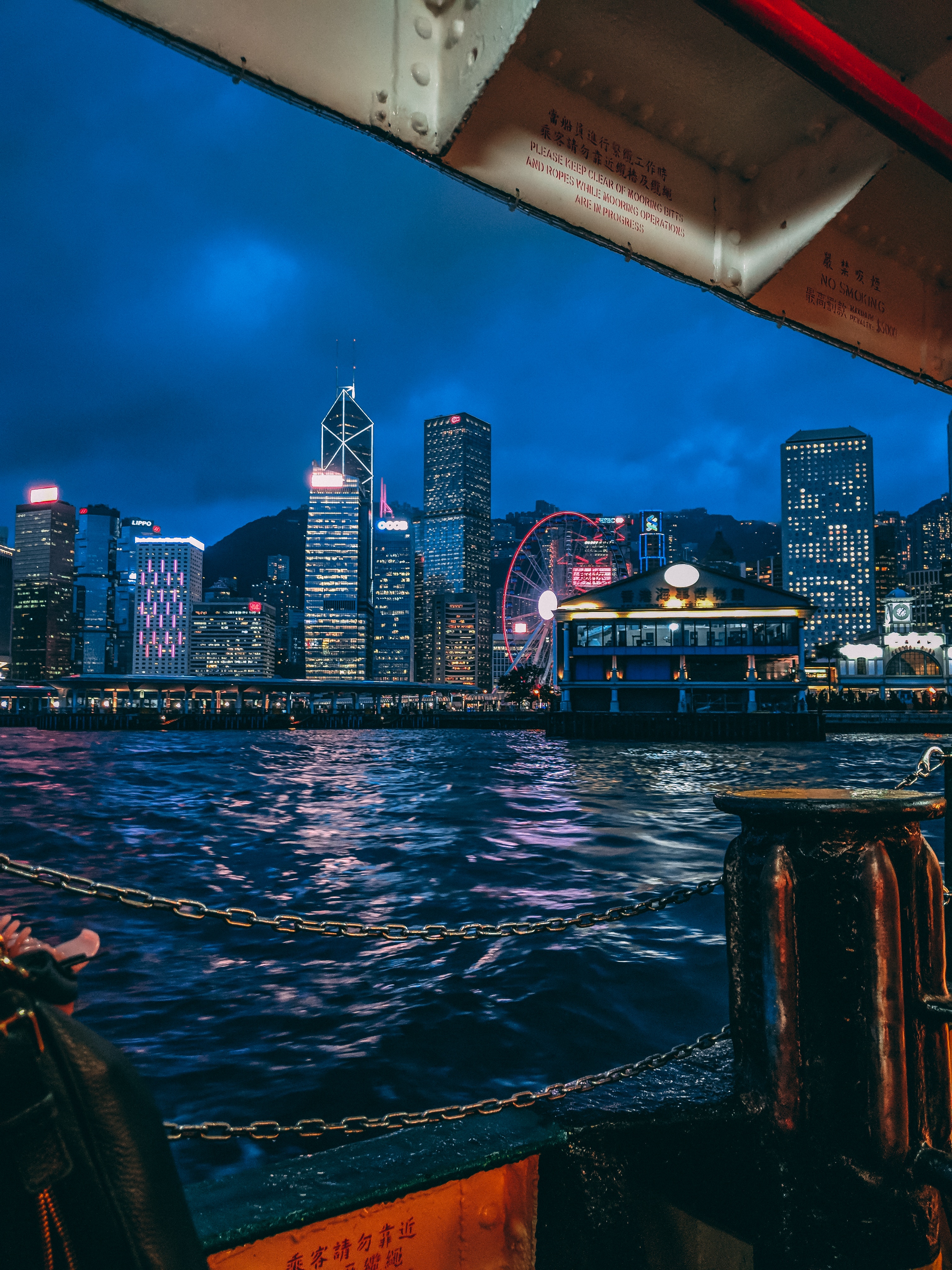
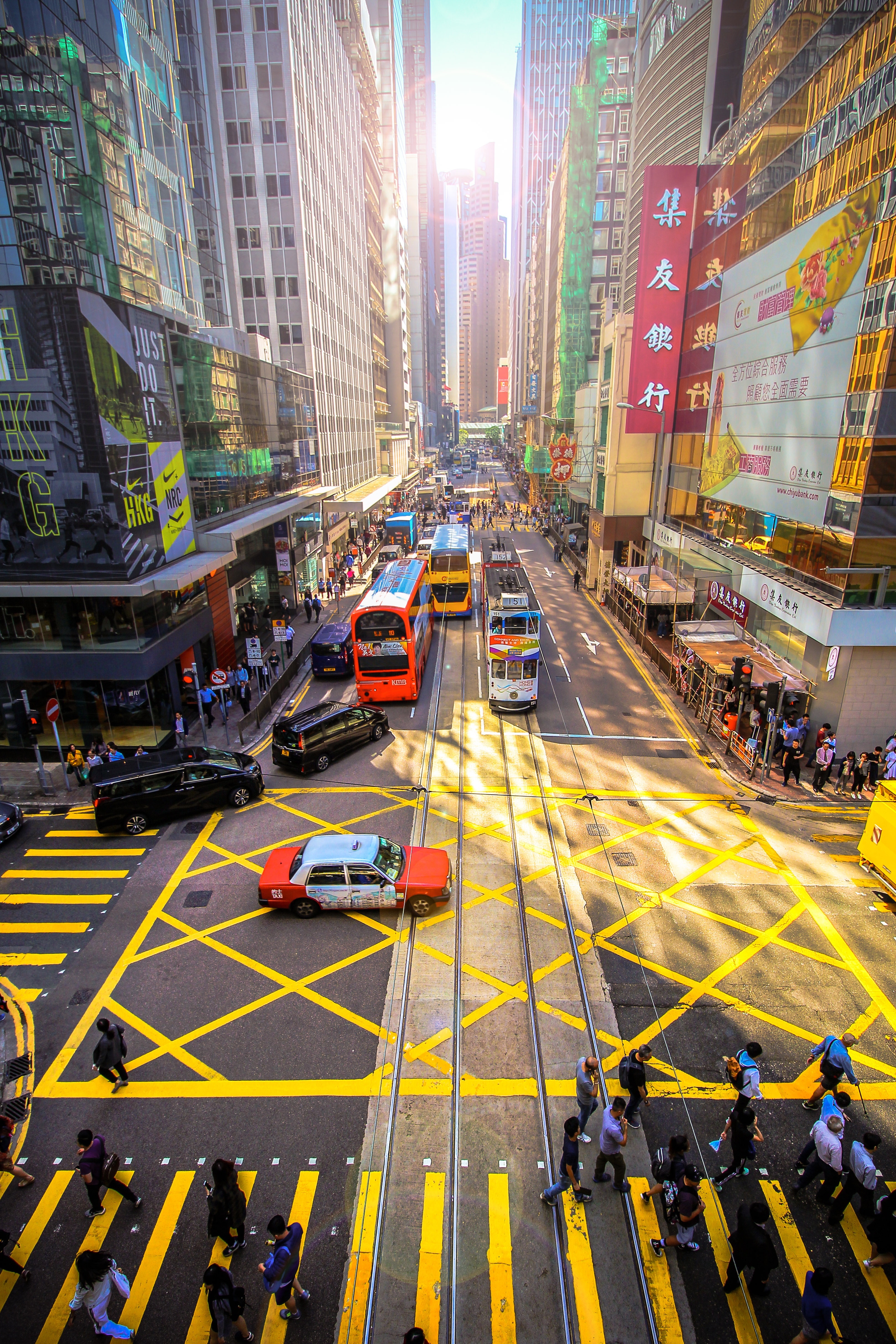
About Hong Kong
The Hong Kong Island skyline, with its ever-growing number of skyscrapers, speaks to ambition and money. Paris, London, even New York were centuries in the making, while Hong Kong's towers, bright lights, and glitzy shopping emporia weren't yet part of the urban scene when many of the young investment bankers who fuel one of the world's leading financial centers were born. Commerce is concentrated in the glittering high-rises of Central, tucked between Victoria Harbor and forested peaks on Hong Kong Island's north shore. While it's easy to think all the bright lights are the sum of today's Hong Kong, you need only walk or board a tram for the short jaunt west into Western to discover a side of Hong Kong that is more traditionally Chinese but no less high-energy. You'll discover the real Hong Kong to the east of Central, too, in Wan Chai, Causeway Bay, and beyond. Amid the residential towers are restaurants, shopping malls, bars, convention centers, a nice smattering of museums, and—depending on fate and the horse you wager on—one of Hong Kong's luckiest or unluckiest spots, the Happy Valley Racecourse. Kowloon sprawls across a generous swath of the Chinese mainland across Victoria Harbour from Central. Tsim Sha Tsui, at the tip of Kowloon peninsula, is packed with glitzy shops, first-rate museums, and eye-popping views of the skyline across the water. Just to the north are the teeming market streets of Mong Kok and in the dense residential neighborhoods beyond, two of Hong Kong's most enchanting spiritual sights, Wong Tai Sin Temple and Chi Lin Nunnery. As you navigate this huge metropolis (easy to do on the excellent transportation network), keep in mind that streets are usually numbered odd on one side, even on the other. There's no baseline for street numbers and no block-based numbering system, but street signs indicate building numbers for any given block.
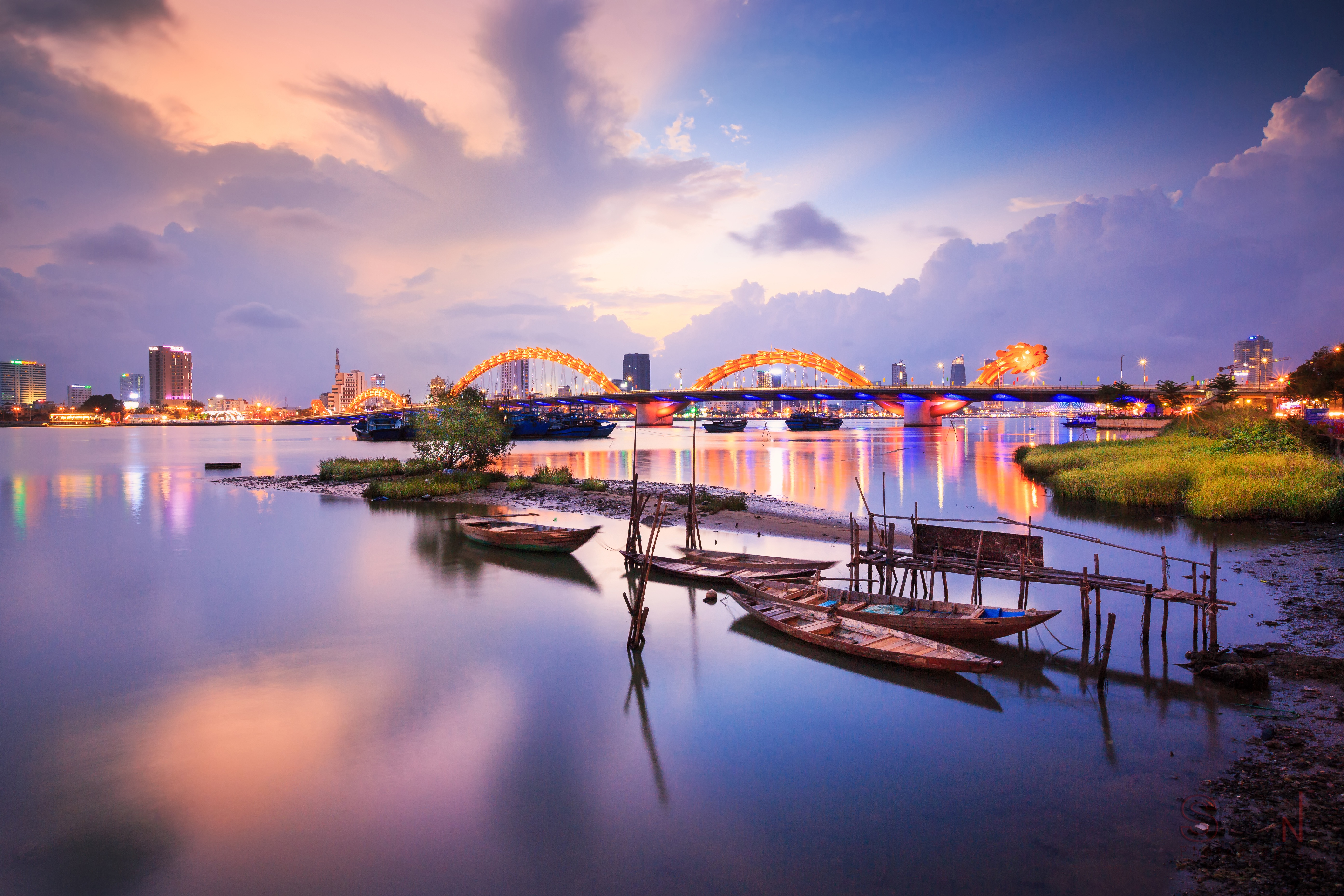
About Chan May
Hue (pronounced hway), bisected by the Perfume River and 13 km (8 mi) inland from the South China Sea, in the foothills of the Annamite Mountains (Truong Son Mountains), stands as a reminder of Vietnam's imperial past. The seat of 13 Nguyen-dynasty emperors between 1802 and 1945, Hue was once Vietnam's splendid Imperial City. Although it was devastated by the French in the 19th century and again by fighting between the Vietnamese Communists and the Americans in the 20th, the monument-speckled former capital has a war-ravaged beauty. One can still imagine its former splendor, despite gaping holes in its silhouette. Hue is a UNESCO World Heritage Site, and the city's gems are slowly being restored.
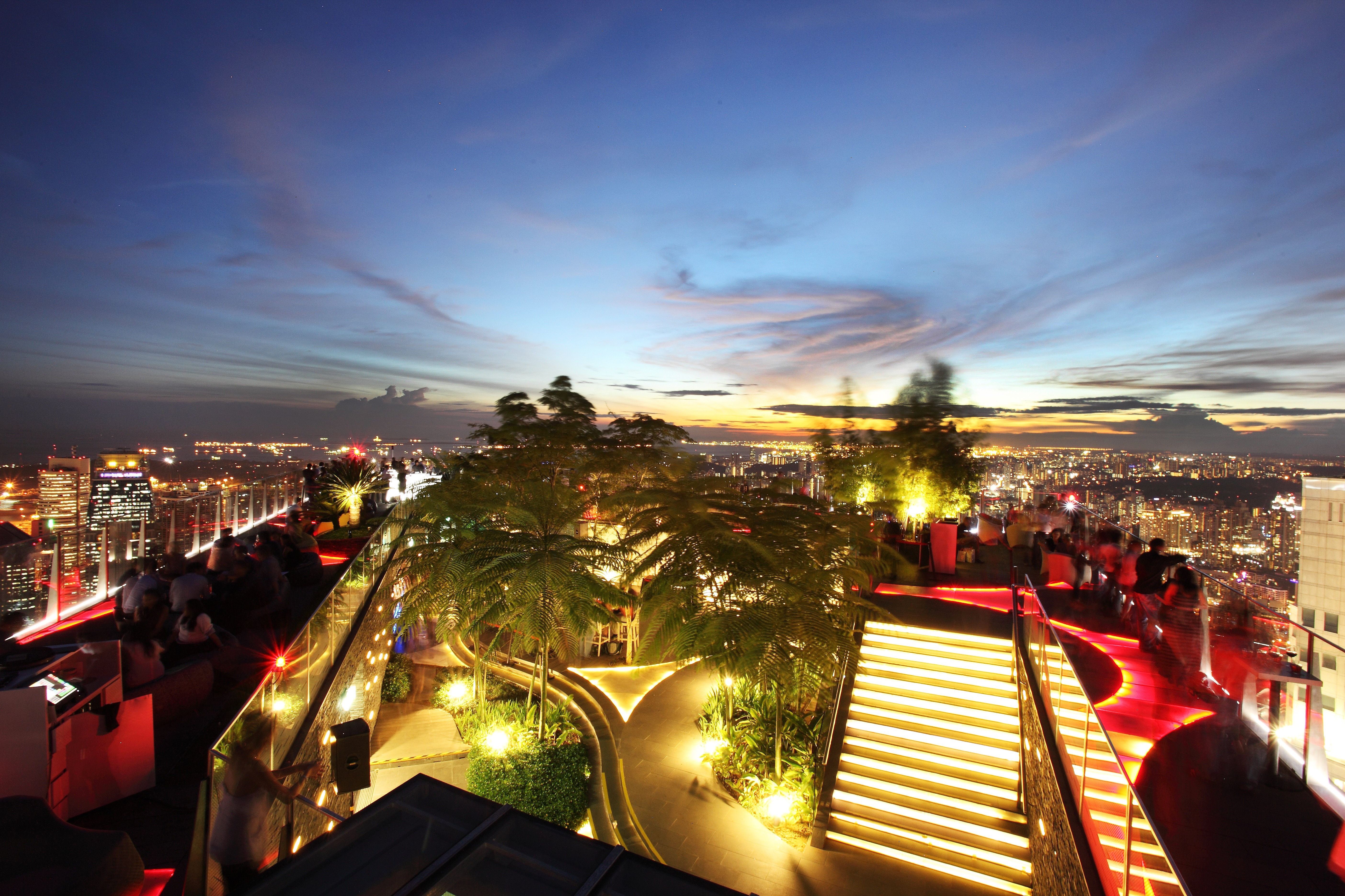
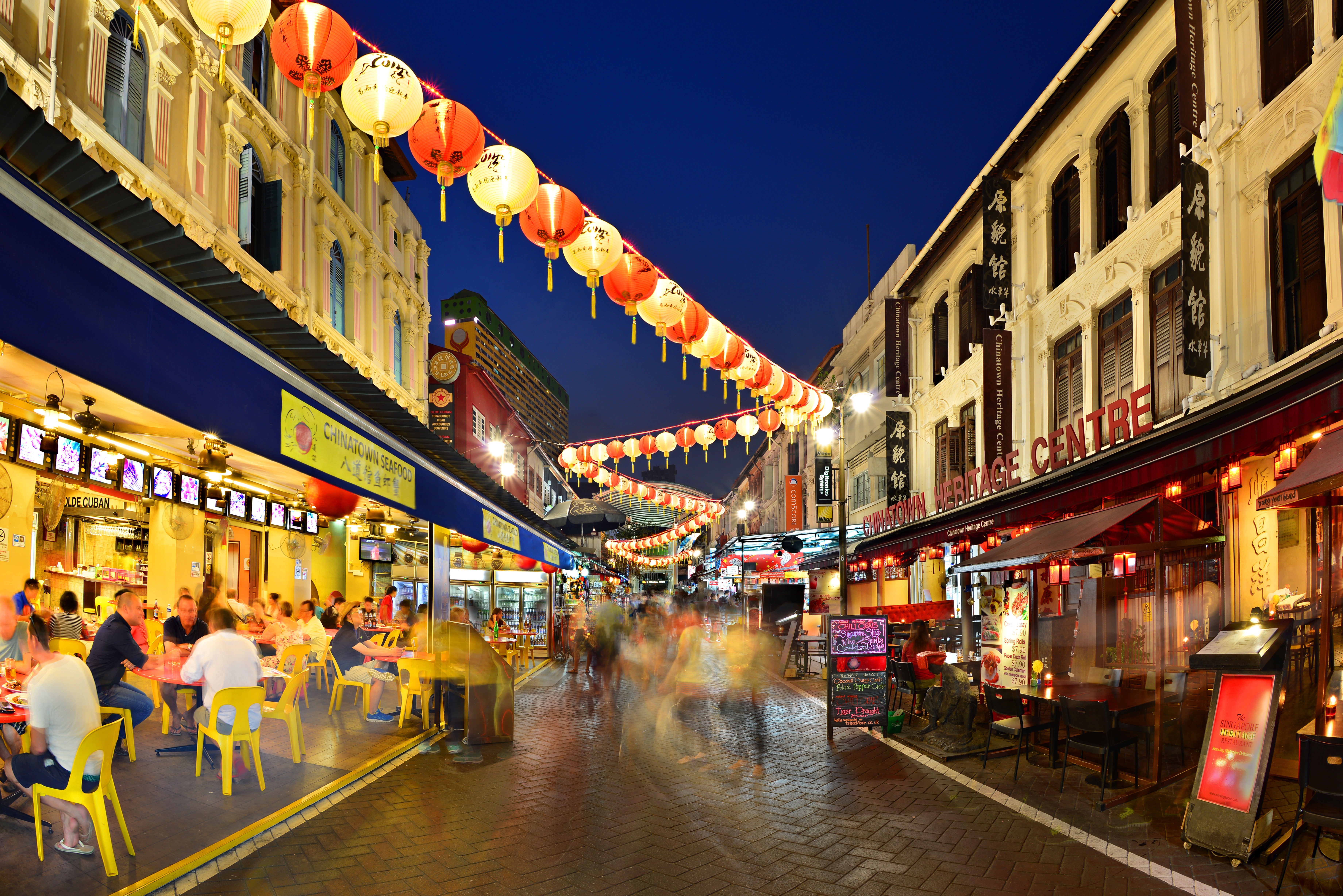
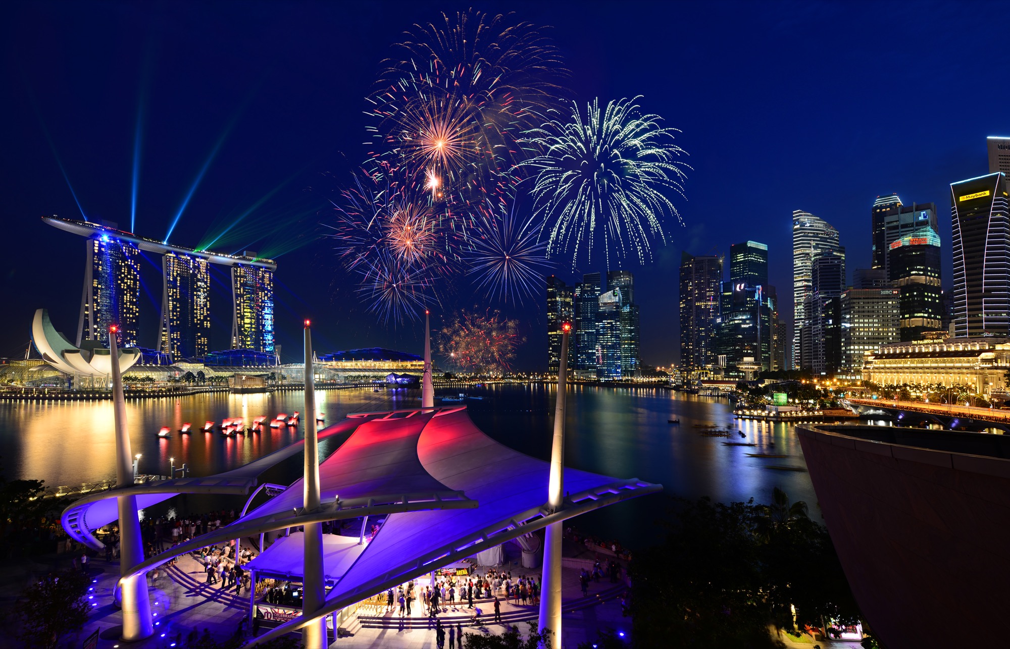
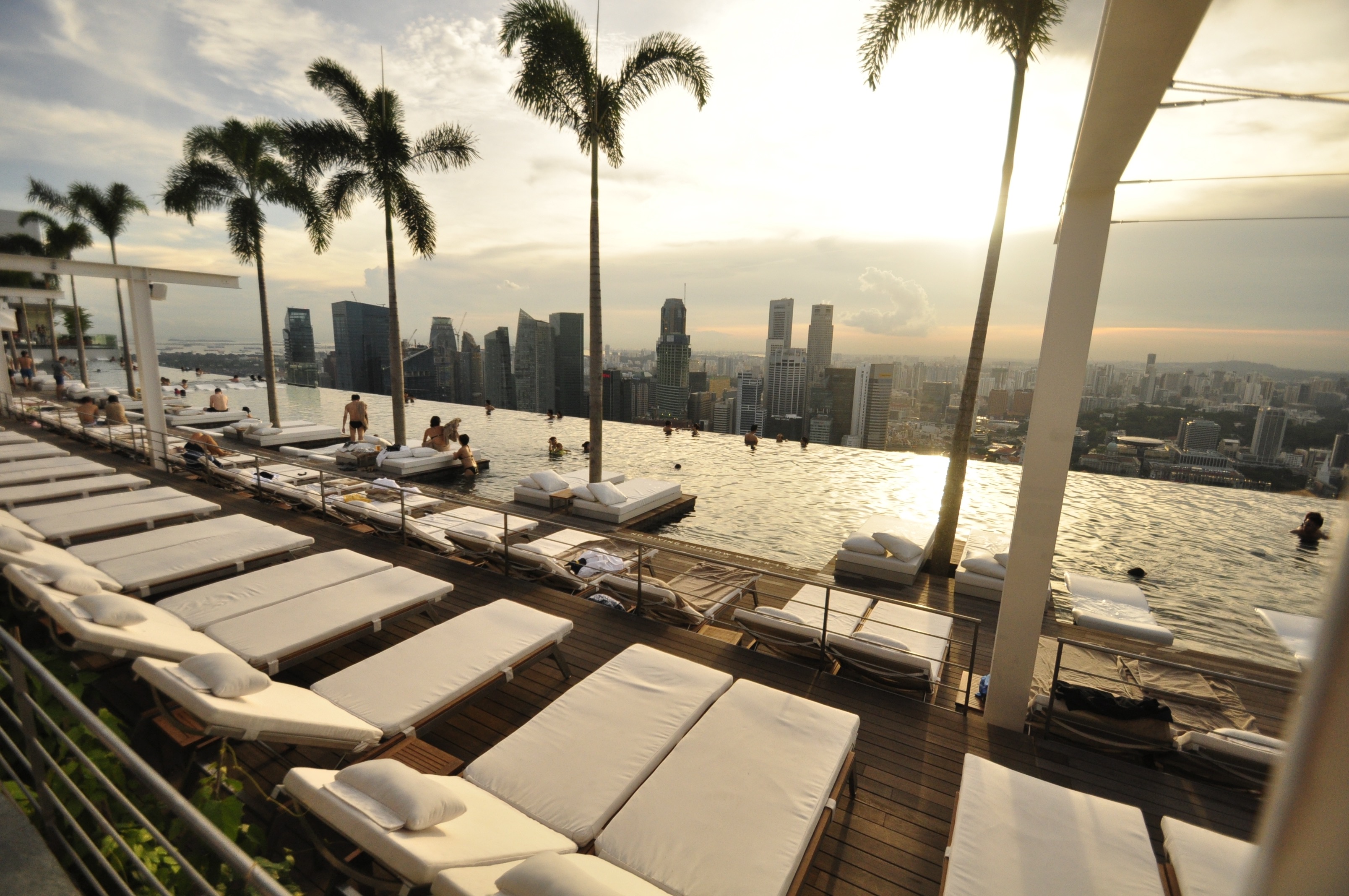
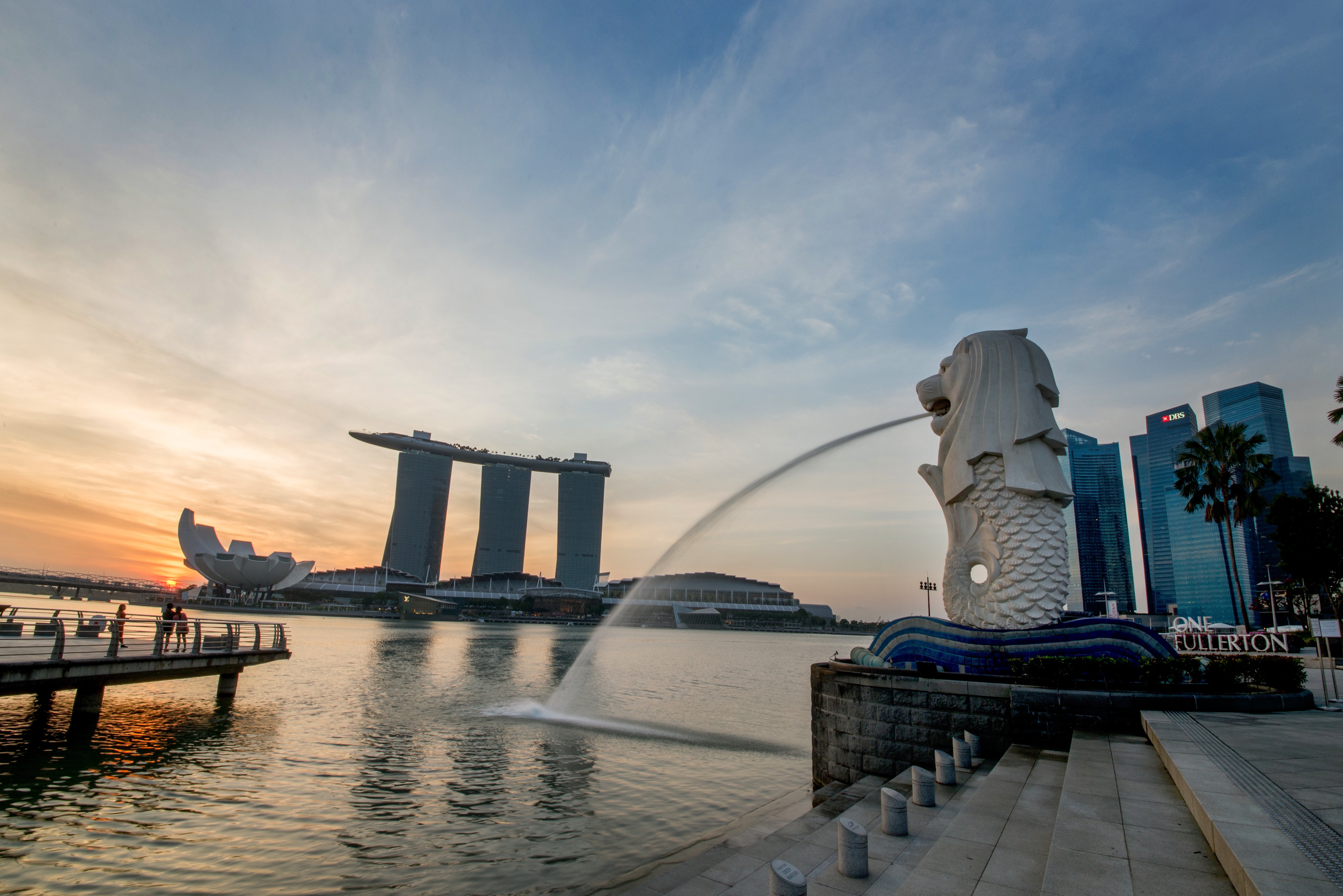
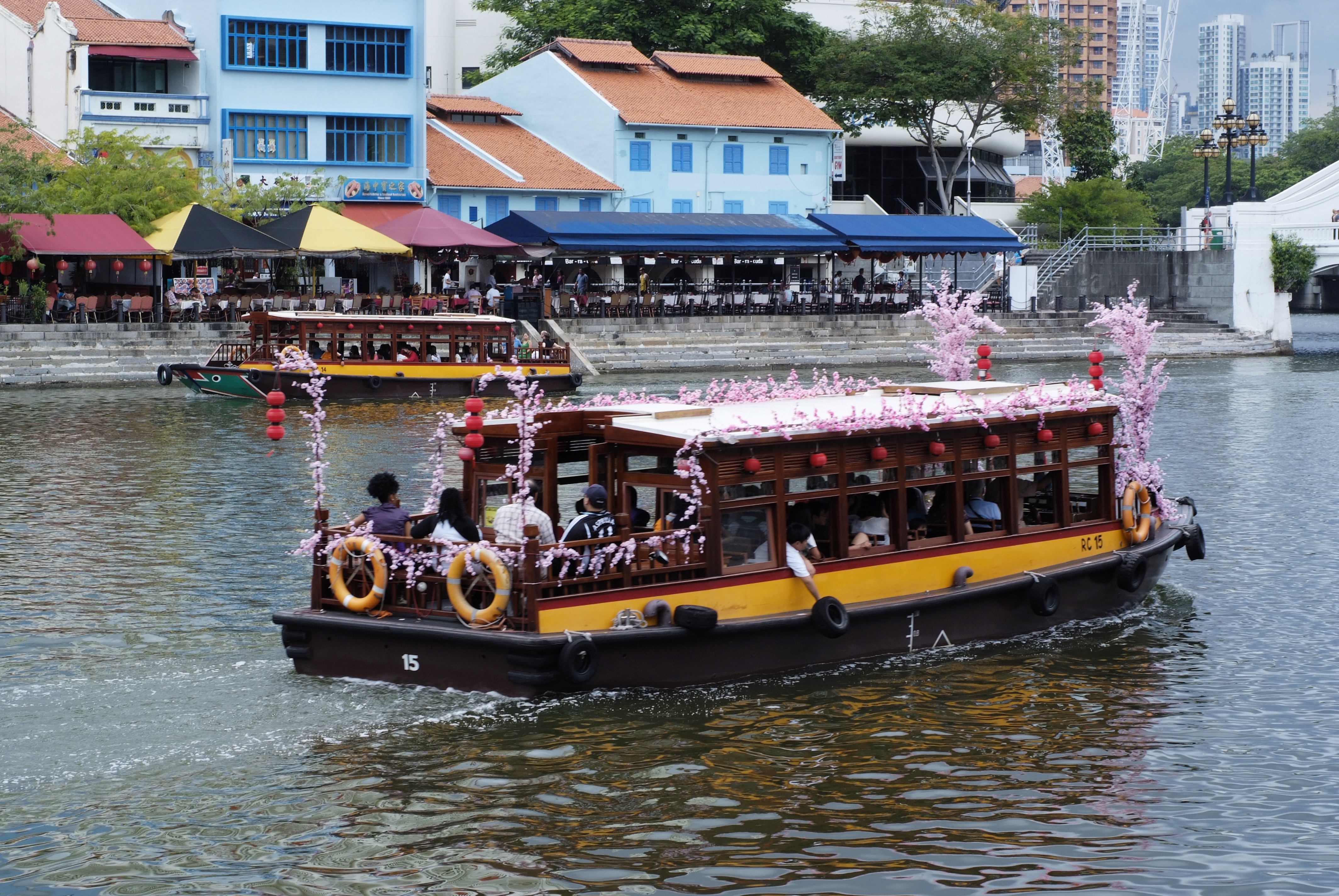
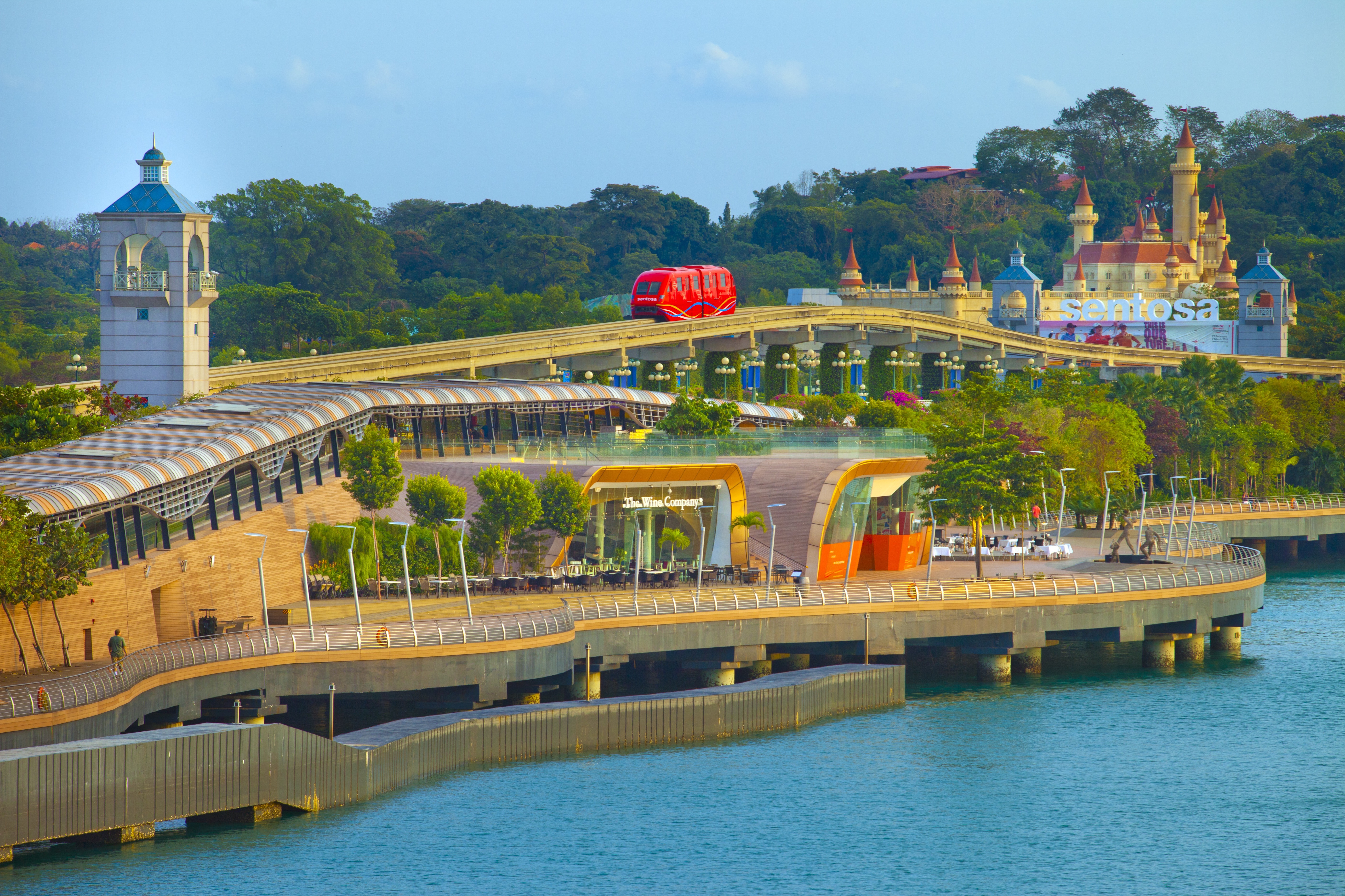
About Singapore
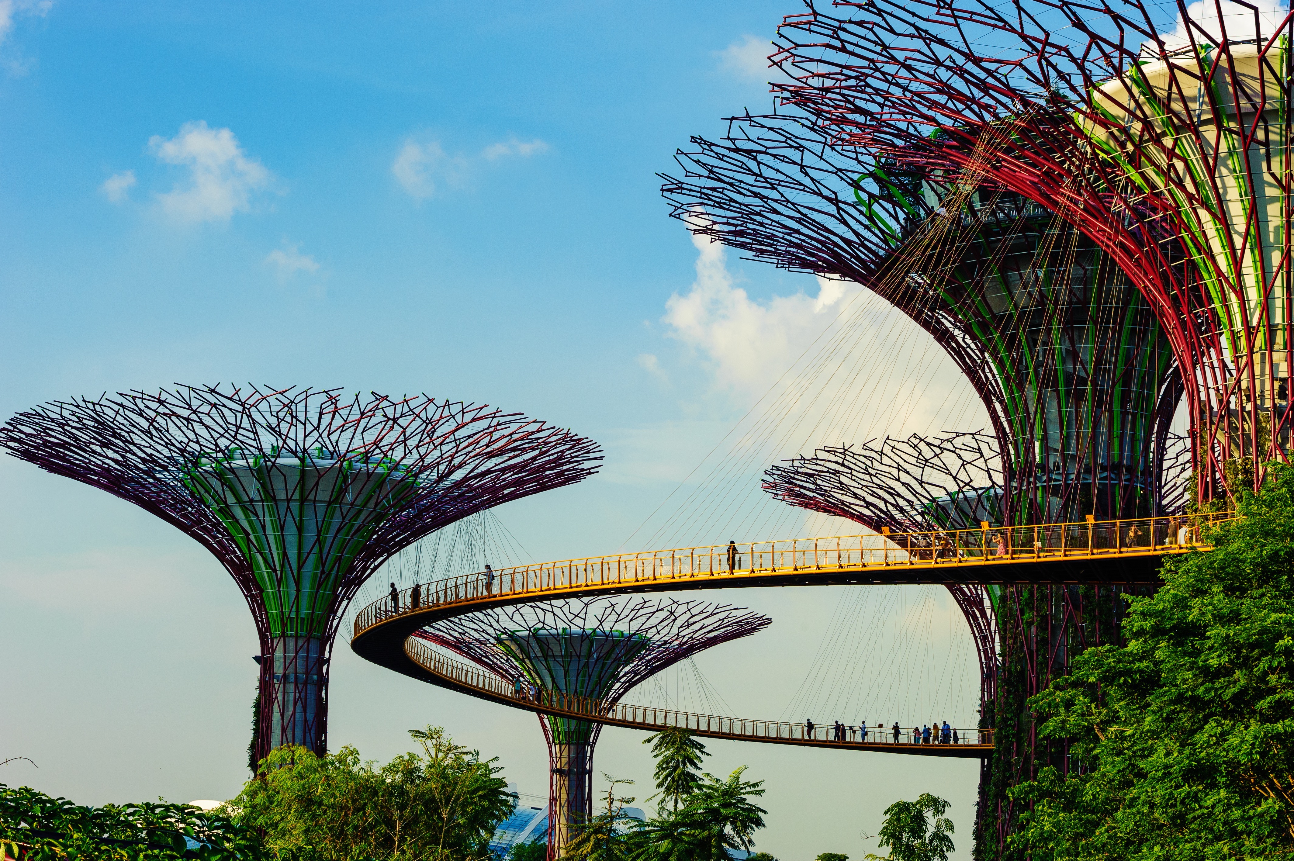
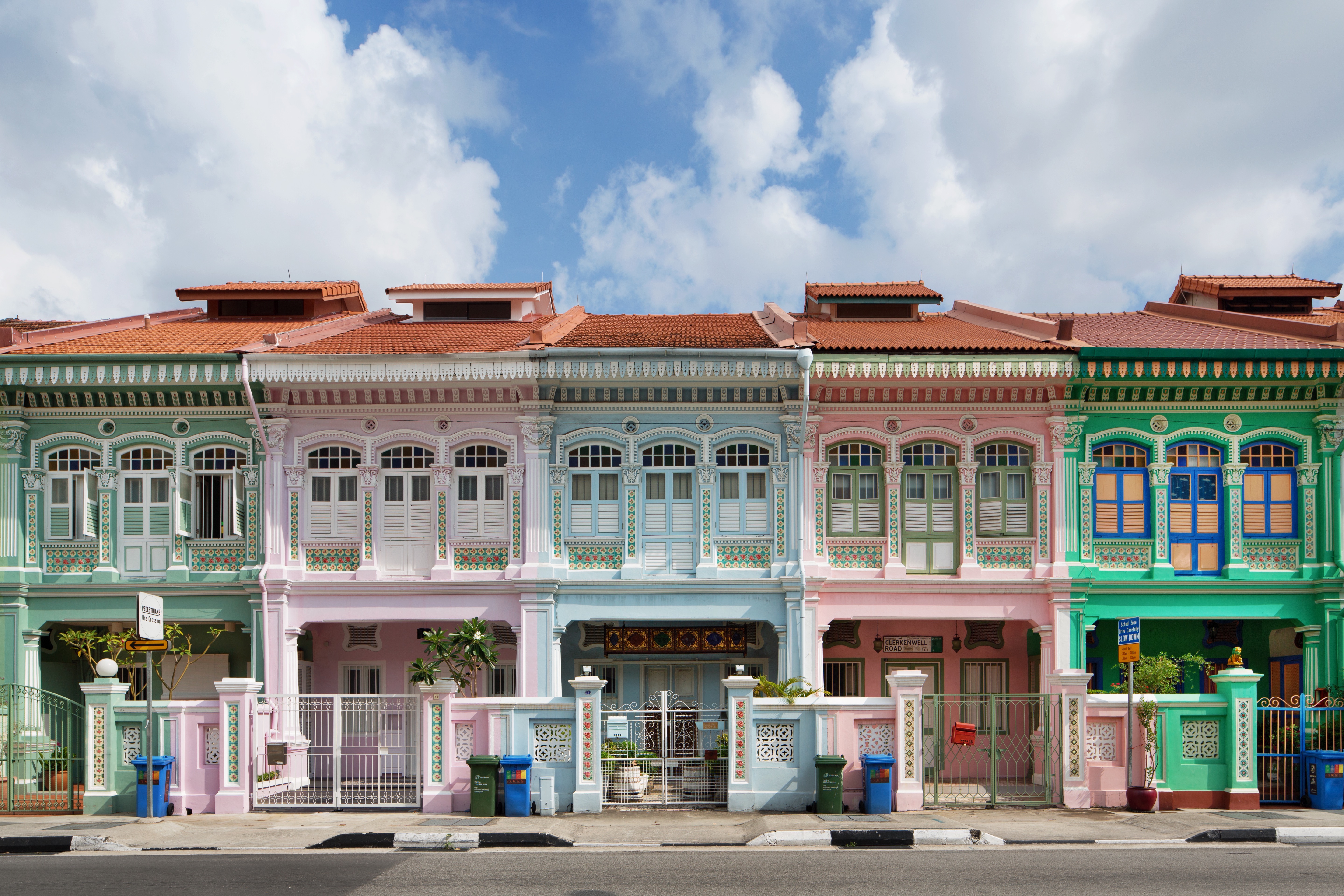
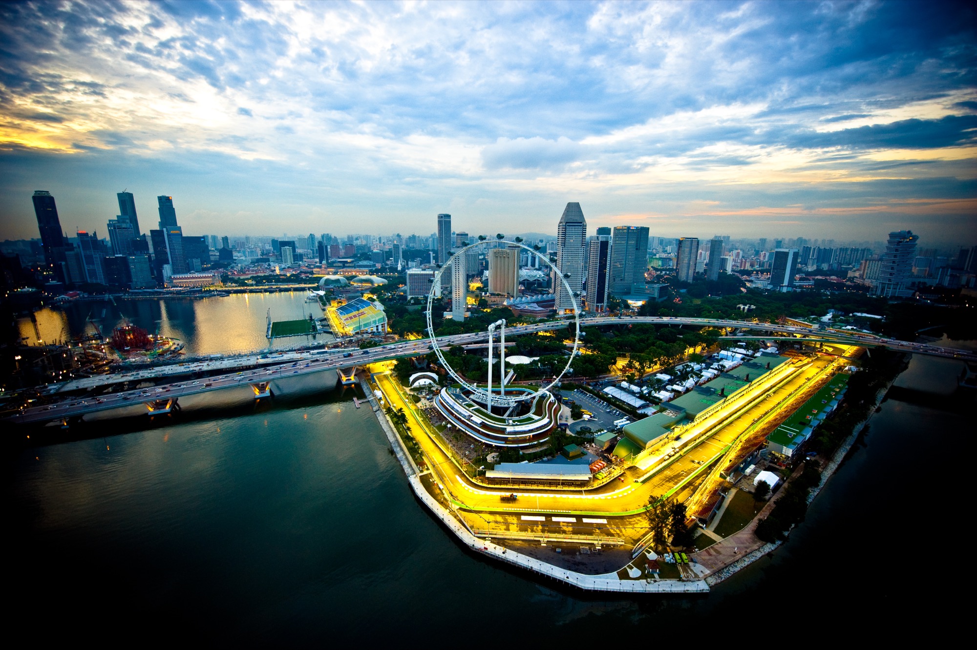
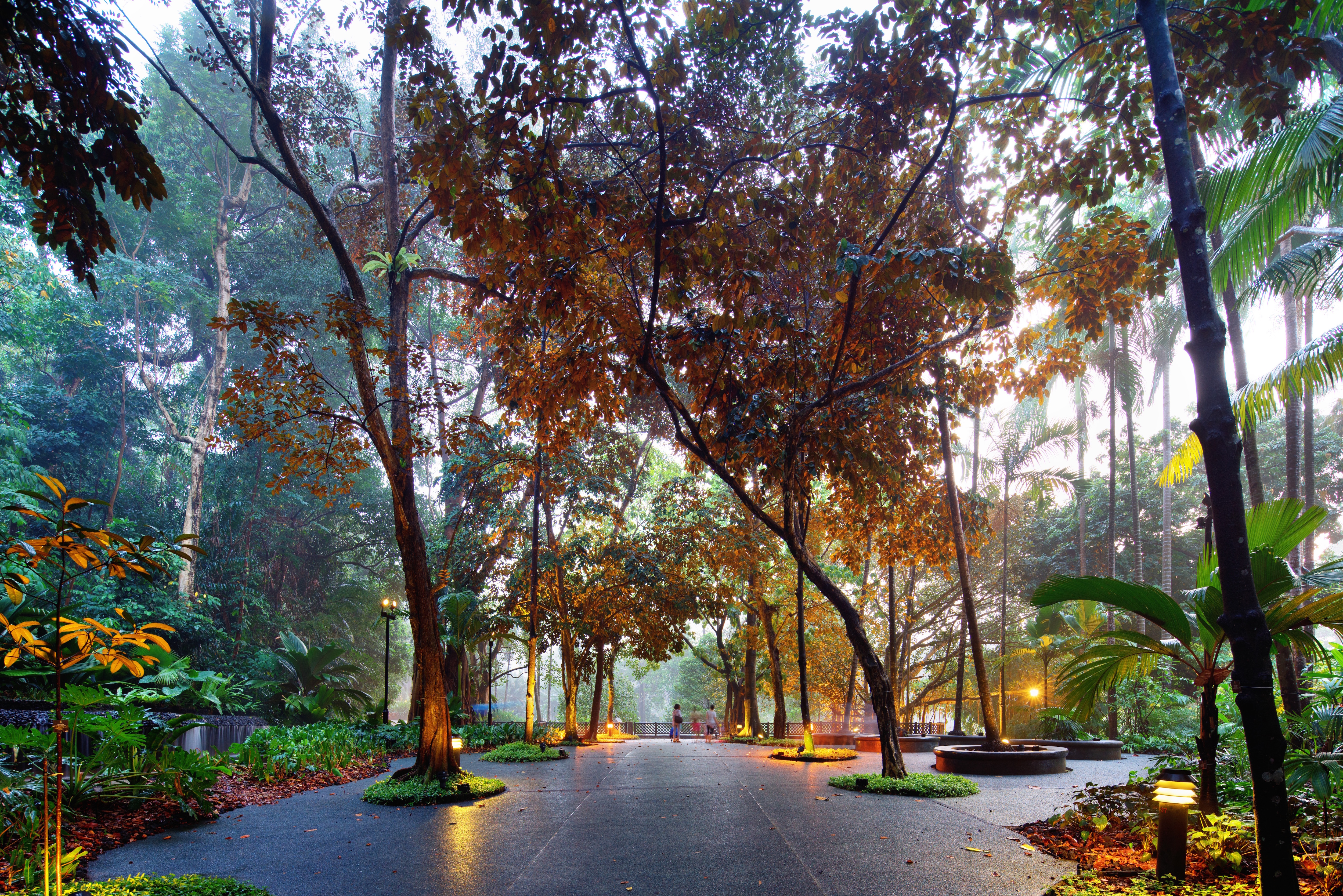
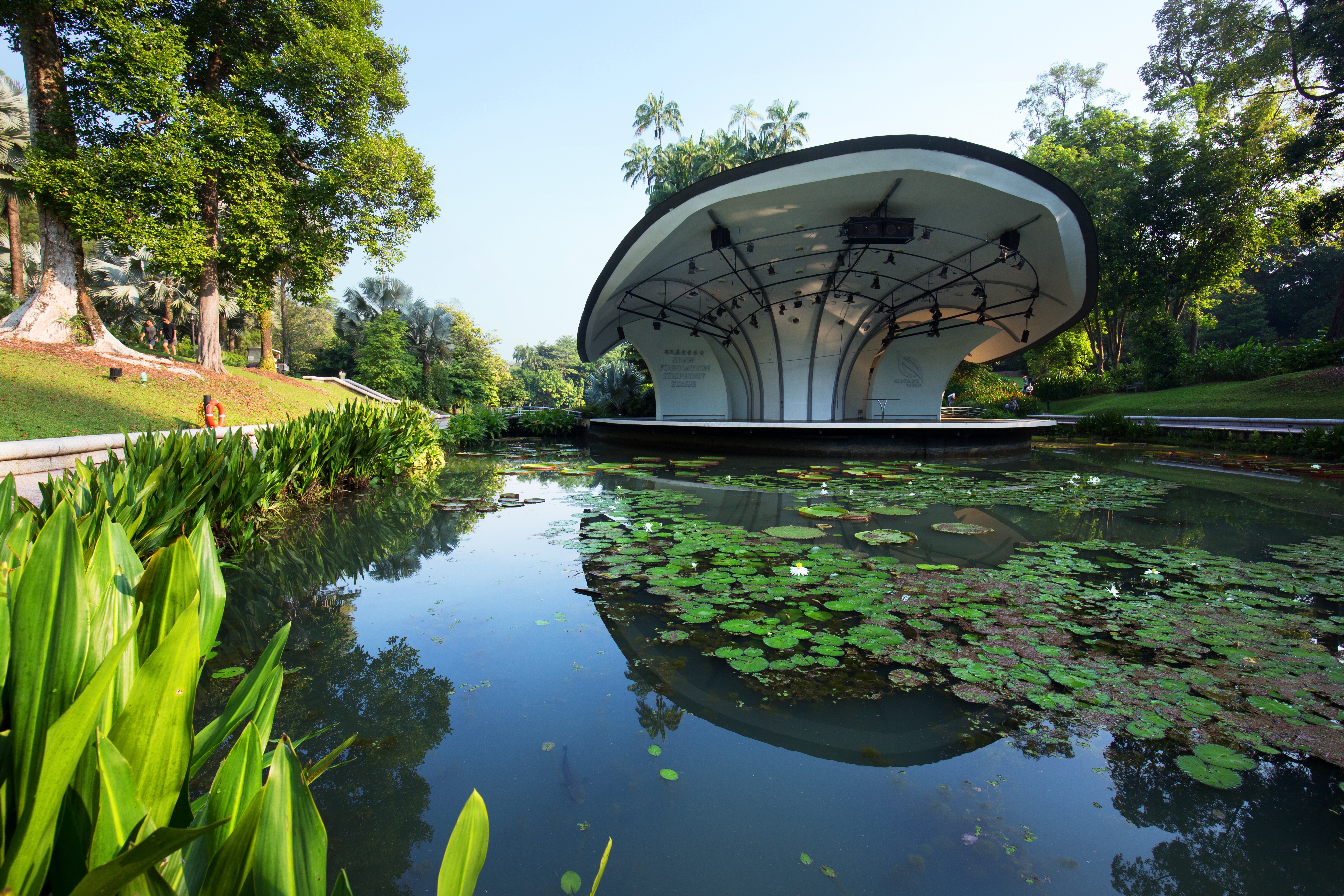
The main island of Singapore is shaped like a flattened diamond, 42 km (26 miles) east to west and 23 km (14 miles) north to south. Near the northern peak is the causeway leading to West Malaysia—Kuala Lumpur is less than four hours away by car. It is at the southern foot where you will find most of the city-state’s action, with its gleaming office towers, working docks, and futuristic "supertrees," which are solar-powered and serve as vertical gardens. Offshore are Sentosa and over 60 smaller islands, most uninhabited, that serve as bases for oil refining or as playgrounds and beach escapes from the city. To the east is Changi International Airport, connected to the city by metro, bus, and a tree-lined parkway. Of the island's total land area, more than half is built up, with the balance made up of parkland, farmland, plantations, swamp areas, and rain forest. Well-paved roads connect all parts of the island, and Singapore city has an excellent, and constantly expanding, public transportation system. The heart of Singapore's history and its modern wealth are in and around the Central Business District. The area includes the skyscrapers in the Central Business District, the 19th-century Raffles Hotel, the convention centers of Marina Square, on up to the top of Ft. Canning. Although most of old Singapore has been knocked down to make way for the modern city, most colonial landmarks have been preserved in the CBD, including early-19th-century buildings designed by the Irish architect George Coleman.
About Singapore
The main island of Singapore is shaped like a flattened diamond, 42 km (26 miles) east to west and 23 km (14 miles) north to south. Near the northern peak is the causeway leading to West Malaysia—Kuala Lumpur is less than four hours away by car. It is at the southern foot where you will find most of the city-state’s action, with its gleaming office towers, working docks, and futuristic "supertrees," which are solar-powered and serve as vertical gardens. Offshore are Sentosa and over 60 smaller islands, most uninhabited, that serve as bases for oil refining or as playgrounds and beach escapes from the city. To the east is Changi International Airport, connected to the city by metro, bus, and a tree-lined parkway. Of the island's total land area, more than half is built up, with the balance made up of parkland, farmland, plantations, swamp areas, and rain forest. Well-paved roads connect all parts of the island, and Singapore city has an excellent, and constantly expanding, public transportation system. The heart of Singapore's history and its modern wealth are in and around the Central Business District. The area includes the skyscrapers in the Central Business District, the 19th-century Raffles Hotel, the convention centers of Marina Square, on up to the top of Ft. Canning. Although most of old Singapore has been knocked down to make way for the modern city, most colonial landmarks have been preserved in the CBD, including early-19th-century buildings designed by the Irish architect George Coleman.
About Port Klang
Kuala Lumpur, or KL as locals refer to it, intrigues visitors with its diversity and multicultural character. The city's old quarter features stretches of shop houses that hint at its colonial past, while modern buildings—including the iconic Petronas Towers—give a glimpse of its modern financial ambitions. The city is filled with culturally colorful quarters dedicated to Chinese, Malay, and Indian communities. New shopping malls with designer labels, five-star hotels, and top-notch restaurants also proliferate in this bustling city of 1.6 million.
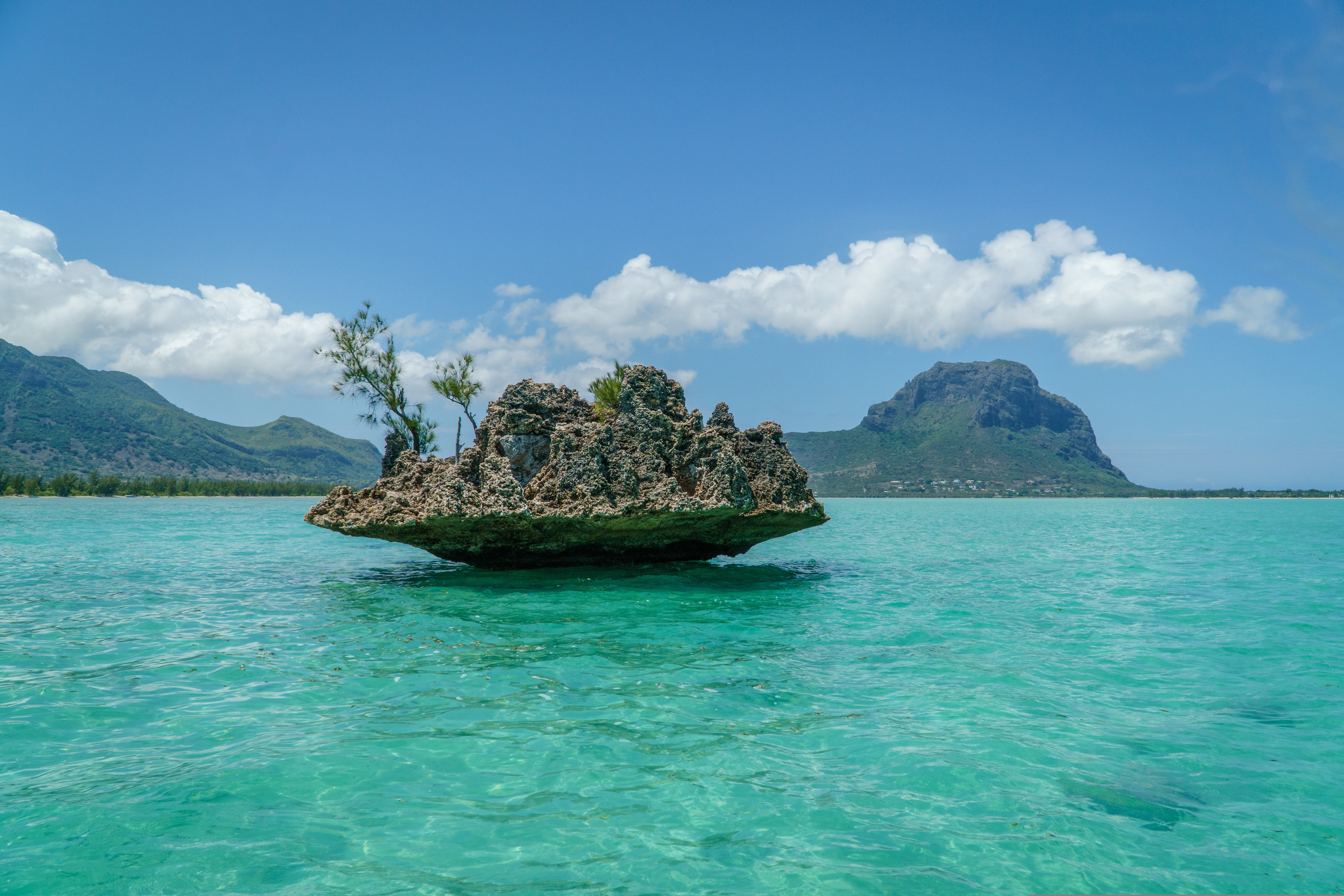
About Mauritius
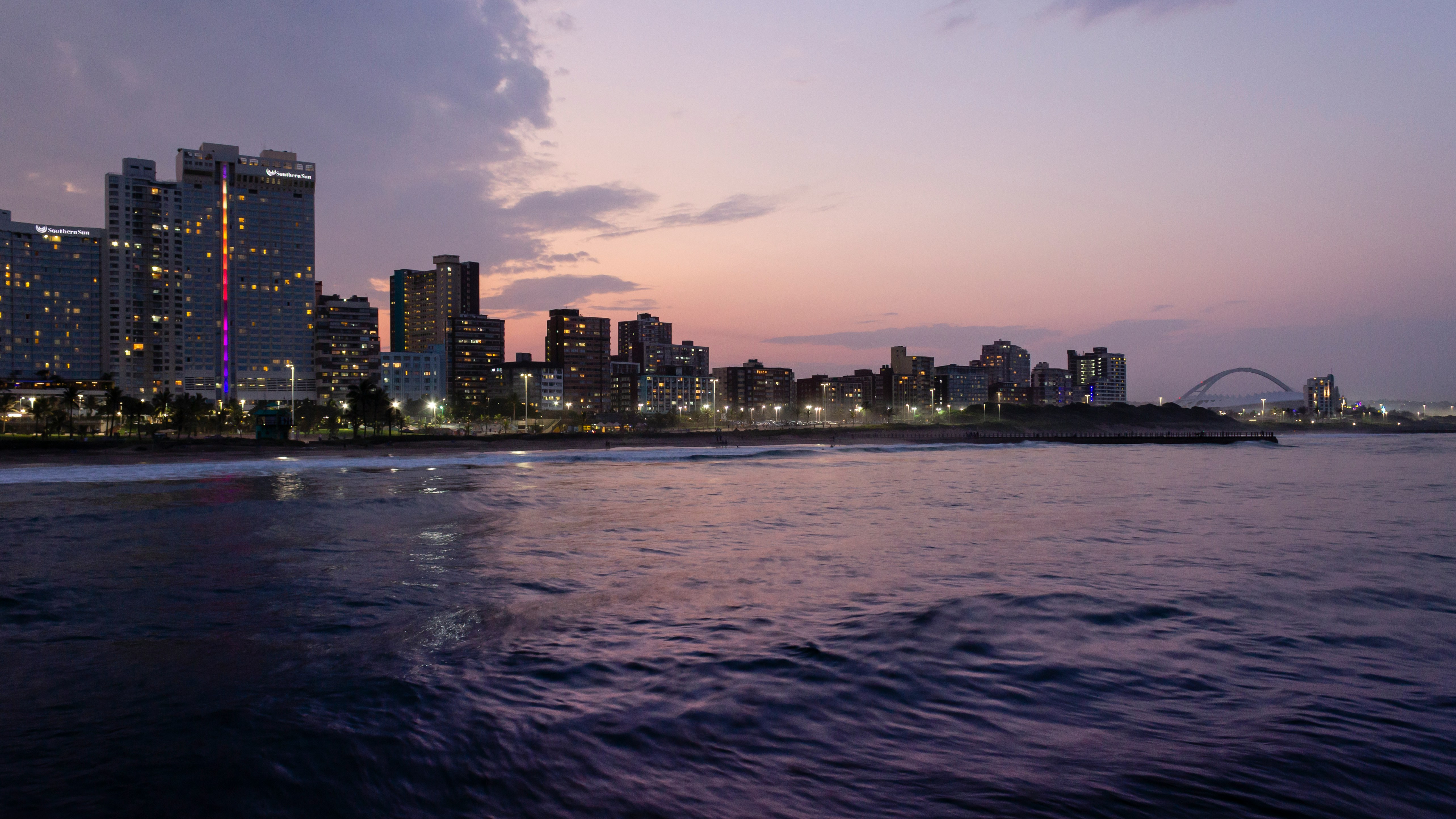
About Durban
Durban, a glistening jewel on the south-east coast of Africa, is the third largest city in South Africa and the major city of KwaZulu-Natal. It has been a centre of sea trade since before colonisation and now has a flourishing artistic centre, which perfectly complements the vibrant markets and rich cultures of the city. Durban’s port is a natural half-moon harbour lined with white sand and azure water, punctuated by the port’s many piers which reach into the water like the leaves of a fan. The beaches of Durban’s famous Golden Mile stretch along the harbour and are popular all year round, as travellers and locals alike enjoy Durban’s warm, humid summers and mild, dry winters.
About Cape Town
Sometimes referred to as the Mother City, Cape Town is the most famous port in South Africa and is influenced by many different cultures, including Dutch, British and Malay. The port was founded in 1652 by Dutch explorer Jan Van Riebeeck, and evidence of Dutch colonial rule remains throughout the region. The port is located on one of the world's most important trade routes, and is mainly a container port and handler of fresh fruit. Fishing is another vital industry, with large Asian fishing fleets using Cape Town as a logistical repair base for much of the year. The region is famous for its natural beauty, with the imposing Table Mountain and Lions Head, as well as the many nature reserves and botanical gardens such as Kirstenbosch which boasts an extensive range of indigenous plant life, including proteas and ferns. Cape Town's weather is mercurial, and can change from beautiful sunshine to dramatic thunderstorms within a short period. A local adage is that in Cape Town you can experience four seasons in one day.
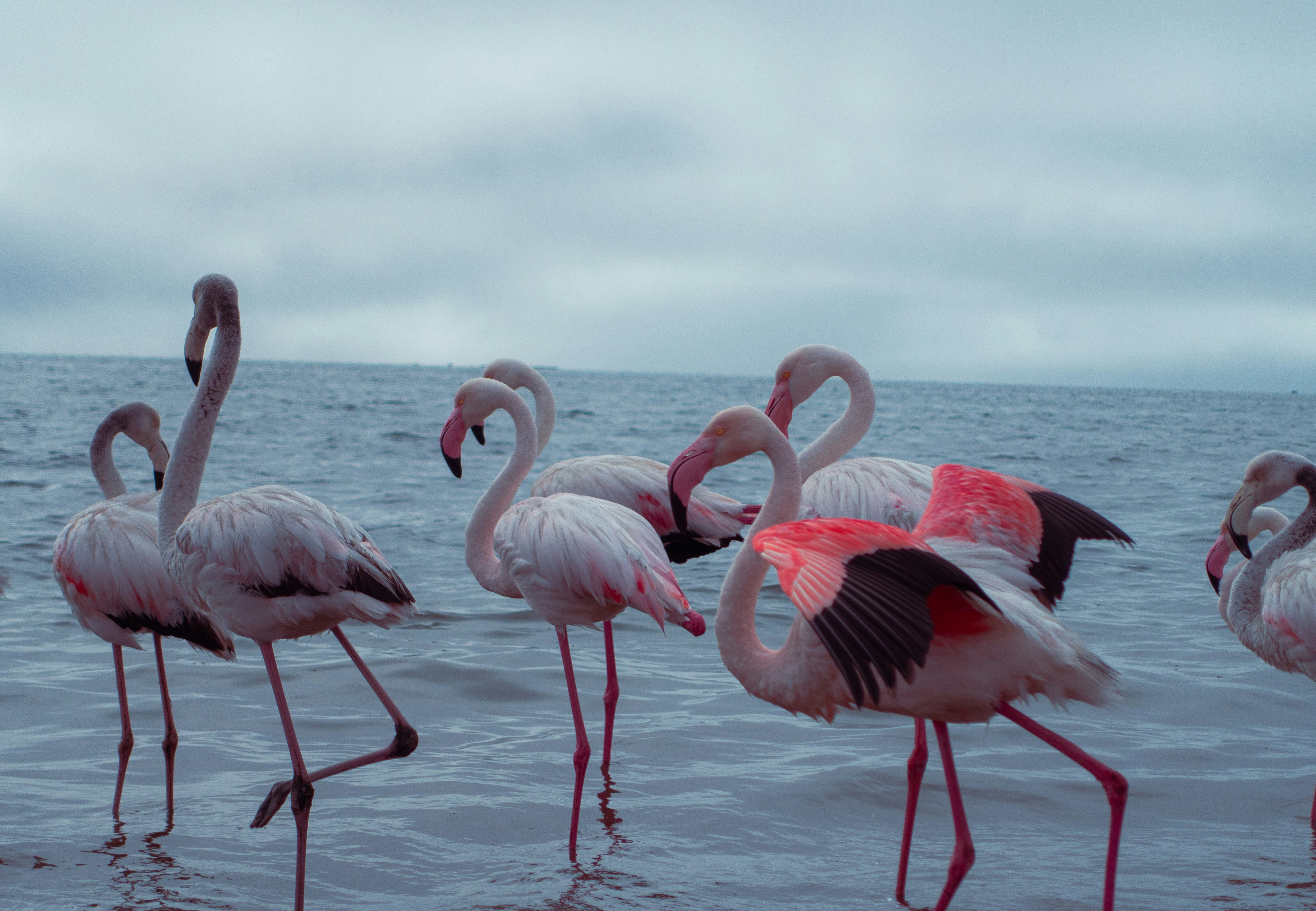
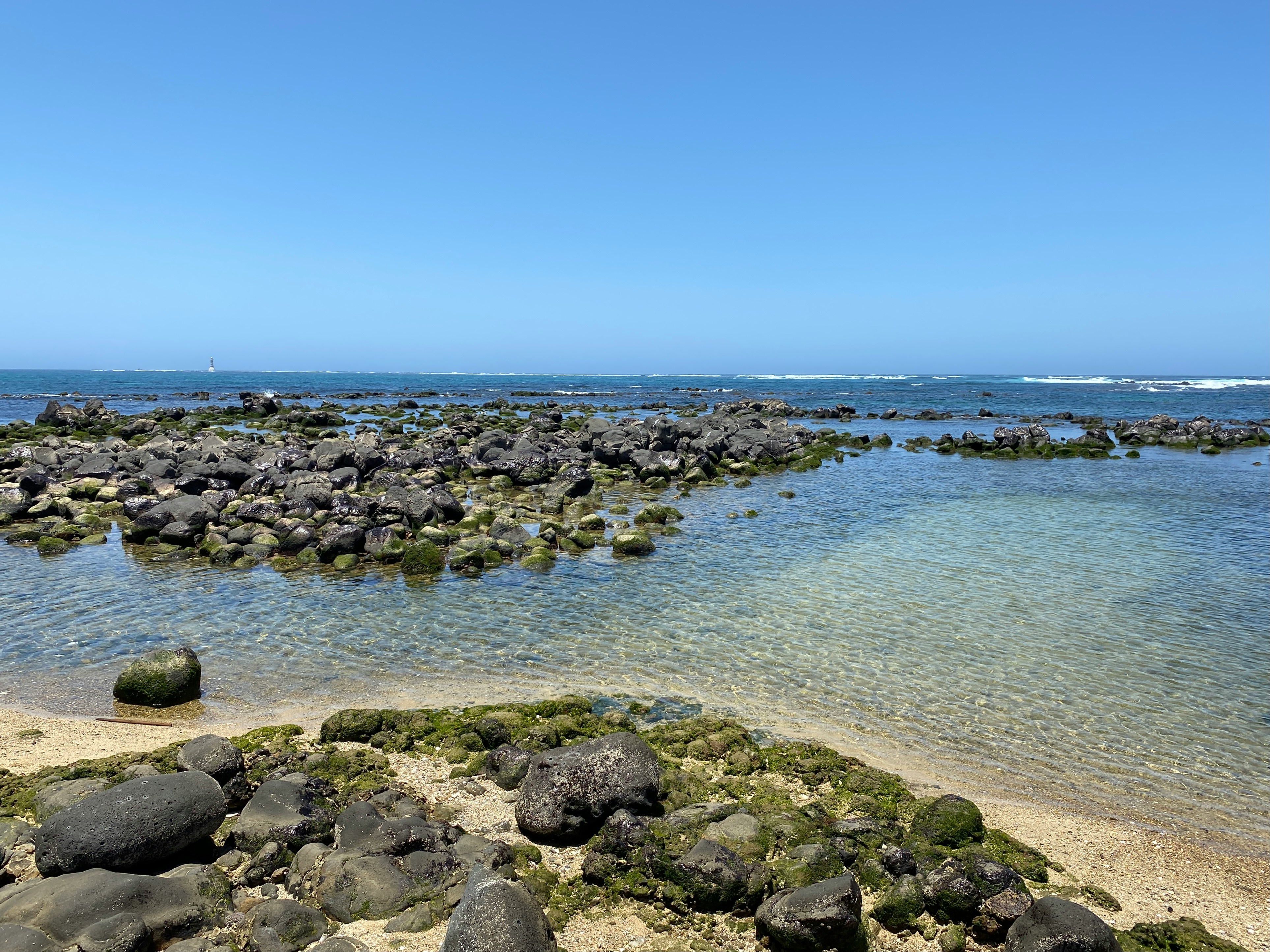
About Walvis Bay
Once a whaling station, Walvis Bay provides a gateway to the extraordinary desert landscapes of Namibia and is itself an area of unusual natural beauty. The showpiece of the Walvis Bay area is the natural lagoon where you can see flamingos in their thousands at certain times of the year, along with a variety of other wading birds such as the white pelican. Further inland you will find the stunning Namib Desert, which provides an unlikely home for a diverse array of wildlife. Alternatively, you could venture into the desert of Sossusvlei, whose mountainous ochre sand dunes are said to be the highest in the world, or visit the colonial town of Swakopmund.

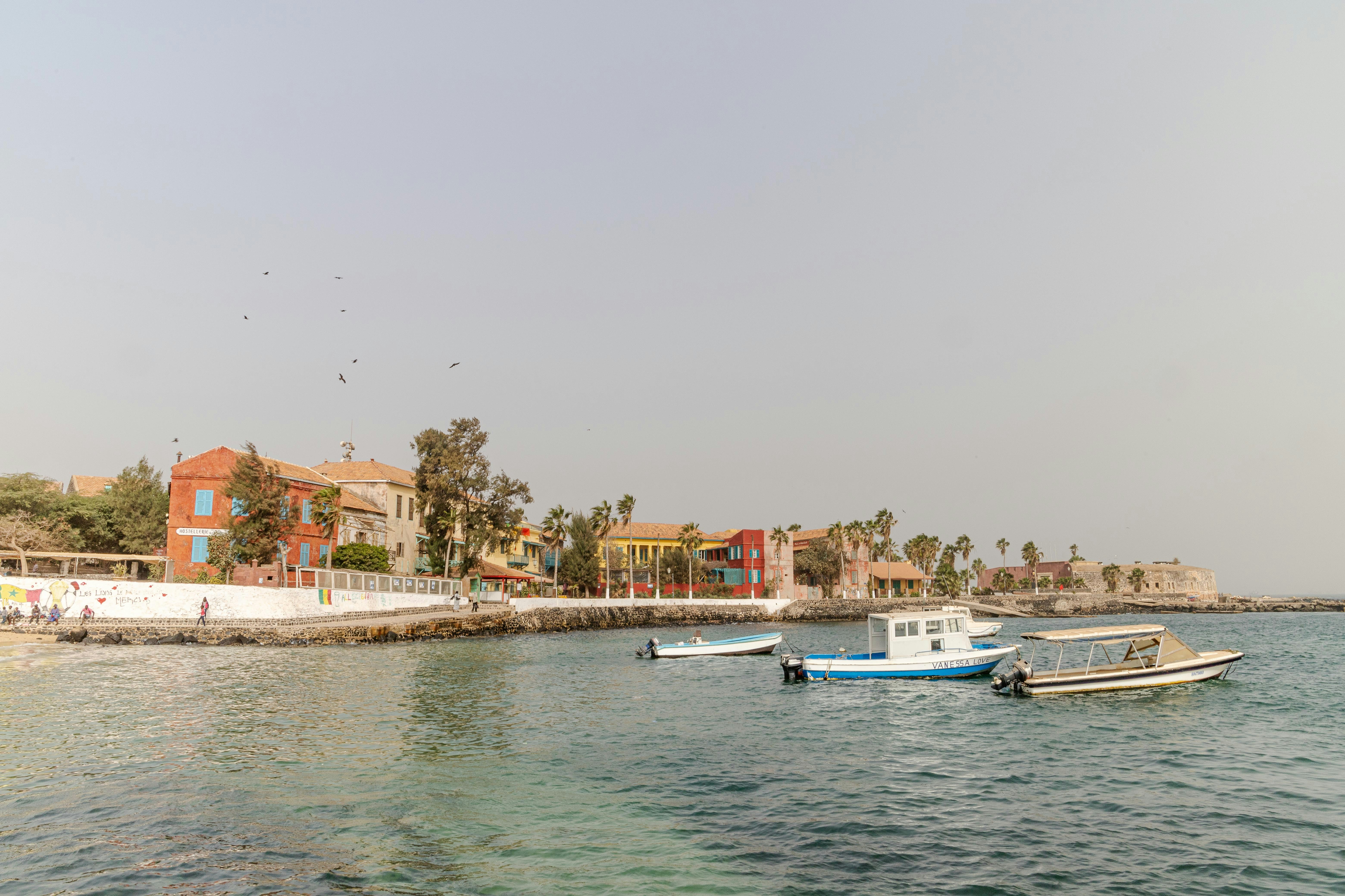
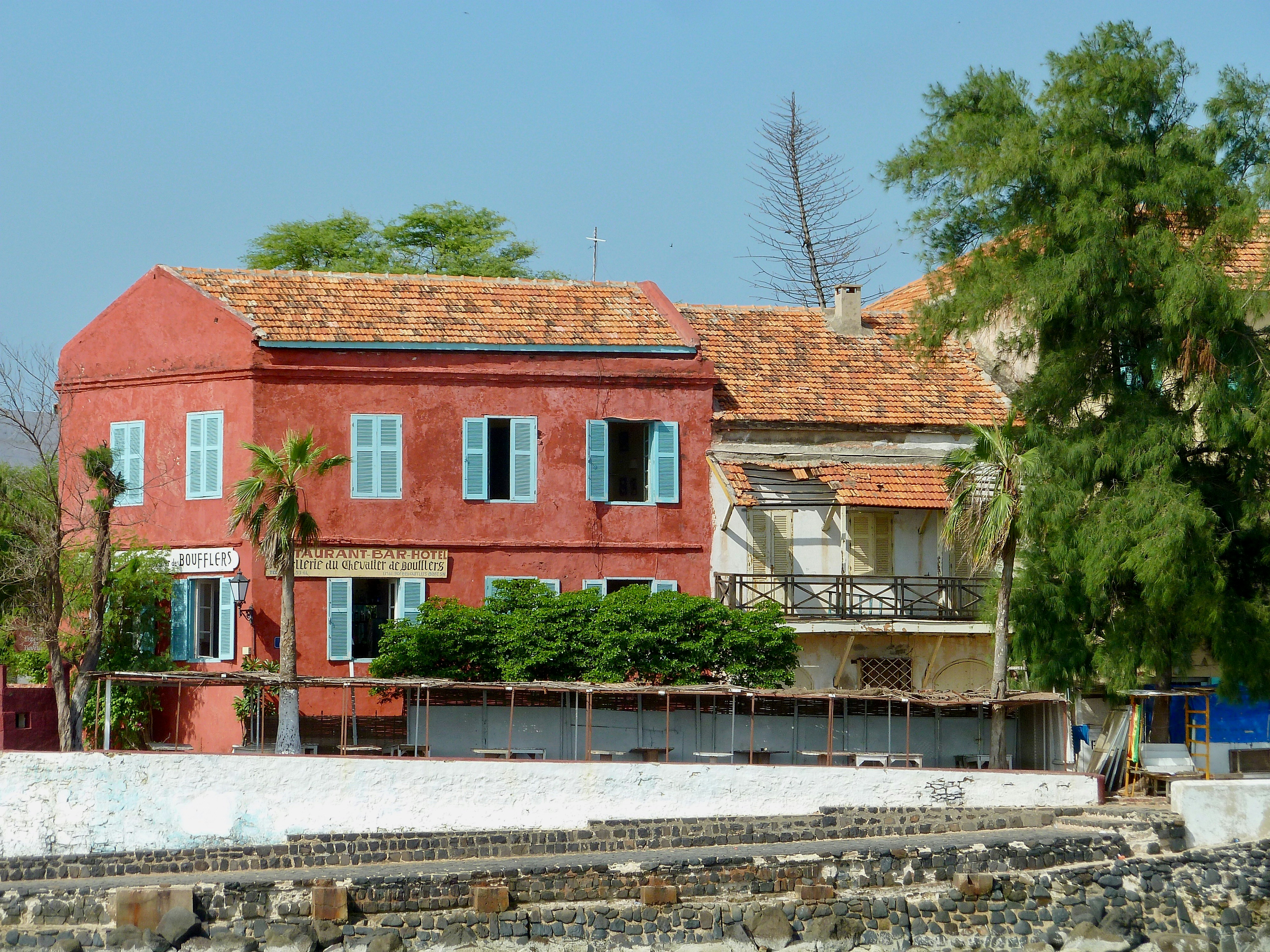
About Dakar
Dakar, set at the tip of the Cape Vert peninsula, is West Africa’s westernmost point and the capital of French-speaking Senegal. Although it was not founded until 1857, it is West Africa’s oldest European city and one of the most westernised. The opening of the Dakar-St Louis railway in 1885 put the town on the map; it subsequently became a French naval base and in 1904, the capital of Afrique Occidentale Française. It bears the legacy of Africa’s French colonial past, especially so in the downtown Plateau area, where the architecture is redolent of southern France. Every inch a modern city, Dakar is a frenetic buzz of activity, which can be startling. Perhaps sample the popular mint tea and try your hand at bartering in the colourful craft markets for traditional embroidery, woodcarvings, metalwork and costume jewellery.

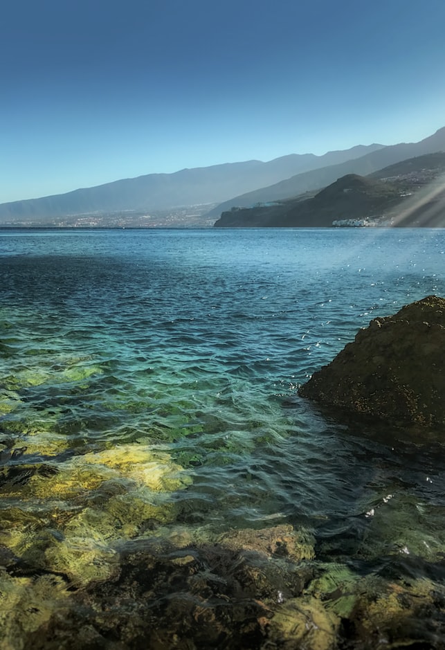
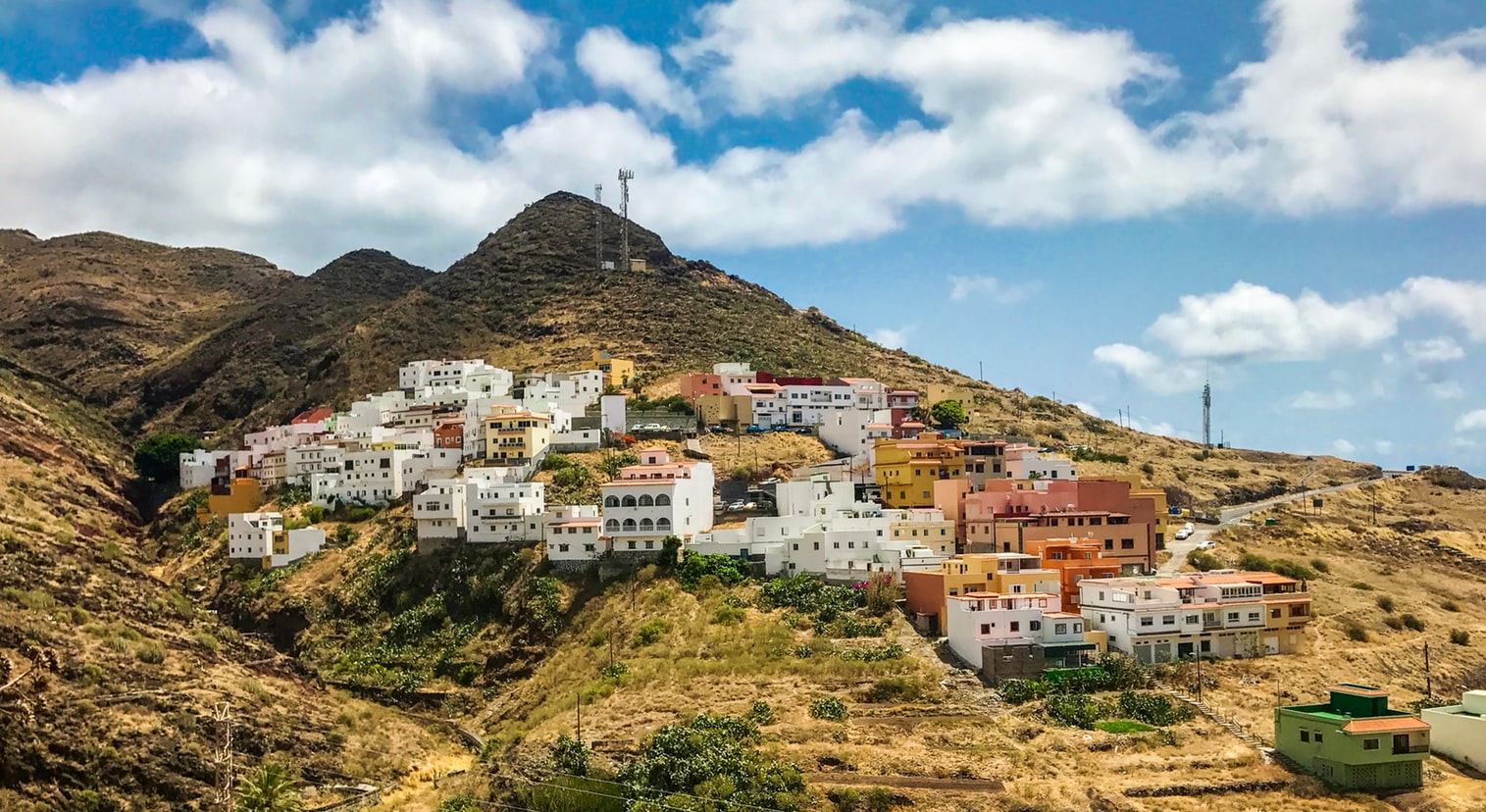
About Santa Cruz de Tenerife
The largest of the Canary Islands, Tenerife is a beautiful and scenic island which enjoys year-round sunshine and is dominated by Mount Teide. The mountain range runs through the centre of the island, with fertile valleys on the northern side. In the central part of the range is the gigantic natural crater of the Cañadas del Teide, about 14 miles in diameter. Santa Cruz, the island’s pretty capital, was originally a small fishing village but has now grown into a modern city, and also contains 16th-century civic buildings and ornate private mansions. Near the pier is the Santa Cruz Palmetum, a Botanical Garden covering an area of 29 acres, specialising in palms.


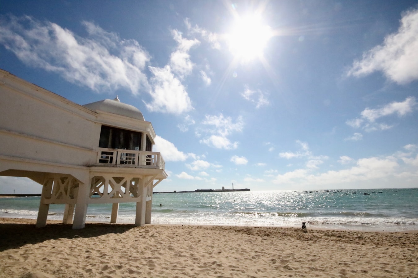
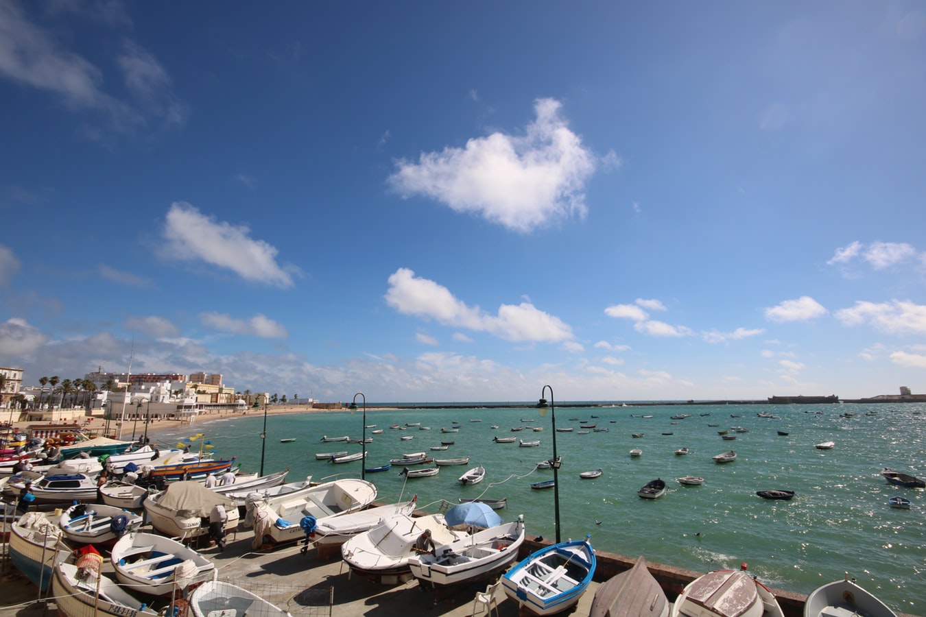
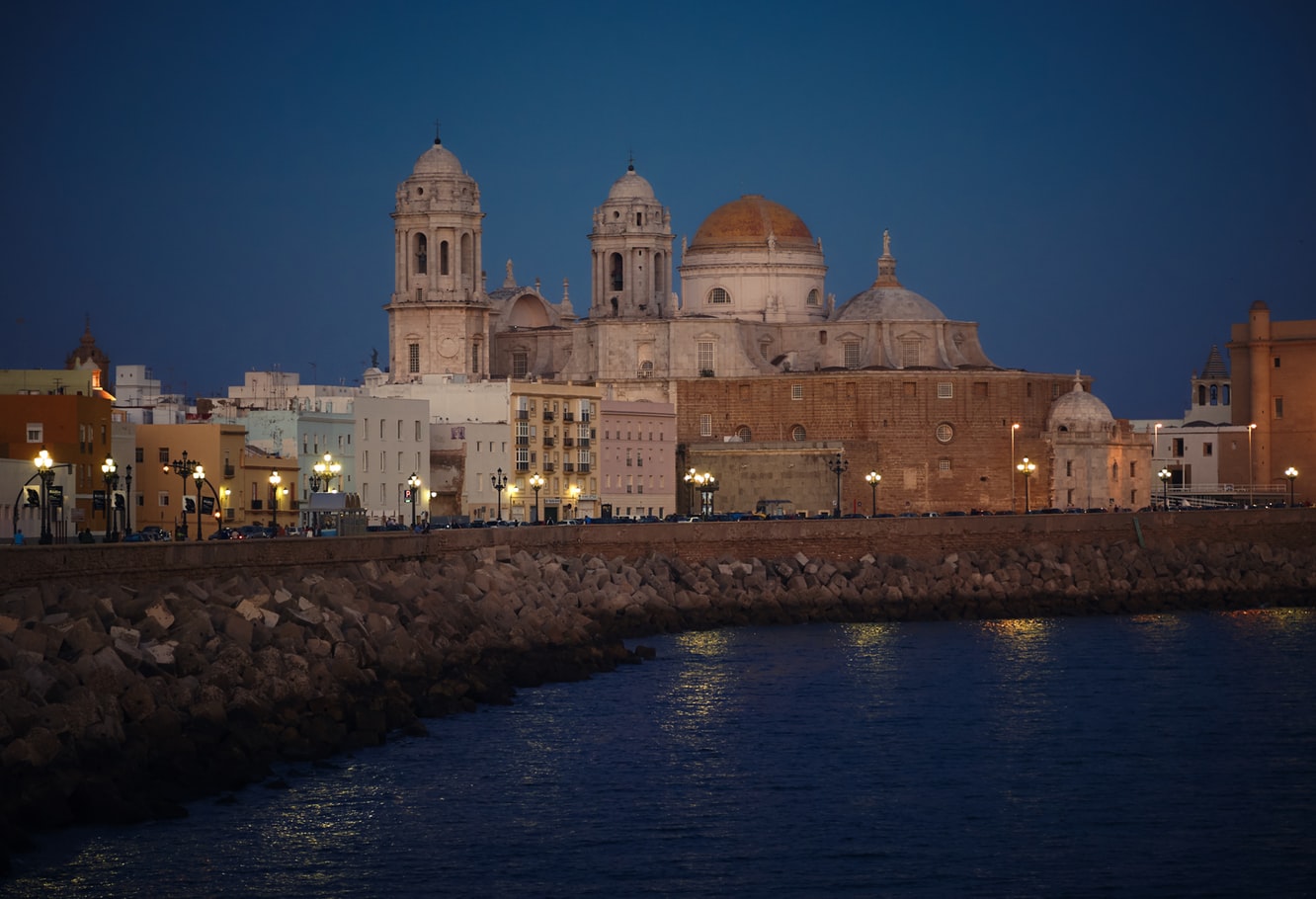
About Cádiz
Believed to be the oldest town on the Iberian Peninsula, the Andalusian port of Cádiz enjoys a stunning location at the edge of a six-mile promontory. The town itself, with 3,000 years of history, is characterised by pretty white houses with balconies often adorned with colourful flowers. As you wander around be sure to take a stroll through the sizeable Plaza de Espãna, with its large monument dedicated to the first Spanish constitution, which was signed here in 1812. Cádiz has two pleasant seafront promenades which boast fine views of the Atlantic Ocean, and has a lovely park, the Parque Genoves, located close to the sea with an open-air theatre and attractive palm garden. Also notable is the neo-Classical cathedral, capped by a golden dome.
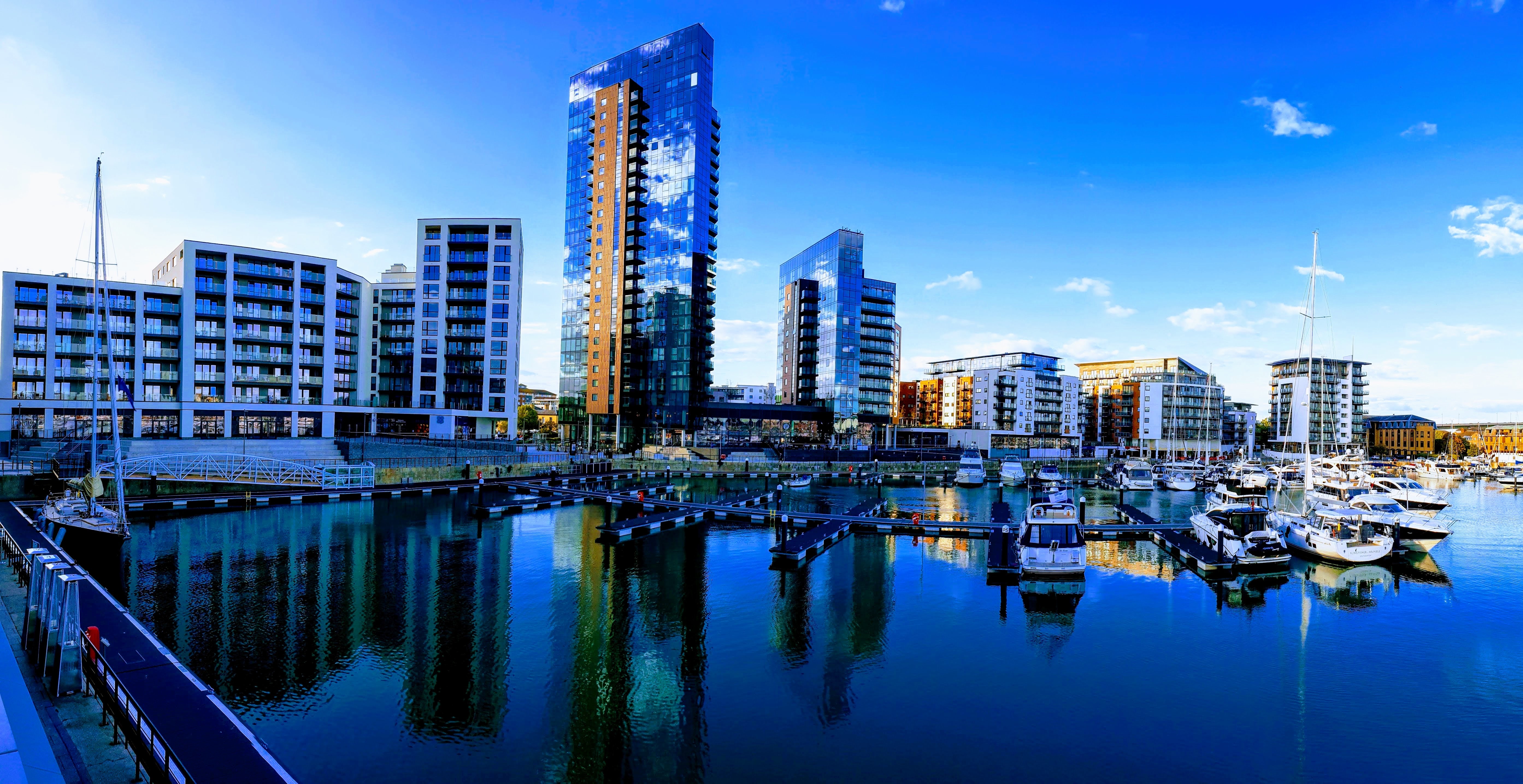
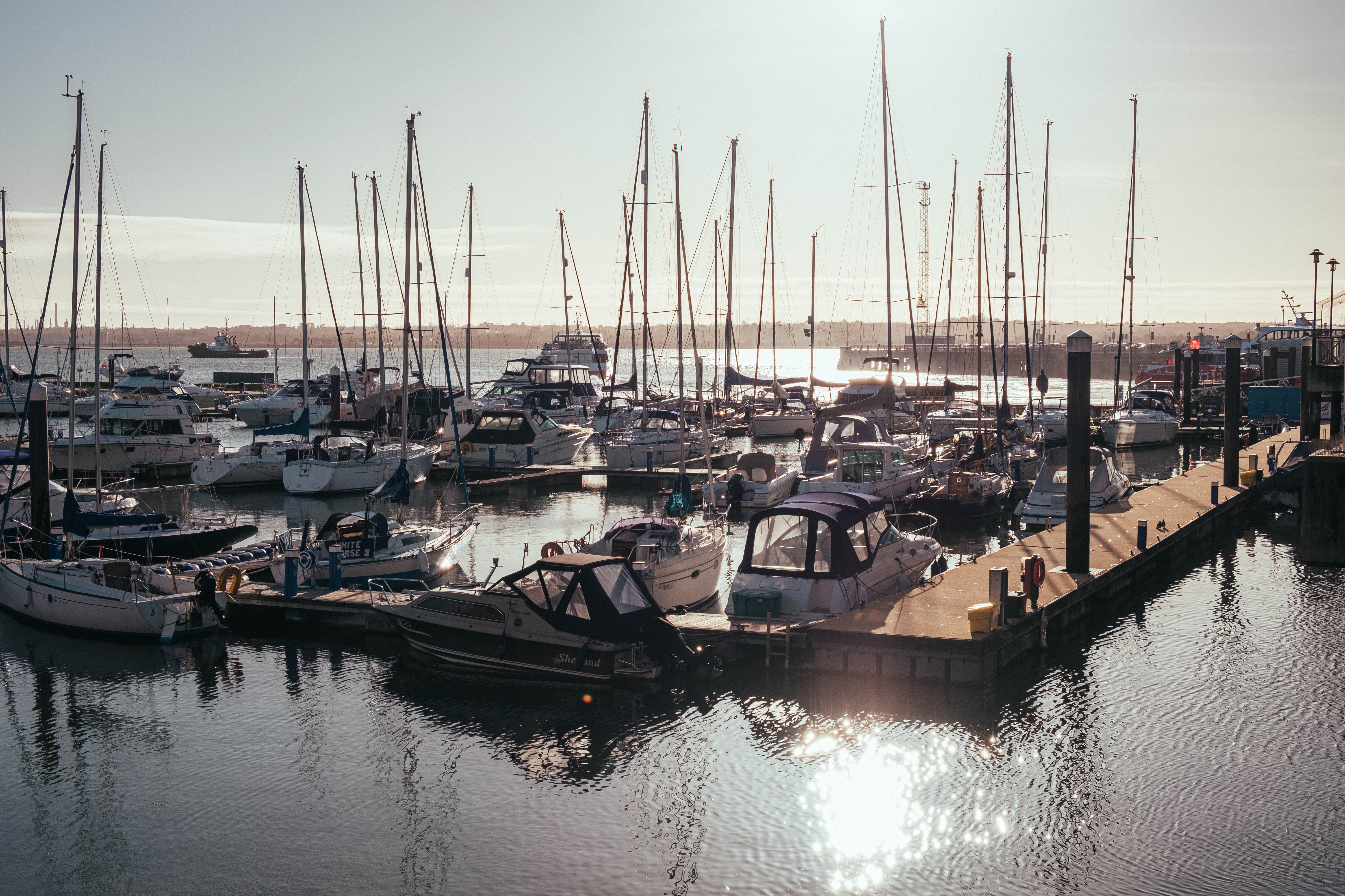
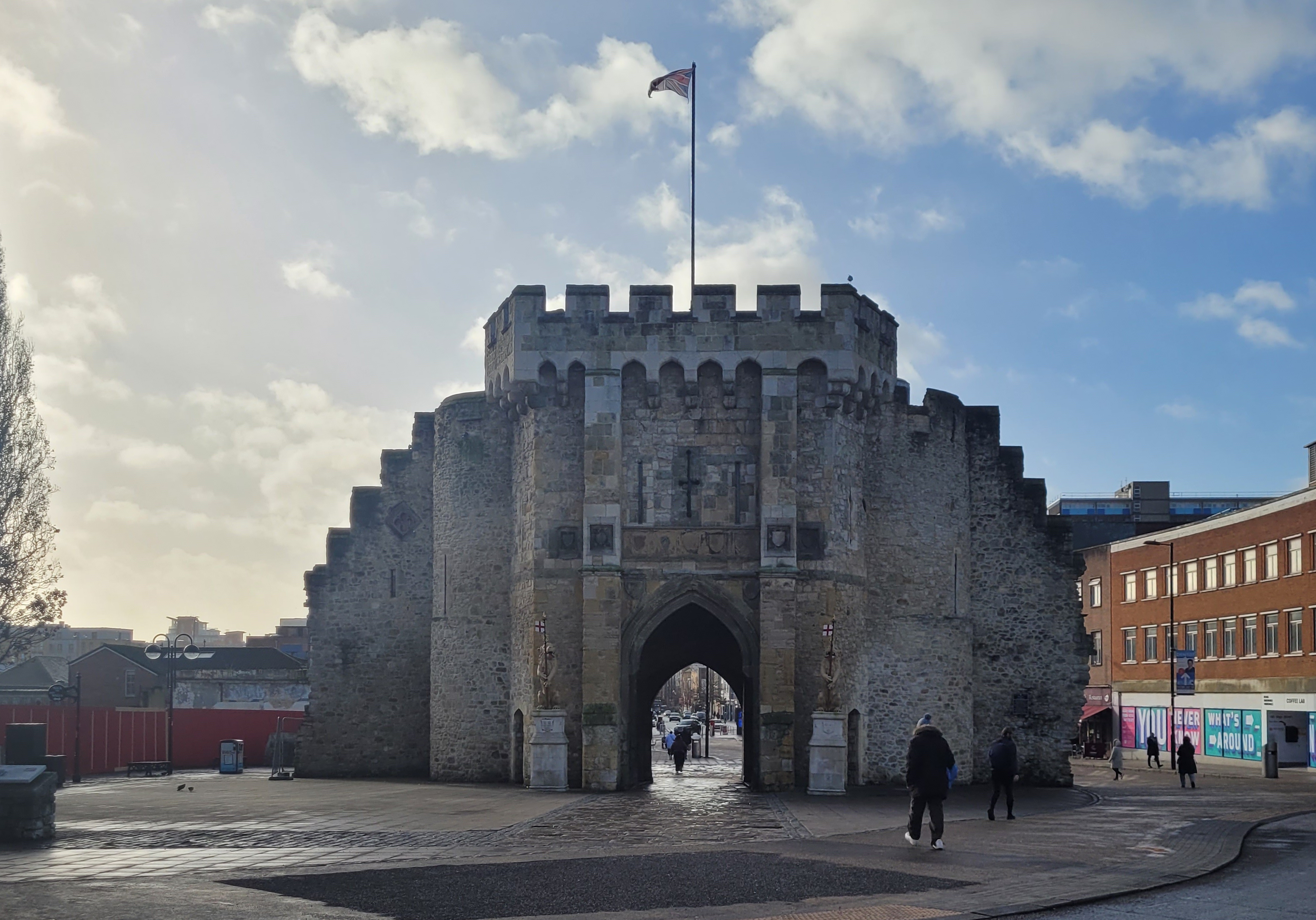
About Southampton
Lying near the head of Southampton Water, a peninsula between the estuaries of the Rivers Test and Itchen, Southampton is Britain’s largest cruise port. It has been one of England’s major ports since the Middle Ages, when it exported wool and hides from the hinterland and imported wine from Bordeaux. The city suffered heavy damage during World War Two and as a result the centre has been extensively rebuilt, but there are still some interesting medieval buildings including the Bargate, one of the finest city gatehouses in England.

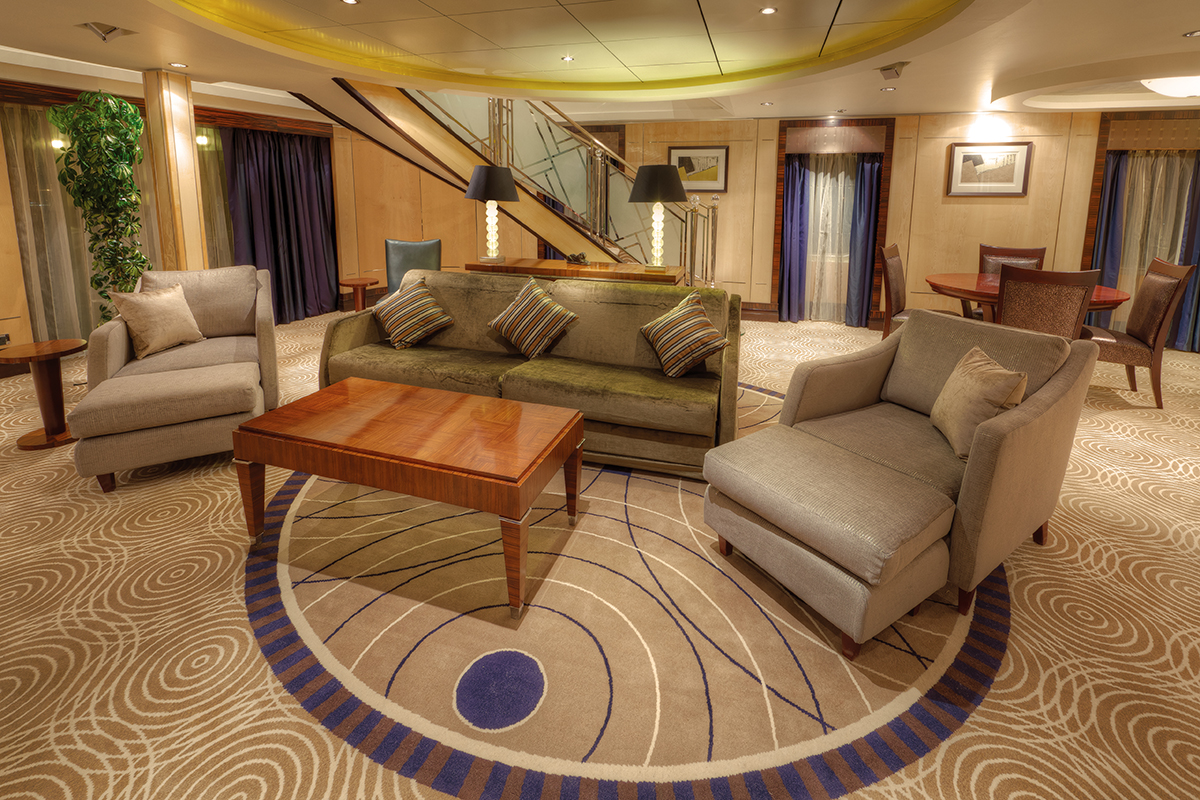
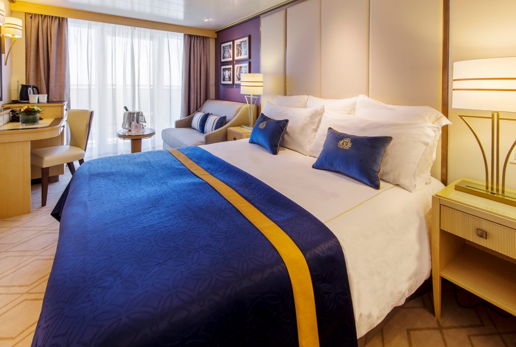
Approximately 2249 sq. ft.
Retreat to an exclusive world of luxury with your own private residence at sea. Bold, striking colours and thoughtful designs bring each space in your suite to life. An attentive butler is on hand at all times to truly customise your voyage experience.
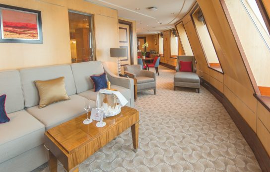
The Queens Grill Grand Duplex includes:
- Over 2,000 square feet of private living space, spread over two floors.
- Access to the exclusive Queens Grill restaurant, where you can dine any time at your reserved table.
- Spacious lounge area with seating.
- Dedicated dining area with room to host up to 8 guests.
- Bedroom area with Cunarder bed configurable to king-size or two single beds.
- Pillow concierge menu with a variety of types to choose from.
- Twin marble bathrooms and two dressing areas.
- An expansive private deck, adjoined to the living area.
- Satellite TV with movie and music channels in bedroom and lounge areas.
- Feature vanity and desk with hairdryer.
- Fresh flowers.
- Binoculars and world atlas to track your travels.
- UK, USA and European power sockets.
- An office with a set of personalised stationery.
- An exercise area with fitness equipment.
- Butler’s pantry.
- Penhaligon's toiletries.
- Luxury bathrobes and slippers.
- Complimentary mini-bar stocked with your choice of beer, wine, spirits and soft drinks.
- Speciality tea and coffee making facilities.
- Daily fresh fruit.
- Pre-dinner canapés.
- Welcome bottle of Champagne.
- Complimentary room service menu.
- Dine in-suite from the exclusive Queens Grill menu.
- Exclusive access to the Grills Lounge and outside Grills Terrace.
- Concierge service for on board reservations and shore experiences.
- A dedicated butler and steward to keep your suite in fine order day and night and host the perfect soirée.
- Priority embarkation and disembarkation.
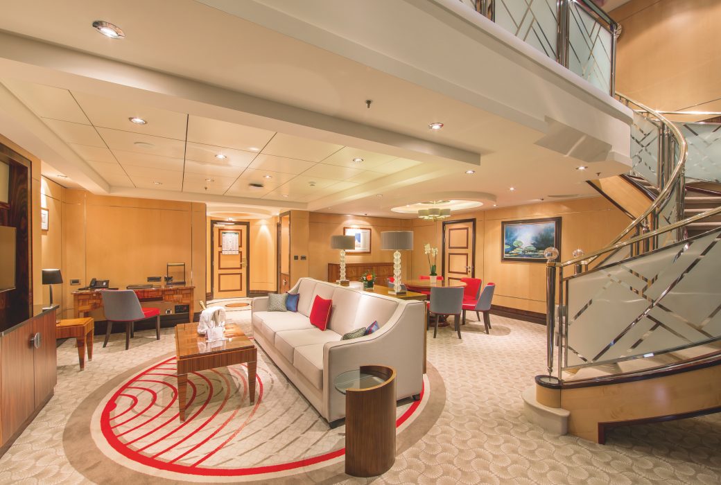
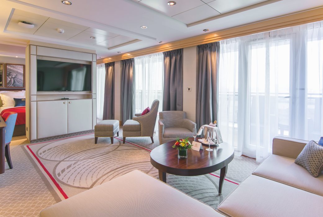
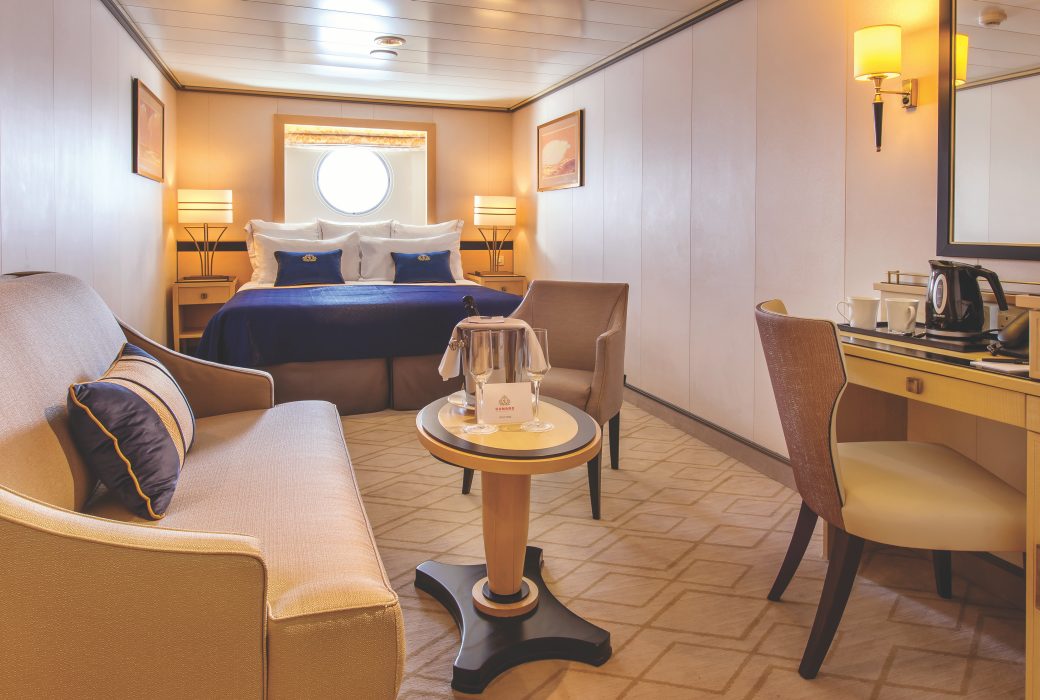
Approximately 1194-1566 sq. ft.
Retreat to an exclusive world of luxury with your own private residence at sea. Bold, striking colours and thoughtful designs bring each space in your suite to life. An attentive butler is on hand at all times to truly customise your voyage experience.
Each Queens Grill Duplex includes:
- Access to the exclusive Queens Grill restaurant, where you can dine any time at your reserved table.
- Spacious lounge area with seating.
- Bedroom area with Cunarder bed configurable to king-size or two single beds.
- Pillow concierge menu with a variety of types to choose from.
- Twin marble bathrooms and two dressing areas.
- An expansive private deck, adjoined to the living area.
- Satellite TV with movie and music channels in bedroom and lounge areas.
- Feature vanity and desk with hairdryer.
- Fresh flowers.
- Binoculars and world atlas to track your travels.
- UK, USA and European power sockets.
- An office with a set of personalised stationery.
- An exercise area with fitness equipment.
- Penhaligon's toiletries.
- Luxury bathrobes and slippers.
- Complimentary mini-bar stocked with your choice of beer, wine, spirits and soft drinks.
- Butler’s pantry.
- Speciality tea and coffee making facilities.
- Daily fresh fruit.
- Pre-dinner canapés.
- Welcome bottle of Champagne.
- Complimentary room service menu.
- Dine in-suite from the exclusive Queens Grill menu.
- Exclusive access to the Grills Lounge and outside Grills Terrace.
- Concierge service for on board reservations and shore experiences.
- A dedicated butler and steward to keep your suite in fine order day and night and host the perfect soirée.
- Priority embarkation and disembarkation.
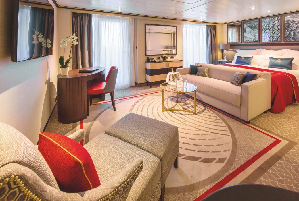
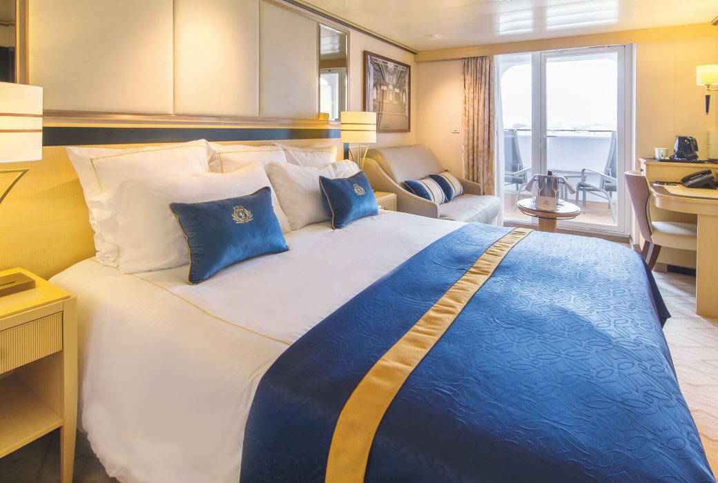
Approximately 796 sq. ft.
Retreat to an exclusive world of luxury with your own private residence at sea. Bold, striking colours and thoughtful designs bring each space in your suite to life. An attentive butler is on hand at all times to truly customise your voyage experience.
Each Queens Grill Royal Suite includes:
- Access to the exclusive Queens Grill restaurant, where you can dine any time at your reserved table.
- Spacious lounge area with seating.
- Bedroom area with Cunarder bed configurable to king-size or two single beds.
- Pillow concierge menu with a variety of types to choose from.
- Bathroom with bath and shower and separate dressing area.
- Satellite TV with movie and music channels in bedroom and lounge areas.
- Feature vanity with hairdryer.
- Writing desk with a set of personalised stationery.
- Fresh flowers.
- Binoculars and world atlas to track your travels.
- UK, USA and European power sockets.
- Penhaligon's toiletries.
- Luxury bathrobes and slippers.
- Complimentary mini-bar stocked with your choice of beer, wine, spirits and soft drinks.
- Speciality tea and coffee making facilities.
- Daily fresh fruit.
- Pre-dinner canapés.
- Welcome bottle of Champagne.
- Complimentary room service menu.
- Dine in-suite from the exclusive Queens Grill menu.
- Exclusive access to the Grills Lounge and outside Grills Terrace.
- Concierge service for on board reservations and shore experiences.
- A dedicated butler and steward to keep your suite in fine order day and night and host the perfect soirée.
- Priority embarkation and disembarkation.
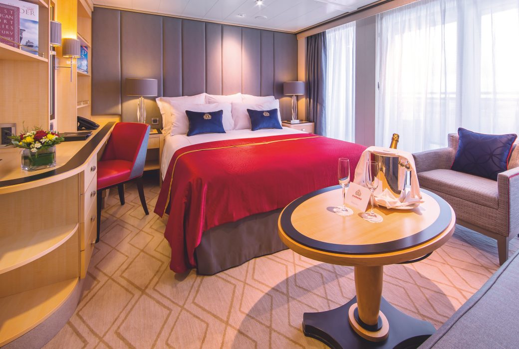
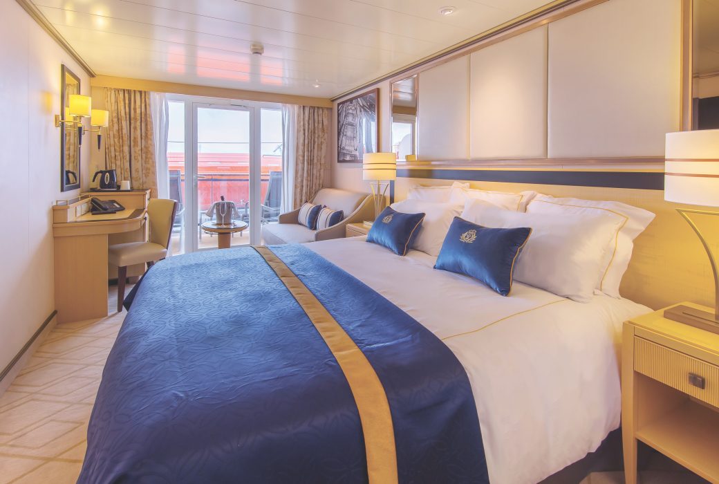
Approximately 758 sq. ft.
Retreat to an exclusive world of luxury with your own private residence at sea. Bold, striking colours and thoughtful designs bring each space in your suite to life. An attentive butler is on hand at all times to truly customise your voyage experience.
Each Queens Grill Penthouse includes:
- Access to the exclusive Queens Grill restaurant, where you can dine any time at your reserved table.
- Spacious lounge area with seating.
- Bedroom area with Cunarder bed configurable to king-size or two single beds.
- Pillow concierge menu with a variety of types to choose from.
- Bathroom with bath and shower and separate dressing area.
- Spacious private balcony with seating and sea views.
- Satellite TV with movie and music channels in bedroom and lounge areas.
- Feature vanity and desk with hairdryer.
- Fresh flowers.
- Binoculars and world atlas to track your travels.
- UK, USA and European power sockets.
- Penhaligon's toiletries.
- Luxury bathrobes and slippers.
- Complimentary mini-bar stocked with your choice of beer, wine, spirits and soft drinks.
- Speciality tea and coffee making facilities.
- Daily fresh fruit.
- Pre-dinner canapés.
- Welcome bottle of Champagne.
- Complimentary room service menu.
- Dine in-suite from the exclusive Queens Grill menu.
- Exclusive access to the Grills Lounge and outside Grills Terrace.
- Concierge service for on board reservations and shore experiences.
- A dedicated butler and steward to keep your suite in fine order day and night and host the perfect soirée.
- Priority embarkation and disembarkation.
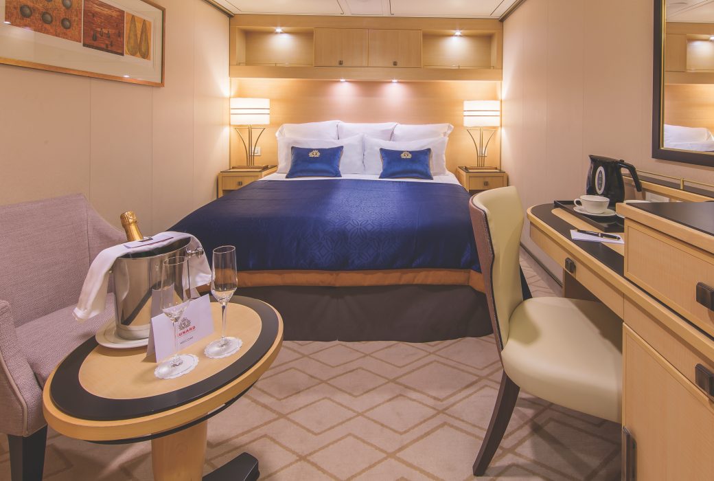
Approximately 506 sq. ft.
Retreat to an exclusive world of luxury with your own private residence at sea. Bold, striking colours and thoughtful designs bring each space in your suite to life. An attentive butler is on hand at all times to truly customise your voyage experience.
Each Queens Grill Suite includes:
- Access to the exclusive Queens Grill restaurant, where you can dine any time at your reserved table.
- Spacious lounge area with seating.
- Bedroom area with Cunarder bed configurable to king-size or two single beds.
- Pillow concierge menu with a variety of types to choose from.
- Bathroom with bath and shower and separate dressing area.
- Spacious private balcony with seating and sea views.
- Satellite TV with movie and music channels in bedroom and lounge areas.
- Feature vanity and desk with hairdryer.
- Fresh flowers.
- Binoculars and world atlas to track your travels.
- UK, USA and European power sockets.
- Penhaligon's toiletries.
- Luxury bathrobes and slippers.
- Complimentary mini-bar stocked with your choice of beer, wine, spirits and soft drinks.
- Speciality tea and coffee making facilities.
- Daily fresh fruit.
- Pre-dinner canapés.
- Welcome bottle of Champagne.
- Complimentary room service menu.
- Dine in-suite from the exclusive Queens Grill menu.
- Exclusive access to the Grills Lounge and outside Grills Terrace.
- Concierge service for on board reservations and shore experiences.
- A dedicated butler and steward to keep your suite in fine order day and night and host the perfect soirée.
- Priority embarkation and disembarkation.
Approximately 381 sq. ft.
Delight in magnificent sea views that can be enjoyed from both in and outside your Princess Suite. You’ll find thoughtful features and luxurious amenities, all organised by your dedicated steward to ensure you are always attentively looked after.
Each Princess Suite includes:
- Exclusive access to the Princess Grill restaurant, where you can dine any time at your reserved table.
- Private balcony with seating and sea views.
- Spacious lounge area with seating.
- Bedroom area with Cunarder bed configurable to king-size or two single beds.
- Pillow concierge menu with a variety of types to choose from.
- Bathroom with bath and shower.
- Satellite TV with movie and music channels in lounge and bedroom areas.
- Feature vanity and desk with hairdryer.
- UK, USA and European power sockets.
- Penhaligon's toiletries.
- Luxury bathrobes and slippers.
- Feature mini-bar with speciality tea and coffee making facilities.
- Complimentary spring water replenished throughout your voyage.
- Daily fresh fruit.
- Mini-bar packages available for purchase.
- Welcome bottle of sparkling wine.
- Complimentary room service menu.
- Dine in-suite from the exquisite Princess Grill menu.
- Exclusive access to the Grills Lounge and outside Grills Terrace.
- Concierge service for on board reservations and shore experiences.
- A dedicated steward to keep your suite in fine order day and night.
- Priority embarkation and disembarkation.
Approximately 248 sq. ft.
Take advantage of prime sea views from your own private, outdoor space in one of our Britannia Club Balcony staterooms. You’ll find thoughtful features, luxurious amenities and benefits, all organised by your dedicated steward to ensure you are always attentively looked after.
Each Britannia Club Balcony stateroom includes:
- Access to the intimate Britannia Club restaurant with a reserved table throughout your voyage.
- Private balcony with seating and sea views.
- Lounge area with seating.
- Cunarder bed configurable to king-size or two single beds.
- Bathroom with walk-in shower.
- Satellite TV with movie and music channels.
- Feature vanity and desk with hairdryer.
- UK, USA and European power sockets.
- Pillow concierge menu with a variety of types to choose from.
- Penhaligon's toiletries.
- Bathrobes and slippers.
- Speciality tea and coffee making facilities.
- Complimentary spring water replenished throughout your voyage.
- A welcome bottle of sparkling wine.
- Complimentary room service menu.
- Mini-bar packages available for purchase.
- A dedicated steward to keep your stateroom in fine order day and night.
- Priority embarkation and disembarkation.
Charges apply to room service after 10:00 AM.
Draw back the curtains to a burst of natural daylight each morning of your voyage.
Each Britannia Oceanview stateroom includes:
- A king-sized bed, lounge area and desk with stationery.
- Satellite TV, tea & coffee making facilities and a mini-bar.
- An invigorating shower and complimentary Penhaligon's toiletries.
- Complimentary robe and slippers for everyone in your party.
- Nightly turndown service, including a chocolate on your pillow.
- Sparkling wine to welcome you on board.
- Your own stateroom steward for the duration of your stay.
- A window offering an ocean view.
- 24 hour room service.
- Hairdryer & safe.
Charges apply to room service after 10:00 AM.
Approximately 248 sq. ft.
Drink in sparkling sea views from your own private, outdoor space in one of our Britannia Balcony staterooms. You’ll find thoughtful features and luxurious amenities, all organised by your dedicated steward to ensure you are always attentively looked after.
Each Britannia Balcony stateroom includes:
- Choice of Early, Late, and Open Dining in the Britannia Restaurant.
- Private balcony with seating and sea views.
- Lounge area with seating.
- Cunarder bed configurable to king-size or two single beds.
- Bathroom with walk-in shower.
- Satellite TV with movie and music channels.
- Feature vanity and desk with hairdryer.
- UK, USA and European power sockets.
- Penhaligon's toiletries.
- Bathrobes and slippers.
- Tea and coffee making facilities.
- Welcome sparkling wine.
- Complimentary room service menu.
- Mini-bar packages available for purchase.
- A dedicated steward to keep your stateroom in fine order day and night.
Charges apply to room service after 10:00 AM.

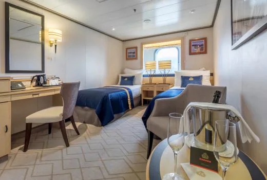
Approximately 269 sq. ft.
Enjoy access to private, outdoor space in one of our sheltered Britannia Balcony staterooms. You’ll find thoughtful features and luxurious amenities, all organised by your dedicated steward to ensure you are always attentively looked after.
Each Britannia Balcony (sheltered) stateroom includes:
- Choice of Early, Late, and Open Dining in the Britannia Restaurant.
- Sheltered private balcony with seating.
- Lounge area with seating.
- Cunarder bed configurable to king-size or two single beds.
- Bathroom with walk-in shower.
- Satellite TV with movie and music channels.
- Feature vanity and desk with hairdryer.
- UK, USA and European power sockets.
- Penhaligon's toiletries.
- Bathrobes and slippers.
- Tea and coffee making facilities.
- Welcome sparkling wine.
- Complimentary room service menu.
- Mini-bar packages available for purchase.
- A dedicated steward to keep your stateroom in fine order day and night.
Charges apply to room service after 10:00 AM.
Approximately 228-408 sq. ft.
Enjoy access to private, outdoor space in one of our obstructed view Britannia Balcony staterooms. You’ll find thoughtful features and luxurious amenities, all organised by your dedicated steward to ensure you are always attentively looked after.
- Each Britannia Balcony (obstructed view) stateroom includes:
- Choice of Early, Late, and Open Dining in the Britannia Restaurant.
- Private balcony (obstructed view) with seating.
- Lounge area with seating.
- Cunarder bed configurable to king-size or two single beds.
- Bathroom with walk-in shower.
- Satellite TV with movie and music channels.
- Feature vanity and desk with hairdryer.
- UK, USA and European power sockets.
- Penhaligon's toiletries.
- Bathrobes and slippers.
- Tea and coffee making facilities.
- Welcome sparkling wine.
- Complimentary room service menu.
- Mini-bar packages available for purchase.
- A dedicated steward to keep your stateroom in fine order day and night.

Approximately 228-408 sq. ft.
Enjoy access to private, outdoor space in one of our obstructed view Britannia Balcony staterooms. You’ll find thoughtful features and luxurious amenities, all organised by your dedicated steward to ensure you are always attentively looked after.
Each Britannia Balcony (obstructed view) stateroom includes:
- Choice of Early, Late, and Open Dining in the Britannia Restaurant.
- Private balcony (obstructed view) with seating.
- Lounge area with seating.
- Cunarder bed configurable to king-size or two single beds.
- Bathroom with walk-in shower.
- Satellite TV with movie and music channels.
- Feature vanity and desk with hairdryer.
- UK, USA and European power sockets.
- Penhaligon's toiletries.
- Bathrobes and slippers.
- Tea and coffee making facilities.
- Welcome sparkling wine.
- Complimentary room service menu.
- Mini-bar packages available for purchase.
- A dedicated steward to keep your stateroom in fine order day and night.
Charges apply to room service after 10:00 AM.
Approximately 159-194 sq. ft.
Positioned to offer sea views, our Britannia Oceanview staterooms provide a private enclave from which to watch the world go by. Perfectly framed views are the backdrop to thoughtful features and luxurious amenities, all organised by your dedicated steward to ensure you are always attentively looked after.
Each Britannia Oceanview stateroom includes:
- Choice of Early, Late, and Open Dining in the Britannia Restaurant.
- Lounge area with seating.
- Cunarder bed configurable to king-size or two single beds*
- Bathroom with a walk-in shower.
- Window with sea view.
- Satellite TV with movie and music channels.
- Feature vanity and desk with hairdryer.
- UK, USA and European power sockets.
- Penhaligon's toiletries.
- Bathrobes and slippers.
- Tea and coffee making facilities.
- Welcome sparkling wine.
- Complimentary room service menu.
- Mini-bar packages available for purchase.
- A dedicated steward to keep your stateroom in fine order day and night.
Charges apply to room service after 10:00 AM.
*Please note that, due to accessibility requirements, the following Oceanview staterooms have twin beds and cannot be configured to king-sized beds: 4016, 4019, 5019, 5248, 5250, 5267, 5269, 6040, 6047.
Approximately 178 sq. ft.
Positioned to offer sea views, our Britannia Single Oceanview staterooms provide a private enclave from which to watch the world go by. Perfectly framed views are the backdrop to thoughtful features and luxurious amenities, all organised by your dedicated steward to ensure you are always attentively looked after.
Each Britannia Single Oceanview stateroom includes:
- Choice of Early, Late, and Open Dining in the Britannia Restaurant.
- Lounge area with seating.
- Comfortable Cunarder single bed.
- Bathroom with a walk-in shower.
- Window with sea view.
- Satellite TV with movie and music channels.
- Feature vanity and desk with hairdryer.
- UK, USA and European power sockets.
- Penhaligon's toiletries.
- Bathrobes and slippers.
- Tea and coffee making facilities.
- Welcome sparkling wine.
- Complimentary room service menu.
- Mini-bar packages available for purchase.
- A dedicated steward to keep your stateroom in fine order day and night.
Charges apply to room service after 10:00 AM.

Approximately 159 sq. ft.
With a view of Queen Mary 2’s magnificent atrium, our well-appointed Atrium View Inside staterooms are a haven of comfort and style to enjoy during your voyage. You’ll find thoughtful features and luxurious amenities, all organised by your dedicated steward to ensure you are always attentively looked after.
Each Britannia Standard Atrium View stateroom includes:
- Choice of Early, Late, and Open Dining in the Britannia Restaurant.
- Cunarder bed configurable to king-size or two single beds.
- Bathroom with a walk-in shower.
- Satellite TV with movie and music channels.
- Feature vanity and desk with hairdryer.
- UK, USA and European power sockets.
- Penhaligon's toiletries.
- Bathrobes and slippers.
- Tea and coffee making facilities.
- Welcome sparkling wine.
- Complimentary room service menu.
- Mini-bar packages available for purchase.
- A dedicated steward to keep your stateroom in fine order day and night.
- A window overlooking Queen Mary 2’s atrium.
Charges apply to room service after 10:00 AM.

Approximately 157-194 sq. ft.
With a variety of locations to choose from on board, our well-appointed inside staterooms are a haven of comfort and style to enjoy during your voyage. You’ll find thoughtful features and luxurious amenities, all organised by your dedicated steward to ensure you are always attentively looked after.
Each Britannia Standard Inside stateroom includes:
- Choice of Early, Late, and Open Dining in the Britannia Restaurant.
- Cunarder bed configurable to king-size or two single beds.
- Bathroom with a walk-in shower.
- Satellite TV with movie and music channels.
- Feature vanity and desk with hairdryer.
- UK, USA, and European power sockets.
- Penhaligon's toiletries.
- Bathrobes and slippers.
- Tea and coffee making facilities.
- Welcome sparkling wine.
- Complimentary room service menu.
- Mini-bar packages available for purchase.
- A dedicated steward to keep your stateroom in fine order day and night.
Charges apply to room service after 10:00 AM.
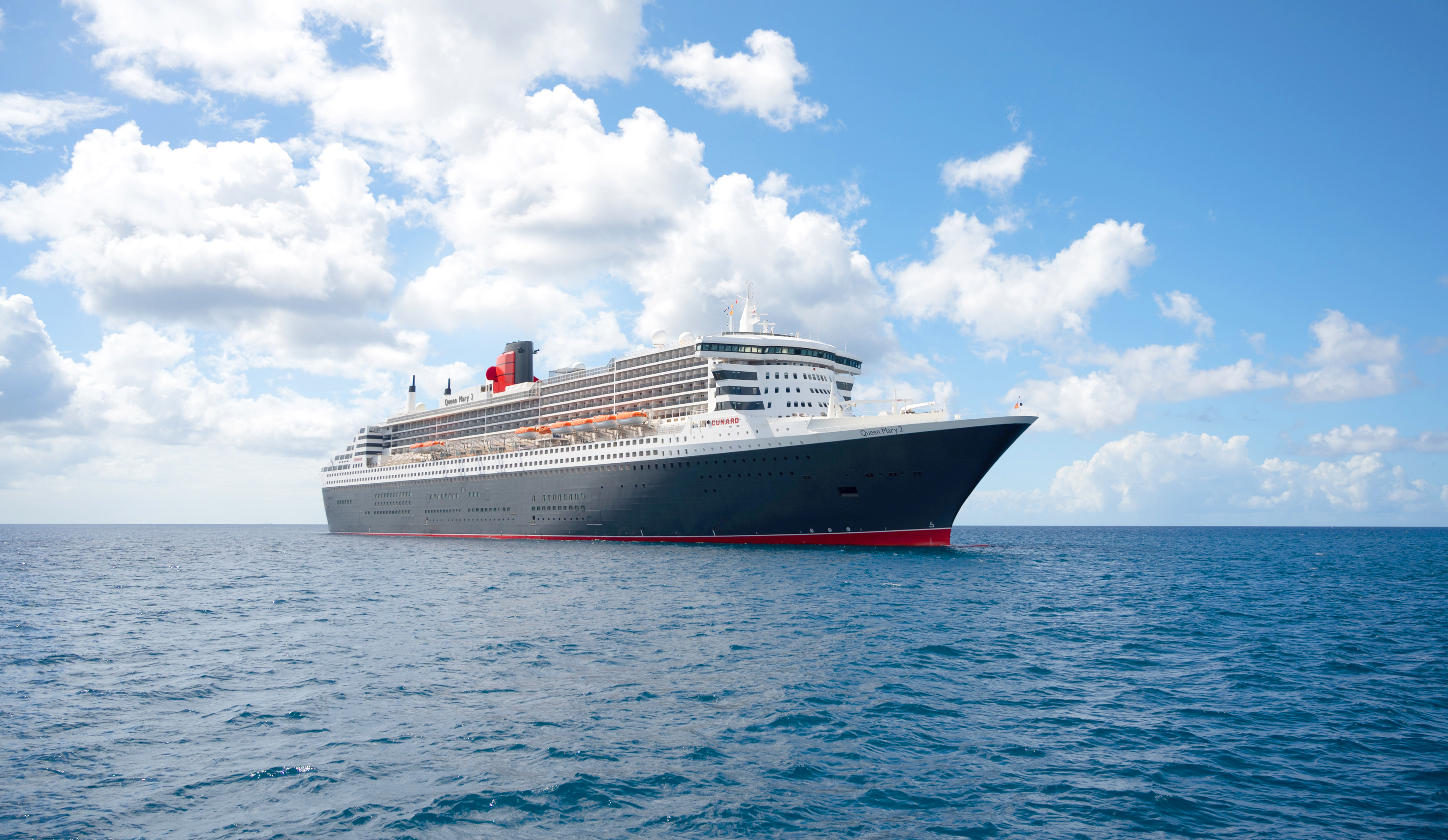
Queen Mary 2
Queen Mary 2 is a remarkable flagship, and her style and elegance are legendary. Above all, it‘s the space she offers and the luxury for you to do as little or as much as you wish which set her apart.
Welcome to a true icon. Our flagship is a truly astonishing liner and you’ll find an incredible sense of freedom from the space she offers. Whether you’re in the mood for complete relaxation or something more active, you can find it. Immerse yourself in enthralling entertainment, be indulged in the on board spa, or simply relax with a book in her vast library. You’ll discover remarkable craftsmanship in the elegant staterooms and suites and savouring her many sumptuous restaurants and bars is always a pleasure.
Ship Facts
| Launch Year | 2004 | ||||||||
| Refit Year | 2018 | ||||||||
| Language | en | ||||||||
| Gross Tonnage | 148528 | ||||||||
| Length | 345 | ||||||||
| Width | 41 | ||||||||
| Currency | USD | ||||||||
| Speed | 28 | ||||||||
| Capacity | 2691 | ||||||||
| Crew Count | 1173 | ||||||||
| Deck Count | 12 | ||||||||
| Cabin Count | 1310 | ||||||||
| Large Cabin Count | N/A | ||||||||
| Wheelchair Cabin Count | 30 | ||||||||
| Electrical Plugs |
|
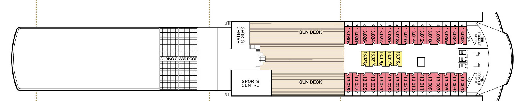
Deck 13
- Sliding Glass Roof
- Sun Deck
- Sports Centre
- The Lookout
- Club Balcony Staterooms
- Standard Inside Staterooms
Deck 12
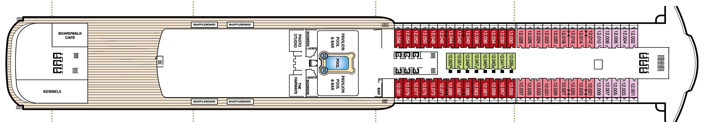
- Boardwalk Cafe
- Kennels
- Shuffleboard
- Photo Studio
- The Fairways
- Pavilion Pool & Bar
- Club Balcony Staterooms
- Balcony Staterooms
- Inside Cabins
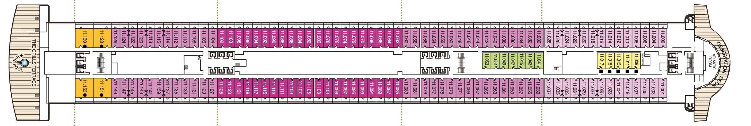
Deck 11
- Queens Suites
- Staterooms
- Observation Deck
- Atlantic Room
- The Grill's Terrace
- Whirlpool
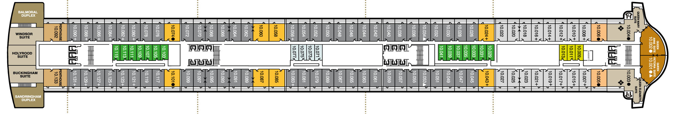
Deck 10
- Balmoral Duplex Suite
- Windsor Suite
- Holyrood Suite
- Buckingham Suite
- Sandringham Duplex Suite
- Penthouse Suite
- Queen Mary Suite
- Queen Anne Suite
- Queen Victoria Suite
- Queen Elizabeth Suite
- Queens Suites
- Princess Suites
- Inside Staterooms
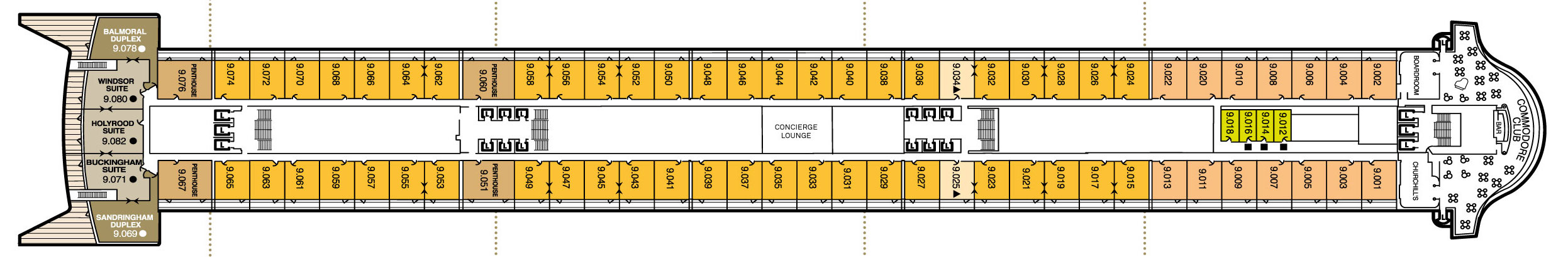
Deck 9
- Balmoral Duplex
- Windsor Suite
- Holyrood Suite
- Buckingham Suite
- Sandringham Duplex
- Penthouse
- Commodore Club
- Bar
- Boardroom
- Churchill's
- Queens Suites
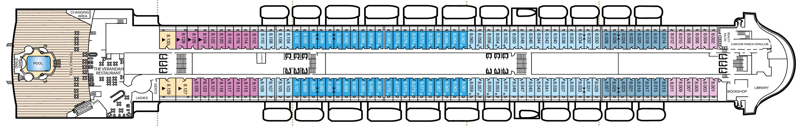
Deck 8
Pool
Band Stand
- Terrace Bar
- The Verandah Restaurant
- Beauty Salon
- Canyon Ranch Spa Club
- Book Shop
- Library
- Balcony Staterooms
- Inside Staterooms
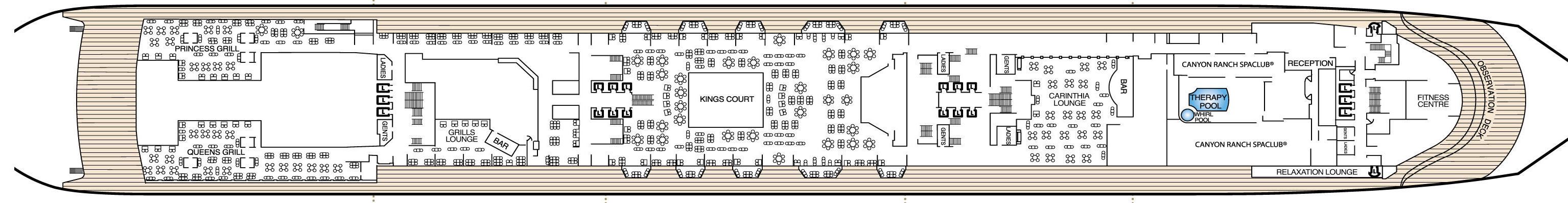
Deck 7
Princess Grill
- Queens Grill
- Grills Lounge & Bar
- Kings Court
- Carinthia Lounge
- Bar
- Therapy Pool
- Canyon Ranch Spa Club
- Relaxation Lounge
- Fitness Centre
Deck 6
- Minnows Pool
- Splash Pool
- The Kids Zone
- Teen Zone
- Play Zone
- Baby Zone
- Balcony Staterooms
- Oceanview Staterooms
- Inside Staterooms

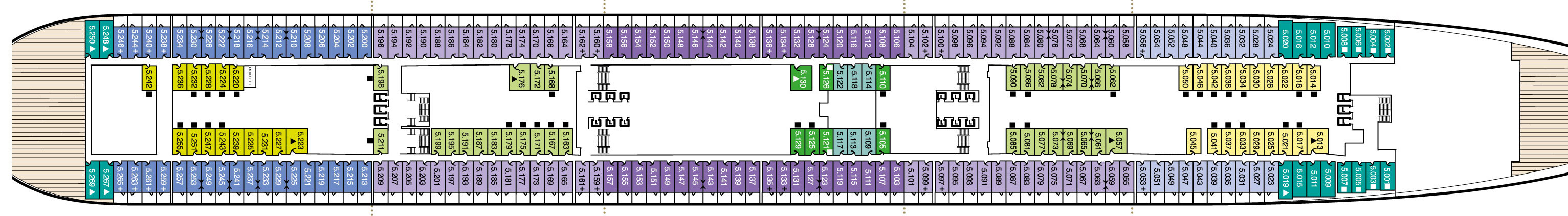
Deck 5
Balcony Staterooms
- Oceanview Staterooms
- Inside Staterooms
- Atrium View Staterooms
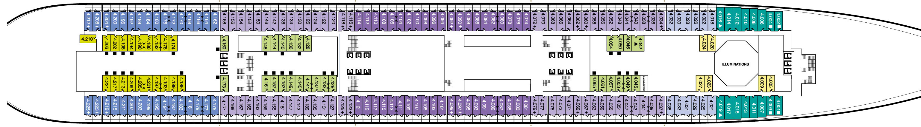
Deck 4
Balcony Staterooms
- Oceanview Staterooms
- Standard Inside Staterooms
Deck 3 & 3L
- G32 (Deck 3L)
- Queens Room
- Art Gallery
- Britannia Restaurant Upper
- Chart Room
- Sir Samuel's
- Shops
- Grand Lobby
- Champagne Bar
- Royal Court TheatreIlluminations
- Single Oceanview Staterooms
Deck 2 & 3L
- G32 (Deck 3L)
- Britannia Restaurant
- Britannia Club
- Photo Gallery
- Golden Lion
- Grand Lobby
- Pursers Office
- Tour Office
- Bar
- Casino
- Royal Court Theatre
- Cunard Connexions
- Illuminations
- Single Oceanview Staterooms
A range of complimentary and speciality dining restaurants are available, with menus created by Jean-Marie Zimmermann, Cunard’s Global Culinary Ambassador. Tables for 4-8 are typical, with seating allocated prior to cruising. Limited numbers of tables for two are available on request.
Queen's Grill
The pinnacle of fine dining at sea, exclusively for guests staying in our Queens Grill Suites.
Drawing inspiration from the world’s finest kitchens, the Queens Grill restaurant offers a true taste of fine dining on board, elevated by a front of house team for whom nothing is too much trouble.
Open for breakfast, lunch and dinner daily, with a Grills Afternoon Tea served separately in the Grills Lounge, a visit to the Queens Grill always feels like a special occasion.
You’ll be dining among your fellow Queens Grill guests, with a table reserved for your exclusive use throughout your voyage. There’s no need to book. Simply arrive whenever you’re ready and your table will be waiting. You may even choose to take your meal in your suite, should you wish.
Each day introduces a coveted line-up of à la carte dishes, complemented by an ‘always-available’ menu of appetisers, entrees, and desserts, executed with exemplary flair and finesse.
Alternatively, opt for one of our chef’s speciality sharing dishes (orderable in advance at breakfast or lunchtimes). From beef wellington to rack of lamb, the choice is truly indulgent. Each dish (along with select offerings on our menu) is finished and presented to you table-side, only heightening the sense of theatre that’s a signature of Queens Grill dining.
Dining at the Queens Grill restaurant is exclusive to Queens Grill guests and included within your Cunard fare. The restaurant operates relaxed dress by day and smart attire (jacket optional) for dinner service after 6.00pm, except on Gala Evenings when we invite you to dress in black tie.
Gluten free and vegetarian dishes are available. If you have any food allergies or other dietary requirements, please inform us by phone after booking your voyage. Find out more about dietary requirements on board.
Princess Grill
Imaginative cooking and flawless service create a dining experience fit for royalty.
For the exclusive use of guests in our Princess Grill Suites, this exquisite restaurant offers à la carte dining at an elevated level.
With a dining room to rival the world’s most luxurious hotels and a menu that showcases classical flavour pairings, creatively reimagined, the Princess Grill restaurant is among the most prestigious of our on board dining experiences. Discreet but attentive service and a raft of personal touches make every meal special.
You’ll find a comprehensive selection of continental and cooked dishes ready to rouse you each morning, whilst lunchtimes introduce a delicious four course menu alongside lighter options.
Evenings are a particularly grand affair, with the theatre of tableside serving inspiring a greater sense of occasion. Your table for dinner is reserved throughout your voyage, with no need to book; simply take your seat whenever you wish, between 6.30pm and 9.00pm.
Dining at the Princess Grill restaurant is included in your fare if you’re staying in one of our Princess Grill Suites. Relaxed dress is welcomed at breakfast and lunch, and smart attire (jacket optional) after 6.00pm, except on Gala Evenings when we invite you to dress in black tie.
Gluten free and vegetarian dishes are available. If you have any food allergies or other dietary requirements, please inform us by phone after booking your voyage. Find out more about dietary requirements on board.
Britannia & Britannia Club Restaurant
The largest of Queen Mary 2’s restaurants, with capacity for over 1,000 guests, the Britannia Restaurant is the main dining room for Britannia Balcony, Oceanview and Inside staterooms. It’s a grand and elegant dining space, elevated all the more by formal attire on our famed Gala evenings. Menus combine classic flavours with international influences, in dishes presented with flair and refinement.
Guests can now choose to reserve a table at any time of the evening alongside the more traditional early and late seating options.
Steakhouse at The Verandah
Steaks and seafood of the highest calibre.
Do you crave an exquisite steak, seared to perfection? Or perhaps a taste of the ocean? Whether you’re in the mood for surf or turf or just somewhere extra special to dine out on board, Steakhouse at the Verandah offers just the place.
With a menu that celebrates the finest steaks and seafood throughout the world today, dining at Steakhouse at The Verandah is sure to be a culinary highlight of your voyage.
Perfect for special occasions (or just because), Steakhouse at The Verandah celebrates the best of land and sea. Buttery soft wagyu. Dry-aged Angus beef. A fruit de mer platter laden with lobster, Scottish langoustines, and Alaskan crab.
Open for lunch on sea days and dinner every evening, the exceptional menu features only the highest quality grass-fed and dry-aged beef, supplied by British butcher Aubrey Allen, whose passionate commitment to sustainable, pasture-bred, beef dates back to the 1930s. When ordering steak, not only will your choice be cooked exactly to your preference, you’ll even be presented with a selection of steak knives to choose from, each one engineered to cut effortlessly and cleanly. After all, the finest produce deserves the finest treatment.
Lunchtimes at Steakhouse at The Verandah are a relaxed occasion with an informal dress code. Expect favourites like delicate Dover sole, prepared à la meunière, or simply grilled, and house-smoked Irish short rib, cooked low and slow, with spiced coffee and almond crumb, and caramelised shallots. Should you be joining us for dinner, you’ll find the evening menu expands to include a wider steak selection and other options, such as a succulent lamb rack and jumbo grilled tiger prawns.
As with the dining menu, the Bar at Steakhouse at the Verandah showcases ingredients hailing from either side of the Atlantic. You’ll find a generous list of drinks to complement your meal, including cocktails inspired by New York and London; a nod to Cunard’s iconic Transatlantic Crossing.
Why not arrange an extra special meal during your voyage, and book a table for lunch or dinner on My Cunard prior to sailing? Or you could book on board using our digital planner, My Voyage. The cost for dinner is US$58.50 if booked pre-cruise, or US$65 if booked on board, and for lunch, US$31.50 or US$35, respectively.
Gluten free and vegetarian dishes are available. If you have any food allergies or other dietary requirements, please inform us by phone after booking your voyage. Find out more about dietary requirements on board.
King's Court
An informal dining option that’s open 24 hours a day, Kings Court offers a rich variety of international cuisines to savour around the clock. Enjoy continental, American and full English breakfasts, Italian stone baked pizza and handmade sushi in a buffet-style setting. A relaxed dress code is observed day and night, providing an alternative to smart attire for guests who prefer casual dress.
If you're sailing on Queen Mary 2 and wish for a lively evening dancing to the sounds of a live DJ and resident band, head to G32.
This vibrant nightclub, found only on Queen Mary 2, offers the chance to let your hair down in a dazzling space full of like-minded guests, with a party atmosphere that inspires a genuine good time.
When what you feel like is a few drinks and a chance to show off your moves, this is the ideal place to end the night. G32 is a dual-level venue, so you’ll always be able to find a quieter spot if you’d like to sit down for a breather or chat with friends.
The bar menu offers an impressive range of drinks to suit every taste, including champagne and our signature cocktails as well as the usual favourites such as beer, wine, spirits and mixers.
G32’s resident band and live DJ are on hand to keep you dancing and make your night one to remember.
The Royal Court Theatre
Experience the thrill of a vibrant music and dance extravaganza in our full sized theatres.
You'll find our elegant Royal Court Theatres as impressive as any in the West End or Broadway and they're the perfect setting for you to enjoy invigorating, high-tech dance productions. We're constantly introducing new shows performed by our highly talented Royal Cunard Singers and Dancers. Popular recent productions including the cutting-edge dance shows 'La Danza' and 'Rhythm of the Night,' which takes audiences on a magical journey through the sights and sounds of Latin America.
Queens Room
Embrace the sense of occasion with every sip at this grand bar and ballroom.
With its sweeping dancefloor, double-height ceiling, and glittering chandeliers, a visit to the Queens Room can’t fail to evoke the timeless romance of ocean travel.
Guests who sail with Cunard frequently have come to regard it as the social hub of the ship, and on Gala Evenings especially this elegant bar and ballroom offers a truly magical setting in which to be swept away in the spirit of the occasion.
It’s also where we serve our signature Afternoon Tea at 3:30pm each day. Just follow the soothing tones of the string quartet and the unmistakable scent of our chefs’ freshly baked scones. Then there’s the chance to brush up on your dancing or learn a new skill. From fencing to Argentine Tango, the Queens Room sets the stage for all kinds of activities.
It’s at night however that this elegant ballroom truly comes alive; no more so than on Gala Evenings (our famed black tie nights) when a live orchestra fills the air with music as guests take to the dancefloor in their finest eveningwear. Drink in the atmosphere from your table with a glass of champagne, or a speciality cocktail, and savour the chance to step out in style for one special night of indulgent celebration.
Commodore Club
Succumb to the charms of this magical, light-filled bar, with its scintillating views from the bow of your ship.
Inspired by legendary Cunard Commodores who have expertly captained our fleet over the years, this charming bar offers an ideal setting in which to enjoy an early-evening aperitif or an after-dinner nightcap.
Savour the sweeping views across the horizon as you sip on a cocktail, a classic fine wine, or a premium aged whisky, prepared with signature flair and served at your table.
Visiting at golden hour brings the promise of vibrant orange and pink-streaked sky as the sun sets over the ocean - arrive early to secure a window-side table - while clear nights may reveal a star or two glimmering in the distance.
Those stopping in before dinner will be treated to a complimentary selection of canapés with their drink; just one of many little surprises you’ll experience throughout your ship, while evenings come alive against the soothing sounds of a live pianist.
The pièce de resistance, however, is the collection of cocktails inspired by seven of our most decorated Commodores; each with its own intriguing backstory.
From the quintessential British notes of Land of Hop & Glory, inspired by Commodore Sir Cyril Illingworth, to the Commodore’s Cure, a tribute to Commodore Sir James Bisset, these unique concoctions are as legendary as the men they serve to honour.
The Golden Lion Pub
A friendly home-from-home in which to savour classic British pub fare.
With its sumptuous leather banquette seating, darts board, and occasional live sports, a visit to the Golden Lion offers all the charm, warmth, and authenticity of walking into a traditional British pub.
Dining at The Golden Lion is equally authentic, with a menu that showcases hearty and much-loved dishes enjoyed for generations throughout the UK and beyond. Food at the Golden Lion is included, with some supplementary dishes on board Queen Anne available for a small fee. Alcohol is purchasable as priced.
The atmosphere at the Golden Lion is always relaxed and vibrant, with occasional live music and televised sports, complemented by lively pub quizzes and darts tournaments – an ideal way to meet new friends or put your skills to the test.
A casual dress code is observed all day long, although if you do wish to dress a little smarter in the evenings that’s perfectly fine too.
Carinthia Lounge
In the mornings, you’ll find a light breakfast menu including options such as fresh fruit, pastries, and muesli, plus a selection of freshly made smoothies, juices and hot drinks. Later in the day you can choose from a range of light bites, such as the chef’s signature sandwich or small plates of tapas-style delicacies.
Come evening, the focus turns distinctly Iberian. Try a glass of Port from the largest selection of vintage bottles at sea, or choose from a varied list of Spanish and Portuguese wines by the glass. If sherry is your preferred tipple, you’ll find much to enjoy here, along with a variety of cocktails, spirits, liqueurs, beers, cider and soft drinks.