Sydney to Hamburg
Sydney to Hamburg
Cruise overview
WHY BOOK WITH US?
- ✔ The Deluxe Cruises’ team has extensive experience in ultra-luxury cruising.
- ✔ Call now to speak to our helpful and experienced Cruise Concierge team.
- ✔ Enjoy our Unique Deluxe Cruises Bonus for substantial savings.
- ✔ Our team will tailor your holiday to your exacting requirements.
- ✔ As agents, we work under the protection of each cruise lines ABTA / ATOL licences
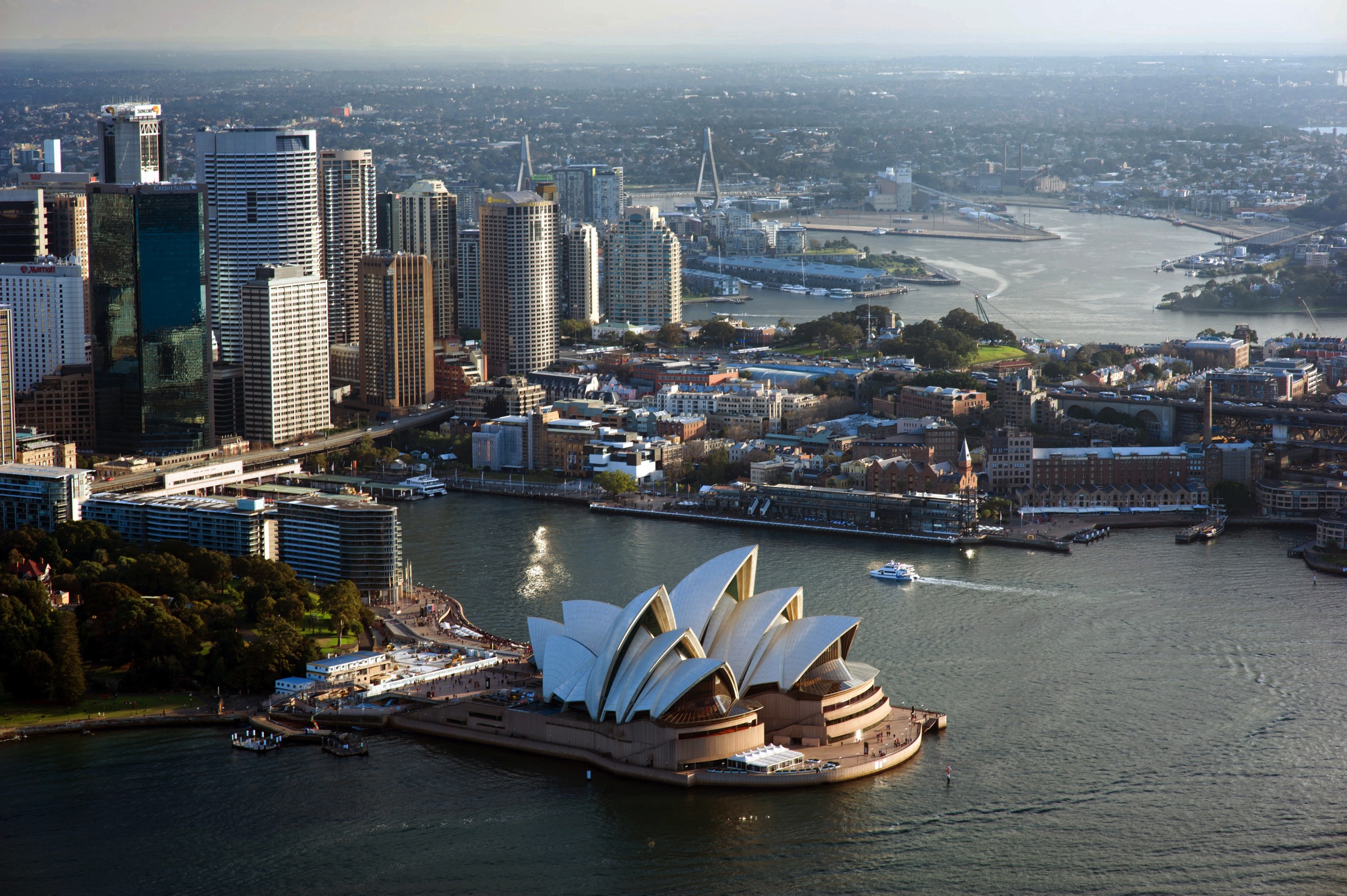
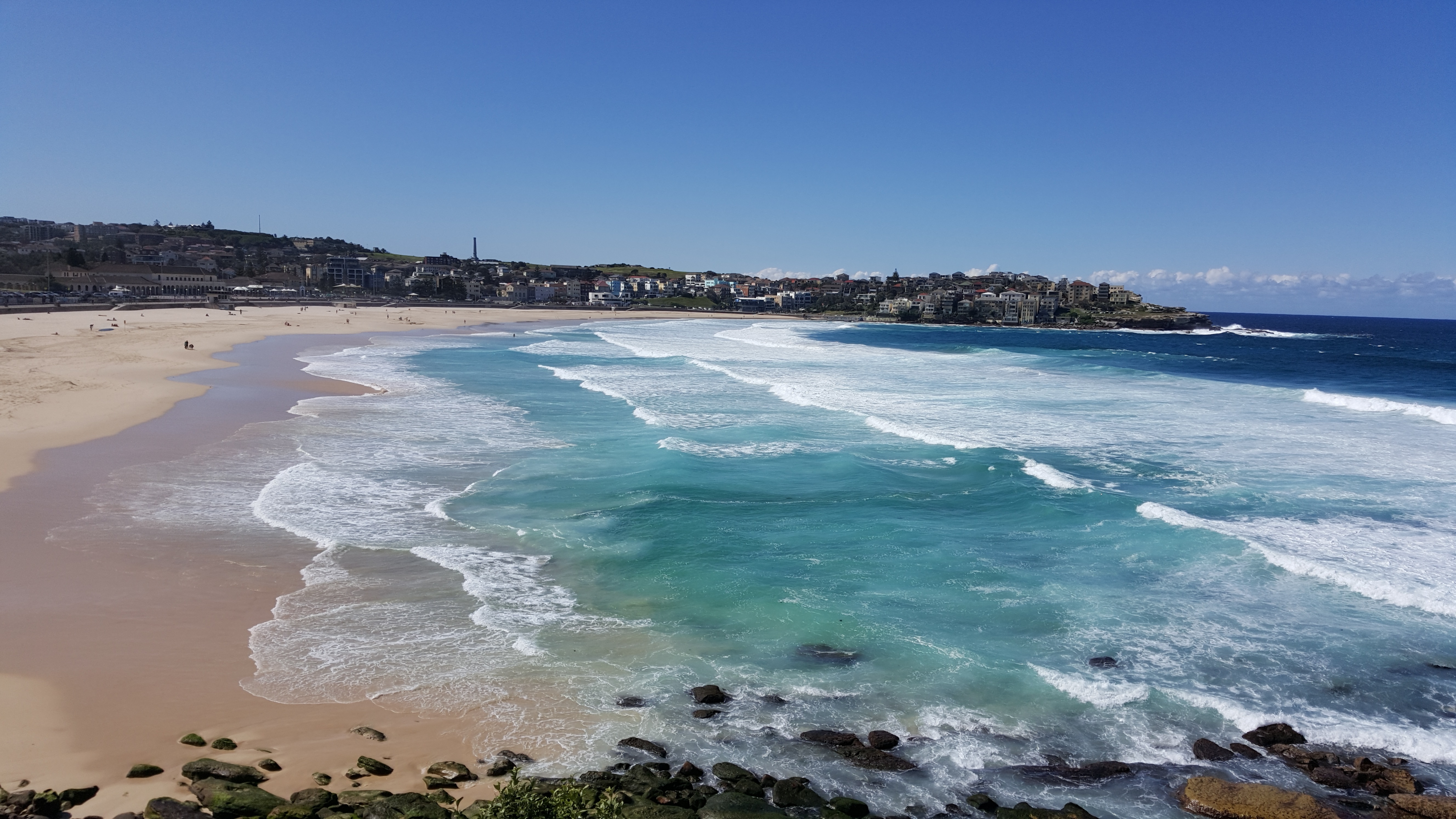
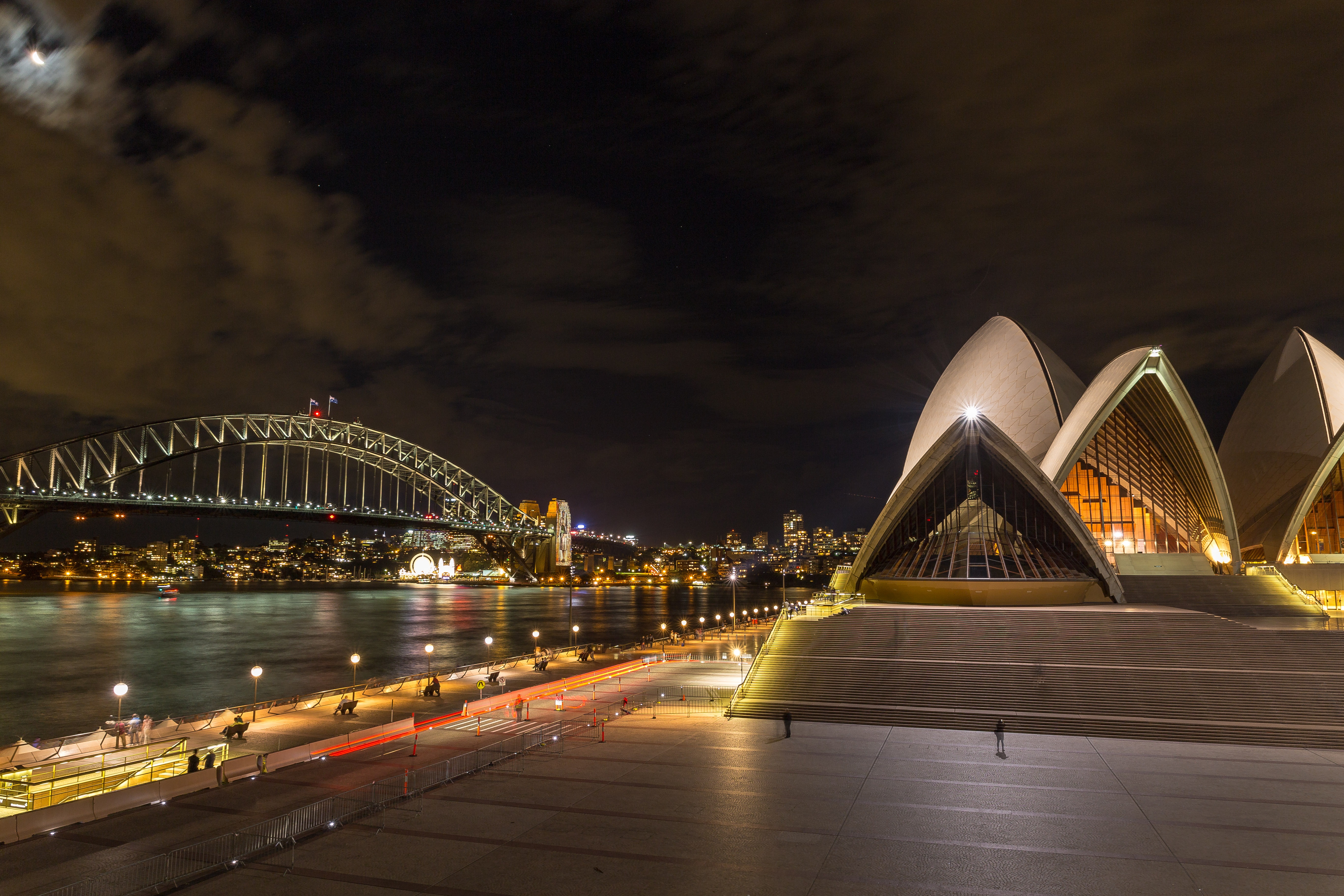
About Sydney, New South Wales
Sydney, capital of New South Wales and one of Australia's largest cities, is best known for its harbourfront Sydney Opera House, with a distinctive sail-like design. Massive Darling Harbour and the smaller Circular Quay port are hubs of waterside life, with the arched Harbour Bridge and esteemed Royal Botanic Garden nearby. Sydney Tower’s outdoor platform, the Skywalk, offers 360-degree views of the city and suburbs.
About Airlie Beach
About Townsville, Queensland
This coastal city has little in the way of sandy beaches or surf, but it does have shady parks, charming colonial buildings, and a boardwalk-flanked waterfront Esplanade with a terrific man-made beach and picnic facilities. The historic town center has thrived recently, with an influx of lively eateries and bars. There are also some excellent museum and a world-class aquarium.Queensland Parks and Wildlife Service has an office on Magnetic Island, but Townsville Enterprise's information kiosks in Flinders Square and the Museum of Tropical Queensland (MTQ), on the mainland, are the best sources of visitor info about the island.
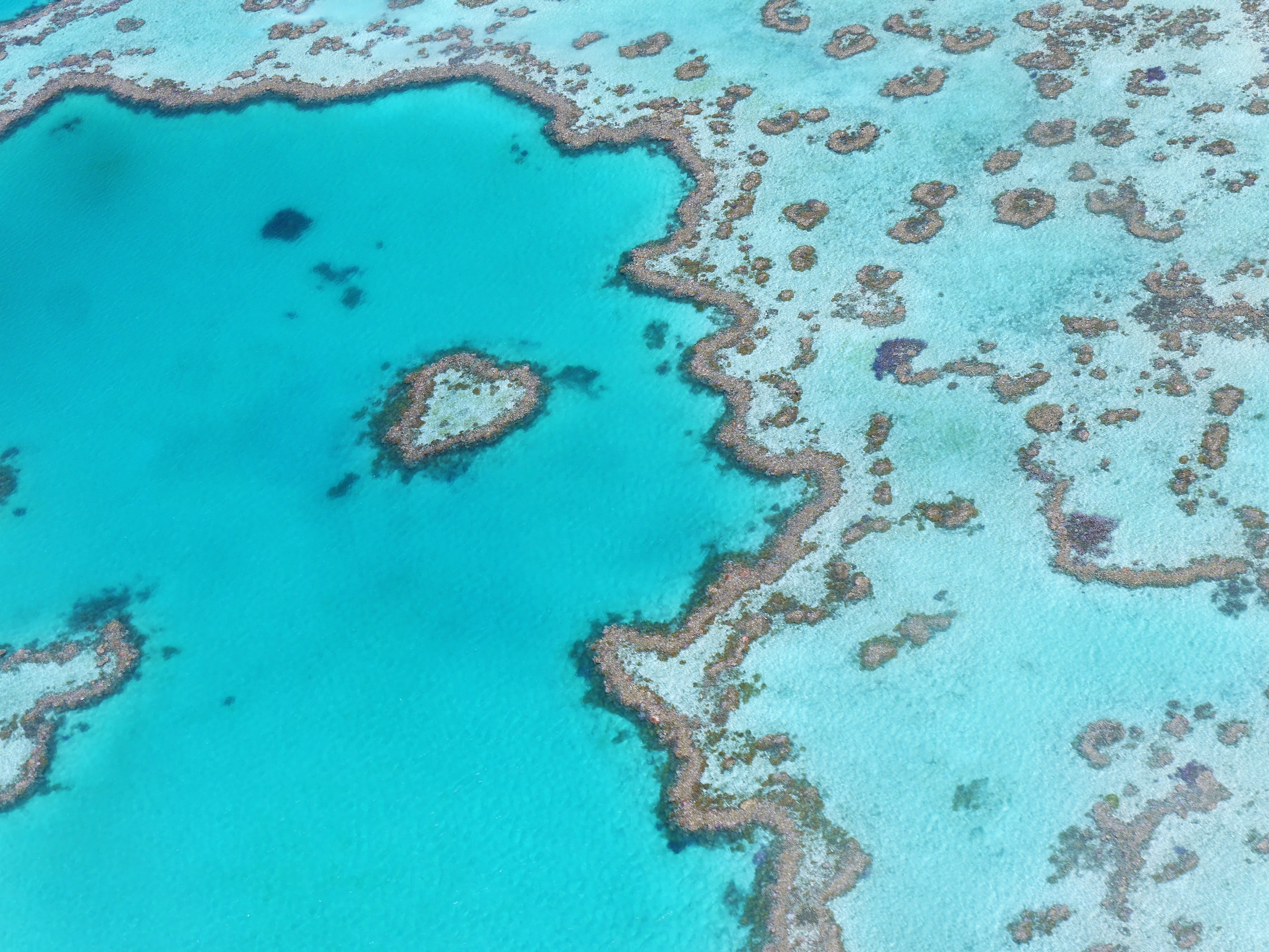
About Cairns, Queensland
Tourism is the lifeblood of Cairns (pronounced Caans). The city makes a good base for exploring the wild top half of Queensland, and tens of thousands of international travelers use it as a jumping-off point for activities such as scuba diving and snorkeling trips to the Barrier Reef, as well as boating, fishing, parasailing, scenic flights, and rain-forest treks.It's a tough environment, with intense heat and fierce wildlife. Along with wallabies and grey kangaroos in the savannah and tree kangaroos in the rain forest, you'll find stealthy saltwater crocodiles, venomous snakes, and jellyfish so deadly they put the region’s stunning beaches off- limits to swimmers for nearly half the year. Yet despite this formidable setting, Cairns and tropical North Queensland are far from intimidating places. The people are warm and friendly, the sights spectacular, and—at the right time of year—the beachside lounging is world-class.
About Bitung, Sulawesi
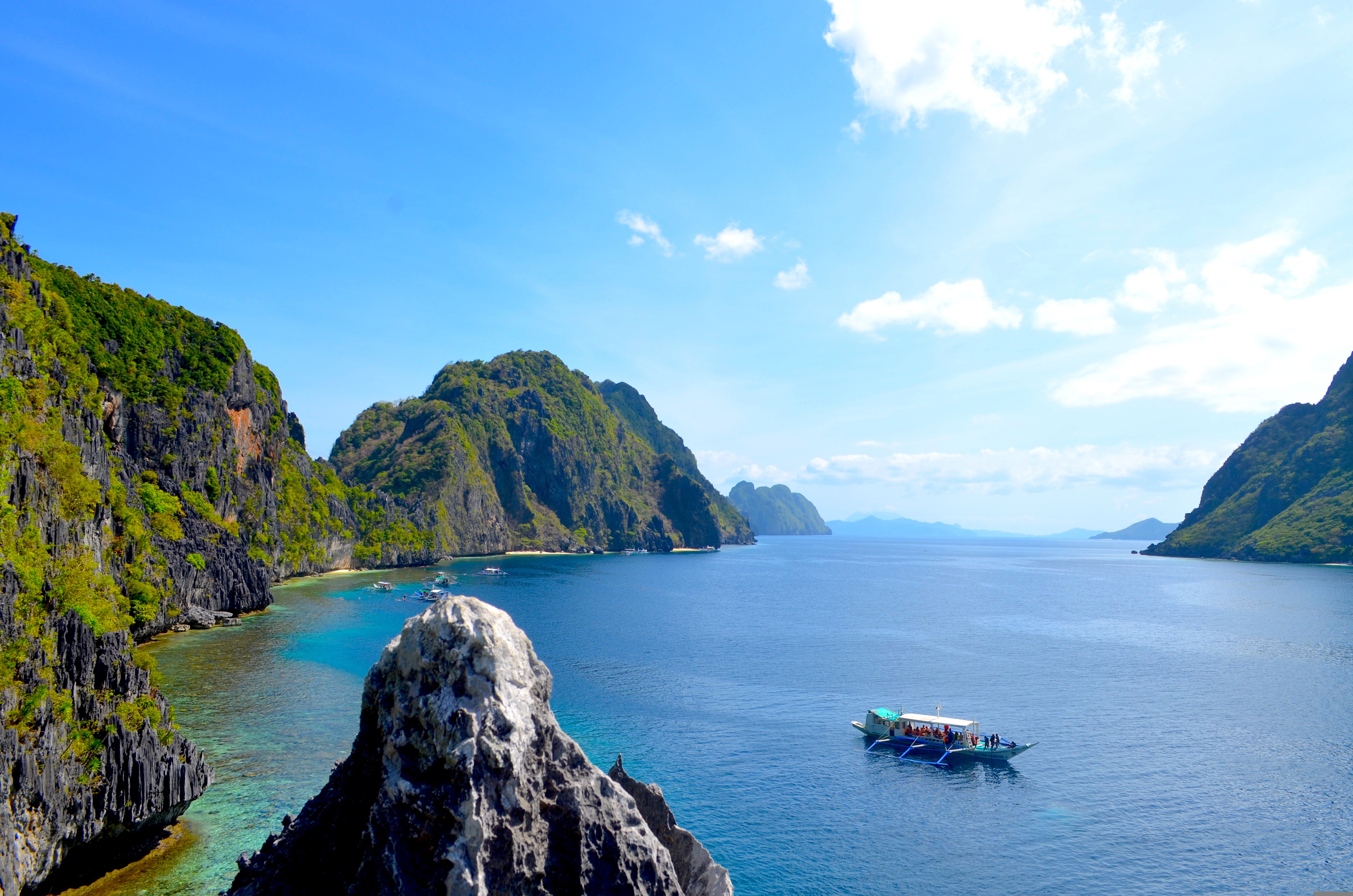
About Puerto Princesa, Palawan
The Spanish arrived at this beautiful corner of the world in March of 1872, founding the city, that would eventually become the Capital of Palawan. In 2011, the area received a huge boost, when New7 announced its list of the 7 Wonders of Nature – counting 500 million votes in the process. Puerto Princesa’s stunning underground river - complete with a cavernous, sunken lagoon - beat off wonderful sites like the Great Barrier Reef, to claim a spot on the final, prestigious list. Set sail across the glowing green water, on a journey into the gaping mouth of the limestone caves at Puerto Princesa. Known for being one of the least densely populated, cleanest and most environmentally friendly cities in the Philippines, there’s a raft of natural wonders to explore - from diving hotspots to towering limestone cliffs, and the entrancing underworld of the underground river.
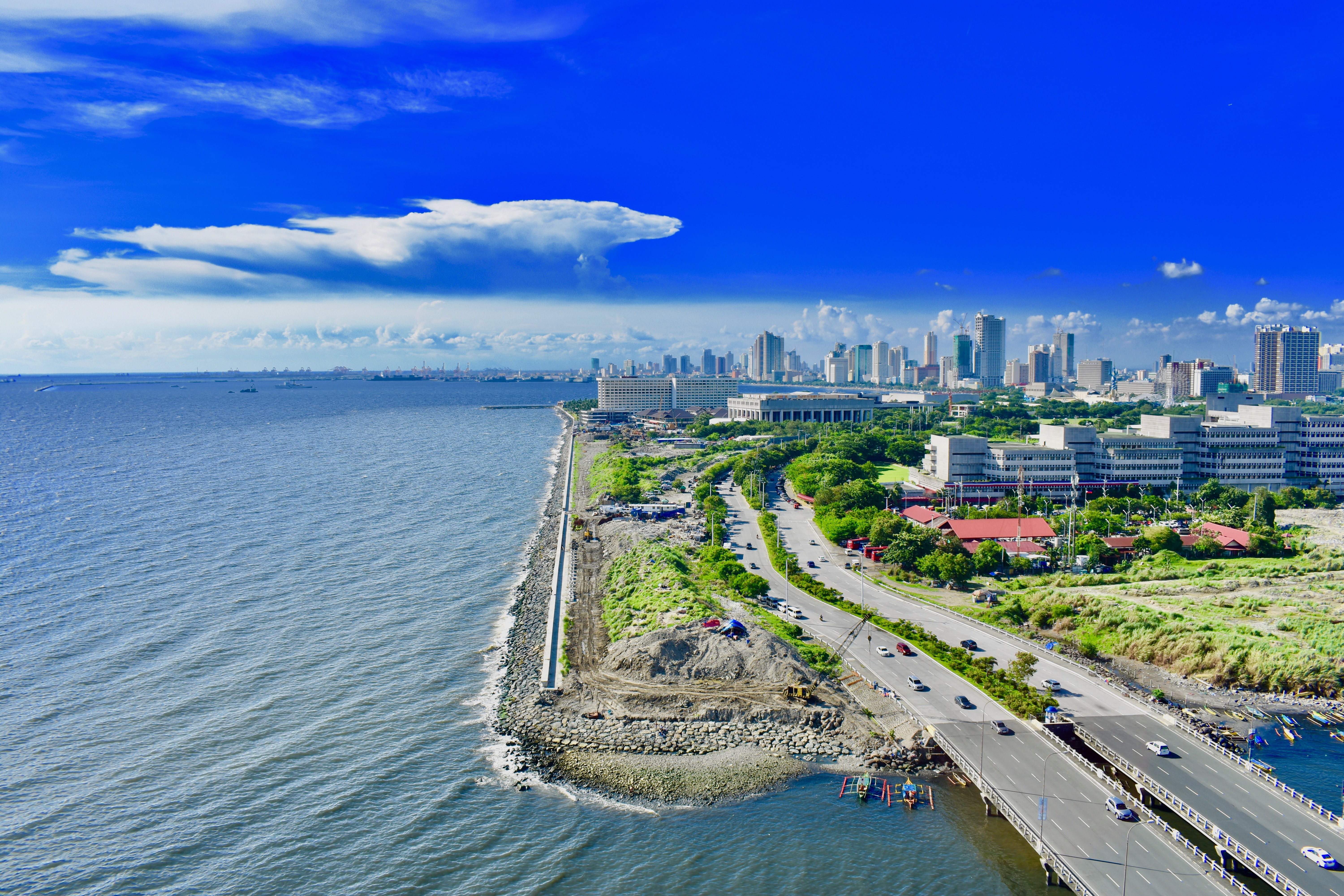
About Manila
MANILA, the capital city of the Philippines, was founded in, 1571 by Spanish conquistador Miguel López de Legazpi. It is one of the oldest cities in the country and was the seat of power for most of the colonial rules of the Philippines. It is situated on the eastern shore of Manila Bay and contains a multitude of landmarks, some of which date back to the 16th century. It is home to the baroque 16th-century San Agustin Church as well as Fort Santiago, a storied citadel and military prison. In the 19th century Manila became one of the most modern cities in Asia. Before the Spanish–American War, Manila saw the rise of the Philippine Revolution. Under the American rule following the Spanish-American War, the United States changed the official language from Spanish to English. Towards the end of World War II, during the Battle of Manila, most of the city was flattened by intensive aerial bombardment. Today, tourism is a vital industry in Manila. Major shopping malls and bazaars thrive around Manila.
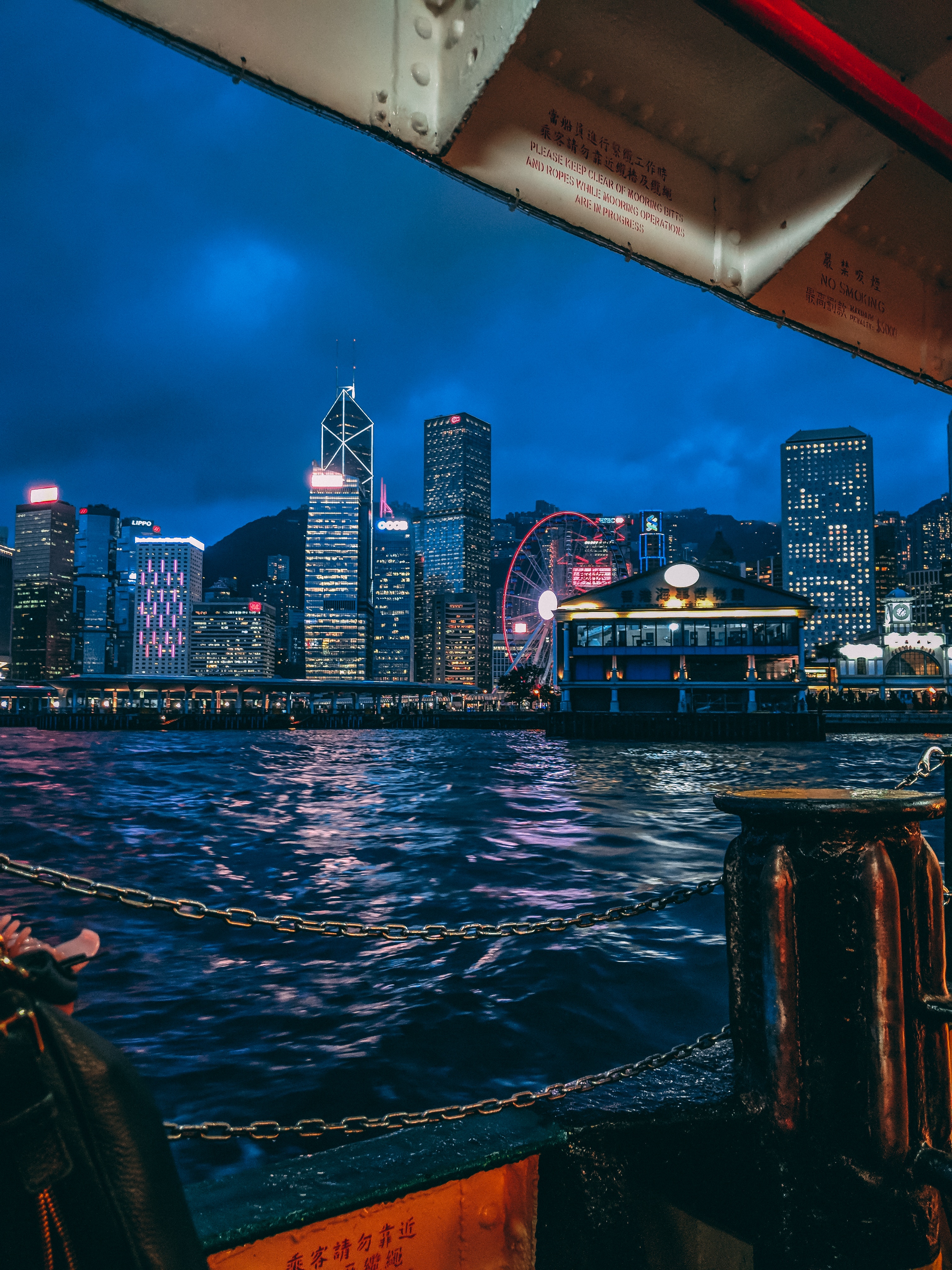
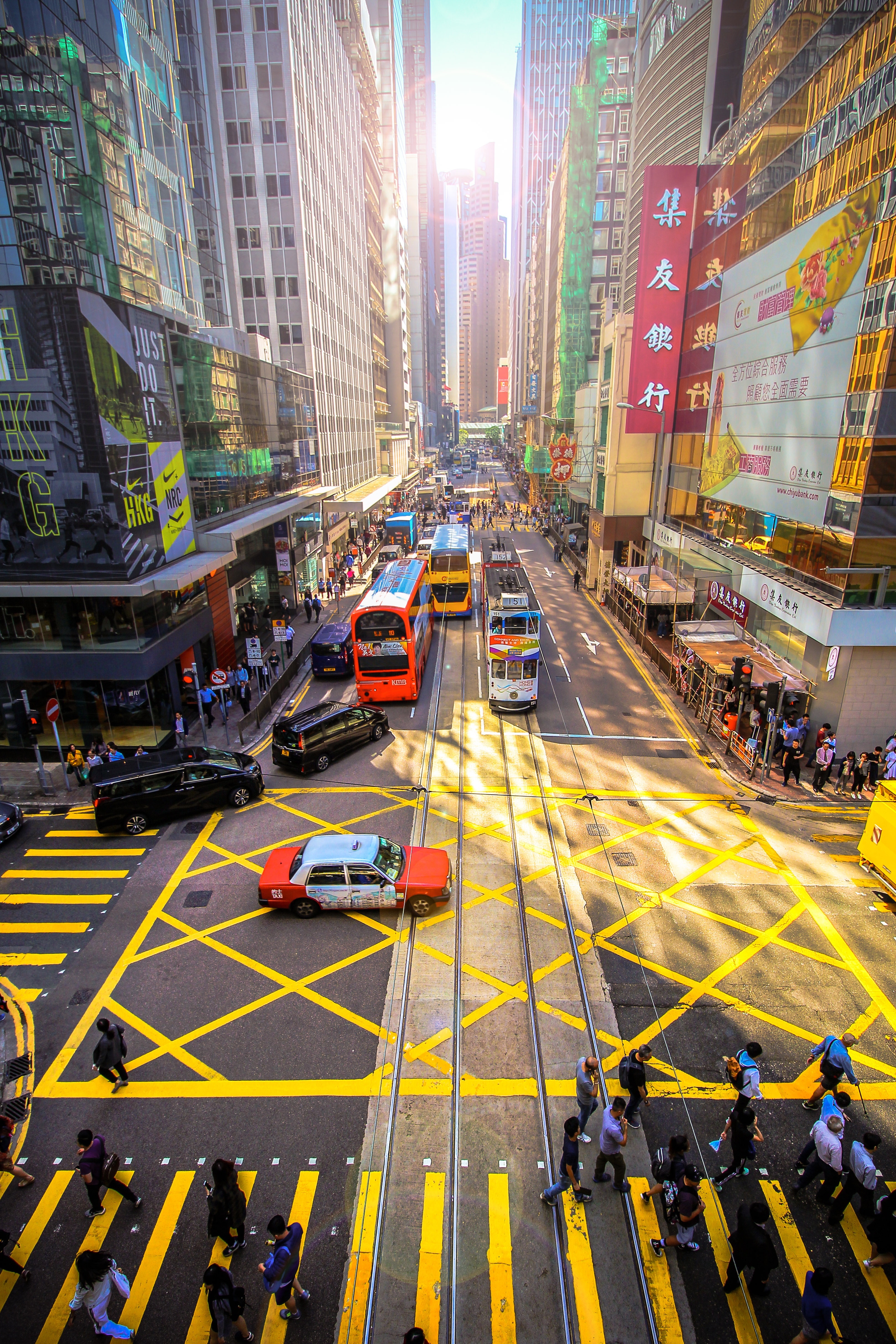
About Hong Kong
The Hong Kong Island skyline, with its ever-growing number of skyscrapers, speaks to ambition and money. Paris, London, even New York were centuries in the making, while Hong Kong's towers, bright lights, and glitzy shopping emporia weren't yet part of the urban scene when many of the young investment bankers who fuel one of the world's leading financial centers were born. Commerce is concentrated in the glittering high-rises of Central, tucked between Victoria Harbor and forested peaks on Hong Kong Island's north shore. While it's easy to think all the bright lights are the sum of today's Hong Kong, you need only walk or board a tram for the short jaunt west into Western to discover a side of Hong Kong that is more traditionally Chinese but no less high-energy. You'll discover the real Hong Kong to the east of Central, too, in Wan Chai, Causeway Bay, and beyond. Amid the residential towers are restaurants, shopping malls, bars, convention centers, a nice smattering of museums, and—depending on fate and the horse you wager on—one of Hong Kong's luckiest or unluckiest spots, the Happy Valley Racecourse. Kowloon sprawls across a generous swath of the Chinese mainland across Victoria Harbour from Central. Tsim Sha Tsui, at the tip of Kowloon peninsula, is packed with glitzy shops, first-rate museums, and eye-popping views of the skyline across the water. Just to the north are the teeming market streets of Mong Kok and in the dense residential neighborhoods beyond, two of Hong Kong's most enchanting spiritual sights, Wong Tai Sin Temple and Chi Lin Nunnery. As you navigate this huge metropolis (easy to do on the excellent transportation network), keep in mind that streets are usually numbered odd on one side, even on the other. There's no baseline for street numbers and no block-based numbering system, but street signs indicate building numbers for any given block.
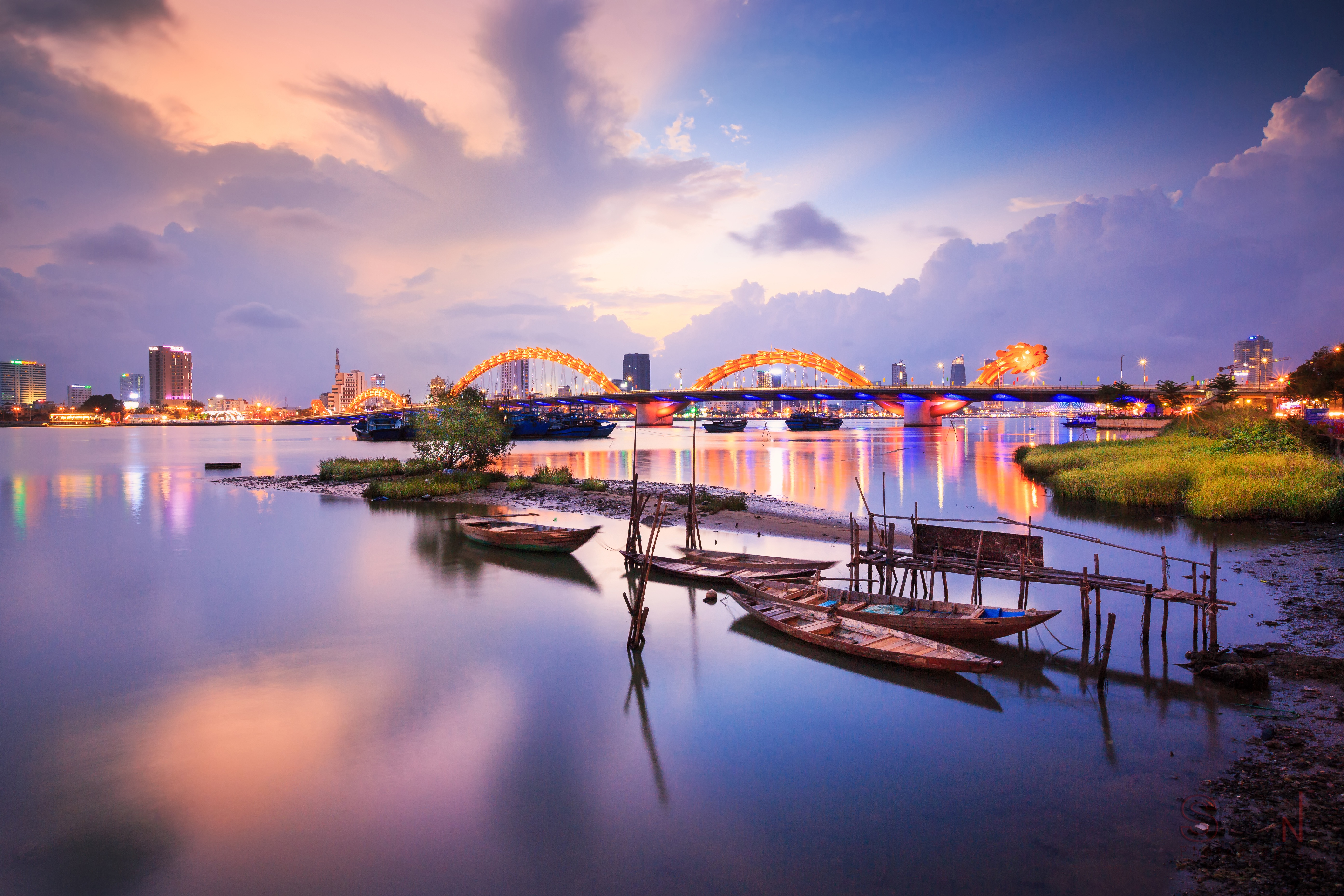
About Chan May
Hue (pronounced hway), bisected by the Perfume River and 13 km (8 mi) inland from the South China Sea, in the foothills of the Annamite Mountains (Truong Son Mountains), stands as a reminder of Vietnam's imperial past. The seat of 13 Nguyen-dynasty emperors between 1802 and 1945, Hue was once Vietnam's splendid Imperial City. Although it was devastated by the French in the 19th century and again by fighting between the Vietnamese Communists and the Americans in the 20th, the monument-speckled former capital has a war-ravaged beauty. One can still imagine its former splendor, despite gaping holes in its silhouette. Hue is a UNESCO World Heritage Site, and the city's gems are slowly being restored.
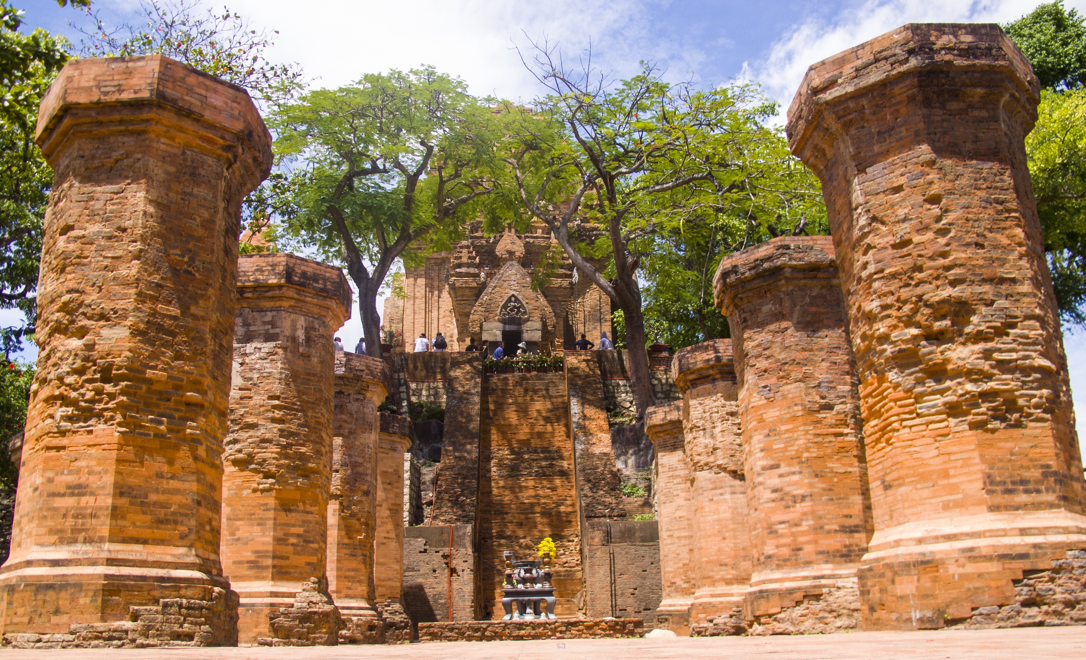
About Nha Trang
About Phu My

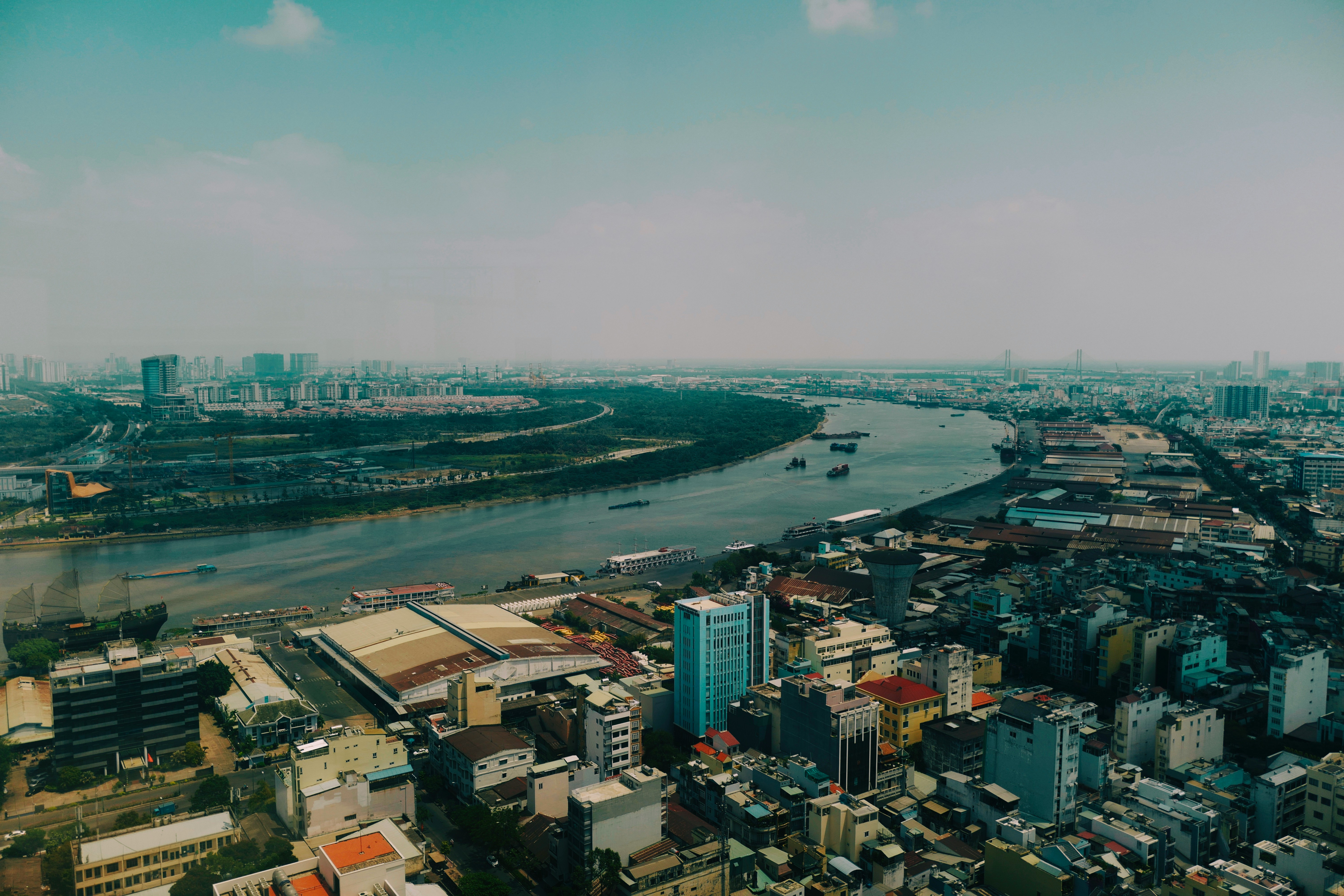
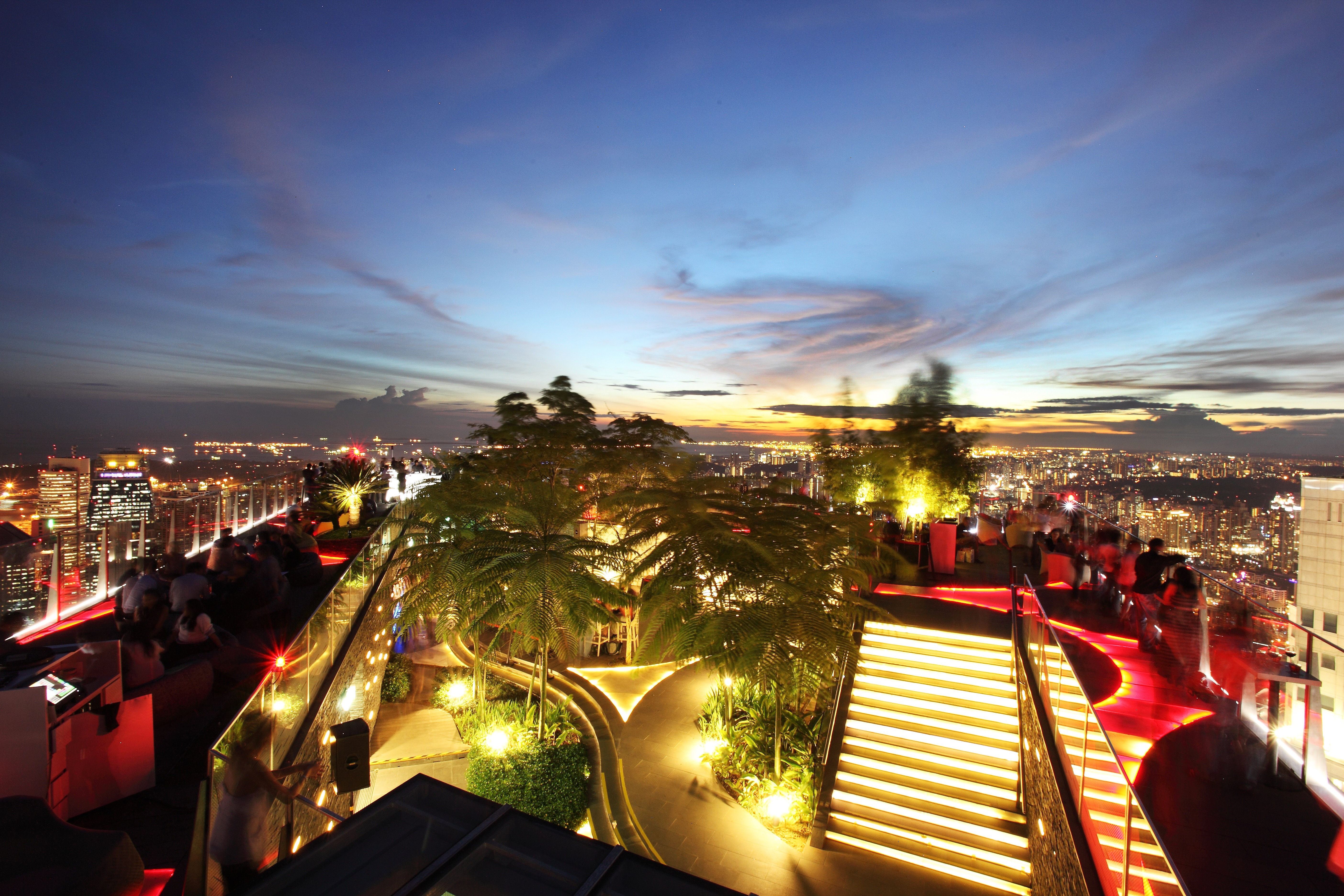
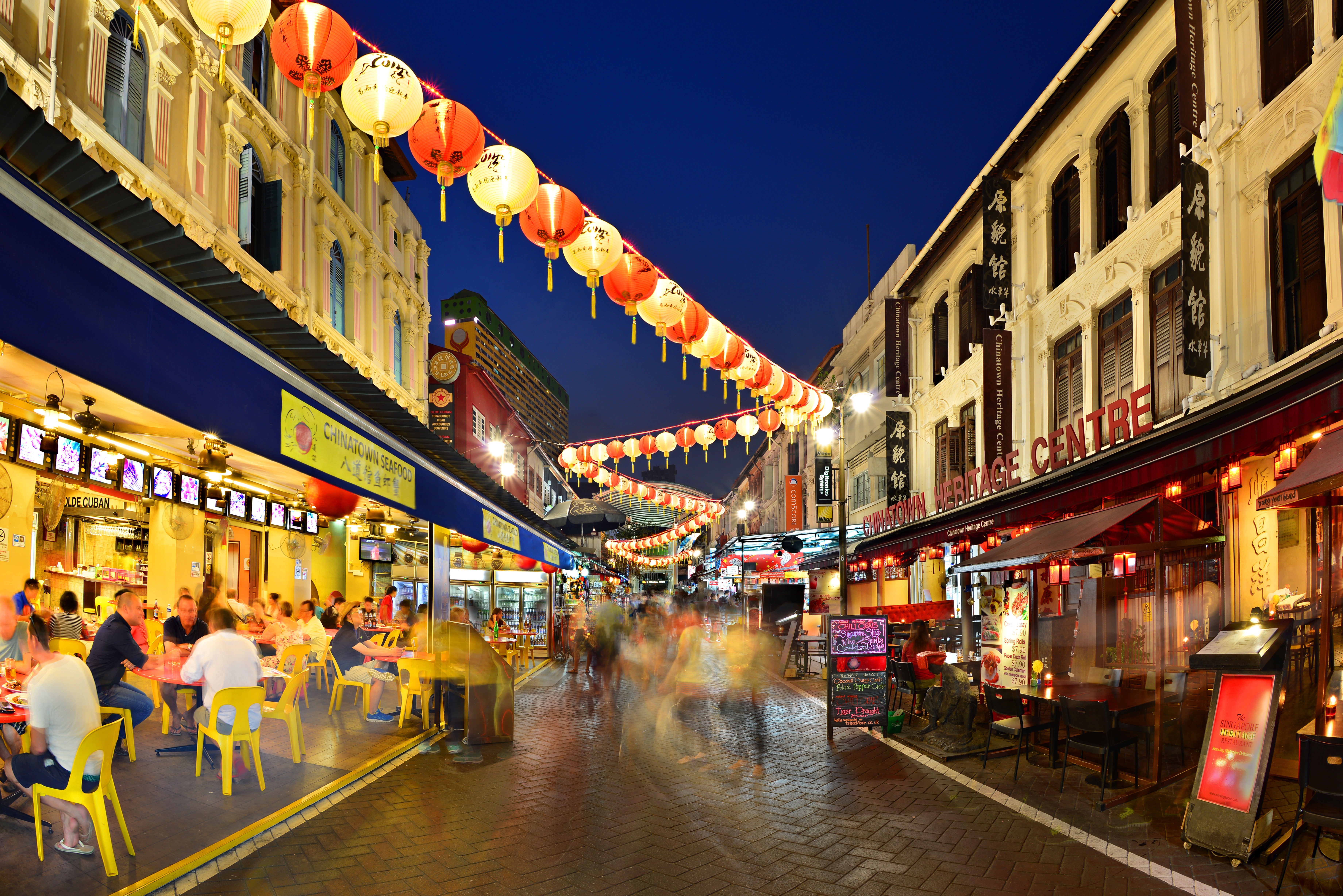
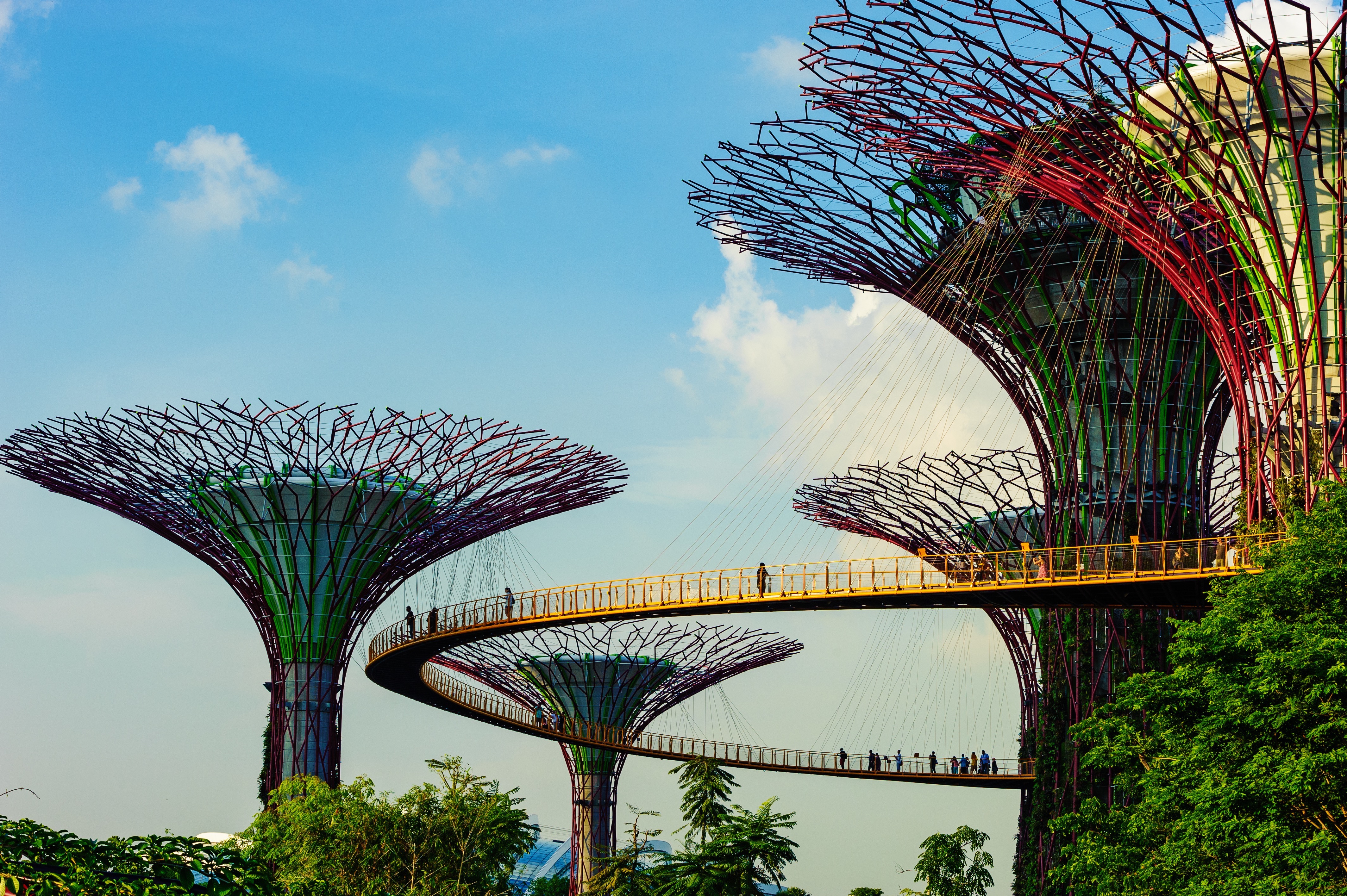
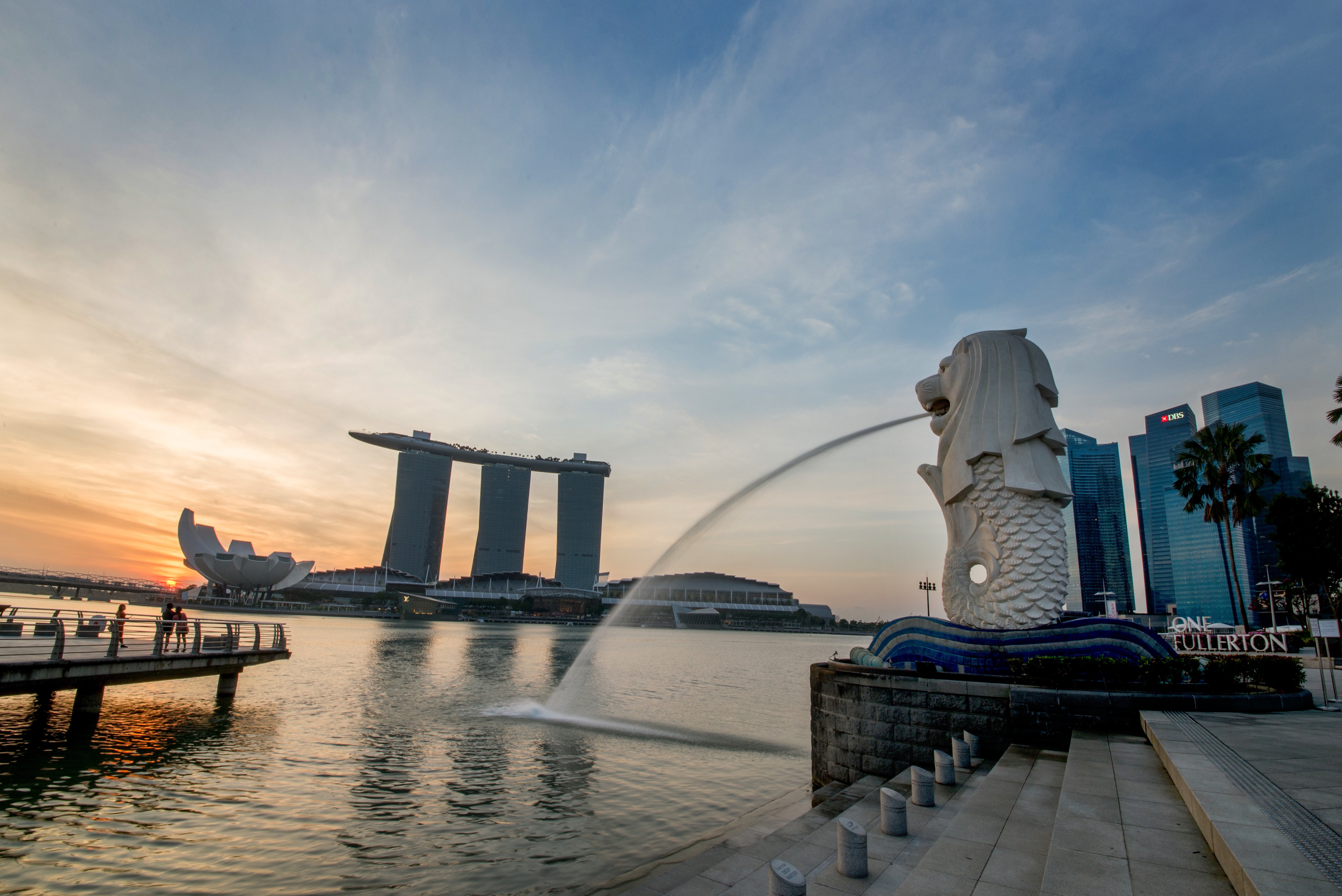
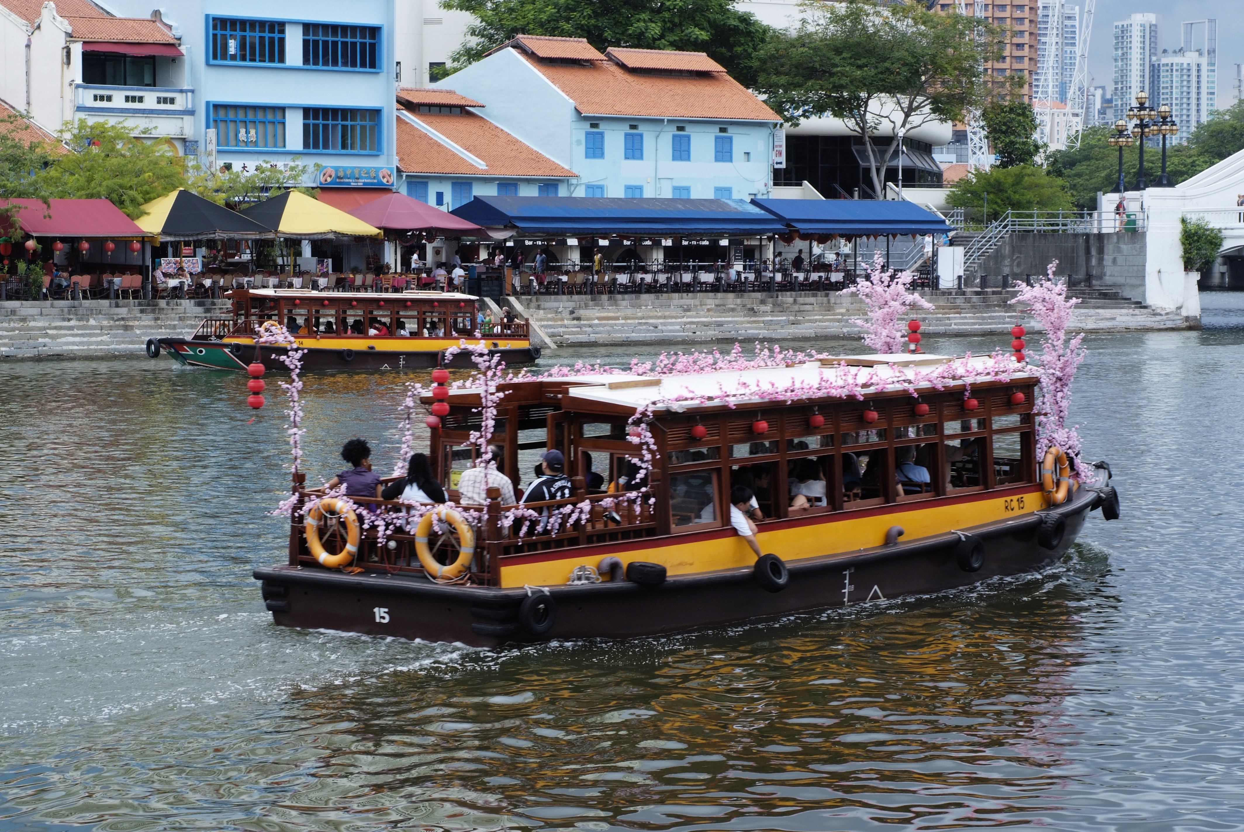
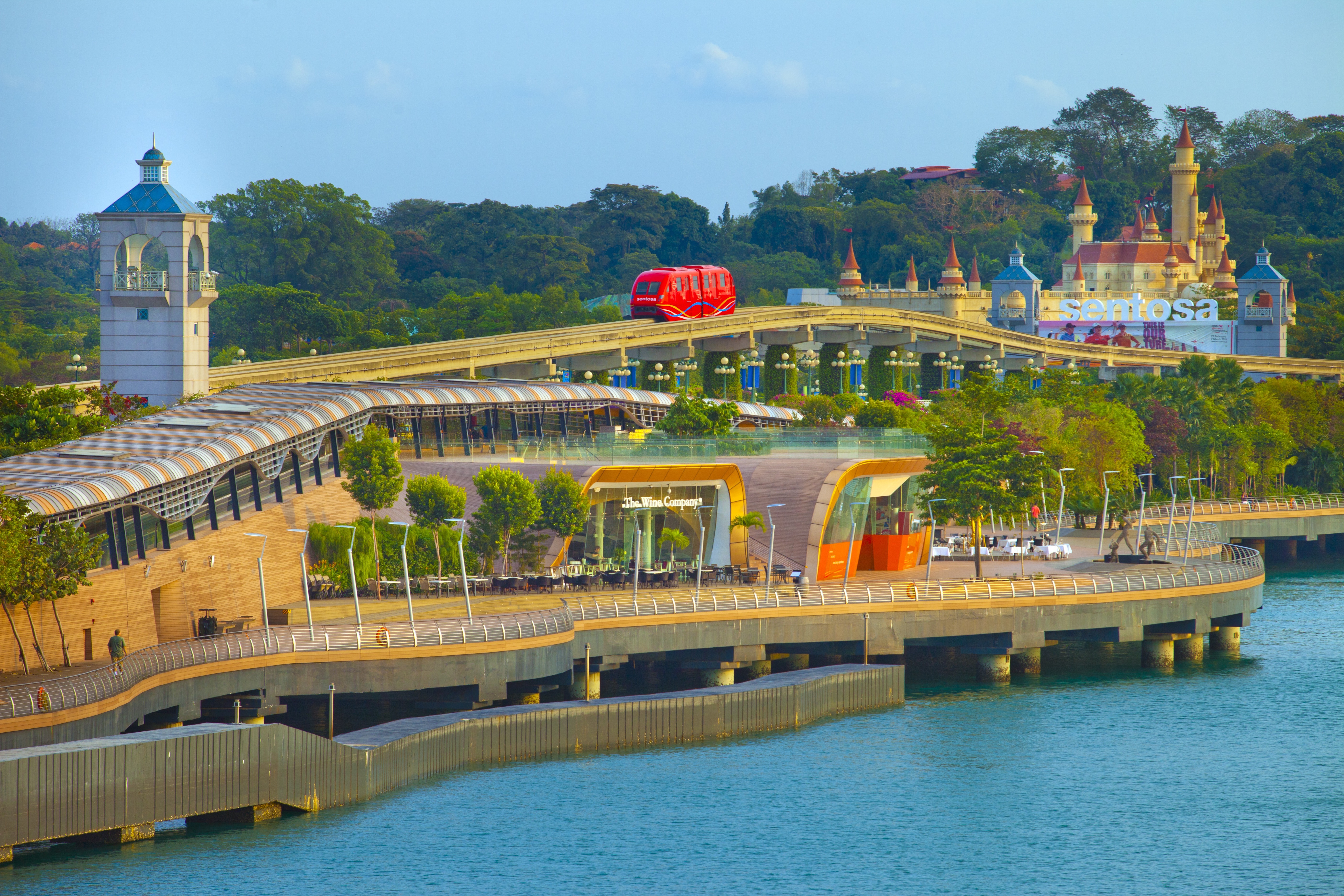
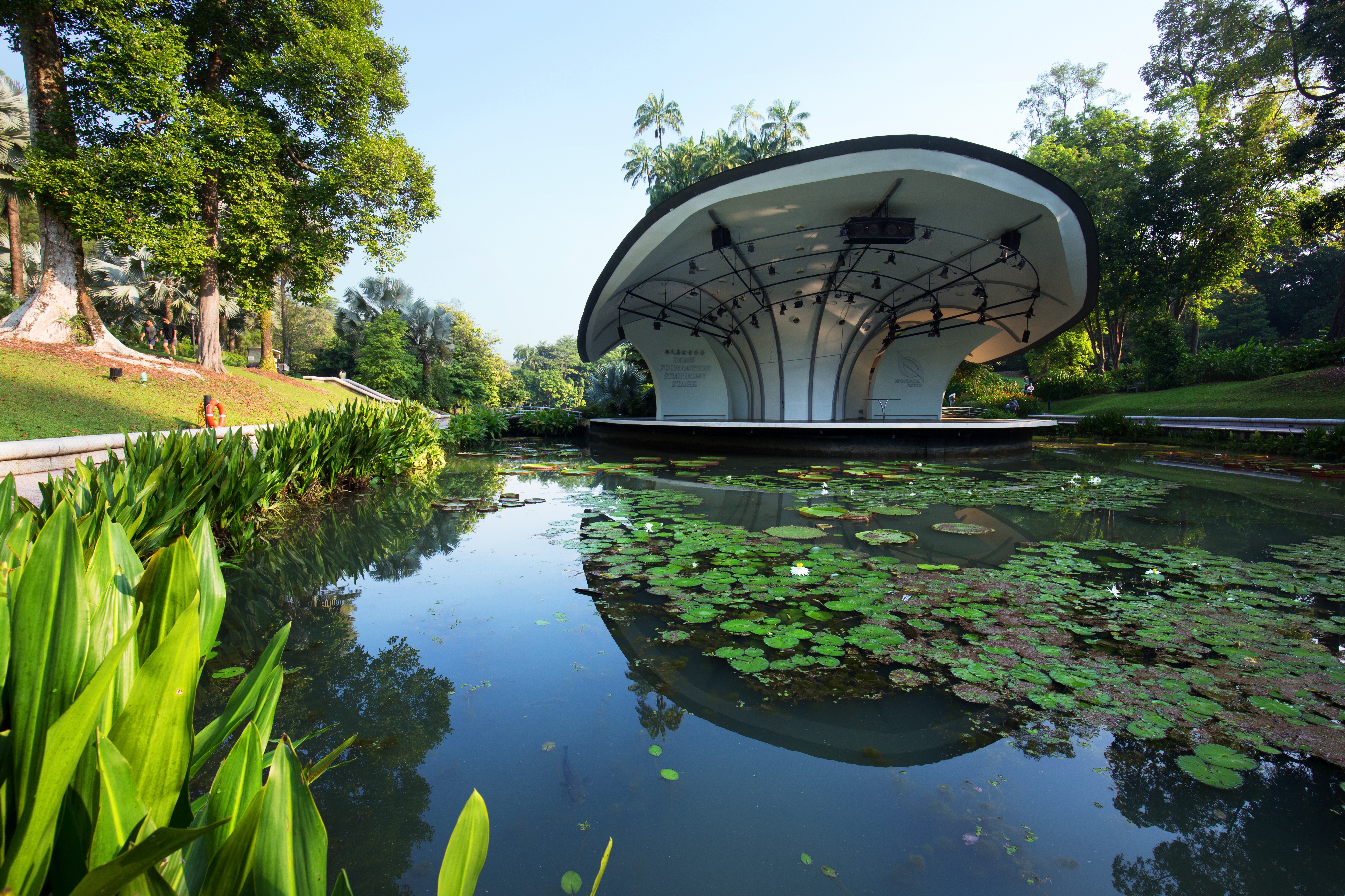
About Singapore
The main island of Singapore is shaped like a flattened diamond, 42 km (26 miles) east to west and 23 km (14 miles) north to south. Near the northern peak is the causeway leading to West Malaysia—Kuala Lumpur is less than four hours away by car. It is at the southern foot where you will find most of the city-state’s action, with its gleaming office towers, working docks, and futuristic "supertrees," which are solar-powered and serve as vertical gardens. Offshore are Sentosa and over 60 smaller islands, most uninhabited, that serve as bases for oil refining or as playgrounds and beach escapes from the city. To the east is Changi International Airport, connected to the city by metro, bus, and a tree-lined parkway. Of the island's total land area, more than half is built up, with the balance made up of parkland, farmland, plantations, swamp areas, and rain forest. Well-paved roads connect all parts of the island, and Singapore city has an excellent, and constantly expanding, public transportation system. The heart of Singapore's history and its modern wealth are in and around the Central Business District. The area includes the skyscrapers in the Central Business District, the 19th-century Raffles Hotel, the convention centers of Marina Square, on up to the top of Ft. Canning. Although most of old Singapore has been knocked down to make way for the modern city, most colonial landmarks have been preserved in the CBD, including early-19th-century buildings designed by the Irish architect George Coleman.
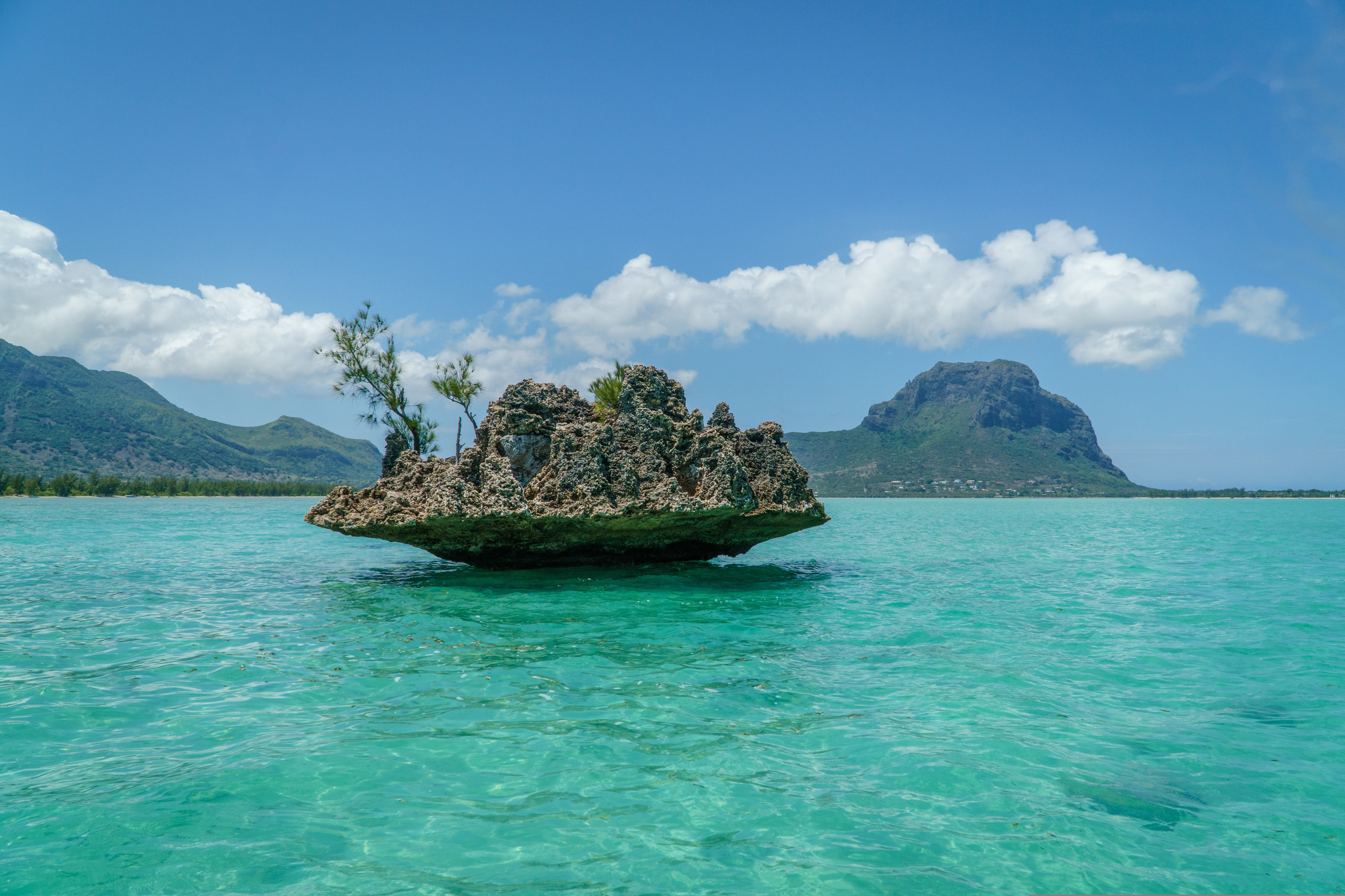
About Mauritius
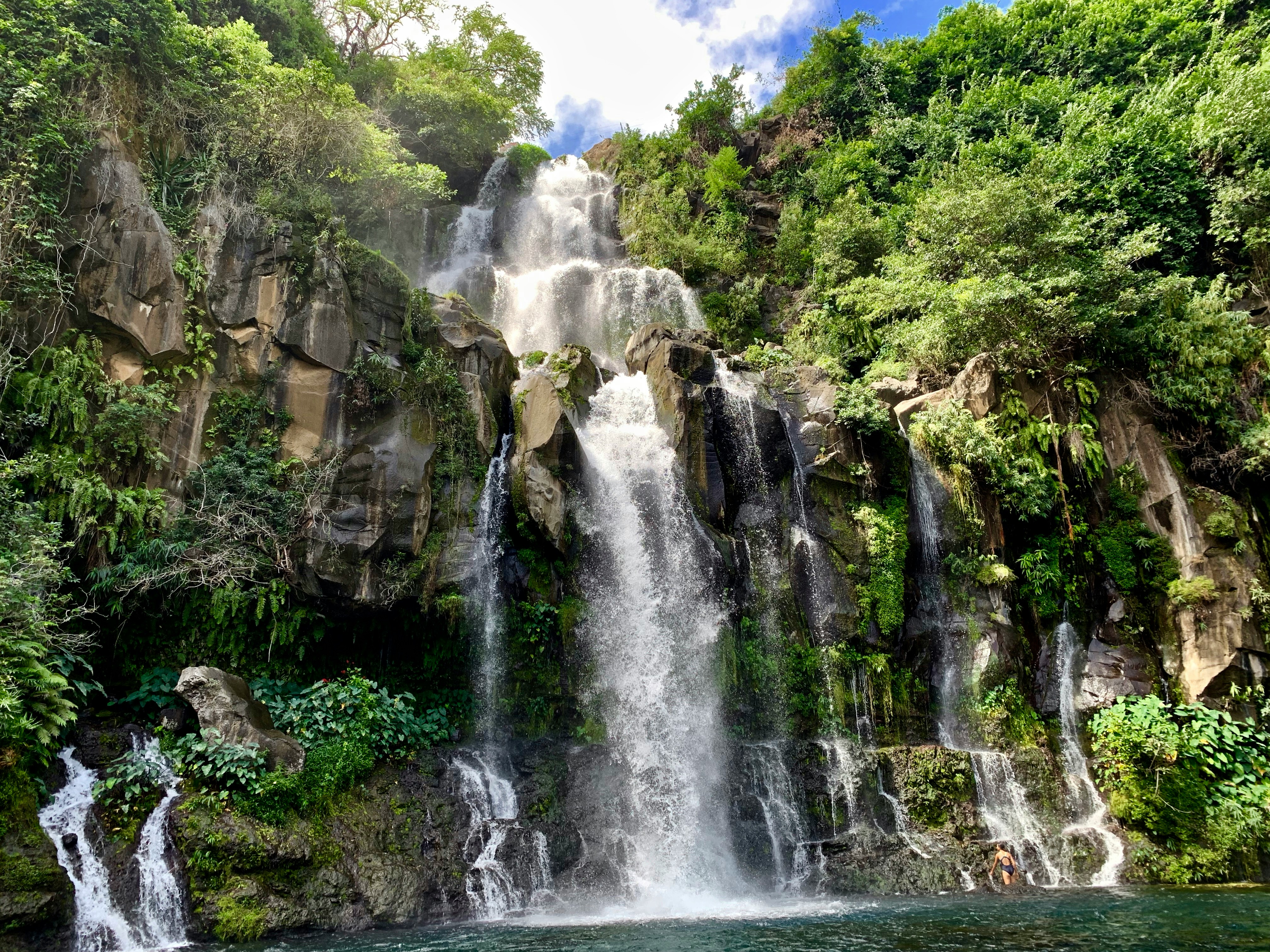
About Pointe des Galets
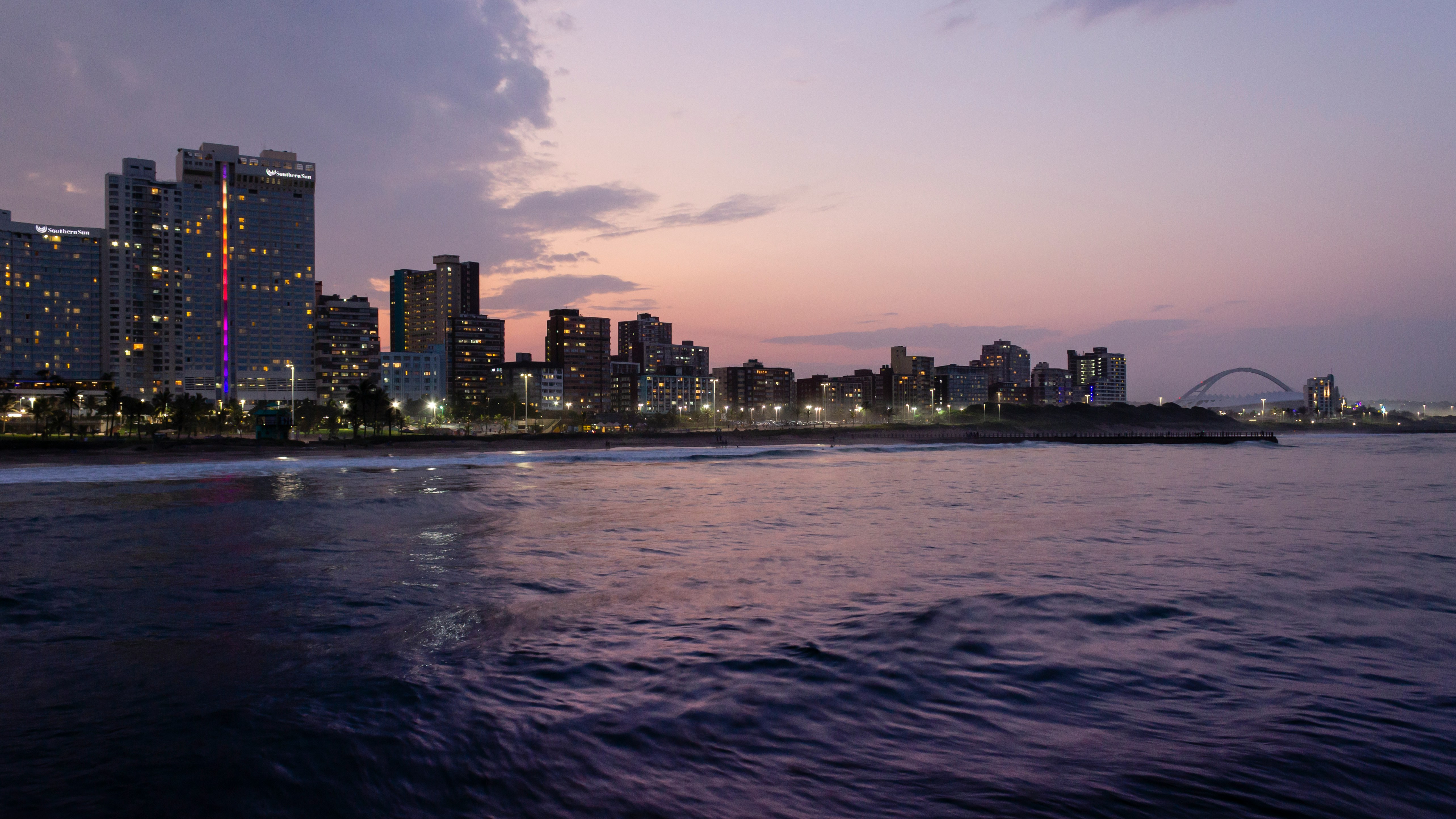
About Durban
Durban, a glistening jewel on the south-east coast of Africa, is the third largest city in South Africa and the major city of KwaZulu-Natal. It has been a centre of sea trade since before colonisation and now has a flourishing artistic centre, which perfectly complements the vibrant markets and rich cultures of the city. Durban’s port is a natural half-moon harbour lined with white sand and azure water, punctuated by the port’s many piers which reach into the water like the leaves of a fan. The beaches of Durban’s famous Golden Mile stretch along the harbour and are popular all year round, as travellers and locals alike enjoy Durban’s warm, humid summers and mild, dry winters.
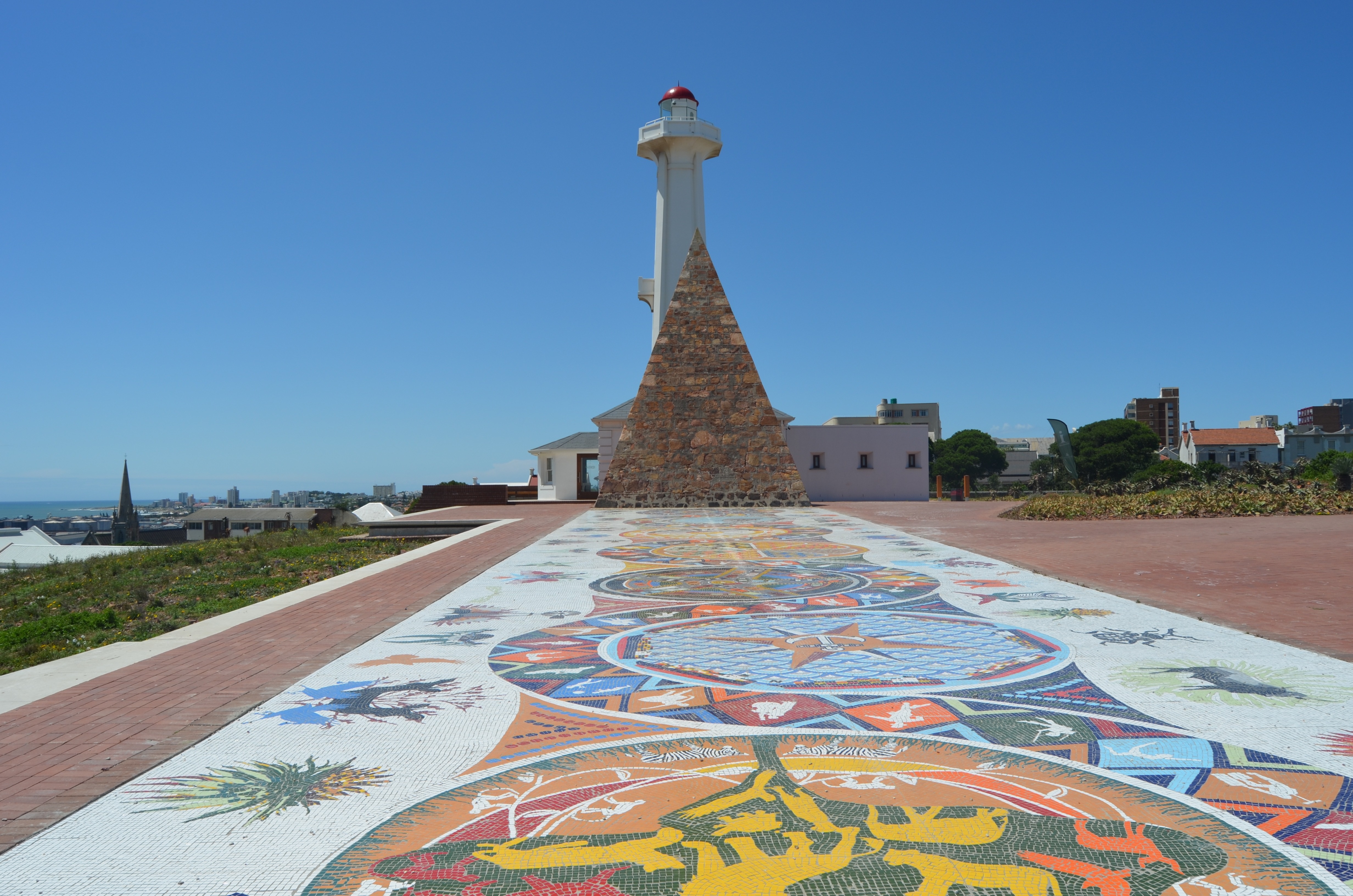
About Gqeberha (ex Port Elizabeth)
Originally the home of the San and Khoisan people and later the Xhosa tribe, the area now known as Gqeberha (previously Port Elizabeth) became a landing place for passing European ships after Portuguese navigator Bartolomew Diaz arrived in Algoa Bay in 1488. As part of the Cape Colony, the British occupied the area during the Napoleonic Wars and it was they who built Fort Frederick here in 1799. Twenty-one years later 4,000 settlers arrived, becoming the first permanent British residents of South Africa and Gqeberha. Sir Rufane Donkin, Acting Governor of the Cape Colony, founded Port Elizabeth, naming the settlement after his late wife. The town underwent rapid growth after 1873 following the construction of the railway to Kimberley, and is now one of the country’s major seaports. Like most South African cities, miles of beautiful coastline surround Gqeberha. Algoa Bay combines warm water and fair breezes, making it a mecca for swimmers and water sports enthusiasts. Those interested in history can follow the Donkin Heritage Trail, past a succession of Victorian and Edwardian town houses, trim gardens and neo-Gothic churches. Just outside the town are a number of game reserves, including the famous Addo Elephant National Park.
About Cape Town
Sometimes referred to as the Mother City, Cape Town is the most famous port in South Africa and is influenced by many different cultures, including Dutch, British and Malay. The port was founded in 1652 by Dutch explorer Jan Van Riebeeck, and evidence of Dutch colonial rule remains throughout the region. The port is located on one of the world's most important trade routes, and is mainly a container port and handler of fresh fruit. Fishing is another vital industry, with large Asian fishing fleets using Cape Town as a logistical repair base for much of the year. The region is famous for its natural beauty, with the imposing Table Mountain and Lions Head, as well as the many nature reserves and botanical gardens such as Kirstenbosch which boasts an extensive range of indigenous plant life, including proteas and ferns. Cape Town's weather is mercurial, and can change from beautiful sunshine to dramatic thunderstorms within a short period. A local adage is that in Cape Town you can experience four seasons in one day.
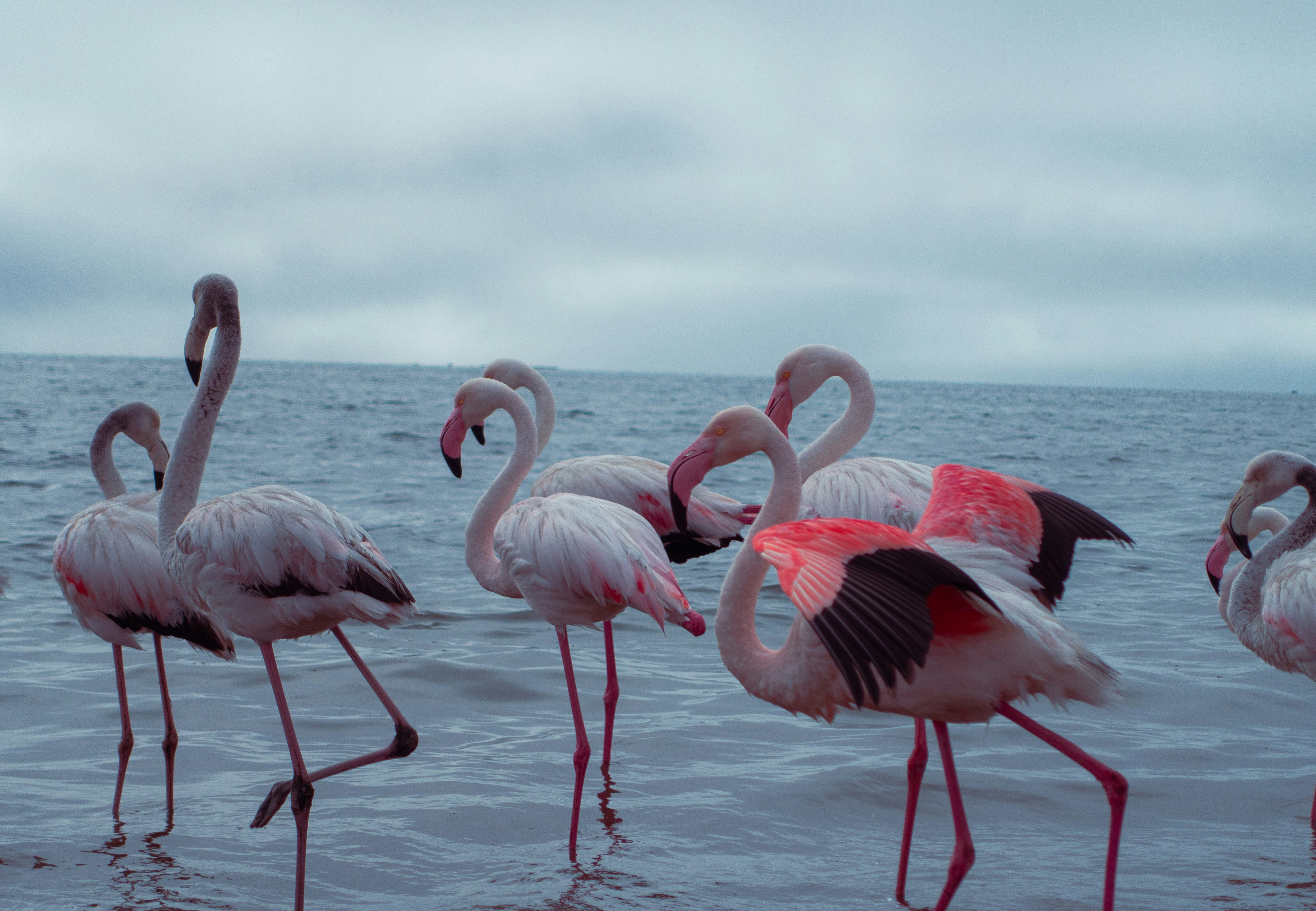
About Walvis Bay
Once a whaling station, Walvis Bay provides a gateway to the extraordinary desert landscapes of Namibia and is itself an area of unusual natural beauty. The showpiece of the Walvis Bay area is the natural lagoon where you can see flamingos in their thousands at certain times of the year, along with a variety of other wading birds such as the white pelican. Further inland you will find the stunning Namib Desert, which provides an unlikely home for a diverse array of wildlife. Alternatively, you could venture into the desert of Sossusvlei, whose mountainous ochre sand dunes are said to be the highest in the world, or visit the colonial town of Swakopmund.

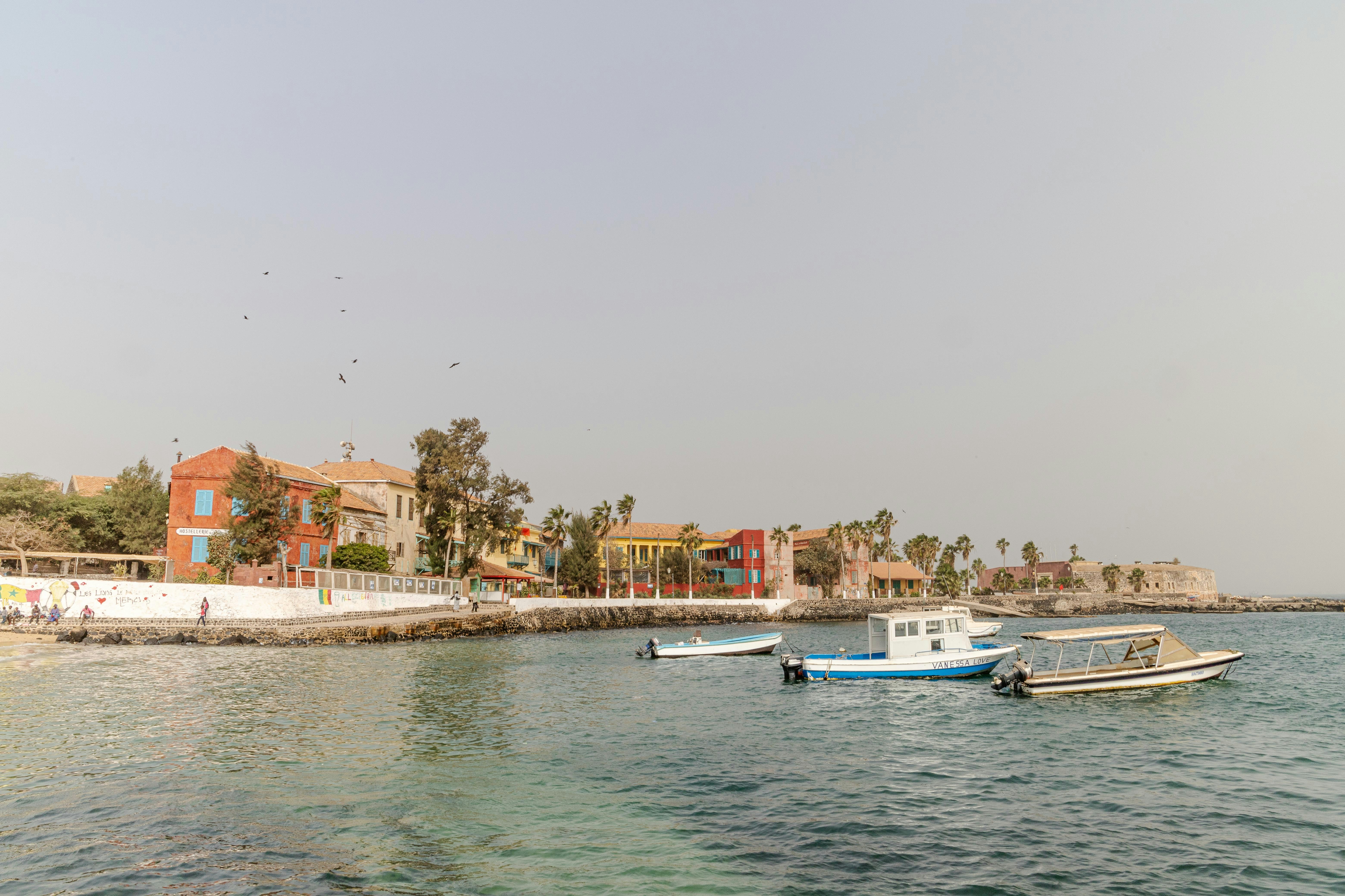
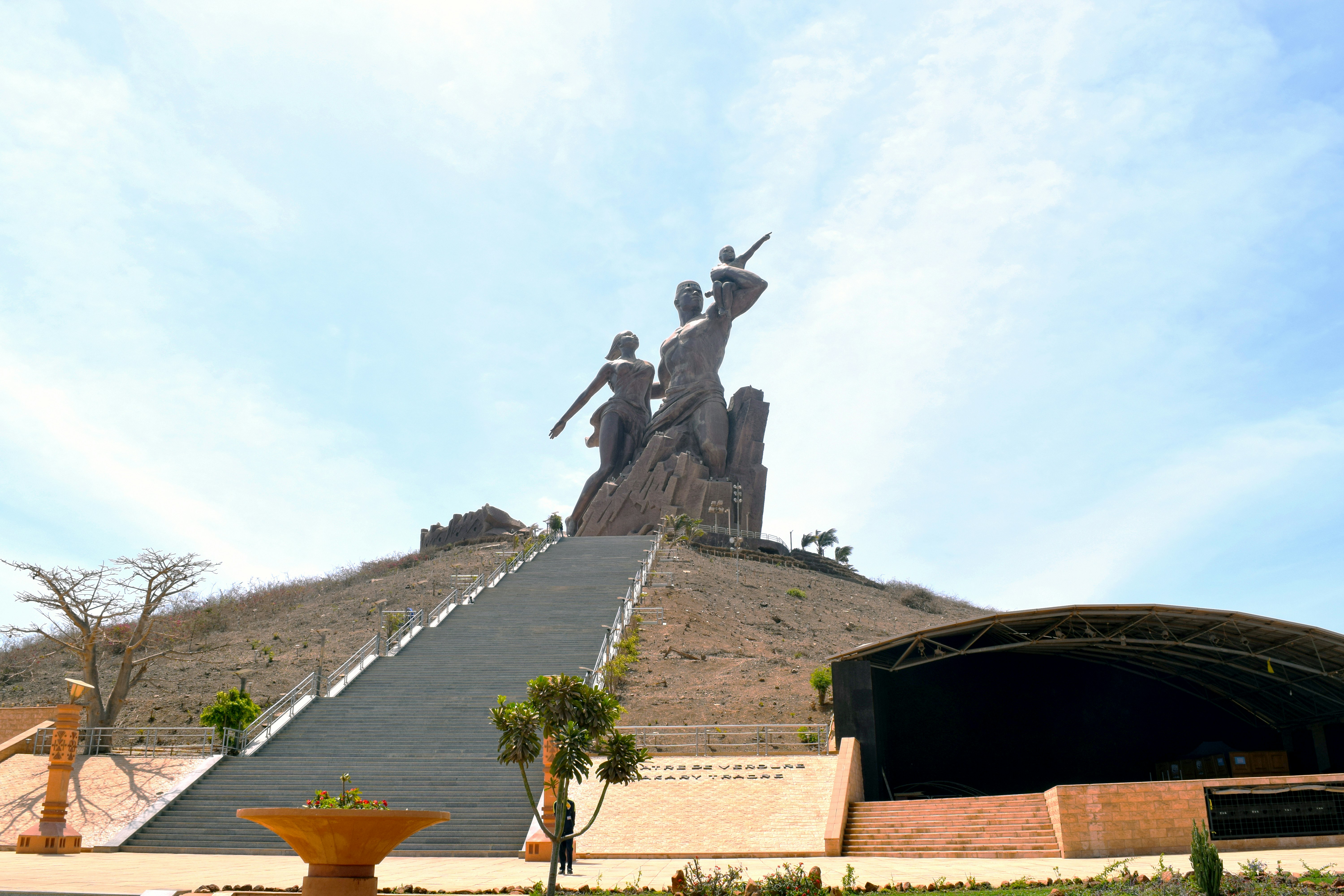
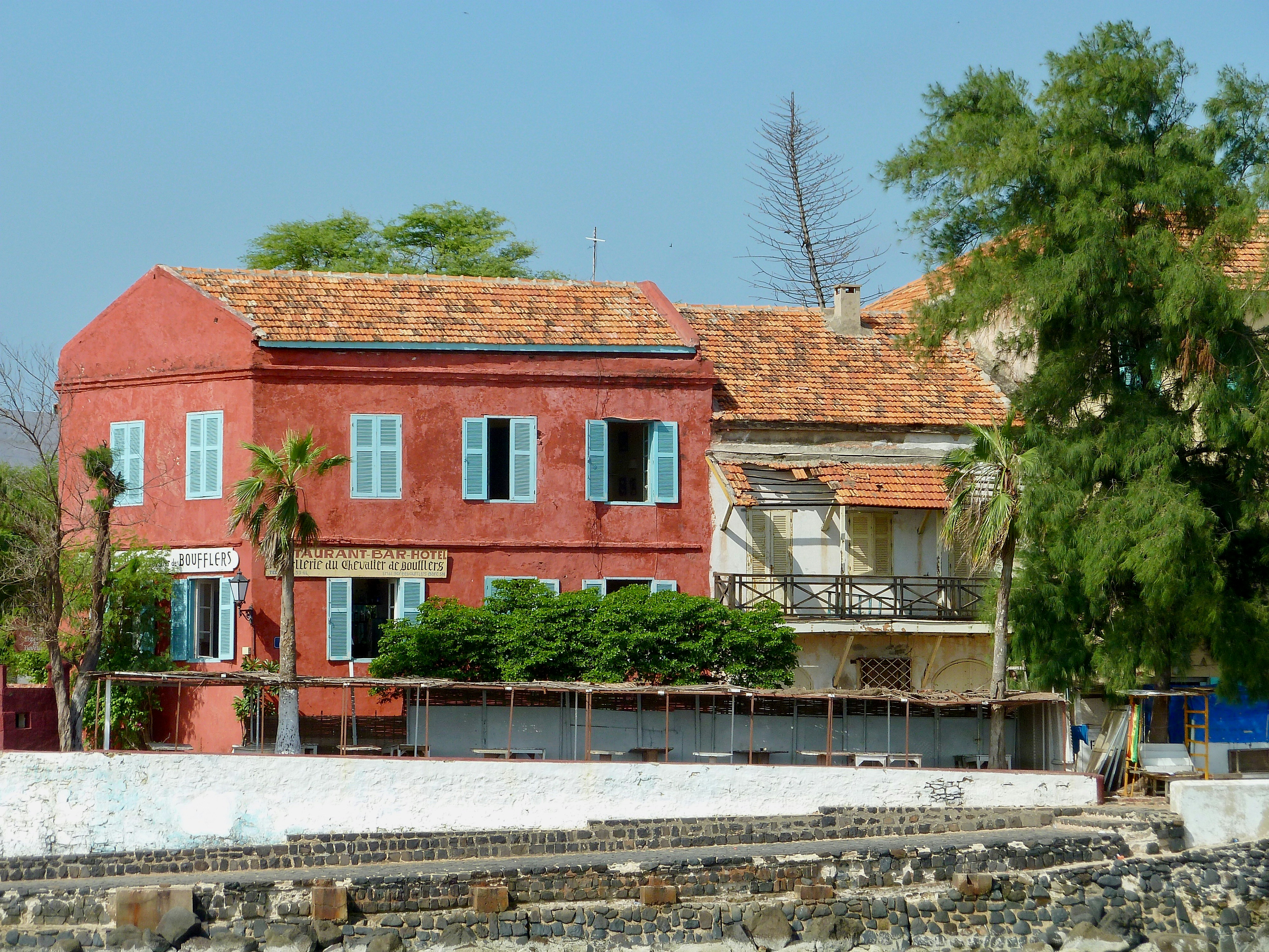
About Dakar
Dakar, set at the tip of the Cape Vert peninsula, is West Africa’s westernmost point and the capital of French-speaking Senegal. Although it was not founded until 1857, it is West Africa’s oldest European city and one of the most westernised. The opening of the Dakar-St Louis railway in 1885 put the town on the map; it subsequently became a French naval base and in 1904, the capital of Afrique Occidentale Française. It bears the legacy of Africa’s French colonial past, especially so in the downtown Plateau area, where the architecture is redolent of southern France. Every inch a modern city, Dakar is a frenetic buzz of activity, which can be startling. Perhaps sample the popular mint tea and try your hand at bartering in the colourful craft markets for traditional embroidery, woodcarvings, metalwork and costume jewellery.
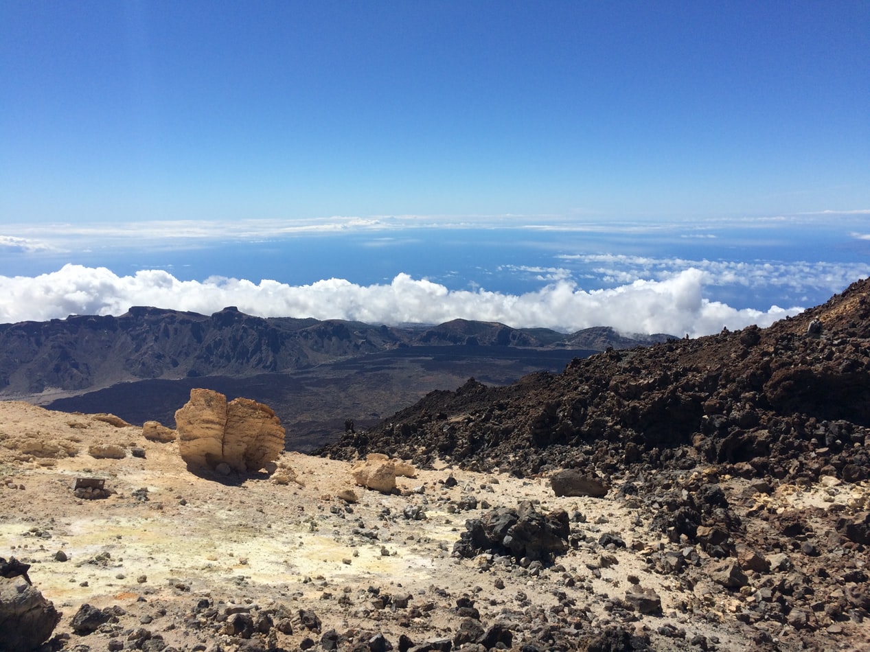
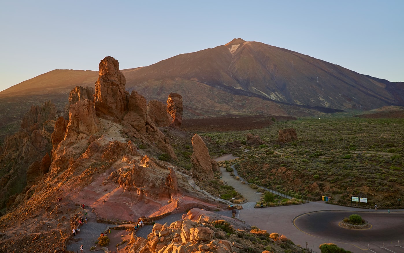
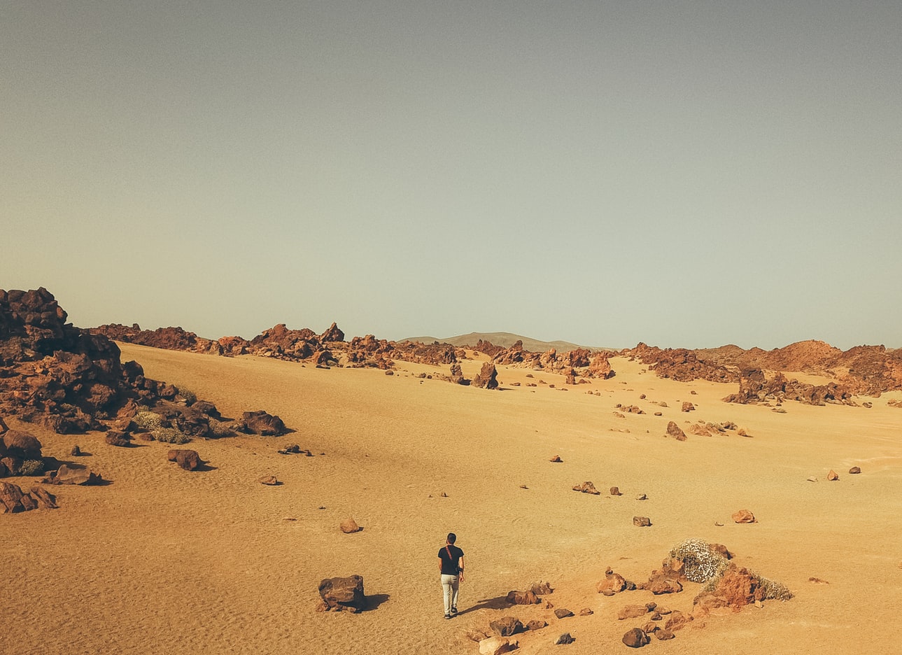
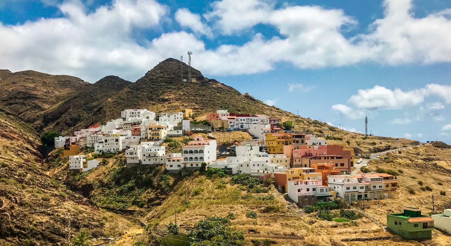
About Santa Cruz de Tenerife
The largest of the Canary Islands, Tenerife is a beautiful and scenic island which enjoys year-round sunshine and is dominated by Mount Teide. The mountain range runs through the centre of the island, with fertile valleys on the northern side. In the central part of the range is the gigantic natural crater of the Cañadas del Teide, about 14 miles in diameter. Santa Cruz, the island’s pretty capital, was originally a small fishing village but has now grown into a modern city, and also contains 16th-century civic buildings and ornate private mansions. Near the pier is the Santa Cruz Palmetum, a Botanical Garden covering an area of 29 acres, specialising in palms.
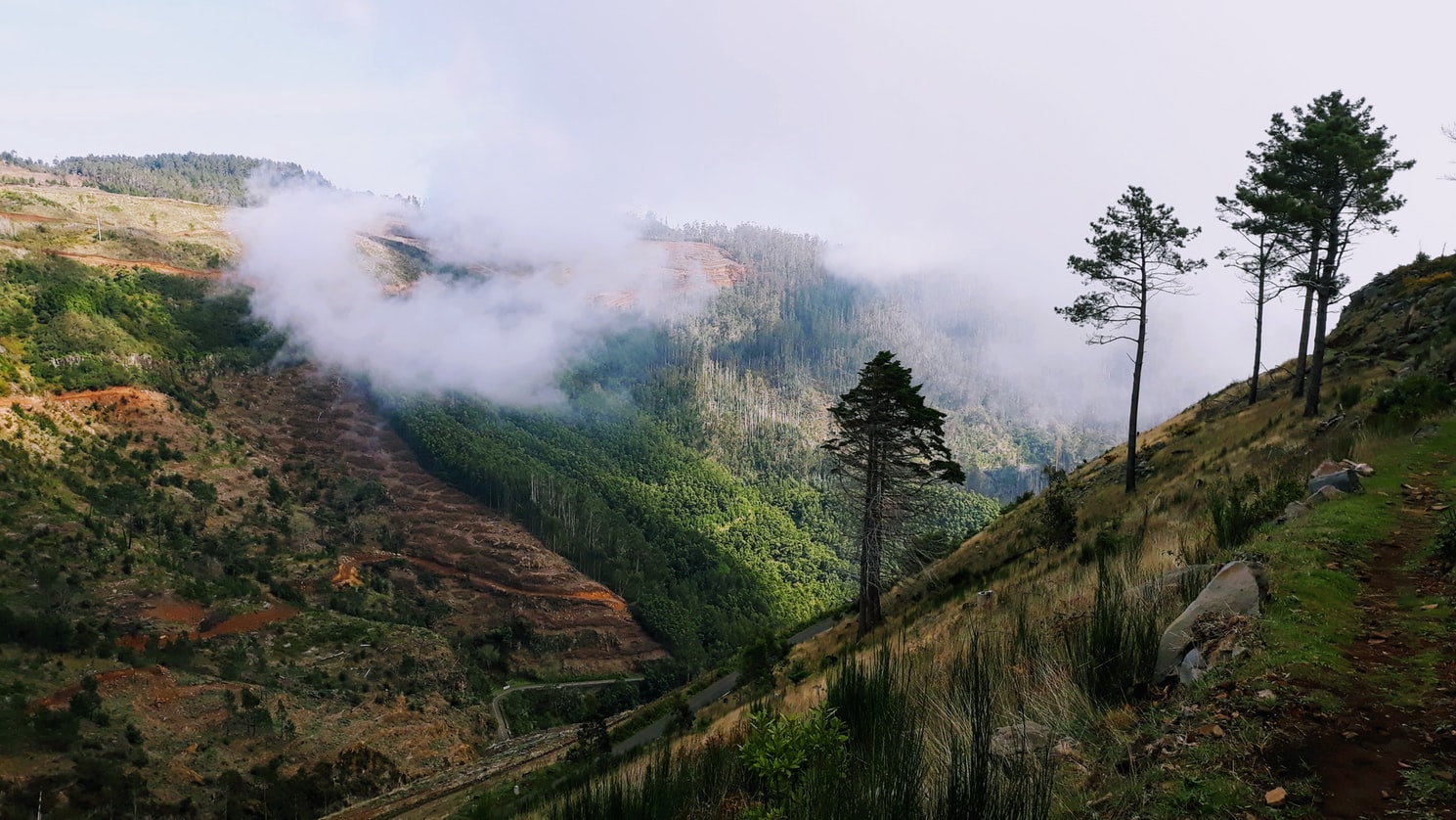
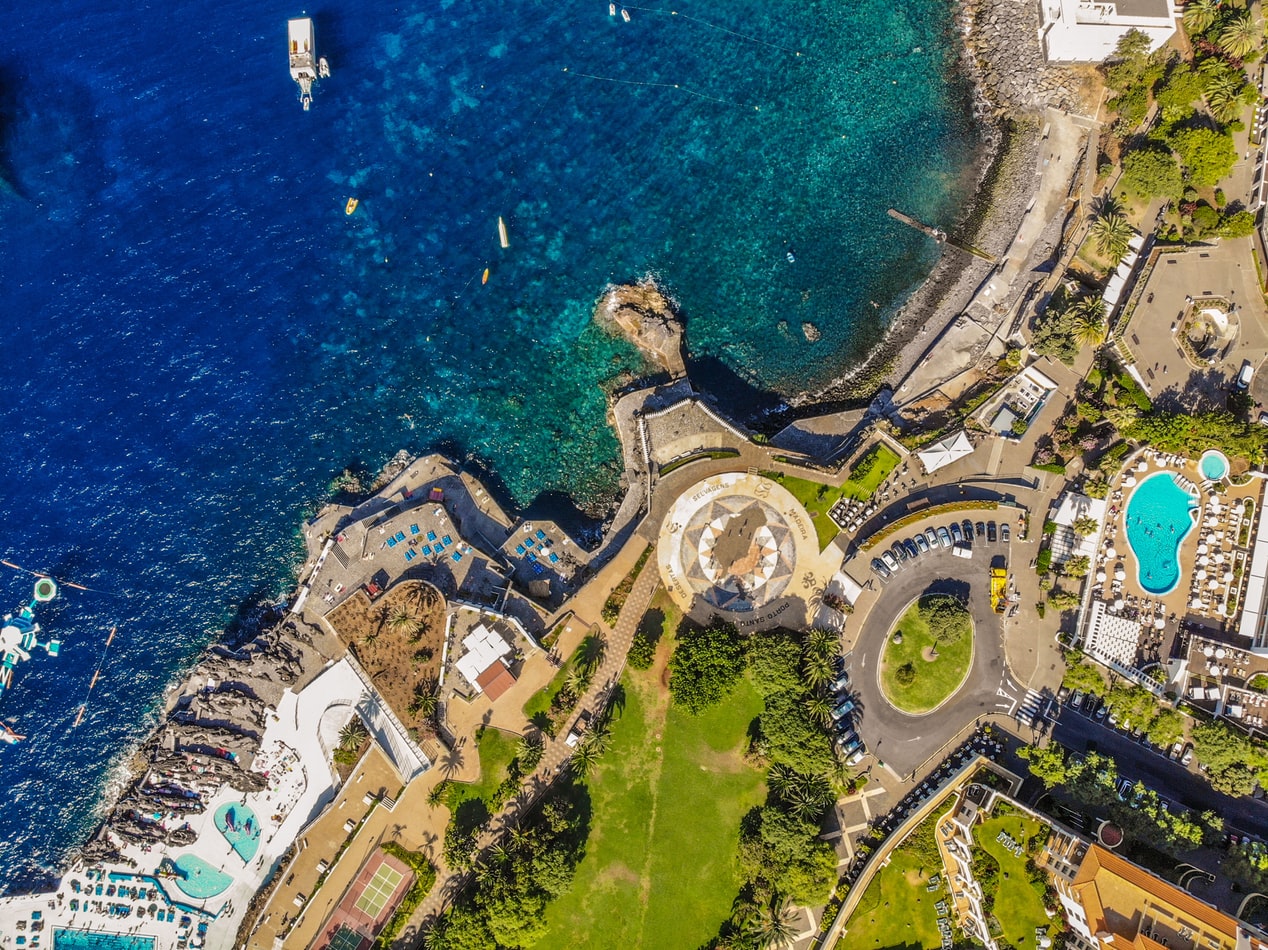
About Funchal, Madeira
Formed by a volcanic eruption, Madeira lies in the Gulf Stream, about 500 miles due west of Casablanca. Discovered by Portuguese explorer João Gonçalves Zarco in 1419, this beautiful island became part of Portugal’s vast empire and was named for the dense forest which cloaked it - 'Madeira' means 'wood' in Portuguese. Sugar plantations first brought wealth here, and when King Charles II of England granted an exclusive franchise to sell wine to England and its colonies, many British emigrants were drawn to the capital, Funchal. Today’s travellers come to Madeira for the varied and luxuriant scenery, from mountain slopes covered with vines to picturesque villages and a profusion of wild flowers. The natural beauty of the island has earned it many pseudonyms such as ‘The Floating Garden of the Atlantic’, 'The Island of Eternal Springtime' and ‘God’s Botanical Gardens’ and our selection of excursions aim to show you why.
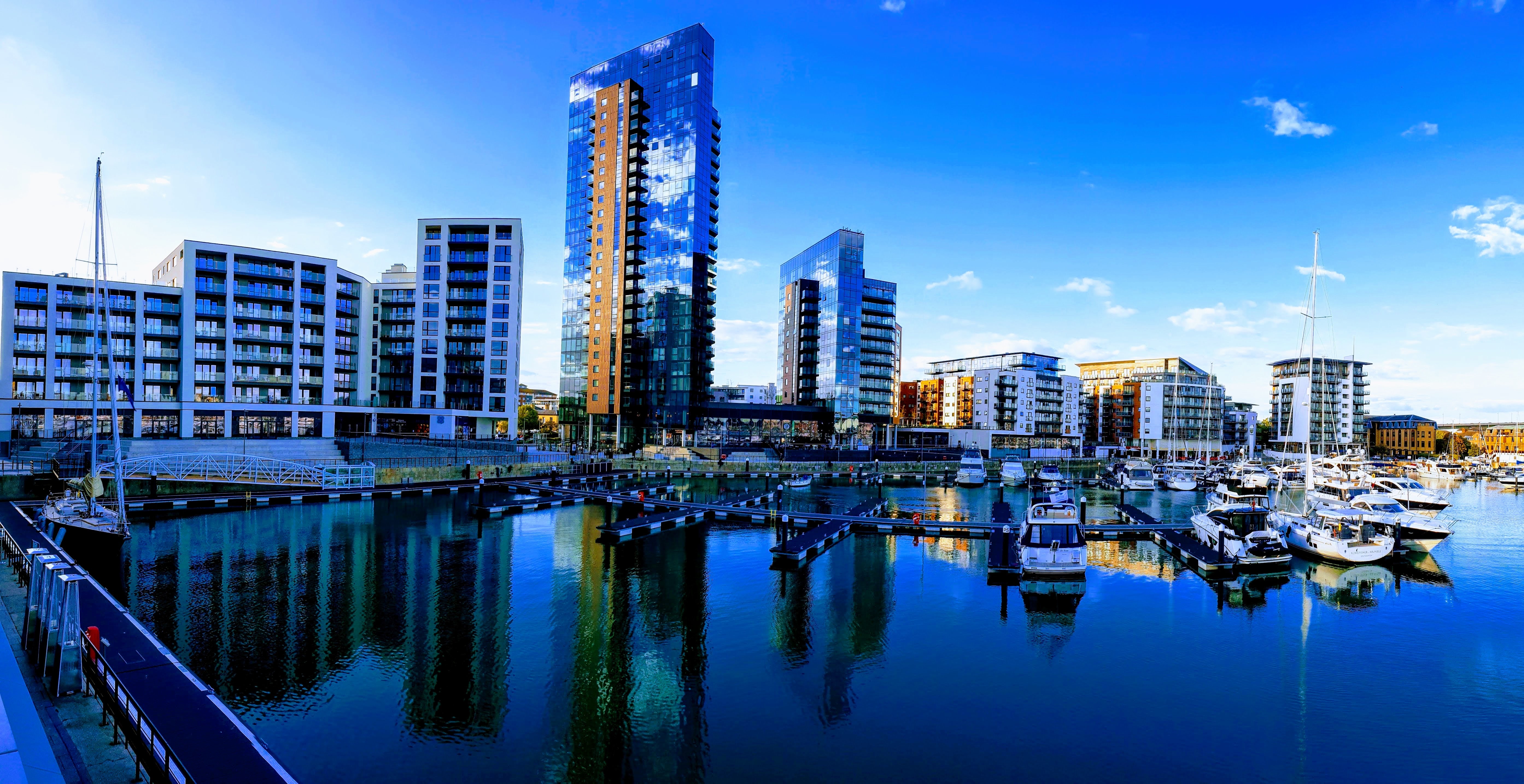
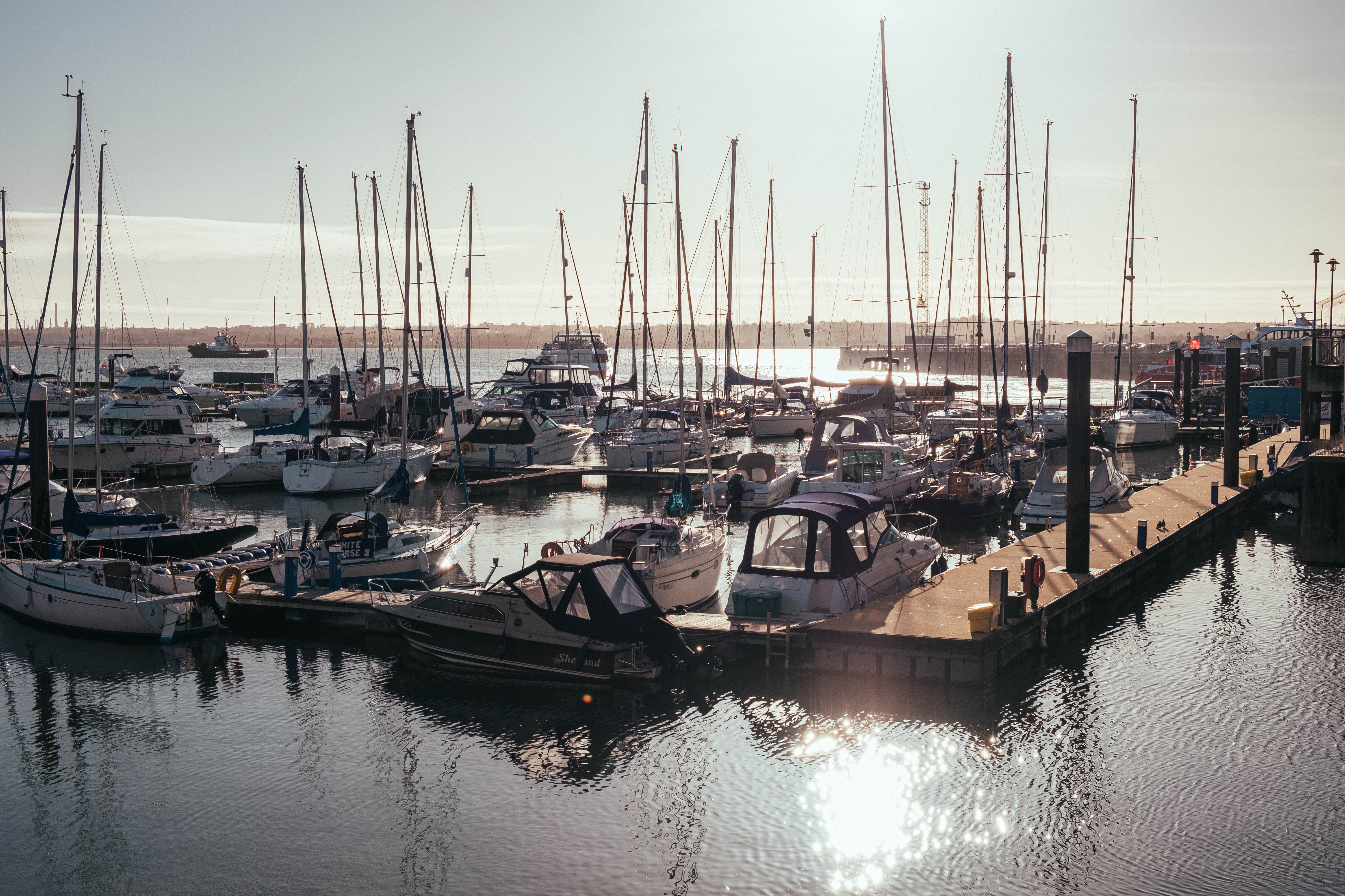
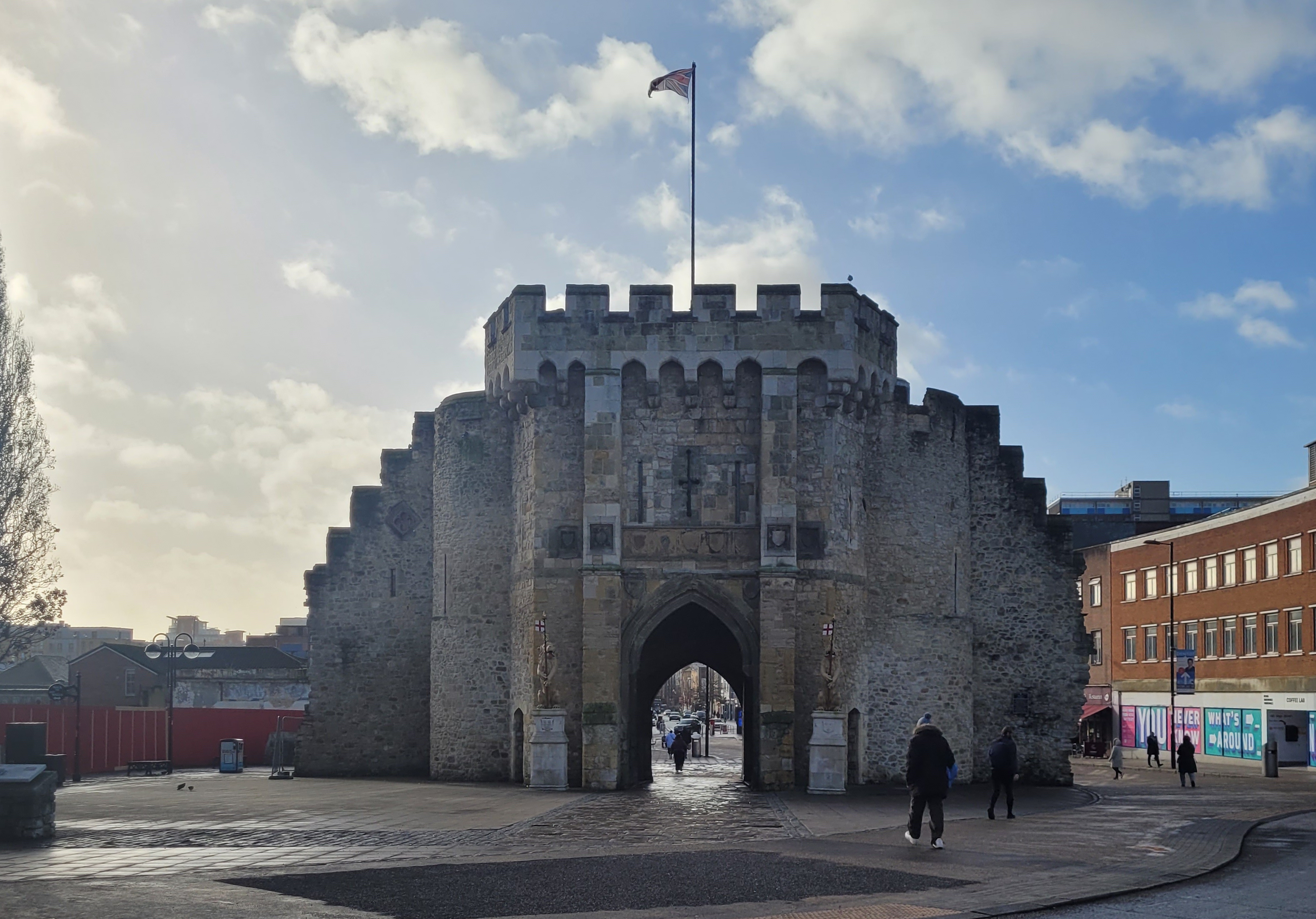
About Southampton
Lying near the head of Southampton Water, a peninsula between the estuaries of the Rivers Test and Itchen, Southampton is Britain’s largest cruise port. It has been one of England’s major ports since the Middle Ages, when it exported wool and hides from the hinterland and imported wine from Bordeaux. The city suffered heavy damage during World War Two and as a result the centre has been extensively rebuilt, but there are still some interesting medieval buildings including the Bargate, one of the finest city gatehouses in England.
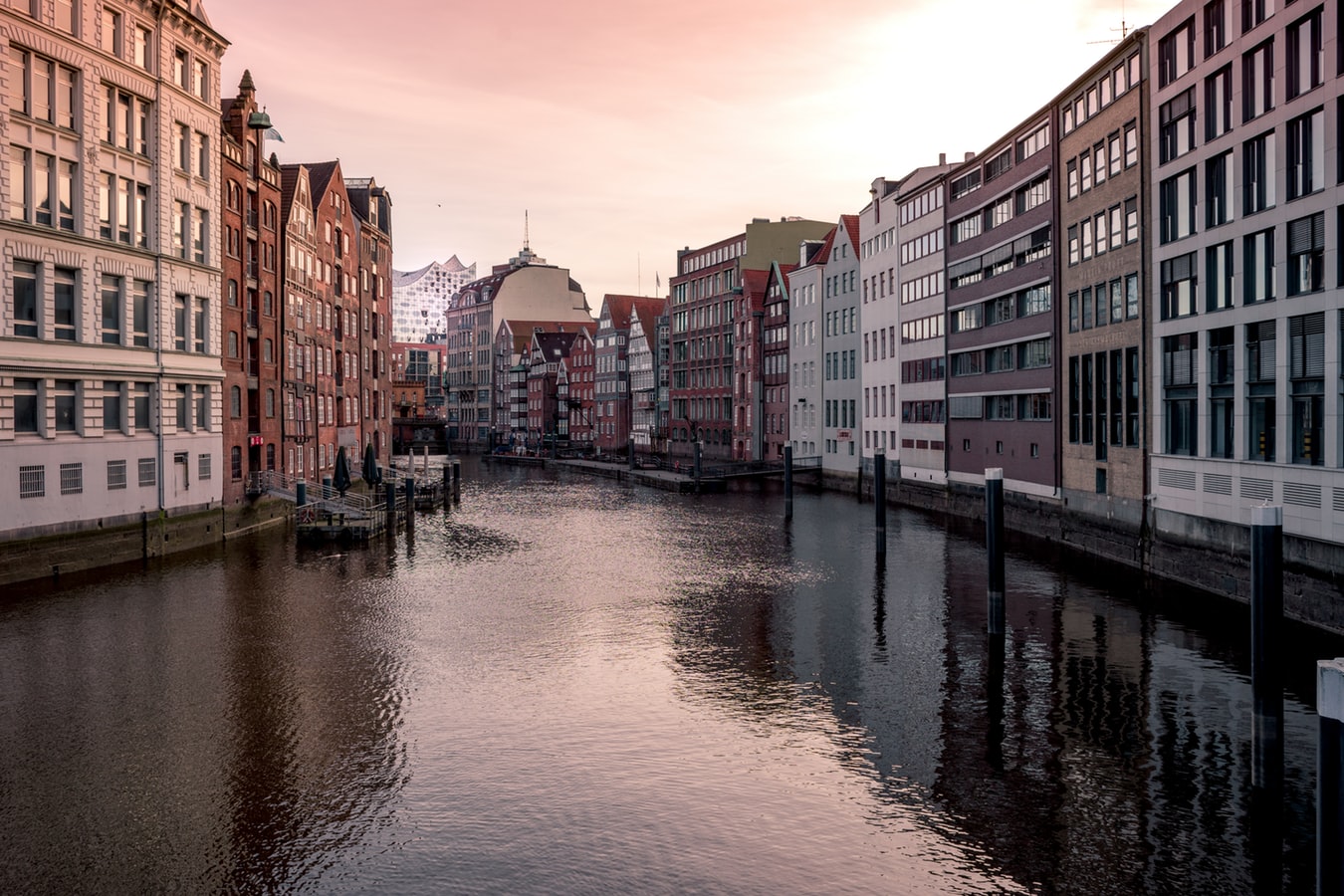
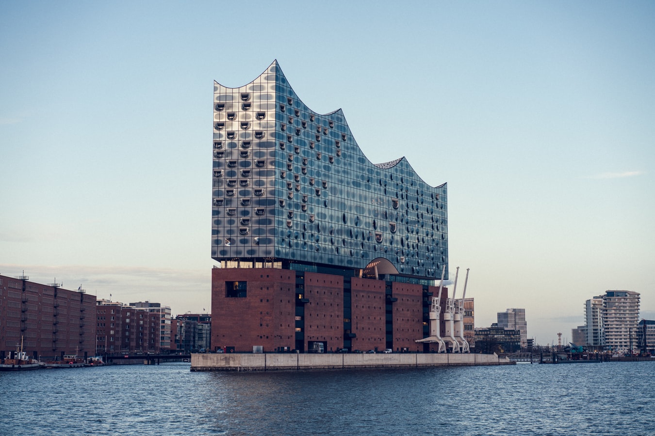
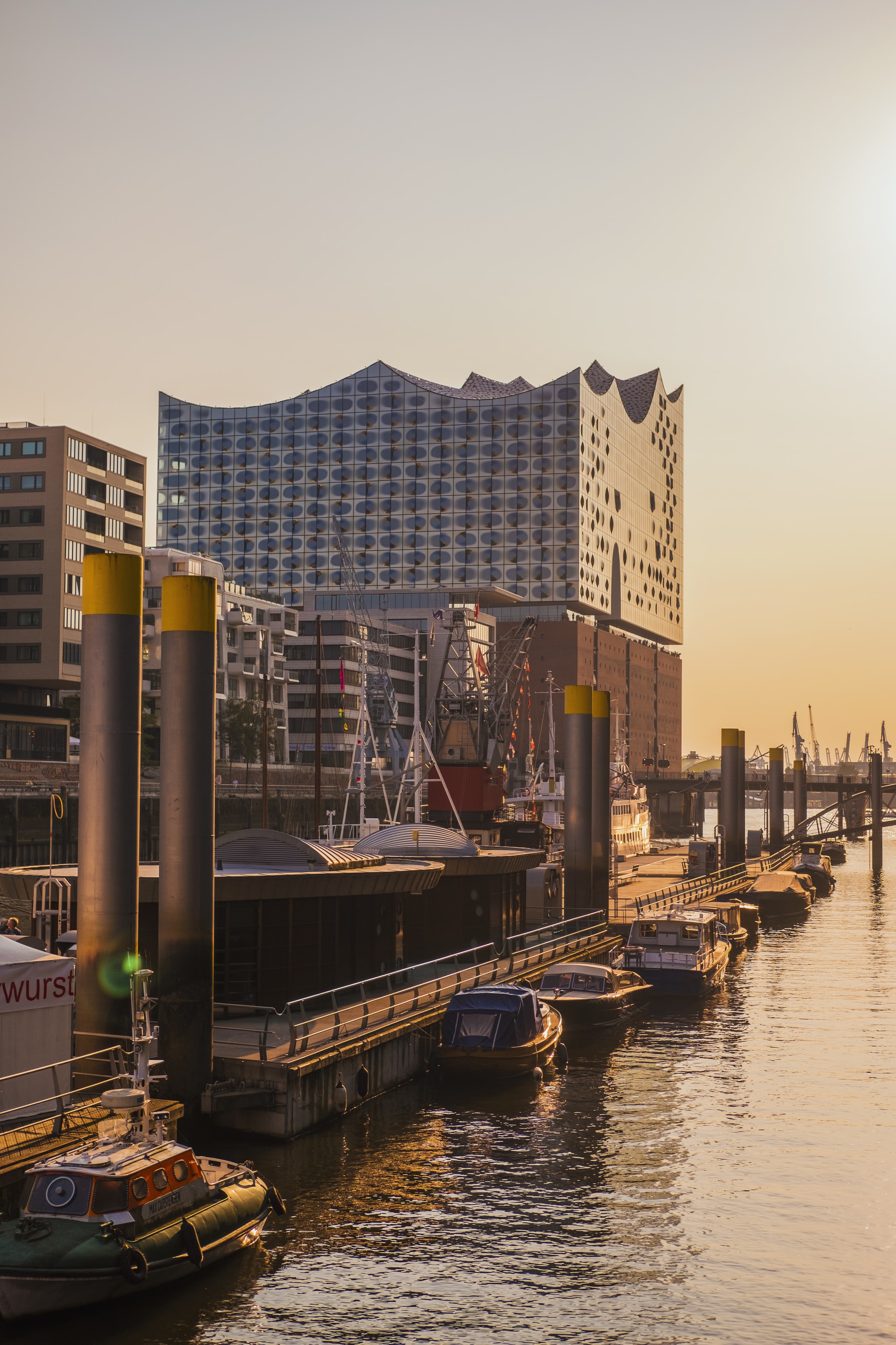
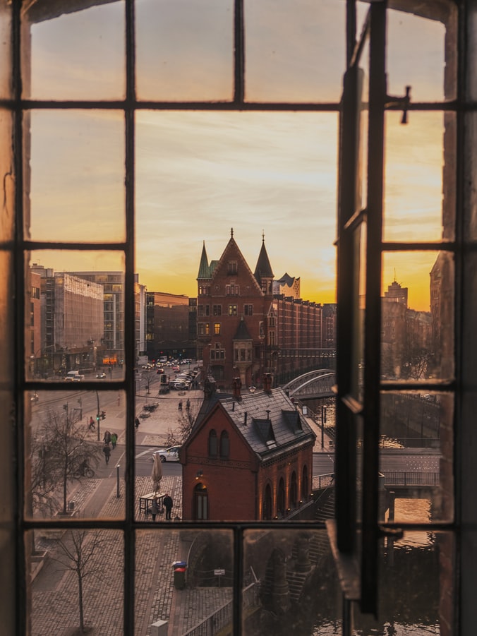
About Hamburg
Hamburg is Germany’s second-largest city with a history dating back to Charlemagne. A major port, this vibrant city is home to art and culture, extensive shopping facilities, Baroque buildings and waterfront vistas. With its well-known fish market, art galleries and Museums together with several beautiful parks including a botanical garden, this is a city with something for everyone. British visitors who remember the Swinging Sixties may like to visit the streets around Grosse Freiheit, where an unknown pop group called The Beatles gave their first public performances in various local clubs before achieving worldwide fame.
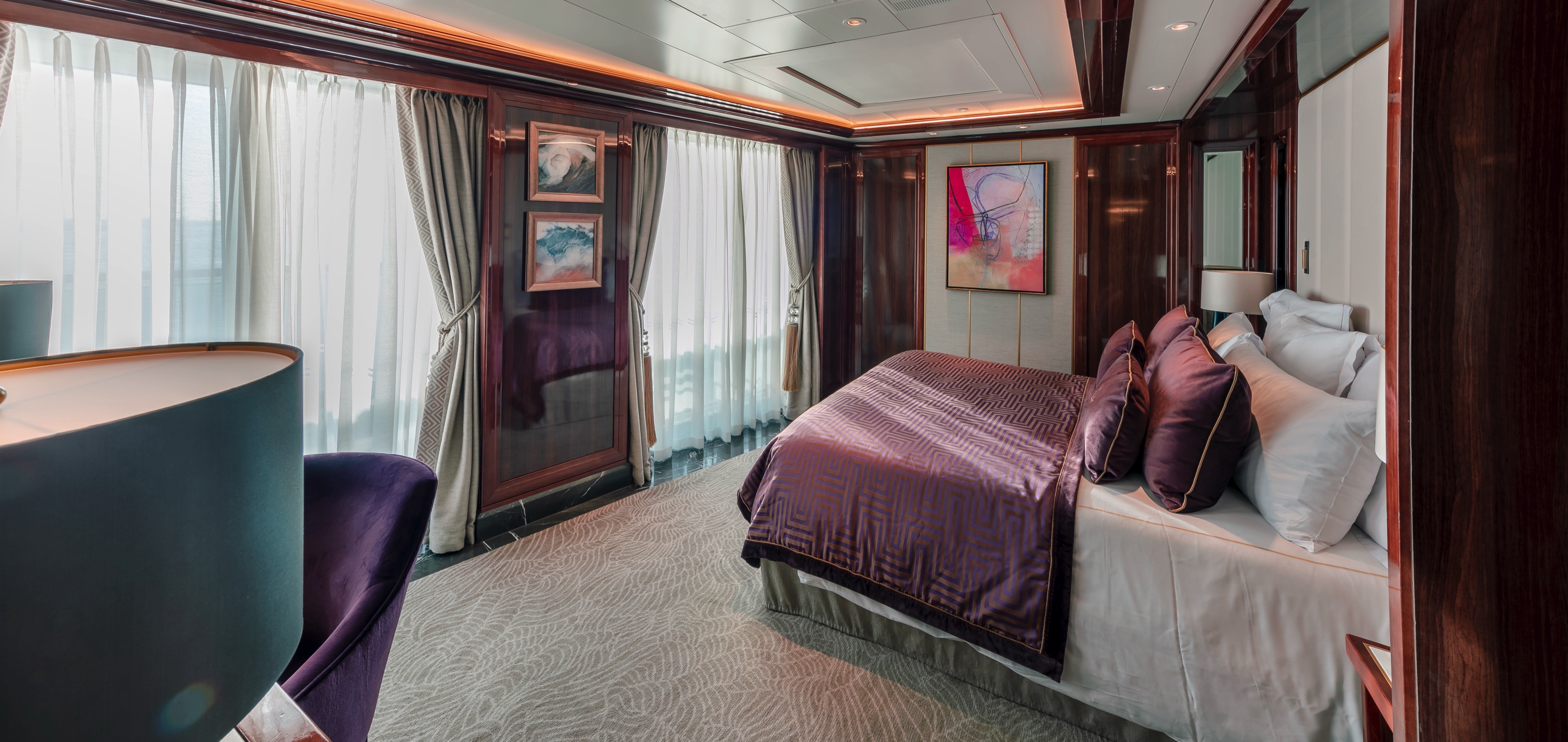
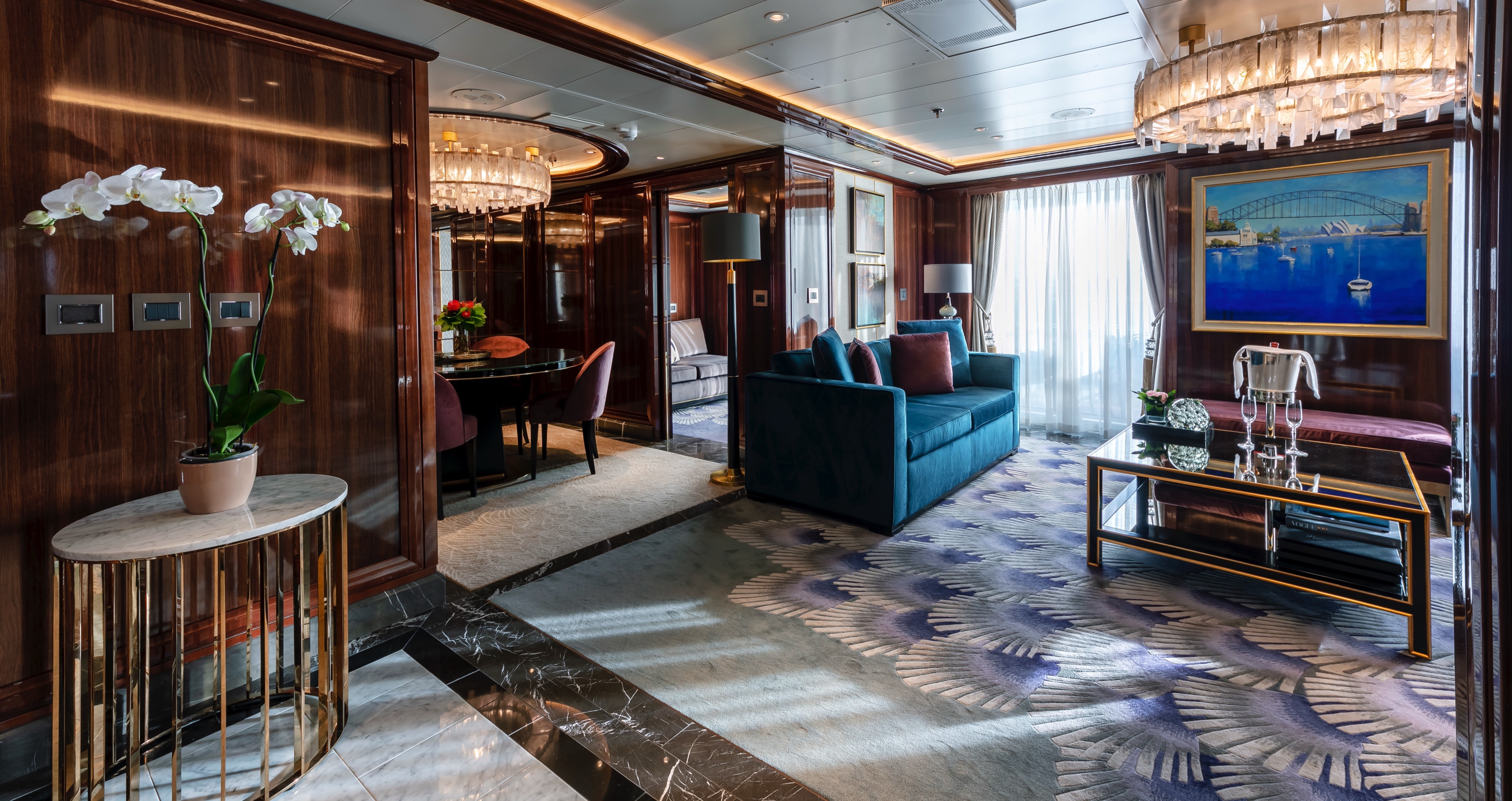
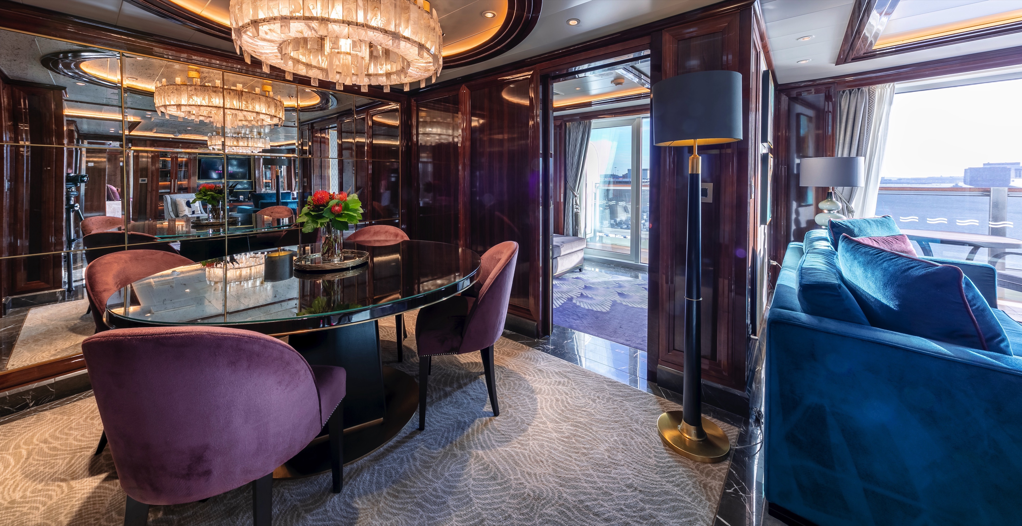
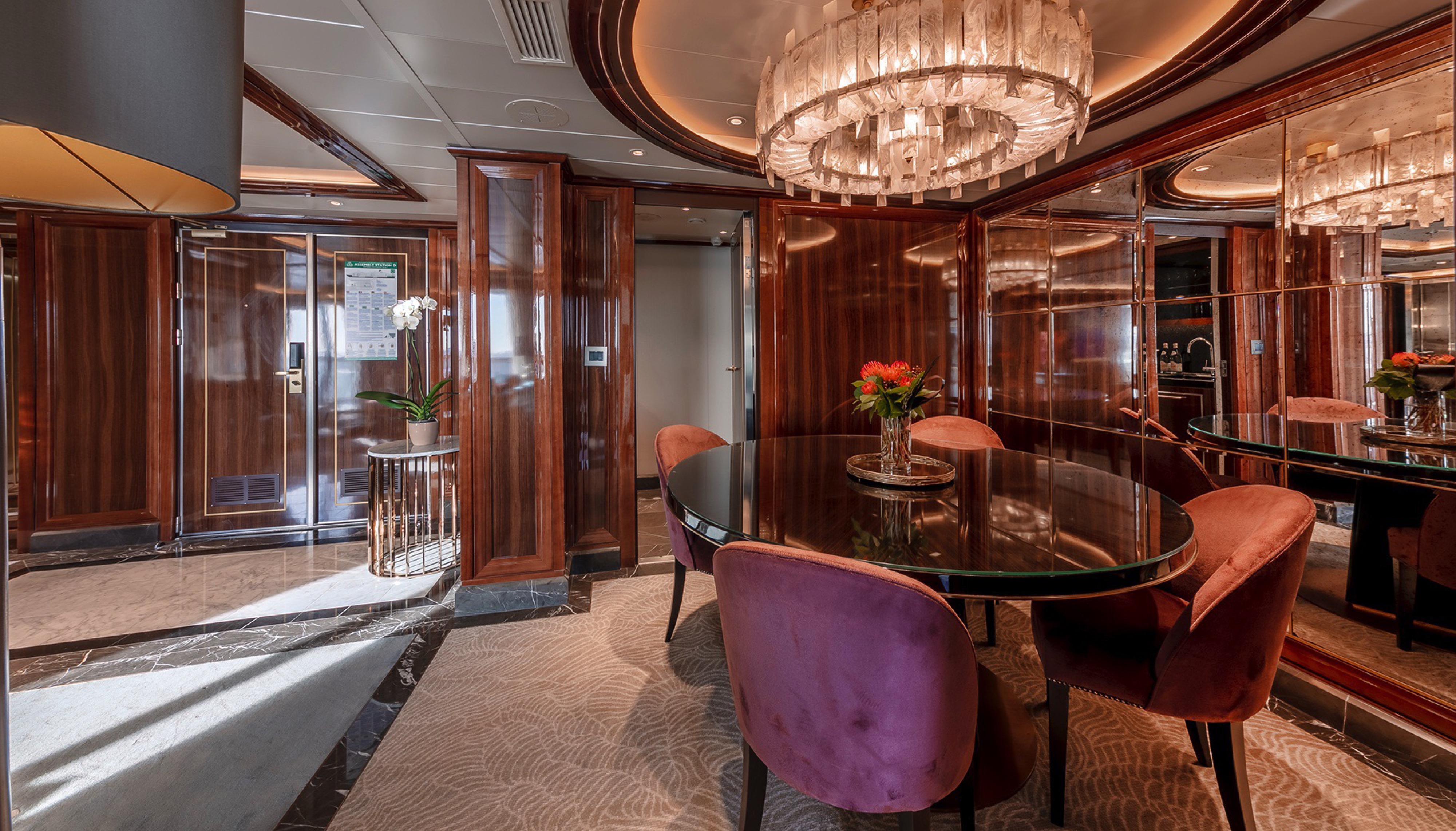
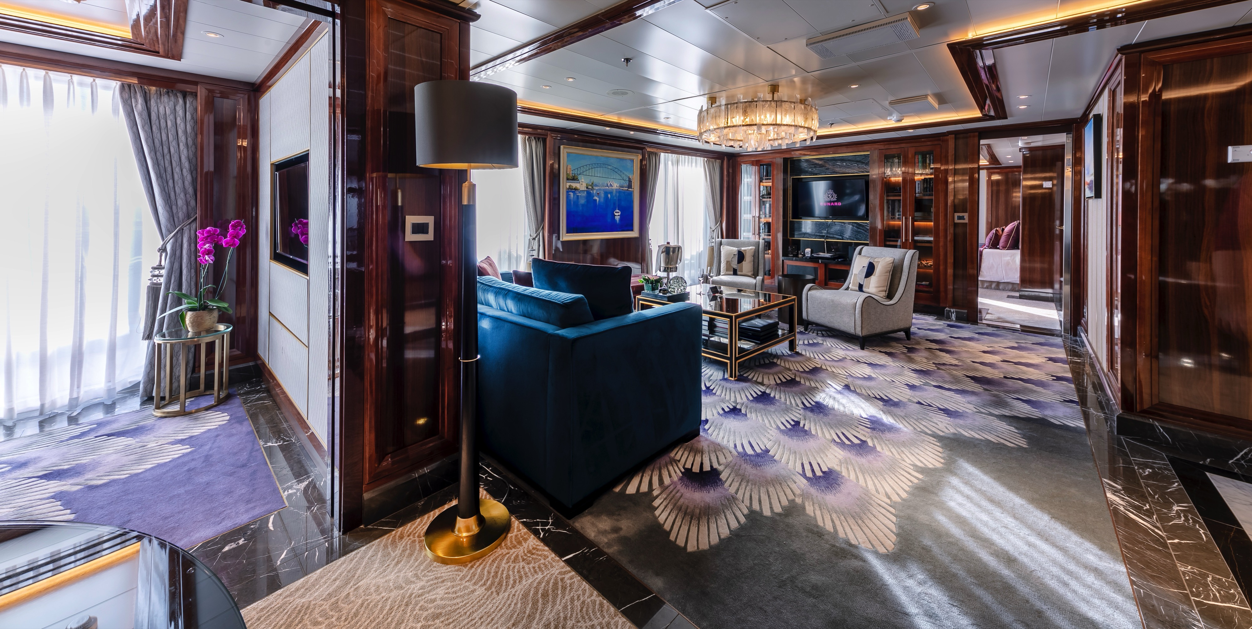
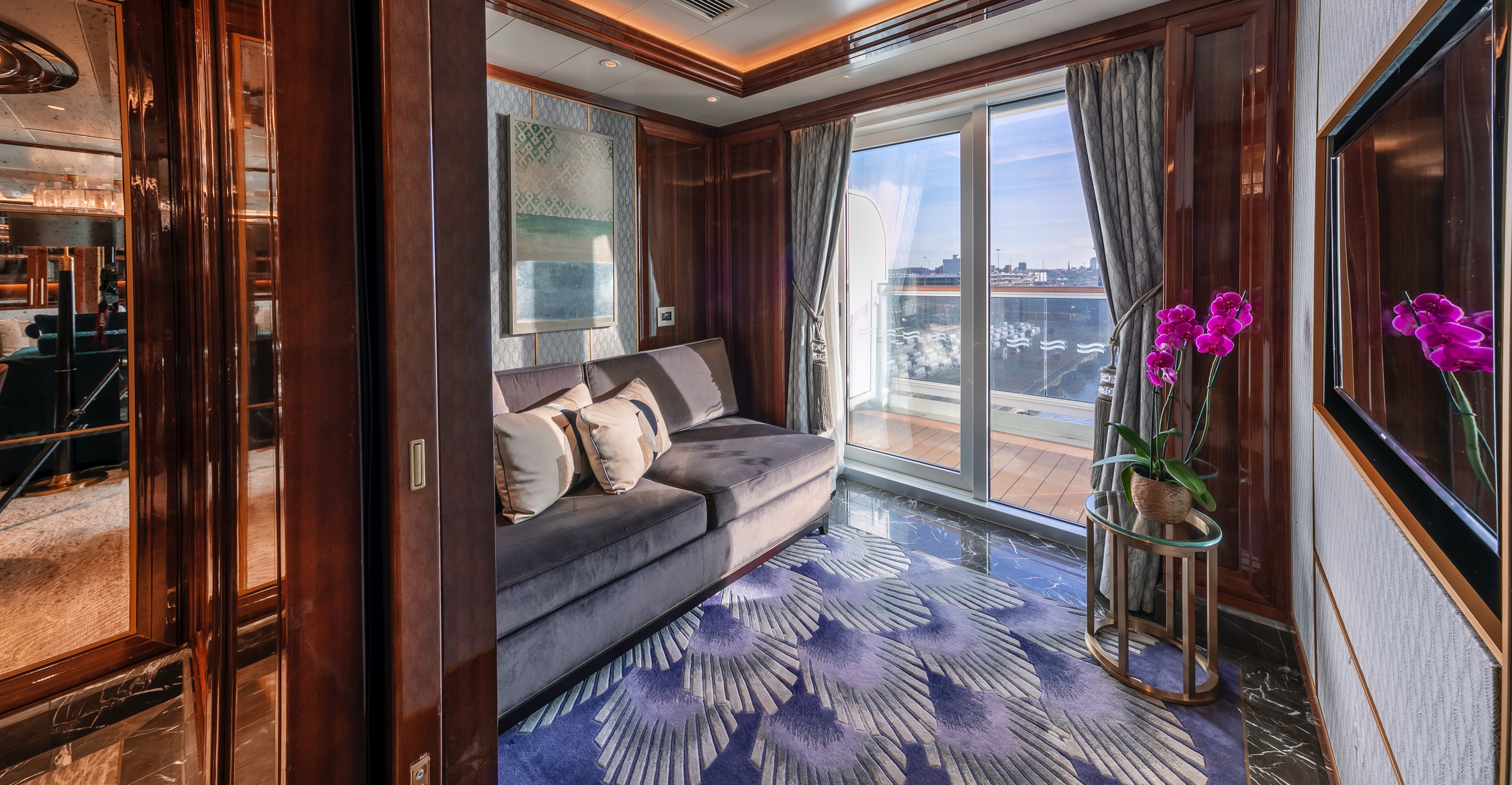
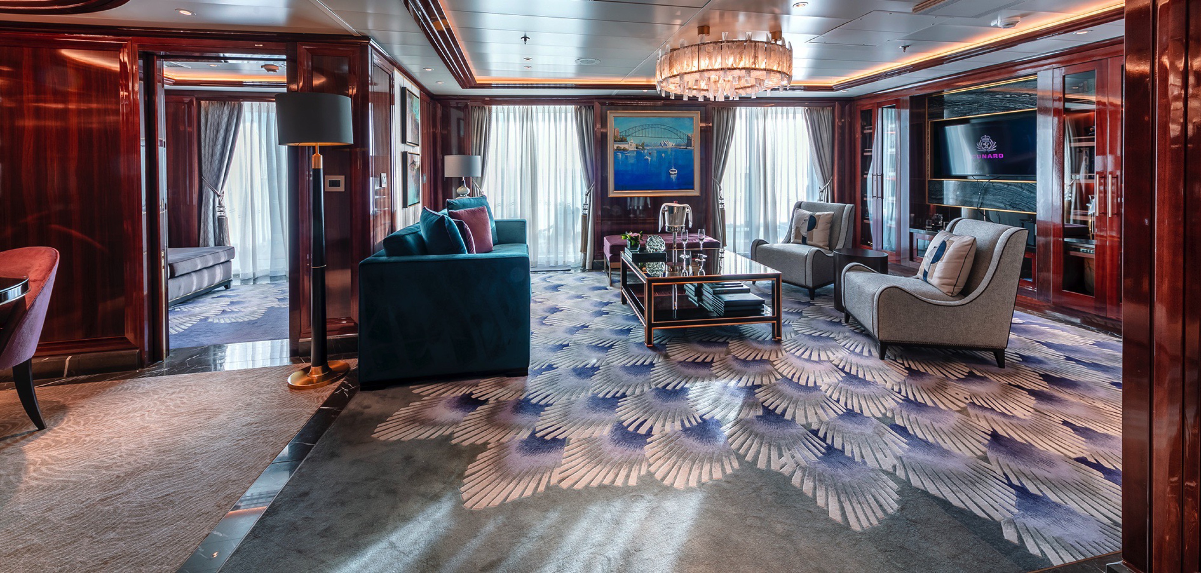
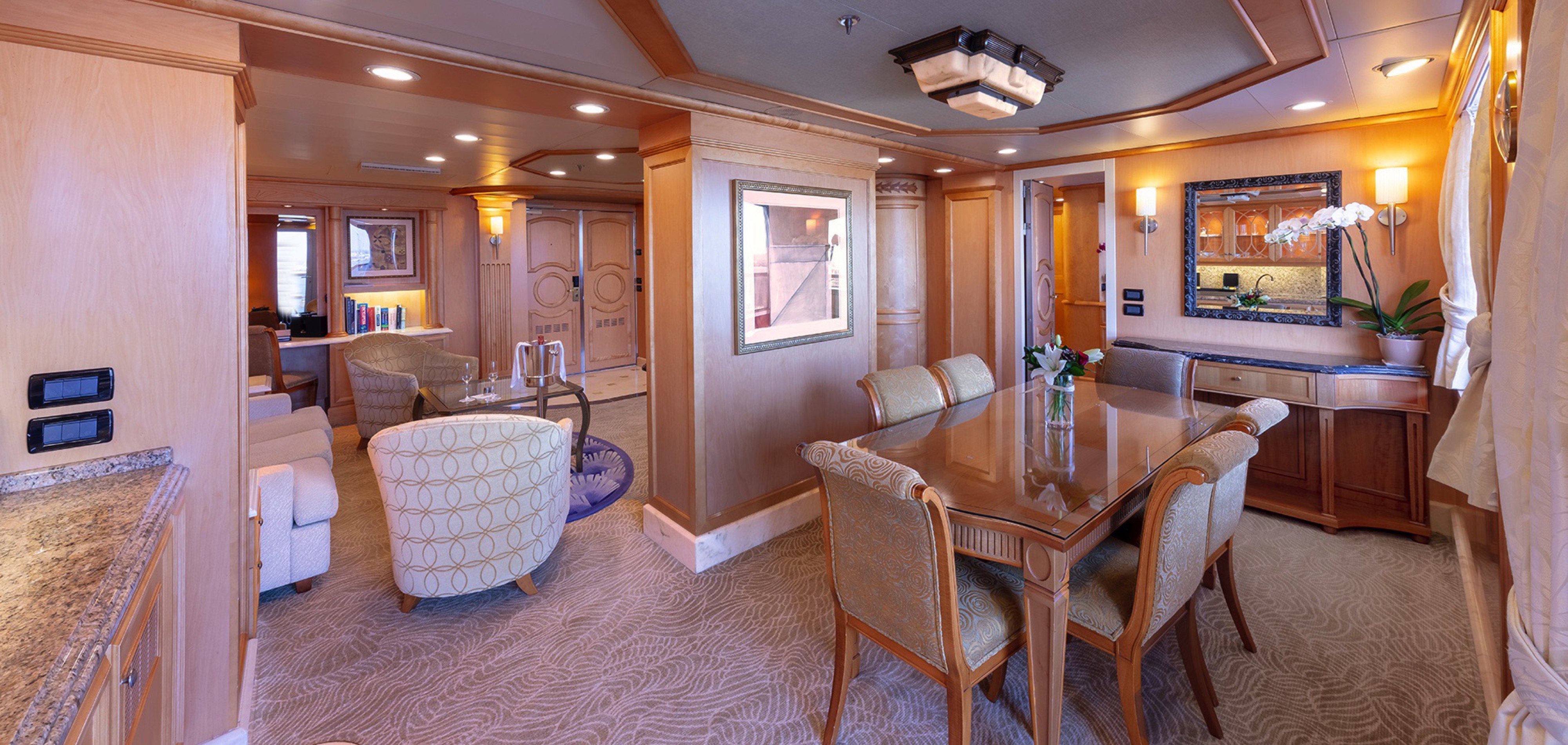
Approximately 1319-1555 sq. ft.
Retreat to an exclusive world of luxury with your own private residence at sea. Striking interior designs bring each space in your suite to life, indulging your senses with a rich tapestry of colours, materials, and art. An attentive butler is on hand at all times to truly customise your voyage experience.
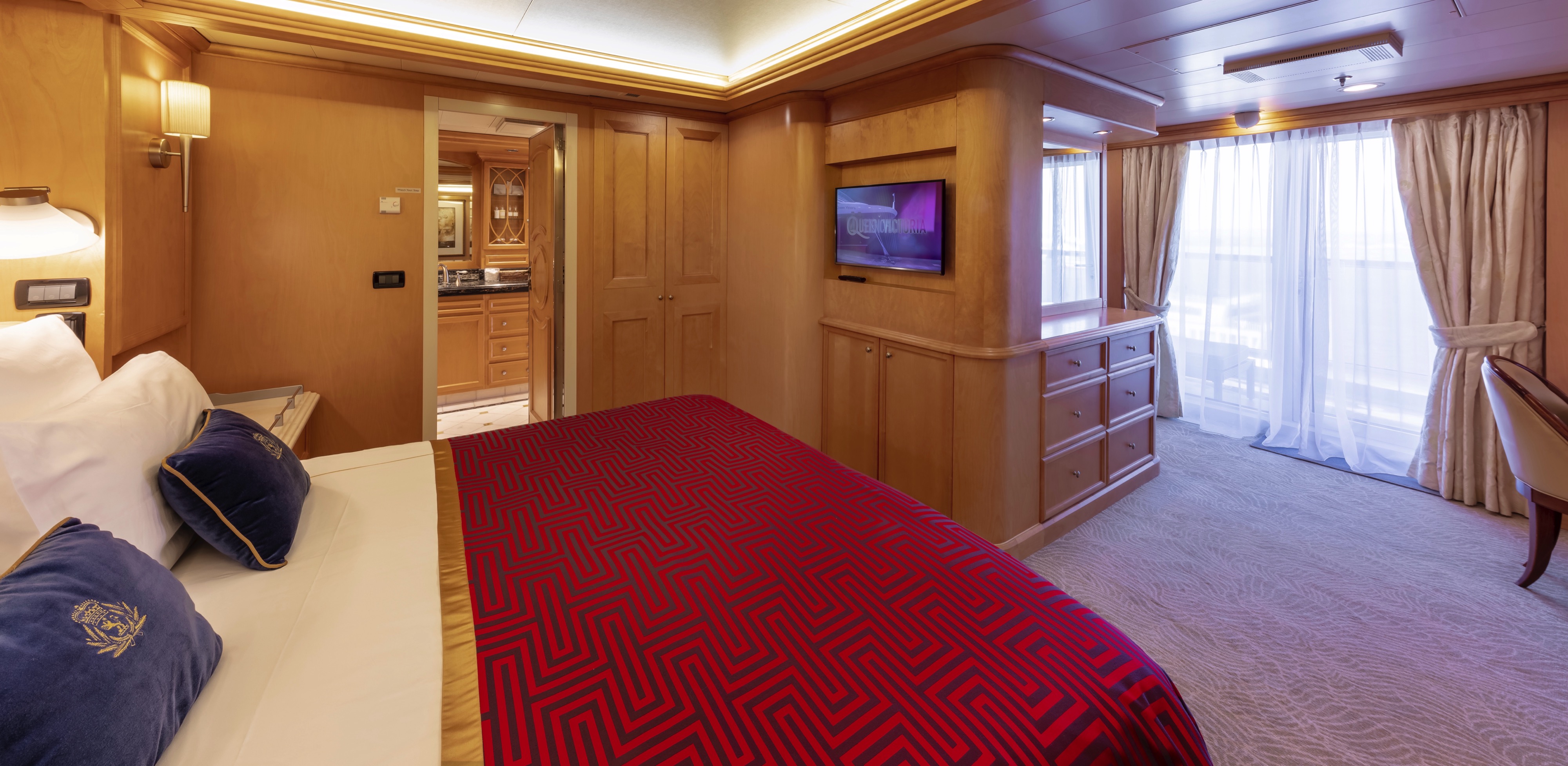
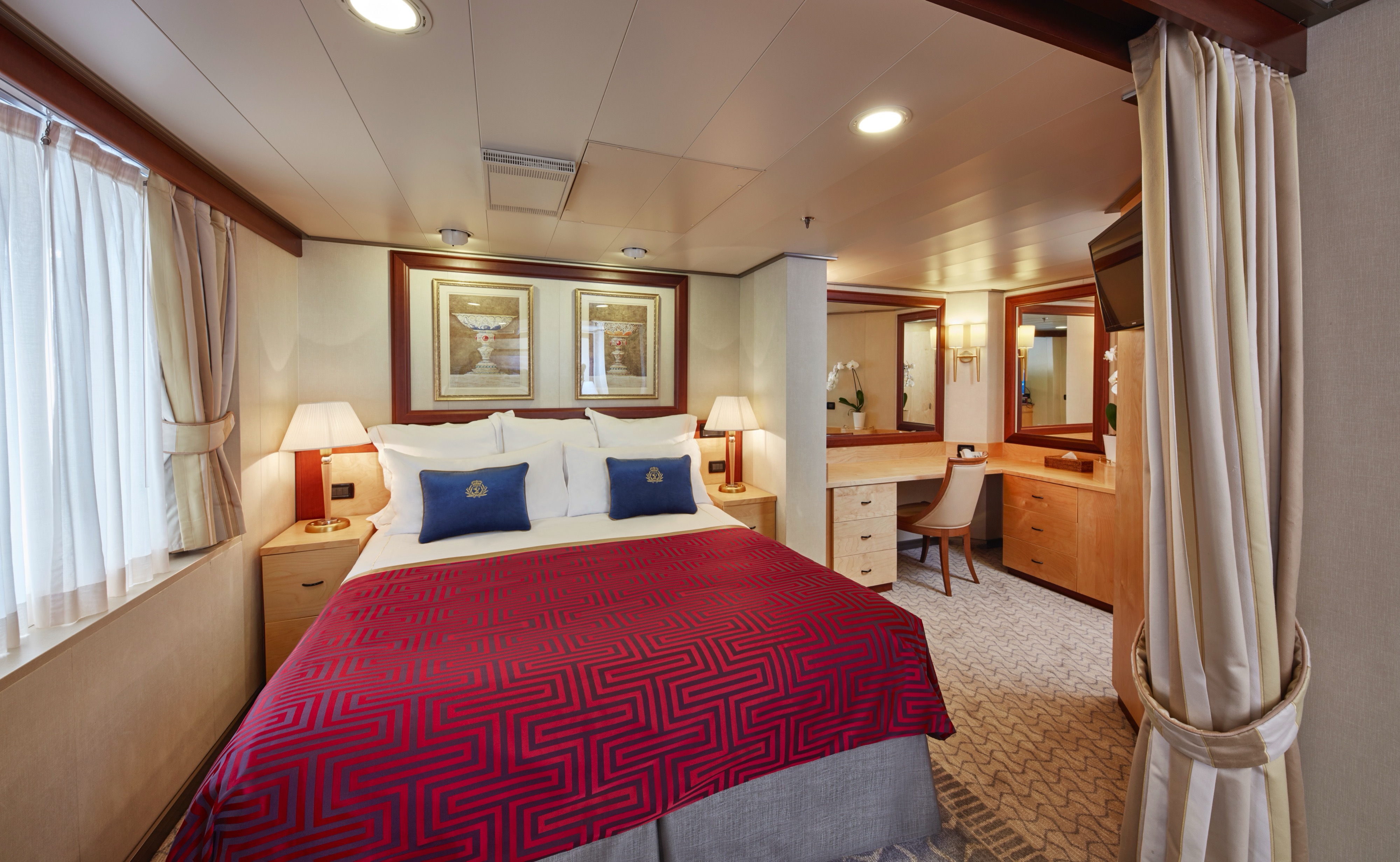
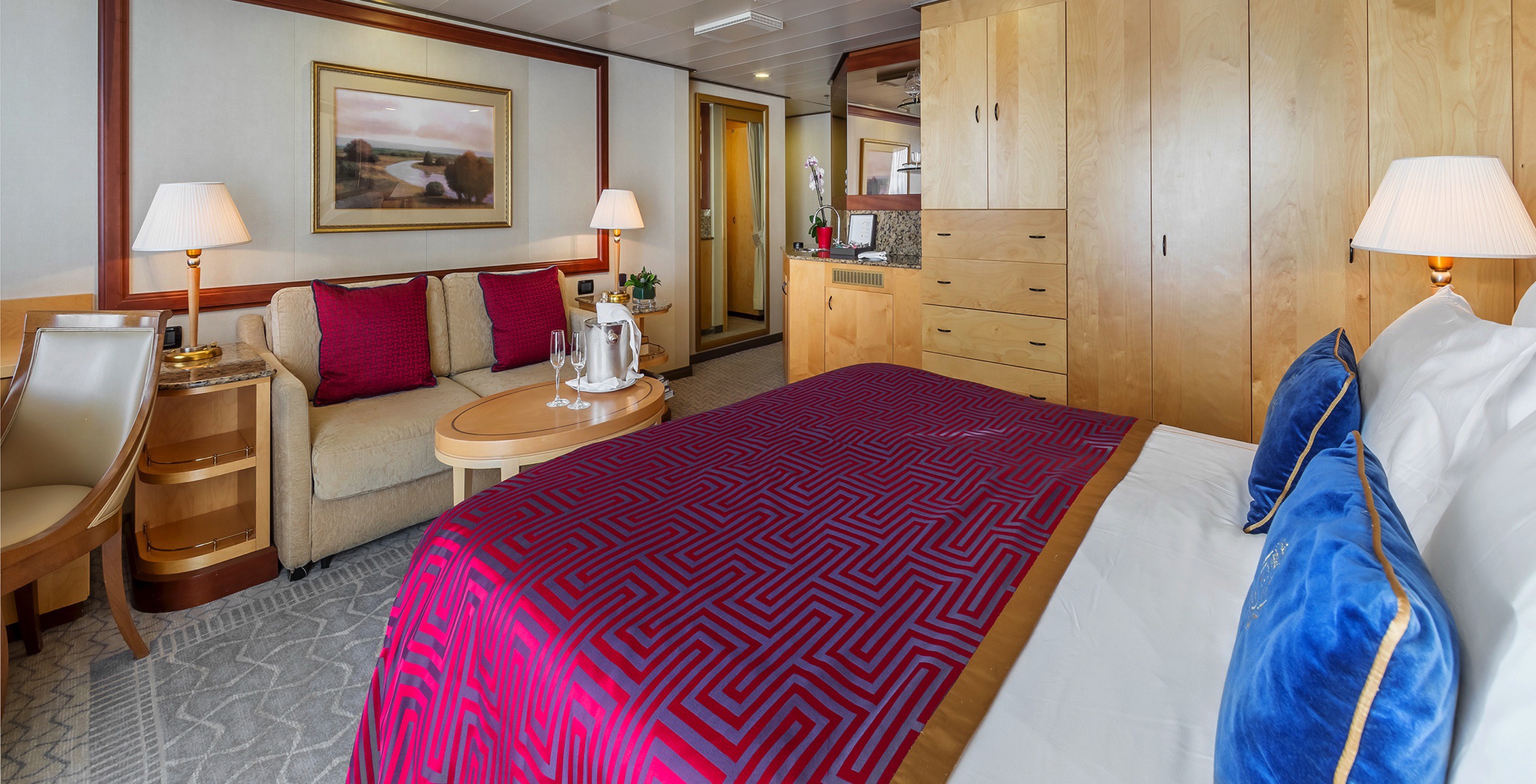
The Queens Grill Grand Suite includes:
- Access to the exclusive Queens Grill restaurant, where you can dine any time at your reserved table.
- Separate room customisable to snug or bedroom.
- Dedicated dining area.
- Spacious lounge area with seating and space to host guests.
- Bedroom area with Cunarder bed configurable to king-size or two single beds.
- Pillow concierge menu with seven pillow types to choose from.
- Twin marble bathrooms and dressing area.
- Spacious private balcony with seating and sea views.
- Satellite TV with movie and music channels in bedroom and lounge areas.
- Feature vanity with hairdryer.
- Workspace with a set of personalised stationery.
- Fresh flowers.
- Binoculars and world atlas to track your travels.
- UK, USA and European power sockets.
- Penhaligon's toiletries.
- Luxury bathrobes and slippers.
- Butler’s pantry.
- Complimentary mini-bar stocked with your choice of beer, wine, spirts and soft drinks.
- Speciality tea and coffee making facilities.
- Daily fresh fruit.
- Pre-dinner canapés.
- Welcome bottle of Champagne.
- Complimentary room service menu.
- Dine in-suite from the exclusive Queens Grill menu.
- Exclusive access to the Grills Lounge and outside Grills Terrace.
- Concierge service for on board reservations and shore experiences.
- A dedicated butler and steward to keep your suite in fine order day and night and host the perfect soirée.
- Priority embarkation and disembarkation.
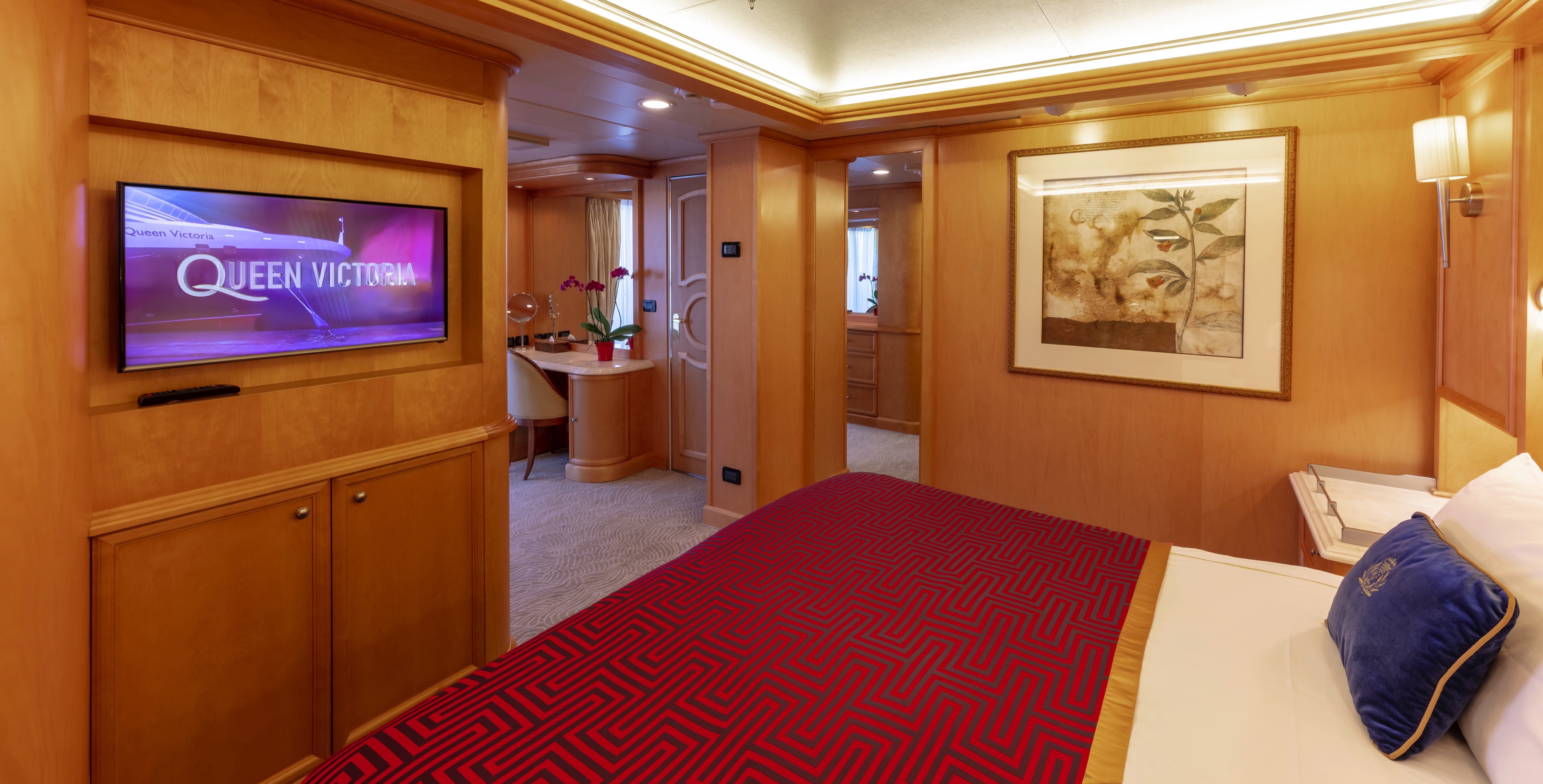
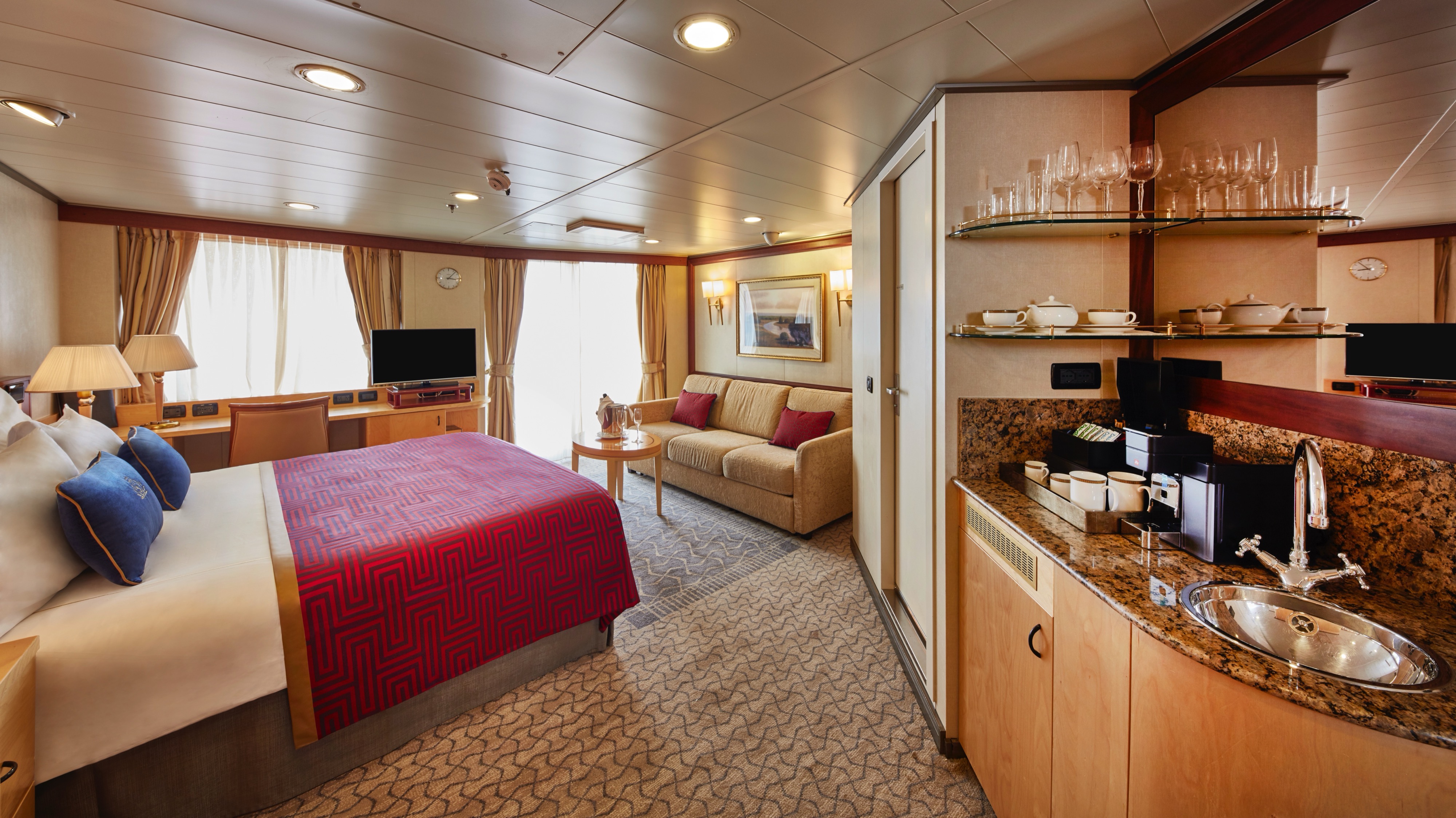
Approximately 1100 sq. ft.
Retreat to an exclusive world of luxury with your own private residence at sea. Bold Cunard accent colours and thoughtful designs bring each space in your suite to life. An attentive butler is on hand at all times to truly customise your voyage experience.
Each Queens Grill Master Suite includes:
- Access to the exclusive Queens Grill restaurant, where you can dine any time at your reserved table.
- Spacious lounge with seating and dedicated dining area.
- Bedroom with Cunarder bed configurable to king-size or two single beds.
- Pillow concierge menu with seven pillow types to choose from.
- Marble bathroom with twin washbasins, bathtub and walk-in shower.
- Spacious private balcony with seating and sea views.
- Satellite TV with movie and music channels in bedroom and lounge areas.
- Feature vanity with hairdryer.
- Writing desk with a set of personalised stationery.
- Fresh flowers.
- Binoculars and world atlas to track your travels.
- UK, USA and European power sockets.
- Penhaligon's toiletries.
- Luxury bathrobes and slippers.
- Complimentary mini-bar stocked with your choice of beer, wine, spirting and soft drinks.
- Speciality tea and coffee making facilities.
- Daily fresh fruit.
- Pre-dinner canapés.
- Welcome bottle of Champagne.
- Complimentary room service menu.
- Dine in-suite from the exclusive Queens Grill menu.
- Exclusive access to the Grills Lounge and outside Grills Terrace.
- Concierge service for on board reservations and shore experiences.
- A dedicated butler and steward to keep your suite in fine order day and night and host the perfect soirée.
- Priority embarkation and disembarkation.
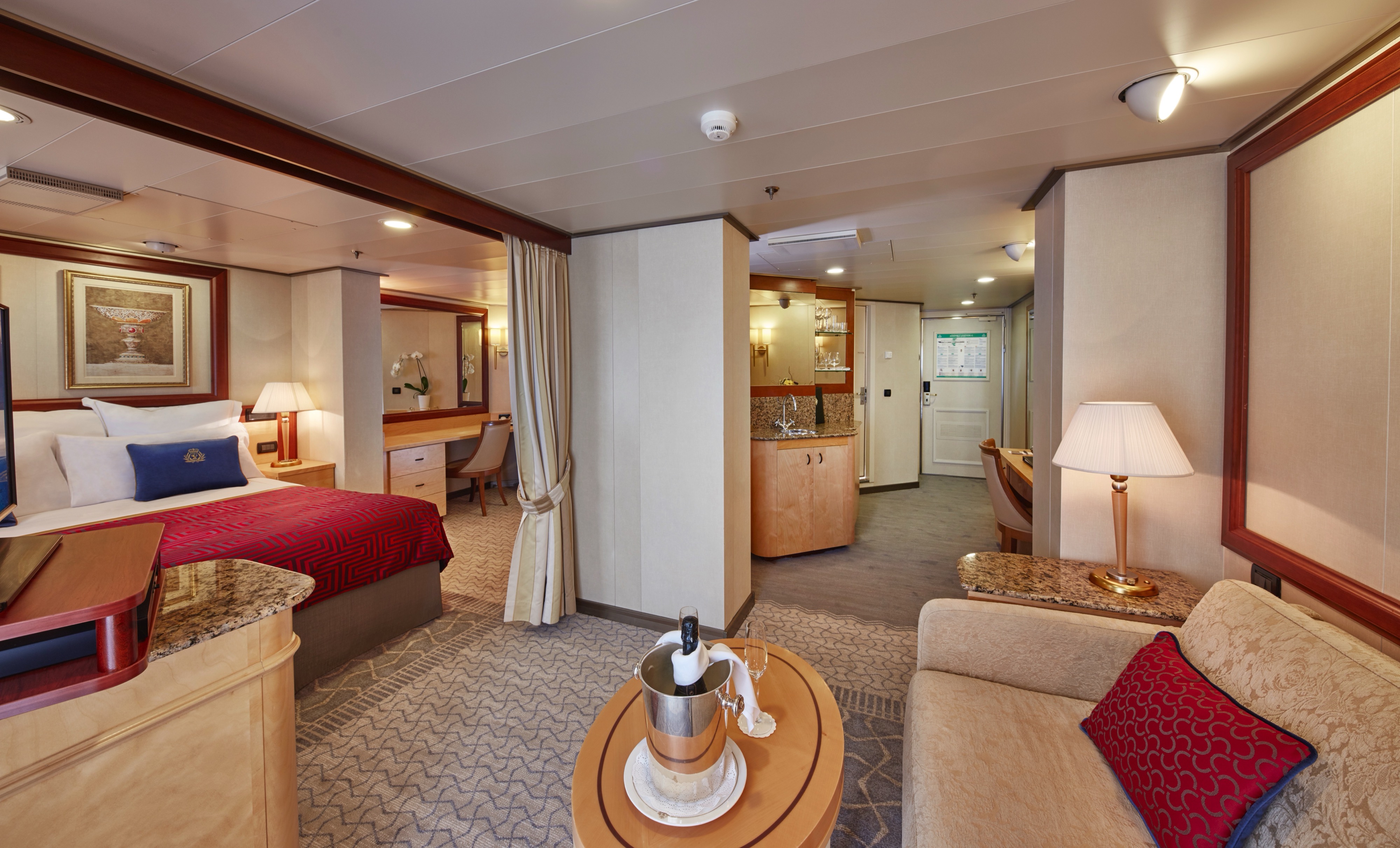
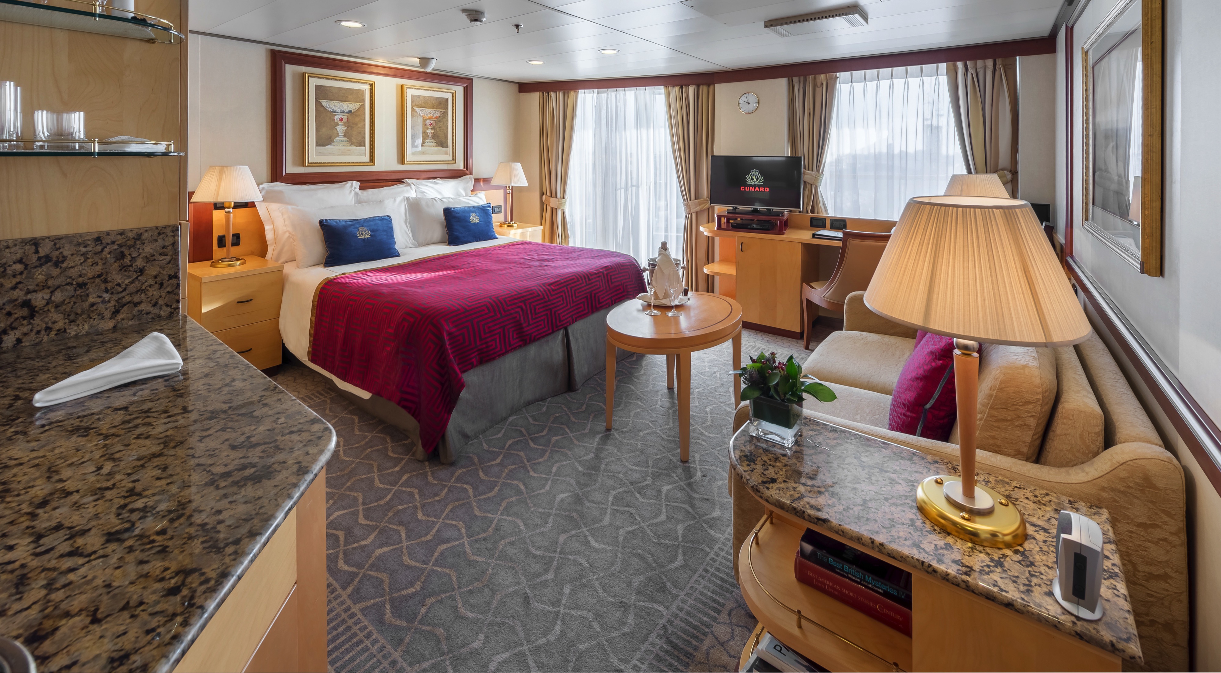
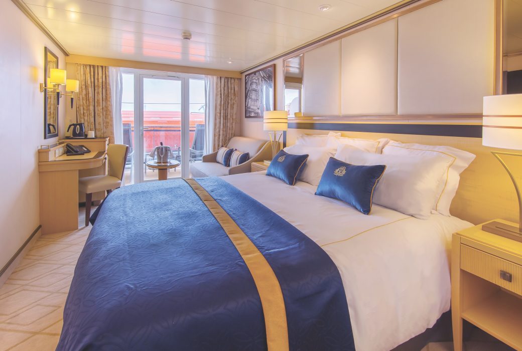
Approximately 484-596 sq. ft.
Retreat to an exclusive world of luxury with your own private residence at sea. Bold Cunard accent colours and thoughtful designs bring each space in your suite to life. An attentive butler is on hand at all times to truly customise your voyage experience.
Each Queens Grill Penthouse Suite includes:
- Access to the exclusive Queens Grill restaurant, where you can dine any time at your reserved table.
- Spacious lounge area with seating.
- Bedroom area with Cunarder bed configurable to king-size or two single beds.
- Pillow concierge menu with a variety of types to choose from.
- Bathroom with bath and shower and separate dressing area.
- Spacious private balcony with seating and sea views.
- Satellite TV with movie and music channels in bedroom and lounge areas.
- Feature vanity and desk with hairdryer.
- Fresh flowers.
- Binoculars and world atlas to track your travels.
- UK, USA and European power sockets.
- Penhaligon's toiletries.
- Luxury bathrobes and slippers.
- Complimentary mini-bar stocked with your choice of beer, wine, spirits and soft drinks.
- Speciality tea and coffee making facilities.
- Daily fresh fruit.
- Pre-dinner canapés.
- Welcome bottle of Champagne.
- Complimentary room service menu.
- Dine in-suite from the exclusive Queens Grill menu.
- Exclusive access to the Grills Lounge and outside Grills Terrace.
- Concierge service for on board reservations and shore experiences.
- A dedicated butler and steward to keep your suite in fine order day and night and host the perfect soirée.
- Priority embarkation and disembarkation
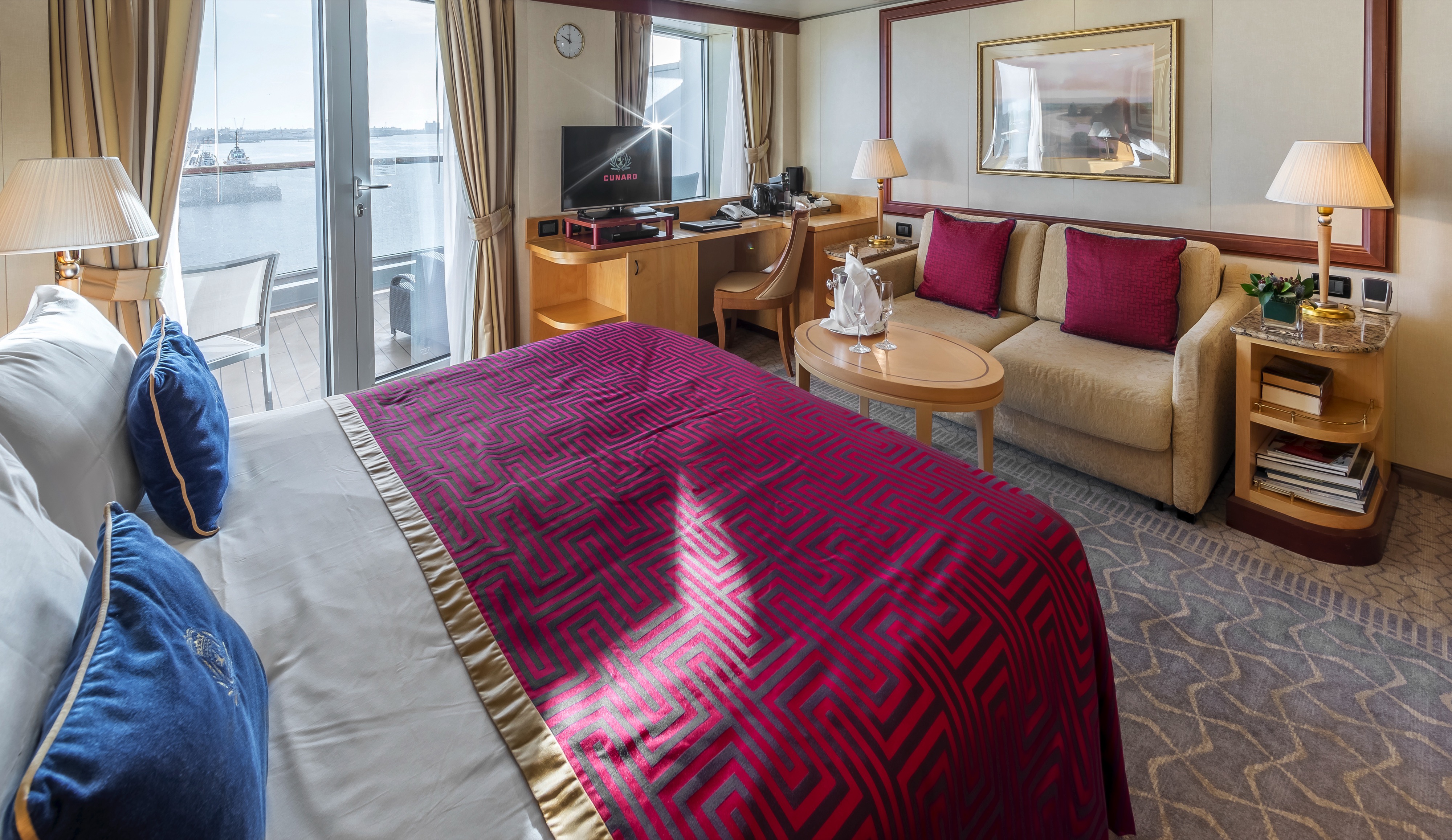
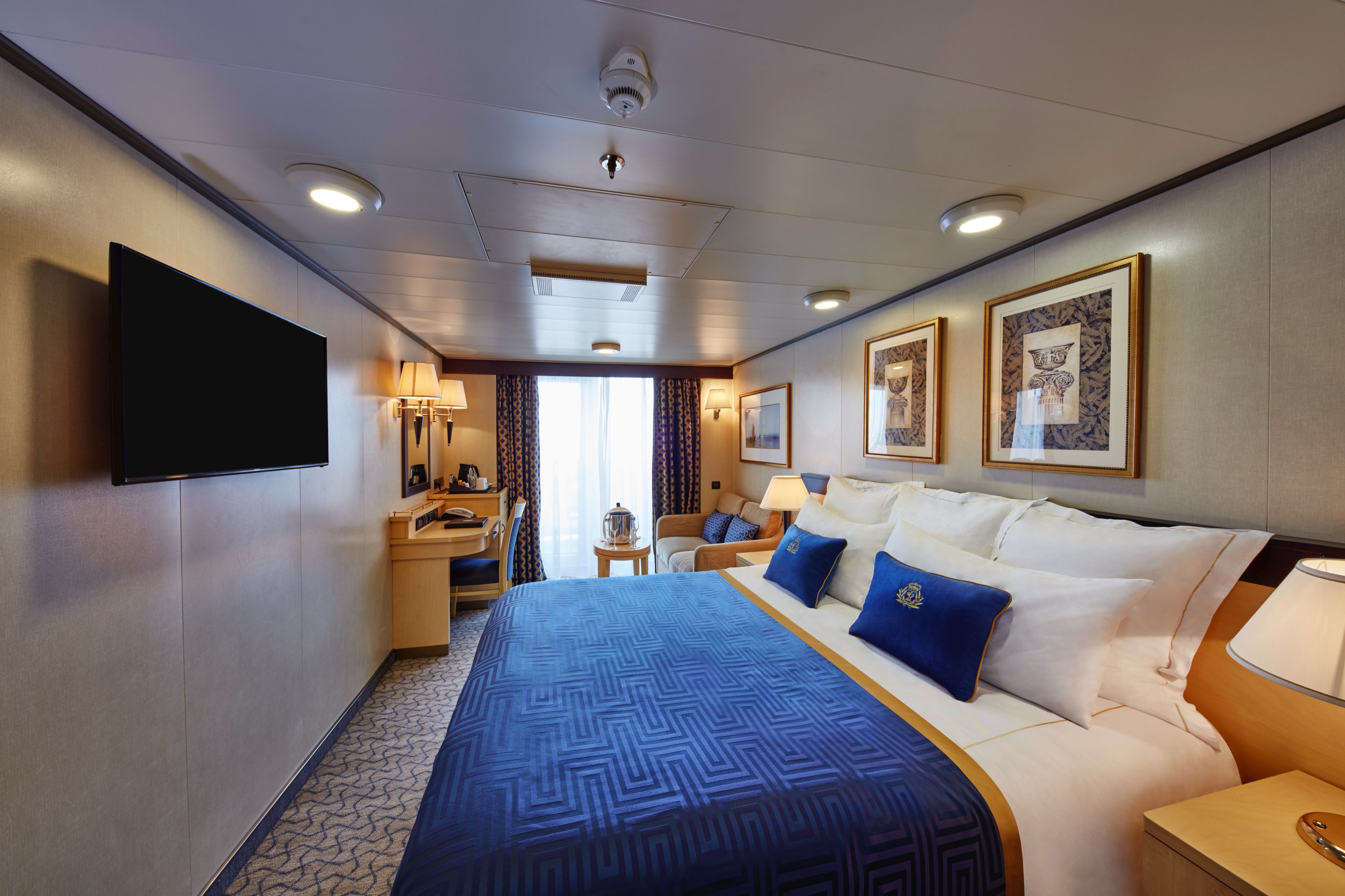
Approximately 484-757 sq. ft.
Retreat to an exclusive world of luxury with your own private residence at sea. Bold Cunard accent colours and thoughtful designs bring each space in your suite to life. An attentive butler is on hand at all times to truly customise your voyage experience.
Each Queens Grill Suite includes:
- Access to the exclusive Queens Grill restaurant, where you can dine any time at your reserved table.
- Spacious lounge area with seating.
- Bedroom area with Cunarder bed configurable to king-size or two single beds.
- Pillow concierge menu with a variety of types to choose from.
- Bathroom with bath and shower and separate dressing area.
- Spacious private balcony with seating and sea views.
- Satellite TV with movie and music channels in bedroom and lounge areas.
- Feature vanity and desk with hairdryer.
- Fresh flowers.
- Binoculars and world atlas to track your travels.
- UK, USA and European power sockets.
- Penhaligon's toiletries.
- Luxury bathrobes and slippers.
- Complimentary mini-bar stocked with your choice of beer, wine, spirits and soft drinks.
- Speciality tea and coffee making facilities.
- Daily fresh fruit.
- Pre-dinner canapés.
- Welcome bottle of Champagne.
- Complimentary room service menu.
- Dine in-suite from the exclusive Queens Grill menu.
- Exclusive access to the Grills Lounge and outside Grills Terrace.
- Concierge service for on board reservations and shore experiences.
- A dedicated butler and steward to keep your suite in fine order day and night and host the perfect soirée.
- Priority embarkation and disembarkation.
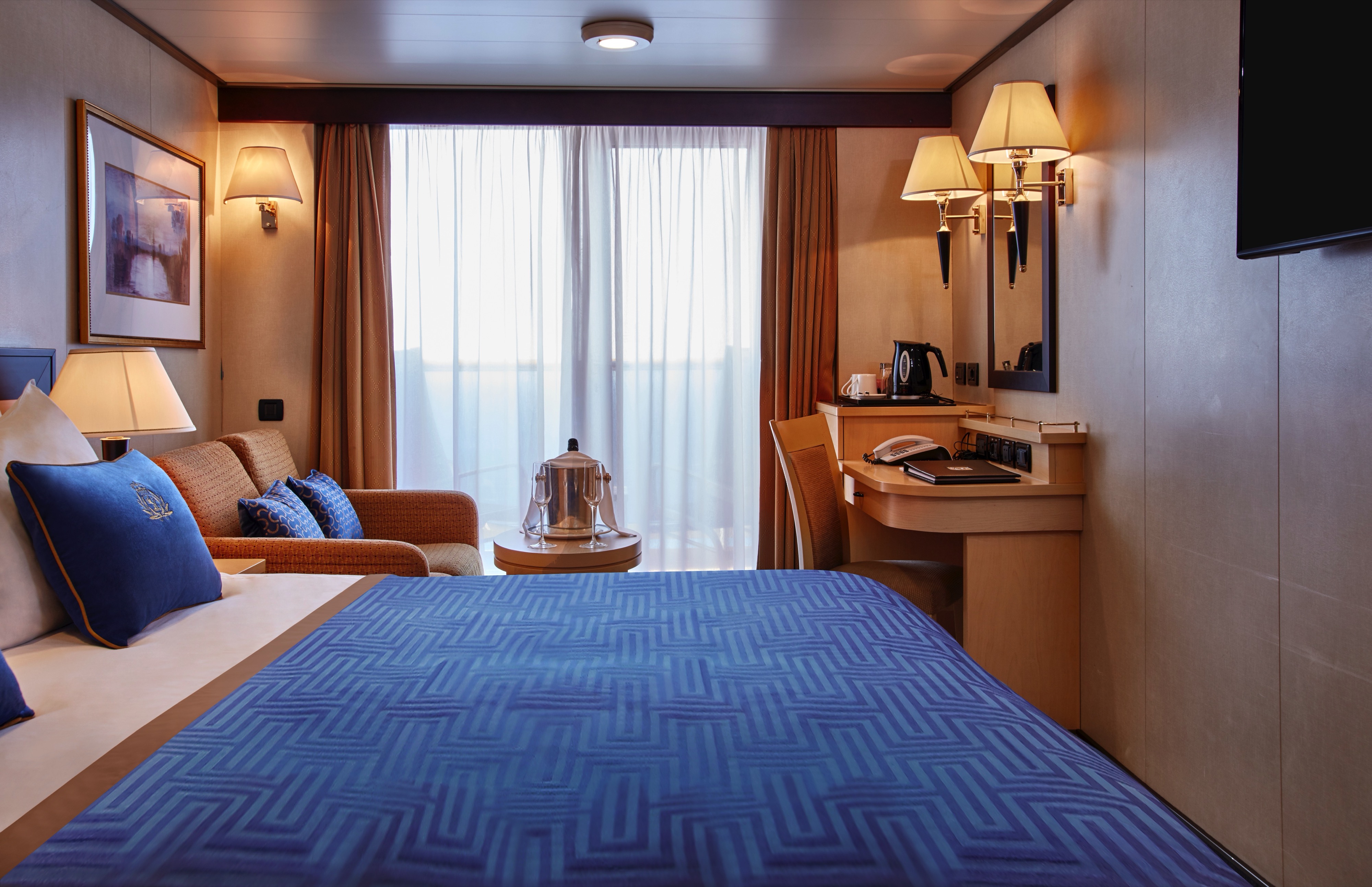
Approximately 335-513 sq. ft.
Delight in a prime location on board with sea views that can be enjoyed from both in and outside your Princess Suite. You’ll find thoughtful features and luxurious amenities, all organised by your dedicated steward to ensure you are always attentively looked after.
Each Princess Grill Suite includes:
- Exclusive access to the Princess Grill restaurant, where you can dine any time at your reserved table.
- Private balcony with seating and sea views.
- Spacious lounge area with seating.
- Bedroom area with Cunarder bed configurable to king-size or two single beds.
- Pillow concierge menu with a variety of types to choose from.
- Bathroom with bath and shower.
- Satellite TV with movie and music channels in lounge and bedroom areas.
- Feature vanity and desk with hairdryer.
- UK, USA and European power sockets.
- Penhaligon's toiletries.
- Luxury bathrobes and slippers.
- Feature mini-bar with speciality tea and coffee making facilities.
- Complimentary spring water replenished throughout your voyage.
- Daily fresh fruit.
- Mini-bar packages available for purchase.
- Welcome bottle of sparkling wine.
- Complimentary room service menu.
- Dine in-suite from the exquisite Princess Grill menu.
- Exclusive access to the Grills Lounge and outside Grills Terrace.
- Concierge service for on board reservations and shore experiences.
- A dedicated steward to keep your suite in fine order day and night.
- Priority embarkation and disembarkation.
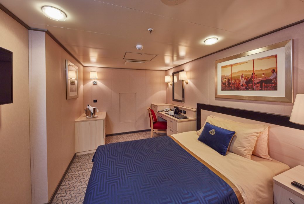
Approximately 254-470 sq. ft.
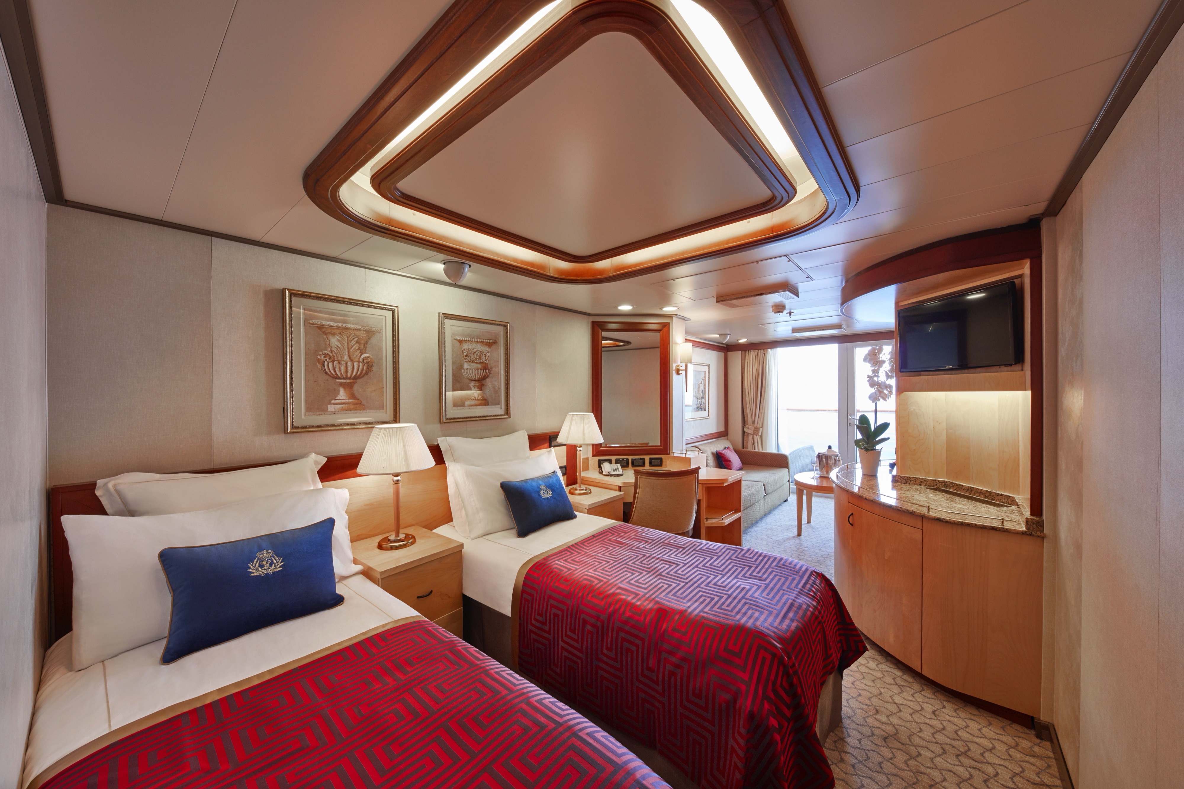
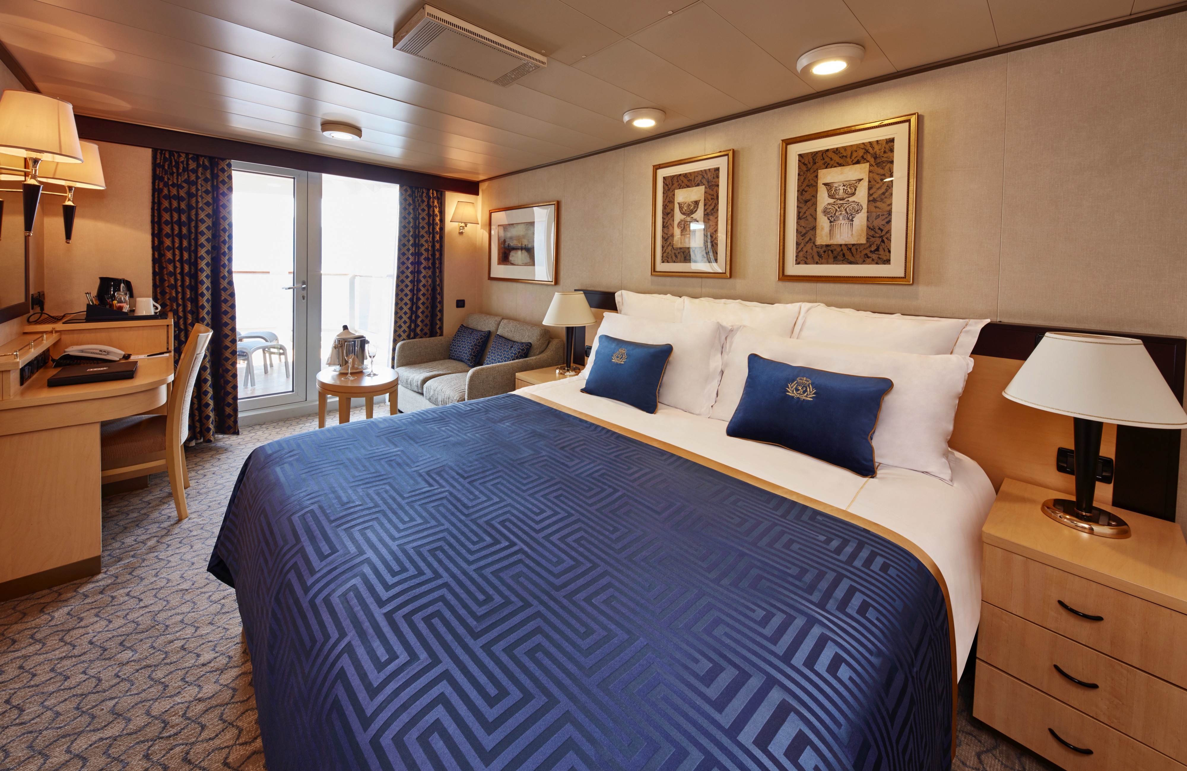
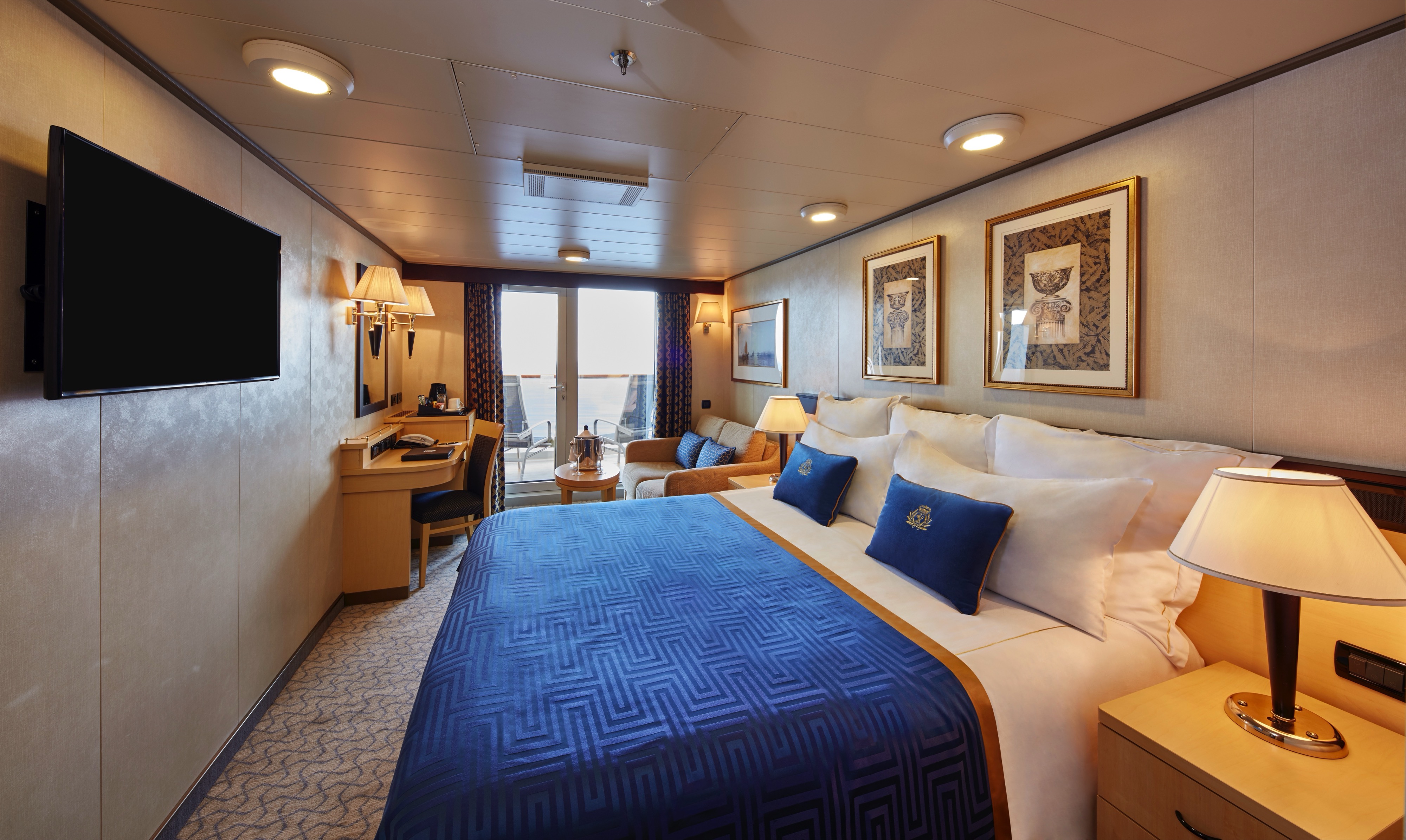
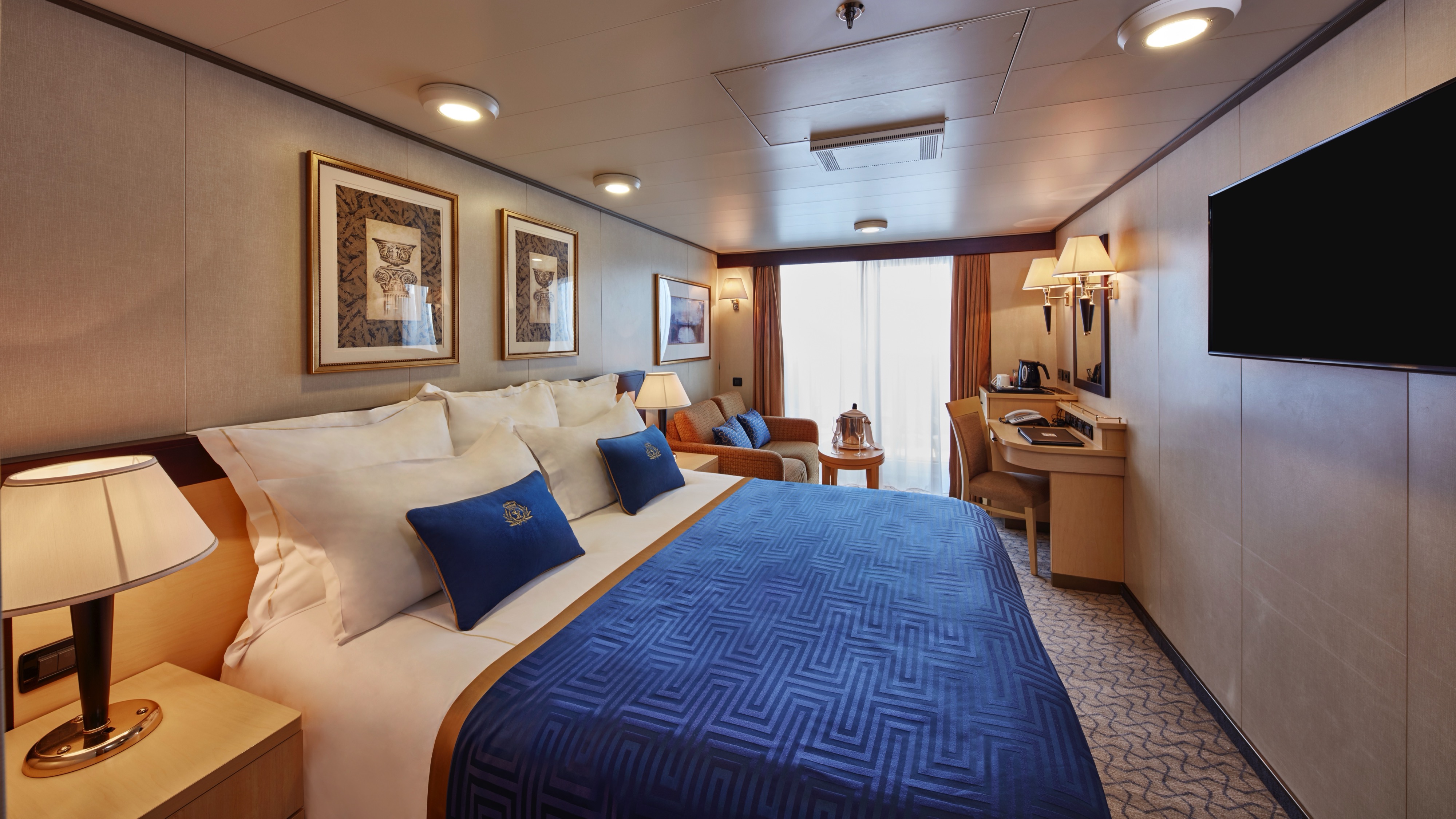
Take advantage of prime sea views from your own private, outdoor space in one of our Britannia Club Balcony staterooms. You’ll find thoughtful features, luxurious amenities and benefits, all organised by your dedicated steward to ensure you are always attentively looked after.
Each Britannia Club Balcony stateroom includes:
- Access to the intimate Britannia Club restaurant with a reserved table throughout your voyage.
- Private balcony with seating and sea views.
- Lounge area with seating.
- Cunarder bed configurable to king-size or two single beds.
- Bathroom with walk-in shower.
- Satellite TV with movie and music channels.
- Feature vanity and desk with hairdryer.
- UK, USA and European power sockets.
- Pillow concierge menu with a variety of types to choose from.
- Penhaligon's toiletries.
- Bathrobes and slippers.
- Speciality tea and coffee making facilities.
- Complimentary spring water replenished throughout your voyage.
- A welcome bottle of sparkling wine.
- Complimentary room service menu.
- Mini-bar packages available for purchase.
- A dedicated steward to keep your stateroom in fine order day and night.
- Priority embarkation and disembarkation.
Charges apply to room service after 10:00 AM.
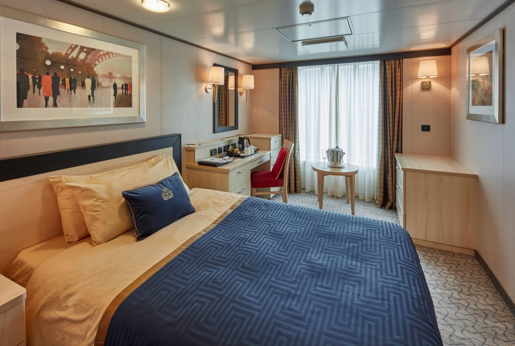
Approximately 228-472 sq. ft.
Drink in sparkling sea views from your own private, outdoor space in one of our Britannia Balcony staterooms. You’ll find thoughtful features and luxurious amenities, all organised by your dedicated steward to ensure you are always attentively looked after.
Each Britannia Balcony stateroom includes:
- Choice of Early, Late, and Open Dining in the Britannia Restaurant.
- Private balcony with seating and sea views.
- Lounge area with seating.
- Cunarder bed configurable to king-size or two single beds.
- Bathroom with walk-in shower.
- Satellite TV with movie and music channels.
- Feature vanity and desk with hairdryer.
- UK, USA and European power sockets.
- Penhaligon's toiletries.
- Bathrobes and slippers.
- Tea and coffee making facilities.
- Welcome sparkling wine.
- Complimentary room service menu.
- Mini-bar packages available for purchase.
- A dedicated steward to keep your stateroom in fine order day and night.
Charges apply to room service after 10:00 AM.
Approximately 228-408 sq. ft.
Enjoy access to private, outdoor space in one of our obstructed view Britannia Balcony staterooms. You’ll find thoughtful features and luxurious amenities, all organised by your dedicated steward to ensure you are always attentively looked after.
Each Britannia Balcony (obstructed view) stateroom includes:
- Choice of Early, Late, and Open Dining in the Britannia Restaurant.
- Private balcony (obstructed view) with seating.
- Lounge area with seating.
- Cunarder bed configurable to king-size or two single beds.
- Bathroom with walk-in shower.
- Satellite TV with movie and music channels.
- Feature vanity and desk with hairdryer.
- UK, USA and European power sockets.
- Penhaligon's toiletries.
- Bathrobes and slippers.
- Tea and coffee making facilities.
- Welcome sparkling wine.
- Complimentary room service menu.
- Mini-bar packages available for purchase.
- A dedicated steward to keep your stateroom in fine order day and night.
Charges apply to room service after 10:00 AM.
Approximately 228-408 sq. ft.
Enjoy access to private, outdoor space in one of our obstructed view Britannia Balcony staterooms. You’ll find thoughtful features and luxurious amenities, all organised by your dedicated steward to ensure you are always attentively looked after.
- Each Britannia Balcony (obstructed view) stateroom includes:
- Choice of Early, Late, and Open Dining in the Britannia Restaurant.
- Private balcony (obstructed view) with seating.
- Lounge area with seating.
- Cunarder bed configurable to king-size or two single beds.
- Bathroom with walk-in shower.
- Satellite TV with movie and music channels.
- Feature vanity and desk with hairdryer.
- UK, USA and European power sockets.
- Penhaligon's toiletries.
- Bathrobes and slippers.
- Tea and coffee making facilities.
- Welcome sparkling wine.
- Complimentary room service menu.
- Mini-bar packages available for purchase.
- A dedicated steward to keep your stateroom in fine order day and night.
Charges apply to room service after 10:00 AM.
Approximately 228-408 sq. ft.
Enjoy access to private, outdoor space in one of our obstructed view Britannia Balcony staterooms. You’ll find thoughtful features and luxurious amenities, all organised by your dedicated steward to ensure you are always attentively looked after.
Each Britannia Balcony (obstructed view) stateroom includes:
- Choice of Early, Late, and Open Dining in the Britannia Restaurant.
- Private balcony (obstructed view) with seating.
- Lounge area with seating.
- Cunarder bed configurable to king-size or two single beds.
- Bathroom with walk-in shower.
- Satellite TV with movie and music channels.
- Feature vanity and desk with hairdryer.
- UK, USA and European power sockets.
- Penhaligon's toiletries.
- Bathrobes and slippers.
- Tea and coffee making facilities.
- Welcome sparkling wine.
- Complimentary room service menu.
- Mini-bar packages available for purchase.
- A dedicated steward to keep your stateroom in fine order day and night.
Charges apply to room service after 10:00 AM.
Approximately 197-201 sq. ft.
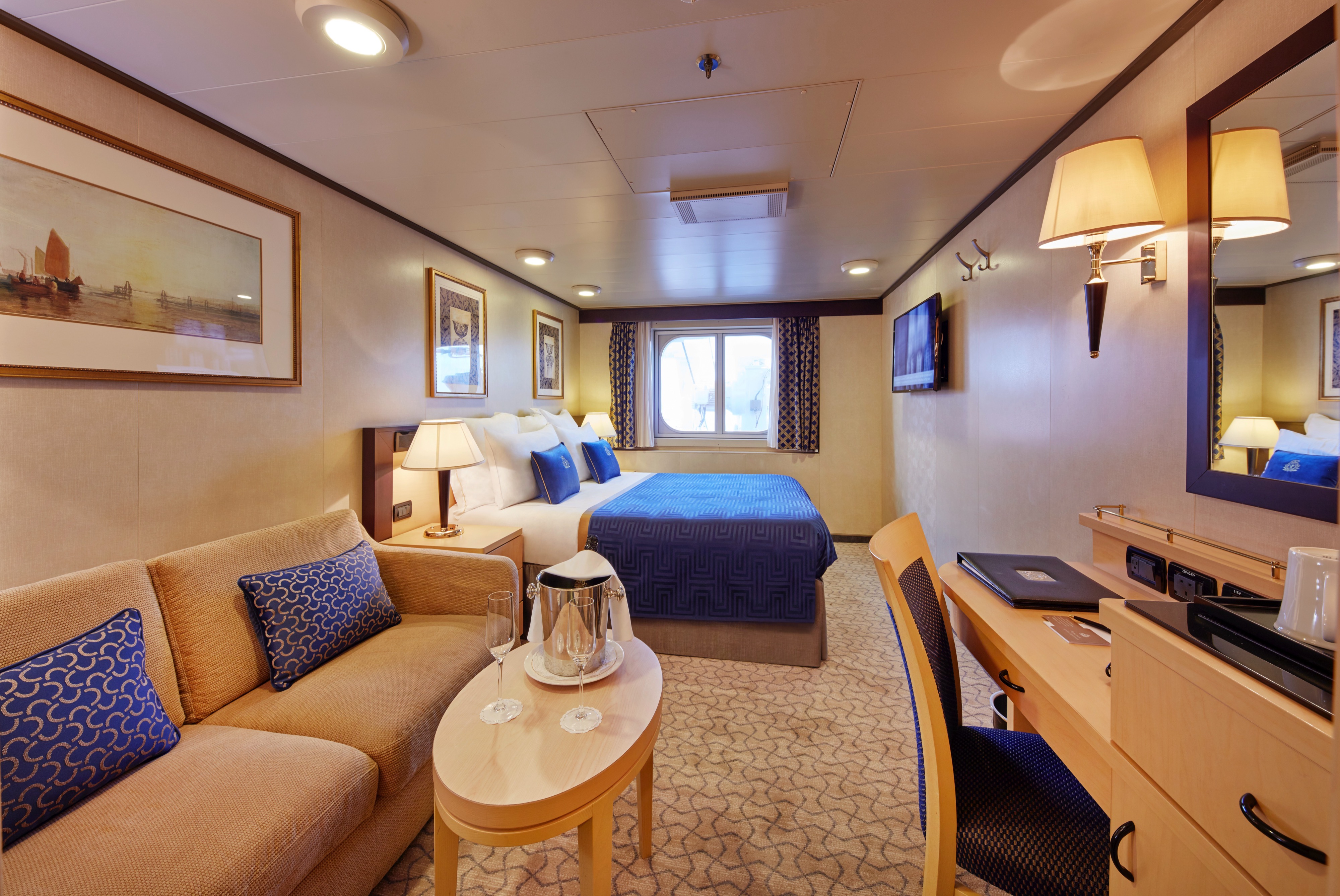
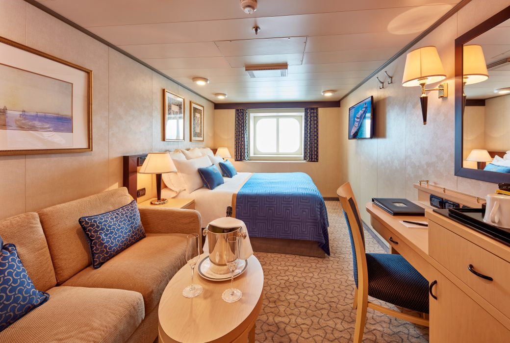
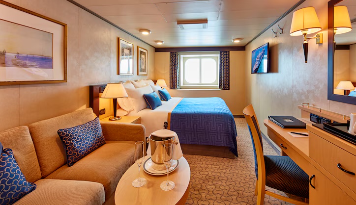
Positioned to offer sea views, our Britannia Oceanview staterooms provide a private enclave from which to watch the world go by. Perfectly framed views are the backdrop to thoughtful features and luxurious amenities, all organised by your dedicated steward to ensure you are always attentively looked after.
Each Britannia Oceanview stateroom includes:
- Choice of Early, Late, and Open Dining in the Britannia Restaurant.
- Lounge area with seating.
- Cunarder bed configurable to king-size or two single beds.
- Bathroom with a walk-in shower.
- Window with sea view.
- Satellite TV with movie and music channels.
- Feature vanity and desk with hairdryer.
- UK, USA and European power sockets.
- Penhaligon's toiletries.
- Bathrobes and slippers.
- Tea and coffee making facilities.
- Welcome sparkling wine.
- Complimentary room service menu.
- Mini-bar packages available for purchase.
- A dedicated steward to keep your stateroom in fine order day and night.
Charges apply to room service after 10:00 AM.
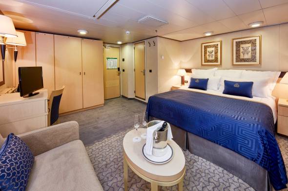
Approximately 226-301 sq. ft.
Offering sea views through generous windows, our Oceanview Deluxe staterooms are a private nook from which to watch the world go by.
*Please note, images of staterooms are provided for illustrative purposes only. They are examples and may not reflect the exact stateroom allocated, as individual staterooms may vary
Approximately 152 sq. ft.
With a variety of locations to choose from on board, our well-appointed Britannia Standard Inside staterooms are a haven of comfort and style to enjoy during your voyage. You’ll find thoughtful features and luxurious amenities, all organised by your dedicated steward to ensure you are always attentively looked after.
Each Britannia Standard Inside stateroom includes:
- Choice of Early, Late, and Open Dining in the Britannia Restaurant.
- Cunarder bed configurable to king-size or two single beds.
- Bathroom with a walk-in shower.
- Satellite TV with movie and music channels.
- Feature vanity and desk with hairdryer.
- UK, USA and European power sockets.
- Penhaligon's toiletries.
- Bathrobes and slippers.
- Tea and coffee making facilities.
- Welcome sparkling wine.
- Complimentary room service menu.
- Mini-bar packages available for purchase.
- A dedicated steward to keep your stateroom in fine order day and night.
Charges apply to room service after 10:00 AM.

Approximately 200-243 sq. ft.
With a variety of locations to choose from on board, our spacious Britannia Deluxe Inside staterooms are a haven of comfort and style to enjoy during your voyage. You’ll find thoughtful features and luxurious amenities, all organised by your dedicated steward to ensure you are always attentively looked after.
Each Britannia Deluxe Inside stateroom includes:
- Choice of Early, Late, and Open Dining in the Britannia Restaurant.
- Cunarder bed configurable to king-size or two single beds.
- Bathroom with a walk-in shower.
- Satellite TV with movie and music channels.
- Feature vanity and desk with hairdryer.
- UK, USA and European power sockets.
- Penhaligon's toiletries.
- Bathrobes and slippers.
- Tea and coffee making facilities.
- Welcome sparkling wine.
- Complimentary room service menu.
- Mini-bar packages available for purchase.
- A dedicated steward to keep your stateroom in fine order day and night.
Charges apply to room service after 10:00 AM.
Approximately 159 sq. ft.
Our spacious Britannia Single Inside staterooms are a haven of comfort and style to enjoy during your voyage. You’ll find thoughtful features and luxurious amenities, all organised by your dedicated steward to ensure you are always attentively looked after.
Each Britannia Single Inside stateroom includes:
- Choice of Early, Late, and Open Dining in the Britannia Restaurant.
- A generous width single bed and desk with stationery.
- Bathroom with a walk-in shower.
- Satellite TV with movie and music channels.
- Feature vanity with hairdryer.
- UK, USA and European power sockets.
- Penhaligon's toiletries.
- Bathrobes and slippers.
- Tea and coffee making facilities.
- Welcome sparkling wine.
- Complimentary room service menu.
- Mini-bar packages available for purchase.
- A dedicated steward to keep your stateroom in fine order day and night.
Charges apply to room service after 10:00 AM.
Approximately 133-168 sq. ft.
Positioned to offer sea views, our Britannia Single Oceanview staterooms provide a private enclave from which to watch the world go by. Perfectly framed views are the backdrop to thoughtful features and luxurious amenities, all organised by your dedicated steward to ensure you are always attentively looked after.
Each Britannia Single Oceanview stateroom includes:
- Choice of Early, Late, and Open Dining in the Britannia Restaurant.
- Lounge area with seating.
- Comfortable Cunarder single bed.
- Bathroom with a walk-in shower.
- Window with sea view.
- Satellite TV with movie and music channels.
- Feature vanity and desk with hairdryer.
- UK, USA and European power sockets.
- Penhaligon's toiletries.
- Bathrobes and slippers.
- Tea and coffee making facilities.
- Welcome sparkling wine.
- Complimentary room service menu.
- Mini-bar packages available for purchase.
- A dedicated steward to keep your stateroom in fine order day and night.
Charges apply to room service after 10:00 AM.
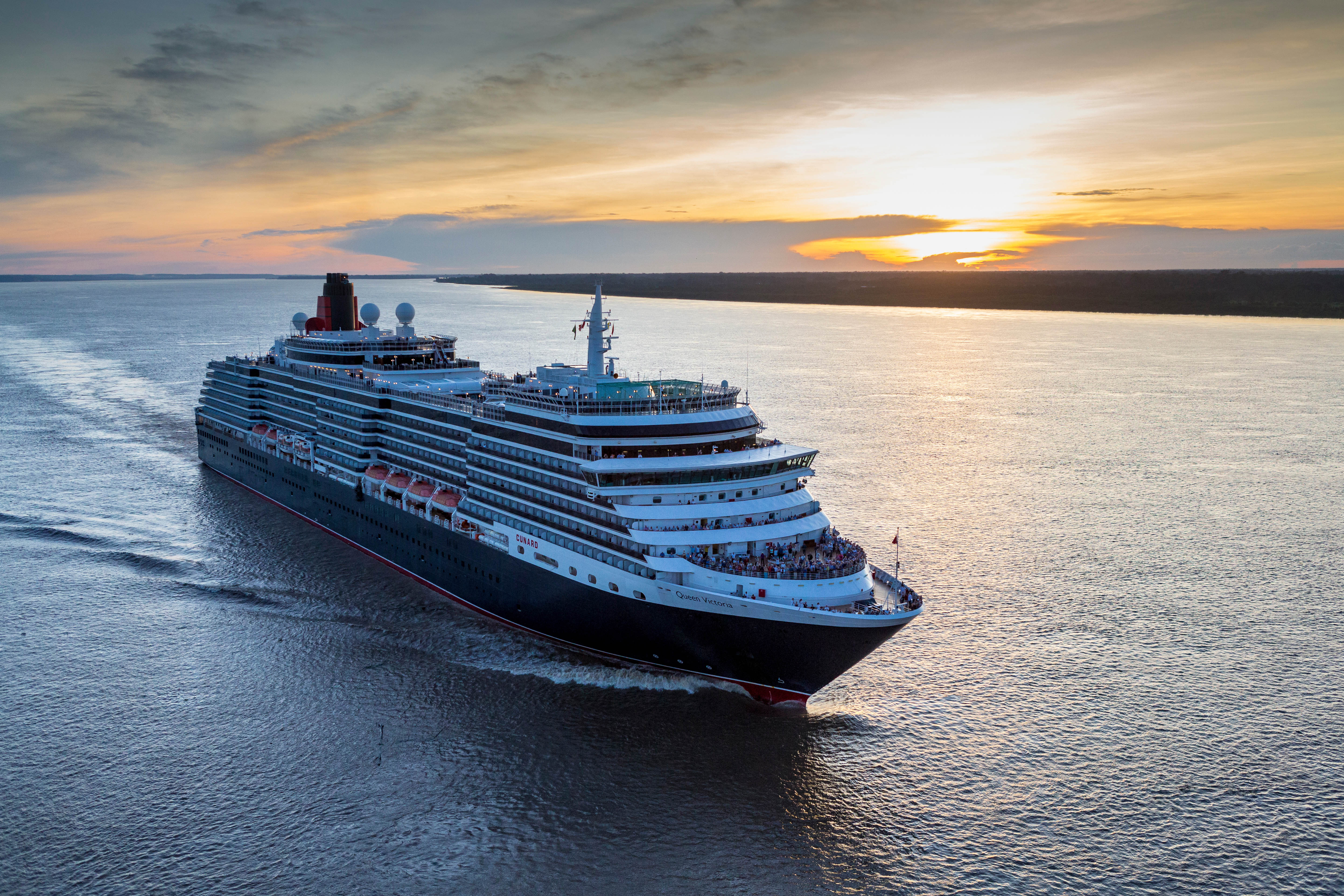
Queen Victoria
Queen Victoria will delight you with her special appeal, where elegance and unique features combine seamlessly with outstanding hospitality. You’ll discover an extraordinary way to see the world.
From the moment you step on board, you're immersed in an enchanting world of pleasure and escapism. Pass leisurely days soaking up the sunshine or gazing out at the tranquil ocean from her light-filled Winter Garden. Learn something new with our Cunard Insights speakers, or simply unwind with a good read. As evening falls, choose from a delectable array of dining options, and enjoy world-class entertainment in the Royal Court Theatre. On Queen Victoria the freedom to create your perfect trip is all yours.
Ship Facts
| Launch Year | 2007 | ||||||||
| Refit Year | 2017 | ||||||||
| Language | en | ||||||||
| Gross Tonnage | 90049 | ||||||||
| Length | 294 | ||||||||
| Width | 32.3 | ||||||||
| Currency | USD | ||||||||
| Speed | 18 | ||||||||
| Capacity | 2061 | ||||||||
| Crew Count | 913 | ||||||||
| Deck Count | 12 | ||||||||
| Cabin Count | 1007 | ||||||||
| Large Cabin Count | N/A | ||||||||
| Wheelchair Cabin Count | 20 | ||||||||
| Electrical Plugs |
|
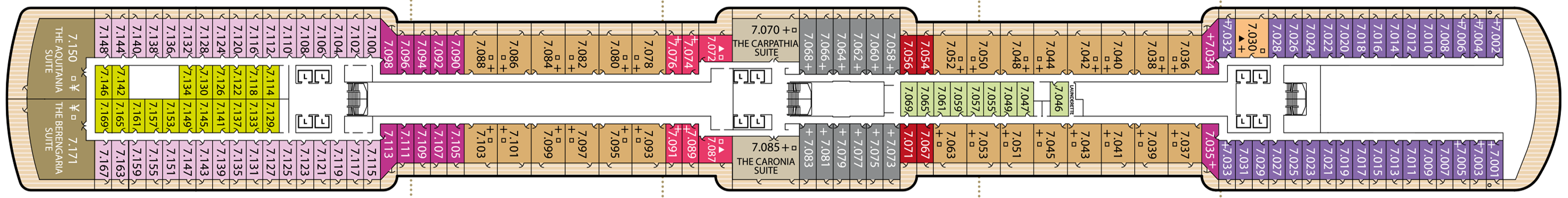
Deck 12
- The Grill's Upper Terrace

Deck 11
- Sports Deck
- The Terrace
- The Grills Lounge
- The Courtyard
- Queens Grill
- Princess Grill

Deck 10
- The Commodore Club
- Royal Spa & Fitness Centre (Upper)
- Churchills Lounge
- Admirals Lounge
- Yatch Club
- Children's Outdoor Area
- Teens Outdoor Area
- The Play Zone
- The Zone
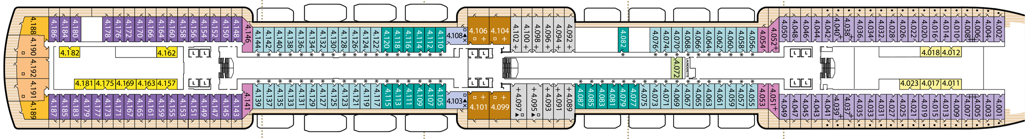
Britannia Deluxe Oceanview Staterooms

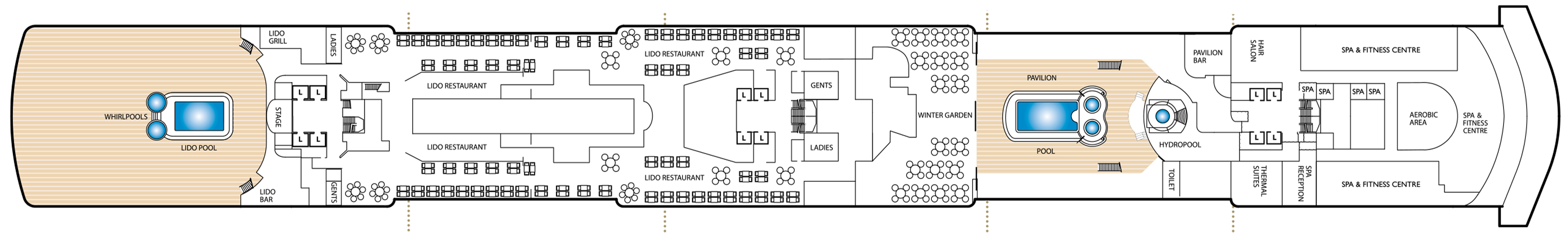
Deck 9
- Royal Spa
- Fitness Centre
- Aerobic Area
- Spa Reception
- Hair Salon
- Thermal Suites
- Pavilion Bar
- Hydropool
- Wellness Café at the Pavilion
- Pavilion Bar
- Pavilion Pool
- Winter Garden
- The Lido Restaurant
- Lido Pool Grill
- Stage
- Lido Pool Bar
- Lido Pool
- Whirpools
Deck 7
- Grand Master
- Queen Suites
- Princess Suites
- Penthouses
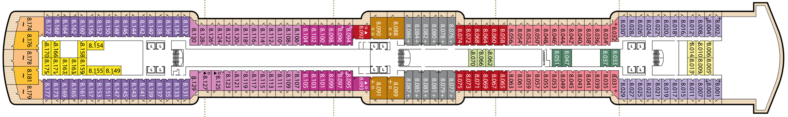
Deck 8
- Royal Suites
- Queens Suites
- Princess Suites
- Staterooms
- Laundrette
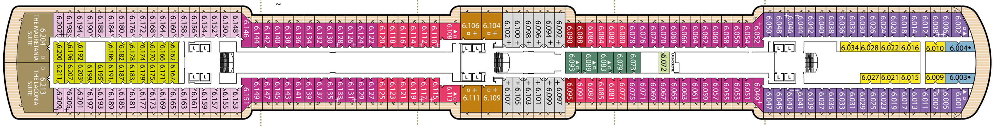
Deck 6
- Grand Suites
- Penthouses
- Princess Suites
- Staterooms
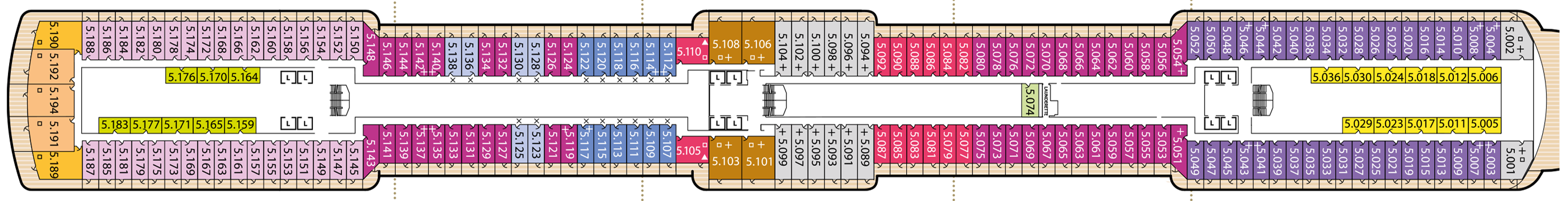
Deck 5
- Penthouses
- Queens Suites
- Princess Suites
- Staterooms
Deck 4
- Penthouses
- Queen Suites
- Princess Suites
- Staterooms
Deck 3
- Royal Court Theatre (Upper)
- Promenade Deck
- Shops
- Royal Arcade
- Art Gallery
- Connexions
- Cunardia Gallery
- Library (Upper)
- Grand Lobby
- The Book Shop
- The Alcove
- Midship's Lounge
- Britannia Restaurant (Upper)
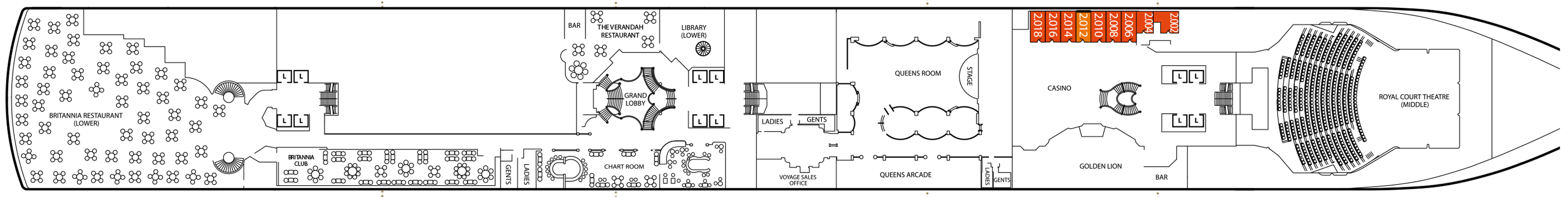
Deck 2
- Royal Court Theatre (Middle)
- Stateroom
- Golden Lion Pub
- Queens Room
- Queens Arcade
- Voyage Sales Office
- Cunardia
- Library (Lower)
- The Verandah Restaurant
- Chart Room
- Britannia Restaurant (Lower)
- Britannia Club
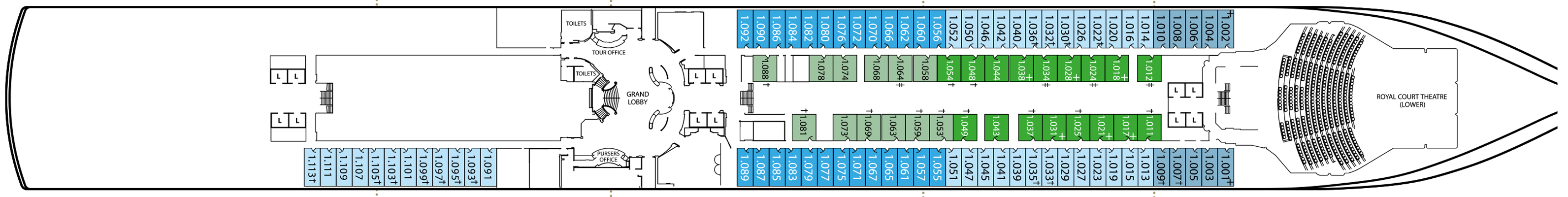
Deck 1
- Staterooms
- Royal Court Theatre (Lower)
- Connexions
- Grand Lobby
- Pursers Office
- Tour Office
From casual bites to haute cuisine, each day on Queen Victoria unlocks a new culinary adventure. Enjoy the timeless elegance of her fine dining restaurants, the array of dishes at her Lido buffet, or the chance to indulge in hearty pub fare at the Golden Lion pub. Where will you eat first?
As with all Cunard ships, Queen Victoria operates a stateroom-affiliated dining system, whereby your main dining room corresponds to your stateroom grade: Britannia, Britannia Club, Princess Grill or Queens Grill. Guests can dine in their main dining room for all meals of the day, and it's all included in the cruise fare. However these are just the beginnings of what your tastebuds can discover on board Queen Victoria. Read on as we introduce six of our favourite culinary experiences available to guests on Queen Victoria, wherever she sails.
Queen's Grill
The pinnacle of fine dining at sea, exclusively for guests staying in our Queens Grill Suites.
Drawing inspiration from the world’s finest kitchens, the Queens Grill restaurant offers a true taste of fine dining on board, elevated by a front of house team for whom nothing is too much trouble.
Open for breakfast, lunch and dinner daily, with a Grills Afternoon Tea served separately in the Grills Lounge, a visit to the Queens Grill always feels like a special occasion.
You’ll be dining among your fellow Queens Grill guests, with a table reserved for your exclusive use throughout your voyage. There’s no need to book. Simply arrive whenever you’re ready and your table will be waiting. You may even choose to take your meal in your suite, should you wish.
Each day introduces a coveted line-up of à la carte dishes, complemented by an ‘always-available’ menu of appetisers, entrees, and desserts, executed with exemplary flair and finesse.
Alternatively, opt for one of our chef’s speciality sharing dishes (orderable in advance at breakfast or lunchtimes). From beef wellington to rack of lamb, the choice is truly indulgent. Each dish (along with select offerings on our menu) is finished and presented to you table-side, only heightening the sense of theatre that’s a signature of Queens Grill dining.
Dining at the Queens Grill restaurant is exclusive to Queens Grill guests and included within your Cunard fare. The restaurant operates relaxed dress by day and smart attire (jacket optional) for dinner service after 6.00pm, except on Gala Evenings when we invite you to dress in black tie.
Princess Grill
Imaginative cooking and flawless service create a dining experience fit for royalty.
For the exclusive use of guests in our Princess Grill Suites, this exquisite restaurant offers à la carte dining at an elevated level.
With a dining room to rival the world’s most luxurious hotels and a menu that showcases classical flavour pairings, creatively reimagined, the Princess Grill restaurant is among the most prestigious of our on board dining experiences. Discreet but attentive service and a raft of personal touches make every meal special.
You’ll find a comprehensive selection of continental and cooked dishes ready to rouse you each morning, whilst lunchtimes introduce a delicious four course menu alongside lighter options.
Evenings are a particularly grand affair, with the theatre of tableside serving inspiring a greater sense of occasion. Your table for dinner is reserved throughout your voyage, with no need to book; simply take your seat whenever you wish, between 6.30pm and 9.00pm.
Dining at the Princess Grill restaurant is included in your fare if you’re staying in one of our Princess Grill Suites. Relaxed dress is welcomed at breakfast and lunch, and smart attire (jacket optional) after 6.00pm, except on Gala Evenings when we invite you to dress in black tie.
Britannia Restaurant
This grand two-tiered restaurant is the main dining room for guests staying in Queen Victoria’s Britannia Staterooms. Welcoming diners for breakfast, lunch, and dinner, taking your seat at the linen-dressed tables, always feels like an event. You’ll find a new a la carte lunch and dinner menu to temp you each day of your cruise, always with a choice of meat, fish, and vegan options. Breakfast at the Britannia Restaurant offers a mix of continental and cooked favourites, such as eggs benedict, fresh fruit, and our chef’s signature English breakfast.
Steakhouse at The Verandah
If you find yourself seeking an elevated gourmet experience on board Queen Victoria, look no further than The Verandah. This intimate dining venue offers an extraordinary gastronomic experience led by the simplicity of exceptional ingredients. From tiered platters of fruit de mer, laden with oysters, lobster, and crab, to succulent Black Angus and Wagyu steaks, accompanied by your choice of steak knife, each mouthful at The Verandah is a culinary masterpiece. Feast on a symphony of the finest ingredients sourced from land and sea. Will you make this gastronomic discovery a destination on your next Queen Victoria cruise?
The Lido
When you're in the mood for a more informal dining experience, The Lido buffet is sure to appeal. This casual but considered dining spot offers a relaxed approach to dining, with self-service food stations showcasing an array of culinary delights. Whether you're craving something quintessentially British or a dish inspired by the ports on your cruise, you’ll find it here. Hot dishes are updated daily, while fresh hand-rolled sushi and salads are always available at lunchtime. From 3pm, the Lido tempts you with Afternoon Tea favourites, including finger sandwiches, scones, and cakes. Towards the end of the evening, the Lido offers a late-night buffet, where you can indulge in one final culinary adventure before retiring to bed.
The Pavilion Wellness Cafe
The Pavilion Wellness Café will offer fresh, nourishing options in a relaxed setting. Enjoy smoothies, juices, salads, grain bowls, and light bites throughout your voyage.
A journey of sophistication and indulgence awaits you at Queen Victoria’s bars and lounges. From classic cocktails and fine wines to global beers and spirits, here’s nine places to raise a glass on board our legendary vessel.
Chart Room
Resplendent with its brushed gold accents, the Chart Room’s symmetrical interiors offer a timeless nod to the romance and geometry of Art Deco design. You’ll find this striking bar directly off the Grand Lobby, opposite Steakhouse at The Verandah on Deck 2. It’s a wonderful venue to visit on Gala Evenings when the sight of tuxedo-attired gentlemen and women in evening gowns evokes the spirit of a bygone era. The signature drink selection includes a range of custom cocktails inspired by the Zodiac. Ask the bartender to mix you up your birth sign or defy convention and let your tastebuds choose.
Commodore Club
For a Queen Victoria bar with the best sea views, look no further than the Commodore Club. A sophisticated lounge with picture height windows, the Commodore Club offers ocean panoramas like nowhere else on board. You’ll find this popular bar at the bow of Deck 10, above the Bridge. While a full drinks service is offered, the speciality here is a selection of Commodore cocktails, inspired by seven of our fleet’s most decorated Captains. Canapés are served on early evening visits and the atmosphere here is always one of elegance, with soothing background music courtesy of a live pianist.
Yacht Club
When the rest of the ship is winding down, Queen Victoria’s Yacht Club can always be counted on to keep the party going. Open for Insights talks, choir rehearsals, and dance classes during the day, this nautical themed lounge-bar takes on a whole new persona come nightfall. The home of karaoke and late-night DJs on board, you’ll find the decks spinning at the Yacht Club long after our other bars and lounges have called it a night. Sink into one of the low-slung sofas and tap along to the sounds filling the air or join your fellow revellers on the dance floor, putting all inhibitions aside in true holiday spirit.
Golden Lion
You’ll find all the warmth and conviviality of a traditional English pub at Queen Victoria’s Golden Lion. With hearty food and beers on draught, a visit here feels just as welcoming as stepping into your local. Relaxed dress is welcome at all times of day, even on Gala Evenings, and there’s live music and pub quizzes to keep you entertained. Well, who doesn’t love a bit of friendly competition? A complimentary menu featuring fish and chips, pie and mash, and our signature Cunard Ploughman’s is available at lunchtimes, while the drinks selection includes a range of Cunard own-brand ales and a choice of Bloody Marys.
Queens Room
With its spacious dancefloor, the Queens Room is home to dance classes, Gala Evenings, and our much-loved Afternoon Tea. Following Queen Victoria's refit, this elegant venue will be refreshed with details inspired by Queen Victoria's orange blossom brooch and wedding bouquet.
Illustrative render of proposed Queen Victoria refit enhancements. Final design and finishes may vary.
Grand Lobby
The Grand Lobby will be enriched with rich, regal design details, creating an even more striking sense of arrival on board.
Illustrative render of proposed Queen Victoria refit enhancements. Final design and finishes may vary.