Grenadines & Windwards yachting
Grenadines & Windwards yachting
Cruise overview
WHY BOOK WITH US?
- ✔ The Deluxe Cruises’ team has extensive experience in ultra-luxury cruising.
- ✔ Call now to speak to our helpful and experienced Cruise Concierge team.
- ✔ Enjoy our Unique Deluxe Cruises Bonus for substantial savings.
- ✔ Our team will tailor your holiday to your exacting requirements.
- ✔ As agents, we work under the protection of each cruise lines ABTA / ATOL licences
About Bridgetown
Located beside the island’s only natural harbour, the capital of Barbados combines modern and colonial architecture with glorious palm tree-lined beaches and a number of historical attractions. Experience the relaxed culture of the city renowned for its British-style parliament buildings and vibrant beach life, and seek out the Anglican church and the 19th-century Barbados Garrison. The distance between the ship and your tour vehicle may vary. This distance is not included in the excursion grades.
About Speightstown

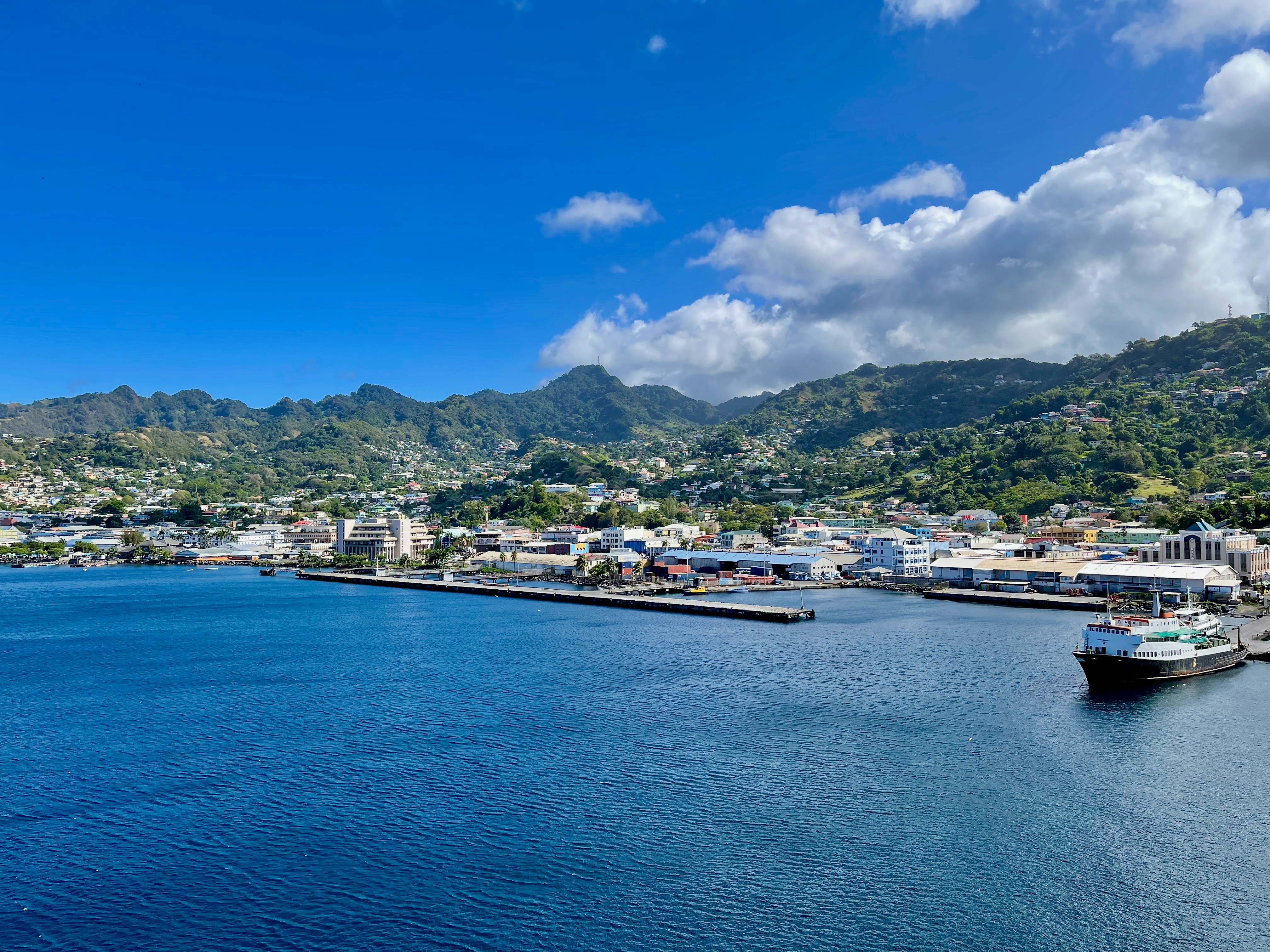
About Kingstown
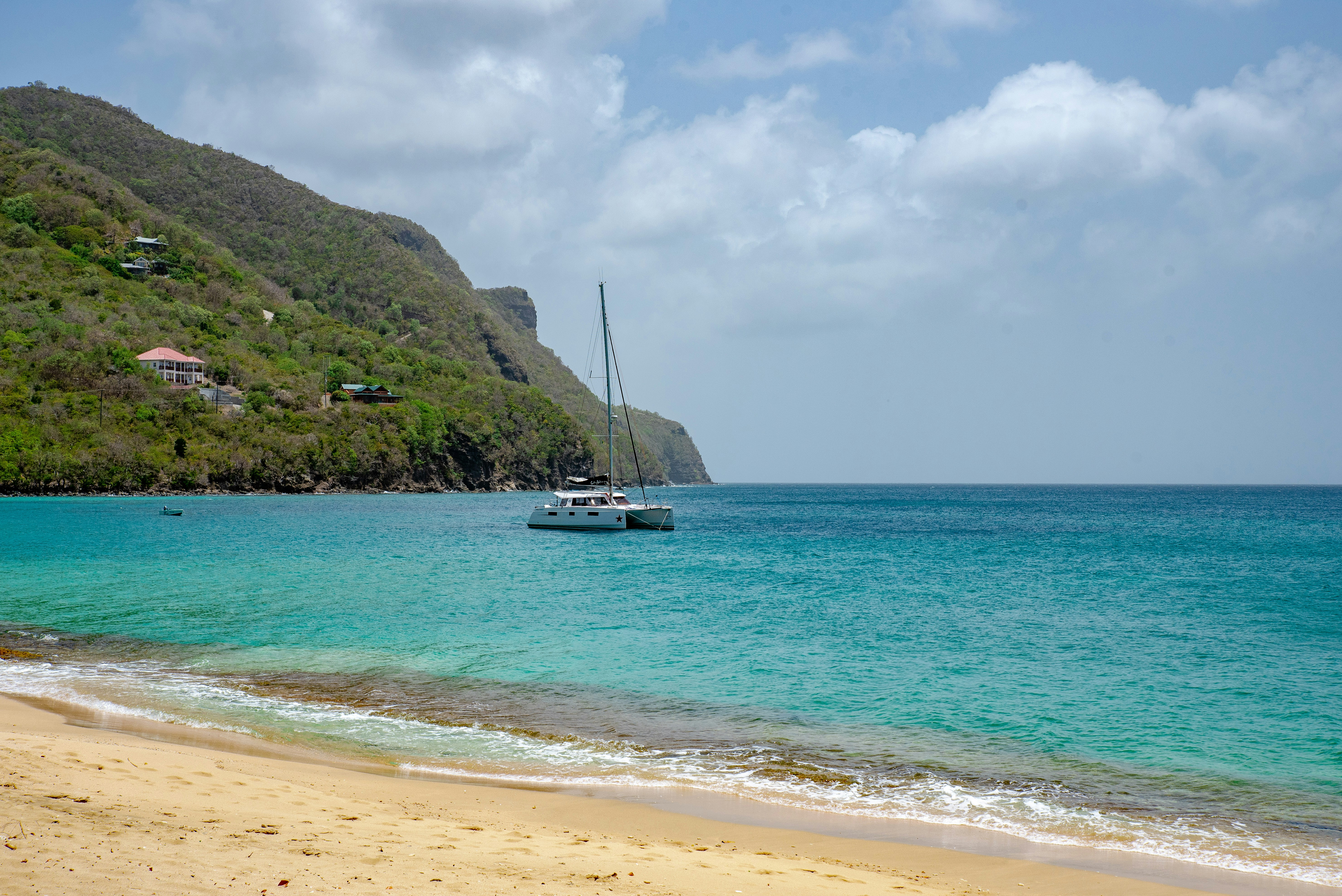
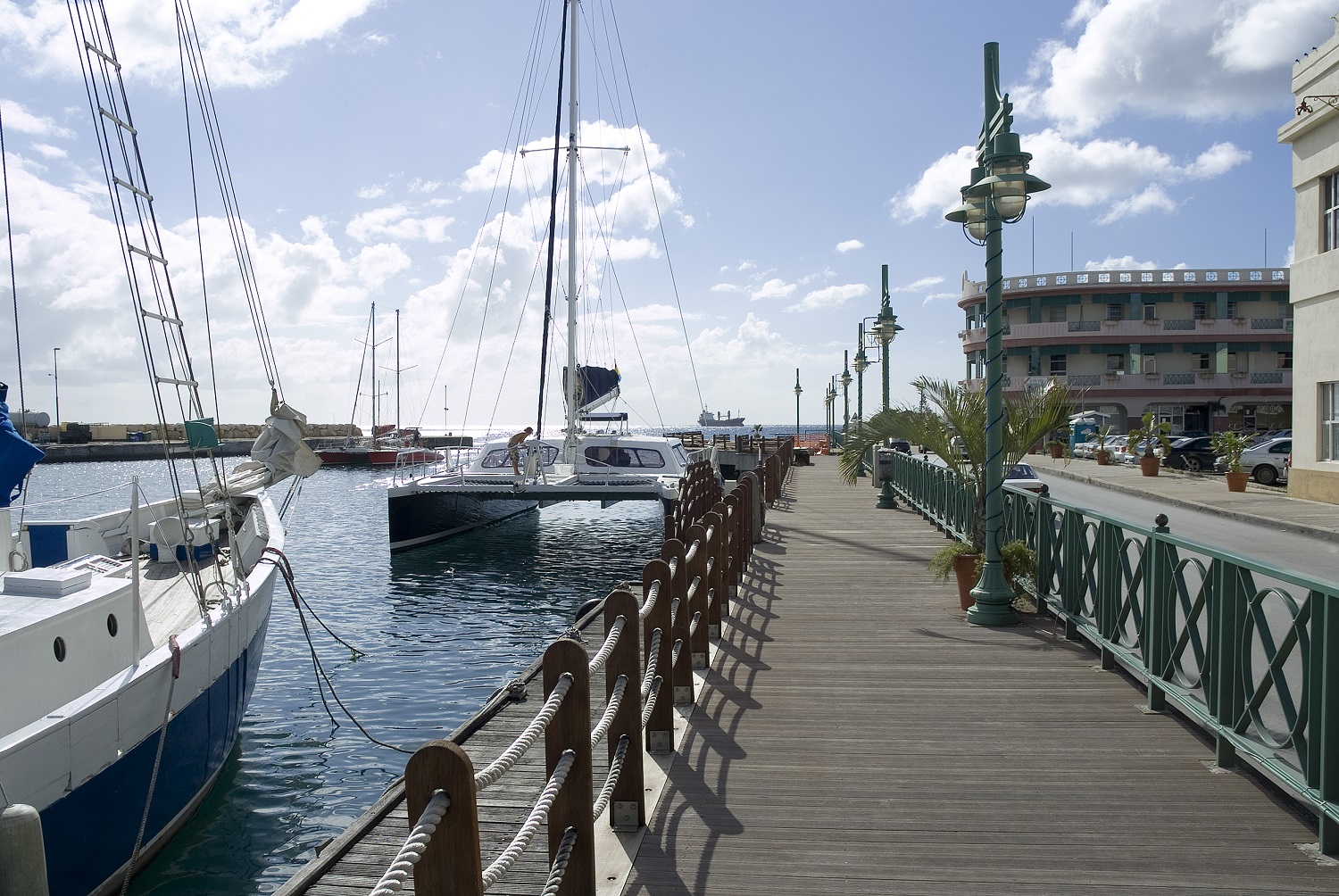
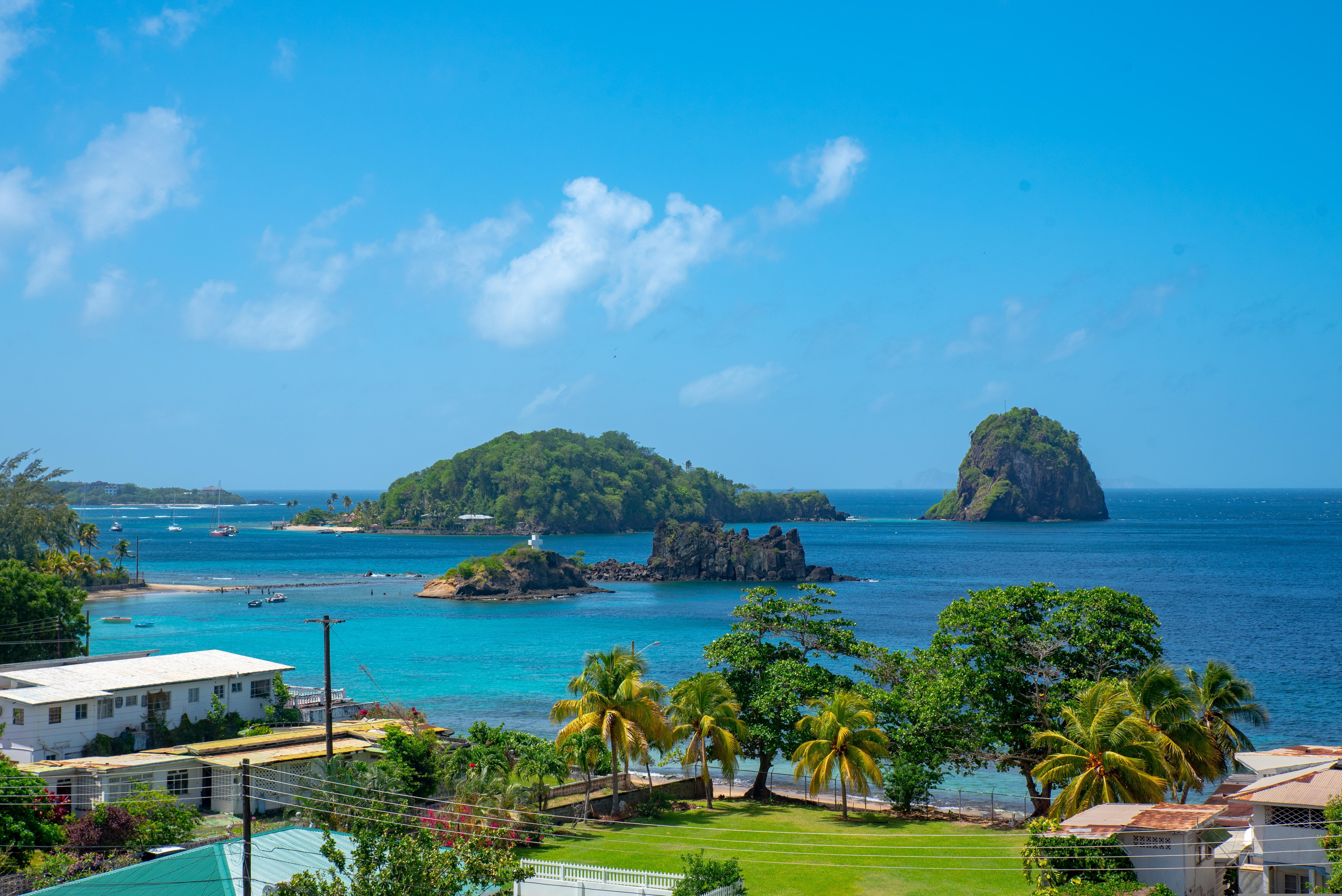
About Port Elizabeth, Bequia
Bequia is a Carib word meaning "island of the cloud." Hilly and green with several golden-sand beaches, Bequia is 9 miles (14½ km) south of St. Vincent's southwestern shore; with a population of 5,000, it's the largest of the Grenadines. Although boatbuilding, whaling, and fishing have been the predominant industries here for generations, sailing has now become almost synonymous with Bequia. Admiralty Bay is a favored anchorage for both privately owned and chartered yachts. Lodgings range from comfortable resorts and villas to cozy West Indian—style inns. Bequia's airport and the frequent ferry service from St. Vincent make this a favorite destination for day-trippers, as well. The ferry docks in Port Elizabeth, a tiny town with waterfront bars, restaurants, and shops where you can buy handmade souvenirs—including the exquisitely detailed model sailboats that are a famous Bequia export. The Easter Regatta is held during the four-day Easter weekend, when revelers gather to watch boat races and celebrate the island's seafaring traditions with food, music, dancing, and competitive games.To see the views, villages, beaches, and boatbuilding sites around Bequia, hire a taxi at the jetty in Port Elizabeth. Several usually line up under the almond trees to meet each ferry from St. Vincent.
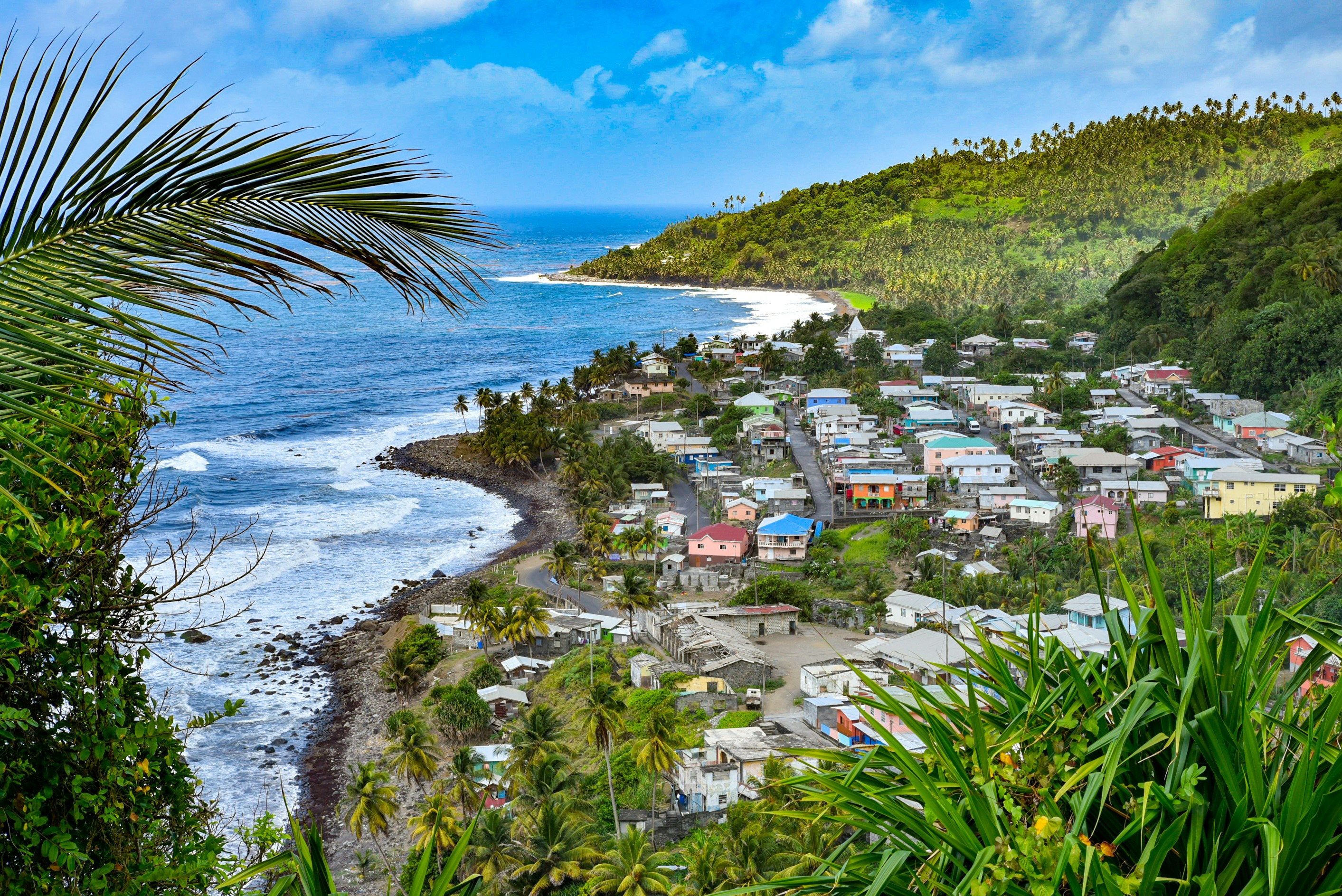
About Mayreau Island
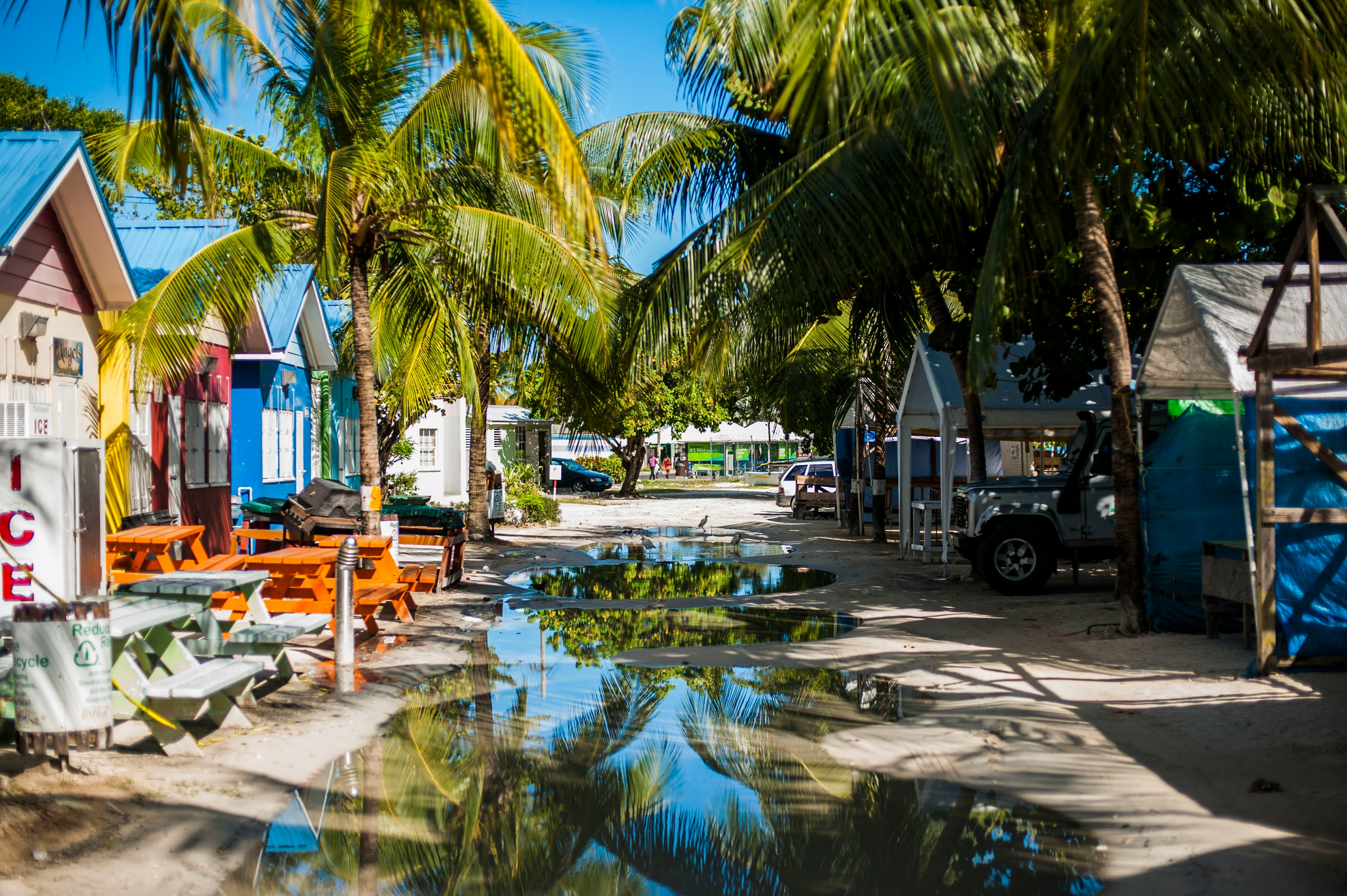
The small island of Mayreau, just one and 1/2 square miles in area (3.9 square kilometres) is the smallest inhabited island of The Grenadines, and is part of the independent state of St.Vincent in the eastern Caribbean Sea. Two of the best known islands in The Grenadines are Mustique and Bequia, the second largest island in this group. The Grenadine Islands are strung out in a gentle sweep between St.Vincent and Grenada. Most visitors to Mayreau arrive from cruise ships, on the regular ferry, or by yacht. There are no proper roads on the island, only a few vehicles, no airport and only a single unnamed village. Mayreau and the neighboring Tobago Cays are very popular for divers and snorkellers. Saline Bay, on the west coast of the island, has a wonderful broad beach and a few local vendors selling T-shirts and local craft. A climb up the road to the hilltop village on the island provides breathtaking views across Mayreau, Canouan, the Tobago Cays and Carriacou.
About Mayreau Island
The small island of Mayreau, just one and 1/2 square miles in area (3.9 square kilometres) is the smallest inhabited island of The Grenadines, and is part of the independent state of St.Vincent in the eastern Caribbean Sea. Two of the best known islands in The Grenadines are Mustique and Bequia, the second largest island in this group. The Grenadine Islands are strung out in a gentle sweep between St.Vincent and Grenada. Most visitors to Mayreau arrive from cruise ships, on the regular ferry, or by yacht. There are no proper roads on the island, only a few vehicles, no airport and only a single unnamed village. Mayreau and the neighboring Tobago Cays are very popular for divers and snorkellers. Saline Bay, on the west coast of the island, has a wonderful broad beach and a few local vendors selling T-shirts and local craft. A climb up the road to the hilltop village on the island provides breathtaking views across Mayreau, Canouan, the Tobago Cays and Carriacou.
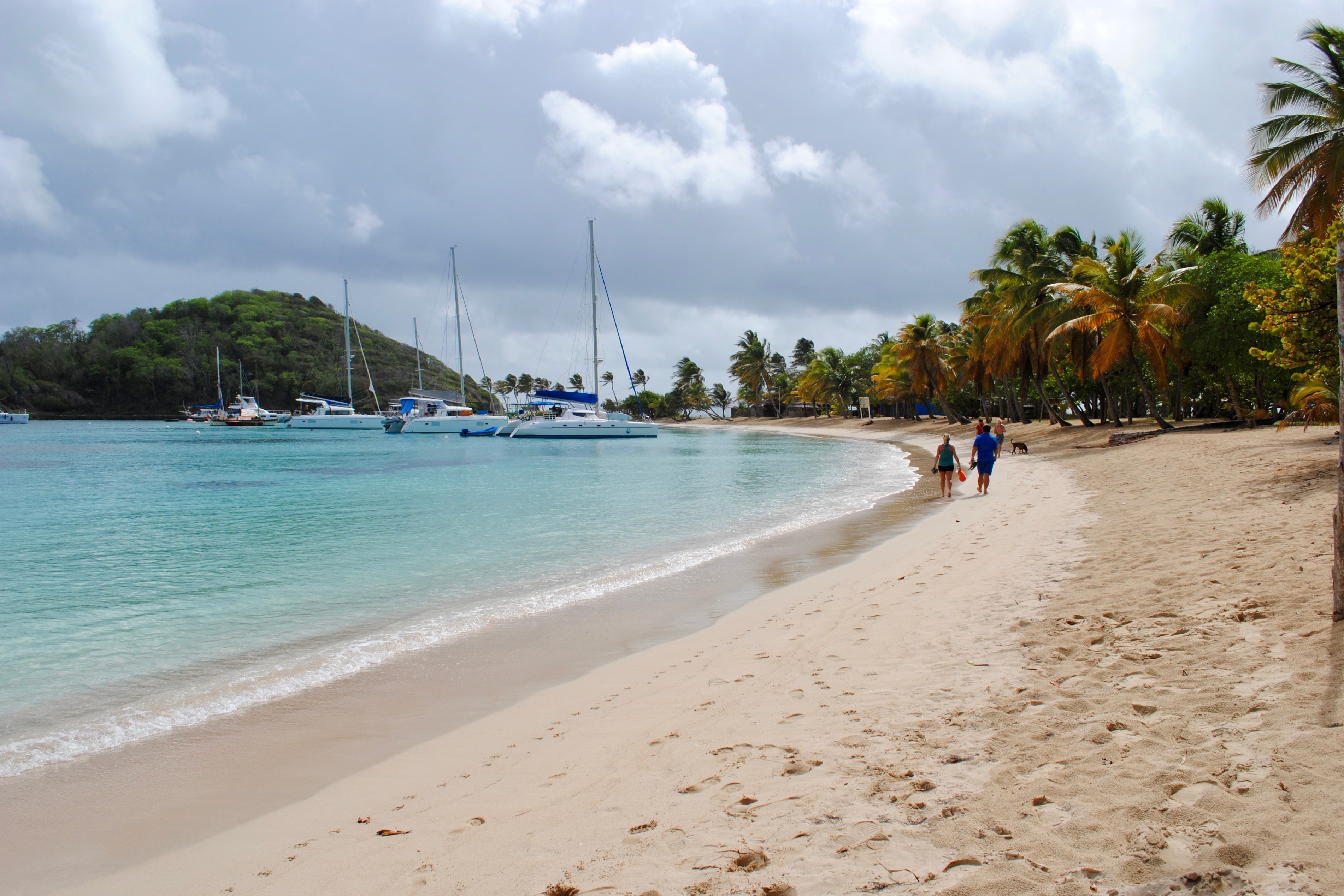
About Union Island
About Union Island
About Union Island
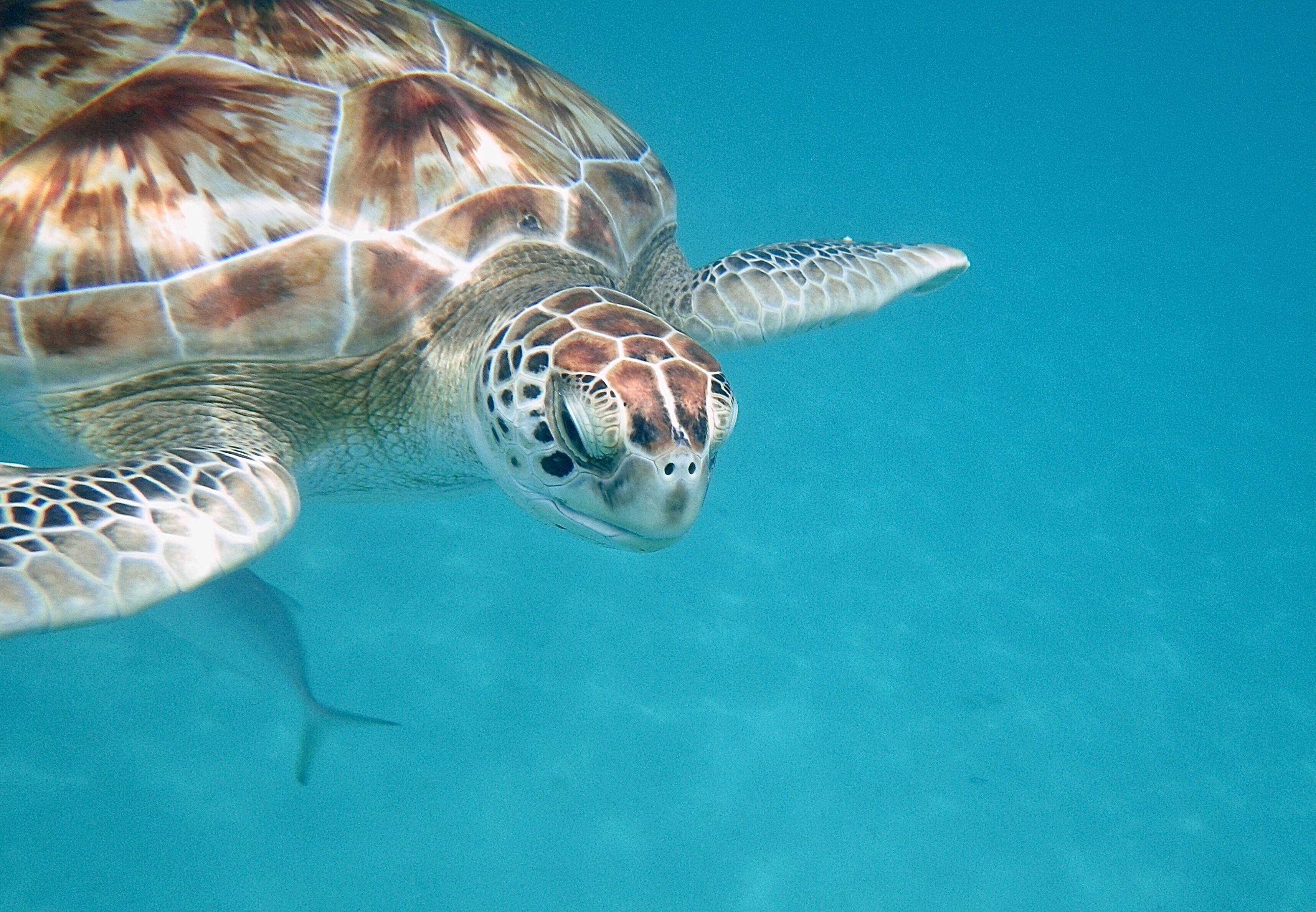
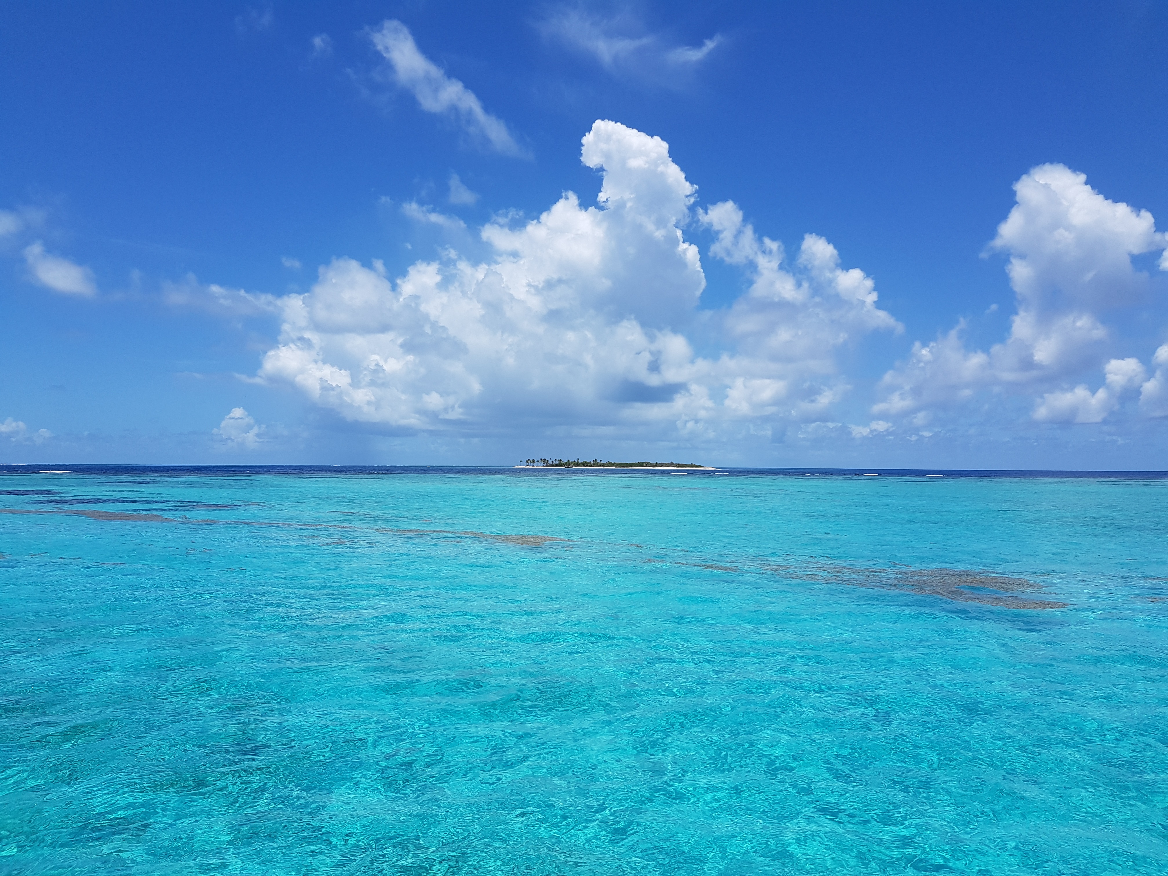
About Tobago Cays
About Bridgetown
Located beside the island’s only natural harbour, the capital of Barbados combines modern and colonial architecture with glorious palm tree-lined beaches and a number of historical attractions. Experience the relaxed culture of the city renowned for its British-style parliament buildings and vibrant beach life, and seek out the Anglican church and the 19th-century Barbados Garrison. The distance between the ship and your tour vehicle may vary. This distance is not included in the excursion grades.
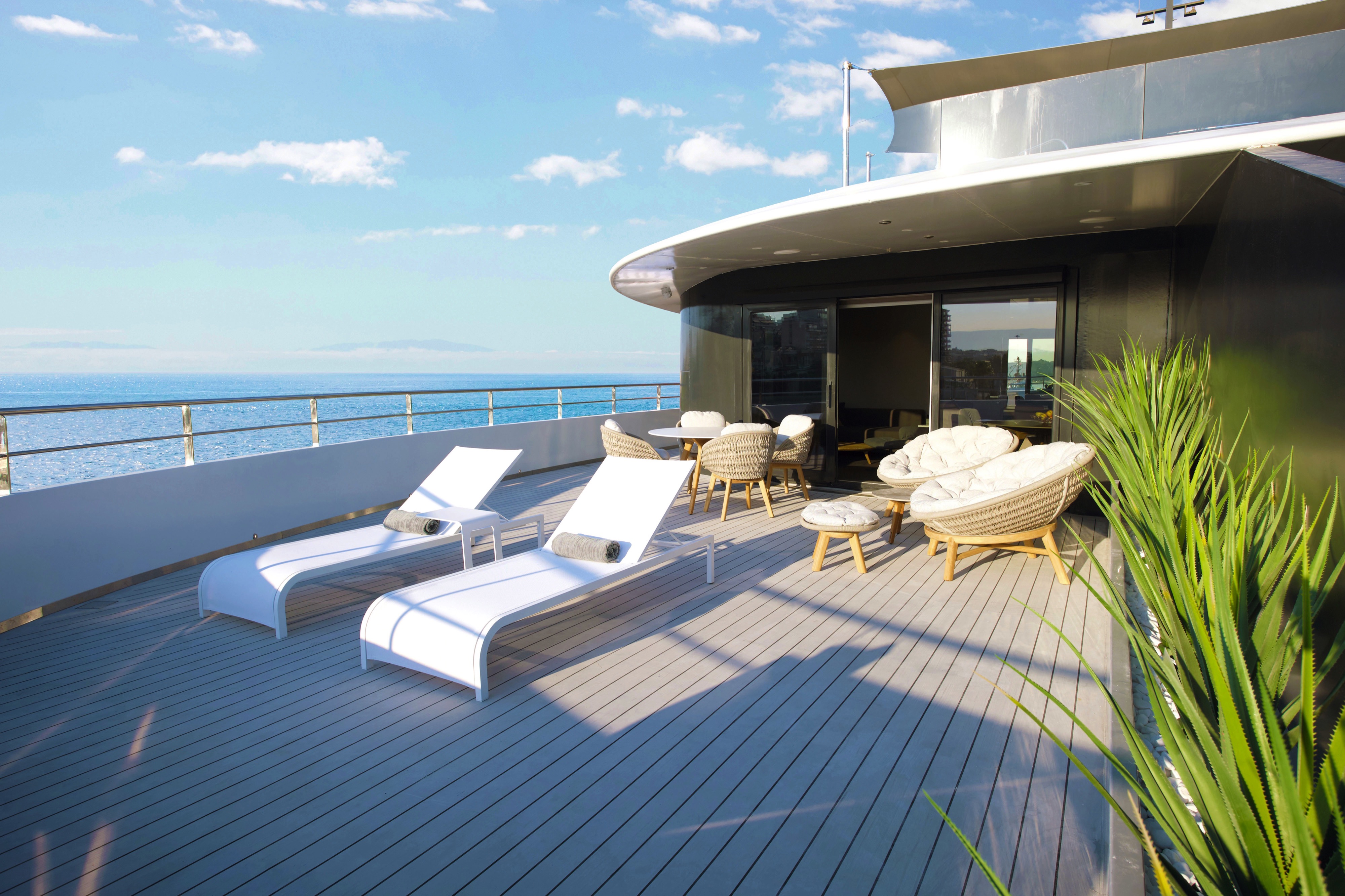
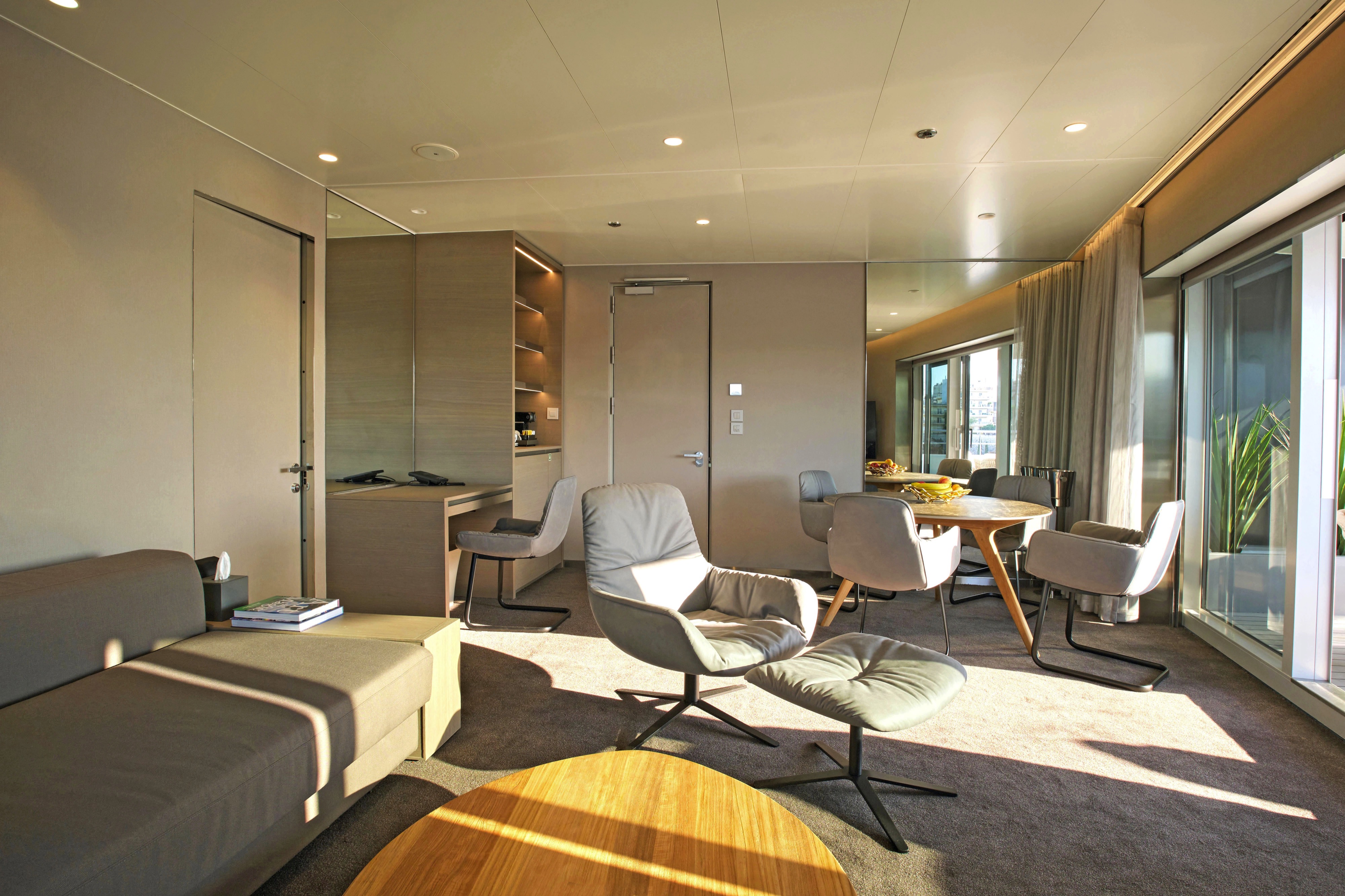
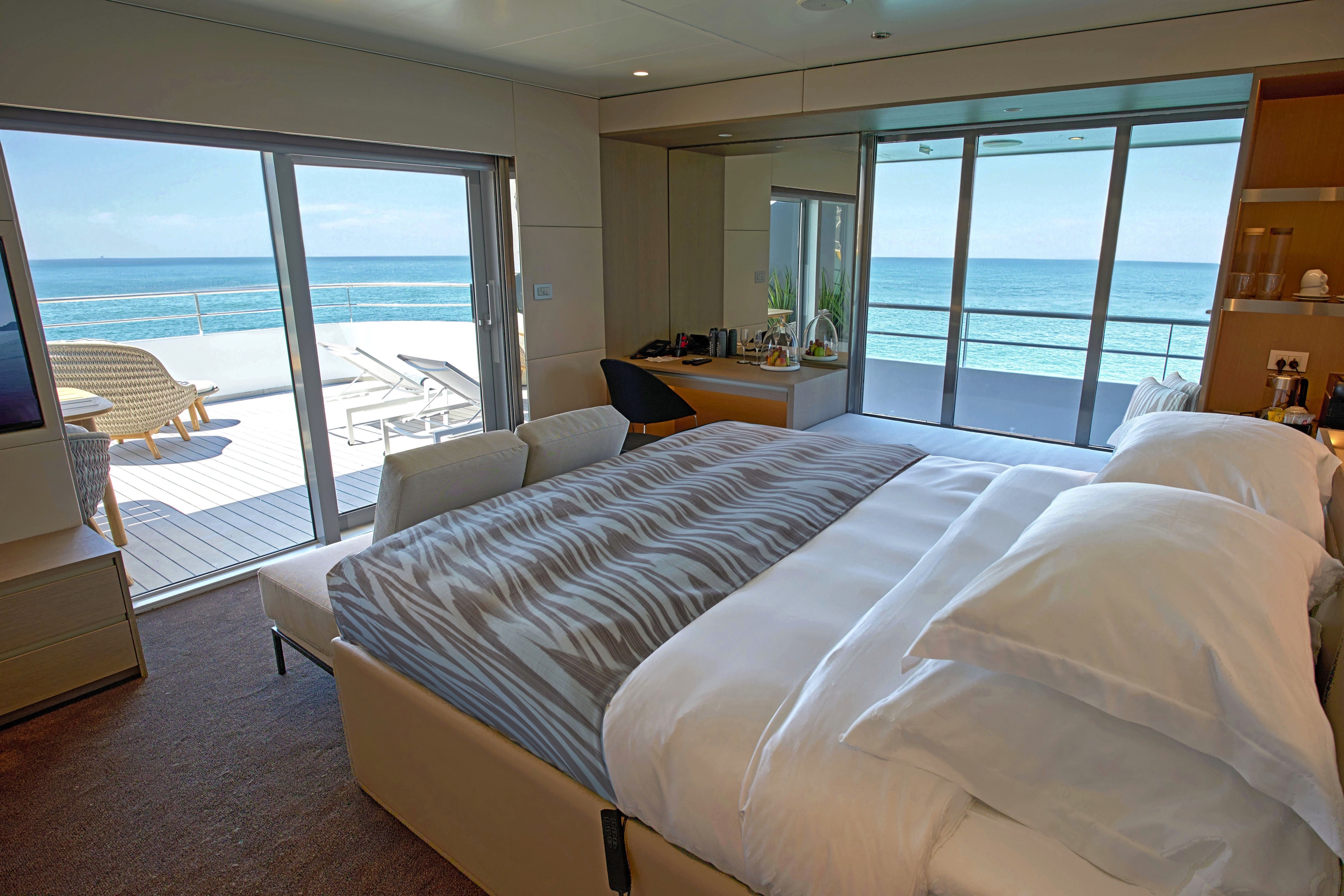
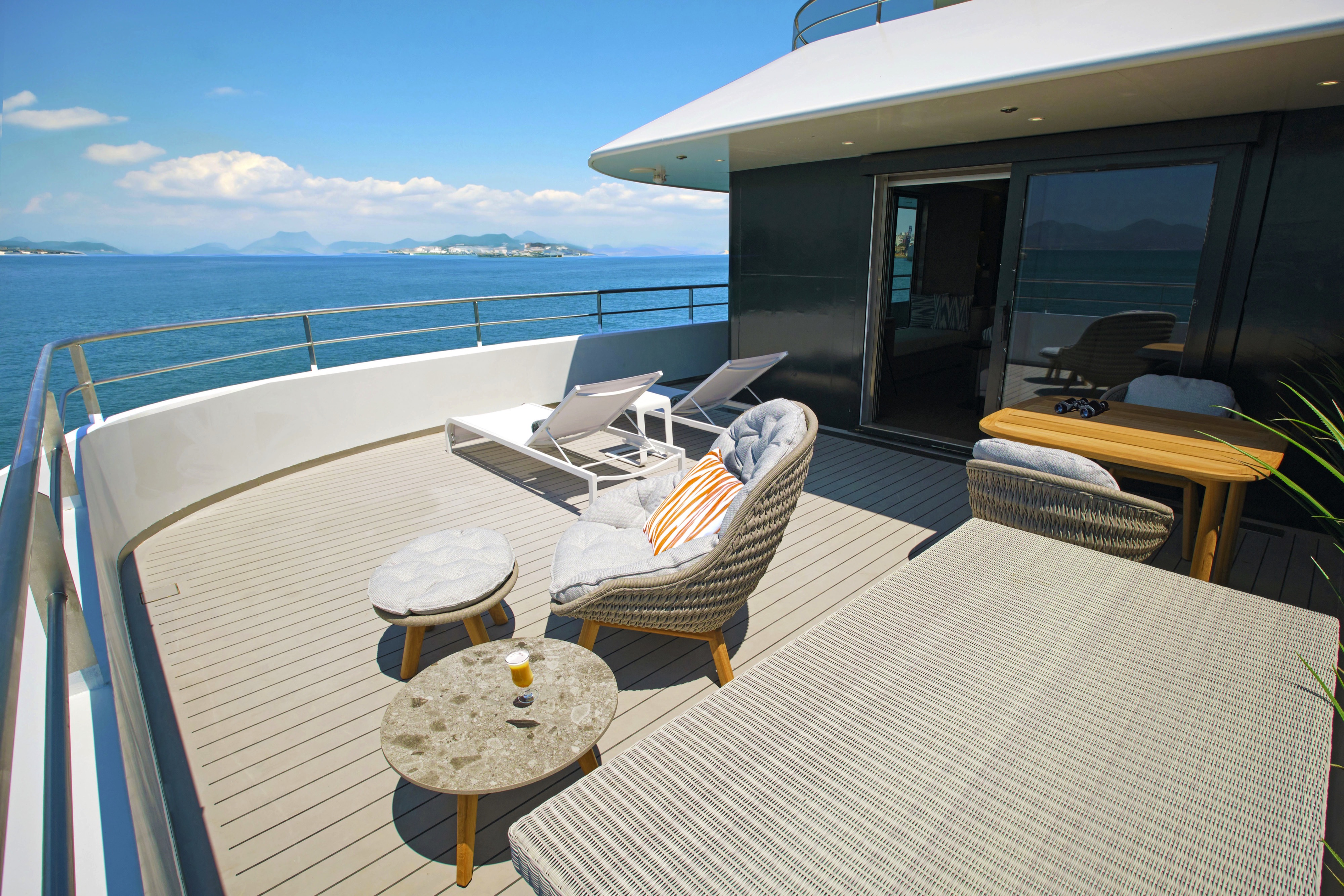
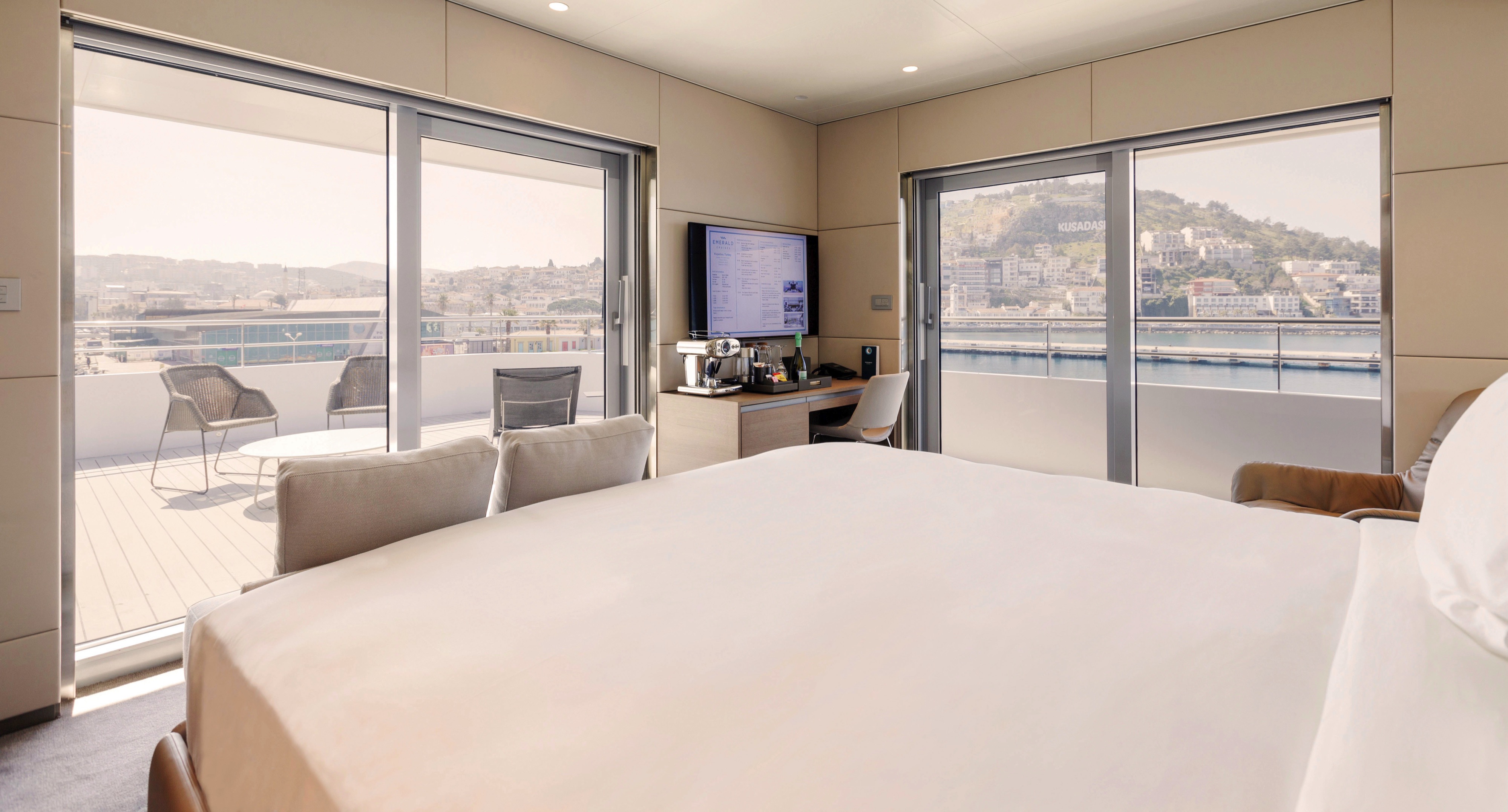
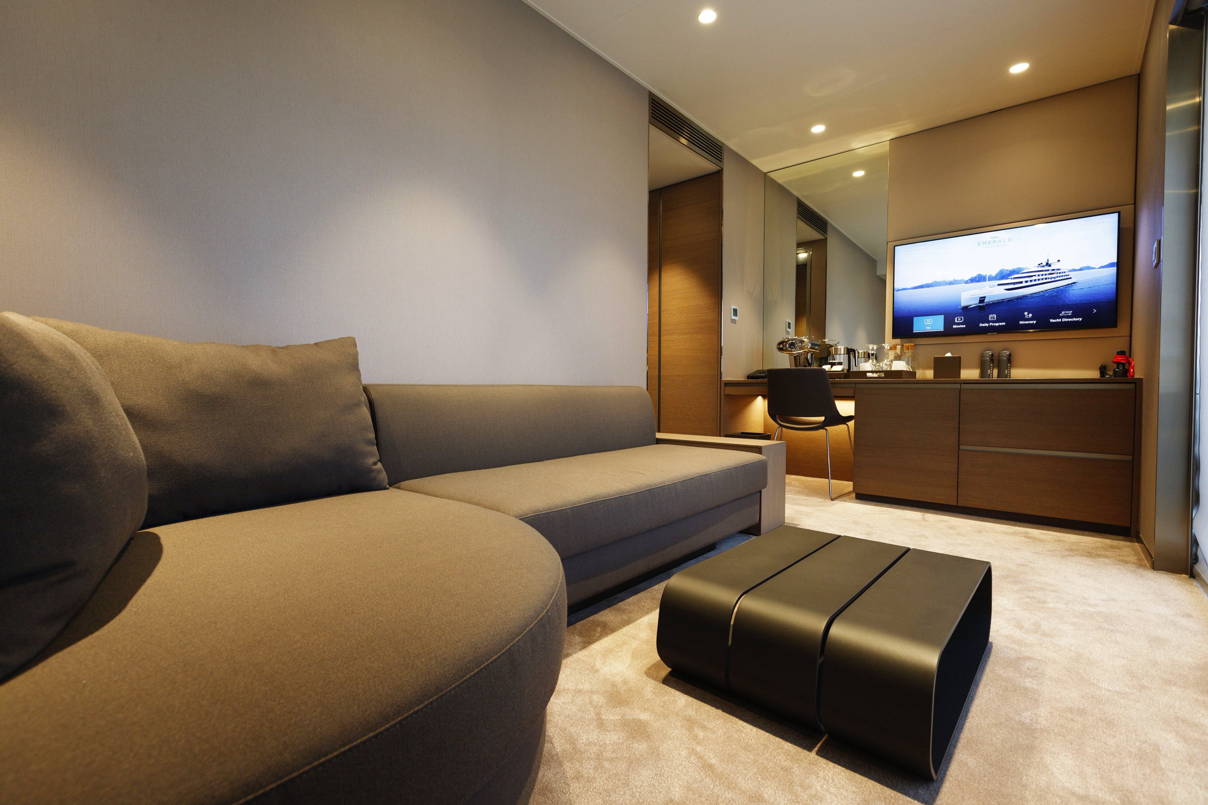
These suites are the largest on board, located on the Pool Deck. Boasting a walk-in wardrobe and separate lounge and bedroom areas, you'll benefit from pure privacy. Your large private terrace enables you to relax alfresco, admiring stunning views.
All suites & staterooms include:
- King-size or twin hotel-style beds with the finest Egyptian cotton linen
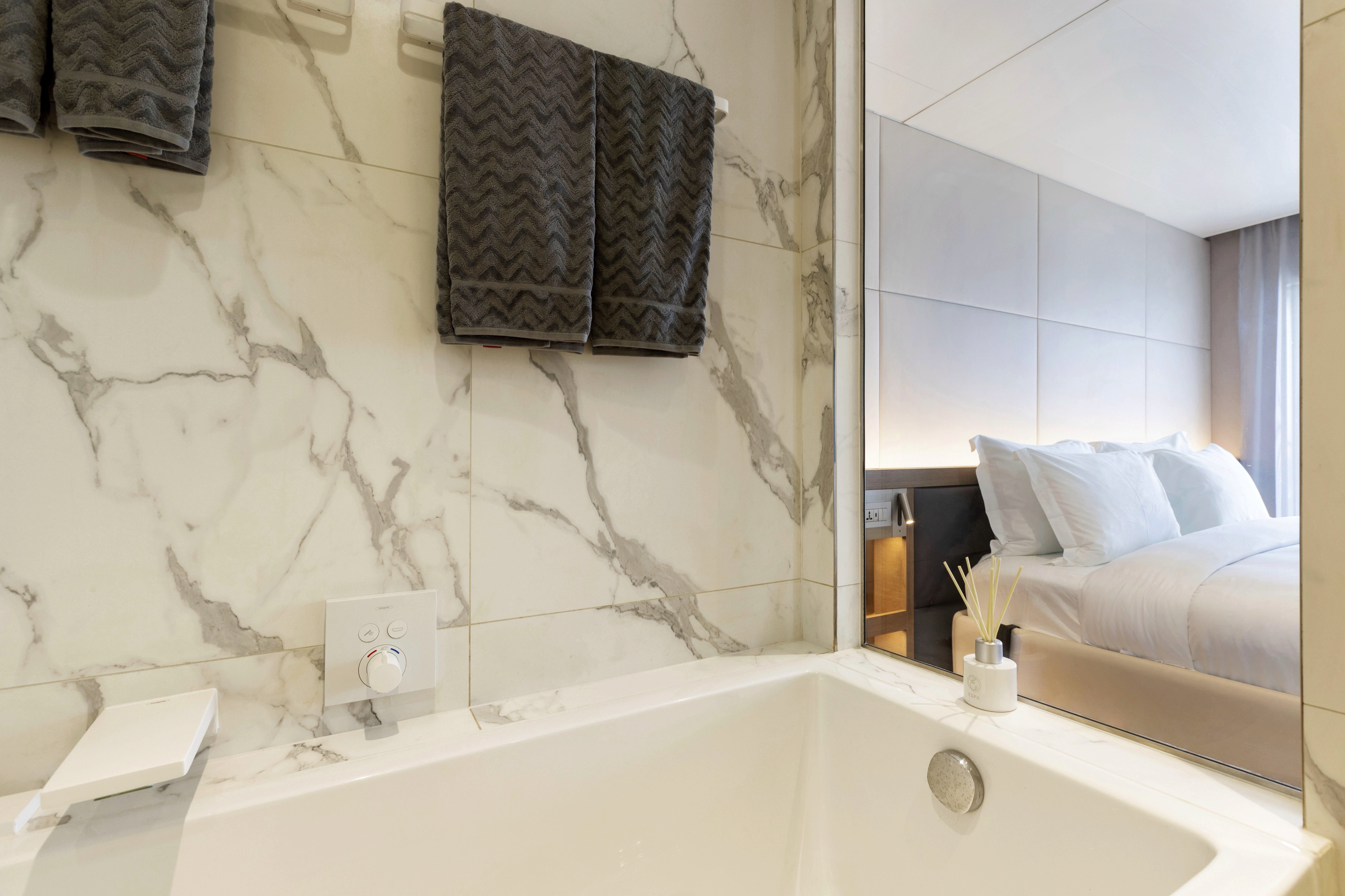
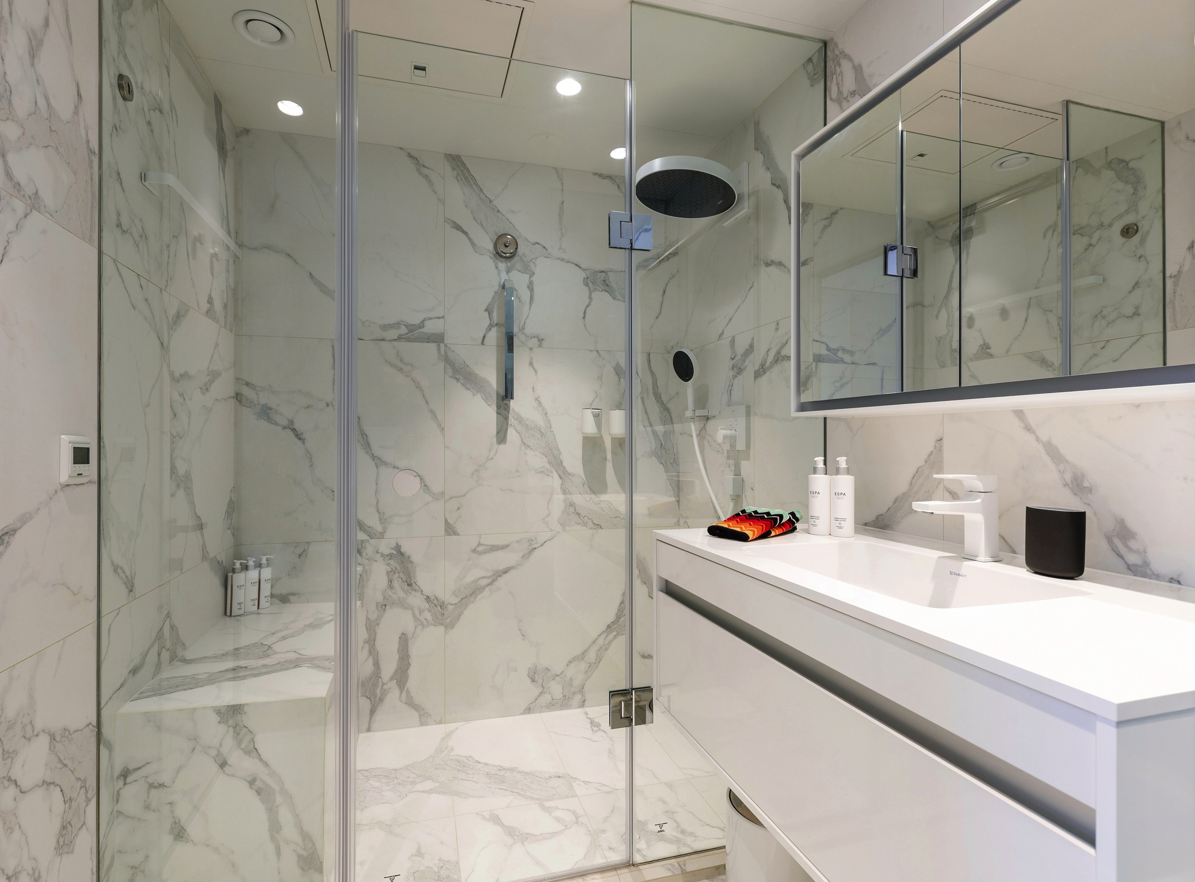
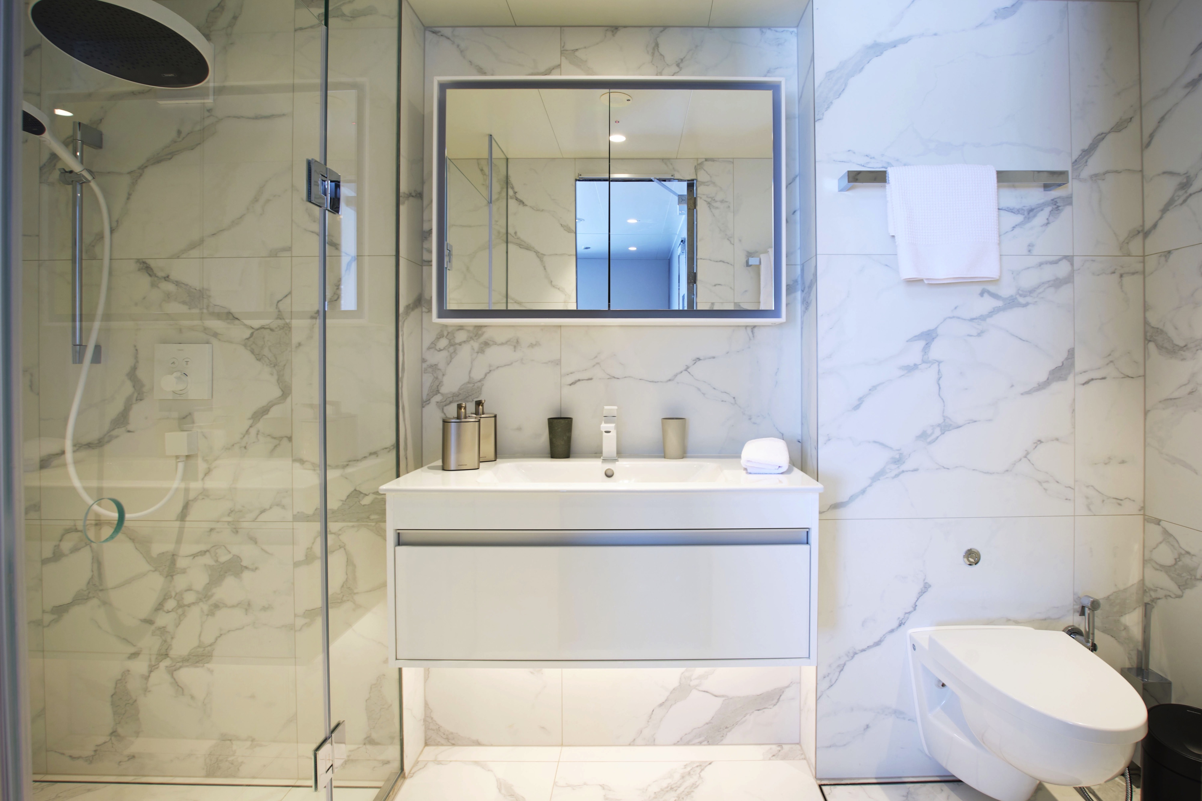
- En suite bathroom with luxurious ESPA toiletries
- Complimentary bathrobes and slippers
- Flat-screen HDTV and infotainment system
- Complimentary mini-bar and water, restocked daily
- Complimentary Wi-Fi
- Individual climate control
- Personal safe
- Umbrella
- Telephone
- Room service available for breakfast

All suites & staterooms include:
- King-size or twin hotel-style beds with the finest Egyptian cotton linen
- En suite bathroom with luxurious ESPA toiletries
- Complimentary bathrobes and slippers
- Flat-screen HDTV and infotainment system
- Complimentary mini-bar and water, restocked daily
- Complimentary Wi-Fi
- Individual climate control
- Personal safe
- Umbrella
- Telephone
- Room service available for breakfast
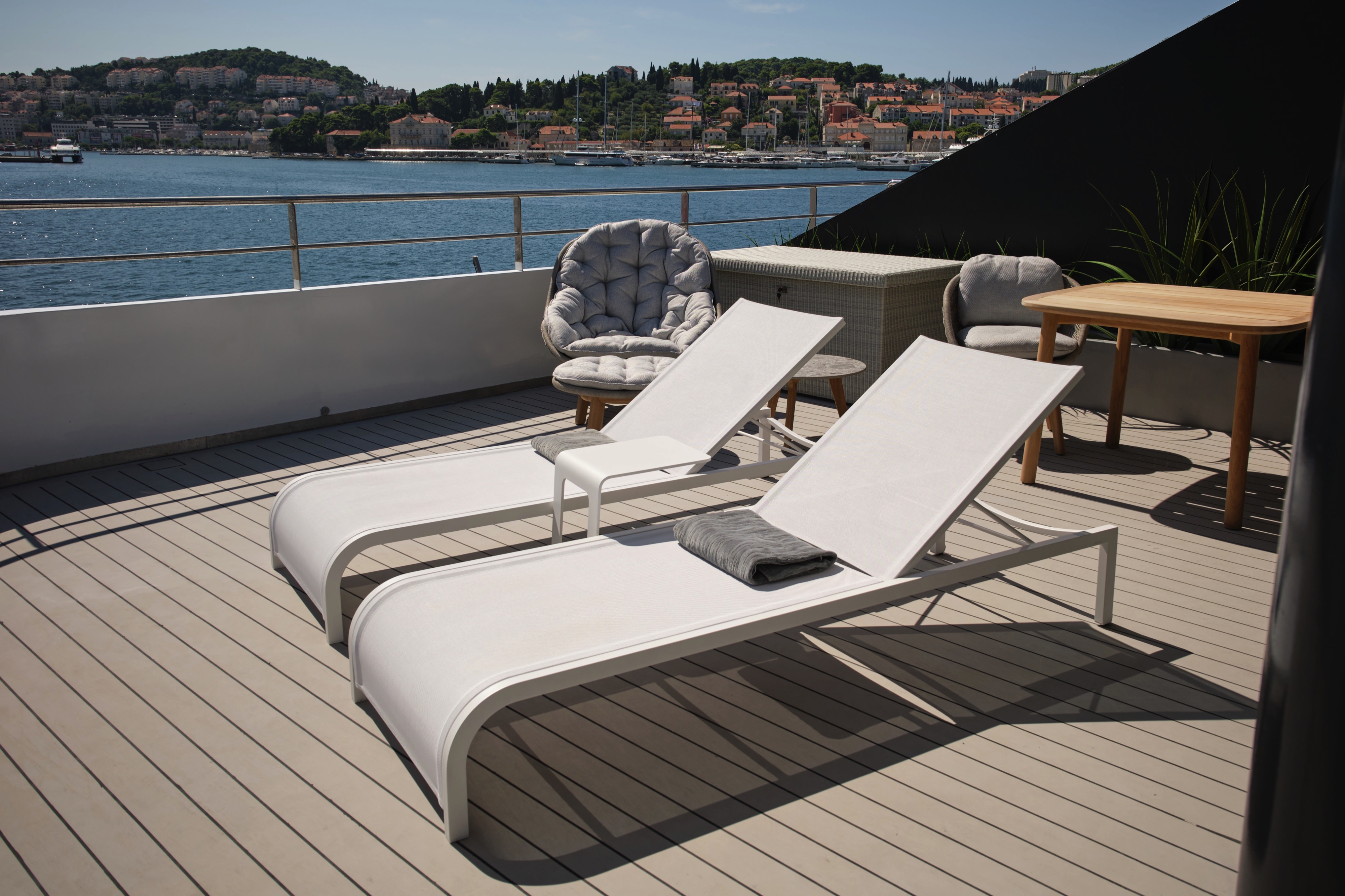
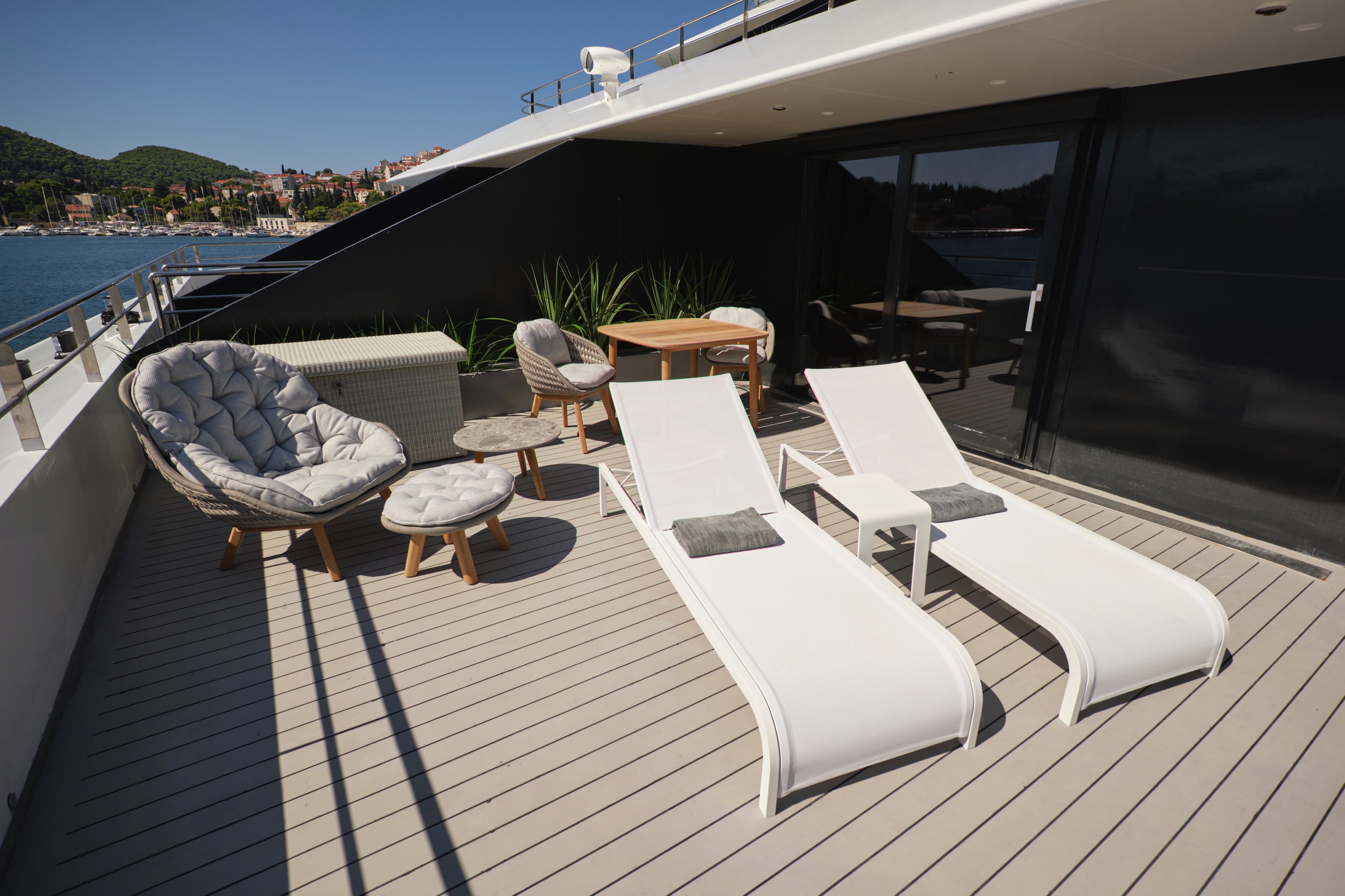
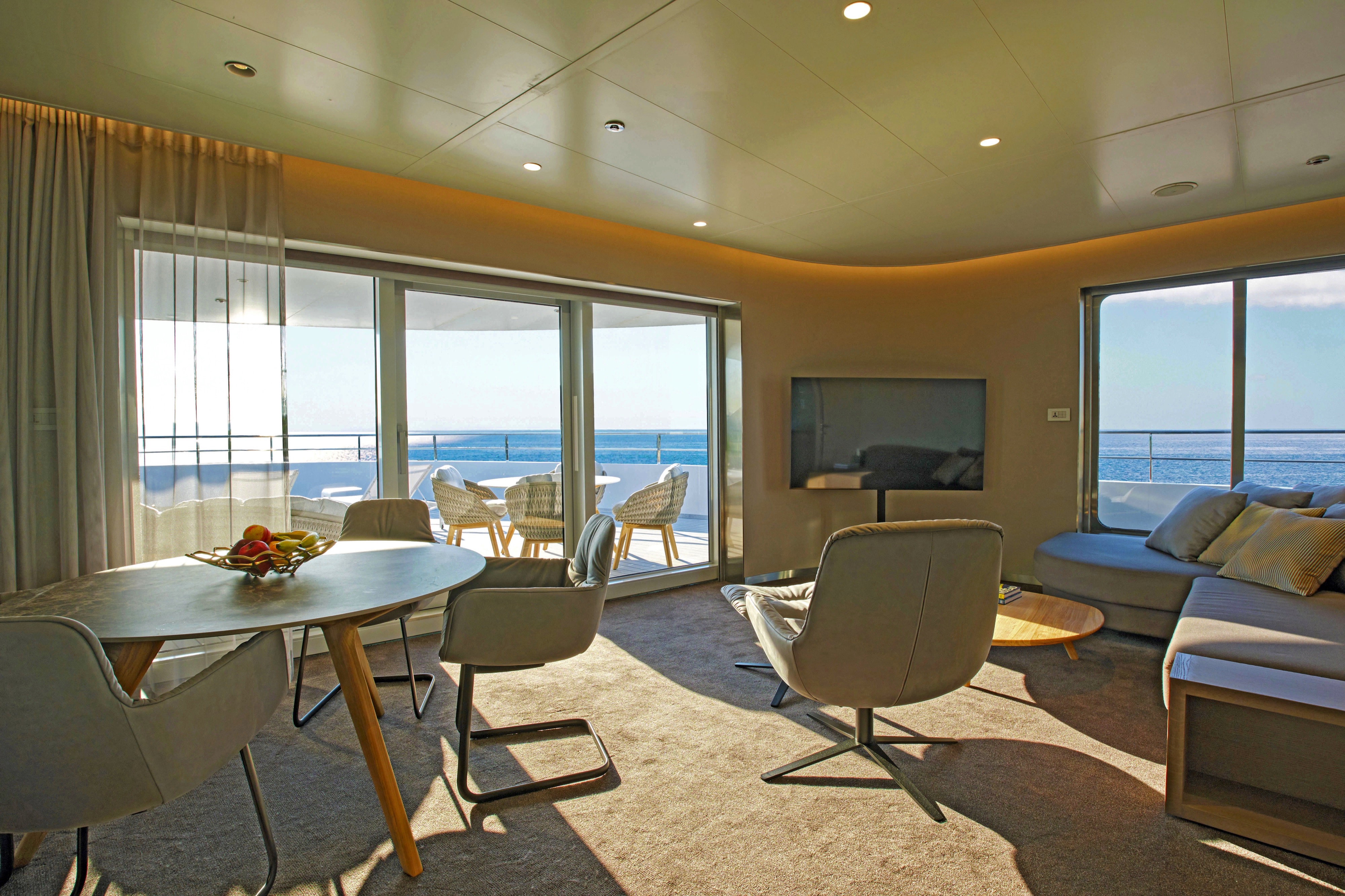
Our spacious Terrace Suites take pride of place at the aft of the Panorama Deck. You'll enjoy a private oversized terrace, where you'll be able to soak up the sun. Take advantage of the pillow menu and have up to two items laundered each day.
All suites & staterooms include:
- King-size or twin hotel-style beds with the finest Egyptian cotton linen
- En suite bathroom with luxurious ESPA toiletries
- Complimentary bathrobes and slippers
- Flat-screen HDTV and infotainment system
- Complimentary mini-bar and water, restocked daily
- Complimentary Wi-Fi
- Individual climate control
- Personal safe
- Umbrella
- Telephone
- Room service available for breakfast
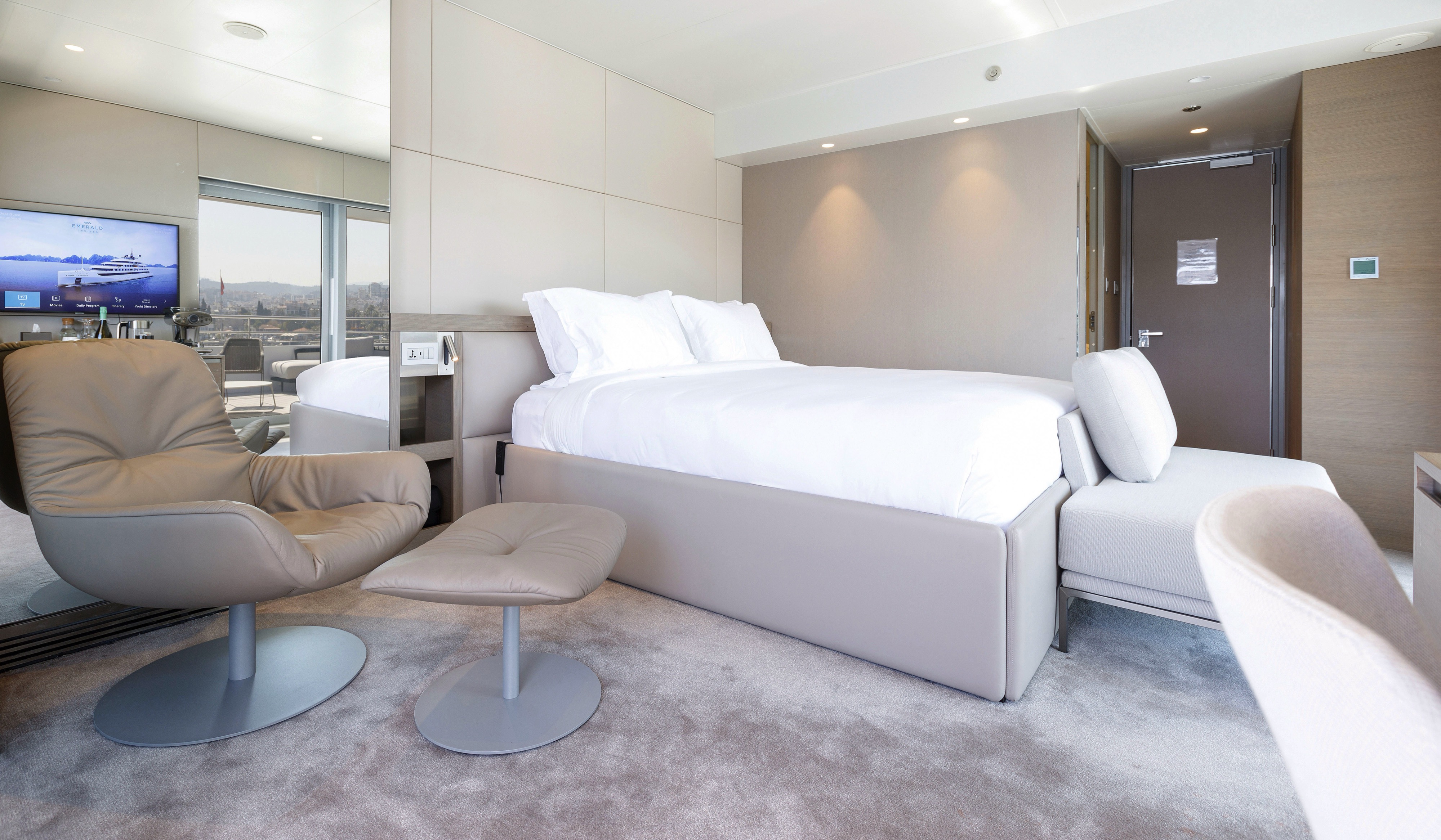
Located on the Pool Deck, these spacious suites feature separate bedroom and lounge areas, and a private balcony for your enjoyment. Make the most of your state-of-the-art tea and coffee-making facilities and enjoy a fruit platter on arrival.
All suites & staterooms include:
- King-size or twin hotel-style beds with the finest Egyptian cotton linen
- En suite bathroom with luxurious ESPA toiletries
- Complimentary bathrobes and slippers
- Flat-screen HDTV and infotainment system
- Complimentary mini-bar and water, restocked daily
- Complimentary Wi-Fi
- Individual climate control
- Personal safe
- Umbrella
- Telephone
- Room service available for breakfast
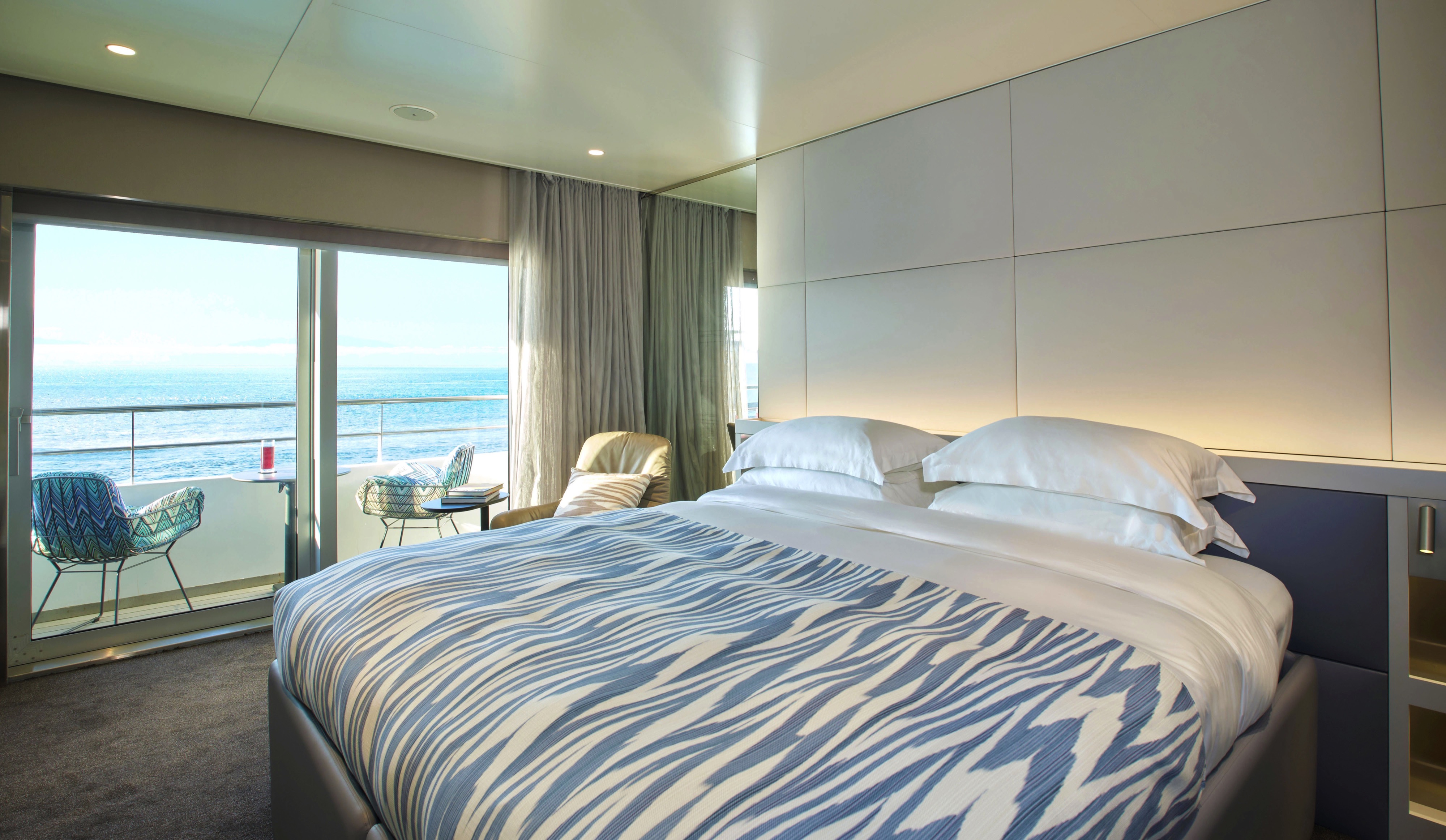

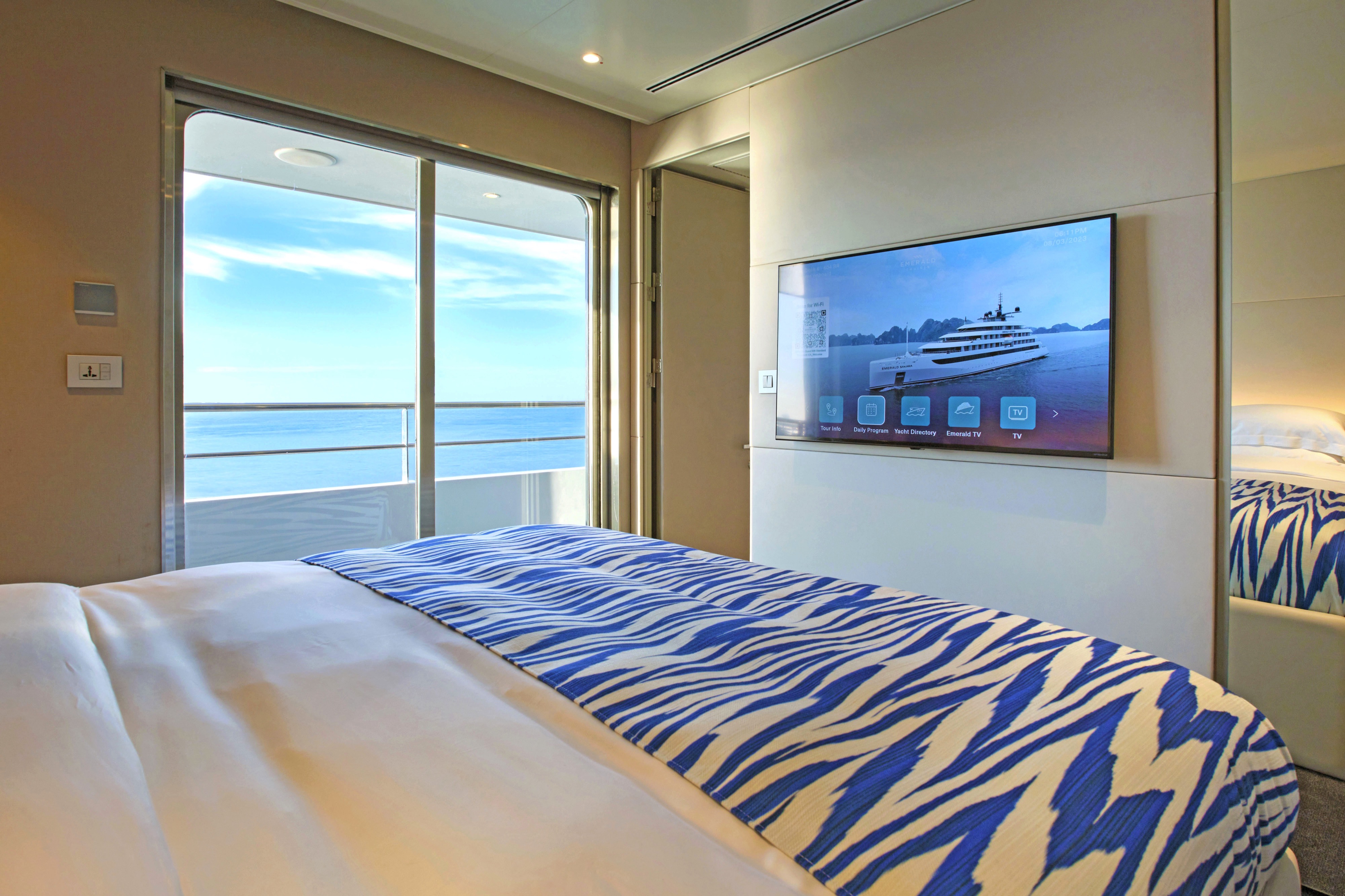
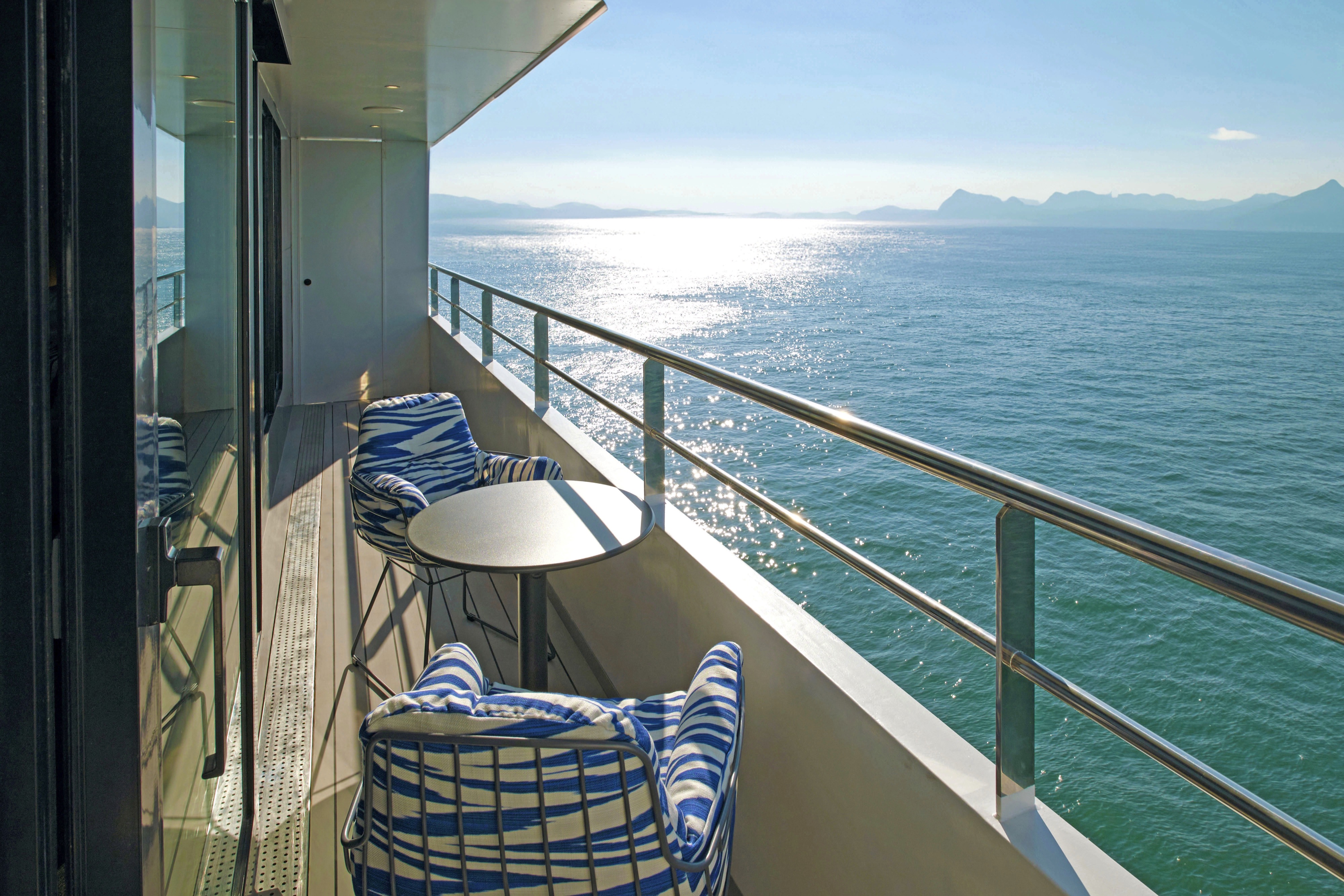
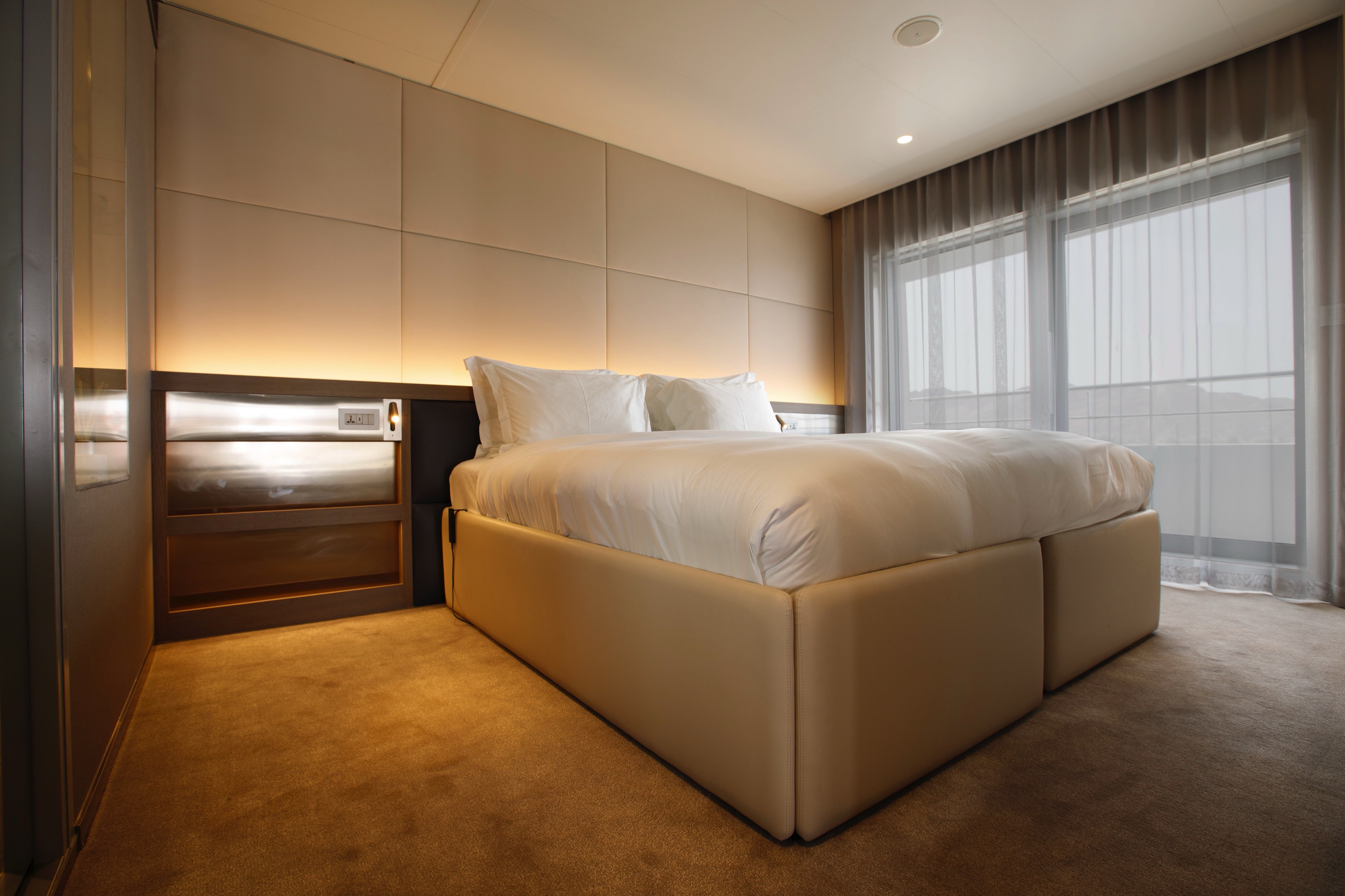
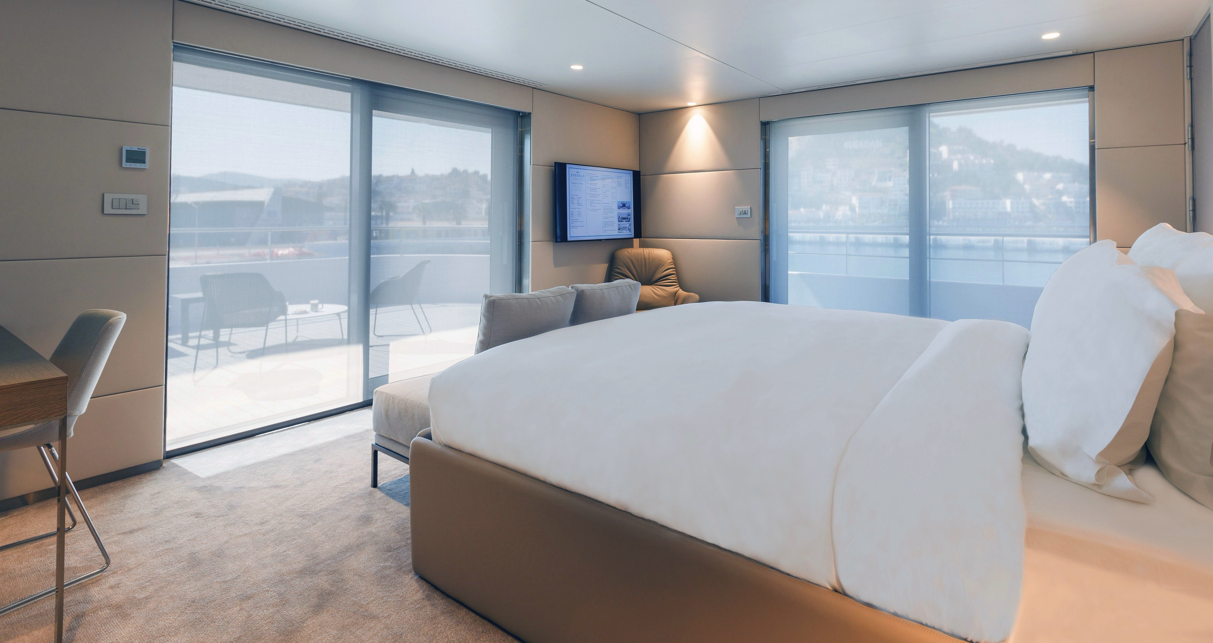
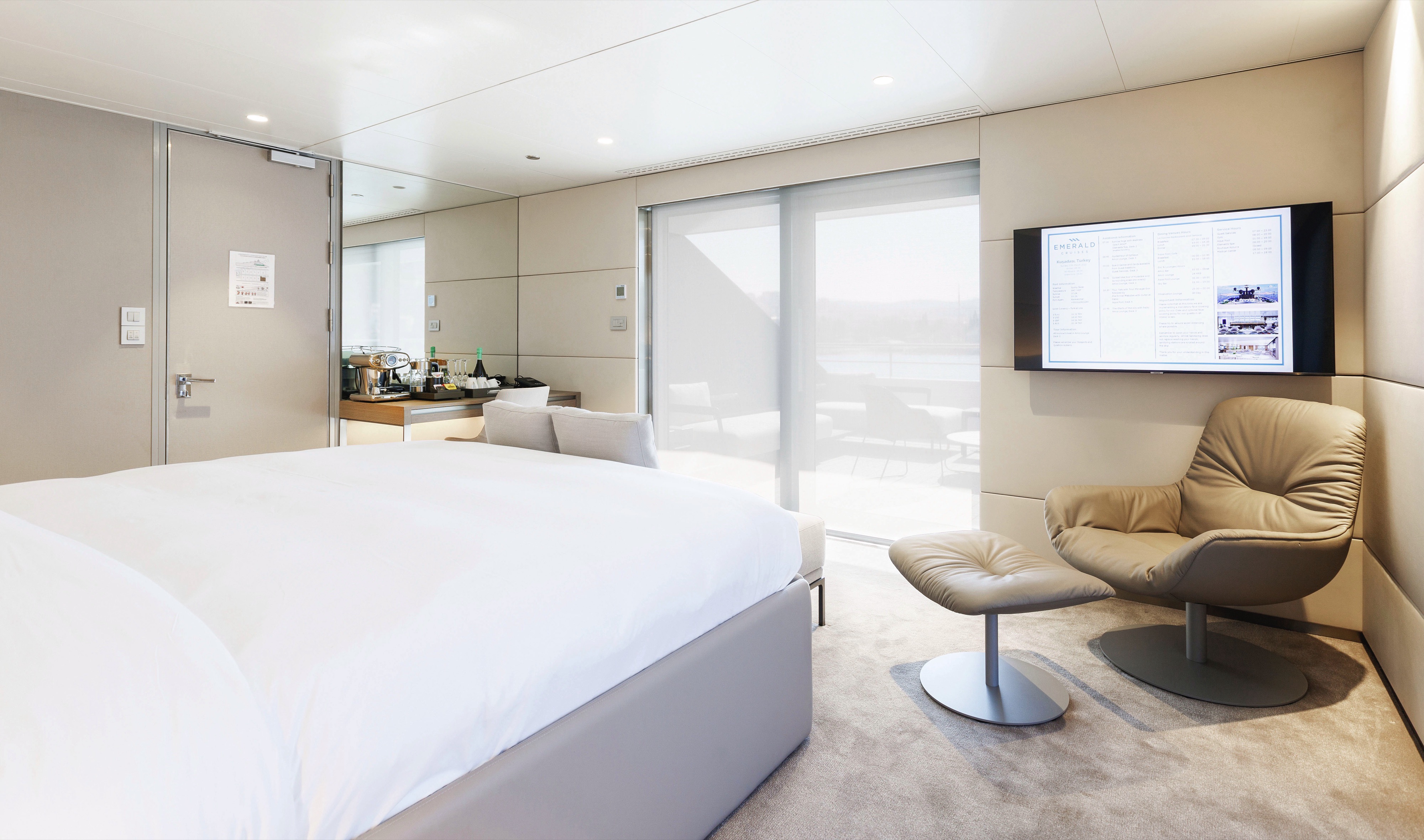
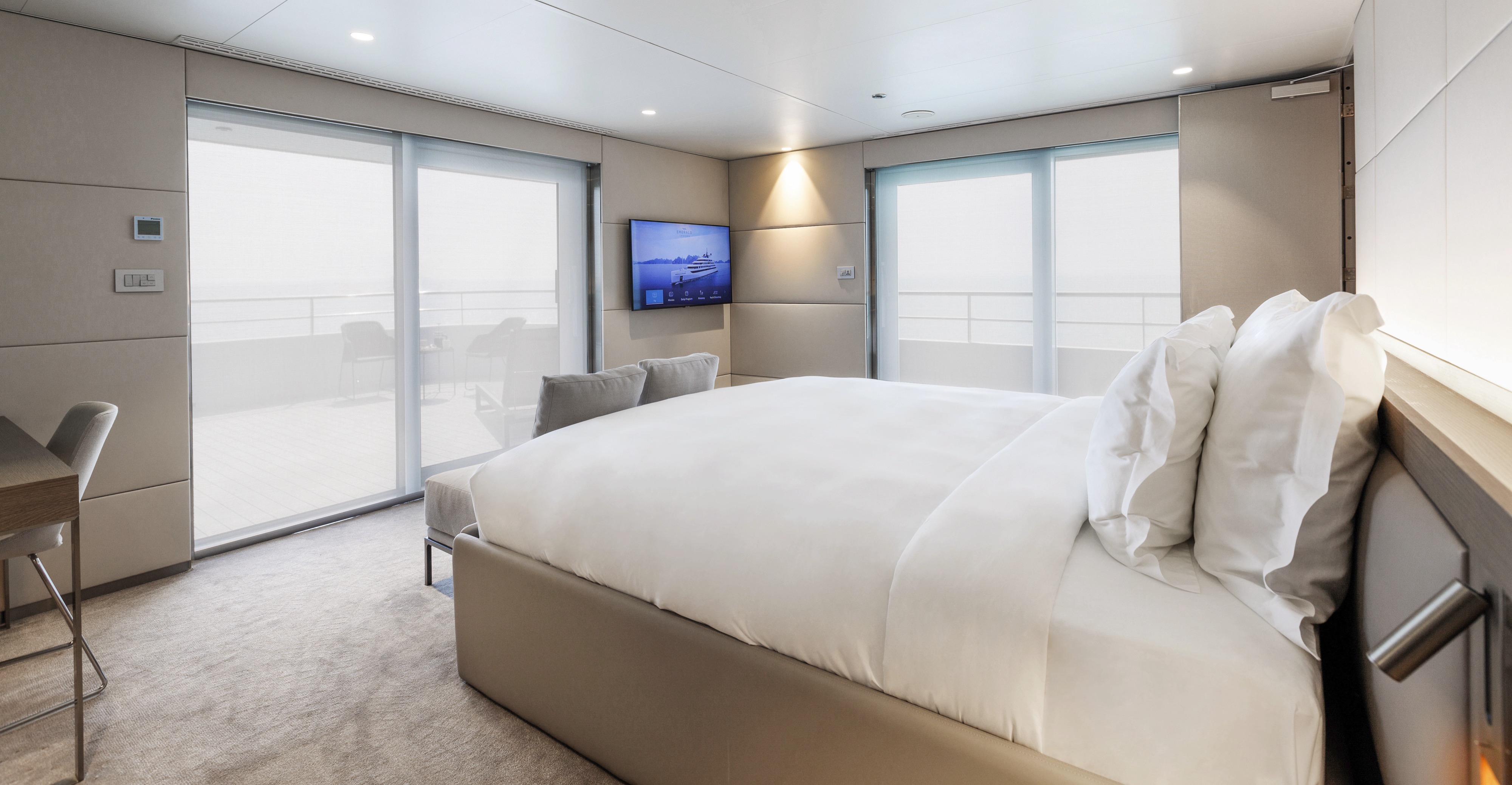
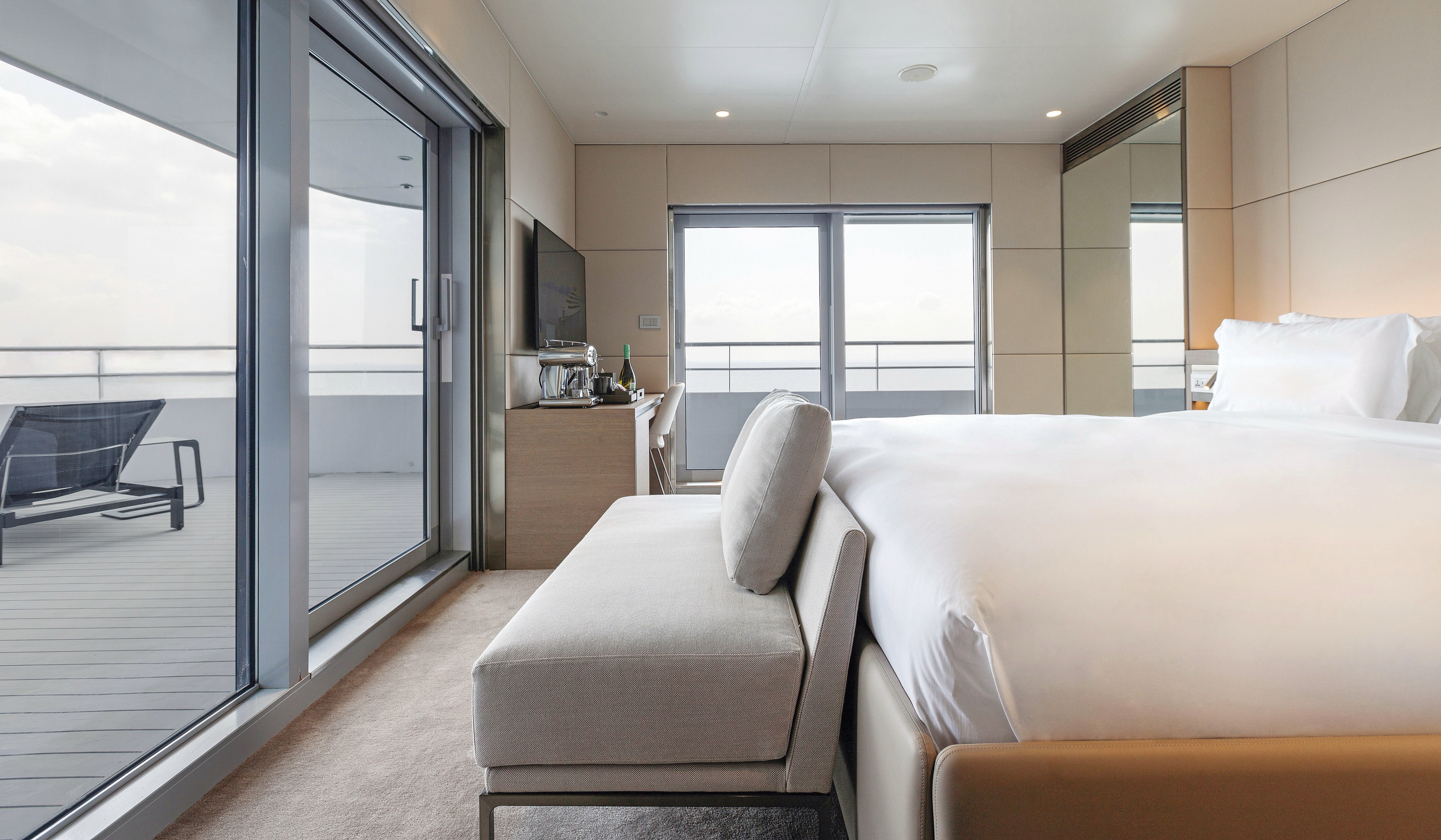
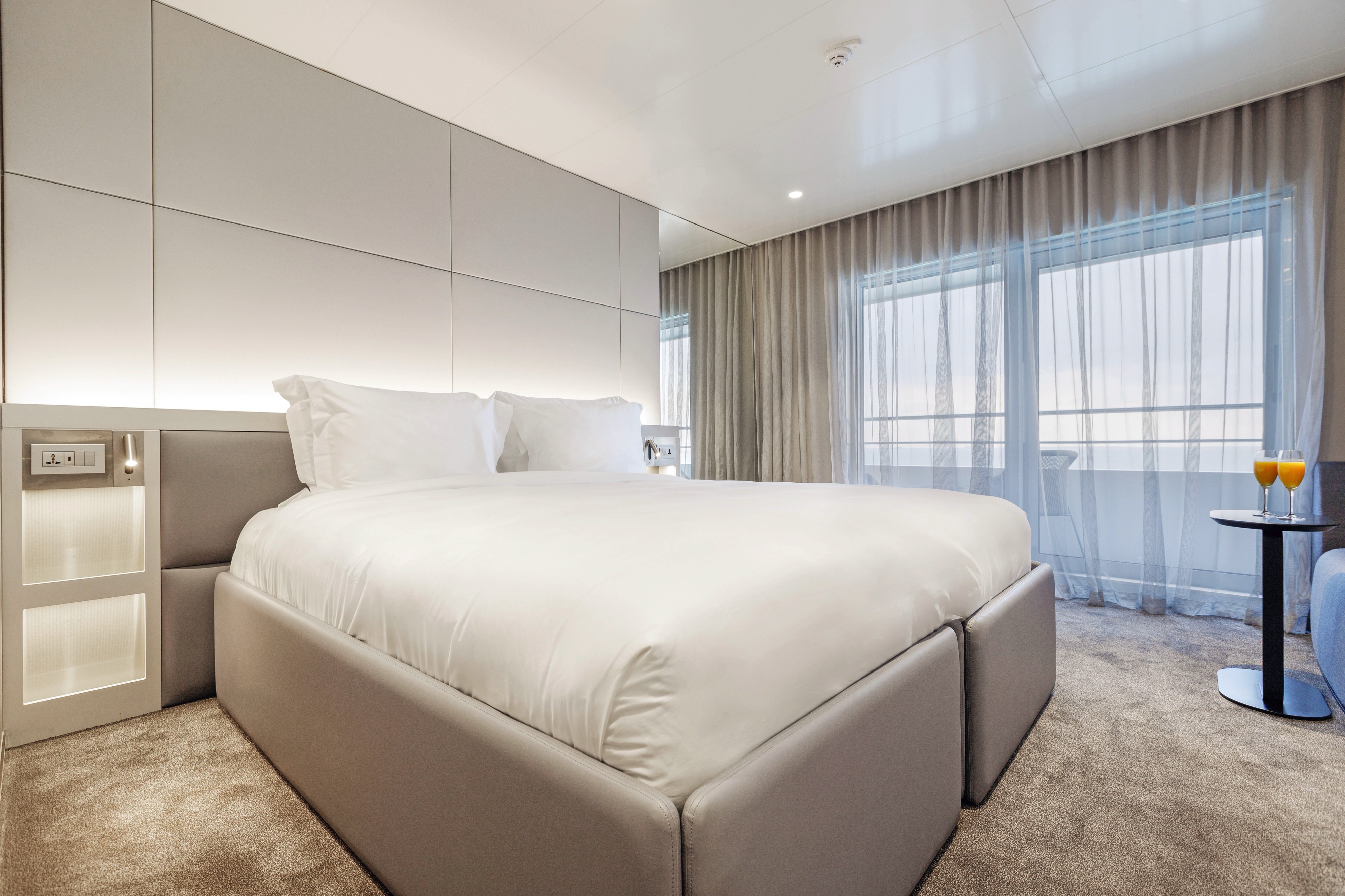
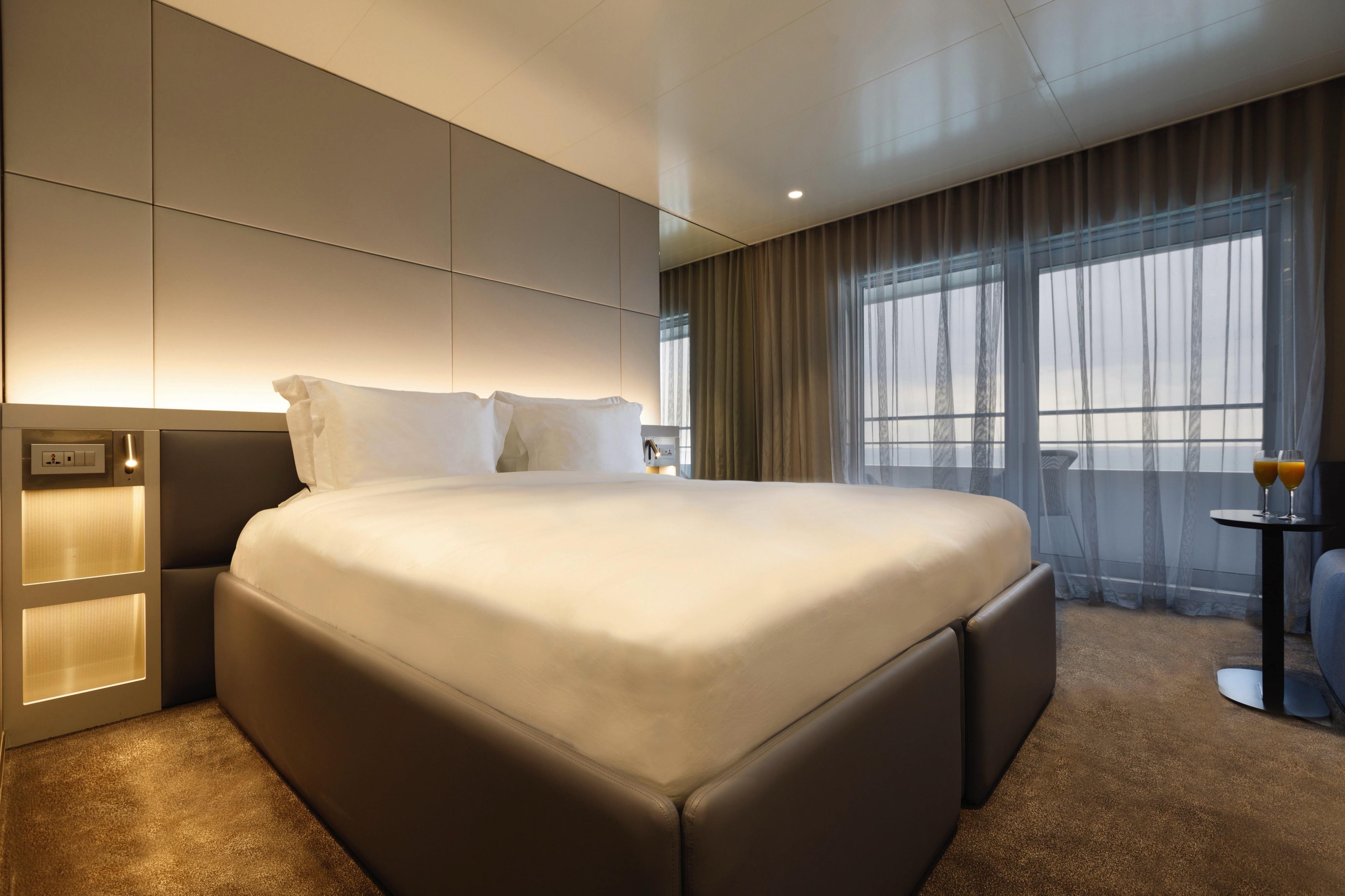
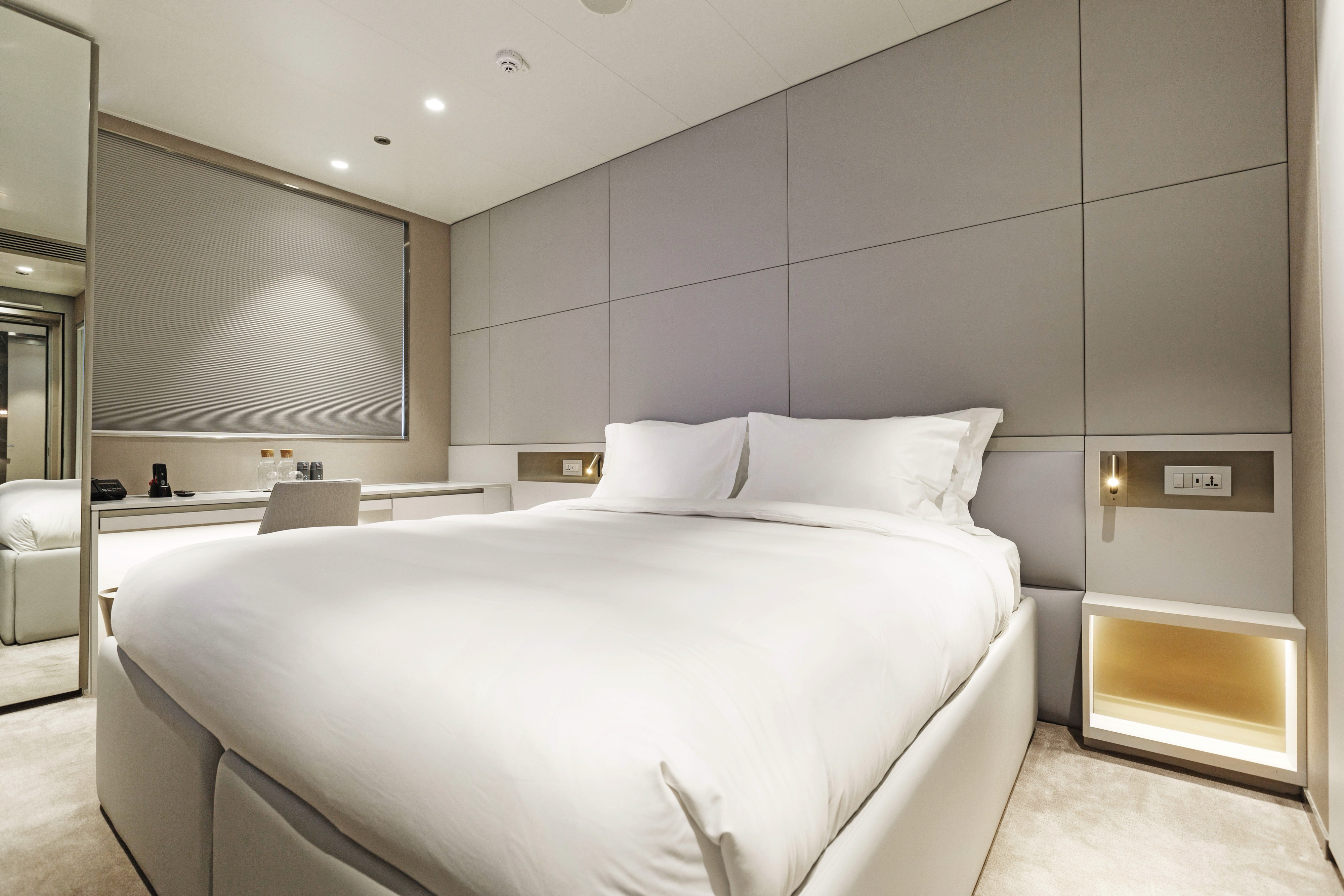
Located across the Observation and Panorama Decks, our Balcony Suites are your stylish home away from home. Enjoy stunning views from your private-access balcony and everything you need for a great night's sleep.
All suites & staterooms include:
- King-size or twin hotel-style beds with the finest Egyptian cotton linen
- En suite bathroom with luxurious ESPA toiletries
- Complimentary bathrobes and slippers
- Flat-screen HDTV and infotainment system
- Complimentary mini-bar and water, restocked daily
- Complimentary Wi-Fi
- Individual climate control
- Personal safe
- Umbrella
- Telephone
- Room service available for breakfast

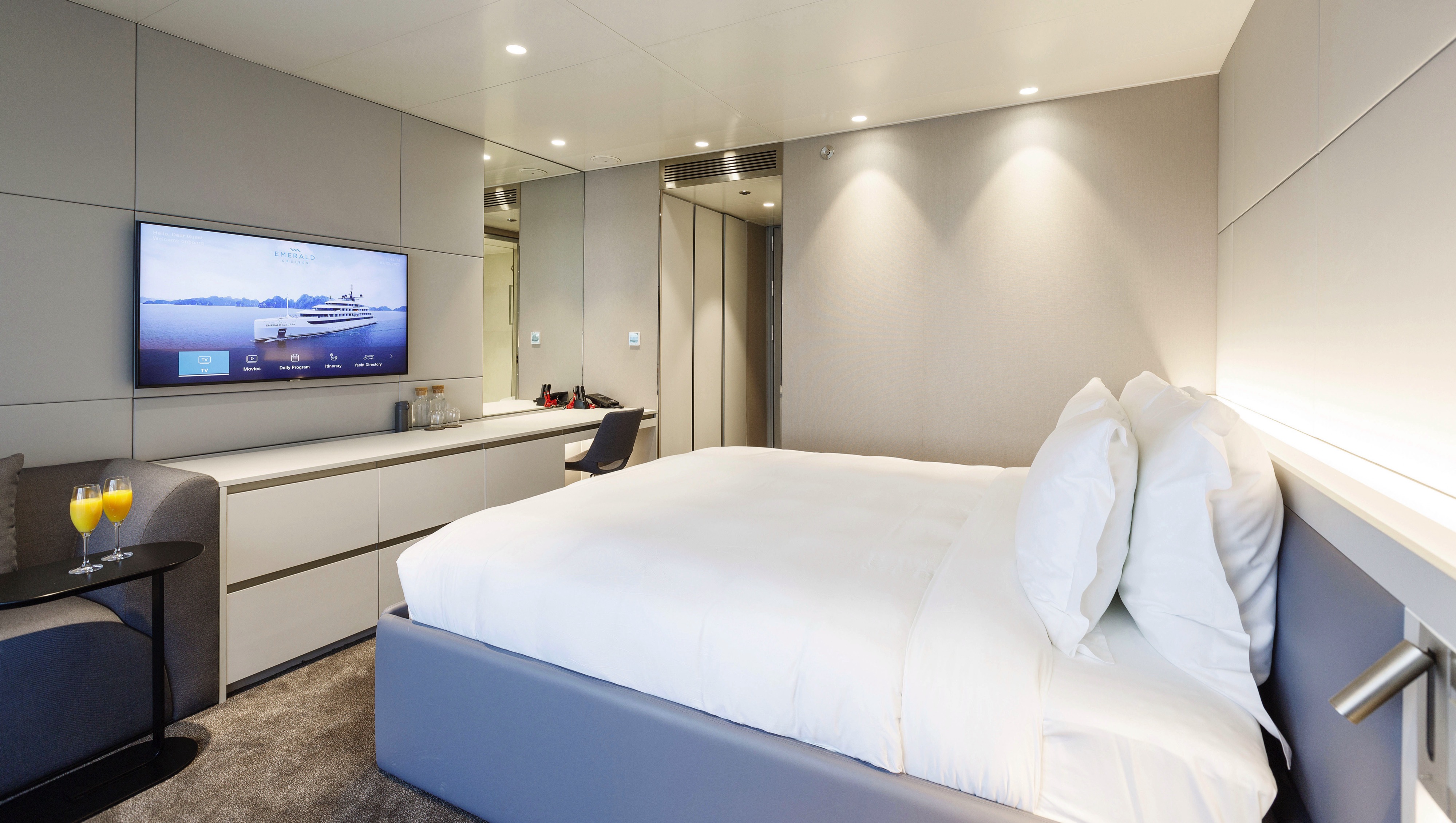
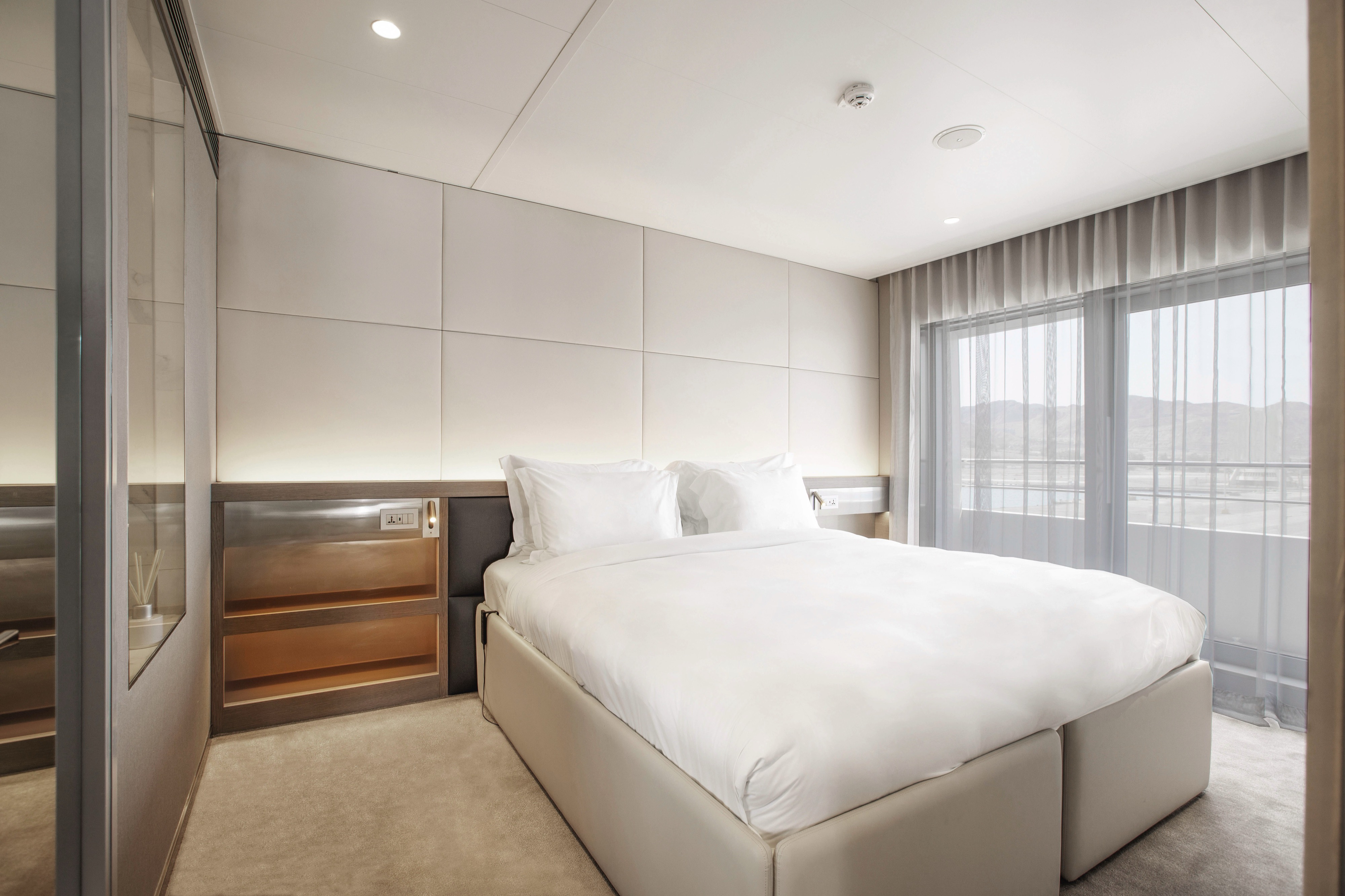
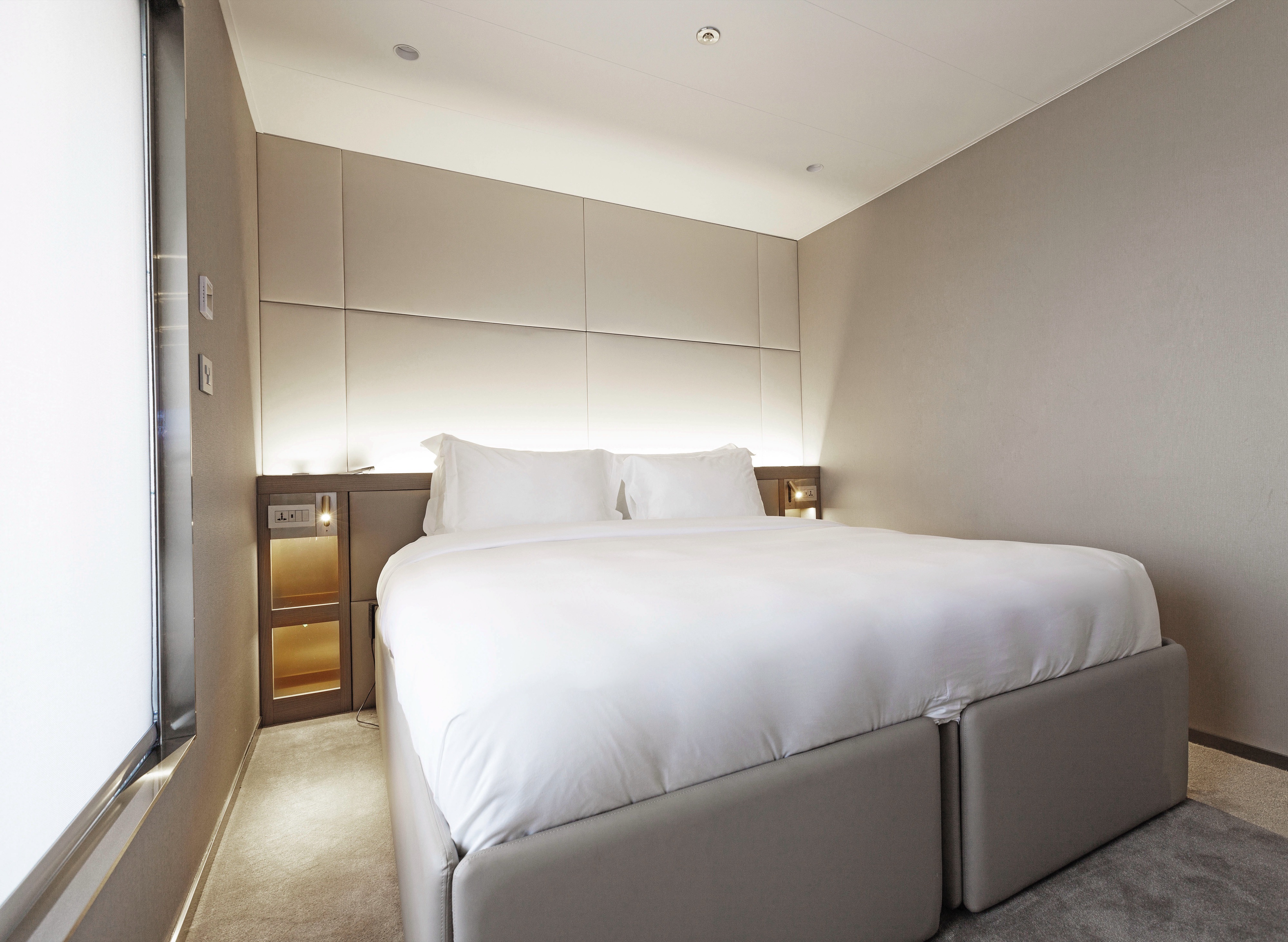
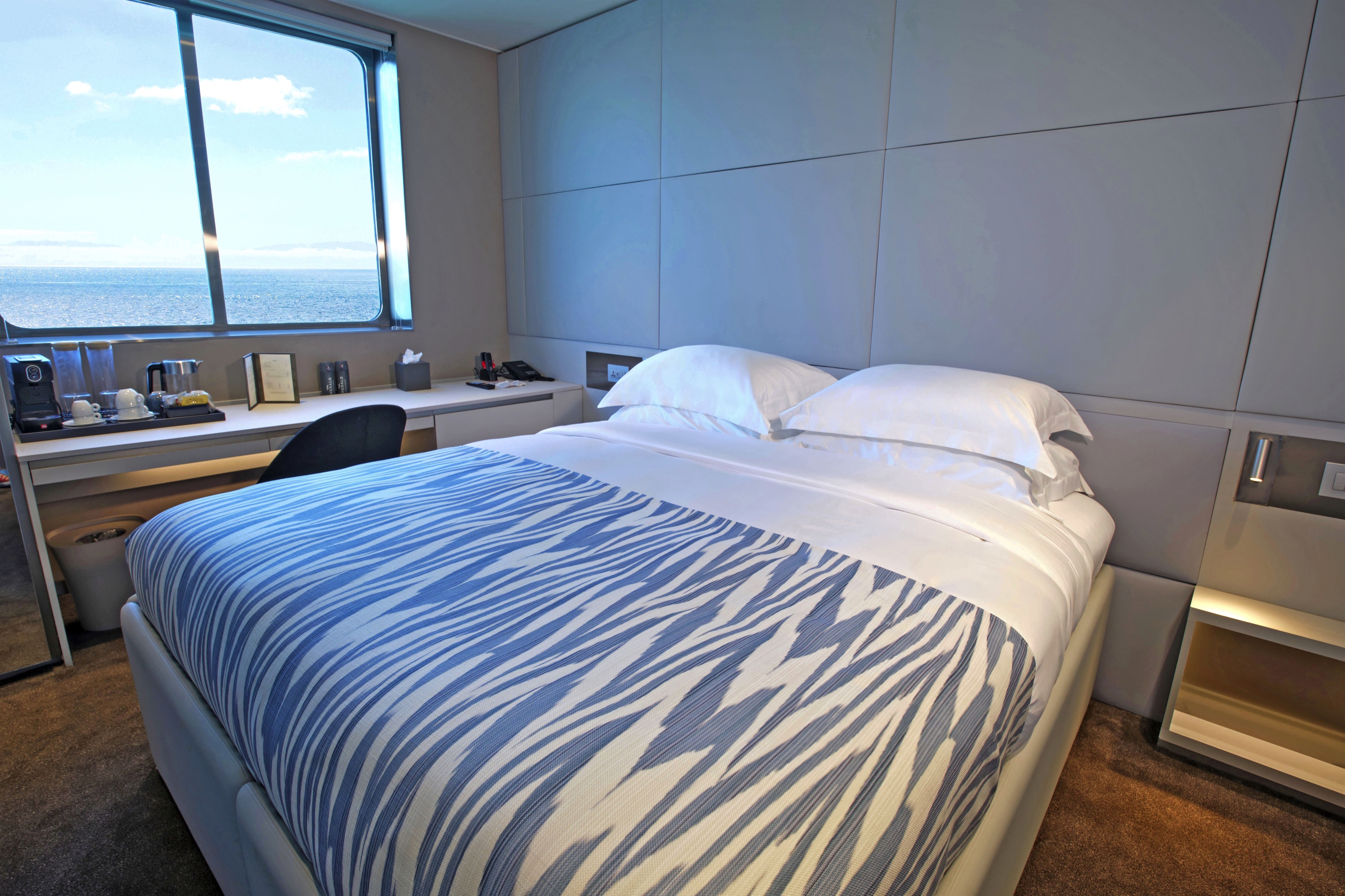
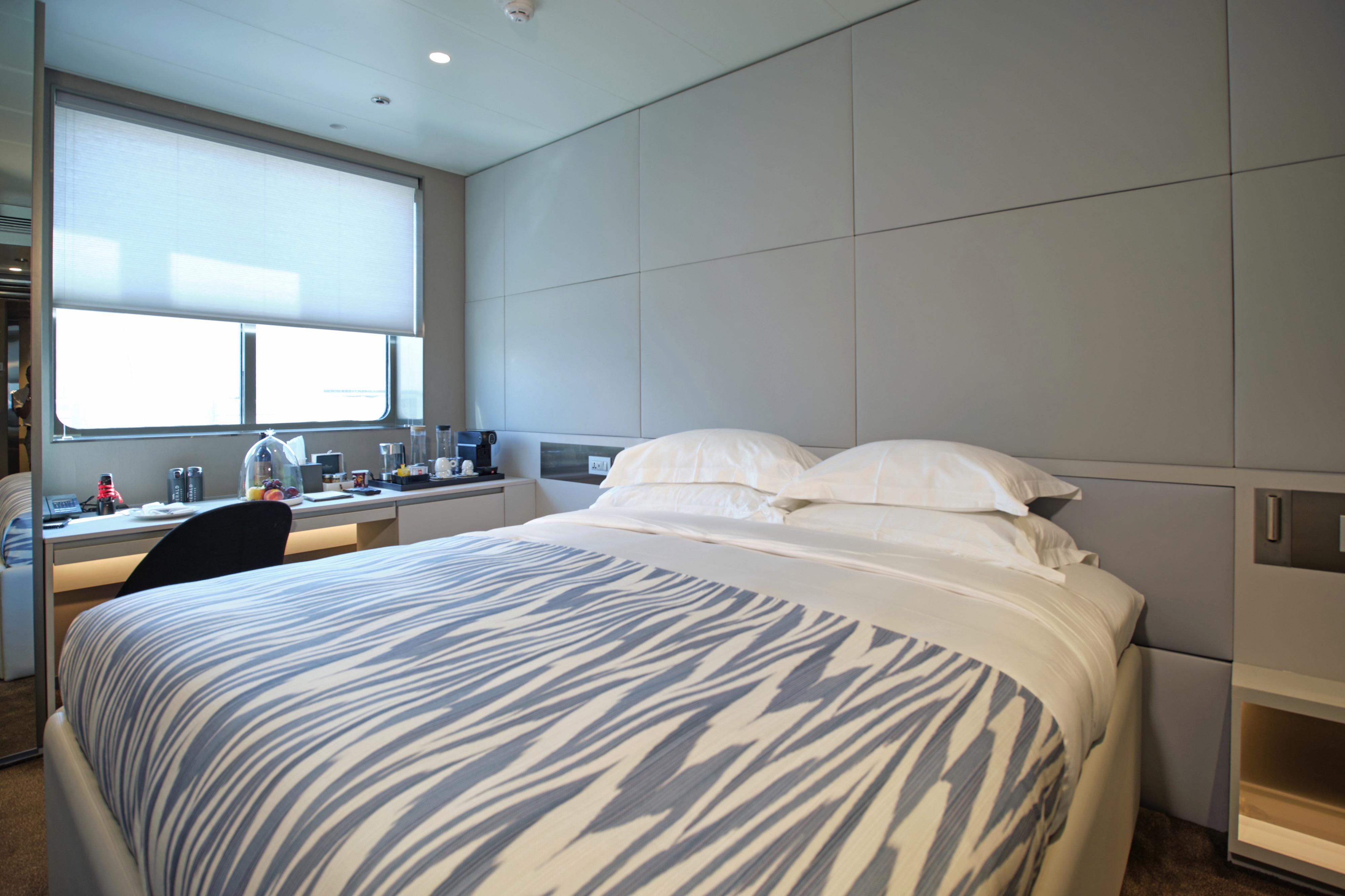
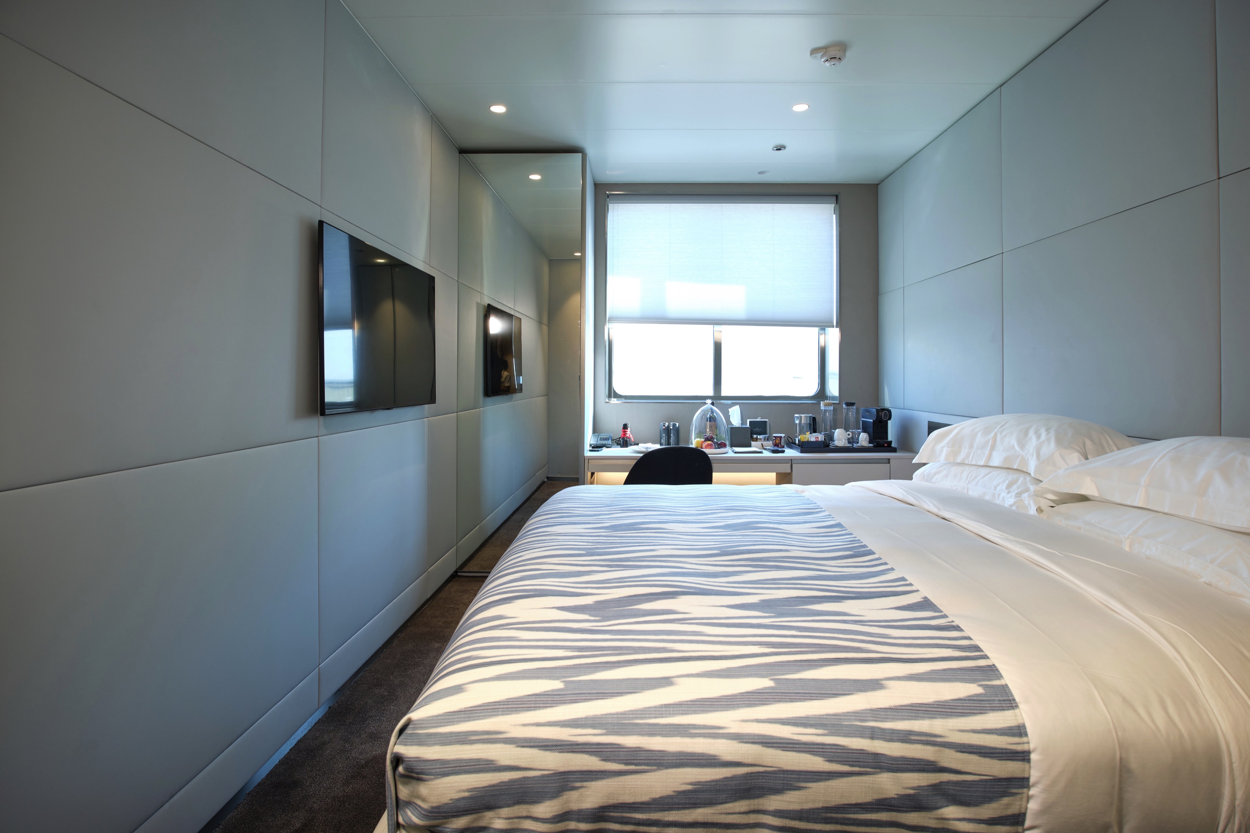
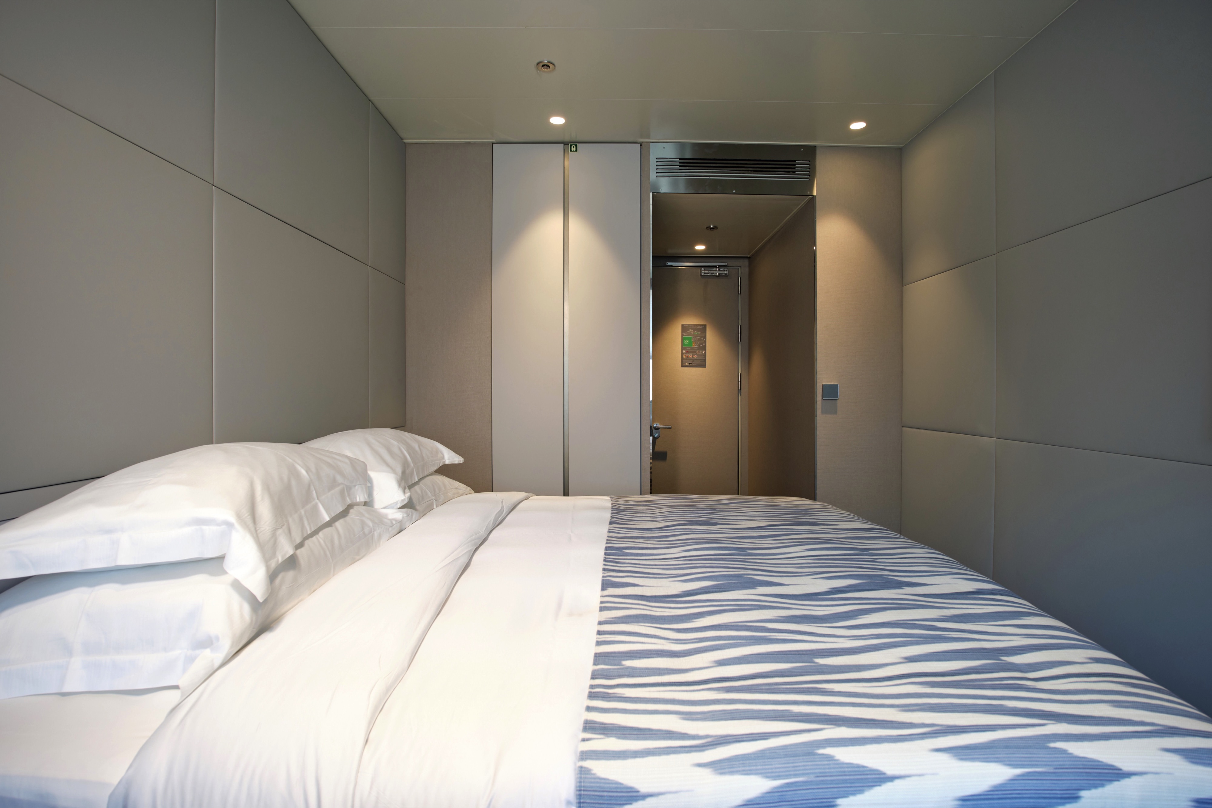
Situated on the Emerald Deck, our Oceanview Staterooms boast ample space and offer stunning views through your ocean-view window. Indulge in the luxurious amenities you'll find here, such as ESPA toiletries in your en-suite bathroom.
All suites & staterooms include:
- King-size or twin hotel-style beds with the finest Egyptian cotton linen
- En suite bathroom with luxurious ESPA toiletries
- Complimentary bathrobes and slippers
- Flat-screen HDTV and infotainment system
- Complimentary mini-bar and water, restocked daily
- Complimentary Wi-Fi
- Individual climate control
- Personal safe
- Umbrella
- Telephone
- Room service available for breakfast
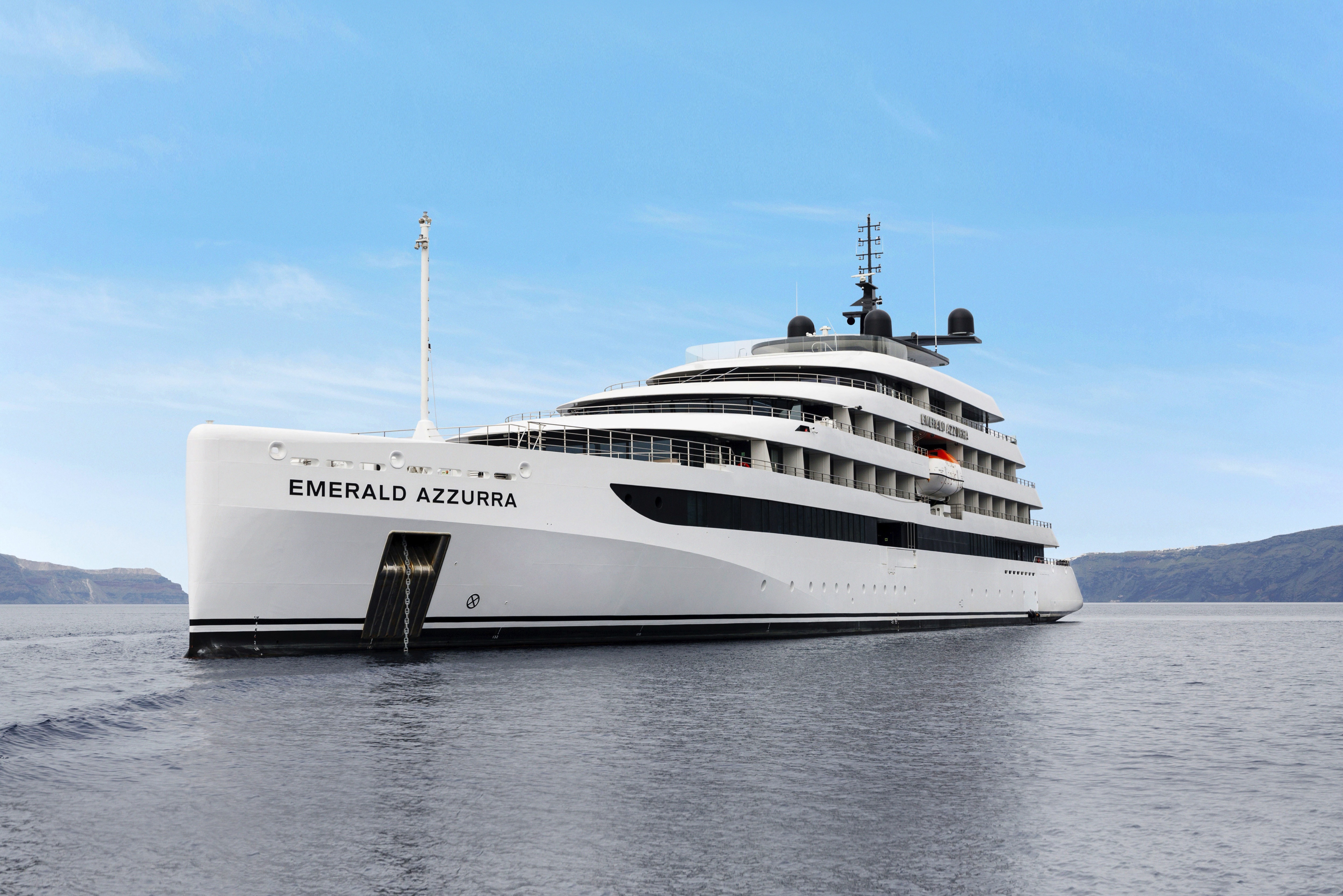
Emerald Azzurra
As the first luxury yacht in the Emerald Cruises fleet, Emerald Azzurra set a new standard in luxury yacht cruising. Designed for only up to 100 guests, she delivers a truly intimate experience with contemporary styling and spacious public areas. From the serene infinity-style pool to the elegant Observation Lounge and generously appointed suites & staterooms, every detail on board Emerald Azzurra reflects a commitment to providing the ultimate yacht experience.
Ship Facts
| Launch Year | 2022 | ||||||||
| Refit Year | |||||||||
| Language | en | ||||||||
| Gross Tonnage | 5297 | ||||||||
| Length | 110 | ||||||||
| Width | N/A | ||||||||
| Currency | EUR | ||||||||
| Speed | 22 | ||||||||
| Capacity | 100 | ||||||||
| Crew Count | 76 | ||||||||
| Deck Count | 6 | ||||||||
| Cabin Count | 50 | ||||||||
| Large Cabin Count | N/A | ||||||||
| Wheelchair Cabin Count | N/A | ||||||||
| Electrical Plugs |
|
Sky Deck
- Spa Pool
- Sky Bar
- Lifts

Pool Deck
- Lifts
- Aqua Café
- Aqua Pool
- Owner's Suite
- Deluxe Balcony Suite

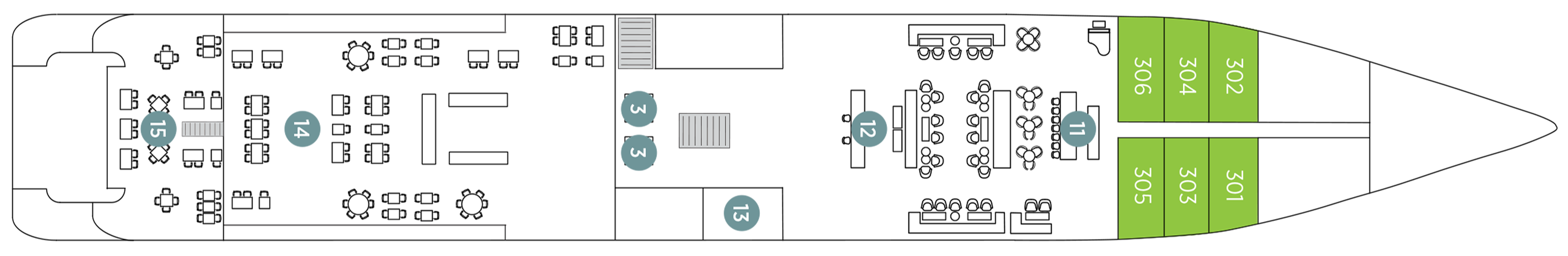
Panorama Deck
- Navigation Bridge
- Life Boats
- Terrace Suite
- Balcony Suite
- Lifts

Observation Deck
- Observation Lounge
- Observation Terrace
- Self-service Laundry
- Yacht Suites
- Balcony Suites
- Lifts
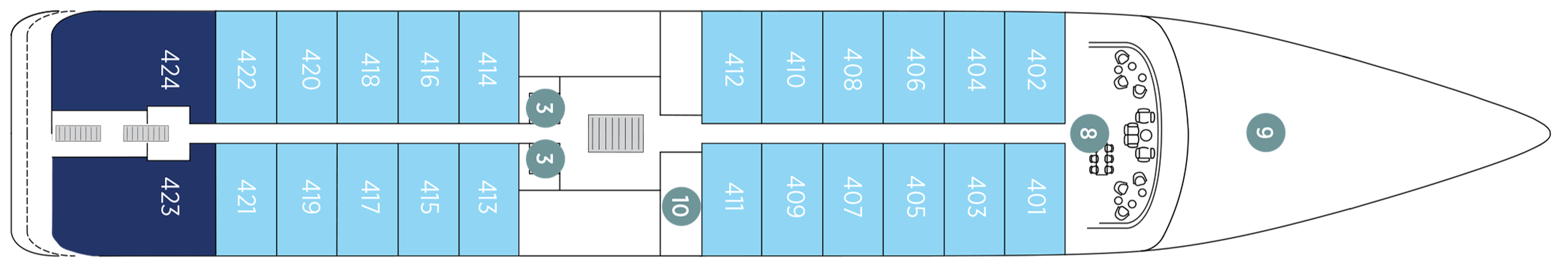
Emerald Deck
- Amici Bar & Lounge
- Reception
- Boutique
- La Cucina Terrace
- La Cucina Dining
- Oceanview Staterooms
- Lifts
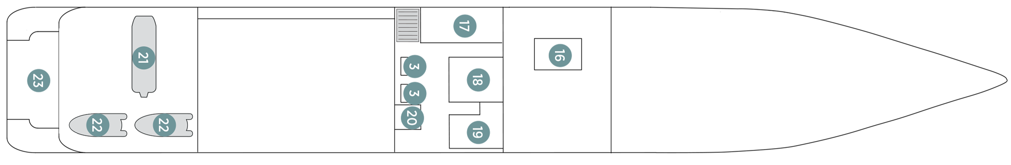
Wellness Deck
- Medical Centre
- Gym
- Infrared Sauna
- Elements Spa
- Hairdressers
- Marina Platform
- Zodiacs
- Lifts
Delectable dining on board our yachts
Nothing beats sitting down to ocean-fresh seafood and savouring the flavours of each destination, accompanied by the perfect sommelier-paired wine. With elegant dining venues and an attentive service team, your meals promise to be among the highlights of your luxury yacht cruise with us.
Explore the fresh local flavours of the regions you sail through
We believe that food should reflect regional flavours, which is why our chefs source fresh local ingredients as you sail, creating meals that capture authentic cuisine no matter where your journey takes you.
Discover amazing drinking and dining experiences
Food and drink run deep through culture, which is why exciting dining events form part of selected yacht cruise itineraries. Entwined within our EmeraldDISCOVERY collections, these experiences will highlight the tastes of each region you travel through.
La Cucina
Our premier on board dining spot
Enjoy fine à la carte dining, as well as sumptuous breakfasts and lunches in the serene setting of our spacious La Cucina Dining, taking inspiration from the path you're navigating. This stylish restaurant boasts ample space and you can expect fresh, locally sourced dinners, thoughtfully crafted by our expert chefs.
La Cucina Terrace
If you prefer to dine alfresco, head out to the adjoining Terrace to enjoy your meals under the sun.
Unwind or catch up with friends in spacious social spaces
From the chilled and relaxed vibe of the Amici Bar & Lounge to the open-air surrounds of the Pool Deck and the serene Observation Lounge, you’ll find plenty of spaces on board to enjoy the company of new-found friends or to take a moment for yourself.
An innovative yacht experience
Take in stunning vistas from the Observation Deck. Swim in the infinity-style Aqua Pool or take a leisurely dip in the Spa Pool. Unwind in the innovative infrared sauna and, on selected days, enjoy swim stops off the Marina Platform.
Amici Bar & Lounge
Unwind in style
After your evening meal, enjoy a drink from the comfort of the Amici Bar & Lounge, the main lounge area on board our luxury yachts. Our expert mixologists will help you select the perfect drink from our extensive menus, with a range of spirits, wine, beer, cocktails, mocktails, or soft drinks there's something for everyone.
Observation Lounge
Marvel at unrivalled ocean views in comfort, cruising past stunning coastlines and beaches, or simply relax and read a book in the serene surrounds.
Sky Deck
Fancy taking in stunning vistas with your favourite cocktail? Head the Sky Bar on the Sky Deck and choose from our extensive drinks menu. And, if you need to cool off from the sun, why not take a dip in the nearby Spa Pool?
Aqua Pool & Café
Light bites under the sun
At the Aqua Pool Café, a selection of flatbreads pack a punch with a range of fillings, and revitalising gelato satisfies your sweet tooth. Or, if you need a caffeine boost, grab a delicious coffee to go.
Reception
The Reception can be found on the Emerald Deck next to the Boutique on the Emerald Deck.