Cruising the Leeward Islands
Cruising the Leeward Islands
Cruise overview
WHY BOOK WITH US?
- ✔ The Deluxe Cruises’ team has extensive experience in ultra-luxury cruising.
- ✔ Call now to speak to our helpful and experienced Cruise Concierge team.
- ✔ Enjoy our Unique Deluxe Cruises Bonus for substantial savings.
- ✔ Our team will tailor your holiday to your exacting requirements.
- ✔ As agents, we work under the protection of each cruise lines ABTA / ATOL licences
About Marigot
French and Dutch have lived side by side on St. Maarten/St. Martin for hundreds of years—with no border patrols or customs between them. The French side has a more genteel ambience, more fashionable shopping, and a Continental flair. The Dutch tends to be less expensive, has casino hotels, and more nightlife. Water sports abound all over—diving, snorkeling, sailing, and windsurfing are all top draws. And it's easy to while away the day relaxing on one of the 37 beaches, strolling the boardwalk of Dutch-side Philipsburg, and exploring the very French town of Marigot. Although luck is an important commodity at St. Maarten's 13 casinos, chance plays no part in finding a good meal at the island’s excellent eateries. The best way to explore St. Maarten/St. Martin is by car. Though often congested, especially around Philipsburg and Marigot, the roads are fairly good, though narrow and winding, with some speed bumps, potholes, roundabouts, and an occasional wandering goat herd. Few roads are marked with their names, but destination signs are common. Besides, the island is so small that it's hard to get really lost—at least that is what locals tell you. If you’re spending a few days, get to know the area with a scenic "loop" around the island. Be sure to pack a towel and some water shoes, a hat, sunglasses, and sunblock. Head up the east shoreline from Philipsburg, and follow the signs to Dawn Beach and Oyster Pond. The road winds past soaring hills, turquoise waters, quaint West Indian houses, and wonderful views of St. Barth. As you cross over to the French side, turn into Le Galion for a stop at the calm sheltered beach, the stables, the butterflies, or the windsurfing school, then keep following the road toward Orient Bay, the St-Tropez of the Caribbean. Continue to Anse Marcel, Grand Case, Marigot, and Sandy Ground. From Marigot, the flat island of Anguilla is visible. Completing the loop brings you past Cupecoy Beach, through Maho and Simpson Bay, where Saba looms in the horizon, and back over the mountain road into Philipsburg.
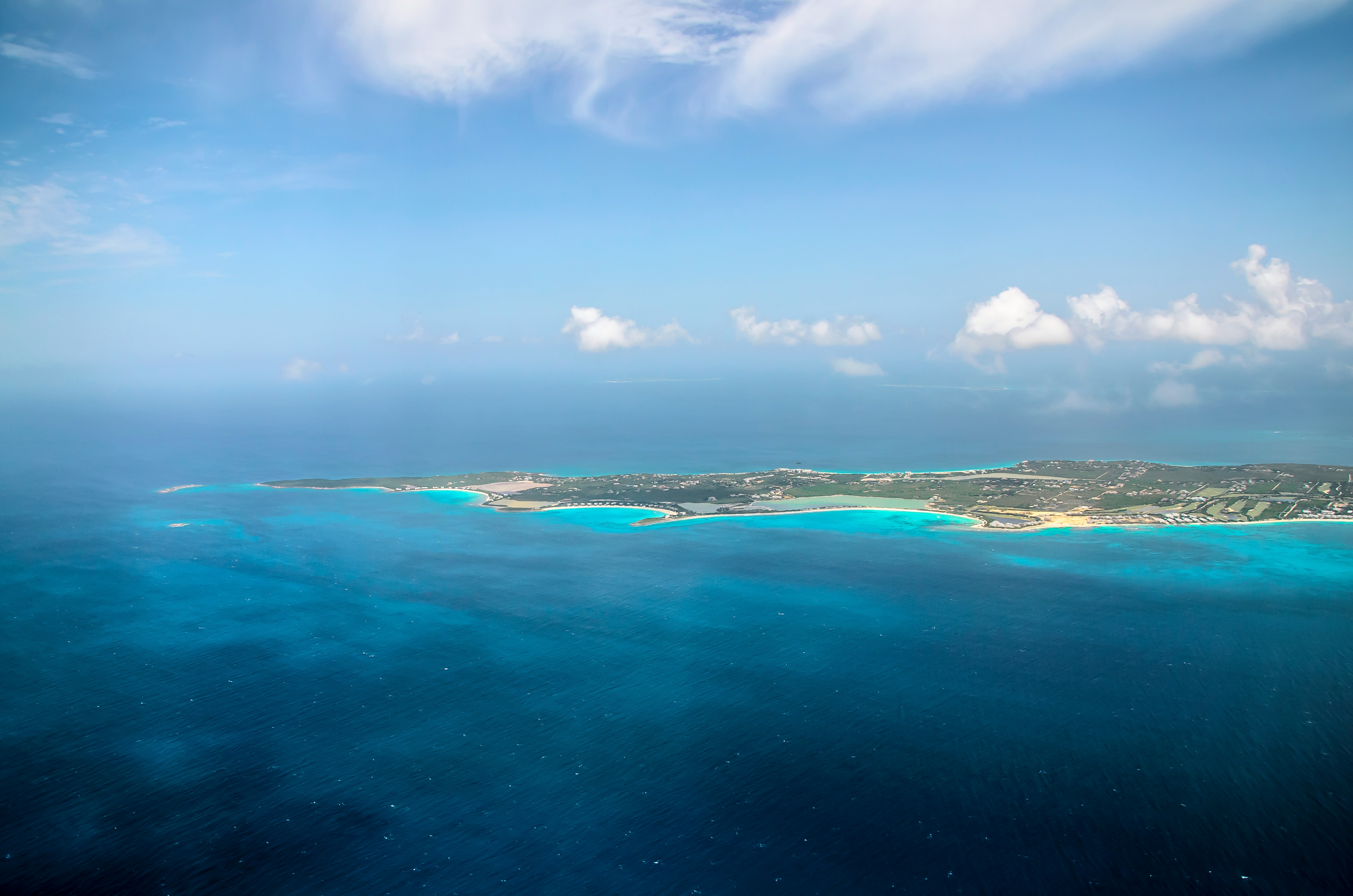
About Anguilla
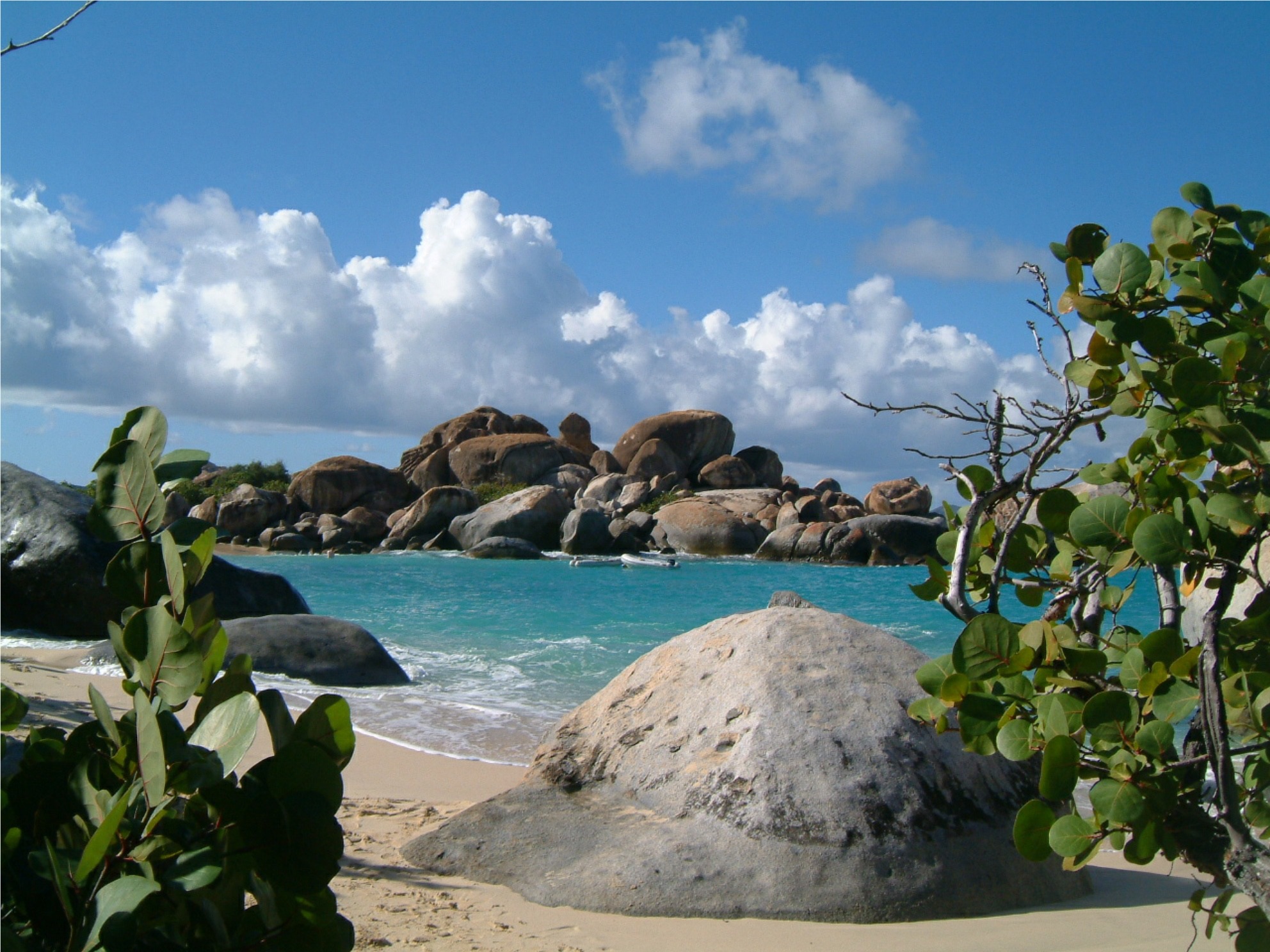
About Virgin Gorda
About Great Harbour, Jost Van Dyke
Jost Van Dyke, four miles long, is truly known as the 'barefoot island'. The smallest of the British Virgin Islands, it is known as a popular destination for yachts and is celebrated for its casual lifestyle, protected anchorages, fine beaches and beachfront restaurants and bars. The island has fewer than 200 inhabitants and they are widely known as a welcoming people. The island's name conjures up its rich, colorful past. Jost Van Dyke is said to have been named for an early Dutch settler, a former pirate. At Great Harbour, Little Harbour, and White Bay there are safe, protected bays and pristine beaches shaded with coconut palms and seagrape trees. Discover inviting shops selling local treasures, restaurants, and bars. 'The Painkiller', one of the Caribbean’s most popular drinks, originated at the Soggy Dollar Bar. Foxy’s and Gertrude's in White Bay are renowned for drinks made with the island's famous rum, frosty beers, and tales of pirates and sunken treasure. Explore Jost Van Dyke's history in the vegetation-covered ruins of centuries-old sugar mills, or on the old trails that crisscross the island. Revel in the natural beauty of the pristine, untouched beaches. Hike up to the highest spot on the island, Majohnny Point, and take in a stunning 360 degree view of the Caribbean. Relax in the natural 'bubble pool', a popular tourist attraction. Jost Van Dyke conjures up images of what the British Virgin Islands may have looked like many years ago.
About Anegada
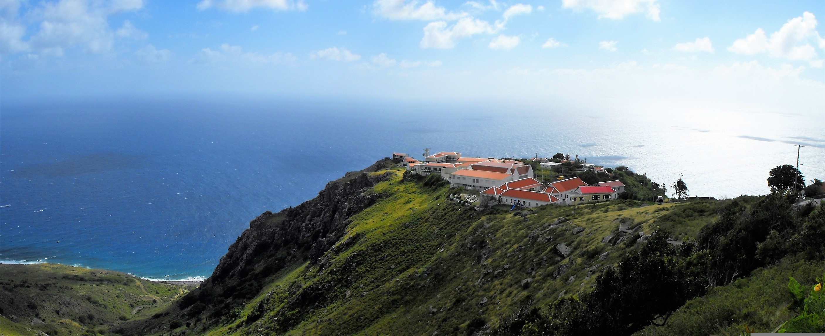
About Saba
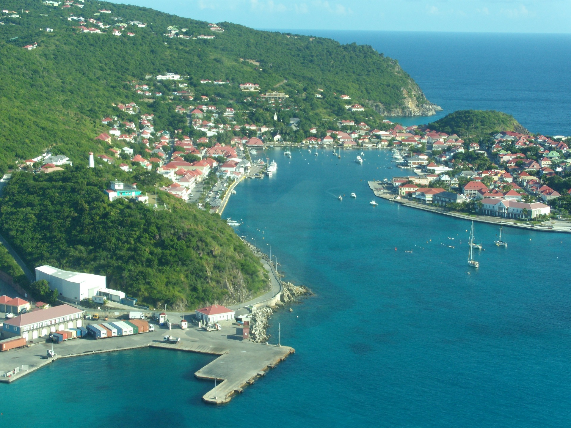
About Gustavia
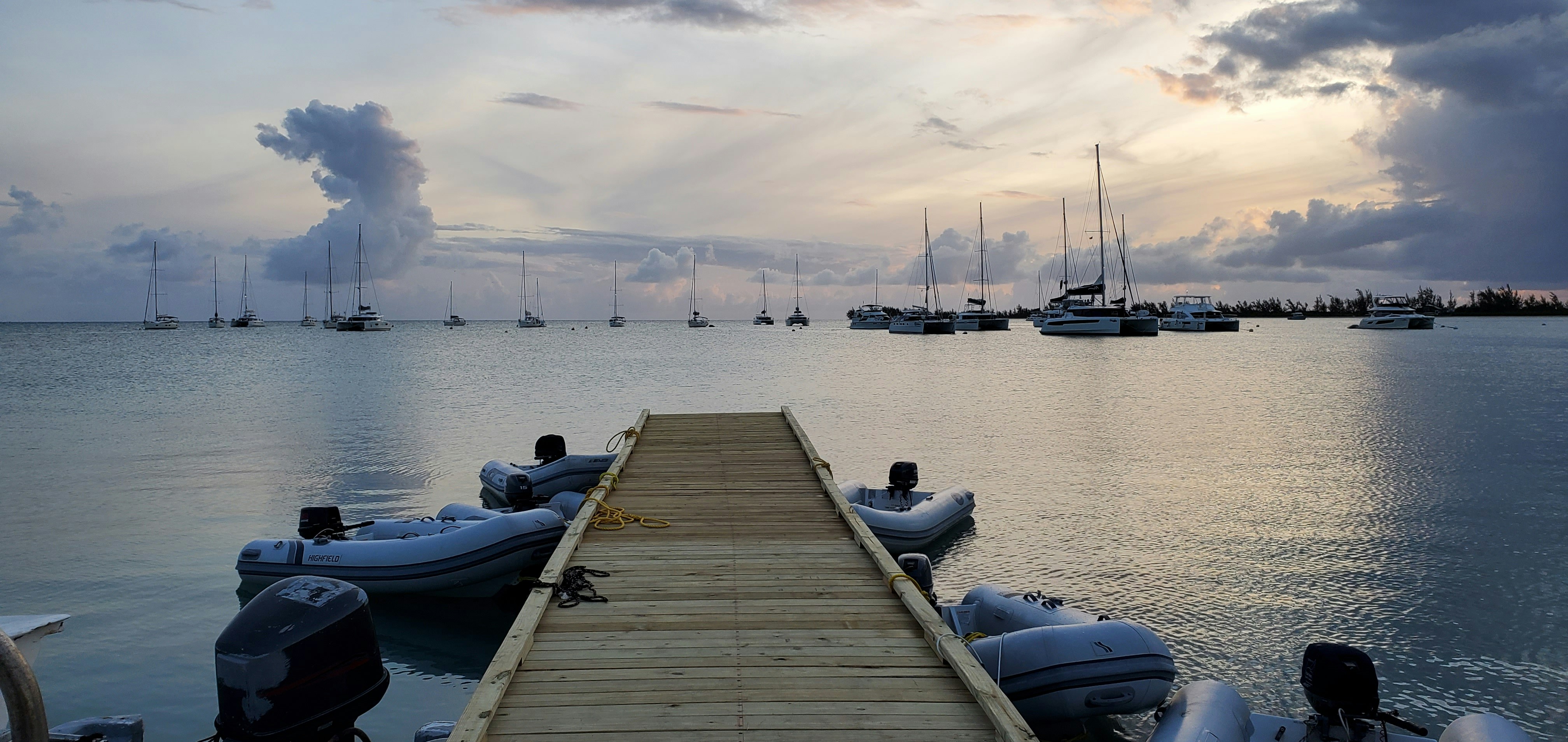
You can easily explore all of Gustavia during a two-hour stroll. Some shops close from noon to 3 or 4, so plan lunch accordingly, but stores stay open past 7 in the evening. Parking in Gustavia is a challenge, especially during vacation times. A good spot to park is rue de la République, alongside the catamarans, yachts, and sailboats.
About Marigot
French and Dutch have lived side by side on St. Maarten/St. Martin for hundreds of years—with no border patrols or customs between them. The French side has a more genteel ambience, more fashionable shopping, and a Continental flair. The Dutch tends to be less expensive, has casino hotels, and more nightlife. Water sports abound all over—diving, snorkeling, sailing, and windsurfing are all top draws. And it's easy to while away the day relaxing on one of the 37 beaches, strolling the boardwalk of Dutch-side Philipsburg, and exploring the very French town of Marigot. Although luck is an important commodity at St. Maarten's 13 casinos, chance plays no part in finding a good meal at the island’s excellent eateries. The best way to explore St. Maarten/St. Martin is by car. Though often congested, especially around Philipsburg and Marigot, the roads are fairly good, though narrow and winding, with some speed bumps, potholes, roundabouts, and an occasional wandering goat herd. Few roads are marked with their names, but destination signs are common. Besides, the island is so small that it's hard to get really lost—at least that is what locals tell you. If you’re spending a few days, get to know the area with a scenic "loop" around the island. Be sure to pack a towel and some water shoes, a hat, sunglasses, and sunblock. Head up the east shoreline from Philipsburg, and follow the signs to Dawn Beach and Oyster Pond. The road winds past soaring hills, turquoise waters, quaint West Indian houses, and wonderful views of St. Barth. As you cross over to the French side, turn into Le Galion for a stop at the calm sheltered beach, the stables, the butterflies, or the windsurfing school, then keep following the road toward Orient Bay, the St-Tropez of the Caribbean. Continue to Anse Marcel, Grand Case, Marigot, and Sandy Ground. From Marigot, the flat island of Anguilla is visible. Completing the loop brings you past Cupecoy Beach, through Maho and Simpson Bay, where Saba looms in the horizon, and back over the mountain road into Philipsburg.
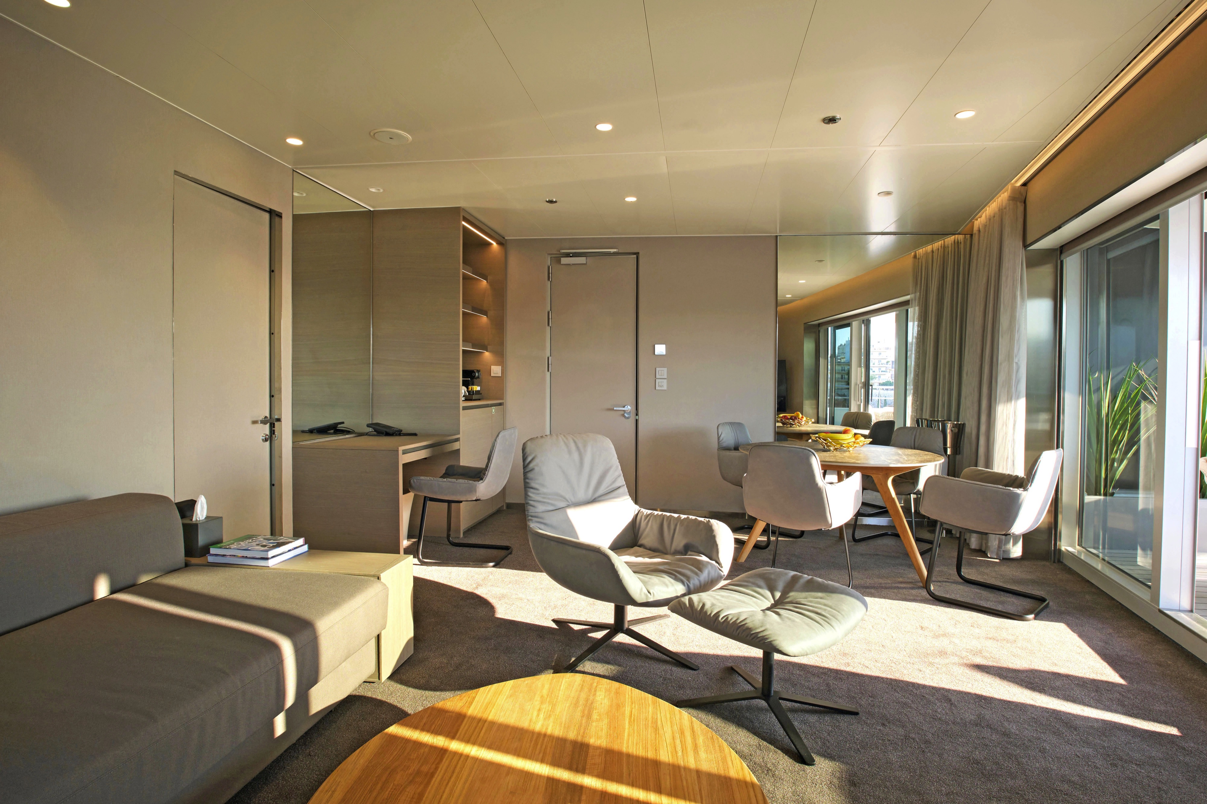
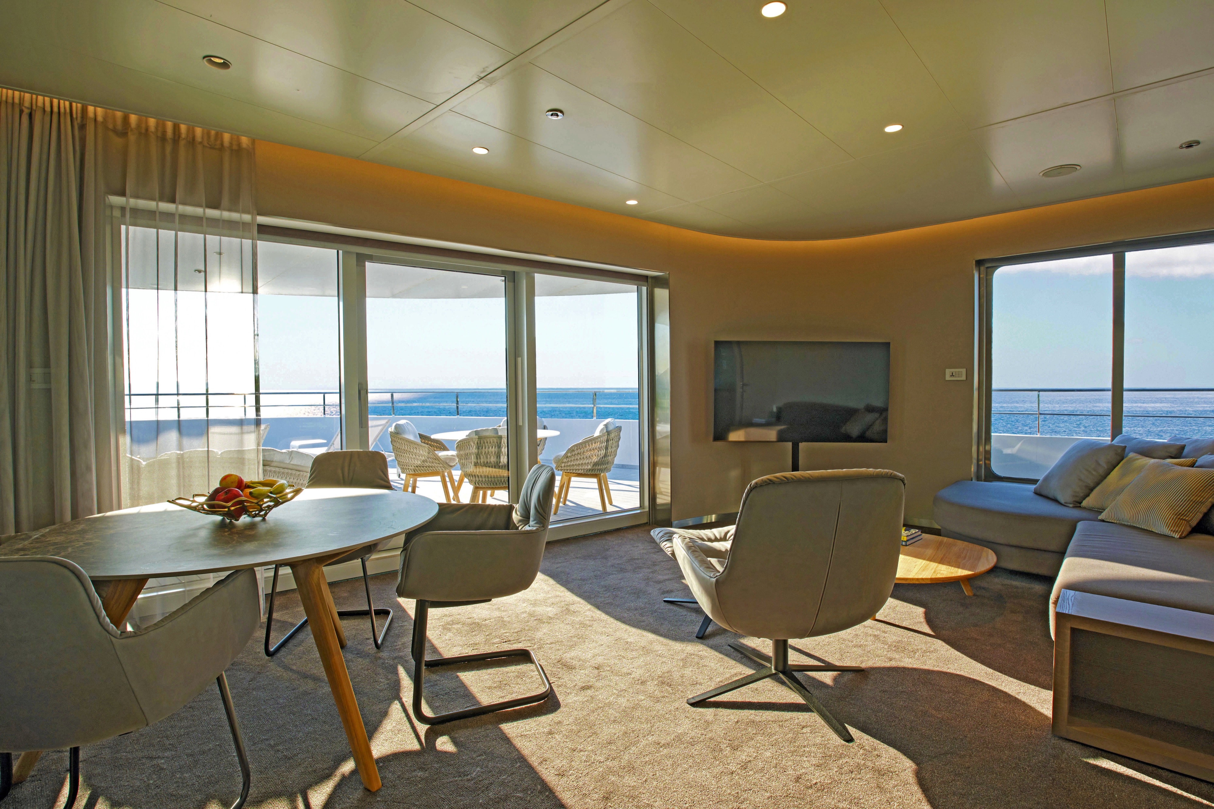
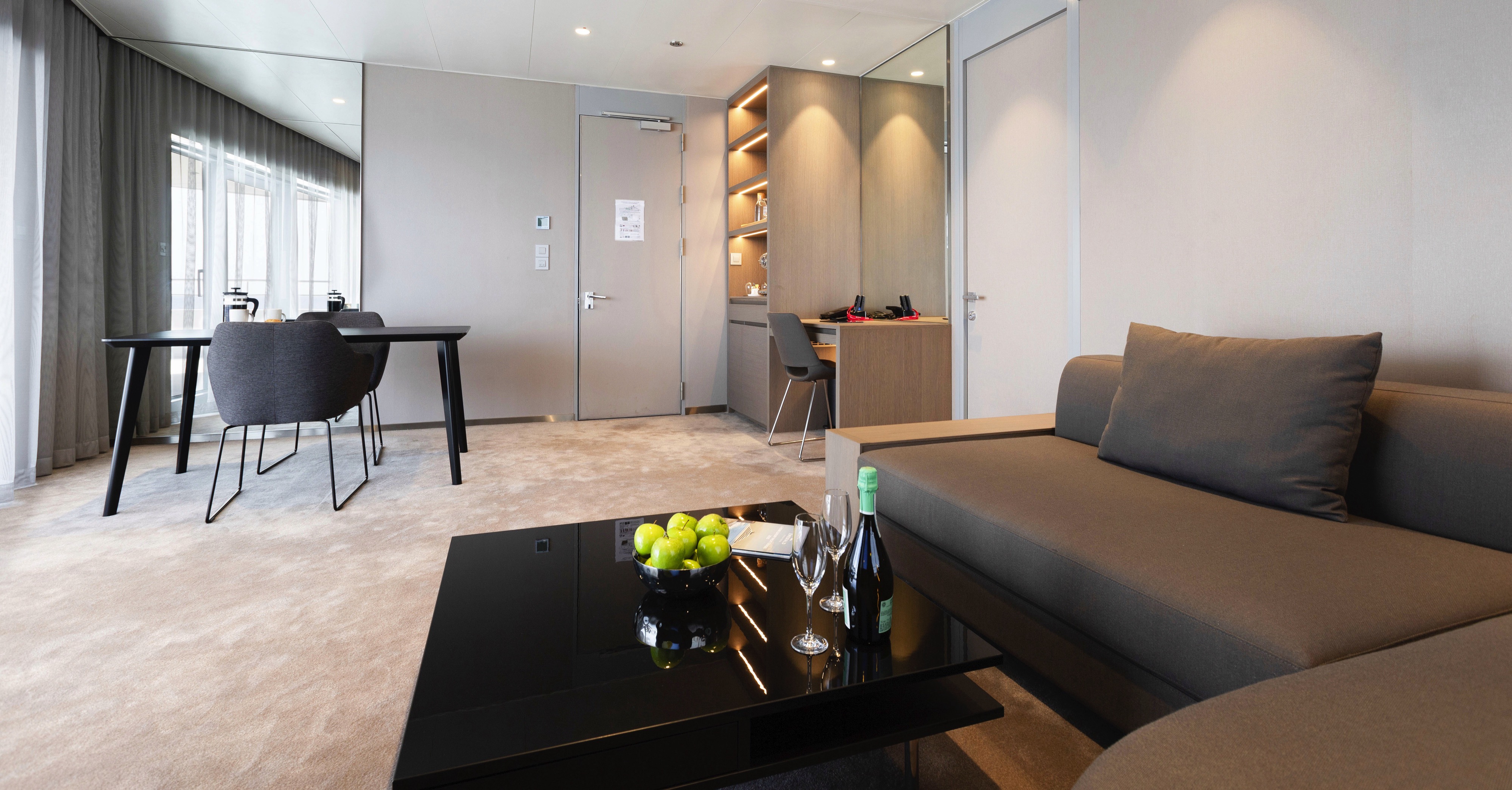
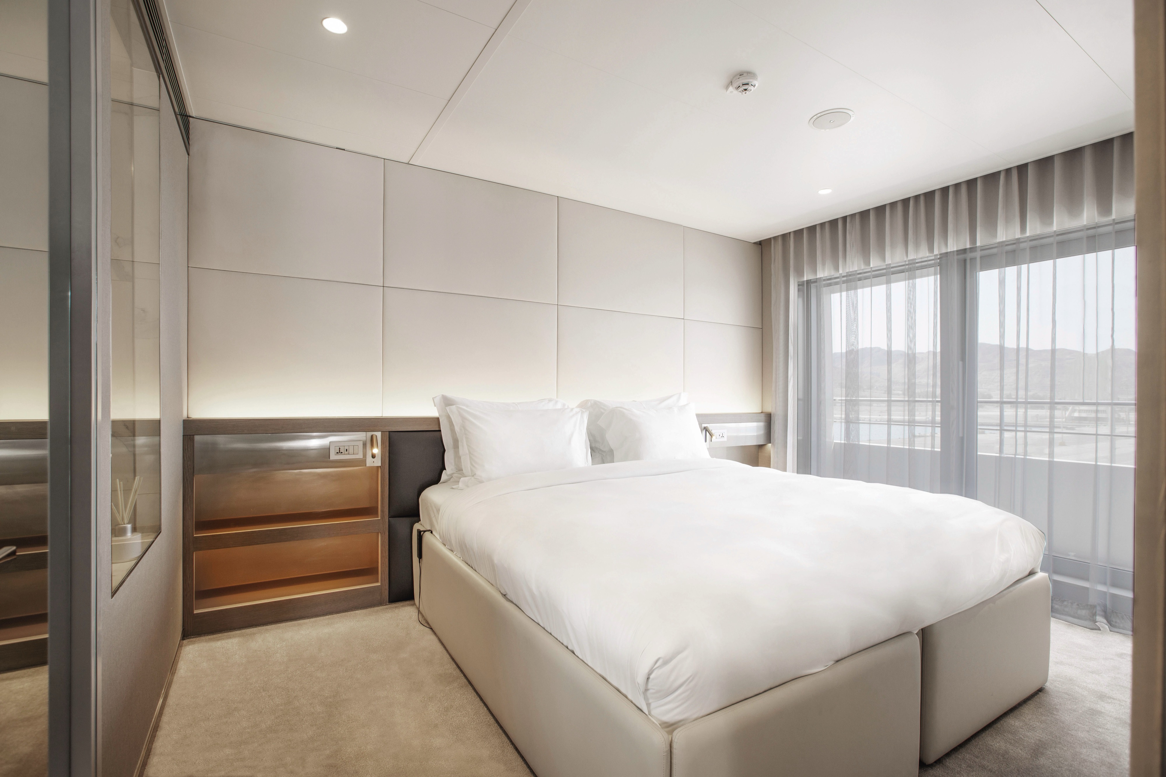
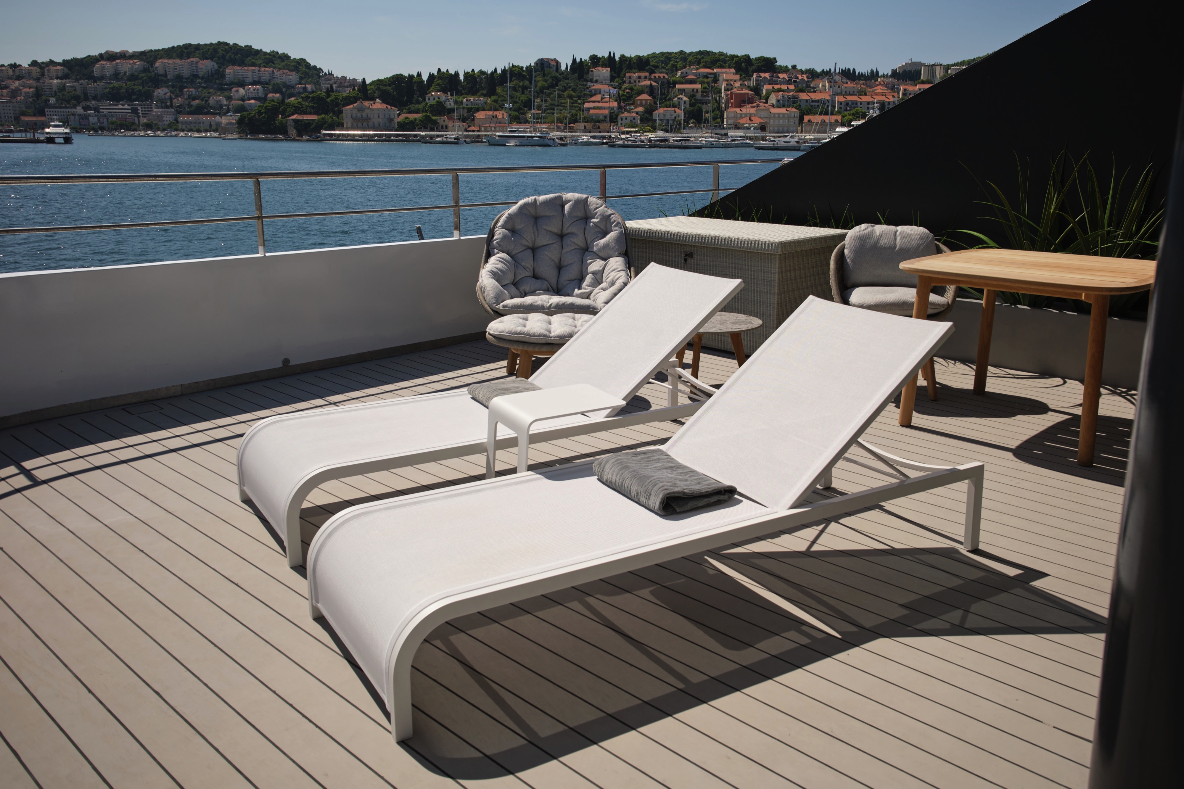
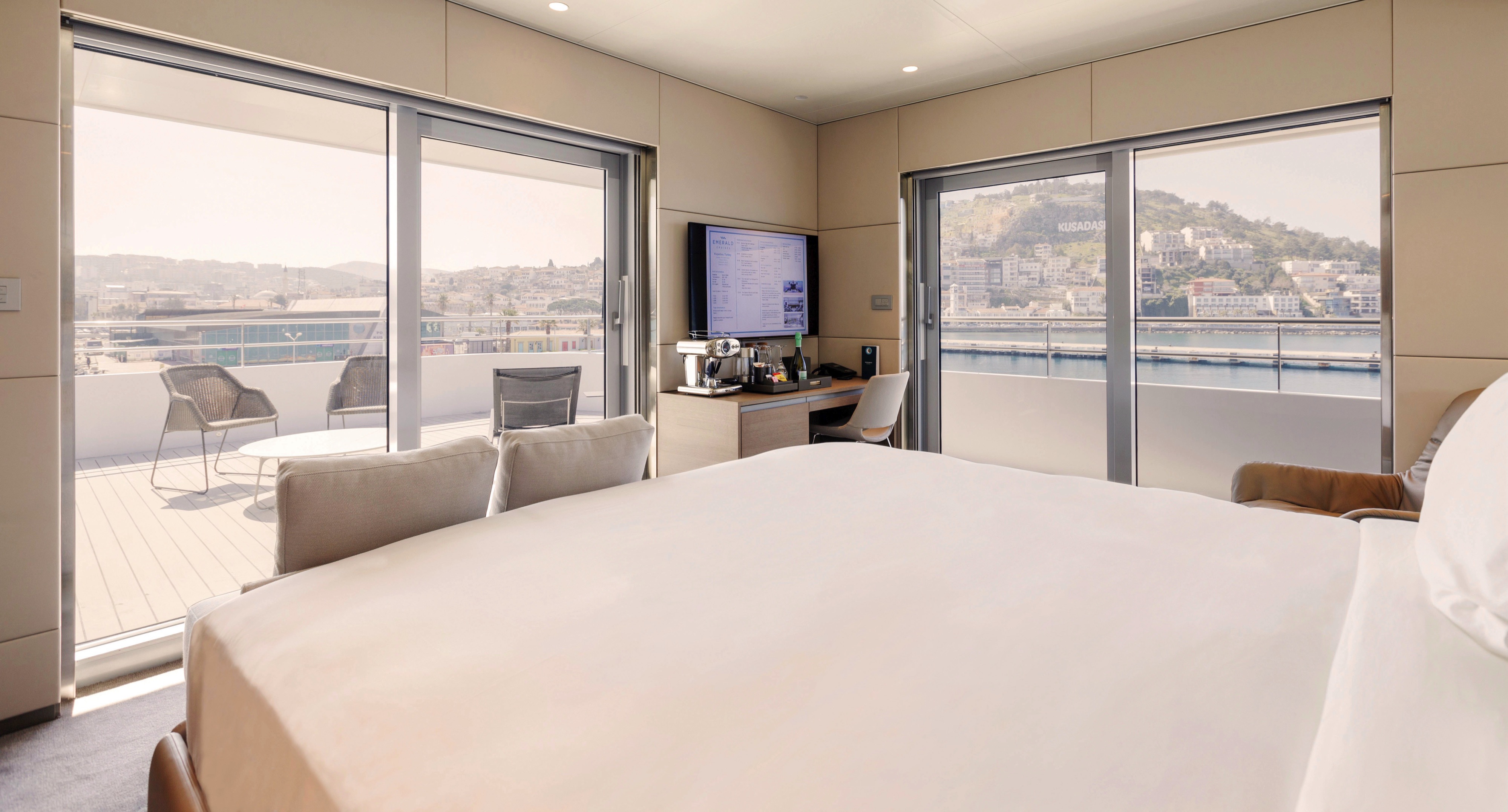
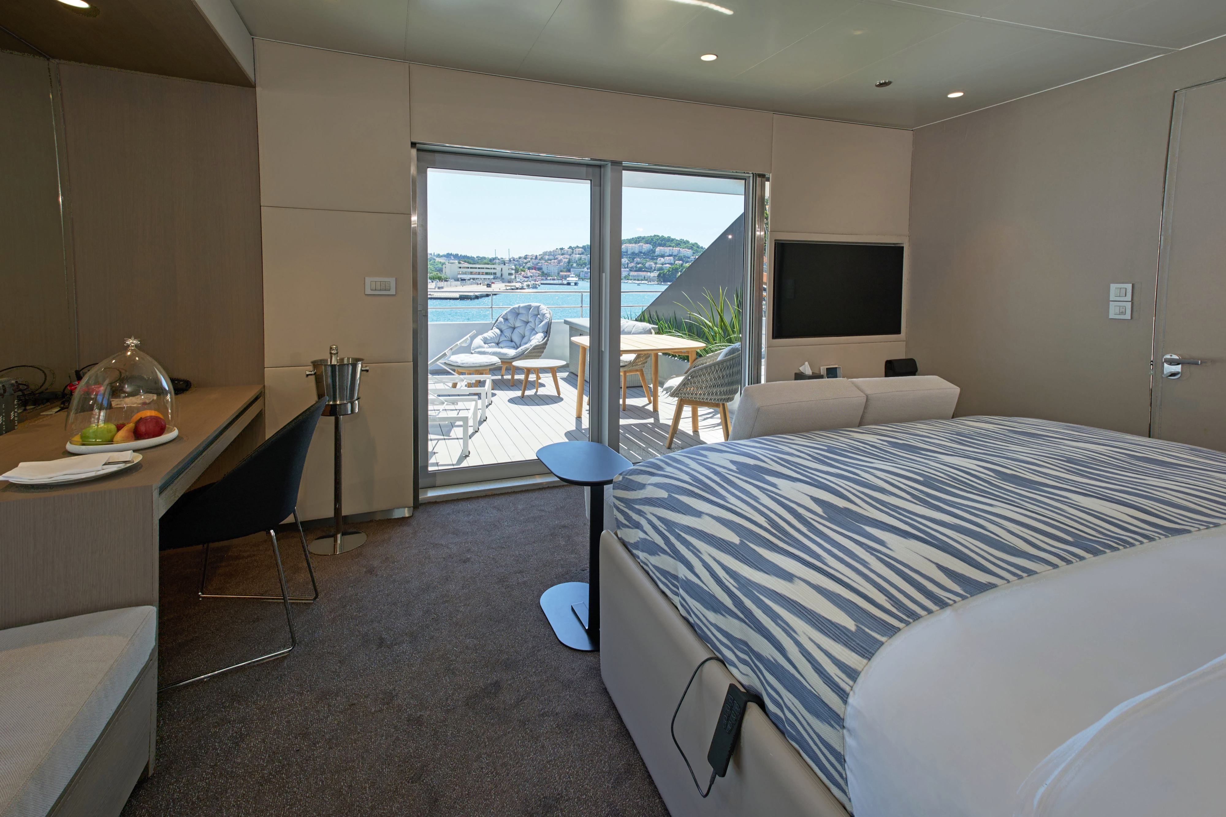
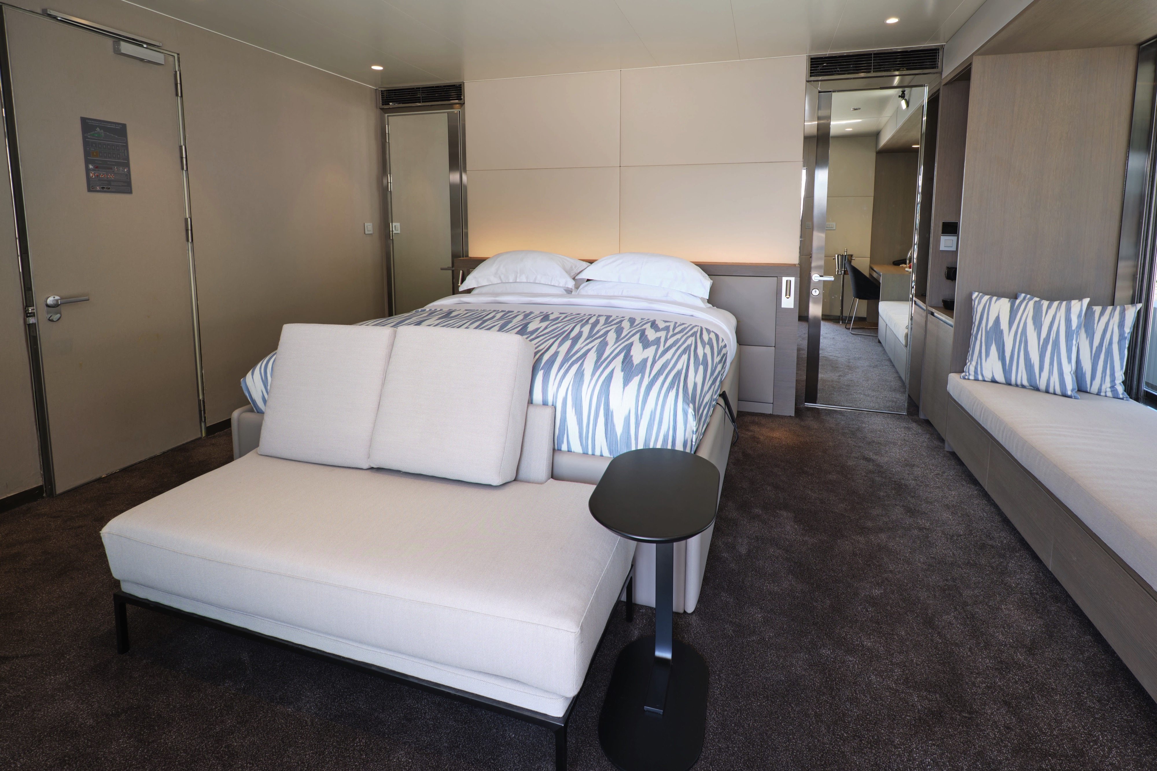
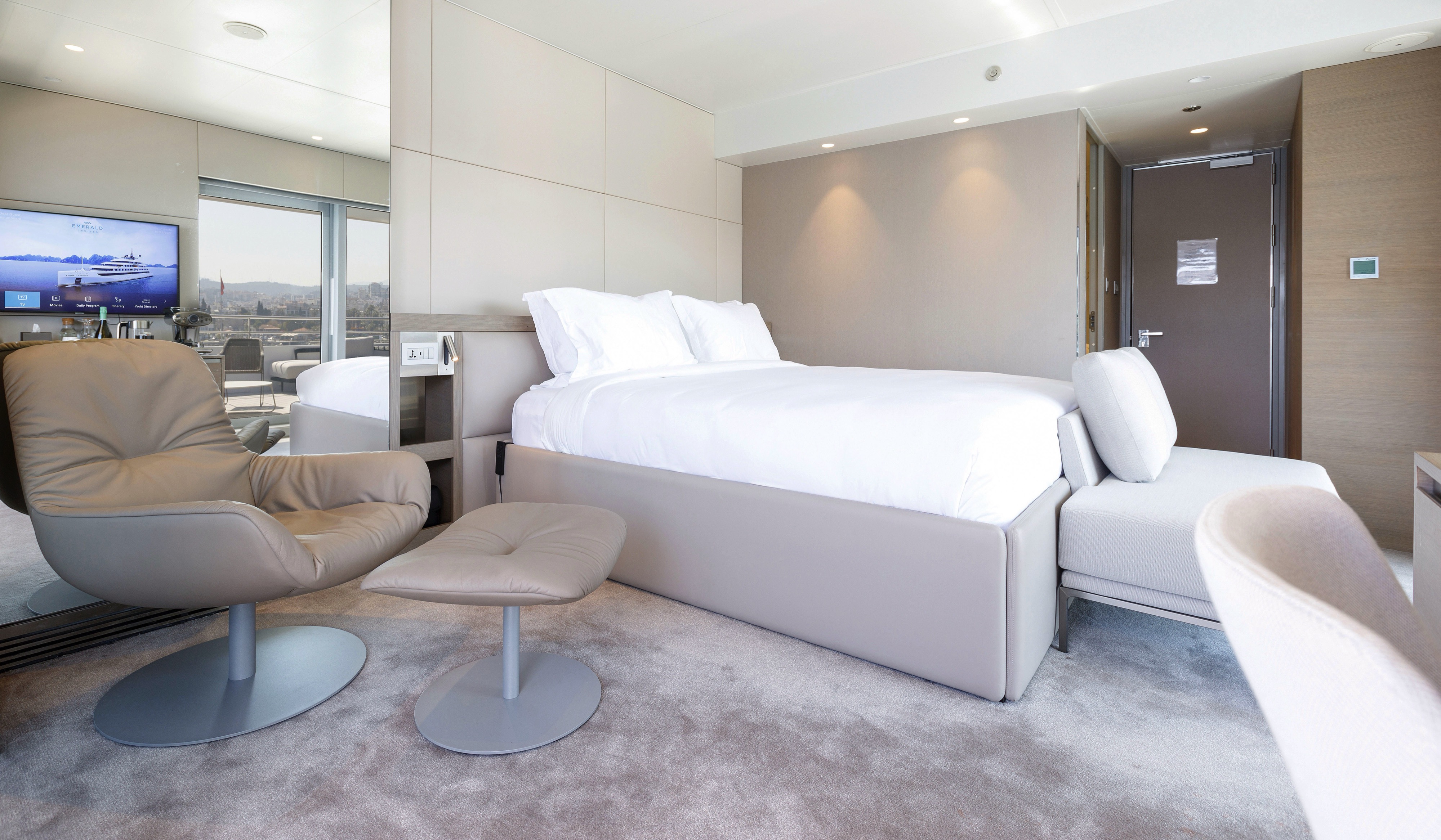
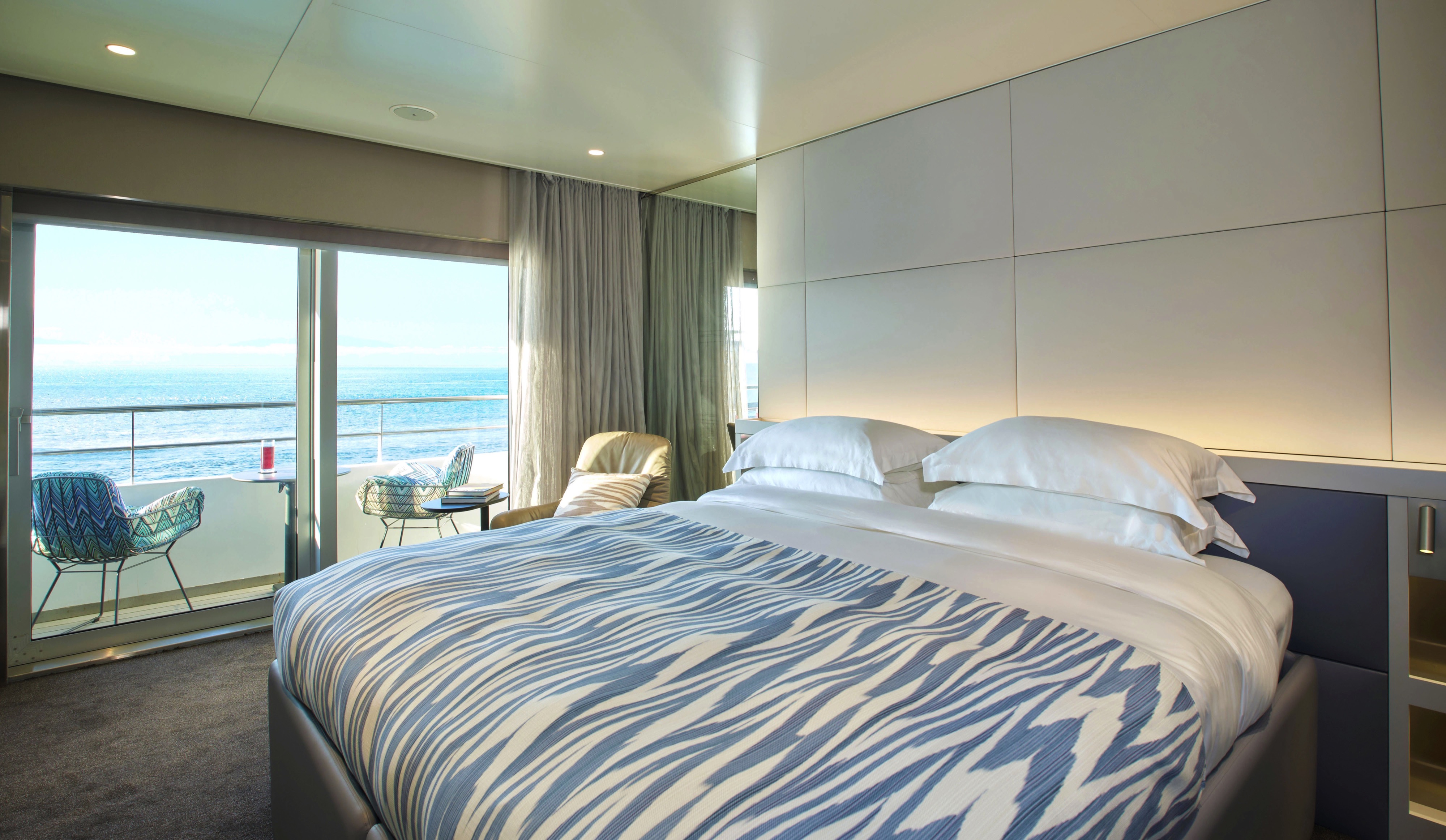
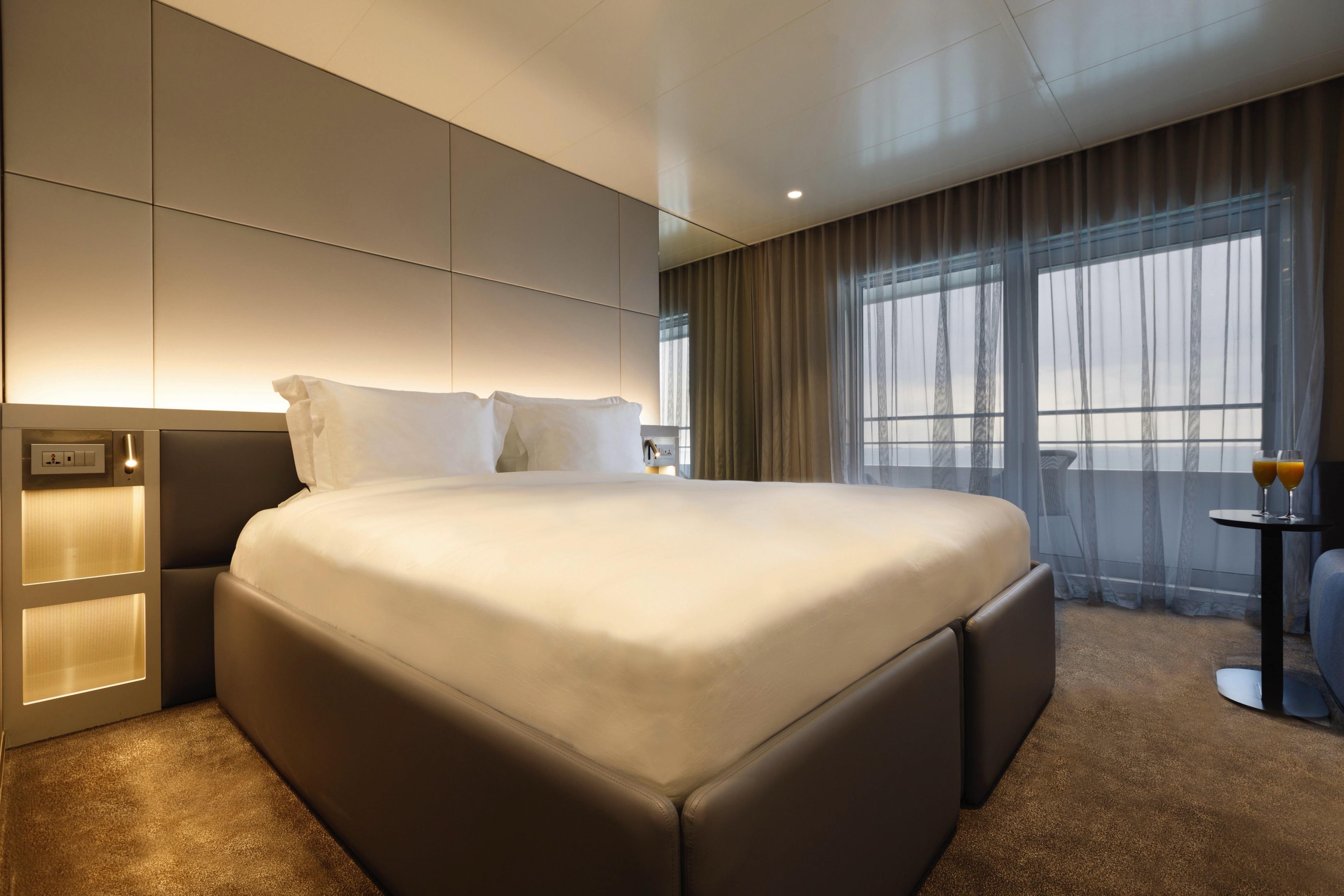
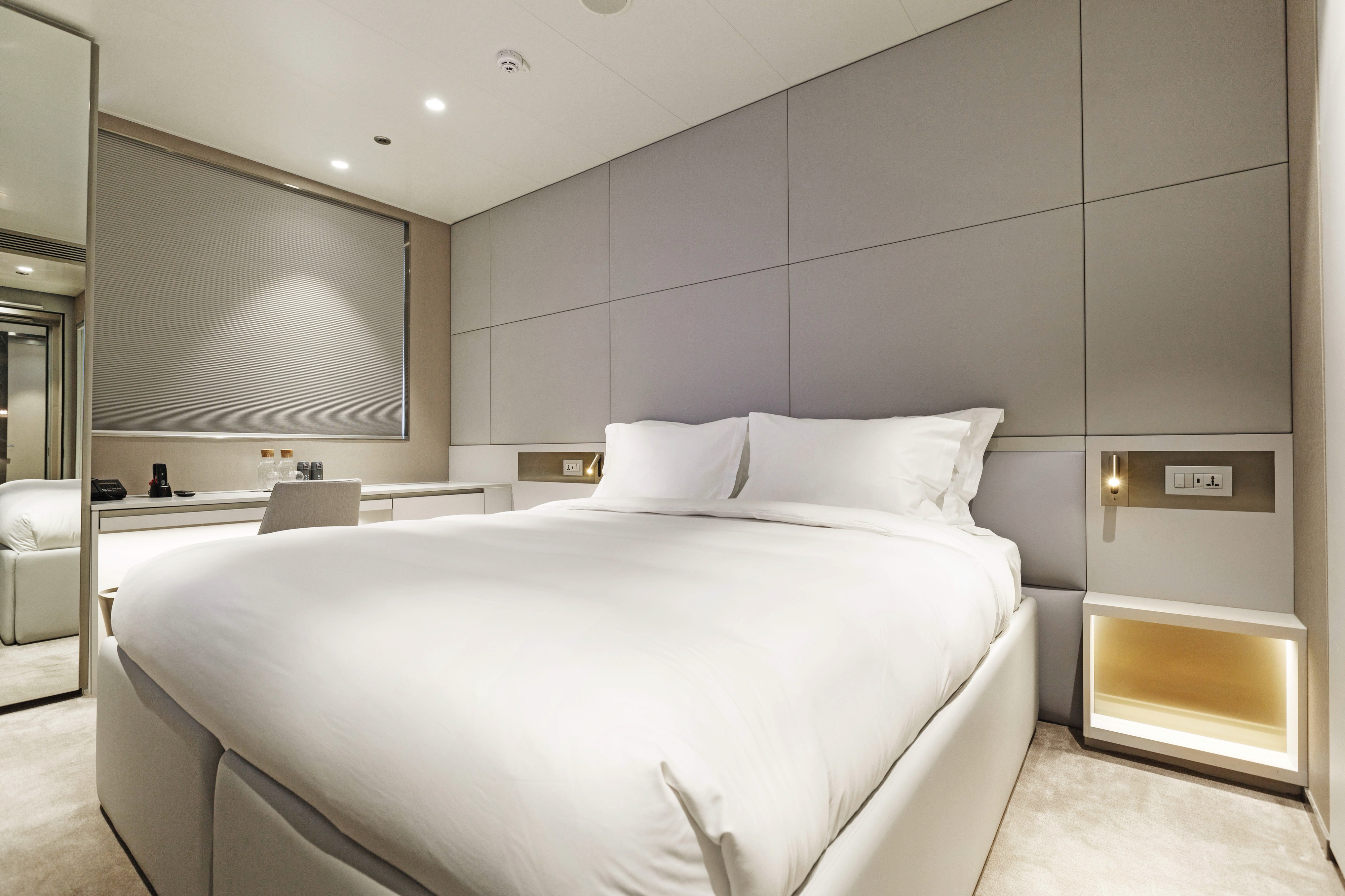
You’ll find our largest and most prestigious suites at the front of the Pool Deck, promising truly exceptional views of the unfolding landscapes.
A separate bedroom and lounge area gives you more room to roam, while a walk-in wardrobe and large private terrace encourage you to really settle into your boutique Owner's Suite.
- Your own private terrace
- Separate bedroom and lounge area
- Walk-in wardrobe
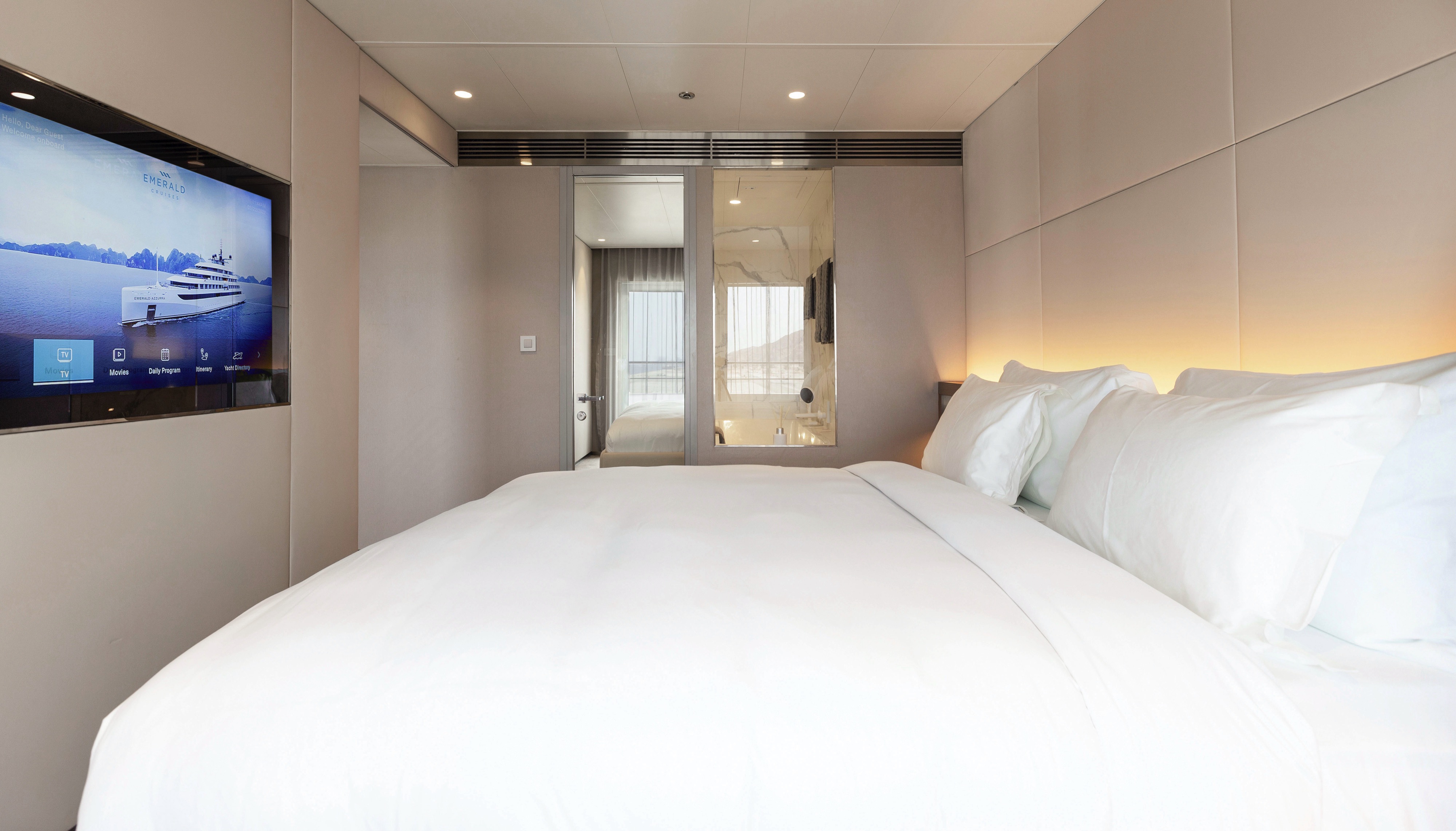
- Queen-size or twin hotel-style beds with the finest Egyptian cotton linen
- Pillow menu
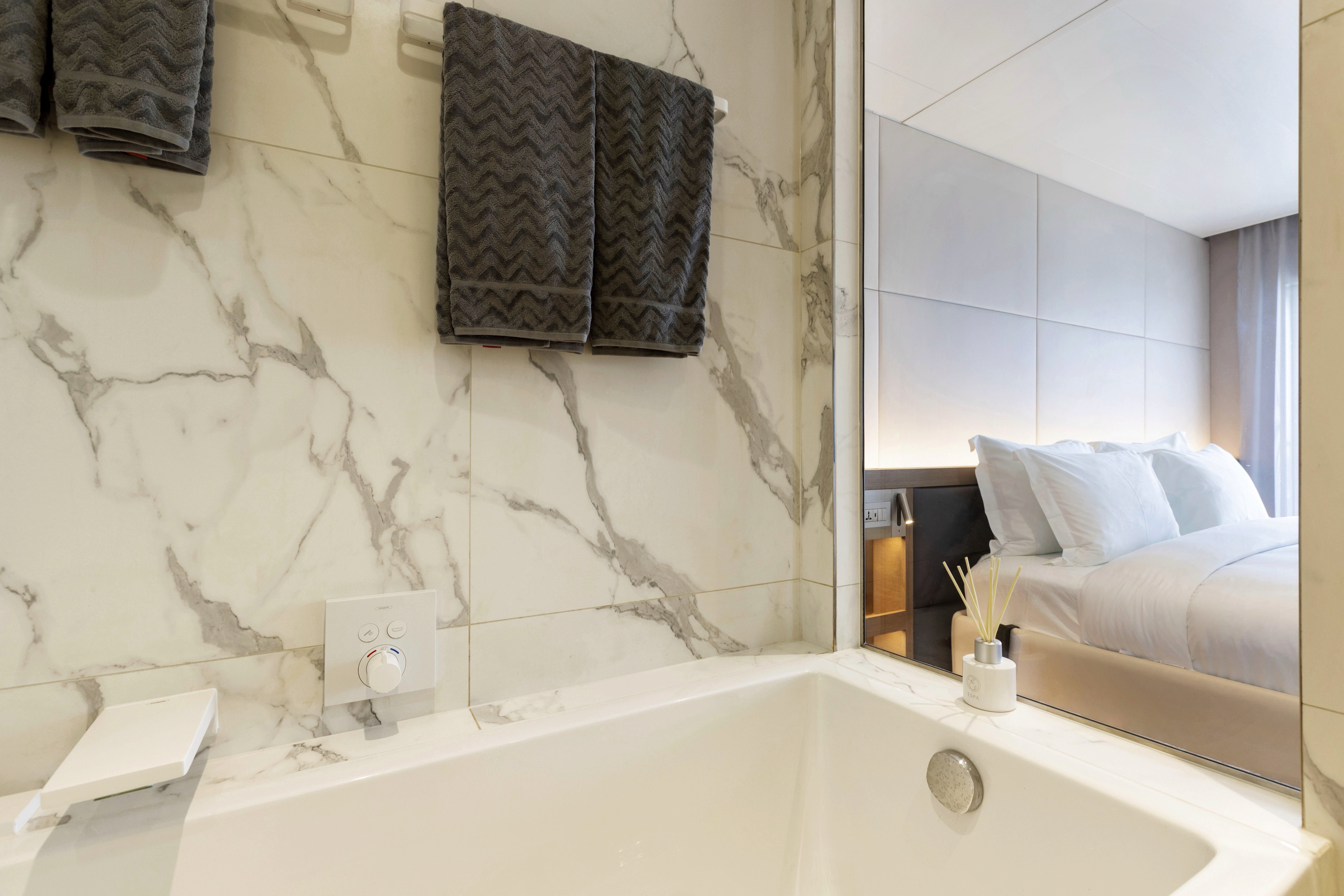
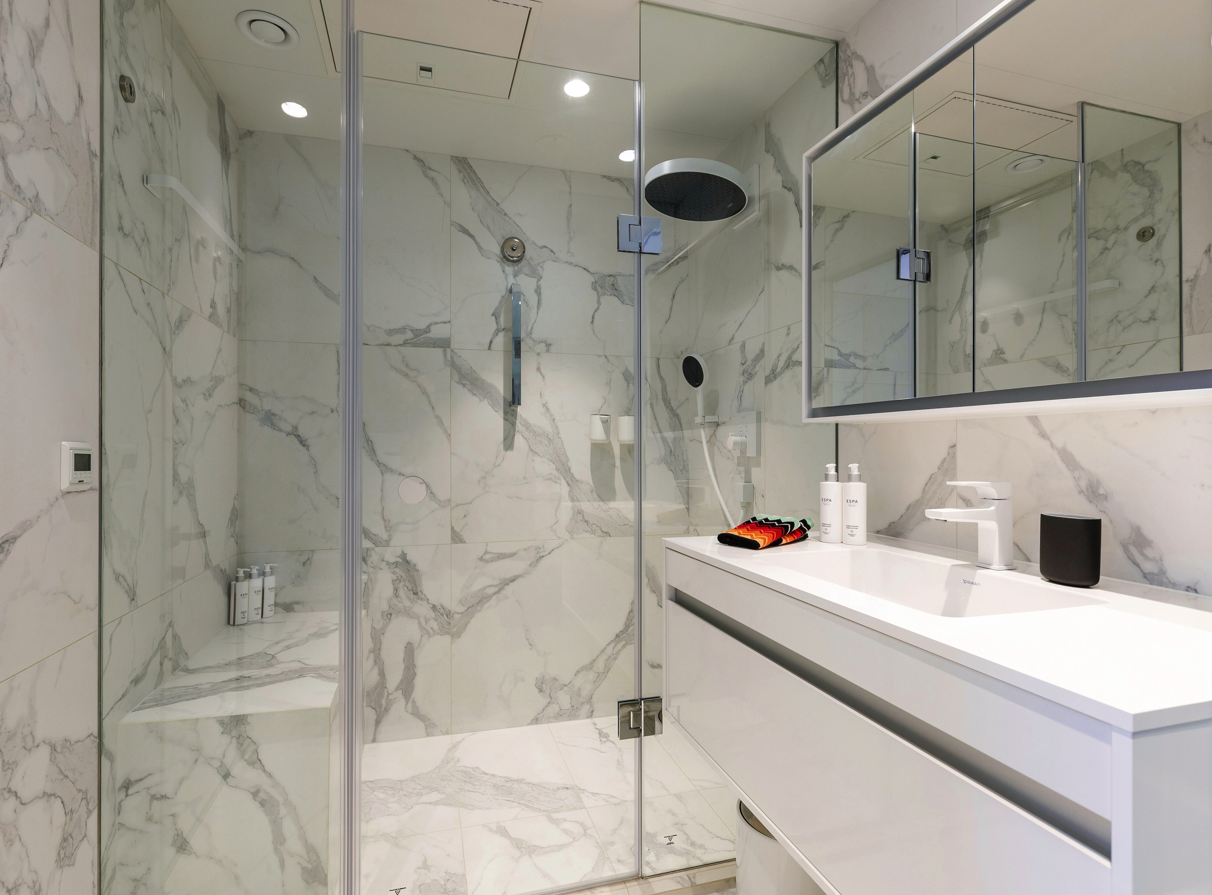
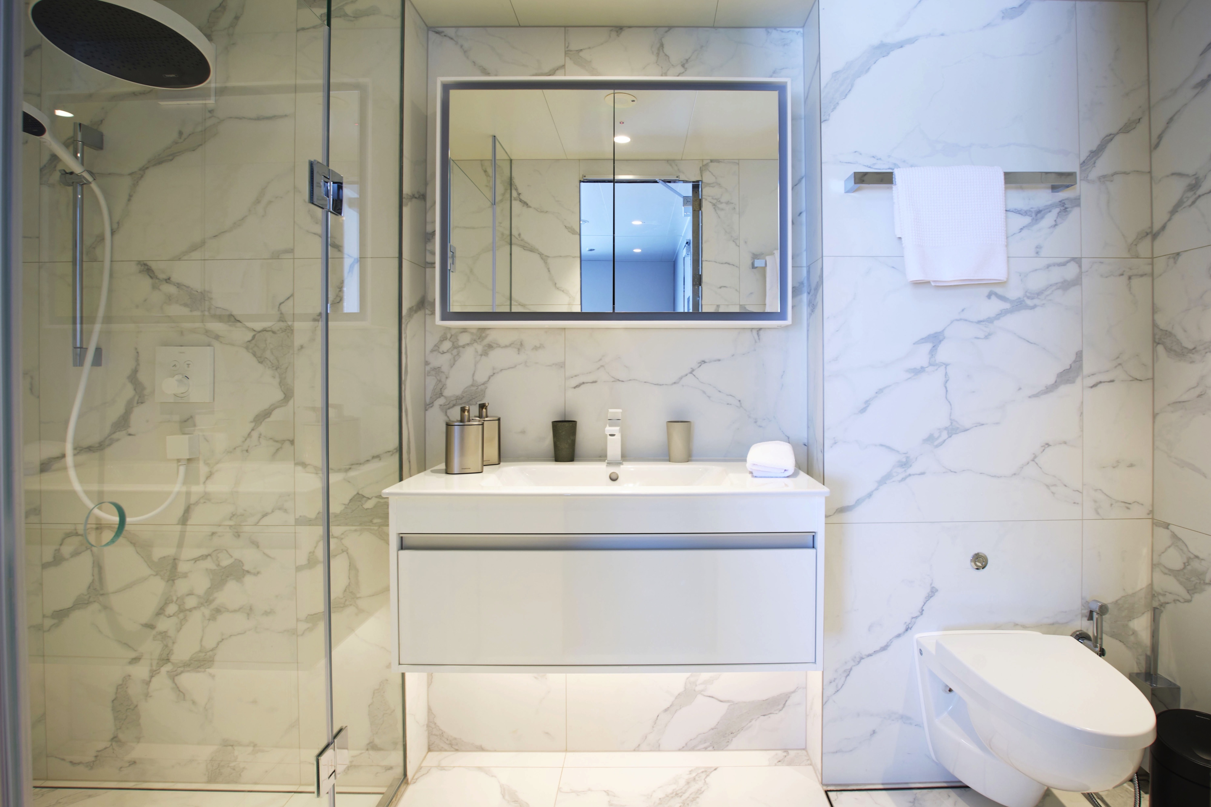
- Bathroom with shower, indulgent toiletries and hairdryer
- Complimentary bathrobes and slippers
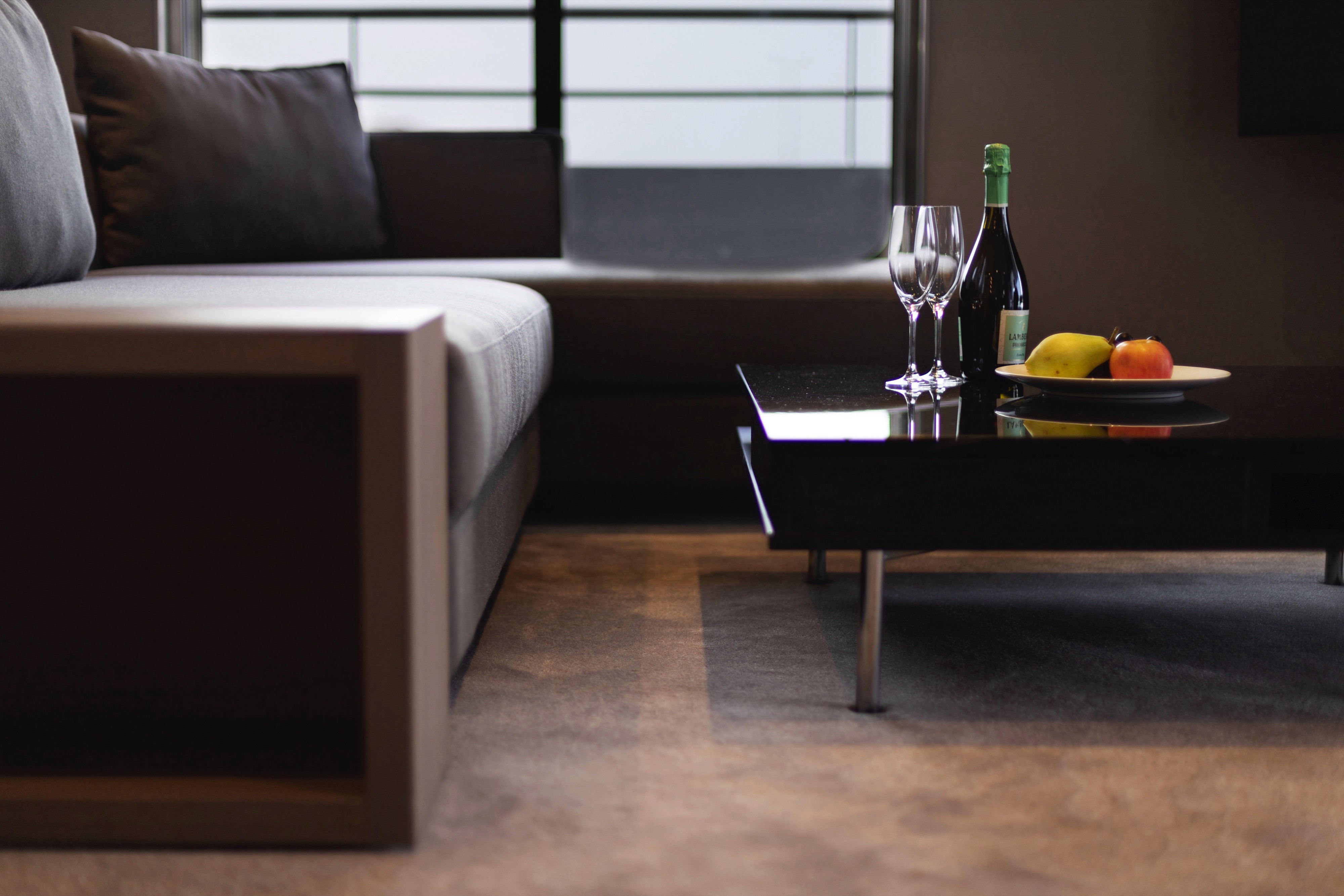
- Welcome bottle of champagne
- Fruit platter on arrival
- Pre-dinner canapés
- After-dinner sweets
- Full mini-bar, restocked daily
- Complimentary water, restocked daily
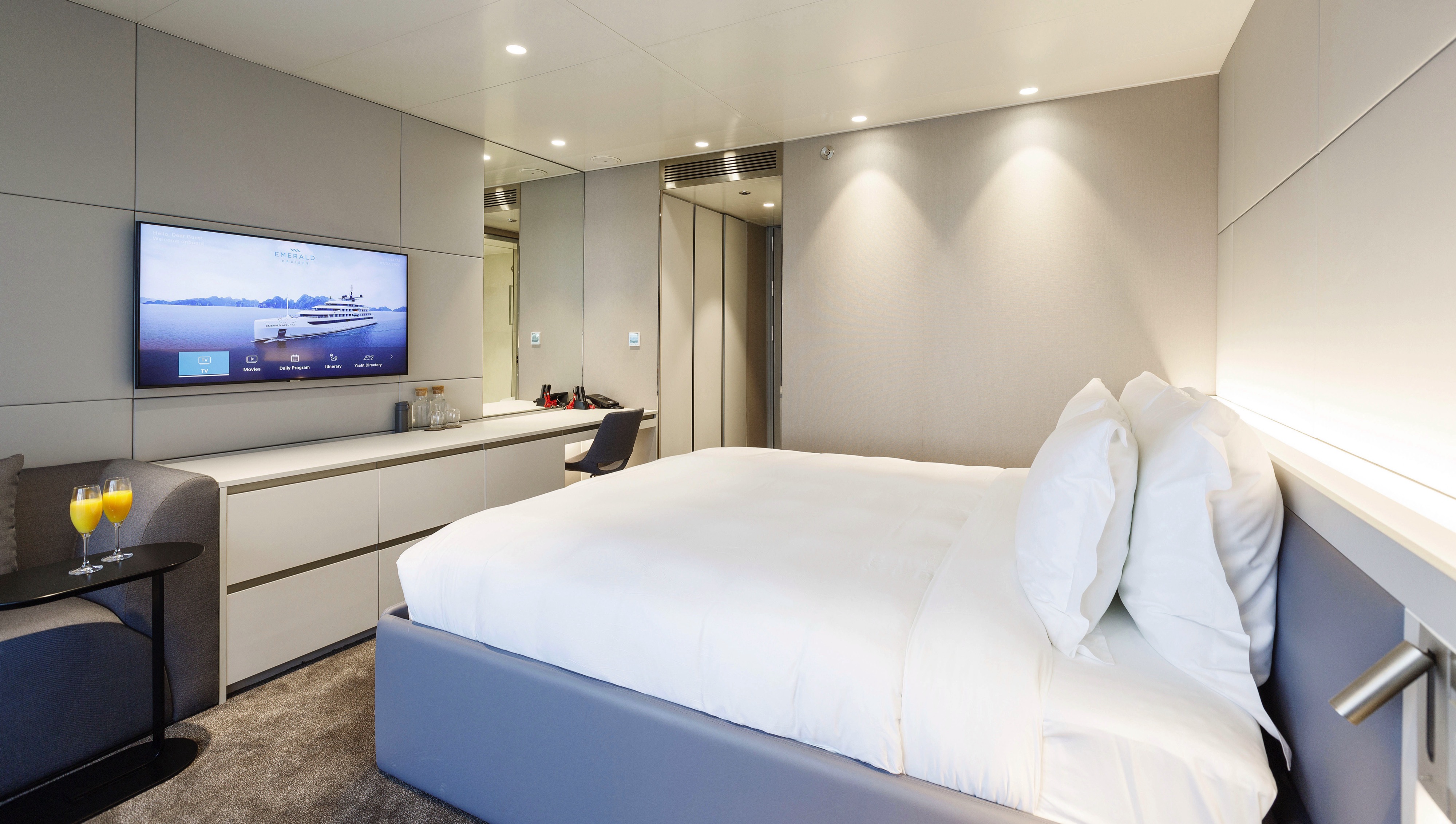
- Flat screen HDTV and infotainment system
- Complimentary Wi-Fi
- Individual climate control
- Coffee and tea-making facilities
- Four laundered items daily
- Personal safe
- Umbrella
- Telephone
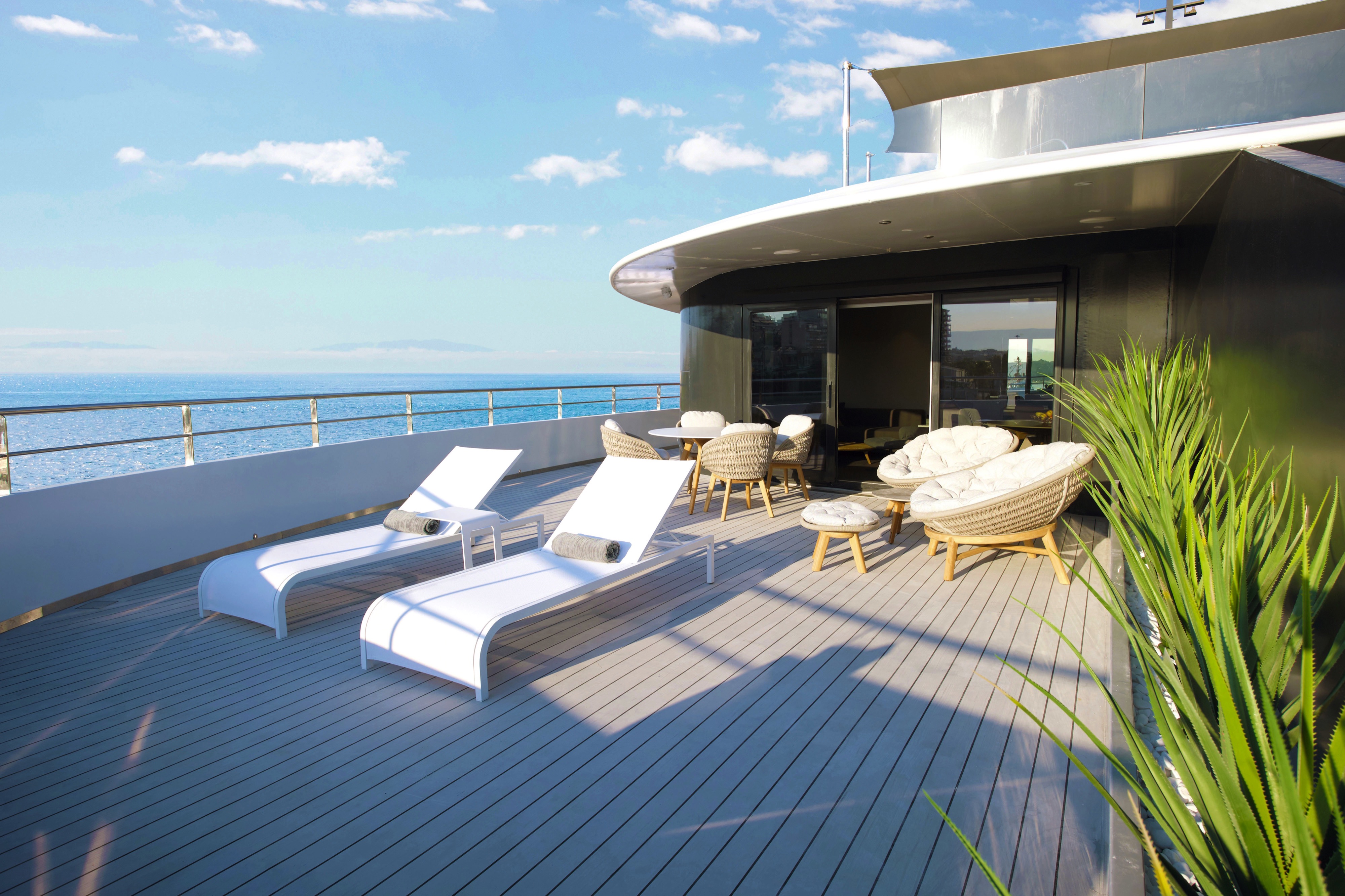
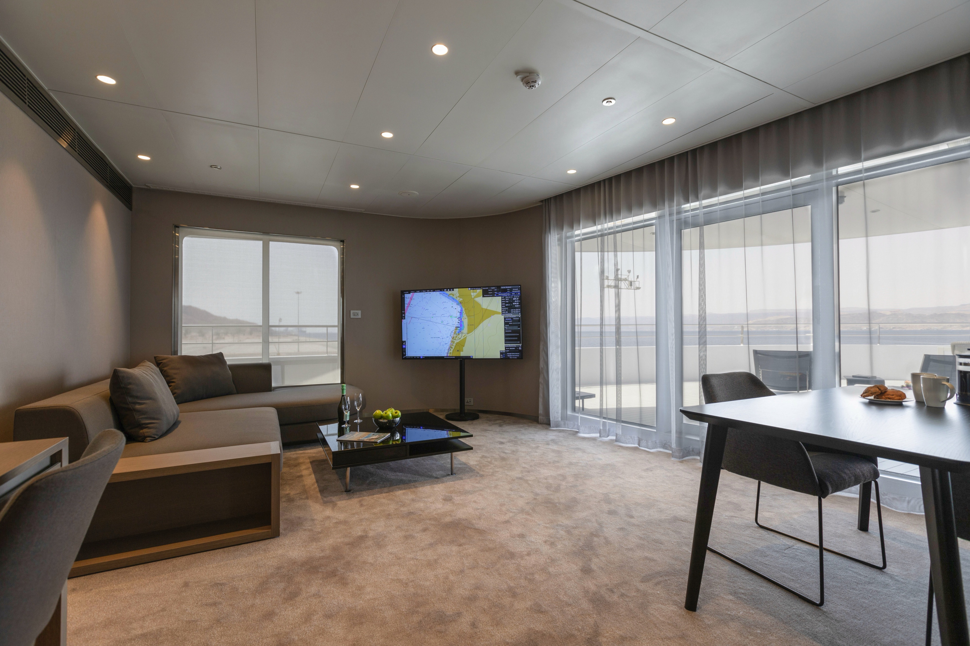
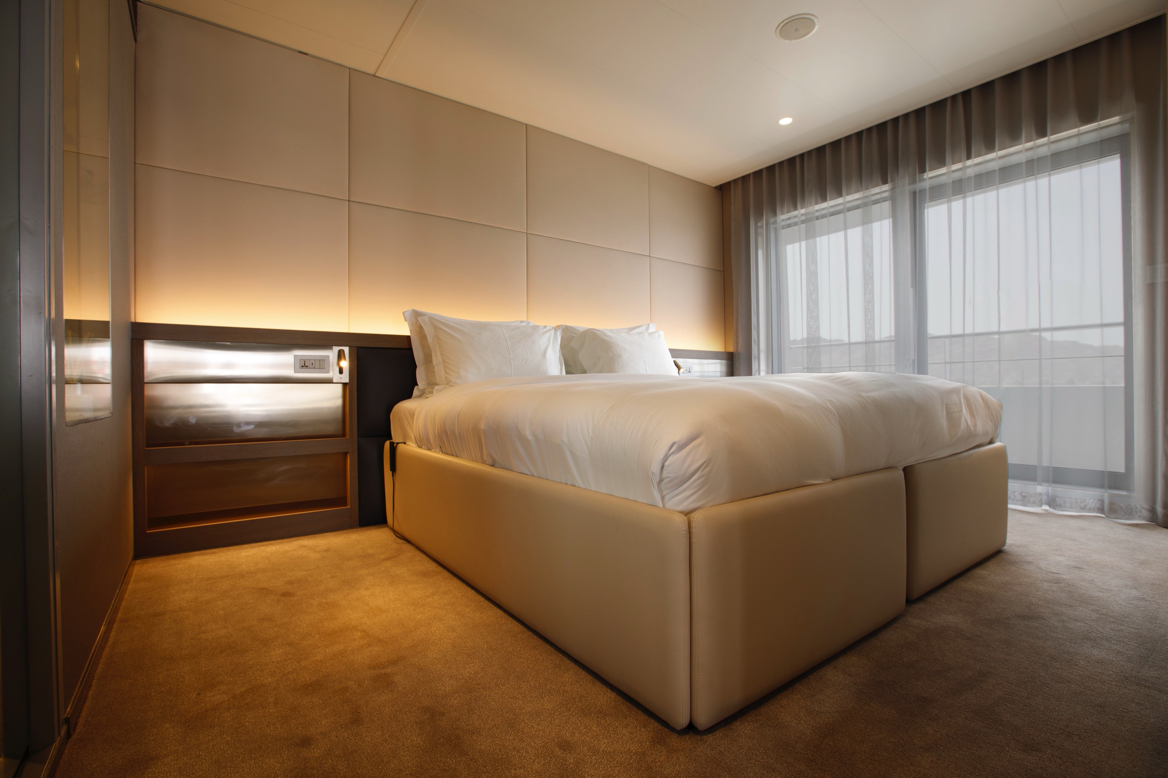

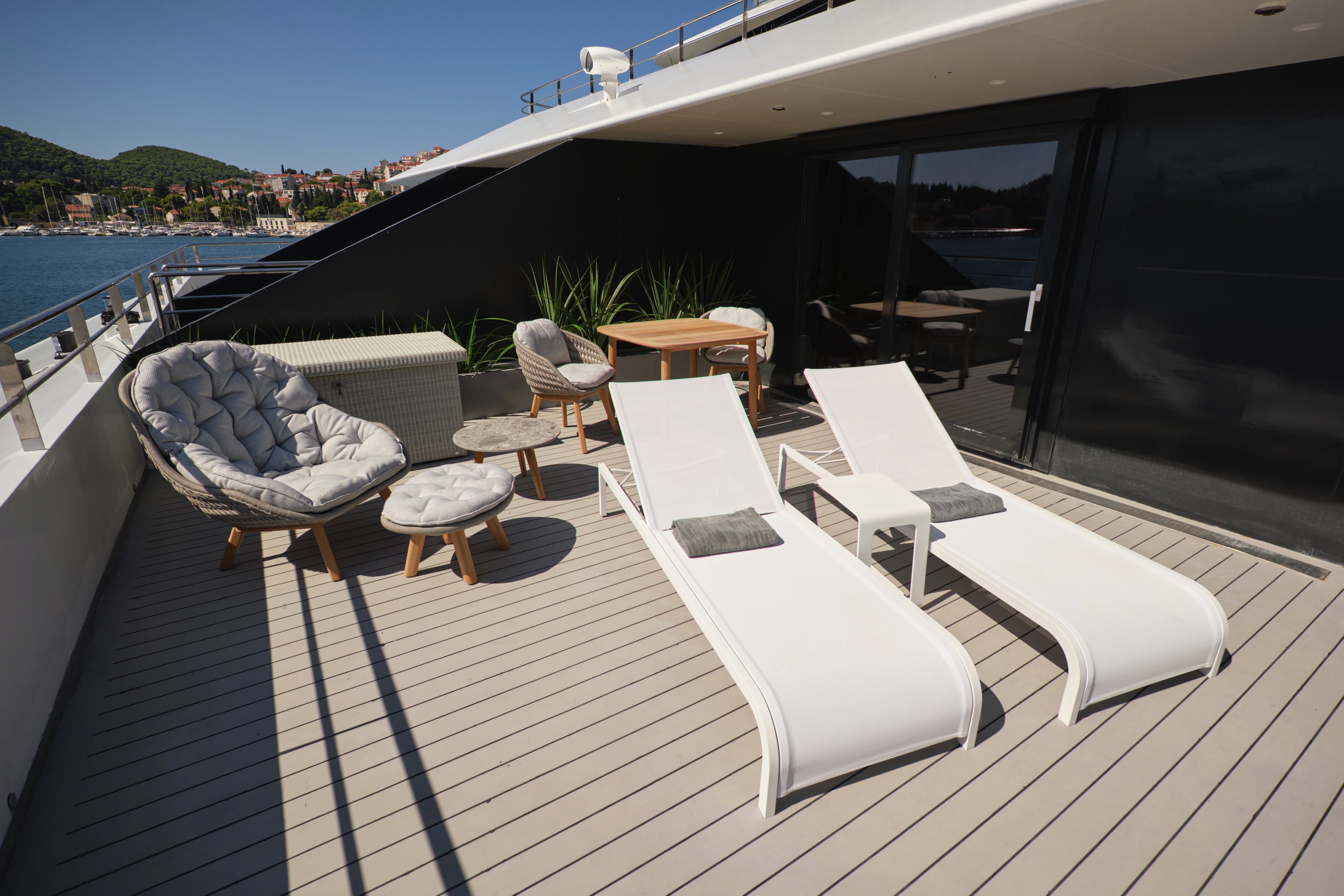
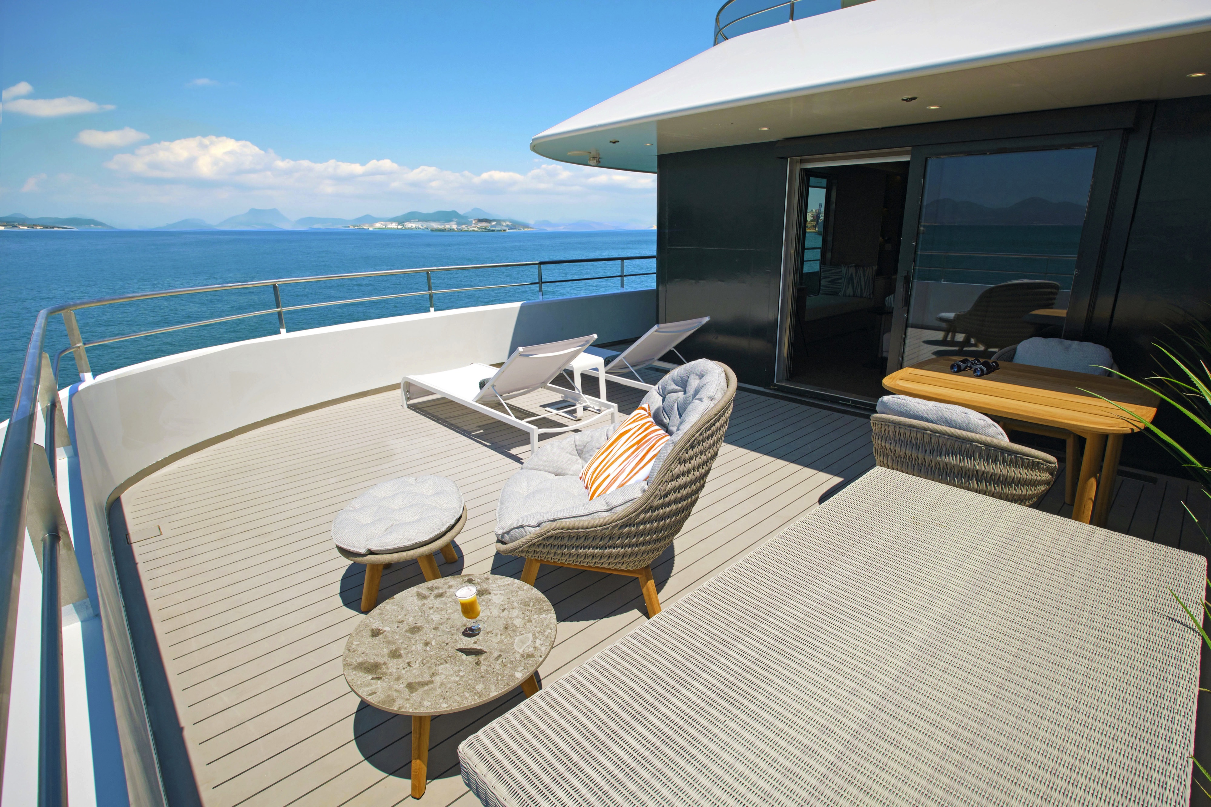
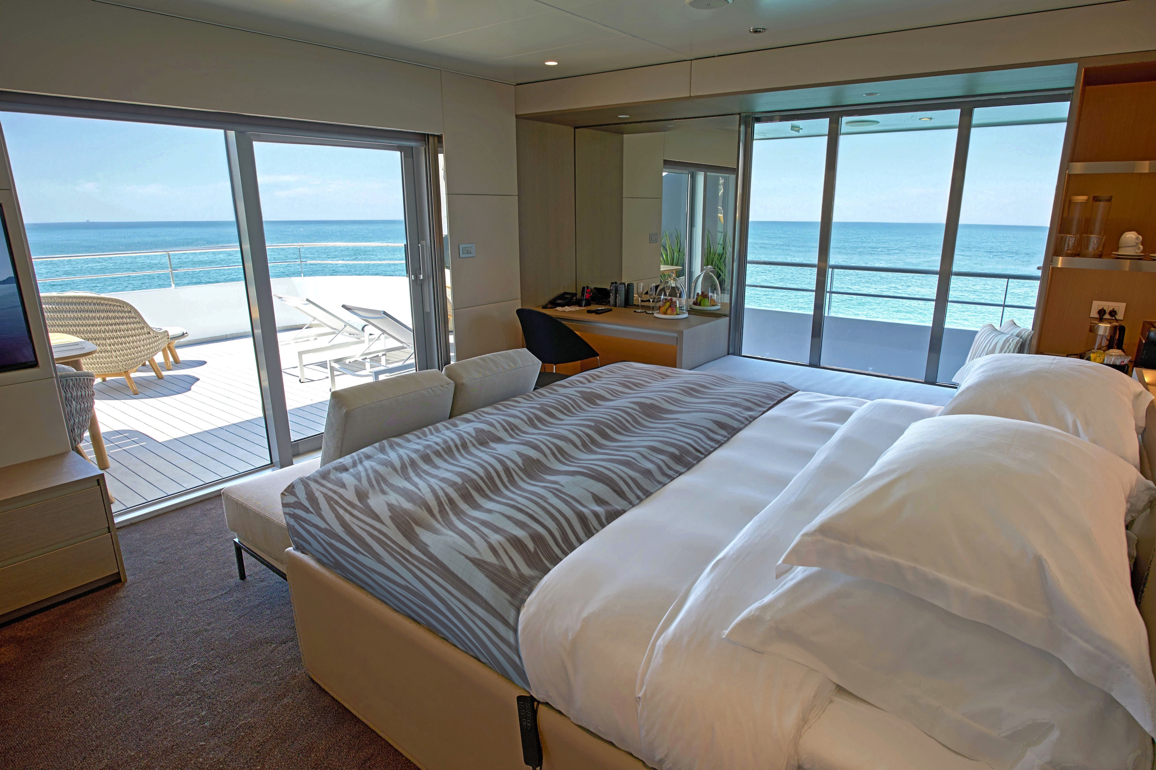
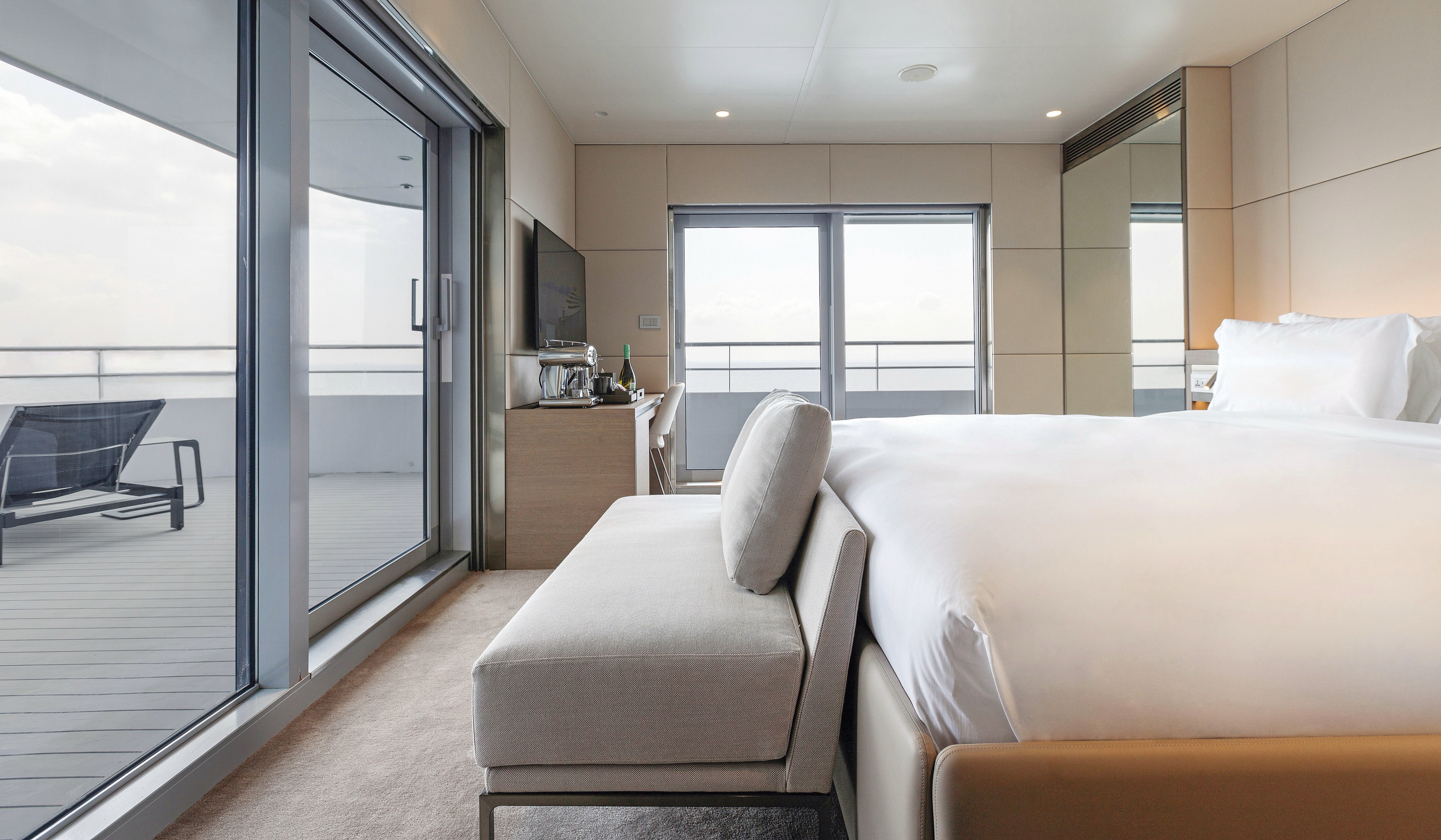
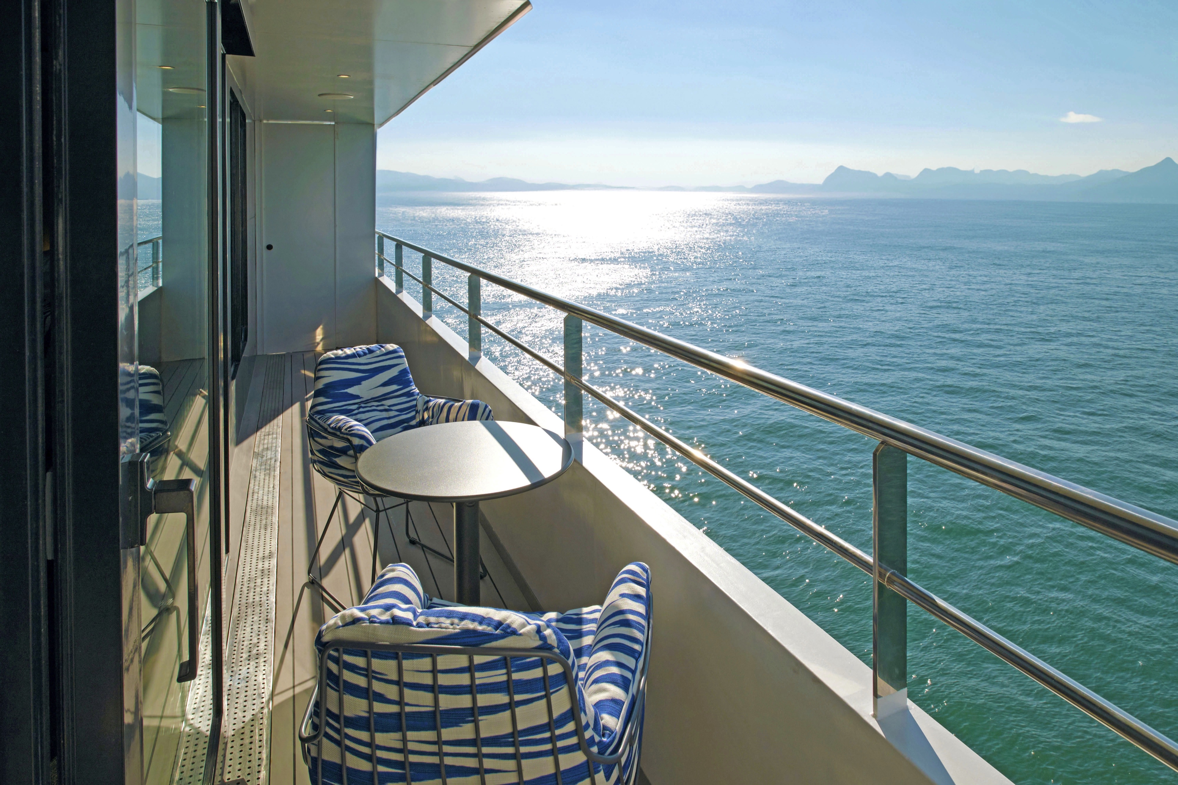
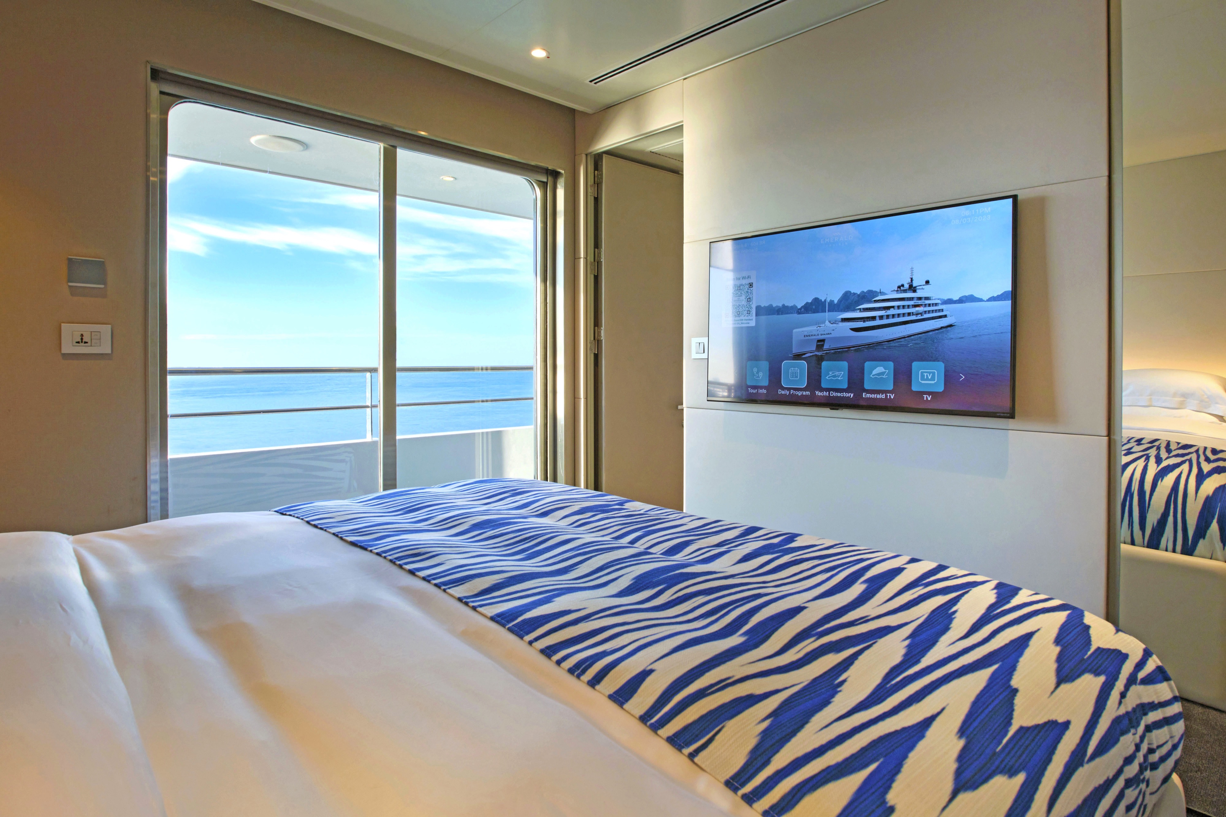
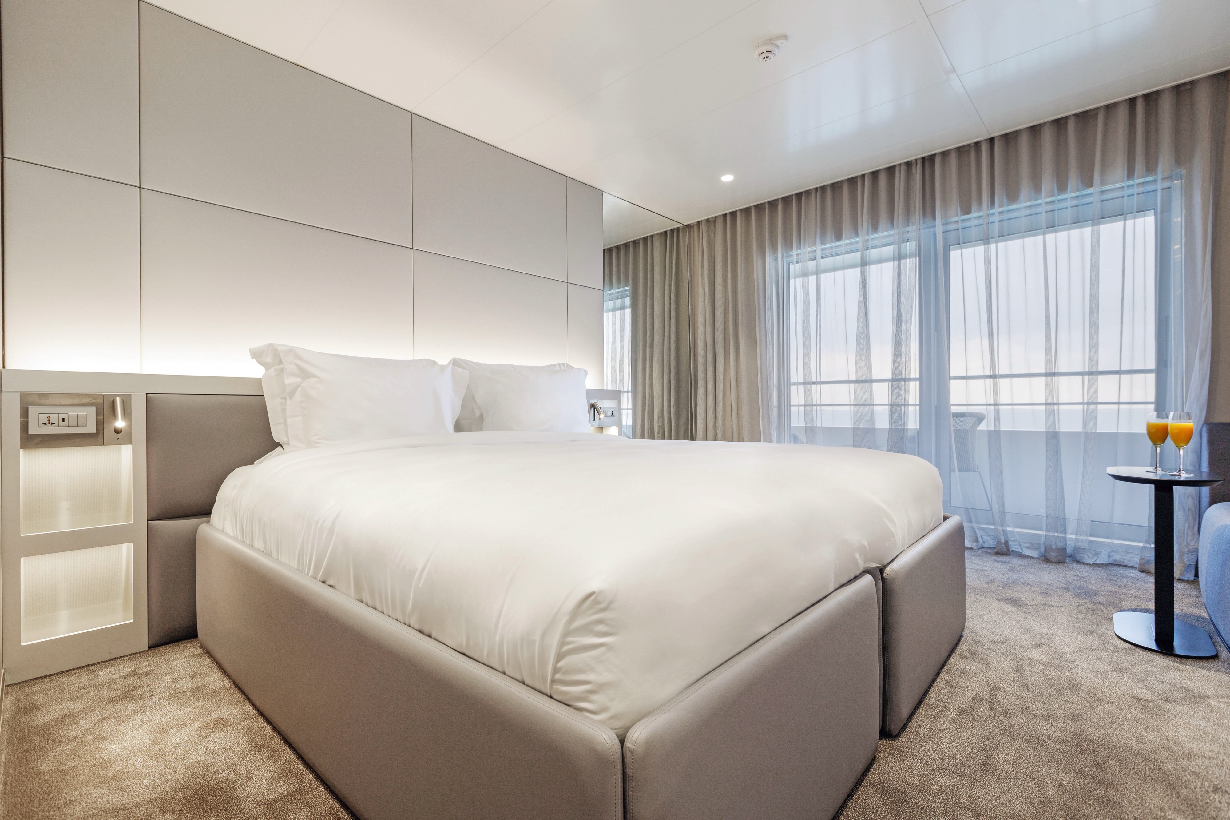
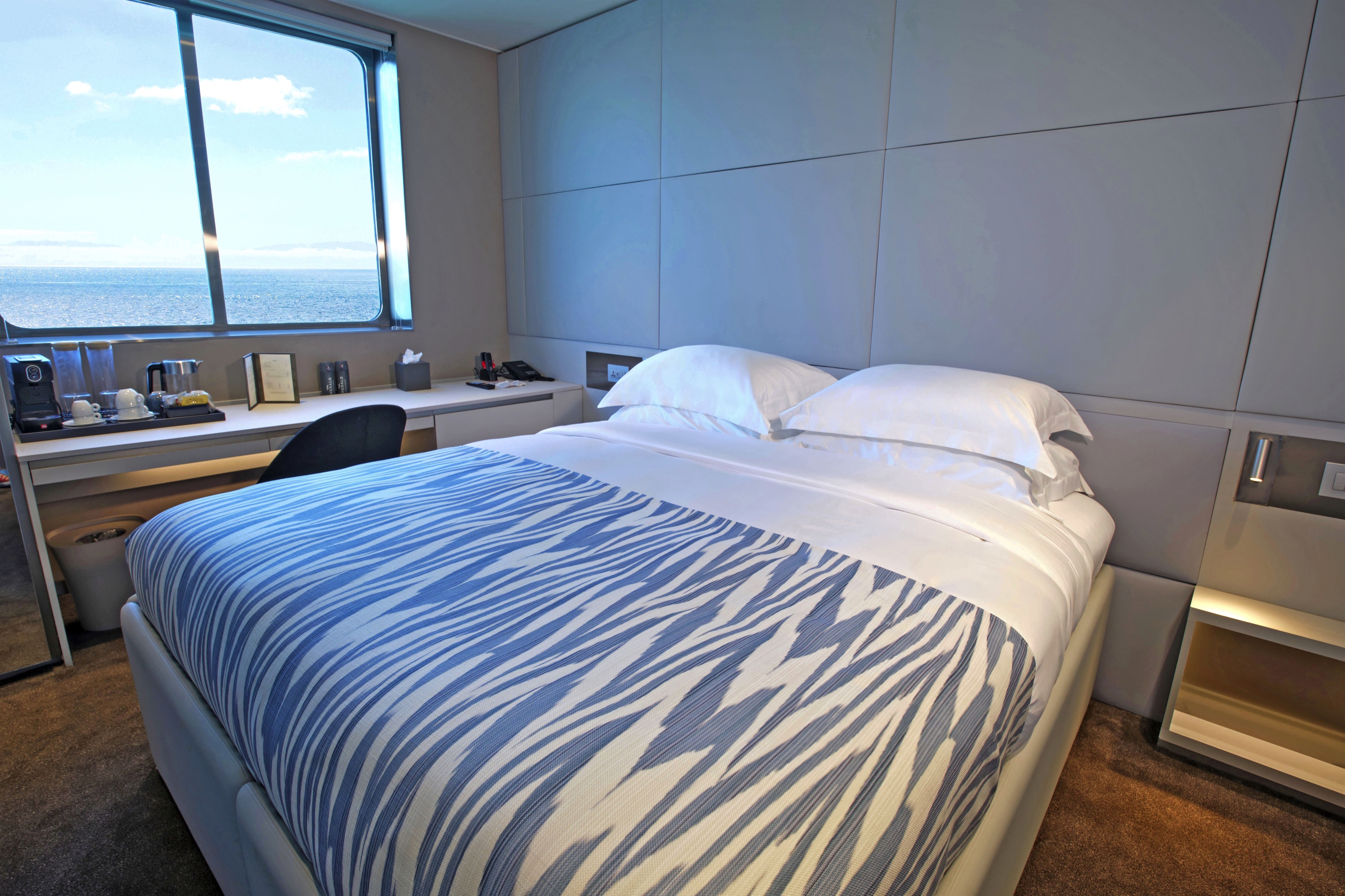
Wonderfully positioned at the back of the Observation Deck, you’ll be treated to sensational ocean and coastal views from your large private terrace.
Toast to your arrival with a complimentary bottle of champagne and a decadent fruit platter which will be waiting for you.
- Your own private terrace
- Walk-in wardrobe
- Queen-size or twin hotel-style beds with the finest Egyptian cotton linen
- Pillow menu
- Bathroom with shower, indulgent toiletries and hairdryer
- Complimentary bathrobes and slippers
- Welcome bottle of champagne
- Fruit platter on arrival
- Full mini-bar, restocked daily
- Complimentary water, restocked daily
- Flat screen HDTV and infotainment system
- Complimentary Wi-Fi
- Individual climate control
- Coffee and tea-making facilities
- Two laundered items daily
- Personal safe
- Umbrella
- Telephone
- Your own private terrace
- Queen-size or twin hotel-style beds with the finest Egyptian cotton linen
- Pillow menu
- Bathroom with shower, indulgent toiletries and hairdryer
- Complimentary bathrobes and slippers
- Welcome bottle of champagne
- Fruit platter on arrival
- Full mini-bar, restocked daily
- Complimentary water, restocked daily
- Flat screen HDTV and infotainment system
- Complimentary Wi-Fi
- Individual climate control
- Coffee and tea-making facilities
- Two laundered items daily
- Personal safe
- Umbrella
- Telephone
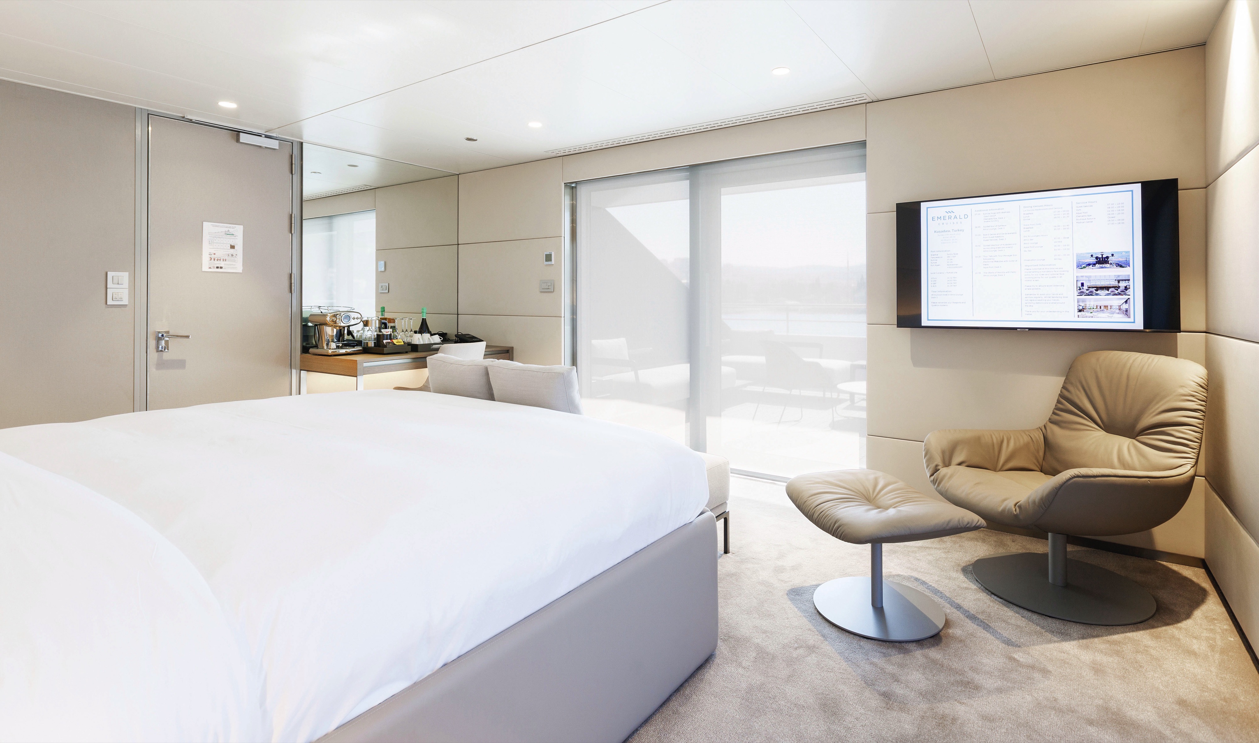
Situated on the Pool Deck, our two Deluxe Balcony Suites boast more space for your comfort.
Along with a private balcony, additional inclusions consist of coffee and tea-making facilities and a pillow menu for the perfect night’s sleep.
- Queen-size or twin hotel-style beds with the finest Egyptian cotton linen
- Pillow menu
- Bathroom with shower, indulgent toiletries and hairdryer
- Complimentary bathrobes and slippers
- Fruit platter on arrival
- Complimentary water, restocked daily
- Flat screen HDTV and infotainment system
- Complimentary Wi-Fi
- Individual climate control
- Coffee and tea-making facilities
- Mini-bar
- Personal safe
- Umbrella
- Telephone

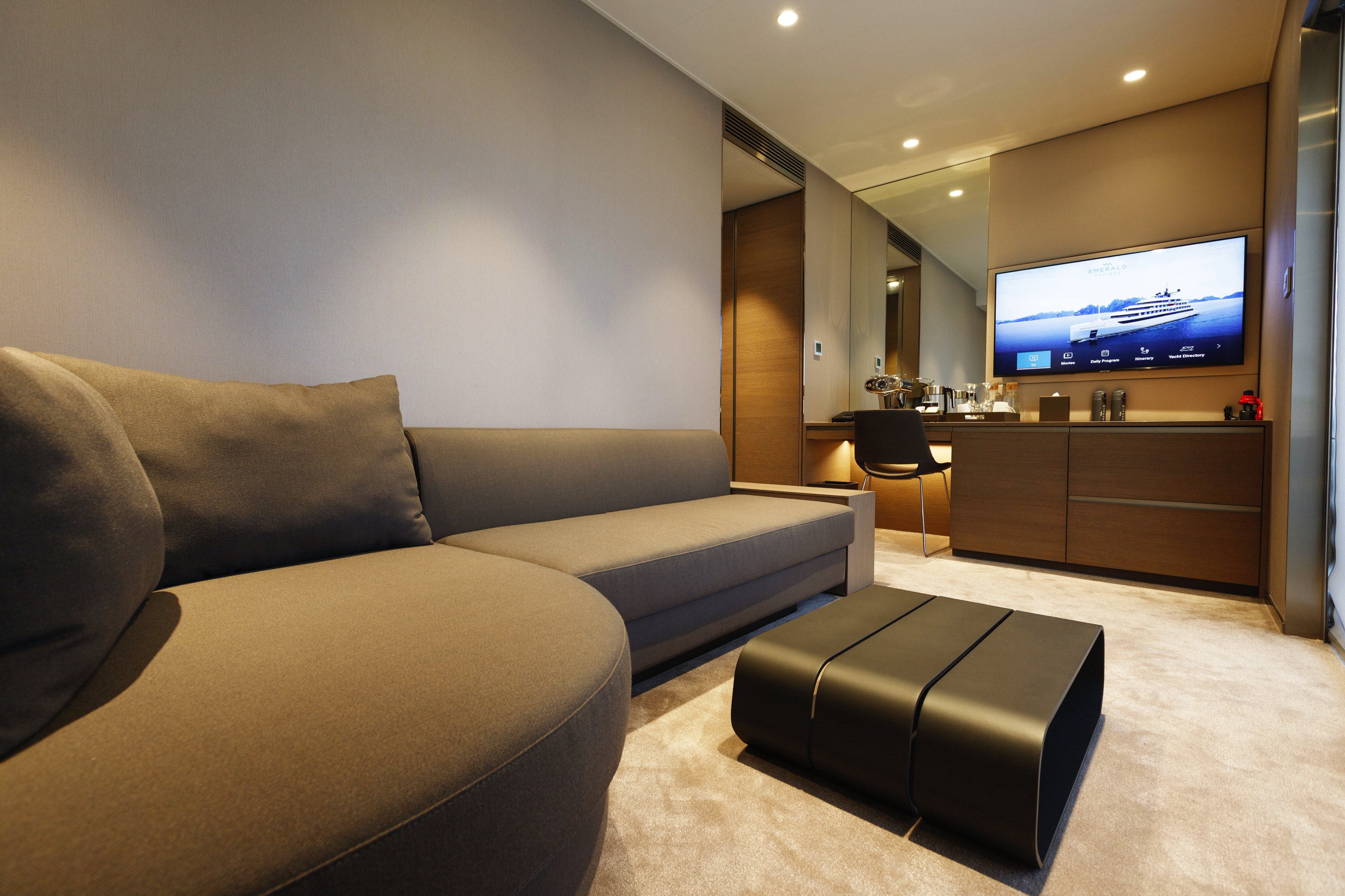
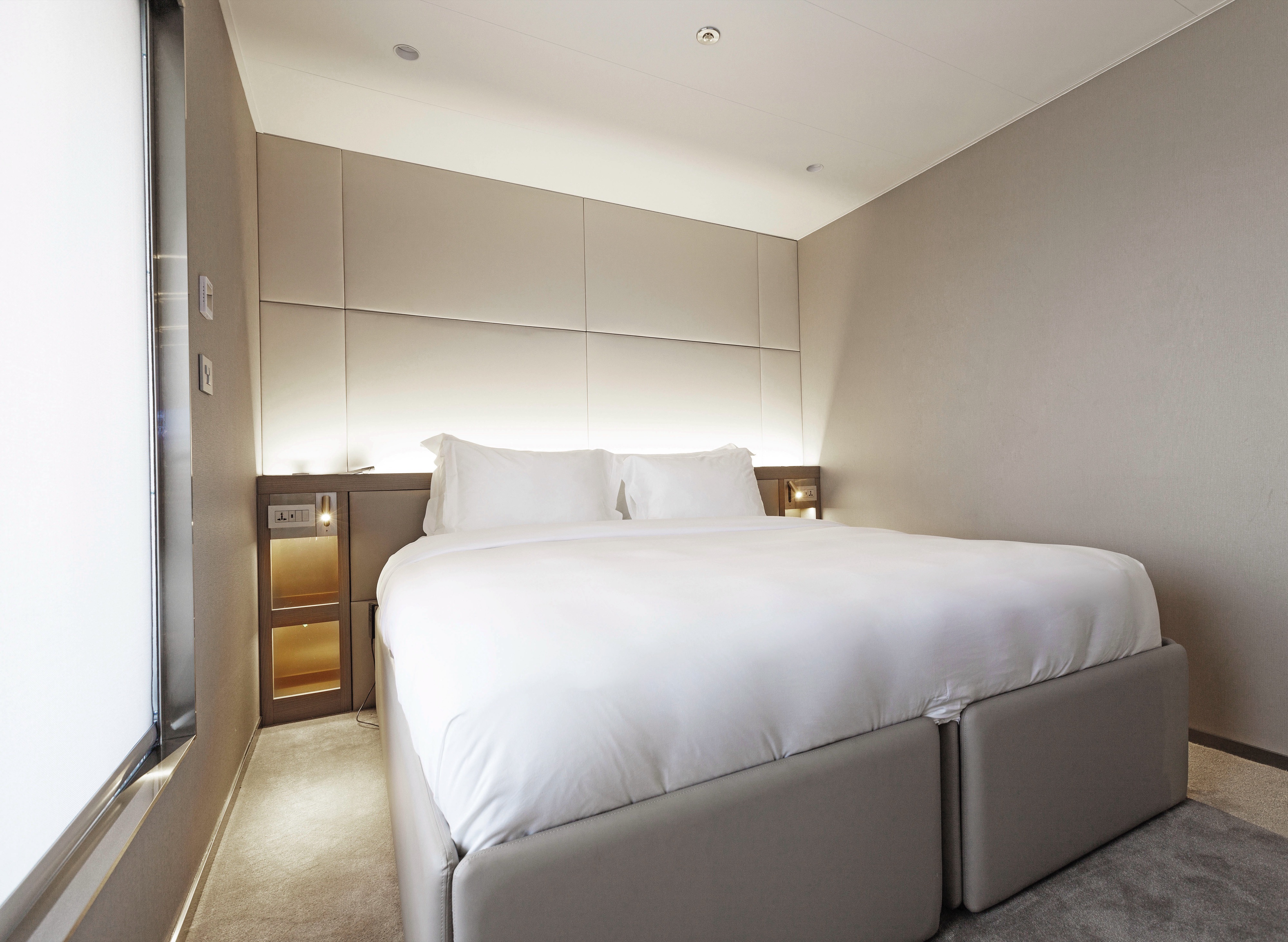
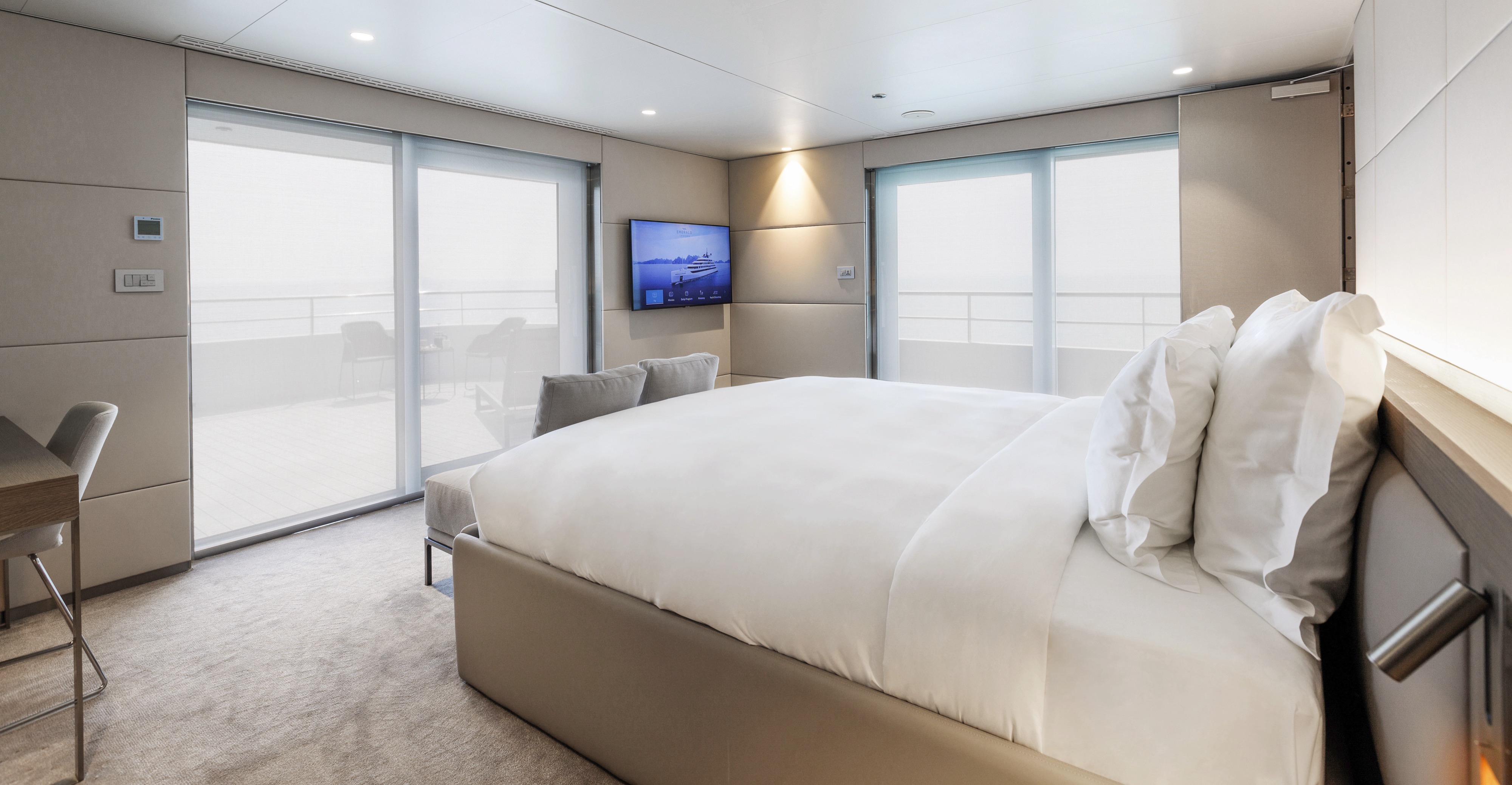
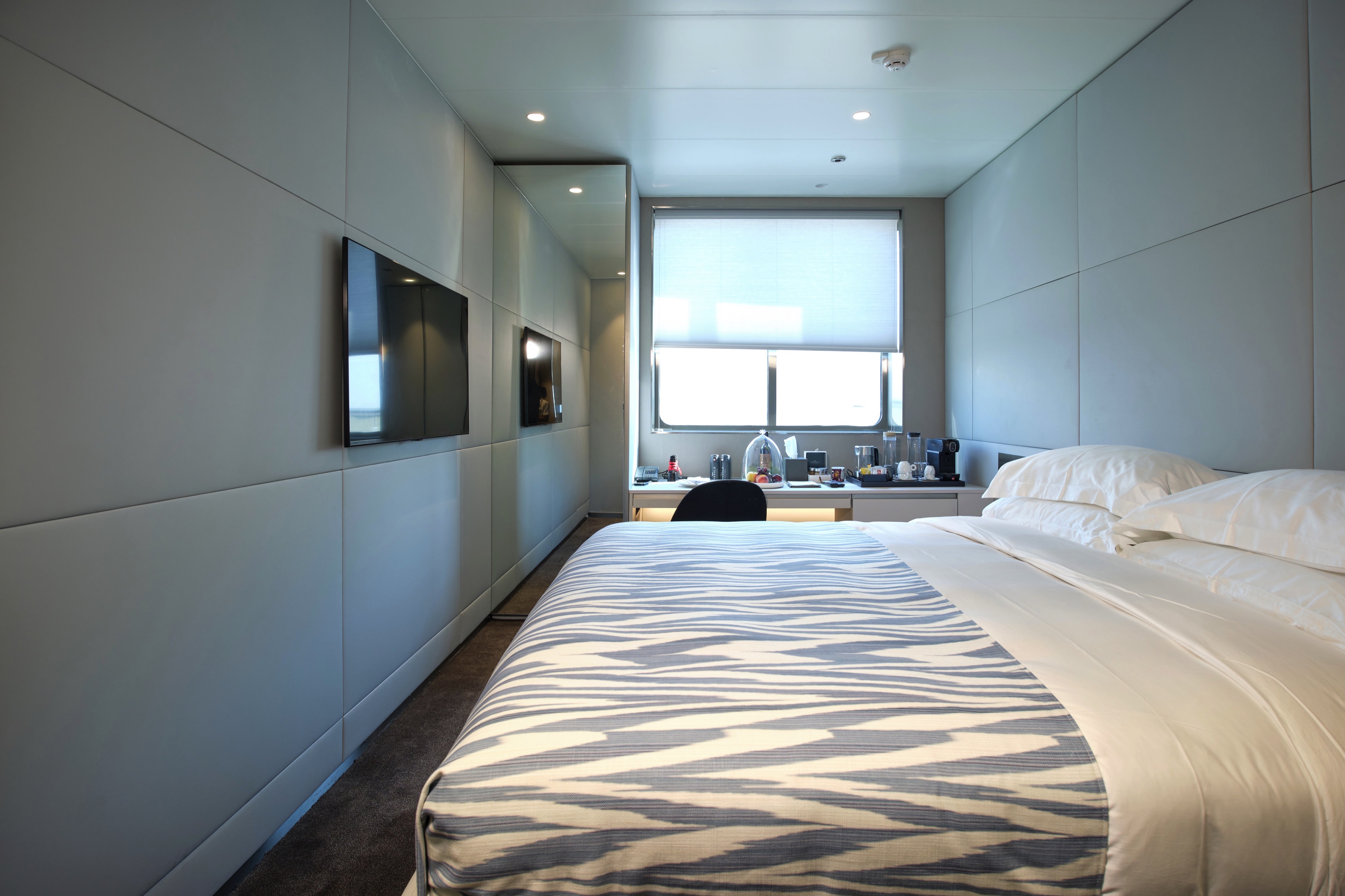
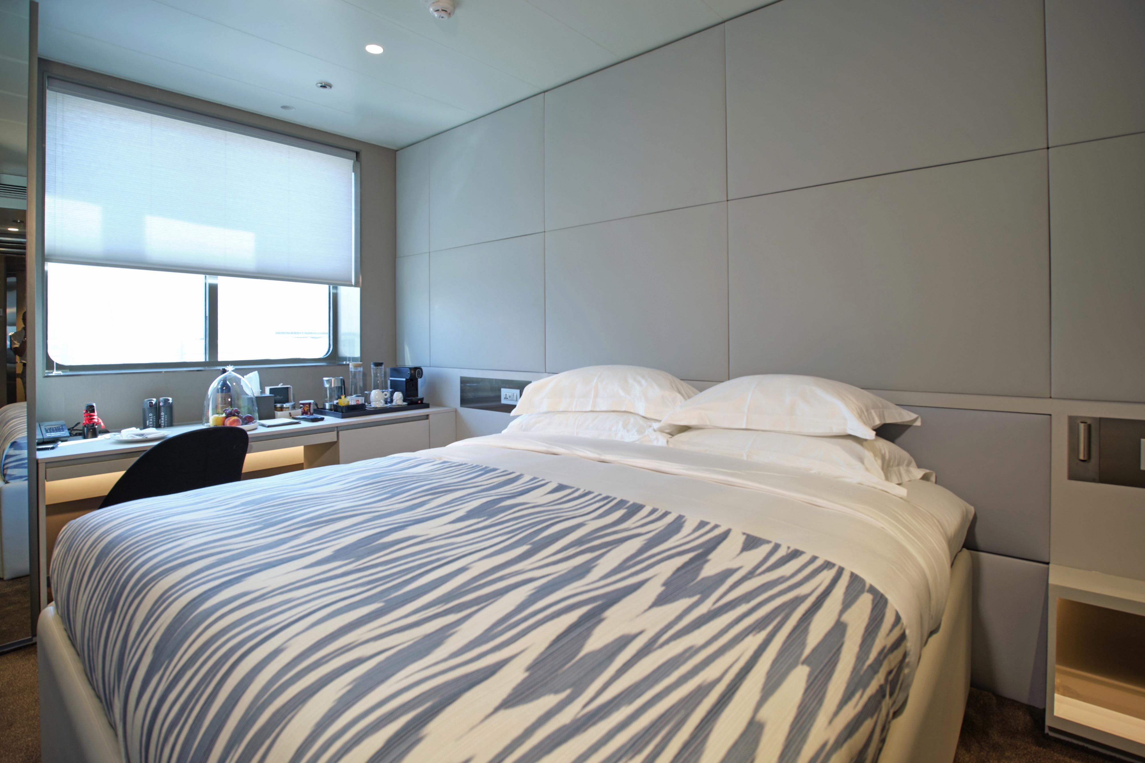
Divided between the Observation and Panorama decks, our Balcony Suites are your stylish home-away-from-home.
Featuring everything you’d expect from a world-class hotel, each one includes your own private balcony, from which to enjoy the stunning panoramas.
- Your own private outdoor balcony
- Queen-size or twin hotel-style beds with the finest Egyptian cotton linen
- Bathroom with shower, indulgent toiletries and hairdryer
- Complimentary bathrobes and slippers
- Complimentary water, restocked daily
- Flat screen HDTV and infotainment system
- Complimentary Wi-Fi
- Individual climate control
- Mini-bar
- Personal safe
- Umbrella
- Telephone

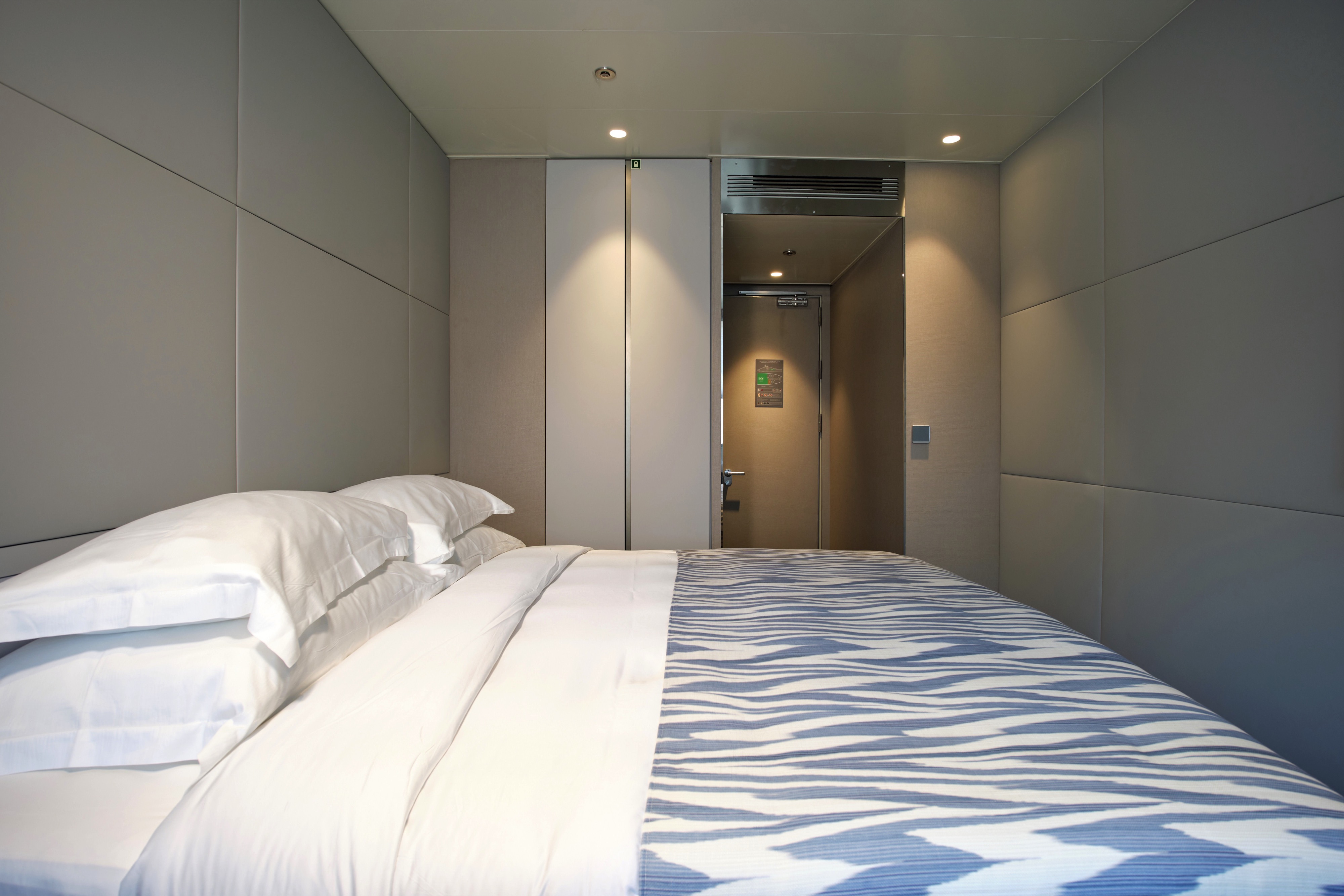
You’ll find six of our superb value Oceanview Staterooms on the Emerald Deck, situated towards the front of the yacht, each with their own ocean-view window.
Instantly settle in with our selection of included modern amenities and make the most of your close proximity to the Horizon Bar & Lounge.
- An ocean-view window
- Queen-size or twin hotel-style beds with the finest Egyptian cotton linen
- Bathroom with shower, indulgent toiletries and hairdryer
- Complimentary bathrobes and slippers
- Complimentary water, restocked daily
- Flat screen HDTV and infotainment system
- Complimentary Wi-Fi
- Individual climate control
- Mini-bar
- Personal safe
- Umbrella
- Telephone
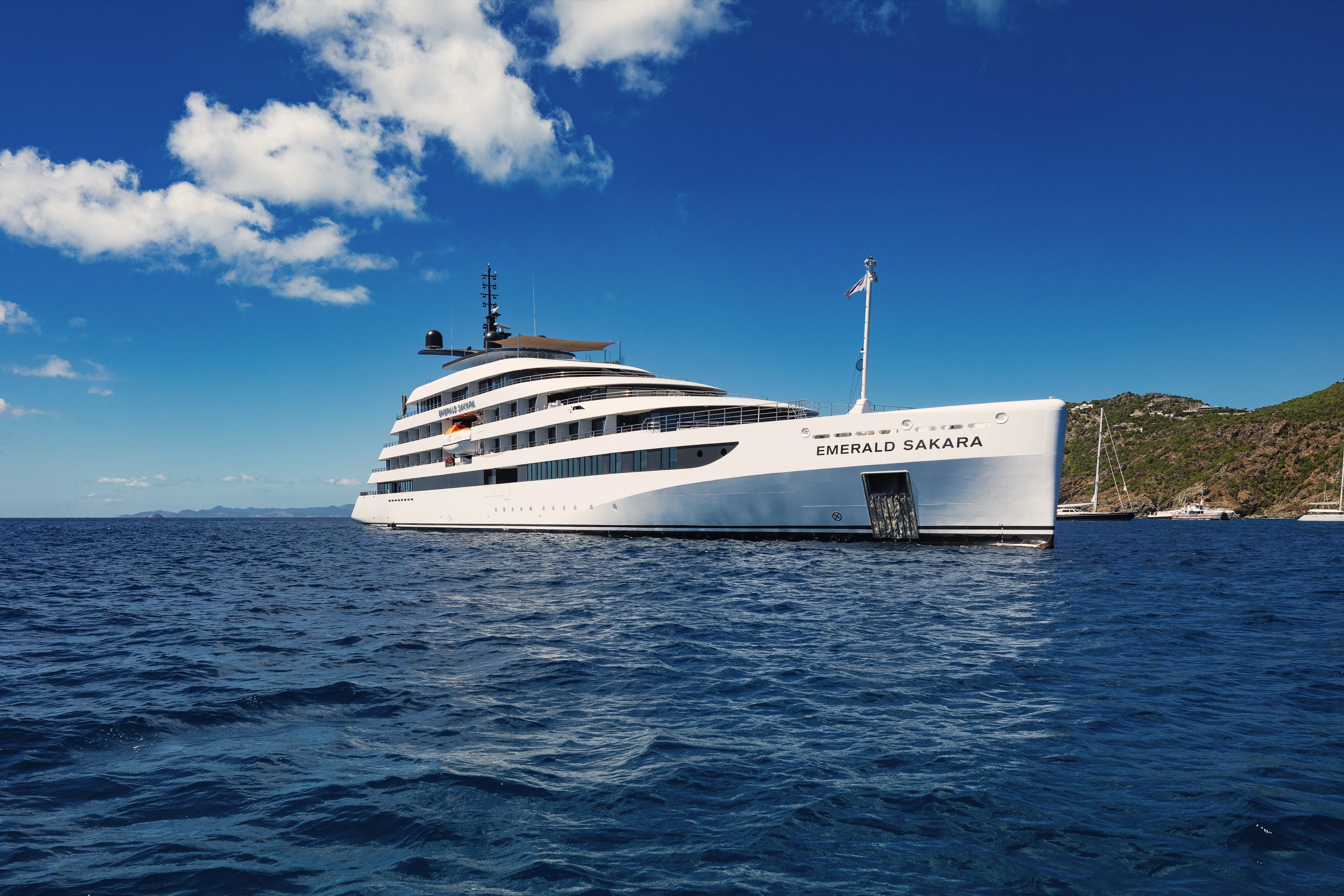
Emerald Sakara
The sister yacht to the award-winning Emerald Azzurra, Emerald Sakara mirrors the luxury surrounds of her sister to perfection. Relax on board as our crew provides an unparalleled service, and explore the wealth of world-class amenities on board.
Ship Facts
| Launch Year | 2023 | ||||||||
| Refit Year | |||||||||
| Language | en | ||||||||
| Gross Tonnage | N/A | ||||||||
| Length | 110 | ||||||||
| Width | N/A | ||||||||
| Currency | EUR | ||||||||
| Speed | N/A | ||||||||
| Capacity | 100 | ||||||||
| Crew Count | 72 | ||||||||
| Deck Count | 6 | ||||||||
| Cabin Count | 50 | ||||||||
| Large Cabin Count | N/A | ||||||||
| Wheelchair Cabin Count | N/A | ||||||||
| Electrical Plugs |
|
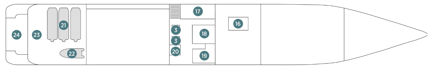
Sky Deck
- Spa Pool
- Sky Bar
- Lifts

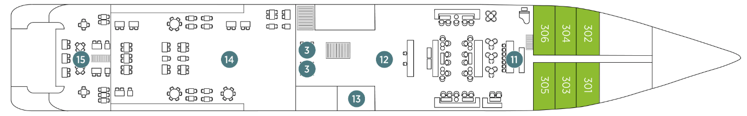
Pool Deck
- Lifts
- Aqua Café
- Aqua Pool
- Owner's Suite
- Deluxe Balcony Suite
Panorama Deck
- Navigation Bridge
- Life Boats
- Terrace Suite
- Balcony Suite
- Lifts
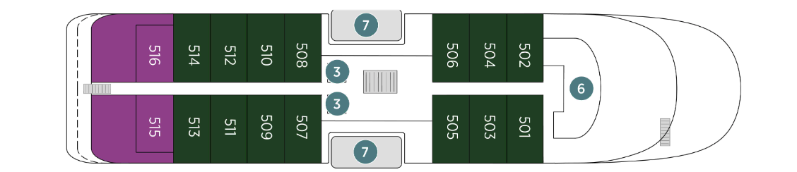
Observation Deck
- Observation Lounge
- Observation Terrace
- Self-service Laundry
- Yacht Suites
- Balcony Suites
- Lifts
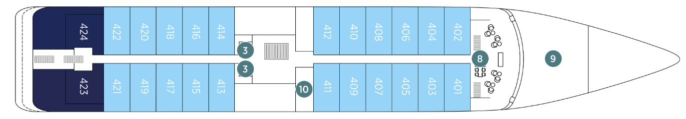
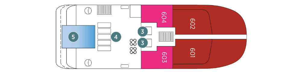
Emerald Deck
- Amici Bar & Lounge
- Reception
- Boutique Azzurra
- La Cucina Terrace
- La Cucina Dining
- Oceanview Staterooms
- Lifts
Wellness Deck
- Medical Centre
- Gym
- Infrared Sauna
- Elements Spa
- Hairdressers
- Tender Boats
- Water Sports Boat
- Garage
- Marina Platform
- Lifts
Enjoy the most delectable dishes in the opulent surrounds of the La Cucina Dining. Let the tastes of freshly sourced ingredients on your palate, and enjoy complimentary beverages with each meal.
La Cucina
Enjoy the most delectable dishes in the opulent surrounds of the La Cucina Dining. Let the tastes of freshly sourced ingredients on your palate, and enjoy complimentary beverages with each meal.
La Cucina Terrace
If you prefer to dine alfresco, head to the La Cucina Terrace.
From the chilled and relaxed vibe of the Amici Bar & Lounge to the open-air surrounds of the Pool Deck and the serene Observation Lounge, you’ll find plenty of spaces on board to enjoy the company of new-found friends or to take a moment for yourself.
Sky Deck
Enjoy a drink from the Sky Bar, relax on the plush seating, or take a dip in the bubbling Spa pool.
Observation Lounge
Head to the Observation Deck area for spectacular views or a morning yoga session. In the Observation Lounge, sit back and relax with a good book or play a game of chess.
Amici Bar & Lounge
At the Amici Bar & Lounge, grab your morning coffee or meet friends here in the evenings for your favourite drink and some entertainment.
Aqua Pool & Café
Take in the views as you swim in the infinity-style Aqua Pool. Soak up the sun from the comfortable loungers or find some plush seating in the shade. Enjoy a coffee, scoop of gelato, or a freshly-made flatbread at the Aqua Pool Café.
Reception
The Reception can be found on the Emerald Deck next to the Boutique.