Mediterranean delights
Mediterranean delights
Cruise overview
WHY BOOK WITH US?
- ✔ The Deluxe Cruises’ team has extensive experience in ultra-luxury cruising.
- ✔ Call now to speak to our helpful and experienced Cruise Concierge team.
- ✔ Enjoy our Unique Deluxe Cruises Bonus for substantial savings.
- ✔ Our team will tailor your holiday to your exacting requirements.
- ✔ As agents, we work under the protection of each cruise lines ABTA / ATOL licences
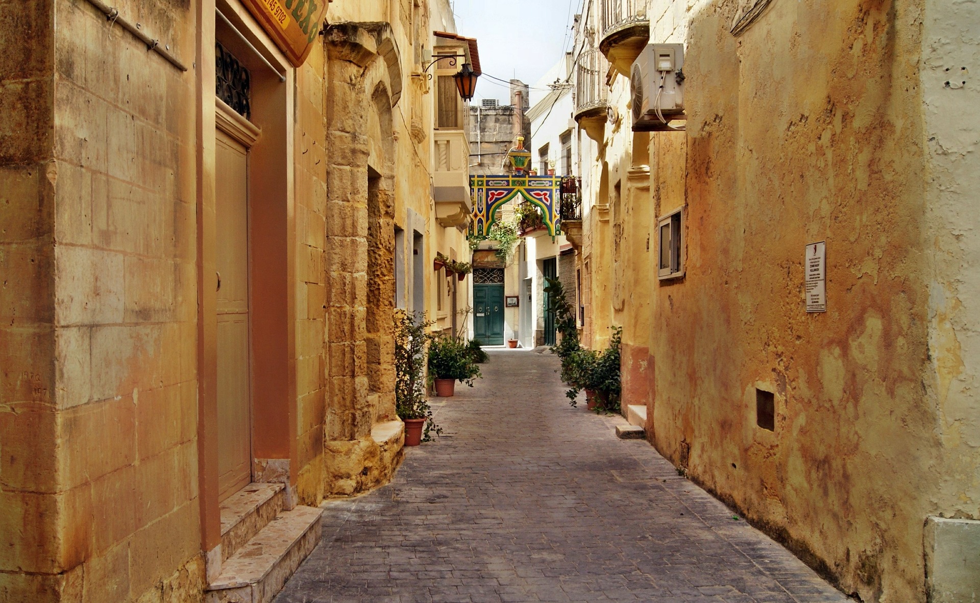
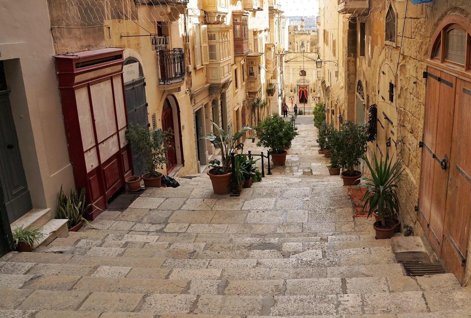
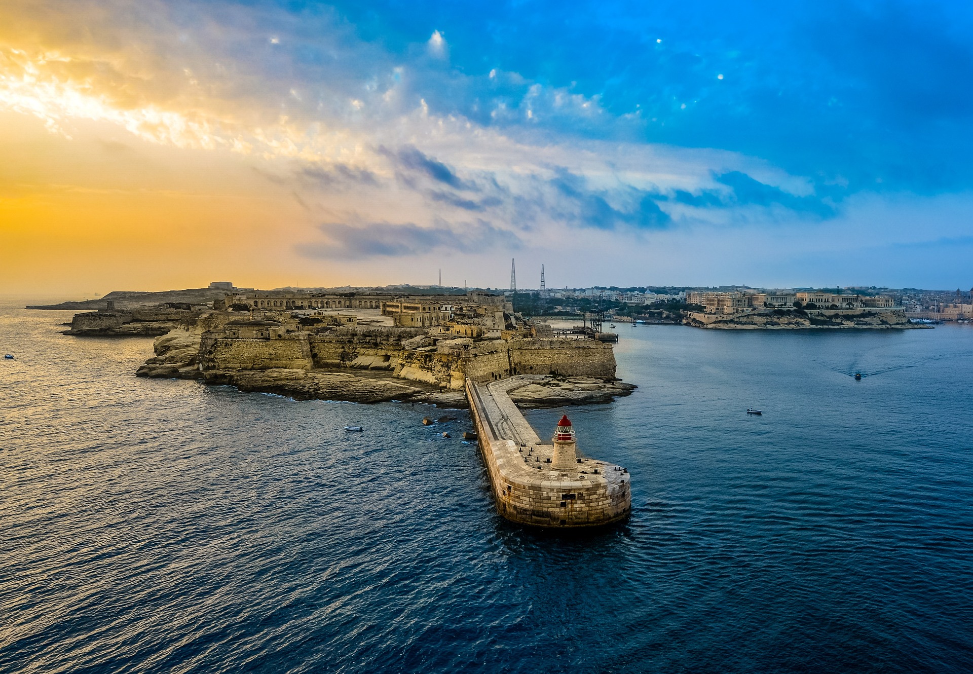
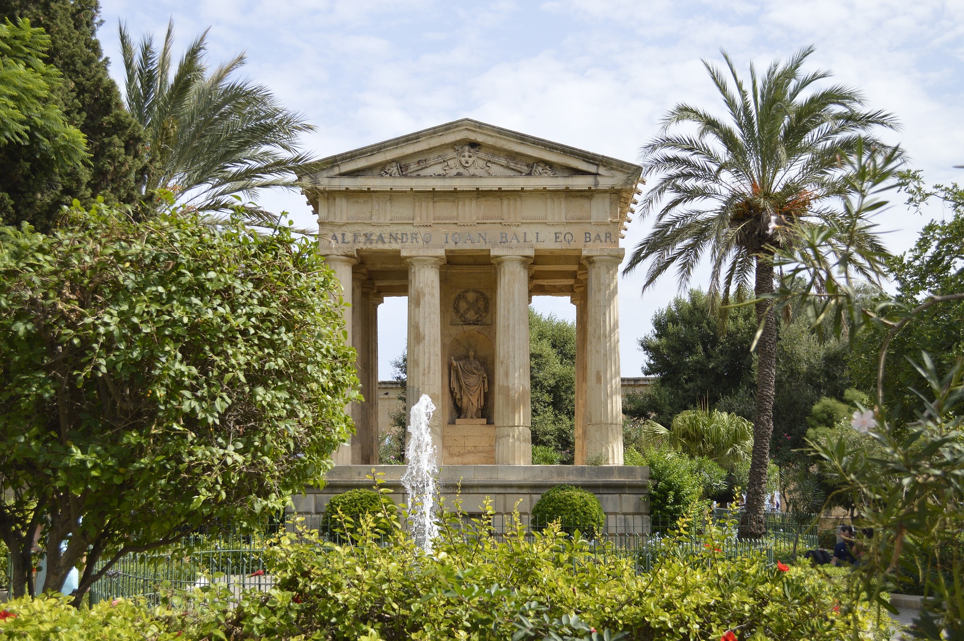
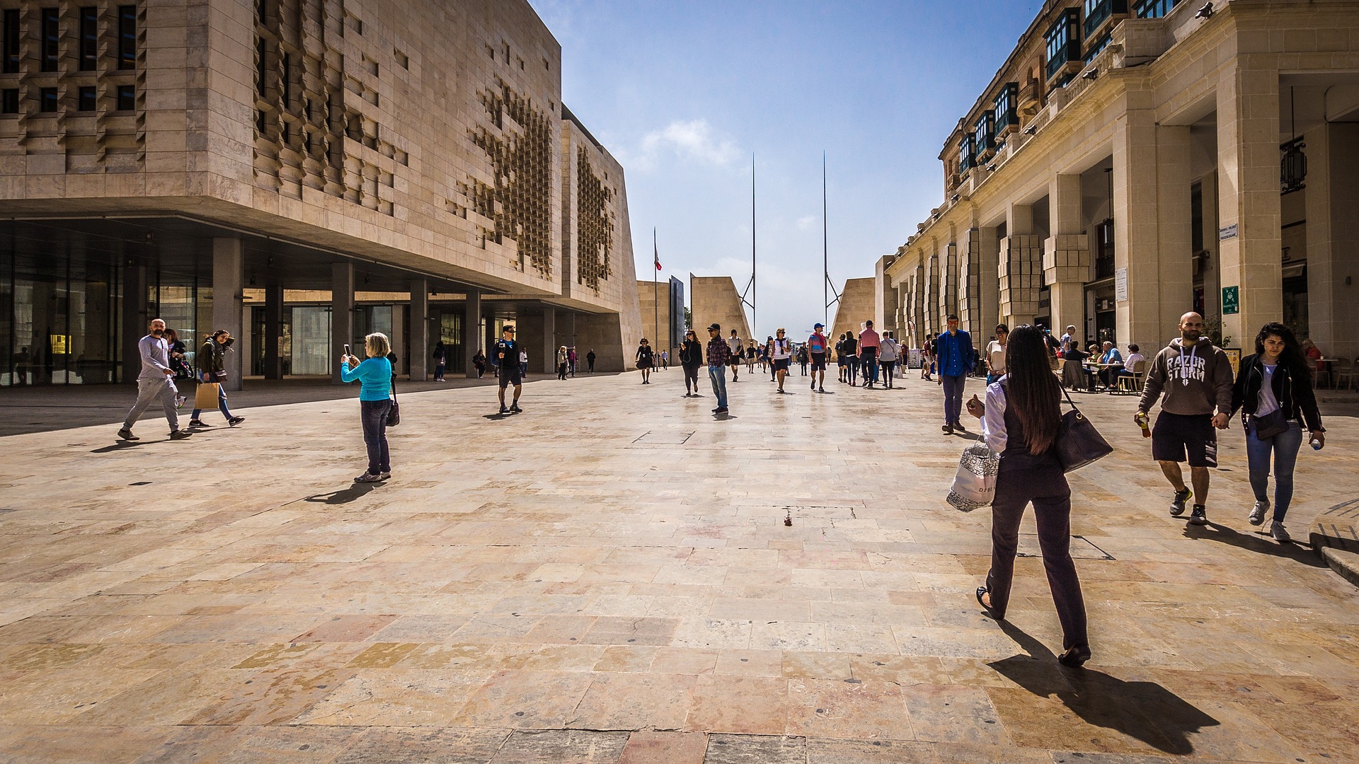
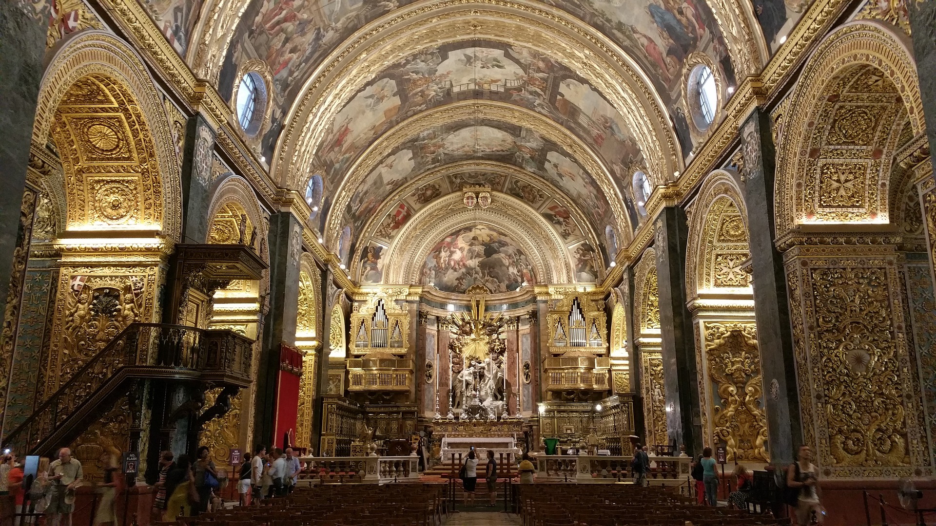
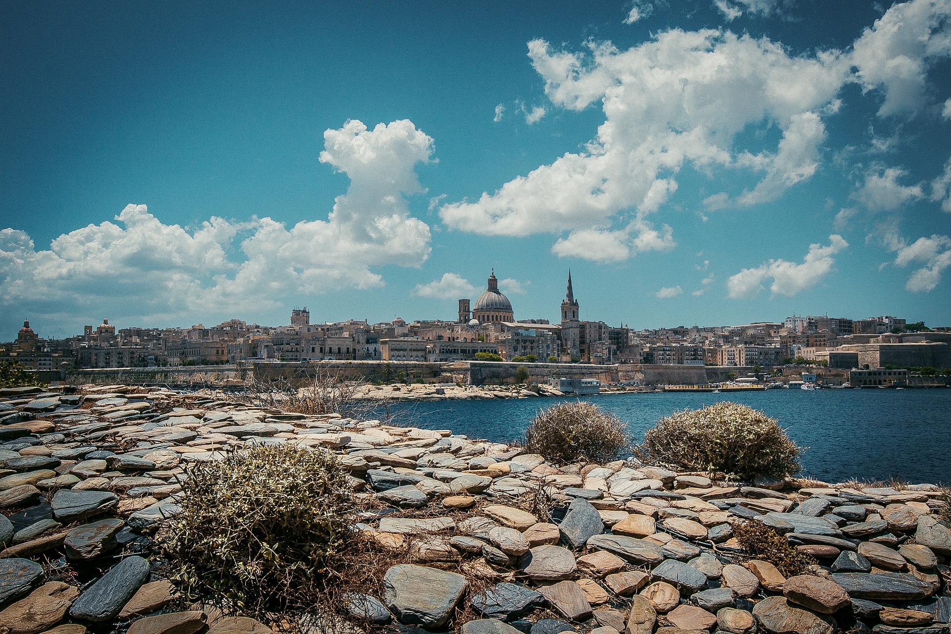
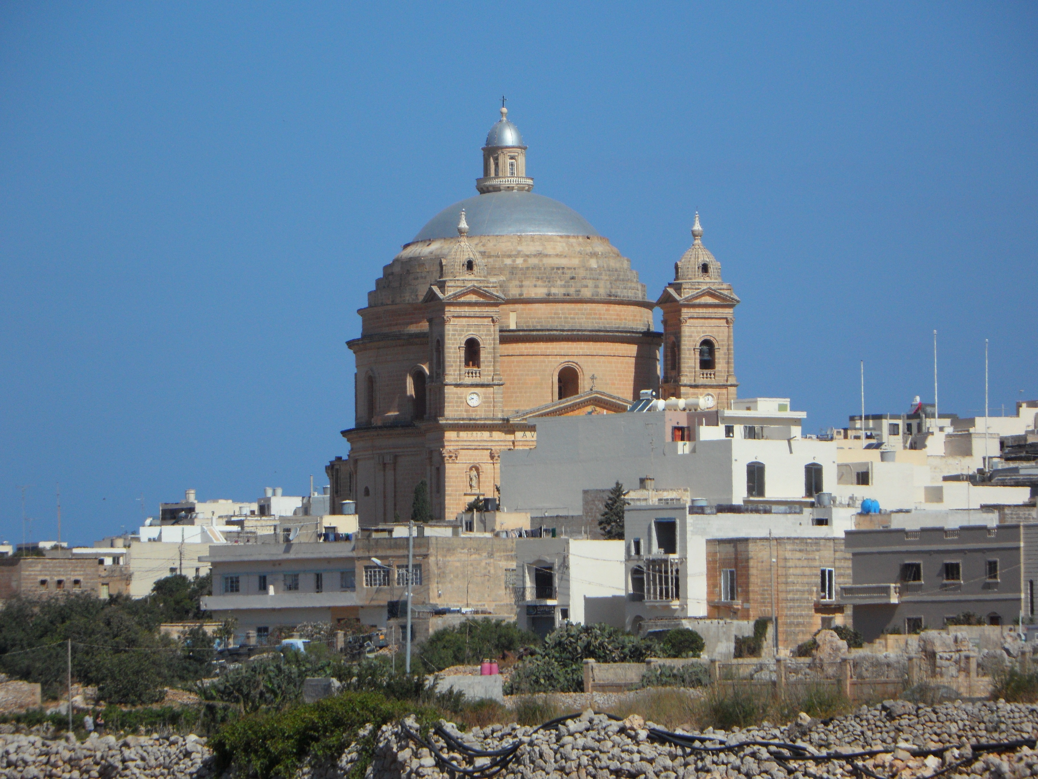
About Valletta
Malta's capital, the minicity of Valletta, has ornate palaces and museums protected by massive fortifications of honey-color limestone. Houses along the narrow streets have overhanging wooden balconies for people-watching from indoors. Generations ago they gave housebound women a window on the world of the street. The main entrance to town is through the City Gate (where all bus routes end), which leads onto Triq Repubblika (Republic Street), the spine of the grid-pattern city and the main shopping street. Triq Mercante (Merchant Street) parallels Repubblika to the east and is also good for strolling. From these two streets, cross streets descend toward the water; some are stepped. Valletta's compactness makes it ideal to explore on foot. City Gate and the upper part of Valletta are experiencing vast redevelopment that includes a new Parliament Building and open-air performance venue. The complex, completed mid-2013, has numerous pedestrian detours in place along with building noise and dust. Before setting out along Republic Street, stop at the tourist information office on Merchant Street for maps and brochures.
About Mgarr, Gozo
About Porto Empedocle
About Mazara del Vallo
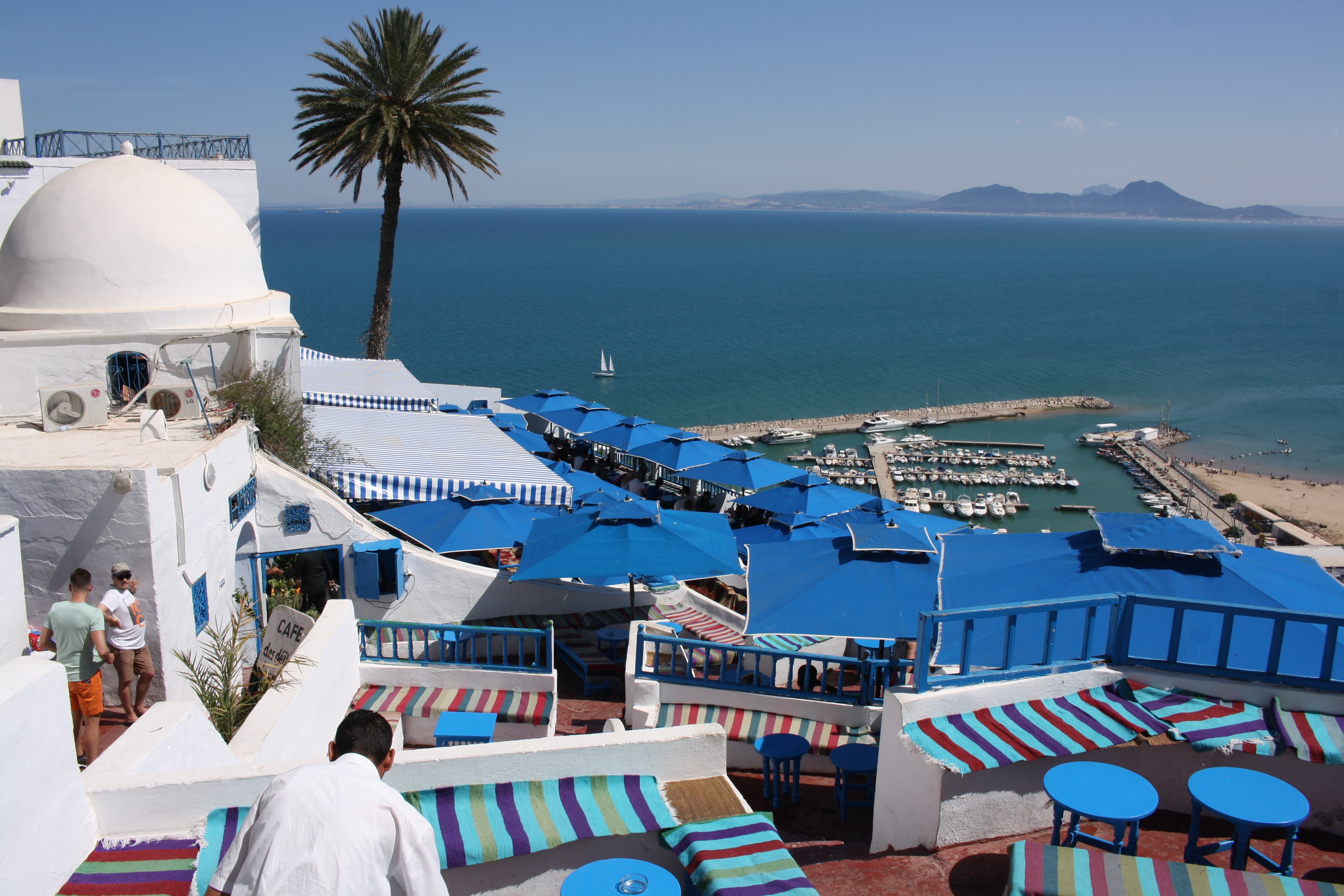
About La Goulette
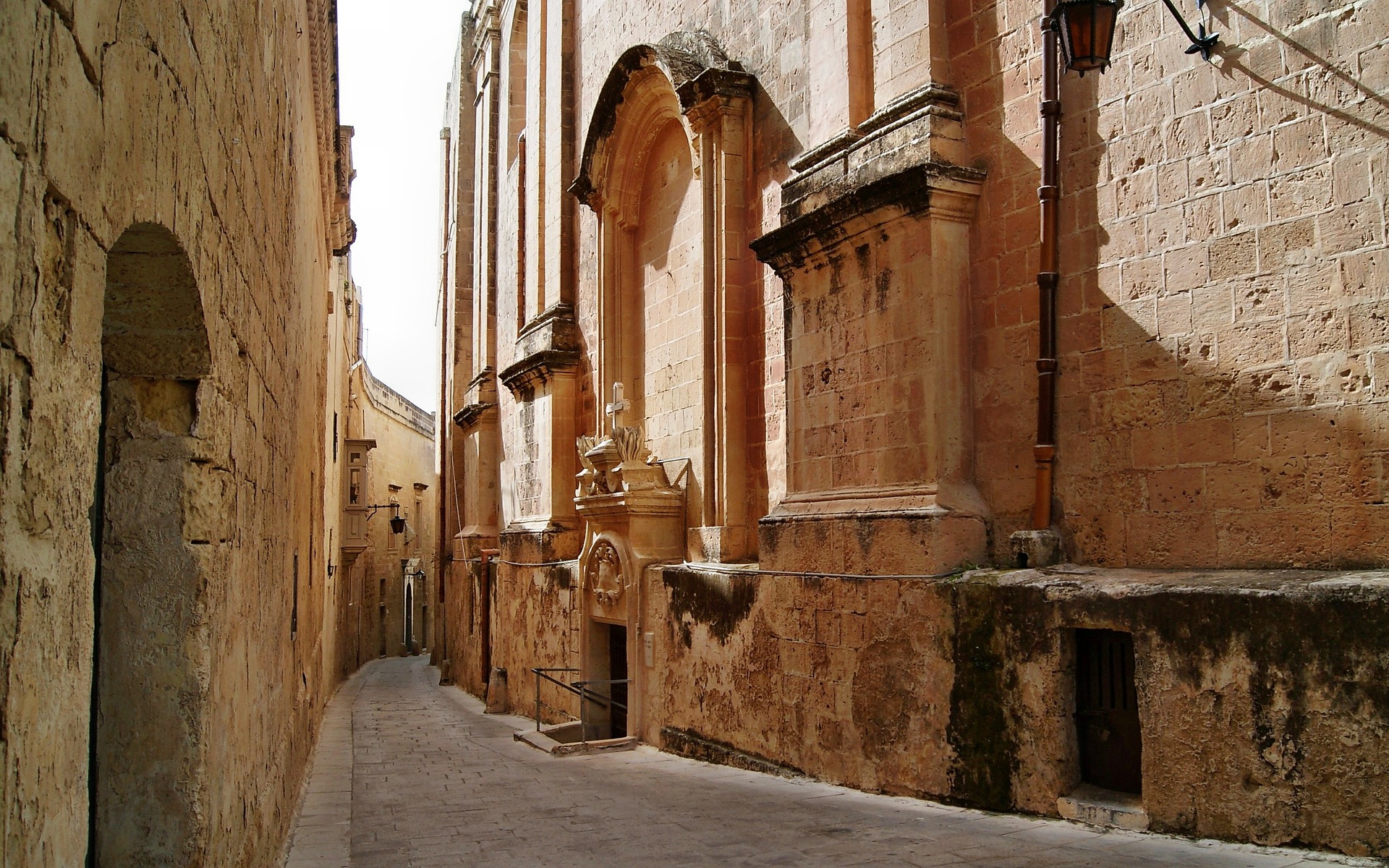
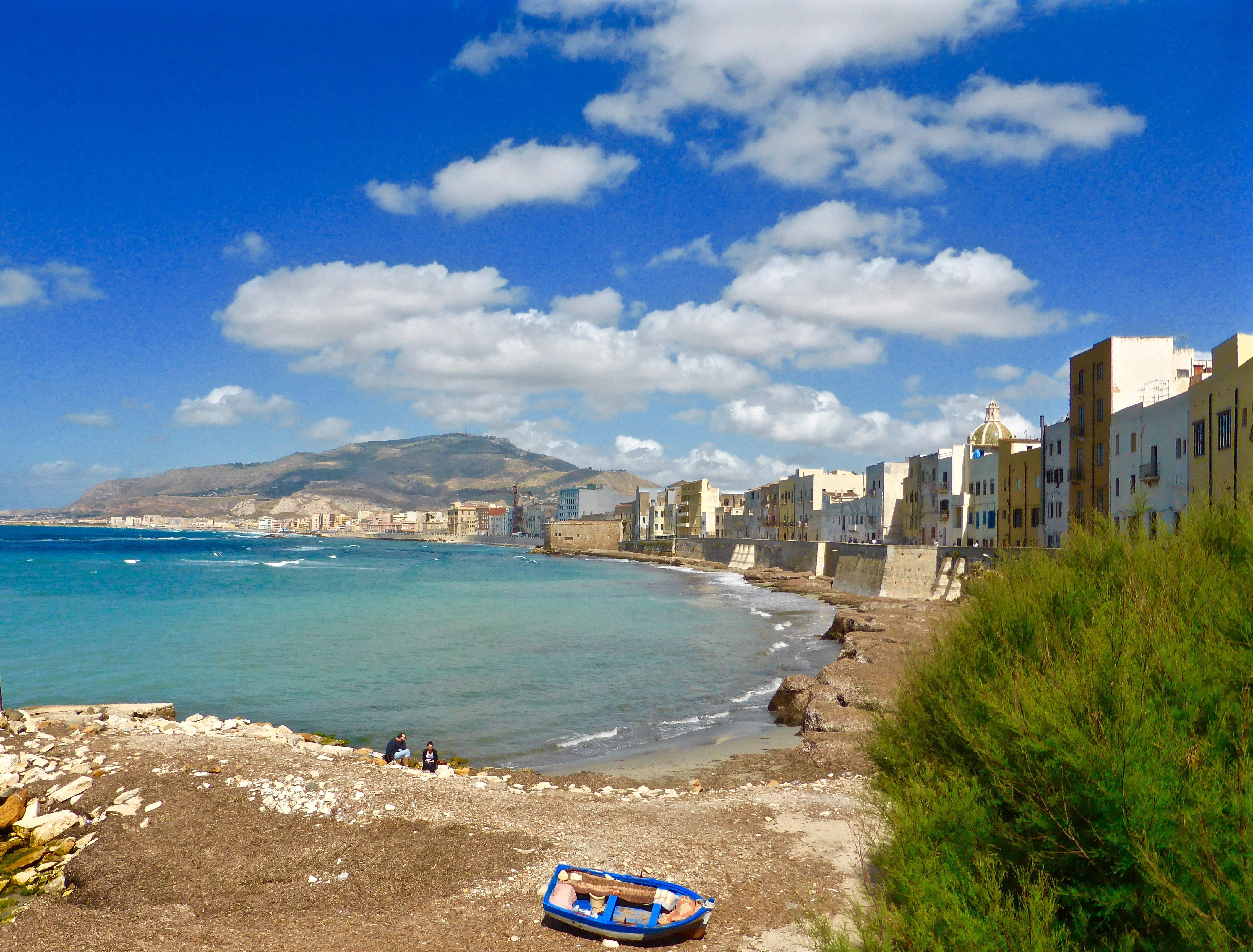
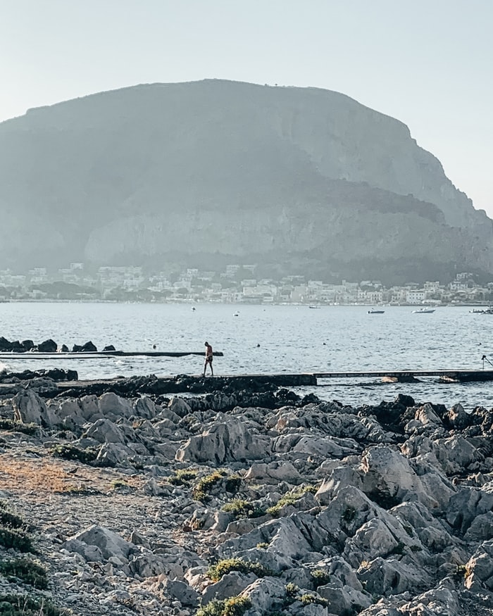
About Trapani, Sicily
Trapani, the most important town on Sicily’s west coast, lies below the headland of Mount Erice and offers stunning views of the Egadi Islands on a clear day. Trapani’s Old District occupies a scimitarshaped promontory between the open sea on the north and the salt marshes to the south. The ancient industry of extracting salt from the marshes has recently been revived, and it is documented in the Museo delle Saline. In addition to the salt marshes,Trapani’s other interesting environs include the beautiful little hill town of Erice, the promontory of Capo San Vito stretching north beyond the splendid headland of Monte Cofano, the lovely island of Motya and the town of Marsala. Trips farther afield will take you to the magnificent site of Segesta or the Egadi Islands, reached by boat or hydrofoil from Trapani Port.
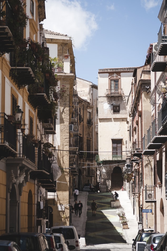
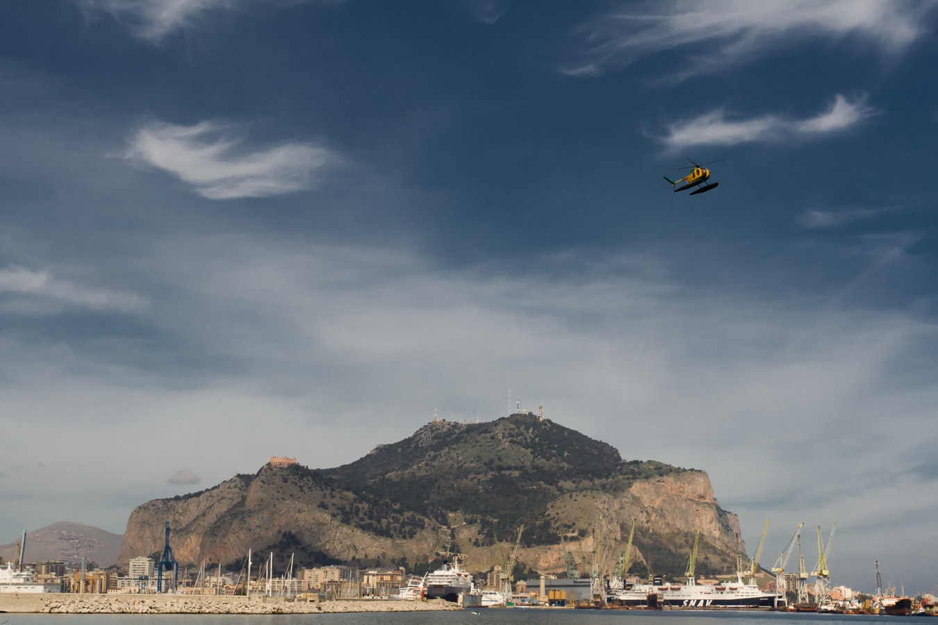
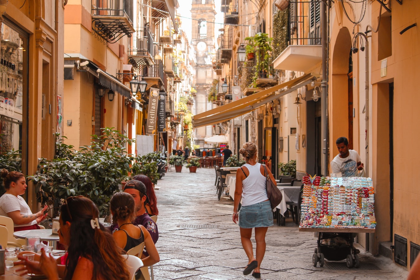
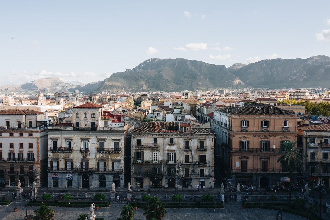
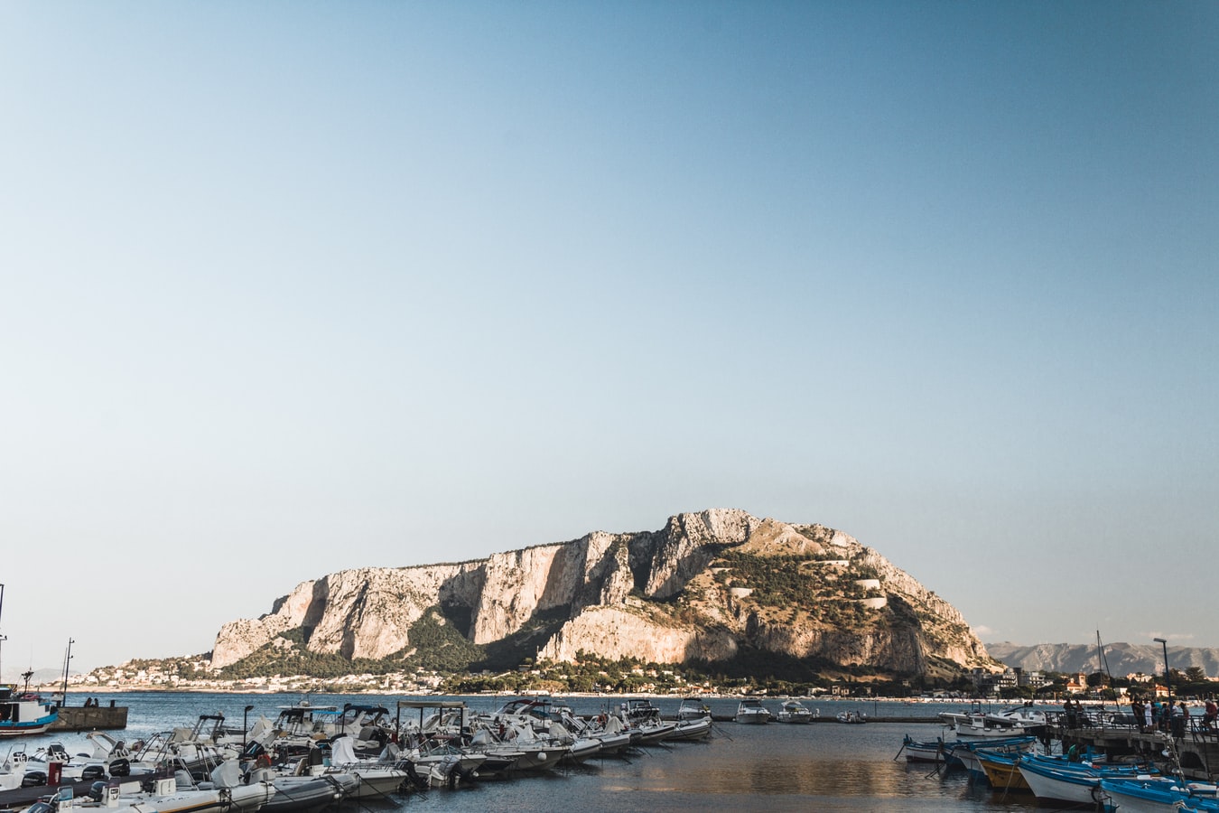
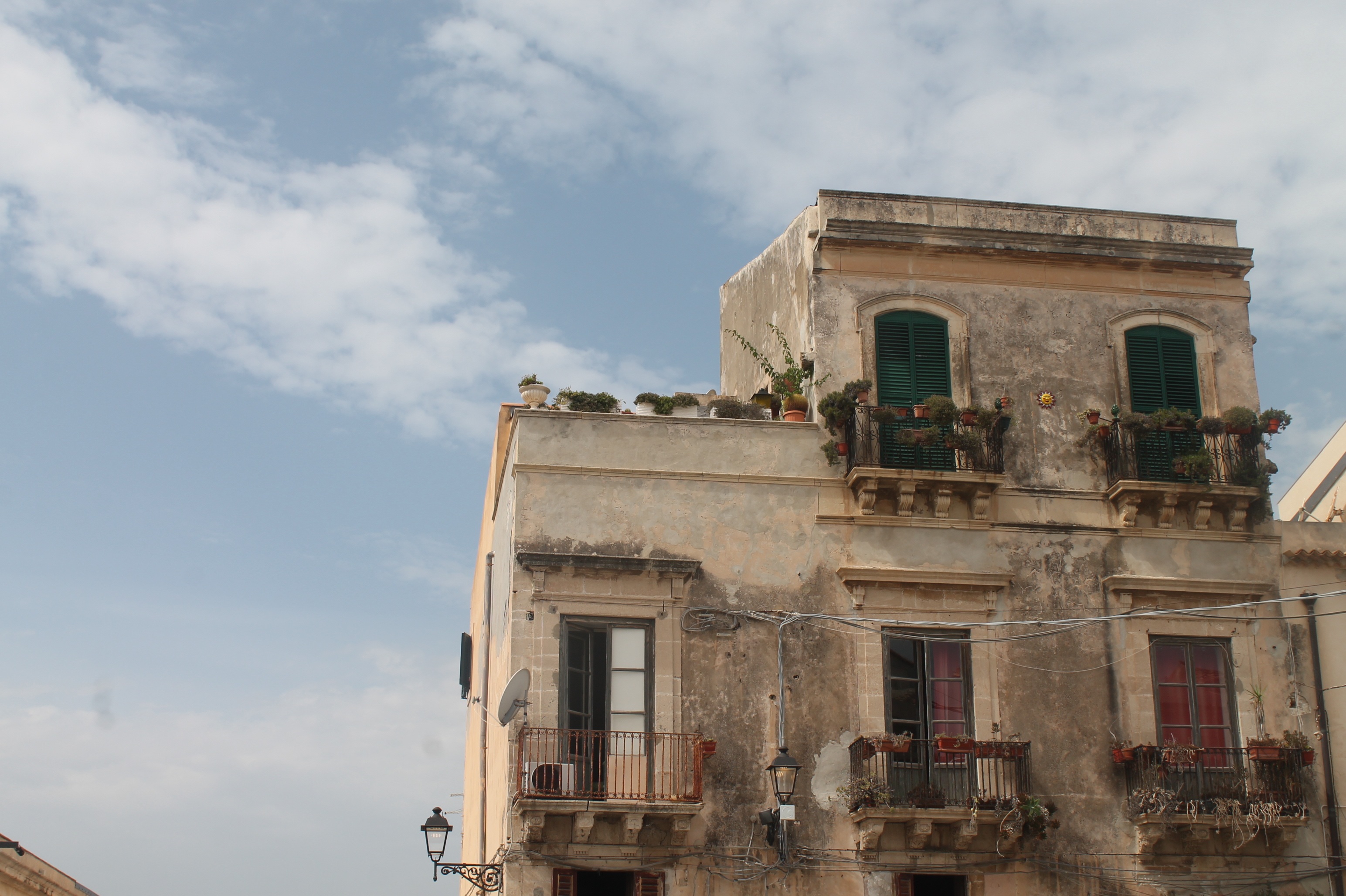
About Palermo
Once the intellectual capital of southern Europe, Palermo has always been at the crossroads of civilization. Favorably situated on a crescent-shaped bay at the foot of Monte Pellegrino, it has attracted almost every culture touching the Mediterranean world. To Palermo's credit, it has absorbed these diverse cultures into a unique personality that is at once Arab and Christian, Byzantine and Roman, Norman and Italian. The city's heritage encompasses all of Sicily's varied ages, but its distinctive aspect is its Arab-Norman identity, an improbable marriage that, mixed in with Byzantine and Jewish elements, created some resplendent works of art. No less noteworthy than the architecture is Palermo's chaotic vitality, on display at some of Italy's most vibrant outdoor markets, public squares, street bazaars, and food vendors, and above all in its grand climax of Italy's most spectacular passeggiata (the leisurely social stroll along the principal thoroughfare).
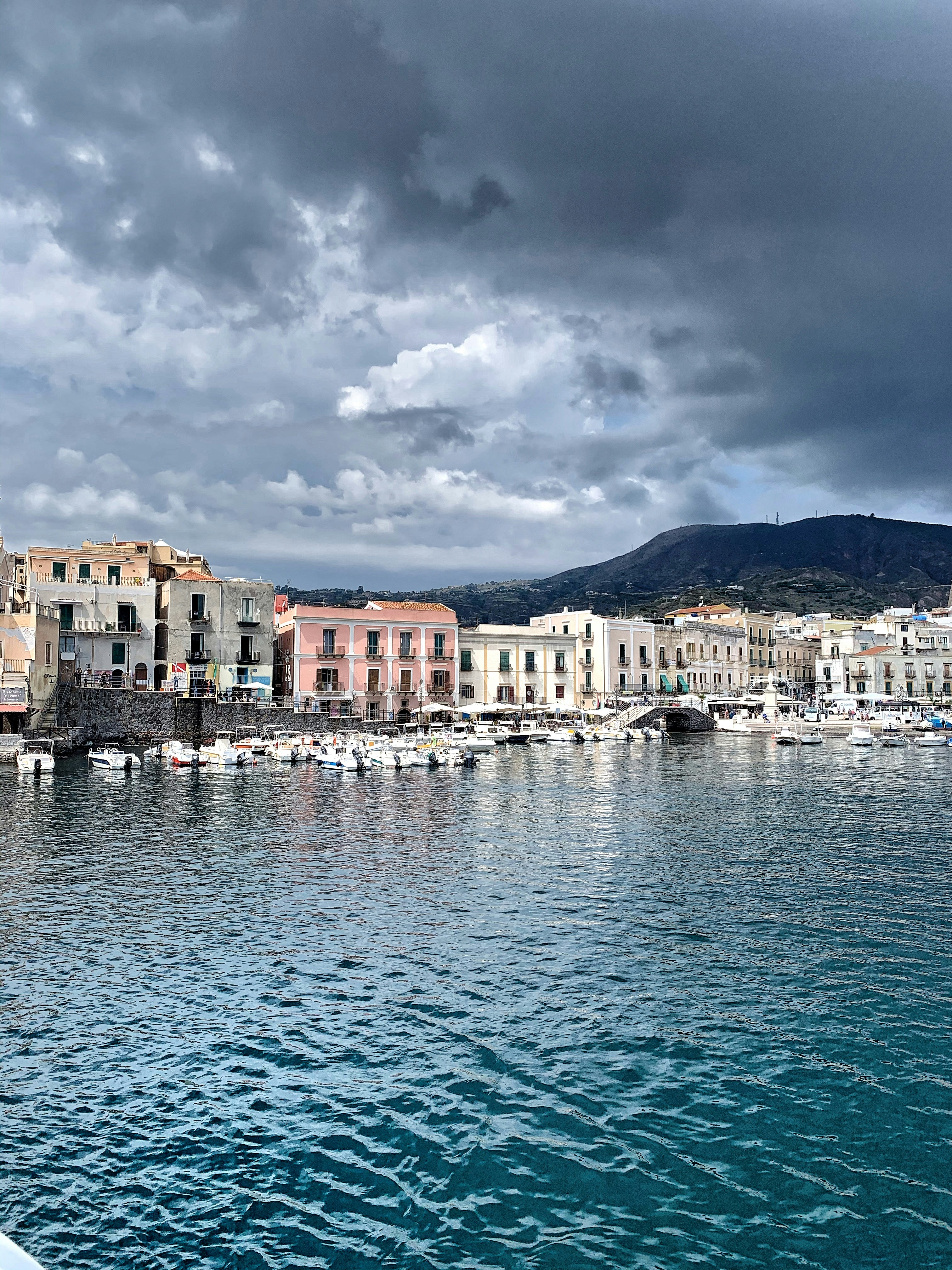
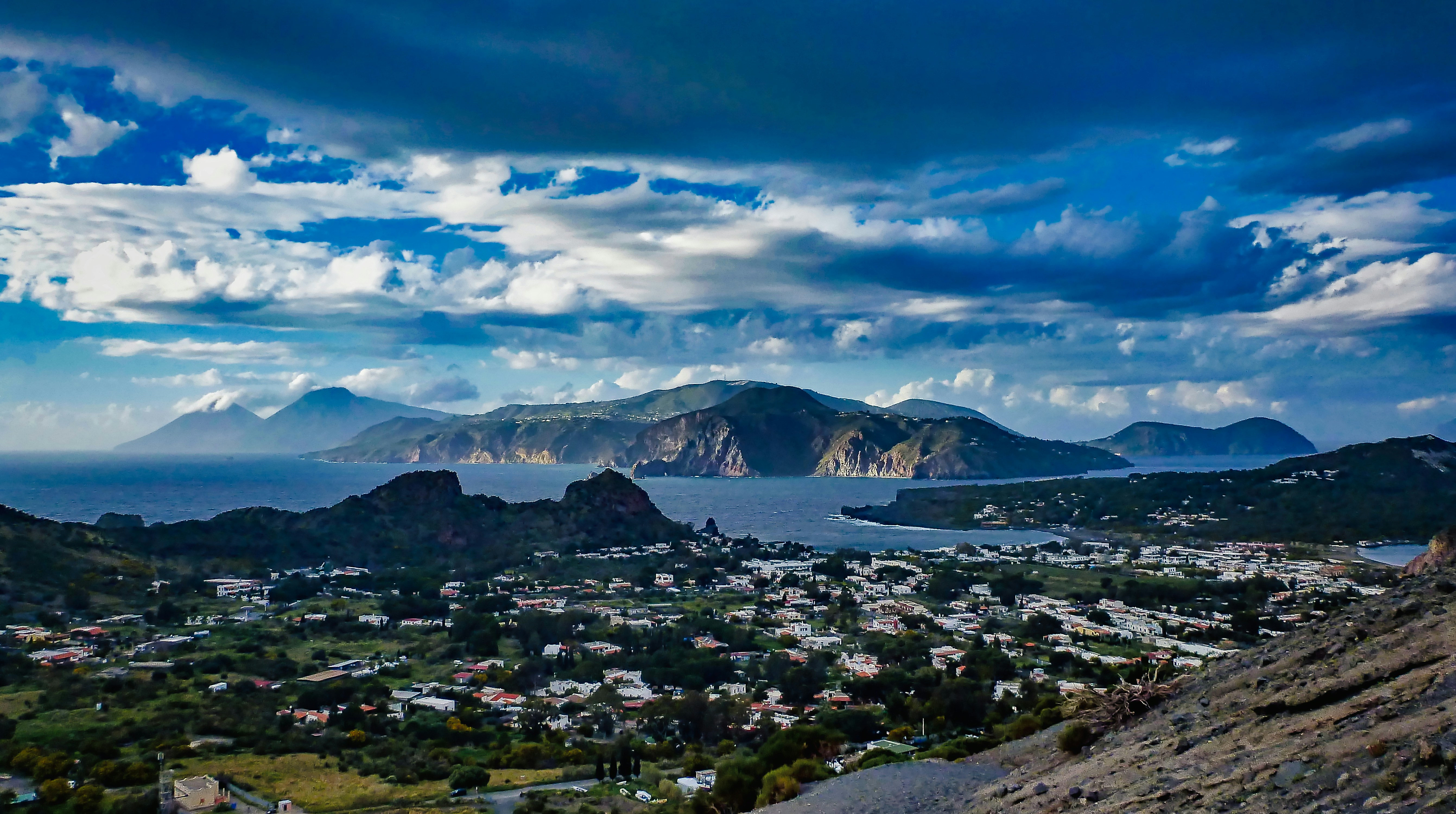
About Lipari
The largest and most developed of the Aeolians, Lipari welcomes you with distinctive pastel-color houses. Fields of spiky agaves dot the northernmost tip of the island, Acquacalda, indented with pumice and obsidian quarries. In the west is San Calogero, where you can explore hot springs and mud baths. From the red-lava base of the island rises a plateau crowned with a 16th-century castle and a 17th-century cathedral.
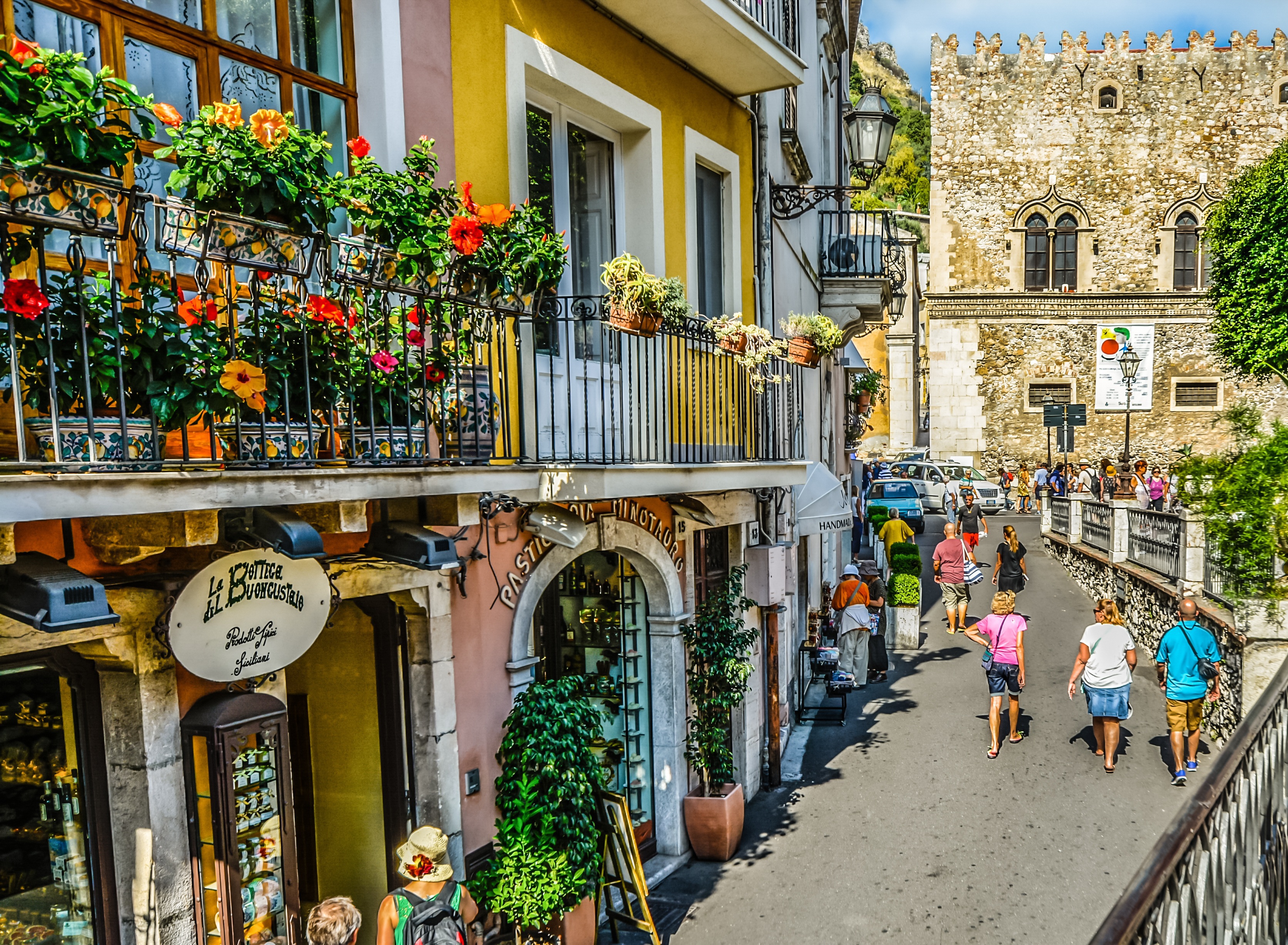
About Giardini Naxos
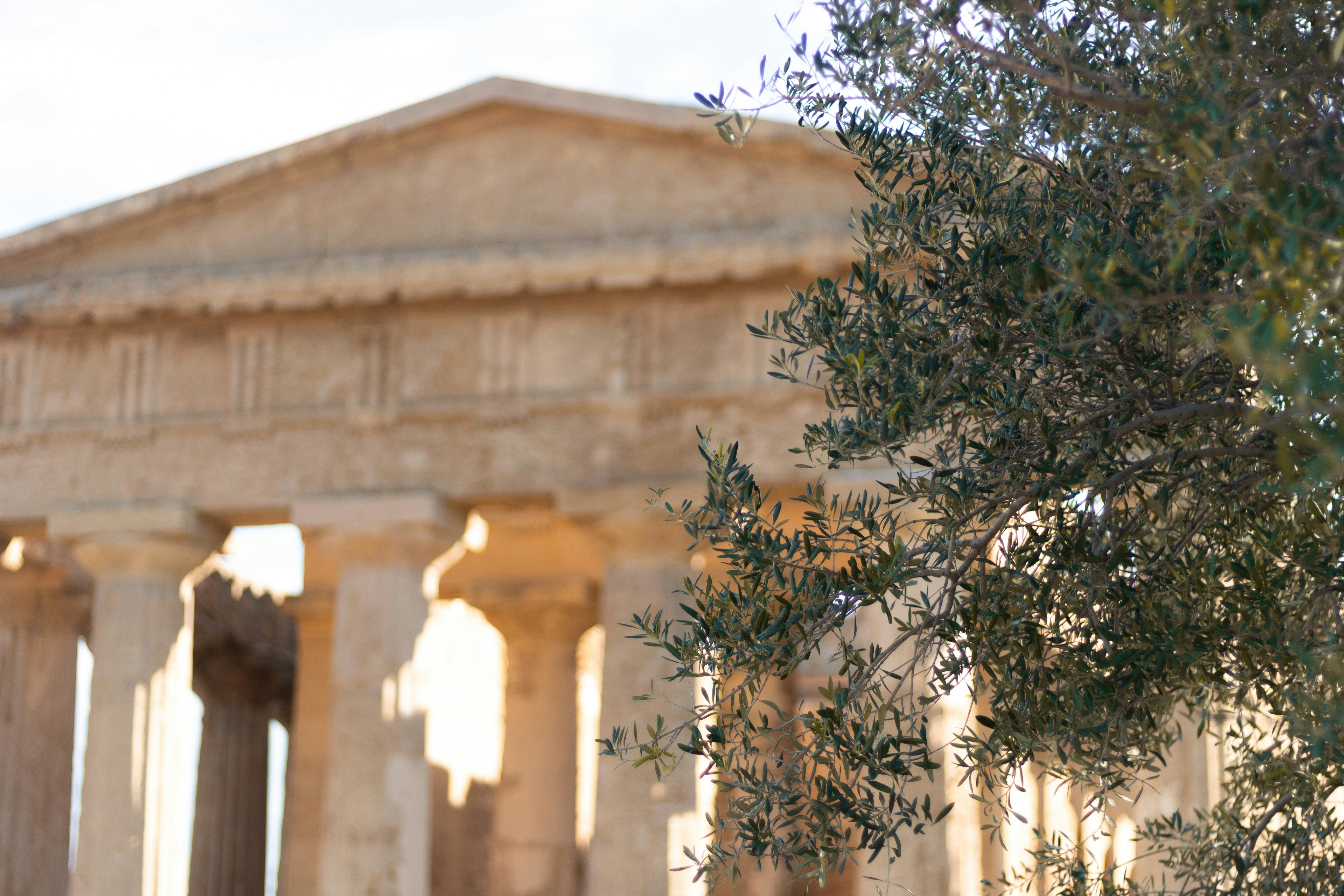
About Siracuse, Sicily
Siracusa, known to English speakers as Syracuse, is a wonder to behold. One of the great ancient capitals of Western civilization, the city was founded in 734 BC by Greek colonists from Corinth and soon grew to rival, and even surpass, Athens in splendor and power. It became the largest, wealthiest city-state in the West and a bulwark of Greek civilization. Although Siracusa lived under tyranny, rulers such as Dionysius filled their courts with Greeks of the highest cultural stature—among them the playwrights Aeschylus and Euripides, and the philosopher Plato. The Athenians, who didn't welcome Siracusa's rise, set out to conquer Sicily, but the natives outsmarted them in what was one of the greatest military campaigns in ancient history (413 BC). The city continued to prosper until it was conquered two centuries later by the Romans.Present-day Siracusa still has some of the finest examples of Baroque art and architecture; dramatic Greek and Roman ruins; and a Duomo that's the stuff of legend—a microcosm of the city's entire history in one building. The modern city also has a wonderful, lively, Baroque old town worthy of extensive exploration, as well as pleasant piazzas, outdoor cafés and bars, and a wide assortment of excellent seafood. There are essentially two areas to explore in Siracusa: the Parco Archeologico (Archaeological Zone), on the mainland; and the island of Ortygia, the ancient city first inhabited by the Greeks, which juts out into the Ionian Sea and is connected to the mainland by two small bridges. Ortygia is becoming increasingly popular with tourists, and is starting to lose its old-fashioned charm in favor of modern boutiques.Siracusa's old nucleus of Ortygia, a compact area, is a pleasure to amble around without getting unduly tired. In contrast, mainland Siracusa is a grid of wider avenues. At the northern end of Corso Gelone, above Viale Paolo Orsi, the orderly grid gives way to the ancient quarter of Neapolis, where the sprawling Parco Archeologico is accessible from Viale Teracati (an extension of Corso Gelone). East of Viale Teracati, about a 10-minute walk from the Parco Archeologico, the district of Tyche holds the archaeological museum and the church and catacombs of San Giovanni, both off Viale Teocrito (drive or take a taxi or city bus from Ortygia). Coming from the train station, it's a 15-minute trudge to Ortygia along Via Francesco Crispi and Corso Umberto. If you're not up for that, take one of the free electric buses leaving every 10 minutes from the bus station around the corner.
About Valletta
Malta's capital, the minicity of Valletta, has ornate palaces and museums protected by massive fortifications of honey-color limestone. Houses along the narrow streets have overhanging wooden balconies for people-watching from indoors. Generations ago they gave housebound women a window on the world of the street. The main entrance to town is through the City Gate (where all bus routes end), which leads onto Triq Repubblika (Republic Street), the spine of the grid-pattern city and the main shopping street. Triq Mercante (Merchant Street) parallels Repubblika to the east and is also good for strolling. From these two streets, cross streets descend toward the water; some are stepped. Valletta's compactness makes it ideal to explore on foot. City Gate and the upper part of Valletta are experiencing vast redevelopment that includes a new Parliament Building and open-air performance venue. The complex, completed mid-2013, has numerous pedestrian detours in place along with building noise and dust. Before setting out along Republic Street, stop at the tourist information office on Merchant Street for maps and brochures.
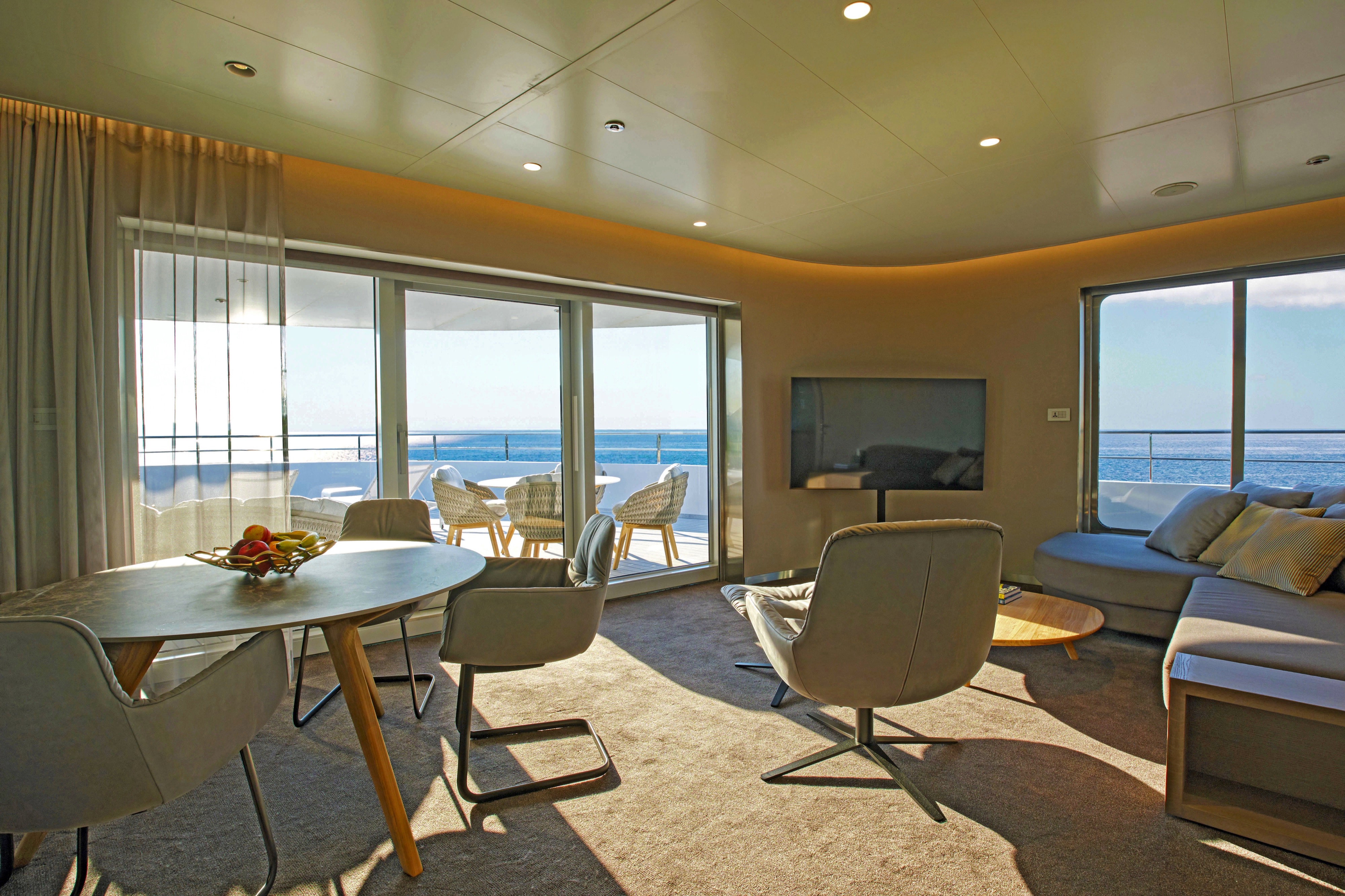
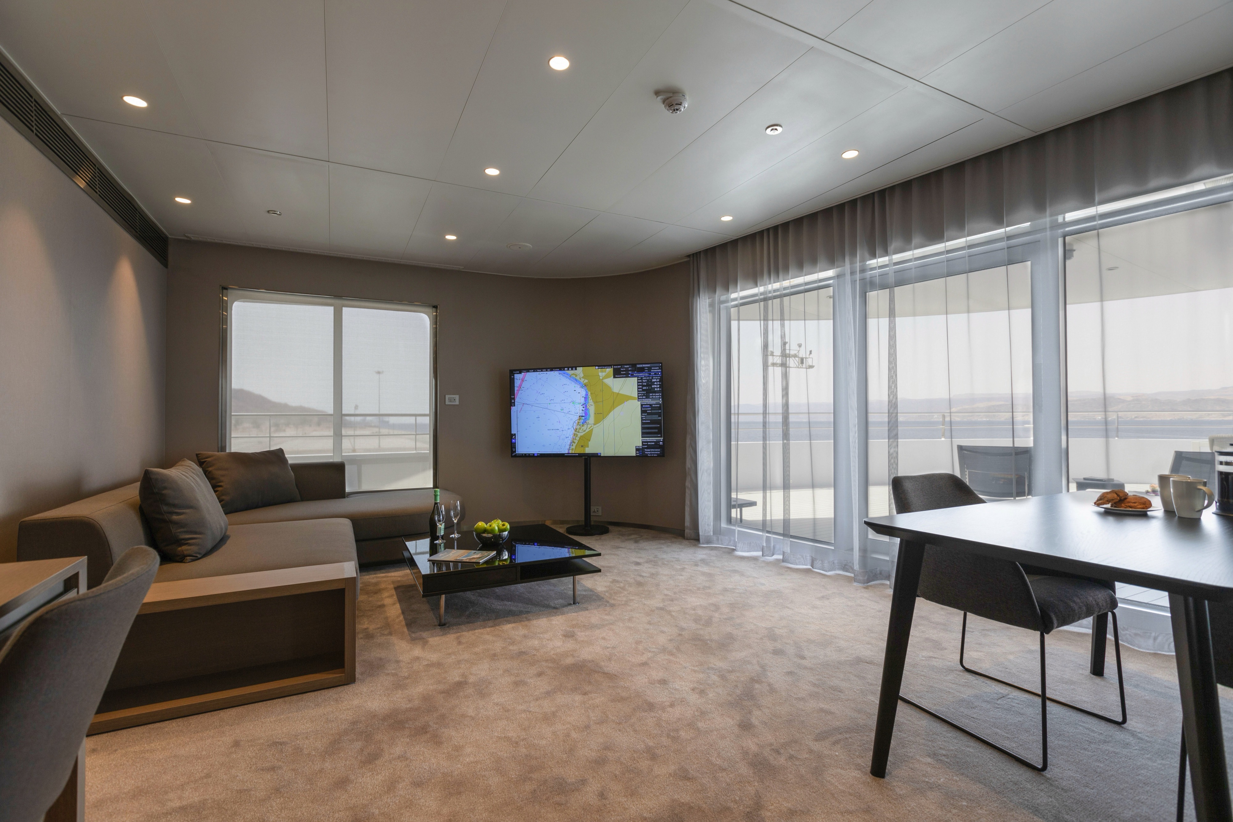
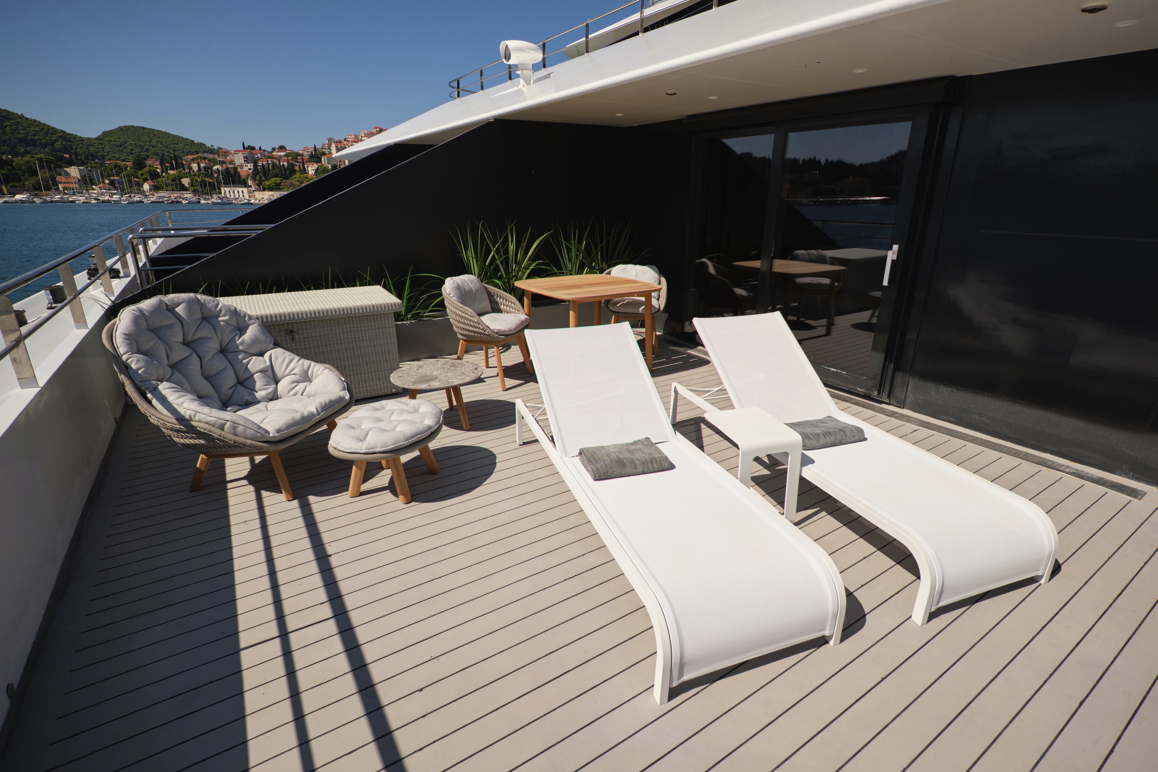
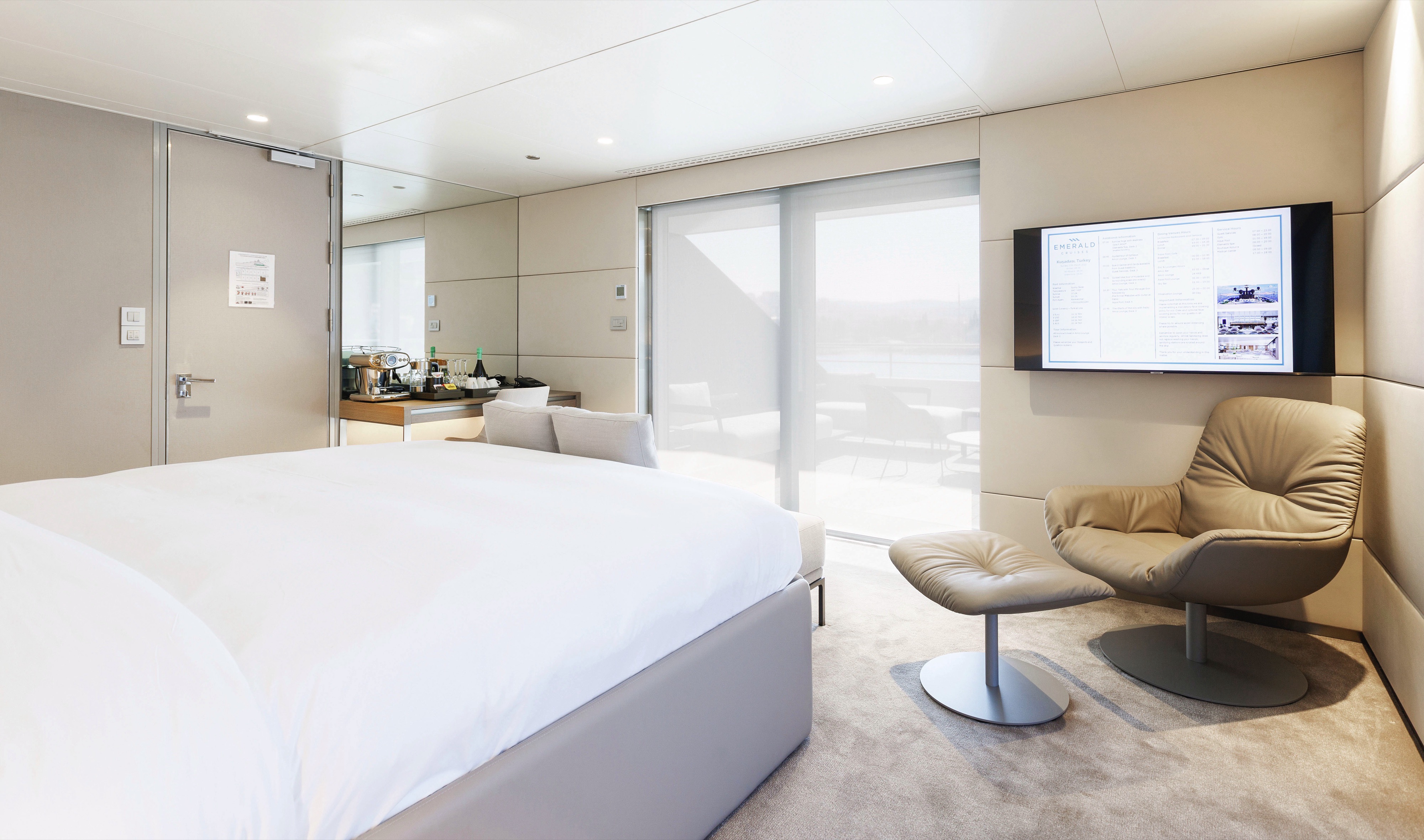
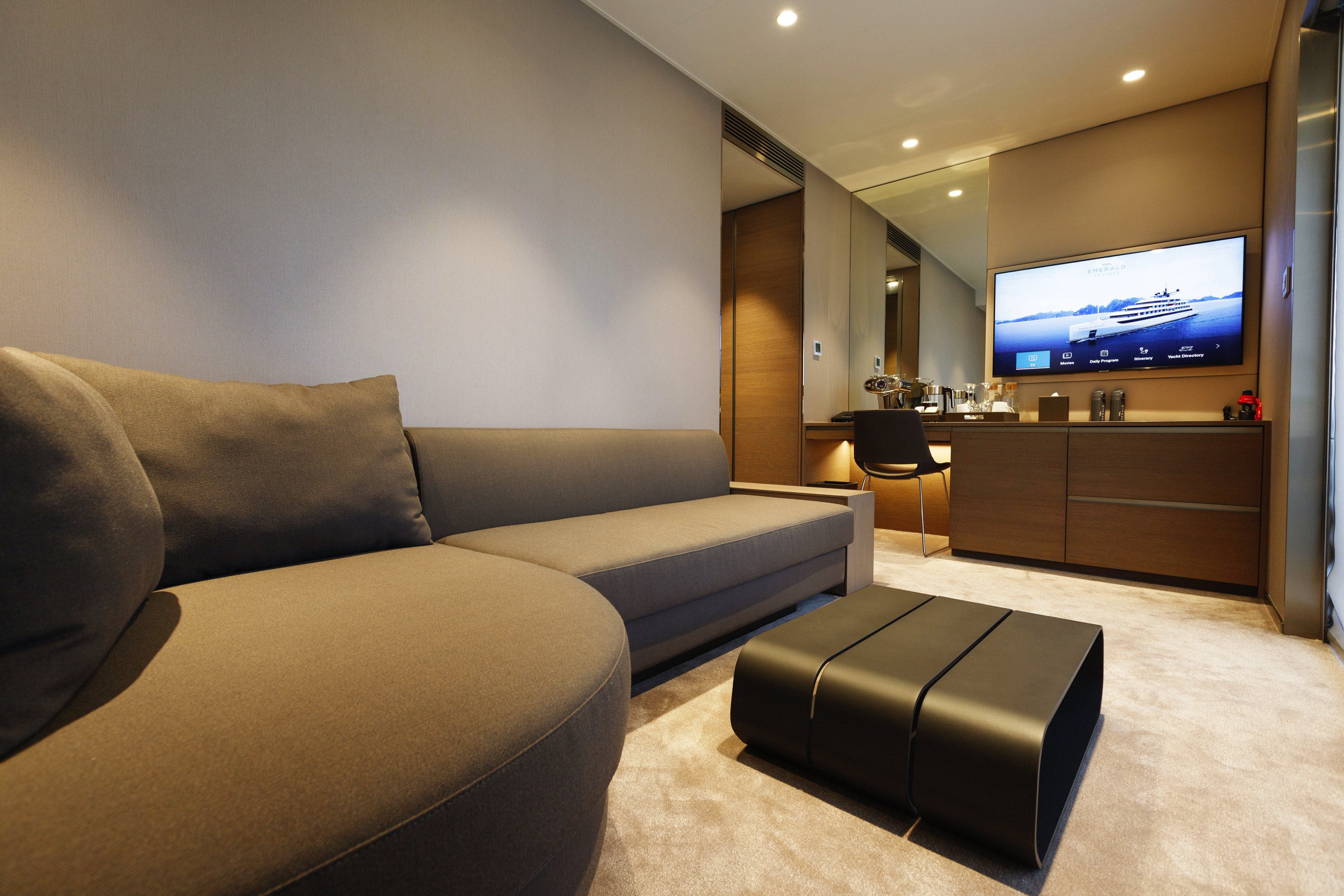
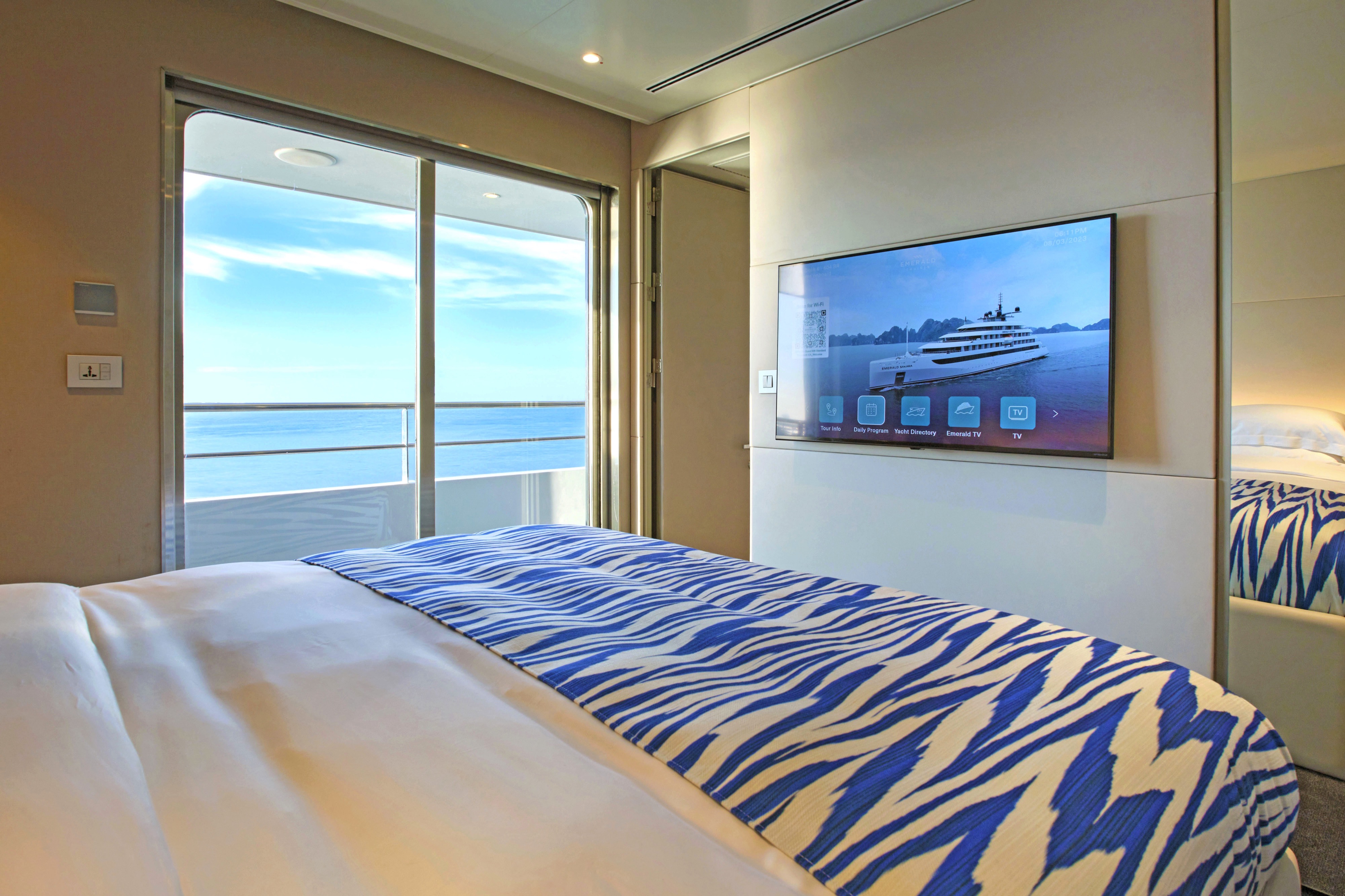
These suites are the largest on board, located on the Pool Deck. Boasting a walk-in wardrobe and separate lounge and bedroom areas, you'll benefit from pure privacy. Your large private terrace enables you to relax alfresco, admiring stunning views.
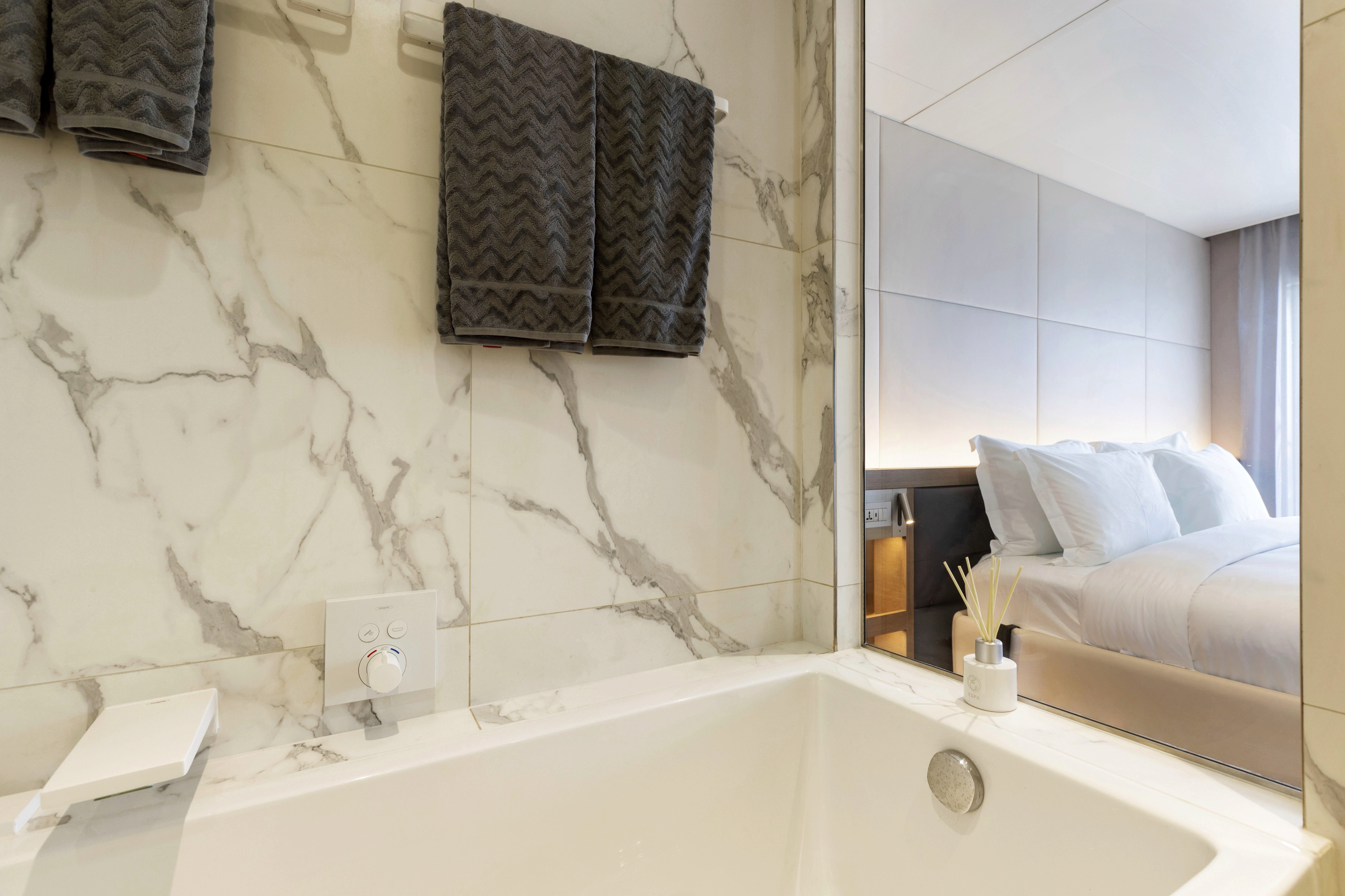
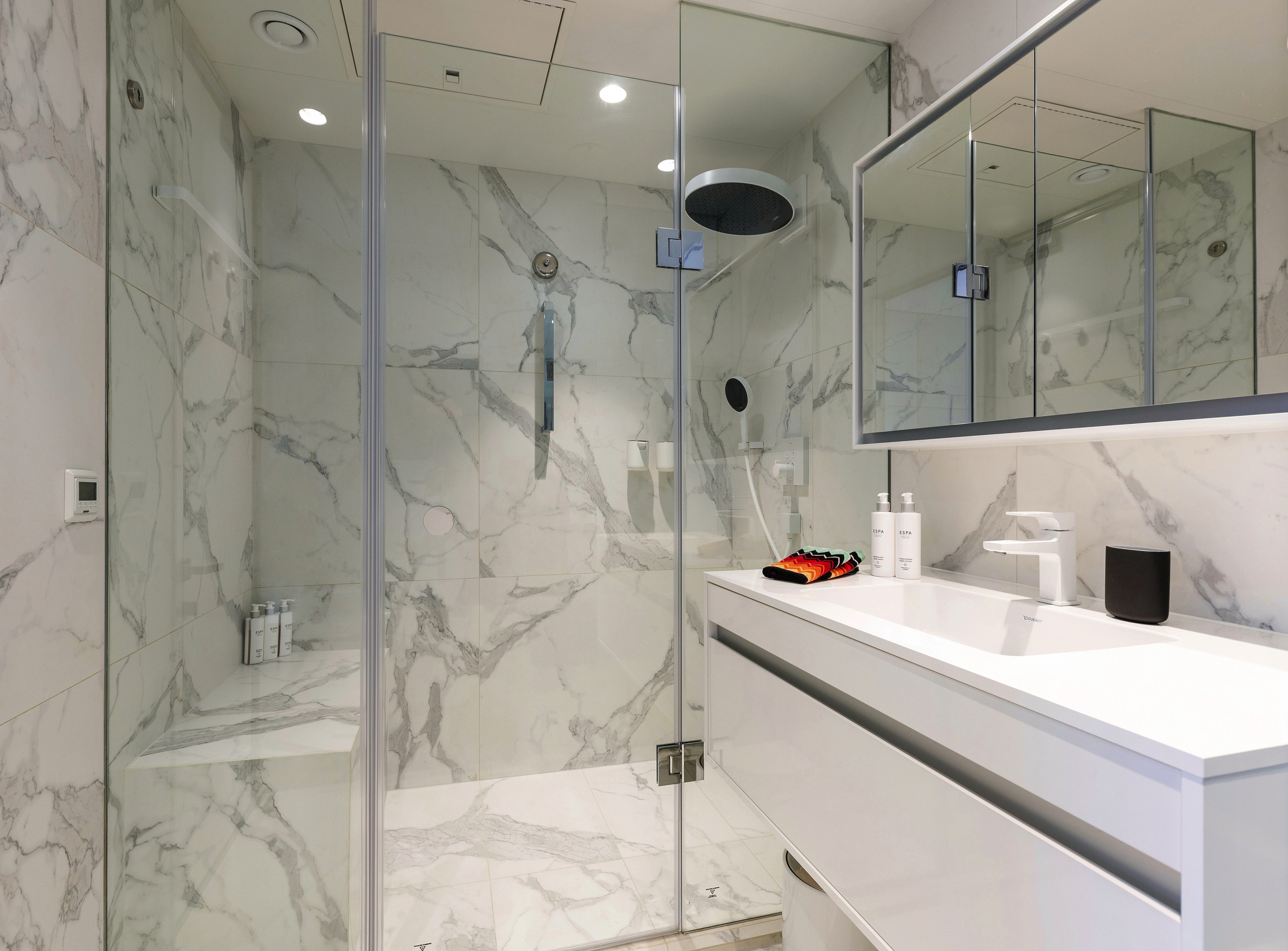
All suites & staterooms include:
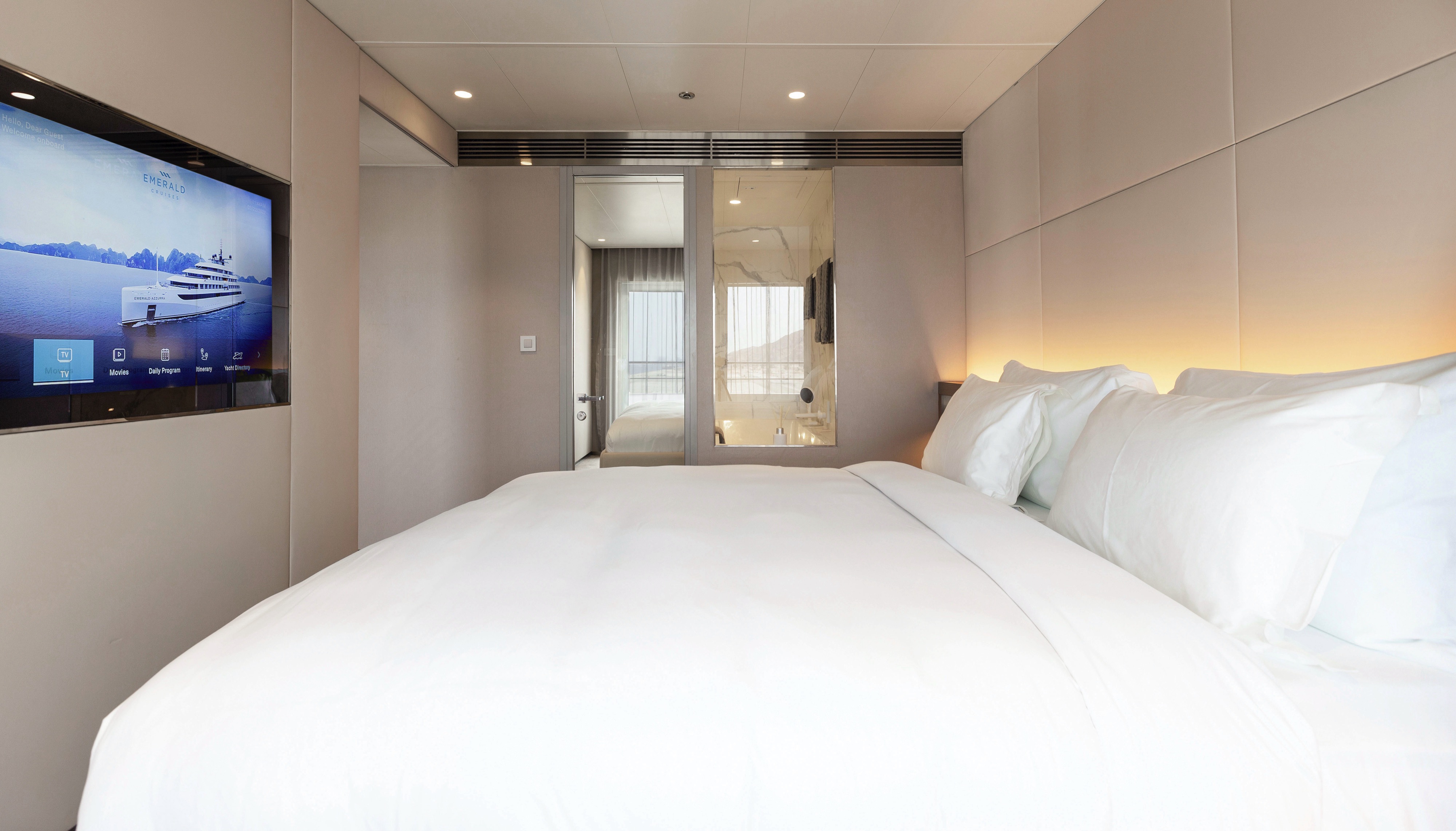
- King-size or twin hotel-style beds with the finest Egyptian cotton linen
- En suite bathroom with luxurious ESPA toiletries
- Complimentary bathrobes and slippers
- Flat-screen HDTV and infotainment system
- Complimentary mini-bar and water, restocked daily
- Complimentary Wi-Fi
- Individual climate control
- Personal safe
- Umbrella
- Telephone
- Room service available for breakfast
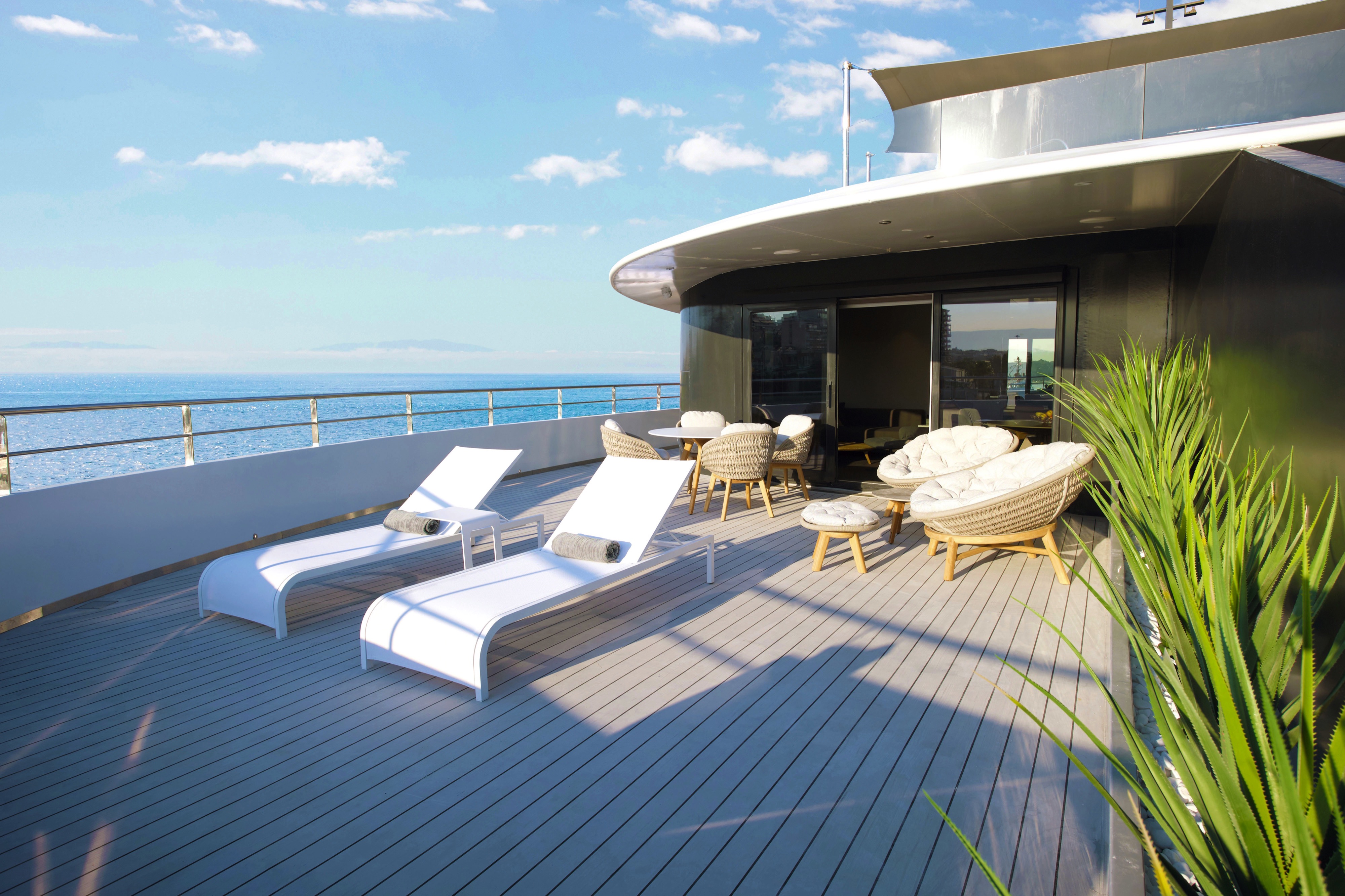
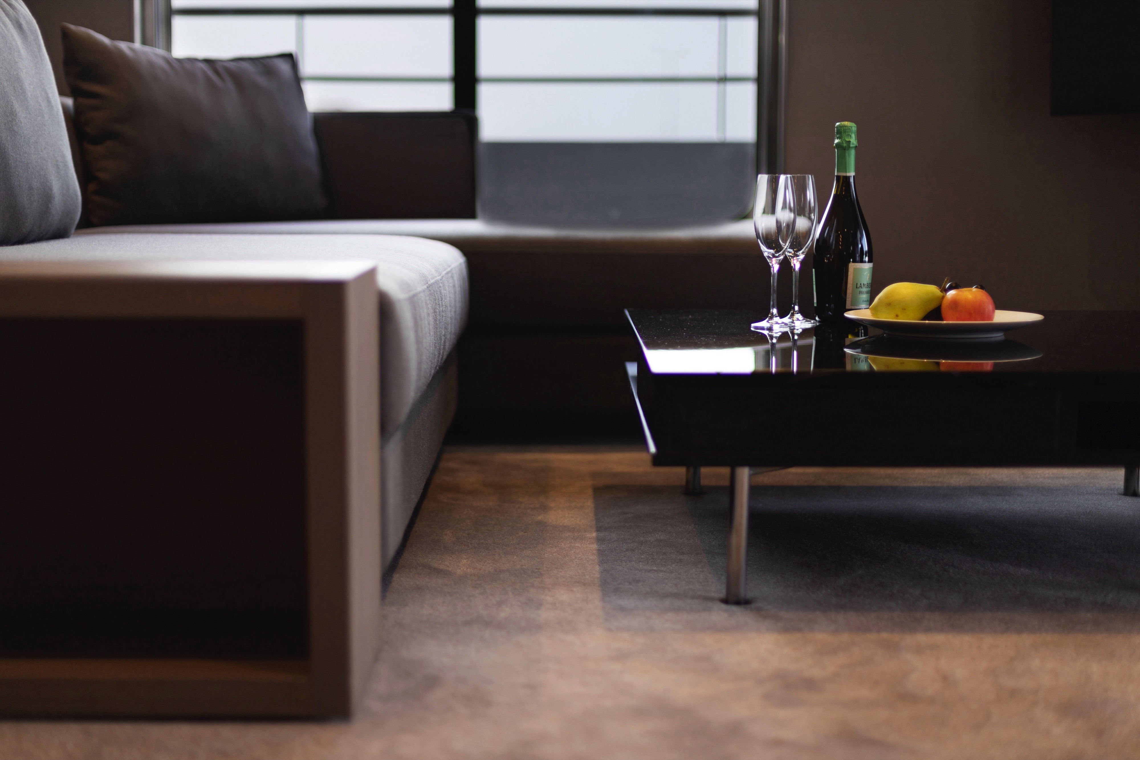
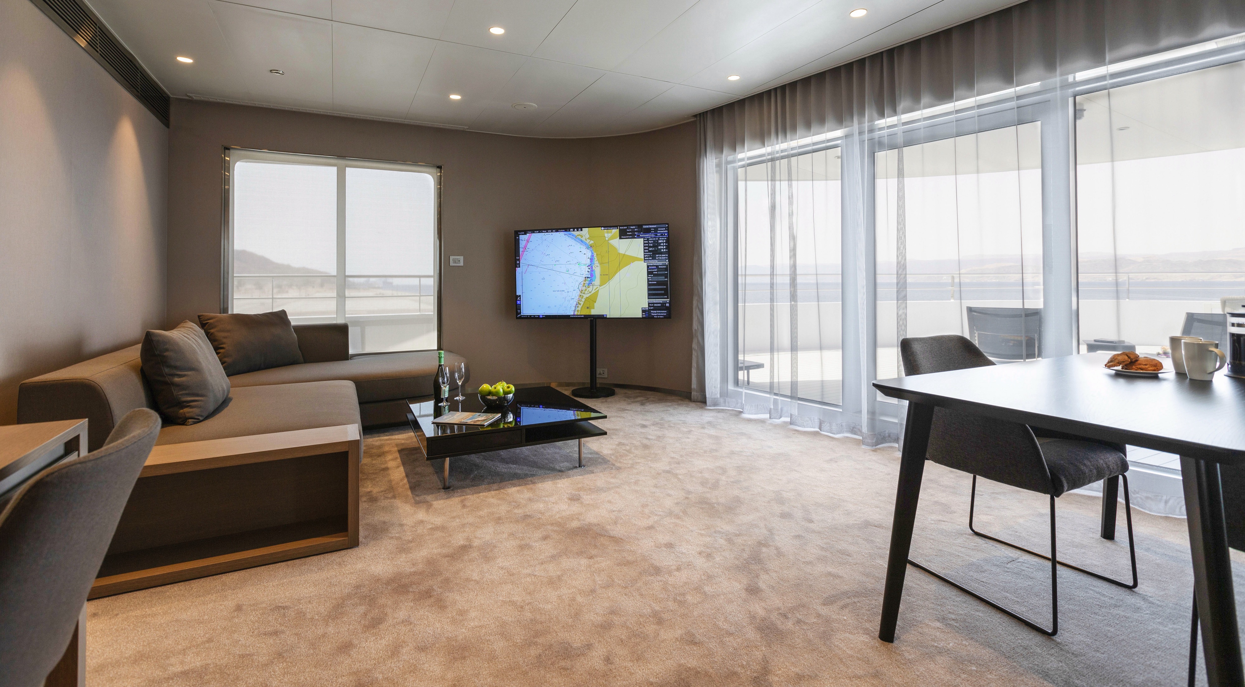

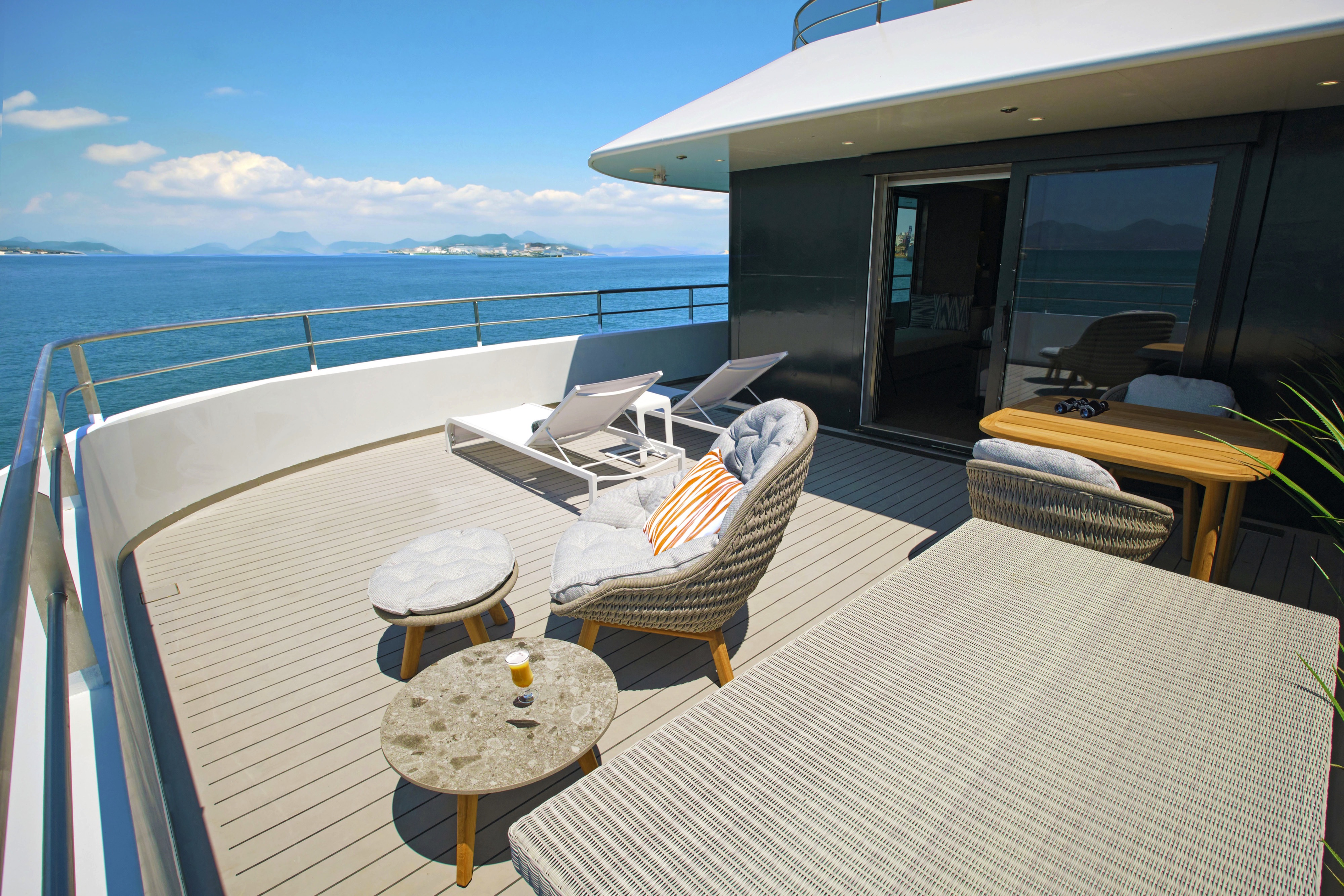
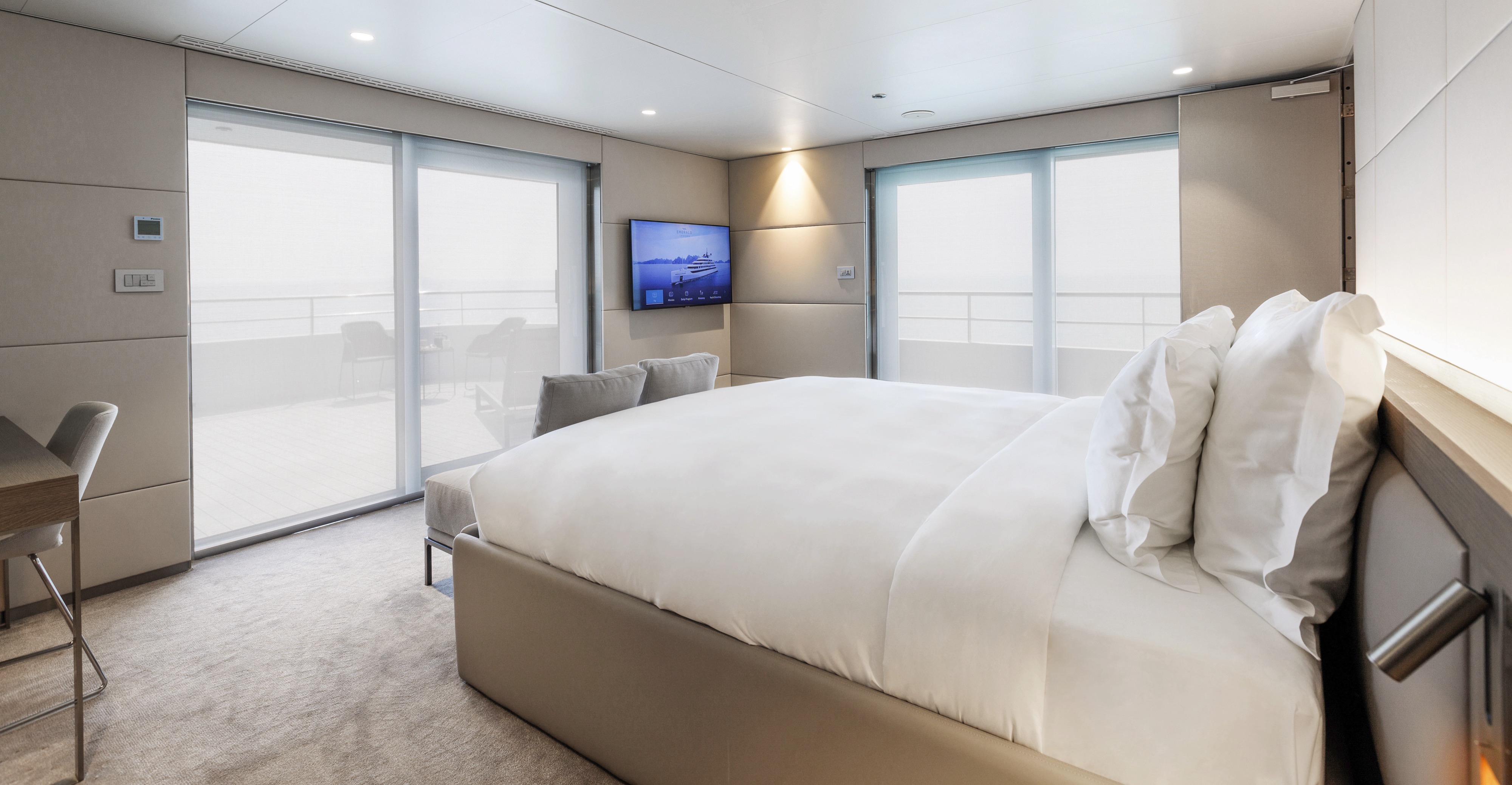
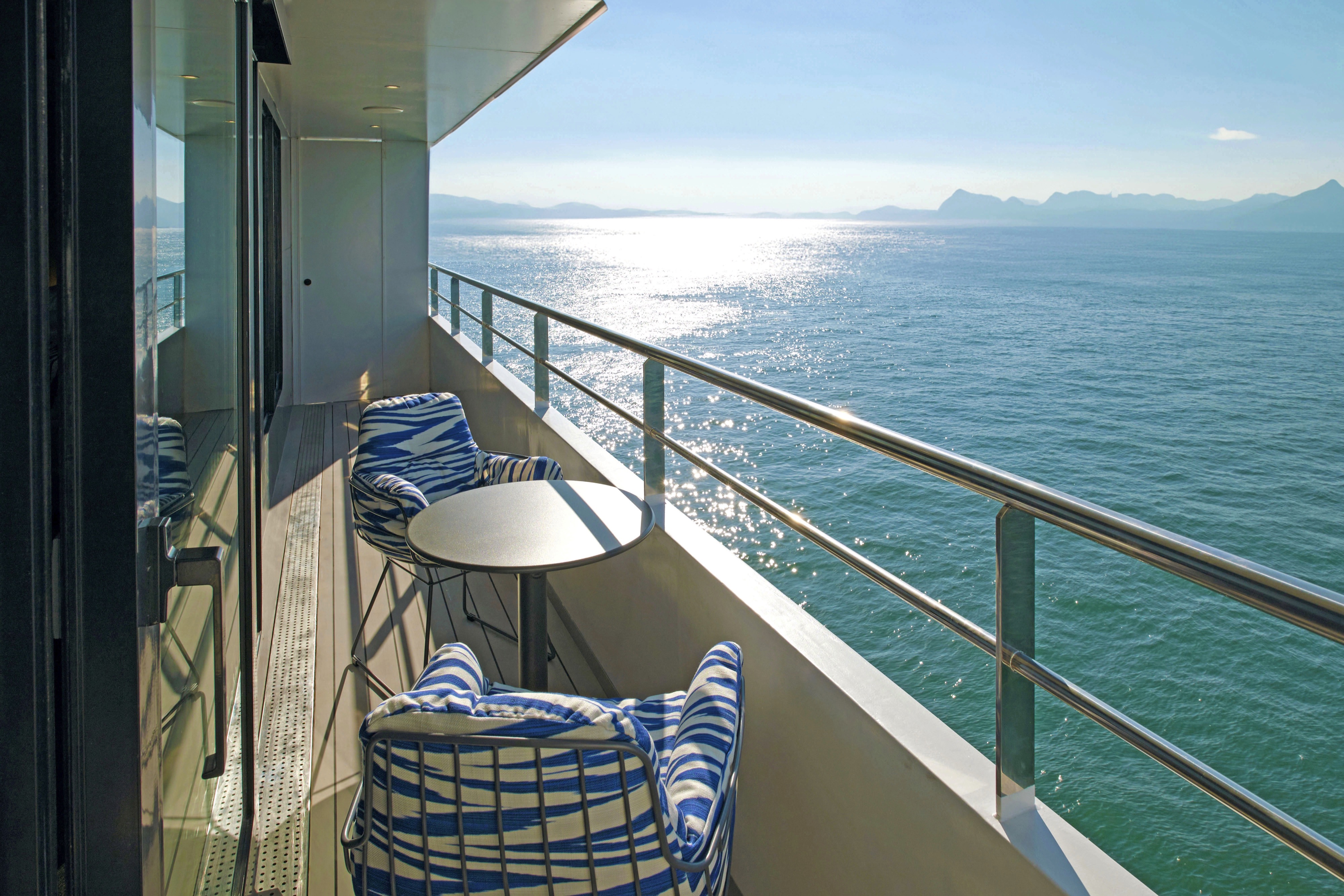
Positioned at the aft of the Observation Deck, you'll be treated to sensational coastal views from your private terrace. Enjoy this spacious suite with a welcome bottle of champagne and a wealth of space for your belongings including a walk-in wardrobe.
All suites & staterooms include:
- King-size or twin hotel-style beds with the finest Egyptian cotton linen
- En suite bathroom with luxurious ESPA toiletries
- Complimentary bathrobes and slippers
- Flat-screen HDTV and infotainment system
- Complimentary mini-bar and water, restocked daily
- Complimentary Wi-Fi
- Individual climate control
- Personal safe
- Umbrella
- Telephone
- Room service available for breakfast
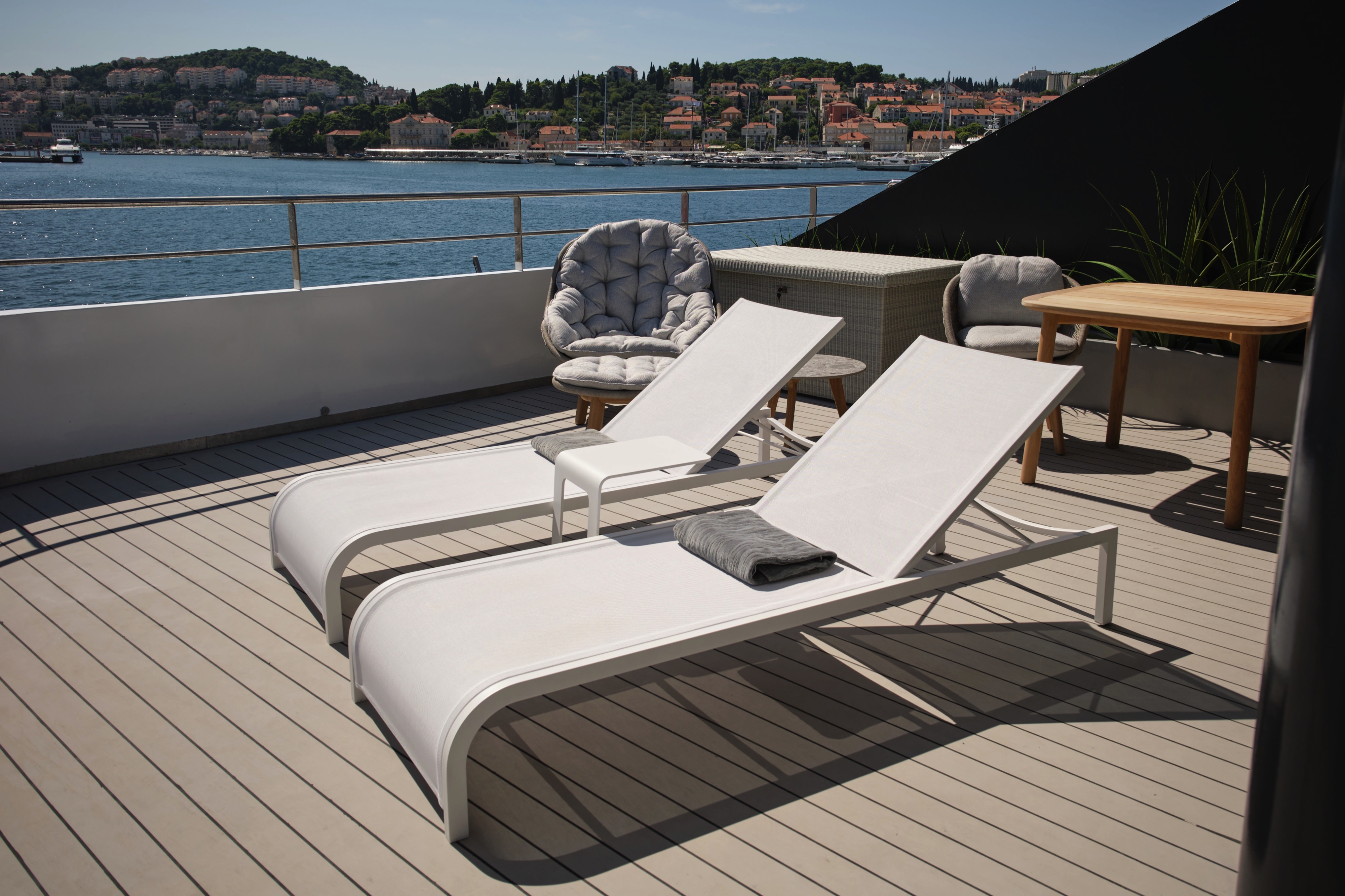
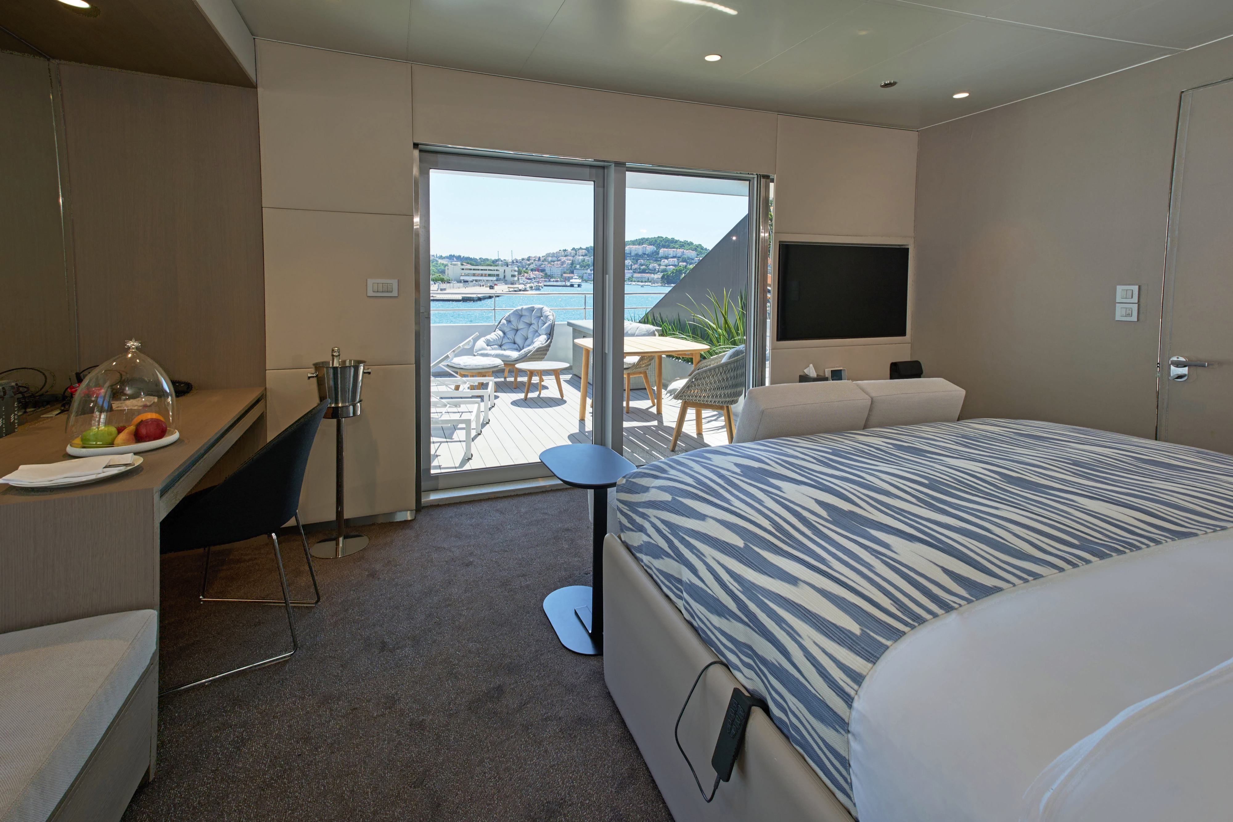
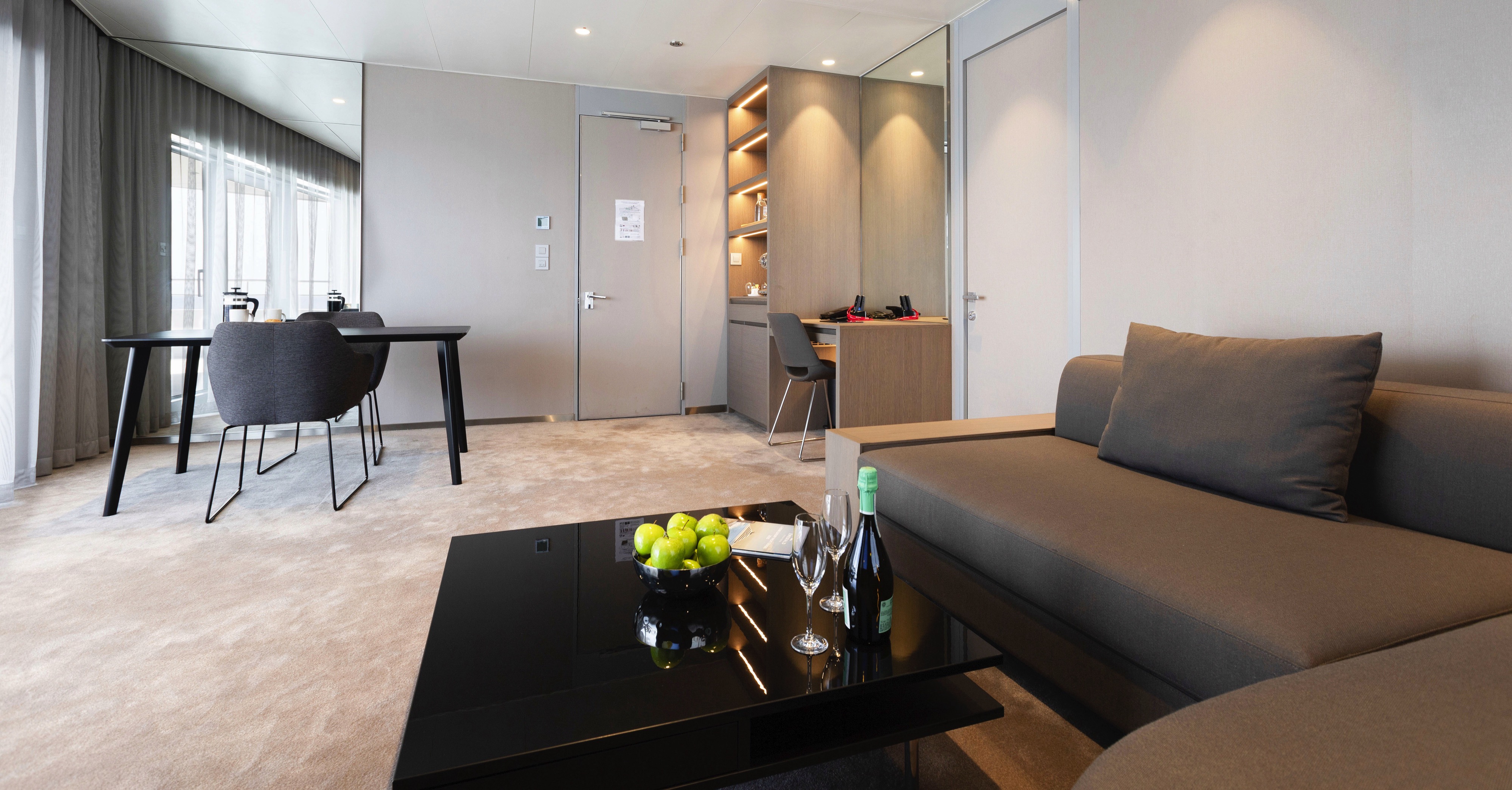
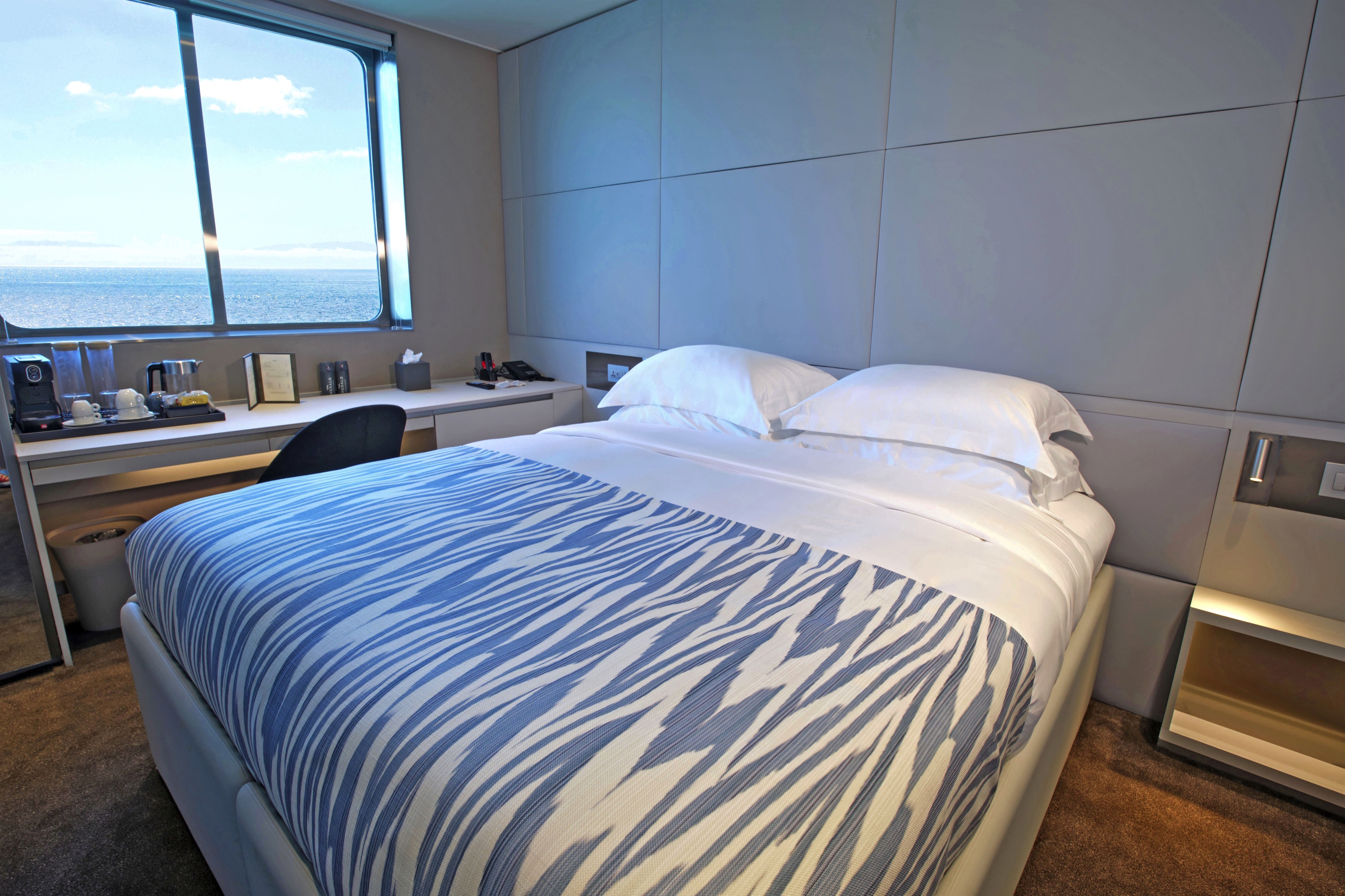
Our spacious Terrace Suites take pride of place at the aft of the Panorama Deck. You'll enjoy a private oversized terrace, where you'll be able to soak up the sun. Take advantage of the pillow menu and have up to two items laundered each day.
All suites & staterooms include:
- King-size or twin hotel-style beds with the finest Egyptian cotton linen
- En suite bathroom with luxurious ESPA toiletries
- Complimentary bathrobes and slippers
- Flat-screen HDTV and infotainment system
- Complimentary mini-bar and water, restocked daily
- Complimentary Wi-Fi
- Individual climate control
- Personal safe
- Umbrella
- Telephone
- Room service available for breakfast
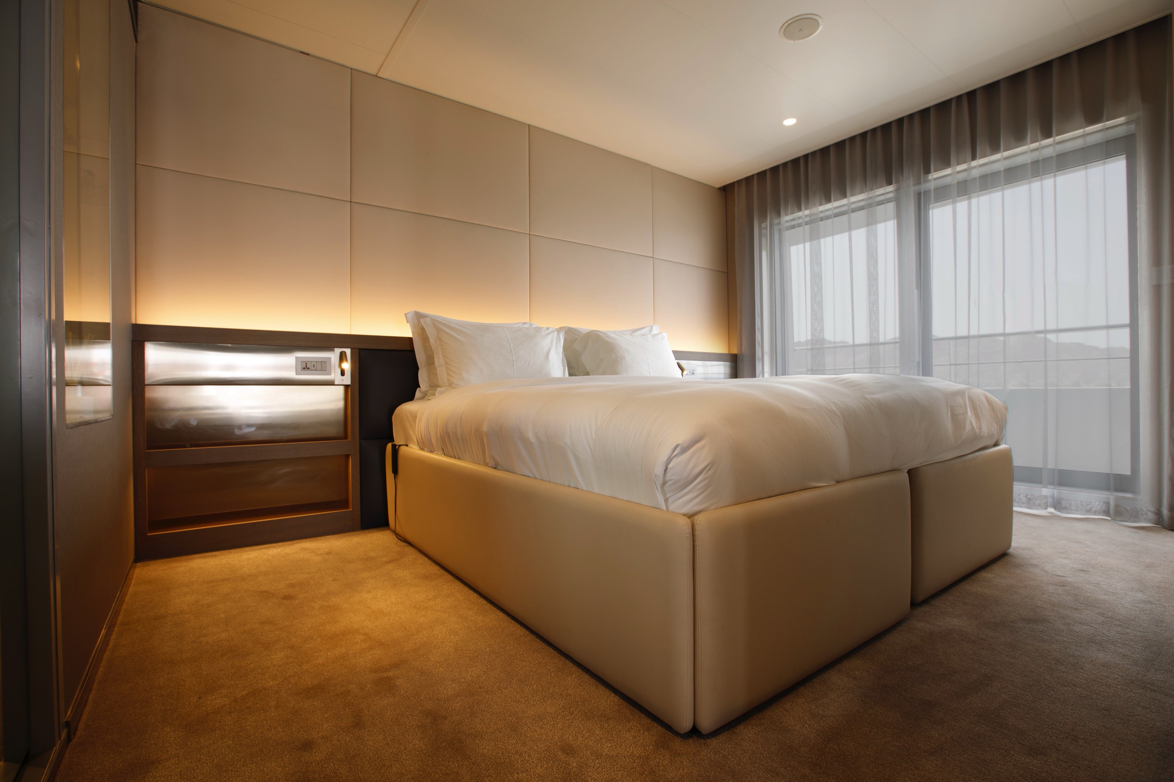
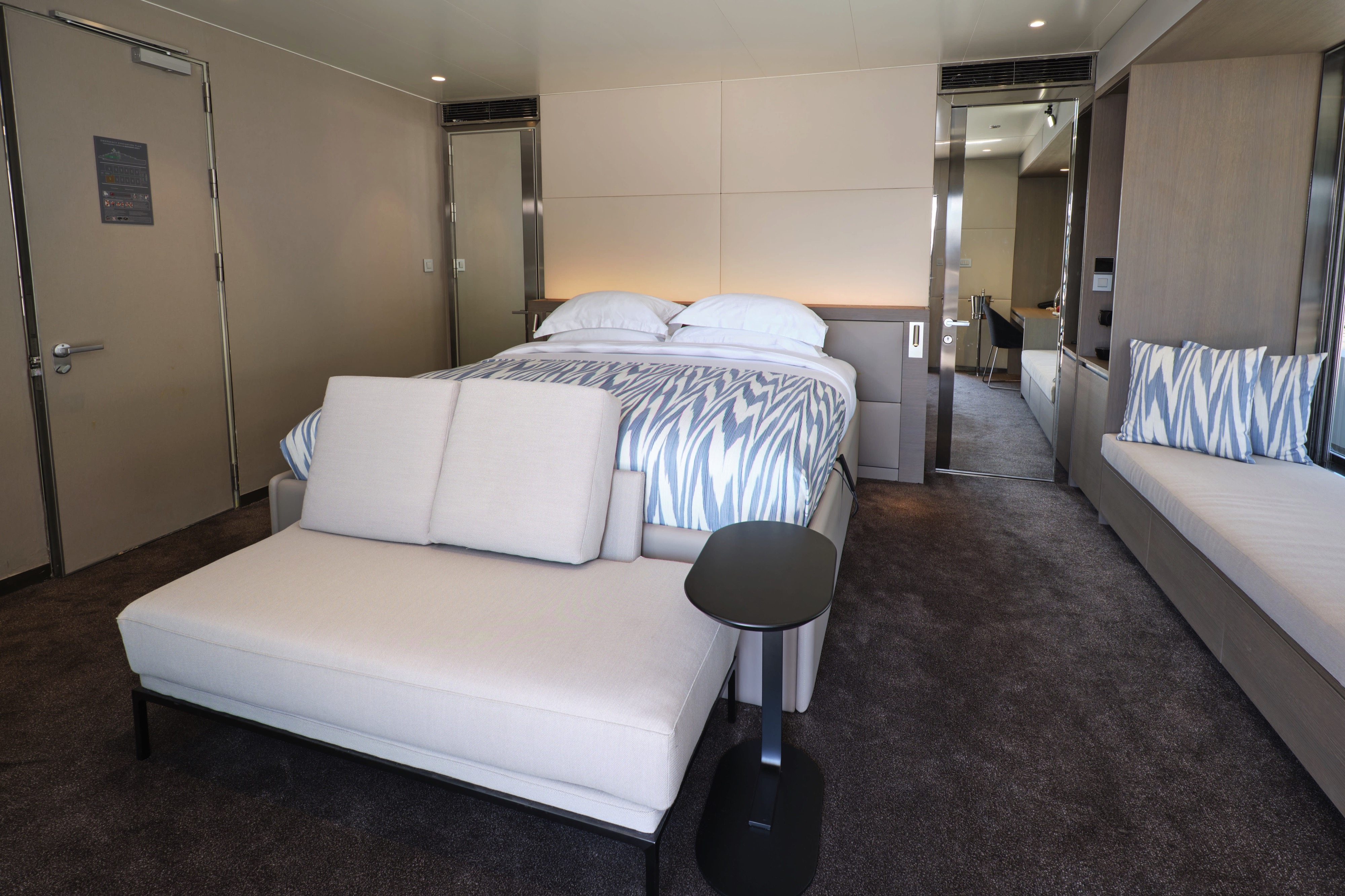
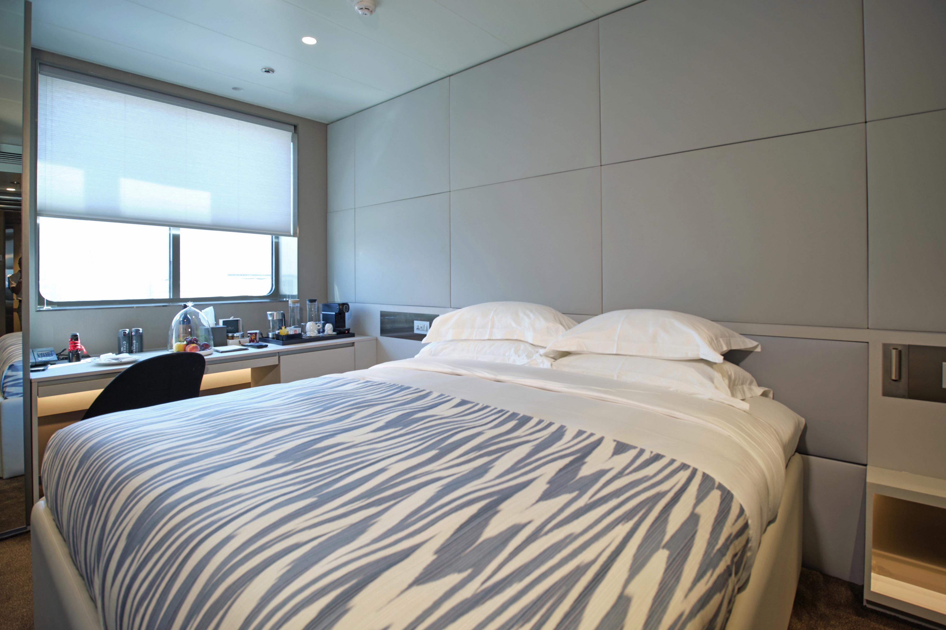
Located on the Pool Deck, these spacious suites feature separate bedroom and lounge areas, and a private balcony for your enjoyment. Make the most of your state-of-the-art tea and coffee-making facilities and enjoy a fruit platter on arrival.
All suites & staterooms include:
- King-size or twin hotel-style beds with the finest Egyptian cotton linen
- En suite bathroom with luxurious ESPA toiletries
- Complimentary bathrobes and slippers
- Flat-screen HDTV and infotainment system
- Complimentary mini-bar and water, restocked daily
- Complimentary Wi-Fi
- Individual climate control
- Personal safe
- Umbrella
- Telephone
- Room service available for breakfast

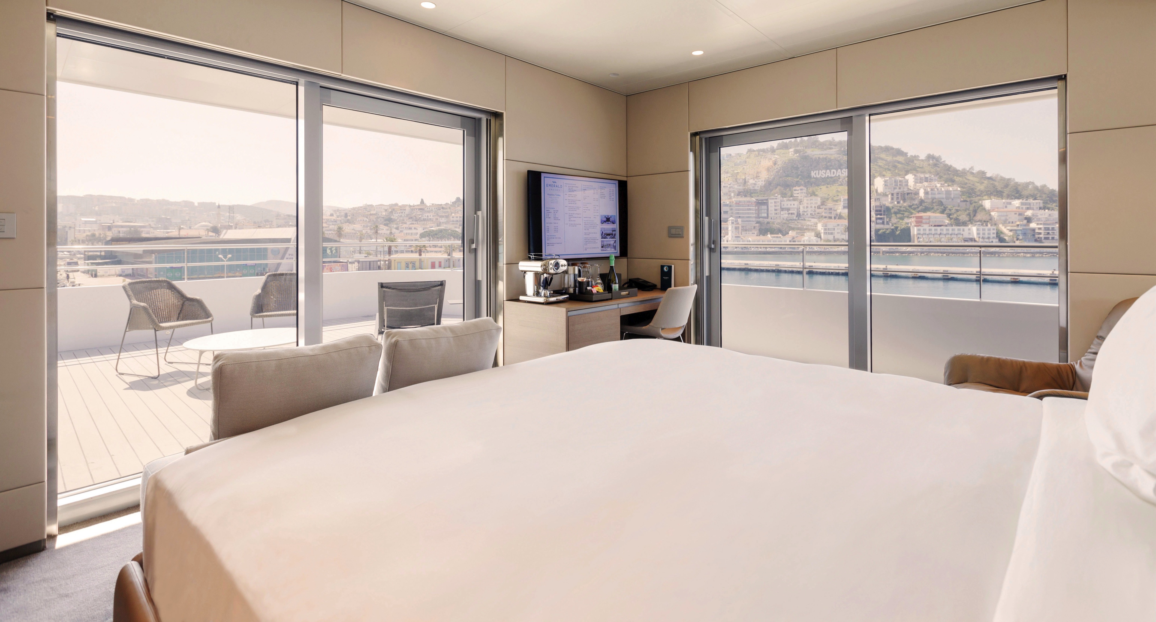
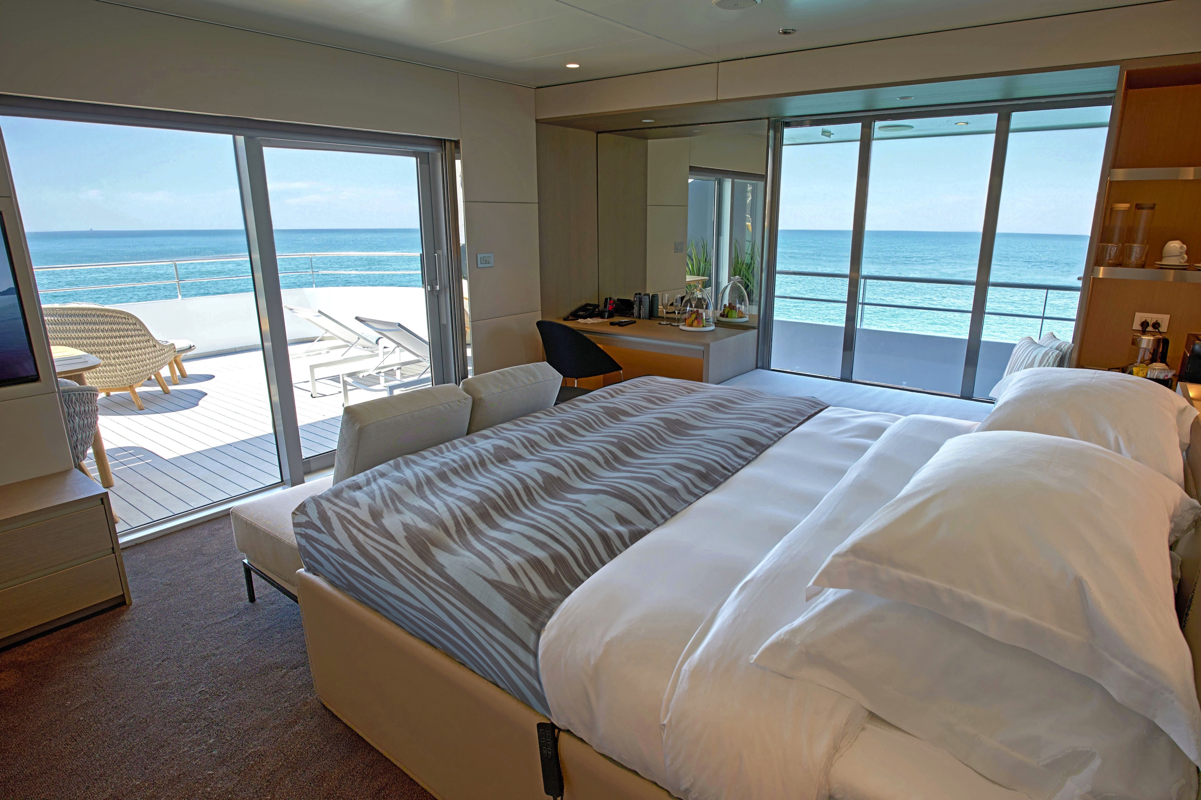
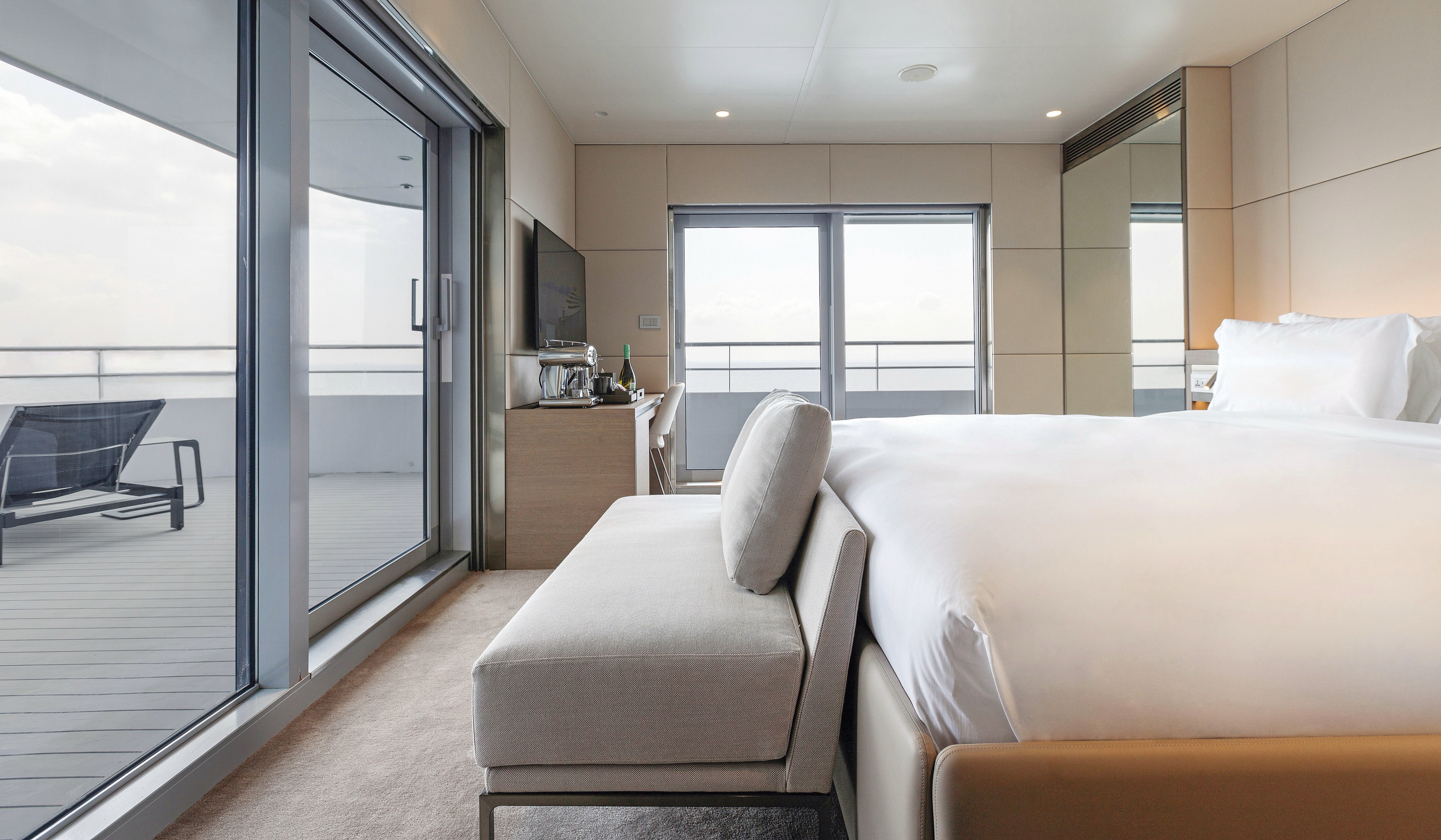
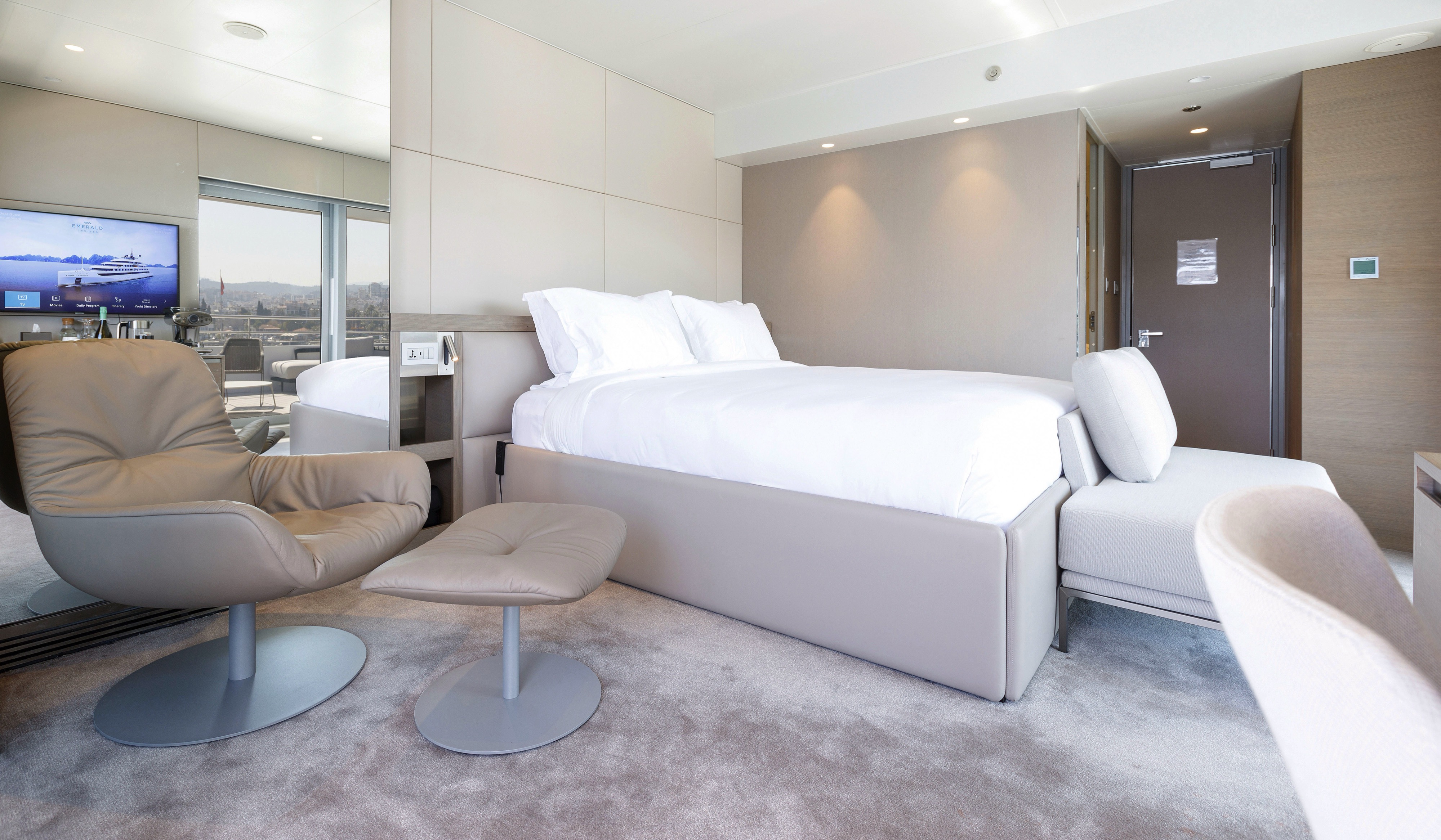
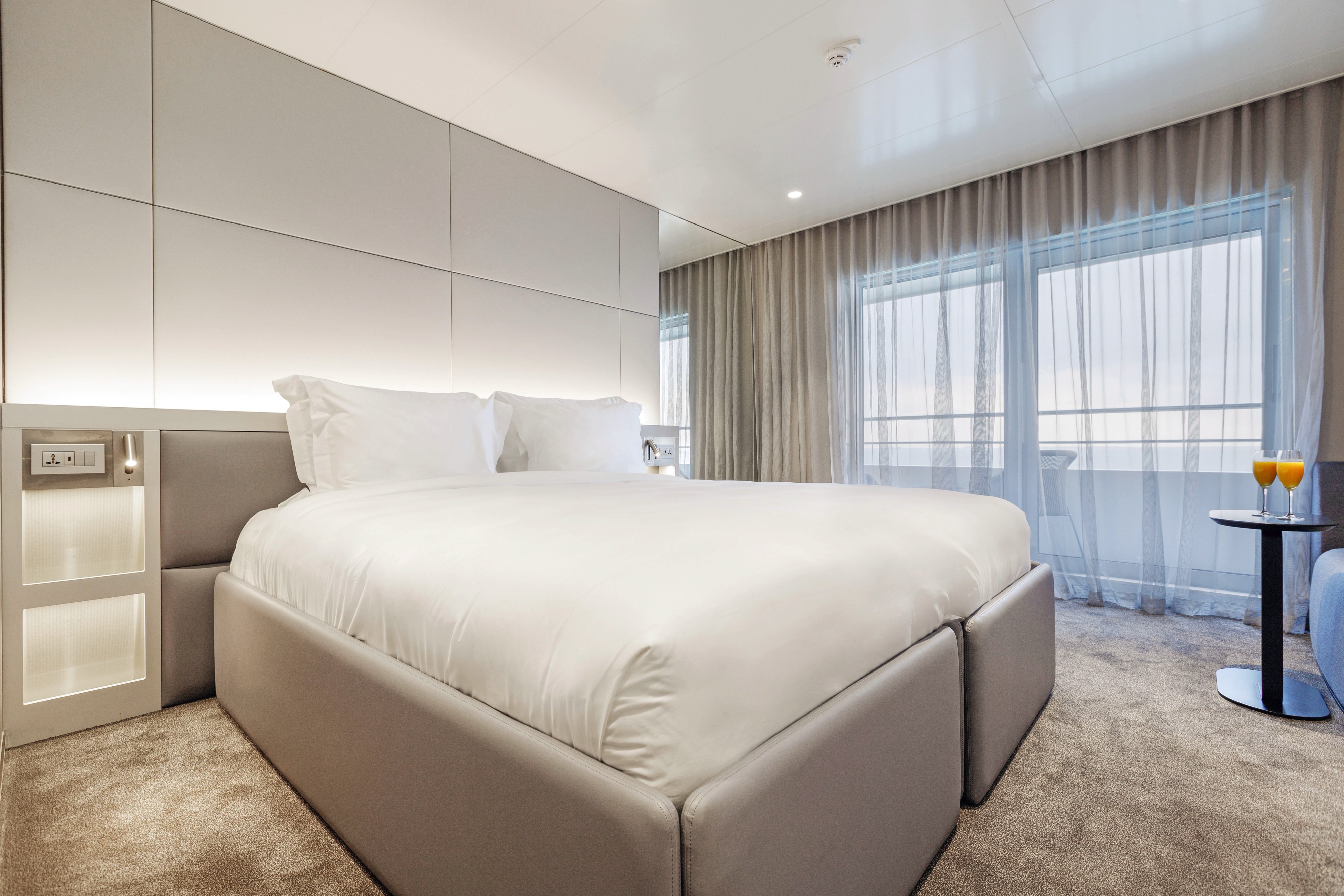
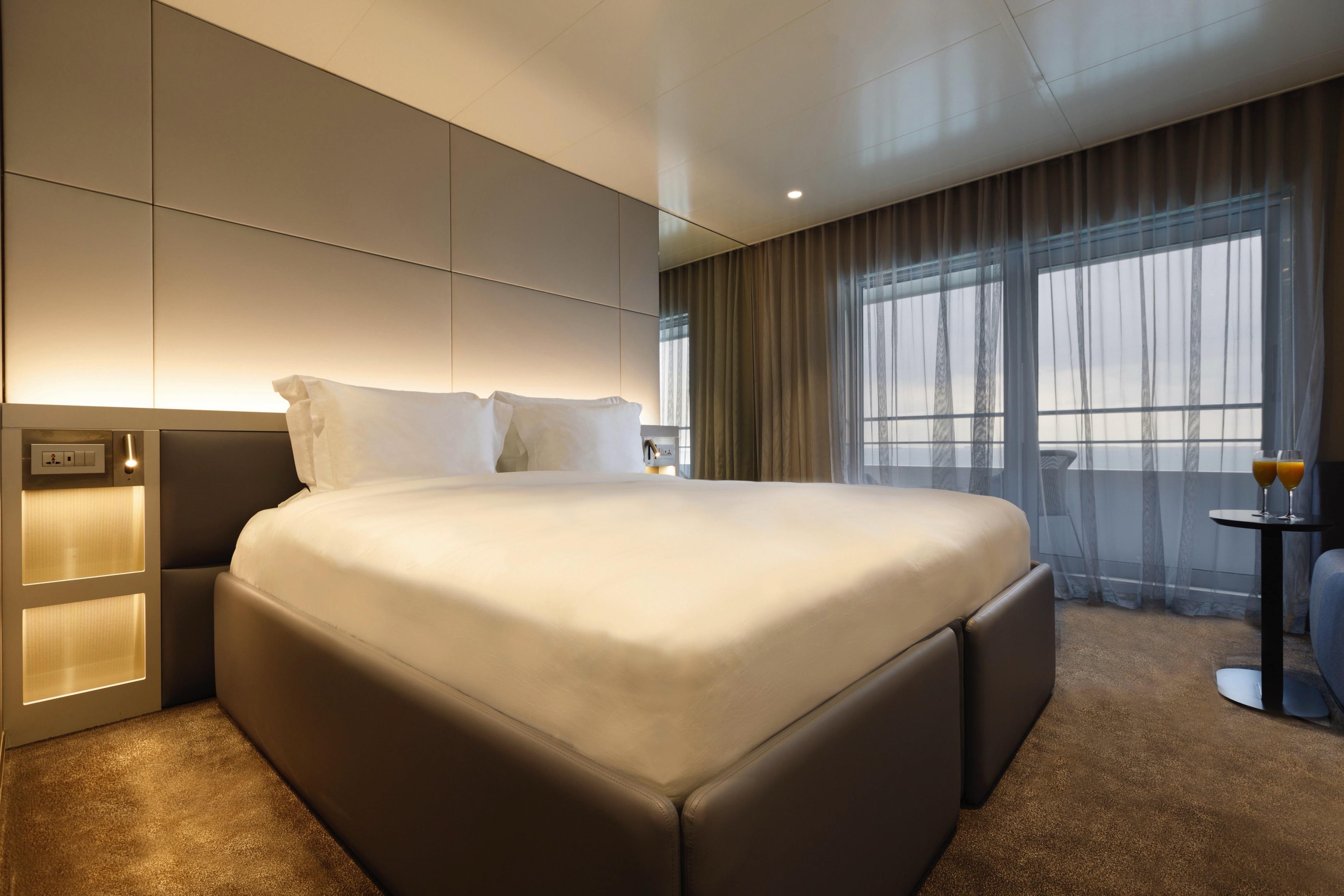
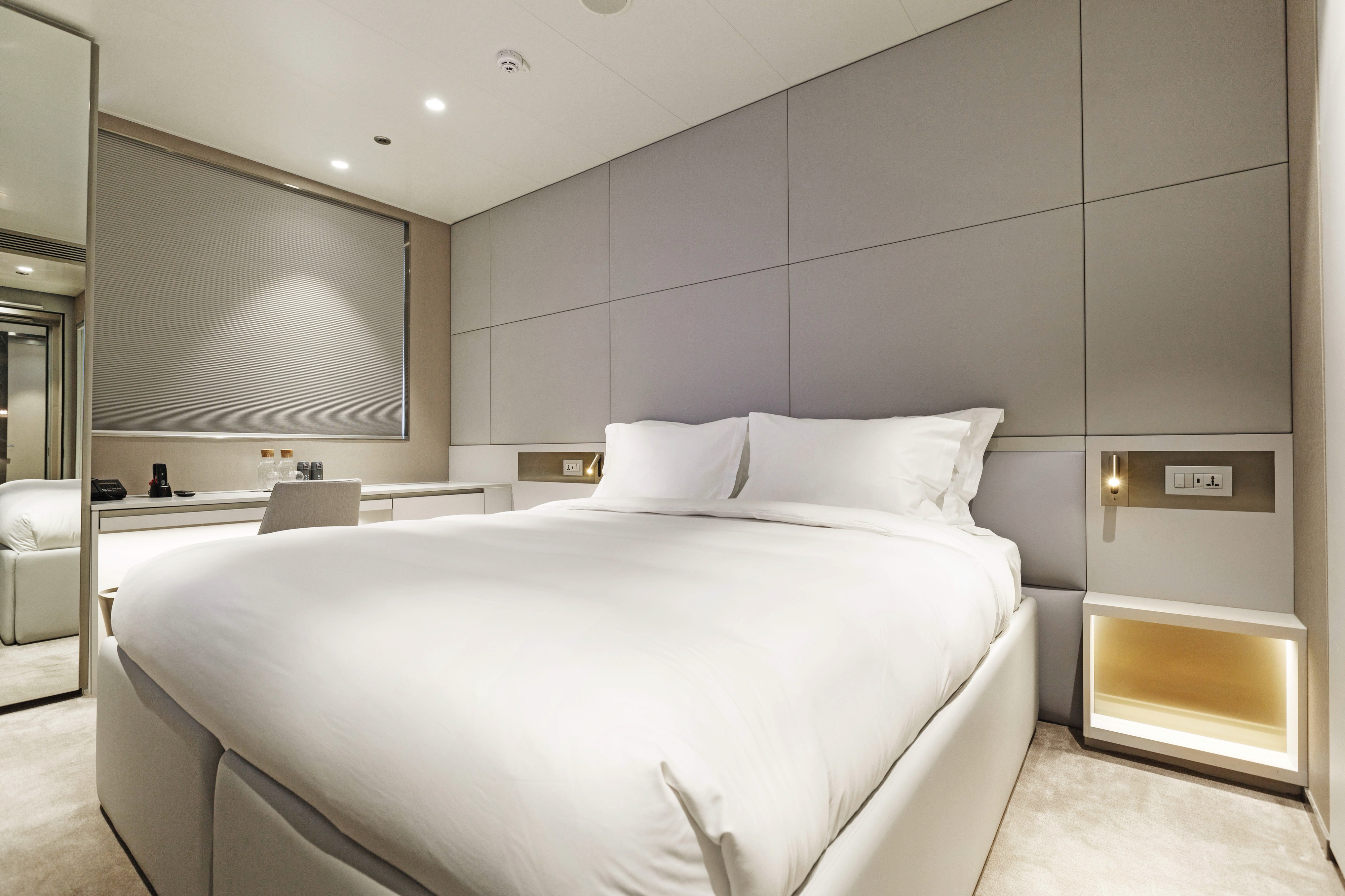
Located across the Observation and Panorama Decks, our Balcony Suites are your stylish home away from home. Enjoy stunning views from your private-access balcony and everything you need for a great night's sleep.
All suites & staterooms include:
- King-size or twin hotel-style beds with the finest Egyptian cotton linen
- En suite bathroom with luxurious ESPA toiletries
- Complimentary bathrobes and slippers
- Flat-screen HDTV and infotainment system
- Complimentary mini-bar and water, restocked daily
- Complimentary Wi-Fi
- Individual climate control
- Personal safe
- Umbrella
- Telephone
- Room service available for breakfast

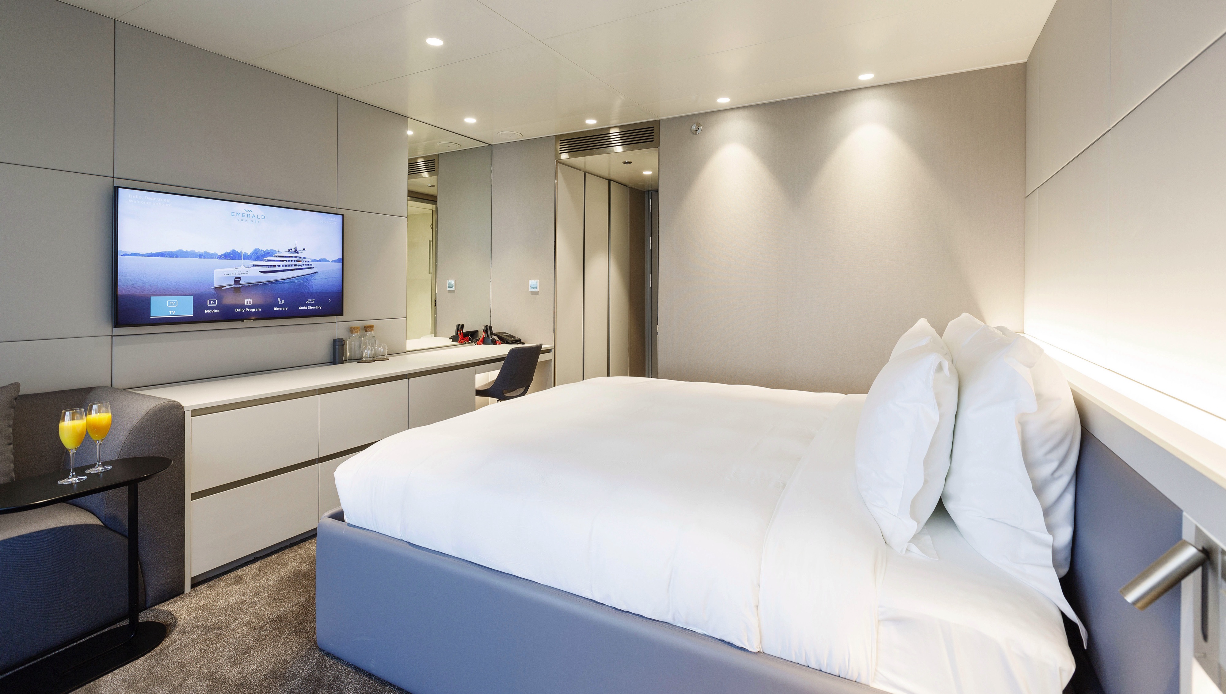
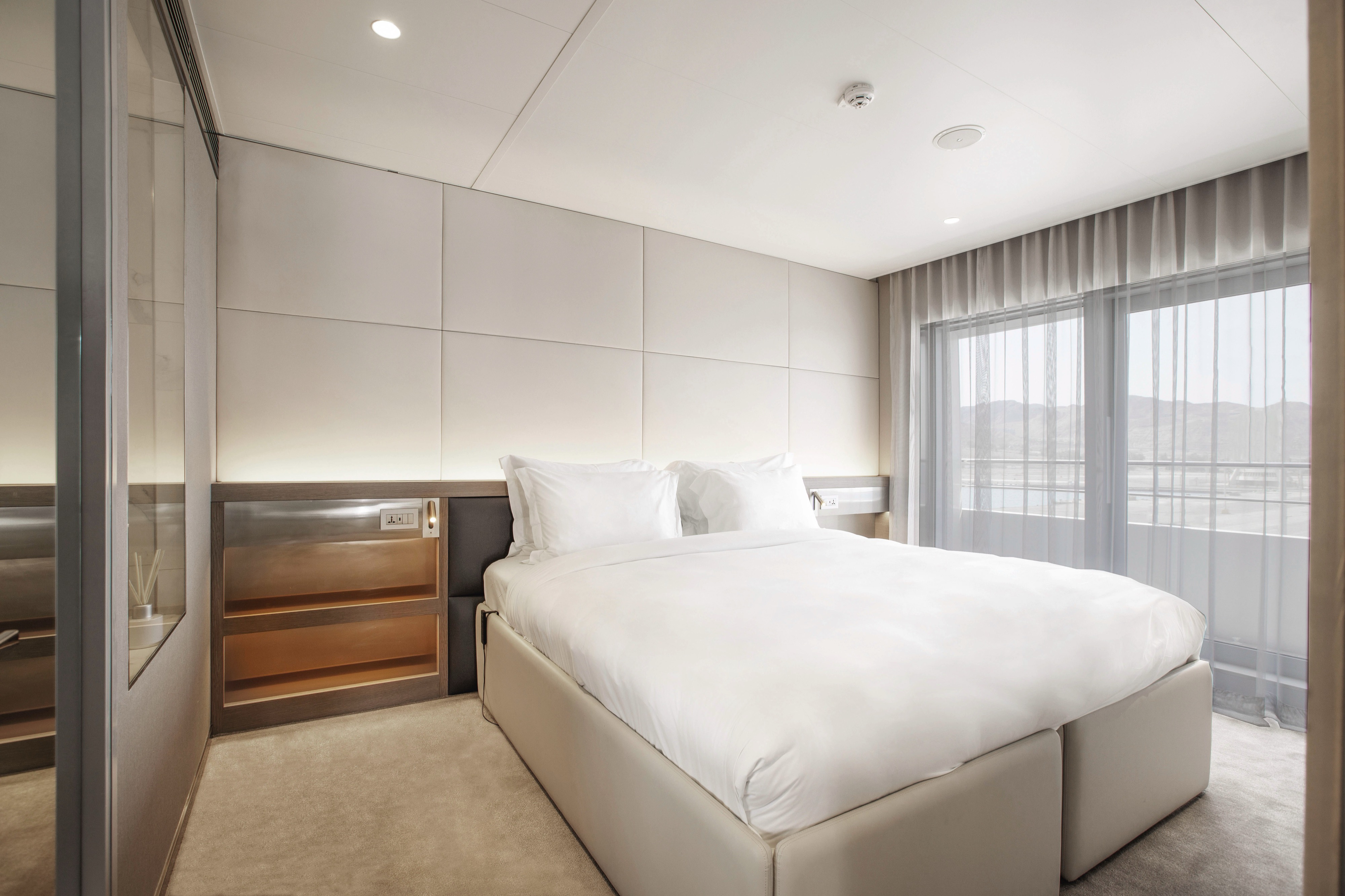
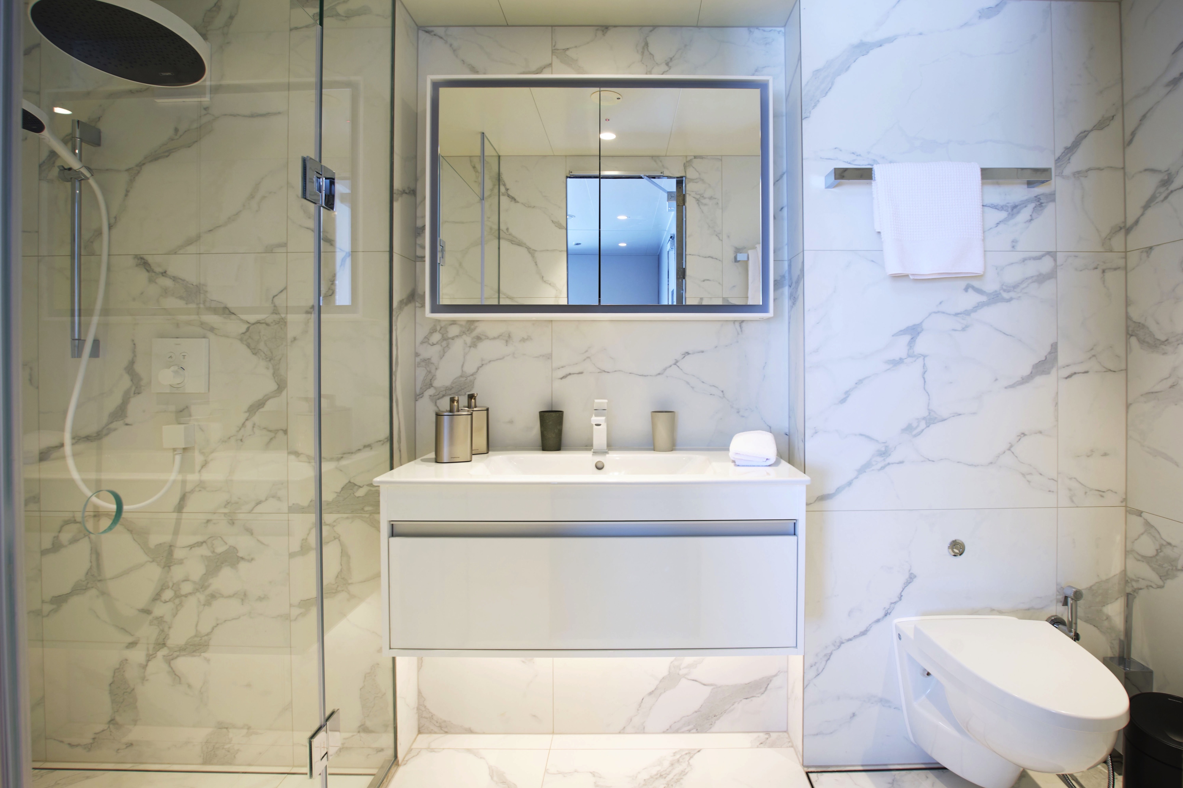
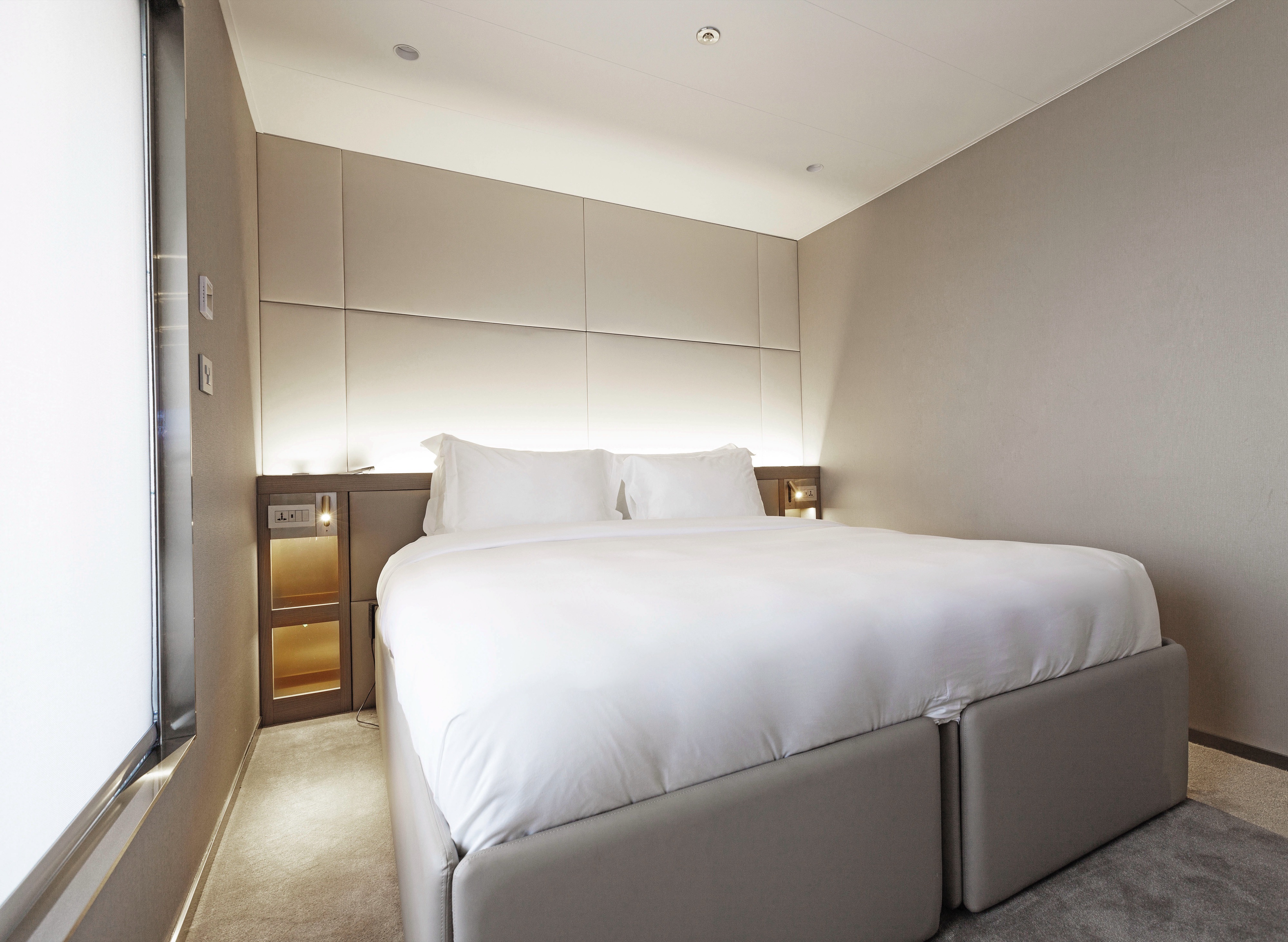
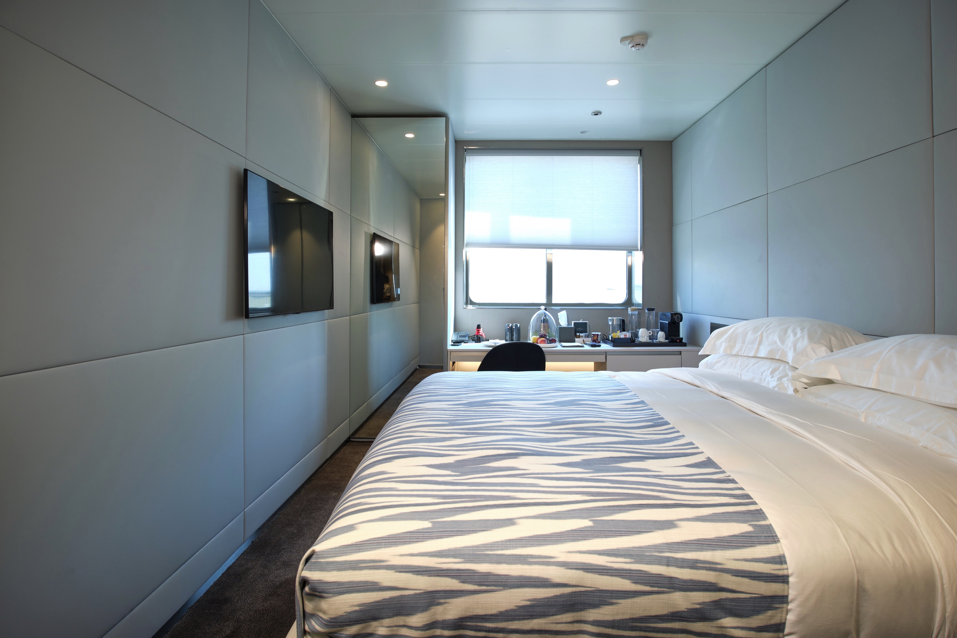
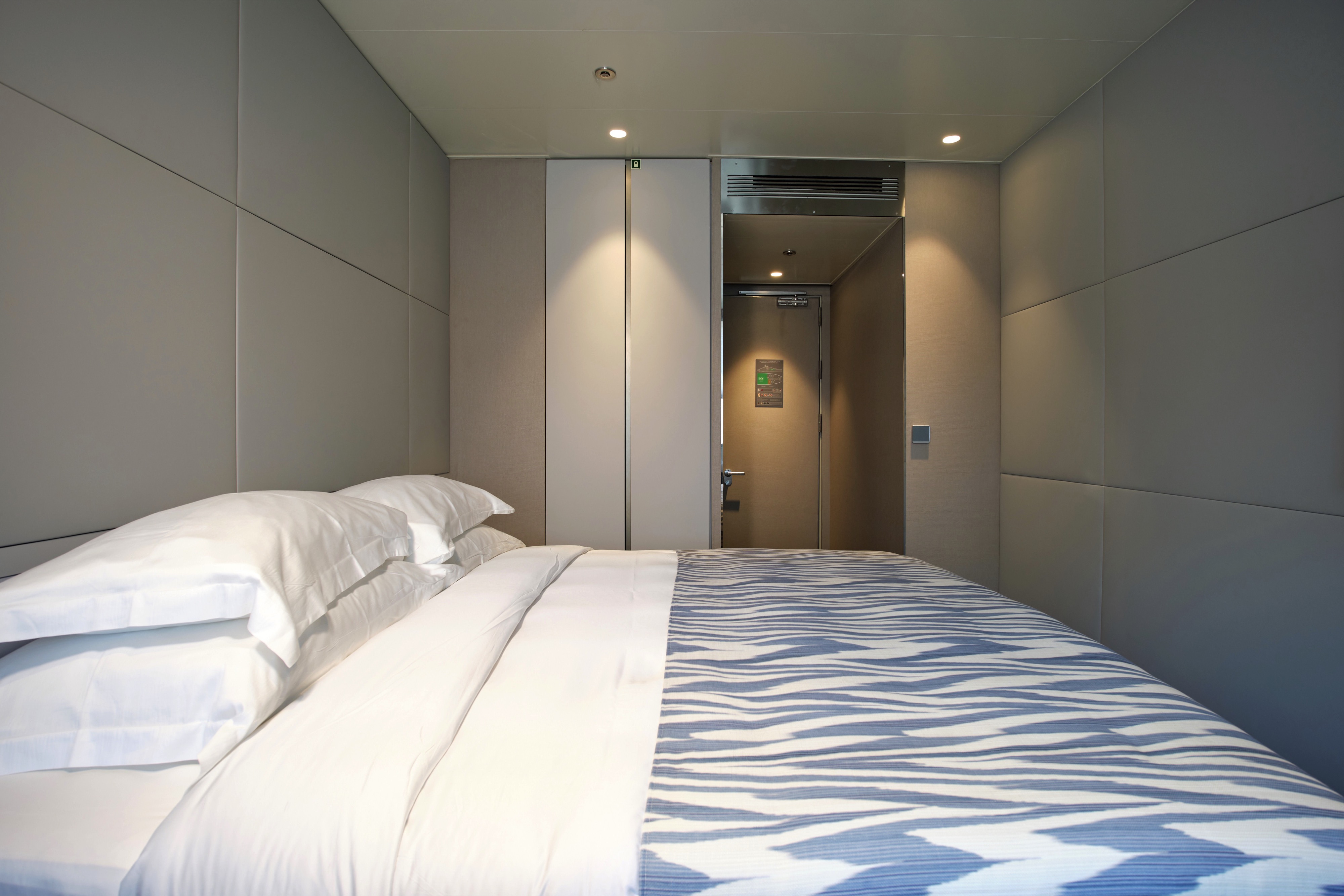
Situated on the Emerald Deck, our Oceanview Staterooms boast ample space and offer stunning views through your ocean-view window. Indulge in the luxurious amenities you'll find here, such as ESPA toiletries in your en-suite bathroom.
All suites & staterooms include:
- King-size or twin hotel-style beds with the finest Egyptian cotton linen
- En suite bathroom with luxurious ESPA toiletries
- Complimentary bathrobes and slippers
- Flat-screen HDTV and infotainment system
- Complimentary mini-bar and water, restocked daily
- Complimentary Wi-Fi
- Individual climate control
- Personal safe
- Umbrella
- Telephone
- Room service available for breakfast
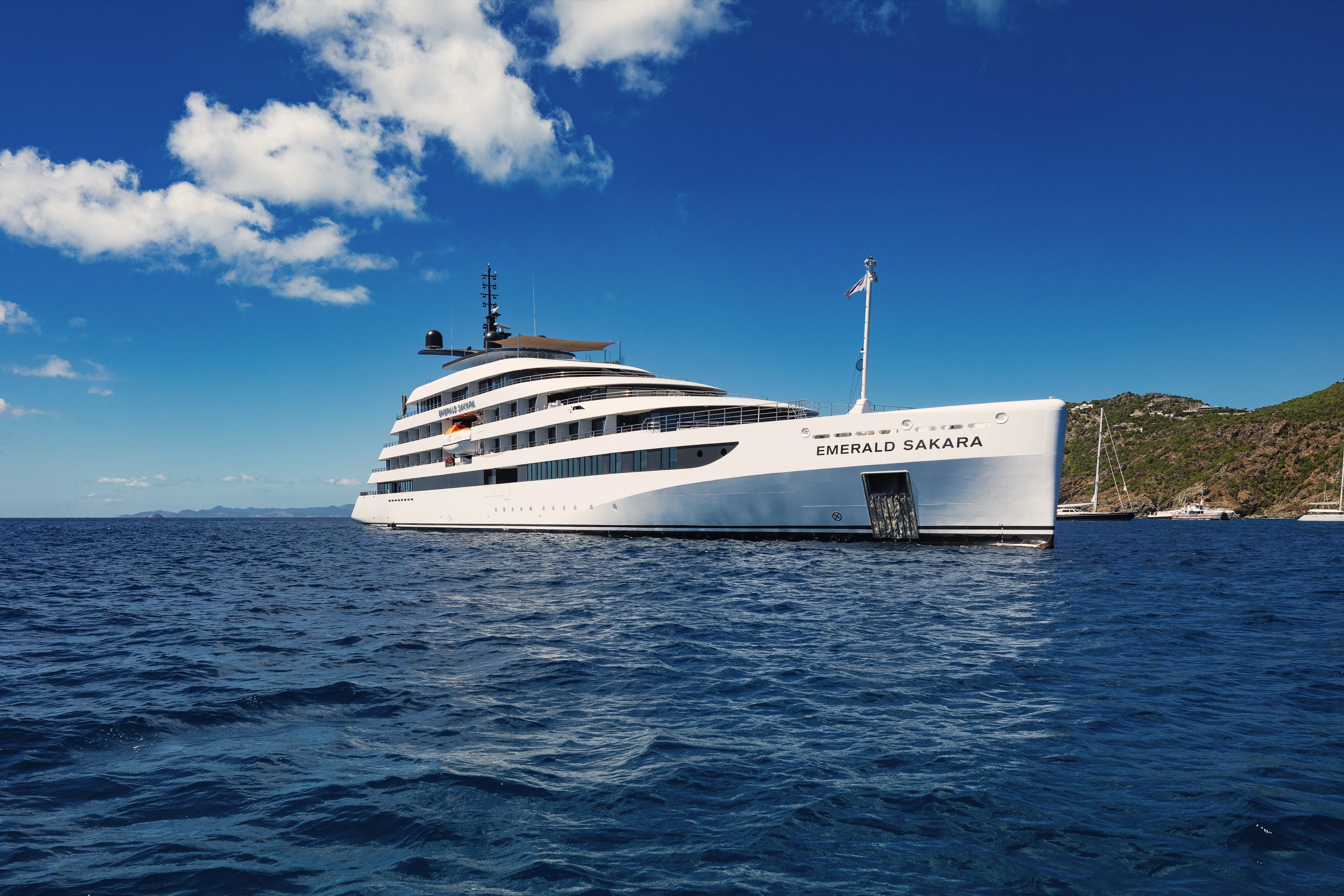
Emerald Sakara
Emerald Sakara, the stunning sister to Emerald Azzurra launched in 2023, marking the next chapter in luxury yacht cruising. Hosting just 100 guests, she mirrors Emerald Azzurra’s expansive open decks, serene wellness spaces, and cutting-edge Marina Platform, delivering an exceptional experience at sea.
Ship Facts
| Launch Year | 2023 | ||||||||
| Refit Year | |||||||||
| Language | en | ||||||||
| Gross Tonnage | N/A | ||||||||
| Length | 110 | ||||||||
| Width | N/A | ||||||||
| Currency | EUR | ||||||||
| Speed | N/A | ||||||||
| Capacity | 100 | ||||||||
| Crew Count | 76 | ||||||||
| Deck Count | 6 | ||||||||
| Cabin Count | 50 | ||||||||
| Large Cabin Count | N/A | ||||||||
| Wheelchair Cabin Count | N/A | ||||||||
| Electrical Plugs |
|
Sky Deck
- Spa Pool
- Sky Bar
- Lifts

Pool Deck
- Lifts
- Aqua Café
- Aqua Pool
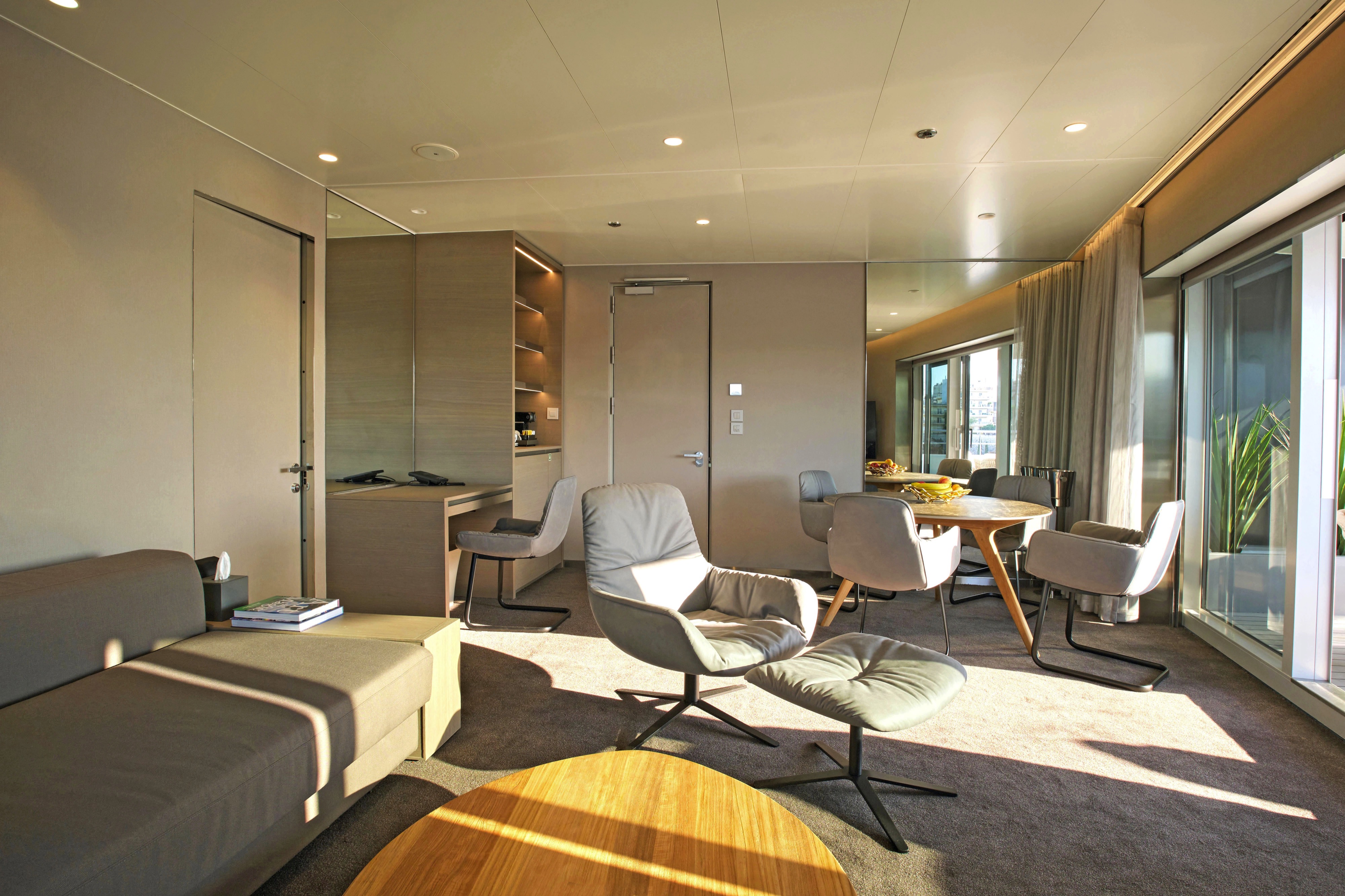
- Owner's Suite
- Deluxe Balcony Suite

Panorama Deck
- Navigation Bridge
- Life Boats
- Terrace Suite
- Balcony Suite
- Lifts

Observation Deck
- Observation Lounge
- Observation Terrace
- Self-service Laundry
- Yacht Suites
- Balcony Suites
- Lifts

Emerald Deck
- Amici Bar & Lounge
- Reception
- Boutique
- La Cucina Terrace
- La Cucina Dining
- Oceanview Staterooms
- Lifts

Wellness Deck
Medical Centre
- Gym
- Infrared Sauna
- Elements Spa
- Hairdressers
- Marina Platform
- Zodiacs
- Lifts

Delectable dining on board our yachts
Nothing beats sitting down to ocean-fresh seafood and savouring the flavours of each destination, accompanied by the perfect sommelier-paired wine. With elegant dining venues and an attentive service team, your meals promise to be among the highlights of your luxury yacht cruise with us.
Explore the fresh local flavours of the regions you sail through
We believe that food should reflect regional flavours, which is why our chefs source fresh local ingredients as you sail, creating meals that capture authentic cuisine no matter where your journey takes you.
Discover amazing drinking and dining experiences
Food and drink run deep through culture, which is why exciting dining events form part of selected yacht cruise itineraries. Entwined within our EmeraldDISCOVERY collections, these experiences will highlight the tastes of each region you travel through.
La Cucina
Our premier on board dining spot
Enjoy fine à la carte dining, as well as sumptuous breakfasts and lunches in the serene setting of our spacious La Cucina Dining, taking inspiration from the path you're navigating. This stylish restaurant boasts ample space and you can expect fresh, locally sourced dinners, thoughtfully crafted by our expert chefs.
La Cucina Terrace
If you prefer to dine alfresco, head out to the adjoining Terrace to enjoy your meals under the sun.
Unwind or catch up with friends in spacious social spaces
From the chilled and relaxed vibe of the Amici Bar & Lounge to the open-air surrounds of the Pool Deck and the serene Observation Lounge, you’ll find plenty of spaces on board to enjoy the company of new-found friends or to take a moment for yourself.
An innovative yacht experience
Take in stunning vistas from the Observation Deck. Swim in the infinity-style Aqua Pool or take a leisurely dip in the Spa Pool. Unwind in the innovative infrared sauna and, on selected days, enjoy swim stops off the Marina Platform.
Amici Bar & Lounge
Unwind in style
After your evening meal, enjoy a drink from the comfort of the Amici Bar & Lounge, the main lounge area on board our luxury yachts. Our expert mixologists will help you select the perfect drink from our extensive menus, with a range of spirits, wine, beer, cocktails, mocktails, or soft drinks there's something for everyone.
Sky Deck
Fancy taking in stunning vistas with your favourite cocktail? Head the Sky Bar on the Sky Deck and choose from our extensive drinks menu. And, if you need to cool off from the sun, why not take a dip in the nearby Spa Pool?
Observation Lounge
Head to the Observation Deck area for spectacular views or a morning yoga session. In the Observation Lounge, sit back and relax with a good book or play a game of chess.
Aqua Pool & Café
Light bites under the sun
At the Aqua Pool Café, a selection of flatbreads pack a punch with a range of fillings, and revitalising gelato satisfies your sweet tooth. Or, if you need a caffeine boost, grab a delicious coffee to go.
Reception
The Reception can be found on the Emerald Deck next to the Boutique on the Emerald Deck.