A Grand Journey of Stunning Boreal Scenery & Northern Cultural Heritage
A Grand Journey of Stunning Boreal Scenery & Northern Cultural Heritage
Cruise overview
WHY BOOK WITH US?
- ✔ The Deluxe Cruises’ team has extensive experience in ultra-luxury cruising.
- ✔ Call now to speak to our helpful and experienced Cruise Concierge team.
- ✔ Enjoy our Unique Deluxe Cruises Bonus for substantial savings.
- ✔ Our team will tailor your holiday to your exacting requirements.
- ✔ As agents, we work under the protection of each cruise lines ABTA / ATOL licences
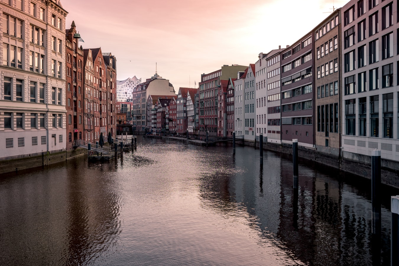
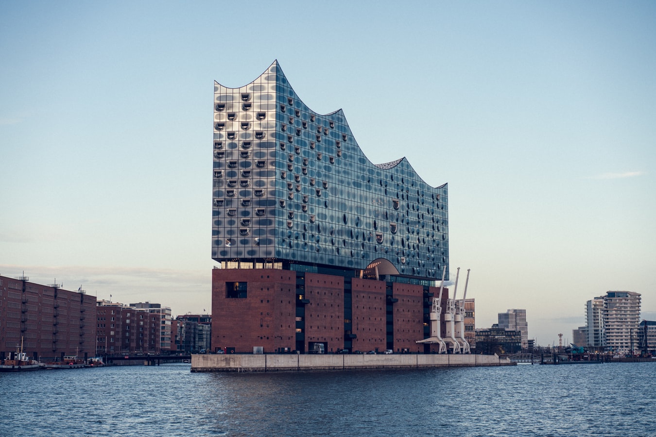
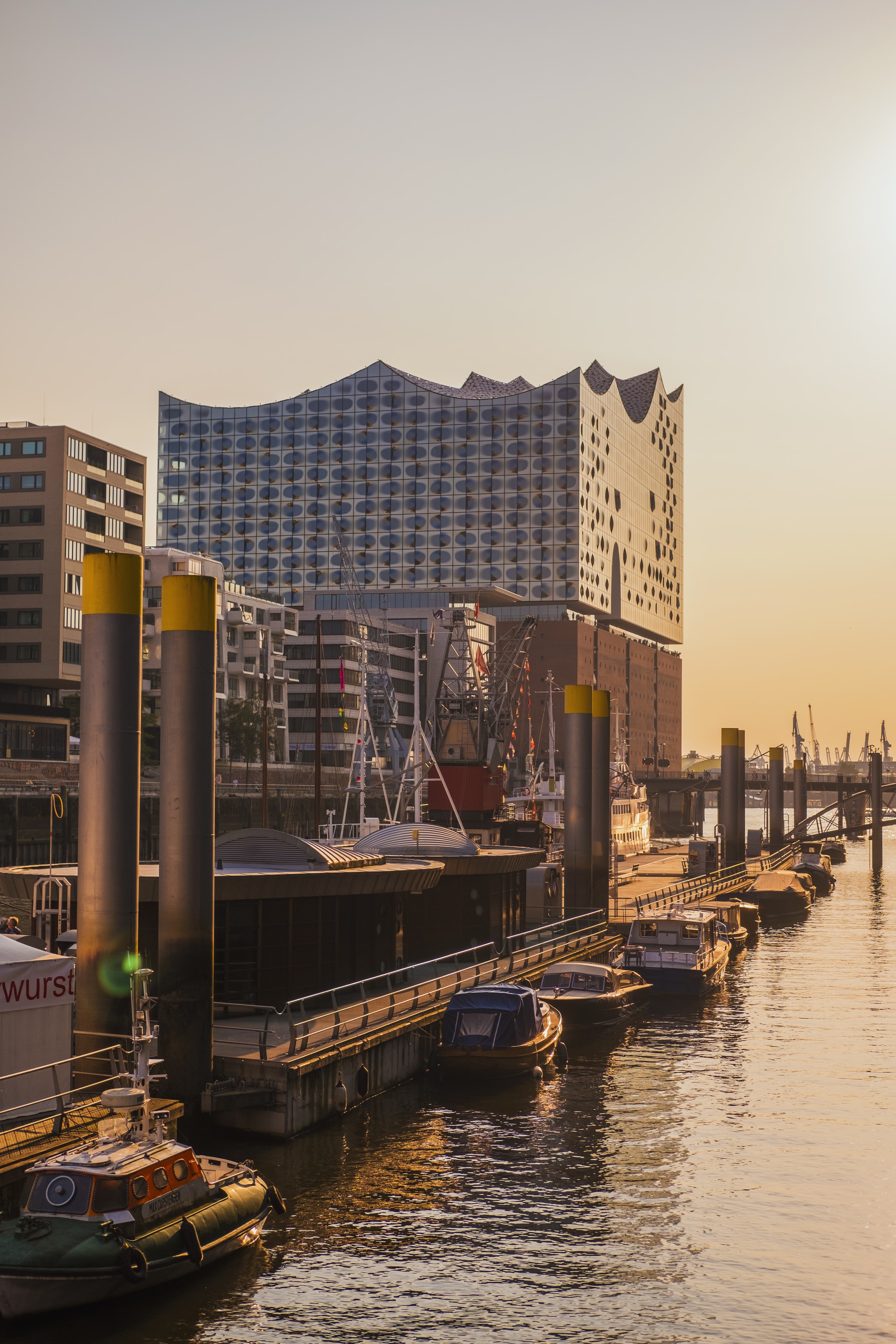
About Hamburg
Hamburg is Germany’s second-largest city with a history dating back to Charlemagne. A major port, this vibrant city is home to art and culture, extensive shopping facilities, Baroque buildings and waterfront vistas. With its well-known fish market, art galleries and Museums together with several beautiful parks including a botanical garden, this is a city with something for everyone. British visitors who remember the Swinging Sixties may like to visit the streets around Grosse Freiheit, where an unknown pop group called The Beatles gave their first public performances in various local clubs before achieving worldwide fame.

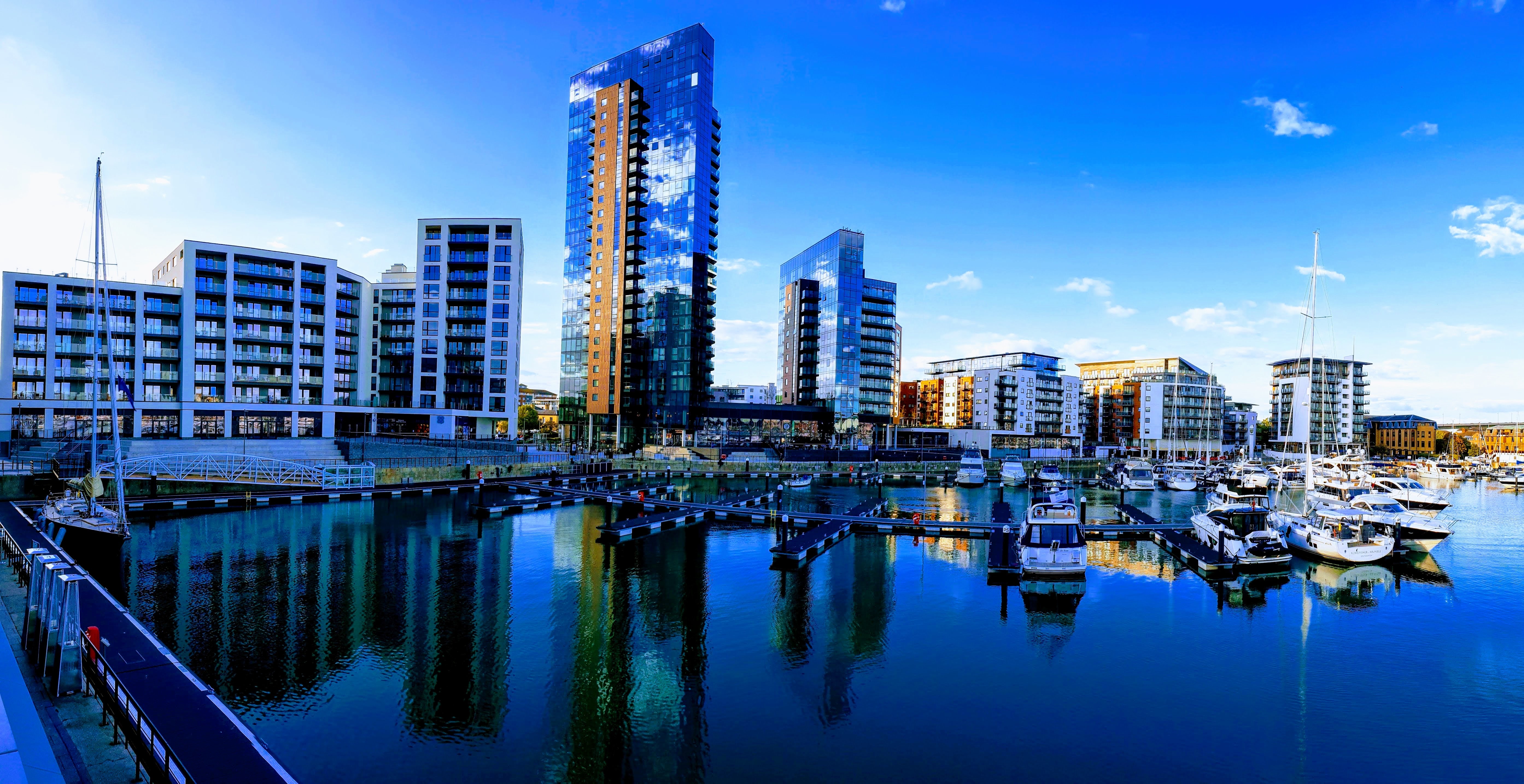
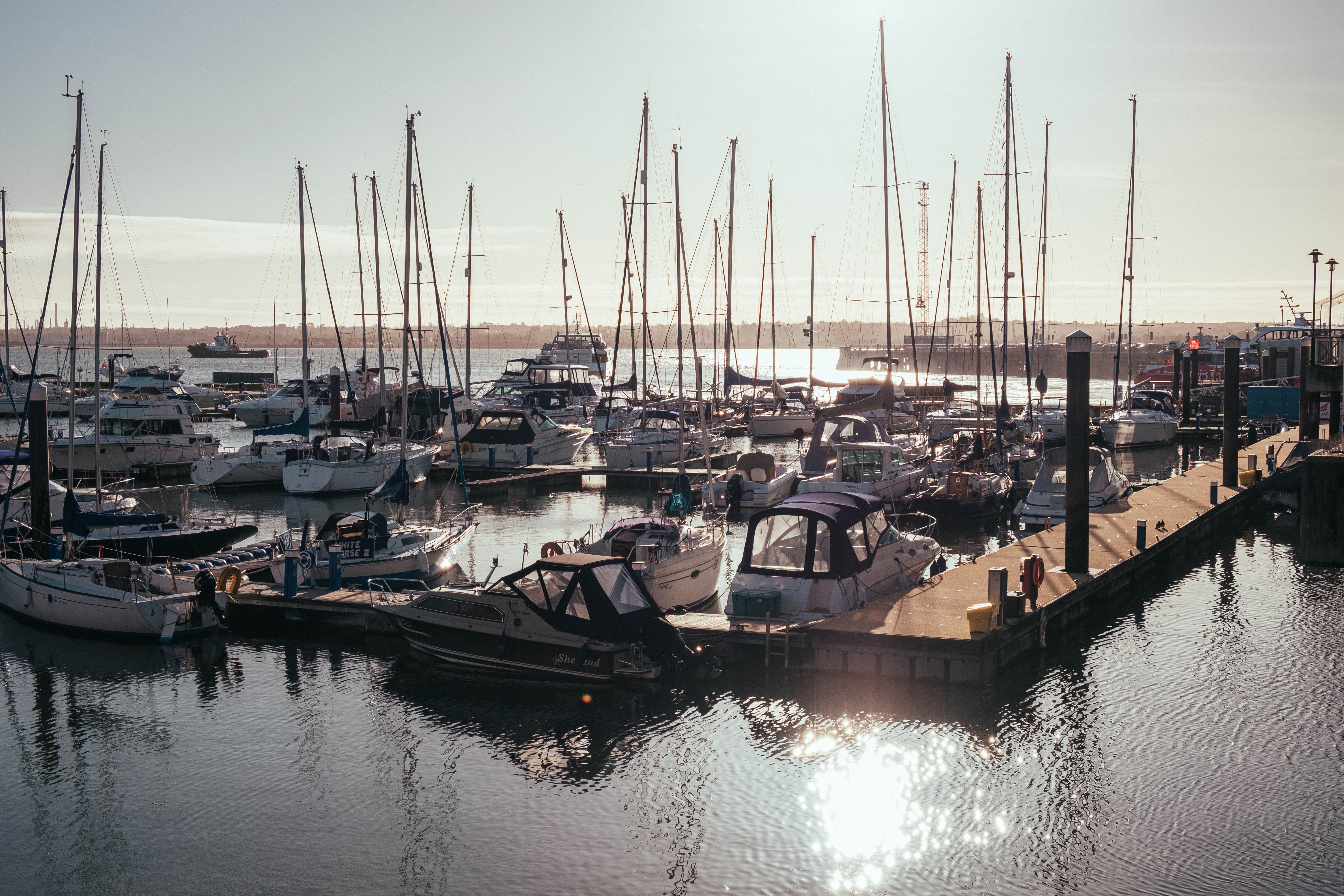
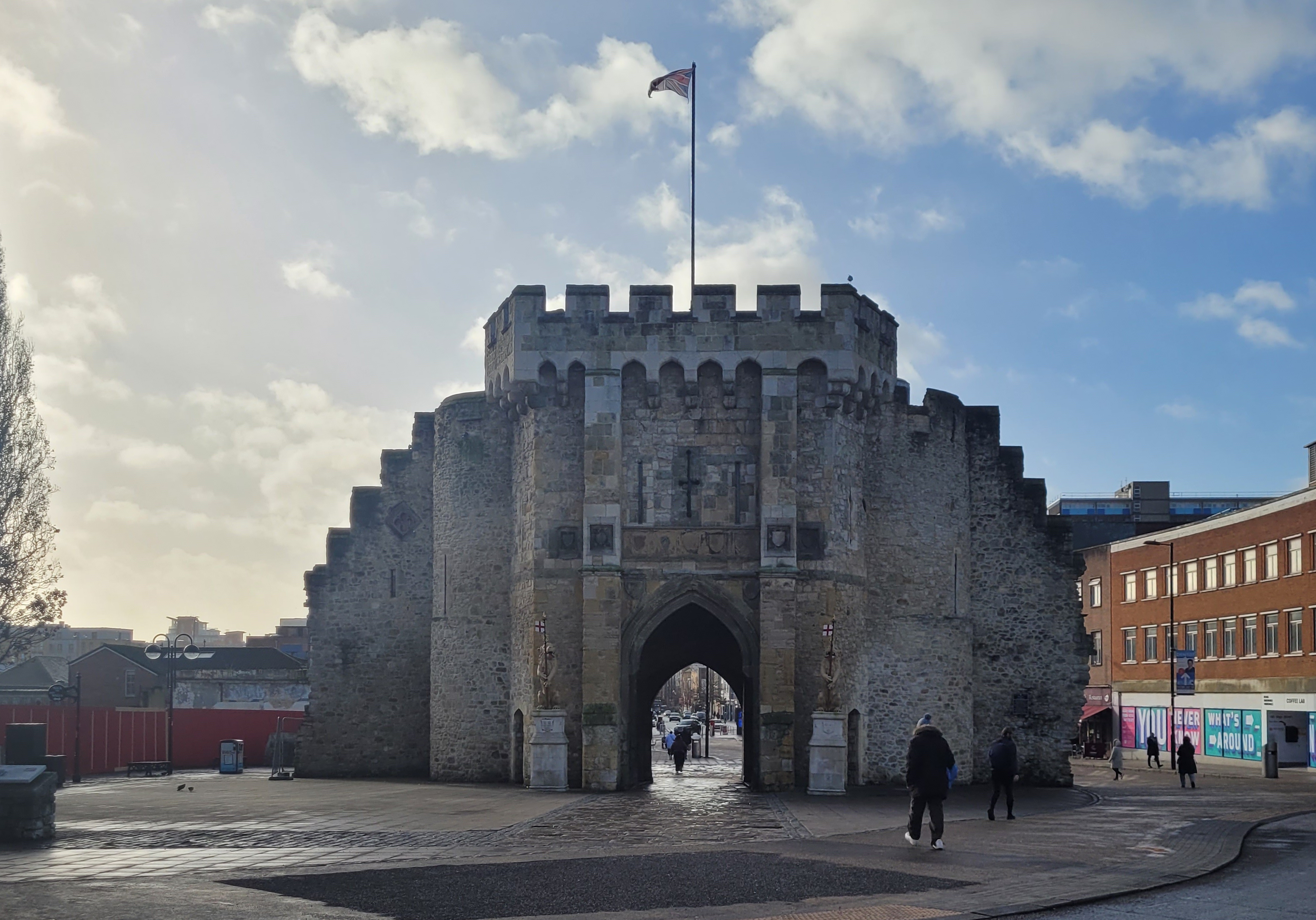
About Southampton
Lying near the head of Southampton Water, a peninsula between the estuaries of the Rivers Test and Itchen, Southampton is Britain’s largest cruise port. It has been one of England’s major ports since the Middle Ages, when it exported wool and hides from the hinterland and imported wine from Bordeaux. The city suffered heavy damage during World War Two and as a result the centre has been extensively rebuilt, but there are still some interesting medieval buildings including the Bargate, one of the finest city gatehouses in England.

About Greencastle
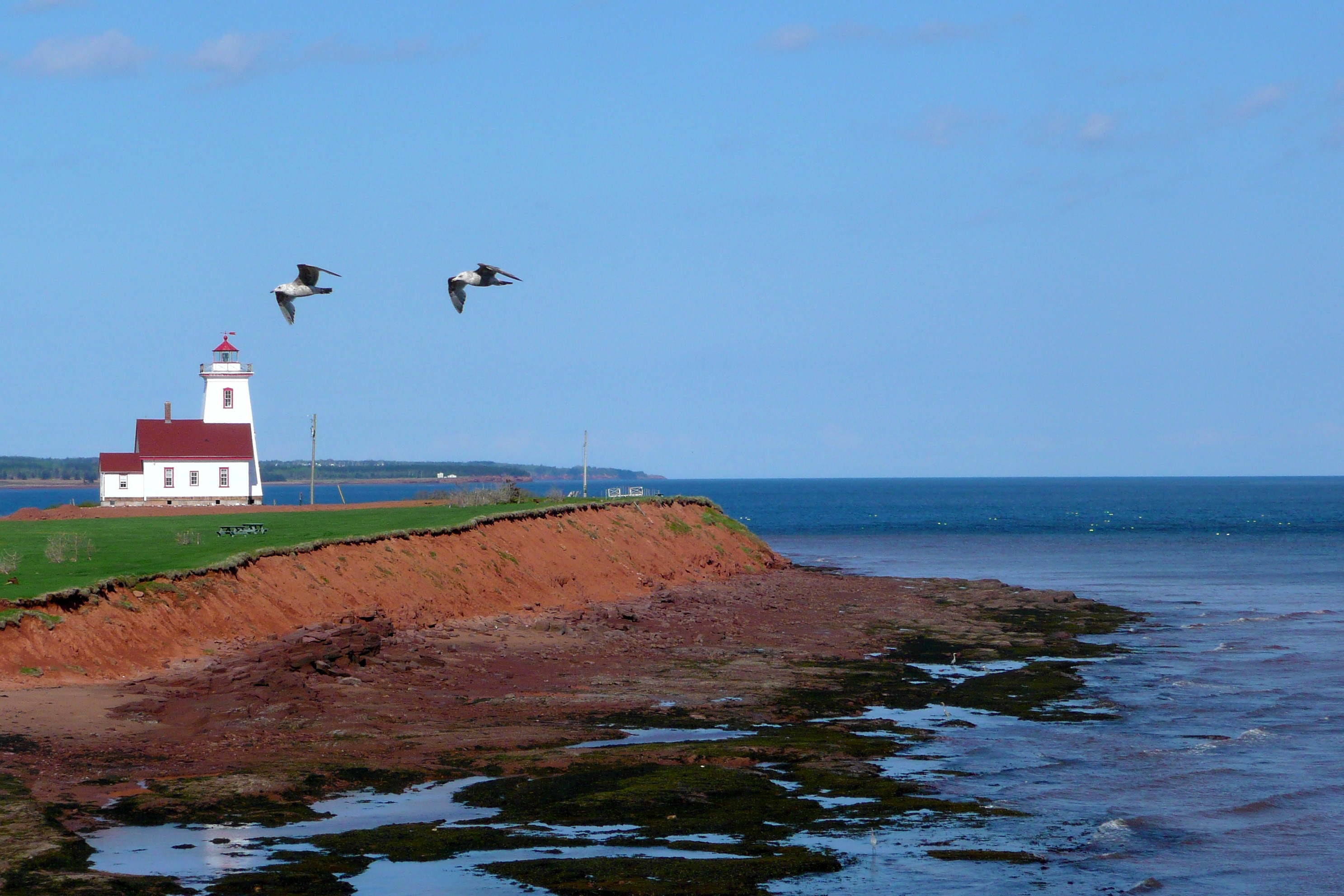
About Stornoway, Isle of Lewis
Tour description Stornoway, Scotland The Isle of Lewis and Harris is the northernmost and largest of the Outer Hebrides-the Western Isles in common parlance. The island's only major town, Stornoway, is on a nearly landlocked harbor on the east coast of Lewis. It's the port capital for the Outer Hebrides and the island's cultural center, such that it is. Stornoway has an increasing number of good restaurants. Lewis has some fine historic attractions, including the Calanais Standing Stones-a truly magical place. The Uists are known for their rare, plentiful wildlife. Stornoway. Besides being the island's main entry point for ferries, Stornoway is also Lewis's main arts center. You'll find some good restaurants in town if you want to have lunch off the ship. The town can be explored by bicycle if you are so inclined. Local rental shops can give you advice on where to ride, including a route to Tolsta that takes in five stunning beaches before reaching the edge of moorland. An Lanntair Arts Centre. The fabulous An Lanntair Arts Centre has exhibitions of contemporary and traditional art, as well as a cinema, a gift shop, and a restaurant serving international and Scottish fare. There are frequent traditional musical and theatrical events in the impressive auditorium. Kenneth St.. Black House. In the small community of Arnol, the Black House is a well-preserved example of an increasingly rare type of traditional Hebridean home. Once common throughout the islands-even into the 1950s-these dwellings were built without mortar and thatched on a timber framework without eaves. Other characteristic features include an open central peat hearth and the absence of a chimney-hence the soot and the designation black. On display inside are many of the house's original furnishings. To reach Arnol from Port of Ness, head south on the A857 and pick up the A858 at Barvas. Off A858, 21 mi southwest of Port of Ness. Admission charged. Calanais Standing Stones. These impressive stones are actually part of a cluster of several different archaeological sites in this area. Probably positioned in several stages between 3000 BC and 1500 BC, the grouping consists of an avenue of 19 monoliths extending northward from a circle of 13 stones, with other rows leading south, east, and west. Ruins of a cairn sit within the circle on the east side. Researchers believe they may have been used for astronomical observations, but you can create your own explanations. The visitor center has an exhibit on the stones, a gift shop, and a tearoom. On an unmarked road off A858. Admission charged. Dun Carloway. One of the best-preserved Iron Age brochs (circular stone towers) in Scotland, Dun Carloway dominates the scattered community of Carloway. The mysterious tower was probably built around 2,000 years ago as protection against seaborne raiders. The Dun Broch Centre explains more about the broch and its setting. Off A857. Gearrannan. Up a side road north from Carloway, Gearrannan is an old black-house village that has been brought back to life with a museum screening excellent short films on peat cutting and weaving. For a unique experience, groups can rent the restored houses. Leverburgh. At Leverburgh you can take the ferry to North Uist. Nearby Northton has several attractions; St. Clement's Church at Rodel is particularly worth a visit. MacGillivray Centre. Located in a round building overlooking the bay, the MacGillivray Centre gives insight into the life and work of William MacGillivray (1796-1852), a noted naturalist with strong links to Harris. MacGillivray authored the five-volume History of British Birds. This is a great location for a picnic (there are tables for just such a purpose). A walk to a ruined church starts at the parking lot. A859, Northton. Seallam! Visitor Centre and Co Leis Thu? Genealogical Research Centre. The center is where you can trace your Western Isles ancestry. Photographs and interpretive signs describe the history of Harris and its people. The owners organize guided walks and cultural evenings weekly between May and September. Off A859, Northton. Admission charged. St. Clement's Church. At the southernmost point of Harris is the community of Rodel, where you can find St. Clement's Church, a cruciform church standing on a hillock. This is the most impressive pre-Reformation church in the Outer Hebrides; it was built around 1500 and contains the magnificently sculptured tomb (1528) of the church's builder, Alasdair Crotach, MacLeod chief of Dunvegan Castle. Rodel is 3 mi south of Leverburgh and 21 mi south of Tarbert. A859, Rodel. Port of Ness. The stark, windswept community of Port of Ness, 30 mi north of Stornoway, cradles a small harbor squeezed in among the rocks. Butt of Lewis Lighthouse. At the northernmost point of Lewis stands the Butt of Lewis Lighthouse, designed by David and Thomas Stevenson (of the prominent engineering family whose best-known member was not an engineer at all, but the novelist Robert Louis Stevenson). The structure was first lighted in 1862. The adjacent cliffs provide a good vantage point for viewing seabirds, whales, and porpoises. The lighthouse is northwest of Port of Ness along the B8014. Shopping Harris tweed is available at many outlets on the islands, including some of the weavers' homes; keep an eye out for signs directing you to weavers' workshops. Harris Tweed Artisans Cooperative. The Harris Tweed Artisans Cooperative sells stylish and quirky hand-crafted tweed clothing, hats, accessories, all made by artists belonging to the cooperative. 40 Point St., Stornoway. Borgh Pottery. At Borgh Pottery, open from Monday to Saturday 9:30 to 6, you can buy attractive hand-thrown studio pottery made on the premises, including lamps, vases, mugs, and dishes. Fivepenny House, A857, Borve.

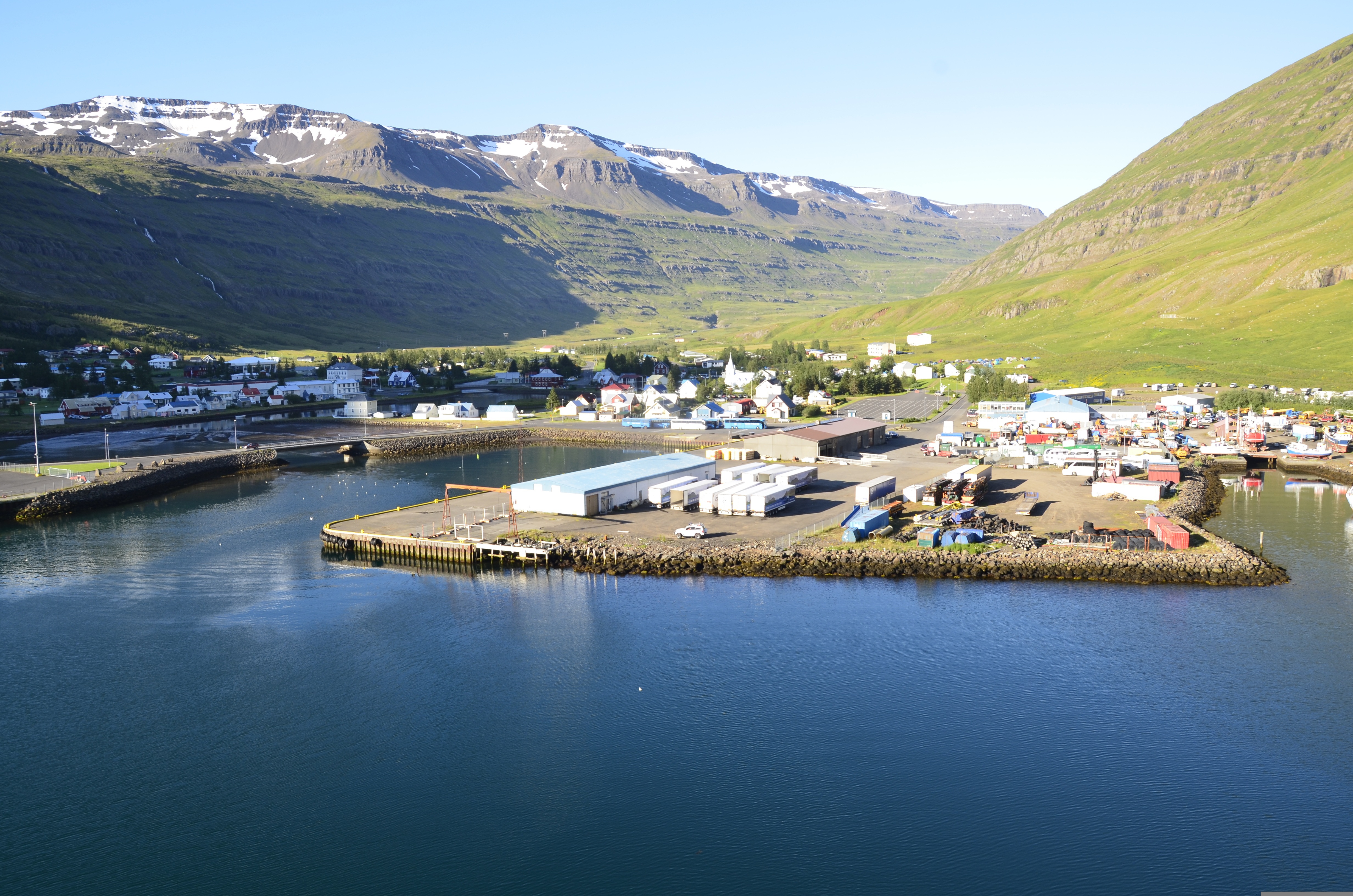
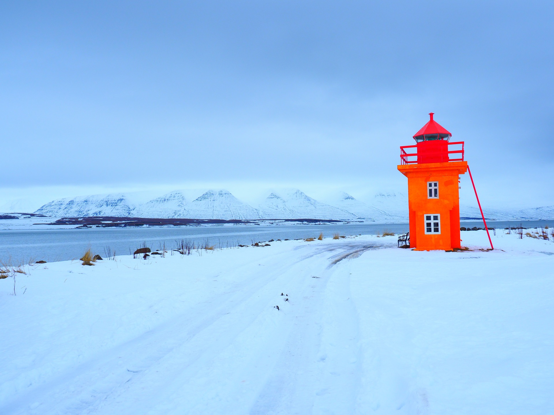
About Seydisfjørdur
Seyðisfjörður, a beautiful 19th-century Norwegian village on the east coast of Iceland, is regarded by many as one of Iceland's most picturesque towns, not only due to its impressive environment, but also because nowhere in Iceland has a community of old wooden buildings been preserved so well as here. Poet Matthías Johannessen called Seyðisfjörður a 'pearl enclosed in a shell'. The community owes its origins to foreign merchants, mainly Danes, who started trading in the fjord in the mid-19th century. But the crucial factor in the evolution of the village was the establishment of the Icelandic herring fishery by Norwegians in 1870-1900. The Norwegians built up a number of herring-fishing facilities, and in a matter of years the little community grew into a boom town. Today, about 800 people live in Seyðisfjörður. The local economy has long been based on the fisheries, while light industry also flourishes. Tourism is playing a growing role, as the picturesque town in its spectacular surroundings attracts more and more visitors. The car/passenger ferry Norrøna, which plies between continental Europe and Iceland every summer, docks at Seyðisfjörður every Thursday. Seyðisfjörður has been a cosmopolitan community from its foundation, and the ferry service has contributed to ensuring that it remains so.

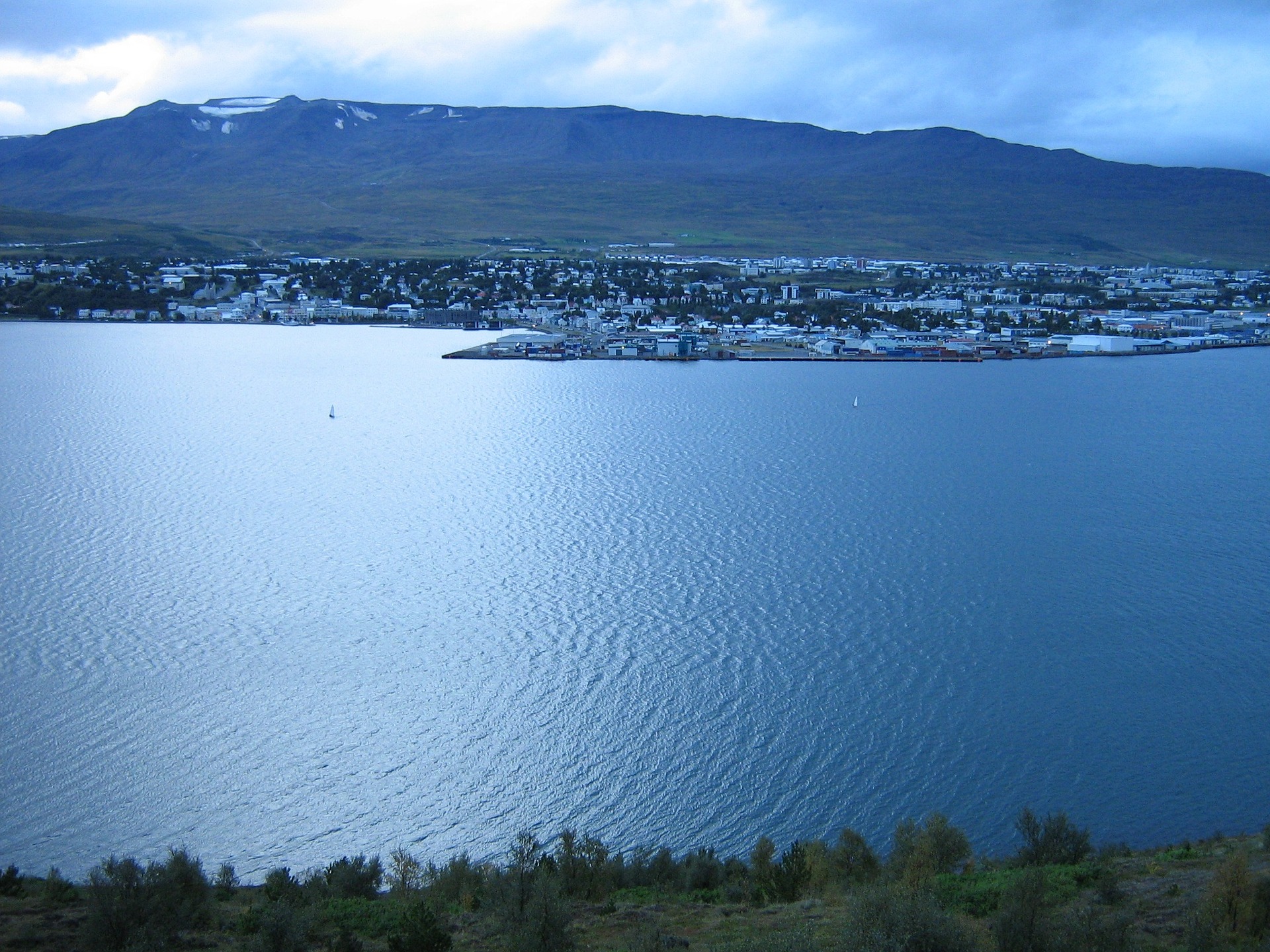
About Akureyri
Akureyri, called the Capital of the North is the second largest urban area in Iceland, and a lively one at that. Hemmed by the 60-km (37-mile) long Eyjafjörður, Akureyri is sheltered from the ocean winds and embraced by mountains on three sides. Late 19th-century wooden houses impart a sense of history, and the twin spires of a modern Lutheran church rising on a green hill near the waterfront, provide a focal point. To the south of Akureyri is the pyramid-shape rhyolite mountain Súlur. Beyond it is Kerling, the highest peak in Eyjafjörður District.
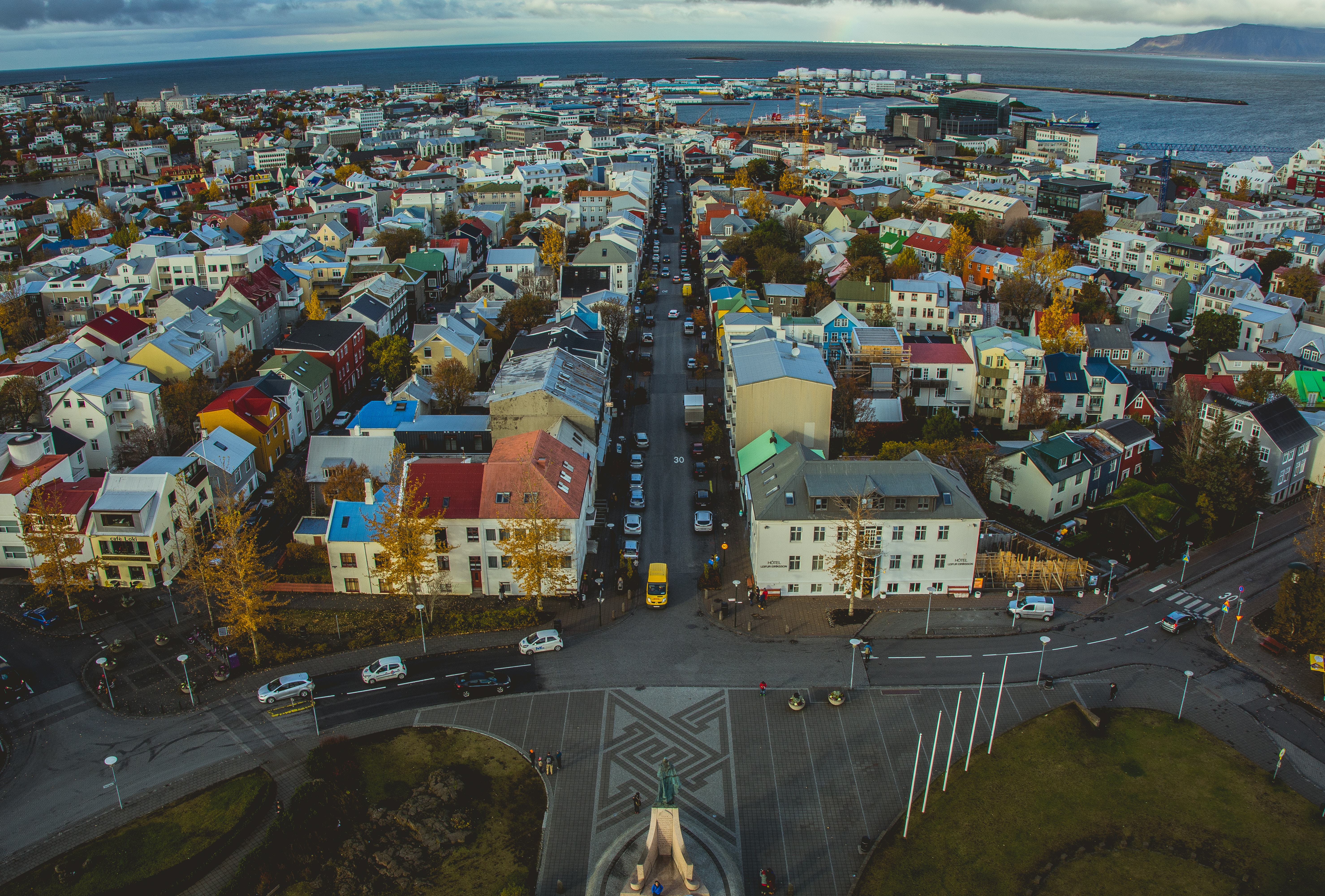
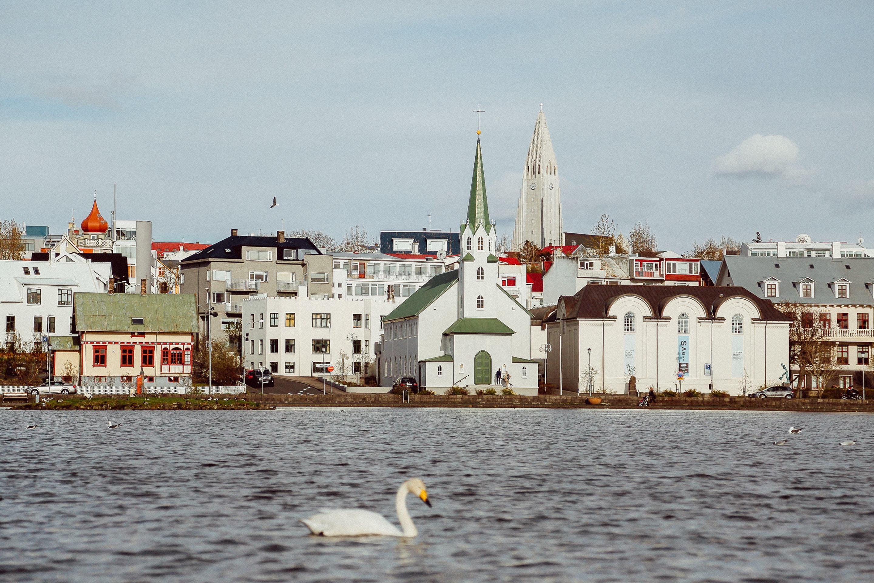
About Reykjavík
Sprawling Reykjavík, the nation's nerve center and government seat, is home to half the island's population. On a bay overlooked by proud Mt. Esja (pronounced eh-shyuh), with its ever-changing hues, Reykjavík presents a colorful sight, its concrete houses painted in light colors and topped by vibrant red, blue, and green roofs. In contrast to the almost treeless countryside, Reykjavík has many tall, native birches, rowans, and willows, as well as imported aspen, pines, and spruces.Reykjavík's name comes from the Icelandic words for smoke, reykur, and bay, vík. In AD 874, Norseman Ingólfur Arnarson saw Iceland rising out of the misty sea and came ashore at a bay eerily shrouded with plumes of steam from nearby hot springs. Today most of the houses in Reykjavík are heated by near-boiling water from the hot springs. Natural heating avoids air pollution; there's no smoke around. You may notice, however, that the hot water brings a slight sulfur smell to the bathroom.Prices are easily on a par with other major European cities. A practical option is to purchase a Reykjavík City Card at the Tourist Information Center or at the Reykjavík Youth Hostel. This card permits unlimited bus usage and admission to any of the city's seven pools, the Family Park and Zoo, and city museums. The cards are valid for one (ISK 3,300), two (ISK 4,400), or three days (ISK 4,900), and they pay for themselves after three or four uses a day. Even lacking the City Card, paying admission (ISK 500, or ISK 250 for seniors and people with disabilities) to one of the city art museums (Hafnarhús, Kjarvalsstaðir, or Ásmundarsafn) gets you free same-day admission to the other two.
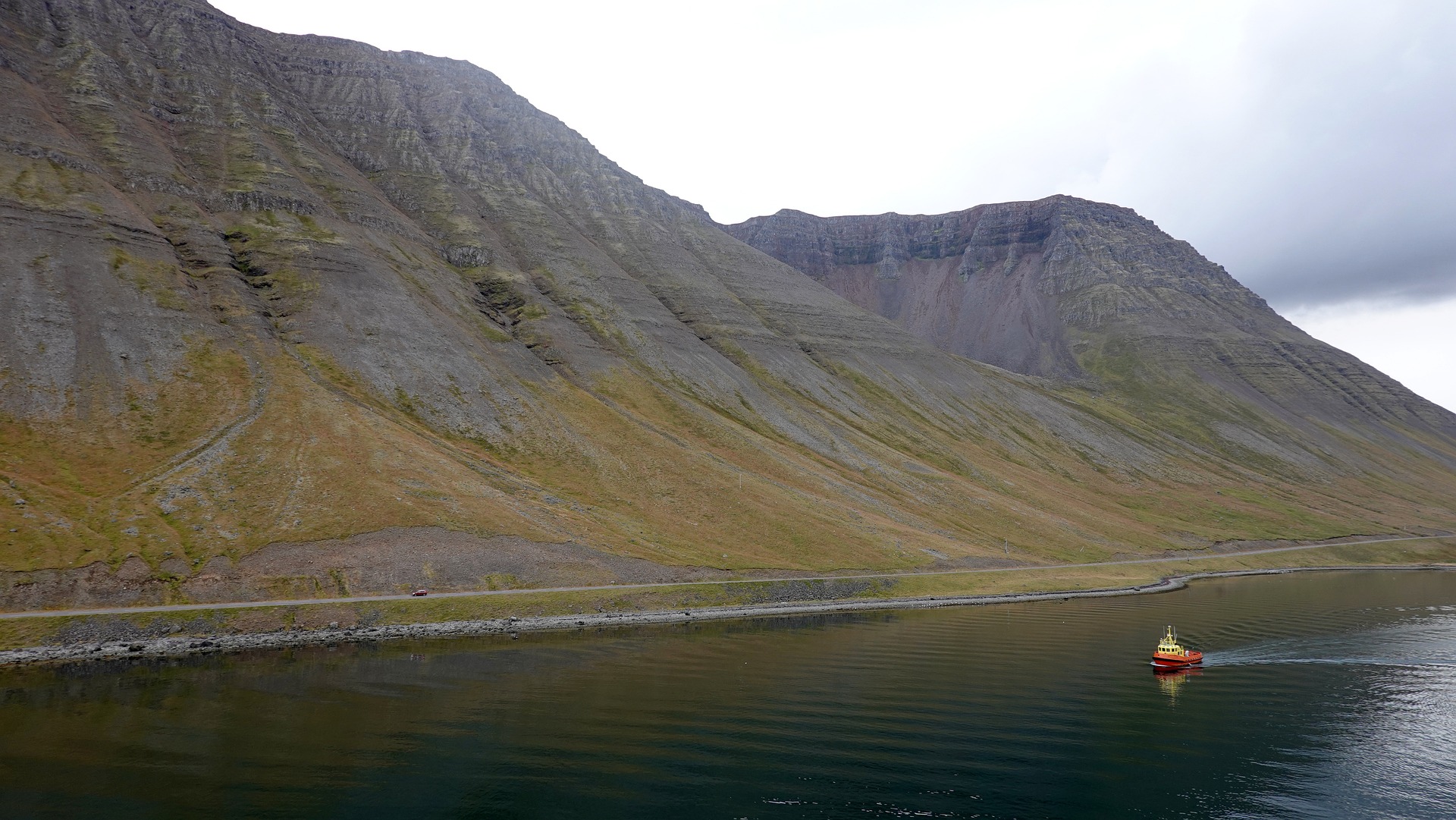
About Isafjørdur
Two colossal terraces of sheer rock stand either side of this extraordinarily located town - which rides a jutting spit onto an immensity of black fjord water. Surprisingly, considering the remoteness of its location and its compact size, Isafjordur is a modern and lively place to visit, offering a great choice of cafes and delicious restaurants – which are well stocked to impress visitors. The town is a perfectly located base for adventures amongst Iceland's fantastic wilderness - with skiing, hiking and water-sports popular pursuits among visitors.
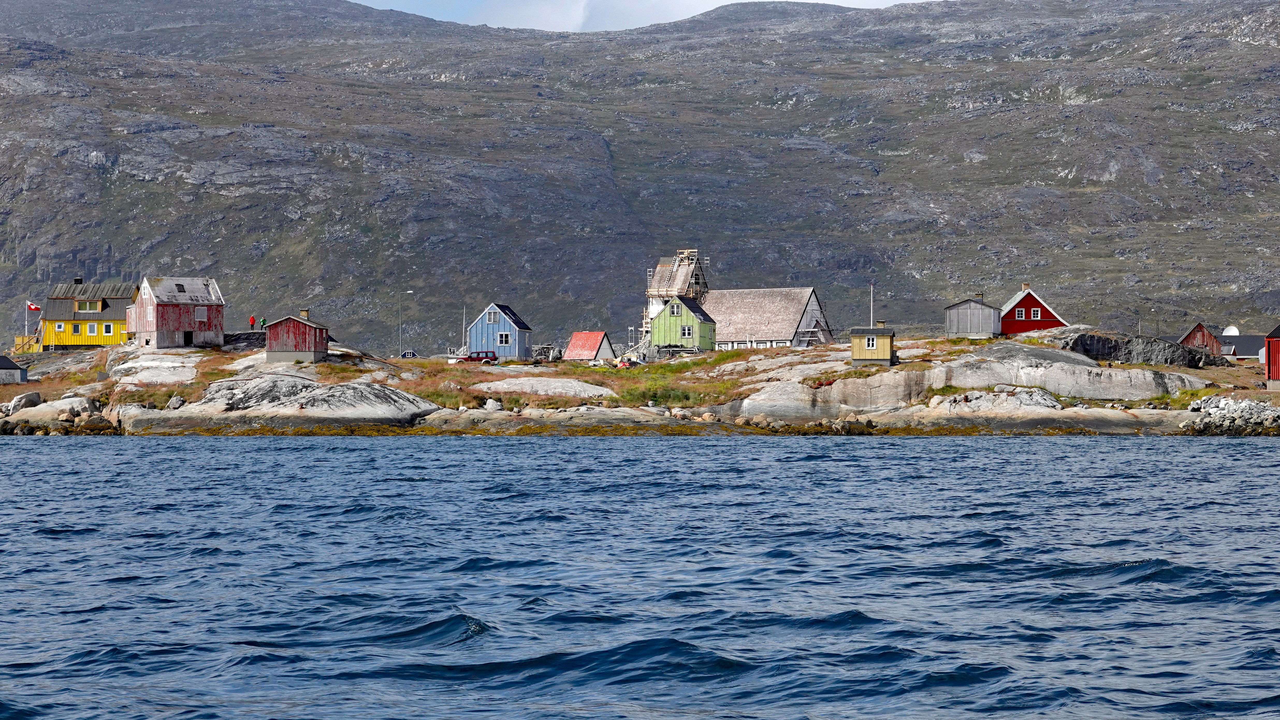
About Paamiut (Fredrikshaab)
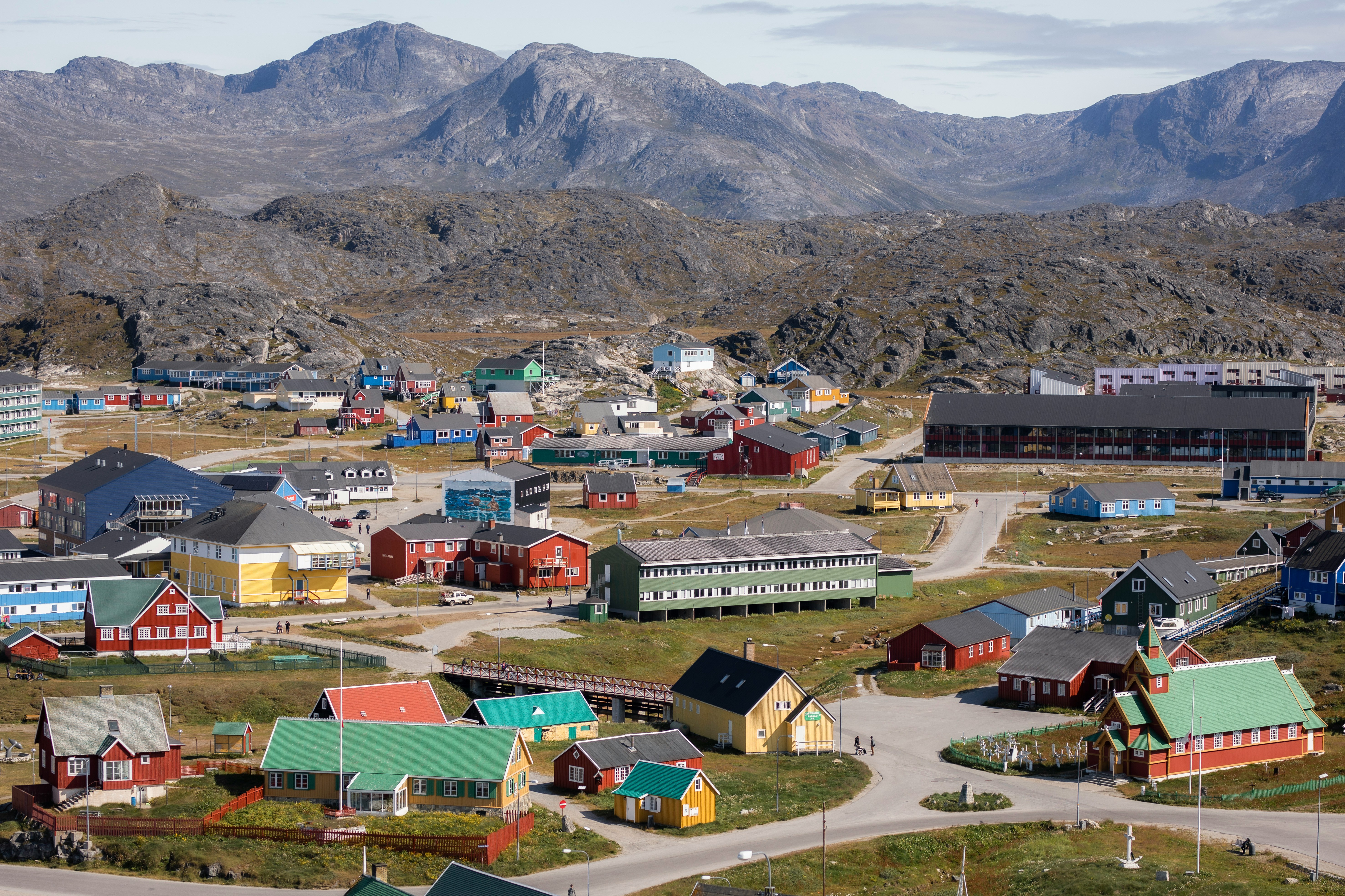
About Nanortalik
Nanortalik lies in a scenic area surrounded by steep mountainsides and is Greenland’s tenth-largest and most southerly town with less than 1500 inhabitants. The town’s name means the “place of polar bears”, which refers to the polar bears that used to be seen floating offshore on summer’s ice floes. Nanortalik has an excellent open-air museum that gives a broad picture of the region from Inuit times to today. Part of the exhibition is a summer hunting camp, where Inuit in traditional clothing describe aspects of their ancestor’s customs and lifestyle.
About Corner Brook, Newfoundland and Labrador
Newfoundland's fourth-largest city, Corner Brook is the hub of the island's west coast. Hills fringe three sides of the city, which has dramatic views of the harbor and the Bay of Islands. The town is also home to a large paper mill and a branch of Memorial University. Captain James Cook, the British explorer, charted the coast in the 1760s, and a memorial to him overlooks the bay.The town enjoys more clearly defined seasons than most of the rest of the island, and in summer it has many pretty gardens. The nearby Humber River is the best-known salmon river in the province, and there are many kilometers of well-maintained walking trails in the community.


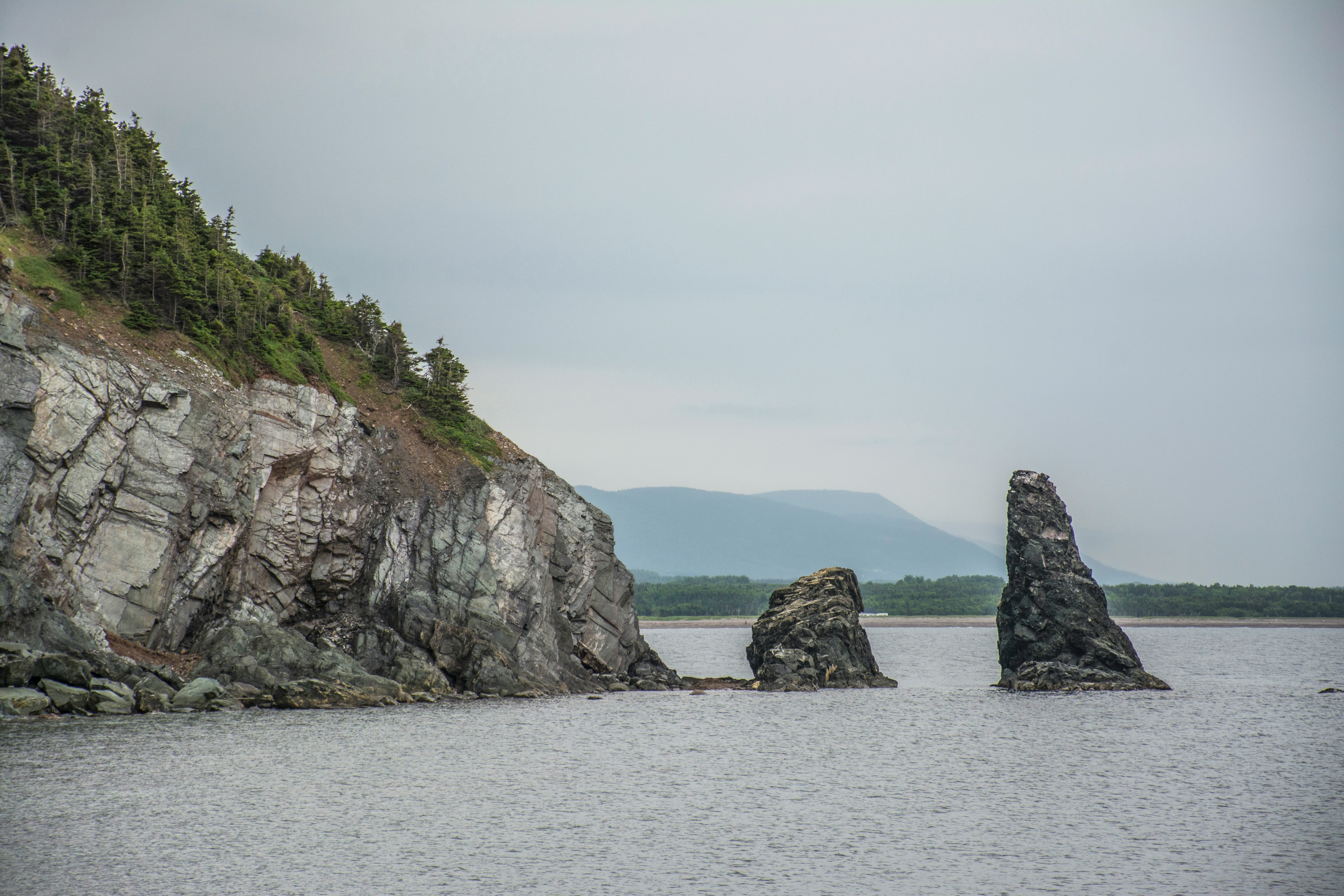
About Havre-Saint-Pierre, Québec
Havre St. Pierre is a tiny seaside port on the north shore of the Saint Lawrence River in Quebec. It was settled in 1857 by Acadians from the Magdalen Island, and still today locals speak a dialect more similar to Acadian French than to Quebec French. It was originally called Saint-Pierre-de-la-Pointe-aux-Esquimaux until 1927, when it was officially shortened to Havre St Pierre. Until recently the local economy relied mainly on fishing and lumbering, today it is mainly a titanium ore-transhipment port. Nearby is one of the world’s most amazing natural phenomena – the Mingan Archipelago. They are the largest group of erosional monoliths in Canada, and were declared a Nation Park in 1984. These limestone monoliths have formed over thousands of years by wave action, strong winds and seasonal freezing and thawing. The result is a unique set of large limestone sculptures.

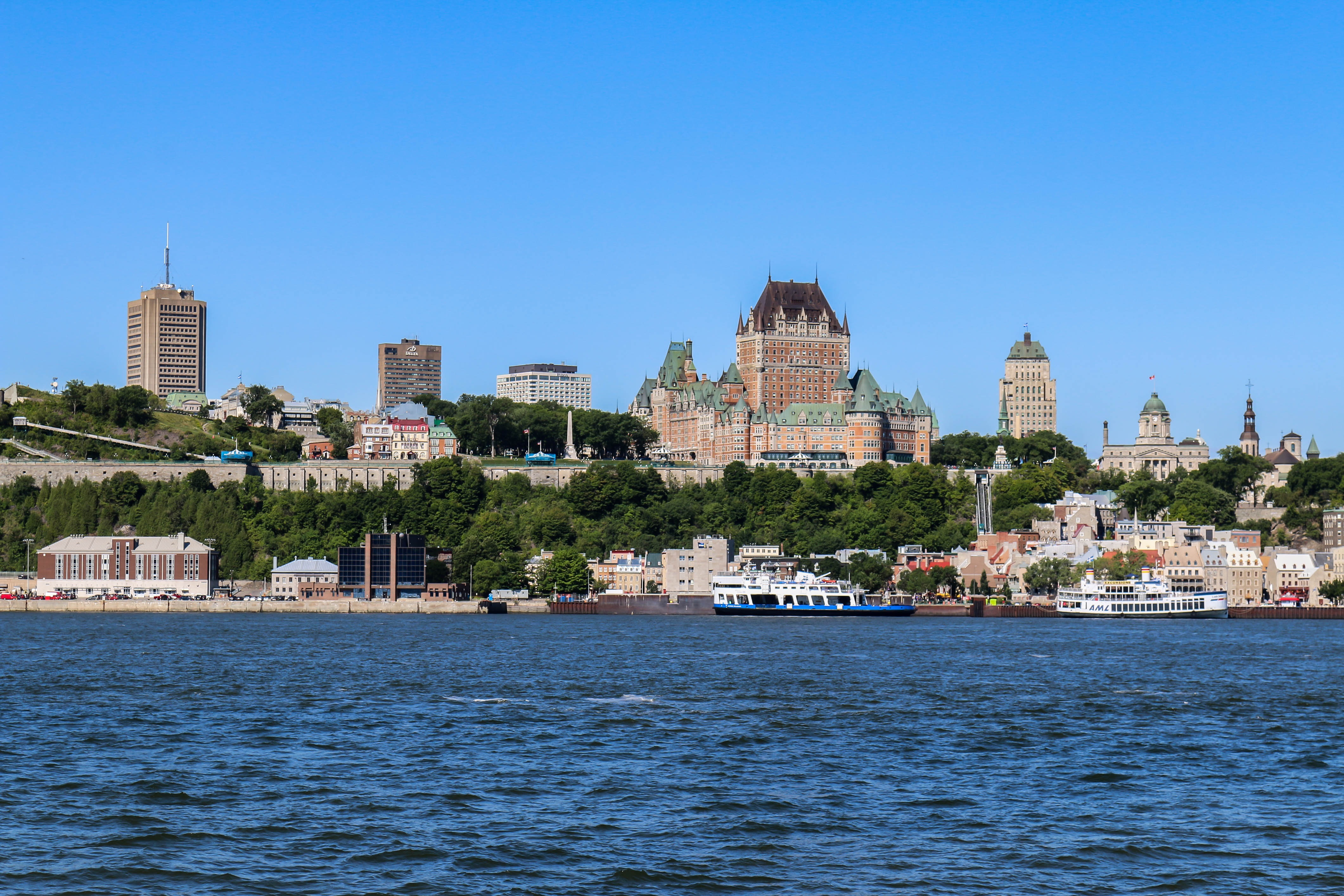
About Quebec City, Québec
Québec City's alluring setting atop Cape Diamond (Cap Diamant) evokes a past of high adventure, military history, and exploration. This French-speaking capital city is the only walled city north of Mexico. Visitors come for the delicious and inventive cuisine, the remarkable historical continuity, and to share in the seasonal exuberance of the largest Francophone population outside France.The historic heart of this community is the Old City (Vieux-Québec), comprising the part of Upper Town (Haute-Ville) surrounded by walls and Lower Town (Basse-Ville), which spreads out at the base of the hill from Place Royale. Many sets of staircases and the popular funicular link the top of the hill with the bottom. Cobblestone streets, horse-drawn carriages, and elaborate cathedrals here are charming in all seasons. The Old City earned recognition as an official UNESCO World Heritage site in 1985, thanks largely to city planners who managed to update and preserve the 400-year-old buildings and attractions without destroying what made them worth preserving. The most familiar icon of the city, Fairmont Château Frontenac, is set on the highest point in Upper Town, where it holds court over the entire city.Sitting proudly above the confluence of the St. Lawrence and St. Charles rivers, the city's famous military fortification, La Citadelle, built in the early 19th century, remains the largest of its kind in North America. In summer, visitors should try to catch the Changing of the Guard, held every morning at 10 am; you can get much closer to the guards here than at Buckingham Palace in London.Enchanting as it is, the Old City is just a small part of the true Québec City experience. Think outside the walls and explore St-Roch, a downtown hot spot, which has artsy galleries, foodie haunts, and a bustling square. Cruise the Grande-Allée and avenue Cartier to find a livelier part of town dotted with nightclubs and fun eateries. Or while away the hours in St-Jean-Baptiste, a neighborhood with trendy shops and hipster hangouts.
About La Baie, Québec
About Sept-Iles, Québec
Viewing the workings of this major Canadian port from a waterfront boardwalk, no one would guess this was once a quiet fishing village. The place boomed after World War II, when large companies decided Sept-Îles would make a good base for expanding northern Québec’s iron-mining industry. But all of the massive infrastructure can’t trump Mother Nature. Beautiful beaches line the coast, and the islands of an archipelago park sit just offshore. Campers and bird-watchers flock here, in part to spot the colorful beaks of the puffins.

About Charlottetown, Prince Edward Island
Designated as the Island capital in 1765, Charlottetown is both PEI’s oldest and largest urban center. However, since the whole "metropolitan" area only has a population of about 65,000, a pleasing small-town atmosphere remains. The city is a winner appearance-wise as well. Peppered with gingerbread-clad homes, converted warehouses, striking churches, and monumental government buildings, Charlottetown’s core seems relatively unchanged from its 19th-century heyday when it hosted the conference that led to the formation of Canada. The city is understandably proud of its role as the "Birthplace of Confederation" and, in summer, downtown streets are dotted with people dressed as personages from the past who’ll regale you with tales about the Confederation debate.
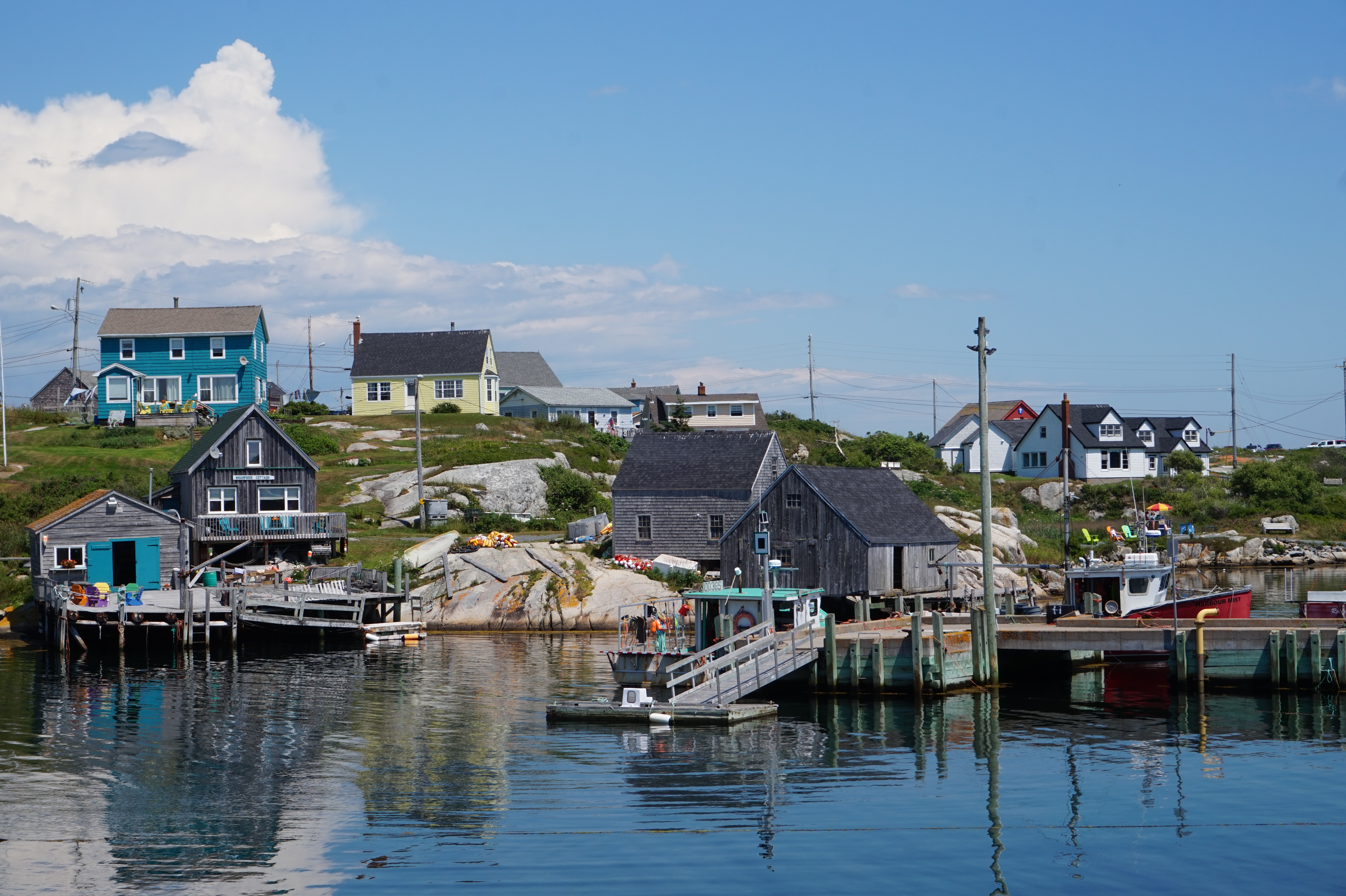
About Sydney, Nova Scotia
If you come directly to Cape Breton via plane, ferry, or cruise ship, Sydney is where you’ll land. If you’re seeking anything resembling an urban experience, it’s also where you’ll want to stay: after all, this is the island’s sole city. Admittedly, it is not the booming center it was a century ago when the continent’s largest steel plant was located here (that era is evoked in Fall on Your Knees, an Oprah Book Club pick penned by Cape Bretoner Anne-Marie MacDonald). However, Sydney has a revitalized waterfront and smattering of Loyalist-era buildings that appeal to visitors. Moreover, it offers convenient access to popular attractions in the region—like the Miner’s Museum in nearby Glace Bay (named for the glace, or ice, that filled its harbor in winter), the Fortress at Louisbourg, and beautiful Bras d'Or Lake.
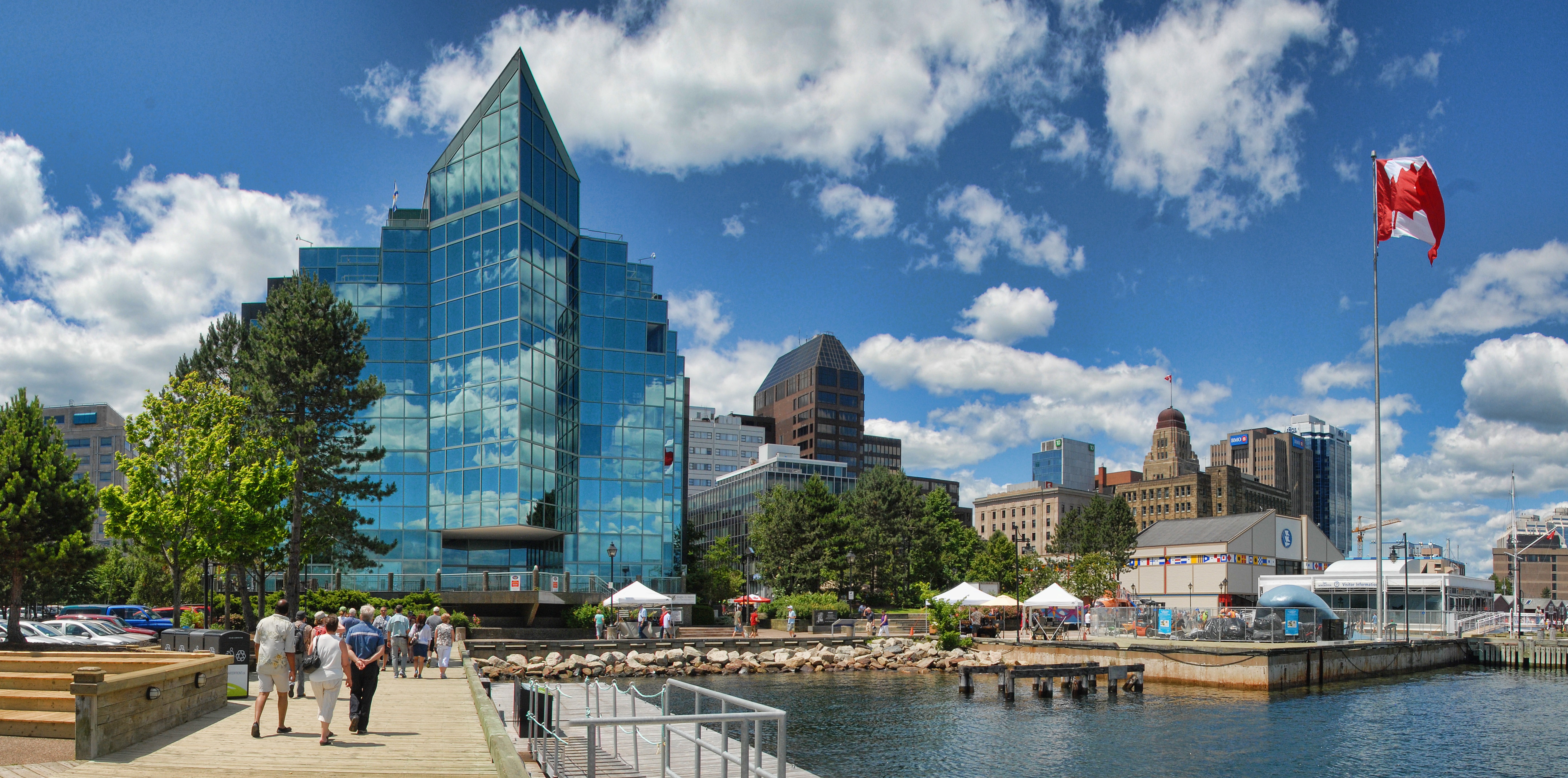
About Halifax, Nova Scotia
Surrounded by natural treasures and glorious seascapes, Halifax is an attractive and vibrant hub with noteworthy historic and modern architecture, great dining and shopping, and a lively nightlife and festival scene. The old city manages to feel both hip and historic. Previous generations had the foresight to preserve the cultural and architectural integrity of the city, yet students from five local universities keep it lively and current. It's a perfect starting point to any tour of the Atlantic provinces, but even if you don't venture beyond its boundaries, you will get a real taste of the region.It was Halifax’s natural harbor—the second largest in the world after Sydney, Australia’s—that first drew the British here in 1749, and today most major sites are conveniently located either along it or on the Citadel-crowned hill overlooking it. That’s good news for visitors because this city actually covers quite a bit of ground.Since amalgamating with Dartmouth (directly across the harbor) and several suburbs in 1996, Halifax has been absorbed into the Halifax Regional Municipality, and the HRM, as it is known, has around 415,000 residents. That may not sound like a lot by U.S. standards, but it makes Nova Scotia’s capital the most significant Canadian urban center east of Montréal.There's easy access to the water, and despite being the focal point of a busy commercial port, Halifax Harbour doubles as a playground, with one of the world's longest downtown boardwalks. It's a place where container ships, commuter ferries, cruise ships, and tour boats compete for space, and where workaday tugs and fishing vessels tie up beside glitzy yachts. Like Halifax as a whole, the harbor represents a blend of the traditional and the contemporary.
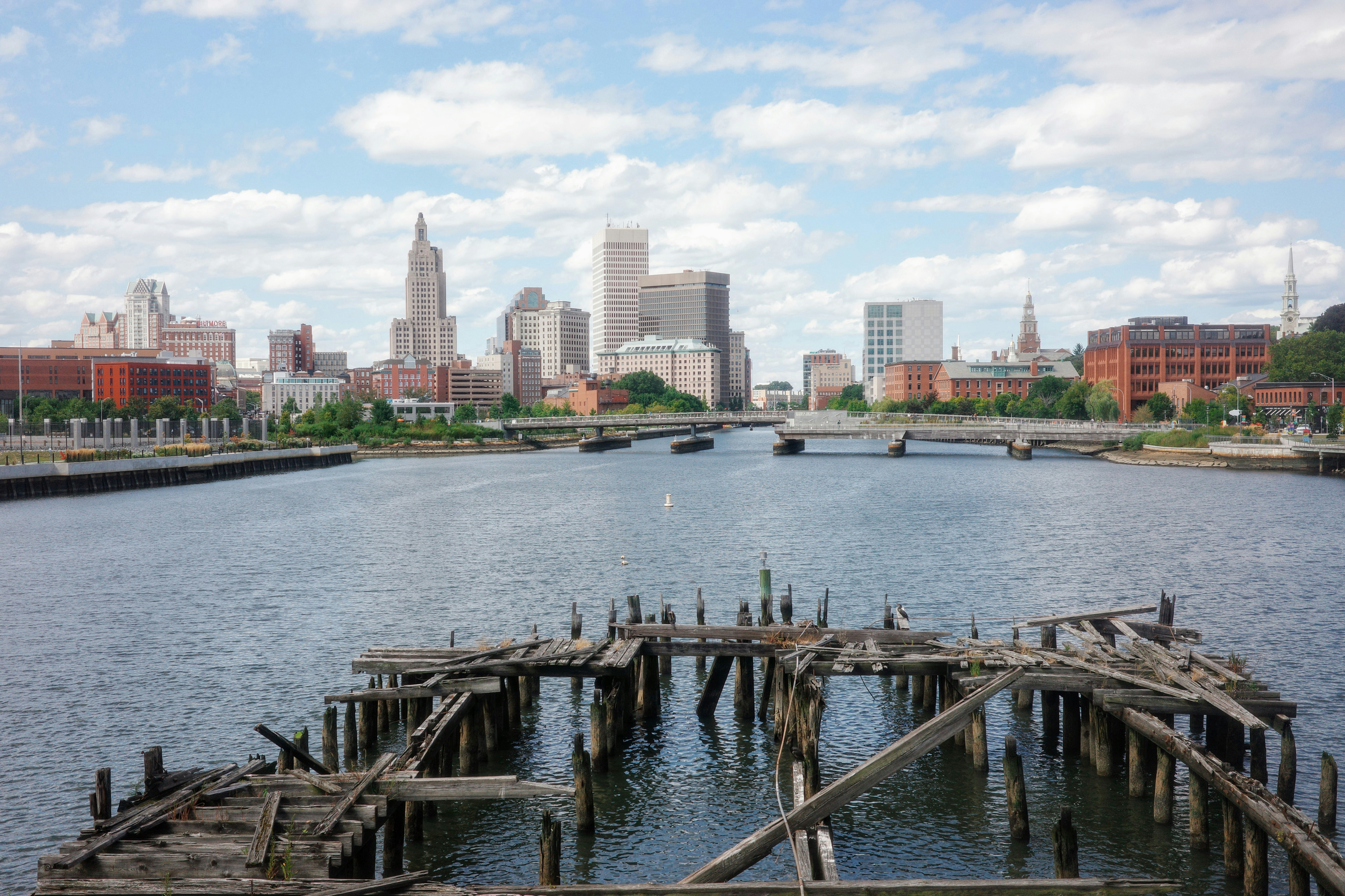
About Newport, Rhode Island
Established in 1639 by a small band of religious dissenters led by William Coddington and Nicholas Easton, the city by the sea became a haven for those who believed in religious freedom. Newport’s deepwater harbor at the mouth of Narragansett Bay ensured its success as a leading Colonial port, and a building boom produced hundreds of houses and many landmarks that still survive today. These include the Wanton-Lyman-Hazard House and the White Horse Tavern, both built during the 17th century, plus Trinity Church, Touro Synagogue, the Colony House, and the Redwood Library, all built in the 18th century.British troops occupied Newport from 1776–1779, causing half the city’s population to flee and ending a golden age of prosperity. The economic downturn that followed may not have been so great for its citizens but it certainly was for preserving Newport’s architectural heritage, as few had the capital to raze buildings and replace them with bigger and better ones. By the mid-19th century the city had gained a reputation as the summer playground for the very wealthy, who built enormous mansions overlooking the Atlantic. These so-called "summer cottages," occupied for only six to eight weeks a year by the Vanderbilts, Berwinds, Astors, and Belmonts, helped establish the best young American architects. The presence of these wealthy families also brought the New York Yacht Club, which made Newport the venue for the America’s Cup races beginning in 1930 until the 1983 loss to the Australians.The Gilded Age mansions of Bellevue Avenue are what many people associate most with Newport. These late-19th-century homes are almost obscenely grand, laden with ornate rococo detail and designed with a determined one-upmanship.Pedestrian-friendly Newport has so much else to offer in a relatively small geographical area— beaches, seafood restaurants, galleries, shopping, and cultural life. Summer can be crowded, but fall and spring are increasingly popular times of the year to visit.
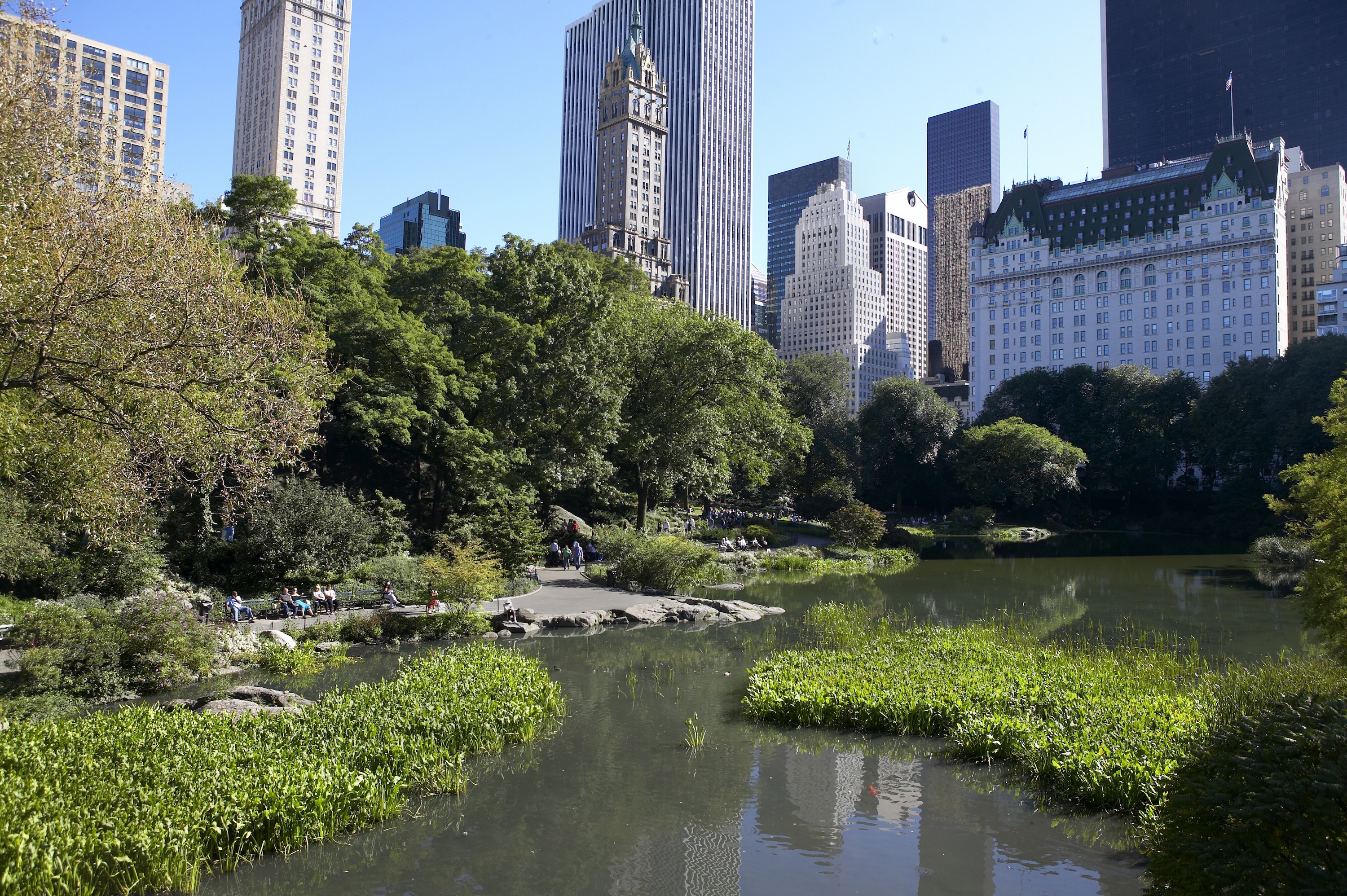
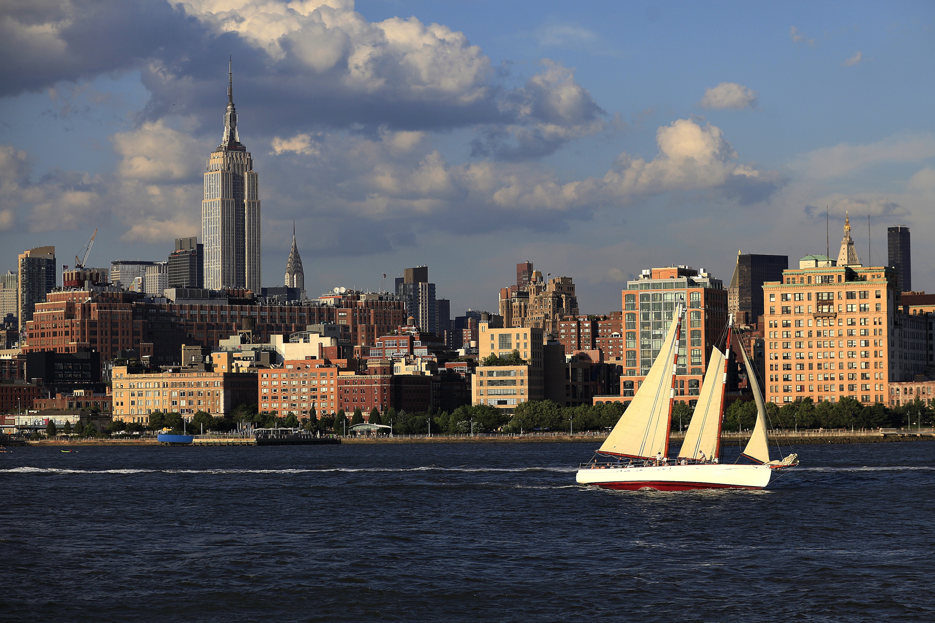
About New York, New York
From Wall Street's skyscrapers to the neon of Times Square to Central Park's leafy paths, New York City pulses with an irrepressible energy. History meets hipness in this global center of entertainment, fashion, media, and finance. World-class museums like MoMA and unforgettable icons like the Statue of Liberty beckon, but discovering the subtler strains of New York's vast ambition is equally rewarding: ethnic enclaves and shops, historic streets of dignified brownstones, and trendy bars and eateries all add to the urban buzz.


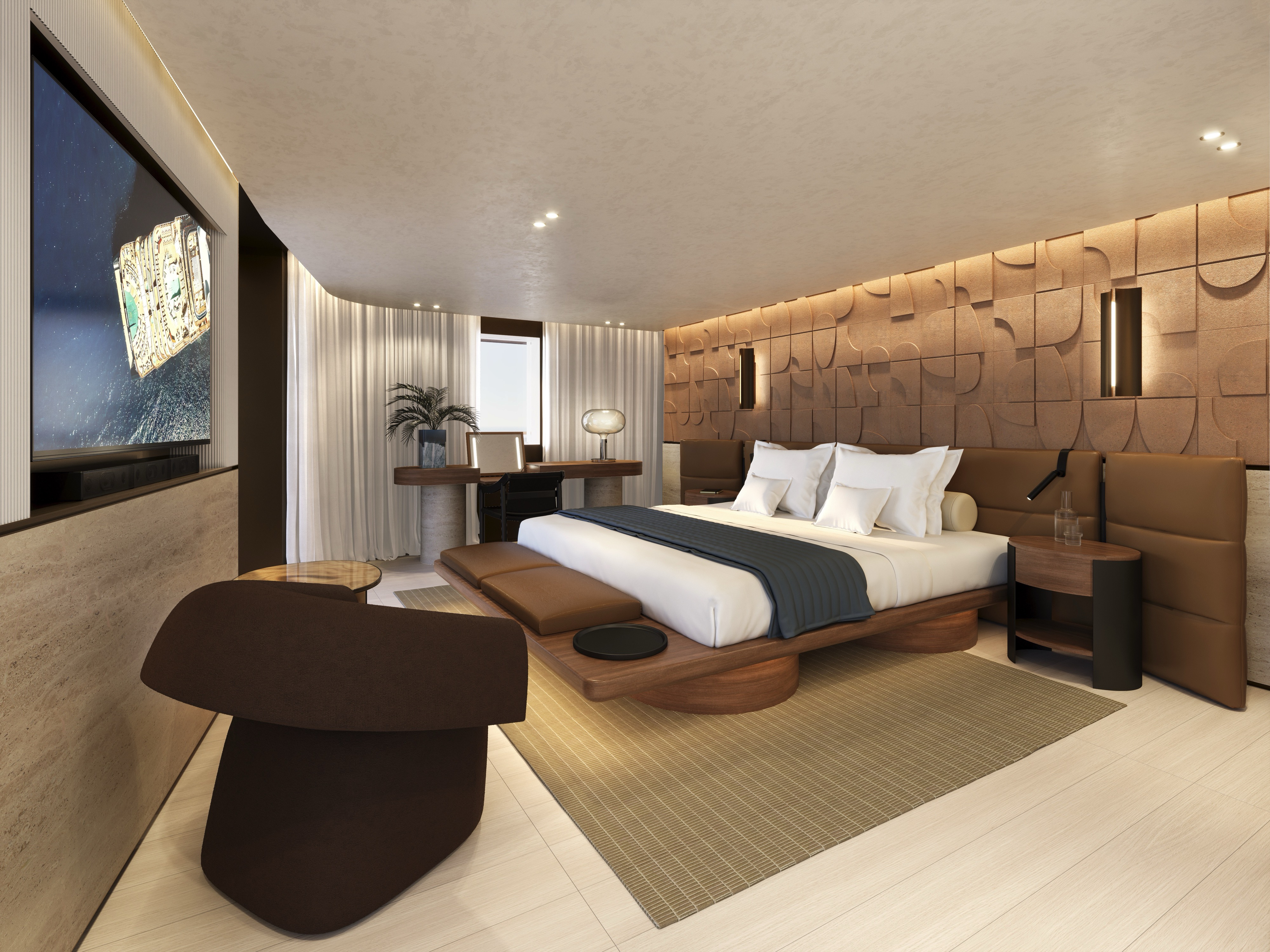
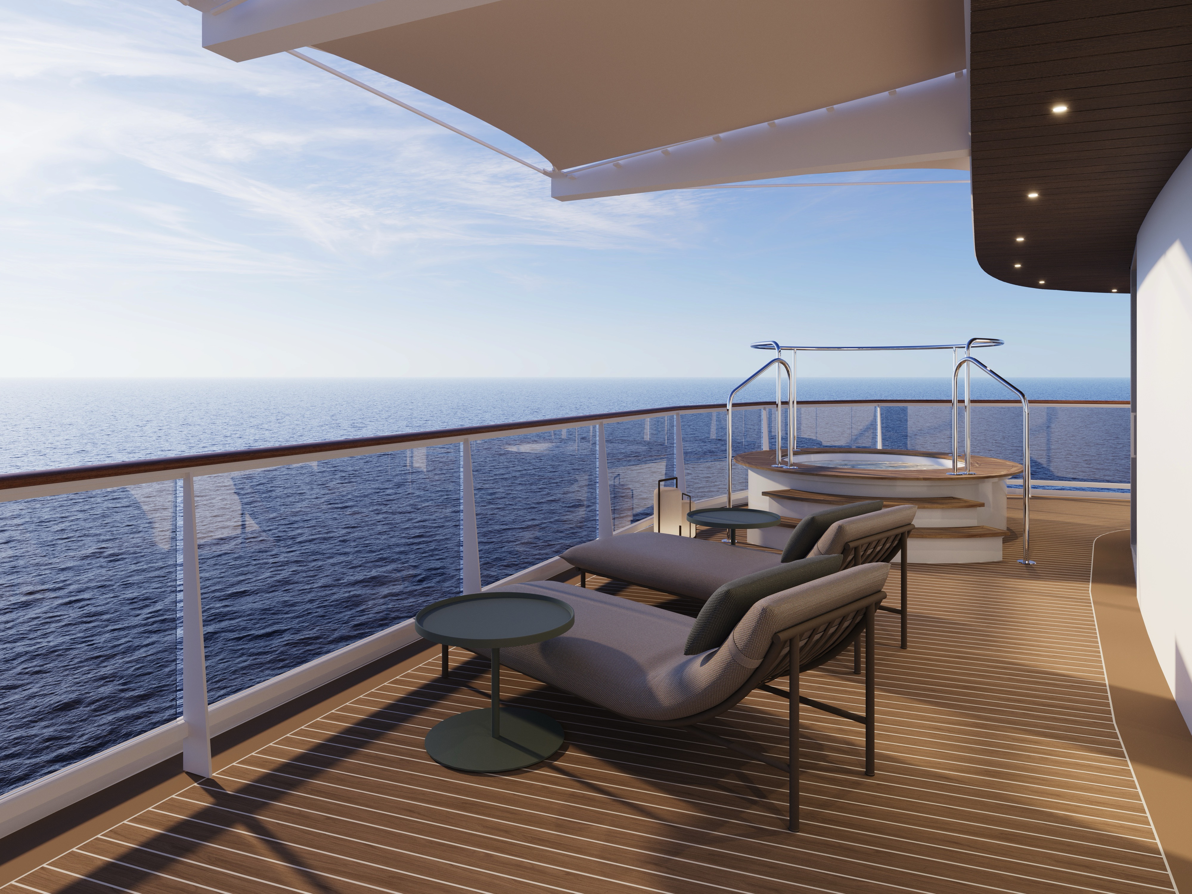
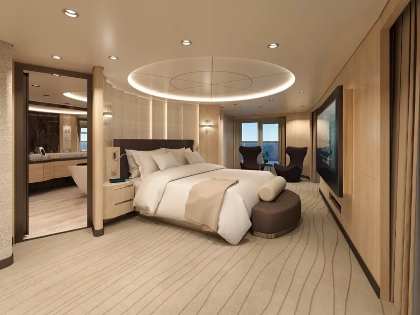
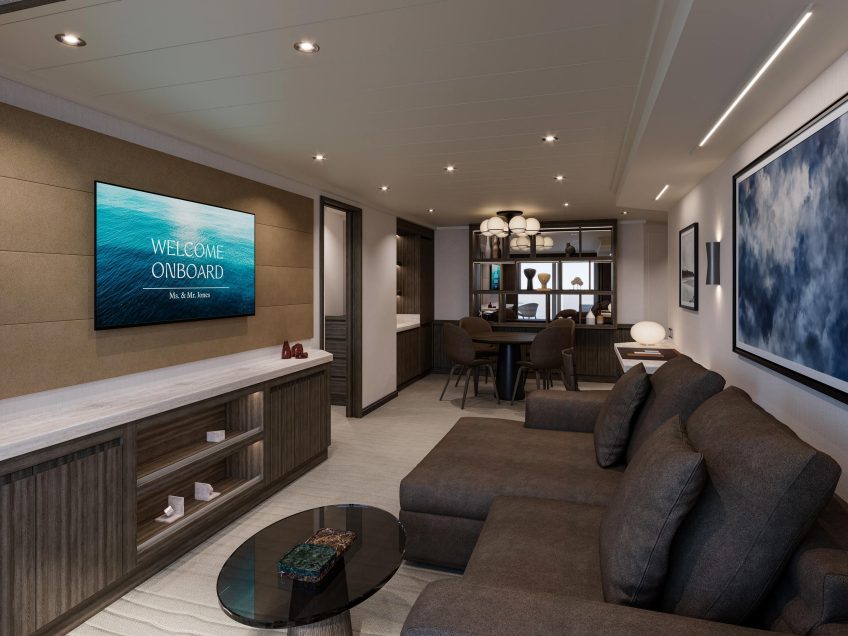
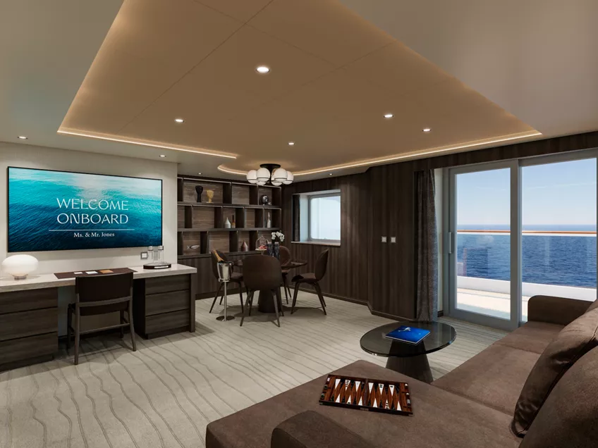
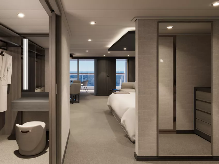
The most exclusive residence on board, the Owner’s Residence, designed by Patricia Urquiola, represents the ultimate expression of modern ocean living: an immersive emotional and sensory journey.
Every surface and detail reflects Patricia Urquiola’s distinctive approach – beauty quietly revealed through texture, proportion, and light.
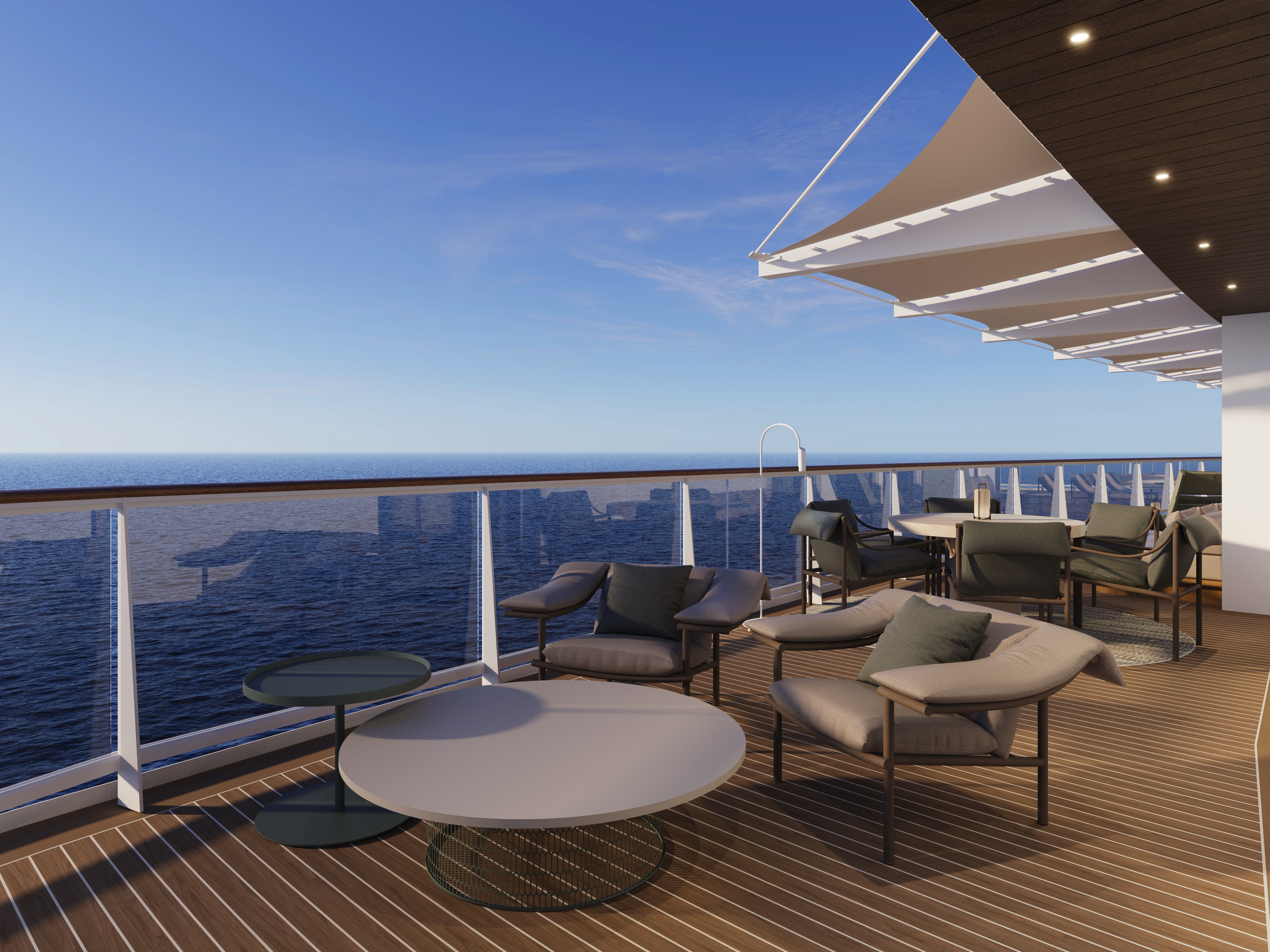
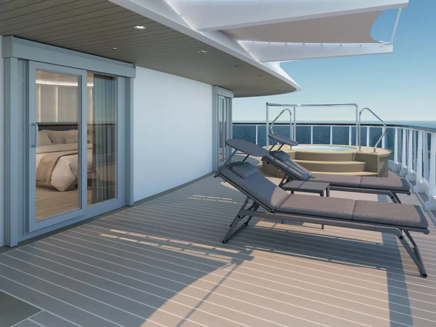
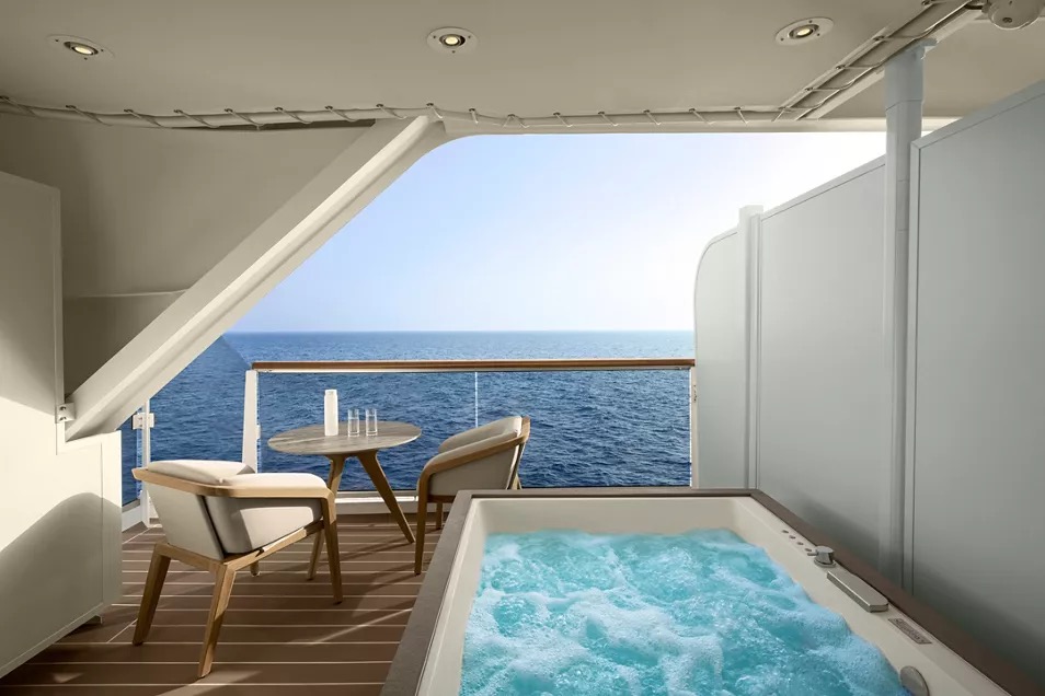
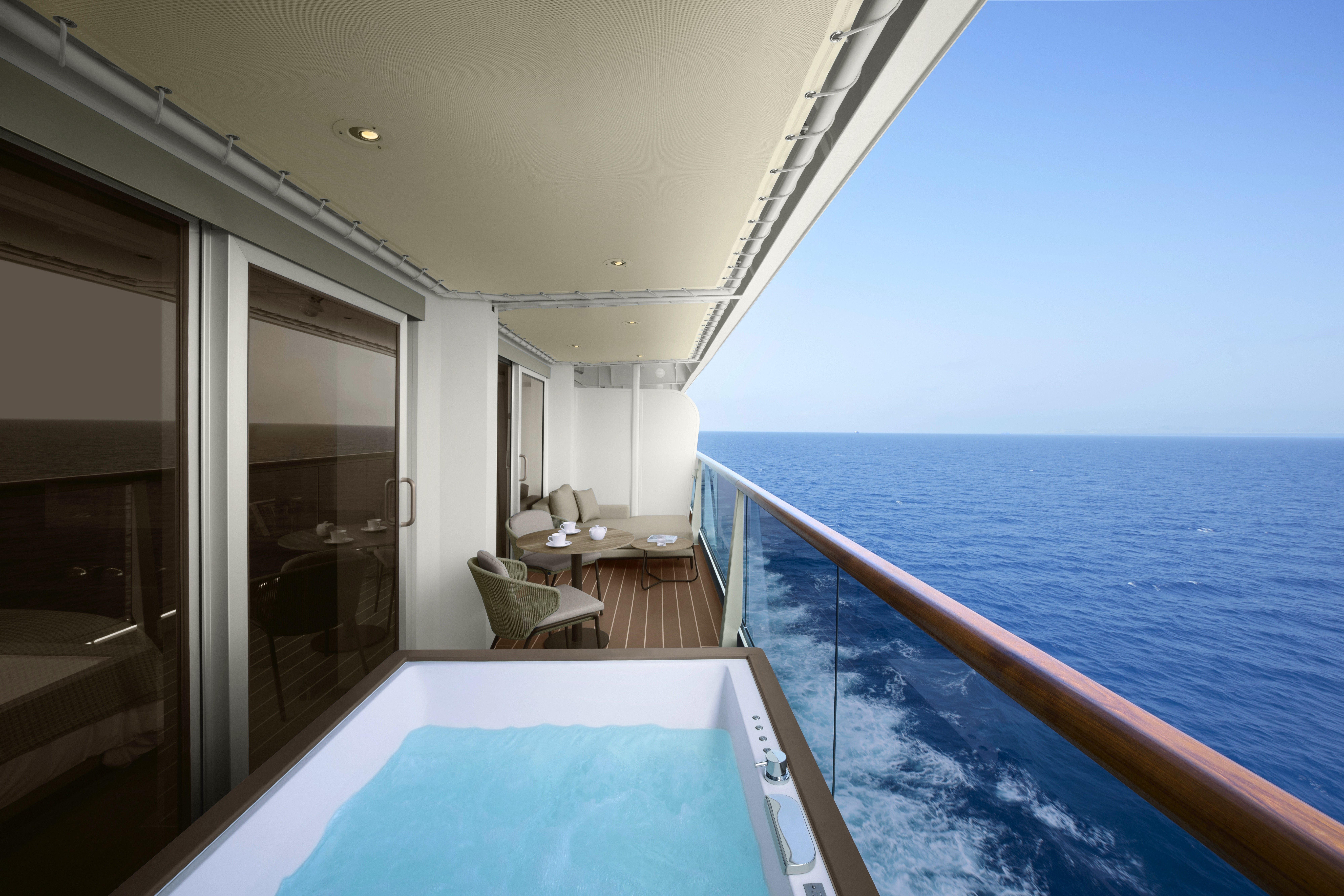
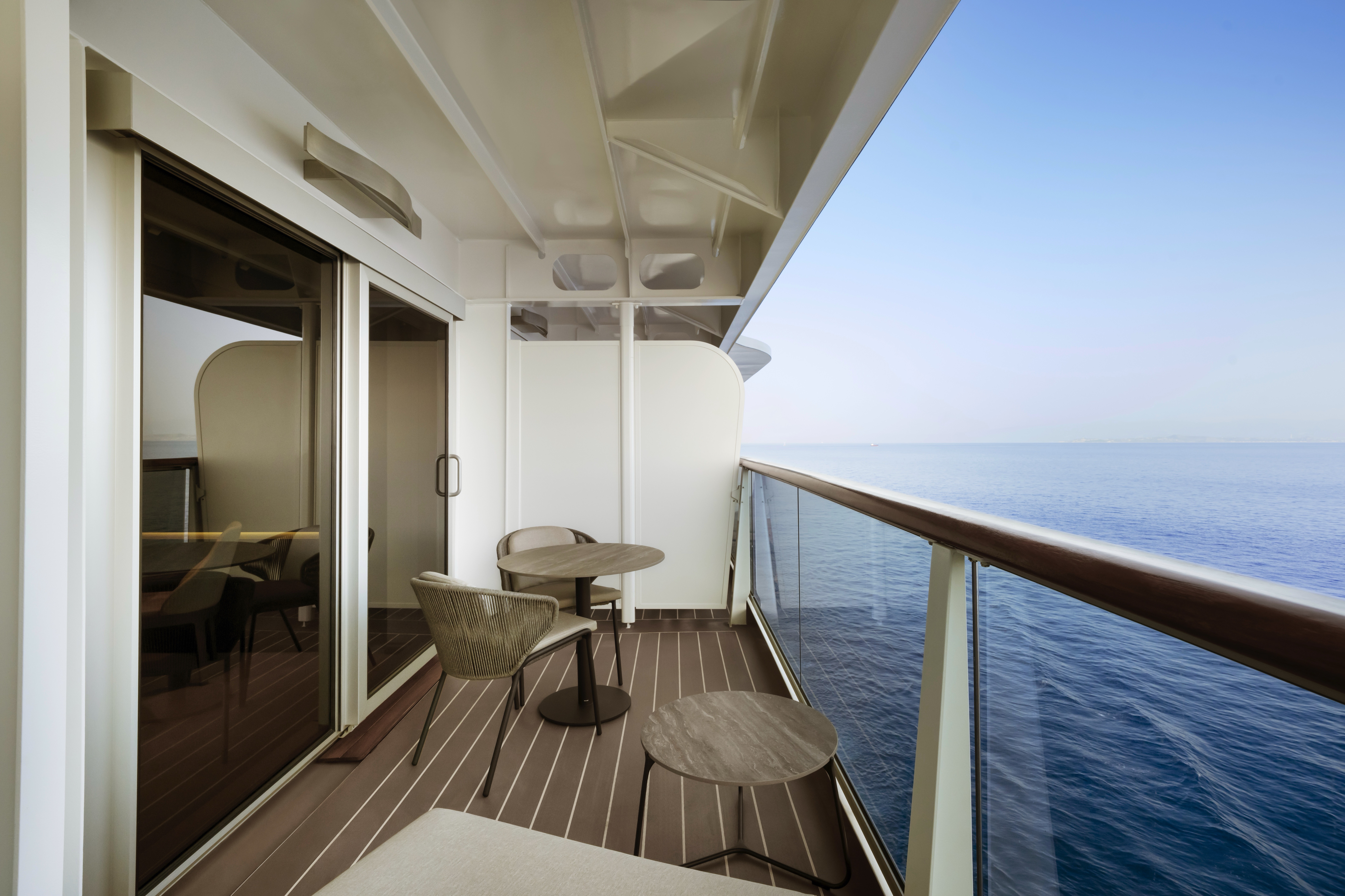
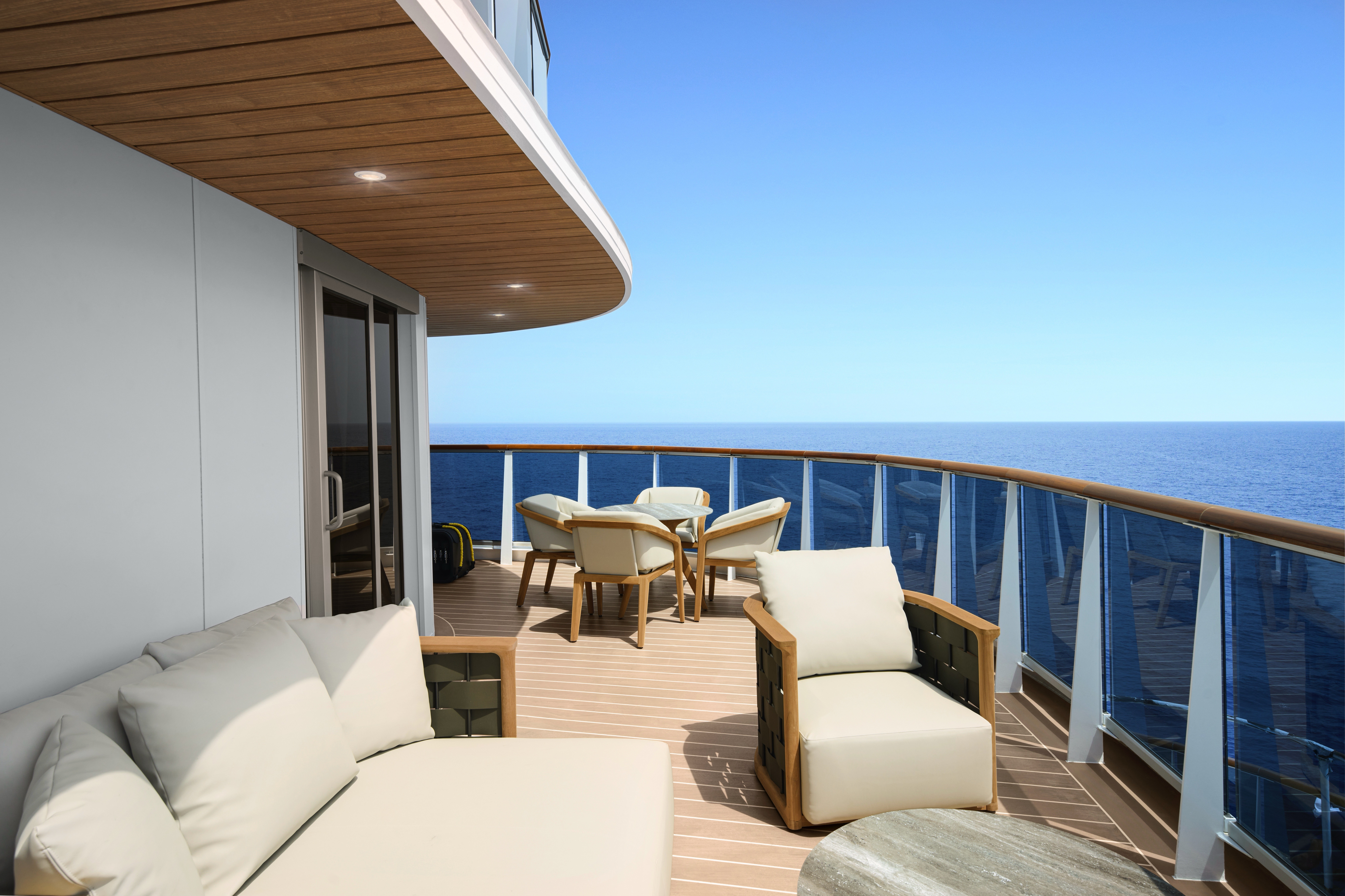
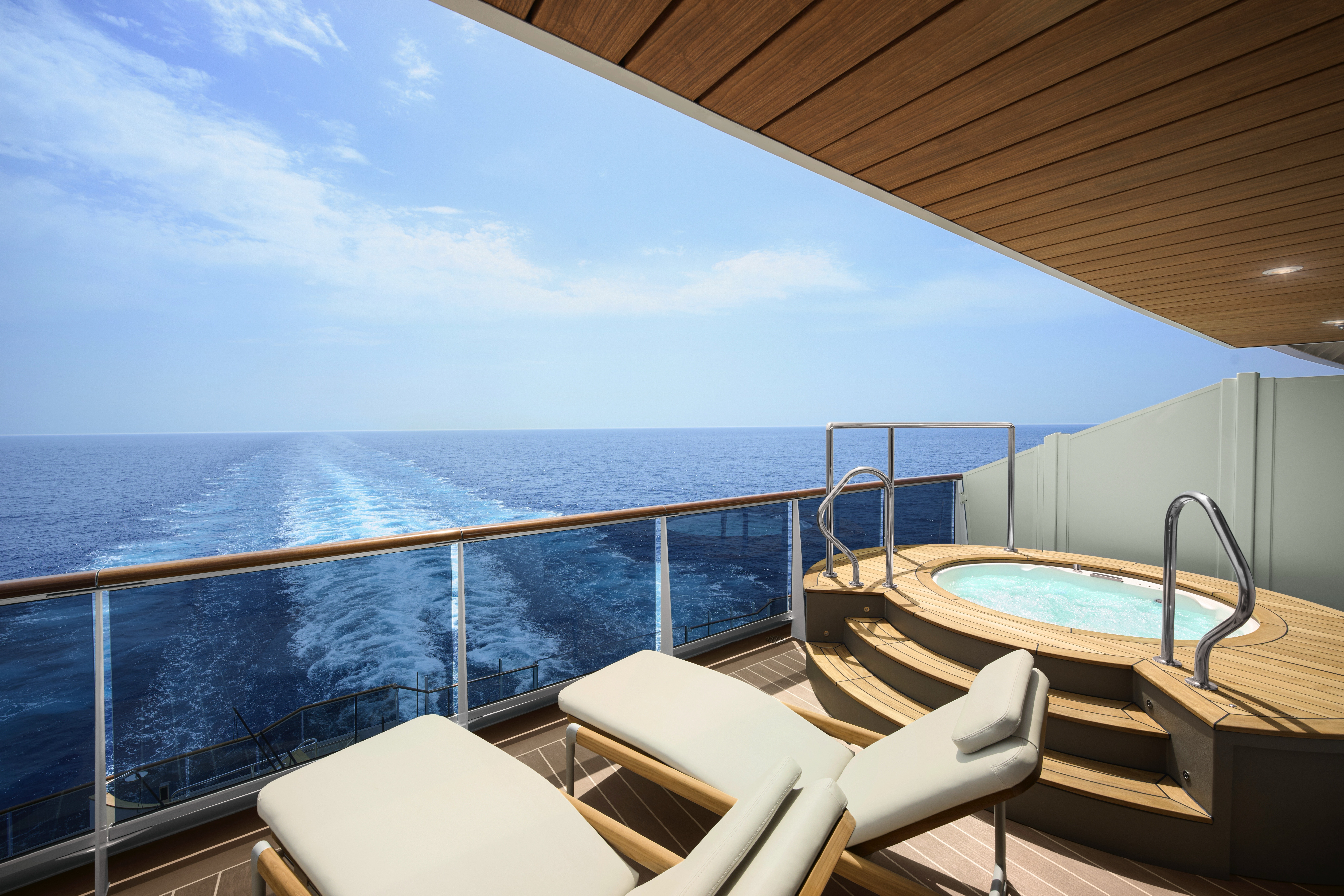
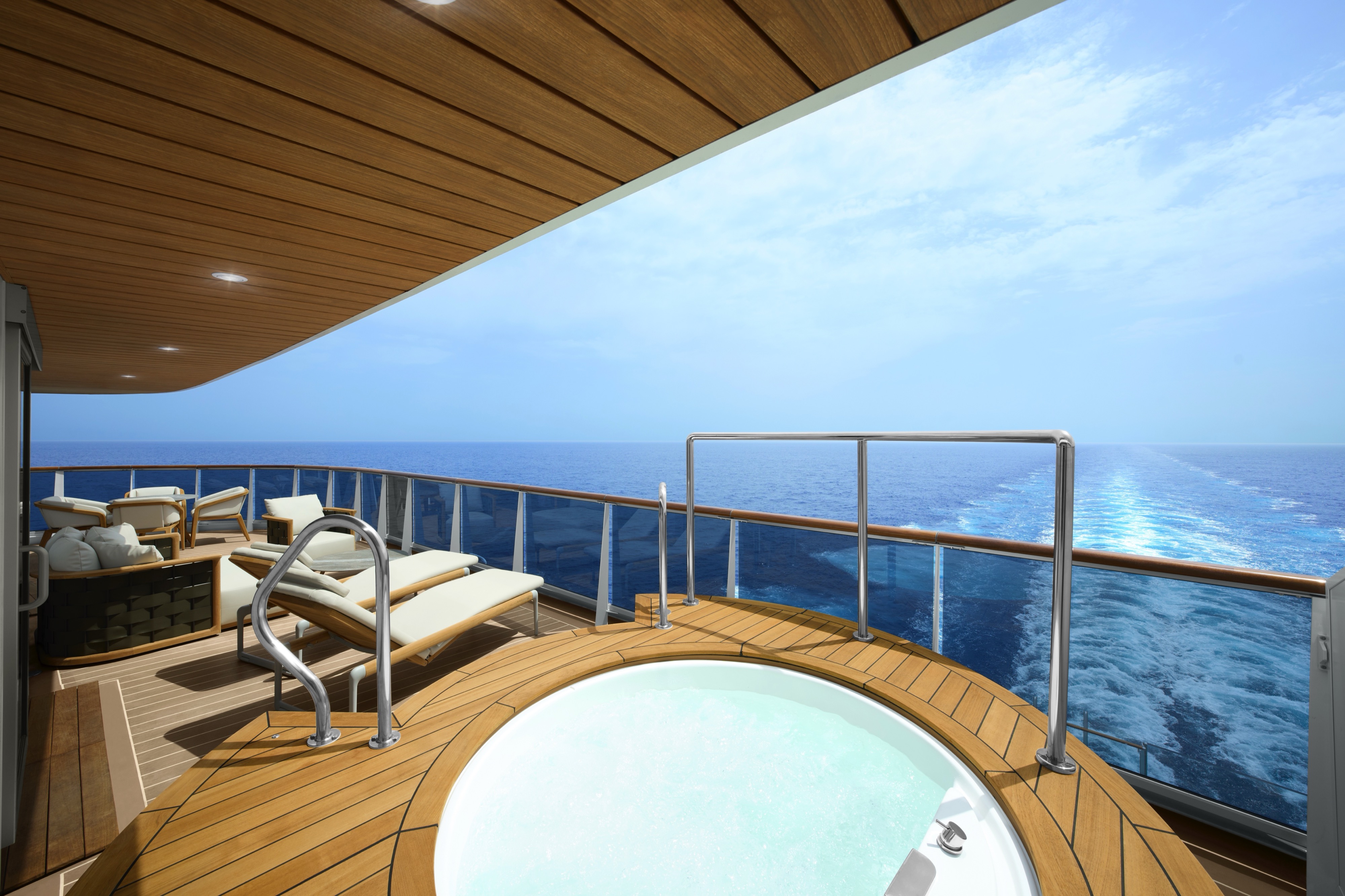
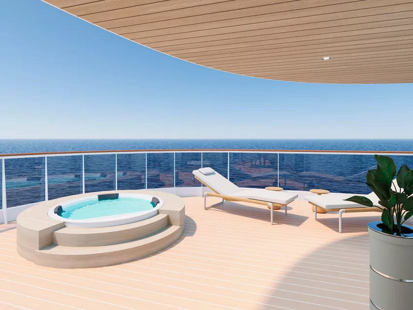
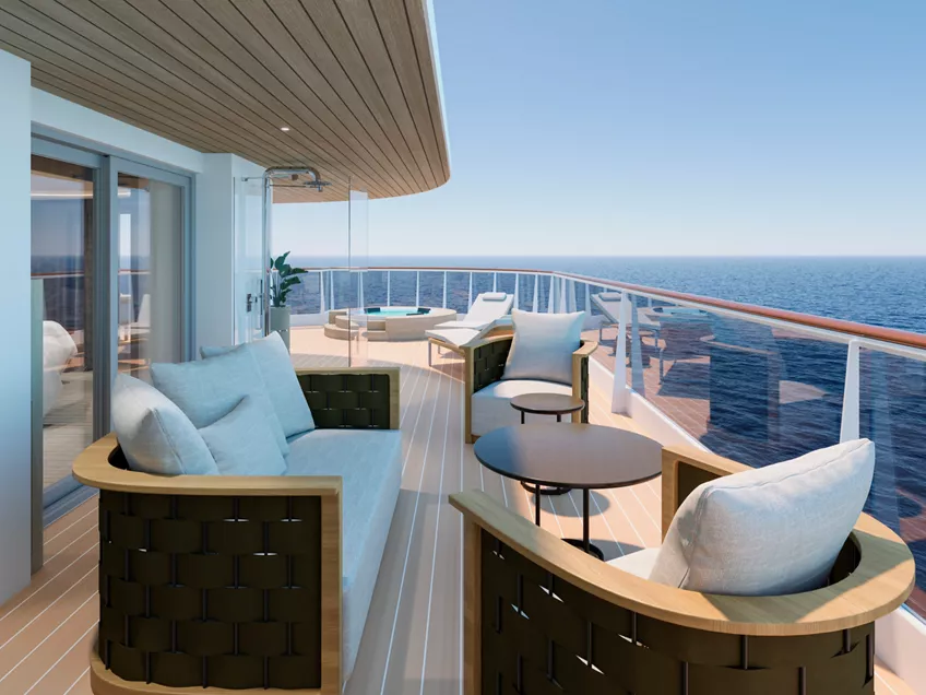
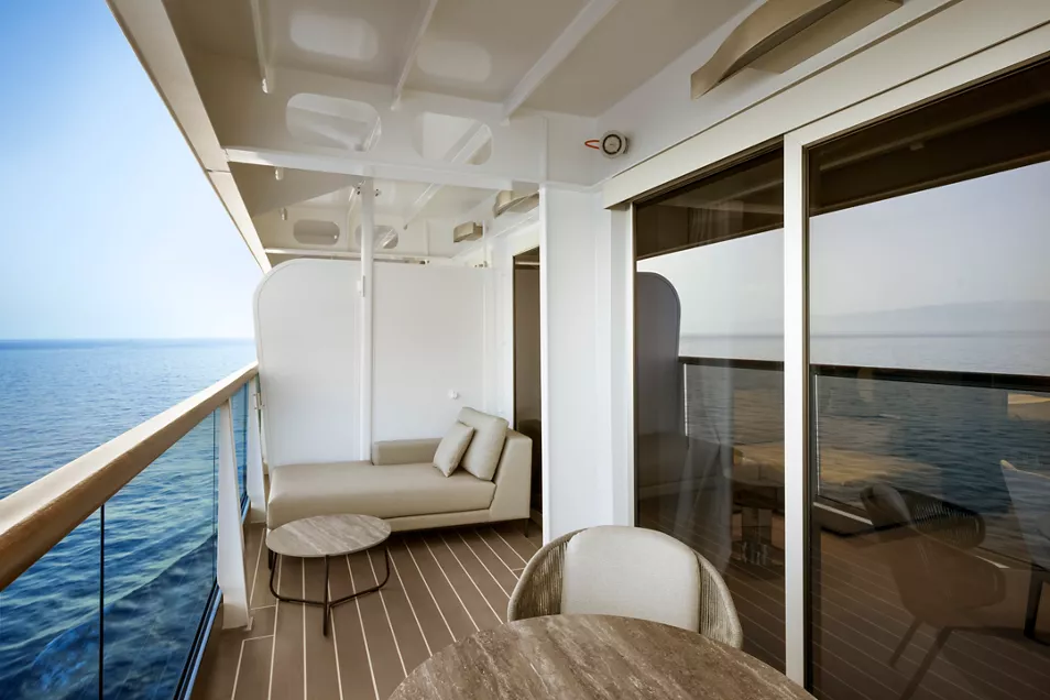
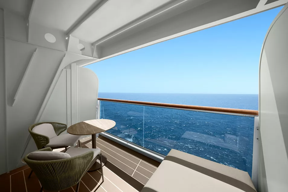
An expansive terrace stretching across the full width of the aft, invites guests to experience uninterrupted ocean views from the oversized whirlpool, gather around the alfresco dining table, or recline in beautifully appointed outdoor lounge chairs.
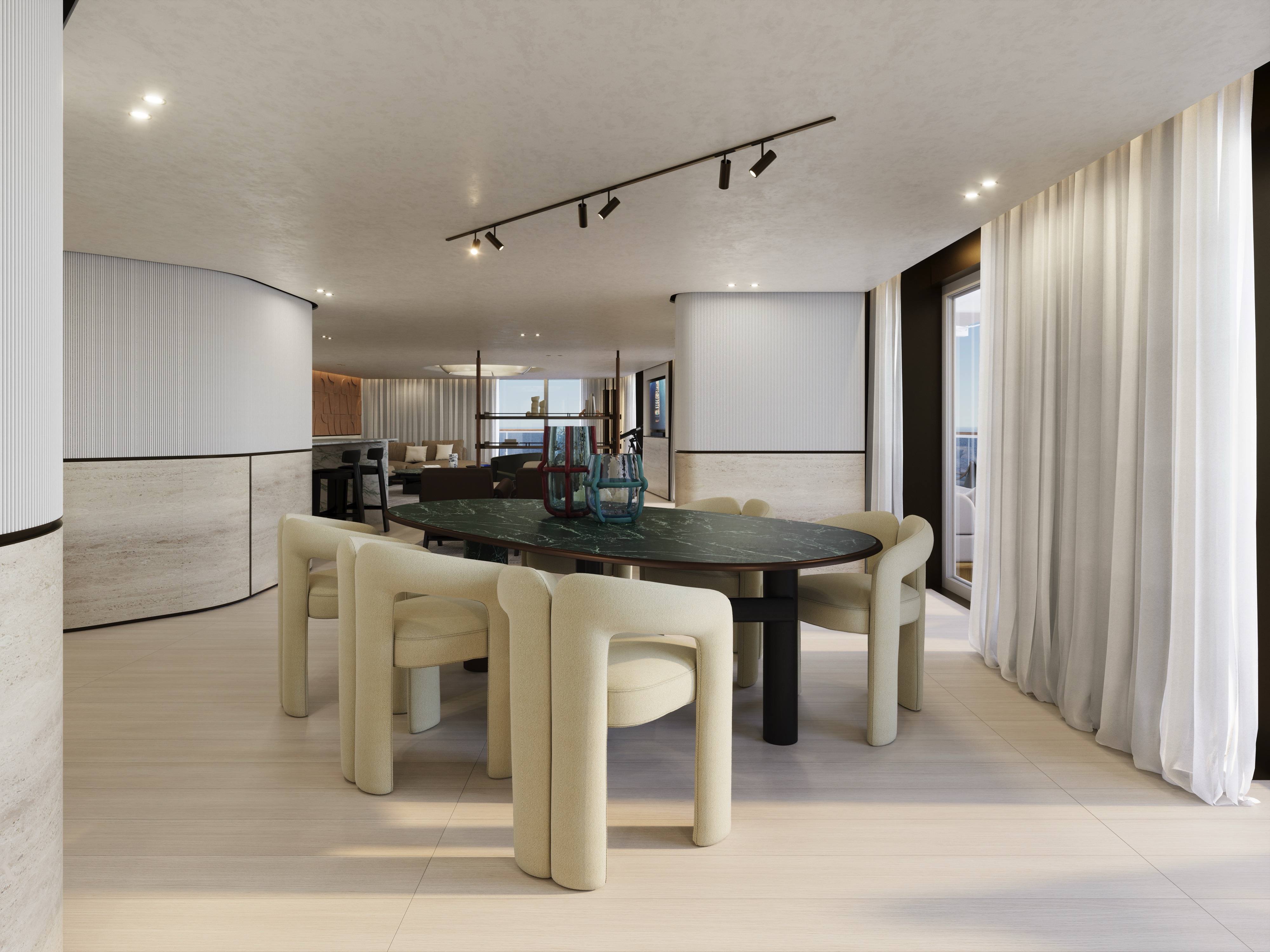
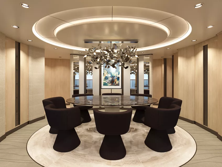
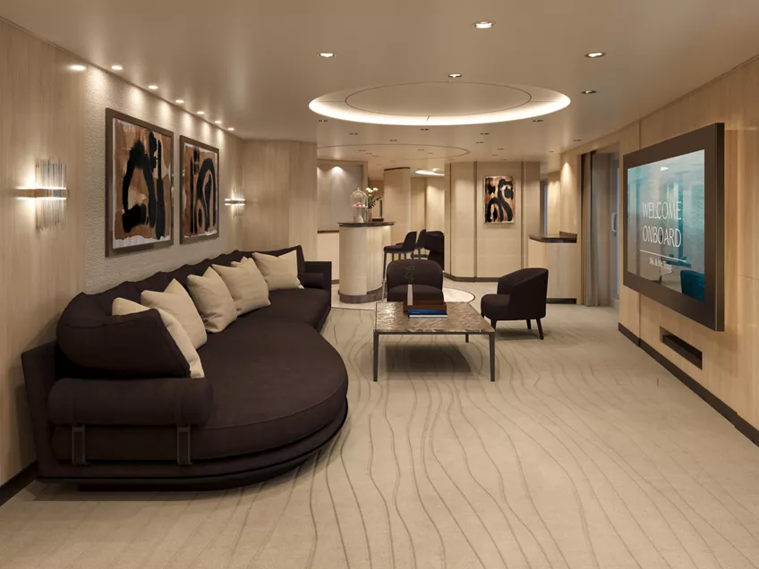
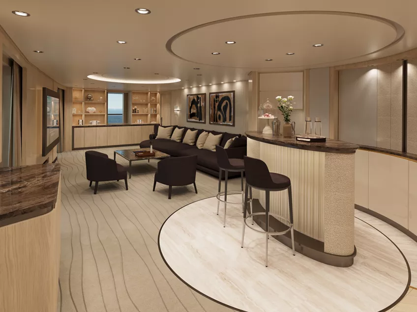
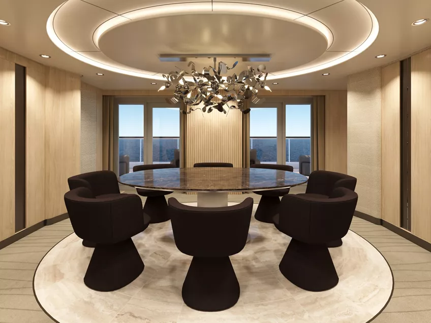
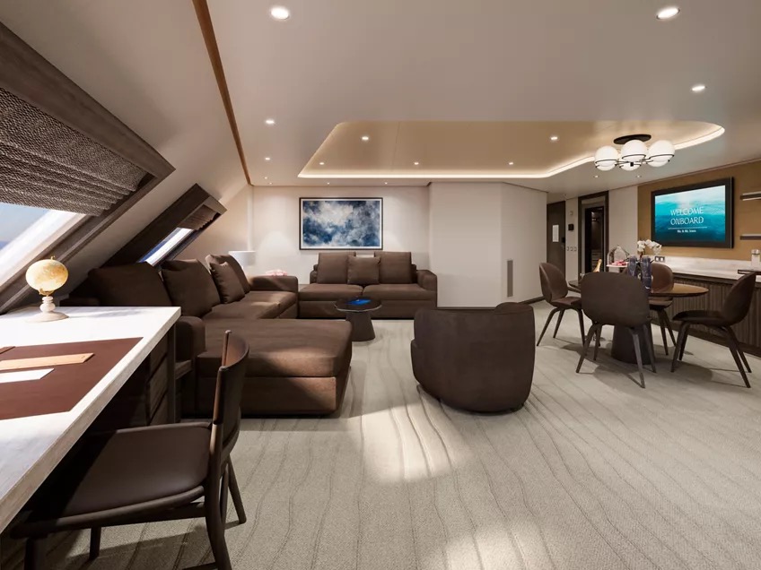
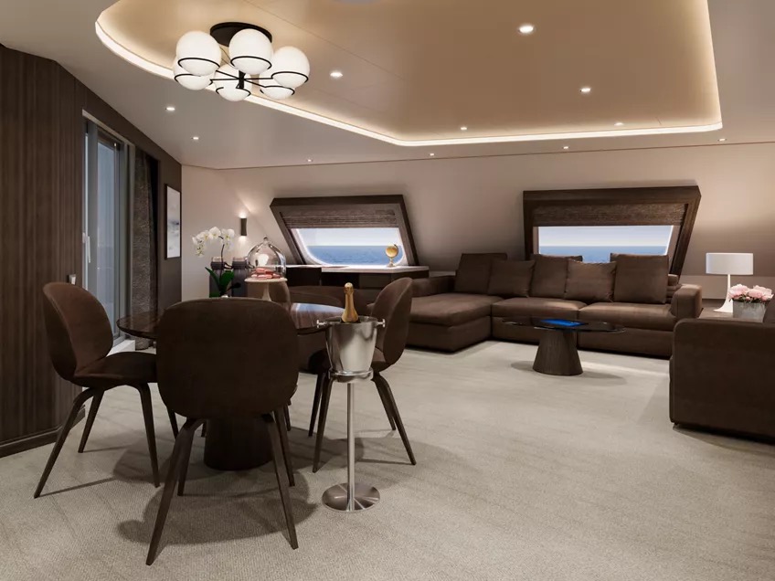
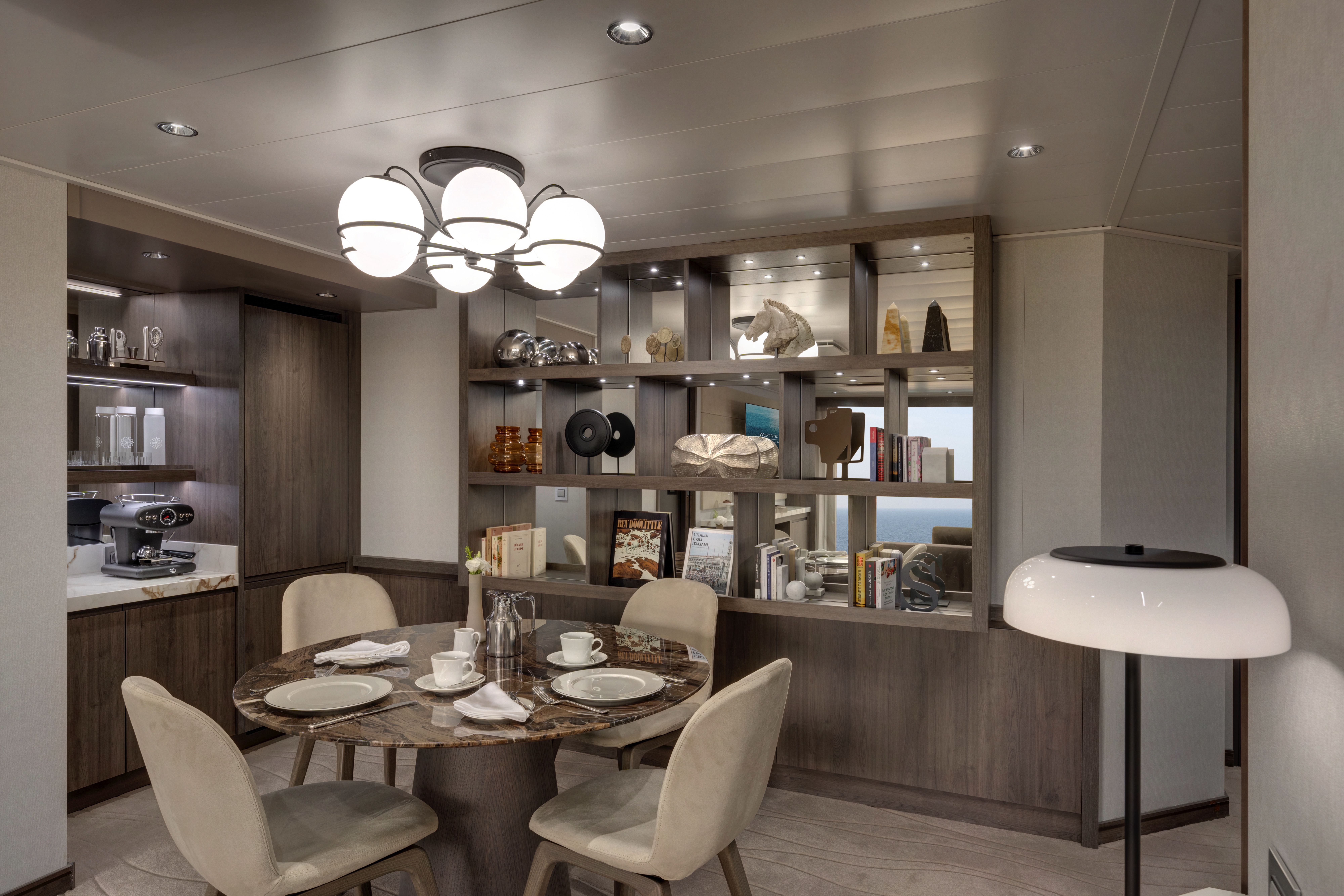
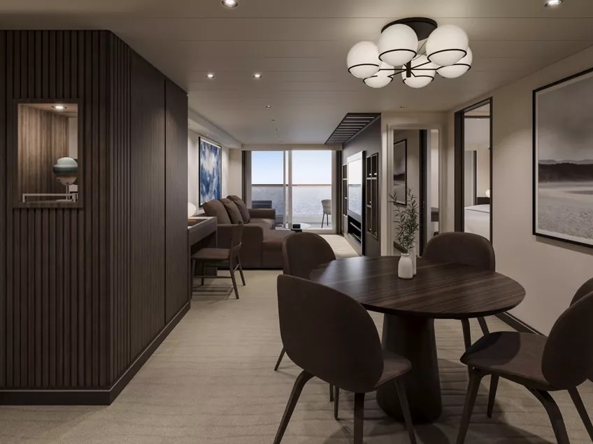
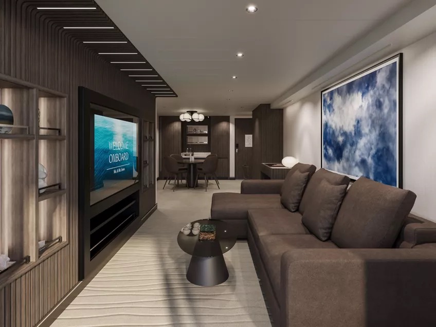
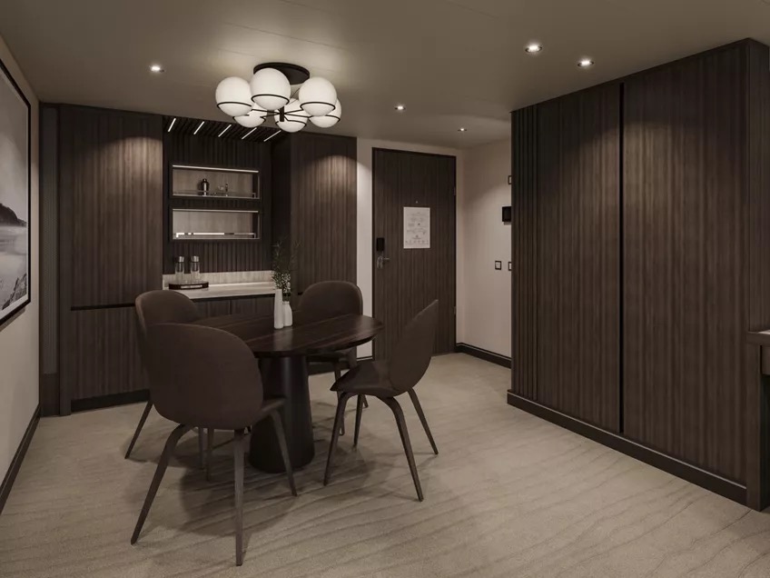
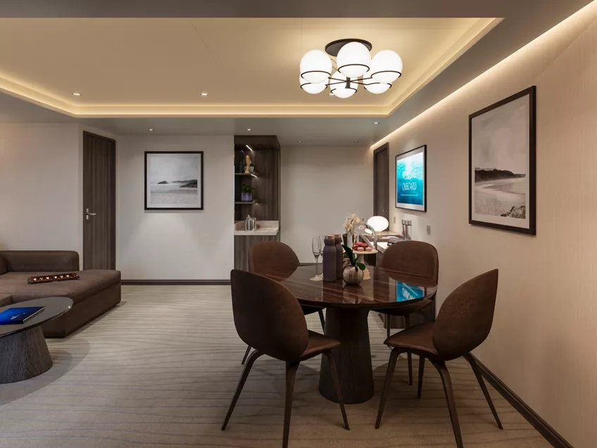
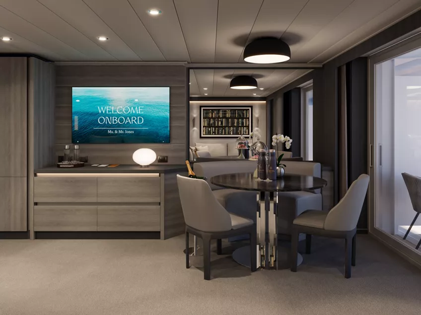
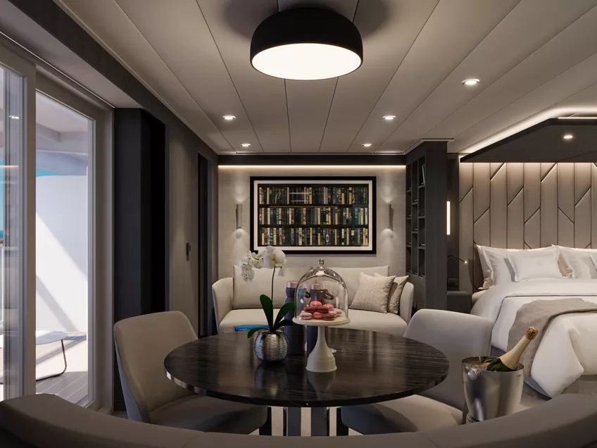
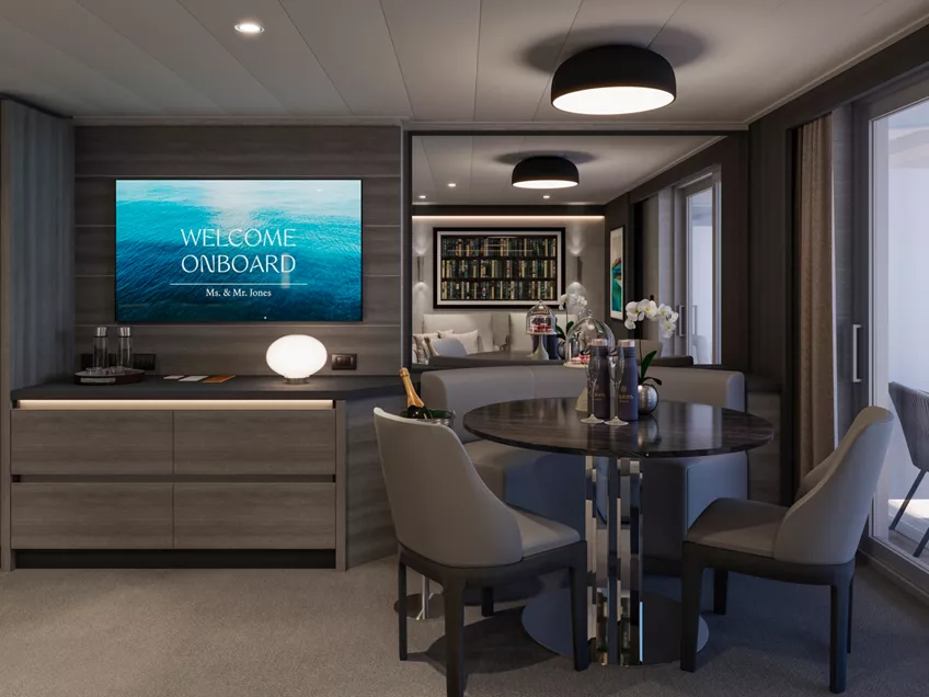
Inside, sculptural elegance shapes the atmosphere: oak parquet, refined marbles and a continuous curved boiserie create a fluid sense of movement, enriched by furnishings from Cassina, Kettal and Moroso. A circular dining room for eight flows naturally into the generous living area and bar counter designed for effortless entertaining.
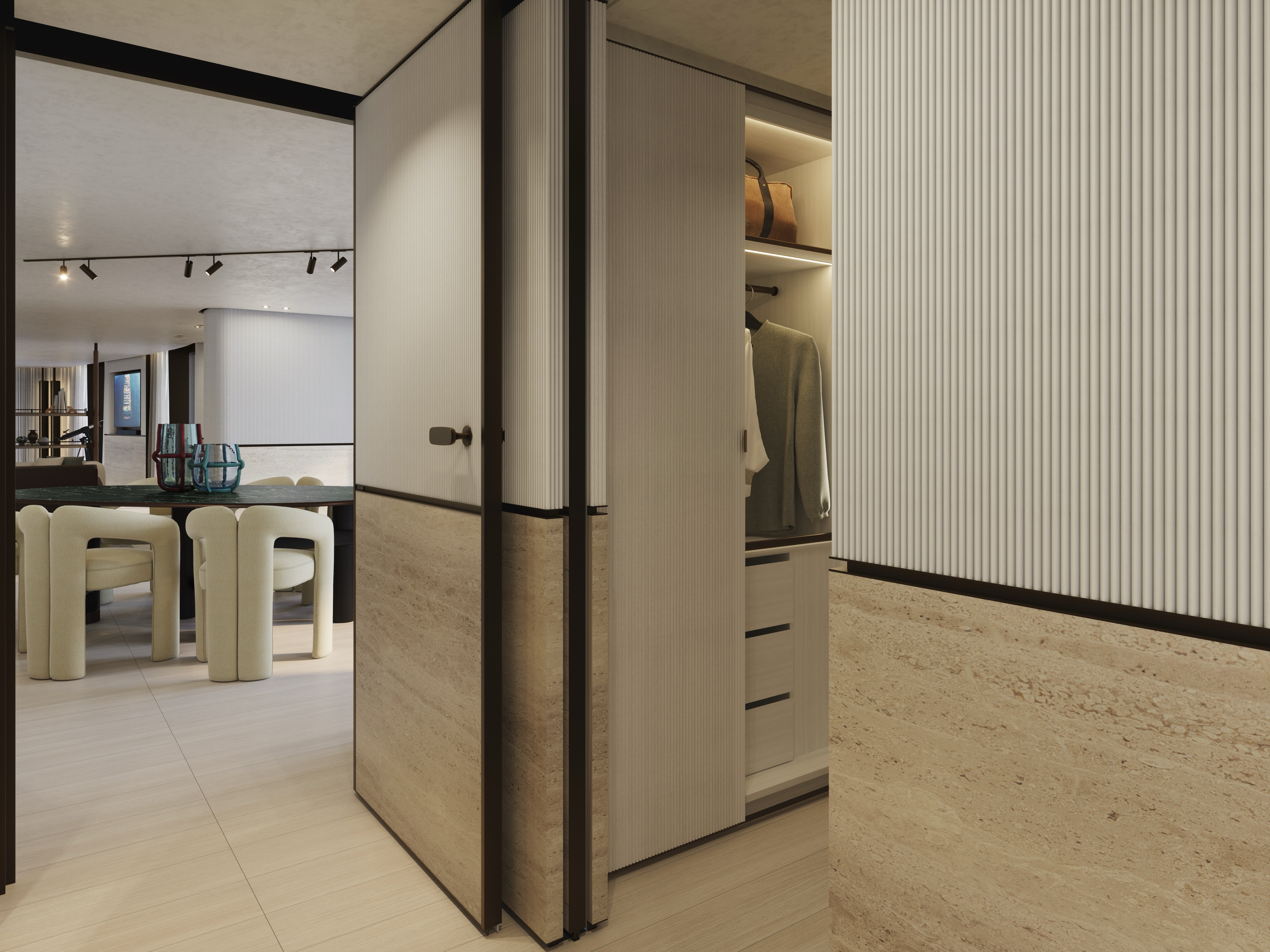
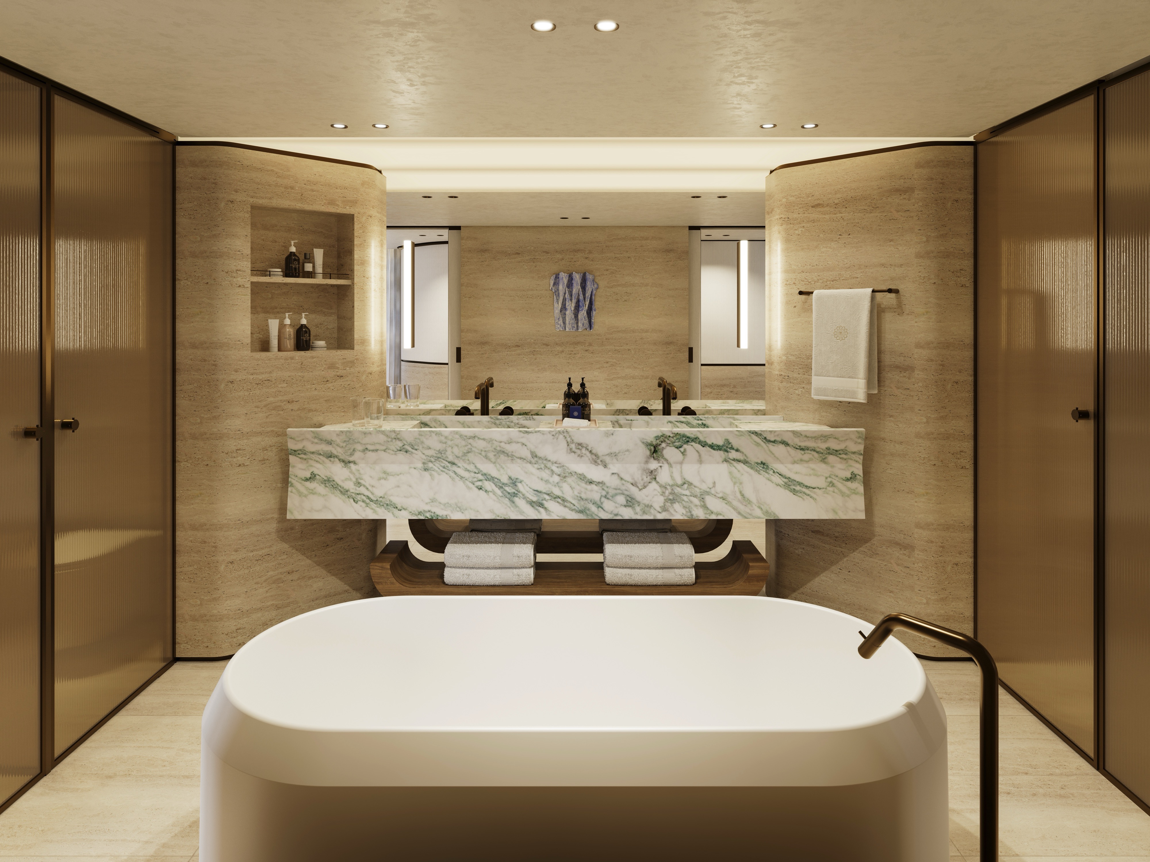
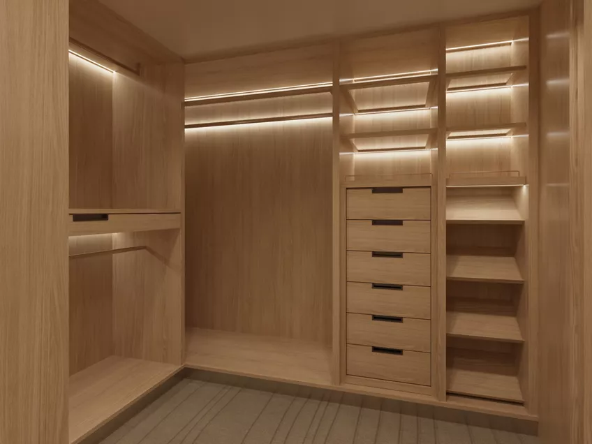
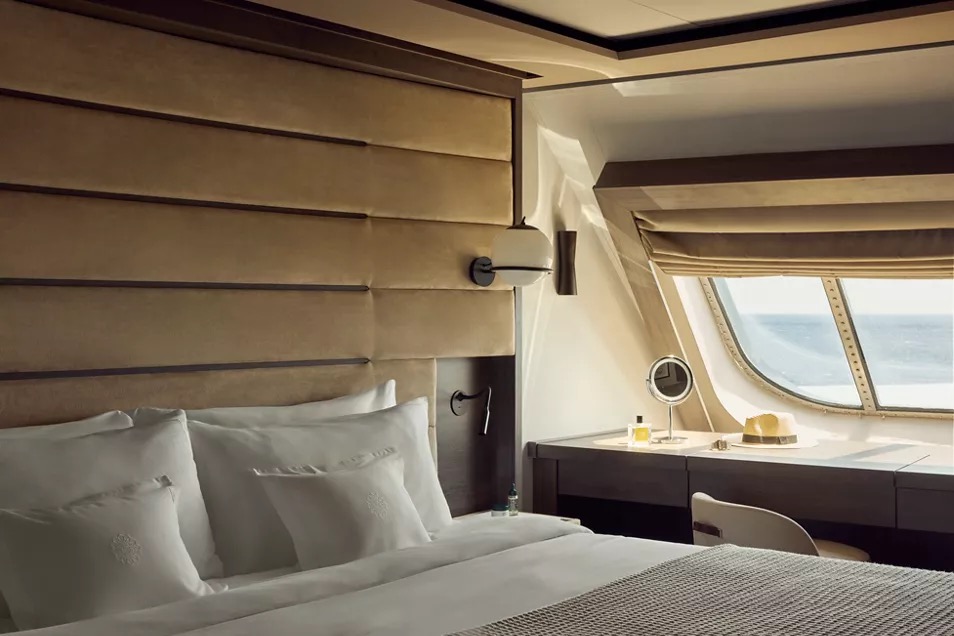
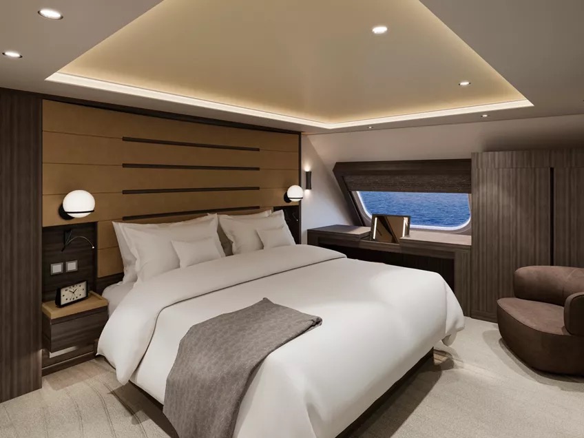
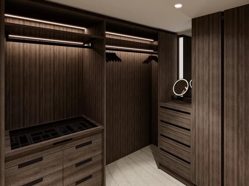
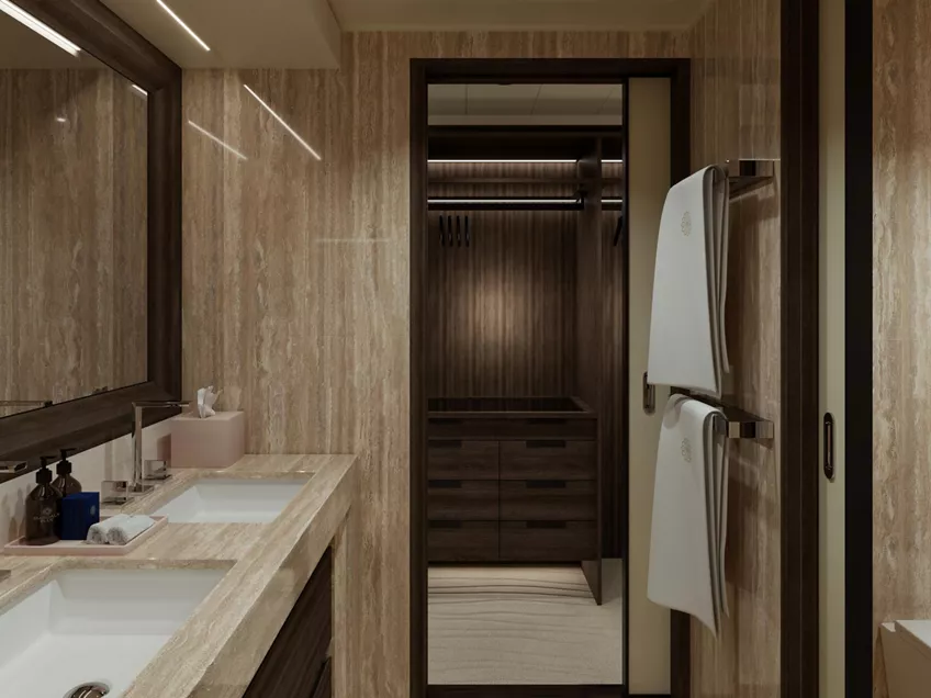
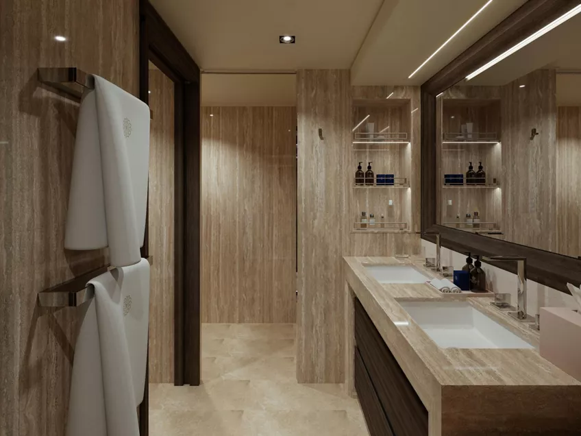
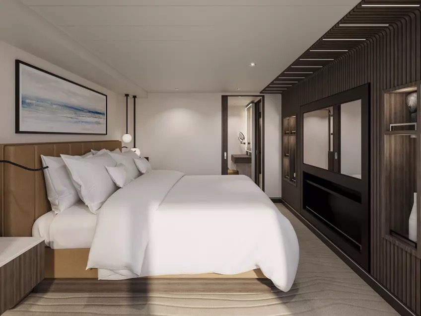
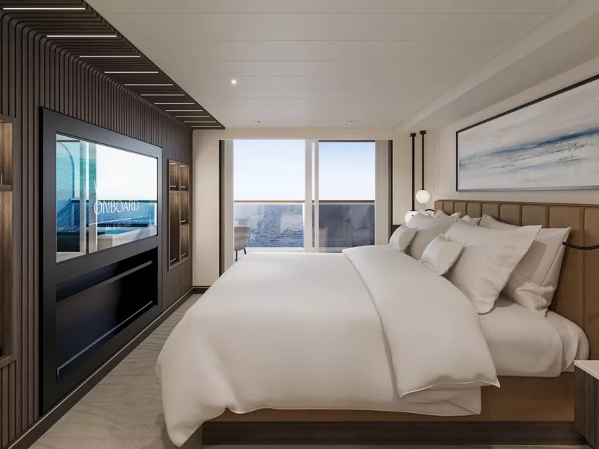
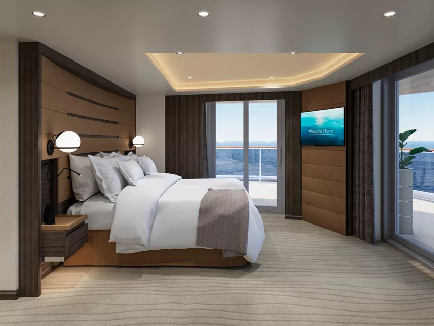
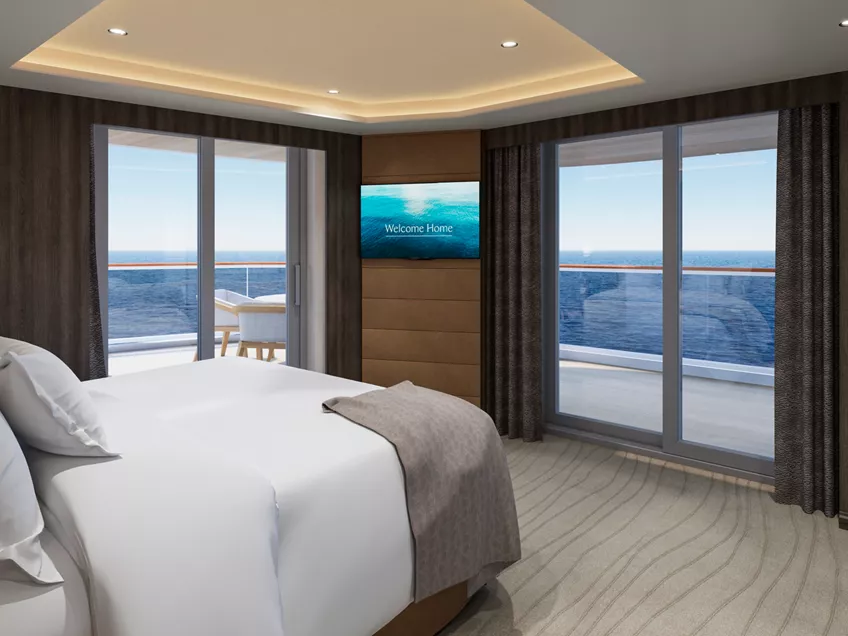
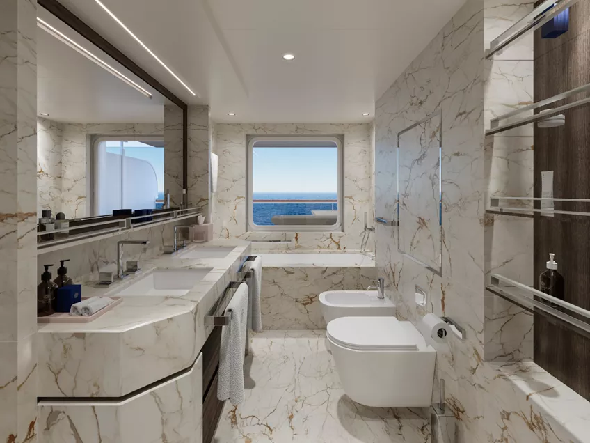
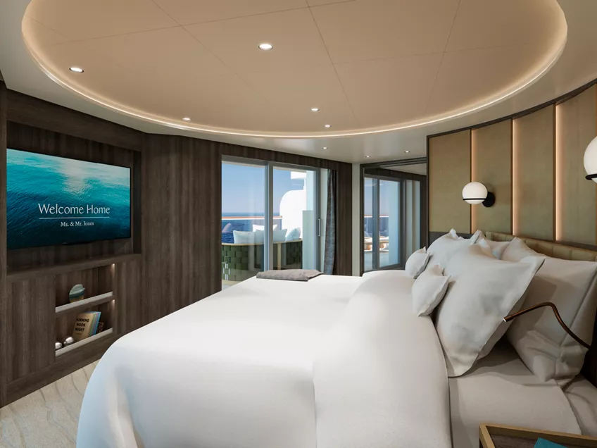
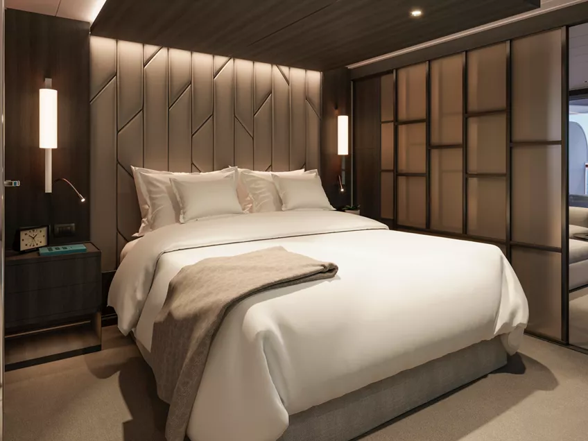
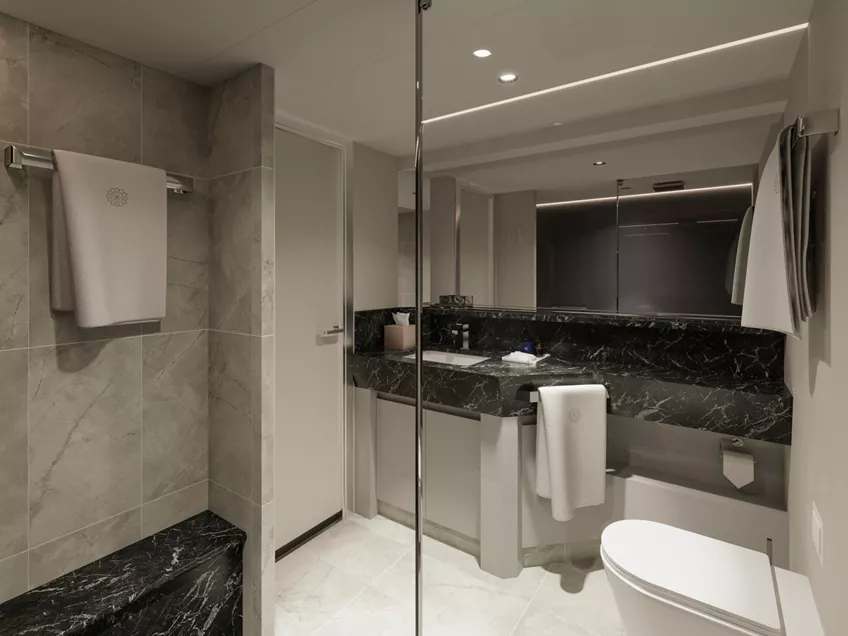
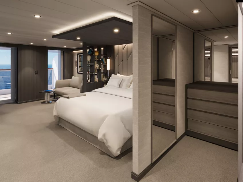
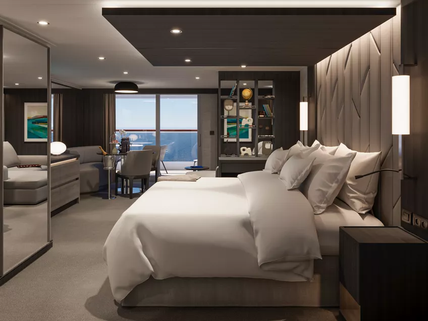
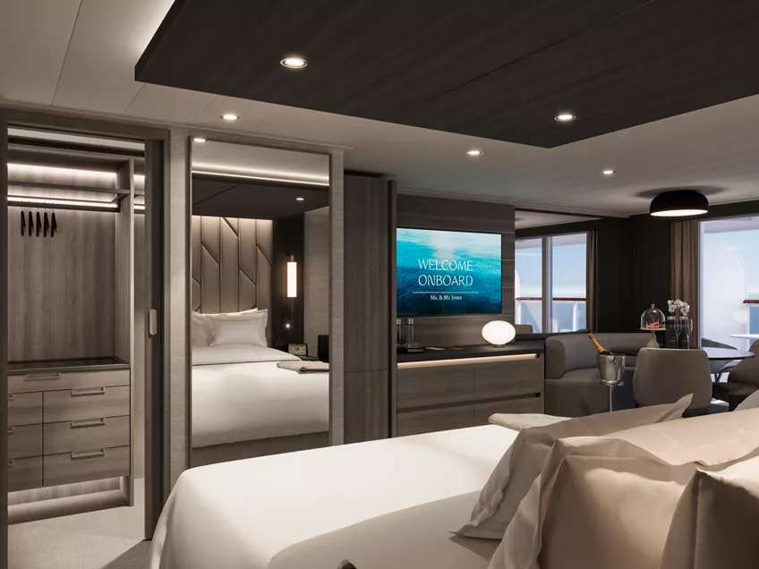
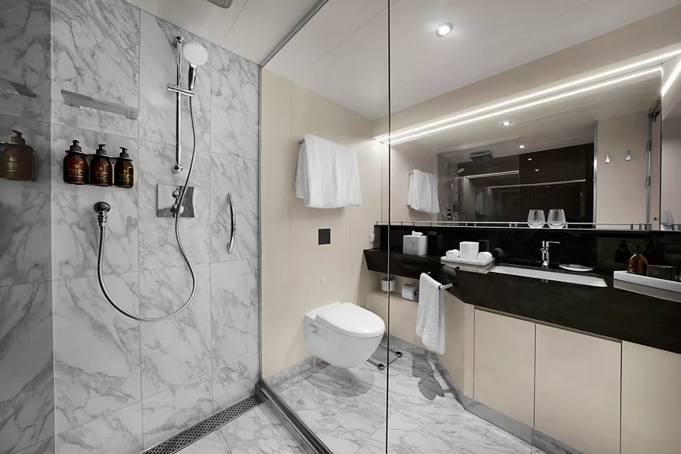
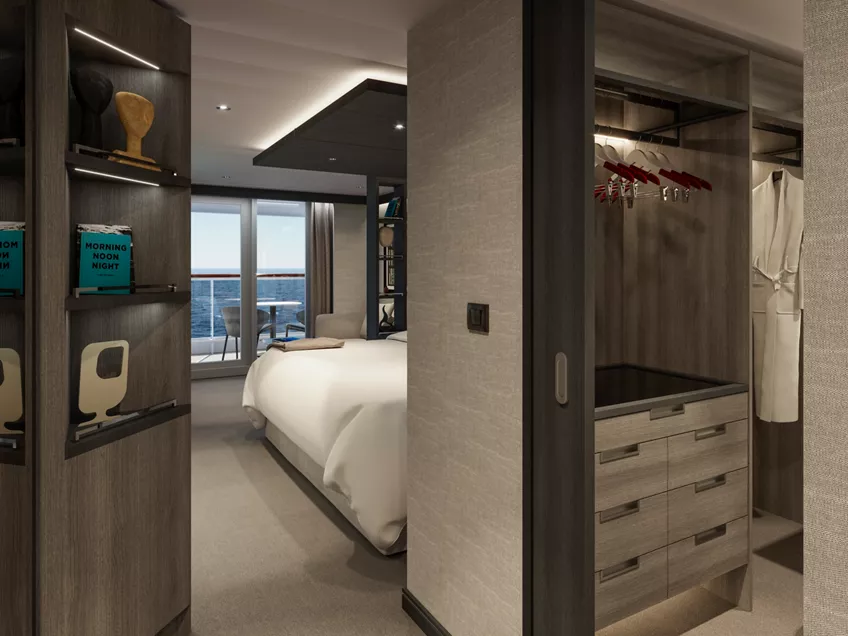
The private bedroom offers panoramic sea views and a peaceful sense of retreat, while the travertine-crafted bathroom features a bathtub, separate shower and a private steam room and a spacious walk-in wardrobe.
Features
- Dedicated Residence Manager overseeing every detail of your stay
- Oversized floor-to-ceiling windows with views of the sea
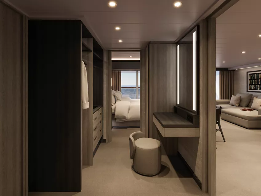
- Separate living, dining and sleeping areas
- Abundant lounge area
- Dining table for 8 guests
- Spacious work desk area
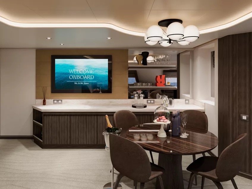
- In-suite welcome bottle of Dom Pérignon
- Private bar, replenished according to the guests’ preferences
- Espresso machine, kettle and teapot with a complimentary selection of coffee and teas
- Complimentary personal refillable water bottle for each guest
- Pair of binoculars for guests’ use during their journey
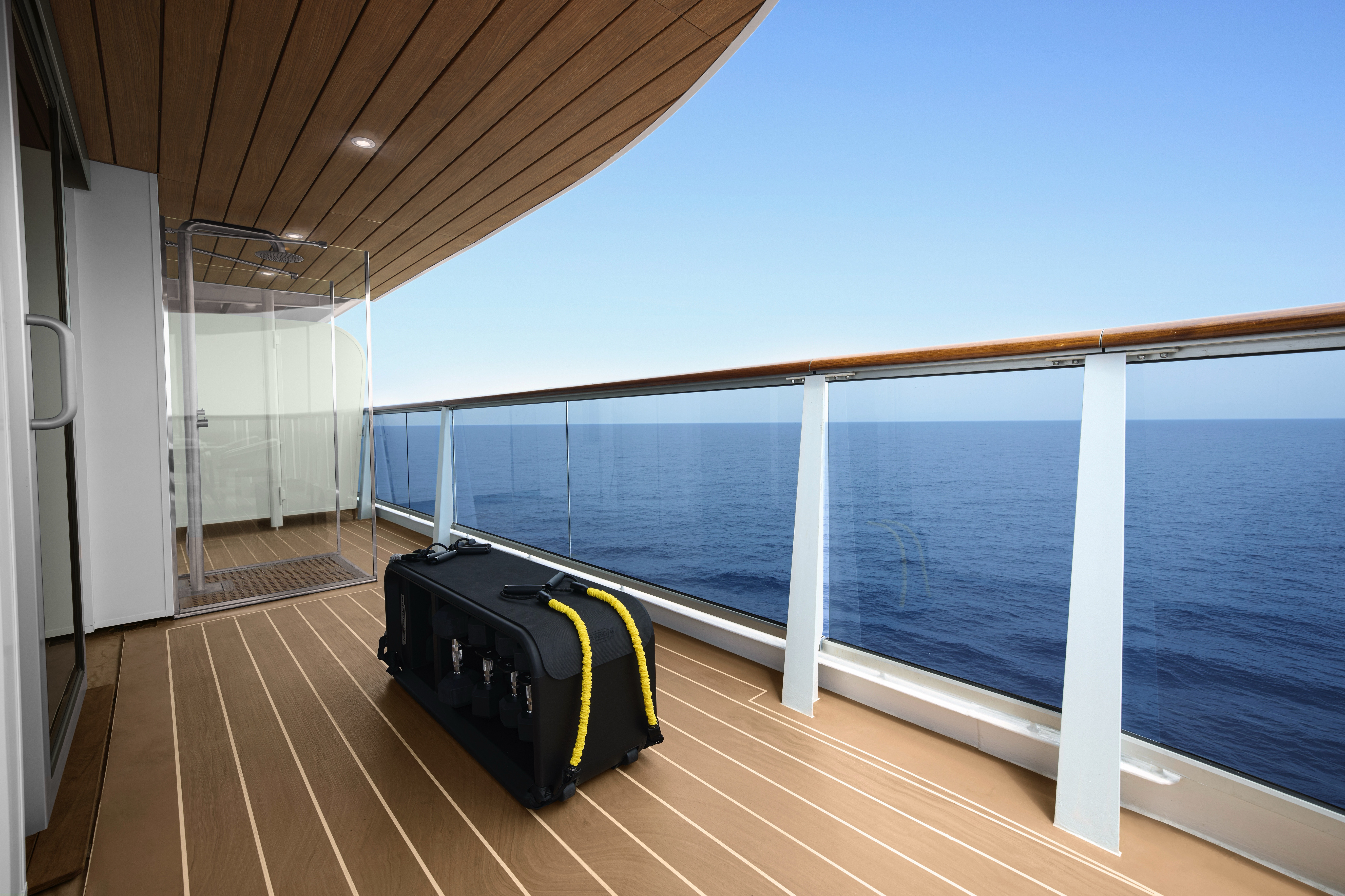
- Technogym Bench and Technogym Case Kit for an efficient in-suite fitness experience
- Safe accommodating most tablets and laptops
- Service pantry area
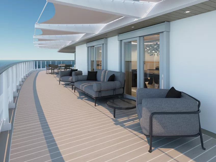
Outdoors
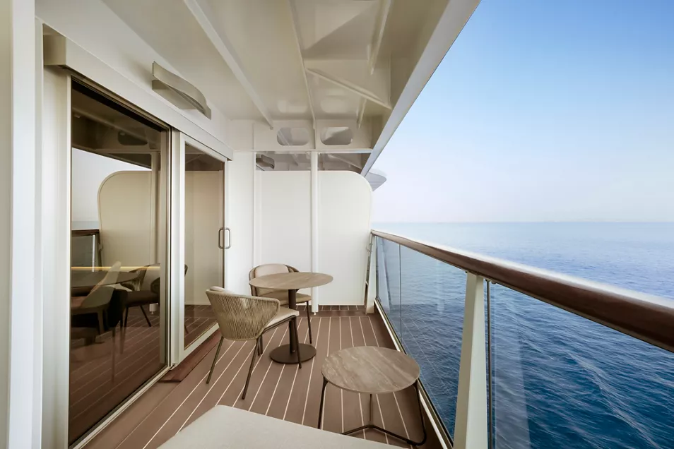
- Panoramic ocean-front terrace covering the full ship’s width, with a private spacious whirlpool, day beds, a dining table, a scenic lounge area, shower
- Additional private terrace area for the second bedroom, which can be separated for added privacy
Bedroom
- Two-bedroom residence
- Master bedroom with king-sized bed, size 200 x 200 cm (79 x 79 in);
- Second bedroom with king-sized bed, size 180 x 180 cm (71 x 79 in), or twin beds, size 2 x 90 x 200 (35 x 79 in)
- Down duvets and pillows
- Fine bed linens
- Extensive pillow selection
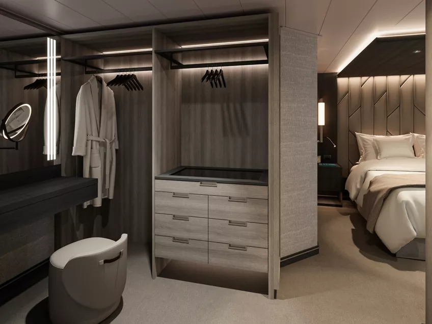
- Oversized dressing room adjoining the Master bedroom
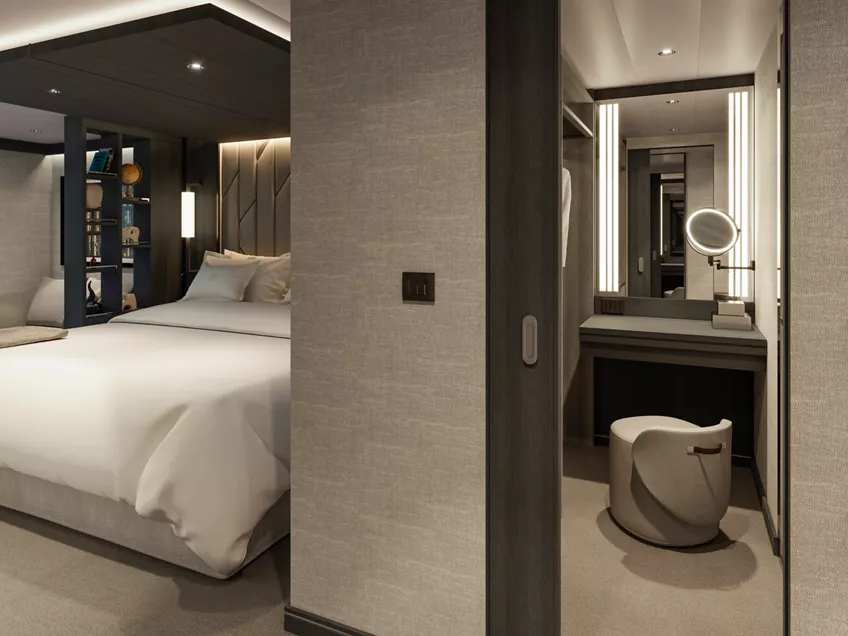
- Spacious walk-in wardrobe with a seated vanity area in the second bedroom
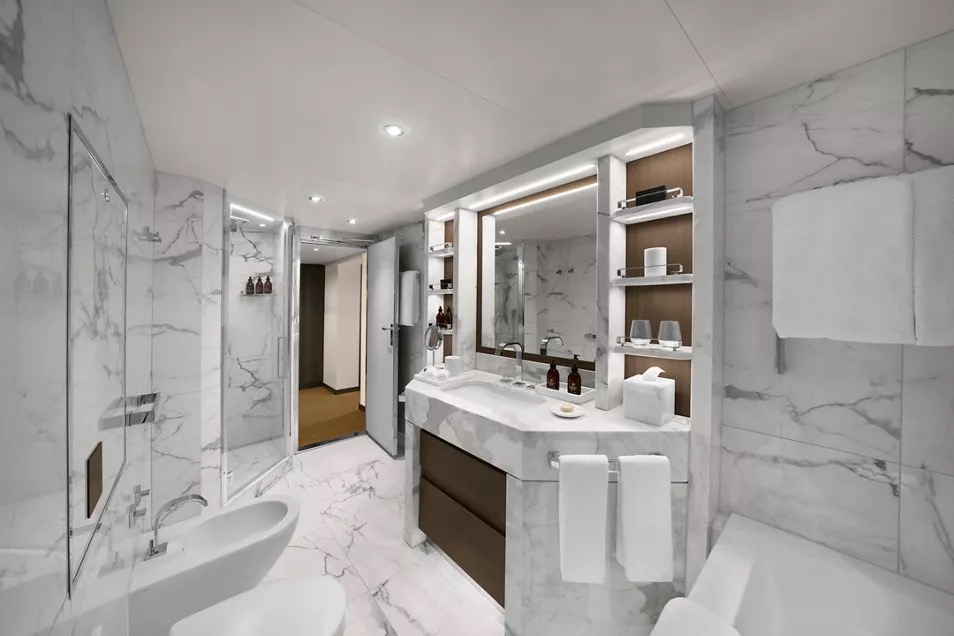
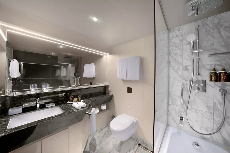
Bathroom
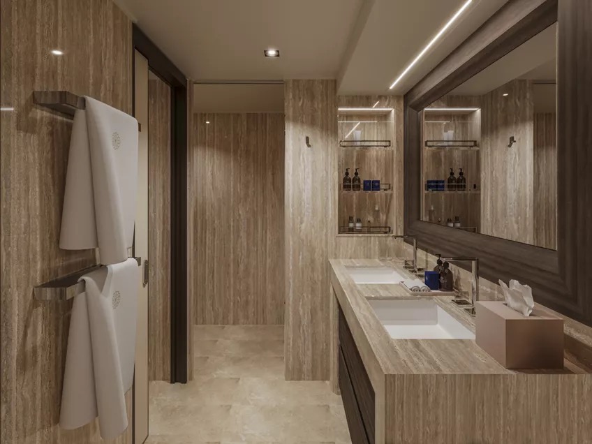
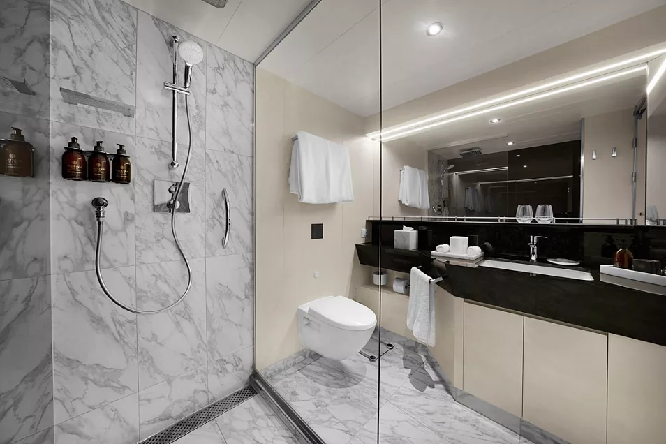
- Master bathroom with luxurious marble double vanity, spacious bathtub, separate shower room and private steam room
- Second bathroom with a bathtub and heated floors
- Plush bathrobes and bath linens
- Mandala Blue custom bath toiletries and amenities for Explora Journeys
- Dyson Supersonic™ hairdryer and illuminated make-up/shaving mirror
- Additional guest powder room
Dedicated Residence Manager
- Packing and unpacking, arranged according to your preferences
- Personal communication via your preferred messenger platform
- Pressing, laundry and garment care assistance
- Private In-Suite Dining arrangements for you and your guests
- Daily itinerary and transport planning
- Assistance with planning your personal events and celebrations
- Assistance with onboard and ashore reservations
*All images are a combination of photography and artist renderings.The artist representations and interior decorations, finishes, and furnishings are provided for illustrative purposes only.
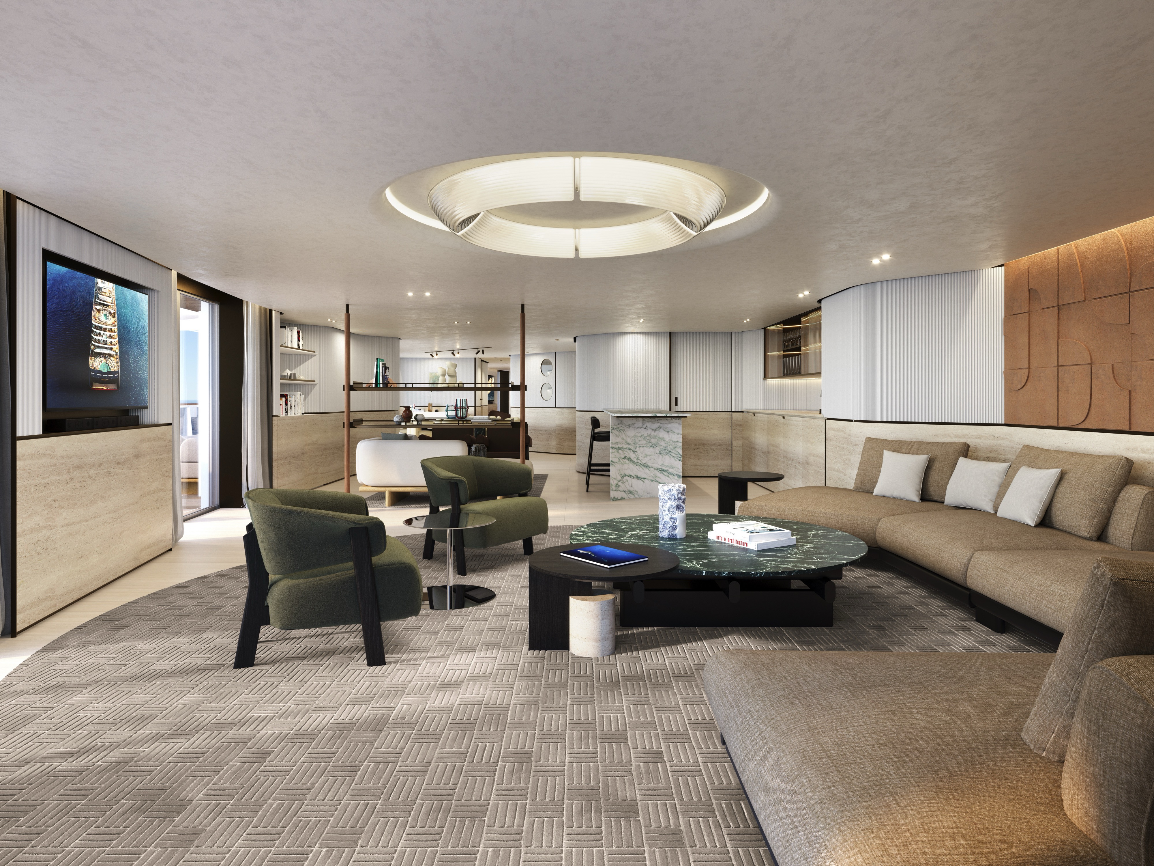
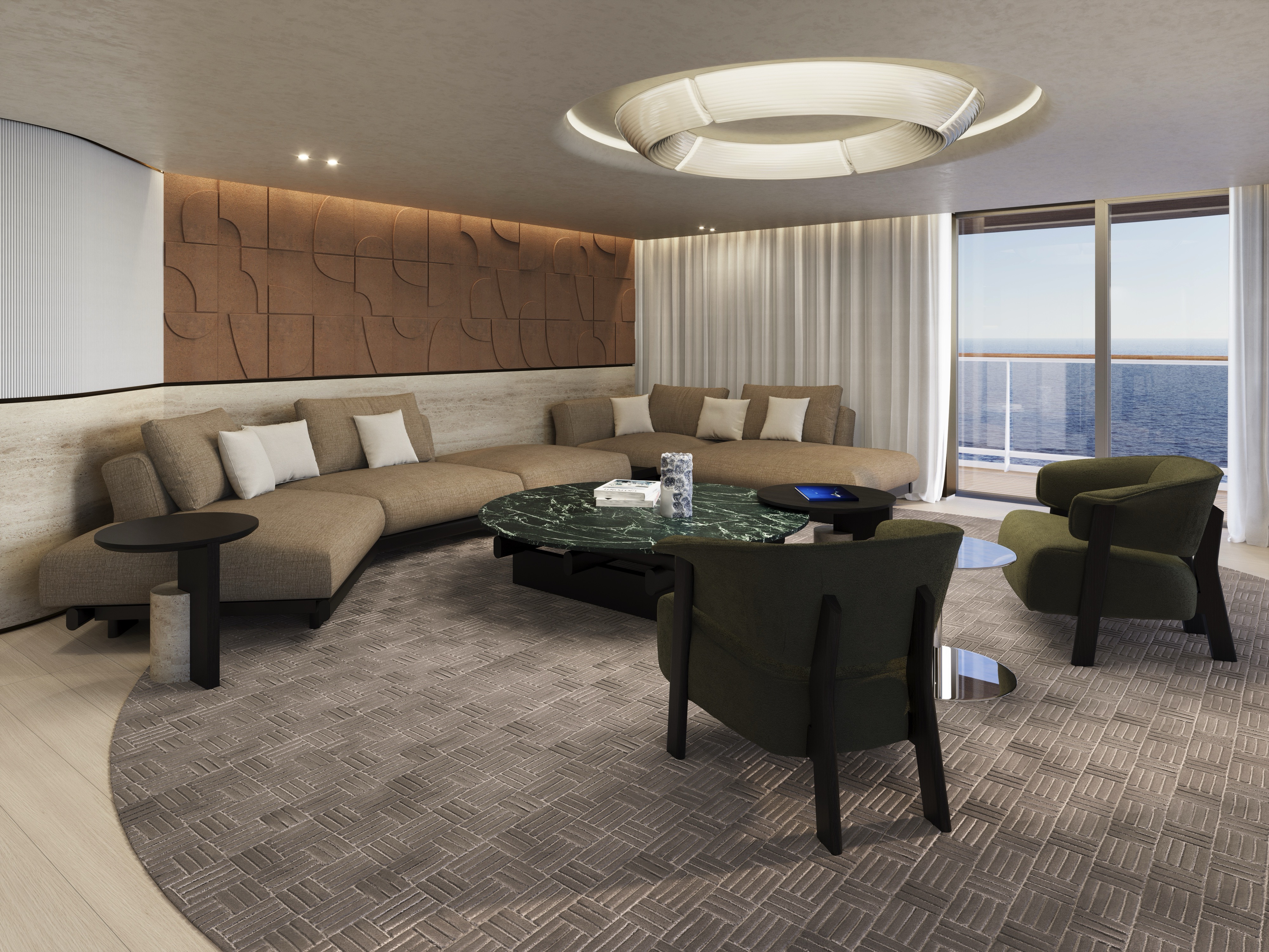
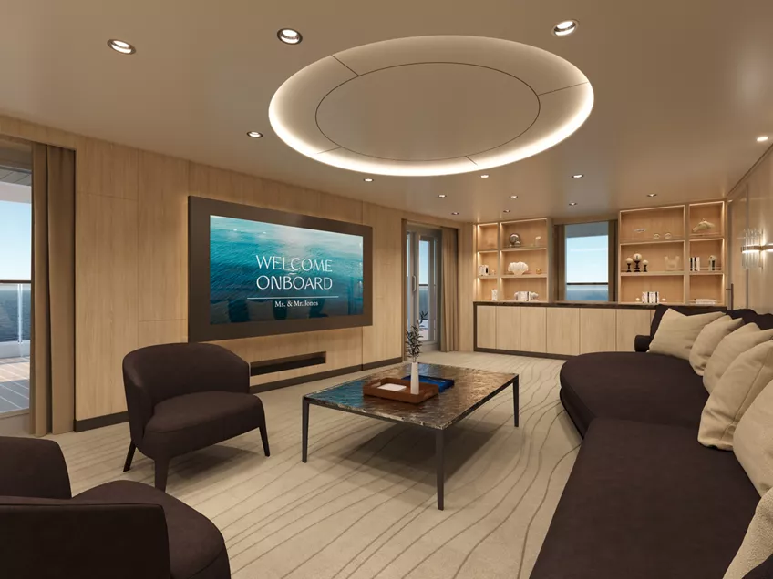
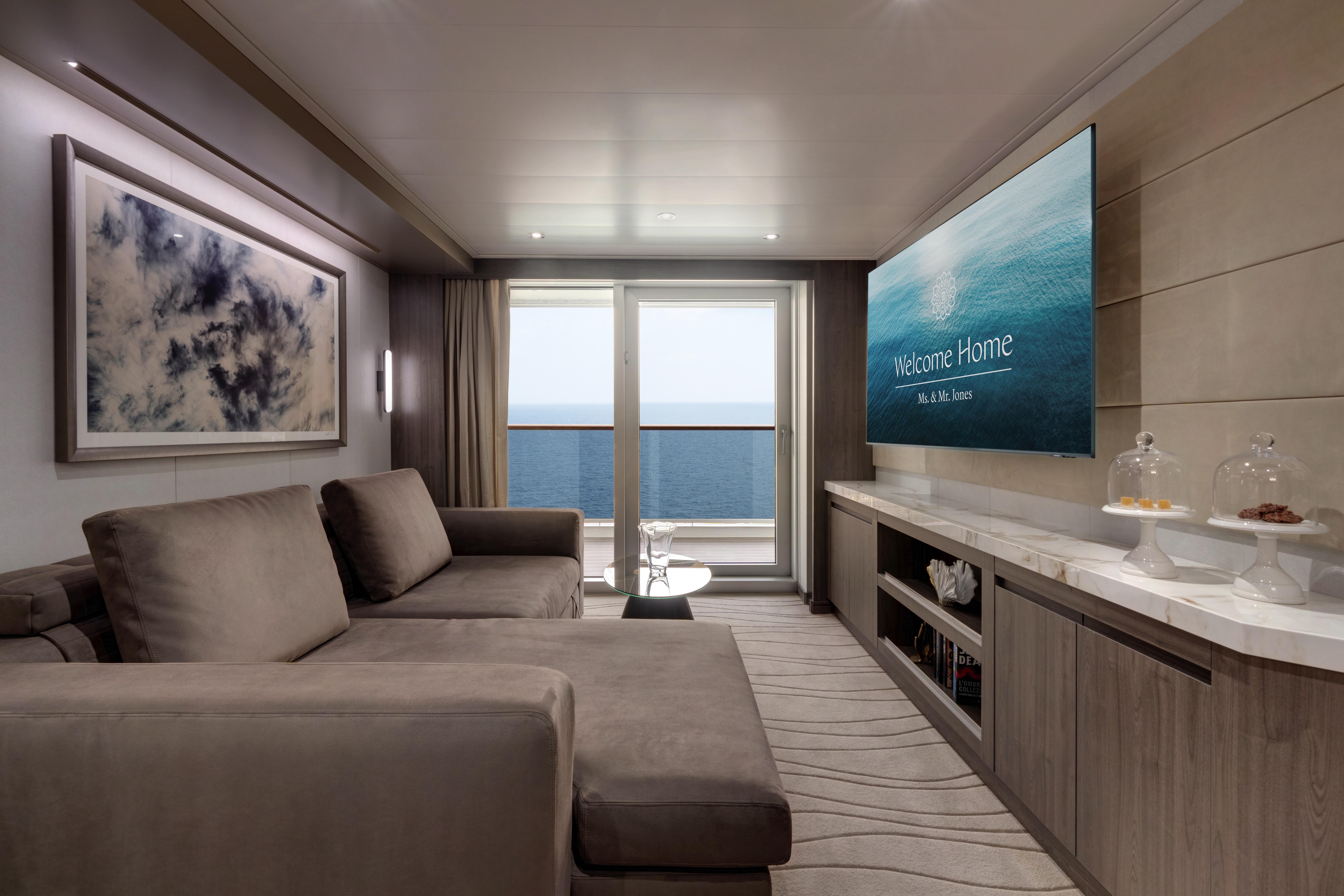
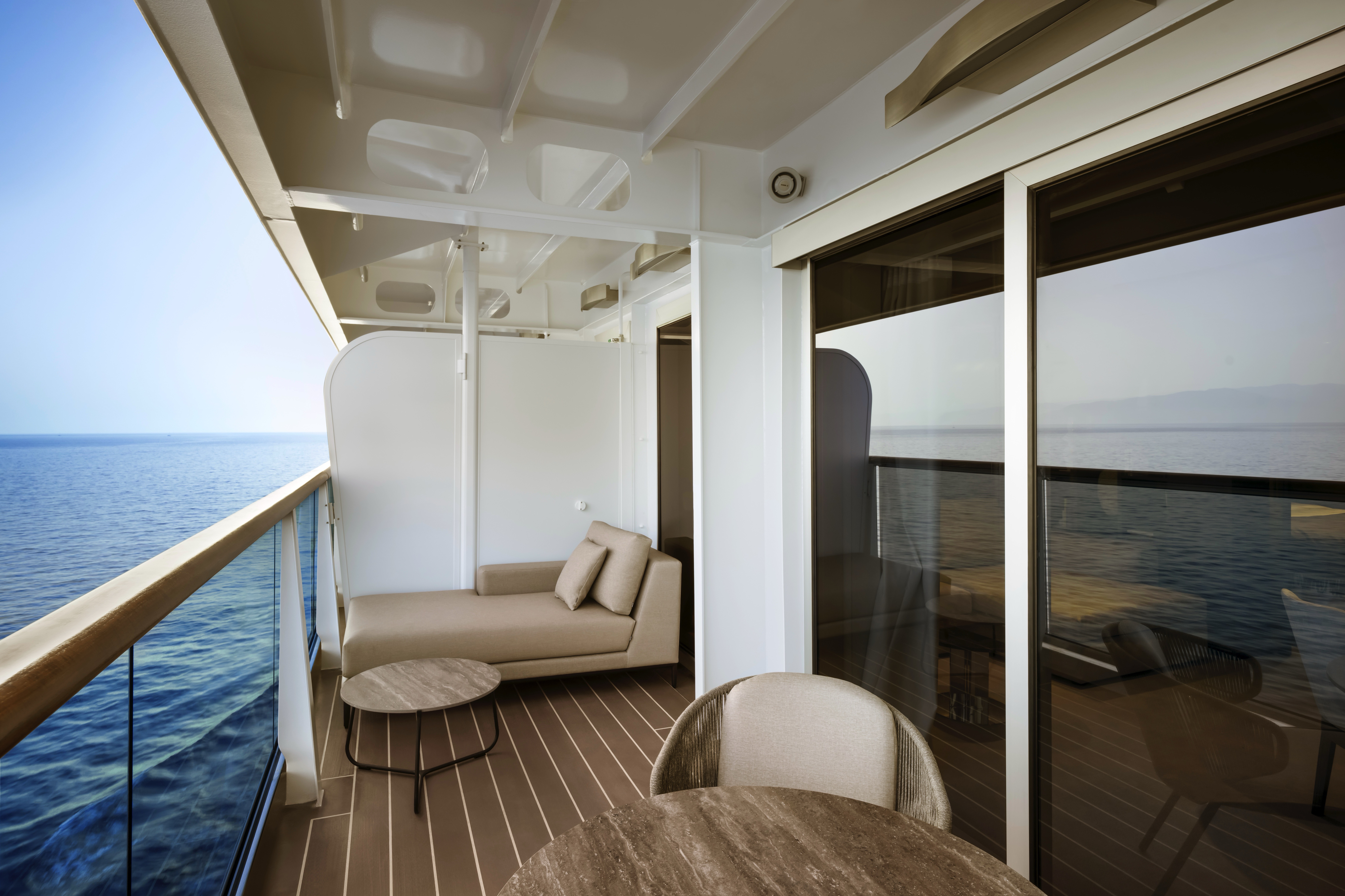
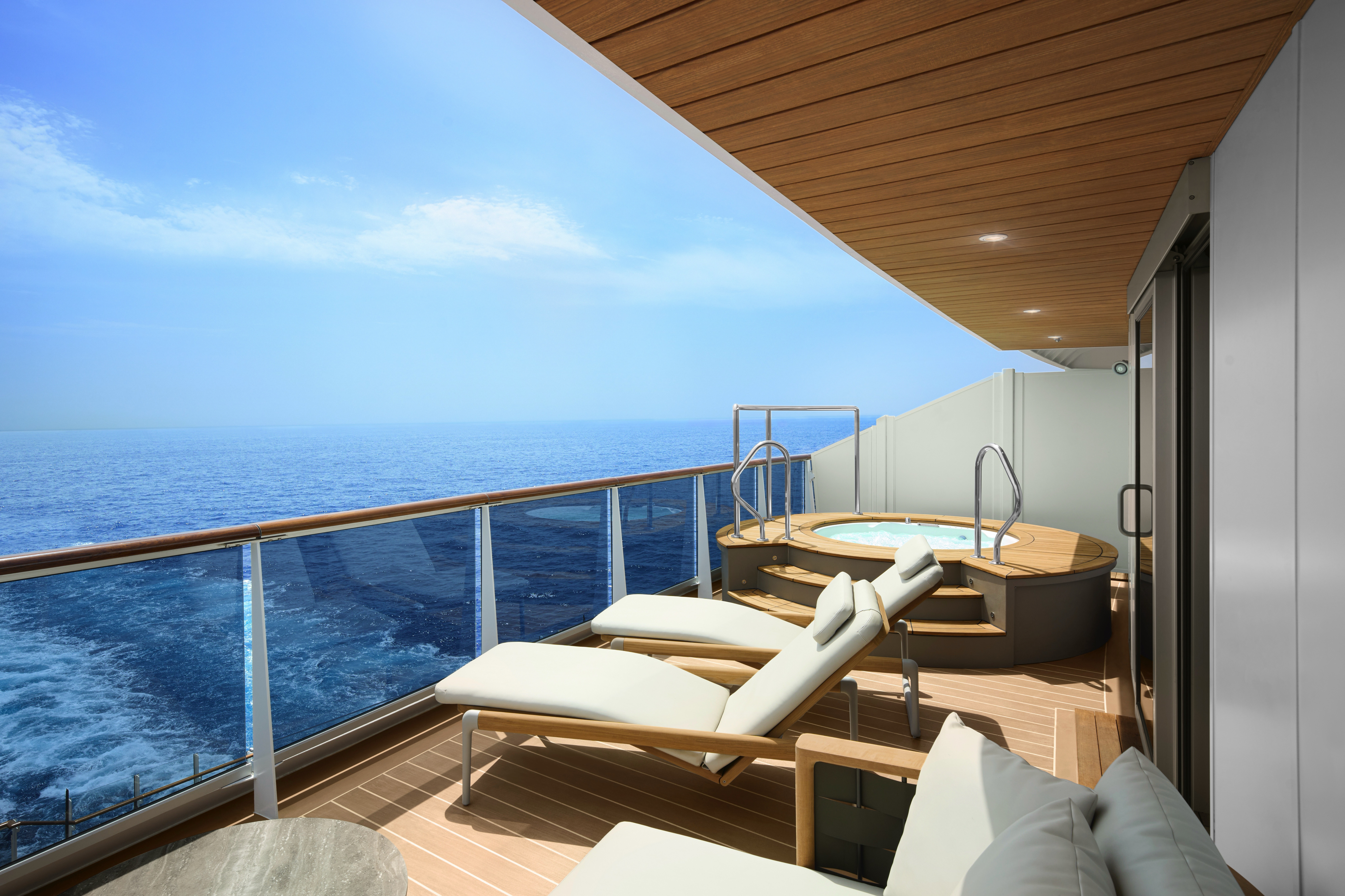
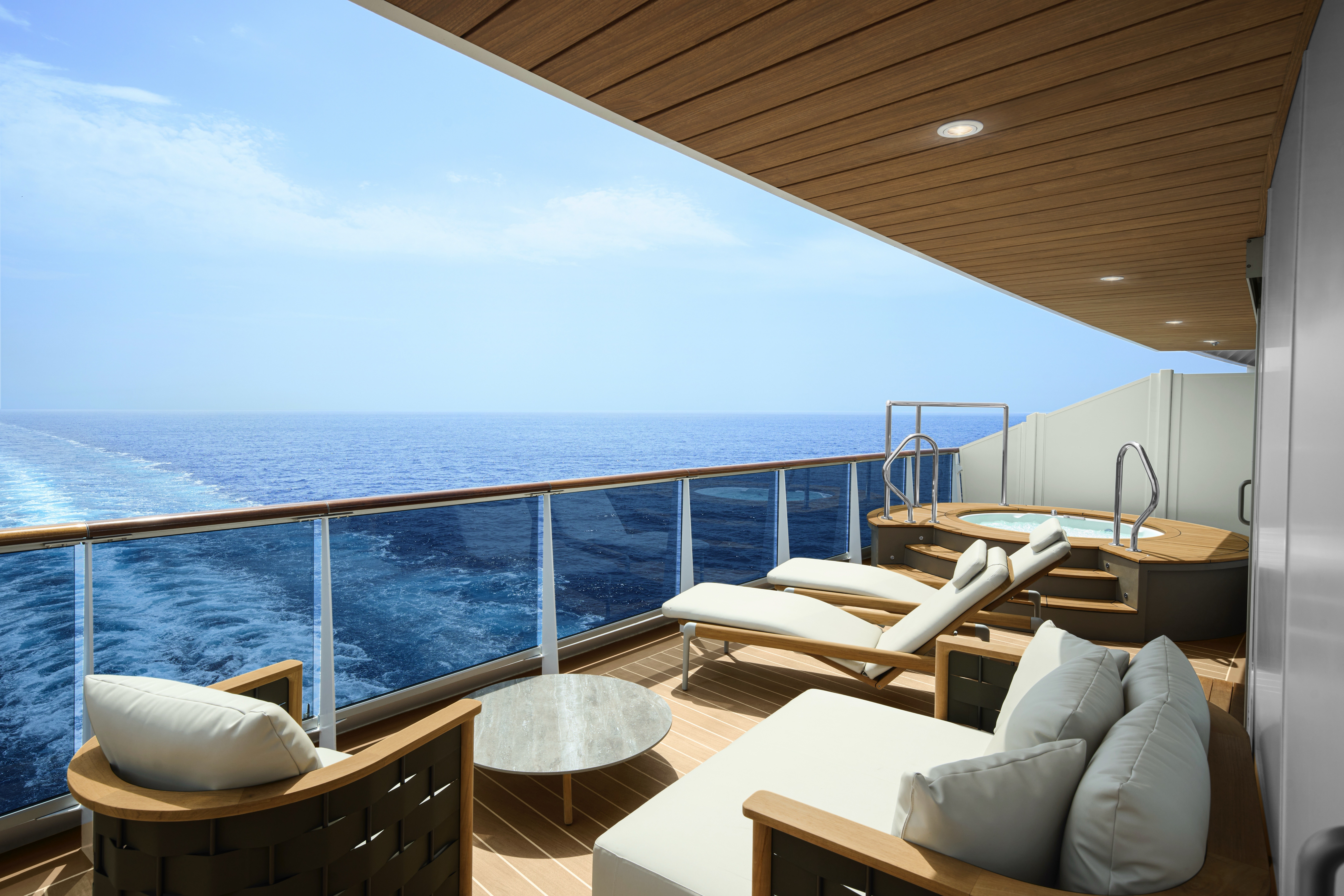
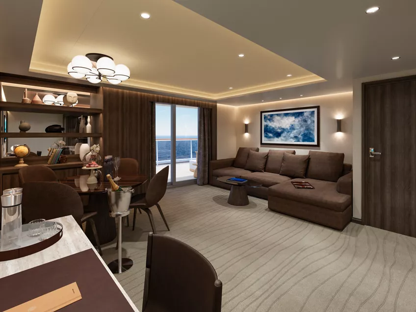
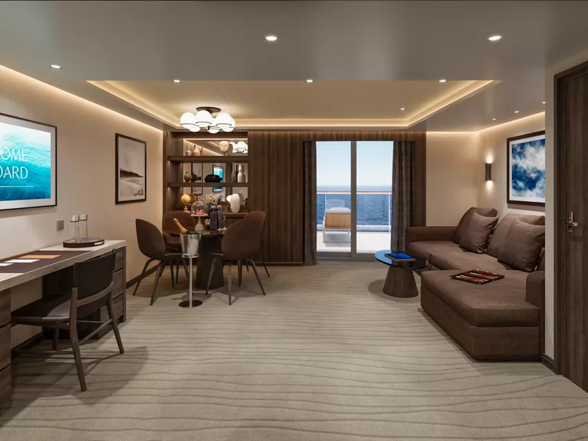
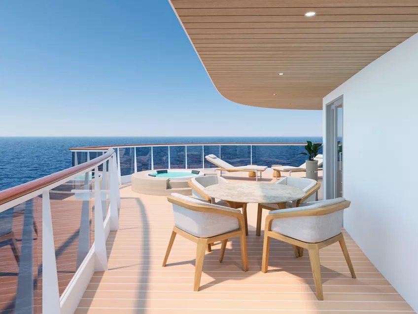
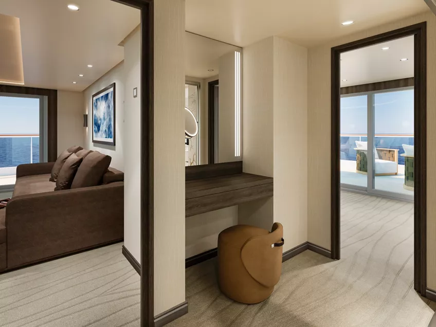
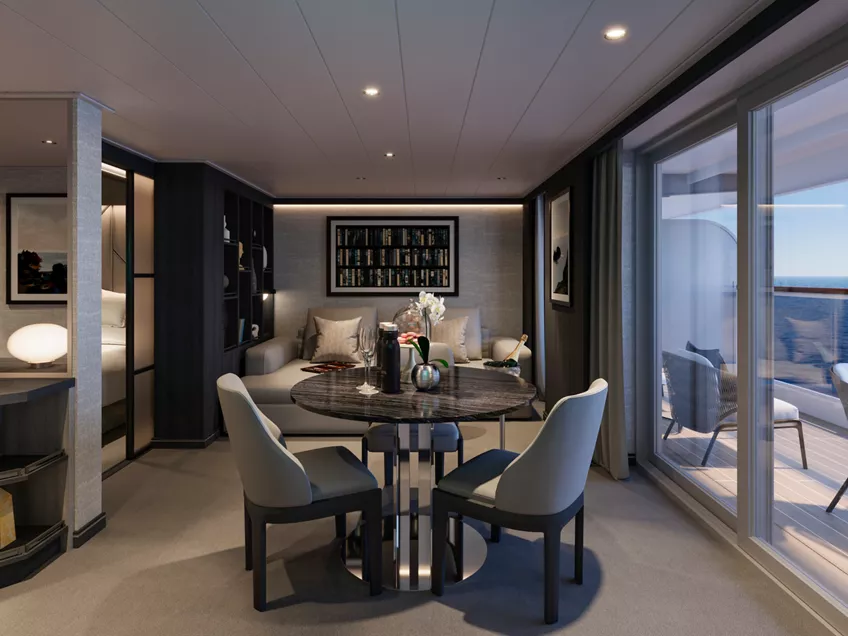
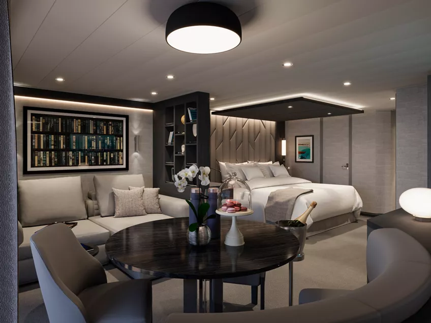
The iconic Owner’s Residence creates the largest living space on-board, with multiple harmonious indoor and outdoor spaces in which to relax, entertain and unwind, including dedicated Residence Manager overseeing every detail of your stay.
Stand in awe of the panoramic ocean views from your expansive private terrace – extending over the full ship's aft width – with a spacious infinity whirlpool and elegant outdoor dining and lounging areas exquisitely designed by Manutti.
Every aspect of the ambiance of the Owner’s Residence reflects the meticulous curation of all details, conscious at all times of our commitment to sustainability; curated and handpicked decorative elements, sofas and chairs are by Knoll and Molteni&C, and sophisticated lighting solutions designed by Astep.
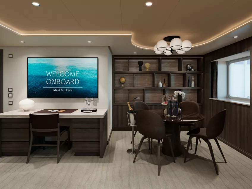
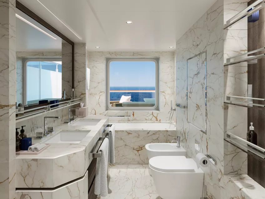
The Owner's Residence features an expansive stylishly decorated living area, a comfortable dining area for eight guests, a separate spacious bedroom with sea views, including a comfortable working space, an en-suite luxurious marble bathroom sculpted from precious Calacatta marble, with a bathtub a separate shower, a private steam room, and a walk-in wardrobe. The suite also features an additional guest powder room.
Features
- Dedicated Residence Manager overseeing every detail of your stay
- Oversized floor-to-ceiling windows with views of the sea
- Separate living, dining and sleeping areas
- Abundant lounge area
- Dining table for 8 guests
- Spacious work desk area
- In-suite welcome bottle of Dom Pérignon
- Private bar, replenished according to the guests’ preferences
- Espresso machine, kettle and teapot with a complimentary selection of coffee and teas
- Complimentary personal refillable water bottle for each guest
- Pair of binoculars for guests’ use during their journey
- Technogym Bench and Technogym Case Kit for an efficient in-suite fitness experience
- Safe accommodating most tablets and laptops
- Steamery steamer for effortless garment care
- Service pantry area
Outdoors
- Panoramic ocean-front terrace covering the full ship’s width, with a private spacious whirlpool, day beds, a dining table, a scenic lounge area, shower
- Additional private terrace area for the second bedroom, which can be separated for added privacy
Bedroom
- Two-bedroom residence
- Master bedroom with king-sized bed, size 200 x 200 cm (79 x 79 in);
- Second bedroom with king-sized bed, size 180 x 180 cm (71 x 79 in), or twin beds, size 2 x 90 x 200 (35 x 79 in)
- Down duvets and pillows
- Fine bed linens
- Extensive pillow selection
- Oversized dressing room adjoining the Master bedroom
- Spacious walk-in wardrobe with a seated vanity area in the second bedroom
Bathroom
- Master bathroom with luxurious marble double vanity, spacious bathtub, separate shower room and private steam room
- Second bathroom with a bathtub and heated floors
- Plush bathrobes and bath linens
- Mandala Blue custom bath toiletries and amenities for Explora Journeys
- Dyson Supersonic™ hairdryer and illuminated make-up/shaving mirror
- Additional guest powder room
Dedicated Residence Manager
- Personal communication via your preferred messenger platform
- Pressing, laundry and garment care assistance
- Private In-Suite Dining arrangements for you and your guests
- Daily itinerary and transport planning
- Assistance with planning your personal events and celebrations
- Assistance with onboard and ashore reservations
*All images are a combination of photography and artist renderings.
The artist representations and interior decorations, finishes, and furnishings are provided for illustrative purposes only.
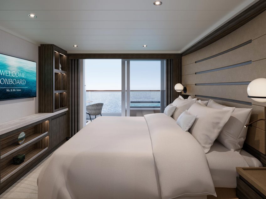
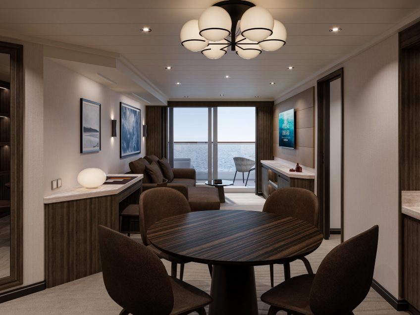
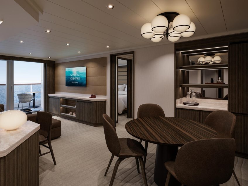
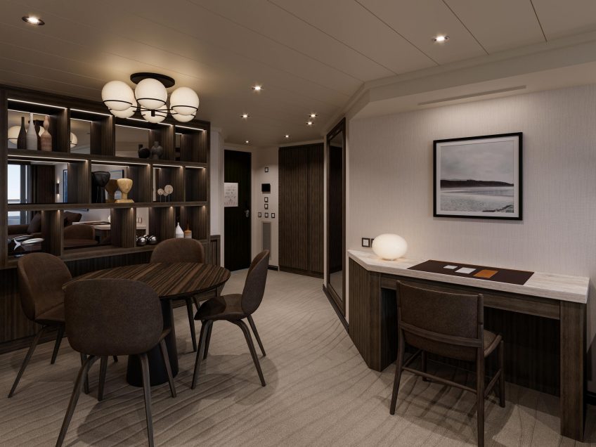
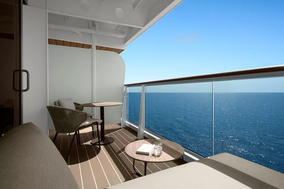
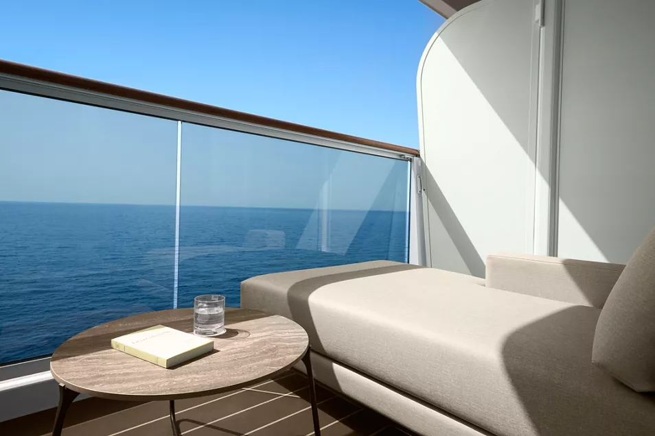
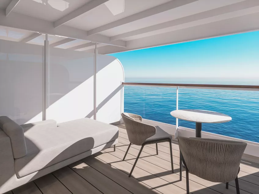
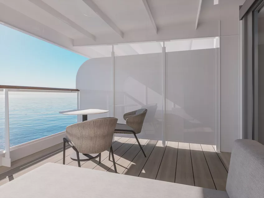
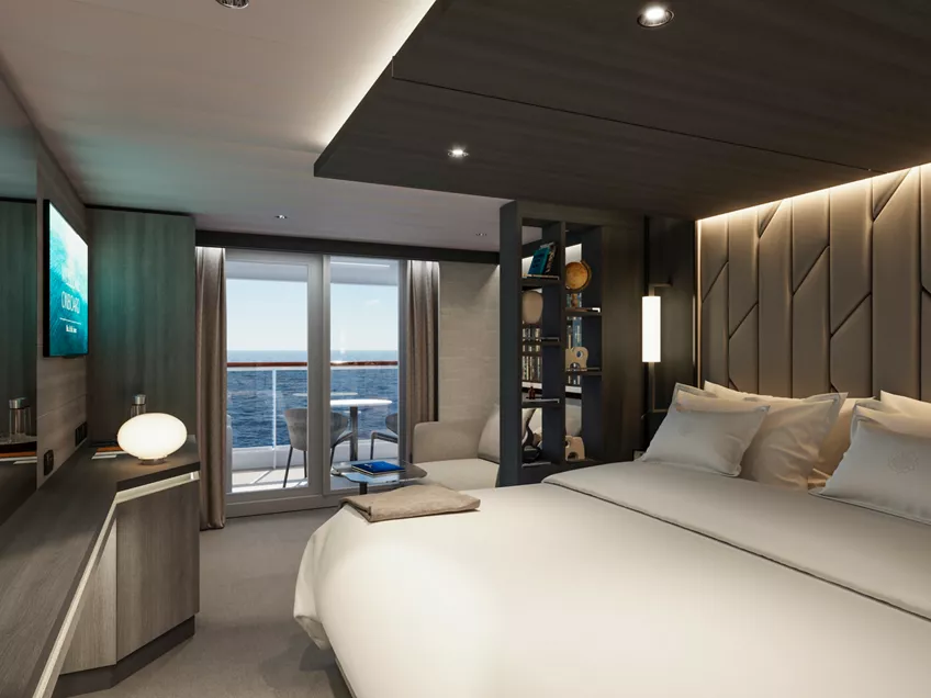
Our luxurious Retreat Residences offer oversized floor-to-ceiling windows leading onto a spacious sun terrace with a private whirlpool, as well as full spectacular views of the ship's forward part, featuring a privileged view of her navigation to celebrated and off-the-beaten path destinations.
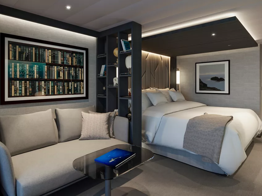
For a true sense of being at home at sea, experience the effortlessly elegant spaces of the Retreat Residences include a stylishly decorated living area, a calm workspace, a comfortable dining area for four, as well as a separate spacious bedroom with sea views and a spacious walk-in wardrobe with a seated vanity area. Sofas and chairs are by Molteni&C and the sophisticated lighting solutions are designed by Astep.
Each Retreat Residence includes elevated in-residence service from our Residence Hosts throughout your stay, a private refrigerated mini bar – replenished according to the guests’ preferences, espresso machine, kettle and teapot with a complimentary selection of coffee and teas.
Features
- Elevated in-residence service from our Residence Hosts throughout your stay
- Oversized floor-to-ceiling windows with views of the sea
- Separate living, dining and sleeping areas
- Spacious lounge area
- Dining table for 4 guests
- Spacious work desk area
- In-suite welcome bottle of champagne
- Private refrigerated minibar, replenished according to the guests’ preferences from a selection of alcoholic and non-alcoholic beverages
- Espresso machine, kettle and teapot with a complimentary selection of coffee and teas
- Complimentary personal refillable water bottle for each guest
- Pair of binoculars for guests’ use during their journey
- Technogym Case Kit with a smart range of fitness gear
- Safe accommodating most tablets and laptops
- Steamery steamer for effortless garment care
Outdoors
- Spacious ocean-front terrace with private outdoor whirlpool and a dining area
Bedroom
- Bespoke king-sized bed sleep system - size: 200 x 200 cm (79 x 79 in)
- Some suites feature a sofa bed
- Down duvets and pillows
- Fine bed linens
- Extensive pillow selection
- Spacious walk-in wardrobe with a seated vanity area
Bathroom
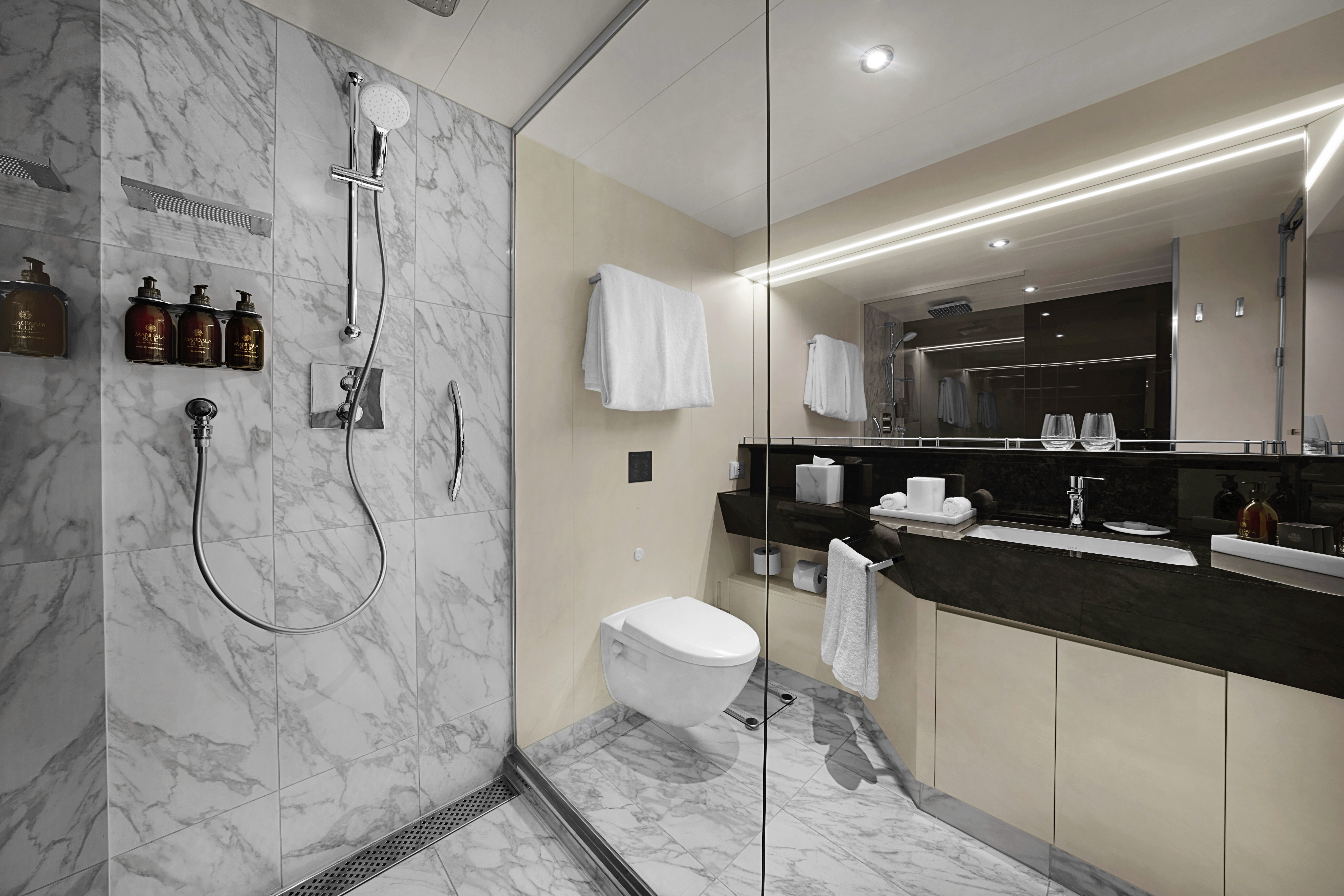
- Luxurious marble bathroom with a bathtub, a separate walk-in shower room and heated floors
- Plush bathrobes and bath linens
- Mandala Blue custom bath toiletries and amenities for Explora Journeys
- Dyson SupersonicTM hairdryer and illuminated make-up/shaving mirror
- Additional guest powder room
- Packing and unpacking, arranged according to your preferences
- Personal communication via your preferred messenger platform
- Pressing, laundry and garment care assistance
- Private In-Suite Dining arrangements for you and your guests
- Daily itinerary and transport planning
- Assistance with planning your personal events and celebrations
- Assistance with onboard and ashore reservations
*All images are a combination of photography and artist renderings.
The artist representations and interior decorations, finishes, and furnishings are provided for illustrative purposes only.
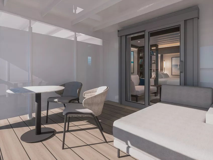
For a true sense of being at home at sea, experience the effortlessly elegant spaces of the Cove Residences featuring a stylishly decorated living area, a calm workspace, a comfortable dining area for four, as well as a separate bedroom with sea views and a spacious walk-in wardrobe with a seated vanity area. Sofas and chairs are by Molteni&C and the sophisticated lighting solutions are designed by Astep. The private sun terrace allows guests to unwind and savour the ocean featuring a private outdoor whirlpool, a dining table and sun loungers.
Each Cove Residence includes elevated in-residence service from our Residence Hosts throughout your stay, a private refrigerated mini bar – replenished according to the guests’ preferences, espresso machine, kettle and teapot with a complimentary selection of coffee and teas.
Features
- Elevated in-residence service from our Residence Hosts throughout your stay
- Oversized floor-to-ceiling windows with views of the sea
- Separate living, dining and sleeping areas
- Spacious lounge area
- Dining table for 4 guests
- Spacious work desk area
- In-suite welcome bottle of champagne
- Private refrigerated minibar, replenished according to the guests’ preferences from a selection of alcoholic and non-alcoholic beverages
- Espresso machine, kettle and teapot with a complimentary selection of coffee and teas
- Complimentary personal refillable water bottle for each guest
- Pair of binoculars for guests’ use during their journey
- Technogym Case Kit with a smart range of fitness gear
- Safe accommodating most tablets and laptops
- Steamery steamer for effortless garment care
Outdoors
- Spacious oceanfront terrace with private outdoor whirlpool, a dining table and sun loungers or a daybed
Bedroom
- Bespoke king-sized bed sleep system – size: 180 x 200 cm (71 x 79 in)
- Some suites feature twin beds – size: 2 x 90 x 200 cm (35 x 79 in)
- Double sofa bed
- Down duvets and pillows
- Fine bed linens
- Extensive pillow selection
- Spacious walk-in wardrobe with a seated vanity area
Bathroom
- Spacious bathroom with walk-in shower and heated floors
- Plush bathrobes and bath linens
- Mandala Blue custom bath toiletries and amenities for Explora Journeys
- Dyson SupersonicTM hairdryer and illuminated make-up/shaving mirror
Residence Host
- Packing and unpacking, arranged according to your preferences
- Personal communication via your preferred messenger platform
- Pressing, laundry and garment care assistance
- Private In-Suite Dining arrangements for you and your guests
- Daily itinerary and transport planning
- Assistance with planning your personal events and celebrations
- Assistance with onboard and ashore reservations
*All images are a combination of photography and artist renderings.
The artist representations and interior decorations, finishes, and furnishings are provided for illustrative purposes only.

For a true sense of being at home at sea, experience the effortlessly elegant spaces of the Cove Residences featuring a stylishly decorated living area, a calm work space, a comfortable dining area for four, as well as a separate bedroom with sea views and a spacious walk-in wardrobe with a seated vanity area. Sofas and chairs are by Molteni & C and the sophisticated lighting solutions are designed by Astep. The private sun terrace allows guests to unwind and savour the ocean featuring a dining table and sun loungers.
Each Cove Residence includes Elevated in-residence service from our Residence Hosts throughout your stay, a private refrigerated mini bar – replenished according to the guests’ preferences, espresso machine, kettle and tea pot with a complimentary selection of coffee and teas.
Features
- Elevated in-residence service from our Residence Hosts throughout your stay
- Oversized floor-to-ceiling windows with views of the sea
- Spacious lounge area
- Dining table for 4 guests
- In-suite welcome bottle of champagne
- Private refrigerated minibar, replenished according to the guests’ preferences from a selection of alcoholic and non-alcoholic beverages
- Espresso machine, kettle and teapot with a complimentary selection of coffee and teas
- Complimentary personal refillable water bottle for each guest
- Pair of binoculars for guests’ use during their journey
- Technogym Case Kit with a smart range of fitness gear
- Safe accommodating most tablets and laptops
- Steamery steamer for effortless garment care
Outdoors
- Spacious oceanfront terrace with a dining table and sun loungers or a daybed
Bedroom
- Bespoke king-sized bed sleep system - size: 180 x 200 cm (71 x 79 in)
- Some suites feature twin beds – size: 2 x 90 x 200 cm (35 x 79 in)
- Double sofa bed
- Down duvets and pillows
- Fine bed linens
- Extensive pillow selection
- Spacious walk-in wardrobe with a seated vanity area
Bathroom
- Spacious bathroom with walk-in shower and heated floors
- Plush bathrobes and bath linens
- Mandala Blue custom bath toiletries and amenities for Explora Journeys
- Dyson SupersonicTM hairdryer and illuminated make-up/shaving mirror
Residence Host
- Packing and unpacking, arranged according to your preferences
- Personal communication via your preferred messenger platform
- Pressing, laundry and garment care assistance
- Private In-Suite Dining arrangements for you and your guests
- Daily itinerary and transport planning
- Assistance with planning your personal events and celebrations
- Assistance with onboard and ashore reservations
*All images are a combination of photography and artist renderings.
The artist representations and interior decorations, finishes, and furnishings are provided for illustrative purposes only.
Abundant in space and light, the elegant Serenity Residences feature oversized floor-to-ceiling windows leading onto the expansive panoramic terrace on the ship's aft, including magnificent ocean views, a private outdoor whirlpool, a dining table, relaxing sun beds and a comfortable outdoor lounge designed by Molteni&C.
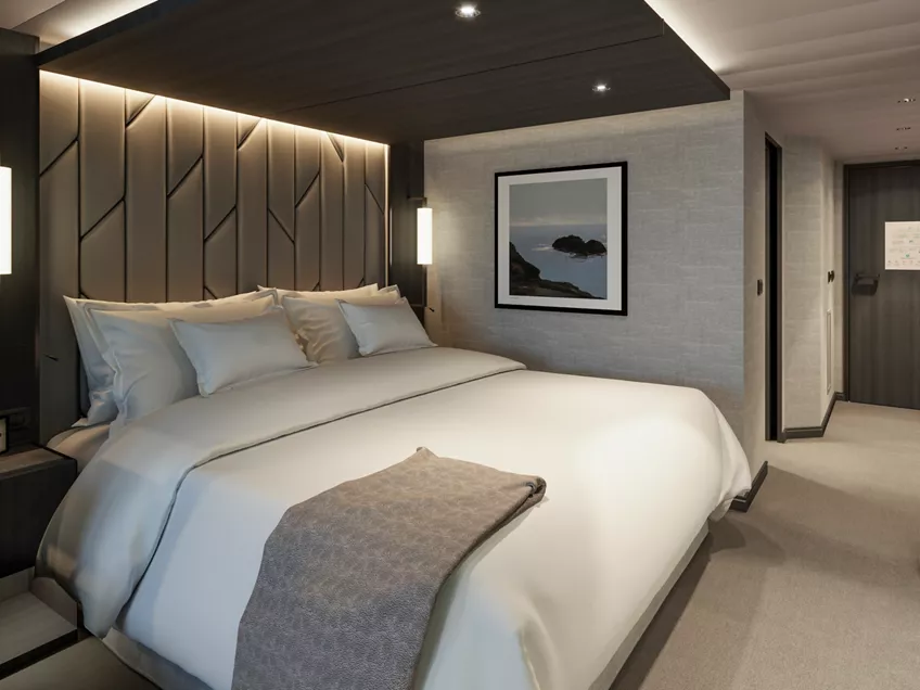
The Serenity Residences feature a large stylishly decorated living area, a comfortable dining area for four, with sofas and chairs by Molteni&C and sophisticated lighting solutions designed by Astep, as well as a comfortable working space. The separate spacious bedroom with sea views includes a walk-in wardrobe with a seated vanity area and an en-suite luxurious marble bathroom sculpted of precious Calacatta marble, with a bathtub and separate shower.
Each Serenity Residence includes elevated in-residence service from our Residence Hosts throughout your stay, a private refrigerated mini bar – replenished according to the guests’ preferences, espresso machine, kettle and teapot with a complimentary selection of coffee and teas.
Features
- Elevated in-residence service from our Residence Hosts throughout your stay
- Oversized floor-to-ceiling windows with views of the sea
- Separate living, dining and sleeping areas
- Spacious lounge area
- Dining table for 4 guests
- Spacious work desk area
- In-suite welcome bottle of champagne
- Private refrigerated minibar, replenished according to the guests’ preferences from a selection of alcoholic and non-alcoholic beverages
- Espresso machine, kettle and teapot with a complimentary selection of coffee and teas
- Complimentary personal refillable water bottle for each guest
- Pair of binoculars for guests’ use during their journey
- Technogym Bench and Technogym Case Kit for an efficient in-suite fitness experience
- Safe accommodating most tablets and laptops
- Steamery steamer for effortless garment care
Outdoors
- Panoramic ocean-front terrace with private outdoor whirlpool, a dining table, a daybed and sun loungers
Bedroom
- Bespoke king-sized bed sleep system - size: 180 x 200 cm (71 x 79 in)
- Some suites feature twin beds – size: 2 x 90 x 200 cm (35 x 79 in)
- Double sofa bed
- Down duvets and pillows
- Fine bed linens
- Extensive pillow selection
- Spacious walk-in wardrobe with a seated vanity area
Bathroom
- Luxurious marble bathroom with a bathtub, a separate walk-in shower room and heated floors
- Plush bathrobes and bath linens
- Mandala Blue custom bath toiletries and amenities for Explora Journeys
- Dyson SupersonicTM hairdryer and illuminated make-up/shaving mirror
Residence Host
- Packing and unpacking, arranged according to your preferences
- Personal communication via your preferred messenger platform
- Pressing, laundry and garment care assistance
- Private In-Suite Dining arrangements for you and your guests
- Daily itinerary and transport planning
- Assistance with planning your personal events and celebrations
- Assistance with onboard and ashore reservations
*All images are a combination of photography and artist renderings.
The artist representations and interior decorations, finishes, and furnishings are provided for illustrative purposes only.
Our Cocoon Residences are amongst the most spacious of our Ocean Residences, featuring oversized floor-to-ceiling windows leading onto the expansive panoramic terrace on the ship's coveted aft deck. Here, guests can drink in the spectacular views from their private whirlpool, relax in sun beds or the comfortable outdoor lounge designed by Molteni&C, or enjoy dinner overlooking the ocean.
The Cocoon Residences feature a large stylishly decorated living area, a comfortable dining area for four, with sofas and chairs by Molteni&C and sophisticated lighting solutions designed by Astep, as well as a comfortable working space. The separate spacious bedroom with sea views includes a walk-in wardrobe with a seated vanity area and an en-suite luxurious marble bathroom sculpted of precious Calacatta marble, with a bathtub and separate shower. The suite also features an additional guest powder room.
Each Cocoon Residence includes elevated in-residence service from our Residence Hosts throughout your stay, a private refrigerated mini bar – replenished according to the guests’ preferences, espresso machine, kettle and teapot with a complimentary selection of coffee and teas.
Features
- Elevated in-residence service from our Residence Hosts throughout your stay
- Oversized floor-to-ceiling windows with views of the sea
- Separate living, dining and sleeping areas
- Spacious work desk area
- Dining table for 4 guests
- In-suite welcome bottle of champagne
- Private refrigerated minibar, replenished according to the guests’ preferences from a selection of alcoholic and non-alcoholic beverages
- Espresso machine, kettle and teapot with a complimentary selection of coffee and teas
- Complimentary personal refillable water bottle for each guest
- Pair of binoculars for guests’ use during their journey
- Technogym Case Kit with a smart range of fitness gear
- Safe accommodating most tablets and laptops
- Steamery steamer for effortless garment care
Outdoors
- Panoramic ocean-front terrace with private outdoor whirlpool, a dining table, a daybed and sun loungers
Bedroom
- Bespoke king-sized bed sleep system - size: 200 x 200 cm (79 x 79 in)
- Double sofa bed
- Down duvets and pillows
- Fine bed linens
- Extensive pillow selection
- Spacious walk-in wardrobe with a seated vanity area
Bathroom
- Luxurious marble bathroom with a bathtub, a separate walk-in shower room and heated floors
- Plush bathrobes and bath linens
- Mandala Blue custom bath toiletries and amenities for Explora Journeys
- Dyson SupersonicTM hairdryer and illuminated make-up/shaving mirror
- Additional guest powder room
Residence Host
- Packing and unpacking, arranged according to your preferences
- Personal communication via your preferred messenger platform
- Pressing, laundry and garment care assistance
- Private In-Suite Dining arrangements for you and your guests
- Daily itinerary and transport planning
- Assistance with planning your personal events and celebrations
- Assistance with onboard and ashore reservations
*All images are a combination of photography and artist renderings.
The artist representations and interior decorations, finishes, and furnishings are provided for illustrative purposes only.

The light-filled, luxurious Premier Penthouses are designed for withdrawing in style or entertaining other guests – at a dining table laid for four, in the stylish living area and on the private sun terrace featuring a dining table area and a daybed overlooking the ocean.
All Premier Penthouses include elegant lounge areas, a separate bedroom with spacious walk-in wardrobe and a seated vanity area, private refrigerated mini bar – replenished according to the guests’ preferences, espresso machine, kettle and teapot with a complimentary selection of coffee and teas.
Features
- Oversized floor-to-ceiling windows with views of the sea
- Separate living, dining and sleeping areas
- Spacious lounge area
- Dining table for 4 guests
- In-suite welcome bottle of champagne
- Private refrigerated minibar, replenished according to the guests’ preferences from a selection of alcoholic and non-alcoholic beverages
- Espresso machine, kettle and teapot with a complimentary selection of coffee and teas
- Complimentary personal refillable water bottle for each guest
- Pair of binoculars for guests’ use during their journey
- Technogym Case Kit with a smart range of fitness gear
- Safe accommodating most tablets and laptops
- Steamery steamer for effortless garment care
Outdoors
- Spacious oceanfront terrace with a dining area
- Comfortable daybed for relaxation
Bedroom
- Bespoke king-sized bed sleep system - size: 180 x 200 cm (71 x 79 in)
- Some suites feature twin beds – size: 2 x 90 x 200 cm (35 x 79 in)
- Down duvets and pillows
- Fine bed linens
- Extensive pillow selection
- Spacious walk-in wardrobe with a seated vanity area
Bathroom
- Spacious bathroom with a walk-in shower and heated floors
- Plush bathrobes and bath linens
- Mandala Blue custom bath toiletries and amenities for Explora Journeys
- Dyson SupersonicTM hairdryer and illuminated make-up/shaving mirror
- Some suites feature a bathtub
*All images are a combination of photography and artist renderings.
The artist representations and interior decorations, finishes, and furnishings are provided for illustrative purposes only.

The most spacious of our Ocean Penthouses, the Grand Penthouses offer elegant spaces with a separate stylish living area, a comfortable workspace, a dining area for four, as well as a separate bedroom with sea views and a spacious walk-in wardrobe with a seated vanity area. The private sun terrace allows guests to unwind and savour the ocean, in the company of friends or one another, featuring a dining table and a daybed.
All Grand Penthouses include elegant lounge areas, private refrigerated mini bar – replenished according to the guests’ preferences, espresso machine, kettle and teapot with a complimentary selection of coffee and teas.
Features
- Oversized floor-to-ceiling windows with views of the sea
- Separate living, dining and sleeping areas
- Spacious lounge area
- Dining table for 4 guests
- Spacious work desk area
- In-suite welcome bottle of champagne
- Private refrigerated minibar, replenished according to the guests’ preferences from a selection of alcoholic and non-alcoholic beverages
- Espresso machine, kettle and tea pot with a complimentary selection of coffee and teas
- Complimentary personal refillable water bottle for each guest
- Pair of binoculars for guests’ use during their journey
- Technogym Case Kit with a smart range of fitness gear
- Safe accommodating most tablets and laptops
- Steamery steamer for effortless garment care
Outdoors
- Spacious oceanfront terrace with a dining area
- Comfortable daybed for relaxation
Bedroom
- Bespoke king-sized bed sleep system - size: 180 x 200 cm (71 x 79 in)
- Some suites feature twin beds – size: 2 x 90 x 200 cm (35 x 79 in)
- Down duvets and pillows
- Fine bed linens
- Extensive pillow selection
- Spacious walk-in wardrobe with a seated vanity area
Bathroom
- Spacious bathroom with a bathtub and heated floors
- Plush bathrobes and bath linens
- Mandala Blue custom bath toiletries and amenities for Explora Journeys
- Dyson SupersonicTM hairdryer and illuminated make-up/shaving mirror
*All images are a combination of photography and artist renderings.
The artist representations and interior decorations, finishes, and furnishings are provided for illustrative purposes only.

Flooded with light from the floor-to-ceiling oversized windows, the Deluxe Penthouses offer elegant accommodation and a stylish living area, a separate dining area for four, as well as a work space. The private sun terrace with a dining table and a daybed allows guests to feel closer to the ocean as it carries them on their journey.
All Deluxe Penthouses include elegant lounge areas, private refrigerated mini bar – replenished according to the guests’ preferences, espresso machine, kettle and teapot with a complimentary selection of coffee and teas and feature spacious walk-in wardrobes with a seated vanity area.
Features
- Oversized floor-to-ceiling windows with views of the sea
- Spacious lounge area
- Dining table for 4 guests
- Some suites feature a spacious work desk area
- In-suite welcome bottle of champagne
- Private refrigerated minibar, replenished according to the guests’ preferences from a selection of alcoholic and non-alcoholic beverages
- Espresso machine, kettle and teapot with a complimentary selection of coffee and teas
- Complimentary personal refillable water bottle for each guest
- Pair of binoculars for guests’ use during their journey
- Technogym Case Kit with a smart range of fitness gear
- Safe accommodating most tablets and laptops
- Steamery steamer for effortless garment care
Outdoors
- Spacious oceanfront terrace with a dining area
- Comfortable daybed for relaxation
Bedroom
- Bespoke king-sized bed sleep system - size: 180 x 200 cm (71 x 79 in)
- Some suites feature twin beds – size: 2 x 90 x 200 cm (35 x 79 in)
- Down duvets and pillows
- Fine bed linens
- Extensive pillow selection
- Spacious walk-in wardrobe with a seated vanity area
Bathroom
- Spacious bathroom with a walk-in shower and heated floors
- Plush bathrobes and bath linens
- Mandala Blue custom bath toiletries and amenities for Explora Journeys
- Dyson SupersonicTM hairdryer and illuminated make-up/shaving mirror
- Some suites feature bathtubs
*All images are a combination of photography and artist renderings.
The artist representations and interior decorations, finishes, and furnishings are provided for illustrative purposes only.

Each of our Penthouses offers a spacious living area and a separate dining area for four, allowing guests to entertain others or retreat in style as they see fit. Floor-to ceiling doors lead onto an expansive private sun terrace with a dining table and a daybed for ultimate relaxation at sea.
All Penthouses include elegant lounge areas, private refrigerated mini bar – replenished according to the guests’ preferences, espresso machine, kettle and teapot with a complimentary selection of coffee and teas and feature spacious walk-in wardrobes with a seated vanity area.
Features
- Oversized floor-to-ceiling windows with views of the sea
- Spacious lounge area
- Dining table for 4 guests
- In-suite welcome bottle of champagne
- Private refrigerated minibar, replenished according to the guests’ preferences from a selection of alcoholic and non-alcoholic beverages
- Espresso machine, kettle and teapot with a complimentary selection of coffee and teas
- Complimentary personal refillable water bottle for each guest
- Pair of binoculars for guests’ use during their journey
- Technogym Case Kit with a smart range of fitness gear
- Safe accommodating most tablets and laptops
- Steamery steamer for effortless garment care
Outdoors
- Spacious oceanfront terrace with a dining area
- Comfortable daybed for relaxation
Bedroom
- Bespoke king-sized bed sleep system - size: 180 x 200 cm (71 x 79 in)
- Some suites feature twin beds – size: 2 x 90 x 200 cm (35 x 79 in)
- Down duvets and pillows
- Fine bed linens
- Extensive pillow selection
- Spacious walk-in wardrobe with a seated vanity area
Bathroom
- Spacious bathroom with a walk-in shower and heated floors
- Plush bathrobes and bath linens
- Mandala Blue custom bath toiletries and amenities for Explora Journeys
- Dyson SupersonicTM hairdryer and illuminated make-up/shaving mirror
*All images are a combination of photography and artist renderings.
The artist representations and interior decorations, finishes, and furnishings are provided for illustrative purposes only.

Our Ocean Grand Terrace Suites are situated on decks 6 and 7, offering a more spacious private sun terrace featuring a dining table and a daybed, allowing guests to savour the ocean from the comfort of their daybed.
All Ocean Grand Terrace Suites include elegant lounge areas, private refrigerated mini bar – replenished according to the guests’ preferences, espresso machine, kettle and teapot with a complimentary selection of coffee and teas and feature spacious walk-in wardrobes with a seated vanity area.
Features
- Oversized floor-to-ceiling windows with views of the sea
- Lounge area with coffee/dining table
- In-suite welcome bottle of champagne
- Private refrigerated minibar, replenished according to the guests’ preferences from a selection of alcoholic and non-alcoholic beverages
- Espresso machine, kettle and teapot with a complimentary selection of coffee and teas
- Complimentary personal refillable water bottle for each guest
- Pair of binoculars for guests’ use during their journey
- Safe accommodating most tablets and laptops
- Steamery steamer for effortless garment care
Outdoors
- Spacious oceanfront terrace with a dining area
- Comfortable daybed for relaxation
- Terrace Area: 11 sqm
Bedroom
- Bespoke king-sized bed sleep system - size: 180 x 200 cm (71 x 79 in)
- Some suites feature twin beds – size: 2 x 90 x 200 cm (35 x 79 in)
- Some suites feature a sofa bed
- Down duvets and pillows
- Fine bed linens
- Extensive pillow selection
- Spacious walk-in wardrobe with a seated vanity area
Bathroom
- Spacious bathroom with a walk-in shower and heated floors
- Plush bathrobes and bath linens
- Mandala Blue custom bath toiletries and amenities for Explora Journeys
- Dyson SupersonicTM hairdryer and illuminated make-up/shaving mirror
- Some suites feature a bathtub
*All images are a combination of photography and artist renderings.
The artist representations and interior decorations, finishes, and furnishings are provided for illustrative purposes only.


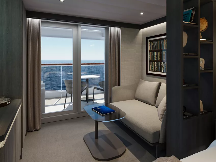
Our Ocean Terrace Suites are amongst the largest entry-level suites in the industry. Each one has floor-to-ceiling windows, and a private sun terrace featuring a dining table and a daybed, allowing guests to feel closer to the ocean as it carries them on their journey.
All Ocean Terrace Suites include elegant lounge areas, private refrigerated mini bar – replenished according to the guests’ preferences, espresso machine, kettle and teapot with a complimentary selection of coffee and teas and feature spacious walk-in wardrobes with a seated vanity area.
Features
- Oversized floor-to-ceiling windows with views of the sea
- Lounge area with coffee/dining table
- In-suite welcome bottle of champagne
- Private refrigerated minibar, replenished according to the guests’ preferences from a selection of alcoholic and non-alcoholic beverages
- Espresso machine, kettle and teapot with a complimentary selection of coffee and teas
- Complimentary personal refillable water bottle for each guest
- Pair of binoculars for guests’ use during their journey
- Safe accommodating most tablets and laptops
- Steamery steamer for effortless garment care
Outdoors
- Spacious oceanfront terrace with a dining area
- Comfortable daybed for relaxation
- Terrace Area: 7 sqm
Bedroom
- Bespoke king-sized bed sleep system - size: 180 x 200 cm (71 x 79 in)
- Some suites feature twin beds – size: 2 x 90 x 200 cm (35 x 79 in)
- Some suites feature a sofa bed
- Down duvets and pillows
- Fine bed linens
- Extensive pillow selection
- Spacious walk-in wardrobe with a seated vanity area
Bathroom
- Spacious bathroom with a walk-in shower and heated floors
- Plush bathrobes and bath linens
- Mandala Blue custom bath toiletries and amenities for Explora Journeys
- Dyson SupersonicTM hairdryer and illuminated make-up/shaving mirror
- Some suites feature bathtubs
*All images are a combination of photography and artist renderings.
The artist representations and interior decorations, finishes, and furnishings are provided for illustrative purposes only.


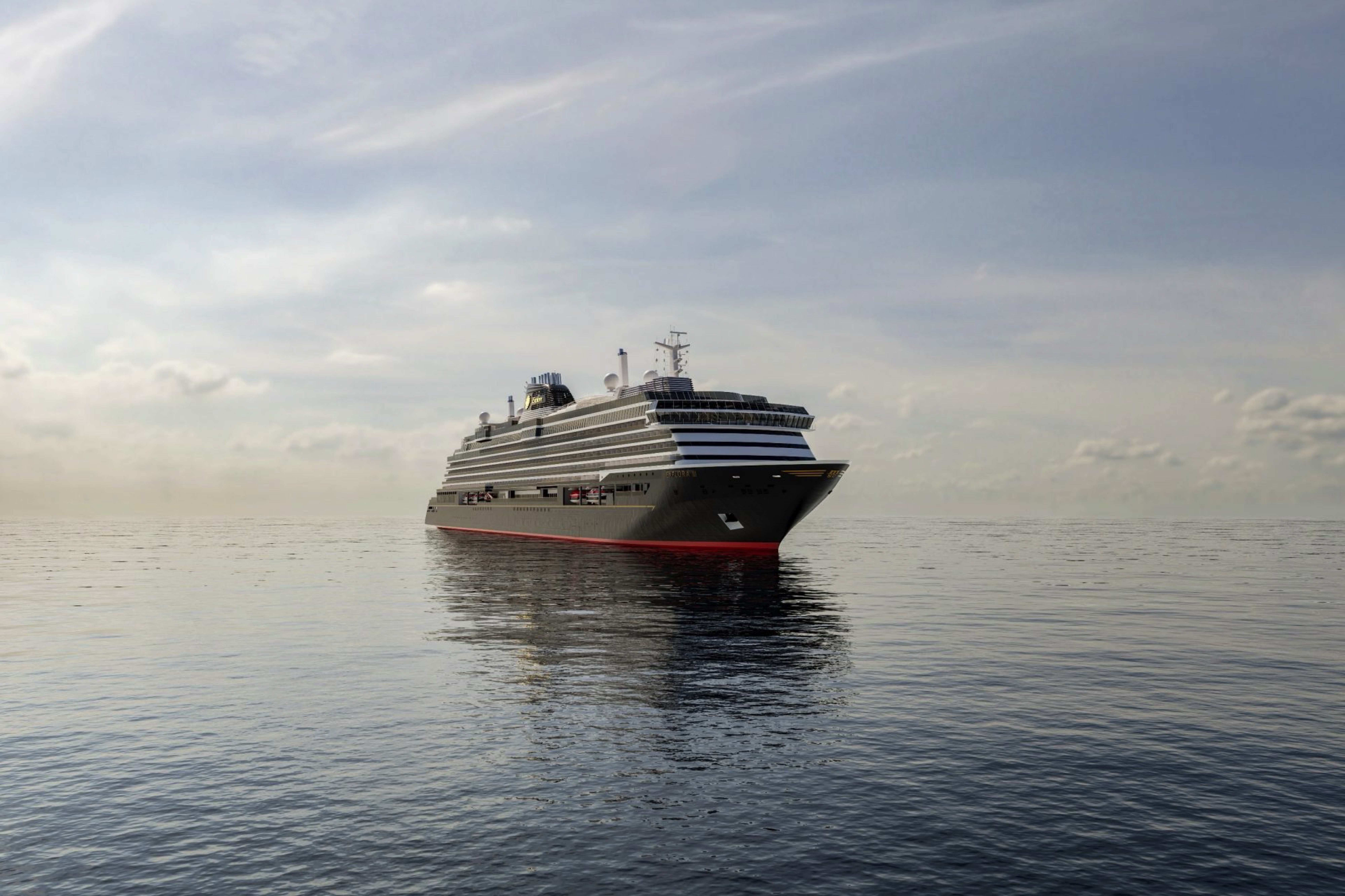
EXPLORA III
Designed to evoke the feeling of being onboard a private yacht, EXPLORA III – the newest addition in our modern fleet of luxury ships, sailing in Summer 2026 – offers a haven at sea. A floating home-away-from-home, where thoughtful design and an abundance of space create an atmosphere of effortless elegance.
At the heart of the experience are our spacious Homes at Sea. Each of our Ocean Suites, Penthouses, and Residences is a truly serene retreat, featuring floor-to-ceiling windows bathing the space in light, opening onto generous private terraces, complete with daybeds and a dining area, seamlessly blending indoor and outdoor living. Inside, every detail has been considered, including a walk-in wardrobe with seated vanity area, luxurious bathrooms with custom toiletries, fine linens, and the effortless, impeccable service of our Perfect Hosts.
Elsewhere, the ship’s sprawling outdoor decks and wealth of beautifully designed public spaces ensure discerning travellers are able to unwind, connect, or take in ocean views at every opportunity.
Explora Journeys’ signature culinary concepts, beloved onboard EXPLORA I and II – such as Anthology, Sakura, Fil Rouge, Med Yacht Club, Marble & Co. Grill – return to elevate the dining experience, complemented by unexpected new offerings.
Throughout the journey, guests benefit from a vast array of signature inclusive experiences, carefully curated to elevate every moment. From award-winning culinary offerings and vibrant bars and lounges to ocean-inspired wellness and meticulously curated entertainment, every aspect is tailored to inspire and delight.
Ocean Wellness, our bespoke ocean-inspired wellness concept, has been thoughtfully reimagined, now encompassing a single, harmonious space designed to soothe and rejuvenate. The new wellness area includes Ocean Wellness – The Spa, a tranquil sanctuary offering experiences inspired by the power of the sea, as well as a state-of-the-art Fitness Centre and Fitness Studio, created in partnership with Technogym and featuring the most advanced training equipment. Completing the fitness experience is the one-of-a-kind Open Air Fitness space on Deck 14, where guests can train outdoors while taking in the views across the water.
The Nautilus Club on EXPLORA III has been enhanced with dedicated spaces and thoughtfully curated experiences for teens and children, where a team of expert hosts will make sure to create unforgettable moments for younger guests.
Crafted with sustainability in mind, EXPLORA III is the first LNG-powered ship in our fleet, reflecting our conscious approach to modern ship design, embodying the harmony of innovation, and our deep care for the oceans and the unique destinations that we explore.
Ship Facts
| Launch Year | 2026 | ||||||
| Refit Year | |||||||
| Language | en | ||||||
| Gross Tonnage | 72810 | ||||||
| Length | 268 | ||||||
| Width | 32 | ||||||
| Currency | EUR | ||||||
| Speed | 18 | ||||||
| Capacity | 1473 | ||||||
| Crew Count | 640 | ||||||
| Deck Count | 11 | ||||||
| Cabin Count | 463 | ||||||
| Large Cabin Count | N/A | ||||||
| Wheelchair Cabin Count | N/A | ||||||
| Electrical Plugs |
|
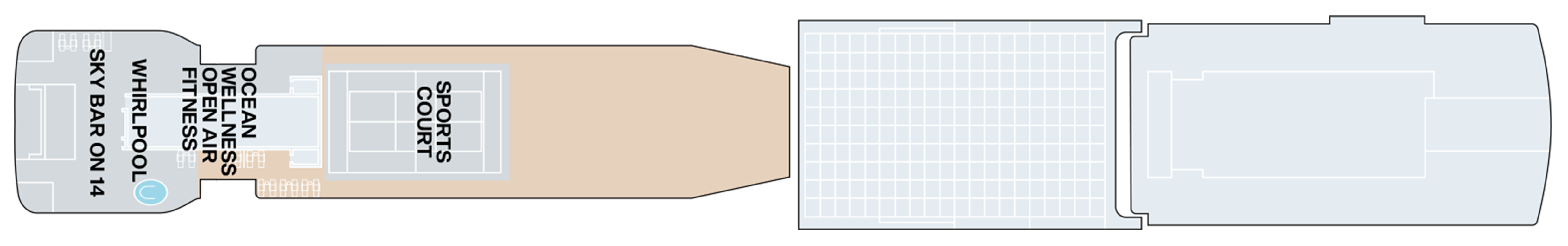
Deck 14
- Sports Court
- Whirlpool
- Sky Bar on 14
- Ocean Wellness Open Air Fitness
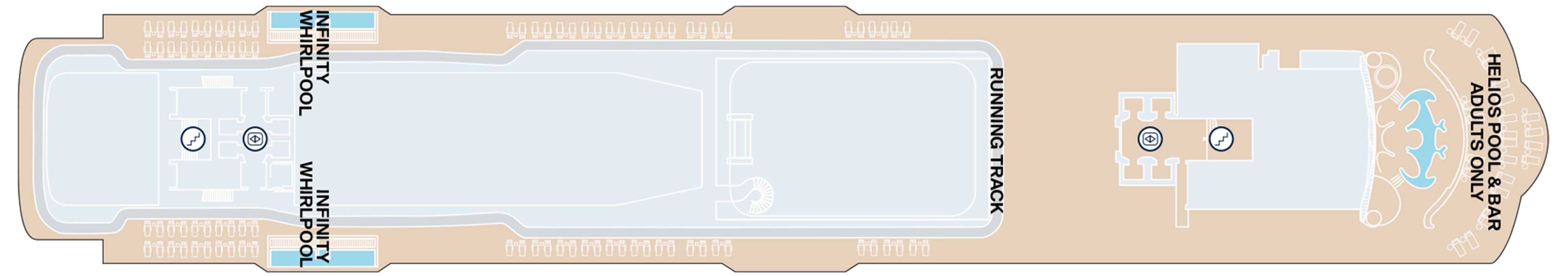
Deck 12
- Helios Pool & Bar (Adults Only)
- Running Track
- Infinity Whirlpools
Deck 11
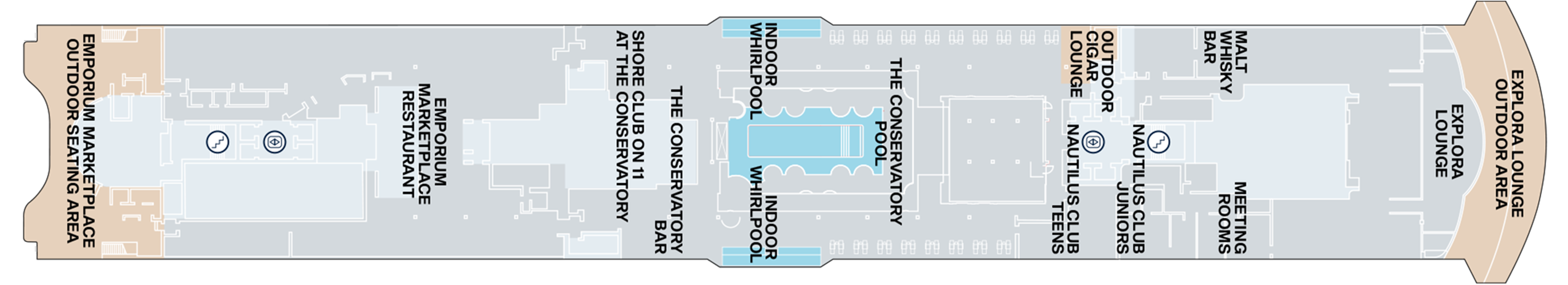
- Explora Lounge Outdoor Area
- Explora Lounge
- Malt Whiskey Bar
- Meeting Rooms
- Nautilus Club Teens
- Nautilus Club Juniors
- Outdoor Cigar Lounge
- The Conservatory Pool
- Indoor Whirlpools
- The Conservatory Bar
- Shore Club On 11 At The Conservatory
- Emporium Marketplace Restaurant
- Emporium Marketplace Outdoor Seating Area
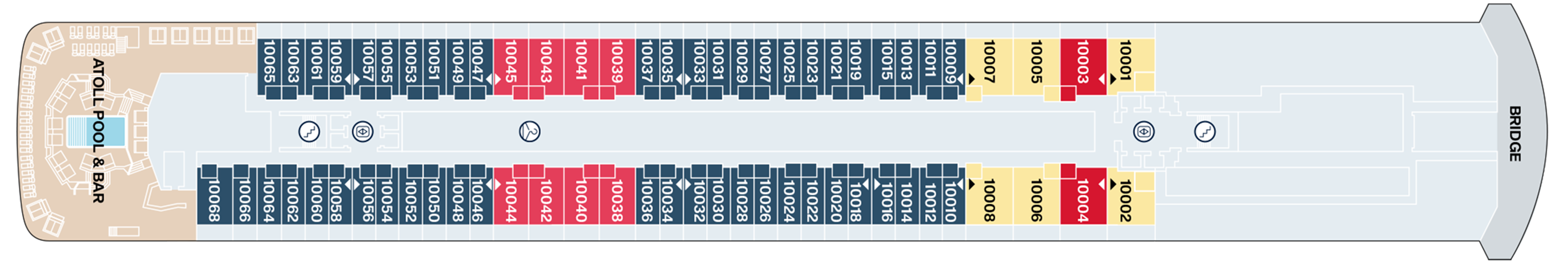
Deck 10
- Atoll Pool & Bar
- Grand Penthouse
- Cove Residence with Private Whirlpool
- Premier Penthouse
- Ocean Terrace Suite
- Bridge
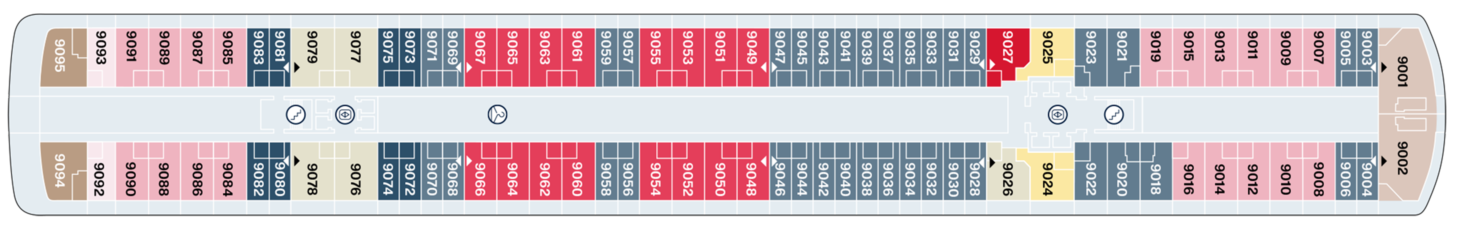
Deck 9
- Retreat Residence
- Cove Residence with Private Whirlpool
- Cove Residence
- Grand Penthouse
- Premier Penthouse
- Deluxe Penthouse
- Ocean Terrace Suite
- Penthouse
- Serenity Residence
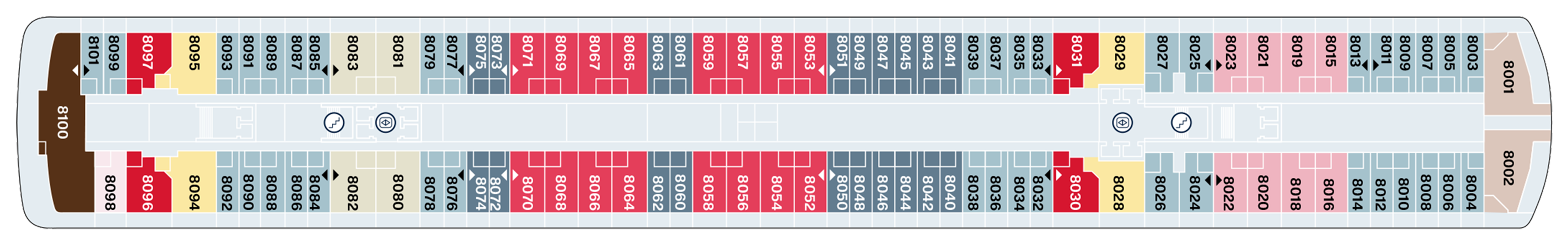
Deck 8
- Owner's Residence
- Retreat Residence
- Ocean Terrace Suite
- Cove Residence with Private Whirlpool
- Cove Residence
- Deluxe Penthouse
- Penthouse
- Premier Penthouse
- Grand Penthouse
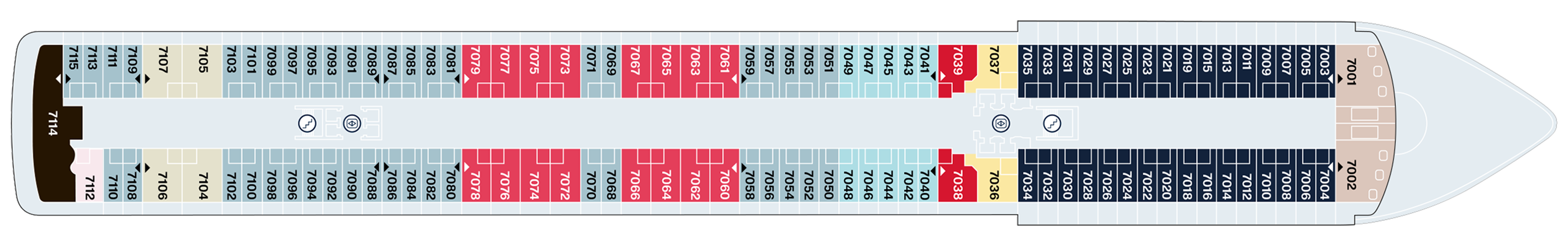
Deck 7
- Retreat Residence
- Ocean Grand Terrace Suite
- Ocean Terrace Suite
- Grand Penthouse
- Cove Residence
- Penthouse
- Owner's Residence by Patricia Urquiola
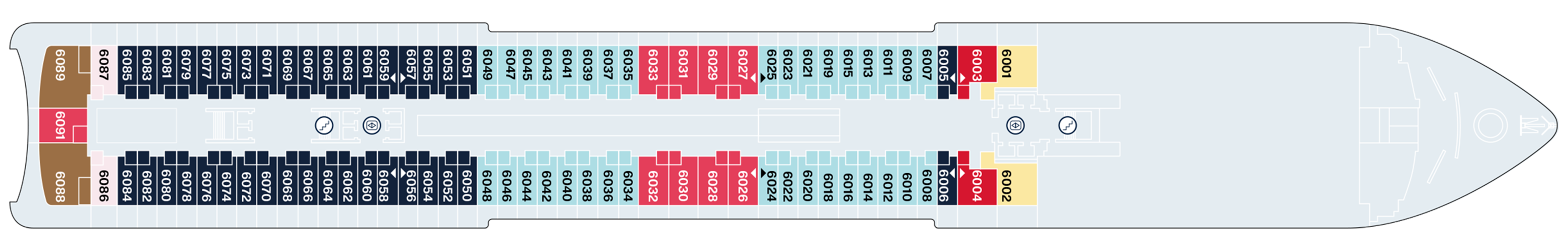
Deck 6
- Ocean Grand Terrace Suite
- Ocean Terrace Suite
- Premier Penthouse
- Penthouse
- Grand Penthouse
- Cocoon Residence Penthouse
- Cove Residence with Private Whirlpool
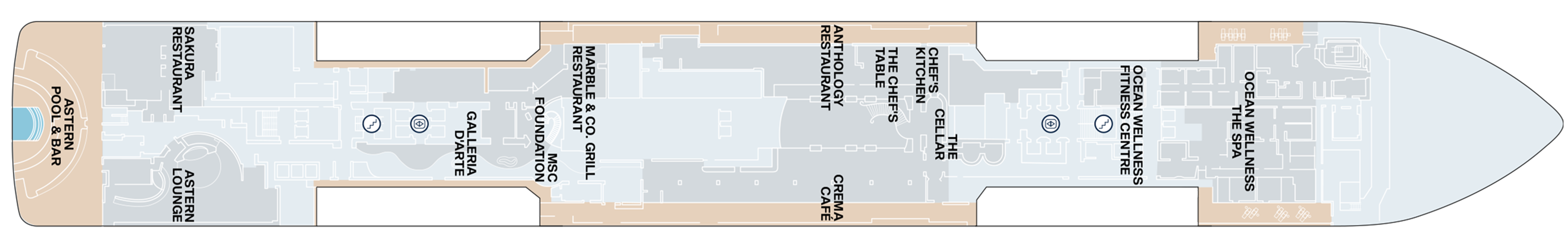
Deck 5
- Astern Pool & Bar
- Sakura Restaurant
- Astern Lounge
- Galleria D'Arte
- MSC Foundation
- Marble & Co. Grill Restaurant
- Anthology Restaurant
- Crema Café
- The Chef's Table
- Chef's Kitchen
- The Cellar
- Ocean Wellness Fitness Centre
- Ocean Wellness The Spa
Deck 4
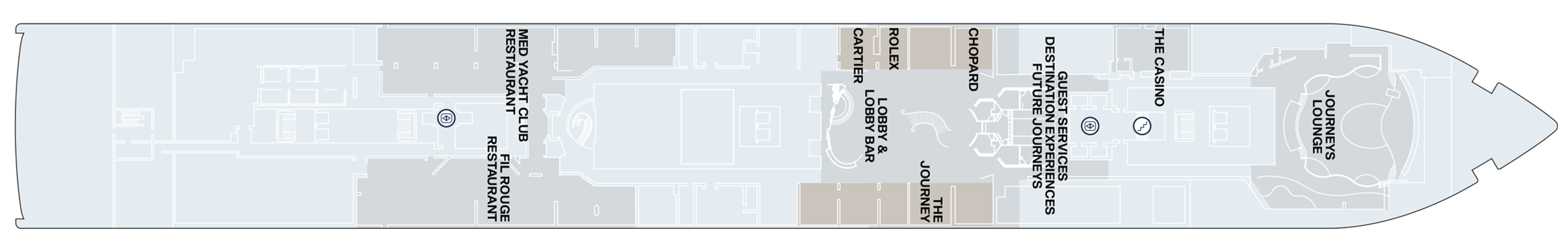
- Journeys Lounge
- The Casino
- Guest Services
- Destination Experiences
- Future Journeys
- Chopard
- Rolex
- Cartier
- Lobby & Lobby Bar
- The Journey
- Med Yacht Club Restaurant
- Fil Rouge Restaurant
Deck 3
- Medical Centre

A Diversity of Culinary Riches through Nine Distinct Dining Experiences
Worldly, sophisticated, and well-travelled, our food and beverage experts bring an abundance of experience and artistry to the curation of our immersive, onboard dining experiences. Seasonal and soulful, each dish and drinks tells a story, elevating our culinary offering to an unforgettable experience at sea.
All Journeys Include:
In-suite bottle of champagne and spirit of guests’ choice on arrival
Authentic, cultured and intuitive service from our team of hospitality experts
Nine distinct culinary experiences, including in-suite dining: Emporium Marketplace, Sakura, Marble & Co. Grill, Med Yacht Club, Fil Rouge, Crema Café, Gelateria & Creperie at The Conservatory, Explora Lounge.
For fine wine and spirits connoisseurs or those wishing to elevate their experience, an ultra-exquisite selection of wines, spirits, and liqueurs, is also available to purchase.
Anthology
A Gastronomic Discovery
Taking guests on a unique culinary journey through Italy.
Refined Italian Cuisine
As our signature fine-dining experience, Anthology elevates Italian cuisine, offering an unparalleled gastronomic adventure.
From the renowned flavours of Piedmont’s truffle-rich countryside in the North, to the famed specialities of Italy’s South, each plate celebrates the local produce and time-honoured techniques of every region in Italy.
The menu is an ingenious display of creativity – a vibrant tapestry of regional flavours and authentic ingredients which invites guests to immerse themselves in the different styles and tastes of Italy’s universally loved cuisine.
Contemporary, Refined Elegance
With the opportunity to dine outdoors, Anthology offers an intimate yet elevated dining atmosphere with flawless, attentive service.
- Indoor seating: 48
- Outdoor seating: 22
- Open for dinner
- Reservations recommended
- An Exclusive Experience Fee Applies
- Located on Deck 5
Sakura
An immersive, authentic dining experience offering the finest Pan-Asian cuisine
Named after the cherry blossom - the national flower of Japan - and symbolic of renewal and optimism, Sakura offers Japanese, Thai, Vietnamese, and Malaysian flavours for a taste of Pan-Asian cuisine that is both authentic and energising.
The space takes inspiration from Japan’s rich cultural heritage blended with distinct Japanese design cues, to create an intimate and welcoming environment. The ancient tea rooms of Kyoto provide the inspiration for Sakura's aesthetic, where dark wood frames lead your eye to the ceiling, adorned with a blossom tree canopy which envelops diners in a warm atmosphere of festoon lights.
Authenticity extends to the kitchen, where chefs follow traditional techniques – using only the very best carefully sourced ingredients.
Expansive ocean views, a Sake sommelier, Asian-influenced beverages - including a curated selection of sakes and shōchū - combined with seamless further enhance the experience.
Signature Dishes at Sakura
Wagyu beef tataki, wakame salad, smoked Madagascan pepper
Our sustainably sourced prime grade five Japanese wagyu beef is delicately torched by our chefs: an authentic method of cooking that ensures that the cut's best qualities are preserved.
Makrut lime pavlova, mango brunoise, passion fruit, mango sorbet
A fusion of east and west, this unique interpretation of pavlova is a perfect representation of the passionate, creative expertise and multicultural diversity of our talented pastry team .
Kale salad
Another example of our chefs’ ingenuity, a humble kale salad is transformed into culinary art for our guests to enjoy. This superfood salad represents a fusion of clean living with the flavours of Asia.
- Indoor seating: 92
- Outdoor seating: 26
- Open for lunch and dinner
- Reservations recommended
- The Sushi Bar is open-seating on a first come first served basis.
- Located on Deck 5
Marble & Co. Grill
Inspired by the marbling found in only the finest beef, Marble & Co. Grill serves exceptional cuts, personally sourced and sustainably farmed.
The menu has been designed to take guests on a journey of discovery, with sumptuous, rare meats sourced for their flavour and distinctive provenance. More than a steakhouse, Marble & Co is the realisation of a vision where careful attention to ingredients and passion for cooking come together to create a truly special dining experience.
This redefined European steakhouse experience is reflected through the modern, understated yet sophisticated design with soft lighting and relaxed, attentive service. The experience is augmented by an in-house dry ager and a cellar boasting a superb selection of fine wines.
Signature Dishes at Marble & Co. Grill
Grilled prime rib, aged 30-days, cherry tomatoes, Hollandaise sauce
Provenance and quality take centre stage, to create the finest version of a steakhouse classic. From a local producer in Deux Sévres region of the lush Loire Valleé, it’s clear why the famous Jersiaise breed, renowned for its sensational flavour and intense marbling, is one of the most sought-after cuts or prime rib. To truly appreciate this beautiful cut, it is topped simply with cherry tomatoes and a sumptuous Hollandaise sauce.
Crushed fingerling potatoes, Le Beurre Bordier butter from Normandy, Calvisius Oscietra caviar, crème fraîche, chives
A simple dish executed with the finest ingredients. The crushed fingerling potatoes are made with Bordier butter, arguably, the finest butter in the world, served only in the finest establishments. Potatoes are topped with Calvisius Oscietra caviar, known the world over for being some of the best quality caviar available; the caviar is sustainably produced in Italy, in an area rich with fresh spring water, contributing to its high quality and low-salt flavour.
- Indoor seating: 80
- Outdoor seating: 10
- Open for dinner
- Reservations recommended
- Located on Deck 5
Med Yacht Club
A relaxed celebration of the flavours, ambience and la dolce vita of the Mediterranean.
Inspired by sailings across crystal clear waters, the Med Yacht Club is influenced by sophisticated, beachside Mediterranean restaurants, embracing the varied cuisines of the region.
Effortlessly refined in its design, space creates a relaxed, convivial atmosphere, where bright sunshine streams through large portholes and Med-influenced music transports guests on a culinary journey inspired by the sea.
Infusing the tastes and textures of Italy, Spain, Greece, France, and North Africa – while incorporating plant-based, vegetarian and wholesome ingredients – the menu serves sharing plates for guests to enjoy with friends and family alike.
Wines too showcase the rich vineyards of the Mediterranean, with fresh juices and cocktails honouring regional produce.
Signature Dishes at Med Yacht Club
Grilled octopus, San Marzano tomato sauce, Taggiasca olives, green beans, parsley
If ever there were a singular dish to represent the importance provenance plays in the ingredients used onboard Explora Journeys, then this is surely it. Sharp sundried Taggiasca olives compliment the sweet San Marzano tomatoes, creating a perfectly balanced bed for the expertly grilled, sustainably sourced octopus.
Sweet caprese with cherry tomatoes, strawberries, burrata, pesto
A true representation of the creativity and skill of our chefs, this sweet interpretation of an Italian classic will surprise and delight in equal measure. The finest cherry tomatoes and strawberries create an intriguing base, upon which our burrata sits adorned with even more sweet tomatoes and strawberries with a drizzle of pesto from Sicilian Bronte pistachios.
- Indoor seating: 136 (34 at the bar)
- Open for lunch and dinner
- Located on Deck 4
Emporium Marketplace
Energetic all-day dining, celebrating the finest flavours from across the globe.
Drawn from the Greek word emporion (ἐμπόριον), an Emporium is defined as a place offering many different things.
Onboard Explora Journeys, the Emporium Marketplace draws on this origin, providing an effortless all-day dining space, bringing global culinary talent and produce to the fore. Offering diverse cuisines with a focus on quality, Emporium Marketplace allows guests total flexibility in what they choose to eat, and when.
Bathed in natural light, several separate cooking stations evolve throughout the day with white marble and minimalist design accents, allowing the freshest ingredients to take centre stage.
Dishes include sushi, fresh seafood and a daily rotisserie offering grilled, roasted, and slow-cooked meats. Pasta is cooked to order, and freshly baked pizzas and bread are on offer as are home-made sandwiches. Charcuterie, fromagerie, boulangerie and patisserie stations add even more choice.
A selection of wines, champagne and beverages are also available to complement meals throughout the day.
Signature Dishes at Emporium Marketplace
Handmade tortelloni, ricotta cheese, spinach, tomato-sage butter
It’s often the simplest dishes that take great skill. Our tortelloni are made onboard from scratch every day in the authentic Italian way. Carefully selected flour is used to make dough that has the correct degree of elasticity; this is essential to giving the tortelloni their mouth-watering light and silky texture.
Plant based chia yoghurt
Our chia yoghurt is daily made from homemade cashew milk, creating a fusion of delicious creamy flavours for guests to enjoy each morning.
- Indoor seating: 271
- Outdoor seating: 70
- Open for breakfast, lunch and dinner
- Located on Deck 11
Fil Rouge
A global tasting tour to French-inspired international cuisine.
A common red thread that unites international flavours with a French influence. Fil Rouge is a sophisticated and intimate restaurant, offering a global tasting tour of French-inspired international cuisine, where guests are encouraged to take their time to appreciate both the cuisine and the intimate ambience.
A universal, timeless dining experience, Fil Rouge is a visual articulation of the fundamentals of elegance. Intricate hexagons representing the simplest expression of perfection contrast with clean white walls adorned with inspiring works of art.
An elegant dessert cart tempts with the freshest creations served tableside, and a superb wine selection showcases the best of both the Old and New World vineyards.
Signature Dish at Fil Rouge
Tuna tataki, crispy tomato-olive tart, vegetables, vanilla white pepper
Sustainably raised and caught in the open Mediterranean Sea close to the Cartagena Bay, the Mediterranean Bluefin tuna sourced by our chefs is some of the best grade to be found anywhere in the world.
- Indoor seating: 222
- Open for breakfast and dinner
- Located on Deck 4
Chef's Kitchen
Offering an enriching, hands-on culinary experience set within an intimate, ocean-front private kitchen.
The Chef’s Kitchen offers a range of enriching, hands-on culinary experience set within an intimate, ocean-front private kitchen.
Guided by our team of world-class chefs, immersive and interactive cooking classes invite guests of all skill levels to embrace the art of creating exquisite dishes – step by step, side by side with culinary masters and fellow travellers.
With intuitive guidance and a dash of playfulness, guests explore new techniques, uncover inspired flavour pairings, and work with beautifully curated ingredients that reflect the spirit of the sea and the lands we sail through. More than a cooking class, it’s a social and sensory celebration – where learning is joyful, conversation flows freely, and food is savoured in good company.
Each experience culminates in the nearby private dining room, where the class – guests and chefs alike – gathers to enjoy the dishes they’ve prepared together.
- Indoor seating: 12
- An exclusive experience fee applies
Shore Club on 11 at The Conservatory
A relaxed yet refined poolside setting where sun, warmth, and flavour come together. Freshly prepared favourites and vibrant bites influenced by sun-soaked coastal traditions are served in a laid-back, light-filled space perfect for unhurried moments and lingering afternoons. Inspired by carefree summer days by the sea, the coastal vistas, the glow of the sun, and the simple pleasures of elevated poolside dining.
The Chef’s Table by Explora Journeys
An exclusive one-of-a-kind experience where dining becomes a dialogue between taste and intention – intimate, expressive, and entirely your own. Reserved for those who seek privacy, personalisation, and the pleasure of curation, this experience invites guests to collaborate closely with our chefs to craft a fully bespoke menu, transforming preferences, stories, and inspirations into a one-of-a-kind culinary journey to share with the people you love. Whether hosting a meaningful celebration or a a private evening with loved ones, the experience is personally prepared and presented by our chefs – with every dish created with care and presence.
In-Suite Dining
Refined dining in the comfort of your suite or private terrace
Our guests can enjoy an array of cuisines at any time, day or night, in the comfort of their suite or private terrace. Available 24 hours, the menu offers guests a taste of each of our unique dining destinations.
- Available 24 hours
An elegant, cosmopolitan atmosphere in which to discover, enjoy and appreciate diverse flavours and talents from around the world
Our Bars & Lounges offer the perfect blend of vibrancy and privacy across more than 12 indoor and outdoor settings.
Reimagining Entertainment & Enrichment at Sea
Curated entertainment designed to stimulate the mind. Every aspect of the programme onboard Explora Journeys is thoughtfully curated to meet the needs of the curious, discerning traveller.
The ultimate luxury shopping experience at sea
Immerse yourself in opulence, exploring our exclusive boutiques featuring Rolex, Cartier, Panerai, Piaget and Buccellati. Icons of craftsmanship that reflect Explora Journeys' European heritage and commitment to excellence.
Casino
Explore the intimate, elegant space of The Casino and its diverse gaming offerings: from thrilling poker and blackjack tables to the excitement of American roulette, baccarat elegance, and the chance to hit it big with progressive slot machines.
Journeys Lounge
Mixology, enrichment and entertainment continuously evolving throughout the day.
The most spacious onboard lounge features mixology specialists, enrichment activities and cabaret-style entertainment daily. This venue is designed to continuously evolve and transform throughout the day along with the ocean journey.
- Indoor seating: 210
- Located on Deck 4
Explora Lounge
A luminous lounge offering spectacular 270-degree views of the ocean, a spectacular backdrop to informal drinking and dining.
Explora Lounge is a central meeting place bathed in natural bright light, where guests can watch the world sail by as they enjoy light meals, snacks, and traditional afternoon tea. Perfect for a quiet moment to read, work or sip a coffee, or simply admire the beautiful sea-facing views which instantly ease the mind into a calming space.
Cool and soothing background music during the day is transformed into a jazz and piano bar at night. This is the perfect soundtrack to your journey paired with a sunset aperitivo in hand.
Guests can enjoy light meals, snacks, traditional afternoon tea, along with inventive modern cocktails barista-made coffees, loose leaf teas, smoothies, and fresh pressed juices.
- Indoor seating: 149
- Outdoor seating: 38
- Located on Deck 11
Astern Pool & Bar
An all-day pool and outdoor lounge at the water's edge.
An all-day lounge next to the infinity pool, ideal for a waterfront escape offering chilled beach club vibes, with low background music by day and acoustic musicians and DJs as the sun sets, continuing throughout the evening.
Outdoor dining is available from nearby restaurant, Sakura in the form of nutritious bento boxes, conveniently served seated at a table, a lounger or a poolside sunbed.
- Outdoor seating: 122 (Includes sunbeds, lounge chairs and bar seating)
- Located on Deck 5
Astern Lounge
An all-day lounge and oceanfront escape opening onto the Astern Pool.
The Astern Lounge is the social hub of any journey, with a collection of daily events and happenings suited to every taste.
Effortlessly transitioning throughout the day, Astern Lounge hosts live music, DJ sessions and enrichment insights with a collection of handpicked tastemakers. Coming to life at sundown, the lounge perfects the aperitivo through a nightly ritual celebrating golden hour, complemented by live entertainment.
- Indoor seating: 70
- Located on Deck 5
The Conservatory Pool & Bar
The Conservatory is a weather-protected poolside lounge by day, transforming into a silent cinema experience under the stars by night. A relaxed, calming venue to unwind and enjoy cocktails, with light, calming music playing throughout the day.
The Conservatory reveals a calm and spacious expression of our all-weather pool and lounge. The increased space introduces a gentle sense of ease, with wide sightlines, soft natural tones, and a glass canopy that washes the room in soft daylight.
Airy, spacious, and quietly zen, The Conservatory on EXPLORA III offers a renewed feeling of balance and relaxation.
- Indoor seating: 52
- Located on Deck 11
Lobby Bar
A centrally-located social bar and lounge.
A central gathering social bar and lounge, amongst high-end boutiques, provides the ideal spot to enjoy refreshments throughout the day and night.
- Indoor seating: 40
- Located on Deck 4
Atoll Pool & Bar
An intimate pool with a chilled vibe throughout the day.
Here, guests can enjoy the sun, sea and serenity along with sunny, sparkling and colourful drinks.
- Outdoor seating: 138 (Includes sunbeds, lounge chairs and bar seating)
- Located on Deck 10
Malt Whisky Bar
A refined tour across the globe’s most celebrated whiskey regions.
Set within the Explora Lounge, Malt offers a refined tour of the global whisky regions, including some of the rarest whiskies, complete with a walk-in humidor, cigar expert and a dedicated outdoor cigar-smoking terrace.
Alongside its drinks menu with an emphasis on dark brown spirits the bar also features an outdoor smoking area for guests to enjoy their hand-rolled cigars*, selected with the guidance of our cigar expert. A range of signature whiskey-based cocktails are also available, curated exclusively for Explora Journeys and served accompanied by the smooth sounds of jazz.
- Indoor seating: 20
- Located on Deck 11
Crema Café
A luxurious layer of crema nods to the freshness of an espresso and aptly lends authenticity and sophistication to a café at the centre of life on board.
Inspired by modern European café culture, Crema Café has softy stylish interiors with comfortable lounge seating, with access to a choice of reading materials and all set against uninterrupted views of the sea. A place to meet, discuss, unwind, taste and indulge, where like-minded guests gather to mingle and converse.
Coffee is chosen by selected connoisseurs who have travelled the world exploring fair-trade coffee origin, character, and strength. Discover the refined methods of brewing coffee from skilled baristas, taste high-quality loose-leaf teas with an on-hand tea expert, or enjoy refreshing cold-pressed juices. A glass display showcases pastries, cakes, desserts and sweets including madeleines, cannelés, biscotti, navette sandwiches as well as gelato throughout the day.
- Indoor seating: 62
- Outdoor seating:16
- Located on Deck 5
Sky Bar On 14
Refreshing cocktails and infinite views in a sophisticated outdoor setting.
Set on the ship’s highest point, on deck 14, this panoramic outdoor lounge setting is ideal for soothing cocktails and infinite views.
- Located on Deck 14
Helios Pool & Bar
A panoramic adults-only pool and lounge experience.
Inspired by the Ancient Greek god of the sun, and also literally meaning “sun” in Greek, this adults-only area is indeed the sunniest venue onboard, panoramically facing forward on deck 12. Enjoy lying by the pool or lounging throughout the day as you watch the ship sail through the sea.
- Outdoor seating: 100 (Includes sunbeds, lounge chairs and bar seating)
- Located on Deck 12
The Cellar by Explora Journeys
Refreshingly relaxed, The Cellar by Explora Journeys creates a welcoming space where wine is enjoyed through curiosity, easy conversation, and genuine pleasure. Its collection brings together characterful Old World classics, expressive New World favourites, and a few quietly remarkable rarities.
Our Cellar Masters share their passion with an intuitive, light touch – offering guidance or a gentle surprise when the moment feels right. Whether it’s an aperitivo, a bottle carried through dinner, or a final glass with chocolate truffles, the experience feels personal, comfortable, and quietly elevated.
- Main space with 8 seats
- Private area with 4 seats
- Pricing: Options starting from EUR/USD 15–20 per glass, with a wide range of options up to rare and exceptional vintages
- Small bites and hand-crafted chocolate truffles crafted to complement the tasting experience
Events
Explora Journeys offers a diverse programme of enriching and delectable events. Designed to connect guests, hosts and luminaries.
Captain’s Log Secrets of the Sail
Guests will walk the Ship alongside the Captain or Bridge Officers. Discover how ancient seafaring methods have paved the way to the mind-boggling technology of today. Get to know the team who sail us safely around the globe.
Bal Mythos
At the stroke of midnight, guests will don handcrafted masks of local gods and goddesses. Now is the time to revel in a fully immersive club vibe as they dance to resident artists and singers.
Midnight Wayfinder
With dreamy guitar music and storytelling under the stars, guests learn how sailors have long relied on the sea, wind and sky to bring them safely to shore.
Inferno
An unforgettable nod to the glamour of Manhattan’s Studio 54, Soul Train, and Europe’s 1970s discos, where guests can let their hair down, enjoy cocktails from the era, and dance the night away.
Experiences
Unique, curated, immersive and captivating, experiences provide unforgettable moments to be savoured.
Decadence
The themes of this fabulously indulgent experience switch from lounge to lounge, with live music, immersive performances and an air of lavishness that make The Great Gatsby look second-rate.
An Evening by Candlelight
An intimate and cosy part of every Journey, guest artists, musicians and vocalists perform in the main lounges softly lit by candlelight. Experiences range from classical to movie soundtracks.
Le Jazz
Guests enjoying journeys that take in France can let go in a Parisian jazz club experience, accompanied by French martinis and canapés.
Let the Good Times Roll
Jiving to New Orleans jazz cabaret is an essential part of a Caribbean journey, with a Creole menu, absinthe cocktails and dazzling musicianship
The Journey
Inspired by the Ocean State of Mind and influenced by the destinations we visit, The Journey is more than just a place to browse.
Shop fragrance, skincare, apparel, homeware, accessories and fine foods.
Our Inspiration
Every item available is a celebration of creativity, passion, and the power of discovery, each with its own magical story to tell.
Discovery
We champion small, luxury, locally-influenced brands with unique stories to tell, inviting our guests on a journey of discovery into the diverse cultures, flavours, and skills of the visionaries in the destinations we visit.
Consciousness
We are dedicated to partnering with brands that prioritise sustainability, using regenerative, recycled, and natural materials at the heart of the production process; supporting slow fashion and waste reduction, and reducing our environmental impact.
Provenance and Craftmanship
Our products are a celebration of the artisan: skilled craftspeople, artists, smaller suppliers, and designers who pour their passion and creativity into every detail, with a focus on quality materials and finishing.
Collections
More than just a place to buy, our retail experience is a journey of discovery, consciousness, and craftsmanship with provenance. Explore our unique collection of over 30 of the finest artisanal brands that share a commitment to caring for people and planet.
Sensorial Fragrances & Skincare
Regionally inspired, our carefully selected collection of niche fragrance brands showcases the rarest and most precious natural ingredients, for a memorable sensory experience.
Effortless Ready-to-Wear
Unparalleled comfort and style, a curated collectionfor men and women, designed to envelop the wearer in effortless confidence and ease.
Homeware & Gifting
Distinct pieces, beautifully designed for aesthetics and ergonomics. The perfect tokens to take home with you or gift to a loved one following your journey.
Timeless Accessories
Crafted to perfection and designed to last a lifetime, our timeless collection spans scarves, lather goods, eyewear and lifestyle accessories.
Fine Food & Drink
Savour the essence of your travels through the finest food and beverages, carefully selected to showcase small producers, unforgettable flavours and unique stories.
ENCORE
By Explora Journeys
Pre-loved luxury, sustainably yours. Timeless icons, given new life.
Some treasures are too precious for just one story. ENCORE offers a curated collection of authenticated, pre-loved luxury bags and accessories, each with a past as unique as its future.
From rare finds to timeless icons, every piece has been lovingly restored and meticulously verified for quality and authenticity.
Our Bespoke Fragrance
Introducing Mandala Blue by Explora Journeys, the scent of the ship, curated with master perfumer Alberto Morillas.
A fragrance that relaxes, connects, awakens the senses and ultimately transforms.
Cue notes that echo the ocean with enchanting freshness, layered alongside dominant woody and spicy signatures.
Available to purchase from The Journey.
Brand Selection
We’re committed to partnering with brands who reflect our own commitment to sustainable practices and environmental consciousness. It is why we are the first retail experience on the water to seek out partners with relevant certifications, ensuring a positive approach to their production practices.
B-Corp Certified Partners
Ensuring the highest standards in social and environmental performance.
Positive Luxury – Brands to Trust
The Butterfly Mark certification is an independent, globally respected trust mark awarded to luxury brands, retailers and suppliers that meet the highest standards of verified ESG+ performance
Shops
Cartier
The Shopping Experience
A reference in the world of luxury, Cartier, whose name is synonymous with open-mindedness and curiosity, stands out with its creations and reveals beauty wherever it may lie.
On EXPLORA I, EXPLORA II and EXPLORA III, our exclusive Cartier stores offer an unrivalled opportunity to browse and discover some of the world's most beautiful hidden gems.
No appointment is required, inviting guests to spend time perusing Cartier - another Explora Journeys exclusive.
Rolex
The first Ever Rolex Boutique at Sea
As they journey through the world’s most coveted destinations, our guests have the exclusive opportunity to discover and purchase iconic Rolex timepieces at a boutique dedicated entirely to the legendary brand.
The Rolex boutique is located on board EXPLORA I and EXPLORA III and is available exclusively to Explora Journeys guests.
A Dedicated Experience
Our Rolex boutique is serviced by knowledgeable and experienced hosts trained by Rolex, ensuring a tailored shopping experience. Advice and assistance is provided with the utmost discretion to travellers whether making a purchase or simply enquiring.
Chopard
Explora Journeys introduces a new collaboration with Chopard, the world-renowned Swiss Maison of luxury watches and high jewellery. Known as “The Artisan of Emotions,” Chopard is celebrated for its exceptional craftsmanship, creativity, and refined elegance. Guests on board EXPLORA III will be invited to discover a curated selection of timepieces and jewellery through a bespoke shopping experience at sea.