
An Extended Journey to Gorgeous Greece and Painted Shores
An Extended Journey to Gorgeous Greece and Painted Shores
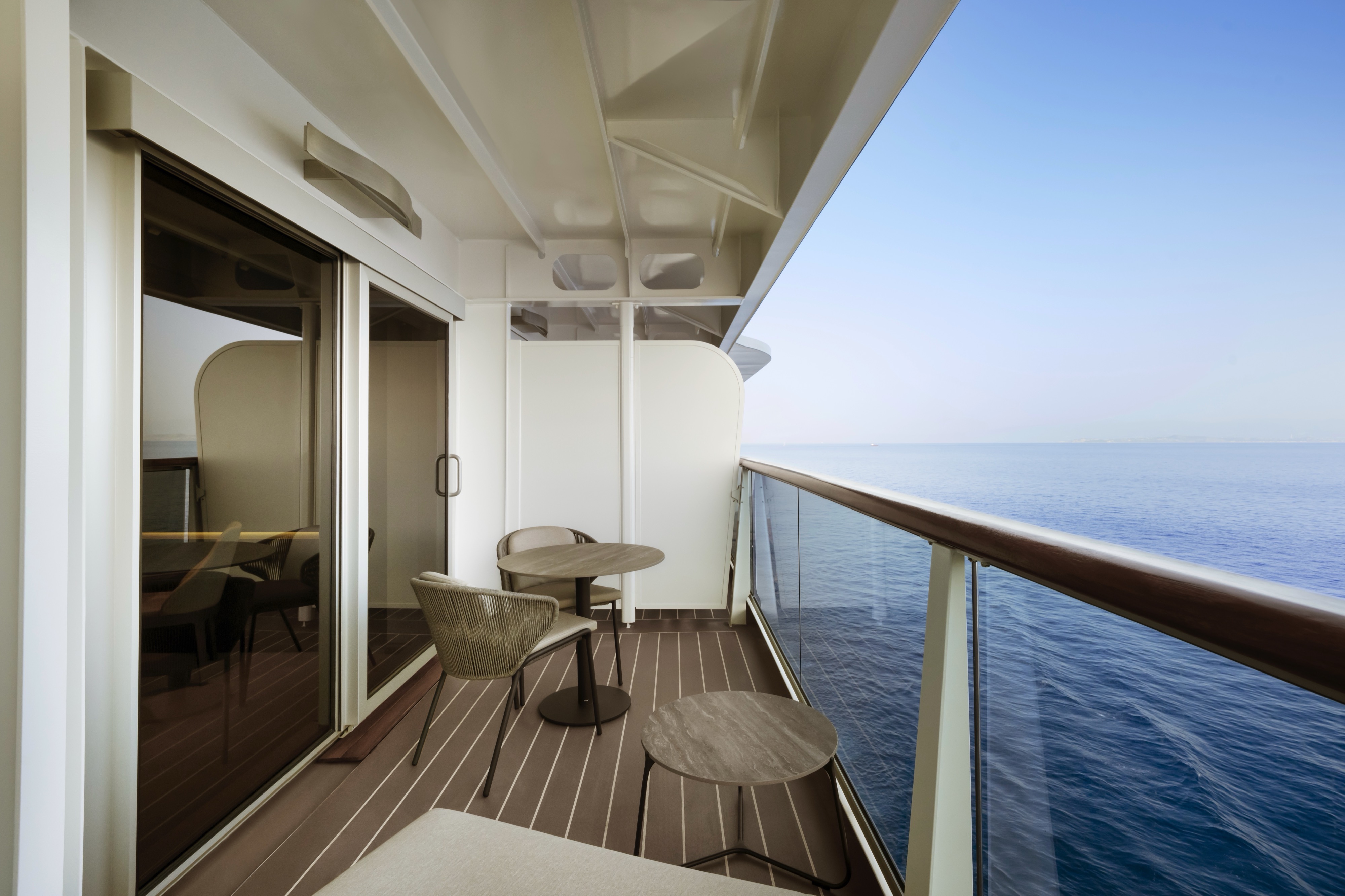
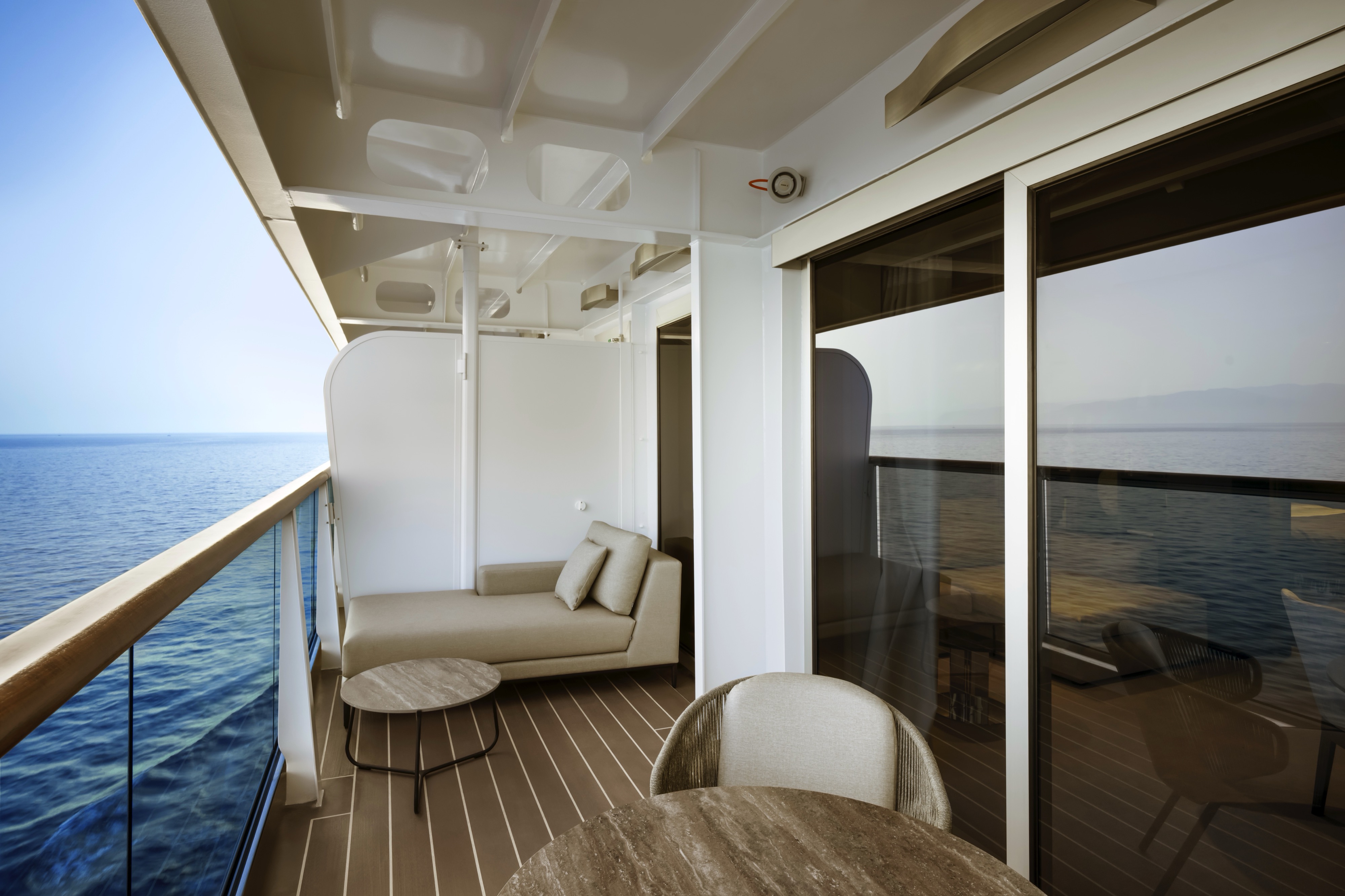
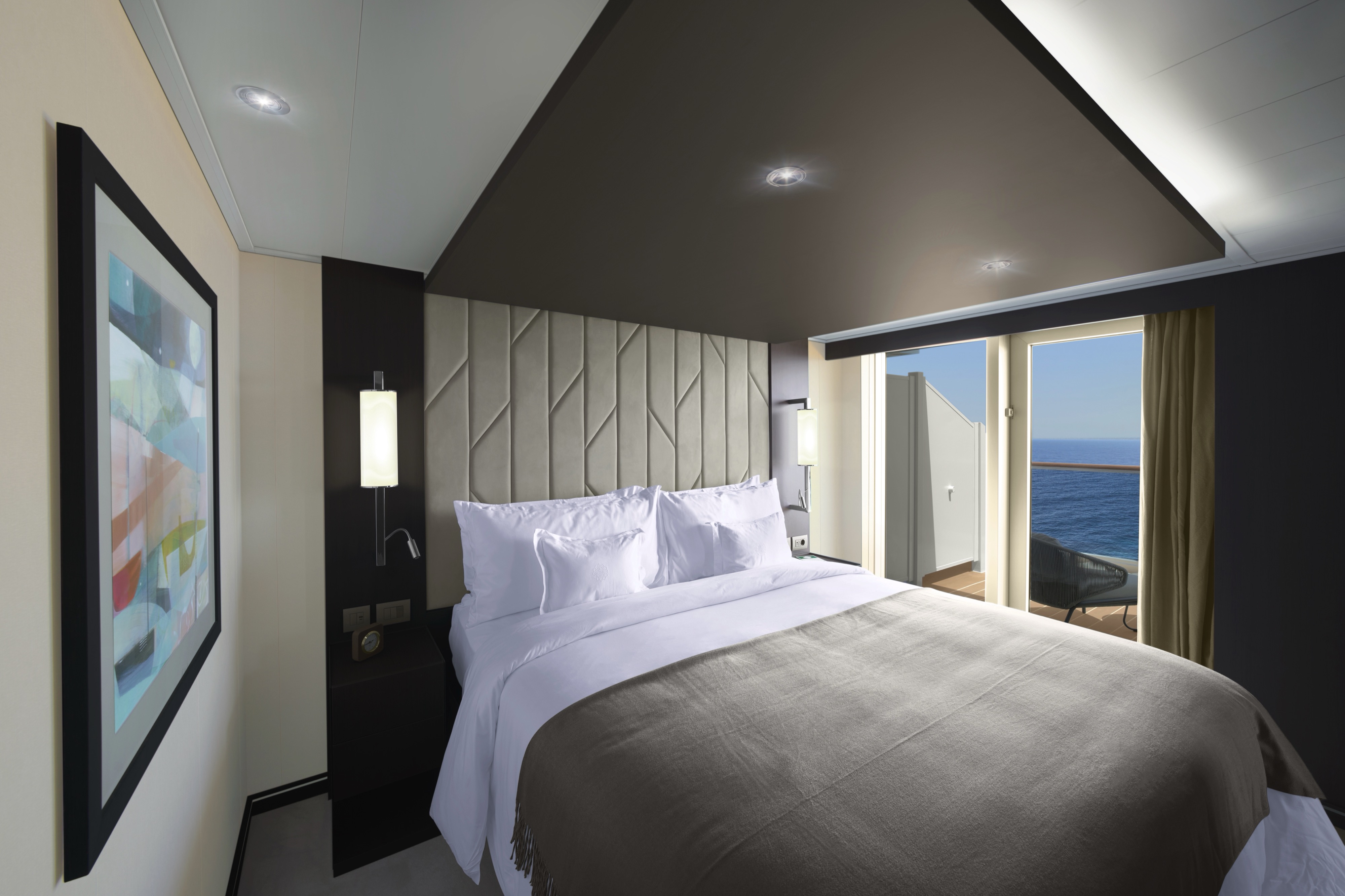
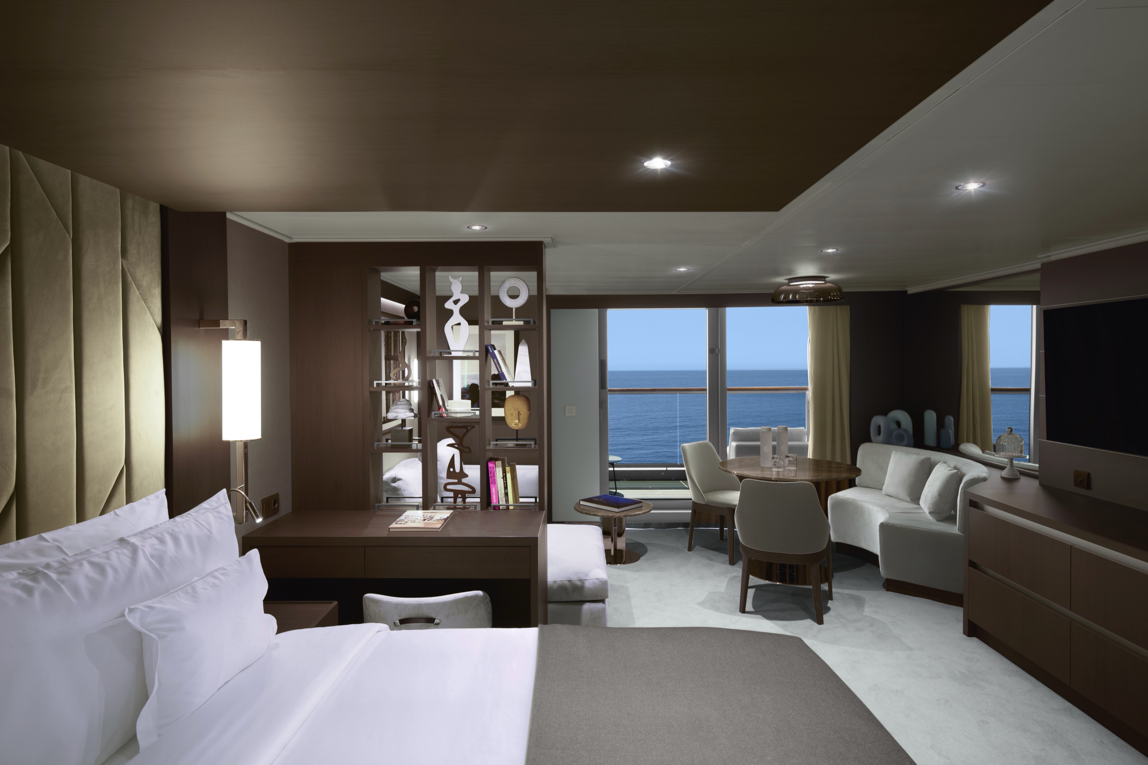
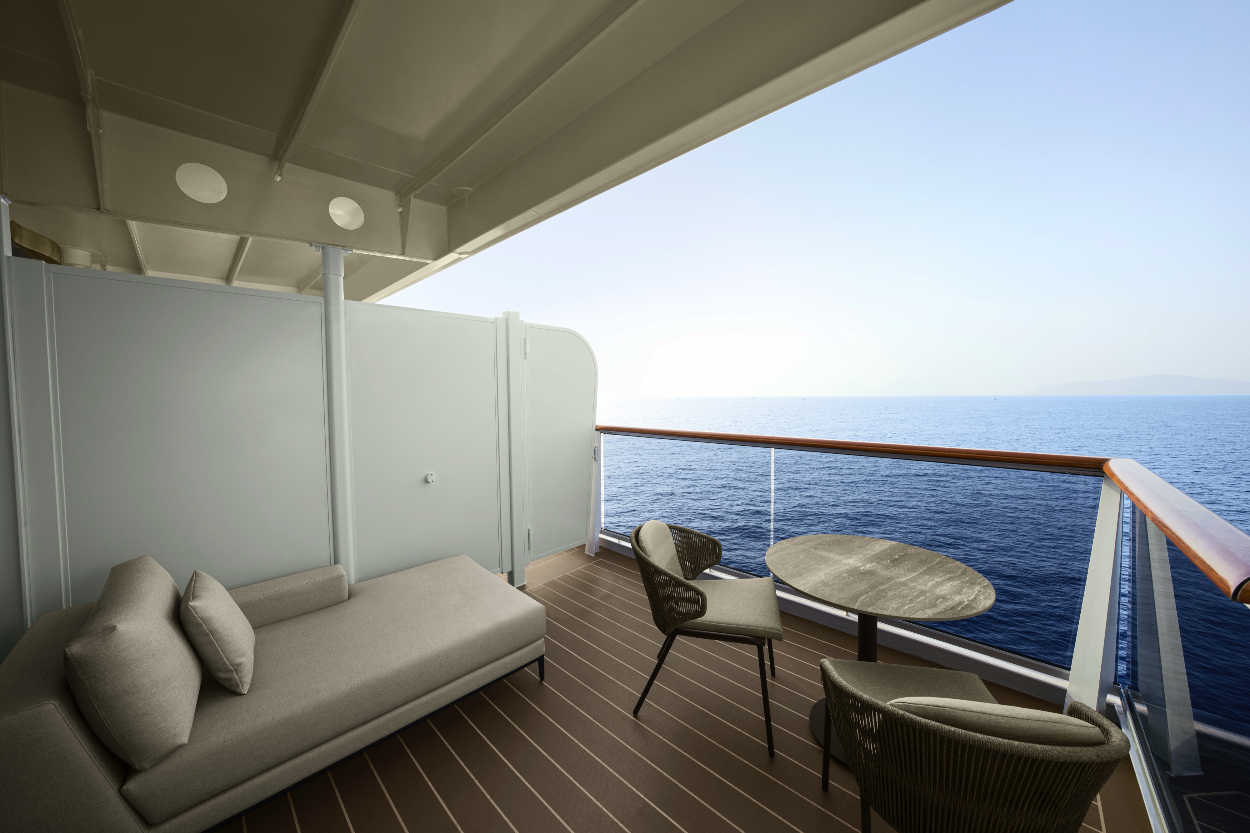
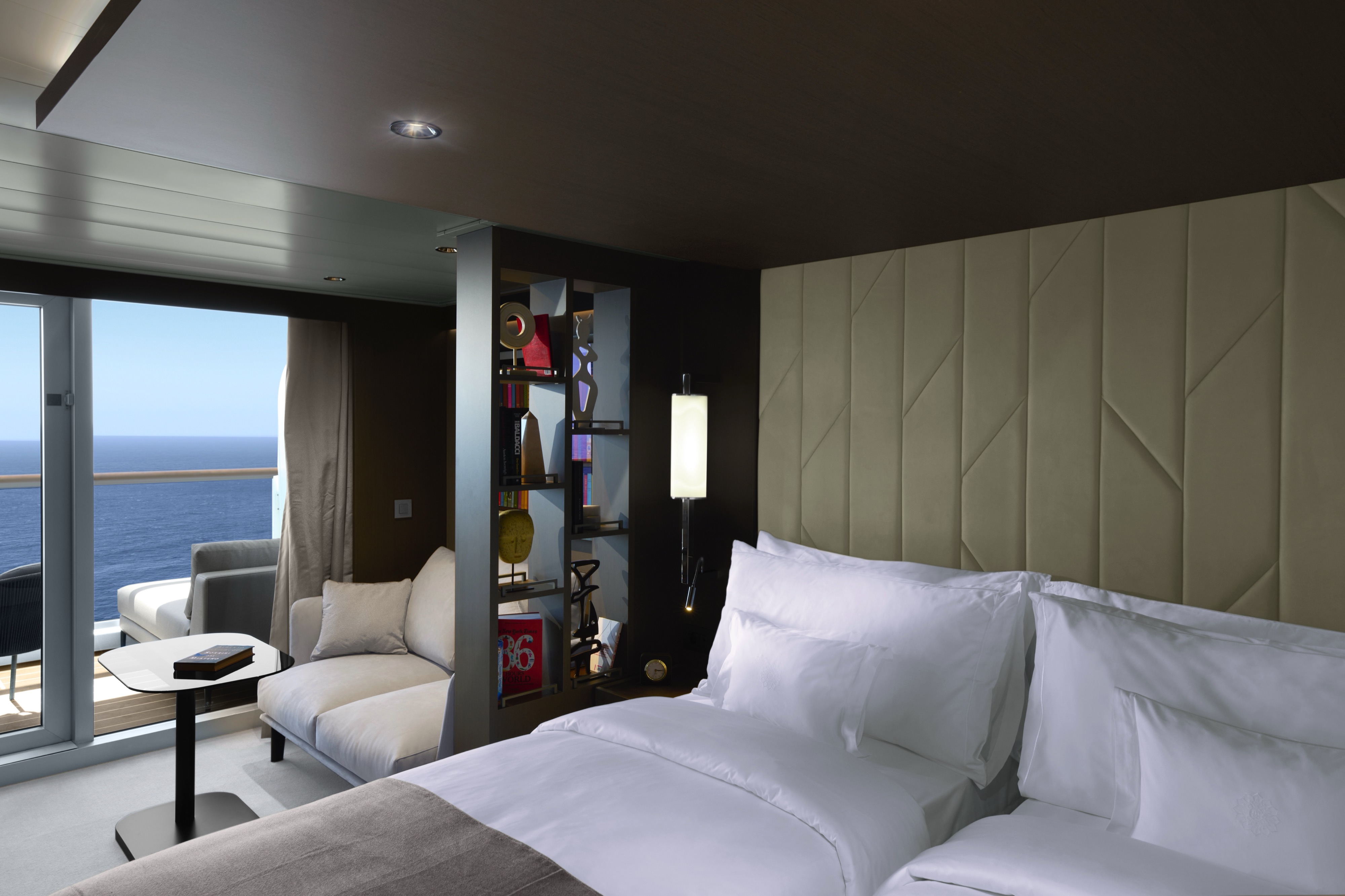
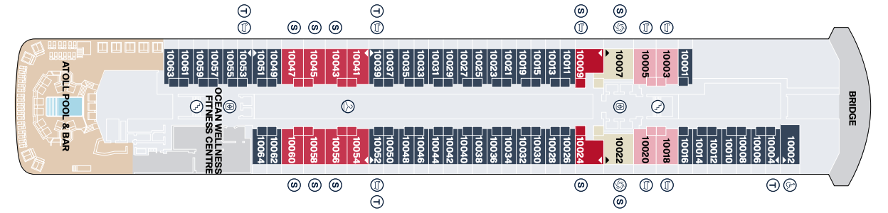
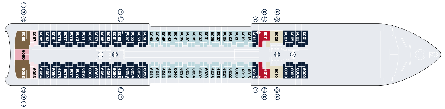
Cruise overview
WHY BOOK WITH US?
- ✔ The Deluxe Cruises’ team has extensive experience in ultra-luxury cruising.
- ✔ Call now to speak to our helpful and experienced Cruise Concierge team.
- ✔ Enjoy our Unique Deluxe Cruises Bonus for substantial savings.
- ✔ Our team will tailor your holiday to your exacting requirements.
- ✔ As agents, we work under the protection of each cruise lines ABTA / ATOL licences
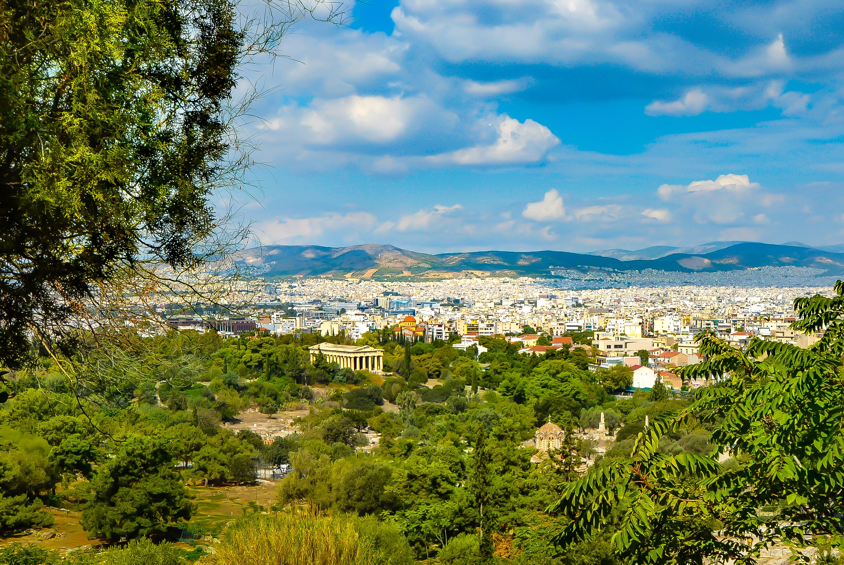
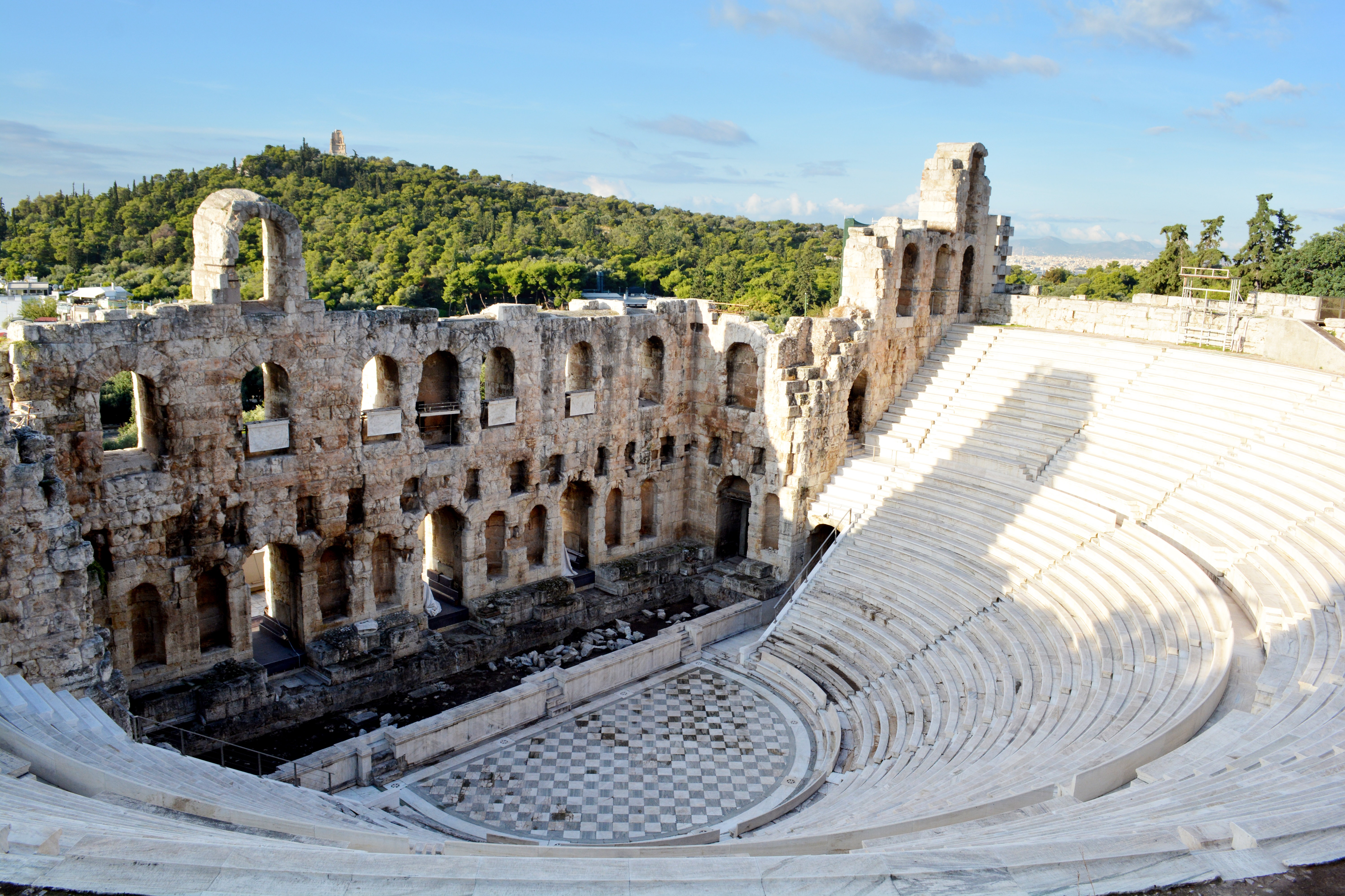
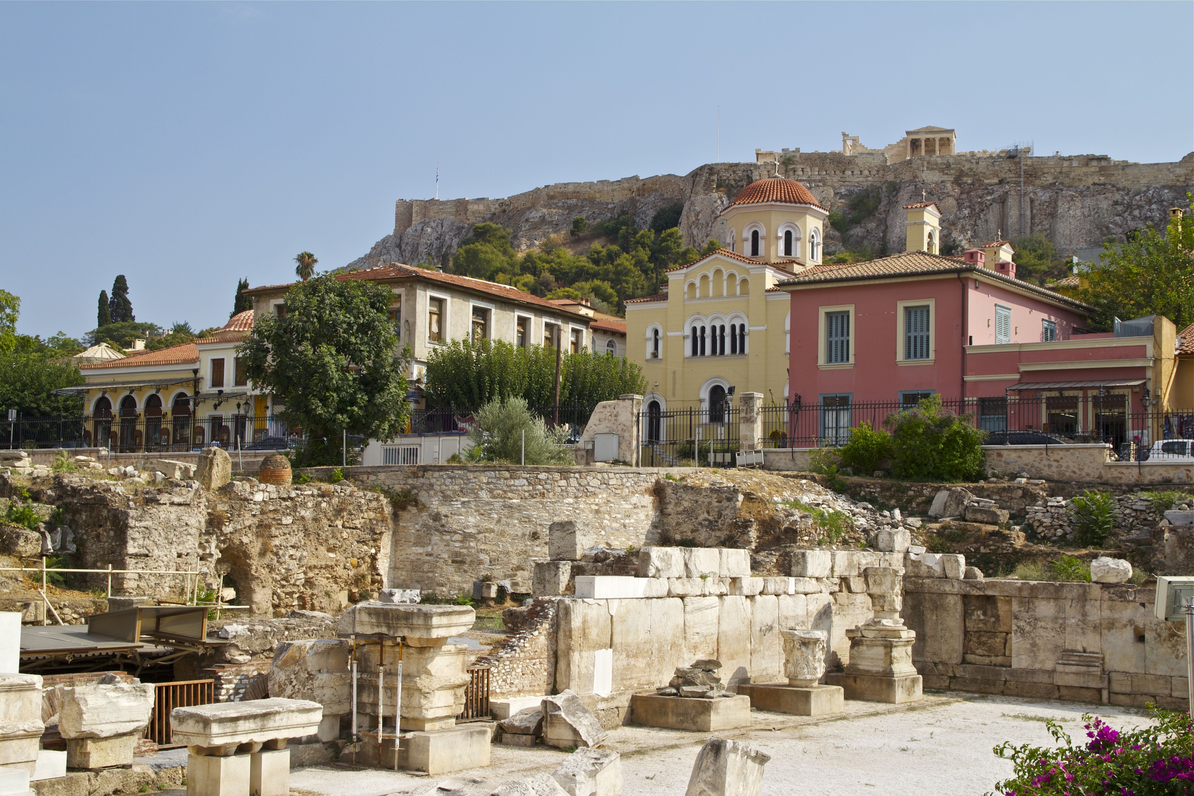
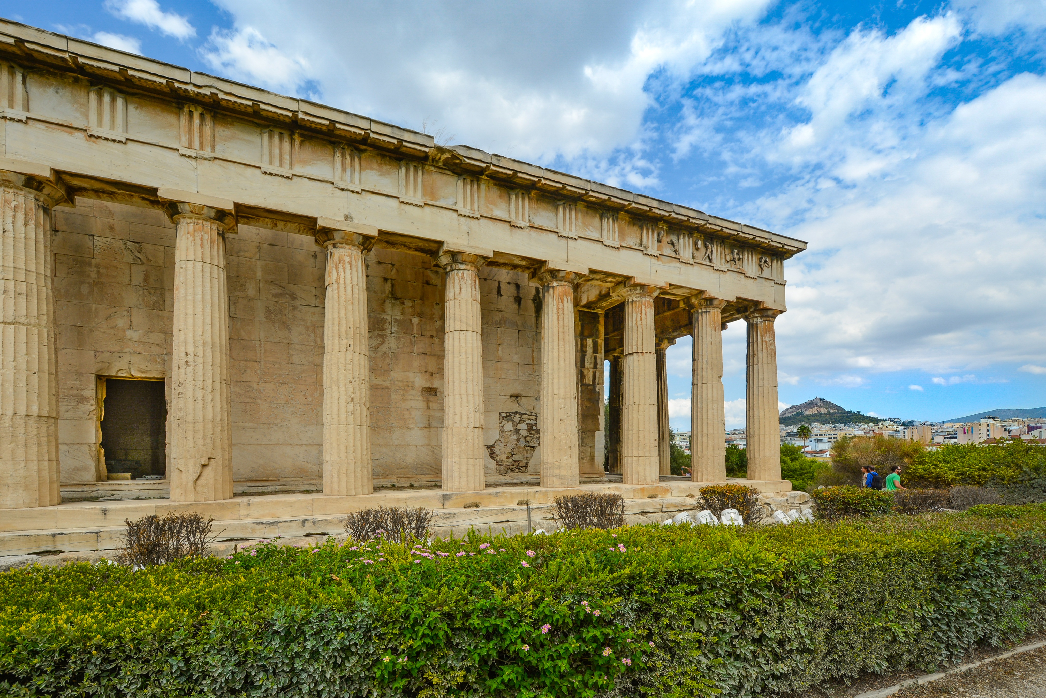
About Piraeus
It's no wonder that all roads lead to the fascinating and maddening metropolis of Athens. Lift your eyes 200 feet above the city to the Parthenon, its honey-color marble columns rising from a massive limestone base, and you behold architectural perfection that has not been surpassed in 2,500 years. But, today, this shrine of classical form dominates a 21st-century boomtown. To experience Athens—Athína in Greek—fully is to understand the essence of Greece: ancient monuments surviving in a sea of cement, startling beauty amid the squalor, tradition juxtaposed with modernity. Locals depend on humor and flexibility to deal with the chaos; you should do the same. The rewards are immense. Although Athens covers a huge area, the major landmarks of the ancient Greek, Roman, and Byzantine periods are close to the modern city center. You can easily walk from the Acropolis to many other key sites, taking time to browse in shops and relax in cafés and tavernas along the way. From many quarters of the city you can glimpse "the glory that was Greece" in the form of the Acropolis looming above the horizon, but only by actually climbing that rocky precipice can you feel the impact of the ancient settlement. The Acropolis and Filopappou, two craggy hills sitting side by side; the ancient Agora (marketplace); and Kerameikos, the first cemetery, form the core of ancient and Roman Athens. Along the Unification of Archaeological Sites promenade, you can follow stone-paved, tree-lined walkways from site to site, undisturbed by traffic. Cars have also been banned or reduced in other streets in the historical center. In the National Archaeological Museum, vast numbers of artifacts illustrate the many millennia of Greek civilization; smaller museums such as the Goulandris Museum of Cycladic Art Museum and the Byzantine and Christian Museum illuminate the history of particular regions or periods. Athens may seem like one huge city, but it is really a conglomeration of neighborhoods with distinctive characters. The Eastern influences that prevailed during the 400-year rule of the Ottoman Empire are still evident in Monastiraki, the bazaar area near the foot of the Acropolis. On the northern slope of the Acropolis, stroll through Plaka (if possible by moonlight), an area of tranquil streets lined with renovated mansions, to get the flavor of the 19th-century's gracious lifestyle. The narrow lanes of Anafiotika, a section of Plaka, thread past tiny churches and small, color-washed houses with wooden upper stories, recalling a Cycladic island village. In this maze of winding streets, vestiges of the older city are everywhere: crumbling stairways lined with festive tavernas; dank cellars filled with wine vats; occasionally a court or diminutive garden, enclosed within high walls and filled with magnolia trees and the flaming trumpet-shaped flowers of hibiscus bushes. Formerly run-down old quarters, such as Thission, Gazi and Psirri, popular nightlife areas filled with bars and mezedopoleia (similar to tapas bars), are now in the process of gentrification, although they still retain much of their original charm, as does the colorful produce and meat market on Athinas. The area around Syntagma Square, the tourist hub, and Omonia Square, the commercial heart of the city about 1 km (½ mi) northwest, is distinctly European, having been designed by the court architects of King Otho, a Bavarian, in the 19th century. The chic shops and bistros of ritzy Kolonaki nestle at the foot of Mt. Lycabettus, Athens's highest hill (909 feet). Each of Athens's outlying suburbs has a distinctive character: in the north is wealthy, tree-lined Kifissia, once a summer resort for aristocratic Athenians, and in the south and southeast lie Glyfada, Voula, and Vouliagmeni, with their sandy beaches, seaside bars, and lively summer nightlife. Just beyond the city's southern fringes is Piraeus, a bustling port city of waterside fish tavernas and Saronic Gulf views.


About Skíathos


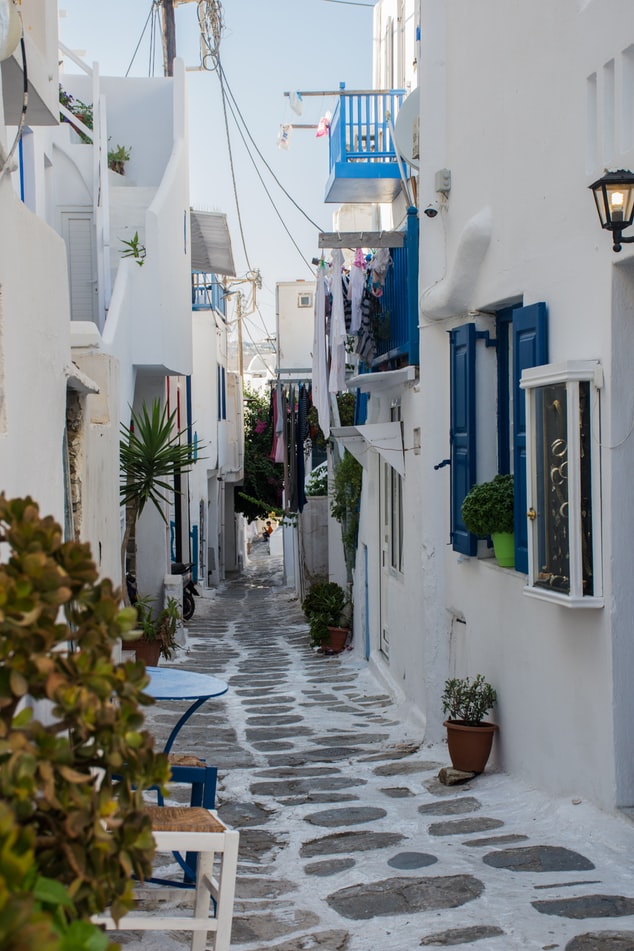
About Mykonos
Although the fishing boats still go out in good weather, Mykonos largely makes its living from tourism these days. The summer crowds have turned one of the poorest islands in Greece into one of the richest. Old Mykonians complain that their young, who have inherited stores where their grandfathers once sold eggs or wine, get so much rent that they have lost ambition, and in summer sit around pool bars at night with their friends, and hang out in Athens in winter when island life is less scintillating. Put firmly on the map by Jackie O in the 1960s, Mykonos town—called Hora by the locals—remains the Saint-Tropez of the Greek islands. The scenery is memorable, with its whitewashed streets, Little Venice, the Kato Myli ridge of windmills, and Kastro, the town's medieval quarter. Its cubical two- or three-story houses and churches, with their red or blue doors and domes and wooden balconies, have been long celebrated as some of the best examples of classic Cycladic architecture. Luckily, the Greek Archaeological Service decided to preserve the town, even when the Mykonians would have preferred to rebuild, and so the Old Town has been impressively preserved. Pink oleander, scarlet hibiscus, and trailing green pepper trees form a contrast amid the dazzling whiteness, whose frequent renewal with whitewash is required by law. Any visitor who has the pleasure of getting lost in its narrow streets (made all the narrower by the many outdoor stone staircases, which maximize housing space in the crowded village) will appreciate how its confusing layout was designed to foil pirates—if it was designed at all. After Mykonos fell under Turkish rule in 1537, the Ottomans allowed the islanders to arm their vessels against pirates, which had a contradictory effect: many of them found that raiding other islands was more profitable than tilling arid land. At the height of Aegean piracy, Mykonos was the principal headquarters of the corsair fleets—the place where pirates met their fellows, found willing women, and filled out their crews. Eventually the illicit activity evolved into a legitimate and thriving trade network. Morning on Mykonos town's main quay is busy with deliveries, visitors for the Delos boats, lazy breakfasters, and street cleaners dealing with the previous night's mess. In late morning the cruise-boat people arrive, and the shops are all open. In early afternoon, shaded outdoor tavernas are full of diners eating salads (Mykonos's produce is mostly imported); music is absent or kept low. In mid- and late afternoon, the town feels sleepy, since so many people are at the beach, on excursions, or sleeping in their air-conditioned rooms; even some tourist shops close for siesta. By sunset, people have come back from the beach, having taken their showers and rested. At night, the atmosphere in Mykonos ramps up. The cruise-boat people are mostly gone, coughing three-wheelers make no deliveries in the narrow streets, and everyone is dressed sexy for summer and starting to shimmy with the scene. Many shops stay open past midnight, the restaurants fill up, and the bars and discos make ice cubes as fast as they can. Ready to dive in? Begin your tour of Mykonos town (Hora) by starting out at its heart: Mando Mavrogenous Square.


About Pátmos
For better or worse, it can be difficult to reach Patmos—for many travelers, this lack of access is definitely for the better, since the island retains the air of an unspoiled retreat. Rocky and barren, the small, 34-square-km (21-square-mi) island lies beyond the islands of Kalymnos and Leros, northwest of Kos. Here on a hillside is the Monastery of the Apocalypse, which enshrines the cave where St. John received the Revelation in AD 95. Scattered evidence of Mycenaean presence remains on Patmos, and walls of the classical period indicate the existence of a town near Skala. Most of the island's approximately 2,800 people live in three villages: Skala, medieval Chora, and the small rural settlement of Kambos. The island is popular among the faithful making pilgrimages to the monastery as well as with vacationing Athenians and a newly growing community of international trendsetters—designers, artists, poets, and “taste gurus” (to quote Vogue’s July 2011 write-up of the island)—who have bought homes in Chora. These stylemeisters followed in the footsteps of Alexandrian John Stefanidis and the English artist Teddy Millington-Drake who, in the early ’60s, set about creating what eventually became hailed as one of the most gorgeous island homes in the world. The word soon spread thanks to their many guests (who included Jacqueline Kennedy Onassis) but, happily, administrators have carefully contained development, and as a result, Patmos retains its charm and natural beauty—even in the busy month of August.

About Agios Nikólaos, Kríti


About Marmaris
This big, brash resort city has two faces, and they're hard to reconcile. From the sea, a line of hotels stretches around the northern edge of a great bay, the whole encircled by a magical necklace of pine-clad mountains. Behind those same hotels, however, the city has been overwhelmed by boxy concrete development and streets lined with a hundred generically named eateries. An annual horde of European tourists descends on these workaday establishments, but for the international traveler, there is little about Marmaris that can’t be savored elsewhere in Turkey. Although it is a pretty spot, there isn’t much reason to linger unless you are meeting a yacht, traveling on to the Greek island of Rhodes, or perhaps snapping up an unbeatable deal at one of the top resorts, some of which are spectacular worlds unto themselves.

About Antalya
As the largest Turkish city on the western Mediterranean coast, Antalya is a mix of antiquity and modernity. It is popular with tourist all year round for its warm climate and sandy white beaches.


About Paphos
About Kusadasi
Whilst the busy resort town of Kusadasi offers much in the way of shopping and dining – not to mention a flourishing beach life scene, the real jewel here is Ephesus and the stunning ruined city that really take centre stage. With only 20% of the classical ruins having been excavated, this archaeological wonder has already gained the status as Europe’s most complete classical metropolis. And a metropolis it really is; built in the 10th century BC this UNESCO World Heritage site is nothing short of spectacular. Although regrettably very little remains of the Temple of Artemis (one of the seven wonders of the ancient world), the superb Library of Celsus’ façade is practically intact and it is one of life’s great joys to attend an evening performance in the illuminated ruins once all the tourists have left. The history of the city is fascinating and multi-layered and it is well worth reading up on this beforehand if a visit is planned. Another point of interest for historians would be the house of the Virgin Mary, located on the romantically named Mount Nightingale and just nine kilometres away from Ephesus proper. Legend has it that Mary (along with St. John) spent her final years here, secluded from the rest of the population, spreading Christianity. An edifying experience, even for non-believers. For the less historical minded amongst you, Kusadasi offers plenty in the way of activities. After a stroll through the town, jump in a taxi to Ladies’ Beach (men are allowed), sample a Turkish kebap on one of the many beachfront restaurants and enjoy the clement weather. If you do want to venture further afield, then the crystal clear beaches of Guzelcamli (or the Millipark), the cave of Zeus and the white scalloped natural pools at Pamukkale, known as Cleopatra’s pools, are definitely worth a visit.


About Mytilene, Lesbos
About Istanbul
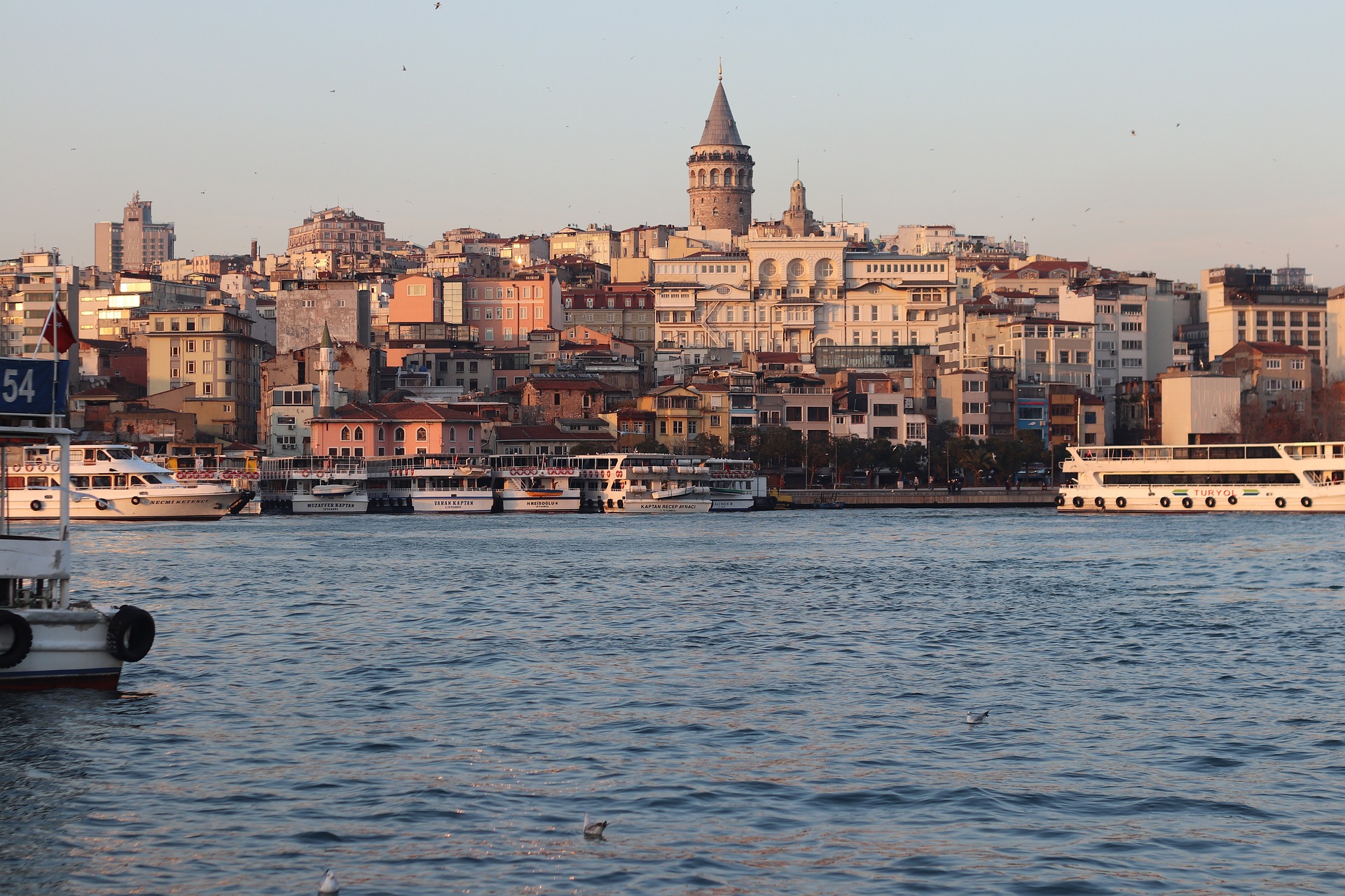
The only city in the world that can lay claim to straddling two continents, Istanbul—once known as Constantinople, capital of the Byzantine and then the Ottoman Empire—has for centuries been a bustling metropolis with one foot in Europe and the other in Asia. Istanbul embraces this enviable position with both a certain chaos and inventiveness, ever evolving as one of the world’s most cosmopolitan crossroads. It’s often said that Istanbul is the meeting point of East and West, but visitors to this city built over the former capital of two great empires are likely to be just as impressed by the juxtaposition of old and new. Office towers creep up behind historic palaces, women in chic designer outfits pass others wearing long skirts and head coverings, peddlers’ pushcarts vie with battered old Fiats and shiny BMWs for dominance of the noisy, narrow streets, and the Grand Bazaar competes with modern shopping malls. At dawn, when the muezzin's call to prayer resounds from ancient minarets, there are inevitably a few hearty revelers still making their way home from nightclubs and bars. Most visitors to this sprawling city of more than 14 million will first set foot in the relatively compact Old City, where the legacy of the Byzantine and Ottoman empires can be seen in monumental works of architecture like the brilliant Aya Sofya and the beautifully proportioned mosques built by the great architect Sinan. Though it would be easy to spend days, if not weeks, exploring the wealth of attractions in the historical peninsula, visitors should make sure also to venture elsewhere in order to experience the vibrancy of contemporary Istanbul. With a lively nightlife propelled by its young population and an exciting arts scene that’s increasingly on the international radar—thanks in part to its stint as the European Capital of Culture in 2010—Istanbul is truly a city that never sleeps. It’s also a place where visitors will feel welcome: Istanbul may be on the Bosphorus, but at heart it’s a Mediterranean city, whose friendly inhabitants are effusively social and eager to share what they love most about it.


About Istanbul
The only city in the world that can lay claim to straddling two continents, Istanbul—once known as Constantinople, capital of the Byzantine and then the Ottoman Empire—has for centuries been a bustling metropolis with one foot in Europe and the other in Asia. Istanbul embraces this enviable position with both a certain chaos and inventiveness, ever evolving as one of the world’s most cosmopolitan crossroads. It’s often said that Istanbul is the meeting point of East and West, but visitors to this city built over the former capital of two great empires are likely to be just as impressed by the juxtaposition of old and new. Office towers creep up behind historic palaces, women in chic designer outfits pass others wearing long skirts and head coverings, peddlers’ pushcarts vie with battered old Fiats and shiny BMWs for dominance of the noisy, narrow streets, and the Grand Bazaar competes with modern shopping malls. At dawn, when the muezzin's call to prayer resounds from ancient minarets, there are inevitably a few hearty revelers still making their way home from nightclubs and bars. Most visitors to this sprawling city of more than 14 million will first set foot in the relatively compact Old City, where the legacy of the Byzantine and Ottoman empires can be seen in monumental works of architecture like the brilliant Aya Sofya and the beautifully proportioned mosques built by the great architect Sinan. Though it would be easy to spend days, if not weeks, exploring the wealth of attractions in the historical peninsula, visitors should make sure also to venture elsewhere in order to experience the vibrancy of contemporary Istanbul. With a lively nightlife propelled by its young population and an exciting arts scene that’s increasingly on the international radar—thanks in part to its stint as the European Capital of Culture in 2010—Istanbul is truly a city that never sleeps. It’s also a place where visitors will feel welcome: Istanbul may be on the Bosphorus, but at heart it’s a Mediterranean city, whose friendly inhabitants are effusively social and eager to share what they love most about it.
About Mykonos
Although the fishing boats still go out in good weather, Mykonos largely makes its living from tourism these days. The summer crowds have turned one of the poorest islands in Greece into one of the richest. Old Mykonians complain that their young, who have inherited stores where their grandfathers once sold eggs or wine, get so much rent that they have lost ambition, and in summer sit around pool bars at night with their friends, and hang out in Athens in winter when island life is less scintillating. Put firmly on the map by Jackie O in the 1960s, Mykonos town—called Hora by the locals—remains the Saint-Tropez of the Greek islands. The scenery is memorable, with its whitewashed streets, Little Venice, the Kato Myli ridge of windmills, and Kastro, the town's medieval quarter. Its cubical two- or three-story houses and churches, with their red or blue doors and domes and wooden balconies, have been long celebrated as some of the best examples of classic Cycladic architecture. Luckily, the Greek Archaeological Service decided to preserve the town, even when the Mykonians would have preferred to rebuild, and so the Old Town has been impressively preserved. Pink oleander, scarlet hibiscus, and trailing green pepper trees form a contrast amid the dazzling whiteness, whose frequent renewal with whitewash is required by law. Any visitor who has the pleasure of getting lost in its narrow streets (made all the narrower by the many outdoor stone staircases, which maximize housing space in the crowded village) will appreciate how its confusing layout was designed to foil pirates—if it was designed at all. After Mykonos fell under Turkish rule in 1537, the Ottomans allowed the islanders to arm their vessels against pirates, which had a contradictory effect: many of them found that raiding other islands was more profitable than tilling arid land. At the height of Aegean piracy, Mykonos was the principal headquarters of the corsair fleets—the place where pirates met their fellows, found willing women, and filled out their crews. Eventually the illicit activity evolved into a legitimate and thriving trade network. Morning on Mykonos town's main quay is busy with deliveries, visitors for the Delos boats, lazy breakfasters, and street cleaners dealing with the previous night's mess. In late morning the cruise-boat people arrive, and the shops are all open. In early afternoon, shaded outdoor tavernas are full of diners eating salads (Mykonos's produce is mostly imported); music is absent or kept low. In mid- and late afternoon, the town feels sleepy, since so many people are at the beach, on excursions, or sleeping in their air-conditioned rooms; even some tourist shops close for siesta. By sunset, people have come back from the beach, having taken their showers and rested. At night, the atmosphere in Mykonos ramps up. The cruise-boat people are mostly gone, coughing three-wheelers make no deliveries in the narrow streets, and everyone is dressed sexy for summer and starting to shimmy with the scene. Many shops stay open past midnight, the restaurants fill up, and the bars and discos make ice cubes as fast as they can. Ready to dive in? Begin your tour of Mykonos town (Hora) by starting out at its heart: Mando Mavrogenous Square.
About Milos
Milos or Melos is a volcanic Greek island in the Aegean Sea, just north of the Sea of Crete. Milos is the southwesternmost island in the Cyclades group. The Venus de Milo and the Asclepius of Milos were both found on the island, as were a Poseidon and an archaic Apollo now in Athens.


About Corfu
Corfu town today is a vivid tapestry of cultures—a sophisticated weave, where charm, history, and natural beauty blend. Located about midway along the island's east coast, this spectacularly lively capital is the cultural heart of Corfu and has a remarkable historic center that UNESCO designated as a World Heritage Site in 2007. All ships and planes dock or land near Corfu town, which occupies a small peninsula jutting into the Ionian Sea.Whether arriving by ferry from mainland Greece or Italy, from another island, or directly by plane, catch your breath by first relaxing with a coffee or a gelato in Corfu town's shaded Liston Arcade, then stroll the narrow lanes of its pedestrians-only quarter. For an overview of the immediate area, and a quick tour of Mon Repos palace, hop on the little tourist train that runs from May to September. Corfu town has a different feel at night, so book a table at one of its famed tavernas to savor the island's unique cuisine.The best way to get around Corfu town is on foot. The town is small enough so that you can easily walk to every sight. There are local buses, but they do not thread their way into the streets (many now car-free) of the historic center. If you are arriving by ferry or plane, it's best to take a taxi to your hotel. Expect to pay about €10 from the airport or ferry terminal to a hotel in Corfu town. If there are no taxis waiting, you can call for one.


About Gallipoli
Kalè polis, meaning beautiful city, is the name ancient Greek mariners bestowed on Gallipoli, with good reason. Situated on a mound, the Old Town with its labyrinth of winding lanes, emerges from the Ionian Sea. It is connected to the mainland and modern Gallipoli via a 17th-century bridge. The area lies on the Salentina Peninsula in the extreme southeast end of Italy, commonly referred to as the heel of the boot. The Salento region was inhabited already in prehistoric times; later centuries were marked by Greek, Norman, Byzantine and Baroque cultures. It is a land of farms, castles, works of art, myths and legends. Many heroic battles were fought; fierce resistance was shown by Gallipoli’s citizens against numerous invaders that included Romans, Vandals, Swabians, Venetians, French and lastly the English in 1809. In addition to its tumultuous history and natural beauty, the city’s claim to fame rests in its art treasures, most notably, the Basilica of Sant’Agata with its majestic 17th-century façade. Inside, the church contains a rich and important art collection with numerous works by its great native son, Giovanni Andrea Coppola.

About Hvar Island
The Croatian island of Hvar bills itself as the "sunniest island in the Adriatic." Not only does it have the figures to back up this claim—an annual average of 2,724 hours of sunshine—but it also makes visitors a sporting proposition, offering them a money-back guarantee if there are seven consecutive days of snow (snow has been known to fall here; the last time being February 2012).


About Pula
Today an industrial port town and Istria's chief administrative center (pop. 58,000), as well as a major tourist destination, Pula became a Roman colony in the 1st century BC. This came about a century after the decisive defeat by the Romans, in 177 BC, of the nearby Histrian stronghold of Nesactium, prompting the Histrian king Epulon to plunge a sword into his chest lest he fall into the hands of the victors, who indeed conquered all of Istria. Remains from Pula's ancient past have survived up to the present day: as you drive in on the coastal route toward its choice setting on a bay near the southern tip of the Istrian peninsula, the monumental Roman amphitheater blocks out the sky on your left. Under Venetian rule (1331–1797), Pula was architecturally neglected, even substantially dismantled. Many structures from the Roman era were pulled down, and stones and columns were carted off across the sea to Italy to be used for new buildings there. Pula's second great period of development took place in the late 19th century, under the Habsburgs, when it served as the chief base for the Imperial Austro-Hungarian Navy. Today it's as much working city as tourist town, where Roman ruins and Austro-Hungarian architecture serve as backdrop for the bustle of everyday life amid a bit of communist-era soot and socialist realism, too. James Joyce lived here for a short time, in 1904–05, before fleeing what he dismissed as a cultural backwater for Trieste. What's more, there are some outstanding restaurants and a number of pleasant family-run hotels, not to mention the nearby resort area of Verudela, where seaside tourism thrives in all its soothing, sunny sameness.


About Fusina


Where You'll Go


