
Bella Italia And Magical Croatia
Bella Italia And Magical Croatia
Cruise overview
WHY BOOK WITH US?
- ✔ The Deluxe Cruises’ team has extensive experience in ultra-luxury cruising.
- ✔ Call now to speak to our helpful and experienced Cruise Concierge team.
- ✔ Enjoy our Unique Deluxe Cruises Bonus for substantial savings.
- ✔ Our team will tailor your holiday to your exacting requirements.
- ✔ As agents, we work under the protection of each cruise lines ABTA / ATOL licences
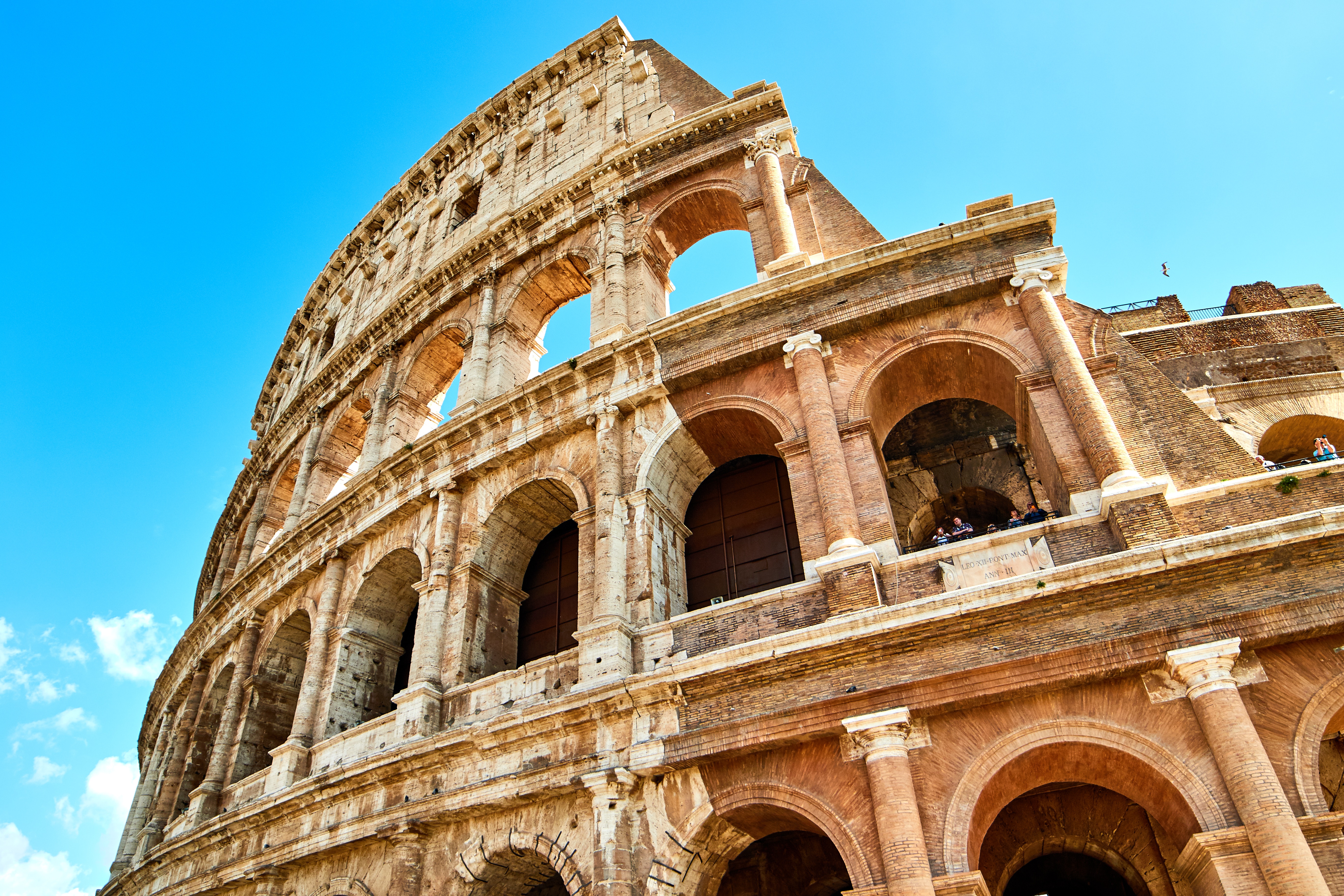
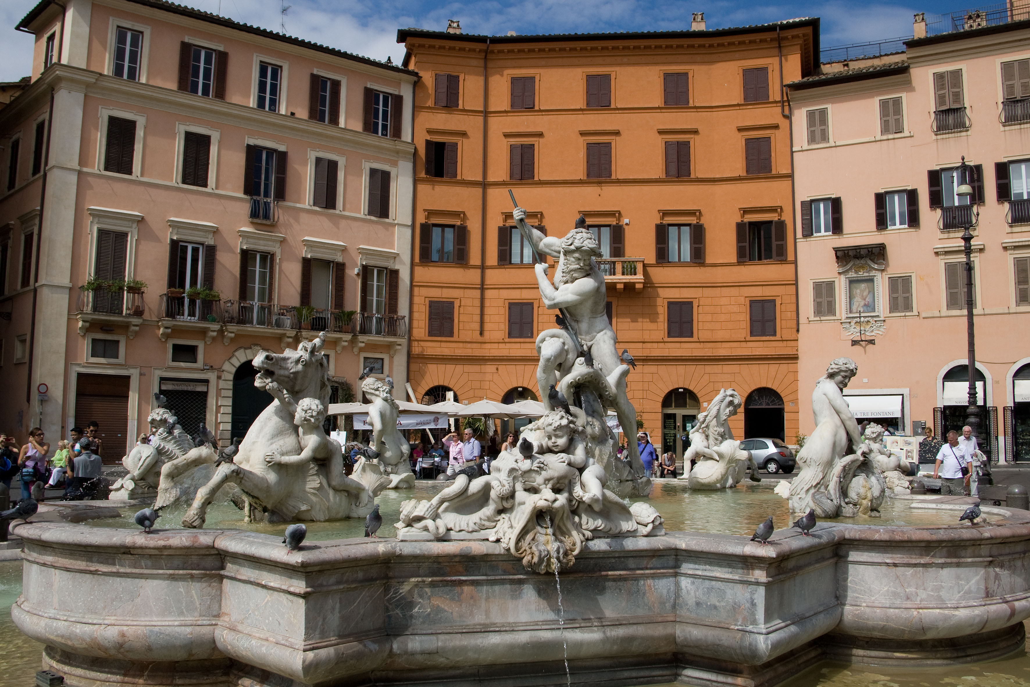
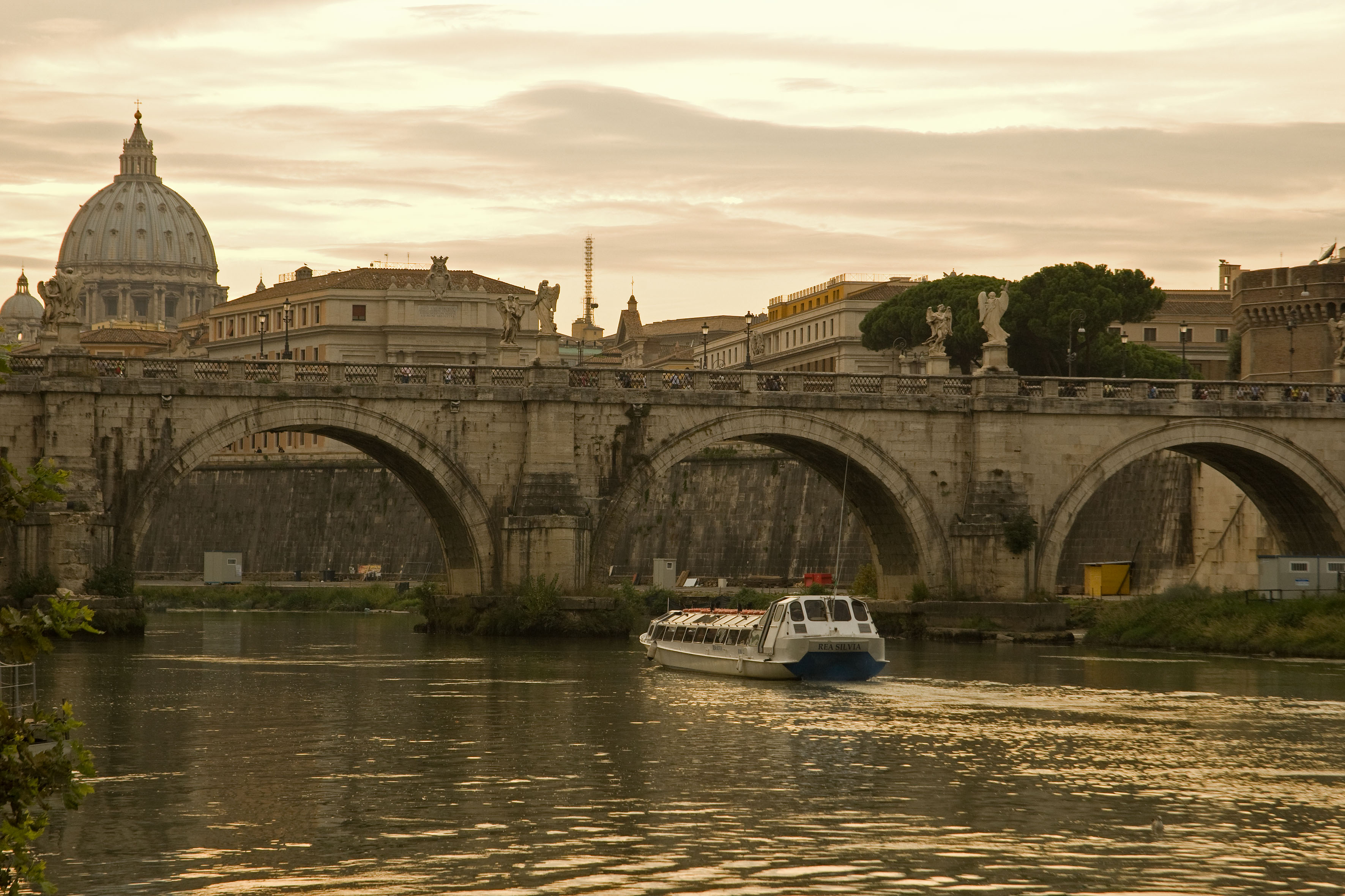
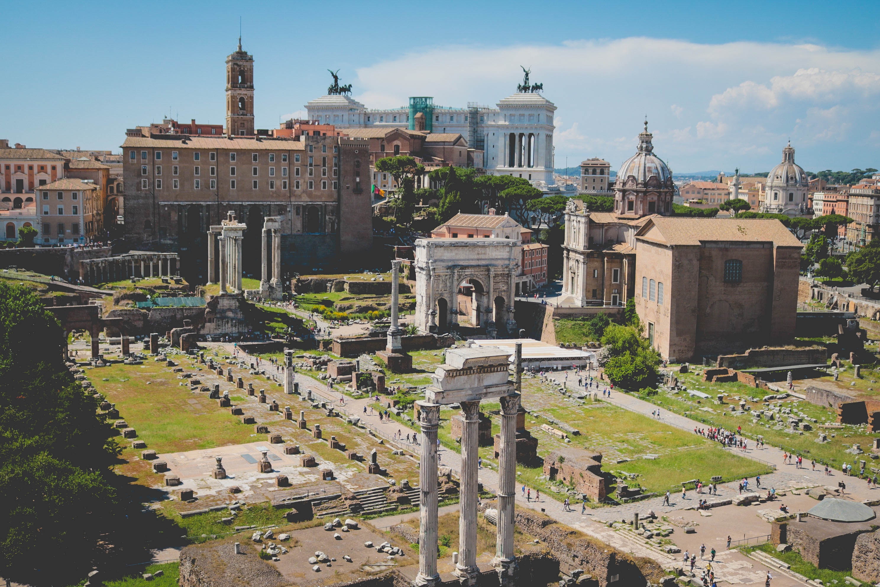
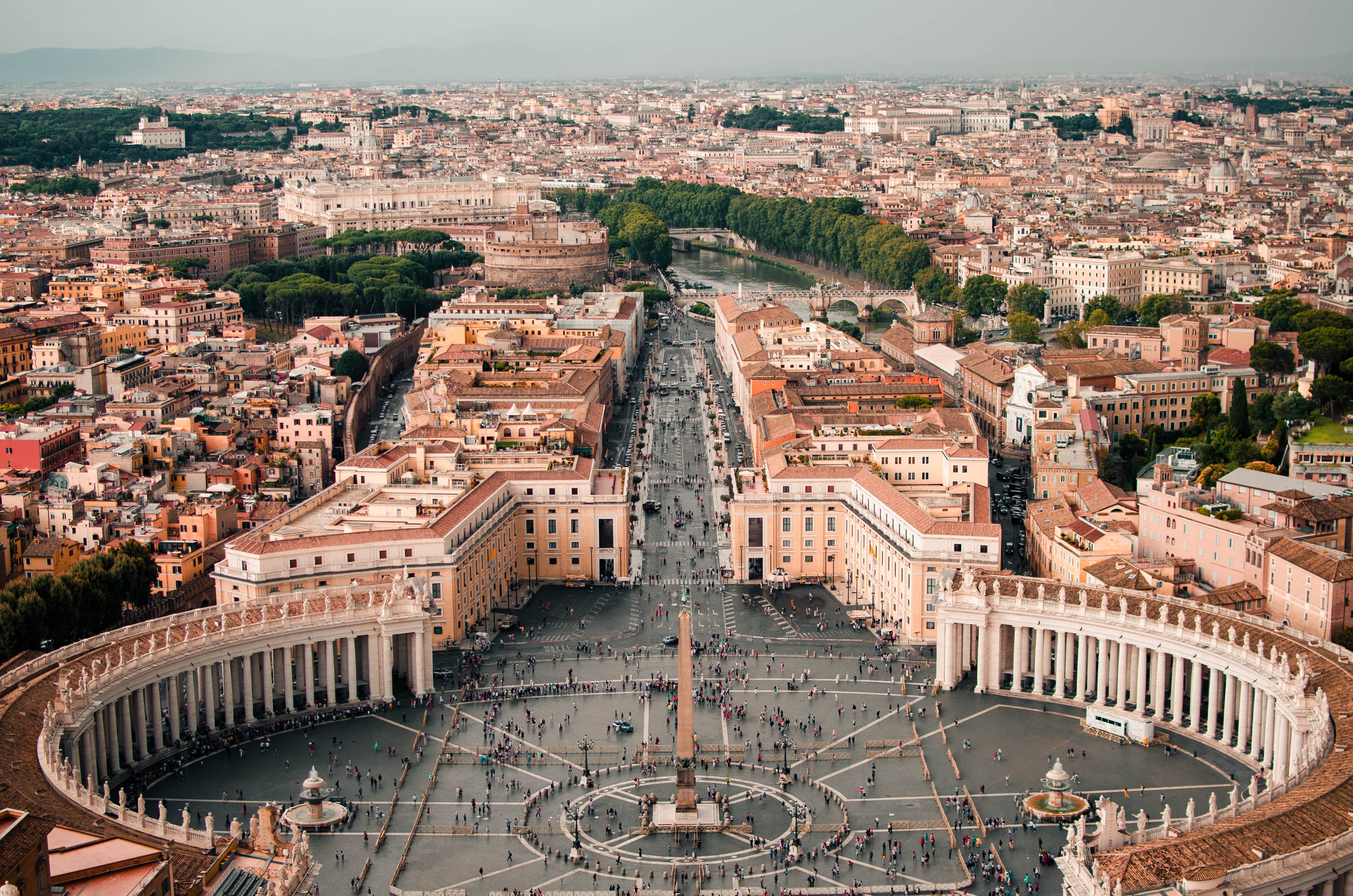
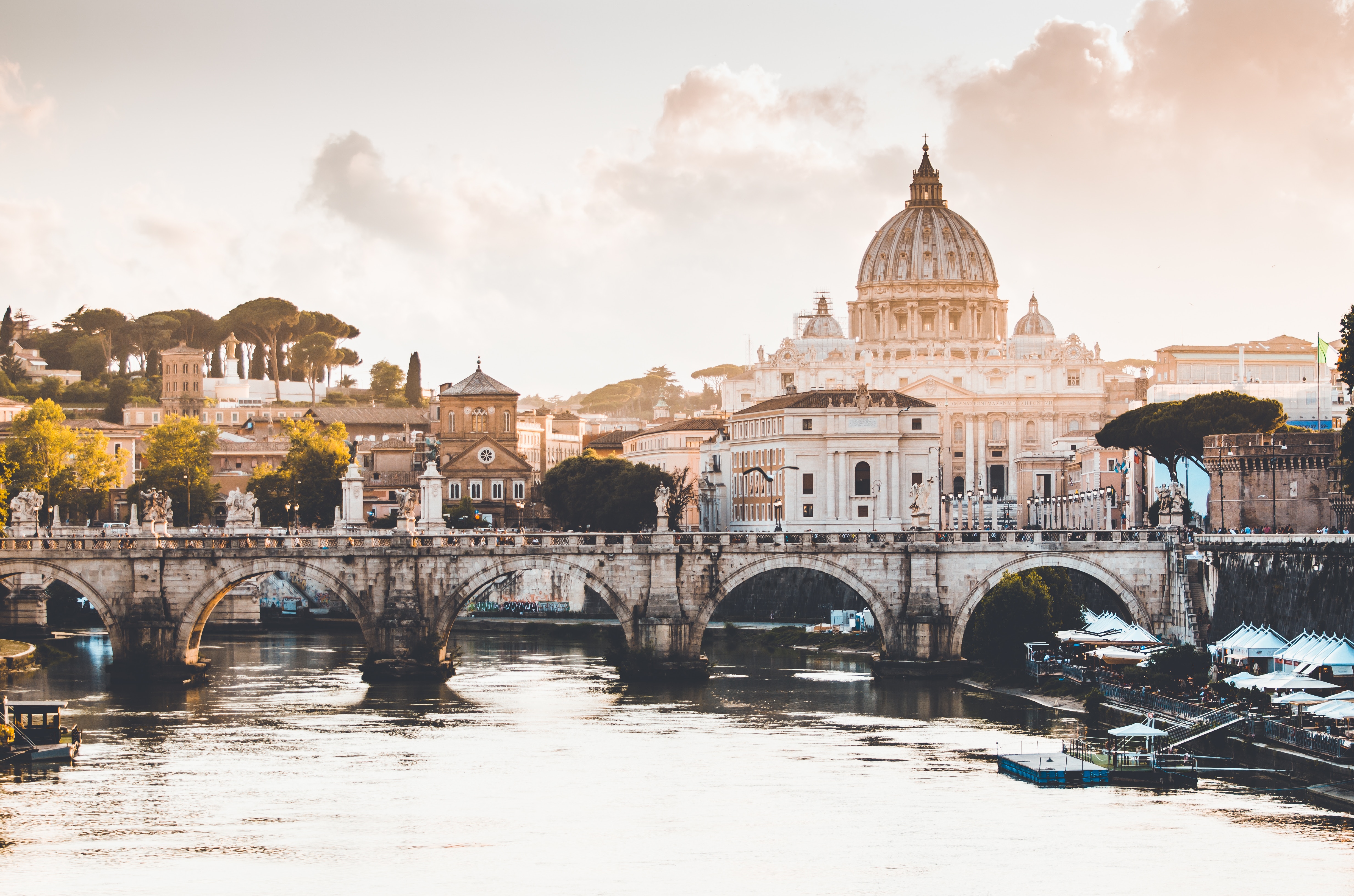
About Civitavecchia
Italy's vibrant capital lives in the present, but no other city on earth evokes its past so powerfully. For over 2,500 years, emperors, popes, artists, and common citizens have left their mark here. Archaeological remains from ancient Rome, art-stuffed churches, and the treasures of Vatican City vie for your attention, but Rome is also a wonderful place to practice the Italian-perfected il dolce far niente, the sweet art of idleness. Your most memorable experiences may include sitting at a caffè in the Campo de' Fiori or strolling in a beguiling piazza.


About Capri
Tour description Capri, Italy Popular since Roman times when the emperors built their villas on Capri, this island is surely one of the world's most famous and beautiful spots. Visiting Capri, it is easy to see why the ancient Romans fell in love with this place 2,000 years ago - the craggy mountains, the sea caves and grottos and the brilliantly colored flowers cast a magic spell then and still capture the admiration of today's travelers. There are sleek yachts moored in the deep blue waters of the bays, and beautiful villas and tiny villages cling to steep slopes. An excellent year-round climate and a breathtaking landscape complete the picture of a storybook island. There are two main villages - Capri Town, site of the popular meeting point "Piazzetta," and Anacapri, the upper town, dominated by 1,750-foot-high Monte Solaro, the highest point on the island. Both remain the "in" scene for international travelers. By spending millions on comfort and style, the island has ensured its continuing success. After a trip to upper-level Anacapri, visitors enjoy strolling the narrow, cobbled streets of Capri Town, browsing in chic boutiques and spending time in the Piazzetta with a drink in one of the outdoor cafés. There is a funicular from the main port of Marina Grande to Capri Town; from Anacapri, a chair lift whisks visitors to the top of Monte Solaro for a spellbinding view. The magical Blue Grotto can be reached by boat from Marina Grande, but entrance into the grotto depends for the most part on sea conditions. Please Note: For your convenience, the shore excursions offered for this port of call are available to reserve in advance at www.silversea.com until August 8 , as well as offered for purchase on board, unless otherwise noted in the description. Going Ashore in Capri Pier Information The ship is scheduled to anchor off Capri's main port, Marina Grande. Guests will be taken ashore via local tenders, arriving at the pier just a short distance from the funicular to Capri Town. Taxis and minibuses are also available near the pier area. Be sure to agree on the fare before starting out. Shopping Capri is a shopping mecca, though by no means inexpensive. Upscale shops and boutiques offer an array of jewelry, designer fashions, resort wear, straw articles and souvenir items. Start from the Piazzetta and the streets fanning out from the square. Some shops may be closed between 12:30/1:00 p.m. and 4:00/4:30 p.m. The local currency is the euro. Cuisine Capri features plenty of open-air eateries in addition to top rated restaurants. Fresh seafood and delicious pasta dishes make for a nice lunch; for a quick meal there are tempting sandwiches and pizza. You might enjoy a hearty Italian table wine with lunch. Other Sights Capri Town La Piazzetta is the main square of Capri Town located just opposite the upper funicular station. The square is an ideal place from where to start exploring or shopping. Sidewalk cafés around the square provide residents and visitors with a popular pastime - people-watching while sipping a drink or enjoying a coffee. Anacapri Reaching Capri's second town is via local minibus. In addition to numerous souvenir shops and designer boutiques, attractions include Axel Munthe's Villa San Michele and the chair lift to Monte Solaro. Blue Grotto Boat excursions to the Blue Grotto can be booked locally at Marina Grande. Be aware that it is necessary to transfer into smaller boats in front of the grotto. Also, entrance to the grotto is subject to weather and sea conditions. For this reason, tours to the Blue Grotto are frequently cancelled. Private arrangements are not available in this port.

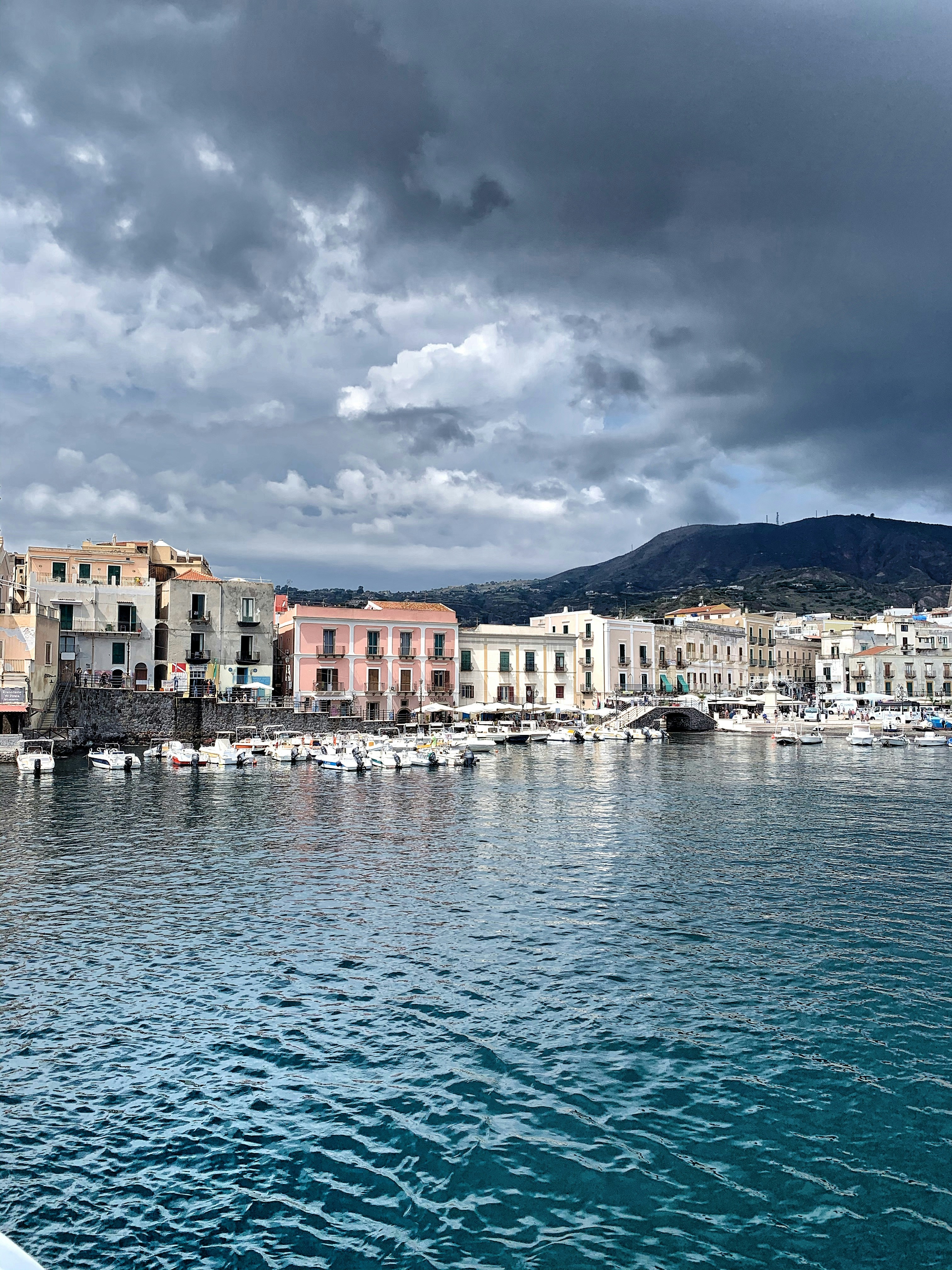
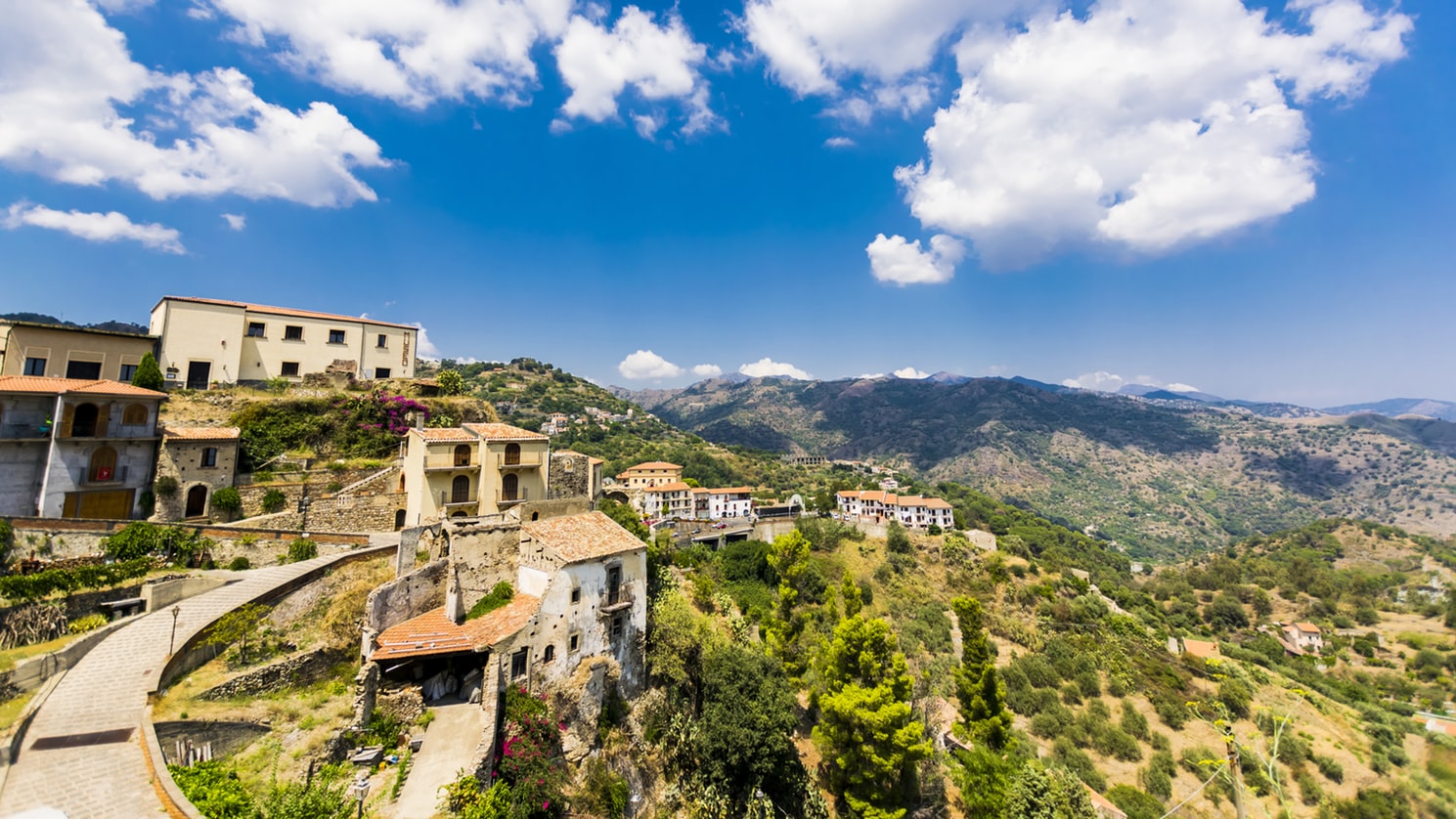
About Lipari
The largest and most developed of the Aeolians, Lipari welcomes you with distinctive pastel-color houses. Fields of spiky agaves dot the northernmost tip of the island, Acquacalda, indented with pumice and obsidian quarries. In the west is San Calogero, where you can explore hot springs and mud baths. From the red-lava base of the island rises a plateau crowned with a 16th-century castle and a 17th-century cathedral.
About Stromboli

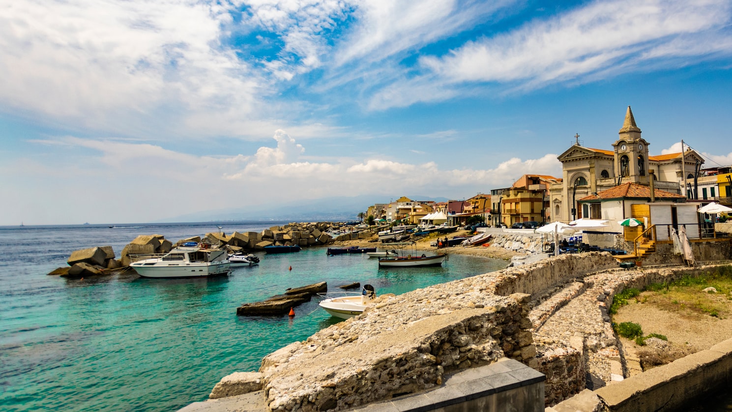
About Messina
Home to the Museo Regionale of Messina, known for featuring two of Caravaggio's paintings, the city is also famous for having been the capital of the ancient kingdom of Sicily.

About Monopoli

About Trogir


About Rovinj
One of the true jewels of the Mediterranean, Rovinj is a jaw-droppingly beautiful town, which juts out into sparkling Mediterranean. Dominated by the pencil-like bell tower of the Venetian Saint Euphemia Cathedral, pine tree forests flow to the borders of the quaint Old Town - which evokes the romantic, tangled backstreets of the Venice. Rovinj - or Rovino in Italian - is a city of split personalities, with two official languages - having been owned by the Kingdom of Italy between 1919 and 1947.

About Zadar
Dalmatia's capital for more than 1,000 years, Zadar is all too often passed over by travelers on their way to Split or Dubrovnik. What they miss out on is a city of more than 73,000 that is remarkably lovely and lively despite—and, in some measure, because of—its tumultuous history. The Old Town, separated from the rest of the city on a peninsula some 4 km (2½ miles) long and just 1,640 feet wide, is bustling and beautiful: the marble pedestrian streets are replete with Roman ruins, medieval churches, palaces, museums, archives, and libraries. Parts of the new town are comparatively dreary, a testament to what a world war followed by decades of communism, not to mention a civil war, can do to the architecture of a city that is 3,000 years old. A settlement had already existed on the site of the present-day city for some 2,000 years when Rome finally conquered Zadar in the 1st century BC; the foundations of the forum can be seen today. Before the Romans came the Liburnians had made it a key center for trade with the Greeks and Romans for 800 years. In the 3rd century BC the Romans began to seriously pester the Liburnians, but required two centuries to bring the area under their control. During the Byzantine era, Zadar became the capital of Dalmatia, and this period saw the construction of its most famous church, the 9th-century St. Donat's Basilica. It remained the region's foremost city through the ensuing centuries. The city then experienced successive onslaughts and occupations—both long and short—by the Osogoths, the Croatian-Hungarian kings, the Venetians, the Turks, the Habsburgs, the French, the Habsburgs again, and finally the Italians before becoming part of Yugoslavia and, in 1991, the independent republic of Croatia. Zadar was for centuries an Italian-speaking city, and Italian is still spoken widely, especially by older people. Indeed, it was ceded to Italy in 1921 under the Treaty of Rapallo (and reverted to its Italian name of Zara). Its occupation by the Germans from 1943 led to intense bombing by the Allies during World War II, which left most of the city in ruins. Zadar became part of Tito's Yugoslavia in 1947, prompting many Italian residents to leave. Zadar's most recent ravages occurred during a three-month siege by Serb forces and months more of bombardment during the Croatian-Serbian war between 1991 and 1995. But you'd be hard-pressed to find outward signs of this today in what is a city to behold. There are helpful interpretive signs in English all around the Old Town, so you certainly won't feel lost when trying to make sense of the wide variety of architectural sites you might otherwise pass by with only a cursory look.


About Korčula
Off the coast of Croatia in the southern Adriatic Sea lie some thousand islands and the largest of them, Korçula, is considered the most beautiful. With an average of 3,000 hours of sunshine per annum, which guarantees a wide assortment of Mediterranean vegetation, it is not difficult to understand why seasoned travelers compare Korçula to a latter-day Eden. Separated from the mainland by a channel of only one mile, Korçula's main town, named the same as the island, ranks among the best preserved medieval towns in the Mediterranean. It is the island's main tourist, economic and cultural center. Thanks to its strategic location along the sea trade routes, Korçula has always attracted travelers and settlers. Korcula was founded by Greek colonists, who were followed by Illyrians, Romans and finally the Croats. The Korçula Statute of 1214 is one of the oldest legal documents to have been adopted in this part of Europe. The same century saw the birth of the famous world traveler, Marco Polo. The house said to be his birthplace can be seen in town. Korçulans have always been known as keen seafarers, excellent shipbuilders, stonemasons and artists. From their many voyages, sailors brought back new ideas, which eventually mixed with local customs. To this day, Korçula has maintained the tradition of performing knightly games such as the chivalrous Moreska dance, which has been in existence for more than 400 years. Visitors to Korçula enjoy its stunning location, natural beauty and medieval ambiance. And if that's not enough, the town offers numerous attractions that are within walking distance from the pier, including the City Museum and the Bishop's Treasury.


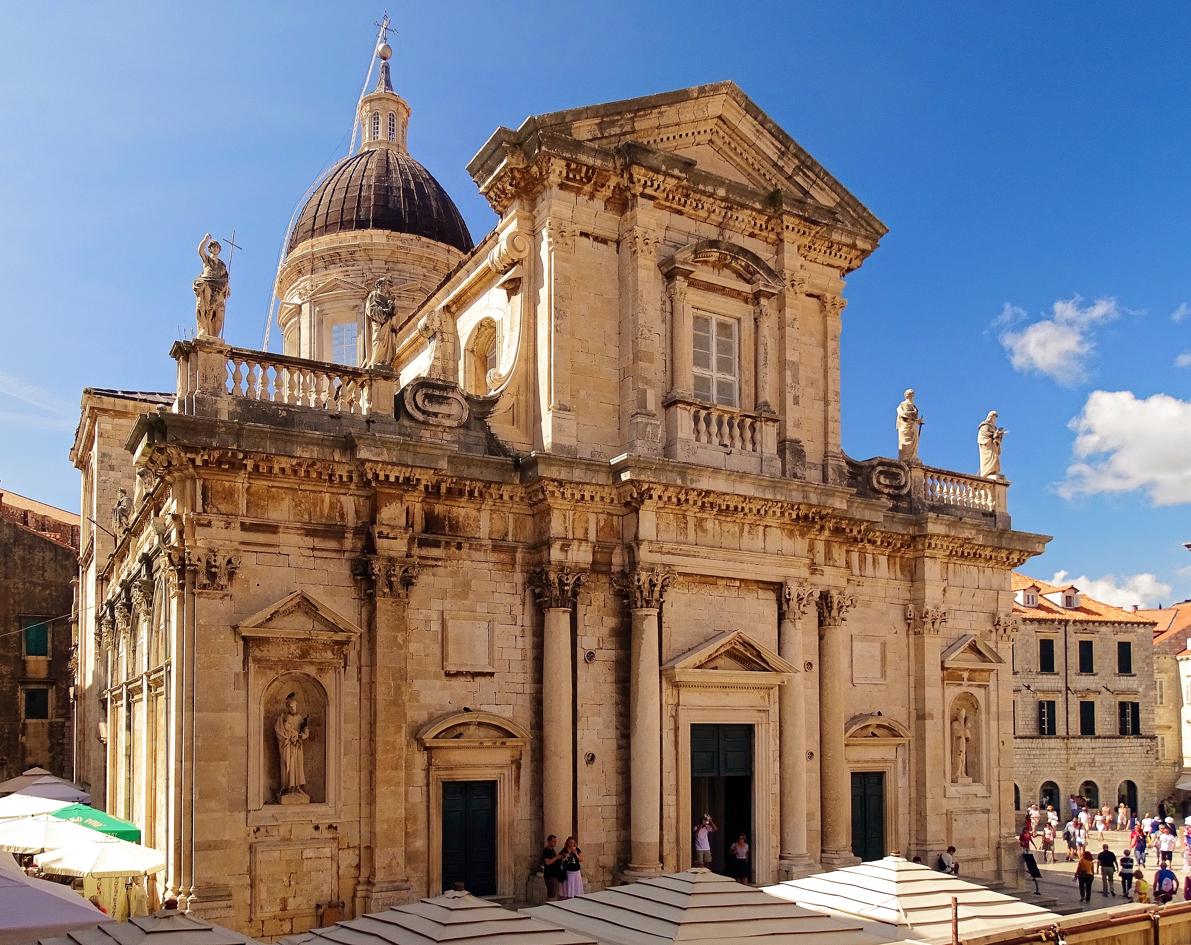
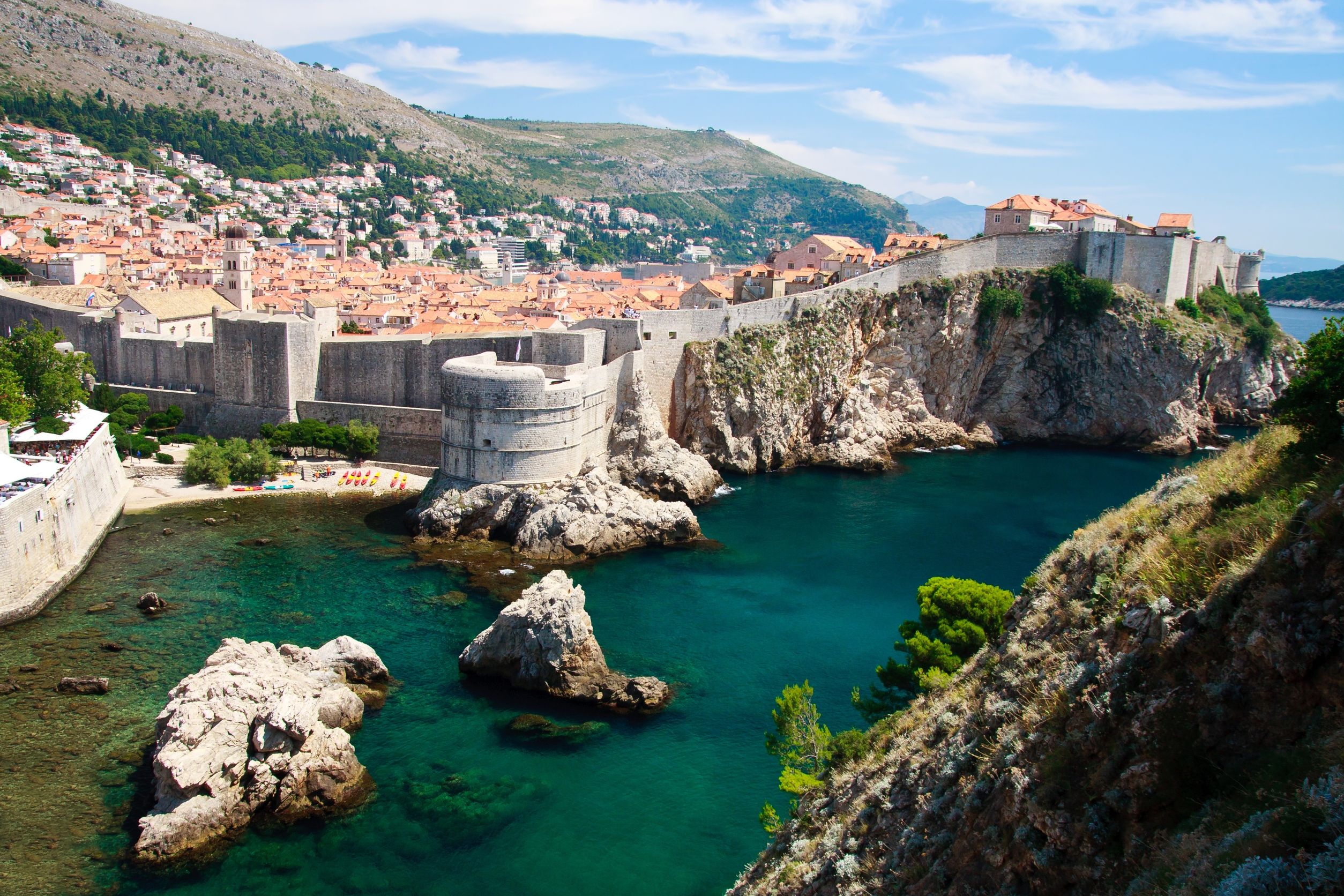
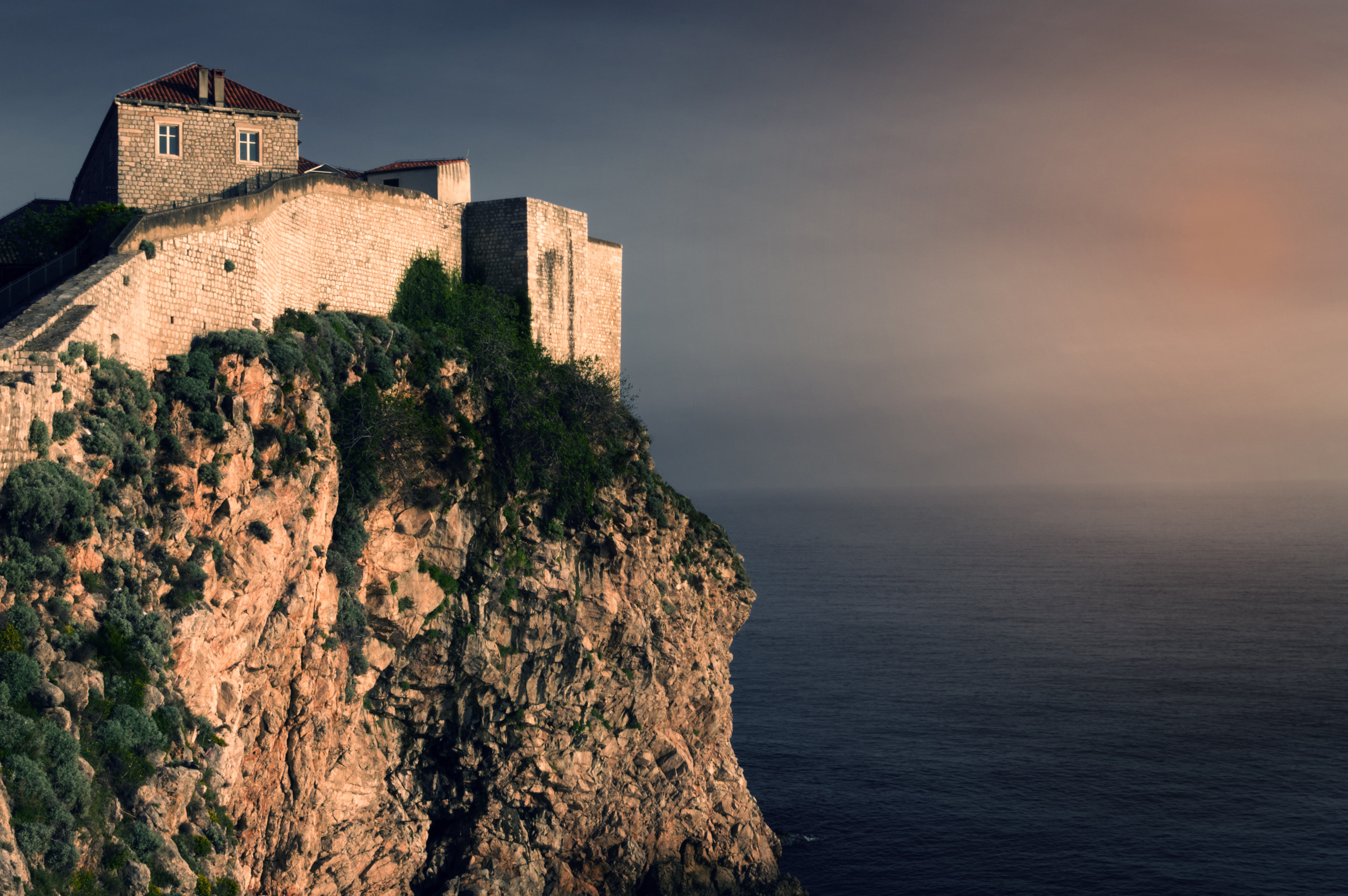
About Dubrovnik
Nothing can prepare you for your first sight of Dubrovnik. Lying 216 km (135 miles) southeast of Split and commanding a jaw-dropping coastal location, it is one of the world's most beautiful fortified cities. Its massive stone ramparts and fortress towers curve around a tiny harbor, enclosing graduated ridges of sun-bleached orange-tiled roofs, copper domes, and elegant bell towers. Your imagination will run wild picturing what it looked like seven centuries ago when the walls were built, without any suburbs or highways around it, just this magnificent stone city rising out of the sea.In the 7th century AD, residents of the Roman city Epidaurum (now Cavtat) fled the Avars and Slavs of the north and founded a new settlement on a small rocky island, which they named Laus, and later Ragusa. On the mainland hillside opposite the island, the Slav settlement called Dubrovnik grew up. In the 12th century the narrow channel separating the two settlements was filled in (now the main street through the Old Town, called Stradun), and Ragusa and Dubrovnik became one. The city was surrounded by defensive walls during the 13th century, and these were reinforced with towers and bastions in the late 15th century.From 1358 to 1808 the city thrived as a powerful and remarkably sophisticated independent republic, reaching its golden age during the 16th century. In 1667 many of its splendid Gothic and Renaissance buildings were destroyed by an earthquake. The defensive walls survived the disaster, and the city was rebuilt in baroque style.Dubrovnik lost its independence to Napoléon in 1808, and in 1815 passed to Austria-Hungary. During the 20th century, as part of Yugoslavia, the city became a popular tourist destination, and in 1979 it was listed as a UNESCO World Heritage Site. During the war for independence, it came under heavy siege. Thanks to careful restoration, few traces of damage remain; however, there are maps inside the Pile and Ploče Gates illustrating the points around the city where damage was done. It’s only when you experience Dubrovnik yourself that you can understand what a treasure the world nearly lost


Where You'll Go


