Destination Paradise
Destination Paradise
Cruise overview
WHY BOOK WITH US?
- ✔ The Deluxe Cruises’ team has extensive experience in ultra-luxury cruising.
- ✔ Call now to speak to our helpful and experienced Cruise Concierge team.
- ✔ Enjoy our Unique Deluxe Cruises Bonus for substantial savings.
- ✔ Our team will tailor your holiday to your exacting requirements.
- ✔ As agents, we work under the protection of each cruise lines ABTA / ATOL licences
About Papeete, Tahiti
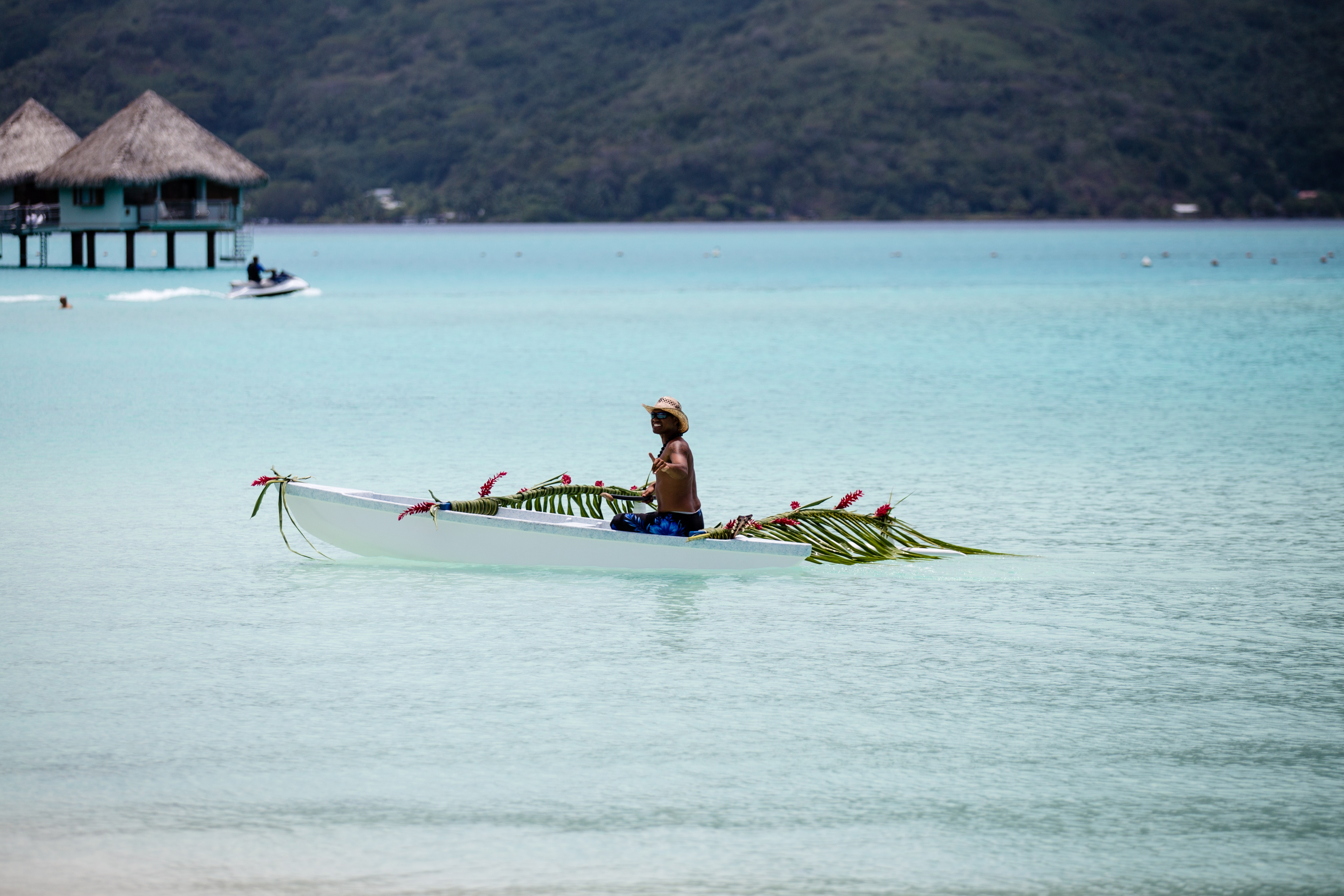
Papeete will be your gateway to the tropical paradise of French Polynesia, where islands fringed with gorgeous beaches and turquoise ocean await to soothe the soul. This spirited city is the capital of French Polynesia, and serves as a superb base for onward exploration of Tahiti – an island of breathtaking landscapes and oceanic vistas. Wonderful lagoons of crisp, clear water beg to be snorkelled, stunning black beaches and blowholes pay tribute to the island's volcanic heritage, and lush green mountains beckon you inland on adventures, as you explore extraordinary Tahiti. Visit to relax inside picturesque stilted huts, which stand out over shimmering water, as you settle into the intoxicating rhythm of life, in this Polynesian paradise.
About Papeete, Tahiti
Papeete will be your gateway to the tropical paradise of French Polynesia, where islands fringed with gorgeous beaches and turquoise ocean await to soothe the soul. This spirited city is the capital of French Polynesia, and serves as a superb base for onward exploration of Tahiti – an island of breathtaking landscapes and oceanic vistas. Wonderful lagoons of crisp, clear water beg to be snorkelled, stunning black beaches and blowholes pay tribute to the island's volcanic heritage, and lush green mountains beckon you inland on adventures, as you explore extraordinary Tahiti. Visit to relax inside picturesque stilted huts, which stand out over shimmering water, as you settle into the intoxicating rhythm of life, in this Polynesian paradise.
About Huahine


About Raiatea
About Raiatea
About Bora-Bora
Simply saying the name Bora Bora is usually enough to induce gasps of jealousy, as images of milky blue water, sparkling white beaches and casually leaning palm trees immediately spring to mind. The imagination doesn't lie, either, and if you visit, you’ll soon realise this island is every bit as gorgeous as you ever imagined. Thatched wooden huts stand out over shallow, sparkling seawater, with vivid fish swirling just below. Soak up the sun, scuba dive, or simply revel in the opulent luxury of one of the island's many magnificent resorts. If blissful inactivity doesn't appeal, then get active, and hike the greenery of the sharp Mount Pahia.
About Motu Mahaea, Society Islands
About Moorea
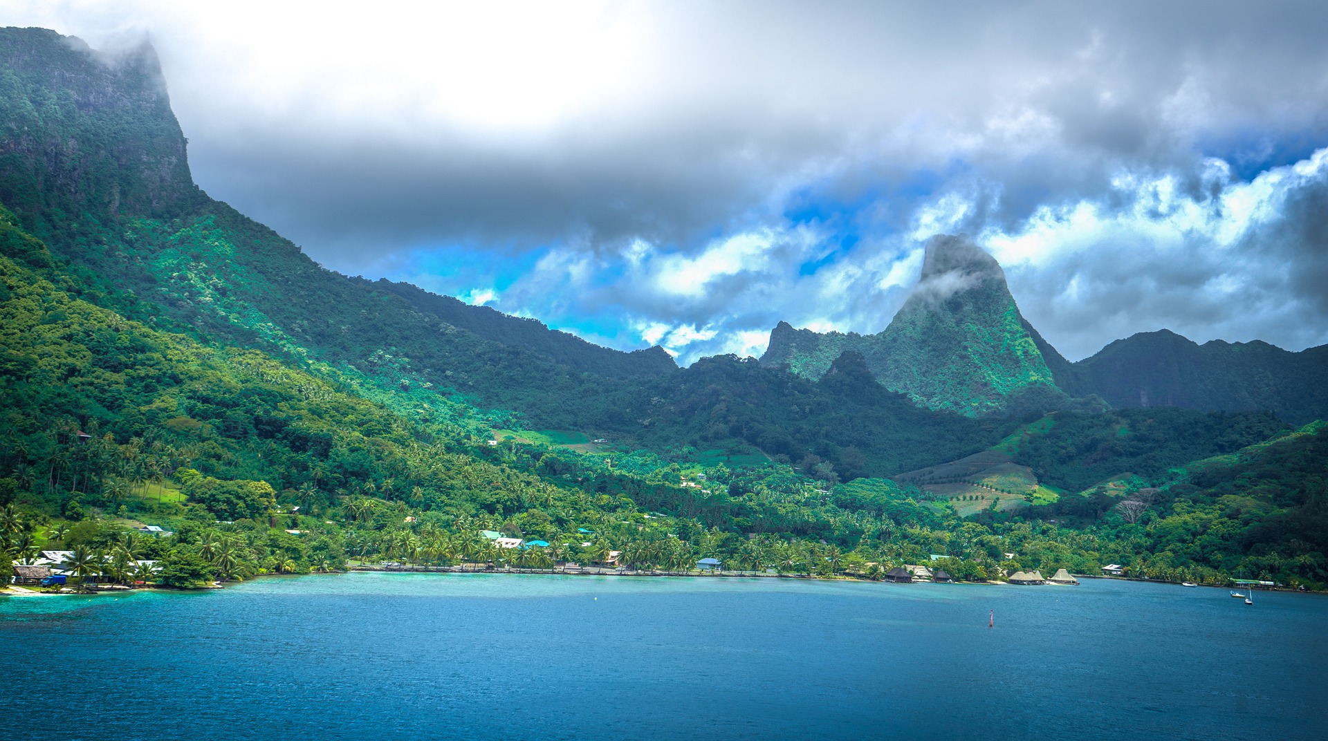
Mo’orea is one of the Society Islands of the French Polynesia. Located in the South Pacific, it is considered a magical island thanks to its majestic volcanic mountains, set against warm lagoon waters and green meadows. It is an island that attracts visitors of all abilities wanting to explore both above and below the ocean waters.
About Hangaroa, Easter Island
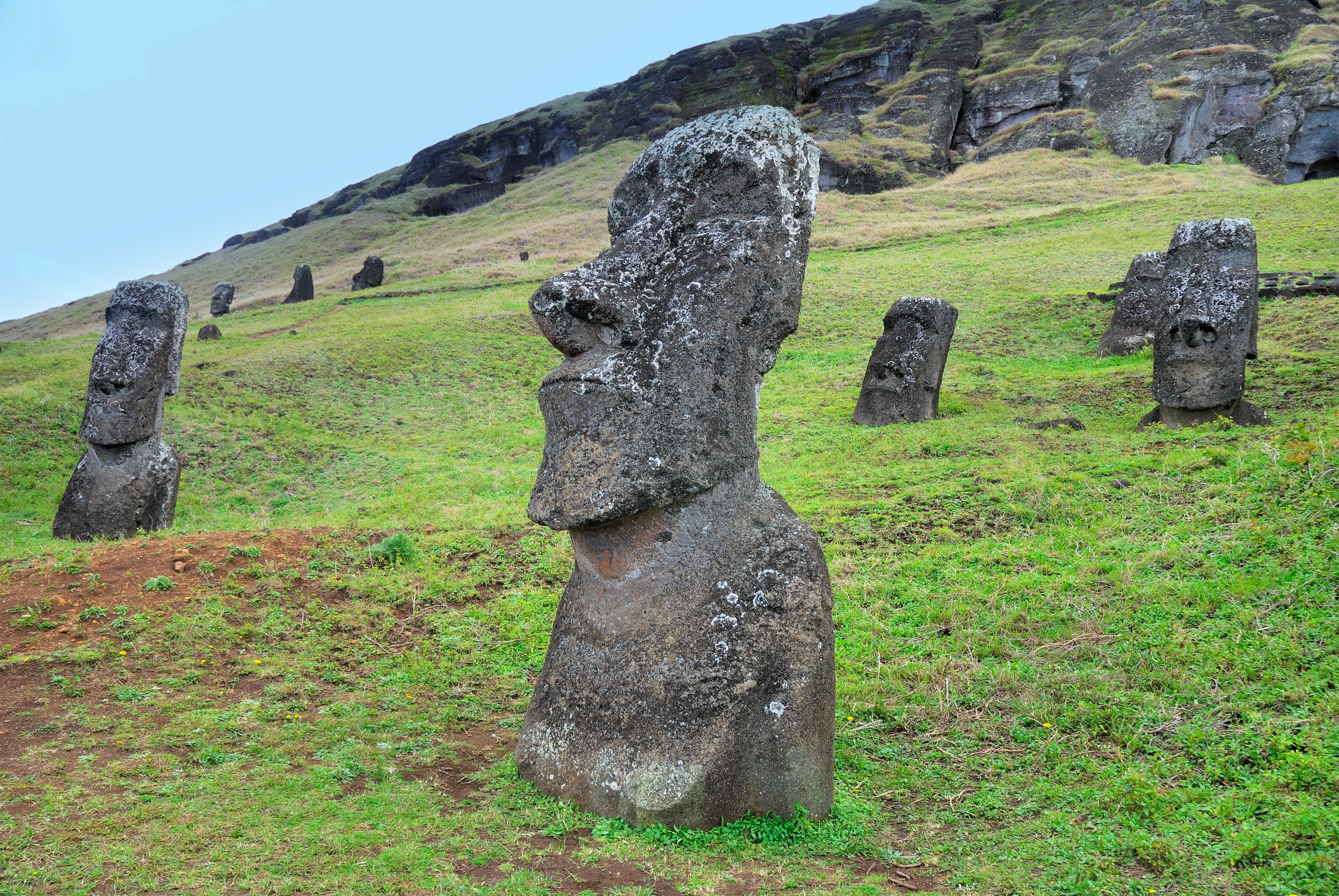
Discovered (by the Western world) on Easter Sunday, 1722, Easter Island is a UNESCO World Heritage Site and one of the most isolated places on the face of the Earth, some 2,300 miles from the Chilean mainland. Although more Polynesian than South American in character, the 64-square mile island was annexed by Chile in 1888, and is now famous as the world’s largest ‘open air museum’ on account of the Moai, or human-like stone statues, that can be found on the island. The Moai remain very much a mystery, which archaeologists are still trying to unlock by interpreting an ancient language of the Rapa Nui, which is the key to understanding this culture, and is written on the so called ‘rongo rongo tablets’. The island owes its origin to three volcanoes which erupted some three million years ago: Poike, Rano Kau and Maunga Terevaka. It is not known when or how the island was first populated, but the most credible theory suggests that the Rapa Nui people came from other Pacific islands in the 4th century AD. In addition to the cultural and archaeological interest, there are the beautiful beaches, transparent waters, and coral reefs that might be expected of a Pacific Island.

About Hangaroa, Easter Island
Discovered (by the Western world) on Easter Sunday, 1722, Easter Island is a UNESCO World Heritage Site and one of the most isolated places on the face of the Earth, some 2,300 miles from the Chilean mainland. Although more Polynesian than South American in character, the 64-square mile island was annexed by Chile in 1888, and is now famous as the world’s largest ‘open air museum’ on account of the Moai, or human-like stone statues, that can be found on the island. The Moai remain very much a mystery, which archaeologists are still trying to unlock by interpreting an ancient language of the Rapa Nui, which is the key to understanding this culture, and is written on the so called ‘rongo rongo tablets’. The island owes its origin to three volcanoes which erupted some three million years ago: Poike, Rano Kau and Maunga Terevaka. It is not known when or how the island was first populated, but the most credible theory suggests that the Rapa Nui people came from other Pacific islands in the 4th century AD. In addition to the cultural and archaeological interest, there are the beautiful beaches, transparent waters, and coral reefs that might be expected of a Pacific Island.
About Valparaiso
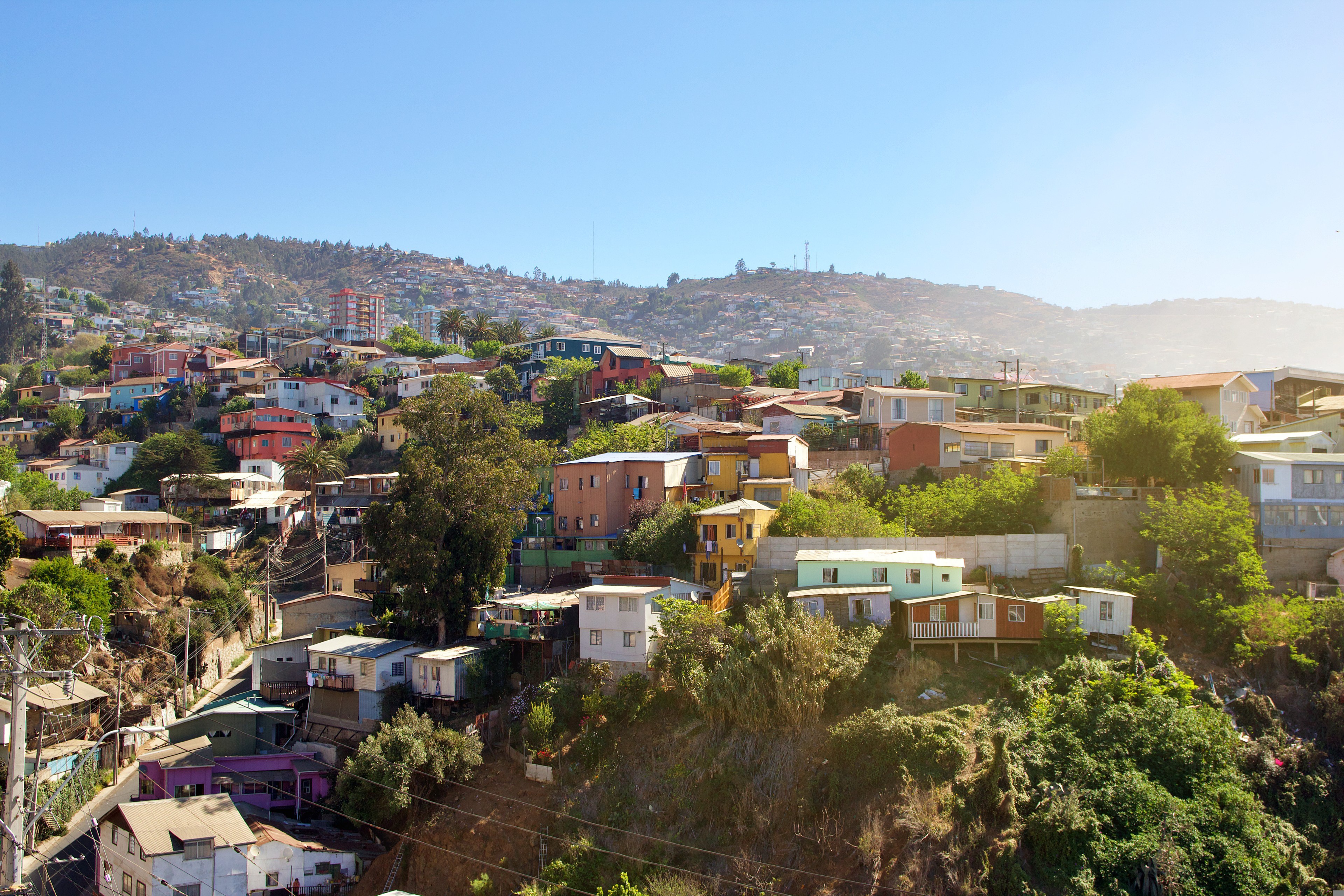
Valparaíso's dramatic topography—45 cerros, or hills, overlooking the ocean—requires the use of winding pathways and wooden ascensores (funiculars) to get up many of the grades. The slopes are covered by candy-color houses—there are almost no apartments in the city—most of which have exteriors of corrugated metal peeled from shipping containers decades ago. Valparaíso has served as Santiago's port for centuries. Before the Panama Canal opened, Valparaíso was the busiest port in South America. Harsh realities—changing trade routes, industrial decline—have diminished its importance, but it remains Chile's principal port. Most shops, banks, restaurants, bars, and other businesses cluster along the handful of streets called El Plan (the flat area) that are closest to the shoreline. Porteños (which means "the residents of the port") live in the surrounding hills in an undulating array of colorful abodes. At the top of any of the dozens of stairways, the paseos (promenades) have spectacular views; many are named after prominent Yugoslavian, Basque, and German immigrants. Neighborhoods are named for the hills they cover. With the jumble of power lines overhead and the hundreds of buses that slow down—but never completely stop—to pick up agile riders, it's hard to forget you're in a city. Still, walking is the best way to experience Valparaíso. Be careful where you step, though—locals aren't very conscientious about curbing their dogs.
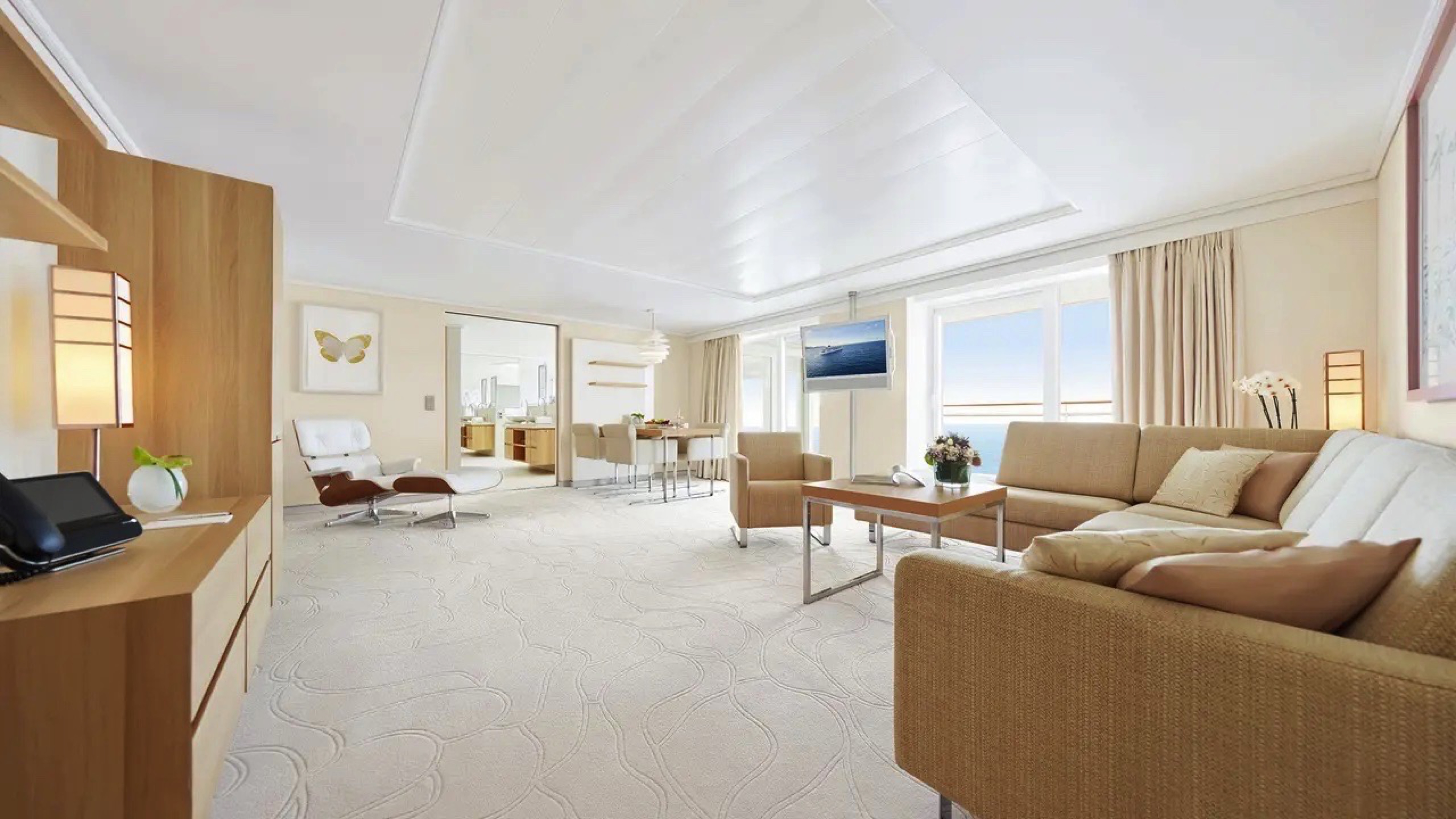
The Owner Suite is much more than our most exclusive suite, it is an exquisite residence on the seas of the world. Enjoy every conceivable amenity in over 114 square meters of personal freedom.
- Living area: 99 m²; veranda 15 m²
- Separate living and sleeping areas
- Separate dining table
- guest toilet
- bathroom with two sinks
- shower with steam sauna
- whirlpool and daybed in the bathroom area
- butler service
- Free minibar
- Exclusive service privileges (details experience)
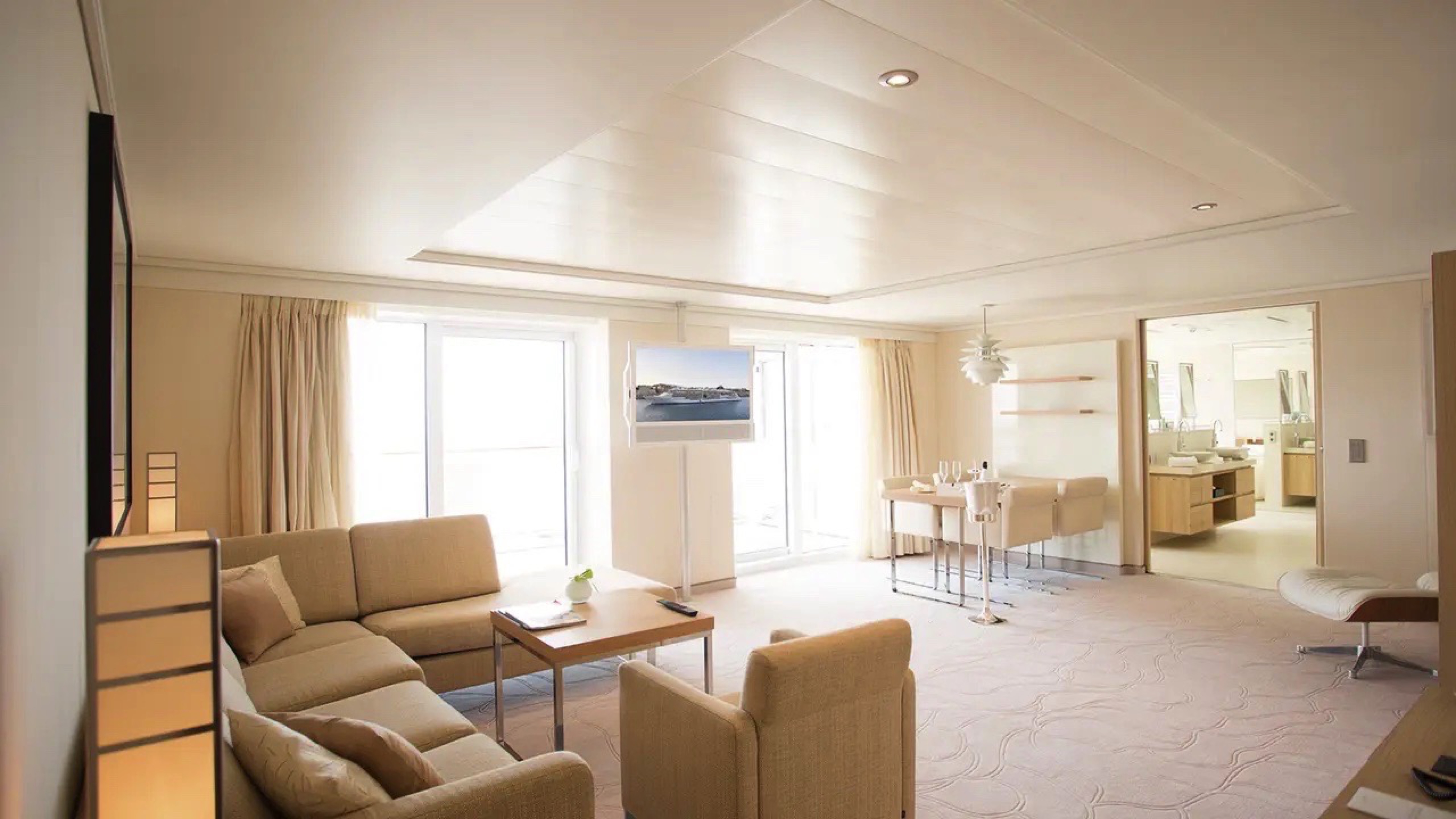
Enjoy luxurious spaciousness on the sea in the Grand Penthouse Suite – in the daybed with a view of the wide sea or while bathing in the middle of the ocean in your private whirlpool.
- Living area: 78 m²; Veranda: 10 m²
- Separate living and sleeping areas
- Separate dining table
- guest toilet
- bathroom with two sinks
- shower with steam sauna
- whirlpool and daybed in the bathroom
- butler service
- Free minibar
- Exclusive service privileges (detailsexperience)
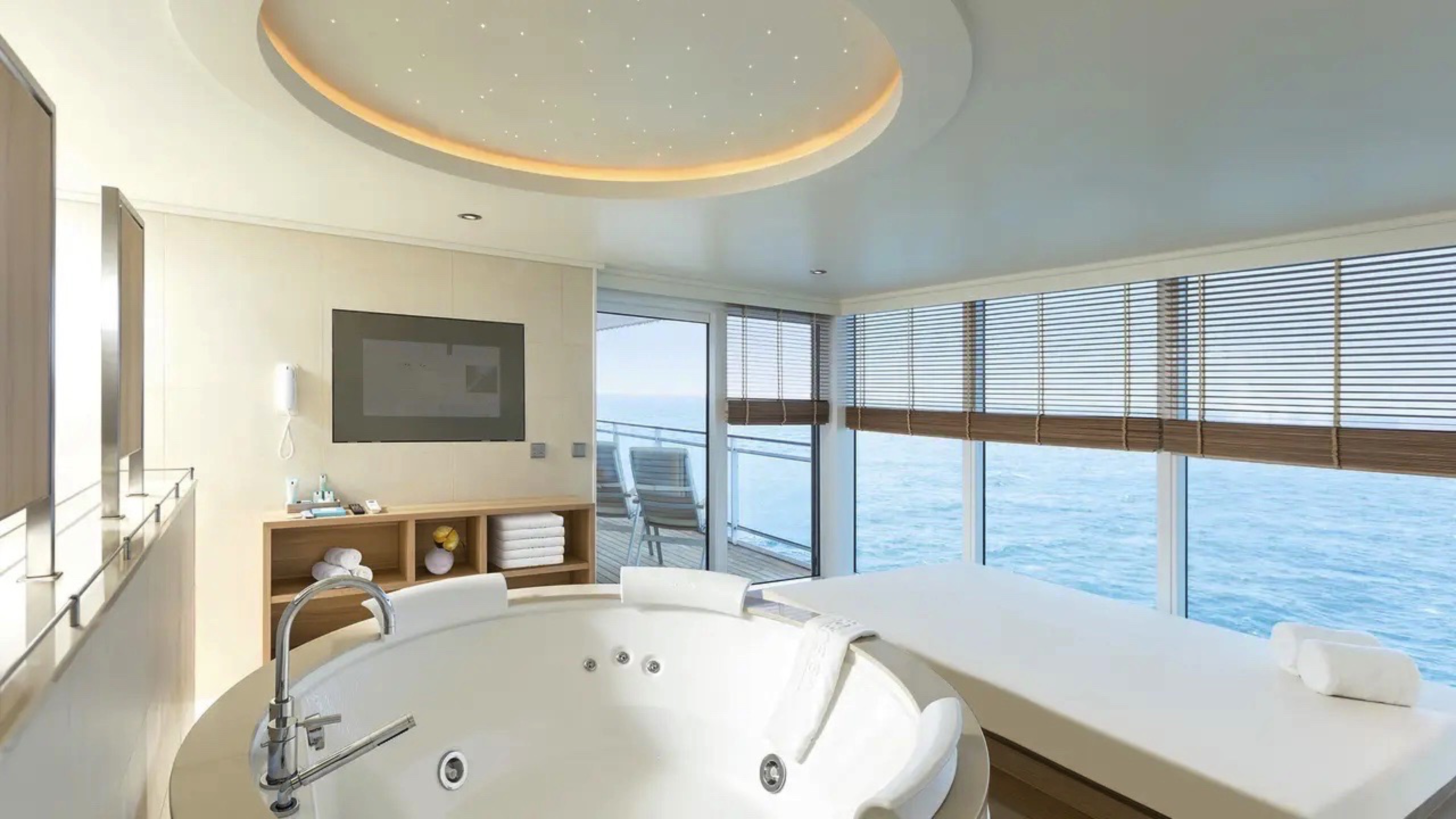
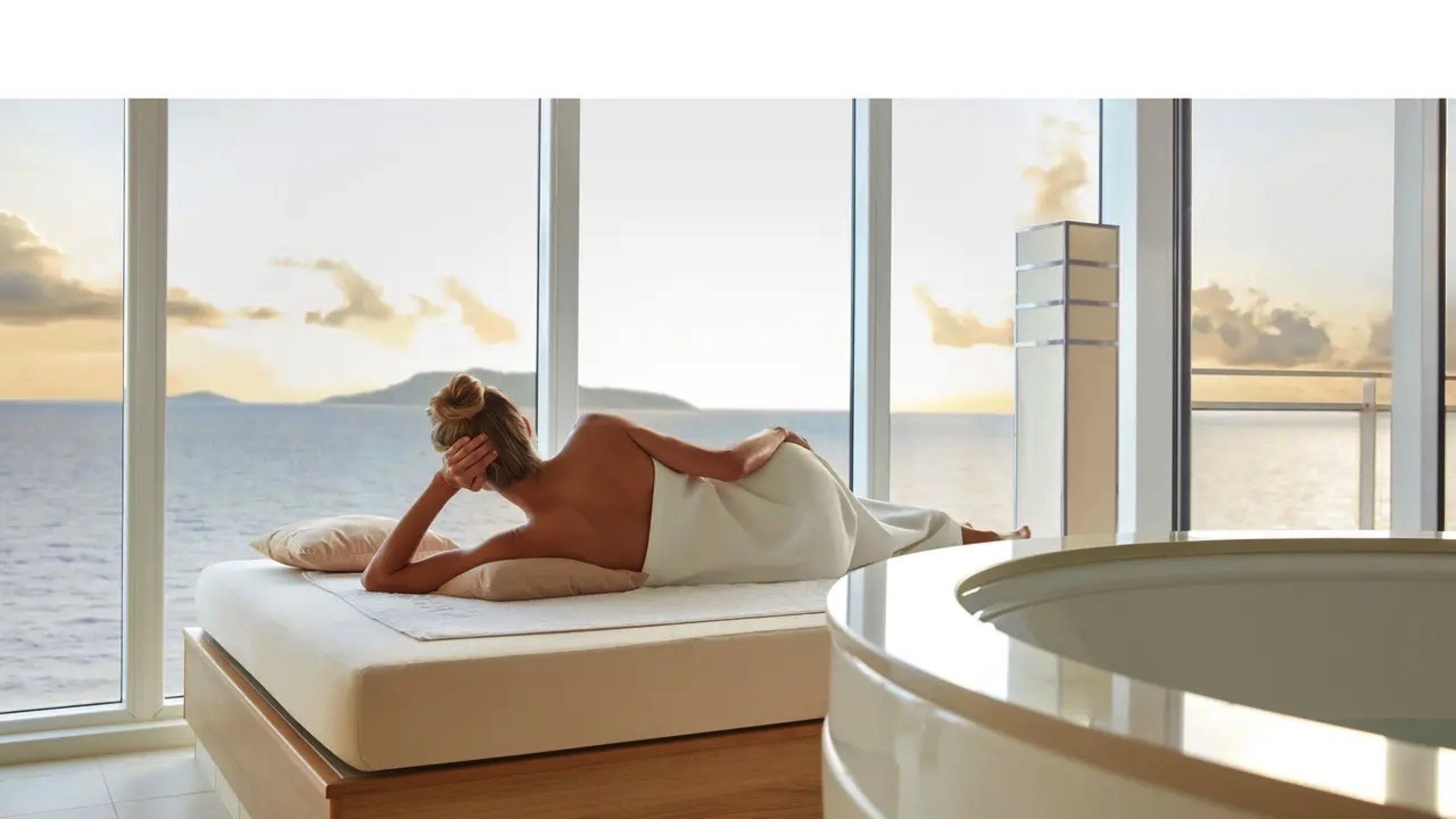
A private oasis of well-being and a stylish haven of peace – in the Grand Ocean Suite you can leave everyday life far behind thanks to a spa bath with panoramic sea views.
- Living area: 42 m²; Veranda: 10 m²
- bathroom with two sinks
- Separate toilet
- daylight in the bathroom
- shower with steam sauna
- whirlpool tub
- Free minibar
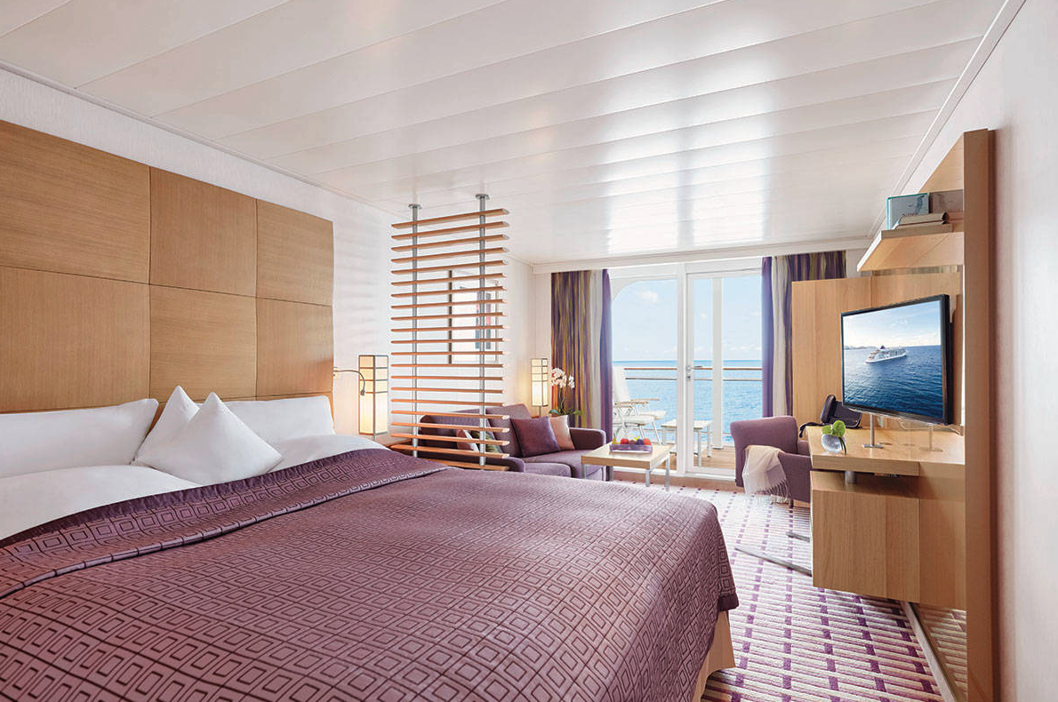
Awonderfully spacious suite with every comfort, uniquely located on the upper decks - is there a nicer place to relax? In the Penthouse Suite, enjoy the endless view of the sea and the amenities of a classic penthouse suite.
- Living area: 42 m²; Veranda: 10 m²
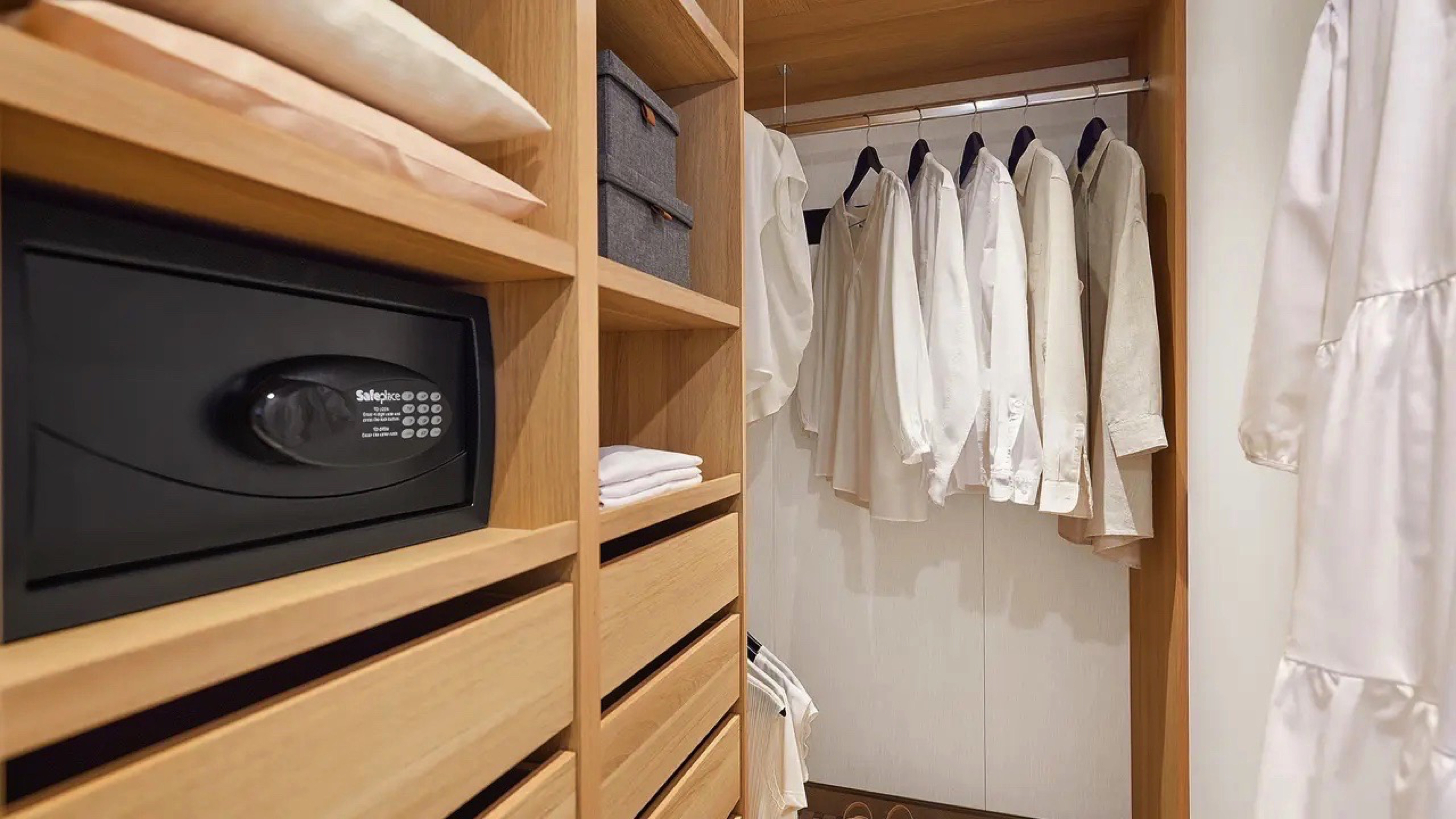
- walk-in closet
- bathroom with two sinks
- whirlpool tub and separate shower
- Separate toilet
- butler service
- Free minibar
- Exclusive service privileges (detailsexperience)
The Penthouse Suite can also be booked with barrier-free facilities (category 13). Here the toilet is in the bathroom.
Everyone feels at home here. Lots of space for you and your personal wishes - that's what makes for a relaxing family holiday. In the family apartment, parents and children live in two separate areas that are connected by a door and the balcony. One of the living areas is specifically designed for our younger cruisers.
- Living area: 2× 20 m²; Veranda: 14m² (divisible to 2× 7 m²)
- connecting door between the rooms and verandas
- Separate toilets
- Free minibars
One of the living areas is specifically designed for our younger cruisers:
- Two single beds, one of which is a Pullman bed (80 x 200 cm)
- bathtub (140 x 80 cm)
- Age-appropriate games including games console
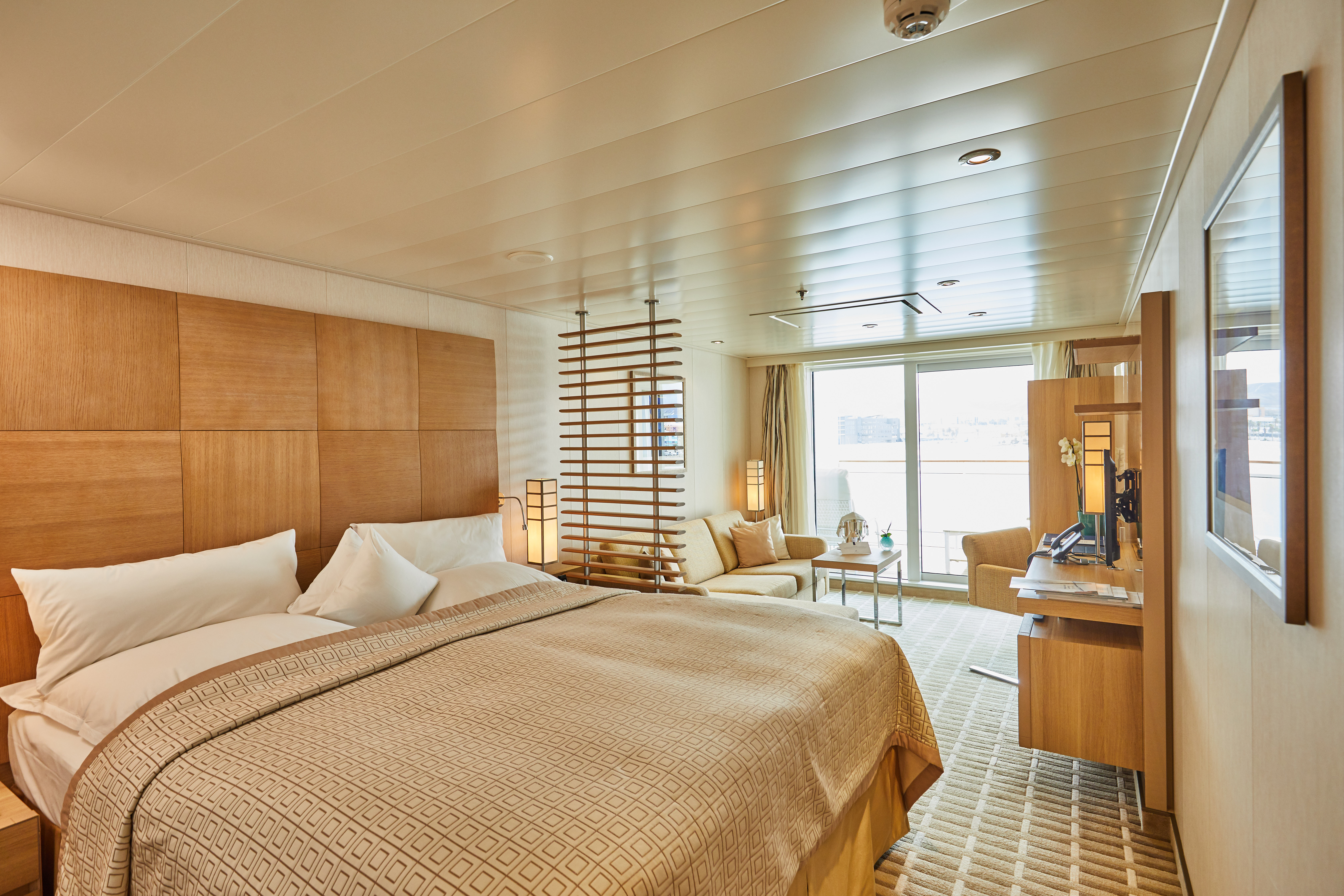
If you want to start the day with a fantastic view, you will have a wonderful time in the Ocean Suite.
- Living area: 28 m²; Veranda: 7 m²
- daylight in the bathroom
- bathroom with two sinks
- whirlpool tub and separate shower
- Separate toilet
- Free minibar
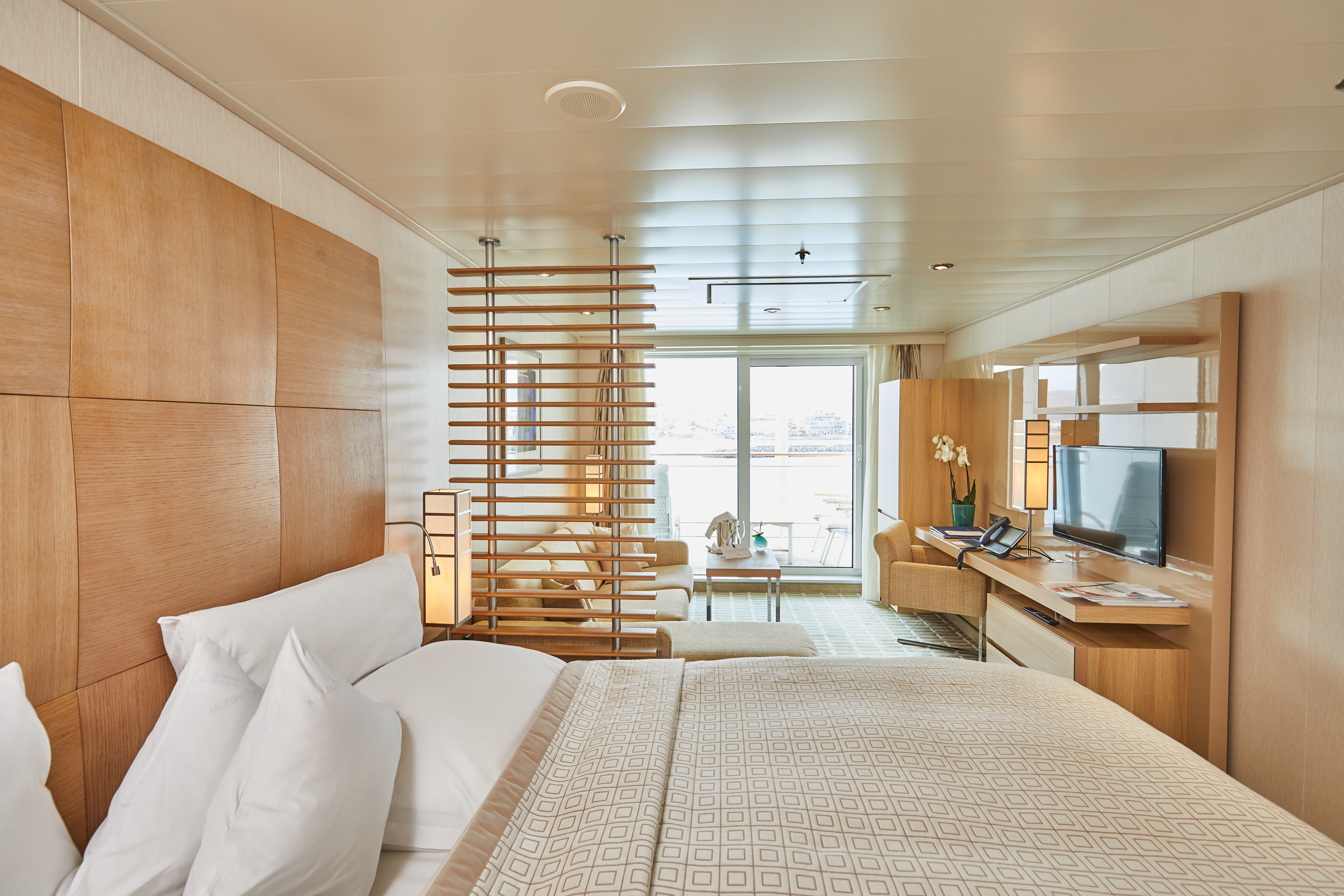
This comfortable suite offers plenty of space for relaxing days on board and a cruise with fantastic views.
- Living area: 28 m²; Veranda: 7 m²
- walk-in closet
- Exclusive living area with chaise longue
- bathtub and separate shower
- Free minibar
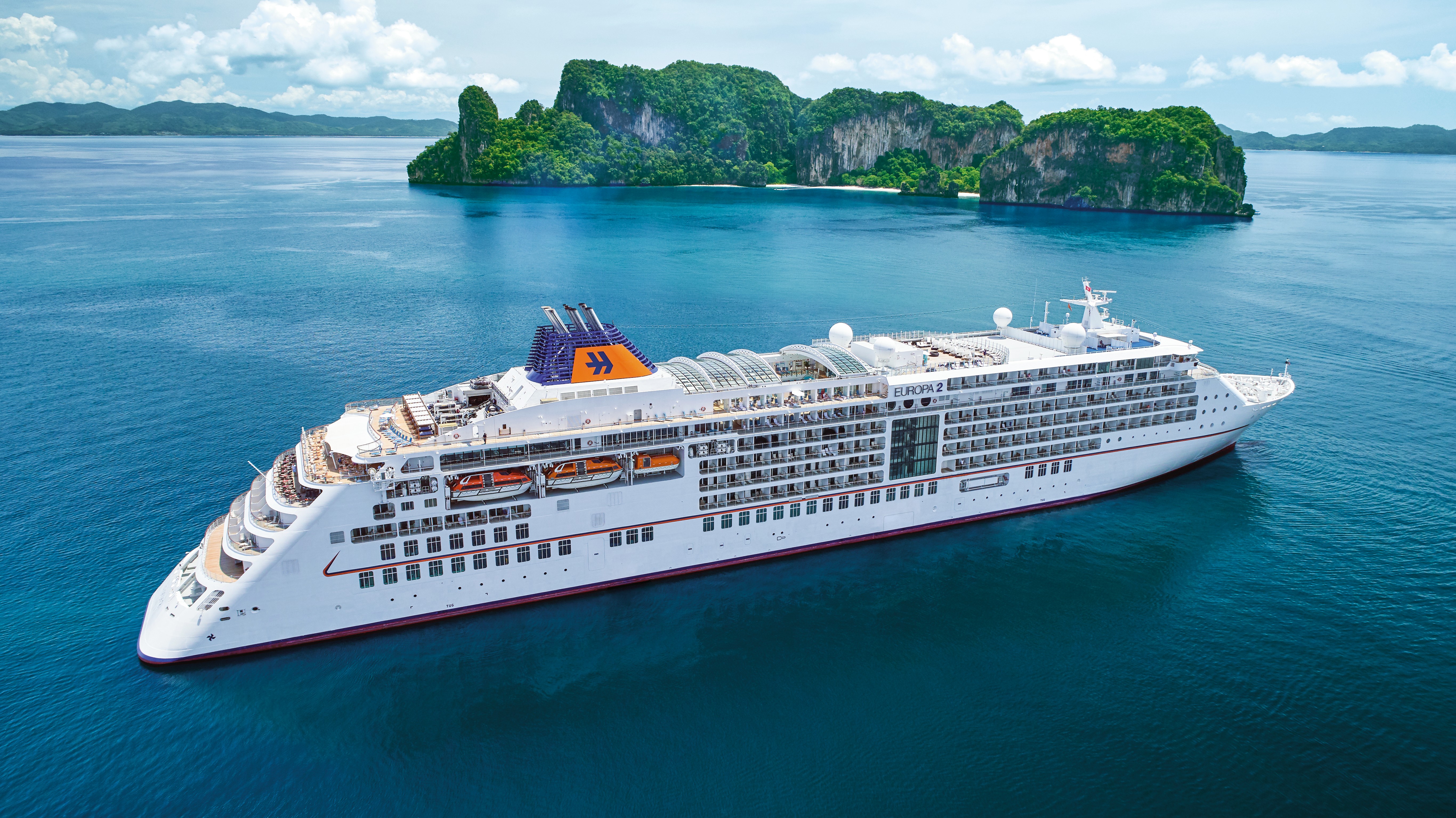
MS EUROPA 2
With a maximum of 500 guests, you can expect the highest level of personal space and individual service. And all this with an extremely luxurious ratio of almost one to one. The EUROPA 2 combines comfort with a high level of flexibility by also heading to small ports and remote corners off the beaten track. Welcome on board the best cruise ship in the world!*
Enjoy every moment
Casual and individual, exquisite and stylish, entirely in line with your requirements – this is the aim of the EUROPA 2 philosophy. Experience a symbiosis of perfection, elegance and aesthetics, and enjoy lifestyle at the highest level in a modern, relaxed atmosphere.
Experience a unique ship
Experience the great freedom - in a relaxed and individual way, yet high quality and stylish. Enjoy a symbiosis of perfection and elegance as well as the highest level of casual luxury - culinary highlights, first-class wellness and fitness offers, exceptional on-board entertainment complemented by the highest level of privacy and individual freedom. With casual luxury for a maximum of 500 guests, the EUROPA 2 combines design and lifestyle, the highest standards and individual freedom.
Ship Facts
| Launch Year | 2013 | ||||
| Refit Year | 2017 | ||||
| Language | de+en | ||||
| Gross Tonnage | 42830 | ||||
| Length | 225 | ||||
| Width | 27 | ||||
| Currency | EUR | ||||
| Speed | 21 | ||||
| Capacity | 500 | ||||
| Crew Count | 370 | ||||
| Deck Count | 7 | ||||
| Cabin Count | 251 | ||||
| Large Cabin Count | N/A | ||||
| Wheelchair Cabin Count | 2 | ||||
| Electrical Plugs |
|
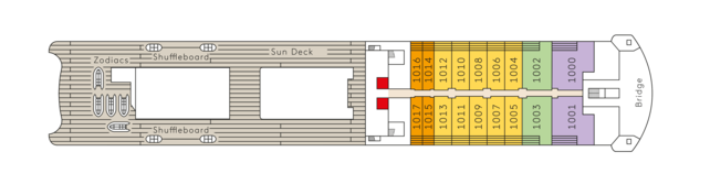
Deck 10
- Zodiacs
- Shuffleboard
- Sun Deck
- Bridge
- Veranda Suites
- Penthouse Suites
- Grand Penthouse Suites
- Owner Suites
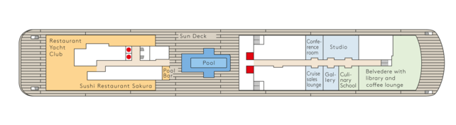
Deck 9
- Restaurant Yacht Club
- Sushi Restaurant Sakura
- Sun Deck
- Pool
- Conference Room
- Studio
- Gallery
- Culinary School
- Belvedere with library and coffee lounge
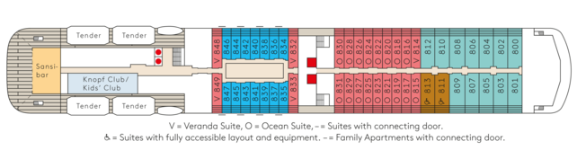
Deck 8
- Sansibar
- Tender
- Knopf Club / Kids Club
- Veranda Suites or Ocean Suites
- Family Apartments
- Penthouse Suites (accessible)
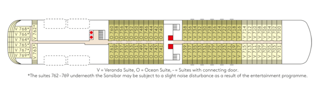
Deck 7
- Veranda Suites or Ocean Suites
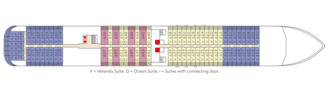
Deck 6
- Veranda Suites or Ocean Suites
- Owner Suites
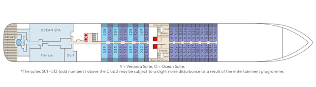
Deck 5
- Ocean Spa
- Sauna
- Jacuzzi
- Golf
- Embarkation and disembarkation
- Grand Ocean Suites
- Veranda Suites or Ocean Suites
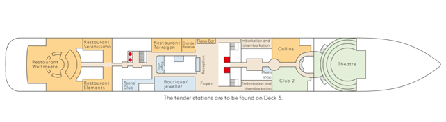
Deck 4
- Restaurant Weltmeere
- Restaurant Serenissima
- Restaurant Elements
- Restaurant Tarragon
- Grand Reserve
- Tour Office
- Teens' Club
- Boutique / Jeweller
- Reception
- Foyer
- Piano Bar
- Embarkation / disembarkation
- Photo shop
- Club 2
- Collins
- Theatre
Haute cuisine. Extremely casual.
With a keen eye for the finest details, the EUROPA 2's chef will open up new culinary horizons for you. He also offers vegetarian cuisine lovers a fine selection of artfully arranged dishes of the highest quality. Enjoy modern creations or timeless classics with more flexible table times and no fixed seating in our gourmet restaurants.
- Exclusive gourmet restaurants, all at no extra charge, with flexible table times and no fixed seating
- Full board: breakfast, late breakfast, lunch and dinner, patisserie and snacks
- Tea and coffee specialties.
Weltmeere
Restaurant Weltmeere is the biggest restaurant on board. It is located at the stern of the ship and is quite striking thanks to its spacious room concept.
The world a la carte
The flagship restaurant in the heart of the EUROPA 2: Enjoy a daily changing international gourmet cuisine and go on a culinary journey. The Weltmeere bears the very personal signature of our chef and stands for creative culinary highlights - always interpreted in a new and unusual way, of course also vegetarian.
CREATIVE CUISINE WITH A PERSONAL TOUCH
Our chef de cuisine looks forward to pampering you with the highest possible standard of cuisine. The culinary range spans from international to vegetarian menus, which are all interpreted in new and surprising ways.
- The restaurant on board where our chefs de cuisine demonstrate their very personal flair.
- Magical culinary moments with international and vegetarian menus, always interpreted in new and unusual ways.
Tarragon
The Tarragon stands for great French cuisine and bistro classics, served in a stylish Art Deco atmosphere. Look forward to specialties that are as simple as they are sophisticated - like the beef tartare prepared fresh at the table.
Elements
Whether Indian, Vietnamese or traditional Chinese – at Elements the sun rises in the east, even in culinary terms. Enjoy the variety of Asian cuisine, the aroma of lemongrass, seafood and lime – and the exotic, modern flair of Elements.
Serenissima
Experience exquisite classics of Italian-Mediterranean cuisine: The Serenissima combines everything you love about Italian enjoyment and lifestyle. The house recommendation is the Ditaloni con Aragosta Marinata allo Zafferano.
Yacht Club
At the Yacht Club you can enjoy the finest cuisine from breakfast to dinner and an incomparable panoramic view of the sea. Look forward to fresh salads, antipasti from the buffet and grill specialties, fish, pasta and dishes prepared à la minute directly from the open cooking stations.
Sakura
Our Asian chef has mastered the art of conjuring up small masterpieces from the finest ingredients. The results are traditional and modern interpretations of Japanese cuisine as well as exquisite sushi, from classic to creative. In the relaxed atmosphere of the Sakura, you can enjoy an exclusive menu - with a sea view, of course.
Grand Reserve
The Grande Réserve, which is connected to the Tarragon, is all about exquisite wines, which you can also taste in a small group under the guidance of a sommelier (for an additional charge).
Lights out, spotlight on.
When the curtain opens, an unforgettable evening begins. With great acrobatics, dance, comedy, interesting talks, lectures or moving music from classical to pop. Let yourself be inspired by artists, performers and entertainers of the highest level on board the EUROPA 2. A varied show and a diverse entertainment program await you on every trip.
Enjoyment is a question of style
Six bars with unique charm to celebrate the day or night. Each with its own, distinctive atmosphere, from loungey to glamorous. This way you can give every night the perfect start and every day the perfect end. Discover the largest selection of champagne at sea on board the EUROPA 2 and let our sommeliers inspire you.
- Daily changing entertainment program with lectures, concerts, workshops and a sophisticated evening program, for example with live shows or readings
- Free internet on board - One hour per guest per day.
Zanzibar
The younger sister of the Sansibar on Sylt sees much more of the world: the view from the open-air bar over the sea and the parties on the dance floor to DJ sounds are unforgettable. And for a late breakfast and small dishes in the afternoon and evening, it is also the top location.
Belvedere
With its incomparable panorama, the Belvedere is a cozy place to linger. But above all, it is an atmospheric lounge where readings and concerts also take place.
Piano Bar
The piano bar follows the tradition of bars in classic grand hotels: you can reflect on the day with a first-class drink and pleasantly understated music from the Steinway grand piano. You can also enjoy a sea view that probably no other hotel in the world can offer.
Club 2
With its cosy bar and lounge area and small stage, Club 2 adapts to the theme of the itinerary and is constantly reinventing itself with its colour and lighting concept. Let the day end with exquisite drinks and small snacks, in keeping with the destination, and be inspired by the diverse entertainment programme.
Collins
The perfect setting for the perfect drink, nothing more and nothing less. In a classic, stylish ambience with club chairs and precious woods. With Cuban specialties from the humidor.
Theatre
- Multifaceted shows.
- Performances with numerous guest stars, soloists, entertainers and acrobats.
- Concerts from classical music to pop.
- Vaudeville highlights.
- State-of-the-art stage technology with LED screen.
Art
art2sea
Look forward to an inspiring journey into the world of art - art2sea welcomes important artists, gallery owners, art experts or curators from major museums. In cooperation with renowned experts, fascinating insights into the international art world are created. Exclusive exhibition, gallery and museum visits offer you a look behind the scenes.
Art on the High Seas
A walk through the bright corridors of the EUROPA 2 is as inspiring as a day in a museum of contemporary art. More than 890 original paintings and exhibits, photographs and sculptures - from Damien Hirst to Gerhard Richter - accompany the ship and its guests around the world. This collection is complemented by changing exhibitions and lectures by artists on various art historical topics.
pool bar
In the pool or at the bar next to it – where does the perfect refreshment await? The relaxed meeting point on the pool deck serves snacks for breakfast and lunch, legendary waffles in the afternoon, fresh juices and coffee specialties. It offers a casual atmosphere until the evening.
MS EUROPA Unplugged
Instead of in large concert halls, you can experience your star acoustically and up close - the concerts in the EUROPA 2 theatre thus have an almost private touch. Enjoy exclusive encounters with outstanding musicians.