Expedition Easter Island And Austral Islands - Life Between Motus And Moai
Expedition Easter Island And Austral Islands - Life Between Motus And Moai
Cruise overview
WHY BOOK WITH US?
- ✔ The Deluxe Cruises’ team has extensive experience in ultra-luxury cruising.
- ✔ Call now to speak to our helpful and experienced Cruise Concierge team.
- ✔ Enjoy our Unique Deluxe Cruises Bonus for substantial savings.
- ✔ Our team will tailor your holiday to your exacting requirements.
- ✔ As agents, we work under the protection of each cruise lines ABTA / ATOL licences
About Puerto Montt
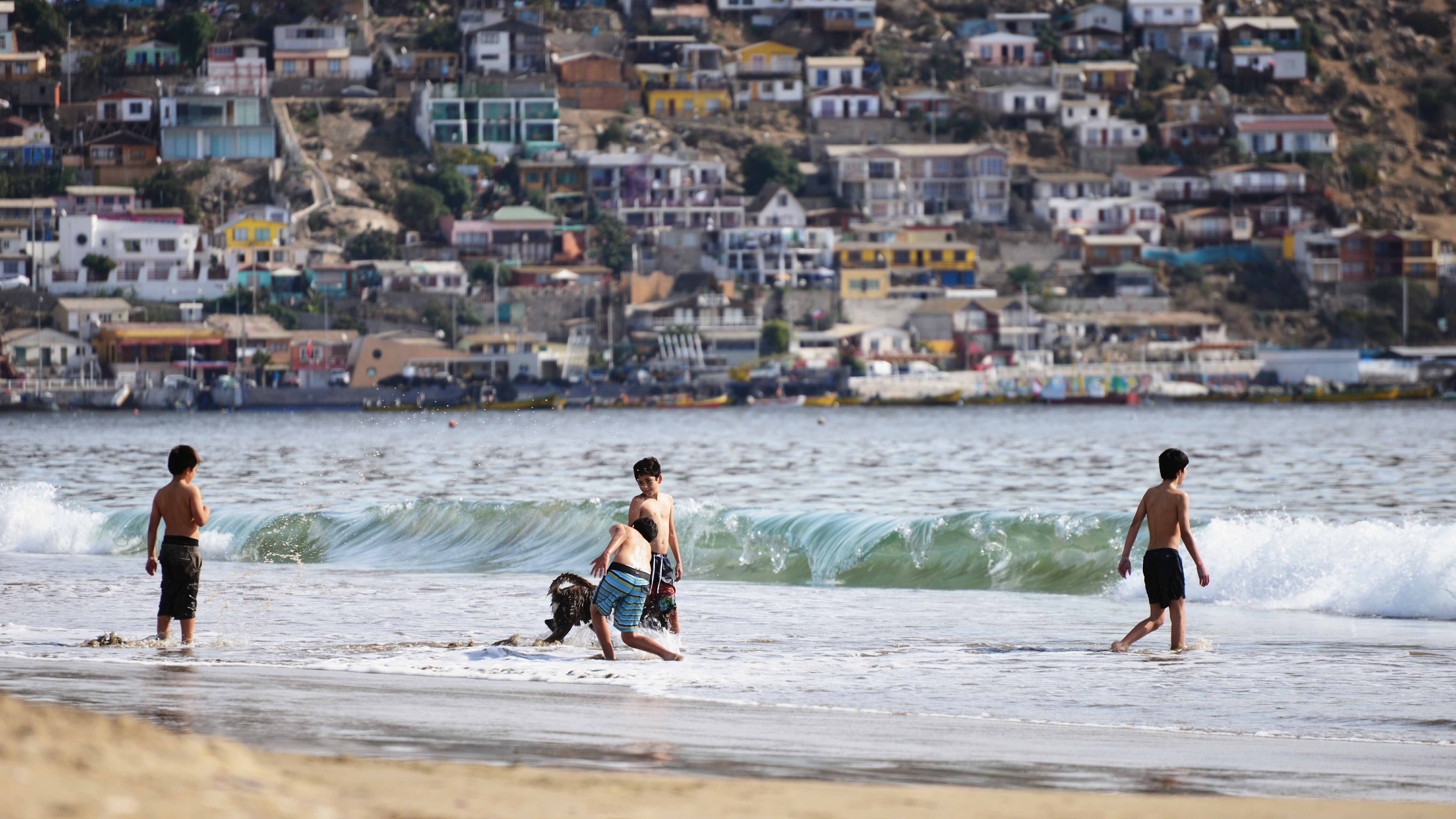
For most of its history, windy Puerto Montt was the end of the line for just about everyone traveling in the Lake District. Now the Carretera Austral carries on southward, but for all intents and purposes Puerto Montt remains the region's last significant outpost, a provincial city that is the hub of local fishing, textile, and tourist activity.Today the city center is full of malls, condos, and office towers—it's the fastest-growing city in Chile—but away from downtown, Puerto Montt consists mainly of low clapboard houses perched above its bay, the Seno de Reloncaví. If it's a sunny day, head east to Playa Pelluco or one of the city's other beaches. If you're more interested in exploring the countryside, drive along the shore for a good view of the surrounding hills.
About Talcahuano
About San Juan Bautista (Robinson Crusoe Island)
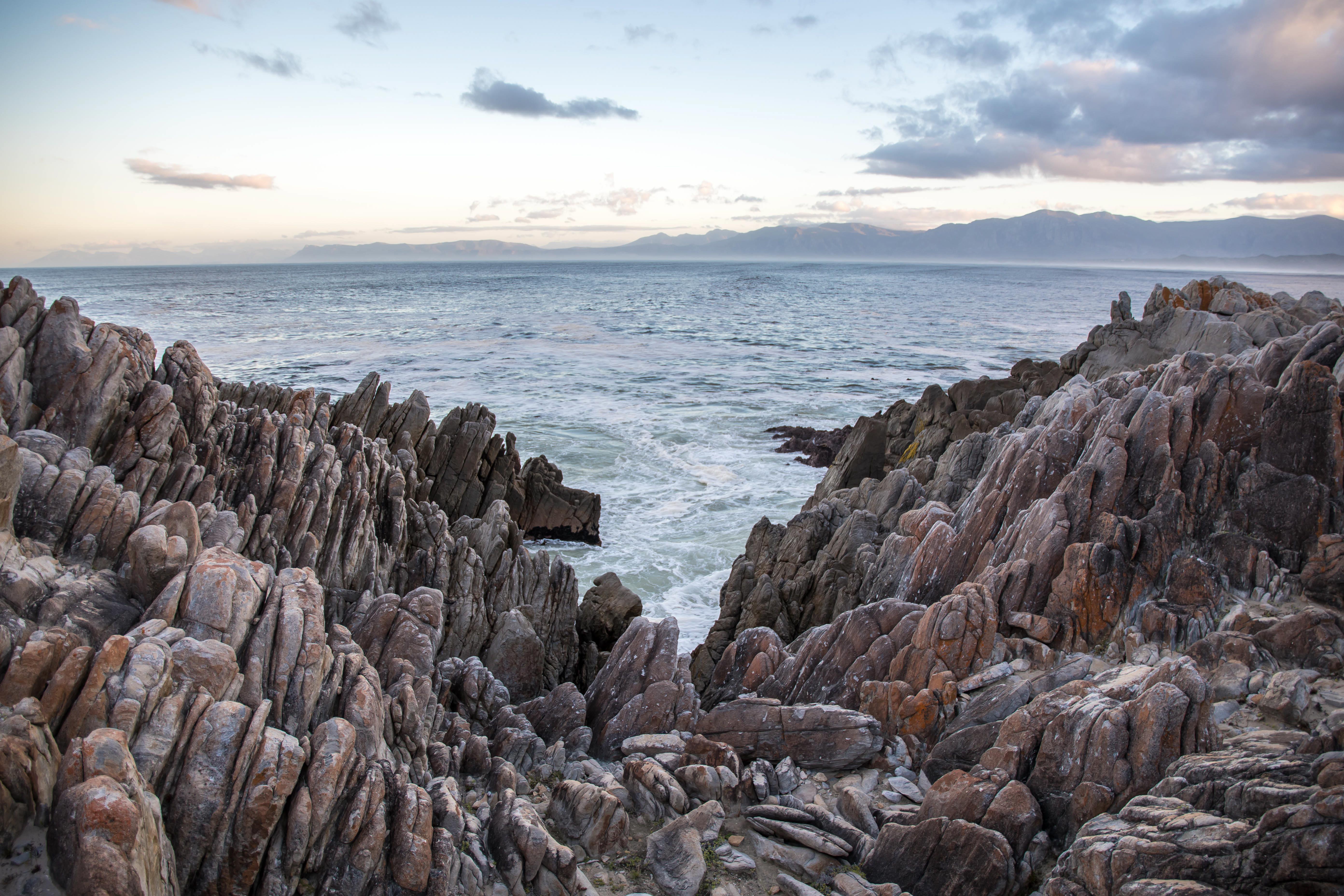
Robinson Crusoe Island is located 600 kilometres off the coast of Chile. The island is a rugged volcanic speck where 70 percent of its plant species are endemic, and is the largest of the Juan Fernandez Islands, a small archipelago that since 1935 is a Chilean National Park which was declared a UNESCO World Biosphere Reserve. This island has witnessed and played an important role in Chilean and world history. In 1750 the village of San Juan Bautista was founded at Cumberland Bay and by 1779 there were already 7 fortresses bristling with guns. The island’s isolation offered Spain a splendid place for setting up a penal colony, to which high-ranking Chilean patriots were deported in the early 19th century. In 1915, during the First World War, three British ships and a German one, the Dresden, engaged in a sea battle which ended with the scuttling of the German cruiser. Today there are currently around one thousand people living in the archipelago, most of them in the village of San Juan Bautista engaged in fishing for the “pincer-less lobster”, a delicacy in the mainland.
About Hangaroa, Easter Island
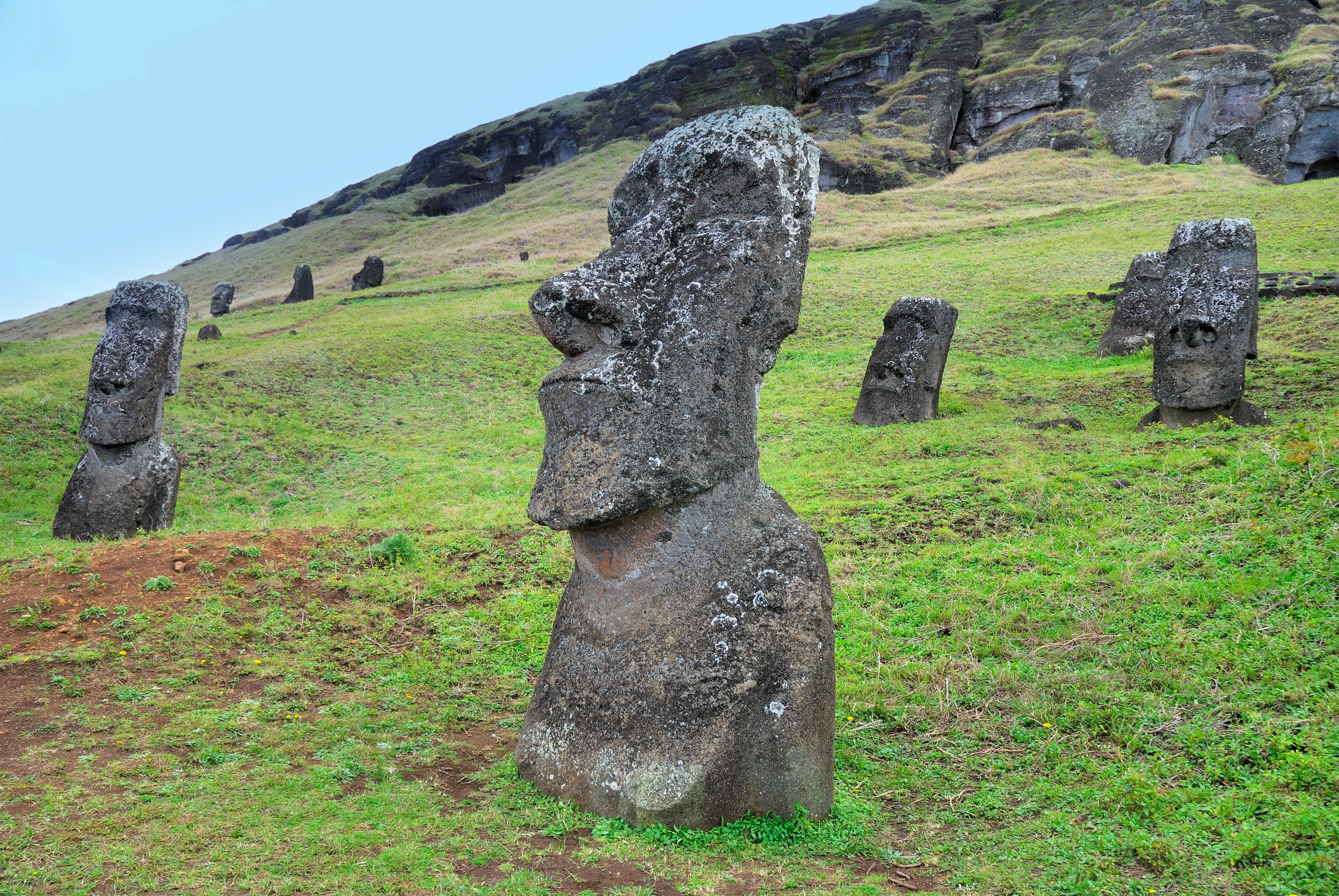
Discovered (by the Western world) on Easter Sunday, 1722, Easter Island is a UNESCO World Heritage Site and one of the most isolated places on the face of the Earth, some 2,300 miles from the Chilean mainland. Although more Polynesian than South American in character, the 64-square mile island was annexed by Chile in 1888, and is now famous as the world’s largest ‘open air museum’ on account of the Moai, or human-like stone statues, that can be found on the island. The Moai remain very much a mystery, which archaeologists are still trying to unlock by interpreting an ancient language of the Rapa Nui, which is the key to understanding this culture, and is written on the so called ‘rongo rongo tablets’. The island owes its origin to three volcanoes which erupted some three million years ago: Poike, Rano Kau and Maunga Terevaka. It is not known when or how the island was first populated, but the most credible theory suggests that the Rapa Nui people came from other Pacific islands in the 4th century AD. In addition to the cultural and archaeological interest, there are the beautiful beaches, transparent waters, and coral reefs that might be expected of a Pacific Island.

About Hangaroa, Easter Island
Discovered (by the Western world) on Easter Sunday, 1722, Easter Island is a UNESCO World Heritage Site and one of the most isolated places on the face of the Earth, some 2,300 miles from the Chilean mainland. Although more Polynesian than South American in character, the 64-square mile island was annexed by Chile in 1888, and is now famous as the world’s largest ‘open air museum’ on account of the Moai, or human-like stone statues, that can be found on the island. The Moai remain very much a mystery, which archaeologists are still trying to unlock by interpreting an ancient language of the Rapa Nui, which is the key to understanding this culture, and is written on the so called ‘rongo rongo tablets’. The island owes its origin to three volcanoes which erupted some three million years ago: Poike, Rano Kau and Maunga Terevaka. It is not known when or how the island was first populated, but the most credible theory suggests that the Rapa Nui people came from other Pacific islands in the 4th century AD. In addition to the cultural and archaeological interest, there are the beautiful beaches, transparent waters, and coral reefs that might be expected of a Pacific Island.
About Pitcairn Island
With a total of 56 residents on the island, Adamstown is the capital of the Pitcairn Islands and the only populated settlement, as all of the other Pitcairn Islands are uninhabited (although were populated by Polynesians in the 11th through 15th centuries). Halfway between Peru and New Zealand, Pitcairn was the perfect hiding spot for the famed HMS Bounty mutineers and their Tahitian wives. Not only had the island been misplaced on early maps of the region, but it can also be very difficult to come ashore as large breakers tend to build up just in front of the small harbour of Bounty Bay. On shore visit the local museum that houses the HMS Bounty Bible, the historic Adamstown Church, view Fletcher Christian’s cave, or keep an eye out for the Pitcairn Reed Warbler.
About Mangareva Island
In the Gambier Islands of French Polynesia, Mangareva is the largest island with a population of over 1,200 people. Most live in the largest village on the island, Rikitea. A high central ridge runs the length of Mangareva peaking with Mt. Duff, which rises over 440 meters from the sea on the island's south coast. The island has a large lagoon sprinkled with coral reefs whose tropical fish helped ancient islanders survive much more successfully than on nearby islands with no reefs. Small ships are able to enter the lagoon of Mangareva. From inside the atoll it is possible to reach Mangareva’s main town. Ashore visitors can walk through the town or up the sides of Mt. Duff. The highlights in town include the cathedral with its mother-of-pearl shell objects designed by the students of Rikitea’s school.
About Austral Islands
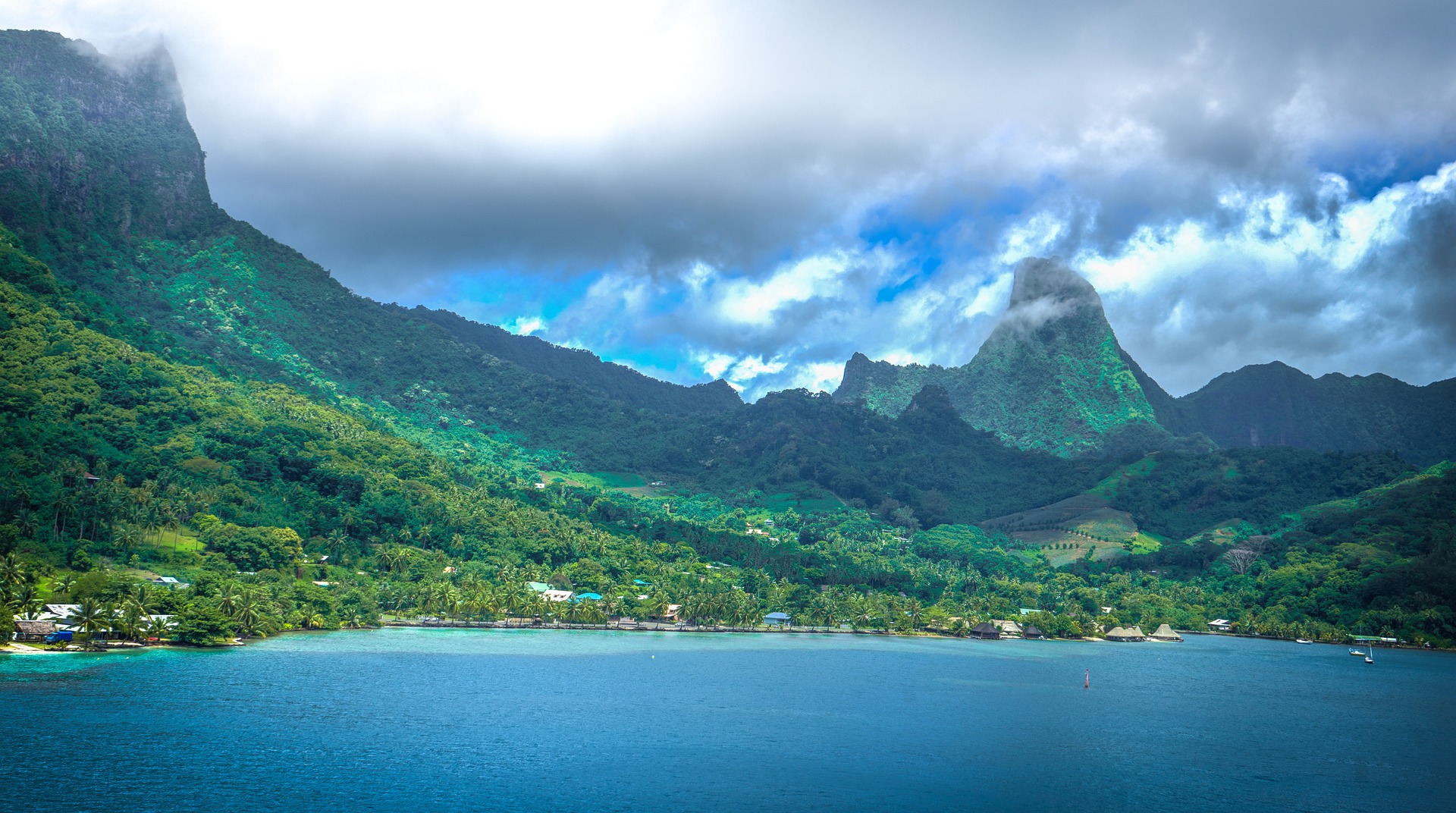
About Moorea
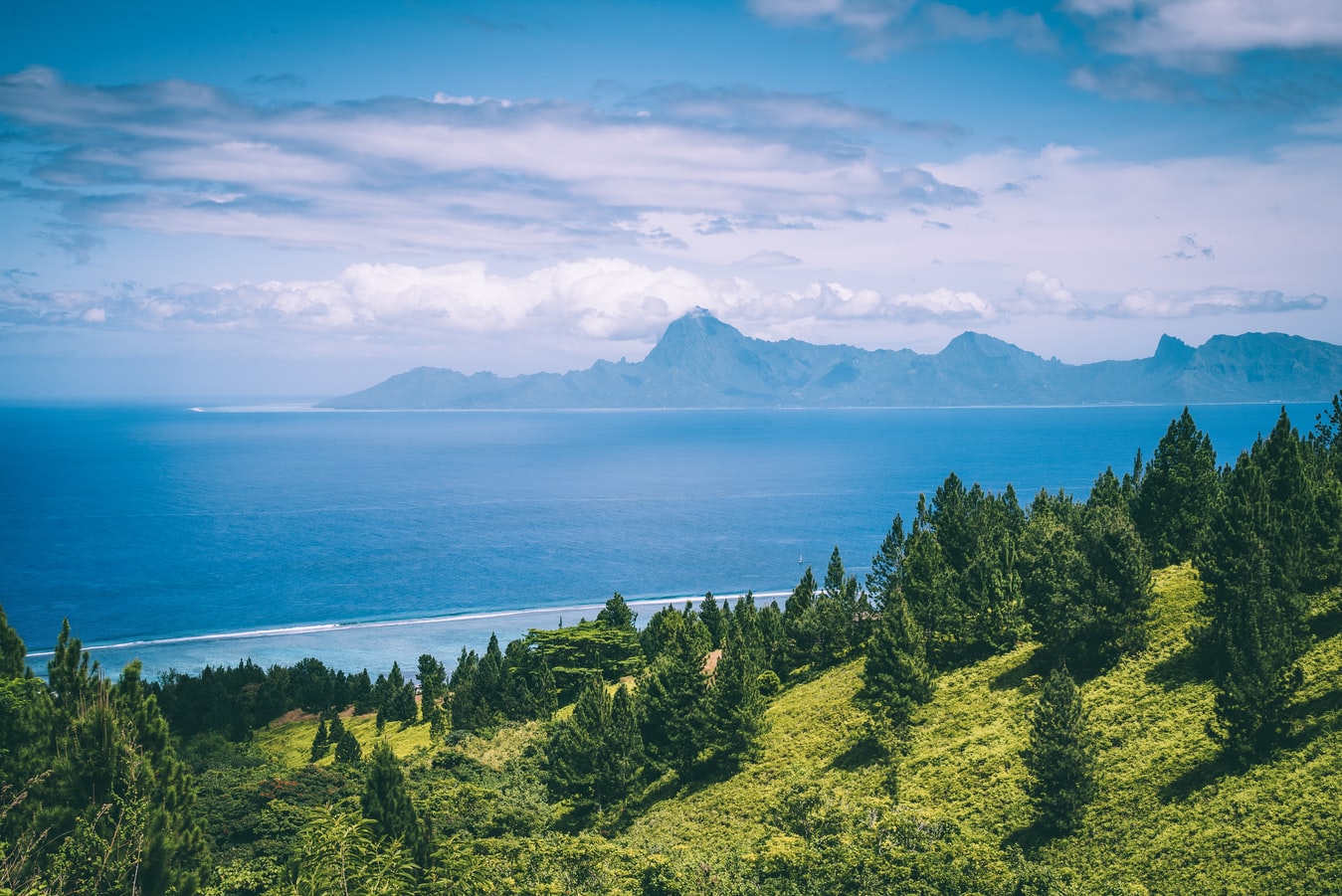
Mo’orea is one of the Society Islands of the French Polynesia. Located in the South Pacific, it is considered a magical island thanks to its majestic volcanic mountains, set against warm lagoon waters and green meadows. It is an island that attracts visitors of all abilities wanting to explore both above and below the ocean waters.
About Papeete, Tahiti
Papeete will be your gateway to the tropical paradise of French Polynesia, where islands fringed with gorgeous beaches and turquoise ocean await to soothe the soul. This spirited city is the capital of French Polynesia, and serves as a superb base for onward exploration of Tahiti – an island of breathtaking landscapes and oceanic vistas. Wonderful lagoons of crisp, clear water beg to be snorkelled, stunning black beaches and blowholes pay tribute to the island's volcanic heritage, and lush green mountains beckon you inland on adventures, as you explore extraordinary Tahiti. Visit to relax inside picturesque stilted huts, which stand out over shimmering water, as you settle into the intoxicating rhythm of life, in this Polynesian paradise.
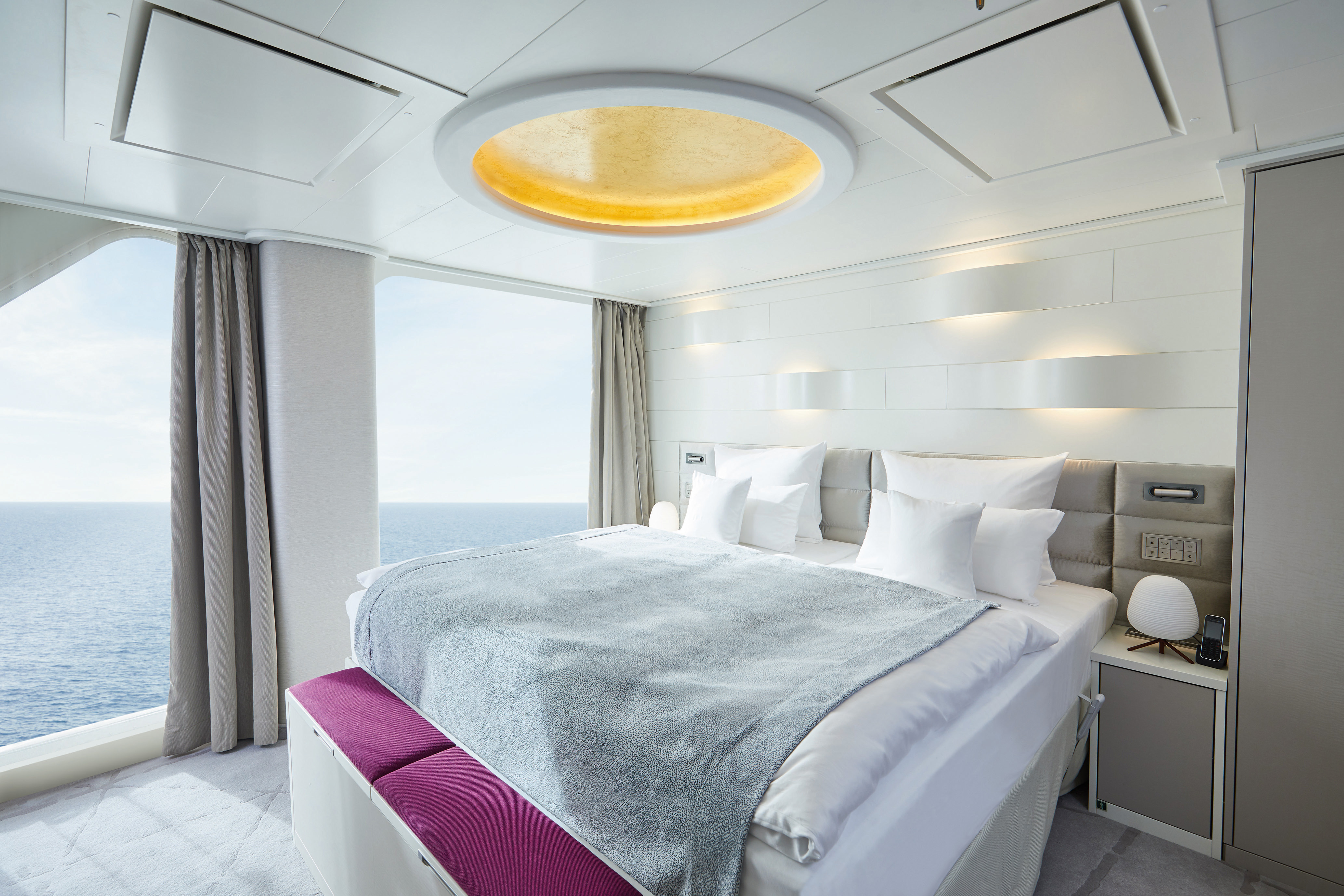
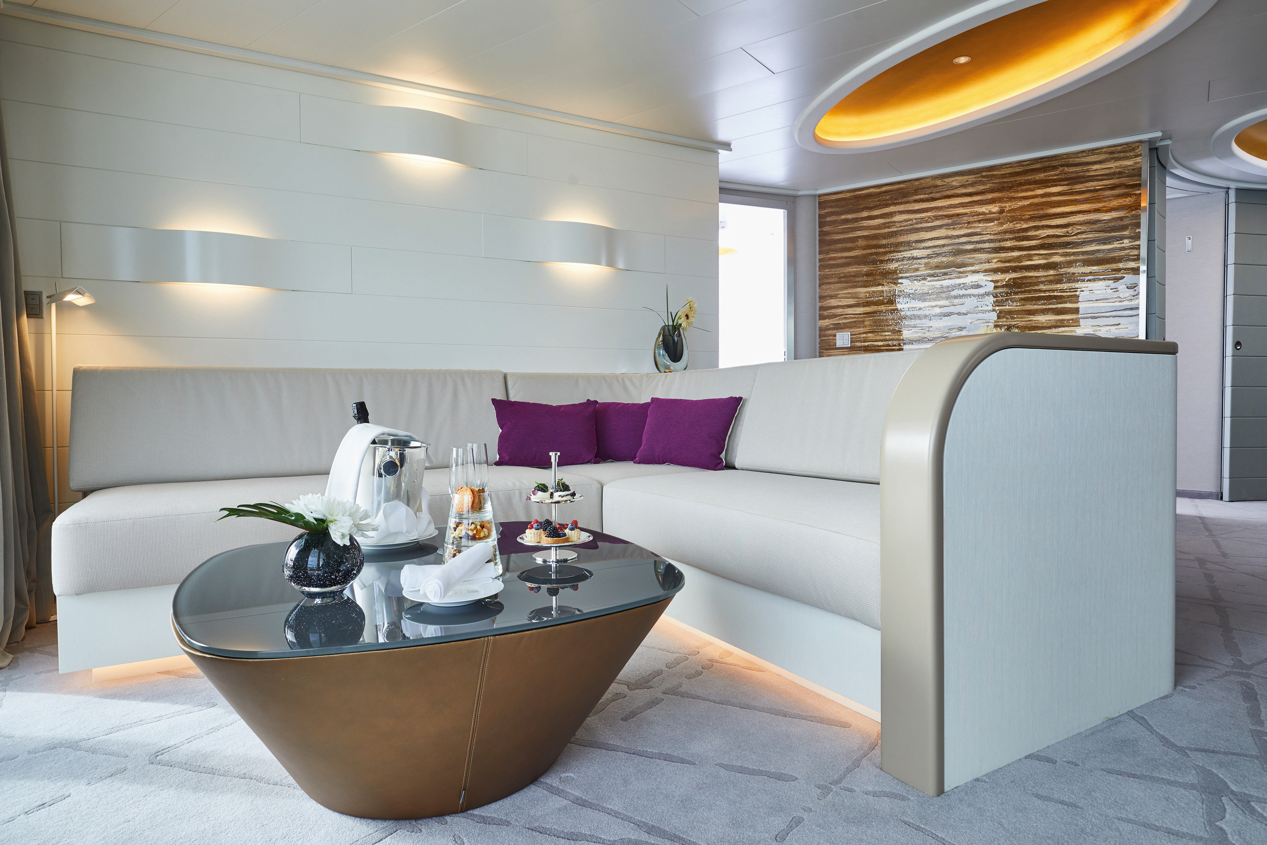
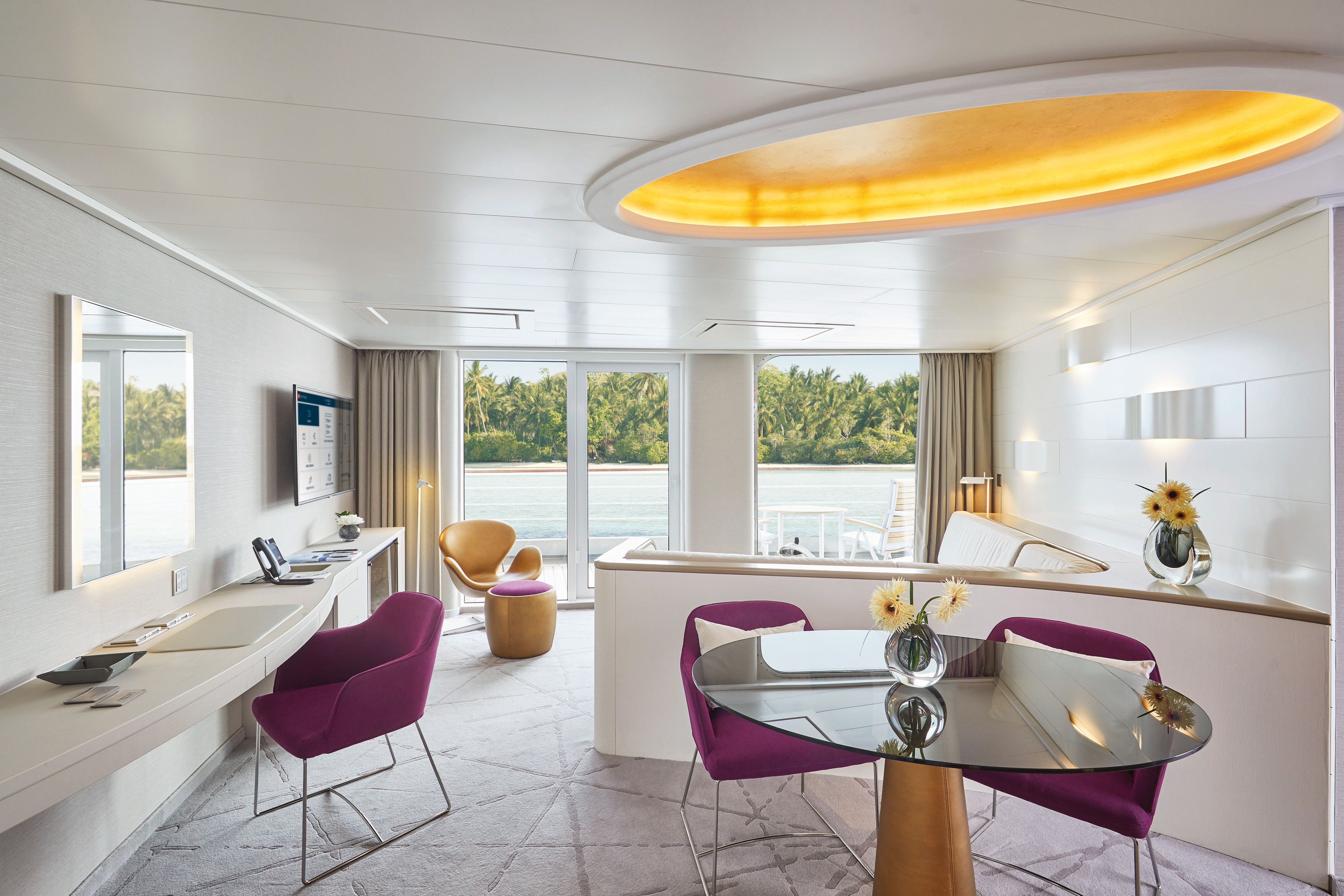
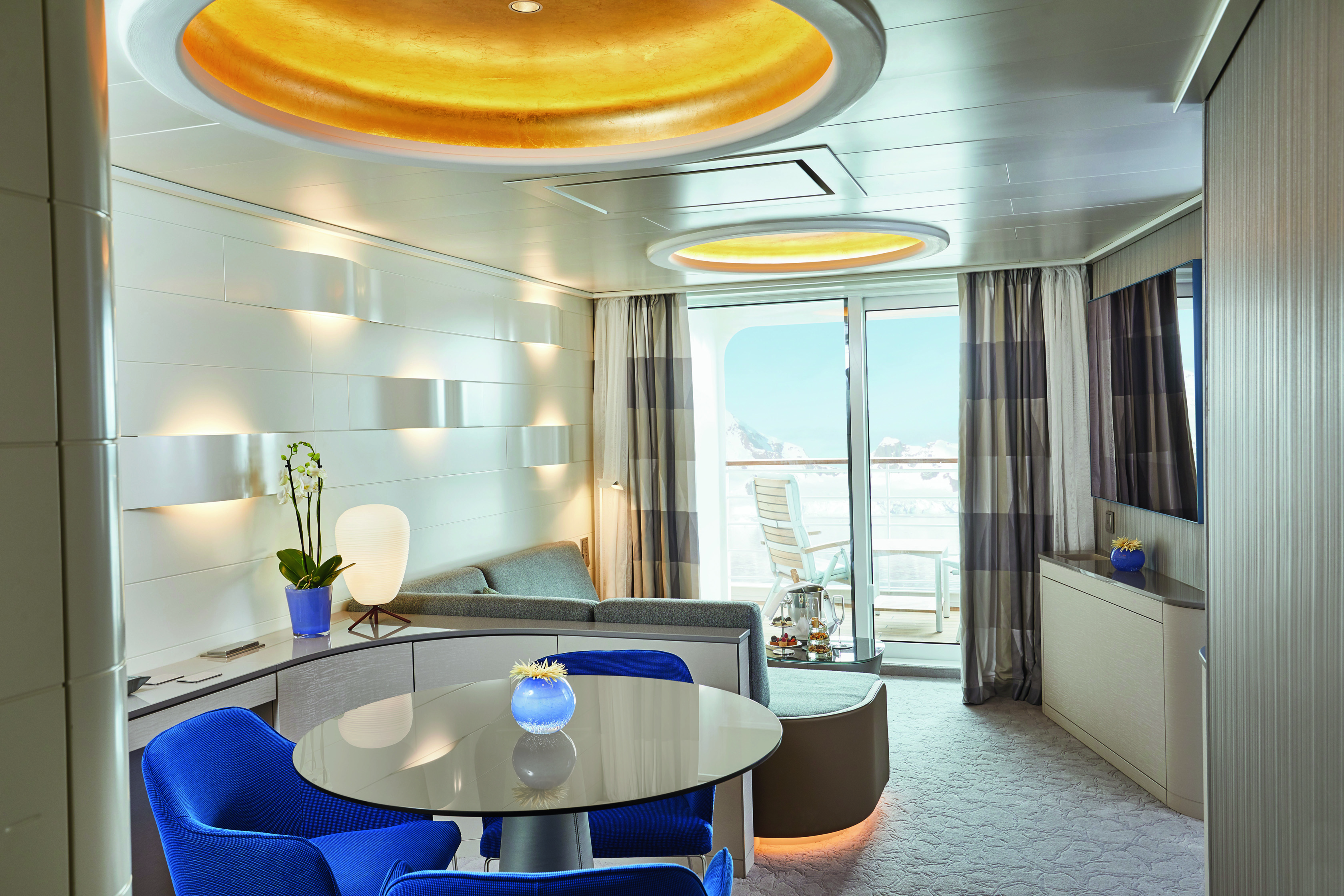
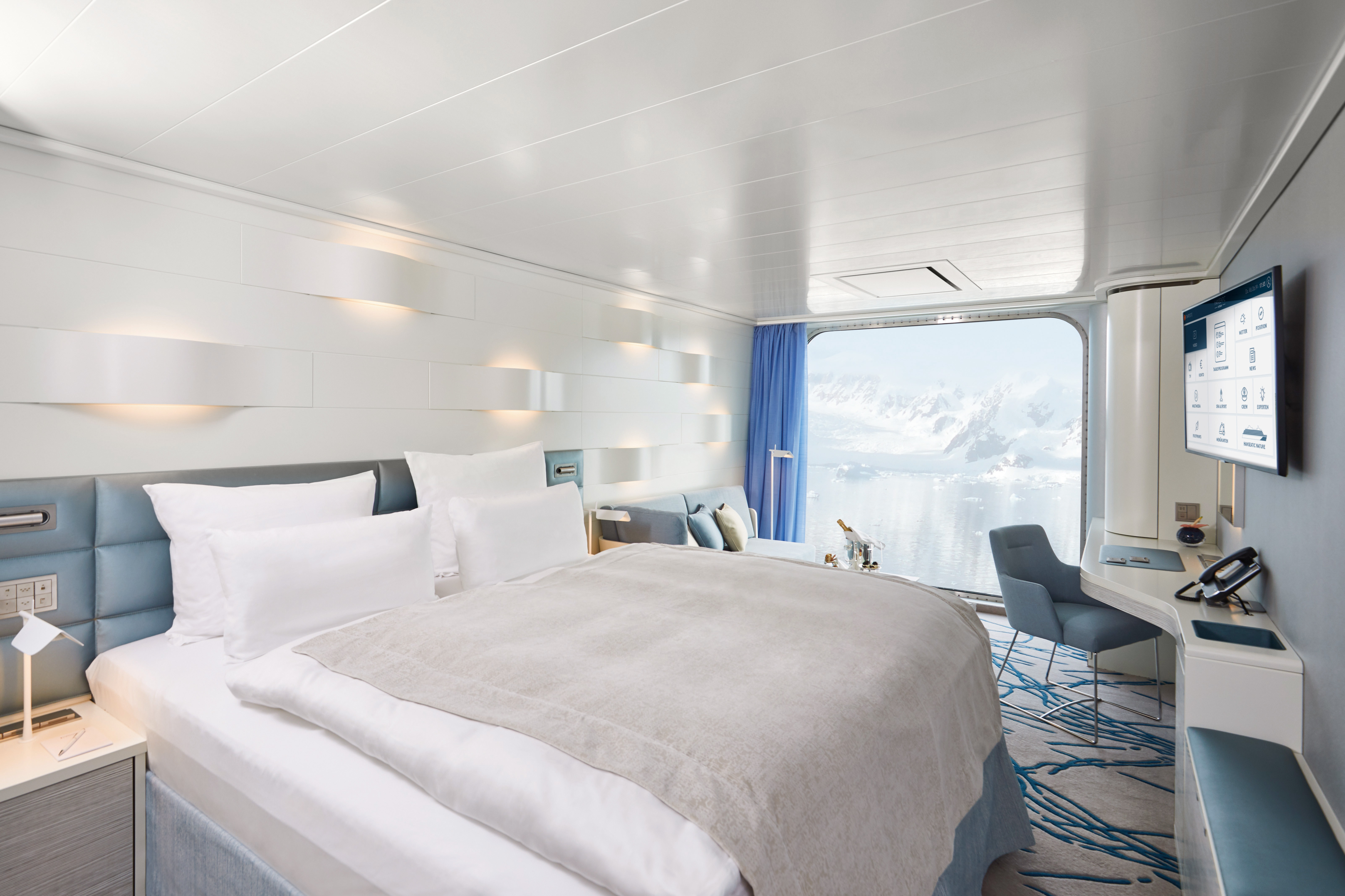
Separate living/sleeping area
- Separate dining area
- Sleeping area with panoramic view
- Separable beds
- TV in living and sleeping areas
- Veranda with space heaters
- Daylight bathroom with two sinks, free-standing bath, rain shower and veranda access
- Steam sauna in shower area
- Heated wall in bathroom (e.g. for towels and wet parkas)
- Separate toilet
- Free mini bar
- Coffee machine
- Extensive infotainment with live broadcast and recordings of expert presentations, forward-view camera, navigation chart, films and much more
- Binoculars in the cabin
- Nordic walking poles
- 24-hour cabin service
- Butler service
- Table reservation in main restaurant
- Free use of Wi-Fi
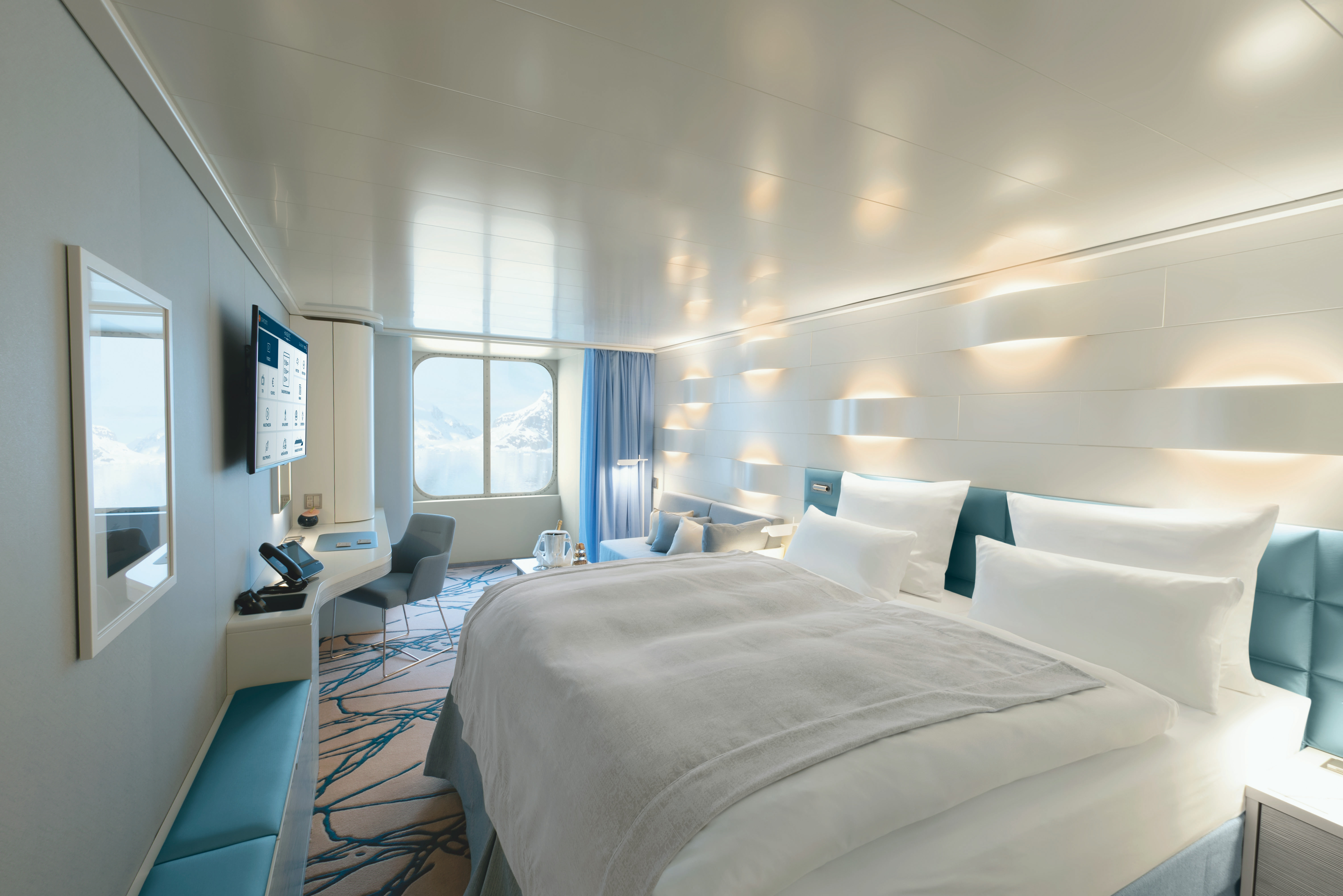
Separate living/sleeping area
- Separate dining area
- Sleeping area with panoramic view
- Separable beds
- TV in living and sleeping areas
- Bathroom with two sinks and rain shower
- Separate toilet
- Steam sauna in shower area
- Heated wall in bathroom (e.g. for towels and wet parkas)
- Free mini bar
- Coffee machine
- Extensive infotainment with live broadcast and recordings of expert presentations, forward-view camera, navigation chart, films and much more
- Binoculars
- Nordic walking poles
- 24-hour cabin service
- Table reservation in main restaurant (applies to the PLATINUM and GOLD fares)
- Butler service
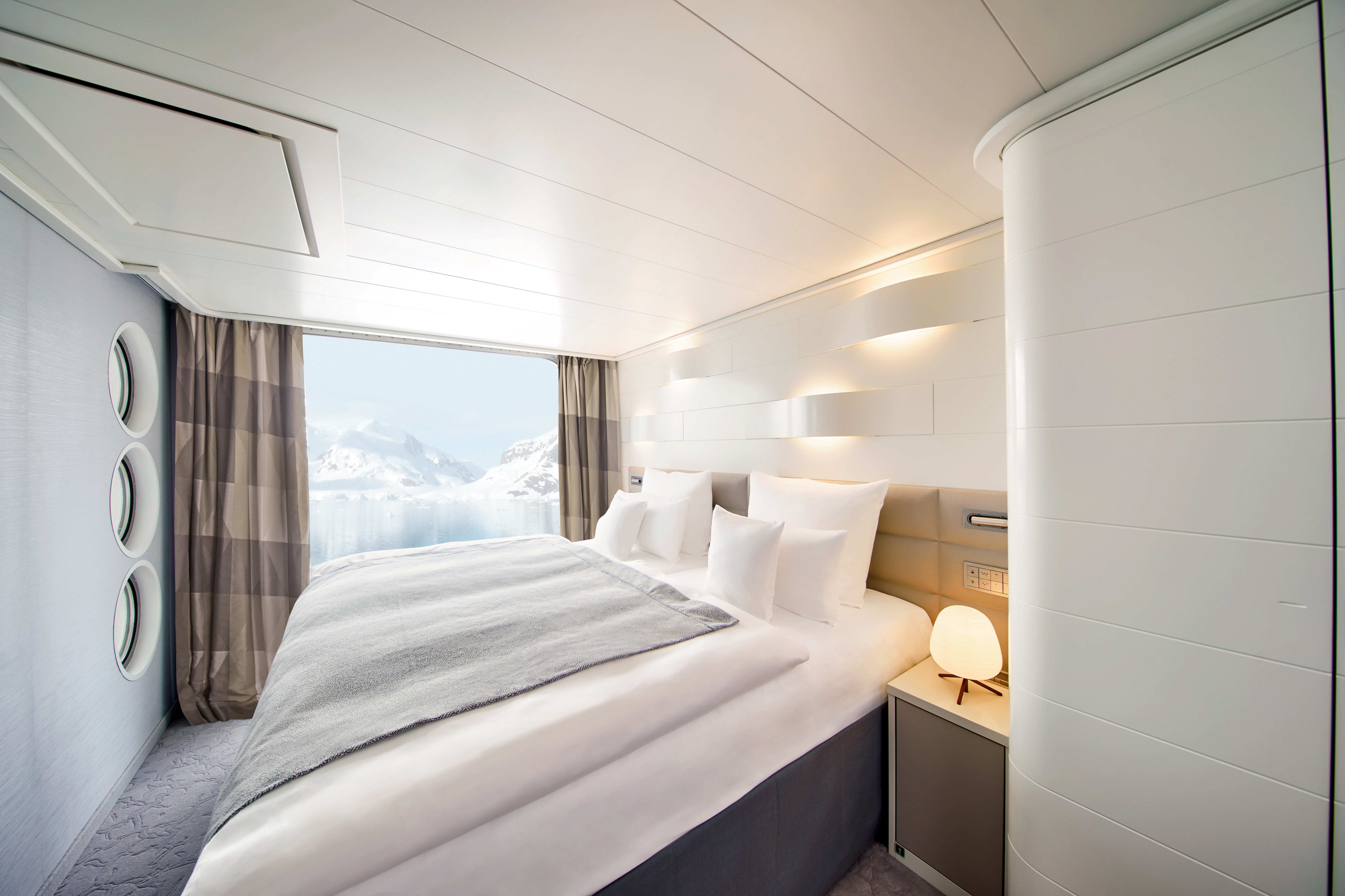
Heated wall in the bathroom (e. g. for towels and wet parkas)
- Rain shower
- Free mini bar (soft drinks)
- Coffee machine
- Separable beds
- Extensive infotainment with live broadcast and recordings of expert presentations, forward-view camera, navigation chart, films and much more
- Binoculars
- Nordic Walking poles
- 24-hour cabin service
- There is one cabin with fully accessible layout and equipment (cabin 404)
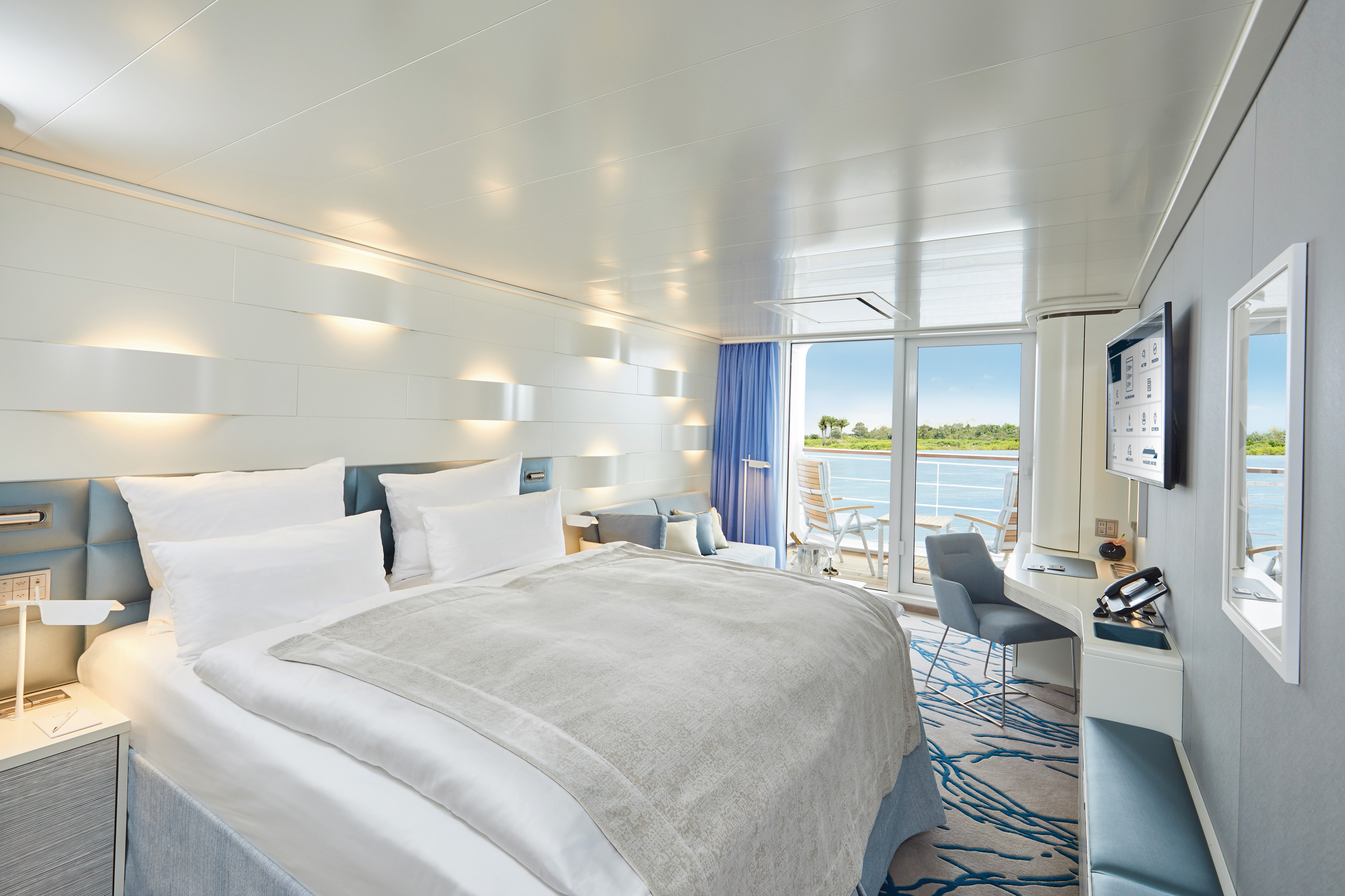
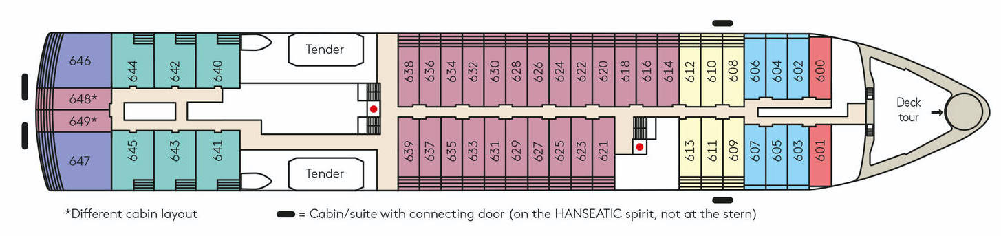
The French Balcony Cabins in Category 3 on Deck 6 are approximately 23 m²/248 ft² in size, and those in Category 5 on Deck 7 approximately 21 m²/226 ft². The Balcony Cabins at the stern have a slightly different floor plan.
Heated wall in the bathroom (e. g. for towels and wet parkas)
- Rain shower
- Free mini bar (soft drinks)
- Coffee machine
- Separable beds
- Extensive infotainment with live broadcast and recordings of expert presentations, forward-view camera, navigation chart, films and much more
- Binoculars
- Nordic Walking poles
- 24-hour cabin service
- There is one cabin with fully accessible layout and equipment (cabin 404)
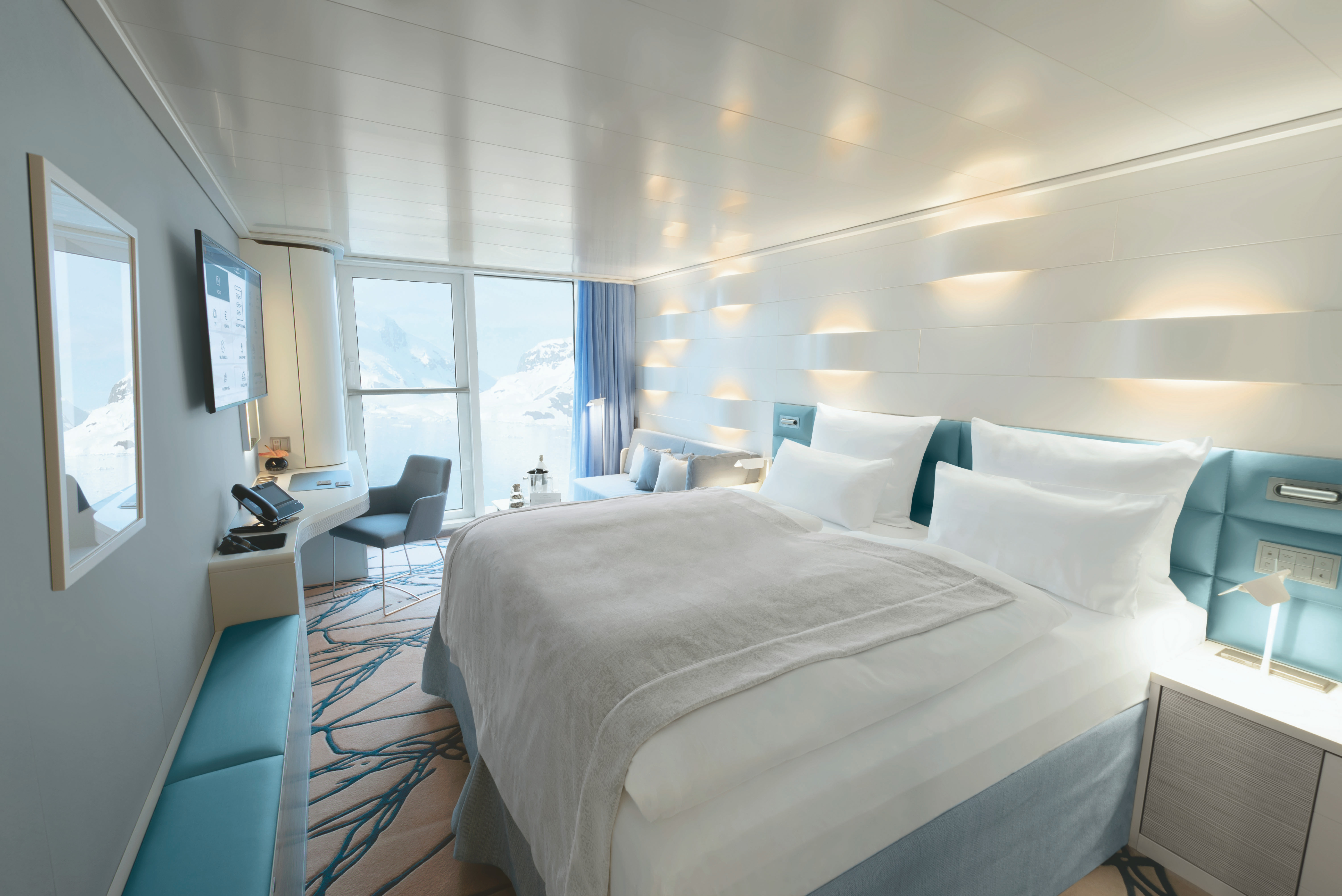
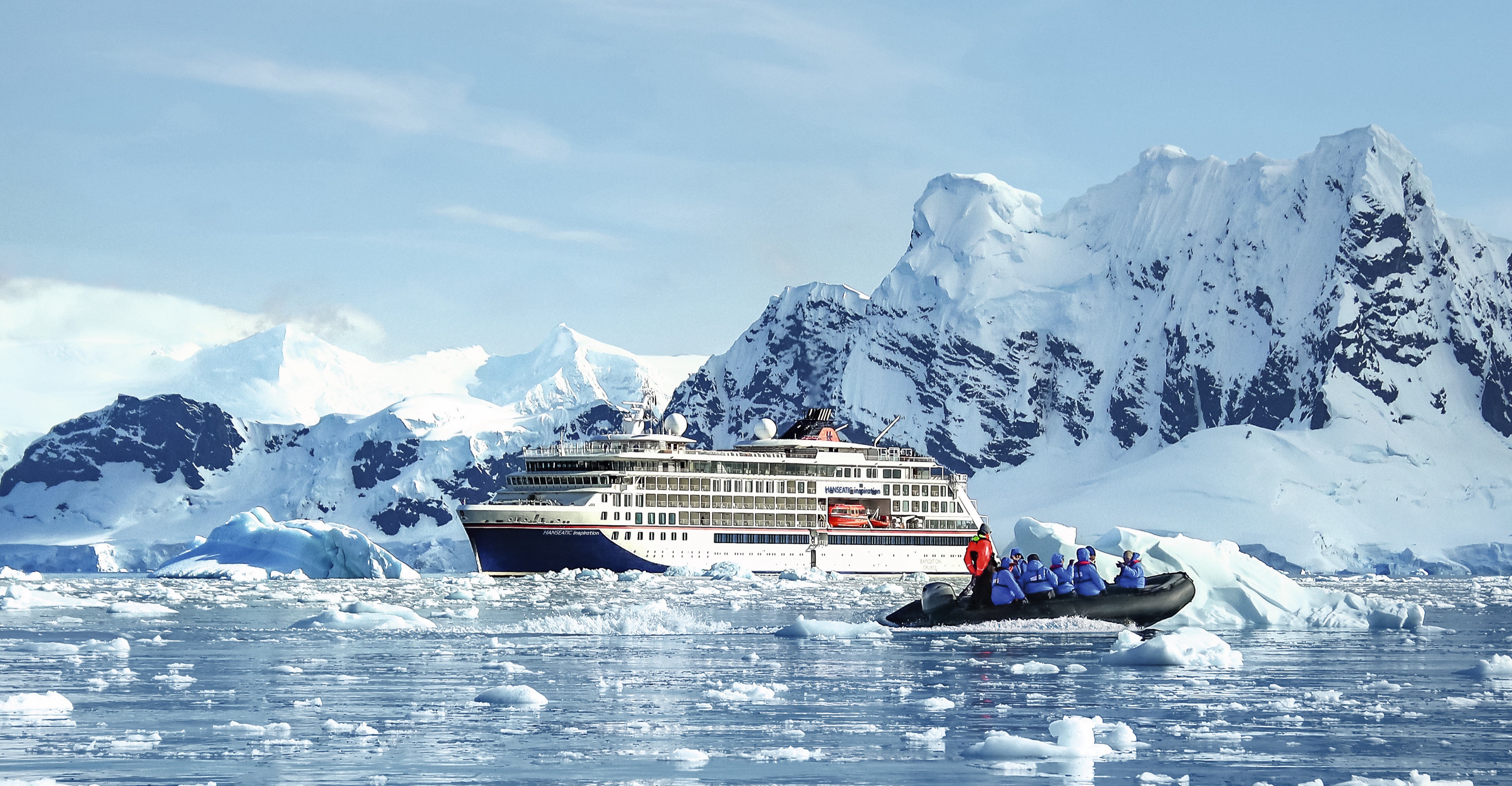
HANSEATIC inspiration
Each of our expeditions is a work of art. Passionately conceived, masterfully realised. A portrait of the world in which there is always something new to discover. And our small, state-of-the-art expedition ships HANSEATIC nature, HANSEATIC inspiration and HANSEATIC spirit (max. 230 guests) are the very best studio where such artistic masterpieces are created. Worlds both faraway and nearby. Ice and tropics. Wildlife paradise or cultural treasure. For every explorer, we offer the right journey of discovery. More than 30 years of experience as the market leader in German-speaking countries.
Ship Facts
| Launch Year | 2019 | ||||||
| Refit Year | |||||||
| Language | de+en | ||||||
| Gross Tonnage | 15650 | ||||||
| Length | 138 | ||||||
| Width | 22 | ||||||
| Currency | EUR | ||||||
| Speed | 16 | ||||||
| Capacity | 230 | ||||||
| Crew Count | 175 | ||||||
| Deck Count | 7 | ||||||
| Cabin Count | 127 | ||||||
| Large Cabin Count | N/A | ||||||
| Wheelchair Cabin Count | N/A | ||||||
| Electrical Plugs |
|
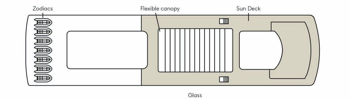
Deck 9
- Zodiacs
- Flexible canopy
- Sun Deck
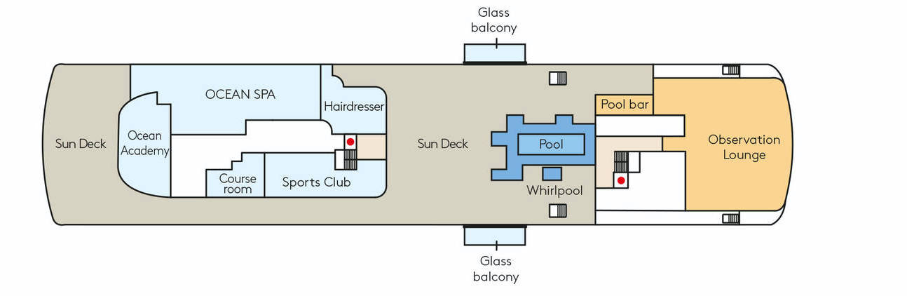
Deck 8
- Sun Deck
- Ocean Academy
- OCEAN SPA
- Course room
- Sports Club
- Hairdresser
- Pool
- Whirlpool
- Glass Balcony
- Pool bar
- Observation Lounge
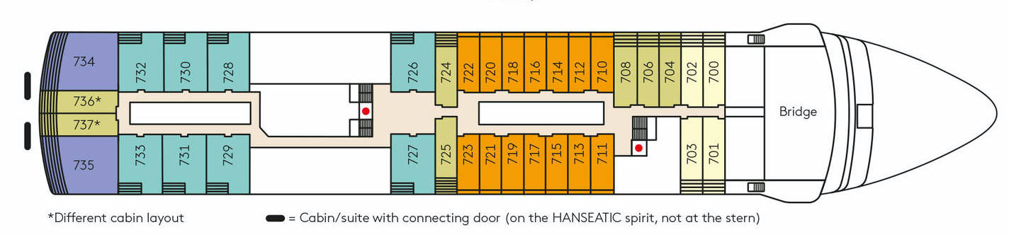
Deck 7
- Bridge
- Veranda Suite or Ocean Suite
- Penthouse Suite
Deck 6
- Tenders
- Inspiration Walk
- Veranda Suite or Ocean Suite
- Grand Ocean Suite
- Penthouse Suite
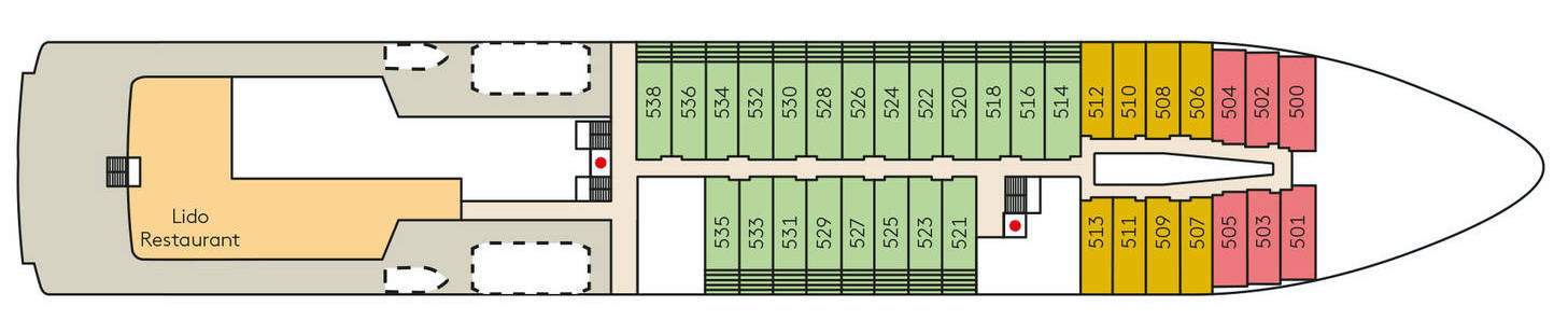
Deck 5
- Lido Restaurant
- Grand Penthouse Suite
- Penthouse Suite
- Veranda Suite or Ocean Suite
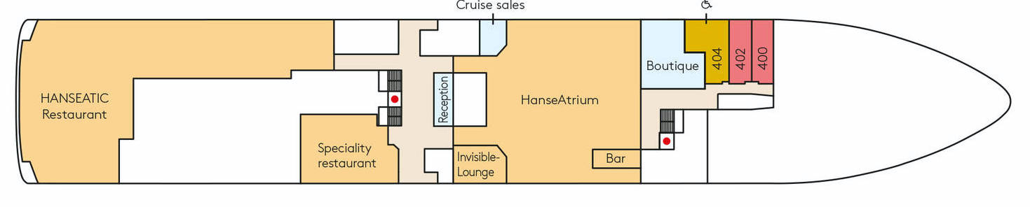
Deck 4
- HANSEATIC Restaurant
- Nikkei
- Reception
- Cruise Sales
- HanseAtrium & Bar
- Boutique
- Penthouse Suite
- Veranda Suite or Ocean Suite
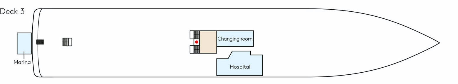
Deck 3
- Changing room
- Hospital
- Marina
A new kind of freedom between adventure and pleasure
Come with us on a culinary voyage of discovery around the globe: on board, three spacious first-class restaurants create a unique and indulgent combination of expedition spirit with international gourmet cuisine. Spend your days and evenings however you wish thanks to flexible mealtimes, a free choice of seating and attentive 24-hour cabin service.
HANSEATIC Restaurant
The spacious HANSEATIC Restaurant of the new expedition class redefines on-board cuisine. From breakfast to dinner, experience our endless variety of creative cuisine at any time of day. Where your ship drops anchor, our top chefs will look to local specialities and conjure up for your plate the aromas of South Africa, the far north, or Europe. Daily changing menus will send your taste buds on a global tour of discovery – accompanied by a selection of wines to suit every palate.
Nikkei
On the HANSEATIC inspiration, fine Japanese creations and Peru's modern trendy cuisine meet in the delightful ambience of the Nikkei.
Lido Restaurant
Expeditions bring you particularly close to the elements. The same applies to our Lido Restaurant. Have breakfast under an open sky, or enjoy a juicy steak cooked to perfection on the large outdoor barbecue – garnished with breathtaking panoramic views. Watch our gourmet chefs at work in the open show kitchen or head straight to the ice cream station for dessert. And why not? After all, the daily grind is far away.
That special touch
Land on a secluded island in a Zodiac and enjoy barbecued fish and chilled drinks with your feet in the sand. Or celebrate with a glass of champagne against a stunning icy backdrop. Our service and ingenuity continue ashore – with a barbecue on the beach, a reception in the ice or exotic delicacies in the depths of the rainforest. This is the feeling of true expedition. This is the taste of true delight.
A glass of wine in your hand and the magnificent jungle, the captivating wilderness of Nordic fjords or the icy panoramas of the Antarctic directly before you – the perfect end to a day of expeditions. From classic whiskys to fancy aperitif creations, the superbly equipped bars in the Observation Lounge and HanseAtrium serve your favourite drinks as you watch the sun go down. Welcome to the small club of great explorers.
Glass Balconies
The glass balcony beneath your feet allows you to hover above the water and reveals the endless expanse and beauty of the ocean. Watch whales and large porpoises as they follow the ship, thrilling you as they leap and swim. Being so close to creation is an indescribable feeling.
Inspiration Walk
The deck tour at the bow offers extraordinarily intensive experiences: when whales jump for joy and polar bears take an icy bath, you will be the first to see these fascinating natural spectacles.
Observation Lounge & Library
Stroll the spacious decks and feel the stars almost within reach – the terraced Observation Deck with a panoramic view is but one place to fulfil your dream. You can also quench your thirst for adventure in the comfortable surroundings of the Observation Lounge. The large full-glass windows provide a 180-degree view of the moon and sea while you reflect on your unforgettable travel days over a glass of wine.
Library
You are welcome to borrow a book on board at any time. Our library is located in the Observation Lounge (Deck 8) and is stocked with a selection of the latest fiction books, travel literature and information about the cruising area.
Invisible Lounge
Located on Deck 4.
Reception
Post
The Reception staff will post your postcards and letters from all ports where this facility is available. Your onboard account will be debited with the appropriate charges.
Announcements
To create the full expedition experience, commentaries are provided for interesting passages during the cruise and special animal sightings are reported. The ship’s position is reported in the morning on days at sea. We will also announce via the loudspeakers when the local authorities have cleared the ship and we can go ashore. The volume can be controlled individually in each cabin/suite.
Means of payment
The on-board currency is the euro. An account will be set up for you so that you can make cashless payments during the cruise. You can find out your current account balance at any time using the infotainment system in your cabin/suite. You can then settle the entire account at Reception at the end of your cruise. We accept German EC/Maestro cards and the following credit cards: Mastercard, American Express and Visa. You can also pay in cash. Please note that, in general, foreign currencies cannot be changed on board.
reception@hanseatic-nature.com