Expedition Vanuatu And Solomon Islands - Mysterious Rituals In Pristine Natural Surroundings
Expedition Vanuatu And Solomon Islands - Mysterious Rituals In Pristine Natural Surroundings
Cruise overview
WHY BOOK WITH US?
- ✔ The Deluxe Cruises’ team has extensive experience in ultra-luxury cruising.
- ✔ Call now to speak to our helpful and experienced Cruise Concierge team.
- ✔ Enjoy our Unique Deluxe Cruises Bonus for substantial savings.
- ✔ Our team will tailor your holiday to your exacting requirements.
- ✔ As agents, we work under the protection of each cruise lines ABTA / ATOL licences
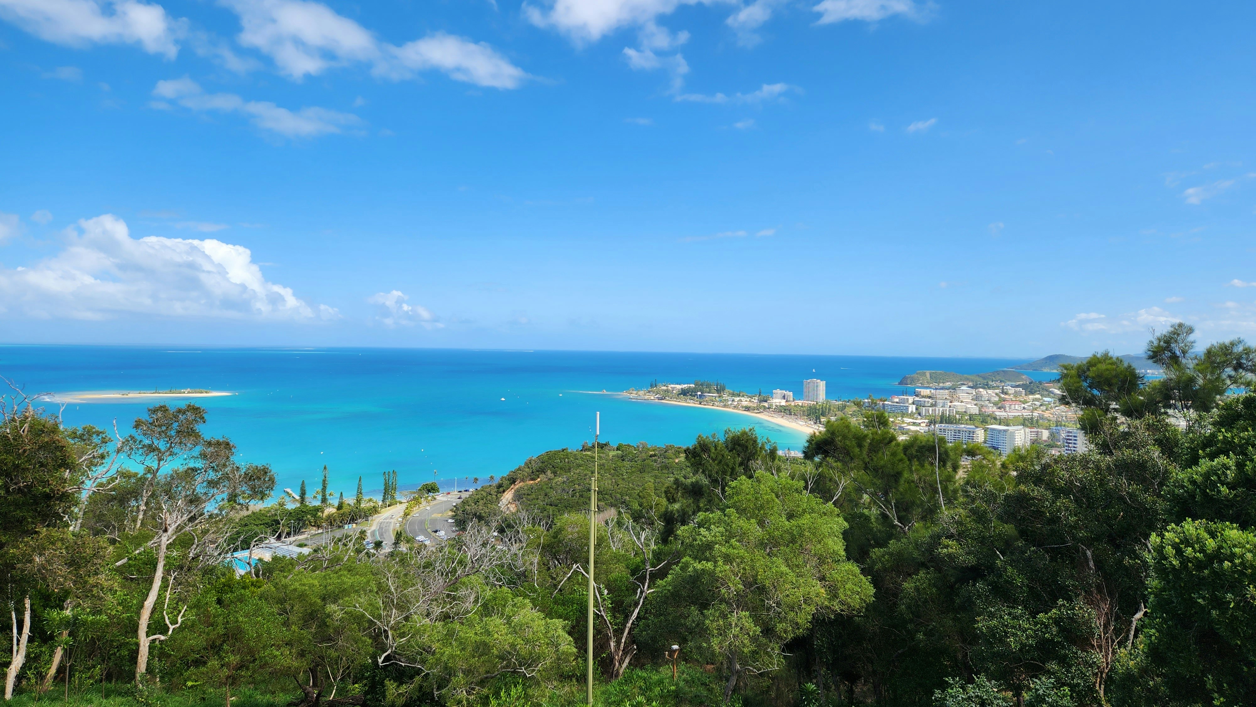
About Nouméa
With its elegant urban infrastructure in a stunning natural setting, Noumea is a truly unique island and part of the New Caledonia archipelago. Noumea started as a penal colony, but has since evolved to a lovely metropolis and today has almost two thirds of New Caledonia’s population. While much of the archipelago of New Caledonia has a large percentage of Kanak people – the indigenous inhabitants who live in tribal areas across the country – Noumea is predominantly European with a strong French influence. The city’s center and Place de Cocotiers, the main park, are located close to the harbor and several churches date back to the late 19th century. Other attractions include a world-class aquarium at Anse Vata, several long beaches to the south, and a noteworthy collection of Kanak and South Pacific objects at the Museum of New Caledonia. The architectural gem of the city is the Tjibaou Cultural Center, the structure of which resembles sails, or the roofs of Kanak houses hidden behind mangroves.
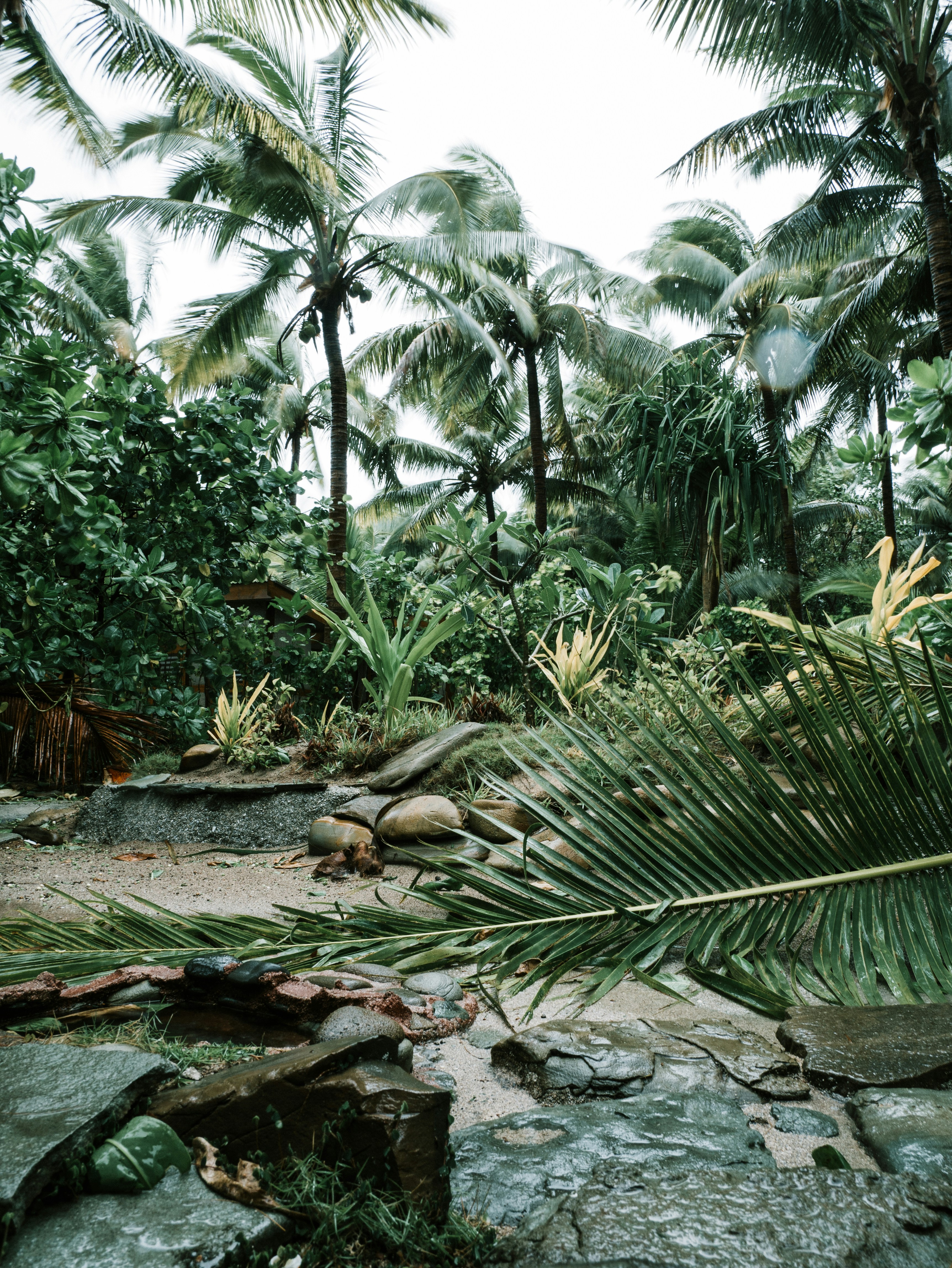
About Vanuatu
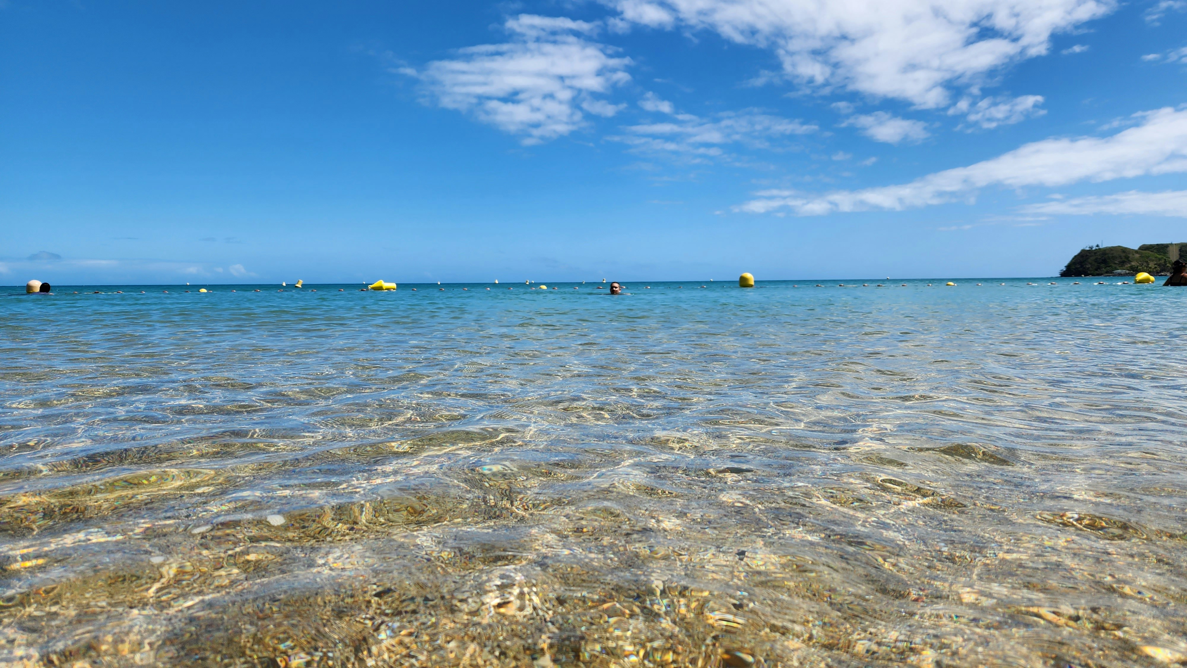
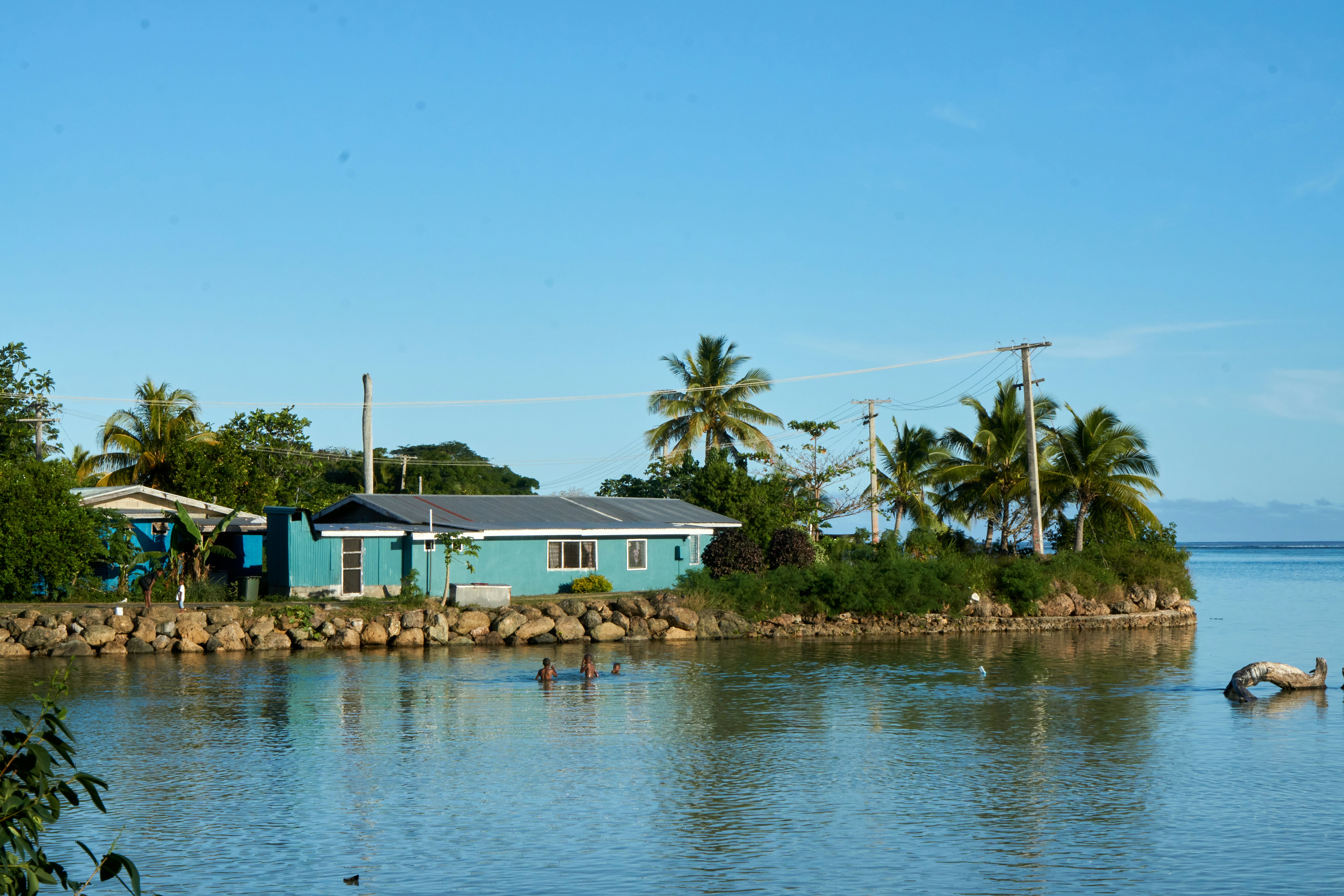
About Santa Ana Island
Port Mary is the name of the bay adjacent to Ghupuna, the main village in Santa Ana. A bright white sand beach with huge shade-giving trees runs along the shoreline in front of the tidy village. The houses here are made with local materials and most are built on stilts. Islanders generally welcome visitors with traditional songs and dances performed by members of the three different villages on Santa Ana. Some local people will also set up stands offering souvenirs for purchase. The Solomons are best known for strings of traditional shell money and elegant carvings based on local stories and legends.
About Port Denarau
About Lautoka
North of Nadi through sugarcane plantations and past the Sabeto Mountains is Lautoka, nicknamed the Sugar City for the local agriculture and its big processing mill. With a population of around 50,000, it's the only city besides Suva and, like the capital, has a pleasant waterfront. It's the sailing point for Blue Lagoon and Beachcomber Cruises but is otherwise unremarkable for tourists, itself having few hotels and fewer good restaurants. Locals recommend the city as a less-expensive place to shop for clothing, but note that it can take as long as 45 minutes to drive here. Legend has it that Lautoka acquired its name when two chiefs engaged in combat and one hit the other with a spear. He proclaimed "lau toka" (spear hit) and thus the future town was named.
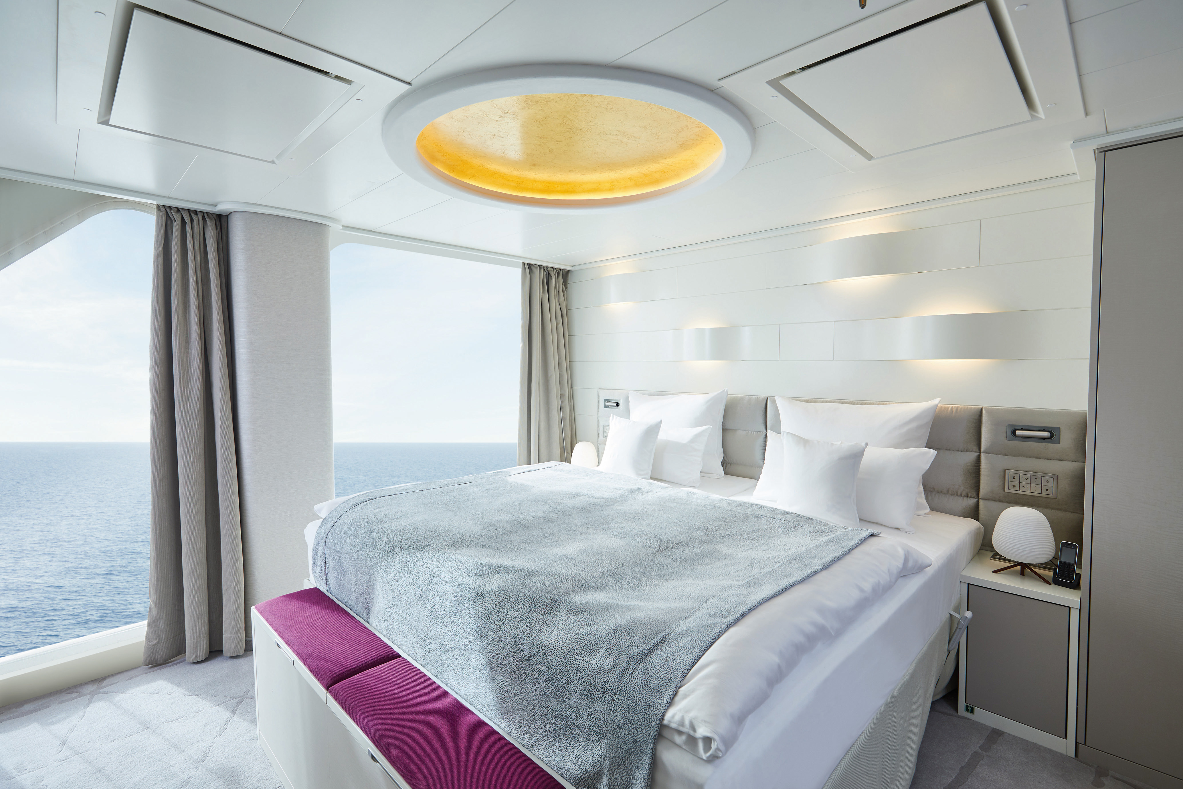
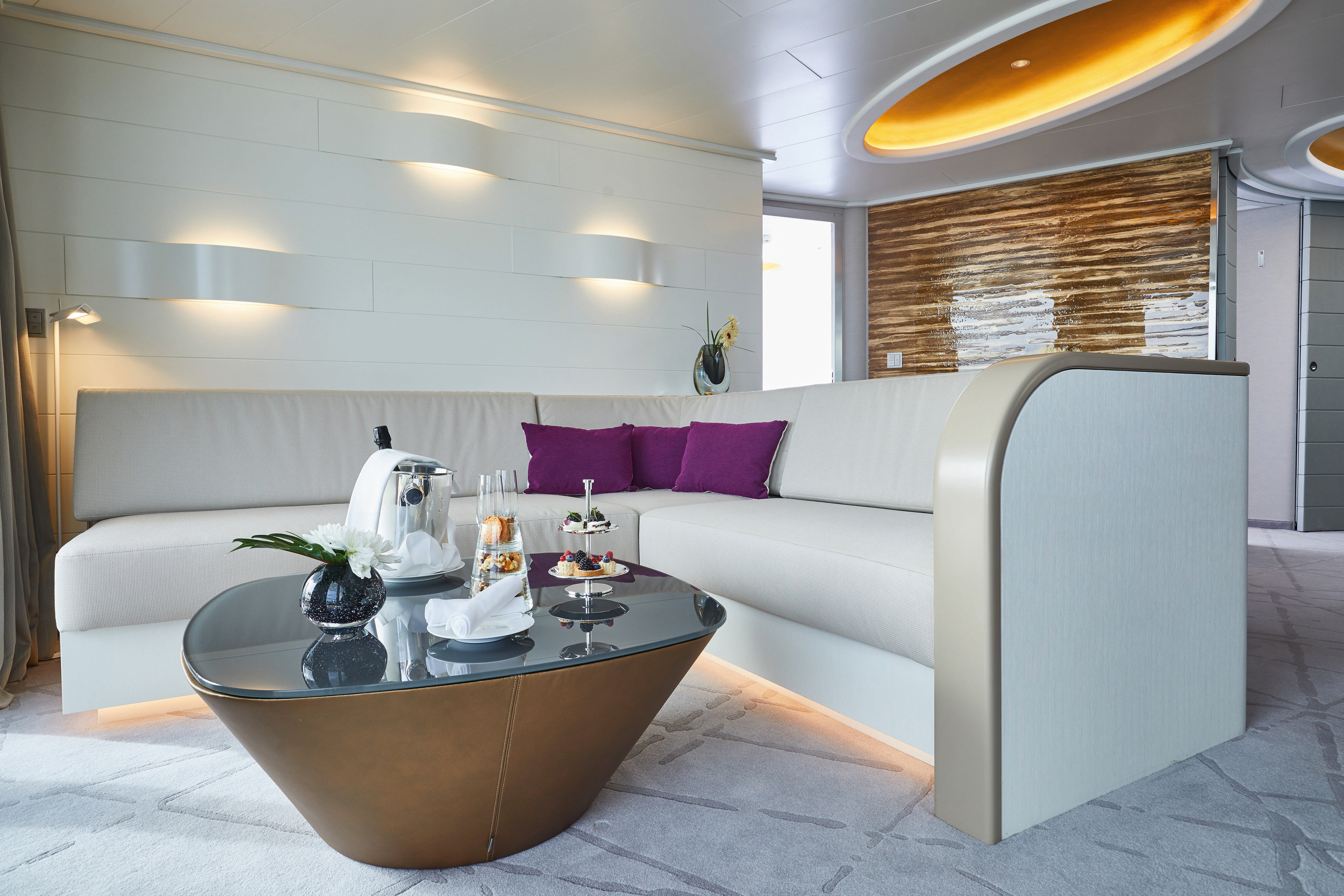
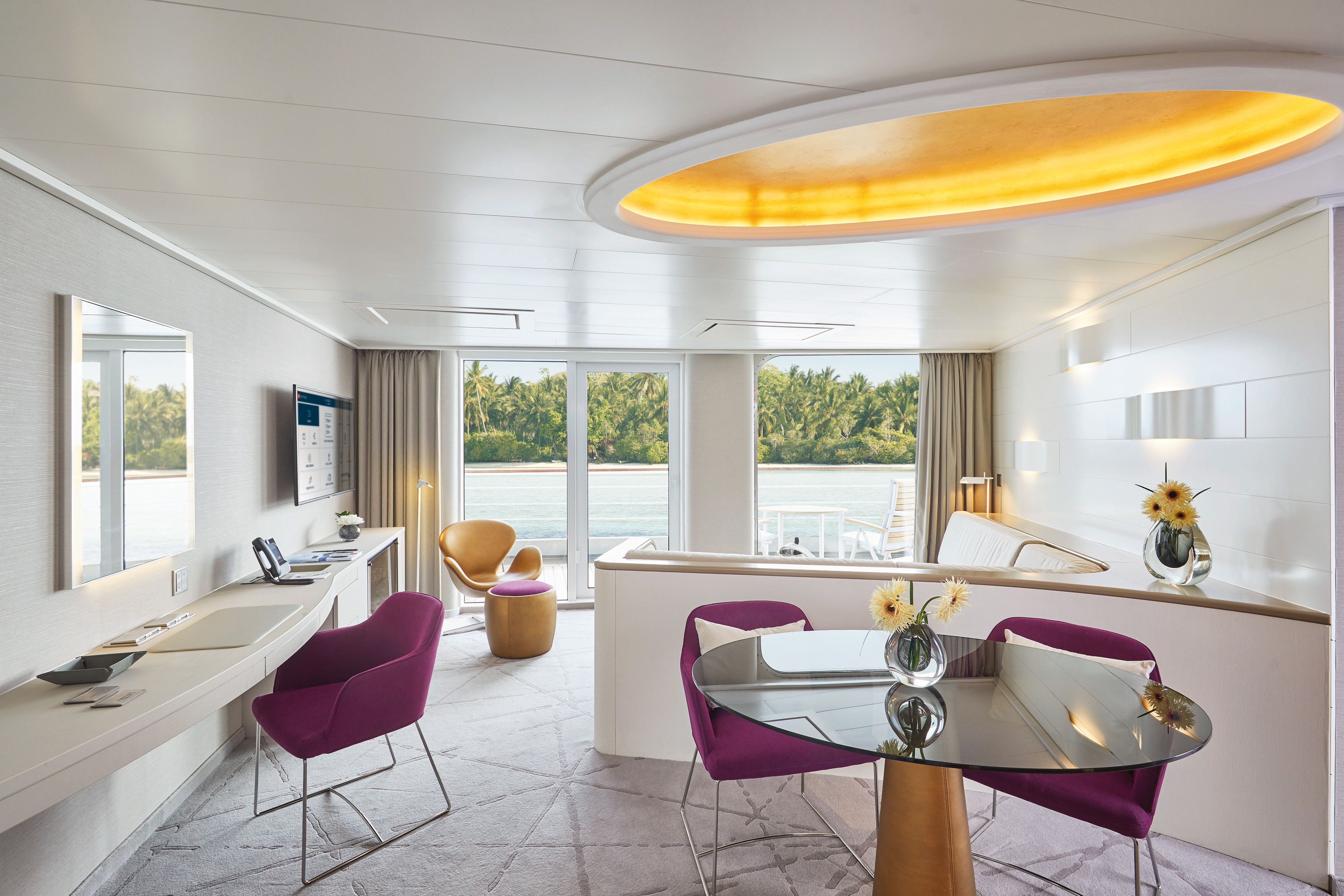
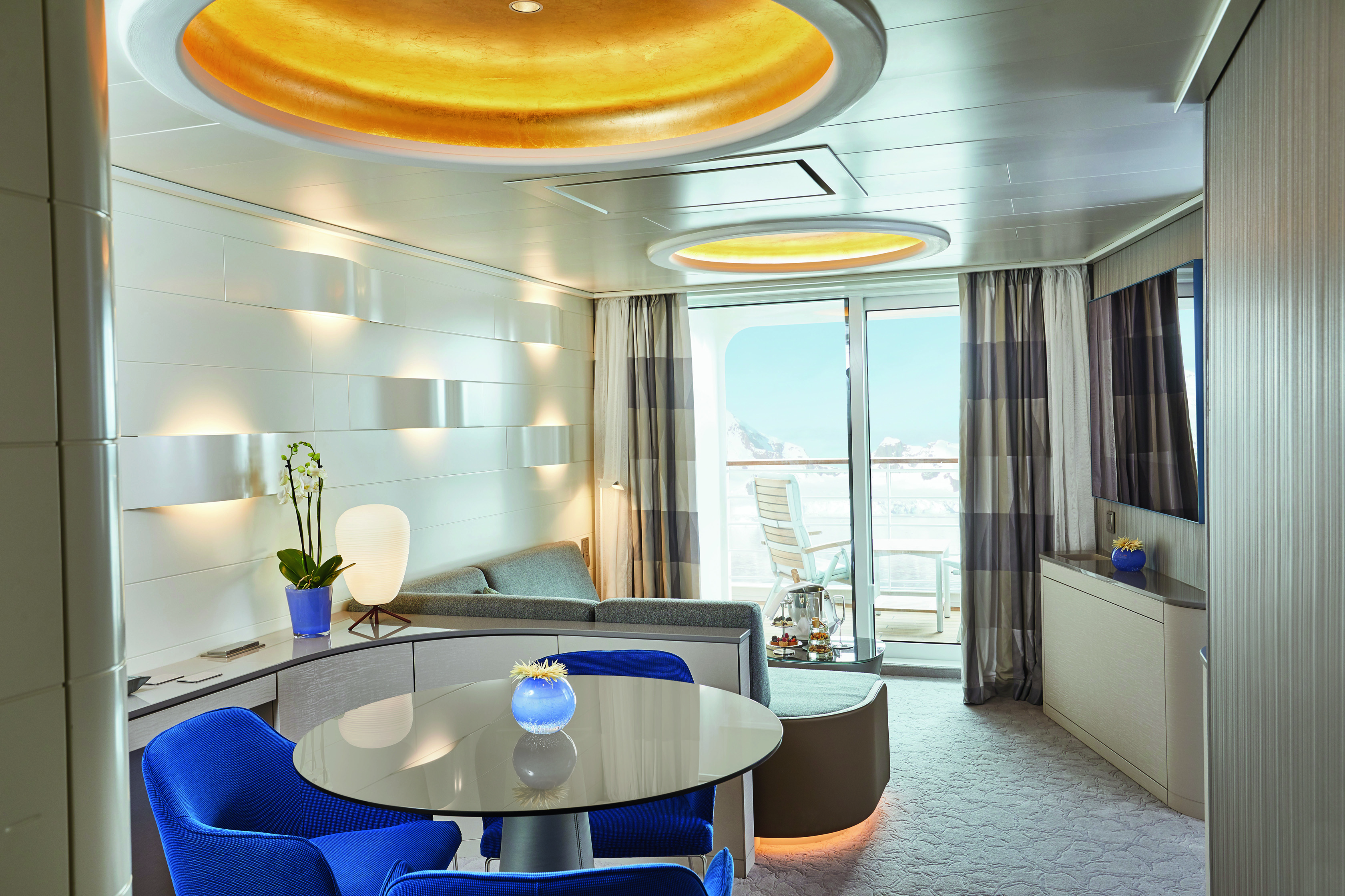
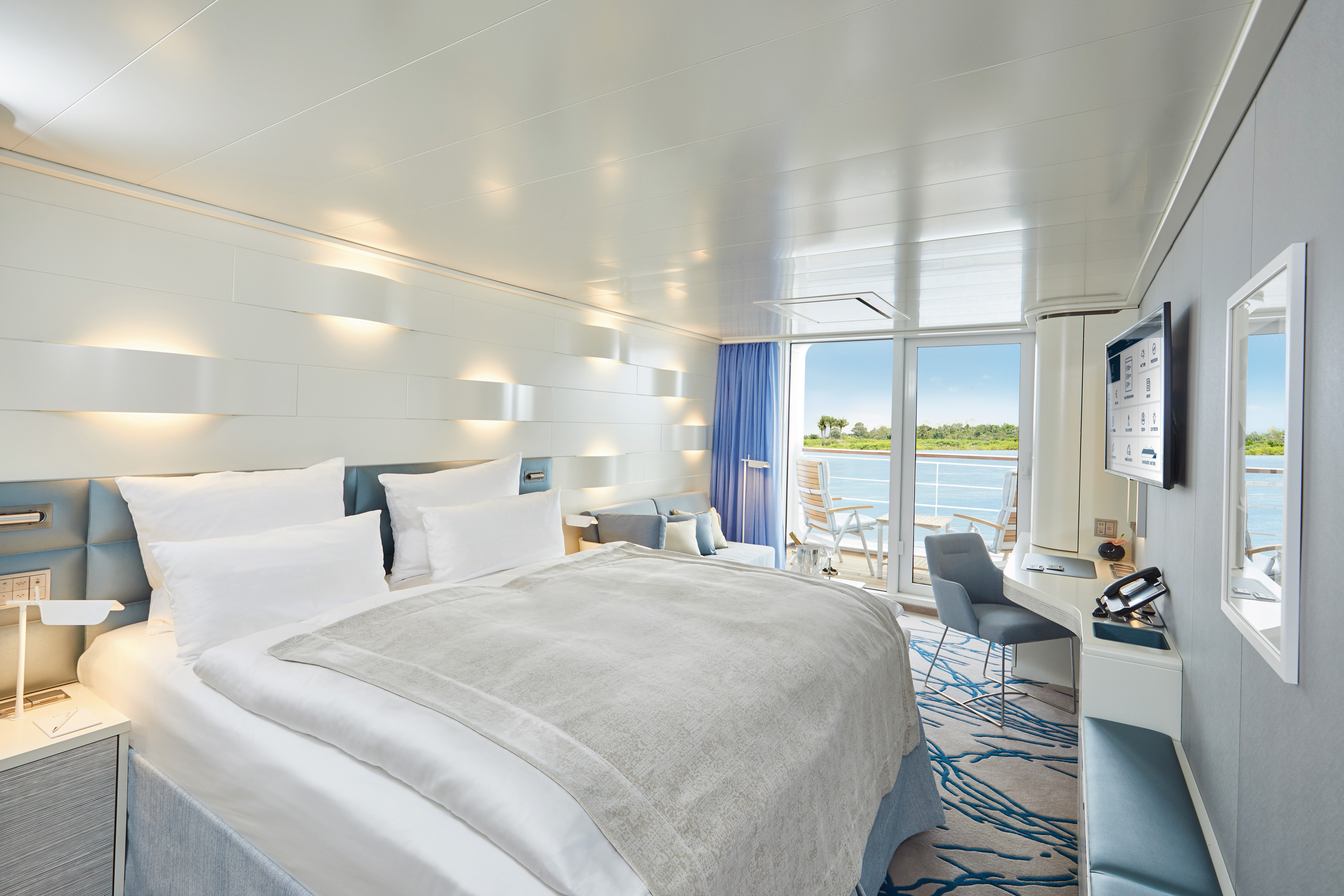
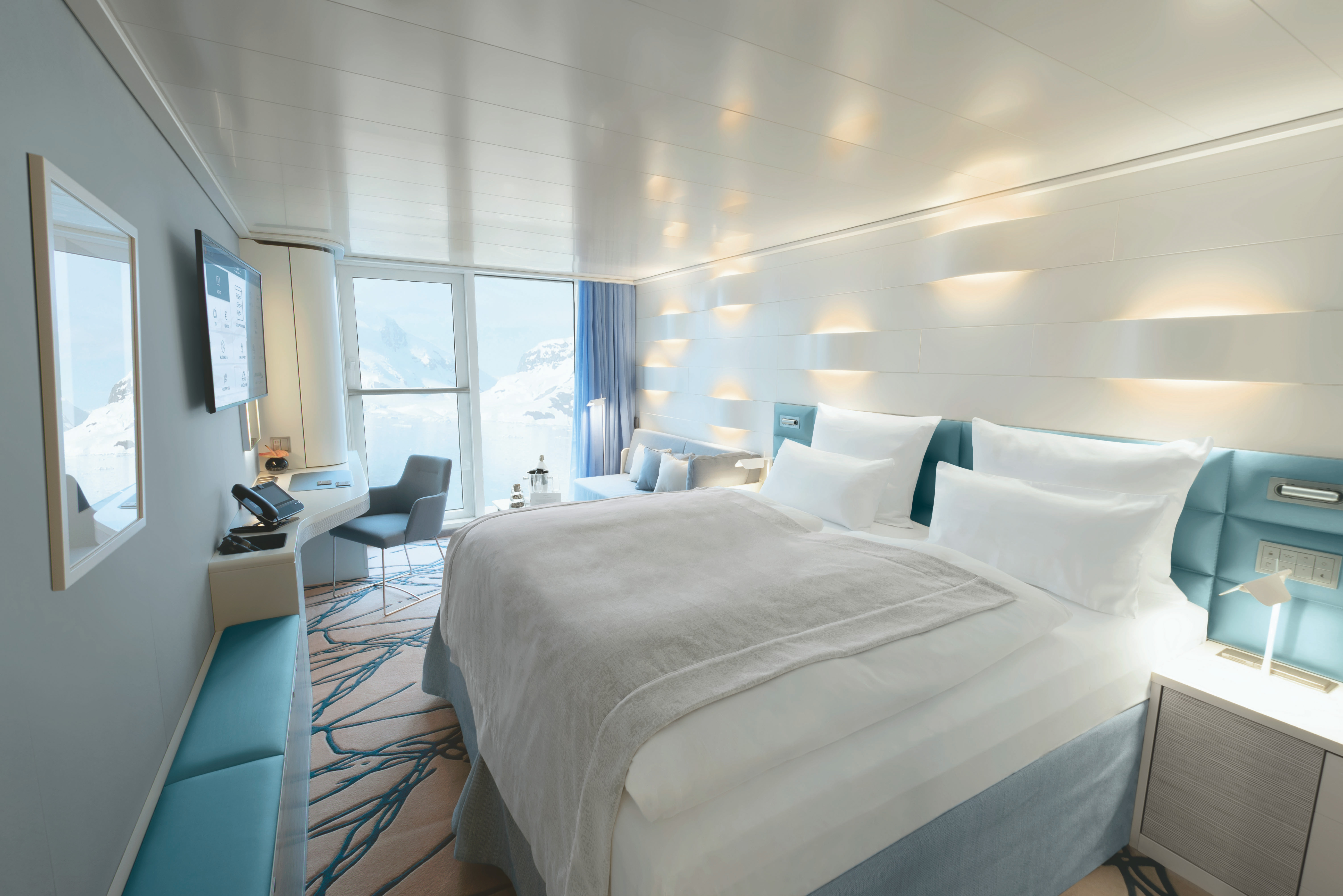
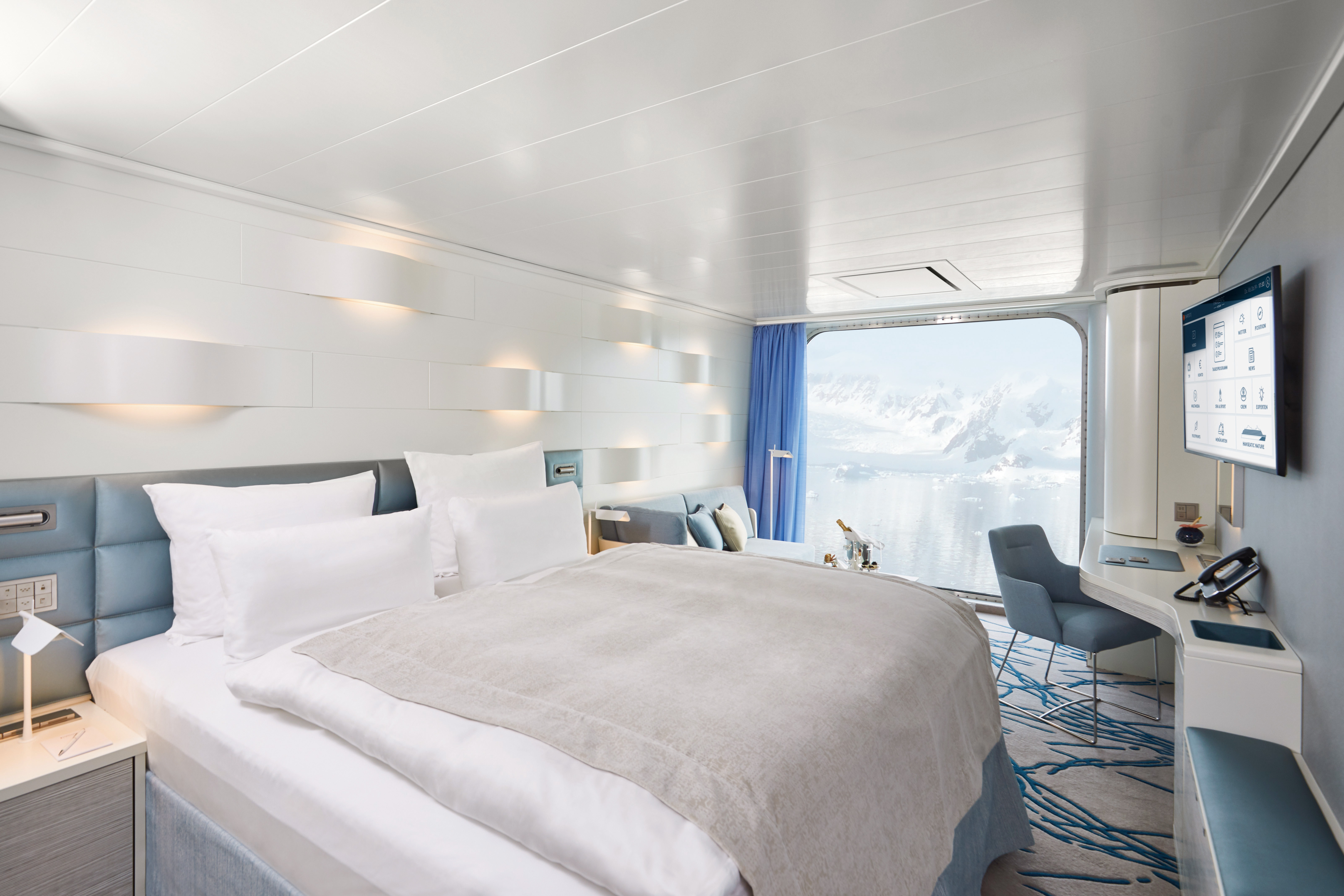
Separate living/sleeping area
- Separate dining area
- Sleeping area with panoramic view
- Separable beds
- TV in living and sleeping areas
- Veranda with space heaters
- Daylight bathroom with two sinks, free-standing bath, rain shower and veranda access
- Steam sauna in shower area
- Heated wall in bathroom (e.g. for towels and wet parkas)
- Separate toilet
- Free mini bar
- Coffee machine
- Extensive infotainment with live broadcast and recordings of expert presentations, forward-view camera, navigation chart, films and much more
- Binoculars in the cabin
- Nordic walking poles
- 24-hour cabin service
- Butler service
- Table reservation in main restaurant
- Free use of Wi-Fi
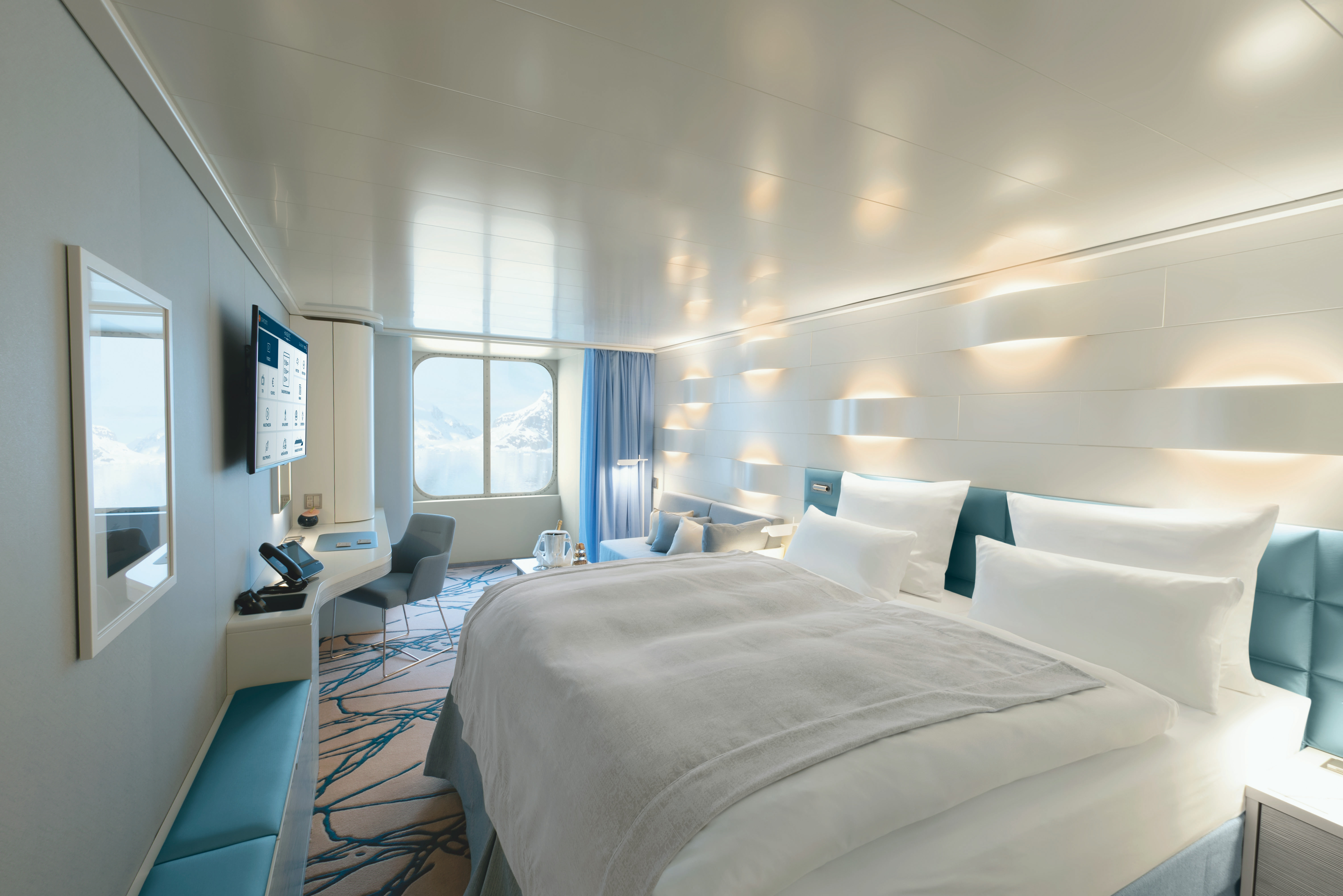
Separate living/sleeping area
- Separate dining area
- Sleeping area with panoramic view
- Separable beds
- TV in living and sleeping areas
- Bathroom with two sinks and rain shower
- Separate toilet
- Steam sauna in shower area
- Heated wall in bathroom (e.g. for towels and wet parkas)
- Free mini bar
- Coffee machine
- Extensive infotainment with live broadcast and recordings of expert presentations, forward-view camera, navigation chart, films and much more
- Binoculars
- Nordic walking poles
- 24-hour cabin service
- Table reservation in main restaurant (applies to the PLATINUM and GOLD fares)
- Butler service
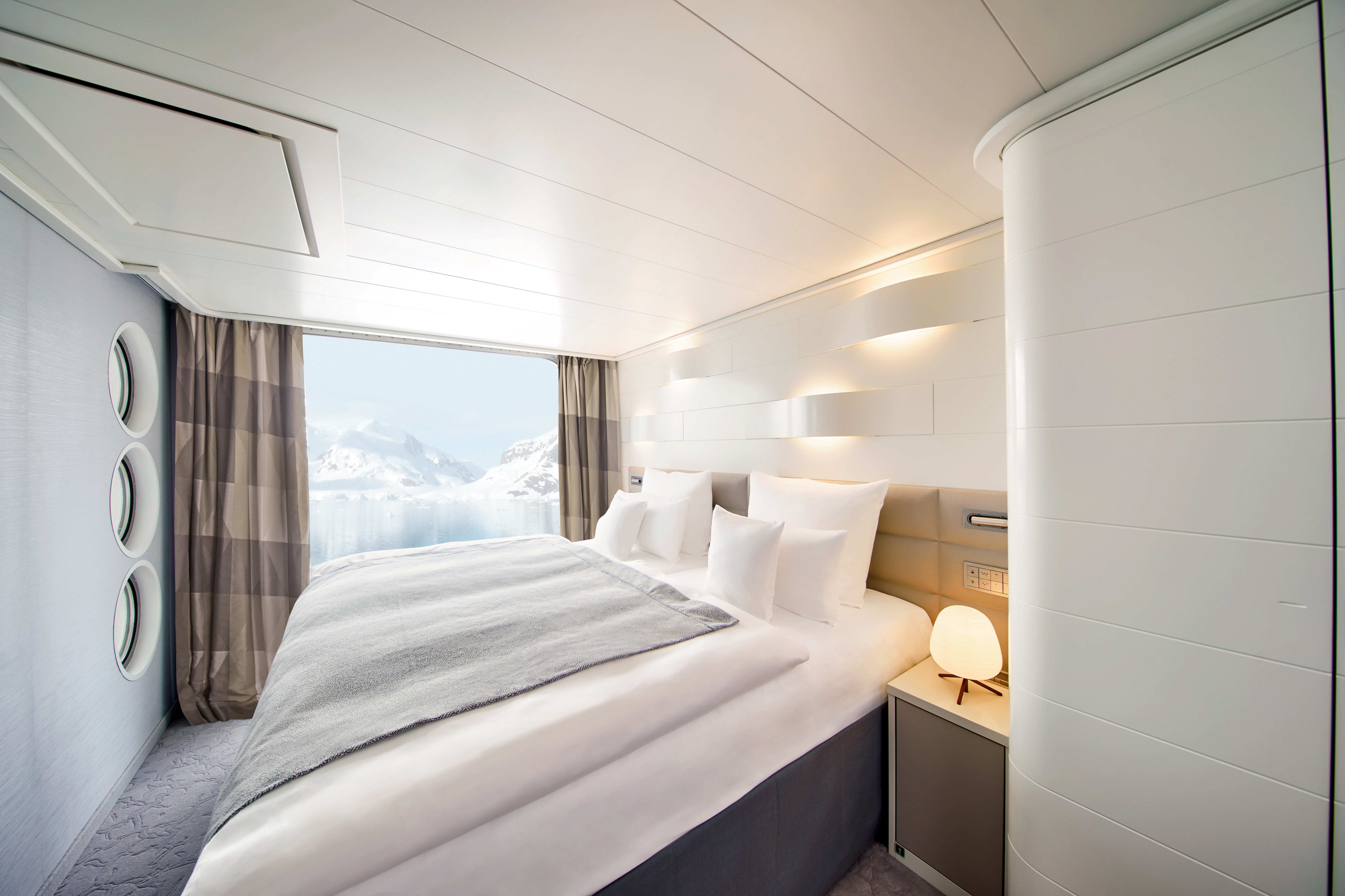
Heated wall in the bathroom (e. g. for towels and wet parkas)
- Rain shower
- Free mini bar (soft drinks)
- Coffee machine
- Separable beds
- Extensive infotainment with live broadcast and recordings of expert presentations, forward-view camera, navigation chart, films and much more
- Binoculars
- Nordic Walking poles
- 24-hour cabin service
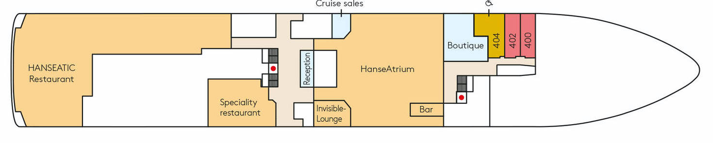
- There is one cabin with fully accessible layout and equipment (cabin 404)
Heated wall in the bathroom (e. g. for towels and wet parkas)
- Rain shower
- Free mini bar (soft drinks)
- Coffee machine
- Separable beds
- Extensive infotainment with live broadcast and recordings of expert presentations, forward-view camera, navigation chart, films and much more
- Binoculars
- Nordic Walking poles
- 24-hour cabin service
- There is one cabin with fully accessible layout and equipment (cabin 404)
The French Balcony Cabins in Category 3 on Deck 6 are approximately 23 m²/248 ft² in size, and those in Category 5 on Deck 7 approximately 21 m²/226 ft². The Balcony Cabins at the stern have a slightly different floor plan.
Heated wall in the bathroom (e. g. for towels and wet parkas)
- Rain shower
- Free mini bar (soft drinks)
- Coffee machine
- Separable beds
- Extensive infotainment with live broadcast and recordings of expert presentations, forward-view camera, navigation chart, films and much more
- Binoculars
- Nordic Walking poles
- 24-hour cabin service
- There is one cabin with fully accessible layout and equipment (cabin 404)
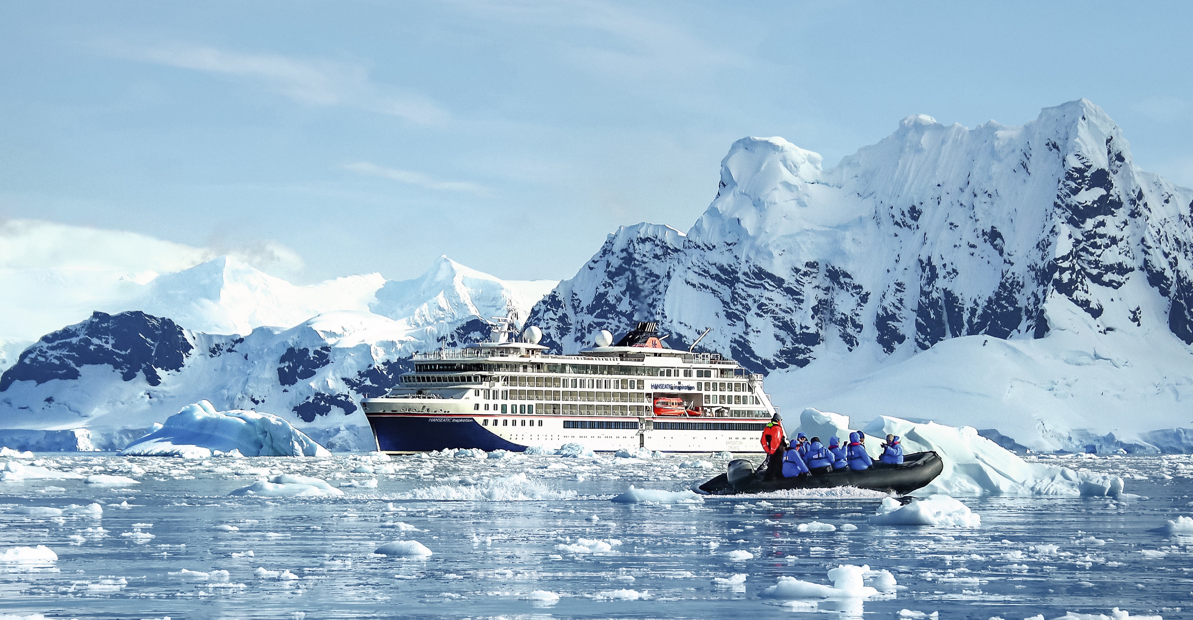
HANSEATIC inspiration
Each of our expeditions is a work of art. Passionately conceived, masterfully realised. A portrait of the world in which there is always something new to discover. And our small, state-of-the-art expedition ships HANSEATIC nature, HANSEATIC inspiration and HANSEATIC spirit (max. 230 guests) are the very best studio where such artistic masterpieces are created. Worlds both faraway and nearby. Ice and tropics. Wildlife paradise or cultural treasure. For every explorer, we offer the right journey of discovery. More than 30 years of experience as the market leader in German-speaking countries.
Ship Facts
| Launch Year | 2019 | ||||||
| Refit Year | |||||||
| Language | de+en | ||||||
| Gross Tonnage | 15650 | ||||||
| Length | 138 | ||||||
| Width | 22 | ||||||
| Currency | EUR | ||||||
| Speed | 16 | ||||||
| Capacity | 230 | ||||||
| Crew Count | 175 | ||||||
| Deck Count | 7 | ||||||
| Cabin Count | 127 | ||||||
| Large Cabin Count | N/A | ||||||
| Wheelchair Cabin Count | N/A | ||||||
| Electrical Plugs |
|
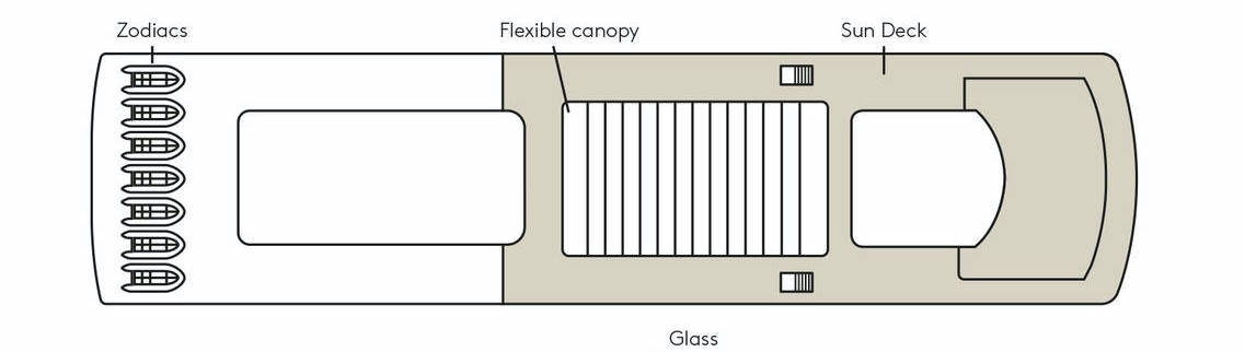
Deck 9
- Zodiacs
- Flexible canopy
- Sun Deck
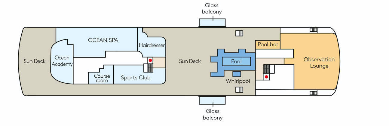
Deck 8
- Sun Deck
- Ocean Academy
- OCEAN SPA
- Course room
- Sports Club
- Hairdresser
- Pool
- Whirlpool
- Glass Balcony
- Pool bar
- Observation Lounge
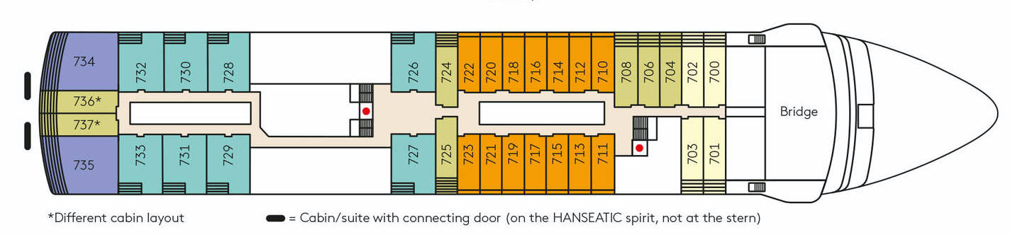
Deck 7
- Bridge
- Veranda Suite or Ocean Suite
- Penthouse Suite
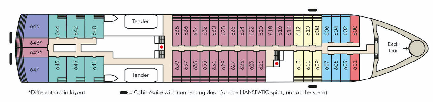
Deck 6
- Tenders
- Inspiration Walk
- Veranda Suite or Ocean Suite
- Grand Ocean Suite
- Penthouse Suite
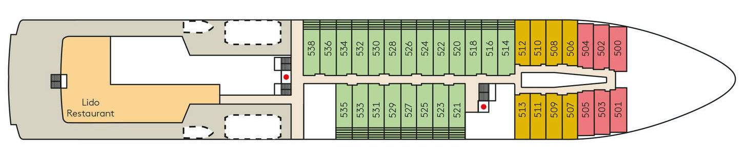
Deck 5
- Lido Restaurant
- Grand Penthouse Suite
- Penthouse Suite
- Veranda Suite or Ocean Suite
Deck 4
- HANSEATIC Restaurant
- Nikkei
- Reception
- Cruise Sales
- HanseAtrium & Bar
- Boutique
- Penthouse Suite
- Veranda Suite or Ocean Suite
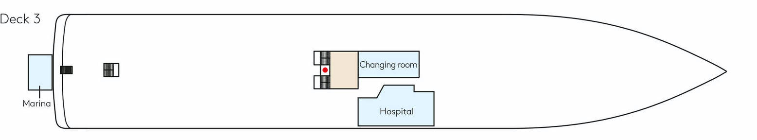
Deck 3
- Changing room
- Hospital
- Marina
A new kind of freedom between adventure and pleasure
Come with us on a culinary voyage of discovery around the globe: on board, three spacious first-class restaurants create a unique and indulgent combination of expedition spirit with international gourmet cuisine. Spend your days and evenings however you wish thanks to flexible mealtimes, a free choice of seating and attentive 24-hour cabin service.
HANSEATIC Restaurant
The spacious HANSEATIC Restaurant of the new expedition class redefines on-board cuisine. From breakfast to dinner, experience our endless variety of creative cuisine at any time of day. Where your ship drops anchor, our top chefs will look to local specialities and conjure up for your plate the aromas of South Africa, the far north, or Europe. Daily changing menus will send your taste buds on a global tour of discovery – accompanied by a selection of wines to suit every palate.
Nikkei
On the HANSEATIC inspiration, fine Japanese creations and Peru's modern trendy cuisine meet in the delightful ambience of the Nikkei.
Lido Restaurant
Expeditions bring you particularly close to the elements. The same applies to our Lido Restaurant. Have breakfast under an open sky, or enjoy a juicy steak cooked to perfection on the large outdoor barbecue – garnished with breathtaking panoramic views. Watch our gourmet chefs at work in the open show kitchen or head straight to the ice cream station for dessert. And why not? After all, the daily grind is far away.
That special touch
Land on a secluded island in a Zodiac and enjoy barbecued fish and chilled drinks with your feet in the sand. Or celebrate with a glass of champagne against a stunning icy backdrop. Our service and ingenuity continue ashore – with a barbecue on the beach, a reception in the ice or exotic delicacies in the depths of the rainforest. This is the feeling of true expedition. This is the taste of true delight.
A glass of wine in your hand and the magnificent jungle, the captivating wilderness of Nordic fjords or the icy panoramas of the Antarctic directly before you – the perfect end to a day of expeditions. From classic whiskys to fancy aperitif creations, the superbly equipped bars in the Observation Lounge and HanseAtrium serve your favourite drinks as you watch the sun go down. Welcome to the small club of great explorers.
Glass Balconies
The glass balcony beneath your feet allows you to hover above the water and reveals the endless expanse and beauty of the ocean. Watch whales and large porpoises as they follow the ship, thrilling you as they leap and swim. Being so close to creation is an indescribable feeling.
Inspiration Walk
The deck tour at the bow offers extraordinarily intensive experiences: when whales jump for joy and polar bears take an icy bath, you will be the first to see these fascinating natural spectacles.
Observation Lounge & Library
Stroll the spacious decks and feel the stars almost within reach – the terraced Observation Deck with a panoramic view is but one place to fulfil your dream. You can also quench your thirst for adventure in the comfortable surroundings of the Observation Lounge. The large full-glass windows provide a 180-degree view of the moon and sea while you reflect on your unforgettable travel days over a glass of wine.
Library
You are welcome to borrow a book on board at any time. Our library is located in the Observation Lounge (Deck 8) and is stocked with a selection of the latest fiction books, travel literature and information about the cruising area.
Invisible Lounge
Located on Deck 4.
Reception
Post
The Reception staff will post your postcards and letters from all ports where this facility is available. Your onboard account will be debited with the appropriate charges.
Announcements
To create the full expedition experience, commentaries are provided for interesting passages during the cruise and special animal sightings are reported. The ship’s position is reported in the morning on days at sea. We will also announce via the loudspeakers when the local authorities have cleared the ship and we can go ashore. The volume can be controlled individually in each cabin/suite.
Means of payment
The on-board currency is the euro. An account will be set up for you so that you can make cashless payments during the cruise. You can find out your current account balance at any time using the infotainment system in your cabin/suite. You can then settle the entire account at Reception at the end of your cruise. We accept German EC/Maestro cards and the following credit cards: Mastercard, American Express and Visa. You can also pay in cash. Please note that, in general, foreign currencies cannot be changed on board.
reception@hanseatic-nature.com