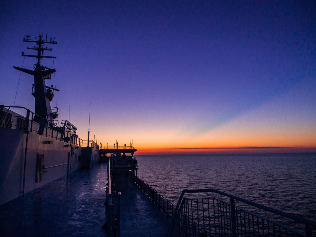
Ramblas & The Rivieras
Ramblas & The Rivieras
Cruise overview
WHY BOOK WITH US?
- ✔ The Deluxe Cruises’ team has extensive experience in ultra-luxury cruising.
- ✔ Call now to speak to our helpful and experienced Cruise Concierge team.
- ✔ Enjoy our Unique Deluxe Cruises Bonus for substantial savings.
- ✔ Our team will tailor your holiday to your exacting requirements.
- ✔ As agents, we work under the protection of each cruise lines ABTA / ATOL licences
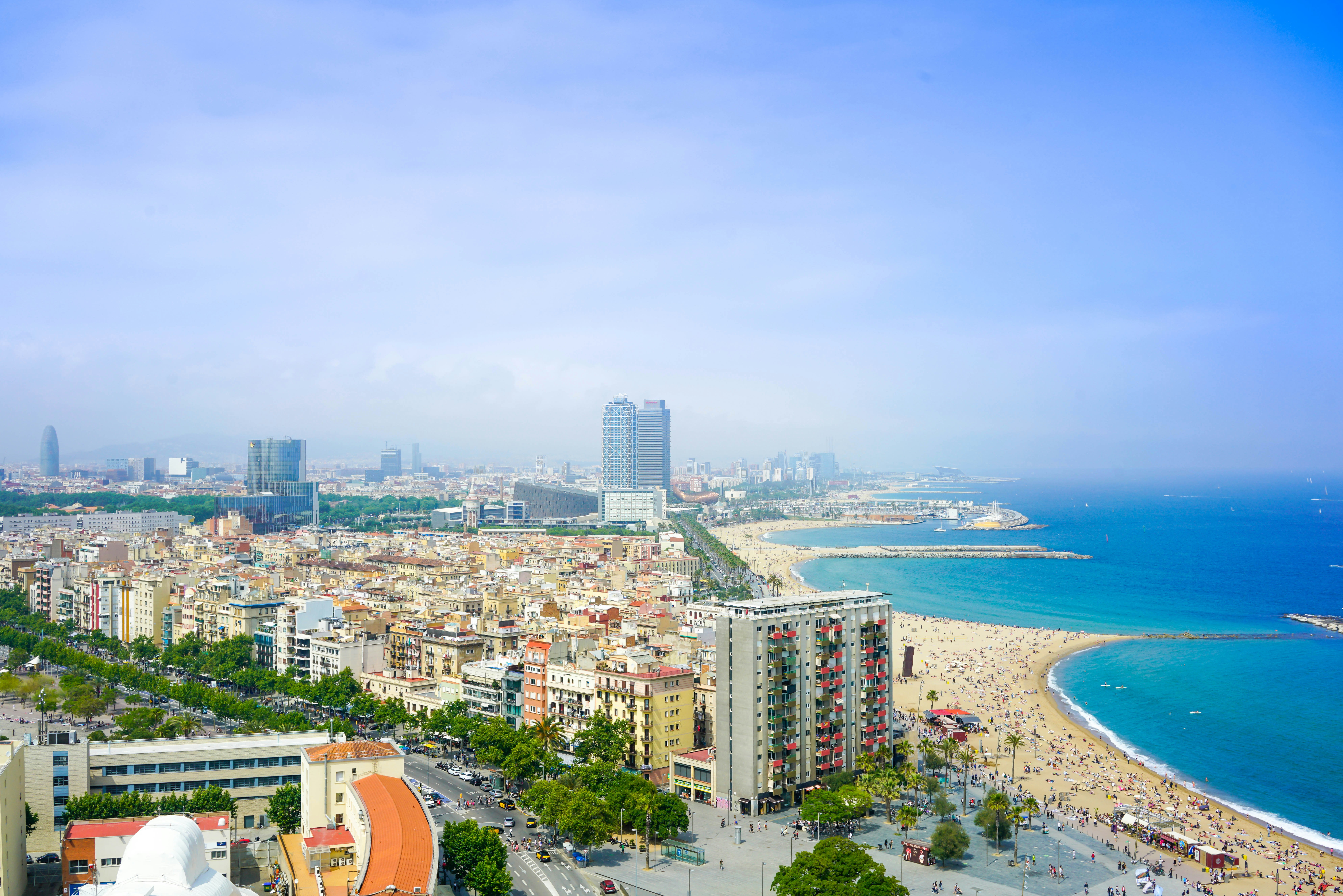
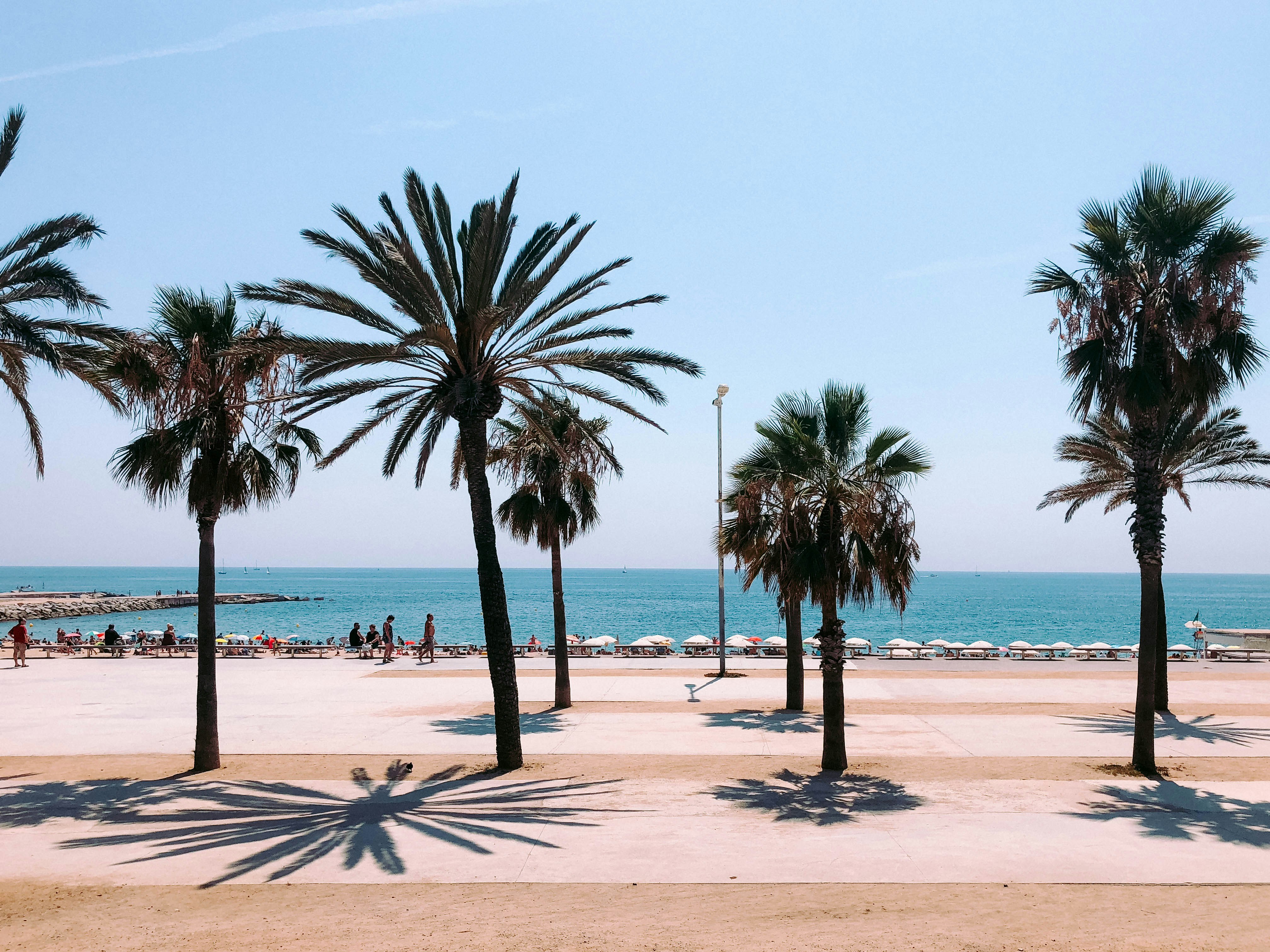
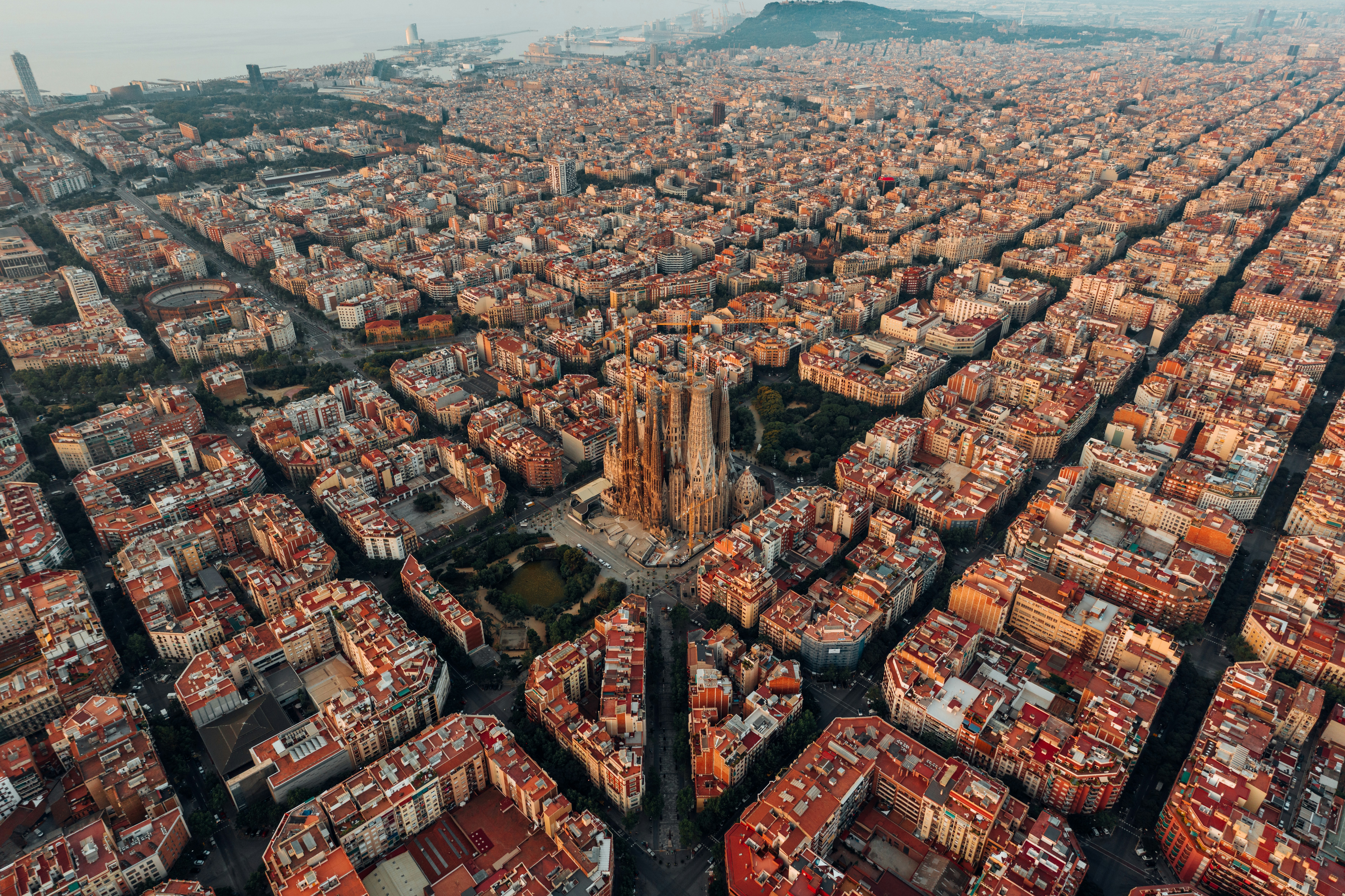
About Barcelona
The infinite variety of street life, the nooks and crannies of the medieval Barri Gòtic, the ceramic tile and stained glass of Art Nouveau facades, the art and music, the throb of street life, the food (ah, the food!)—one way or another, Barcelona will find a way to get your full attention. The capital of Catalonia is a banquet for the senses, with its beguiling mix of ancient and modern architecture, tempting cafés and markets, and sun-drenched Mediterranean beaches. A stroll along La Rambla and through waterfront Barceloneta, as well as a tour of Gaudí's majestic Sagrada Famíliaand his other unique creations, are part of a visit to Spain's second-largest city. Modern art museums and chic shops call for attention, too. Barcelona's vibe stays lively well into the night, when you can linger over regional wine and cuisine at buzzing tapas bars.

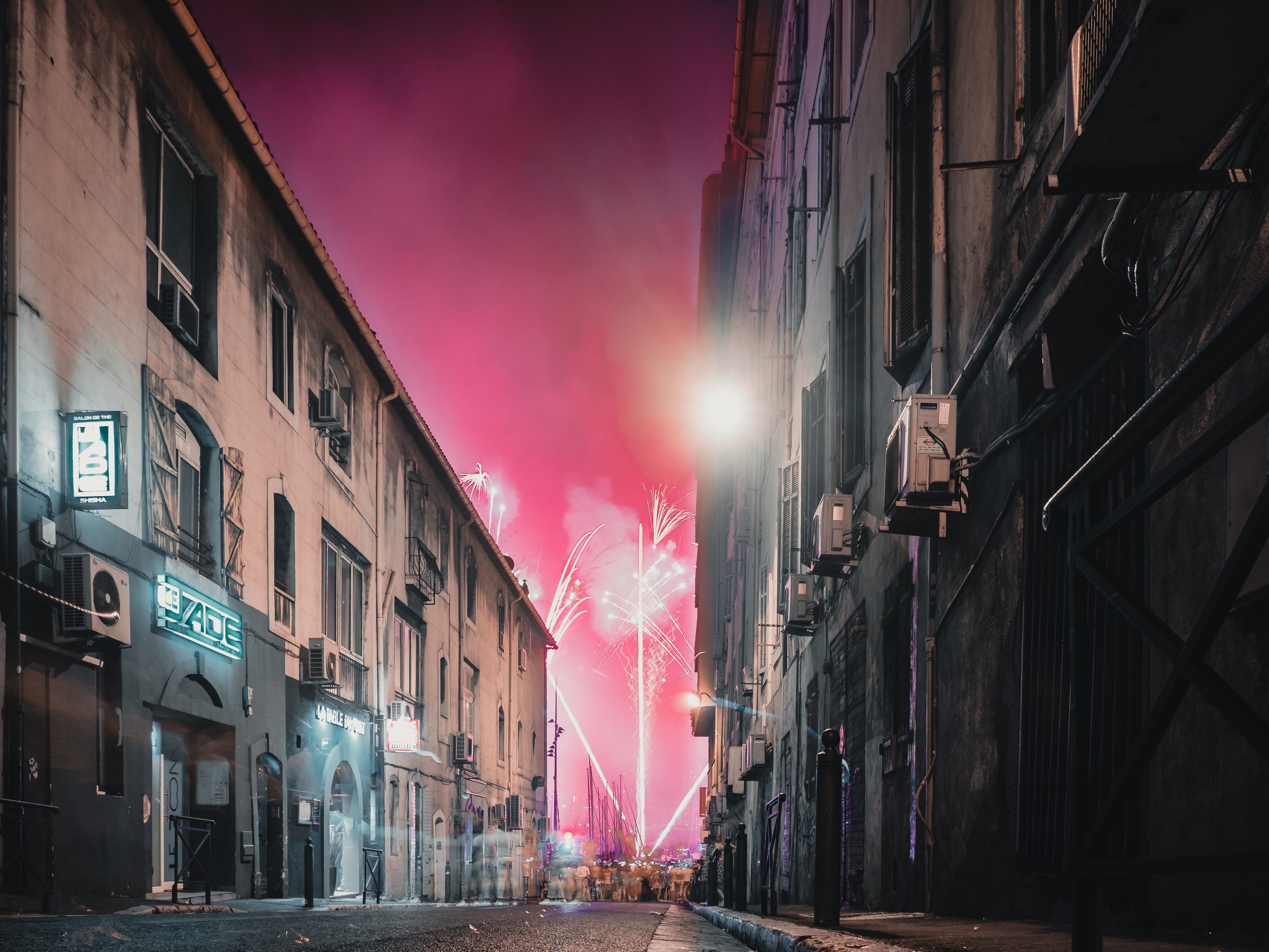
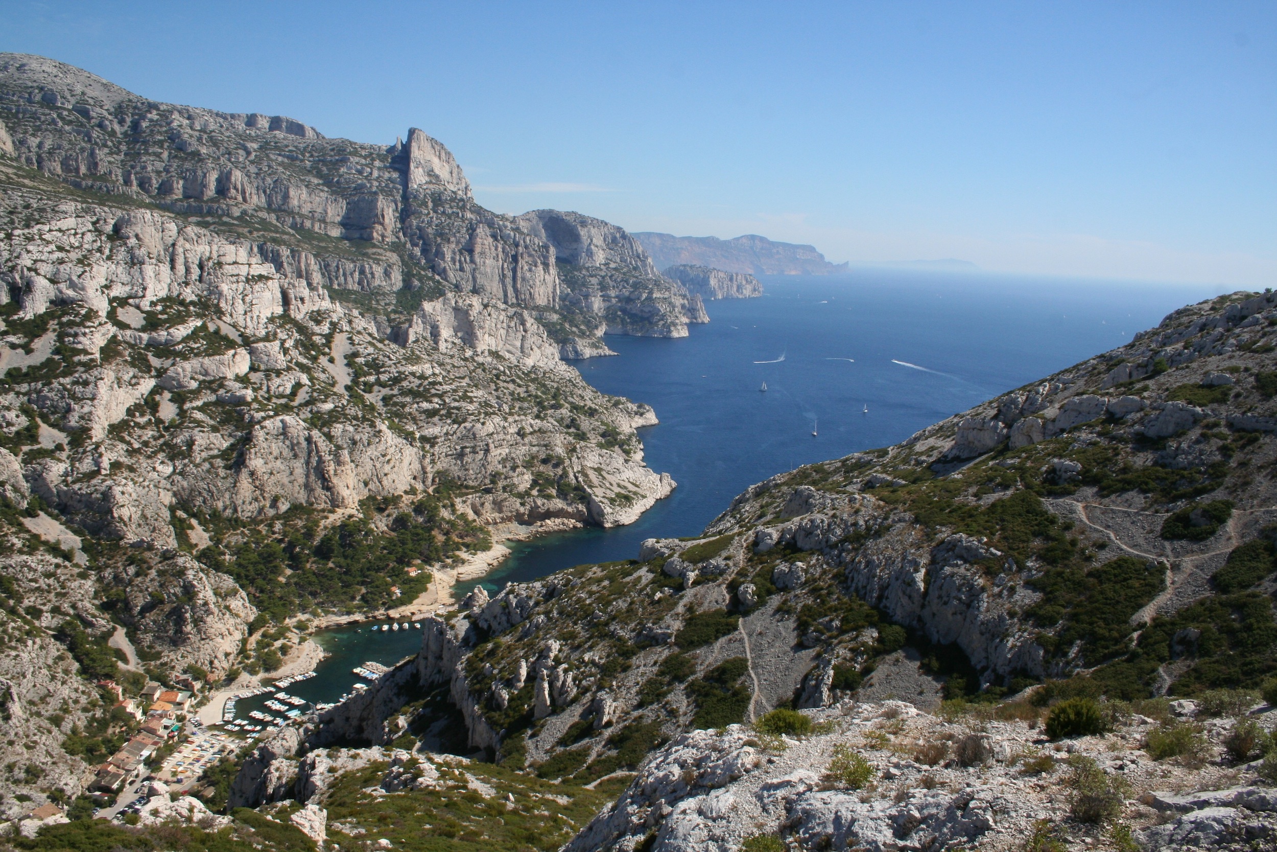
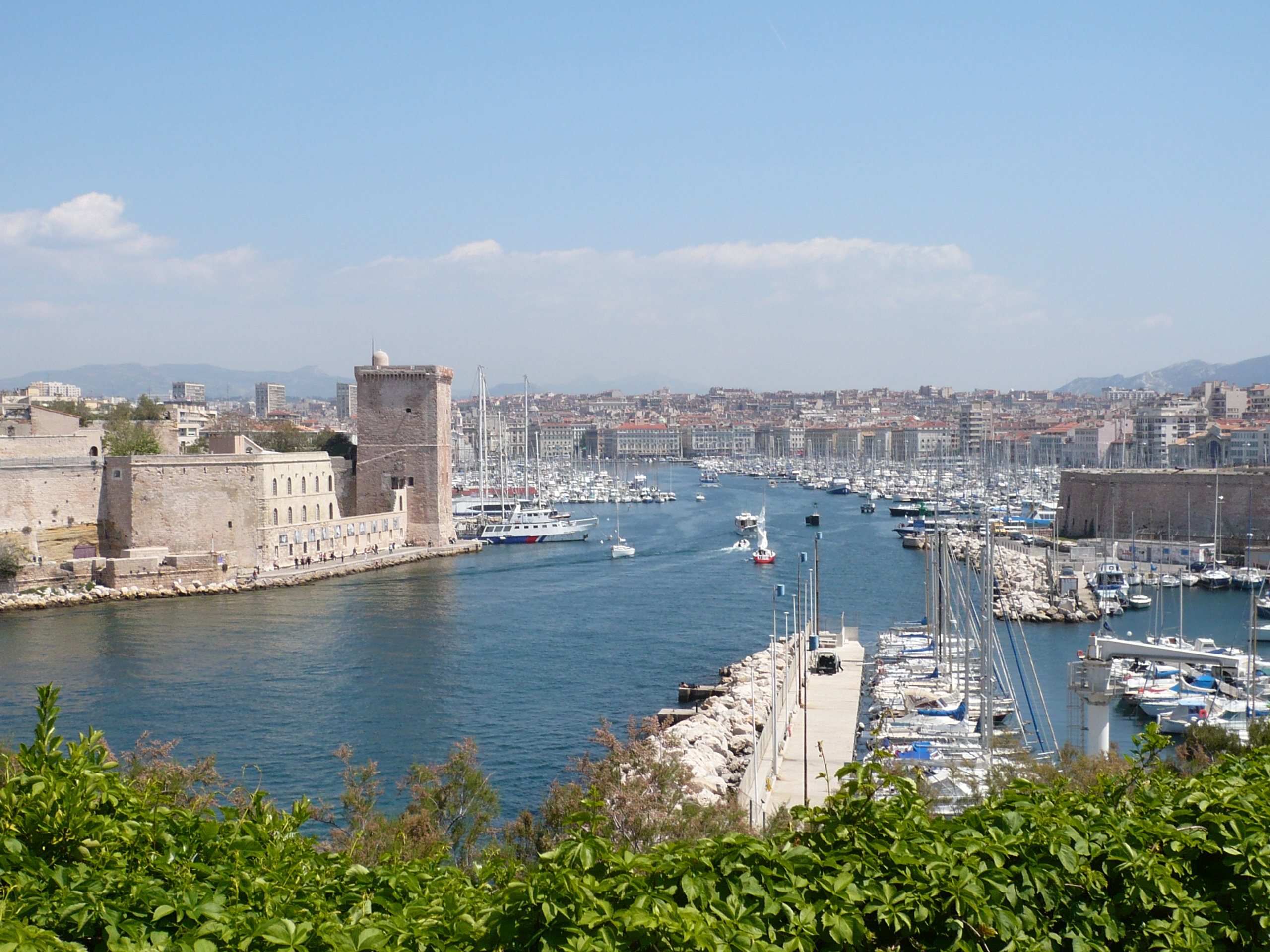
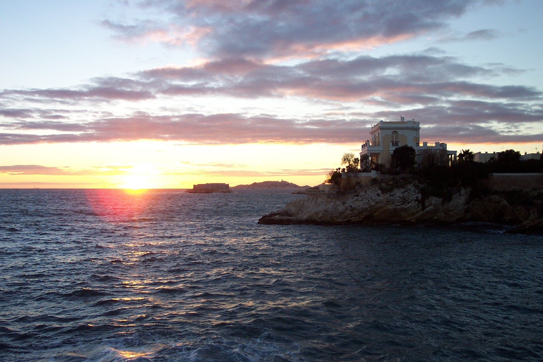
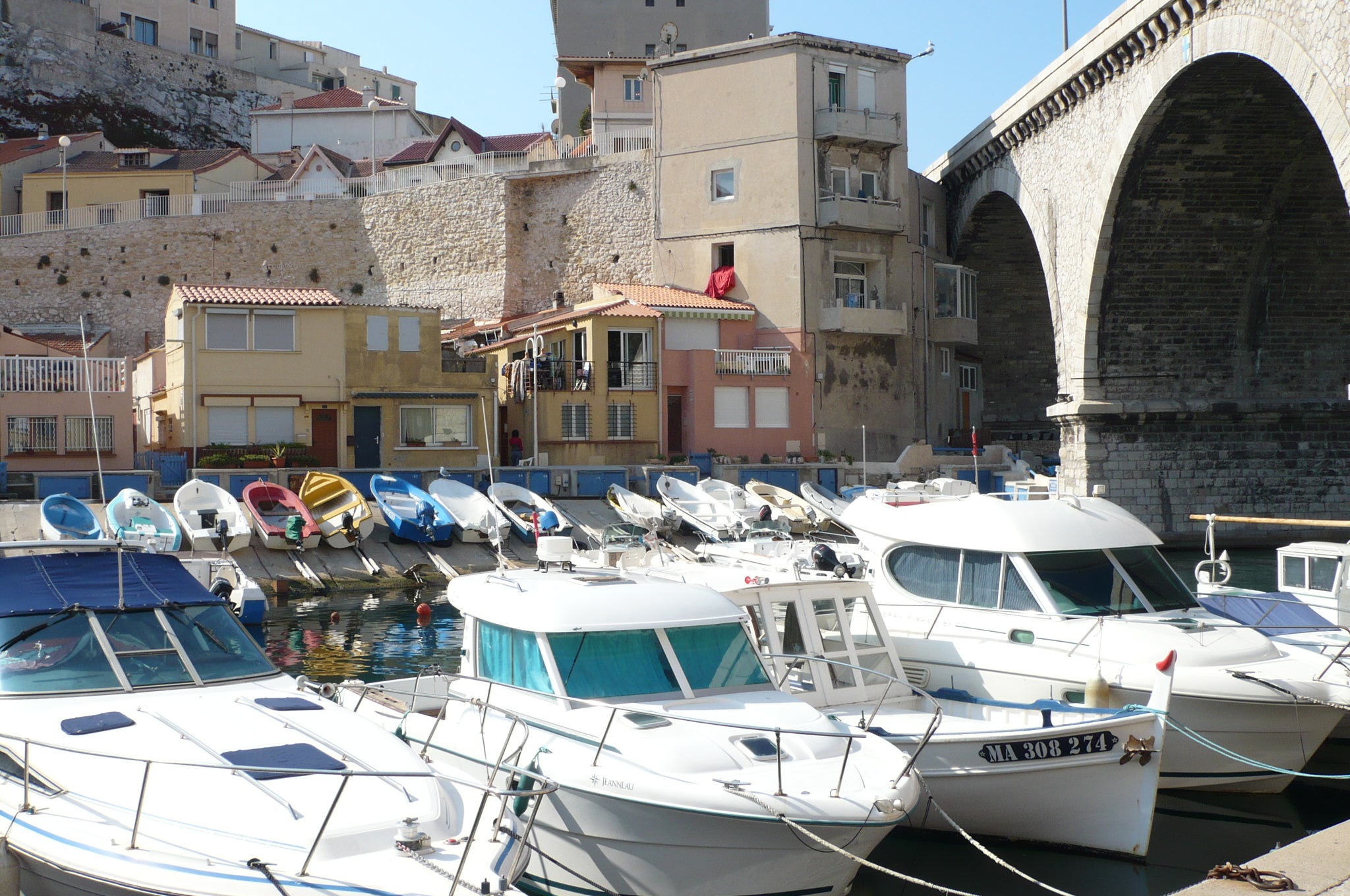
About Marseille
Since being designated a European Capital of Culture for 2013, with an estimated €660 million of funding in the bargain, Marseille has been in the throes of an extraordinary transformation, with no fewer than five major new arts centers, a beautifully refurbished port, revitalized neighborhoods, and a slew of new shops and restaurants. Once the underdog, this time-burnished city is now welcoming an influx of weekend tourists who have colonized entire neighborhoods and transformed them into elegant pieds-à-terre (or should we say, mer). The second-largest city in France, Marseille is one of Europe's most vibrant destinations. Feisty and fond of broad gestures, it is also as complicated and as cosmopolitan now as it was when a band of Phoenician Greeks first sailed into the harbor that is today's Vieux Port in 600 BC. Legend has it that on that same day a local chieftain's daughter, Gyptis, needed to choose a husband, and her wandering eyes settled on the Greeks' handsome commander Protis. Her dowry brought land near the mouth of the Rhône, where the Greeks founded Massalia, the most important Continental shipping port in antiquity. The port flourished for some 500 years as a typical Greek city, enjoying the full flush of classical culture, its gods, its democratic political system, its sports and theater, and its naval prowess. Caesar changed all that, besieging the city in 49 BC and seizing most of its colonies. In 1214 Marseille was seized again, this time by Charles d'Anjou, and was later annexed to France by Henri IV in 1481, but it was not until Louis XIV took the throne that the biggest transformations of the port began; he pulled down the city walls in 1666 and expanded the port to the Rive Neuve (New Riverbank). The city was devastated by plague in 1720, losing more than half its population. By the time of the Revolution, Marseille was on the rebound once again, with industries of soap manufacturing and oil processing flourishing, encouraging a wave of immigration from Provence and Italy. With the opening of the Suez Canal in 1869, Marseille became the greatest boomtown in 19th-century Europe. With a large influx of immigrants from areas as exotic as Tangiers, the city quickly acquired the multicultural population it maintains to this day.
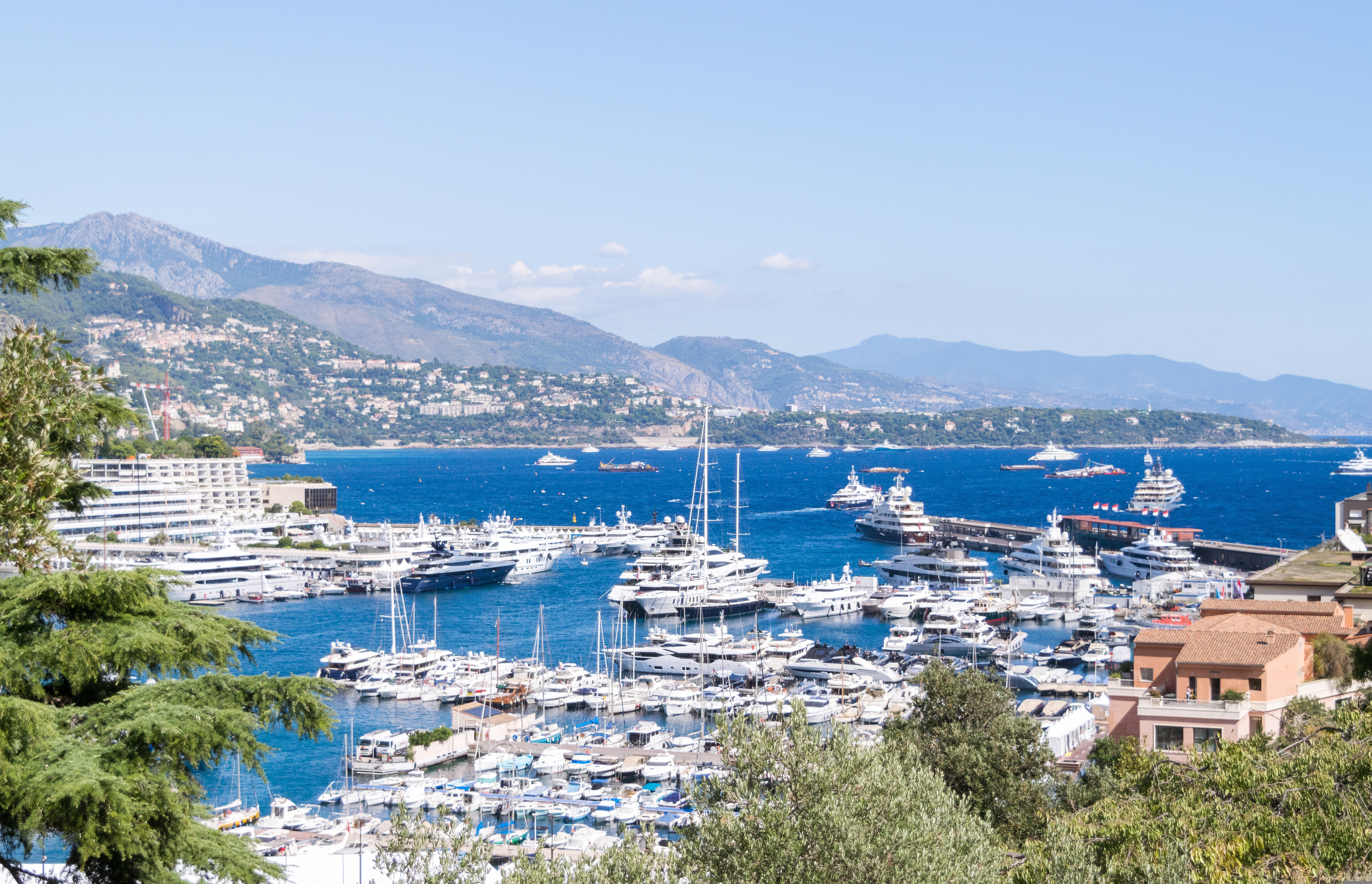
About Monaco
The 202-hectare Principality of Monaco is located east of France’s Mediterranean coast. Known for its royal family, especially Prince Albert of Monaco, its casinos and racetracks and for being a wealthy state with no applied taxes. Monaco is reachable by air through the French airport of Nice Côte d'Azur, located approximately 16 miles from the principality.
About Livorno
Livorno is a gritty city with a long and interesting history. In the early Middle Ages it alternately belonged to Pisa and Genoa. In 1421 Florence, seeking access to the sea, bought it. Cosimo I (1519–74) started construction of the harbor in 1571, putting Livorno on the map. After Ferdinando I de' Medici (1549–1609) proclaimed Livorno a free city, it became a haven for people suffering from religious persecution; Roman Catholics from England and Jews and Moors from Spain and Portugal, among others, settled here. The Quattro Mori (Four Moors), also known as the Monument to Ferdinando I, commemorates this. (The statue of Ferdinando I dates from 1595, the bronze Moors by Pietro Tacca from the 1620s.)In the following centuries, and particularly in the 18th, Livorno boomed as a port. In the 19th century the town drew a host of famous Britons passing through on their grand tours. Its prominence continued up to World War II, when it was heavily bombed. Much of the town's architecture, therefore, postdates the war, and it's somewhat difficult to imagine what it might have looked like before. Livorno has recovered from the war, however, as it's become a huge point of departure for container ships, as well as the only spot in Tuscany for cruise ships to dock for the day.Most of Livorno's artistic treasures date from the 17th century and aren't all that interesting unless you dote on obscure baroque artists. Livorno's most famous native artist, Amedeo Modigliani (1884–1920), was of much more recent vintage. Sadly, there's no notable work by him in his hometown.There may not be much in the way of art, but it's still worth strolling around the city. The Mercato Nuovo, which has been around since 1894, sells all sorts of fruits, vegetables, grains, meat, and fish. Outdoor markets nearby are also chock-full of local color. The presence of Camp Darby, an American military base just outside town, accounts for the availability of many American products.If you have time, Livorno is worth a stop for lunch or dinner at the very least.
About Ajaccio, Corsica
Considered Corsica’s primary commercial and cultural hub, the largest city and regional capital of Ajaccio is situated on the west coast of the island, approximately 644 km (400 miles) southeast of Marseille, France. Founded in 1492, vestiges of ancient Corsica in this ville impériale revolve around the city’s most famous son, Napoléon Bonaparte, whose family home—now the national museum Maison Bonaparte—pays tribute to the emperor’s historical influence.Remnants from what was originally a 12th-century Genoese colony are still visible around the Old Town near the imposing citadel and watchtower. Perfect for exploring, the luminous seaside city surrounded by snowcapped mountains and pretty beaches offers numerous sites, eateries, side streets, and a popular harbor, where sailboats and fishing vessels moor in the picturesque Tino Rossi port lined with well-established restaurants and cafés serving fresh local fare.
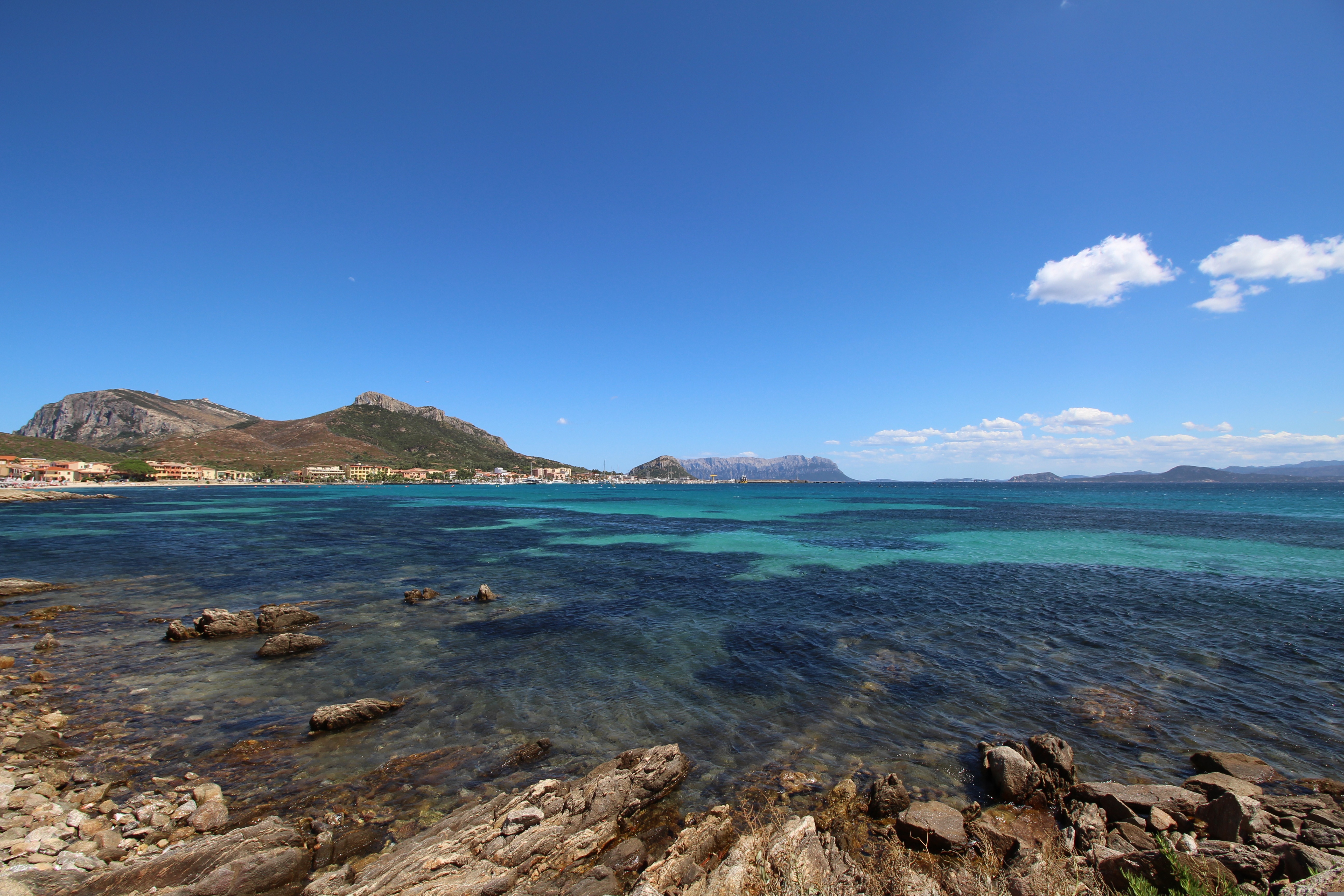
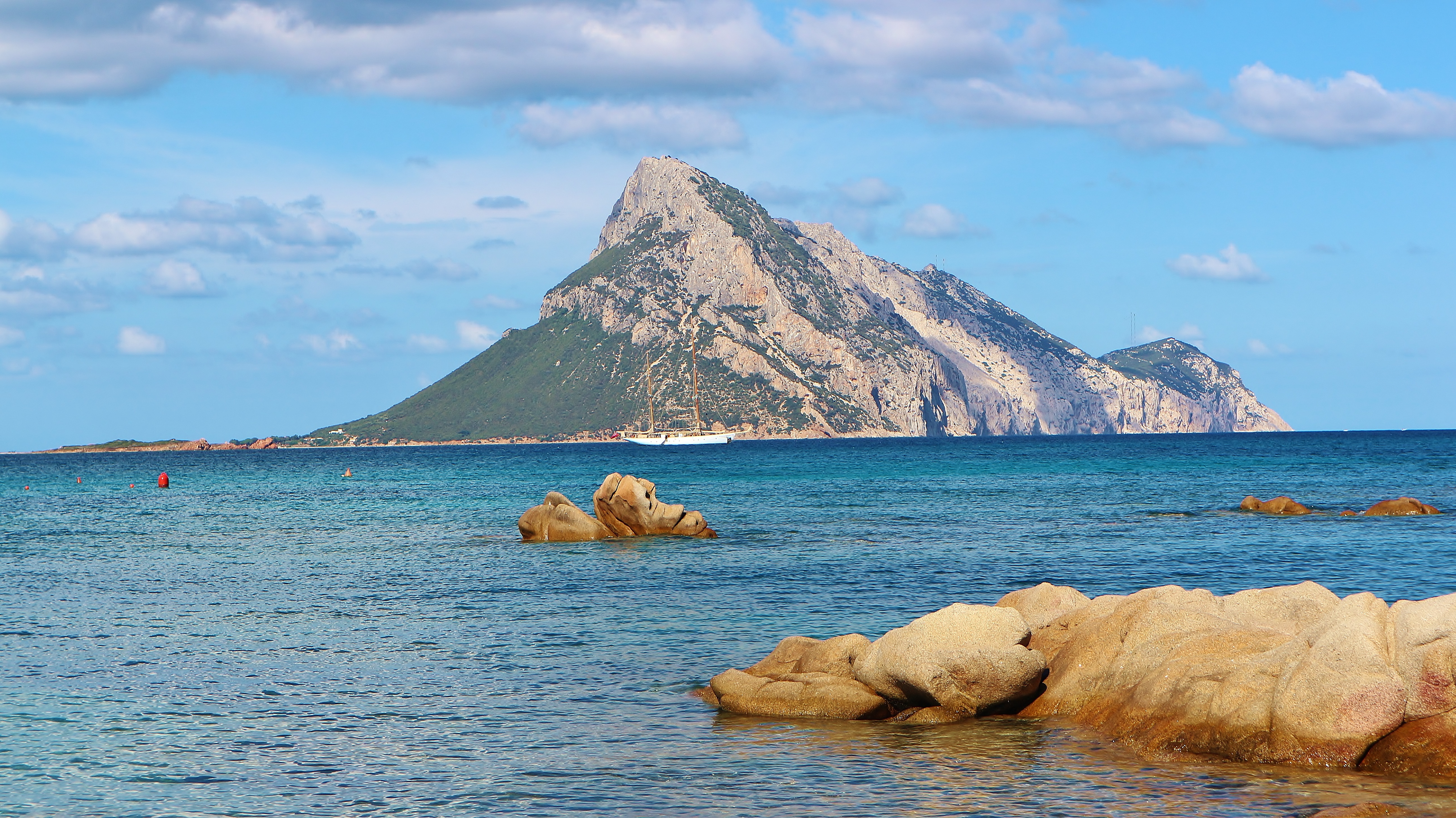
About Olbia
Amid the resorts of Sardinia's northeastern coast, Olbia, a town of about 60,000, is a lively little seaport and port of call for mainland ferries at the head of a long, wide bay.San SimplicioOlbia's little Catholic basilica, a short walk behind the main Corso Umberto and past the train station, is worth searching out if you have any spare time in Olbia. The simple granite structure dates from the 11th century, part of the great Pisan church-building program, using pillars and columns recycled from Roman buildings. The basilica has a bare, somewhat somber interior, its three naves separated by a series of arches.
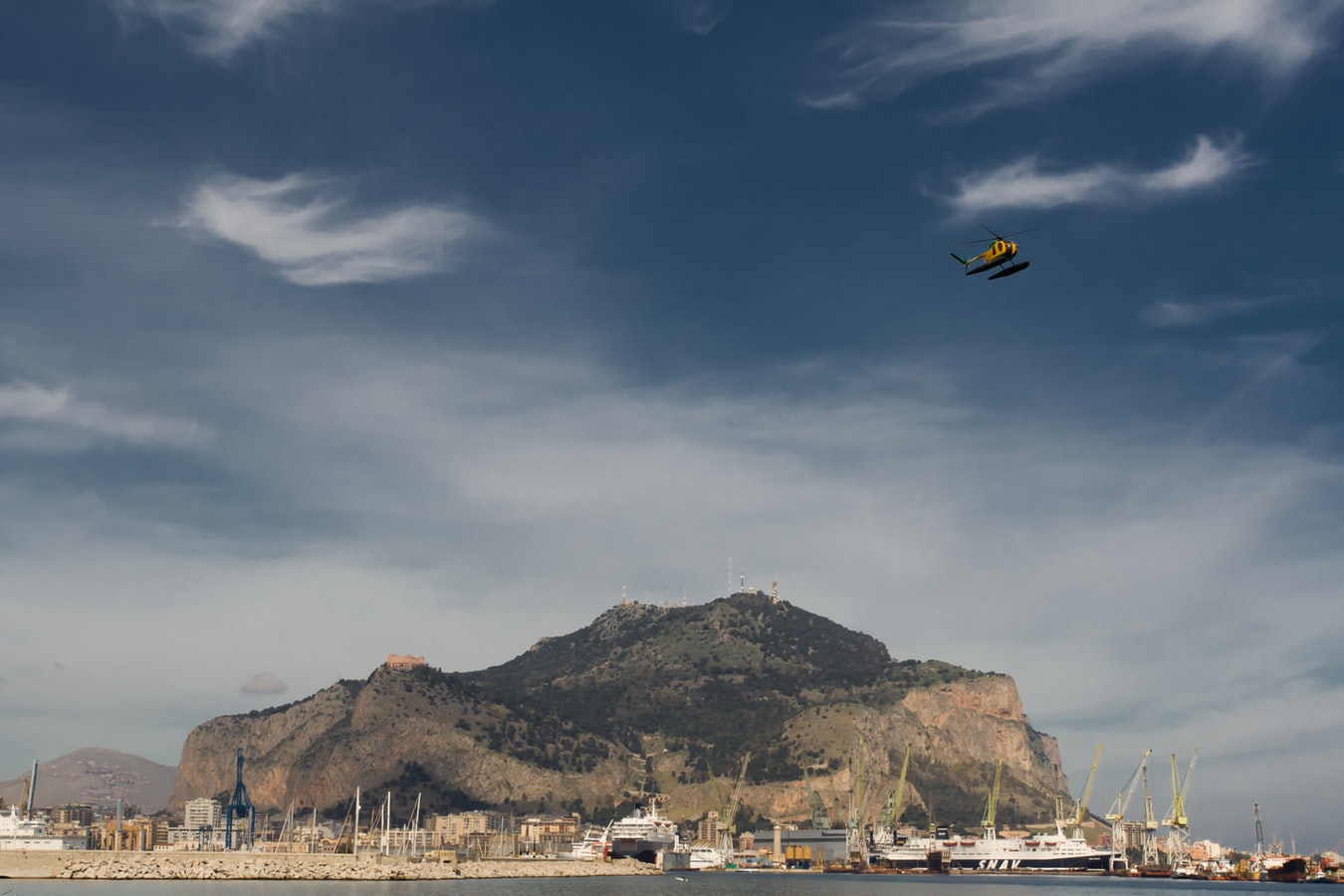
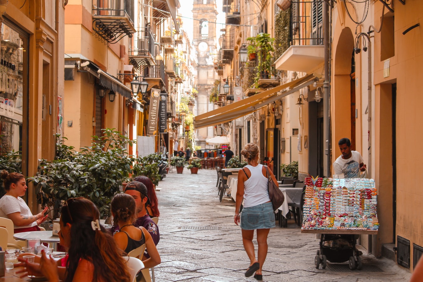
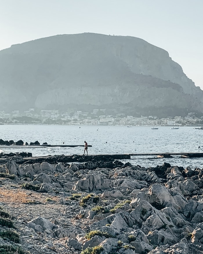
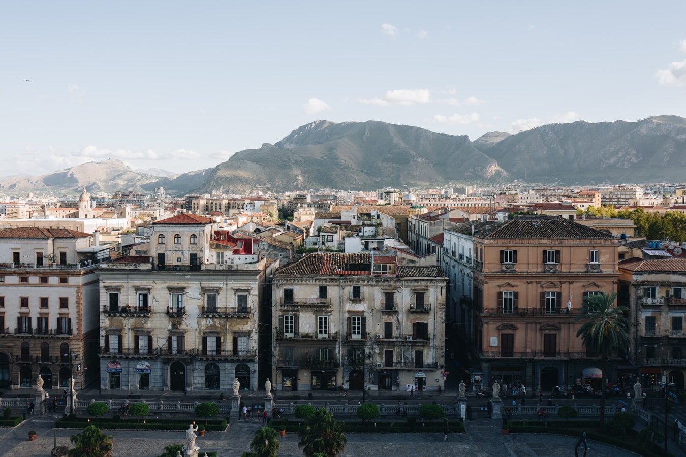
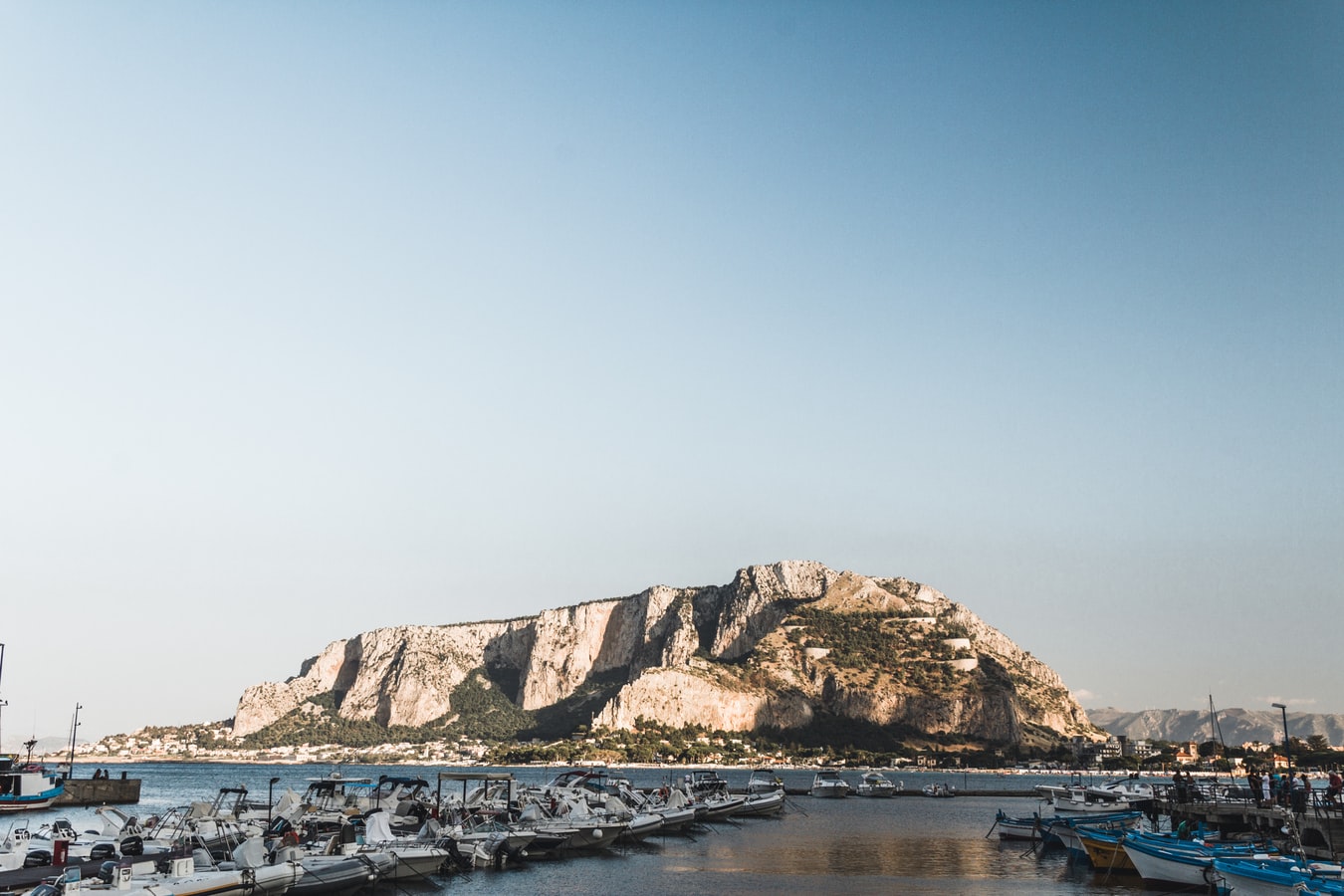
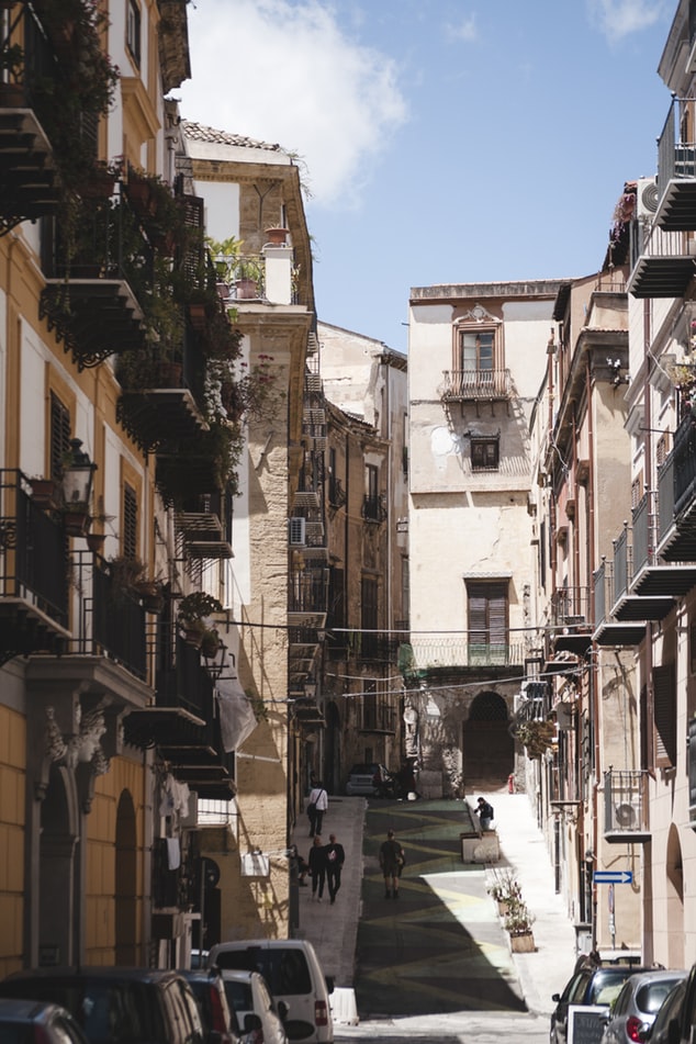
About Palermo
Once the intellectual capital of southern Europe, Palermo has always been at the crossroads of civilization. Favorably situated on a crescent-shaped bay at the foot of Monte Pellegrino, it has attracted almost every culture touching the Mediterranean world. To Palermo's credit, it has absorbed these diverse cultures into a unique personality that is at once Arab and Christian, Byzantine and Roman, Norman and Italian. The city's heritage encompasses all of Sicily's varied ages, but its distinctive aspect is its Arab-Norman identity, an improbable marriage that, mixed in with Byzantine and Jewish elements, created some resplendent works of art. No less noteworthy than the architecture is Palermo's chaotic vitality, on display at some of Italy's most vibrant outdoor markets, public squares, street bazaars, and food vendors, and above all in its grand climax of Italy's most spectacular passeggiata (the leisurely social stroll along the principal thoroughfare).
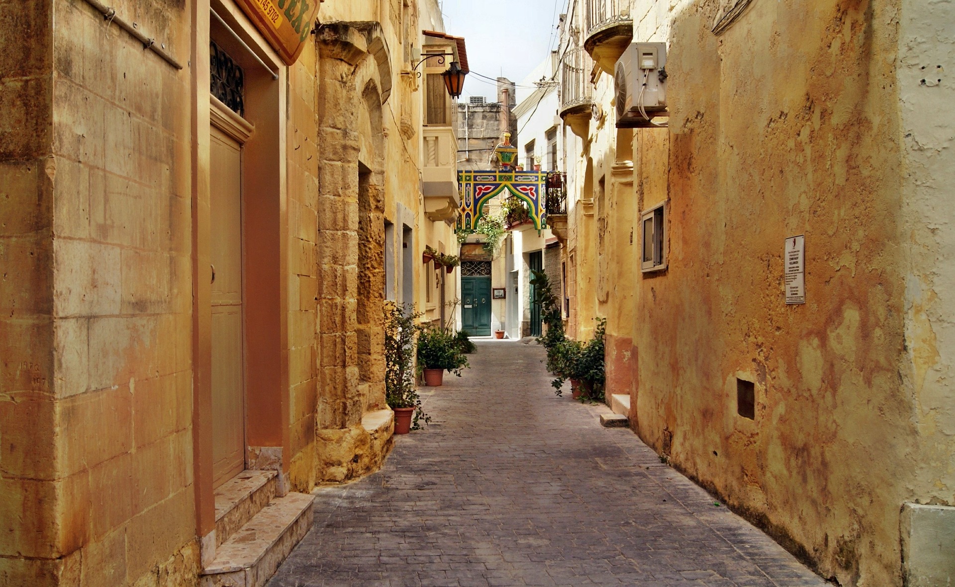
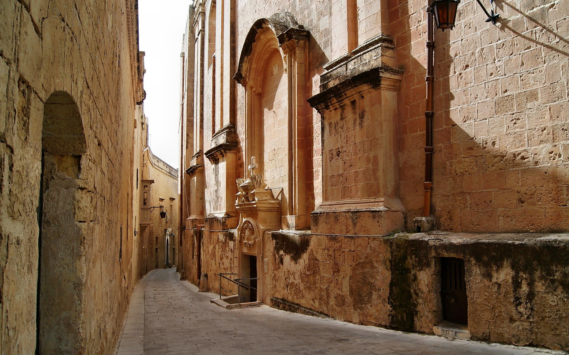
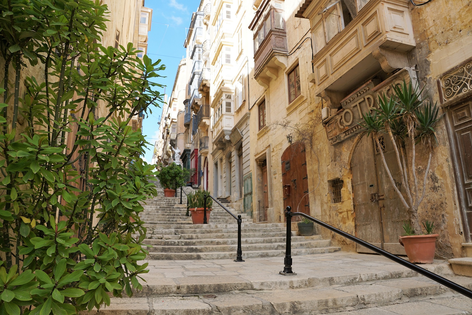
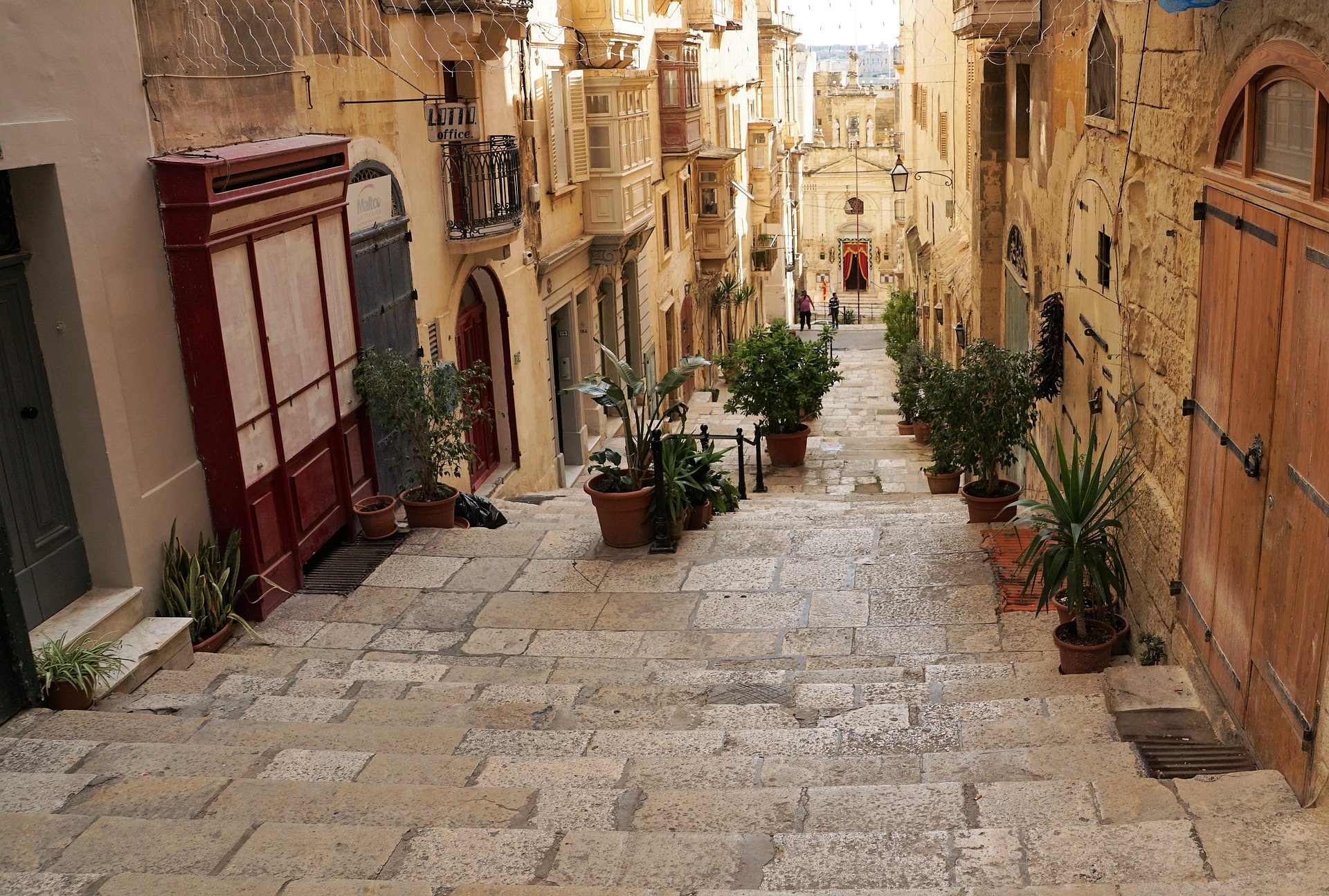
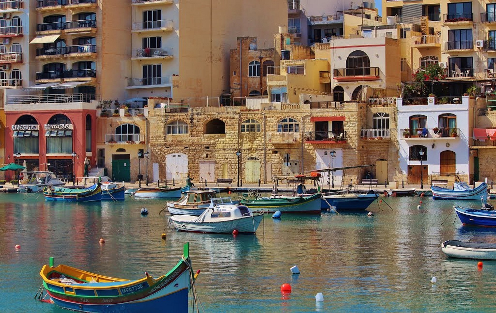
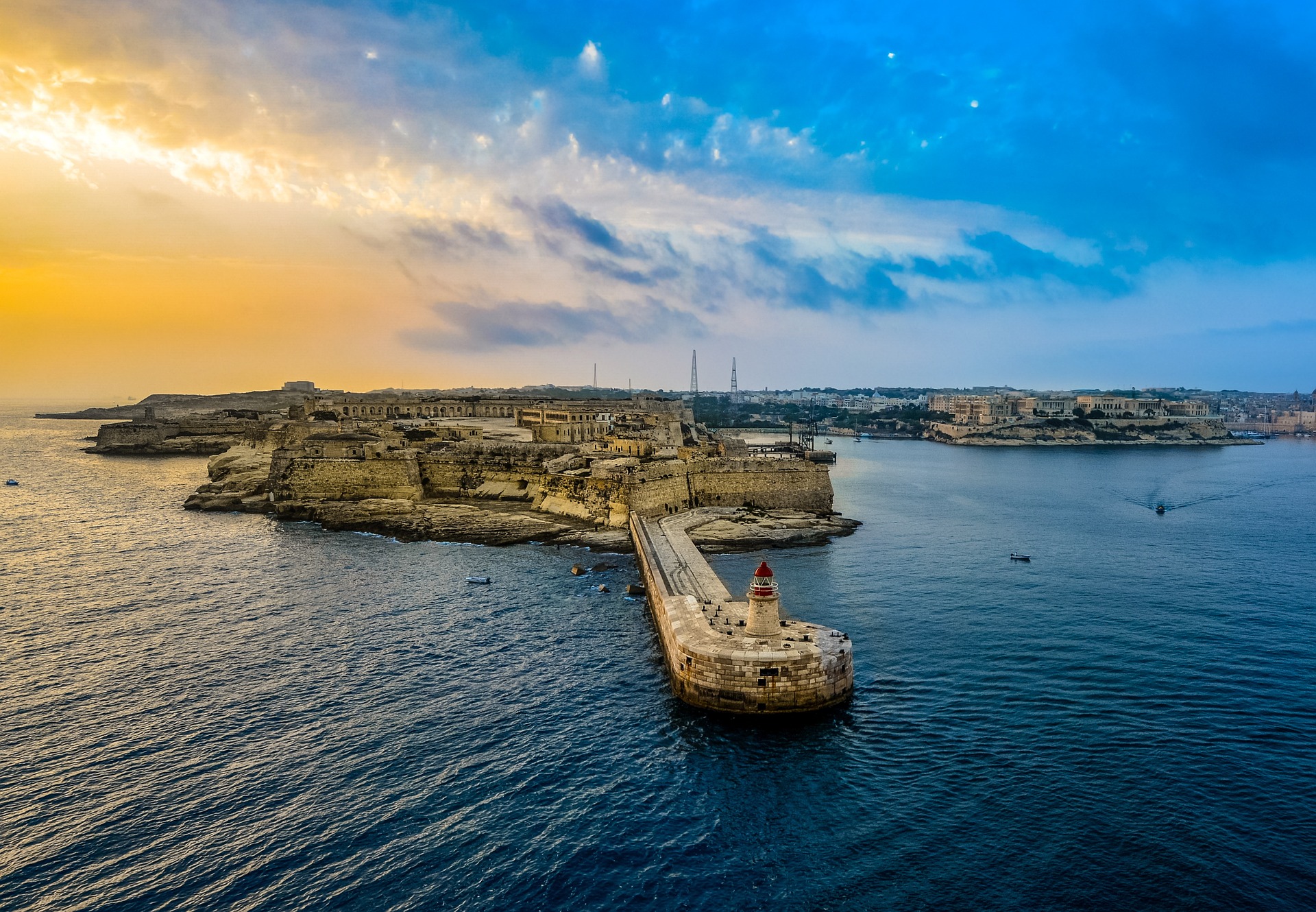
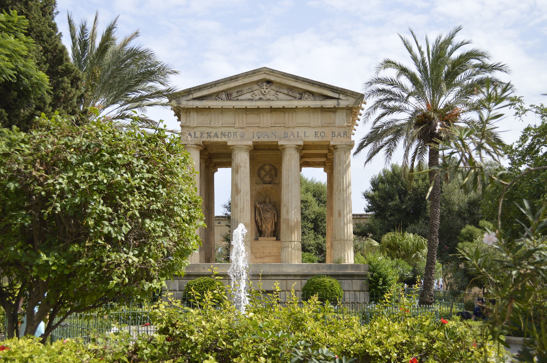
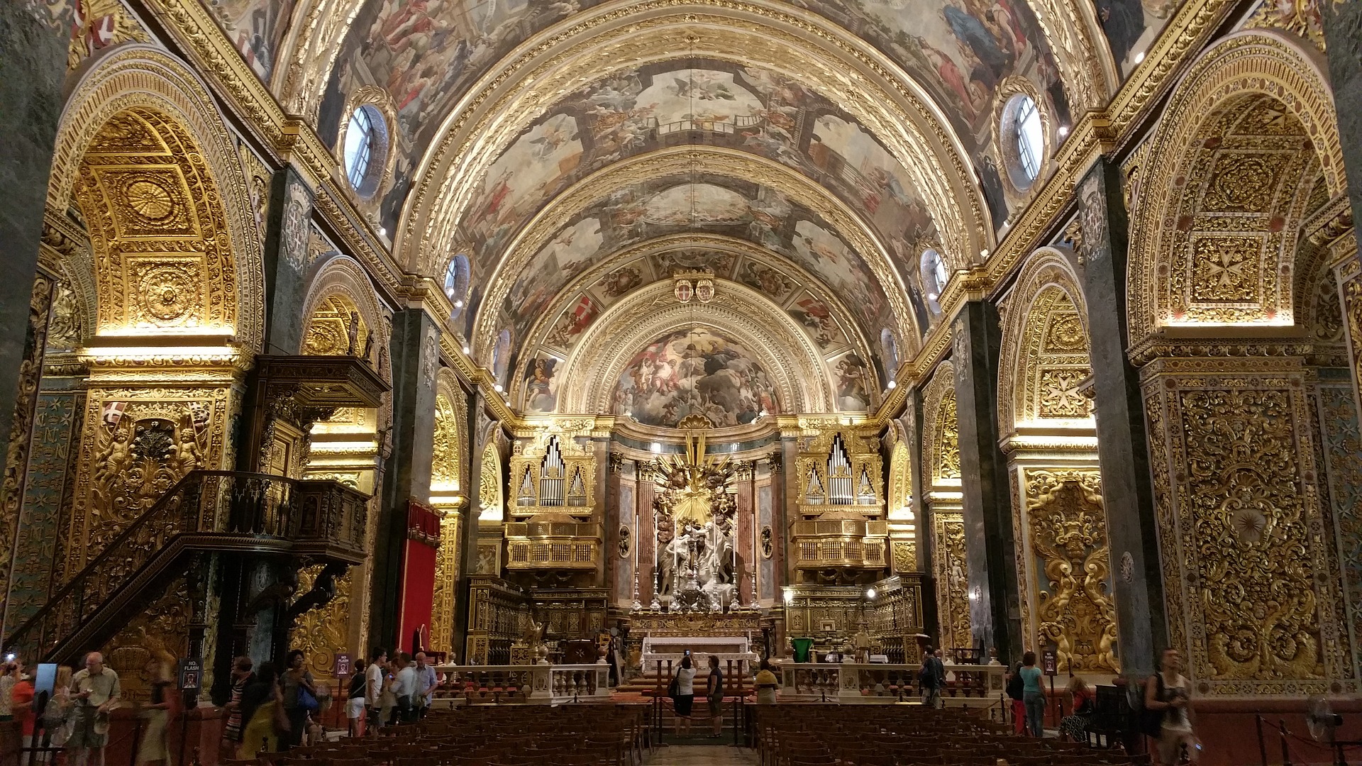
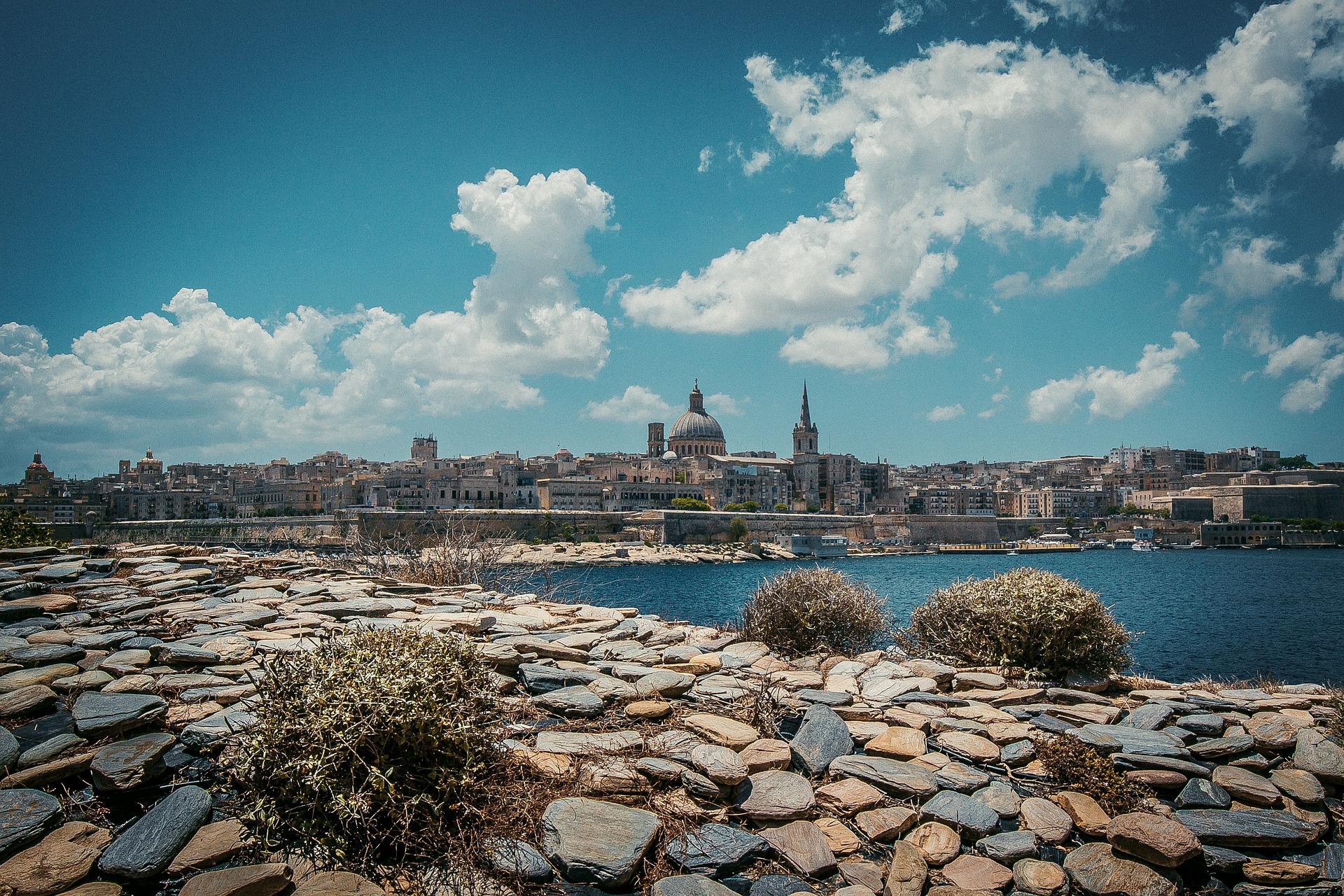
About Valletta
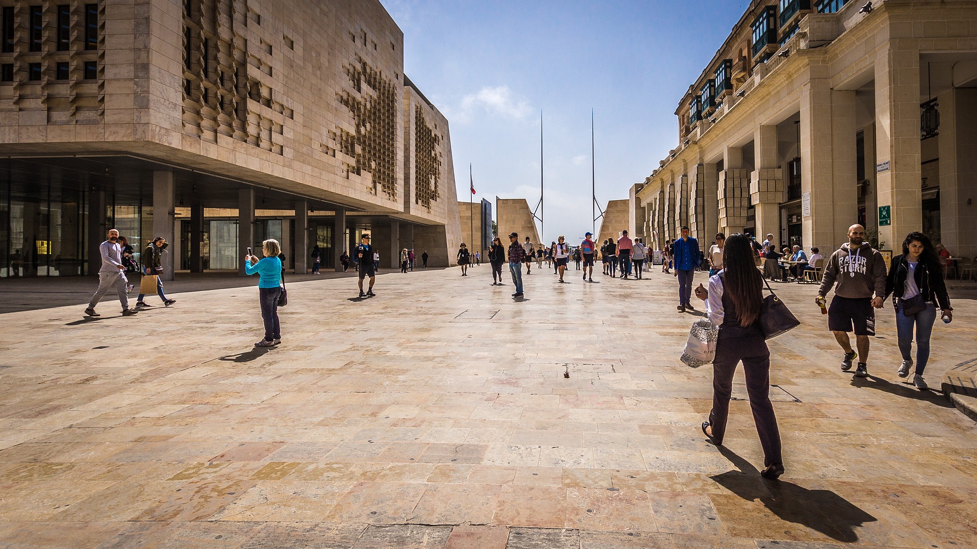
Malta's capital, the minicity of Valletta, has ornate palaces and museums protected by massive fortifications of honey-color limestone. Houses along the narrow streets have overhanging wooden balconies for people-watching from indoors. Generations ago they gave housebound women a window on the world of the street. The main entrance to town is through the City Gate (where all bus routes end), which leads onto Triq Repubblika (Republic Street), the spine of the grid-pattern city and the main shopping street. Triq Mercante (Merchant Street) parallels Repubblika to the east and is also good for strolling. From these two streets, cross streets descend toward the water; some are stepped. Valletta's compactness makes it ideal to explore on foot. City Gate and the upper part of Valletta are experiencing vast redevelopment that includes a new Parliament Building and open-air performance venue. The complex, completed mid-2013, has numerous pedestrian detours in place along with building noise and dust. Before setting out along Republic Street, stop at the tourist information office on Merchant Street for maps and brochures.
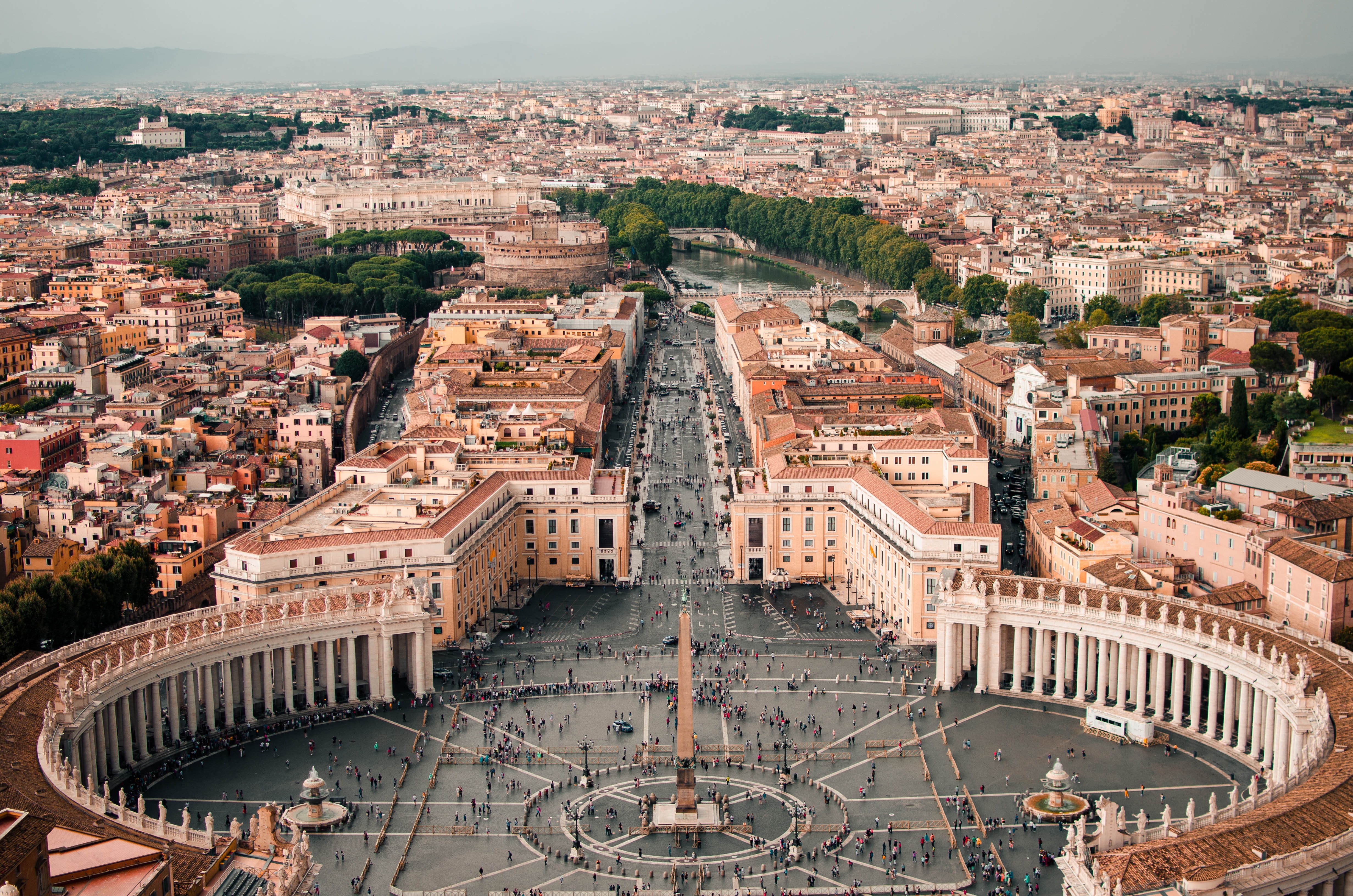
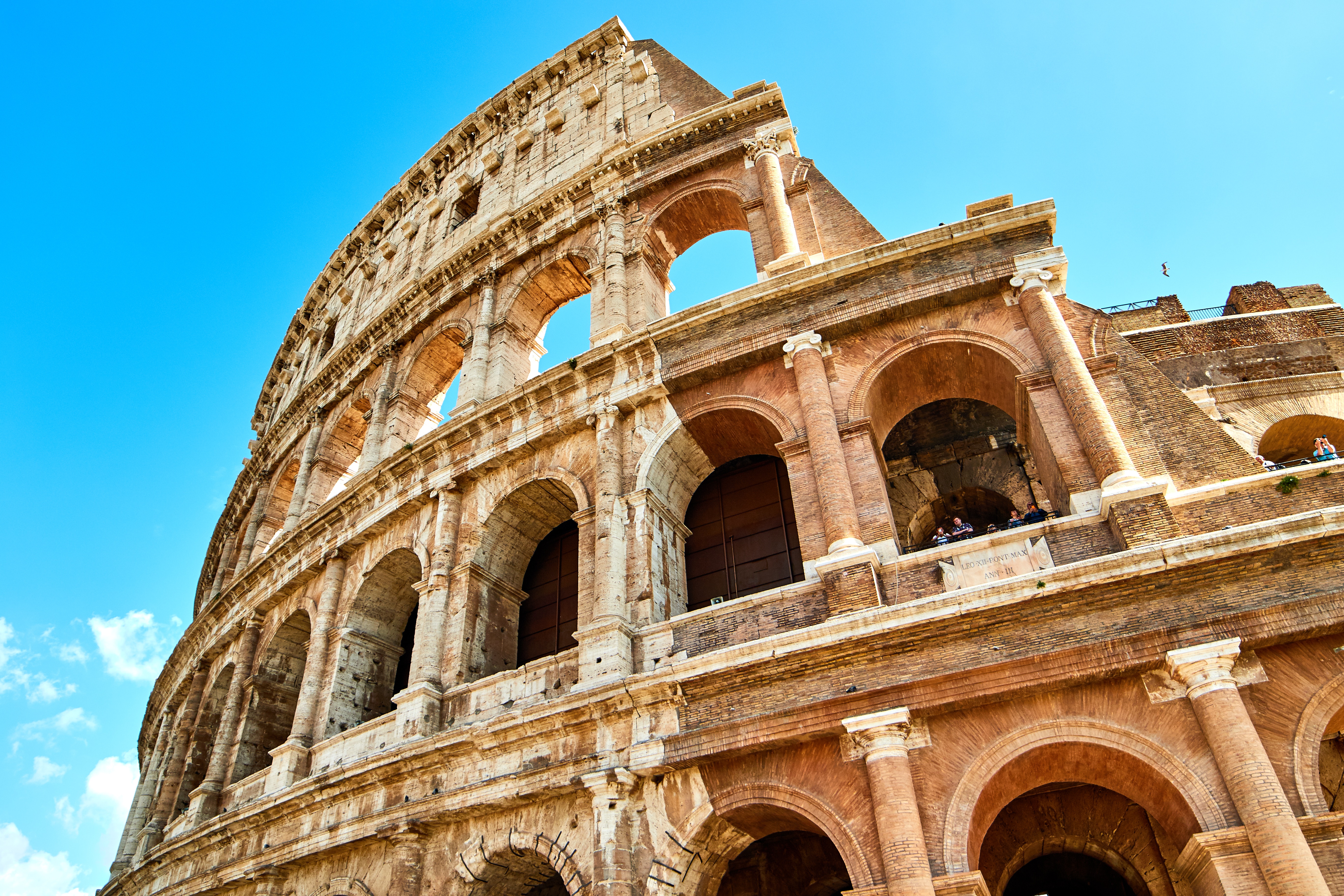
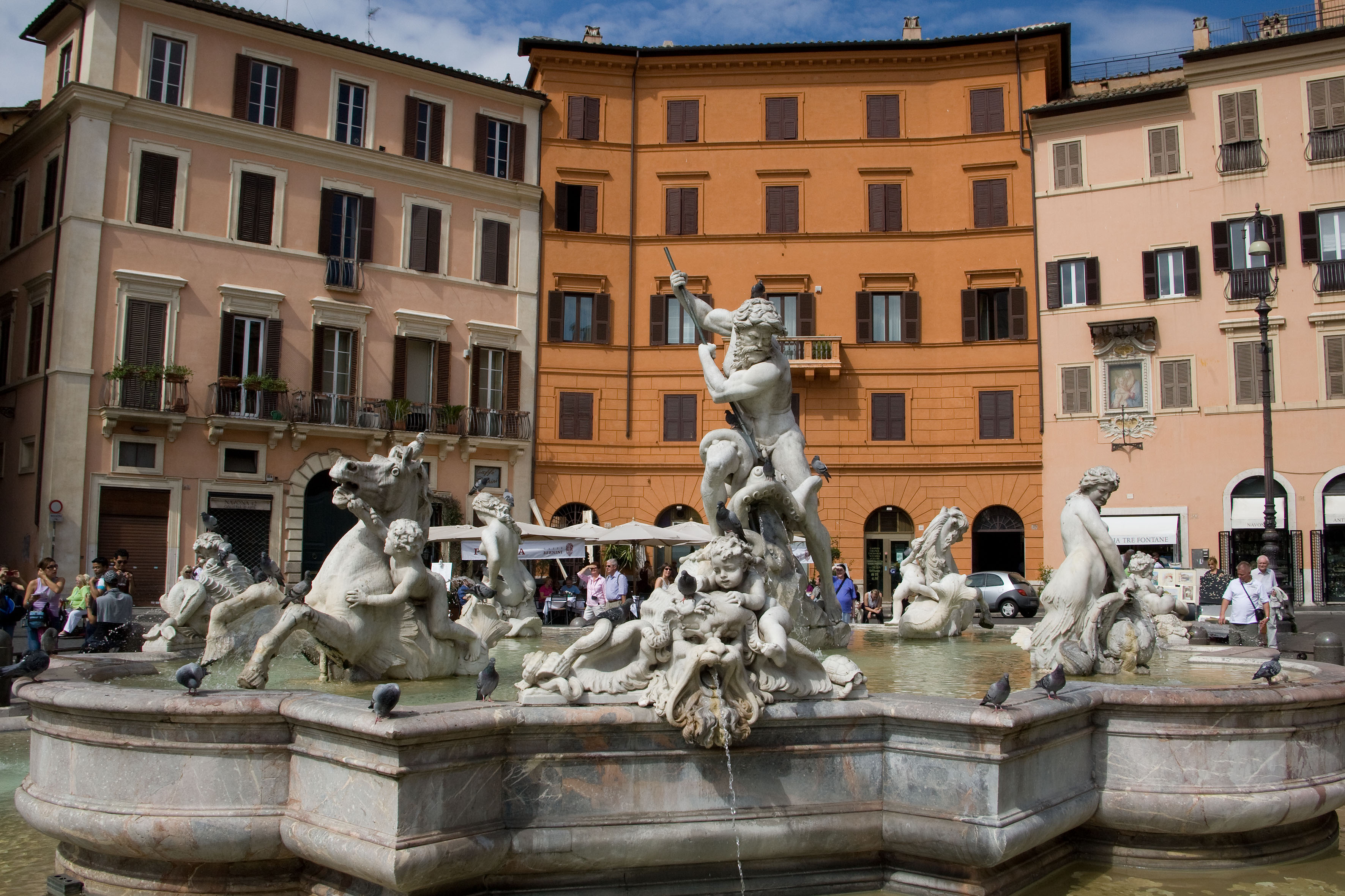
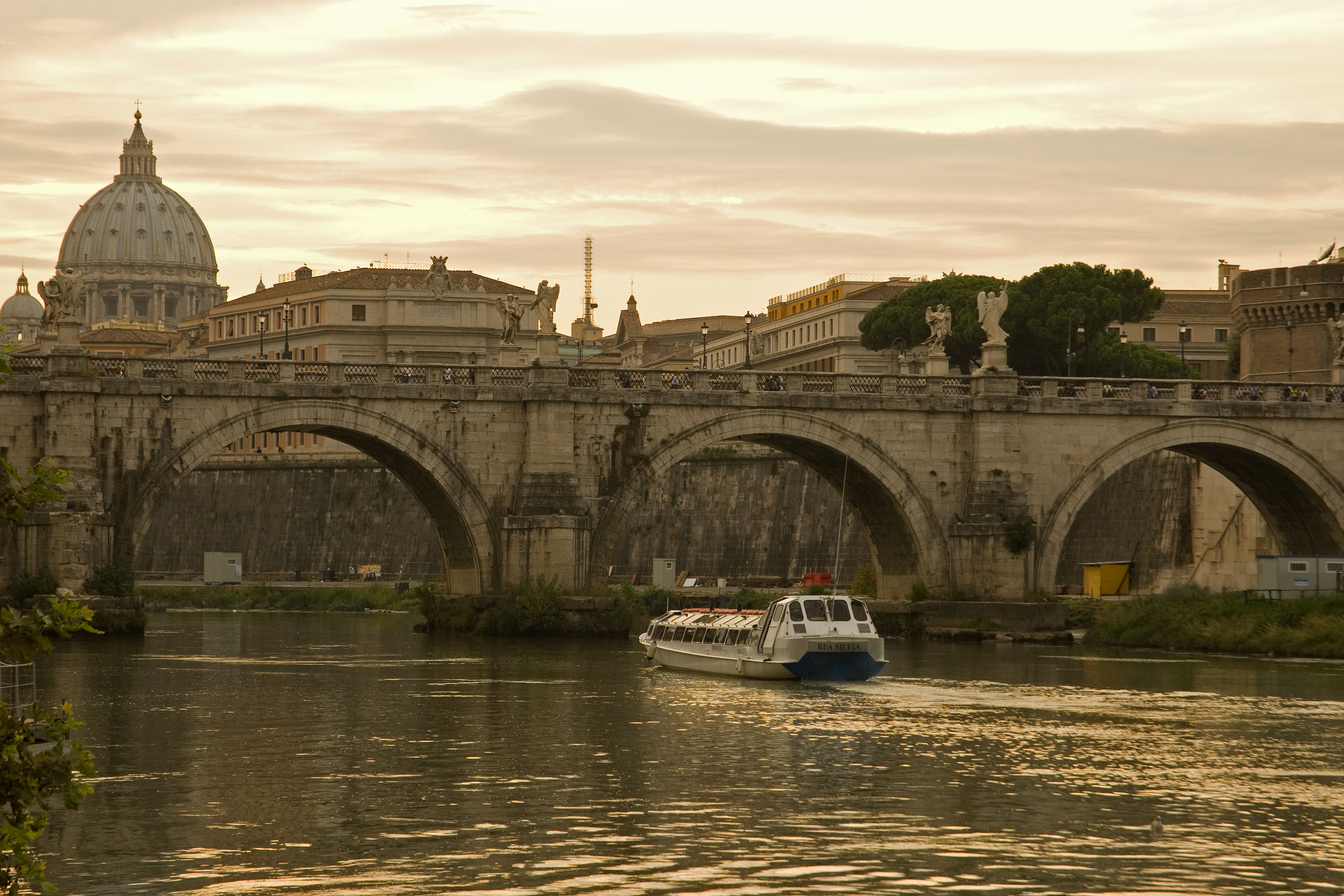
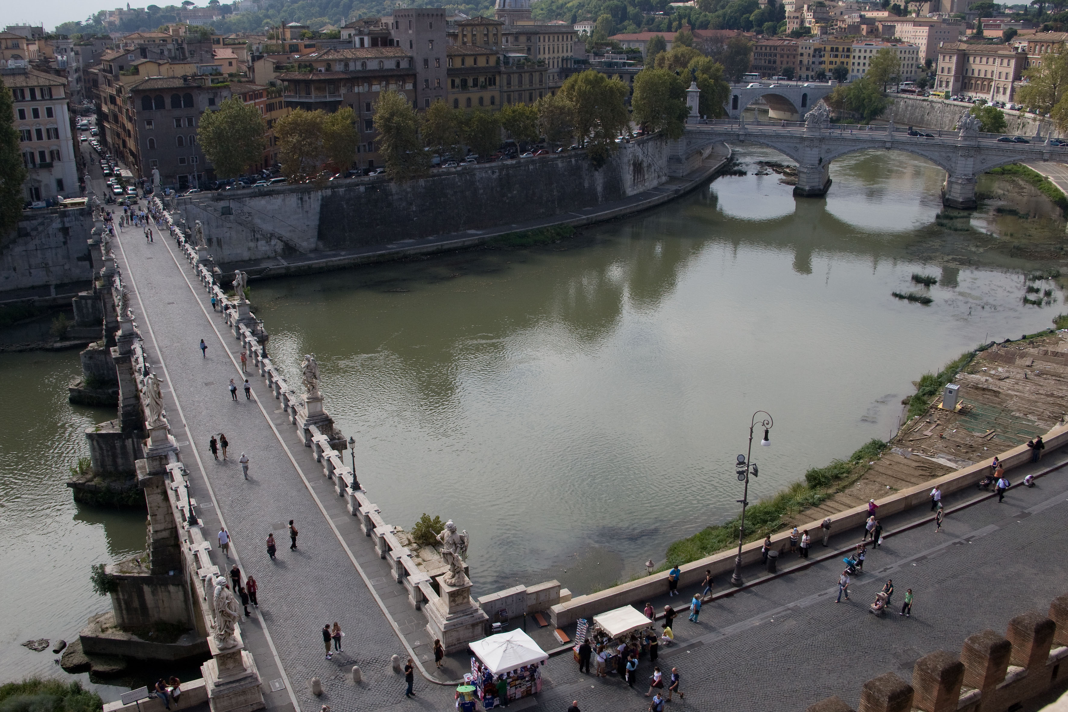
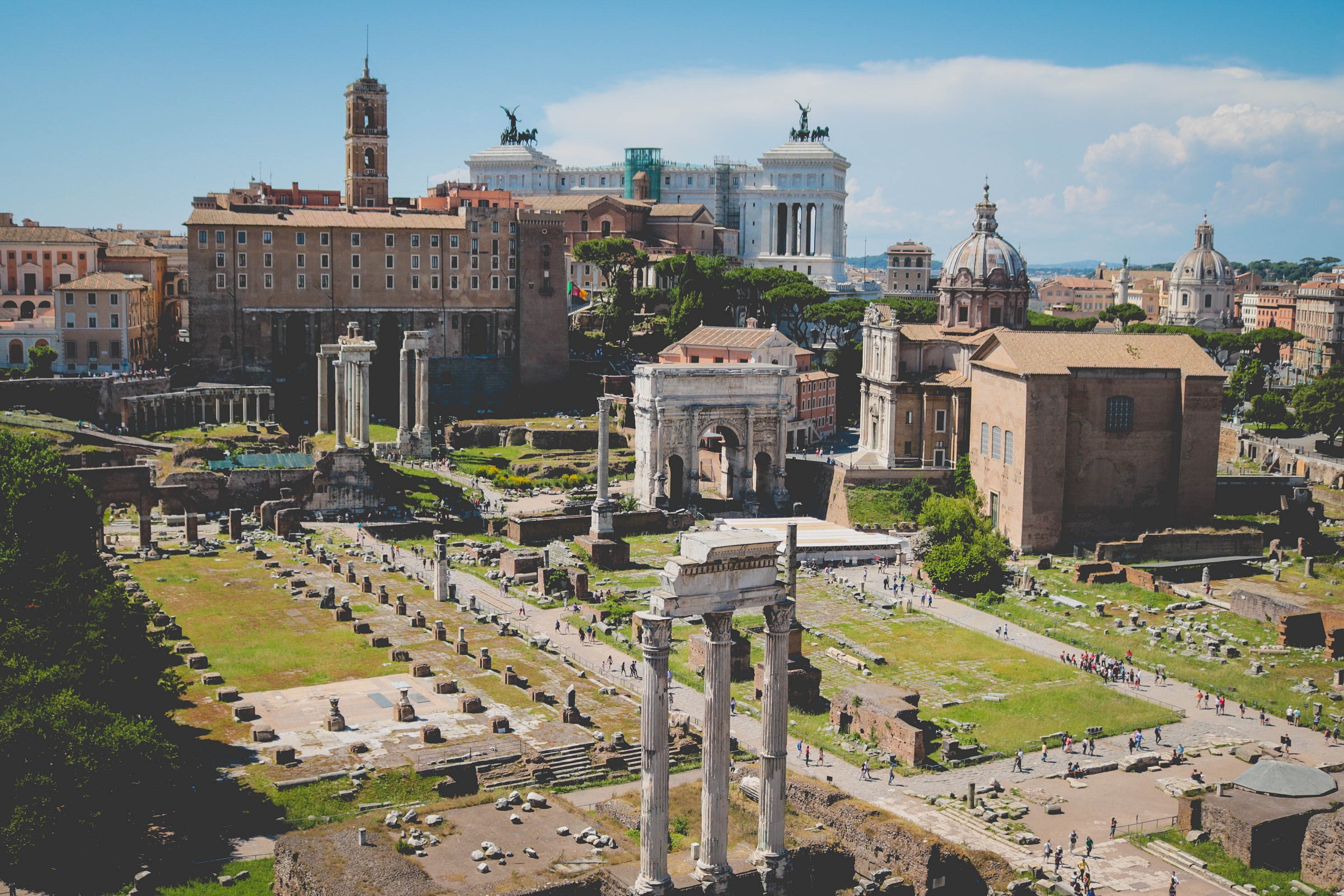
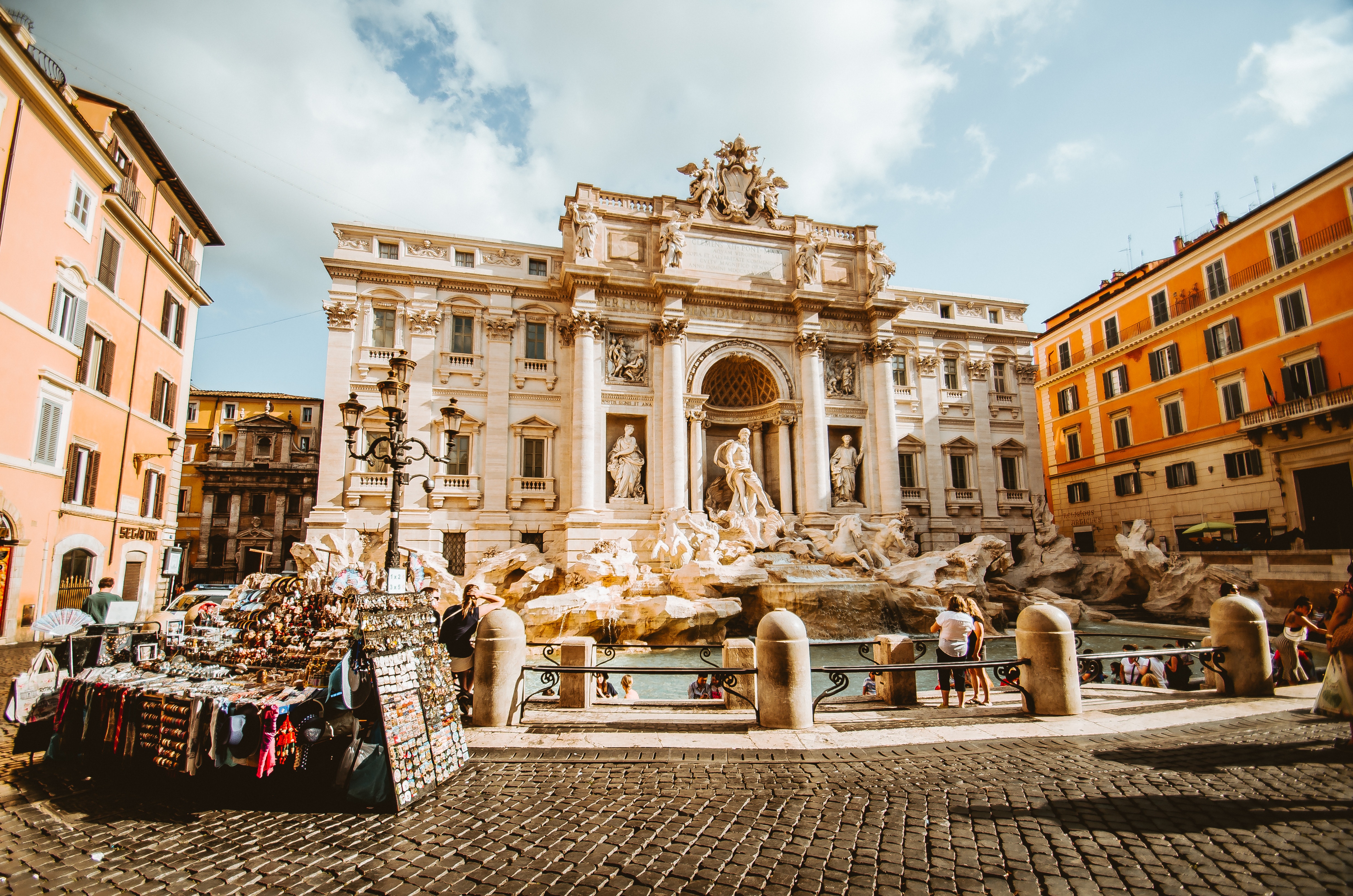
About Civitavecchia
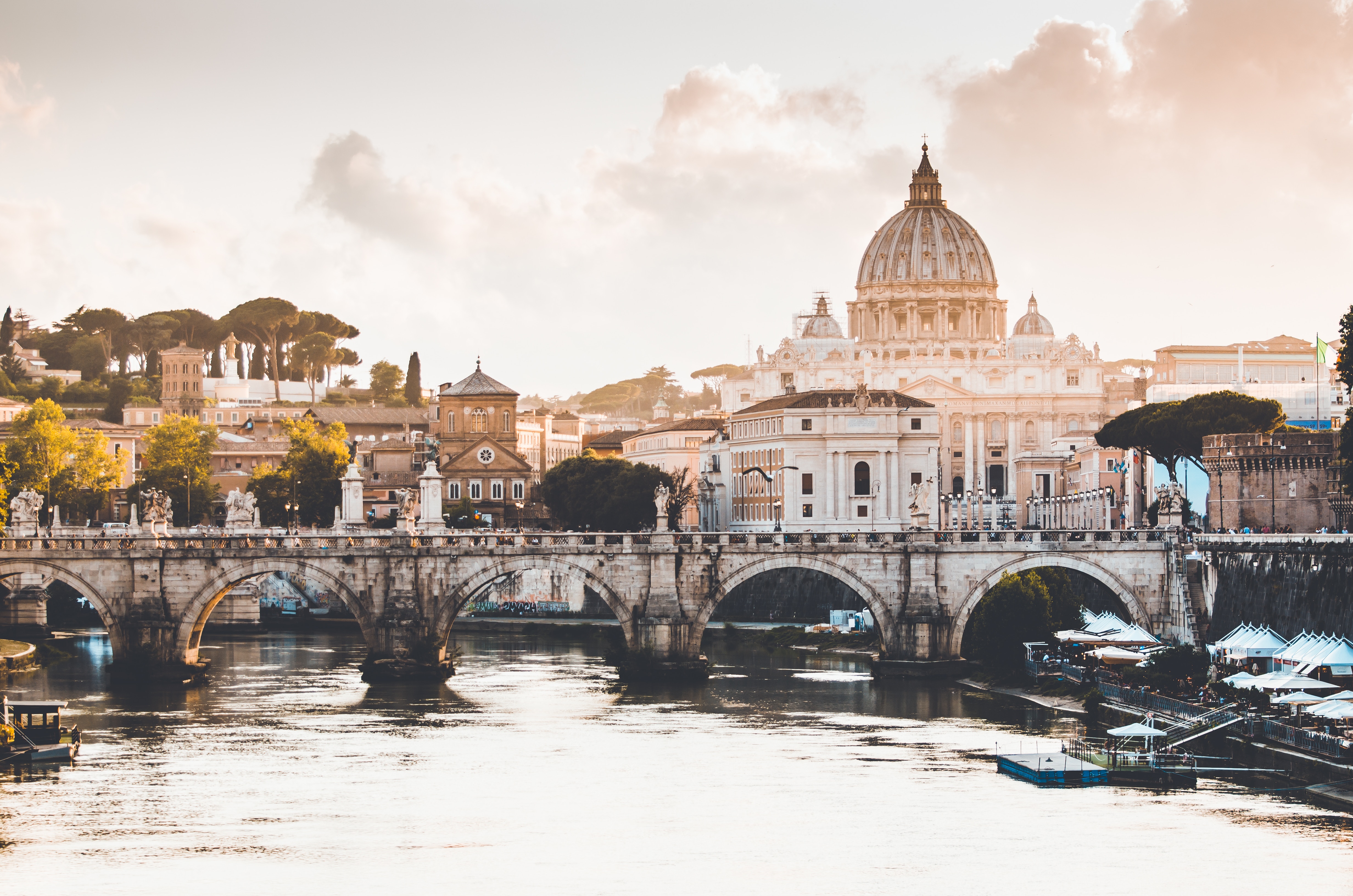
Italy's vibrant capital lives in the present, but no other city on earth evokes its past so powerfully. For over 2,500 years, emperors, popes, artists, and common citizens have left their mark here. Archaeological remains from ancient Rome, art-stuffed churches, and the treasures of Vatican City vie for your attention, but Rome is also a wonderful place to practice the Italian-perfected il dolce far niente, the sweet art of idleness. Your most memorable experiences may include sitting at a caffè in the Campo de' Fiori or strolling in a beguiling piazza.
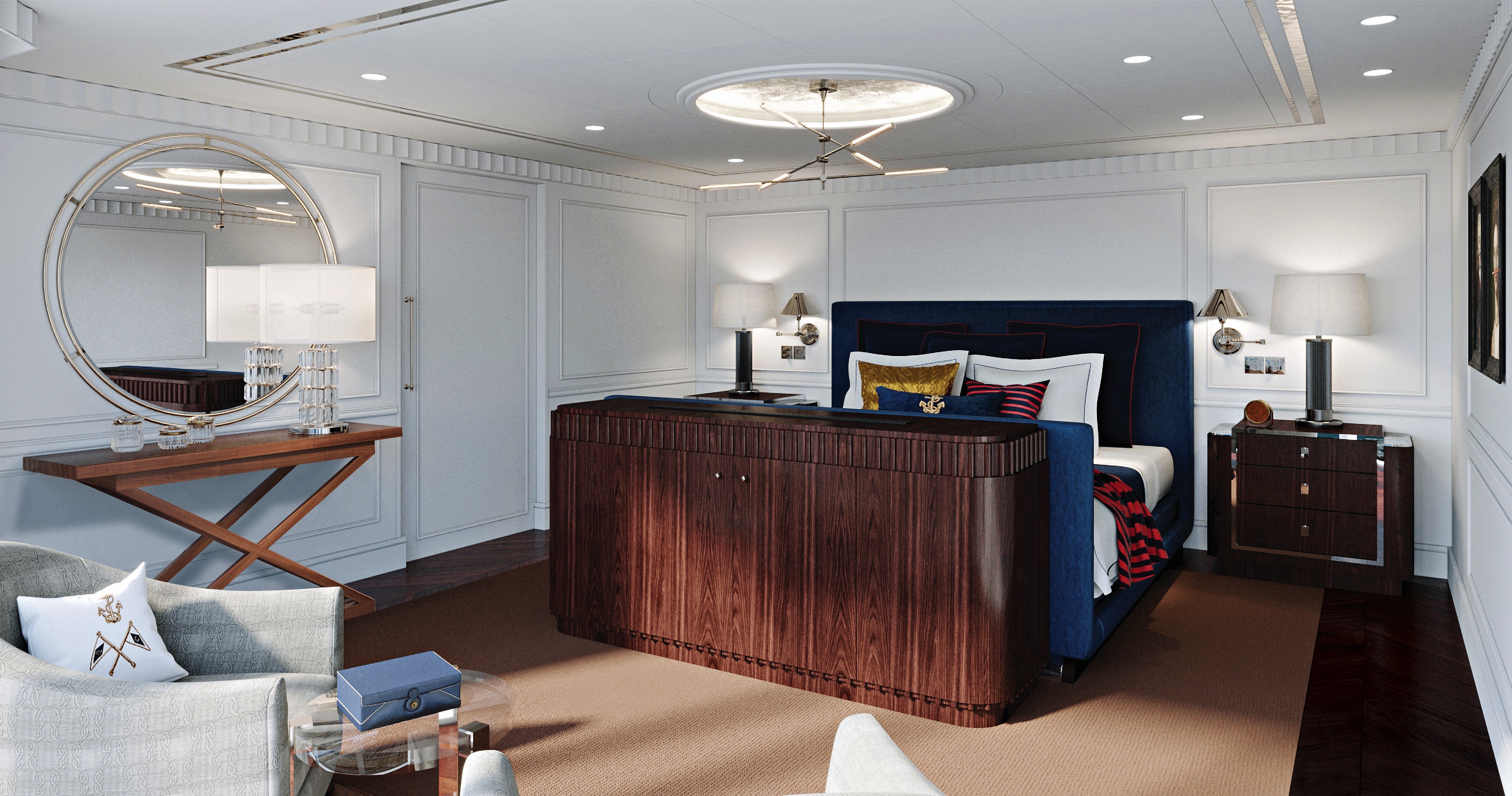
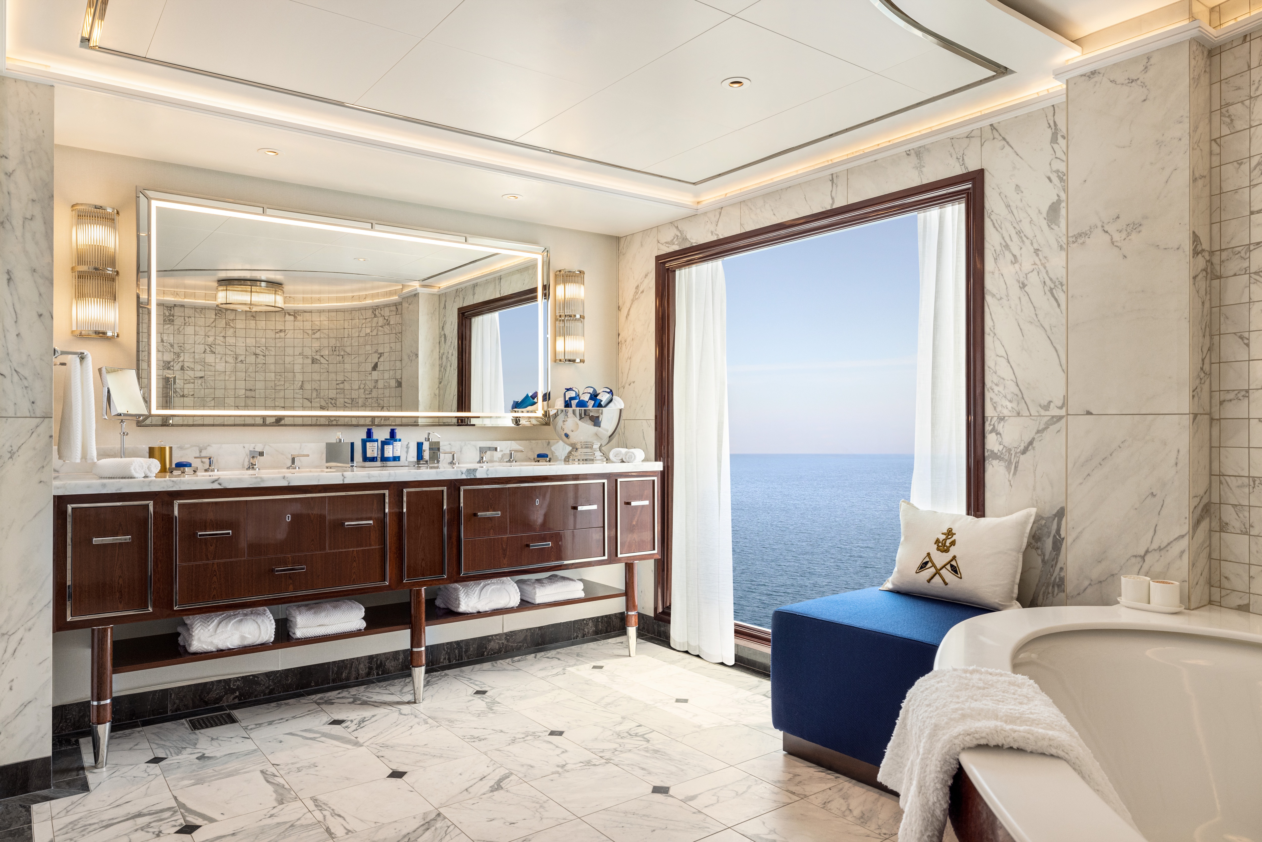
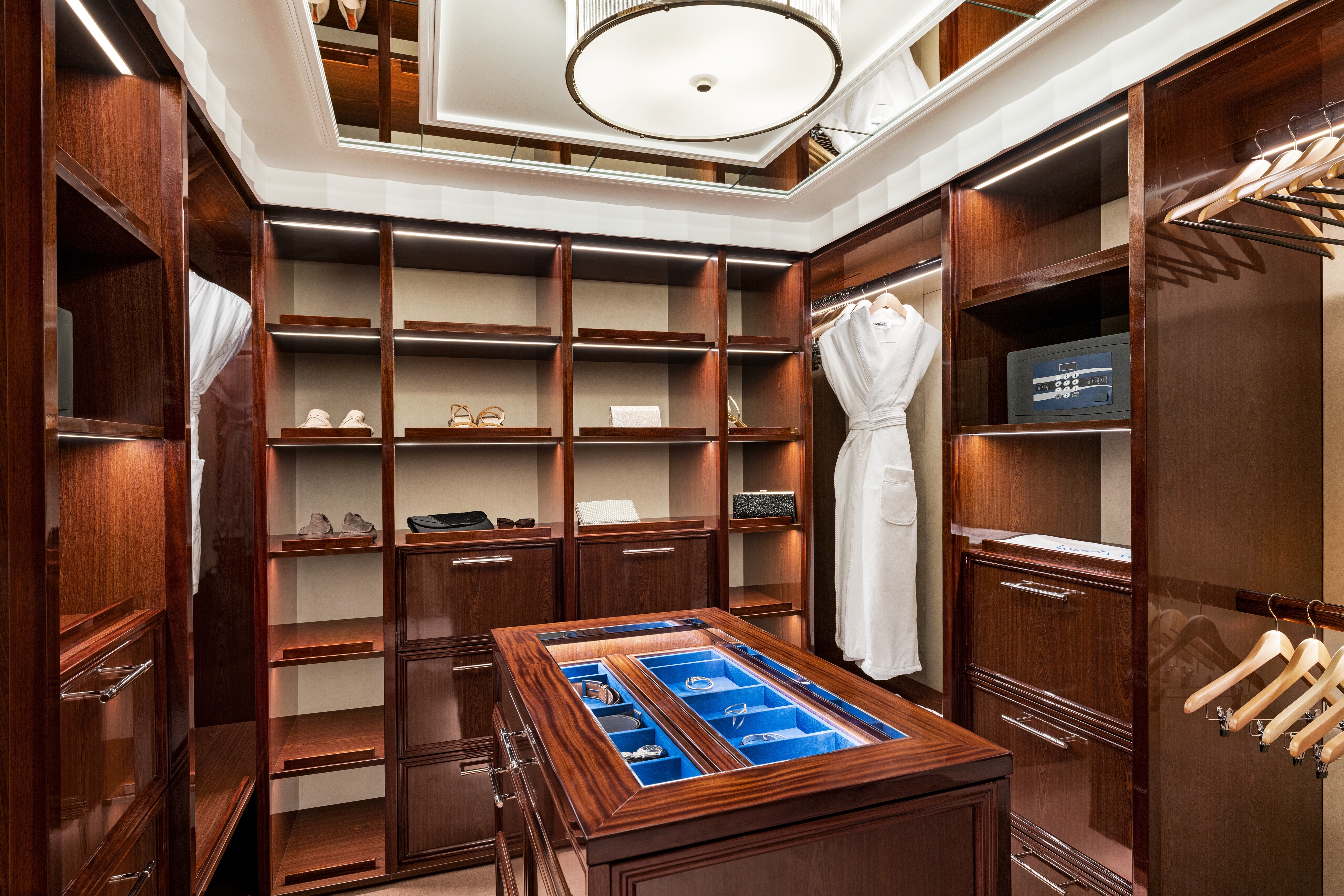
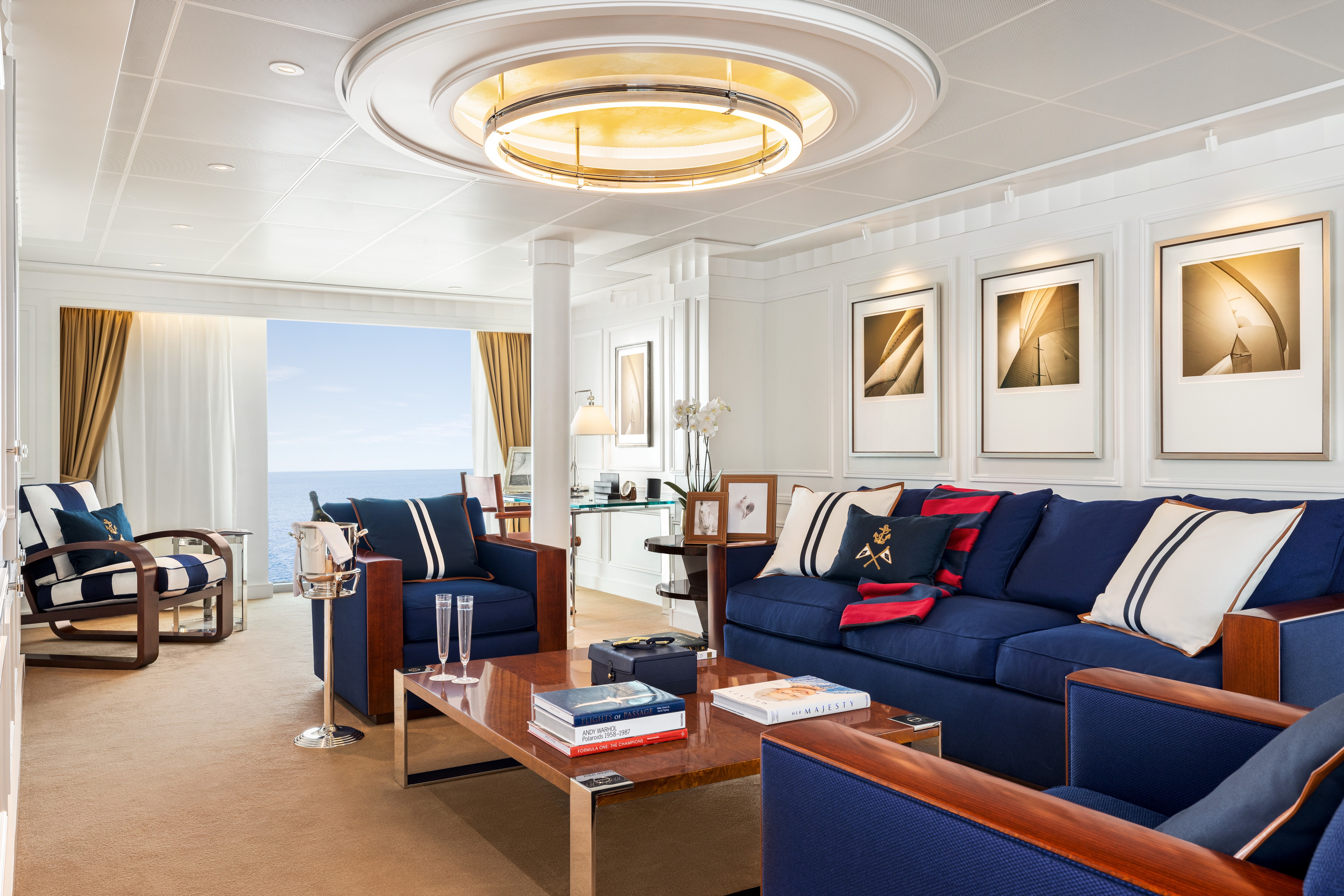
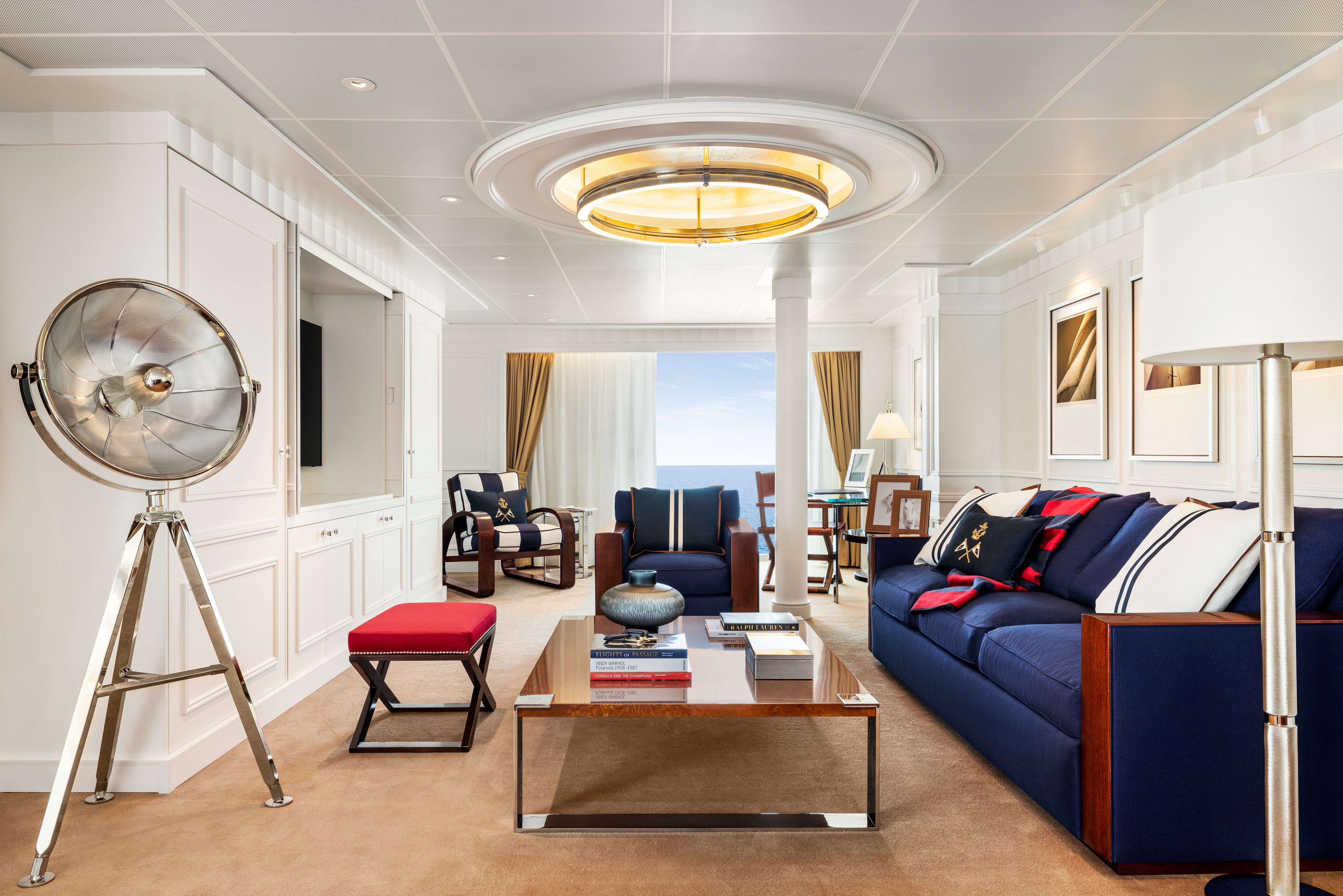
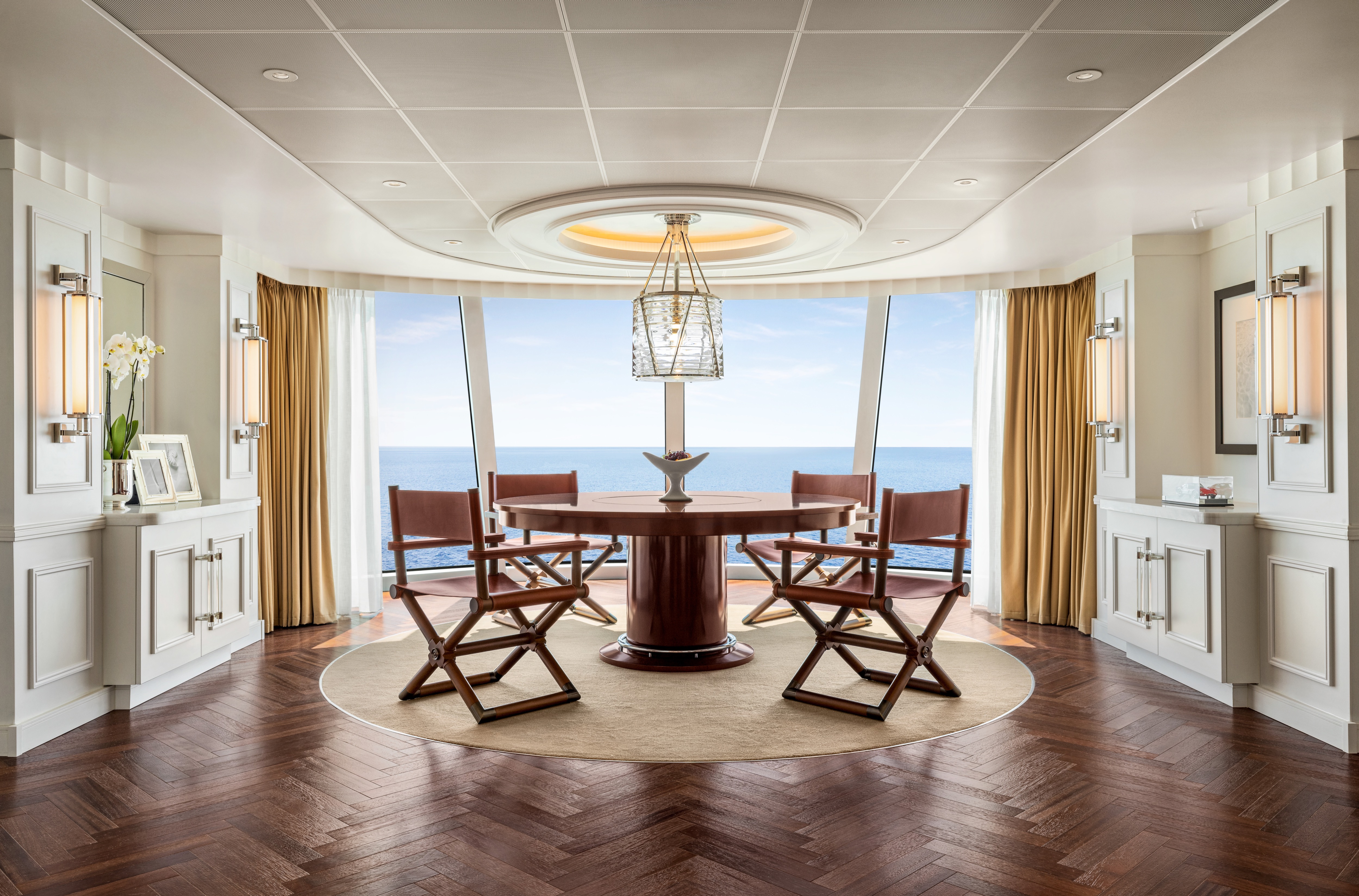
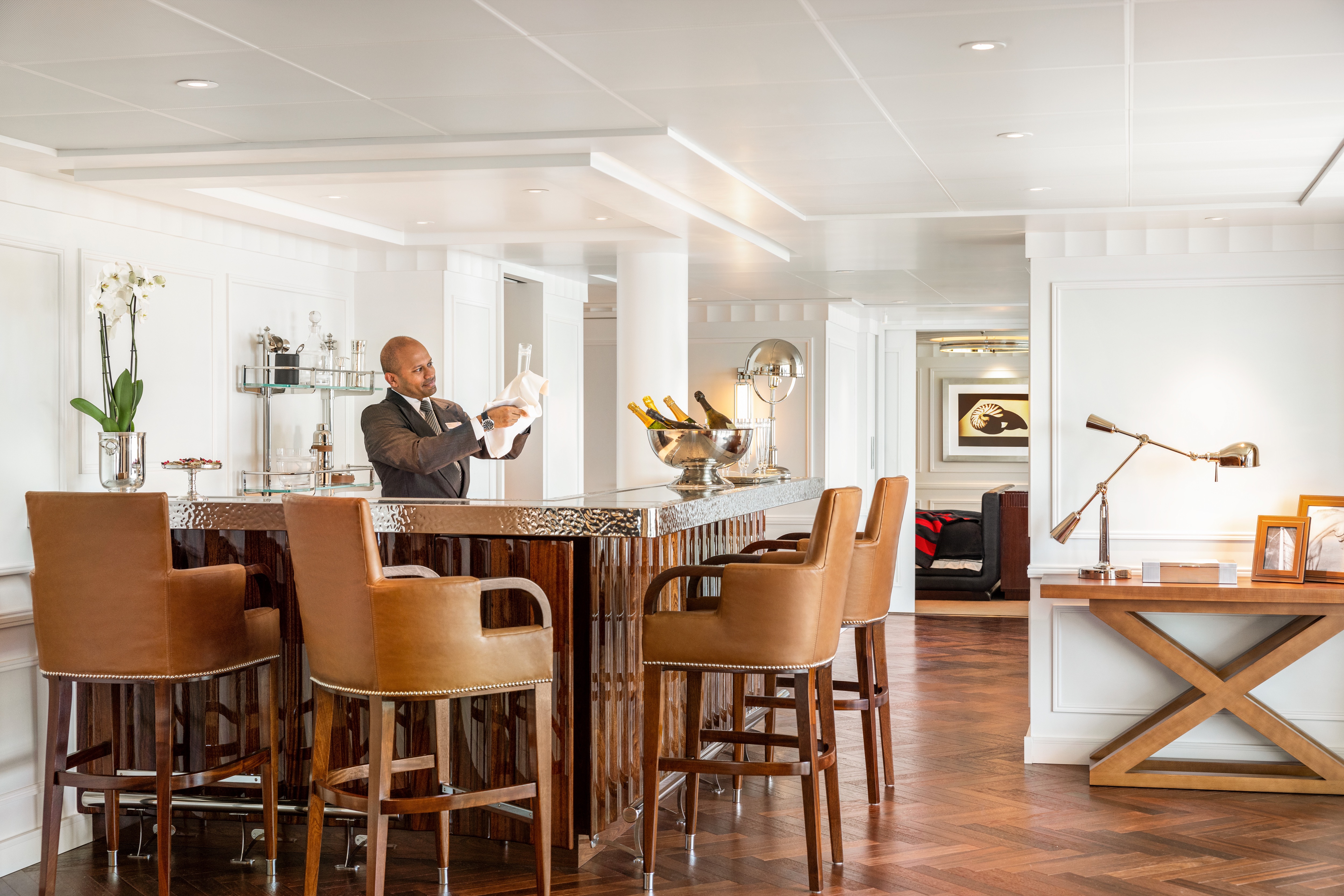
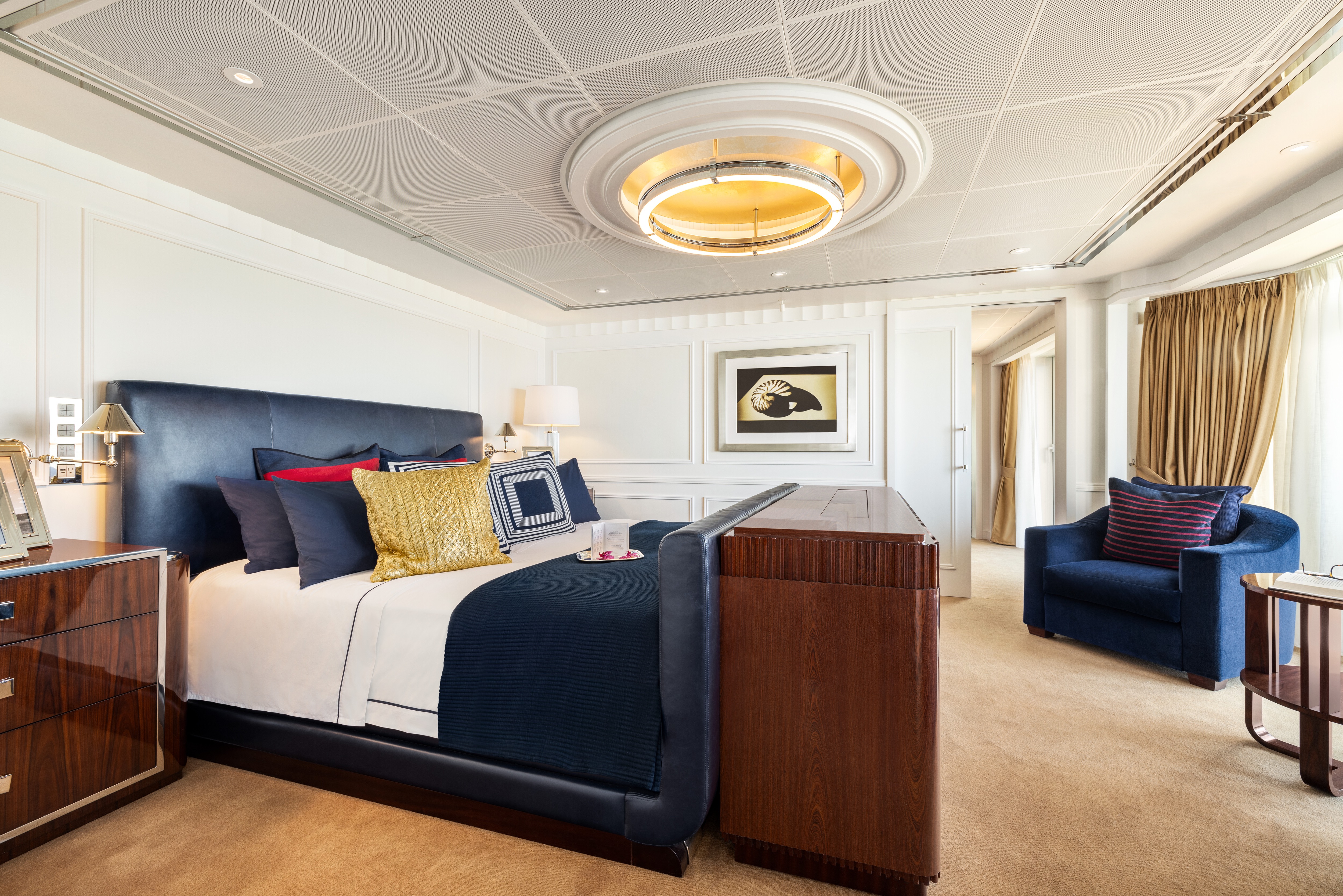
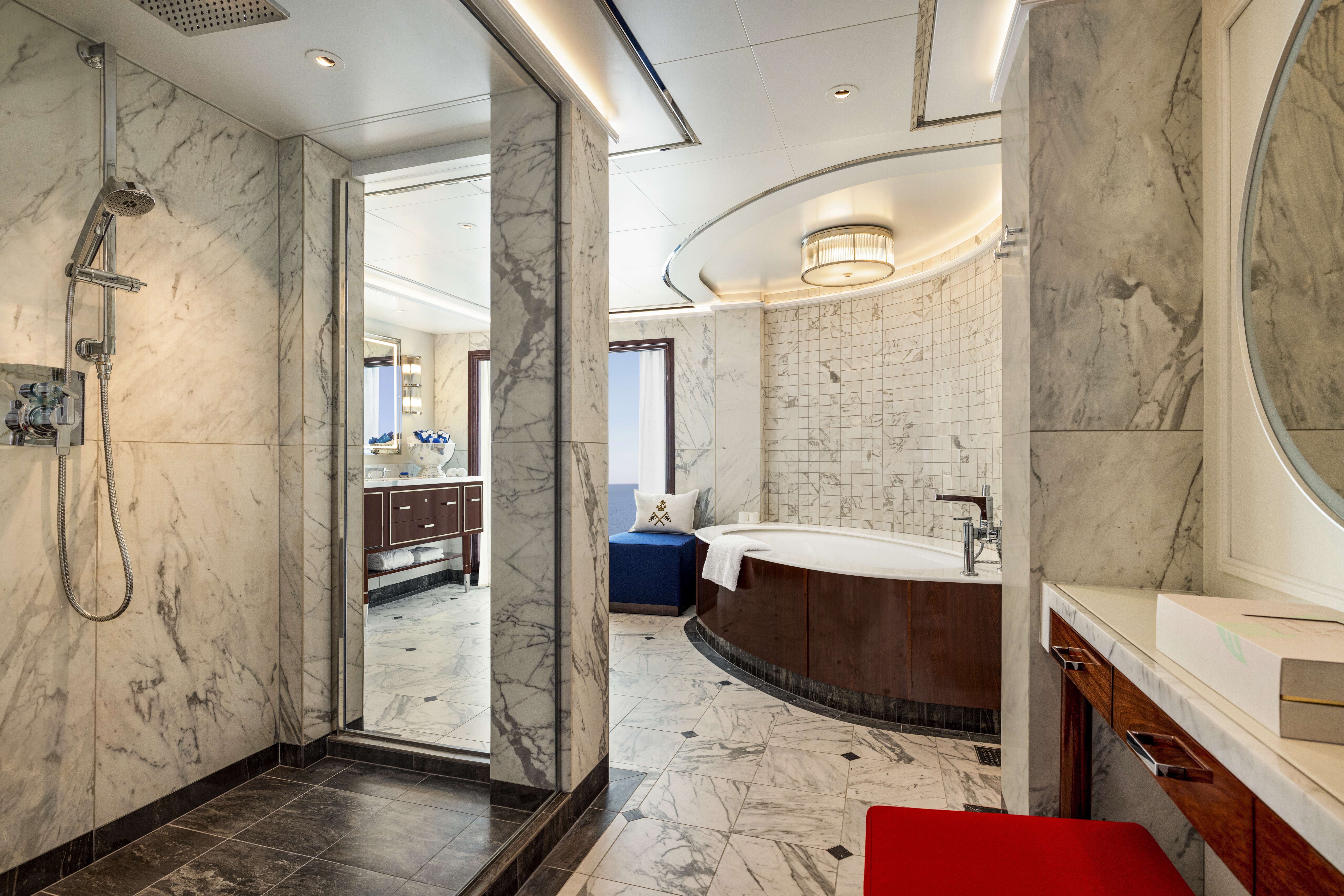
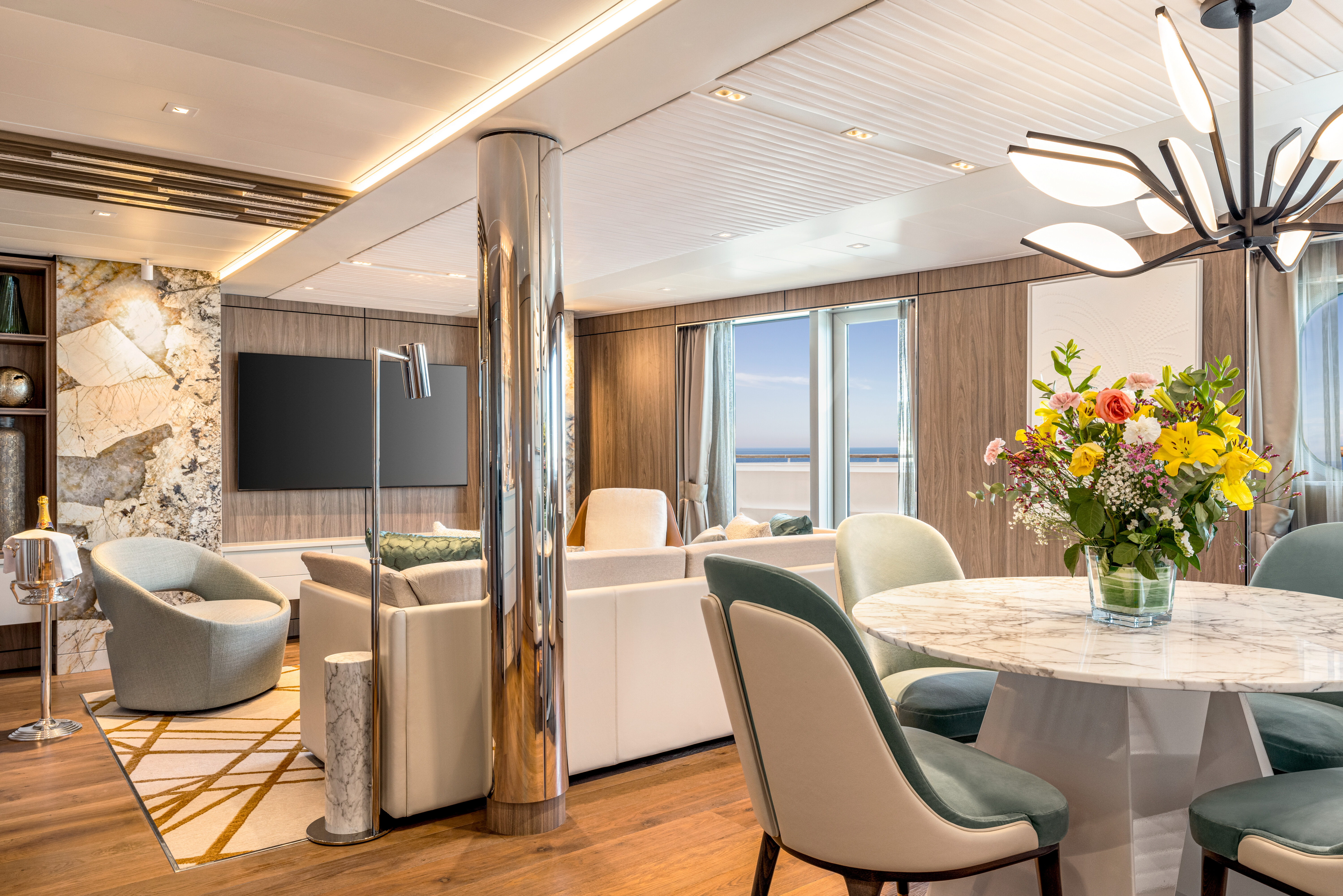
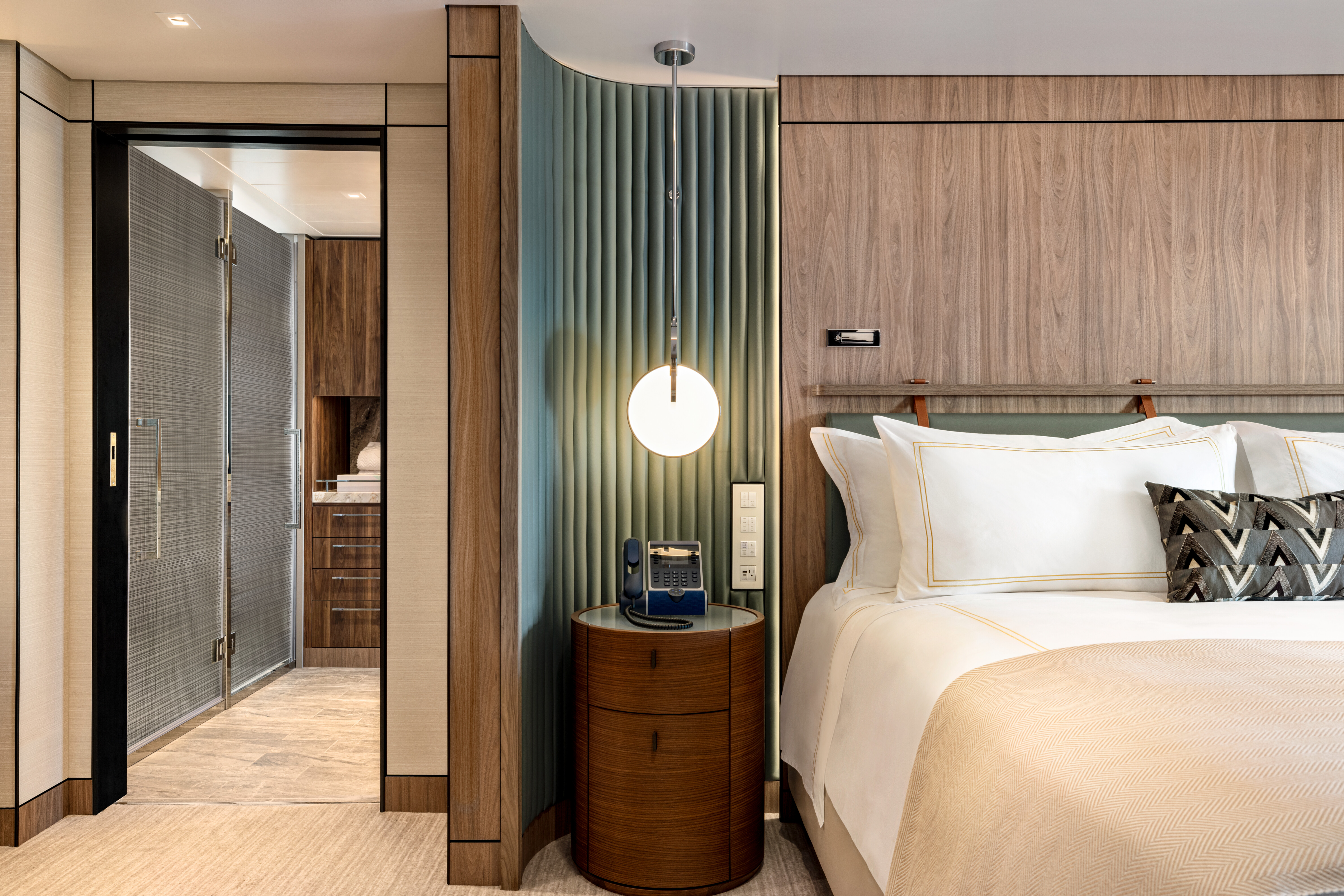
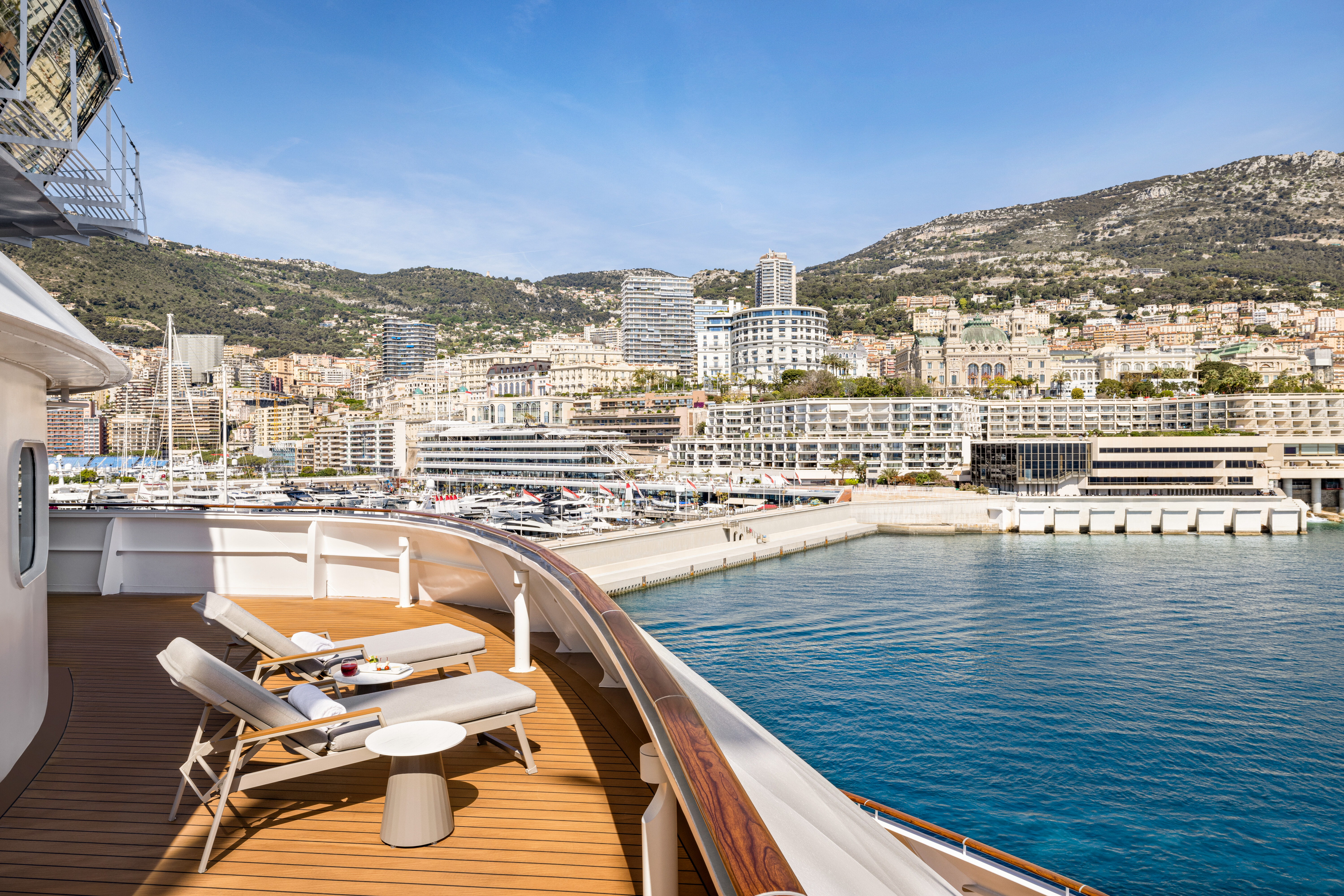
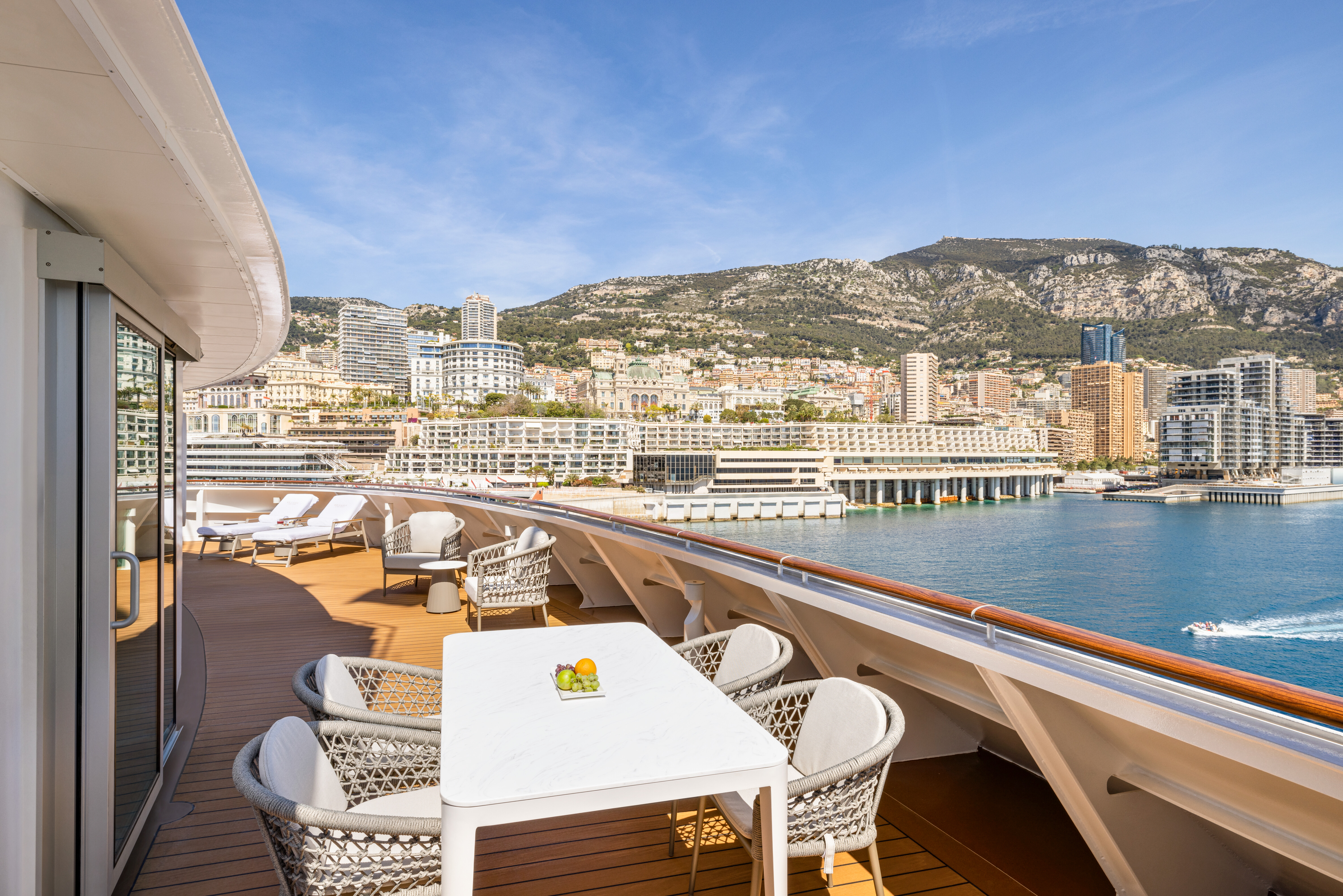
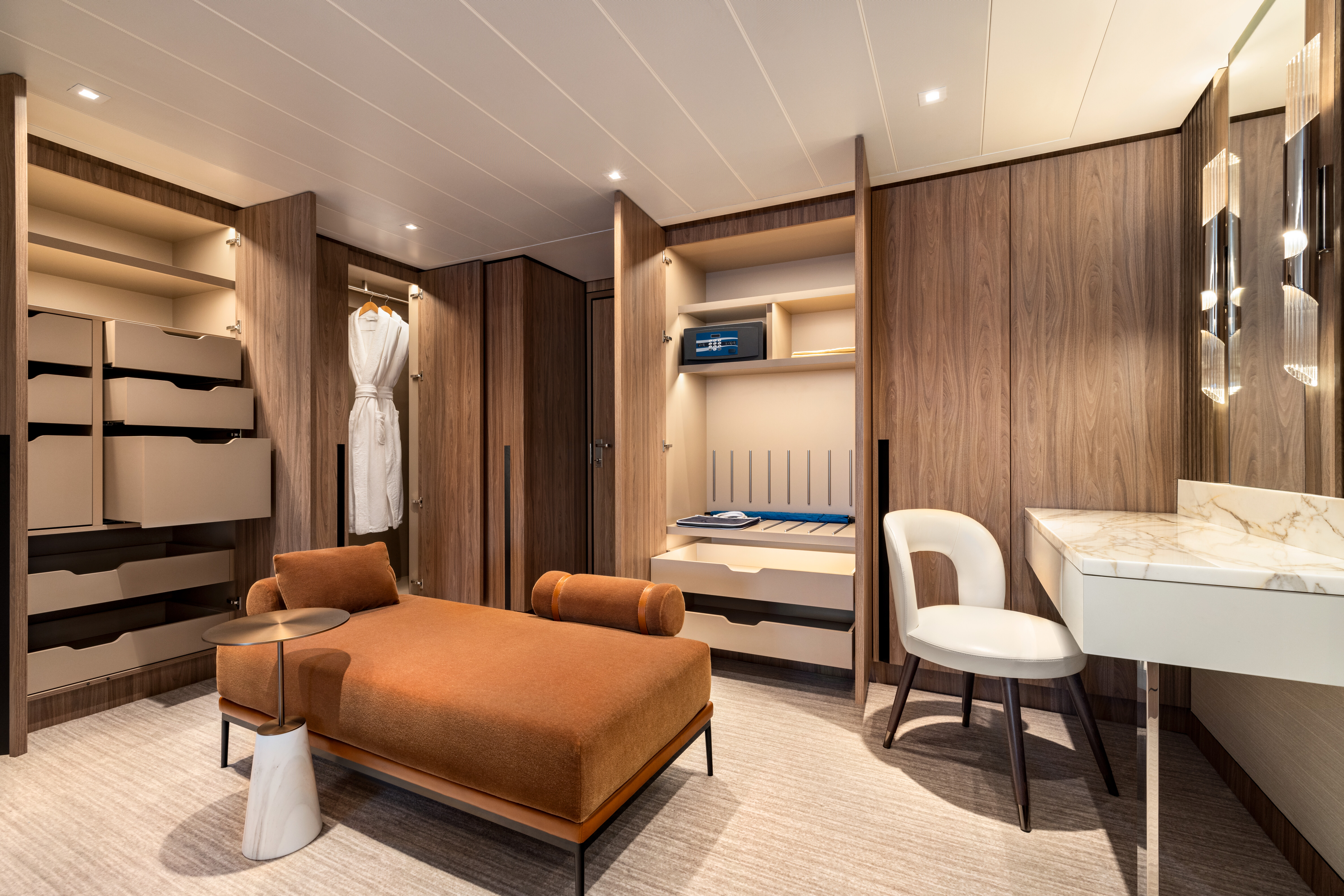
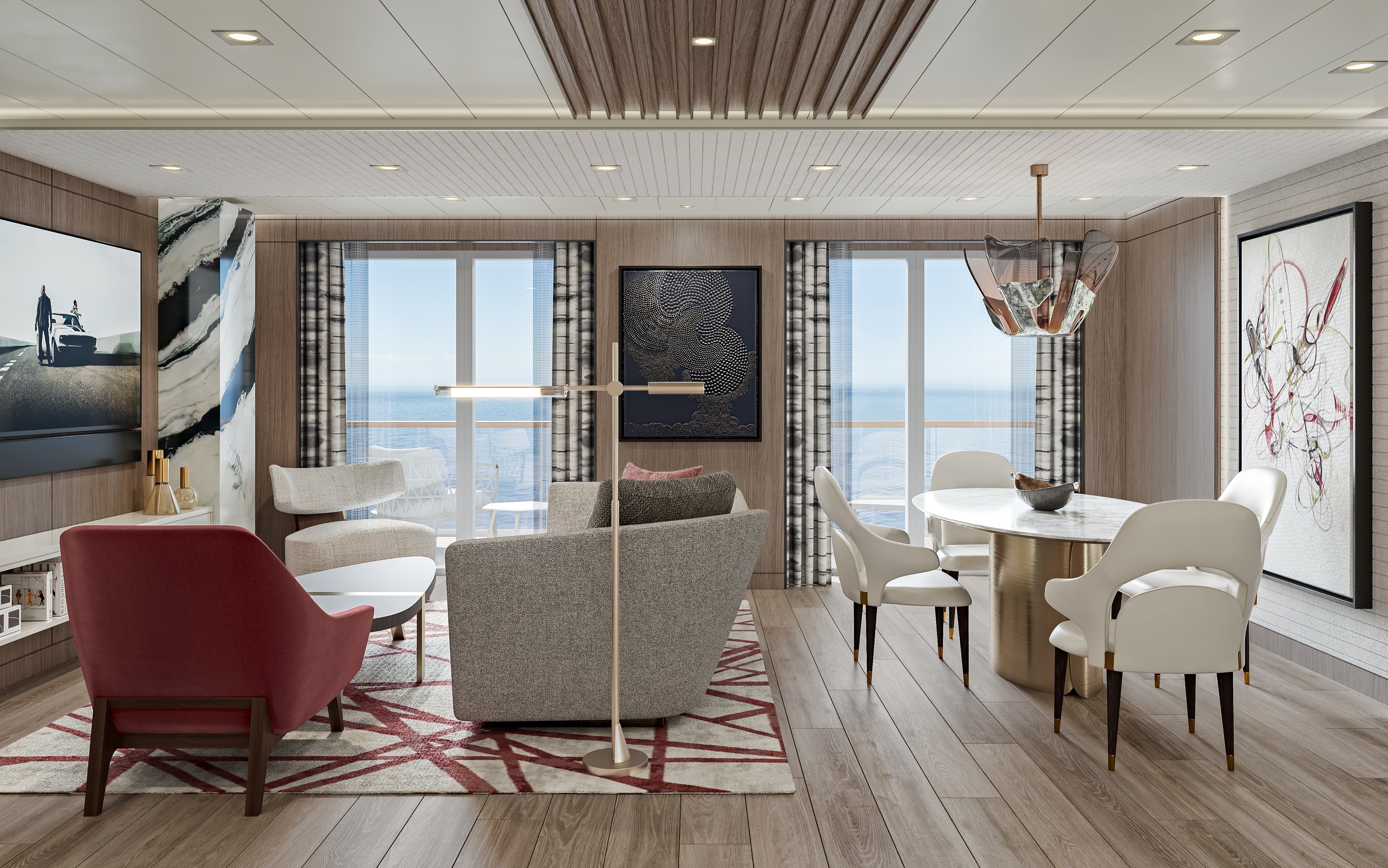
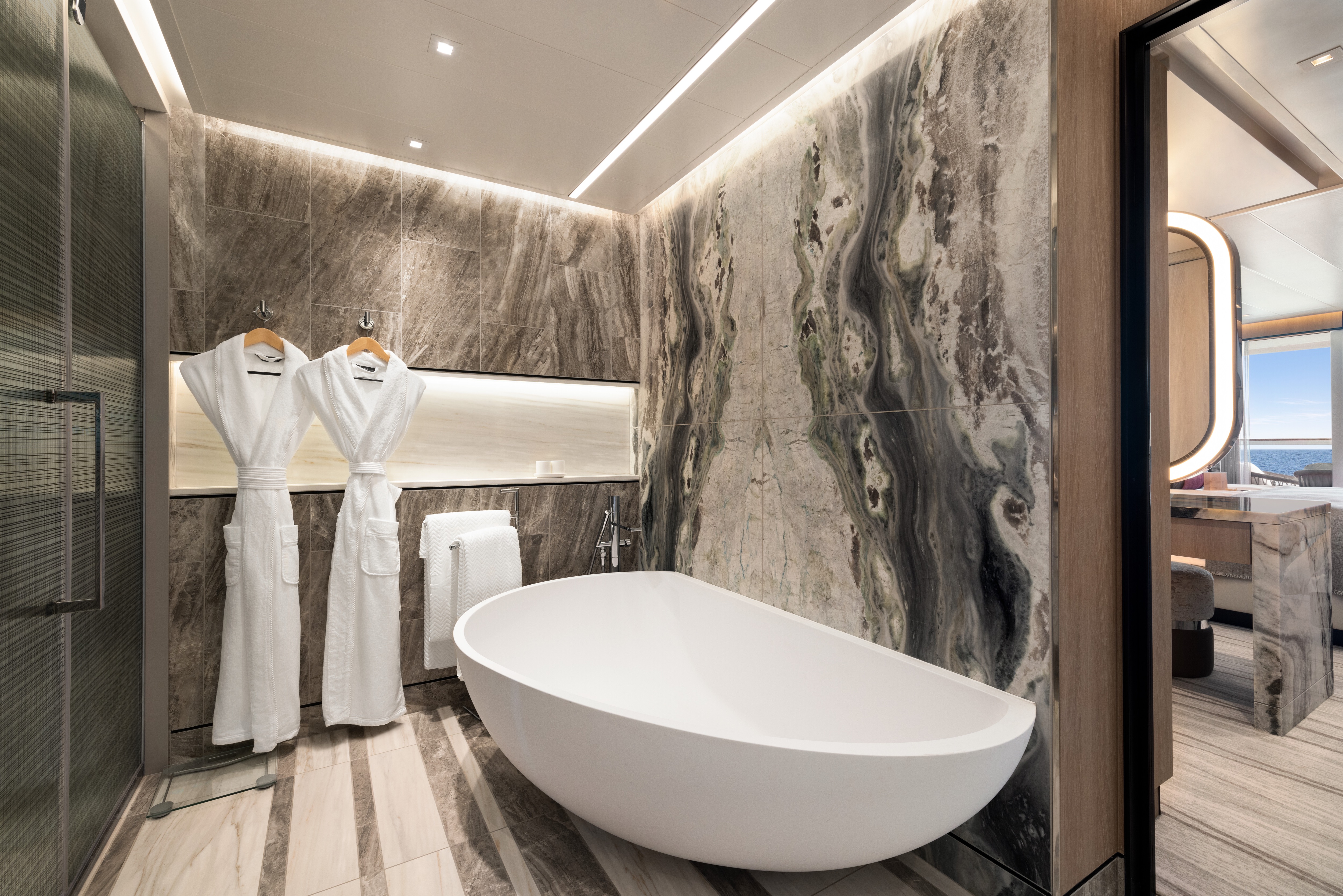
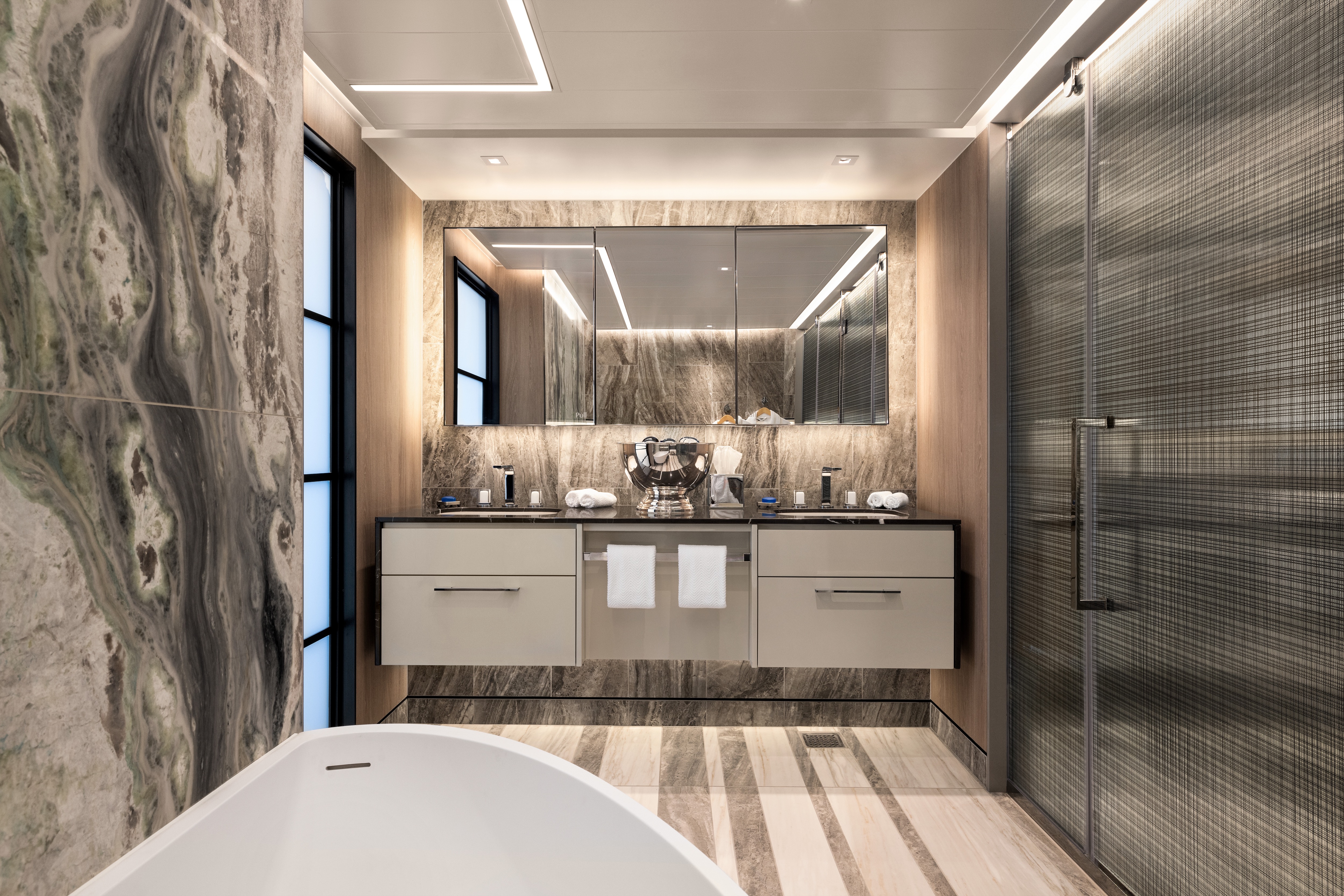
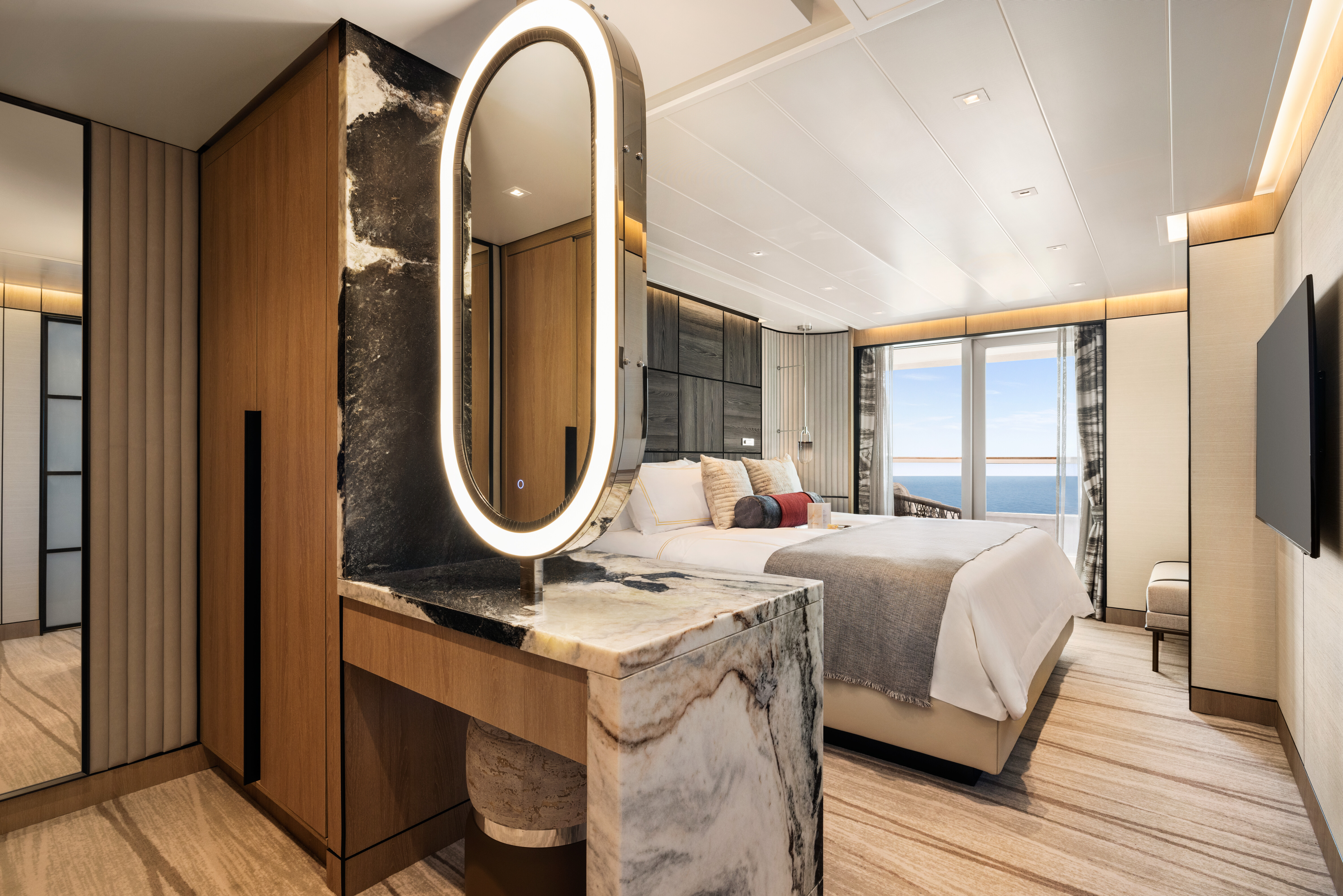
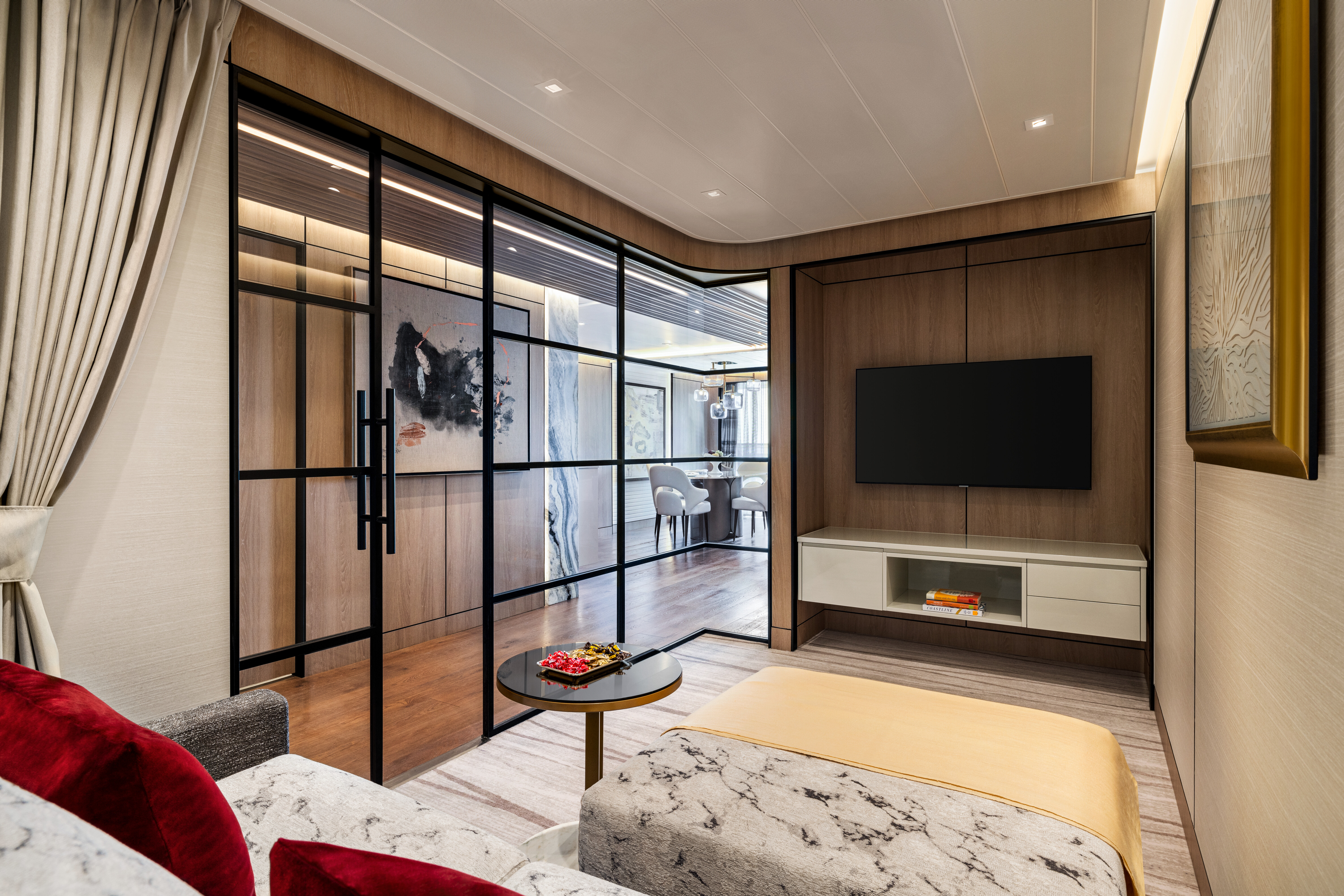
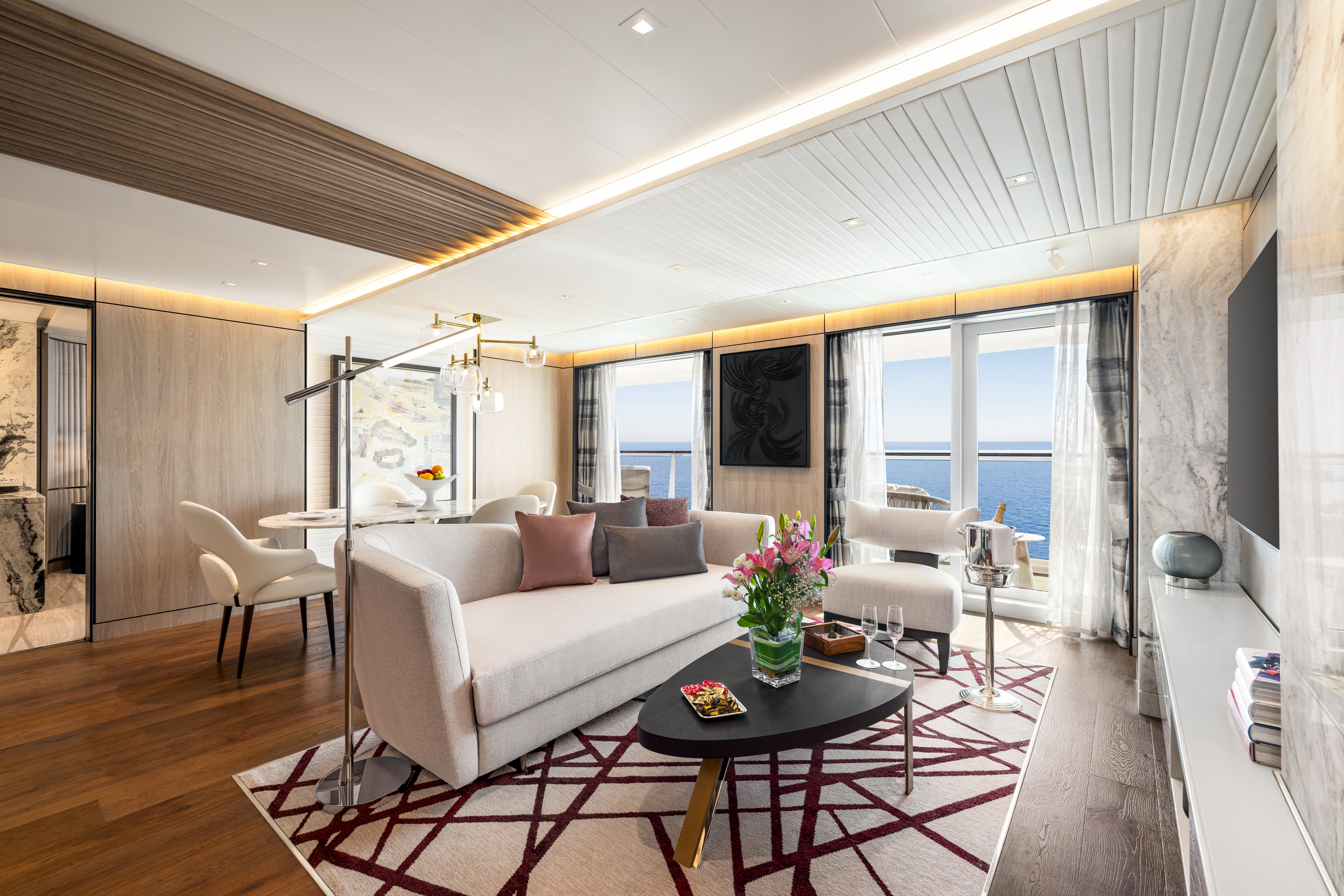
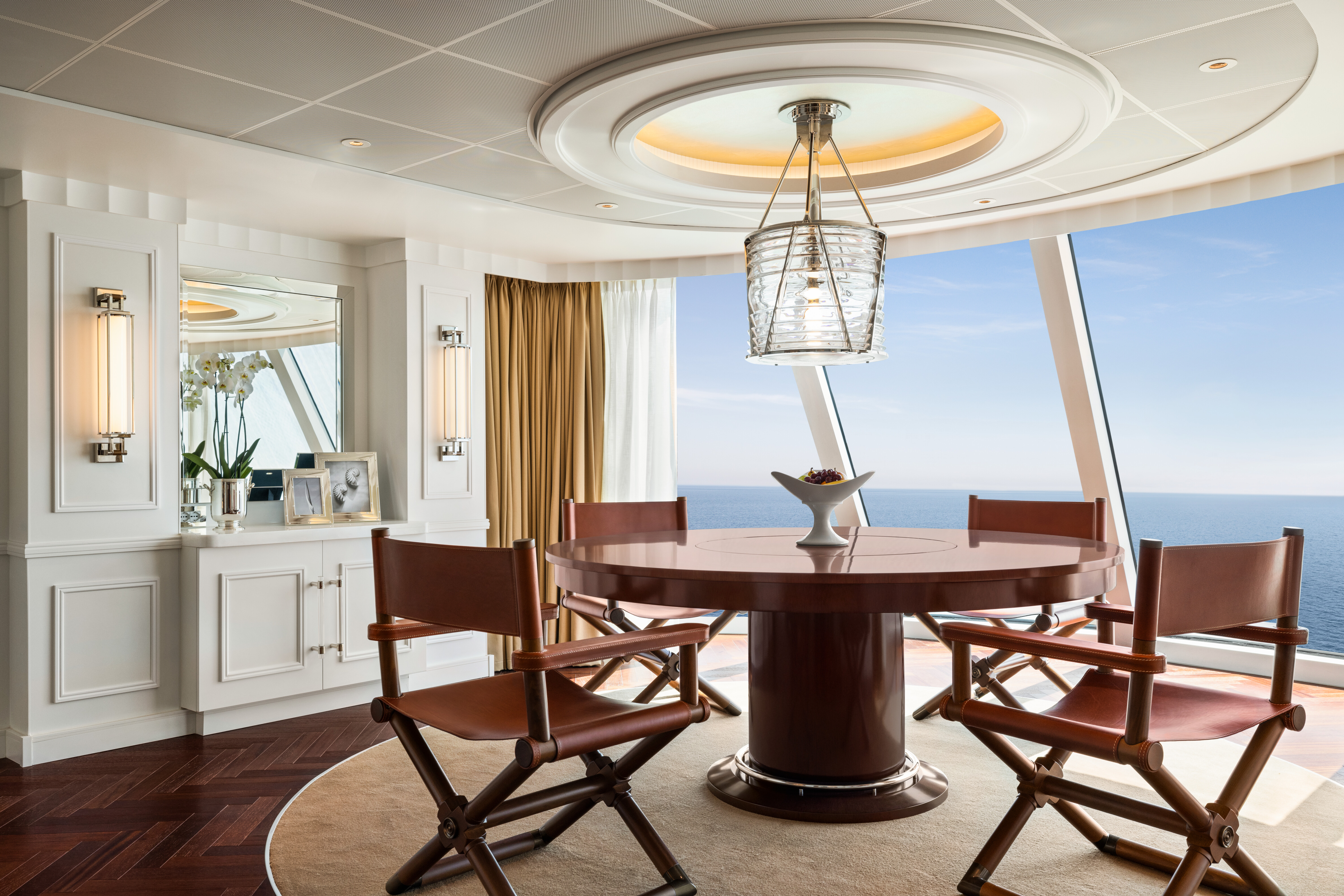
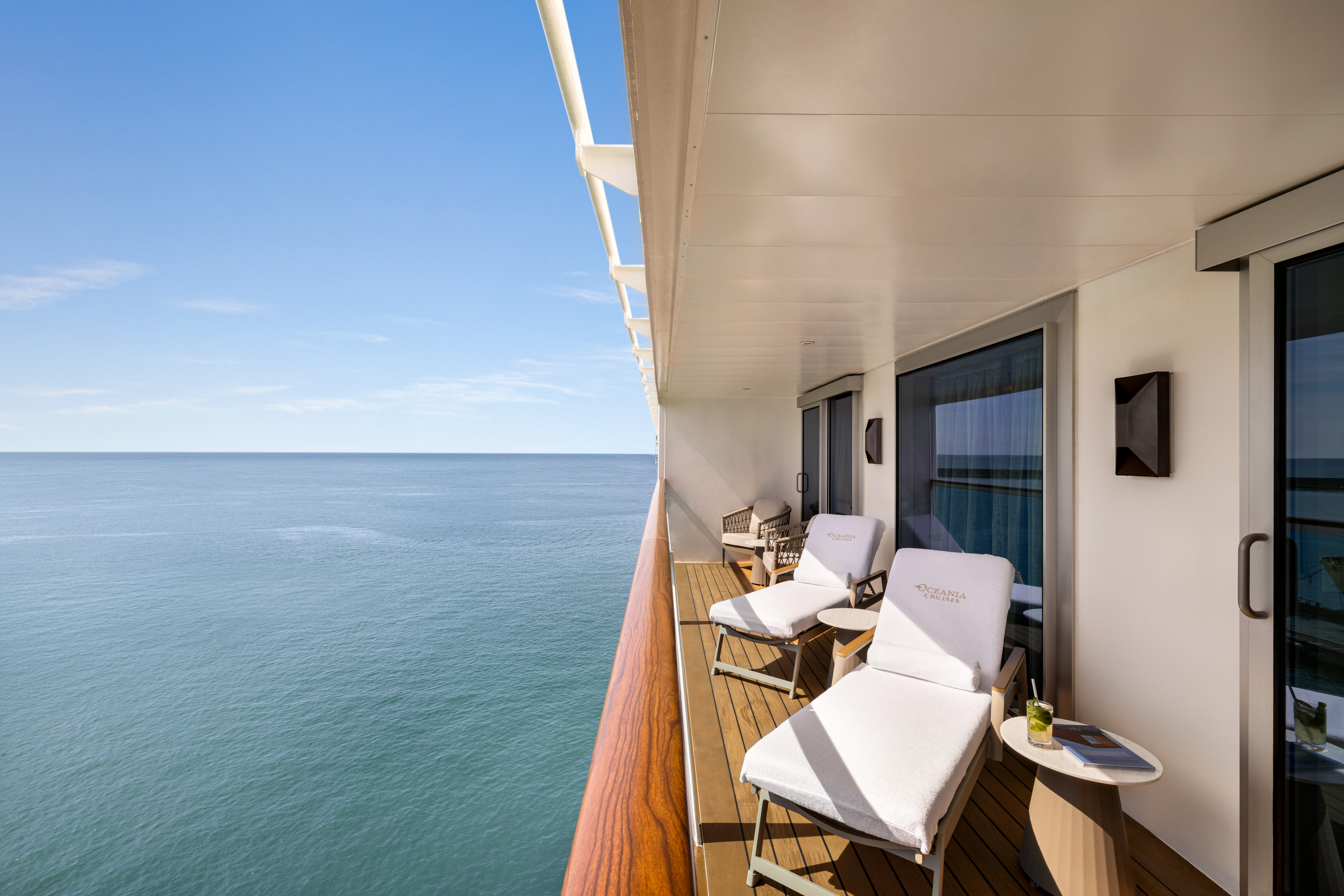
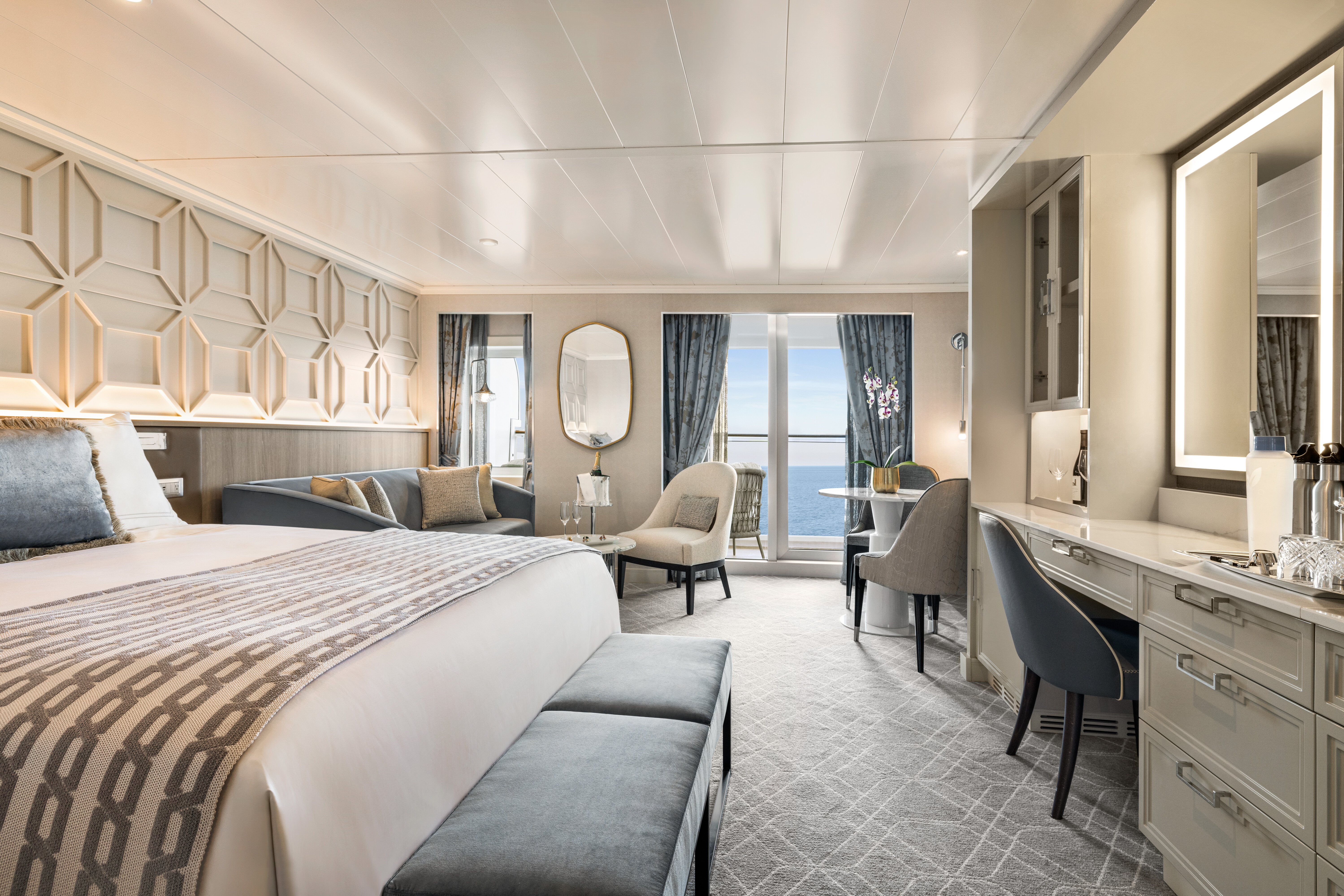
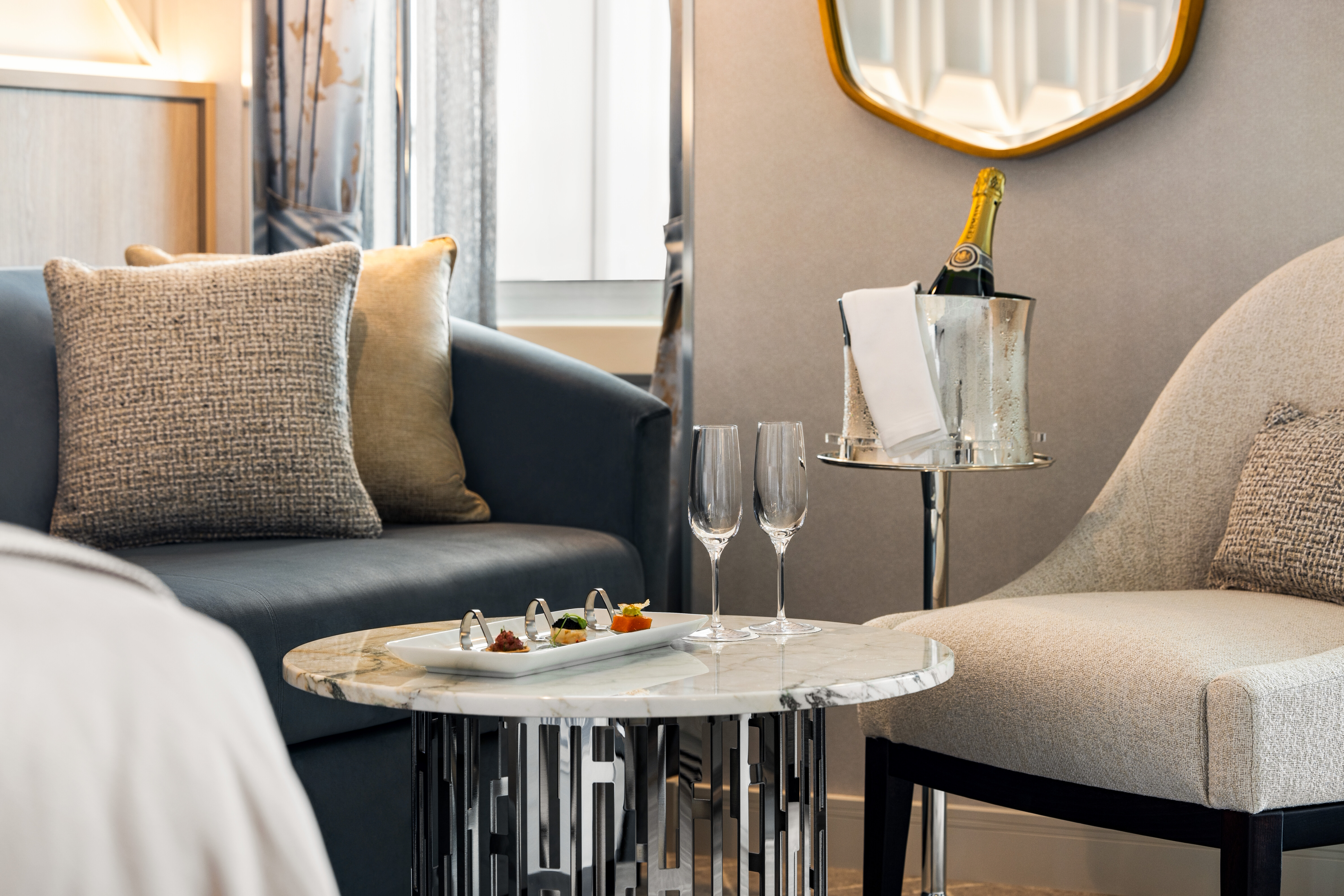
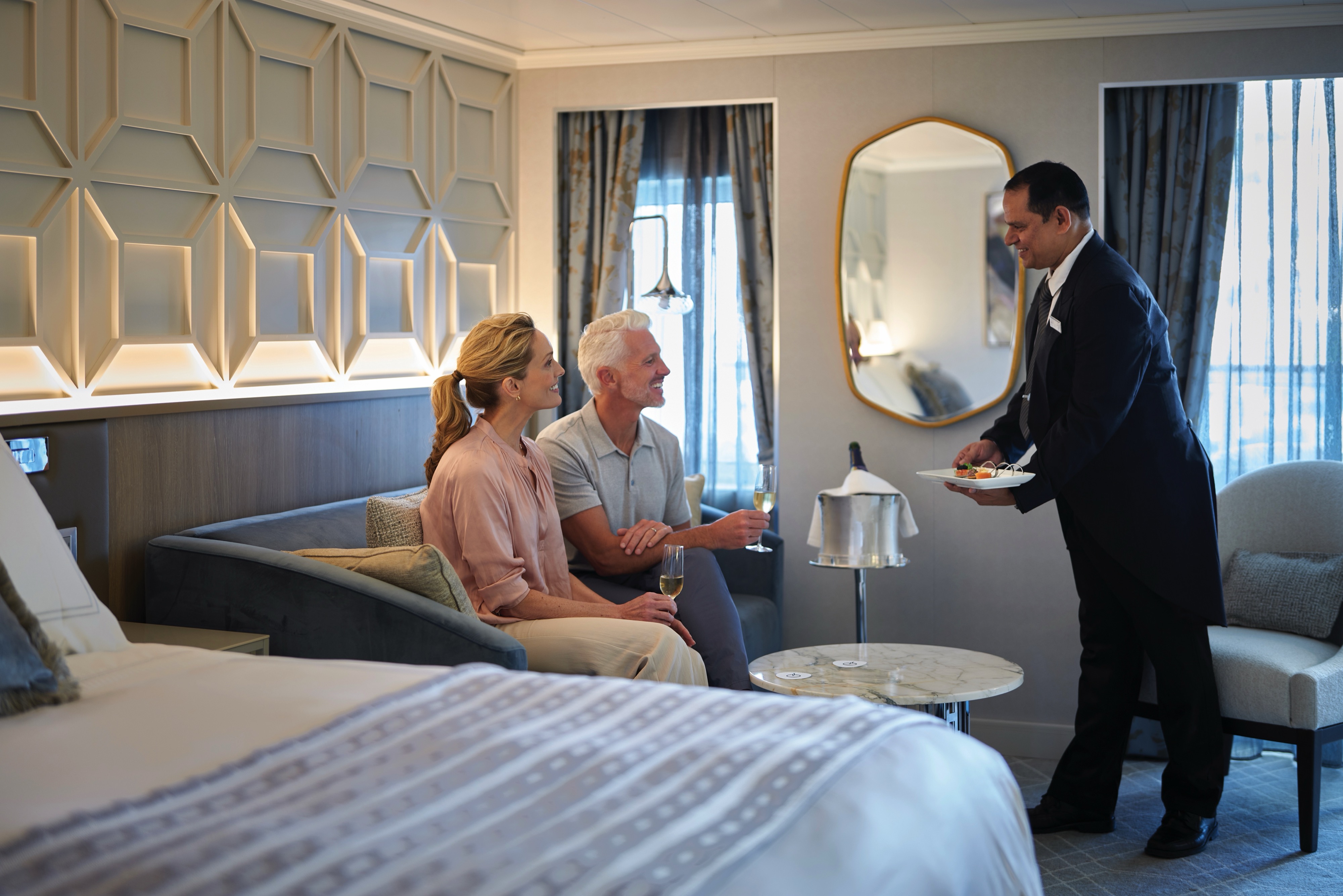
Oceania Allura’s three 2,400-square-foot+ Owner’s Suites span the full beam of the ship and boast expansive walls of glass that summon the sapphire seas beyond. Bathed in rays of the sun, these holiday retreats are styled exclusively in painstakingly selected fabrics, furnishings and design touches that exude opulence yet evoke the comforts of home to create a familiar luxury. Savor an in-suite repast in the elegant dining room and then indulge in convivial conversation within the stylish comfort of the inviting living area. In the spacious master bedroom, bask in ultimate relaxation with a plush king-size bed and a master bath featuring spa-caliber facilities. Expansive verandas off both the living room and master bedroom promise moments of cherished privacy as you survey the world from the pinnacle of luxurious living. Keep your eyes on the horizon for additional details on the Owner’s Suites’ curated decor.
+Owner’s Suite square footage varies according to deck location.
Owner's Suite Privileges
Owner's Suite Privileges
+In addition to Concierge Level privileges
- Priority luggage delivery
- Exclusive card-only access to private Executive Lounge staffed by a dedicated Concierge featuring complimentary sodas, coffees and snacks throughout the day
- 24-hour Butler service
- Optional private in-suite embarkation day lunch from noon to 2 pm in Owner’s Suites
- Complimentary in-suite bar setup with 6 full-size bottles of your choice of premium spirits and wines from our suite beverage menu
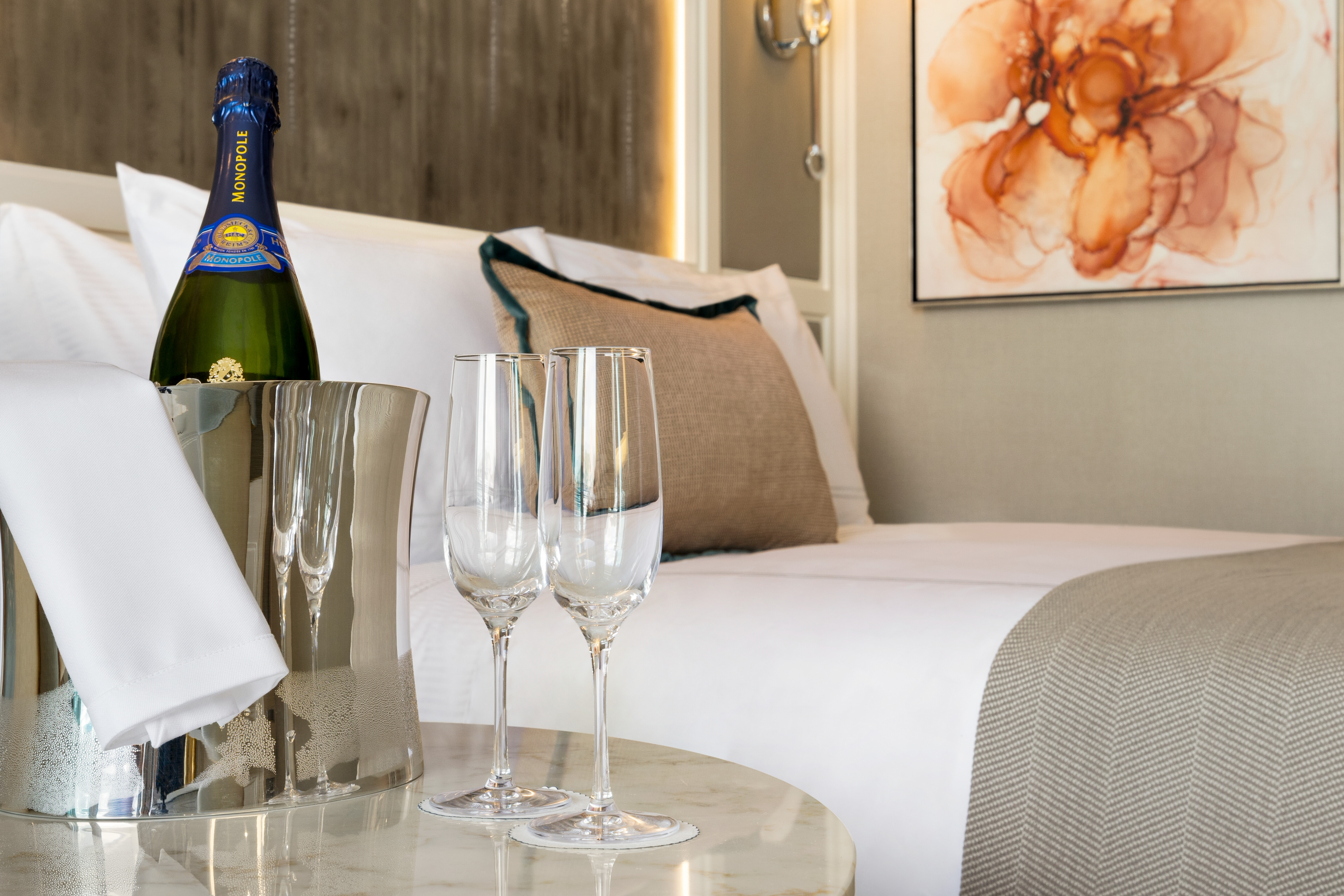
- Complimentary welcome bottle of Champagne
- In-suite illy® coffee maker and pods
- Fresh fruit basket upon request
- Choice of daily newspaper
- Exclusive pillow menu
- Course-by-course in-suite dining+
- Order in from any of our specialty restaurants+
- Coordination of shoreside dinner and entertainment reservations
- Last-minute luggage collection
- Packing and unpacking upon request
- Complimentary garment pressing+
- Complimentary shoeshine service
- Gourmet evening canapés upon request
- Special services upon request
+Certain limitations apply

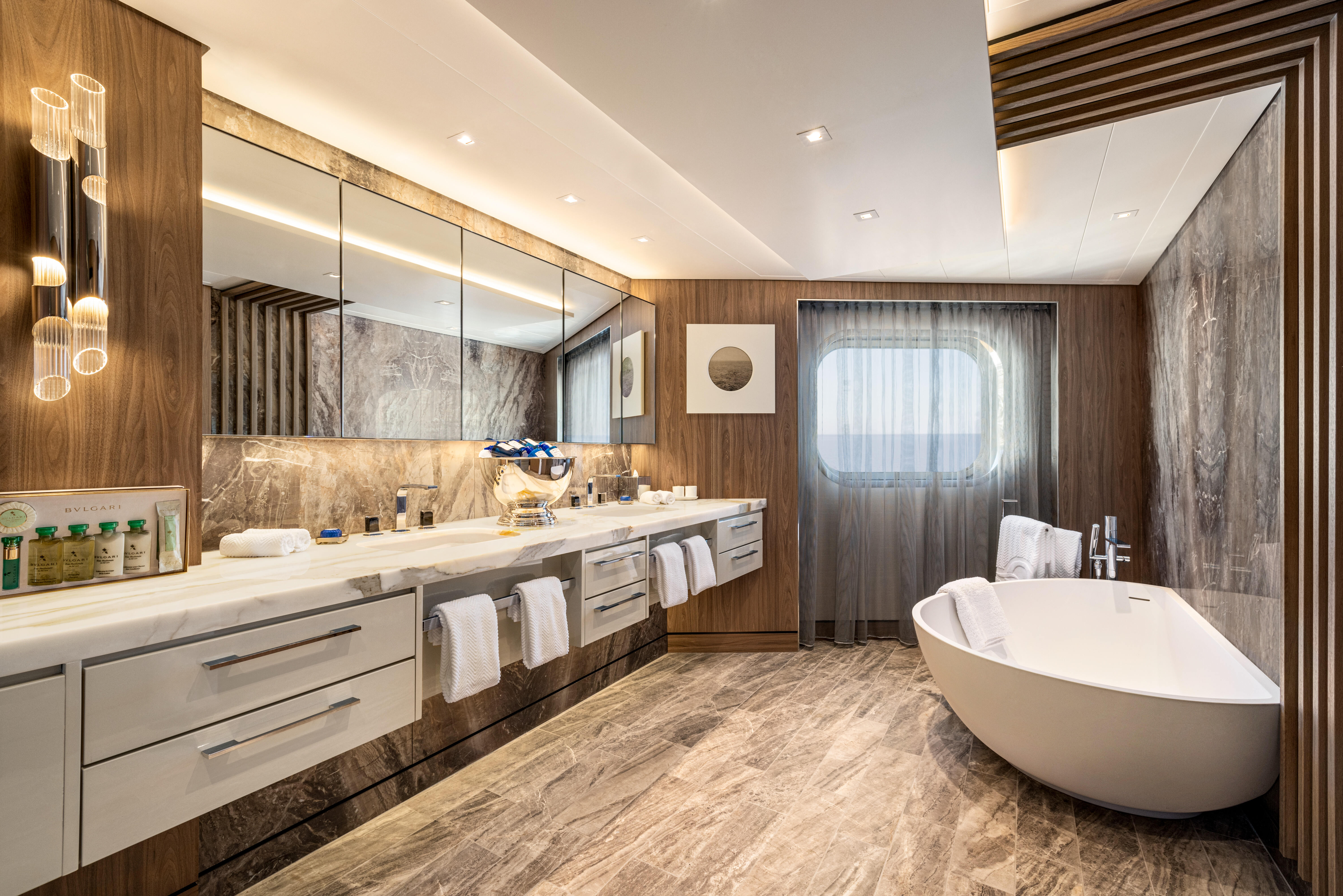
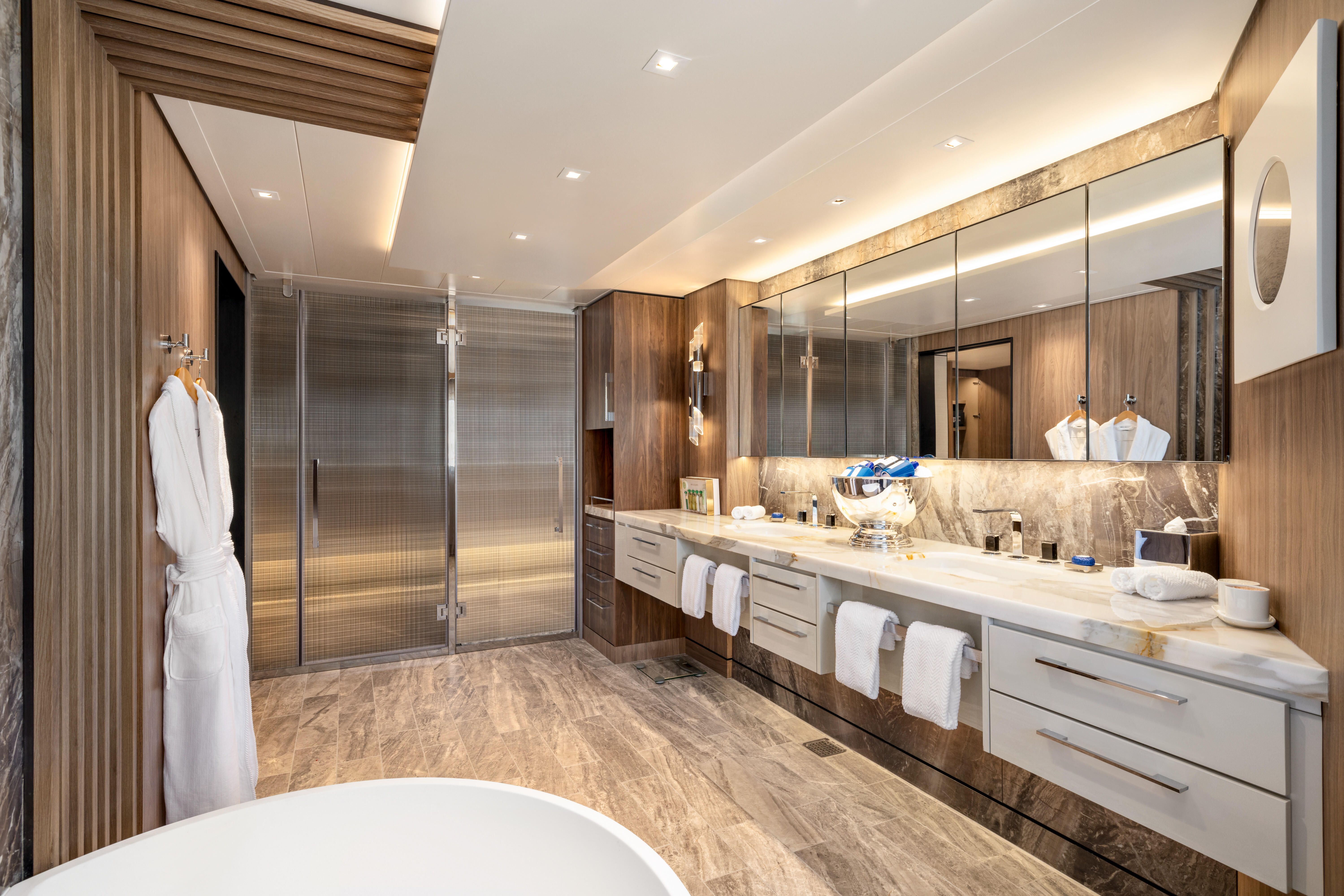
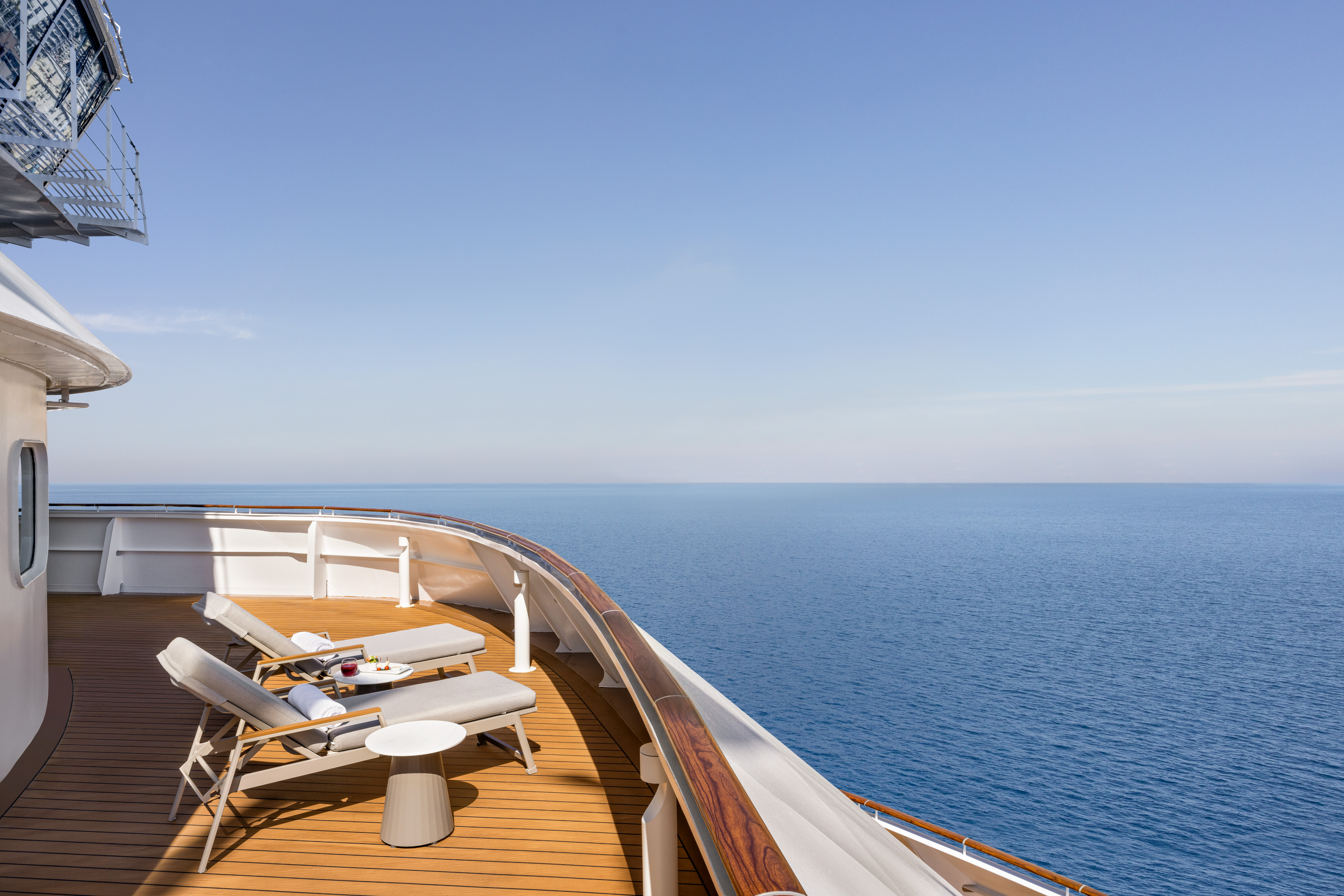
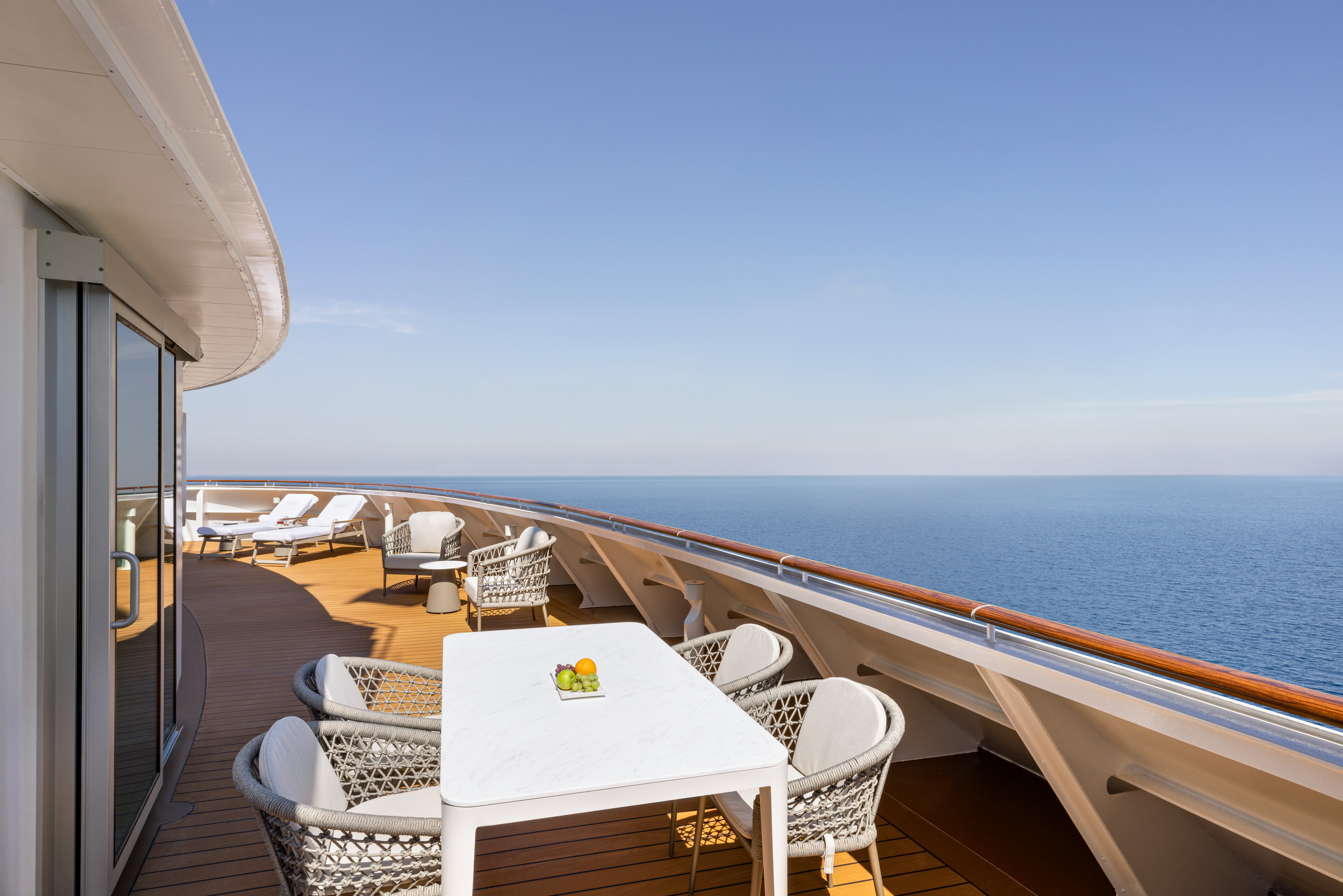
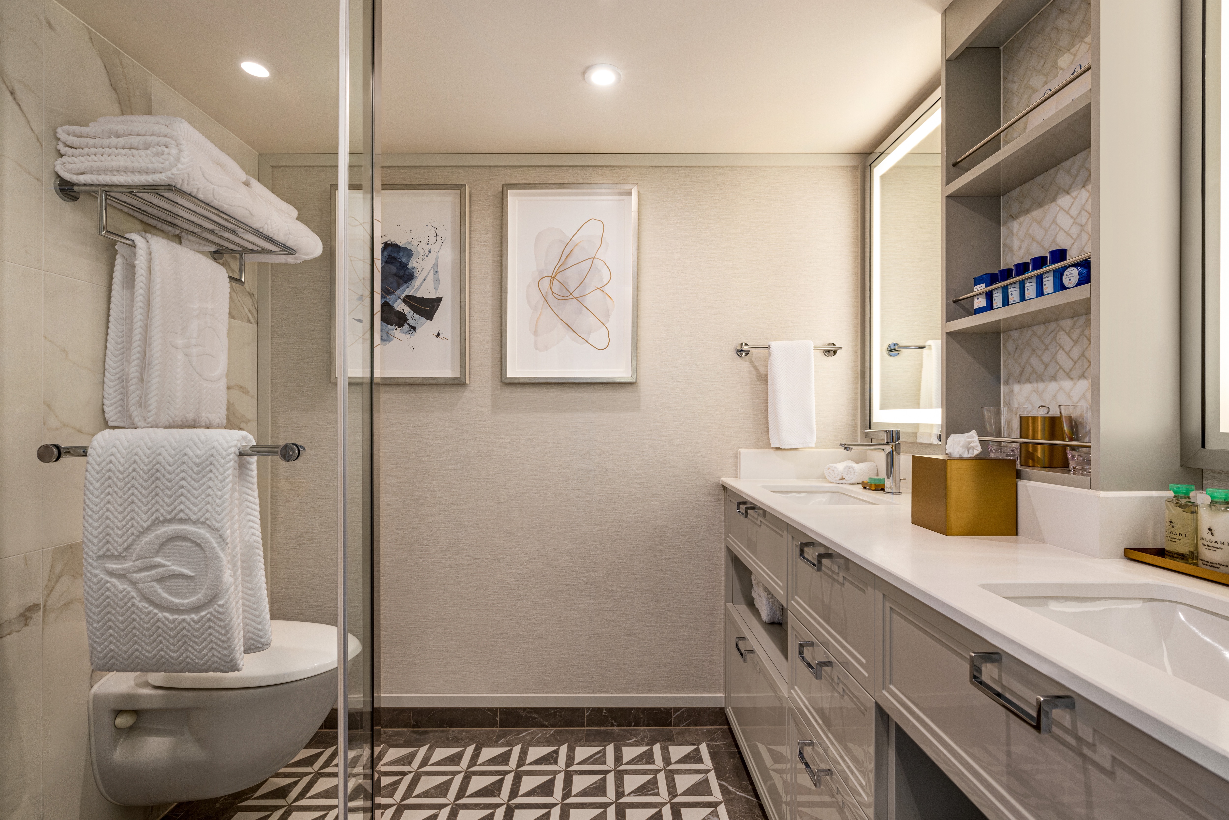
A proper vacation home always boasts a waterfront location, and the eight Vista Suites are no exception. Each features sweeping ocean views and measures 1,450 to nearly 1,850 square feet, creating a chic, spacious haven. As in any spectacular seaside home, the focus is on the world outside, with subtle tones evoking the indigo blues of the sea and luminescent cerulean sky. An airy living room, dining room, bar and master suite, all outfitted in gleaming marbles, dynamic granite and weathered oak, open to expansive teak verandas. A separate bathroom for guests offers every convenience when entertaining friends. The sublime bedroom features a plush king-size bed, spacious wardrobe and dressing area. A sun-dappled master bath with double vanities, a rainforest shower and a porcelain soaking tub rivals any shoreside home.
Vista Suite Privileges
+In addition to Concierge Level privileges
- Priority luggage delivery
- Exclusive card-only access to private Executive Lounge staffed by a dedicated Concierge featuring complimentary sodas, coffees and snacks throughout the day
- 24-hour Butler service
- Complimentary in-suite bar setup with 6 full-size bottles of your choice of premium spirits and wines from our suite beverage menu
- Complimentary welcome bottle of Champagne
- In-suite illy® coffee maker and pods
- Fresh fruit basket upon request
- Choice of daily newspaper
- Exclusive pillow menu
- Course-by-course in-suite dining+
- Order in from any of our specialty restaurants+
- Coordination of shoreside dinner and entertainment reservations
- Last-minute luggage collection
- Packing and unpacking upon request
- Complimentary garment pressing+
- Complimentary shoeshine service
- Gourmet evening canapés upon request
- Special services upon request
+Certain limitations apply
Inviting Metropolitan Residences
A smartly appointed flat on Central Park East is the inspiration for each of the 14 Oceania Suites. Informal, inviting and exquisite, these comfortable enclaves average approximately 1,000 to 1,200 square feet, providing ample space for gracious entertaining among the living and dining spaces’ thoughtfully curated residential furnishings. The glow of the emerald sea embraces the private teak veranda outside the living room and bedroom while a generous king-size bed and a soaking tub and shower in the marble-sheathed bathroom provide a respite from everyday cares. If the mood to entertains strikes, a cozy private study that can serve as a comfortable guest studio and a stylish guest bathroom stand ready.
Oceania Suite Privileges
+In addition to Concierge Level privileges
- Priority luggage delivery
- Exclusive card-only access to private Executive Lounge staffed by a dedicated Concierge featuring complimentary sodas, coffees and snacks throughout the day
- 24-hour Butler service
- Complimentary in-suite bar setup with 6 full-size bottles of your choice of premium spirits and wines from our suite beverage menu
- Complimentary welcome bottle of Champagne
- In-suite illy® coffee maker and pods
- Fresh fruit basket upon request
- Choice of daily newspaper
- Exclusive pillow menu
- Course-by-course in-suite dining+
- Order in from any of our specialty restaurants+
- Coordination of shoreside dinner and entertainment reservations
- Last-minute luggage collection
- Packing and unpacking upon request
- Complimentary garment pressing+
- Complimentary shoeshine service
- Gourmet evening canapés upon request
- Special services upon request
+Certain limitations apply
Penthouses are, by design, reserved for those who appreciate the finer things in life. Appealing and with an abundance of space, the Penthouse Suite experience is both tranquil and familiar. Tony residential furnishings and a calming color palette are reminiscent of a home ashore, yet fine fabrics and rich upholstery soothing to the touch add a dash of exotic elegance. With everyday luxuries such as a walk-in closet and an oversized bathroom featuring dual vanities and a rainforest shower, every bit of the Penthouse Suite’s 440-square feet has been utilized. Lest one forget the location of this warm and inviting enclave, a captivating private veranda overlooks the everchanging seascape.
Penthouse Suite Privileges
+In addition to Concierge Level privileges
Priority luggage delivery
- Exclusive card-only access to private Executive Lounge staffed by a dedicated Concierge featuring complimentary sodas, coffees and snacks throughout the day
- 24-hour Butler service
- Course-by-course in-suite dining+
- Order in from any of our specialty restaurants+
- Coordination of shoreside dinner and entertainment reservations
- Last-minute luggage collection
- Packing and unpacking upon request
- Complimentary garment pressing+
- Complimentary shoeshine service
- Gourmet evening canapés upon request
- Special services upon request
+Certain limitations apply
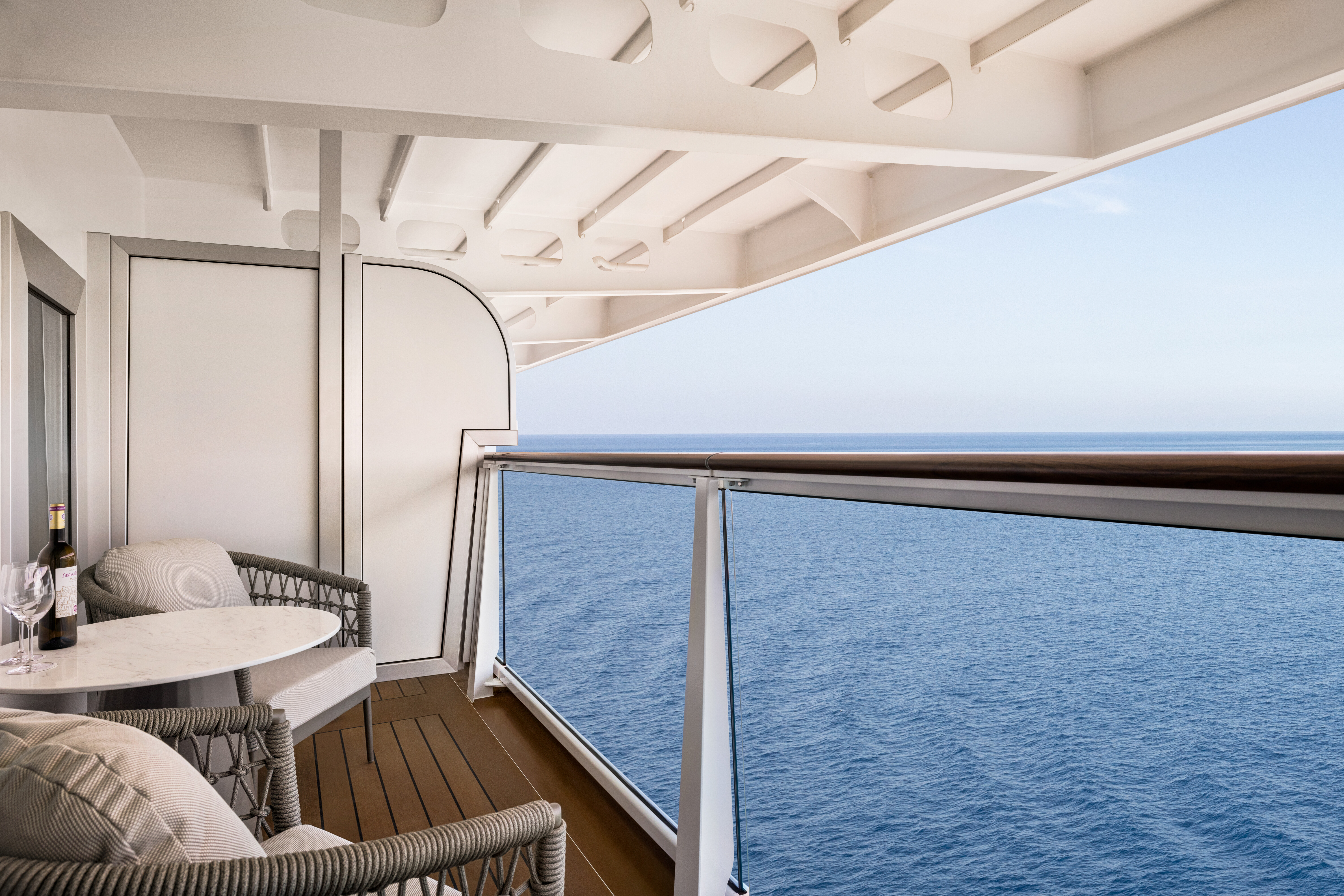
The luxury of privilege | Like a cherished Saint-Tropez bungalow, comforting shades of fawn and rich cremes are the backdrop to the vibrant colors of sea and sky viewed from the large private veranda. With 290 generous square feet at their fingertips, our designers have crafted a relaxing sitting area, sizeable closet and an indulgent marble bathroom with a walk-in rainforest shower. A queen-size Tranquility Bed, reminiscent of those found in the finest vacation villas, promises a night of undisturbed sleep. Exclusive Concierge Level amenities, such as room service from The Grand Dining Room and free laundry services, are essential elements of the Concierge Level experience.
Concierge Level Privileges
+In addition to Stateroom amenities
- Expanded lunch and dinner room service menu from The Grand Dining Room
- FREE laundry service - up to 3 bags per stateroom*
- Private teak veranda††
- Exclusive card-only access to private Concierge Lounge staffed by a dedicated Concierge featuring complimentary sodas, coffees and snacks throughout the day
- Complimentary welcome bottle of Prosecco
- Priority online specialty restaurant reservations
- Unlimited access to the Aquamar Spa Terrace
- Complimentary Oceania Cruises logo tote bag
- Cashmere lap blankets, perfect for relaxing on your veranda
- Complimentary pressing of garments upon embarkation**
- Complimentary shoeshine service
*Up to 20 garments per laundry bag; additional restrictions apply
**Certain limitations apply
Smoking in suites, staterooms and on verandas is strictly prohibited
Those who choose to travel solo deserve a home at sea that is designed exclusively for their needs. Oceania Allura’s new category of Concierge Level Solo Veranda Staterooms imbue warmth and tranquility yet are spacious nods to contemporary living. A comfortable sitting area is as cozy as a favorite cashmere sweater, a private veranda calls for a moment of seaside reflection and the separate sleeping area, bath and ample storage allow for unencumbered rejuvenation at the end of a day of discovery. A full array of Concierge Level amenities lies in wait, from free laundry service to keycard access to the exclusive Concierge Lounge.
Concierge Level Privileges
+In addition to Stateroom amenities
- Expanded lunch and dinner room service menu from The Grand Dining Room
- FREE laundry service - up to 3 bags per stateroom*
- Private teak veranda††
- Exclusive card-only access to private Concierge Lounge staffed by a dedicated Concierge featuring complimentary sodas, coffees and snacks throughout the day
- Complimentary welcome bottle of Prosecco
- Priority online specialty restaurant reservations
- Unlimited access to the Aquamar Spa Terrace
- Complimentary Oceania Cruises logo tote bag
- Cashmere lap blankets, perfect for relaxing on your veranda
- Complimentary pressing of garments upon embarkation**
- Complimentary shoeshine service
*Up to 20 garments per laundry bag; additional restrictions apply
**Certain limitations apply
Smoking in suites, staterooms and on verandas is strictly prohibited
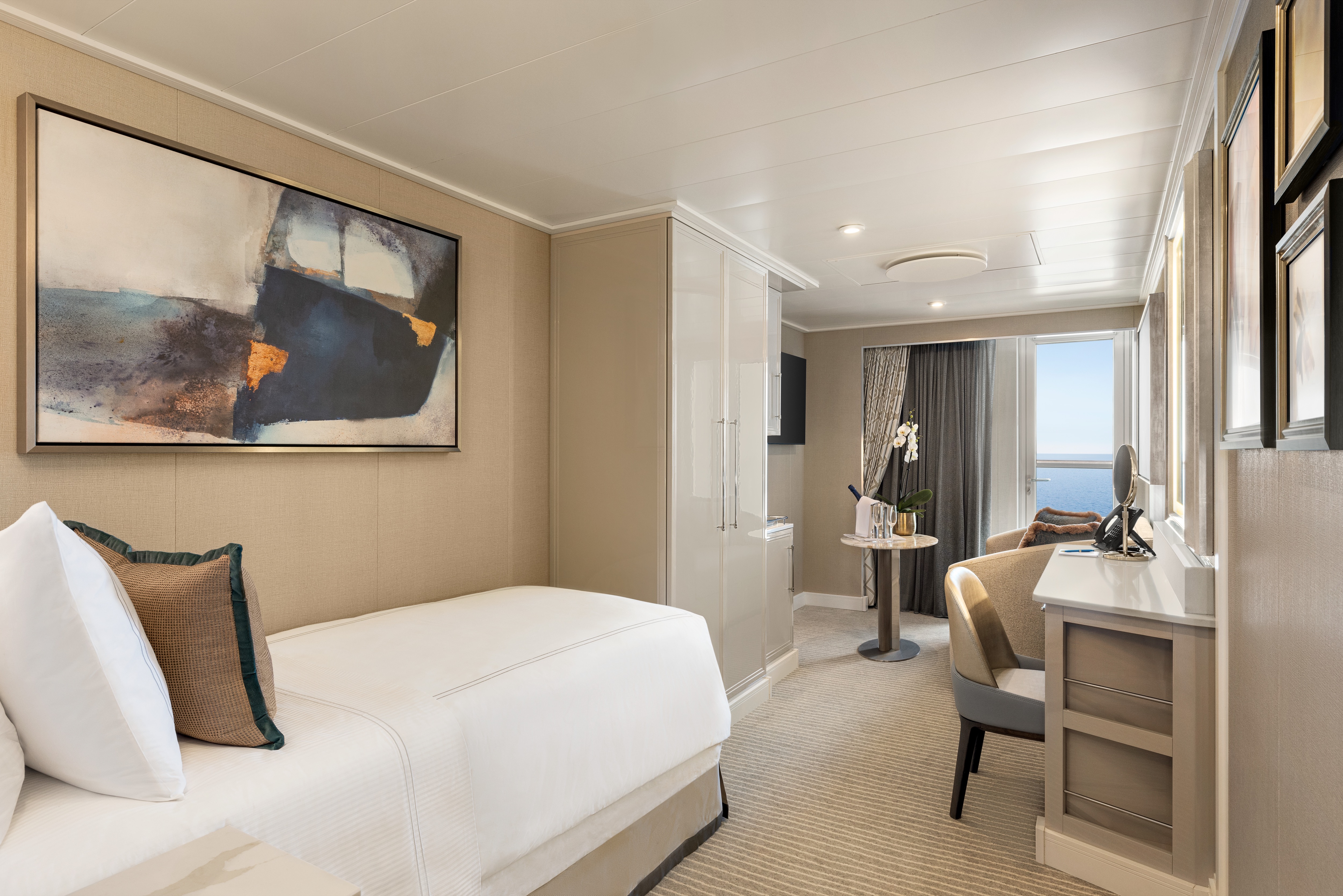
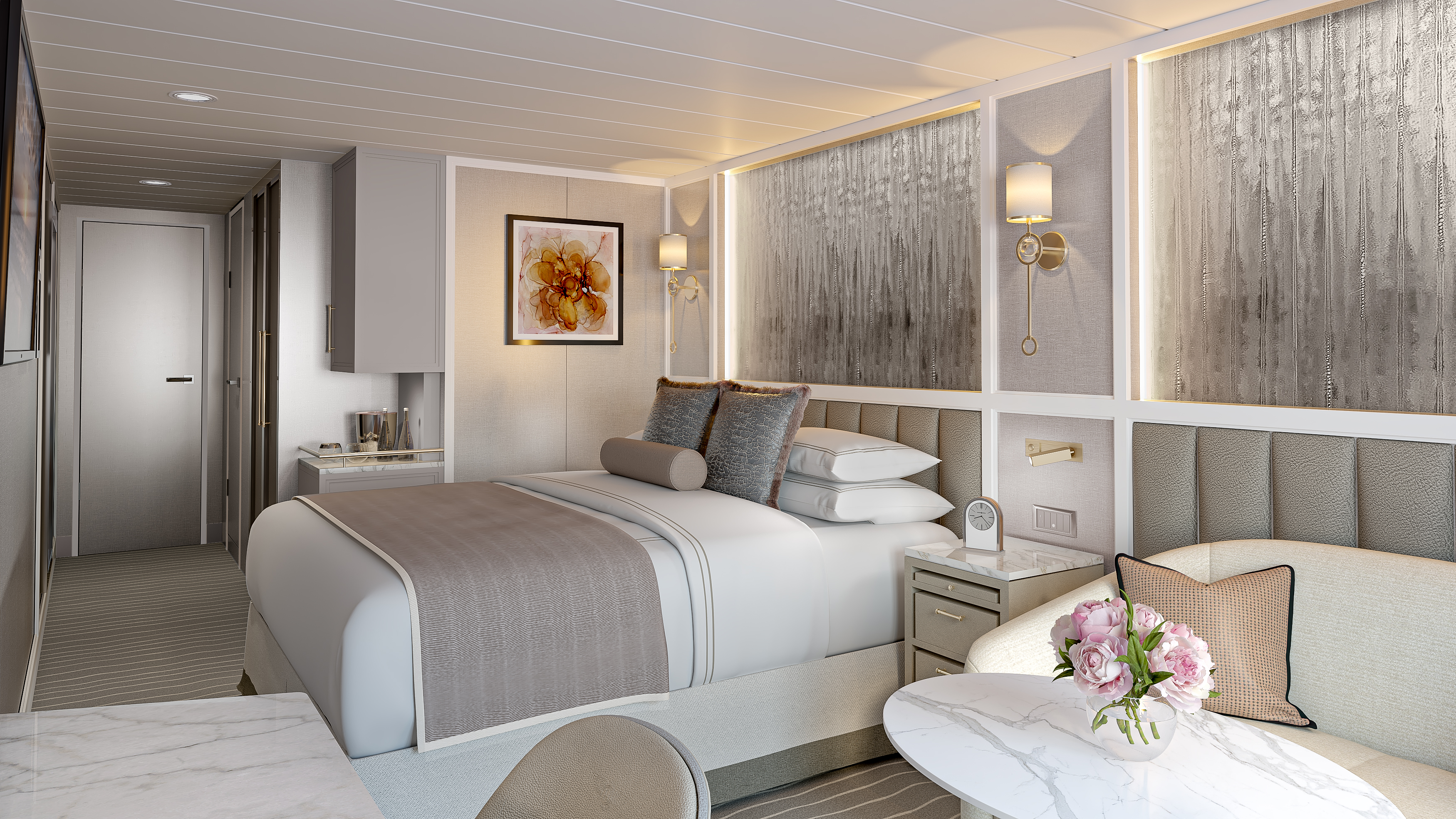
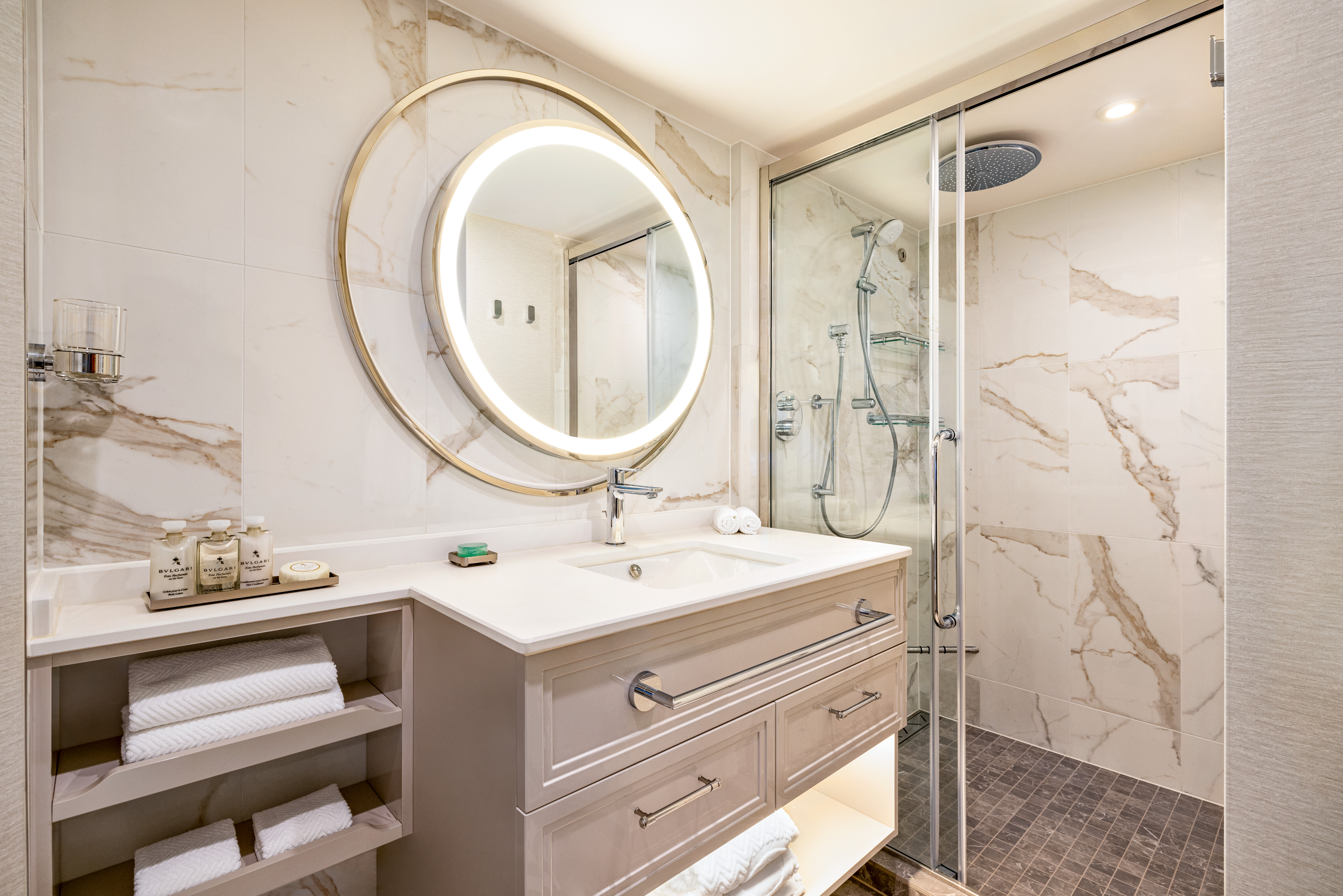
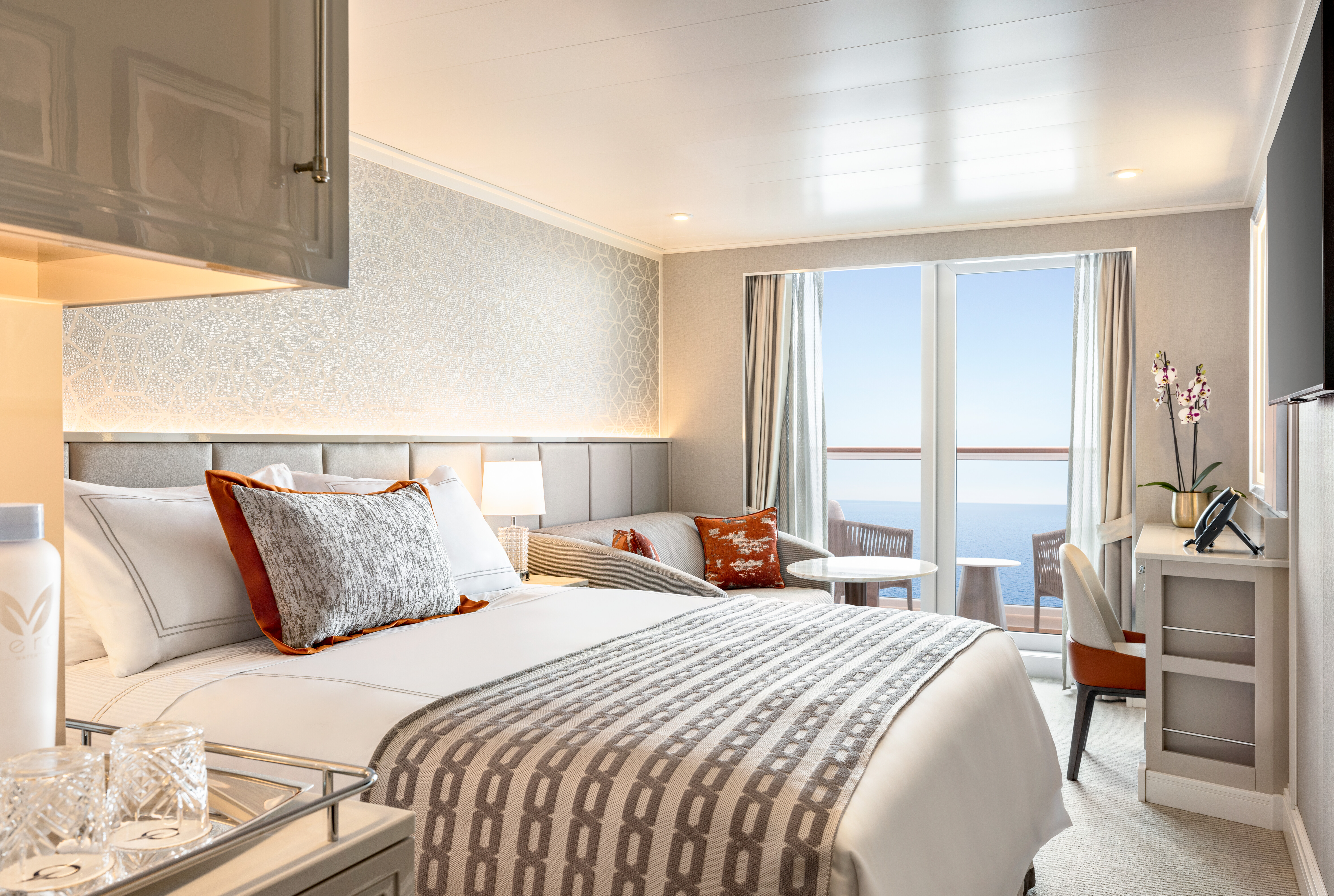
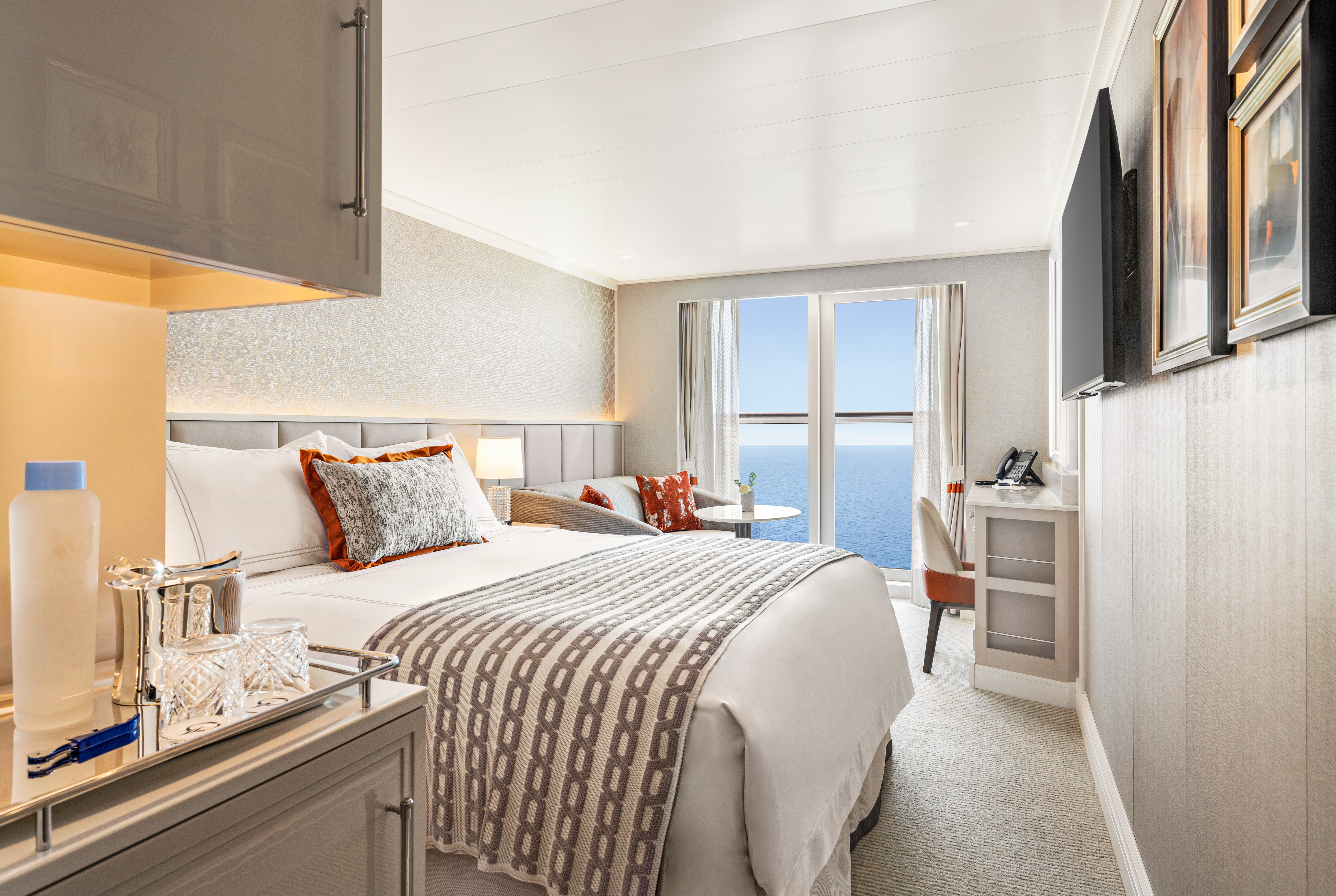
Like the ubiquitous little black dress, timeless elegance is a universal staple of Oceania Allura's Veranda Staterooms. Within an expansive 290 square feet, residential warmth is reflected in soothing neutral shades with splashes of sienna. High-tech amenities and ample closet space are de rigueur. The embrace of a lush queen-size bed is complemented by a lavishly appointed bathroom with a large vanity and captivating rainforest shower. A comfortable sitting area is a relaxing prelude to time spent on the private veranda, watching the world glide past.
Stateroom Amenities
- Tranquility Bed, an Oceania Cruises exclusive†
- FREE sodas replenished daily in your refrigerated mini-bar
- FREE still and sparkling Vero Water®
- Aquamar® Bath + Skincare Essentials
- FREE room service menu 24 hours a day
- Daily housekeeping service
- Gourmet turndown chocolates upon request
- Interactive television system with on-demand movies, weather and more
- Starlink® WiFi service
- Writing desk and stationery
- Plush cotton towels, robes and slippers
- Handheld hair dryer
- Security safe
†King-size bed (cannot be converted into twin beds) for Owner’s, Vista and Oceania Suites and queen-size bed for all other suites and staterooms (Tranquility Bed available for purchase at OceaniaBedCollection.com)
††Featured with all Veranda Staterooms (excluding French Veranda)
Smoking in suites, staterooms and on verandas is strictly prohibited
Spacious and Inviting
A seaside home should joyously enfold the ocean and in every French Veranda Stateroom, that promise is fulfilled. Fling open a floor-to-ceiling glass door that opens onto the graceful banister of the French veranda and transform your entire residence into an open-air terrace reminiscent of a chic hillside villa on the Côte d’Azur. These spacious havens feature an enticing queen-size bed, separate sitting area and comfortable furnishings that exude relaxation and sense of the familiar. Attention to detail is meticulous, including a roomy bathroom with an indulgent rainforest shower.
- Tranquility Bed, an Oceania Cruises exclusive†
- FREE sodas replenished daily in your refrigerated mini-bar
- FREE still and sparkling Vero Water®
- Aquamar® Bath + Skincare Essentials
- FREE room service menu 24 hours a day
- Daily housekeeping service
- Gourmet turndown chocolates upon request
- Interactive television system with on-demand movies, weather and more
- Starlink® WiFi service
- Writing desk and stationery
- Plush cotton towels, robes and slippers
- Handheld hair dryer
- Security safe
†King-size bed (cannot be converted into twin beds) for Owner’s, Vista and Oceania Suites and queen-size bed for all other suites and staterooms (Tranquility Bed available for purchase at OceaniaBedCollection.com)
††Featured with all Veranda Staterooms (excluding French Veranda)
Smoking in suites, staterooms and on verandas is strictly prohibited
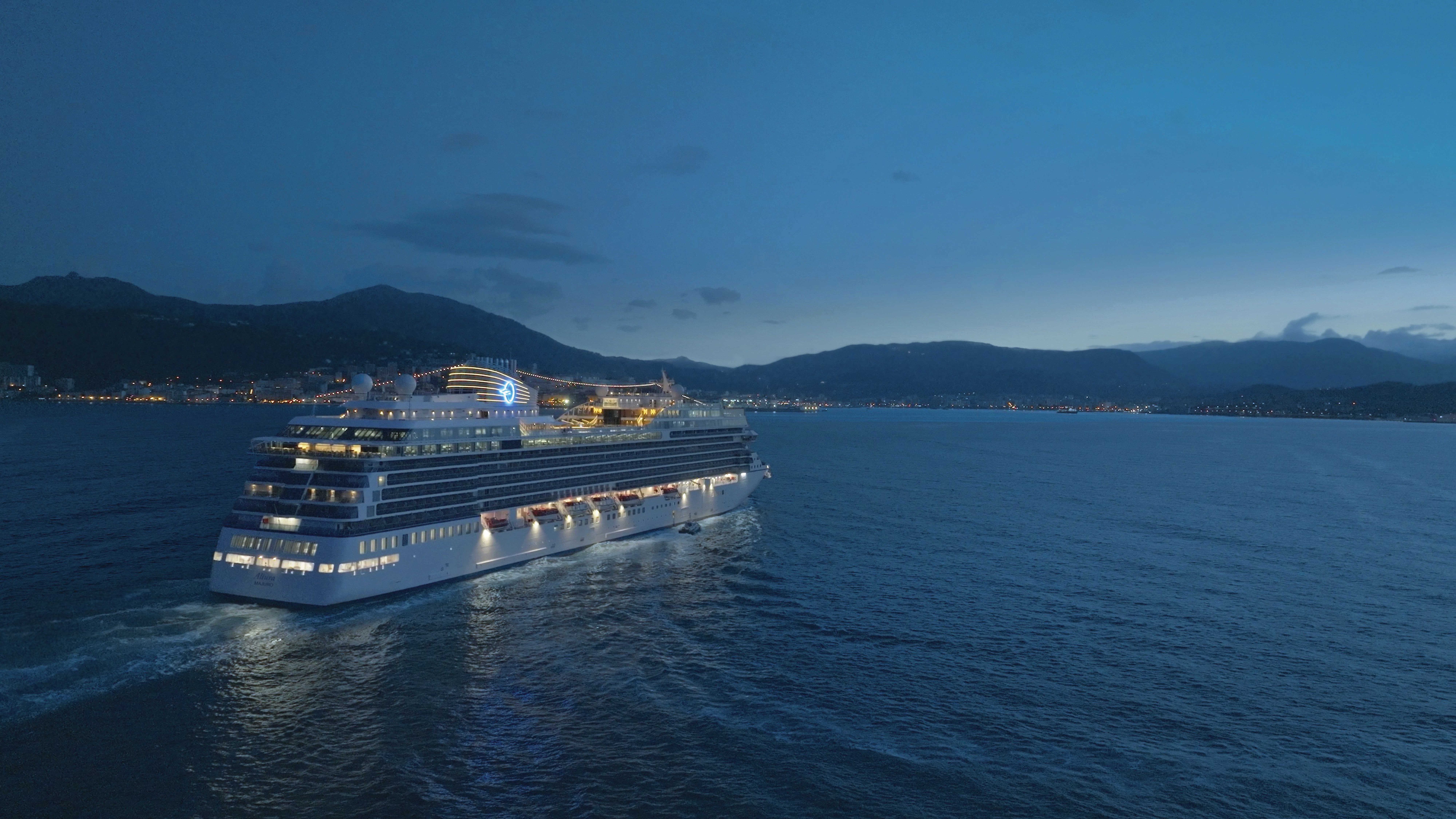
Oceania Allura
An Enchanted Evolution
It’s the irresistible thrill of striking out into the unknown, the sweeping freedom of exploration, the wind on your face as you sail the open seas. It’s the allure of the mysterious and exotic. It’s also the way sharing these experiences with fellow travelers evokes a captivating joy that stays with you long after the journey ends. Oceania Allura, our eighth beautiful ship, reveals an enchanted evolution of all that is Oceania Cruises. Discover The Finest Cuisine at Sea®, Award-Winning Itineraries and Small Ship Luxury™ as you journey like never before.
2025 Inaugural Season
Sister ship to Vista, Oceania Allura mirrors our collective fascination with the world’s vast spectrum of cultures, people and cuisines. From the beauty of ancient cities lining the Eastern Mediterranean to the distinctive charms of ports across the vast mosaic of the Americas, Oceania Allura’s 2025 Inaugural Season invites you to sail away to treasured favorites alongside intriguing off-the-beaten-path destinations that illuminate unique travel experiences through a series of extraordinary voyage itineraries. Explore the inaugural voyages and plan your next journey today.
Ship Facts
| Launch Year | 2025 | ||||||||
| Refit Year | |||||||||
| Language | en | ||||||||
| Gross Tonnage | 68000 | ||||||||
| Length | 241 | ||||||||
| Width | 32 | ||||||||
| Currency | USD | ||||||||
| Speed | 20 | ||||||||
| Capacity | 1200 | ||||||||
| Crew Count | 800 | ||||||||
| Deck Count | 11 | ||||||||
| Cabin Count | 603 | ||||||||
| Large Cabin Count | N/A | ||||||||
| Wheelchair Cabin Count | N/A | ||||||||
| Electrical Plugs |
|
Deck 16
- Paddle Tennis
- Golf Putting Greens
- Restroom

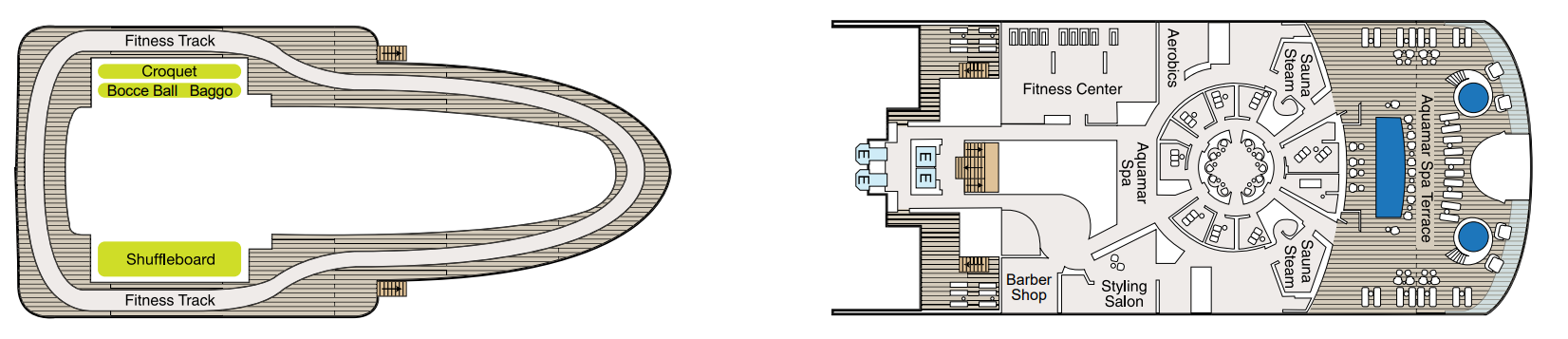
Deck 15
- Croquet/Bocce
- Shuffleboard
- Fitness Track
- Fitness Centre
- Aquamar Spa
- Barber Shop
- Styling Salon
- Aerobics
- Sauna
- Aquamar Spa Terrace
- Elevator
Deck 14
- Toscana
- Polo Grill
- Bakery
- Library
- The Culinary Centre
- Artist Loft
- LYNC Digital Centre
- Conference Centre
- Horizons
- Sun Deck
- Baristas
- Priveé
- Elevator
- Restroom

Deck 12
- Terrace Café
- Aquamar Kitchen
- Waves Grill
- Pool
- Whirlpools
- Waves Bar
- Concierge Level Veranda
- Oceania Suite
- Vista Suite
- Elevator
- Restroom

Deck 11
- Executive Lounge
- Concierge Level Veranda
- Oceania Suite
- Penthouse Suite
- Launderette
- Bridge
- Elevator

Deck 10
- Concierge Level Veranda
- Owner's Suite
- Penthouse Suite
- Vista Suite
- Launderette
- Elevator

Deck 9
- Concierge Lounge
- Concierge Level Veranda
- Concierge Level Solo Veranda
- Owner's Suite
- Vista Suite
- Launderette
- Elevator

Deck 8
- Concierge Level Veranda
- Owner's Suite
- Veranda Stateroom
- Vista Suite
- Launderette
- Elevator

Deck 7
- Concierge Level Veranda
- Veranda Stateroom
- French Veranda
- Penthouse Suite
- Launderette
- Elevator

Deck 6
- Grand Lounge
- Upper Hall
- Martinis
- Casino
- Casino Bar
- The Grand Dining Room
- Elevator

Deck 5
- Red Ginger
- Ember
- Boutiques
- Concierge
- Reception
- Destination Services
- Lounge
- Stage
- Elevator
- Restroom
- Medical Centre (Located on Deck 4 - Not Shown)

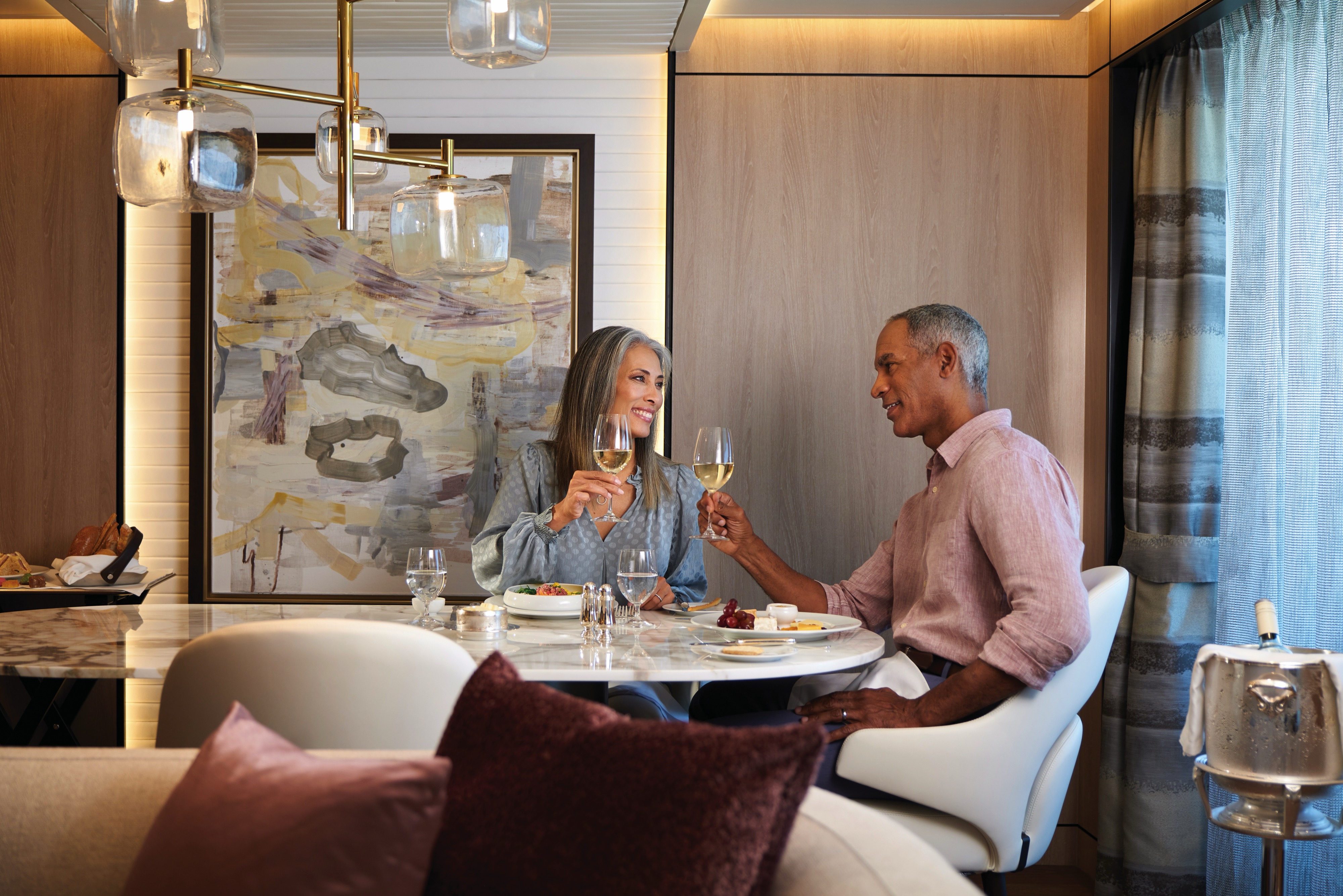
The Finest Cuisine at Sea®
Oceania Allura presents an irresistible take on The Finest Cuisine at Sea® with inventiveness and variety, showcasing a remarkable selection of onboard dining choices. Menus span from the casual to the opulent. Alongside the beloved classics cherished by guests, Oceania Allura features two exquisite new establishments like her sister ship, Oceania Vista – Aquamar Kitchen and The Bakery at Baristas. Refusing to settle for the ordinary, Oceania Cruises continually elevates and evolves each culinary experience. Aboard Oceania Allura, cruise and dine like never before.
A World of Options
A tantalizing array of options is always on offer aboard Oceania Allura – from the wellness-inspired cuisine of Aquamar Kitchen to the ever-changing array of international dishes at Terrace Café. Enjoy scenic ocean water views with lunch as you enjoy refreshing poolside fare at Waves Grill. Whether savoring a poolside burger, a scoop of Humphry Slocombe’s bourbon-flavored cornflake-studded Secret Breakfast ice cream for dessert or a perfectly prepared cappuccino accompanied by freshly baked biscotti at Baristas, you’ll notice our culinary team’s attention to detail, passion for artisanal ingredients and dedication to technique, no matter the occasion. You’ll savor delicious cuisine renowned as the finest at sea no matter where you choose to cruise and dine on Oceania Allura.
The Grand Dining Room
The grande dame of the Oceania Cruises culinary world, The Grand Dining Room evokes the ambiance of a sophisticated European hotel’s finest chandelier-studded restaurant. While our Executive Culinary Director Jacques Pépin’s herb-crusted rotisserie chicken is legendary, a cornucopia of global journeys awaits as well. Fork-tender tournedos Rossini with decadent foie gras and truffle sauce. Buttery salmon tartare with lemony sushi rice. An impossibly rich lobster bisque with silky notes of Armagnac cream. In The Grand Dining Room, the world is your oyster every night.
Breakfast
- 8:00 am – 9:30 am
Lunch
- 12:00pm – 1:30pm
Dinner
- 6:30 pm – 9:30 pm
No reservations required.
Jacques
A PASSION FOR FRENCH CUISINE
Named after our founding Executive Culinary Director, Jacques Pépin, Jacques restaurant is the epitome of French sophistication. Each dish has been ingeniously reinterpreted by Master Chef Pépin and features classic regional favorites like coq au vin and confit de canard as well as all-encompassing cheese and wine selections.
Dinner
- 6:30 pm – 9:00 pm
Reservations required.
Polo Grill
THE CLASSIC STEAKHOUSE
Discover a classic steakhouse in the grand tradition set in an ambiance bathed in richly layered decor and warm tones. Each course stands as the very definition of time-honored favorites, most notably the USDA certified Angus beef aged for explosive flavors and tenderness. Standout seafood fare such as whole Maine lobster gratinée and specialties including grilled rack of lamb will tempt your taste buds, while side dishes such as potatoes au gratin, sautéed mushroom persillade and a sharp Caesar salad prepared tableside earn pride of place.
Dinner
- 6:30 pm – 9:00 pm.
Reservations required.
Toscana
AN OLD WORLD OF NEW PLEASURES
Imagine the Venetian glass, Carrara marble and Versace china of the finest restaurants in the world along Via Ghibellina in Florence living in harmony with inventive, Tuscan-inspired cuisine reminiscent of a stone villa overlooking the medieval towers of San Gimignano. Welcome to Toscana, where each dish reflects the passionate touch of an Italian nonna’s flour-dusted hands. Savor slow wine-braised osso buco, pillowy handrolled gnocchi with pesto and crisp pan-seared sea bass splashed with tart Sorrento lemon and capers.
Dinner
- 6:30 pm – 9:00 pm.
Reservations required.
Red Ginger
EXOTIC & UNFORGETTABLE
Surrounded by intricate wooden screens, vibrant floor lamps and supple upholstered chairs, you can be forgiven for thinking you’ve stepped into a raffish Singaporean hotel from the last century. Red Ginger is a Pan-Asian wonder, where a blend of Thai, Korean, Japanese and other Asian specialties effortlessly combines tradition and innovation. Uncover the ritual of hand-rolled sushi introduced in the Edo period; the succulent, the curried spice of Malaysian beef penang and the layered flavors of miso-glazed sea bass wrapped in a hoba leaf.
6:30 pm – 9:00 pm
Reservations required.
Priveé
WINE EXPERIENCES BY LA RESERVE
Privée is our intimate venue for unforgettable wine experiences by La Reserve. Guests can choose from two distinctive and unique multi-course pairing dinners, each a sublime celebration of the finer things in life and limited to eight privileged diners per evening. Savor the truly one-of-a-kind Dom Pérignon Experience that pairs special Champagne vintages with thoughtfully crafted dishes or perhaps enjoy the exquisitely curated Odyssey Menu that is a gustatory journey for the senses. Dramatically backlit, debossed walls and a blooming flower petal ceiling, from which a dramatic chandelier descends over the polished marble slab dining table, only enhance the indulgent occasion. A wall of floor-to-ceiling glass provides an exhilarating view to complement these magnificent dining experiences that can literally traverse continents.
Reservation required. Additional fees apply.
Terrace Café
TEMPTING INTERNATIONAL FARE
With an inviting, genial dining room and shaded patio, Terrace Café takes on the ease of a treasured vacation home’s favorite sun-drenched conservatory and panoramic seaside terrace. At breakfast, revel in the aroma of freshly baked cinnamon rolls and fluffy made-to-order omelets, pancakes and waffles. During lunch, sample flavorful international dishes alongside juicy, seasoned rotisserie meats and perfectly grilled seafood. In the evening, the decadence of a grilled lobster tail, the simple American essence of a sweet, barbecued pork chop with crispy, applewood-smoked bacon and fresh hand-cut sushi and sashimi are among the many choices that will turn Terrace Café into a personal favorite. And as you would envisage, locally inspired specialties from our ports of call are a hallmark of our popular Chef’s Market Dinners.
Breakfast
- 7:30 am – 10:00 am.
Lunch
- 12:00 pm – 2:00 pm.
Dinner
- 6:30 pm – 9:00 pm.
No reservations are taken.
Aquamar Kitchen
WELLNESS MEETS INDULGENCE
At Aquamar Kitchen, the harmony of nourishing flavors, a bright and airy ambiance evoking an endless Mediterranean summer and just the right amount of indulgence revitalizes your body and your spirit. Mindfully prepared breakfast selections feature energizing cold-pressed raw juices and super food smoothies, satisfying avocado toasts, energy bowls, banana pancakes and savory omelets. For lunch, dozens of tempting and balanced dishes are offered, such as a hearty Lebanese bowl with beef kefta, falafel, muhammara, fattoush, aubergine caviar and pita bread; yellowfin tacos with white cabbage slaw; or even a crunchy chicken sandwich on a freshly baked whole grain bun. The chic seaside-inspired setting paired with a diverse collection of fresh, vibrant dishes is perfectly indulgent – without any of the guilt.
Breakfast
- 7:00 am – 10:00 am (port day).
- 8:00 am – 11:00 am (sea day).
Lunch
- 11:00 am – 3:00 pm (port day).
- 12:00 pm – 4:00 pm (sea day).
No reservations are taken.
Waves Grill
POOLSIDE ALFRESCO MAGIC
On the deck of a cherished Malibu beach house, the magic begins with the grill. Likewise, Waves Grill is a shaded poolside dining spot serving made-to-order all-American favorites from lunch until late into the afternoon. Taste the richness of a Wagyu burger with juicy tomatoes and a savory black truffle sauce. The seasoned fries are irresistible while the light crunch of fresh coleslaw is the perfect complement to the herb-marinated mahi mahi. For dessert, try a thick hand-dipped milkshake or one of the new, whimsical ice cream flavors by Humphry Slocombe such as the mouthwatering Secret Breakfast pairing of bourbon and cornflake cookies.
The Pizzeria at Waves Grill
Each evening as if by culinary alchemy, Waves Grill is transformed into an authentic Neapolitan trattoria with the pizza oven at the epicenter. Imagine you are in Capri overlooking the twinkling lights of Naples, as the alluring aroma of fresh pizza dough baking in a classic wood-fired forno wafts among the bougainvillea. Set the tone with a glass of dry chianti, then savor sweet and spicy dry-rubbed chicken wings, tender pork ribs or rosemary focaccia with lush burrata, plump tomatoes, peppery arugula and bold balsamic dressing. Pizza creations feature delectable toppings ranging from flora black olives and oaky truffles to fiery chorizo and tart lemon chicken. No matter your selection, your palate will heartily approve.
Breakfast
- 7:00 am – 11:00 am
Lunch
- 11:30 am – 4:00 pm
The Pizzeria at Waves Grill
- 6:30 pm – 9:00 pm
Afternoon Tea
TIME-HONORED PASTIME
Each afternoon, the parade of gleaming four-tiered pastry carts begins. Savor freshly made, flavorful smoked salmon and egg salad finger sandwiches. Enjoy mirror-glazed petits fours, tender scones with rich clotted cream and, of course, a wide assortment of fine teas. Soak in the ambiance of polished silver teapots reflecting the turquoise sea, the precision of white-gloved servers and the amusing enigma of a string quartet playing softly in the background. You’ll quickly realize that this is how afternoon tea should be.
Check your daily Currents for time and venue. No reservations required.
Baristas
A NEIGHBORHOOD GEM
Combine the stylish flair of a Viennese coffee house with the warm smiles of your neighborhood café, then add 270-degree shimmering sea views and you have Baristas, a relaxed haven for coffee and fresh pastry afficionados. Sip complimentary illy® delights, enjoying the energizing kick of an espresso or the smooth richness of a cappuccino. Accompany the perfect cup with a buttery dark chocolate croissant or the sublime citrus hints of an orange biscotti. Whether you are drawn to a bold macchiato or a subtle iced latte, you will be captivated by the atmosphere of friendship and family that suffuses Baristas.
The Bakery
The enticing aroma of freshly baked pastries will draw guests from Baristas to Oceania Allura’s new Bakery just steps away. The perfect complement to your coffee might just be a French or Italian specialty fresh from the oven. Perhaps you’ll sample a flaky, ricotta-filled sfogliatella, a confection that hails from the Italian region of Campania. If you prefer a French patisserie, you might select a decadent chocolate and almond croissant. Whatever your choice, you cannot go wrong when indulging in a delicacy created by our skilled pastry chefs.
All Day (To be confirmed) 7:00 am – 5:00 pm
In-Room Dining Experiences
After a day of enriching adventures ashore or an enjoyable day on board, dining in the privacy of your suite or stateroom with our compliments is always a welcome possibility. A complete menu of varied dining experiences is available around the clock, featuring an extensive array of delectable breakfast, lunch and dinner items. All suites and staterooms have the added luxury of enjoying a full, hot breakfast in-room and those staying in Concierge Level or above have the additional privilege of ordering from an expanded lunch and dinner room service menu from The Grand Dining Room. Suite guests have the ultimate indulgence of enjoying course-by-course meals from the comfort of their spacious sanctuaries. Revel in the private luxury of your suite or stateroom, and enjoy an exquisite meal on your tranquil veranda as you take in spectacular seascapes.
Crêperie
The Crêperie, located next to Baristas, the line’s signature coffee bar, will offer a selection of tempting French crêpes, Bruxelles waffles and bubble waffles, alongside Italian ice cream sundaes, from mid-morning throughout the afternoon.
Bakery
The enticing aroma of freshly baked pastries will draw guests from Baristas to Oceania Allura’s new Bakery just steps away. The perfect complement to your coffee might just be a French or Italian specialty fresh from the oven. Perhaps you’ll sample a flaky, ricotta-filled sfogliatella, a confection that hails from the Italian region of Campania. If you prefer a French patisserie, you might select a decadent chocolate and almond croissant. Whatever your choice, you cannot go wrong when indulging in a delicacy created by our skilled pastry chefs.
Life On Board
From sipping a selection of fine vintages at a wine tasting to attending a show-stopping performance in the ship lounge, a delightfully engaging spectrum of enriching activities and lively entertainment awaits you on board Oceania Allura, our newest luxury cruise ship. Join one of our passionate Guest Speakers to discover unique cultural insights of upcoming ports of call, delve into your wellness at Aquamar Spa + Vitality Center or join a hands-on cooking class at The Culinary Center. As the sun sets, one of the sparkling bars is a perfect place to gather with friends or toast to adventures, while spectacular production shows and world-class musical performances are just steps away as well.
Captivating Entertainment
Entertainment that both captivates and inspires seasoned travelers demands a kaleidoscope of talent orchestrated into something truly magical. Aboard Oceania Allura, world-class musical performances will dazzle you, showcasing a wide variety of guest entertainers such as pianists, classical string quartets, dynamic vocalists and spectacular headliners. A unique lineup of rousing onboard shows, charismatic entertainers and special performances encourage you to celebrate the moment and celebrate your journey. The world is yours for the taking.
Bars & Lounges
From chic Martinis to the laid-back poolside Waves Bar, there's a perfect enclave on board Oceania Allura for every mood. Visit the elegant Grand Lounge for a pre-dinner cocktail, catch a headline act in the Lounge or watch the sun set in Horizons accompanied by a glass of wine and lively music. New and innovative cocktail experiences await at Martinis, the Casino Mixology Bar and beyond. As you explore the world, these bars and lounges are the place to unwind, gather together, laugh and take in one-of-a-kind shows and musical performances.
Immersive Mixology Experiences
When you join us aboard Oceania Allura, enjoying a drink will be an experience unto itself – from the beauty of watching a skilled bartender smoke an Old Fashioned to the tableside preparation of a Manhattan. Our new onboard bar program has been designed to mirror the elevated quality and innovation The Finest Cuisine at Sea has come to represent. The latest cocktail-crafting trends and techniques have inspired an array of experiences, drinks and beverage offerings such cocktails topped by flavored smoke bubbles, Negronis aged in wooden barrels, delightfully entertaining rum mixology experiences, the ultimate in wine pairings, unique specialty beverage cart experiences and more.
Martini's
The lounge known as Martinis is far more than a place to sip a signature cocktail — although its namesake libation alone is reason enough to spend some time here. In fact, Martinis is refreshing its namesake cocktail with fresh new spirits selection, Mermaid gin and vodka. The bar is a glamorous destination that welcomes you to a warm, inviting setting amidst walls of shimmering glass under a canopy of crystal. You’ll also be able to choose from a tantalizing new collection of drinks called Hollywood Martinis, in addition to the already popular selection shaken tableside. The Hollywood collection includes a variety of drinks inspired by the Old Hollywood, such as Bardot Martini, The Corleone Martini, Sir Connery Martini, Blue Eyes Sinatra and Monroe Martini. Simply gather with friends in your favorite alcove and let the memories be made.
Grand Lounge
Oceania Allura's provocative Grand Lounge plays with shape and form to create visual elements that are striking even as they are understated. The color palette is an ode to metals and minerals with shades of bronze, onyx and alabaster lending both balance and interest. The resulting space evokes exclusivity — the feel of a luxurious private club — inviting guests to relax and enjoy an aperitif before dinner or a nightcap before retiring as they relive the day’s adventures with fellow explorers.
Horizons
The most distinctive feature of aptly named Horizons is the lounge’s dramatic floor-to-ceiling windows, offering 180 degrees of stunning views that hint at the adventures to come. This space celebrates the essence of Oceania Allura by showcasing the magical call of that which lies beyond the horizon.
To ensure that you can fully appreciate these tantalizing panoramas with a relaxed familiarity, Horizons is appointed with comfortable residential furnishings in soothing tones that create a sense of home, even as the view assures you that you are far from it. Dance the night away to the sounds of a lively musical group and toast to the adventures ahead.
Waves Bar
Located in a shaded area just steps from the swimming pool, Waves Bar offers a wide variety of libations to enhance your poolside experience. Revel in the perfect afternoon on deck with your favorite cocktail, glass of wine or chilled beer. Come happy hour, signature cocktails and frosty beverages create a delightfully carefree segue to the lively evening ahead as the sun sets.
LYNC Digital Centre
The all-new LYNC Digital Center aboard Oceania Allura is all about connection. Join us for an interactive and fun enrichment series that connects you with friends and family on social media, elevates the quality of your photos and more. Complimentary digital learning classes, spanning all levels and ranging from social media essentials to travel photography and smartphone videography, are hosted by a knowledgeable Digital Concierge in our innovative digital center.
Our innovative digital center features comfortable seating, expansive video monitors and technical support so that you can stay in touch with family at home, monitor business developments online or check in on social media. LYNC Digital Center connects you to life on board, ashore and at home.
Library
A STATELY RESPITE
Evoking a cherished den in a modern equestrian estate home, the Library is a guest favorite, so special care was taken to ensure it exudes tranquility and a sense of belonging. Glass walls offer views of serene seascapes, but the greatest comfort may be found within the Library’s inner sanctum. The aesthetic speaks to a time when the written word was our window to the world and earned pride of place in an atmosphere of effortless comfort. It is the perfect place to curl up with a novel or simply indulge in a nap in one of the sumptuous chairs.
Boutiques
UNIQUE GIFTS, JEWELRY & MORE
Our stylish boutiques feature a tastefully curated selection of items ranging from sundries to chic resort wear and fine jewelry. Discover thoughtful gifts for friends and family or the perfect memento to remind you of your special cruise experience.
DUTY-FREE ON BOARD OCEANIA ALLURA
Browse through our collection of duty-free merchandise including fine jewellery, watches, fragrances and Oceania Cruises logo wear. Also find shipboard keepsakes, designer handbags, sunglasses, books and more.
Casino
The Casino on board Oceania Allura takes its cue from the elegance of Monte Carlo Casino and London’s Hippodrome, evolving the art nouveau elements of these iconic establishments into a space of understated, atmospheric luxury. Try your hand at your favorite games of chance and skill, perhaps warming up to test your luck ashore in an upcoming port of call. Those simply seeking a refined space in which to enjoy a cocktail will be drawn to the subtle glow of the golden Casino Bar.
CASINOS AT SEA®
The professional staff is happy to provide lessons on how games are played, the rules and proper table procedures. Unwind from a busy day ashore by playing your favourite games of chance and skill in our casino. Enjoy a fun and exciting range of ways to play, from card and table games such as blackjack and roulette to slot machines.
Getting started is easy. Stop by the casino cage and pick up your Oceania Cruises casino player card and start earning points today, by inserting your player card while playing your favourite slot machines and table games. The more you play, the more you earn!
- Reel & Video Slots - For every $5 coin-in, receive 1 point.
- Video Poker - For every $10 coin-in, receive 1 point.
- Table Games - Points are based on average bet, session play or hands played and game type.
- Action packed casinos designed with style
- Table game limits for players of all levels
- Diverse array of reel slot, video slot and video poker machines
- Dedicated and knowledgeable casino staff
- Industry leading player tracking system
- Free gaming lessons
REDEEM CASINO POINTS
You’ve played. You’ve earned. Now you’re ready to redeem. Downloading points for play is quick and easy. Redeem your casino points for play right at your machine by following the on-screen prompts or stop by the casino cage – the choice is yours.
- Earn points for all your casino play
- Redeem points for play right at your machine
CASINO CASH & CREDIT
Front Money deposits are accepted for gaming in the form of cash, traveler’s checks, cashier’s checks and wire transfers delivered to us prior to embarkation. All cashier’s checks require prior verification. For more information please give us a call at 877.625.2094.
Cashless Wagering
Charge gaming to your onboard account directly from your game of choice or at the casino cashier, using your stateroom key card. Convenience fees, daily limits and cruise limits apply. Euros may be exchanged at the casino cashier, exchange rates apply. All gaming is in US Dollars.
- Cashless wagering allows you to game with your key card
Credit
Casino Credit is available to all players with an existing reservation. The minimum application amount is $10,000.00 and a personal check is required onboard to activate the credit line. Applications are processed 1 month prior to sailing. The application process is easy and there is no fee to apply. To get started, click here for our credit application or for more information email us at casinocredit@ncl.com or call us at 877.625.2094.
- Casino credit available
Mixology Bar
Oceania Cruises doesn’t just serve The Finest Cuisine at Sea; we now have a mixology series to match that introduces new concepts, cocktails and experiences throughout the ship. Choose encompassing amusements ranging from lively libations at the Bubbly Bar or Ultimate Bloody Mary Bar to flavourful and refreshing zero-proof cocktails. An impressive selection of new premium spirits, unique curated pairing menus and a bountiful cellar of low- and no-sugar wines inspire a deeper appreciation for the finer things in life. Rediscover the art of the cocktail among newfound friends and cherish a time-honoured shipboard tradition that takes on an exciting fashionable flair.
Onboard Shows
ENTERTAINMENT FROM A NEW PERSPECTIVE
Entertainment that is both enthralling and inspiring demands a kaleidoscope of talent orchestrated into something truly magical. Aboard Oceania Allura, the meticulously curated onboard shows achieve new heights. Discover an enticing array of star-studded performers in lively and adventurous production shows, each with its own unique personality. Soloists, exceptional leaders in their fields, effortlessly mesmerize audiences while headliners with impeccable credentials elevate favorite songs to new levels.
Founders Bar
Founders Bar, perhaps the most exclusive venue on Oceania Allura, is the chic hotspot where one goes to be noticed. Where else could you order readymade Negronis that come straight from a wooden barrel, imparting an oaky undertone that whispers of old world secrets? Vapor-filled bubbles with aromatic flavors are infused in cocktails, bringing a unique twist to both classic and contemporary concoctions. Aged bourbons with hints of caramel and vanilla and grassy, spicy ryes have been hand-selected from the most distinguished distilleries. Or settle into a snug armchair and watch your cocktail of choice prepared tableside. At Founders Bar, anything is possible.
Allura Lounge
Our entertainment architects have engineered a space with the best possible acoustics and visual lines to provide a home worthy of the engaging talent that you will witness in the Oceania Allura Lounge. During the daytime, experts in their fields — from diplomats to chefs to historians — enlighten you with enrichment programs that provide insight into the regions you are exploring. After the sun sets, the Oceania Allura Lounge presents a new line-up of entertainment to enthrall the audience, including sophisticated cabarets, world-class musicians, dynamic vocalists and exclusive headliners.
Concierge Lounge
Enjoy the fully-staffed Concierge Lounge with complimentary beverages and snacks throughout the day an evening
Executive Lounge
Enjoy the fully-staffed Executive Lounge with Complimentary beverages and snacks throughout the day and evening.
Drink Experiences
Interactive & Customized Cocktail Experiences
The Bubbly Bar This new event will take place on select evenings in the elegant Baristas area. It’s a lighthearted and interactive concept that invites you to customize your own drink and be creative while doing this. Our Bar Staff will be there to assist you every step of the way and there will be a wide variety of beverages to choose from including sparkling wines, Champagne, prosecco, and liqueurs as well as a delicious array of homemade syrups and purees, plus very diverse beverage garnishes.
The Ultimate Bloody Mary Bar The popularity of the Bloody Mary has skyrocketed in recent years. So many are thinking beyond the classic recipe and this inspired us to craft our own unique experience. This will be hosted during lunch in Terrace Café with a beautifully vibrant and colorful display of vegetables, ingredients and unique garnishes such as spicy shrimp, stuffed olives and dried bacon. There will be several custom-made options to choose from, such as the Italian Mary made with grappa and Italian skewer or the Ave Caesar prepared with Clamato juice, in addition to crafting one all your own.
Elevated Single Malt Whisky Experiences
The Macallan Rituals The Macallan Rituals introduces you to masterfully crafted expressions of The Macallan that you can savor any way you prefer your whisky served. Brought to you tableside on a beautiful cart, experience The Macallan in a delicious smoked cocktail influenced by The Macallan smoker or perhaps you prefer your whisky simply neat. If “On the Rock” is your choice, a perfectly shaped ice sphere will be created right in front of you and added to your whisky. The Macallan Rituals are certain to engage your senses.
The Macallan Chocolate Pairing Indulge with a curated selection of specialty chocolates paired with The Macallan Quest Collection. This pairing opens the door to the many flavors the Quest Collection has to offer. Let us take you on a journey of flavor – you can choose from The Macallan Quest & Milk Chocolate, The Macallan Lumina & Chocolate Truffles with fruit, The Macallan Terra & White Chocolate or The Macallan Enigma & Dark Chocolate.
Entertaining & Indulgent Rum Mixology Experiences
Brugal 1888 Tea at Sea Become a mixologist for the day and experience the Brugal 1888 Rum Tea at Sea Seminar. In this engaging and hands-on seminar, you become the bartender. Equipped with proper cocktail making tools, you will make delicious Brugal rum cocktails with tea while learning how tea has influenced mixology since the 17th century. Enriching and fun, you will learn cocktail-making skills you can take home to impress family and friends. Rum and tea cocktails will also be available at select bars on board.
Brugal 1888 & Ice Cream Masterclass In a twist of sweetness, we’re excited to offer you the Brugal 1888 and Ice Cream Masterclass. You will learn how to make delicious ice cream-inspired Brugal 1888 rum cocktails such as the famous coffee affogato, a cool take on the Spritz and a caramel popcorn milkshake that will delight your senses. Guided by your onboard mixologist and dessert chef, you will learn not only how to make cocktails but also how to make the various types of ice cream that go in them. Cool off with these decadent cocktails poolside or wherever the day leads you.
Wine Pairing Experiences
There’s nothing quite like the trifecta of amazing food, delightful wine and lots of laughter. Suited to connoisseurs and novices alike, our wine pairing experiences across our small and luxurious ships are convivial, memorable, and yes, just a touch lavish. Evoking the breezy yet chic sensibility of a small Napa winery, the experiences center on menus of inventive dishes paired with premium, and often rare, vintages hand-selected by our talented chefs and sommeliers. Cruise and dine in style, and book reservations for a range of exciting onboard pairing experiences, such as sommelier-led pairing lunches, a one-of-a-kind six-course Champagne dinner and more. Each is a pure celebration of the joys of gathering around a table. More than anything else, these experiences are tableside joie de vivre.
Grand Staircase
Each Oceania Cruises journey begins when you enter the soaring atrium where you are met with a truly grand welcome – the iconic Grand Staircase that is a dynamic focal point of each of our ships. Oceania Allura’s signature Grand Staircase is a curvaceous wonder of tactile details that invites exploration of your home at sea.
The design was inspired by organic elements and evokes a sense of movement, reflective of the allure of travel and the excitement of hidden lands. The ascending stairs embrace a glistening floor-toceiling pillar of crystal and light that sets the tone for the illuminating voyage ahead.