
Glaciers & Lighthouses
Glaciers & Lighthouses
Cruise overview
WHY BOOK WITH US?
- ✔ The Deluxe Cruises’ team has extensive experience in ultra-luxury cruising.
- ✔ Call now to speak to our helpful and experienced Cruise Concierge team.
- ✔ Enjoy our Unique Deluxe Cruises Bonus for substantial savings.
- ✔ Our team will tailor your holiday to your exacting requirements.
- ✔ As agents, we work under the protection of each cruise lines ABTA / ATOL licences
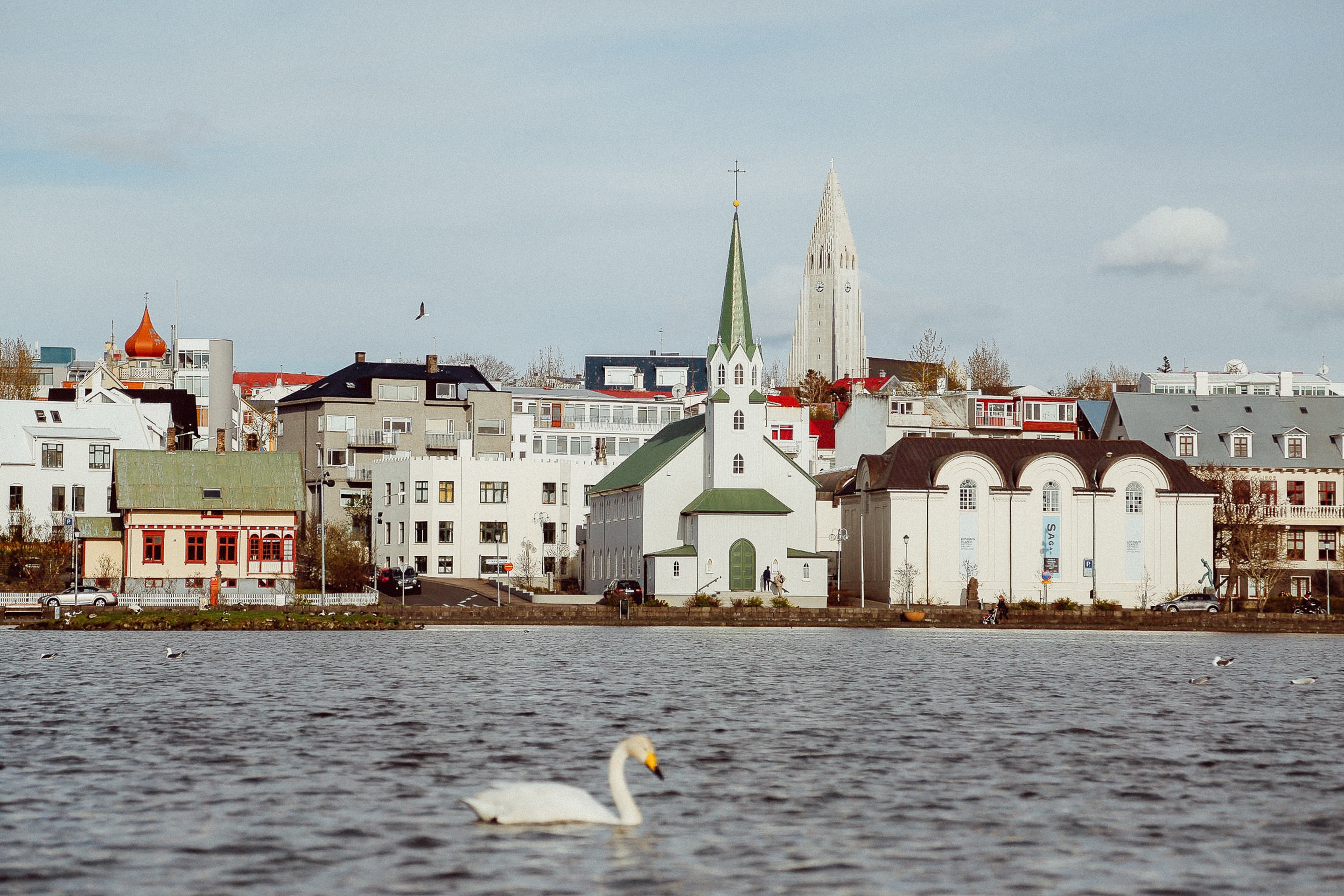
About Reykjavík
Sprawling Reykjavík, the nation's nerve center and government seat, is home to half the island's population. On a bay overlooked by proud Mt. Esja (pronounced eh-shyuh), with its ever-changing hues, Reykjavík presents a colorful sight, its concrete houses painted in light colors and topped by vibrant red, blue, and green roofs. In contrast to the almost treeless countryside, Reykjavík has many tall, native birches, rowans, and willows, as well as imported aspen, pines, and spruces.Reykjavík's name comes from the Icelandic words for smoke, reykur, and bay, vík. In AD 874, Norseman Ingólfur Arnarson saw Iceland rising out of the misty sea and came ashore at a bay eerily shrouded with plumes of steam from nearby hot springs. Today most of the houses in Reykjavík are heated by near-boiling water from the hot springs. Natural heating avoids air pollution; there's no smoke around. You may notice, however, that the hot water brings a slight sulfur smell to the bathroom.Prices are easily on a par with other major European cities. A practical option is to purchase a Reykjavík City Card at the Tourist Information Center or at the Reykjavík Youth Hostel. This card permits unlimited bus usage and admission to any of the city's seven pools, the Family Park and Zoo, and city museums. The cards are valid for one (ISK 3,300), two (ISK 4,400), or three days (ISK 4,900), and they pay for themselves after three or four uses a day. Even lacking the City Card, paying admission (ISK 500, or ISK 250 for seniors and people with disabilities) to one of the city art museums (Hafnarhús, Kjarvalsstaðir, or Ásmundarsafn) gets you free same-day admission to the other two.


About Djúpivogur
It may be surrounded by pulse-raising volcanic scenery, boast extraordinary wildlife, and sit on a dramatic, jutting fjord - but it's fair to say Djúpivogur likes to take things slow. In fact, Djúpivogur relishes its peace and quiet so much that it's won recognition as a 'Cittaslow' - a Slow City. So prepare to take a new, leisurely look around, as you relax into the breathtaking natural glory of Iceland, and explore this unique location - filled with folklore, fabulous food and fantastic fjords.

About Husavik
The town of Húsavík sits below Húsavíkurfjall mountain on the eastern shore of Skjálfandi bay. Just above the town is lake Botnsvatn, a popular place for outings. The lake is just the right size for a nice hike around it. The lakes surroundings are rich in vegetation and bird life and trout is said to be abundant, though small. Húsavík harbour lies below the bank right in the heart of town. The harbour once boasted a large fishing fleet, bustling with the activity of fishermen. It still serves as a fishing harbour but today's activity revolves more around the successful whale watching businesses. The first organised whale watching excursions in Iceland started from here in 1995. Since then, whale watching has become a major attraction and Húsavík continues to be the leading destination for whale watching. In addition to the tours, a fascinating whale museum is located right by the harbour. Húsavík is considered to be the oldest settlement in Iceland. The Swedish explorer, Gardar Svavarsson, spent one winter there in 870 AD during which time he built himself a house from which the settlement derives its name.

About Isafjørdur
Two colossal terraces of sheer rock stand either side of this extraordinarily located town - which rides a jutting spit onto an immensity of black fjord water. Surprisingly, considering the remoteness of its location and its compact size, Isafjordur is a modern and lively place to visit, offering a great choice of cafes and delicious restaurants – which are well stocked to impress visitors. The town is a perfectly located base for adventures amongst Iceland's fantastic wilderness - with skiing, hiking and water-sports popular pursuits among visitors.

About Qaqortoq (Julianehaab)
The largest town in southern Greenland, Qaqortoq has been inhabited since prehistoric times. Upon arrival in this charming southern Greenland enclave, it's easy to see why. Qaqortoq rises quite steeply over the fjord system around the city, offering breath-taking panoramic vistas of the surrounding mountains, deep, blue sea, Lake Tasersuag, icebergs in the bay, and pastoral backcountry. Although the earliest signs of ancient civilization in Qaqortoq date back 4,300 years, Qaqortoq is known to have been inhabited by Norse and Inuit settlers in the 10th and 12th centuries, and the present-day town was founded in 1774. In the years since, Qaqortoq has evolved into a seaport and trading hub for fish and shrimp processing, tanning, fur production, and ship maintenance and repair.
About Paamiut (Fredrikshaab)

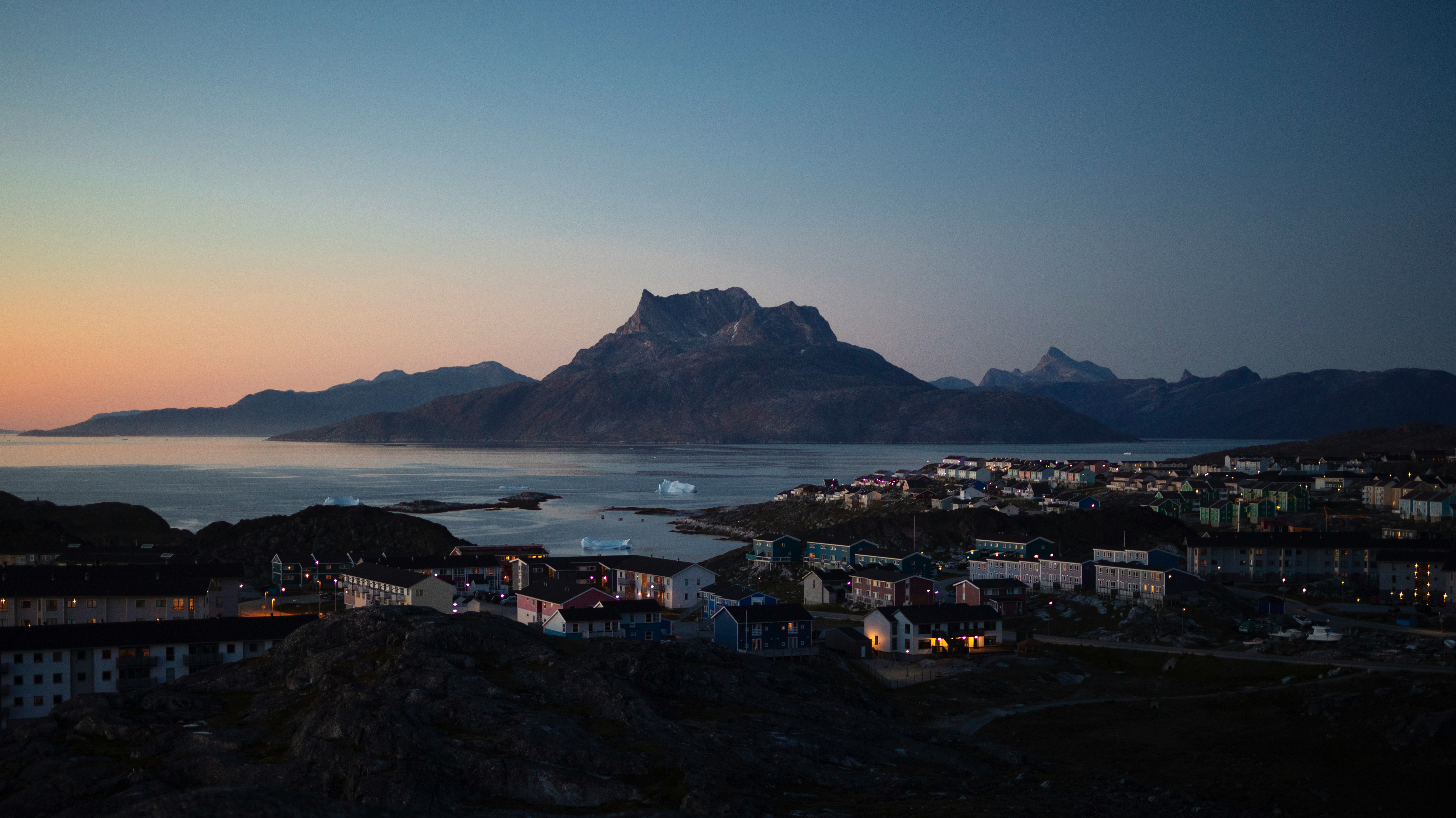
About Nuuk (Godthaab)
Nuuk, meaning “the cape”, was Greenland’s first town (1728). Started as a fort and later mission and trading post some 240 kilometers south of the Arctic Circle, it is the current capital. Almost 30% of Greenland’s population lives in the town. Not only does Nuuk have great natural beauty in its vicinity, but there are Inuit ruins, Hans Egede’s home, the parliament, and the Church of our Saviour as well. The Greenlandic National Museum has an outstanding collection of Greenlandic traditional dresses, as well as the famous Qilakitsoq mummies. The Katuaq Cultural Center’s building was inspired by the undulating Northern Lights and can house 10% of Nuuk’s inhabitants.

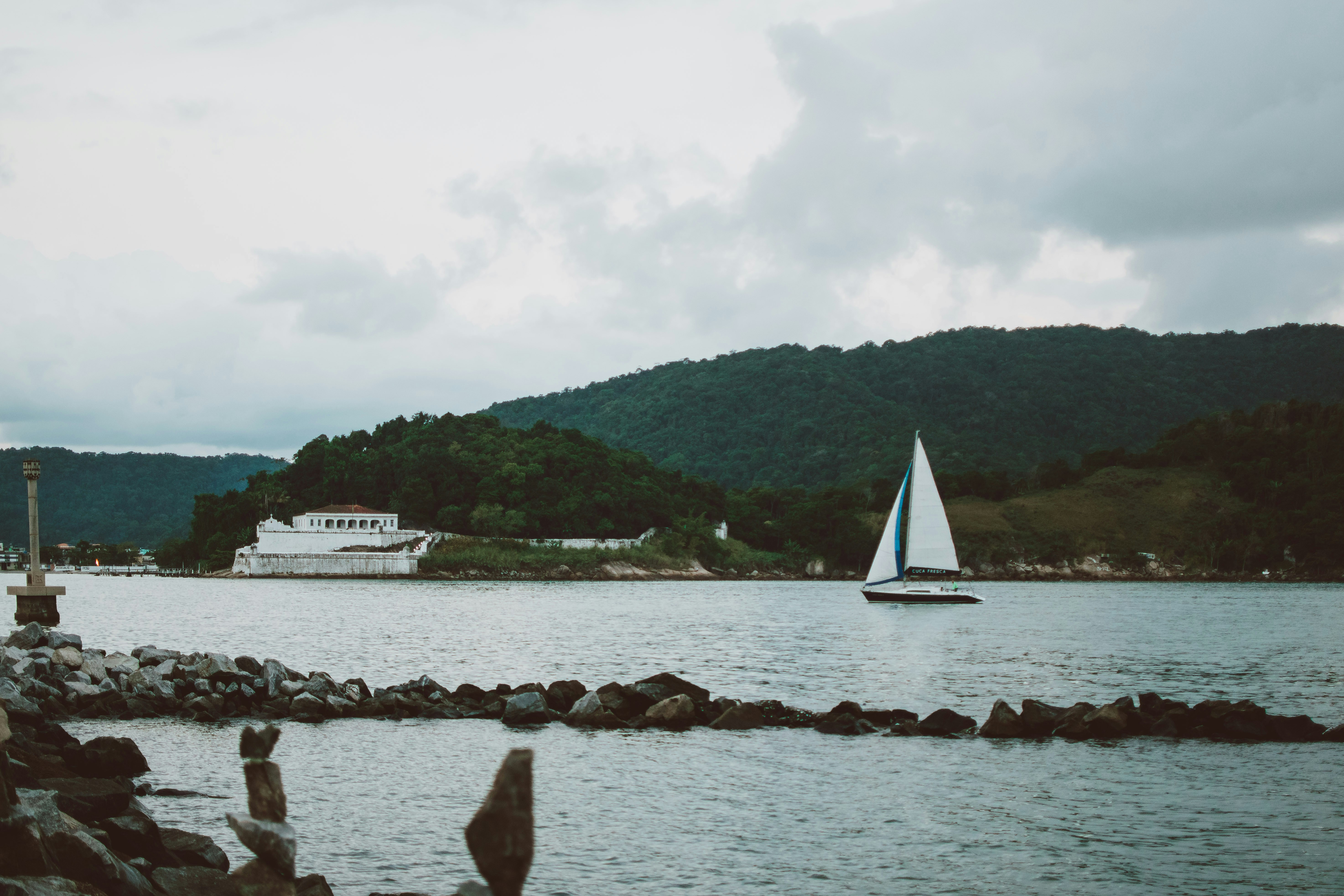
About Santos


About Corner Brook, Newfoundland and Labrador
Newfoundland's fourth-largest city, Corner Brook is the hub of the island's west coast. Hills fringe three sides of the city, which has dramatic views of the harbor and the Bay of Islands. The town is also home to a large paper mill and a branch of Memorial University. Captain James Cook, the British explorer, charted the coast in the 1760s, and a memorial to him overlooks the bay.The town enjoys more clearly defined seasons than most of the rest of the island, and in summer it has many pretty gardens. The nearby Humber River is the best-known salmon river in the province, and there are many kilometers of well-maintained walking trails in the community.


About Saint-John, New Brunswick
Like any seaport worth its salt, Saint John is a welcoming place but, more than that, it is fast transforming into a sophisticated urban destination worthy of the increasing number of cruise ships that dock at its revitalized waterfront. Such is the demand that a second cruise terminal opened in 2012, just two years after the first one, and 2013 will see the two-millionth cruise passenger disembark. All the comings and goings over the centuries have exposed Saint Johners to a wide variety of cultures and ideas, creating a characterful Maritime city with a vibrant artistic community. Visitors will discover rich and diverse cultural products in its urban core, including a plethora of art galleries and antiques shops in uptown.Industry and salt air have combined to give parts of Saint John a weather-beaten quality, but you'll also find lovingly restored 19th-century wooden and redbrick homes as well as modern office buildings, hotels, and shops.The natives welcomed the French explorers Samuel de Champlain and Sieur de Monts when they landed here on St. John the Baptist Day in 1604. Then, nearly two centuries later, in May 1783, 3,000 British Loyalists fleeing the aftermath of the American Revolutionary War poured off a fleet of ships to make a home amid the rocks and forests. Two years later the city of Saint John became the first in Canada to be incorporated.Although most of the Loyalists were English, there were some Irish among them. After the Napoleonic Wars in 1815, thousands more Irish workers found their way to Saint John. It was the Irish potato famine of 1845 to 1852, though, that spawned the largest influx of Irish immigrants, and today a 20-foot Celtic cross on Partridge Island at the entrance to St. John Harbour stands as a reminder of the hardships and suffering they endured. Their descendants make Saint John Canada's most Irish city, a fact that's celebrated in grand style each March with a weeklong St. Patrick's celebration.The St. John River, its Reversing Rapids, and Saint John Harbour divide the city into eastern and western districts. The historic downtown area (locally known as "uptown") is on the east side, where an ambitious urban-renewal program started in the early 1980s has transformed the downtown waterfront. Older properties have been converted into trendy restaurants and shops, while glittering new apartment and condo buildings will take full advantage of the spectacular view across the bay. Harbour Passage, a redbrick walking and cycling path with benches and lots of interpretive information, begins downtown at Market Square and winds along the waterfront all the way to the Reversing Rapids. A shuttle boat between Market Square and the falls means you have to walk only one way. On the lower west side, painted-wood homes with flat roofs—characteristic of Atlantic Canadian seaports—slope to the harbor. Industrial activity is prominent on the west side, which has stately older homes on huge lots.Regardless of the weather, Saint John is a delightful city to explore, as so many of its key downtown attractions are linked by enclosed overhead pedways known as the "Inside Connection."

About Bar Harbor, Maine
A resort town since the 19th century, Bar Harbor is the artistic, culinary, and social center of Mount Desert Island. It also serves visitors to Acadia National Park with inns, motels, and restaurants. Around the turn of the last century the island was known as the summer haven of the very rich because of its cool breezes. The wealthy built lavish mansions throughout the island, many of which were destroyed in a huge fire that devastated the island in 1947, but many of those that survived have been converted into businesses. Shops are clustered along Main, Mount Desert, and Cottage streets. Take a stroll down West Street, a National Historic District, where you can see some fine old houses.The island and the surrounding Gulf of Maine are home to a great variety of wildlife: whales, seals, eagles, falcons, ospreys, and puffins (though not right offshore here), and forest dwellers such as deer, foxes, coyotes, and beavers.

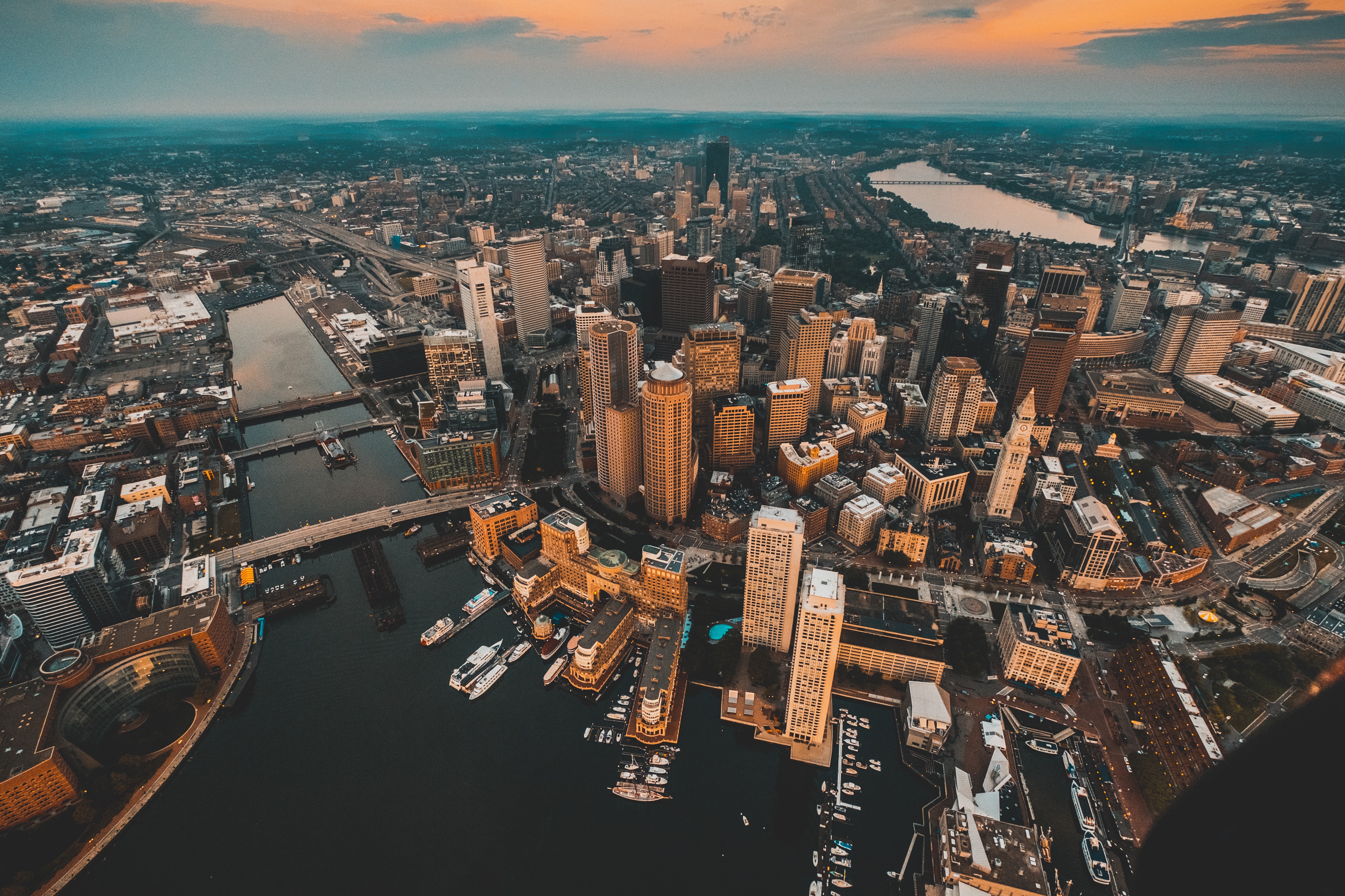
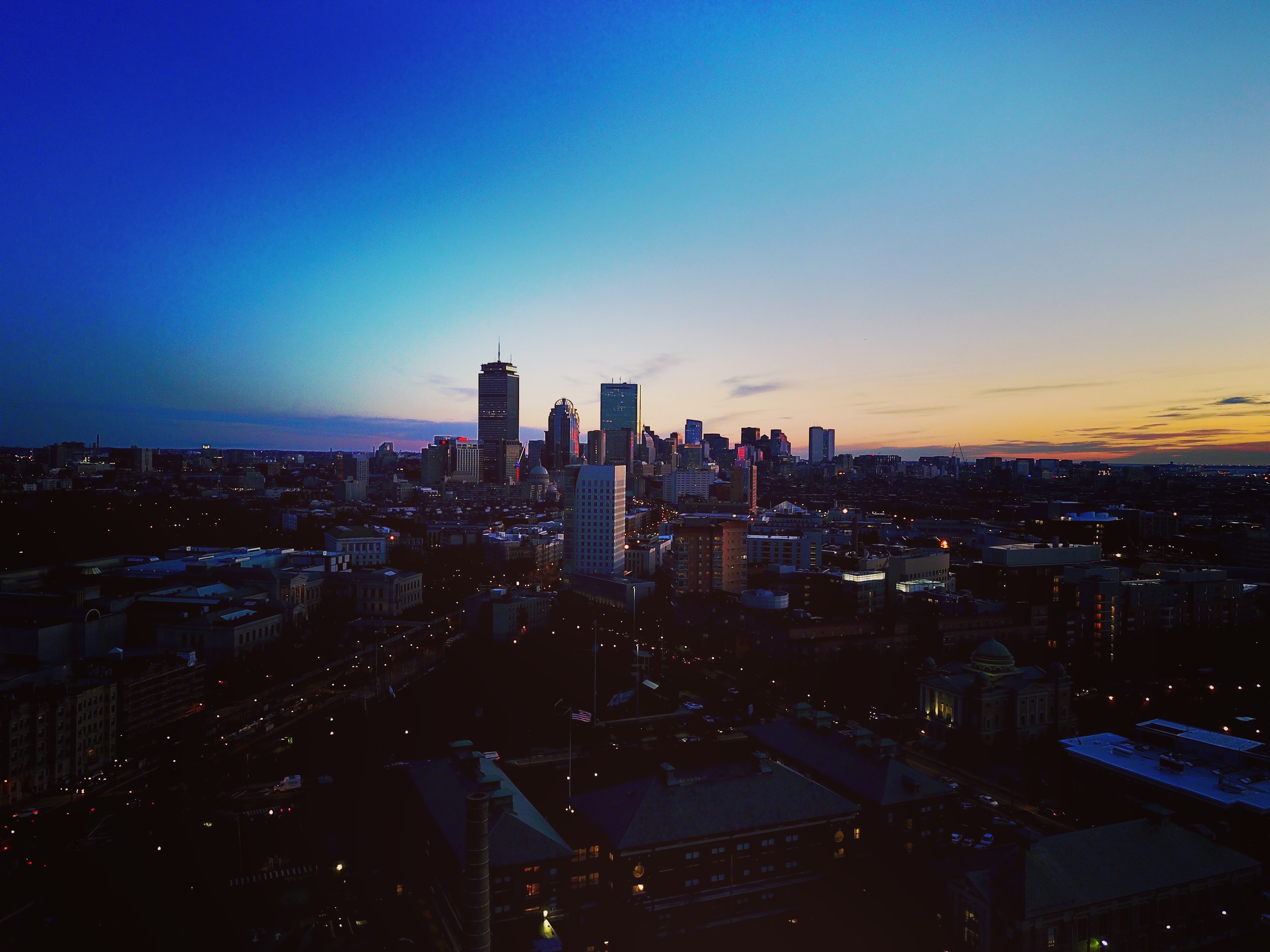
About Boston, Massachusetts
There’s history and culture around every bend in Boston—skyscrapers nestle next to historic hotels while modern marketplaces line the antique cobblestone streets. But to Bostonians, living in a city that blends yesterday and today is just another day in beloved Beantown.

About Martha's Vineyard, Massachusetts


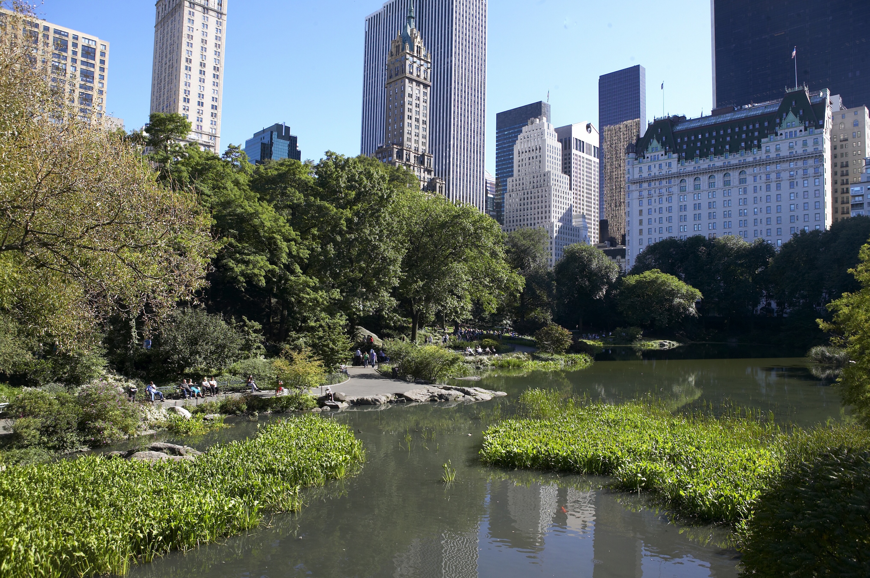
About New York, New York
From Wall Street's skyscrapers to the neon of Times Square to Central Park's leafy paths, New York City pulses with an irrepressible energy. History meets hipness in this global center of entertainment, fashion, media, and finance. World-class museums like MoMA and unforgettable icons like the Statue of Liberty beckon, but discovering the subtler strains of New York's vast ambition is equally rewarding: ethnic enclaves and shops, historic streets of dignified brownstones, and trendy bars and eateries all add to the urban buzz.


Where You'll Go


