Amazon To Caribbean Gems
Amazon To Caribbean Gems
Cruise overview
WHY BOOK WITH US?
- ✔ The Deluxe Cruises’ team has extensive experience in ultra-luxury cruising.
- ✔ Call now to speak to our helpful and experienced Cruise Concierge team.
- ✔ Enjoy our Unique Deluxe Cruises Bonus for substantial savings.
- ✔ Our team will tailor your holiday to your exacting requirements.
- ✔ As agents, we work under the protection of each cruise lines ABTA / ATOL licences
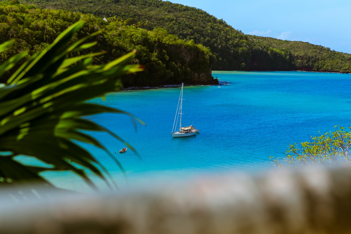
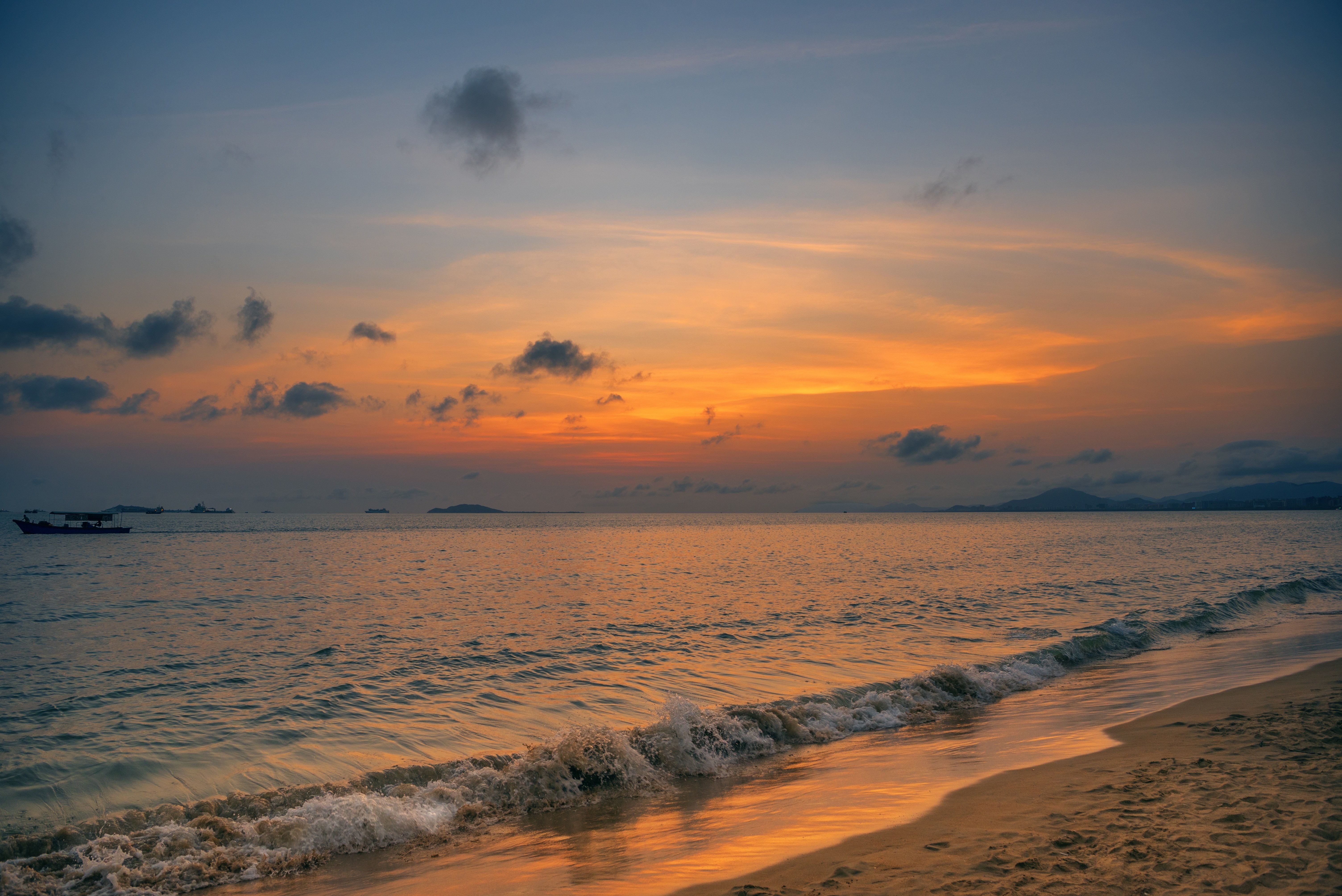
About Bridgetown
Located beside the island’s only natural harbour, the capital of Barbados combines modern and colonial architecture with glorious palm tree-lined beaches and a number of historical attractions. Experience the relaxed culture of the city renowned for its British-style parliament buildings and vibrant beach life, and seek out the Anglican church and the 19th-century Barbados Garrison. The distance between the ship and your tour vehicle may vary. This distance is not included in the excursion grades.
About Santarém
About Parintins
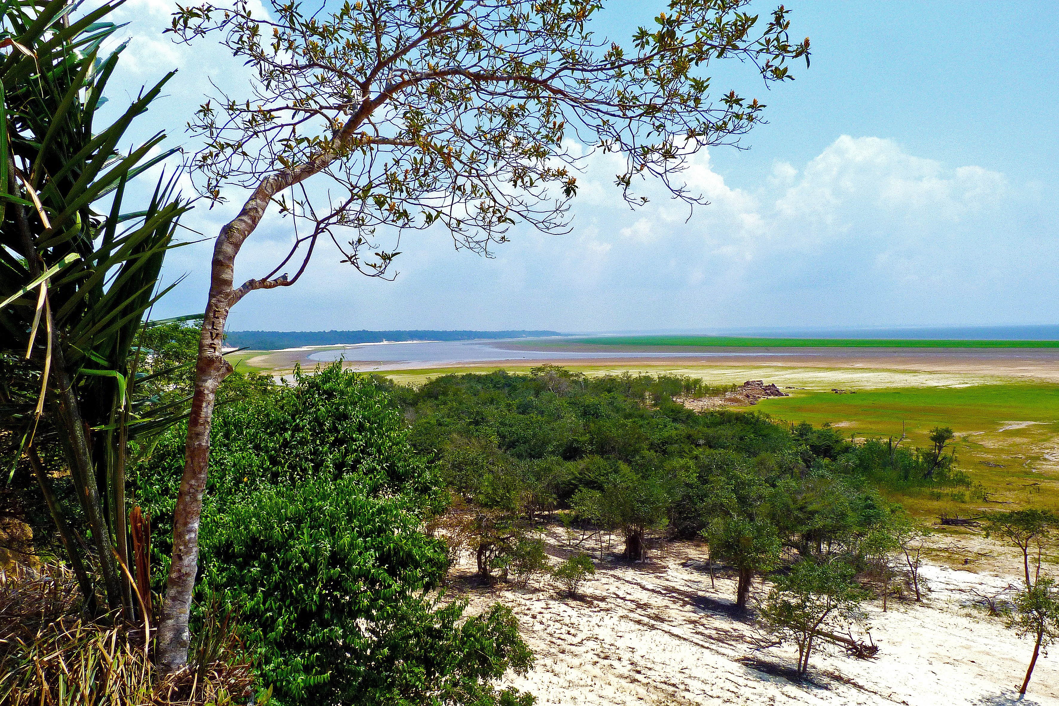
About Manaus
A hidden metropolis inside of the Amazon Rainforest in Brazil, this city is both modern and exciting, yet untouched by the world beyond the jungle. Visit its historical Rubber Museums or stop by the Park of Mindu and catch glimpse of the endangered Pied Tamarin.
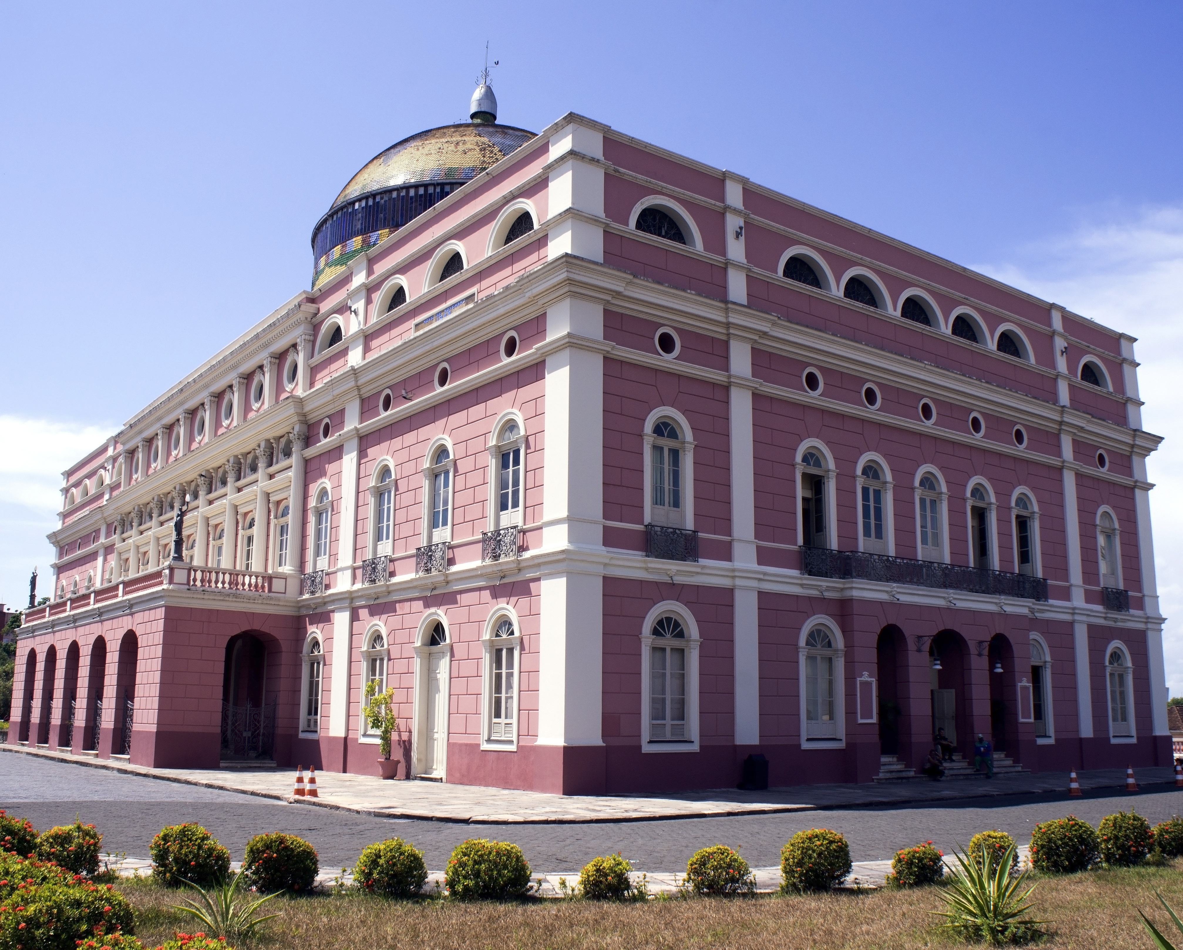
About Manaus
A hidden metropolis inside of the Amazon Rainforest in Brazil, this city is both modern and exciting, yet untouched by the world beyond the jungle. Visit its historical Rubber Museums or stop by the Park of Mindu and catch glimpse of the endangered Pied Tamarin.
About Boca de Valeria
About Alter do Chão
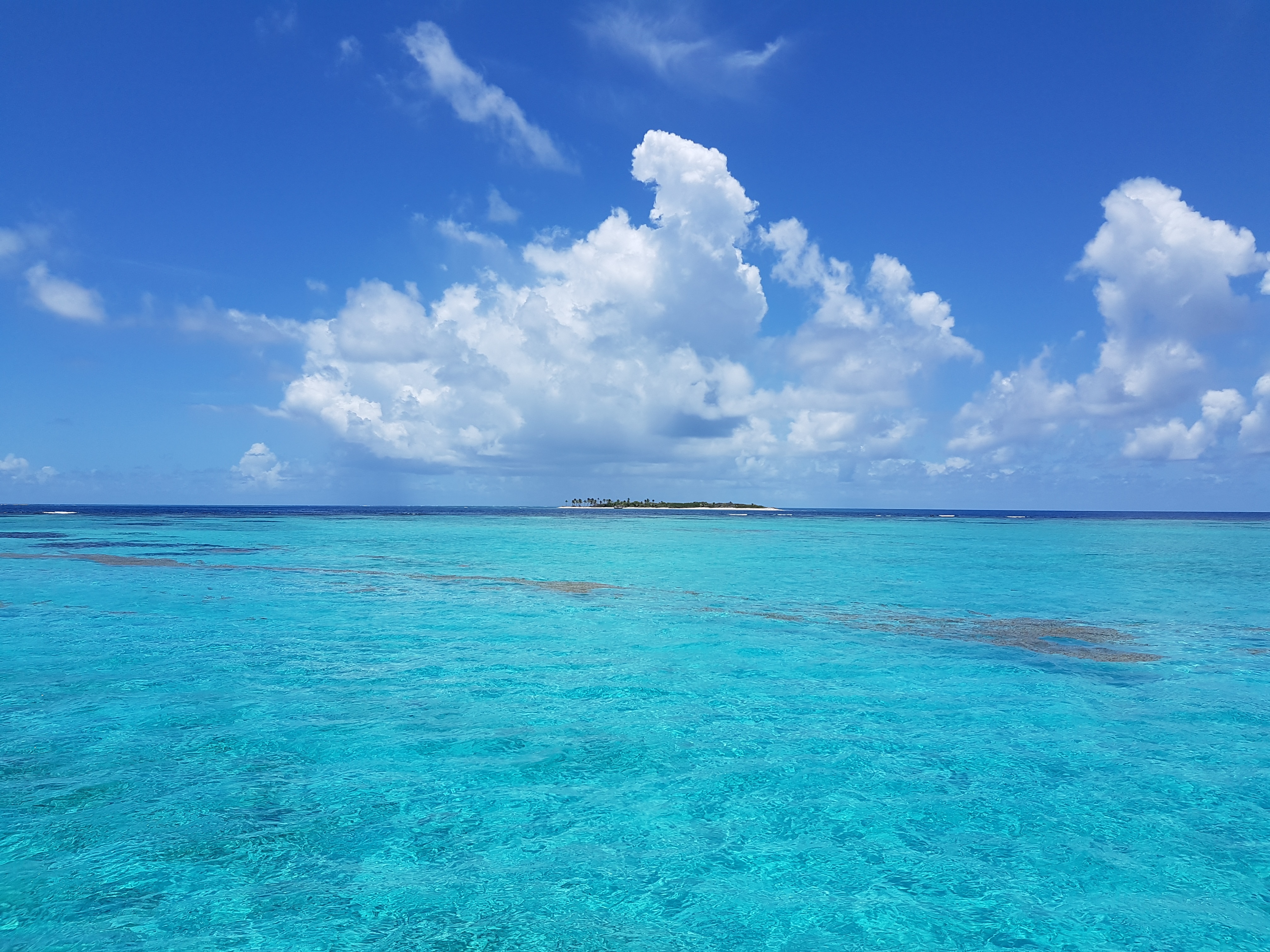
About Devil's Island
Discarded off the coast of French Guiana, lies an ominous, key-shaped island of sharp rocks and swaying palm trees - Devil's Island. As the site of one of history’s most infamous and feared prisons, the island's reputation as hell on earth was well earned, having been used to brutally imprison, torture and punish the French Empire's most notorious criminals. Closed down in 1953, it now lies in an eerie purgatory, and the sense of unease as you approach it is hard to avoid, with its laden-coconut trees duplicitously waving you ashore.
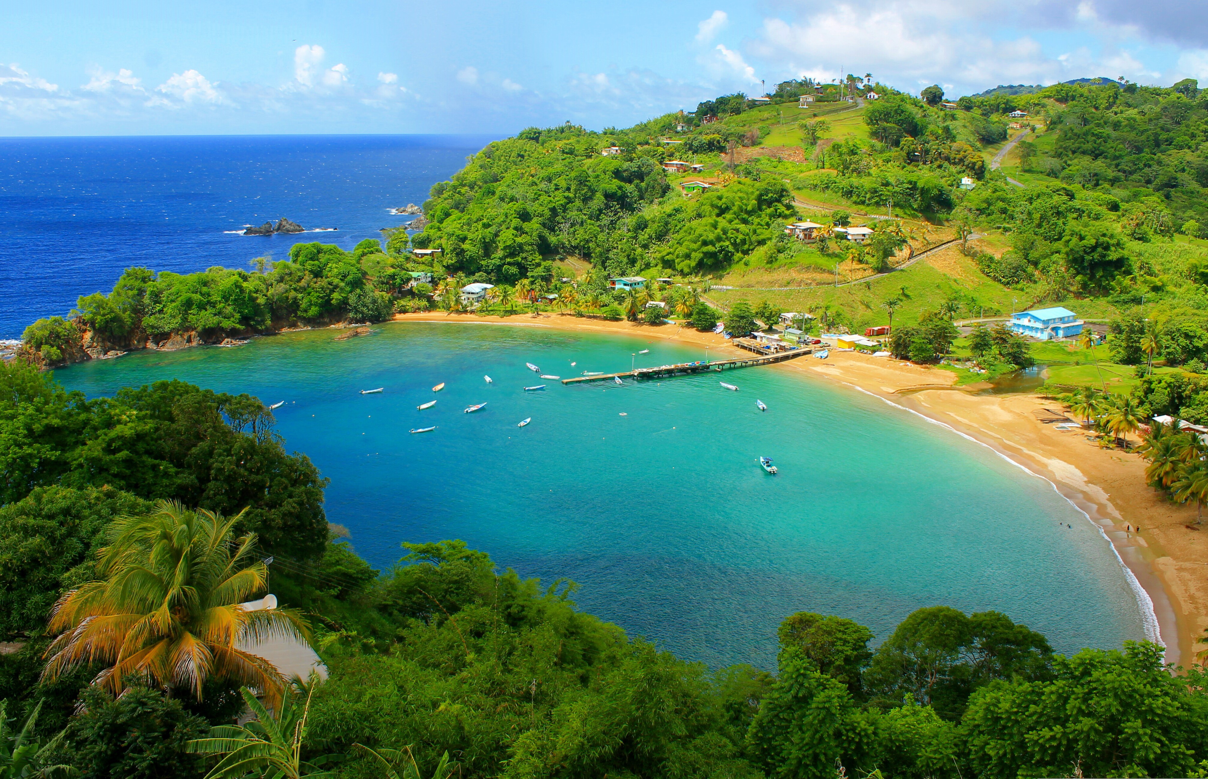
About Scarborough
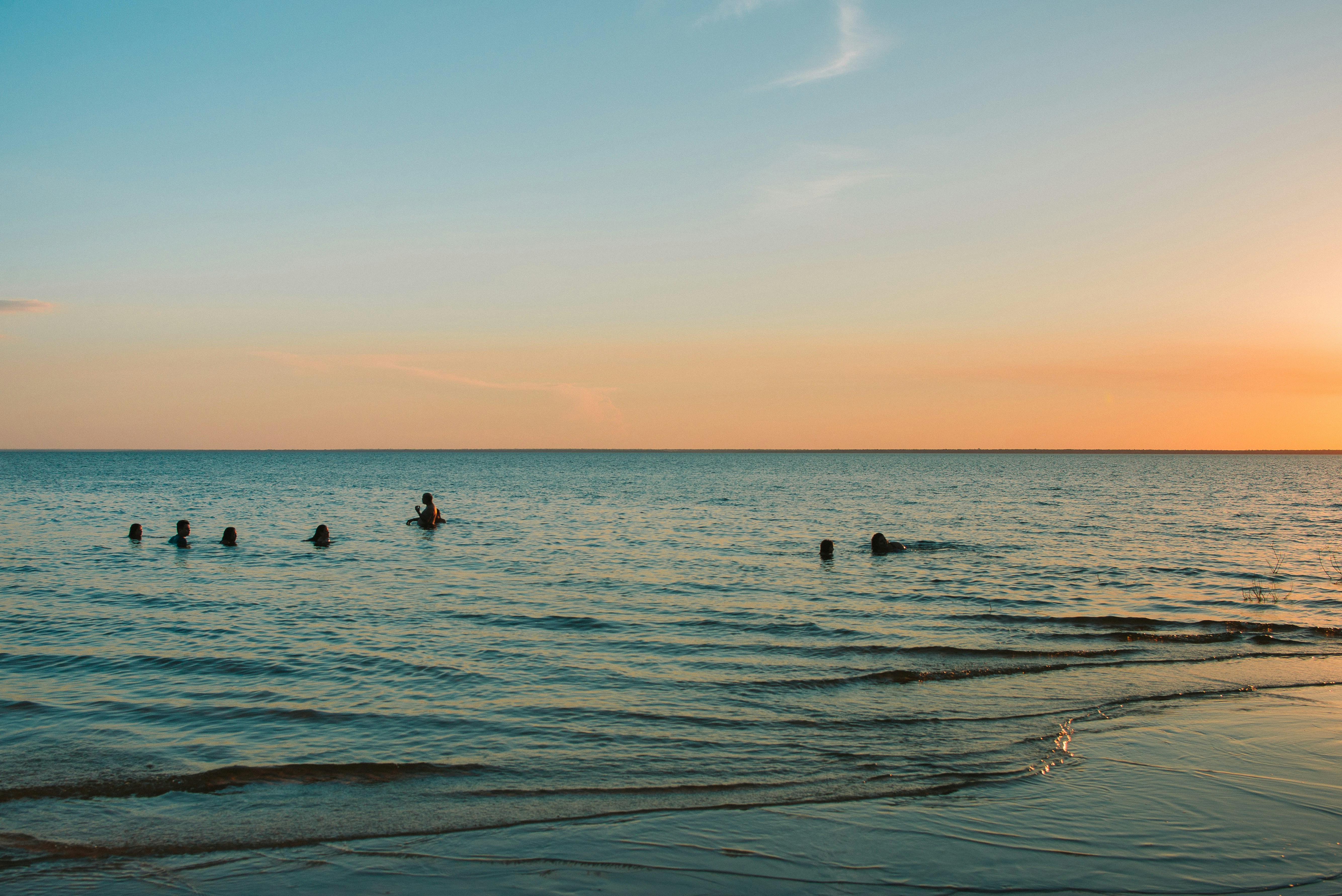
Together, the islands of Trinidad and Tobago make up a state and as such are an independent member of the British Commonwealth. Located just off the coast of Venezuela, both islands are excellent getaways offering different attractions. While Trinidad pulses with life, the smaller and unspoiled island of Tobago is the place for a restful and relaxing holiday. Most of its appeal lies in the beautiful scenery and the availability of outdoor activities. The tourist area is concentrated on the southwestern end, about six miles from the island’s capital of Scarborough. The recently completed deep water harbor with its new cruise terminal has helped to spruce up the town a bit. Although not warranting an extended visit, Scarborough features interesting Botanic Gardens, a few historical buildings and the well-maintained Fort King George, located above the town. The primary appeal, however, lies without doubt in the great outdoors - swimming, snorkeling, diving, fishing, golfing, playing tennis or simply relaxing on Tobago's glorious beaches.
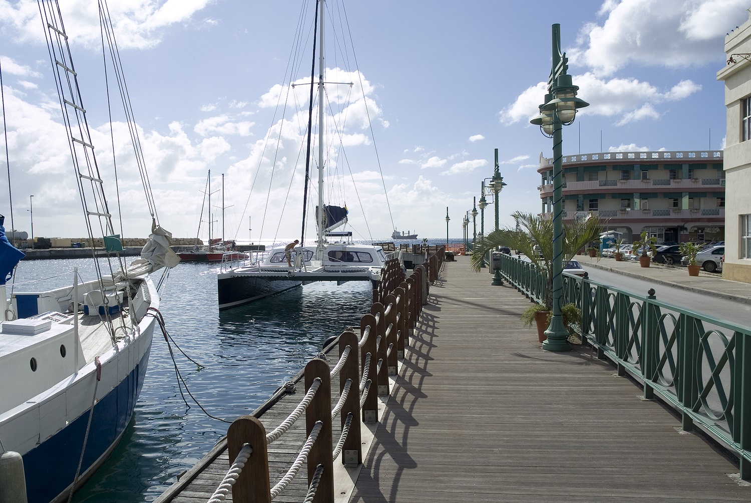
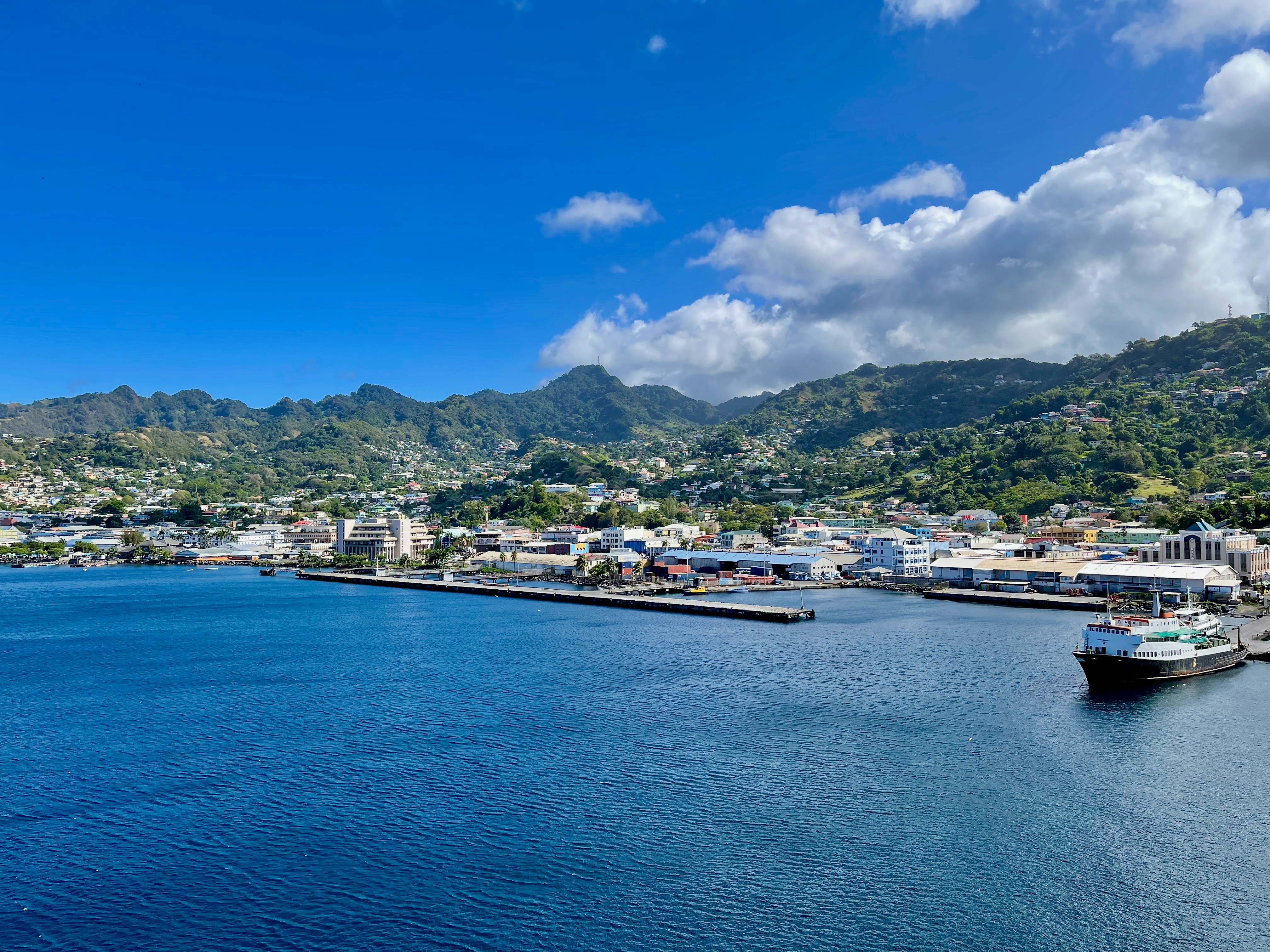
About Port-of-Spain
Port of Spain is a seaport on the north-west coast of the island of Trinidad. The capital and commercial centre of Trinidad and Tobago, Port of Spain has architecture from around the world from Hindu temples to gingerbread Rococo. Trinidad, home of the carnival and the steel band, is an astonishing melting-pot of people and cultures - including African, Oriental, Indian, European and New World. It is also home to an interesting array of South American flora, as well as more than 400 species of birds, some of which can be seen if you visit the Asa Wright Nature Reserve. A Native American village known as Conquerabia occupied the site when the Spanish settled in the area in 1595 and renamed the community 'Puerto de España'. After the British took control of the island in 1797, the settlement's name was anglicised to Port of Spain. The city served as the capital of the Federation of the West Indies from 1958 to 1962, before the grouping was dissolved.
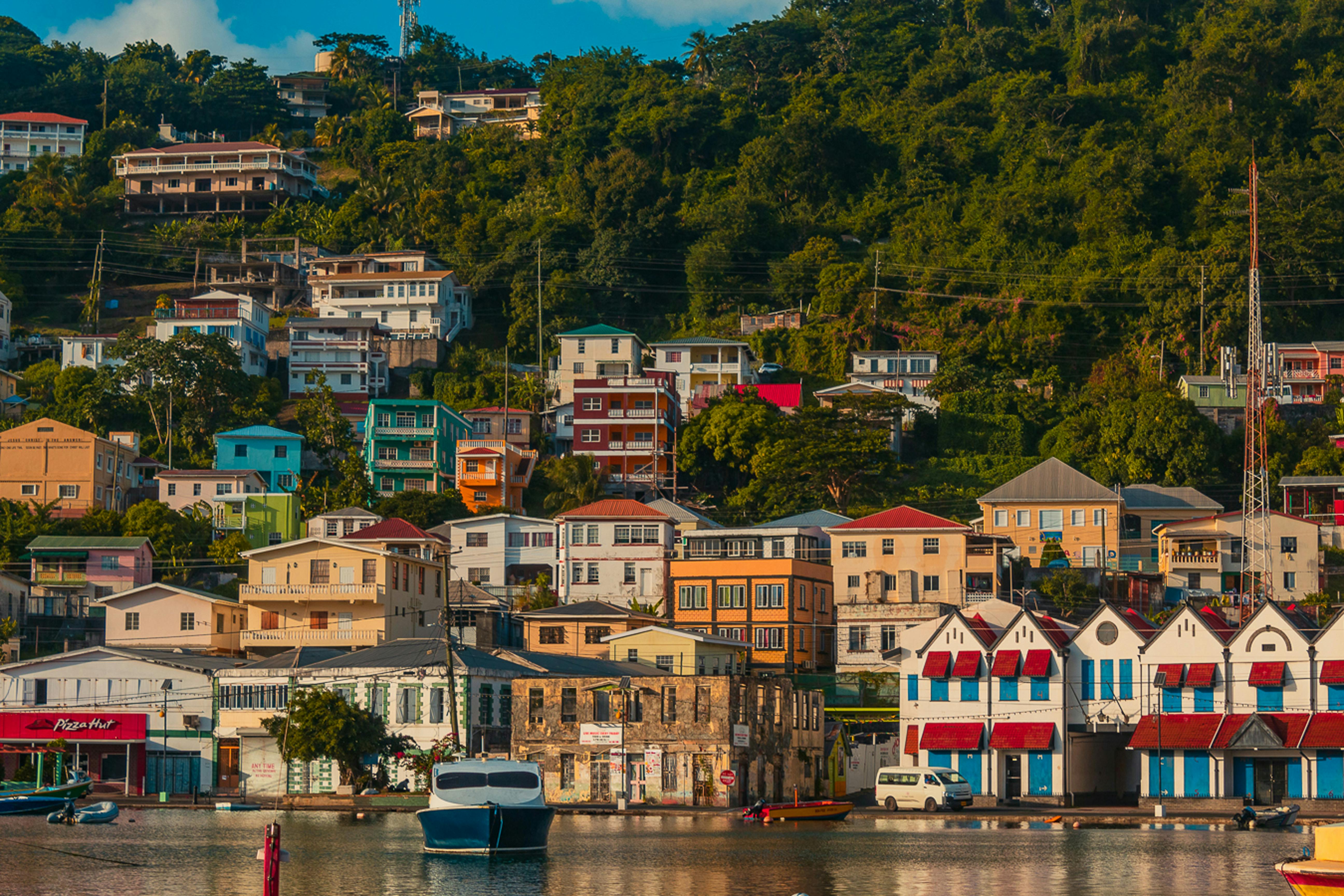
About Saint George's
Nutmeg, cinnamon, cloves, cocoa those heady aromas fill the air in Grenada (pronounced gruh-nay-da). Only 21 miles (33½ km) long and 12 miles (19½ km) wide, the Isle of Spice is a tropical gem of lush rain forests, white-sand beaches, secluded coves, exotic flowers, and enough locally grown spices to fill anyone's kitchen cabinet. St. George's is one of the most picturesque capital cities in the Caribbean, St. George's Harbour is one of the most picturesque harbors, and Grenada's Grand Anse Beach is one of the region's finest beaches. The island has friendly, hospitable people and enough good shopping, restaurants, historic sites, and natural wonders to make it a popular port of call. About one-third of Grenada's visitors arrive by cruise ship, and that number continues to grow each year. Grenada's capital is a bustling West Indian city, much of which remains unchanged from colonial days. Narrow streets lined with shops wind up, down, and across steep hills. Brick warehouses cling to the waterfront, and pastel-painted homes rise from the waterfront and disappear into steep green hills. The horseshoe-shaped St. George's Harbour, a submerged volcanic crater, is arguably the prettiest harbor in the Caribbean. Schooners, ferries, and tour boats tie up along the seawall or at the small dinghy dock. The Carenage (pronounced car-a-nahzh), which surrounds the harbor, is the capital's center. Warehouses, shops, and restaurants line the waterfront. The Christ of the Deep statue that sits on the pedestrian plaza at the center of The Carenage was presented to Grenada by Costa Cruise Line in remembrance of its ship, Bianca C, which burned and sank in the harbor in 1961 and is now a favorite dive site. An engineering feat for its time, the 340-foot-long Sendall Tunnel was built in 1895 and named for Walter Sendall, an early governor. The narrow tunnel, used by both pedestrians and vehicles, separates the harbor side of St. George's from the Esplanade on the bay side of town, where you can find the markets (produce, meat, and fish), the Cruise Ship Terminal, the Esplanade Mall, and the public bus station.
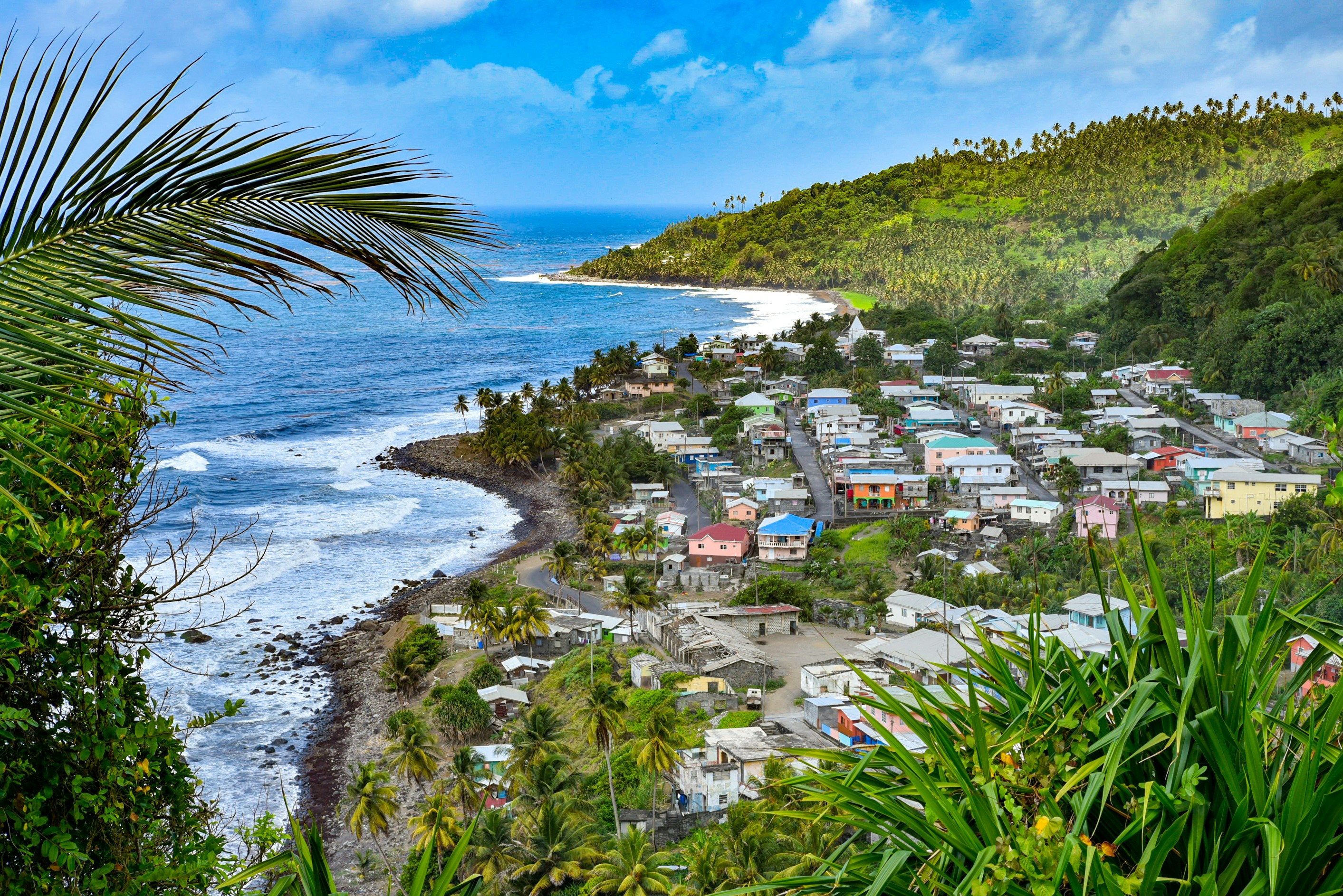
About Kingstown
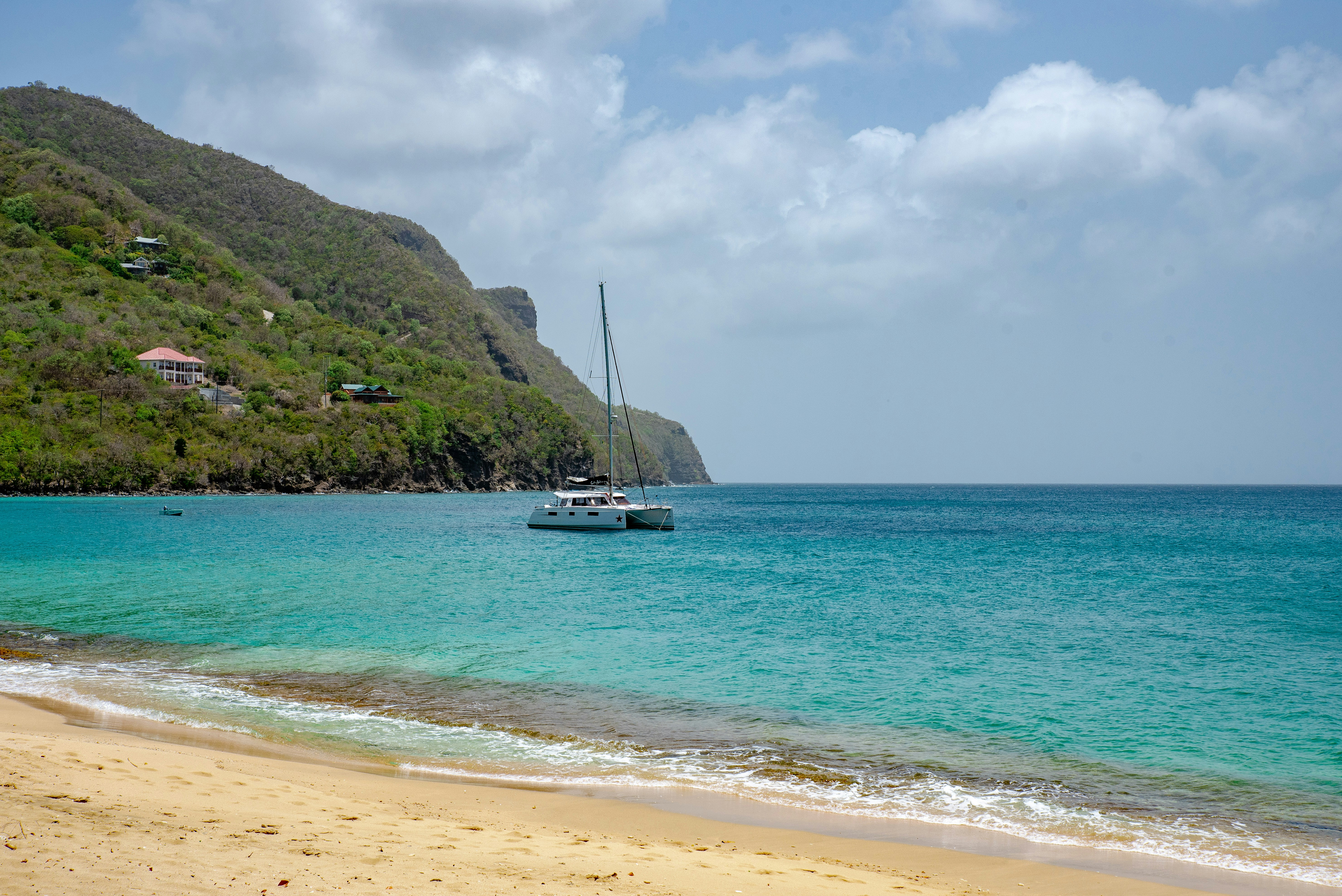
About Castries
The typical image of a lush tropical paradise comes to life on the friendly island of St Lucia. Despite its small size – just 27 miles long and 14 miles wide – St Lucia is rich in natural splendour with dense emerald rainforest, banana plantations and orchards of coconut, mango and papaya trees. The twin peaks of Les Pitons, now a UNESCO World Heritage Site rise dramatically 2,000 feet into the sky and dominate the island. Look out for unusual birds with brilliant plumage such as the St Lucia parrot, see a surprising diversity of exotic flora and enjoy the warm hospitality of the islanders in the small villages and open-air markets. Please be aware that St Lucia is a small, mountainous island, with steep, winding and bumpy roads. Customers with back and neck problems should take this into consideration when booking an excursion.
About Bridgetown
Located beside the island’s only natural harbour, the capital of Barbados combines modern and colonial architecture with glorious palm tree-lined beaches and a number of historical attractions. Experience the relaxed culture of the city renowned for its British-style parliament buildings and vibrant beach life, and seek out the Anglican church and the 19th-century Barbados Garrison. The distance between the ship and your tour vehicle may vary. This distance is not included in the excursion grades.
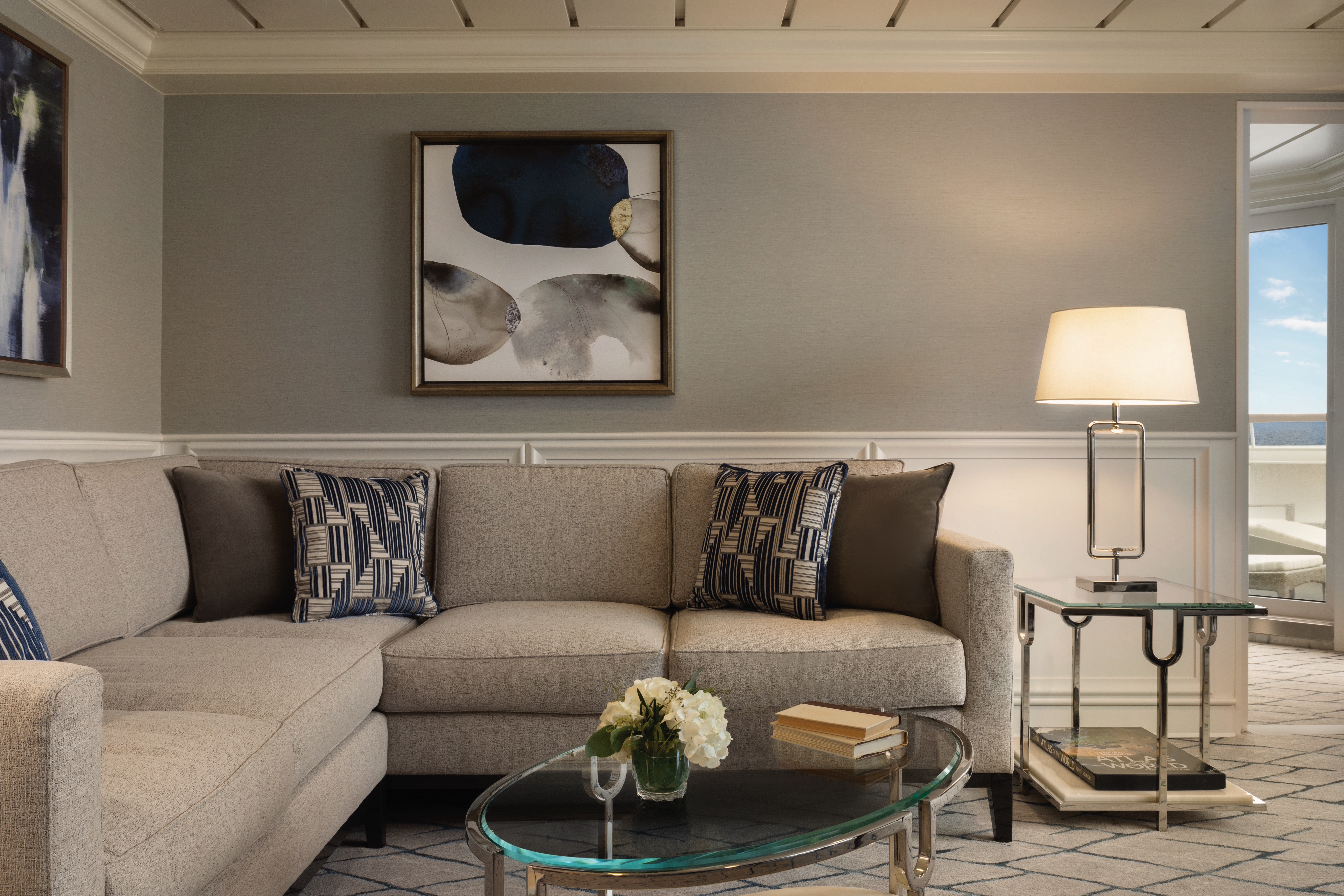
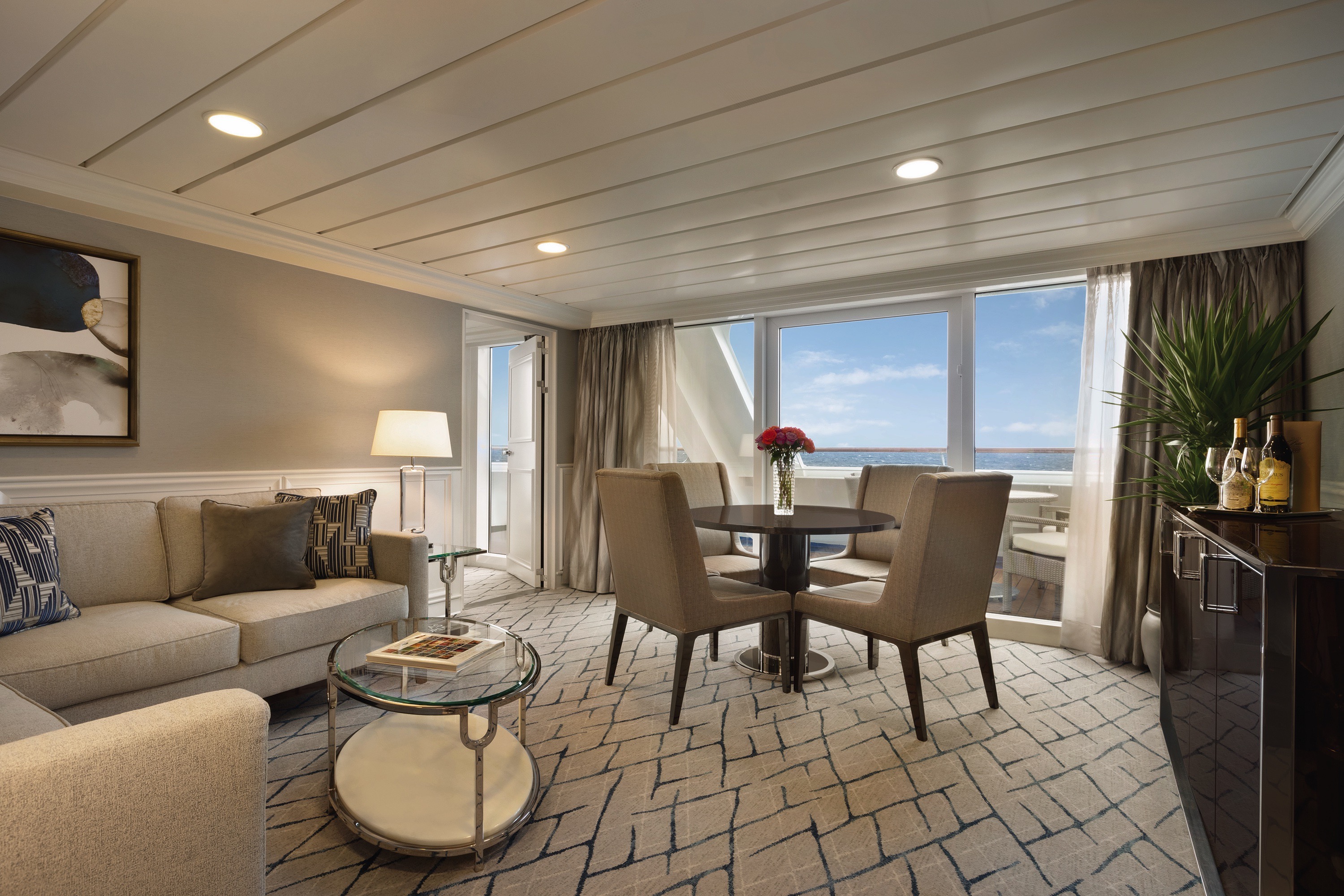
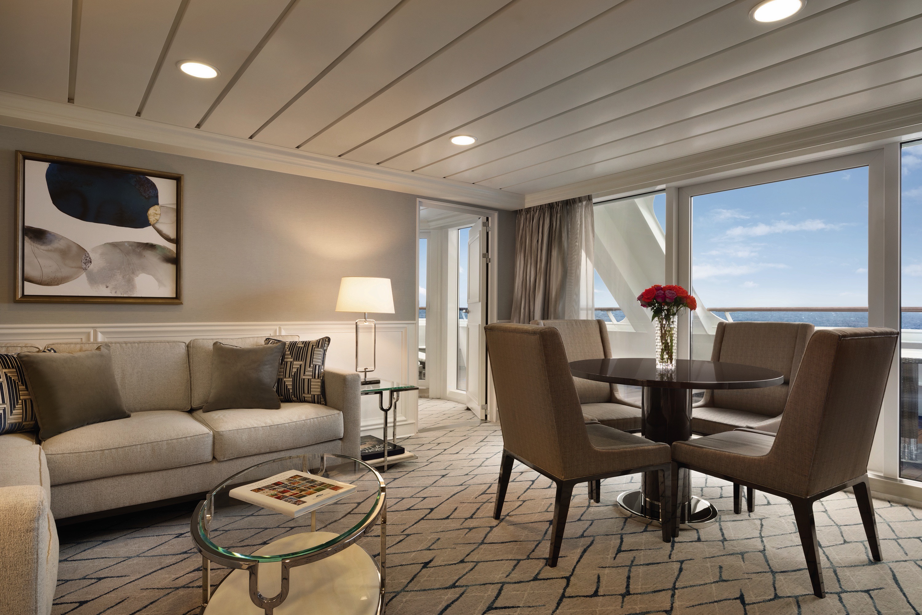
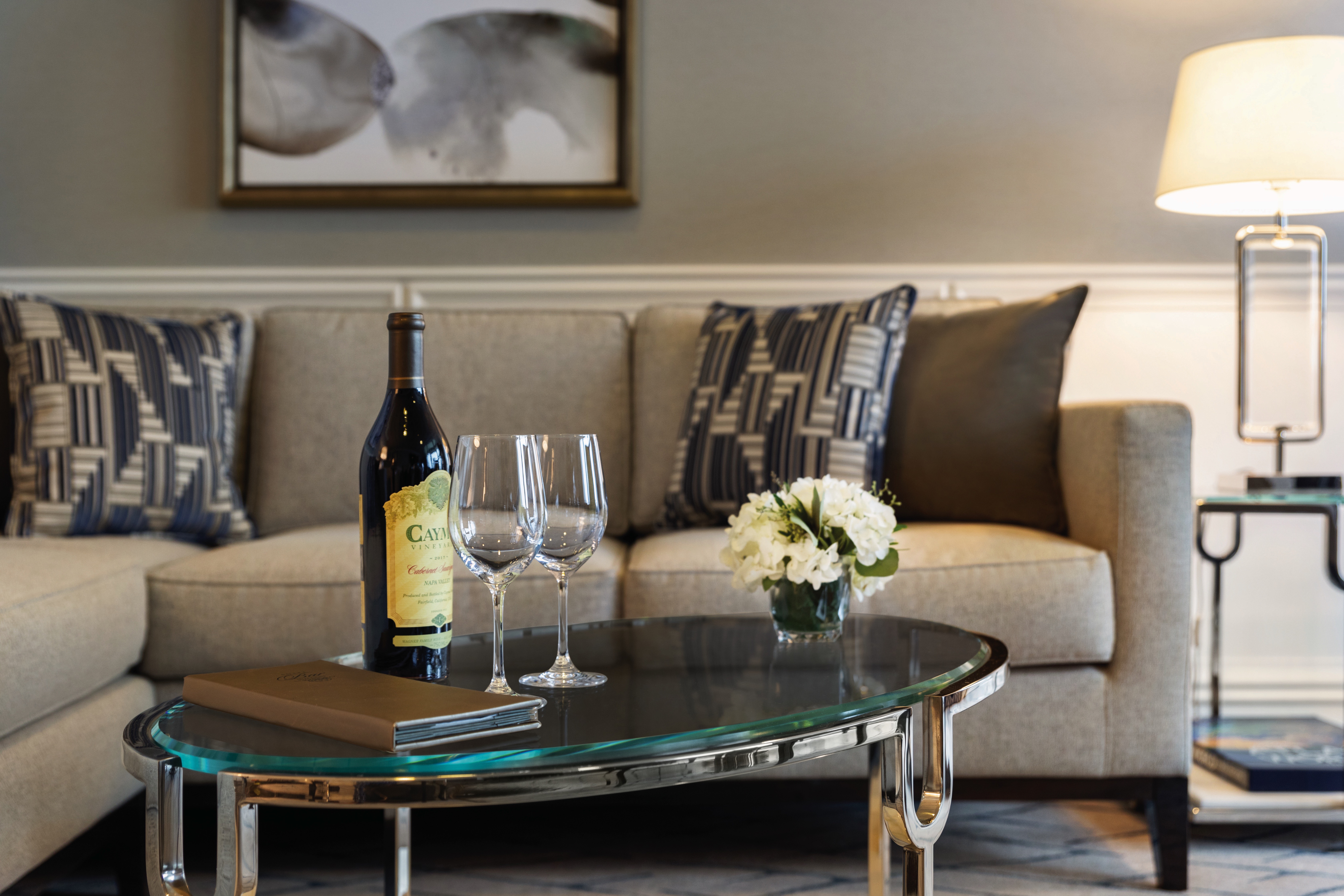
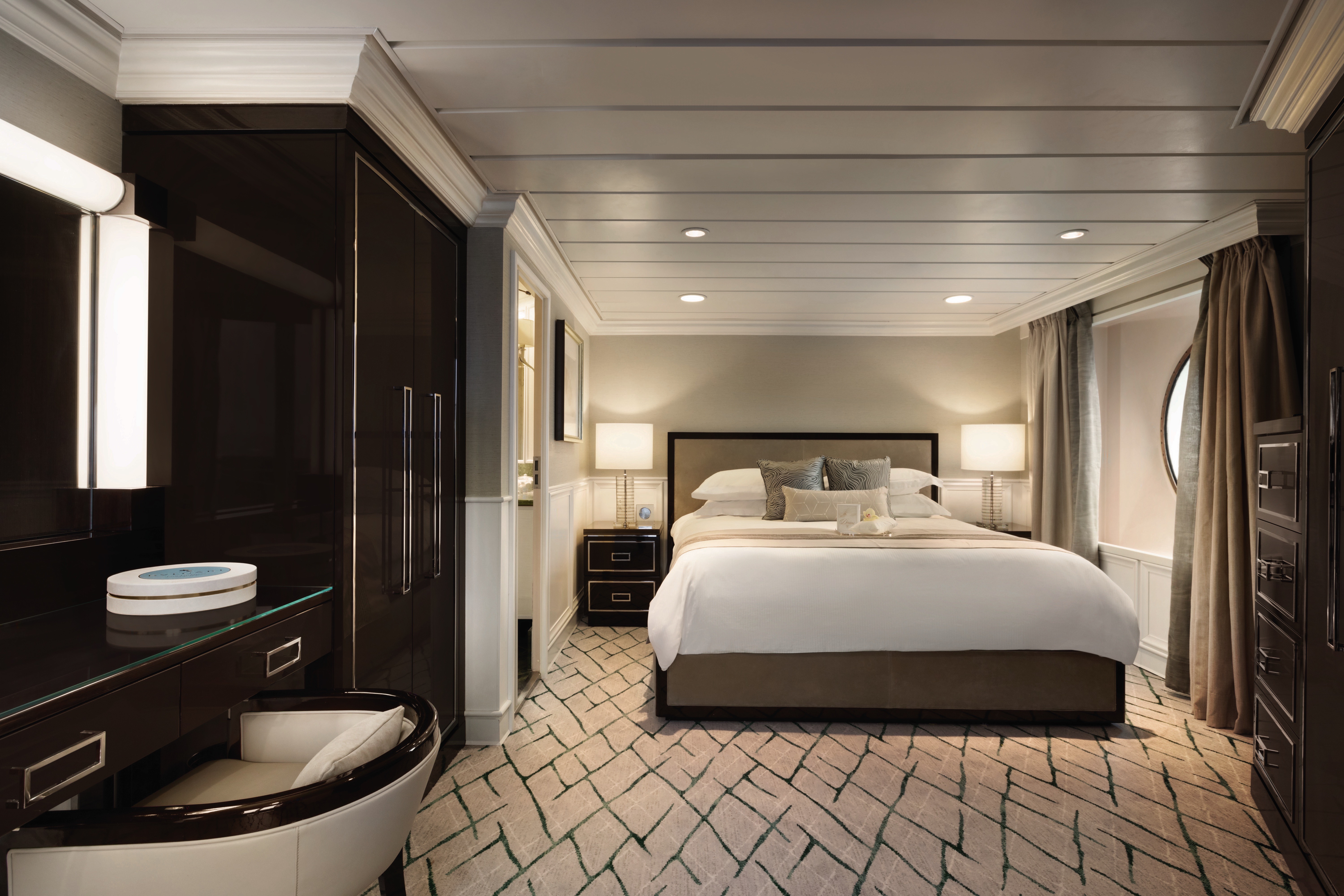
Lavish new fabrics and designer furnishings grace our six new Owner’s Suites – always among the first to be reserved. Immensely spacious and exceptionally luxurious, these suites span nearly 1,000 square feet and are oases of quietude and relaxation. Every imaginable amenity is found here, further enhanced by a sumptuous re-designed bathroom with an oversized shower, a private teak veranda and two flat-screen televisions.
Owner's Suite Privileges
In addition to Stateroom Amenities
- FREE laundry service – up to 3 bags per stateroom+
- Priority 11 am ship embarkation with priority luggage delivery
- 24-hour Butler service
- Optional private in-suite embarkation day lunch from noon to 2 pm
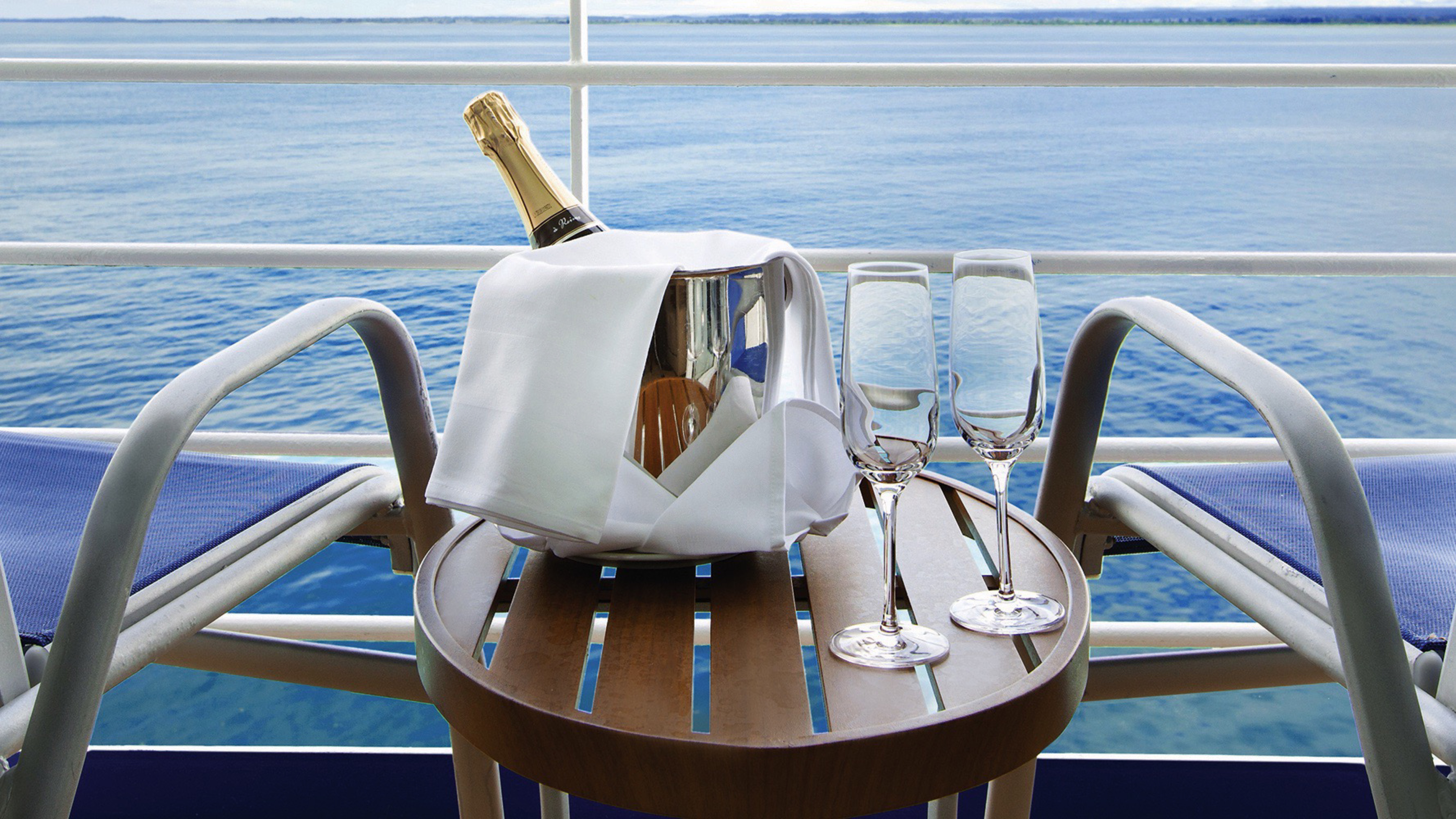
- Complimentary in-suite bar setup with 6 full-size bottles of premium spirits and wines from our suite beverage menu
- Complimentary welcome bottle of Champagne
- Fresh fruit basket replenished daily
- Priority online specialty restaurant reservations
- Unlimited access to the Aquamar Spa Terrace
- iPad® upon request for your enjoyment on board++
- Customized entertainment system
- Bulgari gift set and variety of amenities
- Choice of daily printed newspaper
- Complimentary Oceania Cruises logo tote bag and personalized stationery
- Cashmere lap blankets, perfect for relaxing on your veranda
- Choice of pillow from a luxurious selection
- Complimentary shoeshine service
- Complimentary pressing of garments upon embarkation++
+Up to 20 garments per laundry bag; additional restrictions apply.
++Certain limitations apply.
Smoking in suites, staterooms and on verandas is strictly prohibited.

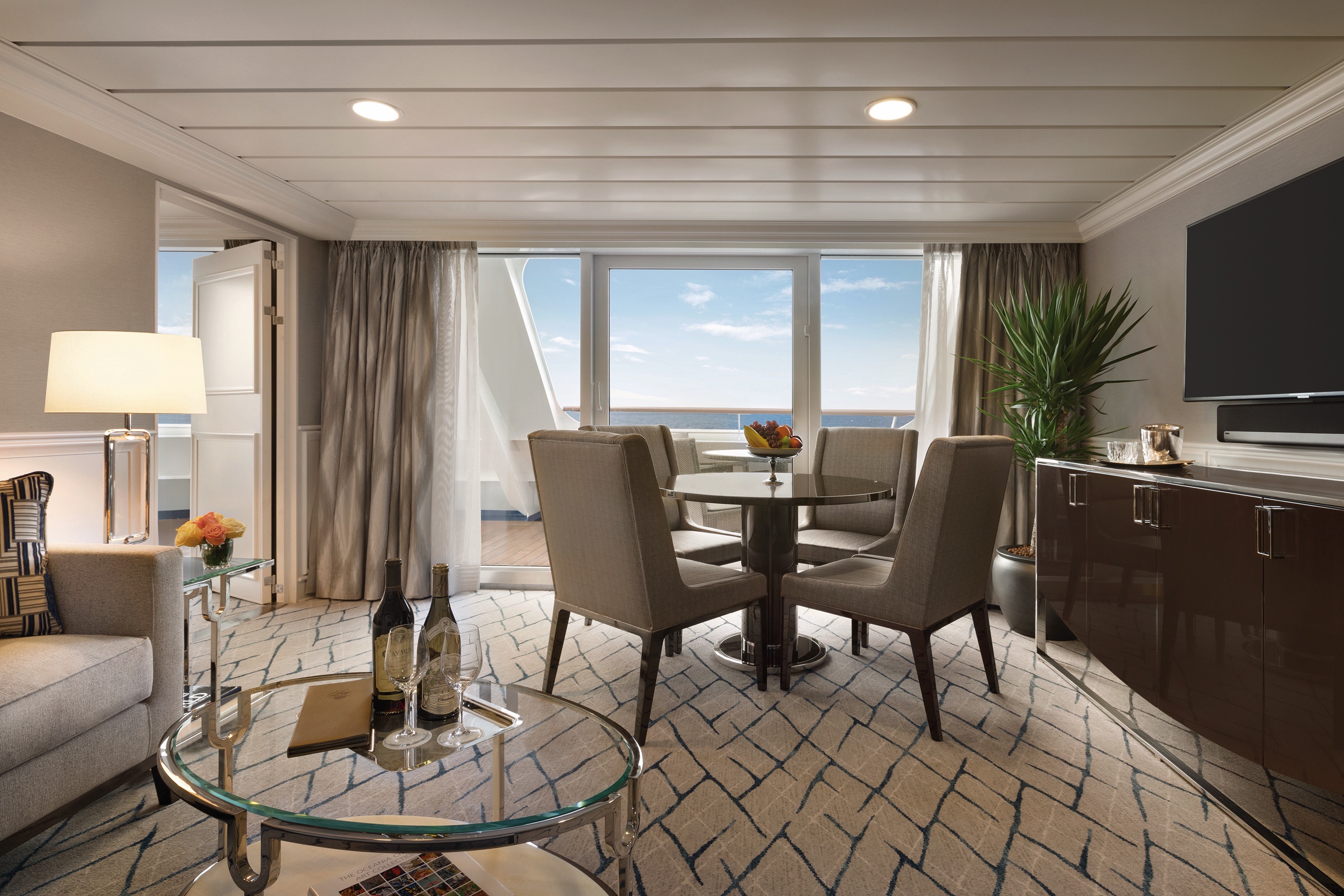
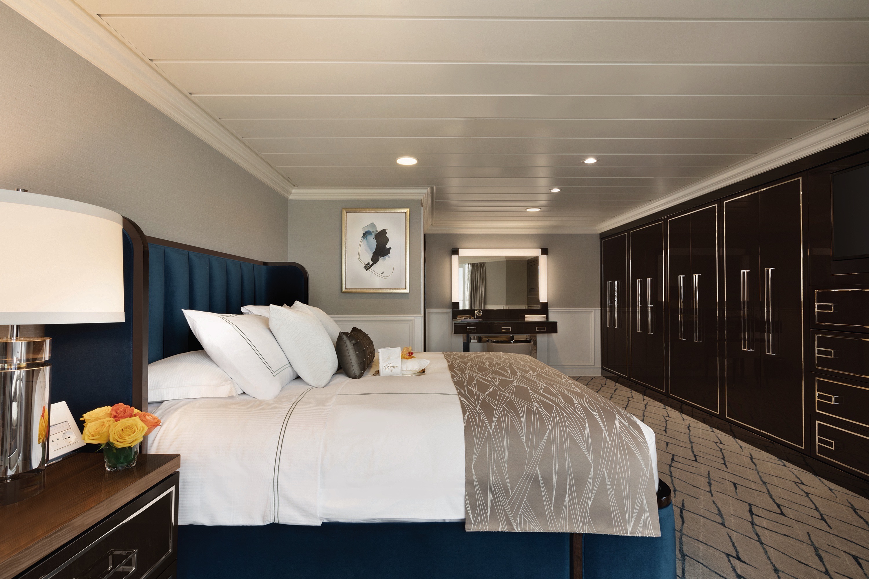
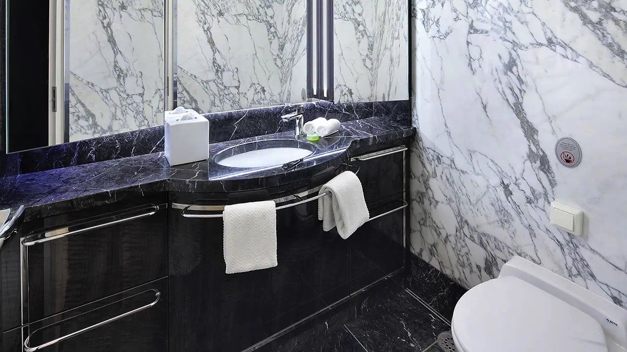
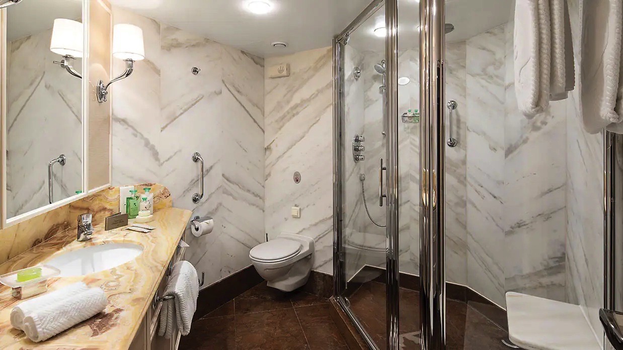
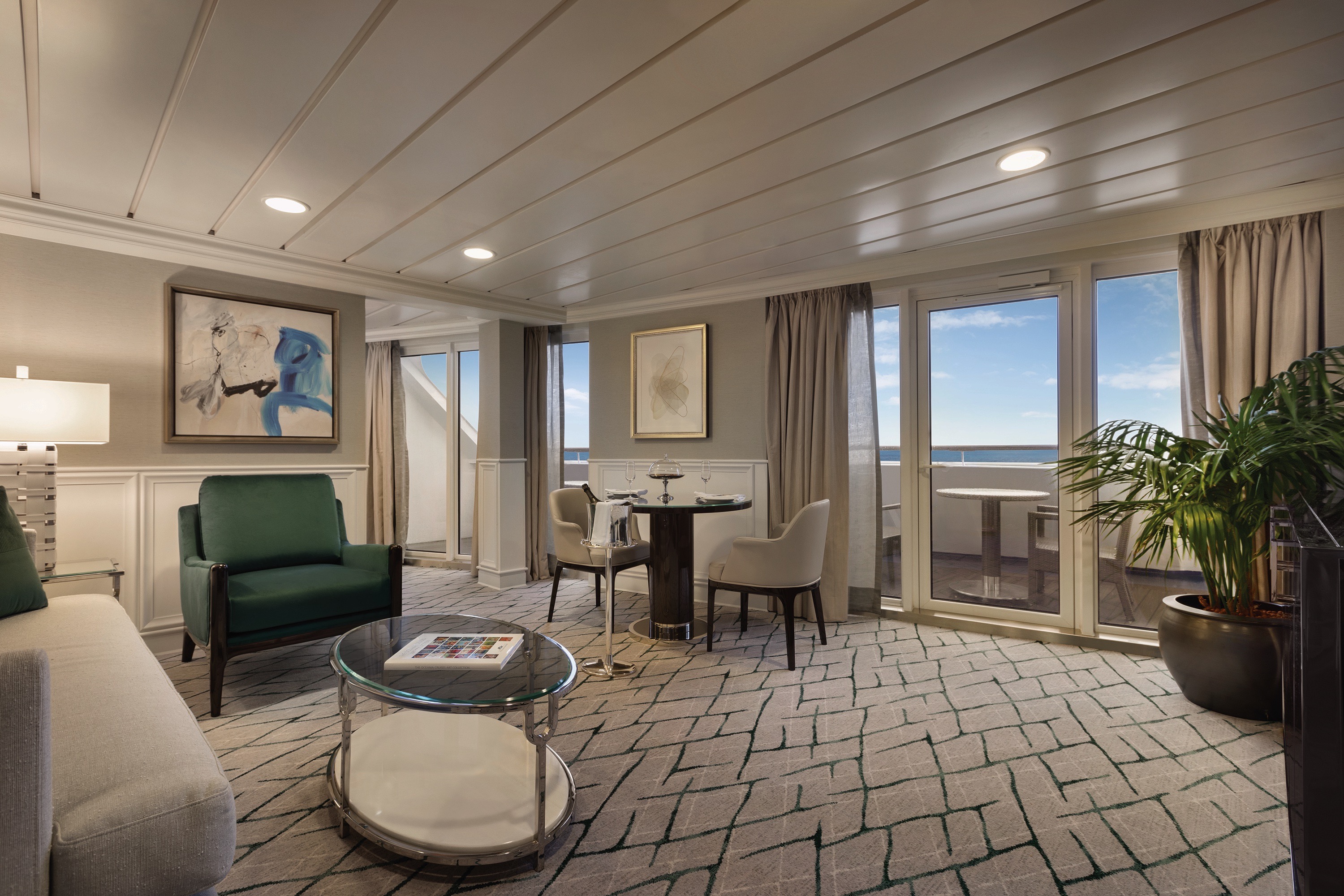
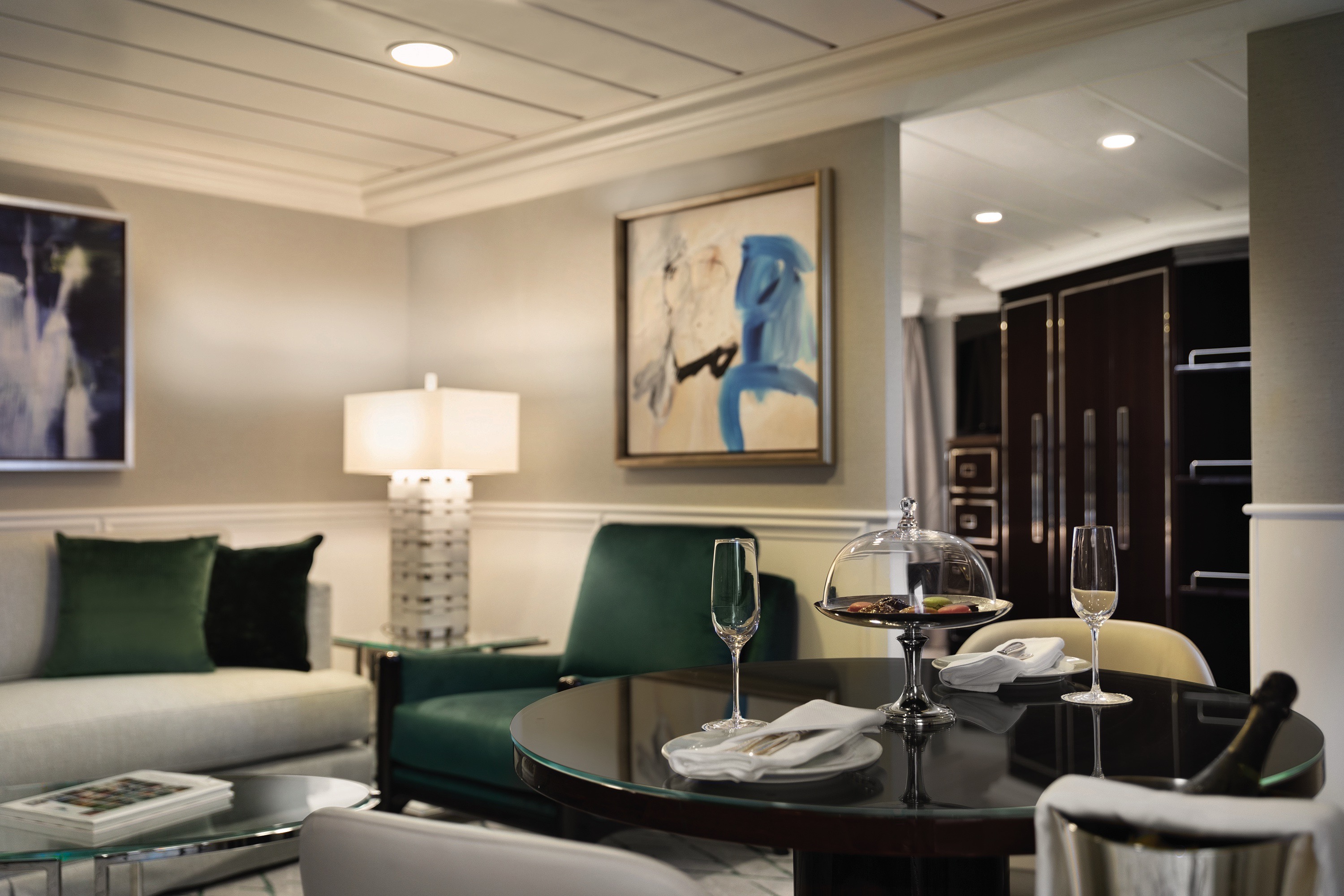
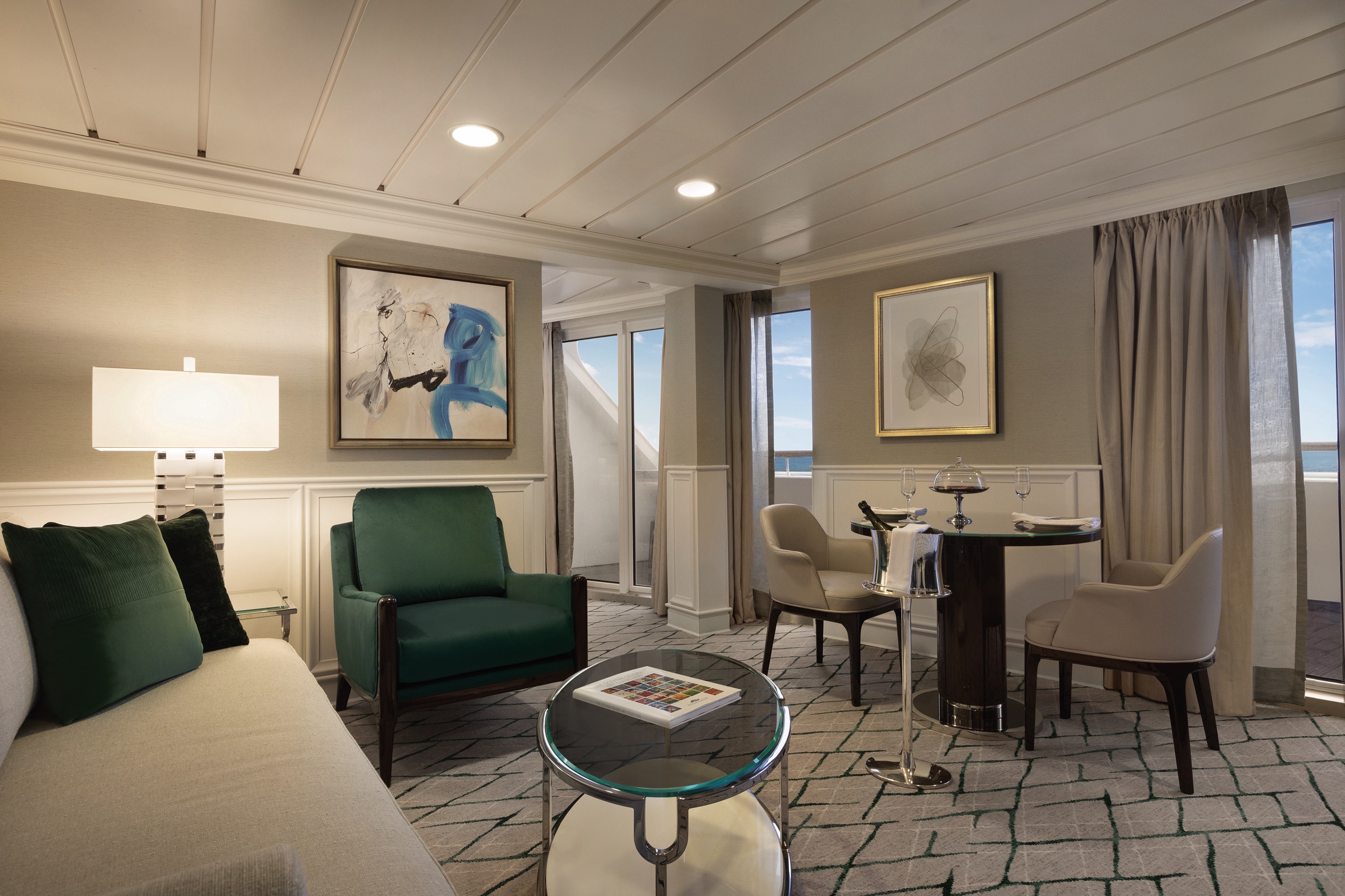
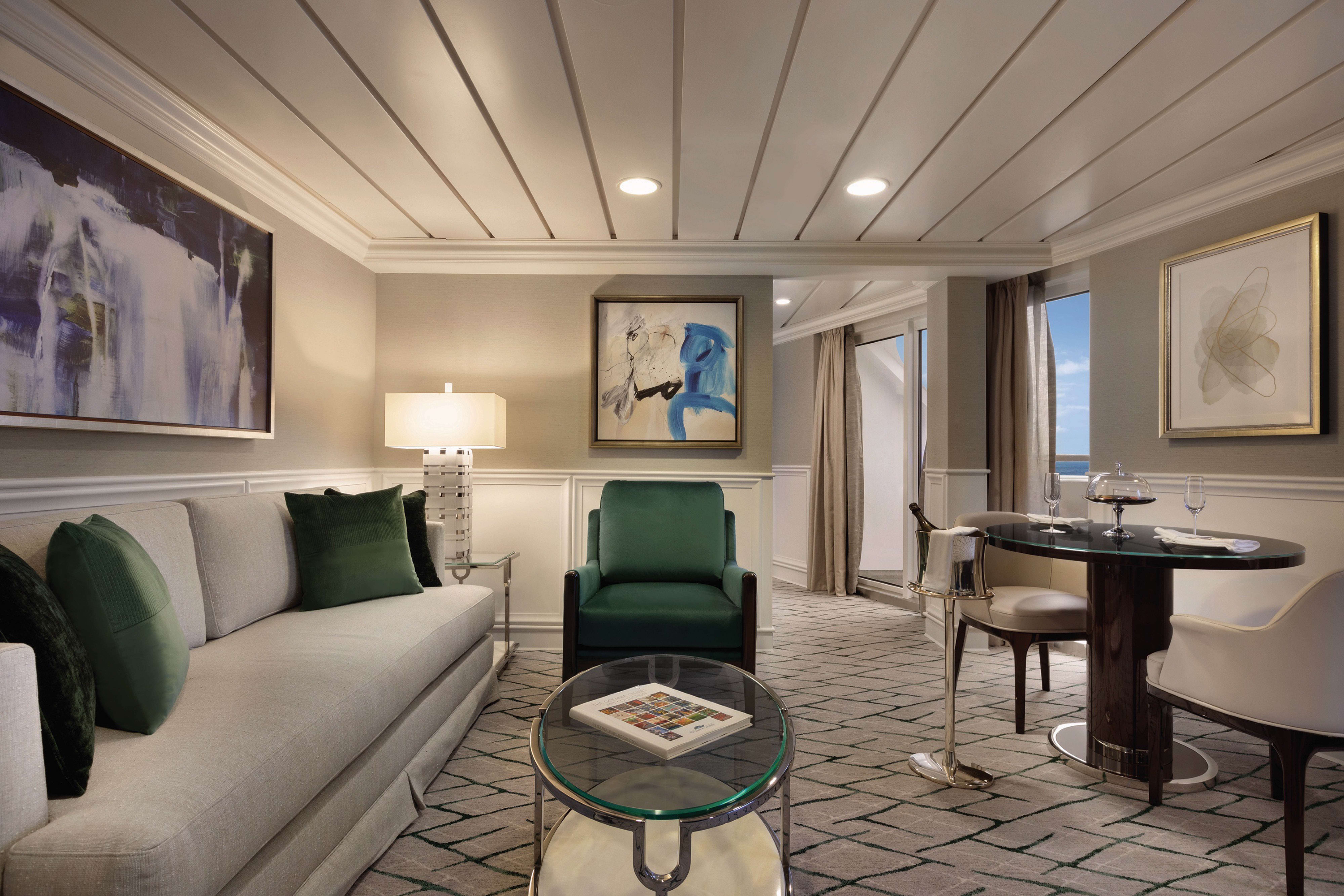
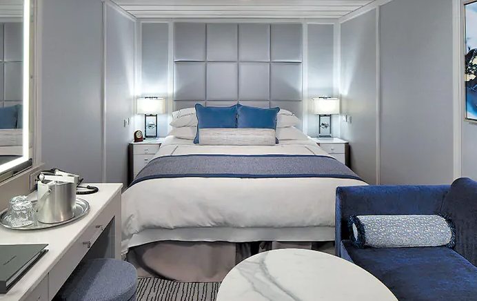
Named for their sweeping views over the ship’s bow, our four Vista Suites feature a calming palette echoing the serene seas and expansive skies. Each sprawls over 786 square feet and offers every imaginable comfort, including a second bathroom for guests as well as a master bathroom finished in onyx, Carrara marble and granite with a luxurious shower. Relax on your teak veranda or watch a movie on your customised entertainment system.Vista Suite Privileges
In addition to Stateroom Amenities
- FREE laundry service – up to 3 bags per stateroom+
- Priority 11 am ship embarkation with priority luggage delivery
- 24-hour Butler service
- Complimentary in-suite bar setup with 6 full-size bottles of premium spirits and wines from our suite beverage menu
- Complimentary welcome bottle of Champagne
- Fresh fruit basket replenished daily
- Priority online specialty restaurant reservations
- Unlimited access to the Aquamar Spa Terrace
- iPad® upon request for your enjoyment on board++
- Bulgari gift set and variety of amenities
- Choice of daily printed newspaper
- Complimentary Oceania Cruises logo tote bag and personalised stationery
- Cashmere lap blankets, perfect for relaxing on your veranda
- Choice of pillow from a luxurious selection
- Complimentary shoeshine service
- Complimentary pressing of garments upon embarkation++
+Up to 20 garments per laundry bag; additional restrictions apply.
++Certain limitations apply.
Smoking in suites, staterooms and on verandas is strictly prohibited.
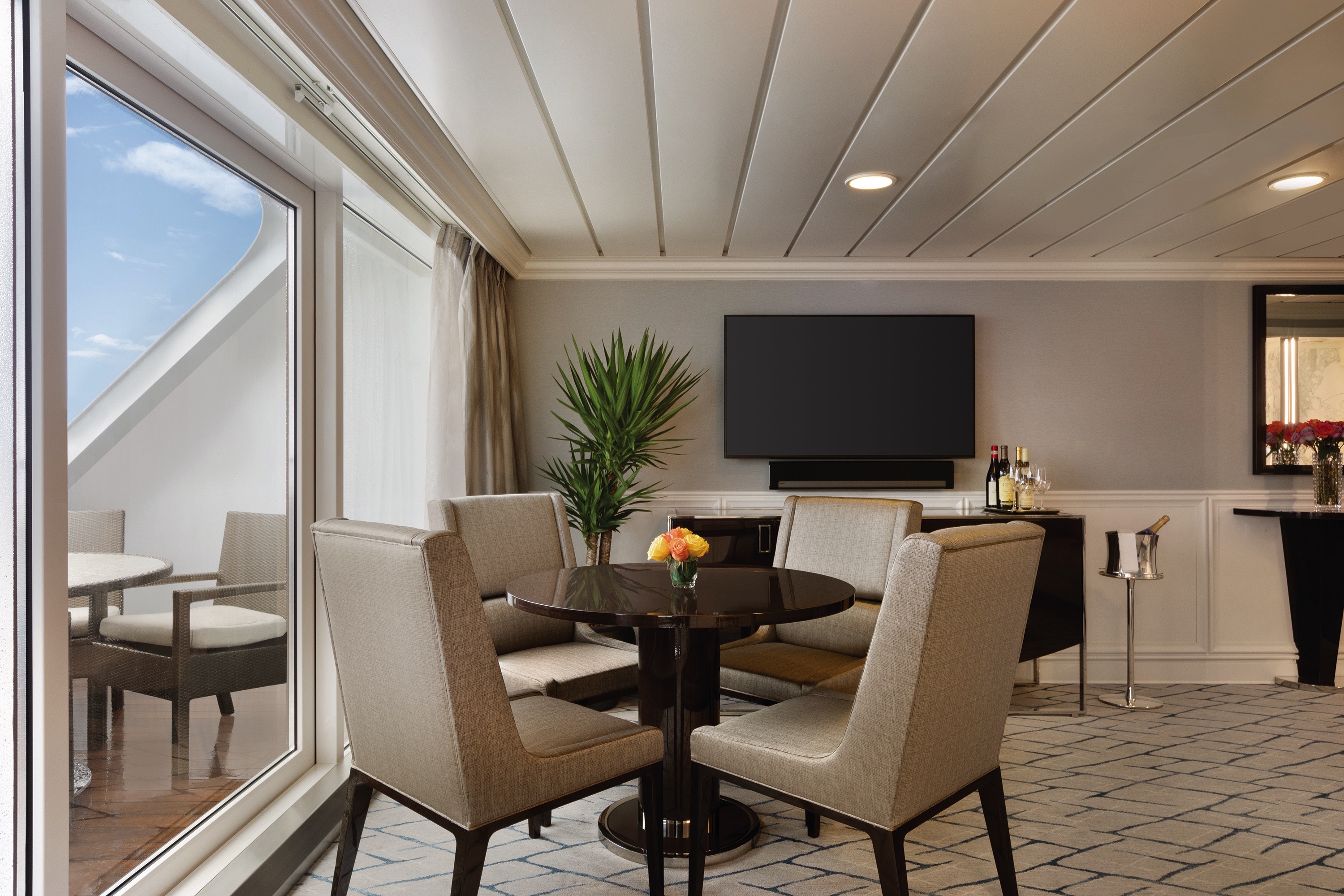
Our collection of new 322-square-foot Penthouse Suites is adorned with sumptuous designer fabrics and furnishings in serene shades of the sea and sky. Spacious enough for private in-suite dining, the living area features a refrigerated mini-bar and vanity desk, and the sleekly transformed bathroom features luxury stone finishes and a shower.
Penthouse Suite Privileges
In addition to Stateroom Amenities
- FREE laundry service – up to 3 bags per stateroom+
- Priority 11 am ship embarkation with priority luggage delivery
- 24-hour Butler service
- Complimentary welcome bottle of Champagne
- Priority online specialty restaurant reservations
- Unlimited access to the Aquamar Spa Terrace
- iPad® upon request for your enjoyment on board++
- Complimentary Oceania Cruises logo tote bag and personalised stationery
- Cashmere lap blankets, perfect for relaxing on your veranda
- Complimentary shoeshine service
- Complimentary pressing of garments upon embarkation++
+Up to 20 garments per laundry bag; additional restrictions apply.
++Certain limitations apply.
Smoking in suites, staterooms and on verandas is strictly prohibited.
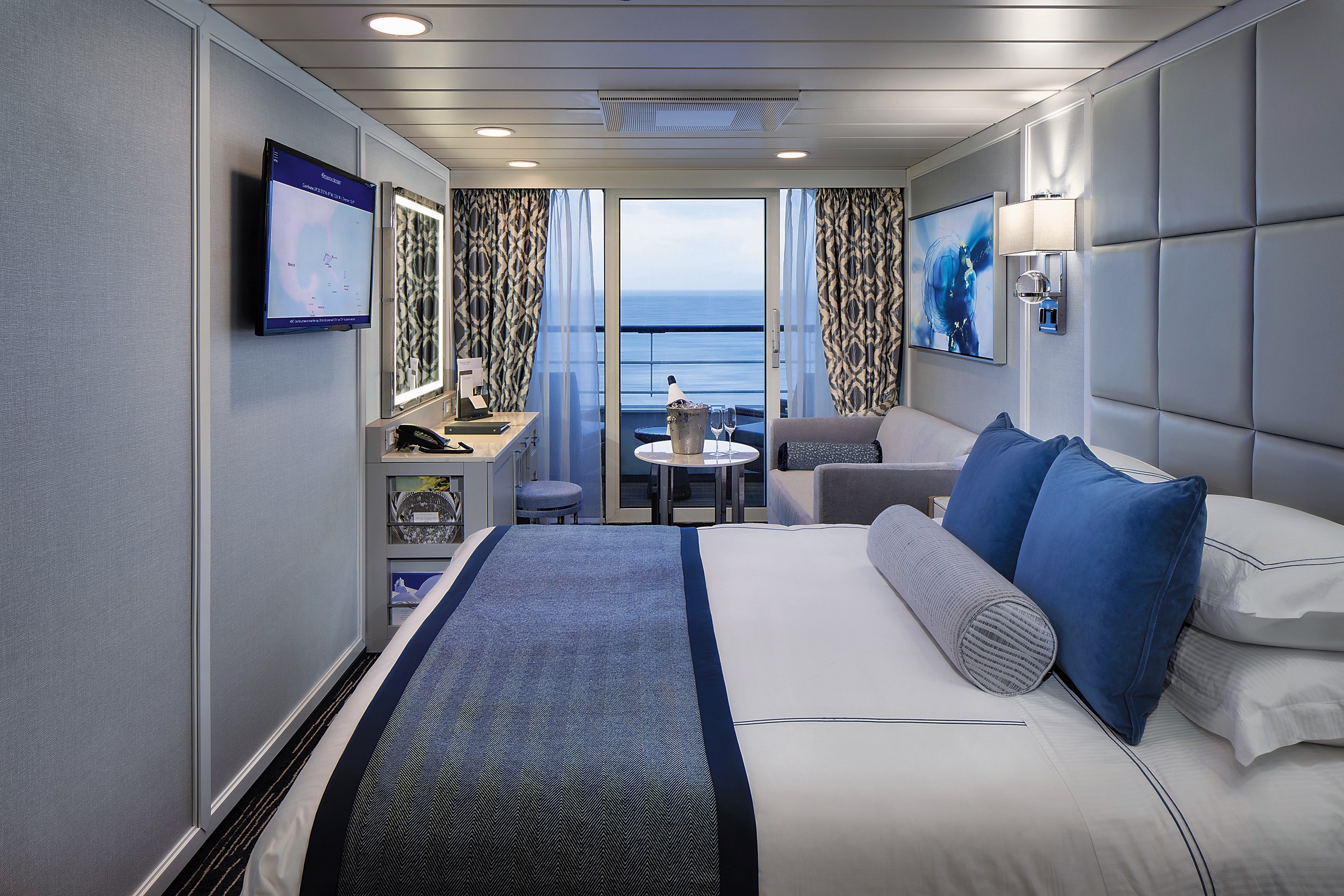
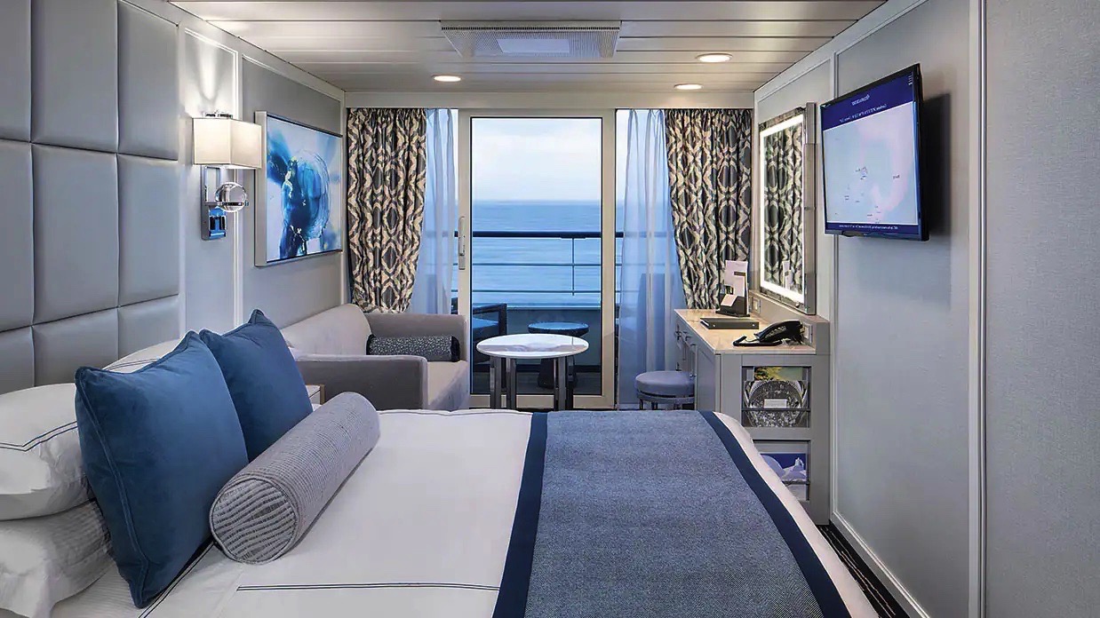
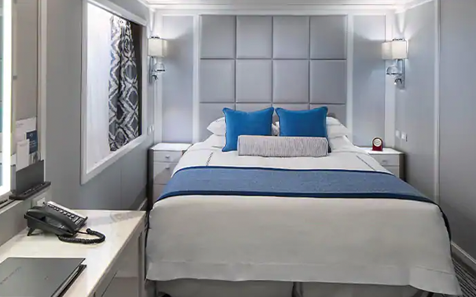
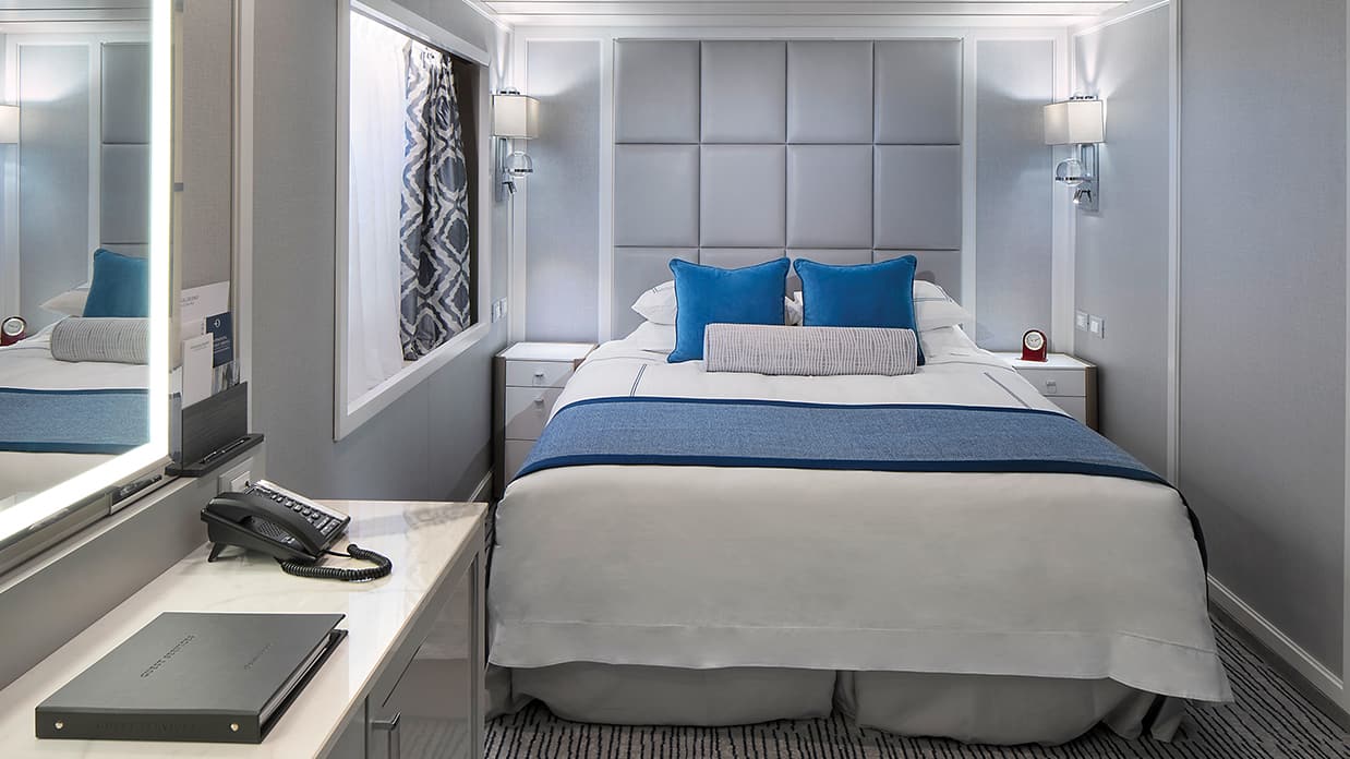
Located in some of the most desirable locations on the ship, Category A Concierge Level Veranda Staterooms offer the attractive blend of both value and luxury. These sleekly redefined 216-square-foot staterooms offer coveted amenities and exclusive privileges, such as free laundry service, that make your experience that much more carefree. Fresh new decor, sumptuous Tranquility Beds and re-inspired verandas with stylish new furniture complete the Concierge experience.
Exclusive Concierge Privileges
In addition to Stateroom Amenities
- FREE laundry service – up to 3 bags per stateroom+
- Expanded lunch and dinner room service menu from The Grand Dining Room
- Priority noon ship embarkation
- Complimentary welcome bottle of Champagne
- Priority online specialty restaurant reservations
- Unlimited access to the Aquamar Spa Terrace
- iPad® upon request for your enjoyment onboard++
- Complimentary Oceania Cruises logo tote bag
- Cashmere lap blankets, perfect for relaxing on your veranda
- Complimentary pressing of garments upon embarkation++
- Complimentary shoeshine service
+Up to 20 garments per laundry bag; additional restrictions apply.
++Certain limitations apply.
Smoking in suites, staterooms and on verandas is strictly prohibited.
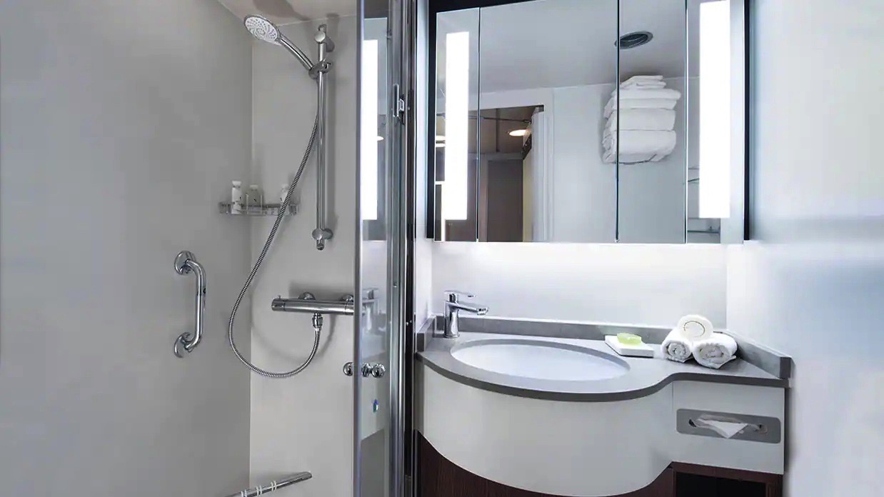
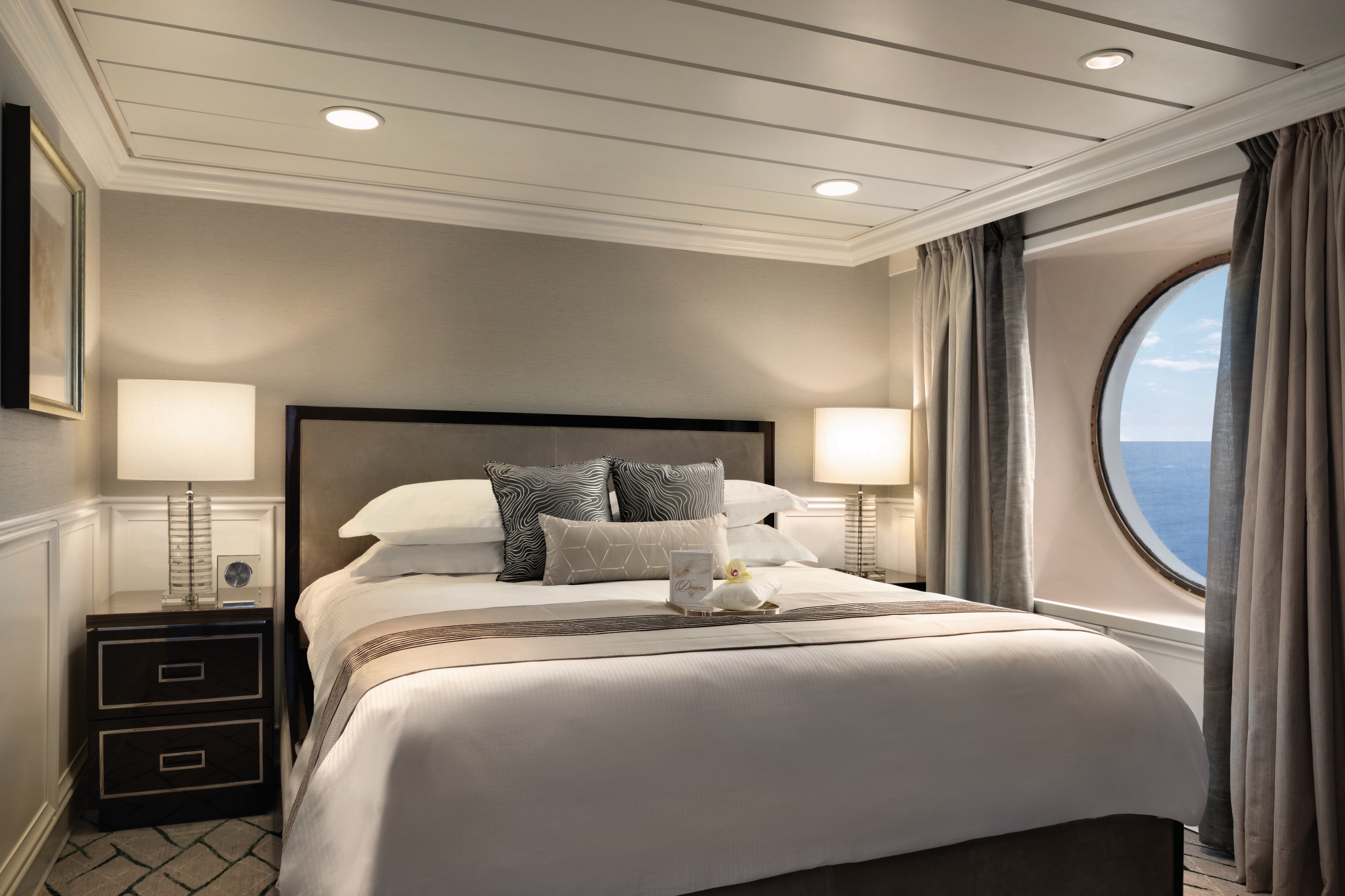
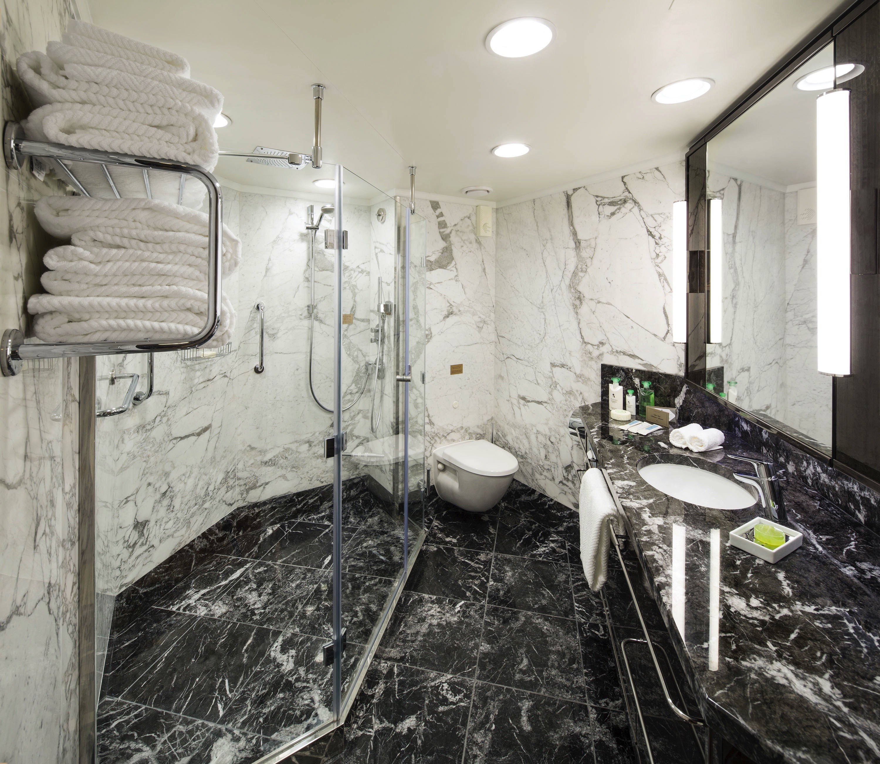
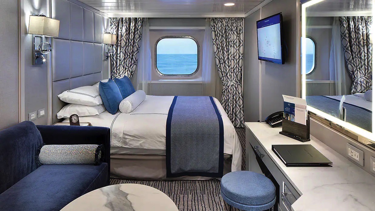
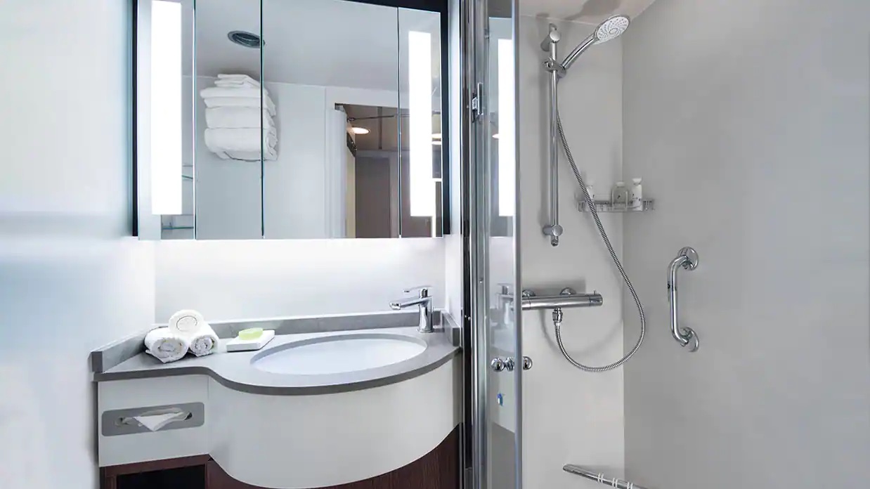
Custom-crafted furnishings, exotic stone finishes, supple upholstered headboards and chic lighting are just a few of the enhancements within these 216-square-foot staterooms that also boast our most popular luxury – a private teak veranda for watching the ever-changing panoramas. Conveniences within each stateroom include a vanity desk, refrigerated mini-bar, breakfast table and spacious seating area.
Veranda Stateroom Amenities
- Tranquility Bed, an Oceania Cruises exclusive, with 1,000-thread-count linens
- Complimentary soft drinks replenished daily in your refrigerated mini-bar
- Complimentary still & sparkling Vero Water
- Private teak veranda
- Bulgari amenities
- Free room service menu 24 hours a day
- Twice-daily maid service
- Belgian chocolates with turndown service
- Interactive television system with on-demand movies, weather and more
- Wireless Internet access and cellular service
- Writing desk and stationery
- Plush cotton towels
- Thick cotton robes and slippers
- Handheld hair dryer
- Security safe
Smoking in suites, staterooms and on verandas is strictly prohibited.
With entirely re-designed closets, dressers and vanities, these 165-square foot staterooms feel even more spacious. A generous seating area, vanity desk, refrigerated mini-bar and breakfast table are perfectly complemented by the soothing hues and stylish fabrics of the sleek new decor.
Deluxe Oceanview Stateroom FREE Amenities:
- FREE soft drinks replenished daily in your refrigerated mini-bar
- FREE still & sparkling Vero Water
- FREE room service menu 24 hours a day
Deluxe Oceanview Stateroom Included Amenities:
- Tranquility Bed, an Oceania Cruises Exclusive
- Bulgari amenities
- Twice-daily maid service
- Category (C1) includes accessibility features in stateroom #4052 and #4056.
- Interactive television system with on-demand movies, weather and more
- Wireless Internet access and cellular service
- Writing desk and stationery
- Plush cotton towels, robes and slippers
- Handheld hair dryer
- Security safe
- Belgian chocolates with turndown service
Deluxe Oceanview Accessibility Features:
- Bed with hoist space
- Large bathroom door
- Toilet grab rails
- Roll in bathrooms with no lip riser which has a wraparound drainage system as well as a bathtub
Smoking in suites, staterooms and on verandas is strictly prohibited.
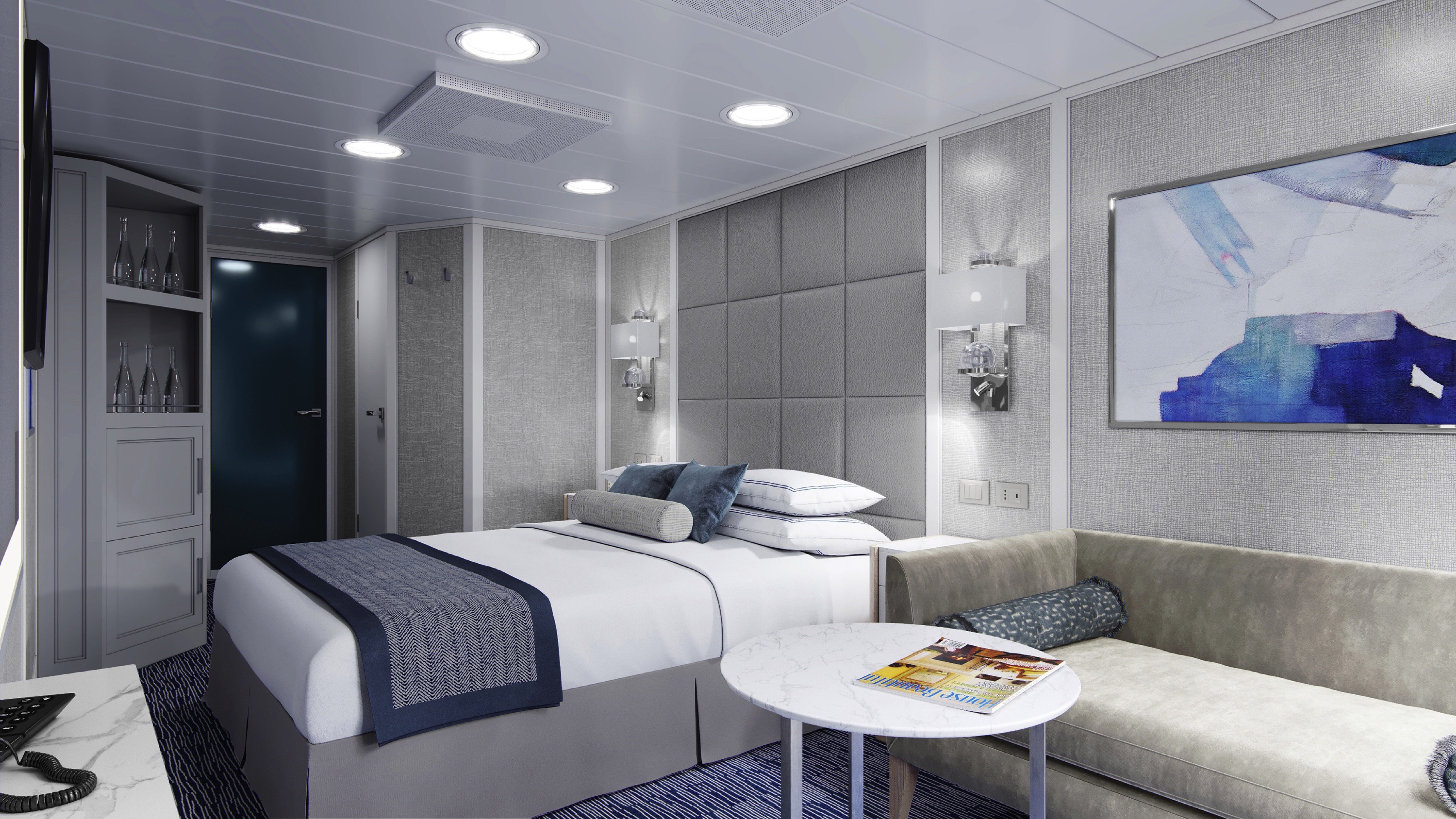
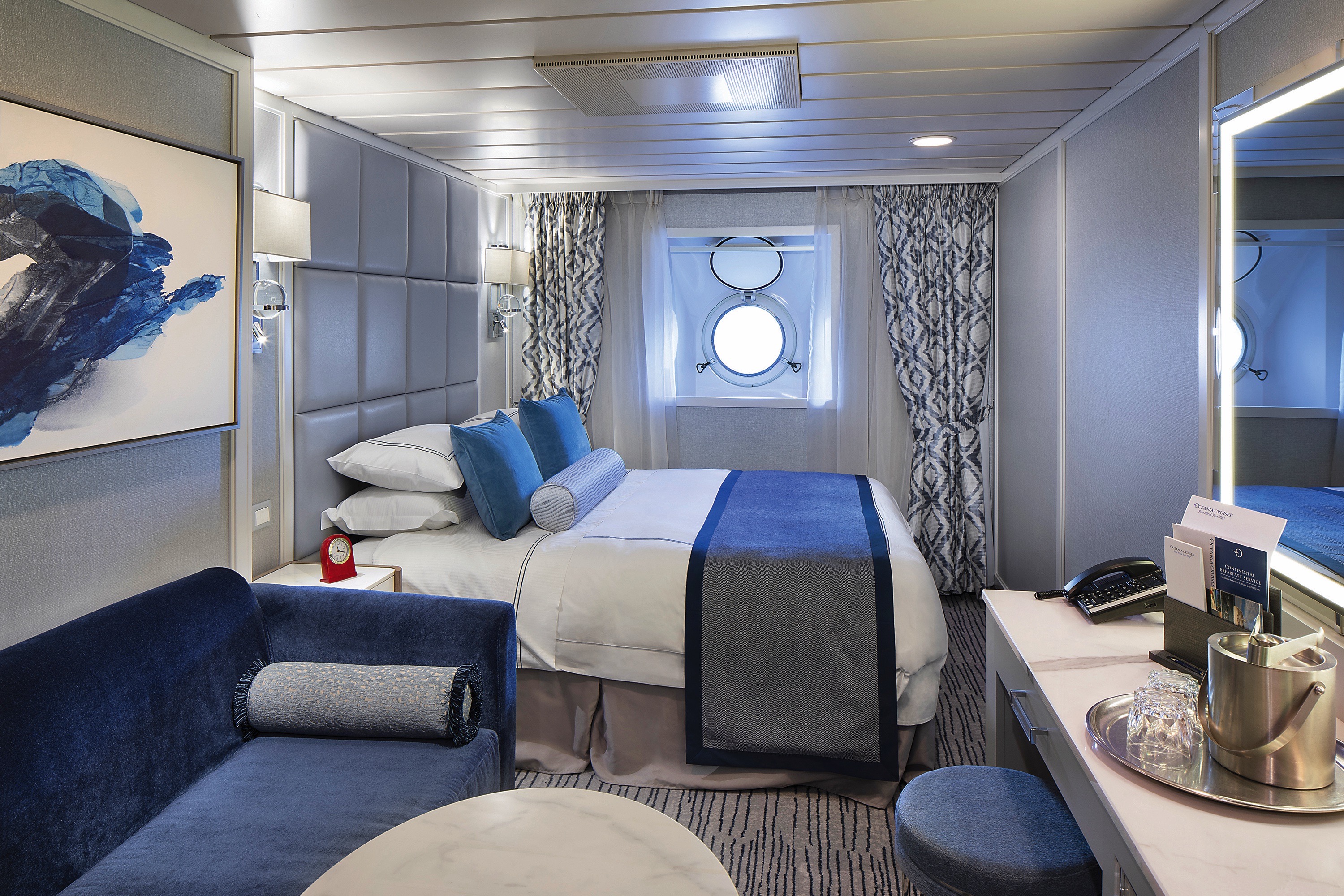
Featuring a classic porthole, these exquisitely appointed 165-square-foot staterooms showcase sophisticated new decor and a modern design that maximizes both space and convenience. Enjoy a comfortable seating area with a sofa on which to stretch out, as well as a vanity desk, breakfast table and refrigerated mini-bar.
Oceanview FREE Amenities:
- FREE soft drinks replenished daily in your refrigerated mini-bar
- FREE still & sparkling Vero Water
- FREE room service menu 24 hours a day
Oceanview Included Amenities:
- Tranquility Bed, an Oceania Cruises Exclusive
- Bulgari amenities
- Twice-daily maid service
- Interactive television system with on-demand movies, weather and more
- Wireless Internet access and cellular service
- Writing desk and stationary
- Plush cotton towels, robes and slippers
- Handheld hair dryer
- Security safe
- Belgian chocolates with turndown service
Smoking in suites, staterooms and on verandas is strictly prohibited.
Centrally located on deck 6, these 143-square-foot staterooms offer a fresh new palette and a panorama window with obstructed views. Features include a vanity desk, refrigerated mini-bar, small breakfast table and an ample closet.
Ocean View Stateroom Amenities
- Ultra Tranquility Bed, an Oceania Cruises Exclusive
- Bulgari amenities
- Signature Belgian chocolates with nightly turndown service
- Complimentary 24-hour room service
- Flat-screen television with DVD player and extensive media library
- Wireless Internet access and cellular service
- Writing desk and stationary
- Plush cotton towels
- Thick cotton robes and slippers
- Handheld hair dryer
- Security safe
All Suites and Staterooms are Smoke-Free
Beautifully re-designed with a modern flair, these delightful private retreats boast 160 square feet of luxury. Highlights include a comfortable seating area, vanity desk, refrigerated mini-bar and plenty of storage. The ingenious use of space is complemented by the re-inspired decor.
Inside Stateroom FREE Amenities:
- FREE soft drinks replenished daily in your refrigerated mini-bar
- FREE still & sparkling Vero Water
- FREE room service menu 24 hours a day
Inside Stateroom Included Amenities:
- Tranquility Bed, an Oceania Cruises Exclusive
- Bulgari amenities
- Twice-daily maid service
- Interactive television system with on-demand movies, weather and more
- Wireless Internet access and cellular service
- Writing desk and stationary
- Plush cotton towels, robes and slippers
- Handheld hair dryer
- Security safe
- Belgian chocolates with turndown service
Smoking in suites, staterooms and on verandas is strictly prohibited.
These charming 143-square-foot staterooms are the perfect retreat for the solo traveler. Amply spacious and centrally located on Deck 6, each is equipped with a sublimely plush Tranquility Bed, refrigerated mini-bar, writing desk and abundant storage space.
Oceania Insignia
Both designer-inspired and luxurious, the 670-guest Oceania Insignia offers entirely new suites, staterooms and bathrooms along with a sweepingly re-inspired atmosphere throughout the ship. The public spaces have been tastefully refreshed with a soft sea and sky palette of fabrics, designer furnishings and custom light fixtures that exquisitely showcase the inimitable style and comfort of Oceania Cruises. Oceania Isignia features four unique, open-seating restaurants, the Aquamar Spa + Vitality Center, eight lounges and bars, a casino and 333 luxurious suites and stylish staterooms, nearly 70% of which feature private verandas.
The better-than-new Oceania Insignia blends sophistication with a contemporary flair to create a casually elegant ambiance that embodies the most treasured elements of our celebrated ships. Every surface of every suite and stateroom is entirely new, while in the public spaces, a refreshed color palette of soft sea and sky tones surrounds a tasteful renewal of fabrics, furnishings and lighting fixtures that exquisitely encompasses the inimitable style and comfort of Oceania Cruises.
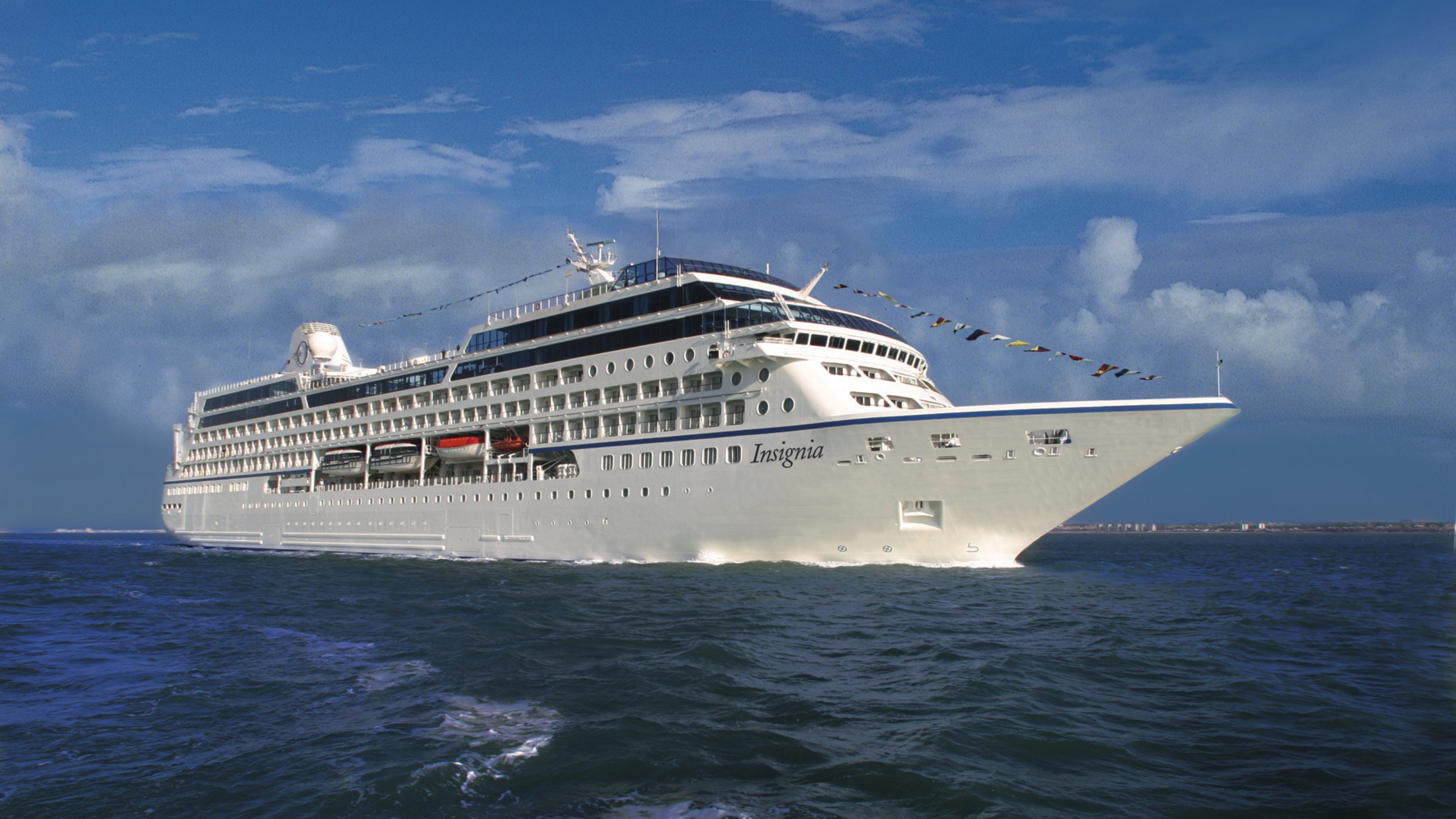
Ship Facts
| Launch Year | 1999 | ||||||||
| Refit Year | 2018 | ||||||||
| Language | en | ||||||||
| Gross Tonnage | 30277 | ||||||||
| Length | 180 | ||||||||
| Width | 25.5 | ||||||||
| Currency | USD | ||||||||
| Speed | 18 | ||||||||
| Capacity | 670 | ||||||||
| Crew Count | 400 | ||||||||
| Deck Count | 9 | ||||||||
| Cabin Count | 349 | ||||||||
| Large Cabin Count | 0 | ||||||||
| Wheelchair Cabin Count | 4 | ||||||||
| Electrical Plugs |
|
Deck 11
- Shuffleboard
- Sun Deck
- Golf Putting Greenes
- Showers

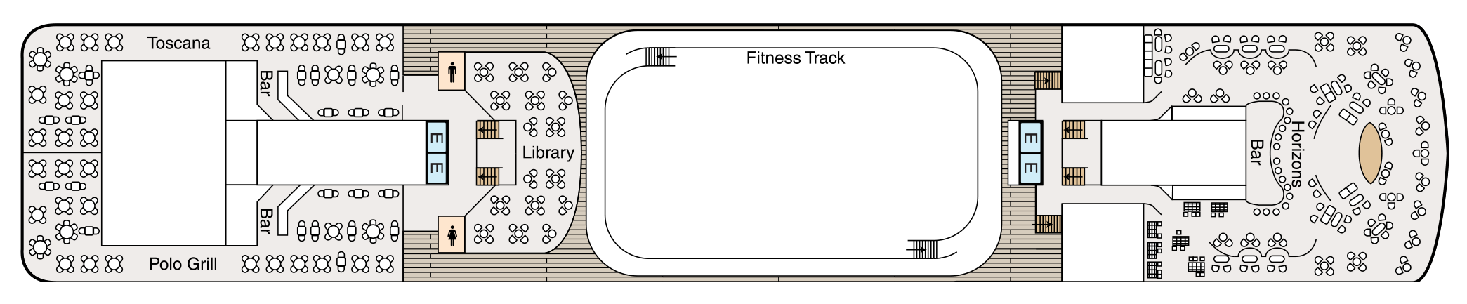
Deck 10
- Toscana
- Polo Grill
- Bars
- Library
- Fitness Track
- Horizons Bar
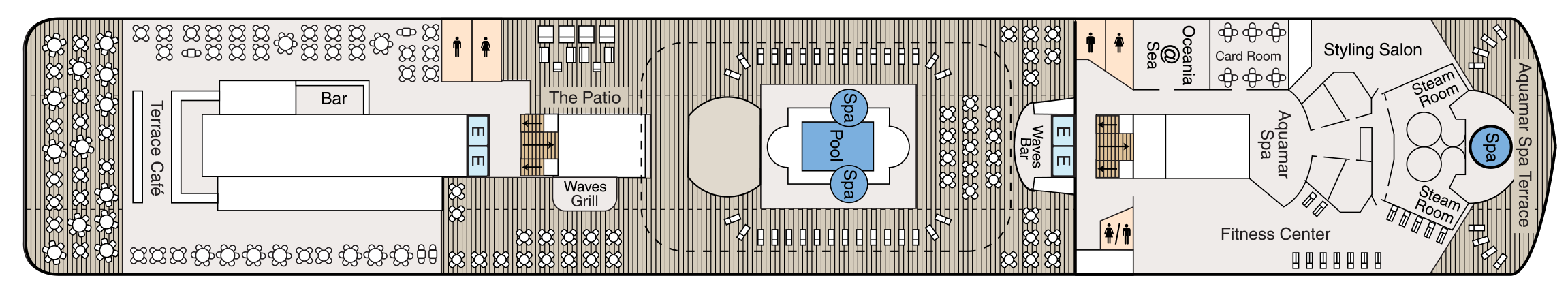
Deck 9
- Terrace Café
- Bar
- The Patio
- Waves Grill
- Whirlpools
- Pool
- Waves Bar
- Oceania@Sea
- Card Room
- Aquamar Spa
- Fitness Centre
- Styling Salon
- Steam Rooms
- Spa Terrace
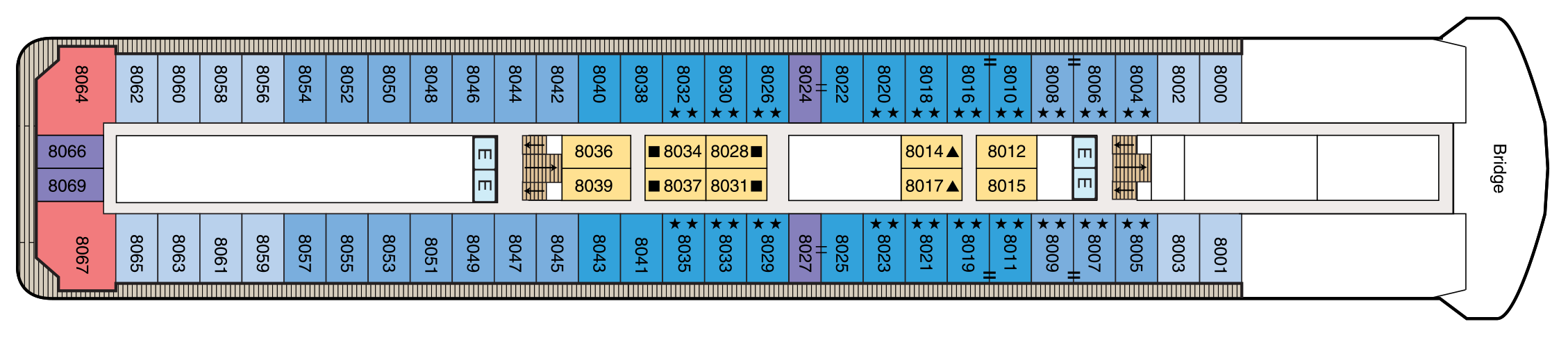
Deck 8
- Bridge
- Concierge Level Veranda Staterooms
- Inside Staterooms
- Owner's Suites
- Penthouse Suites
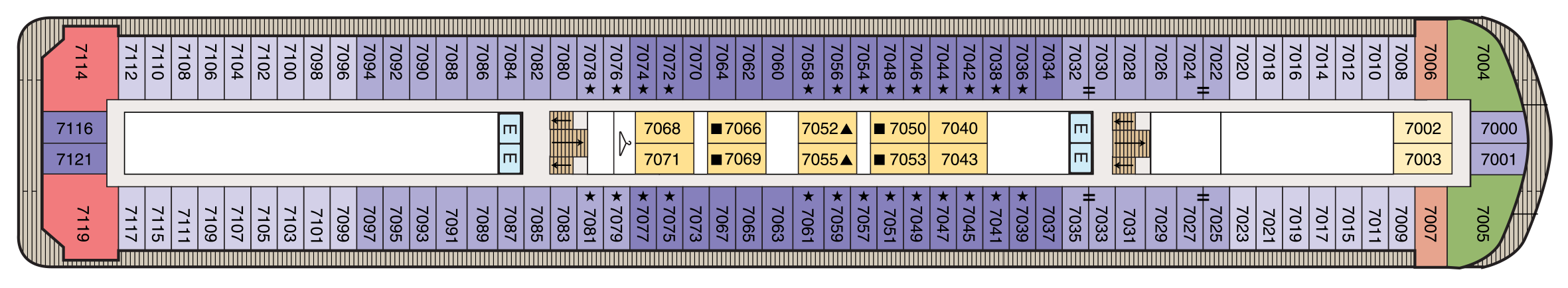
Deck 7
- Concierge Level Veranda Staterooms
- Deluxe Ocean View Staterooms
- Inside Staterooms
- Owner's Suites
- Vista Suites
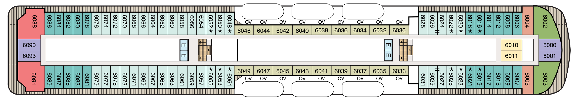
Deck 6
- Concierge Level Veranda Staterooms
- Veranda Staterooms
- Deluxe Ocean View Staterooms
- Inside Staterooms
- Owner's Suites
- Vista Suites
- Elevator
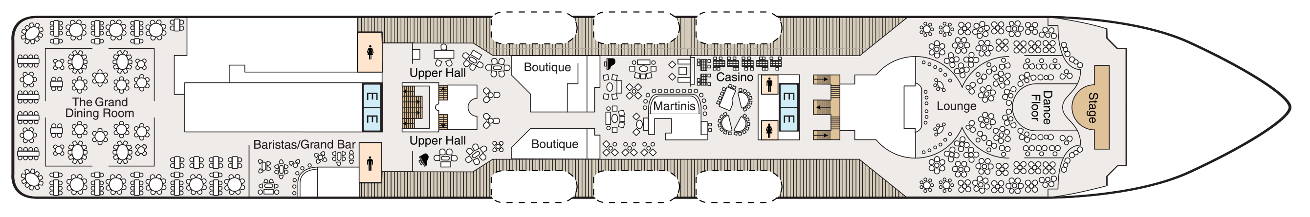
Deck 5
- Grand Dining Room
- Baristas Grand/Bar
- Upper Hall
- Boutiques
- Martinis
- Casino
- Lounge
- Dance Floor
- Stage
- Elevator
Deck 4
- Destination Services
- Concierge
- Reception Hall
- Reception Desk
- Medical Centre
- Deluxe Ocean View Staterooms
- Inside Staterooms
- Elevator

Deck 3
- Ocean View Stateroom
- Tender Embarkation Area
- Elevator

Dining Aboard Oceania Insignia
Oceania Insignia embraces the most treasured elements of our celebrated fleet and features multiple dining venues, of which four are unique, open-seating restaurants with no surcharge. Wherever you choose to dine, you’ll savor The Finest Cuisine at Sea®.
Culinary Masterpieces
The superb gourmet restaurants aboard Oceania Insignia serve delectable dishes created à la minute and offer a remarkable array of choices, from Continental cuisine and vibrant Asian dishes to casual all-American favourites. Every restaurant on board Oceania Insignia is complimentary and features open seating so you may dine wherever and whenever suits your taste and schedule. Enjoy dinner for two or a gathering with newfound friends, knowing the experience is certain to be extraordinary.
The Luxury of Casual
You’ll savor cuisine renowned as the finest at sea no matter where you choose to dine or relax on Oceania Insignia– whether that means a poolside burger, a scoop of Humphry Slocombe’s bourbon-flavored cornflake-studded Secret Breakfast ice cream or a perfectly prepared cappuccino accompanied by freshly baked biscotti. Our culinary team’s attention to detail, passion for artisanal ingredients and dedication to technique extends to our casual dining, poolside experiences, Baristas coffee bar and the cherished ritual of Afternoon Tea at Horizons too.
The Grand Dining Room
AN ELEGANT SETTING
The Grand Dining Room is a study in stateliness, a tribute to the spirit of Europe’s marquee five-star hotel restaurants that inspired its dignified yet convivial ambiance. Handsomely decorated in rich woods, designer tapestry fabrics and oversized armchairs, the expansive dining area exudes classic splendor. This signature dining experience has always offered a bevy of delicious Continental dishes, and now a fresh and new array of options brings you even more exciting choices, as well as an incredible spectrum of global flavors and an all new Executive Chef’s Tasting Menu. As variety is essential to your satisfaction, menus change daily with an expansive choice of at least 10 appetizers, soups and salads and 10 dinner entrées, along with healthy options such as Aquamar Vitality Cuisine, gourmet vegetarian selections and the most extensive array of plant-based dishes at sea.
Open for breakfast, lunch and dinner. No reservations required.
Toscana
AUTHENTIC ITALIAN
Toscana means Tuscan, and just as Tuscan cuisine evolved from rich family traditions, many of our recipes originated with the mothers and grandmothers of our own Italian culinary staff. Presented on elegant, custom-designed Versace china, masterfully prepared dishes exemplify the essence of Tuscany and celebrate Italy’s culinary passion. Perhaps the evening begins with the octopus carpaccio with Champagne vinaigrette or the artichoke and parmesan cheese timbale with black truffle sauce. Classic dishes from other regions of Northern Italy are featured as well, such as the minestrone alla Genovese, lasagna alforno alla Bolognese and osso buco alla Milanese.
Open for dinner only. Reservations are required.
Polo Grill
A CLASSIC STEAKHOUSE
Polo Grill embodies all the elements of a classic steakhouse, expressing them with timeless reverence. Mindful of tradition, the decor features crisp, white linen tablecloths, dark wood furnishings and supple, high-back, burgundy leather chairs. Each course stands as the very definition of time-honored favorites, most notably the beef dishes, all of which are certified Black Angus USDA Prime and dry aged to enhance tenderness and flavor. Succulent seafood dishes such as grilled swordfish and whole Maine lobster gratinée are also classics in their own right. The classic Caesar salad, too, is prepared according to tradition, tableside and with gusto.
Open for dinner only. Reservations are required.
Terrace Café
INFORMAL DINING
Informal and carefree, the Terrace Café is wonderfully inviting any time of day. During breakfast, the room is infused with natural sunlight from the floor-to-ceiling windows, stimulating the appetite for the sumptuous selections. Come lunch, the expansive menu of international-inspired dishes changes entirely, complemented by a flavorful roast and the magic of the pizzeria’s oven. Dine inside or alfresco at one of the shaded teak tables on the terrace. During the evenings, the cuisine takes on a more sophisticated flair, with lobster tails, chops and fresh fish prepared to order, and freshly made hand-cut sushi and sashimi. In addition, a diverse selection of bold and flavorful plant-based dishes is available.
Open for breakfast, lunch and dinner. No reservations required.
Waves Grill
ALFRESCO DINING
Sometimes, the ultimate luxury is casual dining on all-American favorites, a laid-back style Waves Grill epitomizes. Located in a spacious, shaded area steps from the swimming pool, Waves Grill offers an extensive and mouthwatering menu. Then try a decadent dessert such as a homemade passion fruit sorbet, a made-to-order hot fudge sundae, a hand-dipped milkshake or one of the new, whimsical ice cream flavors by Humphry Slocombe, such as Secret Breakfast, Elvis (the Fat Years) or our signature flavor, Regatta Royale.
Open for lunch and afternoon dining only. No reservations required.
Afternoon Tea
TIME-HONOURED PASTIME
Teatime is a celebratory daily event at four o’clock. As a classical string quartet plays softly, our staff present bountiful four-tiered pastry carts filled with freshly made finger sandwiches, petits fours, scones and sinful desserts. Of course, a selection of traditional and artisanal teas is the centrepiece of this splendid afternoon pastime.
Teatime is a celebratory daily event that irresistibly draws guests to Horizons at four o’clock sharp. As a classical string quartet plays softly in the background, our staff glides through the room presenting bountiful four-tiered pastry carts filled with freshly made finger sandwiches, colourful petits fours, richly textured scones with clotted cream and wonderfully sinful desserts. Of course, a selection of artisanal teas is the centrepiece of this splendid afternoon pastime.
Daily at 4 pm. No reservations required.
Baristas
SPECIALTY COFFEE
This delightful coffee bar is a favourite stop for java lovers. Enjoy complimentary illy® espressos, cappuccinos and lattes prepared by our master baristas, as well as the delicious pastries, finger sandwiches and homemade biscotti that draw so many to Baristas throughout the day.
Open daily until early evening. No reservations required.
Room Service
In-Room Dining Experiences
After a day of enriching adventures ashore or an enjoyable day on board, dining in the privacy of your suite or stateroom with our compliments is always a welcome possibility. A complete menu of varied dining experiences is available around the clock, featuring an extensive array of delectable breakfast, lunch and dinner items. All suites and staterooms have the added luxury of enjoying a full, hot breakfast in-room and those staying in Concierge Level or above have the additional privilege of ordering from an expanded lunch and dinner room service menu from The Grand Dining Room. Suite guests have the ultimate indulgence of enjoying course-by-course meals from the comfort of their spacious sanctuaries. Revel in the private luxury of your suite or stateroom, and enjoy an exquisite meal on your tranquil veranda as you take in spectacular seascapes.
Life On Board
Each day aboard our ships is a spectacle and adventure to experience, from world-class music, high-energy production shows and dazzling cabarets to rousing deck games, spirited wine tastings and evenings at our atmospheric casino. For those seeking more cerebral pursuits, engaging talks by passionate Guest Speakers, chef-led demonstrations inspired by the local cuisine and animated Team Trivia sessions invite you to experience each new horizon more fully.
Music & Entertainment
Evenings aboard Oceania Insignia can be anything you desire. Marvel at the continuously changing talented guest entertainers as you delight in high-energy production shows, talented vocalists, classical music and more. Perhaps stop by the lively Monte Carlo-style Casino for a rousing game or two. Unforgettable evenings are just steps from your stateroom.
Bars & Lounges
From chic Martinis to the laid-back poolside Waves Bar, there's a perfect enclave on board Oceania Insignia for every mood. Visit the elegant Grand Bar for a pre-dinner cocktail, catch a headline act in the Lounge or watch the sun set in Horizons accompanied by a glass of wine and lively music. As you explore the world, these bars and lounges are the place to unwind, gather together, laugh and take in one-of-a-kind shows and musical performances.
Library
Quietude at Sea
Pick up a steaming cappuccino and settle in to the welcoming ambiance of our classic library on board Oceania Insignia with the novel or bestseller you’ve been meaning to read. Read, relax and feel right at home with more than 2,000 books and periodicals to choose from as you sail from one destination to the next.
Just as sailing aboard Oceania Cruises recalls the elegance of the Golden Age of Travel, our inspired English-style library is reminiscent of a charming English country estate where you can while away the hours in ultimate comfort. There is something magical about the dark, rich woods; the plush high back chairs; the cozy fireplaces and rows of books lining the walls, each a new world waiting to be discovered.
Casino
EARN CASINO POINTS
The professional staff is happy to provide lessons on how games are played, the rules and proper table procedures. Unwind from a busy day ashore by playing your favourite games of chance and skill in our casino. Enjoy a fun and exciting range of ways to play, from card and table games such as blackjack and roulette to slot machines.
Getting started is easy. Stop by the casino cage and pick up your Oceania Cruises casino player card and start earning points today, by inserting your player card while playing your favourite slot machines and table games. The more you play, the more you earn!
- Reel & Video Slots - For every $5 coin-in, receive 1 point.
- Video Poker - For every $10 coin-in, receive 1 point.
- Table Games - Points are based on average bet, session play or hands played and game type.
- Action packed casinos designed with style
- Table game limits for players of all levels
- Diverse array of reel slot, video slot and video poker machines
- Dedicated and knowledgeable casino staff
- Industry leading player tracking system
- Free gaming lessons
REDEEM CASINO POINTS
You’ve played. You’ve earned. Now you’re ready to redeem. Downloading points for play is quick and easy. Redeem your casino points for play right at your machine by following the on-screen prompts or stop by the casino cage – the choice is yours.
- Earn points for all your casino play
- Redeem points for play right at your machine
CASINO CASH & CREDIT
Front Money deposits are accepted for gaming in the form of cash, traveler’s checks, cashier’s checks and wire transfers delivered to us prior to embarkation. All cashier’s checks require prior verification. For more information please give us a call at 877.625.2094.
Cashless Wagering
Charge gaming to your onboard account directly from your game of choice or at the casino cashier, using your stateroom key card. Convenience fees, daily limits and cruise limits apply. Euros may be exchanged at the casino cashier, exchange rates apply. All gaming is in US Dollars.
- Cashless wagering allows you to game with your key card
Credit
Casino Credit is available to all players with an existing reservation. The minimum application amount is $10,000.00 and a personal check is required onboard to activate the credit line. Applications are processed 1 month prior to sailing. The application process is easy and there is no fee to apply. To get started, click here for our credit application or for more information email us at casinocredit@ncl.com or call us at 877.625.2094.
- Casino credit available
Boutique Shopping
Our stylish boutiques feature a tastefully curated selection of items ranging from sundries to chic resort wear and fine jewellery. Discover thoughtful gifts for friends and family or the perfect memento to remind you of your special cruise experience.
Oceania@Sea Internet Center
Internet
Stay in touch with family and friends, monitor business developments and more in our 24-hour Internet center, Oceania@Sea.
For personalized service, Oceania@Sea is fully staffed as follows:
- Sea Days: 8 a.m. - 7 p.m.
- Port Days: 8 a.m. - 11 a.m. and 3 p.m. - 7 p.m..
Oceania Cruises also offers wireless Internet access throughout the ship, allowing you to connect through your laptop or mobile device. And as an added convenience, guests in all Owner's and Vista Suites will have the use of an iPad® throughout the voyage. iPad® is available upon request for Penthouse Suites and Concierge Level Staterooms (limited availability).
Letters and postcards with the appropriate postage can be mailed at the Reception Desk. Postage for mail may be purchased at the Reception Desk for a nominal fee. Mail will be collected one hour prior to sailing from each port of call. Incoming mail or faxes received by the ship on your behalf will be delivered directly to your stateroom.
PHONE
Oceania Cruises offers Wireless Maritime Services (WMS) for all GSM mobile phones and GPRS devices such as Blackberry® when the ship is at sea. You can make and receive phone calls, send and receive text messages and use other data services when the ship is at sea. You will be billed by your mobile phone provider and calls or messages will appear as roaming charges on your bill. While using the WMS service, international maritime roaming rates will apply. Please consult your wireless service provider for detailed rates and service zones.
Onboard Shows
DAZZLING PERFORMANCES
PRODUCTION SHOWS ON BOARD OCEANIA INSIGNIA
World-class musical performances will delight you, showcasing an ever-changing array of guest entertainers such as pianists, classical string quartets, dynamic vocalists and spectacular headliners.
Each of our ships features a unique lineup of onboard shows and entertainers to ensure that your interests are constantly piqued. Bold and crowd-thrilling, nostalgic and upbeat, or intimate and sophisticated – whatever you choose, the night is yours.
Oceania Insignia's versatile and talented cast performs the following diverse production shows:
Broadway in Concert
Come on along and listen to…the lullabies of Broadway! In this elegant concert-style review, our fabulous production cast vocalists pay tribute to some of the most iconic musicals of all time. You’ll experience songs you know and love, and maybe you'll discover one or two more contemporary gems. Let us entertain you…because, after all, “There’s no business like show business!”
Showdown
Your vote counts in this mock singing competition, where you, the audience, chooses the winner. Join our production cast and cheer on your favorite singer as he or she belts out some pop favorites in hopes of taking home the title. Will they sway your vote? Find out because it’s time for a SHOWDOWN!
Acoustic Sessions
Acoustic Sessions features the most recognizable pop music of the last four decades in an unplugged, acoustic-style, live band setting. Acoustic Sessions is presented “in the round” with the audience in a 360-degree arena-style seating to provide an immersive musical experience for every audience member.
Gatsby’s
The upbeat and quirky musical score is compiled from timeless tunes, inspired by the 1920s and includes blues, jazz and Tin Pan Alley standards like “Makin' Whoopie,” “Won’t You Charleston,” “Puttin’ on the Ritz” and “I Wanna Be Loved by You” and the melodies of Duke Ellington and Fats Waller.
Martinis
Martinis serves numerous incarnations of this famous cocktail in an airy, elegant atmosphere reminiscent of the Greek Isles with a palette of bold blues, deep pewter and serene sienna.
The Grand Bar
Before sitting down to a gourmet meal, sample a rare vintage or savour your favourite apéritif as you enjoy spirited conversation with newfound friends amid the refined atmosphere of the convivial Grand Bar.
Horizons
An elegant observation lounge with dramatic floor to ceiling windows and a country club casual ambiance. Horizons transforms into a sophisticated evening venue by night. Dance the night away to the sounds of a lively musical group and enjoy cocktails with friends at the welcoming bar.
Waves Bar
Located in a shaded area just steps from the swimming pool, Waves Bar offers a wide variety of libations to enhance your poolside experience. Revel in the perfect afternoon on deck with your favourite cocktail, glass of wine or chilled beer. Come happy hour, signature cocktails and frosty beverages create a delightfully carefree segue to the lively evening ahead as the sun sets.
Lounge
From headline acts to comedians, magicians and lively jazz ensembles, head to the Lounge to discover the centre of nightly entertainment aboard Oceania Cruises.
Card Room
The beautifully Card Room is an inviting and tranquil oasis. Stay at the top of your game and try your hand at bridge or gather around one of our many tables for a quiet afternoon or evening of board games.
Patio
Sit back, relax and enjoy the stunning panoramic ocean views in the shaded, comfortable Patio as you sail to the next exciting destination.