Route To Western Europe
Route To Western Europe
Cruise overview
WHY BOOK WITH US?
- ✔ The Deluxe Cruises’ team has extensive experience in ultra-luxury cruising.
- ✔ Call now to speak to our helpful and experienced Cruise Concierge team.
- ✔ Enjoy our Unique Deluxe Cruises Bonus for substantial savings.
- ✔ Our team will tailor your holiday to your exacting requirements.
- ✔ As agents, we work under the protection of each cruise lines ABTA / ATOL licences
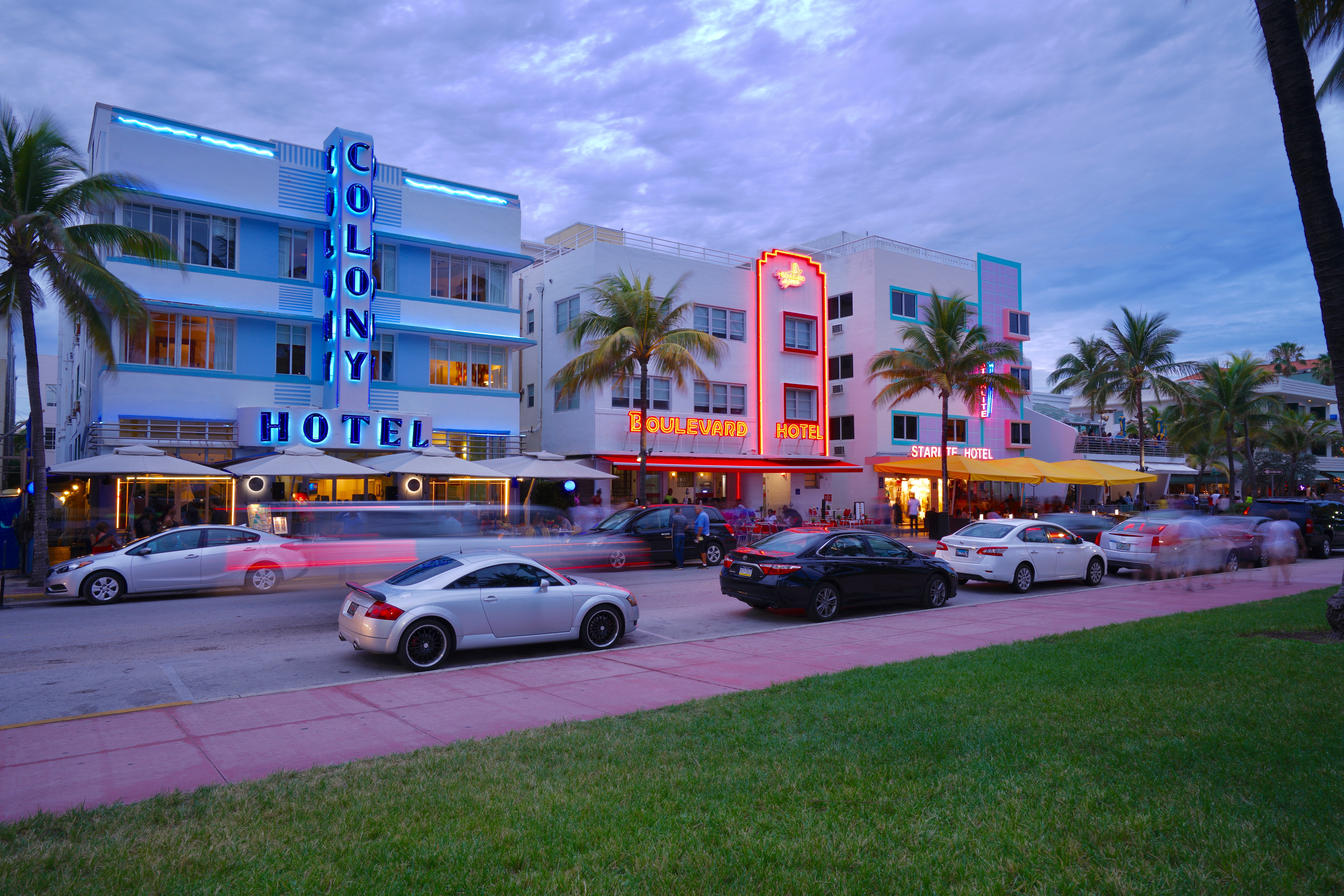
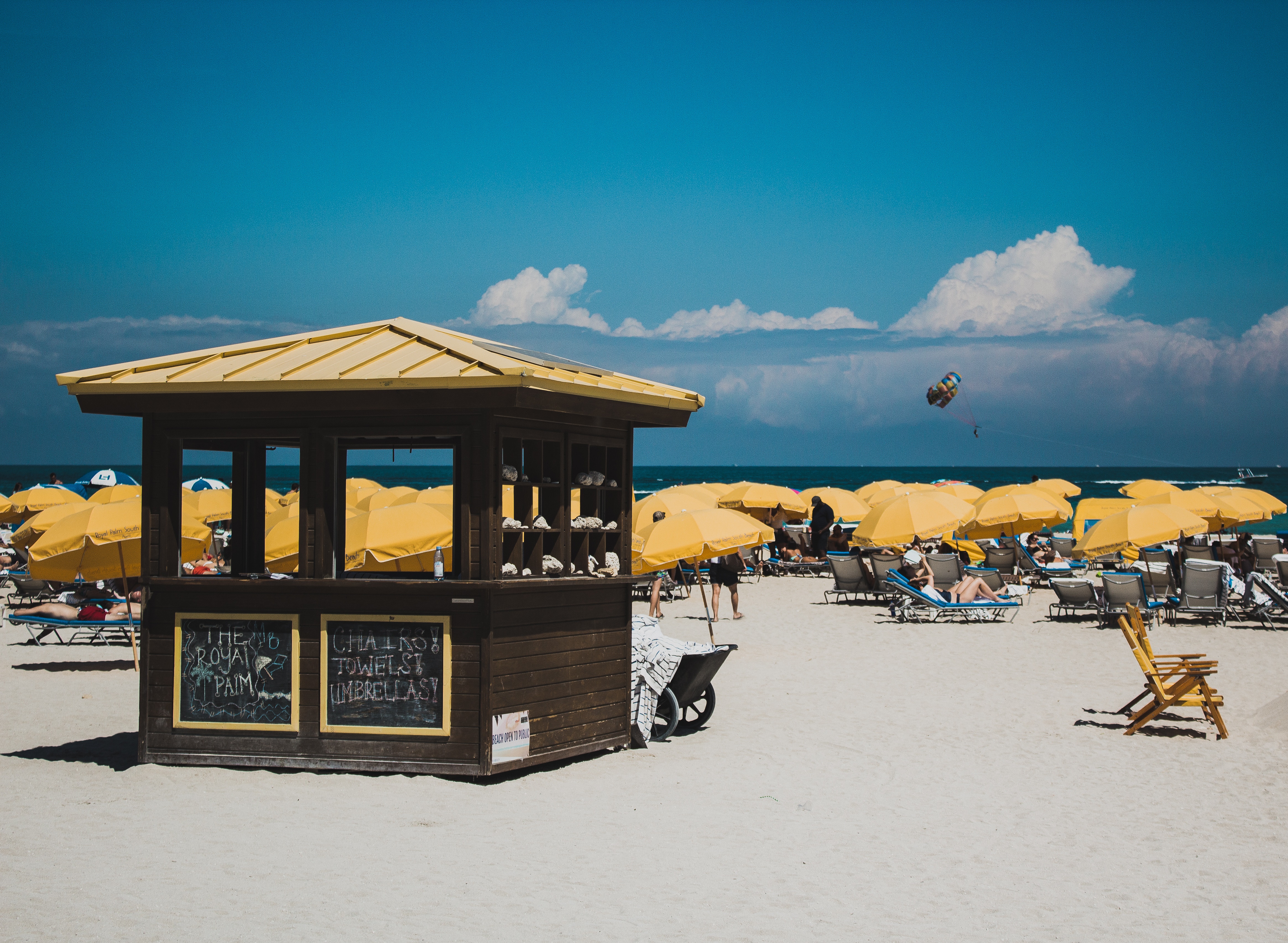
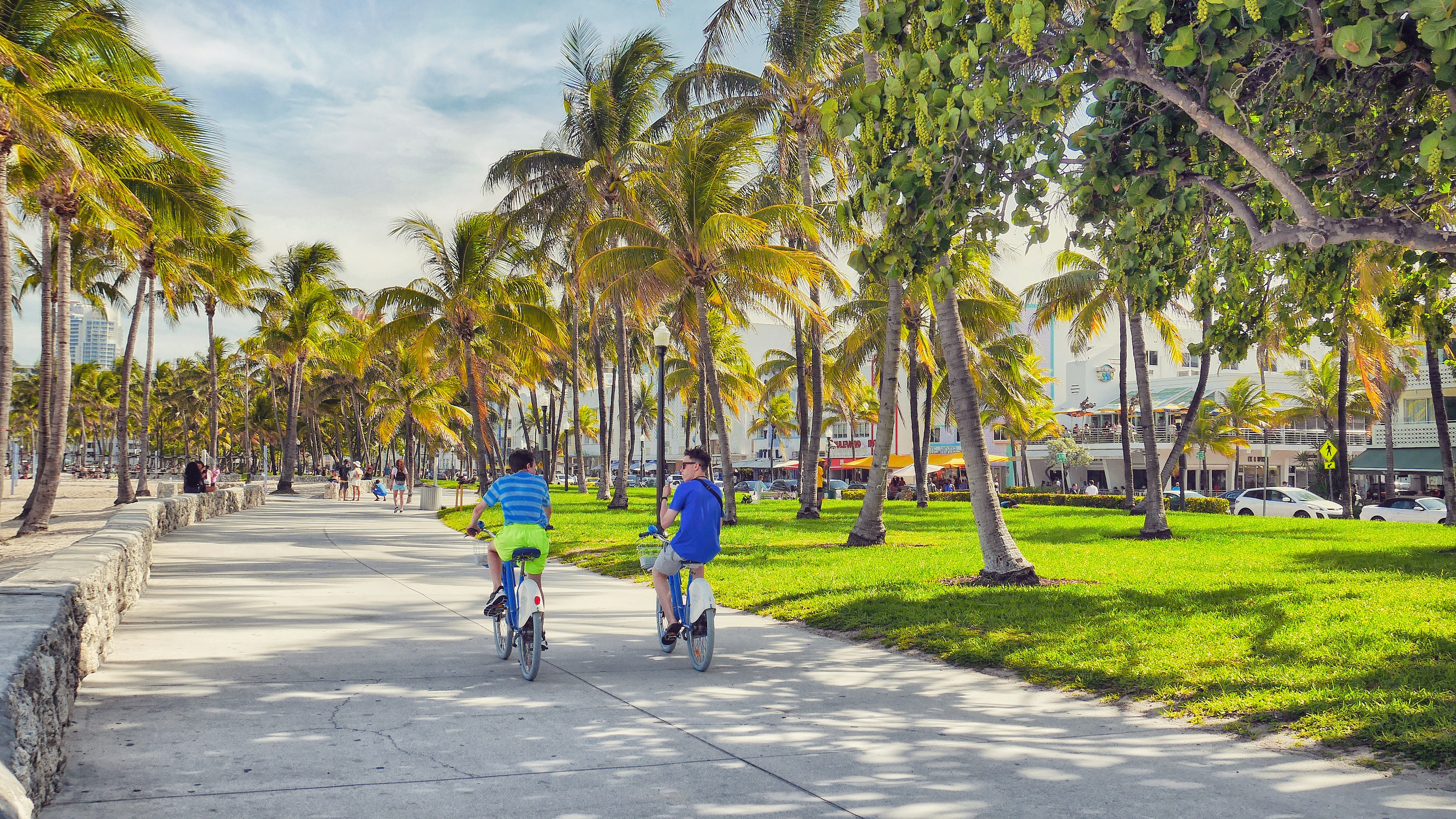
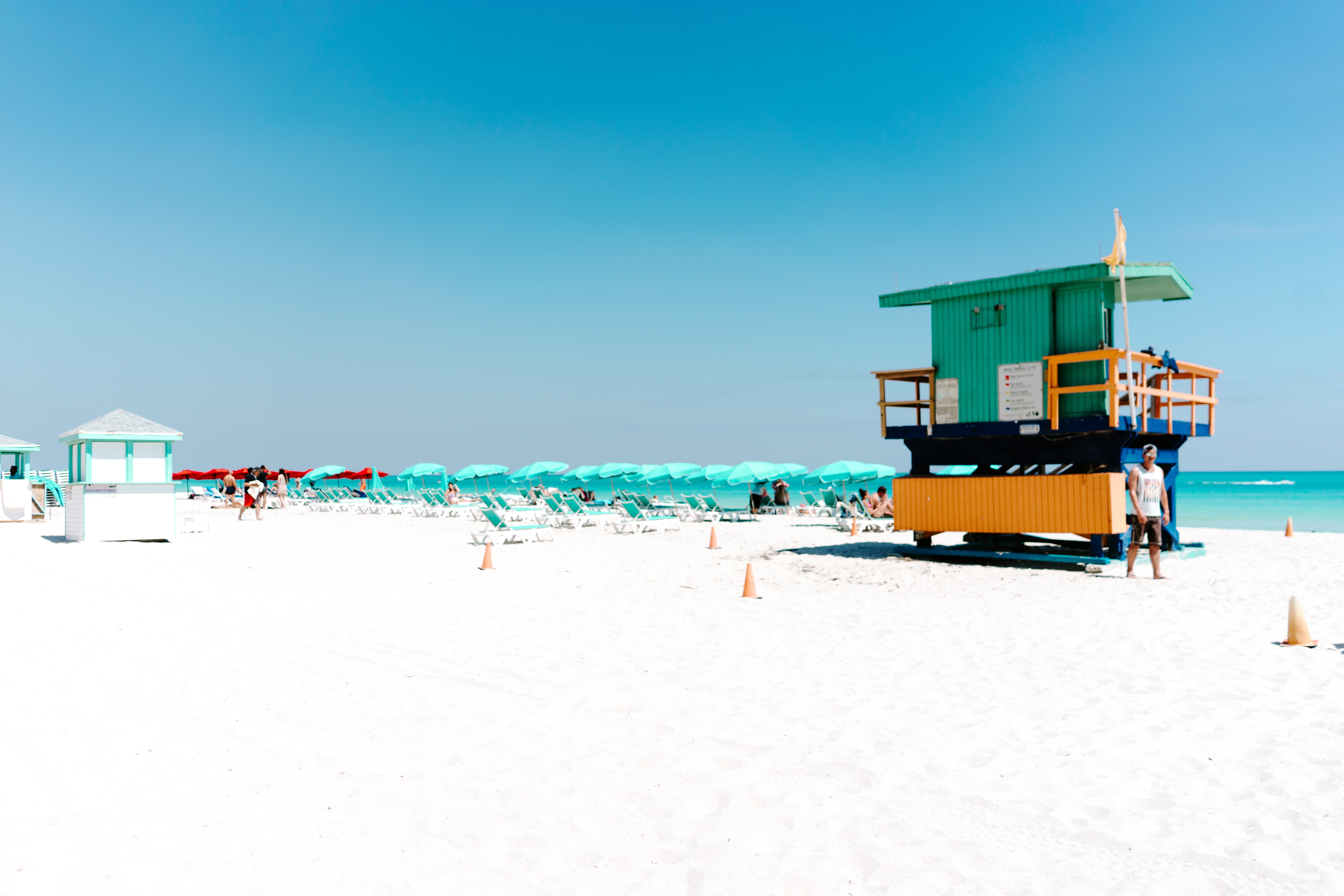
About Miami, Florida
Miami is one of the world’s most popular holiday spots. It has so much to offer; from its countless beach areas, to culture and museums, from spa and shopping days out, to endless cuban restaurants and cafes. Miami is a multicultural city that has something to offer to everyone.
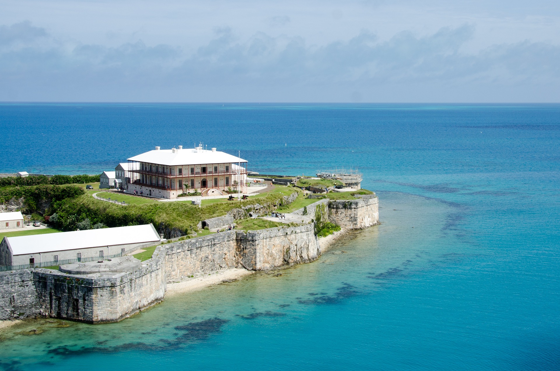
About Kings Wharf
You go to heaven if you want - I'd rather stay here in Bermuda!' So gushed Mark Twain in the 19th century, and Bermuda's promise of sun and sea still lures holiday-makers to its shores. Settled by the English Virginia Company in 1609, Bermuda is the oldest and most populous of Britain's remaining overseas territories. These days, celebrities like Michael Douglas and Catherine Zeta-Jones call Bermuda home. The island is surrounded by a fantastic coral reef that harbours colourful fish and has ensnared scores of shipwrecks, making for memorable diving and snorkelling.
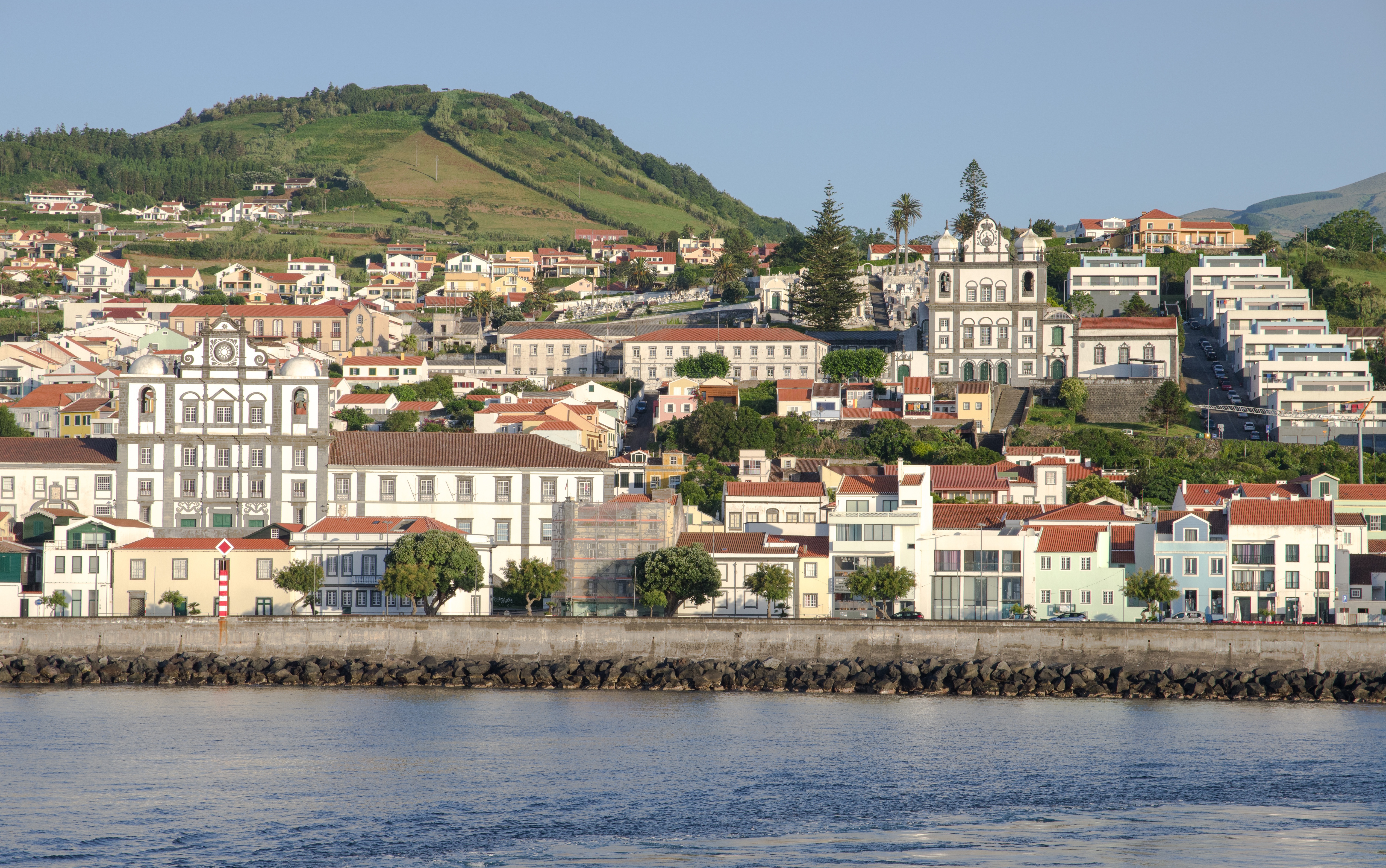
About Horta, Azores
Set on the five-sided island of Faial, Horta is decorated with a colourful cacophony of artworks, which have been daubed across its concrete marina by visitors from around the globe. Left behind by sailors, they tell thrilling stories of life on the high seas. Sitting in the midst of the vast Atlantic, 1,100 miles away from the Portuguese mainland, Horta is the ideal pit-stop for yachts traversing the Atlantic, and one of the world's most visited marinas. The tapered, imposing peak of the Pico volcano, on neighbouring Pico Island, provides a glorious backdrop to the jostling yacht masts of the marina. For the ultimate view, however, you'll need to head up to Faial's own volcanic treasure - Caldeira. Look out from this colossal crater, to absorb the extraordinary views, and a demonstration of a volcano's ability to create as well as destroy. The crater is a natural reserve that blooms with wildflowers and lush green scenery, and scattered sky-blue hydrangeas. Flowers spread colour right across these islands - and you can learn more about the native species at the Faial Botanical Garden.
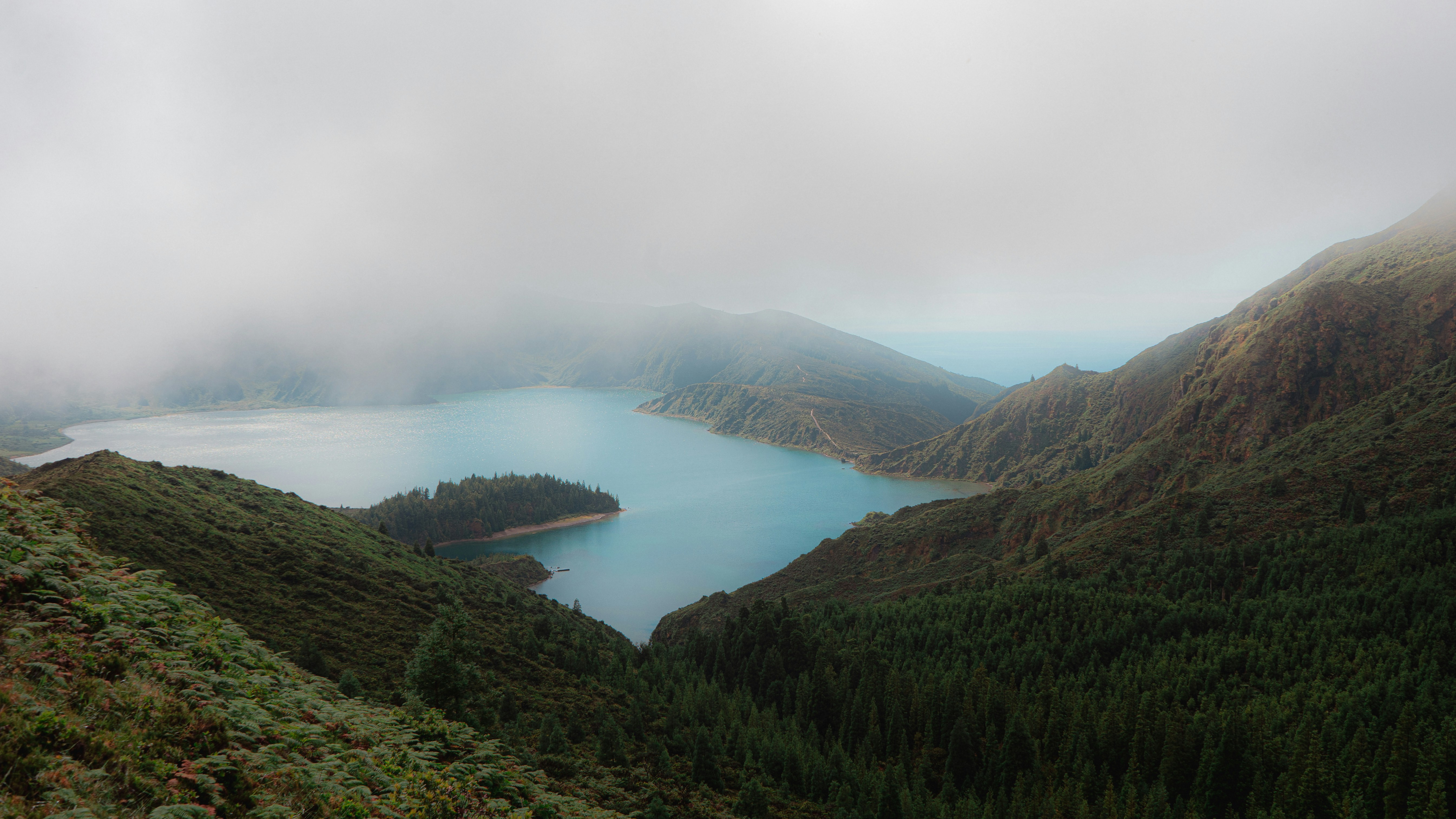
About Ponta Delgada, Azores
Offering solace on the long journey across the Atlantic, Ponta Delgada is the Azores Islands' largest city, and a welcome relief for any weary sailor. Located on an archipelago of Portuguese islands, some 1,100 miles from the mainland, you can explore humbling volcanic scenery, as well as Sao Miguel's verdant landscape - which glows with colour when the hydrangeas that the Azores are known for bloom into life during the summer months. The striking black and white facade of the Church of Sao Jose welcomes you to the city itself, while you can head to the markets to pick up the pineapples, tea leaves and coffee beans that add a little flavour to the island. As the largest city of the Azores, Ponta Delgada is well stocked with places to eat delicious local seafood, or pick up a little shopping, as you enjoy setting your feet on dry land, following a long journey at sea. Volcanic firepower has carved these stunning islands, and a journey up to Caldeira das Sete Cidades is a must do, where you can hike beside the water-filled crater, and admire views of steep green walls, and the uninterrupted Atlantic Ocean stretching beyond them. Lagoa de Fogo offers yet more humbling views, with the crater lake dropping off sharply to rippled ocean far below.
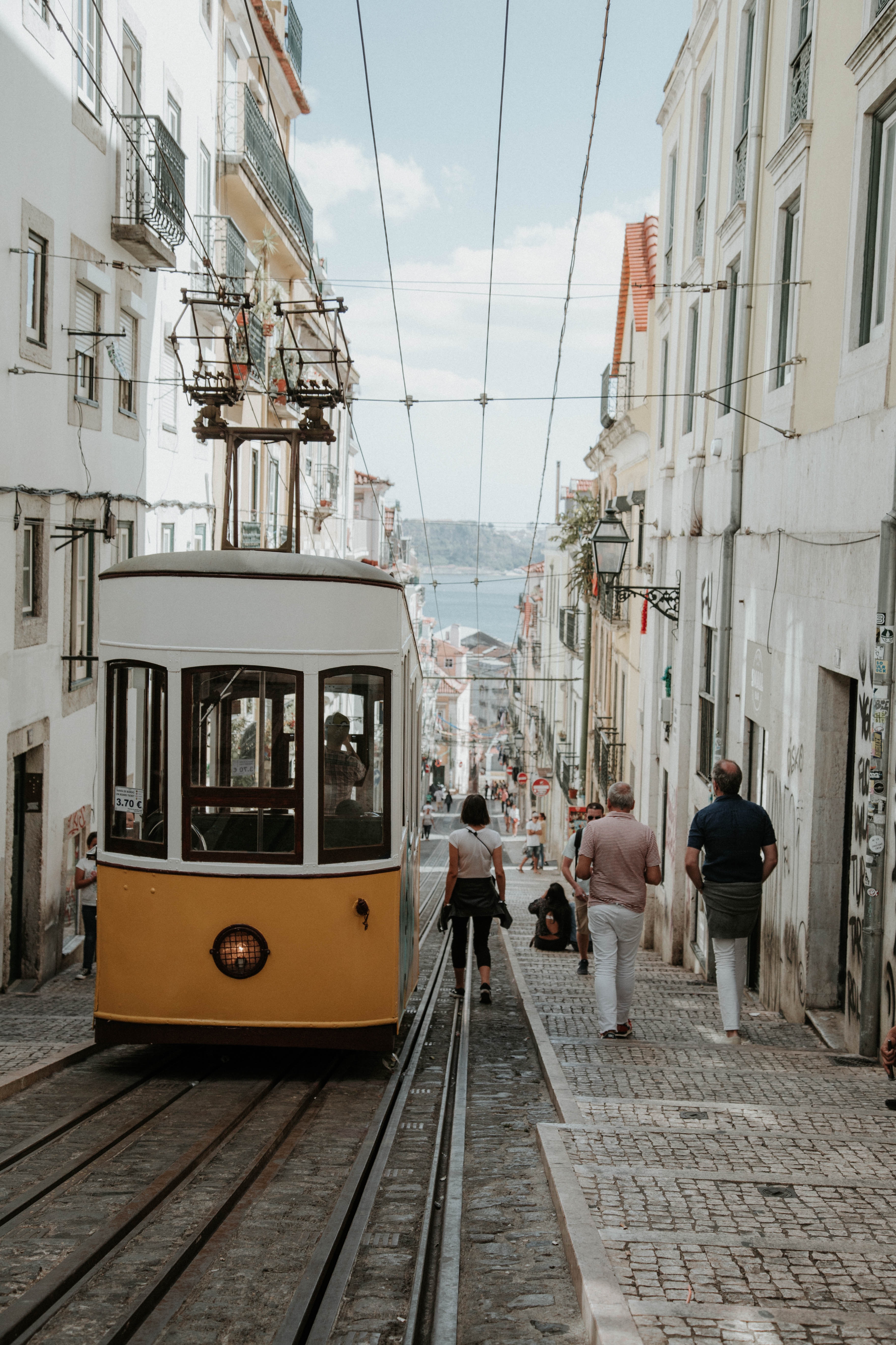
About Lisbon
Set on seven hills on the banks of the River Tagus, Lisbon has been the capital of Portugal since the 13th century. It is a city famous for its majestic architecture, old wooden trams, Moorish features and more than twenty centuries of history. Following disastrous earthquakes in the 18th century, Lisbon was rebuilt by the Marques de Pombal who created an elegant city with wide boulevards and a great riverfront and square, Praça do Comércio. Today there are distinct modern and ancient sections, combining great shopping with culture and sightseeing in the Old Town, built on the city's terraced hillsides. The distance between the ship and your tour vehicle may vary. This distance is not included in the excursion grades.
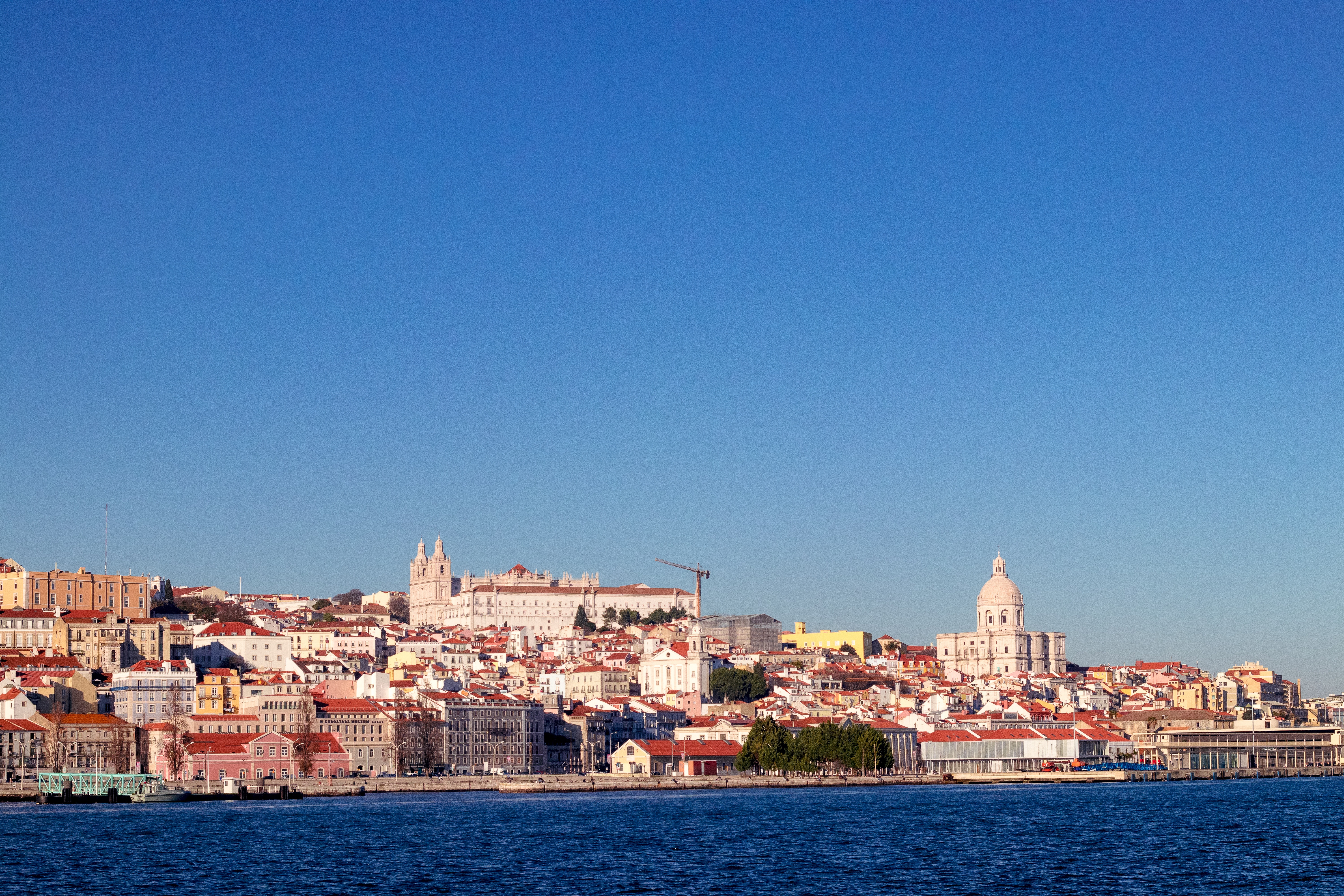
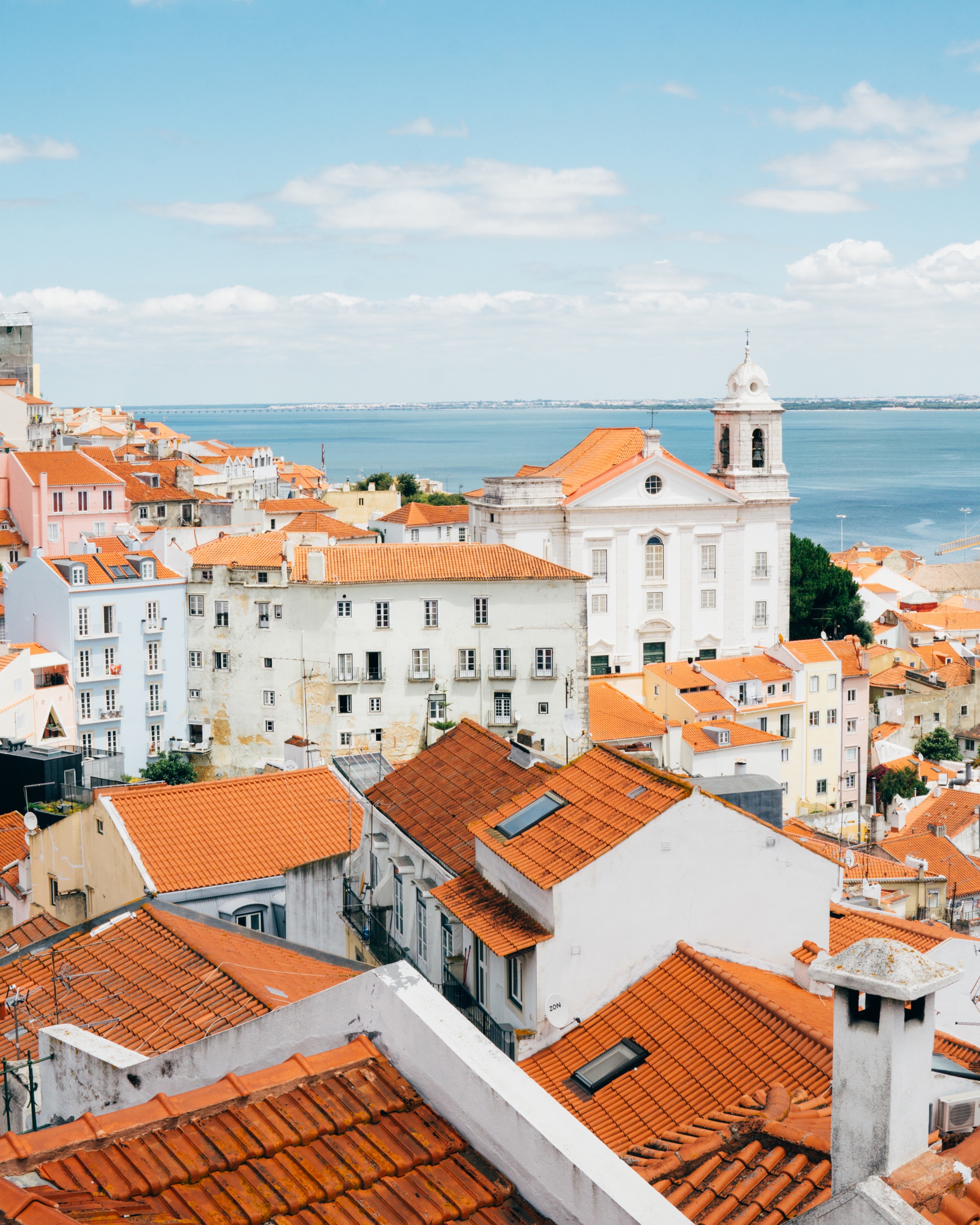
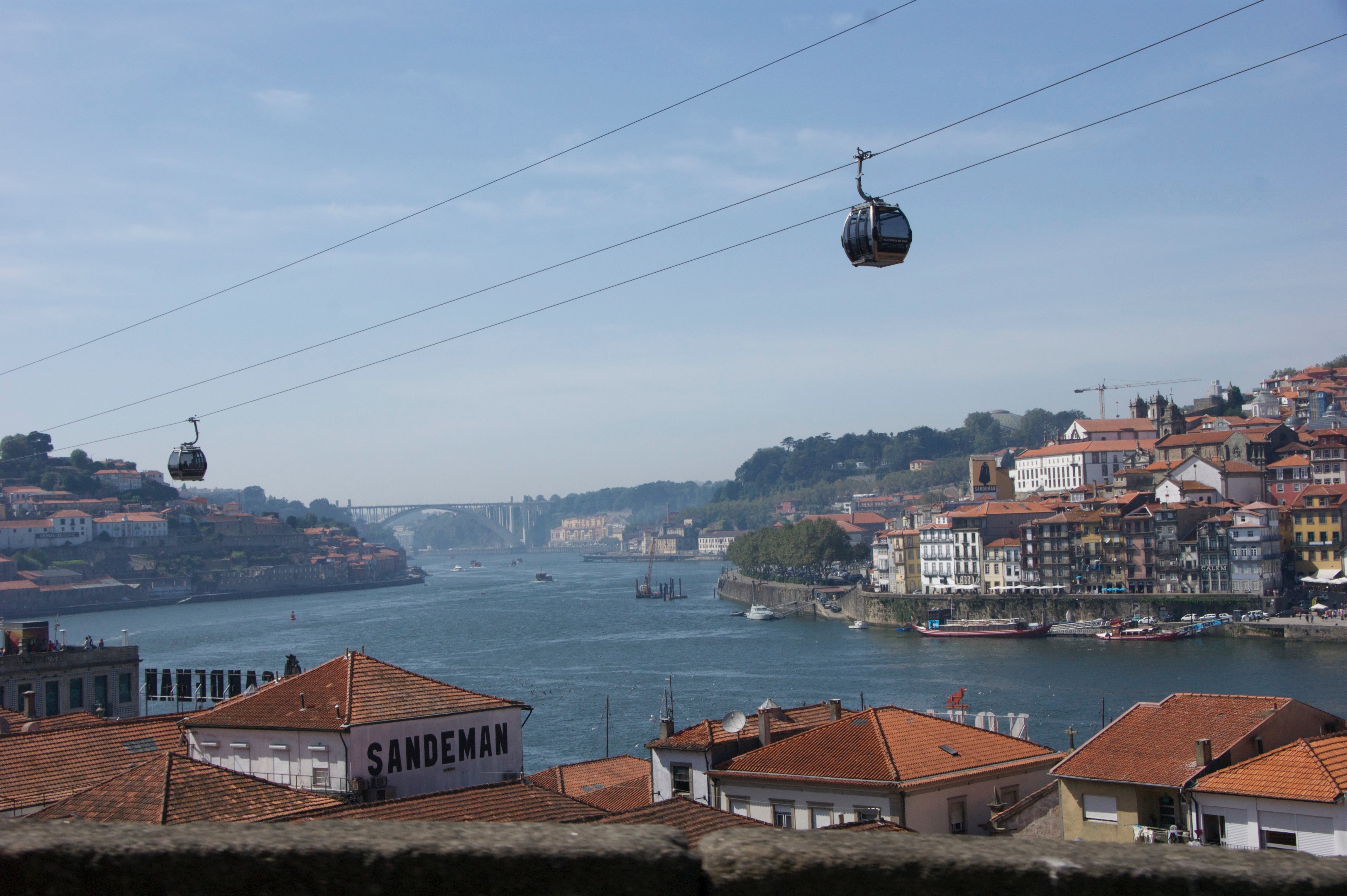
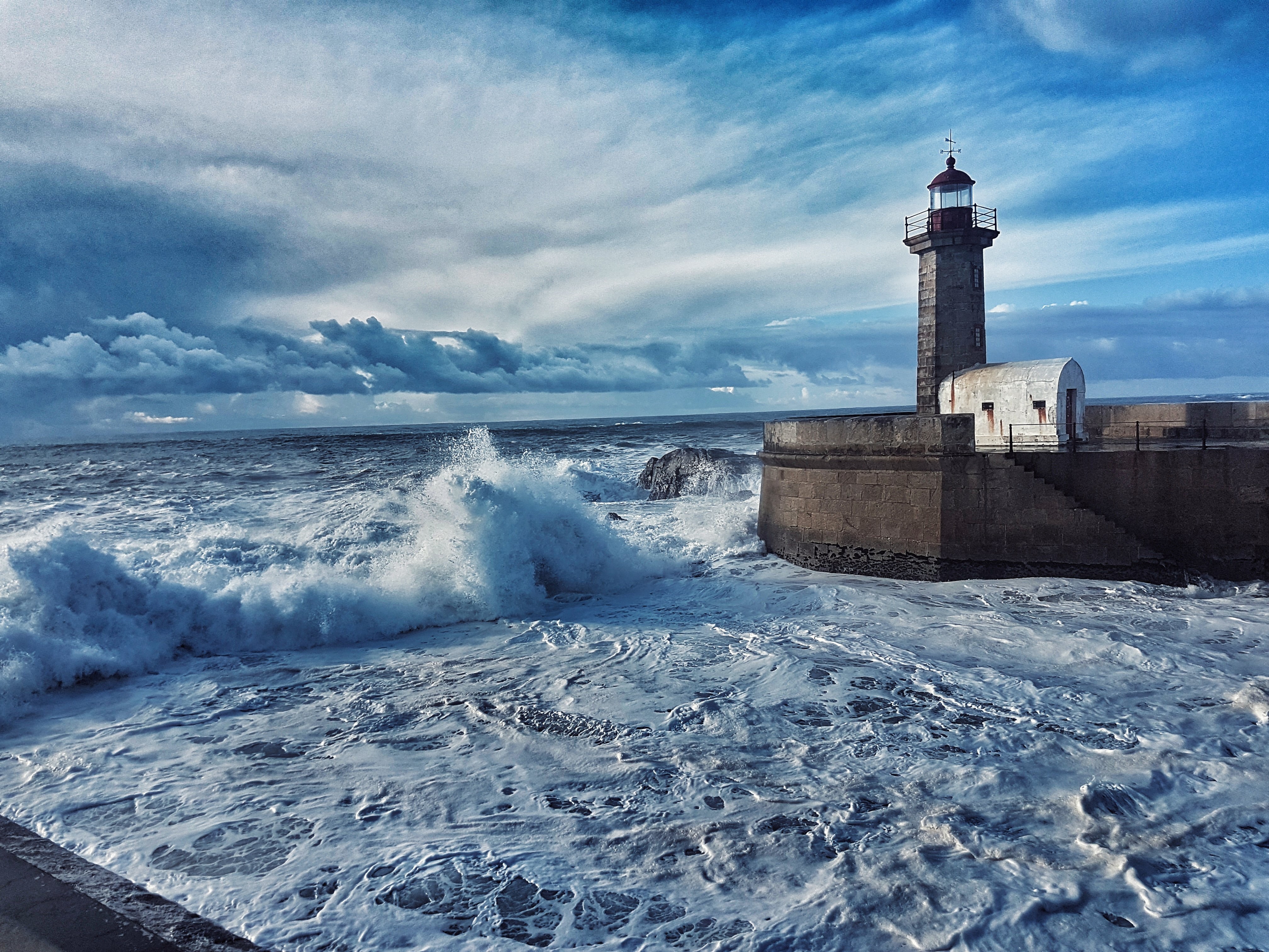
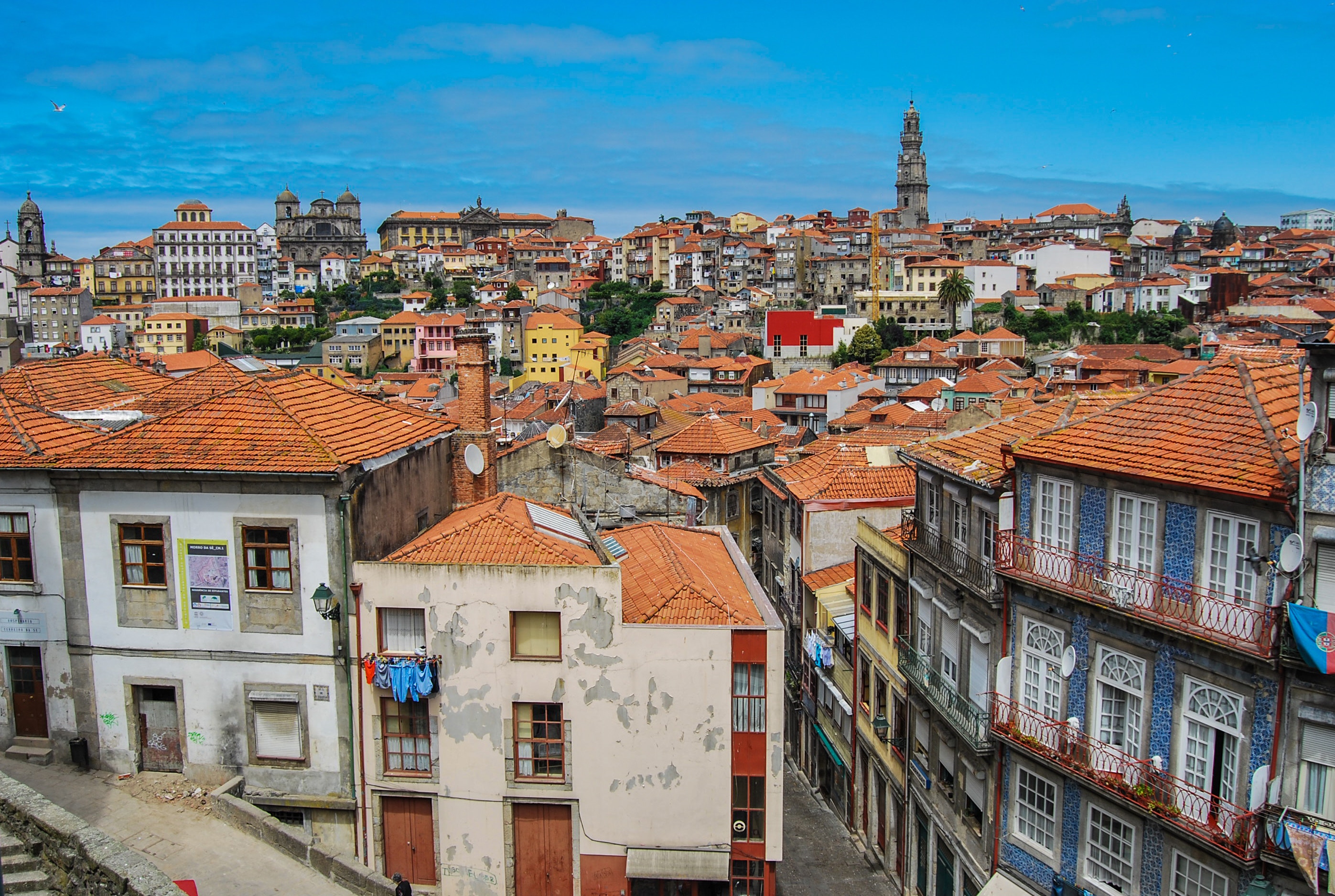
About Porto
Lively, commercial Oporto is the second largest city in Portugal after Lisbon. Also called Porto for short, the word easily brings to mind the city's most famous product - port wine. Oporto's strategic location on the north bank of the Douro River has accounted for the town's importance since ancient times. The Romans built a fort here where their trading route crossed the Douro, and the Moors brought their own culture to the area. Oporto profited from provisioning crusaders en route to the Holy Land and enjoyed the riches from Portuguese maritime discoveries during the 15th and 16th centuries. Later, port wine trade with Britain compensated for the loss of the spice trade and the end of gold and gem shipments from Brazil. In the 19th century, the city went through a period of new prosperity with the rise of industries. In its wake followed the building of workers' quarters and opulent residences. Since the declaration of Oporto as a World Heritage Site by UNESCO, the city aims to build up a cultural reference that will provide it with a new image, based on deep historical roots. Among the attractions that make Oporto such an interesting place are its graceful bridges spanning the Douro River, a picturesque riverfront quarter and, most notable, its world-famous port wine lodges. Although Oporto is a bustling centre and home to many different businesses, the source of its greatest fame is the rich, sweet fortified red wine we know as port.
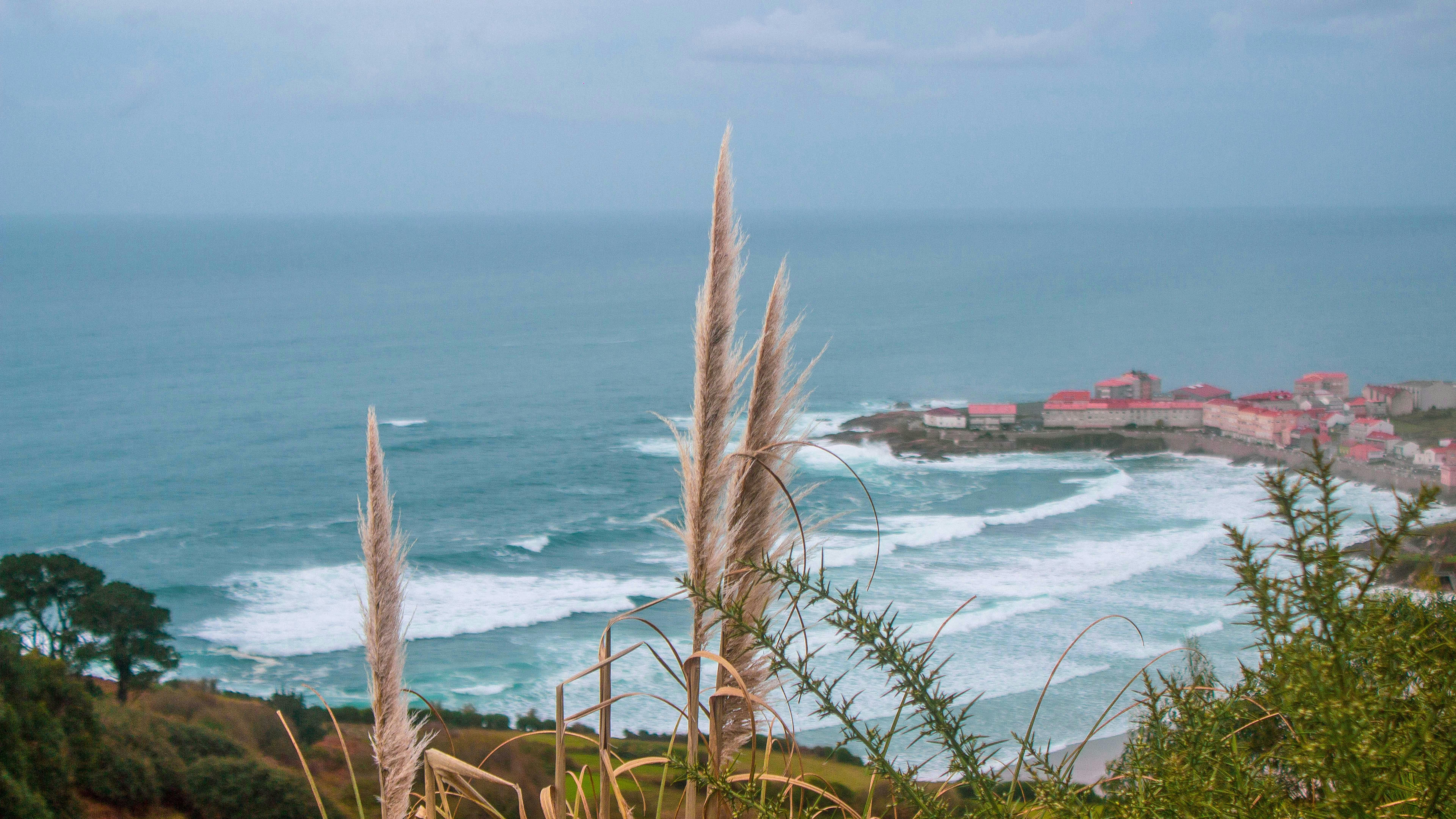
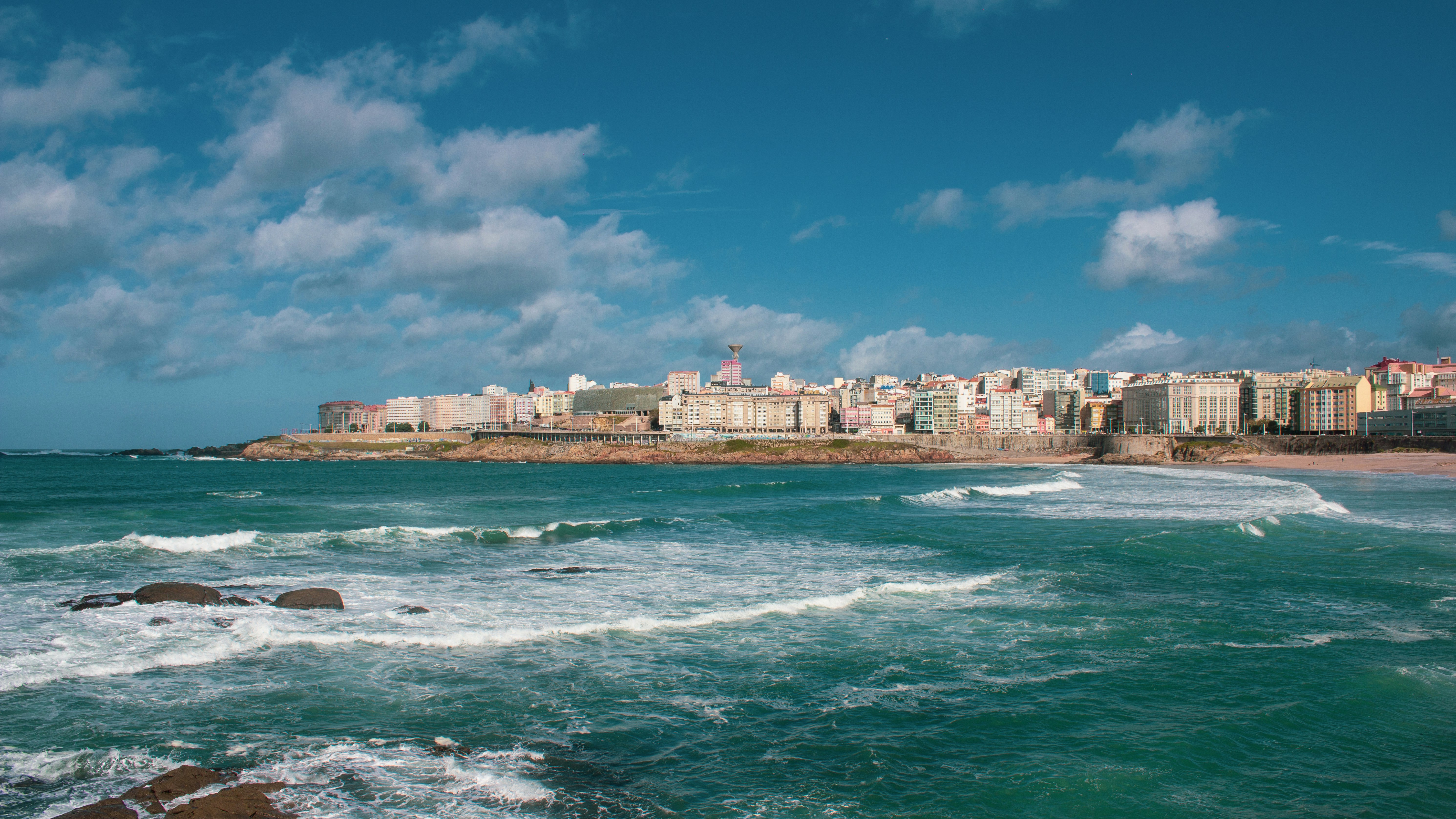
About La Coruña
La Coruña, the largest city in Spain's Galicia region, is among the country's busiest ports. The remote Galicia area is tucked into the northwest corner of the Iberian Peninsula, surprising visitors with its green and misty countryside that is so much unlike other parts of Spain. The name "Galicia" is Celtic in origin, for it was the Celts who occupied the region around the 6th-century BC and erected fortifications. La Coruña was already considered an important port under the Romans. They were followed by an invasion of Suevians, Visigoths and, much later in 730, the Moors. It was after Galicia was incorporated into the Kingdom of Asturias that the epic saga of the Pilgrimage to Santiago (St. James) began. From the 15th century, overseas trade developed rapidly; in 1720, La Coruña was granted the privilege of trading with America - a right previously only held by Cadiz and Seville. This was the great era when adventurous men voyaged to the colonies and returned with vast riches. Today, the city's significant expansion is evident in three distinct quarters: the town centre located along the isthmus; the business and commercial centre with wide avenues and shopping streets; and the "Ensanche" to the south, occupied by warehouses and factories. Many of the buildings in the old section feature the characteristic glazed façades that have earned La Coruña the name "City of Crystal." Plaza Maria Pita, the beautiful main square, is named after the local heroine who saved the town in 1589 when she seized the English standard from the beacon and gave the alarm, warning her fellow townsmen of the English attack.
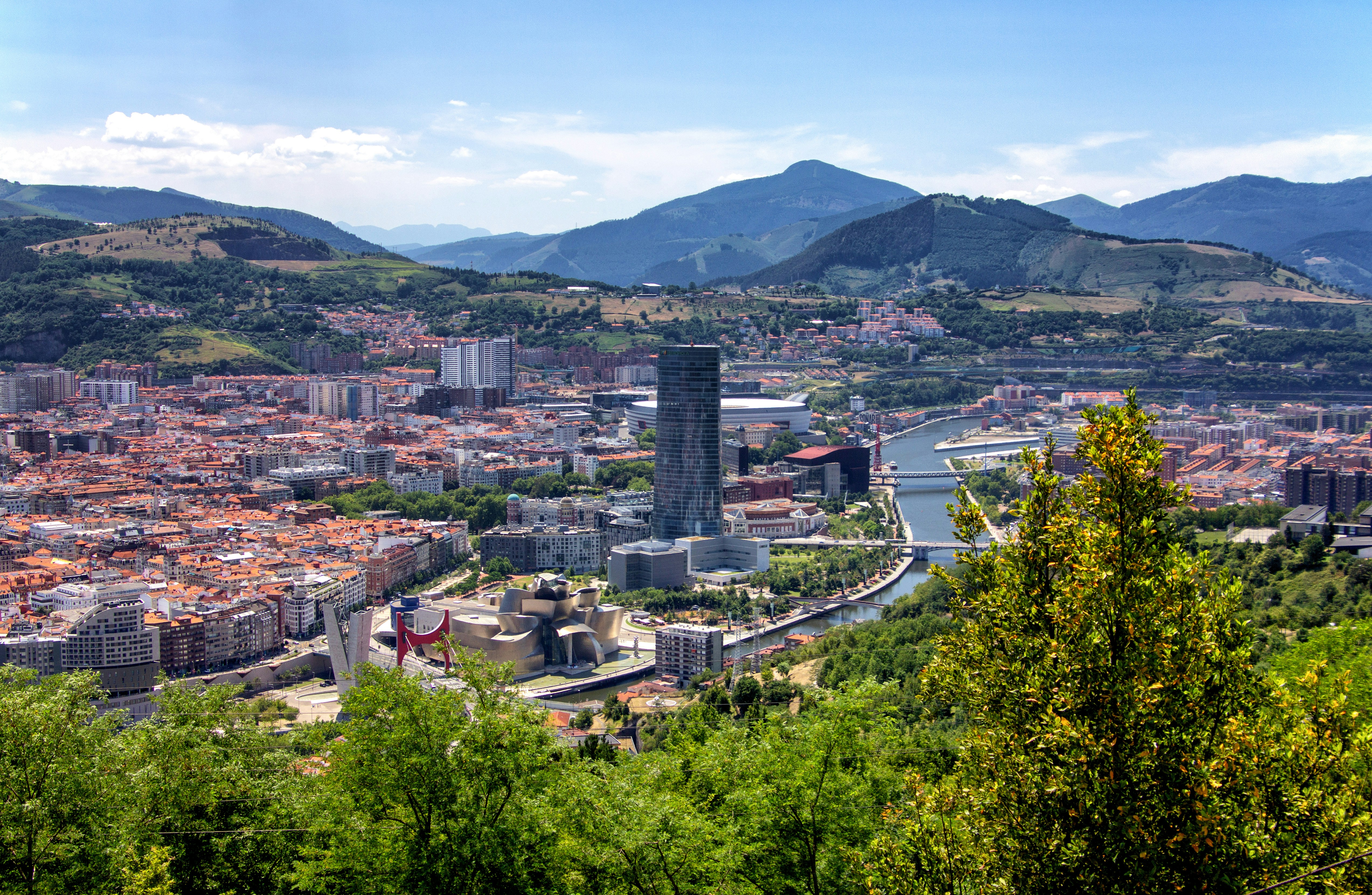
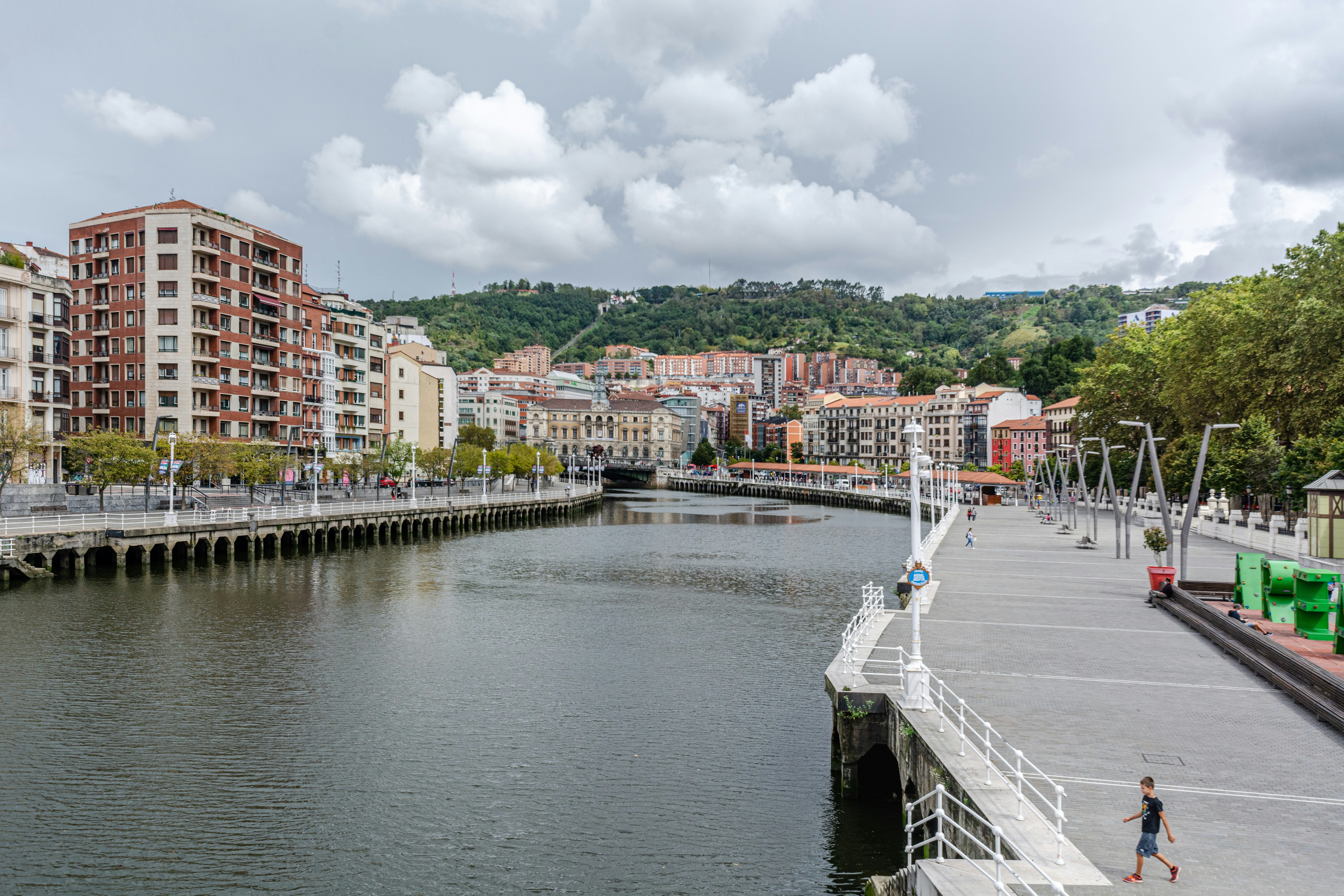
About Bilbao
Time in Bilbao (Bilbo, in Euskera) may be recorded as BG or AG (Before Guggenheim or After Guggenheim). Never has a single monument of art and architecture so radically changed a city. Frank Gehry's stunning museum, Norman Foster's sleek subway system, the Santiago Calatrava glass footbridge and airport, the leafy César Pelli Abandoibarra park and commercial complex next to the Guggenheim, and the Philippe Starck AlhóndigaBilbao cultural center have contributed to an unprecedented cultural revolution in what was once the industry capital of the Basque Country.Greater Bilbao contains almost 1 million inhabitants, nearly half the total population of the Basque Country. Founded in 1300 by Vizcayan noble Diego López de Haro, Bilbao became an industrial center in the mid-19th century, largely because of the abundance of minerals in the surrounding hills. An affluent industrial class grew up here, as did the working class in suburbs that line the Margen Izquierda (Left Bank) of the Nervión estuary.Bilbao's new attractions get more press, but the city's old treasures still quietly line the banks of the rust-color Nervión River. The Casco Viejo (Old Quarter)—also known as Siete Calles (Seven Streets)—is a charming jumble of shops, bars, and restaurants on the river's Right Bank, near the Puente del Arenal bridge. This elegant proto-Bilbao nucleus was carefully restored after devastating floods in 1983. Throughout the Casco Viejo are ancient mansions emblazoned with family coats of arms, wooden doors, and fine ironwork balconies. The most interesting square is the 64-arch Plaza Nueva, where an outdoor market is pitched every Sunday morning.Walking the banks of the Nervión is a satisfying jaunt. After all, this was how—while out on a morning jog—Guggenheim director Thomas Krens first discovered the perfect spot for his project, nearly opposite the right bank's Deusto University. From the Palacio de Euskalduna upstream to the colossal Mercado de la Ribera, parks and green zones line the river. César Pelli's Abandoibarra project fills in the half mile between the Guggenheim and the Euskalduna bridge with a series of parks, the Deusto University library, the Meliá Bilbao Hotel, and a major shopping center.On the left bank, the wide, late-19th-century boulevards of the Ensanche neighborhood, such as Gran Vía (the main shopping artery) and Alameda de Mazarredo, are the city's more formal face. Bilbao's cultural institutions include, along with the Guggenheim, a major museum of fine arts (the Museo de Bellas Artes) and an opera society (Asociación Bilbaína de Amigos de la Ópera, or ABAO) with 7,000 members from Spain and southern France. In addition, epicureans have long ranked Bilbao's culinary offerings among the best in Spain. Don't miss a chance to ride the trolley line, the Euskotram, for a trip along the river from Atxuri Station to Basurto's San Mamés soccer stadium, reverently dubbed "la Catedral del Fútbol" (the Cathedral of Football).
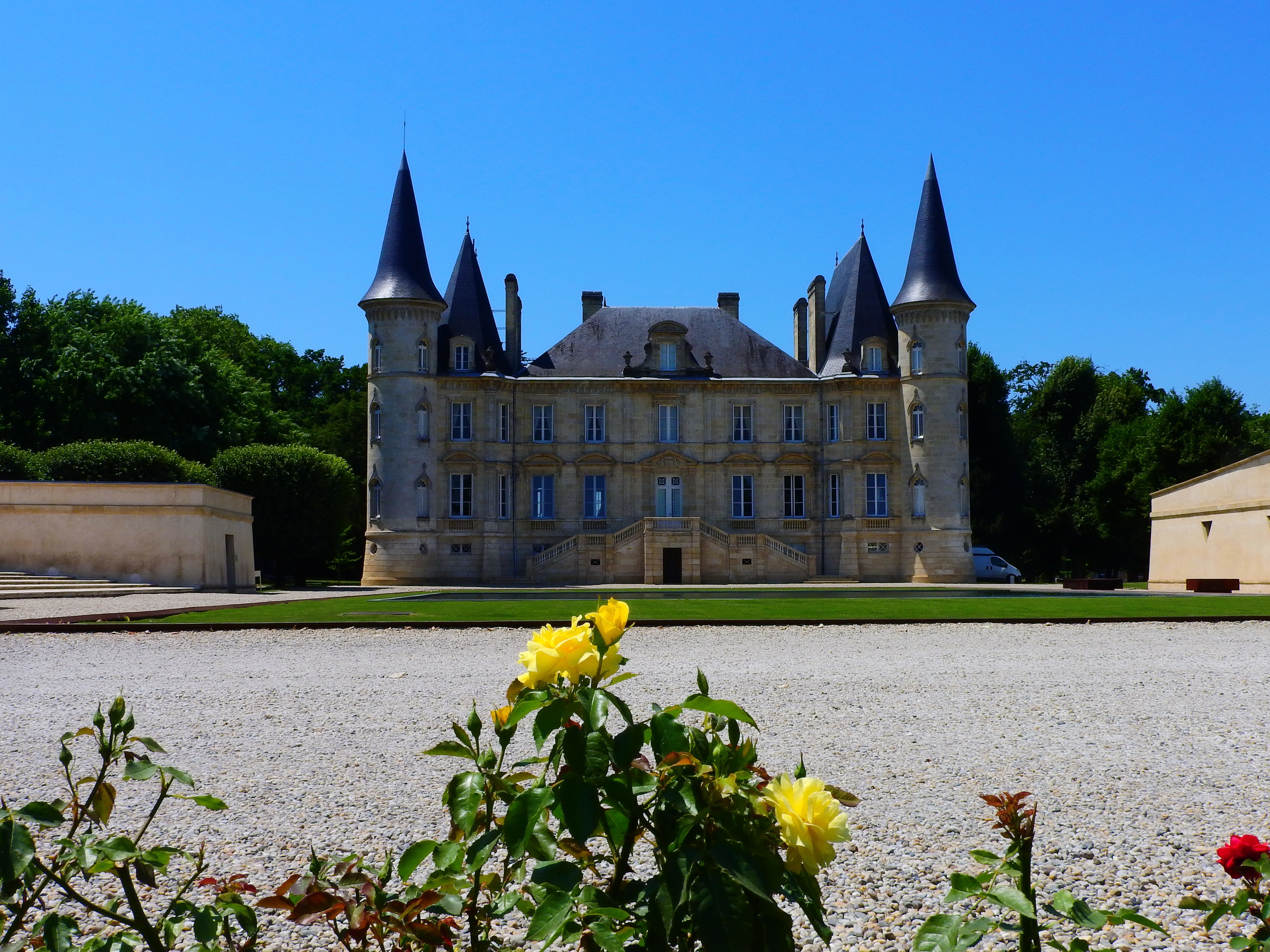
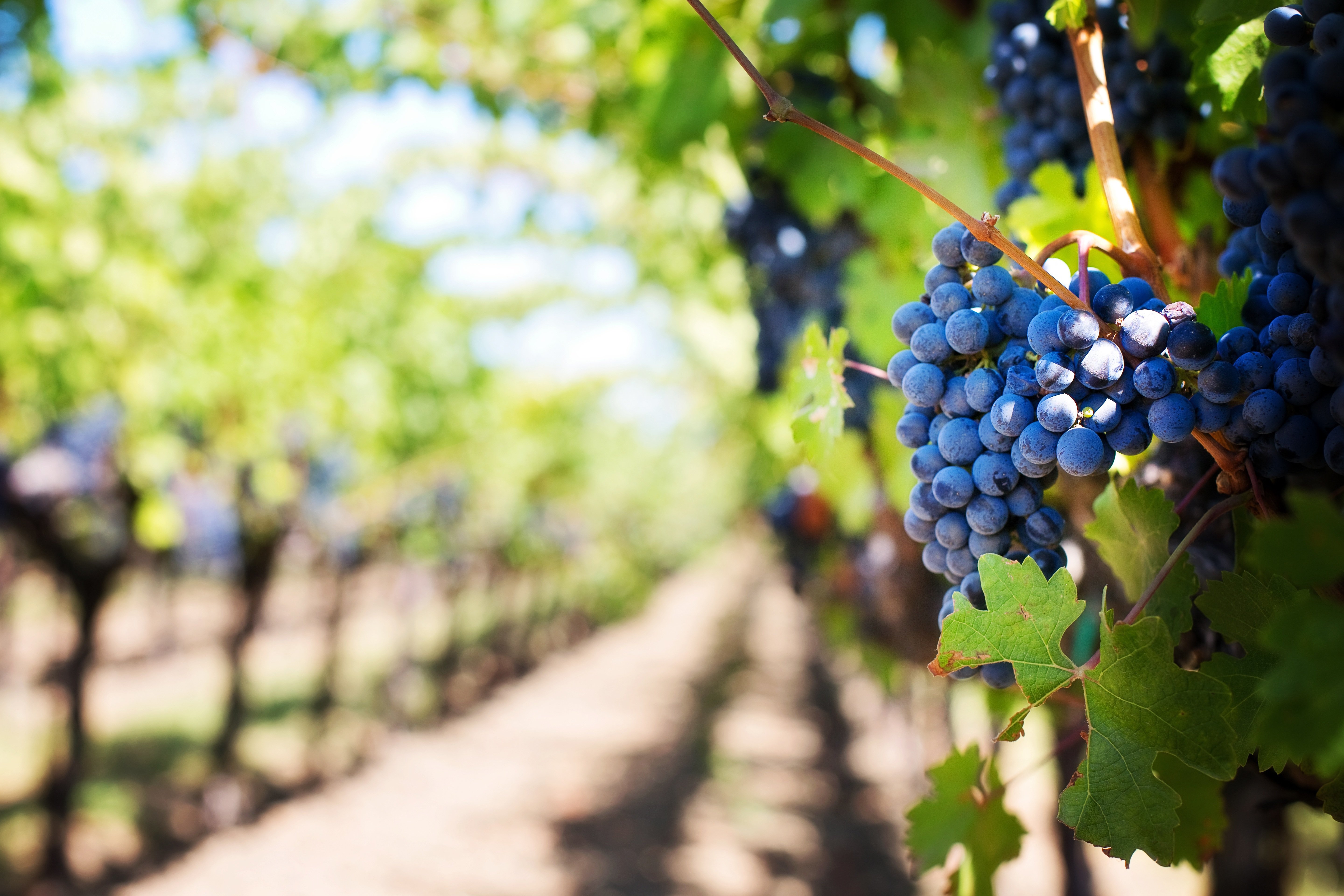
About Pauillac
Pauillac, France, is a scenic village in the Bordeaux wine region, renowned for its prestigious vineyards and charming riverfront. Located on the Gironde estuary, it is famed for its high-quality red wines, including those from renowned châteaux like Lafite Rothschild and Mouton Rothschild. The village features historic buildings, vibrant markets, and stunning views of the estuary. Pauillac’s blend of rich winemaking heritage and picturesque landscapes makes it a delightful destination for wine enthusiasts and travellers seeking a taste of Bordeaux’s elegance.
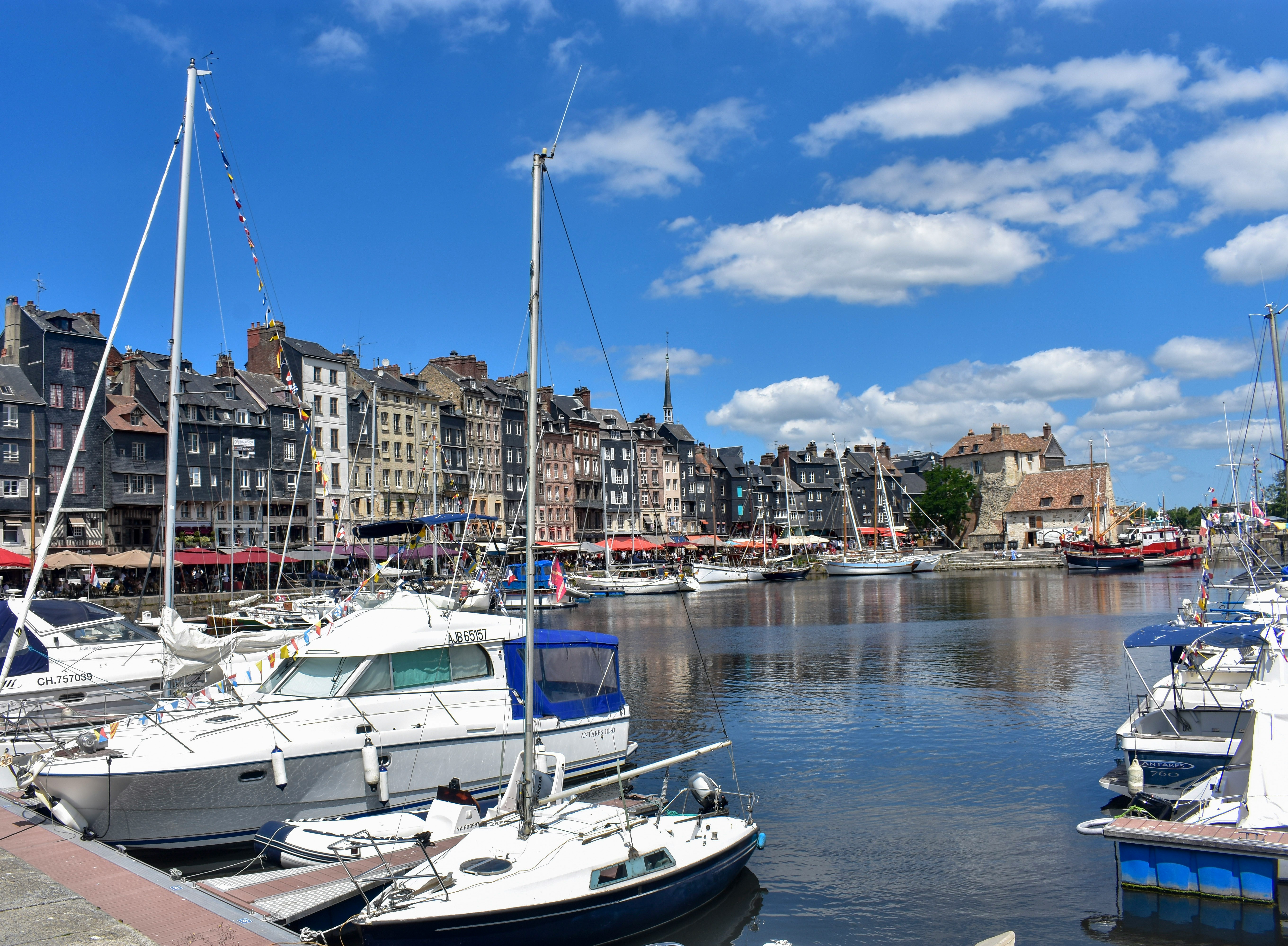
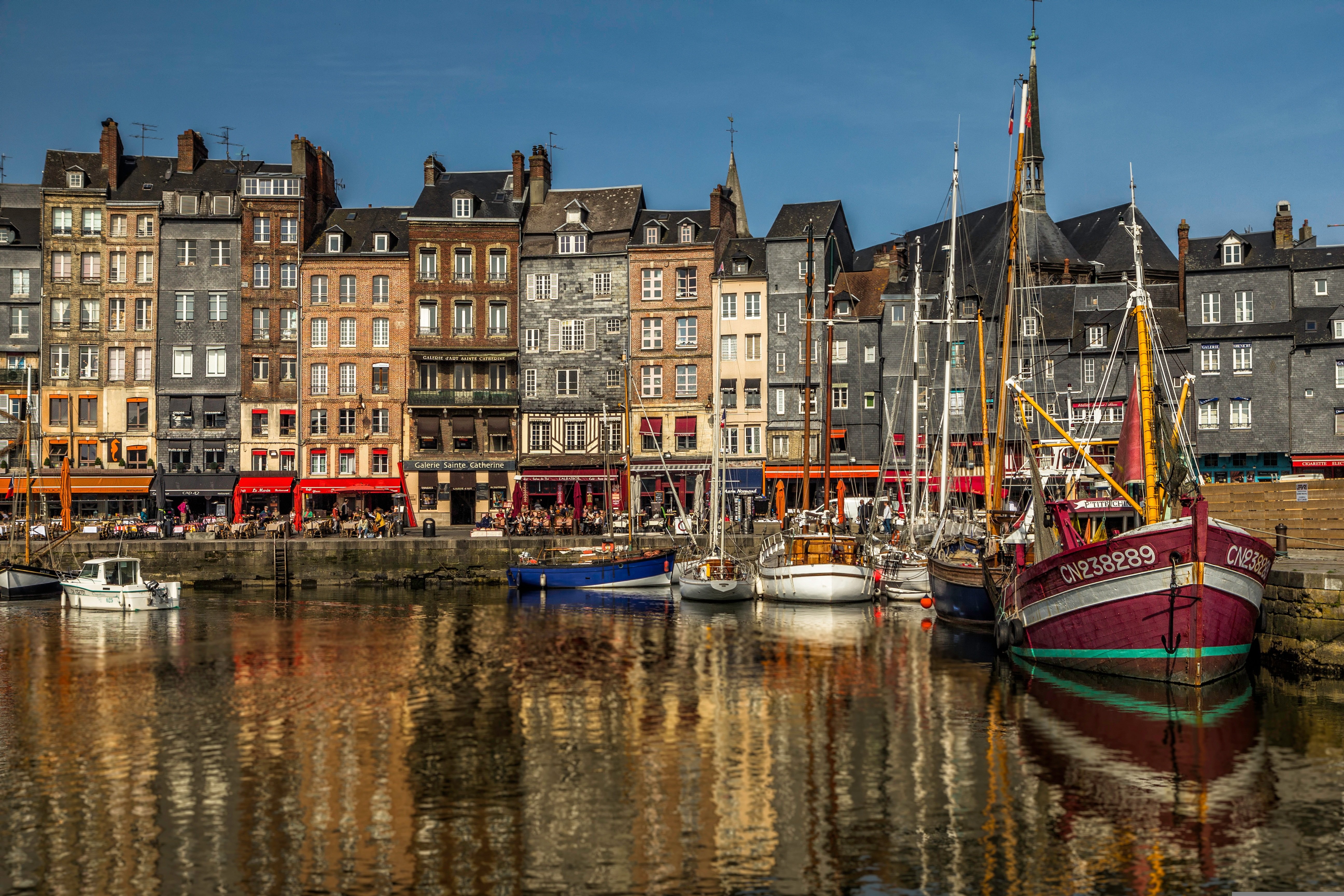
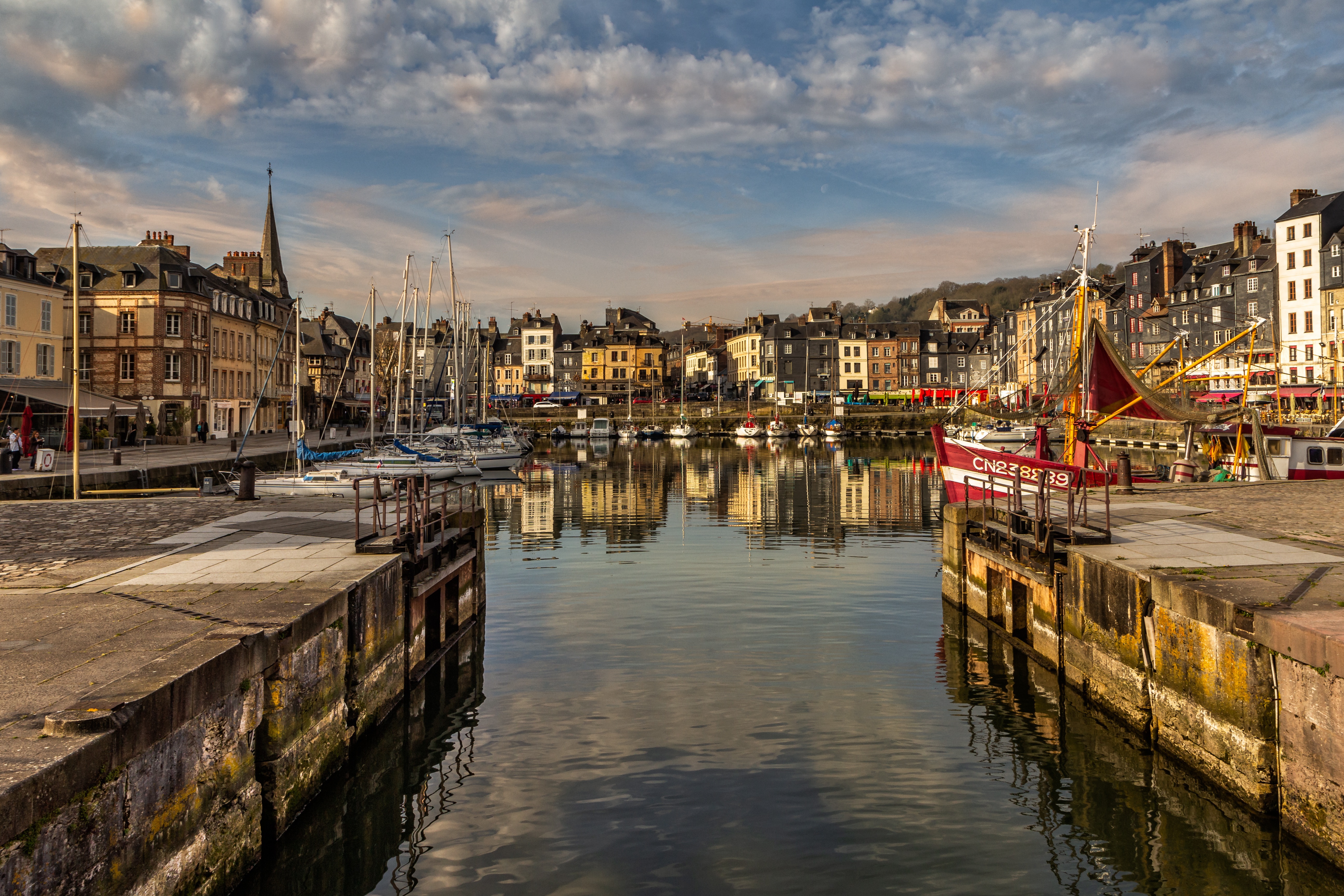
About Honfleur
Honfleur, the most picturesque of the Côte Fleurie's seaside towns, is a time-burnished place with a surplus of half-timber houses and cobbled streets that are lined with a stunning selection of stylish boutiques. Much of its Renaissance architecture remains intact—especially around the 17th-century Vieux Bassin harbor, where the water is fronted on one side by two-story stone houses with low, sloping roofs and on the other by tall slate-topped houses with wooden facades. Maritime expeditions (including some of the first voyages to Canada) departed from here; later, Impressionists were inspired to capture it on canvas. But the town as a whole has become increasingly crowded since the Pont de Normandie opened in 1995. Providing a direct link with Upper Normandy, the world's sixth-largest cable-stayed bridge is supported by two concrete pylons taller than the Eiffel Tower and designed to resist winds of 257 kph (160 mph).

About Calais
About Zeebrugge
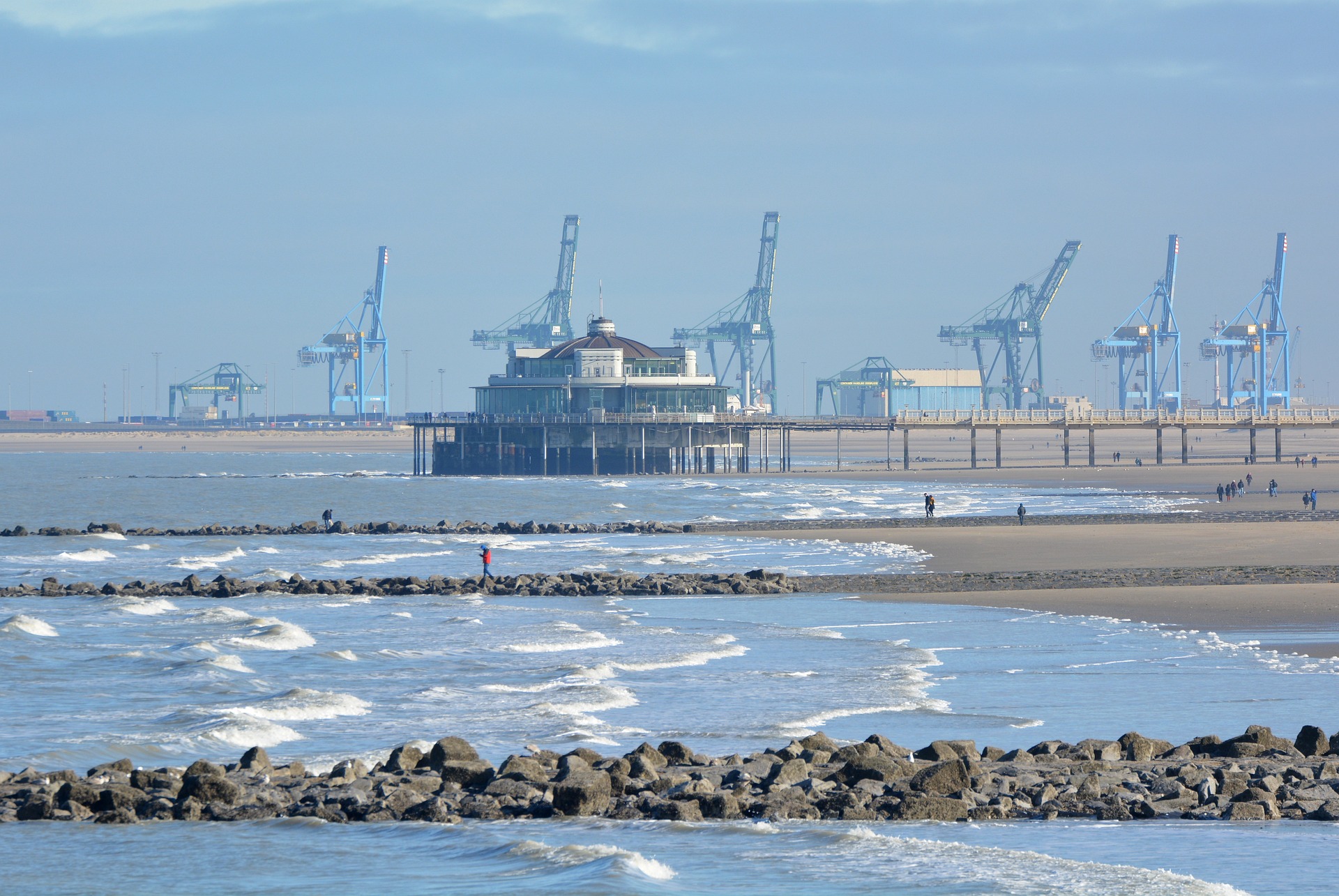
In 1895 work began to construct a new seaport and harbour next to the tiny village of Zeebrugge, situated on the North Sea coast. Today the fast-expanding port of Zeebrugge is one of the busiest in Europe and its marina is Belgium’s most important fishing port. Many attempts were made to destroy this important port during both World Wars. Zeebrugge is ideally located for discovering the historic city of Bruges, and delightful seaside resorts with long sandy beaches can be visited by using the trams that run the whole length of the Belgian coast. Please note that no food may be taken ashore in Belgium. We shall not be offering shuttle buses to Bruges, but you may visit the city on an optional excursion: those visiting Bruges should note that there may be quite a long walk from the coach to the town centre.
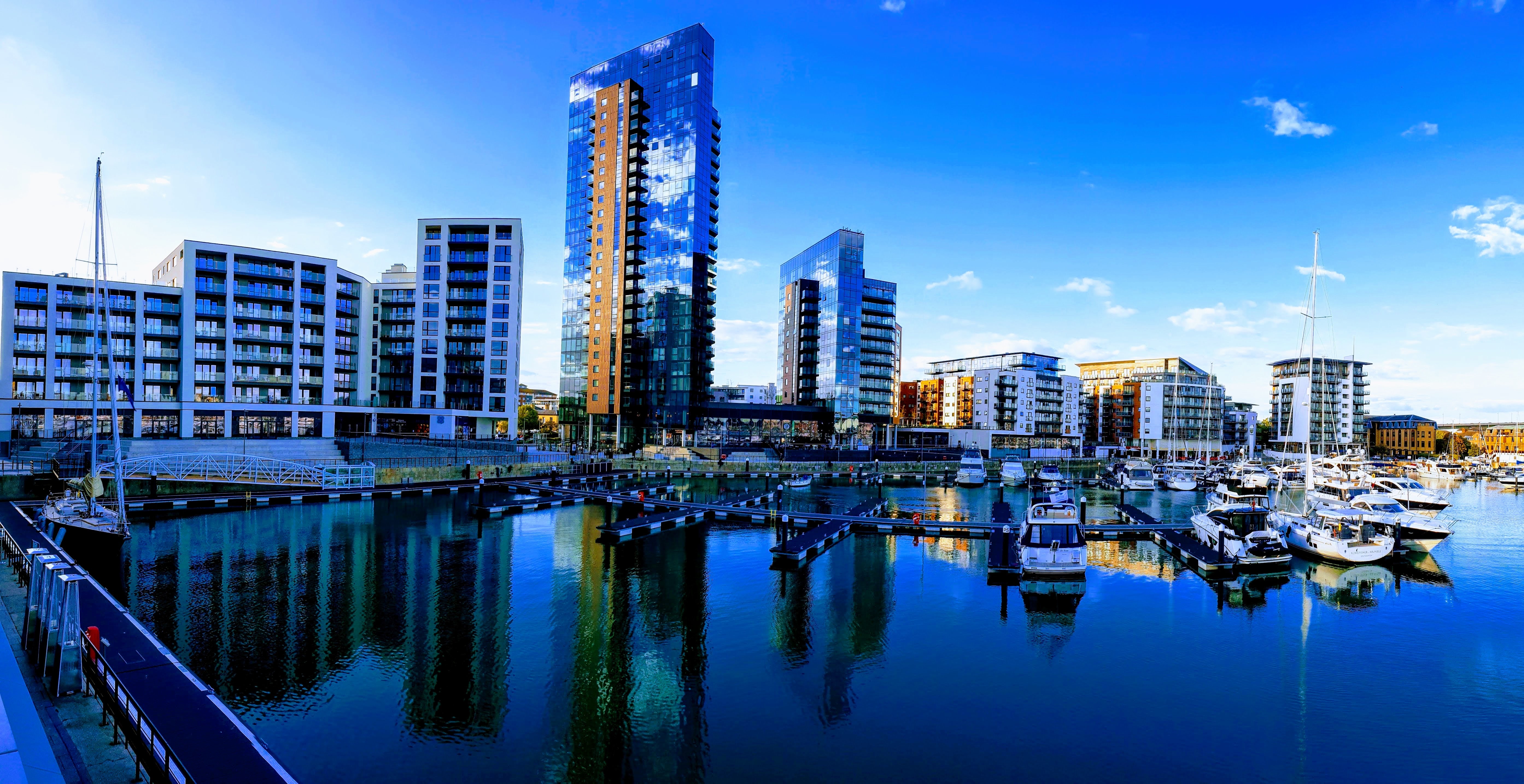
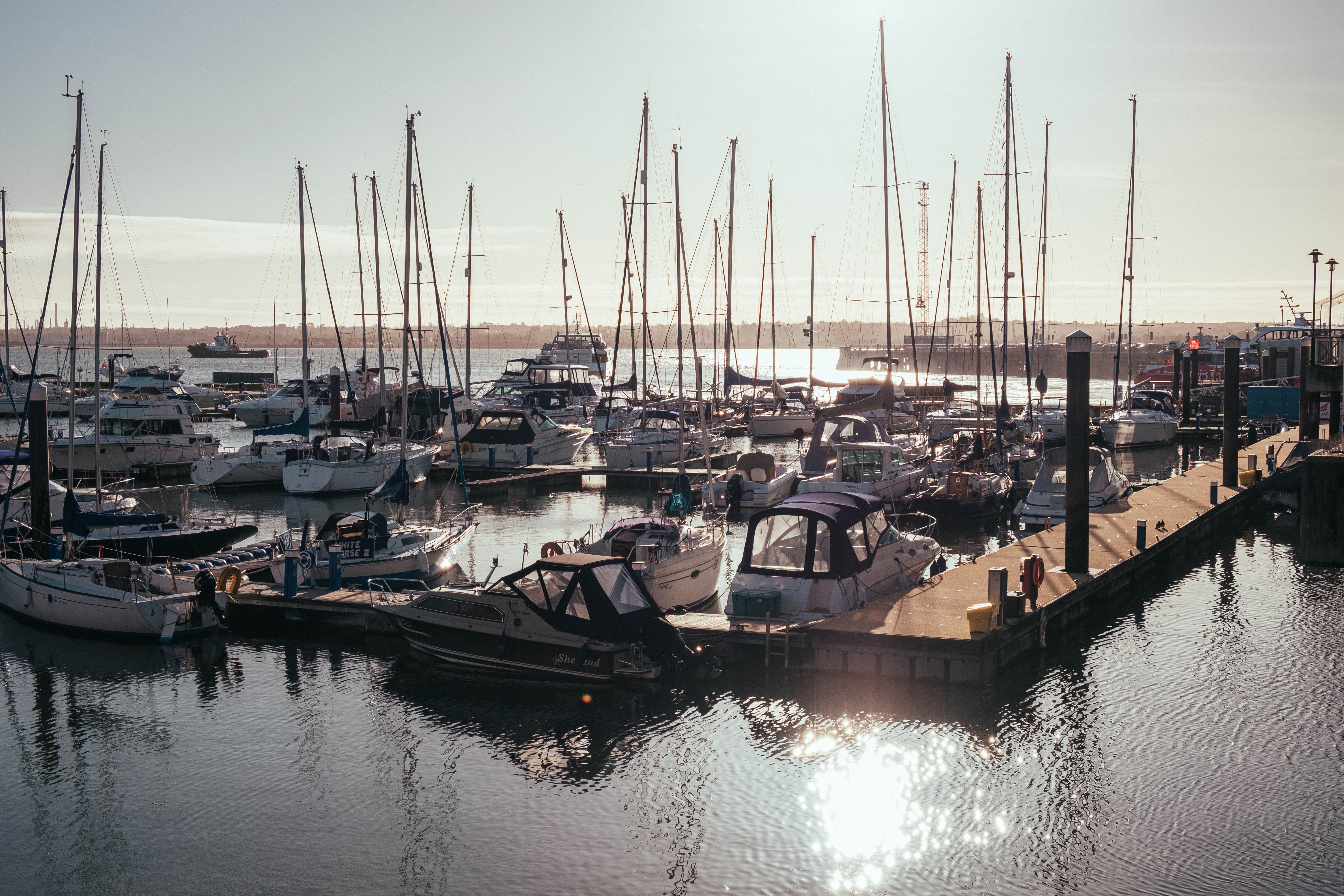
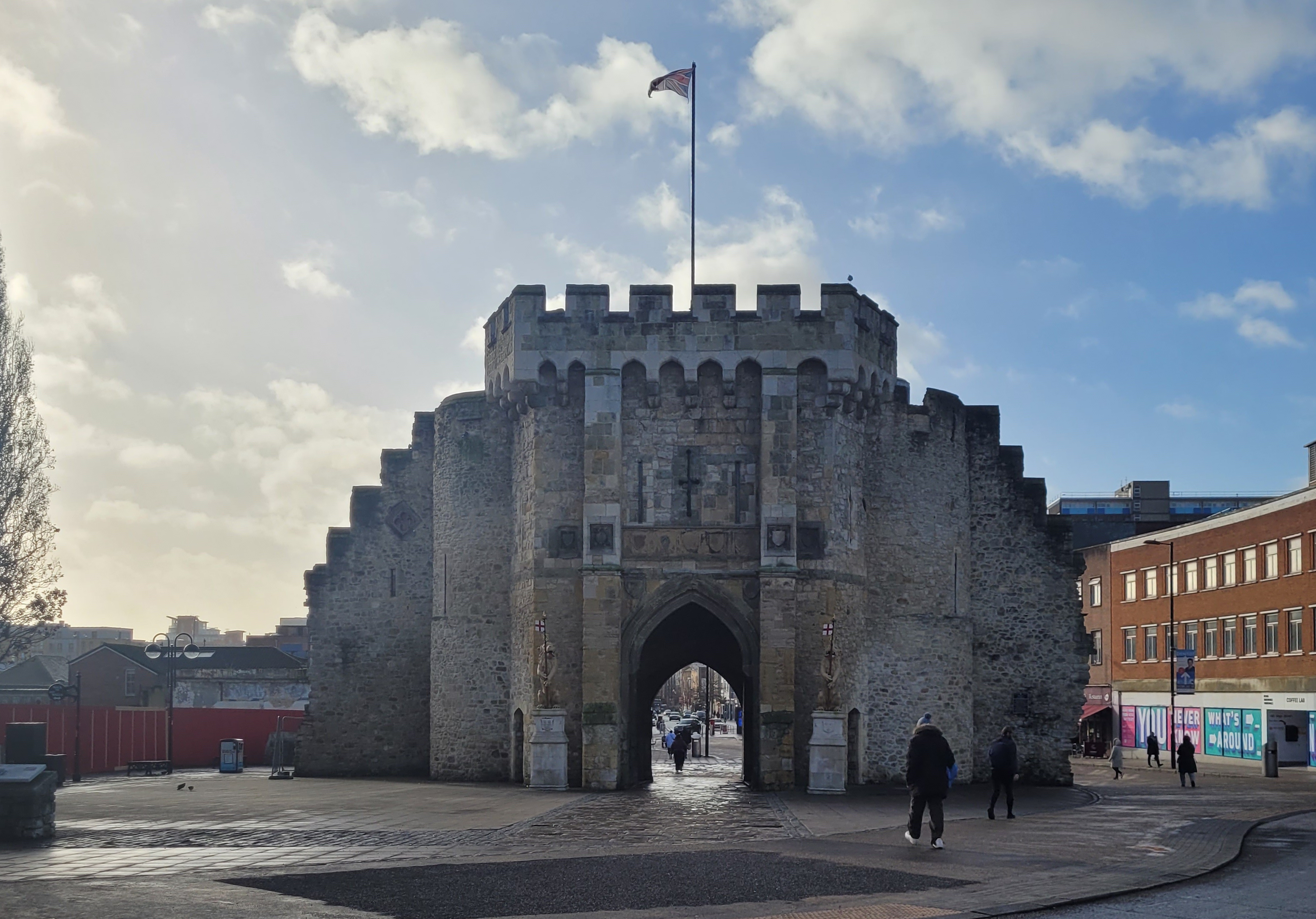
About Southampton
Lying near the head of Southampton Water, a peninsula between the estuaries of the Rivers Test and Itchen, Southampton is Britain’s largest cruise port. It has been one of England’s major ports since the Middle Ages, when it exported wool and hides from the hinterland and imported wine from Bordeaux. The city suffered heavy damage during World War Two and as a result the centre has been extensively rebuilt, but there are still some interesting medieval buildings including the Bargate, one of the finest city gatehouses in England.
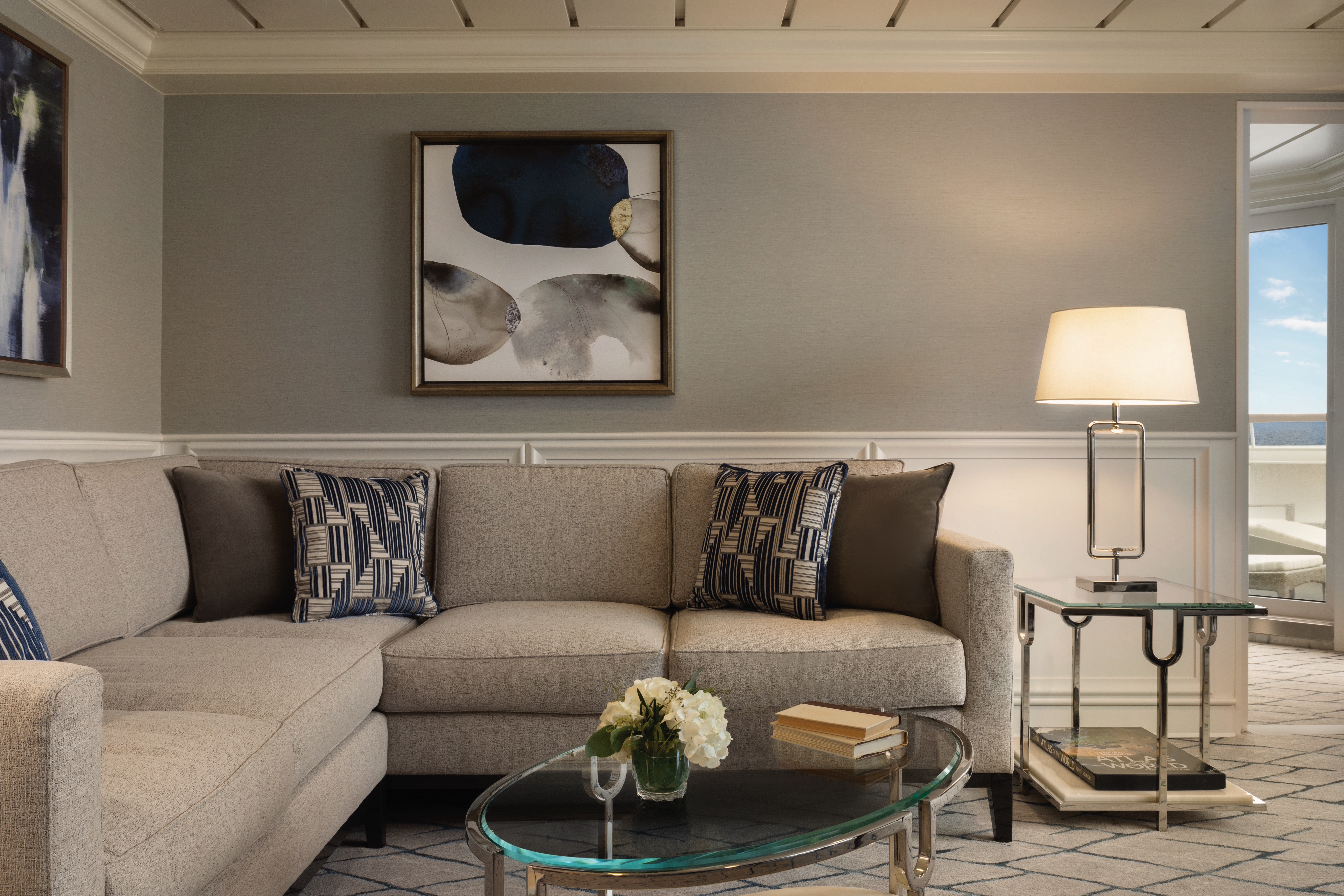
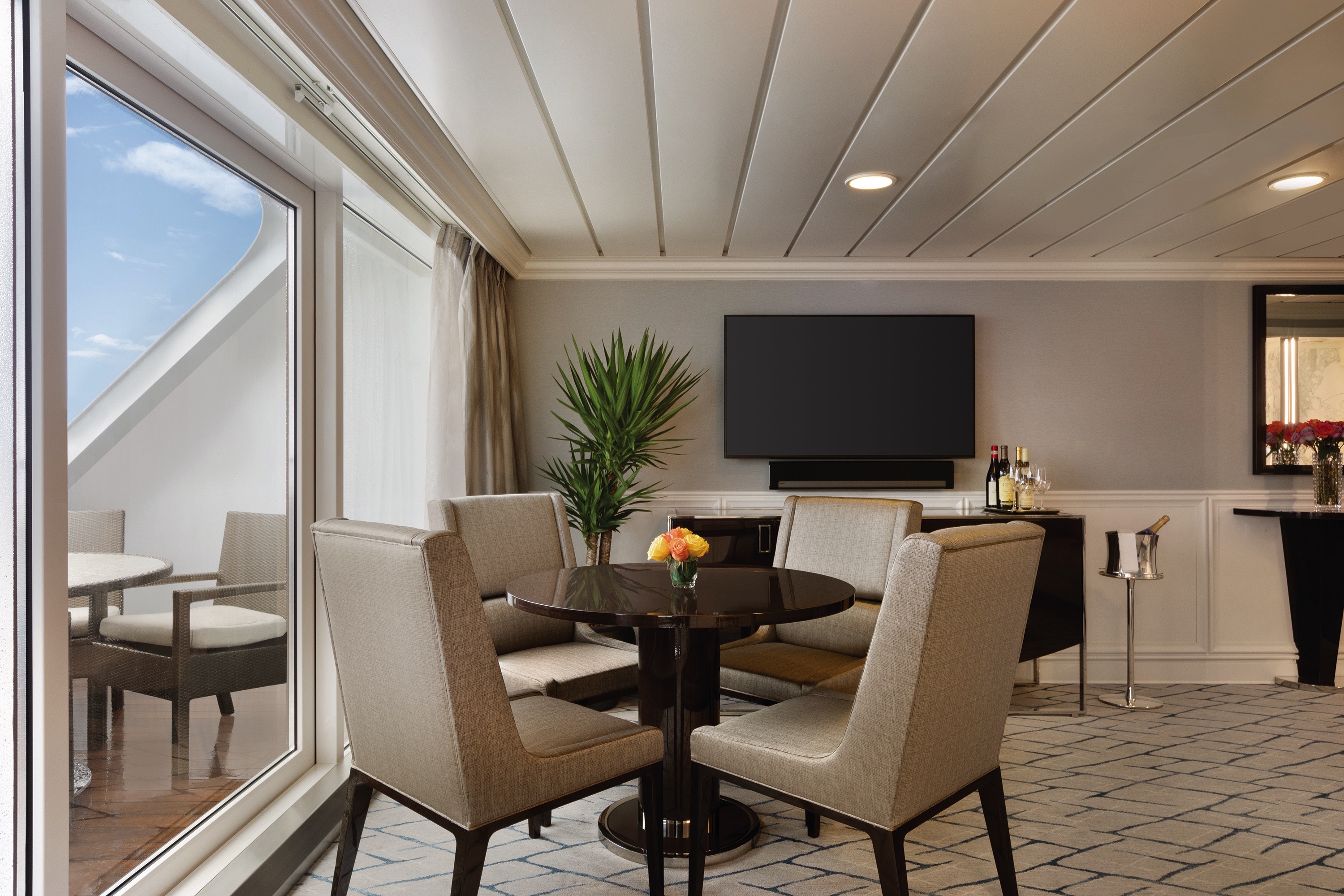
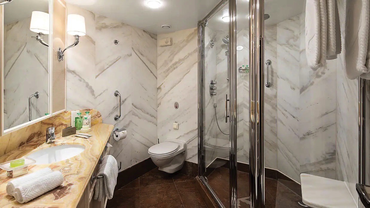
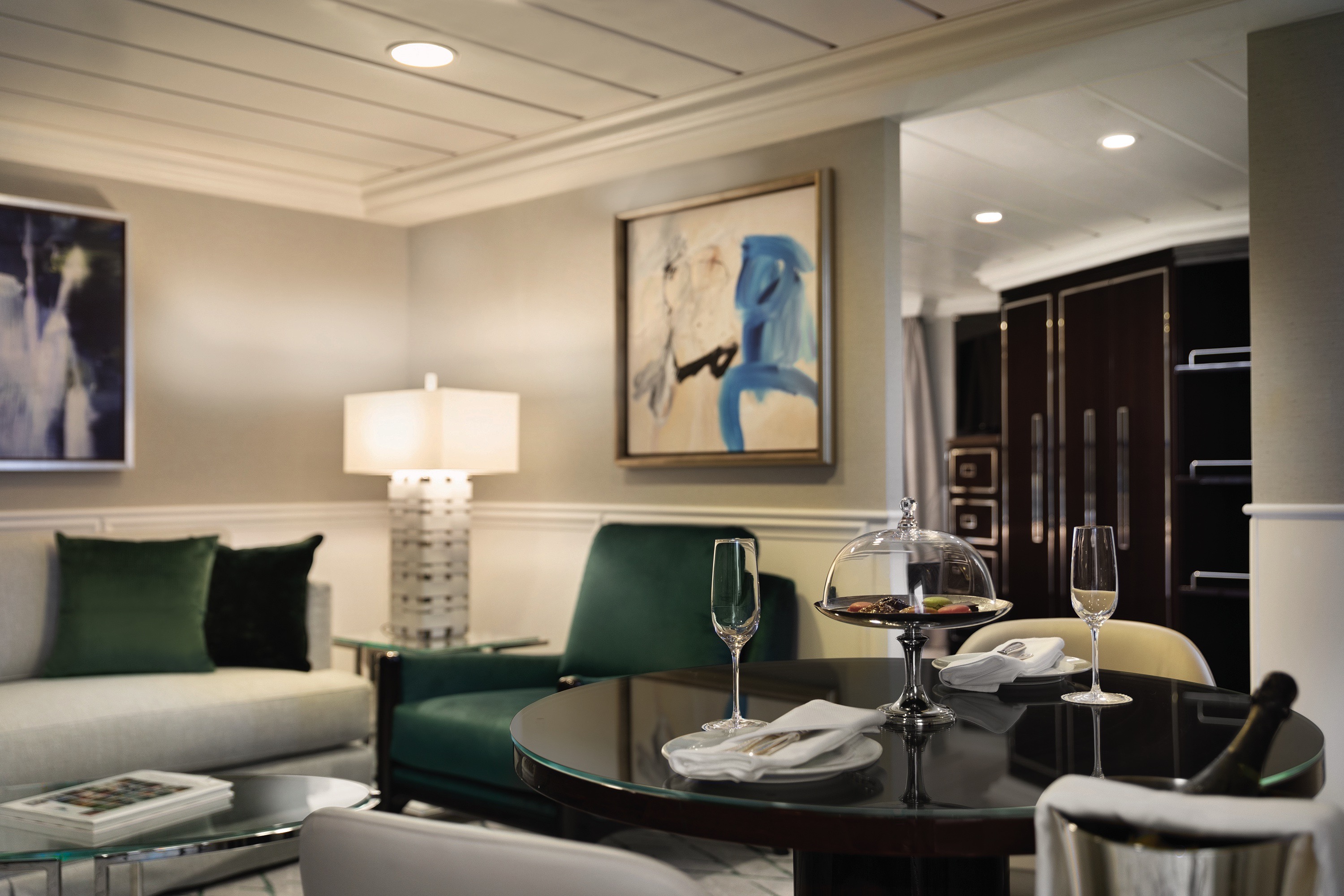
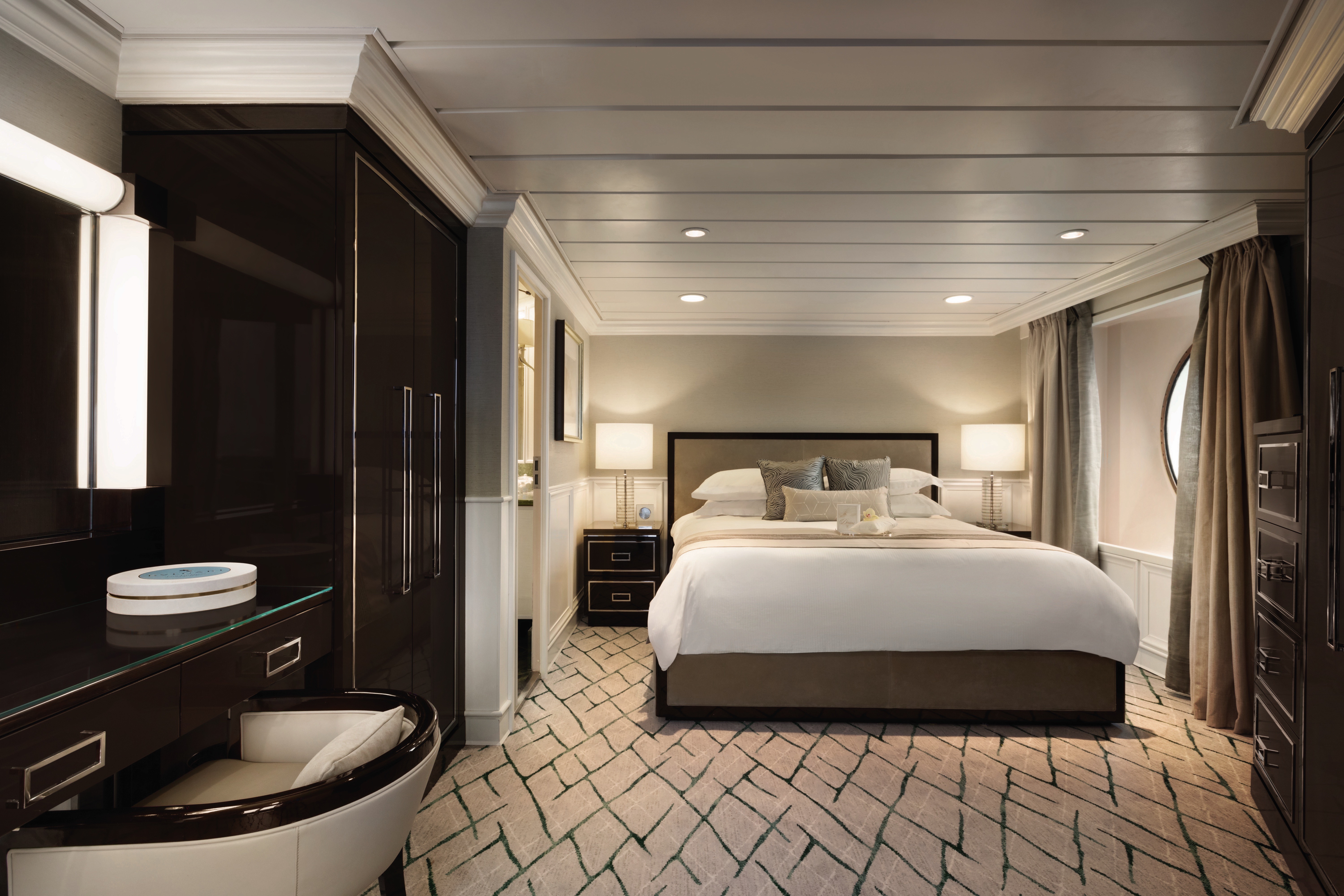
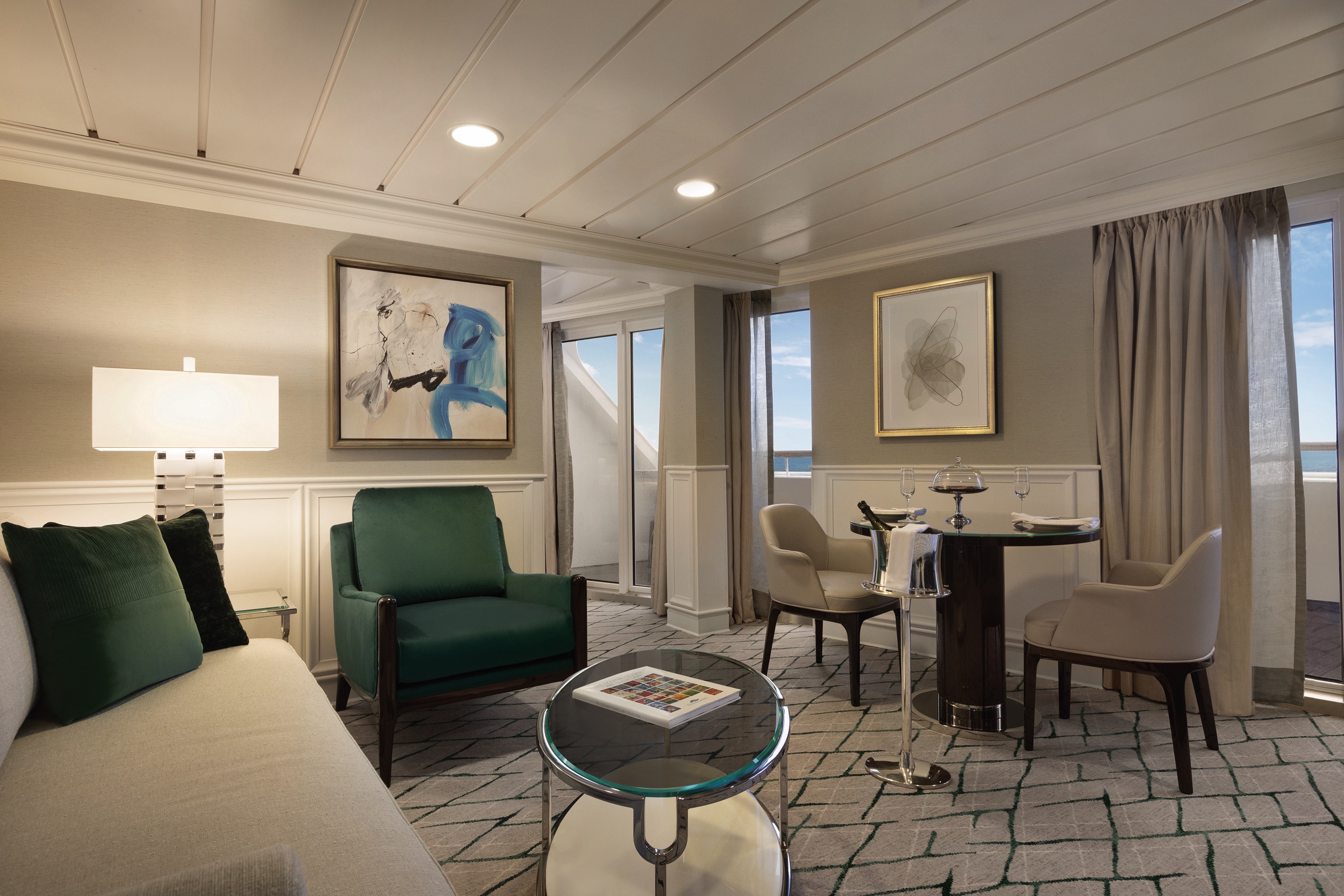
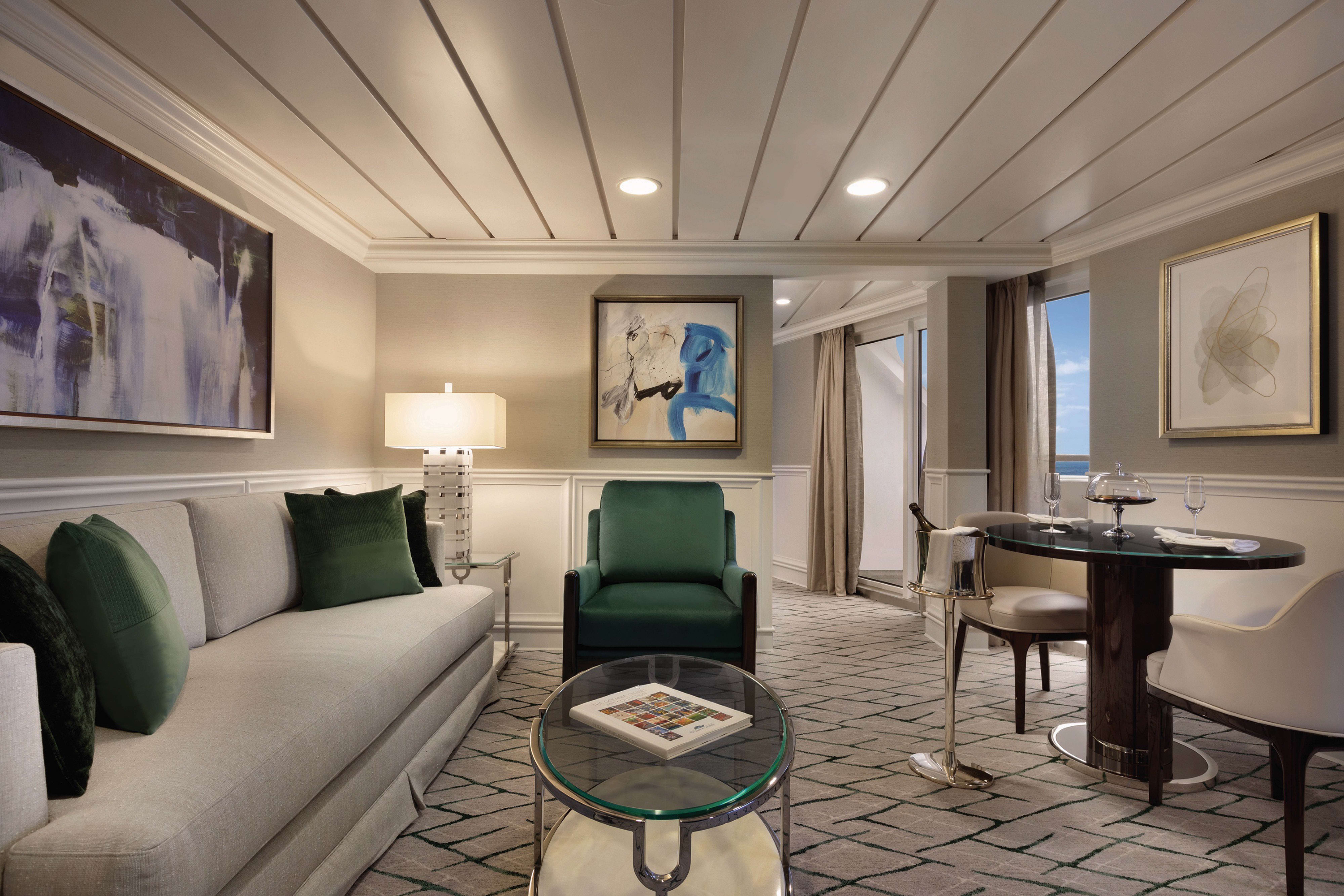
Lavish new fabrics and designer furnishings grace our six new Owner’s Suites – always among the first to be reserved. Immensely spacious and exceptionally luxurious, these suites span nearly 1,000 square feet and are oases of quietude and relaxation. Every imaginable amenity is found here, further enhanced by a sumptuous re-designed bathroom with an oversized shower, a private teak veranda and two flat-screen televisions.
Owner's Suite Privileges
+In addition to Concierge Level privileges
- Priority luggage delivery
- 24-hour Butler service
- Optional private in-suite embarkation day lunch from noon to 2 pm in Owner’s Suites
- Complimentary in-suite bar setup with 6 full-size bottles of your choice of premium spirits and wines from our suite beverage menu
- Complimentary welcome bottle of Champagne
- In-suite illy® coffee maker and pods
- Fresh fruit basket upon request
- Choice of daily newspaper
- Exclusive pillow menu
- Course-by-course in-suite dining*
- Order in from any of our specialty restaurants*
- Coordination of shoreside dinner and entertainment reservations
- Last-minute luggage collection
- Packing and unpacking upon request
- Complimentary garment pressing*
- Complimentary shoeshine service
- Gourmet evening canapés upon request
- Special services upon request
*Certain limitation apply
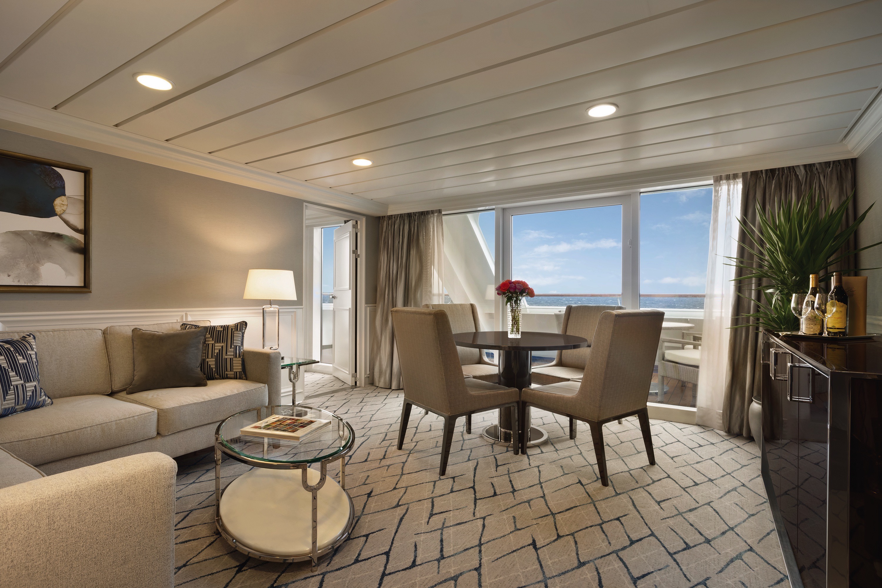

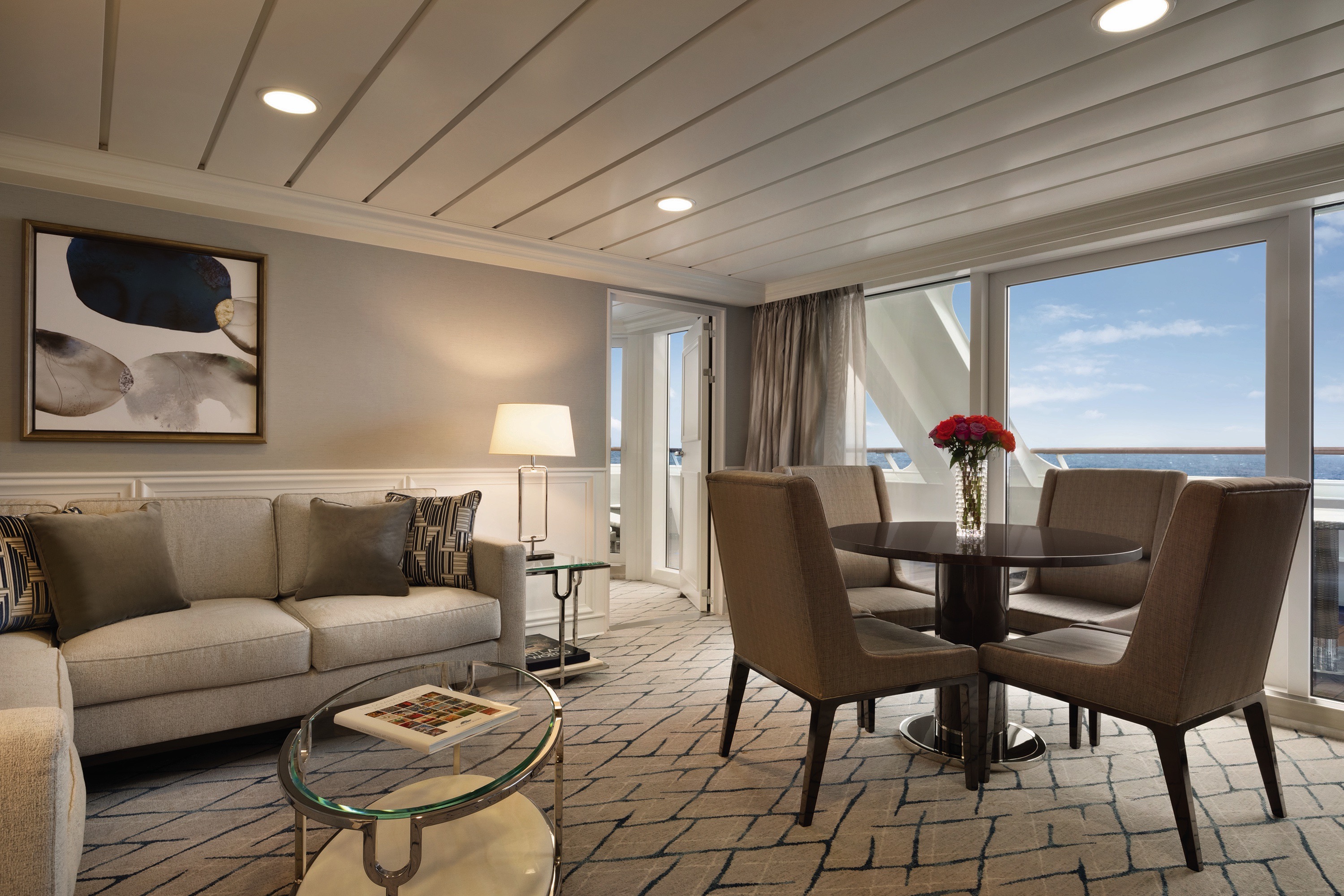
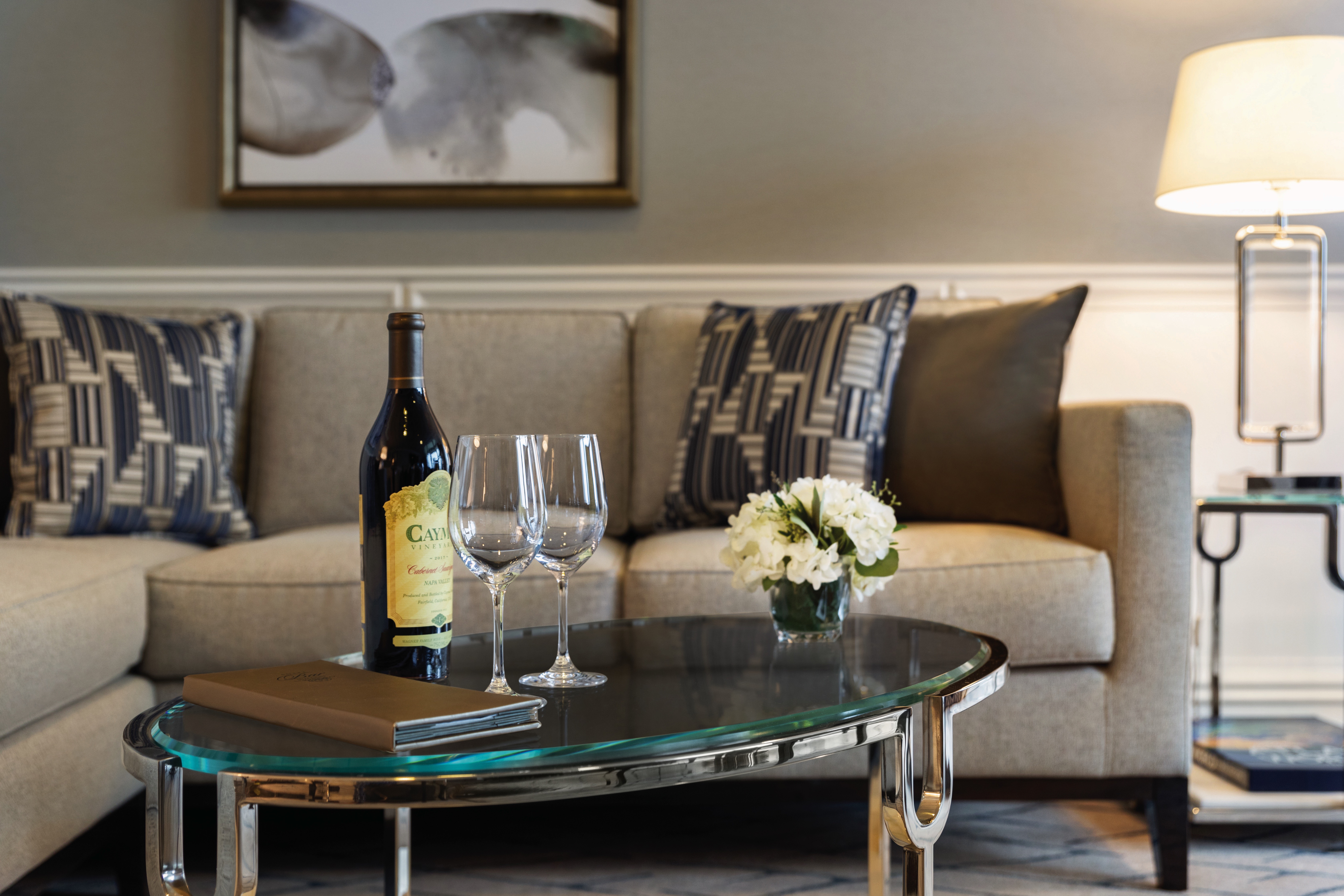
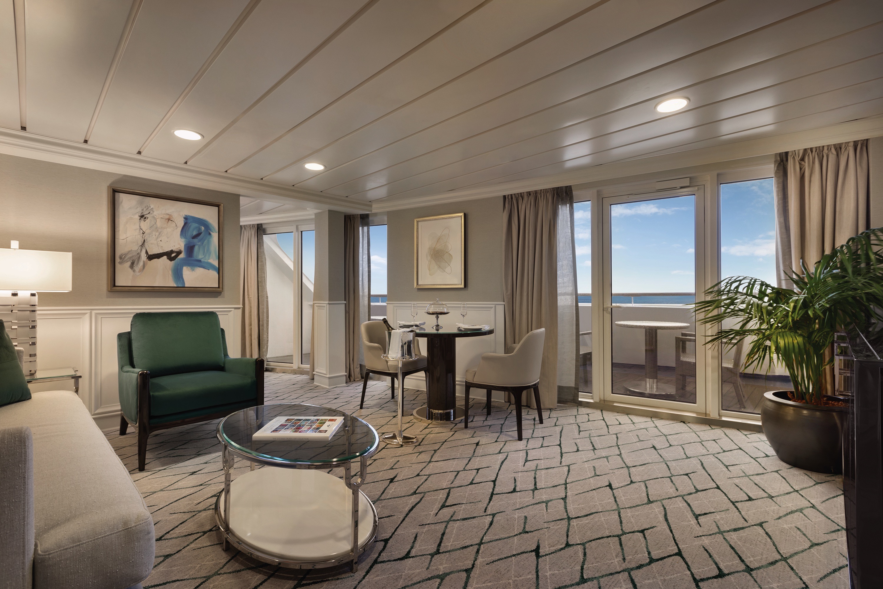
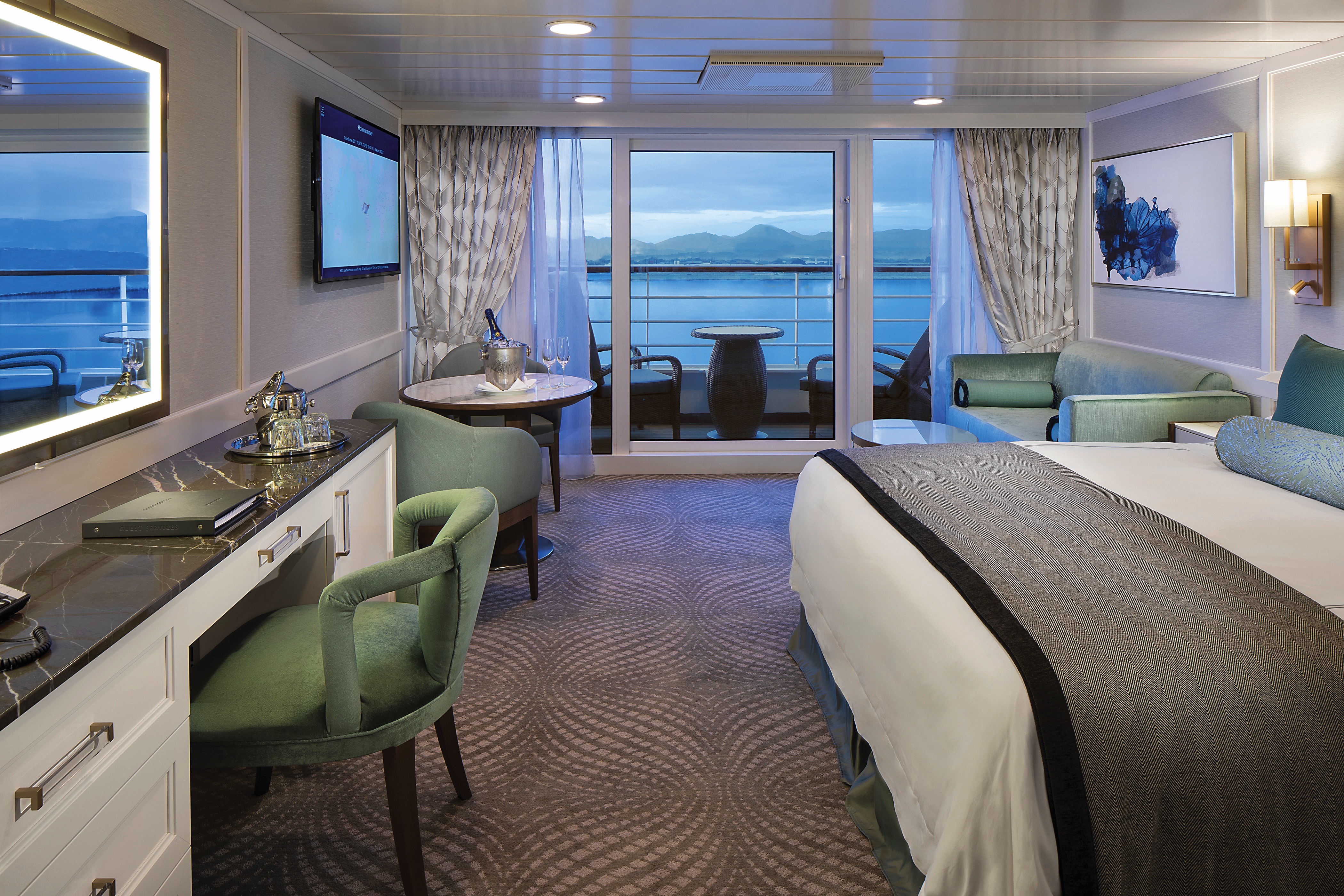
Named for their sweeping views over the ship’s bow, our four Vista Suites feature a calming palette echoing the serene seas and expansive skies. Each sprawls over 786 square feet and offers every imaginable comfort, including a second bathroom for guests as well as a master bathroom finished in onyx, Carrara marble and granite with a luxurious shower. Relax on your teak veranda or watch a movie on your customized entertainment system.Vista Suite Privileges
+In addition to Concierge Level privileges
- Priority luggage delivery
- 24-hour Butler service
- Complimentary in-suite bar setup with 6 full-size bottles of your choice of premium spirits and wines from our suite beverage menu
- Complimentary welcome bottle of Champagne
- In-suite illy® coffee maker and pods
- Fresh fruit basket upon request
- Choice of daily newspaper
- Exclusive pillow menu
- Course-by-course in-suite dining*
- Order in from any of our specialty restaurants*
- Coordination of shoreside dinner and entertainment reservations
- Last-minute luggage collection
- Packing and unpacking upon request
- Complimentary garment pressing*
- Complimentary shoeshine service
- Gourmet evening canapés upon request
- Special services upon request
*Certain limitation apply
Our collection of new 322-square-foot Penthouse Suites is adorned with sumptuous designer fabrics and furnishings in serene shades of the sea and sky. Spacious enough for private in-suite dining, the living area features a refrigerated mini-bar and vanity desk, and the sleekly transformed bathroom features luxury stone finishes and a shower.
Penthouse Suite Privileges
+In addition to Concierge Level privileges
- Priority luggage delivery
- 24-hour Butler service
- Course-by-course in-suite dining*
- Order in from any of our specialty restaurants*
- Coordination of shoreside dinner and entertainment reservations
- Last-minute luggage collection
- Packing and unpacking upon request
- Complimentary garment pressing*
- Complimentary shoeshine service
- Gourmet evening canapés upon request
- Special services upon request
*Certain limitations apply
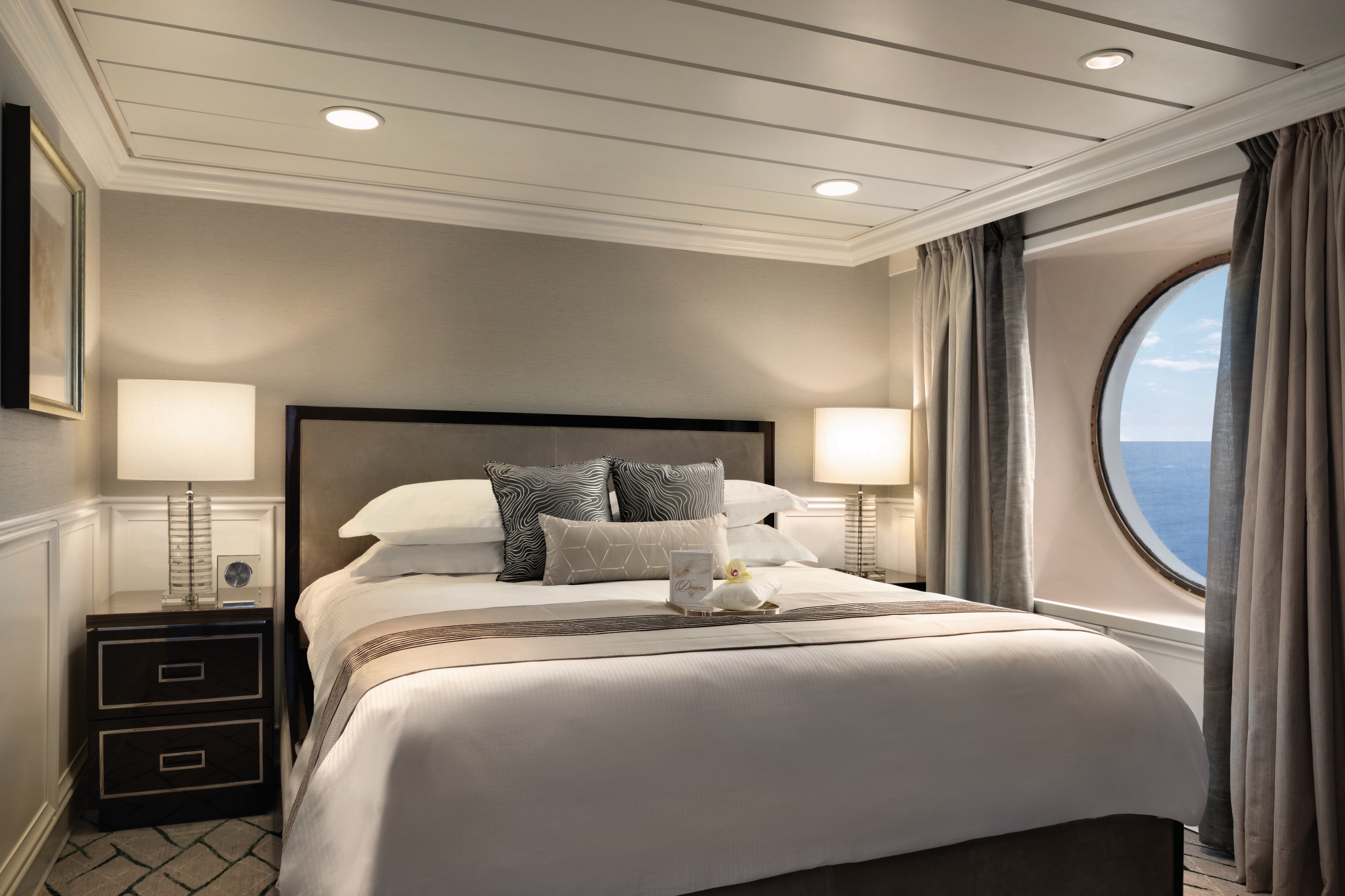
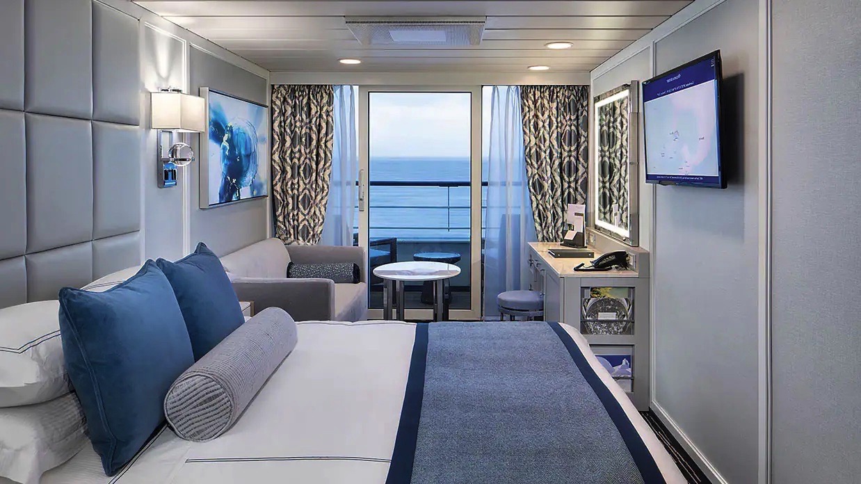
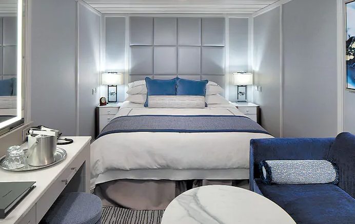
Located in some of the most desirable locations on the ship, Category A Concierge Level Veranda Staterooms offer the attractive blend of both value and luxury. These sleekly redefined 216-square-foot staterooms offer coveted amenities and exclusive privileges, such as free laundry service, that make your experience that much more carefree. Fresh new decor, sumptuous Tranquility Beds and re-inspired verandas with stylish new furniture complete the Concierge experience.
Concierge Level Privileges
In addition to Stateroom amenities
- Expanded lunch and dinner room service menu from The Grand Dining Room
- Private teak veranda††
- FREE laundry service - up to 3 bags per stateroom+
- Complimentary welcome bottle of Prosecco
- Priority online specialty restaurant reservations
- Unlimited access to the Aquamar Spa Terrace
- Complimentary Oceania Cruises logo tote bag
- Cashmere lap blankets, perfect for relaxing on your veranda
- Complimentary pressing of garments upon embarkation++
- Complimentary shoeshine service
++Certain limitations apply
Smoking in suites, staterooms and on verandas is strictly prohibited
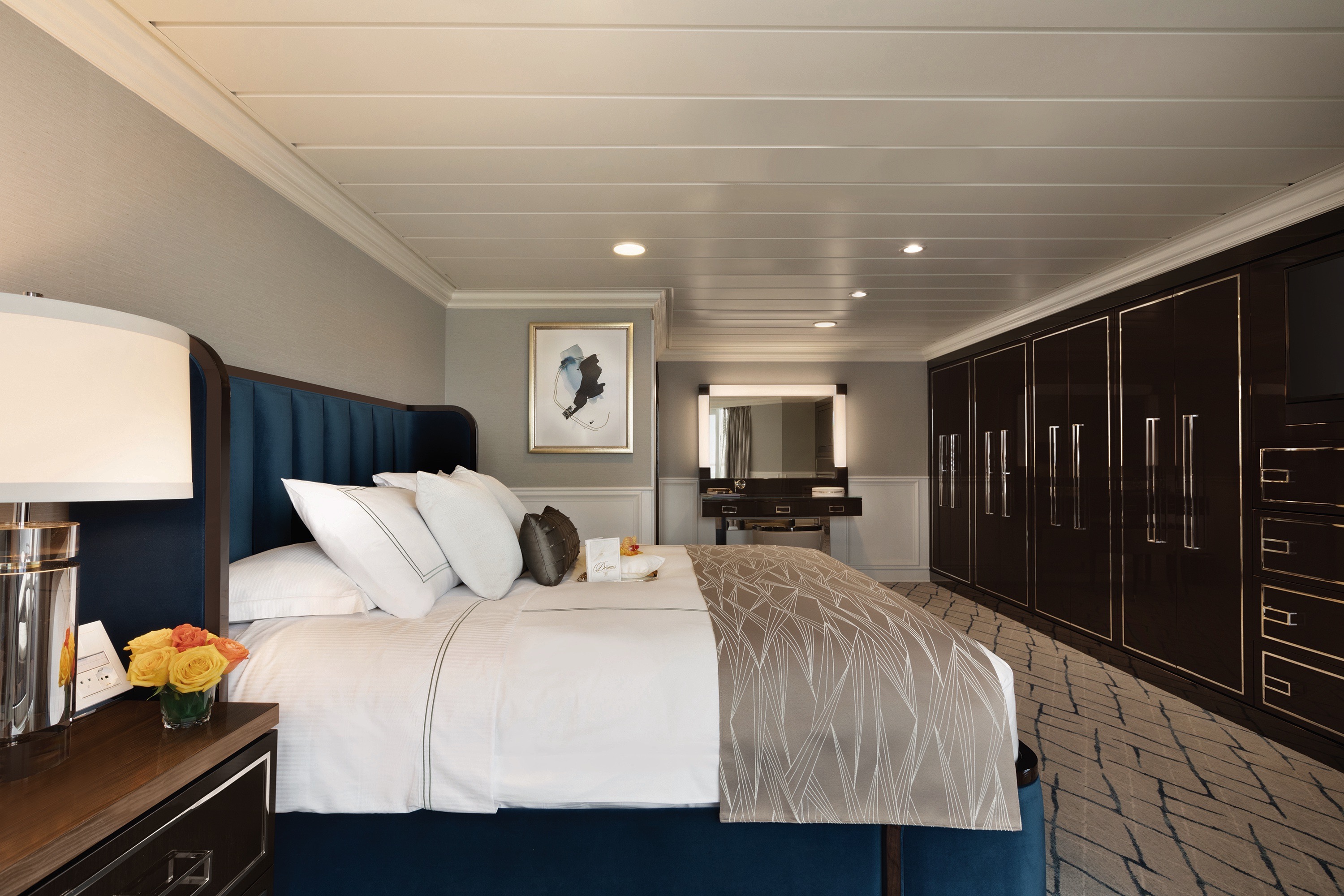
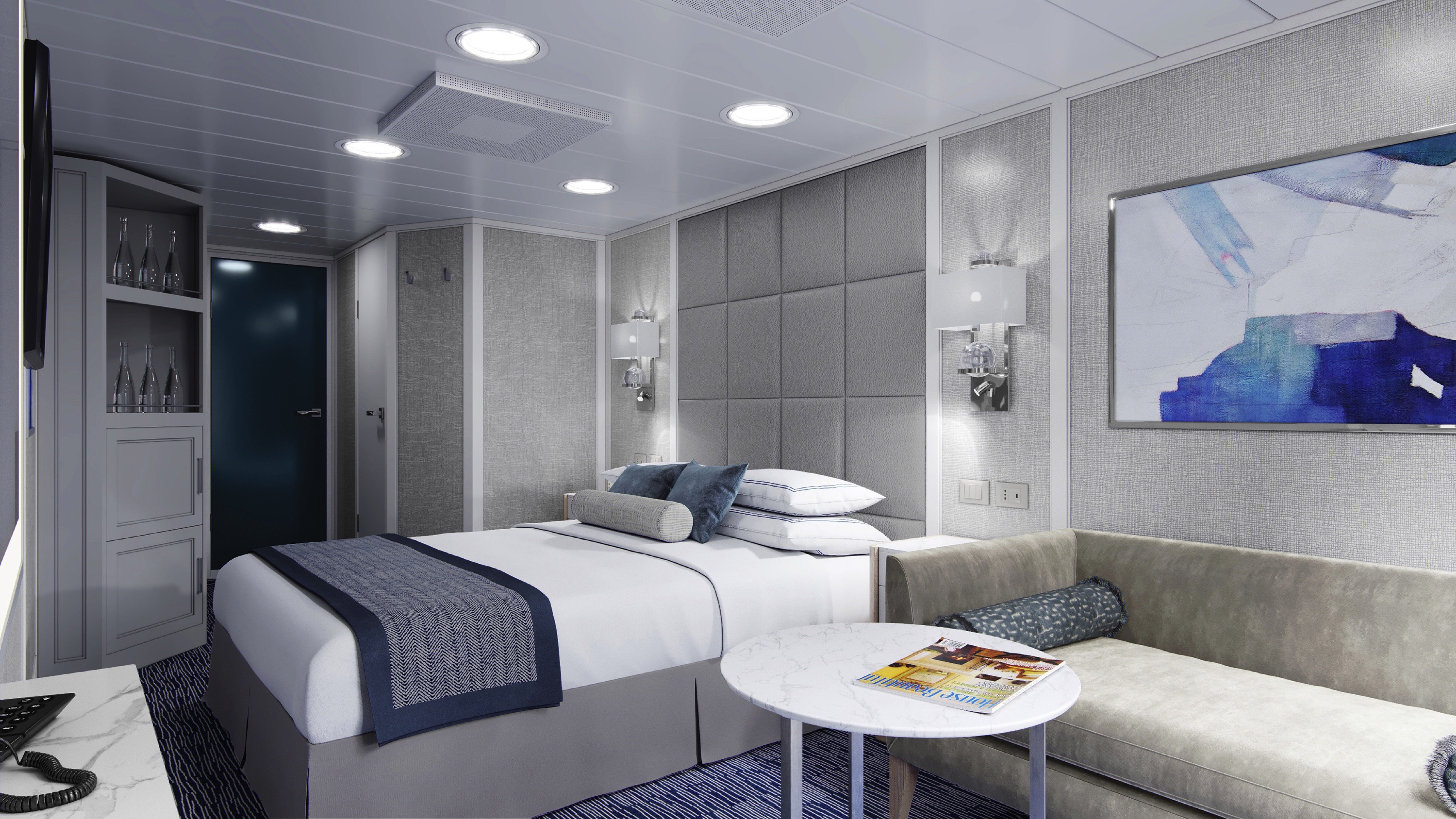
Custom-crafted furnishings, exotic stone finishes, supple upholstered headboards and chic lighting are just a few of the enhancements within these 216-square-foot staterooms that also boast our most popular luxury – a private teak veranda for watching the ever-changing panoramas. Conveniences within each stateroom include a vanity desk, refrigerated mini-bar, breakfast table and spacious seating area.
Veranda Stateroom Amenities
Tranquility Bed, an Oceania Cruises exclusive†
- FREE sodas replenished daily in your refrigerated mini-bar
- FREE still and sparkling Vero Water®
- Private teak veranda††
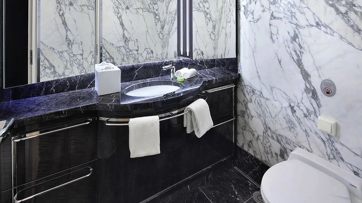
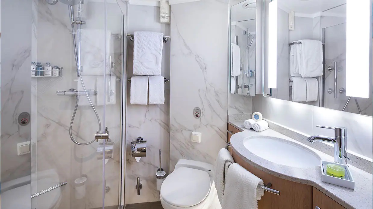
- Luxury bath amenities
- FREE room service menu 24 hours a day
- Daily housekeeping service
- Gourmet turndown chocolates upon request
- Interactive television system with on-demand movies, weather and more
- Starlink® WiFi service
- Writing desk and stationery
- Plush cotton towels, robes and slippers
- Handheld hair dryer
- Security safe
†King-size bed (cannot be converted into twin beds) for Owner’s, Vista and Oceania Suites and queen-size bed for all other suites and staterooms (Tranquility Bed available for purchase at OceaniaBedCollection.com)
††Featured with all Veranda Staterooms (excluding French Veranda)
Smoking in suites, staterooms and on verandas is strictly prohibited
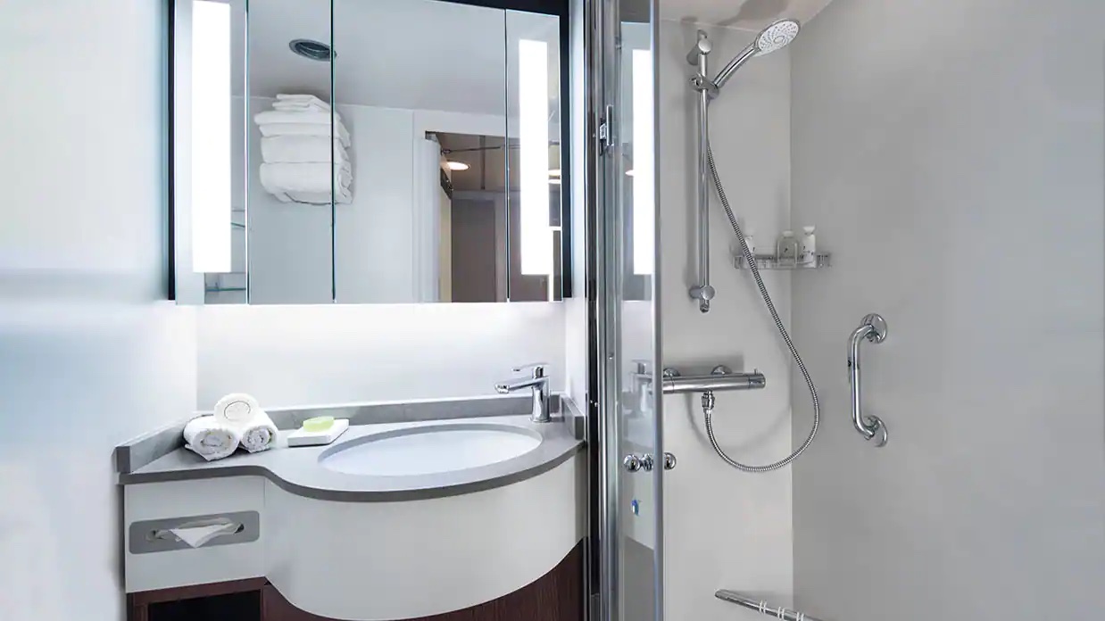
With entirely re-designed closets, dressers and vanities, these 165-squarefoot staterooms feel even more spacious. A generous seating area, vanity desk, refrigerated mini-bar and breakfast table are perfectly complemented by the soothing hues and stylish fabrics of the sleek new decor.
Deluxe Ocean View Stateroom Amenities
- Tranquility Bed, an Oceania Cruises exclusive+
- FREE sodas replenished daily in your refrigerated mini-bar
- FREE still and sparkling Vero Water®
- Luxury bath amenities
- FREE room service menu 24 hours a day
- Daily housekeeping service
- Gourmet turndown chocolates upon request
- Interactive television system with on-demand movies, weather and more
- Starlink® WiFi service
- Writing desk and stationery
- Plush cotton towels, robes and slippers
- Handheld hair dryer
- Security safe
+King-size bed (cannot be converted into twin beds) for Owner’s, Vista and Oceania Suites and queen-size bed for all other suites and staterooms (Tranquility Bed available for purchase at OceaniaBedCollection.com)
++Featured with all Veranda Staterooms (excluding French Veranda)
++Certain limitations apply
Smoking in suites, staterooms and on verandas is strictly prohibited
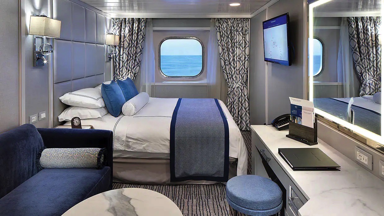
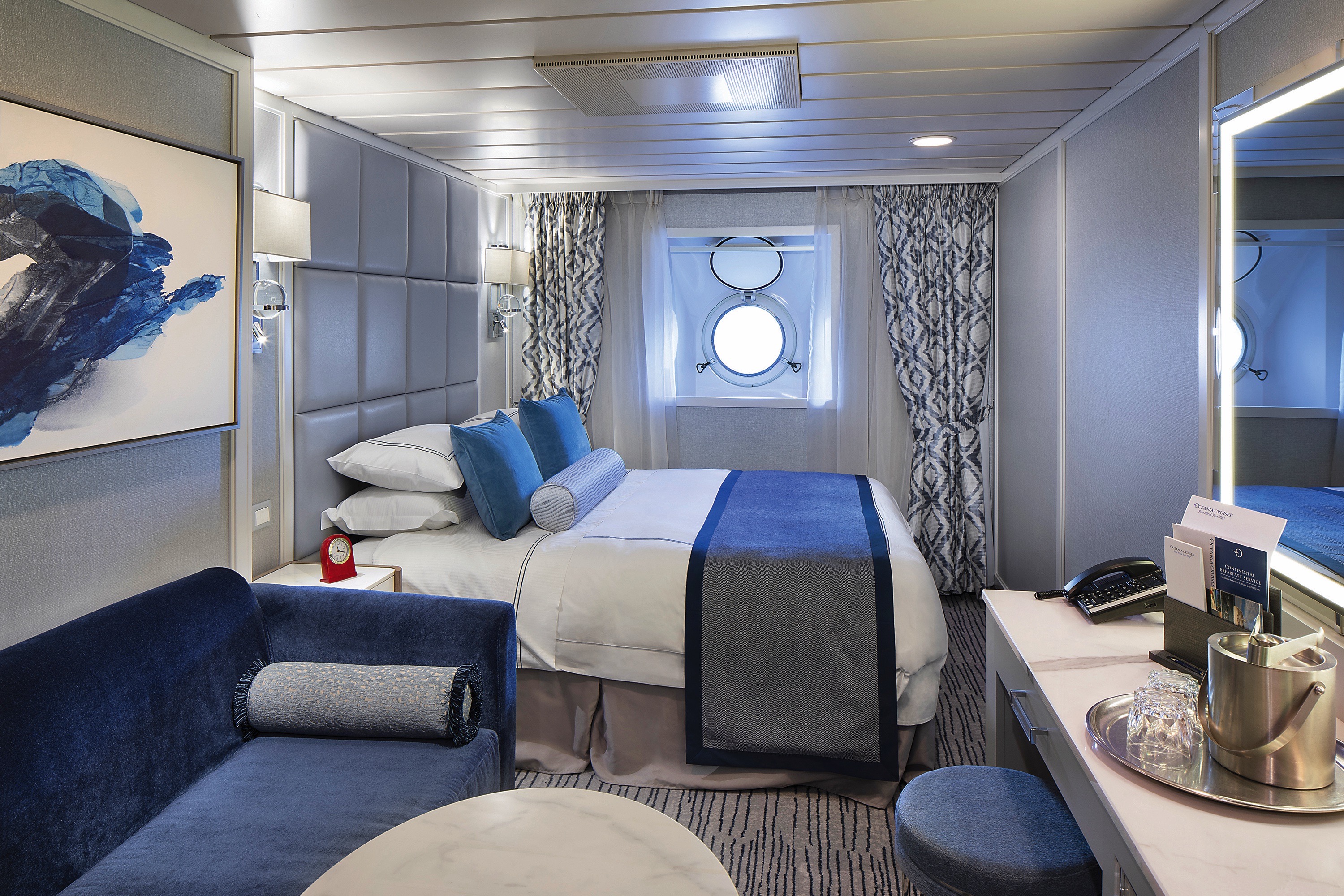
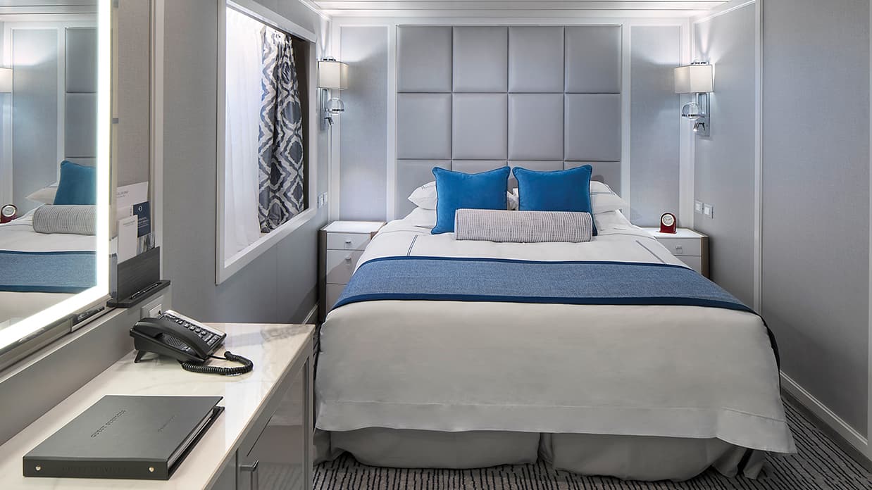
Featuring a classic porthole, these exquisitely appointed 165-square-foot staterooms showcase sophisticated new decor and a modern design that maximizes both space and convenience. Enjoy a comfortable seating area with a sofa on which to stretch out, as well as a vanity desk, breakfast table and refrigerated mini-bar.
Stateroom Amenities
- Tranquility Bed, an Oceania Cruises exclusive+
- FREE sodas replenished daily in your refrigerated mini-bar
- FREE still and sparkling Vero Water®
- Luxury bath amenities
- FREE room service menu 24 hours a day
- Daily housekeeping service
- Gourmet turndown chocolates upon request
- Interactive television system with on-demand movies, weather and more
- Starlink® WiFi service
- Writing desk and stationery
- Plush cotton towels, robes and slippers
- Handheld hair dryer
- Security safe
+King-size bed (cannot be converted into twin beds) for Owner’s, Vista and Oceania Suites and queen-size bed for all other suites and staterooms (Tranquility Bed available for purchase at OceaniaBedCollection.com)
++Featured with all Veranda Staterooms (excluding French Veranda)
++Certain limitations apply
Smoking in suites, staterooms and on verandas is strictly prohibited
These charming 143-square-foot staterooms are the perfect retreat for the solo traveler. Amply spacious and centrally located on Deck 6, each is equipped with a sublimely plush Tranquility Bed, refrigerated mini-bar, writing desk and abundant storage space.
Stateroom Amenities
- Tranquility Bed, an Oceania Cruises exclusive+
- FREE sodas replenished daily in your refrigerated mini-bar
- FREE still and sparkling Vero Water®
- Luxury bath amenities
- FREE room service menu 24 hours a day
- Daily housekeeping service
- Gourmet turndown chocolates upon request
- Interactive television system with on-demand movies, weather and more
- Starlink® WiFi service
- Writing desk and stationery
- Plush cotton towels, robes and slippers
- Handheld hair dryer
- Security safe
+King-size bed (cannot be converted into twin beds) for Owner’s, Vista and Oceania Suites and queen-size bed for all other suites and staterooms (Tranquility Bed available for purchase at OceaniaBedCollection.com)
++Featured with all Veranda Staterooms (excluding French Veranda)
++Certain limitations apply
Smoking in suites, staterooms and on verandas is strictly prohibited
Beautifully re-designed with a modern flair, these delightful private retreats boast 160 square feet of luxury. Highlights include a comfortable seating area, vanity desk, refrigerated mini-bar and plenty of storage. The ingenious use of space is complemented by the re-inspired decor.
Stateroom Amenities
- Tranquility Bed, an Oceania Cruises exclusive+
- FREE sodas replenished daily in your refrigerated mini-bar
- FREE still and sparkling Vero Water®
- Luxury bath amenities
- FREE room service menu 24 hours a day
- Daily housekeeping service
- Gourmet turndown chocolates upon request
- Interactive television system with on-demand movies, weather and more
- Starlink® WiFi service
- Writing desk and stationery
- Plush cotton towels, robes and slippers
- Handheld hair dryer
- Security safe
+King-size bed (cannot be converted into twin beds) for Owner’s, Vista and Oceania Suites and queen-size bed for all other suites and staterooms (Tranquility Bed available for purchase at OceaniaBedCollection.com)
++Featured with all Veranda Staterooms (excluding French Veranda)
++Certain limitations apply
Smoking in suites, staterooms and on verandas is strictly prohibited
Oceania Insignia
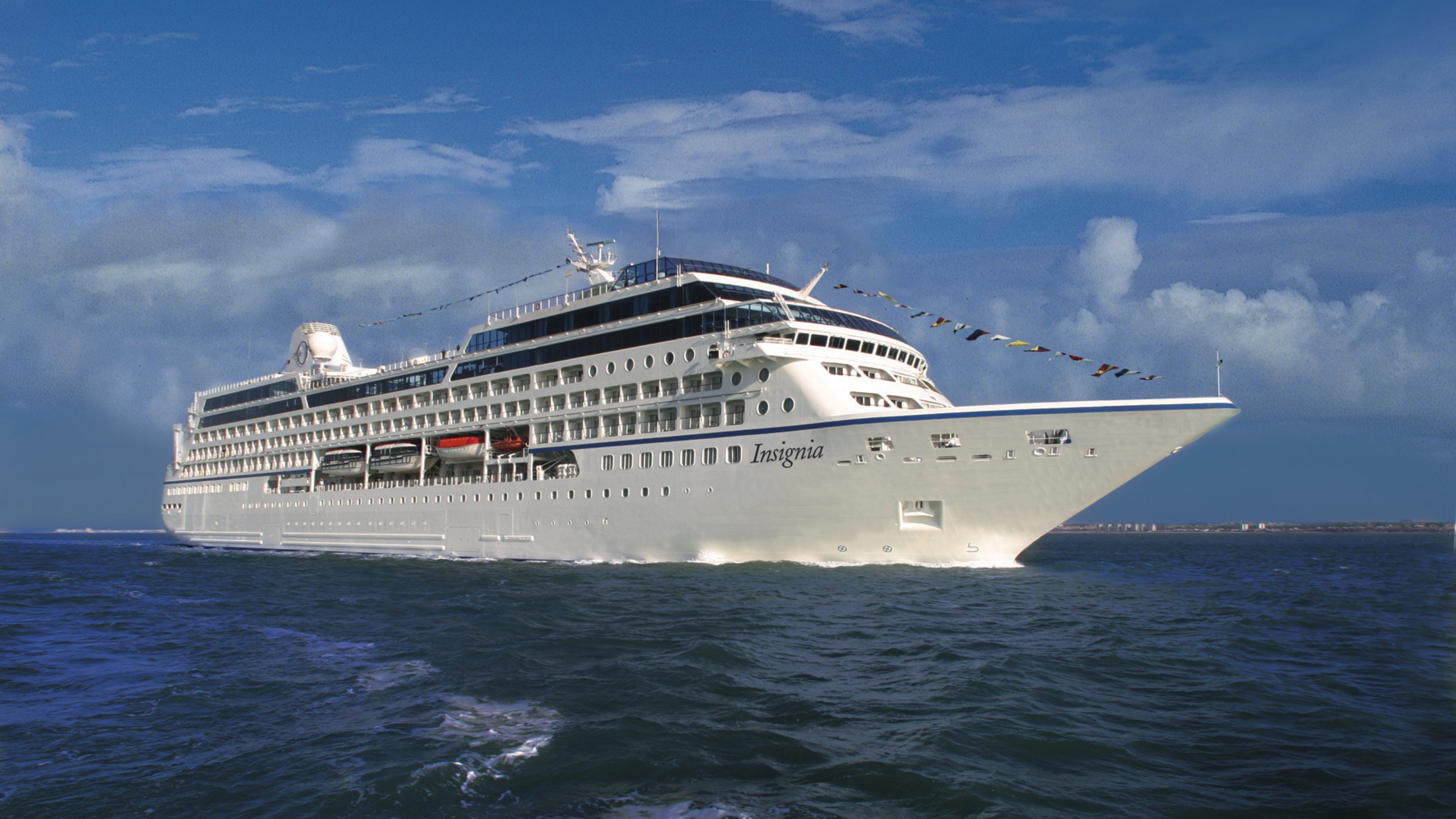
Both designer-inspired and luxurious, the 670-guest Oceania Insignia offers entirely new suites, staterooms and bathrooms along with a sweepingly re-inspired atmosphere throughout the ship. The public spaces have been tastefully refreshed with a soft sea and sky palette of fabrics, designer furnishings and custom light fixtures that exquisitely showcase the inimitable style and comfort of Oceania Cruises. Oceania Insignia features four unique, open-seating restaurants, the Aquamar Spa + Vitality Center, eight lounges and bars, a casino and 333 luxurious suites and stylish staterooms, nearly 70% of which feature private verandas.
The better-than-new Oceania Insignia blends sophistication with a contemporary flair to create a casually elegant ambiance that embodies the most treasured elements of our celebrated ships. Every surface of every suite and stateroom is entirely new, while in the public spaces, a refreshed color palette of soft sea and sky tones surrounds a tasteful renewal of fabrics, furnishings and lighting fixtures that exquisitely encompasses the inimitable style and comfort of Oceania Cruises.
Ship Facts
| Launch Year | 1998 | ||||||||
| Refit Year | 2018 | ||||||||
| Language | en | ||||||||
| Gross Tonnage | 30277 | ||||||||
| Length | 180 | ||||||||
| Width | 25.5 | ||||||||
| Currency | USD | ||||||||
| Speed | 18 | ||||||||
| Capacity | 670 | ||||||||
| Crew Count | 400 | ||||||||
| Deck Count | 9 | ||||||||
| Cabin Count | 349 | ||||||||
| Large Cabin Count | 0 | ||||||||
| Wheelchair Cabin Count | 4 | ||||||||
| Electrical Plugs |
|
Deck 11
- Shuffleboard
- Sun Deck
- Golf Putting Greenes
- Showers

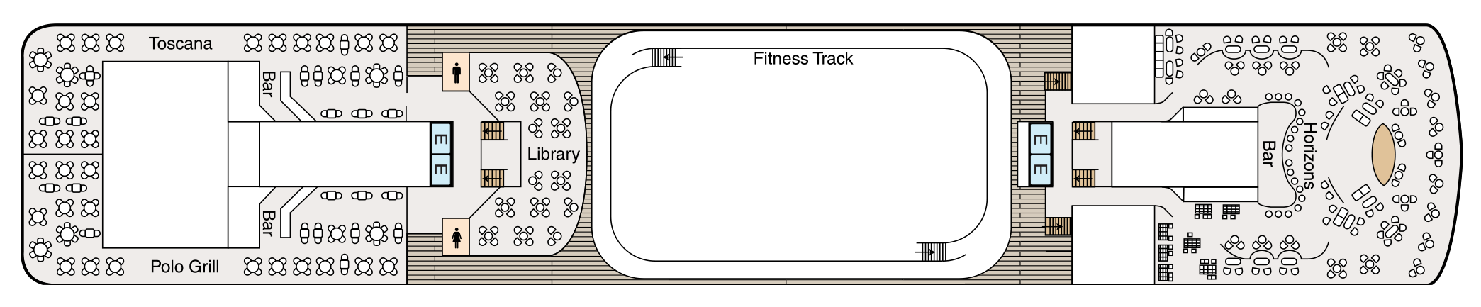
Deck 10
- Toscana
- Polo Grill
- Bars
- Library
- Fitness Track
- Horizons Bar
- Elevator
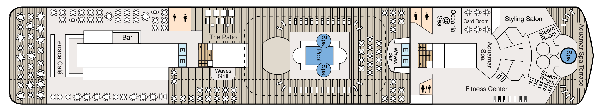
Deck 9
- Terrace Café
- Bar
- The Patio
- Waves Grill
- Whirlpools
- Pool
- Waves Bar
- Oceania@Sea
- Card Room
- Aquamar Spa
- Fitness Centre
- Styling Salon
- Steam Rooms
- Spa Terrace
- Elevator
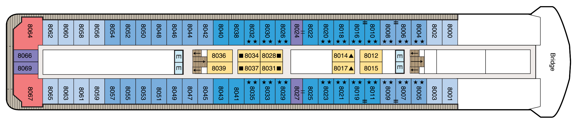
Deck 8
- Bridge
- Concierge Level Veranda Staterooms
- Inside Staterooms
- Owner's Suites
- Penthouse Suites
- Elevator
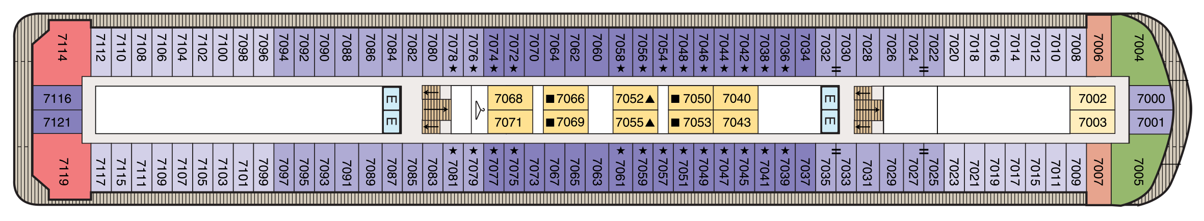
Deck 7
- Concierge Level Veranda Staterooms
- Deluxe Ocean View Staterooms
- Inside Staterooms
- Owner's Suites
- Vista Suites
- Elevator
Deck 6
- Concierge Level Veranda Staterooms
- Veranda Staterooms
- Deluxe Ocean View Staterooms
- Inside Staterooms
- Owner's Suites
- Vista Suites
- Elevator
Deck 5
- Grand Dining Room
- Baristas Grand/Bar
- Upper Hall
- Boutiques
- Martinis
- Casino
- Lounge
- Dance Floor
- Stage
- Elevator
Deck 4
- Destination Services
- Concierge
- Reception Hall
- Reception Desk
- Medical Centre
- Deluxe Ocean View Staterooms
- Inside Staterooms
- Elevator

Deck 3
- Ocean View Stateroom
- Tender Embarkation Area
- Elevator

Dining Aboard Oceania Insignia
Oceania Insignia embraces the most treasured elements of our celebrated fleet and features multiple dining venues, of which four are unique, open-seating restaurants with no surcharge. Wherever you choose to dine, you’ll savor The Finest Cuisine at Sea®.
Culinary Masterpieces
The superb gourmet restaurants aboard Oceania Insignia serve delectable dishes created à la minute and offer a remarkable array of choices, from Continental cuisine and vibrant Asian dishes to casual all-American favourites. Every restaurant on board Oceania Insignia is complimentary and features open seating so you may dine wherever and whenever suits your taste and schedule. Enjoy dinner for two or a gathering with newfound friends, knowing the experience is certain to be extraordinary.
The Luxury of Casual
You’ll savor cuisine renowned as the finest at sea no matter where you choose to dine or relax on Oceania Insignia– whether that means a poolside burger, a scoop of Humphry Slocombe’s bourbon-flavored cornflake-studded Secret Breakfast ice cream or a perfectly prepared cappuccino accompanied by freshly baked biscotti. Our culinary team’s attention to detail, passion for artisanal ingredients and dedication to technique extends to our casual dining, poolside experiences, Baristas coffee bar and the cherished ritual of Afternoon Tea at Horizons too.
The Grand Dining Room
AN ELEGANT SETTING
The Grand Dining Room is a study in stateliness, a tribute to the spirit of Europe’s marquee five-star hotel restaurants that inspired its dignified yet convivial ambiance. Handsomely decorated in rich woods, designer tapestry fabrics and oversized armchairs, the expansive dining area exudes classic splendor. This signature dining experience has always offered a bevy of delicious Continental dishes, and now a fresh and new array of options brings you even more exciting choices, as well as an incredible spectrum of global flavors and an all new Executive Chef’s Tasting Menu. As variety is essential to your satisfaction, menus change daily with an expansive choice of at least 10 appetizers, soups and salads and 10 dinner entrées, along with healthy options such as Aquamar Vitality Cuisine, gourmet vegetarian selections and the most extensive array of plant-based dishes at sea.
Open for breakfast, lunch and dinner. No reservations required.
Toscana
AUTHENTIC ITALIAN
Toscana means Tuscan, and just as Tuscan cuisine evolved from rich family traditions, many of our recipes originated with the mothers and grandmothers of our own Italian culinary staff. Presented on elegant, custom-designed Versace china, masterfully prepared dishes exemplify the essence of Tuscany and celebrate Italy’s culinary passion. Perhaps the evening begins with the octopus carpaccio with Champagne vinaigrette or the artichoke and parmesan cheese timbale with black truffle sauce. Classic dishes from other regions of Northern Italy are featured as well, such as the minestrone alla Genovese, lasagna alforno alla Bolognese and osso buco alla Milanese.
Open for dinner only. Reservations are required.
Polo Grill
A CLASSIC STEAKHOUSE
Polo Grill embodies all the elements of a classic steakhouse, expressing them with timeless reverence. Mindful of tradition, the decor features crisp, white linen tablecloths, dark wood furnishings and supple, high-back, burgundy leather chairs. Each course stands as the very definition of time-honored favorites, most notably the beef dishes, all of which are certified Black Angus USDA Prime and dry aged to enhance tenderness and flavor. Succulent seafood dishes such as grilled swordfish and whole Maine lobster gratinée are also classics in their own right. The classic Caesar salad, too, is prepared according to tradition, tableside and with gusto.
Open for dinner only. Reservations are required.
Terrace Café
INFORMAL DINING
Informal and carefree, the Terrace Café is wonderfully inviting any time of day. During breakfast, the room is infused with natural sunlight from the floor-to-ceiling windows, stimulating the appetite for the sumptuous selections. Come lunch, the expansive menu of international-inspired dishes changes entirely, complemented by a flavorful roast and the magic of the pizzeria’s oven. Dine inside or alfresco at one of the shaded teak tables on the terrace. During the evenings, the cuisine takes on a more sophisticated flair, with lobster tails, chops and fresh fish prepared to order, and freshly made hand-cut sushi and sashimi. In addition, a diverse selection of bold and flavorful plant-based dishes is available.
Open for breakfast, lunch and dinner. No reservations required.
Waves Grill
ALFRESCO DINING
Sometimes, the ultimate luxury is casual dining on all-American favorites, a laid-back style Waves Grill epitomizes. Located in a spacious, shaded area steps from the swimming pool, Waves Grill offers an extensive and mouthwatering menu. Then try a decadent dessert such as a homemade passion fruit sorbet, a made-to-order hot fudge sundae, a hand-dipped milkshake or one of the new, whimsical ice cream flavors by Humphry Slocombe, such as Secret Breakfast, Elvis (the Fat Years) or our signature flavor, Regatta Royale.
Open for lunch and afternoon dining only. No reservations required.
Afternoon Tea
TIME-HONOURED PASTIME
Each afternoon, the parade of gleaming four-tiered pastry carts begins. Savor freshly made, flavorful smoked salmon and egg salad finger sandwiches. Enjoy mirror-glazed petits fours, tender scones with rich clotted cream and, of course, a wide assortment of fine teas. Soak in the ambiance of polished silver teapots reflecting the turquoise sea, the precision of white-gloved servers and the amusing enigma of a string quartet playing softly in the background. You’ll quickly realize that this is how afternoon tea should be.
Check your daily Currents for time and venue. No reservations required.
Baristas
A Neighborhood Gem
This delightful coffee bar is a favorite stop for java lovers. Enjoy complimentary illy® espressos, cappuccinos and lattes prepared by our master baristas, as well as the delicious pastries, finger sandwiches and homemade biscotti that draw so many to Baristas throughout the day.
Open daily until early evening. No reservations required.
Room Service
In-Room Dining Experiences
After a day of enriching adventures ashore or an enjoyable day on board, dining in the privacy of your suite or stateroom with our compliments is always a welcome possibility. A complete menu of varied dining experiences is available around the clock, featuring an extensive array of delectable breakfast, lunch and dinner items. All suites and staterooms have the added luxury of enjoying a full, hot breakfast in-room and those staying in Concierge Level or above have the additional privilege of ordering from an expanded lunch and dinner room service menu from The Grand Dining Room. Suite guests have the ultimate indulgence of enjoying course-by-course meals from the comfort of their spacious sanctuaries. Revel in the private luxury of your suite or stateroom, and enjoy an exquisite meal on your tranquil veranda as you take in spectacular seascapes.
Life On Board
Each day aboard our ships is a spectacle and adventure to experience, from world-class music, high-energy production shows and dazzling cabarets to rousing deck games, spirited wine tastings and evenings at our atmospheric casino. For those seeking more cerebral pursuits, engaging talks by passionate Guest Speakers, chef-led demonstrations inspired by the local cuisine and animated Team Trivia sessions invite you to experience each new horizon more fully.
Music & Entertainment
Evenings aboard Oceania Insignia can be anything you desire. Marvel at the continuously changing talented guest entertainers as you delight in high-energy production shows, talented vocalists, classical music and more. Perhaps stop by the lively Monte Carlo-style Casino for a rousing game or two. Unforgettable evenings are just steps from your stateroom.
Bars & Lounges
From chic Martinis to the laid-back poolside Waves Bar, there's a perfect enclave on board Nautica for every mood. Visit the elegant Grand Bar for a pre-dinner cocktail, catch a headline act in the Lounge or watch the sun set in Horizons accompanied by a glass of wine and lively music. As you explore the world, these bars and lounges are the place to unwind, gather together, laugh and take in one-of-a-kind shows and musical performances.
Library
Quietude at Sea
Pick up a steaming cappuccino and settle in to the welcoming ambiance of our classic library on board Oceania Insignia with the novel or bestseller you’ve been meaning to read. Read, relax and feel right at home with more than 2,000 books and periodicals to choose from as you sail from one destination to the next.
Just as sailing aboard Oceania Cruises recalls the elegance of the Golden Age of Travel, our inspired English-style library is reminiscent of a charming English country estate where you can while away the hours in ultimate comfort. There is something magical about the dark, rich woods; the plush high back chairs; the cozy fireplaces and rows of books lining the walls, each a new world waiting to be discovered.
Casino
EARN CASINO POINTS
The professional staff is happy to provide lessons on how games are played, the rules and proper table procedures. Unwind from a busy day ashore by playing your favourite games of chance and skill in our casino. Enjoy a fun and exciting range of ways to play, from card and table games such as blackjack and roulette to slot machines.
Getting started is easy. Stop by the casino cage and pick up your Oceania Cruises casino player card and start earning points today, by inserting your player card while playing your favourite slot machines and table games. The more you play, the more you earn!
- Reel & Video Slots - For every $5 coin-in, receive 1 point.
- Video Poker - For every $10 coin-in, receive 1 point.
- Table Games - Points are based on average bet, session play or hands played and game type.
- Action packed casinos designed with style
- Table game limits for players of all levels
- Diverse array of reel slot, video slot and video poker machines
- Dedicated and knowledgeable casino staff
- Industry leading player tracking system
- Free gaming lessons
REDEEM CASINO POINTS
You’ve played. You’ve earned. Now you’re ready to redeem. Downloading points for play is quick and easy. Redeem your casino points for play right at your machine by following the on-screen prompts or stop by the casino cage – the choice is yours.
- Earn points for all your casino play
- Redeem points for play right at your machine
CASINO CASH & CREDIT
Front Money deposits are accepted for gaming in the form of cash, traveler’s checks, cashier’s checks and wire transfers delivered to us prior to embarkation. All cashier’s checks require prior verification. For more information please give us a call at 877.625.2094.
Cashless Wagering
Charge gaming to your onboard account directly from your game of choice or at the casino cashier, using your stateroom key card. Convenience fees, daily limits and cruise limits apply. Euros may be exchanged at the casino cashier, exchange rates apply. All gaming is in US Dollars.
- Cashless wagering allows you to game with your key card
Credit
Casino Credit is available to all players with an existing reservation. The minimum application amount is $10,000.00 and a personal check is required onboard to activate the credit line. Applications are processed 1 month prior to sailing. The application process is easy and there is no fee to apply. To get started, click here for our credit application or for more information email us at casinocredit@ncl.com or call us at 877.625.2094.
- Casino credit available
Onboard Shows
DAZZLING PERFORMANCES
PRODUCTION SHOWS ON BOARD OCEANIA INSIGNIA
World-class musical performances will delight you, showcasing an ever-changing array of guest entertainers such as pianists, classical string quartets, dynamic vocalists and spectacular headliners.
Each of our ships features a unique lineup of onboard shows and entertainers to ensure that your interests are constantly piqued. Bold and crowd-thrilling, nostalgic and upbeat, or intimate and sophisticated – whatever you choose, the night is yours.
Oceania Insignia's versatile and talented cast performs the following diverse production shows:
Broadway in Concert
Come on along and listen to…the lullabies of Broadway! In this elegant concert-style review, our fabulous production cast vocalists pay tribute to some of the most iconic musicals of all time. You’ll experience songs you know and love, and maybe you'll discover one or two more contemporary gems. Let us entertain you…because, after all, “There’s no business like show business!”
Showdown
Your vote counts in this mock singing competition, where you, the audience, chooses the winner. Join our production cast and cheer on your favorite singer as he or she belts out some pop favorites in hopes of taking home the title. Will they sway your vote? Find out because it’s time for a SHOWDOWN!
Acoustic Sessions
Acoustic Sessions features the most recognizable pop music of the last four decades in an unplugged, acoustic-style, live band setting. Acoustic Sessions is presented “in the round” with the audience in a 360-degree arena-style seating to provide an immersive musical experience for every audience member.
Gatsby’s
The upbeat and quirky musical score is compiled from timeless tunes, inspired by the 1920s and includes blues, jazz and Tin Pan Alley standards like “Makin' Whoopie,” “Won’t You Charleston,” “Puttin’ on the Ritz” and “I Wanna Be Loved by You” and the melodies of Duke Ellington and Fats Waller.
Oceania@Sea Internet Center
Internet
Stay in touch with family and friends, monitor business developments and more in our 24-hour Internet center, Oceania@Sea.
For personalized service, Oceania@Sea is fully staffed as follows:
- Sea Days: 8 a.m. - 7 p.m.
- Port Days: 8 a.m. - 11 a.m. and 3 p.m. - 7 p.m..
Oceania Cruises also offers wireless Internet access throughout the ship, allowing you to connect through your laptop or mobile device. And as an added convenience, guests in all Owner's and Vista Suites will have the use of an iPad® throughout the voyage. iPad® is available upon request for Penthouse Suites and Concierge Level Staterooms (limited availability).
Letters and postcards with the appropriate postage can be mailed at the Reception Desk. Postage for mail may be purchased at the Reception Desk for a nominal fee. Mail will be collected one hour prior to sailing from each port of call. Incoming mail or faxes received by the ship on your behalf will be delivered directly to your stateroom.
PHONE
Oceania Cruises offers Wireless Maritime Services (WMS) for all GSM mobile phones and GPRS devices such as Blackberry® when the ship is at sea. You can make and receive phone calls, send and receive text messages and use other data services when the ship is at sea. You will be billed by your mobile phone provider and calls or messages will appear as roaming charges on your bill. While using the WMS service, international maritime roaming rates will apply. Please consult your wireless service provider for detailed rates and service zones.
Boutique Shopping
Unique Gifts, Jewelry & More
Our stylish boutiques feature a tastefully curated selection of items ranging from sundries to chic resort wear and fine jewellery. Discover thoughtful gifts for friends and family or the perfect memento to remind you of your special cruise experience.
Martinis
Martinis serves numerous incarnations of this famous cocktail in an airy, elegant atmosphere reminiscent of the Greek Isles with a palette of bold blues, deep pewter and serene sienna.
The Grand Bar
Before sitting down to a gourmet meal, sample a rare vintage or savour your favourite apéritif as you enjoy spirited conversation with newfound friends amid the refined atmosphere of the convivial Grand Bar.
Horizons
An elegant observation lounge with dramatic floor to ceiling windows and a country club casual ambiance. Horizons transforms into a sophisticated evening venue by night. Dance the night away to the sounds of a lively musical group and enjoy cocktails with friends at the welcoming bar.
Waves Bar
Located in a shaded area just steps from the swimming pool, Waves Bar offers a wide variety of libations to enhance your poolside experience. Revel in the perfect afternoon on deck with your favorite cocktail, glass of wine or chilled beer. Come happy hour, signature cocktails and frosty beverages create a delightfully carefree segue to the lively evening ahead as the sun sets.
Lounge
From headline acts to comedians, magicians and lively jazz ensembles, head to the Lounge to discover the centre of nightly entertainment aboard Oceania Cruises.
Card Room
The beautifully Card Room is an inviting and tranquil oasis. Stay at the top of your game and try your hand at bridge or gather around one of our many tables for a quiet afternoon or evening of board games.
Patio
Sit back, relax and enjoy the stunning panoramic ocean views in the shaded, comfortable Patio as you sail to the next exciting destination.