Collector's Caribbean
Collector's Caribbean
Cruise overview
WHY BOOK WITH US?
- ✔ The Deluxe Cruises’ team has extensive experience in ultra-luxury cruising.
- ✔ Call now to speak to our helpful and experienced Cruise Concierge team.
- ✔ Enjoy our Unique Deluxe Cruises Bonus for substantial savings.
- ✔ Our team will tailor your holiday to your exacting requirements.
- ✔ As agents, we work under the protection of each cruise lines ABTA / ATOL licences
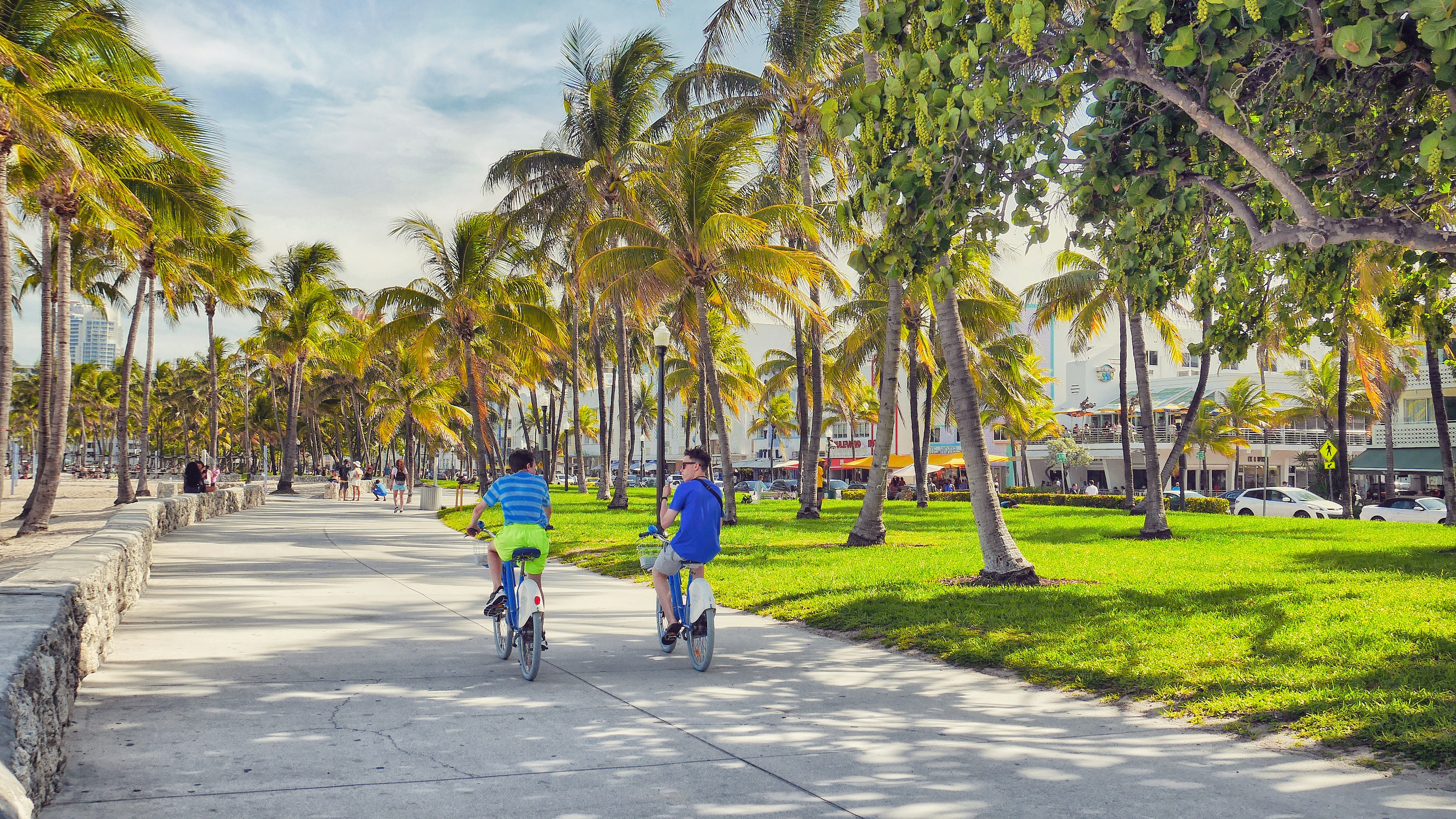
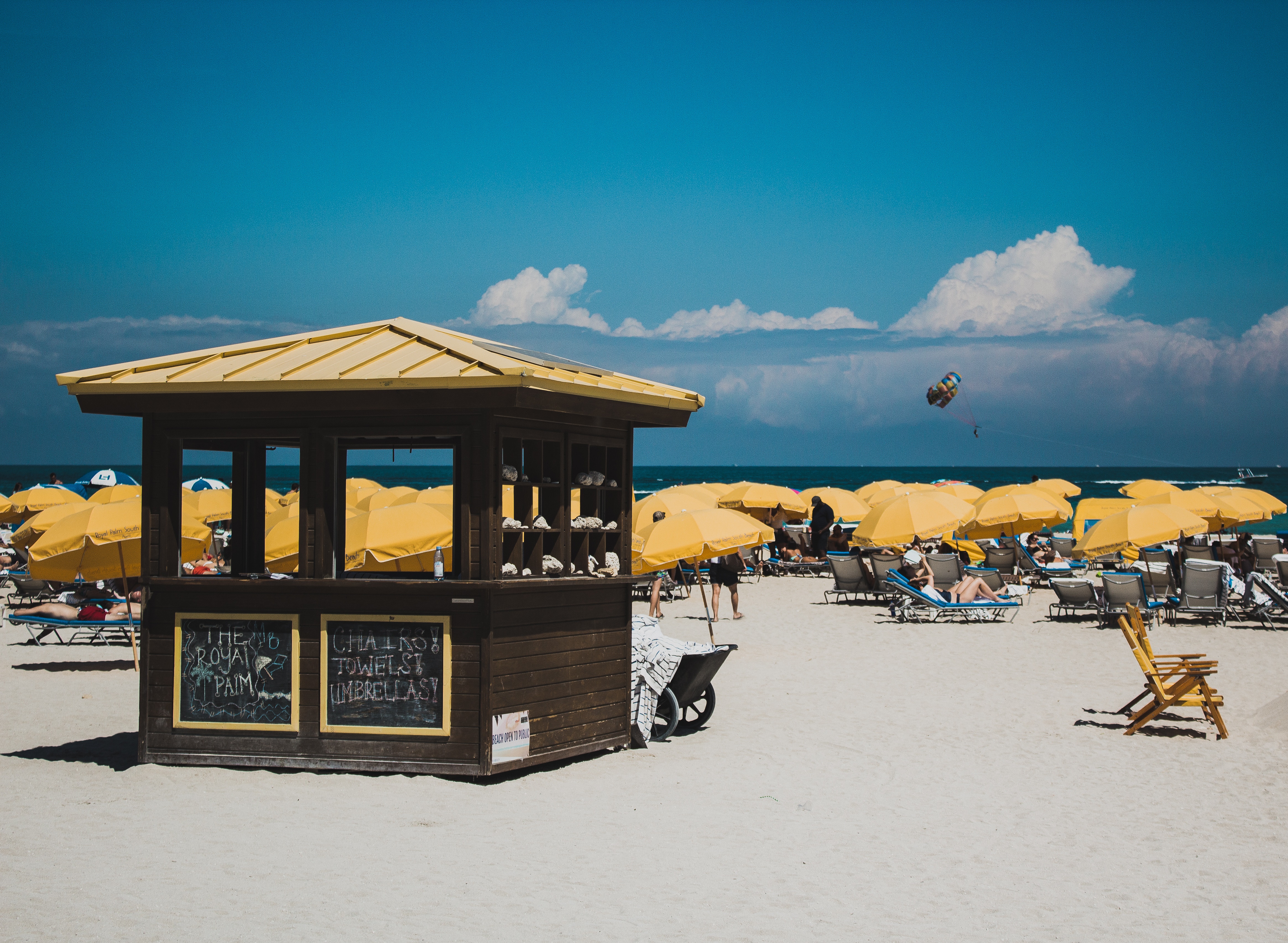
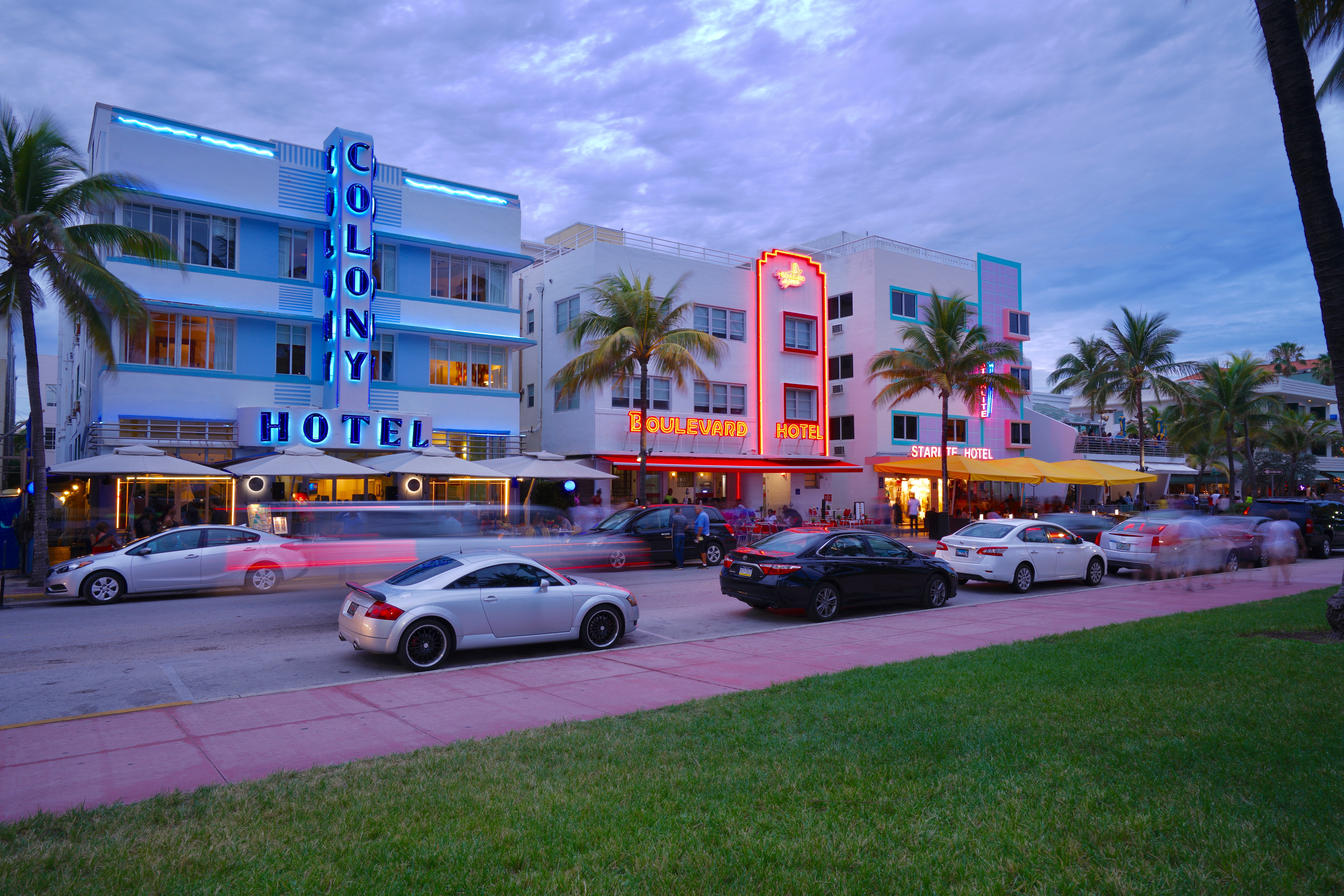
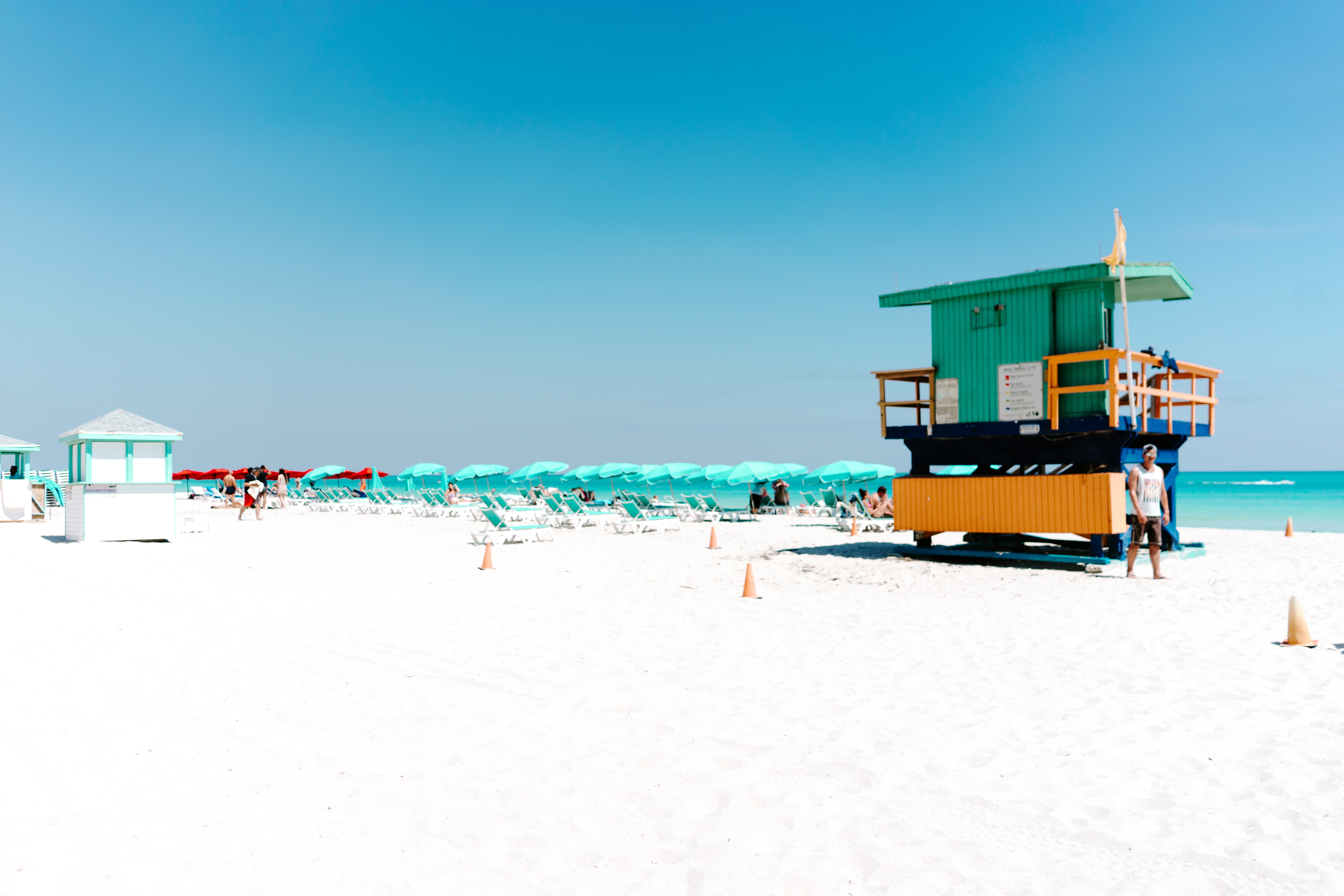
About Miami, Florida
Miami is one of the world’s most popular holiday spots. It has so much to offer; from its countless beach areas, to culture and museums, from spa and shopping days out, to endless cuban restaurants and cafes. Miami is a multicultural city that has something to offer to everyone.
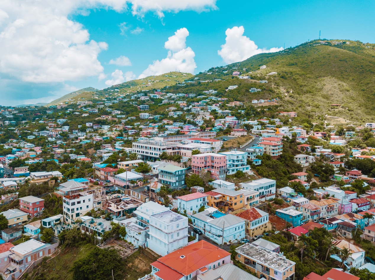
About Charlotte Amalie
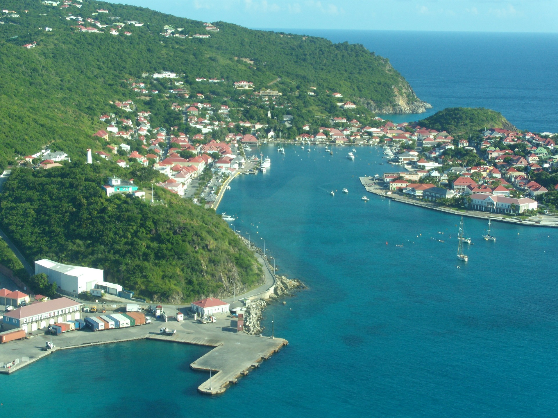
About Gustavia
You can easily explore all of Gustavia during a two-hour stroll. Some shops close from noon to 3 or 4, so plan lunch accordingly, but stores stay open past 7 in the evening. Parking in Gustavia is a challenge, especially during vacation times. A good spot to park is rue de la République, alongside the catamarans, yachts, and sailboats.
About Saint John's
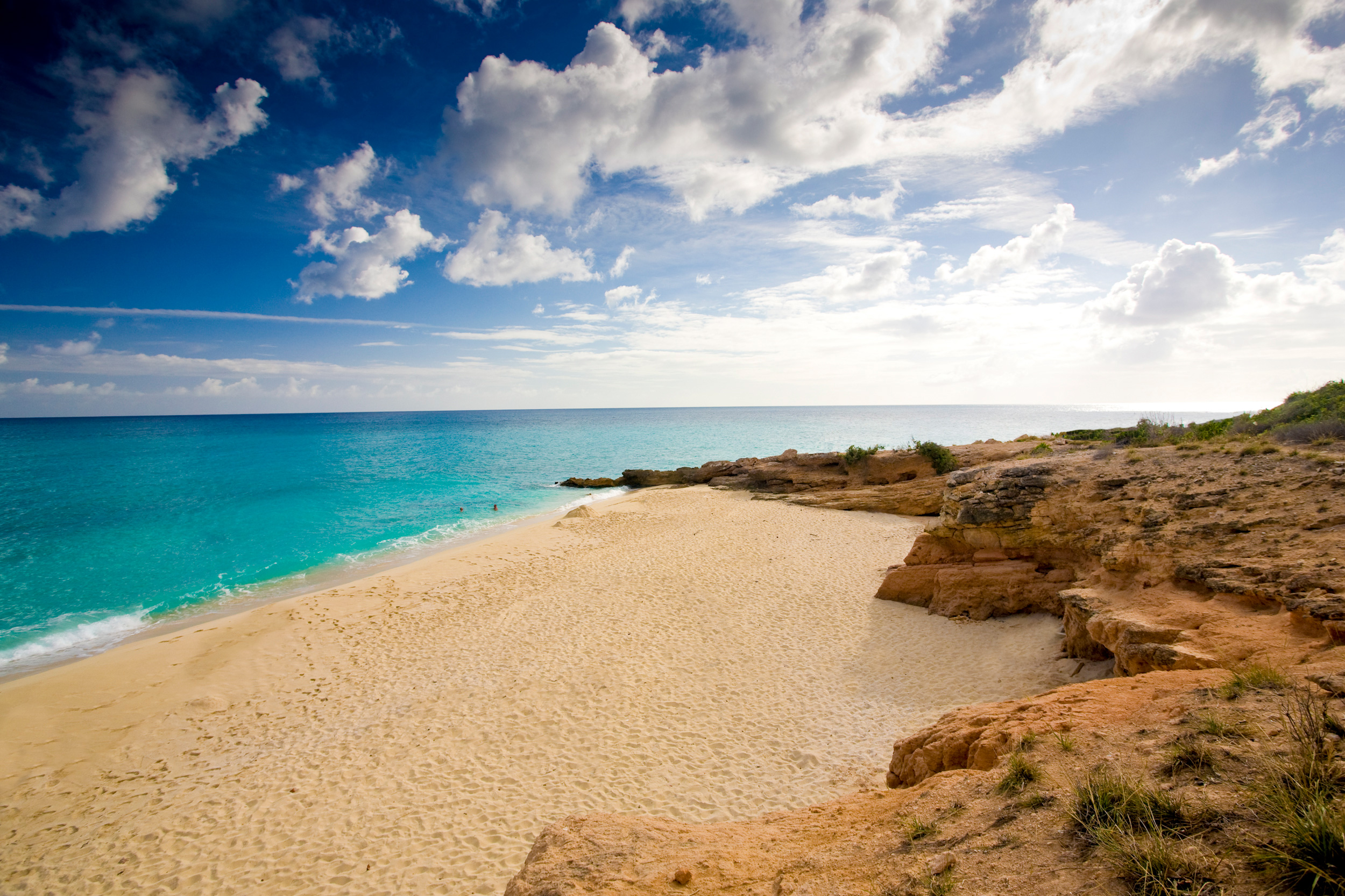
With its superb beaches, historical attractions and beautiful coral reefs, Antigua provides a host of diversions. It is said that the island contains 365 beaches, one for every day of the year. Antigua maintains its traditional West Indian character, with gingerbread-house style architecture, calypso music and carnival festivities. St John’s has been the administrative capital since the island’s colonisation in 1632, and has been the seat of government since it gained independence in 1981. From the port you can explore the colourful Redcliffe district, with its restored wooden houses, and Heritage Quay with its shopping mall and craft shops. The city has some fine examples of Colonial architecture, including the twin-towered cathedral, built in 1845 and considered one of the finest church buildings in the Caribbean. All coaches in Antigua are operated by smaller vehicles, and commentary will be given by a driver/guide.
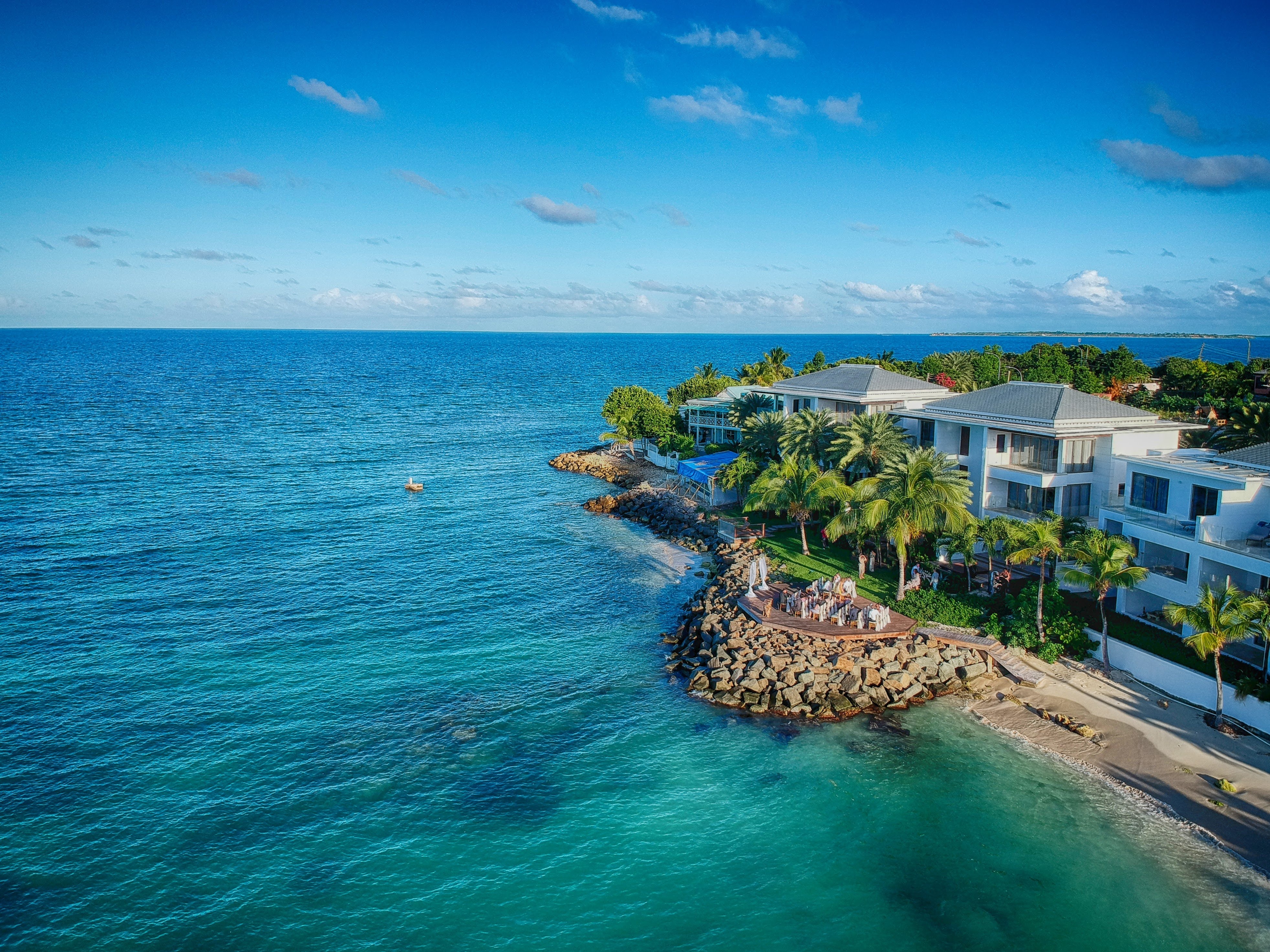
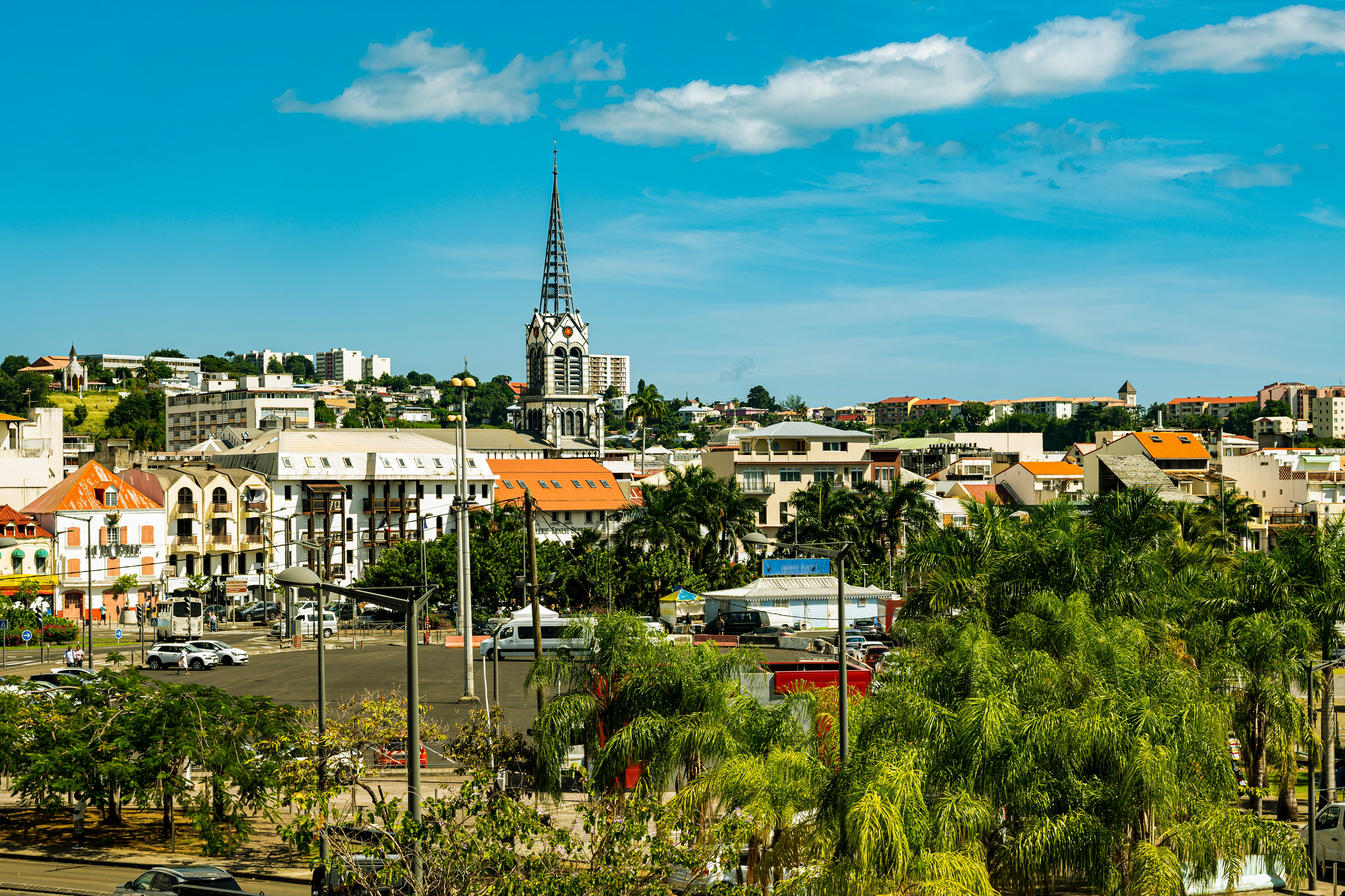
About Fort-de-France
The largest of the Windward Islands, Martinique is 4,261 mi (6,817 km) from Paris, but its spirit and language are decidedly French, with more than a soupçon of West Indian spice. Tangible, edible evidence of the fact is the island's cuisine, a superb blend of French and creole. Martinique is lushly landscaped with tropical flowers. Trees bend under the weight of fruits such as mangoes, papayas, lemons, limes, and bright-red West Indian cherries. Acres of banana plantations, pineapple fields, and waving sugarcane stretch to the horizon. The towering mountains and verdant rain forest in the north lure hikers, while underwater sights and sunken treasures attract snorkelers and scuba divers. Martinique is also wonderful if your idea of exercise is turning over every 10 minutes to get an even tan and your taste in adventure runs to duty-free shopping. A popular cruise-ship excursion goes to St-Pierre, which was buried by ash when Mont Pelée erupted in 1902.
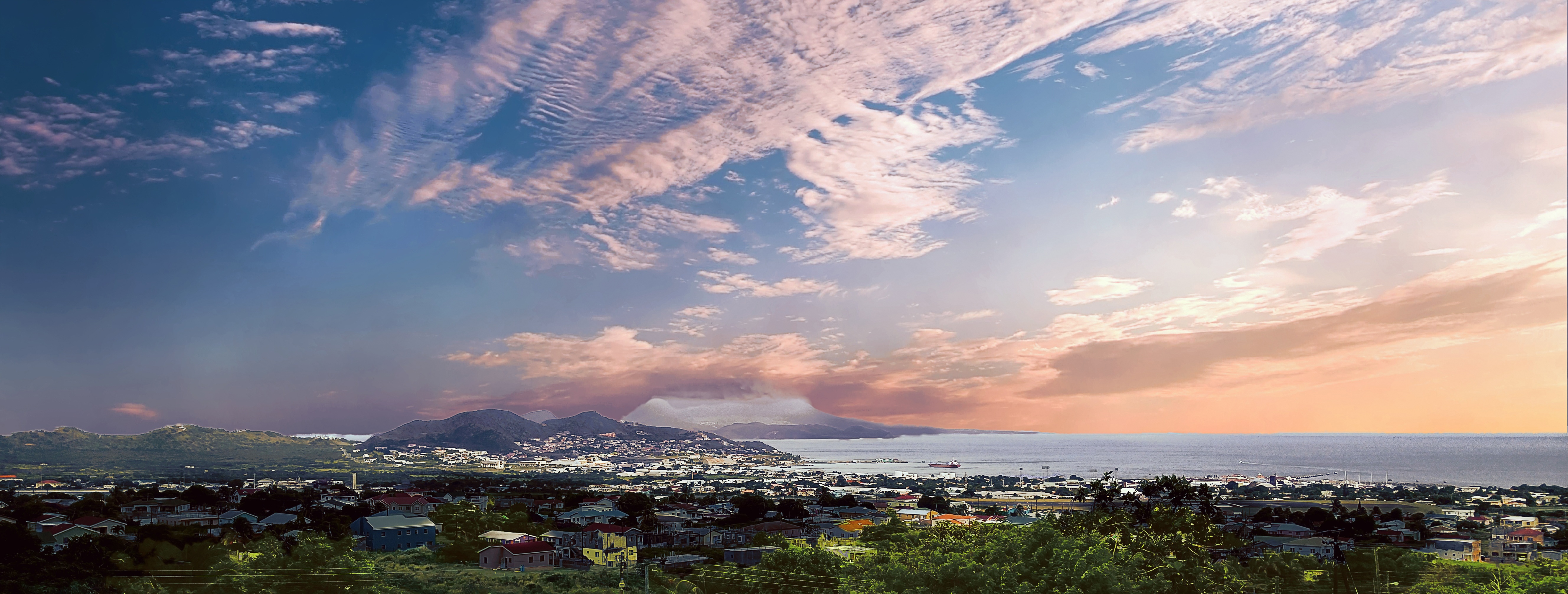
About Basseterre, Saint Kitts
Mountainous St. Kitts, the first English settlement in the Leeward Islands, crams some stunning scenery into its 65 square miles (168 square km). Vast, brilliant green fields of sugarcane (the former cash crop, now slowly being replanted) run to the shore. The fertile, lush island has some fascinating natural and historical attractions: a rain forest replete with waterfalls, thick vines, and secret trails; a central mountain range dominated by the 3,792-foot Mt. Liamuiga, whose crater has long been dormant; and Brimstone Hill, known in the 18th century as the Gibraltar of the West Indies. St. Kitts and Nevis, along with Anguilla, achieved self-government as an associated state of Great Britain in 1967. In 1983 St. Kitts and Nevis became an independent nation. English with a strong West Indian lilt is spoken here. People are friendly but shy; always ask before you take photographs. Also, be sure to wear wraps or shorts over beach attire when you're in public places.
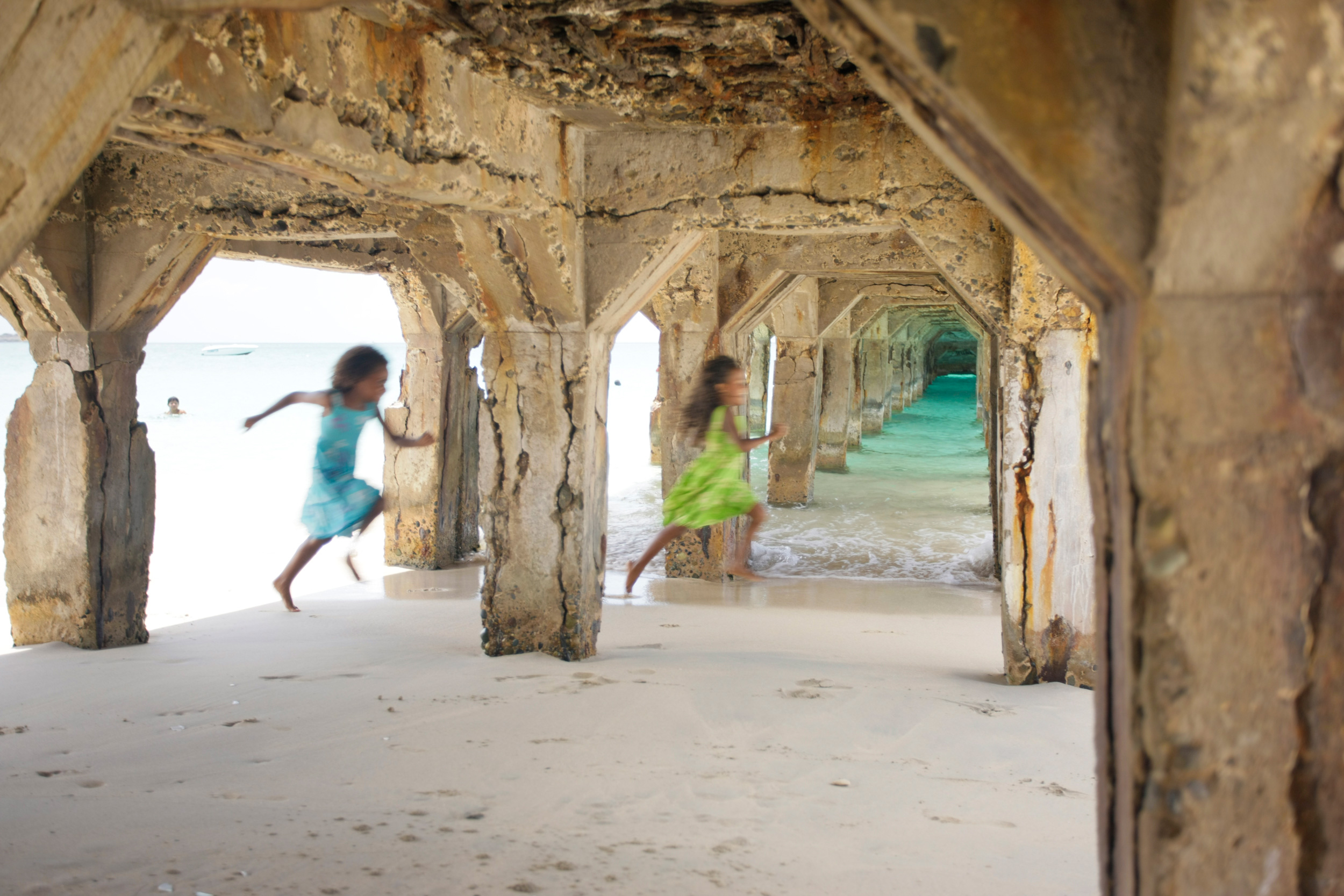
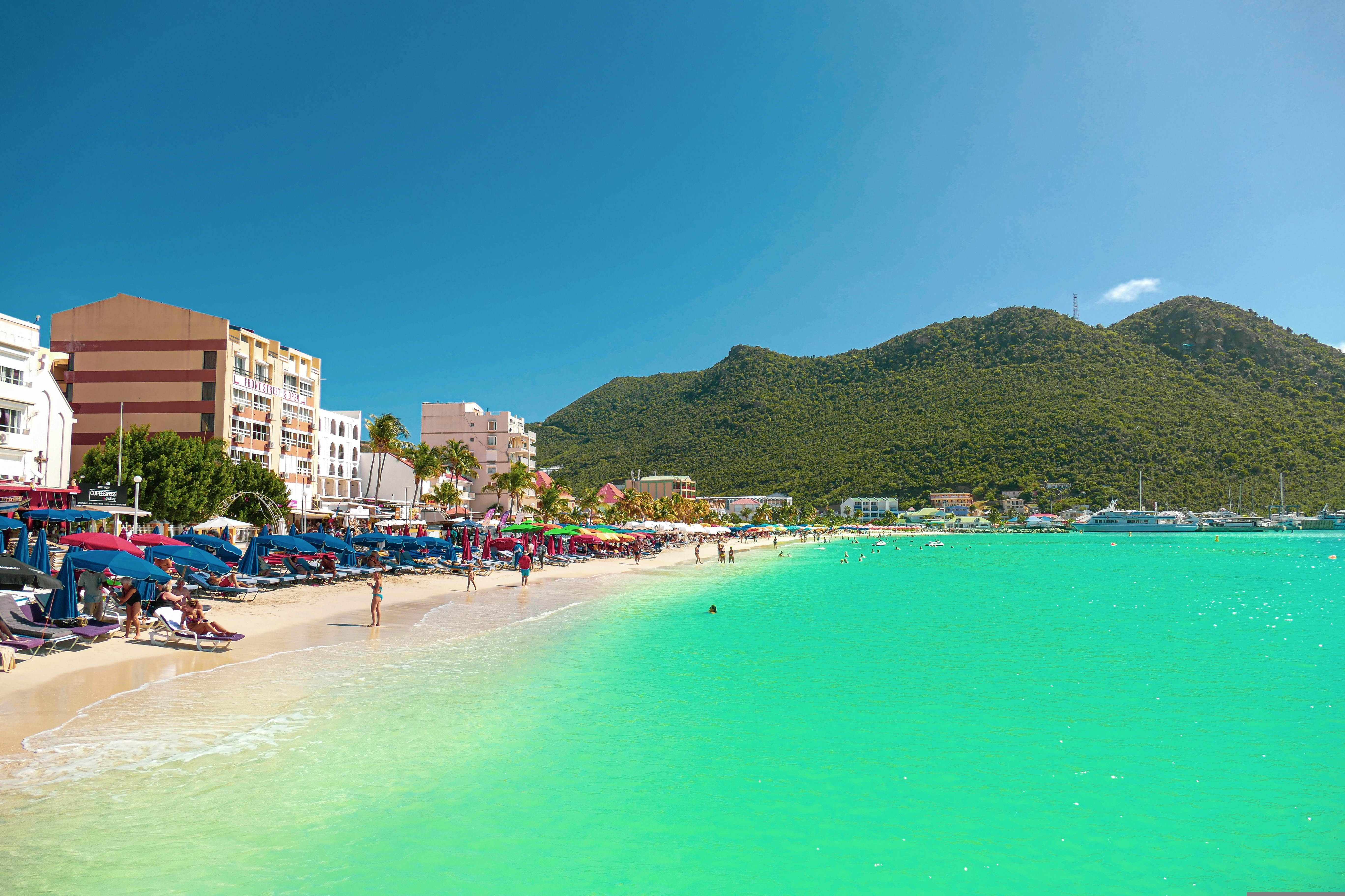
About Philipsburg
The capital of Dutch St. Maarten stretches about a mile (1½ km) along an isthmus between Great Bay and the Salt Pond and has five parallel streets. Most of the village's dozens of shops and restaurants are on Front Street, narrow and cobblestone, closest to Great Bay. It's generally congested when cruise ships are in port, because of its many duty-free shops and several casinos. Little lanes called steegjes connect Front Street with Back Street, which has fewer shops and considerably less congestion. Along the beach is a ½-mile-long (1-km-long) boardwalk with restaurants and several Wi-Fi hot spots.Wathey Square (pronounced watty) is in the heart of the village. Directly across from the square are the town hall and the courthouse, in a striking white building with cupola. The structure was built in 1793 and has served as the commander's home, a fire station, a jail, and a post office. The streets surrounding the square are lined with hotels, duty-free shops, restaurants, and cafés. The Captain Hodge Pier, just off the square, is a good spot to view Great Bay and the beach that stretches alongside.
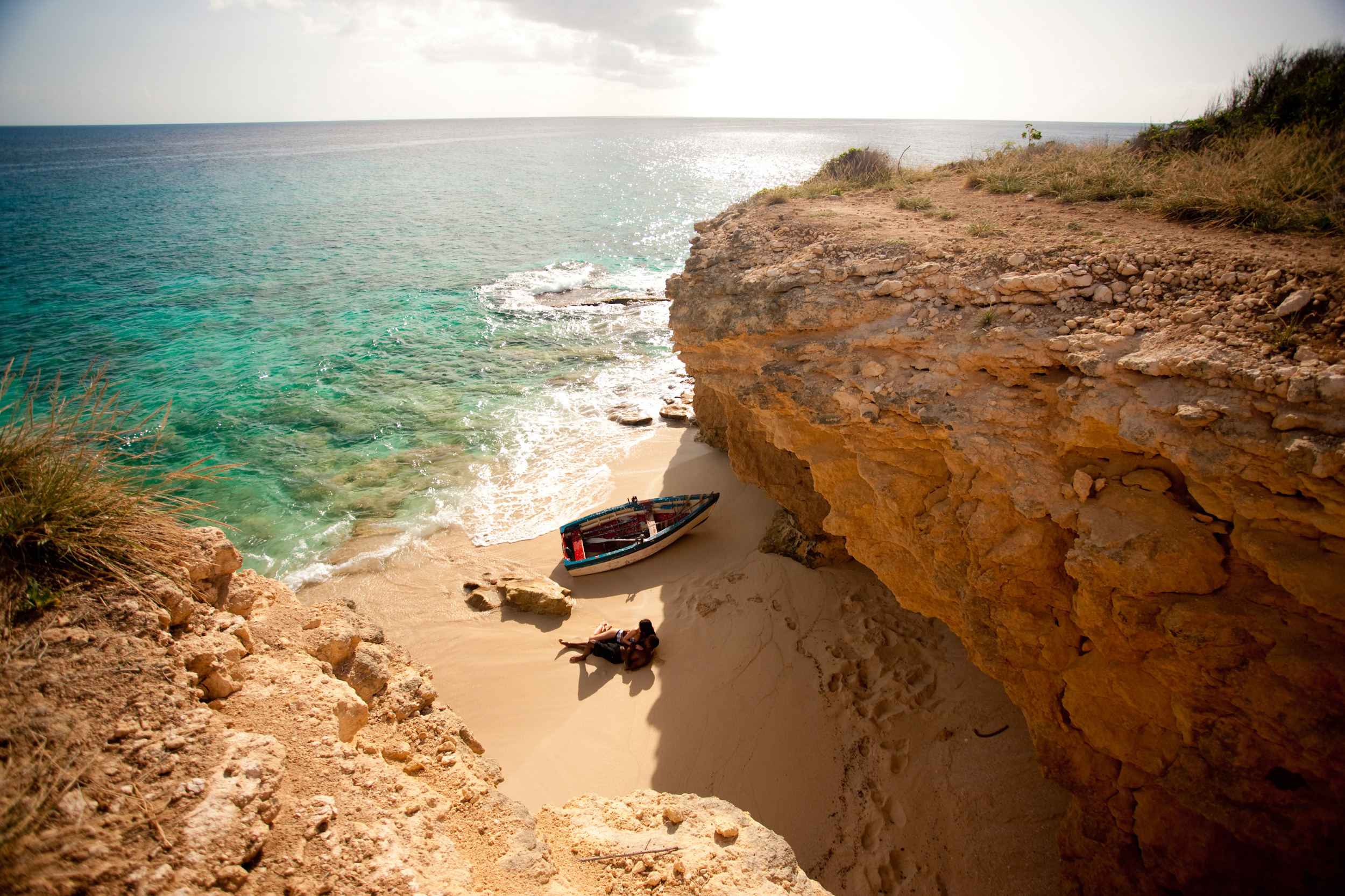
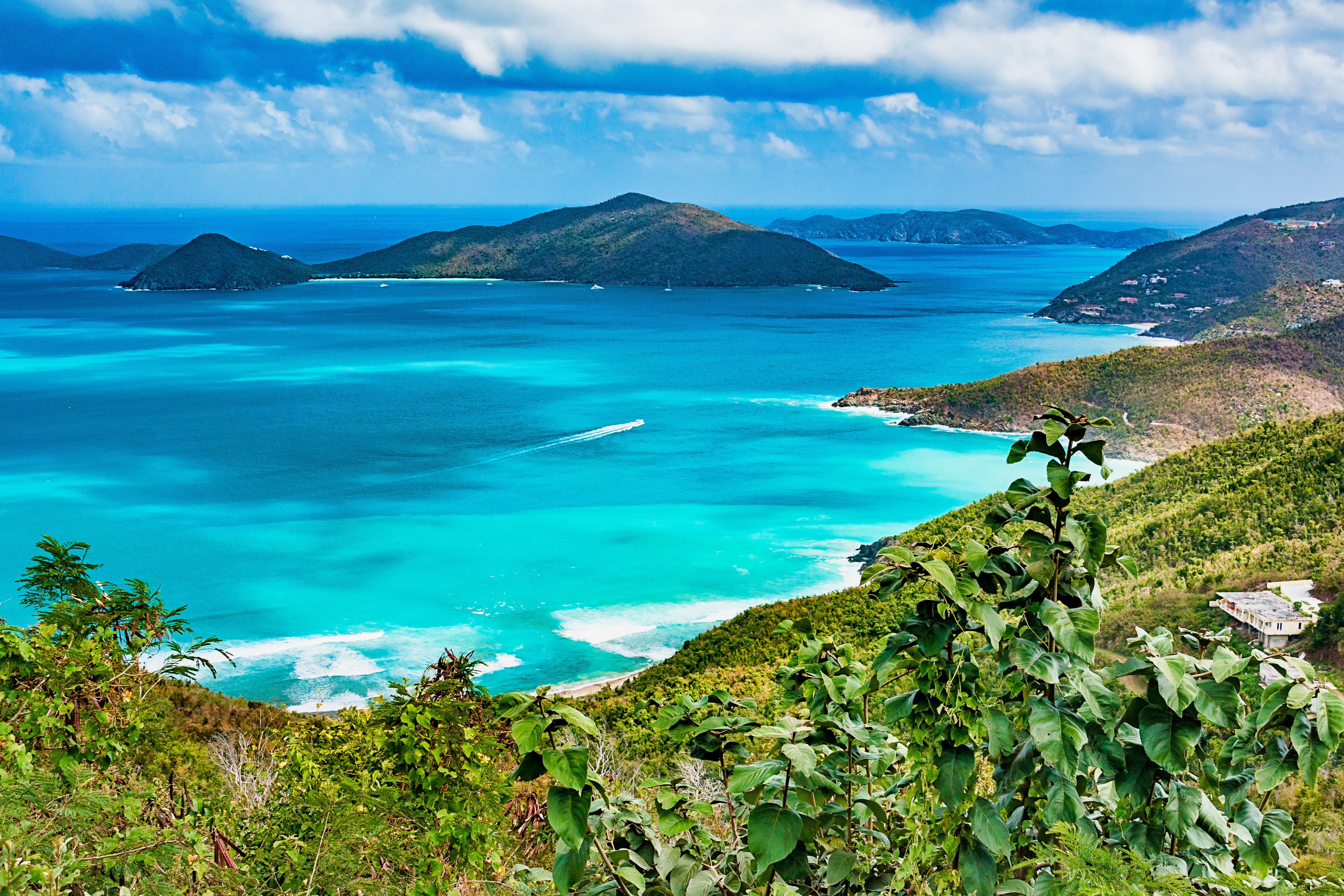
About Tortola
The bustling capital of the BVI looks out over Road Harbour. It takes only an hour or so to stroll down Main Street and along the waterfront, checking out the traditional West Indian buildings painted in pastel colors and with corrugated-tin roofs, bright shutters, and delicate fretwork trim. For sightseeing brochures and the latest information on everything from taxi rates to ferry schedules, stop in at the BVI Tourist Board office. Or just choose a seat on one of the benches in Sir Olva Georges Square, on Waterfront Drive, and watch the people come and go from the ferry dock and customs office across the street.
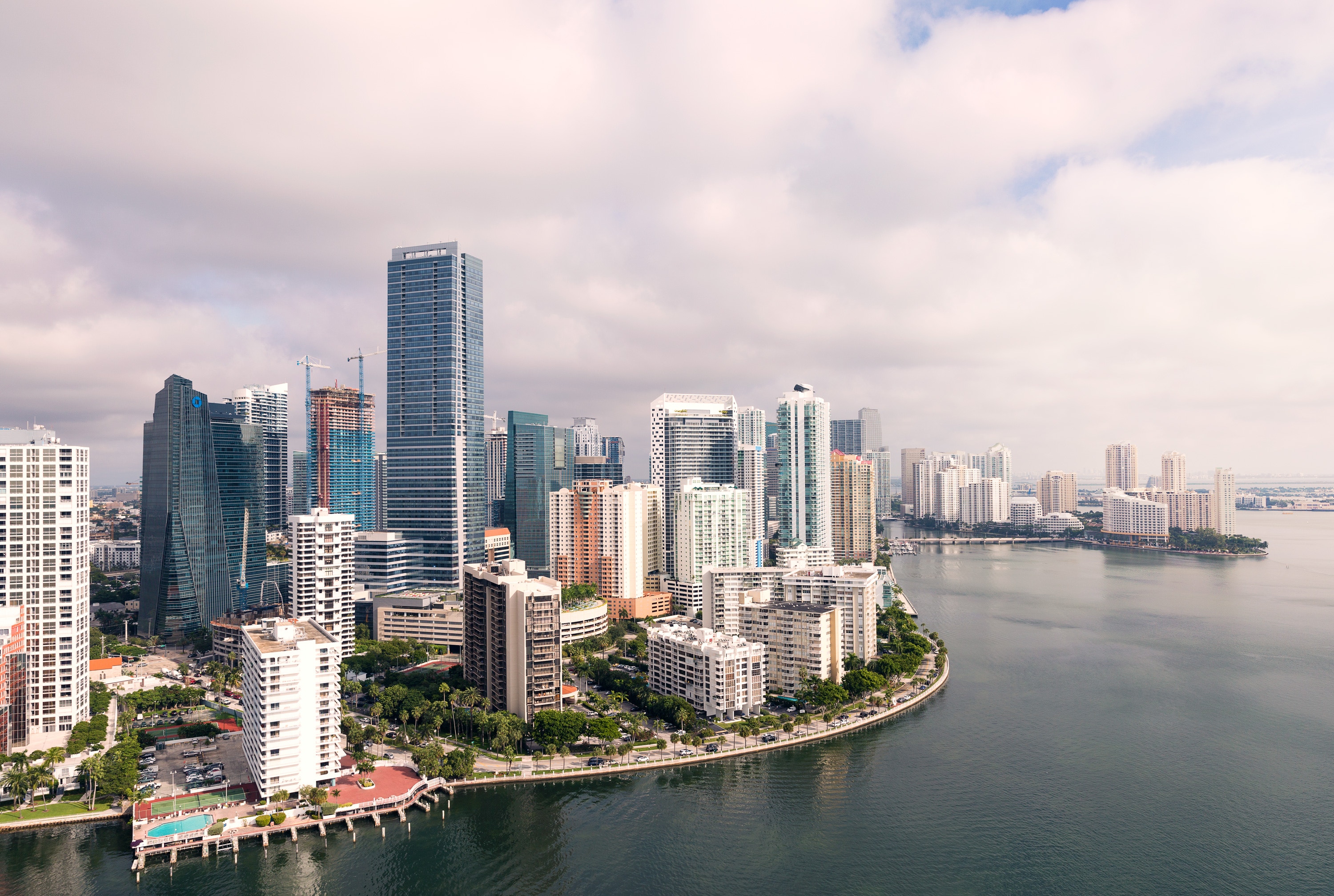
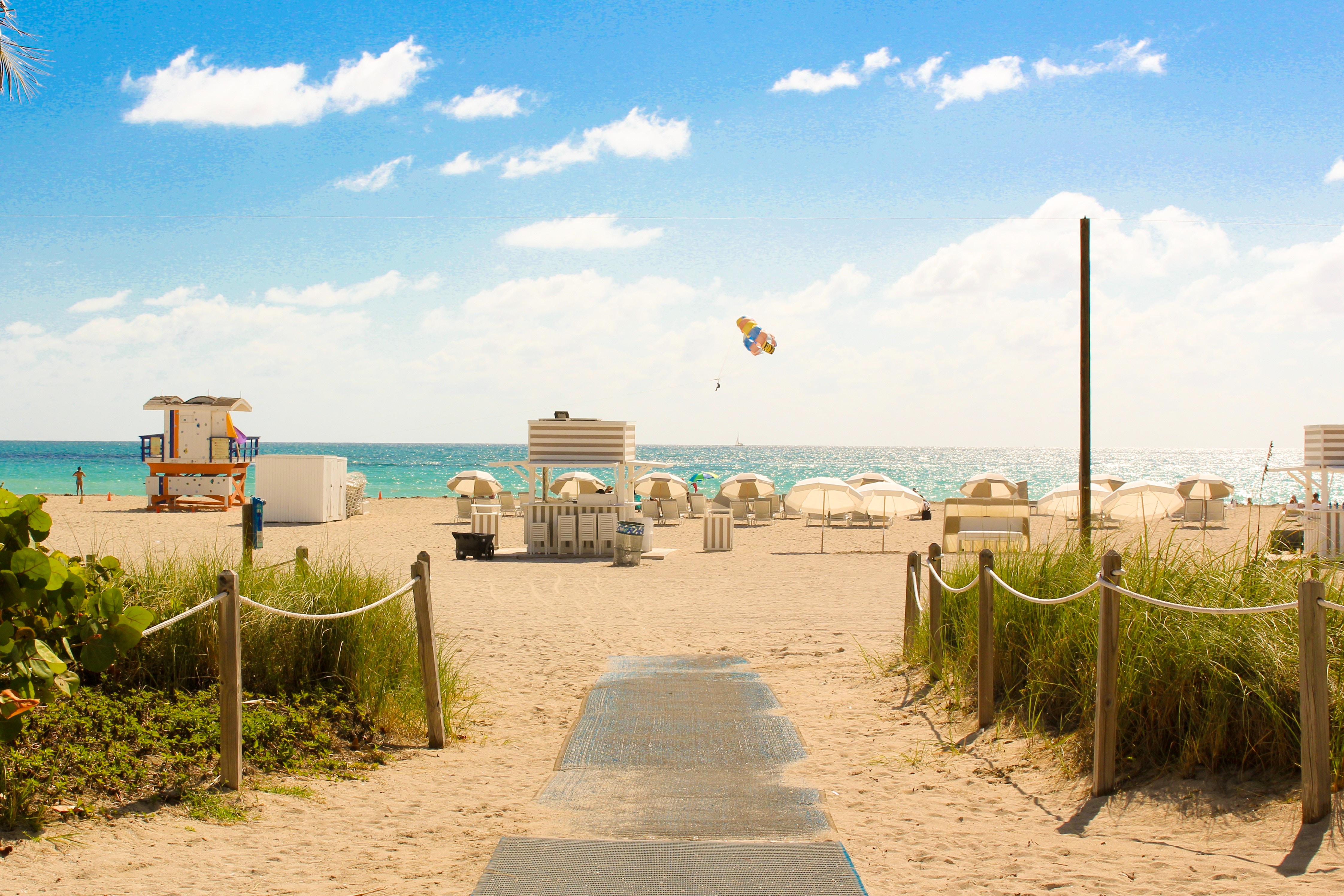
About Miami, Florida
Miami is one of the world’s most popular holiday spots. It has so much to offer; from its countless beach areas, to culture and museums, from spa and shopping days out, to endless cuban restaurants and cafes. Miami is a multicultural city that has something to offer to everyone.
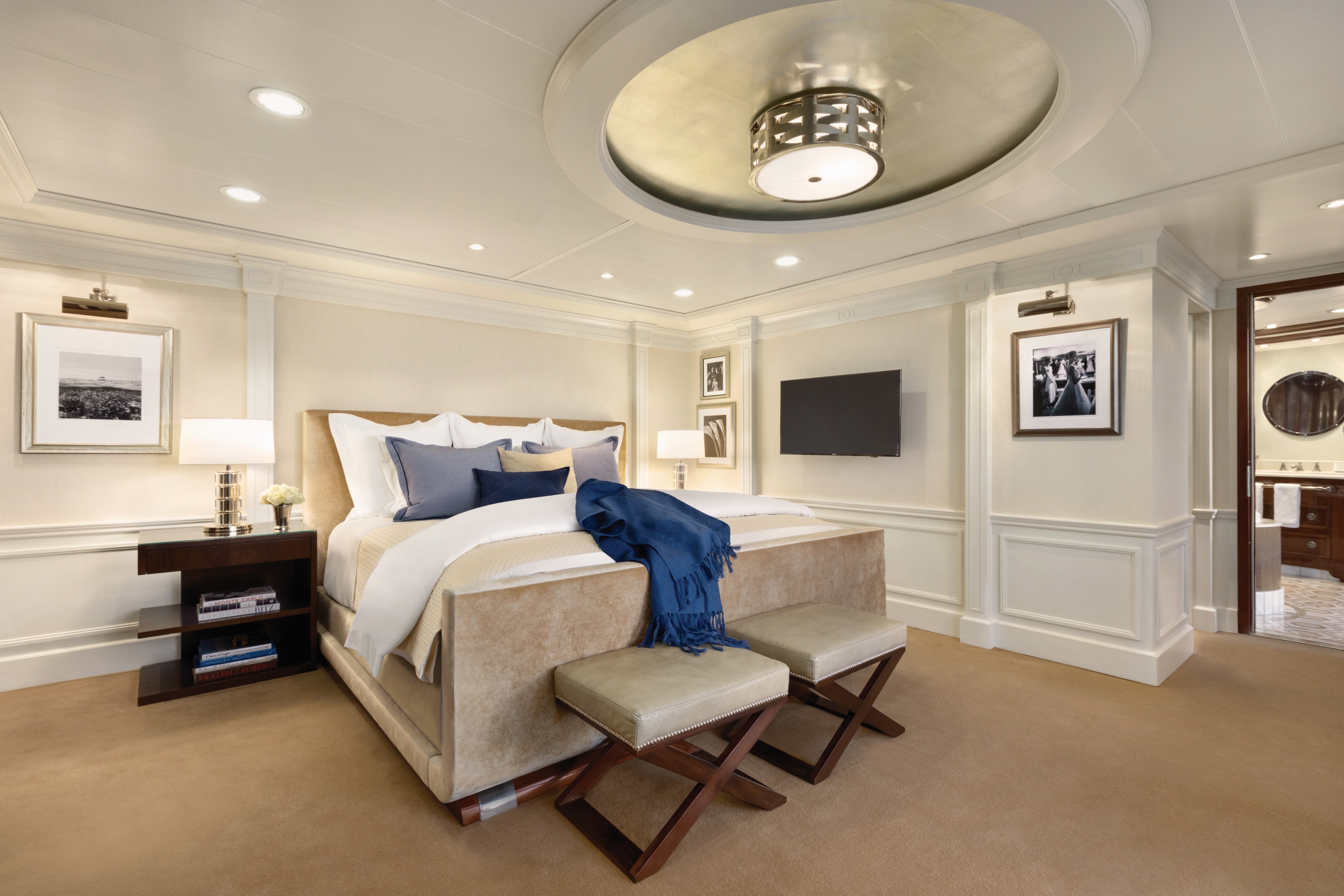
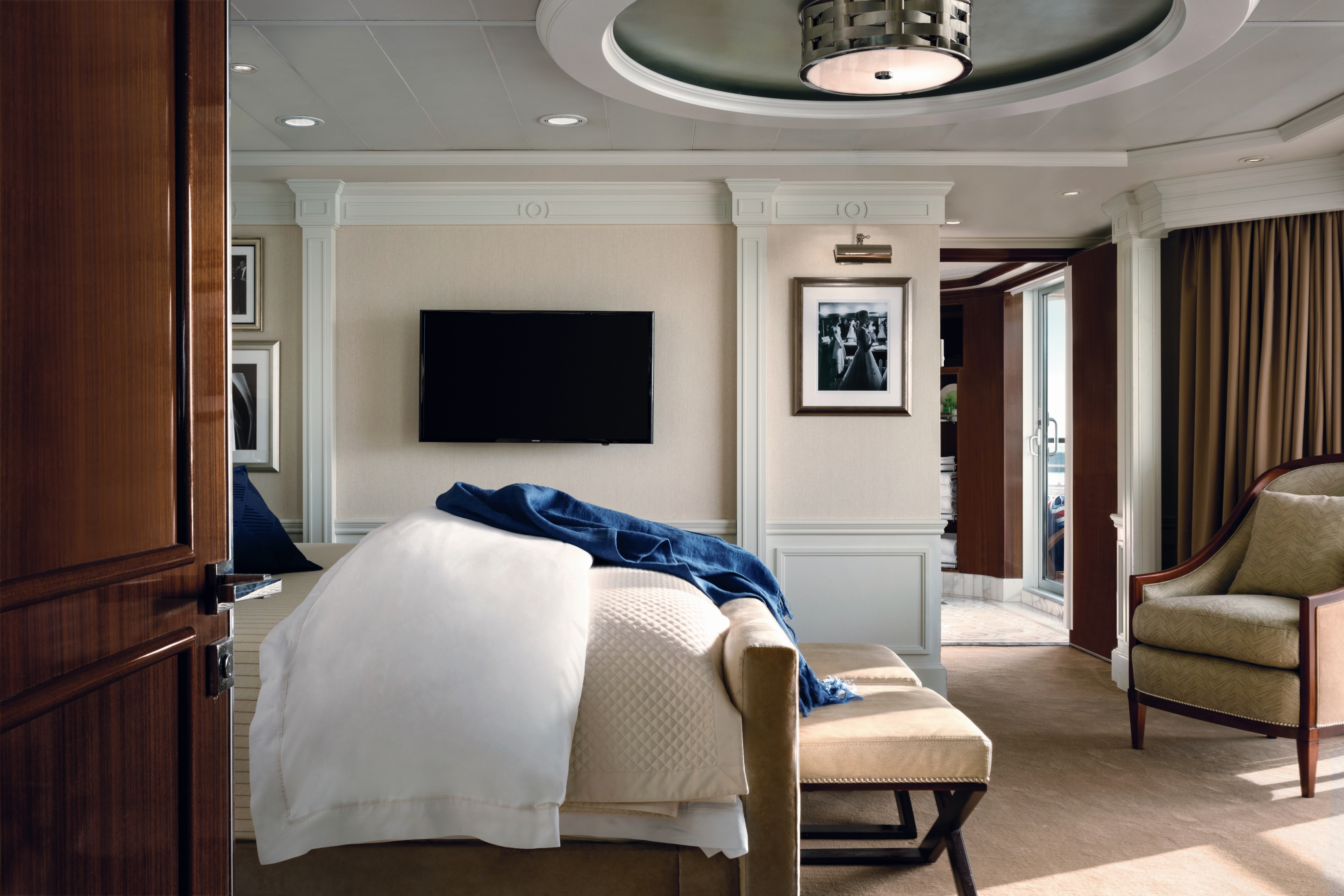
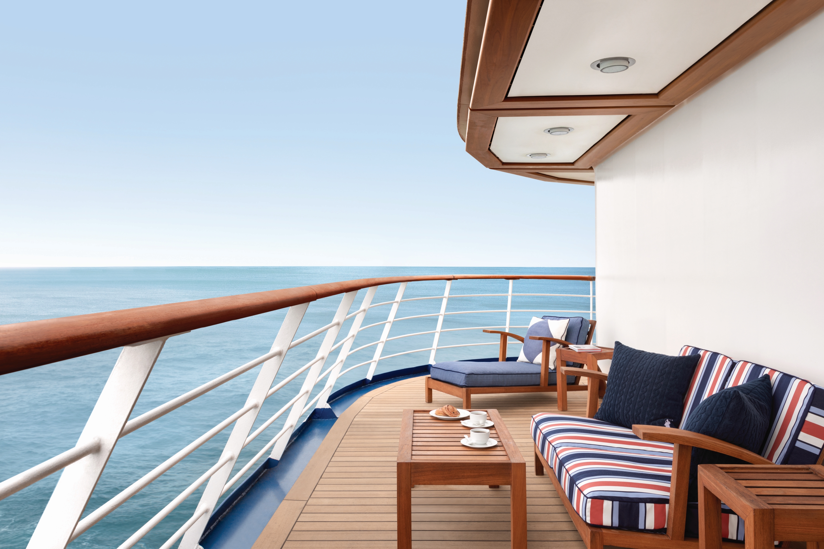
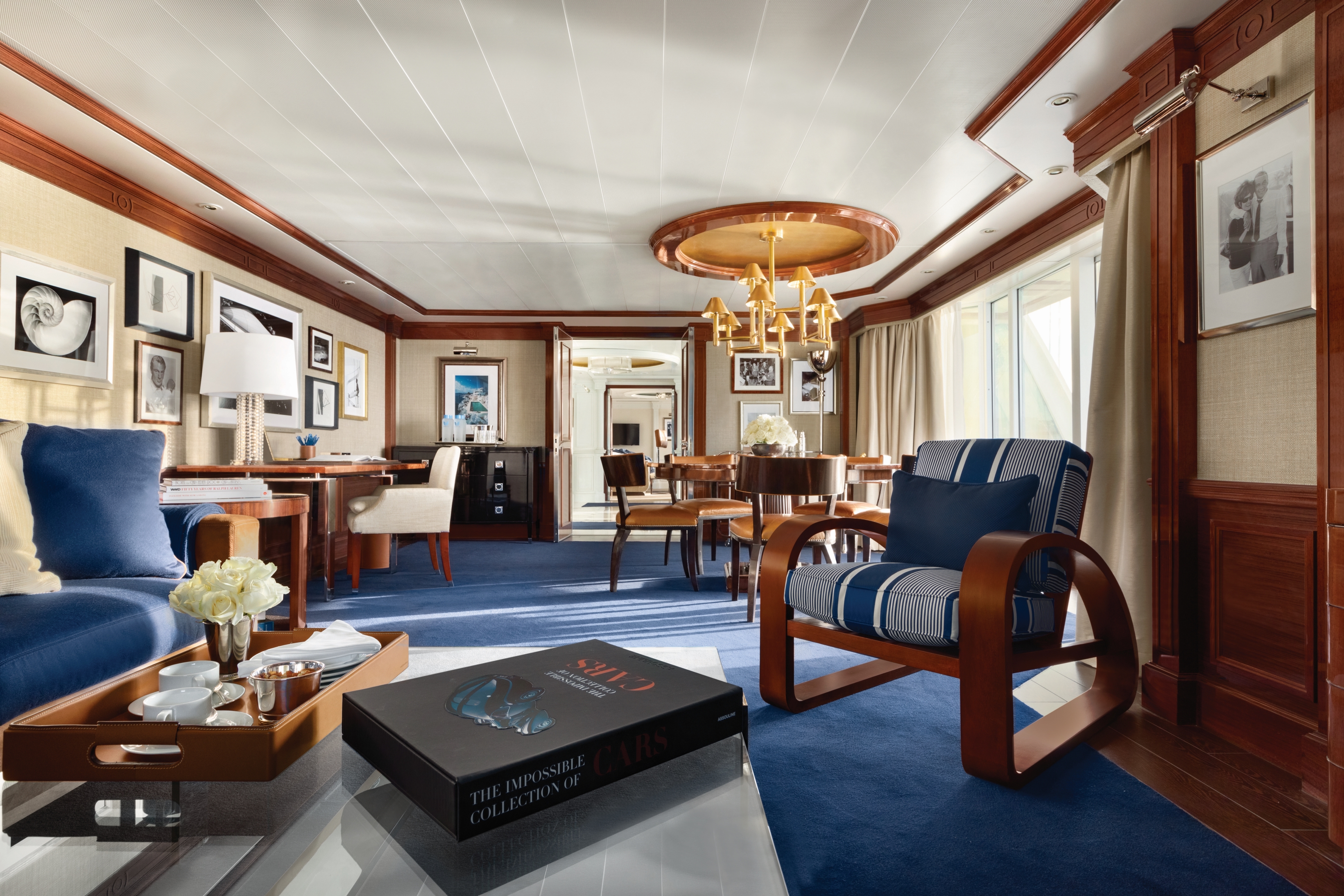
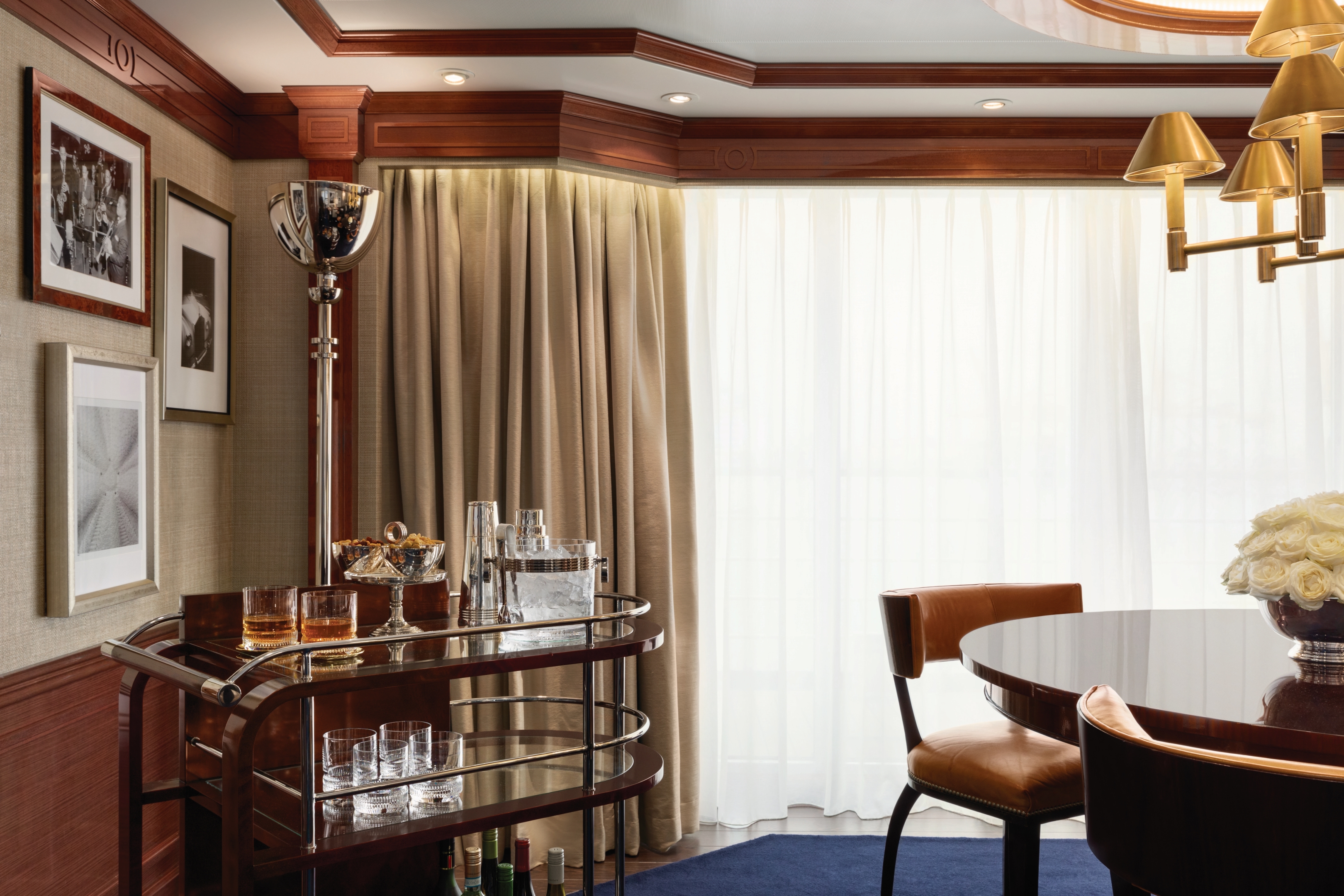
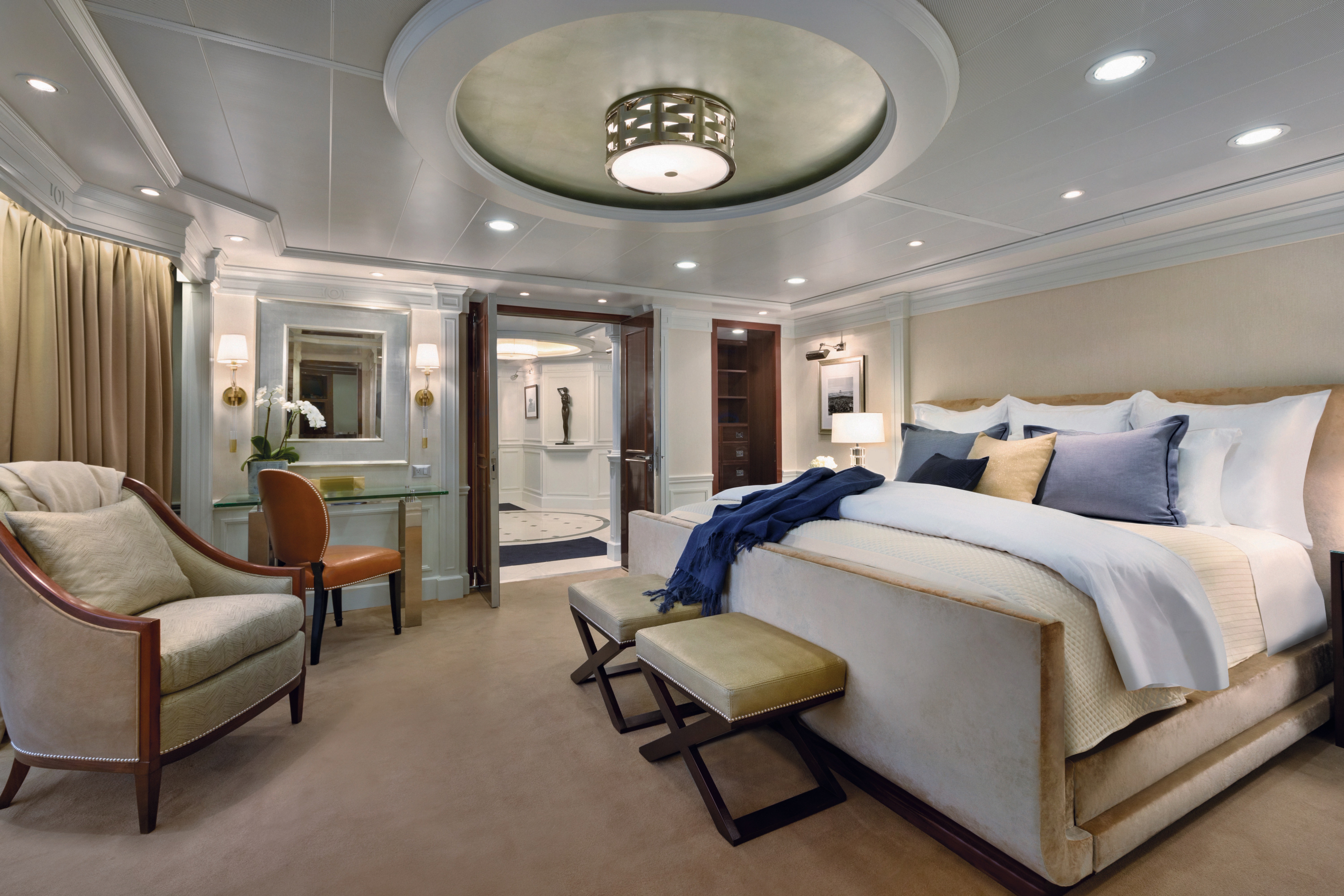
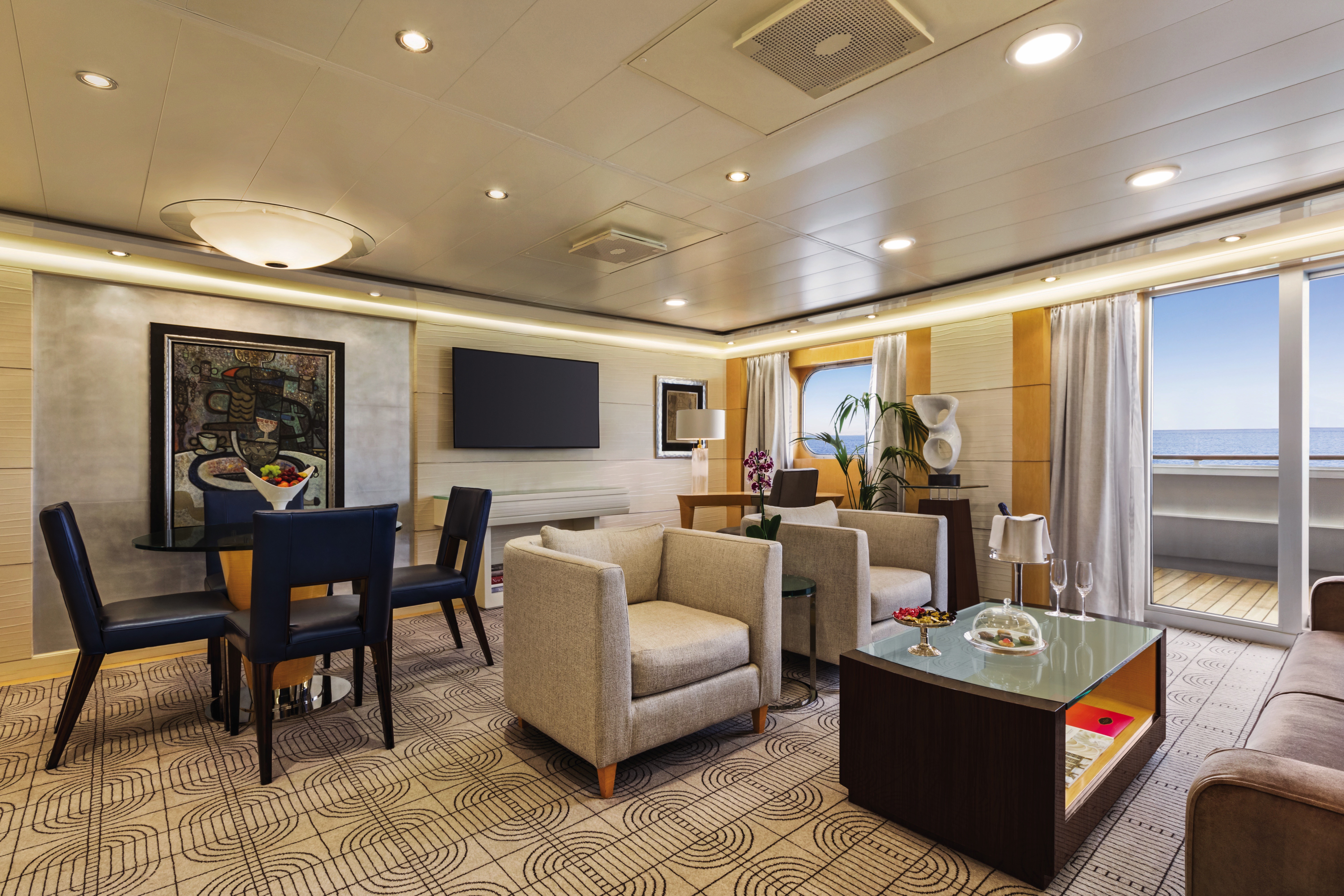
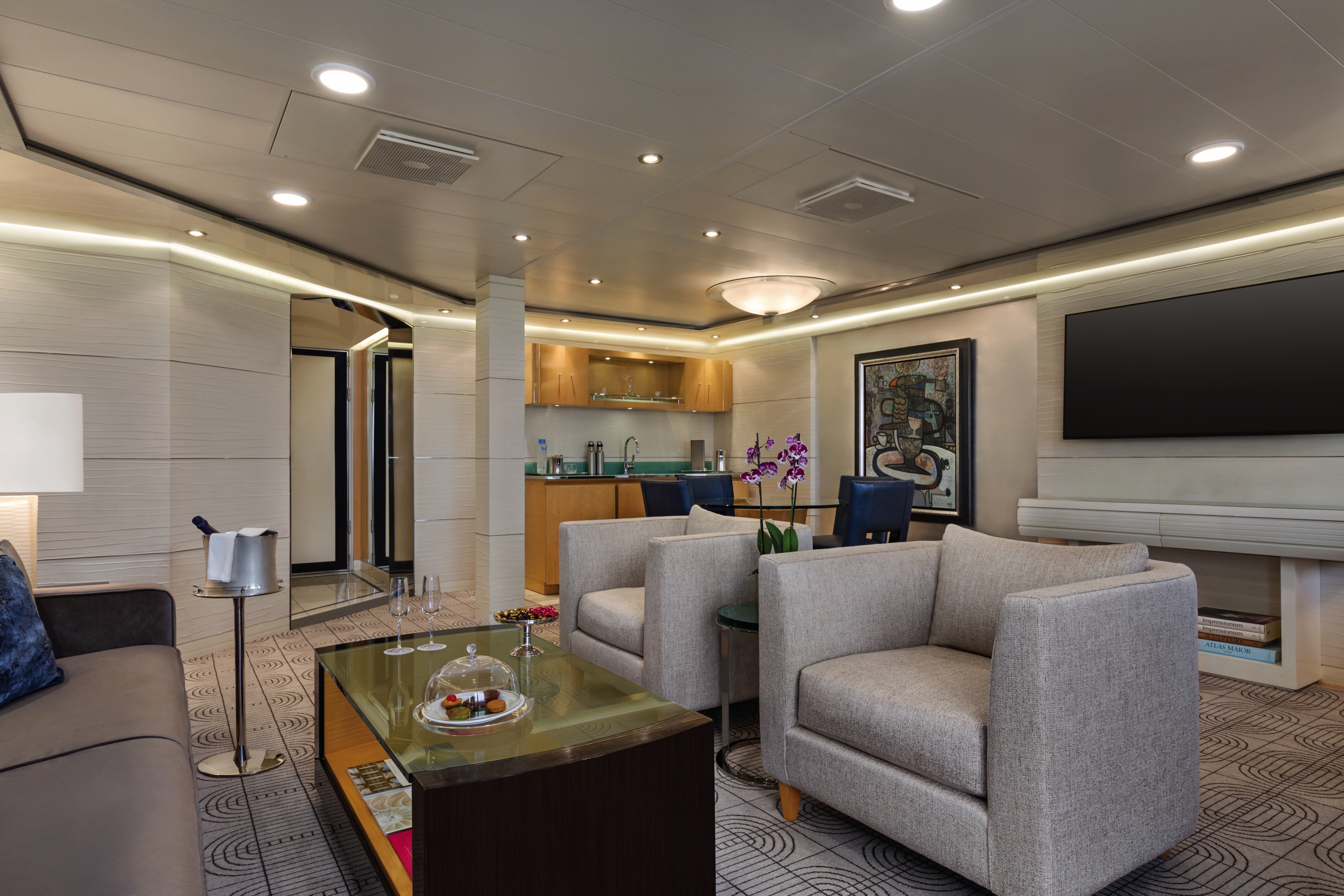
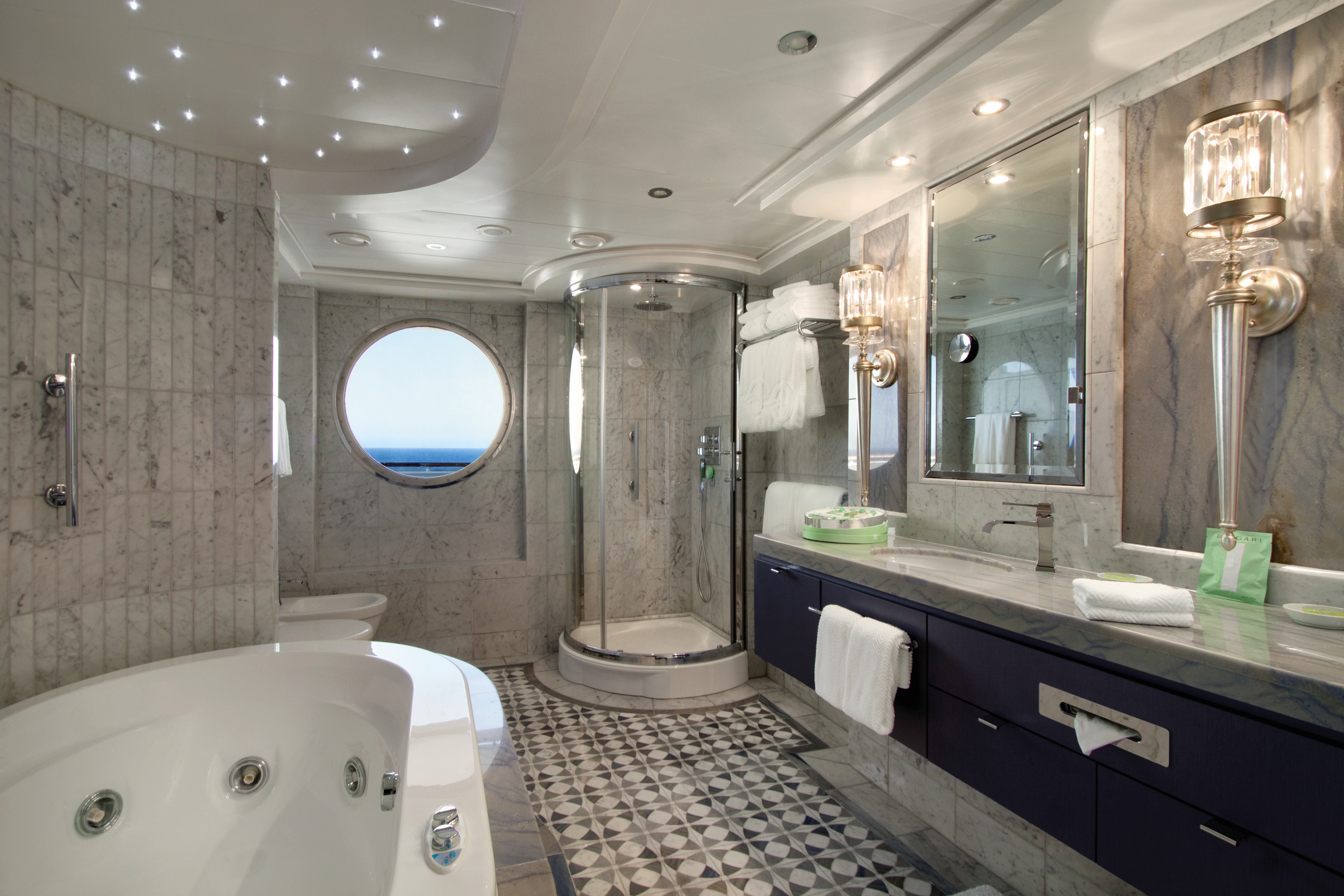
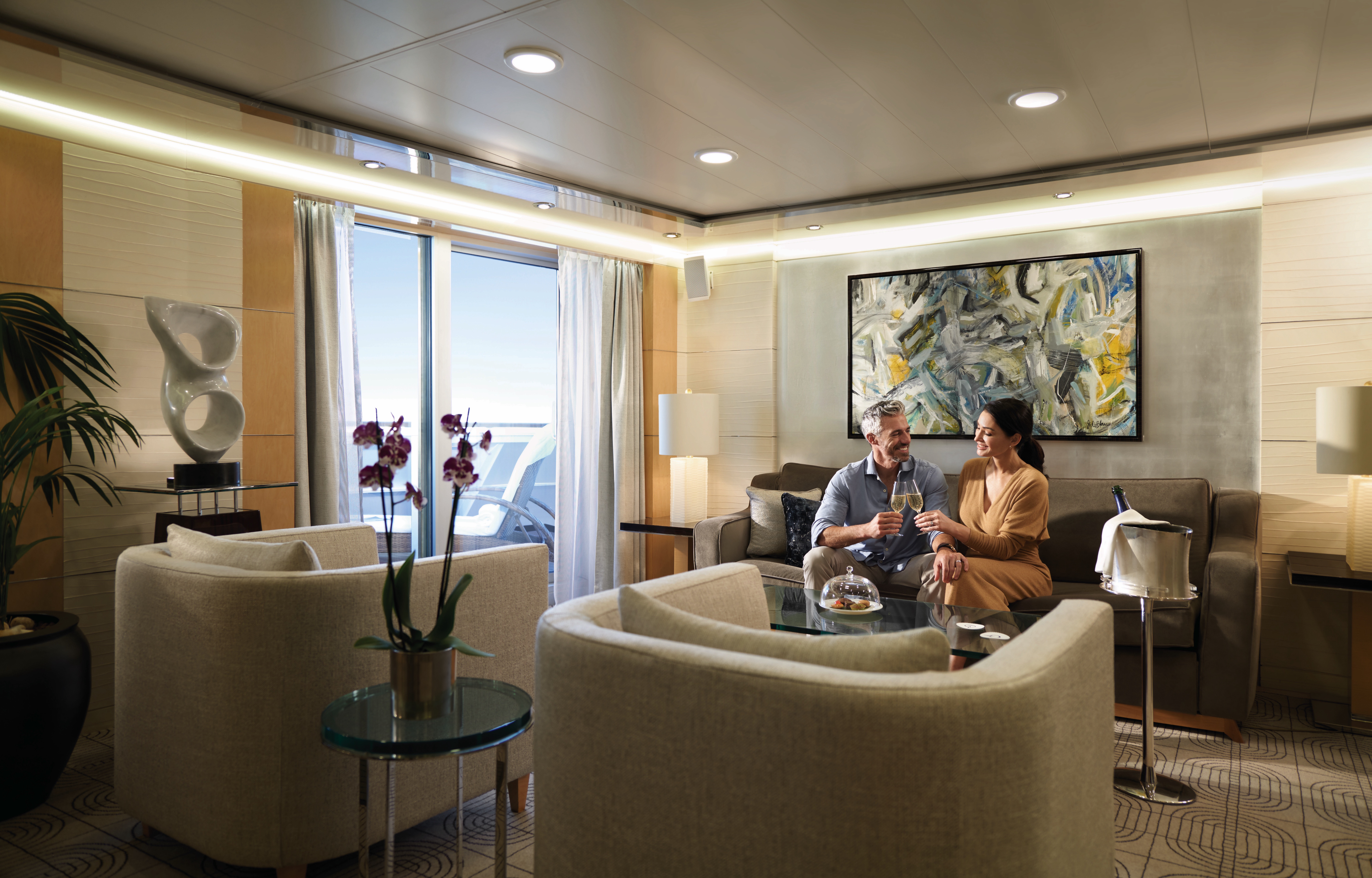
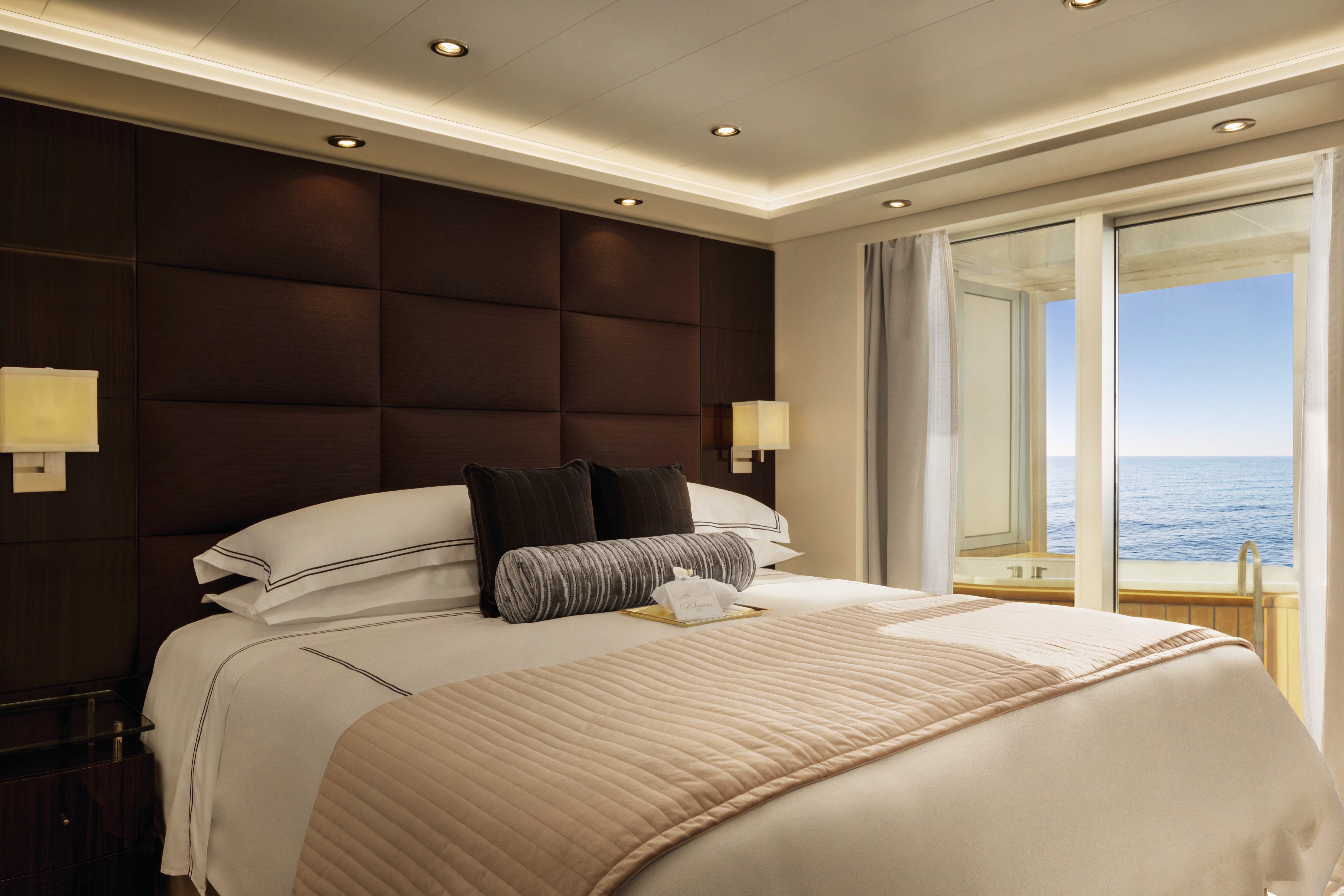
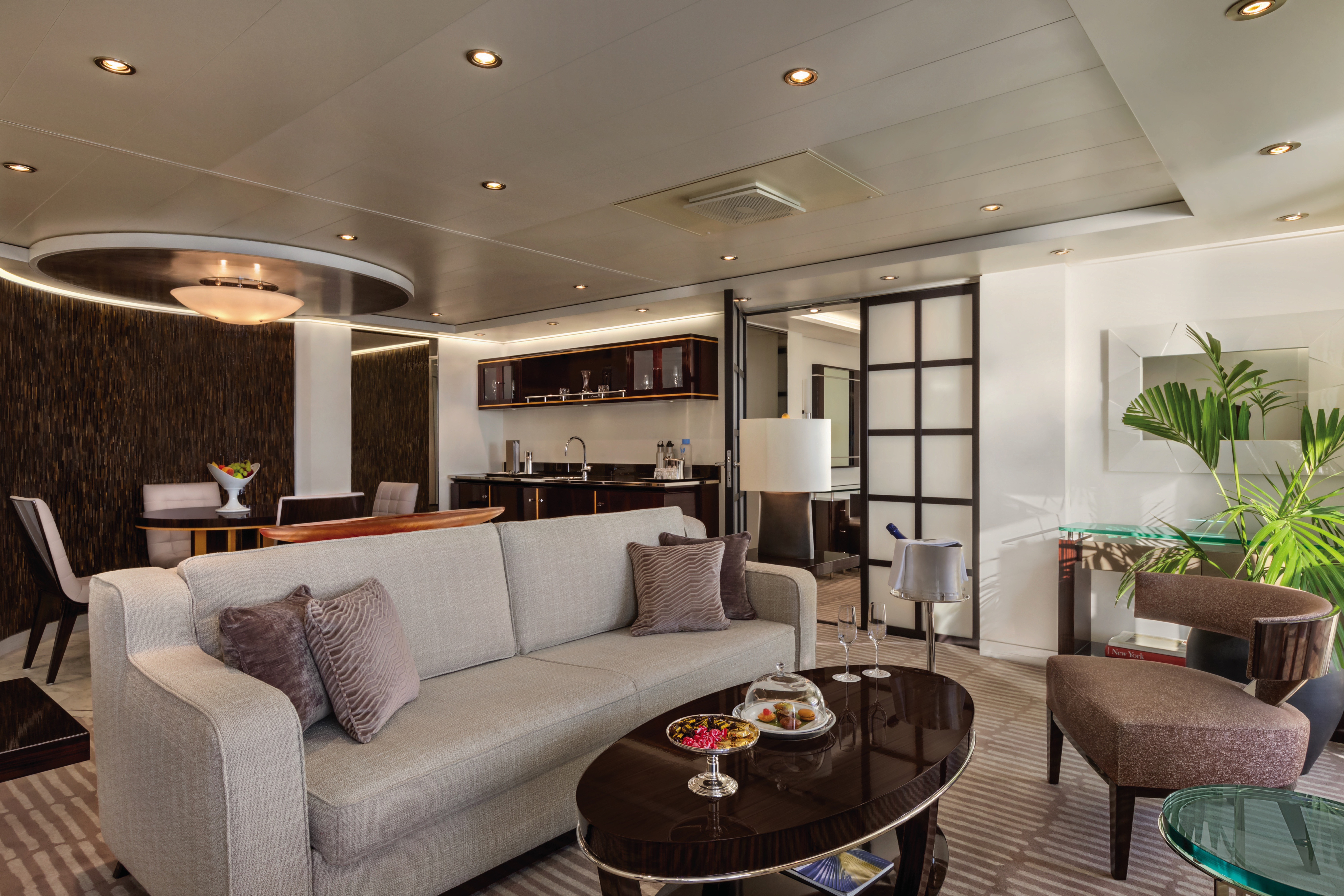
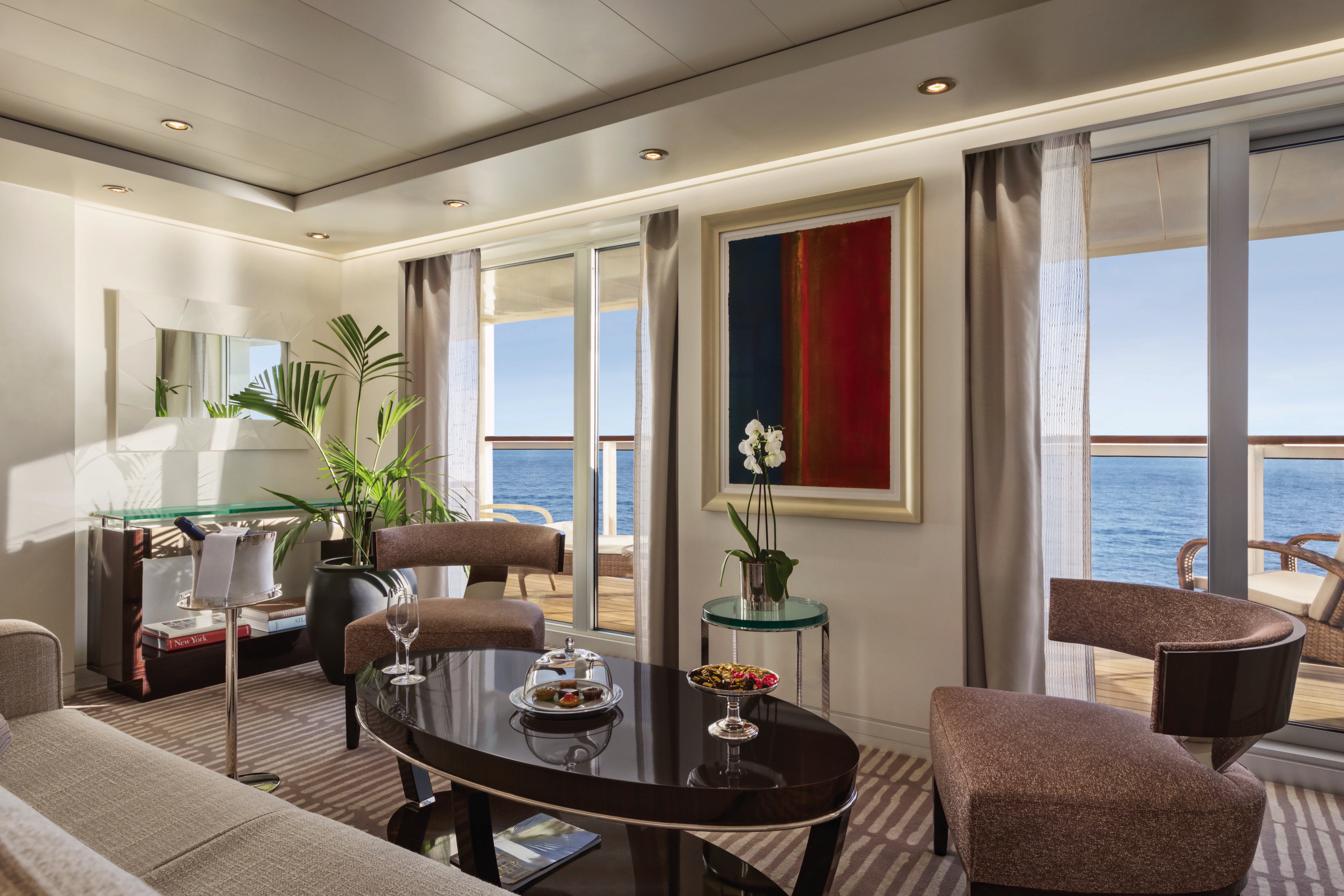
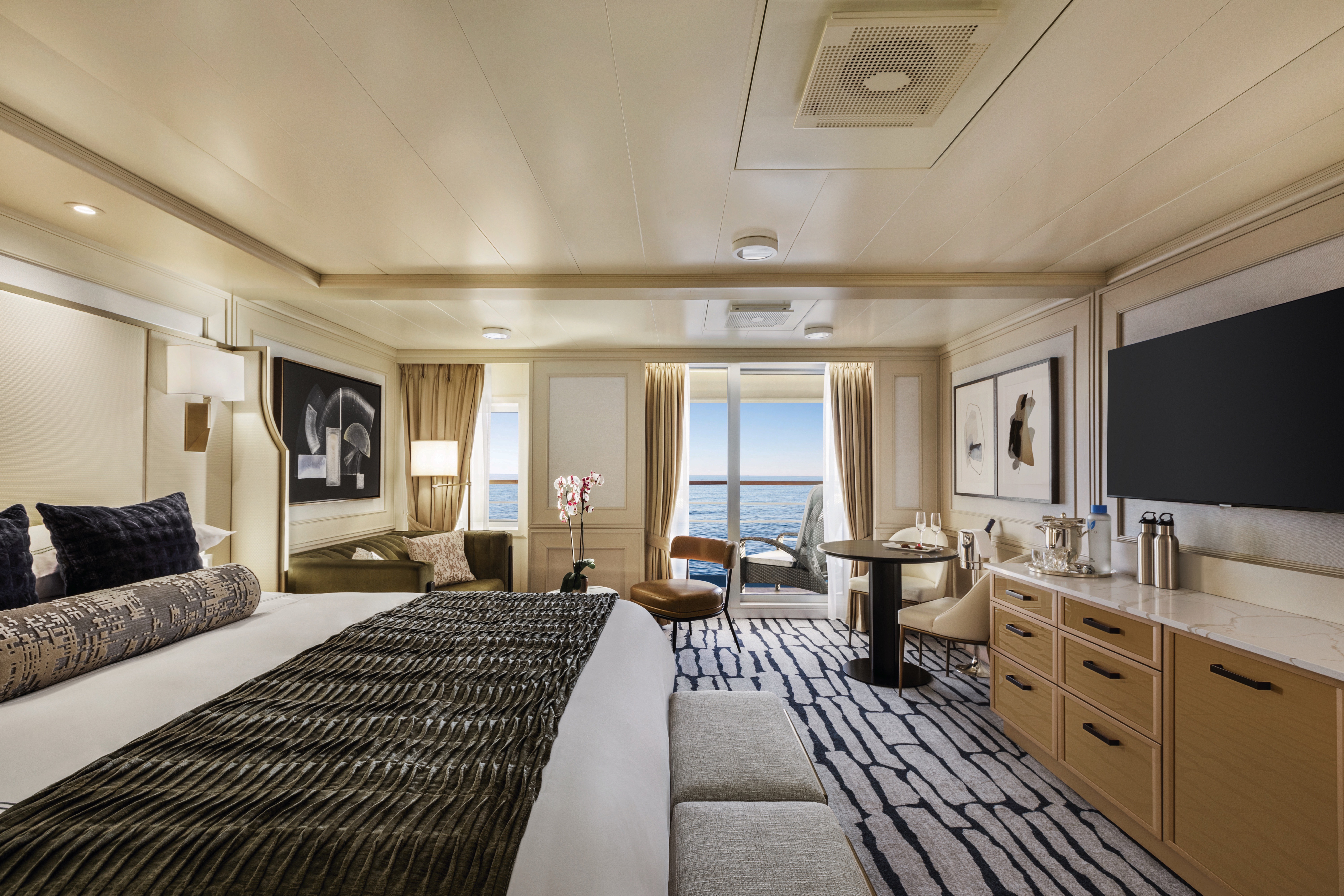
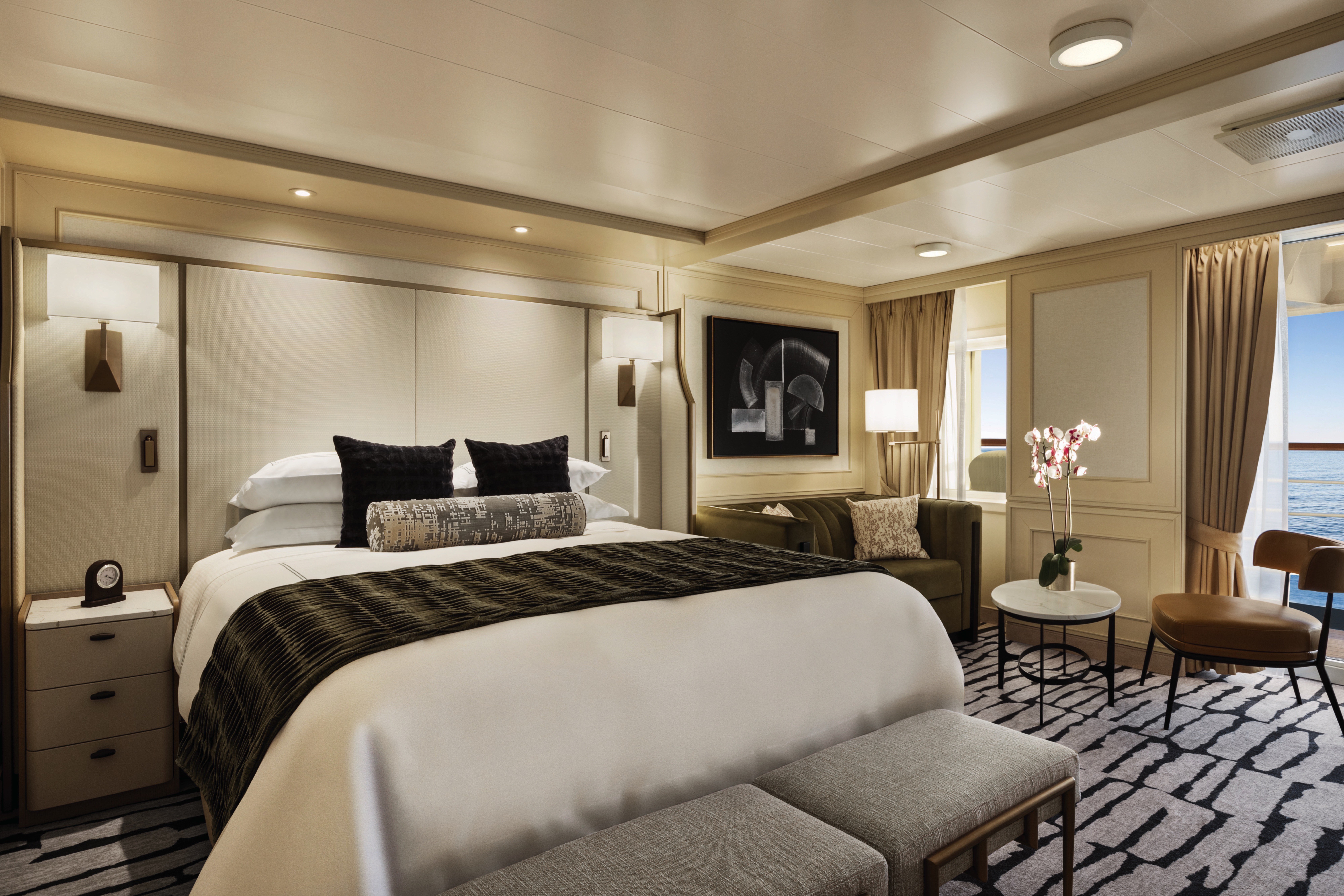
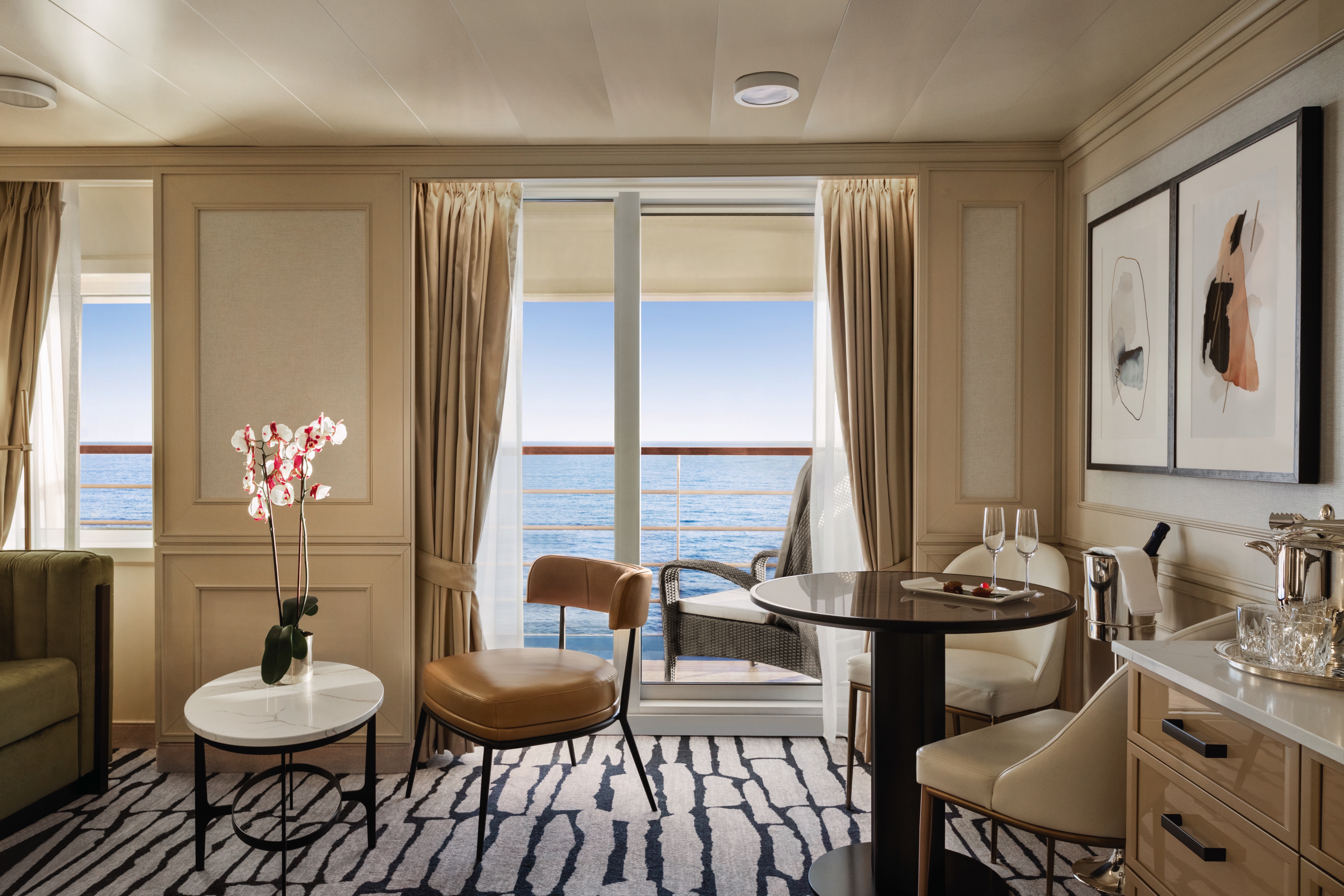
Akin to a dramatic coastal villa, the Owner’s Suites exude a sophisticated and luxurious personality. At more than 2,000 square feet, each features a living room, dining room, master bedroom and two bathrooms. These suites are adorned with designer furnishings and exquisite appointments, creating a blissful enclave at sea. There are separate terraces for the living areas and bedroom and expanses of floor-to-ceiling windows provide captivating vistas and with the stunning backdrop of the sea all around. All of our suites include exclusive 24-hour Butler service and are uncommonly spacious, further adding to the unparalleled suite experience.
Owner's Suite Privileges
+In addition to Concierge Level privileges
- Priority luggage delivery
- Exclusive card-only access to private Executive Lounge staffed by a dedicated Concierge featuring complimentary sodas, coffees and snacks throughout the day
- 24-hour Butler service
- Optional private in-suite embarkation day lunch from noon to 2 pm in Owner’s Suites
- Complimentary in-suite bar setup with 6 full-size bottles of your choice of premium spirits and wines from our suite beverage menu
- Complimentary welcome bottle of Champagne
- In-suite illy® coffee maker and pods
- Fresh fruit basket upon request
- Choice of daily newspaper
- Exclusive pillow menu
- Course-by-course in-suite dining*
- Order in from any of our specialty restaurants*
- Coordination of shoreside dinner and entertainment reservations
- Last-minute luggage collection
- Packing and unpacking upon request
- Complimentary garment pressing*
- Complimentary shoeshine service
- Gourmet evening canapés upon request
- Special services upon request
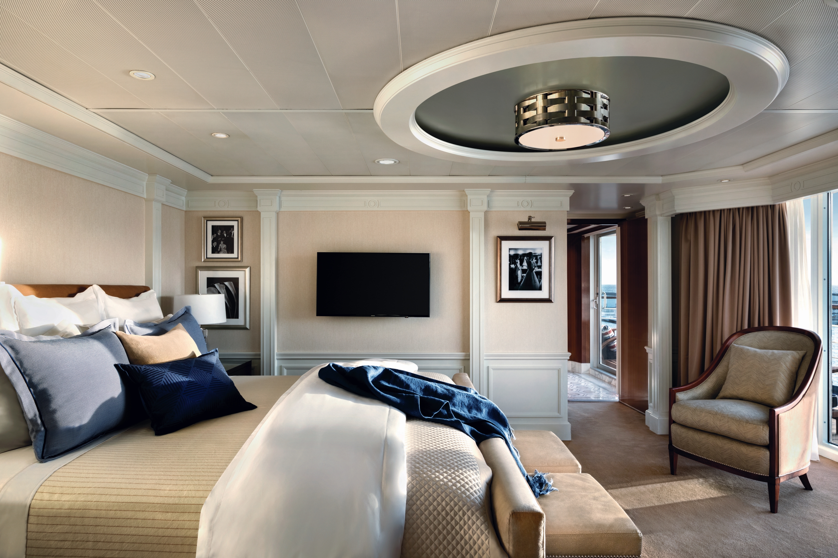

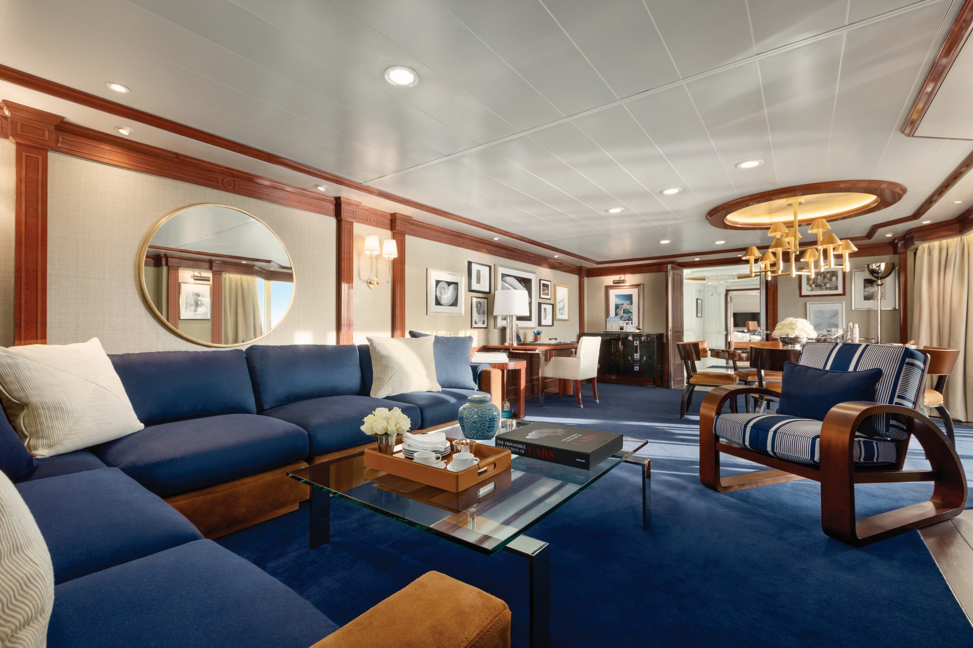
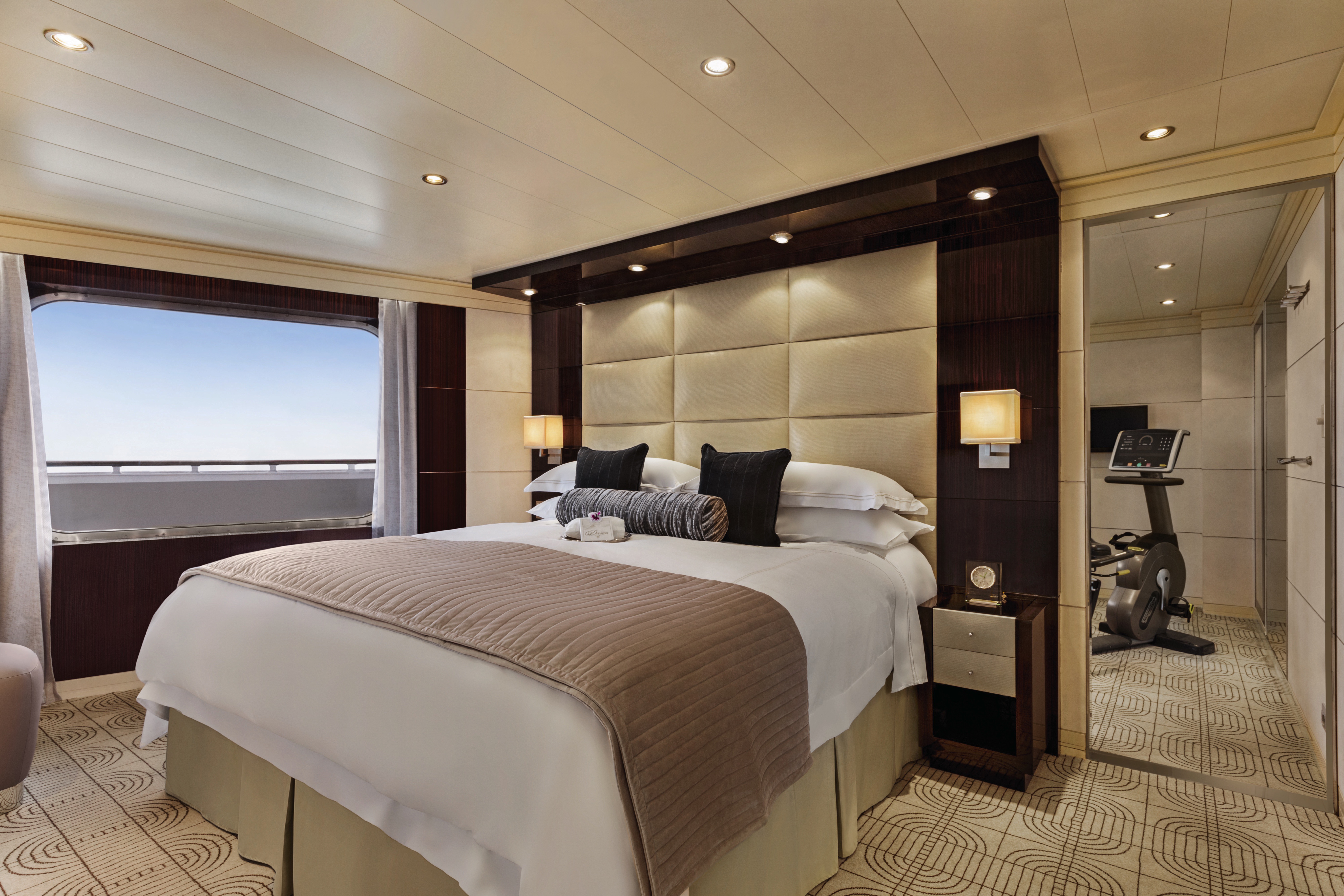
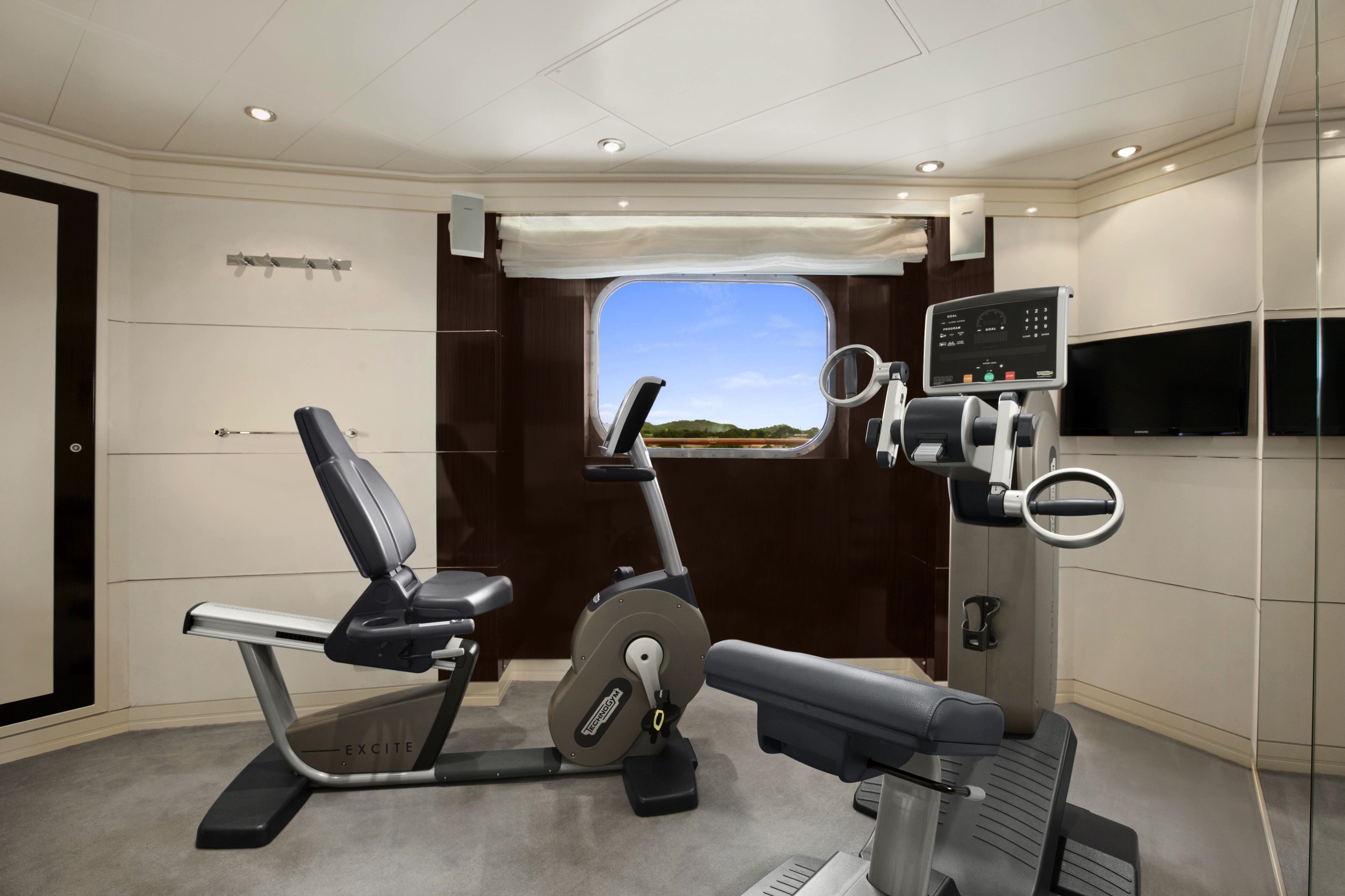
Given their lavish interior design that resembles an elegant and luxurious Park Avenue home along with their premier location overlooking the bow of the ship, the eight Vista Suites are in high demand. These 1,200- to 1,500-square-foot suites include access to the exclusive Executive Lounge as well as every imaginable amenity, such as a large walk-in closet, king-size bed, second bathroom for guests, whirlpool spa and your own private fitness room.
Vista Suite Privileges
+In addition to Concierge Level privileges
- Priority luggage delivery
- Exclusive card-only access to private Executive Lounge staffed by a dedicated Concierge featuring complimentary sodas, coffees and snacks throughout the day
- 24-hour Butler service
- Complimentary in-suite bar setup with 6 full-size bottles of your choice of premium spirits and wines from our suite beverage menu
- Complimentary welcome bottle of Champagne
- In-suite illy® coffee maker and pods
- Fresh fruit basket upon request
- Choice of daily newspaper
- Exclusive pillow menu
- Course-by-course in-suite dining*
- Order in from any of our specialty restaurants*
- Coordination of shoreside dinner and entertainment reservations
- Last-minute luggage collection
- Packing and unpacking upon request
- Complimentary garment pressing*
- Complimentary shoeshine service
- Gourmet evening canapés upon request
- Special services upon request
+Up to 20 garments per laundry bag; additional restrictions apply.
++Certain limitations apply.
Smoking in suites, staterooms and on verandas is strictly prohibited.
Featuring a luxurious residential design and stylish furnishings, each of the twelve Oceania Suites offers more than 1,000 square feet of luxury. These stylish suites feature a living room, dining room, fully equipped media room, large walk-in closet, king-size bed, indoor whirlpool spa, expansive private veranda and a second bathroom for guests. Also included is access to the private Executive Lounge with magazines, daily newspapers, beverages and snacks.
Oceania Suite Privileges
+In addition to Concierge Level privileges
- Priority luggage delivery
- Exclusive card-only access to private Executive Lounge staffed by a dedicated Concierge featuring complimentary sodas, coffees and snacks throughout the day
- 24-hour Butler service
- Complimentary in-suite bar setup with 6 full-size bottles of your choice of premium spirits and wines from our suite beverage menu
- Complimentary welcome bottle of Champagne
- In-suite illy® coffee maker and pods
- Fresh fruit basket upon request
- Choice of daily newspaper
- Exclusive pillow menu
- Course-by-course in-suite dining*
- Order in from any of our specialty restaurants*
- Coordination of shoreside dinner and entertainment reservations
- Last-minute luggage collection
- Packing and unpacking upon request
- Complimentary garment pressing*
- Complimentary shoeshine service
- Gourmet evening canapés upon request
- Special services upon request
+Up to 20 garments per laundry bag. 3 day turnaround time and laundry will not be accepted 3 days prior to disembarkation.
++Certain limitations apply
Smoking in suites, staterooms and on verandas is strictly prohibited.
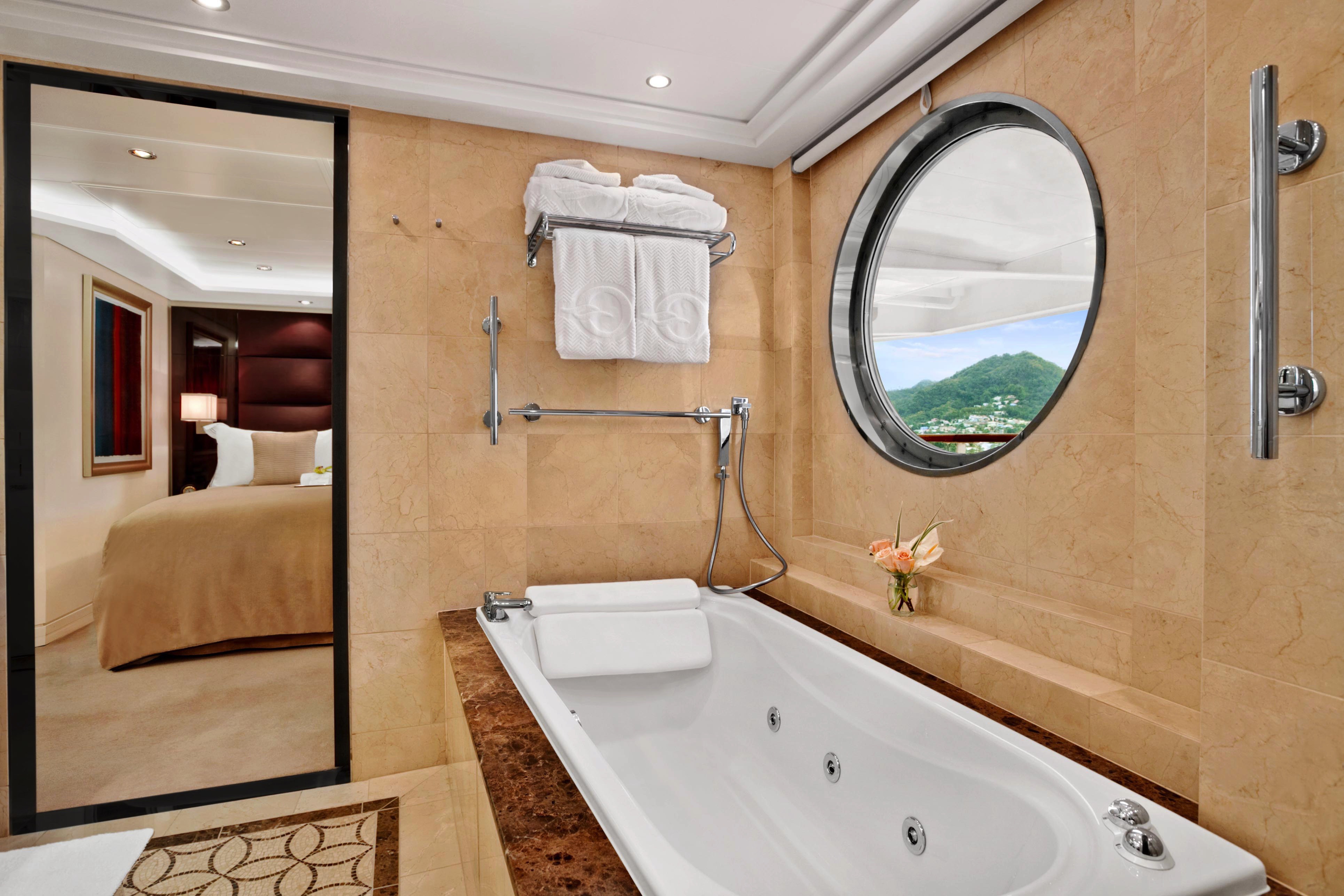
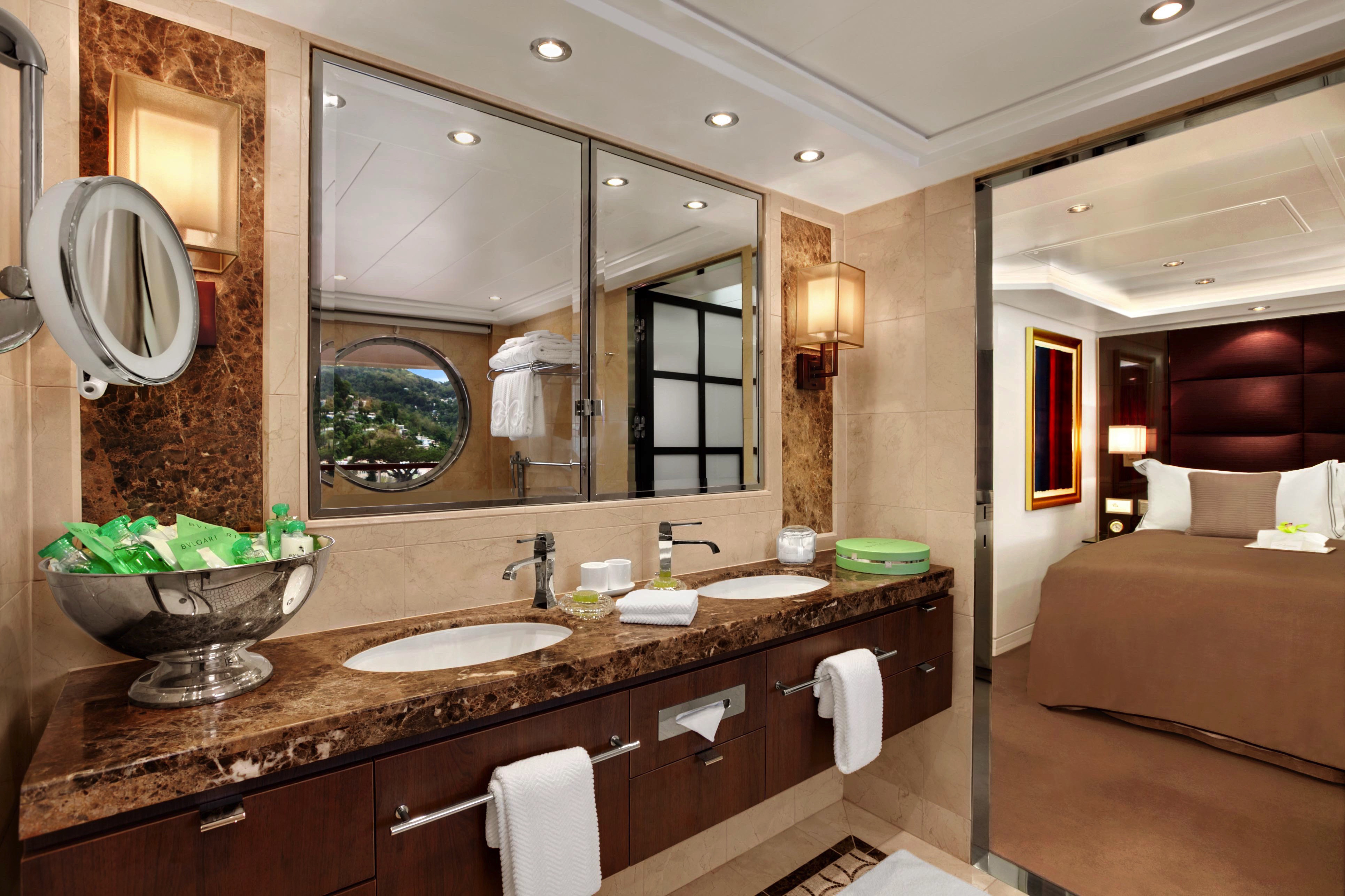
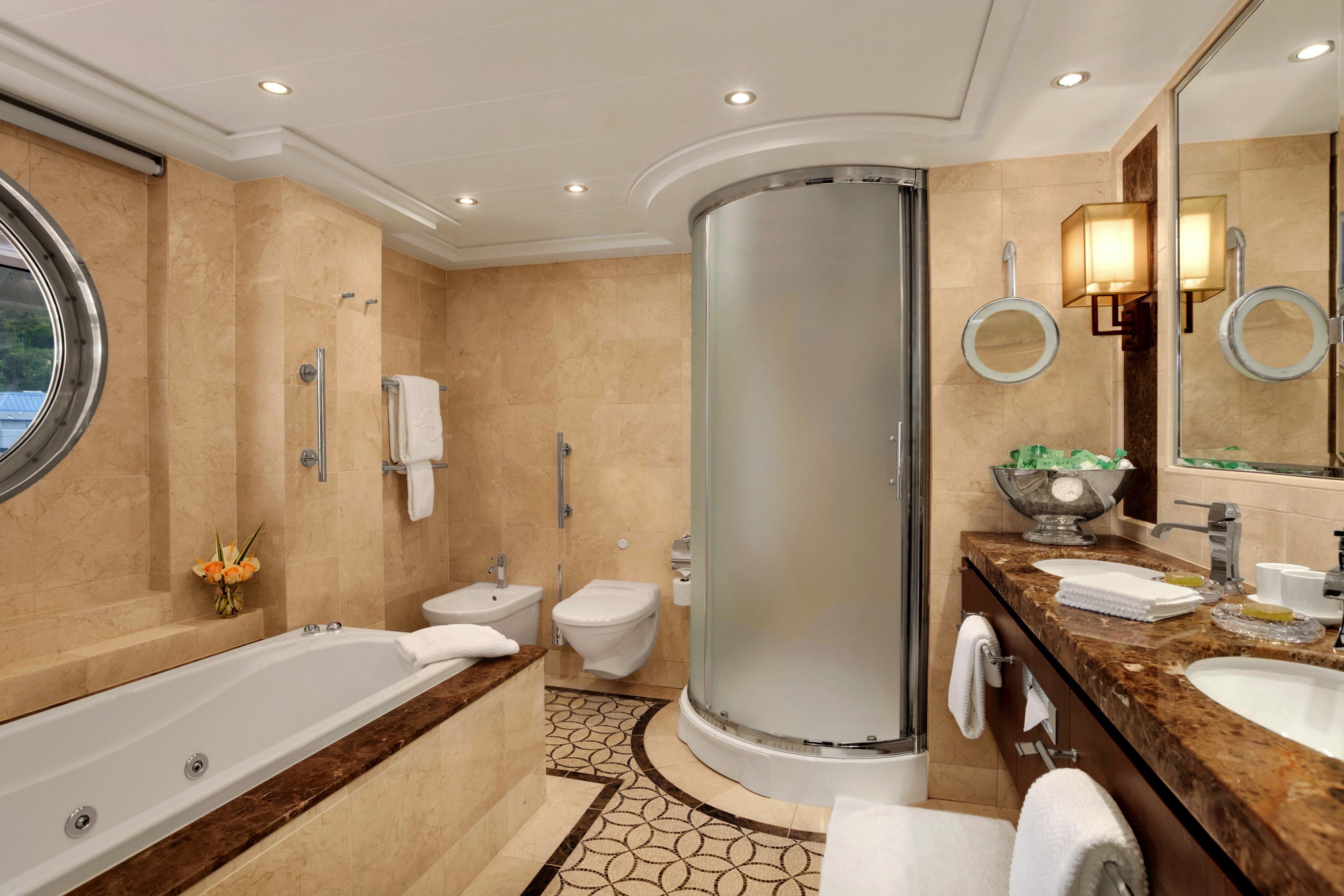
The Penthouse Suites are a marvel of harmonious decor and lavish finishes, encompassing an expansive 440 square feet. Enhanced features include custom lighting, a dining table, separate seating area, walk-in closet, private teak veranda and a marble-clad bathroom with newly added storage space and an expanded shower, all ingeniously laid out to amplify contentment. Naturally, enjoy the ministrations of a dedicated Concierge and exclusive access to the amenities of the elite Executive Lounge.
Penthouse Suite Privileges
+In addition to Concierge Level privileges
- Priority luggage delivery
- Exclusive card-only access to private Executive Lounge staffed by a dedicated Concierge featuring complimentary sodas, coffees and snacks throughout the day
- 24-hour Butler service
- Course-by-course in-suite dining*
- Order in from any of our specialty restaurants*
- Coordination of shoreside dinner and entertainment reservations
- Last-minute luggage collection
- Packing and unpacking upon request
- Complimentary garment pressing*
- Complimentary shoeshine service
- Gourmet evening canapés upon request
- Special services upon request
+Up to 20 garments per laundry bag. 3 day turnaround time and laundry will not be accepted 3 days prior to disembarkation.
++Certain limitations apply
All Suites and Staterooms are Smoke-Free
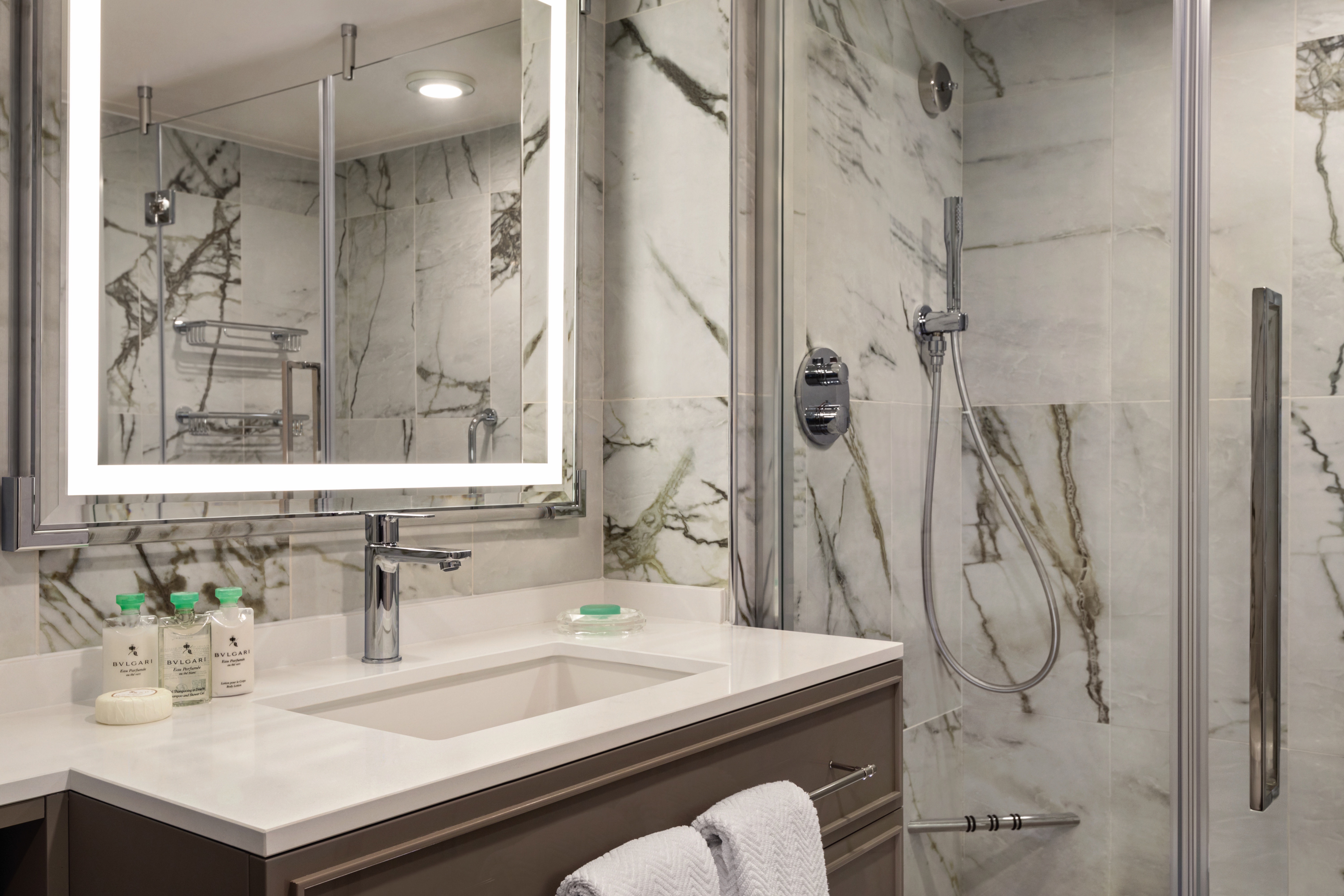
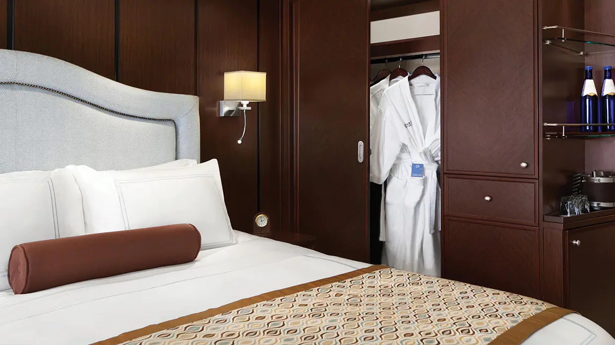
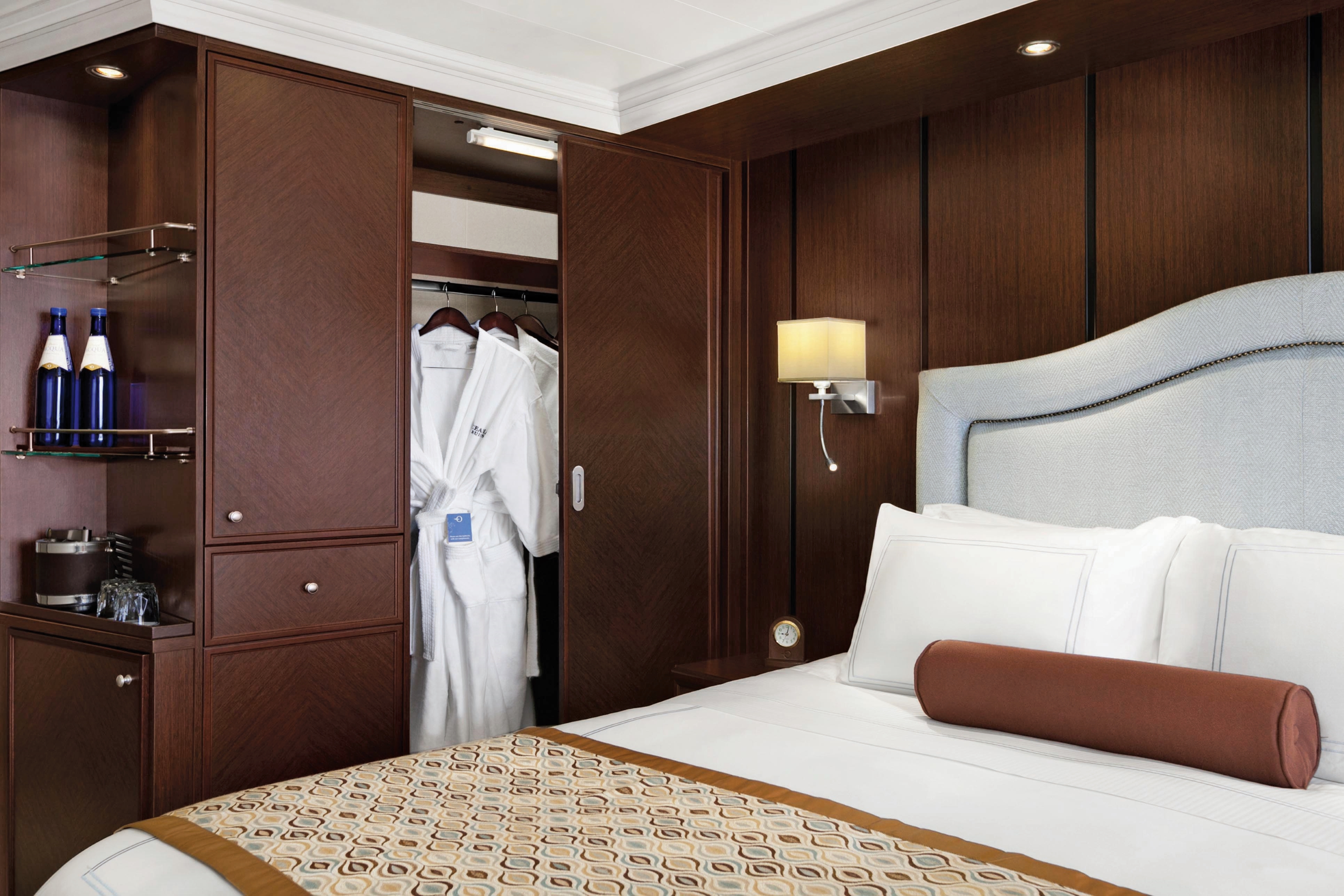
These beautifully decorated 291-square-foot staterooms reflect many of the luxurious amenities found in our Penthouse Suites, including a private veranda, plush seating area, refrigerated mini-bar and an oversized marble and granite-clad bathroom with a shower. Guests also enjoy access to the private Concierge Lounge featuring your own dedicated concierge, magazines, daily newspapers, beverages and snacks.
Concierge Level Privileges
In addition to Stateroom Amenities
- Expanded lunch and dinner room service menu from The Grand Dining Room
- FREE laundry service - up to 3 bags per stateroom+
- Exclusive card-only access to private Concierge Lounge staffed by a dedicated Concierge featuring complimentary sodas, coffees and snacks throughout the day
- Complimentary welcome bottle of Prosecco
- Private teak veranda††
- Priority online specialty restaurant reservations
- Unlimited access to the Aquamar® Spa Terrace
- Complimentary Oceania Cruises logo tote bag
- Cashmere lap blankets, perfect for relaxing on your veranda
- Complimentary pressing of garments upon embarkation++
- Complimentary shoeshine service
+Up to 20 garments per laundry bag; additional restrictions apply.
++Certain limitations apply.
Smoking in suites, staterooms and on verandas is strictly prohibited.
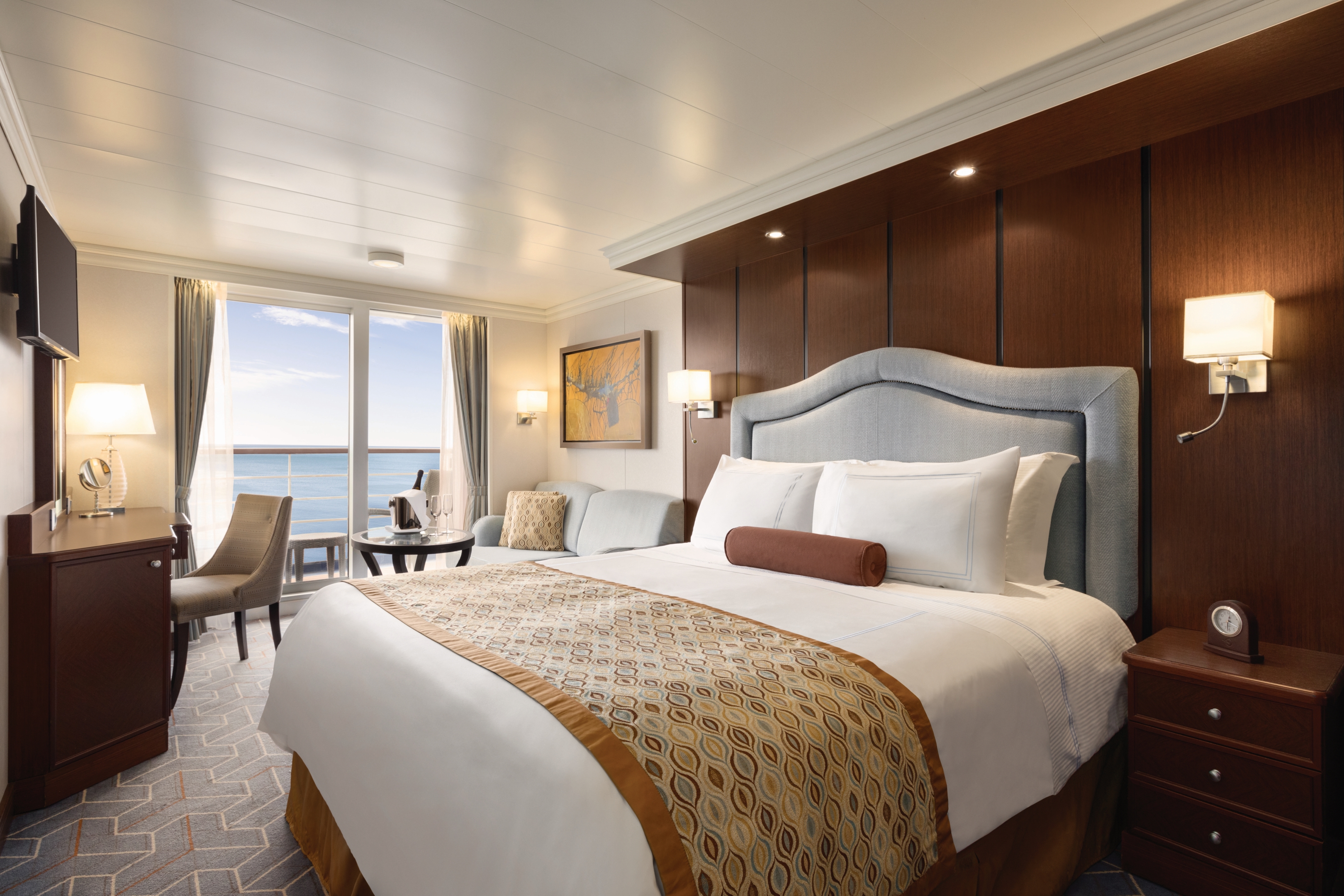
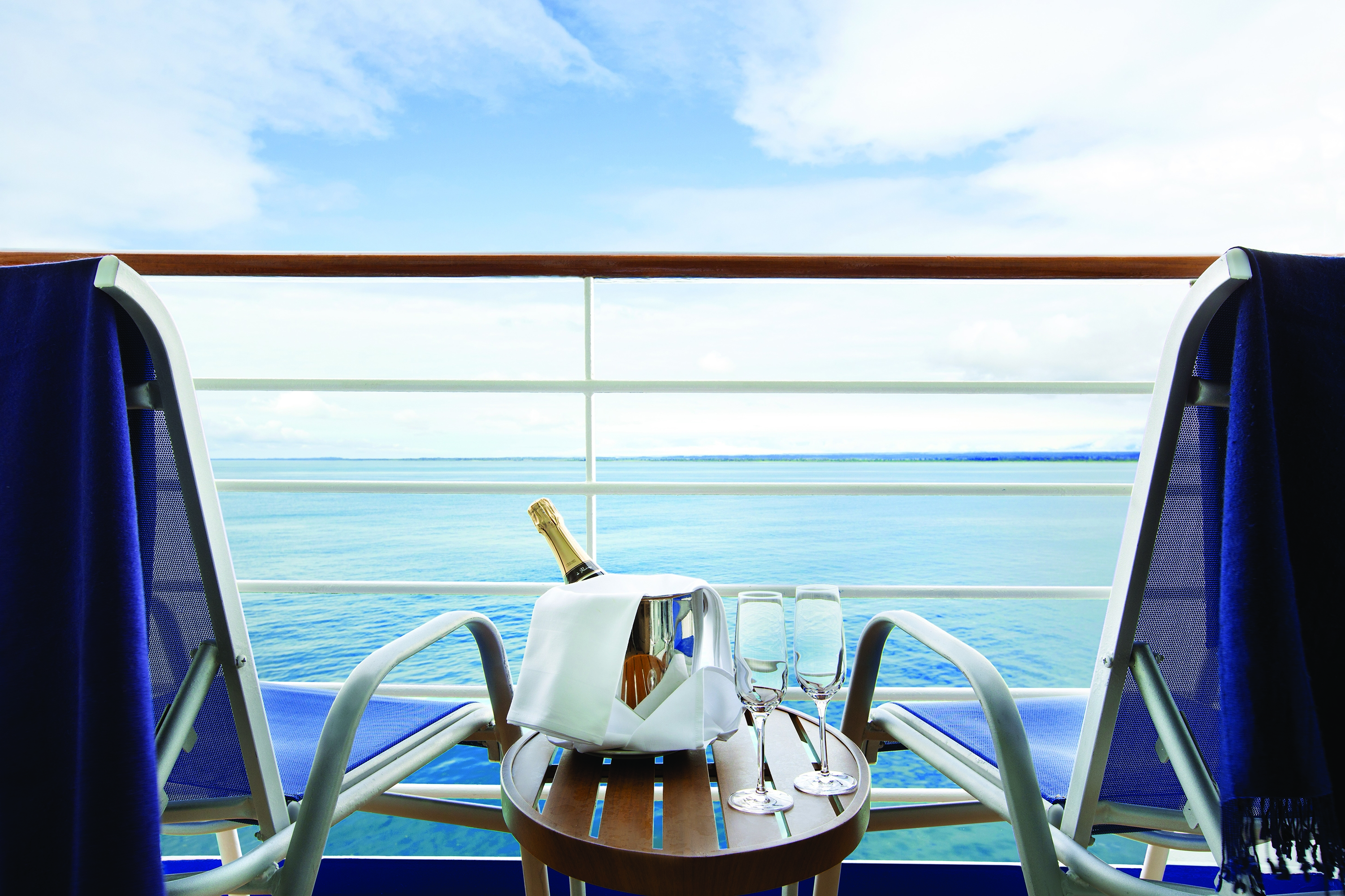
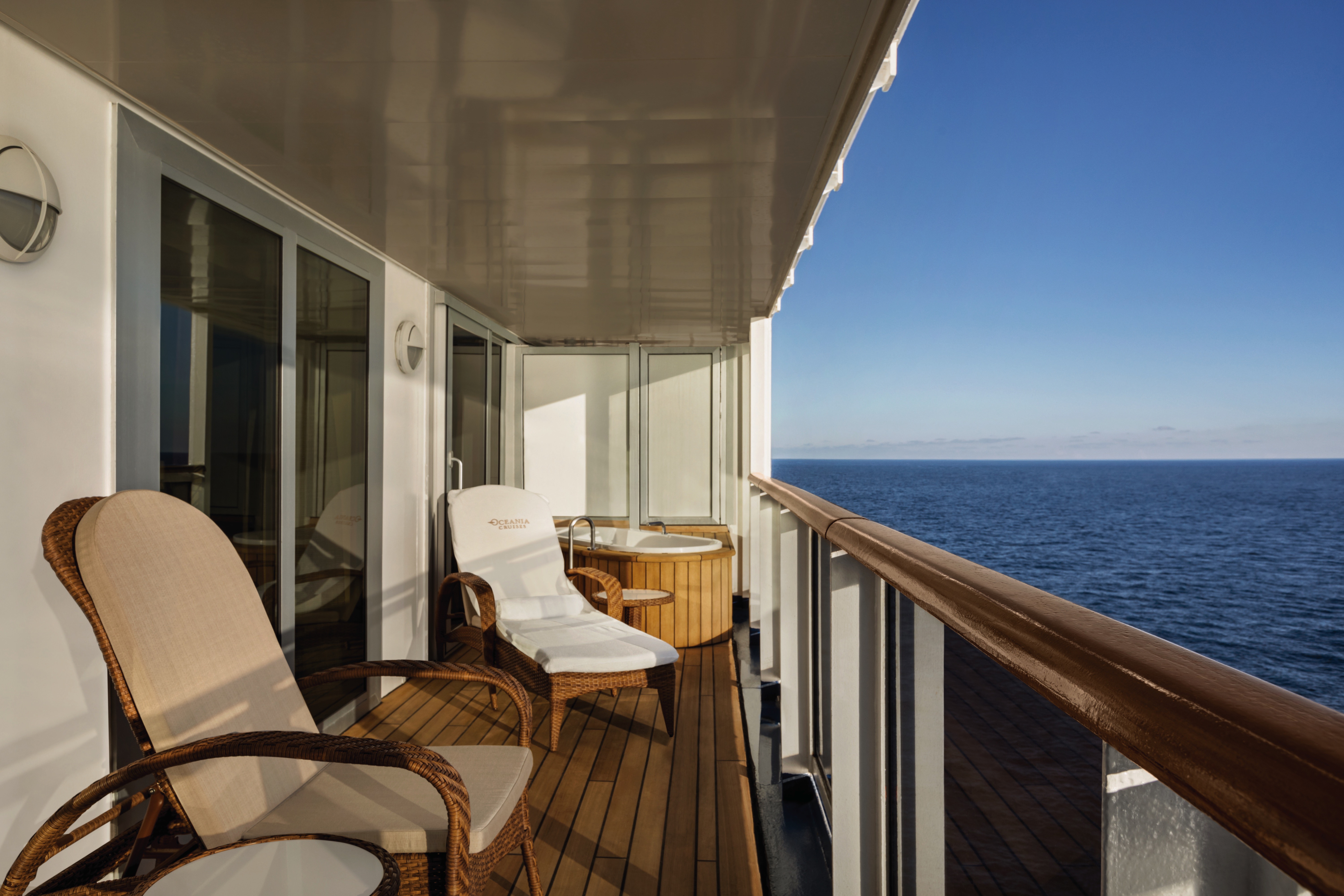
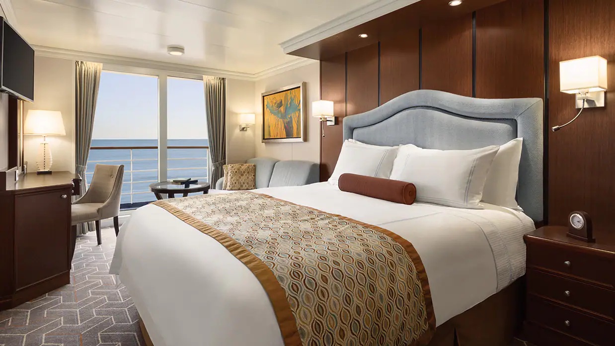
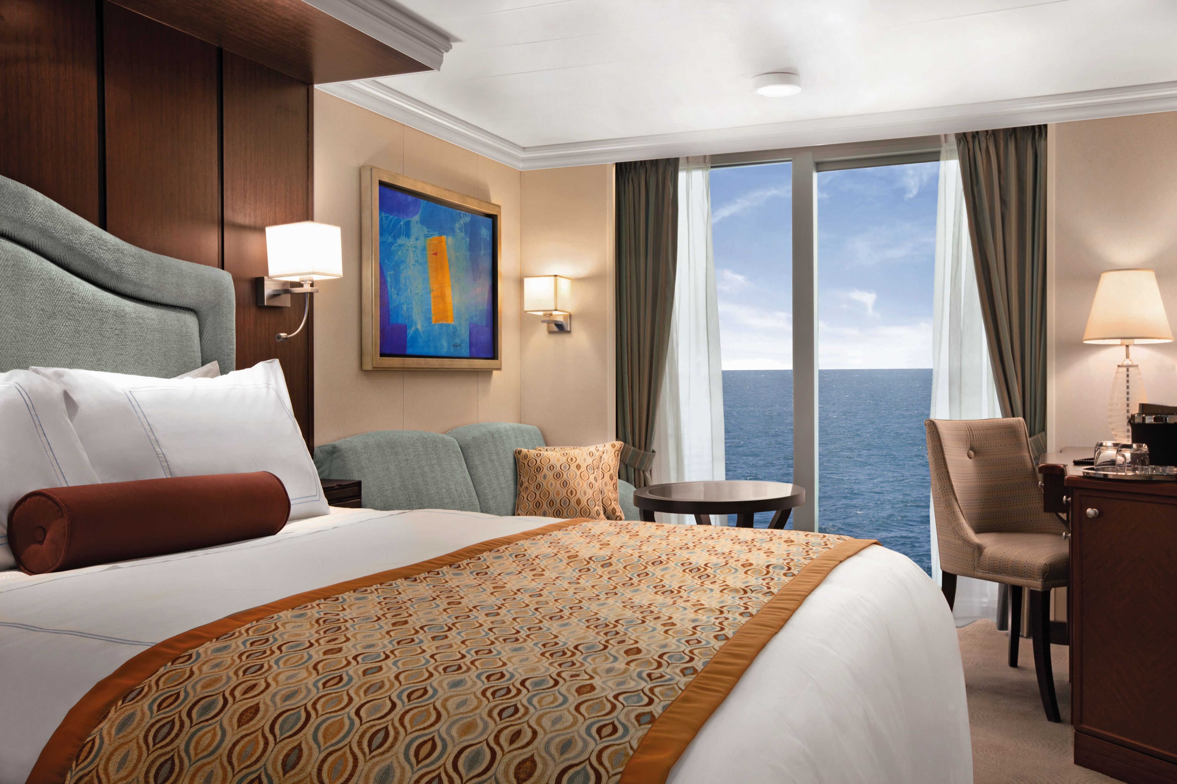
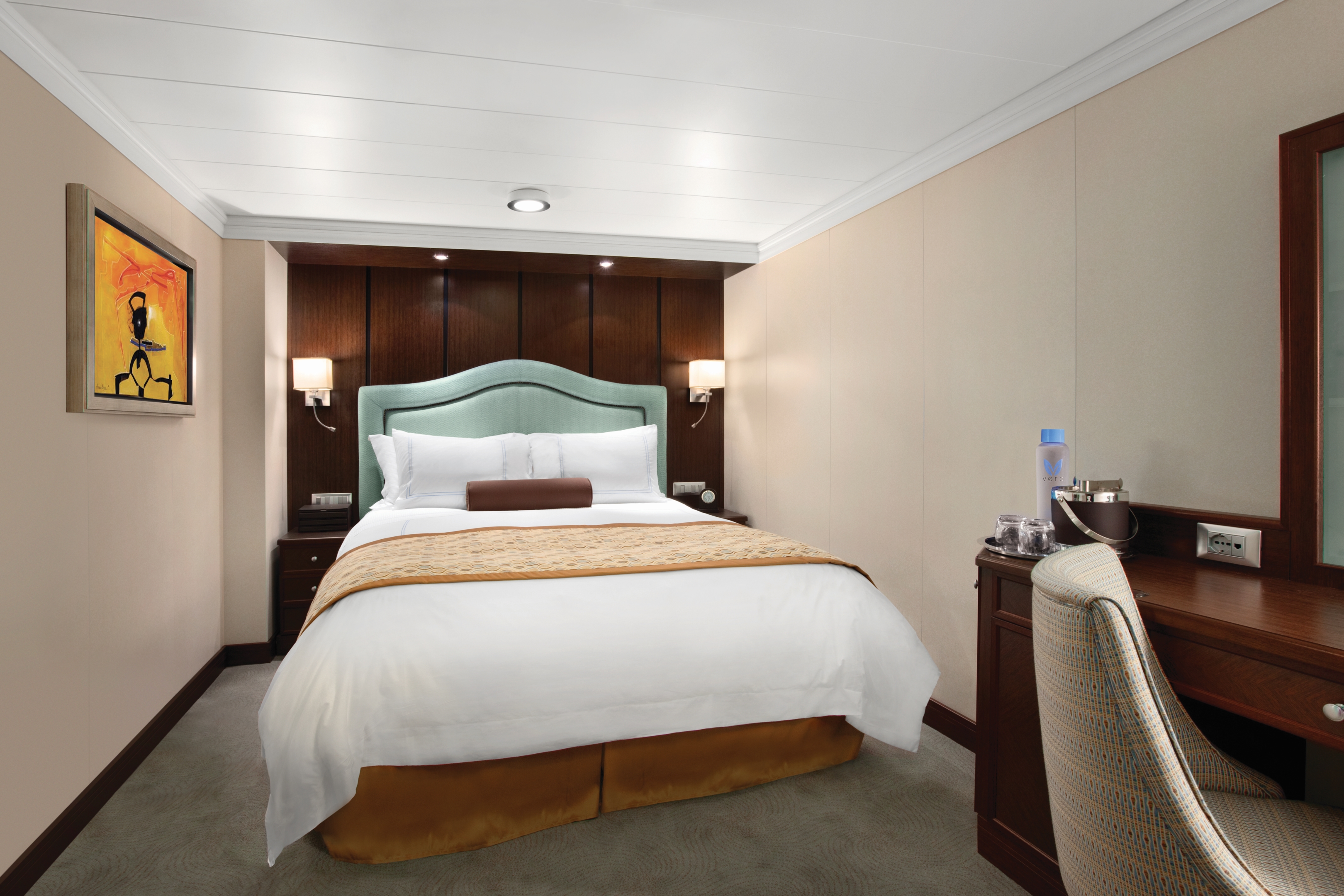
Our 291-square-foot Veranda Staterooms are the largest at sea. Featuring a comfortably furnished private veranda, our most requested luxury, each stateroom also includes a plush seating area, refrigerated mini-bar, spacious closet and a marble and granite-clad bathroom with a shower.Veranda Stateroom Amenities
- Tranquility Bed, an Oceania Cruises exclusive†
- FREE sodas replenished daily in your refrigerated mini-bar
- FREE still and sparkling Vero Water®
- Private teak veranda††
- Luxury bath amenities
- FREE room service menu 24 hours a day
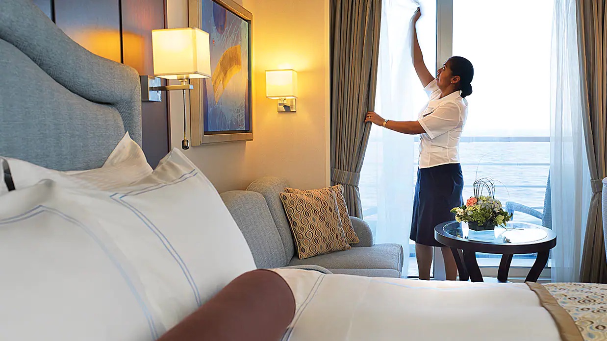
- Daily housekeeping service
- Gourmet turndown chocolates upon request
- Interactive television system with on-demand movies, weather and more
- Starlink® WiFi service
- Writing desk and stationery
- Plush cotton towels, robes and slippers
- Handheld hair dryer
- Security safe
†King-size bed (cannot be converted into twin beds) for Owner’s, Vista and Oceania Suites and queen-size bed for all other suites and staterooms (Tranquility Bed available for purchase at OceaniaBedCollection.com)
†† Featured with all Veranda Staterooms (excluding French Veranda)
Smoking in suites, staterooms and on verandas is strictly prohibited
These comfortable 240-square-foot staterooms with floor-to-ceiling panoramic windows feel even more spacious with the curtains drawn back and the ocean in full view. Features include a generous seating area, vanity desk, breakfast table, refrigerated mini-bar and a marble and granite-clad bathroom with a bathroom with a shower.
Deluxe Oceanview Stateroom Amenities:
- Tranquility Bed, an Oceania Cruises exclusive†
- FREE sodas replenished daily in your refrigerated mini-bar
- FREE still and sparkling Vero Water®
- Luxury bath amenities
- FREE room service menu 24 hours a day
- Daily housekeeping service
- Gourmet turndown chocolates upon request
- Interactive television system with on-demand movies, weather and more
- Starlink® WiFi service
- Writing desk and stationery
- Plush cotton towels, robes and slippers
- Handheld hair dryer
- Security safe
†King-size bed (cannot be converted into twin beds) for Owner’s, Vista and Oceania Suites and queen-size bed for all other suites and staterooms (Tranquility Bed available for purchase at OceaniaBedCollection.com)
†† Featured with all Veranda Staterooms (excluding French Veranda)
Smoking in suites, staterooms and on verandas is strictly prohibited
Wonderful private sanctuaries, these 174-square-foot staterooms boast elegant designs and handsome furnishings that add to the serenity. Highlights include a spacious marble and granite-clad bathroom with a shower, as well as thoughtful touches such as a vanity desk, breakfast table and refrigerated mini-bar.Inside Stateroom Amenities:
- Tranquility Bed, an Oceania Cruises exclusive†
- FREE sodas replenished daily in your refrigerated mini-bar
- FREE still and sparkling Vero Water®
- Luxury bath amenities
- FREE room service menu 24 hours a day
- Daily housekeeping service
- Gourmet turndown chocolates upon request
- Interactive television system with on-demand movies, weather and more
- Starlink® WiFi service
- Writing desk and stationery
- Plush cotton towels, robes and slippers
- Handheld hair dryer
- Security safe
†King-size bed (cannot be converted into twin beds) for Owner’s, Vista and Oceania Suites and queen-size bed for all other suites and staterooms (Tranquility Bed available for purchase at OceaniaBedCollection.com)
†† Featured with all Veranda Staterooms (excluding French Veranda)
Smoking in suites, staterooms and on verandas is strictly prohibited
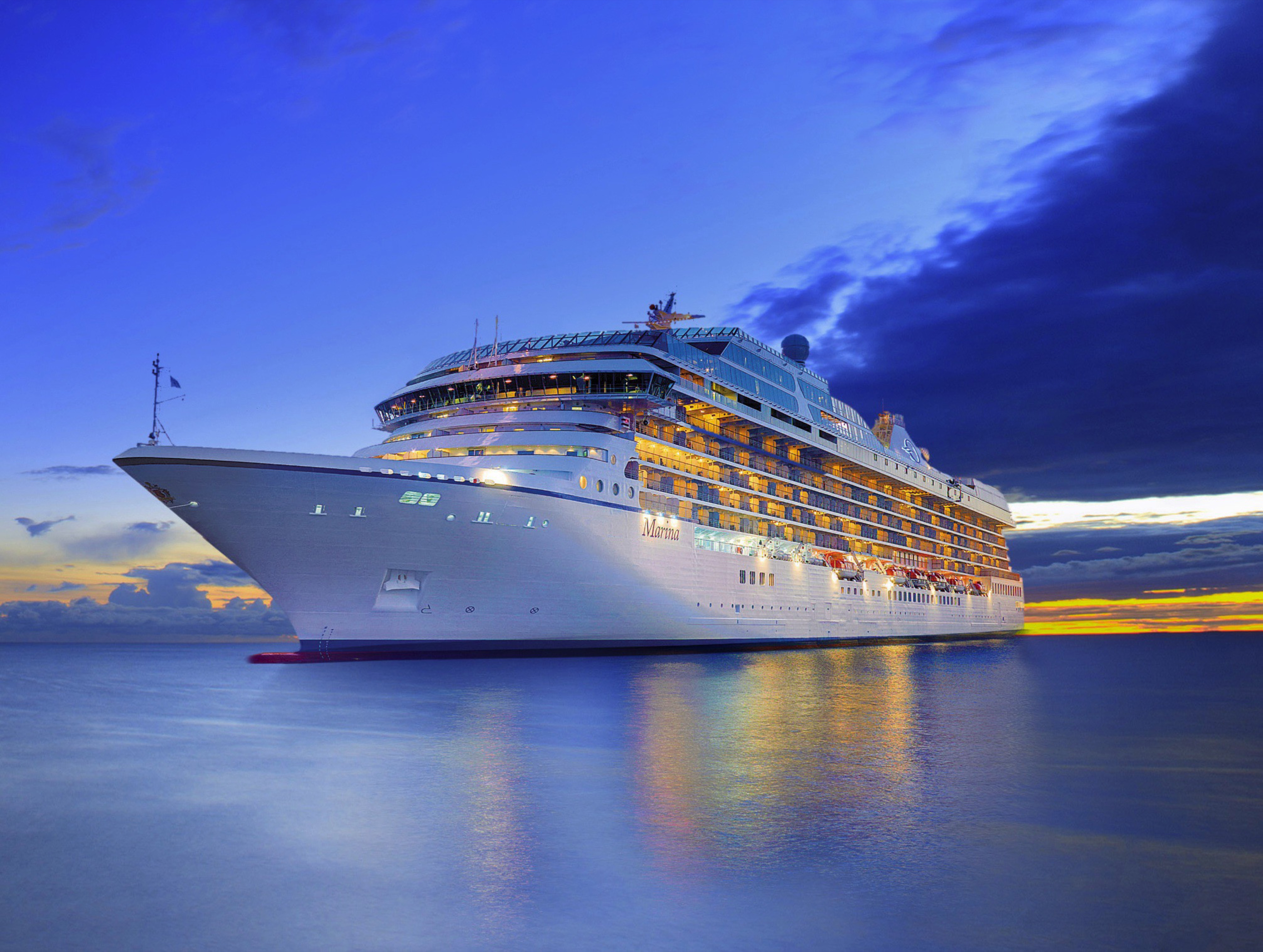
Oceania Marina
Timelessly sophisticated, Oceania Marina was designed for the ultimate epicurean. She embraces the elegant ambiance of our renowned 1,250-guest ships while also offering an array of amenities and choices. In addition to multiple open-seating gourmet restaurants, Oceania Marina features memorable food and wine experiences by La Reserve as well as the opportunity for private dining at exclusive Privée. From the sparkling Lalique Grand Staircase to the exquisite Owner's Suites furnished, designer touches are everywhere, highlighting the finest residential design and furnishings. More than anything, Oceania Marina personifies the Oceania Cruises experience.
Small Ship Luxury
Oceania Marina blends sophistication with a contemporary flair to create a casually elegant ambiance. From the sparkling Lalique Grand Staircase to the stunning Owner's Suites, designer touches are everywhere, highlighting the finest residential design and furnishings. More than anything, Oceania Marina personifies the Oceania Cruises experience.
Ship Facts
| Launch Year | 2011 | ||||||||
| Refit Year | 2024 | ||||||||
| Language | en | ||||||||
| Gross Tonnage | 66084 | ||||||||
| Length | 239.3 | ||||||||
| Width | 32.1 | ||||||||
| Currency | USD | ||||||||
| Speed | 20 | ||||||||
| Capacity | 1250 | ||||||||
| Crew Count | 776 | ||||||||
| Deck Count | 11 | ||||||||
| Cabin Count | 591 | ||||||||
| Large Cabin Count | 0 | ||||||||
| Wheelchair Cabin Count | 6 | ||||||||
| Electrical Plugs |
|
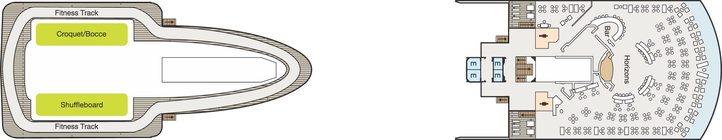
Deck 16
- Golf Putting Greens
- Paddle Tennis

Deck 15
- Croquet/Bocce
- Shuffleboard
- Fitness Track
- Horizons
- Bar
- Elevator
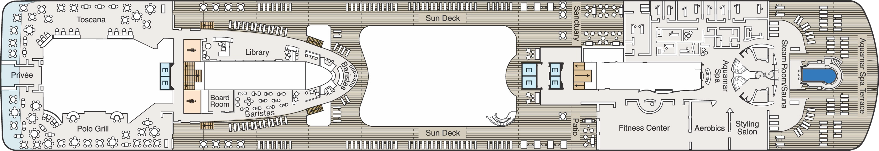
Deck 14
- Priveé
- Toscana
- Polo Grill
- Library
- Oceania@Sea
- Board Room
- Baristas
- Sun Deck
- Elevator
- Sanctuary
- Patio
- Fitness Centre
- Aerobics
- Styling Salon
- Aquamar Spa
- Steam Room/Sauna
- Aquamar Spa Terrace
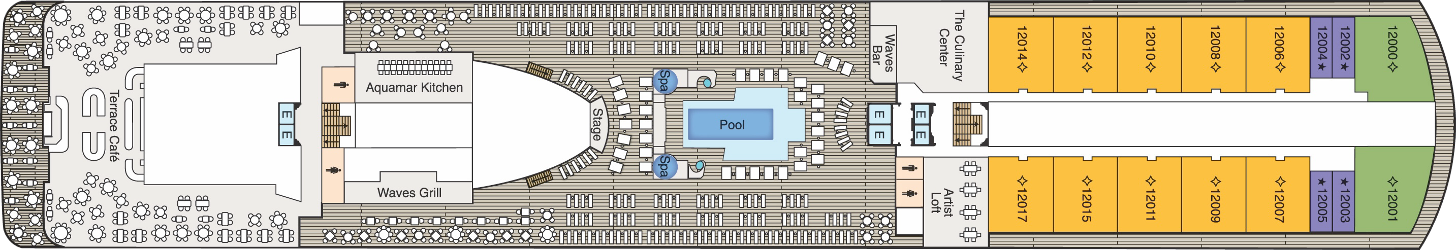
Deck 12
- Terrace Café
- Aquamar Kitchen
- Waves Grill
- Stage
- Pool
- Whirlpools
- Waves Bar
- The Culinary Centre
- Artist Loft
- Concierge Level Veranda
- Oceania Suite
- Vista Suite
- Elevator
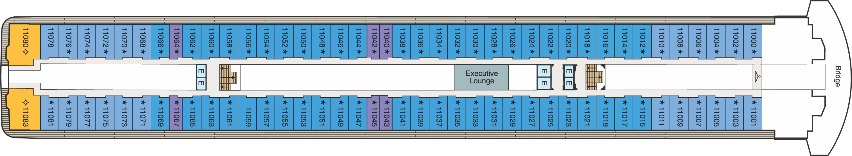
Deck 11
- Executive Lounge
- Bridge
- Concierge Level Veranda
- Oceania Suite
- Penthouse Suite
- Elevator
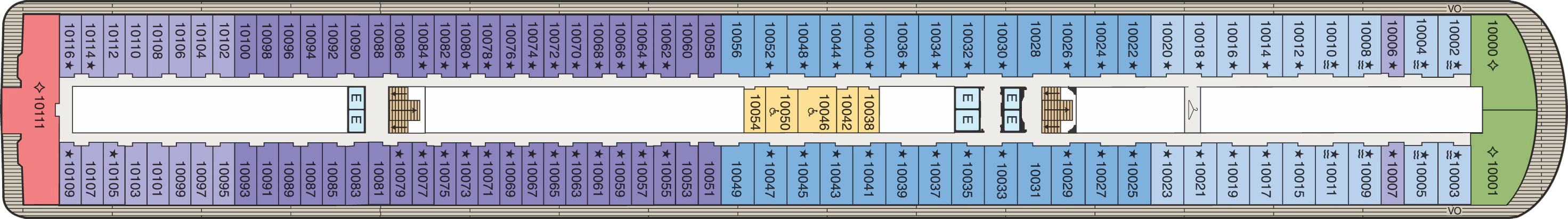
Deck 10
- Concierge Level Veranda
- Inside Stateroom
- Owner's Suite
- Penthouse Suite
- Vista Suite
- Elevator
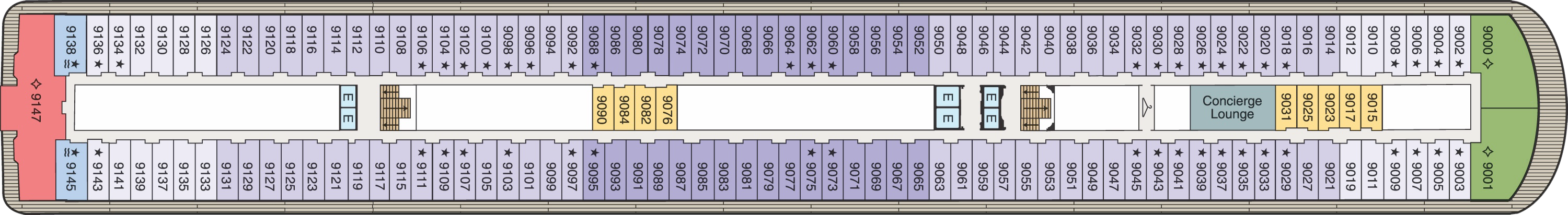
Deck 9
- Concierge Lounge
- Concierge Level Veranda
- Inside Stateroom
- Owner's Suite
- Penthouse Suite
- Vista Suite
- Elevator
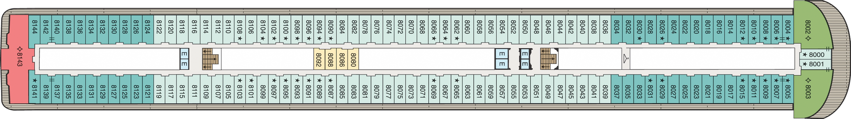
Deck 8
- Veranda Stateroom
- Inside Stateroom
- Owner's Suite
- Vista Suite
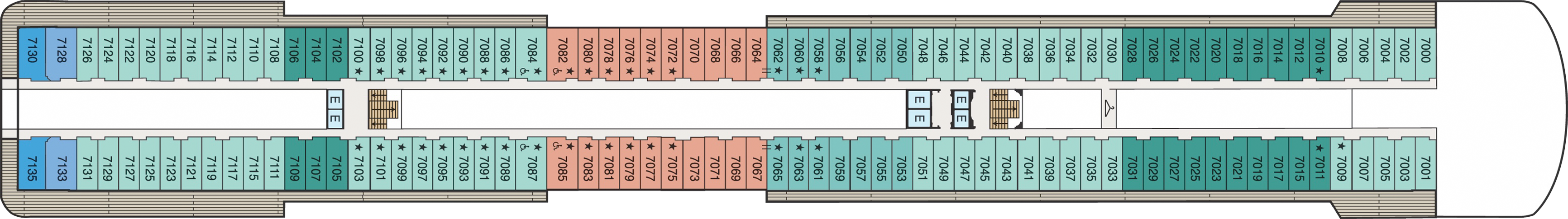
Deck 7
- Concierge Level Veranda Stateroom
- Veranda Stateroom
- Deluxe Ocean View
- Penthouse Suite
- Elevator
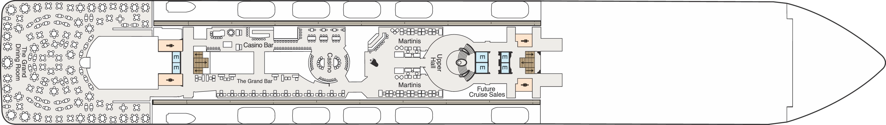
Deck 6
- The Grand Dining Room
- Casino Bar
- Grand Bar
- Casino
- Martinis
- Upper Hall
- Elevator
Deck 5
- Red Ginger
- Jacques
- Boutiques
- Concierge
- Reception
- Destination Services
- Elevator
- Lounge
- Stage
- Medical Centre - Located on Deck 4 (Not shown)

Culinary Masterpieces
Designed for epicureans and travel connoisseurs, Oceania Marina features an array of complimentary specialty restaurants and unique dining experiences you’ll remember long after your cruise ends. The gourmet restaurants each serve a distinctive set of dishes created à la minute, from Continental cuisine at The Grand Dining Room and classic French fare at Jacques to vibrant Asian cuisine at Red Ginger and steakhouse favorites at Polo Grill.
Relaxed Yet Refined Dining
You’ll savor cuisine renowned as the finest at sea no matter where you choose to dine or relax on Oceania Marina – whether that means a poolside burger at Waves Grill, yellowfin tacos at breezy Aquamar Kitchen or a scoop of Humphry Slocombe’s bourbon-flavored, cornflake-studded Secret Breakfast ice cream. Our culinary team’s attention to detail, passion for artisanal ingredients and dedication to technique extends to our casual dining, poolside experiences, Baristas coffee bar and the cherished ritual of Afternoon Tea.
In-Room Dining Experiences
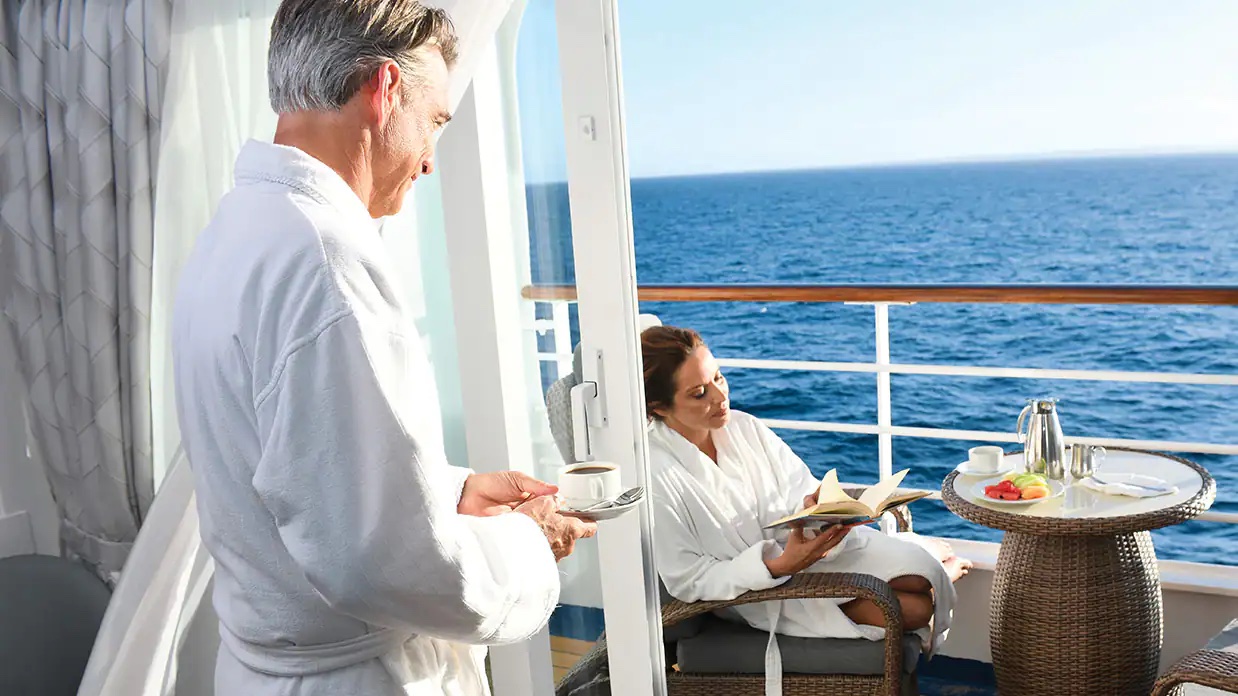
After a day of enriching adventures ashore or an enjoyable day on board, dining in the privacy of your suite or stateroom with our compliments is always a welcome possibility. A complete menu of varied dining experiences is available around the clock, featuring an extensive array of delectable breakfast, lunch and dinner items. All suites and staterooms have the added luxury of enjoying a full, hot breakfast in-room and those staying in Concierge Level or above have the additional privilege of ordering from an expanded lunch and dinner room service menu from The Grand Dining Room. Suite guests have the ultimate indulgence of enjoying course-by-course meals from the comfort of their spacious sanctuaries. Revel in the private luxury of your suite or stateroom, and enjoy an exquisite meal on your tranquil veranda as you take in spectacular seascapes.
Exclusive Dining Experiences
There’s simply no substitute for great food, wine and laughter. Whether you’re a connoisseur or a complete novice, our exclusive dining experiences are indulgent, fun and memorable. Evoking the approachable and easy spirit of a boutique Sonoma winery, the experiences center on menus of gourmet dishes paired with premium, and often rare, vintages curated by our talented chefs and sommeliers. On Oceania Marina, choose from two inspired experiences by La Reserve: The Odyssey and Dom Pérignon Experience. Each creates an extraordinary evening to laugh, savor and remember.
The Grand Dining Room
DINING IN GRAND STYLE
The grande dame of the Oceania Cruises culinary world, The Grand Dining Room invites guests to a leisurely dining experience amidst an ambiance that soars to heights as lofty as the cuisine. Our marquee restaurant has always featured Jacques Pépin’s signature delights and a bevy of delicious Continental dishes and now offers even more exciting choices, Aquamar Vitality Cuisine and a wide spectrum of global flavors. Menus change daily, and the all-new Executive Chef’s Tasting Menu promises multiple courses of the chef’s most divine creations.
Open for breakfast, lunch and dinner. No reservations required.
Jacques
A PASSION FOR FRENCH CUISINE
Exquisitely decorated with heirloom antiques, pickled wood furnishings and art from Jacques Pépin’s personal collection, Jacques was modeled after a Parisian bistro. Comfortable and eclectic, the ambiance is pure French, as is the cosmopolitan yet wonderfully embraceable cuisine. Luscious aromas waft from the gleaming show rotisserie, where chicken, duck, pork, beef and veal roasts slowly turn. Each dish is a classic, ingeniously reinterpreted by Master Chef Pépin. Rotisserie roasted chicken falls off the bone, bursting with flavor, while his sea bass fillet pairs exquisitely with beurre blanc.
Open for dinner only. Reservations required.
Red Ginger
BOLD ASIAN CUISINE
With a nod to feng shui, Red Ginger radiates harmony and tranquility. The interior simply glows with ebony woods, ruby red leathers and striking, modern Asian artworks. To complement the stunning decor, Red Ginger’s chefs have created contemporary interpretations of Asian classics. Begin with a salad of spicy roast duck and watermelon with cashews, mint and Thai basil. Savor a Malaysian beef penaeng with coconut rice and paratha roti. Or try Thai vegetable curry with sweet potatoes, aubergine, mushrooms and basil in green curry sauce. In Red Ginger, the gustatory pleasures are as striking as the visual ones.
Open for dinner only. Reservations required.
Polo Grill
A CLASSIC STEAKHOUSE
Polo Grill embodies all the elements of a classic steakhouse, expressing them with timeless reverence. Mindful of tradition, the decor features crisp, white linen tablecloths, dark wood furnishings and supple, high-back, burgundy leather chairs. Each course stands as the very definition of time-honored favorites, most notably the beef dishes, all of which are USDA certified Angus and aged for a minimum of 40 days to enhance tenderness and flavor. Succulent seafood dishes such as grilled swordfish and whole Maine lobster gratinée are also classics in their own right. The classic Caesar salad, too, is prepared according to tradition, tableside and with gusto.
Open for dinner only. Reservations required.
Toscana
AUTHENTIC ITALIAN
Toscana means Tuscan, and just as Tuscan cuisine evolved from rich family traditions, many of our recipes originated with the mothers and grandmothers of our own Italian culinary staff. Presented on elegant, custom-designed Versace china, masterfully prepared dishes exemplify the essence of Tuscany and celebrate Italy’s culinary passion. Perhaps the evening begins with the octopus carpaccio with Champagne vinaigrette or the artichoke and parmesan cheese timbale with black truffle sauce. Classic dishes from other regions of Northern Italy are featured as well, such as the minestrone alla Genovese, lasagna alforno alla Bolognese and osso buco alla Milanese.
Open for dinner only. Reservations required.
Terrace Café
INFORMAL DINING
Informal and carefree, the Terrace Café is wonderfully inviting any time of day. During breakfast, the room is infused with natural sunlight from the floor-to-ceiling windows, stimulating the appetite for the sumptuous selections. Come lunch, the expansive menu of international-inspired dishes changes entirely, complemented by a flavorful roast and the magic of the pizzeria’s oven. Dine inside or alfresco at one of the shaded teak tables on the terrace. During the evenings, the cuisine takes on a more sophisticated flair, with lobster tails, chops and fresh fish prepared to order, and freshly made hand-cut sushi and sashimi. In addition, a diverse selection of bold and flavorful plant-based dishes is available.
Open for breakfast, lunch and dinner. No reservations required.
Waves Grill
ALFRESCO DINING
Sometimes, the ultimate luxury is casual dining on all-American favourites, a laid-back style Waves Grill epitomises. Located in a spacious, shaded area steps from the swimming pool, Waves Grill offers an extensive and mouthwatering menu. Then try a decadent dessert such as a homemade passion fruit sorbet, a made-to-order hot fudge sundae, a hand-dipped milkshake or one of the new, whimsical ice cream flavours by Humphry Slocombe, such as Secret Breakfast, Elvis (the Fat Years) or our signature flavour, Regatta Royale.
The Pizzeria at Waves Grill
Visit Waves Grill in the evening to experience an atmospheric Neapolitan trattoria with a warm pizza oven at the epicenter. Pair savory antipasti and creamy burrata selections with a crisp glass of sauvignon blanc or refreshing rosé. Hand-tossed pizzas feature delectable toppings ranging from smoky roasted bell peppers and earthy truffle oil to fiery chorizo and tart lemon chicken. The irresistible aromas will draw you in and the flavorful creations will make you want to linger over dinner just as they do in Italy.
Breakfast
7:00 am – 11:00 am
Lunch
11:30 am – 4:00 pm
The Pizzeria at Waves Grill
6:30 pm – 9:00 pm
Baristas
A Neighborhood Gem
This delightful coffee bar is a favorite stop for java lovers. Enjoy complimentary illy® espressos, cappuccinos and lattes prepared by our master baristas, as well as the delicious pastries, finger sandwiches and homemade biscotti that draw so many to Baristas throughout the day.
Aquamar Kitchen
WELLNESS MEETS INDULGENCE
At Aquamar Kitchen, the harmony of nourishing flavors, a bright and airy ambiance evoking an endless Mediterranean summer and just the right amount of indulgence revitalizes your body and your spirit. Mindfully prepared breakfast selections feature energizing cold-pressed raw juices and super food smoothies, satisfying avocado toasts, energy bowls, banana pancakes and savory omelets. For lunch, dozens of tempting and balanced dishes are offered, such as a hearty Lebanese bowl with beef kefta, falafel, muhammara, fattoush, aubergine caviar and pita bread; yellowfin tacos with white cabbage slaw; or even a crunchy chicken sandwich on a freshly baked whole grain bun. The chic seaside-inspired setting paired with a diverse collection of fresh, vibrant dishes is perfectly indulgent – without any of the guilt.
Open for breakfast, lunch and dinner. No reservations required. No reservations are taken.
Breakfast
7:00 am – 10:00 am (port day).
8:00 am – 11:00 am (sea day).
Lunch
11:00 am – 3:00 pm (port day).
12:00 pm – 4:00 pm (sea day).
Privée
A PRIVATE PARTY
For the ultimate in exclusivity, Privée may be reserved for the evening for parties of up to 10 privileged guests. Choose from several different gourmet menus to create an unforgettable experience in an exquisite, custom-designed setting illuminated by a golden Venini chandelier.
Reservations required. A room reservation surcharge applies.
Experiences by La Reserve
THE DOM PÉRIGNON EXPERIENCE
Champagne defines the most jubilant moments of our lives and we have partnered with France’s esteemed Moët & Chandon to create the Dom Pérignon Experience, an exuberant six-course gustatory indulgence that pairs each course with a special Dom Pérignon vintage. Champagne is effortlessly matched with dishes which are thoughtfully crafted to bring out the nuances of the grapes and the ratio of the blend, playing off every aspect from subtle, effervescent nose to lively, satisfying finish. While the Dom Pérignon Experience is the perfect complement to any joyous occasion, it transcends even this lofty role. In true French spirit, it becomes the culinary manifestation of joie de vivre.
THE ODYSSEY MENU
A long-standing favorite pairing experience by La Reserve, this multi-course dinner is an odyssey for the senses. Featuring seven delectably presented dishes paired with premium wines, ranging from bay scallop teriyaki seared on riverstone accompanied by a glass of Laurent Perrier rosé to a Wellington of veal tenderloin with cabernet sauvignon reduction and harvest vegetables paired with a glass of Eberle cabernet sauvignon, this is a pure celebration of the art of wine pairing, and one you won’t soon forget.
Open for dinner only. Reservations required. Wine or Champagne experience surcharge applies.
Afternoon Tea
TIME-HONOURED PASTIME
Each afternoon, the parade of gleaming four-tiered pastry carts begins. Savor freshly made, flavorful smoked salmon and egg salad finger sandwiches. Enjoy mirror-glazed petits fours, tender scones with rich clotted cream and, of course, a wide assortment of fine teas. Soak in the ambiance of polished silver teapots reflecting the turquoise sea, the precision of white-gloved servers and the amusing enigma of a string quartet playing softly in the background. You’ll quickly realize that this is how afternoon tea should be.
Check your daily Currents for time and venue. No reservations required.
Room Service
GOURMET DINING DELIVERED TO YOU
After a day of enriching shore excursions ashore or various activities on board, you may dine in the privacy of your suite or stateroom with our compliments. An extensive Room Service menu is available around the clock. Enjoy breakfast, lunch or dinner on your private veranda, as you take in spectacular seascapes.
Life On Board
From sipping fine vintages at a wine tasting to attending a show-stopping performance in the ship lounge, a wonderful spectrum of enriching activities and lively entertainment awaits you on board Oceania Marina. Join one of our esteemed Guest Speakers to discover their unique destination expertise, indulge in a treatment at Aquamar Spa + Vitality Center or take a hands-on cooking class at The Culinary Center. As the sun lowers, gather with friends in one of the convivial bars, attend a spectacular production show or take in an unforgettable musical performance.
Music & Entertainment
World-class musical performances will dazzle you, showcasing an ever-changing array of guest entertainers such as pianists, classical string quartets, dynamic vocalists and spectacular headliners. Oceania Marina features a unique lineup of onboard shows and entertainers to ensure that your interests are constantly piqued. Unforgettable evenings at energetic, show-stopping performances are just steps from your suite or stateroom.
Bar & Lounges
From chic Martinis to the laid-back poolside Waves Bar, there's a perfect enclave on board Oceania Marina for every mood. Visit the elegant Grand Bar for a pre-dinner cocktail, catch a headline act in the Lounge or watch the sun set in Horizons accompanied by a glass of wine and lively music. As you explore the world, these bars and lounges are the place to unwind, gather together, laugh and take in one-of-a-kind shows and musical performances.
Onboard Shows
EXCLUSIVE PRODUCTION SHOWS
World-class musical performances will delight you, showcasing an ever-changing array of guest entertainers such as pianists, classical string quartets, dynamic vocalists and spectacular headliners.
Each of our ships features a unique lineup of onboard shows and entertainers to ensure that your interests are constantly piqued. Bold and crowd-thrilling, nostalgic and upbeat, or intimate and sophisticated – whatever you choose, the night is yours.
Oceania Marina's versatile and talented cast performs the following diverse production shows:
I Love Being Here with You: The Songs of Peggy Lee
Directed and choreographed by William Whitener, protégé of Bob Fosse, this elegant homage to America’s jazz and popular music icon Peggy Lee brings the legend to life and takes the audience on a sophisticated journey through memorable hits like “Fever,” “The Freedom Train” and “You Gotta Have Heart.”
The Brill Factor
A peek inside the hit-manufacturing machine that was The Brill Building, located at 1609 Broadway, where legendary songwriting teams generated the music that defined the 1950s and 60s. This celebration of “The Brill Building Sound” sings and dances its way through recording studios, a sock hop, pajama party, “The Ed Sullivan Show” and “American Bandstand” on a fast-paced nostalgic journey as the beat goes on and on.
Dancin’ Fool
Put on your dancin' shoes and join us for an evening of great music and lots of dancing. We'll salsa on the streets of Latin America, quickstep in the Rainbow Room, celebrate Broadway with a little Fosse and get down to some disco at Studio 54! Our Dancin' Fool will take you on a toe-tappin' journey you won't want to miss!
Broadway in Concert
Come on along and listen to…the lullabies of Broadway! In this elegant concert-style review, our fabulous production cast vocalists pay tribute to some of the most iconic musicals of all time. You’ll experience songs you know and love, and maybe you'll discover one or two more contemporary gems. Let us entertain you…because, after all, “There’s no business like show business!”
Casino
Monte Carlo-Style Gaming
EARN CASINO POINTS
The professional staff is happy to provide lessons on how games are played, the rules and proper table procedures. Unwind from a busy day ashore by playing your favourite games of chance and skill in our casino. Enjoy a fun and exciting range of ways to play, from card and table games such as blackjack and roulette to slot machines.
Getting started is easy. Stop by the casino cage and pick up your Oceania Cruises casino player card and start earning points today, by inserting your player card while playing your favourite slot machines and table games. The more you play, the more you earn!
- Reel & Video Slots - For every $5 coin-in, receive 1 point.
- Video Poker - For every $10 coin-in, receive 1 point.
- Table Games - Points are based on average bet, session play or hands played and game type.
- Action packed casinos designed with style
- Table game limits for players of all levels
- Diverse array of reel slot, video slot and video poker machines
- Dedicated and knowledgeable casino staff
- Industry leading player tracking system
- Free gaming lessons
REDEEM CASINO POINTS
You’ve played. You’ve earned. Now you’re ready to redeem. Downloading points for play is quick and easy. Redeem your casino points for play right at your machine by following the on-screen prompts or stop by the casino cage – the choice is yours.
- Earn points for all your casino play
- Redeem points for play right at your machine
Front Money deposits are accepted for gaming in the form of cash, traveler’s checks, cashier’s checks and wire transfers delivered to us prior to embarkation. All cashier’s checks require prior verification. For more information please give us a call at 877.625.2094.
Cashless Wagering
Charge gaming to your onboard account directly from your game of choice or at the casino cashier, using your stateroom key card. Convenience fees, daily limits and cruise limits apply. Euros may be exchanged at the casino cashier, exchange rates apply. All gaming is in US Dollars.
- Cashless wagering allows you to game with your key card
Credit
Casino Credit is available to all players with an existing reservation. The minimum application amount is $10,000.00 and a personal check is required onboard to activate the credit line. Applications are processed 1 month prior to sailing. The application process is easy and there is no fee to apply. To get started, click here for our credit application or for more information email us at casinocredit@ncl.com or call us at 877.625.2094.
- Casino credit available
Boutiques
UNIQUE GIFTS, JEWELLERY & MORE
Our stylish boutiques feature a tastefully curated selection of items ranging from sundries to chic resort wear and fine jewellery. Discover thoughtful gifts for friends and family or the perfect memento to remind you of your special cruise experience.
DUTY-FREE ON BOARD OCEANIA MARINA
Browse through our collection of duty-free merchandise including fine jewelry, watches, fragrances and Oceania Cruises logo wear. Also find shipboard keepsakes, designer handbags, sunglasses, books and more.
Library
QUIETUDE AT SEA
Pick up a steaming cappuccino and settle in to the welcoming ambiance of our classic library on board Oceania Marina with the novel or bestseller you’ve been meaning to read. Read, relax and feel right at home with more than 2,000 books and periodicals to choose from as you sail from one destination to the next.
Just as sailing aboard Oceania Cruises recalls the elegance of the Golden Age of Travel, our inspired English-style library is reminiscent of a charming English country estate where you can while away the hours in ultimate comfort. There is something magical about the dark, rich woods; the plush high back chairs; the cozy fireplaces and rows of books lining the walls, each a new world waiting to be discovered.
Oceania@Sea Internet Centre
Stay Connected
Stay in touch with family and friends, monitor business developments and more in our 24-hour Internet centre, Oceania@Sea.
For personalised service, Oceania@Sea is fully staffed as follows:
- Sea Days: 8 a.m. - 7 p.m.
- Port Days: 8 a.m. - 11 a.m. and 3 p.m. - 7 p.m
Oceania Cruises also offers wireless Internet access throughout the ship, allowing you to connect through your laptop or mobile device. And as an added convenience, guests in all Owner's and Vista Suites will have the use of an iPad® throughout the voyage. iPad® is available upon request for Penthouse Suites and Concierge Level Staterooms (limited availability).
Letters and postcards with the appropriate postage can be mailed at the Reception Desk. Postage for mail may be purchased at the Reception Desk for a nominal fee. Mail will be collected one hour prior to sailing from each port of call. Incoming mail or faxes received by the ship on your behalf will be delivered directly to your stateroom.
PHONE
Oceania Cruises offers Wireless Maritime Services (WMS) for all GSM mobile phones and GPRS devices such as Blackberry® when the ship is at sea. You can make and receive phone calls, send and receive text messages and use other data services when the ship is at sea. You will be billed by your mobile phone provider and calls or messages will appear as roaming charges on your bill. While using the WMS service, international maritime roaming rates will apply. Please consult your wireless service provider for detailed rates and service zones.
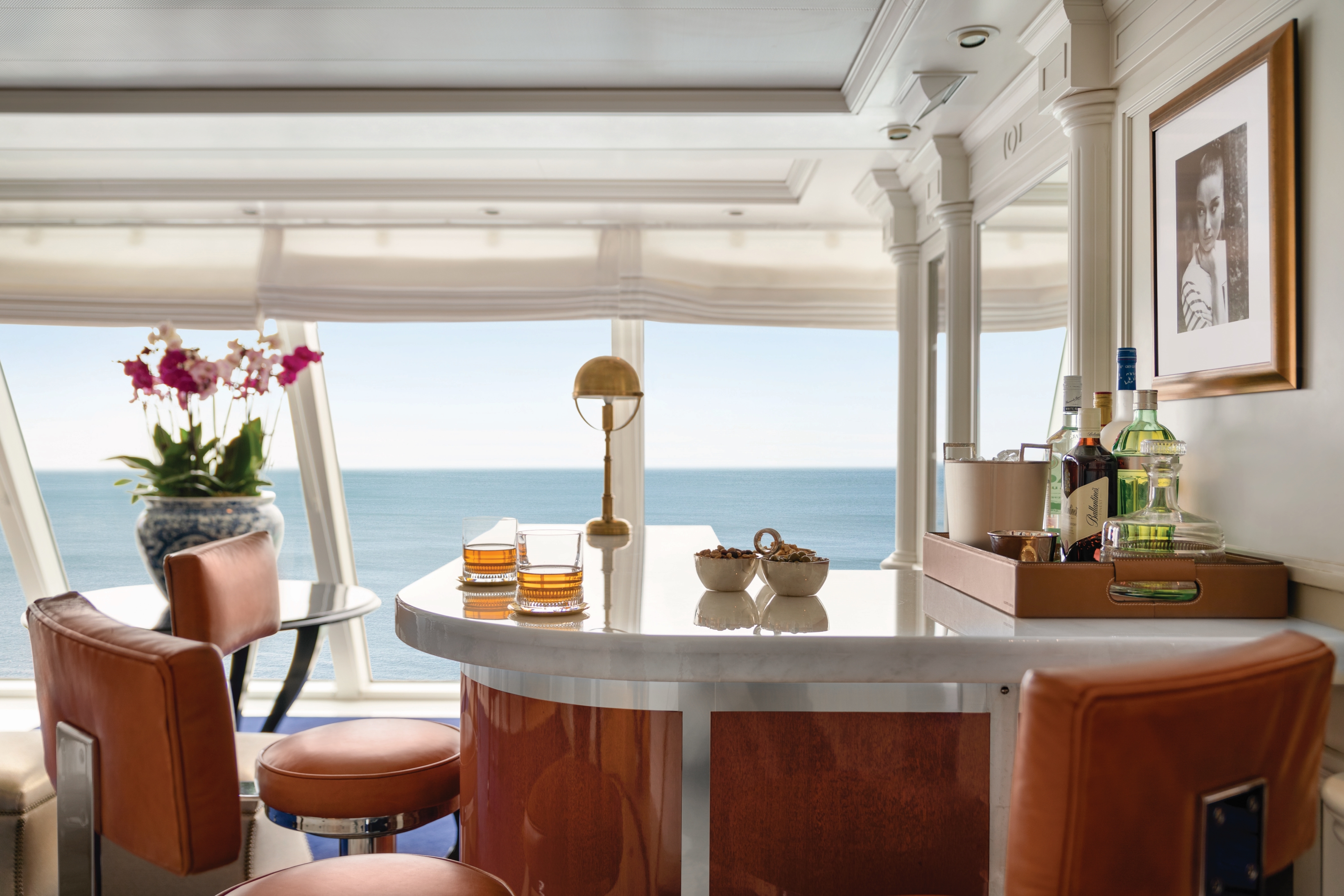
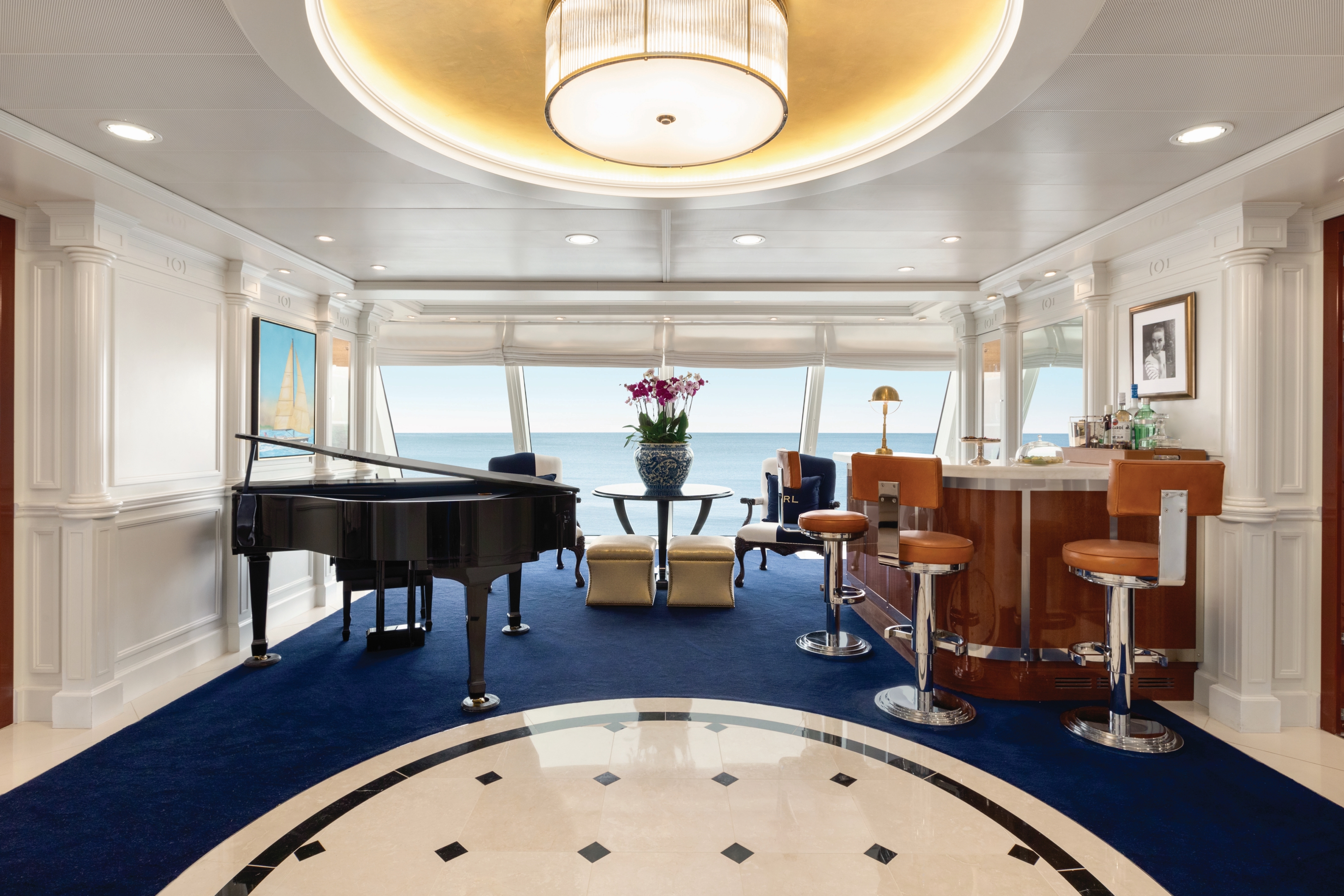
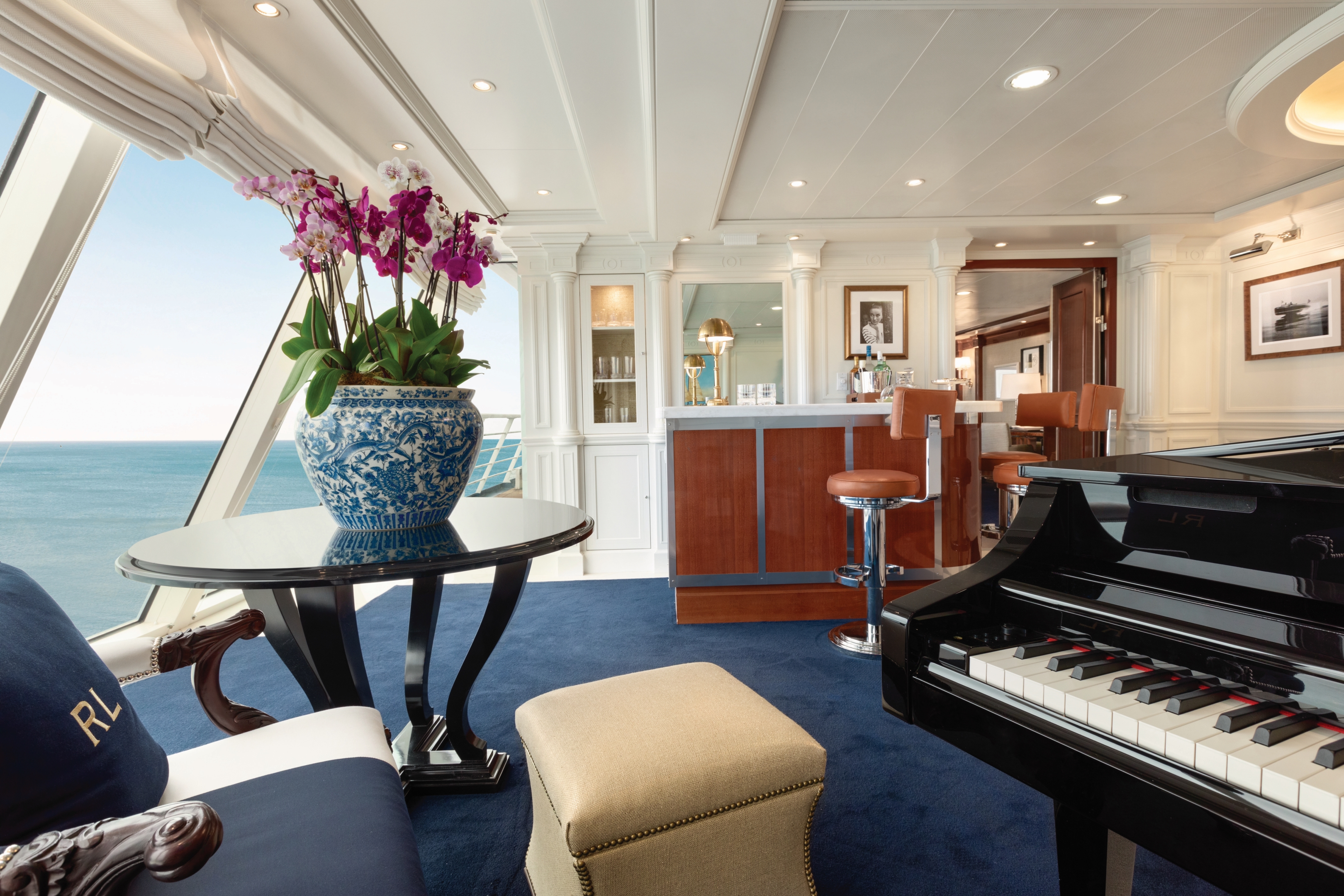
Martinis
Martinis serves numerous incarnations of this famous cocktail in a sophisticated yet affable atmosphere reminiscent of an exclusive New York members’ club, featuring live piano music.
The Grand Bar
Before sitting down to a gourmet meal, sample a rare vintage or savour your favourite apéritif as you enjoy spirited conversation with newfound friends amid the refined atmosphere of the convivial Grand Bar.
Marina Lounge
From headline acts to comedians, magicians and lively jazz ensembles, head to the Oceania Marina Lounge to discover the centre of nightly entertainment aboard Oceania Cruises.
Horizons
An elegant observation lounge with dramatic floor-to-ceiling windows and a country club casual ambiance, Horizons transforms into a sophisticated evening venue by night. Dance the night away to the sounds of a lively musical group and enjoy cocktails with friends at the welcoming bar.
Waves Bar
Located in a shaded area just steps from the swimming pool, Waves Bar offers a wide variety of libations to enhance your poolside experience. Revel in the perfect afternoon on deck with your favourite cocktail, glass of wine or chilled beer. Come happy hour, signature cocktails and frosty beverages create a delightfully carefree segue to the lively evening ahead as the sun sets.
Patio
Sit back, relax and enjoy the stunning panoramic ocean views in the shaded, comfortable Patio as you sail to the next exciting destination.
Sanctuary
Sit back, relax and enjoy the stunning panoramic ocean views in the shaded comfortable Sanctuary as you sail to the next exciting destination.
Executive Lounge
Enjoy the fully-staffed Executive Lounge with Complimentary beverages and snacks throughout the day and evening.
Casino Bar
Try your hand at exciting table games such as blackjack, poker and roulette while enjoying a delightful cocktail from the Casino Bar
Concierge Lounge
Enjoy the fully-staffed Concierge Lounge with complimentary beverages and snacks throughout the day an evening.