Journey To Eastern Realms
Journey To Eastern Realms
Cruise overview
WHY BOOK WITH US?
- ✔ The Deluxe Cruises’ team has extensive experience in ultra-luxury cruising.
- ✔ Call now to speak to our helpful and experienced Cruise Concierge team.
- ✔ Enjoy our Unique Deluxe Cruises Bonus for substantial savings.
- ✔ Our team will tailor your holiday to your exacting requirements.
- ✔ As agents, we work under the protection of each cruise lines ABTA / ATOL licences
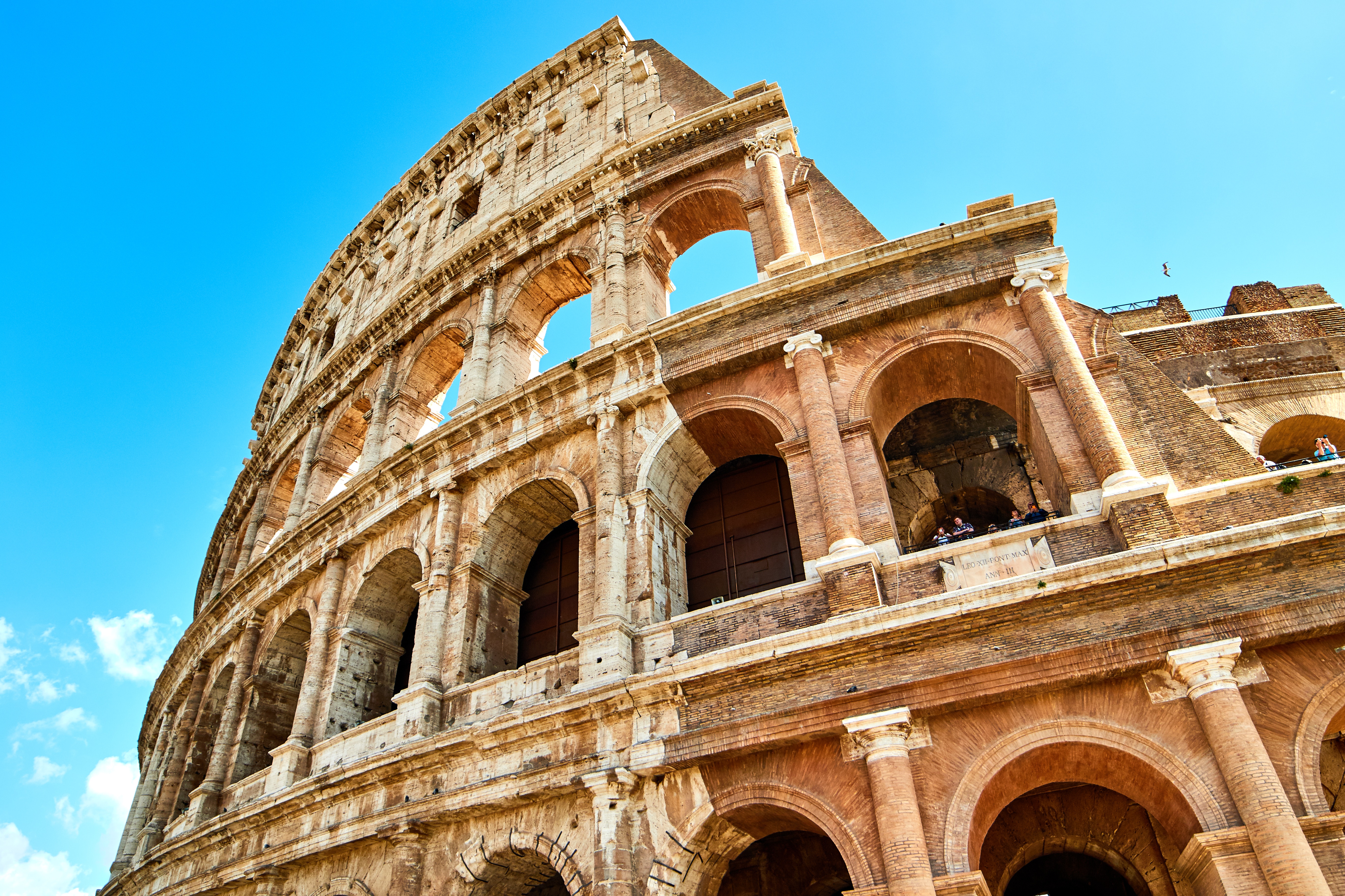
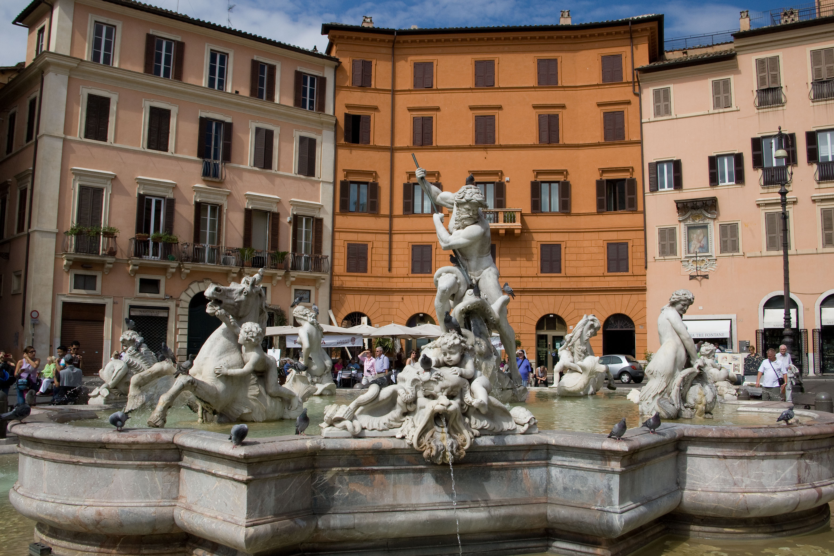
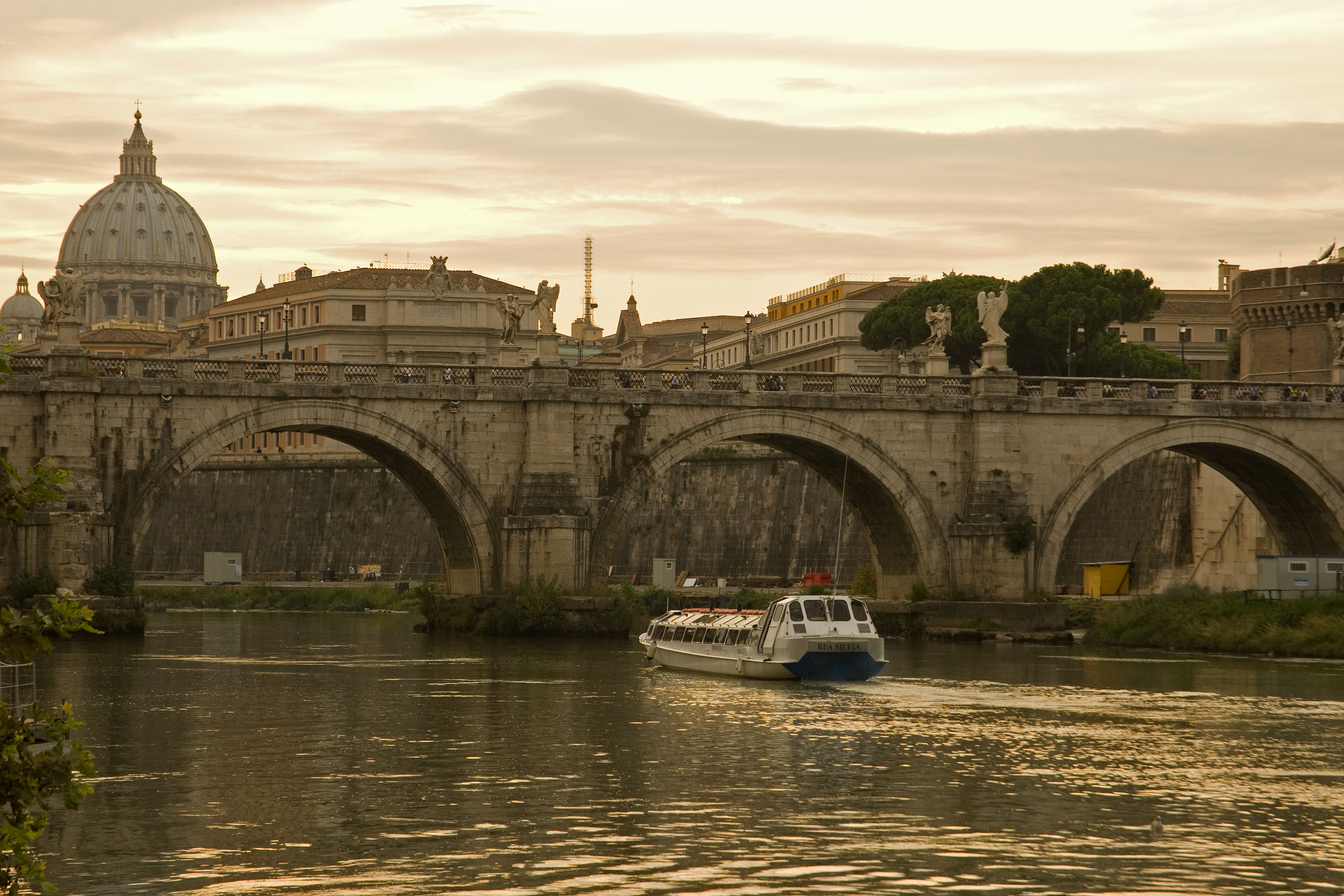
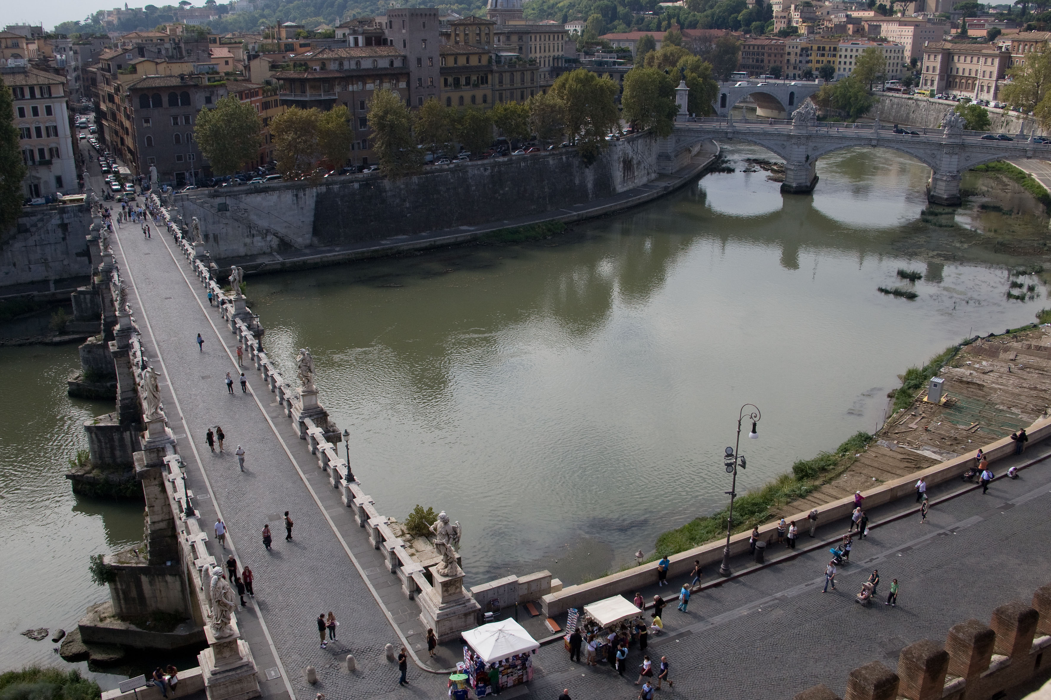
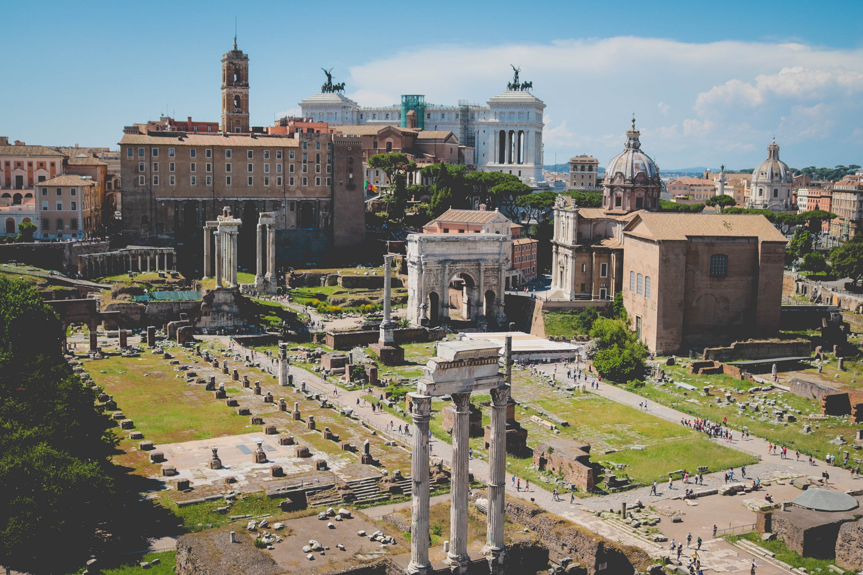
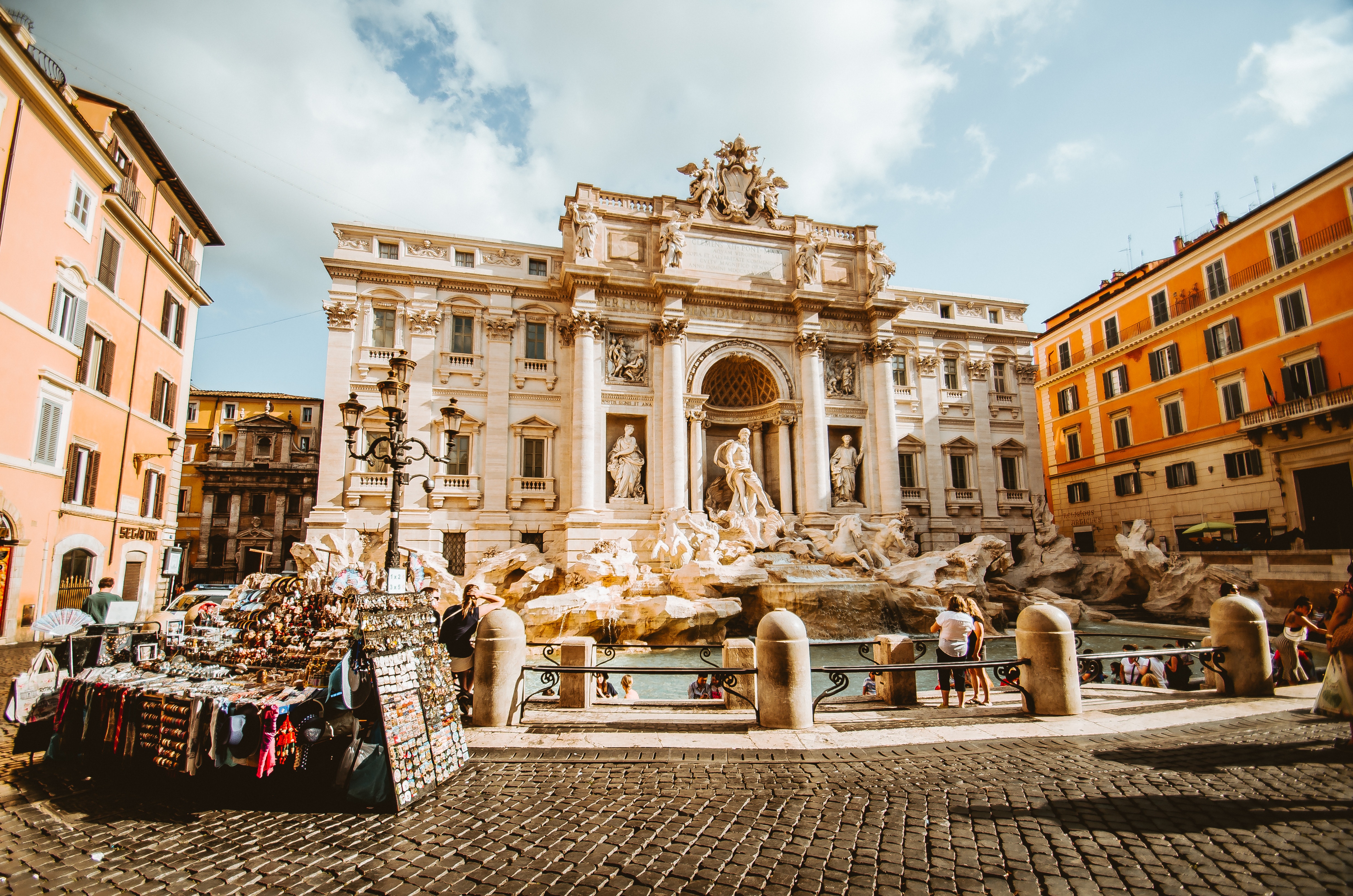
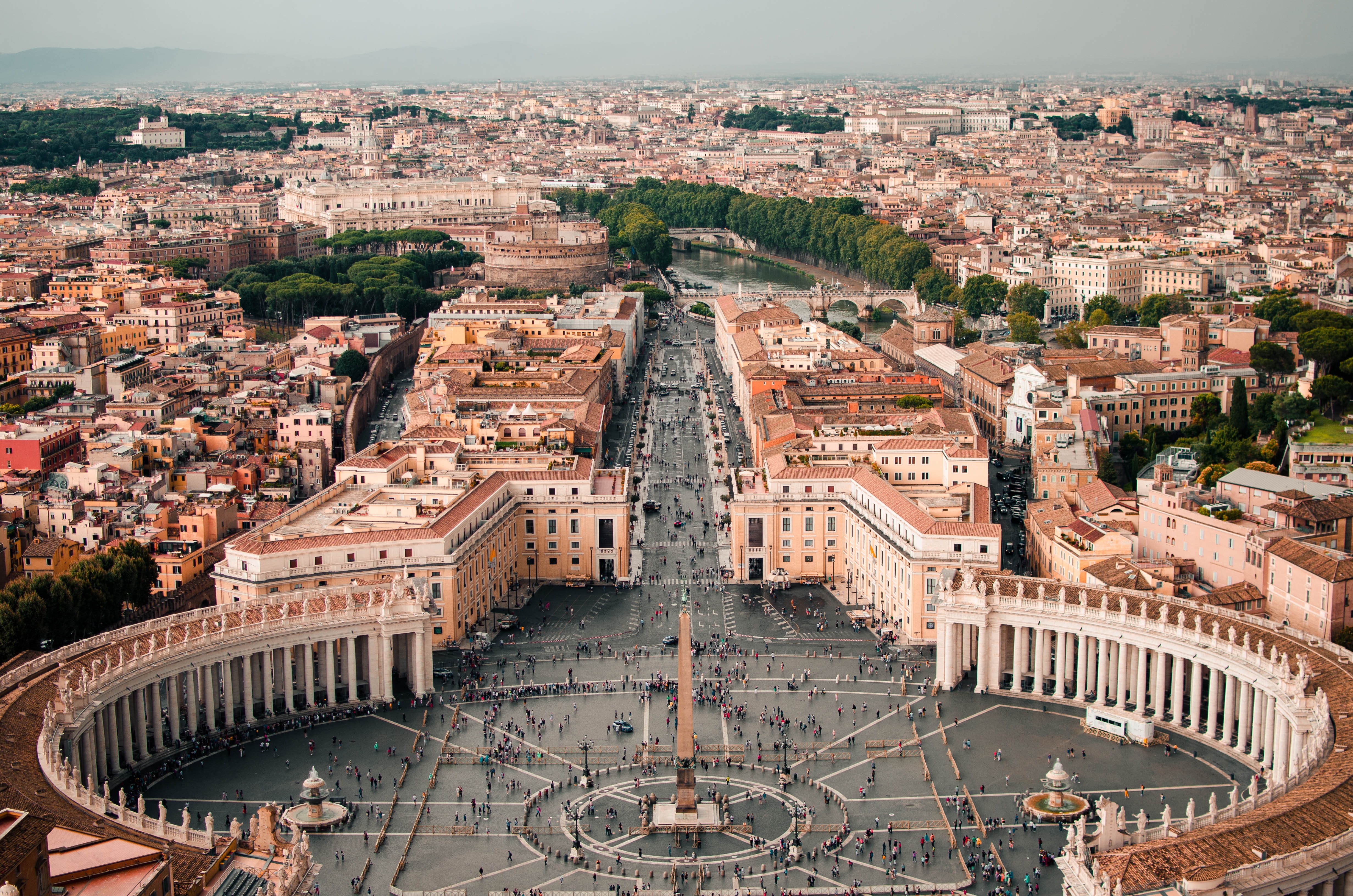
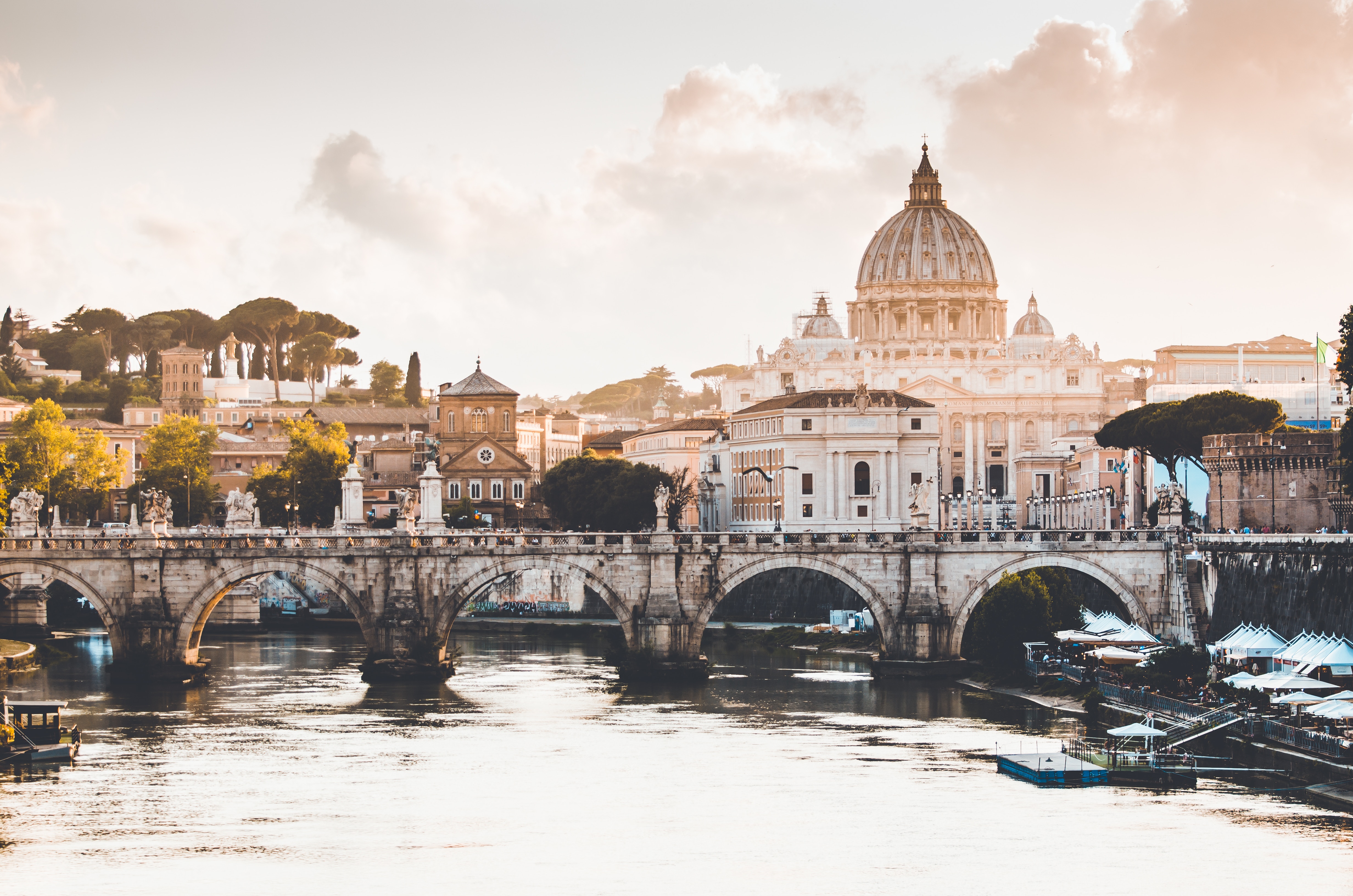
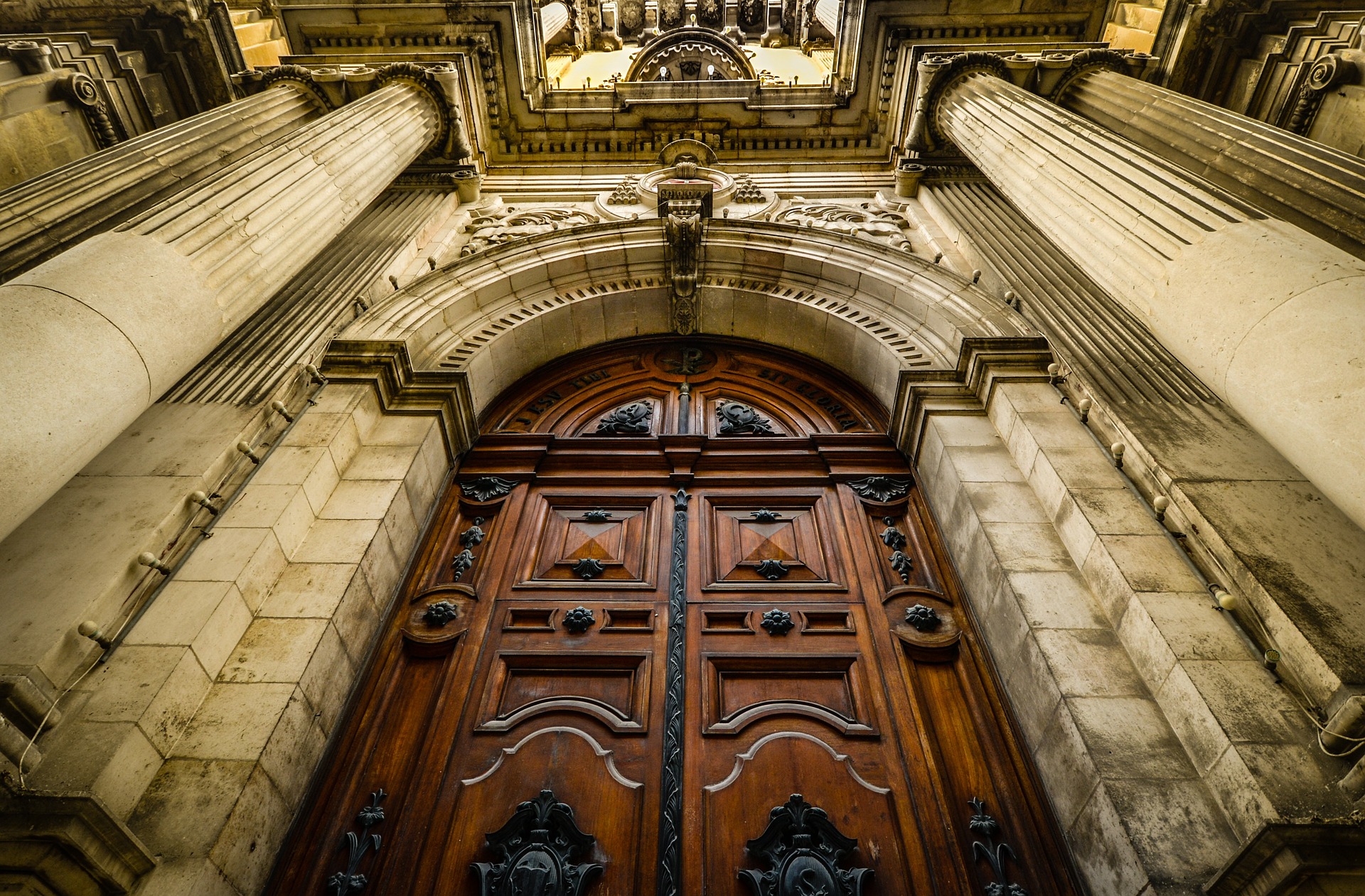
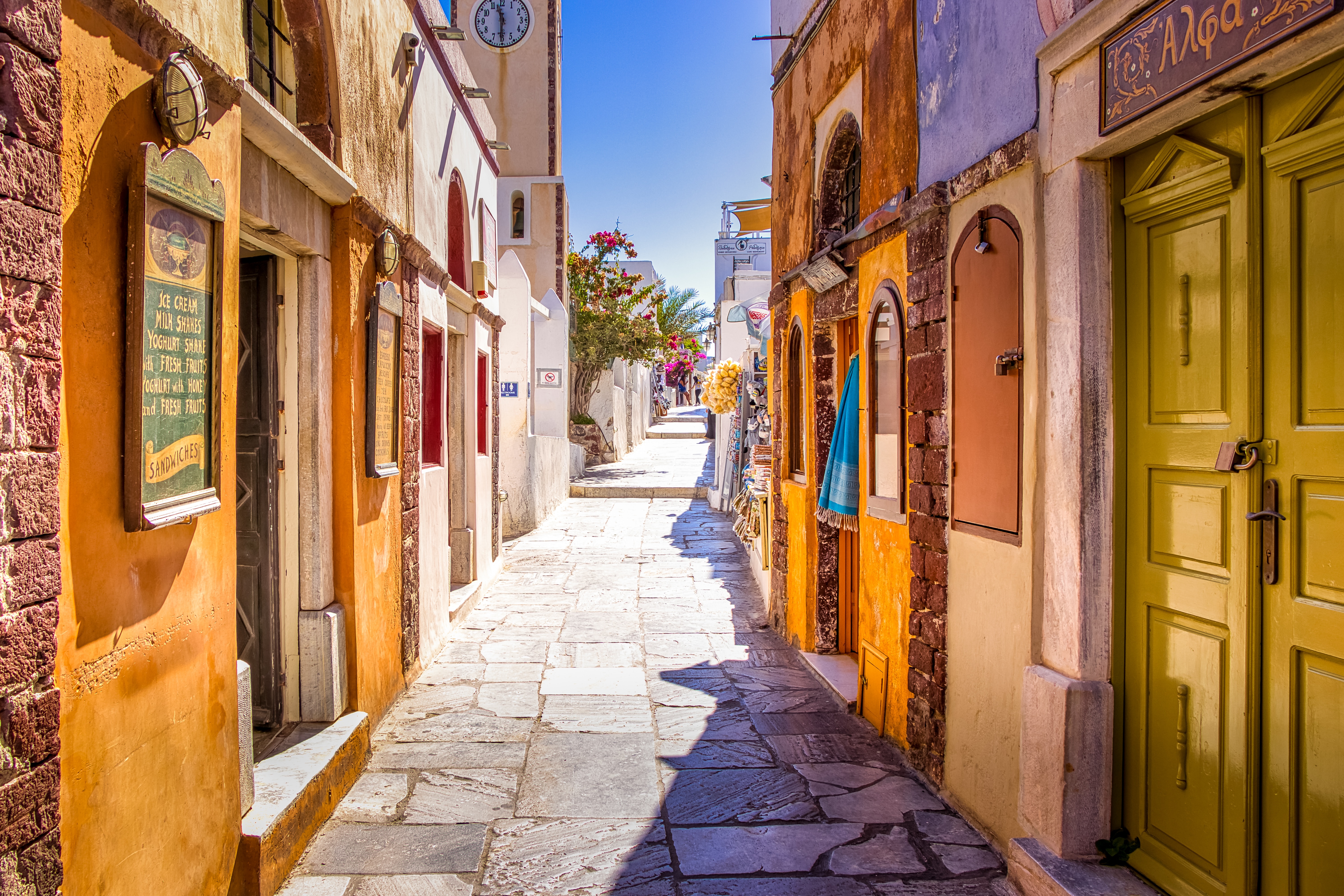
About Civitavecchia
Italy's vibrant capital lives in the present, but no other city on earth evokes its past so powerfully. For over 2,500 years, emperors, popes, artists, and common citizens have left their mark here. Archaeological remains from ancient Rome, art-stuffed churches, and the treasures of Vatican City vie for your attention, but Rome is also a wonderful place to practice the Italian-perfected il dolce far niente, the sweet art of idleness. Your most memorable experiences may include sitting at a caffè in the Campo de' Fiori or strolling in a beguiling piazza.
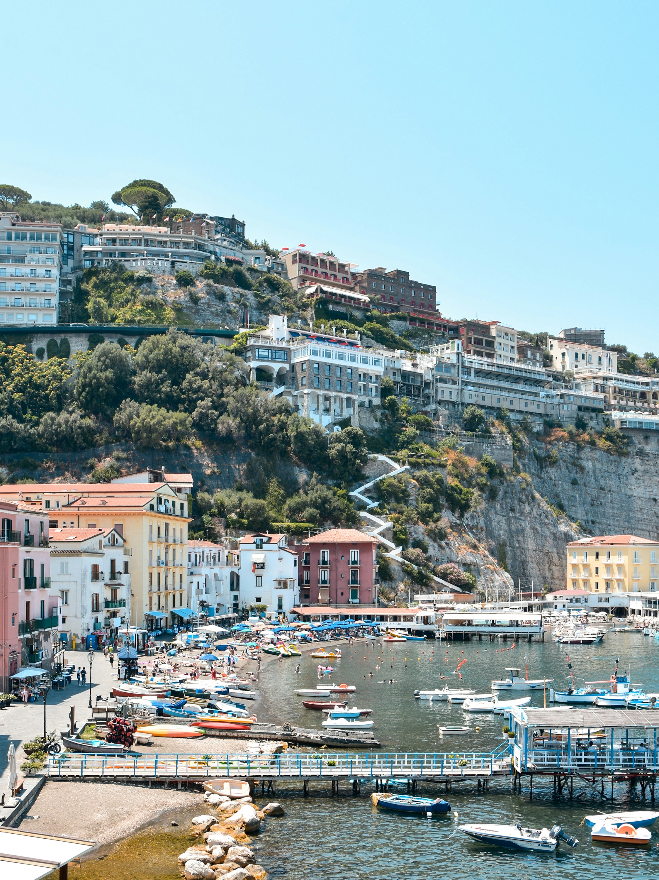
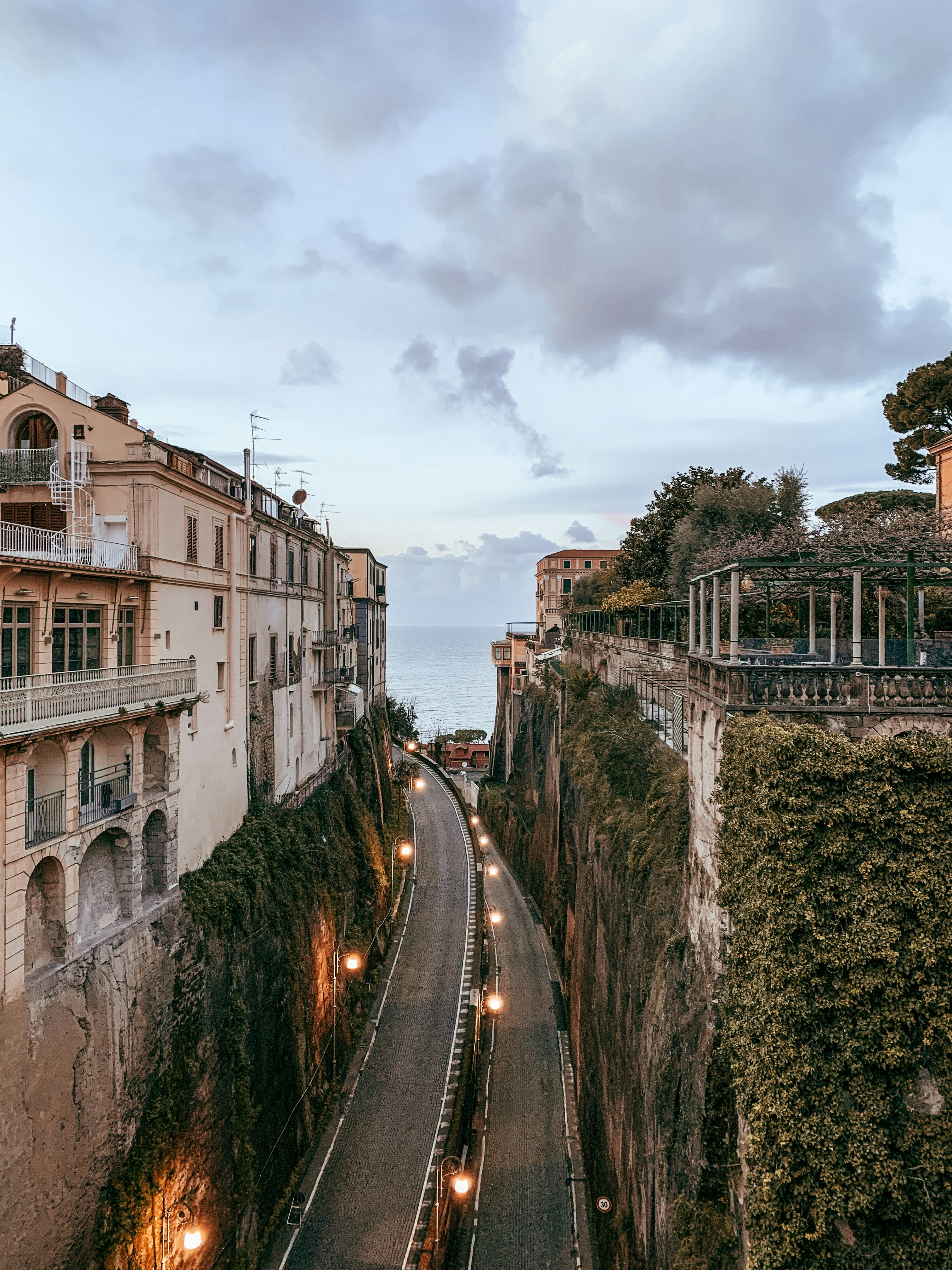
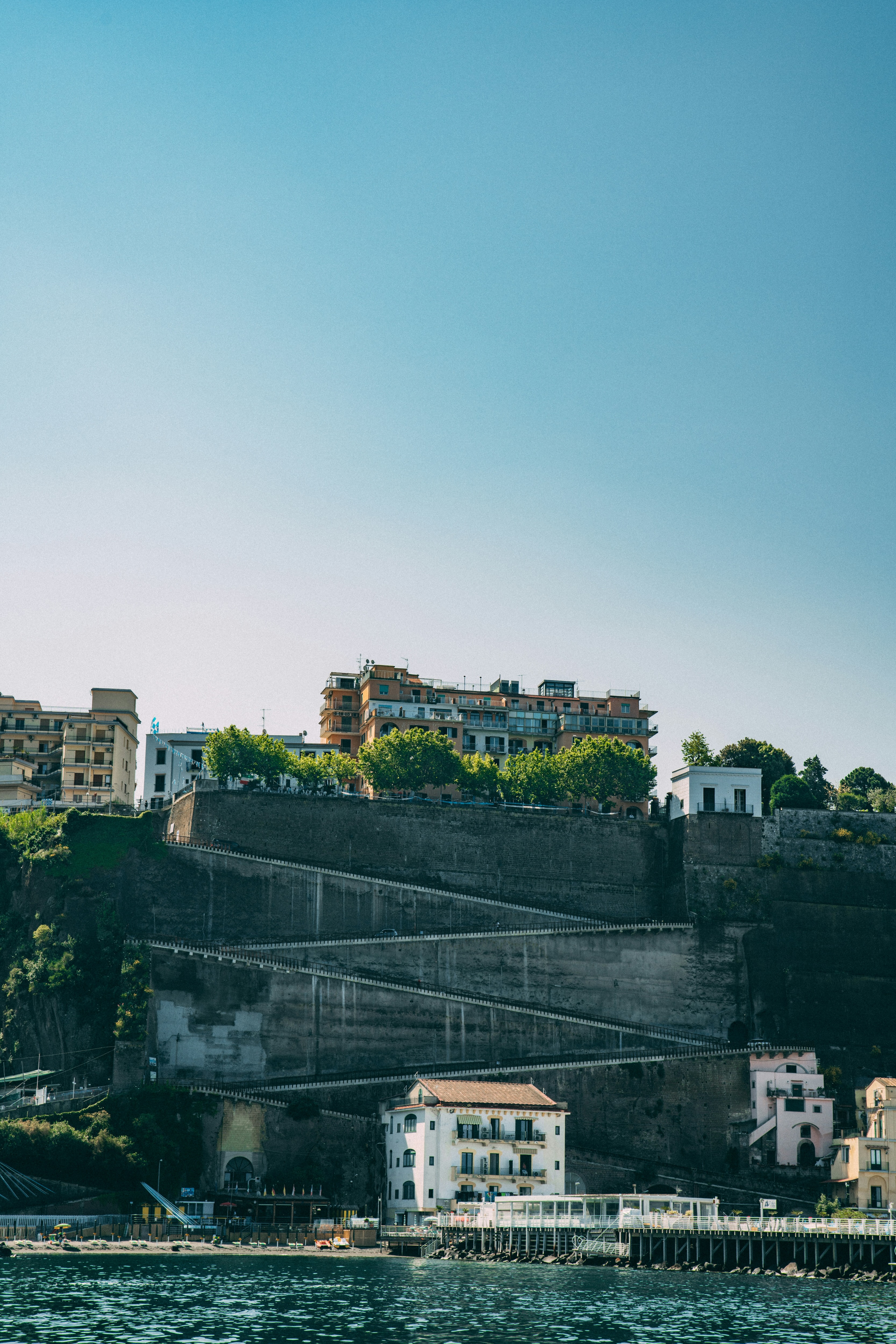
About Sorrento
Sorrento may have become a jumping-off point for visitors to Pompeii, Capri, and Amalfi, but you can find countless reasons to love it for itself. The Sorrentine people are fair-minded and hardworking, bubbling with life and warmth. The tuff cliff on which the town rests is spread over the bay, absorbing sunlight, while orange and lemon trees waft their perfume in spring. Winding along a cliff above a small beach and two harbors, the town is split in two by a narrow ravine formed by a former mountain stream. To the east, dozens of hotels line busy Via Correale along the cliff—many have "grand" included in their names, and some indeed still are. To the west, however, is the historic sector, which still enchants. It's a relatively flat area, with winding, stone-paved lanes bordered by balconied buildings, some joined by medieval stone arches. The central piazza is named after the poet Torquato Tasso, born here in 1544. This part of town is a delightful place to walk through. Craftspeople are often at work in their stalls and shops and are happy to let you watch; in fact, that's the point. Music spots and bars cluster in the side streets near Piazza Tasso.
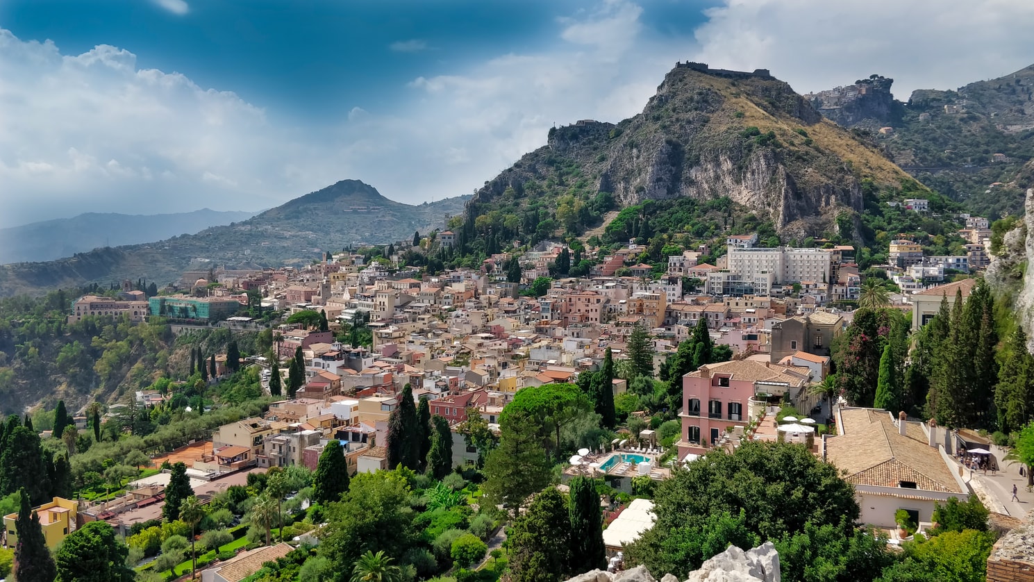
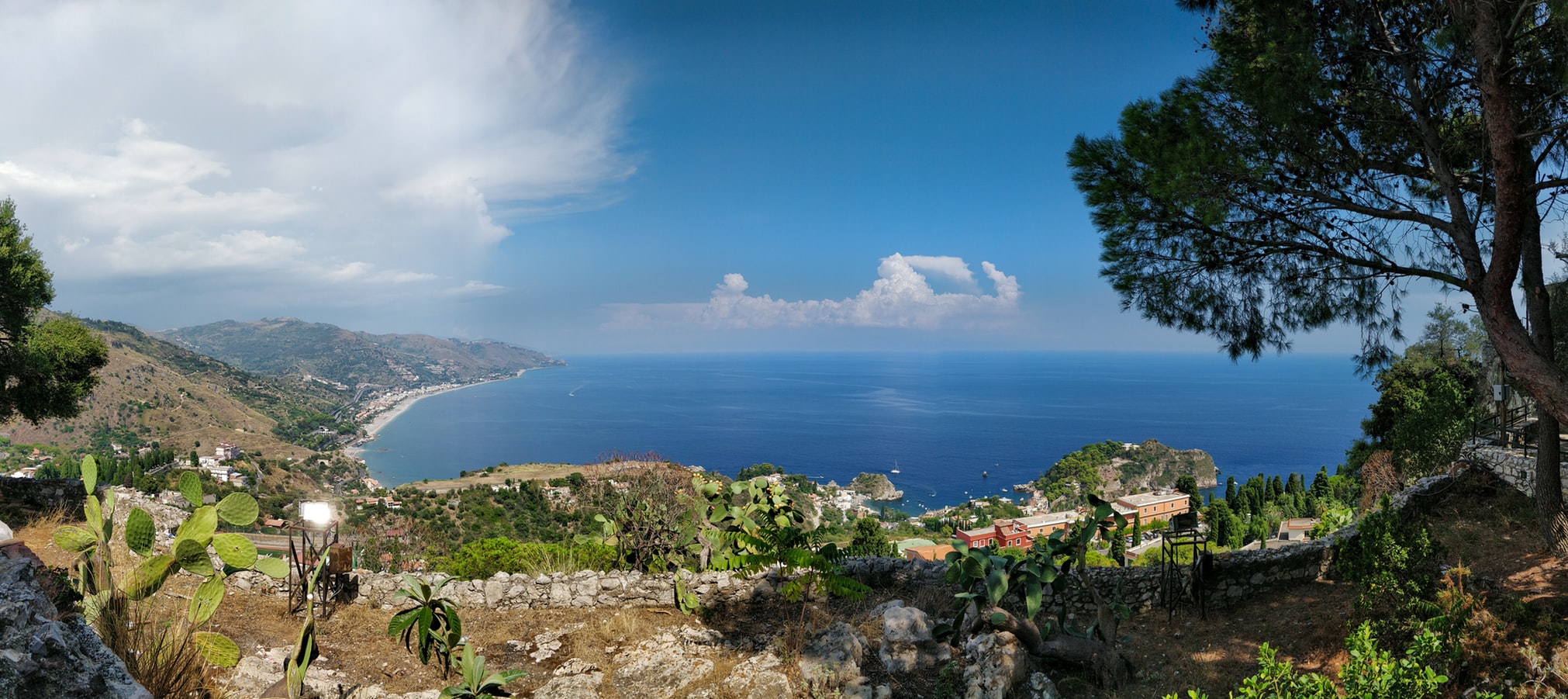
About Messina
Home to the Museo Regionale of Messina, known for featuring two of Caravaggio's paintings, the city is also famous for having been the capital of the ancient kingdom of Sicily.
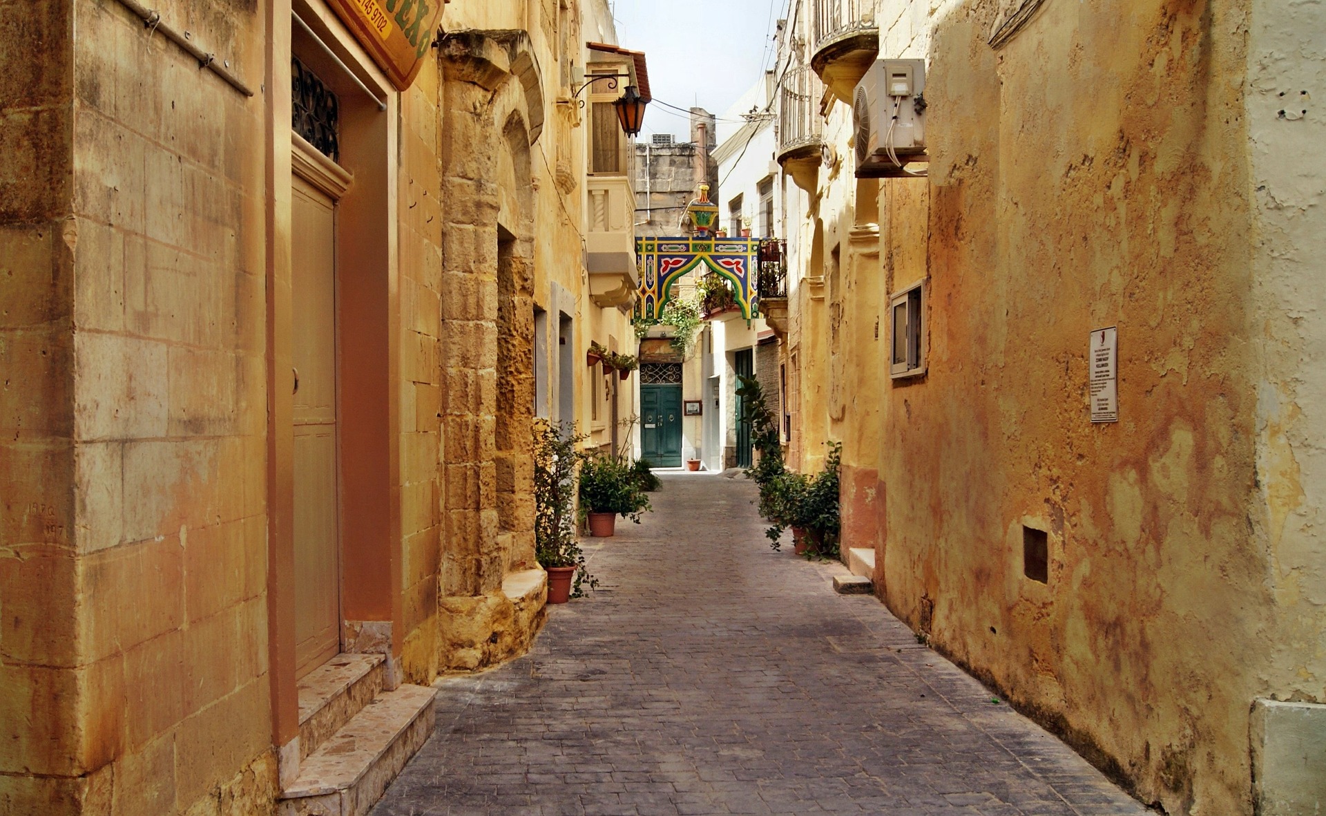
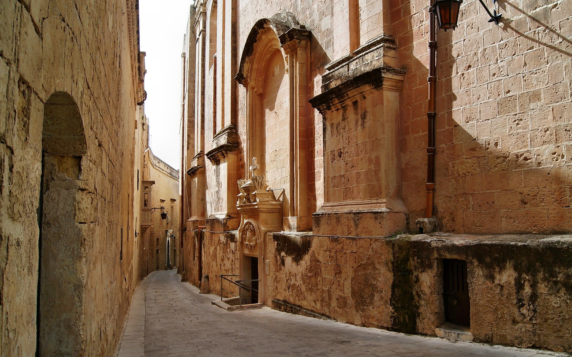
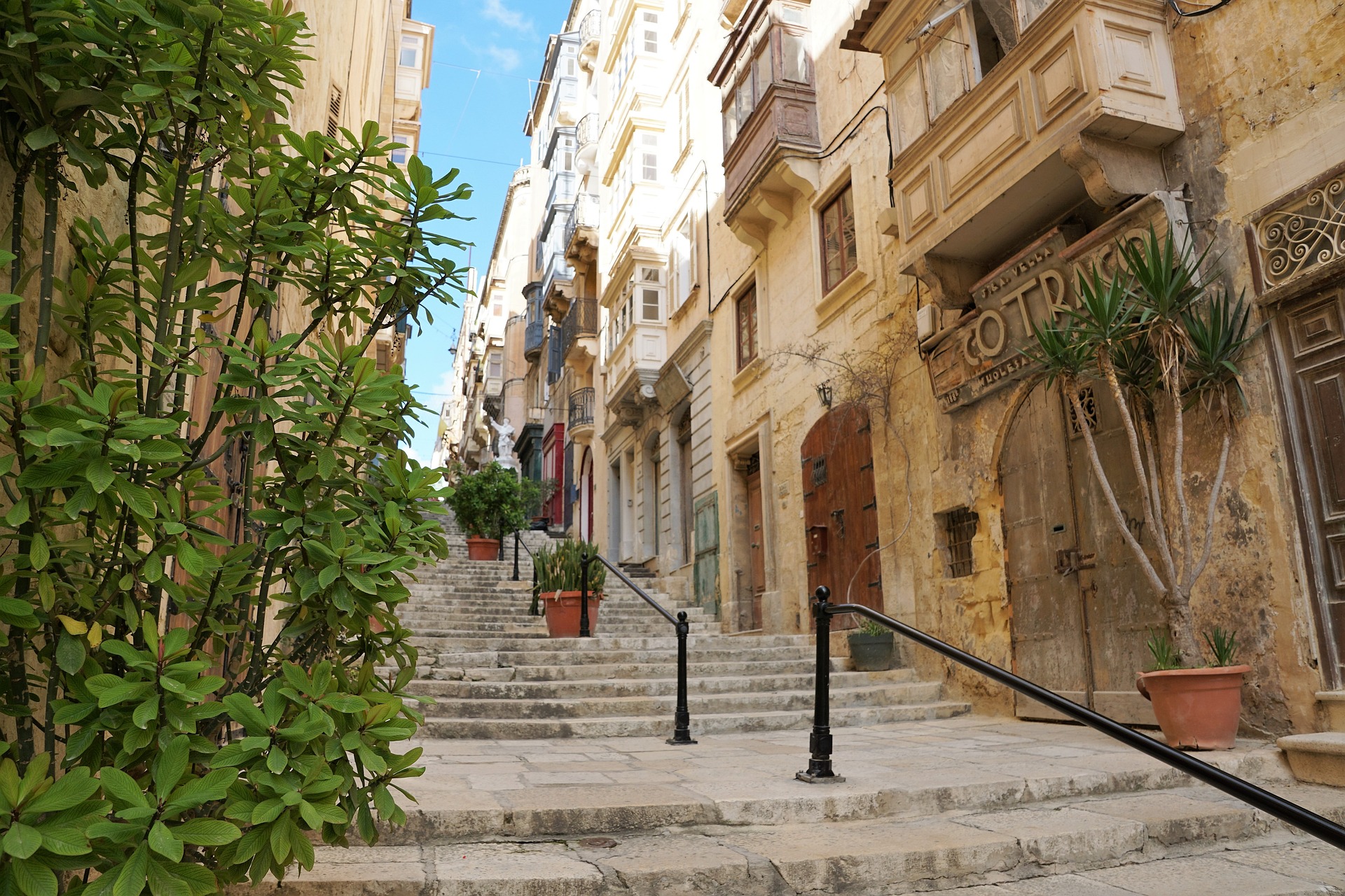
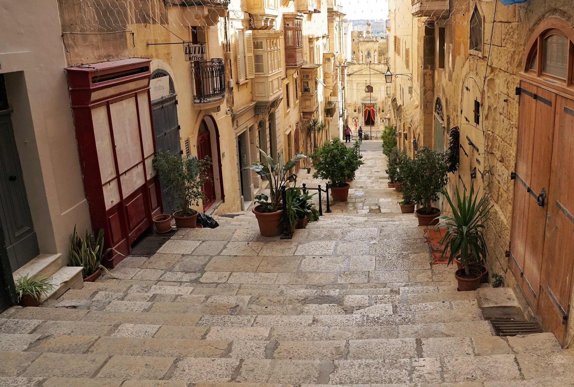
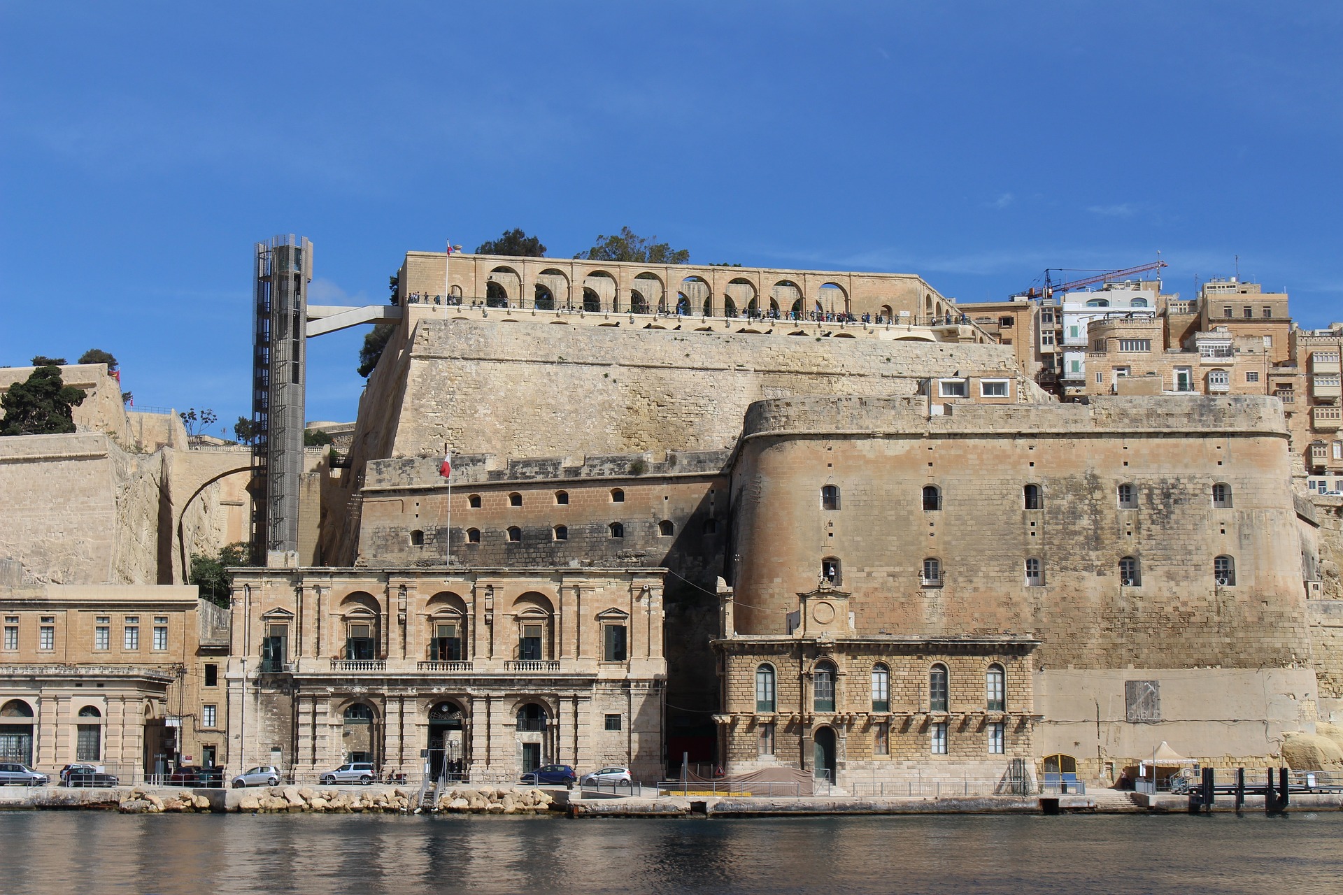
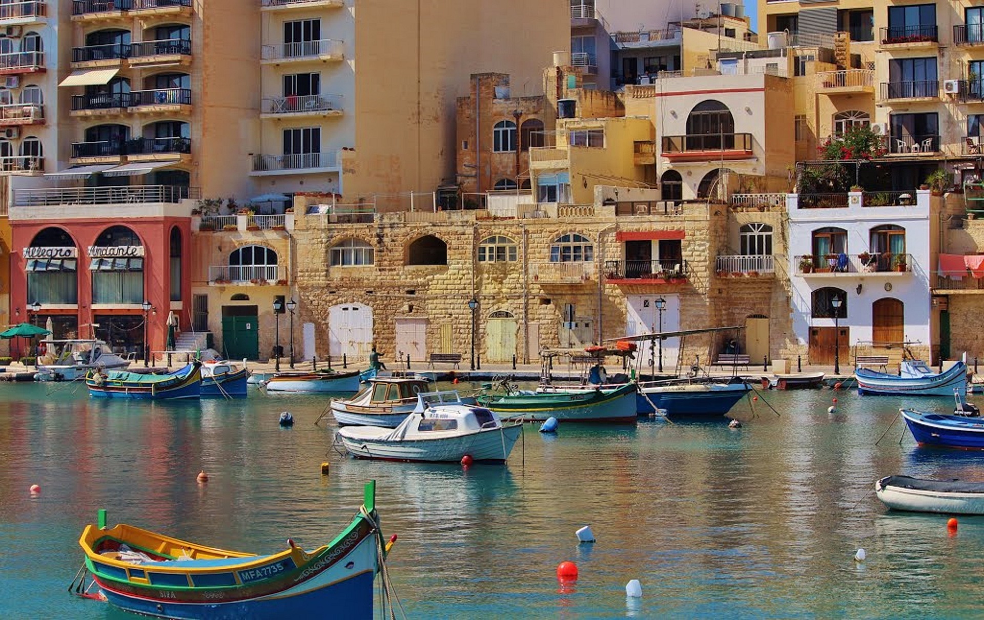
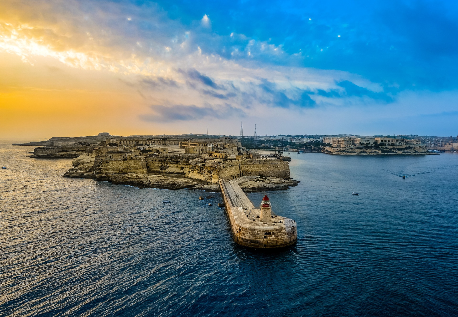
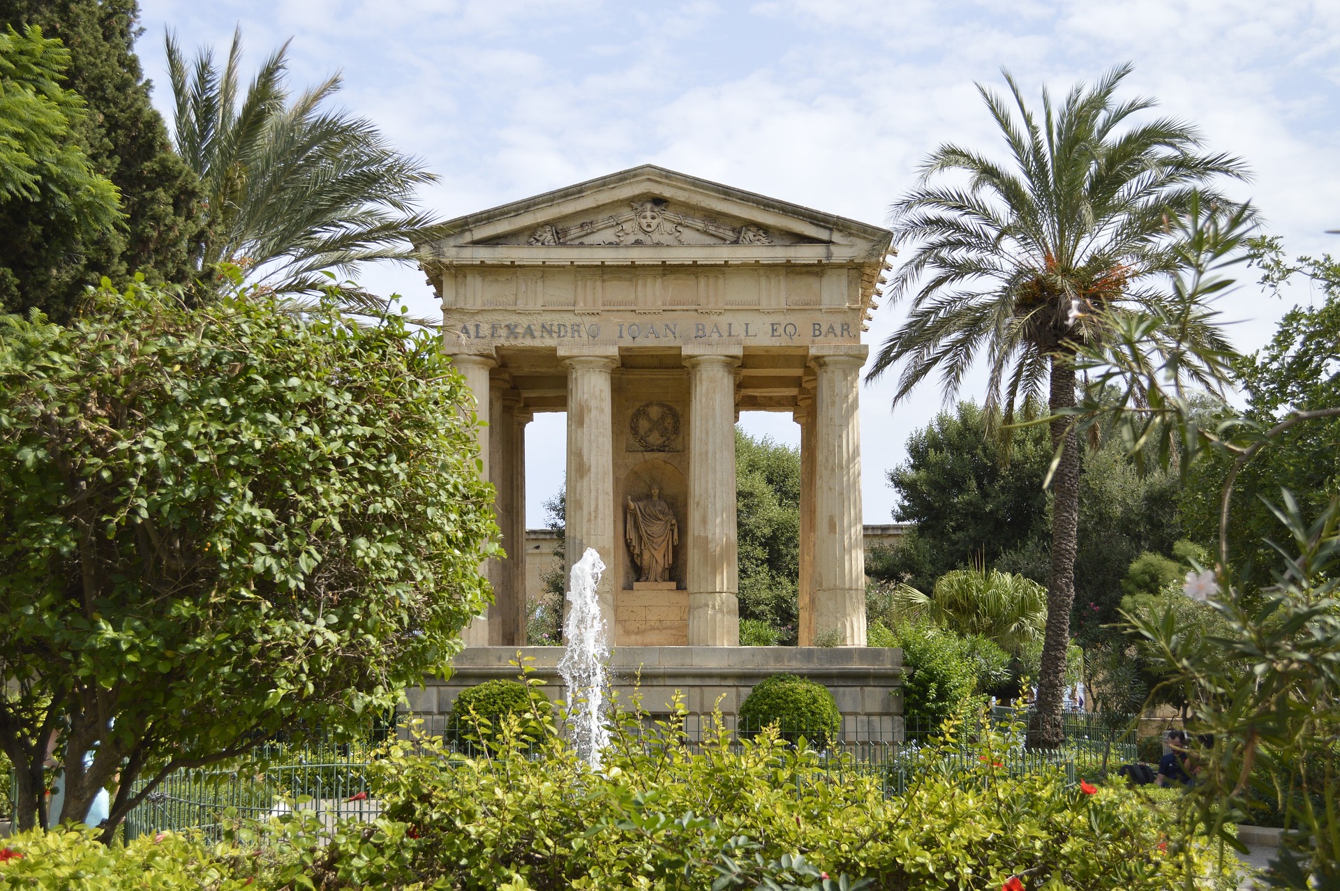
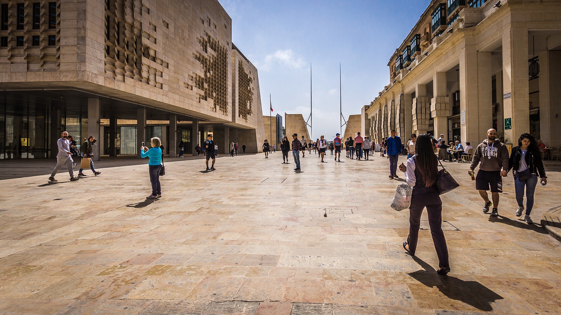
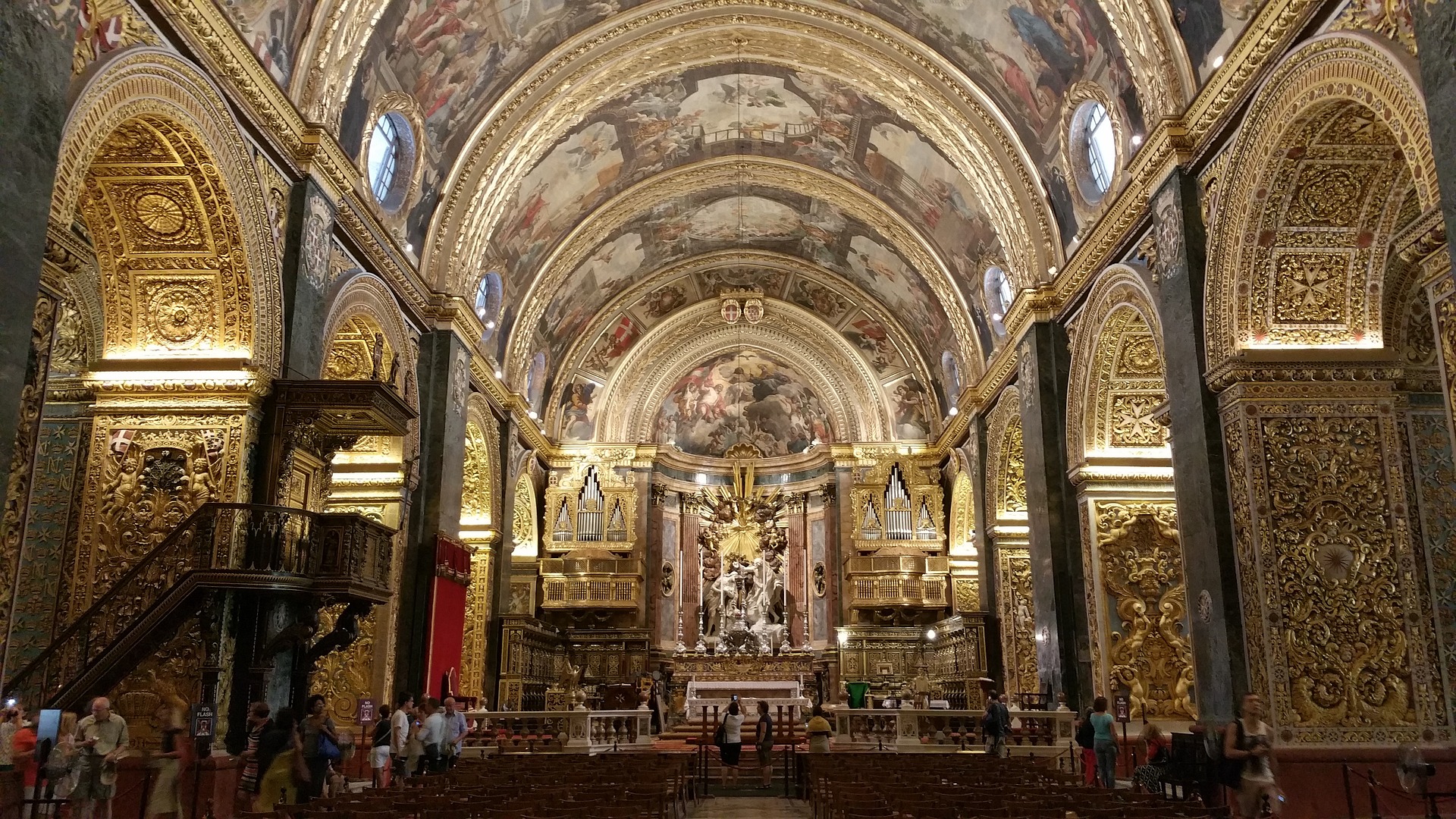
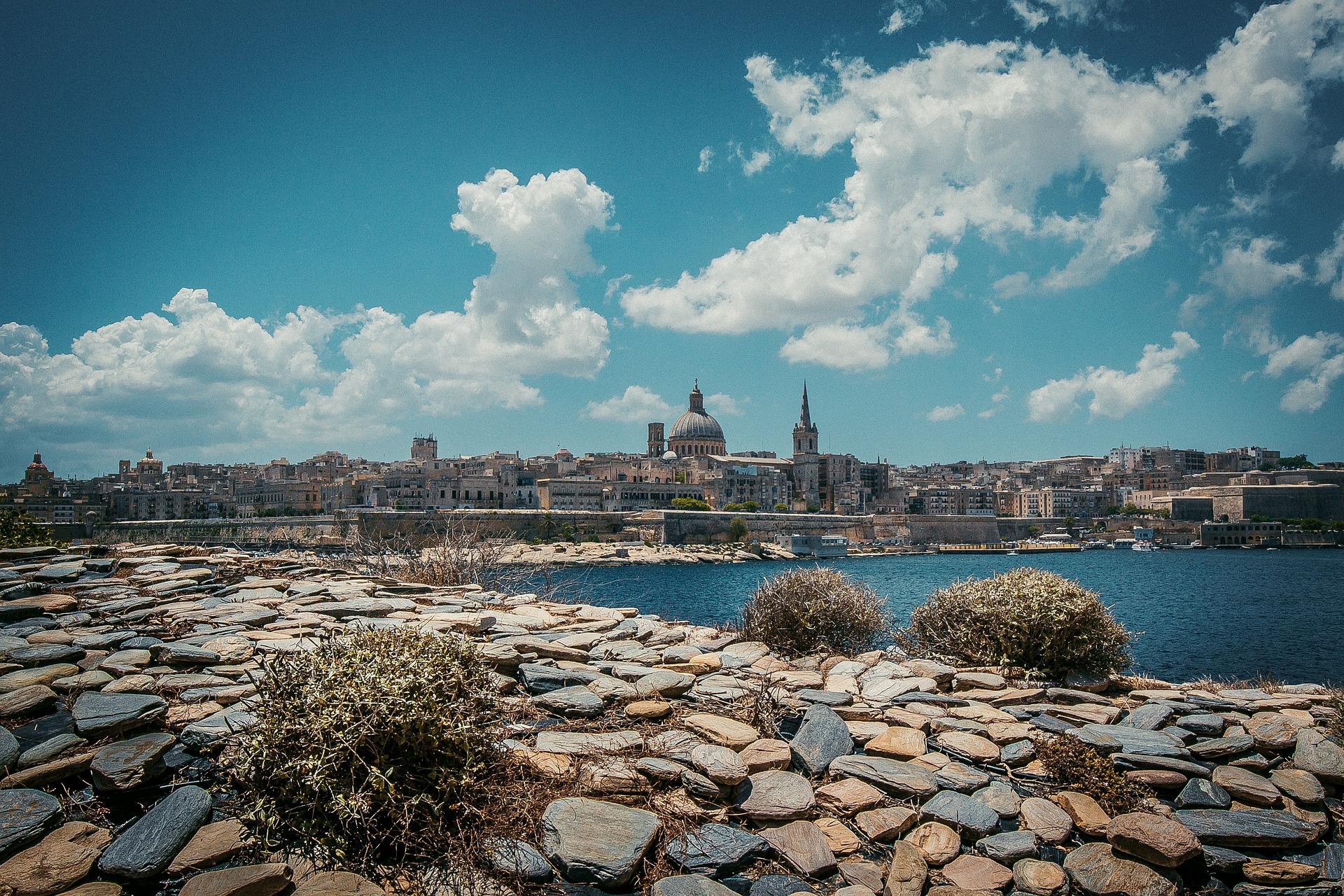
About Valletta
Malta's capital, the minicity of Valletta, has ornate palaces and museums protected by massive fortifications of honey-color limestone. Houses along the narrow streets have overhanging wooden balconies for people-watching from indoors. Generations ago they gave housebound women a window on the world of the street. The main entrance to town is through the City Gate (where all bus routes end), which leads onto Triq Repubblika (Republic Street), the spine of the grid-pattern city and the main shopping street. Triq Mercante (Merchant Street) parallels Repubblika to the east and is also good for strolling. From these two streets, cross streets descend toward the water; some are stepped. Valletta's compactness makes it ideal to explore on foot. City Gate and the upper part of Valletta are experiencing vast redevelopment that includes a new Parliament Building and open-air performance venue. The complex, completed mid-2013, has numerous pedestrian detours in place along with building noise and dust. Before setting out along Republic Street, stop at the tourist information office on Merchant Street for maps and brochures.
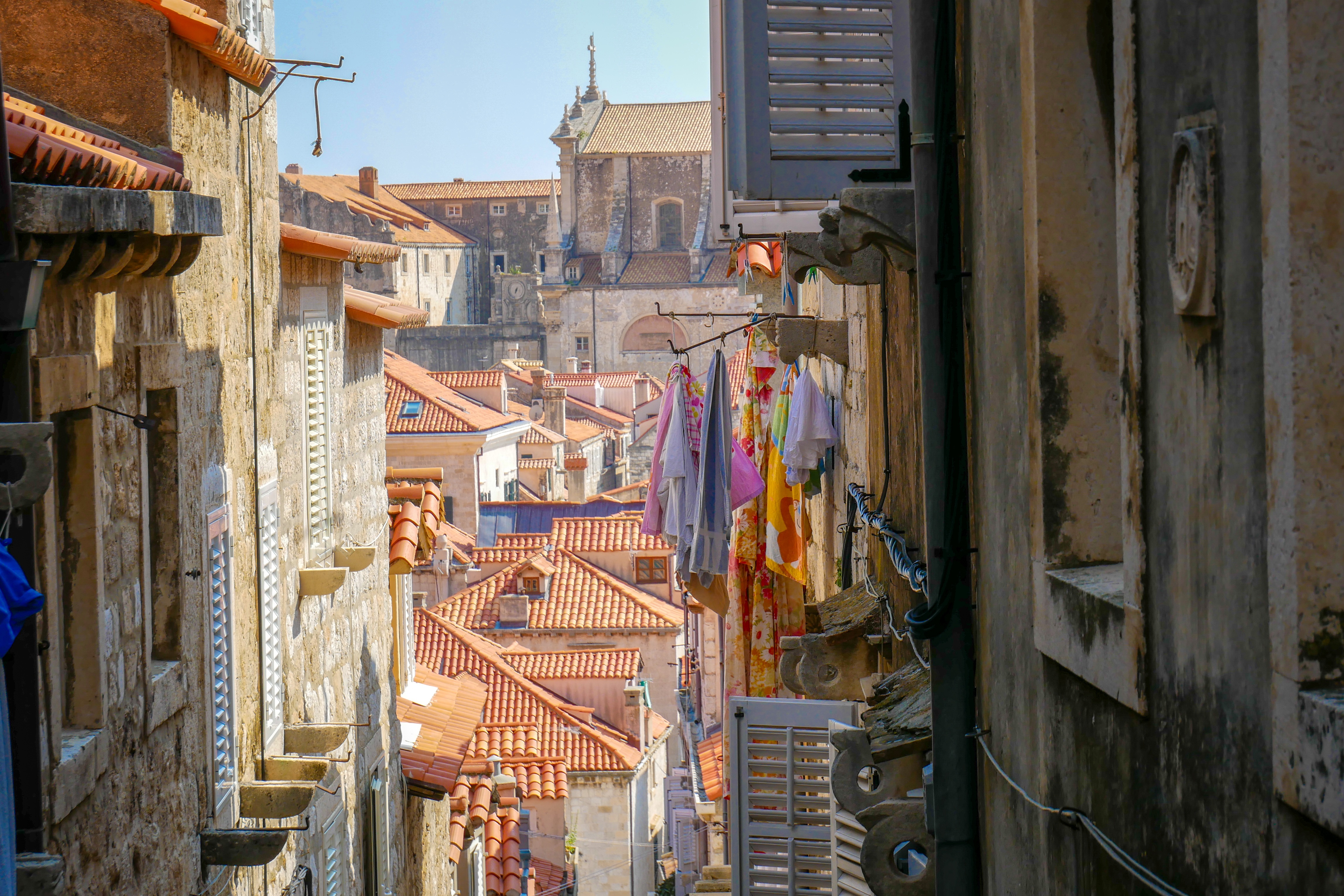
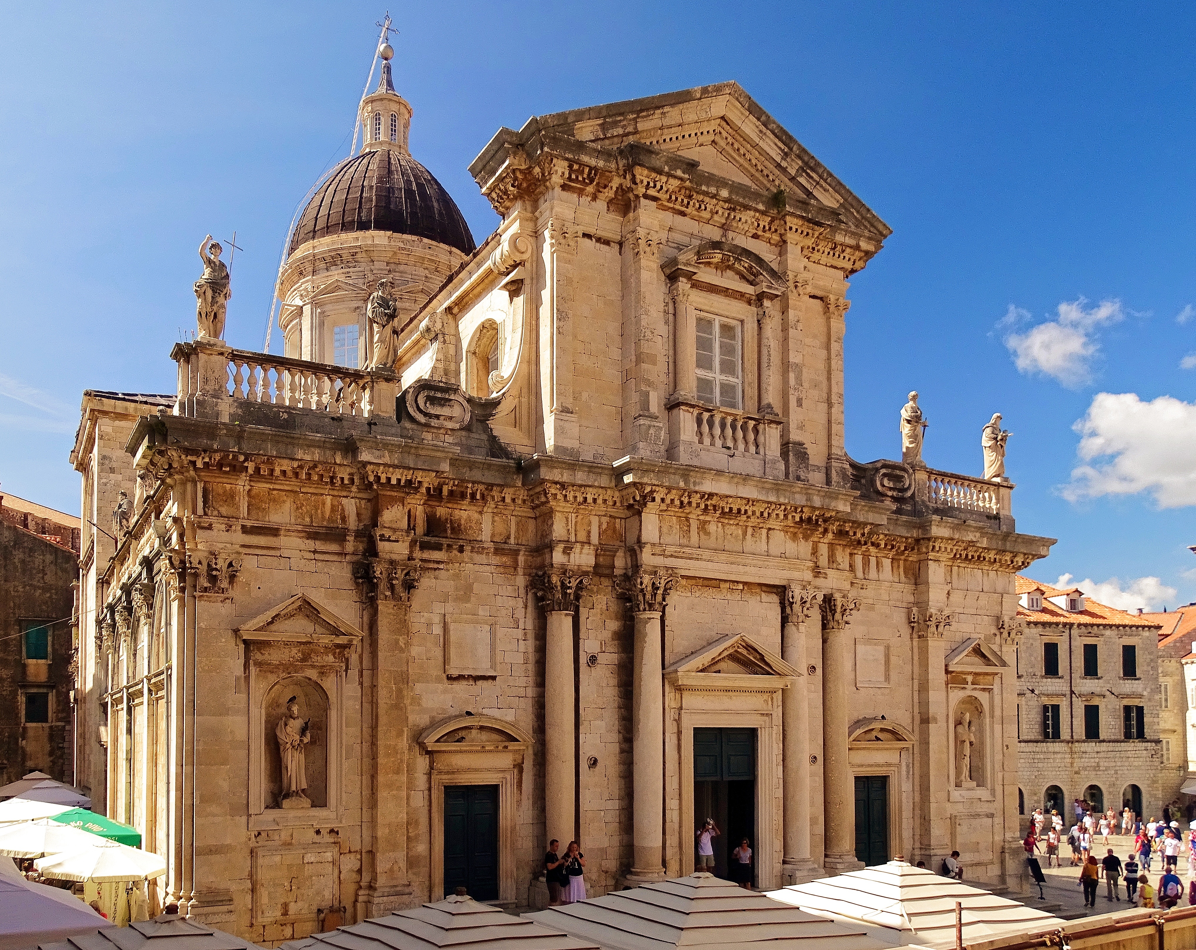
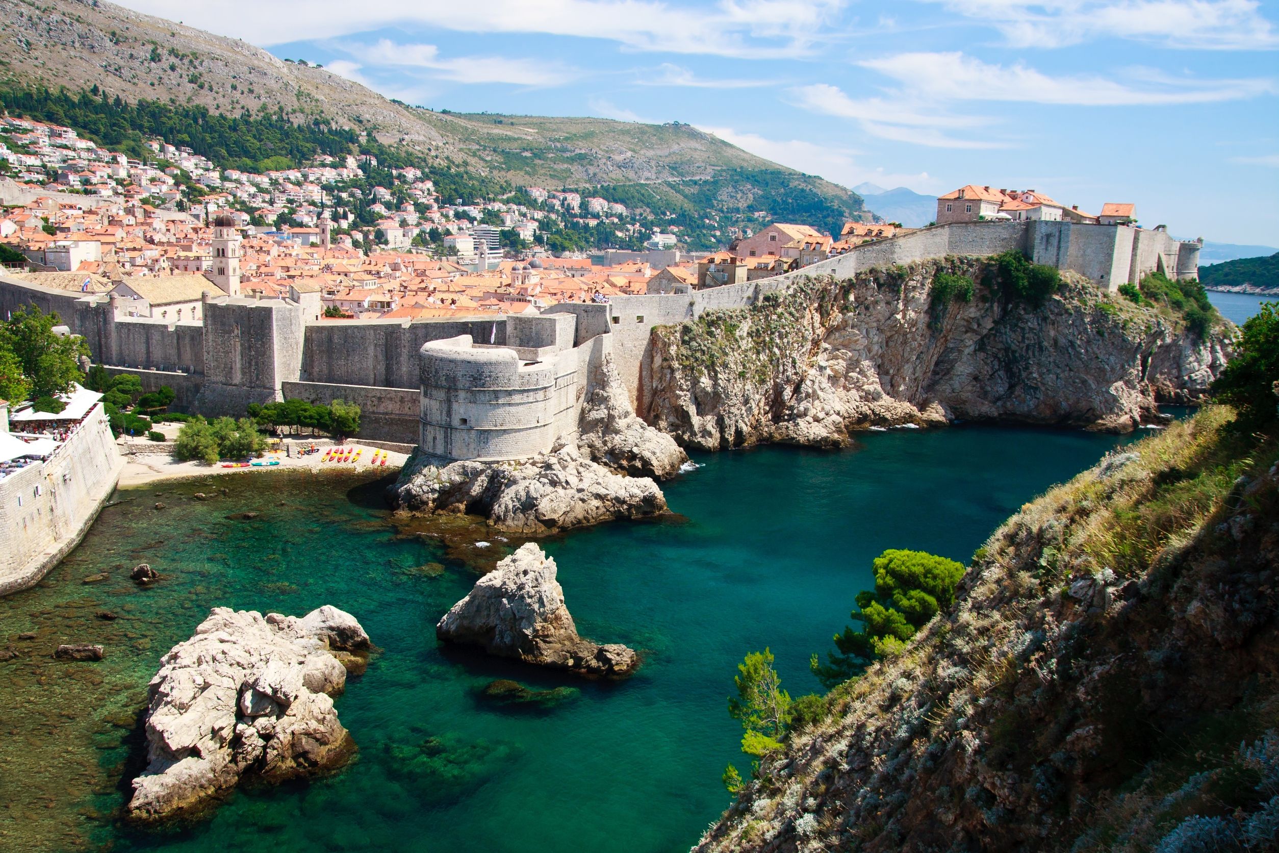
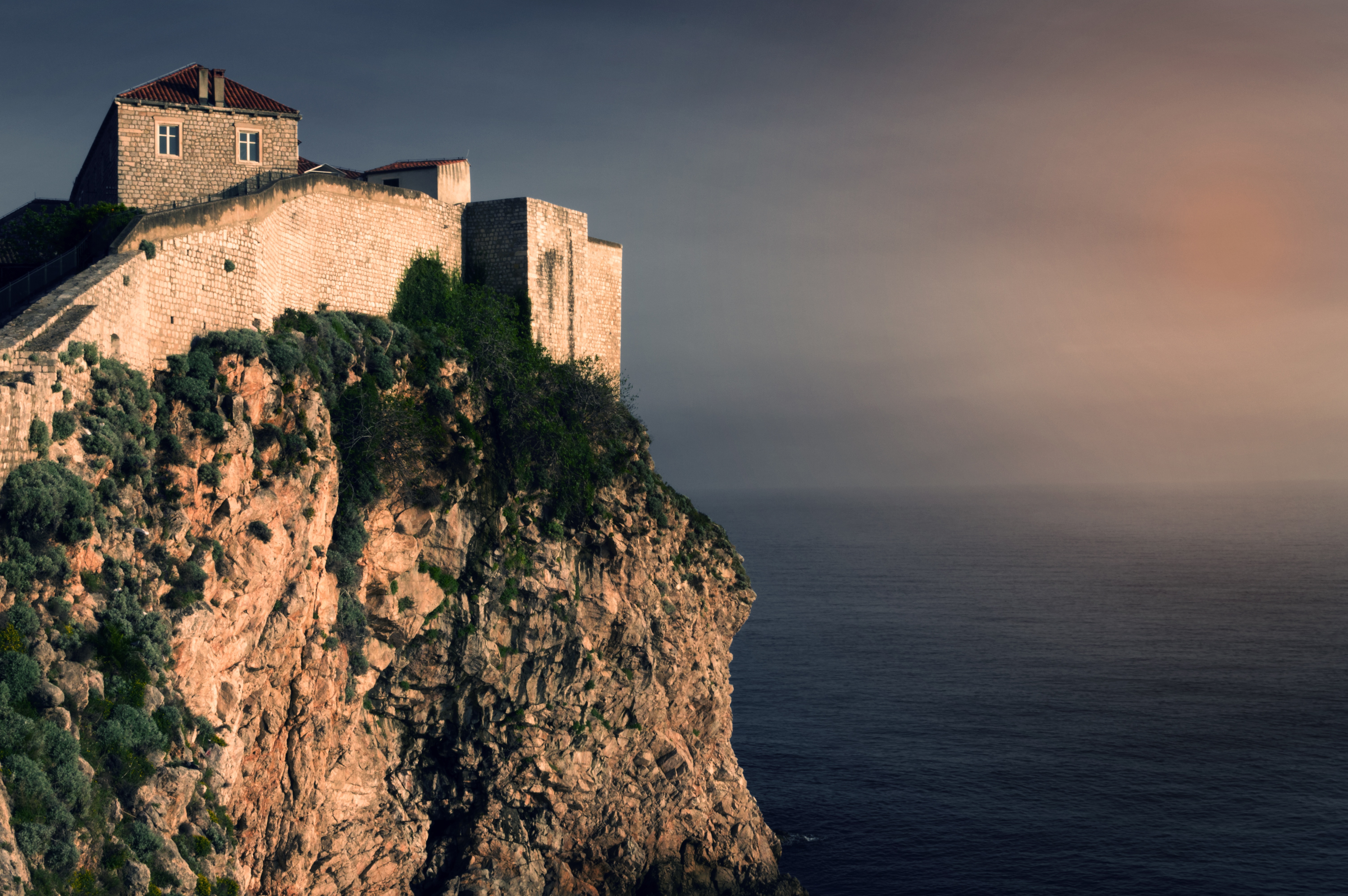
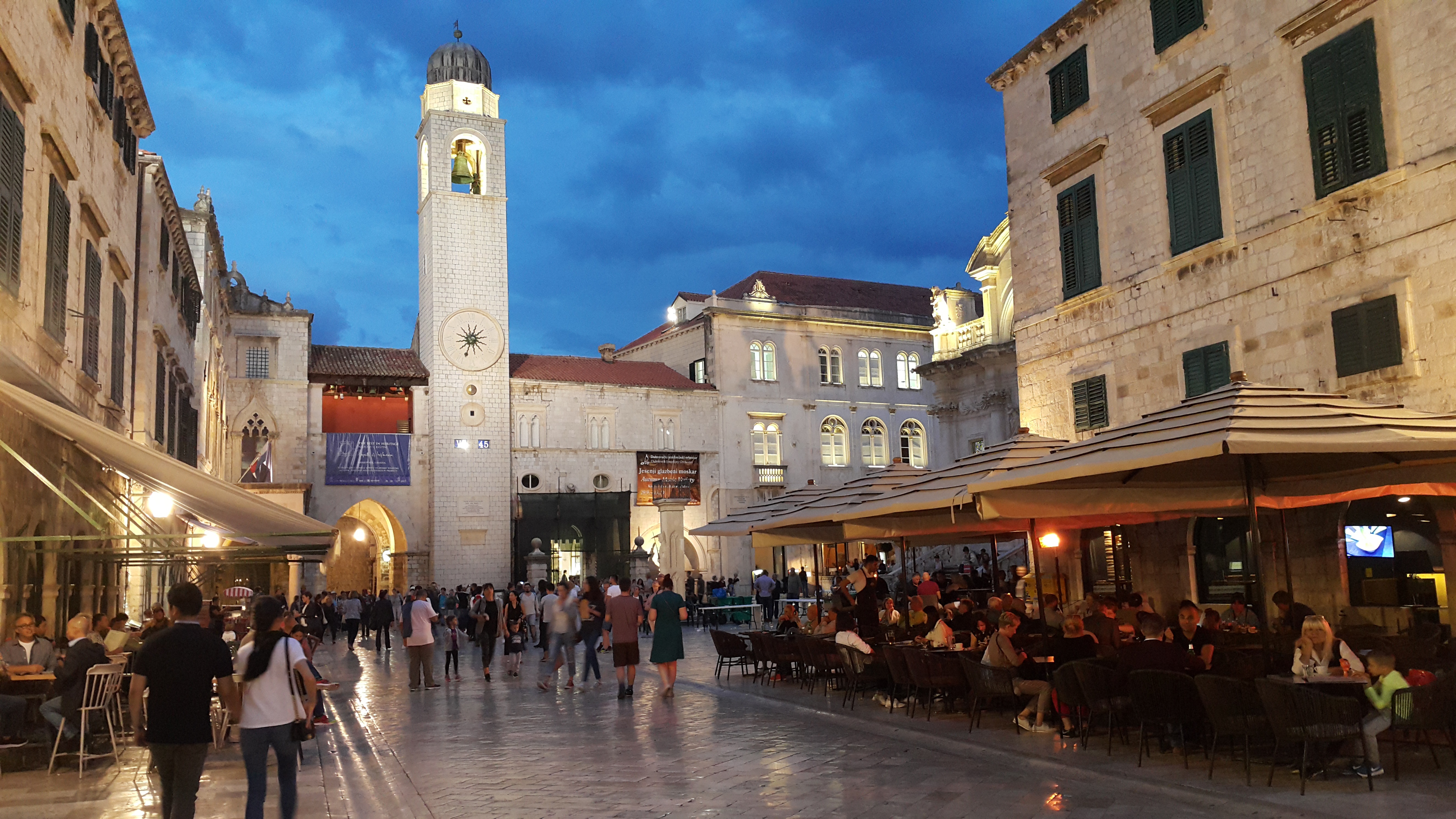
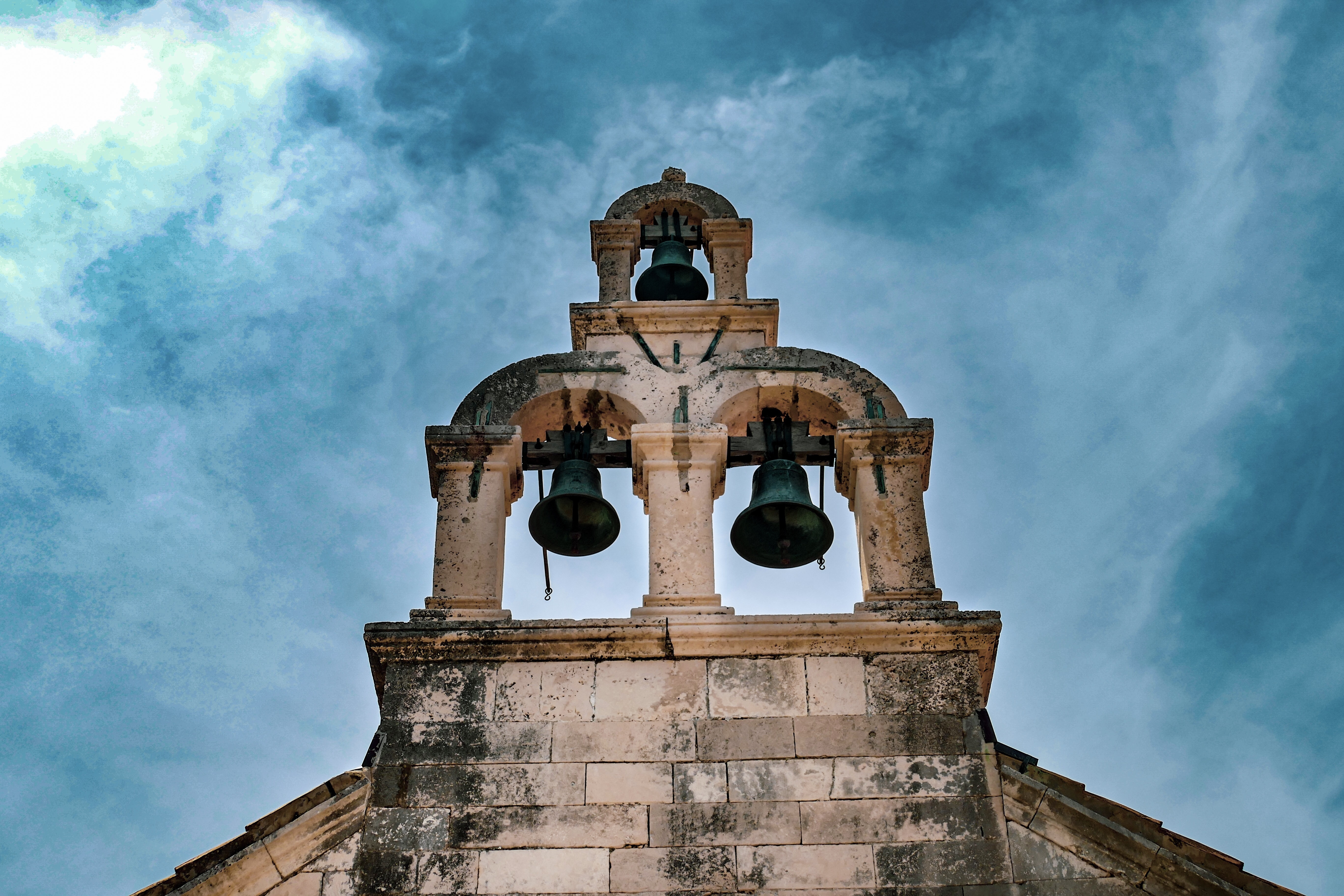
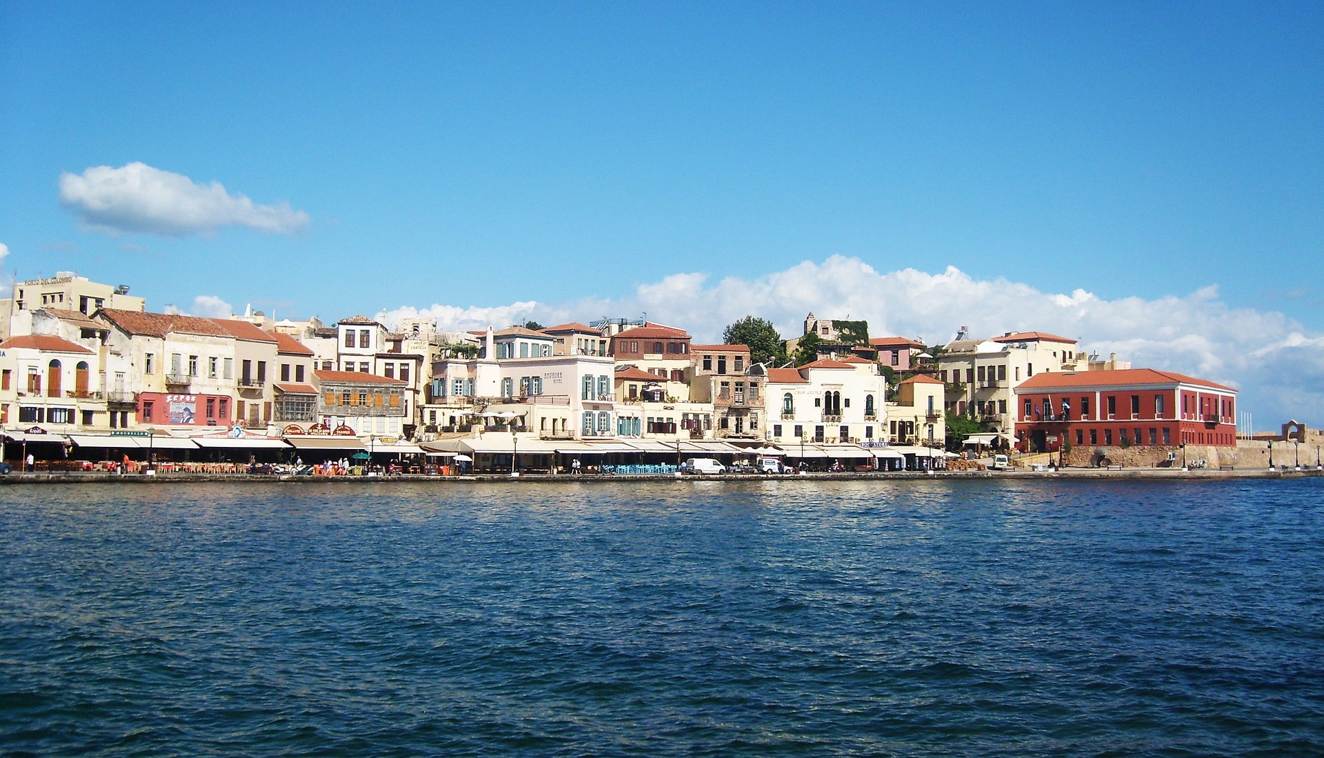
About Dubrovnik
Nothing can prepare you for your first sight of Dubrovnik. Lying 216 km (135 miles) southeast of Split and commanding a jaw-dropping coastal location, it is one of the world's most beautiful fortified cities. Its massive stone ramparts and fortress towers curve around a tiny harbor, enclosing graduated ridges of sun-bleached orange-tiled roofs, copper domes, and elegant bell towers. Your imagination will run wild picturing what it looked like seven centuries ago when the walls were built, without any suburbs or highways around it, just this magnificent stone city rising out of the sea.In the 7th century AD, residents of the Roman city Epidaurum (now Cavtat) fled the Avars and Slavs of the north and founded a new settlement on a small rocky island, which they named Laus, and later Ragusa. On the mainland hillside opposite the island, the Slav settlement called Dubrovnik grew up. In the 12th century the narrow channel separating the two settlements was filled in (now the main street through the Old Town, called Stradun), and Ragusa and Dubrovnik became one. The city was surrounded by defensive walls during the 13th century, and these were reinforced with towers and bastions in the late 15th century.From 1358 to 1808 the city thrived as a powerful and remarkably sophisticated independent republic, reaching its golden age during the 16th century. In 1667 many of its splendid Gothic and Renaissance buildings were destroyed by an earthquake. The defensive walls survived the disaster, and the city was rebuilt in baroque style.Dubrovnik lost its independence to Napoléon in 1808, and in 1815 passed to Austria-Hungary. During the 20th century, as part of Yugoslavia, the city became a popular tourist destination, and in 1979 it was listed as a UNESCO World Heritage Site. During the war for independence, it came under heavy siege. Thanks to careful restoration, few traces of damage remain; however, there are maps inside the Pile and Ploče Gates illustrating the points around the city where damage was done. It’s only when you experience Dubrovnik yourself that you can understand what a treasure the world nearly lost
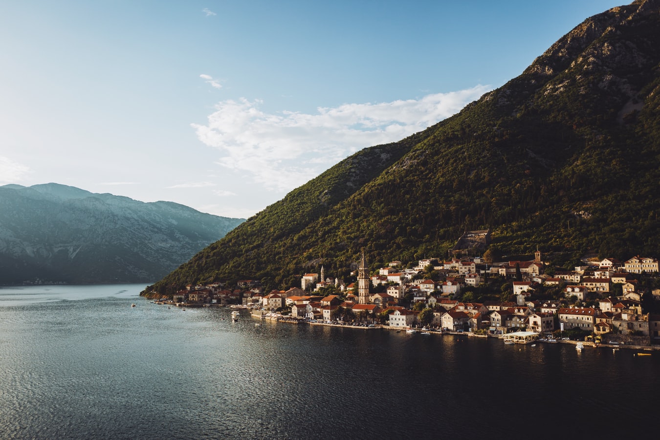
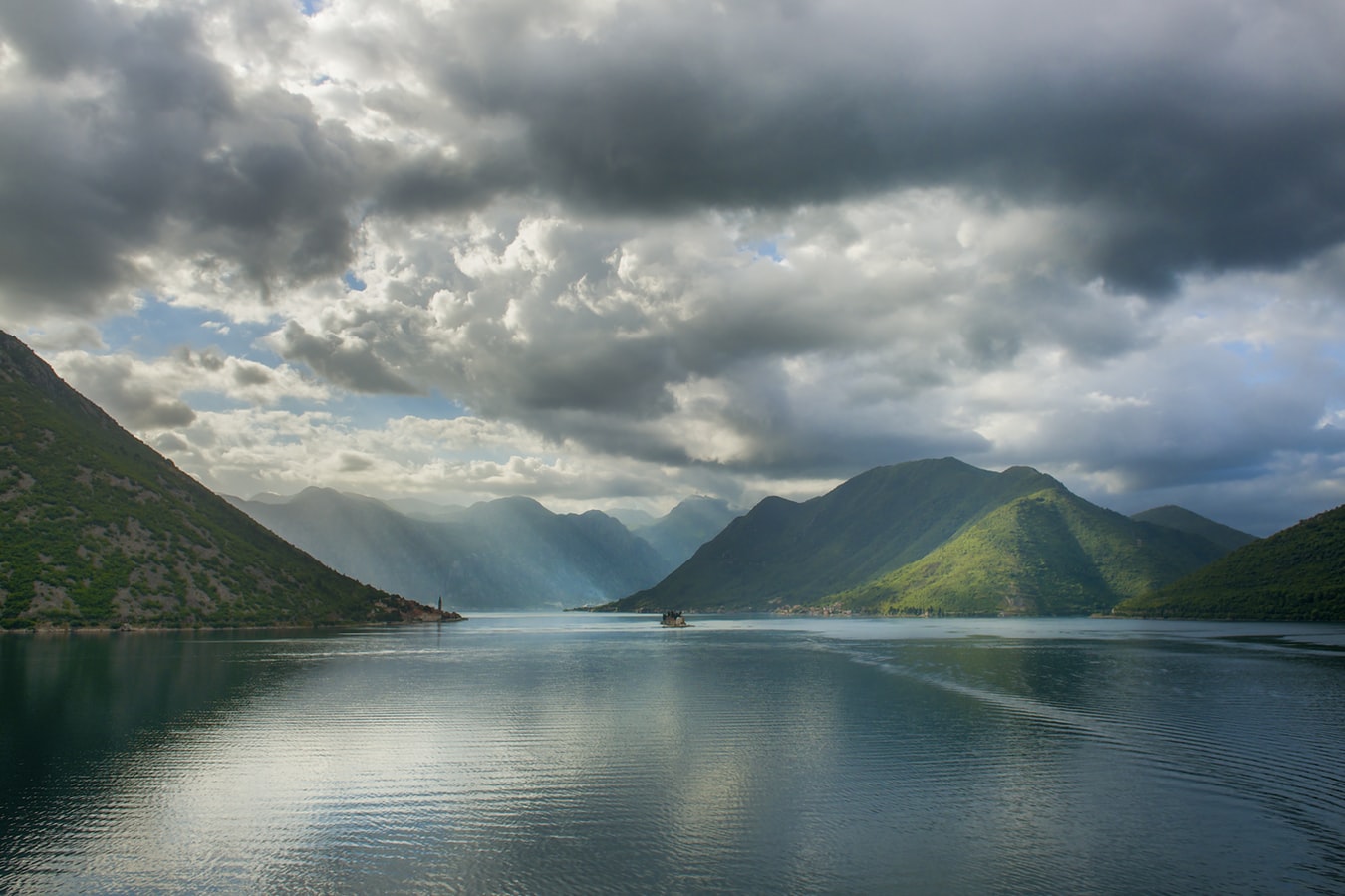
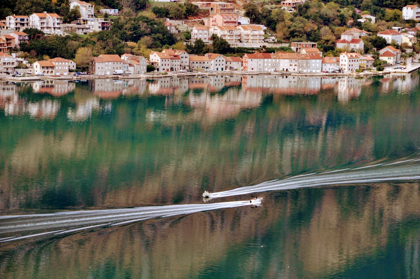
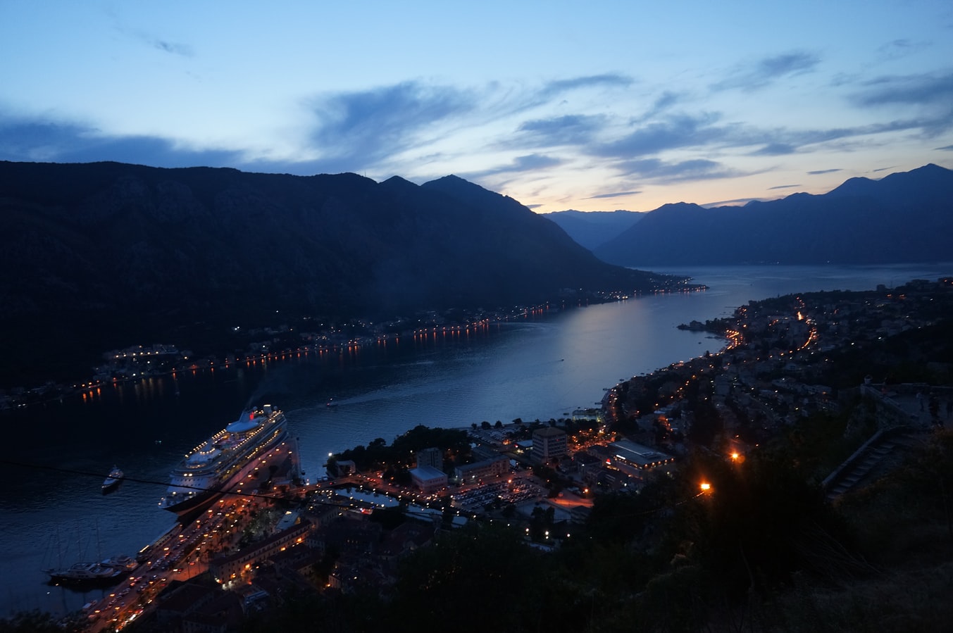
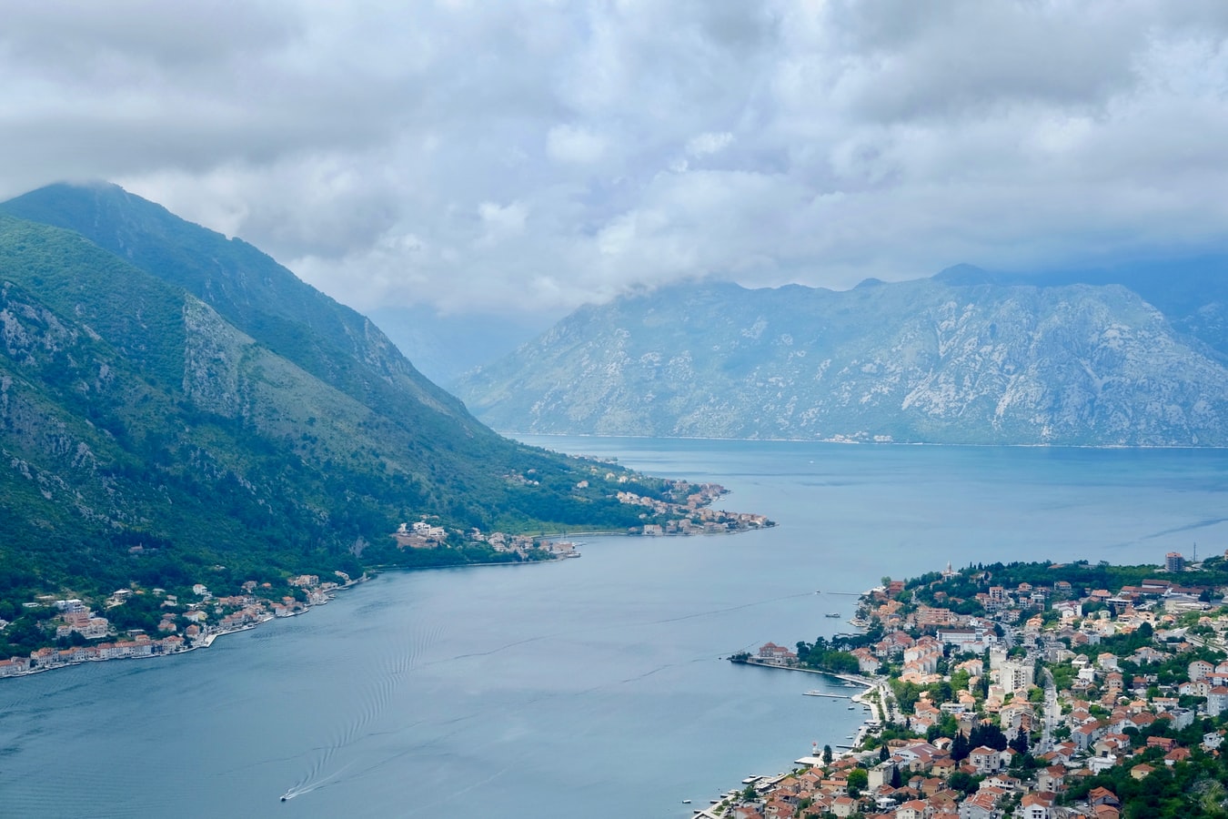
About Kotor
Backed by imposing mountains, tiny Kotor lies hidden from the open sea, tucked into the deepest channel of the Bokor Kotorska (Kotor Bay), which is Europe's most southerly fjord. To many, this town is more charming than its sister UNESCO World Heritage Site, Dubrovnik, retaining more authenticity, but with fewer tourists and spared the war damage and subsequent rebuilding which has given Dubrovnik something of a Disney feel.Kotor's medieval Stari Grad (Old Town) is enclosed within well-preserved defensive walls built between the 9th and 18th centuries and is presided over by a proud hilltop fortress. Within the walls, a labyrinth of winding cobbled streets leads through a series of splendid paved piazzas, rimmed by centuries-old stone buildings. The squares are now haunted by strains from buskers but although many now house trendy cafés and chic boutiques, directions are still given medieval-style by reference to the town’s landmark churches.In the Middle Ages, as Serbia's chief port, Kotor was an important economic and cultural center with its own highly regarded schools of stonemasonry and iconography. From 1391 to 1420 it was an independent city-republic and later, it spent periods under Venetian, Austrian, and French rule, though it was undoubtedly the Venetians who left the strongest impression on the city's architecture. Since the breakup of Yugoslavia, some 70% of the stone buildings in the romantic Old Town have been snapped up by foreigners, mostly Brits and Russians. Porto Montenegro, a new marina designed to accommodate some of the world’s largest super yachts, opened in nearby Tivat in 2011, and along the bay are other charming seaside villages, all with better views of the bay than the vista from Kotor itself where the waterside is congested with cruise ships and yachts. Try sleepy Muo or the settlement of Prčanj in one direction around the bay, or Perast and the Roman mosaics of Risan in the other direction.
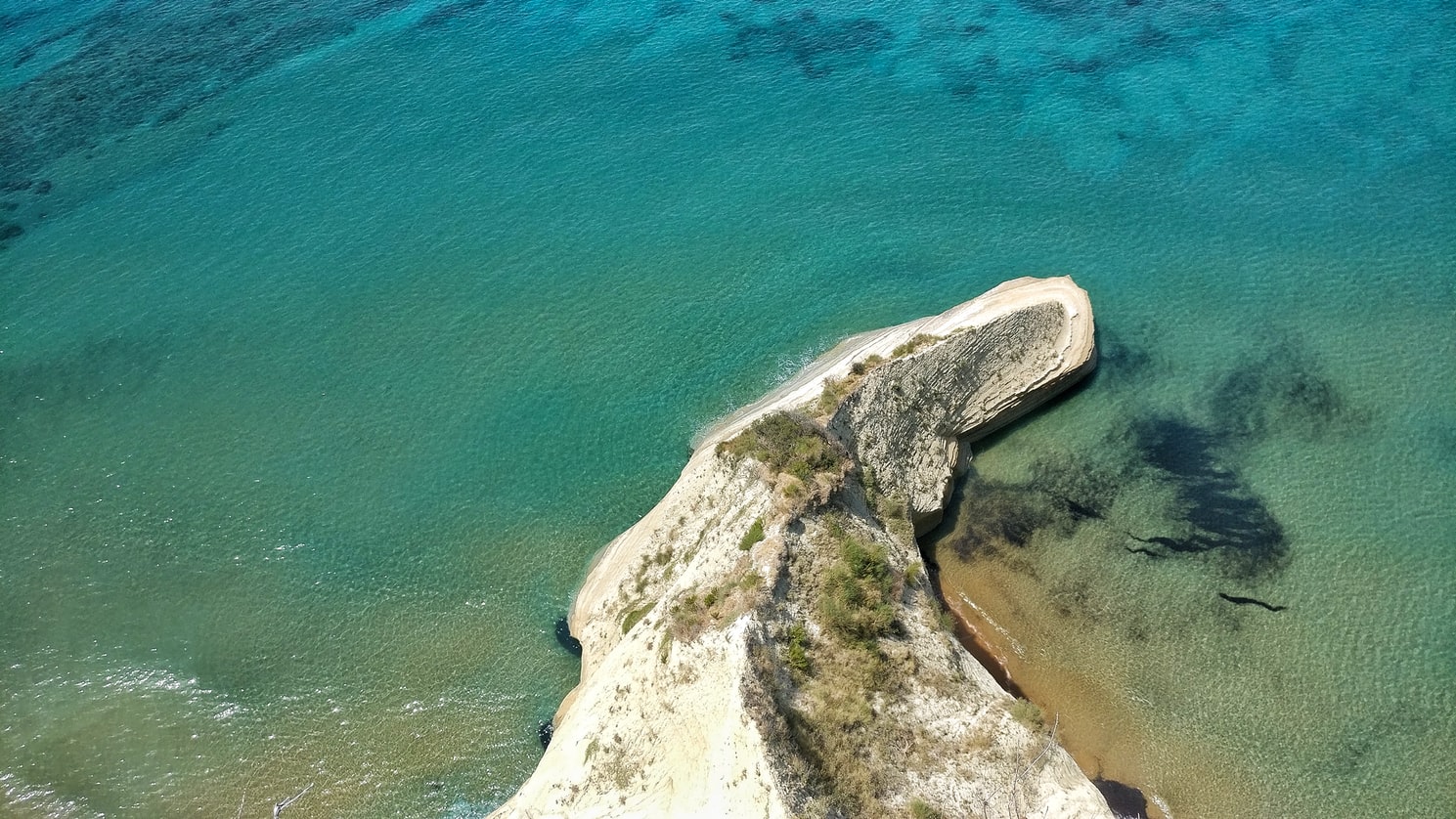
About Corfu
Corfu town today is a vivid tapestry of cultures—a sophisticated weave, where charm, history, and natural beauty blend. Located about midway along the island's east coast, this spectacularly lively capital is the cultural heart of Corfu and has a remarkable historic center that UNESCO designated as a World Heritage Site in 2007. All ships and planes dock or land near Corfu town, which occupies a small peninsula jutting into the Ionian Sea.Whether arriving by ferry from mainland Greece or Italy, from another island, or directly by plane, catch your breath by first relaxing with a coffee or a gelato in Corfu town's shaded Liston Arcade, then stroll the narrow lanes of its pedestrians-only quarter. For an overview of the immediate area, and a quick tour of Mon Repos palace, hop on the little tourist train that runs from May to September. Corfu town has a different feel at night, so book a table at one of its famed tavernas to savor the island's unique cuisine.The best way to get around Corfu town is on foot. The town is small enough so that you can easily walk to every sight. There are local buses, but they do not thread their way into the streets (many now car-free) of the historic center. If you are arriving by ferry or plane, it's best to take a taxi to your hotel. Expect to pay about €10 from the airport or ferry terminal to a hotel in Corfu town. If there are no taxis waiting, you can call for one.
About Katakolon
Katakolon could not seem less of a cruise port if it tried. A tiny enclave clinging to the western Peloponnese coast, it's a sleepy place except when ships dock. But it's a popular cruise destination because of its proximity to Olympia. Ancient Olympia was one of the most important cities in classical Greece. The Sanctuary of Zeus was the city's raison d'être, and attracted pilgrims from around the eastern Mediterranean, and later the city played host to Olympic Games, the original athletic games that were the inspiration for today's modern sporting pan-planetary meet. At the foot of the tree-covered Kronion hill, in a valley near two rivers, Katakolon is today one of the most popular ancient sites in Greece. If you don't want to make the trip to Olympia, then Katakolon is an ideal place for a leisurely Greek lunch while you watch the fishermen mend their nets, but there's just not much else to do there.
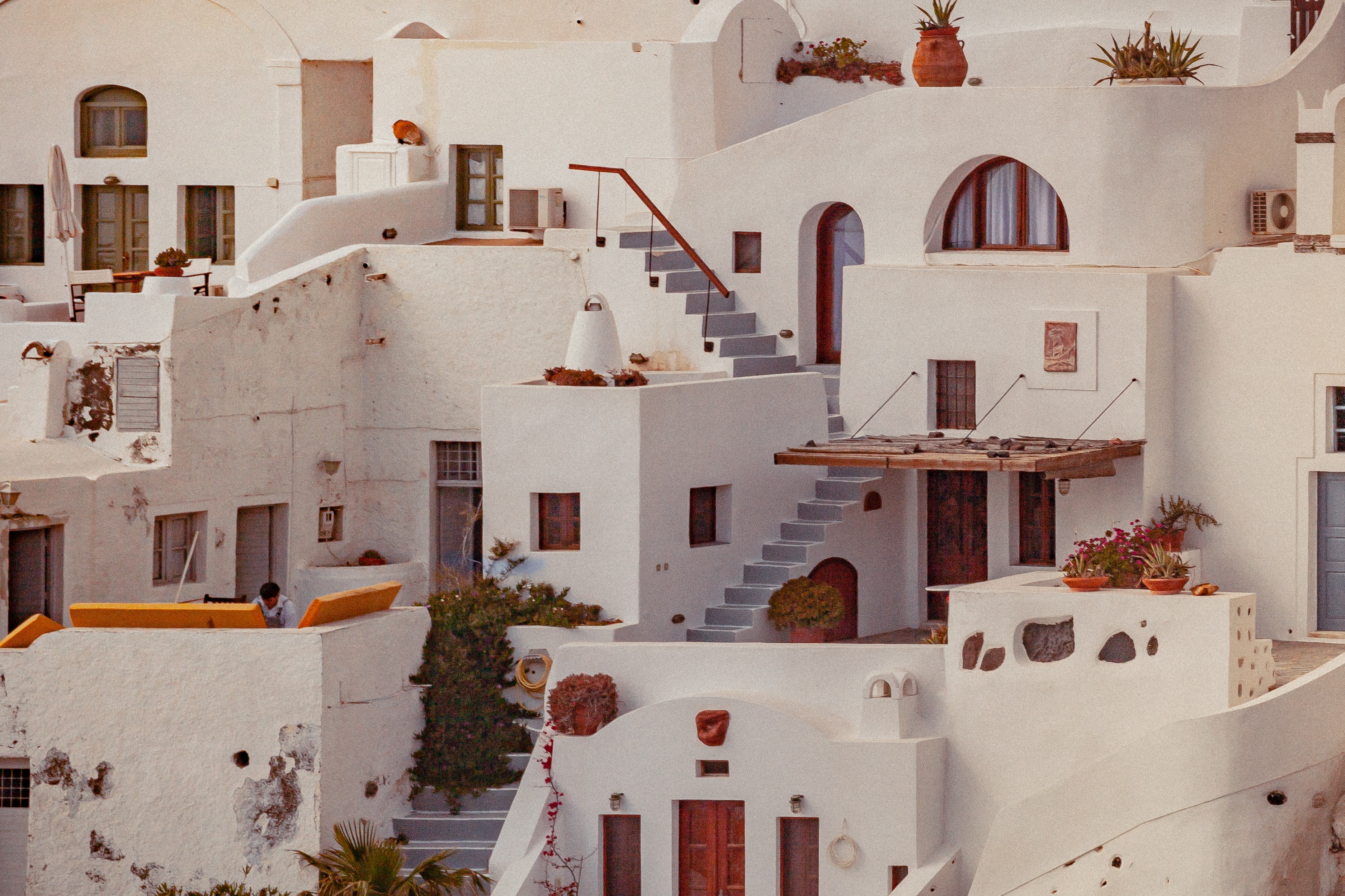
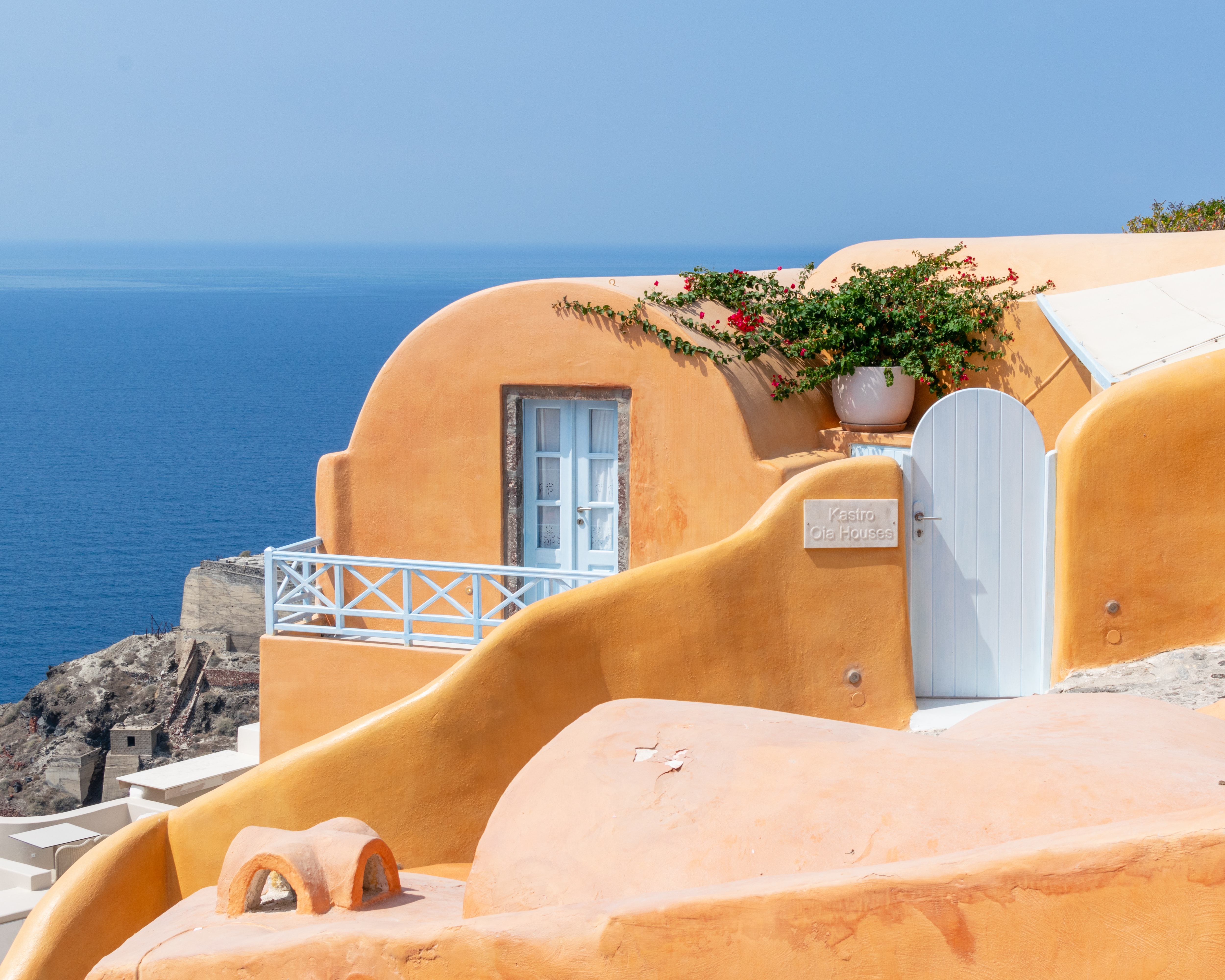
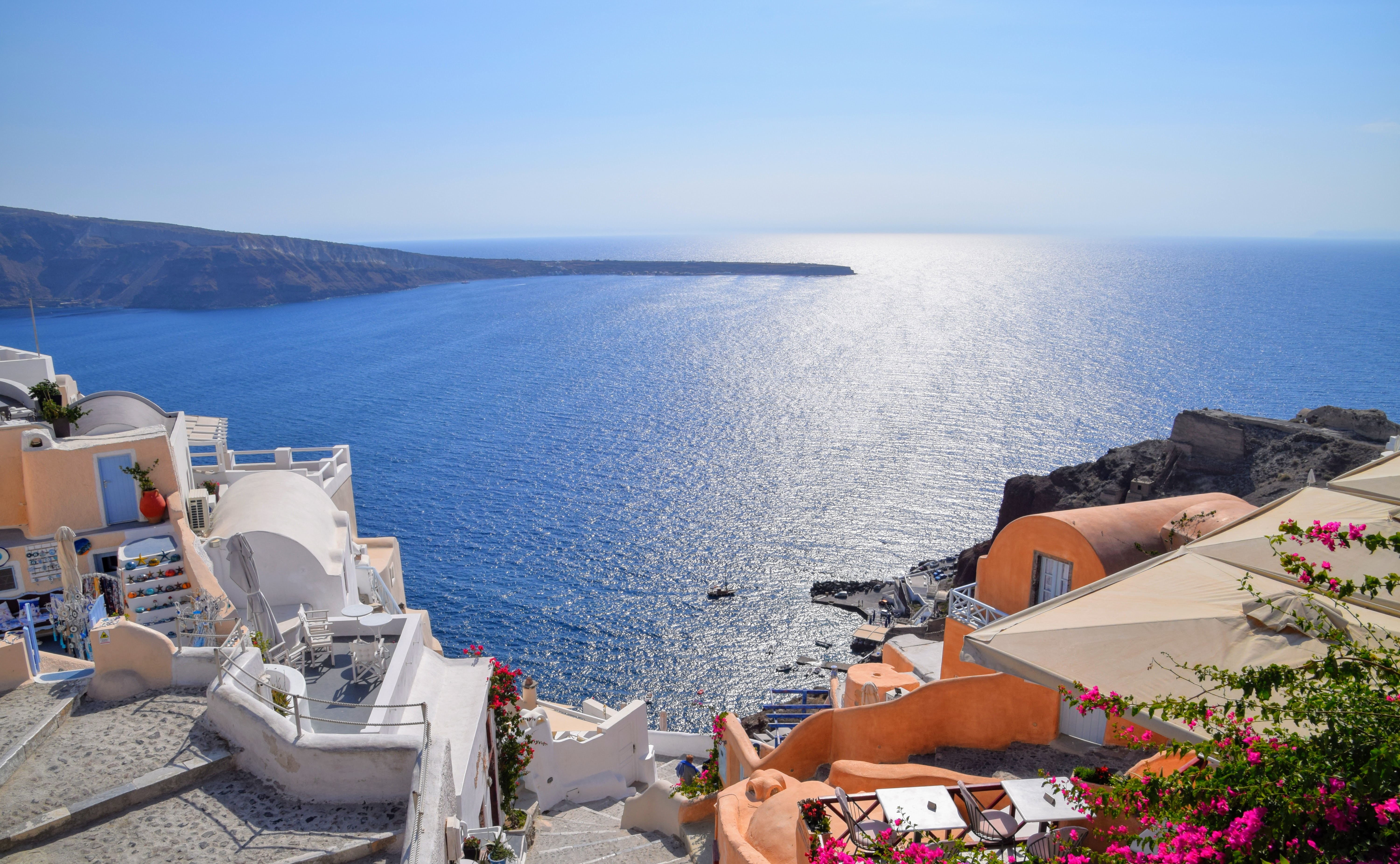
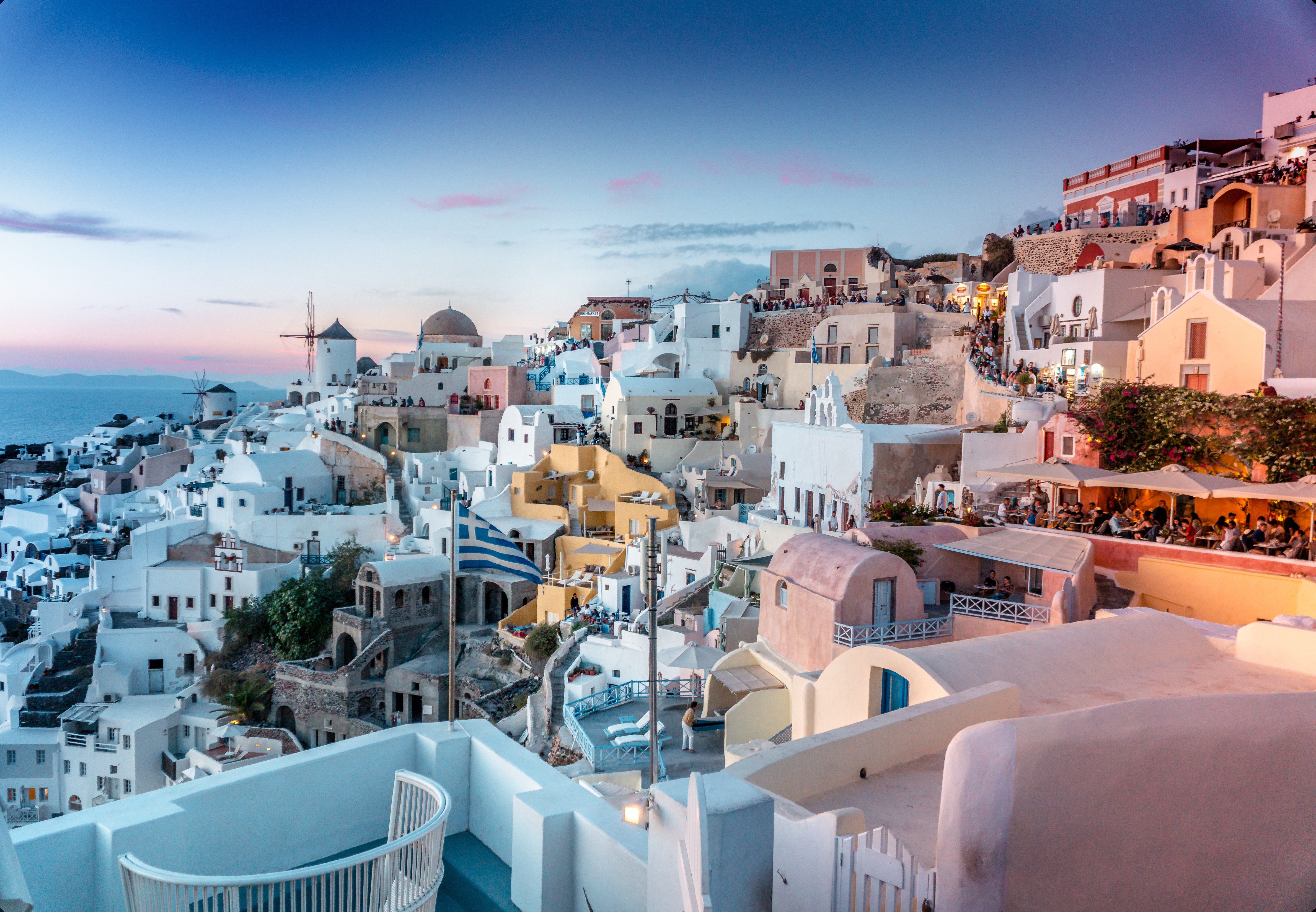
About Santorini
Undoubtedly the most extraordinary island in the Aegean, crescent-shape Santorini remains a mandatory stop on the Cycladic tourist route—even if it's necessary to enjoy the sensational sunsets from Ia, the fascinating excavations, and the dazzling white towns with a million other travelers. Called Kállisti (the "Loveliest") when first settled, the island has now reverted to its subsequent name of Thira, after the 9th-century-BC Dorian colonizer Thiras. The place is better known, however, these days as Santorini, a name derived from its patroness, St. Irene of Thessaloniki, the Byzantine empress who restored icons to Orthodoxy and died in 802. You can fly conveniently to Santorini, but to enjoy a true Santorini rite of passage, opt instead for the boat trip here, which provides a spectacular introduction. After the boat sails between Sikinos and Ios, your deck-side perch approaches two close islands with a passage between them. The bigger one on the left is Santorini, and the smaller on the right is Thirassia. Passing between them, you see the village of Ia adorning Santorini's northernmost cliff like a white geometric beehive. You are in the caldera (volcanic crater), one of the world's truly breathtaking sights: a demilune of cliffs rising 1,100 feet, with the white clusters of the towns of Fira and Ia perched along the top. The bay, once the high center of the island, is 1,300 feet in some places, so deep that when boats dock in Santorini's shabby little port of Athinios, they do not drop anchor. The encircling cliffs are the ancient rim of a still-active volcano, and you are sailing east across its flooded caldera. On your right are the Burnt isles, the White isle, and other volcanic remnants, all lined up as if some outsize display in a geology museum. Hephaestus's subterranean fires smolder still—the volcano erupted in 198 BC, about 735, and there was an earthquake in 1956. Indeed, Santorini and its four neighboring islets are the fragmentary remains of a larger landmass that exploded about 1600 BC: the volcano's core blew sky high, and the sea rushed into the abyss to create the great bay, which measures 10 km by 7 km (6 mi by 4½ mi) and is 1,292 feet deep. The other pieces of the rim, which broke off in later eruptions, are Thirassia, where a few hundred people live, and deserted little Aspronissi ("White isle"). In the center of the bay, black and uninhabited, two cones, the Burnt Isles of Palea Kameni and Nea Kameni, appeared between 1573 and 1925. There has been too much speculation about the identification of Santorini with the mythical Atlantis, mentioned in Egyptian papyri and by Plato (who says it's in the Atlantic), but myths are hard to pin down. This is not true of old arguments about whether tidal waves from Santorini's cataclysmic explosion destroyed Minoan civilization on Crete, 113 km (70 mi) away. The latest carbon-dating evidence, which points to a few years before 1600 BC for the eruption, clearly indicates that the Minoans outlasted the eruption by a couple of hundred years, but most probably in a weakened state. In fact, the island still endures hardships: since antiquity, Santorini has depended on rain collected in cisterns for drinking and irrigating—the well water is often brackish—and the serious shortage is alleviated by the importation of water. However, the volcanic soil also yields riches: small, intense tomatoes with tough skins used for tomato paste (good restaurants here serve them); the famous Santorini fava beans, which have a light, fresh taste; barley; wheat; and white-skin eggplants.
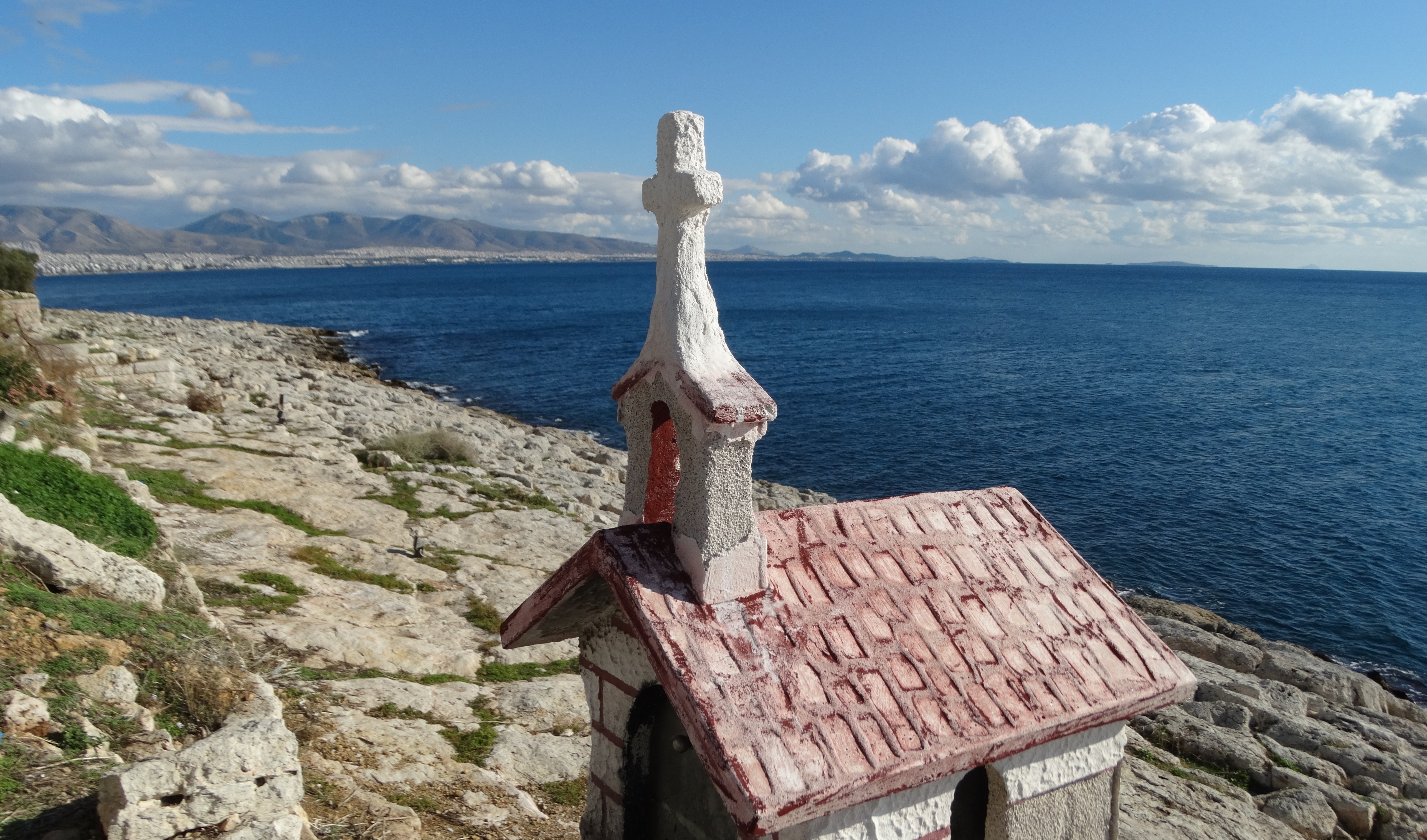
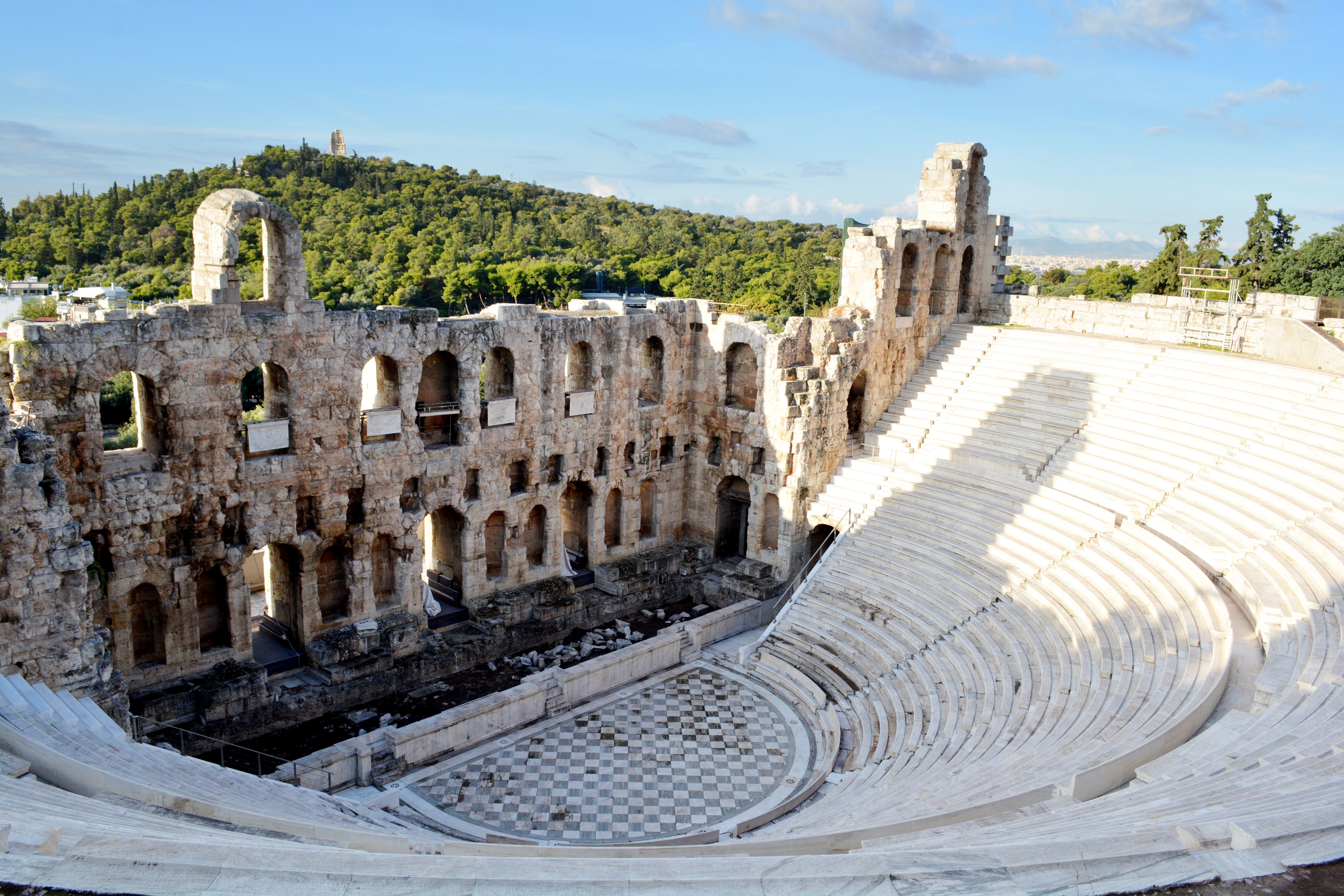
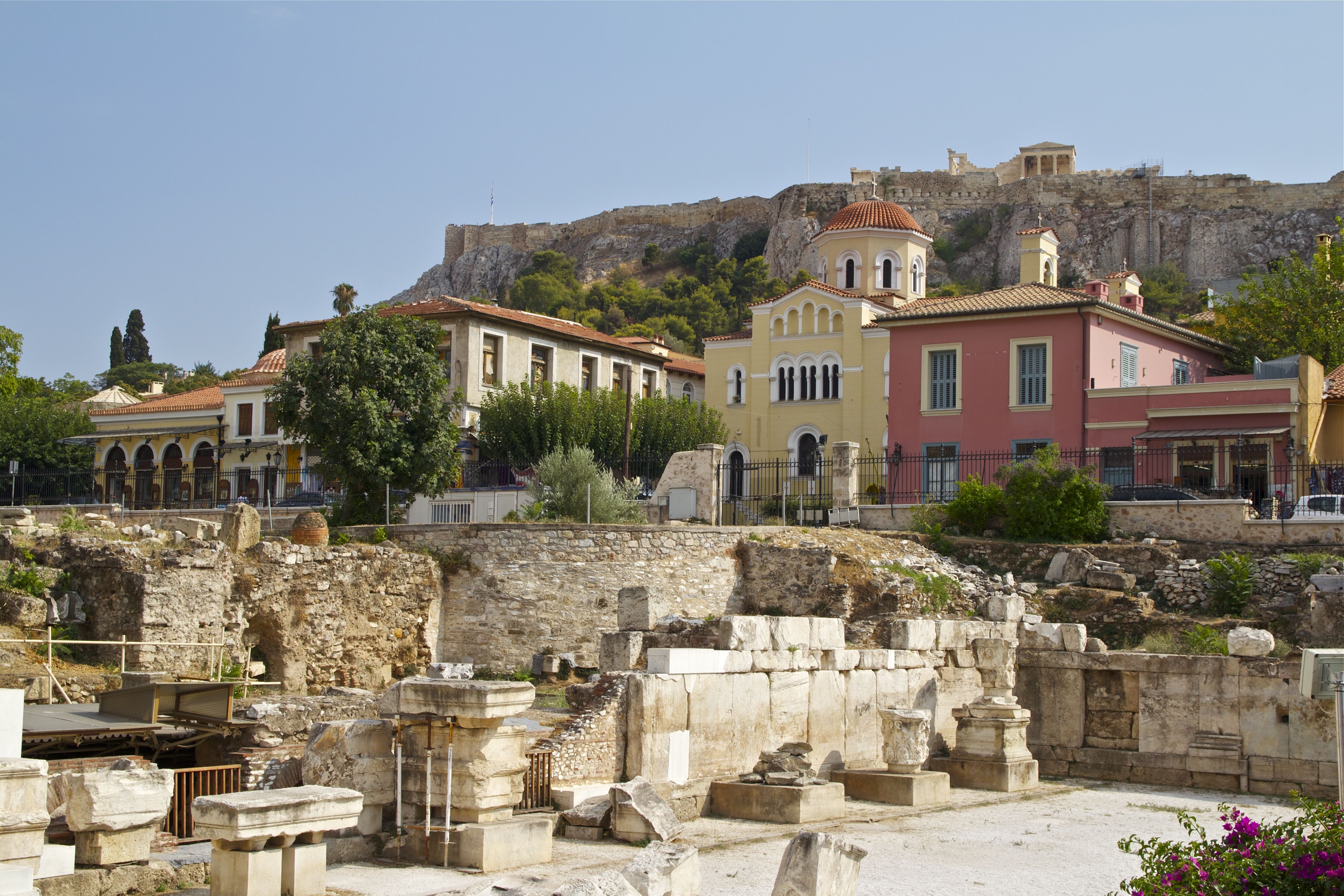
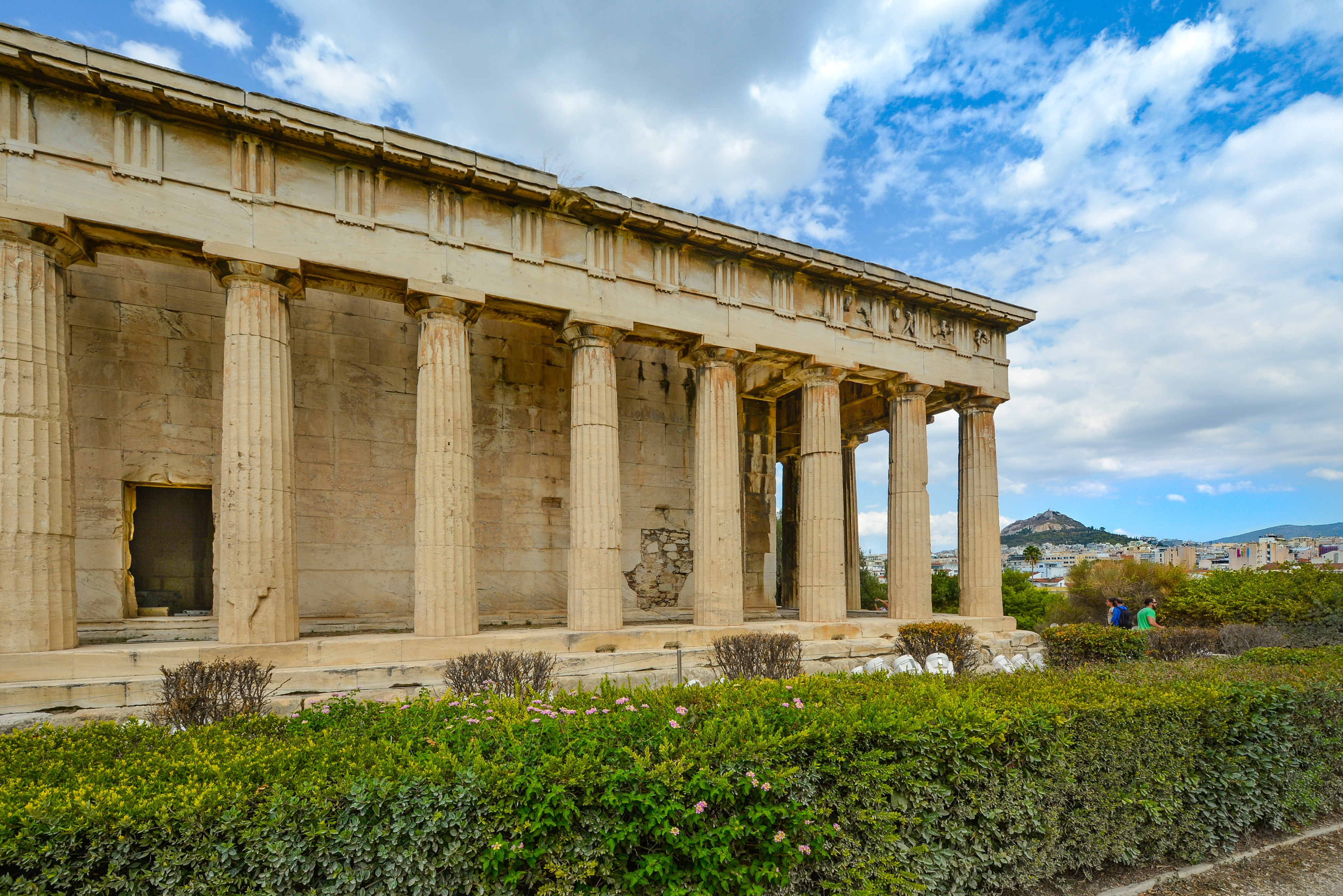
About Piraeus
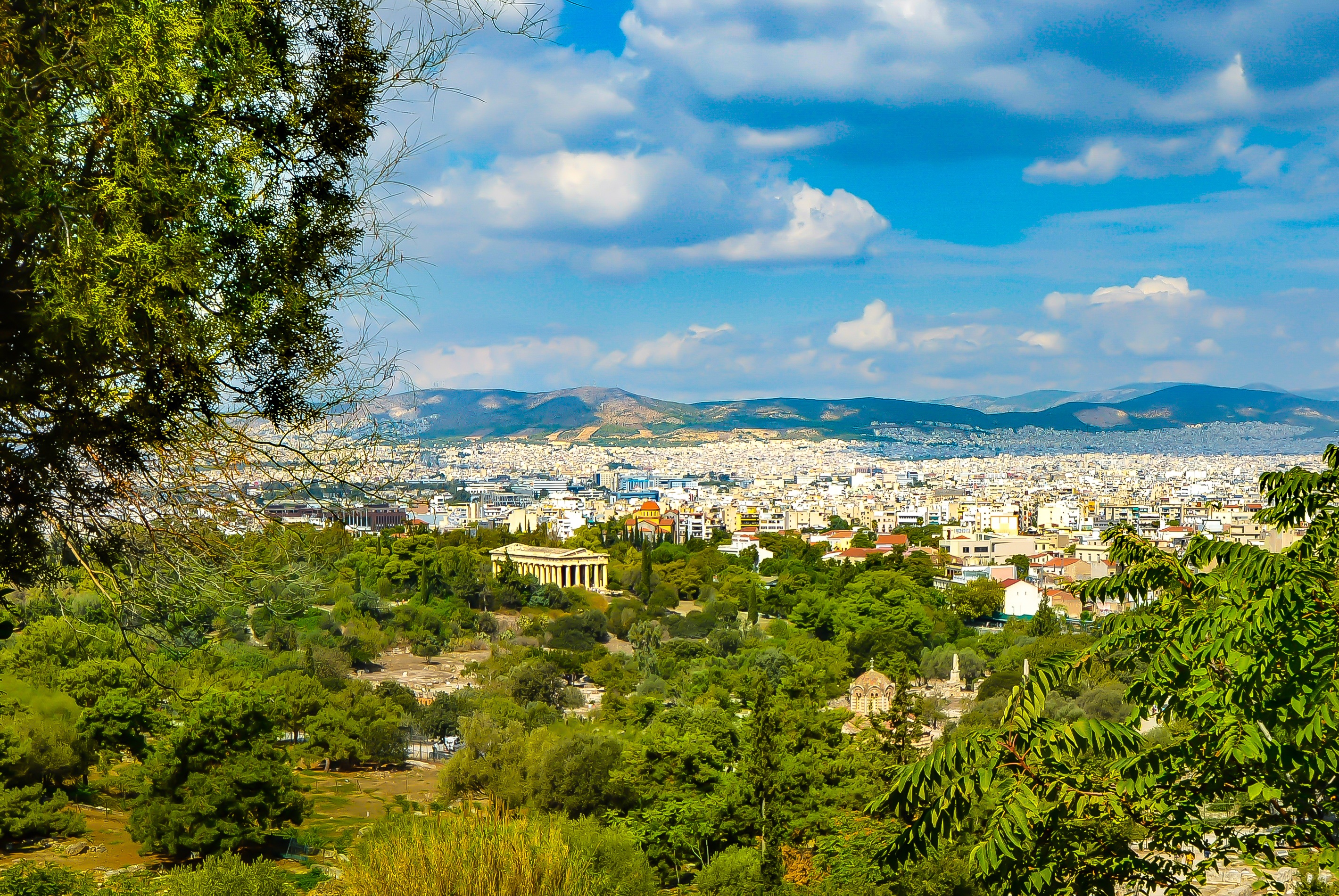
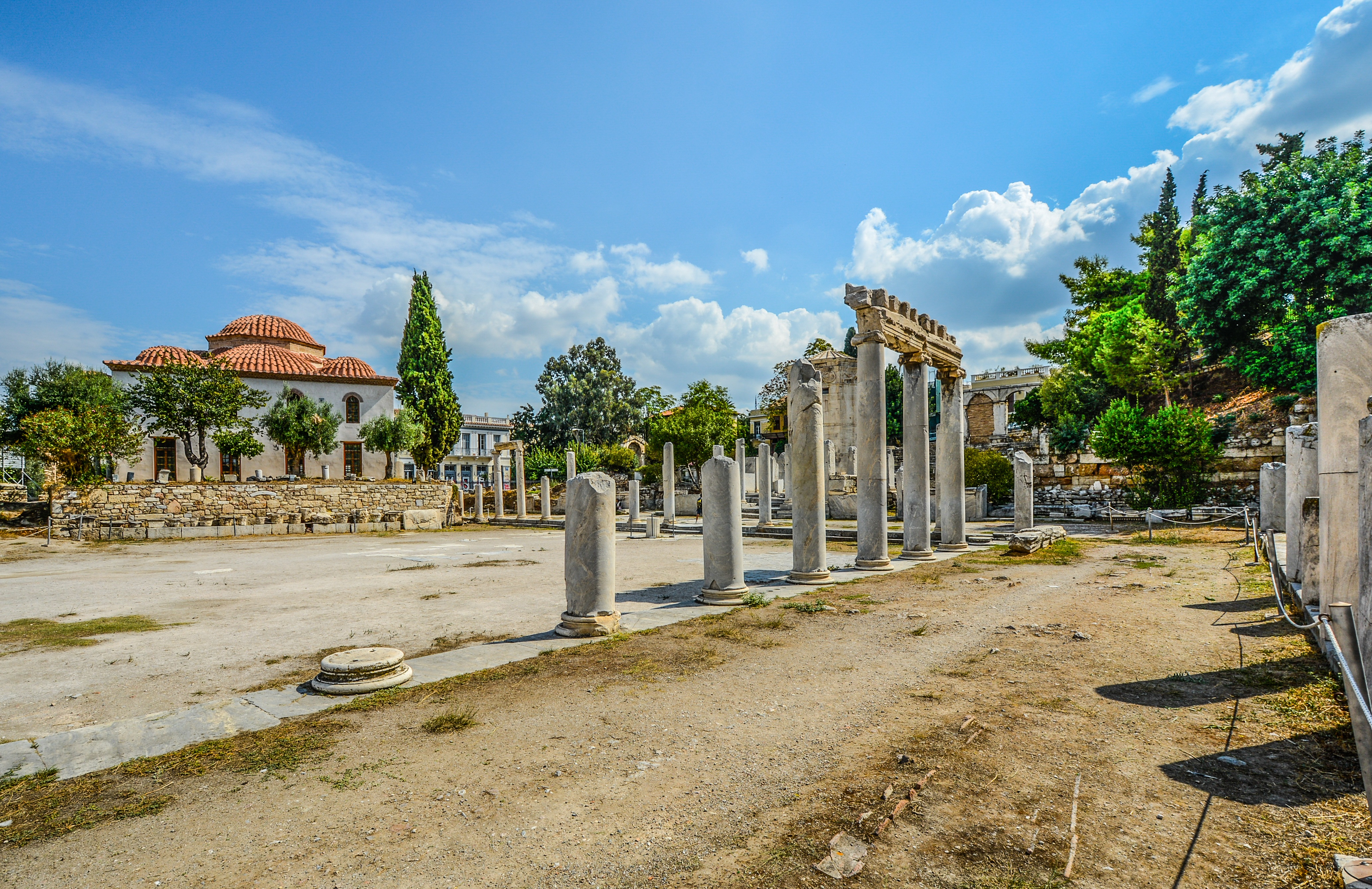
It's no wonder that all roads lead to the fascinating and maddening metropolis of Athens. Lift your eyes 200 feet above the city to the Parthenon, its honey-color marble columns rising from a massive limestone base, and you behold architectural perfection that has not been surpassed in 2,500 years. But, today, this shrine of classical form dominates a 21st-century boomtown. To experience Athens—Athína in Greek—fully is to understand the essence of Greece: ancient monuments surviving in a sea of cement, startling beauty amid the squalor, tradition juxtaposed with modernity. Locals depend on humor and flexibility to deal with the chaos; you should do the same. The rewards are immense. Although Athens covers a huge area, the major landmarks of the ancient Greek, Roman, and Byzantine periods are close to the modern city center. You can easily walk from the Acropolis to many other key sites, taking time to browse in shops and relax in cafés and tavernas along the way. From many quarters of the city you can glimpse "the glory that was Greece" in the form of the Acropolis looming above the horizon, but only by actually climbing that rocky precipice can you feel the impact of the ancient settlement. The Acropolis and Filopappou, two craggy hills sitting side by side; the ancient Agora (marketplace); and Kerameikos, the first cemetery, form the core of ancient and Roman Athens. Along the Unification of Archaeological Sites promenade, you can follow stone-paved, tree-lined walkways from site to site, undisturbed by traffic. Cars have also been banned or reduced in other streets in the historical center. In the National Archaeological Museum, vast numbers of artifacts illustrate the many millennia of Greek civilization; smaller museums such as the Goulandris Museum of Cycladic Art Museum and the Byzantine and Christian Museum illuminate the history of particular regions or periods. Athens may seem like one huge city, but it is really a conglomeration of neighborhoods with distinctive characters. The Eastern influences that prevailed during the 400-year rule of the Ottoman Empire are still evident in Monastiraki, the bazaar area near the foot of the Acropolis. On the northern slope of the Acropolis, stroll through Plaka (if possible by moonlight), an area of tranquil streets lined with renovated mansions, to get the flavor of the 19th-century's gracious lifestyle. The narrow lanes of Anafiotika, a section of Plaka, thread past tiny churches and small, color-washed houses with wooden upper stories, recalling a Cycladic island village. In this maze of winding streets, vestiges of the older city are everywhere: crumbling stairways lined with festive tavernas; dank cellars filled with wine vats; occasionally a court or diminutive garden, enclosed within high walls and filled with magnolia trees and the flaming trumpet-shaped flowers of hibiscus bushes. Formerly run-down old quarters, such as Thission, Gazi and Psirri, popular nightlife areas filled with bars and mezedopoleia (similar to tapas bars), are now in the process of gentrification, although they still retain much of their original charm, as does the colorful produce and meat market on Athinas. The area around Syntagma Square, the tourist hub, and Omonia Square, the commercial heart of the city about 1 km (½ mi) northwest, is distinctly European, having been designed by the court architects of King Otho, a Bavarian, in the 19th century. The chic shops and bistros of ritzy Kolonaki nestle at the foot of Mt. Lycabettus, Athens's highest hill (909 feet). Each of Athens's outlying suburbs has a distinctive character: in the north is wealthy, tree-lined Kifissia, once a summer resort for aristocratic Athenians, and in the south and southeast lie Glyfada, Voula, and Vouliagmeni, with their sandy beaches, seaside bars, and lively summer nightlife. Just beyond the city's southern fringes is Piraeus, a bustling port city of waterside fish tavernas and Saronic Gulf views.

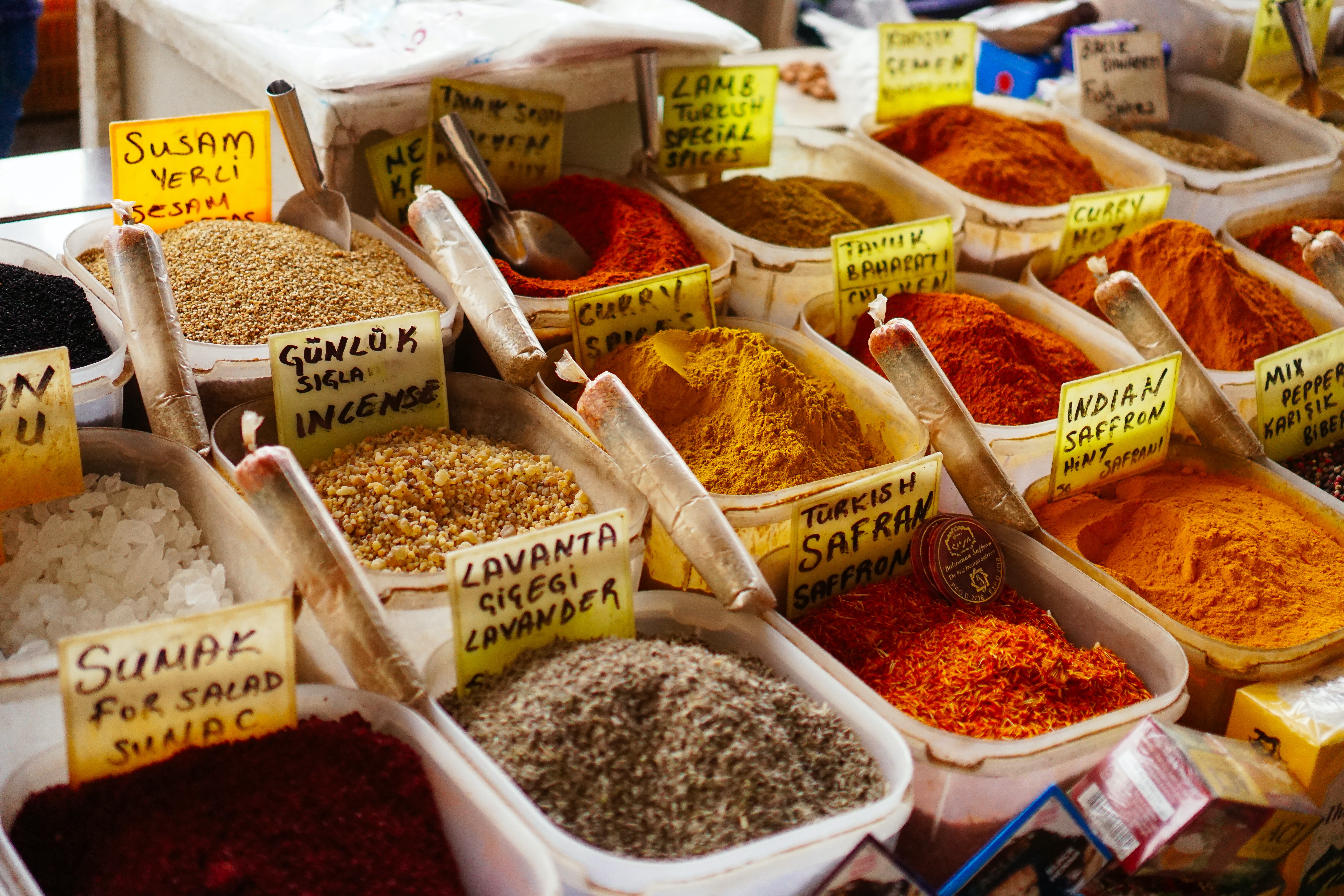
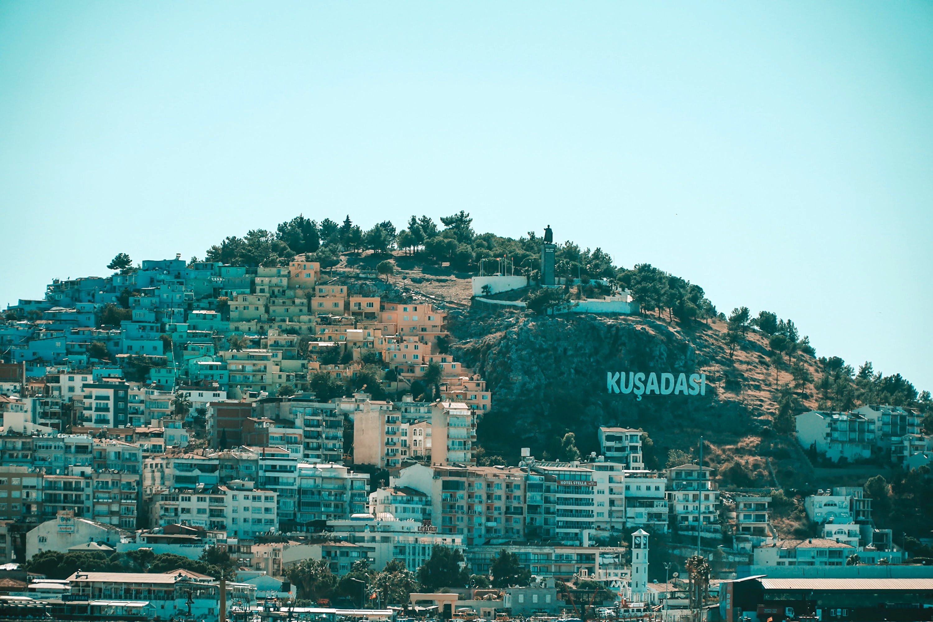
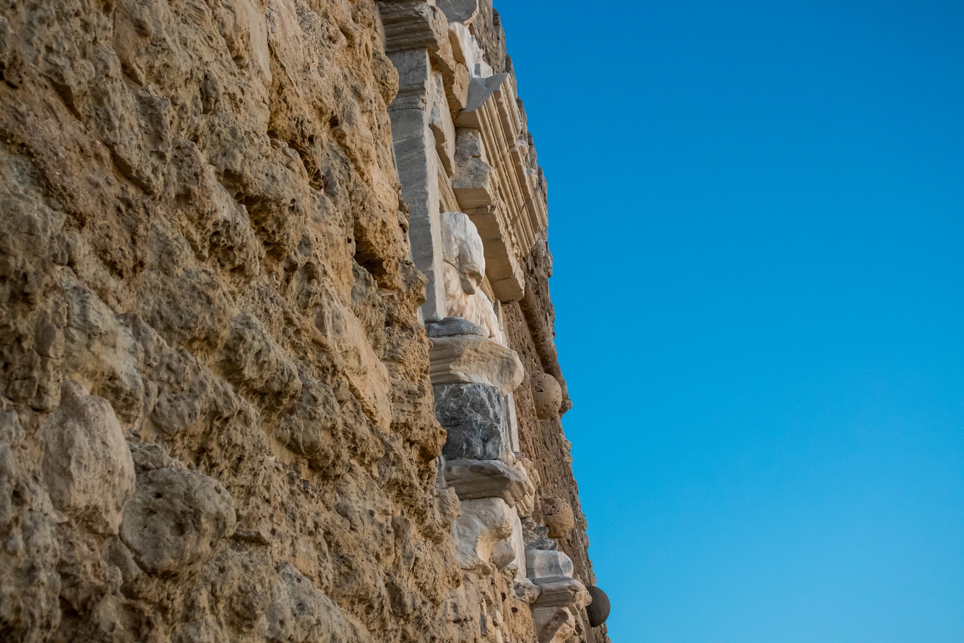
About Kusadasi
Whilst the busy resort town of Kusadasi offers much in the way of shopping and dining – not to mention a flourishing beach life scene, the real jewel here is Ephesus and the stunning ruined city that really take centre stage. With only 20% of the classical ruins having been excavated, this archaeological wonder has already gained the status as Europe’s most complete classical metropolis. And a metropolis it really is; built in the 10th century BC this UNESCO World Heritage site is nothing short of spectacular. Although regrettably very little remains of the Temple of Artemis (one of the seven wonders of the ancient world), the superb Library of Celsus’ façade is practically intact and it is one of life’s great joys to attend an evening performance in the illuminated ruins once all the tourists have left. The history of the city is fascinating and multi-layered and it is well worth reading up on this beforehand if a visit is planned. Another point of interest for historians would be the house of the Virgin Mary, located on the romantically named Mount Nightingale and just nine kilometres away from Ephesus proper. Legend has it that Mary (along with St. John) spent her final years here, secluded from the rest of the population, spreading Christianity. An edifying experience, even for non-believers. For the less historical minded amongst you, Kusadasi offers plenty in the way of activities. After a stroll through the town, jump in a taxi to Ladies’ Beach (men are allowed), sample a Turkish kebap on one of the many beachfront restaurants and enjoy the clement weather. If you do want to venture further afield, then the crystal clear beaches of Guzelcamli (or the Millipark), the cave of Zeus and the white scalloped natural pools at Pamukkale, known as Cleopatra’s pools, are definitely worth a visit.
About Bodrum

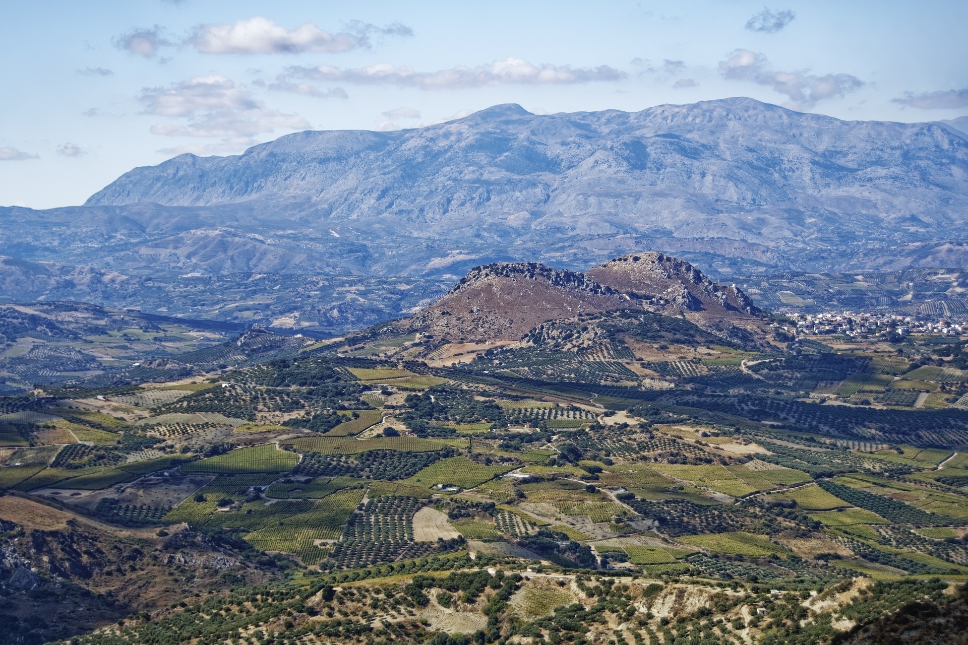
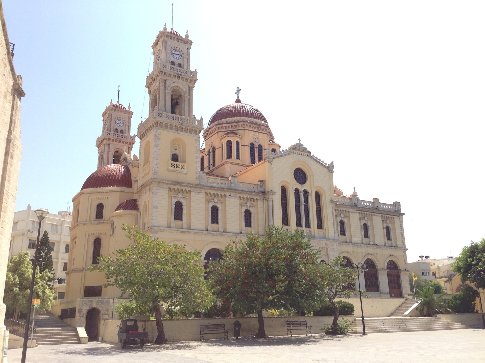
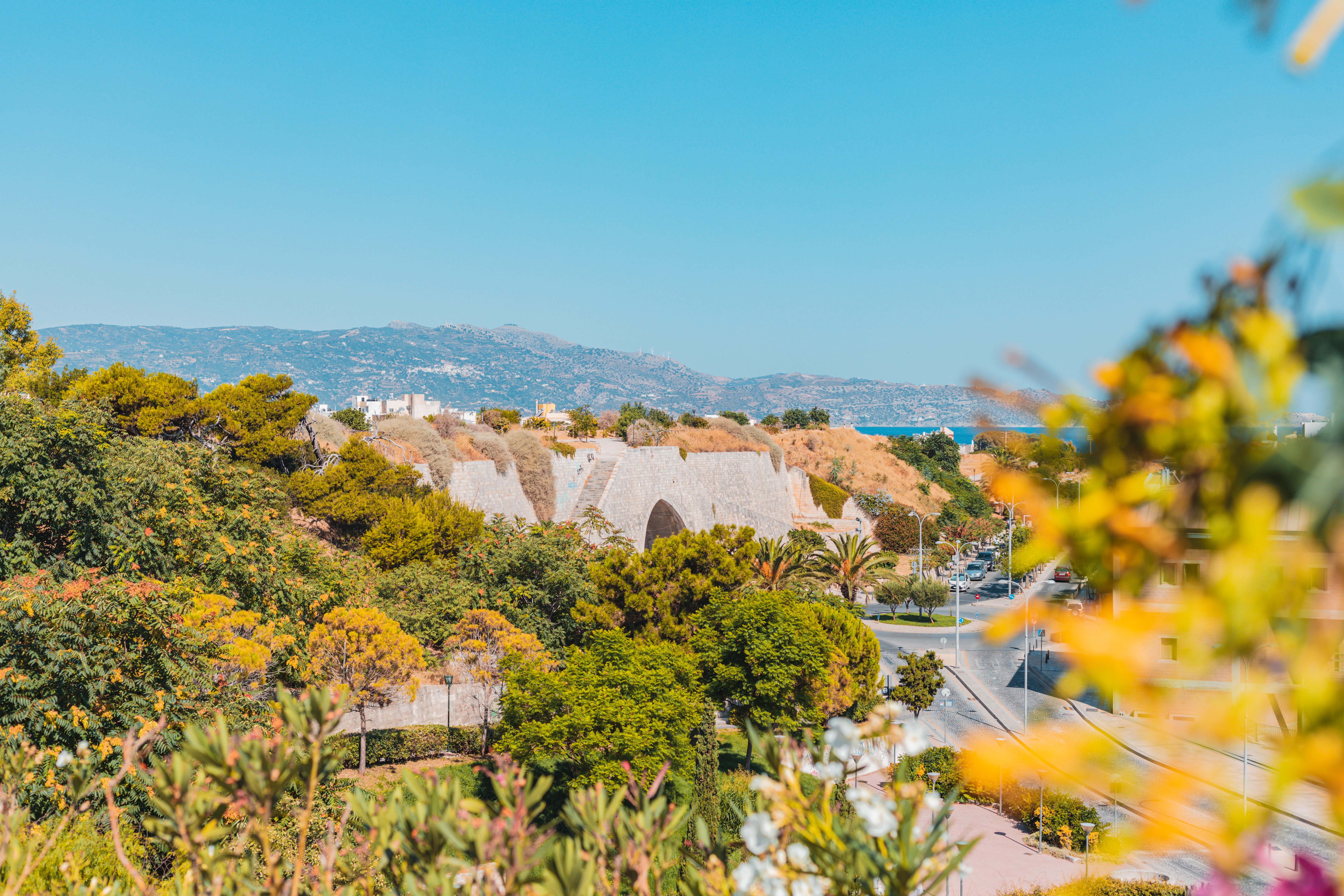
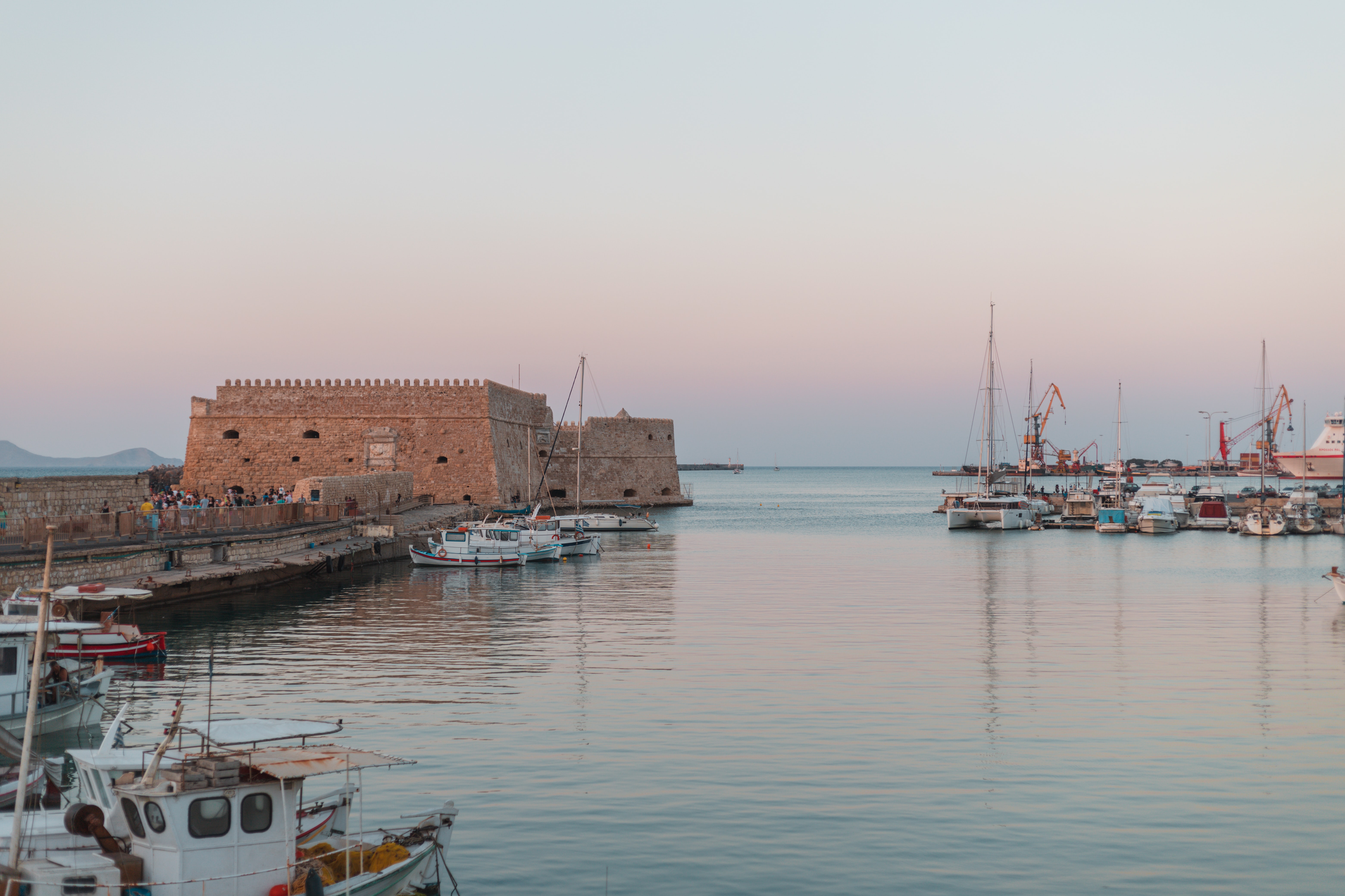
About Heraklion (Iraklion), Crete
Having been controlled by Arabic, Venetian and Ottoman empires over the years - it's no surprise that Heraklion is a diverse patchwork of exotic cultures and historical treasures. Celebrated as the birthplace of the Spanish Renaissance artist, El Greco, you can visit to explore the storied ruins of the Minoan empire's capital, and unearth the rich cultural treasures that Crete’s bustling modern capital has to offer.
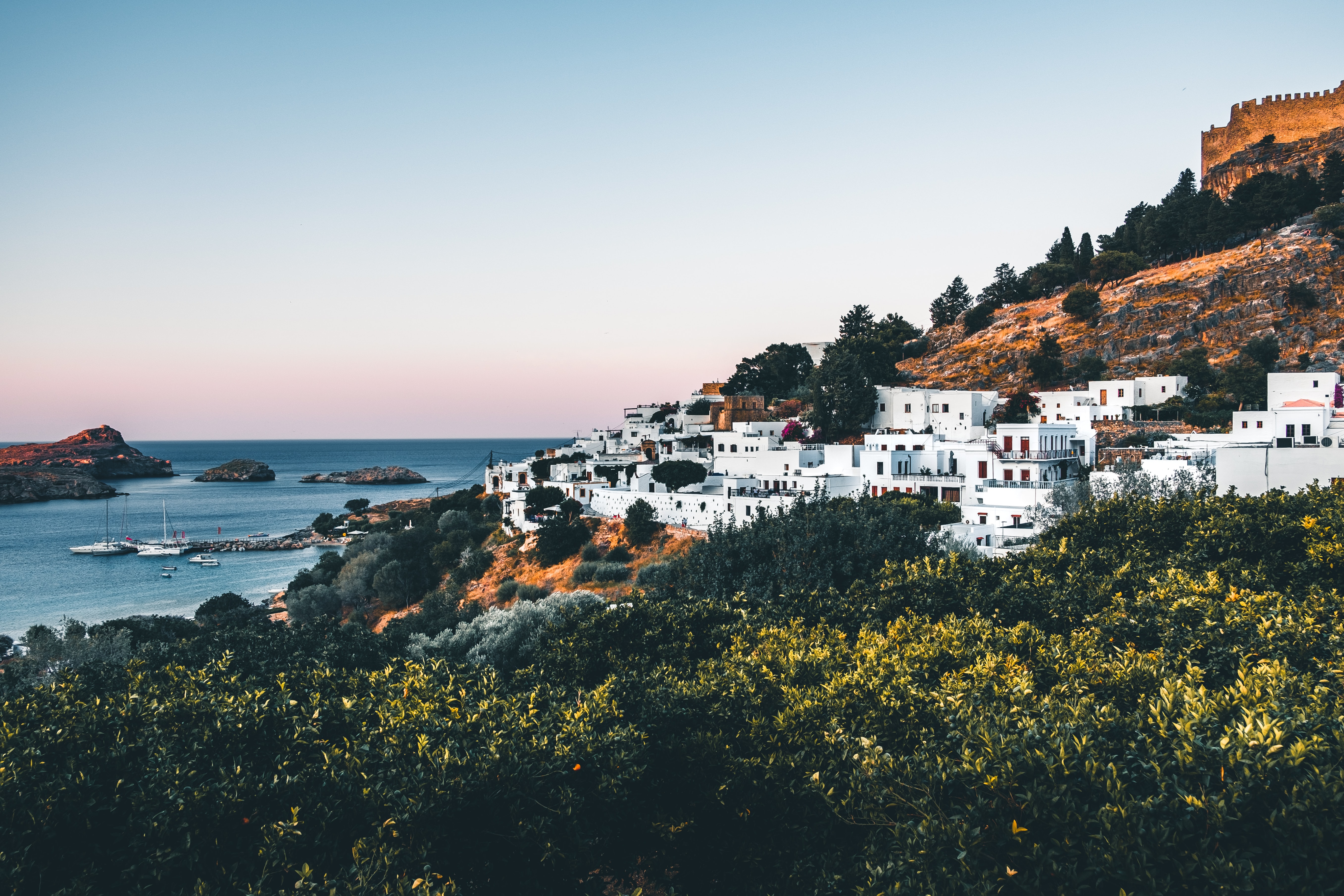
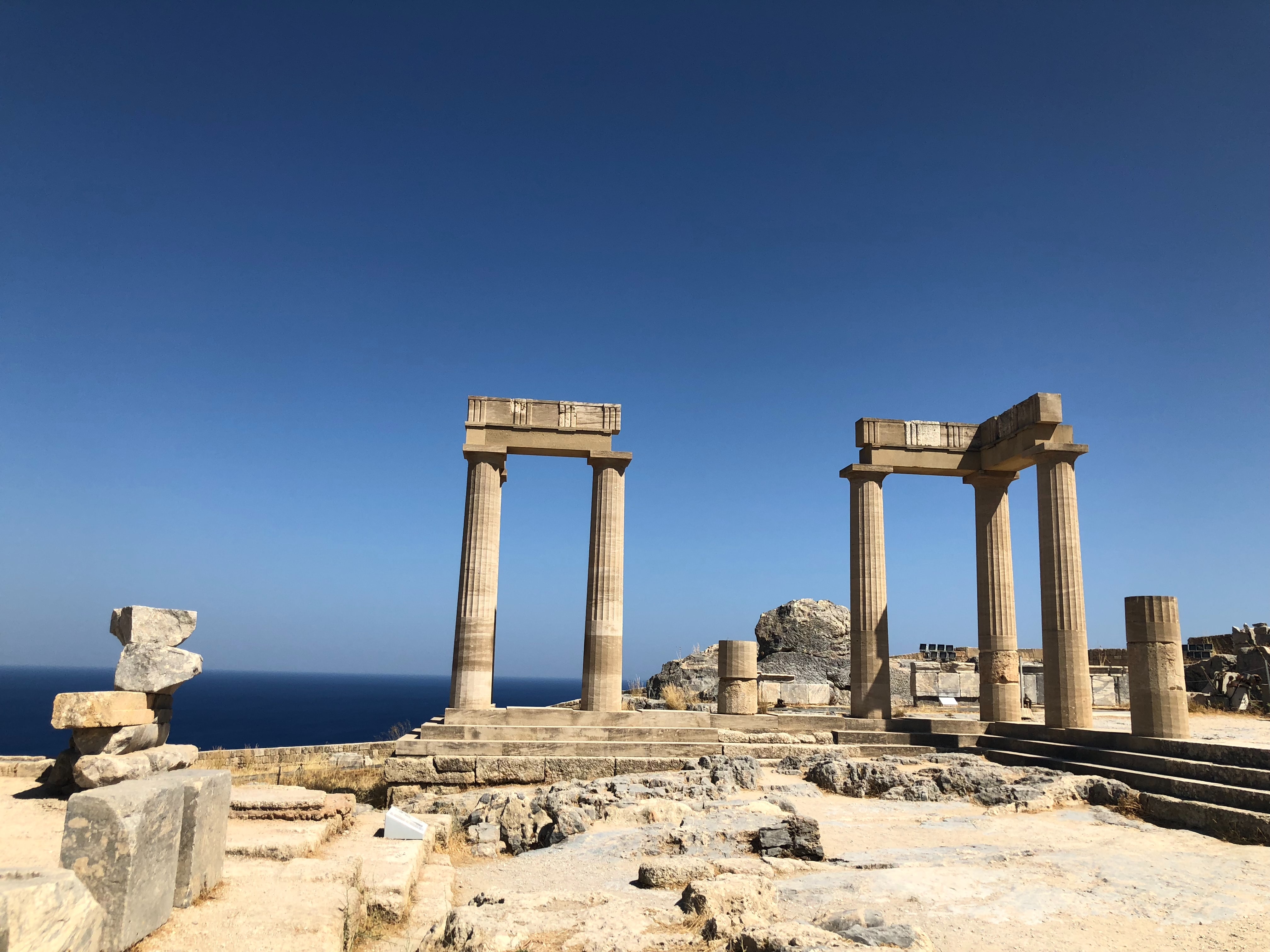
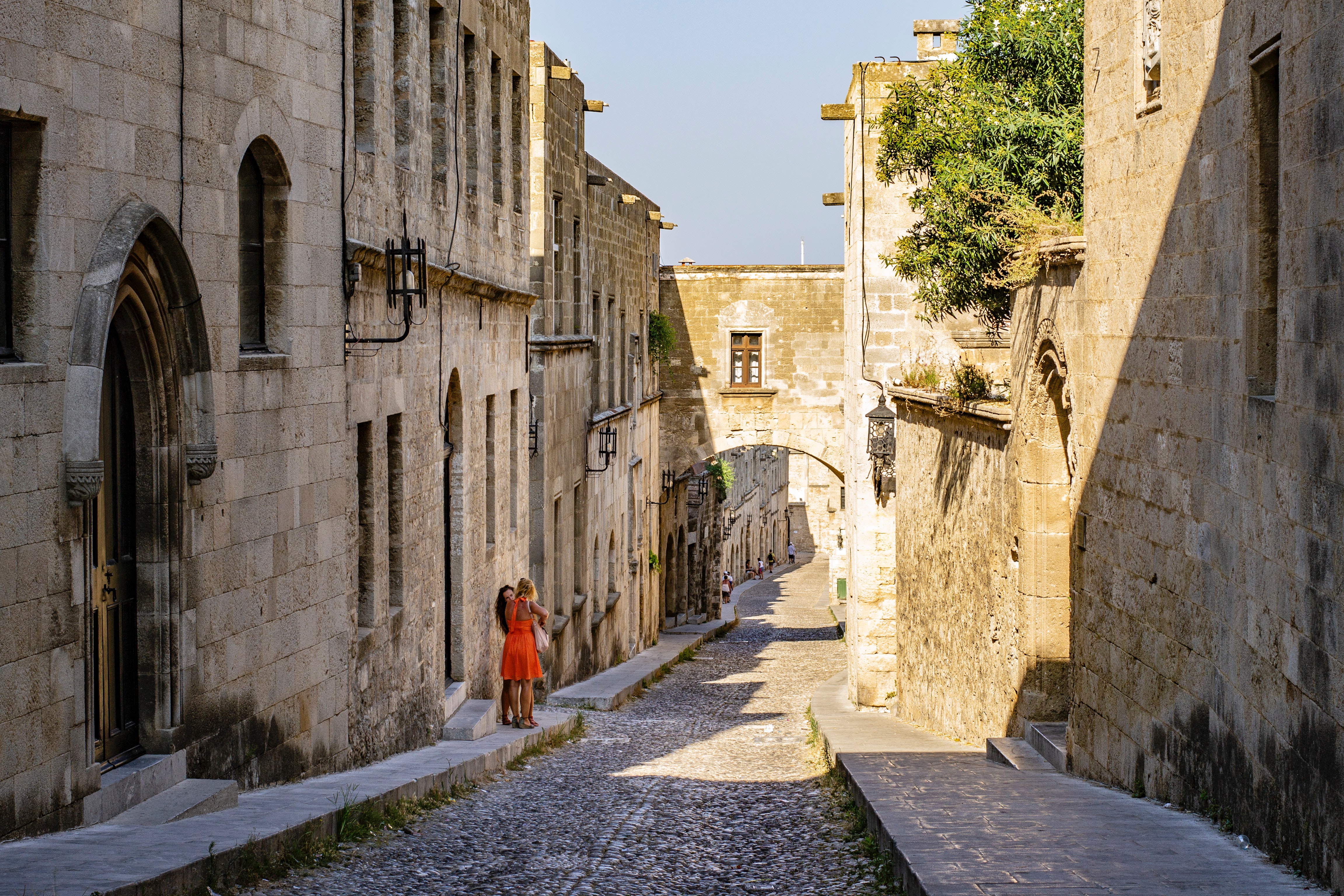
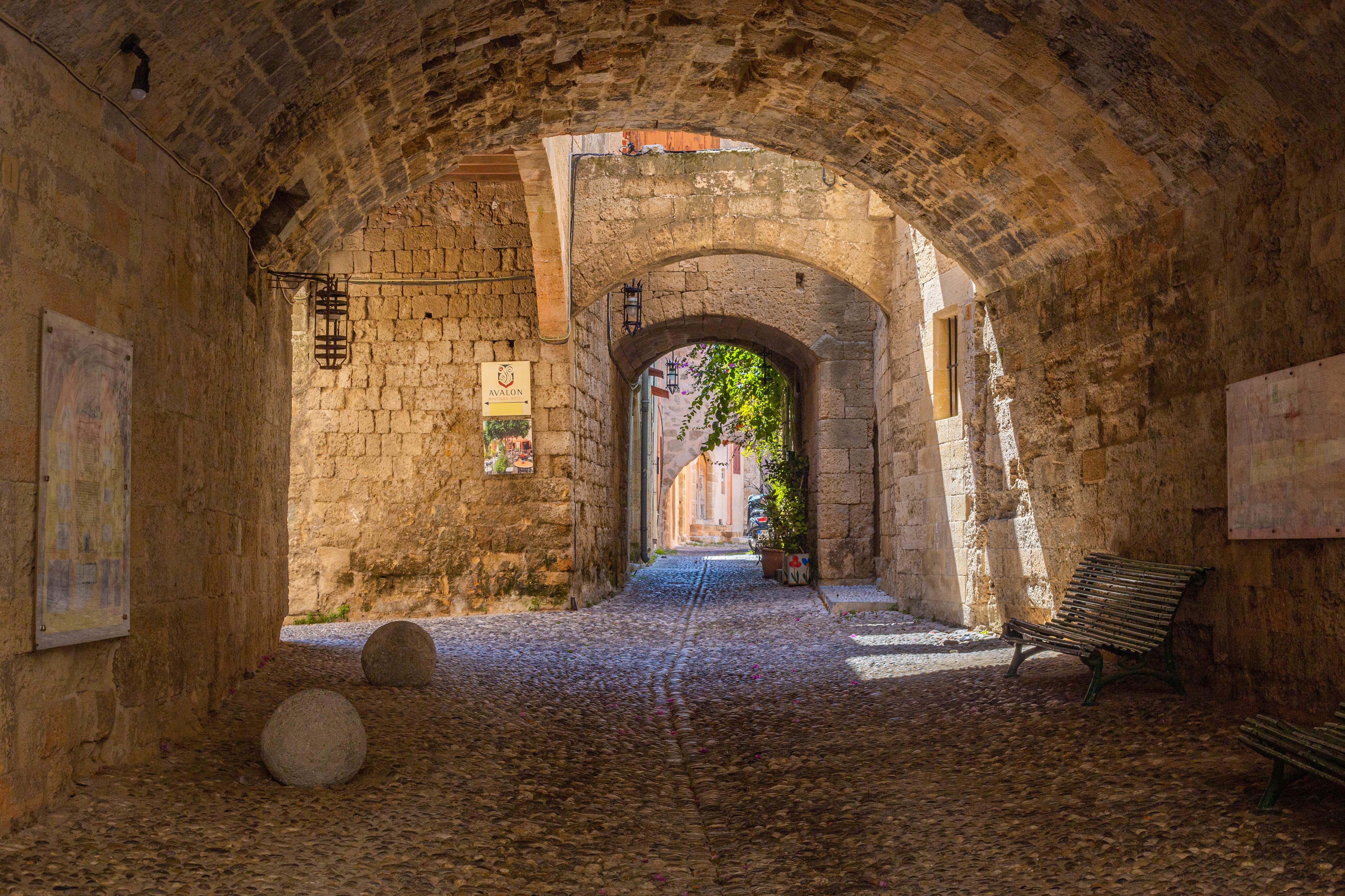
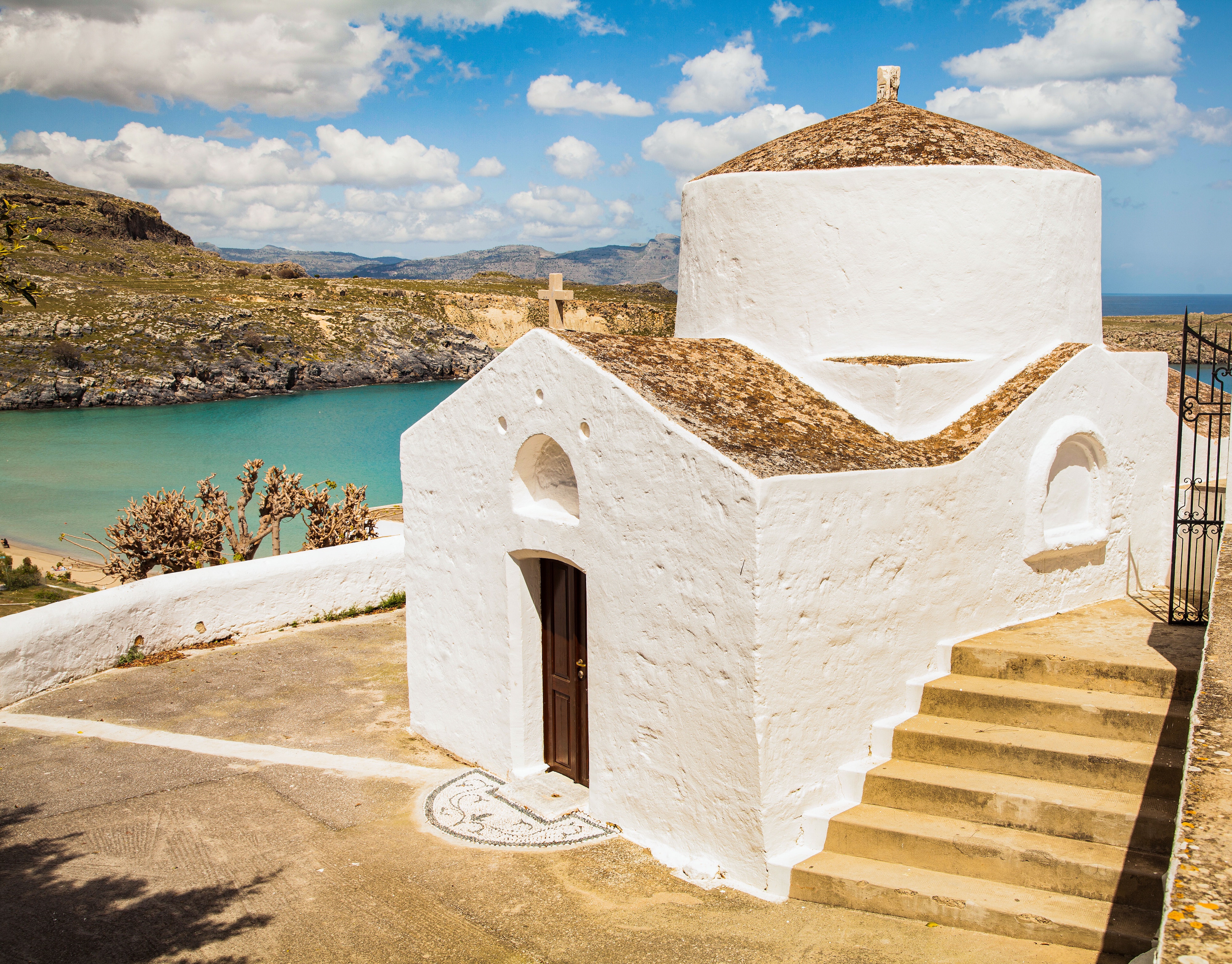
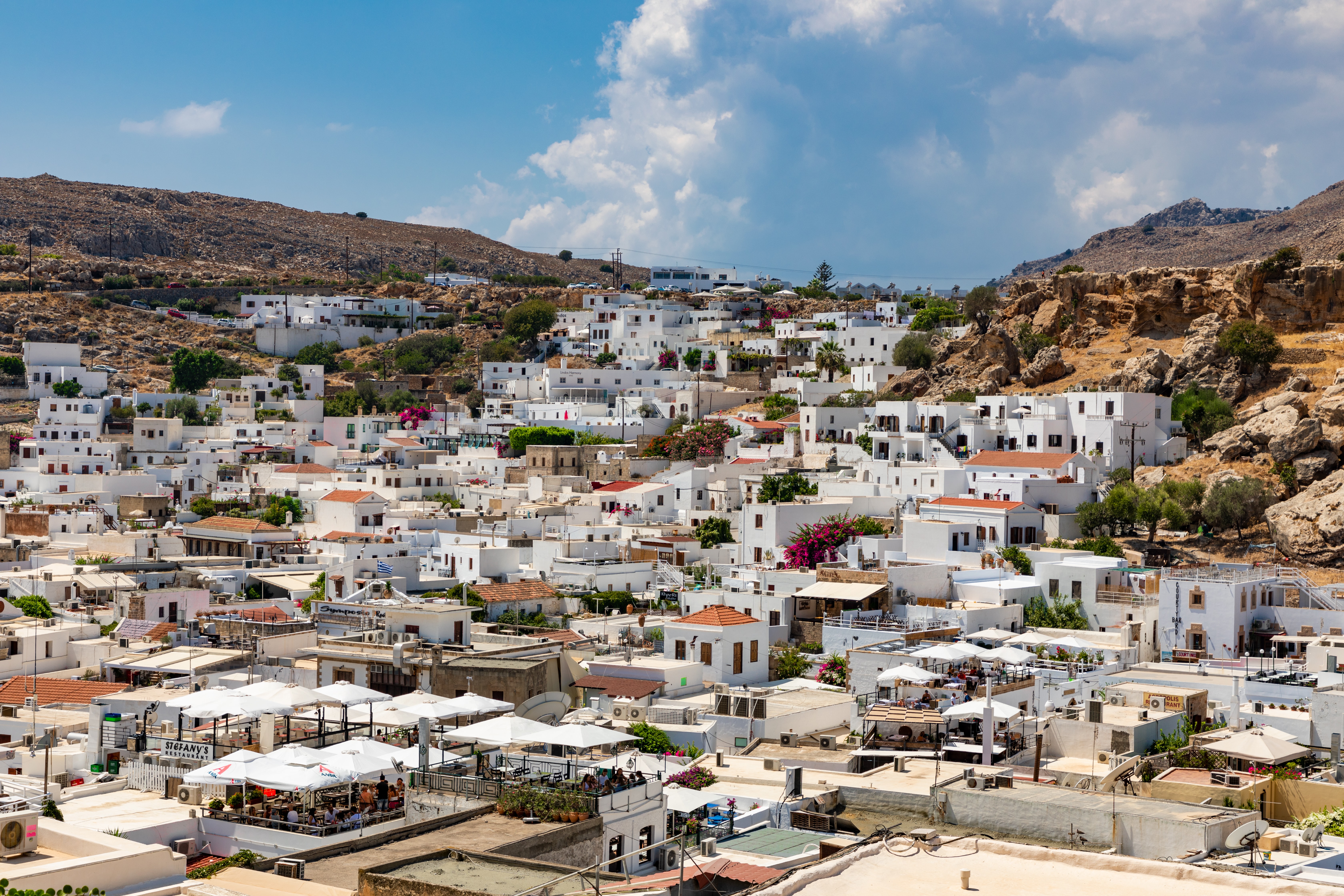
About Rhodes
Early travelers described Rhodes as a town of two parts: a castle or high town (Collachium) and a lower city. Today Rhodes town—sometimes referred to as Ródos town—is still a city of two parts: the Old Town, a UNESCO World Heritage site that incorporates the high town and lower city, and the modern metropolis, or New Town, spreading away from the walls that encircle the Old Town. The narrow streets of the Old Town are for the most part closed to cars and are lined with Orthodox and Catholic churches, Turkish houses (some of which follow the ancient orthogonal plan), and medieval public buildings with exterior staircases and facades elegantly constructed of well-cut limestone from Lindos. Careful reconstruction in recent years has enhanced the harmonious effect.
About Limassol
A major commercial port, cruise ship port of call, and wine-making center on the south coast, Limassol, 75 km (47 miles) from Nicosia, is a bustling, cosmopolitan town, with some of the liveliest nightlife on the island. Luxury hotels, apartments, and guesthouses stretch along 12 km (7 miles) of seafront, with the most luxurious ones just to the north of town. In the center, the elegant, modern shops of Makarios Avenue (where you'll mainly find clothes and shoes) contrast with those of pedestrian-only Agiou Andreou in the old part of town, where local handicrafts such as lace, embroidery, and basketware prevail; make sure you avoid shopping on Wednesday and Saturday afternoons, when many shops close at 2 pm. A luxurious marina that will hold 650 yachts as well as house apartments, shops, and restaurants should further boost the town's lively appeal.
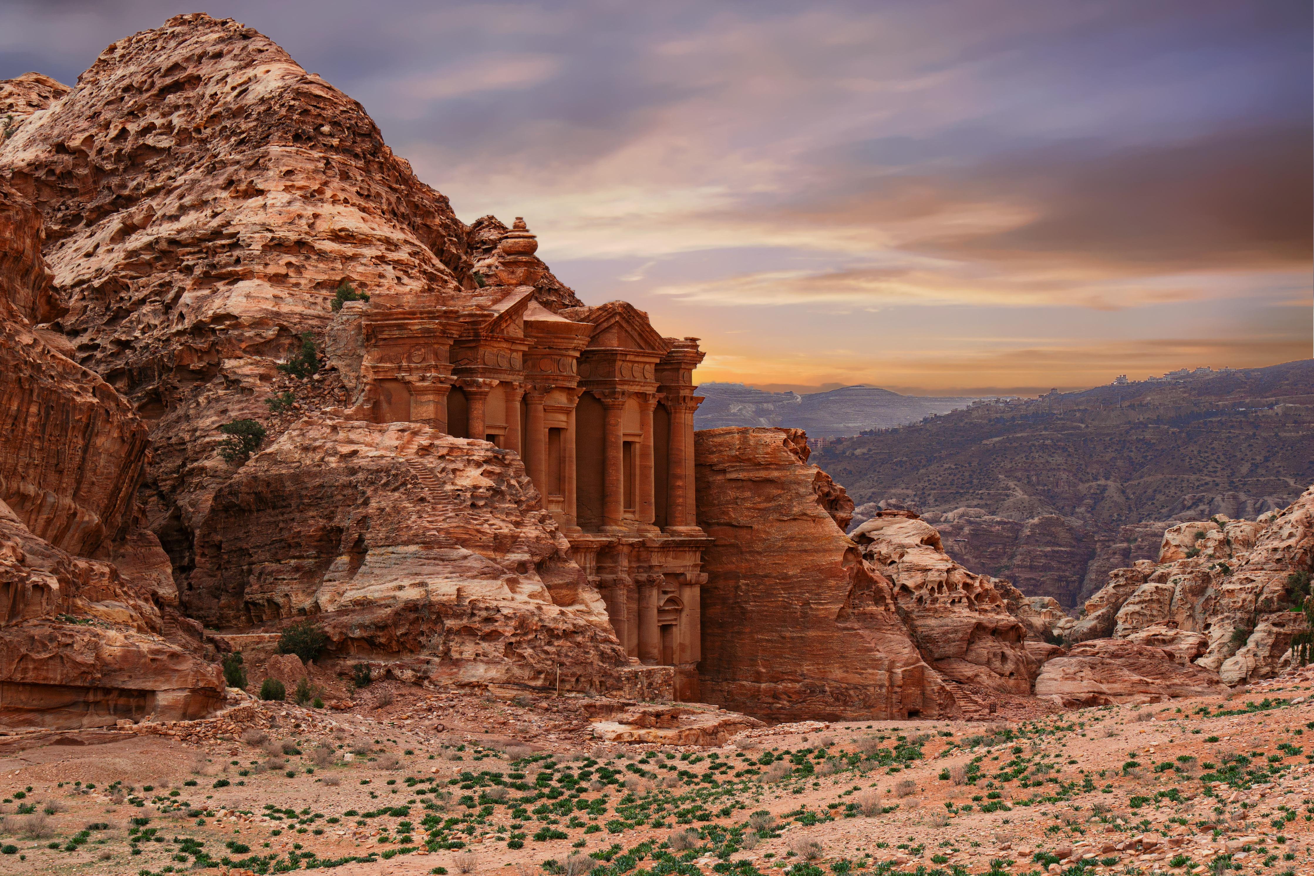
About 'Aqaba
The resort town of Aqaba, on the Red Sea at the southern end of Jordan, is a popular spot for divers with some of the best coral reefs in the world. Snorkeling and other water sports are popular, and it's easy to hire a boat for a day or half-day, including lunch.Aqaba has become quite a bustling destination, with several large luxury hotels and a large shopping area. There are many jewelry stores selling pearls, gem stones, and gold and silver jewelry. It's worth noting that although it's an international beach resort, Aqaba is quite conservative—certainly much more so than Amman—and North Americans tend to be more comfortable at the private hotel beaches.
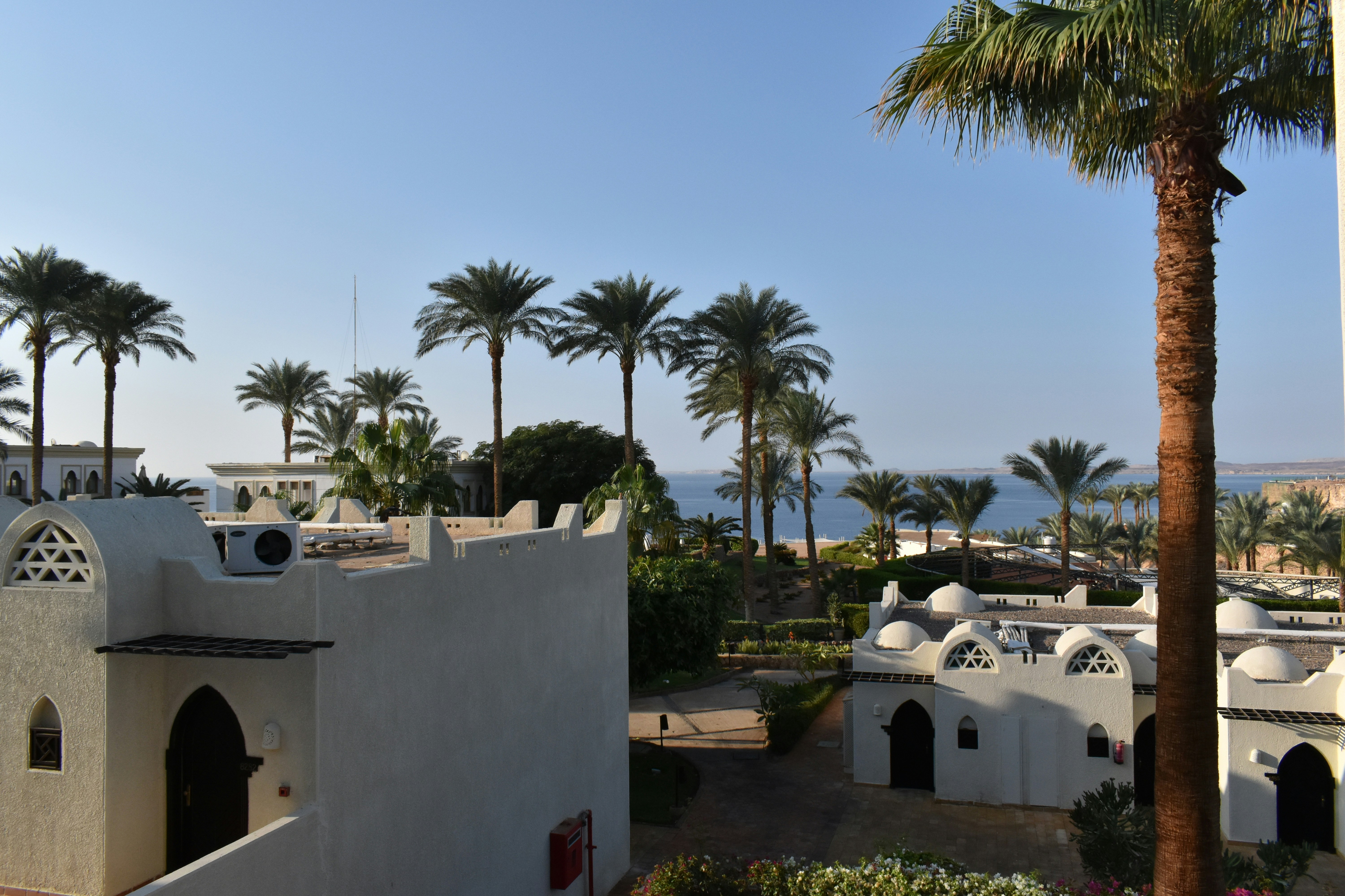
About Sharm El Sheikh
The port and town of Sharm-el-Sheikh lies near the southernmost tip of the Sinai Peninsula where the Straits of Tiran meet the Gulf of Aqaba. With its strategic position, the Sinai posed a desirable target for various rulers over the centuries. In recent times, the last battle for the Sinai was fought between Egypt and Israel from 1967 to 1979, ending with a peace treaty signed in Washington, D.C. Since the withdrawal of the Israelis, more and more Egyptians have settled in the Sinai, taking advantage of the booming tourist trade. However, vast interior regions are still sparsely populated. Many Bedouins have been affected by the advent of the 21st century, which is rapidly changing their age-old customs and nomadic lifestyle. As tourism and hotel projects continue to spring up along the Sinai coast, contact with Bedouins not involved in tourism is becoming increasingly rare. Once their nomadic life kept them on the move with their tents; today many Bedouins cultivate grain, vegetables and dates in addition to catering to the tourists. Sharm-el-Sheikh was initially developed by the Israelis during the Sinai occupation. Na'ama Bay, a short drive from the port, has grown from virtually nothing into a sizeable resort since the early 1980s. Between the two towns, a string of hotels line a once-untouched coastline. Resort hotels offer great opportunities for swimming, snorkelling and scuba diving. Glass bottom boat trips are available for those preferring to view the exotic marine life of the Red Sea without getting their feet wet.
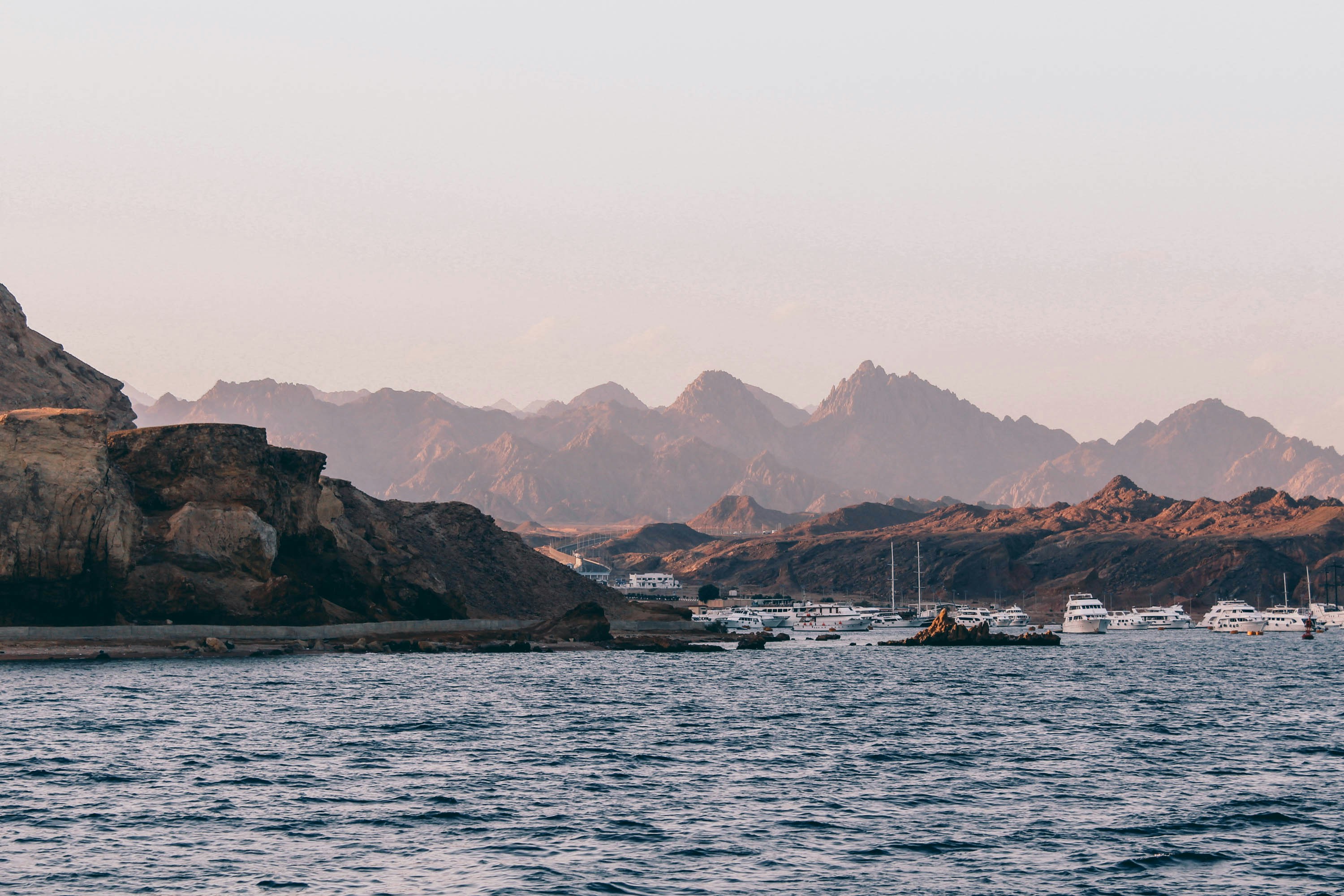
About Safaga
Port Safago has been undergoing a transformation, slowly metamorphosing into a holiday rsort. Like other cities on the Red Sea, the commercial port town sits close to great offshore dive sites. Unlike others, however, tourist development hasn't taken off in a meaningful way. But if the mass tourism in Hurghada is a turnoff, Safaga offers a small-scale and much more low-key alternative, though the best dive sites can still be seen on a day trip from Hurghada. Safaga is also the closest beach resort to Luxor and the Valley of the Kings, which lies 200 km (124 mi) to the southwest; when cruise ships offer land excursions to Luxor, they often do so through Safaga.
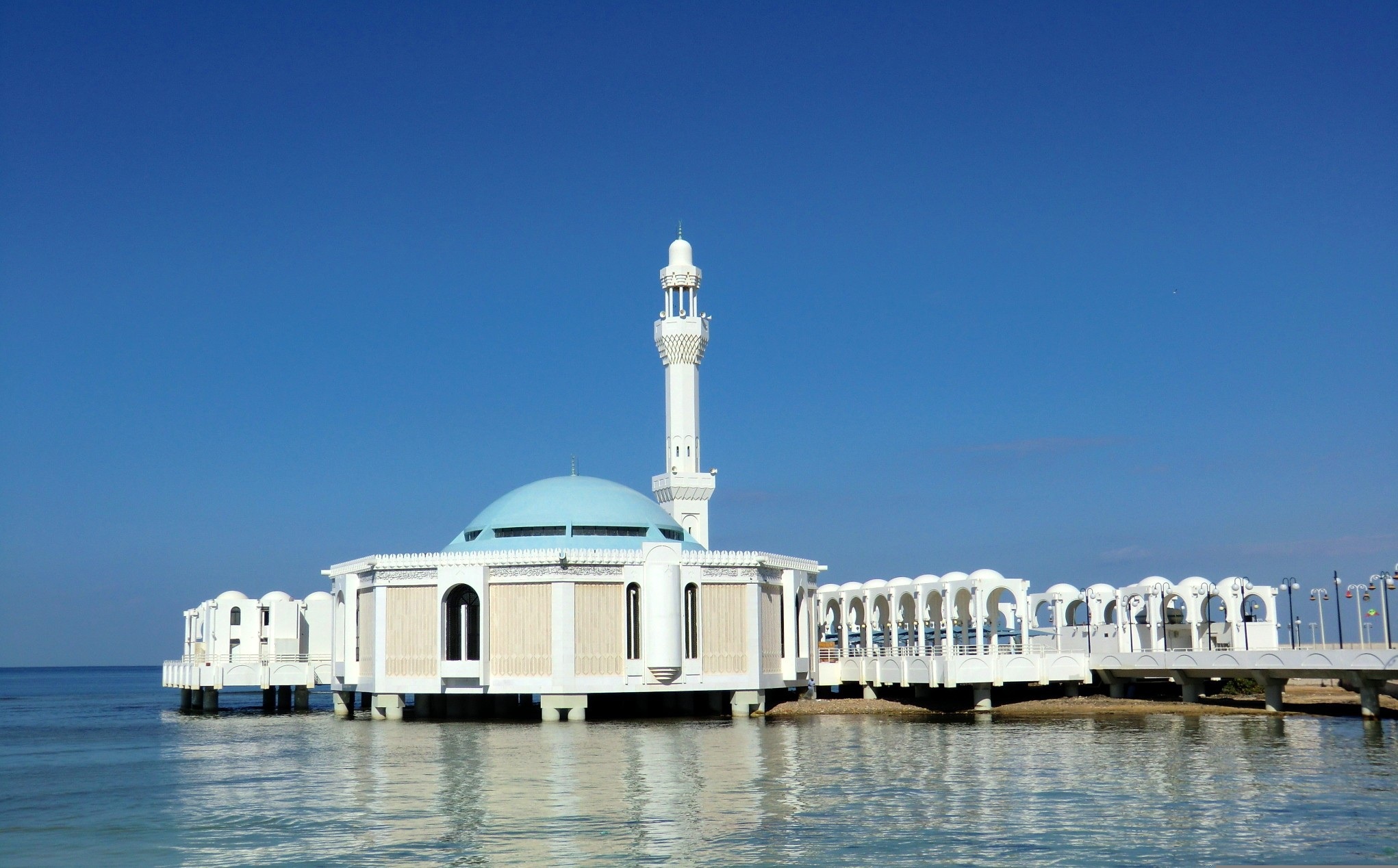
About Jeddah
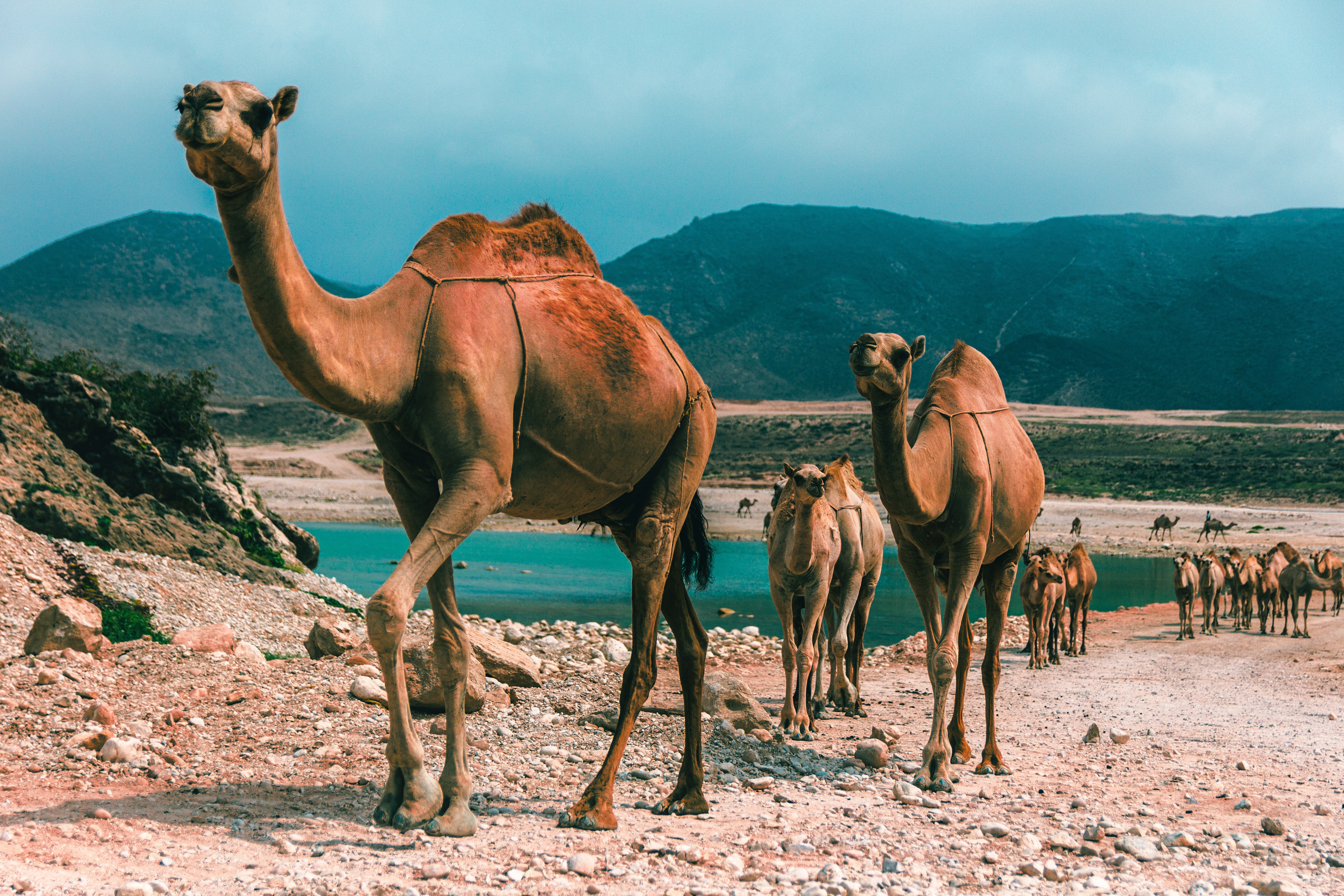
About Salalah
The lush landscape around Salalah is the intriguing result of a quirk of nature. Since it is uniquely situated in the path of the Khareef, or South Western Monsoon, this stretch of the Dhofar Coast is covered in fine mist and frequent rain from mid-June through mid-September. By the time the monsoons cease, the entire coastline is a verdant stretch. Waterfalls, rolling grasslands, and thickly wooded wadis (riverbeds) thrive alongside rapid mountain streams. Unique in this desert region, Salalah attracts many visitors from the surrounding Arabian Gulf countries who are anxious to experience a rare lushness in a region where rain and greenery are in short supply. Once a stop on the ancient trading routes that connected the Levant to India and China, Salalah has a rich history that goes back centuries. Traders from Mesopotamia, the Persian Empire, and beyond passed through Salalah in their search for frankincense, making it a major center for trade in the coveted exotic ingredient. Pre-Islamic tombs and grave sites, some believed to be up to 2,000 years old, are scattered all over the nearby mountainsides and the present-day city, which has an estimated 195,000 inhabitants.
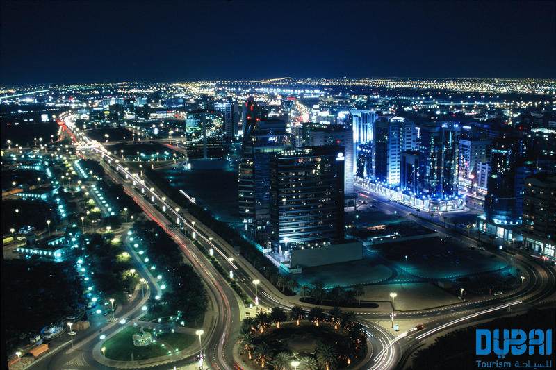
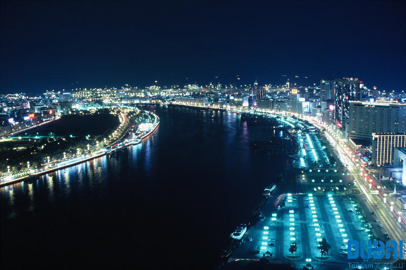
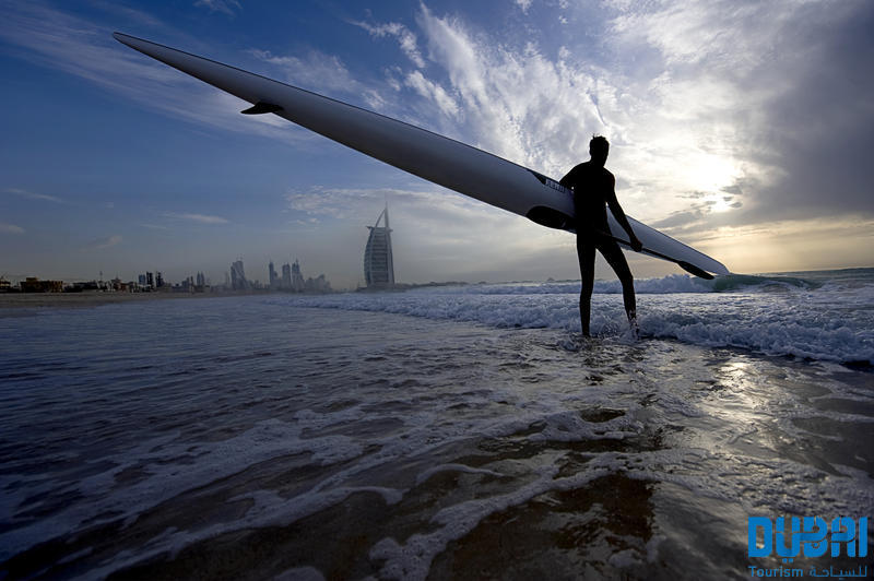
About Dubai
Dubai sits on a golden sandy coastline in the Arabian Gulf, where the warm azure waves of the sea meet the desert. A high-rise oasis, this city is a pleasure-dome surrounded by dunes; one of the most fashionable on the planet thanks to its ability to satisfy the needs of legions of demanding vacationers. Dubai is about having fun—and it's one big adult playground.Nature plays her part here, with year-round sunshine, gorgeous beaches, dramatic arid landscapes, and warm waters, but it's the man-made attractions that make Dubai so alluring. You can launch yourself into high-adrenaline desert adventures, diving and water sports, and some of the world's best golf courses. The 5-, 6-, and 7-star hotels offer the ultimate in luxury, and the party scene is hot. Shopping malls are the biggest in the world and are packed full of high-class merchandise. And with hundreds of restaurants with cuisine from around the world, you can munch your way from Mexico to Malaysia.Dubai is an Arab country with a long history as a trading port. Traces of its traditional life, customs, and architecture can still be seen and explored, but today and tomorrow are much more important than yesterday. Almost every building in this metropolis is less than 20 years old and the most dramatic developments—groundbreaking megaprojects—have just been completed or are still under construction.The city is certainly unique. Islam is its anchor, but it has opened its doors to the rest of the world and has invited them in to work, rest, and play, which creates a truly international atmosphere. Unashamedly modern and materialistic, life here takes place at breakneck speed. The landscape is stark, the confidence is sky high, the can-do spirit is palpable, and the bling is in your face. Dubai produces strong reactions in people, but one thing is certain—love it or loathe it—you will not forget it. It is without a doubt, one of the world's true must-see destinations.Shisha: Smoke Without Fire. Emirati men love socializing, but as they don't drink alcohol they get together over coffee and shisha instead of a drink at the bar after work. The shisha, or hookah, is a smoking device, usually made of glass, that filters smoke through water before it reaches the smoker's mouth. Shisha tobaccos are aromatic and are often mixed with apple, cinnamon, or cherry, so their taste isn't as strong as other tobaccos. Smoking shisha is said to induce relaxation—but you'll have to decide if it's for you!
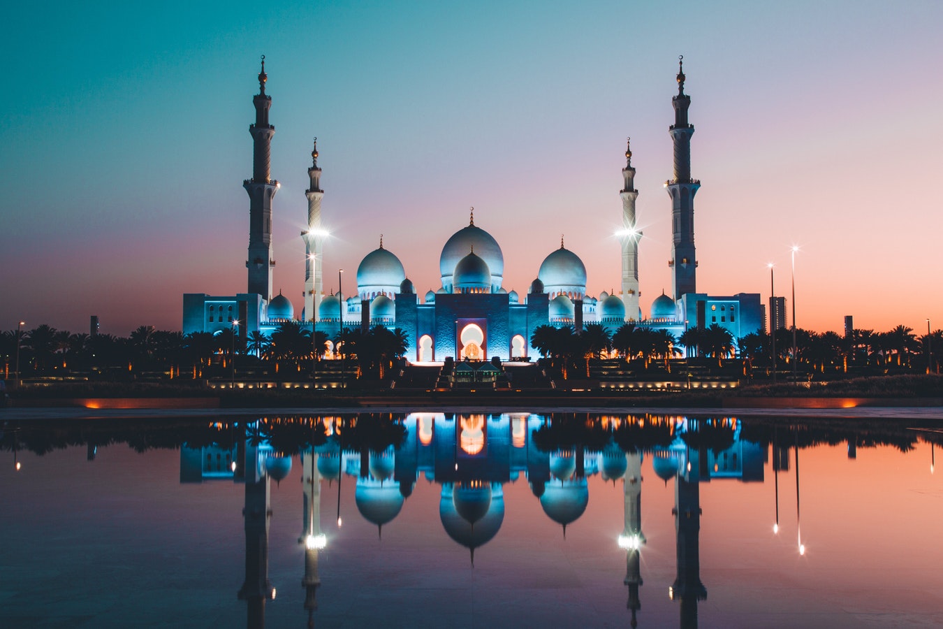
About Abu Dhabi
Just a few decades ago, Abu Dhabi, the island capital of the United Arab Emirates, was a small fishing village with houses made of mud-brick and palm fronds. Today, as a result of revenue from oil, Abu Dhabi is one of the world's richest cities, with wide, tree-lined okulevards, lush green parks, gushing fountains and imposing skyscrapers. Somewhat of a dichotomy, Abu Dhabi is a combination of ultra-modern sophistication and Arab mystique, with friendly and hospitable people offering a warm welcome to visitors. Abu Dhabi's history originated in the 18th century, when, according to legend, a group of tribesmen pursuing a gazelle came upon a freshwater well which they named Abu Dhabi, or "Father of the Gazelle". In the 19th century, the first fort was built over this well by a sheikh of the Al-Nahyan dynasty. The fort's name is Al Husn Palace, also known as Old or White Fort, and it is one of the few buildings in Abu Dhabi that is more than 25 years old. Its whitewashed walls are eye-catching amid the backdrop of today's skyscrapers. Presently, it is home to the Cultural Foundation and serves as a documents centre. Abu Dhabi had little significance until the discovery of vast oil reserves in the late 1950s and early 1960s. In the years following, the city's economy and infrastructure developed rapidly and changed Abu Dhabi beyond recognition.

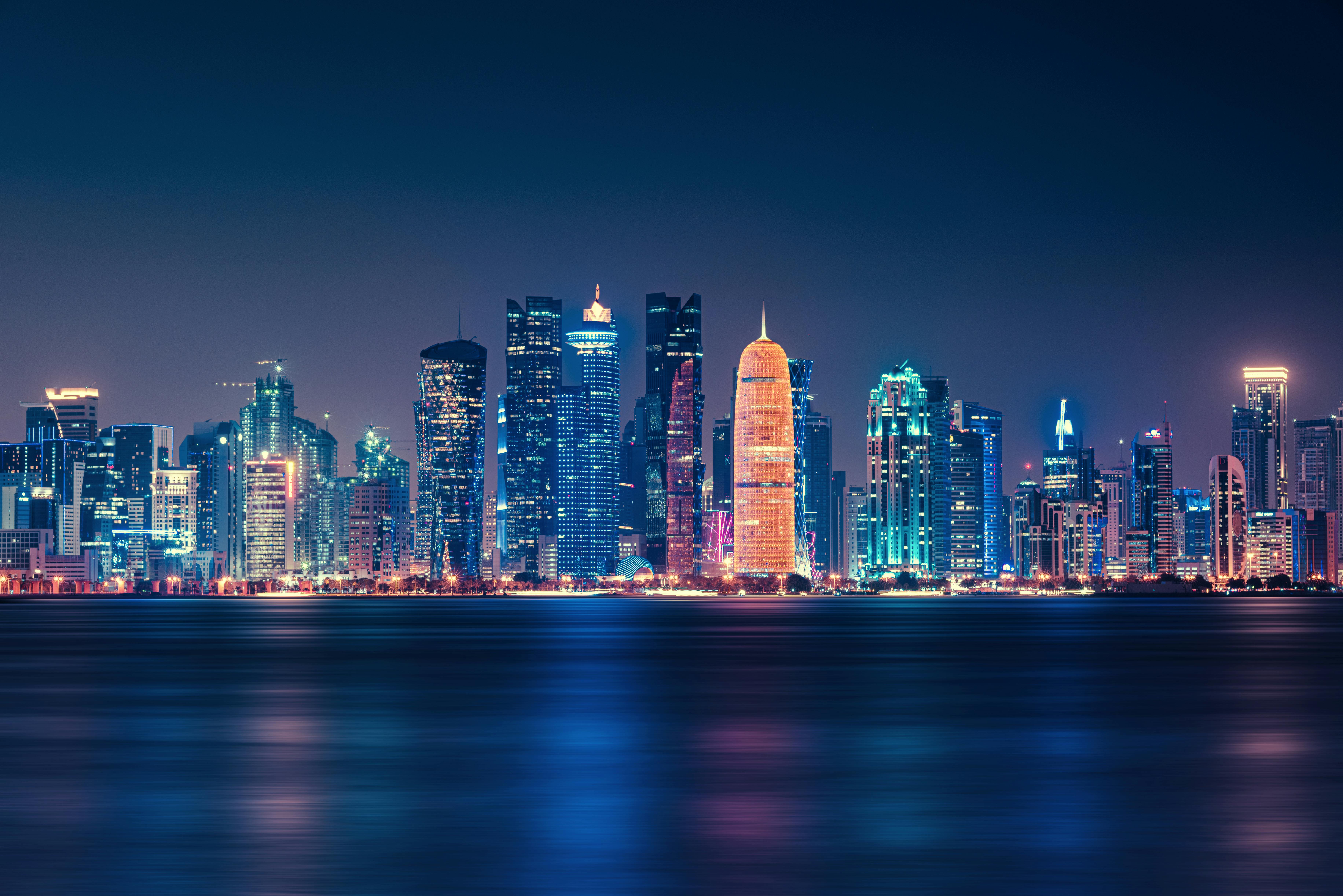
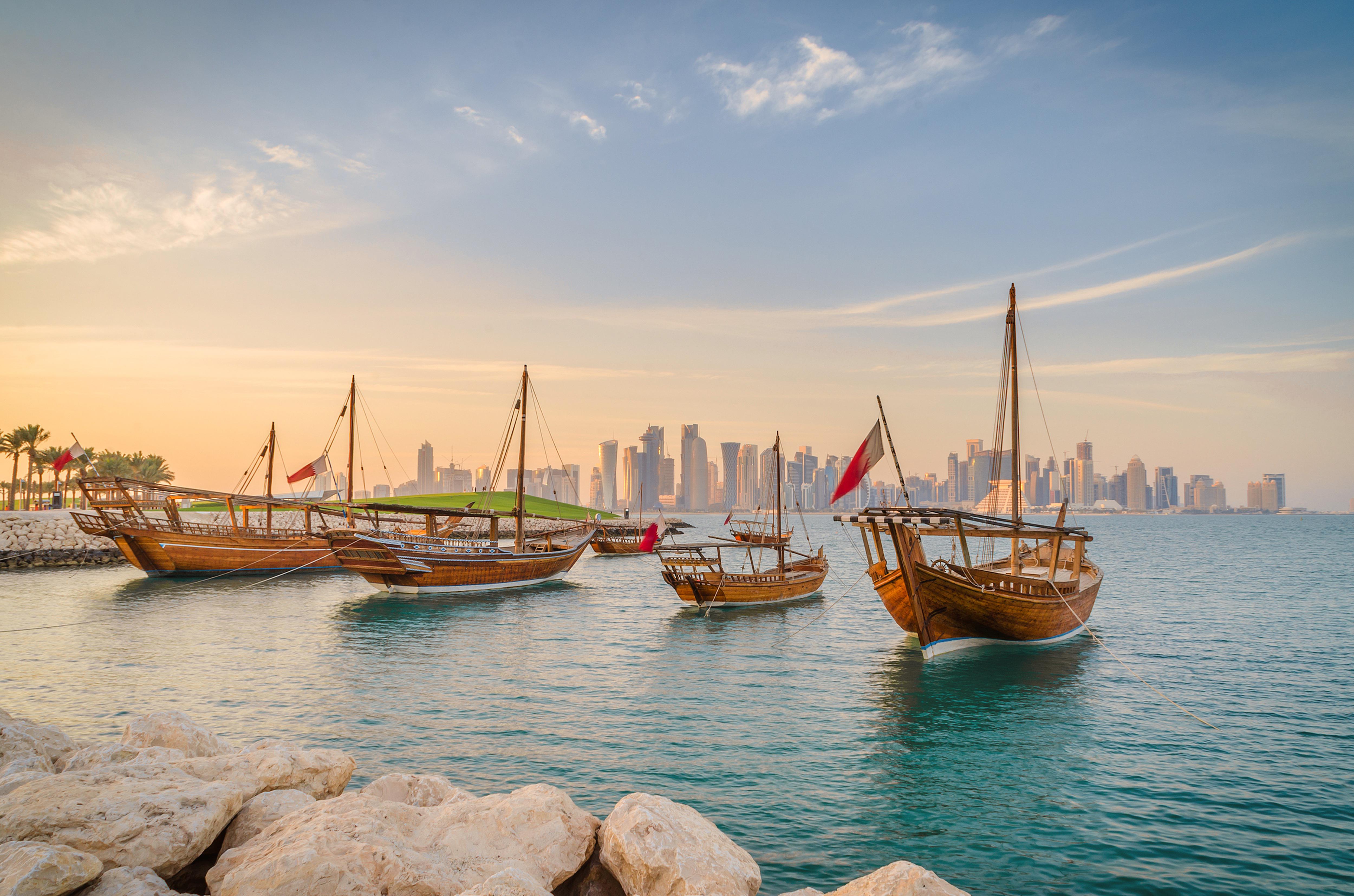
About Doha
Doha (population 700,000) is the capital of the State of Qatar, an emirate occupying the small Qatar Peninsula bordered by Saudi Arabia to the south and otherwise surrounded by the Persian Gulf. Qatar was ruled by many different powers through the centuries, in fact historians have traced human habitation dating back 5000 years. From its earliest history, Qatar was a very important trade route connecting Mesopotamia and the Indus Valley. Among its occupiers were the Portuguese, the Ottomans and finally the British during the turbulent years of the 20th century. Qatar gained independence in 1971, and with resources from oil exportation, His Highness Sheikh Khalifa Bin Hamad made improvements in social programmes including education, health and housing. In 1995, his son, His Highness Sheikh Hamad Bin Khalifa Al-Thani assumed the throne and brought with him a modern and progressive approach that quickly transformed the country. Doha, home to 80 percent of the country’s population, was founded under the name of Al-Bida in 1850. It became the capital of the British protectorate of Qatar in 1916. When the nation gained its independence, Doha remained the capital. During the early 20th century, much of Qatar’s economy depended on fishing and pearling. But after the introduction of Japanese cultured pearls, Doha and the whole region suffered a decline. Only when oil was discovered, prosperity returned following World War II. Today, the country produces over 800,000 barrels of oil daily. Doha is situated halfway down the east coast of the peninsula. It is an intriguing mixture of old and new, with ultra modern architecture next to traditional souqs and historic forts. It boasts a university and the Qatar National Museum (currently closed for renovation), which opened 1975 in what was originally the ruler’s palace. As the country’s cultural and commercial centre, Doha enjoys excellent communications with the outside world through its modern seaport, airport and telephone links. The Al Jazeera Arabic satellite television news channel began broadcasting in 1996 with its headquarters in Doha. While Arabic is the official language, English is widely spoken. Please Note: Conservative dress is required when going ashore. As a rule, women should not wear miniskirts, shorts or sleeveless tops and men should always wear a shirt in public. Please do not photograph people without their permission, especially women.You may not take pictures of government buildings, embassies or anything military in nature, including airports.
About Dubai
Dubai sits on a golden sandy coastline in the Arabian Gulf, where the warm azure waves of the sea meet the desert. A high-rise oasis, this city is a pleasure-dome surrounded by dunes; one of the most fashionable on the planet thanks to its ability to satisfy the needs of legions of demanding vacationers. Dubai is about having fun—and it's one big adult playground.Nature plays her part here, with year-round sunshine, gorgeous beaches, dramatic arid landscapes, and warm waters, but it's the man-made attractions that make Dubai so alluring. You can launch yourself into high-adrenaline desert adventures, diving and water sports, and some of the world's best golf courses. The 5-, 6-, and 7-star hotels offer the ultimate in luxury, and the party scene is hot. Shopping malls are the biggest in the world and are packed full of high-class merchandise. And with hundreds of restaurants with cuisine from around the world, you can munch your way from Mexico to Malaysia.Dubai is an Arab country with a long history as a trading port. Traces of its traditional life, customs, and architecture can still be seen and explored, but today and tomorrow are much more important than yesterday. Almost every building in this metropolis is less than 20 years old and the most dramatic developments—groundbreaking megaprojects—have just been completed or are still under construction.The city is certainly unique. Islam is its anchor, but it has opened its doors to the rest of the world and has invited them in to work, rest, and play, which creates a truly international atmosphere. Unashamedly modern and materialistic, life here takes place at breakneck speed. The landscape is stark, the confidence is sky high, the can-do spirit is palpable, and the bling is in your face. Dubai produces strong reactions in people, but one thing is certain—love it or loathe it—you will not forget it. It is without a doubt, one of the world's true must-see destinations.Shisha: Smoke Without Fire. Emirati men love socializing, but as they don't drink alcohol they get together over coffee and shisha instead of a drink at the bar after work. The shisha, or hookah, is a smoking device, usually made of glass, that filters smoke through water before it reaches the smoker's mouth. Shisha tobaccos are aromatic and are often mixed with apple, cinnamon, or cherry, so their taste isn't as strong as other tobaccos. Smoking shisha is said to induce relaxation—but you'll have to decide if it's for you!
About Mumbai (ex Bombay)
Mumbai, India's financial capital, is a city of contrasts and colors, where towering skyscrapers stand alongside bustling bazaars. From the iconic Gateway of India to the vibrant street food scene of Chowpatty Beach, it's a melting pot of cultures and cuisines. The heartbeat of Bollywood echoes through its bustling streets, while historic landmarks like the Elephanta Caves whisper tales of bygone eras. With its bustling local trains and bustling markets, Mumbai is a city that never sleeps, where dreams are pursued against the backdrop of the Arabian Sea's shimmering waters.
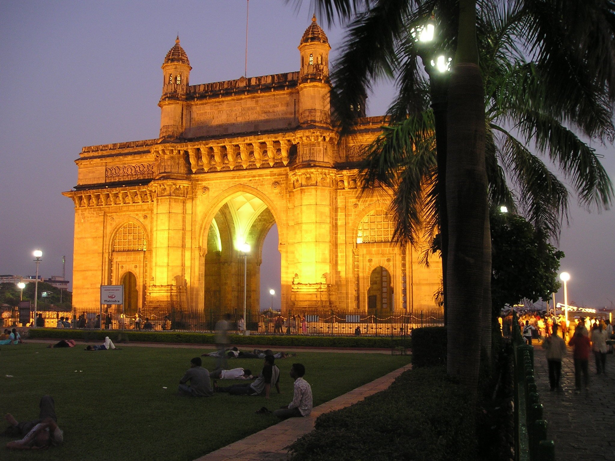
About Male
There are many nations around the world with bragging rights to miles of pristine white coral sand and balmy turquoise seas but few can take it to the same level as the Maldives. Its 1,200 islands are spread out over 26 coral atolls; the combined land of all the islands is little more than 100 square miles. That means you are rarely more than a few steps from the beach. Many of the villas are actually built on stilts out over the water, so you may actually have to walk onshore in order to get to the beach. Besides curling your toes in the sand, many people come here to sample the Maldives enviable world-class dive spots. Others simply snorkel among the endless coral reefs. There are so many coral atolls here that our English word derives from the Maldivian name atholhu.
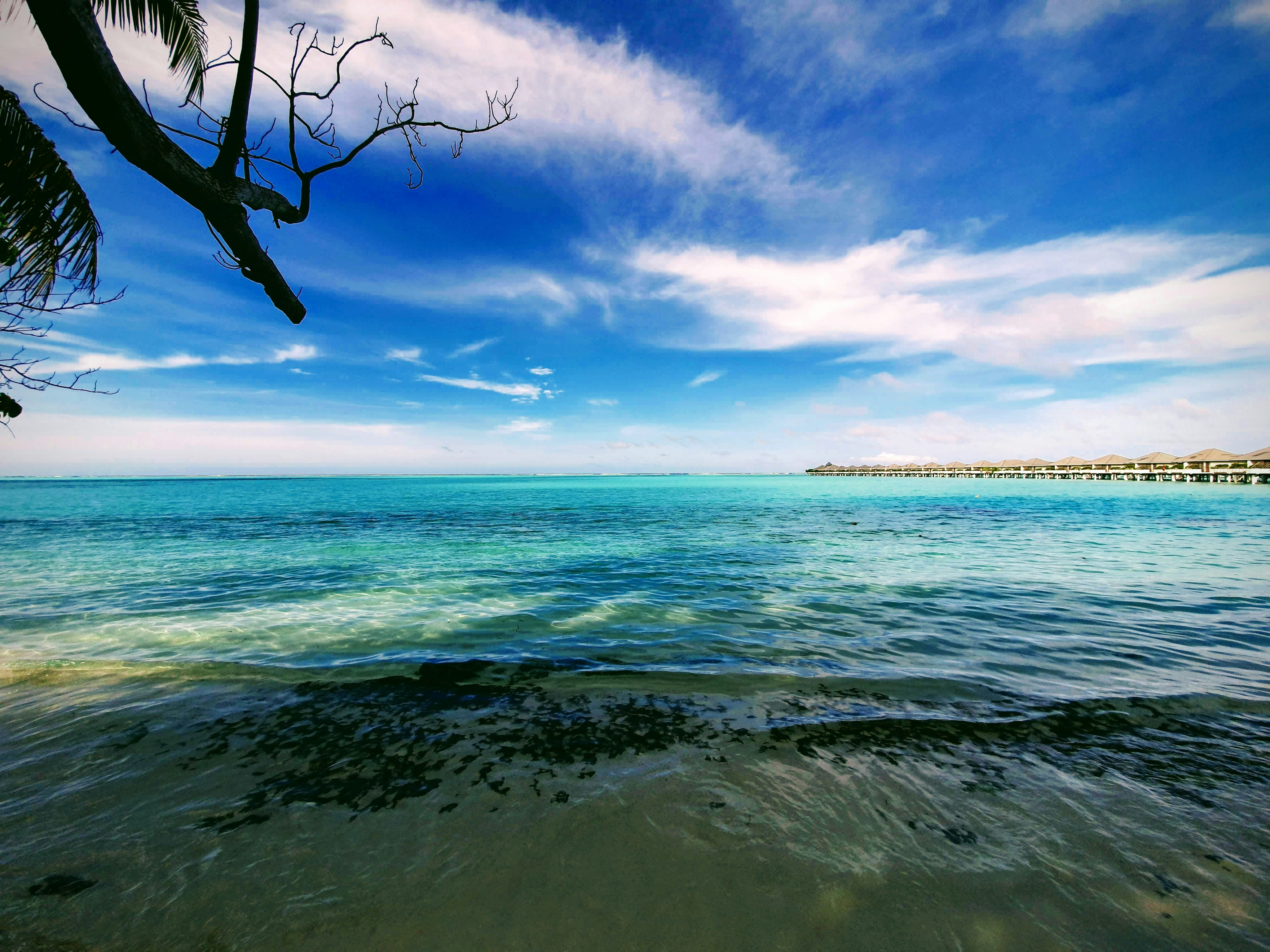
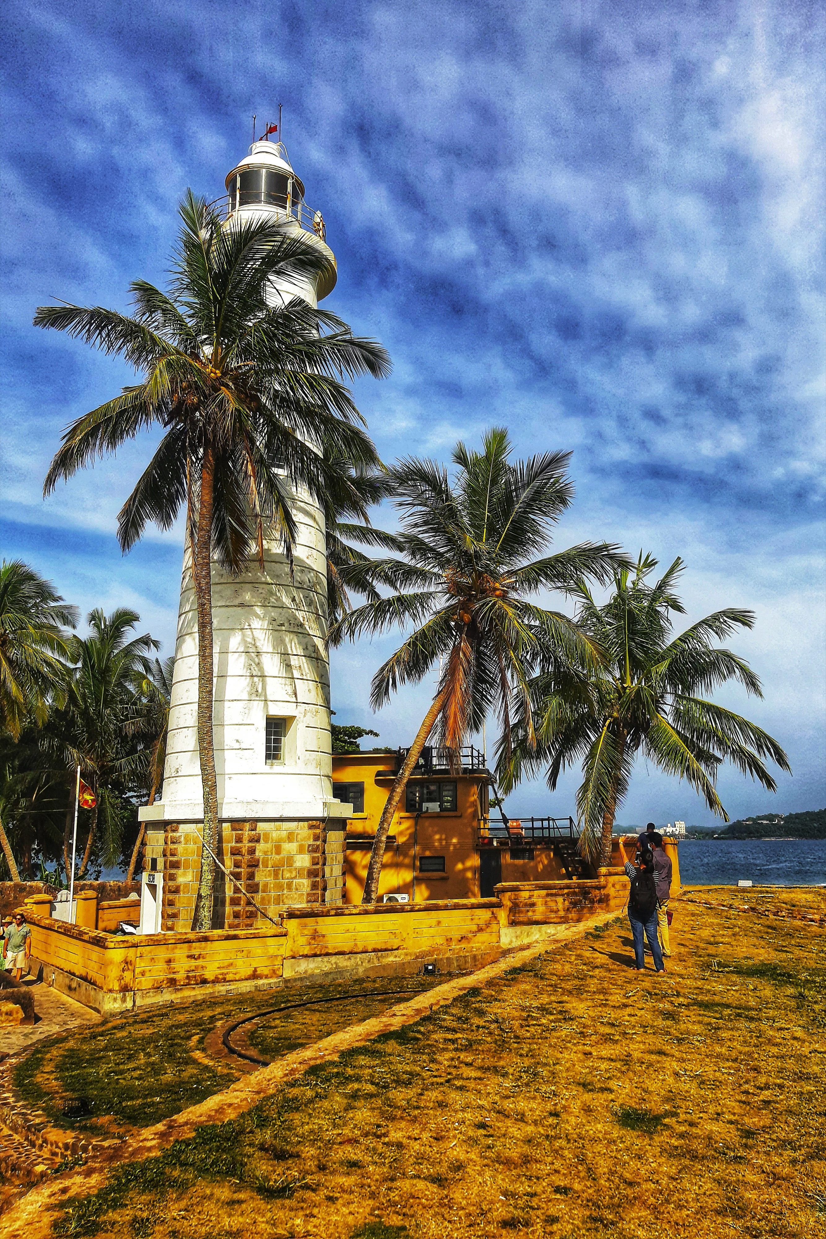
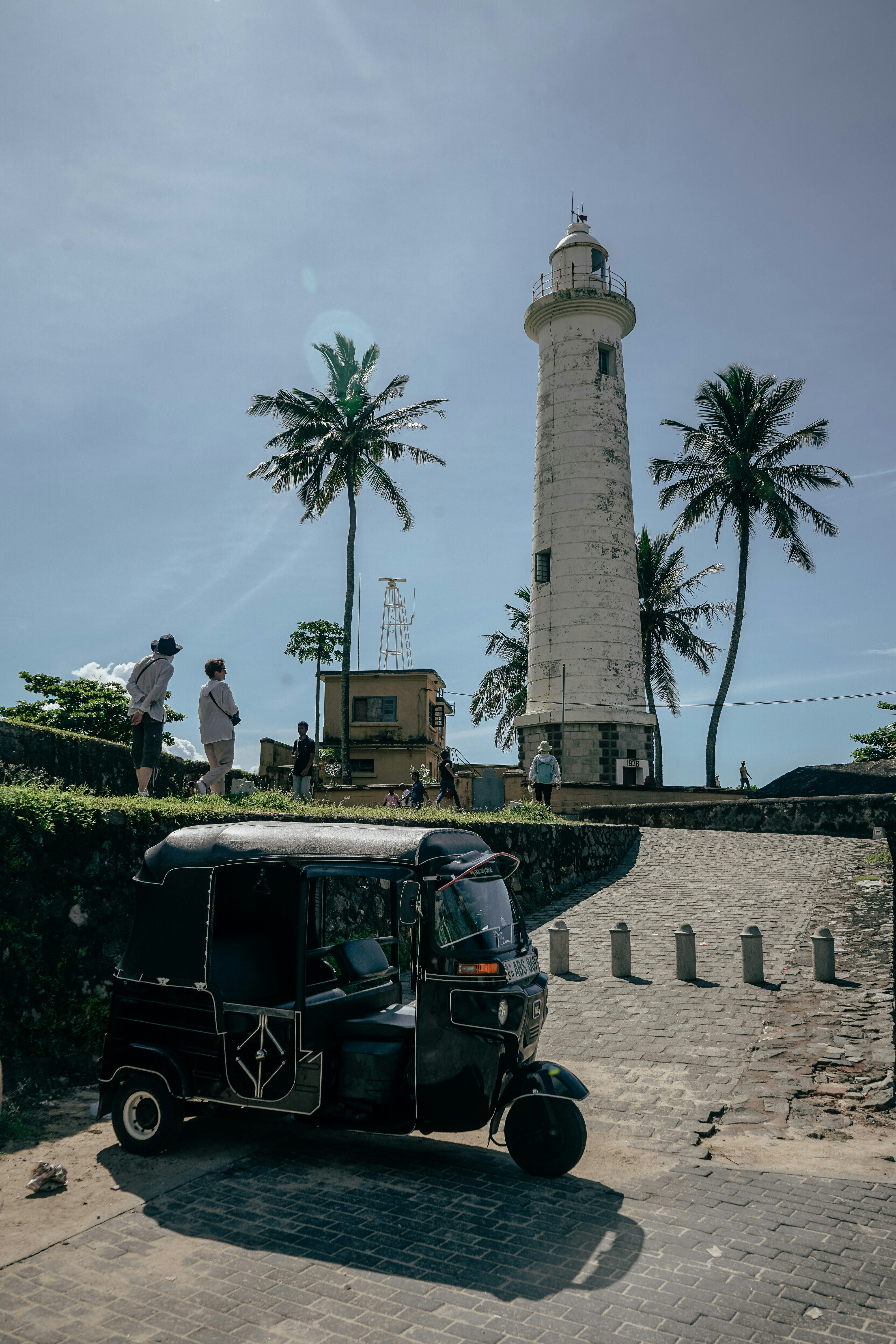
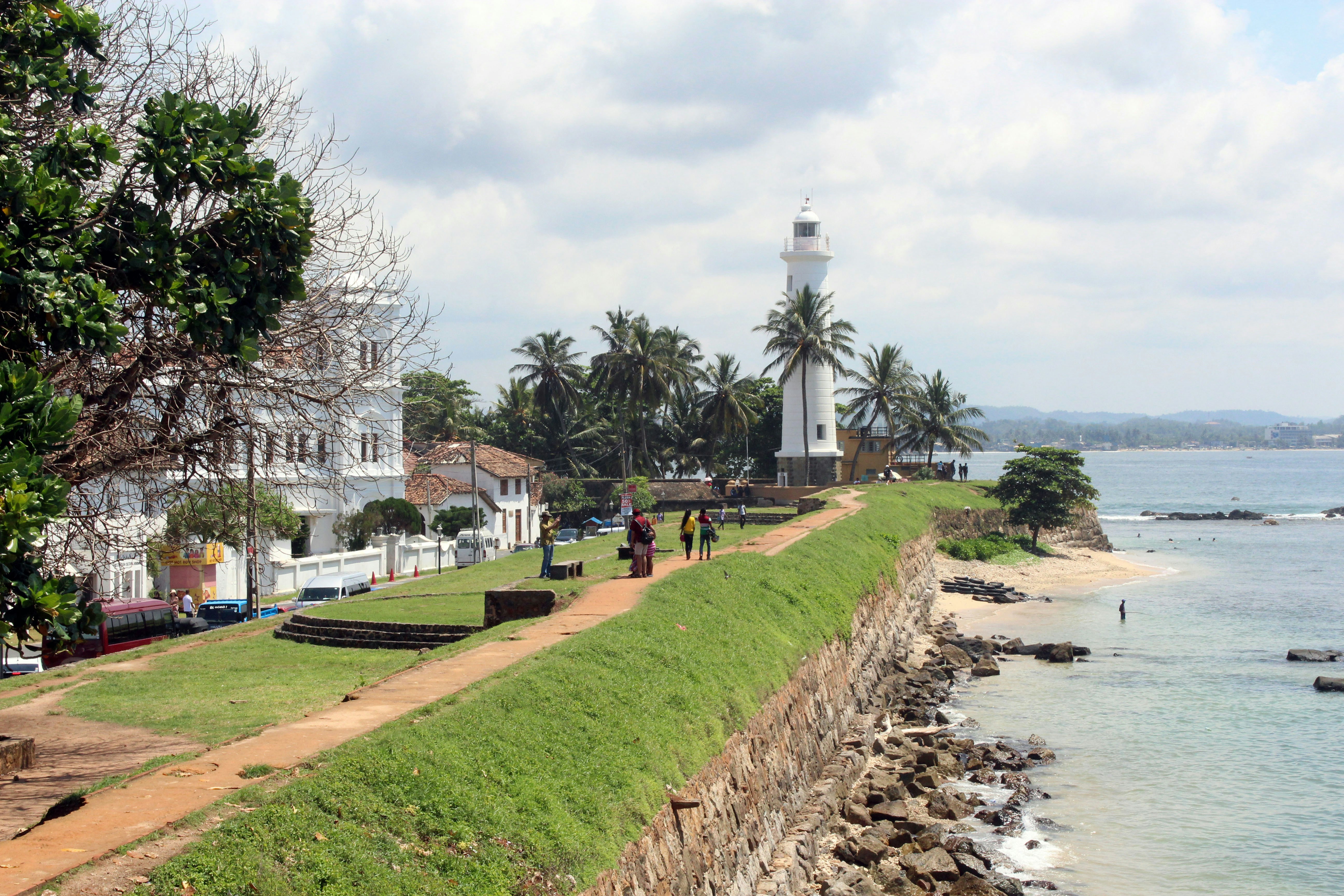
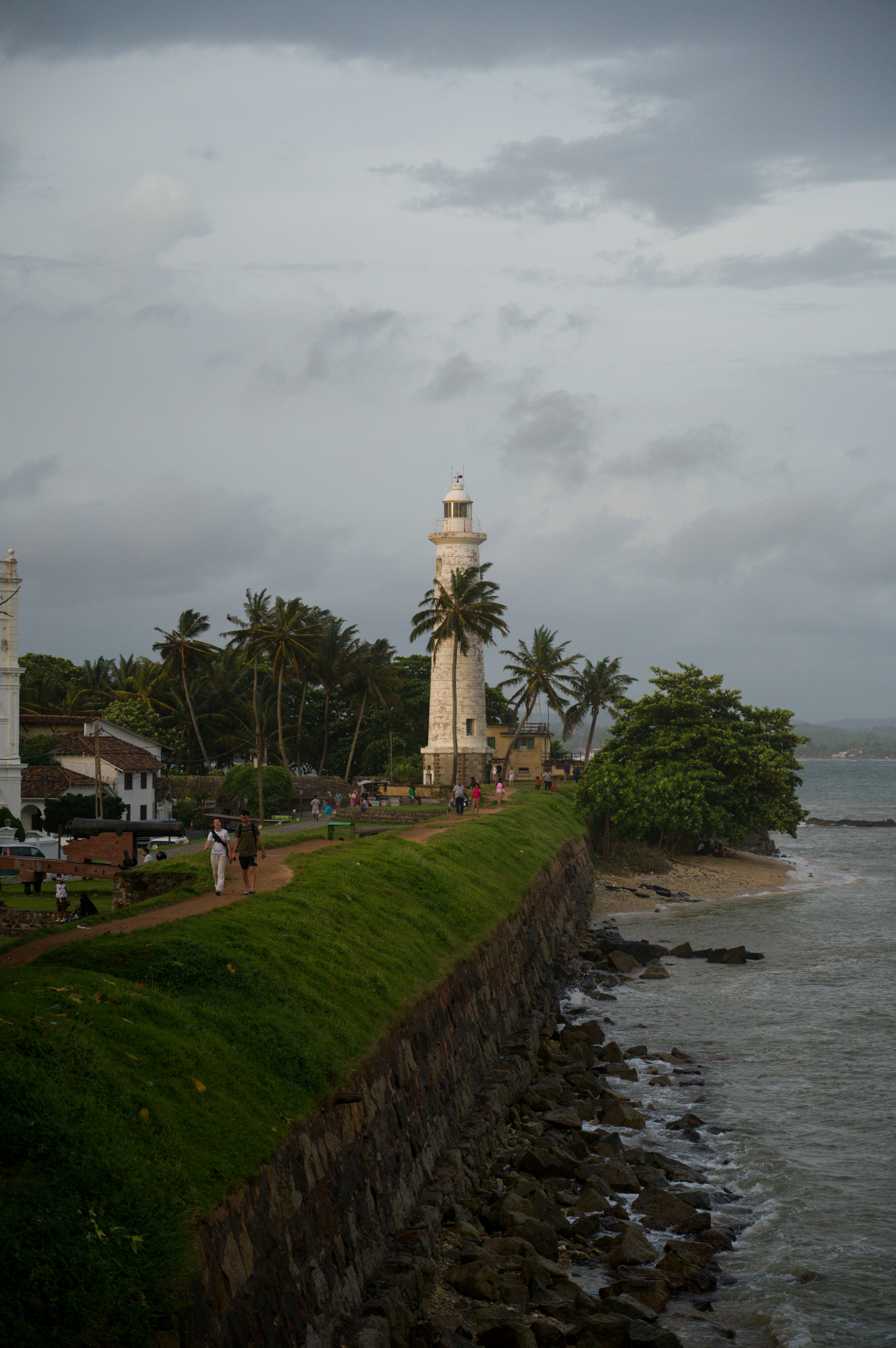
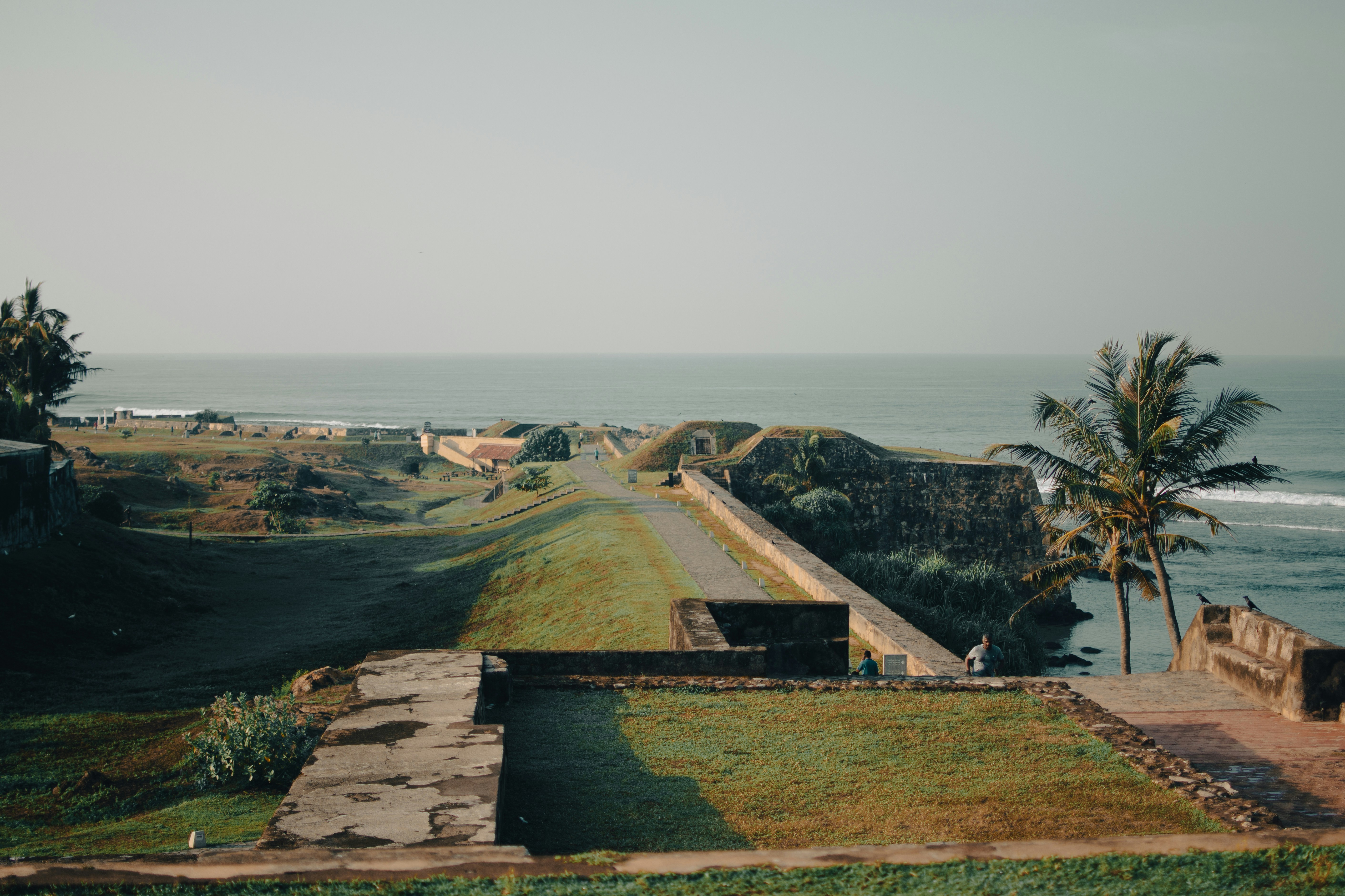
About Galle
Galle is the administrative capital of the Southern Province in Sri Lanka. The city has a beautiful tropical setting with Dutch-colonial architecture. Explore the maritime museums, try some of the delicacies and explore the shops for souvenirs.


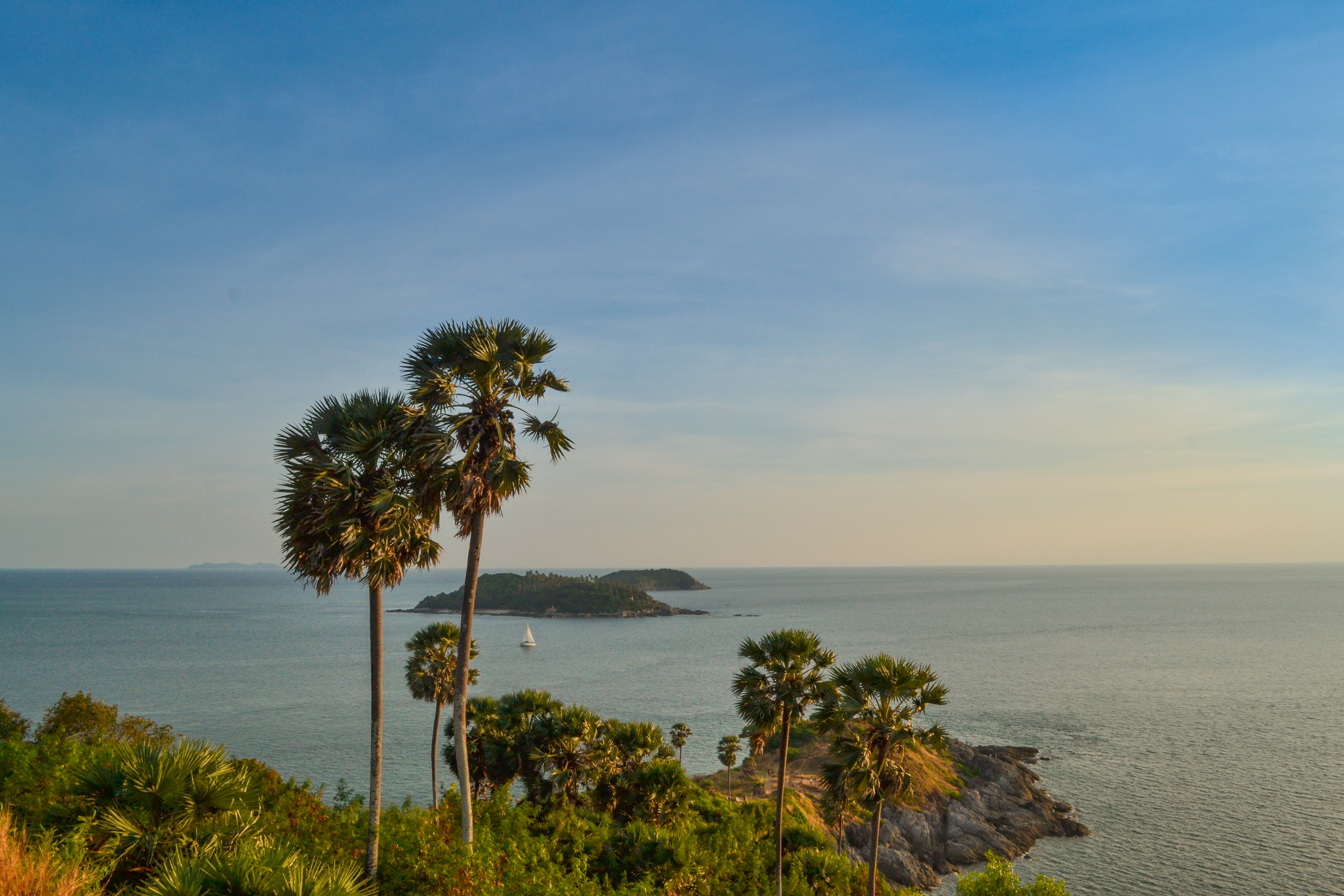
About Phuket
Though few tourists linger here, Phuket Town, the provincial capital, is one of the more culturally interesting places on the island to spend half a day. About one-third of the island's population lives here, and the town is an intriguing mix of old Sino-Portuguese architecture and the influences of the Chinese, Muslims, and Thais that inhabit it. The old Chinese quarter along Talang Street is especially good for a stroll, as its history has not yet been replaced by modern concrete and tile. And this same area has a variety of antiques shops, art studios, and trendy cafés. Besides Talang, the major thoroughfares are Ratsada, Phuket, and Ranong roads. Ratsada connects Phuket Road (where you'll find the Tourism Authority of Thailand office) to Ranong Road, where there's an aromatic local market filled with fruits, vegetables, spices, and meats.
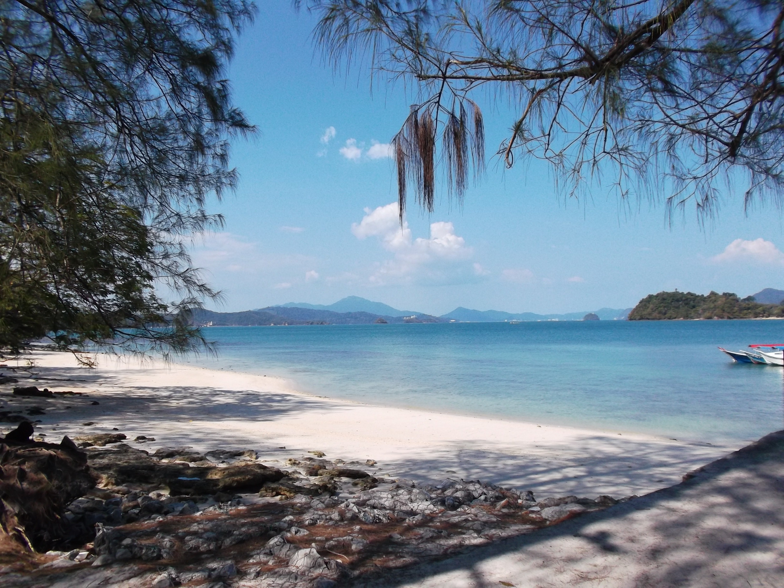
About Langkawi Island
On Malaysia's west coast, Langkawi is an archipelago made up of 99 islands. The only real settlement is on the main island, Pulau Langkawi. This popular beach destination attracts divers from around the world to explore the sea life, and after being declared a duty-free zone back in the '80s, it has become a favorite shopping spot for visitors seeking cheap booze. You'll find sightseeing attractions—such as national parks, a cable car ride, and a large aquarium—throughout this island of lush rainforests. However, it's the long stretches of sandy beach that attract most visitors to this tropical paradise.
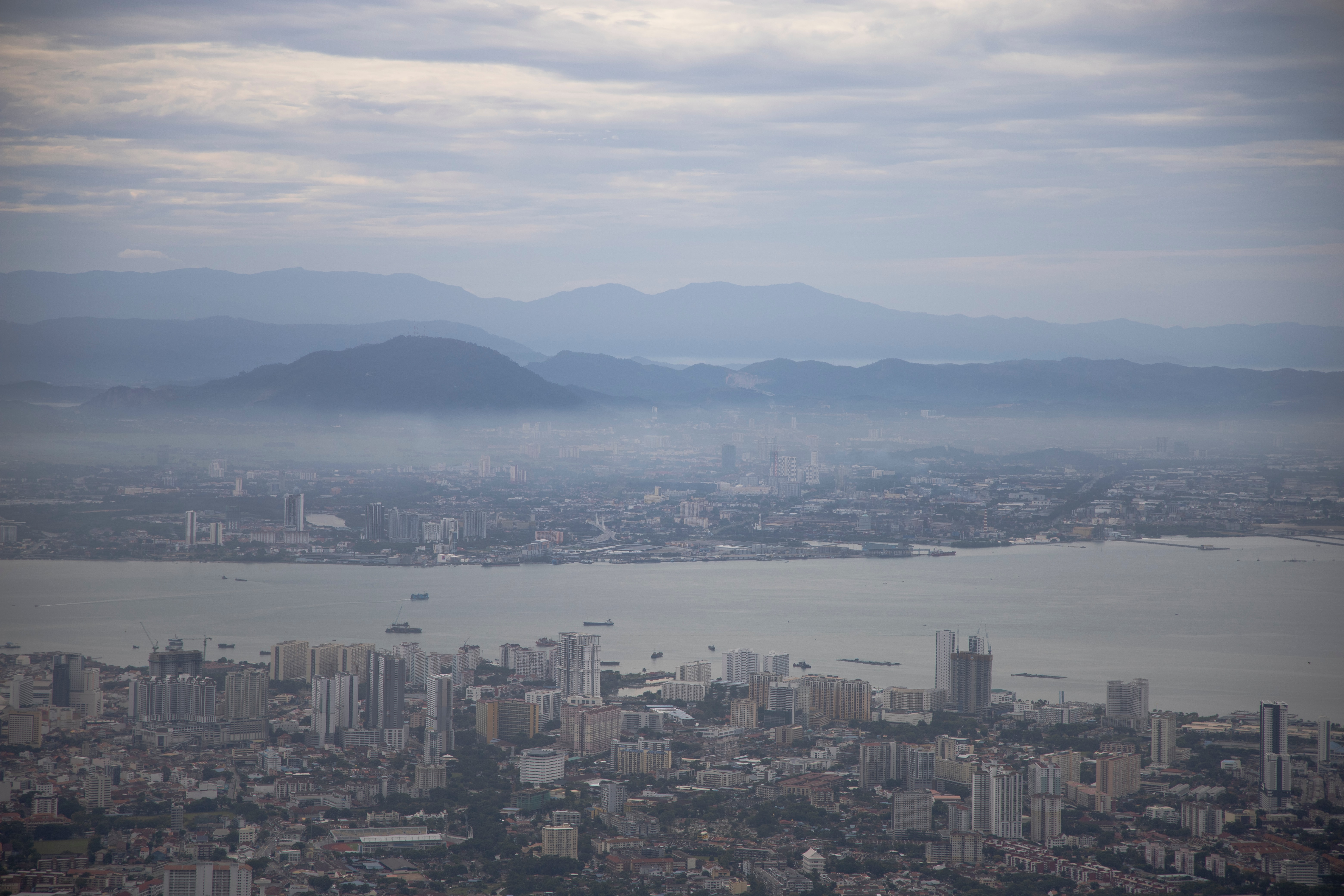
About Georgetown, Penang
An island off the northwest coast of peninsular Malaysia, Penang is blessed with a multicultural history that's led to a fascinating fusion of East and West. Claimed by the British East India Company in 1786, the island's city center of Georgetown—listed as a UNESCO World Heritage Site—is filled with colonial architecture, temples, and museums. The island has also attracted many Chinese immigrants, who now make up the majority of the population. On Penang you'll find an exciting mix of jungle, coast, farmland, and fishing villages, along with the country's largest Buddhist temple.

About Port Klang
Kuala Lumpur, or KL as locals refer to it, intrigues visitors with its diversity and multicultural character. The city's old quarter features stretches of shop houses that hint at its colonial past, while modern buildings—including the iconic Petronas Towers—give a glimpse of its modern financial ambitions. The city is filled with culturally colorful quarters dedicated to Chinese, Malay, and Indian communities. New shopping malls with designer labels, five-star hotels, and top-notch restaurants also proliferate in this bustling city of 1.6 million.
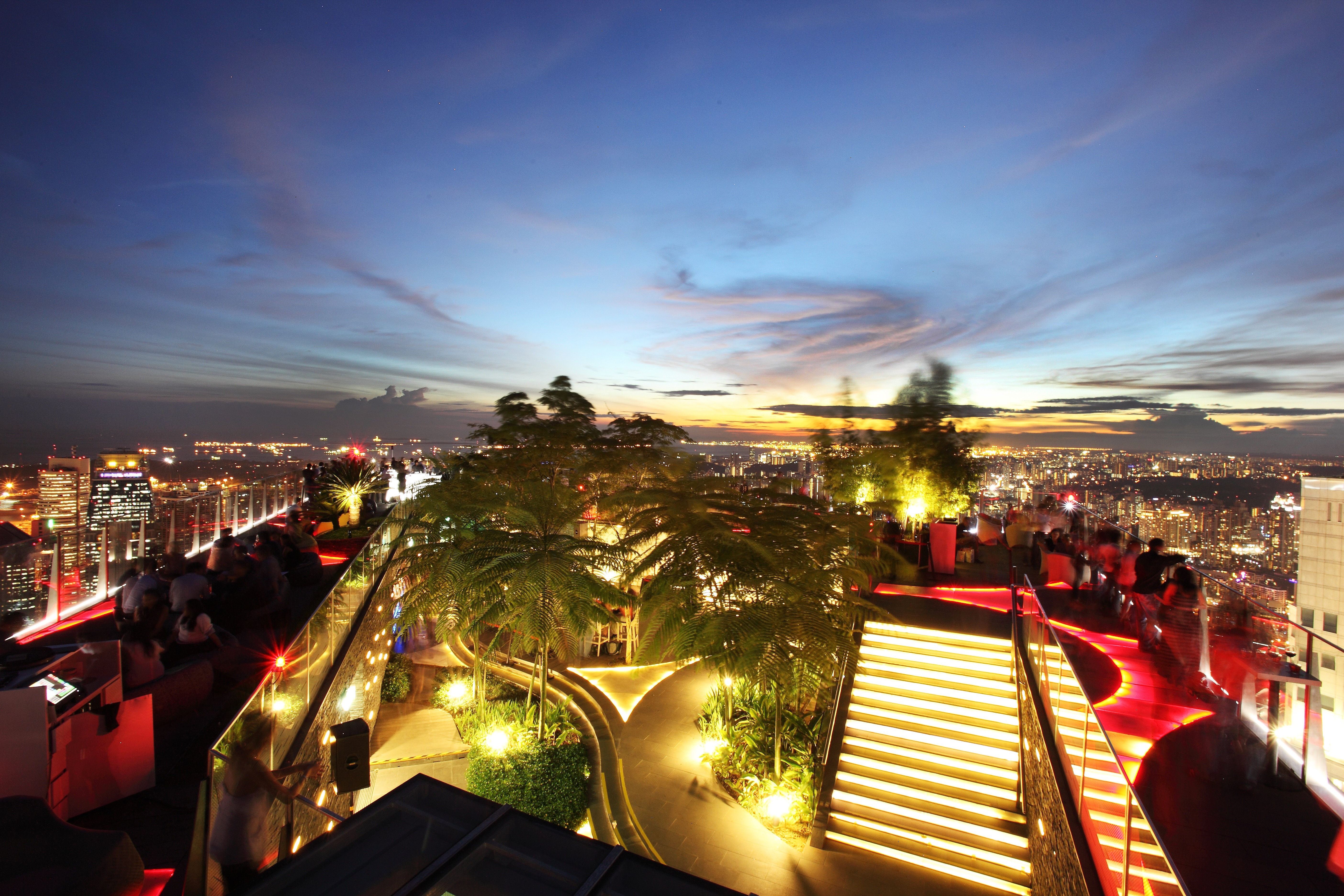
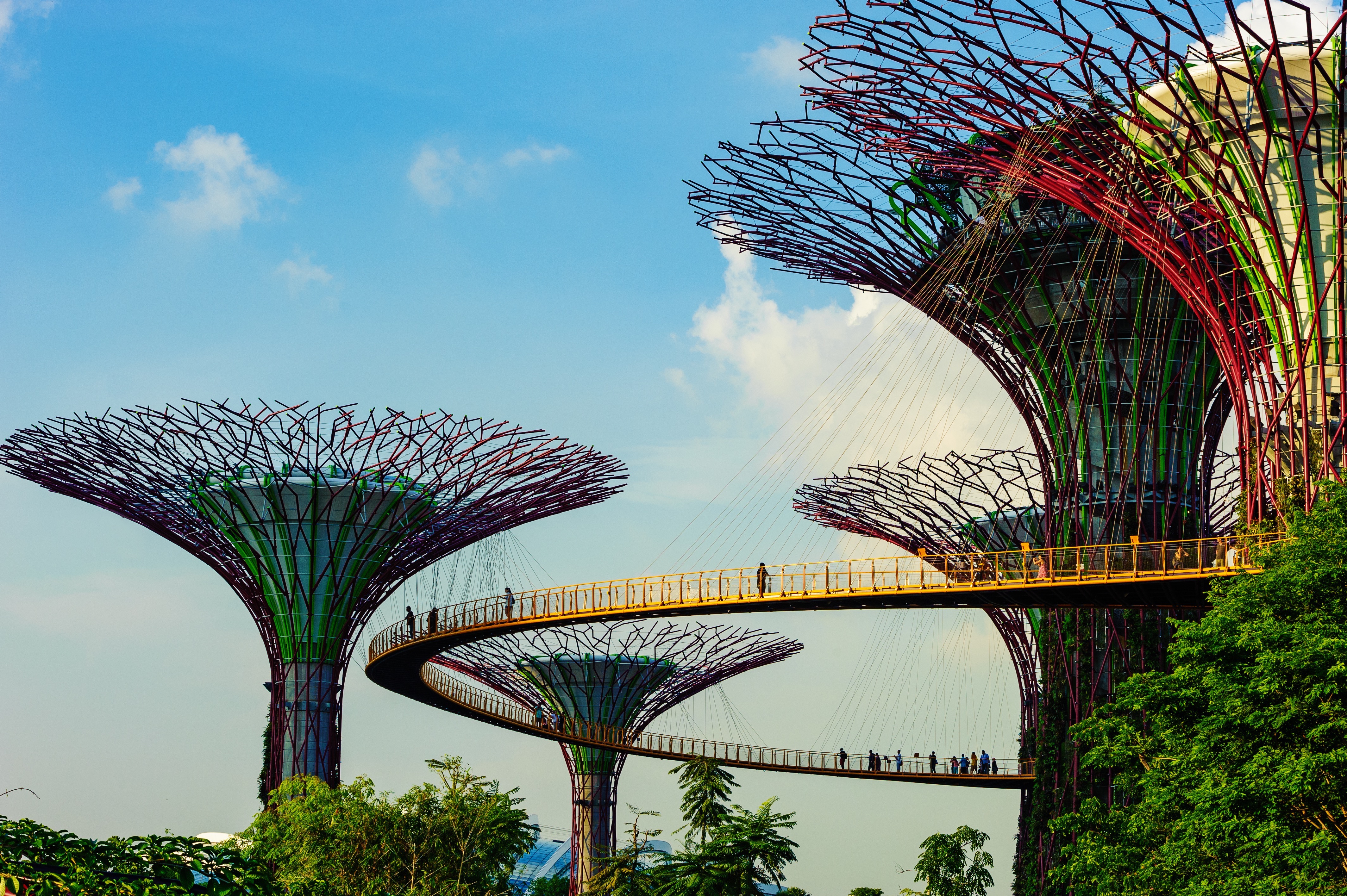
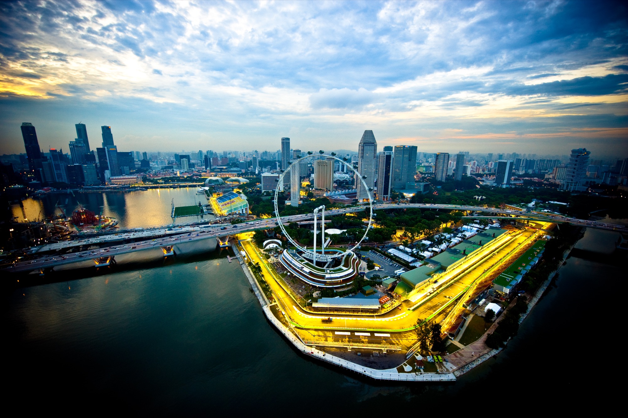
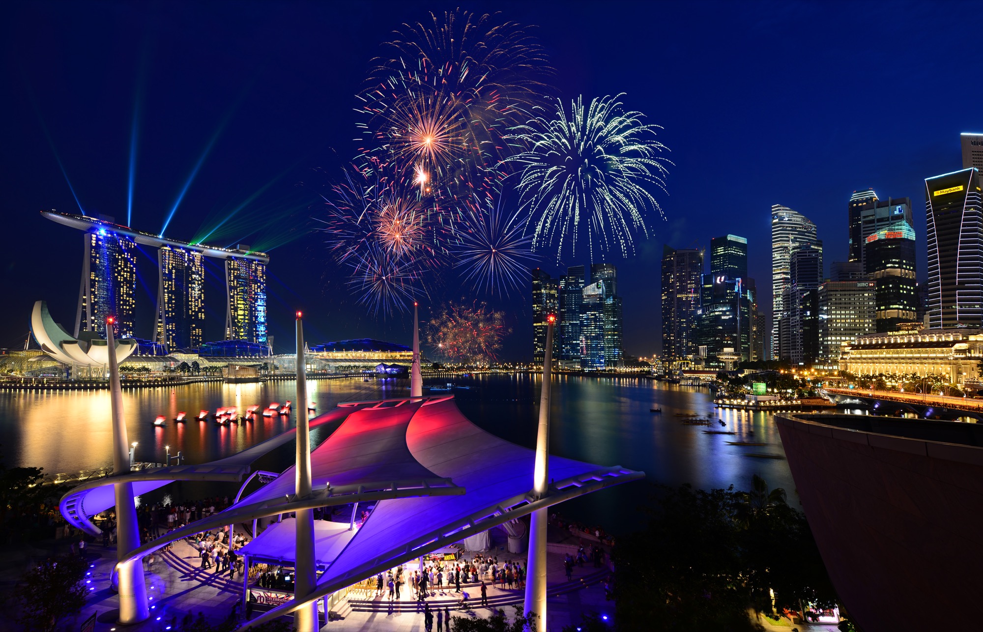
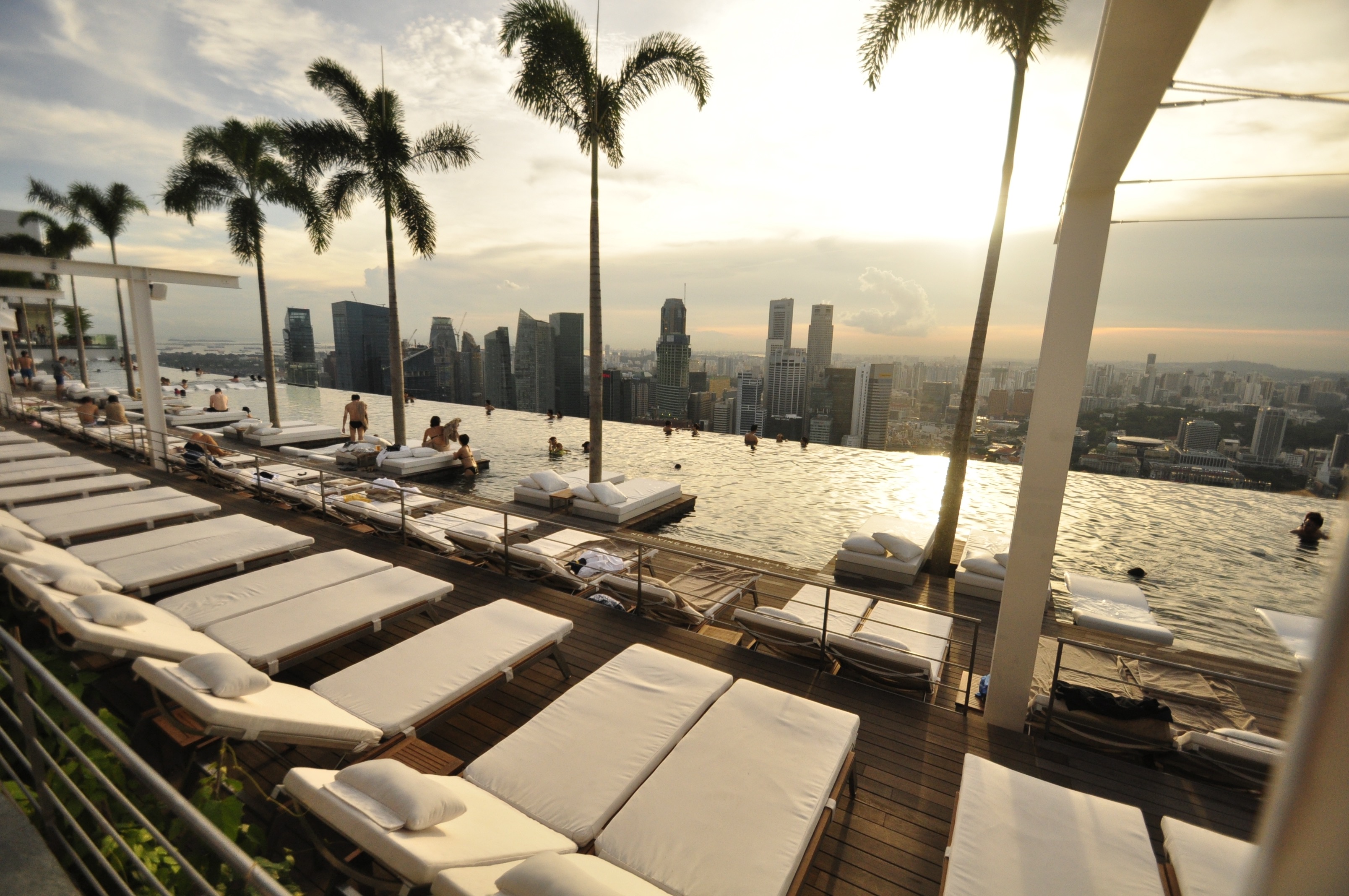
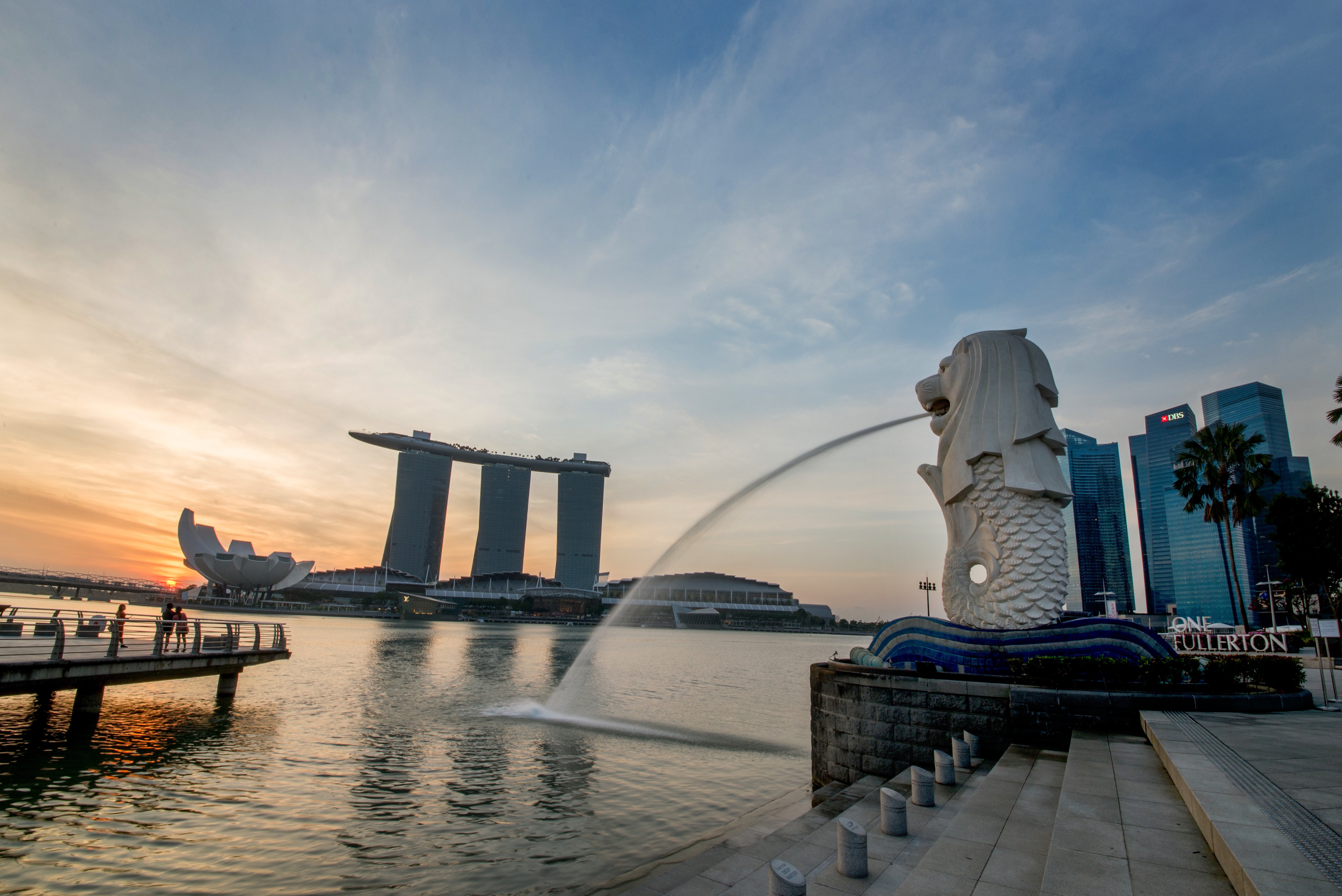
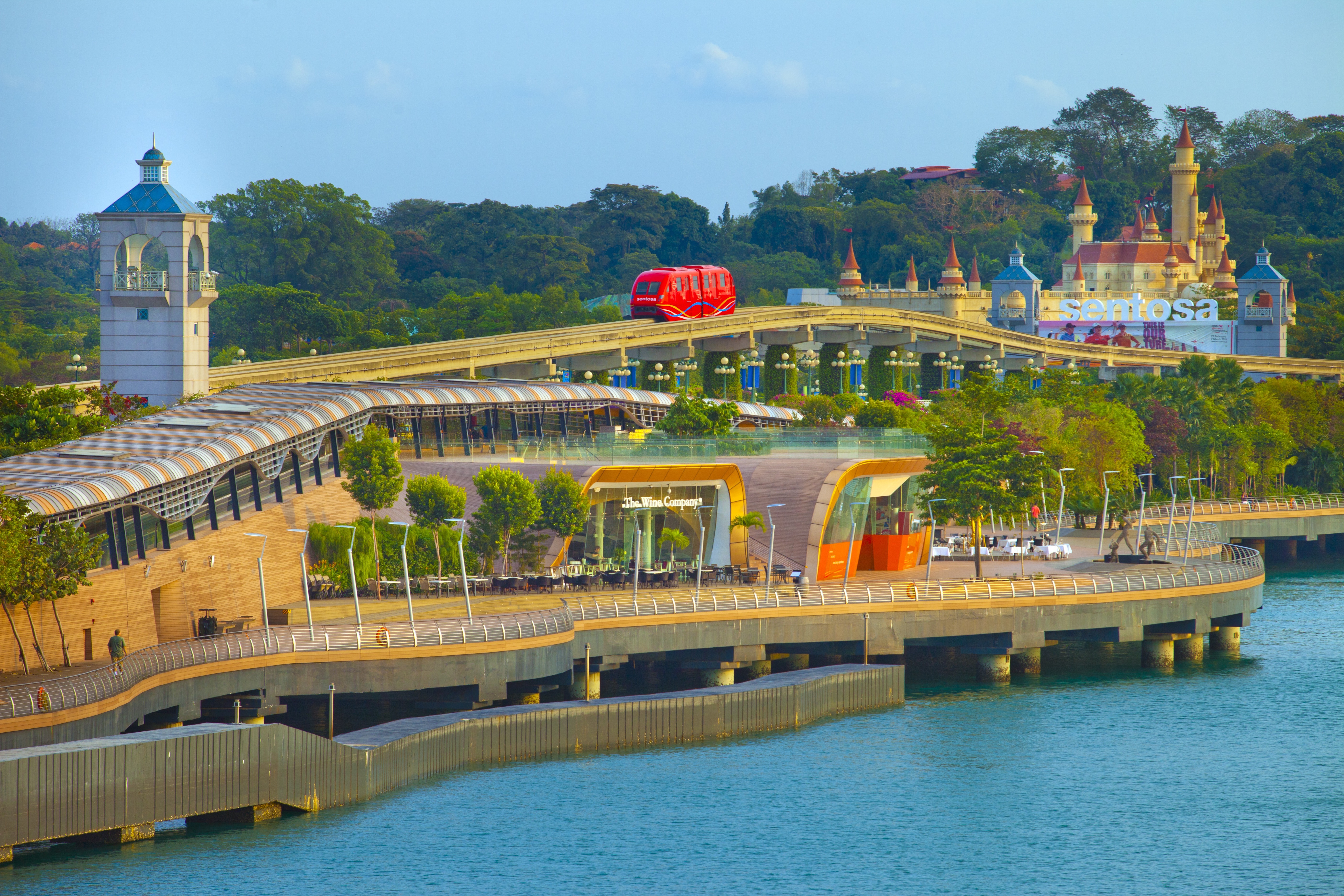
About Singapore
The main island of Singapore is shaped like a flattened diamond, 42 km (26 miles) east to west and 23 km (14 miles) north to south. Near the northern peak is the causeway leading to West Malaysia—Kuala Lumpur is less than four hours away by car. It is at the southern foot where you will find most of the city-state’s action, with its gleaming office towers, working docks, and futuristic "supertrees," which are solar-powered and serve as vertical gardens. Offshore are Sentosa and over 60 smaller islands, most uninhabited, that serve as bases for oil refining or as playgrounds and beach escapes from the city. To the east is Changi International Airport, connected to the city by metro, bus, and a tree-lined parkway. Of the island's total land area, more than half is built up, with the balance made up of parkland, farmland, plantations, swamp areas, and rain forest. Well-paved roads connect all parts of the island, and Singapore city has an excellent, and constantly expanding, public transportation system. The heart of Singapore's history and its modern wealth are in and around the Central Business District. The area includes the skyscrapers in the Central Business District, the 19th-century Raffles Hotel, the convention centers of Marina Square, on up to the top of Ft. Canning. Although most of old Singapore has been knocked down to make way for the modern city, most colonial landmarks have been preserved in the CBD, including early-19th-century buildings designed by the Irish architect George Coleman.
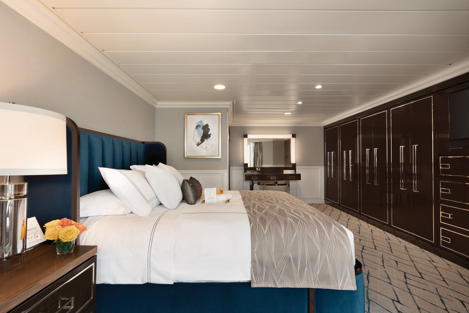
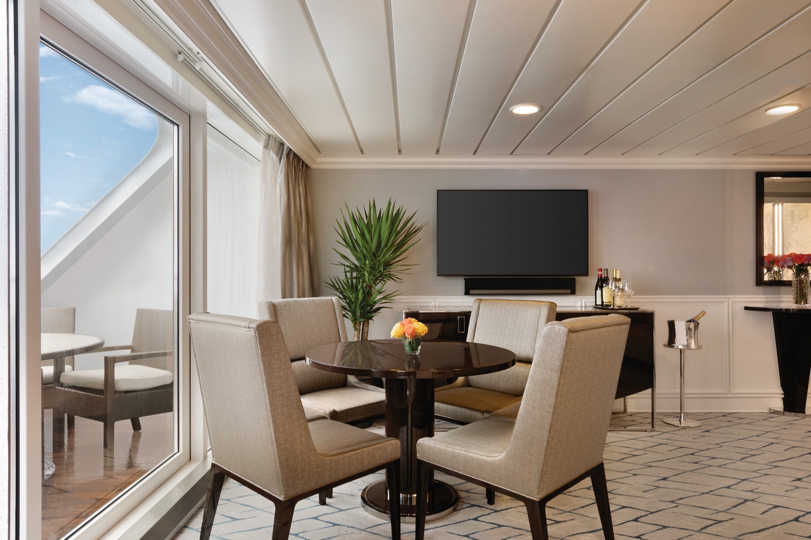
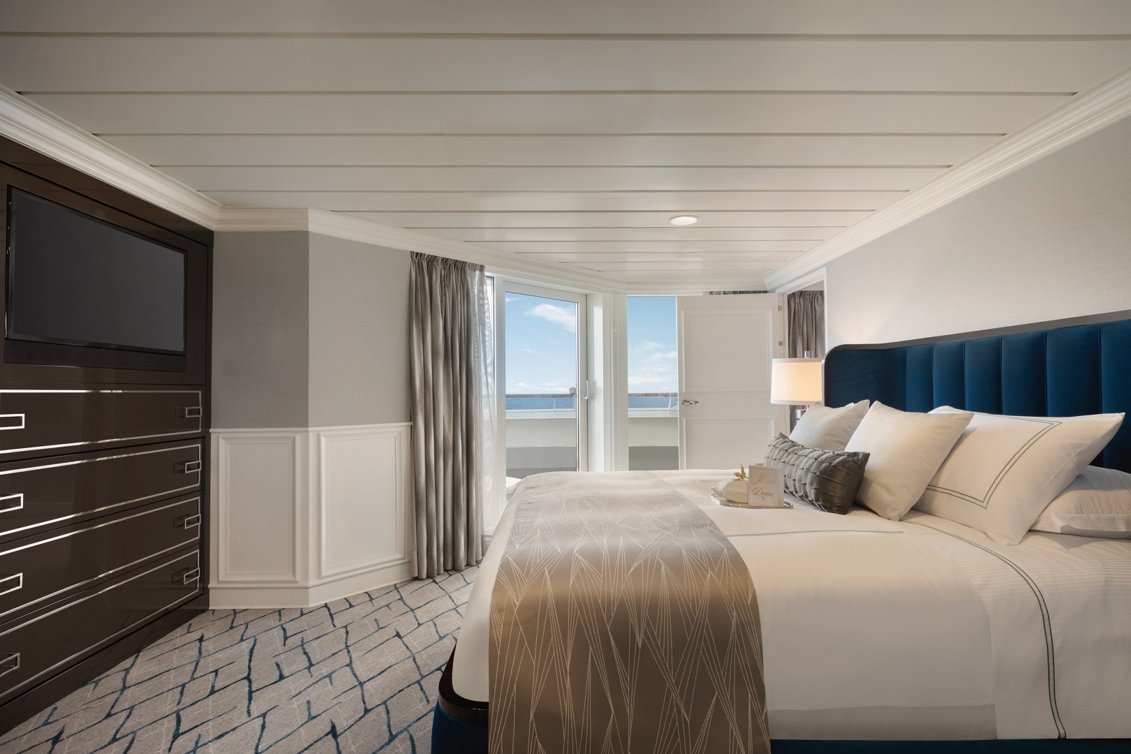
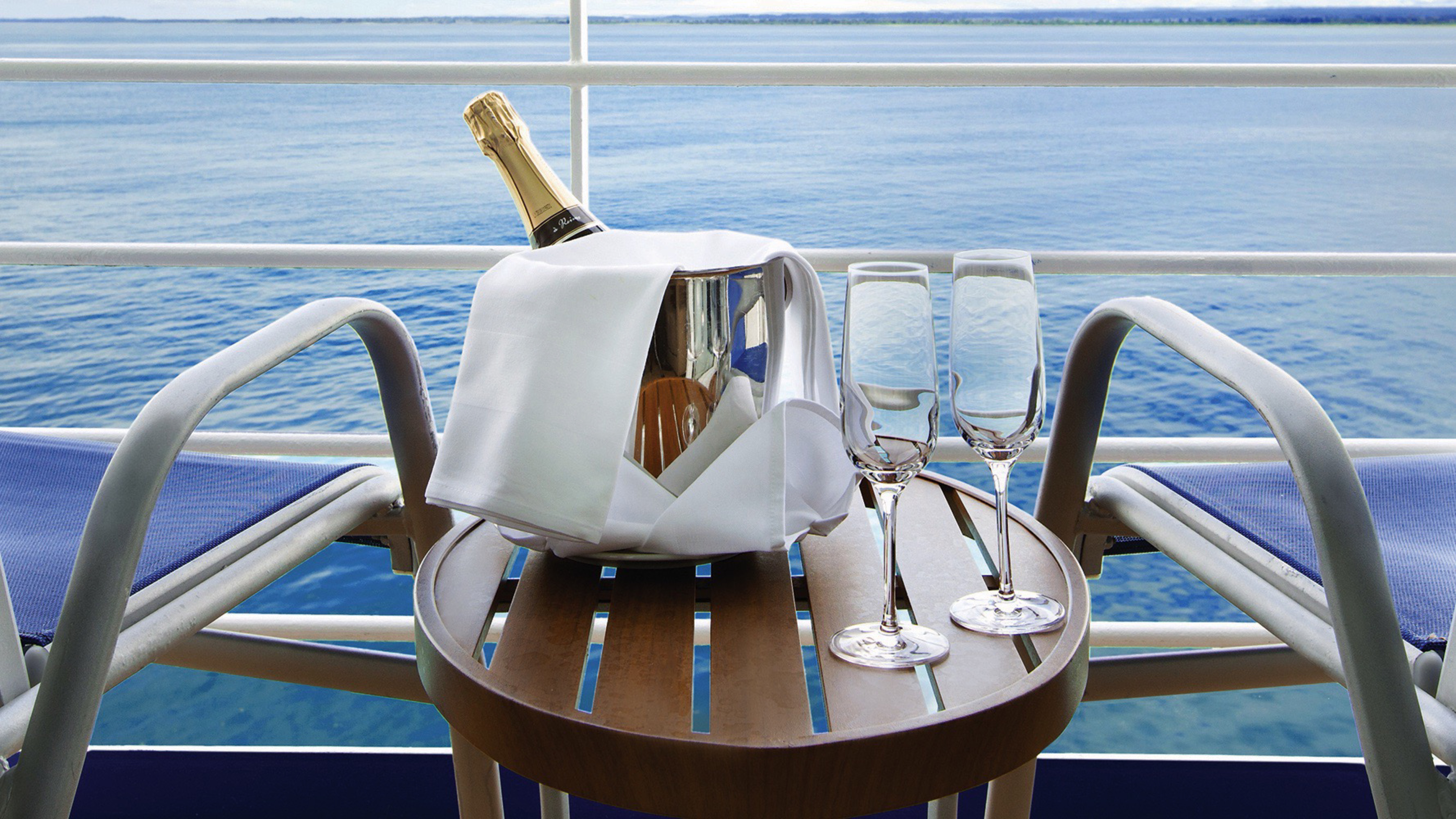
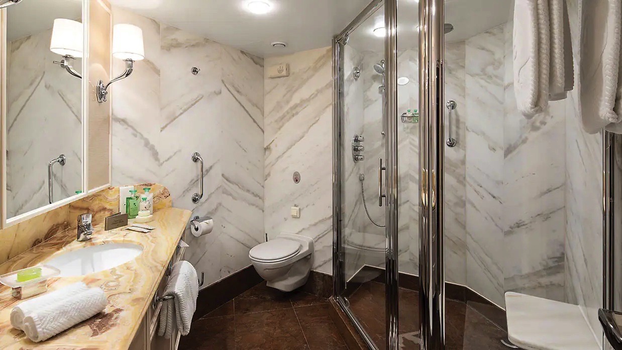
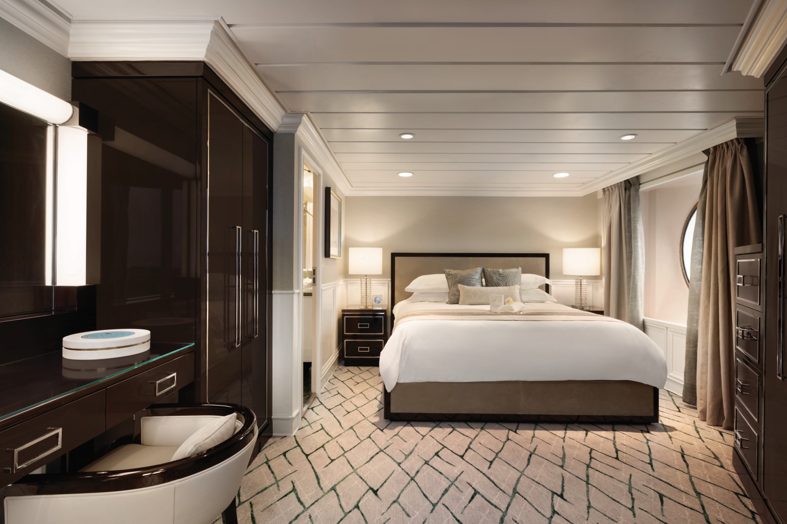
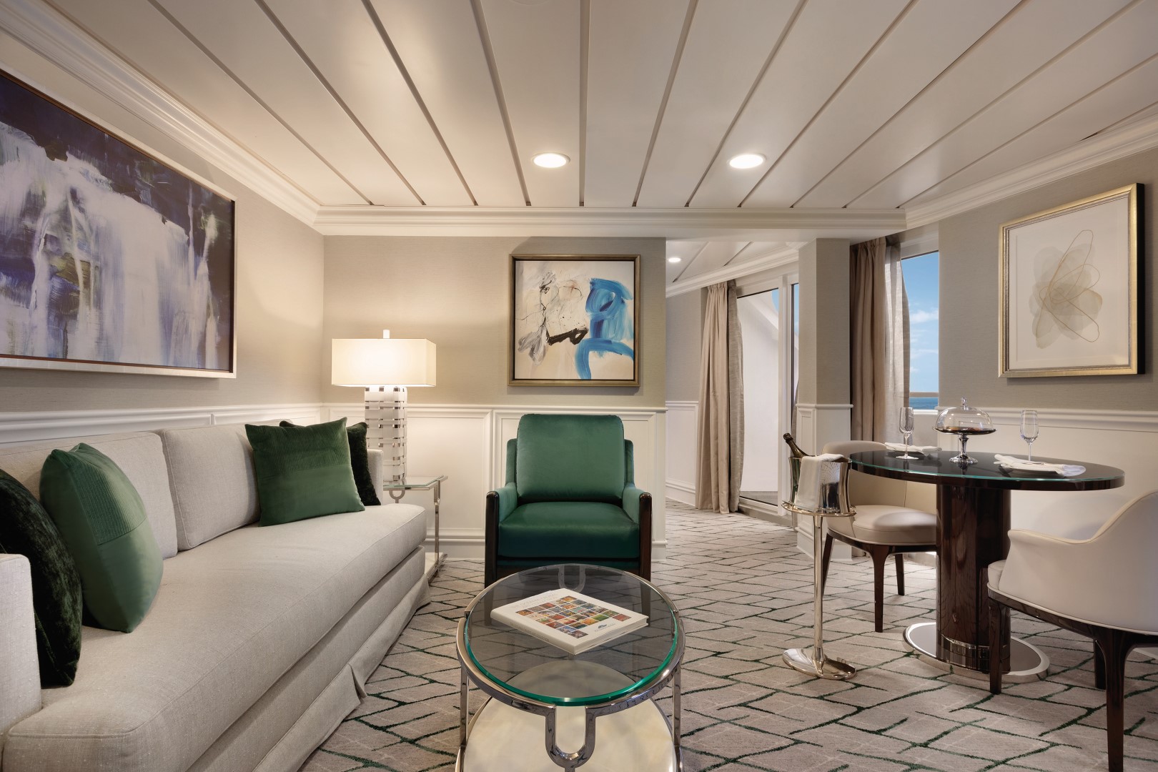
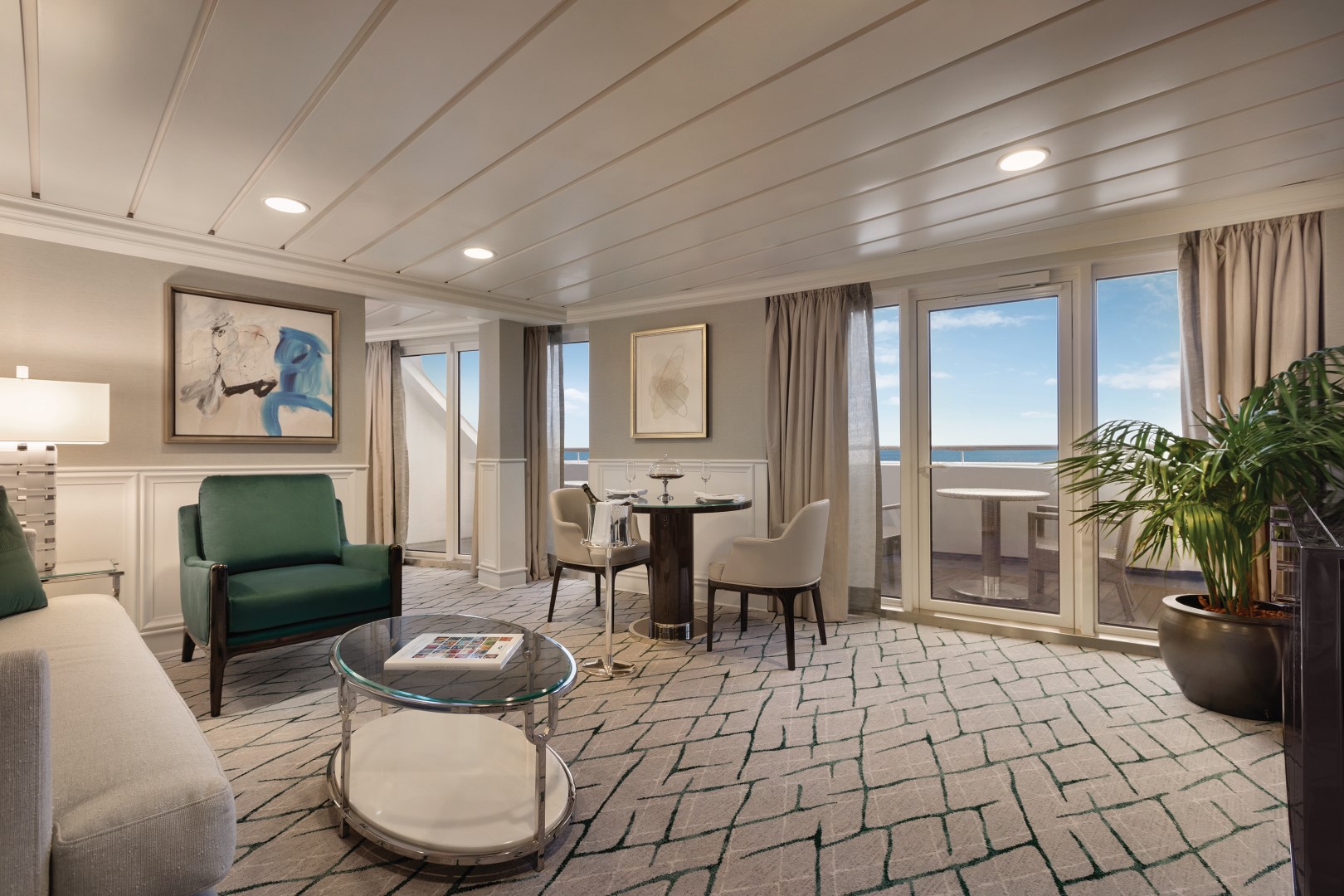
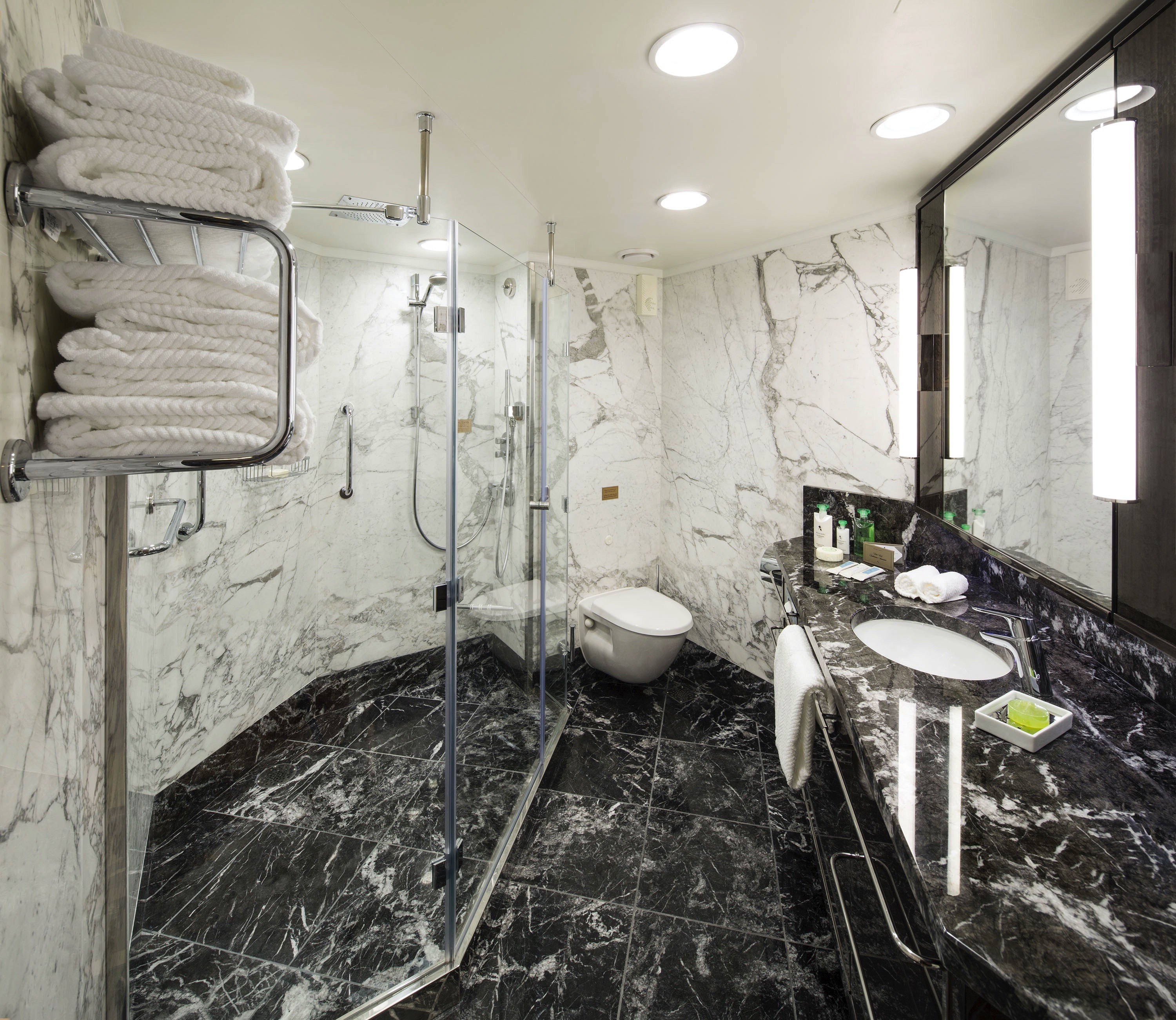
Lavish new fabrics and designer furnishings grace our six new Owner’s Suites – always among the first to be reserved. Immensely spacious and exceptionally luxurious, these suites span nearly 1,000 square feet and are oases of quietude and relaxation. Every imaginable amenity is found here, further enhanced by a sumptuous re-designed bathroom with an oversized shower, a private teak veranda and two flat-screen televisions.
Owner's Suite Privileges
+In addition to Concierge Level privileges
- Priority luggage delivery
- 24-hour Butler service
- Optional private in-suite embarkation day lunch from noon to 2 pm in Owner’s Suites
- Complimentary in-suite bar setup with 6 full-size bottles of your choice of premium spirits and wines from our suite beverage menu
- Complimentary welcome bottle of Champagne
- In-suite illy® coffee maker and pods
- Fresh fruit basket upon request
- Choice of daily newspaper
- Exclusive pillow menu
- Course-by-course in-suite dining*
- Order in from any of our specialty restaurants*
- Coordination of shoreside dinner and entertainment reservations
- Last-minute luggage collection
- Packing and unpacking upon request
- Complimentary garment pressing*
- Complimentary shoeshine service
- Gourmet evening canapés upon request
- Special services upon request
+Up to 20 garments per laundry bag; additional restrictions apply.
++Certain limitations apply.
Smoking in suites, staterooms and on verandas is strictly prohibited.
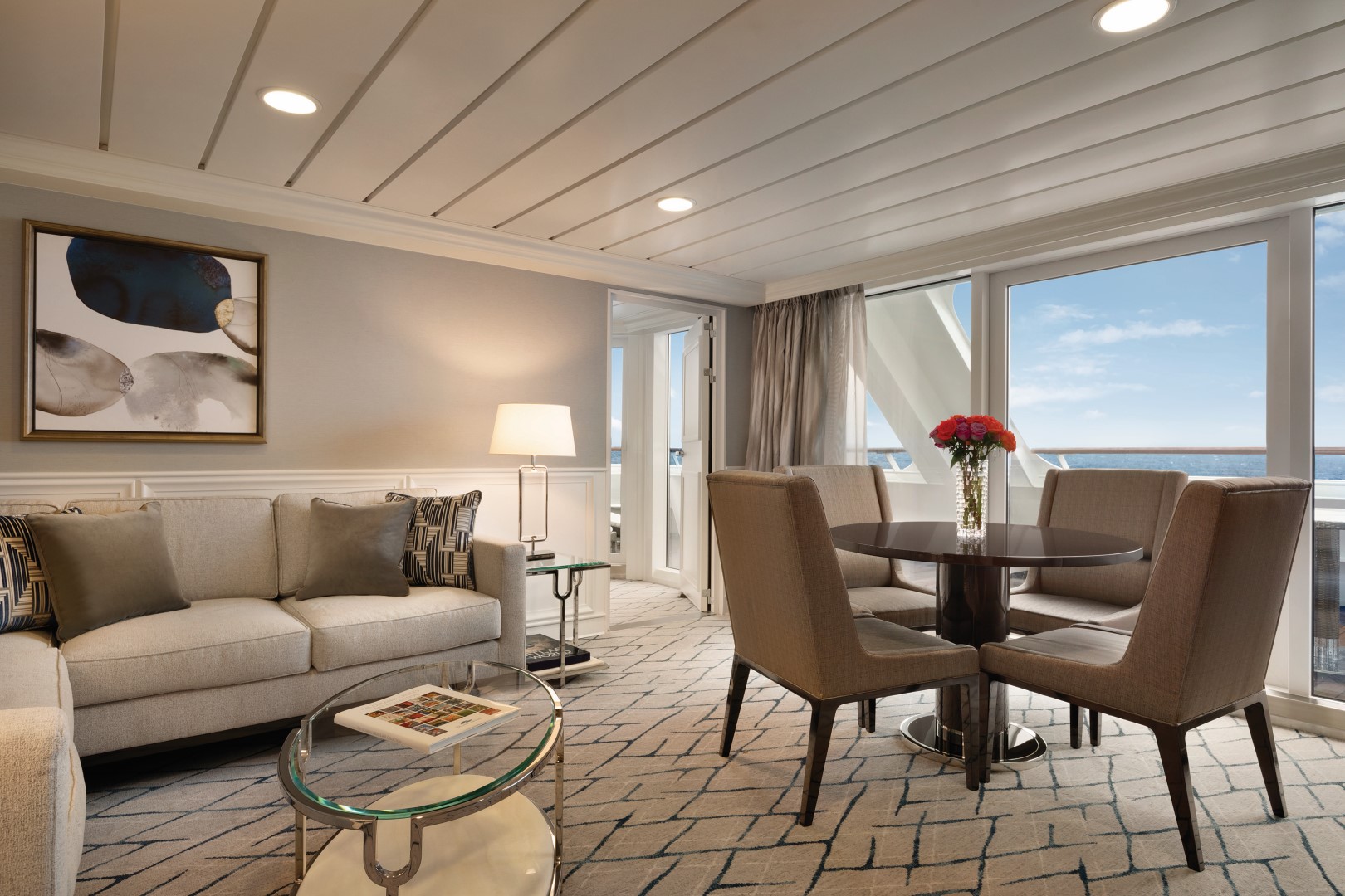
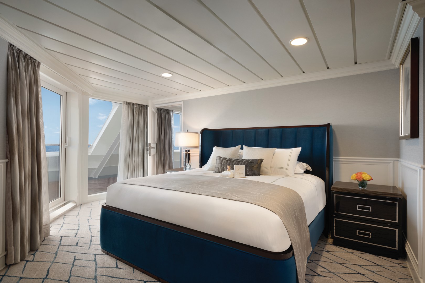
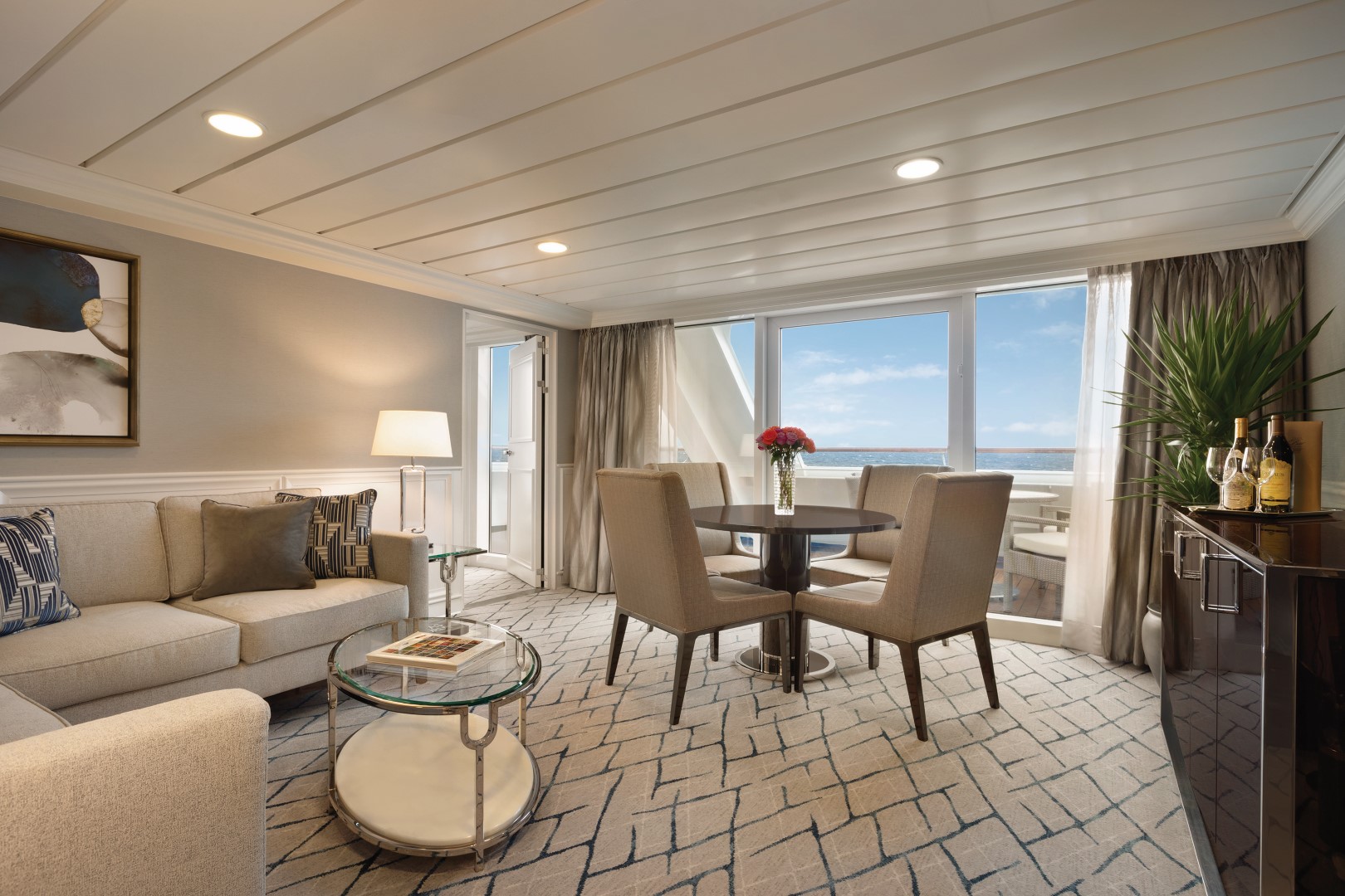
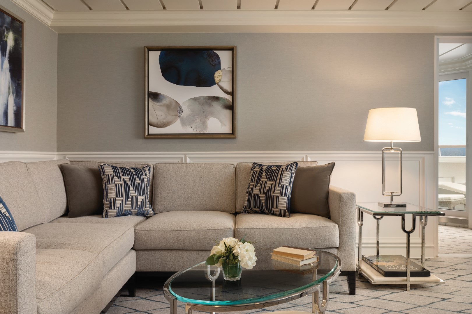
Named for their sweeping views over the ship’s bow, our four Vista Suites feature a calming palette echoing the serene seas and expansive skies. Each sprawls over 786 square feet and offers every imaginable comfort, including a second bathroom for guests as well as a master bathroom finished in onyx, Carrara marble and granite with a luxurious shower. Relax on your teak veranda or watch a movie on your customized entertainment system.
Vista Suite Privileges
+In addition to Concierge Level privileges
- Priority luggage delivery
- 24-hour Butler service
- Complimentary in-suite bar setup with 6 full-size bottles of your choice of premium spirits and wines from our suite beverage menu
- Complimentary welcome bottle of Champagne
- In-suite illy® coffee maker and pods
- Fresh fruit basket upon request
- Choice of daily newspaper
- Exclusive pillow menu
- Course-by-course in-suite dining*
- Order in from any of our specialty restaurants*
- Coordination of shoreside dinner and entertainment reservations
- Last-minute luggage collection
- Packing and unpacking upon request
- Complimentary garment pressing*
- Complimentary shoeshine service
- Gourmet evening canapés upon request
- Special services upon request
+Up to 20 garments per laundry bag; additional restrictions apply.
++Certain limitations apply.
Smoking in suites, staterooms and on verandas is strictly prohibited.
Our collection of new 322-square-foot Penthouse Suites is adorned with sumptuous designer fabrics and furnishings in serene shades of the sea and sky. Spacious enough for private in-suite dining, the living area features a refrigerated mini-bar and vanity desk, and the sleekly transformed bathroom features luxury stone finishes and a shower.
Penthouse Suite Privileges
+In addition to Concierge Level privileges
- Priority luggage delivery
- 24-hour Butler service
- Course-by-course in-suite dining*
- Order in from any of our specialty restaurants*
- Coordination of shoreside dinner and entertainment reservations
- Last-minute luggage collection
- Packing and unpacking upon request
- Complimentary garment pressing*
- Complimentary shoeshine service
- Gourmet evening canapés upon request
- Special services upon request
+Up to 20 garments per laundry bag; additional restrictions apply.
++Certain limitations apply.
Smoking in suites, staterooms and on verandas is strictly prohibited.
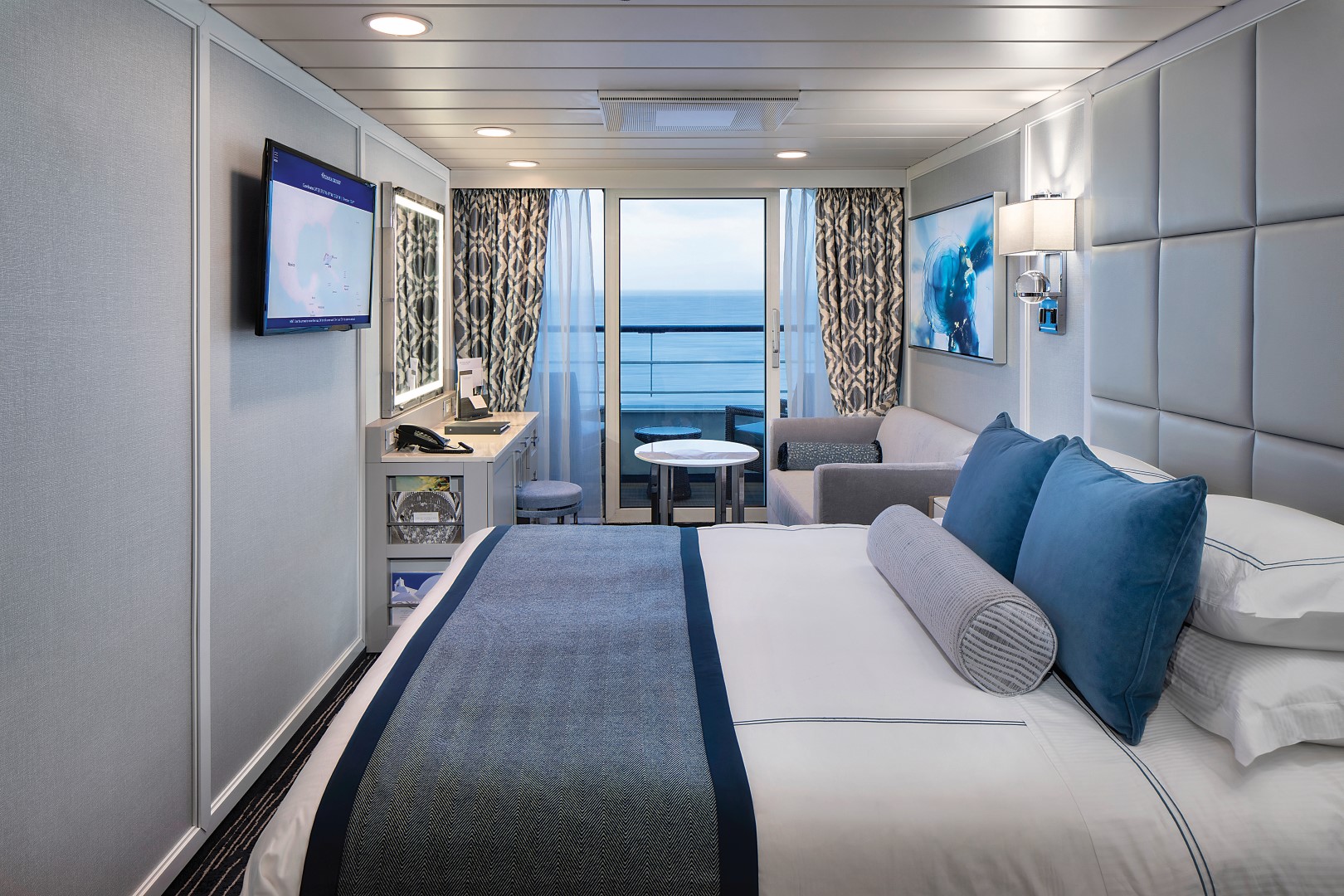
Located in some of the most desirable locations on the ship, Category A Concierge Level Veranda Staterooms offer the attractive blend of both value and luxury. These sleekly redefined 216-square-foot staterooms offer coveted amenities and exclusive privileges, such as free laundry service, that make your experience that much more carefree. Fresh new decor, sumptuous Tranquility Beds and re-inspired verandas with stylish new furniture complete the Concierge experience.
Exclusive Concierge Privileges
+In addition to Stateroom amenities
- Expanded lunch and dinner room service menu from The Grand Dining Room
- FREE laundry service - up to 3 bags per stateroom+
- Private teak veranda††
- Complimentary welcome bottle of Prosecco
- Priority online specialty restaurant reservations
- Unlimited access to the Aquamar Spa Terrace
- Complimentary Oceania Cruises logo tote bag
- Cashmere lap blankets, perfect for relaxing on your veranda
- Complimentary pressing of garments upon embarkation++
- Complimentary shoeshine service
+Up to 20 garments per laundry bag; additional restrictions apply.
++Certain limitations apply.
Smoking in suites, staterooms and on verandas is strictly prohibited.
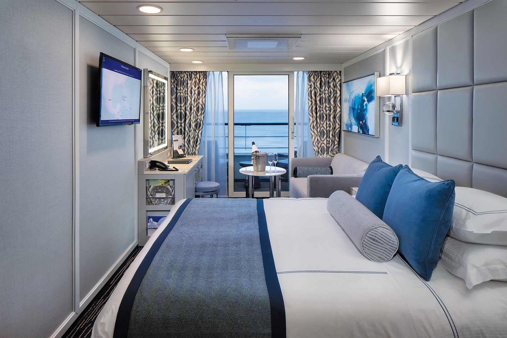
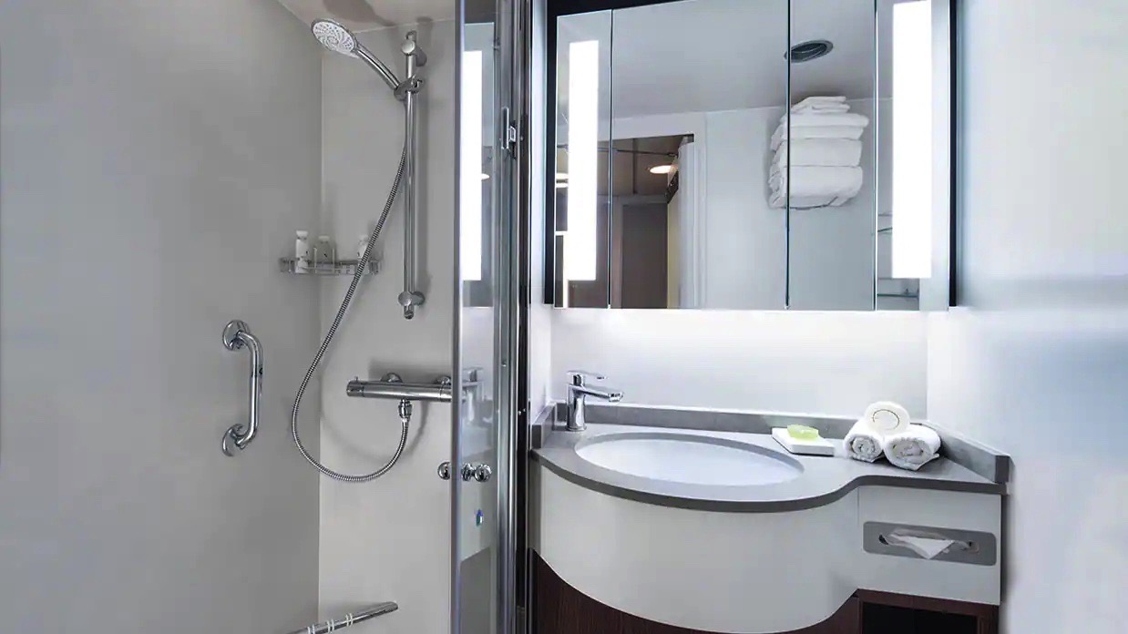
Custom-crafted furnishings, exotic stone finishes, supple upholstered headboards and chic lighting are just a few of the enhancements within these 216-square-foot staterooms that also boast our most popular luxury – a private teak veranda for watching the ever-changing panoramas. Conveniences within each stateroom include a vanity desk, refrigerated mini-bar, breakfast table and spacious seating area.
Veranda Stateroom Amenities
- Tranquility Bed, an Oceania Cruises exclusive†
- FREE sodas replenished daily in your refrigerated mini-bar
- FREE still and sparkling Vero Water®
- Private teak veranda††
- Luxury bath amenities
- FREE room service menu 24 hours a day
- Daily housekeeping service
- Gourmet turndown chocolates upon request
- Interactive television system with on-demand movies, weather and more
- Starlink® WiFi service
- Writing desk and stationery
- Plush cotton towels, robes and slippers
- Handheld hair dryer
- Security safe
†King-size bed (cannot be converted into twin beds) for Owner’s, Vista and Oceania Suites and queen-size bed for all other suites and staterooms (Tranquility Bed available for purchase at OceaniaBedCollection.com)
††Featured with all Veranda Staterooms
Smoking in suites, staterooms and on verandas is strictly prohibited
With entirely re-designed closets, dressers and vanities, these 165-squarefoot staterooms feel even more spacious. A generous seating area, vanity desk, refrigerated mini-bar and breakfast table are perfectly complemented by the soothing hues and stylish fabrics of the sleek new decor.
- Tranquility Bed, an Oceania Cruises exclusive†
- FREE sodas replenished daily in your refrigerated mini-bar
- FREE still and sparkling Vero Water®
- Luxury bath amenities
- FREE room service menu 24 hours a day
- Daily housekeeping service
- Gourmet turndown chocolates upon request
- Interactive television system with on-demand movies, weather and more
- Starlink® WiFi service
- Writing desk and stationery
- Plush cotton towels, robes and slippers
- Handheld hair dryer
- Security safe
†King-size bed (cannot be converted into twin beds) for Owner’s, Vista and Oceania Suites and queen-size bed for all other suites and staterooms (Tranquility Bed available for purchase at OceaniaBedCollection.com)
††Featured with all Veranda Staterooms (excluding French Veranda)
Smoking in suites, staterooms and on verandas is strictly prohibited
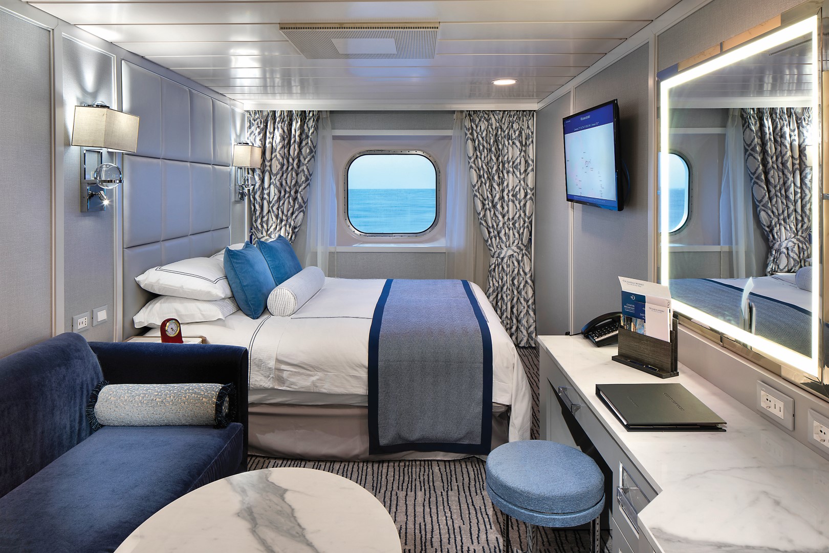
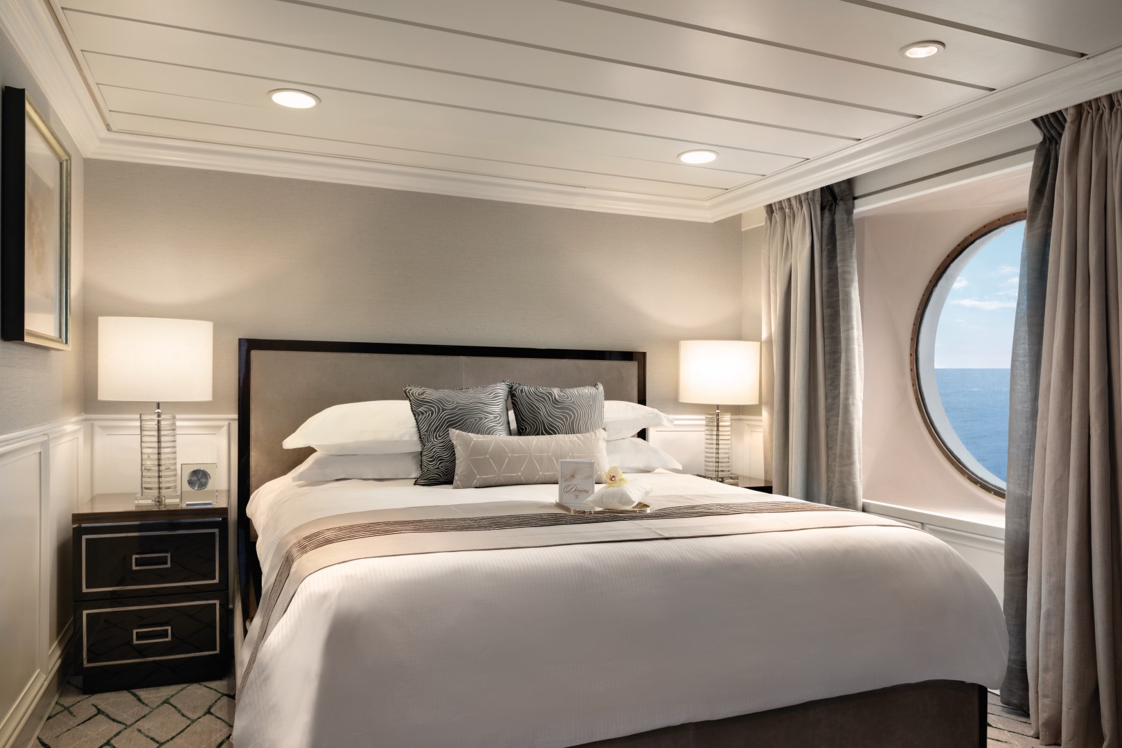
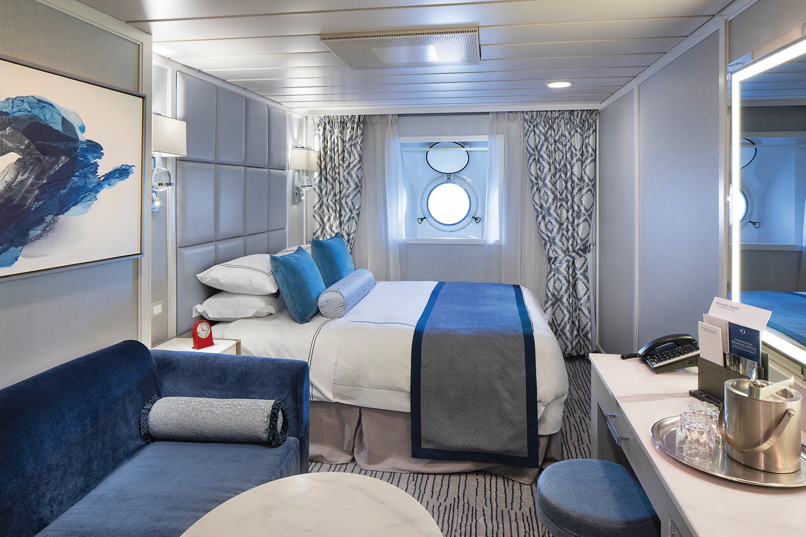
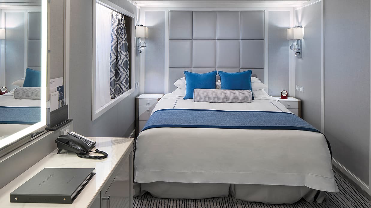
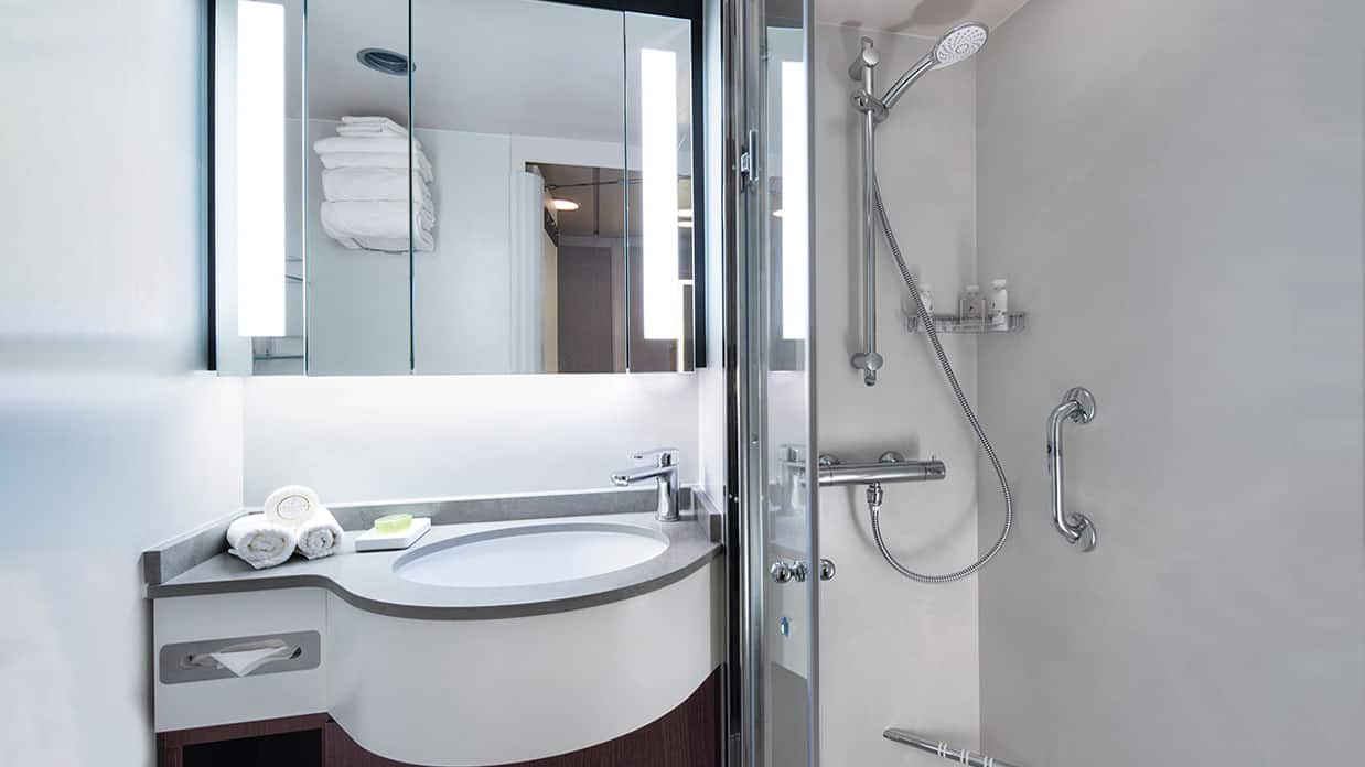
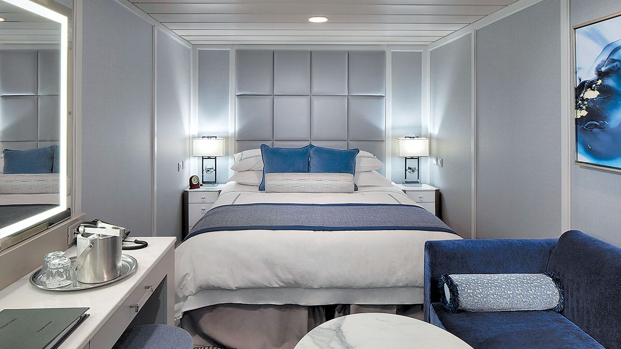
Featuring a classic porthole, these exquisitely appointed 165-square-foot staterooms showcase sophisticated new decor and a modern design that maximizes both space and convenience. Enjoy a comfortable seating area with a sofa on which to stretch out, as well as a vanity desk, breakfast table and refrigerated mini-bar.
Ocean View Stateroom Amenities
- Tranquility Bed, an Oceania Cruises exclusive†
- FREE sodas replenished daily in your refrigerated mini-bar
- FREE still and sparkling Vero Water®
- Luxury bath amenities
- FREE room service menu 24 hours a day
- Daily housekeeping service
- Gourmet turndown chocolates upon request
- Interactive television system with on-demand movies, weather and more
- Starlink® WiFi service
- Writing desk and stationery
- Plush cotton towels, robes and slippers
- Handheld hair dryer
- Security safe
†King-size bed (cannot be converted into twin beds) for Owner’s, Vista and Oceania Suites and queen-size bed for all other suites and staterooms (Tranquility Bed available for purchase at OceaniaBedCollection.com)
††Featured with all Veranda Staterooms
Smoking in suites, staterooms and on verandas is strictly prohibited
These charming 143-square-foot staterooms are the perfect retreat for the solo traveler. Amply spacious and centrally located on Deck 6, each is equipped with a sublimely plush Tranquility Bed, refrigerated mini-bar, writing desk and abundant storage space.
Solo Oceanivew Stateroom Amenities
- Tranquility Bed, an Oceania Cruises exclusive†
- FREE sodas replenished daily in your refrigerated mini-bar
- FREE still and sparkling Vero Water®
- Luxury bath amenities
- FREE room service menu 24 hours a day
- Daily housekeeping service
- Gourmet turndown chocolates upon request
- Interactive television system with on-demand movies, weather and more
- Starlink® WiFi service
- Writing desk and stationery
- Plush cotton towels, robes and slippers
- Handheld hair dryer
- Security safe
†King-size bed (cannot be converted into twin beds) for Owner’s, Vista and Oceania Suites and queen-size bed for all other suites and staterooms (Tranquility Bed available for purchase at OceaniaBedCollection.com)
††Featured with all Veranda Staterooms (excluding French Veranda)
Smoking in suites, staterooms and on verandas is strictly prohibited
Beautifully re-designed with a modern flair, these delightful private retreats boast 160 square feet of luxury. Highlights include a comfortable seating area, vanity desk, refrigerated mini-bar and plenty of storage. The ingenious use of space is complemented by the re-inspired decor.
Inside Stateroom Amenities
- Tranquility Bed, an Oceania Cruises exclusive†
- FREE sodas replenished daily in your refrigerated mini-bar
- FREE still and sparkling Vero Water®
- Luxury bath amenities
- FREE room service menu 24 hours a day
- Daily housekeeping service
- Gourmet turndown chocolates upon request
- Interactive television system with on-demand movies, weather and more
- Starlink® WiFi service
- Writing desk and stationery
- Plush cotton towels, robes and slippers
- Handheld hair dryer
- Security safe
†King-size bed (cannot be converted into twin beds) for Owner’s, Vista and Oceania Suites and queen-size bed for all other suites and staterooms (Tranquility Bed available for purchase at OceaniaBedCollection.com)
††Featured with all Veranda Staterooms (excluding French Veranda)
Smoking in suites, staterooms and on verandas is strictly prohibited
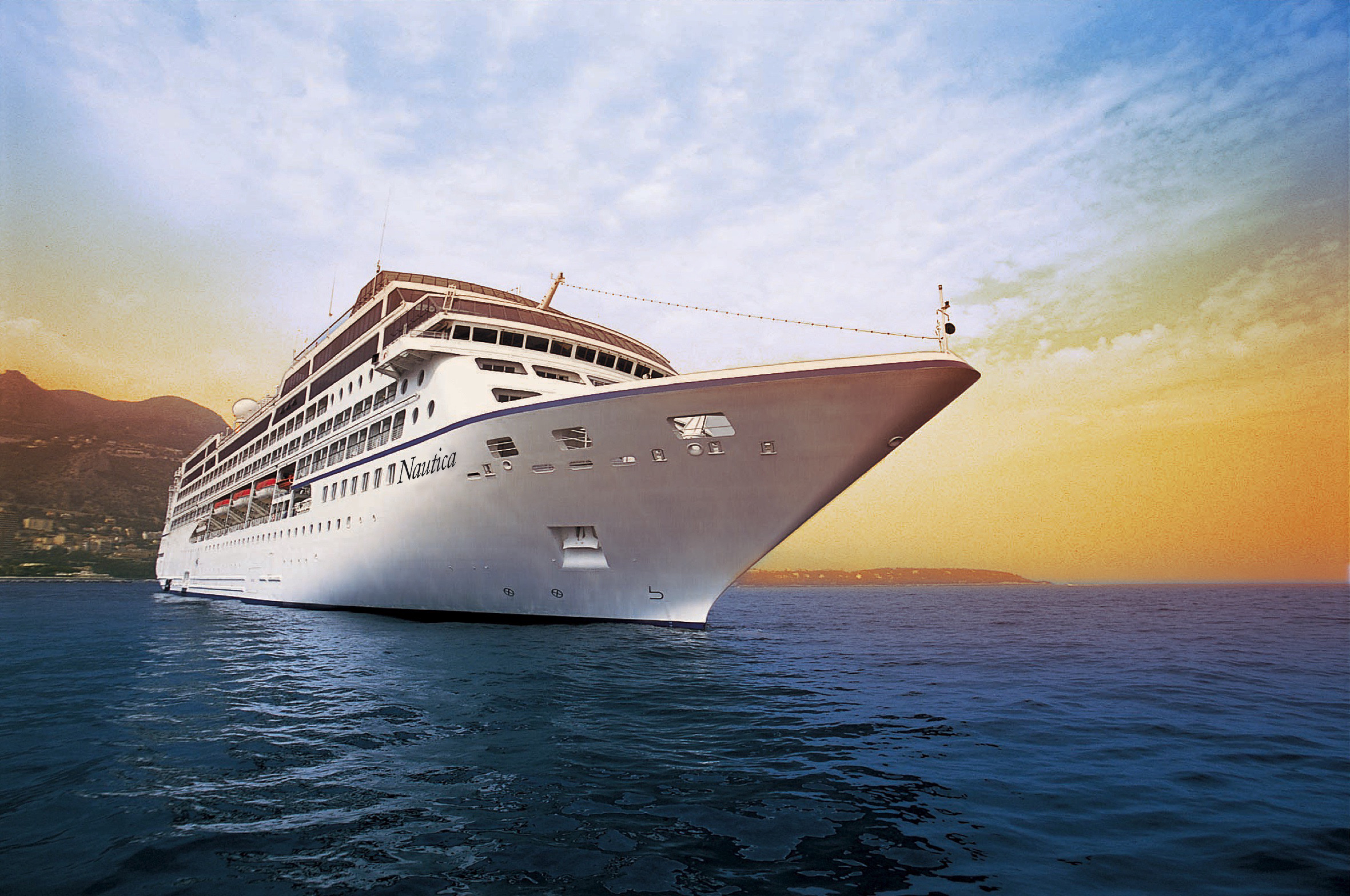
Oceania Nautica
Elegantly charming, Oceania Nautica’s lounges, suites and staterooms boast luxurious, residential furnishings and her decks are resplendent in the finest teak, custom stone and tile work. Oceania Nautica offers every luxury you may expect on board one of our stylish ships. She features four unique, open-seating restaurants, the Aquamar Spa + Vitality Center, eight lounges and bars, a casino and 333 luxurious suites and chic staterooms, nearly 70% of which feature private verandas. With just 670 guests to pamper, our 400 professionally trained staff ensure you will wait for nothing.
The better-than-new Nautica blends sophistication with a contemporary flair to create a casually elegant ambiance that embodies the most treasured elements of our celebrated ships. Every surface of every suite and stateroom is entirely new, while in the public spaces, a refreshed color palette of soft sea and sky tones surrounds a tasteful renewal of fabrics, furnishings and lighting fixtures that exquisitely encompasses the inimitable style and comfort of Oceania Cruises.
Ship Facts
| Launch Year | 2000 | ||||||||
| Refit Year | 2022 | ||||||||
| Language | en | ||||||||
| Gross Tonnage | 30277 | ||||||||
| Length | 181 | ||||||||
| Width | 25.5 | ||||||||
| Currency | USD | ||||||||
| Speed | 18 | ||||||||
| Capacity | 670 | ||||||||
| Crew Count | 400 | ||||||||
| Deck Count | 9 | ||||||||
| Cabin Count | 342 | ||||||||
| Large Cabin Count | 0 | ||||||||
| Wheelchair Cabin Count | 4 | ||||||||
| Electrical Plugs |
|
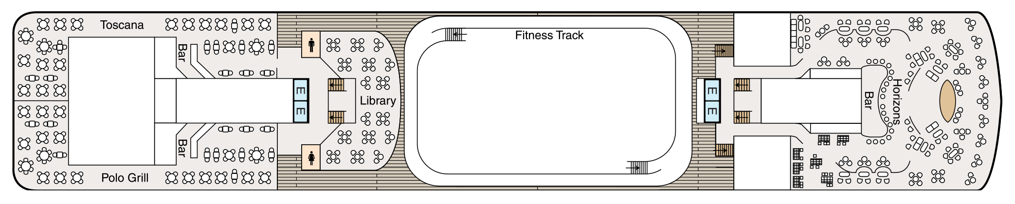
Deck 11
- Shuffleboard
- Sun Deck
- Golf Putting Greenes
- Showers

Deck 10
- Toscana
- Bars
- Polo Grill
- Library
- Fitness Track
- Horizons Bar
- Elevator
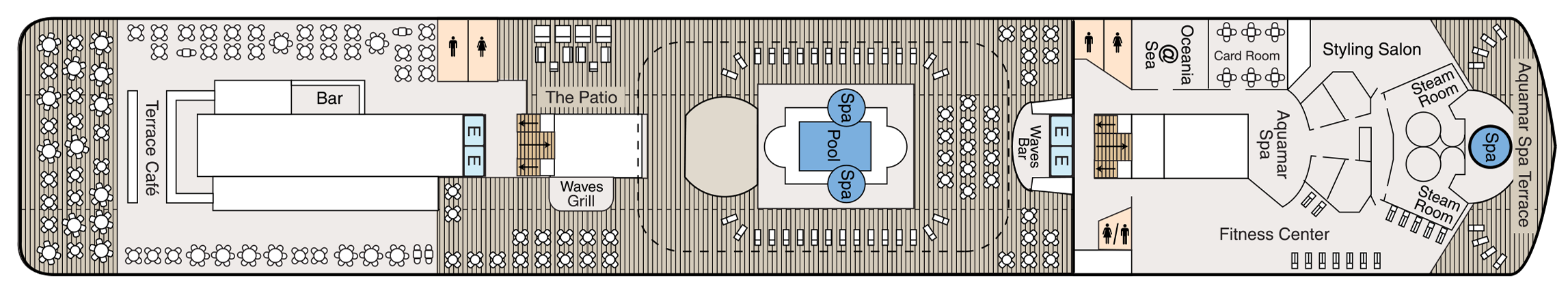
Deck 9
- Terrace Café
- Bar
- The Patio
- Waves Grill
- Whirlpools
- Pool
- Waves Bar
- Oceania@Sea
- Card Room
- Aquamar Spa
- Fitness Centre
- Styling Salon
- Steam Rooms
- Spa Terrace
- Elevator
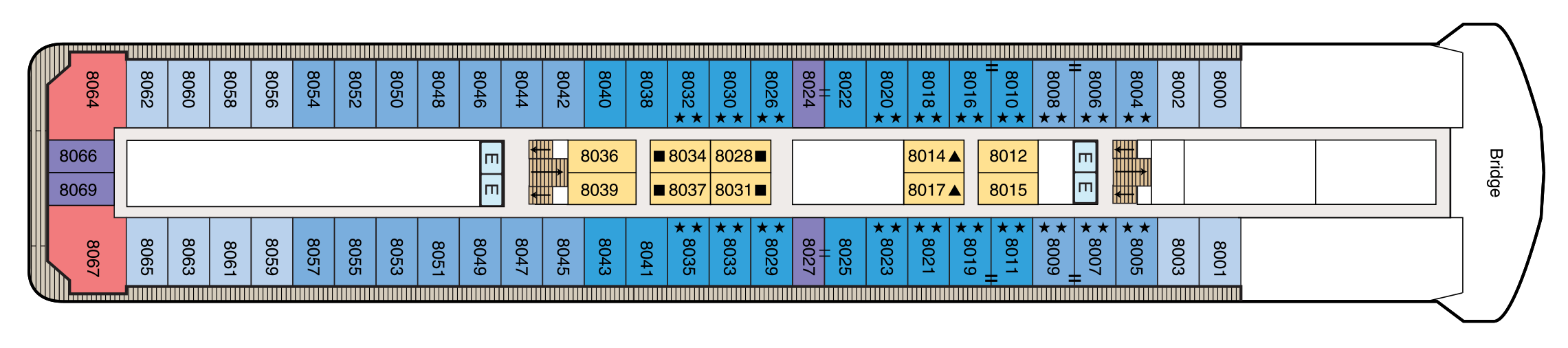
Deck 8
- Bridge
- Concierge Level Veranda Staterooms
- Inside Staterooms
- Owner's Suites
- Penthouse Suites
- Elevator
Deck 7
- Concierge Level Veranda Staterooms
- Deluxe Ocean View Staterooms
- Inside Staterooms
- Owner's Suites
- Vista Suites
- Elevator

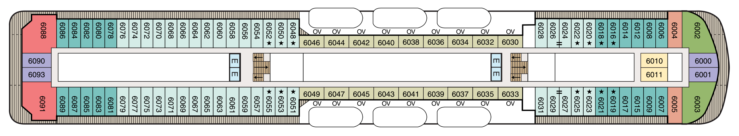
Deck 6
- Concierge Level Veranda Staterooms
- Veranda Staterooms
- Deluxe Ocean View Staterooms
- Ocean View Staterooms
- Inside Staterooms
- Owner's Suites
- Vista Suites
- Elevator
Deck 5
- Grand Dining Room
- Baristas Grand/ Bar
- Upper Hall
- Boutiques
- Martinis
- Casino
- Lounge
- Dance Floor
- Stage
- Elevator

Deck 4
- Destination Services
- Concierge
- Reception Hall
- Reception Desk
- Medical Centre
- Deluxe Ocean View Staterooms
- Inside Staterooms
- Elevator

Deck 3
- Ocean View Stateroom
- Tender Embarkation Area
- Elevator

Culinary Masterpieces
The superb gourmet restaurants aboard Oceania Nautica serve delectable dishes created à la minute and offer a remarkable array of choices, from Continental cuisine and vibrant regional specialties to casual all-American favorites. Every restaurant on board Oceania Nautica is complimentary and features open seating so you may dine wherever and whenever suits your taste and schedule. Enjoy dinner for two or a gathering with newfound friends, knowing the experience is certain to be extraordinary.The Luxury of Casual
The Luxury of Casual
You’ll savor cuisine renowned as the finest at sea no matter where you choose to dine or relax on Oceania Nautica– whether that means a poolside burger, a scoop of Humphry Slocombe’s bourbon-flavored cornflake-studded Secret Breakfast ice cream or a perfectly prepared cappuccino accompanied by freshly baked biscotti. Our culinary team’s attention to detail, passion for artisanal ingredients and dedication to technique extends to our casual dining, poolside experiences, Baristas coffee bar and the cherished ritual of Afternoon Tea.
In-Room Dining Experiences
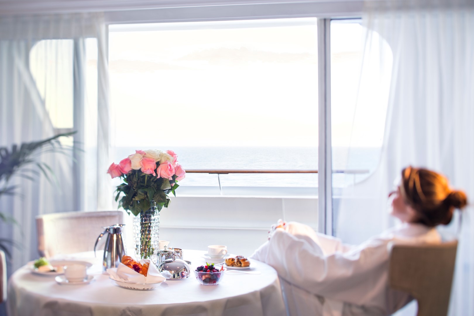
After a day of enriching adventures ashore or an enjoyable day on board, dining in the privacy of your suite or stateroom with our compliments is always a welcome possibility. A complete menu of varied dining experiences is available around the clock, featuring an extensive array of delectable breakfast, lunch and dinner items. All suites and staterooms have the added luxury of enjoying a full, hot breakfast in-room and those staying in Concierge Level or above have the additional privilege of ordering from an expanded lunch and dinner room service menu from The Grand Dining Room. Suite guests have the ultimate indulgence of enjoying course-by-course meals from the comfort of their spacious sanctuaries. Revel in the private luxury of your suite or stateroom, and enjoy an exquisite meal on your tranquil veranda as you take in spectacular seascapes.
The Grand Dining Room
An Elegant Setting
The Grand Dining Room is a study in stateliness, a tribute to the spirit of Europe’s marquee five-star hotel restaurants that inspired its dignified yet convivial ambiance. Handsomely decorated in rich woods, designer tapestry fabrics and oversized armchairs, the expansive dining area exudes classic splendor. This signature dining experience has always offered a bevy of delicious Continental dishes, and now a fresh and new array of options brings you even more exciting choices, as well as an incredible spectrum of global flavors and an all new Executive Chef’s Tasting Menu. As variety is essential to your satisfaction, menus change daily with an expansive choice of at least 10 appetizers, soups and salads and 10 dinner entrées, along with healthy options such as Aquamar Vitality Cuisine, gourmet vegetarian selections and the most extensive array of plant-based dishes at sea.
Open for breakfast, lunch and dinner. No reservations required.
Toscana
Authentic Italian
Toscana means Tuscan, and just as Tuscan cuisine evolved from rich family traditions, many of our recipes originated with the mothers and grandmothers of our own Italian culinary staff. Presented on elegant, custom-designed Versace china, masterfully prepared dishes exemplify the essence of Tuscany and celebrate Italy’s culinary passion. Perhaps the evening begins with the octopus carpaccio with Champagne vinaigrette or the artichoke and parmesan cheese timbale with black truffle sauce. Classic dishes from other regions of Northern Italy are featured as well, such as the minestrone alla Genovese, lasagna alforno alla Bolognese and osso buco alla Milanese.
Open for dinner only. Reservations required.
Polo Grill
A Classic Steakhouse
Polo Grill embodies all the elements of a classic steakhouse, expressing them with timeless reverence. Mindful of tradition, the decor features crisp, white linen tablecloths, dark wood furnishings and supple, high-back, burgundy leather chairs. Each course stands as the very definition of time-honored favorites, most notably the beef dishes, all of which are USDA certified Angus and aged for a minimum of 40 days to enhance tenderness and flavor. Succulent seafood dishes such as grilled swordfish and whole Maine lobster gratinée are also classics in their own right. The classic Caesar salad, too, is prepared according to tradition, tableside and with gusto.
Open for dinner only. Reservations required.
Terrace Café
Informal Dining
Informal and carefree, the Terrace Café is wonderfully inviting any time of day. During breakfast, the room is infused with natural sunlight from the floor-to-ceiling windows, stimulating the appetite for the sumptuous selections. Come lunch, the expansive menu of international-inspired dishes changes entirely, complemented by a flavorful roast and the magic of the pizzeria’s oven. Dine inside or alfresco at one of the shaded teak tables on the terrace. During the evenings, the cuisine takes on a more sophisticated flair, with lobster tails, chops and fresh fish prepared to order, and freshly made hand-cut sushi and sashimi. In addition, a diverse selection of bold and flavorful plant-based dishes is available.
Open for breakfast, lunch and dinner. No reservations required.
Waves Grill
Alfresco Dining
Sometimes, the ultimate luxury is casual dining on all-American favorites, a laid-back style Waves Grill epitomizes. Located in a spacious, shaded area steps from the swimming pool, Waves Grill offers an extensive and mouthwatering menu. Then try a decadent dessert such as a homemade passion fruit sorbet, a made-to-order hot fudge sundae, a hand-dipped milkshake or one of the new, whimsical ice cream flavors by Humphry Slocombe, such as Secret Breakfast, Elvis (the Fat Years) or our signature flavor, Regatta Royale.
The Pizzeria at Waves Grill
Visit Waves Grill in the evening to experience an atmospheric Neapolitan trattoria with a warm pizza oven at the epicenter. Pair savory antipasti or creamy burrata selections with a crisp glass of sauvignon blanc or refreshing rosé. Hand-tossed pizzas feature delectable toppings ranging from smoky roasted bell peppers and earthy truffle oil to fiery chorizo. The irresistible aromas will draw you in and the flavorful creations will make you want to linger over dinner just as they do in Italy.
Breakfast
7:00 am – 11:00 am
Lunch
11:30 am – 4:00 pm
The Pizzeria at Waves Grill
6:30 pm – 9:00 pm
Afternoon Tea
Time-Honored Pastime
Each afternoon, the parade of gleaming four-tiered pastry carts begins. Savor freshly made, flavorful smoked salmon and egg salad finger sandwiches. Enjoy mirror-glazed petits fours, tender scones with rich clotted cream and, of course, a wide assortment of fine teas. Soak in the ambiance of polished silver teapots reflecting the turquoise sea, the precision of white-gloved servers and the amusing enigma of a string quartet playing softly in the background. You’ll quickly realize that this is how afternoon tea should be.
Check your daily Currents for time and venue. No reservations required.
Baristas
A Neighborhood Gem
This delightful coffee bar is a favorite stop for java lovers. Enjoy complimentary illy® espressos, cappuccinos and lattes prepared by our master baristas, as well as the delicious pastries, finger sandwiches and homemade biscotti that draw so many to Baristas throughout the day.
Open daily until early evening. No reservations required.
Room Service
In-Room Dining Experiences
After a day of enriching adventures ashore or an enjoyable day on board, dining in the privacy of your suite or stateroom with our compliments is always a welcome possibility. A complete menu of varied dining experiences is available around the clock, featuring an extensive array of delectable breakfast, lunch and dinner items. All suites and staterooms have the added luxury of enjoying a full, hot breakfast in-room and those staying in Concierge Level or above have the additional privilege of ordering from an expanded lunch and dinner room service menu from The Grand Dining Room. Suite guests have the ultimate indulgence of enjoying course-by-course meals from the comfort of their spacious sanctuaries. Revel in the private luxury of your suite or stateroom, and enjoy an exquisite meal on your tranquil veranda as you take in spectacular seascapes.
Complimentary room service is available 24 hours a day.
Life On Board
Each day aboard our ships is a spectacle and adventure to experience, from world-class music, high-energy production shows and dazzling cabarets to rousing deck games, spirited wine tastings and evenings at our atmospheric casino. For those seeking more cerebral pursuits, engaging talks by passionate Guest Speakers, chef-led demonstrations inspired by the local cuisine and animated Team Trivia sessions invite you to experience each new horizon more fully.
Music & Entertainment
Evenings aboard Oceania Nautica can be anything you desire. Marvel at the continuously changing talented guest entertainers as you delight in high-energy production shows, talented vocalists, classical music and more. Perhaps stop by the lively Monte Carlo-style Casino for a rousing game or two. Unforgettable evenings are just steps from your stateroom.
Bars & Lounges
From chic Martinis to the laid-back poolside Waves Bar, there's a perfect enclave on board Oceania Nautica for every mood. Visit the elegant Grand Bar for a pre-dinner cocktail, catch a headline act in the Lounge or watch the sun set in Horizons accompanied by a glass of wine and lively music. As you explore the world, these bars and lounges are the place to unwind, gather together, laugh and take in one-of-a-kind shows and musical performances.
Casinos At Sea®
MONTE CARLO-STYLE GAMING
Earn Casino Points
The professional staff is happy to provide lessons on how games are played, the rules and proper table procedures. Unwind from a busy day ashore by playing your favorite games of chance and skill in our casino. Enjoy a fun and exciting range of ways to play, from card and table games such as blackjack and roulette to slot machines.
Getting started is easy. Stop by the casino cage and pick up your Oceania Cruises casino player card and start earning points today by inserting your player card while playing your favorite slot machines and table games. The more you play, the more you earn!
- Reel & Video Slots - For every $5 coin-in, receive 1 point.
- Video Poker - For every $10 coin-in, receive 1 point.
- Table Games - Points are based on average bet, session play or hands played and game type.
- Action packed casinos designed with style
- Table game limits for players of all levels
- Diverse array of reel slot, video slot and video poker machines
- Dedicated and knowledgeable casino staff
- Industry leading player tracking system
- Free gaming lessons
REDEEM CASINO POINTS
You’ve played. You’ve earned. Now you’re ready to redeem. Downloading points for play is quick and easy. Redeem your casino points for play right at your machine by following the on-screen prompts or stop by the casino cage – the choice is yours.
- Earn points for all your casino play
- Redeem points for play right at your machine
CASINO CASH & CREDIT
Front Money deposits are accepted for gaming in the form of cash, traveler’s checks, cashier’s checks and wire transfers delivered to us prior to embarkation. All cashier’s checks require prior verification. For more information please give us a call at 877.625.2094.
Cashless Wagering
Charge gaming to your onboard account directly from your game of choice or at the casino cashier, using your stateroom key card. Convenience fees, daily limits and cruise limits apply. Euros may be exchanged at the casino cashier, exchange rates apply. All gaming is in US Dollars.
- Cashless wagering allows you to game with your key card
Credit
Casino Credit is available to all players with an existing reservation. The minimum application amount is $10,000.00 and a personal check is required onboard to activate the credit line. Applications are processed 1 month prior to sailing. The application process is easy and there is no fee to apply. To get started, click here for our credit application or for more information email us at casinocredit@ncl.com or call us at 877.625.2094.
- Casino credit available
Boutiques
Unique Gifts, Jewelry & More
Our stylish boutiques feature a tastefully curated selection of items ranging from sundries to chic resort wear and fine jewelry. Discover thoughtful gifts for friends and family or the perfect memento to remind you of your special cruise experience.
Oceania@Sea Internet Centre
Stay Connected
Stay in touch with family and friends, monitor business developments and more in our 24-hour Internet centre, Oceania@Sea.
For personalised service, Oceania@Sea is fully staffed as follows:
- Sea Days: 8 a.m: - 7 p.m.
- Port Days: 8 a.m: - 11 a.m. and 3 p.m. - 7 p.m
Oceania Cruises also offers wireless Internet access throughout the ship, allowing you to connect through your laptop or mobile device. And as an added convenience, guests in all Owner's and Vista Suites will have the use of an iPad® throughout the voyage. iPad® is available upon request for Penthouse Suites and Concierge Level Staterooms (limited availability).
Letters and postcards with the appropriate postage can be mailed at the Reception Desk. Postage for mail may be purchased at the Reception Desk for a nominal fee. Mail will be collected one hour prior to sailing from each port of call. Incoming mail or faxes received by the ship on your behalf will be delivered directly to your stateroom.
PHONE
Oceania Cruises offers Wireless Maritime Services (WMS) for all GSM mobile phones and GPRS devices such as Blackberry® when the ship is at sea. You can make and receive phone calls, send and receive text messages and use other data services when the ship is at sea. You will be billed by your mobile phone provider and calls or messages will appear as roaming charges on your bill. While using the WMS service, international maritime roaming rates will apply. Please consult your wireless service provider for detailed rates and service zones.
Entertainment & Onboard Shows
Production Shows On Board Oceania Nautica
Dazzling Performances
World-class musical performances will delight you, showcasing an ever-changing array of guest entertainers such as pianists, classical string quartets, dynamic vocalists and spectacular headliners.
Each of our ships features a unique lineup of onboard shows and entertainers to ensure that your interests are constantly piqued. Bold and crowd-thrilling, nostalgic and upbeat, or intimate and sophisticated – whatever you choose, the night is yours.
Oceania Nautica's versatile and talented cast performs the following diverse production shows:
Broadway in Concert
Come on along and listen to…the lullabies of Broadway! In this elegant concert-style review, our fabulous production cast vocalists pay tribute to some of the most iconic musicals of all time. You’ll experience songs you know and love, and maybe you'll discover one or two more contemporary gems. Let us entertain you…because, after all, “There’s no business like show business!”
Showdown
Your vote counts in this mock singing competition, where you, the audience, chooses the winner. Join our production cast and cheer on your favorite singer as he or she belts out some pop favorites in hopes of taking home the title. Will they sway your vote? Find out because it’s time for a SHOWDOWN!
Good Lovin’
Good Lovin’ is an infectious tribute to the irresistible beat of soulful pop and Motown classics that filled the airwaves throughout the 1960s. It is the ultimate soundtrack for the baby boomer generation and rocks some of the best music of its time.
Gatsby’s
The upbeat and quirky musical score is compiled from timeless tunes, inspired by the 1920s and includes blues, jazz and Tin Pan Alley standards like “Makin' Whoopie,” “Won’t You Charleston,” “Puttin’ on the Ritz” and “I Wanna Be Loved by You” and the melodies of Duke Ellington and Fats Waller.
Library
Quietude at Sea
Pick up a steaming cappuccino and settle in to the welcoming ambiance of our classic library on board Oceania Nautica with the novel or bestseller you’ve been meaning to read. Read, relax and feel right at home with more than 2,000 books and periodicals to choose from as you sail from one destination to the next.
Just as sailing aboard Oceania Cruises recalls the elegance of the Golden Age of Travel, our inspired English-style library is reminiscent of a charming English country estate where you can while away the hours in ultimate comfort. There is something magical about the dark, rich woods; the plush high back chairs; the cozy fireplaces and rows of books lining the walls, each a new world waiting to be discovered.
Card Room
The beautifully Card Room is an inviting and tranquil oasis. Stay at the top of your game and try your hand at bridge or gather around one of our many tables for a quiet afternoon or evening of board games.
Sun Deck
Soak up the sun, refreshing sea breeze and stunning panoramic vistas high atop the ship.
Patio
Sit back, relax and enjoy the stunning panoramic ocean views in the shaded, comfortable Patio as you sail to the next exciting destination.
Martinis
Martinis serves numerous incarnations of this famous cocktail in an airy, elegant atmosphere reminiscent of the Greek Isles with a palette of bold blues, deep pewter and serene sienna.
The Grand Bar
Before sitting down to a gourmet meal, sample a rare vintage or savor your favorite apéritif as you enjoy spirited conversation with newfound friends amid the refined atmosphere of the convivial Grand Bar.
Lounge
From headline acts to comedians, magicians and lively jazz ensembles, head to the Lounge to discover the center of nightly entertainment aboard Oceania Cruises.
Horizons
An elegant observation lounge with dramatic floor to ceiling windows and a country club casual ambiance. Horizons transforms into a sophisticated evening venue by night. Dance the night away to the sounds of a lively musical group and enjoy cocktails with friends at the welcoming bar.
Waves Bar
Located in a shaded area just steps from the swimming pool, Waves Bar offers a wide variety of libations to enhance your poolside experience. Revel in the perfect afternoon on deck with your favorite cocktail, glass of wine or chilled beer. Come happy hour, signature cocktails and frosty beverages create a delightfully carefree segue to the lively evening ahead as the sun sets.