Continental Explorer
Continental Explorer
Cruise overview
WHY BOOK WITH US?
- ✔ The Deluxe Cruises’ team has extensive experience in ultra-luxury cruising.
- ✔ Call now to speak to our helpful and experienced Cruise Concierge team.
- ✔ Enjoy our Unique Deluxe Cruises Bonus for substantial savings.
- ✔ Our team will tailor your holiday to your exacting requirements.
- ✔ As agents, we work under the protection of each cruise lines ABTA / ATOL licences
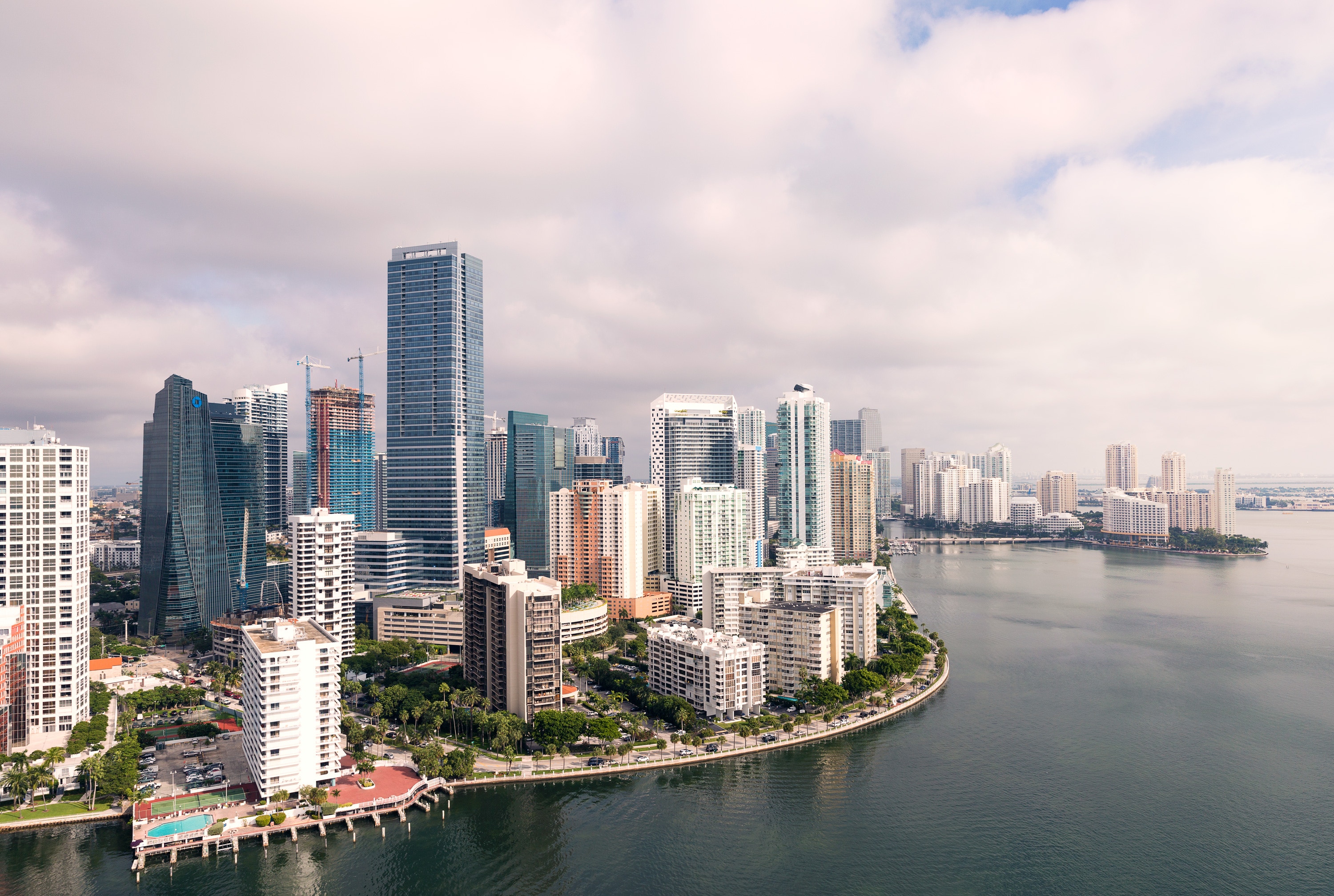
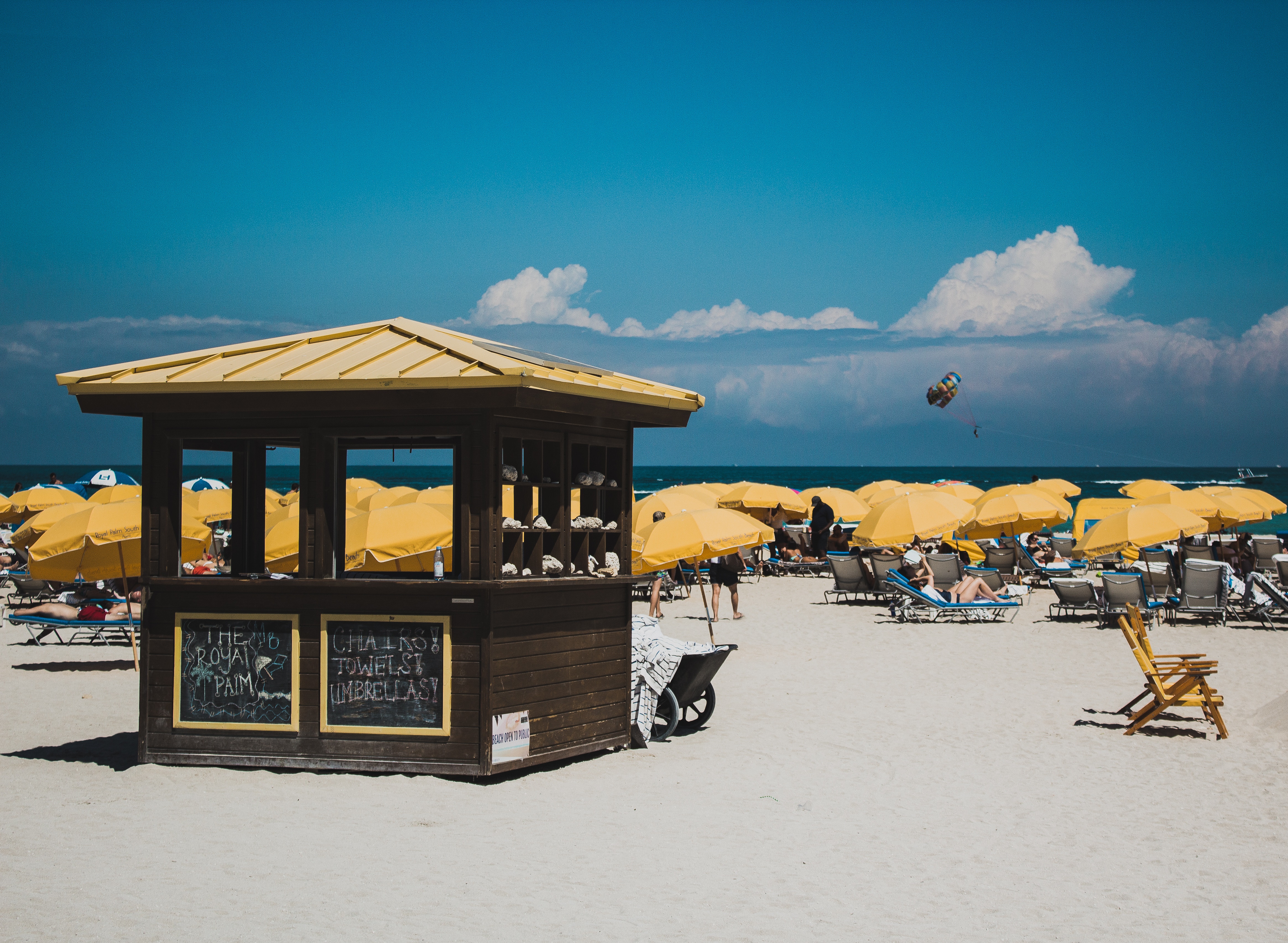
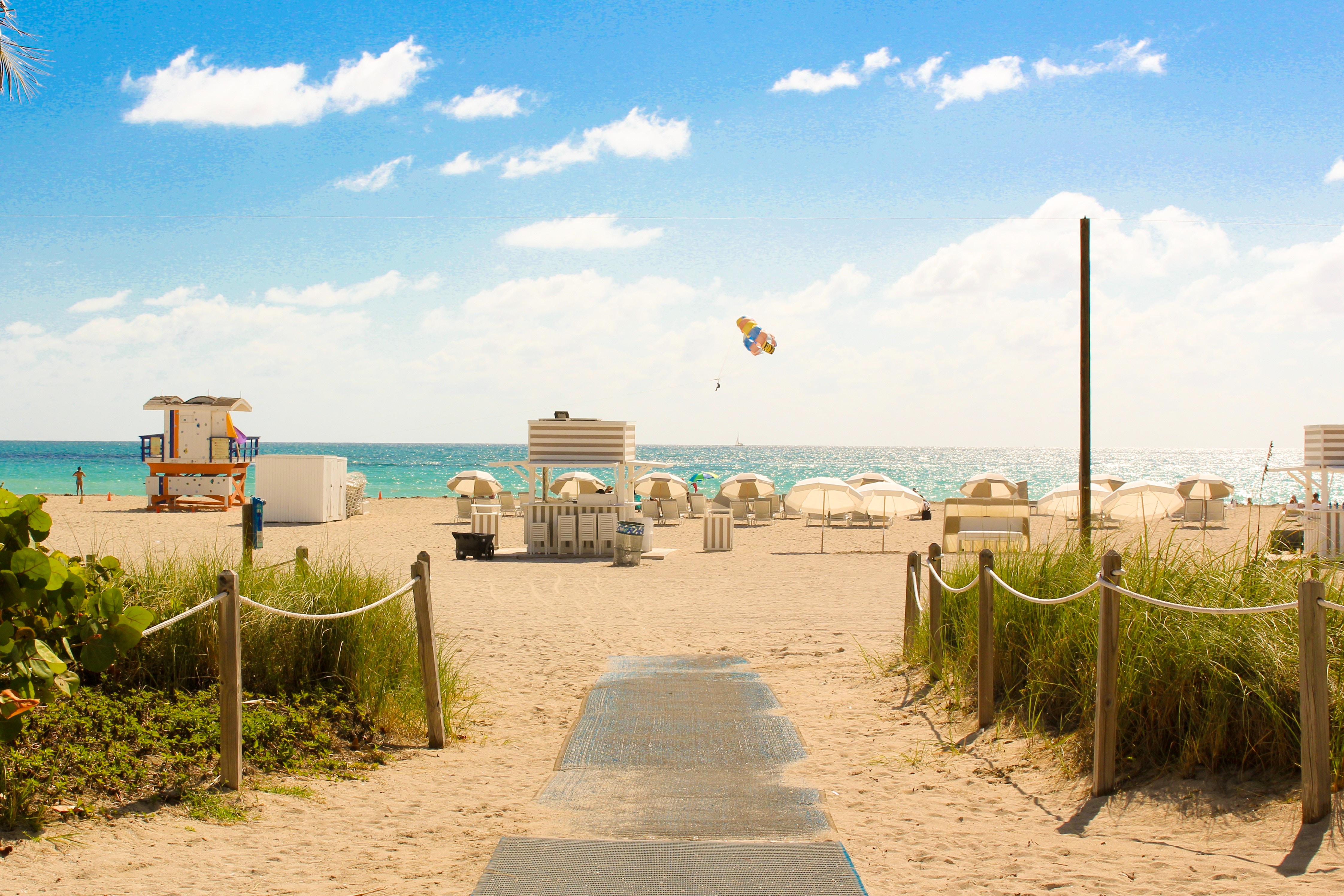
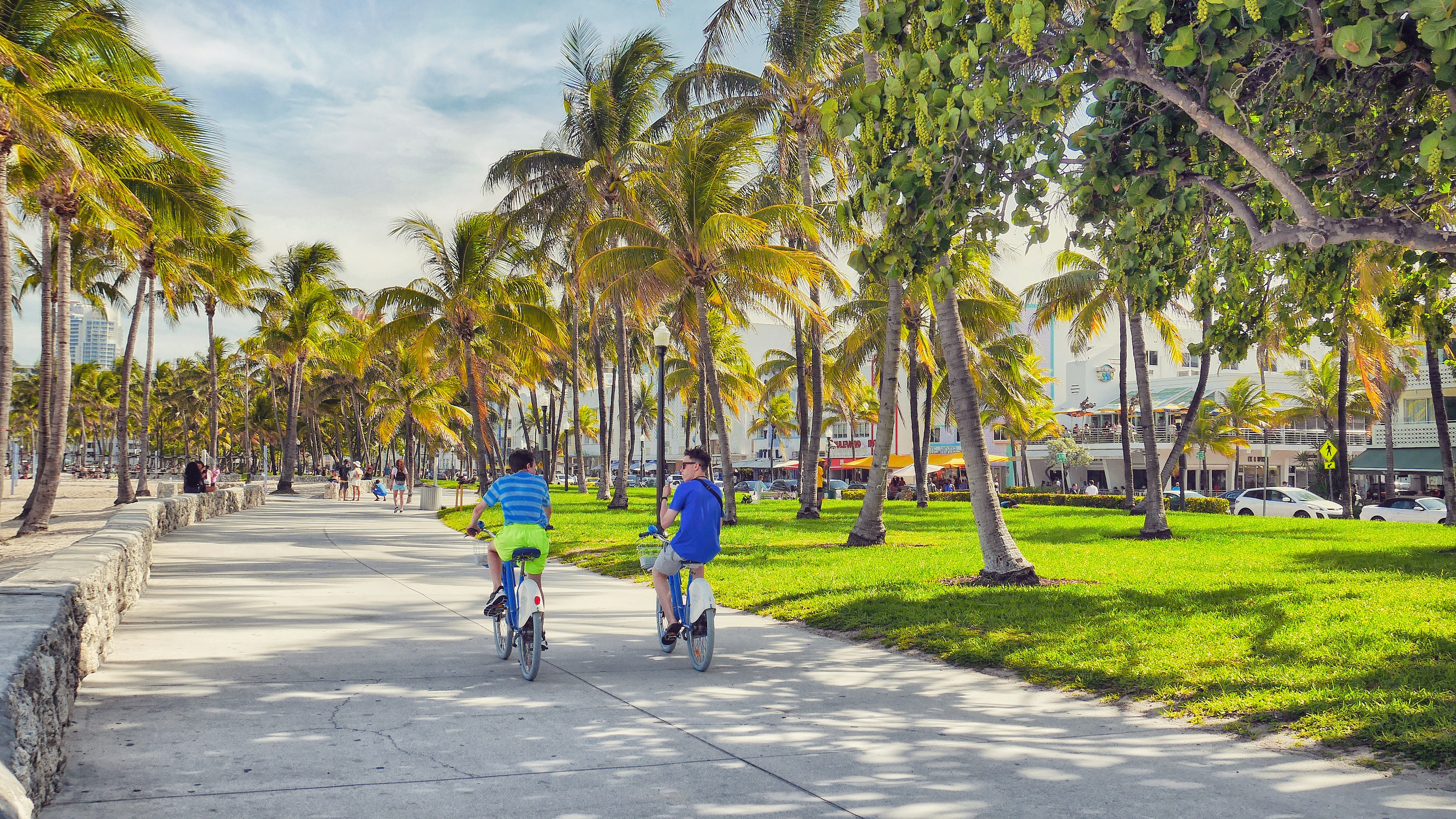
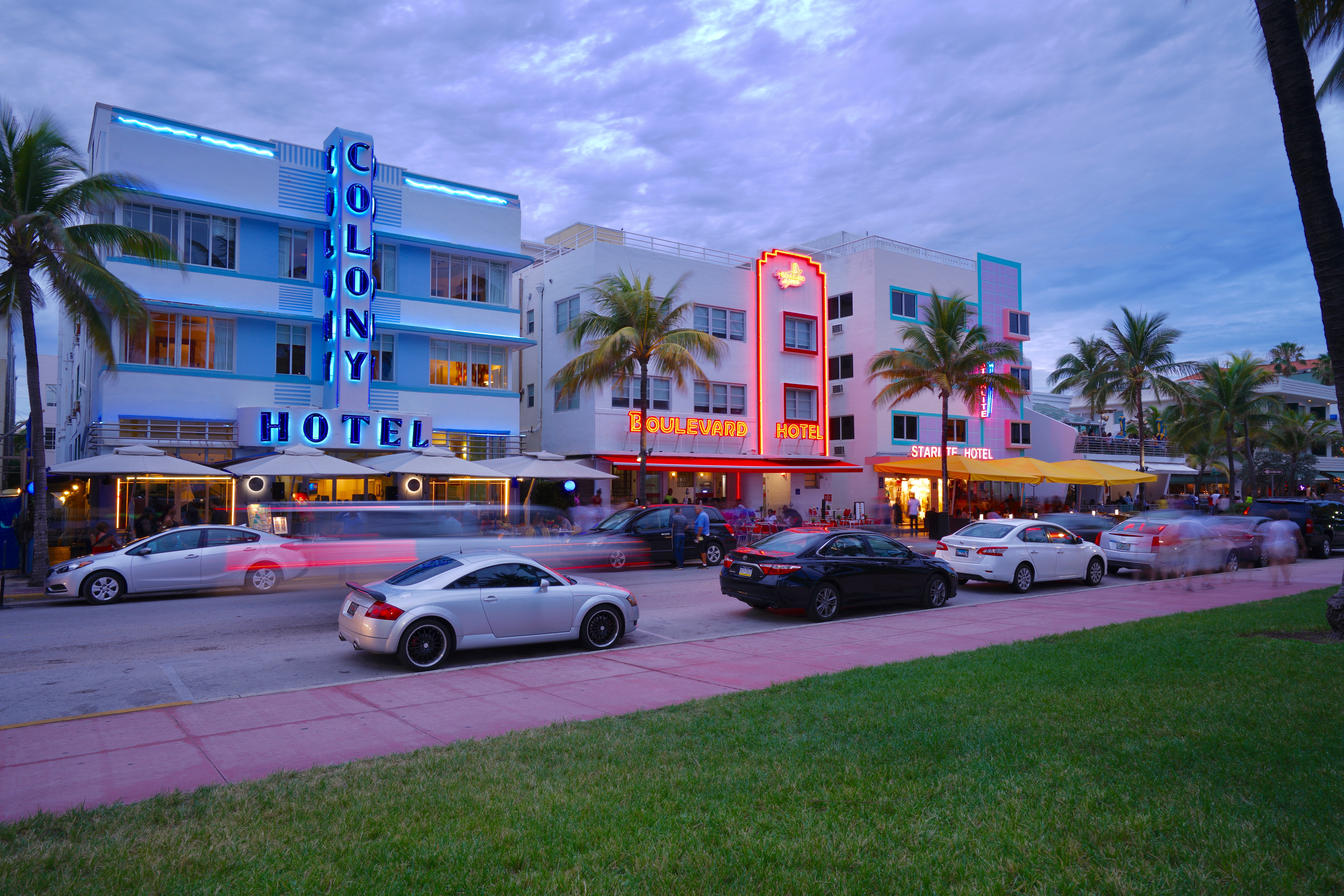
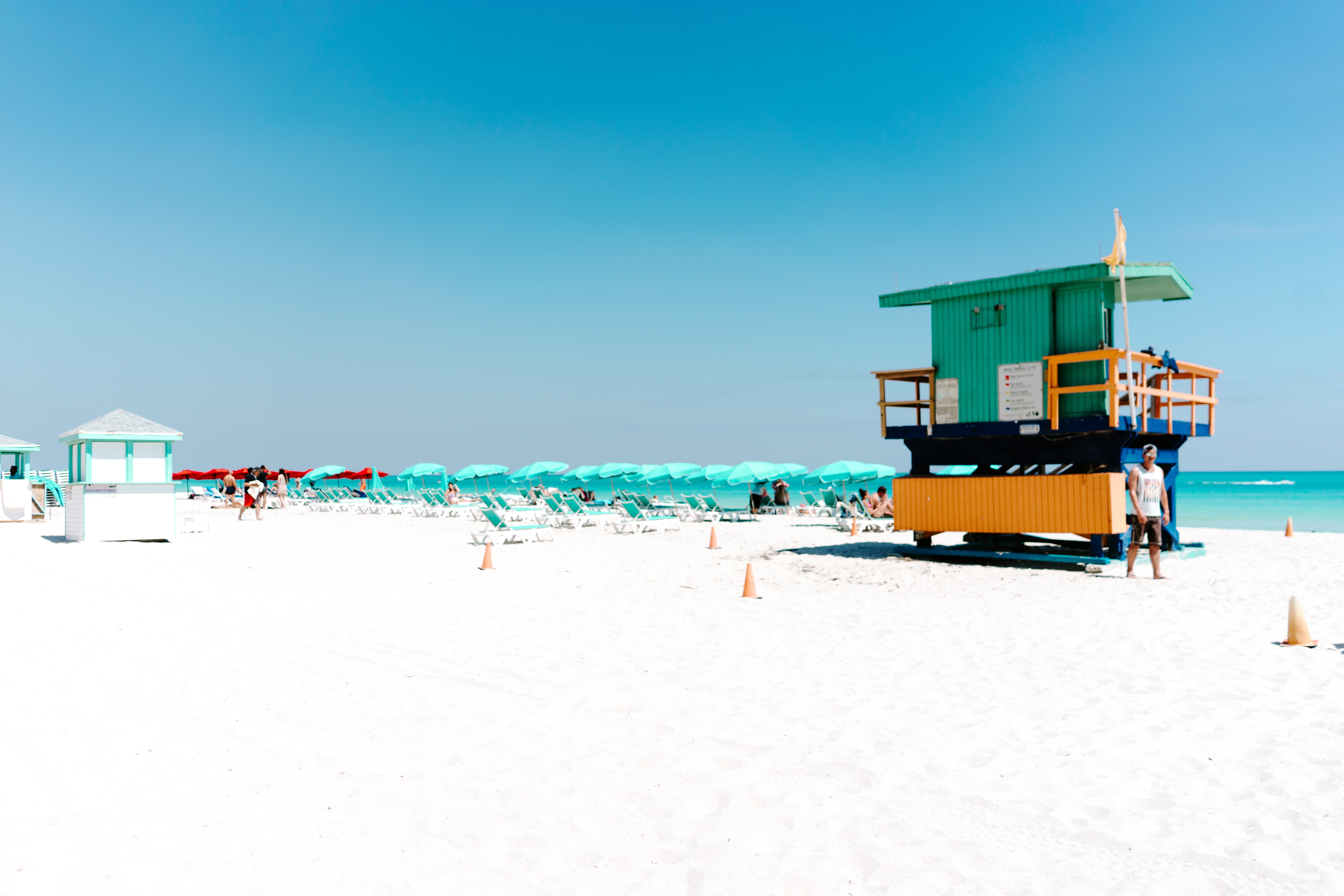
About Miami, Florida
Miami is one of the world’s most popular holiday spots. It has so much to offer; from its countless beach areas, to culture and museums, from spa and shopping days out, to endless cuban restaurants and cafes. Miami is a multicultural city that has something to offer to everyone.
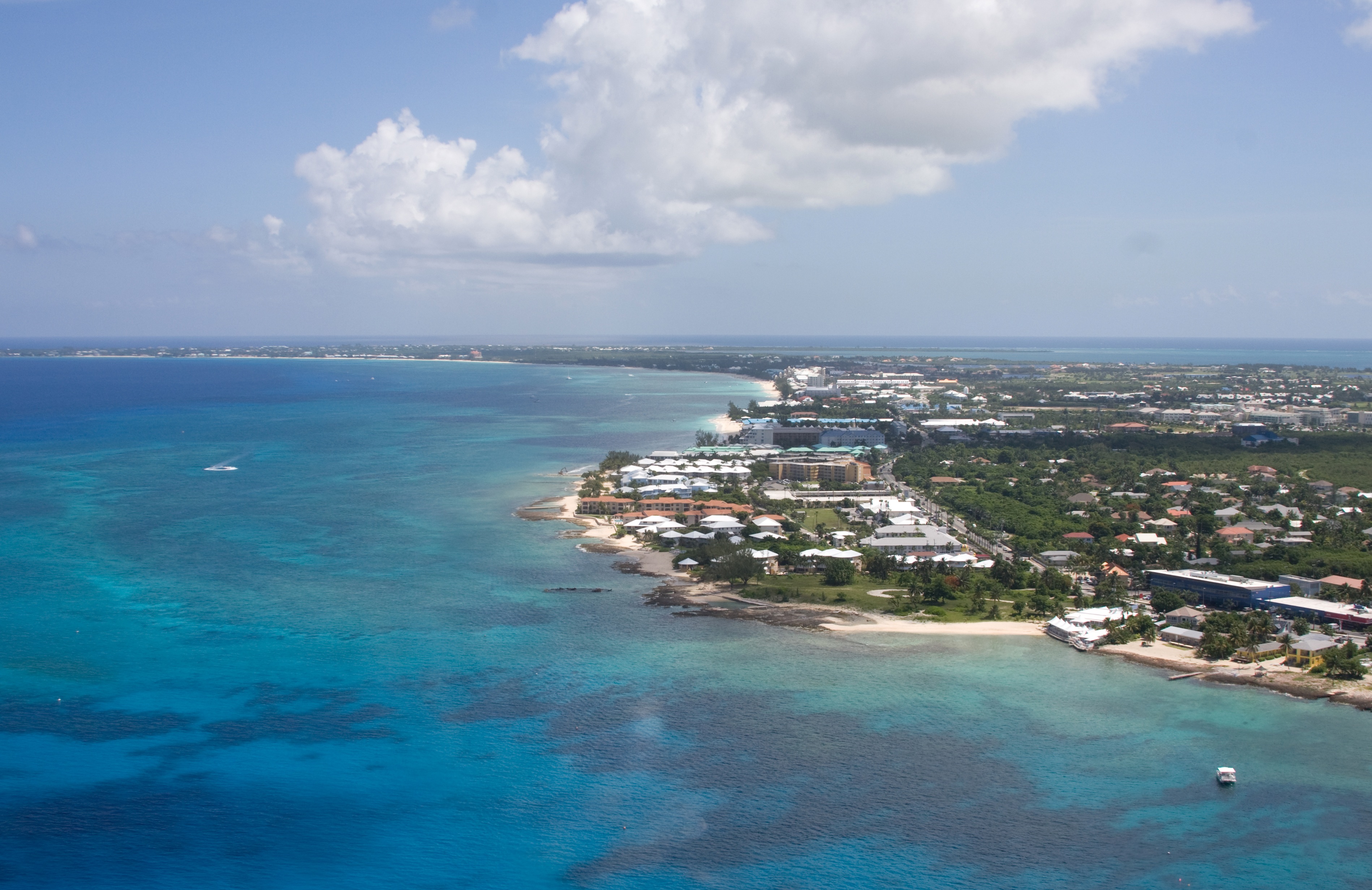
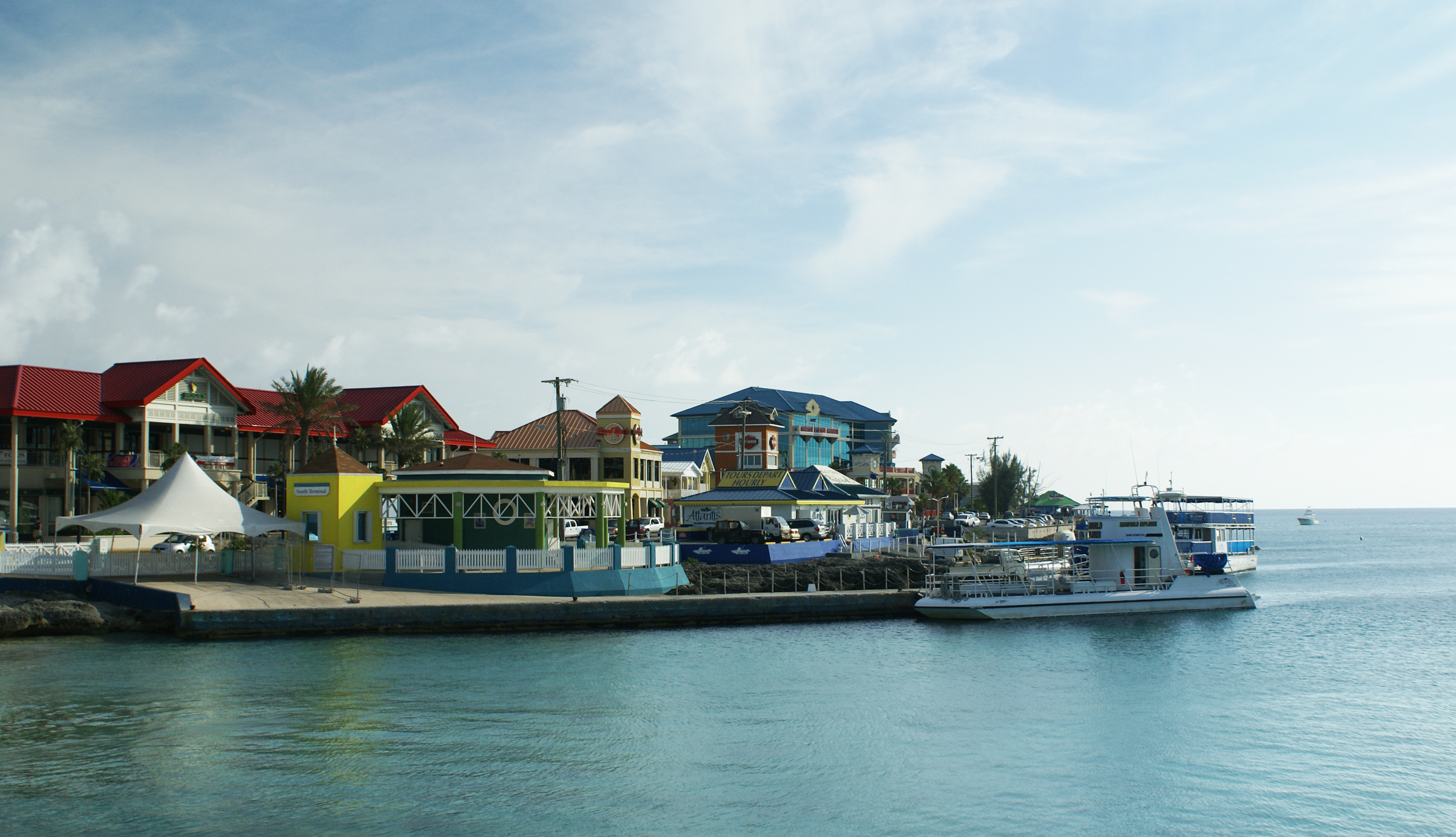
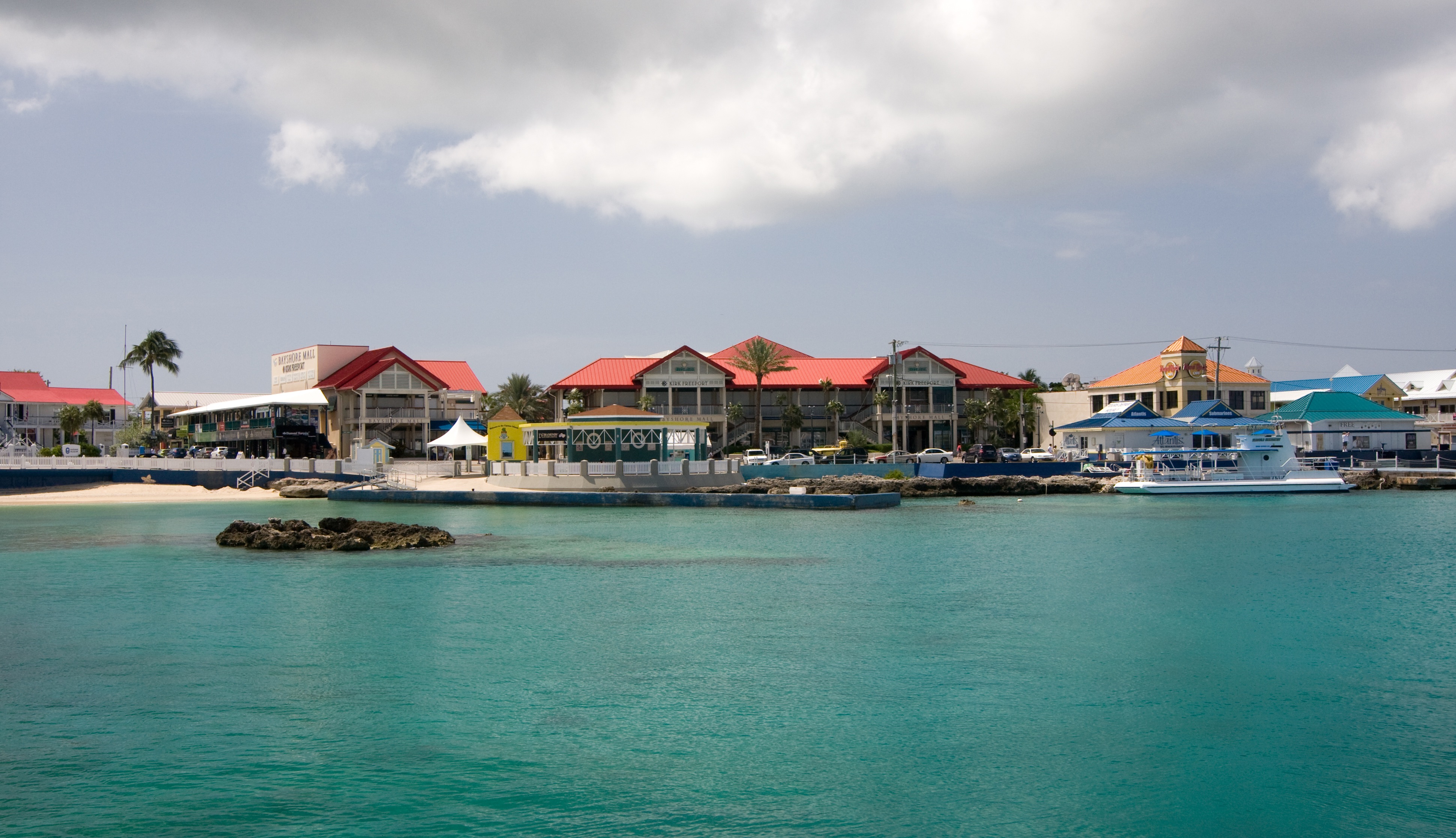
About Georgetown, Grand Cayman
Begin exploring the capital by strolling along the waterfront Harbour Drive to Elmslie Memorial United Church, named after the first Presbyterian missionary to serve in Cayman. Its vaulted ceiling, wooden arches, and sedate nave reflect the religious nature of island residents. In front of the court building, in the center of town, names of influential Caymanians are inscribed on the Wall of History, which commemorates the islands' quincentennial in 2003. Across the street is the Cayman Islands Legislative Assembly Building, next door to the 1919 Peace Memorial Building. In the middle of the financial district is the General Post Office, built in 1939. Let the kids pet the big blue iguana statues.
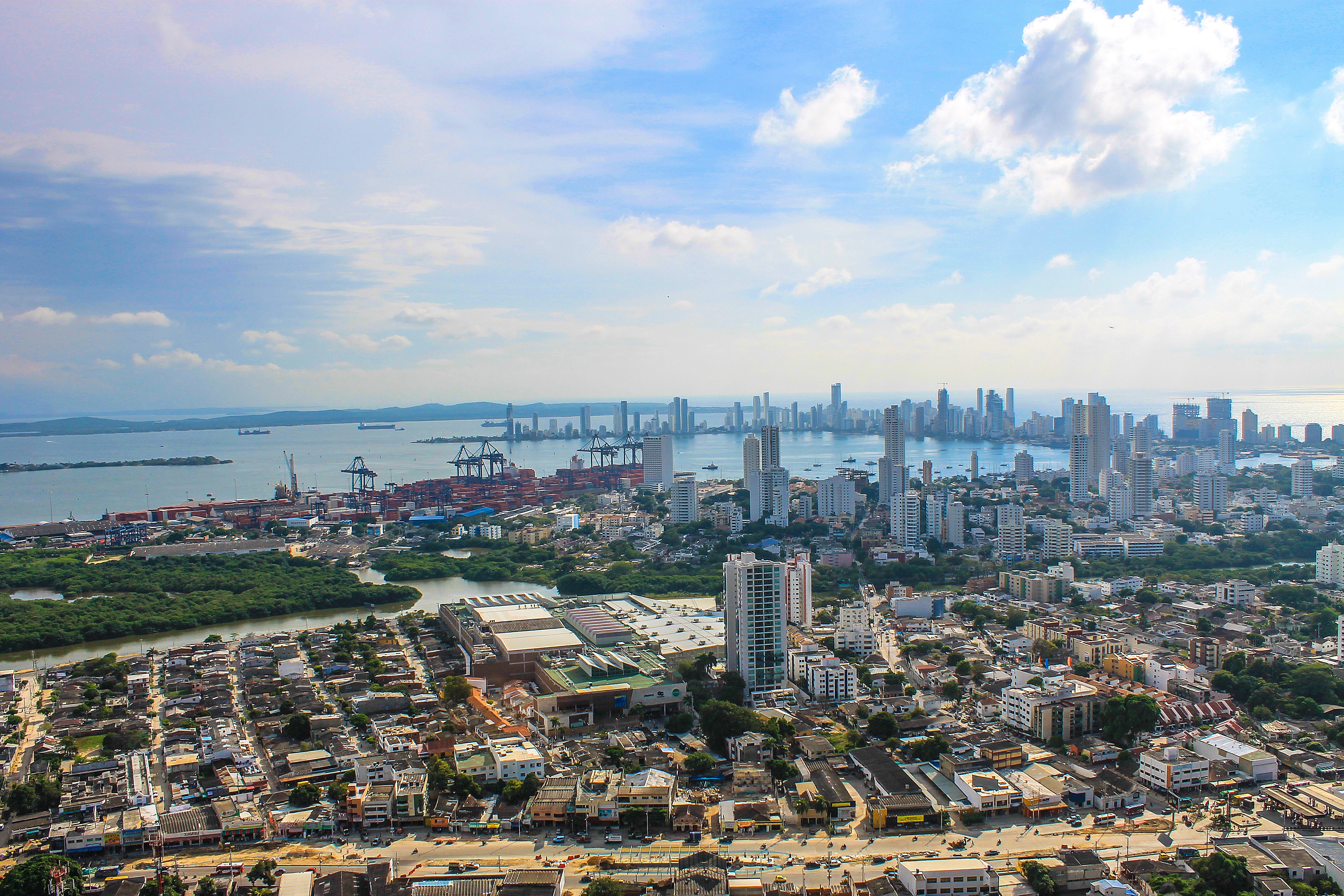
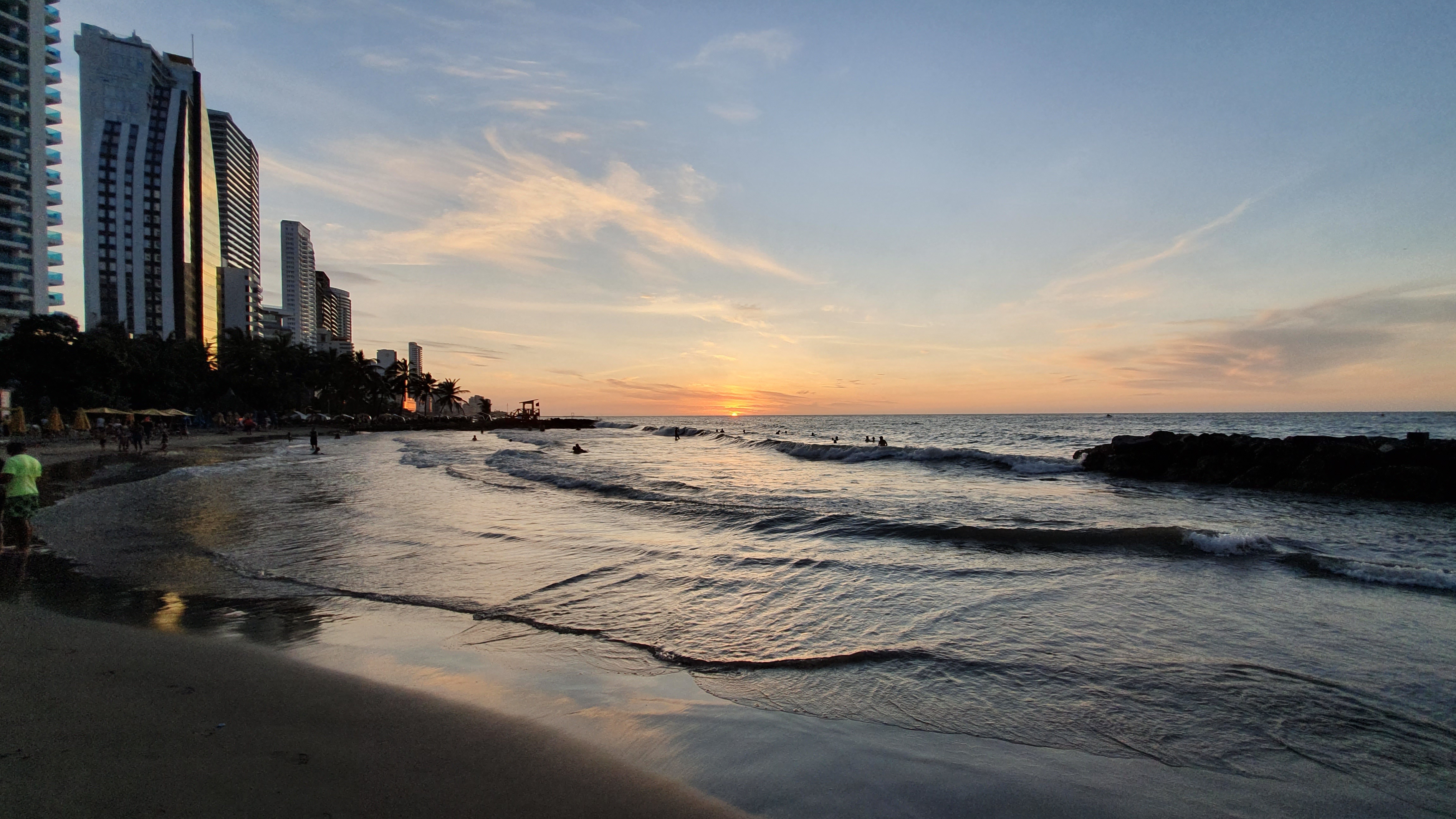
About Cartagena
Cartagena's magnificent city walls and fortresses, now a UNESCO World Heritage Site, enclose a well-restored historic center (the Cuidad Amurallada, or walled city) with plazas, churches, museums, and shops that have made it a lively coastal vacation spot for South Americans and others. New hotels and restaurants make the walled city a desirable place to stay, and the formerly down-at-the-heels Getsemaní neighborhood attracts those seeking a bohemian buzz. The historic center is a small section of Cartagena; many hotels are in the Bocagrande district, an elongated peninsula where high-rise hotels overlook a long, gray-sand beach.When it was founded in 1533 by Spanish conquistador Pedro de Heredia, Cartagena was the only port on the South American mainland. Gold and silver looted from indigenous peoples passed through here en route to Spain and attracted pirates, including Sir Francis Drake, who in 1586 torched 200 buildings. Cartagena's walls protected the city's riches as well as the New World's most important African slave market.
About Puerto Quetzal
Puerto Quetzal is Guatemala's largest Pacific Ocean port. It is important for both cargo traffic and as a stop-off point for cruise liners

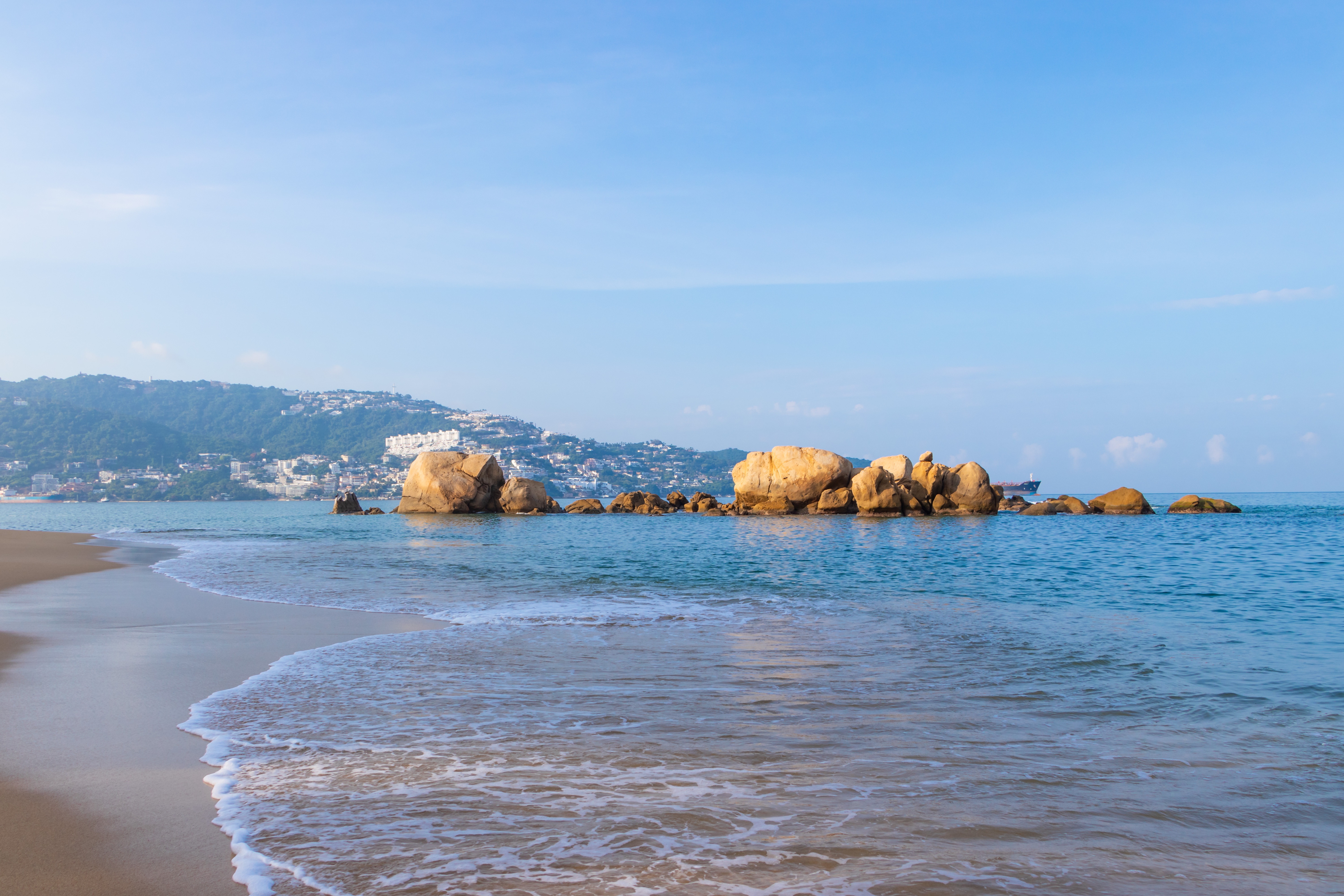
About Acapulco
Acapulco is a major seaport on the scenic Pacific coast of Mexico, located on a deep semi-circular bay with sandy beaches and blue waters. It was a popular destination for many movie stars during the Golden Age of Hollywood, including Elvis Presley and Elizabeth Taylor.
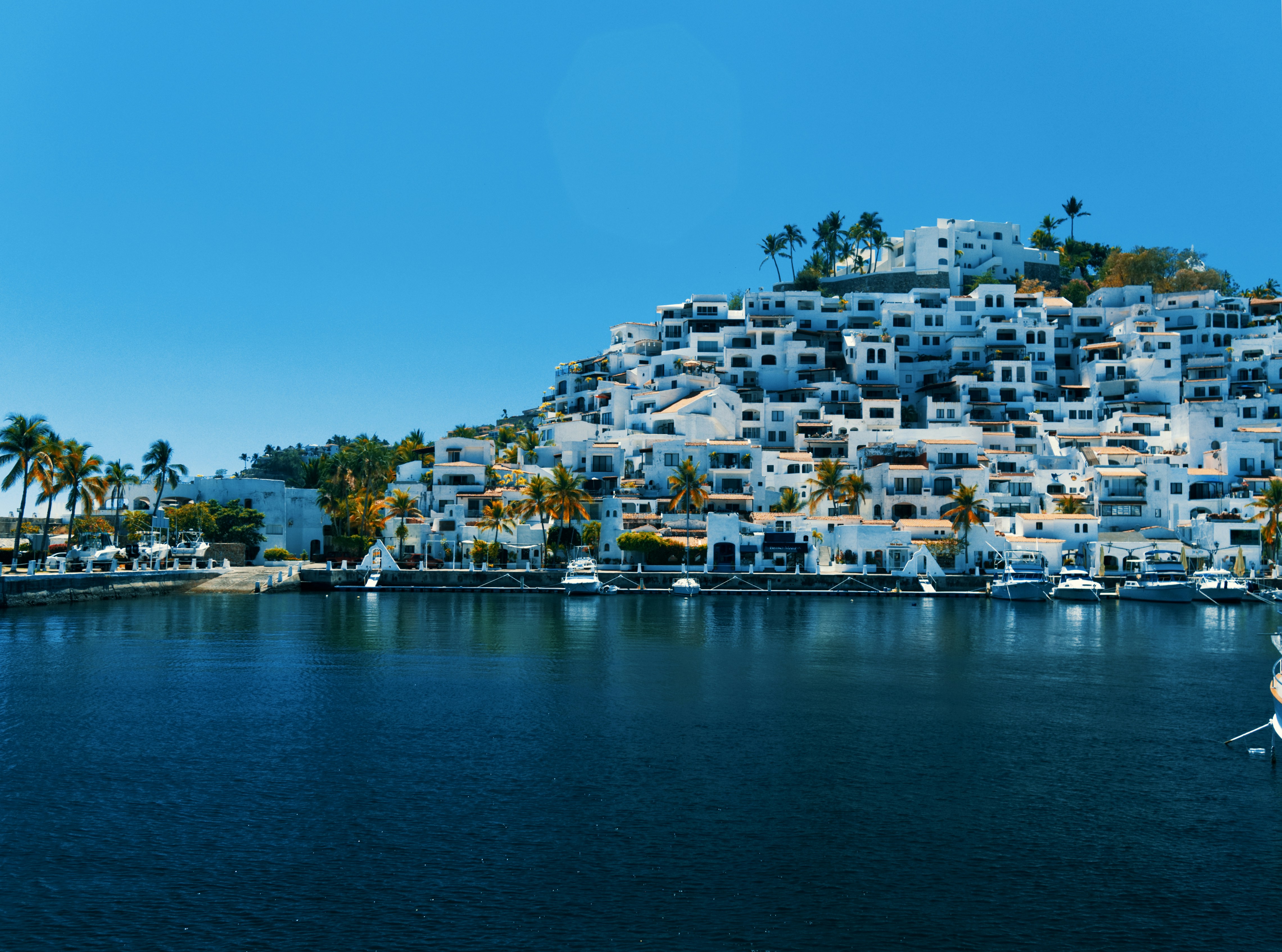
About Manzanillo, Mexico
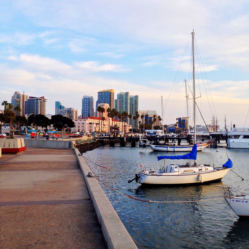
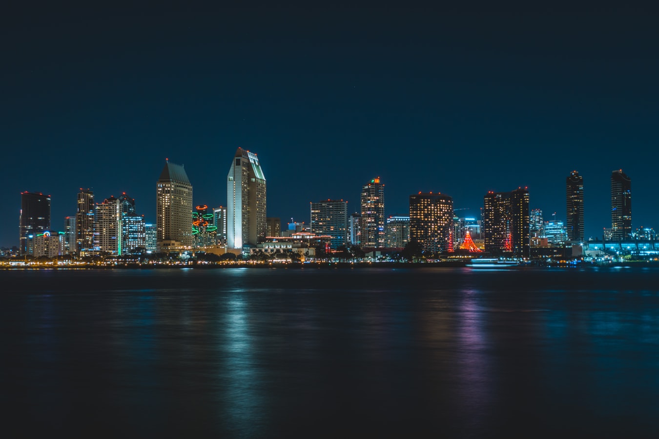
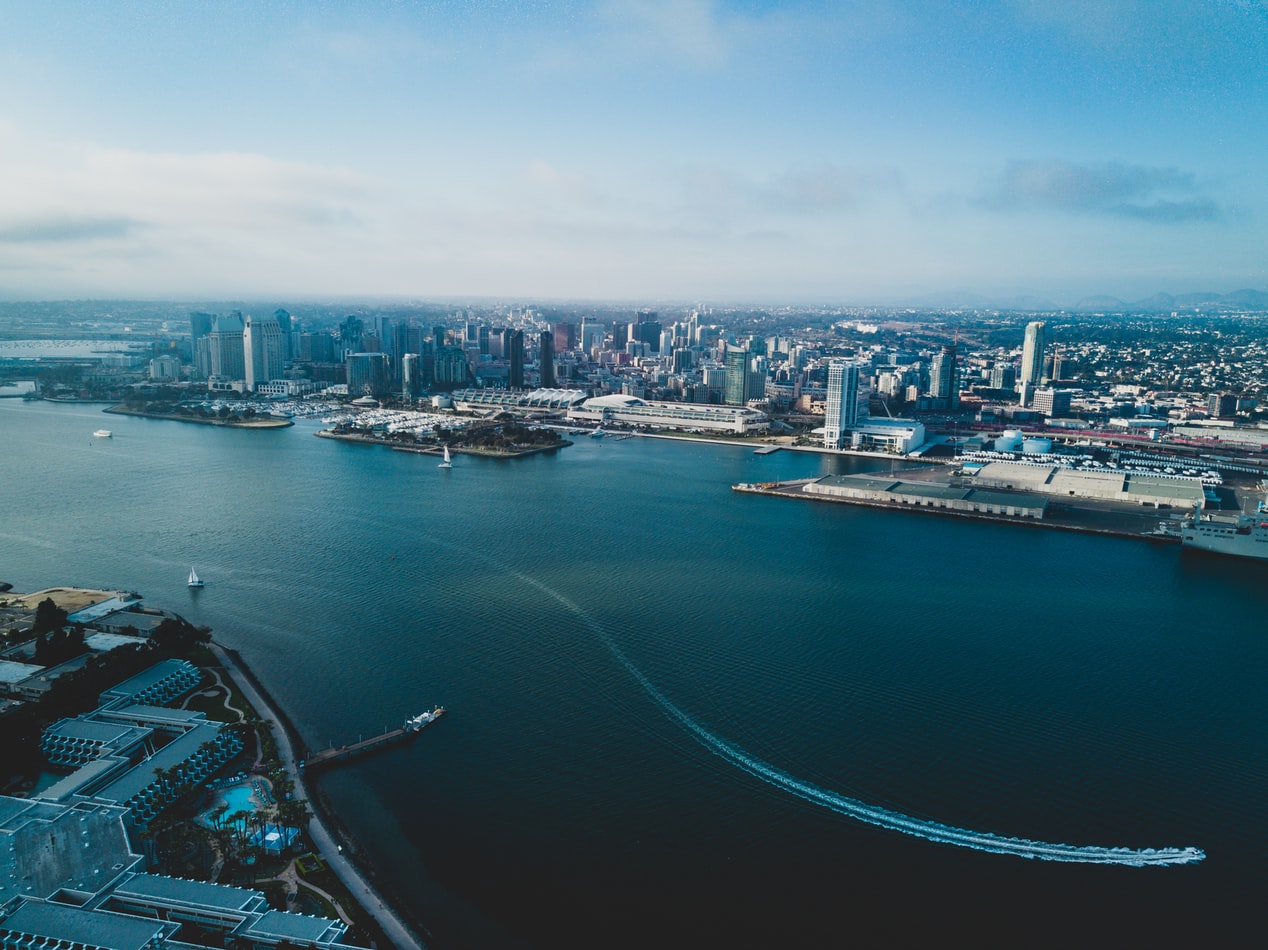
About San Diego, California
San Diego is a vacationer's paradise, with year-round temperatures in the seventies and near-constant sunshine. One of America's most family-friendly cities, San Diego is home to LEGOLAND, the New Children's Museum, and the famous San Diego Zoo. Sunbathers and surfers are guaranteed to find their perfect beach, and foodies find delights in artisanal breweries, local bistros, and gourmet restaurants. From the Broadway excitement of La Jolla Playhouse to the European feel of Little Italy to the nouveau-chic of the Gaslamp Quarter, San Diego has something for everyone.
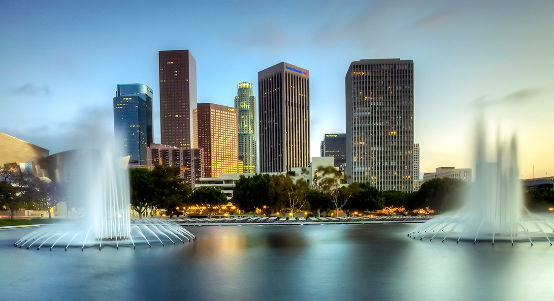
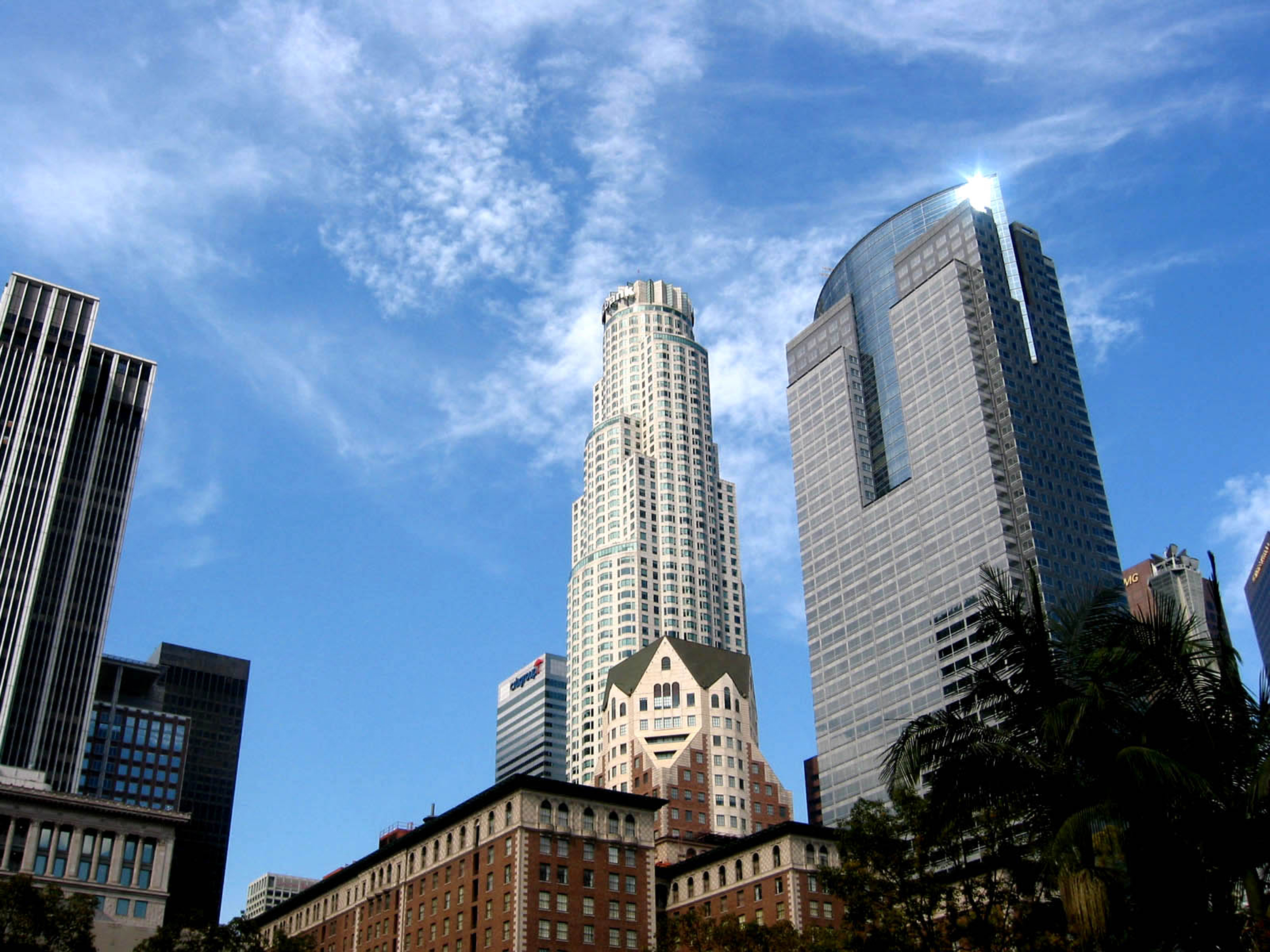
About Los Angeles, California
Home of the famous Hollywood sign and Walk of Fame, Los Angeles is the place to visit for anyone interested in film and television and hoping to get a glimpse at some famous actors and artists. Stroll down the Walk and enjoy the glamorous atmosphere and famous surroundings, or take a break on the Santa Monica pier and watch the sun set on the sea.


About Nawiliwili, Hawaii
About Honolulu, Hawaii
Capital of Hawaii, and a popular tourist destination, Honolulu is known for surfing and water sports. However, there's more to the city than surfing; with museums, the only royal palace in the country, and a mall, there's bound to be something of interest for any visitor.
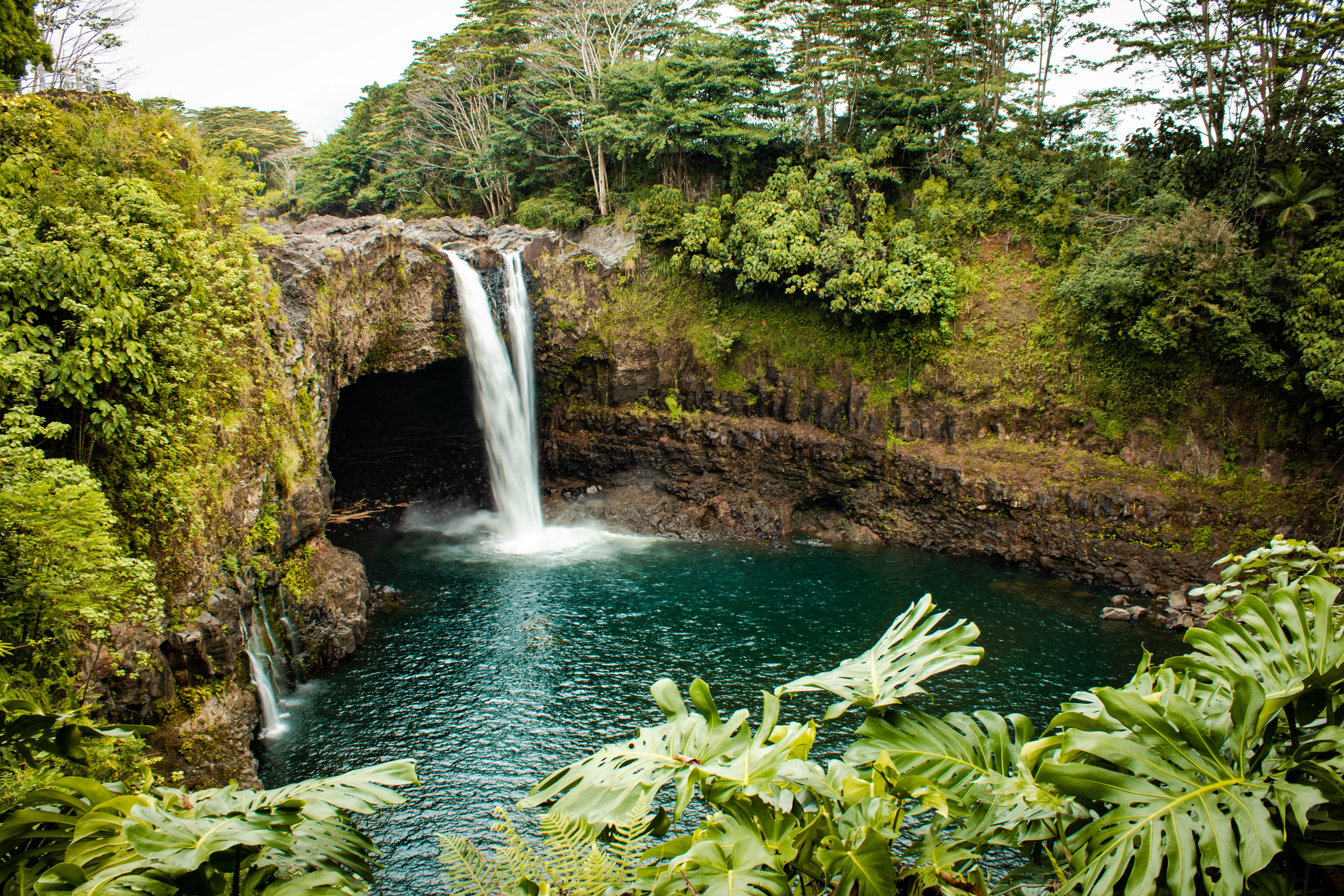
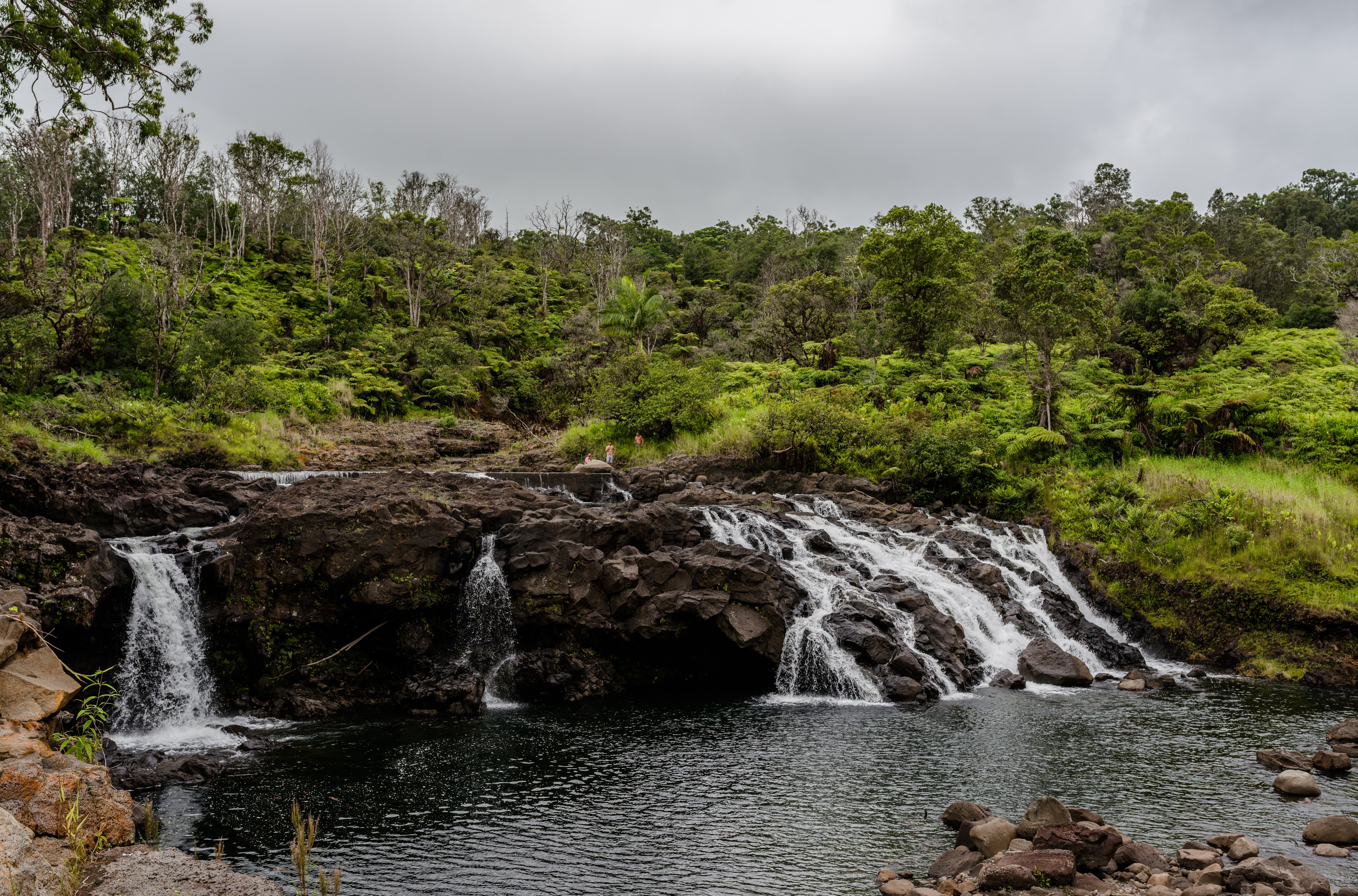
About Hilo, Hawaii
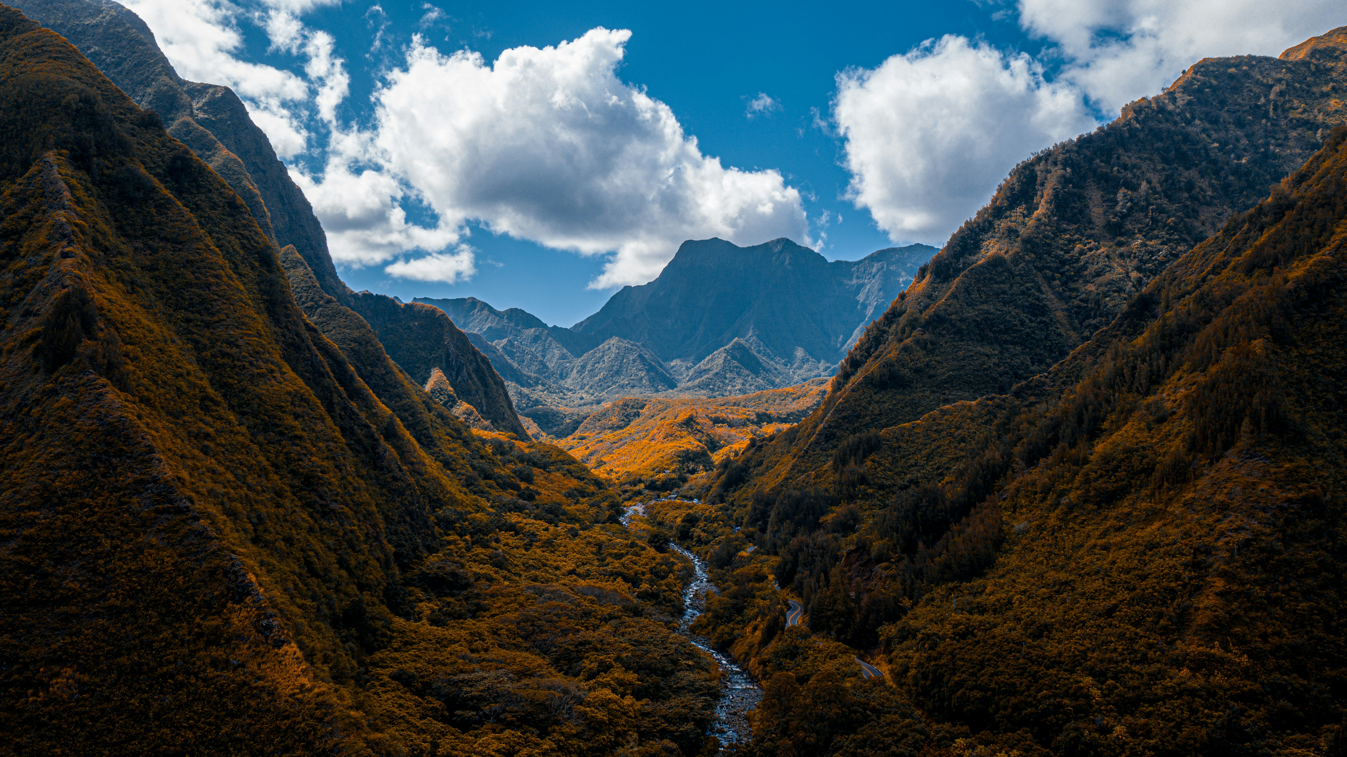
About Kahului-Maui, Hawaii
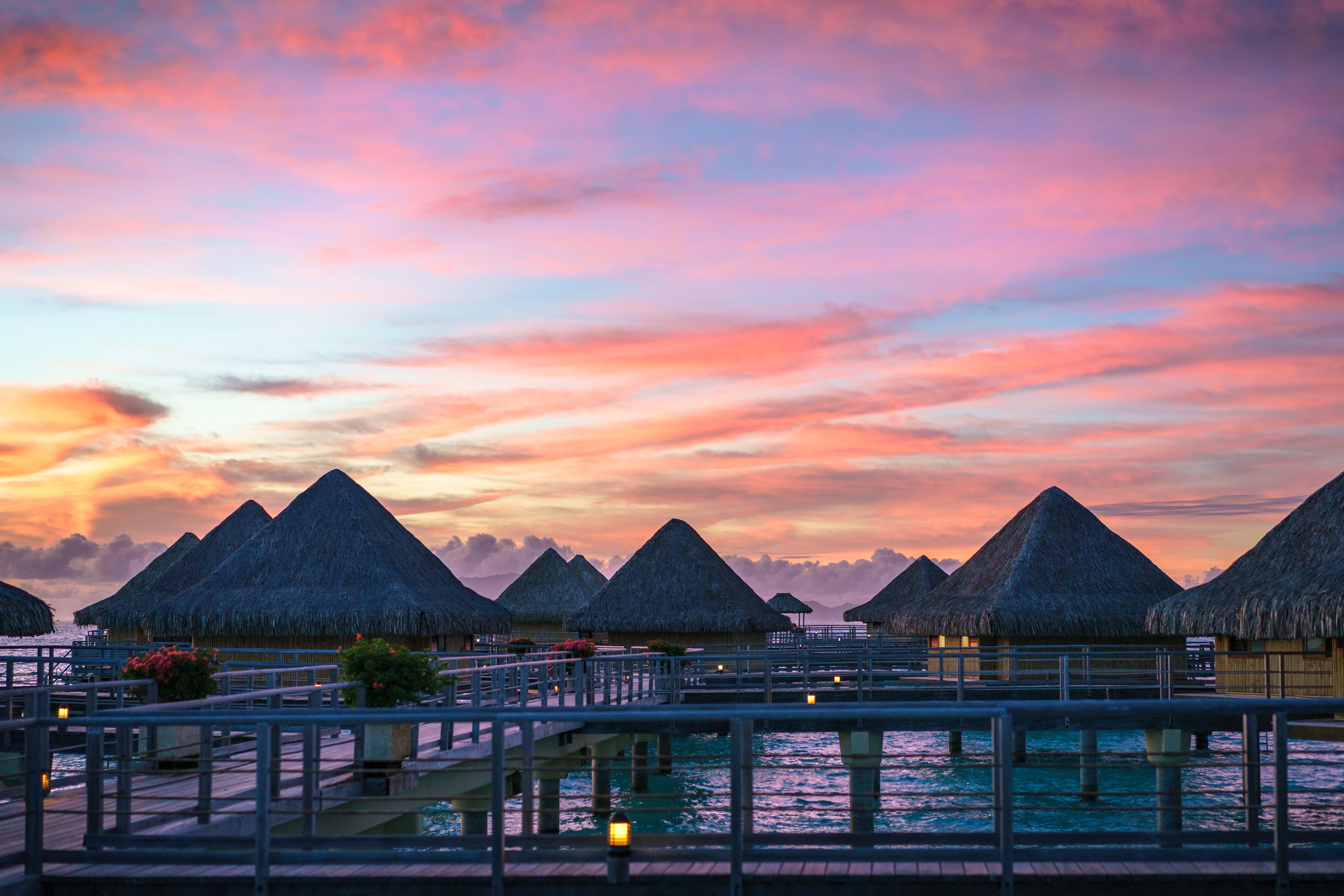
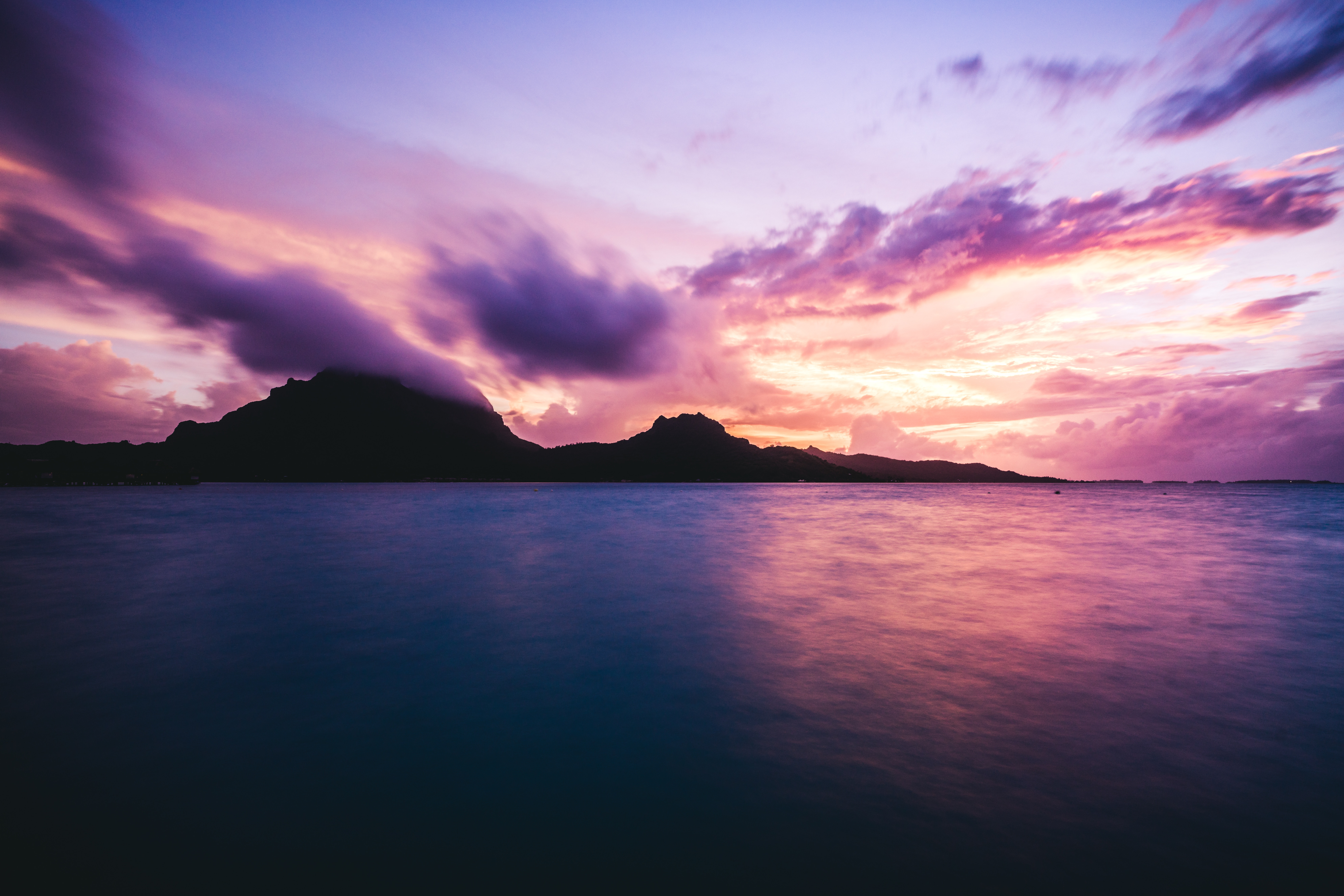
About Bora-Bora
Simply saying the name Bora Bora is usually enough to induce gasps of jealousy, as images of milky blue water, sparkling white beaches and casually leaning palm trees immediately spring to mind. The imagination doesn't lie, either, and if you visit, you’ll soon realise this island is every bit as gorgeous as you ever imagined. Thatched wooden huts stand out over shallow, sparkling seawater, with vivid fish swirling just below. Soak up the sun, scuba dive, or simply revel in the opulent luxury of one of the island's many magnificent resorts. If blissful inactivity doesn't appeal, then get active, and hike the greenery of the sharp Mount Pahia.
About Uturoa, Raietea Island
About Moorea
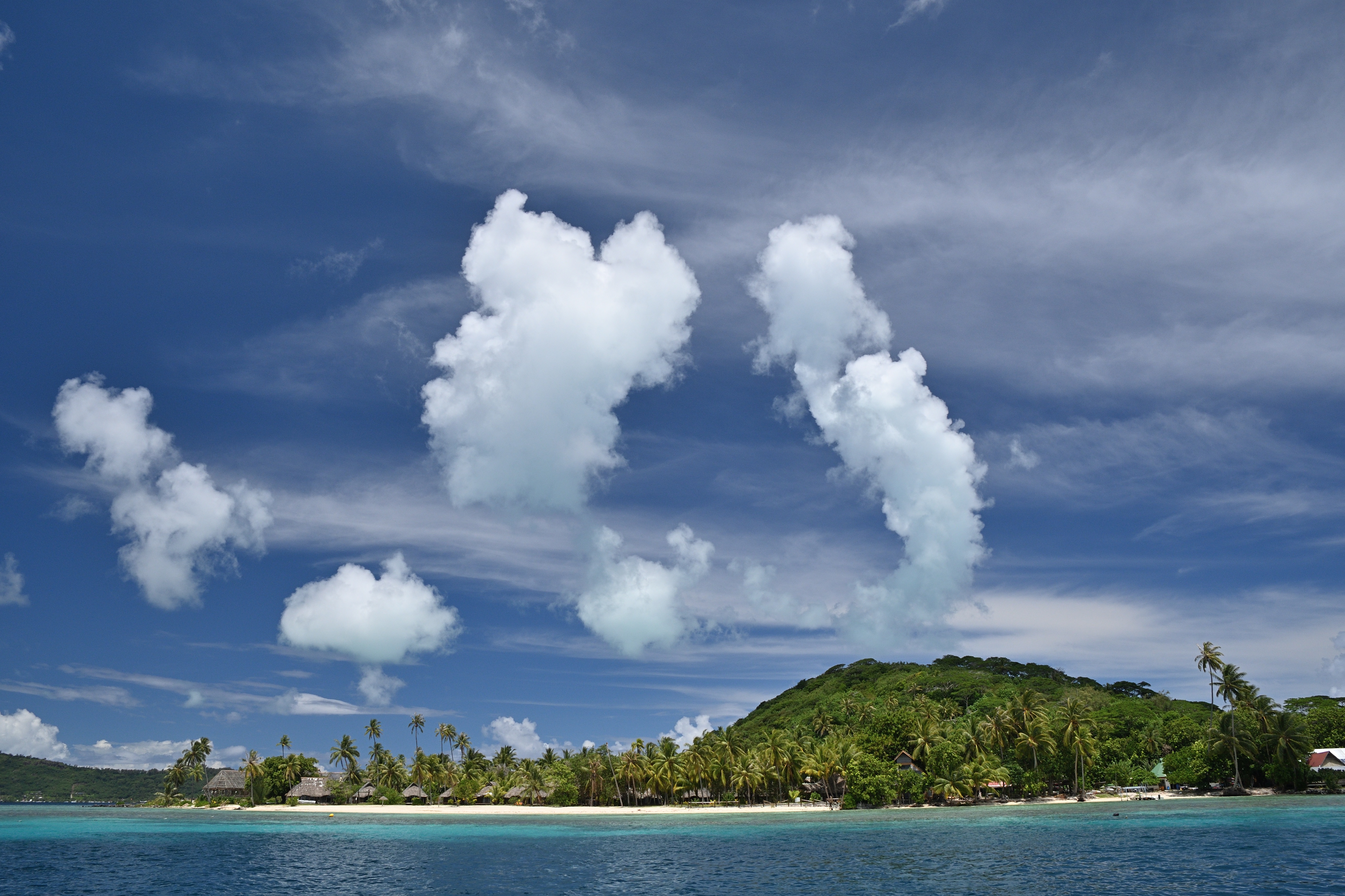
Mo’orea is one of the Society Islands of the French Polynesia. Located in the South Pacific, it is considered a magical island thanks to its majestic volcanic mountains, set against warm lagoon waters and green meadows. It is an island that attracts visitors of all abilities wanting to explore both above and below the ocean waters.
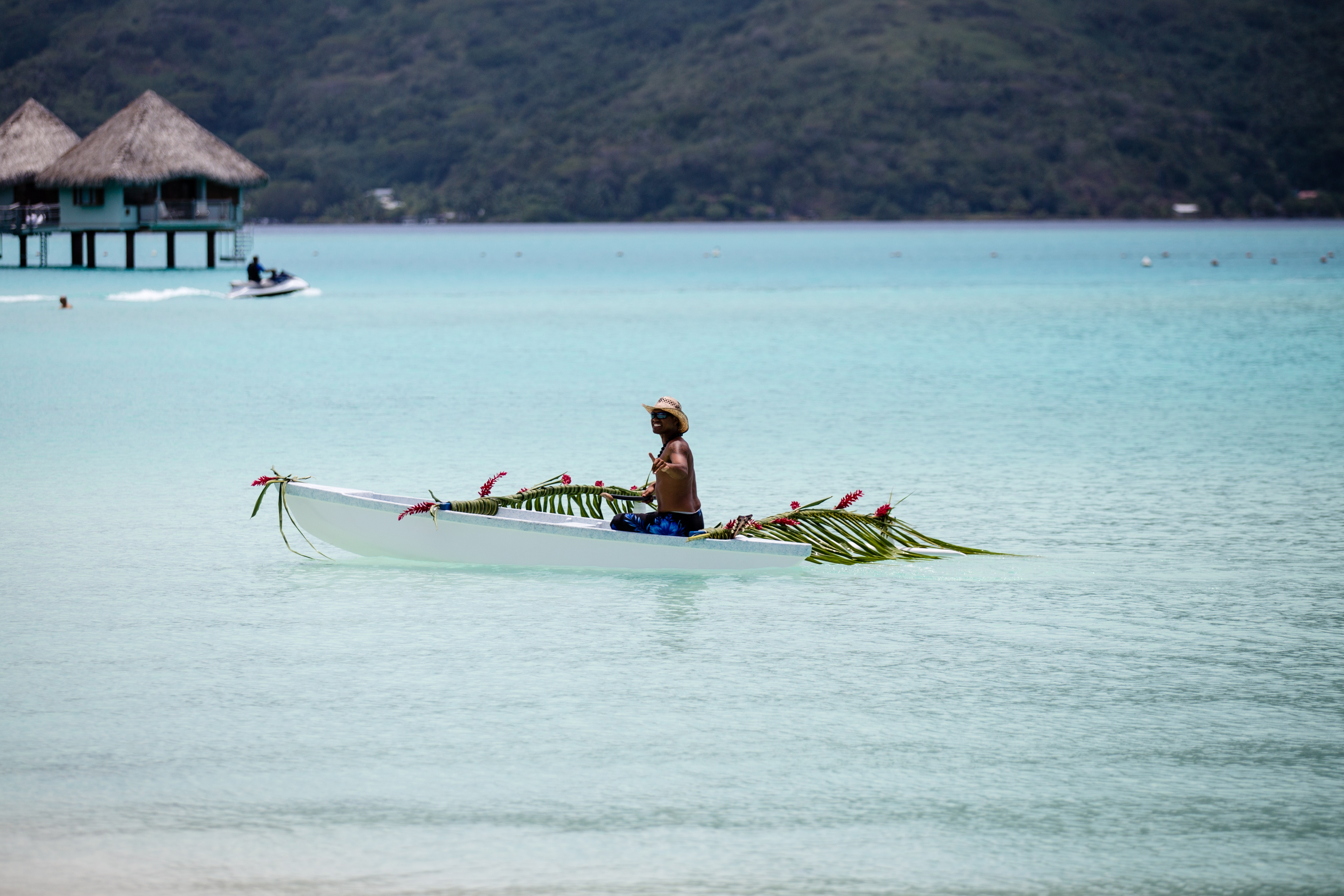
About Papeete, Tahiti
Papeete will be your gateway to the tropical paradise of French Polynesia, where islands fringed with gorgeous beaches and turquoise ocean await to soothe the soul. This spirited city is the capital of French Polynesia, and serves as a superb base for onward exploration of Tahiti – an island of breathtaking landscapes and oceanic vistas. Wonderful lagoons of crisp, clear water beg to be snorkelled, stunning black beaches and blowholes pay tribute to the island's volcanic heritage, and lush green mountains beckon you inland on adventures, as you explore extraordinary Tahiti. Visit to relax inside picturesque stilted huts, which stand out over shimmering water, as you settle into the intoxicating rhythm of life, in this Polynesian paradise.
About Huahine


About Rarotonga
Life is laid back on Rarotonga, the most populous of the Cook Islands, but the residents are still an active bunch. Though there are plenty of white sandy beaches on which to laze—and people do, with plenty of napping— locals love to get out and move. Join them in snorkeling, diving, riding—bikes, horses, scooters—fishing, bush walking, and playing squash and tennis. Another popular, if odd, and favorite activity is lining up along the sea wall adjacent to the airport's runway to be jetblasted.

About Pago Pago
American Samoa is a tropical paradise, located in the Pacific Ocean and home to some of the world's most unique flora and fauna. Pago Pago is the main harbour and village of Tutuila island. It is considered the capital of the territory and is the entry point for visitors exploring the picturesque volcanic islands.

About Savusavu
Suva, a multiracial city, is the pulsing heart of the South Pacific. Its location is on a hilly peninsula in the southeast corner of Viti Levu Island, the largest in the Fijian archipelago. Suva was named the country's capital in 1882; the former capital was Luvuka. Suva's natural harbour was no doubt a deciding factor that prompted the change. Its port is the country's main shipping facility, accommodating vessels from all over the world. The town is backed by the lush green hills of the Suva-Rewa range. The waterfront district, much of which is built on land reclaimed from tangled mangrove swamps, provides the hub for much of Suva's activities. The downtown centre is a hodgepodge of high-rise office buildings, colonial houses with second-story verandas, parks and government structures. The northern and western mountains catch the trade winds, with the result being damp conditions year-round and frequent tropical downpours. Despite the ever-present possibility of showers, Suva is an excellent place to explore on foot. Many points of interest are located on Victoria Parade and along tree-shaded Queen Elizabeth Drive. Suva's botanical park is lush with flowering plants, trees and green lawns. In its centre stands the Fiji Museum, where objects reflect 3,000 years of Fijian history. The museum boasts a fine collection of Melanesian artefacts and various exhibits that reflect on Fiji's maritime era. Government House stands on a hillside surrounded by landscaped grounds. A stern, uniformed sentry guards the pillared gate entrance. The monthly Changing of the Guard is executed with almost as much pomp and ceremony as at London's Buckingham Palace. Friendly Fiji will charm you; here Melanesia mixes with Polynesia, ancient India with Oceania and tradition with the modern world. The Fijian greeting "Bula!" is extended warmly to strangers on city streets and country roads. Fiji is one of the South Pacific's most hospitable countries and a holiday destination that has much to offer in recreational activities, shopping and joyous celebrations.
About Port Denarau
About Lautoka
North of Nadi through sugarcane plantations and past the Sabeto Mountains is Lautoka, nicknamed the Sugar City for the local agriculture and its big processing mill. With a population of around 50,000, it's the only city besides Suva and, like the capital, has a pleasant waterfront. It's the sailing point for Blue Lagoon and Beachcomber Cruises but is otherwise unremarkable for tourists, itself having few hotels and fewer good restaurants. Locals recommend the city as a less-expensive place to shop for clothing, but note that it can take as long as 45 minutes to drive here. Legend has it that Lautoka acquired its name when two chiefs engaged in combat and one hit the other with a spear. He proclaimed "lau toka" (spear hit) and thus the future town was named.
About Port Vila
Vanuatu is an island nation located in the southern Pacific Ocean. The archipelago, which is of volcanic origin, is approximately 1,090 miles (about 1,750 kilometres) east of northern Australia, approximately 310 miles (about 500 kilometres) northeast of New Caledonia, west of Fiji and southeast of the Solomon Islands, near New Guinea. Located on Mélé Bay along the southwest coast of Éfaté, Port Vila is the capital and largest city of Vanuatu, as well as its commercial and economic centre. Although Port Vila's British and French influences are apparent, its multinational population includes ni-Vanuatu, British, French, Chinese, and Vietnamese citizens. An active commercial port, the city is home to hospitals, hotels, casinos, markets and shopping districts, a sports stadium, cultural centre, teacher-training institution, campus of the University of the South Pacific, and several meat- and fish-processing plants. The municipality of Port Vila is divided into four wards, Malapoa-Tagabe, Anabrou-Melcofe-Tassiriki, Centre and South. The area occupied by Port Vila has been inhabited by Melanesian people for thousands of years. In 2004, an archaeological expedition unearthed a burial site with 25 tombs, skeletons and pieces of ceramic pottery dating from 1300 B.C. The Vanuatu Islands first had contact with Europeans in 1606 with the arrival of Portuguese explorer Pedro Fernandes de Queirós. Europeans did not return until 1768, when Louis Antoine de Bougainville rediscovered the islands. In 1774, Captain Cook called the islands the 'New Hebrides', a name that would last until their independence in 1980. In 1825, sandalwood was discovered on the island of Erromango, prompting a rush of immigrants that included Catholic and Protestant missionaries from European and North America, as well as settlers looking for land to farm cotton, coffee, cocoa, bananas, and coconuts. British subjects from Australia made up the majority of settlers, but the establishment of the Caledonian Company of the New Hebrides in 1882 attracted more French subjects. The land around Port Vila was converted into the municipality of Franceville in 1889. By the start of the 20th century, the French outnumbered the British, and the two nations agreed to govern the islands jointly by way of the British-French Condominium. During World War II, Port Vila was an American and Australian airbase. The New Hebrides National Party was established in the early-1970s. Renamed Vanua'aku Pati in 1974, the party pushed for independence. In 1980, amidst the brief Coconut War, the Republic of Vanuatu was created. The economies of Port Vila and Vanuatu are supported by the agriculture, offshore financial services and cattle industries. However, the abundant tropical beauty of Vanuatu has made Port Vila a popular tourist destination for outdoor and nature enthusiasts alike. Renowned for its tropical climate and exquisite, white-sand beaches and world-class fishing, the archipelago is a region of spectacular geographic diversity that includes spectacular volcanoes, mountains and valleys, along with idyllic jungles, rainforests, botanical gardens, mineral springs, and waterfalls. What's more, Port Vila offers easy access to exploring the city, Vanuatu and the offshore islands that comprise this wonderful South Pacific island chain. Port Vila consists of a diverse blend of Melanesian, Eastern and Western cultures that presents a unique opportunity to discover the people, traditions and history of Vanuatu. Cultural village tours are a fantastic way to meet the locals and experience indigenous lifestyles and customs through storytelling, music, dance, kava-tasting, and a traditional Melanesian feast. The evolution of Port Vila and Vanuatu can be explored during visits to the Vanuatu Cultural Centre and Museum features a collection of historical artefacts from the Vanuatu Island. Additional historic landmarks include Independence Park, the French and British residencies, Supreme Court, Georges Pompidou Building, World War I and II memorials, Tanna Coffee-Roasting Factory, and more. Vanuatu's verdant canyons, jungle-covered mountain peaks, volcanoes, waterfalls, botanical gardens, mineral springs, white-sand beaches, and rainforests invite a wide array of picturesque, memorable and exciting sightseeing venues for outdoor enthusiasts. Land-based excursions include bird-watching, bicycling and motor-biking, eco-tours, hiking through jungle and rainforest nature trails, horseback-riding at the nearby Sea Horse Ranch or Club Hippique Adventure Park, helicopter or seaplane flight-seeing, dune-bugging the beaches and jungles, 'zorbing' down the hillsides, abseiling down a cascading waterfall, volcano trekking and sandboarding, zip-lining through the jungle canopy, and golfing at the stunningly beautiful Port Vila Golf and Country Club, the only 18-hole championship course in Vanuatu and home to the PGA-sanctioned Vanuatu Open. Picturesque and fun-filled water-based excursions include swimming, boating and sailing along the exquisite coast of Port Vila and Vanuatu, deep-sea fishing for enormous dolphin, marlin, wahoo, dorado, tuna, swordfish, and sailfish, jet-skiing and high-speed jet-boating, stand-up paddle-boarding, surfing, kite-surfing, and parasailing. The archipelago also offers some of the world's finest snorkelling and diving at venues such as the Hideaway Islands Marine Reserves, JoJo Beach Club, Havannah Beach and Boat Club, and Iririki Island.Due to its compact size, Port Vila can be easily explored in just a single day.
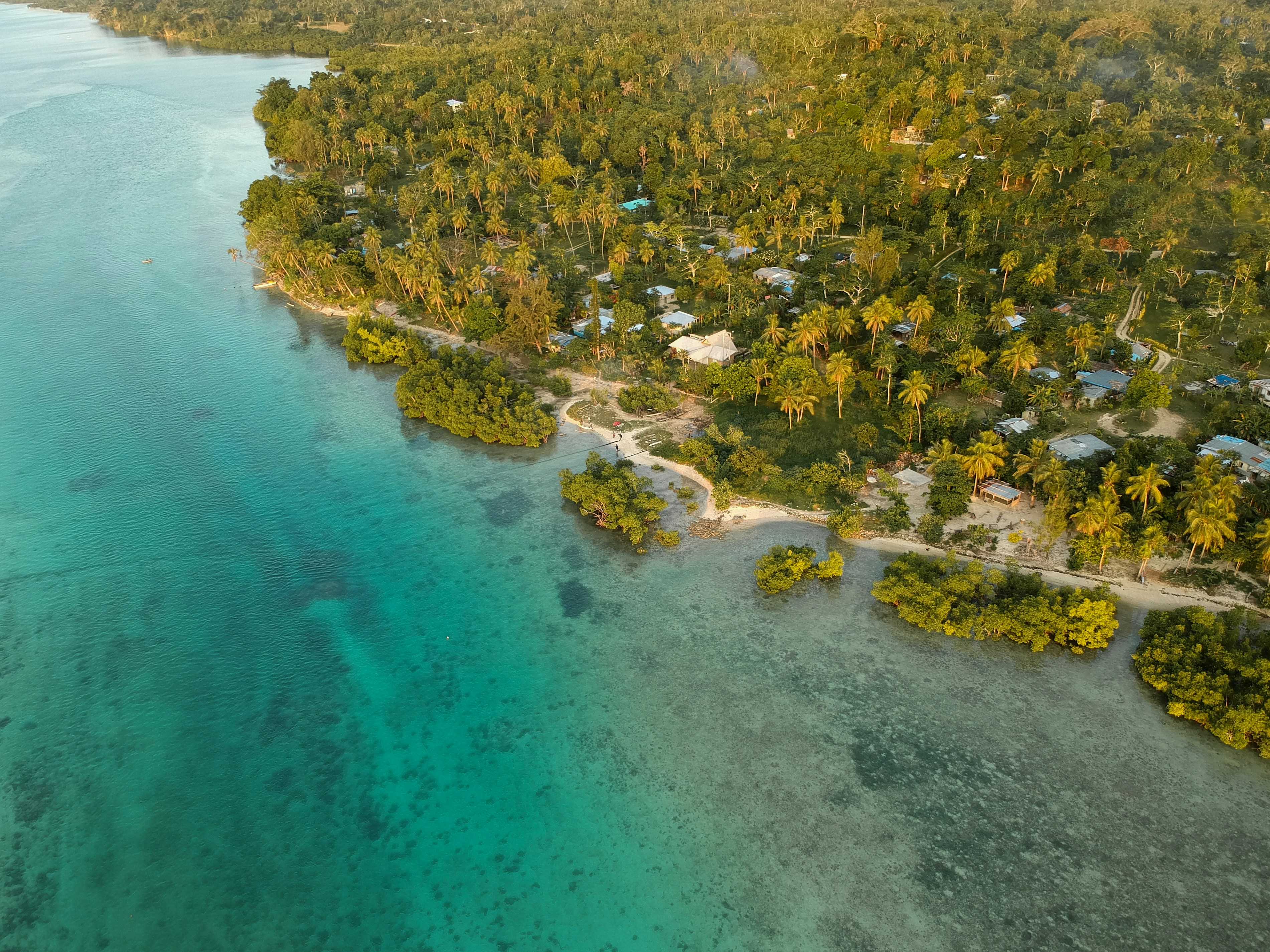
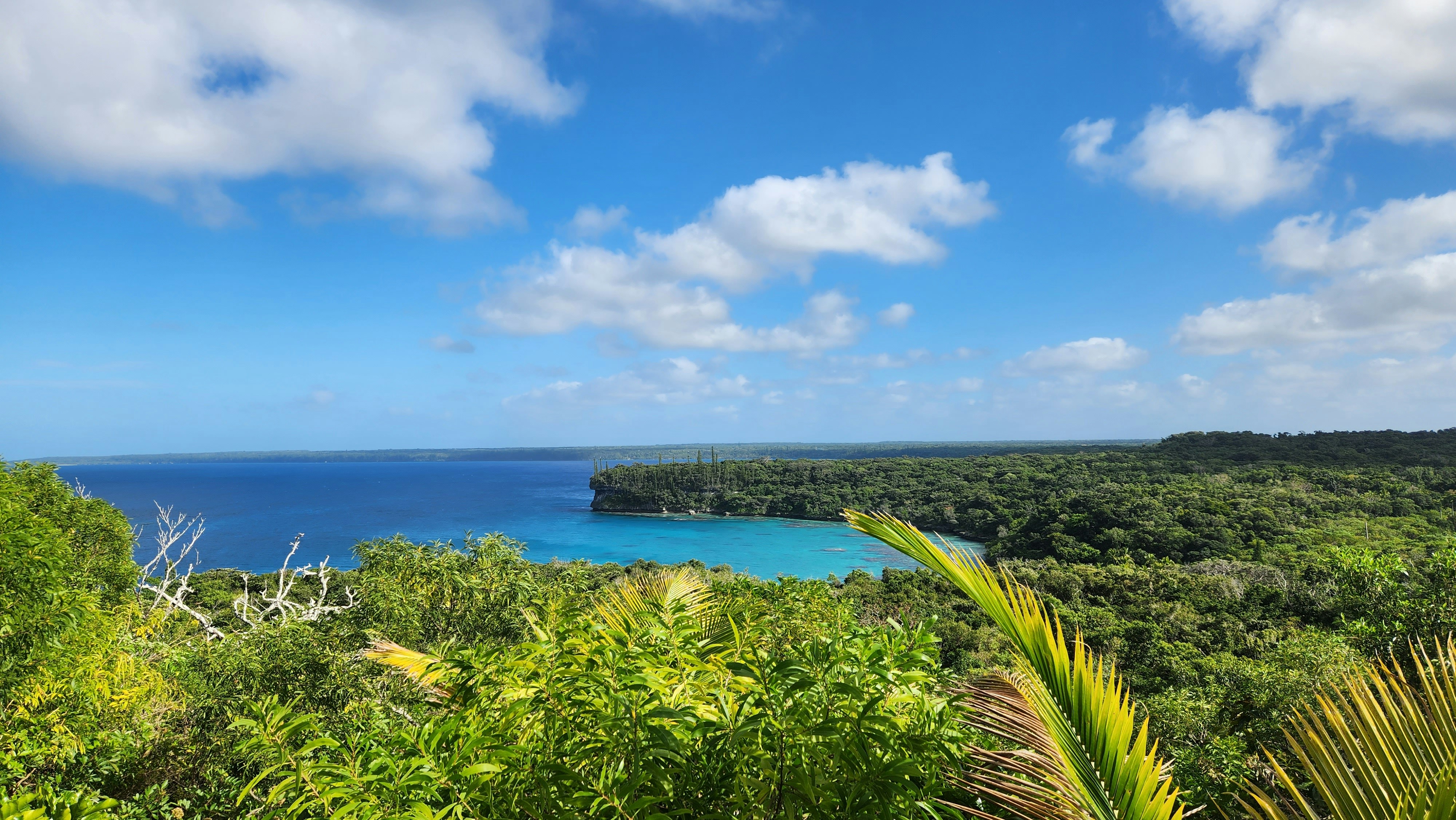
About Lifou Island
Lifou is a commune of France in the Loyalty Islands of New Caledonia. Lifou is made up of two main islands - Lifou Island and Tiga Island- in additional to a number of uninhabited islets. Lifou Isand is the largest atoll in the world. The island is actually made of fossilized coral - known as a makatea. Lifou island does not have any surface water and it relies on a freshwater reservoir accessed by caves. Lifou Island is best known for its vast atoll (the largest in the world). This ring-shaped coral reef affords some of the best snorkelling in the world. Popular activities on this island include scenic walks, relaxing days on the beach, swimming and snorkelling. There are no organized tours being offered during this call to Lifou Island, guests may explore on their own.
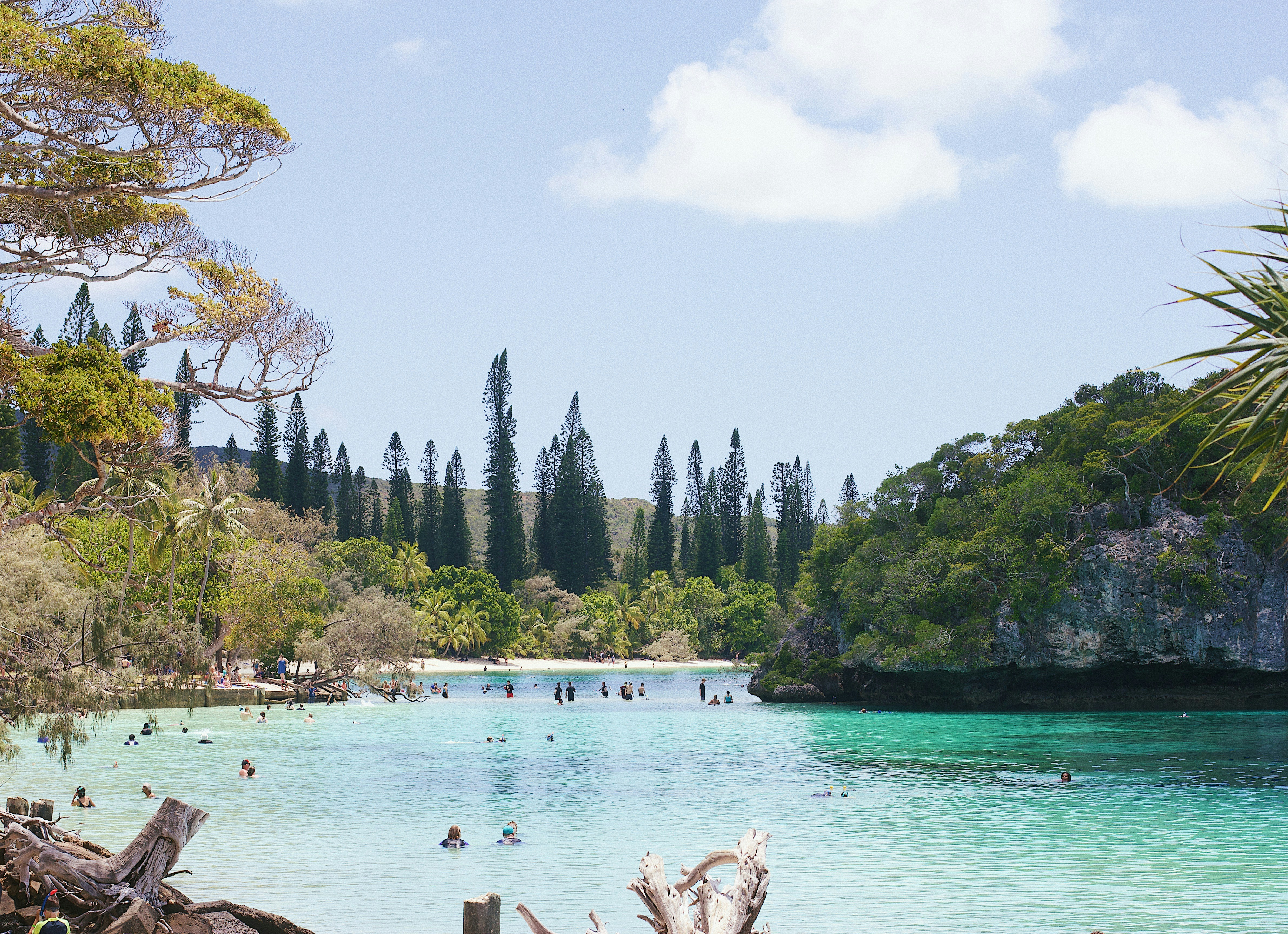
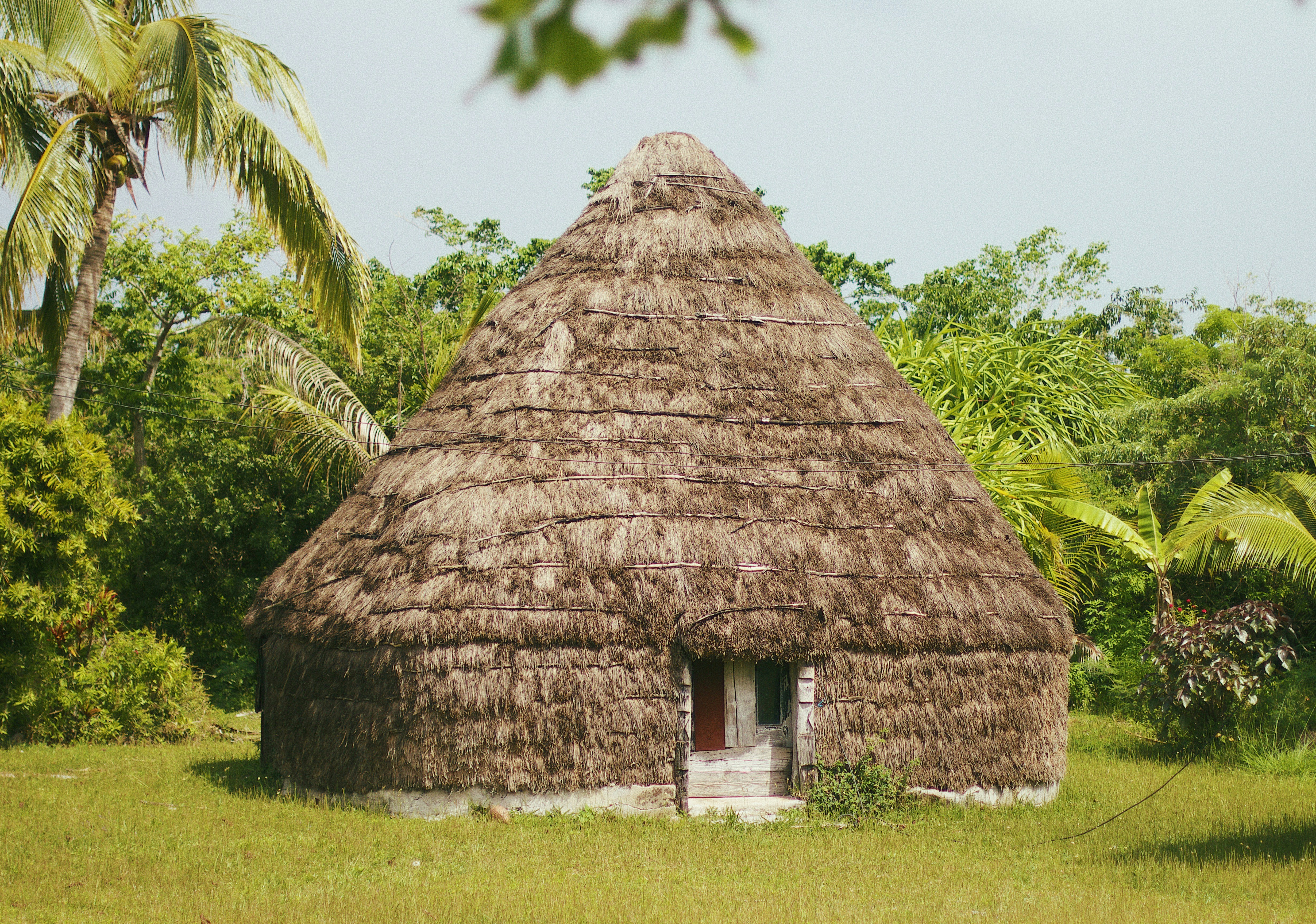
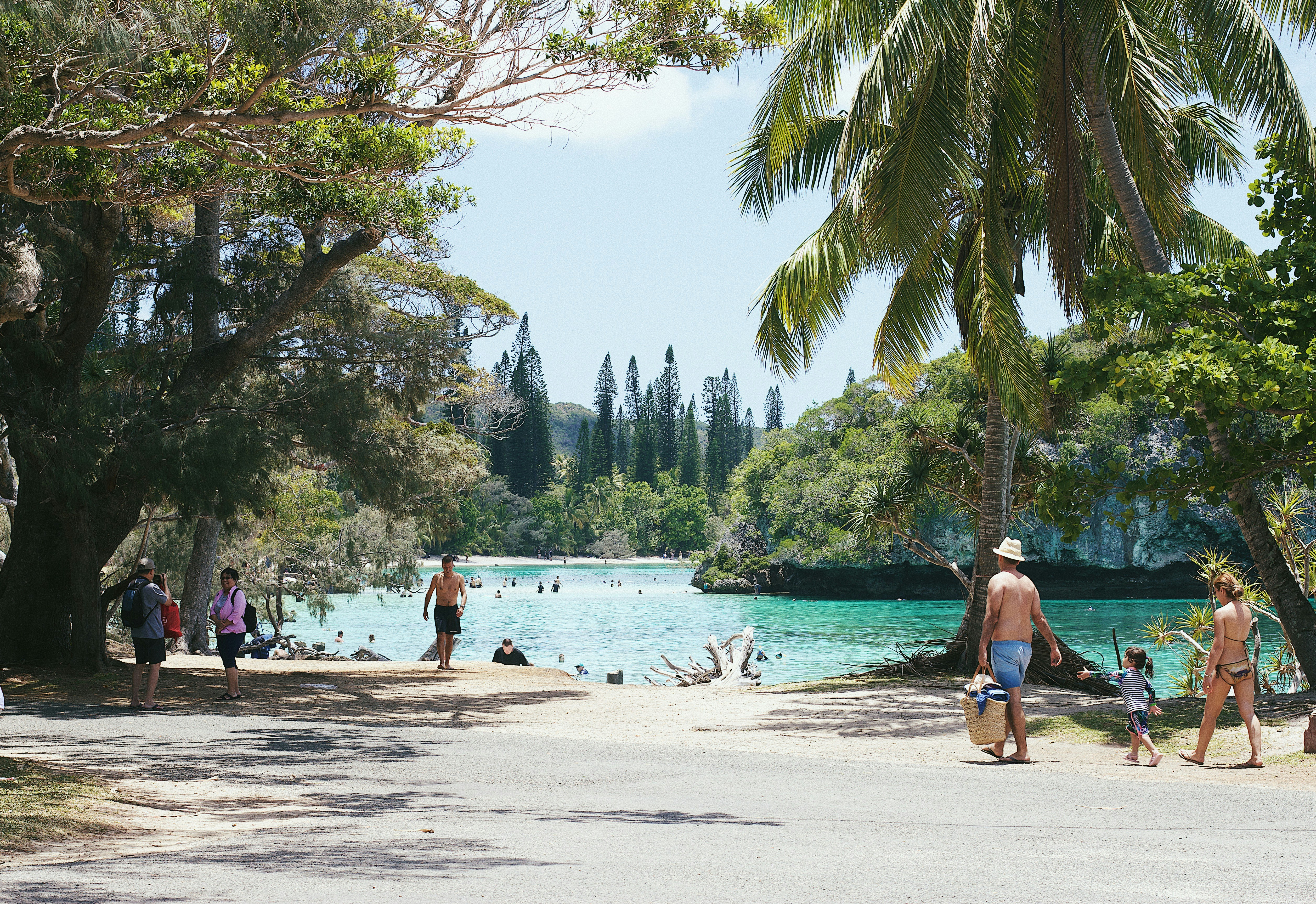
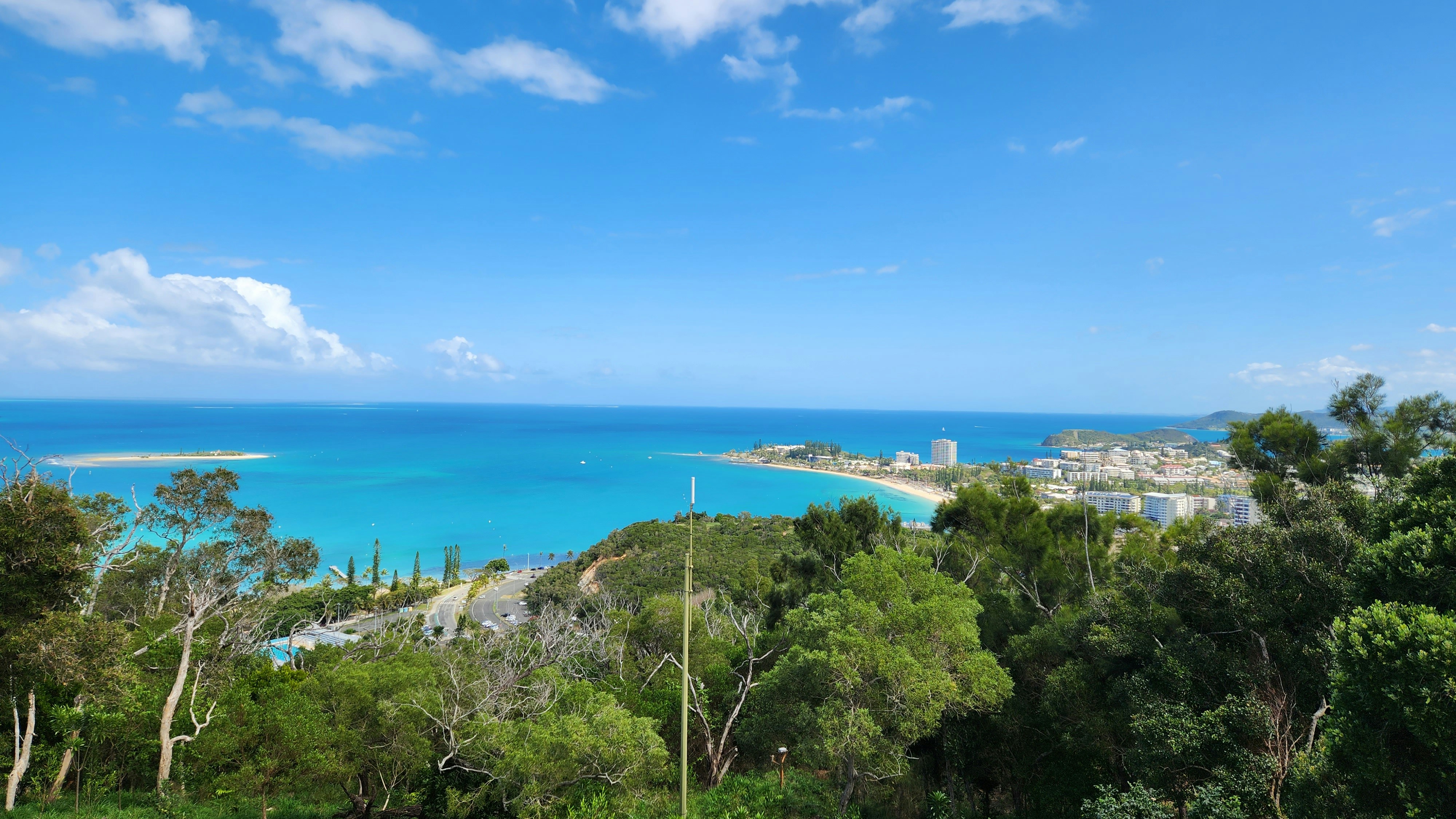
About Nouméa
With its elegant urban infrastructure in a stunning natural setting, Noumea is a truly unique island and part of the New Caledonia archipelago. Noumea started as a penal colony, but has since evolved to a lovely metropolis and today has almost two thirds of New Caledonia’s population. While much of the archipelago of New Caledonia has a large percentage of Kanak people – the indigenous inhabitants who live in tribal areas across the country – Noumea is predominantly European with a strong French influence. The city’s center and Place de Cocotiers, the main park, are located close to the harbor and several churches date back to the late 19th century. Other attractions include a world-class aquarium at Anse Vata, several long beaches to the south, and a noteworthy collection of Kanak and South Pacific objects at the Museum of New Caledonia. The architectural gem of the city is the Tjibaou Cultural Center, the structure of which resembles sails, or the roofs of Kanak houses hidden behind mangroves.
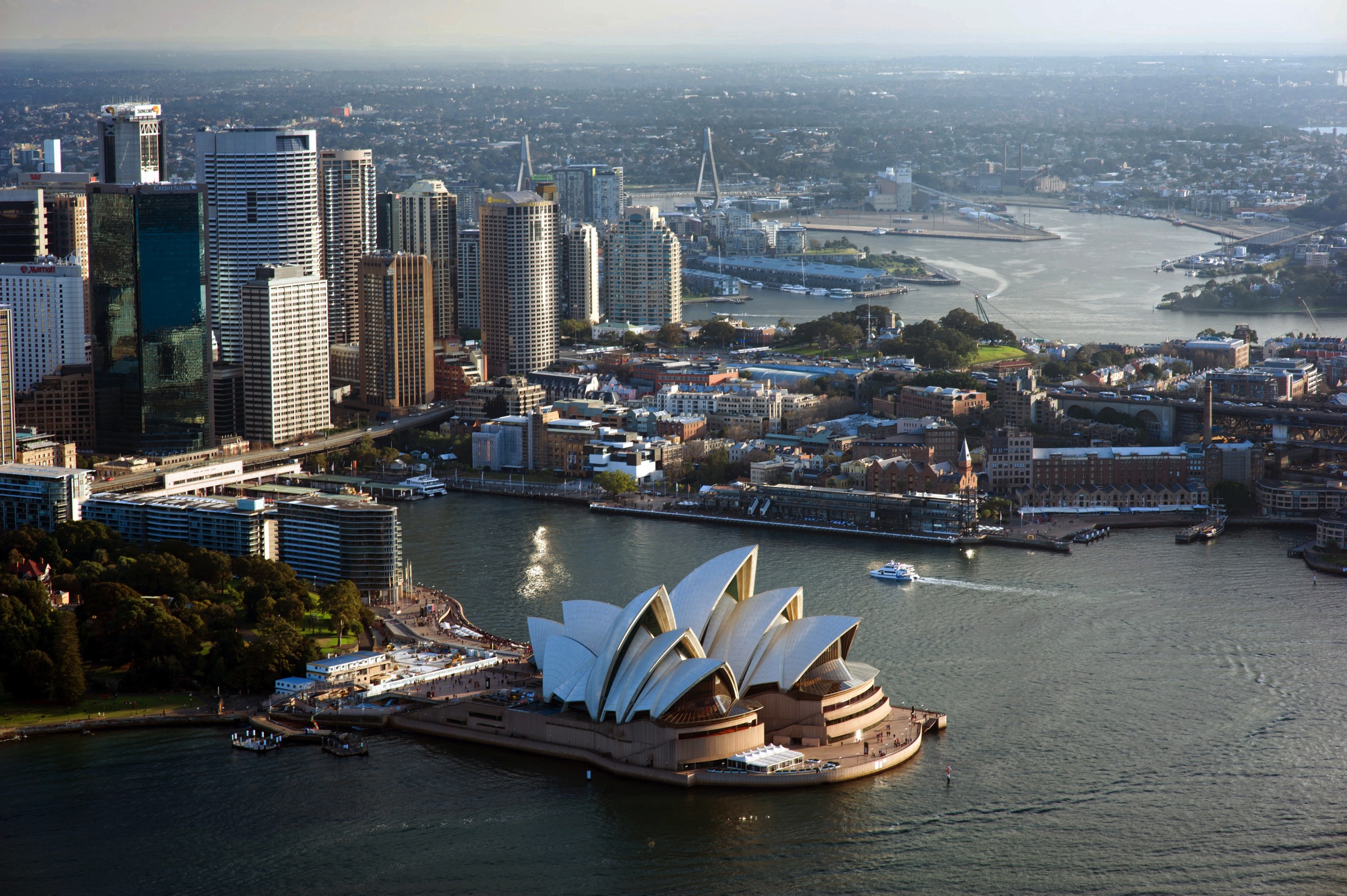
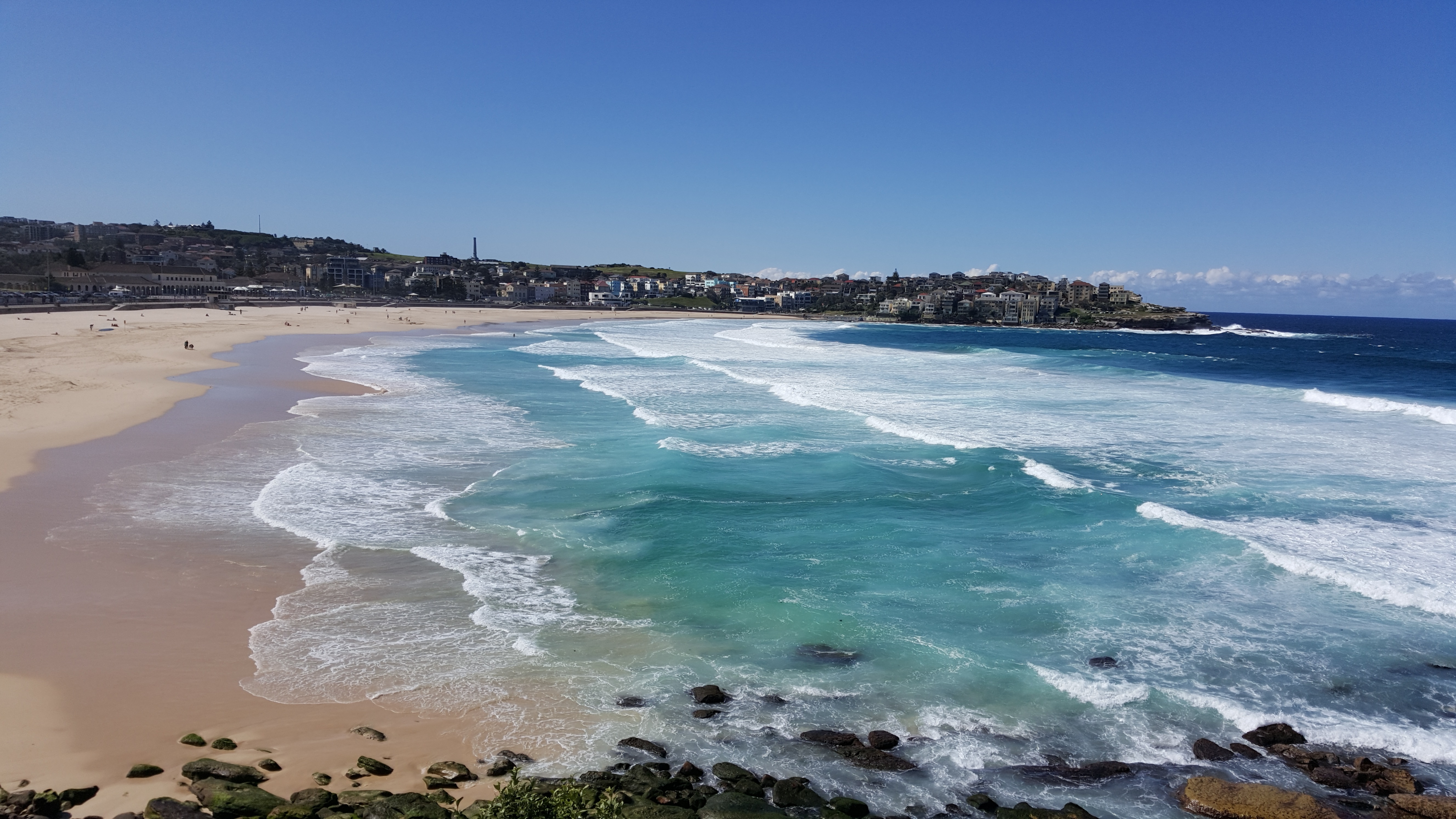
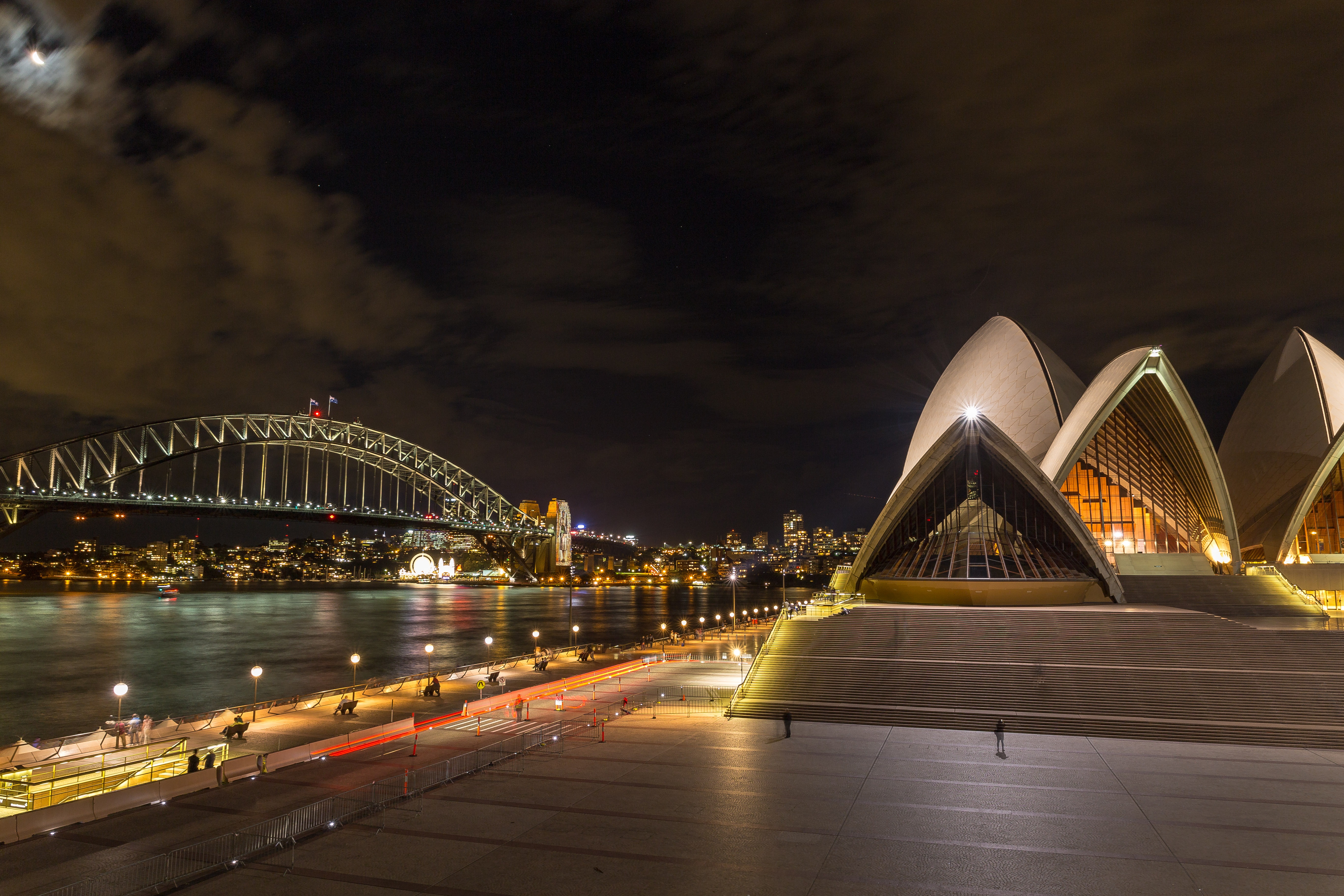
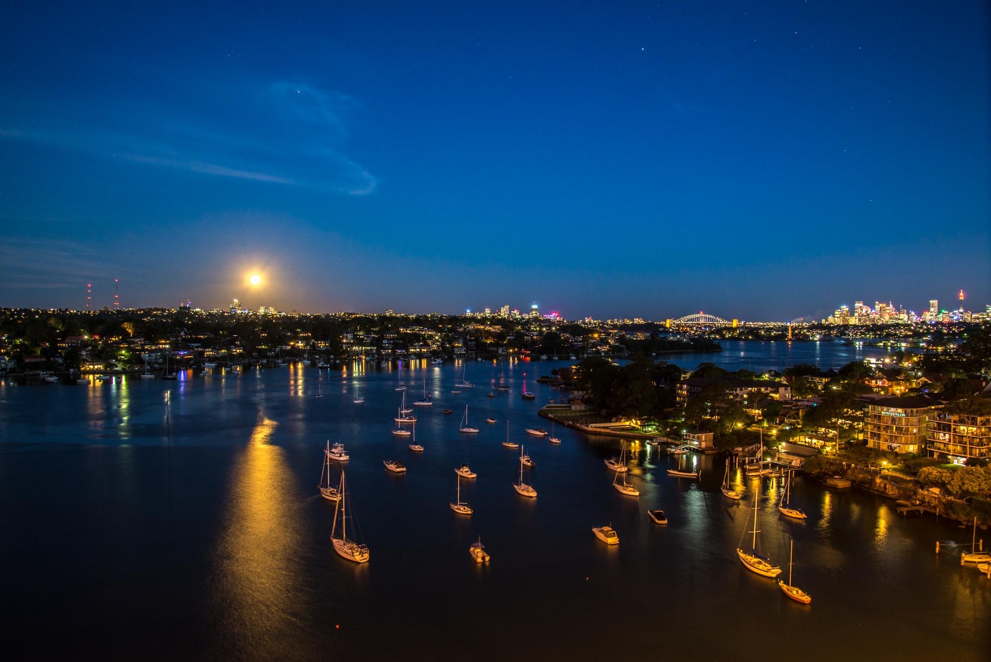
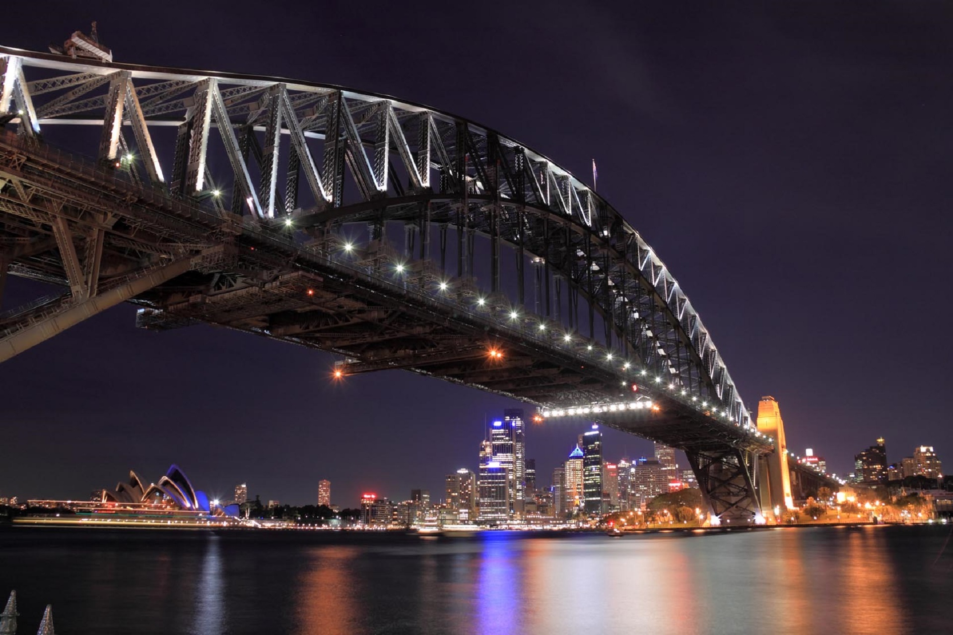
About Sydney, New South Wales
Sydney, capital of New South Wales and one of Australia's largest cities, is best known for its harbourfront Sydney Opera House, with a distinctive sail-like design. Massive Darling Harbour and the smaller Circular Quay port are hubs of waterside life, with the arched Harbour Bridge and esteemed Royal Botanic Garden nearby. Sydney Tower’s outdoor platform, the Skywalk, offers 360-degree views of the city and suburbs.
About Mooloolaba, Queensland
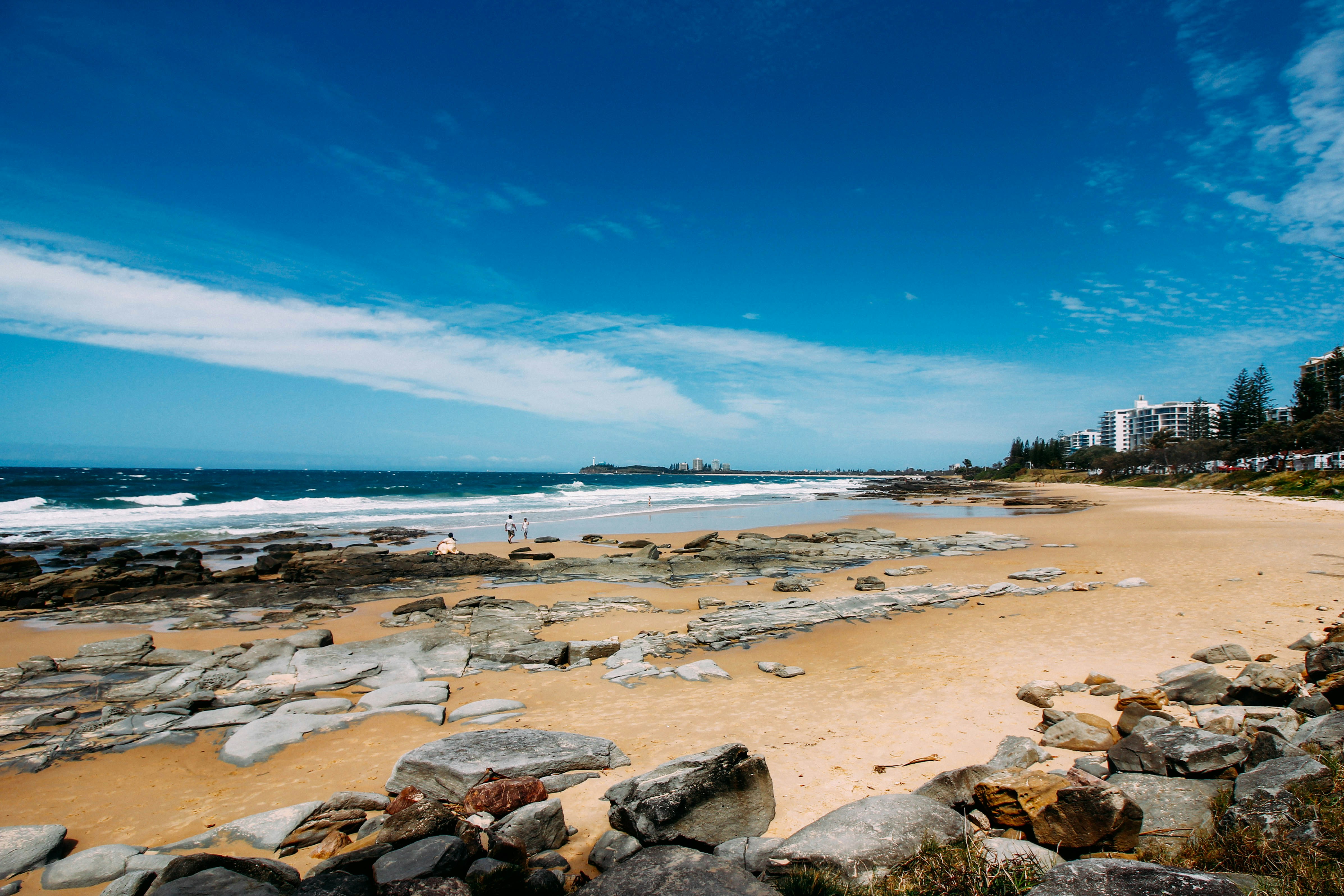
About Airlie Beach
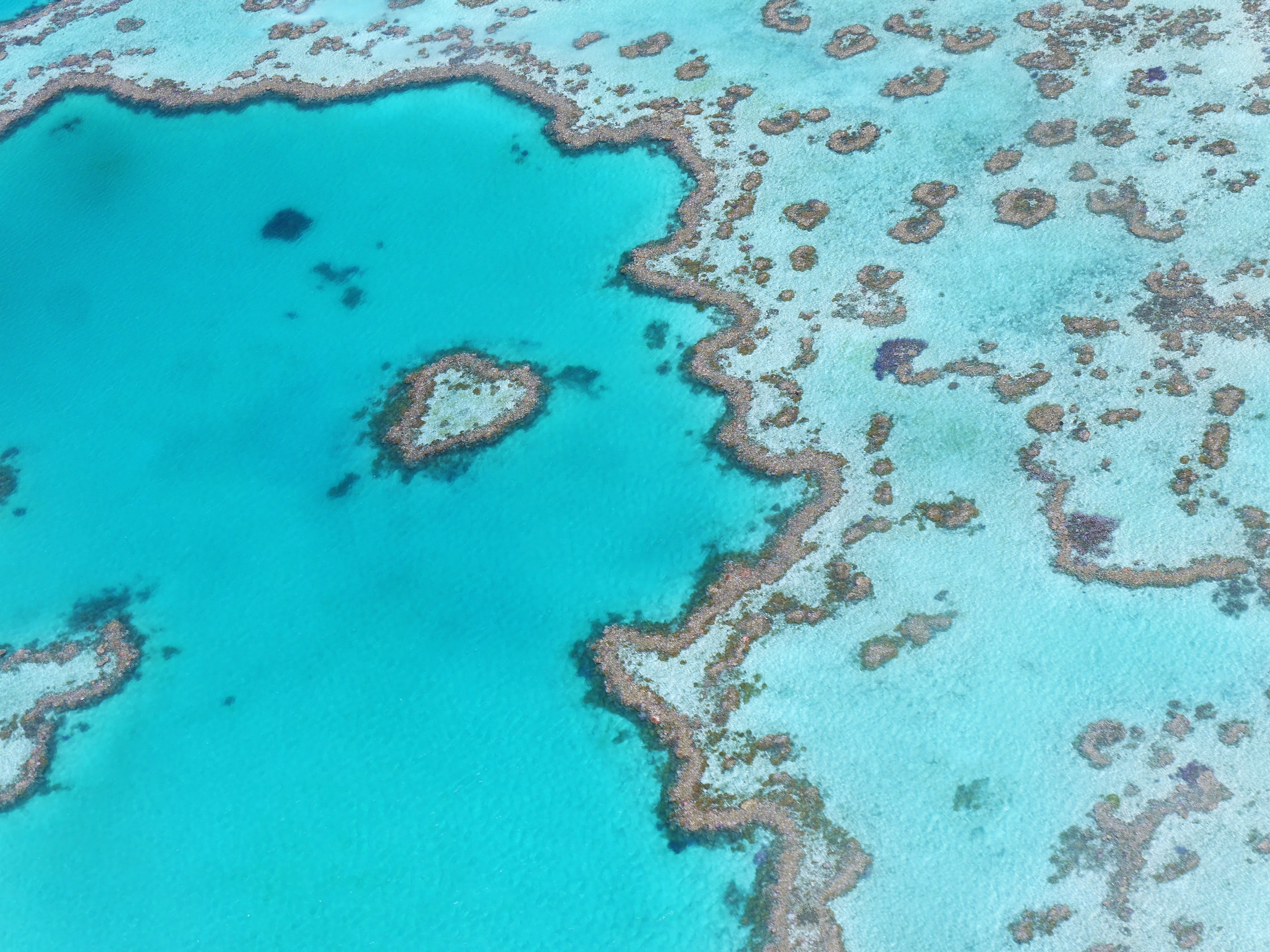
About Cairns, Queensland
Tourism is the lifeblood of Cairns (pronounced Caans). The city makes a good base for exploring the wild top half of Queensland, and tens of thousands of international travelers use it as a jumping-off point for activities such as scuba diving and snorkeling trips to the Barrier Reef, as well as boating, fishing, parasailing, scenic flights, and rain-forest treks.It's a tough environment, with intense heat and fierce wildlife. Along with wallabies and grey kangaroos in the savannah and tree kangaroos in the rain forest, you'll find stealthy saltwater crocodiles, venomous snakes, and jellyfish so deadly they put the region’s stunning beaches off- limits to swimmers for nearly half the year. Yet despite this formidable setting, Cairns and tropical North Queensland are far from intimidating places. The people are warm and friendly, the sights spectacular, and—at the right time of year—the beachside lounging is world-class.
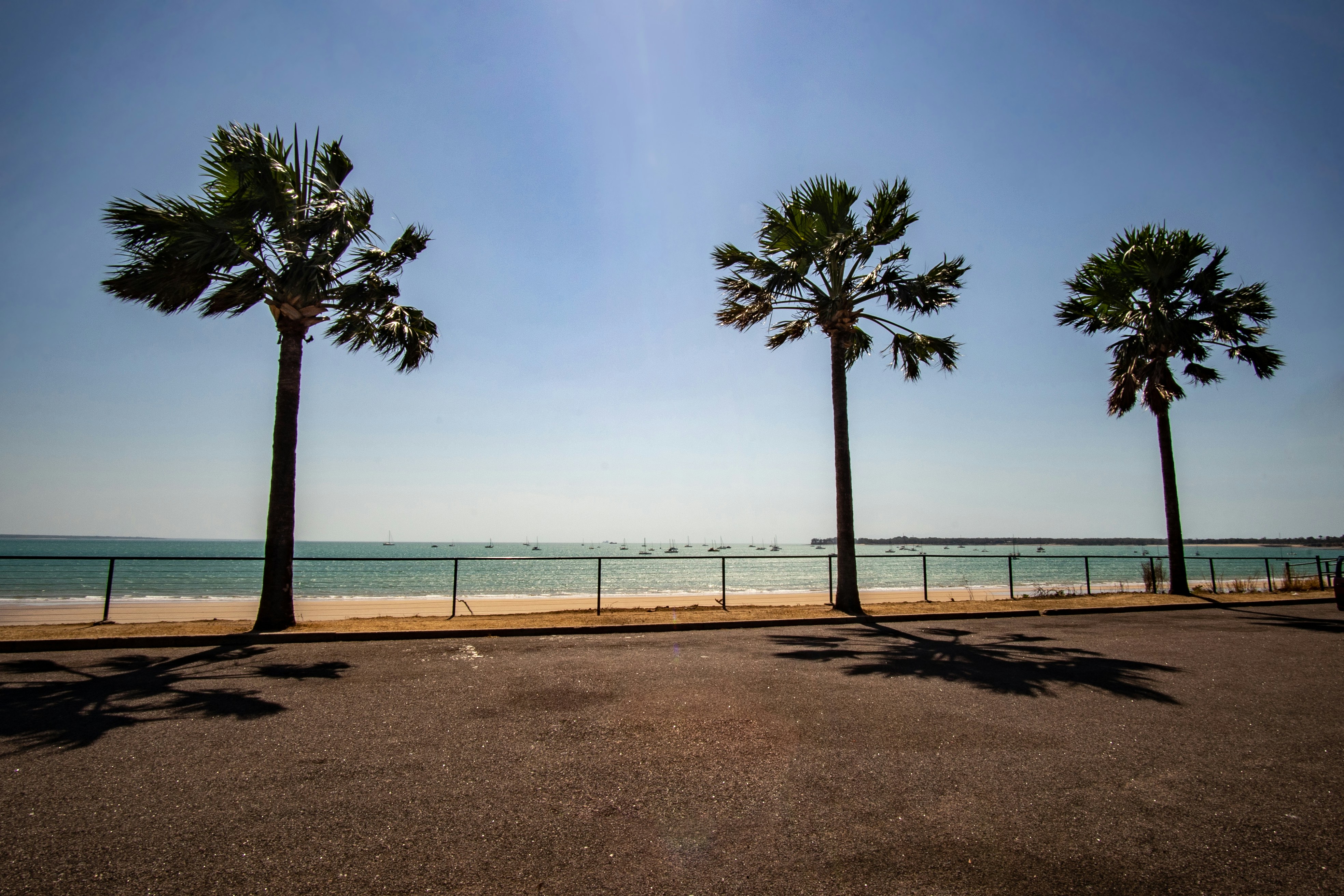
About Darwin, Northern Territory
Darwin is Australia's most colorful, and exotic, capital city. Surrounded on three sides by the turquoise waters of the Timor Sea, the streets are lined with tropical flowers and trees. Warm and dry in winter, hot and steamy in summer, it's a relaxed and casual place, as well as a beguiling blend of tropical frontier outpost and Outback hardiness. Thanks to its close proximity to Southeast Asia and its multicultural population it also seems more like Asia than the rest of Australia. Darwin is a city that has always had to fight for its survival. The seductiveness of contemporary Darwin lifestyles belies a history of failed attempts that date from 1824 when Europeans attempted to establish an enclave in this harsh, unyielding climate. The original 1869 settlement, called Palmerston, was built on a parcel of mangrove wetlands and scrub forest that had changed little in 15 million years. It was not until 1911, after it had already weathered the disastrous cyclones of 1878, 1882, and 1897, that the town was named after the scientist who had visited Australia's shores aboard the Beagle in 1839. During World War II it was bombed more than 60 times, as the harbor full of warships was a prime target for the Japanese war planes. Then, on the night of Christmas Eve 1974, the city was almost completely destroyed by Cyclone Tracy, Australia’s greatest natural disaster. It's a tribute to those who stayed and to those who have come to live here after Tracy that the rebuilt city now thrives as an administrative and commercial center for northern Australia. Old Darwin has been replaced by something of an edifice complex—such buildings as Parliament House and the Supreme Court all seem very grand for such a small city, especially one that prides itself on its casual, outdoor-centric lifestyle. Today Darwin is the best place from which to explore Australia's Top End, with its wonders of Kakadu and the Kimberley region.
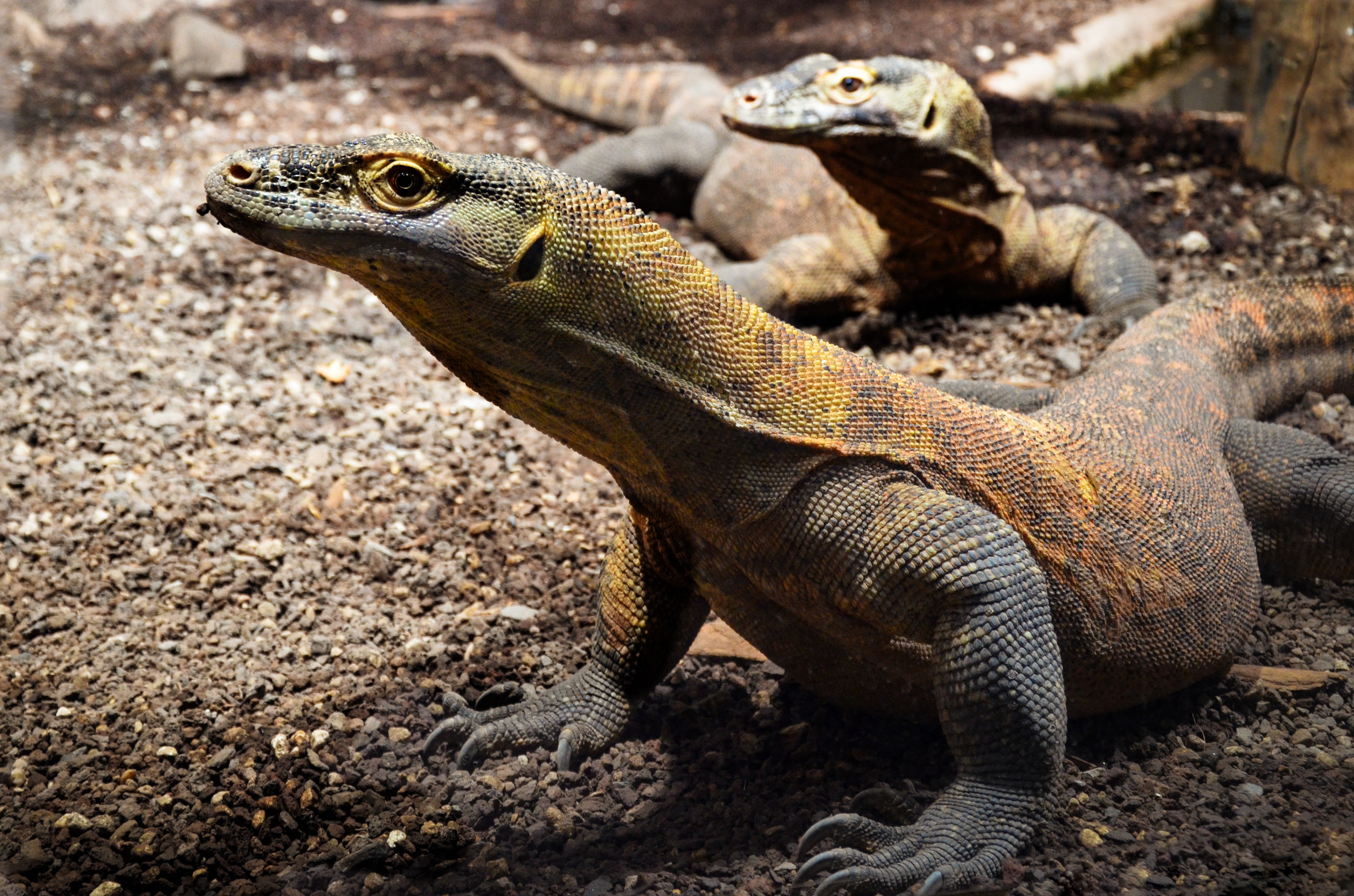
About Komodo Island
Pink Beach earned its name for the way the beach can appear to have a rosy hue in certain lights. The color comes from small flecks of red coral mixed in with the fine white reef sand. With a few trees along the beach for shade, this stretch of coast makes a fine place to relax or enjoy a snorkel or dive in the crystal clear waters. It is possible to spot a striped clown fish nestled among the protective tentacles of its sea anemone host, or to see a grouper lazily swimming by a flamboyant soft coral. The reef here is now protected by law and the maturing corals are a joy to behold.
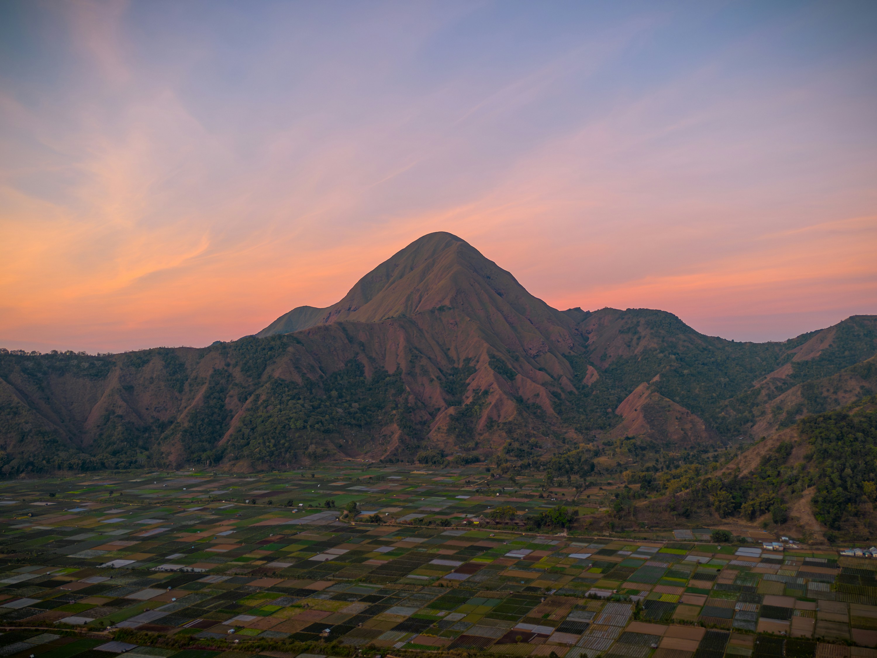
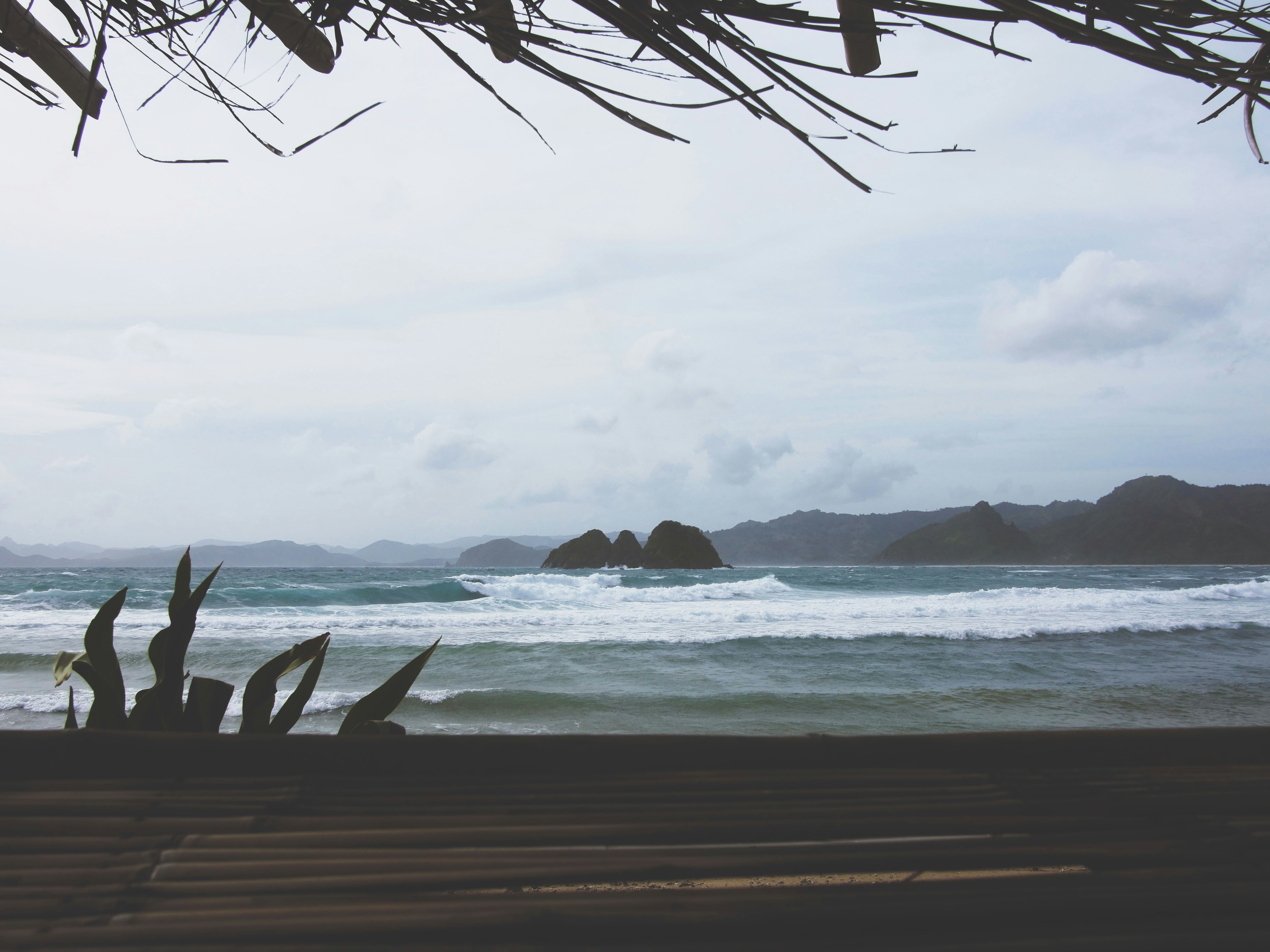
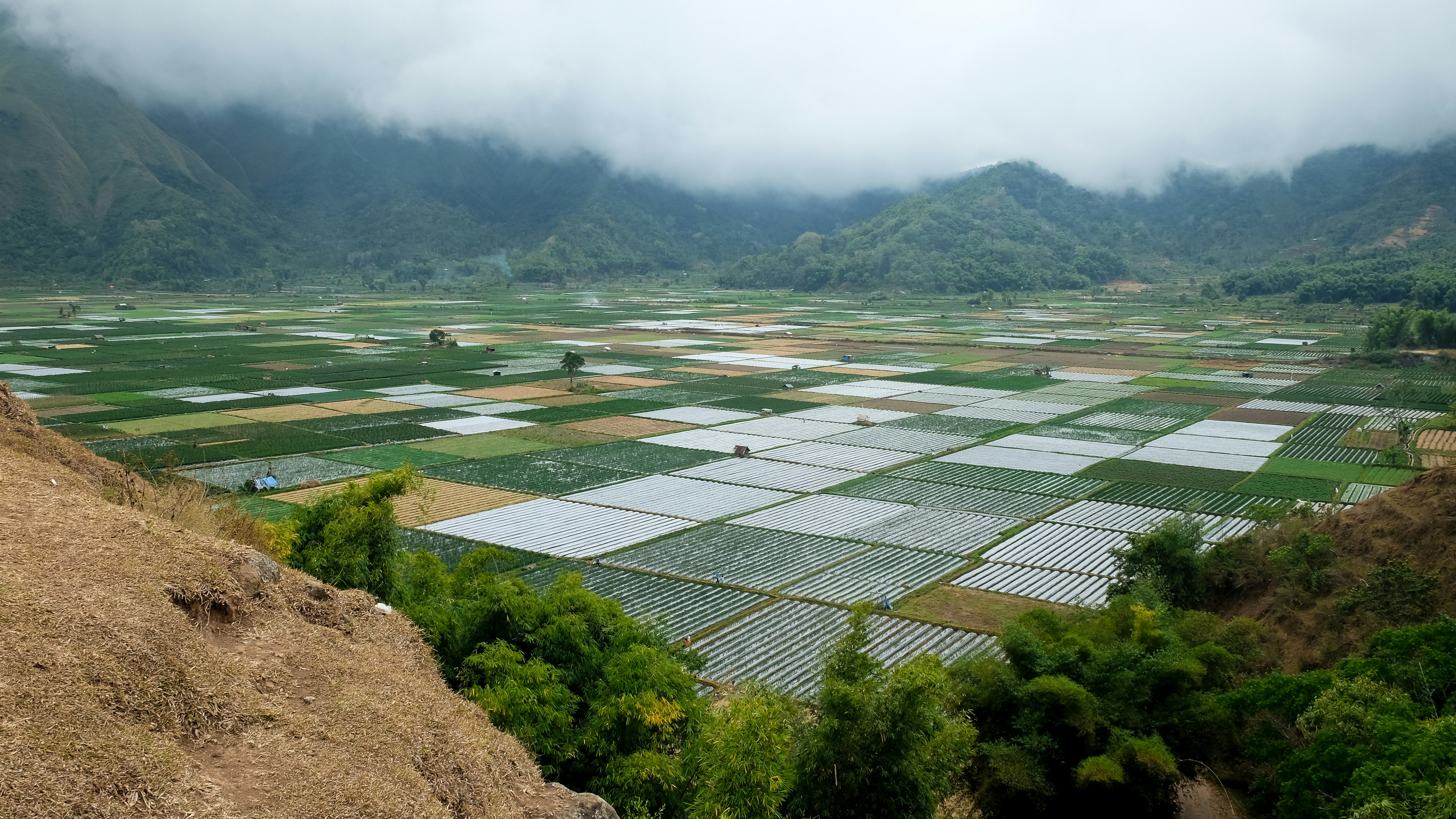
About Lombok
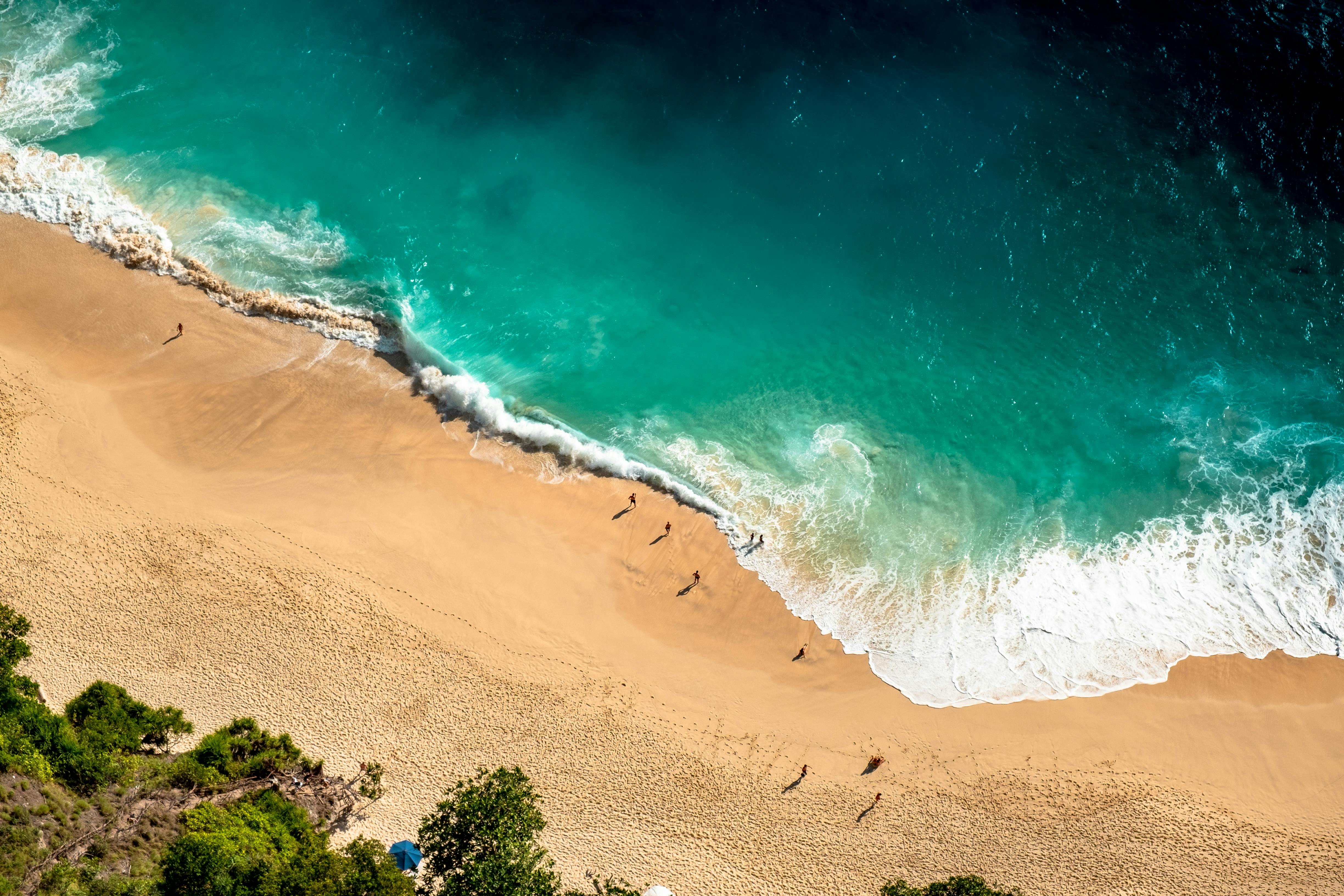
About Benoa, Bali
Bali really is as alluring as everyone says. This island, slightly bigger than Delaware, has it all: beaches, volcanoes, terraced rice fields, forests, renowned resorts, surfing, golf, and world-class dive sites. But what sets Bali apart from other nearby tropical destinations is Balinese tradition, and villagers dedicated to celebrating it. The hundreds of temples, dances, rituals, and crafts linked to their ancient Hindu faith aren't a show for tourists, but a living, breathing culture in which visitors are warmly received by the Balinese, who cherish their own identities.
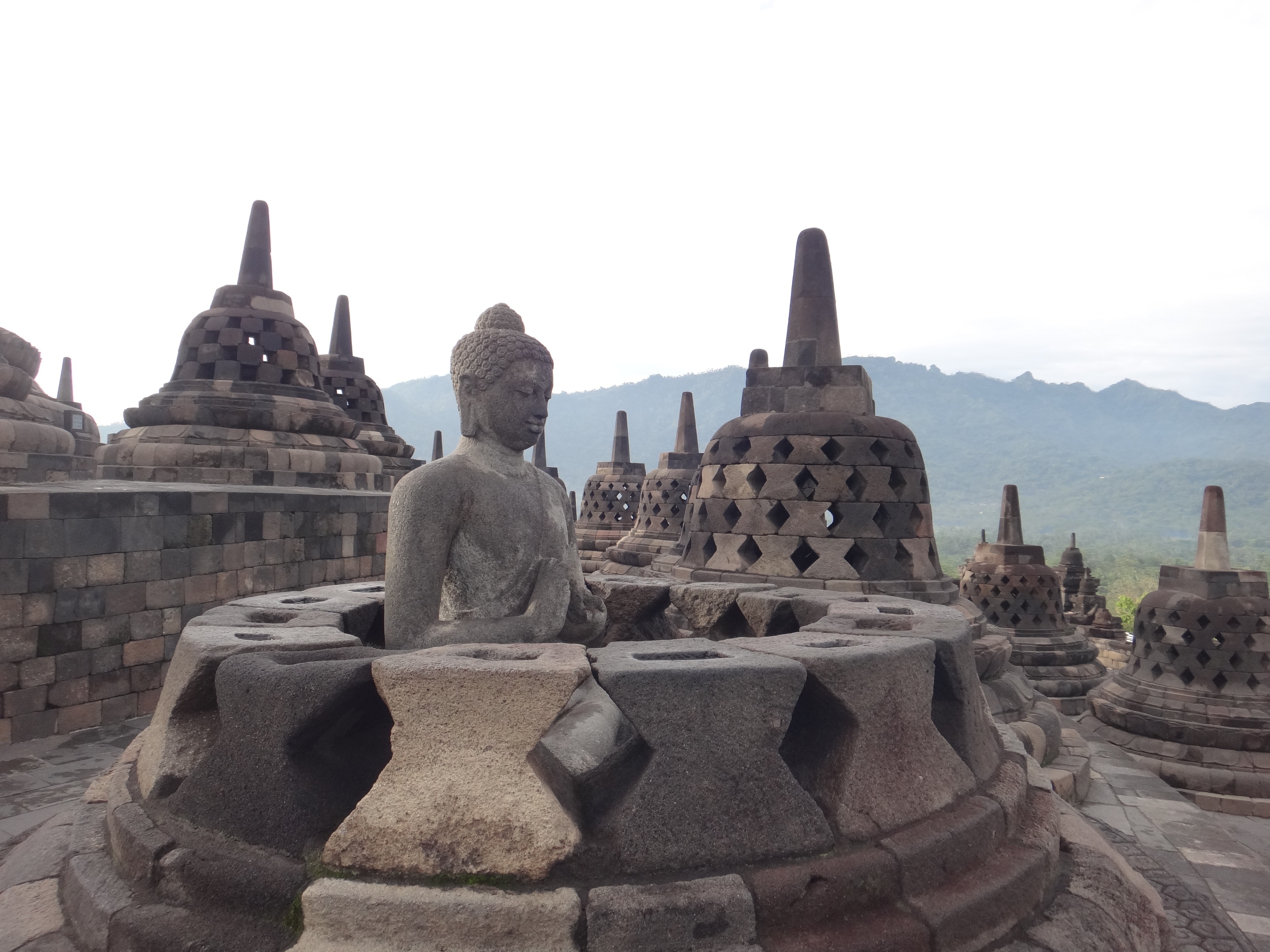
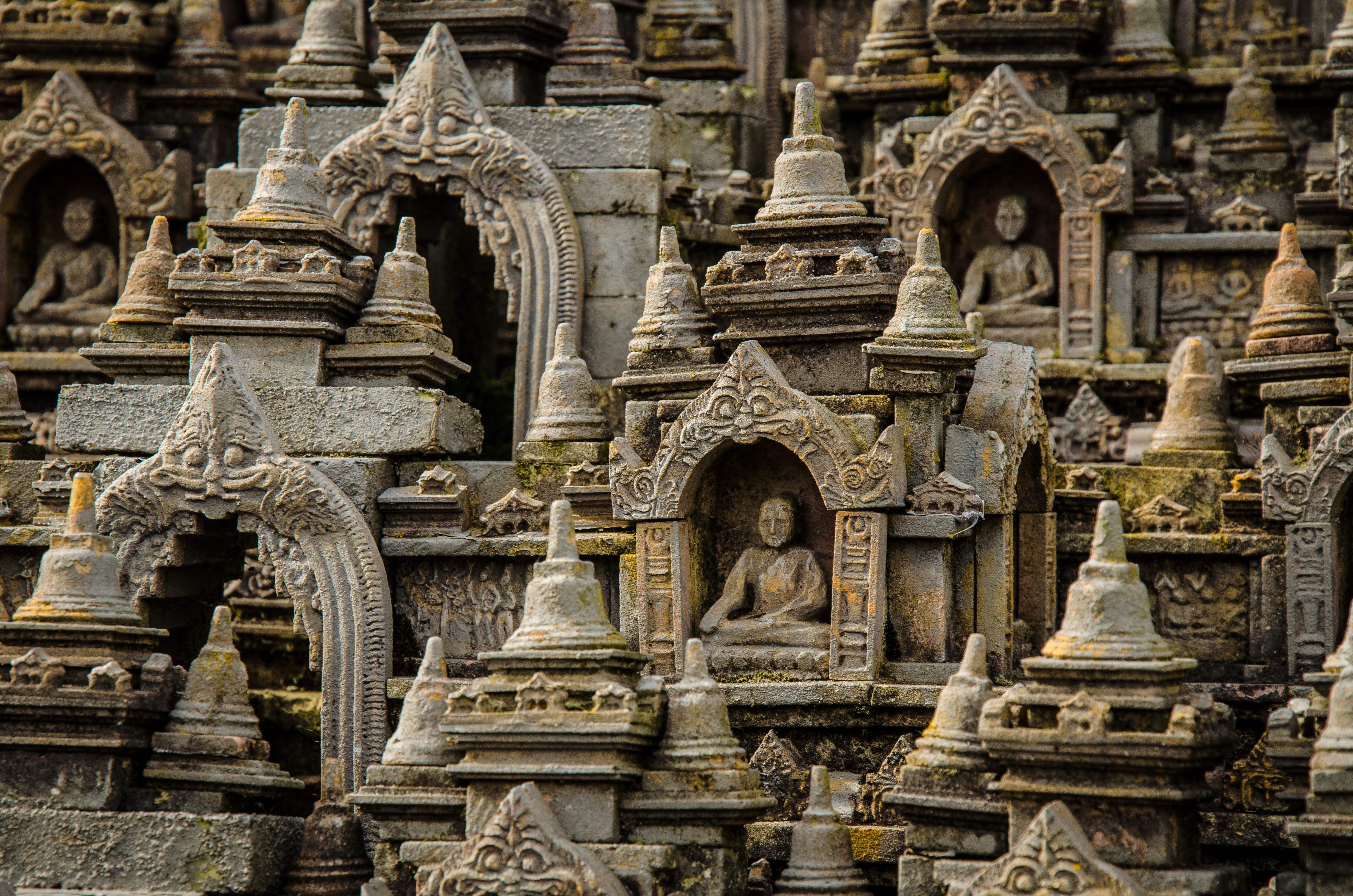
About Semarang
Semarang is one of the oldest cities in Indonesia, situated on Java's north coast between the shore of the Java Sea and a small ridge of mountains. Ceded to the Dutch West India Company in 1677 by King Amangkurat I in payment of his debts, it became their headquarters and the seat of the Dutch governor of the northeast provinces. Semarang's usefulness as a port waned due to the gradual silting up of the harbor; by the 19th century, Surabaya had eclipsed Semarang as Java's premier port. With a population of over one million, a third of whom are thought to be of Chinese extraction, Semarang is the largest city in Central Java and its administrative capital. The city consists of two parts: the coastal lowland where most of the commercial activities are found; and the hilly residential area. Although more a business center than a city for tourists, Semarang serves as a popular gateway to the mountainous interior of Central Java and to fabled Borobudur.
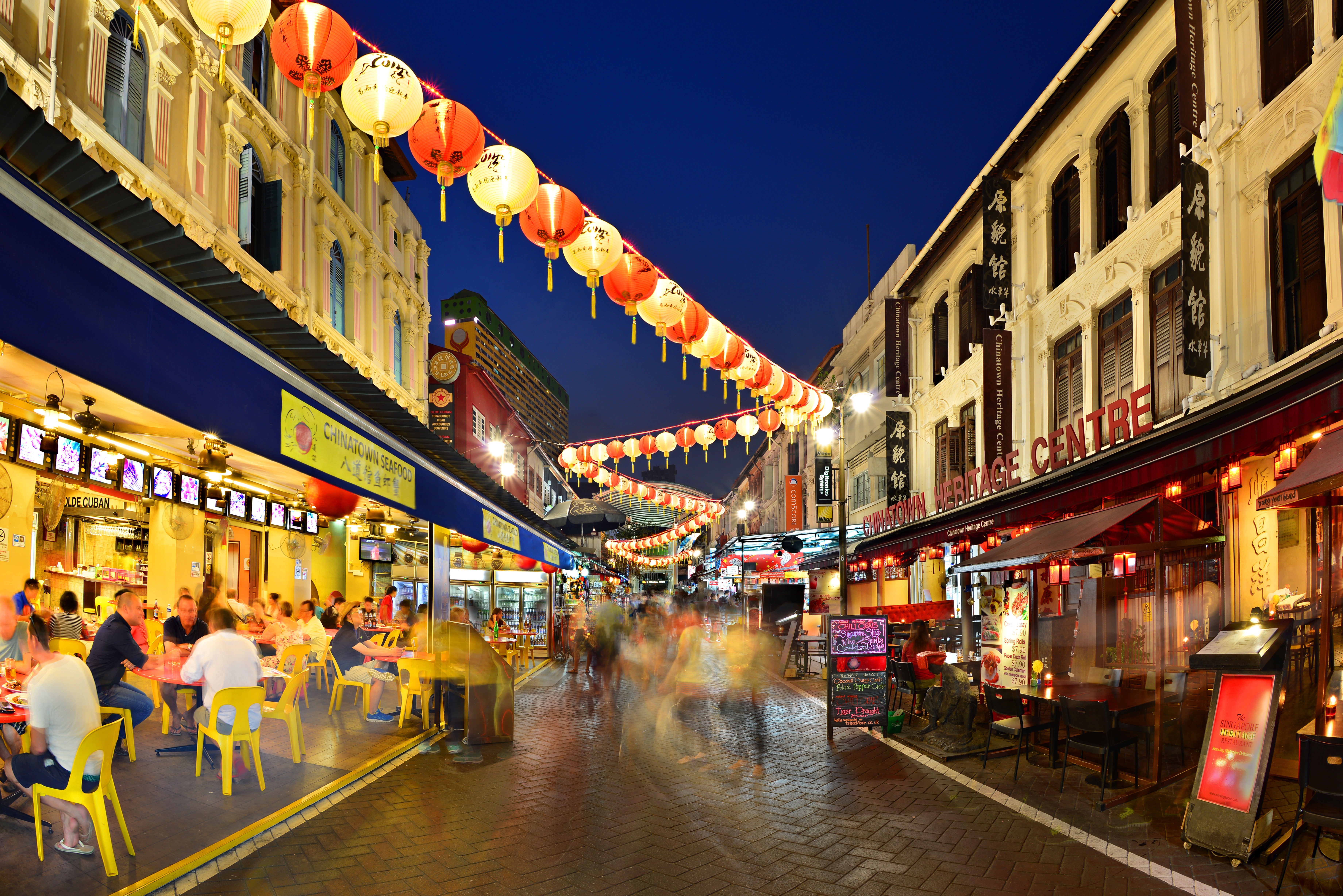
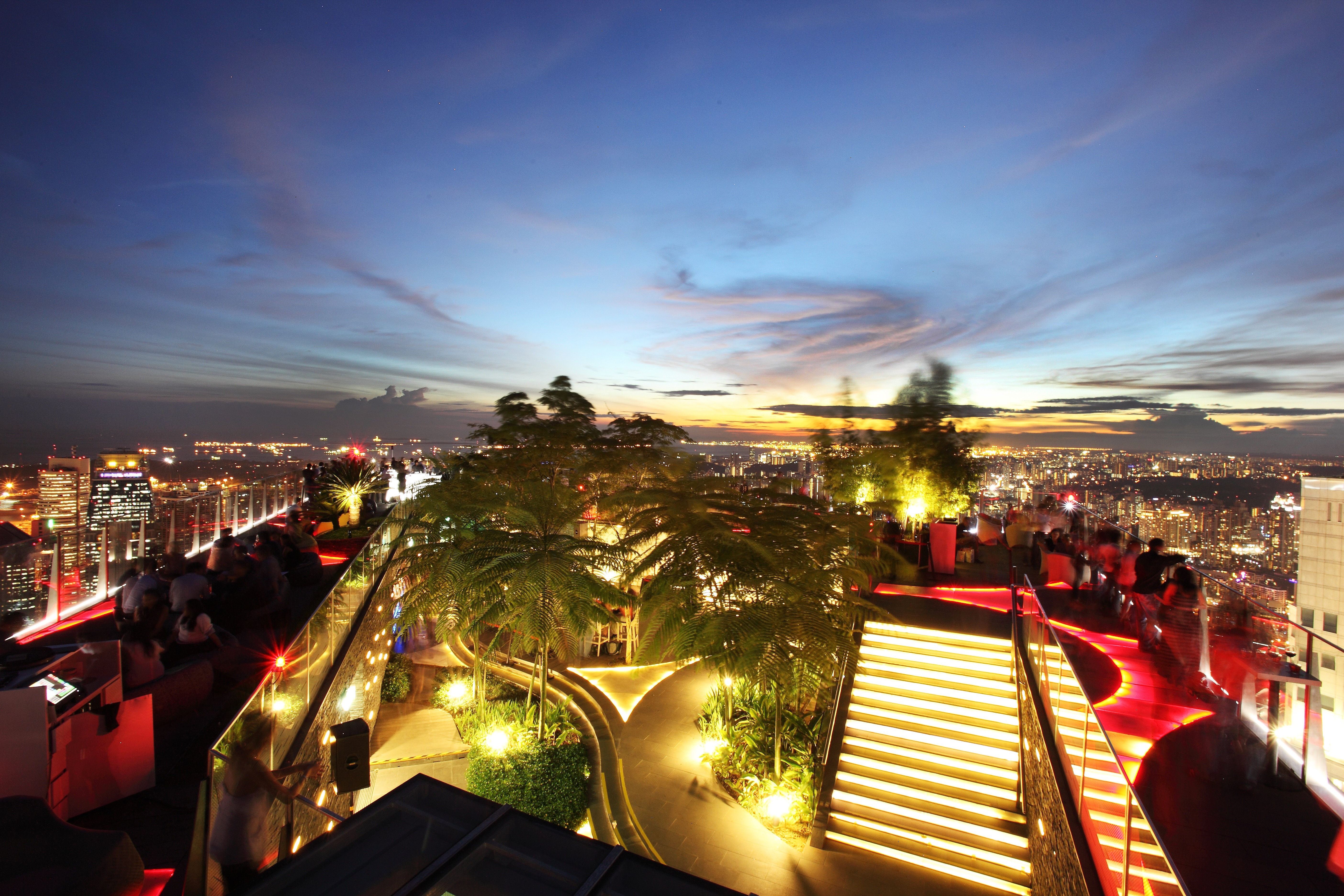
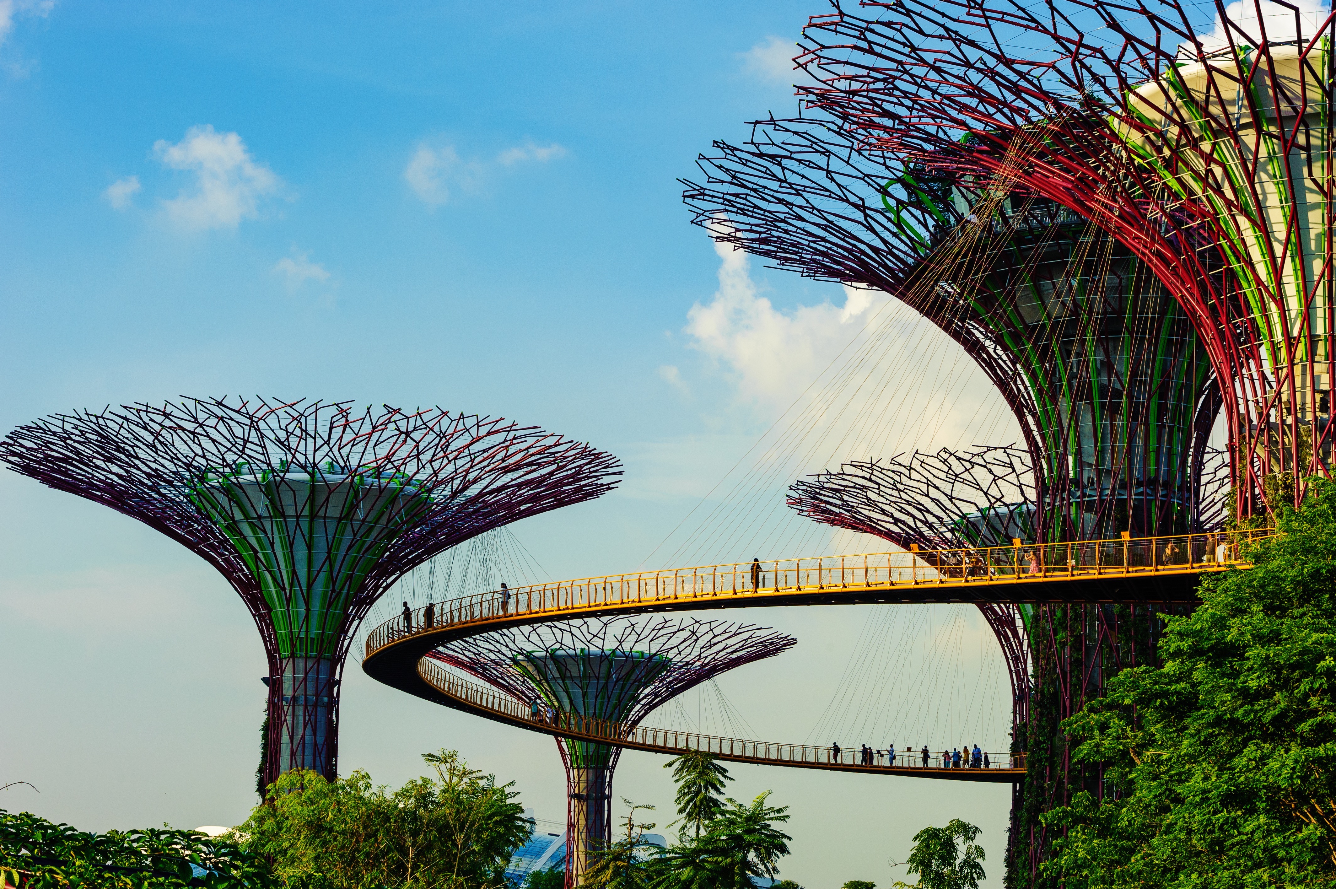
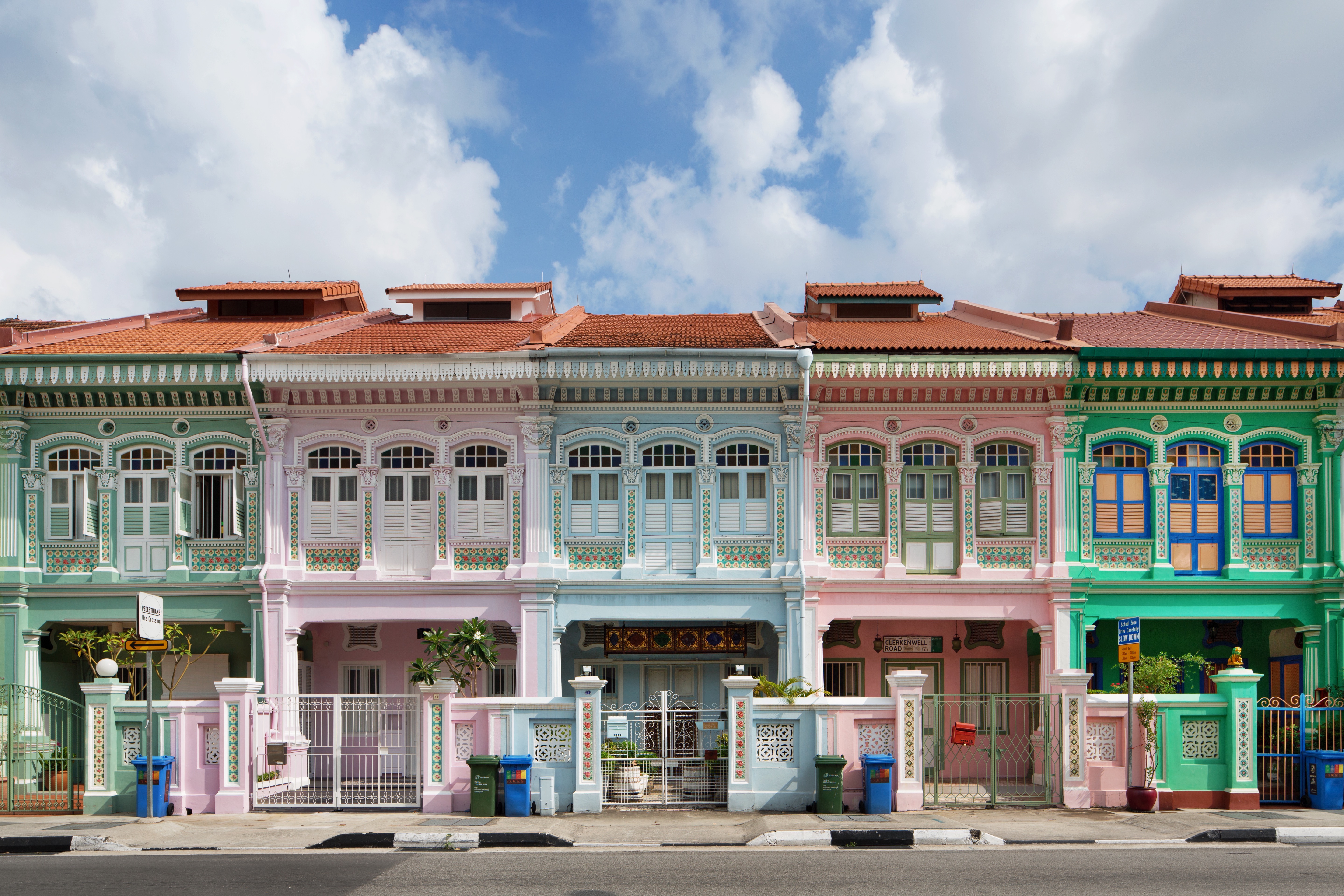
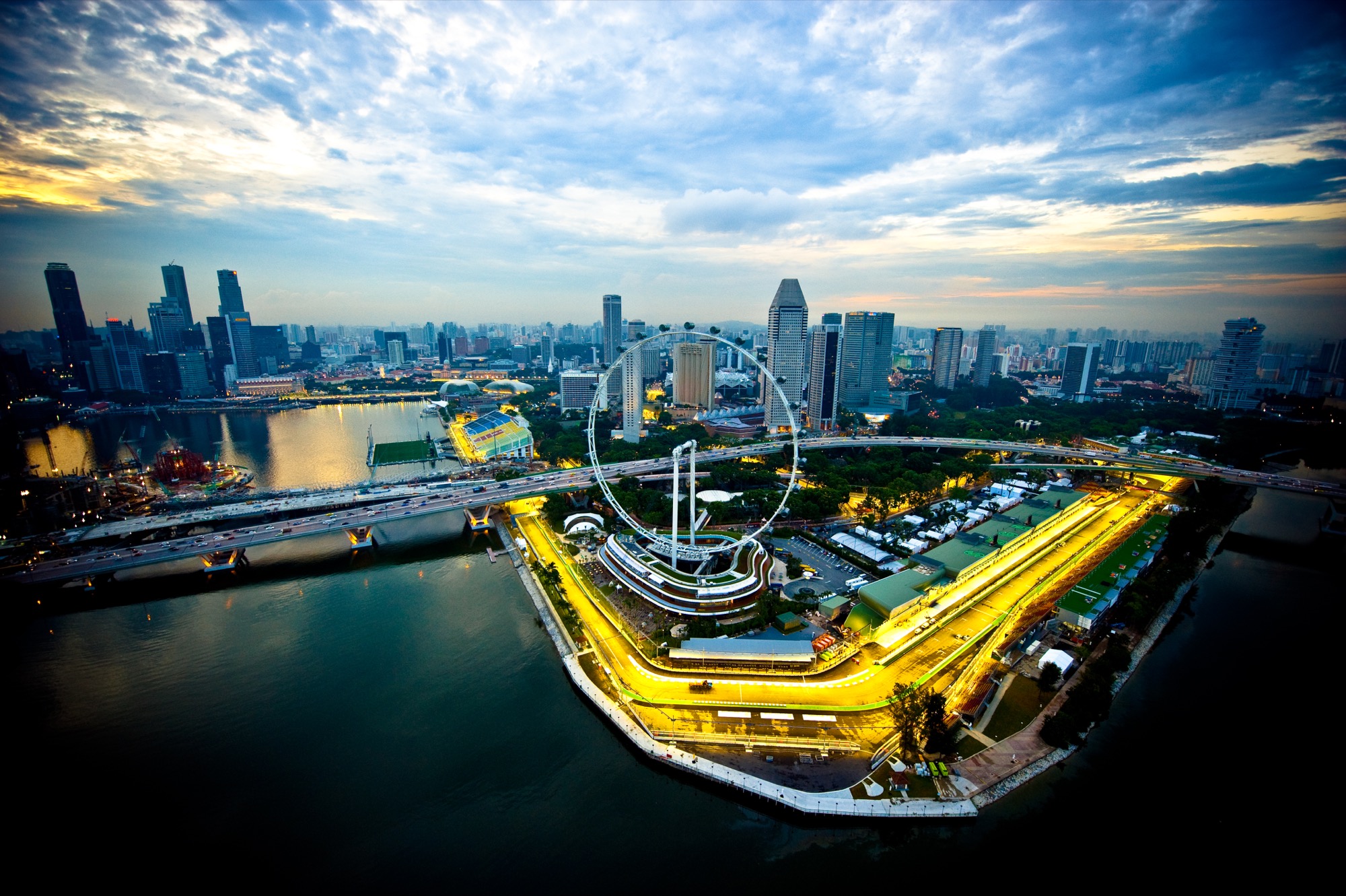
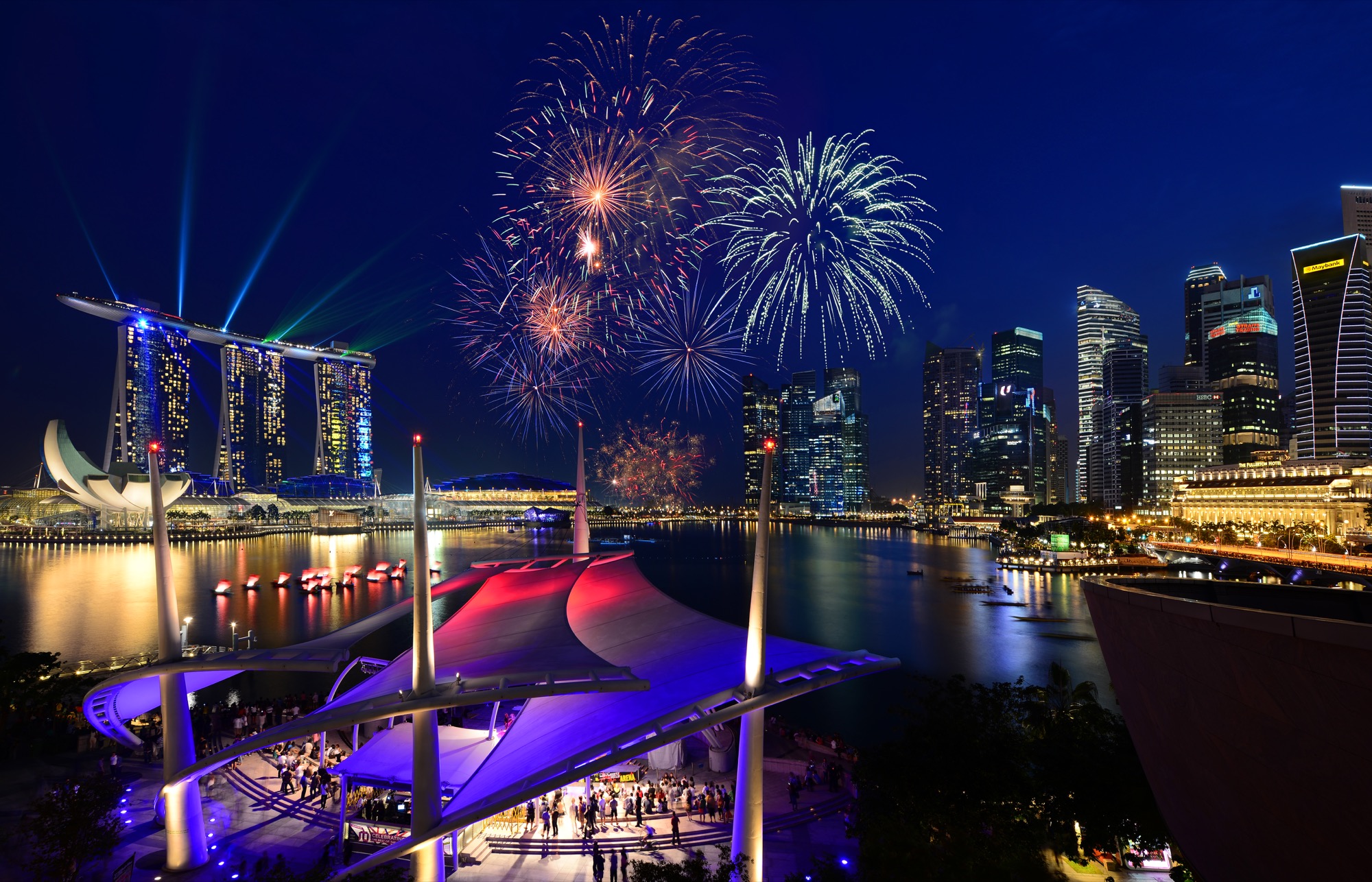
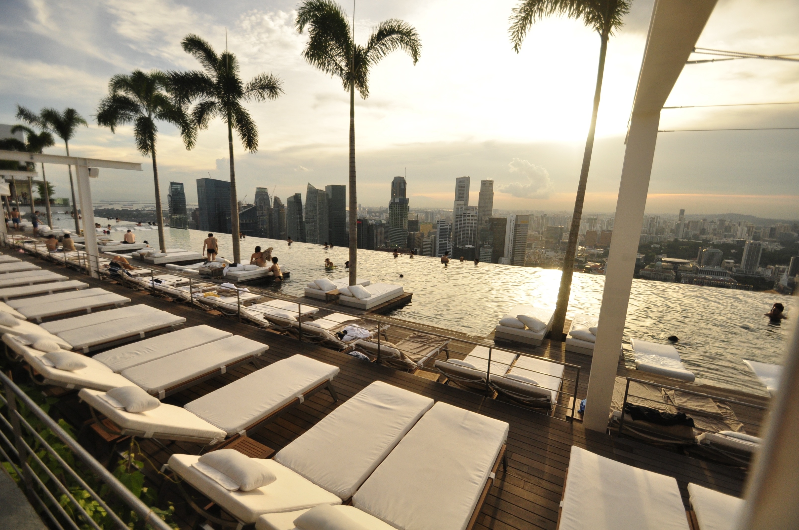
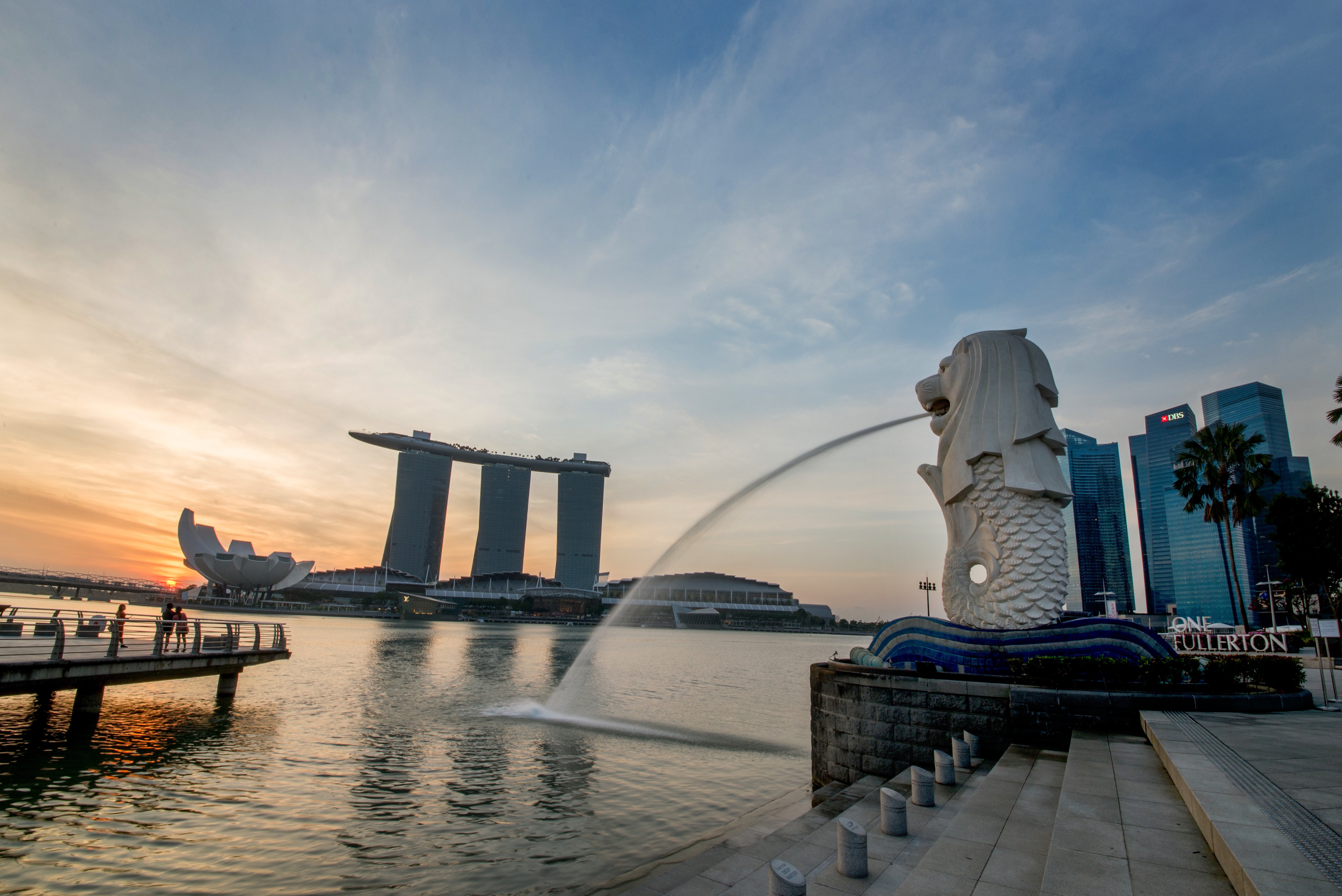
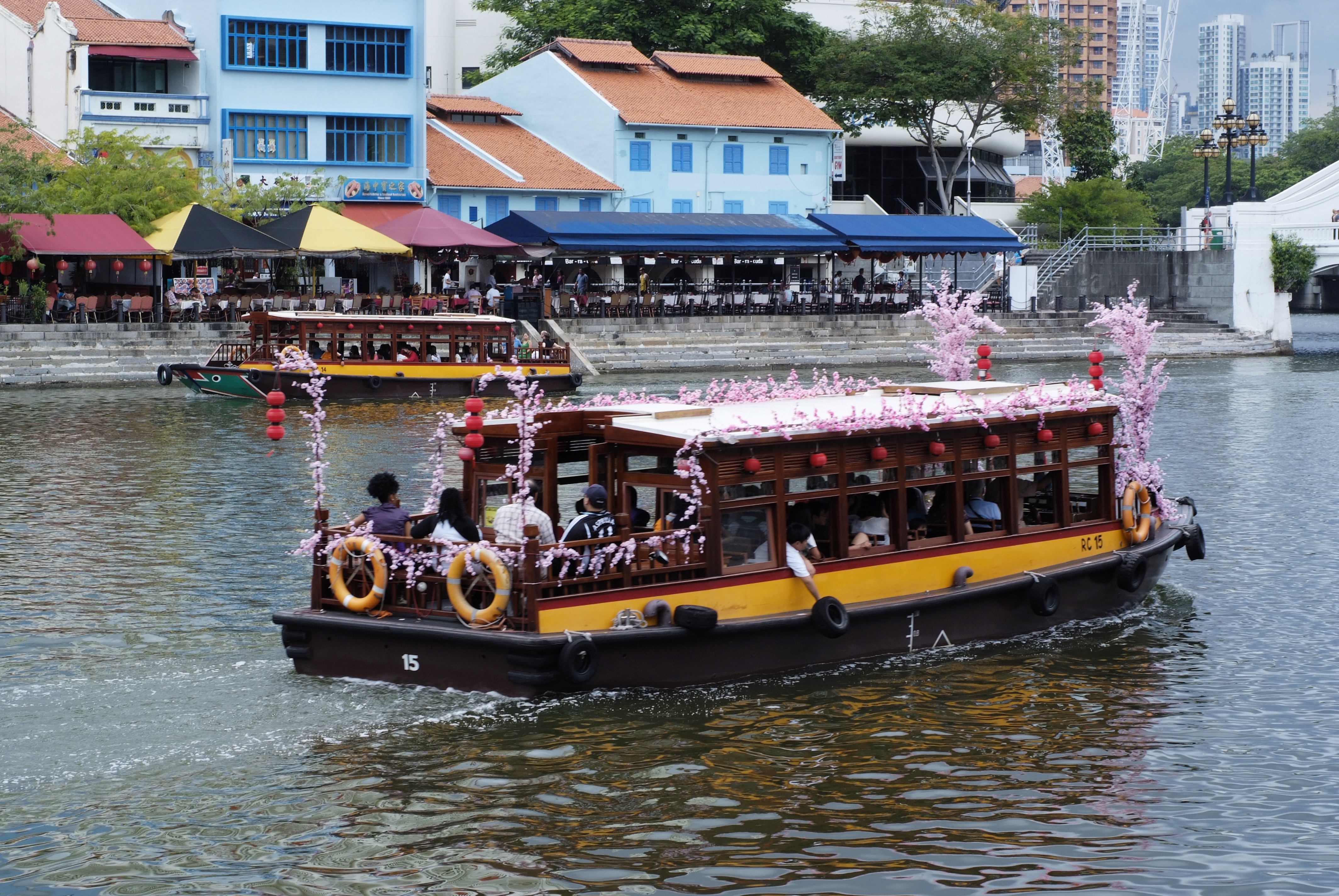
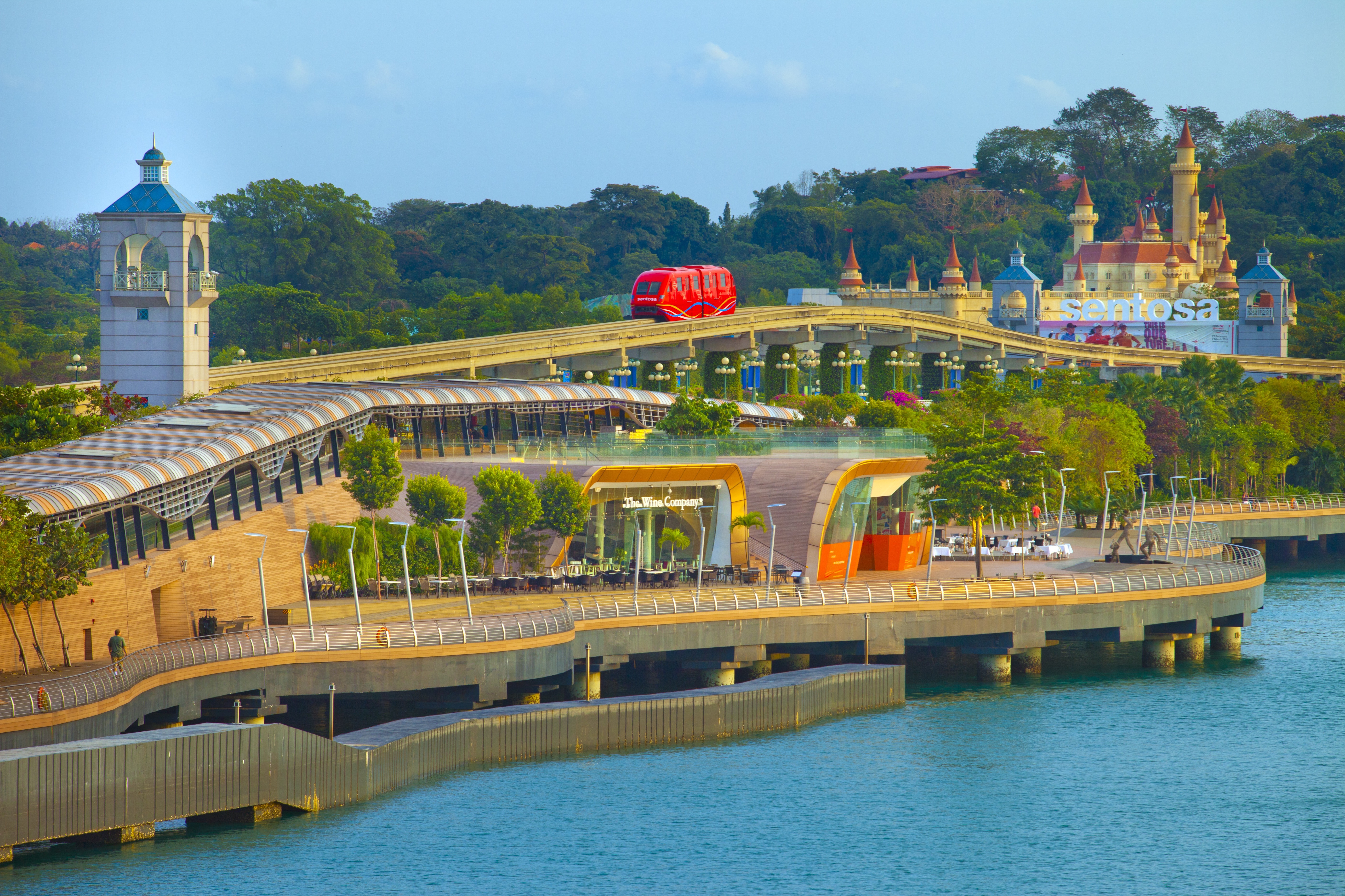
About Singapore
The main island of Singapore is shaped like a flattened diamond, 42 km (26 miles) east to west and 23 km (14 miles) north to south. Near the northern peak is the causeway leading to West Malaysia—Kuala Lumpur is less than four hours away by car. It is at the southern foot where you will find most of the city-state’s action, with its gleaming office towers, working docks, and futuristic "supertrees," which are solar-powered and serve as vertical gardens. Offshore are Sentosa and over 60 smaller islands, most uninhabited, that serve as bases for oil refining or as playgrounds and beach escapes from the city. To the east is Changi International Airport, connected to the city by metro, bus, and a tree-lined parkway. Of the island's total land area, more than half is built up, with the balance made up of parkland, farmland, plantations, swamp areas, and rain forest. Well-paved roads connect all parts of the island, and Singapore city has an excellent, and constantly expanding, public transportation system. The heart of Singapore's history and its modern wealth are in and around the Central Business District. The area includes the skyscrapers in the Central Business District, the 19th-century Raffles Hotel, the convention centers of Marina Square, on up to the top of Ft. Canning. Although most of old Singapore has been knocked down to make way for the modern city, most colonial landmarks have been preserved in the CBD, including early-19th-century buildings designed by the Irish architect George Coleman.
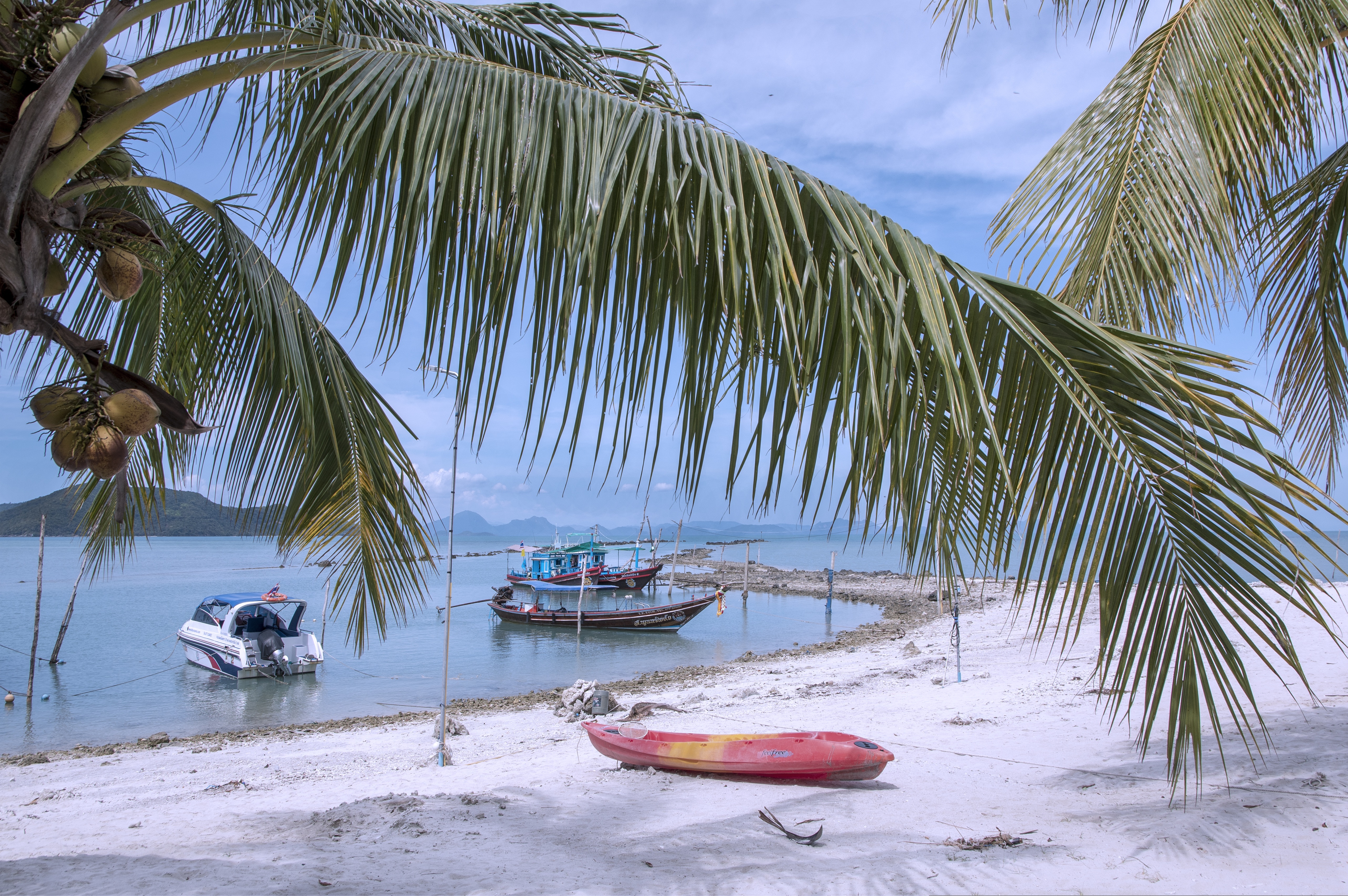
About Ko Samui
Koh Samui is the most popular tourist destination on the Western Gulf coast, which isn't surprising, considering the island's gorgeous beaches, perfect weather, and sparkling blue, almost turquoise, water. Koh Samui has seen rapid development since the 1990s, and you'll encounter hotels in all price ranges.Koh Samui is half the size of Phuket, so you could easily drive around it in a day. But Koh Samui is best appreciated by those who take a slower, more casual approach. Most people come for the sun and sea, so they head straight to their hotel and rarely venture beyond its beach. But it's worth exploring beyond your lodging. Every beach has its own character, and you might find the perfect one for you. One beach many visitors find to their liking is Chawaeng. On Koh Samui's east coast, this stretch of glistening white sand is divided into two main sections—Chawaeng Yai (yai means "big") and Chawaeng Noi (noi means "little"). You'll find the greatest variety of hotels, restaurants, and bars here. Despite the crowds, Chawaeng is no Pattaya or Patong—the mood is very laid-back. A rocky headland separates Chawaeng Lamai Beach, whose clear water and long stretch of sand were the first place on the island to attract developers. More budget accommodations are available here than in Chawaeng, and there are some happening nightclubs.On the west coast of Koh Samui, Na Thon is the island's primary port and the spot where ferries arrive from the mainland. It's home to the island's governmental offices, including the Tourism Authority of Thailand, and there are banks, foreign-exchange booths, travel agents, shops, restaurants, and cafés by the ferry pier. A few places rent rooms, but there's really no reason to stay here—nicer accommodations can be found a short songthaew ride away.To the north and east of Na Thon lie a few beaches worthy of exploration. Laem Yai, 5 km (3 miles) north, has great seafood. East of here, a small headland separates two low-key communities on the northern shore, Mae Nam and Bophut Beach. Mae Nam is also the departure point for boats bound for Koh Phangan and Koh Tao . Just south of the Samui's northeastern tip you'll find sandy Choengmon Beach, a good area for swimming that's not overdeveloped.
About Kâmpóng Saôm
Sihanoukville is the premier beach destination in Cambodia for tourists and Cambodians alike, with golden white sands, tropical islands and mangrove jungles. A relatively new city, it sprang to life in 1955 with the construction of the only deep-sea port of a newly independent Cambodia. With the bay of Thailand surrounding it on three sides, Sihanoukville was named in honour of the former King Norodom Sihanouk in 1964. As Cambodia descended into civil war the town fell on hard times with the Khmer Rouge using the famous Independence Hotel for target practice. In 1993 peace returned to Cambodia and since then Sihanoukville has been slowly rebuilding itself. Today it attracts Asian Individual travellers, young students and back-packers but after decades of war and upheaval the town’s infrastructure is still very much in its infancy. A visit to Ream National Park offers pristine mangrove forests rich in wildlife with miles of beaches unmarked by footprints.
About Laem Chabang
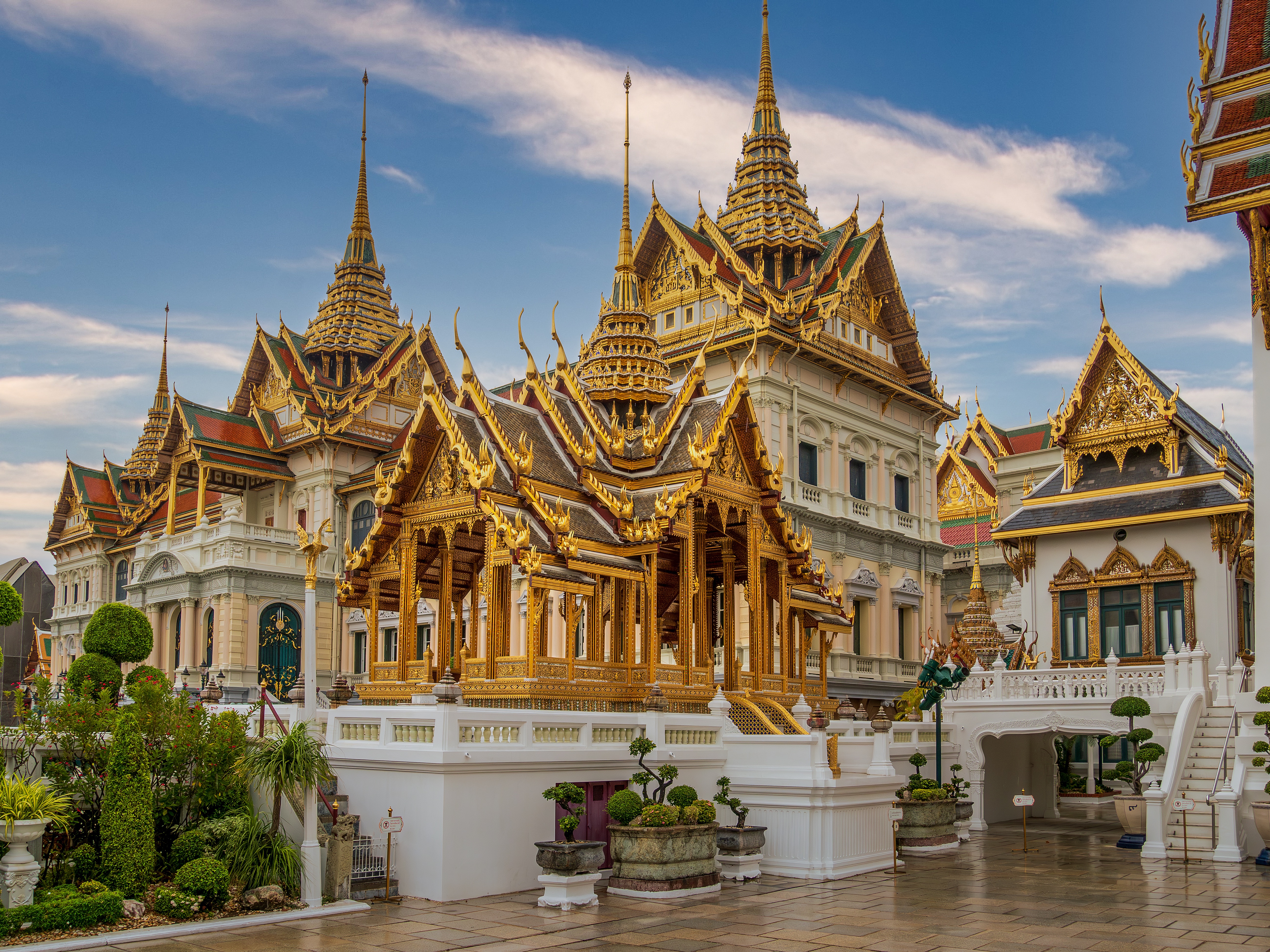
There are two Bangkoks, the ancient soul of Thailand with its long and fascinating history and the frantic, modern metropolis that embraces the latest trends both Eastern and Western. The two blend together remarkably well—even the most jarring juxtapositions of old and new somehow make sense. Bangkok is not only the biggest city in Thailand, but also the most mesmerizing, with some of the country's most beautiful temples and shrines. The city's energy is palpable, especially at night, when traffic opens up a bit, its famous markets get going, and everything seems lit up—from its proudest monuments to its seediest streets. When Ayutthaya was besieged and pillaged by the Burmese in 1766, Thonburi became Thailand's capital. The Thais call Bangkok Krung Thep (City of Angels), and in 1782 King Rama I moved his capital here, just across the Chao Praya River. Laem Chabang is approximately 130 km (81 mi) from Bangkok.
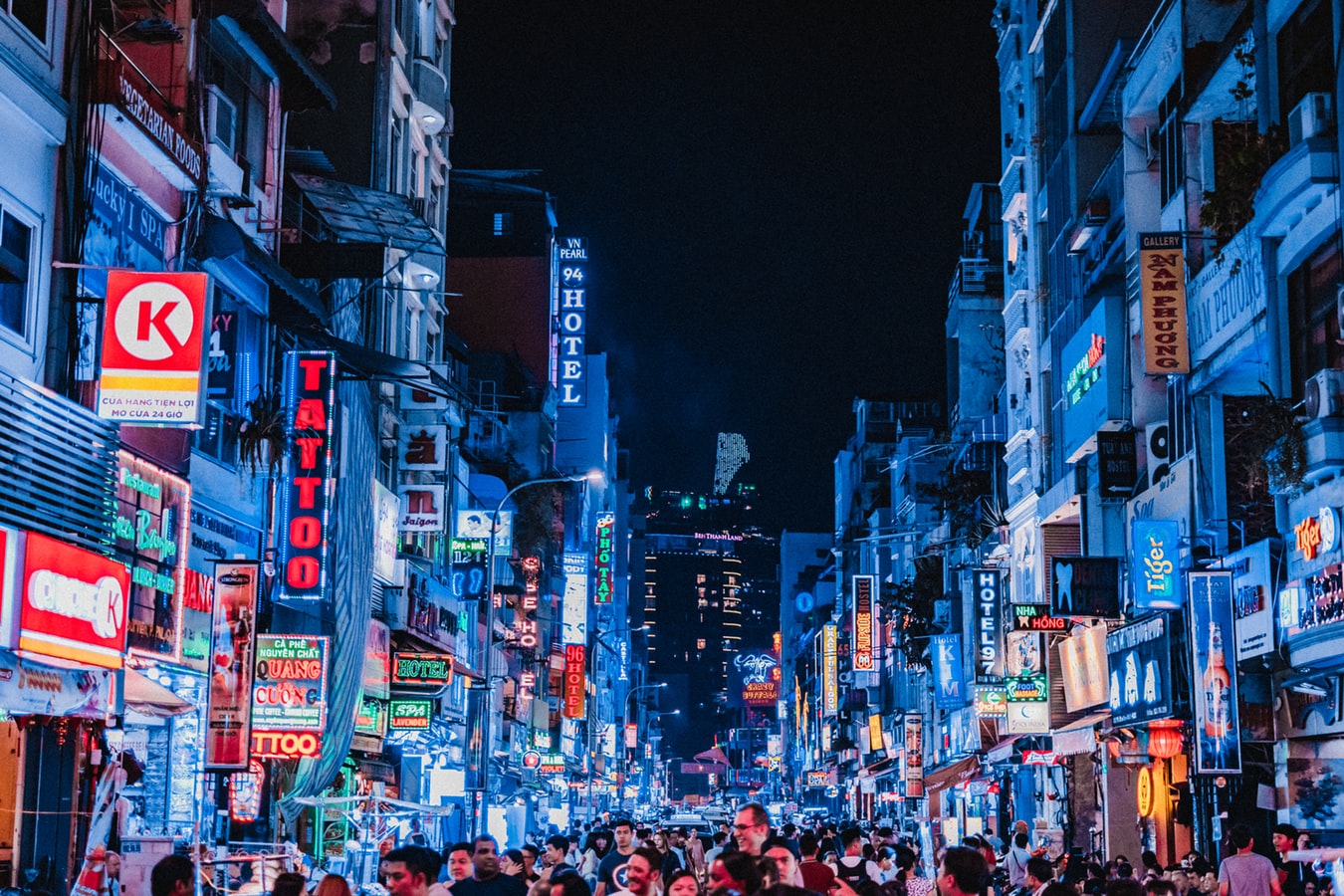
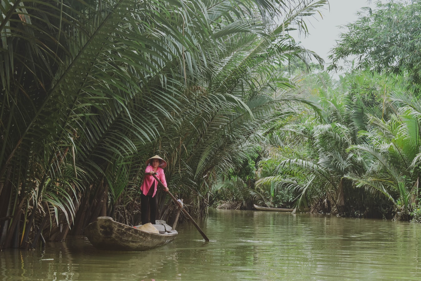
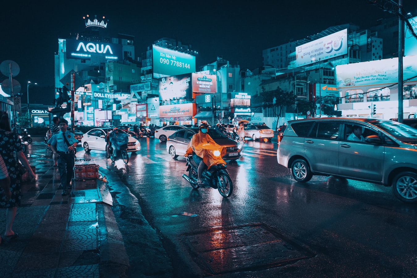
About Ho Chi Minh City
Romantically referred to by the French as the Pearl of the Orient, Ho Chi Minh City today is a super-charged city of sensory overload. Motorbikes zoom day and night along the wide boulevards, through the narrow back alleys and past vendors pushing handcarts hawking goods of all descriptions. Still called Saigon by most residents, this is Vietnam's largest city and the engine driving the country's current economic resurgence, but despite its frenetic pace, it's a friendlier place than Hanoi and locals will tell you the food—simple, tasty, and incorporating many fresh herbs—is infinitely better than in the capital.This is a city full of surprises. The madness of the city's traffic—witness the oddball things that are transported on the back of motorcycles—is countered by tranquil pagodas, peaceful parks, quirky coffee shops, and whole neighborhoods hidden down tiny alleyways, although some of these quiet spots can be difficult to track down. Life in Ho Chi Minh City is lived in public: on the back of motorcycles, on the sidewalks, and in the parks. Even when its residents are at home, they're still on display. With many living rooms opening onto the street, grandmothers napping, babies being rocked, and food being prepared, are all in full view of passersby.Icons of the past endure in the midst of the city’s headlong rush into capitalism. The Hotel Continental, immortalized in Graham Greene's The Quiet American, continues to stand on the corner of old Indochina's most famous thoroughfare, the rue Catinat, known to American G.I.s during the Vietnam War as Tu Do (Freedom) Street and renamed Dong Khoi (Uprising) Street by the Communists. The city still has its ornate opera house and its old French city hall, the Hôtel de Ville. The broad colonial boulevards leading to the Saigon River and the gracious stucco villas are other remnants of the French colonial presence. Grisly reminders of the more recent past can be seen at the city's war-related museums. Residents, however, prefer to look forward rather than back and are often perplexed by tourists' fascination with a war that ended 40 years ago.The Chinese influence on the country is still very much in evidence in the Cholon district, the city's Chinatown, but the modern office towers and international hotels that mark the skyline symbolize Vietnam's fixation on the future.
About Chan May
Hue (pronounced hway), bisected by the Perfume River and 13 km (8 mi) inland from the South China Sea, in the foothills of the Annamite Mountains (Truong Son Mountains), stands as a reminder of Vietnam's imperial past. The seat of 13 Nguyen-dynasty emperors between 1802 and 1945, Hue was once Vietnam's splendid Imperial City. Although it was devastated by the French in the 19th century and again by fighting between the Vietnamese Communists and the Americans in the 20th, the monument-speckled former capital has a war-ravaged beauty. One can still imagine its former splendor, despite gaping holes in its silhouette. Hue is a UNESCO World Heritage Site, and the city's gems are slowly being restored.
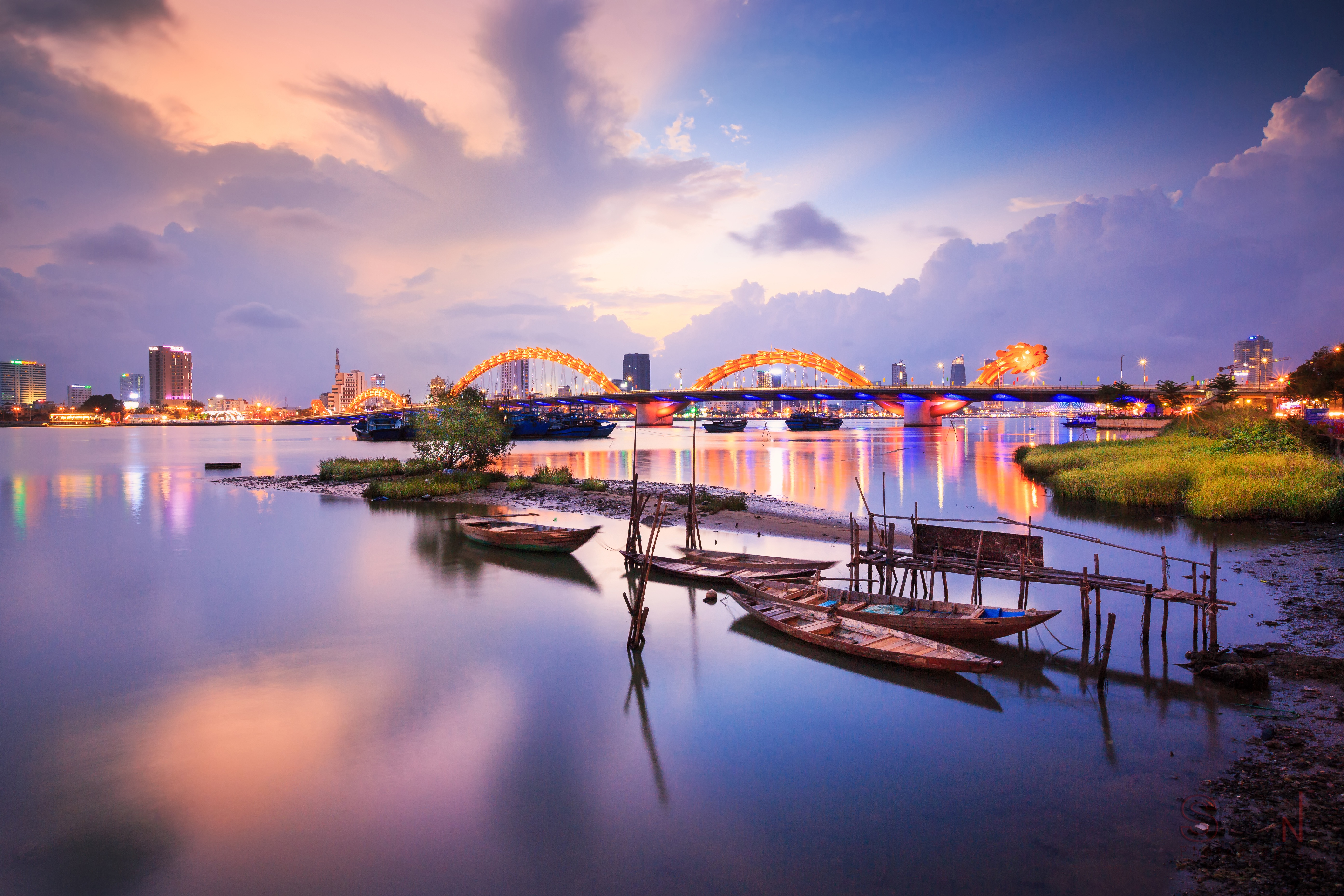
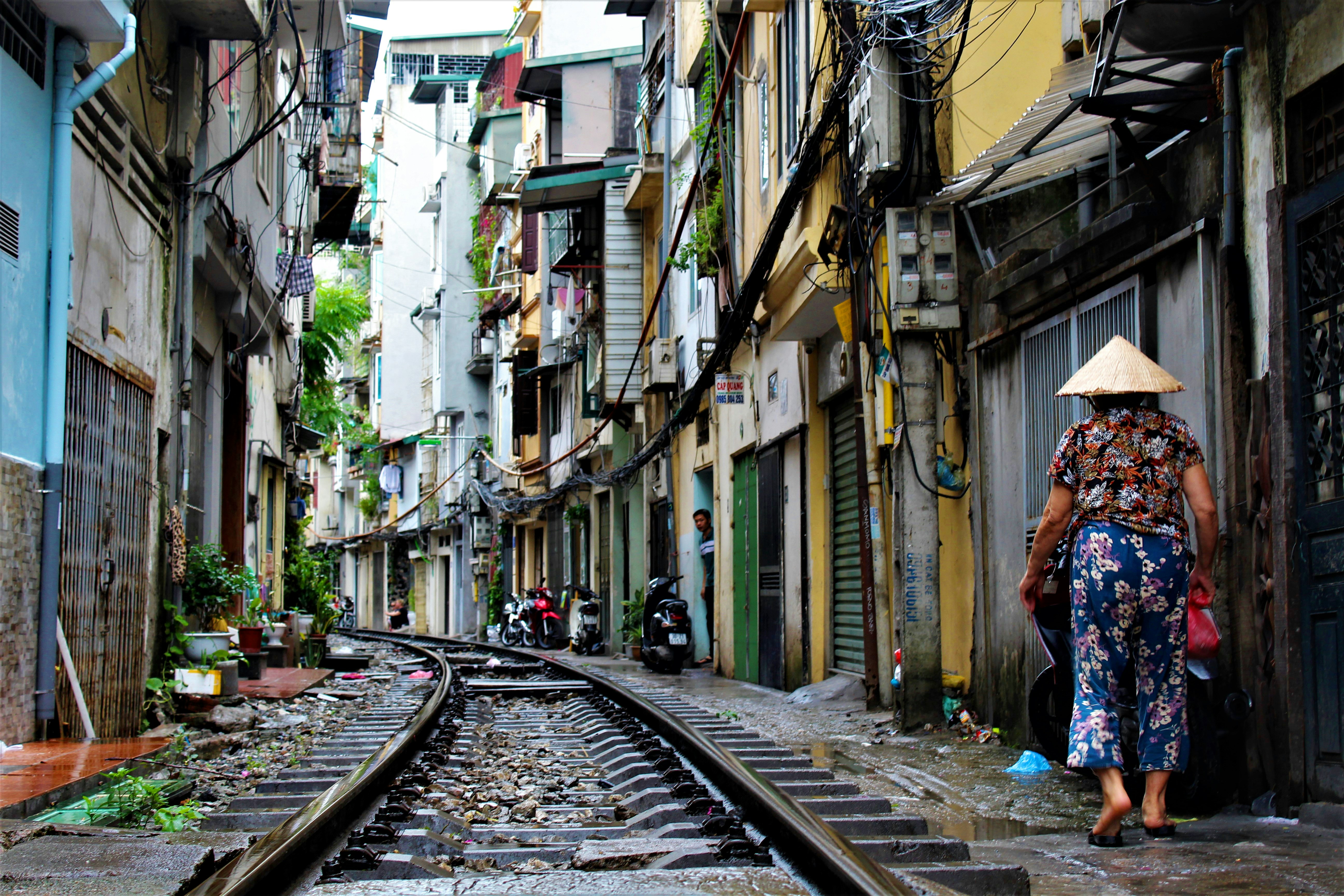
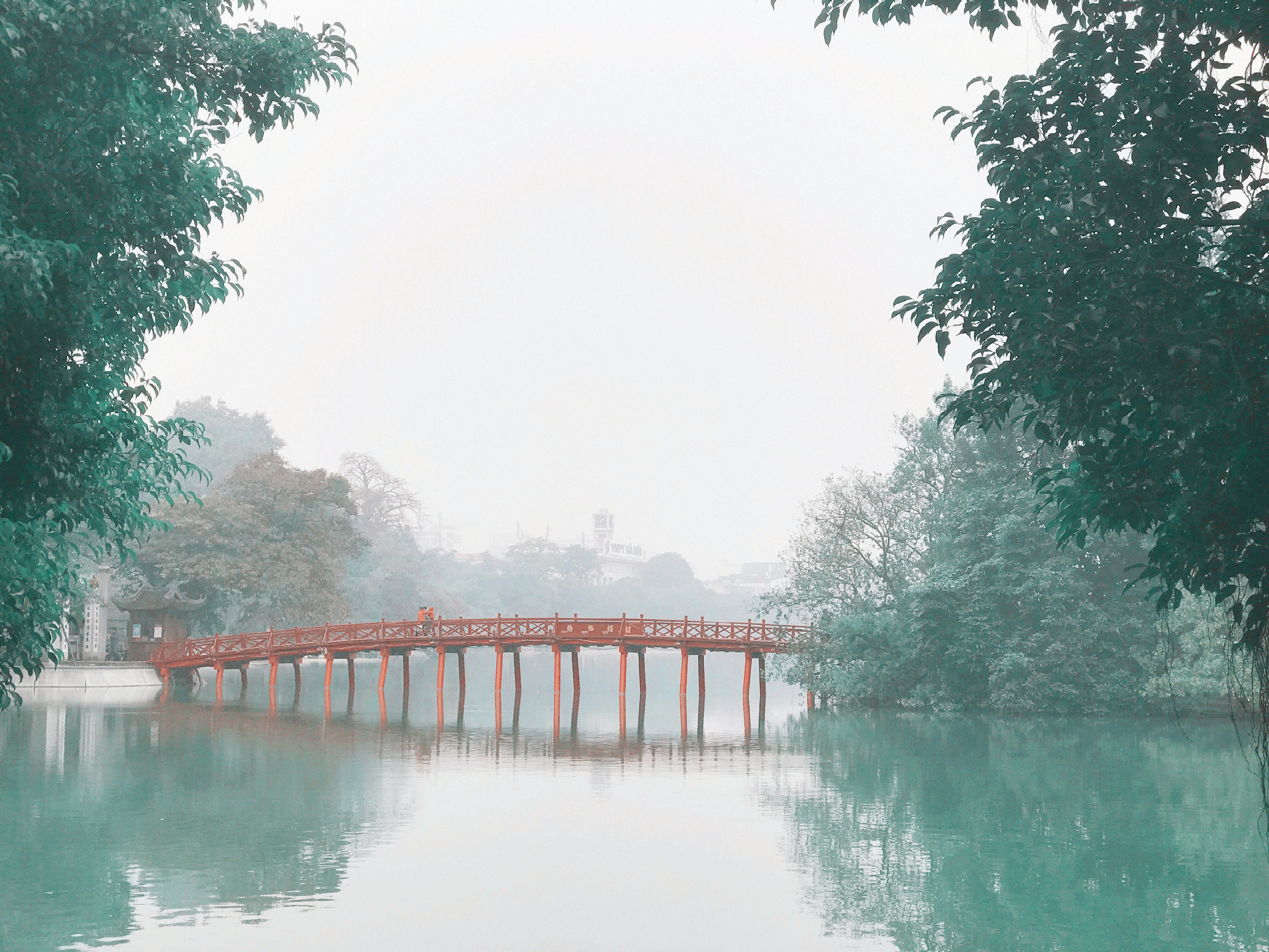
About Hanoi
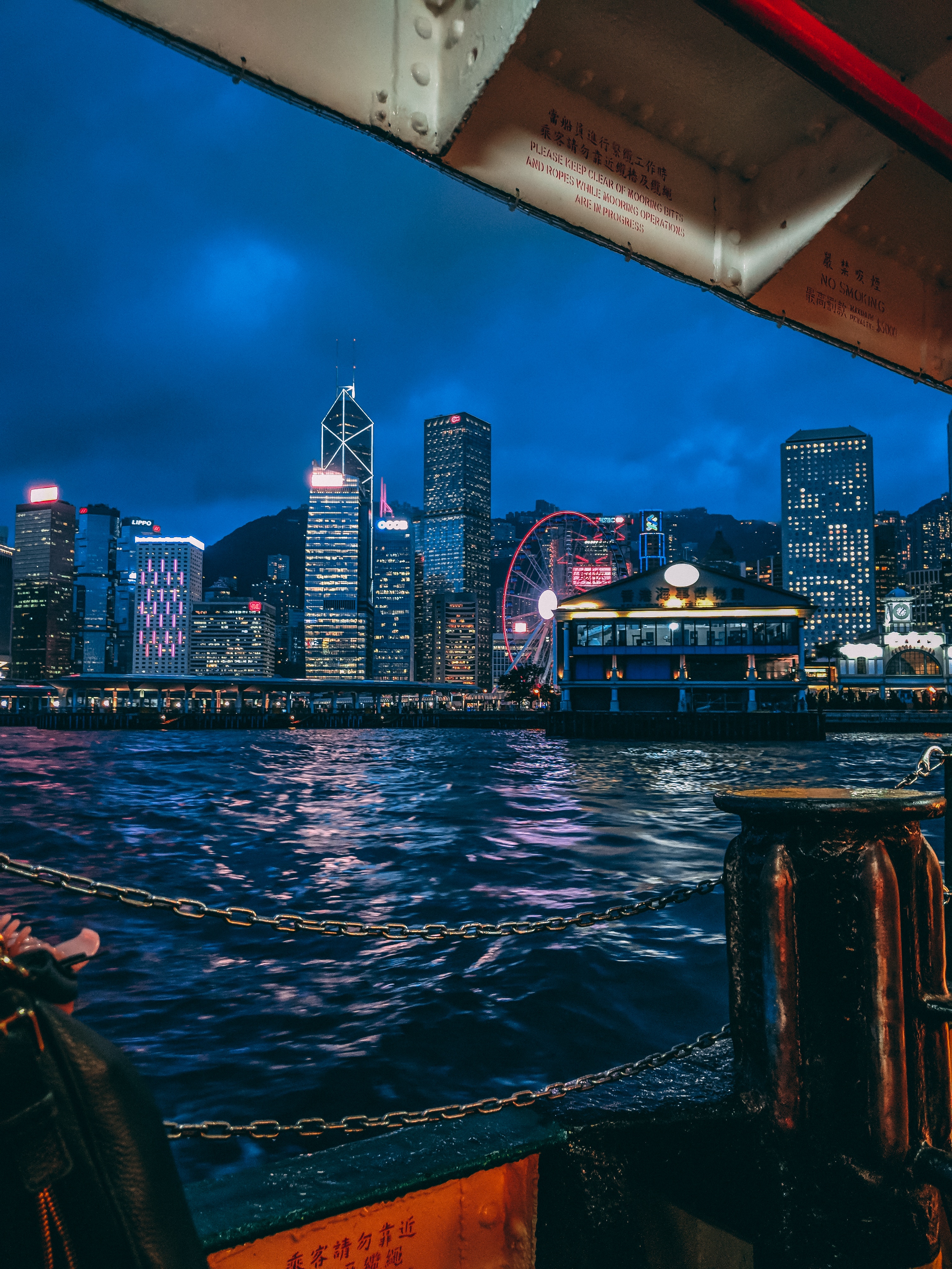
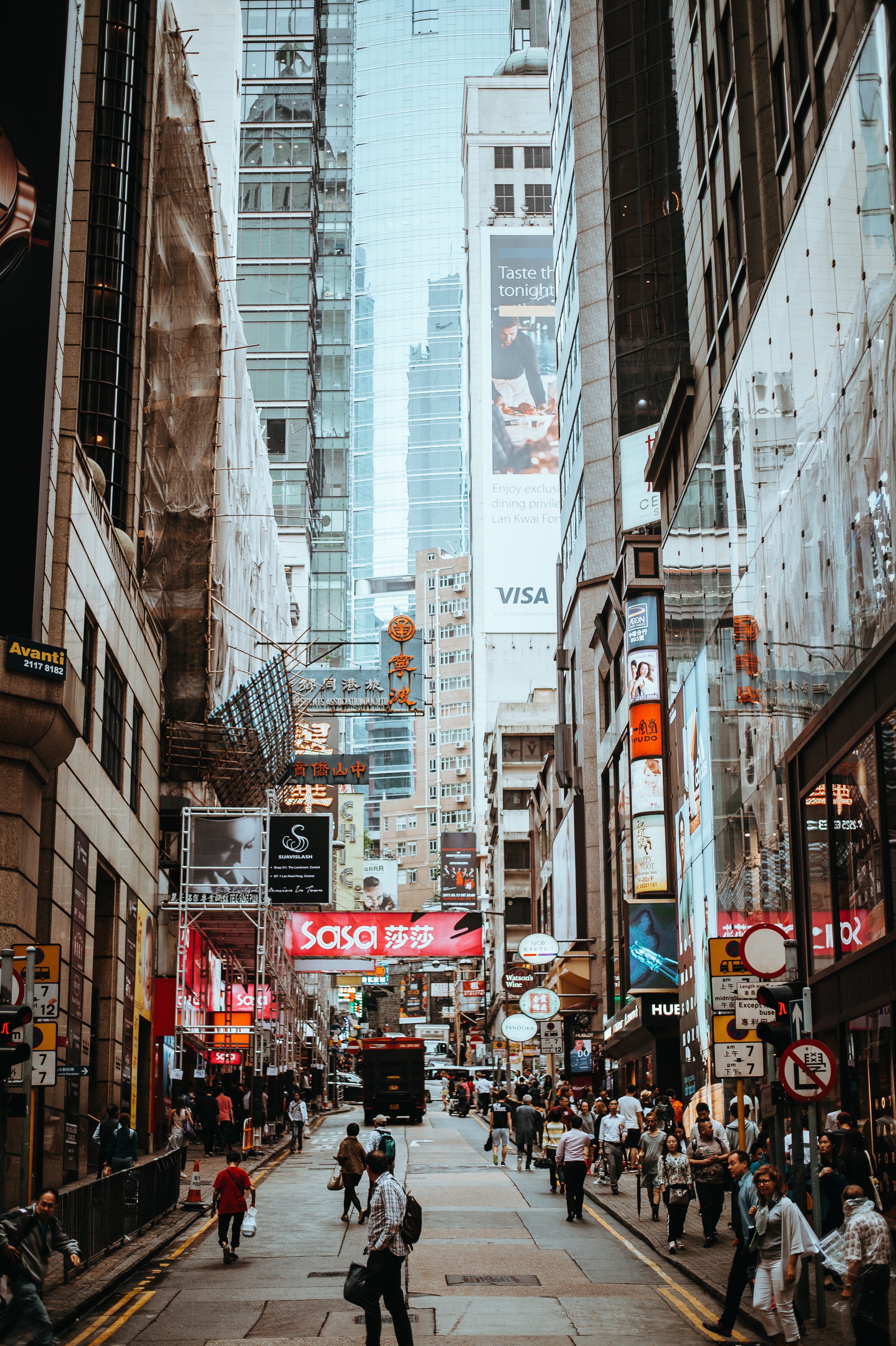
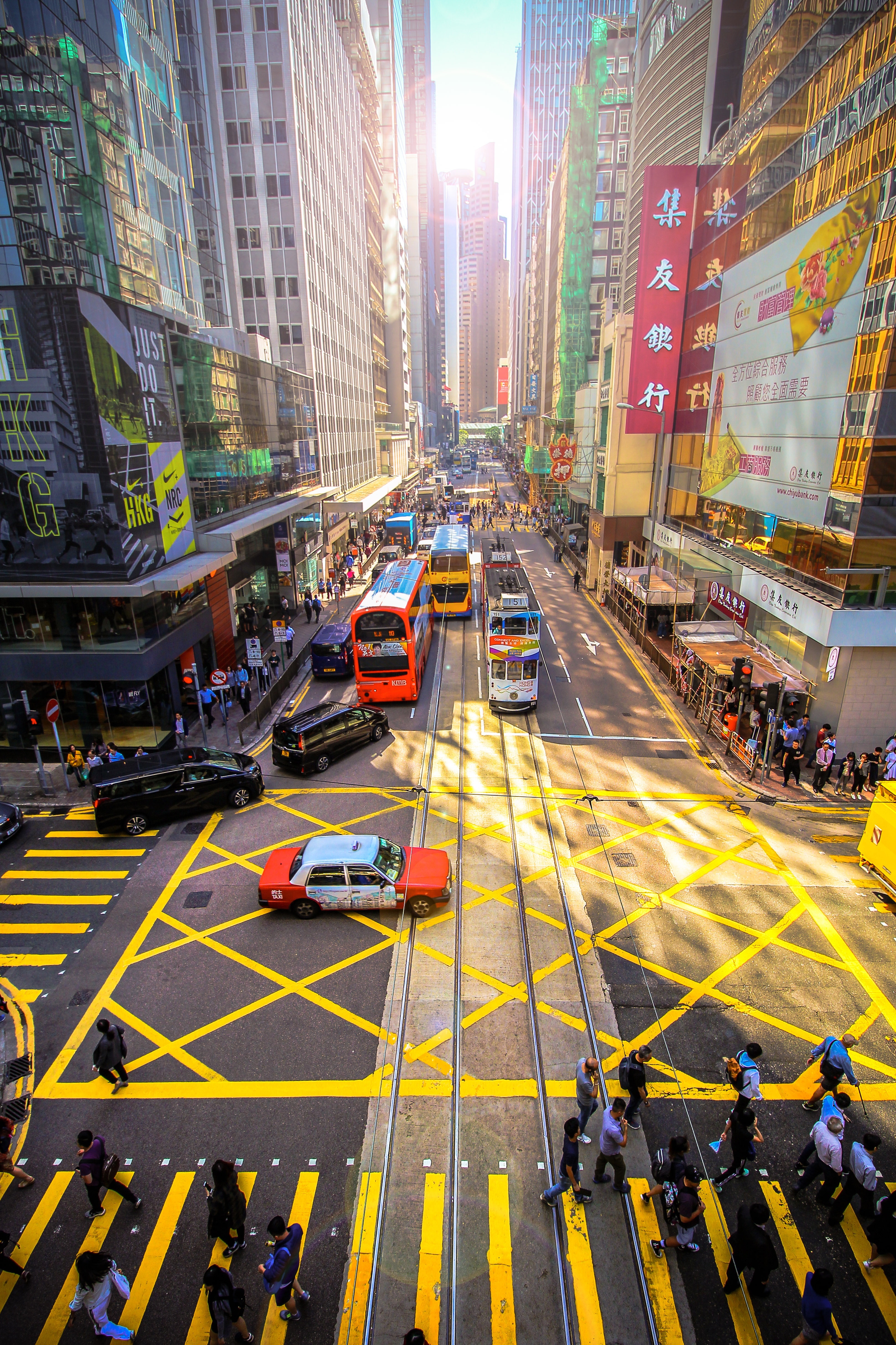
About Hong Kong
The Hong Kong Island skyline, with its ever-growing number of skyscrapers, speaks to ambition and money. Paris, London, even New York were centuries in the making, while Hong Kong's towers, bright lights, and glitzy shopping emporia weren't yet part of the urban scene when many of the young investment bankers who fuel one of the world's leading financial centers were born. Commerce is concentrated in the glittering high-rises of Central, tucked between Victoria Harbor and forested peaks on Hong Kong Island's north shore. While it's easy to think all the bright lights are the sum of today's Hong Kong, you need only walk or board a tram for the short jaunt west into Western to discover a side of Hong Kong that is more traditionally Chinese but no less high-energy. You'll discover the real Hong Kong to the east of Central, too, in Wan Chai, Causeway Bay, and beyond. Amid the residential towers are restaurants, shopping malls, bars, convention centers, a nice smattering of museums, and—depending on fate and the horse you wager on—one of Hong Kong's luckiest or unluckiest spots, the Happy Valley Racecourse. Kowloon sprawls across a generous swath of the Chinese mainland across Victoria Harbour from Central. Tsim Sha Tsui, at the tip of Kowloon peninsula, is packed with glitzy shops, first-rate museums, and eye-popping views of the skyline across the water. Just to the north are the teeming market streets of Mong Kok and in the dense residential neighborhoods beyond, two of Hong Kong's most enchanting spiritual sights, Wong Tai Sin Temple and Chi Lin Nunnery. As you navigate this huge metropolis (easy to do on the excellent transportation network), keep in mind that streets are usually numbered odd on one side, even on the other. There's no baseline for street numbers and no block-based numbering system, but street signs indicate building numbers for any given block.
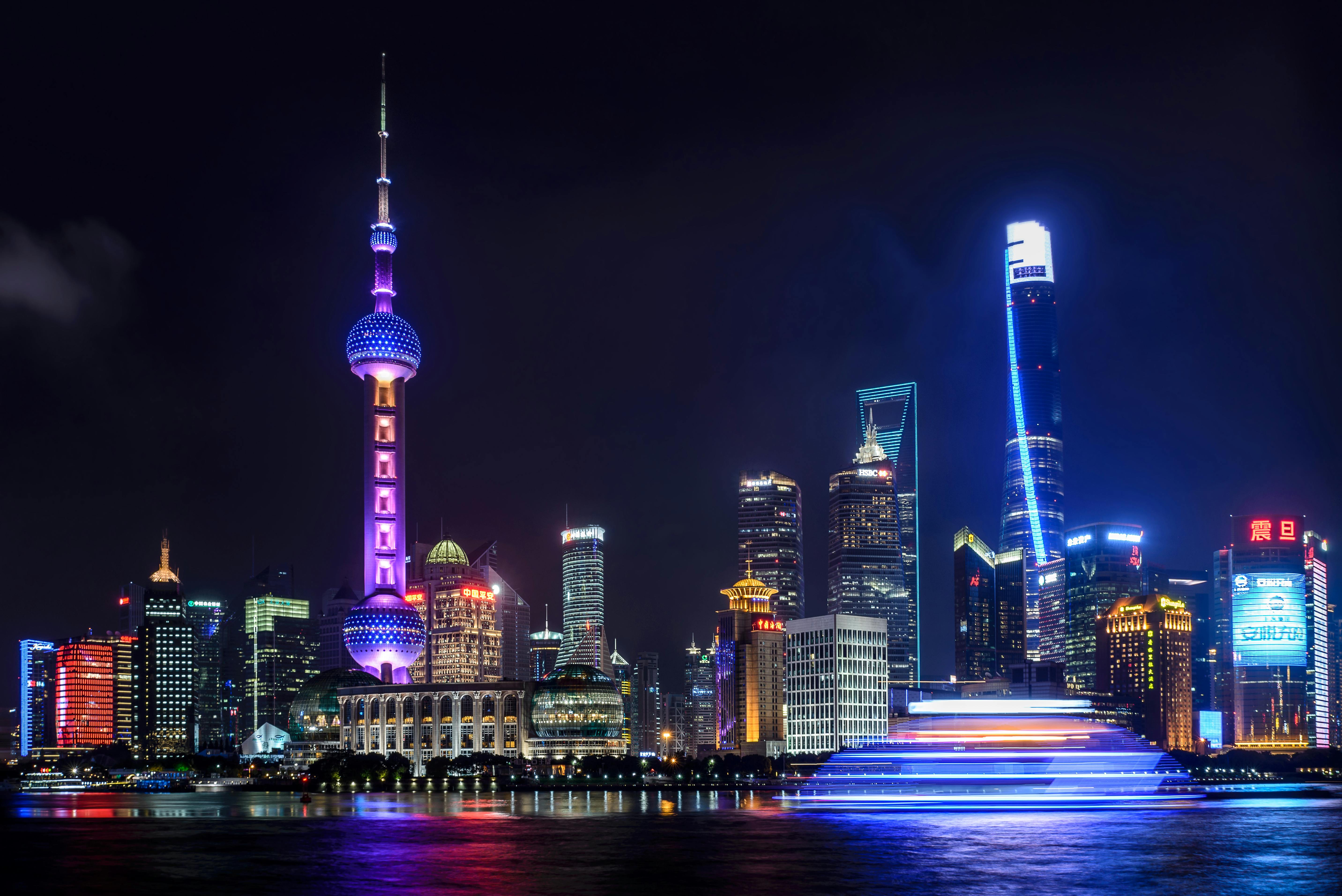
About Shanghai
Shanghai is a city of two faces. It is home to some of the world’s tallest skyscrapers, miles of luxury goods shops, and scores of trendy bars and restaurants. But look just beyond the main streets and you’ll find narrow alleyways packed with traditional lane houses, where laundry billows from bamboo poles, and local communities are alive and well.Shanghai has always been China’s most Westernized city. In its heyday, Shanghai had the best nightlife, the greatest architecture, and the strongest business in Asia. Nearly a century later, after extreme tumult and political upheaval, it’s back on top.Shanghai’s charm lies not in a list of must-see sites, but in quiet, tree-lined streets, the Bund’s majestic colonial buildings, sweet boutiques, and a dizzying array of places to eat and drink, from literal hole-in-the-walls to celebrity chef restaurants.Today, Shanghai has nearly 24 million people, the skyscrapers keep getting taller, the metro keeps getting longer, and the historical buildings continue to evade the wrecking ball. For how much longer is anyone’s guess.
About Incheon
About Nagasaki
Nagasaki city has developed into one of the most important port cities in Japan. During Japan’s period of isolation in the 17th century, Nagasaki played a prominent role in foreign trade relation and only a very few ports were open to restricted numbers of foreign traders. Even though Holland was a major country who conducted trading during this period, Dutch people were only allowed to stay in Dejima Island and were not allowed to have contact with the Japanese people. Today, you will still find the strong influence of Dutch and Chinese culture in the city which is very different from all other cities in Japan. In the more recent history, Nagasaki became the second city after Hiroshima to be destroyed by an atomic bomb towards the end of World War II. From the visit to Atomic bomb museum and peace memorial park, people could understand how chaotic the situation was and the agony that the people in the days have experienced from the damage inflicted by the atomic bomb. It continues to appeal to the world with their wish for world peace.

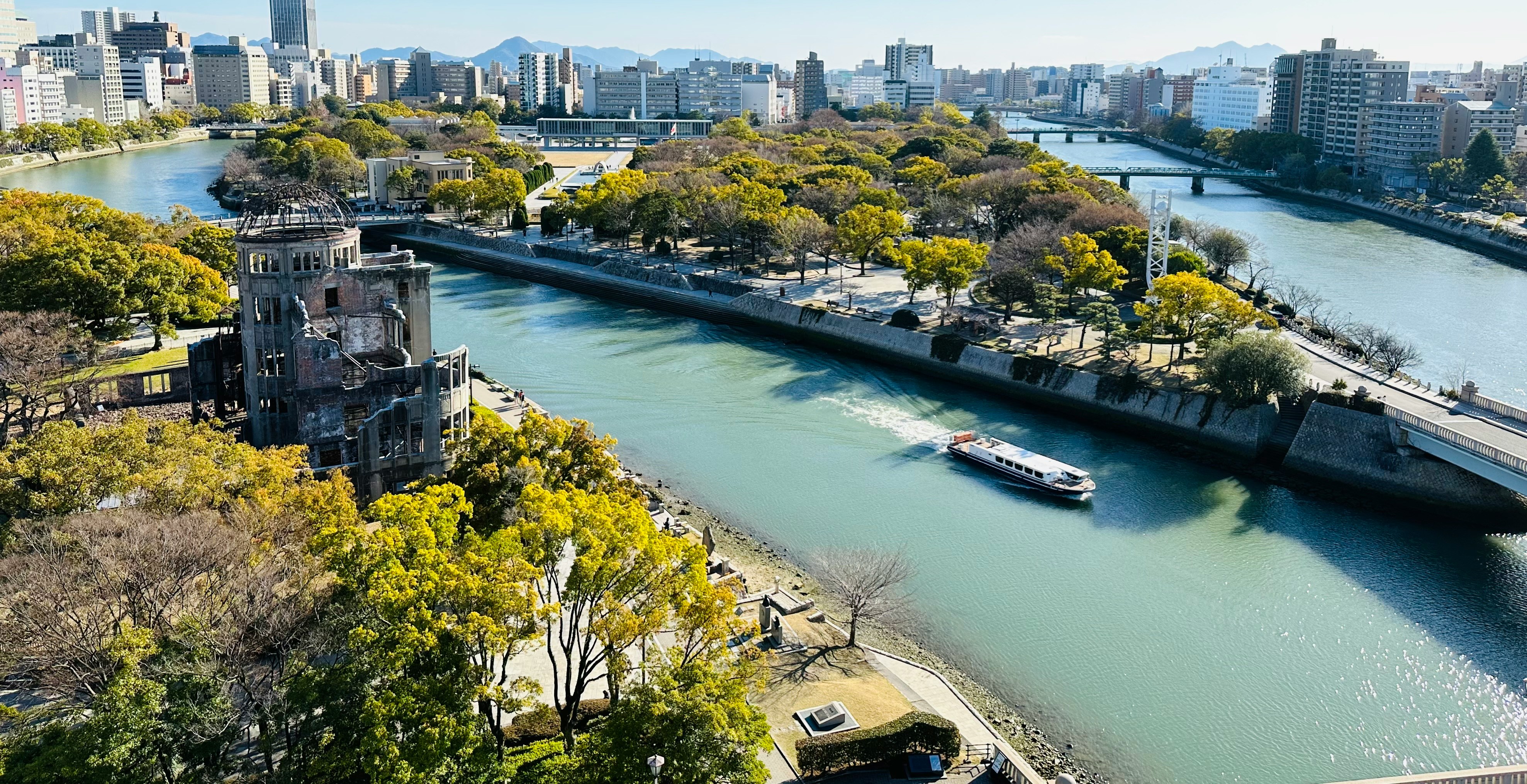
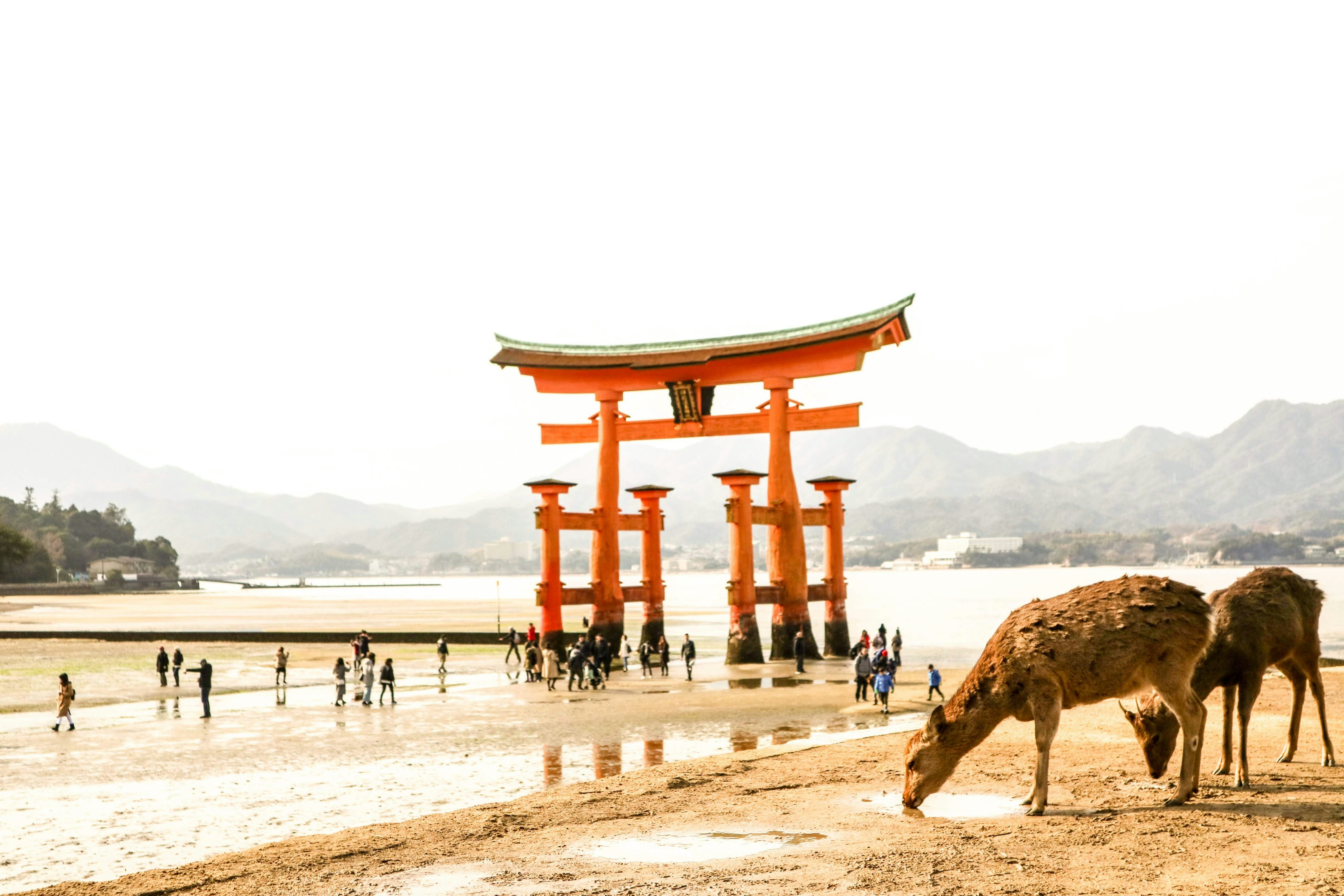
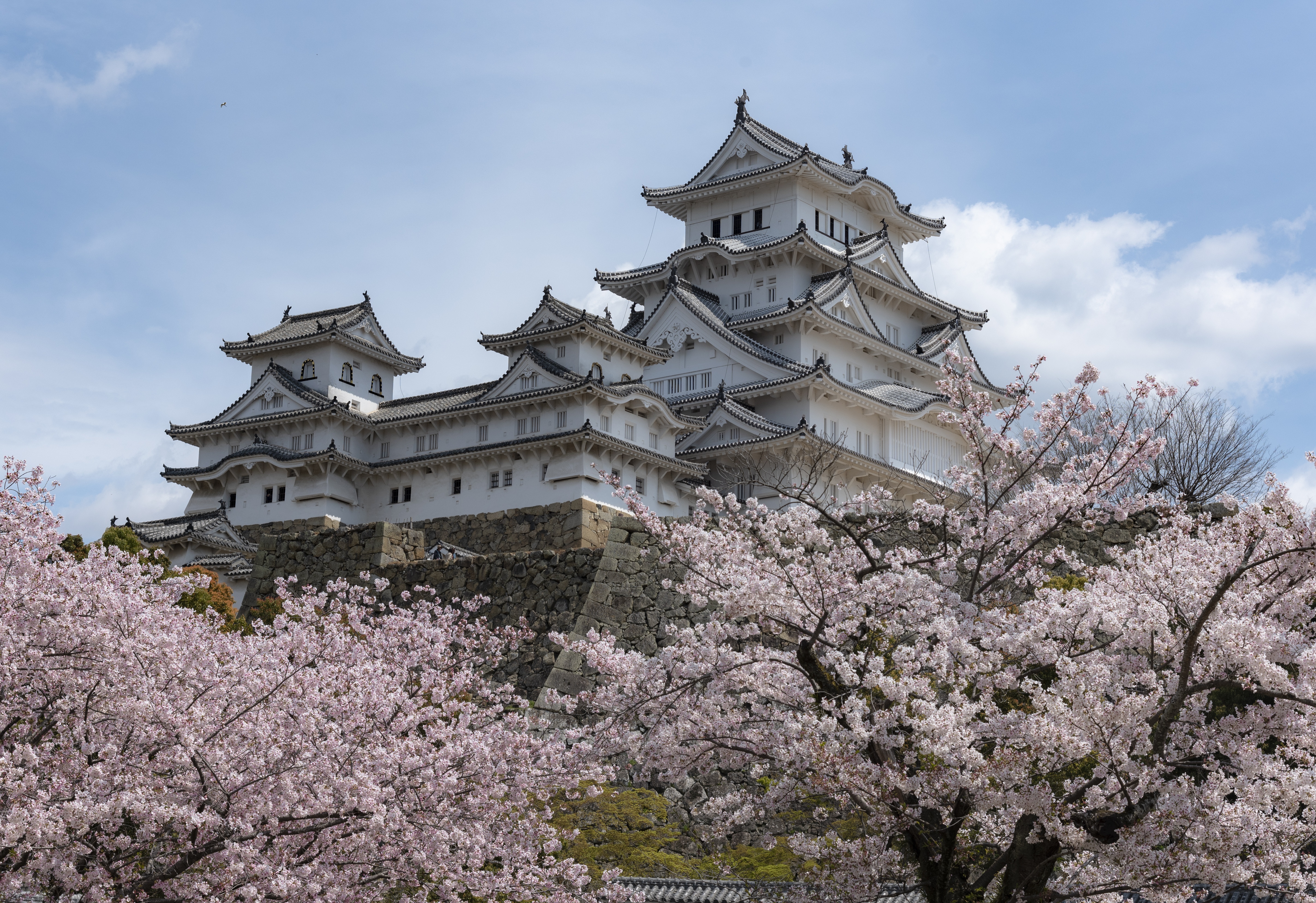
About Hiroshima
History buffs will want to write home Hiroshima. Despite being devastated in 1945, this Japanese city is known to all for its commitment peace – its ruin on the 6th August 1945 led to the end of the war and today, the Peace Memorial (a UNESCO World Heritage Site) , is a constant reminder of the destruction that war brings. A walk in the leafy boulevards of Peace Memorial Park brings quiet contemplation. The Flames of Peace – set in the park’s central feature pond – burn brightly and will continue to do so until all the nuclear bombs I the world have been destroyed. There are many other inspiring messages of hope around the city too; the Children’s’ Peace Monument just north of the park is a homage to little Sadako Sasaki, who was just two in 1945. When she developed leukemia in 1956, she believed that if she folded 1,000 paper cranes – a symbol of longevity and happiness in Japan – she would recover. Sadly she died before she finished her task but her classmates finished the rest. It is impossible to ignore the events of 1945 in Hiroshima, but this is far from a depressing place. The great efforts that have been made in rebuilding of the city over the years have given Hiroshima a vibrant, eclectic edge, with the downtown shopping area and street food stalls being well worth a visit. The proximity to Miyajima and its iconic, impressive, Torii gate should not be overlooked either. If you are lucky enough to visit during the unpredictable and short-lived Sakura (cherry blossom) season, then the extraordinary sight of the delicate pink blossom floating across the water to the red gate, means you can consider yourself one of the luckiest people on the planet.
About Kochi
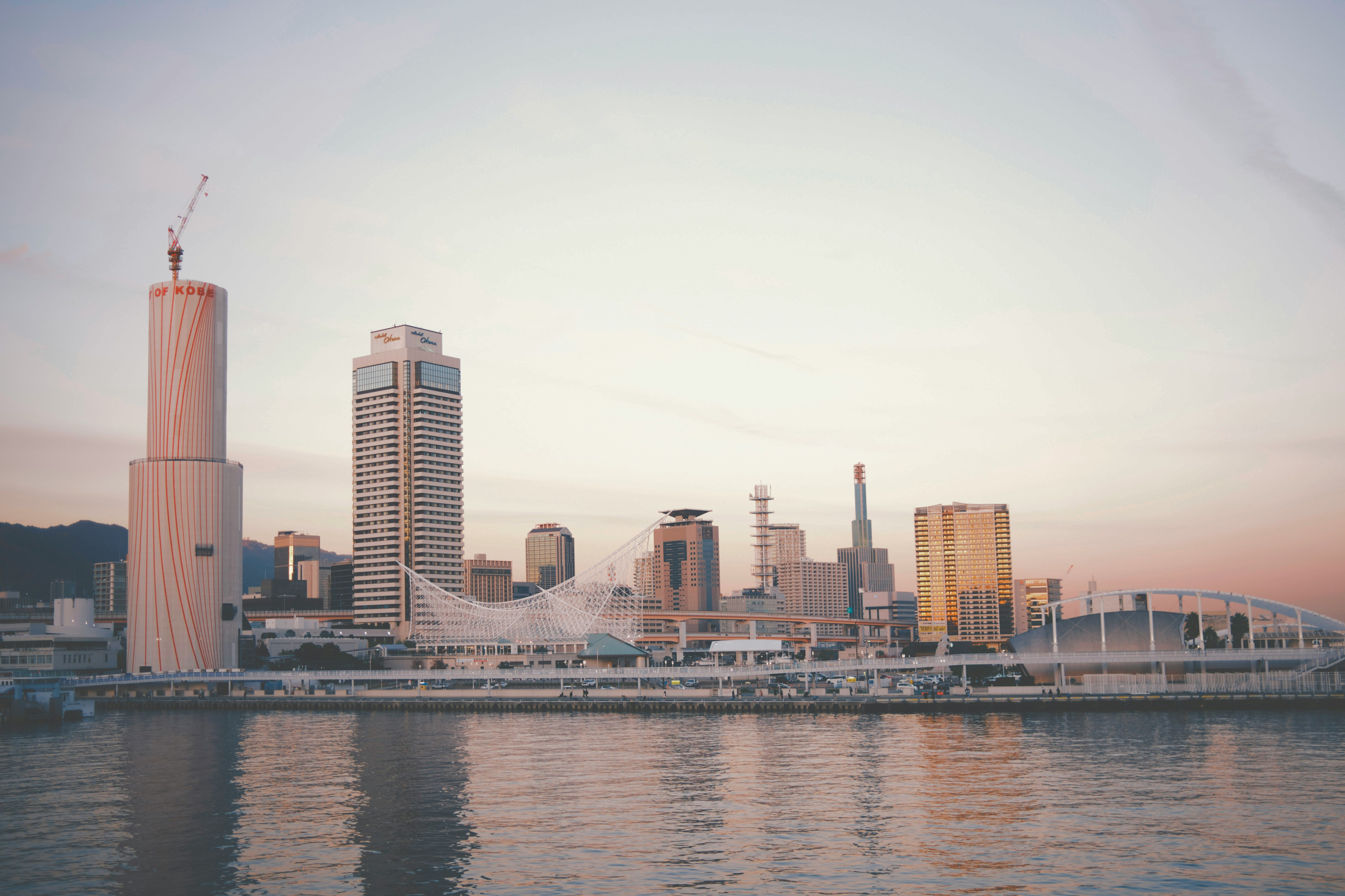
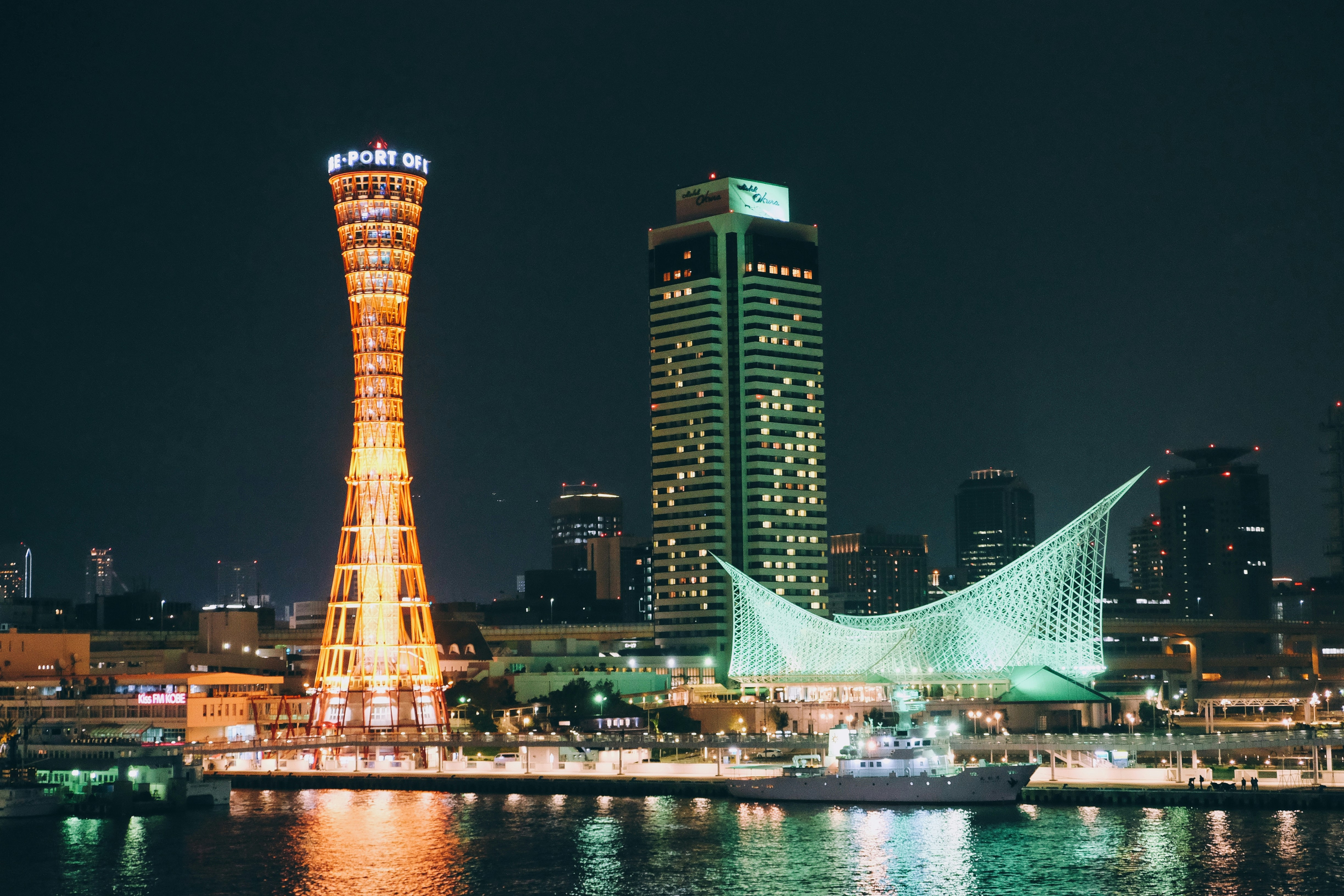
About Kobe
Located on the calm waters of the Inland Sea, Kobe has served as an important port town for hundreds of years. It was one of the first harbours to accept foreign traders in 1868 when Japan was just emerging from its centuries of isolation. What followed was a surge of Western trade and exports. Today, Kobe is quite multicultural, with expatriates from 98 different nations in residence, providing a cultural diversity most easily visible in restaurants serving every kind of cuisine, including the now world famous Kobe beef. The Great Hanshin Earthquake of 1995 set back Kobe’s development, but not for long. Kobe emerged more vibrant than before - with additional attractions, hotels and urban redevelopment, and only a few remnants of the extensive damage. It is a cosmopolitan place with lively shopping arcades, interesting museums, great restaurants, and a port that is still at the heart of things. Kobe is well known for its nightlife, in an intimate quarter of neon lights, cosy bars and sophisticated nightclubs. It also serves as the gateway to the ancient Japanese capitals of Kyoto and Nara.
About Shimizu
The salt and pepper cone of Japan's most famous natural landmark won’t fail to take your breath away, as it soars into the sky in a vision of spectacular symmetry. Make sure your camera is fully prepared before you dock in Shimizu’s port, where unparalleled views of the extraordinary Mount Fuji’s dramatic peak await. Take your time to soak up one of Japan's most iconic views, before dipping your toes into the rest of what this destination of tranquil temples has to offer. While there’s a bustling fish market, and a charming amusement park waiting close to the port, most new arrivals immediately set off in pursuit of the best views of Mount Fuji, or to see the stunning panorama on offer from the heights of the Kunozan Toshogu Shrine. Take the cable car up to the top, to experience the tranquillity around the forested shrine, and to enjoy its stunning architecture of deep scarlets and gleaming golds. You can also enjoy heart-stopping views out over the Bay of Suruga, and the tea plantations below.
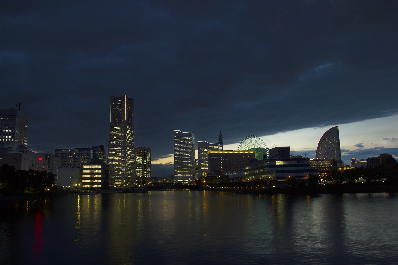
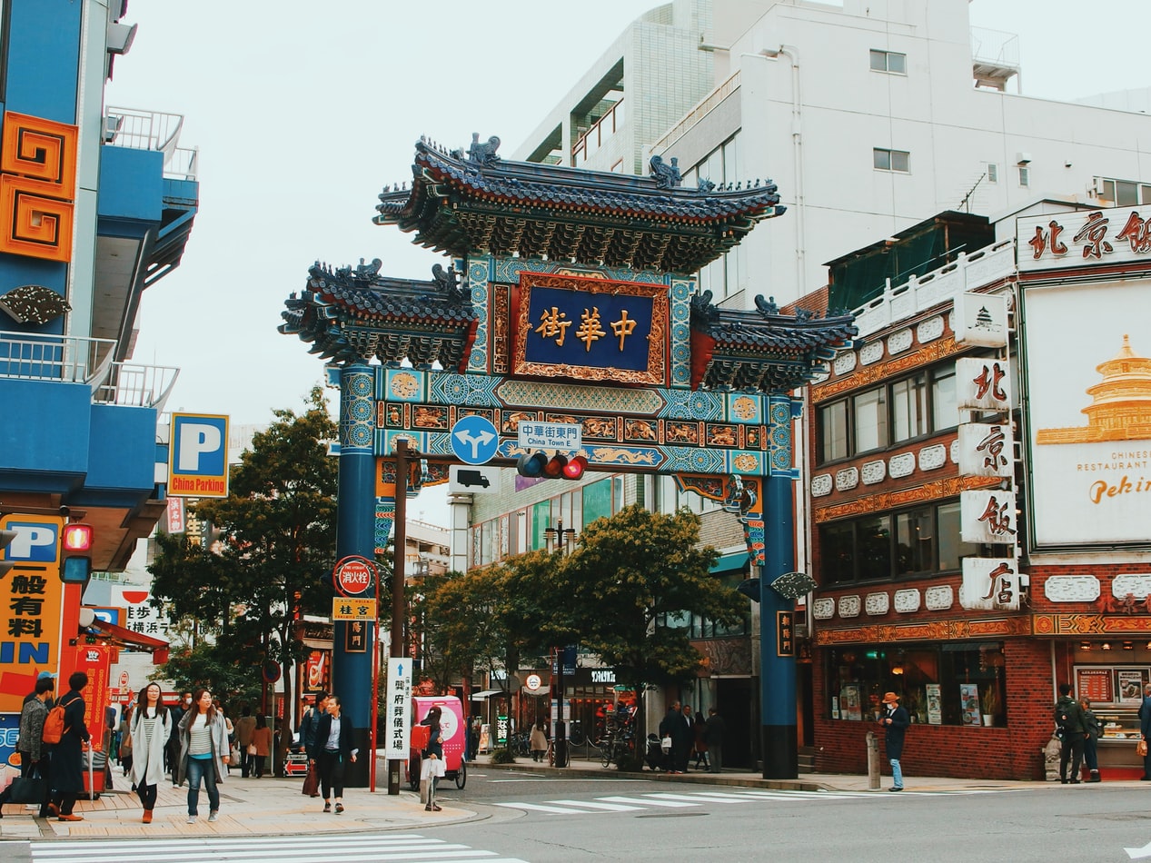
About Yokohama
In 1853, a fleet of four American warships under Commodore Matthew Perry sailed into the bay of Tokyo (then Edo) and presented the reluctant Japanese with the demands of the U.S. government for the opening of diplomatic and commercial relations. The following year Perry returned and first set foot on Japanese soil at Yokohama—then a small fishing village on the mudflats of Tokyo bay. Two years later New York businessman Townsend Harris became America's first diplomatic representative to Japan. In 1858 he was finally able to negotiate a commercial treaty between the two countries; part of the deal designated four locations—one of them Yokohama—as treaty ports. In 1859 the shogunate created a special settlement in Yokohama for the growing community of merchants, traders, missionaries, and other assorted adventurers drawn to this exotic new land of opportunity. The foreigners (predominantly Chinese and British, plus a few French, Americans, and Dutch) were confined here to a guarded compound about 5 square km (2 square miles)—placed, in effect, in isolation—but not for long. Within a few short years the shogunal government collapsed, and Japan began to modernize. Western ideas were welcomed, as were Western goods, and the little treaty port became Japan's principal gateway to the outside world. In 1872 Japan's first railway was built, linking Yokohama and Tokyo. In 1889 Yokohama became a city; by then the population had grown to some 120,000. As the city prospered, so did the international community and by the early 1900s Yokohama was the busiest and most modern center of international trade in all of East Asia. Then Yokohama came tumbling down. On September 1, 1923, the Great Kanto Earthquake devastated the city. The ensuing fires destroyed some 60,000 homes and took more than 40,000 lives. During the six years it took to rebuild the city, many foreign businesses took up quarters elsewhere, primarily in Kobe and Osaka, and did not return. Over the next 20 years Yokohama continued to grow as an industrial center—until May 29, 1945, when in a span of four hours, some 500 American B-29 bombers leveled nearly half the city and left more than half a million people homeless. When the war ended, what remained became—in effect—the center of the Allied occupation. General Douglas MacArthur set up headquarters here, briefly, before moving to Tokyo; the entire port facility and about a quarter of the city remained in the hands of the U.S. military throughout the 1950s. By the 1970s Yokohama was once more rising from the debris; in 1978 it surpassed Osaka as the nation's second-largest city, and the population is now inching up to the 3.5 million mark. Boosted by Japan's postwar economic miracle, Yokohama has extended its urban sprawl north to Tokyo and south to Kamakura—in the process creating a whole new subcenter around the Shinkansen Station at Shin-Yokohama. The development of air travel and the competition from other ports have changed the city's role in Japan's economy. The great liners that once docked at Yokohama's piers are now but a memory, kept alive by a museum ship and the occasional visit of a luxury vessel on a Pacific cruise. Modern Large as Yokohama is, the central area is very negotiable. As with any other port city, much of what it has to offer centers on the waterfront—in this case, on the west side of Tokyo Bay. The downtown area is called Kannai (literally, "within the checkpoint"); this is where the international community was originally confined by the shogunate. Though the center of interest has expanded to include the waterfront and Ishikawa-cho, to the south, Kannai remains the heart of town. Think of that heart as two adjacent areas. One is the old district of Kannai, bounded by Basha-michi on the northwest and Nippon-odori on the southeast, the Keihin Tohoku Line tracks on the southwest, and the waterfront on the northeast. This area contains the business offices of modern Yokohama. The other area extends southeast from Nippon-odori to the Moto-machi shopping street and the International Cemetery, bordered by Yamashita Koen and the waterfront to the northeast; in the center is Chinatown, with Ishikawa-cho Station to the southwest. This is the most interesting part of town for tourists. Whether you're coming from Tokyo, Nagoya, or Kamakura, make Ishikawa-cho Station your starting point. Take the South Exit from the station and head in the direction of the waterfront.
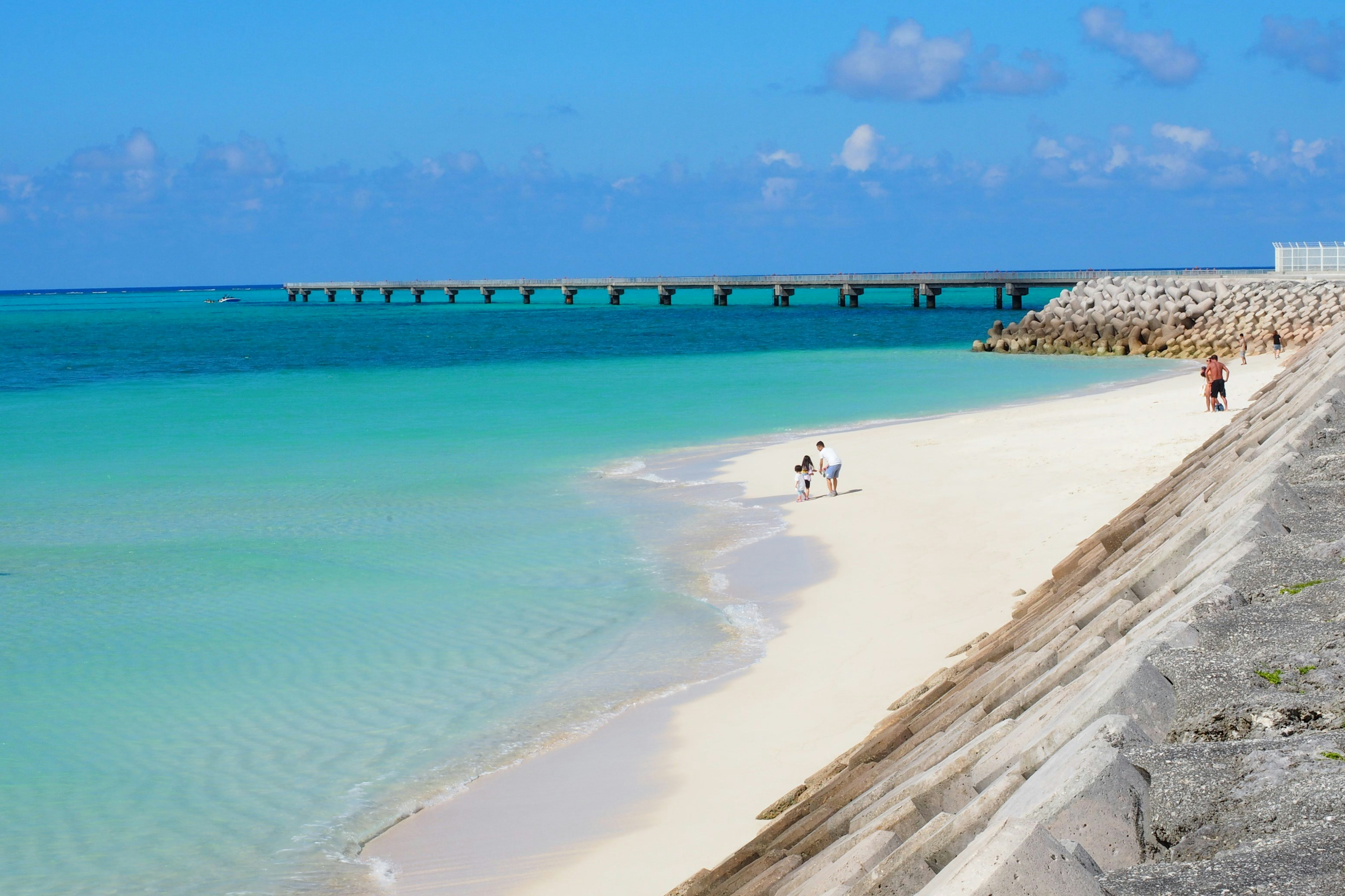
About Miyako Islands
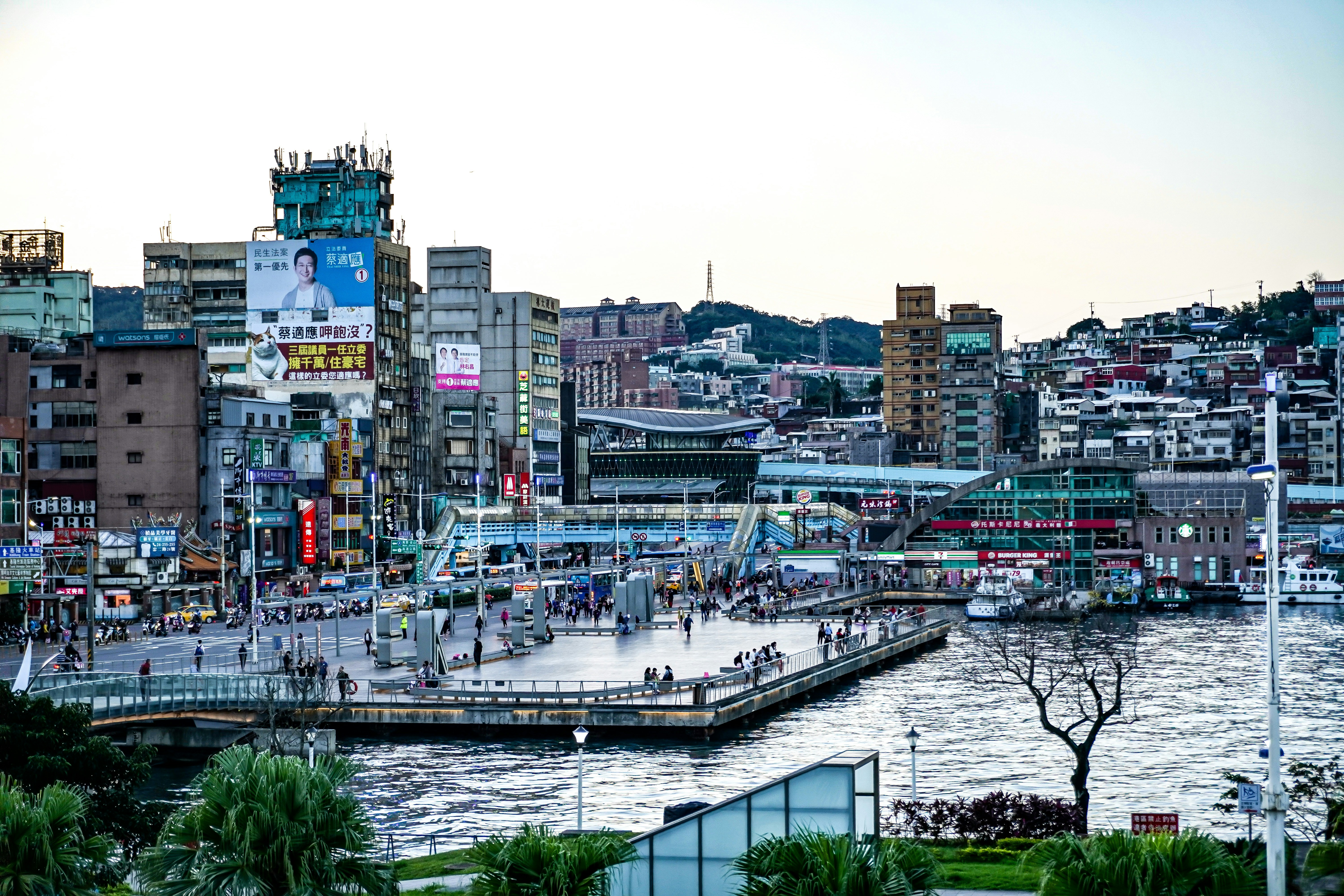
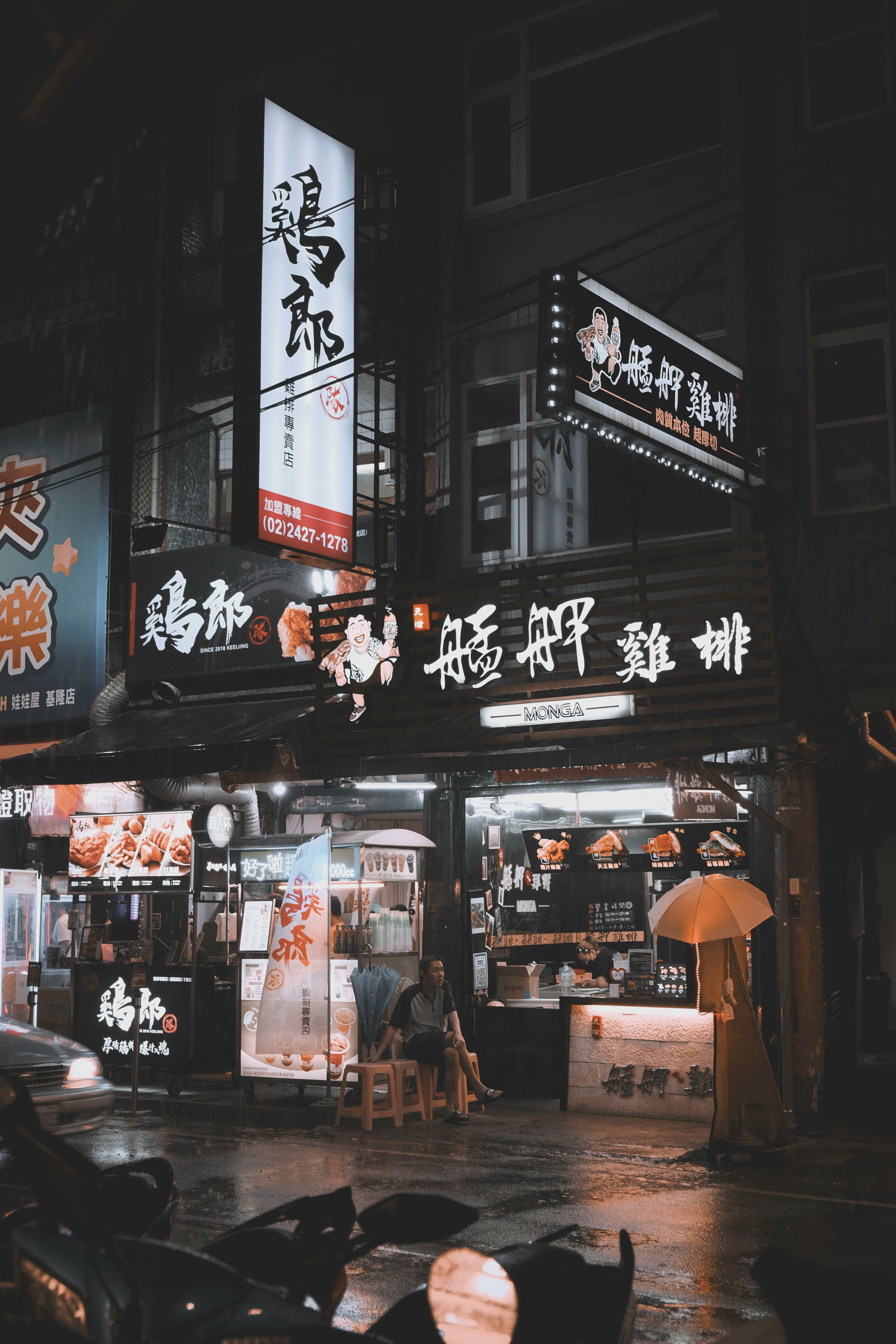
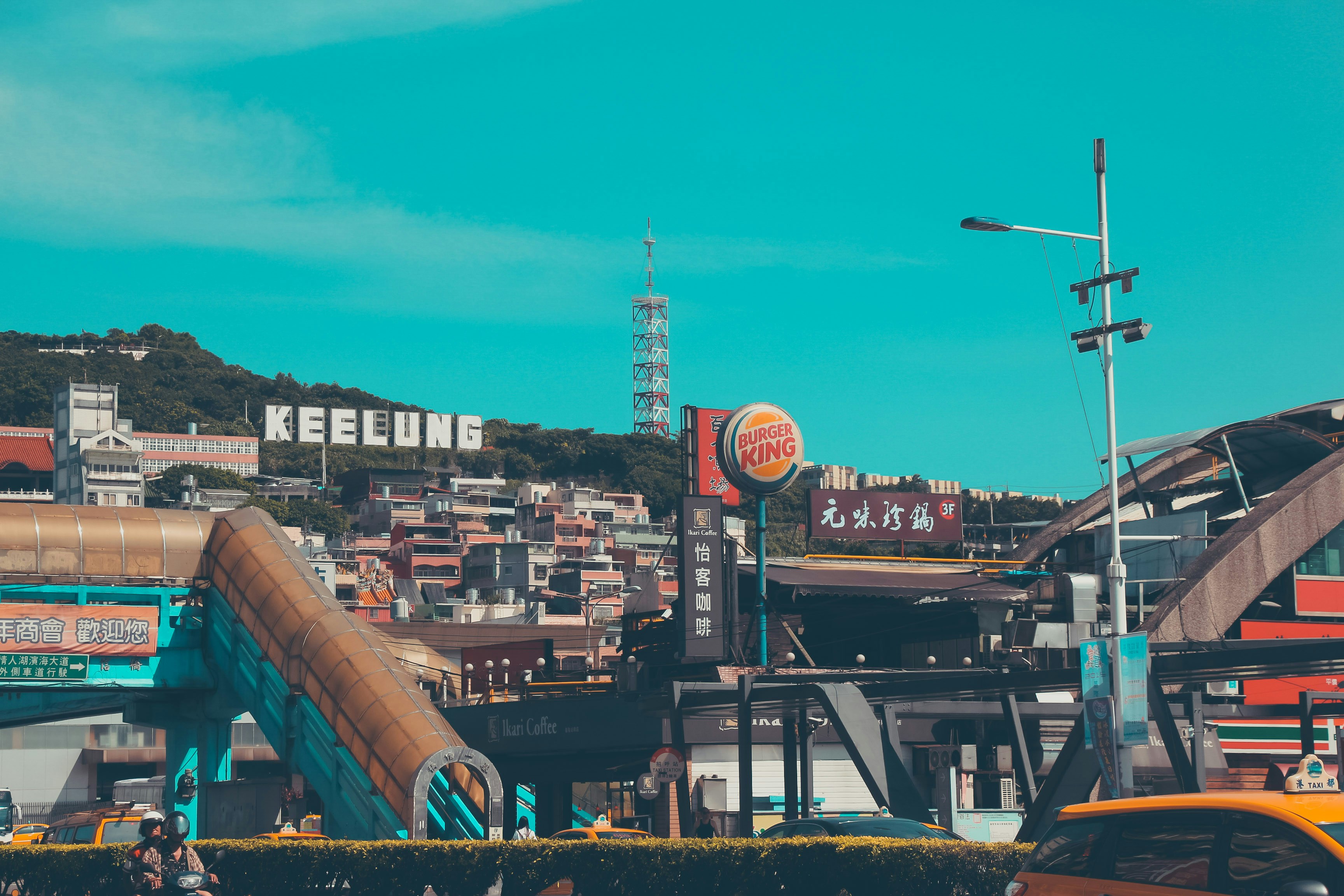
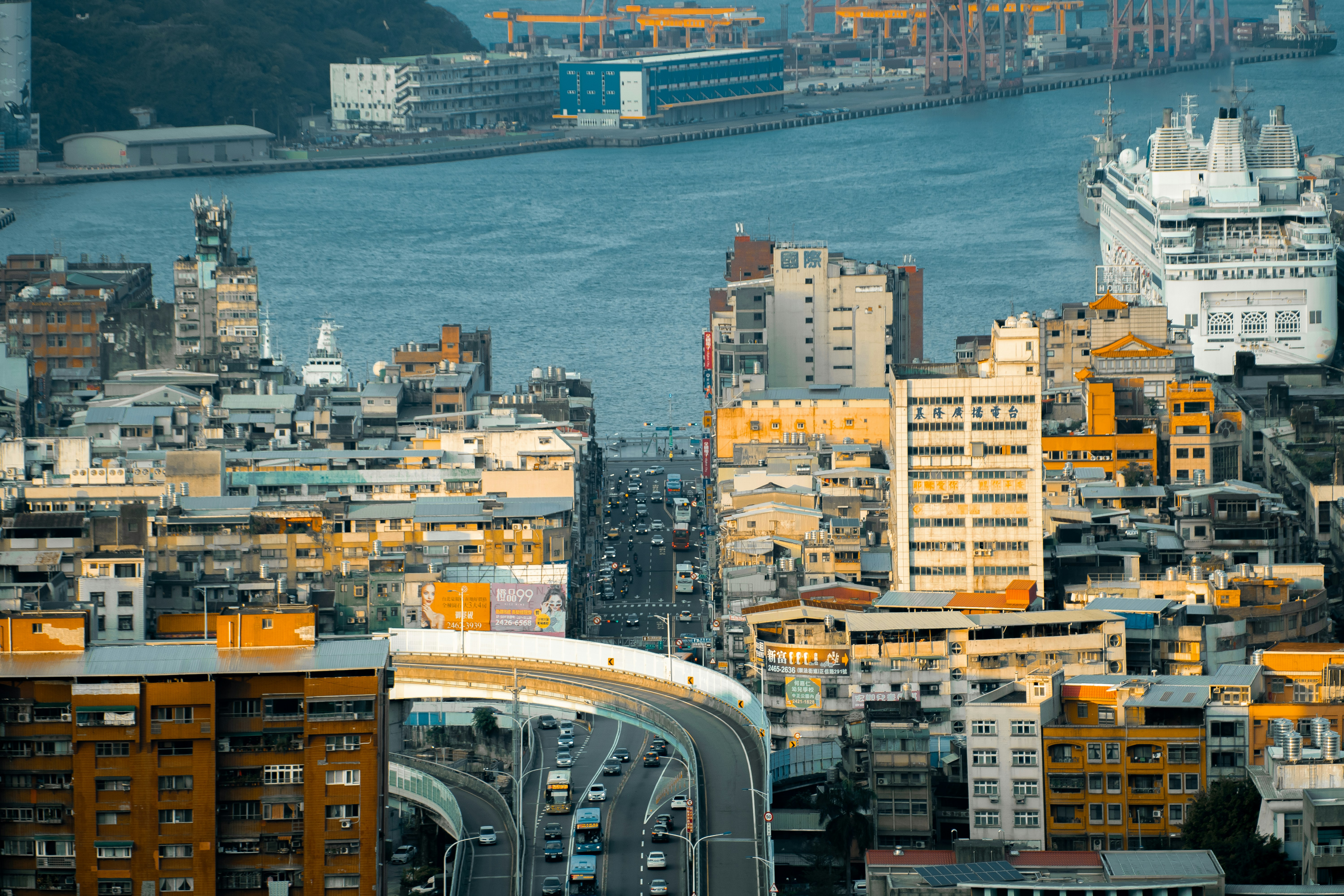
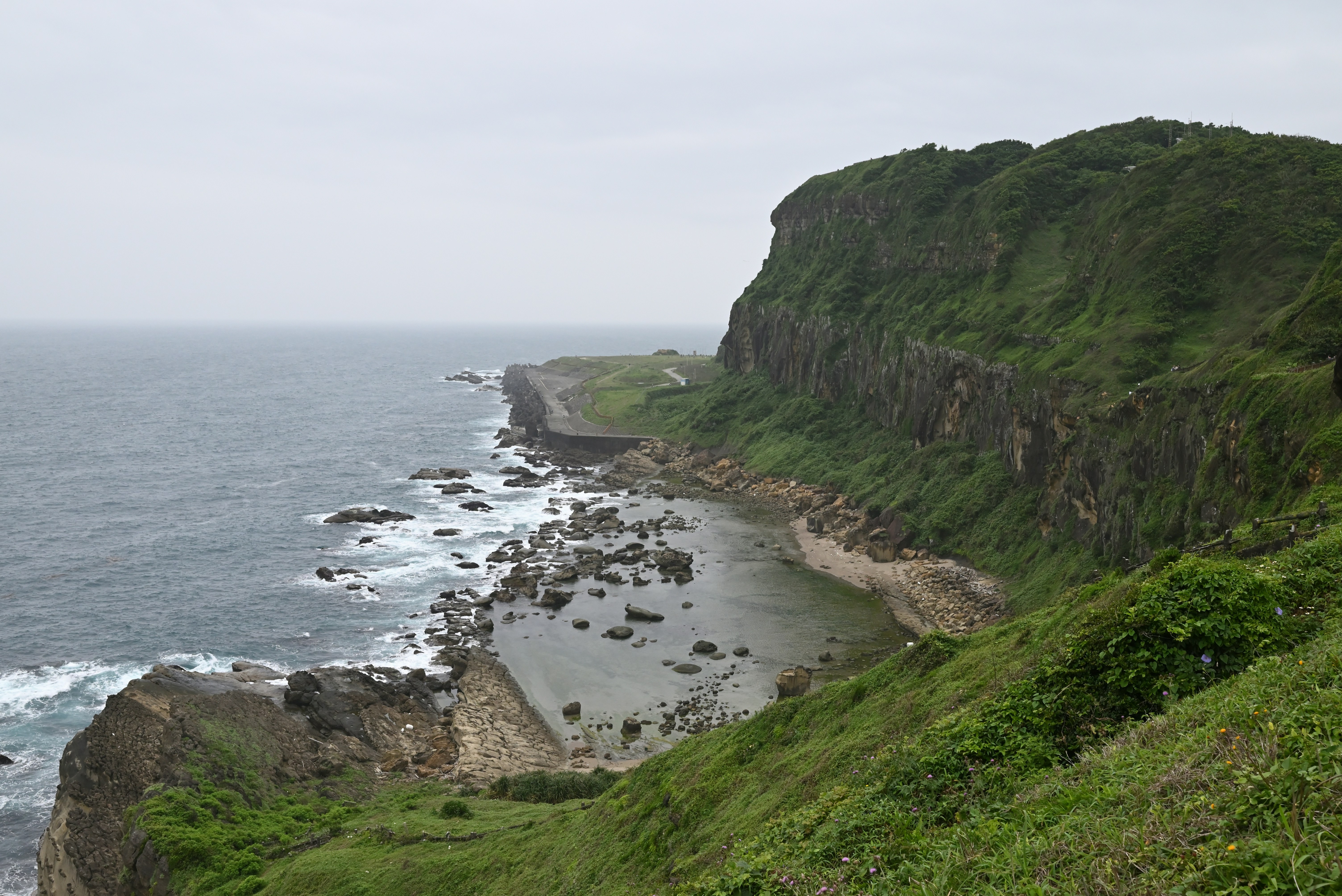
About Keelung (Chilung)
With the glittering lights of Taipei - a futuristic metropolis of culture and ideas - sparkling nearby, Keelung is the first calling point for many visitors arriving in Taiwan. While this port city essentially serves as Taipei's ocean gateway, you shouldn’t be too hasty in dashing off to Taipei's neon-lit magic – first it’s well worth spending some time exploring the famous glowing night market, which hums with life each evening and is famous for its local seafood.

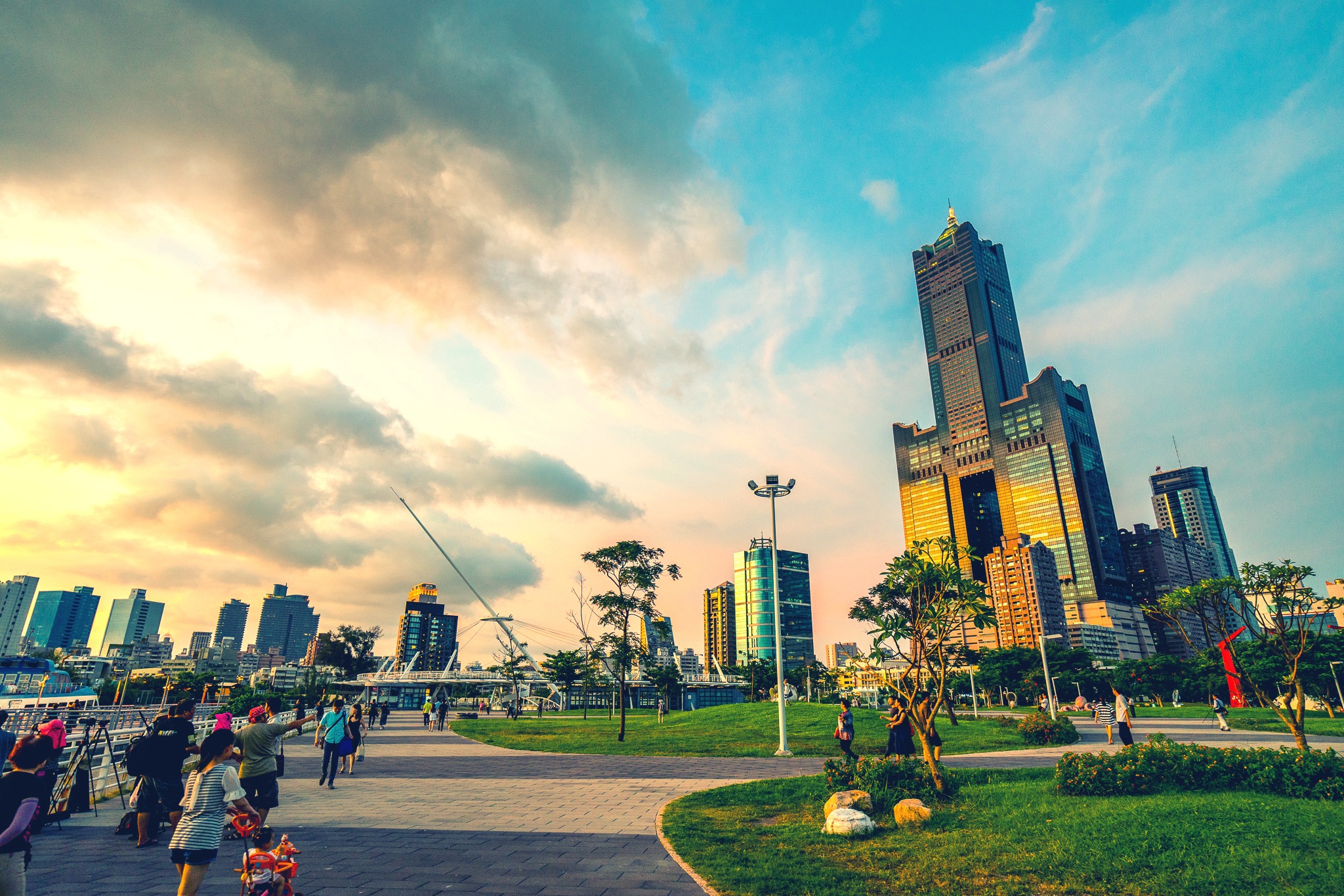
About Kaohsiung
Kaohsiung is Taiwan’s second largest city, its biggest seaport, and the world’s fourth largest container port. It entered the 21st century as a newly emerging international metropolis. In the forefront of Taiwan’s expansion and modernisation efforts are the China Steel Corporation and China Shipbuilding. They are perfect examples of what Taiwan’s export-oriented economy is all about. The Love River, which has seen some recent landscaping, adds to the beauty of the city. Coffee shops along its banks offer good opportunities to view the river’s activities and enjoy a nice breeze. A 495-feet (150 metres)-long urban corridor of light, known as Urban Spotlight, was designed by local artists who wanted to make light and shadows the theme of the hall. The result is an urban space in the Central Park area teeming with artistic vision. A very important event in Taiwan’s recent history occurred here in 1979, and is known as the Kaohsiung Incident. It was the day of the first major human rights celebration on the island. Until that time, the authorities had never allowed any expression of discontent. When the day came, however, the celebration ended in chaos when police encircled the peaceful crowd and started using teargas, and pro-government instigators incited violence. Kuomintang (KMT) authorities used this as an excuse to round up all well-known opposition leaders and imprison them. Although it was hardly noticed internationally, it is recognised locally as an important turning point in the island’s transition to democracy, and it galvanised the Taiwanese people into action.
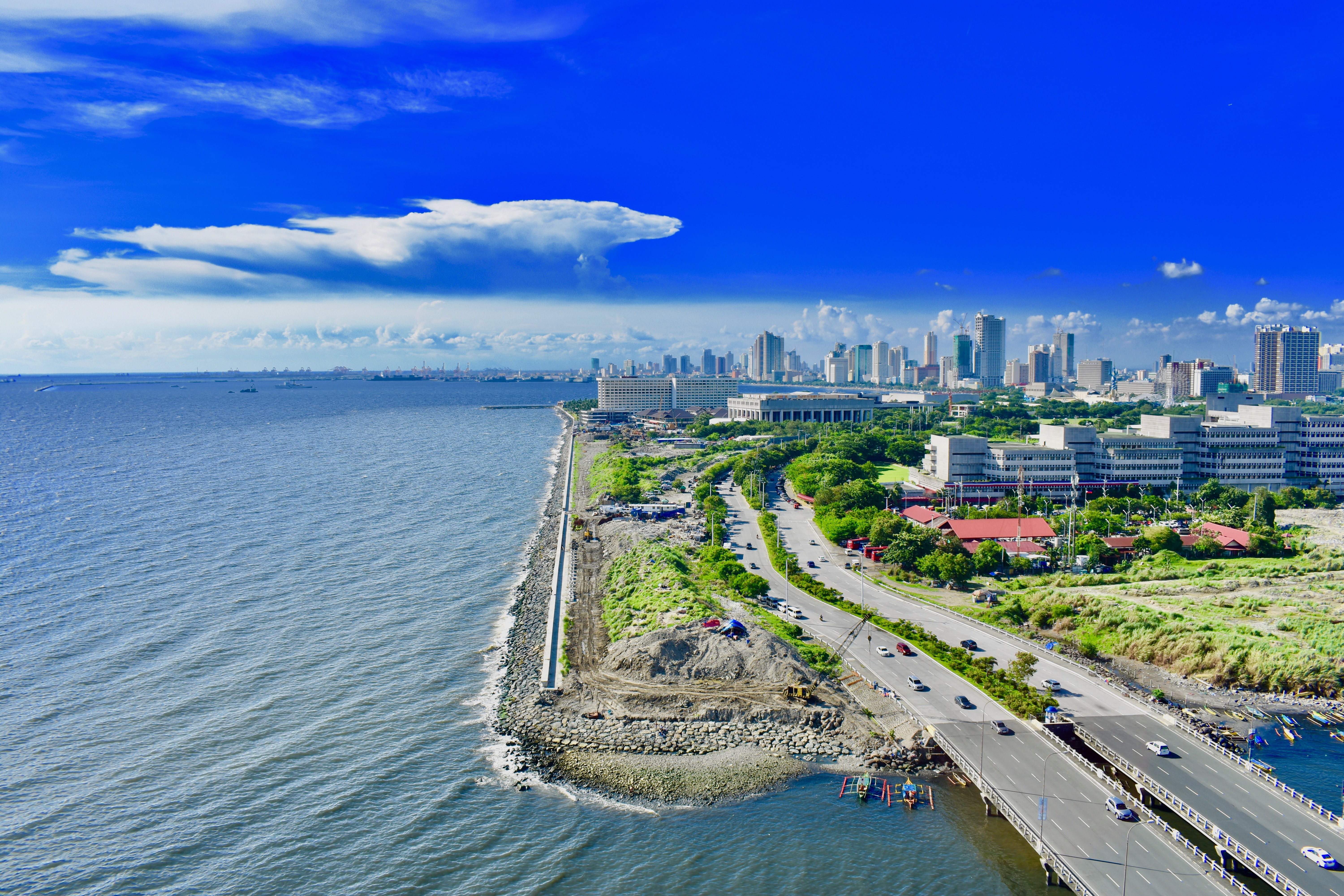
About Manila
MANILA, the capital city of the Philippines, was founded in, 1571 by Spanish conquistador Miguel López de Legazpi. It is one of the oldest cities in the country and was the seat of power for most of the colonial rules of the Philippines. It is situated on the eastern shore of Manila Bay and contains a multitude of landmarks, some of which date back to the 16th century. It is home to the baroque 16th-century San Agustin Church as well as Fort Santiago, a storied citadel and military prison. In the 19th century Manila became one of the most modern cities in Asia. Before the Spanish–American War, Manila saw the rise of the Philippine Revolution. Under the American rule following the Spanish-American War, the United States changed the official language from Spanish to English. Towards the end of World War II, during the Battle of Manila, most of the city was flattened by intensive aerial bombardment. Today, tourism is a vital industry in Manila. Major shopping malls and bazaars thrive around Manila.
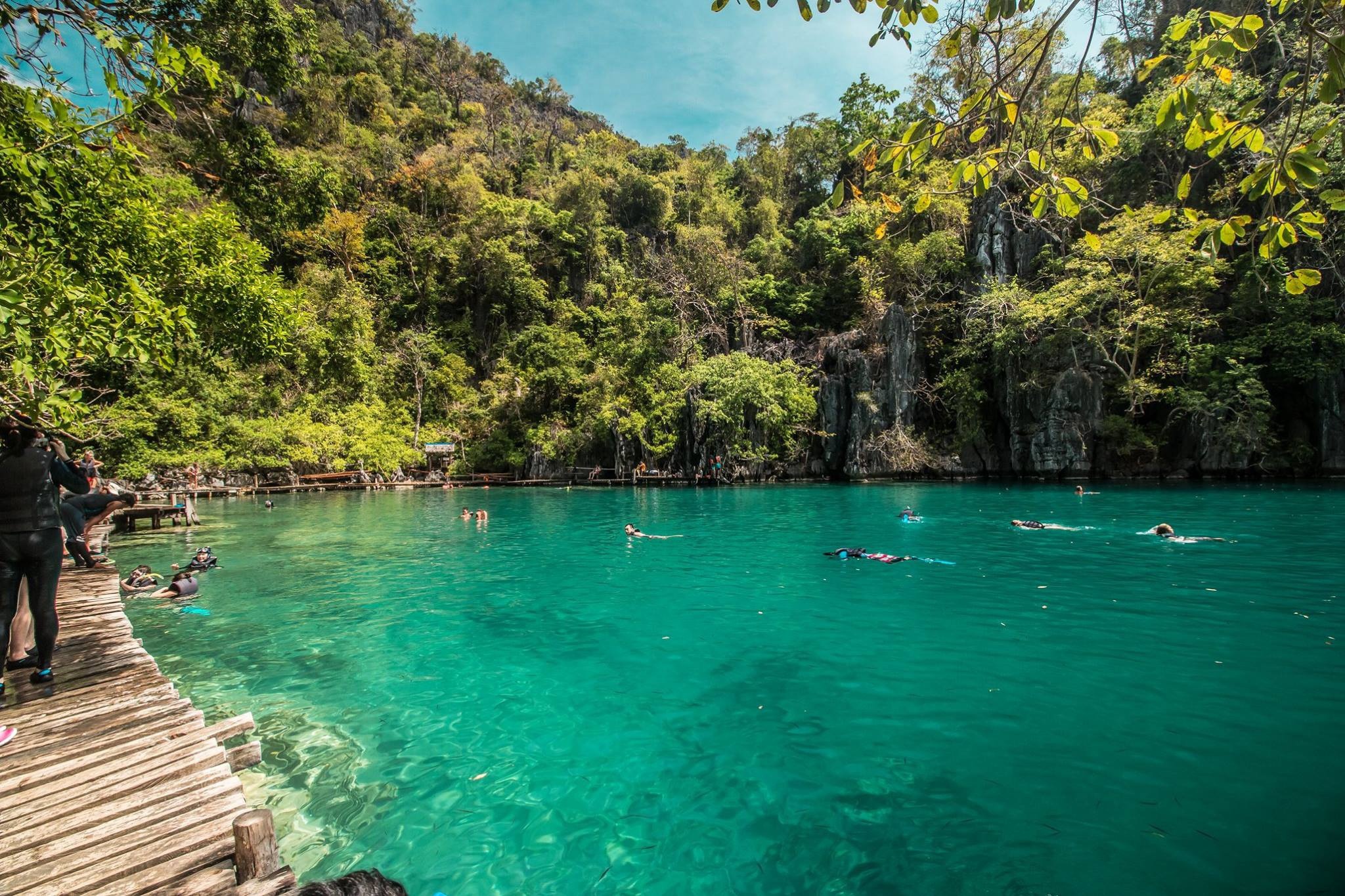
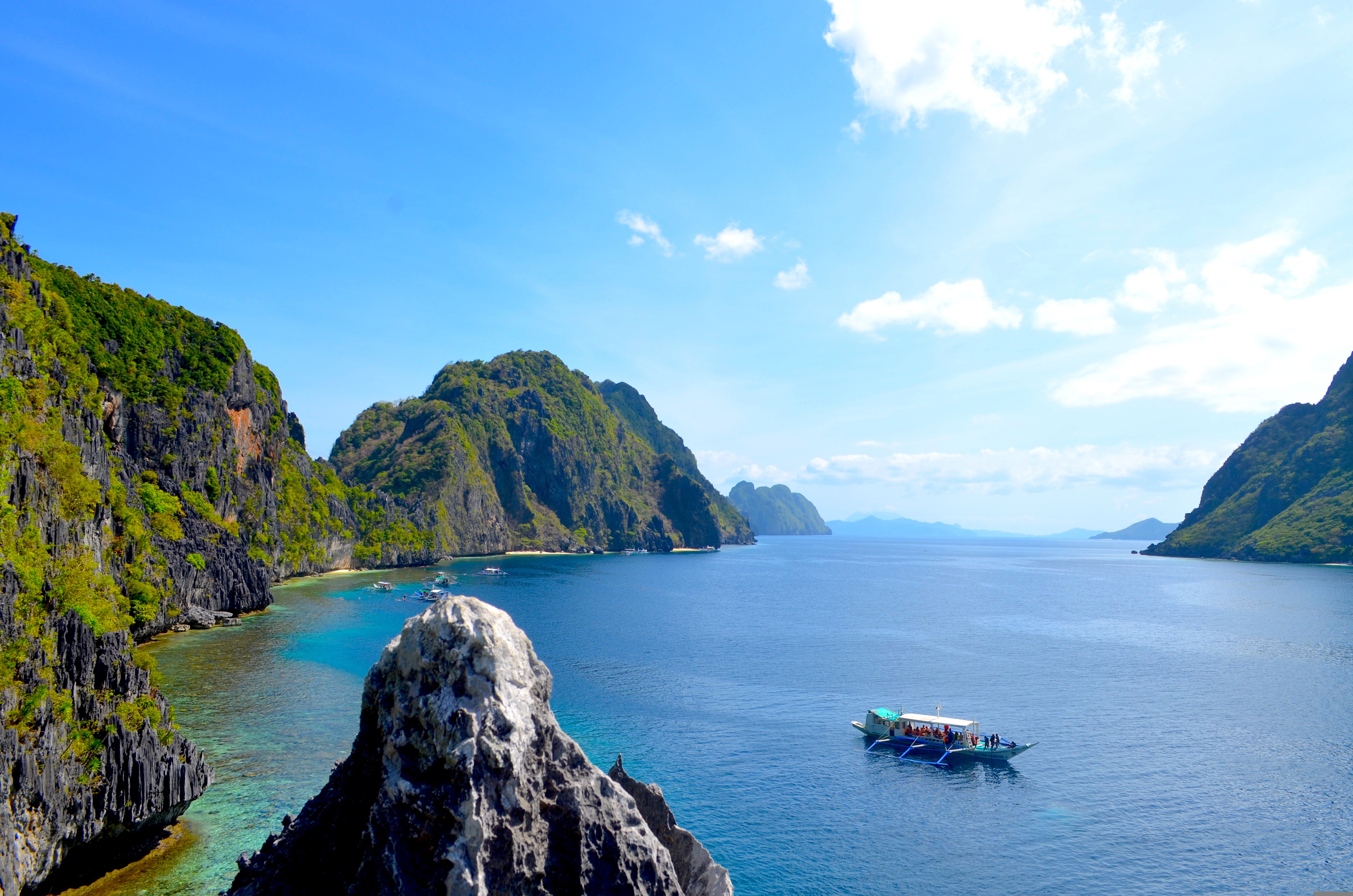
About Coron Island
Spoken of with awed reverence in scuba-diving circles, Coron's dramatic rock protrusions, which jut from emerald seas and glorious sweeps of sand, make it a destination that you can't help but dive into. The perfect base for an adventure holiday, Coron's exquisite setting means you'll face taxing choices on a daily basis - to spend the day relaxing on the soft sand, or to pound through the jungle on horseback? Whether you choose relaxation or all-out-action, you're sure to fall head over heels for Coron's beauty.
About Puerto Princesa, Palawan
The Spanish arrived at this beautiful corner of the world in March of 1872, founding the city, that would eventually become the Capital of Palawan. In 2011, the area received a huge boost, when New7 announced its list of the 7 Wonders of Nature – counting 500 million votes in the process. Puerto Princesa’s stunning underground river - complete with a cavernous, sunken lagoon - beat off wonderful sites like the Great Barrier Reef, to claim a spot on the final, prestigious list. Set sail across the glowing green water, on a journey into the gaping mouth of the limestone caves at Puerto Princesa. Known for being one of the least densely populated, cleanest and most environmentally friendly cities in the Philippines, there’s a raft of natural wonders to explore - from diving hotspots to towering limestone cliffs, and the entrancing underworld of the underground river.
About Kota Kinabalu, Sabah
The capital of Sabah, Borneo's northernmost state, Kota Kinabalu is wedged between a tropical rainforest and the South China Sea. Many explorers use it as a launching point to venture off and see the surrounding jungle and marine life. Mt. Kinabalu challenges climbers daily, and top diving spots reel in underwater adventurers. The city is made up of a dense grid of concrete buildings built over reclaimed land along the coast. Several waterfront seafood restaurants and a diverse mix of hotels appeal to the travelers passing through, mostly off to explore the region.
About Singapore
The main island of Singapore is shaped like a flattened diamond, 42 km (26 miles) east to west and 23 km (14 miles) north to south. Near the northern peak is the causeway leading to West Malaysia—Kuala Lumpur is less than four hours away by car. It is at the southern foot where you will find most of the city-state’s action, with its gleaming office towers, working docks, and futuristic "supertrees," which are solar-powered and serve as vertical gardens. Offshore are Sentosa and over 60 smaller islands, most uninhabited, that serve as bases for oil refining or as playgrounds and beach escapes from the city. To the east is Changi International Airport, connected to the city by metro, bus, and a tree-lined parkway. Of the island's total land area, more than half is built up, with the balance made up of parkland, farmland, plantations, swamp areas, and rain forest. Well-paved roads connect all parts of the island, and Singapore city has an excellent, and constantly expanding, public transportation system. The heart of Singapore's history and its modern wealth are in and around the Central Business District. The area includes the skyscrapers in the Central Business District, the 19th-century Raffles Hotel, the convention centers of Marina Square, on up to the top of Ft. Canning. Although most of old Singapore has been knocked down to make way for the modern city, most colonial landmarks have been preserved in the CBD, including early-19th-century buildings designed by the Irish architect George Coleman.
About Port Klang
Kuala Lumpur, or KL as locals refer to it, intrigues visitors with its diversity and multicultural character. The city's old quarter features stretches of shop houses that hint at its colonial past, while modern buildings—including the iconic Petronas Towers—give a glimpse of its modern financial ambitions. The city is filled with culturally colorful quarters dedicated to Chinese, Malay, and Indian communities. New shopping malls with designer labels, five-star hotels, and top-notch restaurants also proliferate in this bustling city of 1.6 million.
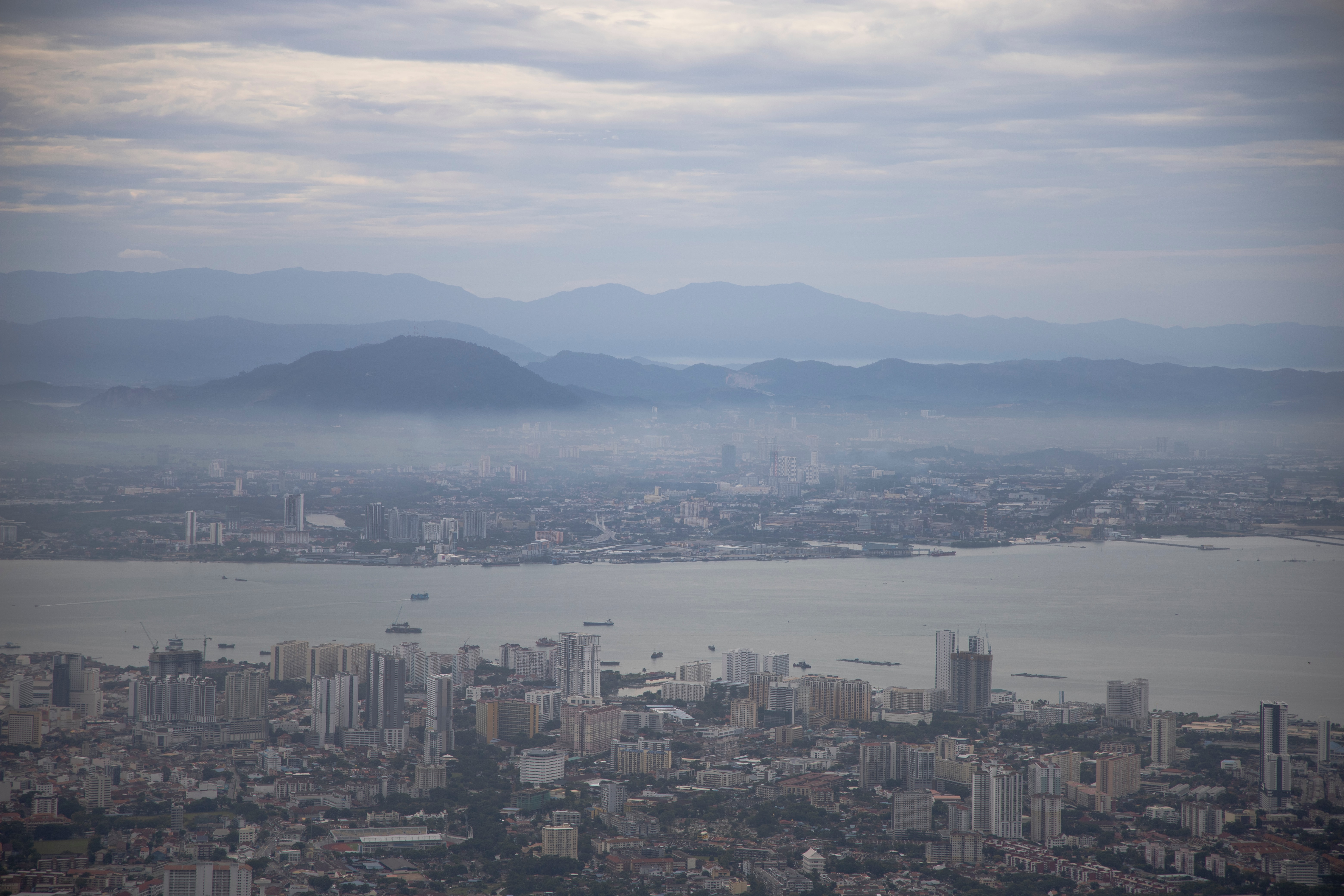
About Georgetown, Penang
An island off the northwest coast of peninsular Malaysia, Penang is blessed with a multicultural history that's led to a fascinating fusion of East and West. Claimed by the British East India Company in 1786, the island's city center of Georgetown—listed as a UNESCO World Heritage Site—is filled with colonial architecture, temples, and museums. The island has also attracted many Chinese immigrants, who now make up the majority of the population. On Penang you'll find an exciting mix of jungle, coast, farmland, and fishing villages, along with the country's largest Buddhist temple.

About Phuket
Though few tourists linger here, Phuket Town, the provincial capital, is one of the more culturally interesting places on the island to spend half a day. About one-third of the island's population lives here, and the town is an intriguing mix of old Sino-Portuguese architecture and the influences of the Chinese, Muslims, and Thais that inhabit it. The old Chinese quarter along Talang Street is especially good for a stroll, as its history has not yet been replaced by modern concrete and tile. And this same area has a variety of antiques shops, art studios, and trendy cafés. Besides Talang, the major thoroughfares are Ratsada, Phuket, and Ranong roads. Ratsada connects Phuket Road (where you'll find the Tourism Authority of Thailand office) to Ranong Road, where there's an aromatic local market filled with fruits, vegetables, spices, and meats.
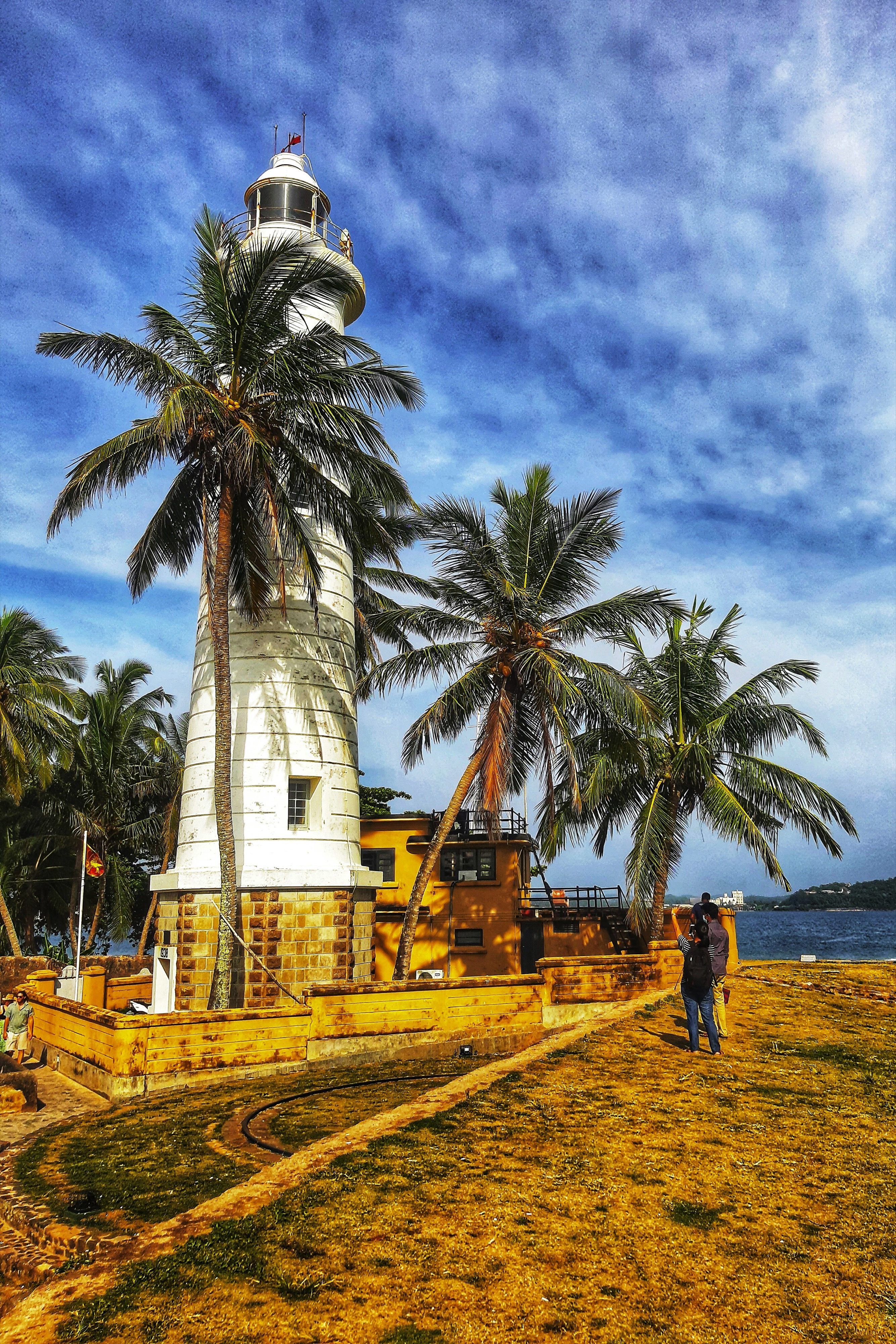
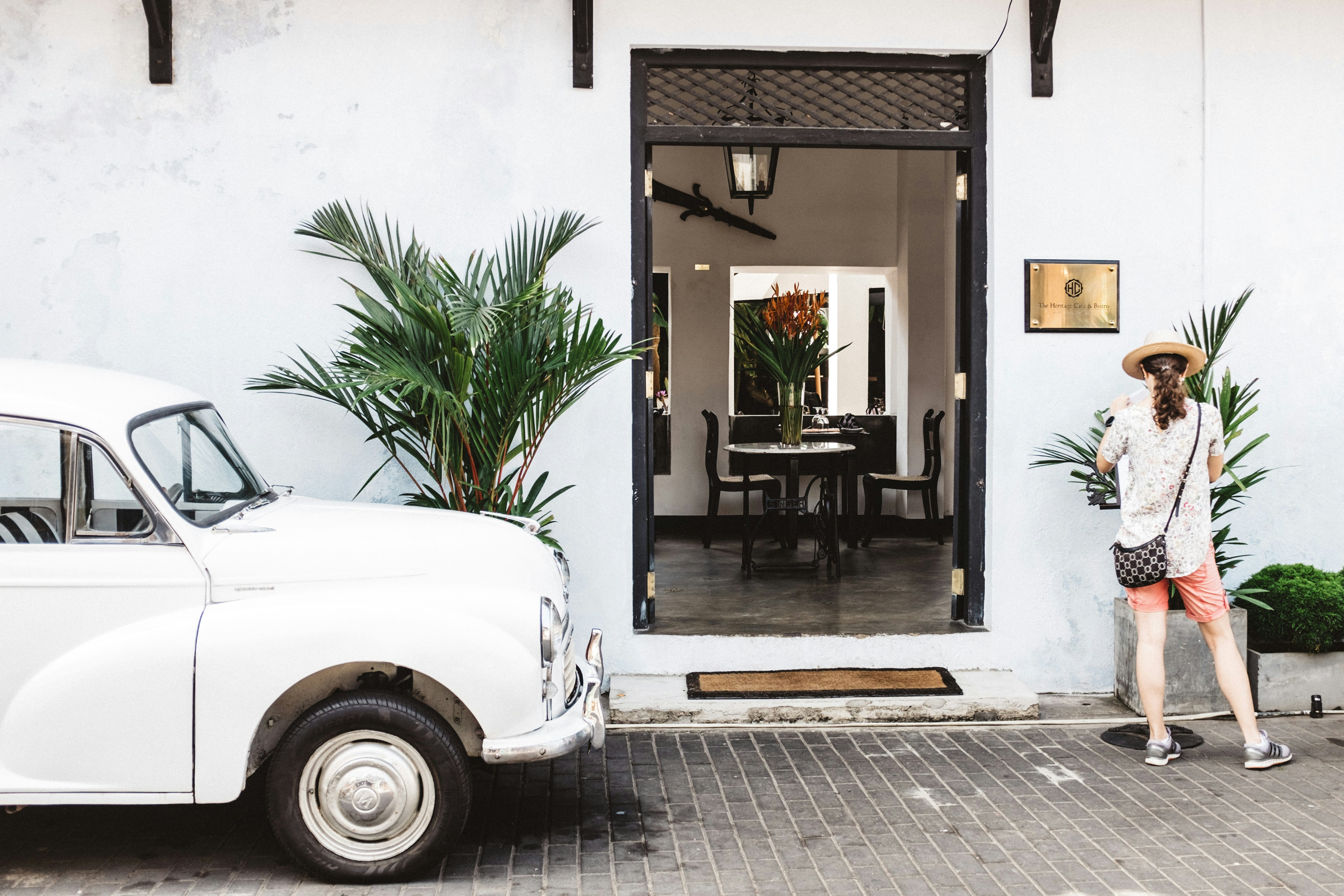
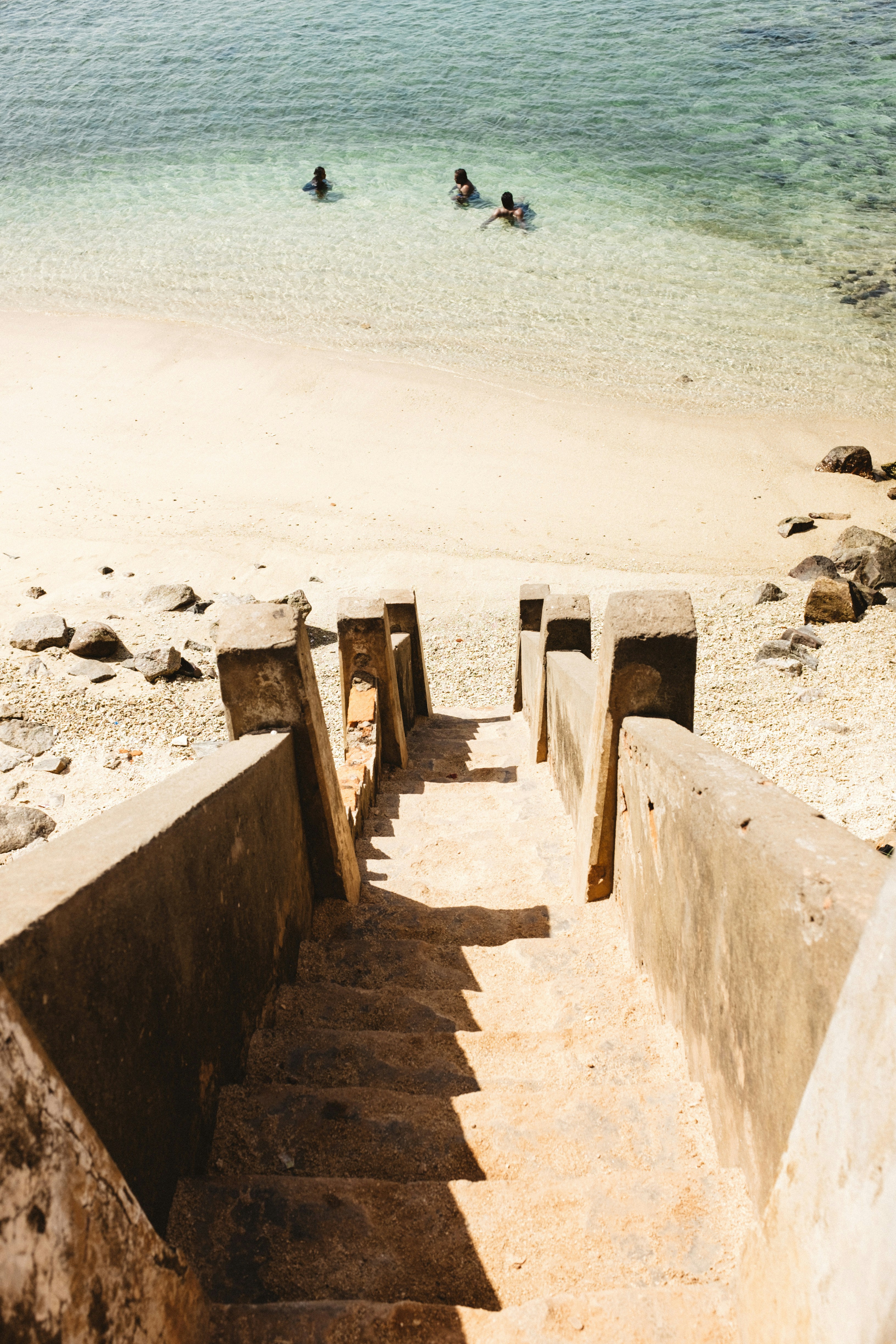
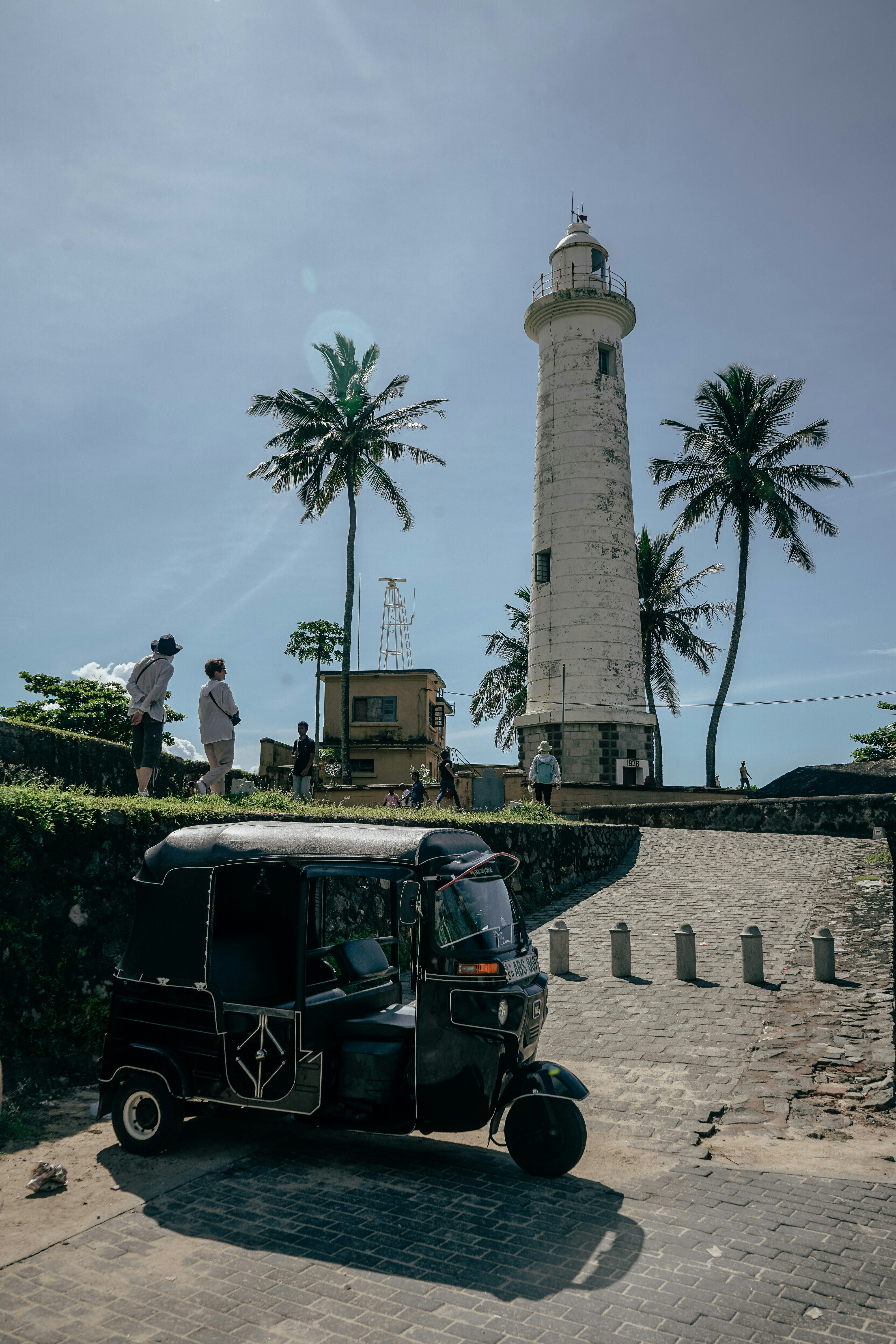
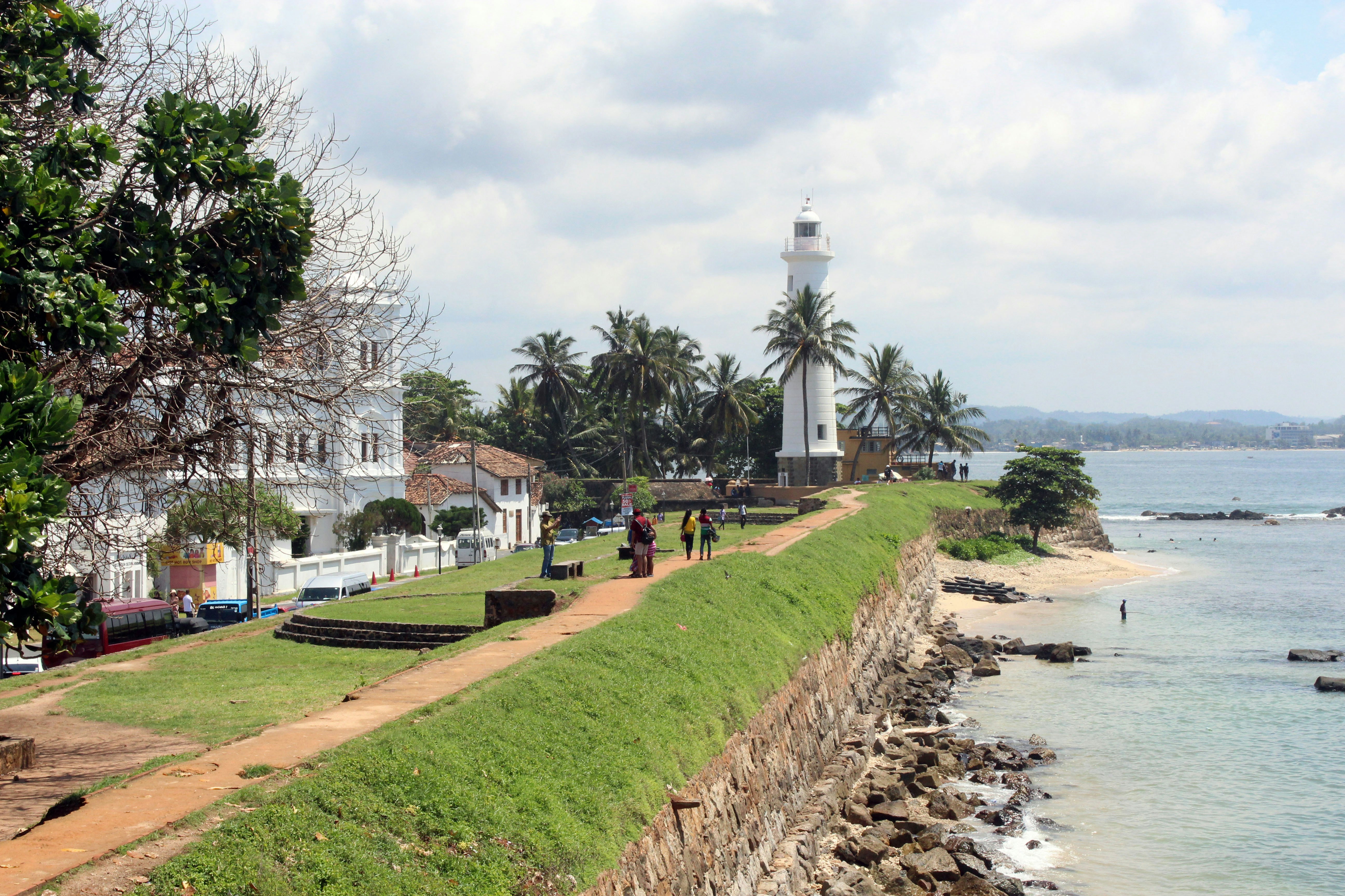
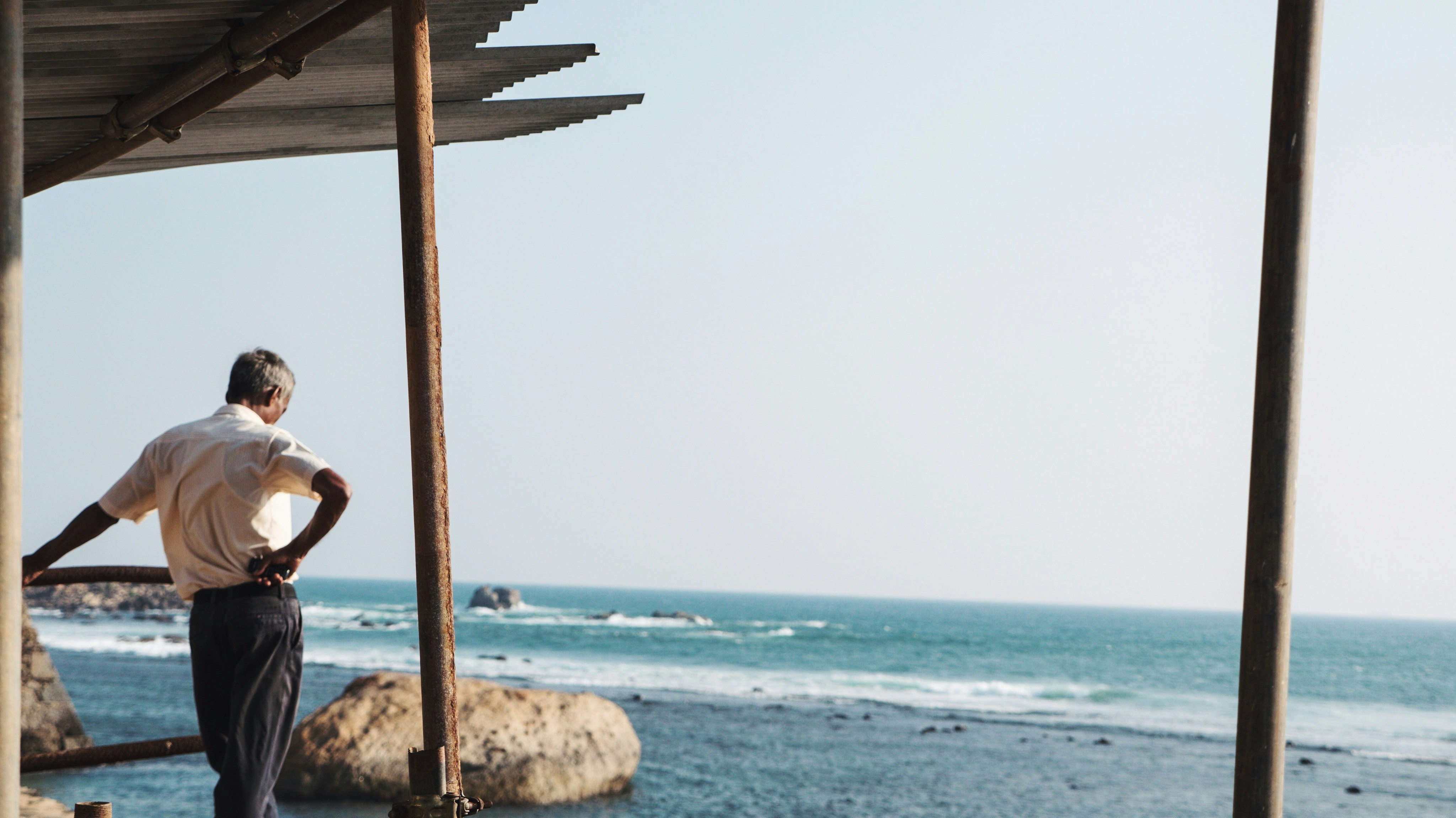
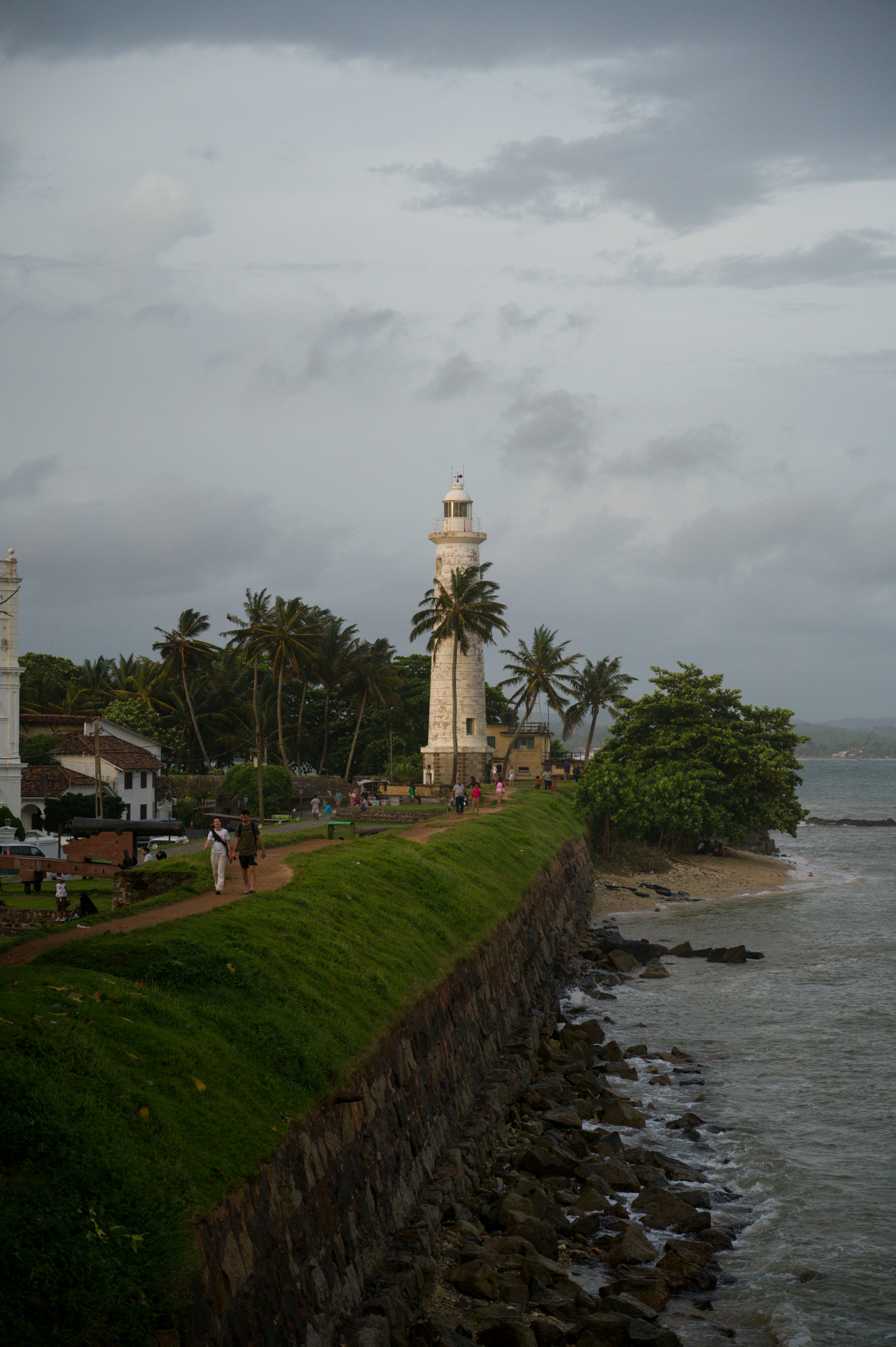
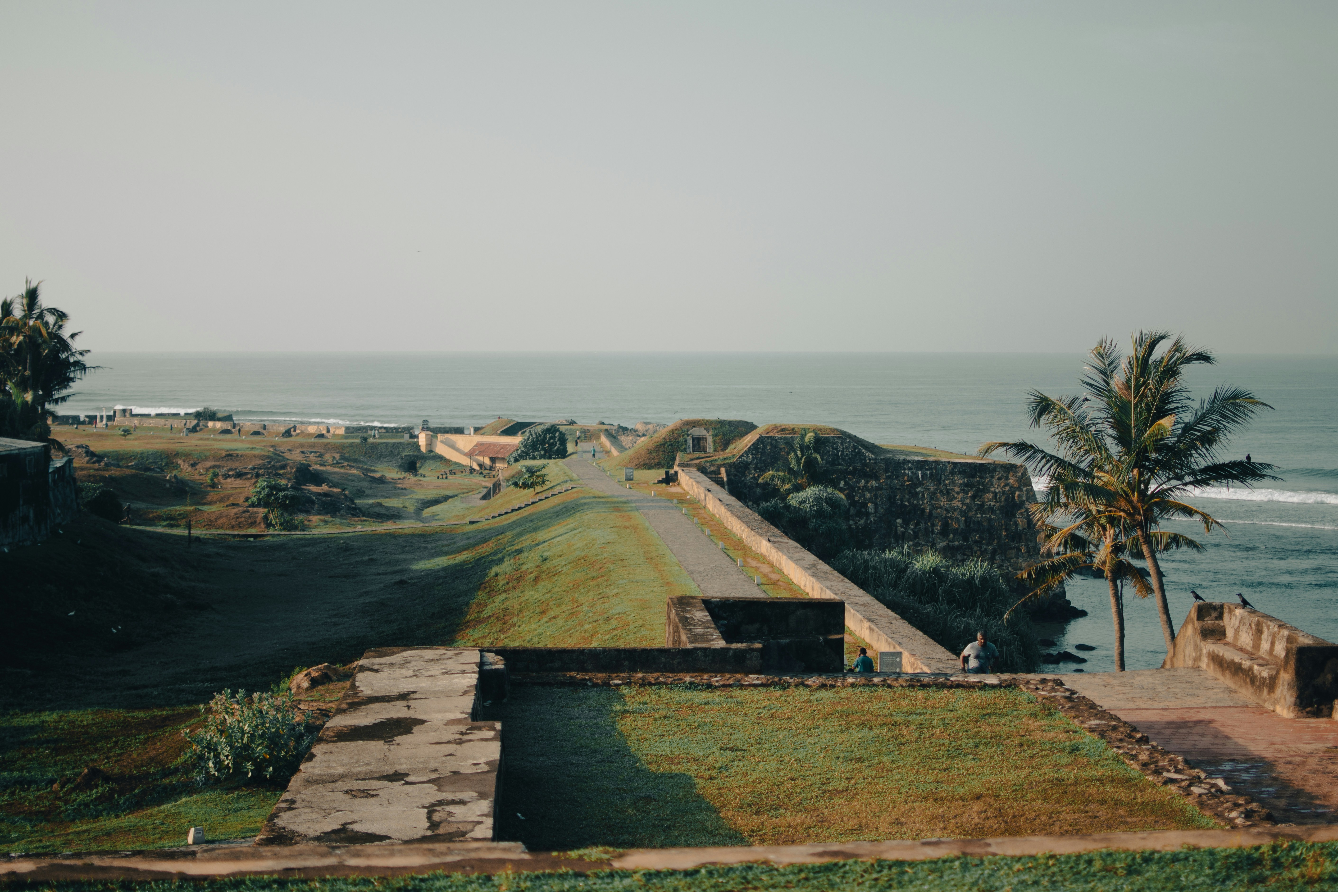
About Galle
Galle is the administrative capital of the Southern Province in Sri Lanka. The city has a beautiful tropical setting with Dutch-colonial architecture. Explore the maritime museums, try some of the delicacies and explore the shops for souvenirs.


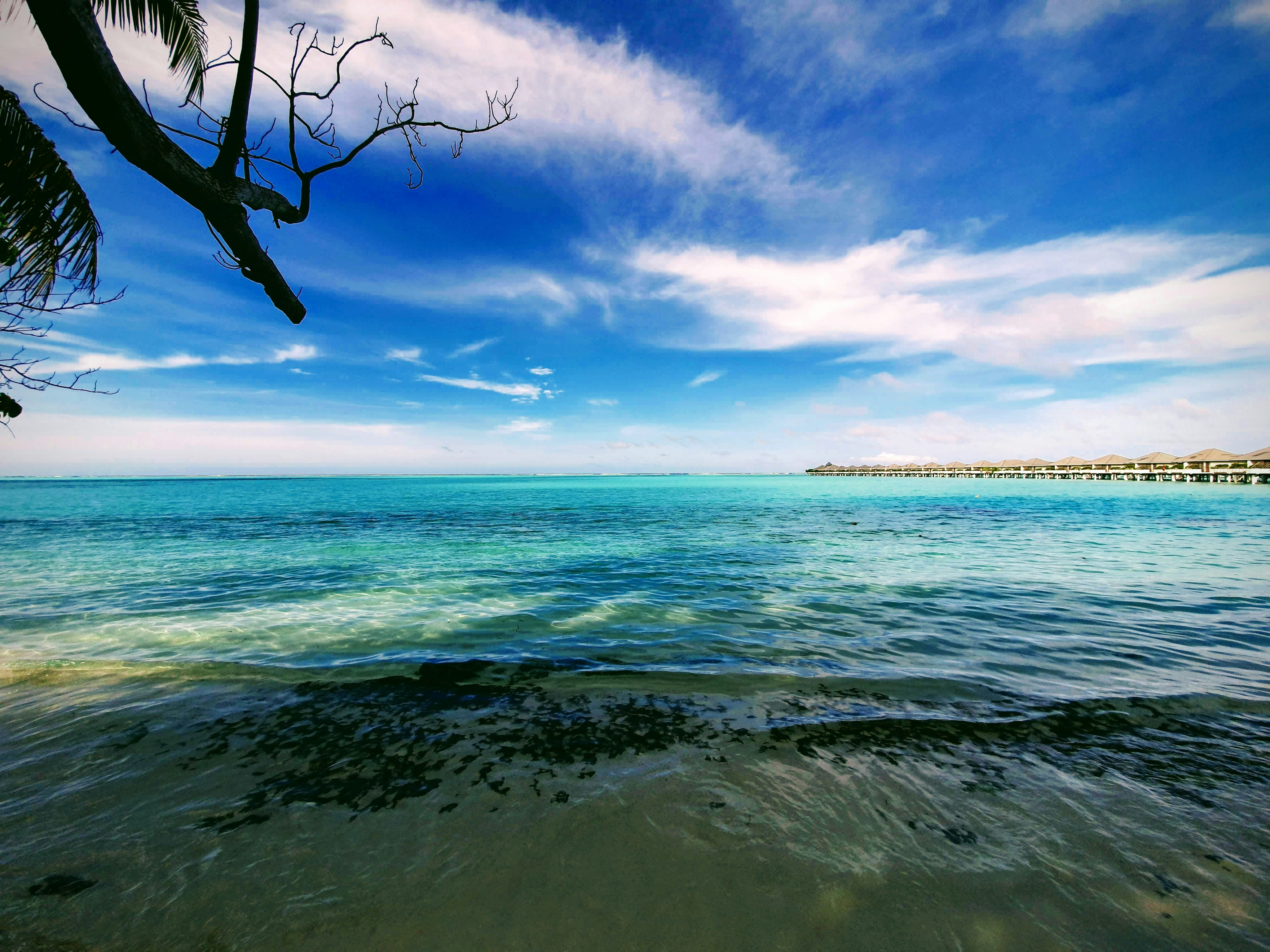
About Male
There are many nations around the world with bragging rights to miles of pristine white coral sand and balmy turquoise seas but few can take it to the same level as the Maldives. Its 1,200 islands are spread out over 26 coral atolls; the combined land of all the islands is little more than 100 square miles. That means you are rarely more than a few steps from the beach. Many of the villas are actually built on stilts out over the water, so you may actually have to walk onshore in order to get to the beach. Besides curling your toes in the sand, many people come here to sample the Maldives enviable world-class dive spots. Others simply snorkel among the endless coral reefs. There are so many coral atolls here that our English word derives from the Maldivian name atholhu.
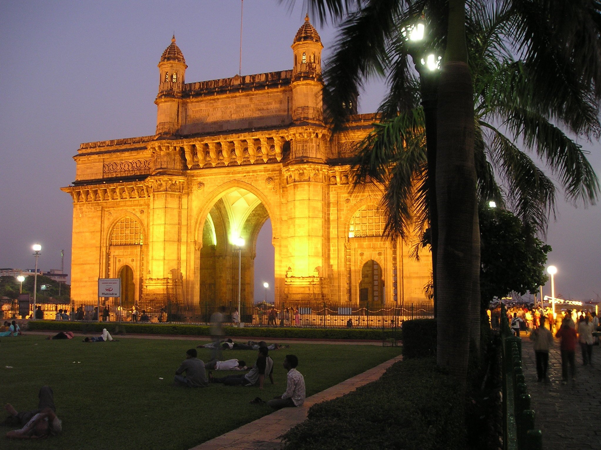
About Mumbai (ex Bombay)
Mumbai, India's financial capital, is a city of contrasts and colors, where towering skyscrapers stand alongside bustling bazaars. From the iconic Gateway of India to the vibrant street food scene of Chowpatty Beach, it's a melting pot of cultures and cuisines. The heartbeat of Bollywood echoes through its bustling streets, while historic landmarks like the Elephanta Caves whisper tales of bygone eras. With its bustling local trains and bustling markets, Mumbai is a city that never sleeps, where dreams are pursued against the backdrop of the Arabian Sea's shimmering waters.
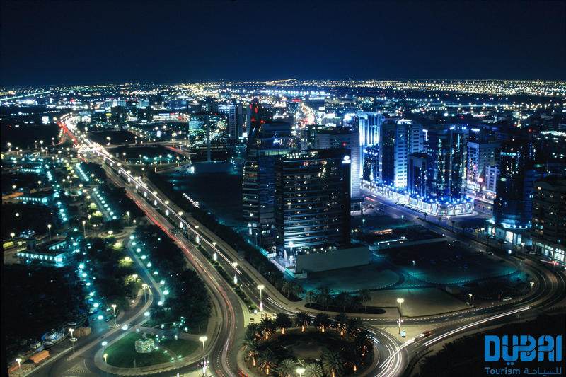
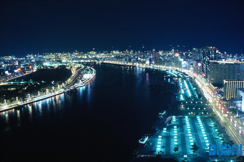
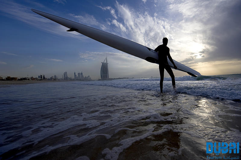
About Dubai
Dubai sits on a golden sandy coastline in the Arabian Gulf, where the warm azure waves of the sea meet the desert. A high-rise oasis, this city is a pleasure-dome surrounded by dunes; one of the most fashionable on the planet thanks to its ability to satisfy the needs of legions of demanding vacationers. Dubai is about having fun—and it's one big adult playground.Nature plays her part here, with year-round sunshine, gorgeous beaches, dramatic arid landscapes, and warm waters, but it's the man-made attractions that make Dubai so alluring. You can launch yourself into high-adrenaline desert adventures, diving and water sports, and some of the world's best golf courses. The 5-, 6-, and 7-star hotels offer the ultimate in luxury, and the party scene is hot. Shopping malls are the biggest in the world and are packed full of high-class merchandise. And with hundreds of restaurants with cuisine from around the world, you can munch your way from Mexico to Malaysia.Dubai is an Arab country with a long history as a trading port. Traces of its traditional life, customs, and architecture can still be seen and explored, but today and tomorrow are much more important than yesterday. Almost every building in this metropolis is less than 20 years old and the most dramatic developments—groundbreaking megaprojects—have just been completed or are still under construction.The city is certainly unique. Islam is its anchor, but it has opened its doors to the rest of the world and has invited them in to work, rest, and play, which creates a truly international atmosphere. Unashamedly modern and materialistic, life here takes place at breakneck speed. The landscape is stark, the confidence is sky high, the can-do spirit is palpable, and the bling is in your face. Dubai produces strong reactions in people, but one thing is certain—love it or loathe it—you will not forget it. It is without a doubt, one of the world's true must-see destinations.Shisha: Smoke Without Fire. Emirati men love socializing, but as they don't drink alcohol they get together over coffee and shisha instead of a drink at the bar after work. The shisha, or hookah, is a smoking device, usually made of glass, that filters smoke through water before it reaches the smoker's mouth. Shisha tobaccos are aromatic and are often mixed with apple, cinnamon, or cherry, so their taste isn't as strong as other tobaccos. Smoking shisha is said to induce relaxation—but you'll have to decide if it's for you!
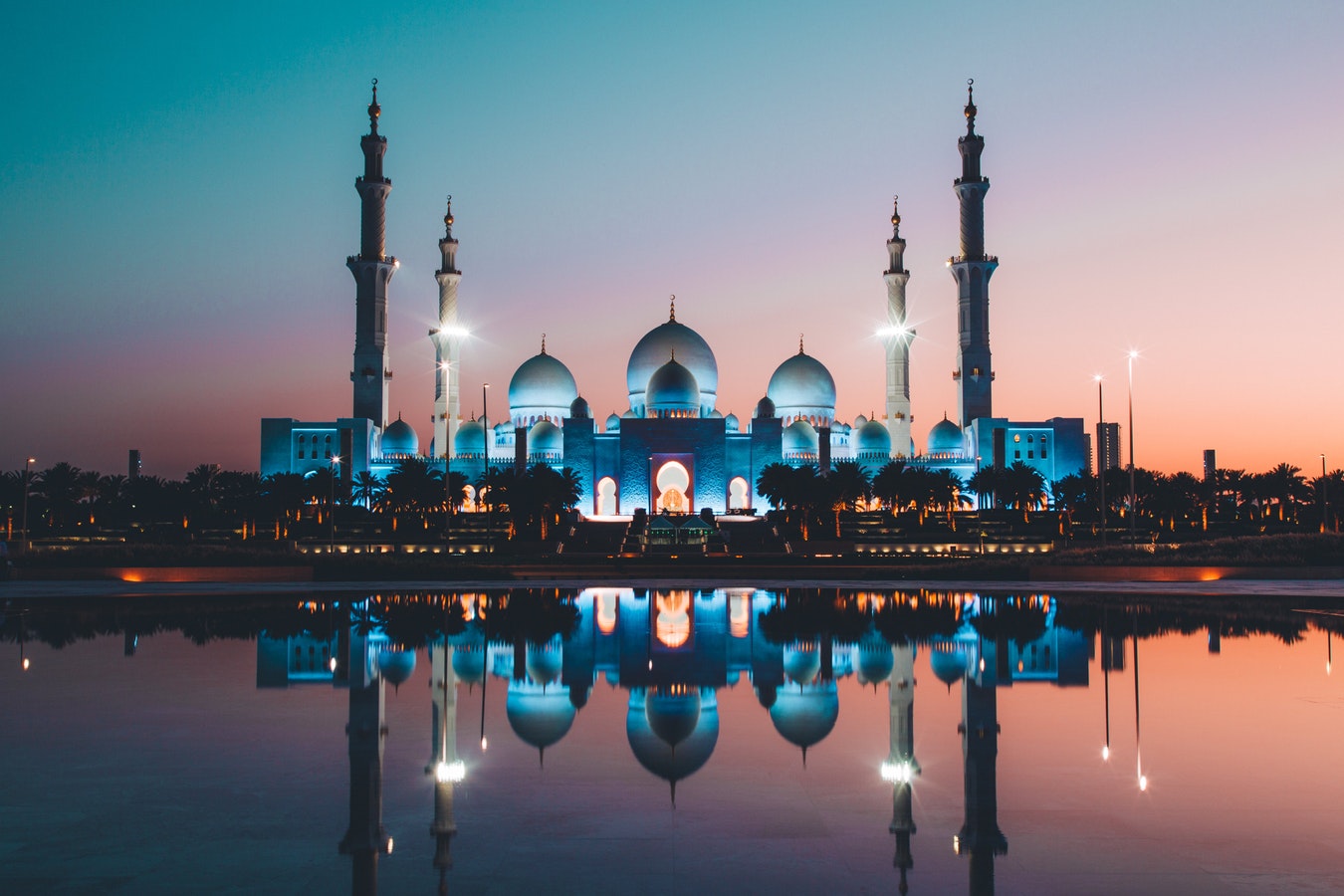
About Abu Dhabi
Just a few decades ago, Abu Dhabi, the island capital of the United Arab Emirates, was a small fishing village with houses made of mud-brick and palm fronds. Today, as a result of revenue from oil, Abu Dhabi is one of the world's richest cities, with wide, tree-lined okulevards, lush green parks, gushing fountains and imposing skyscrapers. Somewhat of a dichotomy, Abu Dhabi is a combination of ultra-modern sophistication and Arab mystique, with friendly and hospitable people offering a warm welcome to visitors. Abu Dhabi's history originated in the 18th century, when, according to legend, a group of tribesmen pursuing a gazelle came upon a freshwater well which they named Abu Dhabi, or "Father of the Gazelle". In the 19th century, the first fort was built over this well by a sheikh of the Al-Nahyan dynasty. The fort's name is Al Husn Palace, also known as Old or White Fort, and it is one of the few buildings in Abu Dhabi that is more than 25 years old. Its whitewashed walls are eye-catching amid the backdrop of today's skyscrapers. Presently, it is home to the Cultural Foundation and serves as a documents centre. Abu Dhabi had little significance until the discovery of vast oil reserves in the late 1950s and early 1960s. In the years following, the city's economy and infrastructure developed rapidly and changed Abu Dhabi beyond recognition.

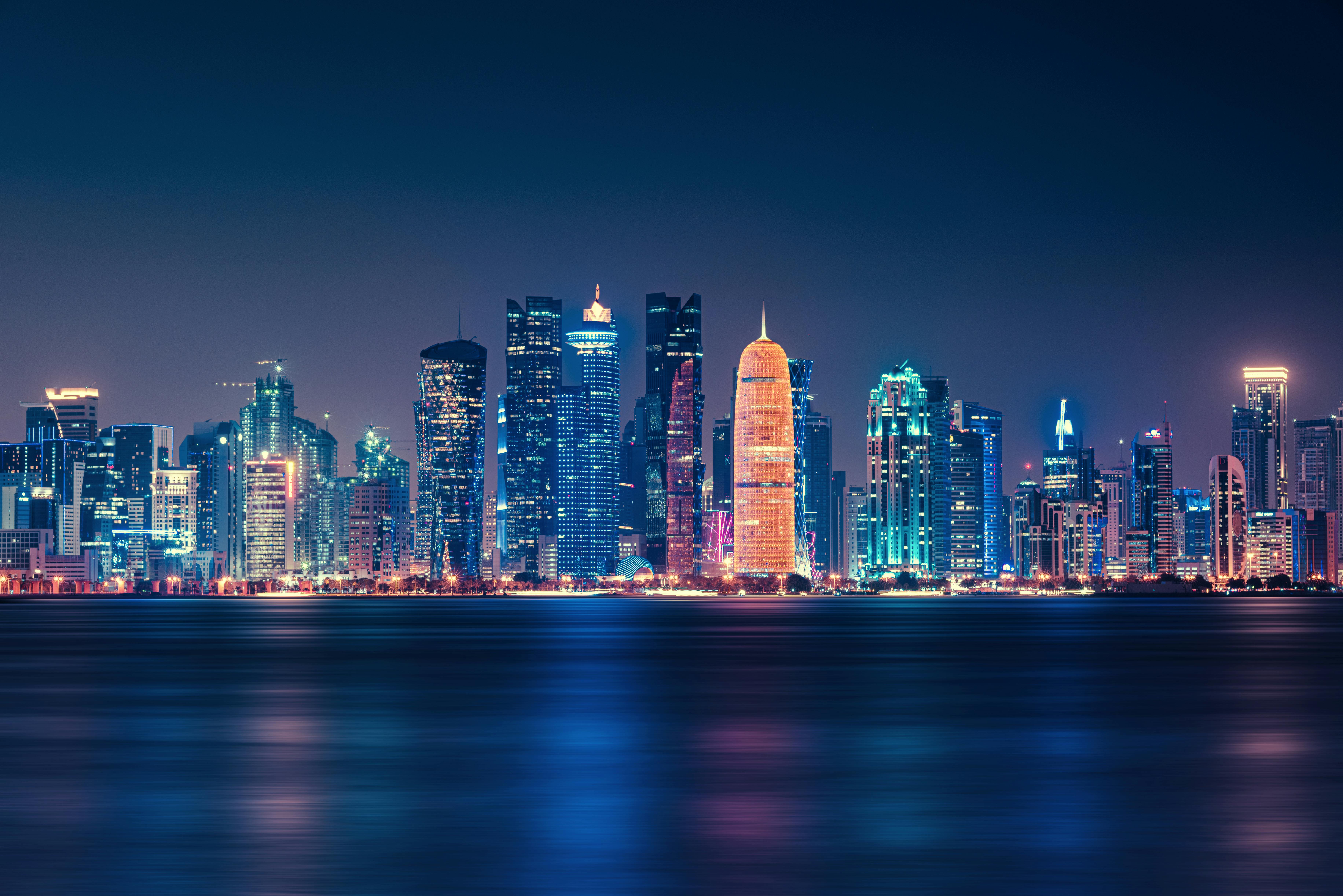
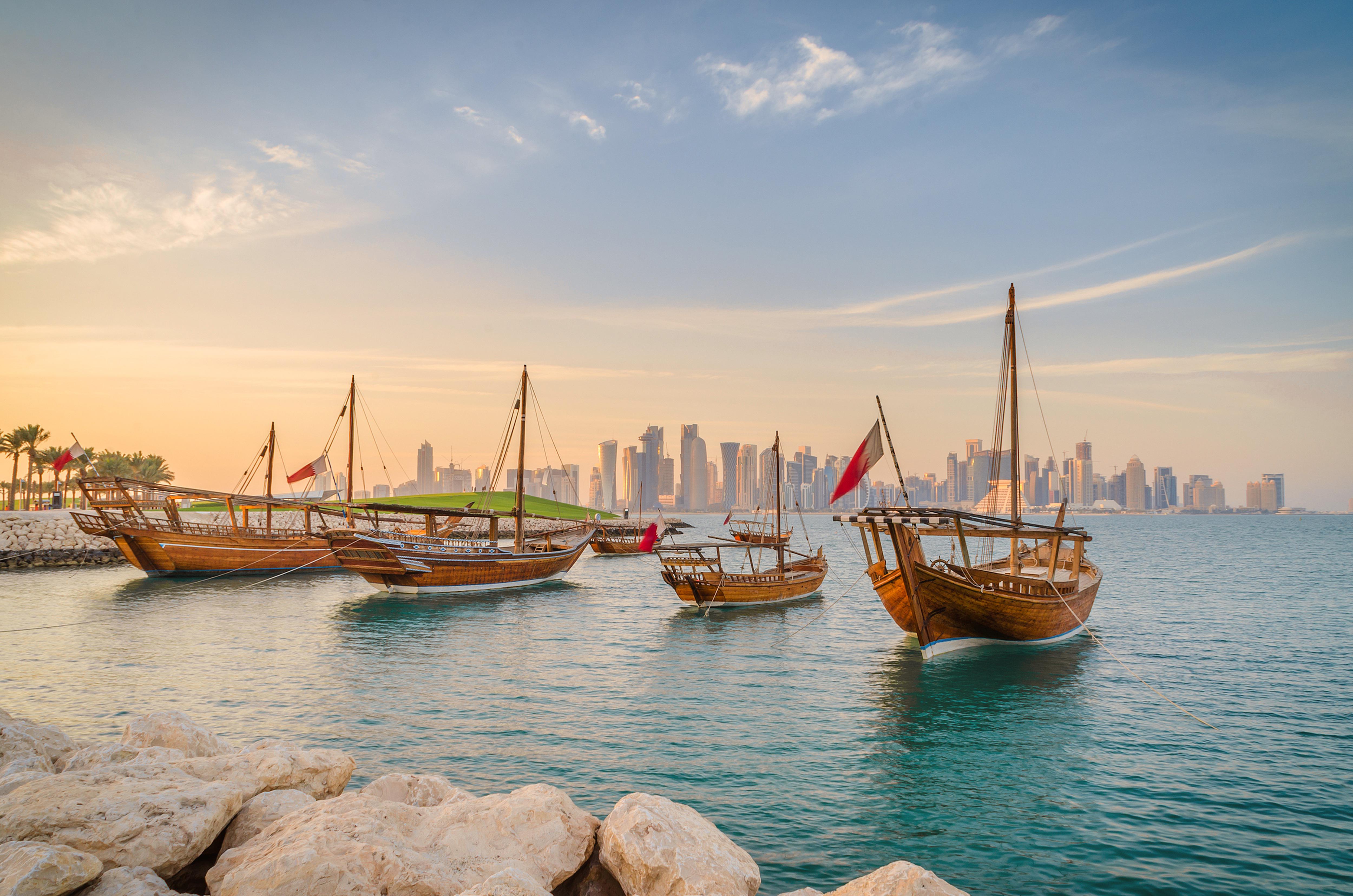
About Doha
Doha (population 700,000) is the capital of the State of Qatar, an emirate occupying the small Qatar Peninsula bordered by Saudi Arabia to the south and otherwise surrounded by the Persian Gulf. Qatar was ruled by many different powers through the centuries, in fact historians have traced human habitation dating back 5000 years. From its earliest history, Qatar was a very important trade route connecting Mesopotamia and the Indus Valley. Among its occupiers were the Portuguese, the Ottomans and finally the British during the turbulent years of the 20th century. Qatar gained independence in 1971, and with resources from oil exportation, His Highness Sheikh Khalifa Bin Hamad made improvements in social programmes including education, health and housing. In 1995, his son, His Highness Sheikh Hamad Bin Khalifa Al-Thani assumed the throne and brought with him a modern and progressive approach that quickly transformed the country. Doha, home to 80 percent of the country’s population, was founded under the name of Al-Bida in 1850. It became the capital of the British protectorate of Qatar in 1916. When the nation gained its independence, Doha remained the capital. During the early 20th century, much of Qatar’s economy depended on fishing and pearling. But after the introduction of Japanese cultured pearls, Doha and the whole region suffered a decline. Only when oil was discovered, prosperity returned following World War II. Today, the country produces over 800,000 barrels of oil daily. Doha is situated halfway down the east coast of the peninsula. It is an intriguing mixture of old and new, with ultra modern architecture next to traditional souqs and historic forts. It boasts a university and the Qatar National Museum (currently closed for renovation), which opened 1975 in what was originally the ruler’s palace. As the country’s cultural and commercial centre, Doha enjoys excellent communications with the outside world through its modern seaport, airport and telephone links. The Al Jazeera Arabic satellite television news channel began broadcasting in 1996 with its headquarters in Doha. While Arabic is the official language, English is widely spoken. Please Note: Conservative dress is required when going ashore. As a rule, women should not wear miniskirts, shorts or sleeveless tops and men should always wear a shirt in public. Please do not photograph people without their permission, especially women.You may not take pictures of government buildings, embassies or anything military in nature, including airports.
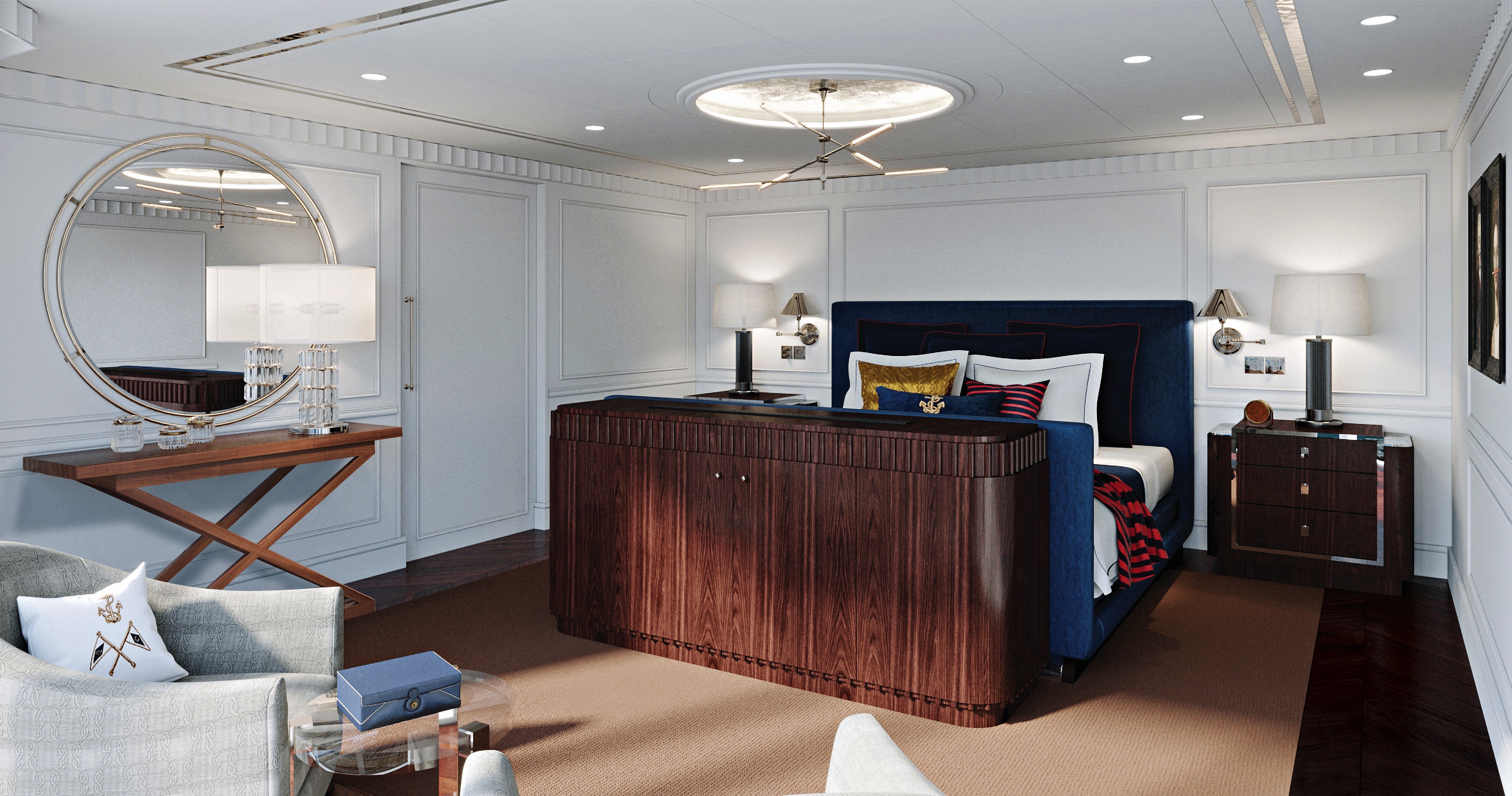
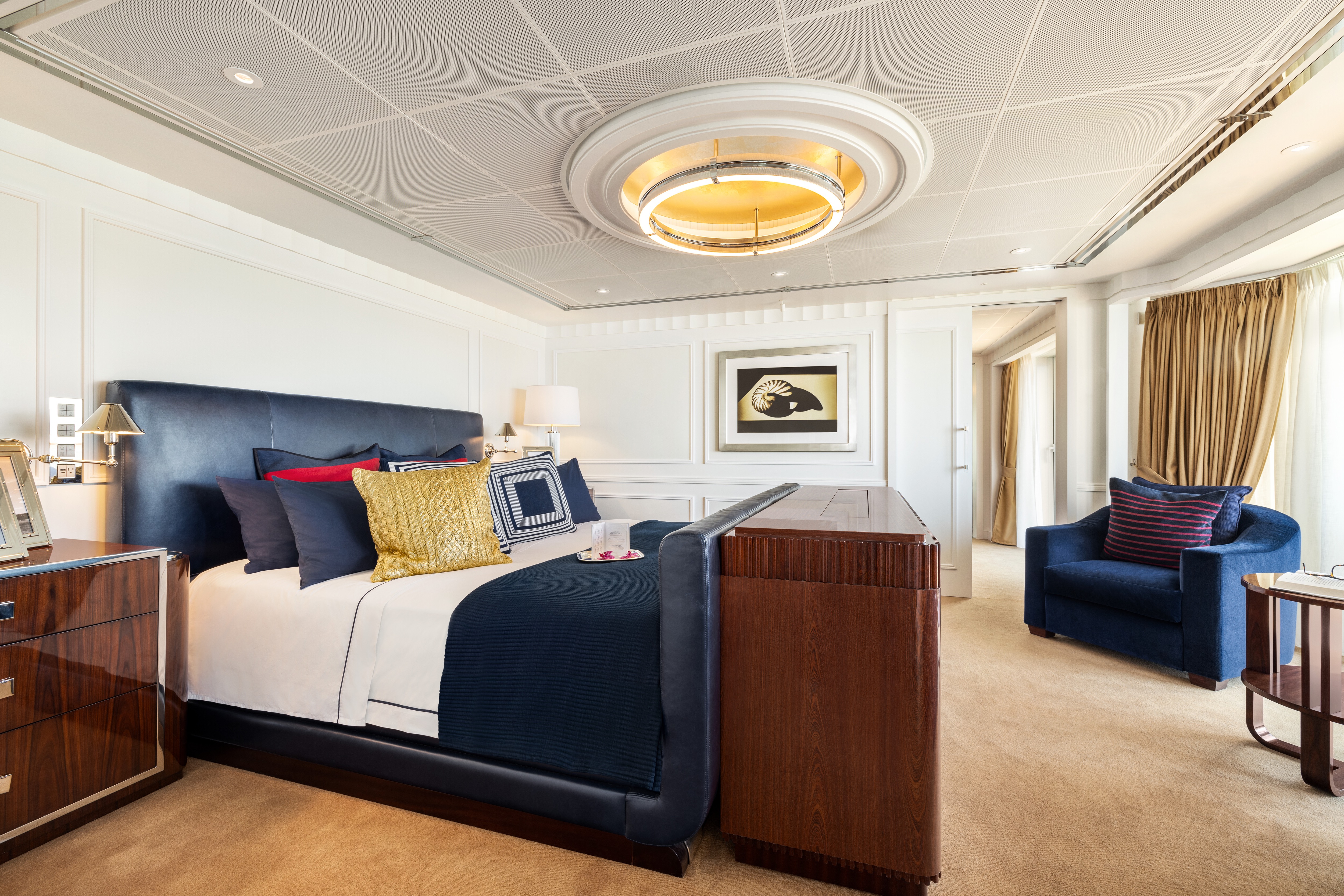
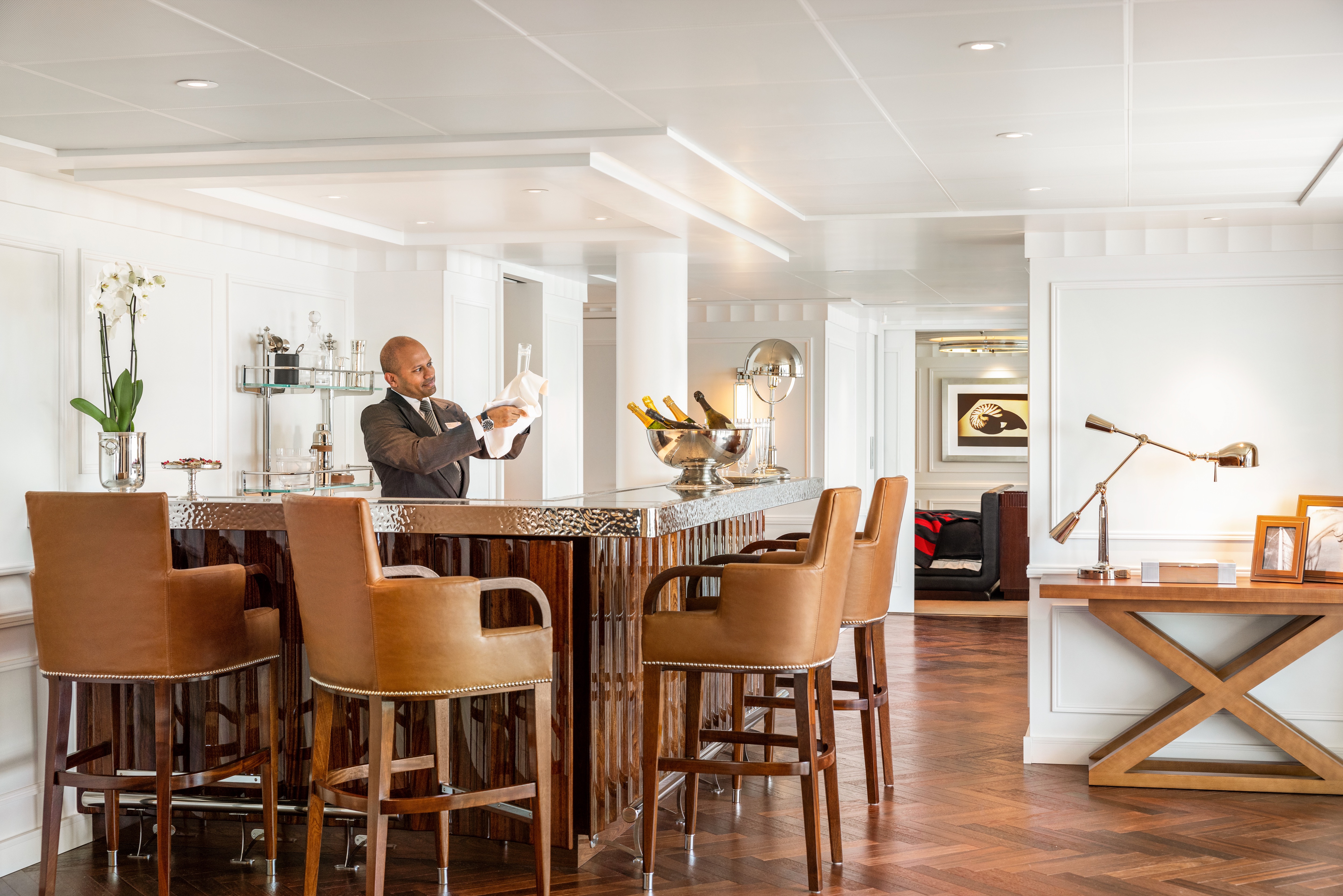
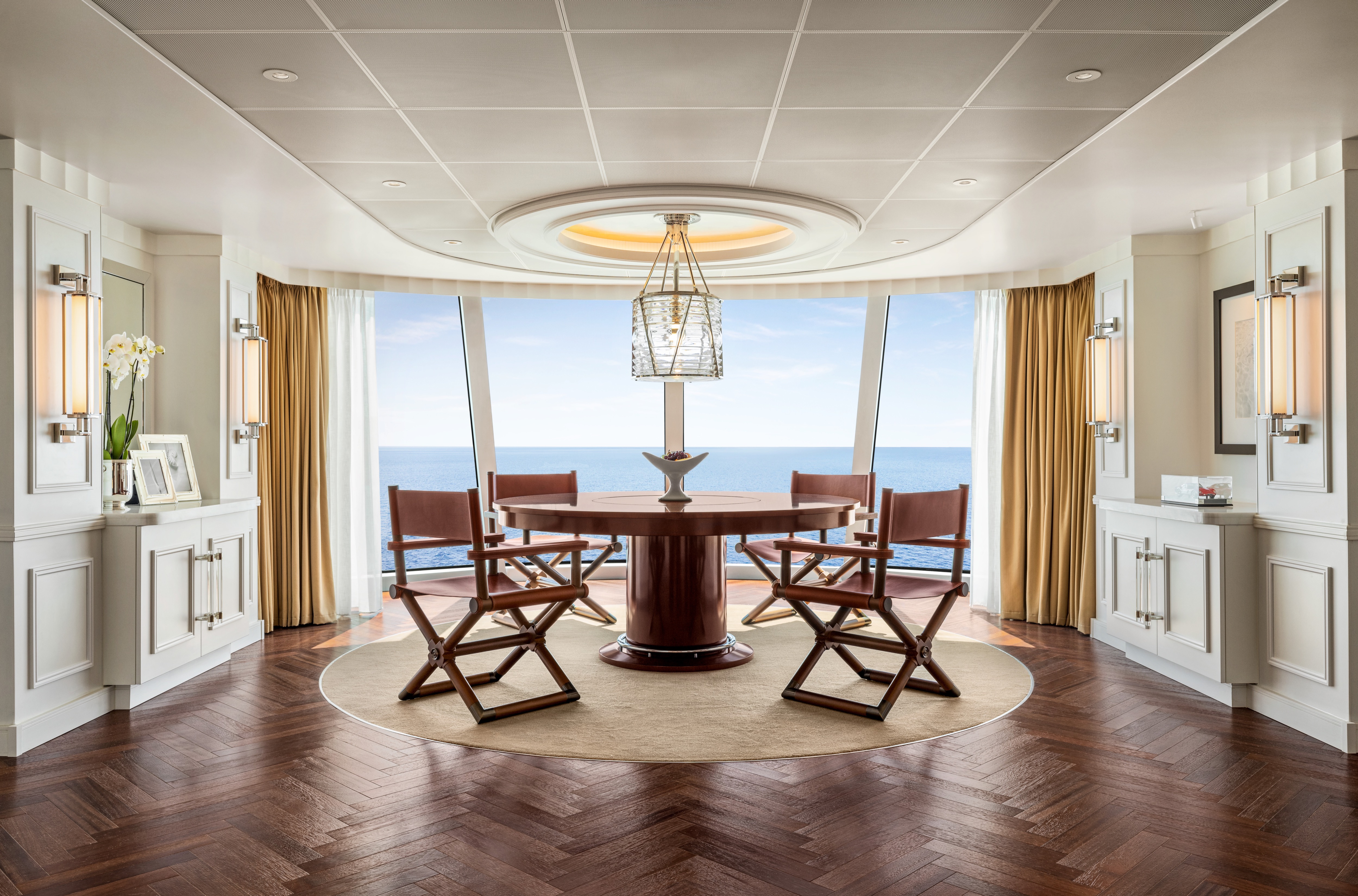
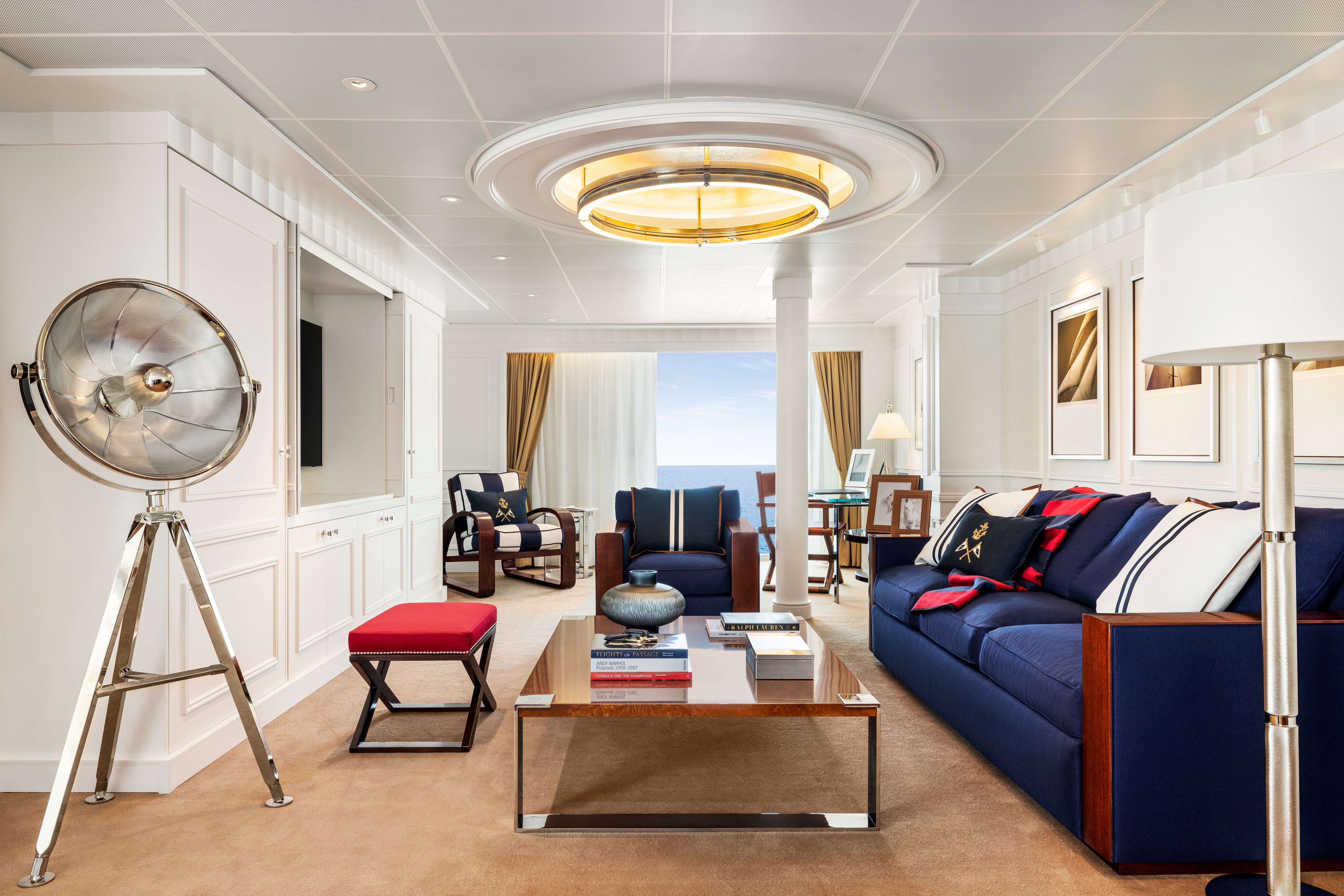
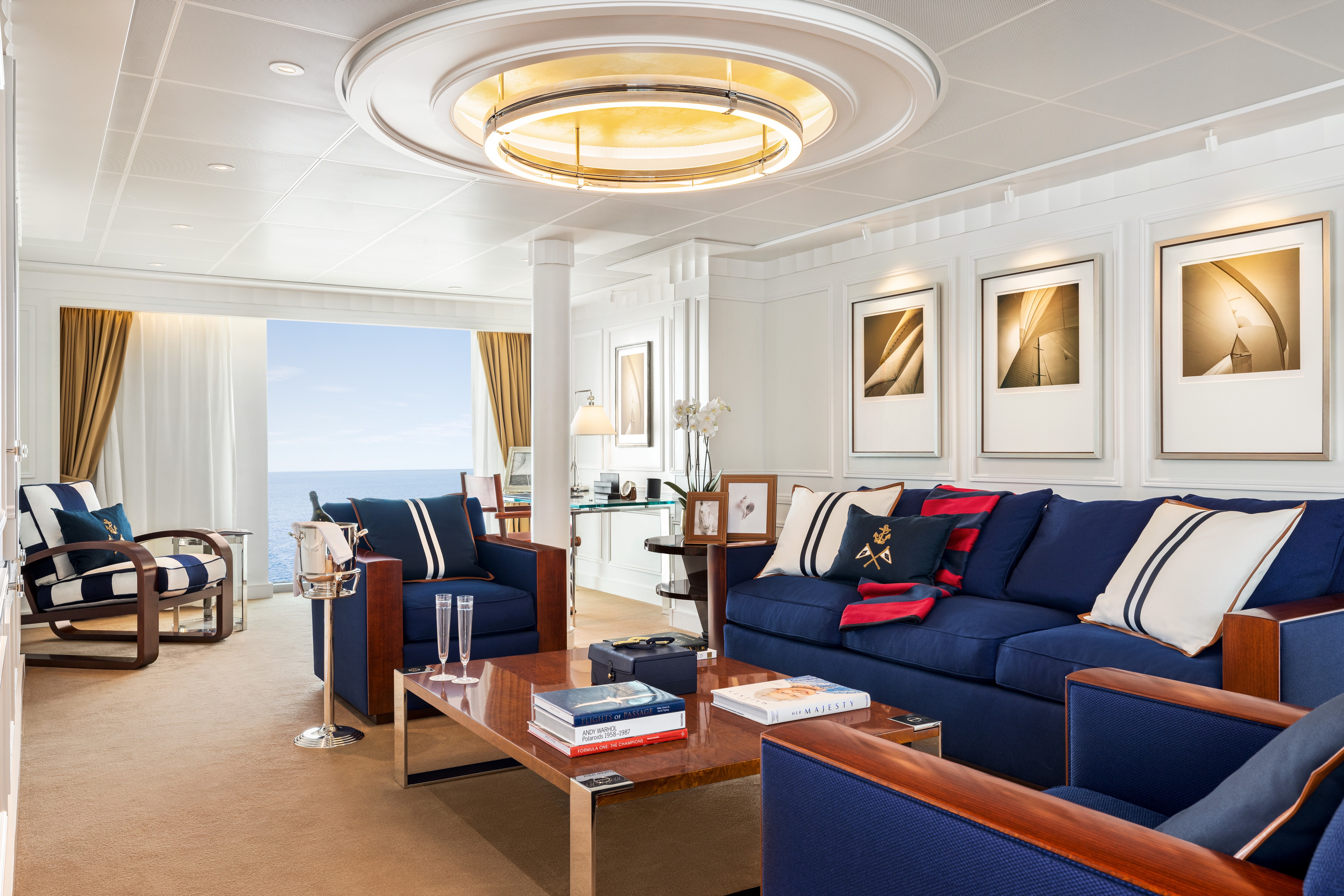
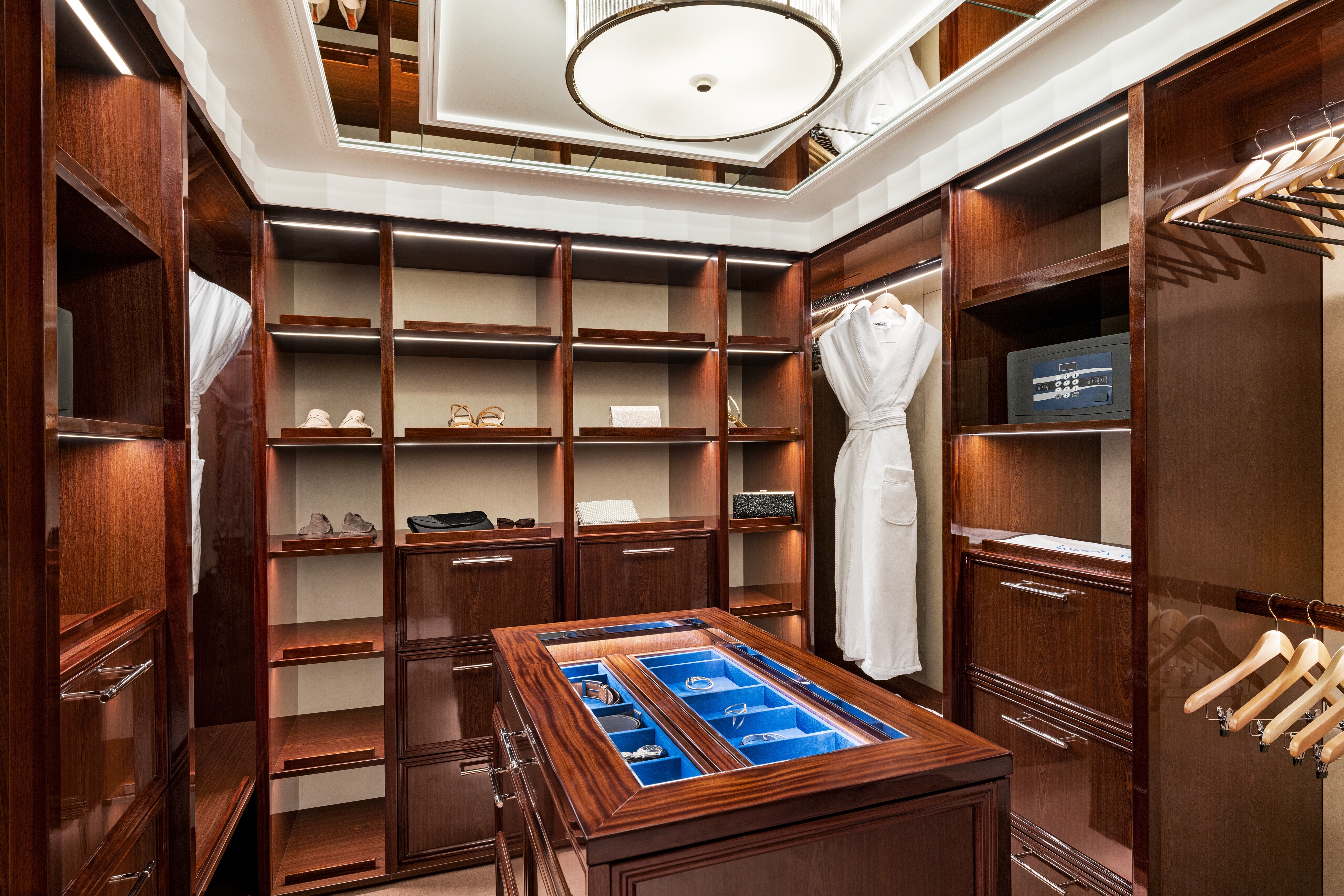
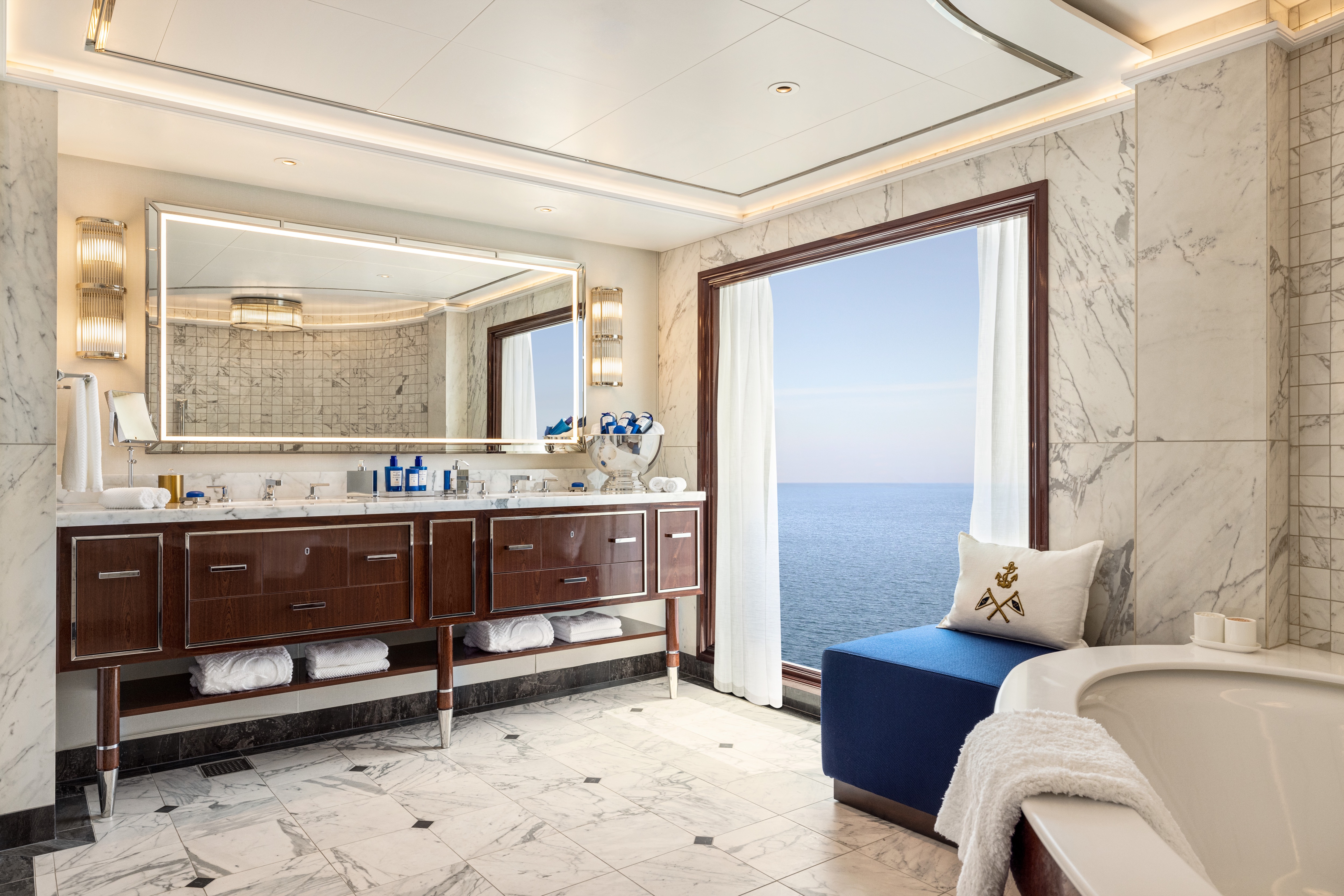
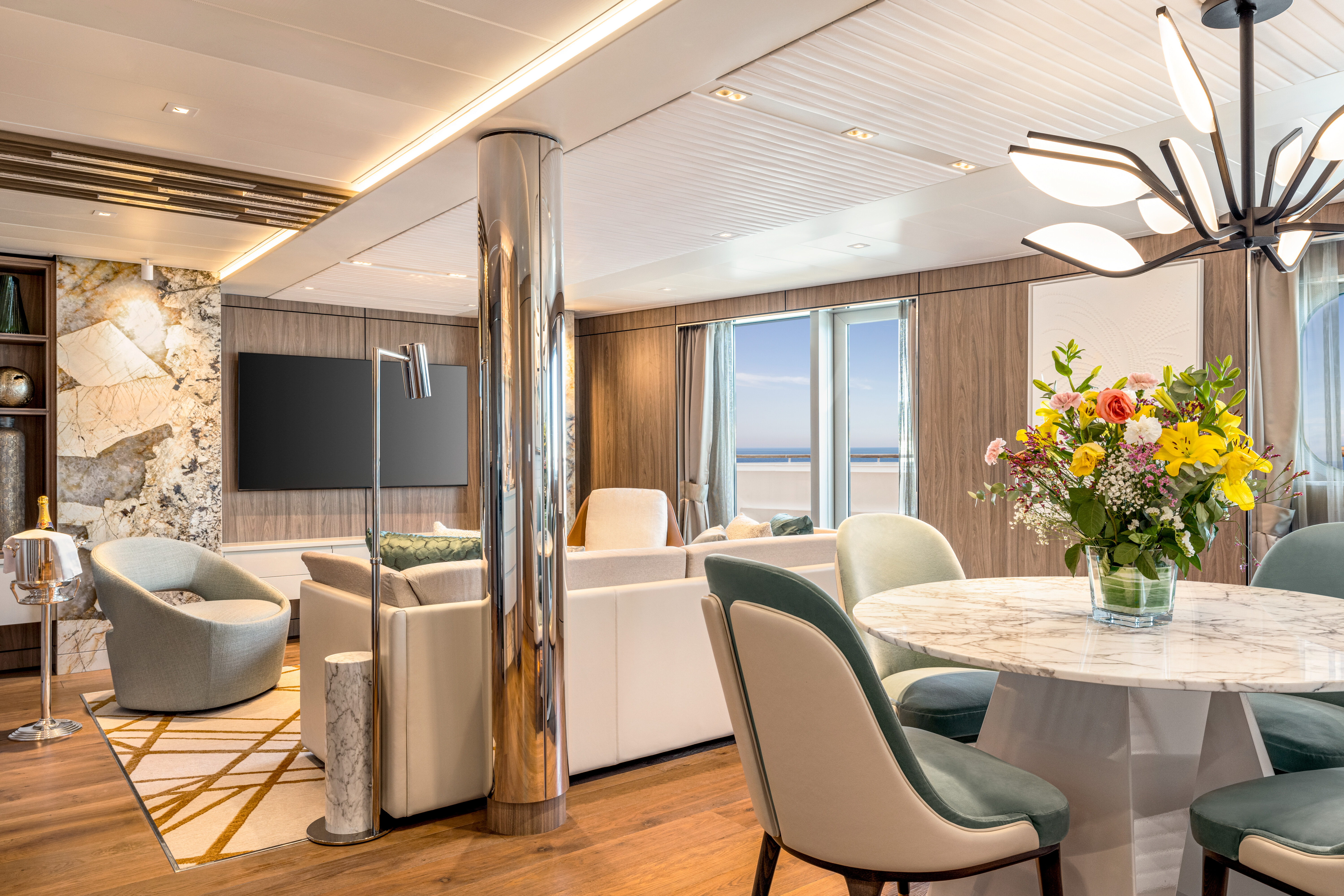
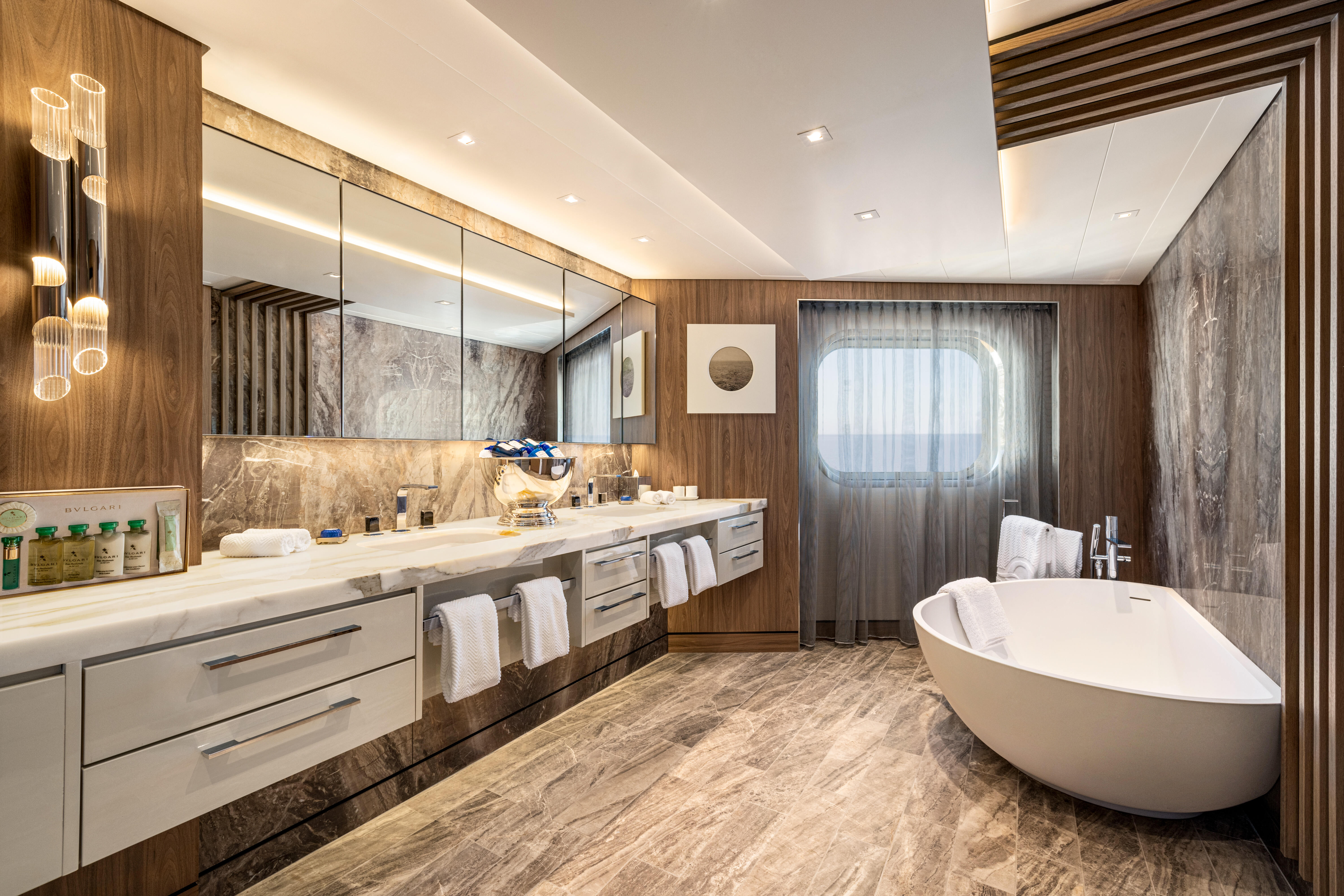
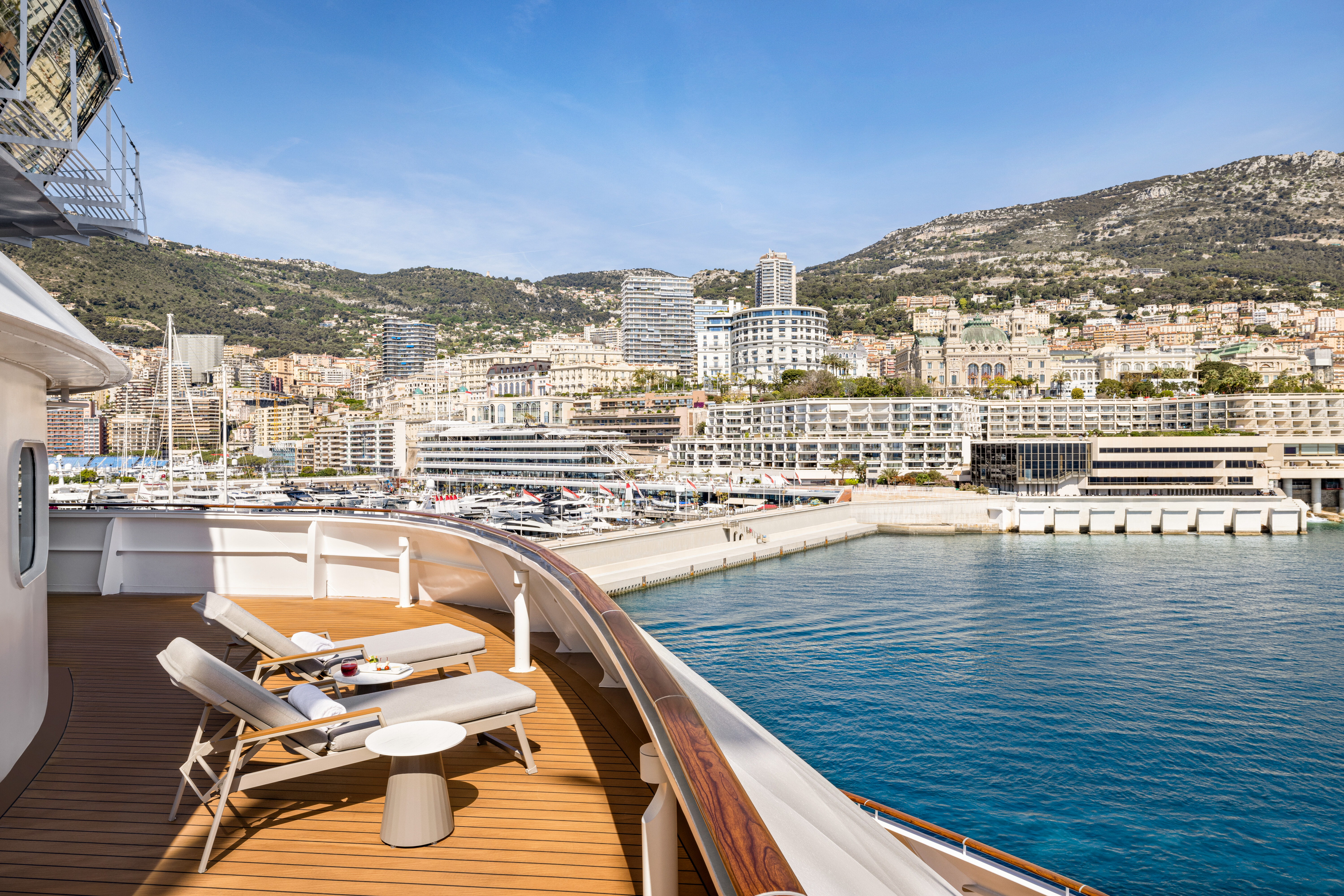
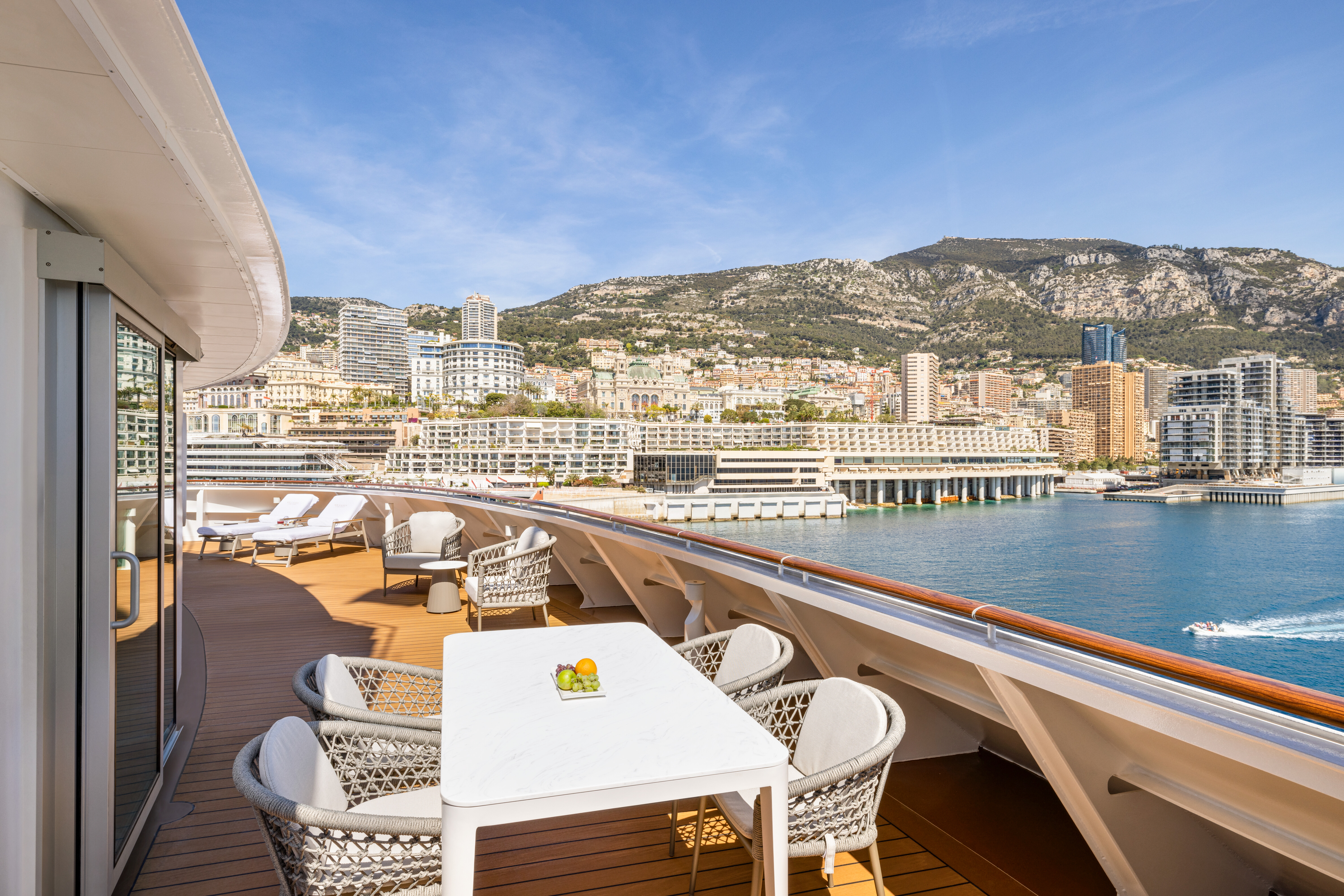
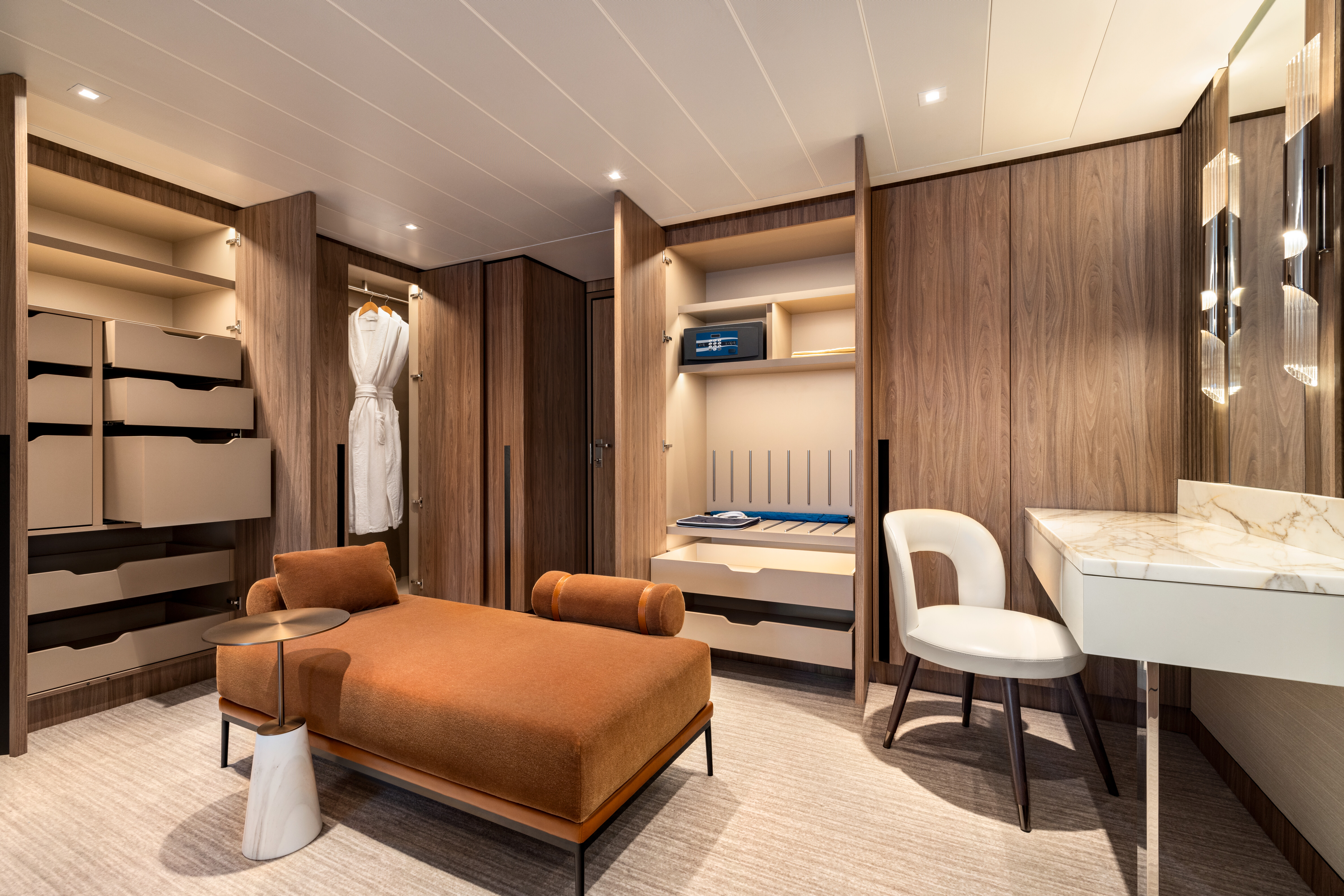
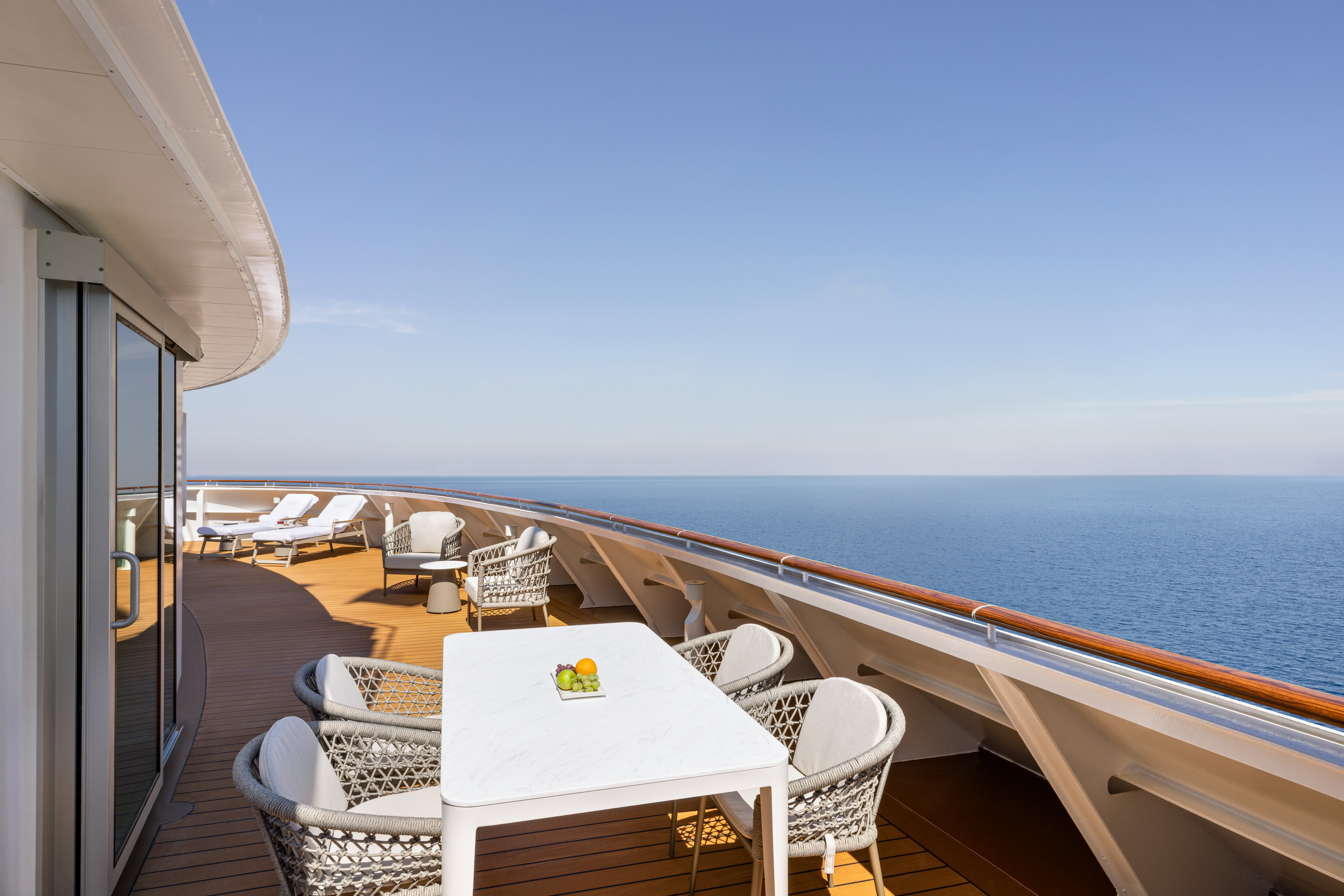
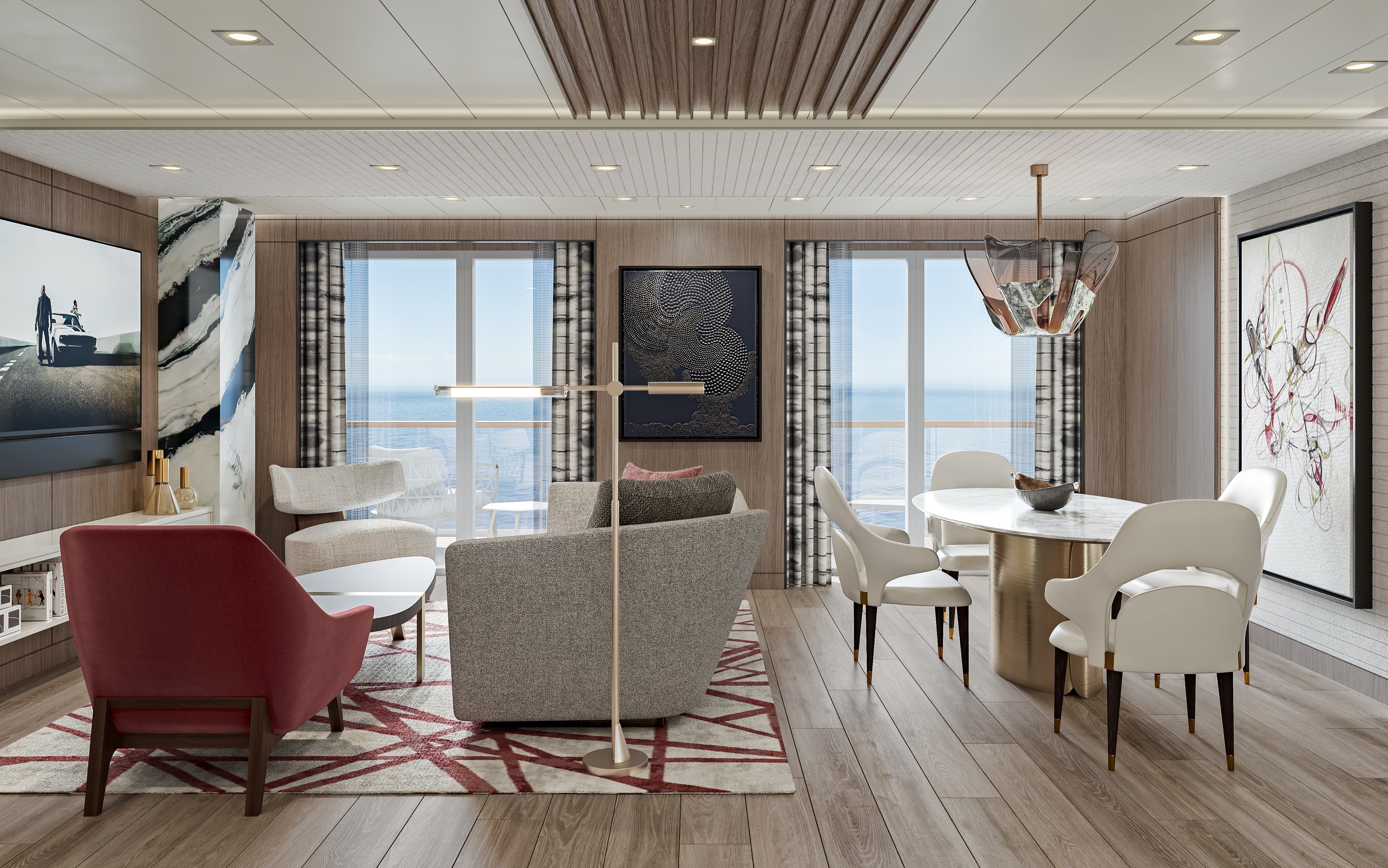
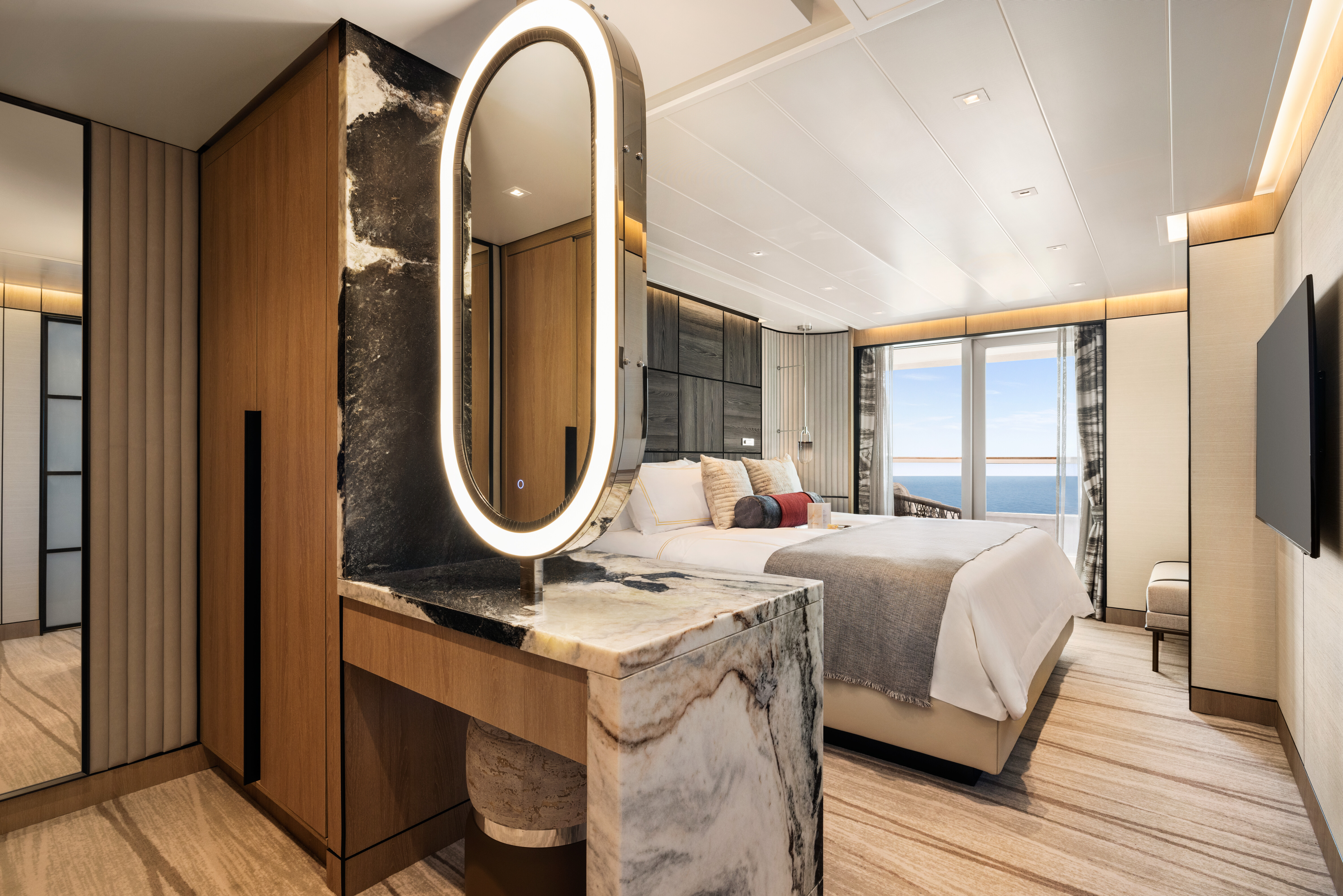
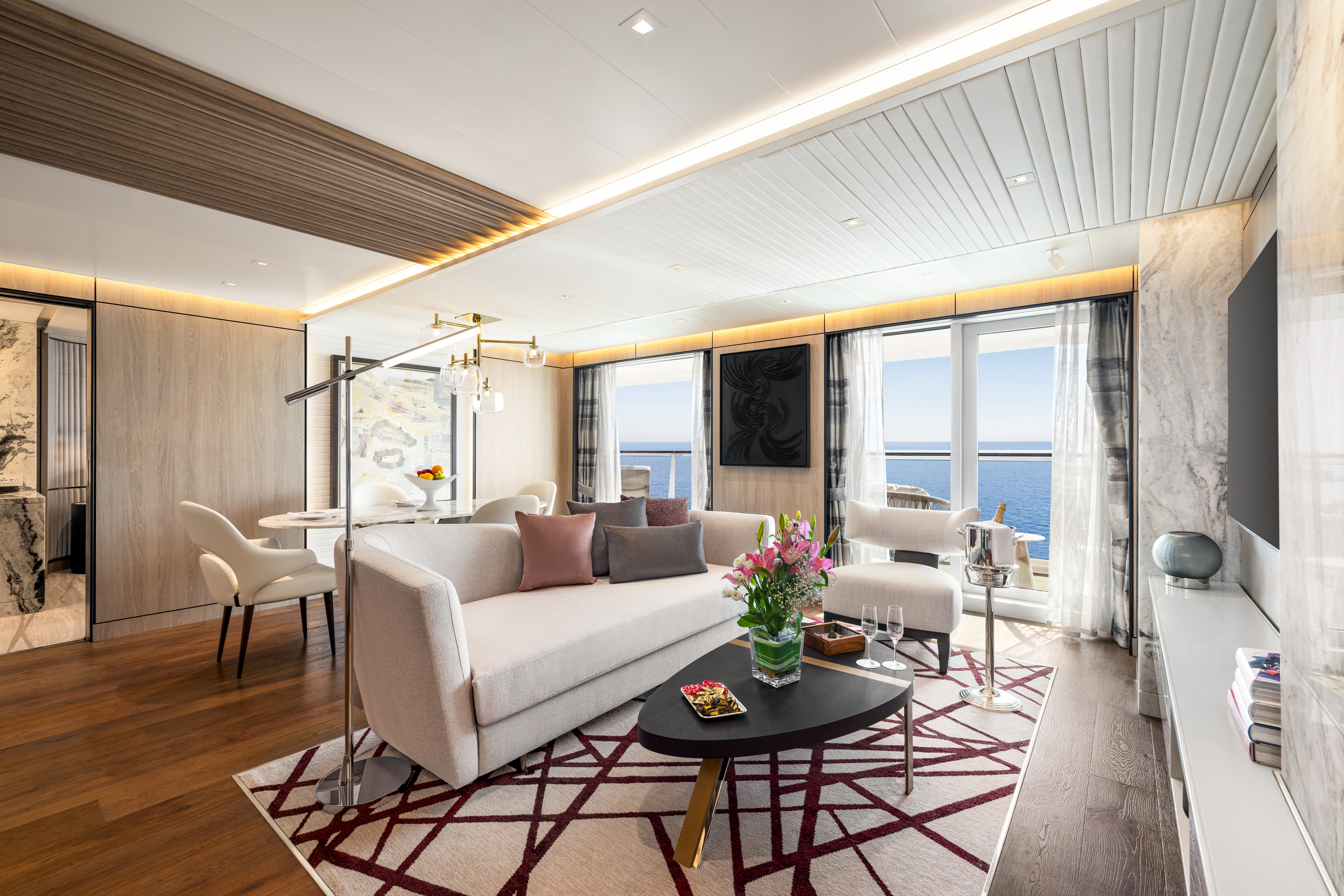
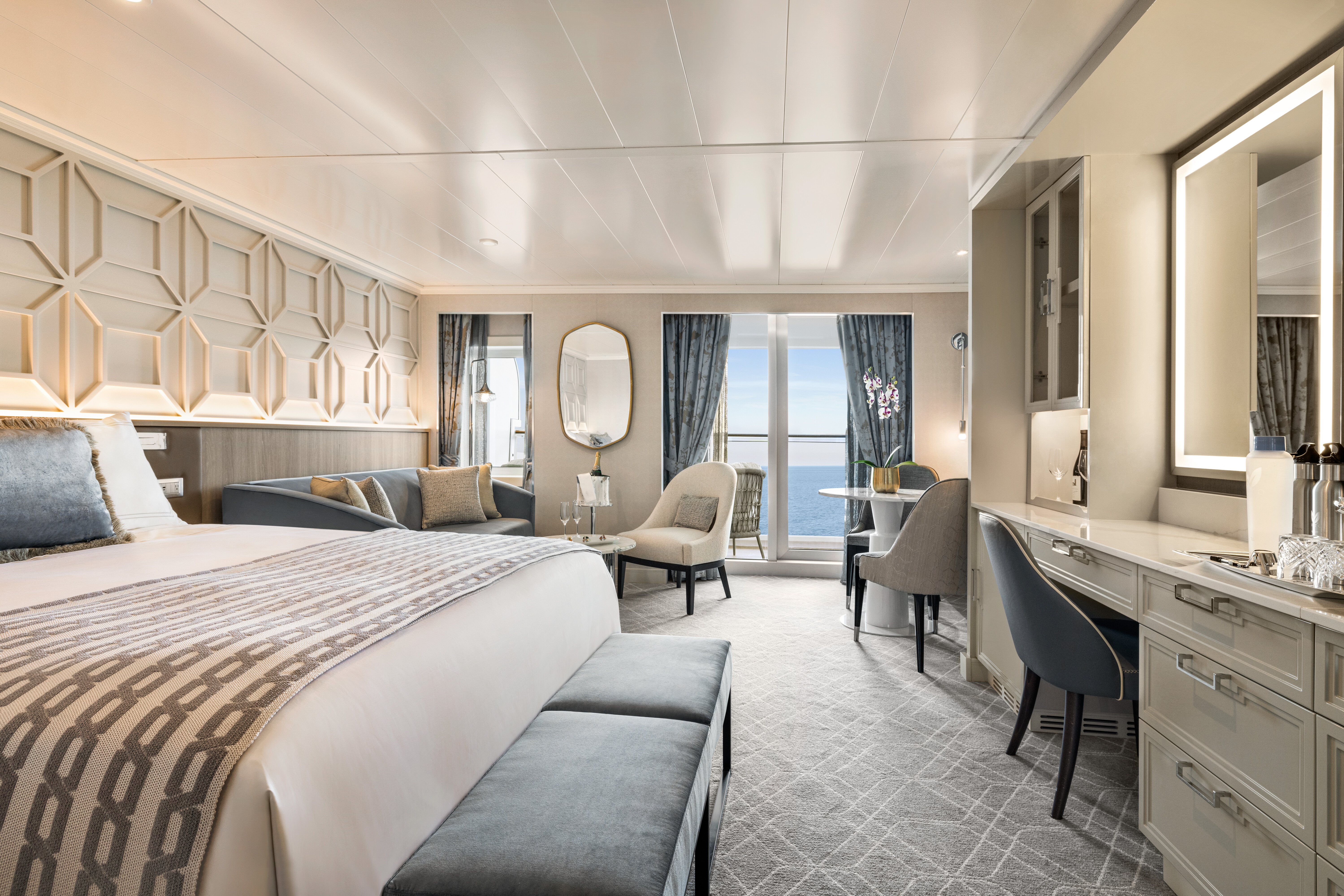
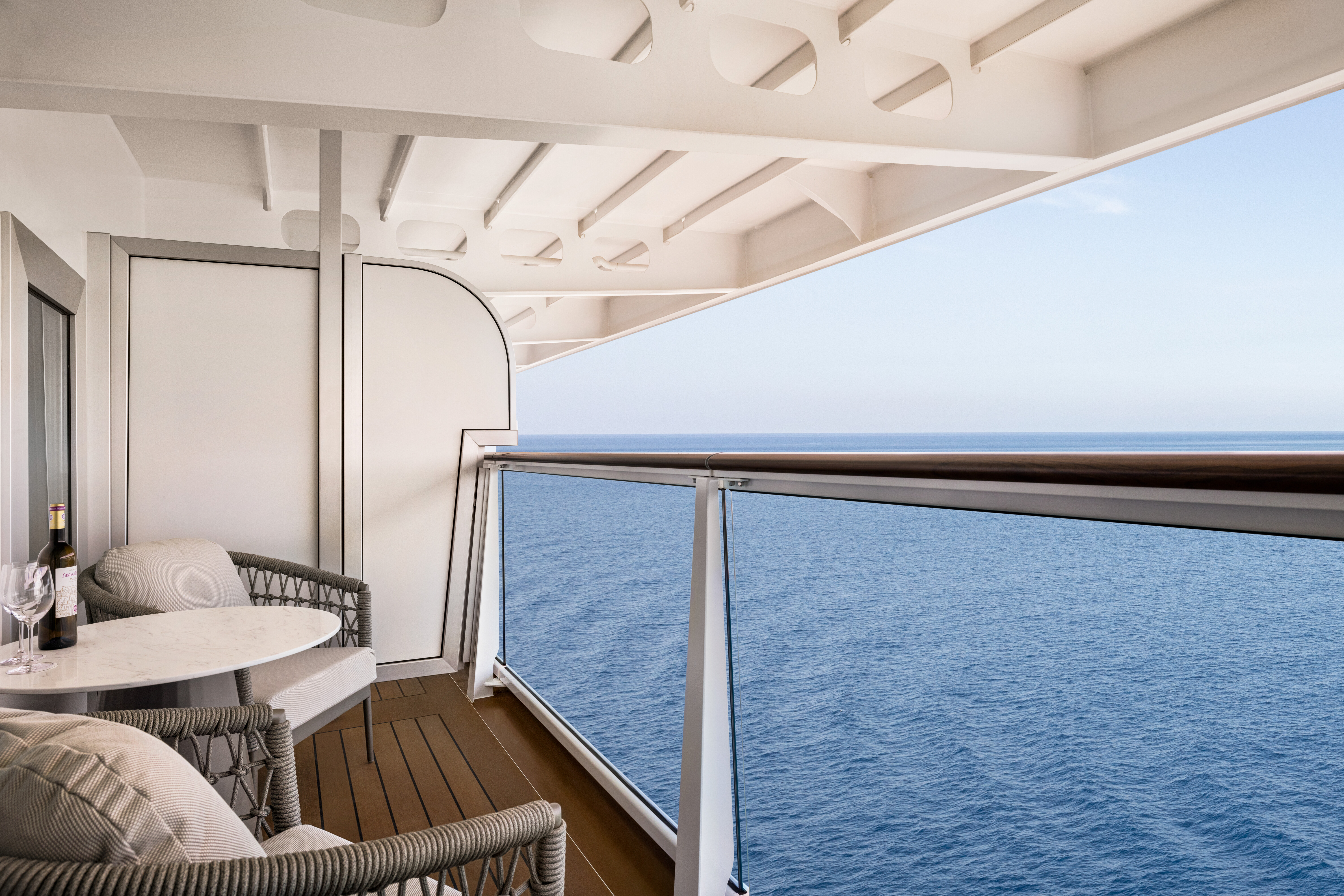
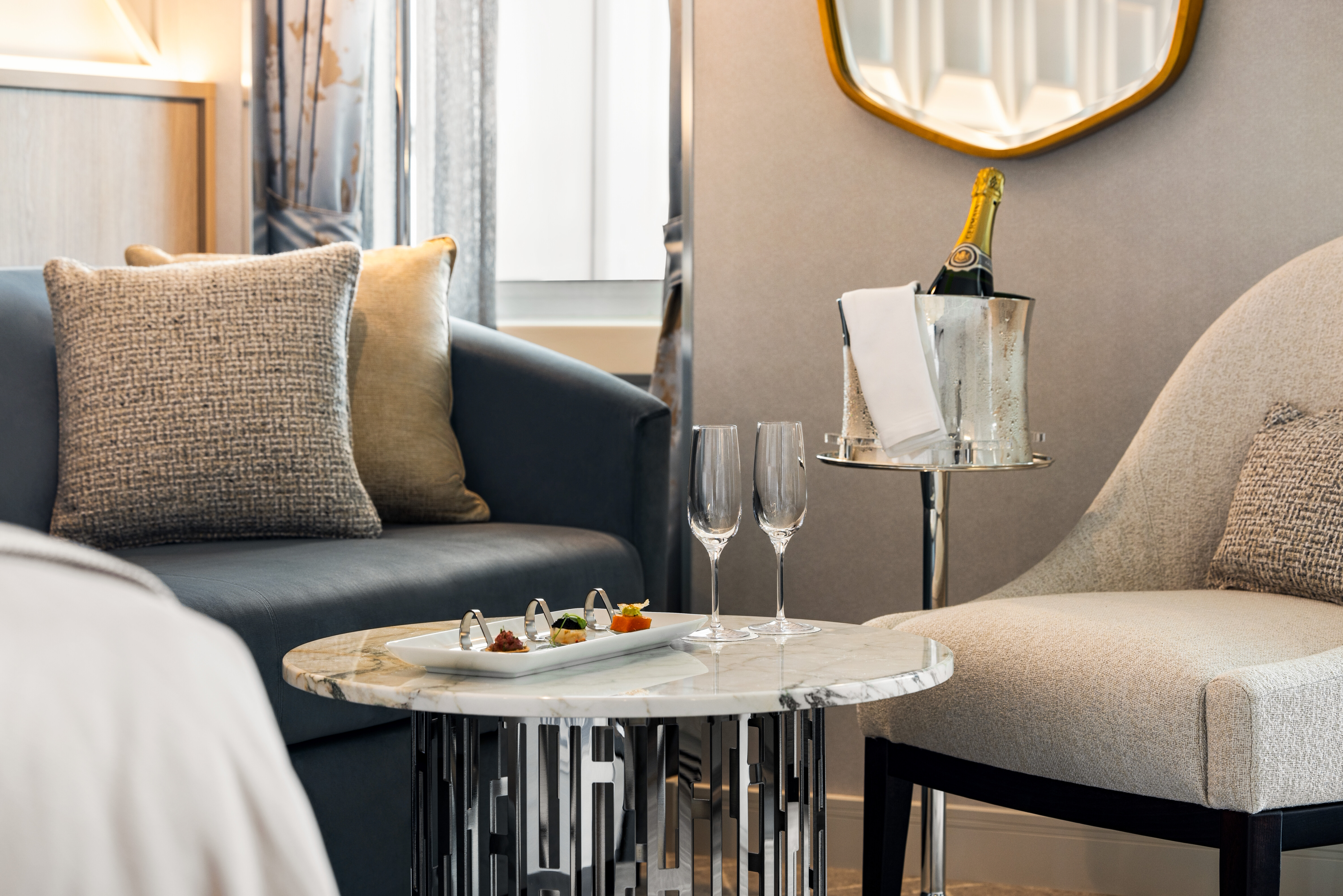
Oceania Vista's Owner’s Suites span the full beam of the ship and showcase sweeping walls of glass that celebrate the stunning seaside views. These sun-filled retreats feature luxurious fabrics, designer furnishings and thoughtful touches that exude opulence yet call on familiar comforts to create the ultimate home at sea. Savor an in-suite dinner in the elegant dining room and then indulge in convivial conversation within the stylish comfort of the inviting living area. In the spacious master bedroom, bask in sublime relaxation with a plush king-size bed and a master bath featuring spa-caliber facilities. Expansive verandas off both the living room and master bedroom promise moments of cherished privacy as you survey the world from the pinnacle of luxurious living.
+Owner’s Suite square footage varies according to deck location.
Owner's Suite Privileges
+In addition to Concierge Level privileges
- Priority luggage delivery
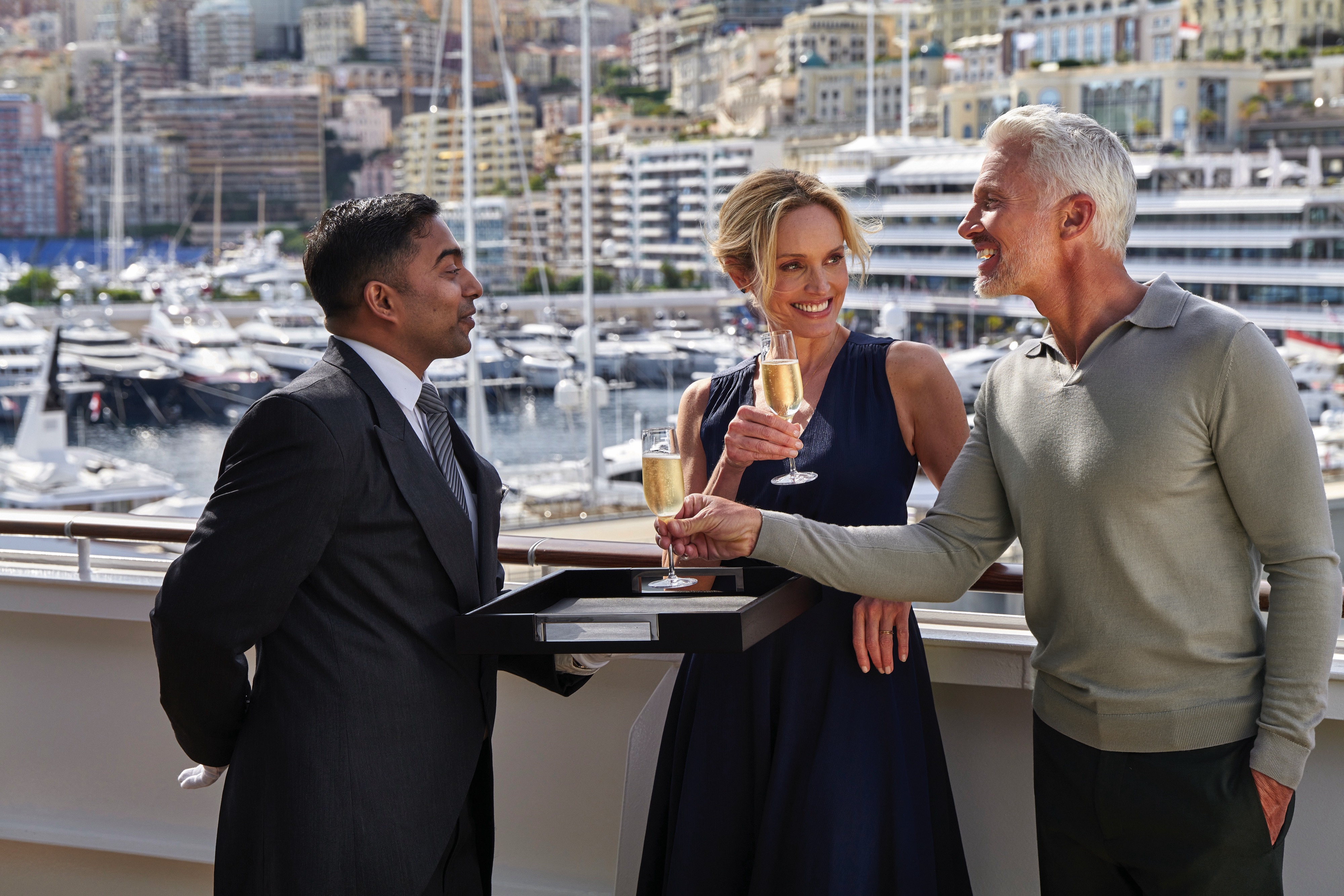
- Exclusive card-only access to private Executive Lounge staffed by a dedicated Concierge featuring complimentary sodas, coffees and snacks throughout the day
- 24-hour Butler service
- Optional private in-suite embarkation day lunch from noon to 2 pm in Owner’s Suites
- Complimentary in-suite bar setup with 6 full-size bottles of your choice of premium spirits and wines from our suite beverage menu
- Complimentary welcome bottle of Champagne
- In-suite illy® coffee maker and pods
- Fresh fruit basket upon request
- Choice of daily newspaper
- Exclusive pillow menu
- Course-by-course in-suite dining+
- Order in from any of our specialty restaurants+
- Coordination of shoreside dinner and entertainment reservations
- Last-minute luggage collection
- Packing and unpacking upon request
- Complimentary garment pressing+
- Complimentary shoeshine service
- Gourmet evening canapés upon request
- Special services upon request
+Up to 20 garments per laundry bag; additional restrictions apply.
++Certain limitations apply.
Smoking in suites, staterooms and on verandas is strictly prohibited.

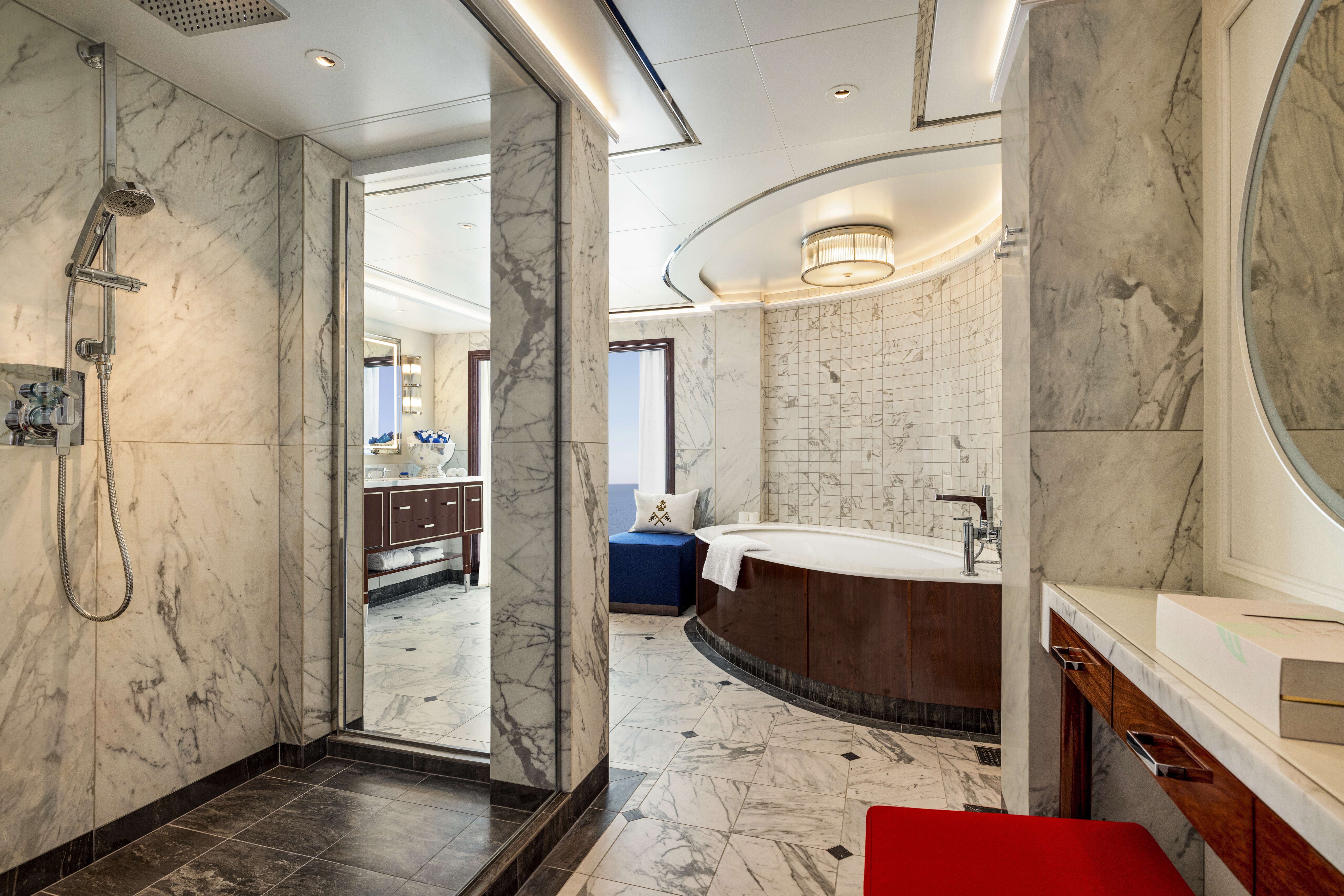
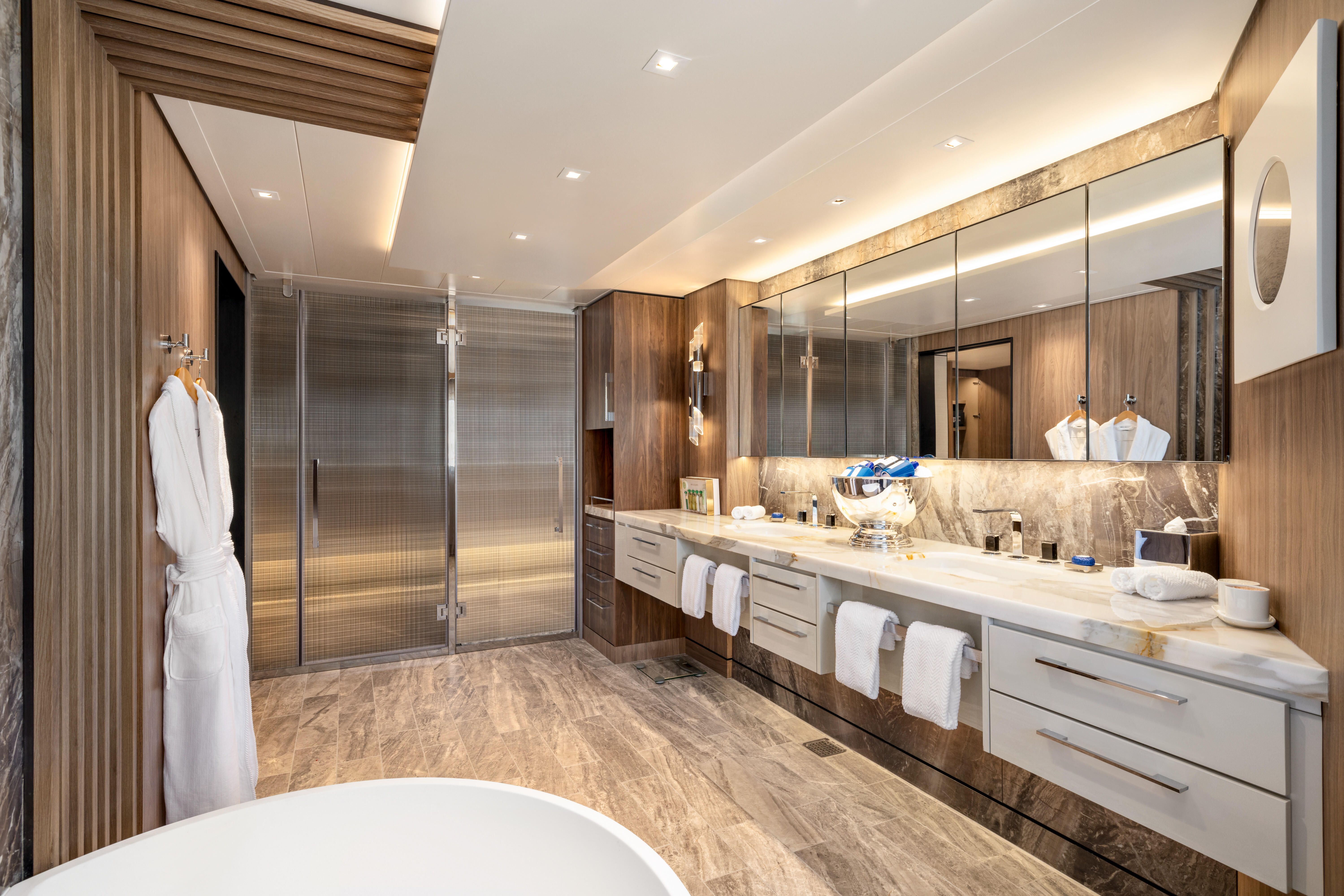
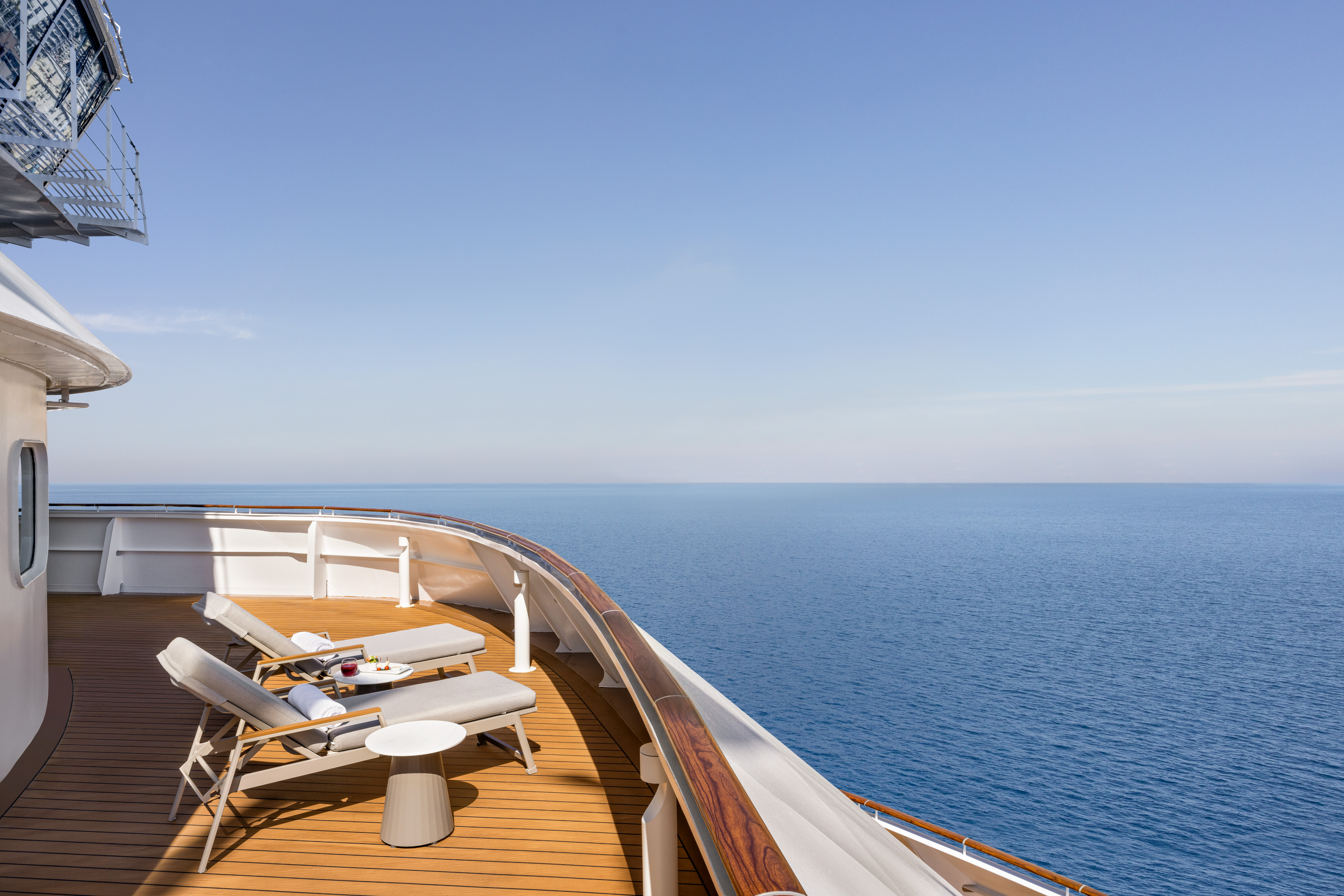
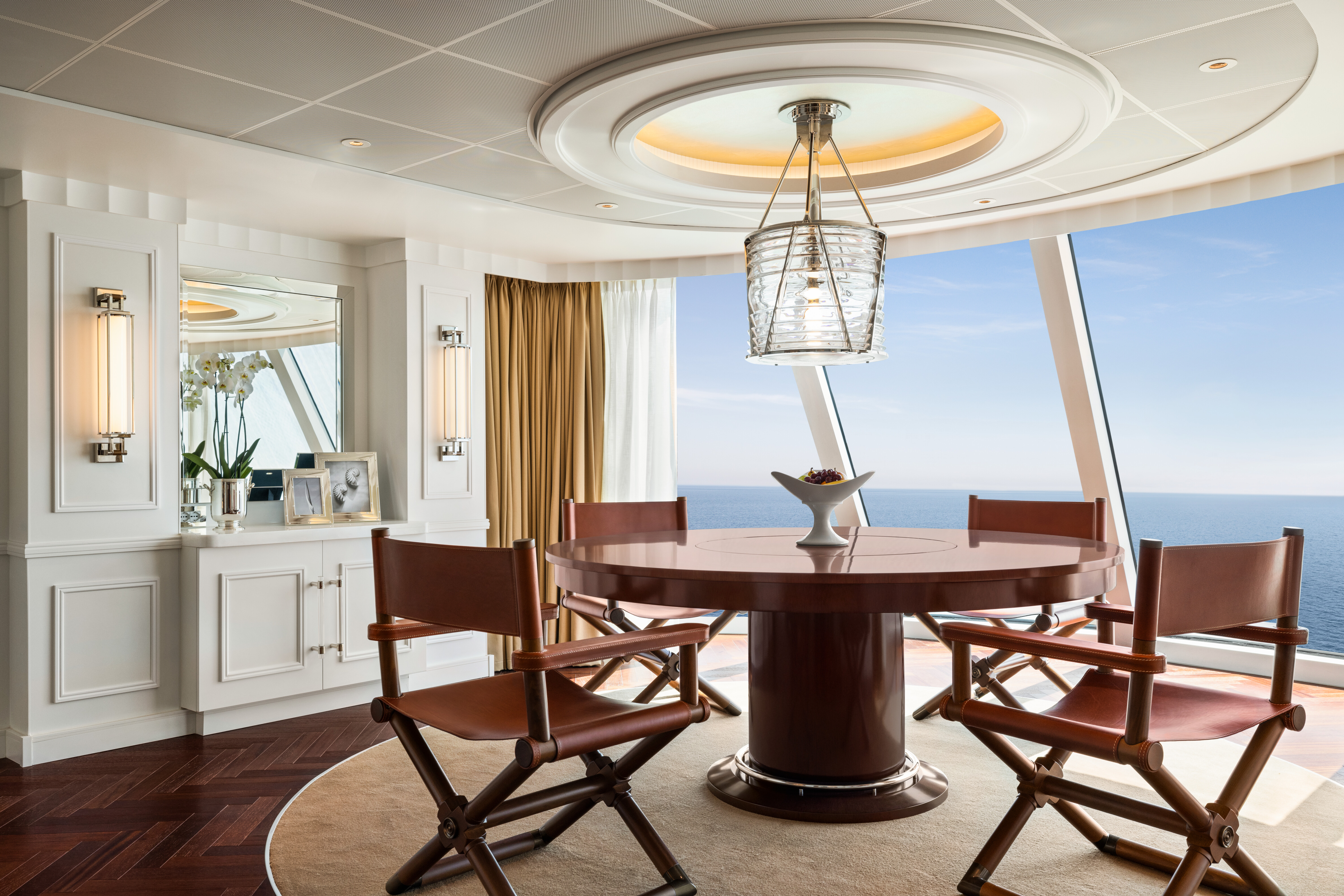
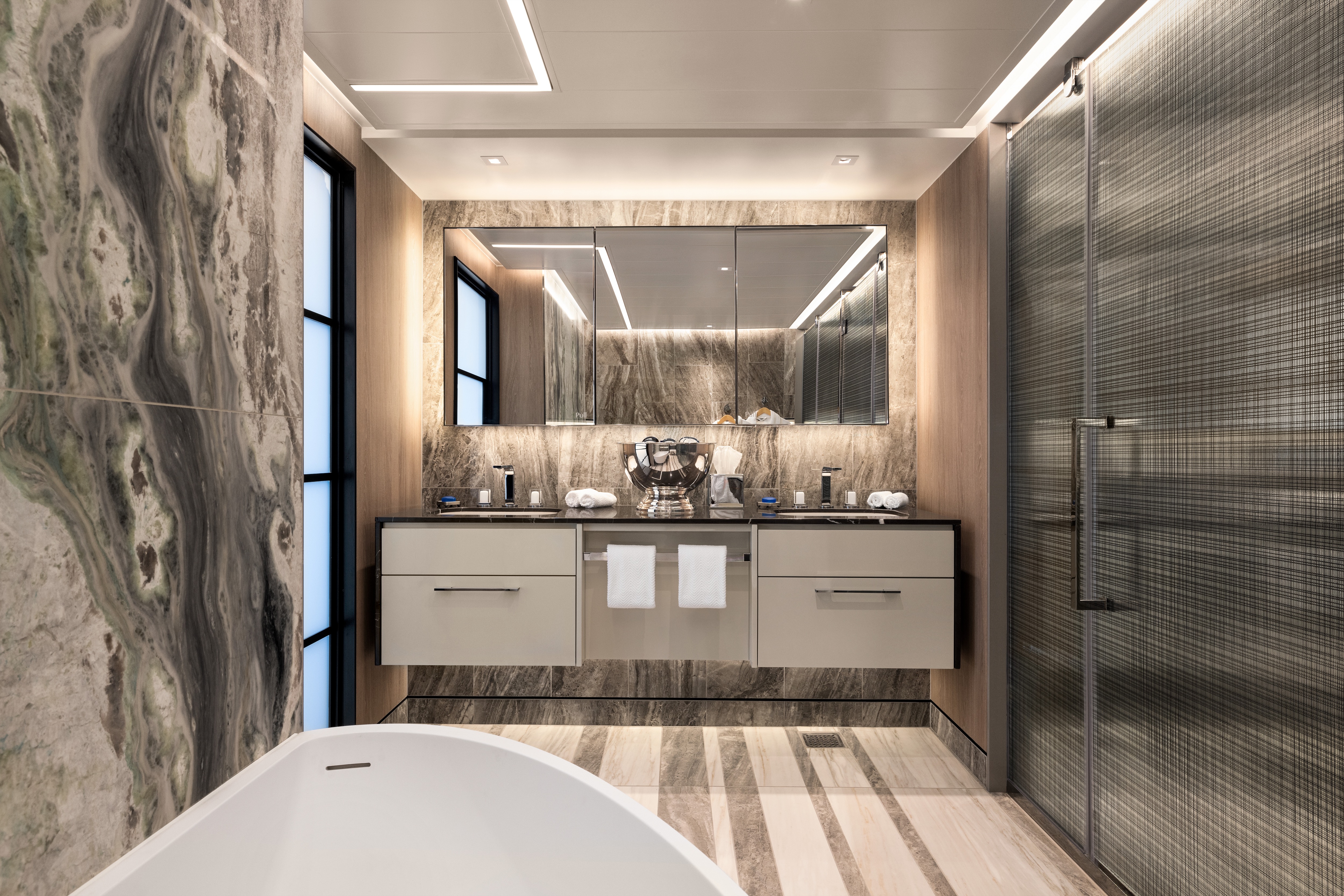
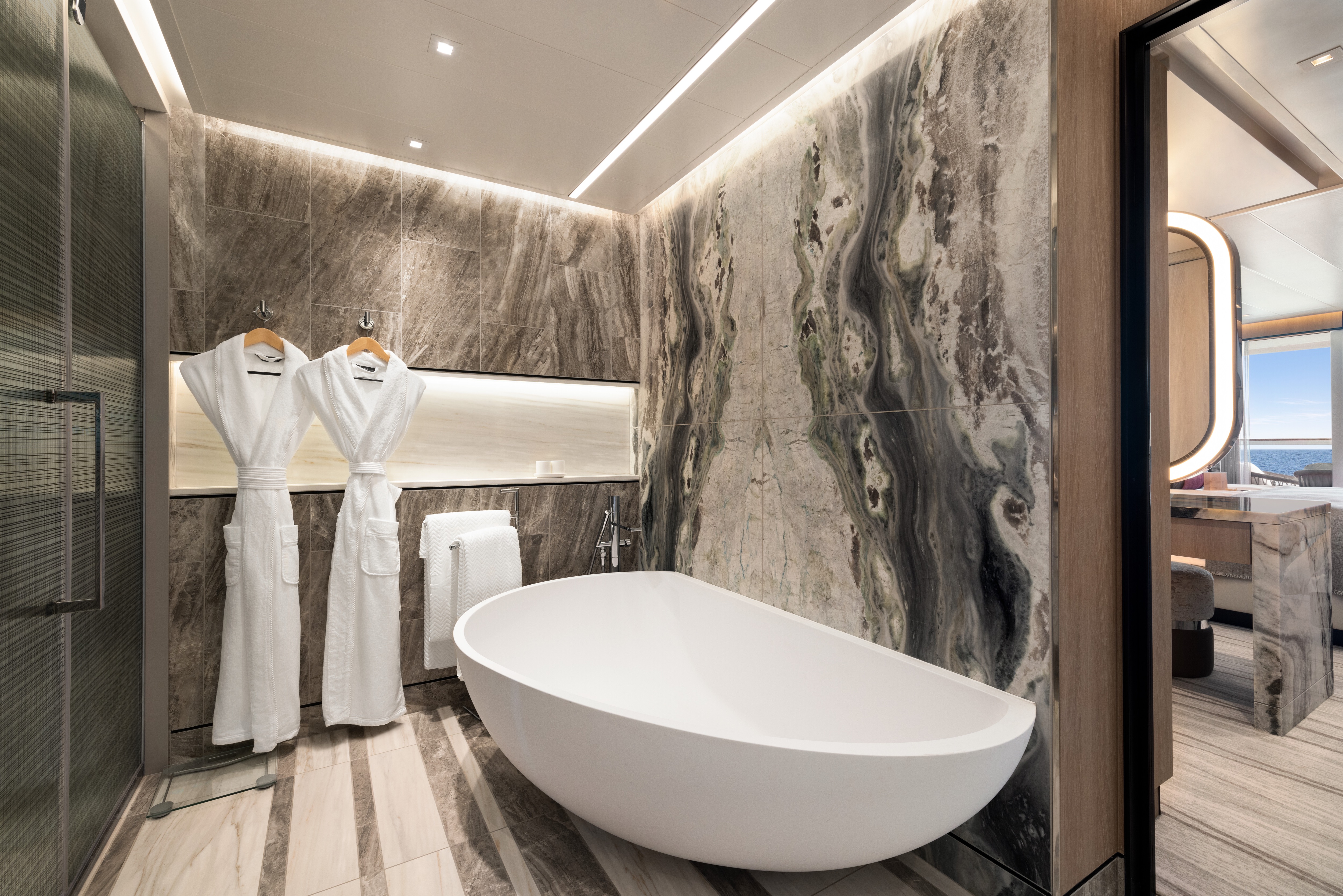
Offering the loftiest of locations that afford sweeping 180-degree views and 1,450 to 1,850 square feet of living space, the eight Vista Suites are designed to be the ultimate seaside villas. Swathed in subtle tones that pay deference to the sea and sky and accented by luminescent marbles, granites and rich weathered oak, each is a true retreat. The airy living room is flanked by a handsome dining room and bar area, which feature commanding views and open onto the expansive teak veranda. An extravagant master suite features a capacious wardrobe room and dressing area adjacent to the oversized and sunlit master bathroom complete with porcelain soaking tub. Vista Suites offer an additional layer of pampering with 24-hour Butler service and access to the suites-only Executive Lounge.
Vista Suite Privileges
+In addition to Concierge Level privileges
- Priority luggage delivery
- Exclusive card-only access to private Executive Lounge staffed by a dedicated Concierge featuring complimentary sodas, coffees and snacks throughout the day
- 24-hour Butler service
- Complimentary in-suite bar setup with 6 full-size bottles of your choice of premium spirits and wines from our suite beverage menu
- Complimentary welcome bottle of Champagne
- In-suite illy® coffee maker and pods
- Fresh fruit basket upon request
- Choice of daily newspaper
- Exclusive pillow menu
- Course-by-course in-suite dining+
- Order in from any of our specialty restaurants+
- Coordination of shoreside dinner and entertainment reservations
- Last-minute luggage collection
- Packing and unpacking upon request
- Complimentary garment pressing+
- Complimentary shoeshine service
- Gourmet evening canapés upon request
- Special services upon request
+Up to 20 garments per laundry bag; additional restrictions apply.
++Certain limitations apply.
Smoking in suites, staterooms and on verandas is strictly prohibited.
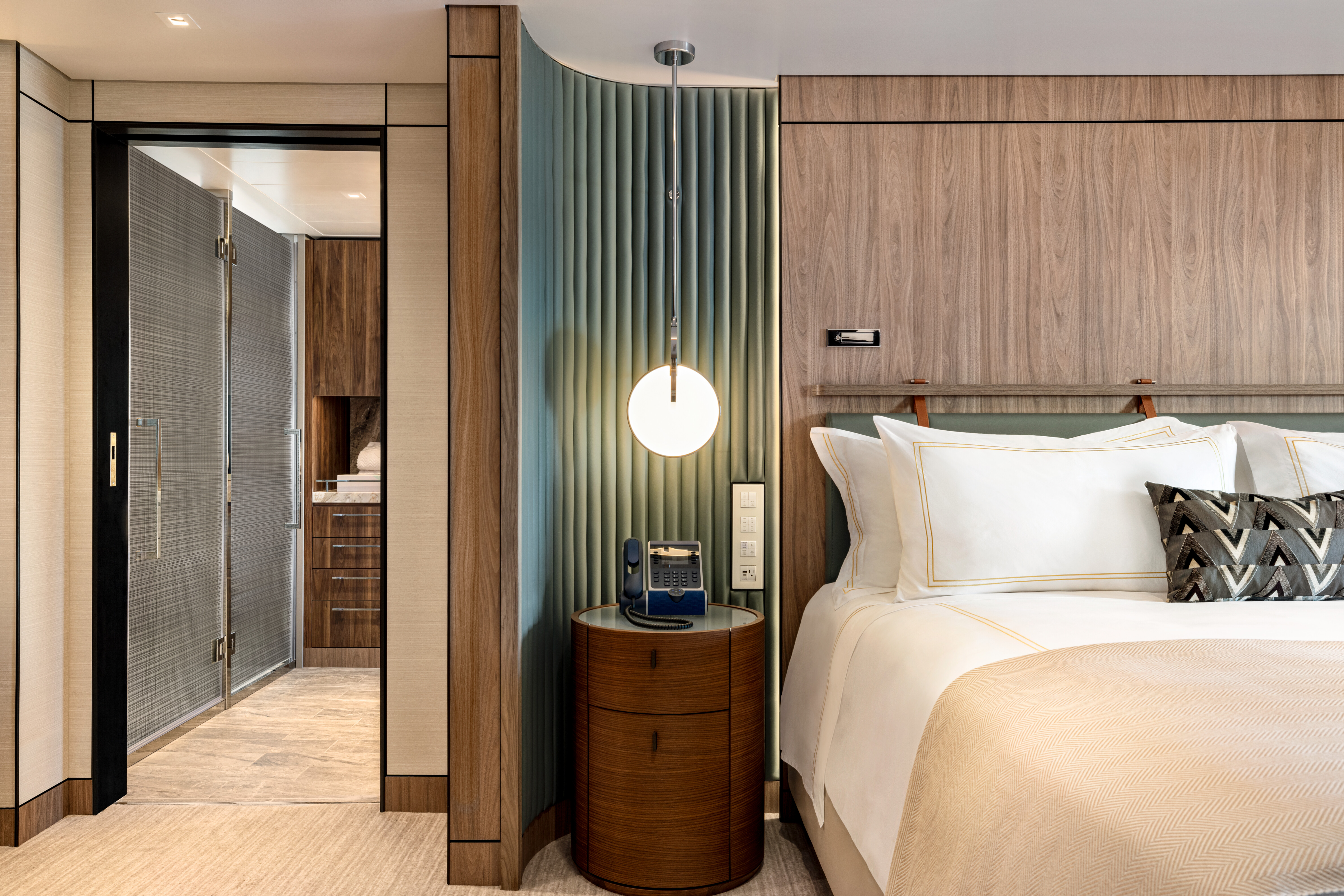
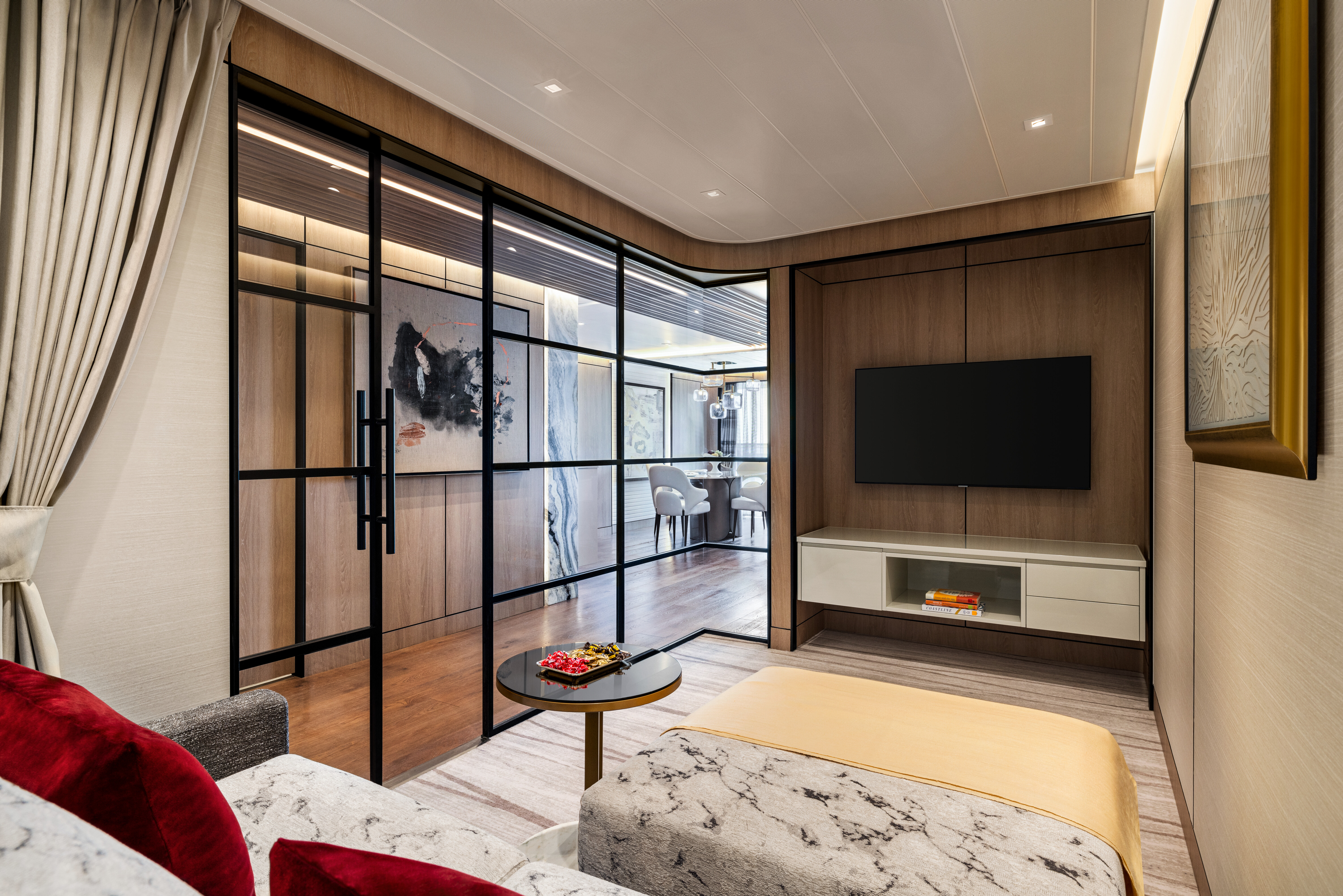
Spacious and sophisticated with a metropolitan flair, the 14 Oceania Suites are situated in prime locations atop the ship to offer unparalleled views. Averaging approximately 1,000 to 1,200 square feet, each radiates an ambiance of exquisite residential luxury. Thoughtfully appointed living and dining spaces, including the oversized private teak veranda, invite gracious entertaining while the master bedroom provides the perfect retreat for relaxation with its grand king-size bed, dressing room and opulent marble-clad bathroom. Each home away from home features the added luxury of a cozy study or guest studio and guest bathroom. Oceania Suites offer a dedicated Butler and keycard access to the suites-only Executive Lounge.
Oceania Suite Privileges
+In addition to Concierge Level privileges
- Priority luggage delivery
- Exclusive card-only access to private Executive Lounge staffed by a dedicated Concierge featuring complimentary sodas, coffees and snacks throughout the day
- 24-hour Butler service
- Complimentary in-suite bar setup with 6 full-size bottles of your choice of premium spirits and wines from our suite beverage menu
- Complimentary welcome bottle of Champagne
- In-suite illy® coffee maker and pods
- Fresh fruit basket upon request
- Choice of daily newspaper
- Exclusive pillow menu
- Course-by-course in-suite dining+
- Order in from any of our specialty restaurants+
- Coordination of shoreside dinner and entertainment reservations
- Last-minute luggage collection
- Packing and unpacking upon request
- Complimentary garment pressing+
- Complimentary shoeshine service
- Gourmet evening canapés upon request
- Special services upon request
+Up to 20 garments per laundry bag; additional restrictions apply.
++Certain limitations apply.
Smoking in suites, staterooms and on verandas is strictly prohibited.
An overabundance of space and elevated levels of luxury define the Penthouse Suite experience. Ingenious design and tony furnishings punctuate the space, which is resplendent in rich upholstery, fine leathers and stunning works of art. Measuring 440 square feet, Penthouse Suites feature the added luxuries of a walk-in closet, an oversized bathroom with dual vanities and of course, a large private veranda overlooking the sea. Penthouse guests also have unlimited use of the sublime Aquamar Spa Terrace along with Butler service and keycard access to the suites-only Executive Lounge with a dedicated Concierge.
Penthouse Suite Privileges
+In addition to Concierge Level privileges
- Priority luggage delivery
- Exclusive card-only access to private Executive Lounge staffed by a dedicated Concierge featuring complimentary sodas, coffees and snacks throughout the day
- 24-hour Butler service
- Course-by-course in-suite dining+
- Order in from any of our specialty restaurants+
- Coordination of shoreside dinner and entertainment reservations
- Last-minute luggage collection
- Packing and unpacking upon request
- Complimentary garment pressing+
- Complimentary shoeshine service
- Gourmet evening canapés upon request
- Special services upon request
++Certain limitations apply.
Smoking in suites, staterooms and on verandas is strictly prohibited.
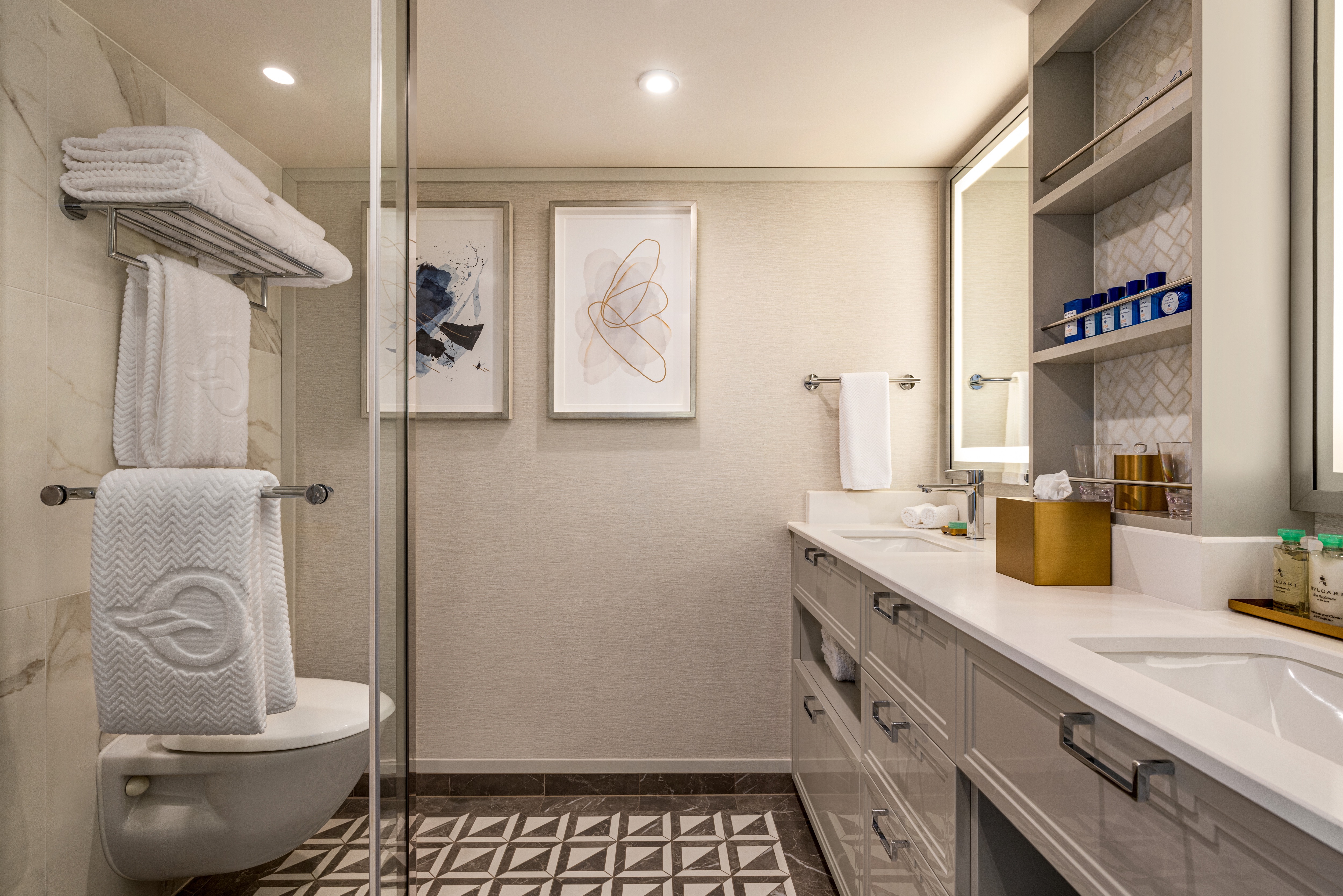
Oceania Vista’s Concierge Level Veranda Staterooms envelop guests in lavish comfort. Shades of cream and rich fawn set the tone for a luxuriant respite with an extravagantly dressed queen-size Tranquility Bed, sumptuously comfortable sitting area and a private veranda to take in the marvels of the surrounding seascapes. All feature extraordinary closet and storage space, and a marble bathroom with walk-in rainforest shower. A wealth of additional amenities, such as a dedicated Concierge Lounge, unlimited use of the Aquamar Spa Terrace, room service from The Grand Dining Room and free laundry services, elevates the experience to the sublime.
Exclusive Concierge Privileges
+In addition to stateroom amenities
- Expanded lunch and dinner room service menu from The Grand Dining Room
- FREE laundry service - up to 3 bags per stateroom*
- Exclusive card-only access to private Concierge Lounge staffed by a dedicated Concierge featuring complimentary sodas, coffees and snacks throughout the day
- Complimentary welcome bottle of Prosecco
- Priority online specialty restaurant reservations
- Private teak veranda††
- Unlimited access to the Aquamar® Spa Terrace
- Complimentary Oceania Cruises logo tote bag
- Cashmere lap blankets, perfect for relaxing on your veranda
- Complimentary pressing of garments upon embarkation**
- Complimentary shoeshine service
+Up to 20 garments per laundry bag; additional restrictions apply.
++Certain limitations apply.Smoking in suites, staterooms and on verandas is strictly prohibited.
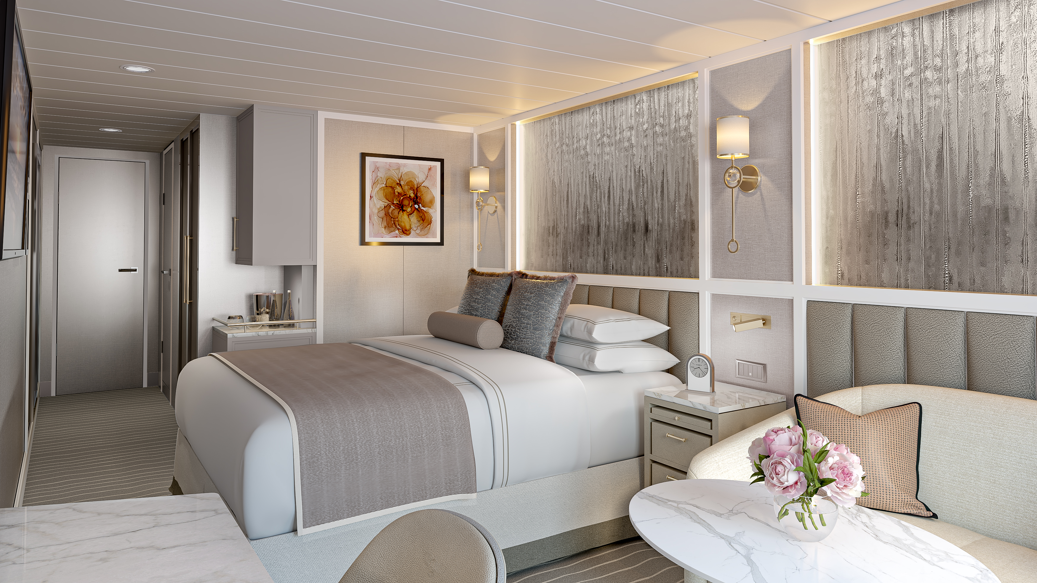
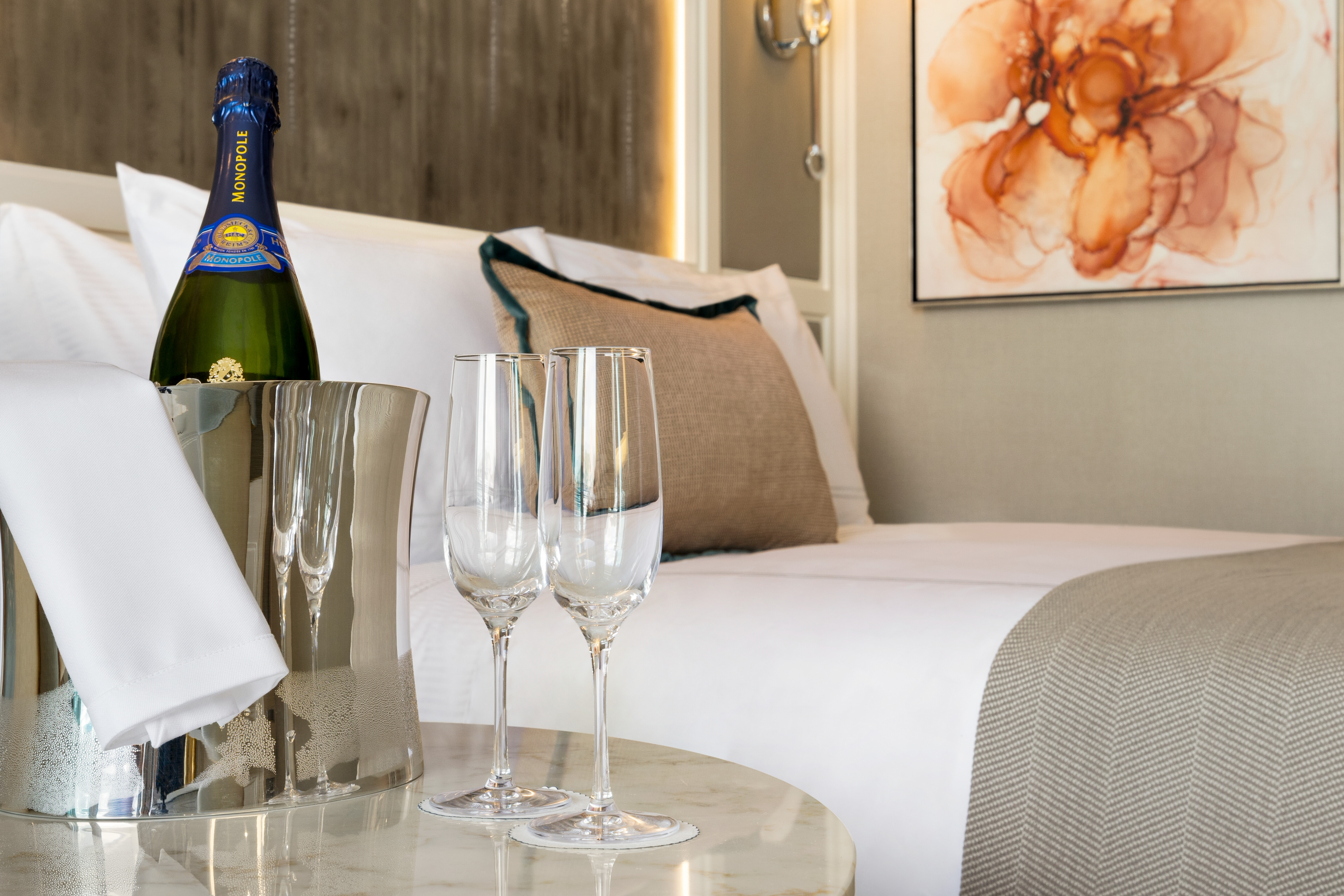
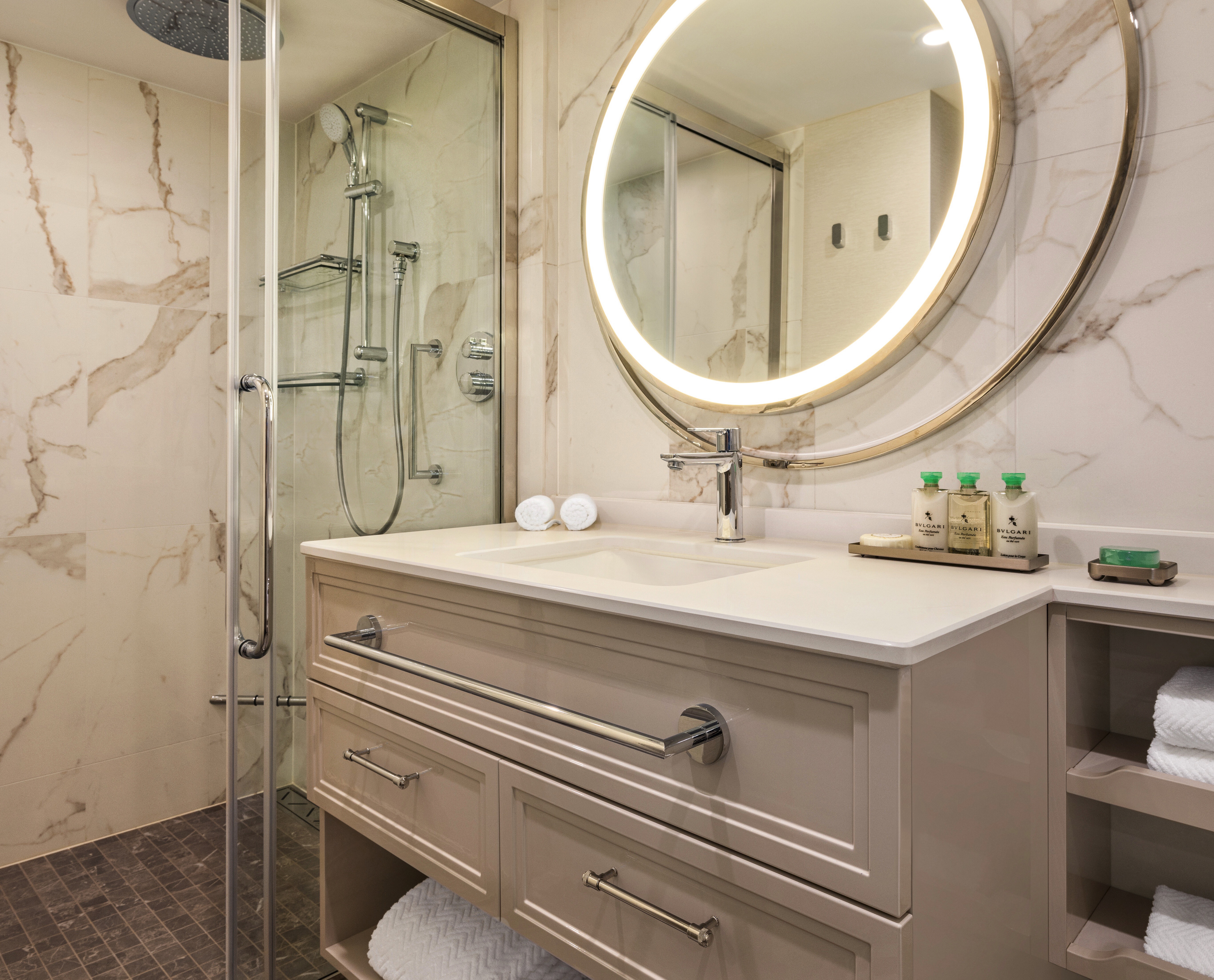
Solo travelers have a fresh reason to delight in this new category of stateroom designed exclusively for them. Spacious and airy yet cozy, each features all of the comforts and luxuries world travelers expect. Concierge Level Solo Veranda Staterooms offer a sitting area overlooking the private veranda, separate sleeping area with a sumptuously comfortable Tranquility Bed and copious storage space. Solo guests, like all sailing in Concierge Level, receive an astonishing array of amenities such as free laundry service and keycard access to the exclusive Concierge Lounge and unlimited use of the sublime Aquamar Spa Terrace.
Concierge Level Privileges
+In addition to stateroom amenities
Expanded lunch and dinner room service menu from The Grand Dining Room
- Private teak veranda††
- FREE laundry service - up to 3 bags per stateroom*
- Exclusive card-only access to private Concierge Lounge staffed by a dedicated Concierge featuring complimentary sodas, coffees and snacks throughout the day
- Complimentary welcome bottle of Prosecco
- Priority online specialty restaurant reservations
- Unlimited access to the Aquamar® Spa Terrace
- Complimentary Oceania Cruises logo tote bag
- Cashmere lap blankets, perfect for relaxing on your veranda
- Complimentary pressing of garments upon embarkation**
- Complimentary shoeshine service
*Up to 20 garments per laundry bag; additional restrictions apply
**Certain limitations apply
Smoking in suites, staterooms and on verandas is strictly prohibited
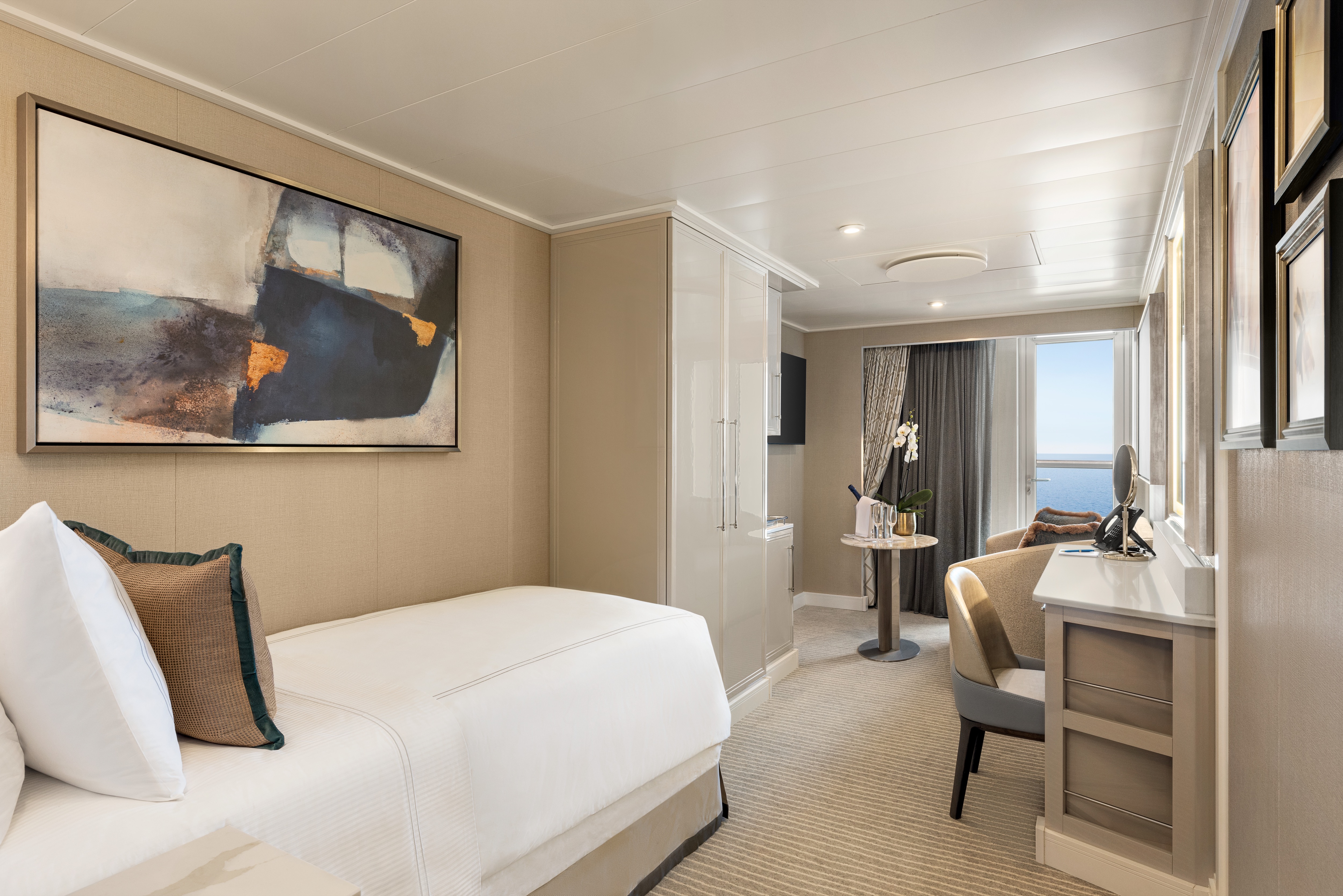
Like the ubiquitous little black dress, timeless elegance is a universal staple of Oceania Vista's Veranda Staterooms. Within an expansive 290 square feet, residential warmth is reflected in soothing neutral shades with splashes of sienna. High-tech amenities and ample closet space are de rigueur. The embrace of a lush queen-size bed is complemented by a lavishly appointed bathroom with a large vanity and captivating rainforest shower. A comfortable sitting area is a relaxing prelude to time spent on the private veranda, watching the world glide past.
Veranda Stateroom Amenities
- Tranquility Bed, an Oceania Cruises exclusive†
- FREE sodas replenished daily in your refrigerated mini-bar
- FREE still and sparkling Vero Water®
- Aquamar® Bath + Skincare Essentials
- FREE room service menu 24 hours a day
- Daily housekeeping service
- Gourmet turndown chocolates upon request
- Interactive television system with on-demand movies, weather and more
- Starlink® WiFi service
- Writing desk and stationery
- Plush cotton towels, robes and slippers
- Handheld hair dryer
- Security safe
†King-size bed (cannot be converted into twin beds) for Owner’s, Vista and Oceania Suites and queen-size bed for all other suites and staterooms (Tranquility Bed available for purchase at OceaniaBedCollection.com)
††Featured with all Veranda Staterooms (excluding French Veranda)
Smoking in suites, staterooms and on verandas is strictly prohibited
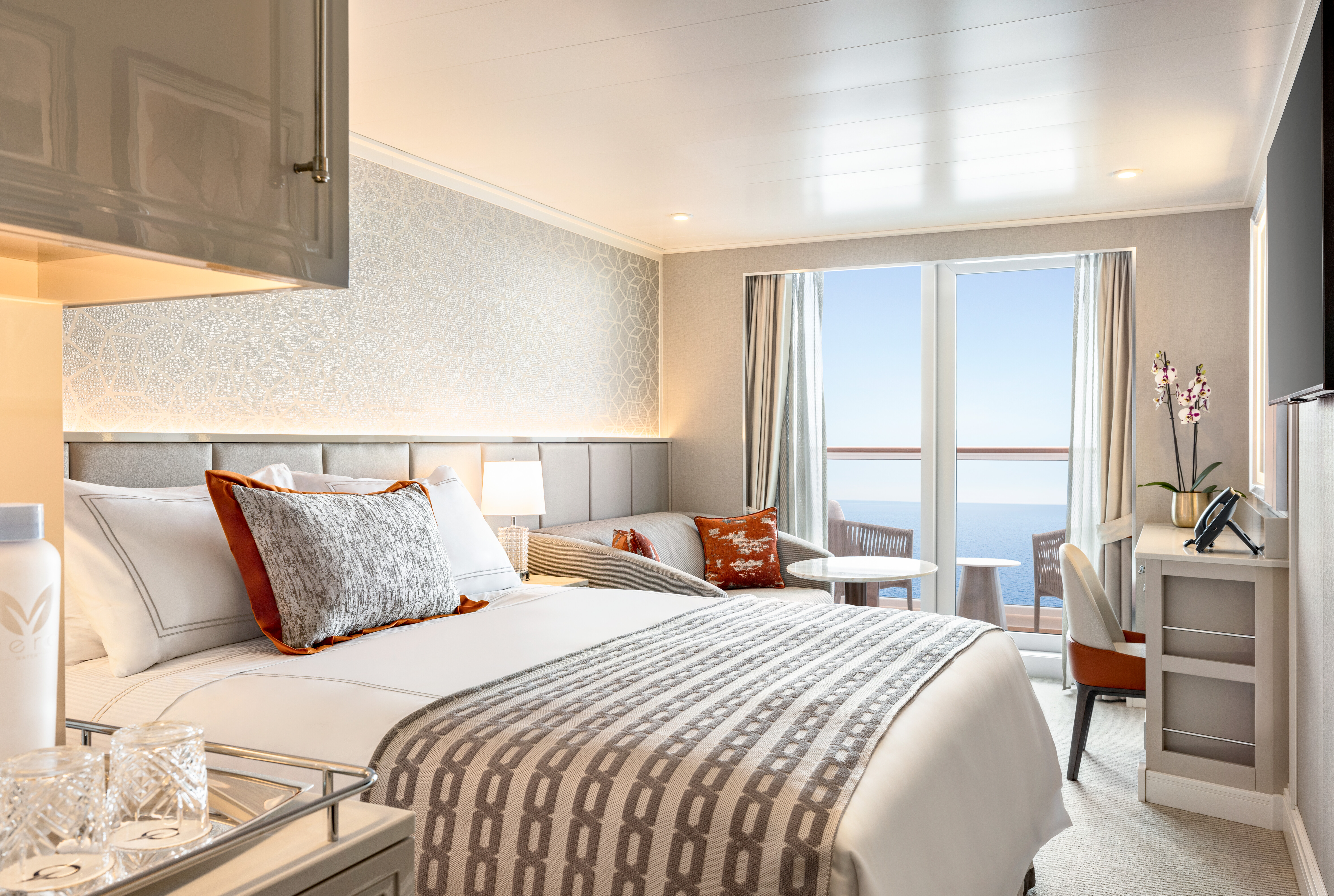
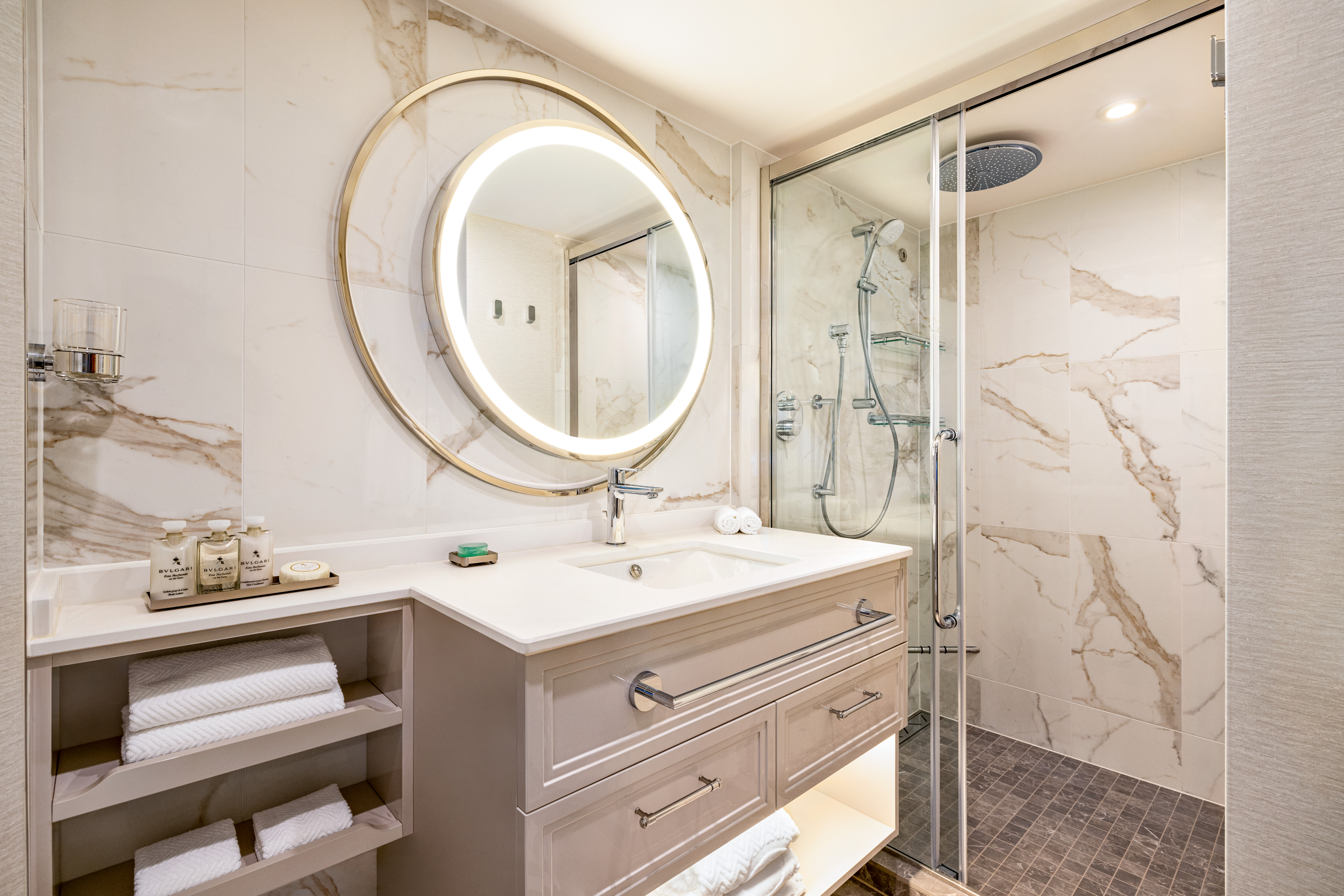
A seaside home should joyously enfold the ocean and in every French Veranda Stateroom, that promise is fulfilled. Fling open a floor-to-ceiling glass door that opens onto the graceful banister of the French veranda and transform your entire residence into an open-air terrace reminiscent of a chic hillside villa on the Côte d’Azur. These spacious havens feature an enticing queen-size bed, separate sitting area and comfortable furnishings that exude relaxation and sense of the familiar. Attention to detail is meticulous, including a roomy bathroom with an indulgent rainforest shower.
French Veranda Stateroom Amenities
- Tranquility Bed, an Oceania Cruises exclusive†
- FREE sodas replenished daily in your refrigerated mini-bar
- FREE still and sparkling Vero Water®
- Aquamar® Bath + Skincare Essentials
- FREE room service menu 24 hours a day
- Daily housekeeping service
- Gourmet turndown chocolates upon request
- Interactive television system with on-demand movies, weather and more
- Starlink® WiFi service
- Writing desk and stationery
- Plush cotton towels, robes and slippers
- Handheld hair dryer
- Security safe
†King-size bed (cannot be converted into twin beds) for Owner’s, Vista and Oceania Suites and queen-size bed for all other suites and staterooms (Tranquility Bed available for purchase at OceaniaBedCollection.com)
††Featured with all Veranda Staterooms (excluding French Veranda)
Smoking in suites, staterooms and on verandas is strictly prohibited
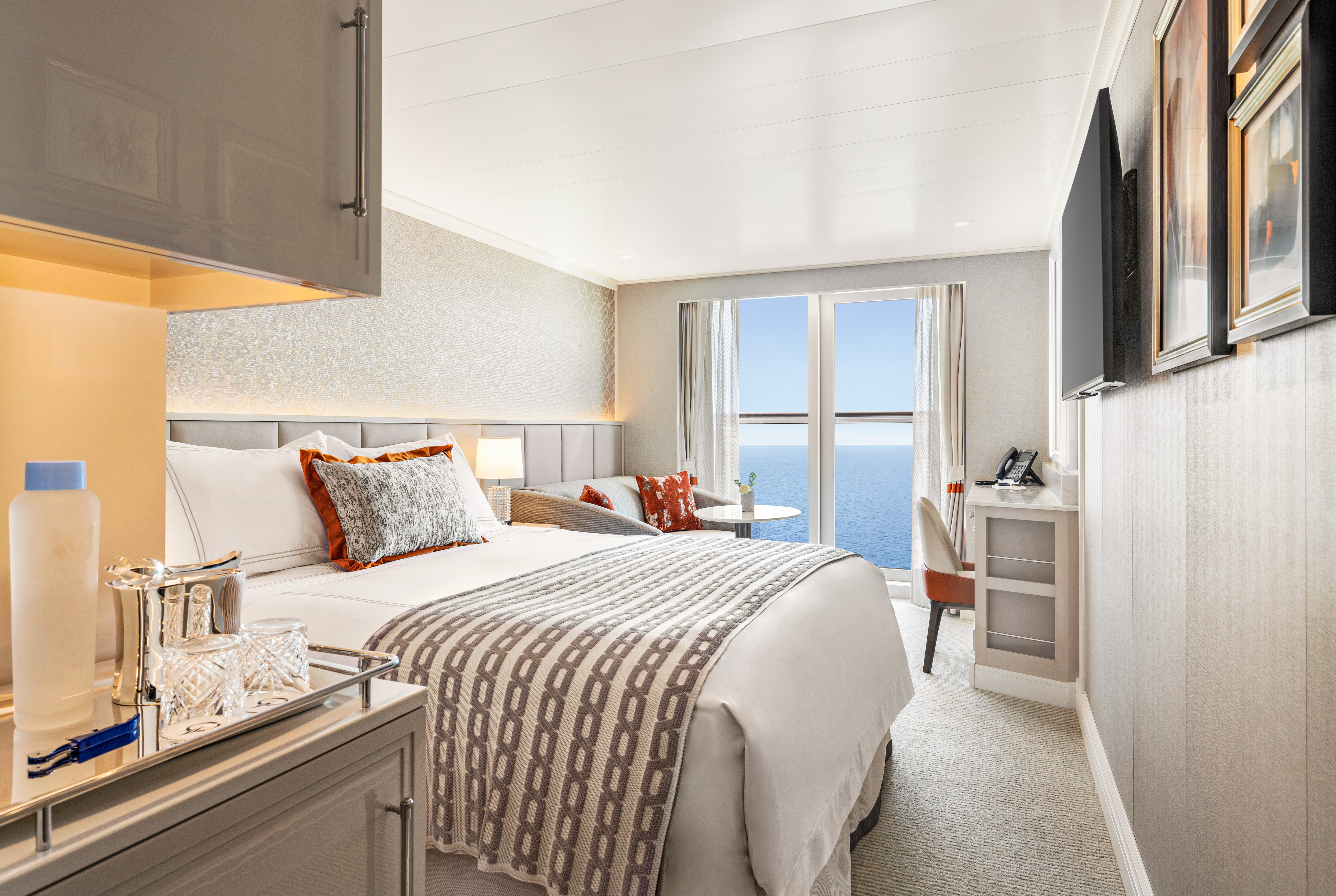
Oceania Vista
Your World From A New Perspective
Step aboard Oceania Vista and you’ll discover a dramatic new way of seeing the world. Vista invites you to savor your experience on a ship whose captivating beauty and stylish design evoke the wonders you’ll discover ashore. Stunning interiors and harmonious spaces reflect a fresh, new perspective through organic elements inspired by the land and sea. Sail to fascinating destinations in faraway lands while enjoying The Finest Cuisine at Sea® and personalized service that distinguish every ship in our fleet along with several unique firsts in the realms of dining, accommodations and guest experience.
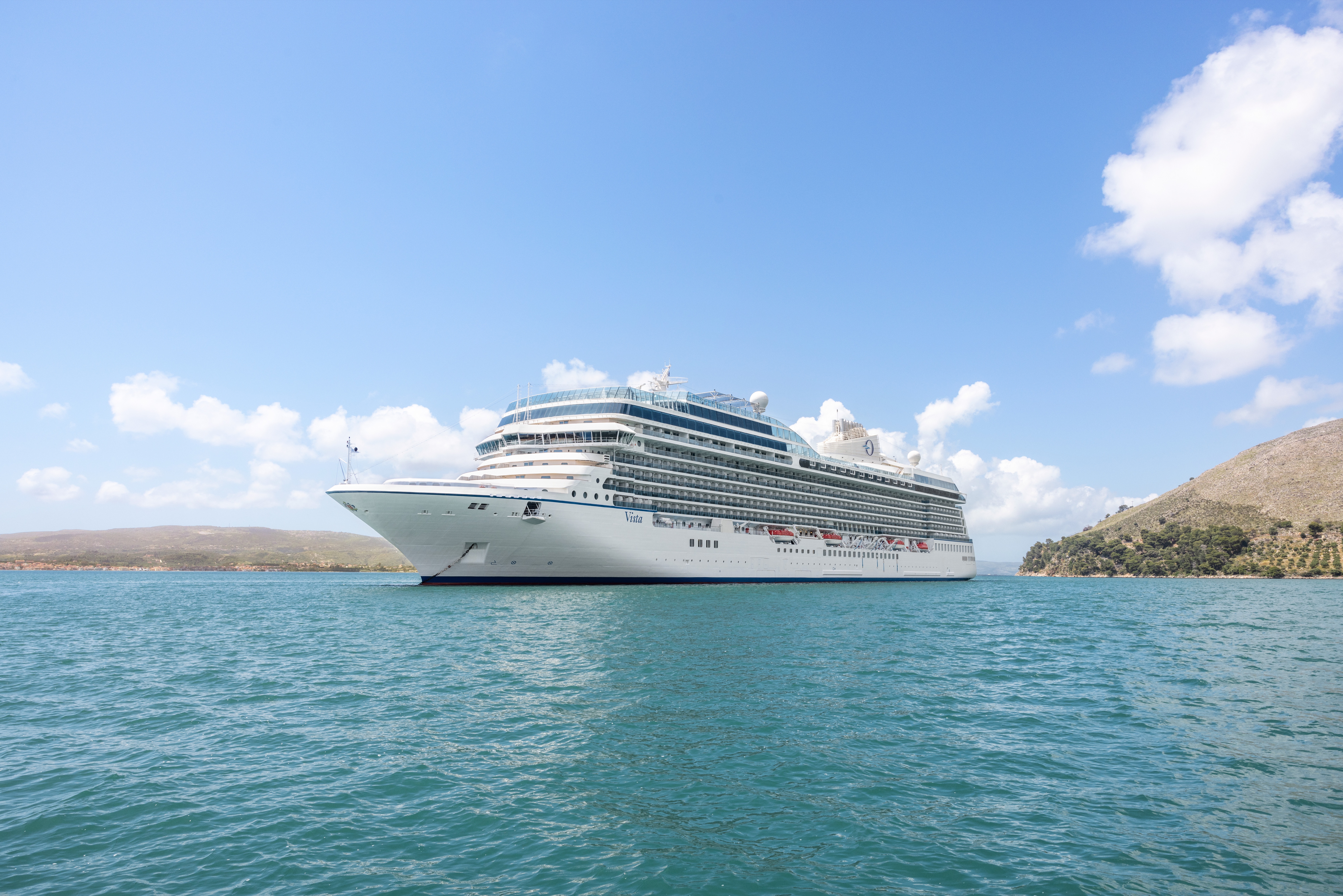
Ship Facts
| Launch Year | 2023 | ||||||||
| Refit Year | |||||||||
| Language | en | ||||||||
| Gross Tonnage | 68000 | ||||||||
| Length | 241 | ||||||||
| Width | 32 | ||||||||
| Currency | USD | ||||||||
| Speed | 20 | ||||||||
| Capacity | 1200 | ||||||||
| Crew Count | 800 | ||||||||
| Deck Count | 11 | ||||||||
| Cabin Count | 603 | ||||||||
| Large Cabin Count | N/A | ||||||||
| Wheelchair Cabin Count | N/A | ||||||||
| Electrical Plugs |
|
Deck 16
- Paddle Tennis
- Golf Putting Greens
- Restrooms

Deck 15
- Croquet/Bocce
- Shuffleboard
- Fitness Track
- Fitness Centre
- Aquamar Spa
- Barber Shop
- Styling Salon
- Sauna/Steam Rooms
- Aquamar Spa Terrace
- Elevator
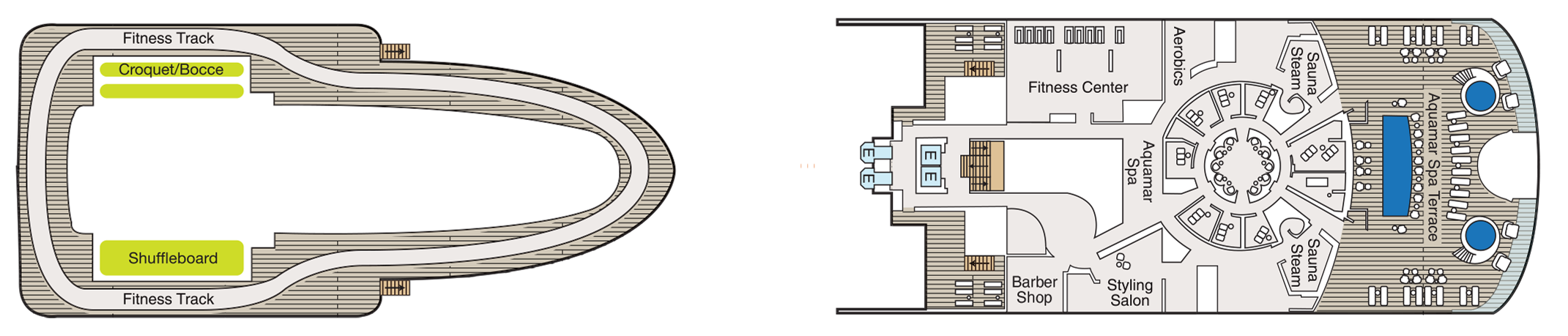
Deck 14
- Priveé
- Toscana
- Polo Grill
- Bakery
- Library
- Baristas
- Sun Deck
- The Culinary Centre
- Artist Loft
- LYNC Digital Centre
- Conference Centre
- Horizons
- Elevator
- Restroom
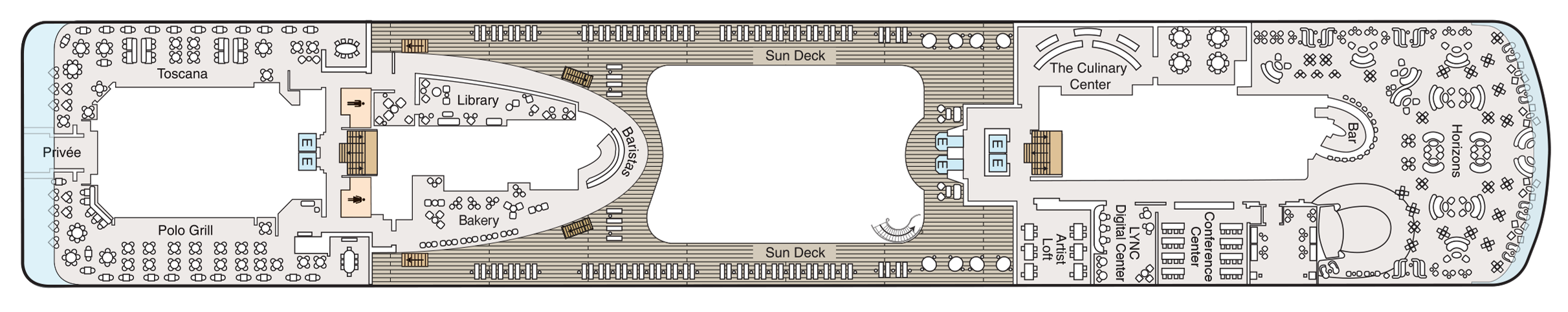
Deck 12
- Terrace Café
- Aquamar Kitchen
- Waves Grill
- Pool
- Whirlpools
- Waves Bar
- Concierge Level Veranda
- Oceania Suite
- Vista Suite
- Elevator
- Restroom
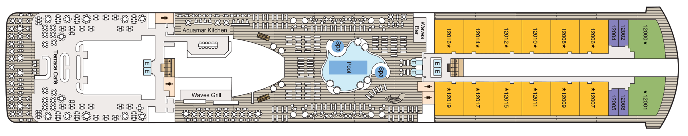
Deck 11
- Executive Lounge
- Concierge Level Veranda
- Oceania Suite
- Penthouse Suite
- Launderette
- Bridge
- Elevator
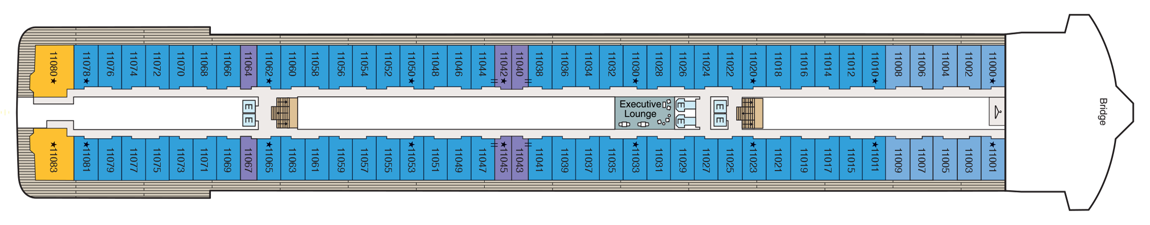
Deck 10
- Concierge Level Veranda
- Owner's Suite
- Penthouse Suite
- Vista Suite
- Launderette
- Elevator
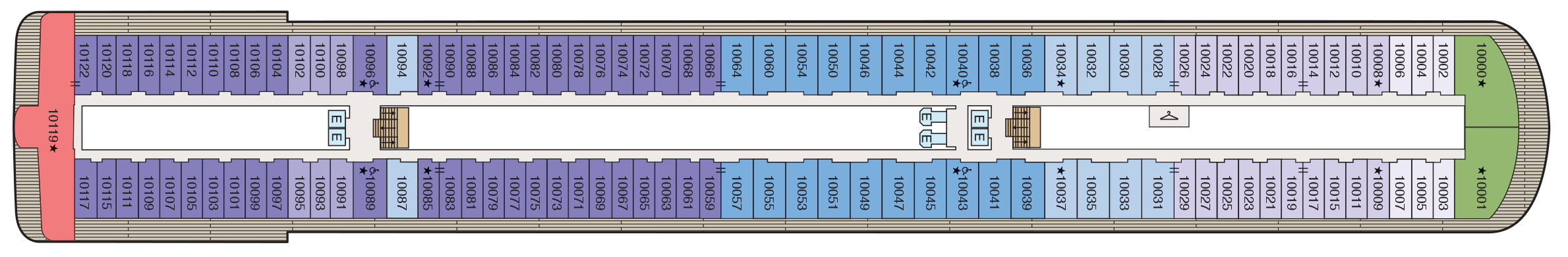
Deck 9
- Concierge Lounge
- Concierge Level Veranda
- Concierge Level Solo Veranda
- Owner's Suite
- Vista Suite
- Launderette
- Elevator

Deck 8
- Concierge Level Veranda
- Owner's Suite
- Veranda Stateroom
- Vista Suite
- Launderette
- Elevator
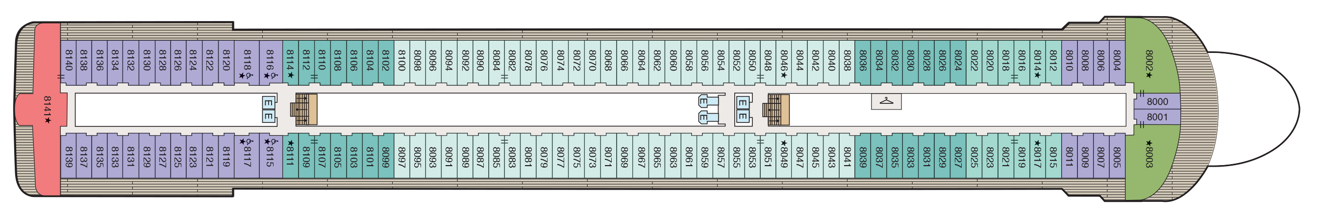
Deck 7
- Concierge Level Veranda
- Veranda Stateroom
- French Veranda
- Penthouse Suite
- Launderette
- Elevator

Deck 6
- Grand Lounge
- Upper Hall
- Martinis
- Casino
- Casino Bar
- The Grand Dining Room
- Elevator
Deck 5
- Red Ginger
- Jacques
- Boutiques
- Concierge
- Elevator
- Reception
- Destination Services
- Lounge
- Stage
- Restroom
- Medical Centre (Located on Deck 4 - Not Shown)

Culinary Masterpieces
Oceania Vista serves up a fresh perspective on The Finest Cuisine at Sea® and reaches new pinnacles of creativity and diversity with an astounding array of dining options that range from informal to the extravagant. In addition to the tried and true favorites that guests adore, Oceania Vista offers three new indulgent venues. Never content to rest on our laurels, even the expected has become the unexpected through a dramatic re-inspiration of every dining space from decor to table setting to menu offerings.
The Luxury of Casual
You’ll savor cuisine renowned as the finest at sea no matter where you choose to dine or relax on Oceania Vista – whether that means a poolside burger, a scoop of Humphry Slocombe’s bourbon-flavored cornflake-studded Secret Breakfast ice cream or a perfectly prepared cappuccino accompanied by freshly baked biscotti. Our culinary team’s attention to detail, passion for artisanal ingredients and dedication to technique extends to our casual dining, poolside experiences, Baristas coffee bar and the cherished ritual of Afternoon Tea.
In-Room Dining Experiences
After a day of enriching adventures ashore or an enjoyable day on board, dining in the privacy of your suite or stateroom with our compliments is always a welcome possibility. A complete menu of varied dining experiences is available around the clock, featuring an extensive array of delectable breakfast, lunch and dinner items. All suites and staterooms have the added luxury of enjoying a full, hot breakfast in-room and those staying in Concierge Level or above have the additional privilege of ordering from an expanded lunch and dinner room service menu from The Grand Dining Room. Suite guests have the ultimate indulgence of enjoying course-by-course meals from the comfort of their spacious sanctuaries. Revel in the private luxury of your suite or stateroom, and enjoy an exquisite meal on your tranquil veranda as you take in spectacular seascapes.
Immersive Mixology Experiences
When you join us aboard Oceania Vista, enjoying a drink will be an experience unto itself – from the beauty of watching a skilled bartender smoke an Old Fashioned to the tableside preparation of a Manhattan. Our new onboard bar program has been designed to mirror the elevated quality and innovation The Finest Cuisine at Sea® has come to represent. The latest cocktail-crafting trends and techniques have inspired an array of experiences, drinks and beverage offerings such cocktails topped by flavored smoke bubbles, Negronis aged in wooden barrels, delightfully entertaining rum mixology experiences, the ultimate in wine pairings, unique specialty beverage cart experiences and more.
Wine Pairing Experiences
There’s nothing quite like the trifecta of amazing food, delightful wine and lots of laughter. Suited to connoisseurs and novices alike, our wine pairing experiences across our small and luxurious ships are convivial, memorable, and yes, just a touch lavish. Evoking the breezy yet chic sensibility of a small Napa winery, the experiences center on menus of inventive dishes paired with premium, and often rare, vintages hand-selected by our talented chefs and sommeliers. Cruise and dine in style, and book reservations for a range of exciting onboard pairing experiences, such as sommelier-led pairing lunches, a one-of-a-kind six-course Champagne dinner and more. Each is a pure celebration of the joys of gathering around a table. More than anything else, these experiences are tableside joie de vivre.
The Grand Dining Room
The Grand Dining Room is the luxurious grand dame of Oceania Cruises’ culinary world. Here, guests will savor a leisurely dining experience in a truly magnificent and inspired room whose ambiance soars to equally lofty heights as the cuisine. This signature dining experience has always offered a bevy of delicious Continental dishes, and now a fresh and new array of options brings even more exciting possibilities. Every day presents a realm of choices, from signature Jacques Pépin classics to an incredible spectrum of global flavors and an all-new Executive Chef’s Tasting Menu. Menus change daily with an expansive choice of at least 10 appetizers, soups and salads and 10 dinner entrées, along with healthy options such as Aquamar Vitality Cuisine.
- Breakfast | 8:00 am – 9:30 am
- Lunch | 12:00pm – 1:30pm
- Dinner | 6:30 pm – 9:30 pm
No reservations required.
Jacques
Reservations required.
- Dinner | 6:30 pm – 9:00 pm
Polo Grill
THE CLASSIC STEAKHOUSE
Polo Grill delights diners with the ultimate classic steakhouse experience presented with timeless reverence. Richly layered decor and an abundance of custom millwork create an imaginative rendition of tradition set against crisp white linen tablecloths while a cadre of black jacketed servers set the tone for an evening of gracious dining. Each course stands as the very definition of time-honored favorites, most notably the beef dishes, all of which are USDA certified Angus and aged for a minimum of 40 days to enhance tenderness and flavor. While succulent seafood dishes such as grilled swordfish and whole Maine lobster gratinée are also classics in their own right.
- Dinner | 6:30 pm – 9:00 pm.
Reservations required.
Toscana
AN EVOLUTION OF TUSCAN CUISINE
Toscana presents an evolution of Tuscan cuisine in a truly Italian setting of rich Chianina leather, hand-blown Venetian glass and Carrara marble. Evolved from generational family traditions, many of our recipes originated with the mothers and grandmothers of our own Italian culinary staff. Presented on elegant, custom-designed Versace china, masterfully prepared dishes exemplify the essence of Tuscany and celebrate Italy’s culinary passion. Perhaps the evening begins with the octopus carpaccio with Champagne vinaigrette or the artichoke and parmesan cheese timbale with black truffle sauce, followed by classic dishes such as the hand-rolled gnocchi with pesto, a rich risotto with lobster medallions and shallots, or a pan-seared sea bass filet finished with Sorrento lemon, chardonnay and capers.
Reservations required.
- Dinner | 6:30 pm – 9:00 pm.
Red Ginger
BOLD YET BALANCED FLAVORS
Red Ginger radiates harmony and tranquility while evoking the boldness and subtleties of the extraordinary Pan-Asian dishes our talented chefs have created. Much like the room itself, the Thai, Korean, Japanese and Malaysian rooted specialties are a mélange of spicy and soothing, savory and sweet to please virtually every palate. Begin with a Spicy Duck & Watermelon Salad with cashews, mint and Thai basil. Savor Chicken Shio Ramen Noodles with tofu, shiitake mushroom and bok choy or opt for a Seven Spices Crusted Lamb Rack with fresh wasabi lamb jus. To complement the bold and multifaceted flavors of the Pan-Asian dishes here, the cocktail and beverage menu includes a premium sake selection, Asian beers and Asian-inspired cocktails that call on spices such as lemongrass, ginger and turmeric as well as exotic fruits such as lychees. In Red Ginger, the gustatory pleasures are as striking as the visual ones.
6:30 pm – 9:00 pm
Reservations required.
Priveé
WINE EXPERIENCES BY LA RESERVE
Privée is our intimate venue for unforgettable wine experiences by La Reserve. Guests can choose from two distinctive and unique multi-course pairing dinners, each a sublime celebration of the finer things in life and limited to eight privileged diners per evening. Savor the truly one-of-a-kind Dom Pérignon Experience that pairs special Champagne vintages with thoughtfully crafted dishes or perhaps enjoy the exquisitely curated Odyssey Menu that is a gustatory journey for the senses. Dramatically backlit, debossed walls and a blooming flower petal ceiling, from which a dramatic chandelier descends over the polished marble slab dining table, only enhance the indulgent occasion. A wall of floor-to-ceiling glass provides an exhilarating view to complement these magnificent dining experiences that can literally traverse continents.
Pairing Experience in Privee will not operate with less than 8 guests. Reservation required. Additional fees apply.
Terrace Café
Informal Dining
With an inviting, genial dining room and shaded patio, Terrace Café takes on the ease of a treasured vacation home’s favorite sun-drenched conservatory and panoramic seaside terrace. At breakfast, revel in the aroma of freshly baked cinnamon rolls and fluffy made-to-order omelets, pancakes and waffles. During lunch, sample flavorful international dishes alongside juicy, seasoned rotisserie meats and perfectly grilled seafood. In the evening, the decadence of a grilled lobster tail, the simple American essence of a sweet, barbecued pork chop with crispy, applewood-smoked bacon and fresh hand-cut sushi and sashimi are among the many choices that will turn Terrace Café into a personal favorite. And as you would envisage, locally inspired specialties from our ports of call are a hallmark of our popular Chef’s Market Dinners.
- Breakfast | 7:30 am – 10:00 am.
- Lunch | 12:00 pm – 2:00 pm.
- Dinner | 6:30 pm – 9:00 pm.
No reservations are taken.
Aquamar Kitchen
WELLNESS MEETS INDULGENCE
At Aquamar Kitchen, the harmony of nourishing flavors, a bright and airy ambiance evoking an endless Mediterranean summer and just the right amount of indulgence revitalizes your body and your spirit. Mindfully prepared breakfast selections feature energizing cold-pressed raw juices and super food smoothies, satisfying avocado toasts, energy bowls, banana pancakes and savory omelets. For lunch, dozens of tempting and balanced dishes are offered, such as a hearty Lebanese bowl with beef kefta, falafel, muhammara, fattoush, aubergine caviar and pita bread; yellowfin tacos with white cabbage slaw; or even a crunchy chicken sandwich on a freshly baked whole grain bun. The chic seaside-inspired setting paired with a diverse collection of fresh, vibrant dishes is perfectly indulgent – without any of the guilt.
No reservations are taken.
Breakfast
- 7:00 am – 10:00 am (port day).
- 8:00 am – 11:00 am (sea day).
Lunch
- 11:00 am – 3:00 pm (port day).
- 12:00 pm – 4:00 pm (sea day).
Waves Grill
POOLSIDE ALFRESCO MAGIC
On the deck of a cherished Malibu beach house, the magic begins with the grill. Likewise, Waves Grill is a shaded poolside dining spot serving made-to-order all-American favorites from lunch until late into the afternoon. Taste the richness of a Wagyu burger with juicy tomatoes and a savory black truffle sauce. The seasoned fries are irresistible while the light crunch of fresh coleslaw is the perfect complement to the herb-marinated mahi mahi. For dessert, try a thick hand-dipped milkshake or one of the new, whimsical ice cream flavors by Humphry Slocombe such as the mouthwatering Secret Breakfast pairing of bourbon and cornflake cookies.
The Pizzeria at Waves Grill
Each evening as if by culinary alchemy, Waves Grill is transformed into an authentic Neapolitan trattoria with the pizza oven at the epicenter. Imagine you are in Capri overlooking the twinkling lights of Naples, as the alluring aroma of fresh pizza dough baking in a classic wood-fired forno wafts among the bougainvillea. Set the tone with a glass of dry chianti, then savor sweet and spicy dry-rubbed chicken wings, tender pork ribs or rosemary focaccia with lush burrata, plump tomatoes, peppery arugula and bold balsamic dressing. Pizza creations feature delectable toppings ranging from flora black olives and oaky truffles to fiery chorizo and tart lemon chicken. No matter your selection, your palate will heartily approve.
Afternoon Tea
TIME-HONORED PASTIME
Each afternoon, the parade of gleaming four-tiered pastry carts begins. Savor freshly made, flavorful smoked salmon and egg salad finger sandwiches. Enjoy mirror-glazed petits fours, tender scones with rich clotted cream and, of course, a wide assortment of fine teas. Soak in the ambiance of polished silver teapots reflecting the turquoise sea, the precision of white-gloved servers and the amusing enigma of a string quartet playing softly in the background. You’ll quickly realize that this is how afternoon tea should be.
Check your daily Currents for time and venue. No reservations required.
Baristas
A NEIGHBORHOOD GEM
Combine the stylish flair of a Viennese coffee house with the warm smiles of your neighborhood café, then add 270-degree shimmering sea views and you have Baristas, a relaxed haven for coffee and fresh pastry afficionados. Sip complimentary illy® delights, enjoying the energizing kick of an espresso or the smooth richness of a cappuccino. Accompany the perfect cup with a buttery dark chocolate croissant or the sublime citrus hints of an orange biscotti. Whether you are drawn to a bold macchiato or a subtle iced latte, you will be captivated by the atmosphere of friendship and family that suffuses Baristas.
The Bakery
The enticing aroma of freshly baked pastries will draw guests from Baristas to the Vista's new Bakery just steps away. The perfect complement to your coffee might just be a French or Italian specialty fresh from the oven. Perhaps you’ll sample a flaky, ricotta-filled sfogliatella, a confection that hails from the Italian region of Campania. If you prefer a French patisserie, you might select a decadent chocolate and almond croissant. Whatever your choice, you cannot go wrong when indulging in a delicacy created by our skilled pastry chefs.
Bakery
The new Bakery, with its freshly baked French and Italian pastries, is certain to be an instant hit. As the delicate yet rich scents fill the air, you'll be tempted to savor a chocolate-almond croissaint or sinfully sweet bombolini while enjoying the last art of people watching or simply gazing out at the azure blue sea.
Room Service
After a day of enriching adventures ashore or an enjoyable day on board, dining in the privacy of your suite or stateroom with our compliments is always a welcome possibility. A complete menu of varied dining experiences is available around the clock, featuring an extensive array of delectable breakfast, lunch and dinner items. All suites and staterooms have the added luxury of enjoying a full, hot breakfast in-room and those staying in Concierge Level or above have the additional privilege of ordering from an expanded lunch and dinner room service menu from The Grand Dining Room. Suite guests have the ultimate indulgence of enjoying course-by-course meals from the comfort of their spacious sanctuaries. Revel in the private luxury of your suite or stateroom, and enjoy an exquisite meal on your tranquil veranda as you take in spectacular seascapes.
Life On Board
From sipping fine vintages at a wine tasting to attending a show-stopping performance in the ship lounge, a wonderful spectrum of enriching activities and lively entertainment awaits you on board Oceania Vista. Join one of our esteemed Guest Speakers to discover unique cultural insights, indulge in a treatment at Aquamar Spa + Vitality Center or take a hands-on cooking class at The Culinary Center. As the sun sets, gather with friends in one of the convivial bars, attend a spectacular production show or take in an unforgettable musical performance.
Music & Entertainment
World-class musical performances will dazzle you, showcasing an ever-changing array of guest entertainers such as pianists, classical string quartets, dynamic vocalists and spectacular headliners. Oceania Vista features a unique lineup of onboard shows and entertainers to ensure that your interests are constantly piqued. Unforgettable evenings at energetic, show-stopping performances are just steps from your suite or stateroom.
Bars & Lounges
From chic Martinis to the laid-back poolside Waves Bar, there's a perfect enclave on board Oceania Vista for every mood. Visit the elegant Grand Lounge for a pre-dinner cocktail, catch a headline act in the Lounge or watch the sun set in Horizons accompanied by a glass of wine and lively music. New and innovative cocktail experiences await at Martinis, Founders Bar and beyond. As you explore the world, these bars and lounges are the place to unwind, gather together, laugh and take in one-of-a-kind shows and musical performances.
Onboard Shows
ENTERTAINMENT FROM A NEW PERSPECTIVE
World-class musical performances will delight you, showcasing an ever-changing array of guest entertainers such as pianists, classical string quartets, dynamic vocalists and spectacular headliners.
Each of our ships features a unique selection of onboard shows and entertainers to ensure that your interests are constantly piqued. Bold and crowd-thrilling, nostalgic and upbeat, or intimate and sophisticated – whatever you choose, the night is yours.
EXCLUSIVE PRODUCTION SHOWS
Oceania Vista will feature three main productions during her inaugural season, each with a distinct personality, with another to follow later in the year. Each show is a Broadway-caliber, immersive-style production featuring recognizable songs by some of the world’s most beloved artists and contemporary dance numbers led by a star-studded production team including “Dancing with the Stars” choreographer Britt Stewart. An extensive team of performers, producers and technicians has been involved in bringing our newest production shows to life and offering entertainment from a new perspective.
Into the Night, choreographed by renowned “Dancing with the Stars” pro dancer and choreographer Britt Stewart, is a dance-centric show featuring an unexpected mix of dance, style and design meant to invoke the excitement of the Video Music Awards, the glamour of “American Idol” and the high-energy drive of “Dancing with the Stars.” The contemporary elegance of the show is inspired by the essence of Oceania Vista herself. Sophisticated and exciting, Into the Night will leave audiences awestruck as it combines dance with design, exuding a powerful feeling only a live stage show can offer.
Headliners takes guests on a VIP concert journey showcasing a stunning cast performing some of the most recognizable songs in the world. Celebrating the music, not just the artist, Headliners approaches pop favorites in an inspirational way that is simply designed to be a great time. Led by Oceania Vista’s talented onboard vocalists, complete with fun choreography, guests will have an unforgettable night with music from some of their favorite artists, such as Cher, Celine Dion, the Bee Gees and Adele, in a way they have never seen before.
The Anchor Inn is a light-hearted UK-centric song-and-dance performance with a sprinkle of West End flare. Set in the lively Anchor Inn Pub, a group of regulars celebrates good times, sporting losses and romantic wins to the tune of chart-topping hits by artists like Dusty Springfield, Rod Stewart, Madness, Shirley Bassey and Tom Jones. This hand-clapping, toe-tapping production will leave guests feeling decidedly British, no matter where they are sailing.
Casino
MONTE CARLO-STYLE GAMING
The Casino on board Oceania Vista takes its cue from the elegance of Monte Carlo Casino and London’s Hippodrome, evolving the art nouveau elements of these iconic establishments into a space of understated, atmospheric luxury. Try your hand at your favorite games of chance and skill, perhaps warming up to test your luck ashore in an upcoming port of call. Those simply seeking a refined space in which to enjoy a cocktail will be drawn to the subtle glow of the golden Casino Bar.
CASINOS AT SEA®
The professional staff is happy to provide lessons on how games are played, the rules and proper table procedures. Unwind from a busy day ashore by playing your favourite games of chance and skill in our casino. Enjoy a fun and exciting range of ways to play, from card and table games such as blackjack and roulette to slot machines.
Getting started is easy. Stop by the casino cage and pick up your Oceania Cruises casino player card and start earning points today, by inserting your player card while playing your favourite slot machines and table games. The more you play, the more you earn!
- Reel & Video Slots - For every $5 coin-in, receive 1 point.
- Video Poker - For every $10 coin-in, receive 1 point.
- Table Games - Points are based on average bet, session play or hands played and game type.
- Action packed casinos designed with style
- Table game limits for players of all levels
- Diverse array of reel slot, video slot and video poker machines
- Dedicated and knowledgeable casino staff
- Industry leading player tracking system
- Free gaming lessons
REDEEM CASINO POINTS
You’ve played. You’ve earned. Now you’re ready to redeem. Downloading points for play is quick and easy. Redeem your casino points for play right at your machine by following the on-screen prompts or stop by the casino cage – the choice is yours.
- Earn points for all your casino play
- Redeem points for play right at your machine
CASINO CASH & CREDIT
Front Money deposits are accepted for gaming in the form of cash, traveler’s checks, cashier’s checks and wire transfers delivered to us prior to embarkation. All cashier’s checks require prior verification. For more information please give us a call at 877.625.2094.
Cashless Wagering
Charge gaming to your onboard account directly from your game of choice or at the casino cashier, using your stateroom key card. Convenience fees, daily limits and cruise limits apply. Euros may be exchanged at the casino cashier, exchange rates apply. All gaming is in US Dollars.
- Cashless wagering allows you to game with your key card
Credit
Casino Credit is available to all players with an existing reservation. The minimum application amount is $10,000.00 and a personal check is required onboard to activate the credit line. Applications are processed 1 month prior to sailing. The application process is easy and there is no fee to apply. To get started, click here for our credit application or for more information email us at casinocredit@ncl.com or call us at 877.625.2094.
- Casino credit available
Casino Mixology Bar
A brand new experience on Oceania Vista focused entirely on the art of the cocktail, the Casino Mixology Bar is the place to gather to enjoy its unique selection of bourbons and ryes in addition to enjoying the tableside preparation of cocktails and spirits. The bar will likely become an Instagram favorite for serving readymade Negronis straight from the barrel and awesome “Flavor Blaster Gun” cocktails that are topped off with vapor filled bubbles with aromatic flavors.
Martini's
The lounge known as Martinis is far more than a place to sip a signature cocktail — although its namesake libation alone is reason enough to spend some time here. In fact, Martinis is refreshing its namesake cocktail with fresh new spirits selection, Mermaid gin and vodka. The bar is a glamorous destination that welcomes you to a warm, inviting setting amidst walls of shimmering glass under a canopy of crystal. You’ll also be able to choose from a tantalizing new collection of drinks called Hollywood Martinis, in addition to the already popular selection shaken tableside. The Hollywood collection includes a variety of drinks inspired by the Old Hollywood, such as Bardot Martini, The Corleone Martini, Sir Connery Martini, Blue Eyes Sinatra and Monroe Martini. Simply gather with friends in your favorite alcove and let the memories be made.
Grand Lounge
Oceania Vista’s provocative Grand Lounge plays with shape and form to create visual elements that are striking even as they are understated. The color palette is an ode to metals and minerals with shades of bronze, onyx and alabaster lending both balance and interest. The resulting space evokes exclusivity — the feel of a luxurious private club — inviting guests to relax and enjoy an aperitif before dinner or a nightcap before retiring as they relive the day’s adventures with fellow explorers.
Vista Lounge
Our entertainment architects have engineered a space with the best possible acoustics and visual lines to provide a home worthy of the engaging talent that you will witness in the Oceania Vista Lounge. During the daytime, experts in their fields — from diplomats to chefs to historians — enlighten you with enrichment programs that provide insight into the regions you are exploring. After the sun sets, the Oceania Vista Lounge presents a new line-up of entertainment to enthrall the audience, including sophisticated cabarets, world-class musicians, dynamic vocalists and exclusive headliners.
Horizons
The most distinctive feature of aptly named Horizons is the lounge’s dramatic floor-to-ceiling windows, offering 180 degrees of stunning vistas that are the ship’s namesake. This space celebrates the journey by providing a unique perspective on the alluring destinations that await ashore and the seas that carry you to what lies ahead. To ensure that you can fully appreciate these sweeping panoramas, Horizons is appointed with comfortable furnishings in soothing tones that create a sense of home, even as the view assures you that you are far from it.
Waves Bar
Located in a shaded area just steps from the swimming pool, Waves Bar offers a wide variety of libations to enhance your poolside experience. Revel in the perfect afternoon on deck with your favorite cocktail, glass of wine or chilled beer. Come happy hour, signature cocktails and frosty beverages create a delightfully carefree segue to the lively evening ahead as the sun sets.
LYNC Digital Centre
NEW INTERACTIVE ENRICHMENT SERIES
The all-new LYNC Digital Center aboard Oceania Vista is all about connection. Join us for an interactive and fun enrichment series that connects you with friends and family on social media, elevates the quality of your photos and more. Complimentary digital learning classes, spanning all levels and ranging from social media essentials to travel photography and smartphone videography, are hosted by a knowledgeable Digital Concierge in our innovative digital center.
Our innovative digital center features comfortable seating, expansive video monitors and technical support so that you can stay in touch with family at home, monitor business developments online or check in on social media. LYNC Digital Center connects you to life on board, ashore and at home.
Library
A WINDOW TO THE WORLD
Guests often state that the Library is their favorite spot to relax on board our ships, so special care was taken to ensure that Oceania Vista’s Library inspires quietude and respite. Glass walls offer views of soothing seascapes, but the greatest comfort may be found within the Library’s inner sanctum. The aesthetic recalls a traditional equestrian estate — warm and inviting with an atmosphere of effortless, timeless luxury. It is the perfect place to curl up with a best-selling novel, peruse a guidebook on your next destination or simply indulge in a nap in one of the plush, oversized chairs.
Founders Bar
A brand new experience on Oceania Vista focused entirely on the art of the cocktail, Founders Bar is the place to gather to enjoy its unique selection of bourbons and ryes in addition to enjoying the tableside preparation of cocktails and spirits. The bar will likely become an Instagram favorite for serving readymade Negronis straight from the barrel and awesome “Flavor Blaster Gun” cocktails that are topped off with vapor filled bubbles with aromatic flavors.
Executive Lounge
Enjoy the fully-staffed Executive Lounge with complimentary beverages and snacks throughout the day and evening.
Boutiques
UNIQUE GIFTS, JEWELRY & MORE
Our stylish boutiques feature a tastefully curated selection of items ranging from sundries to chic resort wear and fine jewelry. Discover thoughtful gifts for friends and family or the perfect memento to remind you of your special cruise experience.
DUTY-FREE ON BOARD OCEANIA VISTA
Browse through our collection of duty-free merchandise including fine jewelry, watches, fragrances and Oceania Cruises logo wear. Also find shipboard keepsakes, designer handbags, sunglasses, books and more.
Concierge Lounge
Enjoy the fully-staffed Concierge Lounge with complimentary beverages and snacks throughout the day and evening.
Sun Deck
With a large heated pool and three whirlpool spas, there is always room for a refreshing dip, poolside relaxation, or a soothing spa experience