Machu Picchu & Mayan Ruins
Machu Picchu & Mayan Ruins
Cruise overview
WHY BOOK WITH US?
- ✔ The Deluxe Cruises’ team has extensive experience in ultra-luxury cruising.
- ✔ Call now to speak to our helpful and experienced Cruise Concierge team.
- ✔ Enjoy our Unique Deluxe Cruises Bonus for substantial savings.
- ✔ Our team will tailor your holiday to your exacting requirements.
- ✔ As agents, we work under the protection of each cruise lines ABTA / ATOL licences
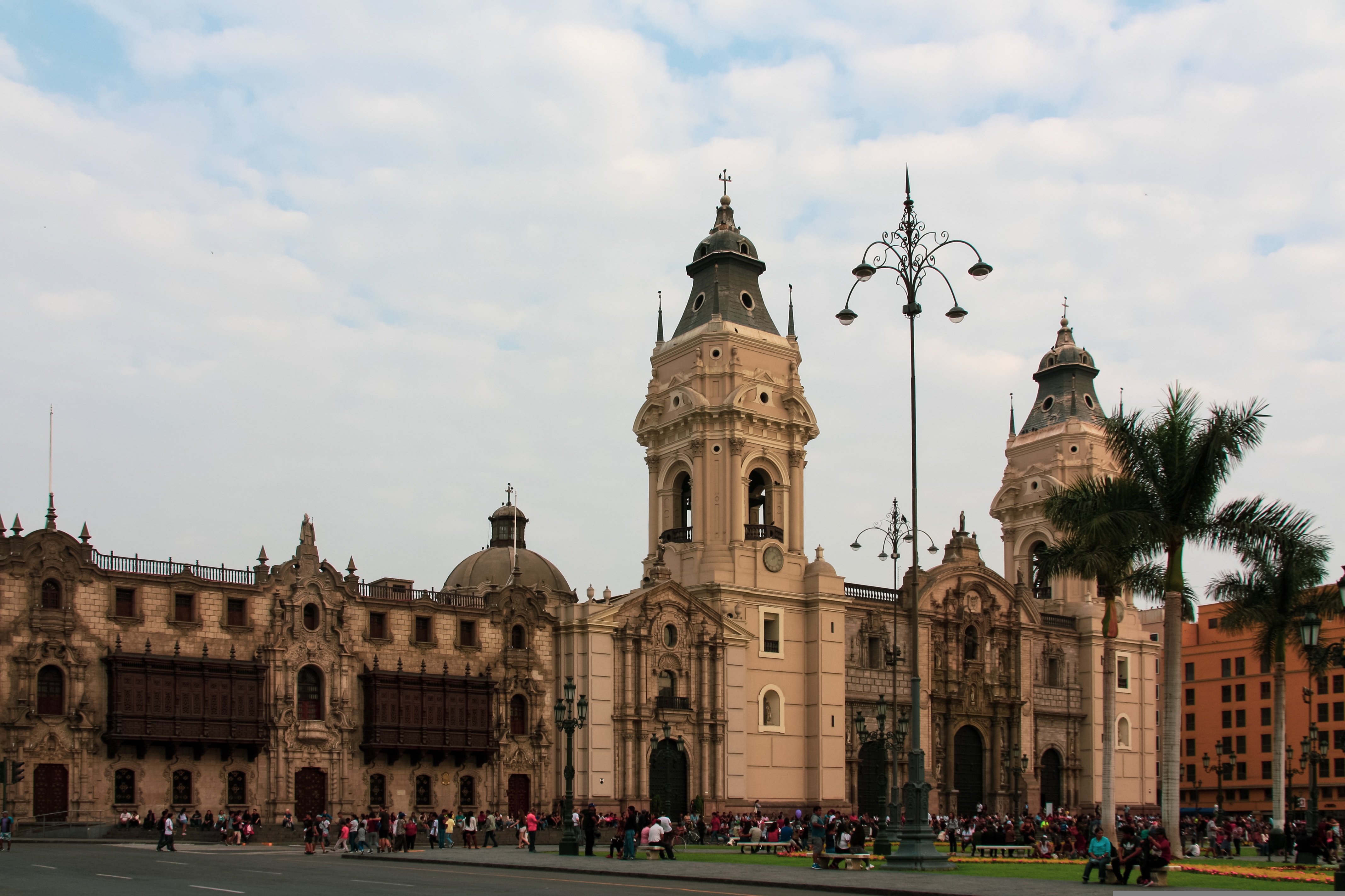
About Callao
When people discuss great South American cities, Lima is often overlooked. But Peru's capital can hold its own against its neighbors. It has an oceanfront setting, colonial-era splendor, sophisticated dining, and nonstop nightlife.It's true that the city—clogged with traffic and choked with fumes—doesn't make a good first impression, especially since the airport is in an industrial neighborhood. But wander around the regal edifices surrounding the Plaza de Armas, among the gnarled olive trees of San Isidro's Parque El Olivar, or along the winding lanes in the coastal community of Barranco, and you'll find yourself charmed.In 1535 Francisco Pizarro found the perfect place for the capital of Spain's colonial empire. On a natural port, the so-called Ciudad de los Reyes (City of Kings) allowed Spain to ship home all the gold the conquistador plundered from the Inca. Lima served as the capital of Spain's South American empire for 300 years, and it's safe to say that no other colonial city enjoyed such power and prestige during this period.When Peru declared its independence from Spain in 1821, the declaration was read in the square that Pizarro had so carefully designed. Many of the colonial-era buildings around the Plaza de Armas are standing today. Walk a few blocks in any direction for churches and elegant houses that reveal just how wealthy this city once was. But the poor state of most buildings attests to the fact that the country's wealthy families have moved to neighborhoods to the south over the past century.The walls that surrounded the city were demolished in 1870, making way for unprecedented growth. A former hacienda became the graceful residential neighborhood of San Isidro. In the early 1920s the construction of tree-lined Avenida Arequipa heralded the development of neighborhoods such as bustling Miraflores and bohemian Barranco.Almost a third of the country's population of 29 million lives in the metropolitan area, many of them in relatively poor conos: newer neighborhoods on the outskirts of the city. Most residents of those neighborhoods moved there from mountain villages during the political violence and poverty that marked the 1980s and ’90s, when crime increased dramatically. During the past decade the country has enjoyed peace and steady economic growth, which have been accompanied by many improvements and refurbishment in the city. Residents who used to steer clear of the historic center now stroll along its streets. And many travelers who once would have avoided the city altogether now plan to spend a day here and end up staying two or three.
About Salaverry
Located about nine hours north of Lima, Trujillo was founded in 1534 by the Spanish conquistador Pizarro. The attractive, colonial city retains much of its original charm with elegant casonas, or mansions, lining the streets. Nearby is Chan Chan, the ancient capital of the Chimú, a local Indian tribe who came under the rule of the Incas. The area has several other Chimú sites, some dating back about 1500 years. The region is also famous as the home of the Peruvian Paso horses, as well as excellent beaches offering world-class surfing and other water sports.
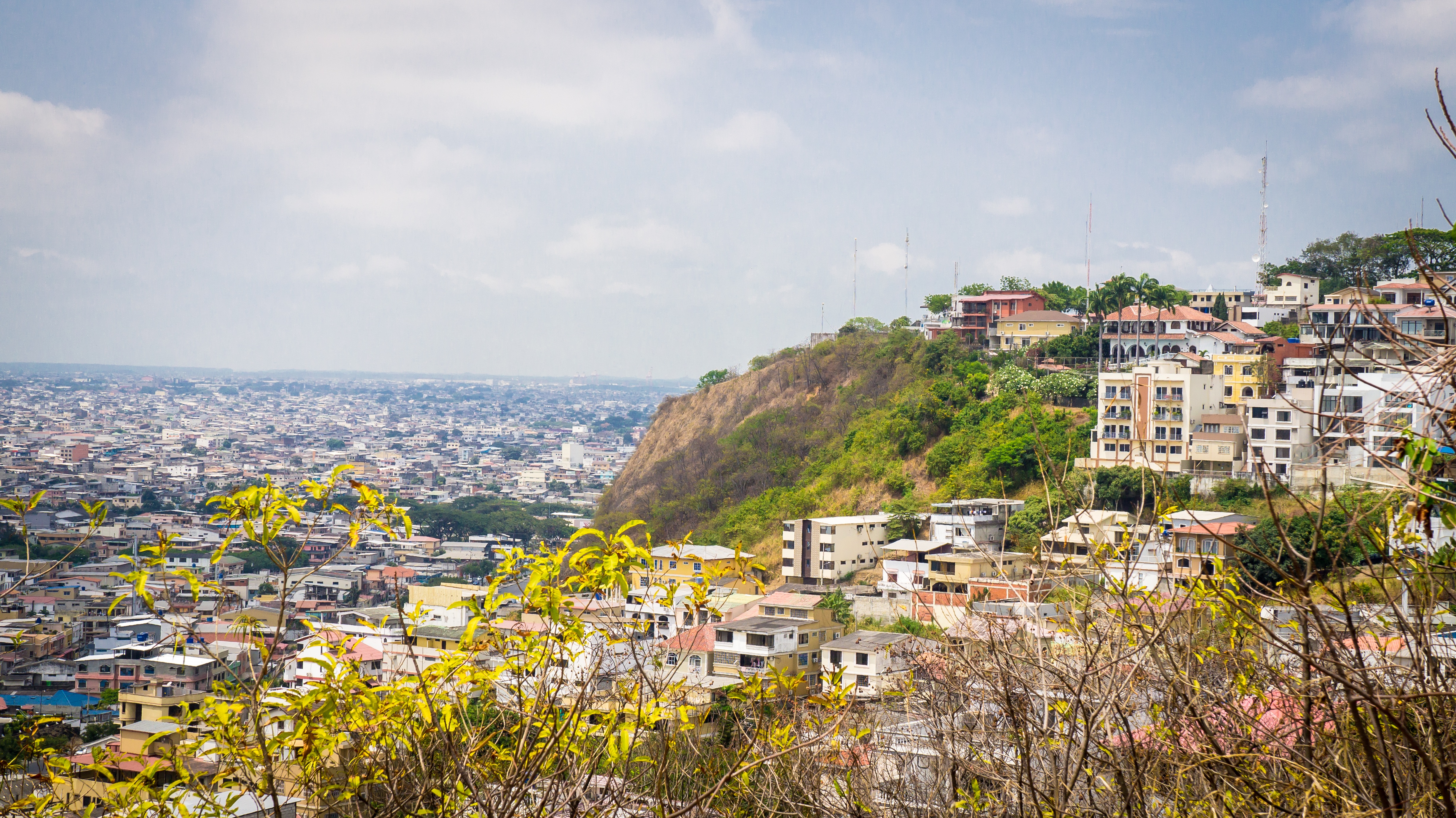
About Guayaquil
The second major jumping off point for the Galapagos Islands after Quito, this is a little city with a big heart. A sea port first and foremost, the city’s personality has been founded on that, and all the better it is for it too. Almost Caribbean in feeling, the clement climate coupled with the intermingling rhythms floating from the windows and abundance of fresh seafood make this a very tropical destination. Once not even considered by the travel books as a potential destination in its own right, the city has undergone something of a resurgence in the past few years. Proud Guayaquileños will not hestitate to point out the Malecón or the exciting new riverfront promenade, once a no-go area after dark, now happily (and hippily) lined with museums, restaurants, shops, and ongoing entertainment. The new airport and urban transportation network are also lauded to the happy tourists who find themselves here. As the largest and most populous city in Ecuador as well as being the commercial centre, it would only be natural that the city would have some kind of modern architecture, but it is the colourful favelas, or to use their real name guasmos, that cling to the side of the hillside like limpets that really catch your eye. A blend of old and new, the first inhabitants can be traced back to 1948 when the government cleared the area for affordable housing, these shanty towns are witness to the social and political particularities that Guayaquil has faced in the past.
About Manta
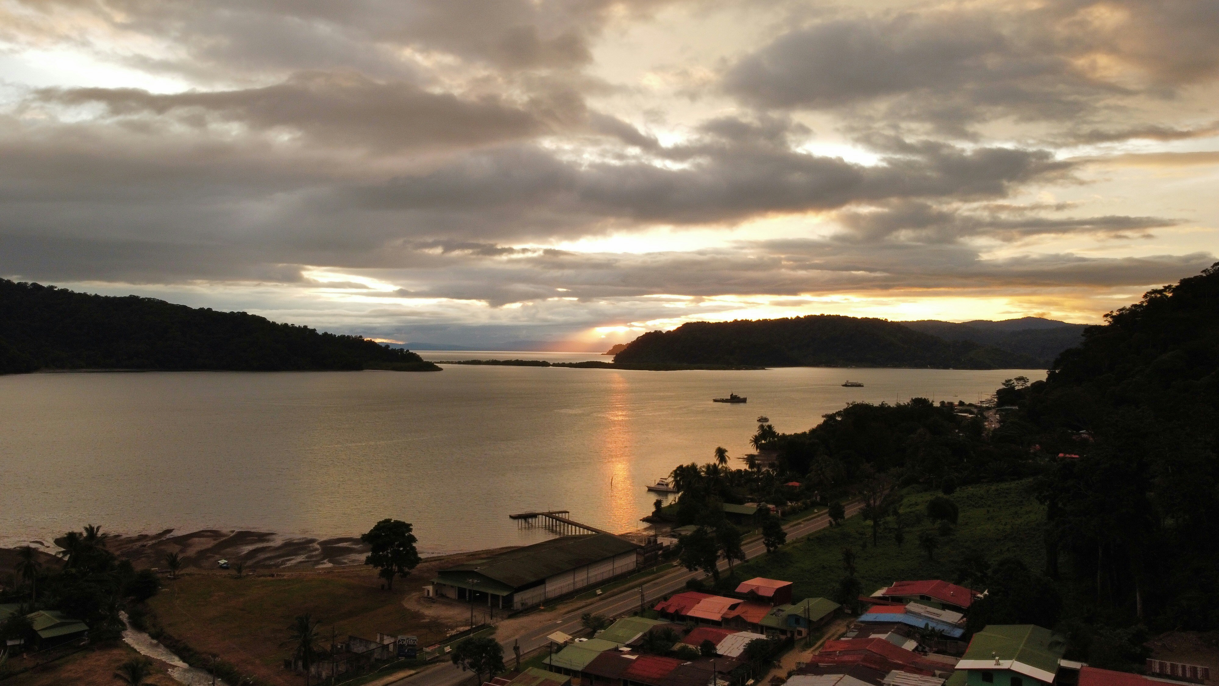
About Golfito
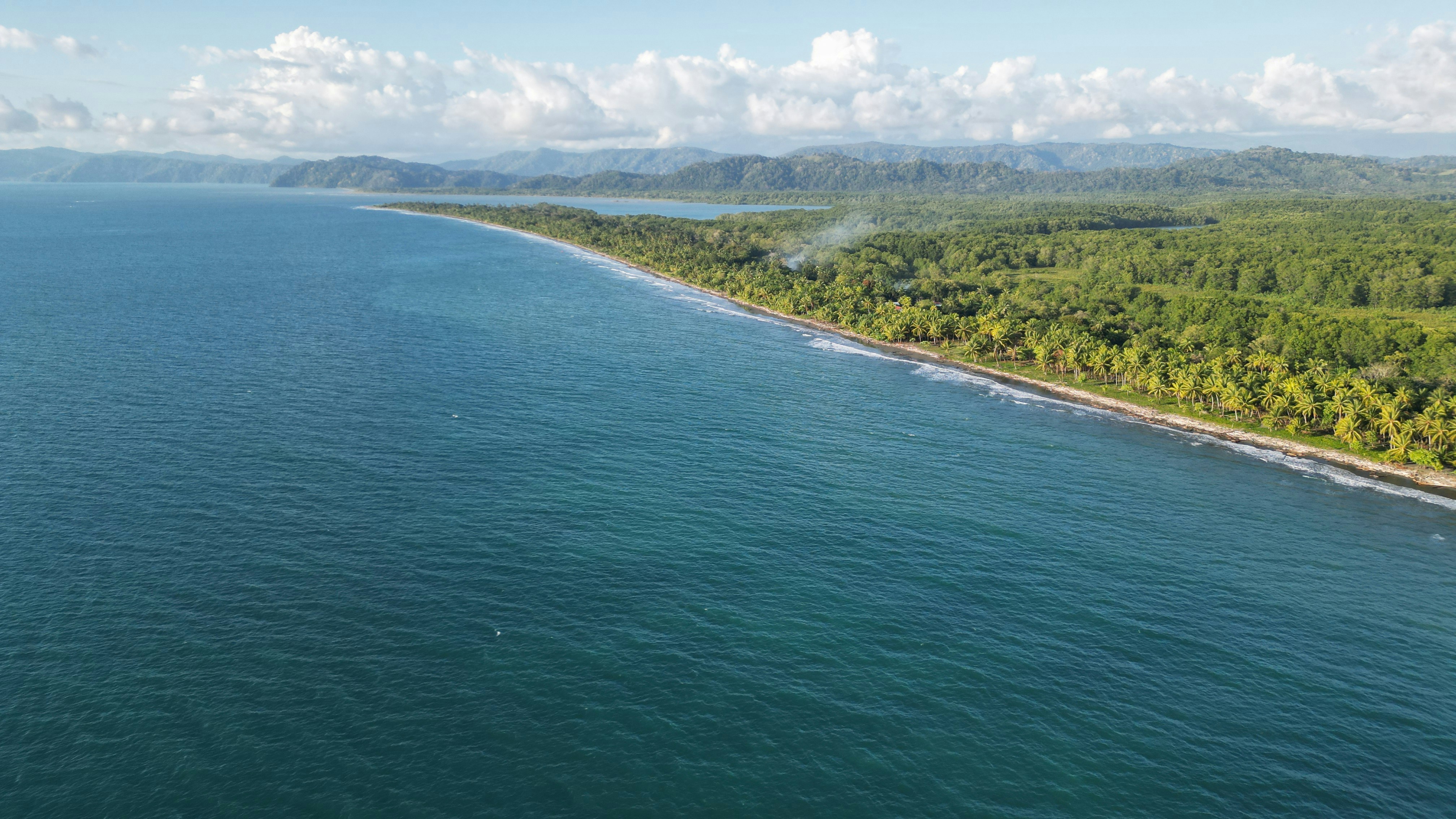
Golfito, is situated along a small inlet of Golfo Dulce. This small port city is a narrow strip along Golfito Bay backed against steep green hills covered with pristine rainforest, with the Golfo Dulce seaward outside Golfito Bay. Surrounded by tropical rainforest, Golfito provides an ideal location to escape from your hectic schedule and enjoy some of the most beautiful beaches in Costa Rica with a stunning backdrop of verdant hills and lush rainforest. Follow a trail through the densely forested Golfito National Wildlife Refuge to observe rare flora and fauna, and emerge at a scenic outlook with views of the ocean, also the city has a variety of hotels and restaurants, many of which now provide free wireless Internet service for customers. Golfito was the main port on the South Pacific Coast of Costa Rica in the days when there was little except for the huge banana plantations. To help remedy the resulting economy decrease of the region, the government established a duty-free zone, support and impulse the touristic development.

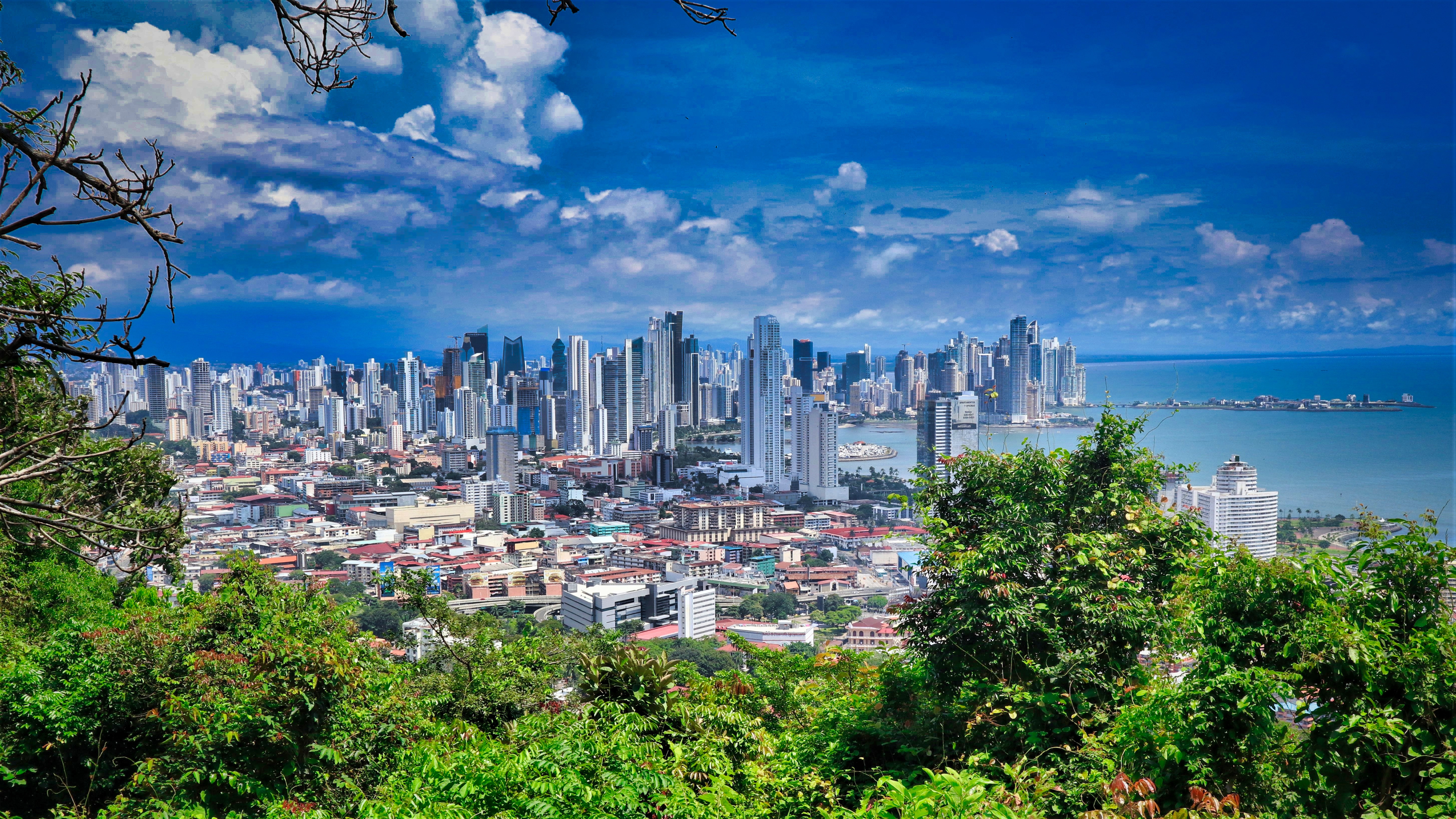
About Panama City
Expect incredible morning views as you arrive into the port for Panama City. Tinged with a silver pre-dawn light, the city will metamorphosise into a golden glow as the sun rises above it. And from then on expect one stunning view after another. Very interesting in its own right, Fuerte Amador is obviously overshadowed by its proximity to Panama City. So should the Miraflores museum of the Canal, which offers a comprehensive and immersive tour of the Canal including a 3-D experience, four exhibition halls, an observation deck, and a surprisingly good restaurant not interest you then there is always the option of lovely Casco Viejo – literally the old quartier of Panama. The grand old colonial houses, cobbled streets, independent boutiques and buzzing street scene make this a must stop on your itinerary. And if you like seafood, you will not want miss the many restaurants and market stalls serving different variations of so-fresh-it’s-still-practically-swimming ceviche. Best eaten like the Panamanians do, with salty crackers and a cold beer on the beach. And if money is no object, a cup of geisha coffee – supposedly the world’s best and definitely the world’s most expensive at $7 a shot is definitely a pick me up! Cool cosmopolitan capital aside, Panama has a skyscraper filled skyline that is worthy of some of its North American counterparts. But if urban utopia is not your scene then fear not, the sandy beaches and lush rainforests are never more than a short cab ride away.
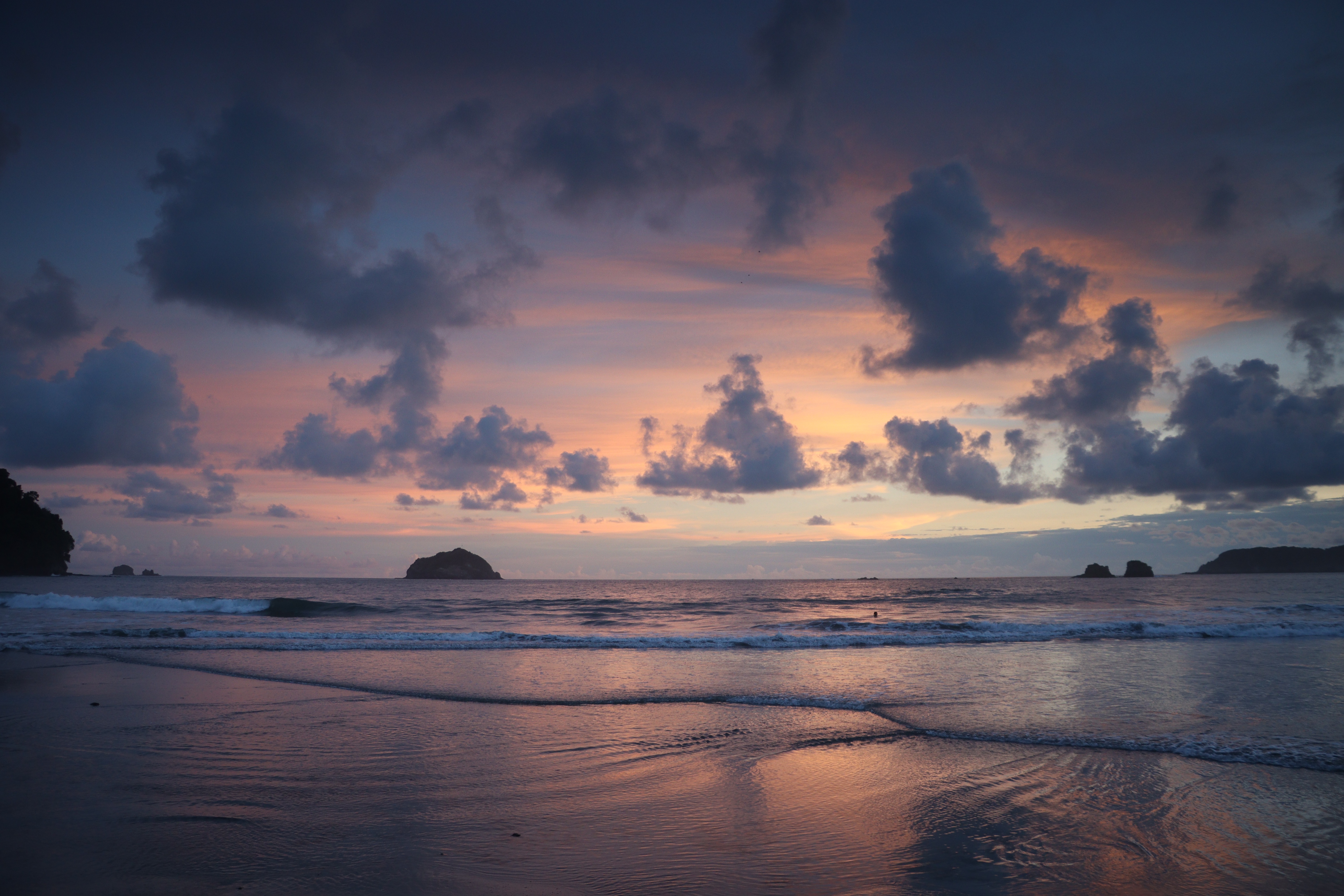
About Puerto Limón
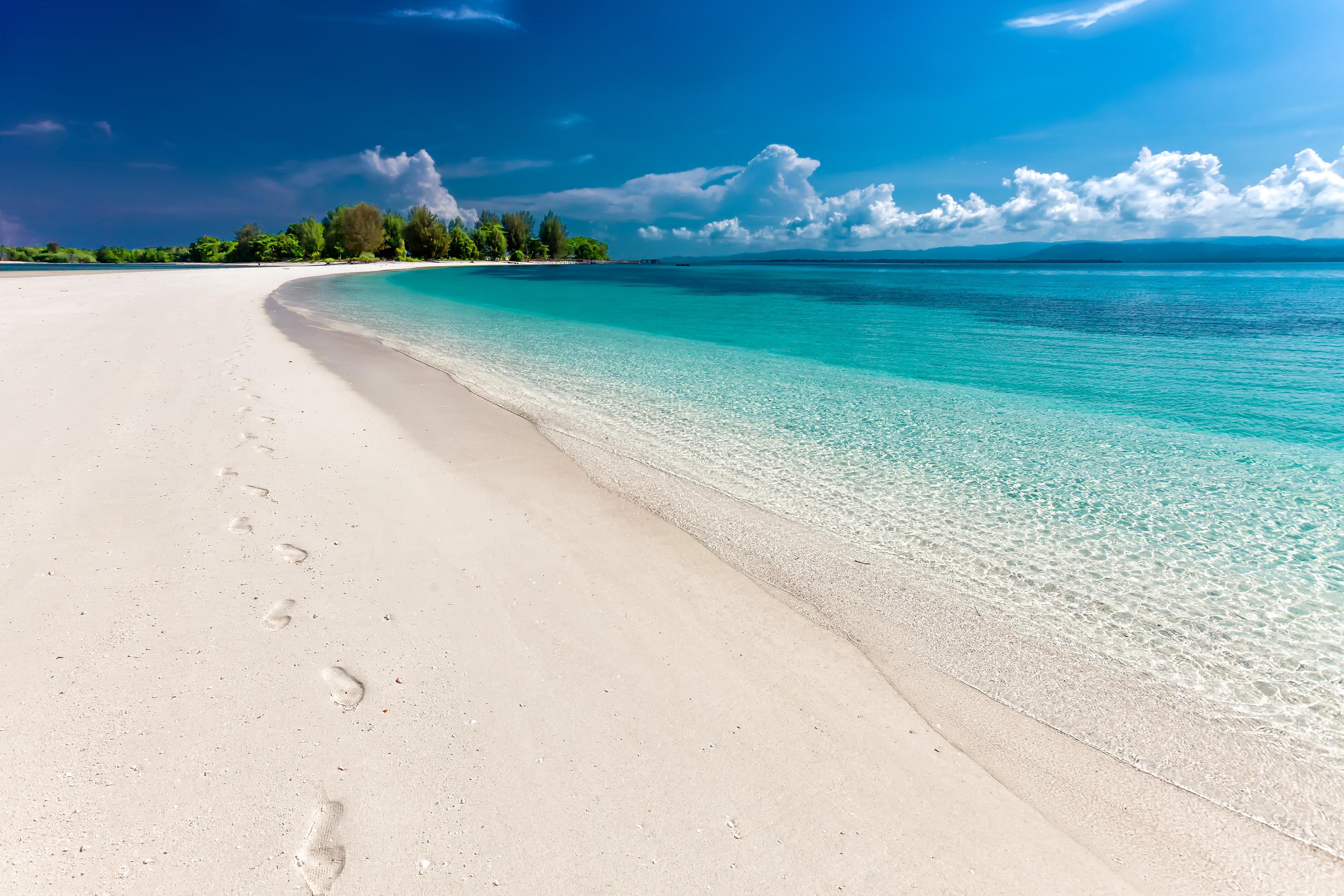
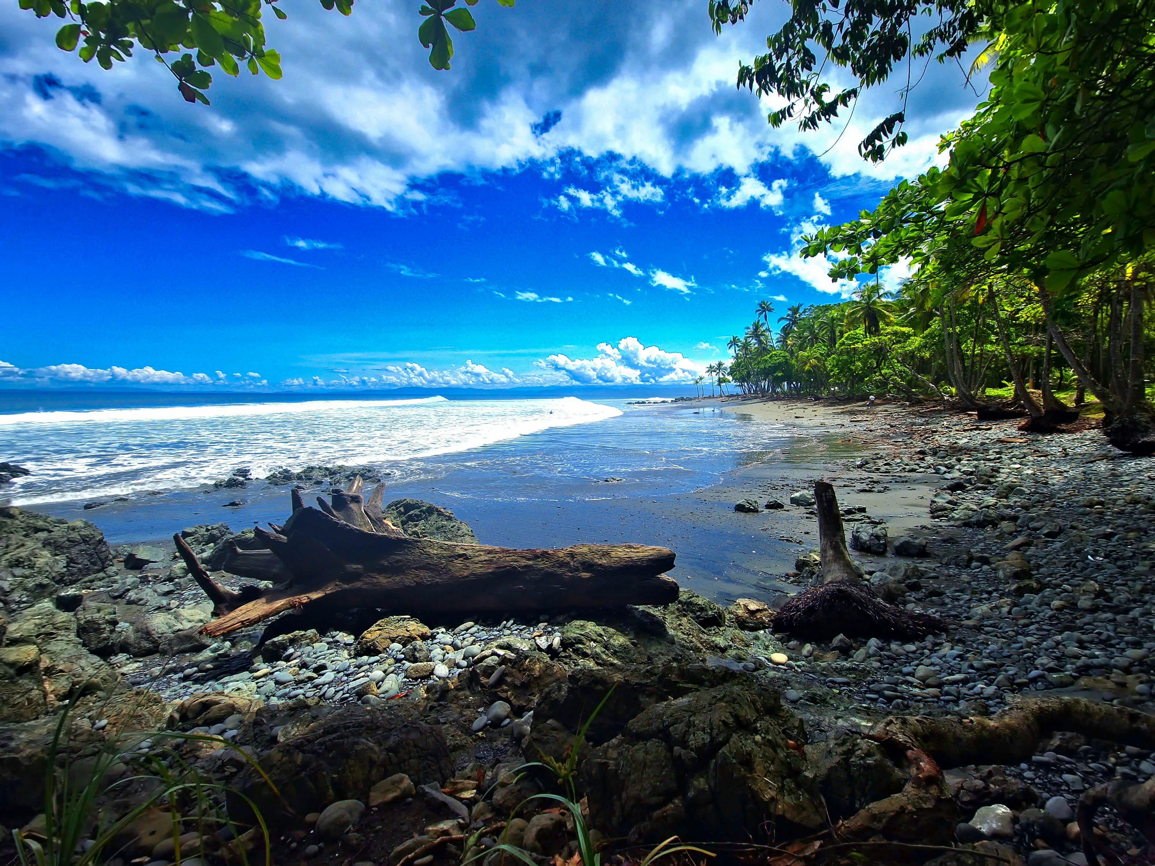
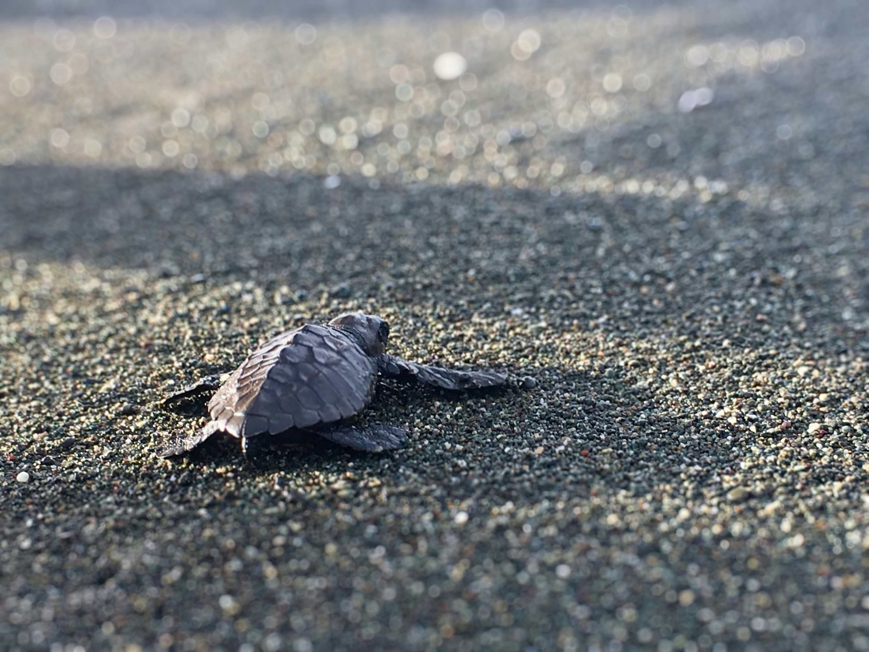
Christopher Columbus became Costa Rica's first tourist when he landed on this stretch of coast in 1502 during his fourth and final voyage to the New World. Expecting to find vast mineral wealth, he named the region Costa Rica ("rich coast"). Imagine the Spaniards' surprise eventually to find there was none. Save for a brief skirmish some six decades ago, the country did prove itself rich in a long tradition of peace and democracy. No other country in Latin America can make that claim. Costa Rica is also abundantly rich in natural beauty, managing to pack beaches, volcanoes, rain forests, and diverse animal life into an area the size of Vermont and New Hampshire combined. It has successfully parlayed those qualities into its role as one the world's great ecotourism destinations. A day visit is short, but time enough for a quick sample.
About Roatán Island
Experience true Caribbean island bliss, during your time on the immaculate paradise of Roatan, which is the largest of the Bay Islands. This slim island is framed by glorious powdery white beaches, and rich ocean beds carpeted with diverse coral reefs - alive with fish and marine life. Curious dolphins roll through the waves just offshore, while beach dwellers soak up the sun, and enjoy coconut cocktails, beside leaning palm trees. The beaches here are nothing short of dreamy - with wooden piers teetering out over the water, and thatched roofs providing welcome shade, as you dangle your legs towards the water.


About Harvest Caye
About Costa Maya
Laid-back coast with sandy beaches & waterfront eateries, plus diving around offshore coral reefs.

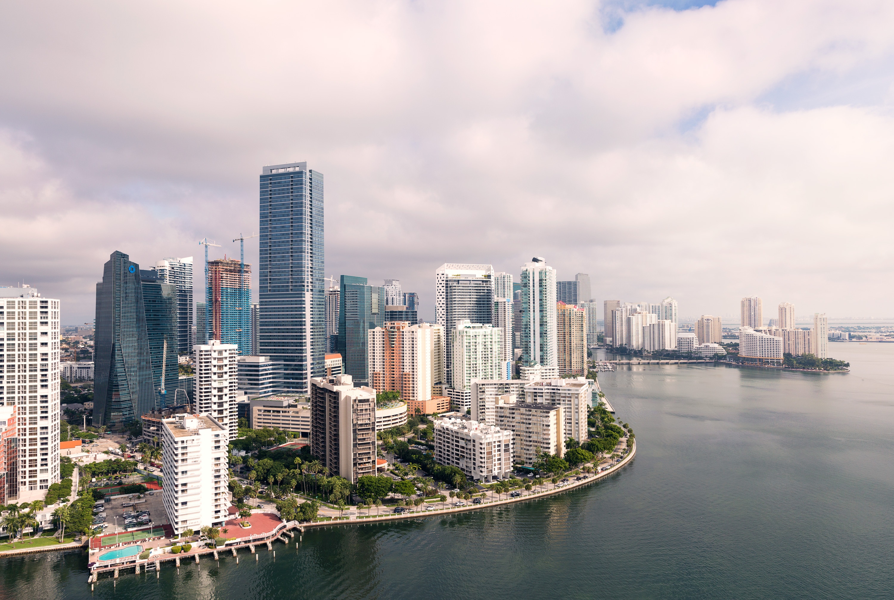
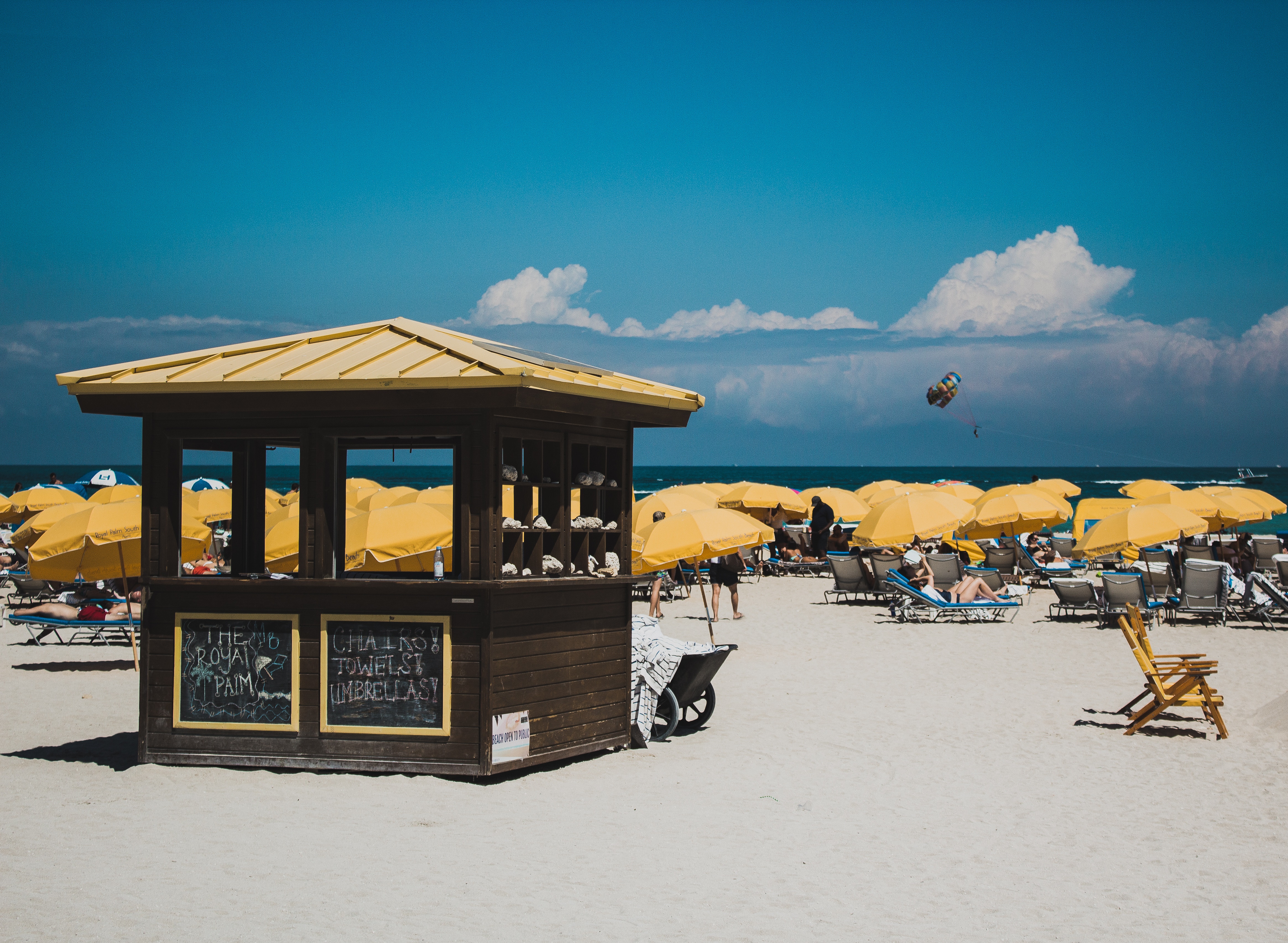
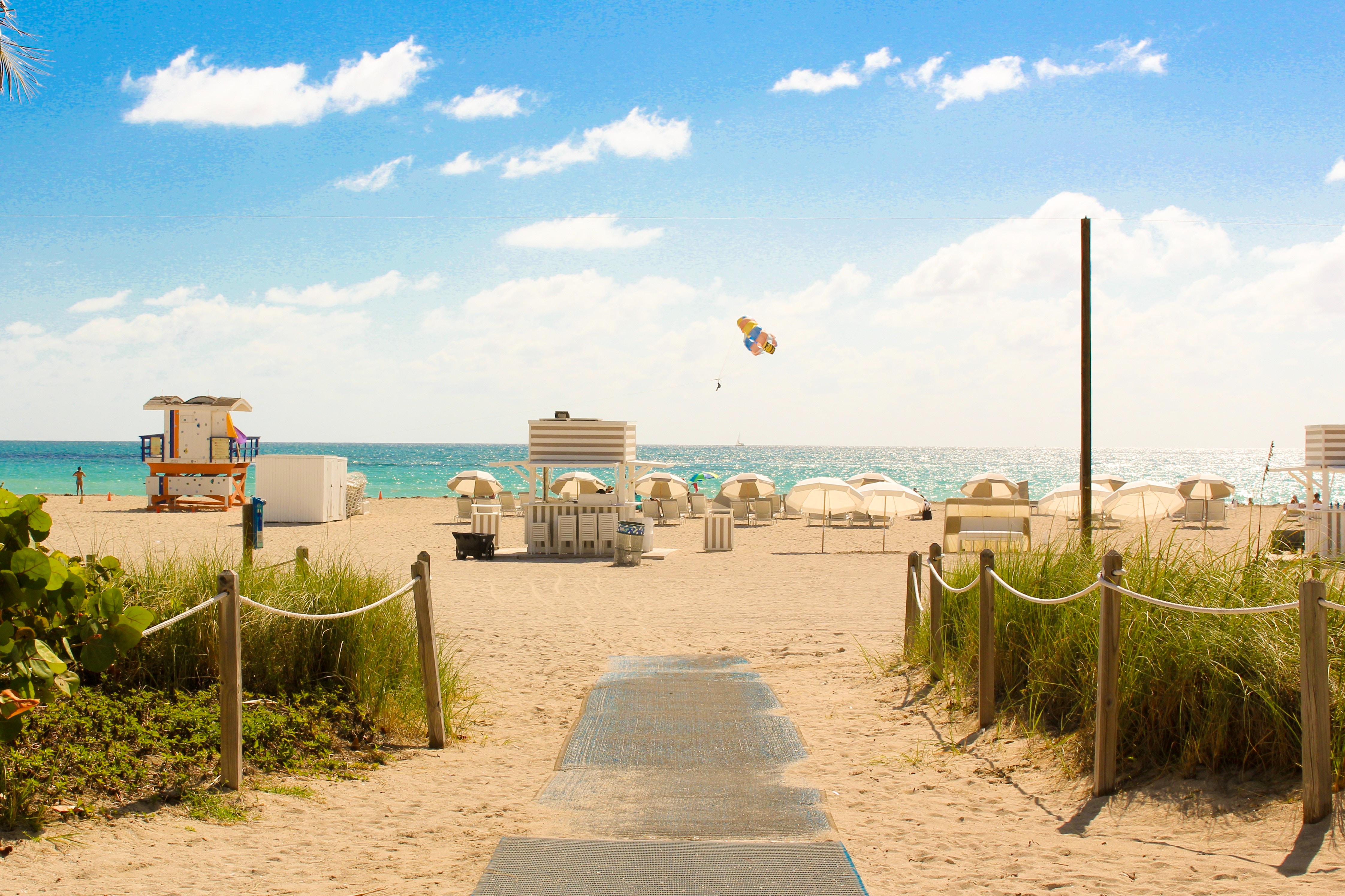
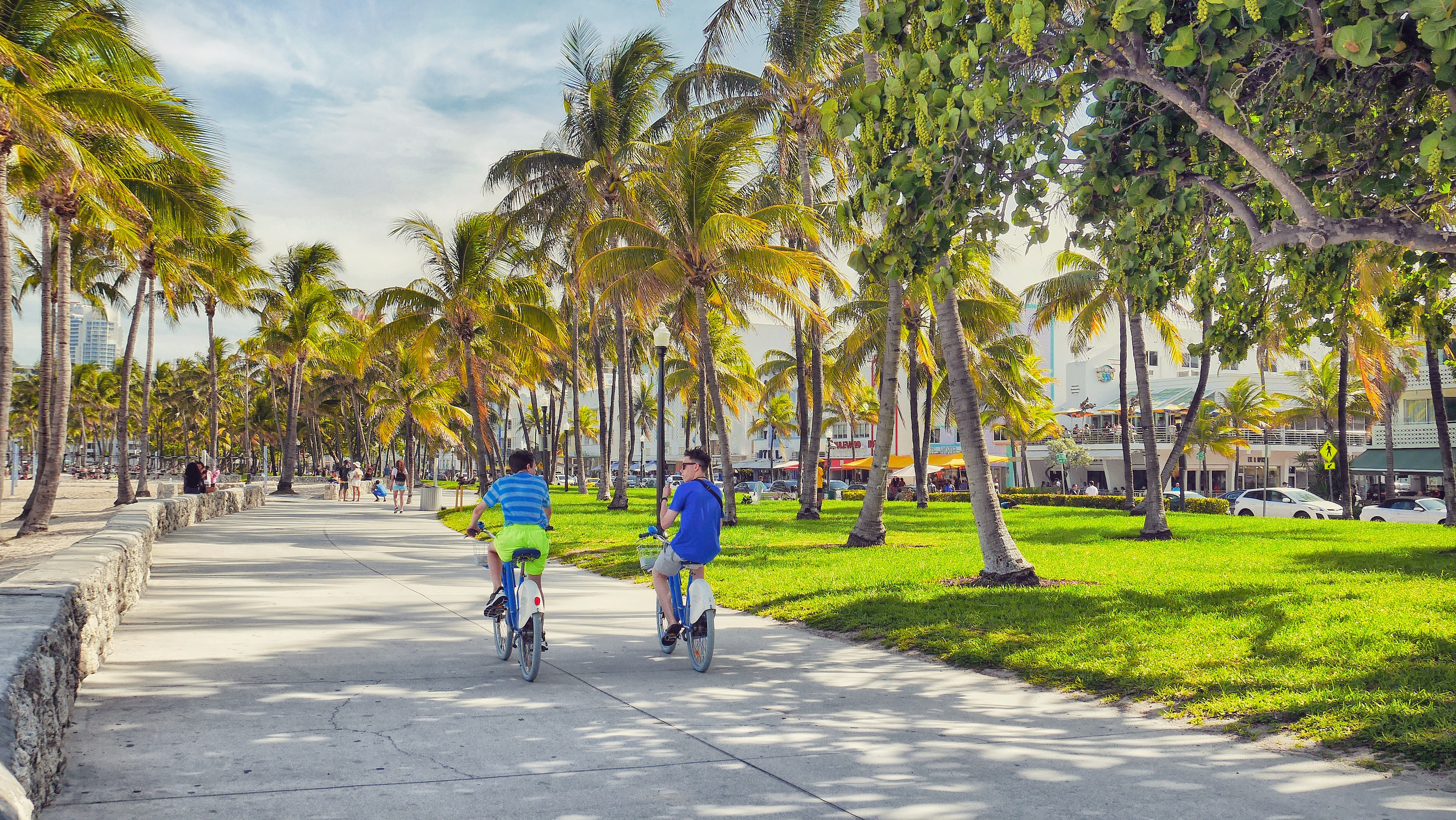
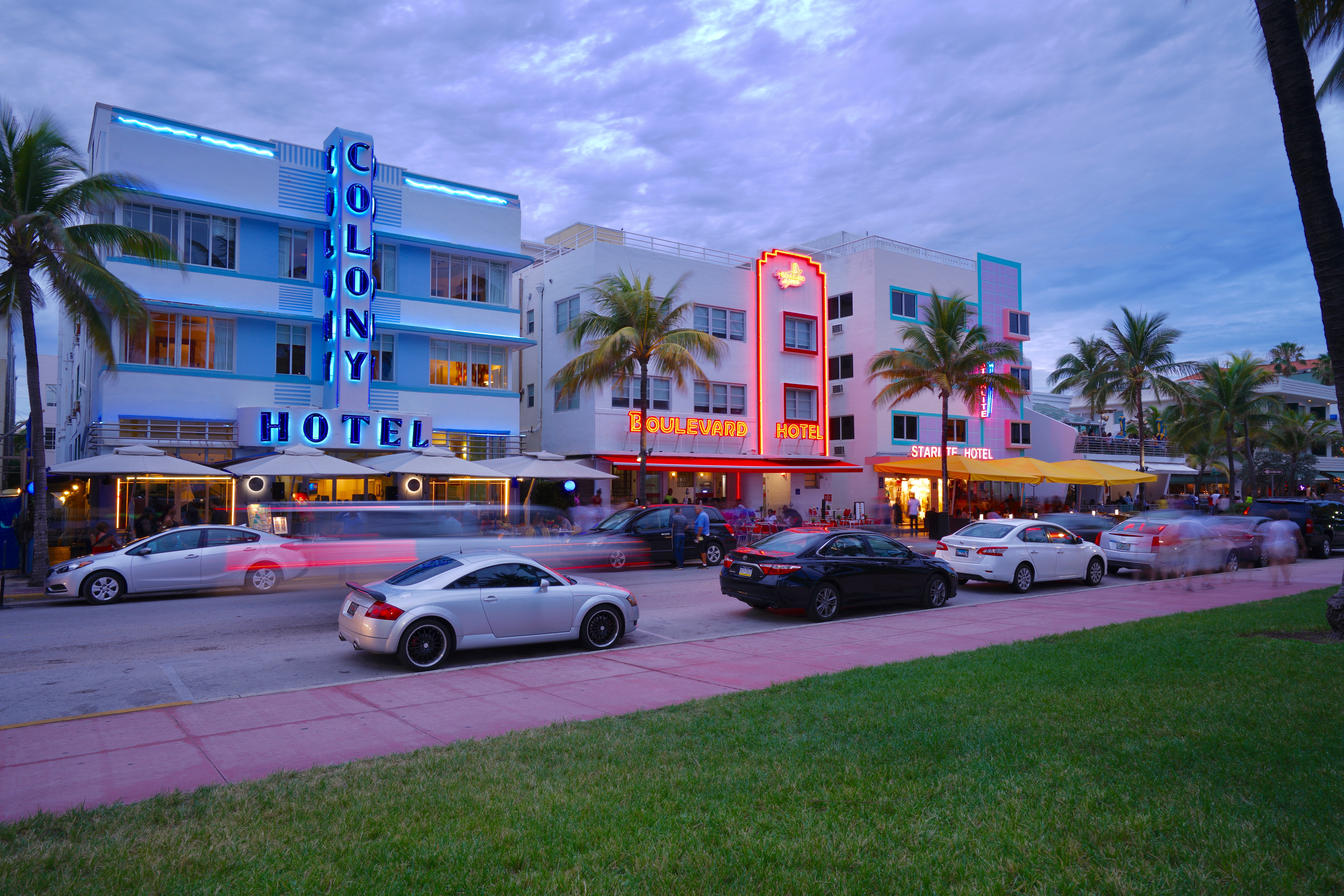
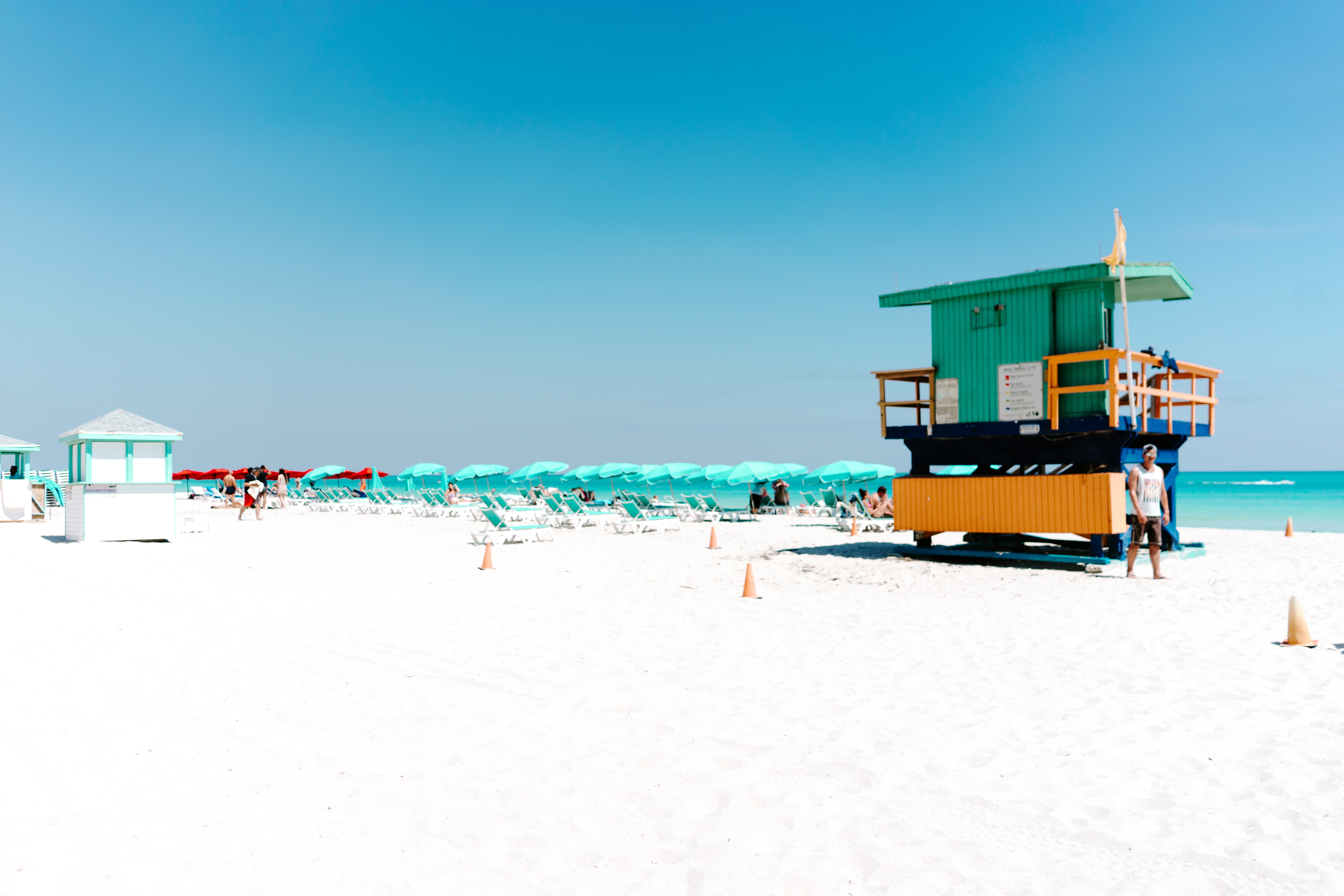
About Miami, Florida
Miami is one of the world’s most popular holiday spots. It has so much to offer; from its countless beach areas, to culture and museums, from spa and shopping days out, to endless cuban restaurants and cafes. Miami is a multicultural city that has something to offer to everyone.
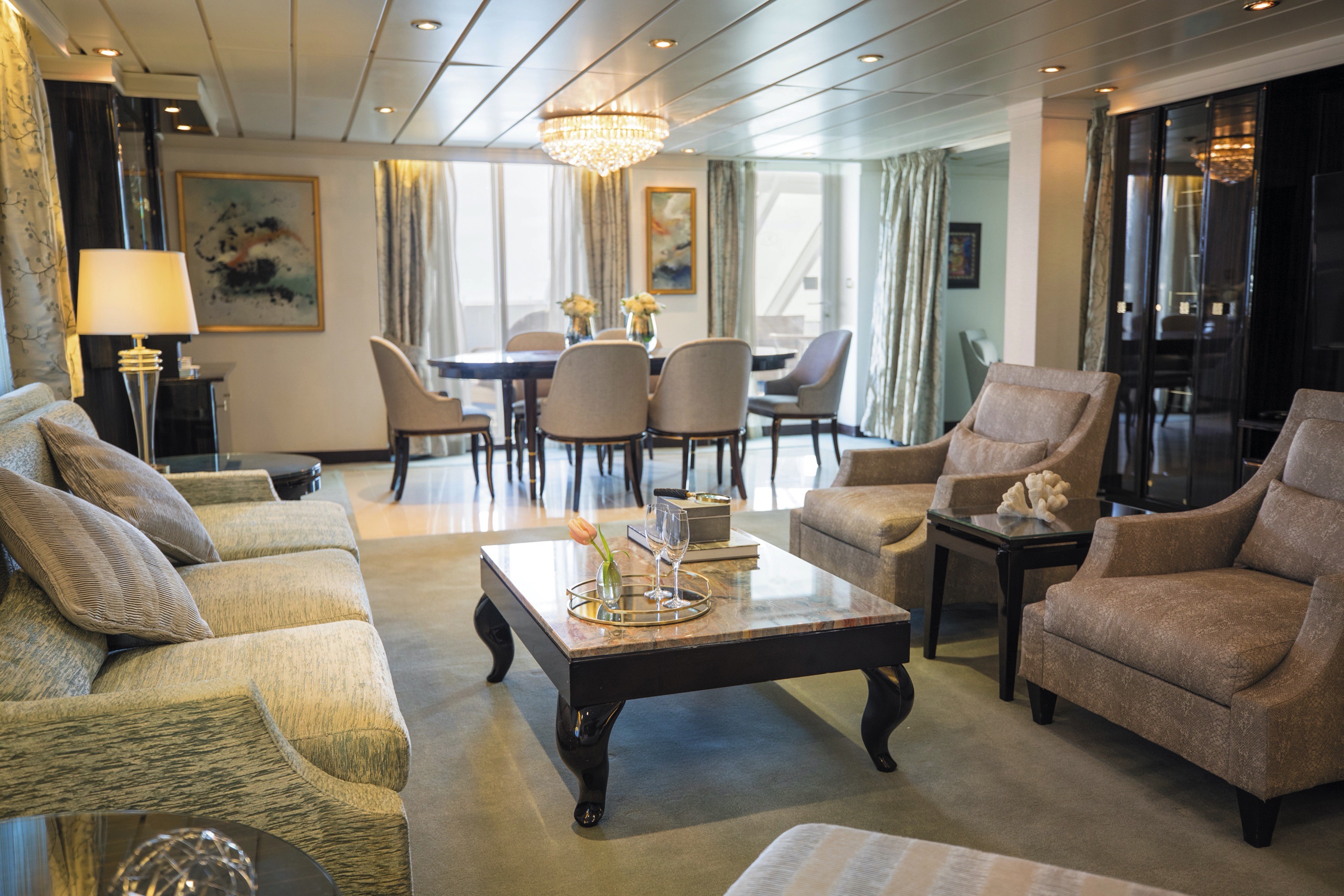
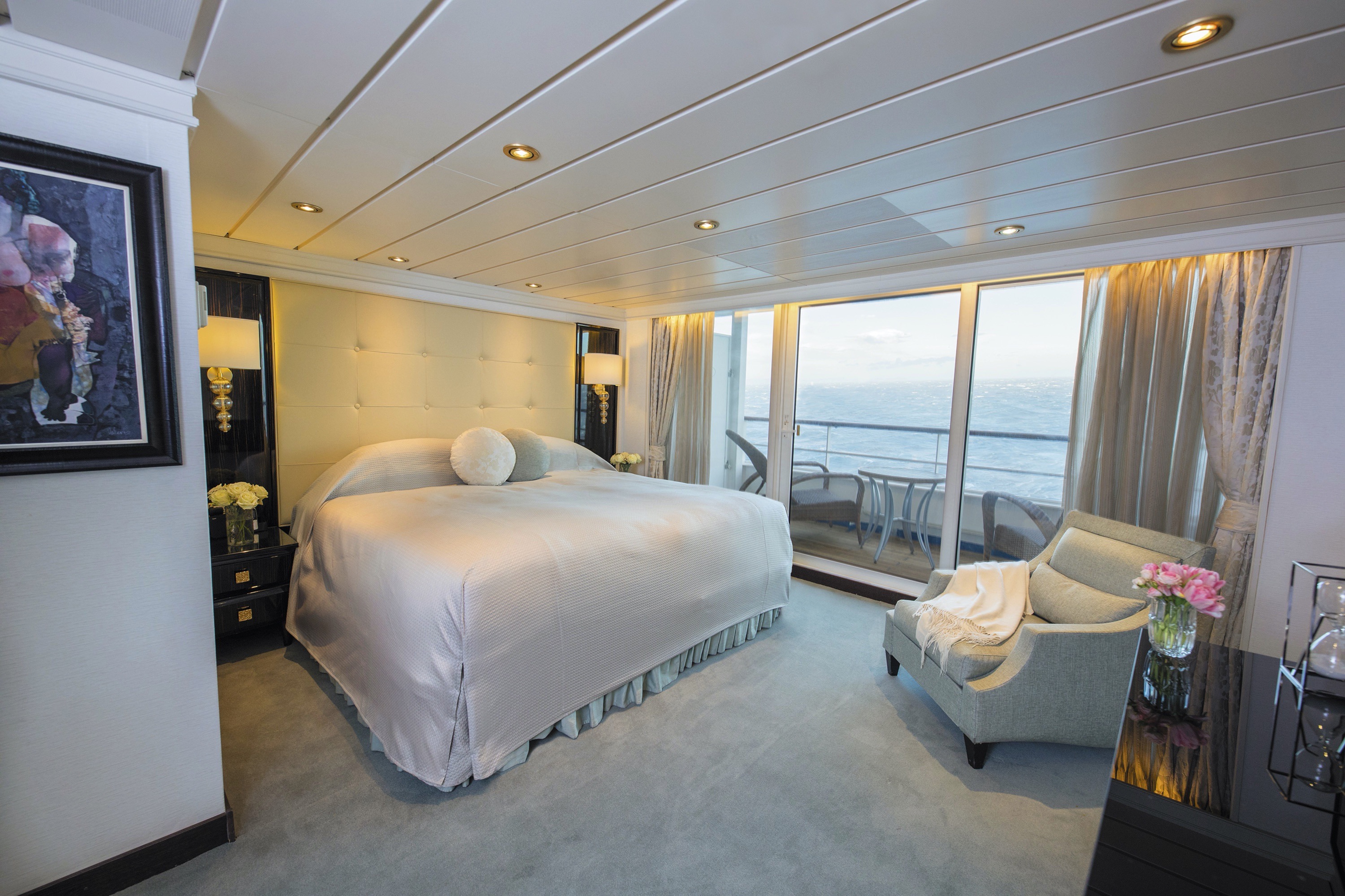
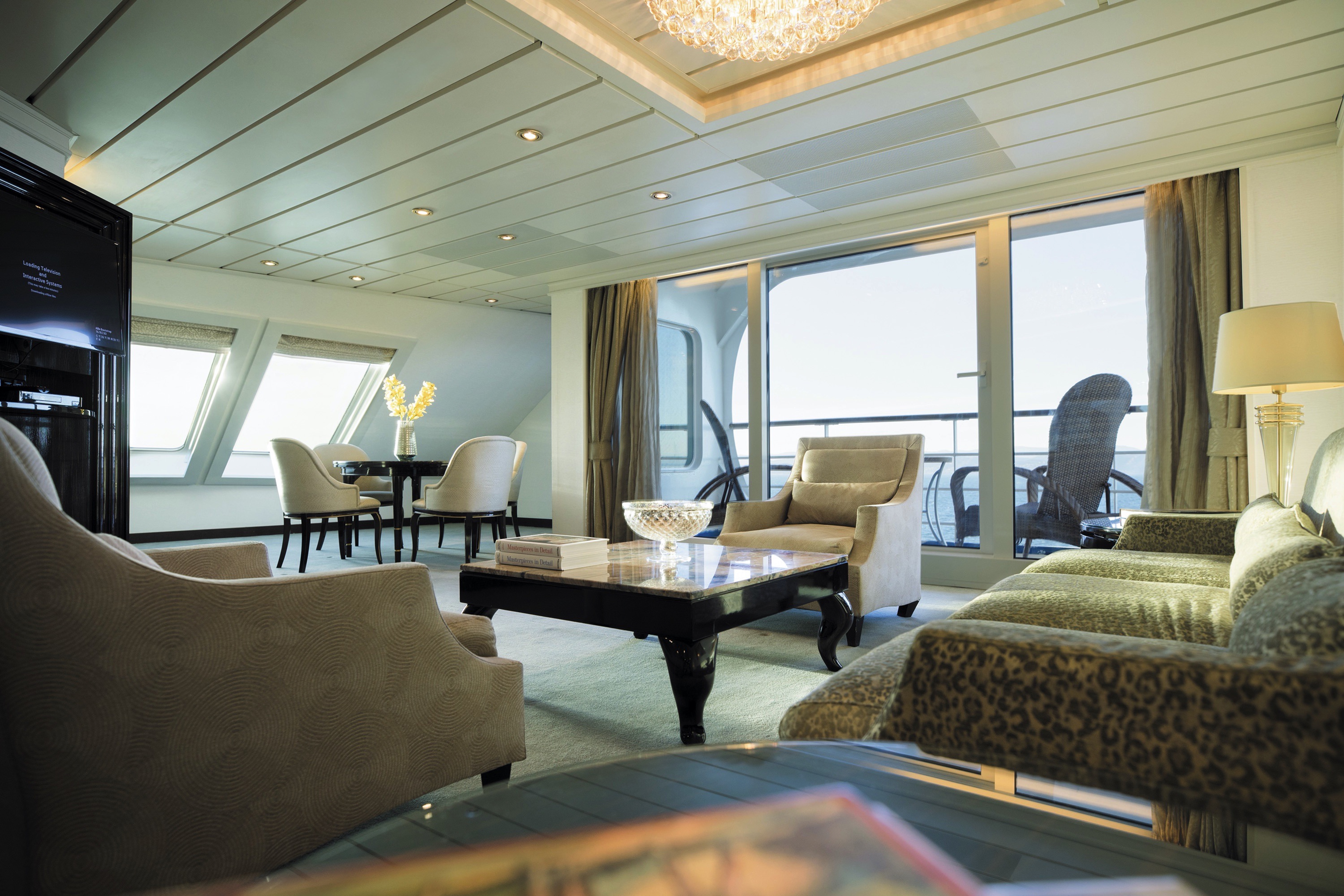
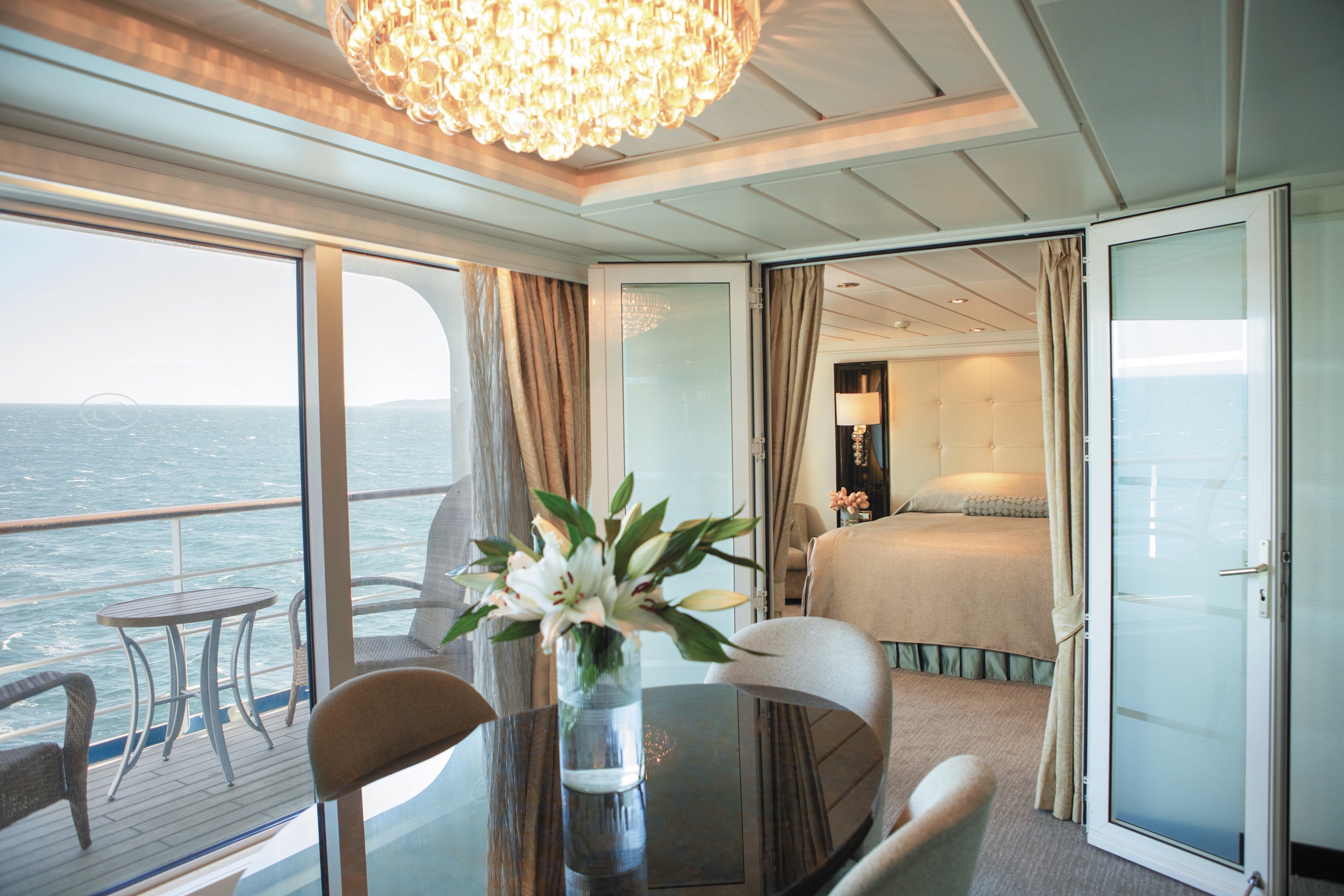
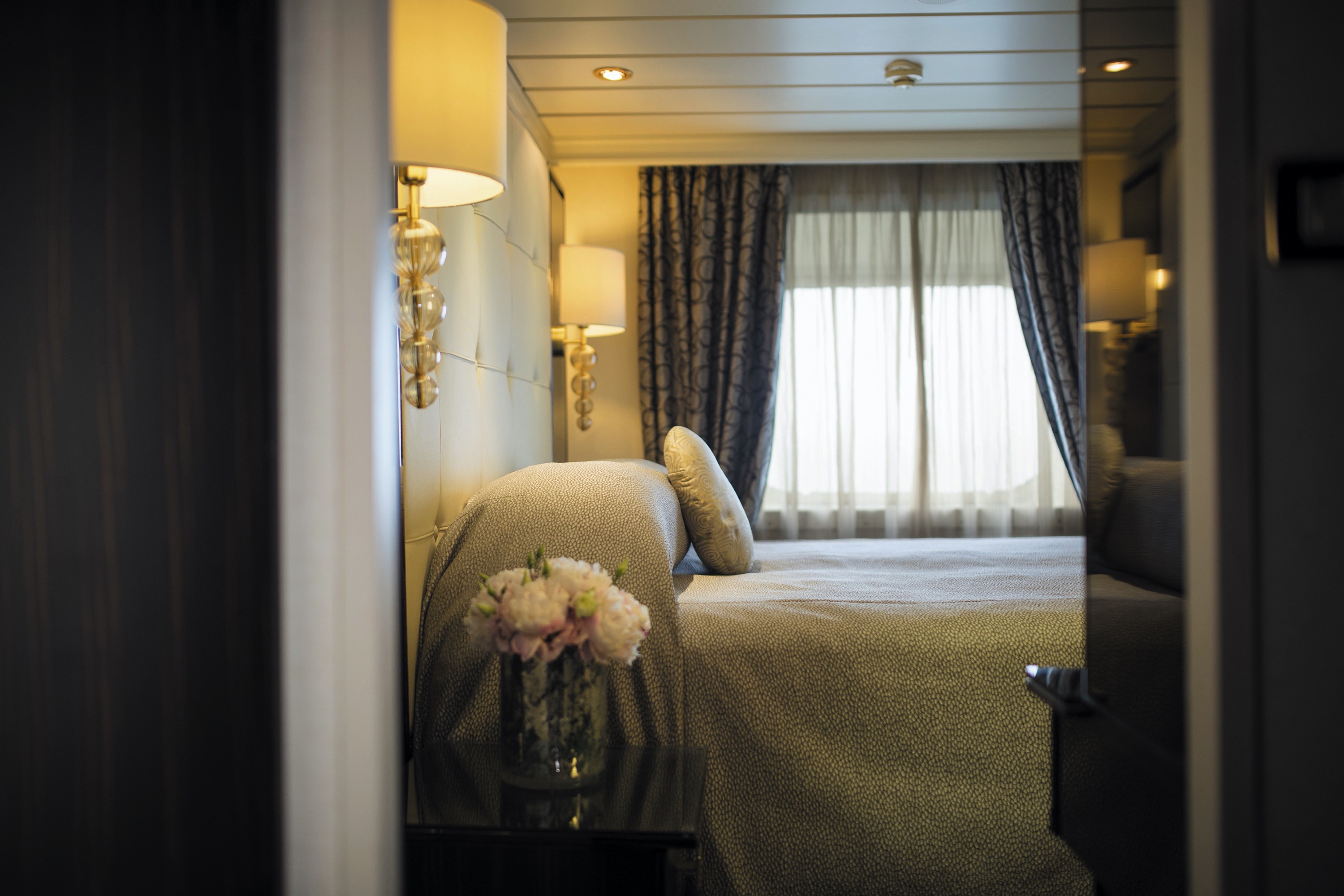
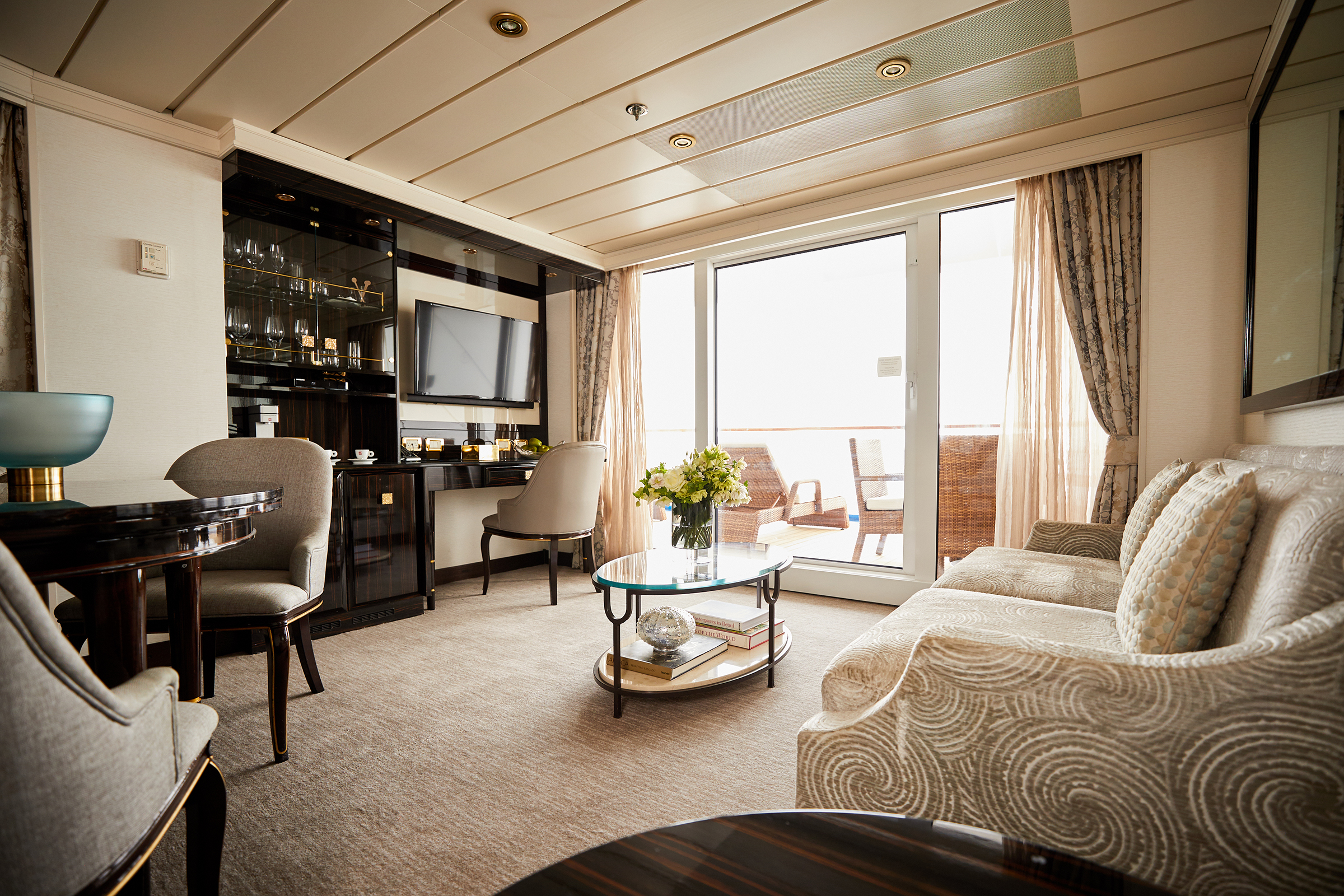
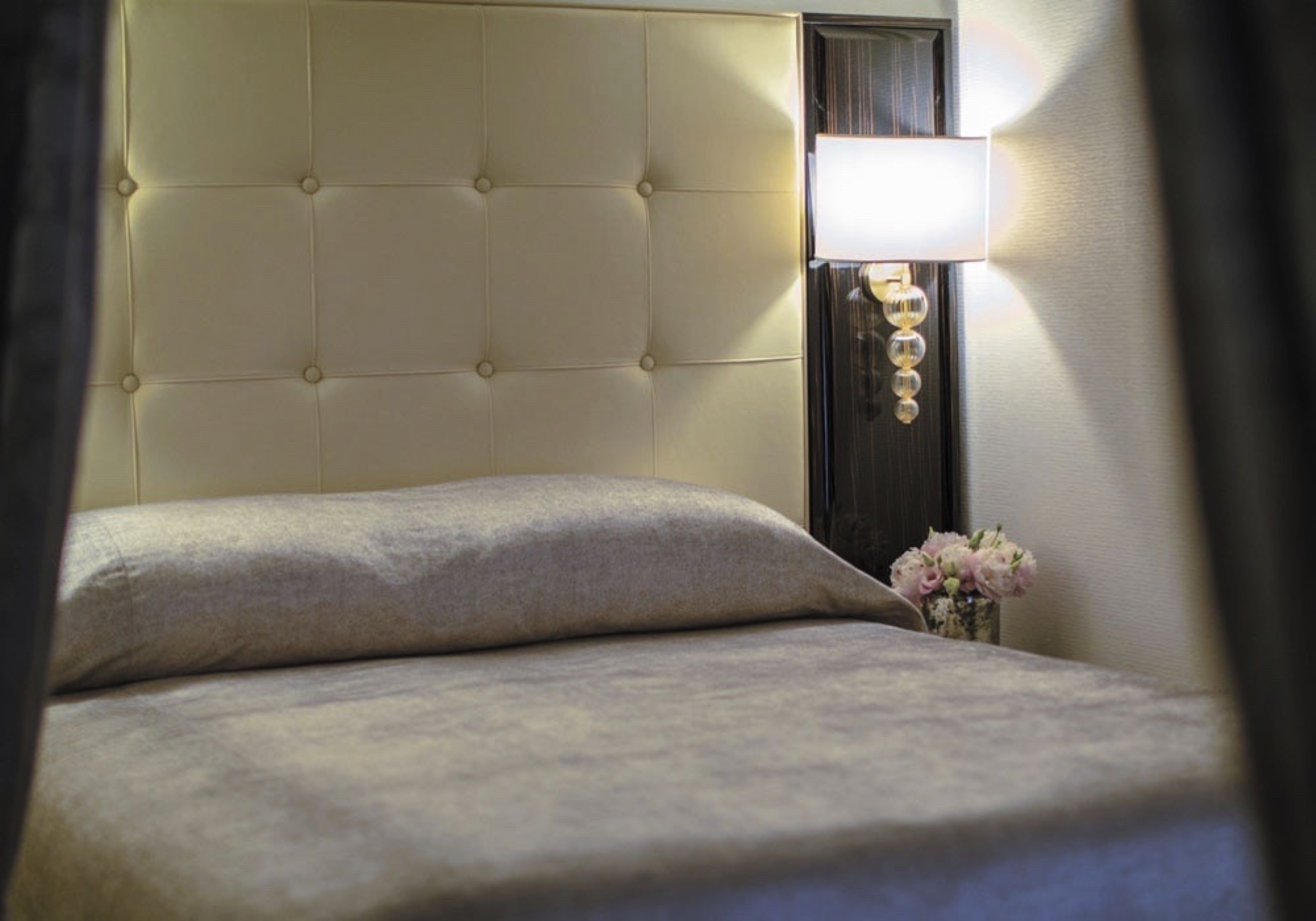
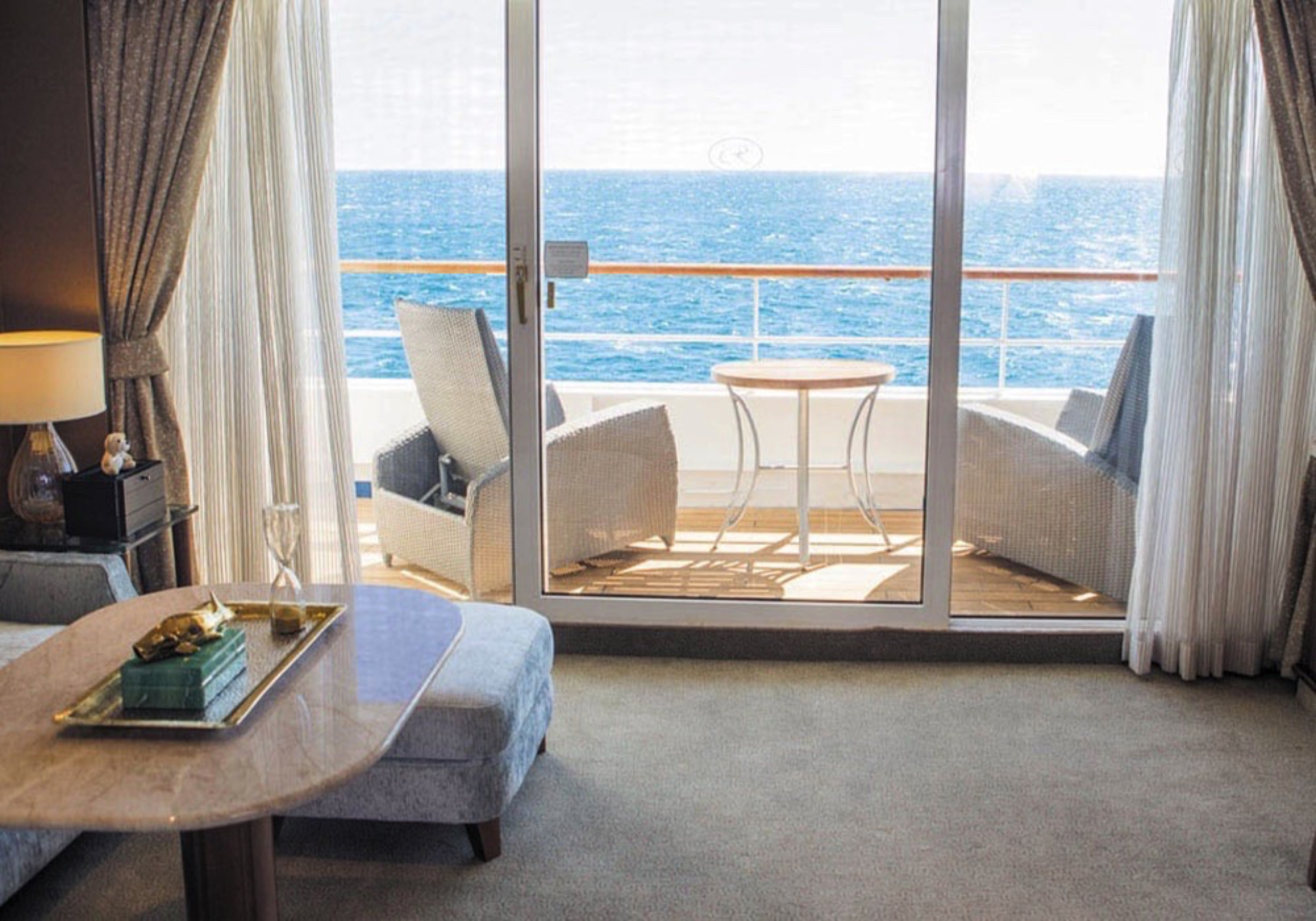
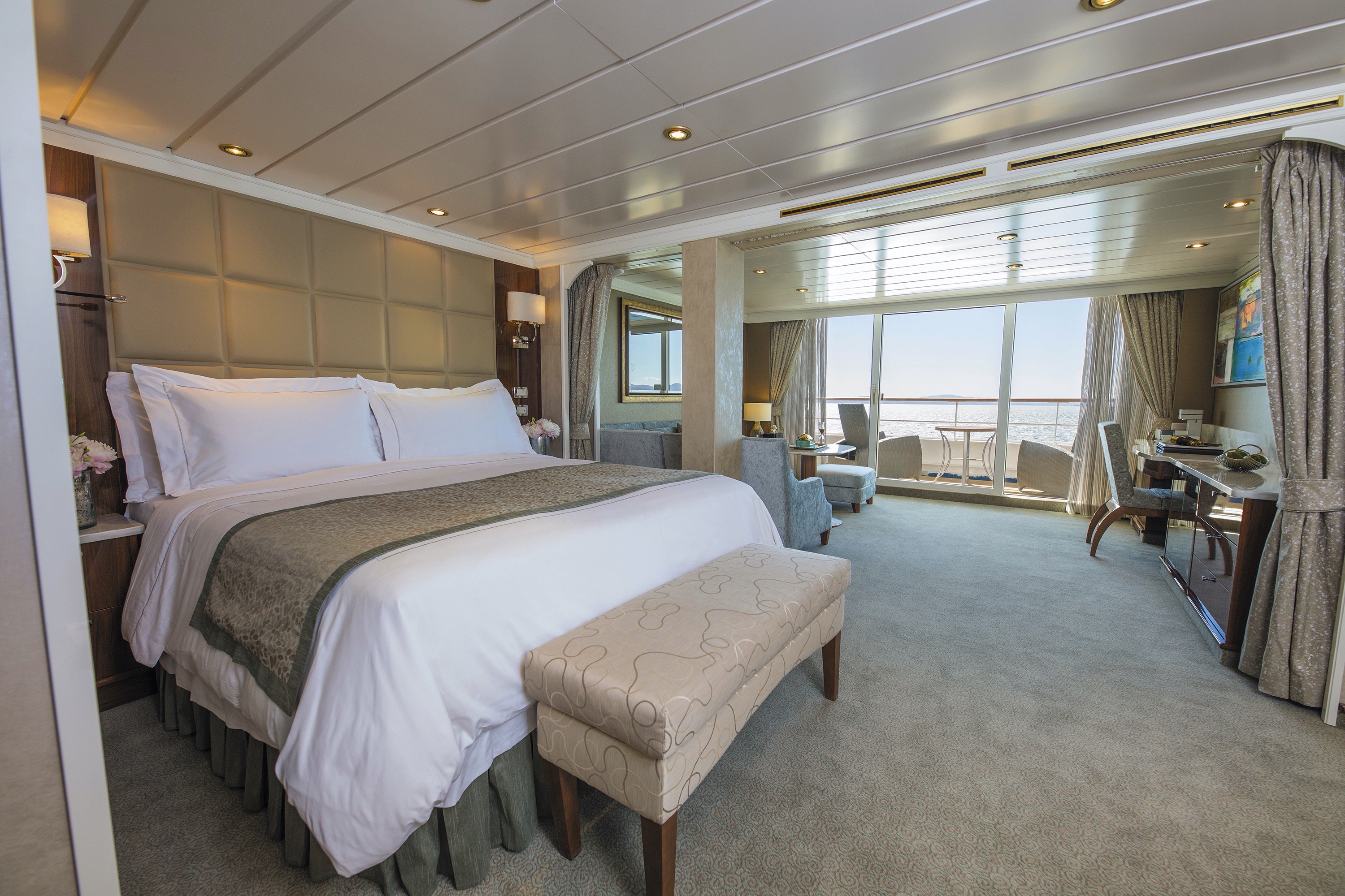
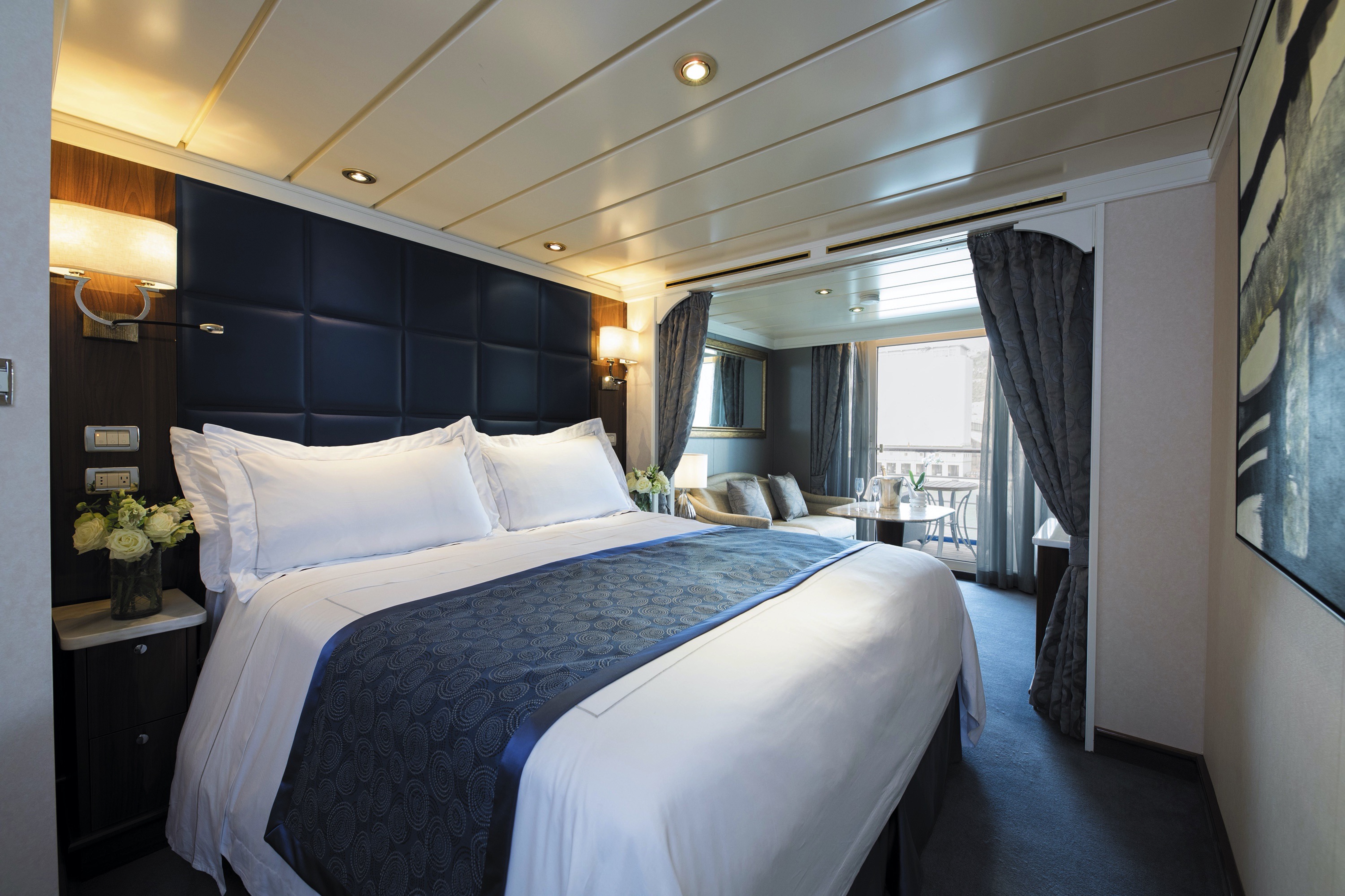
You'll find Park Avenue chic onboard Seven Seas Mariner® in this spectacular suite. Elegant rosewood furniture, luxe fabrics and a crystal chandelier create sophisticated comfort, while a personal butler is available to fulfil whatever requests you may have. With two bedrooms, two-and-a-half baths, a large living room and two private balconies, this sublime suite is perfect for hosting new friends in luxury.
Layout
- 2 Spacious Bedroom with a European King-Size Elite Slumber® Bed (*Bed in primary bedroom cannot be converted into two beds.)
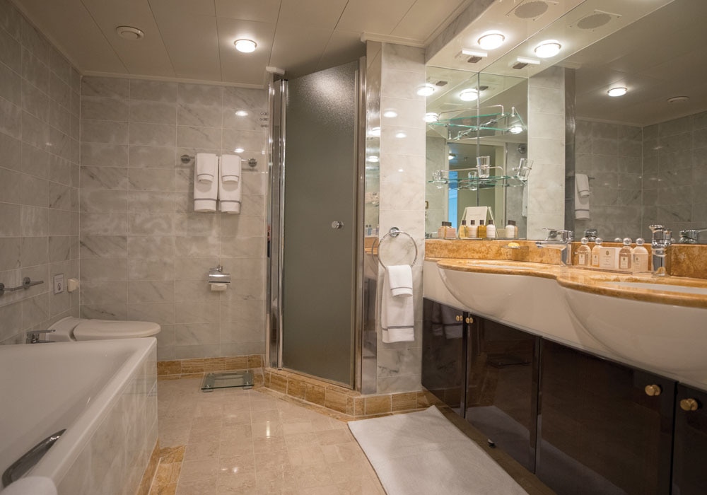
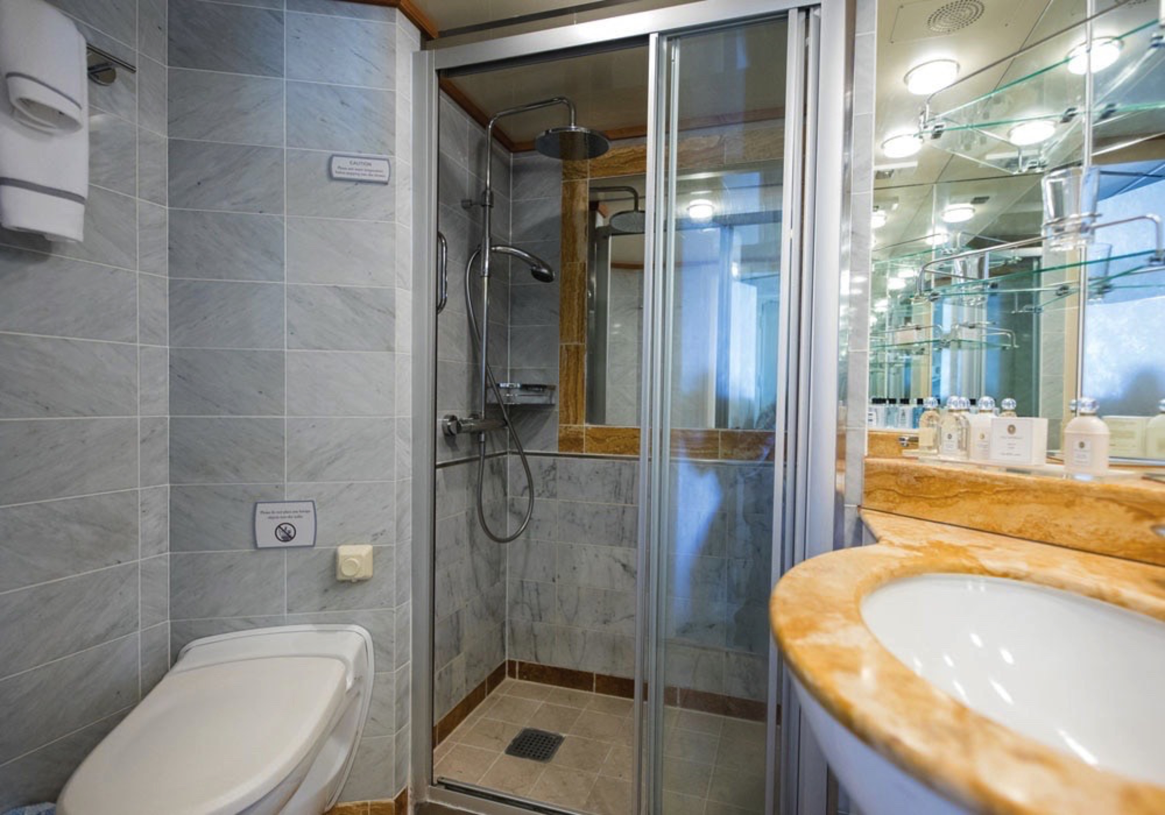
- 2 1/2 Marble & Stone Detailed Bathrooms
- 2 Private Balconies
- Sitting Area
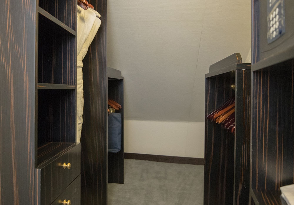
- Walk-In Closet with Safe
- Includes Up To 6 Guests
The suite pictured may differ from the suite booked, as layouts and designs vary by ship, deck, and suite location.
Amenities
- 1-Night Pre-Cruise: Hotel Package Including:
- - Ground Transfers
- - Breakfast
- - Porterage
- Unlimited WiFi and Streaming Package for up to Four Devices
- Valet Laundry Service
- 24-hour In-Suite Dining
- Fresh Orchid Arrangement
- L'Occitane® Jasmin & Bergamot Bath Amenities
- Regent Plush Bathrobe & Slippers
- Interactive Flat-Screen Television & Direct-Dial Satellite Phone
- Priority Access to Online Shore Excursion Reservations
- Priority Access to Online Dining Reservations
- Binoculars
- illy® Espresso Maker
- Cashmere Blankets
- Regent Special Gift
- Vanity & Hair Dryer
- Shoe Shine Service
- Additional Discounts:
- - 10% Discount on Ultra Premium Wine and Liquor
- - 5% Savings on Pre- or Post-Cruise Hotel or Land Programs
- - 5% Savings on Regent Choice Shore Excursions
Additional Signature Suite Amenities:
- Guaranteed Reservation Each Night in Specialty Restaurant of Your Choice
- Welcome Letter from the President and General Manager
- Personal Butler for an Elevated In-suite Experience
- - In-Suite Dining Menu Including Specialty Restaurant Selections During Dining Hours
- Priority Boarding on Embarkation Day with Suite Access at Noon
- Welcome Bottle of Premium Champagne
- Personalized In-Suite Full-Liquor Bar Set-Up
- A Sumptuous In-Suite Caviar Service Once During Cruises
- Complimentary In-Suite Cocktail Party for 8
- Complimentary 25-Minute Personal Fitness Session at the Serene Spa & Wellness™ Fitness Center
- Daily Canapés
- Tea Forté Set-Up
- Luxe Fruit Arrangement with Chocolate Leonidas
- Luxurious Designer Bath Amenities & Men's Unscented Shaving Kit
- Hairdryer
- Selection of Fig & Tea Leaves Bath Salts
- Guerlain Bath Amenities & Men's Unscented Shaving Kit
- Bath Scale Setup
- Bose® SoundLink Mini II Bluetooth Speaker
- Selection of Bed Pillow Styles
- Complimentary Garment Pressing on First Night
- Personalized Stationery upon request
- Elegant Weather Clock
- Excursion Bag
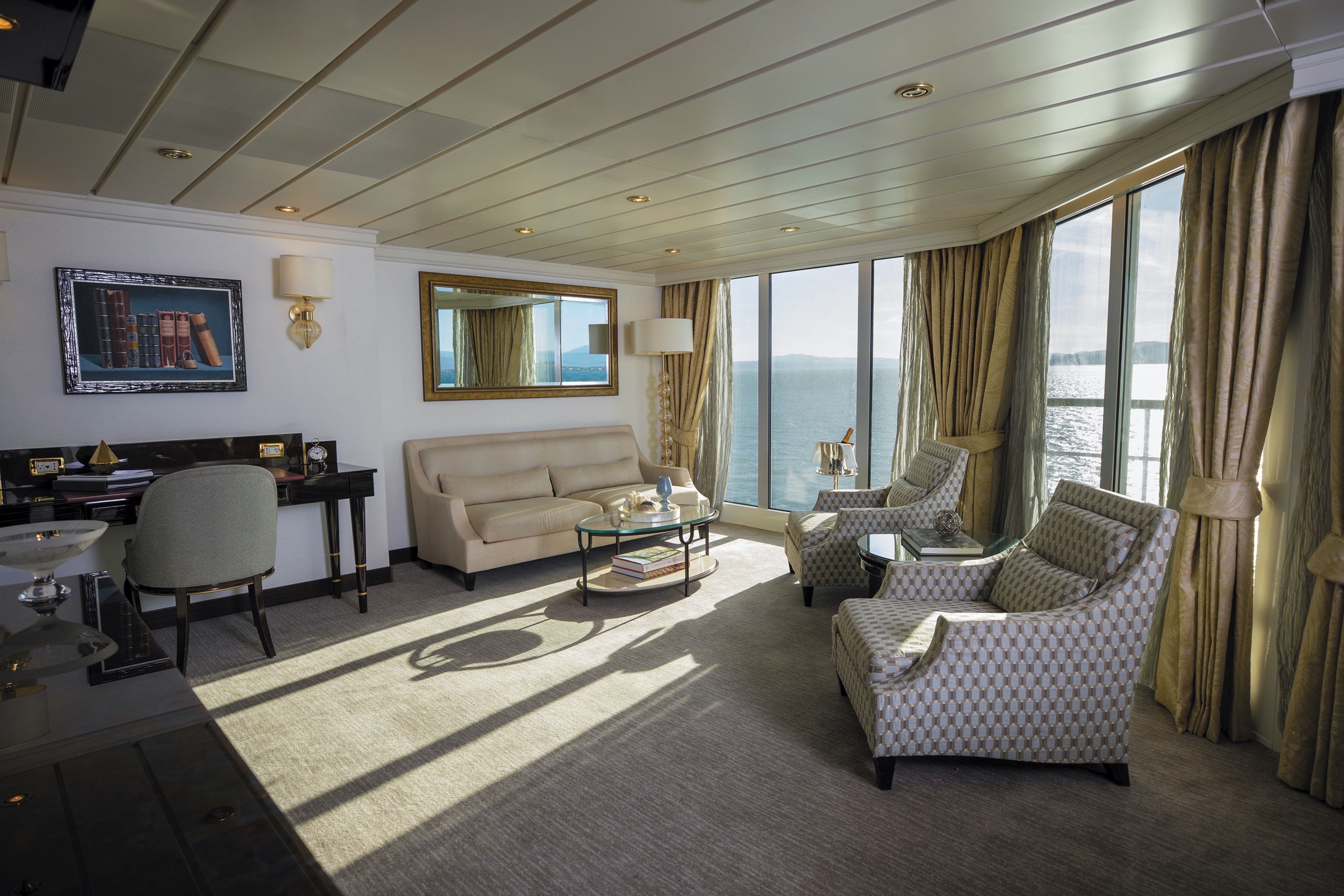
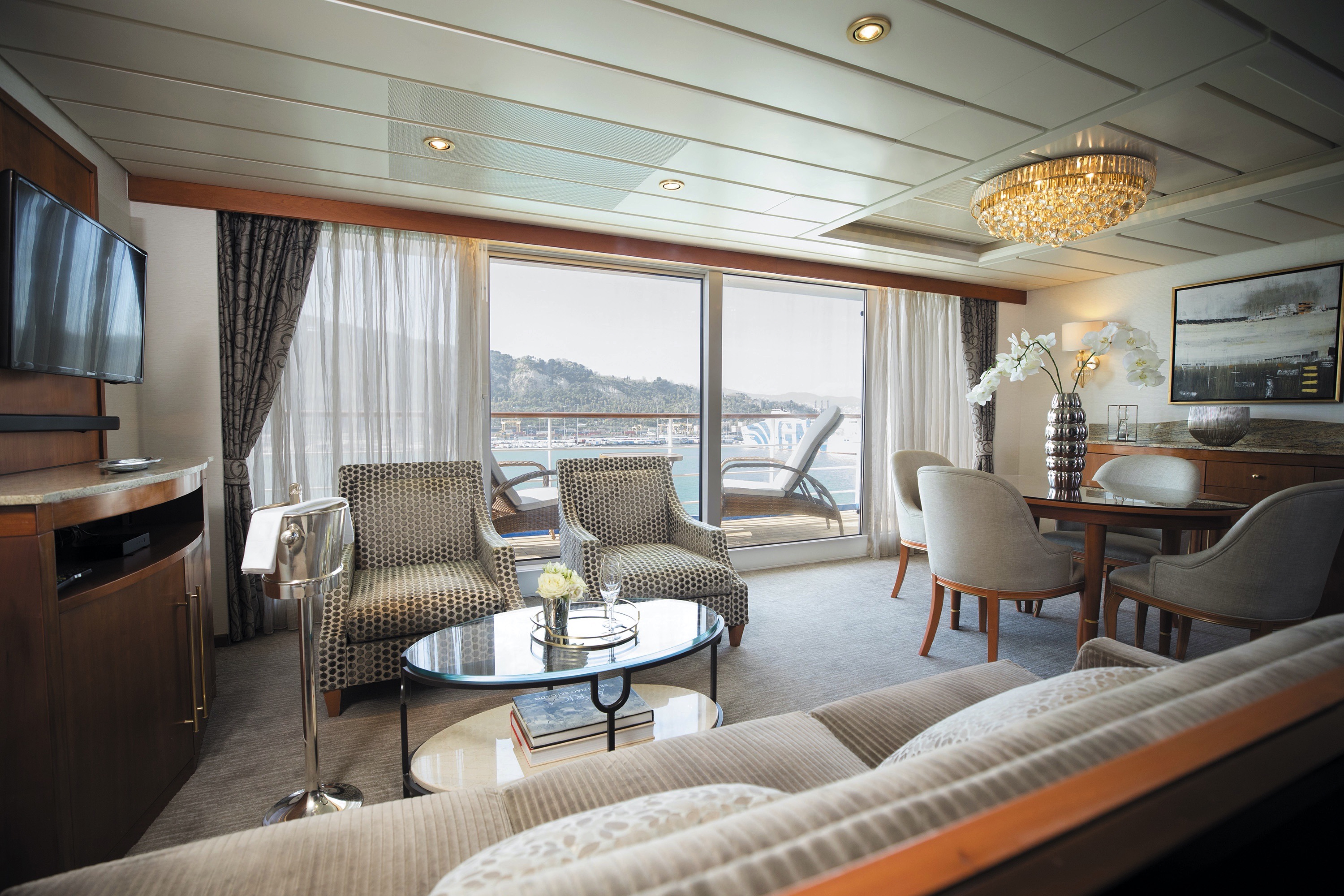
Step into the richness of a dining area perfectly ensconced within a spacious, art-filled living room. Just outside is a private balcony with a table and chairs just right for in-suite breakfast. The private bedroom is large and inviting, its soothing color palette conducive to a peaceful night’s rest on your King-Sized Elite Slumber™ Bed. Two full baths and luxurious bath products invite you to indulge in unbridled ‘me time’.
Layout
- 1 Spacious Bedroom with a European King-Size Elite Slumber® Bed (*Bed cannot be converted into two beds.)
- 2 Marble & Stone Detailed Bathrooms
- Private Balcony
- Sitting Area
- Walk-In Closet with Safe
- Accommodates Up To 3 Guests
The suite pictured may differ from the suite booked, as layouts and designs vary by ship, deck, and suite location.
Amenities
- 1-Night Pre-Cruise: Hotel Package Including:
- - Ground Transfers
- - Breakfast
- - Porterage
- Unlimited WiFi Includes up to Four Logins, Four Devices, per Suite
- Valet Laundry Service
- 24-hour In-Suite Dining
- Fresh Orchid Arrangement
- L'Occitane® Jasmin & Bergamot Bath Amenities
- Regent Plush Bathrobe & Slippers
- Interactive Flat-Screen Television & Direct-Dial Satellite Phone
- Priority Access to Online Shore Excursion Reservations
- Priority Access to Online Dining Reservations
- Binoculars
- illy® Espresso Maker
- Cashmere Blankets
- Regent Special Gift
- Vanity & Hair Dryer
- Shoe Shine Service
- Additional Discounts:
- - 10% Discount on Ultra Premium Wine and Liquor
- - 5% Savings on Pre- or Post-Cruise Hotel or Land Programs
- - 5% Savings on Regent Choice Shore Excursions
Additional Grand Suite Amenities:
- Guaranteed Reservation Each Night in Specialty Restaurant of Your Choice
- Welcome Letter from the President and General Manager
- Personal Butler for an Elevated In-suite Experience
- - In-Suite Dining Menu Including Specialty Restaurant Selections During Dining Hours
- Priority Boarding on Embarkation Day with Suite Access at Noon
- Welcome Bottle of Premium Champagne
- Personalized In-Suite Full-Liquor Bar Set-Up
- A Sumptuous In-Suite Caviar Service Once During Cruises
- Complimentary In-Suite Cocktail Party for 8
- Complimentary 25-Minute Personal Fitness Session at the Serene Spa & Wellness™ Fitness Center
- Daily Canapés
- Tea Forté Set-Up
- Luxe Fruit Arrangement with Chocolate Leonidas
- Luxurious Designer Bath Amenities & Men's Unscented Shaving Kit
- Hairdryer
- Selection of Fig & Tea Leaves Bath Salts
- Guerlain Bath Amenities & Men's Unscented Shaving Kit
- Bath Scale Setup
- Bose® SoundLink Mini II Bluetooth Speaker
- Selection of Bed Pillow Styles
- Complimentary Garment Pressing on First Night
- Personalized Stationery upon request
- Elegant Weather Clock
- Excursion Bag
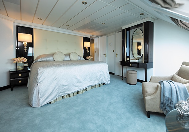
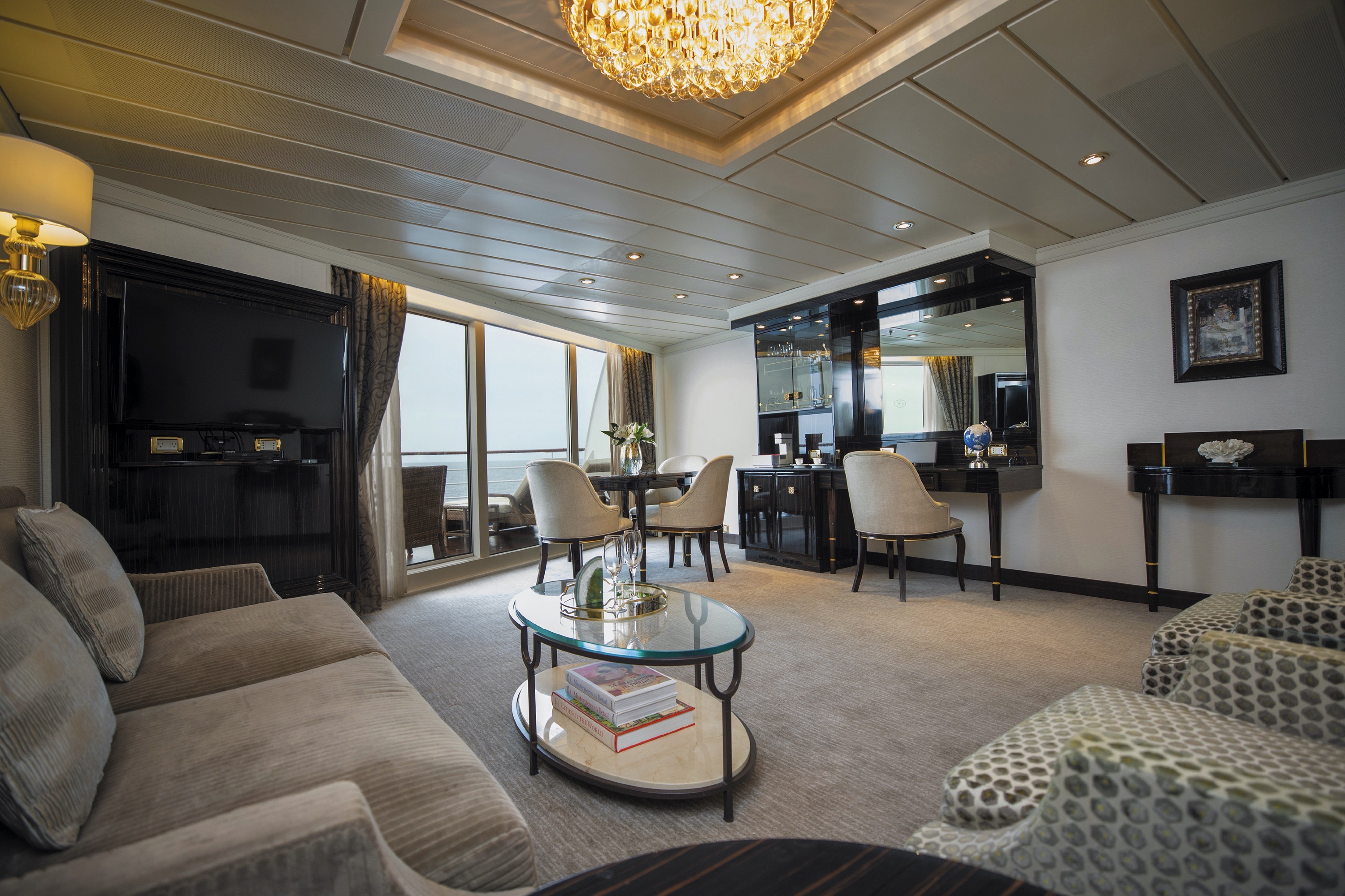
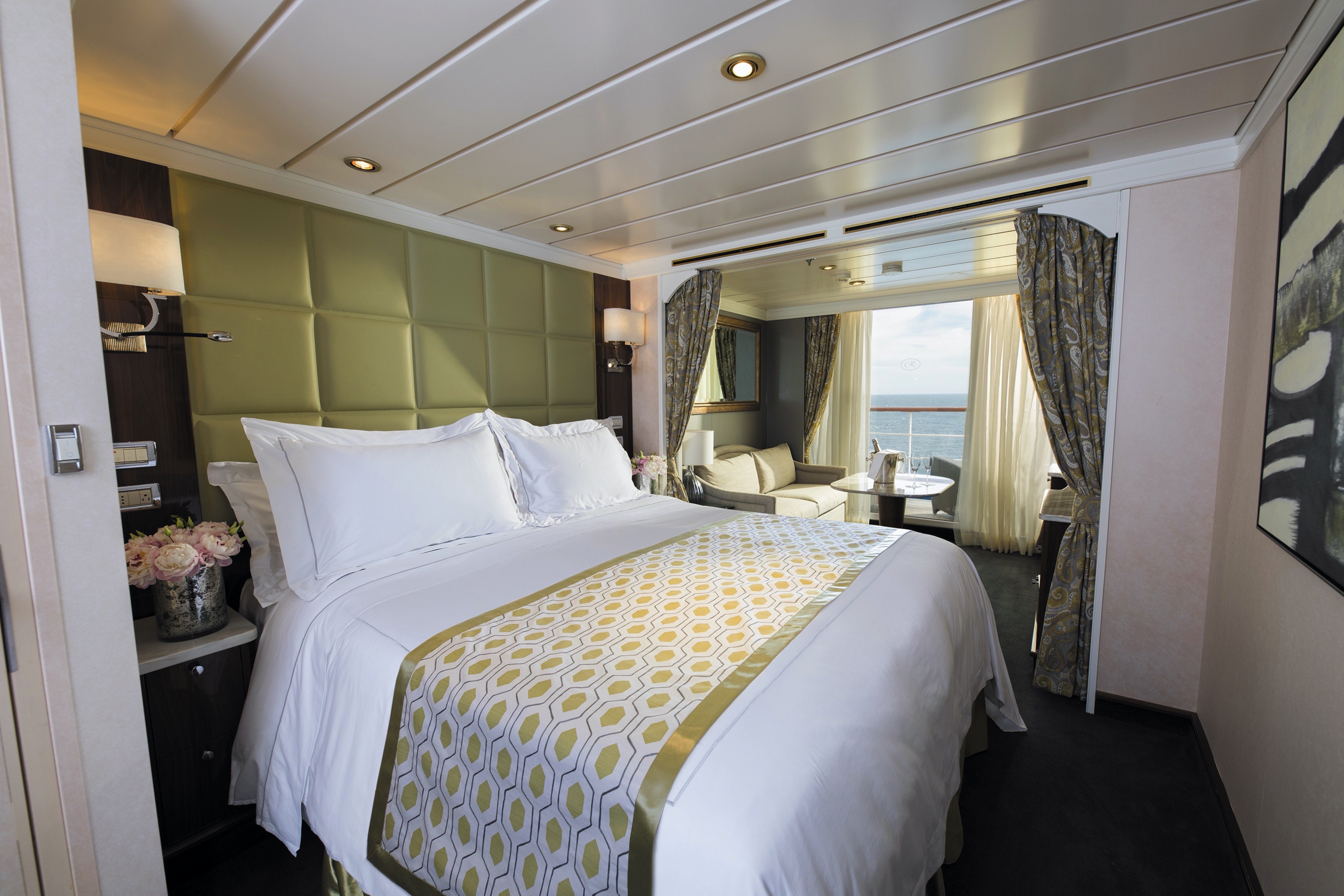
Spectacular panoramic views will seem to have been created just for you when you relax on your suite’s private balcony. Comfortably located mid-ship, this suite has a spacious separate bedroom with a European king-sized Elite Slumber™ bed and one-and-a-half baths. This suite features a spacious walk-in closet with drawers as well. To elevate your experience even more, a personal butler will be on call to help make your onboard wishes come true.
Layout
- 1 Spacious Bedroom with a European King-Size Elite Slumber® Bed
- 1 1/2 Marble & Stone Detailed Bathrooms
- Private Balcony
- Sitting Area
- Walk-In Closet with Safe
- Accommodates Up To 4 Guests
The suite pictured may differ from the suite booked, as layouts and designs vary by ship, deck, and suite location.
Amenities
- 1-Night Pre-Cruise: Hotel Package Including:
- - Ground Transfers
- - Breakfast
- - Porterage
- Unlimited WiFi Includes up to Four Logins, Four Devices, per Suite
- Valet Laundry Service
- 24-hour In-Suite Dining
- Fresh Orchid Arrangement
- L'Occitane® Jasmin & Bergamot Bath Amenities
- Regent Plush Bathrobe & Slippers
- Interactive Flat-Screen Television & Direct-Dial Satellite Phone
- Priority Access to Online Shore Excursion Reservations
- Priority Access to Online Dining Reservations
- Binoculars
- illy® Espresso Maker
- Cashmere Blankets
- Regent Special Gift
- Vanity & Hair Dryer
- Shoe Shine Service
- Additional Discounts:
- - 10% Discount on Ultra Premium Wine and Liquor
- - 5% Savings on Pre- or Post-Cruise Hotel or Land Programs
- - 5% Savings on Regent Choice Shore Excursions
Additional Mariner Suite Amenities:
- Welcome Letter from the President and General Manager
- Personal Butler for an Elevated In-suite Experience
- - In-Suite Dining from Compass Rose
- Priority Boarding on Embarkation Day with Suite Access at 1pm
- Welcome Bottle of Premium Champagne
- Personalized In-Suite Full-Liquor Bar Set-Up
- A Sumptuous In-Suite Caviar Service Once During Cruises
- Daily Canapés
- Luxe Fruit Arrangement
- Luxurious Designer Bath Amenities & Men's Unscented Shaving Kit
- Selection of Fig & Tea Leaves Bath Salts
- Guerlain Bath Amenities & Men's Unscented Shaving Kit
- Bath Scale Setup
- Bose® SoundLink Mini II Bluetooth Speaker
- Selection of Bed Pillow Styles
- Complimentary Garment Pressing on First Night
- Personalized Stationery upon request
- Elegant Weather Clock
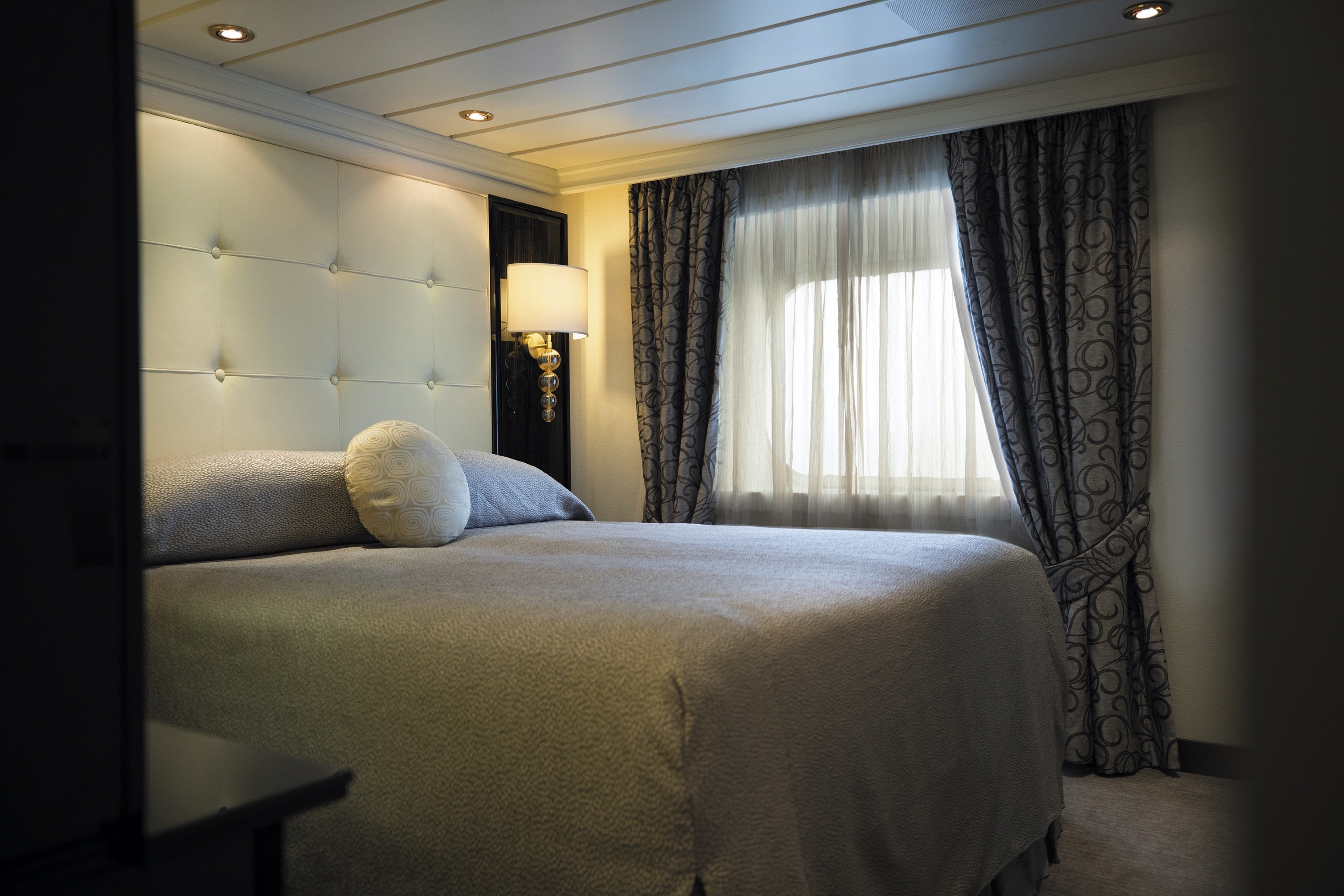
This suite welcomes you with soothing colors, pleasing artwork and comfortable furnishings. Relax in the sitting area after an exciting day ashore and enjoy the selection of fresh canapés delivered by your personal butler. Then retreat to your private balcony to watch the ever-changing vistas and ponder your next destination. Up to one-and-a-half baths feature fine marble accents and a tub or walk-in shower.
Layout
- 1 Spacious Bedroom with a European King-Size Elite Slumber® Bed
- 1 1/2 Marble & Stone Detailed Bathrooms
- Private Balcony
- Sitting Area
- Walk-In Closet with Safe
- Accommodates Up To 3 Guests
The suite pictured may differ from the suite booked, as layouts and designs vary by ship, deck, and suite location.
Amenities
- 1-Night Pre-Cruise: Hotel Package Including:
- - Ground Transfers
- - Breakfast
- - Porterage
- Unlimited WiFi Includes up to Four Logins, Four Devices, per Suite
- Valet Laundry Service
- Customizable In-Suite Mini Bar Replenished Daily with Your Preferences
- 24-hour In-Suite Dining
- Fresh Orchid Arrangement
- L'Occitane® Jasmin & Bergamot Bath Amenities
- Regent Plush Bathrobe & Slippers
- Interactive Flat-Screen Television & Direct-Dial Satellite Phone
- Priority Access to Online Shore Excursion Reservations
- Priority Access to Online Dining Reservations
- Binoculars
- illy® Espresso Maker
- Cashmere Blankets
- Regent Special Gift
- Vanity & Hair Dryer
- Shoe Shine Service
- Additional Discounts:
- - 10% Discount on Ultra Premium Wine and Liquor
- - 5% Savings on Pre- or Post-Cruise Hotel or Land Programs
- - 5% Savings on Regent Choice Shore Excursions
Additional Seven Seas Suites Amenitie:
- Personal Butler for an Elevated In-suite Experience
- - In-Suite Dining from Compass Rose
- Priority Boarding on Embarkation Day with Suite Access at 1pm
- Daily Canapés
- Luxe Fruit Arrangement
- Luxurious Designer Bath Amenities & Men's Unscented Shaving Kit
- Selection of Fig & Tea Leaves Bath Salts
- Guerlain Bath Amenities & Men's Unscented Shaving Kit
- Bose® SoundLink Mini II Bluetooth Speaker
- Selection of Bed Pillow Styles
- Complimentary Garment Pressing on First Night
- Personalized Stationery upon request
- Elegant Weather Clock
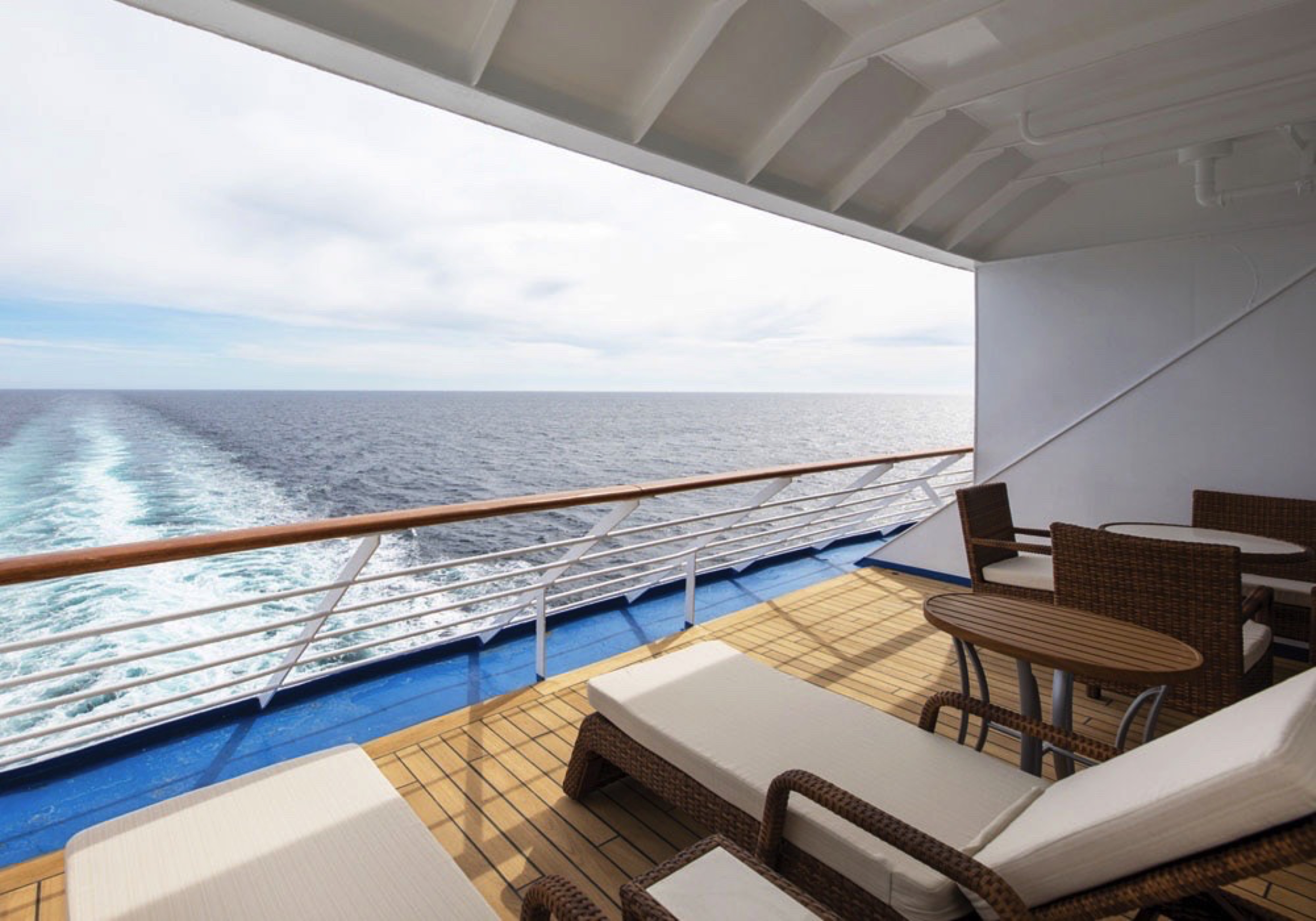
Located along the stern of Seven Seas Mariner®, this suite offers a panoramic vista and expansive balcony that is large enough for two cushioned chaises, two chairs and a table. Inside, the bed alcove is separated from a beautifully appointed sitting area by curtains, allowing you to control how much sunlight greets you each morning. You’ll also have a personal butler attending to your needs and a bevy of luxurious amenities.
Layout
- 1 Spacious Bedroom with a European King-Size Elite Slumber® Bed
- 1 Marble & Stone Detailed Bathroom
- Private Balcony
- Sitting Area
- Walk-In Closet with Safe
- Accommodates Up To 3 Guests
The suite pictured may differ from the suite booked, as layouts and designs vary by ship, deck, and suite location.
Amenities
- 1-Night Pre-Cruise: Hotel Package Including:
- - Ground Transfers
- - Breakfast
- - Porterage
- Unlimited WiFi Includes up to Four Logins, Four Devices, per Suite
- Valet Laundry Service
- Customizable In-Suite Mini Bar Replenished Daily with Your Preferences
- 24-hour In-Suite Dining
- Fresh Orchid Arrangement
- L'Occitane® Jasmin & Bergamot Bath Amenities
- Regent Plush Bathrobe & Slippers
- Interactive Flat-Screen Television & Direct-Dial Satellite Phone
- Priority Access to Online Shore Excursion Reservations
- Priority Access to Online Dining Reservations
- Binoculars
- illy® Espresso Maker
- Cashmere Blankets
- Regent Special Gift
- Vanity & Hair Dryer
- Shoe Shine Service
- Additional Discounts:
- - 10% Discount on Ultra Premium Wine and Liquor
- - 5% Savings on Pre- or Post-Cruise Hotel or Land Programs
- - 5% Savings on Regent Choice Shore Excursions
Additional Horizon View Suite Amenities:
- Personal Butler for an Elevated In-suite Experience
- - In-Suite Dining from Compass Rose
- Priority Boarding on Embarkation Day with Suite Access at 1pm
- Daily Canapés
- Luxe Fruit Arrangement
- Luxurious Designer Bath Amenities & Men's Unscented Shaving Kit
- Guerlain Bath Amenities & Men's Unscented Shaving Kit
- Bose® SoundLink Mini II Bluetooth Speaker
- Selection of Bed Pillow Styles
- Complimentary Garment Pressing on First Night
- Personalized Stationery upon request
- Elegant Weather Clock
The luxurious suite has been carefully designed to maximize space and comfort. Relax on your private balcony and indulge in your lavish bath amenities as you recharge and ready yourself for new adventures in the next port of call. This suite also includes priority online reservations for shore excursions and dining, and you’re encouraged to call on the services of a personal butler for special requests.
Layout
- Private Balcony
- Sitting Area
- Marble & Stone Detailed Bathroom
- European King-Size Elite Slumber® Bed
- Walk-In Closet with Safe
- Accommodates Up To 3 Guests
The suite pictured may differ from the suite booked, as layouts and designs vary by ship, deck, and suite location.
Amenities
- 1-Night Pre-Cruise: Hotel Package Including:
- - Ground Transfers
- - Breakfast
- - Porterage
- Unlimited WiFi Includes up to Four Logins, Four Devices, per Suite
- Valet Laundry Service
- Customizable In-Suite Mini Bar Replenished Daily with Your Preferences
- Welcome Bottle of Champagne & Fresh Fruit
- 24-hour In-Suite Dining
- Fresh Orchid Arrangement
- L'Occitane® Jasmin & Bergamot Bath Amenities
- Regent Plush Bathrobe & Slippers
- Interactive Flat-Screen Television & Direct-Dial Satellite Phone
- Priority Access to Online Shore Excursion Reservations
- Priority Access to Online Dining Reservations
- Binoculars
- illy® Espresso Maker
- Cashmere Blankets
- Regent Special Gift
- Vanity & Hair Dryer
- Shoe Shine Service
- Additional Discounts:
- - 10% Discount on Ultra Premium Wine and Liquor
- - 5% Savings on Pre- or Post-Cruise Hotel or Land Programs
- - 5% Savings on Regent Choice Shore Excursions
Additional Penthouse Suite Amenities:
- Personal Butler for an Elevated In-suite Experience
- - In-Suite Dining from Compass Rose
- Daily Canapés
- Luxurious Designer Bath Amenities & Men's Unscented Shaving Kit
- Guerlain Bath Amenities & Men's Unscented Shaving Kit
- Bose® SoundLink Mini II Bluetooth Speaker
- Selection of Bed Pillow Styles
- Complimentary Garment Pressing on First Night
- Personalized Stationery upon request
In this superbly designed suite, you enjoy the comfort of richly furnished accommodations as well as exclusive luxuries available only in suites at the Concierge level and higher. Your suite includes amenities such as an illy® espresso maker and cashmere blankets, perfect for use in the morning when you wish to sip coffee and enjoy an in-suite breakfast on your private balcony. Take advantage of 24-hour room service when the mood strikes.
Layout
- Private Balcony
- Sitting Area
- Marble & Stone Detailed Bathroom
- European King-Size Elite Slumber® Bed
- Walk-In Closet with Safe
- Accommodates Up To 3 Guests
- This category includes Accessibility Options in suites 1012 and 1013. For more information about accessible suites click here.
The suite pictured may differ from the suite booked, as layouts and designs vary by ship, deck, and suite location
Amenities
- 1-Night Pre-Cruise: Hotel Package Including:
- - Ground Transfers
- - Breakfast
- - Porterage
- Unlimited WiFi Includes up to Four Logins, Four Devices, per Suite
- Valet Laundry Service
- Customizable In-Suite Mini Bar Replenished Daily with Your Preferences
- Welcome Bottle of Champagne & Fresh Fruit
- 24-hour In-Suite Dining
- Fresh Orchid Arrangement
- L'Occitane® Jasmin & Bergamot Bath Amenities
- Regent Plush Bathrobe & Slippers
- Interactive Flat-Screen Television & Direct-Dial Satellite Phone
- Priority Access to Online Shore Excursion Reservations
- Priority Access to Online Dining Reservations
- Binoculars
- illy® Espresso Maker
- Cashmere Blankets
- Regent Special Gift
- Vanity & Hair Dryer
- Shoe Shine Service
- Additional Discounts:
- - 10% Discount on Ultra Premium Wine and Liquor
- - 5% Savings on Pre- or Post-Cruise Hotel or Land Programs
- - 5% Savings on Regent Choice Shore Excursions
Every inch of this suite has been thoughtfully designed to maximize interior space and embrace the magnificent scenery outdoors. From the sitting area, admire the ocean views through the floor-to-ceiling windows, or better yet, take a seat outside on your private balcony to watch the world go by. Elegant finishes such as luxurious bedding and beautiful marble detailing in the bath further enhance your comfort.
Layout
- Private Balcony
- Sitting Area
- Marble & Stone Detailed Bathroom
- European King-Size Elite Slumber® Bed
- Walk-In Closet with Safe
- Accommodates Up To 3 Guests
- This category includes Accessibility Options in suites 828 and 829. For more information about accessible suites click here.
The suite pictured may differ from the suite booked, as layouts and designs vary by ship, deck, and suite location.
Amenities
- Unlimited WiFi Includes Two Logins, Two Devices, per Suite
- Valet Laundry Service
- Customizable In-Suite Mini Bar Replenished Daily with Your Preferences
- Welcome Bottle of Champagne & Fresh Fruit
- 24-hour In-Suite Dining
- Fresh Orchid Arrangement
- L'Occitane® Jasmin & Bergamot Bath Amenities
- Regent Plush Bathrobe & Slippers
- Interactive Flat-Screen Television & Direct-Dial Satellite Phone
- Vanity & Hair Dryer
- Shoe Shine Service
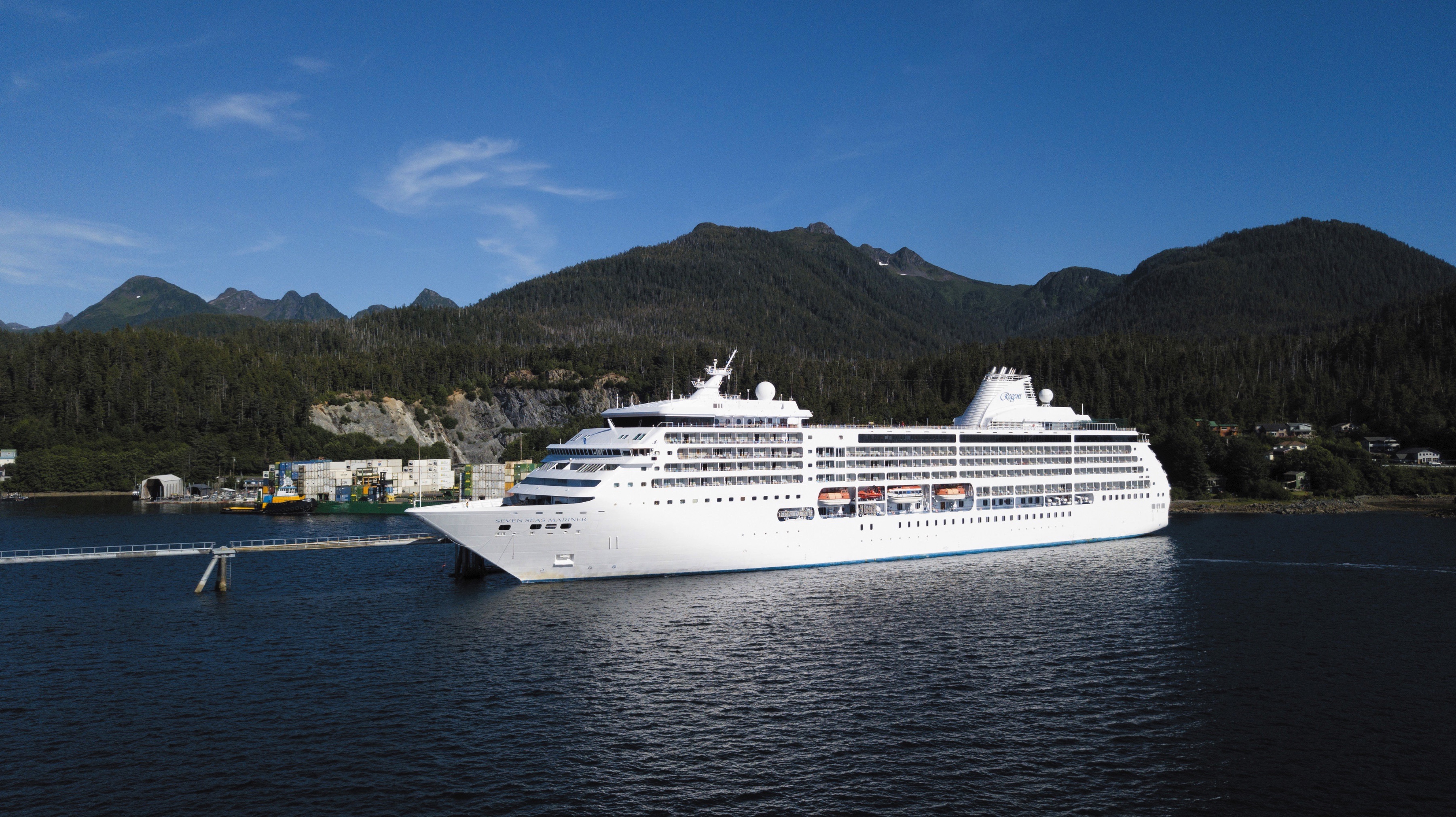
Seven Seas Mariner
Seven Seas Mariner® exudes class, from the delectable offerings of Chartreuse to the debonair atmosphere of the Connoisseur Club.
Attention to detail distinguishes Regent Seven Sea Cruises™ and the exceptional suites on Seven Seas Mariner®. With our all-inclusive fares, every guest enjoys spacious closets, well-appointed bathrooms and a private balcony with views of the shimmering sea.
Soothing colors accented by appealing patterns and textures dominate the interiors of Seven Seas Mariner®. The common spaces offer everything from wide-open views on the upper deck to intimate tables for bridge in the Card Room.
Ship Facts
| Launch Year | 2001 | ||||
| Refit Year | 2018 | ||||
| Language | en | ||||
| Gross Tonnage | 48075 | ||||
| Length | 216 | ||||
| Width | 28 | ||||
| Currency | USD | ||||
| Speed | 20 | ||||
| Capacity | 700 | ||||
| Crew Count | 459 | ||||
| Deck Count | 8 | ||||
| Cabin Count | 350 | ||||
| Large Cabin Count | 61 | ||||
| Wheelchair Cabin Count | 6 | ||||
| Electrical Plugs |
|
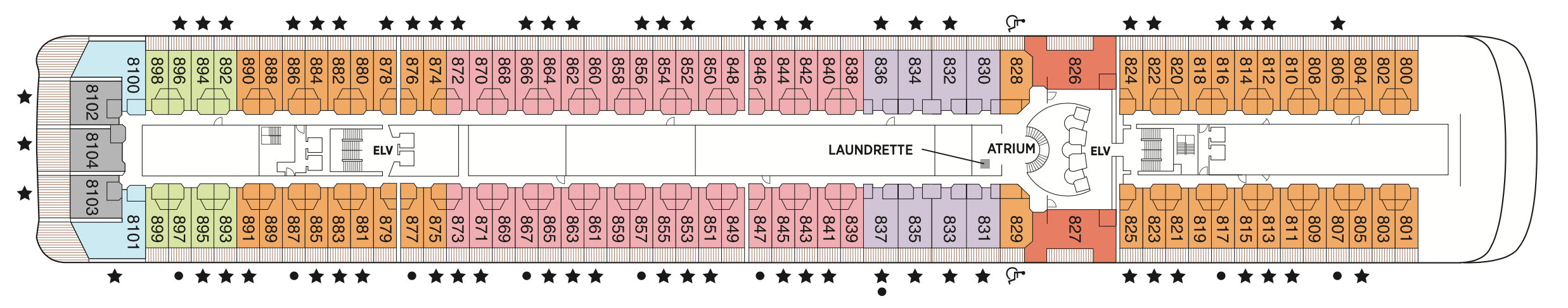
Deck 12
- Paddle Tennis
- Golf Nets
- Putting Green
- Bocce Court
- Shuffleboard
- Jogging Track
- Observation Lounge

Deck 11
- Atrium
- La Veranda
- Sette Mari at La Veranda
- Pool Grill
- Pool Bar
- Pool Deck
- Pool
- Whirlpools
- Penthouse Suites
- Grand Suites

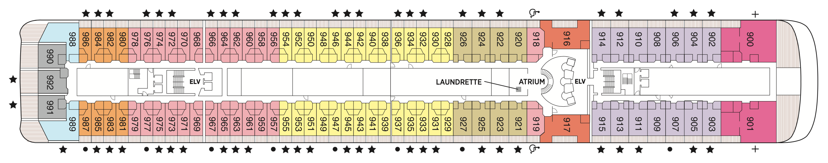
Deck 10
- Atrium
- Laundrette
- Horizon View Suites
- Seven Seas Suites
- Concierge Suites
- Penthouse Suites
- Mariner Suites

Deck 9
- Atrium
- Laundrette
- Signature Suite
- Deluxe Veranda Suites
- Horizon View Suites
- Seven Seas Suites
- Concierge Suites
- Penthouse Suites
- Mariner Suites
Deck 8
- Atrium
- Laundrette
- Horizon View Suites
- Seven Seas Suites
- Deluxe Veranda Suites
- Concierge Suites
- Penthouse Suites
- Mariner Suites
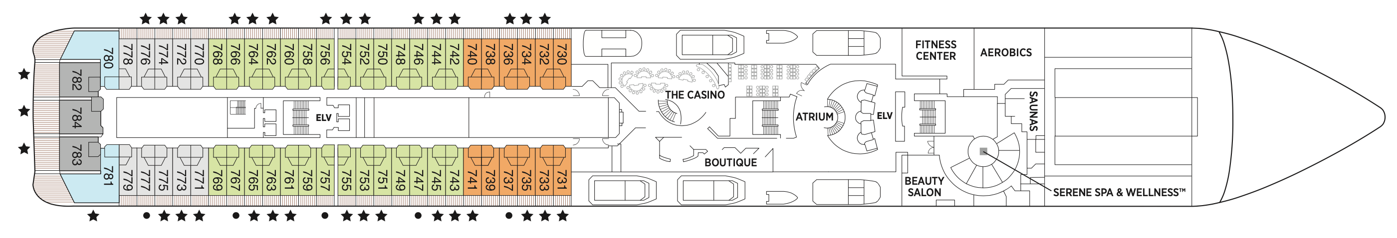
Deck 7
- Atrium
- Boutiques
- Fitness Centre
- Serene Spa & Wellness™
- The Casino
- Seven Seas Suites
- Horizon View Suites
- Deluxe Veranda Suites
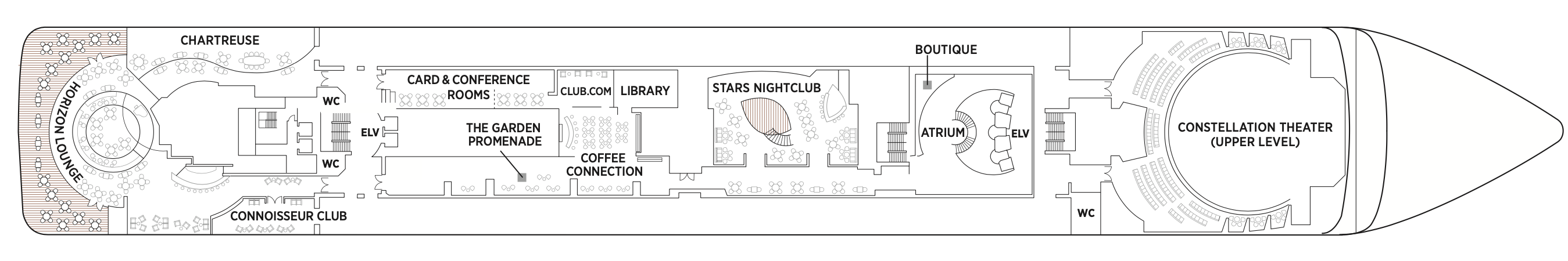
Deck 6
- Atrium
- Boutiques
- Card & Conference Room
- Chartreuse
- Club.com
- Coffee Connection
- Connoisseur Club
- Constellation Theatre
- Horizon Lounge
- Stars Lounge
- Stars Night Club
- Library
- The Garden Promenade
- Horizon Lounge
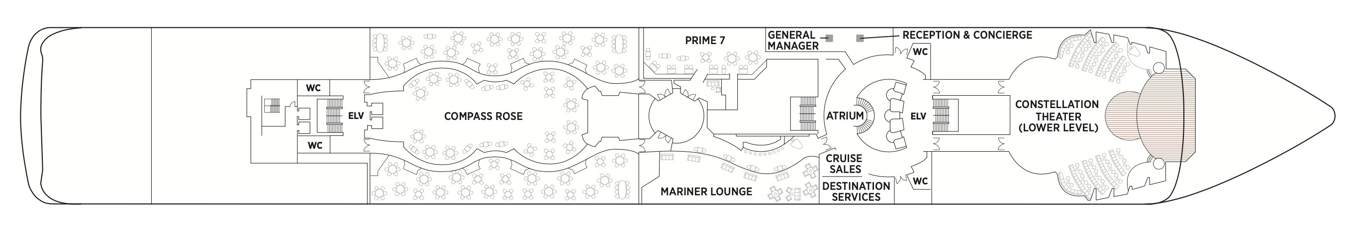
Deck 5
- Atrium
- Compass Rose
- Constellation Theatre
- Mariner Lounge
- Prime 7
- Destination Services
- Reception & Concierge
Regent Seven Seas Cruises® takes pride in creating dining experiences that are simply superb. From succulent lobster to the perfect burger and shake, you’ll find an array of refined flavors and refreshments from which to choose.
Compass Rose
Whether you arrive for breakfast, lunch or dinner, you can look forward to European-inspired Continental cuisine served in a beautifully refined atmosphere decorated in blues and silvers with stunning Versace tableware.
We are pleased to re-introduce the elegantly enhanced Compass Rose, the largest specialty restaurant across our fleet. Ensuring a tantalizing mix of new and familiar items on every visit, the new lunch and dinner menus offer a vast selection to meet your discerning tastes. Exclusively aboard Seven Seas Mariner®, Seven Seas Voyager®, and Seven Seas Navigator® for lunch, you may choose from a robust list of appetizers and main courses from our specialty restaurants. And across our fleet for dinner, you have the unique ability to design your very own entrée from preferred sides, sauces, pastas and main features of beef, poultry and fish. This is in addition to sinfully indulgent desserts made by talented bakers and pastry chefs. With daily changing menus, the refreshed Compass Rose offers more choices than ever before.
La Veranda
La Veranda features quiet alcoves, made-to-order omelettes and tasty lunch buffets that include hot carving stations, an authentic pizzeria and regional specialties that reflect cuisines of the region you’re visiting.
Take in stunning ocean views while enjoying elegant breakfast and lunch buffets in the chic indoor dining room or al fresco on the shaded, open-air deck. Breakfasts include traditional favorites, as well as a made-to-order omelet station, a variety of fresh fruits and pastries, along with daily specials, like fluffy Belgian waffles with fresh blueberry compote. For lunch indulge in an array of choices from a bountiful salad bar, gourmet sandwiches, hot carving stations and delicious desserts.
Prime 7
Vibrant blue colours and white-leather chairs heighten the senses as you enter this elegantly intimate, art-filled and luxurious setting to enjoy classic American steakhouse cuisine with a modern flair. Open for dinner only.
A true classic in every sense, Prime 7 sets a new standard in steakhouse fare with its contemporary interpretation of an American classic. Handsomely decorated with supple leather wing-back chairs, burnished woods and rich earth-toned fabrics, Prime 7 exudes a distinct, intimate elegance. This is sophistication redefined, a luxurious setting to enjoy classic steakhouse cuisine with a modern flair.
All the traditional starters are here, including Jumbo Lump Crab Cakes, Classic Steak Tartare, and Clam Chowder. Of course, beef is the undisputed star, and it is aged for a minimum of 40 days to ensure the ultimate tenderness and juiciness. New York Strip, Porterhouse Steak and succulent Filet Mignon only touch upon the selections. Mouthwatering alternatives include Applewood Smoked Salmon and Dover Sole.
Reservations Required
Sette Mari at La Veranda
Each evening, La Veranda transforms into Sette Mari at La Veranda, a casual, intimate dining experience. Enjoy an extensive menu of authentic antipasti and Italian specialties served á la carte and paired with fine Italian wines — complimentary of course.
Each evening, La Veranda transforms into Sette Mari at La Veranda, a casual, intimate dining experience. Enjoy an extensive menu of authentic antipasti and Italian specialties served á la carte and paired with fine Italian wines — complimentary of course. Delectable dishes are prepared á la minute by our talented chefs using only the freshest gourmet ingredients and served by our attentive waiters. Sette Mari at La Veranda is open for dinner only.
Chartreuse
A restaurant with a modern French menu and attention to detail you'll notice in its Parisian décor, expertly prepared dishes and wait staff. About the closest thing to a Parisian culinary gem on the high seas.
Chartreuse evokes memories of a chic Parisian fine dining restaurant discovered during an evening stroll. Wherever you are seated in this regal restaurant, you will be treated to a succulent dinner while enjoying incredible ocean views. The restaurant ambiance is complemented by a menu that features modern French dishes. Available on Seven Seas Grandeur™, Seven Seas Splendor®, Seven Seas Explorer®, Seven Seas Mariner® and Seven Seas Voyager® with reservations each evening for dinner, and open for lunch on Seven Seas Explorer on alternate port days. French bistro style food is offered.
Reservations Required
Pool Grill
After sunbathing or swimming in the pool, you may be in the mood for grilled-to-order burgers, seafood, sandwiches, even hand-dipped ice cream with sprinkles. Our Pool Grill will satisfy your comfort food cravings.
The Pool Grill is truly a come-as-you-are venue. Enjoy this casual dining experience whether you’re getting a bite after sunbathing or swimming in the pool. The Pool Grill is open-air, yet abundantly shaded for comfortable dining at lunch or dinner. Enjoy grilled-to-order burgers, grilled seafood, sandwiches, and fresh salads. Treat yourself to milkshakes and malts or an old-fashioned hand-dipped ice cream dessert with toppings.
Coffee Connection
Enjoy barista-made Illy® coffees, delicious pastries, gourmet sandwiches and homemade cookies at Coffee Connection. Peruse thousands of publications using our complimentary PressReader app or strike up a conversation with new friends.
Your informal destination to relax, meet fellow guests and enjoy coffee and snacks throughout the day. Hungry? Cereals, fruits, pastries and bagels are available every morning. Lunch includes cold cuts, cheeses, assorted rolls and cookies. Sandwiches, fruit and fresh cookies and cakes are available all day. While snacking, international newspapers are available for your perusal.
Room Service
Knowing that guests sometimes prefer to simply dine in the comfort of their suites, we offer room service around the clock. Select from an extensive room service menu and the wait staff will promptly serve your order in the comfort of your suite. During normal dining hours, guests may also order from the Compass Rose menu, which changes daily and features Continental, vegetarian, and kosher cuisines. Dinners will be graciously served course-by-course.
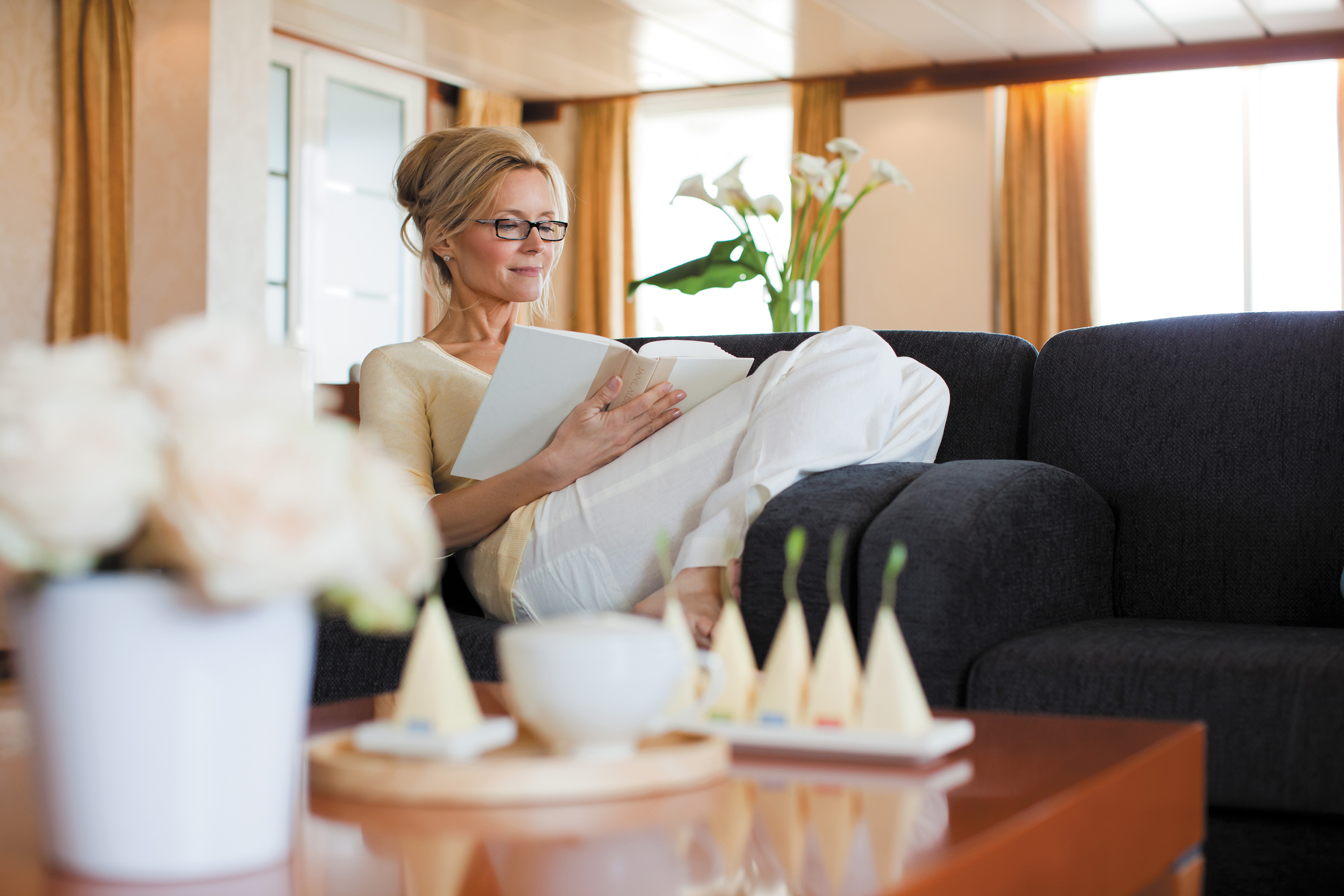
Daytime Enrichment
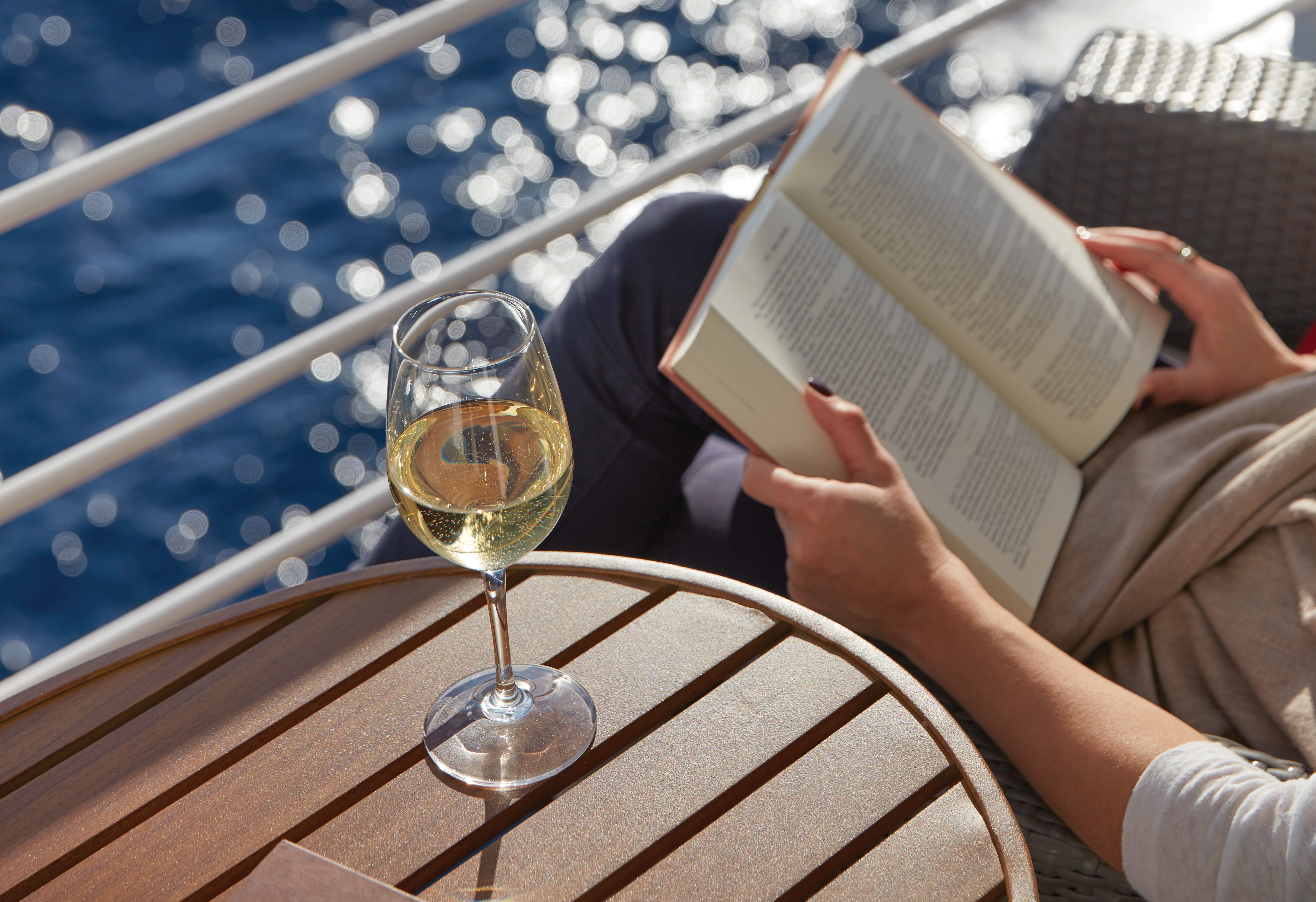
You’ll find time spent on board the ship to be just as enriching as time ashore. Relax by the pool, compete in a friendly game of trivia or bocce ball, indulge in treats at afternoon tea and gain insight from an expert lecturer.
Evening Entertainment
Evenings on board are filled with music and fun. Enjoy a rousing cabaret show, test your luck at the Casino, step onto the stage for karaoke or simply find a quiet place on deck to revel in the symphony of stars.
Boutiques and More
Browse a well-curated selection of duty-free designer clothes, jewelry, perfume and more at the onboard boutiques. Then fuel up with an espresso from an onboard café or unwind at a wine tasting in one of the lounges.
Constellation Theatre
Take in lavishly staged, high-energy shows created and produced by our own team of Broadway choreographers and directors in our delightful hall. So grand it needs two decks, it offers plush seating and surroundings.
Smartly tiered for pleasing sightlines and decked out with delightfully plush seating, our Constellation Theatre is an intimate venue without a bad seat in the house. Settle in, admire the grand surroundings, and be prepared to witness phenomenal performances that vary from full-scale musical revues to rousing singalongs, all backed by our incredible, five-piece Regent Signature Orchestra.
This two-deck high, state-of-the-art show lounge has perfect sight-lines, as well as comfortable banquettes and chairs making every seat, the best seat in the house.
Observation Lounge
As indicated by its name, the Observation Lounge offers a wonderful vantage point to enjoy staggering views as your glorious ship enters and leaves ports of call. Live music adds to the serene vibe.
A chic yet comfortable space to read, relax and enjoy a cocktail while admiring the spectacular views offered every time Seven Seas Mariner® enters and leaves one of its worldwide ports of call. Live music is played throughout the day, making this another inviting onboard destination to to unwind with afternoon tea, pre-dinner cocktails or a satisfying nightcap.
Atrium
Simply put, the Atrium is the very heart of Seven Seas Mariner®. With natural light shining from above, it’s a natural hub for guests to rendezvous or gather for organised activities.
Often described as the crossroads of the ship, our Atrium is an inspiring testament to the grandeur of luxury ocean travel. Winding staircases wrap down several decks before meeting in the Atrium, which is a work of art itself. A glittering, modern, glass sculpture rises up the inside of the Atrium, reaching all the way to the open decks.
Mariner Lounge
You'll find our popular Mariner Lounge tough to resist. It’s an inviting spot to chat with new friends over cocktails before a delicious dinner, and an exciting space to dance the night away afterwards.
Discover for yourself why the Mariner Lounge and nightclub is the perfect venue to meet new friends for a pre-dinner cocktail. As the night progresses, the spectacularly designed space turns into a nightclub where night owls gather to dance into the night or maybe sing along in a karaoke competition. Musicians entertain nightly, and during the late hours on selected nights a DJ spins records and takes requests.
Connoisseur Club
Engage in spirited conversation with new friends in an elegant hideaway that calls to mind gentleman's clubs of old. An elegant throwback where cigars are savoured, you'll take to like a favourite cardigan.
Maybe it's the deep blue walls that give the Connoisseur Club such a gentile, old-fashioned feel. Or maybe it’s the collection of impossible comfortable leather armchairs. Whatever it is, this is a relaxing spot for you and new friends to enjoy a fine cigar and sip cognac (both are available for purchase) in classic gentleman’s club environs. Smoking is permitted in the club.
Library
Browse a vast collection of volumes, from destination-specific guide books to best-selling mysteries to classics of literature, upon a variety of comfortable chairs in our cozy Library.
Well-stocked and offering comfort for the body and mind, you'll discover our Library is a most civil setting for reading and relaxing. Curl up with a classic novel or best-selling mystery, play a strategic game of chess or simply soak up the ambience of a sumptuous reading room. Regardless of what brings you here, our library is a welcoming, low-key treasure you just may find hard to leave.
Stars Lounge & Night Club
Encircling a glistening stairwell that leads to the Casino, the Stars Lounge is a throwback nightspot that draws fun-loving crowds for after-dinner drinks and late-night cocktails. A favourite with night owls.
High-backed velvet chairs and a shimmering bar are highlights of this popular spot for after-dinner drinks and late-night cocktails, but it's a glistening stairwell to the upstairs Casino that gives Stars Lounge a certain throwback appeal. A long-time guest favourite, this arty lounge has a circular dance floor that beckons night owls to dance into the wee hours or partake in karaoke competitions.
Horizon Lounge
A alluring destination for informal drinks in an elegant setting. With live music throughout the day and expertly poured cocktails only a request away, the Horizon Lounge is a natural spot to rendezvous with fellow travellers.
The Horizon Lounge is an ideal destination for classic cocktails or to simply relax and engage in conversation with new friends. Resident musicians play familiar tunes throughout the day as well as before and after dinner, making it ideal for informal plans. Game shows, night entertainment and live musical events are featured regularly.
Boutiques
Whether it’s designer evening wear, handbags, fragrances or a smart gift, our boutique items are carefully selected and of the highest quality. The same may be said of our personable staff.
Stop into our boutiques and browse a wide range of items – upscale handbags to exclusive fragrances to fine jewellery – in an intimate and unhurried setting. You’ll also find a variety of clothes, Regent Seven Seas Cruises® logo wear and gift items to share with friends and family. Our boutiques are staffed by friendly salespeople. Opening hours vary and are printed in the Passages daily newsletter.
The Casino
Glass doors lead to an elegant setting bustling with games of chance that include Blackjack, roulette, poker and slot machines. The Casino is open every day at sea when not restricted by territorial border limits.
If you're in the gaming mood, head to our elegantly appointed Casino for a few hands of blackjack or to try your luck at roulette, poker, the craps table or slot machines. Whether you're a player or spectator, the excitement is contagious, the drinks delightful and the staff welcoming. Our stylish Casino is open every day at sea when not restricted by territorial border limits.
Internet Café & Club.com
For those who've chosen to leave their laptops at home, desktop computers are available at our staffed Internet Cafe. Of course, you may access WiFi without charge throughout the entirety of the ship.
It's easy to stay connected, even while sailing the seven seas. Our ships have WiFi throughout for guests with their own laptops, and there are plenty of computers in the staffed Internet Café, which is open round the clock. Printers, e-mails, Internet access and Wireless access throughout the ship are all available for a nominal fee.
Pool Bar
Very few things equate to a pure vacation activity more than sitting at our Pool Bar. Make new friends while sipping a cocktail or frozen drink in the most laid-back atmosphere imaginable.
When you envision an activity you’re only likely to do while on vacation, sipping a frozen drink at a pool bar onboard a glorious cruise ship is probably near the top of the list. You can tick that box at our Pool Bar, where you and new friends can enjoy leisurely conversation over cocktails and frozen drinks in a delightfully relaxed atmosphere.
Card & Conference Room
Gather your favourite teammates in the Card Room for a lively afternoon or evening of cards, board games or a social game of Bridge. The spaces, which may be combined, are also designed to host conferences.
Two complete Card and Conference Rooms can be used for everything from bridge lectures and tournaments to corporate meetings and special events. Gather with a few friends for an afternoon or evening of fun competition with board games, cards and more. Larger groups may increase space by removing the dividing door and combining both rooms.
Pool Deck
For those days when nothing but sitting poolside will do, head to our Pool Deck. You'll be greeted by an expansive space with unforgettable views, teak accents and an amiable crew offering cold drinks and lounge chairs.
Our Pool Deck is one of the most expansive at sea and features a large heated pool, two whirlpools and table tennis. Surrounded by luxurious teak accents, you’ll be consistently awestruck by the pool’s magnificent vistas high upon Seven Seas Mariner®. You’ll also be impressed by our amiable and dedicated crew, who stand at the ready to provide refreshing beverages and comfortable lounge chairs.
Destination Services
Whether you’re interested in a tour from our FREE Unlimited Shore Excursion menu or a unique, small-group Regent Choice Shore Excursion, our staff at Destination Services is ready to assist.
If the road to a richer life is paved with the lessons of new discoveries, our Destination Services is a great place to start. Learn about the adventures available to suit every taste and comfort level during your voyage from our dedicated staff. They can arrange unique shore excursions designed for smaller groups or assist with tailor-made pre-and post-cruise programs, from a simple stay in a luxurious hotel to a 3-night extension in a remote locale.
Reception & Concierge
Our knowledgeable Reception staff is available around the clock to answer your questions and ensure your pleasure with your Seven Seas Mariner® voyage. Reception is also where you may contact the ship’s Concierge.
Our welcoming Reception Desk is open 24 hours a day and staffed by personable, knowledgeable men and women who are happy to answer your questions and provide any general assistance you may need. Reception is also where you may contact the ship’s Concierge. Postcards and letters may be dropped off here as well; they’ll be delivered to the postal service at the next port of call.
GENERAL MANAGER
While cruise-related issues are first submitted to Reception/Concierge, you can be assured that a General Manager is on hand to resolve issues to your satisfaction.