Grand Southern Seas Sojourn
Grand Southern Seas Sojourn
Cruise overview
WHY BOOK WITH US?
- ✔ The Deluxe Cruises’ team has extensive experience in ultra-luxury cruising.
- ✔ Call now to speak to our helpful and experienced Cruise Concierge team.
- ✔ Enjoy our Unique Deluxe Cruises Bonus for substantial savings.
- ✔ Our team will tailor your holiday to your exacting requirements.
- ✔ As agents, we work under the protection of each cruise lines ABTA / ATOL licences
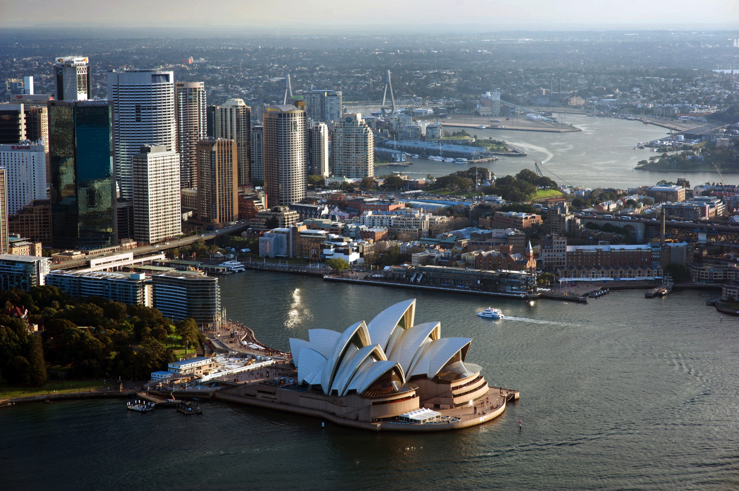
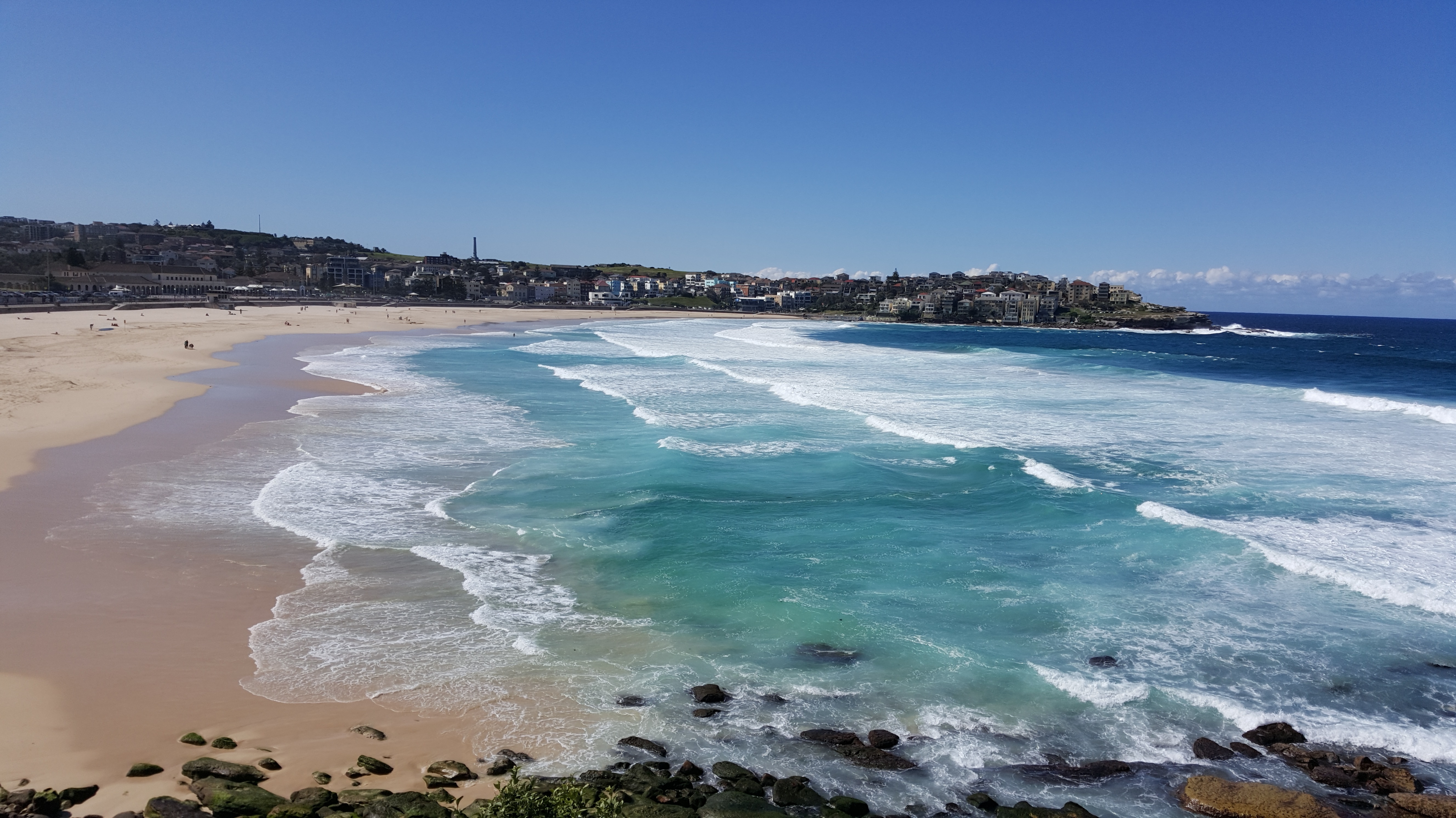
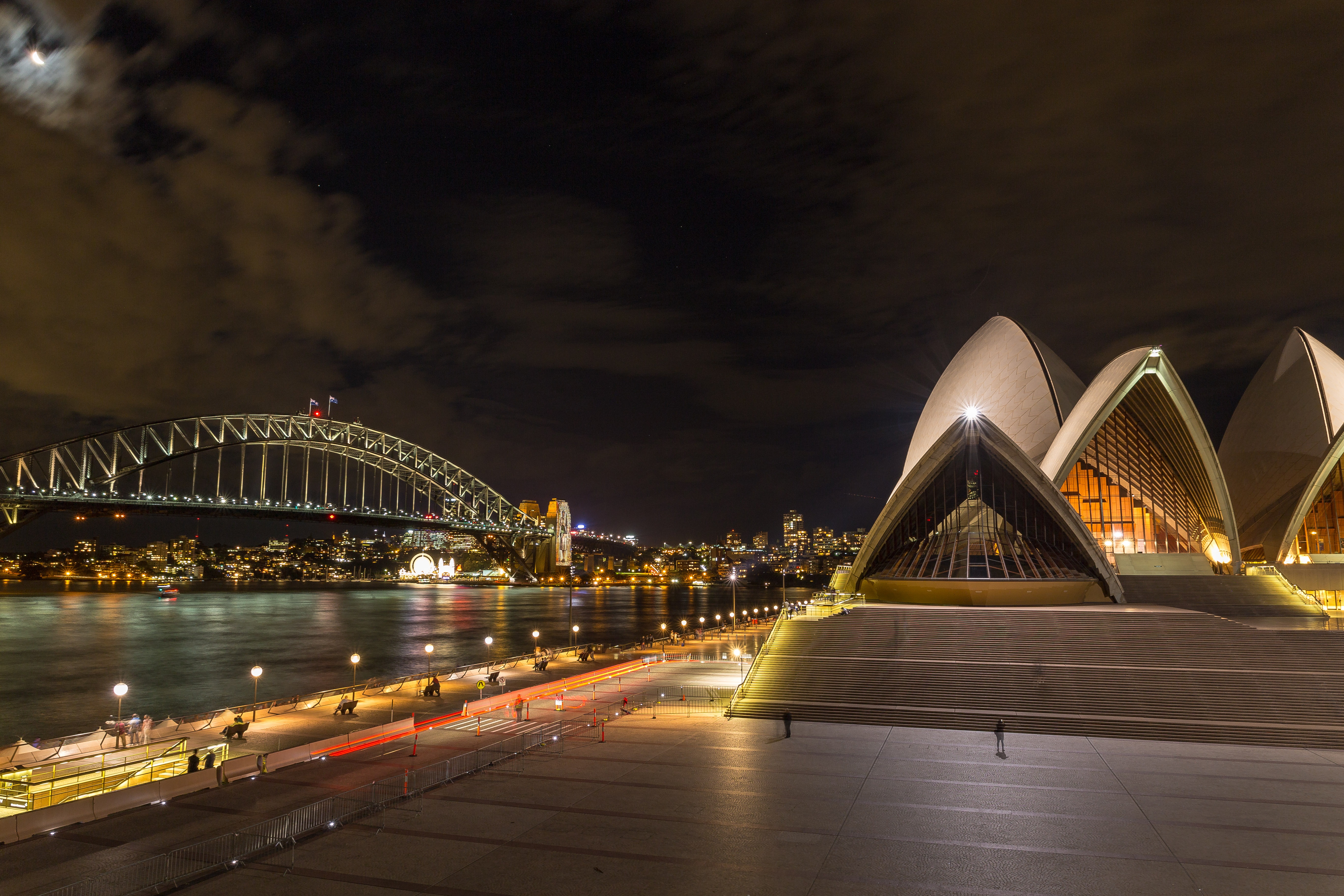
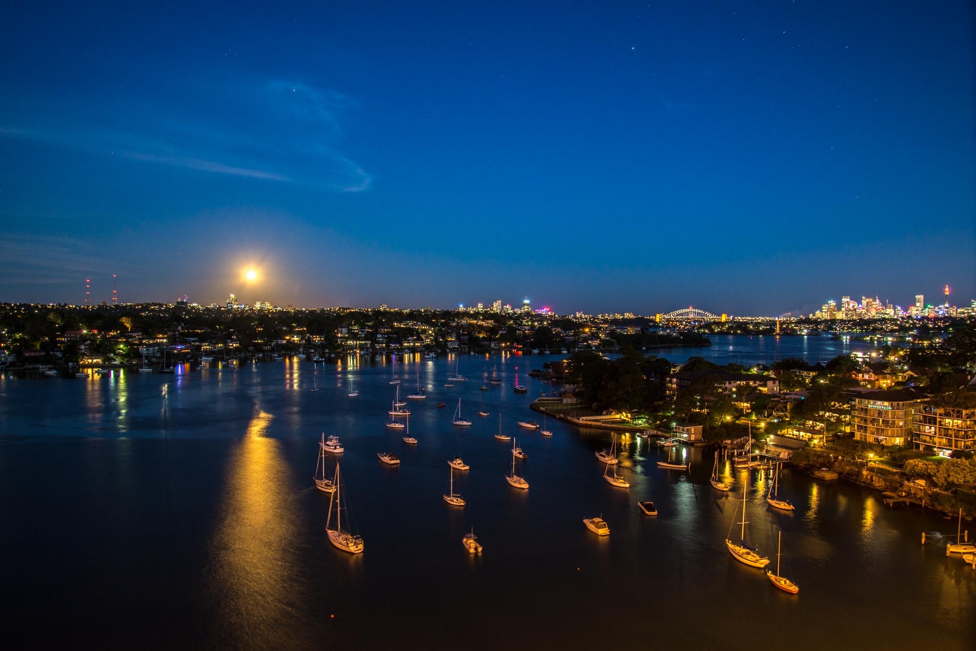
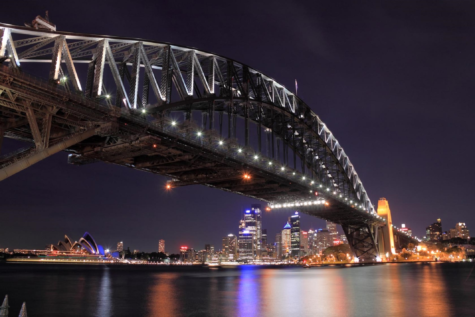
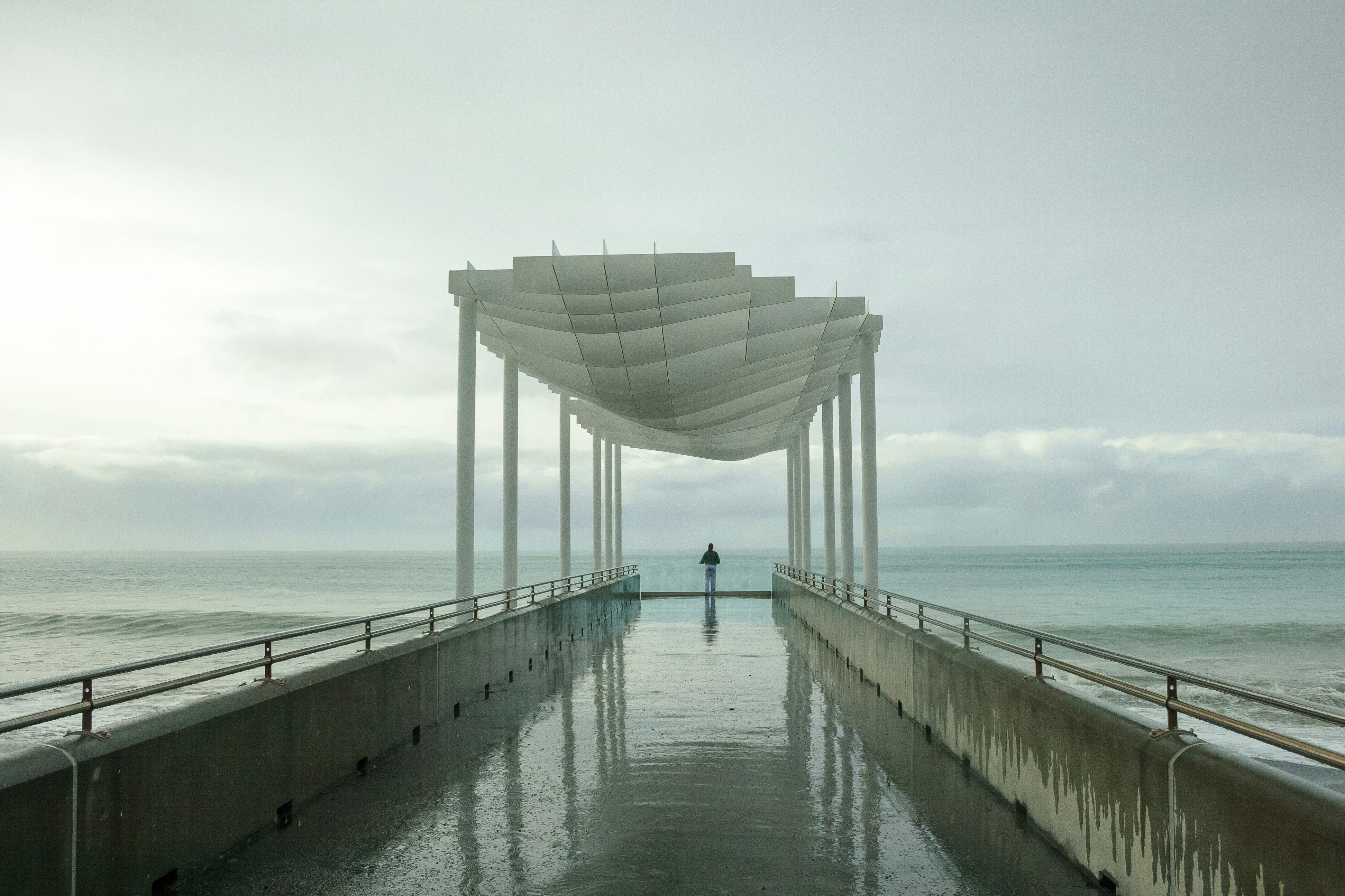
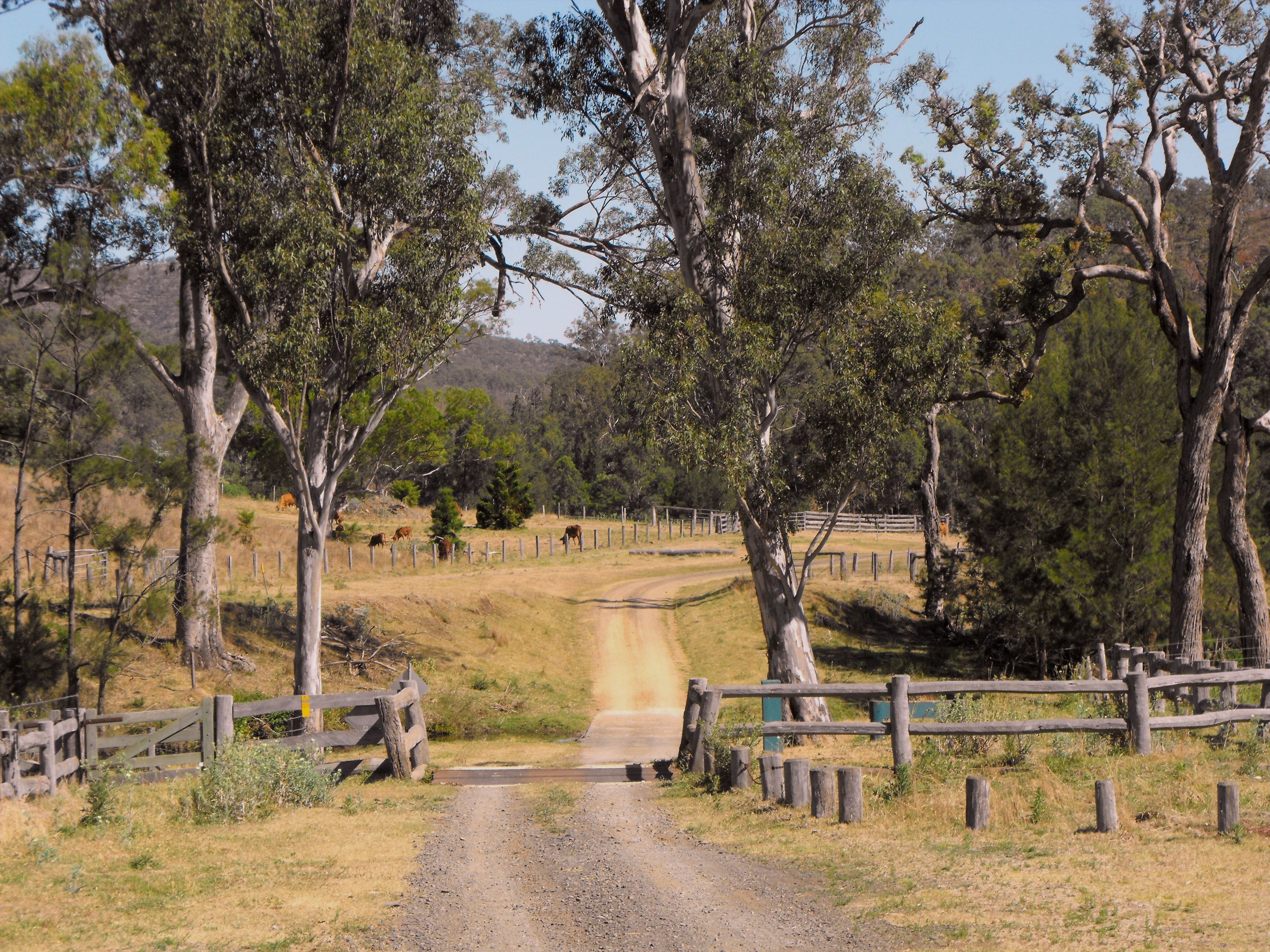
About Sydney, New South Wales
Sydney, capital of New South Wales and one of Australia's largest cities, is best known for its harbourfront Sydney Opera House, with a distinctive sail-like design. Massive Darling Harbour and the smaller Circular Quay port are hubs of waterside life, with the arched Harbour Bridge and esteemed Royal Botanic Garden nearby. Sydney Tower’s outdoor platform, the Skywalk, offers 360-degree views of the city and suburbs.
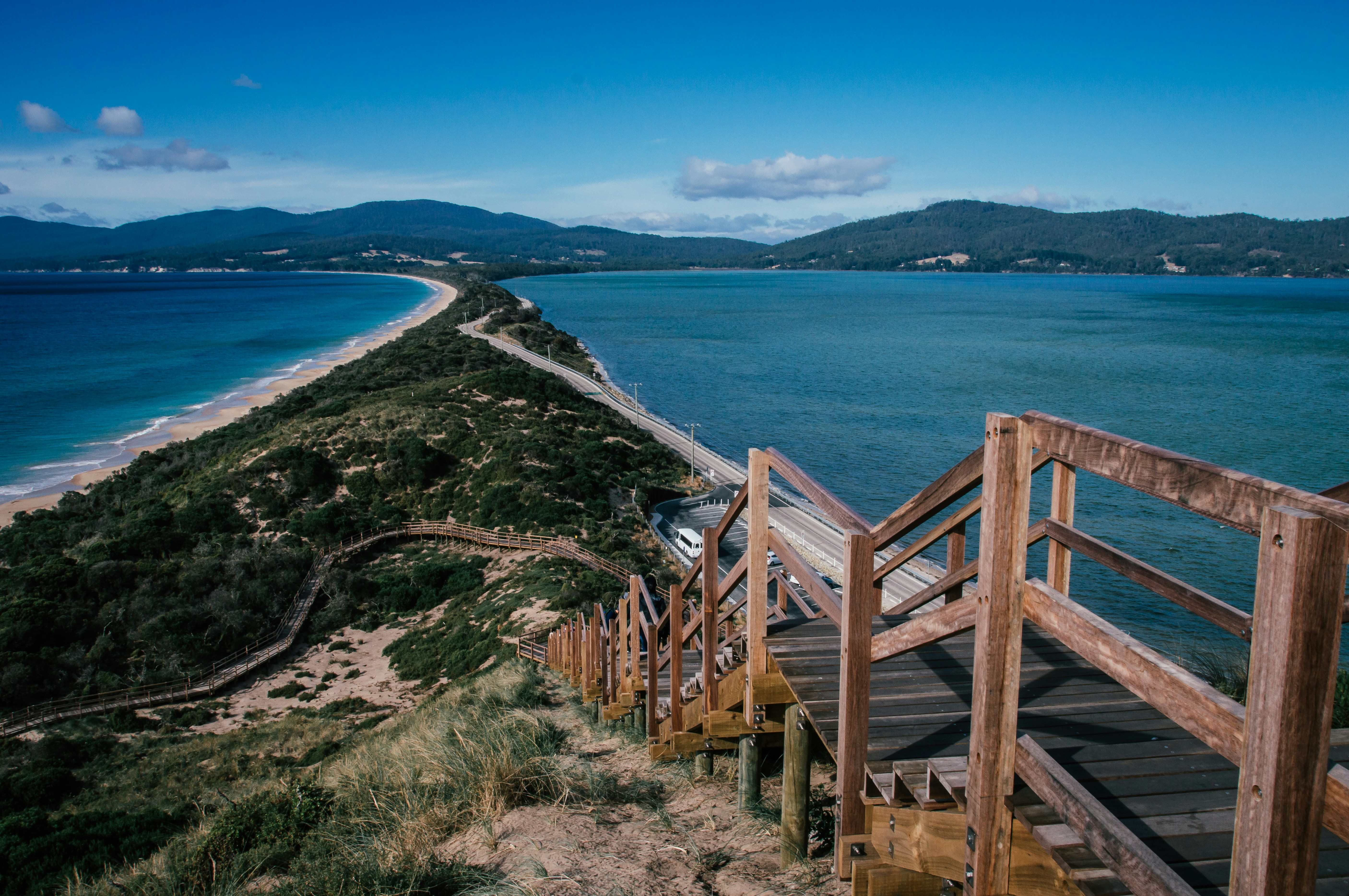
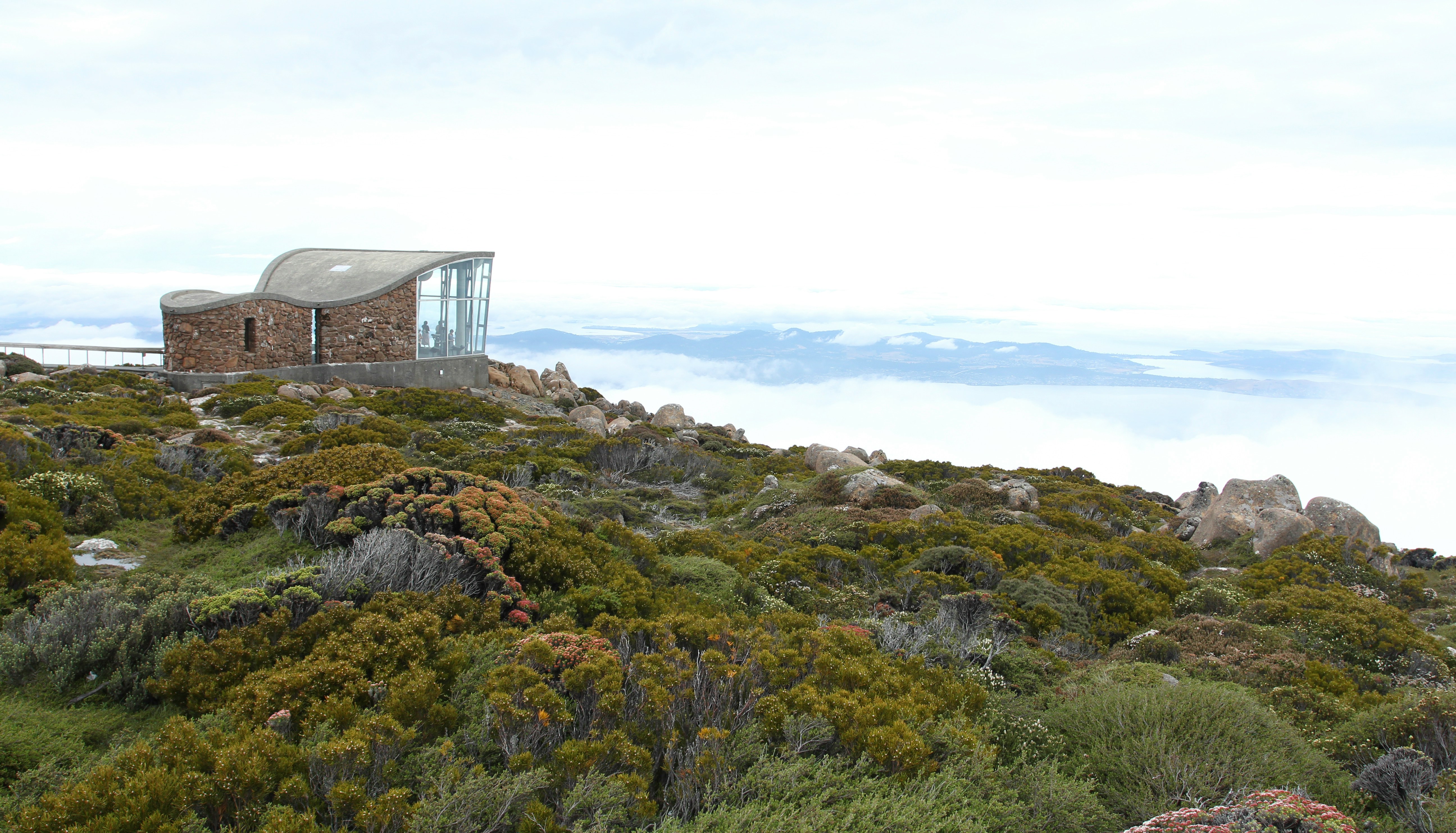
About Hobart, Tasmania
Straddling the Derwent River at the foot of Mt. Wellington's forested slopes, Hobart was founded as a penal settlement in 1803. It's the second-oldest city in the country after Sydney, and it certainly rivals its mainland counterpart as Australia's most beautiful state capital. Close-set colonial brick-and-sandstone shops and homes line the narrow, quiet streets, creating a genteel setting for this historic city of 215,000. Life revolves around the broad Derwent River port, one of the deepest harbors in the world. Here warehouses that once stored Hobart's major exports of fruit, wool, and corn and products from the city's former whaling fleet still stand alongside the wharf today.Hobart sparkles between Christmas and New Year's—summer Down Under—during the annual Sydney-to-Hobart yacht race. The event dominates conversations among Hobart's citizens, who descend on Constitution Dock to welcome the yachts and join in the boisterous festivities of the crews. The New Year also coincides with the Tastes of Tasmania Festival, when the dockside area comes alive with the best of Tasmanian food and wine on offer in numerous cafés, bars, and waterfront stalls. Otherwise, Hobart is a placid city whose nightlife is largely confined to excellent restaurants, jazz clubs, and the action at the Wrest Point Casino in Sandy Bay.The Hobart Tasmanian Travel and Information Centre hours are weekdays 8:30–5:30 and Saturday 9–5.
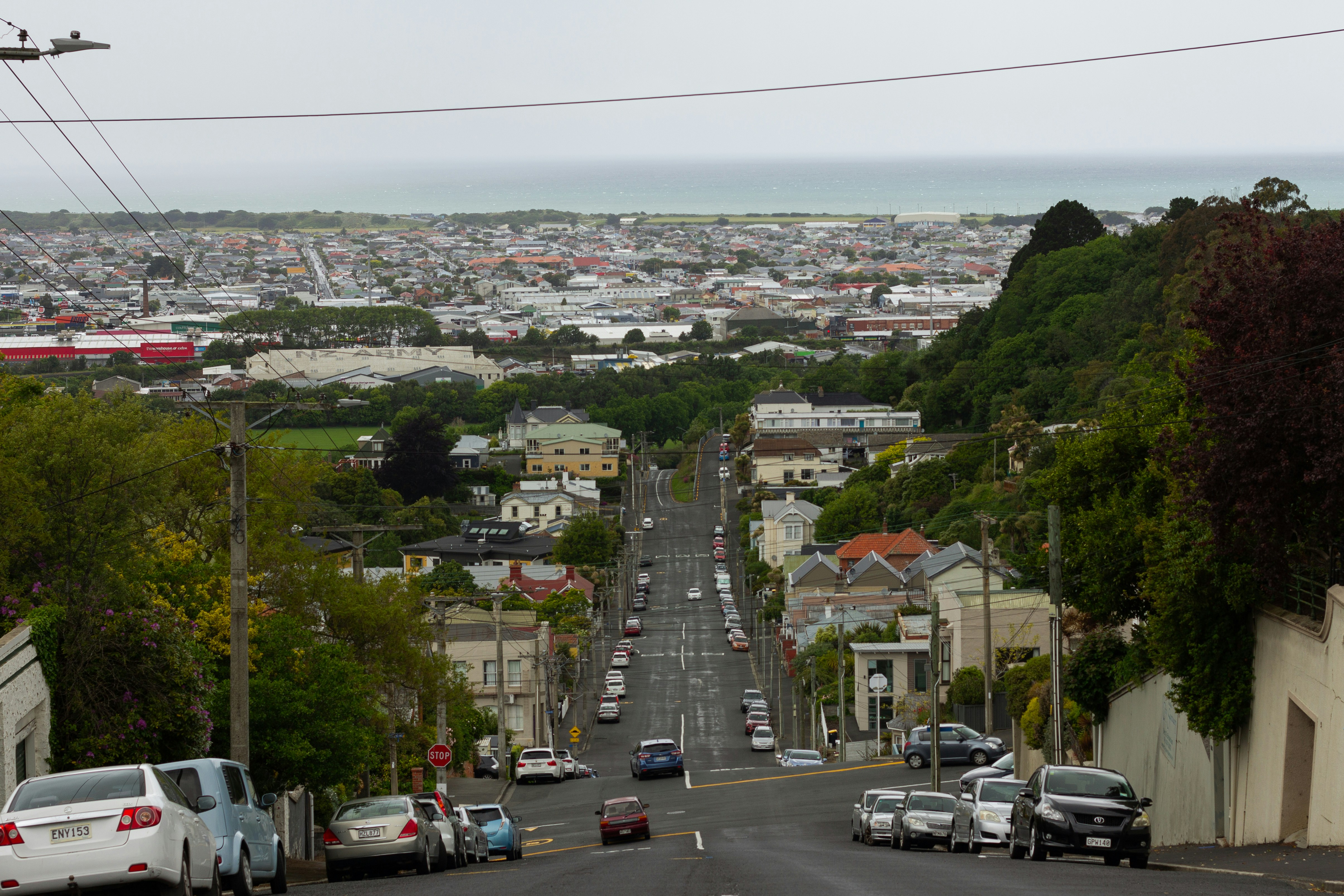
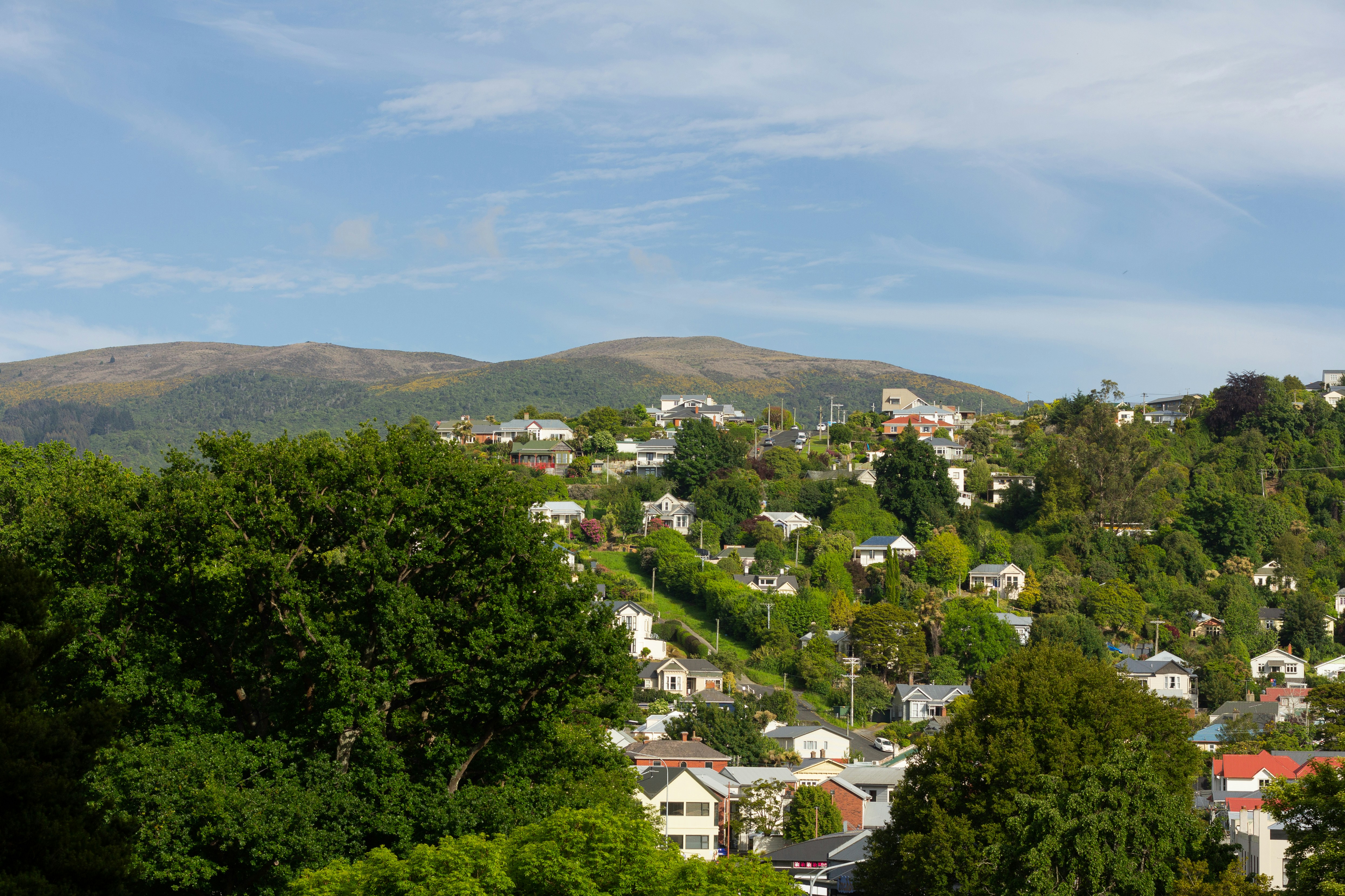
About Dunedin
Clinging to the walls of the natural amphitheater at the west end of Otago Harbour, the South Island's second-largest city is enriched with inspiring nearby seascapes and wildlife. Because Dunedin is a university town, floods of students give the city a vitality far greater than its population of 122,000 might suggest. Its manageable size makes it easy to explore on foot—with the possible exception of Baldwin Street, the world's steepest residential street and home to the annual "gutbuster" race, in which people run up it, and the "Jaffa" race, in which people roll the namesake spherical chocolate candy down it.Dunedin, the Gaelic name for Edinburgh, was founded in 1848 by settlers of the Free Church of Scotland, a breakaway group from the Presbyterian Church. The city's Scottish roots are still visible; you'll find New Zealand's first and only (legal) whisky distillery, a statue of Scottish poet Robert Burns, and more kilts, sporrans, and gillies than you can shake a stick at! The Scottish settlers and local Māori came together in relative peace, but this wasn't true of the European whalers who were here three decades before, as places with names such as Murdering Beach illustrate.Dunedin has always had a reputation for the eccentric. Wearing no shoes and a big beard here marks a man as bohemian rather than destitute, and the residents wouldn't have it any other way. The University of Otago was the country's first university and has been drawing writers ever since its founding in 1871, most notably Janet Frame and the poet James K. Baxter. Dunedin also has a musical heritage, which blossomed into the "Dunedin Sound" of the 1970s and '80s.
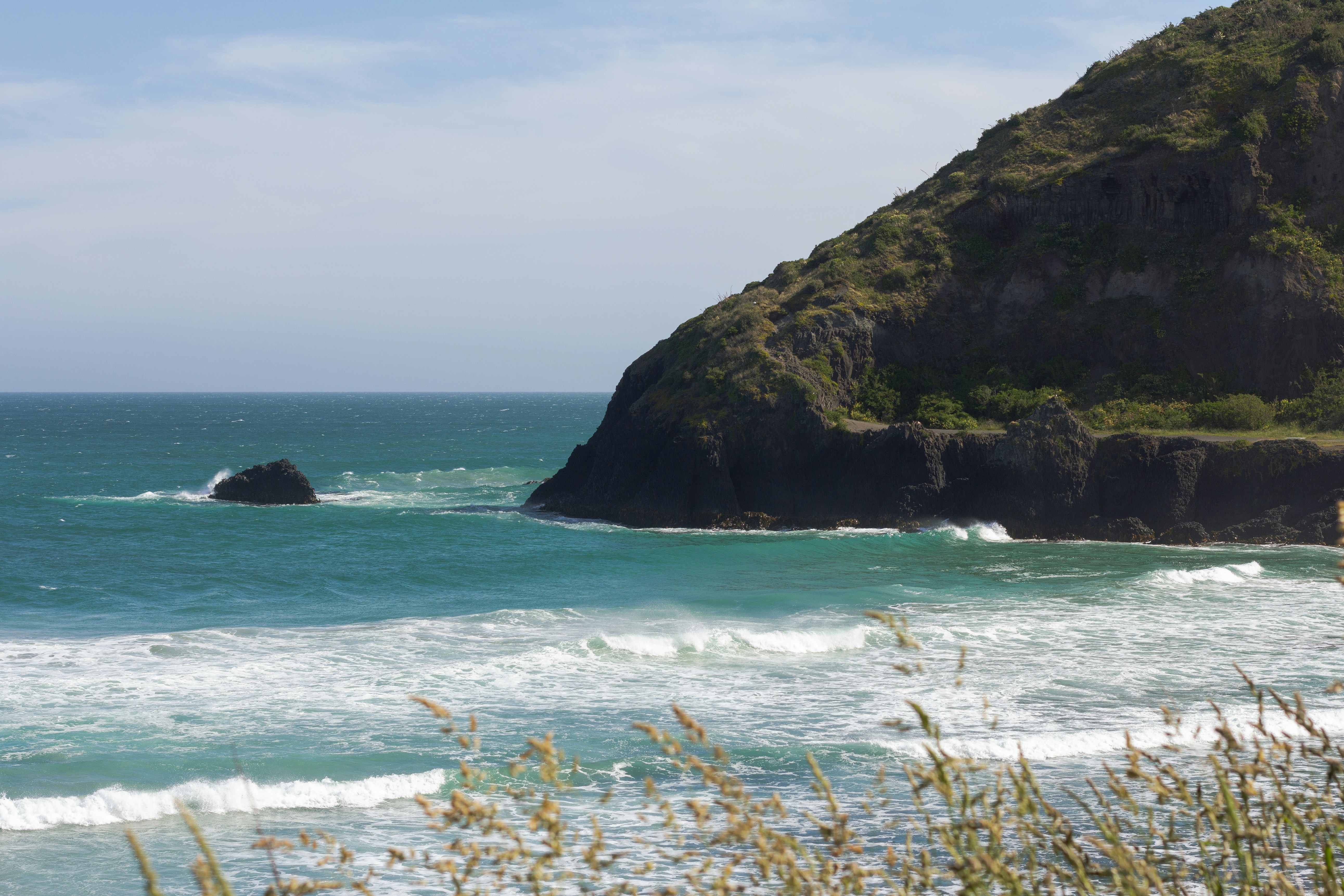
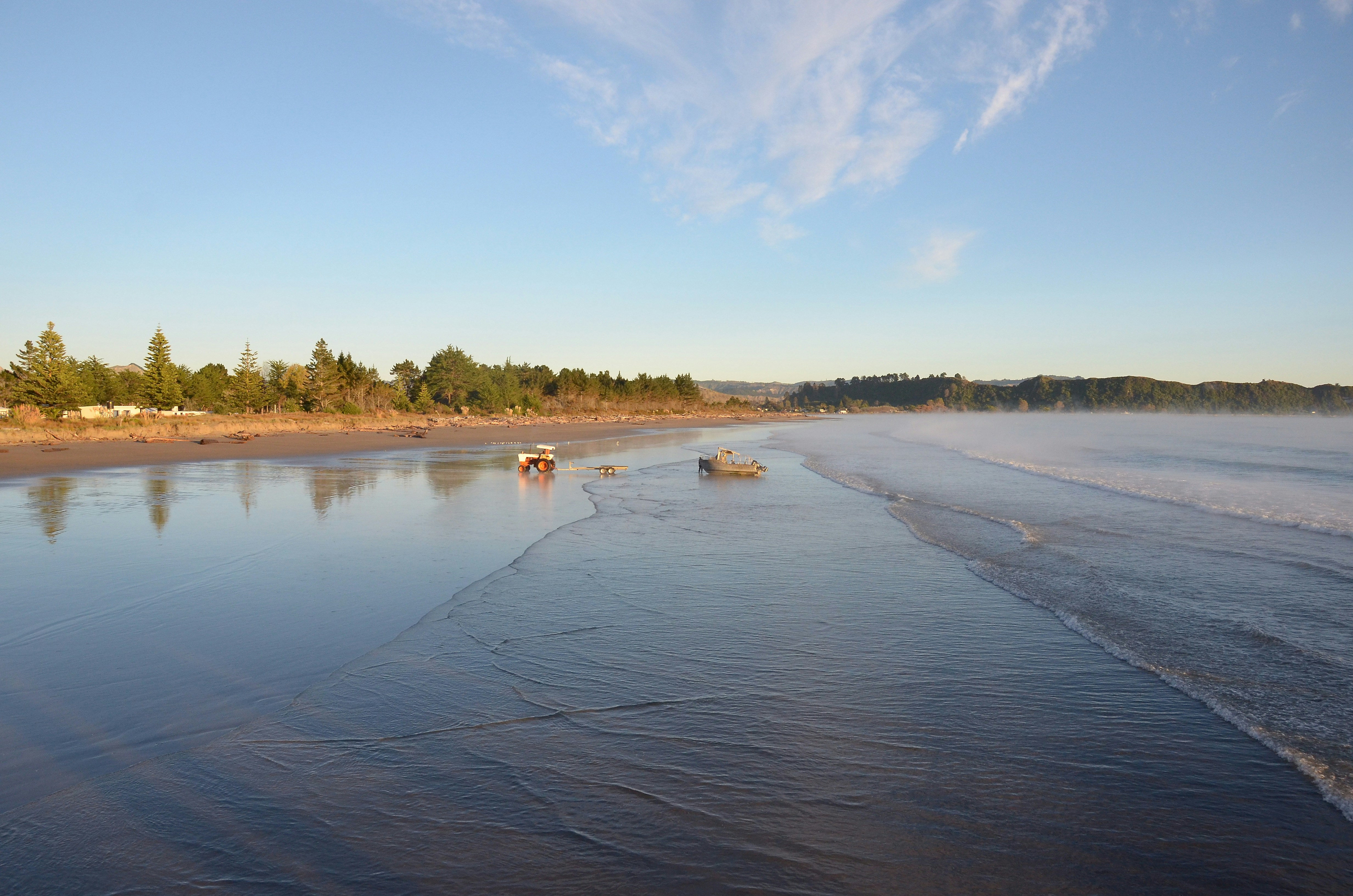
About Timaru
Situated almost equidistant between Christchurch and Dunedin, Timaru has oft been overlooked by those just needing to get from one city to another but more fool them! The town’s name comes from the Māori name Te Maru, meaning ‘place of shelter’ and the pretty town reveals not only stunning Middle Earth landscape and views to write home about, but an intact Victorian / Edwardian shopping precinct with many of the building being built in local volcanic bluestone. Understandably, beach life is very important here and the long ribbons of white sandy beaches and clean seas are perfect for a swimming, sunning and spoiling yourself! Voted one of New Zealand’s top 10 most loved beaches, Caroline Bay is simply a treasure. Built on the rolling hills created from the lava flows of the extinct Mt Horrible volcano, Timaru is a melting pot of culture, history, adventure and dramatic scenery. Art lovers too will not be left wanting as the city’s art gallery holds the third largest public art collection in the South Island. Walking enthusiasts will not want to miss one of the many walks along the coast or rivers that vary from short paved paths – ideal for pushchairs and wheelchairs to longer, more strenuous hikes. Well signposted and maintained, these tracks are especially beautiful in the autumn when the leaves are turning colour. And do not forget to be on the lookout for penguins, which will happily waddle alongside you some of the way!
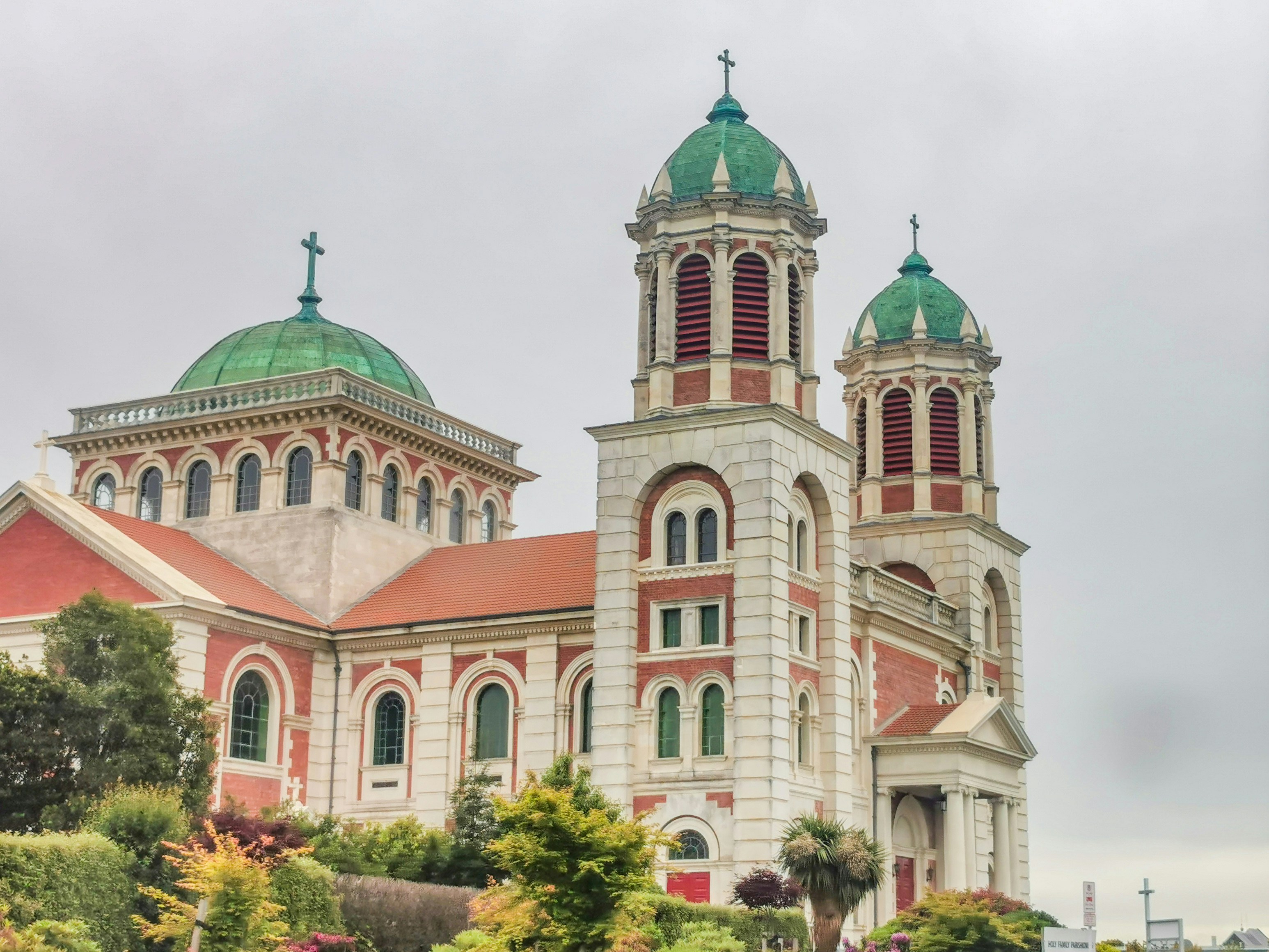
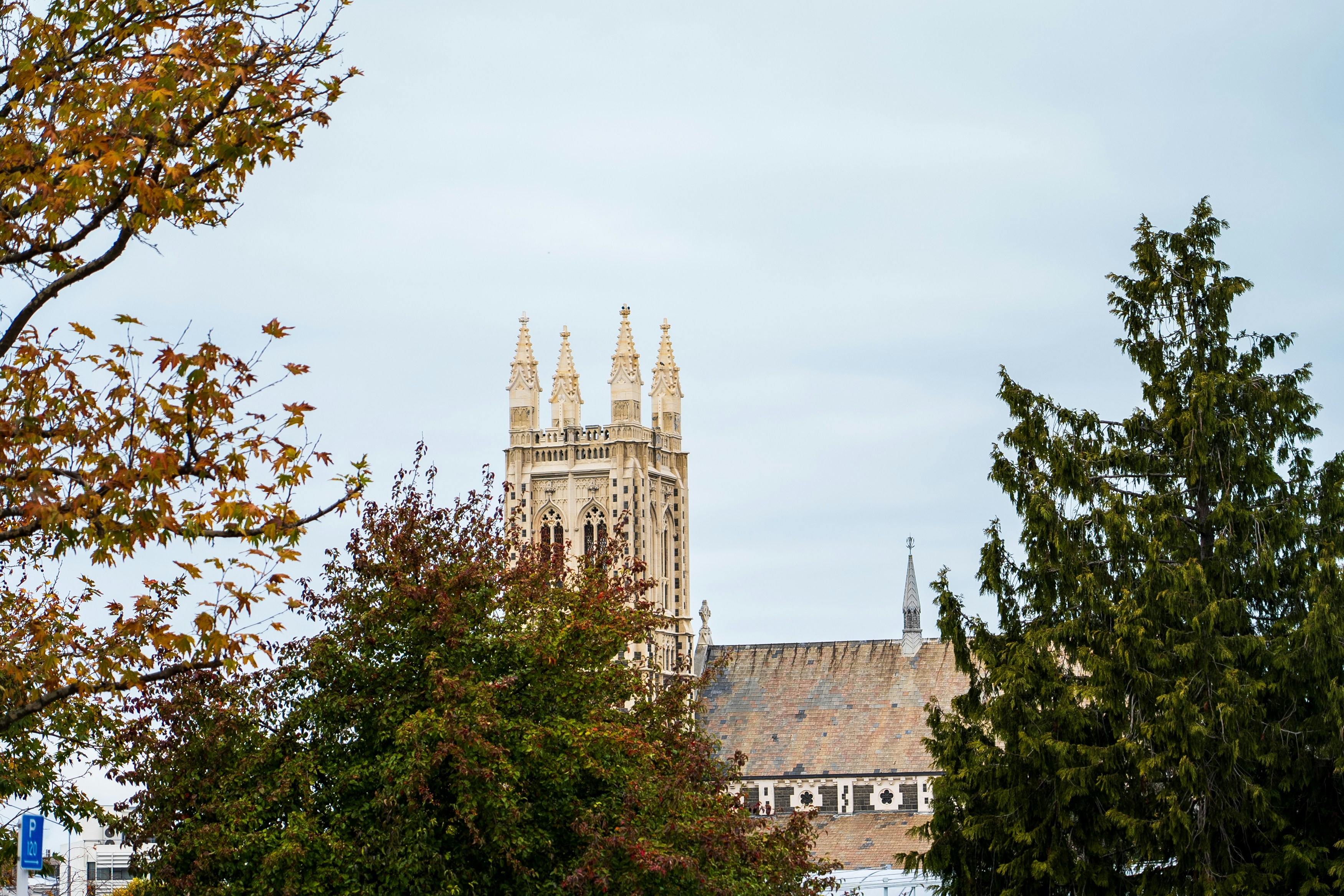

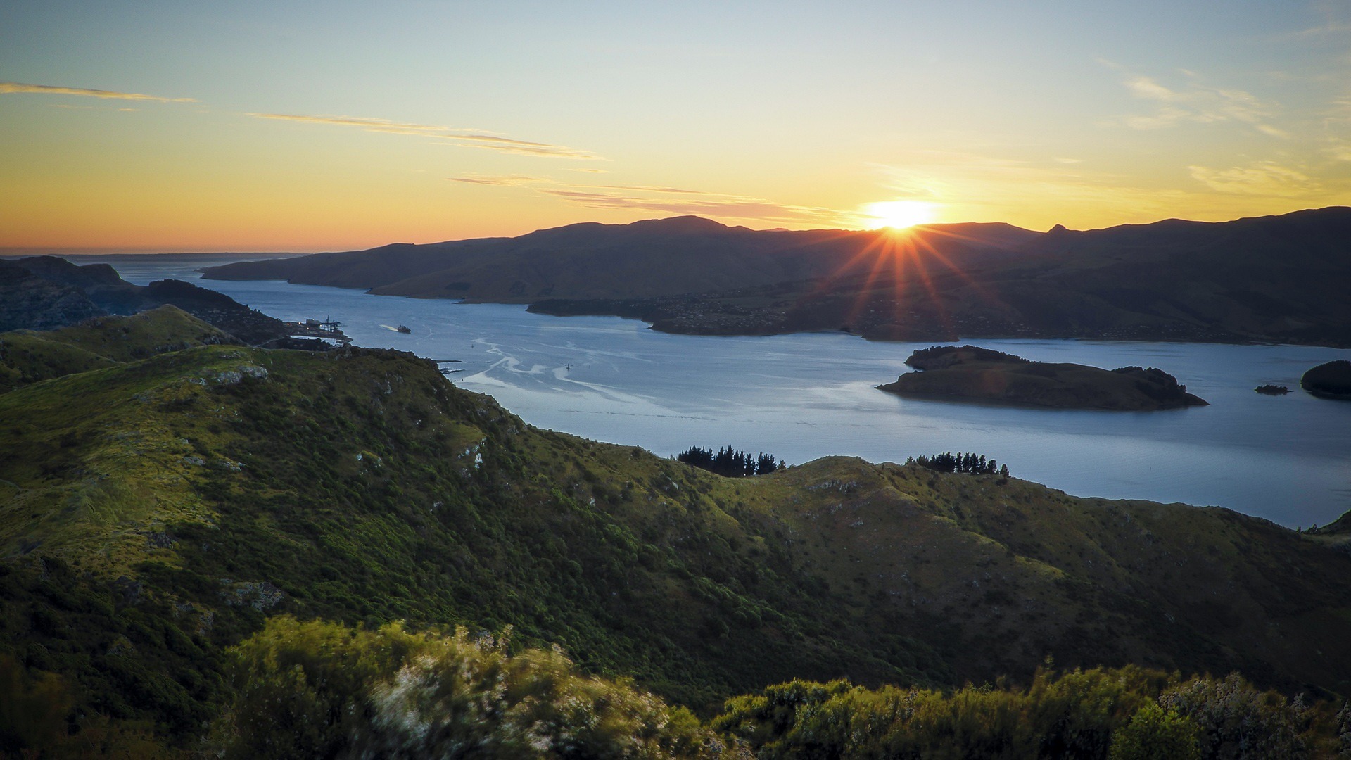
About Lyttelton
Your initial impression of Christchurch will likely be one of a genteel, green city. Joggers loop through shady Hagley Park, and punters ply the narrow Avon River, which bubbles between banks lined with willows and oaks. With a population approaching 350,000, Christchurch is the largest South Island city, and the second-largest in the country. It is also the forward supply depot for the main U.S. Antarctic base at McMurdo Sound. The face of Christchurch is changing rapidly, fueled by both internal and international immigration. The Māori community, although still below the national average in size, is growing. Ngai Tahu, the main South Island Māori tribe, settled Treaty of Waitangi claims in 1997 and have been investing in tourism ventures. Old wooden bungalows are making way for town houses, the arts scene is flourishing, and the city's university attracts cutting-edge technology companies. In short, there's plenty of fresh energy percolating underneath the English veneer.
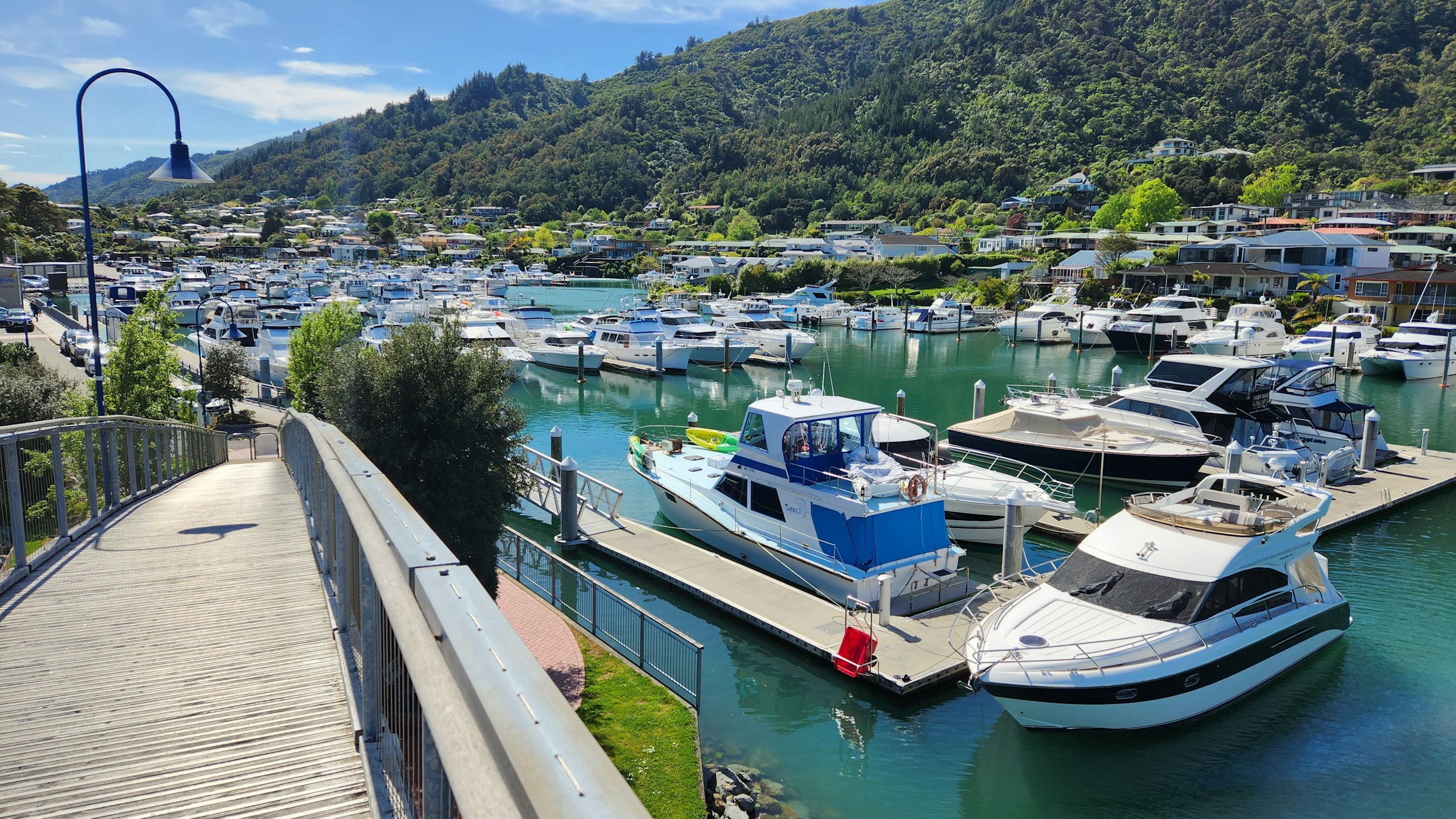
About Picton
The maritime township of Picton (population 4,000) lies at the head of Queen Charlotte Sound and is the arrival point for ferries from the North Island, as well as a growing number of international cruise ships. It plays a major role in providing services and transport by water taxi to a multitude of remote communities in the vast area of islands, peninsulas, and waterways that make up the Marlborough Sounds Maritime Park. There's plenty to do in town, with crafts markets in summer, historical sights to see, and walking tracks to scenic lookouts over the sounds. The main foreshore is lined by London Quay, which looks up Queen Charlotte Sound to the bays beyond. High Street runs down to London Quay from the hills, and between them these two streets make up the center of town.
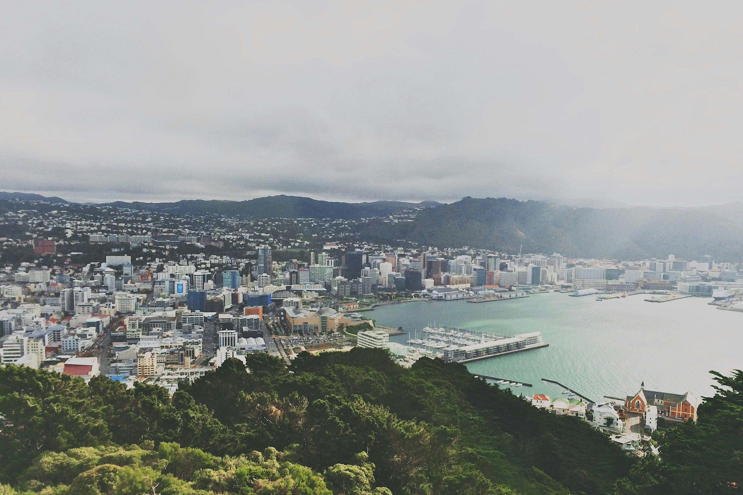
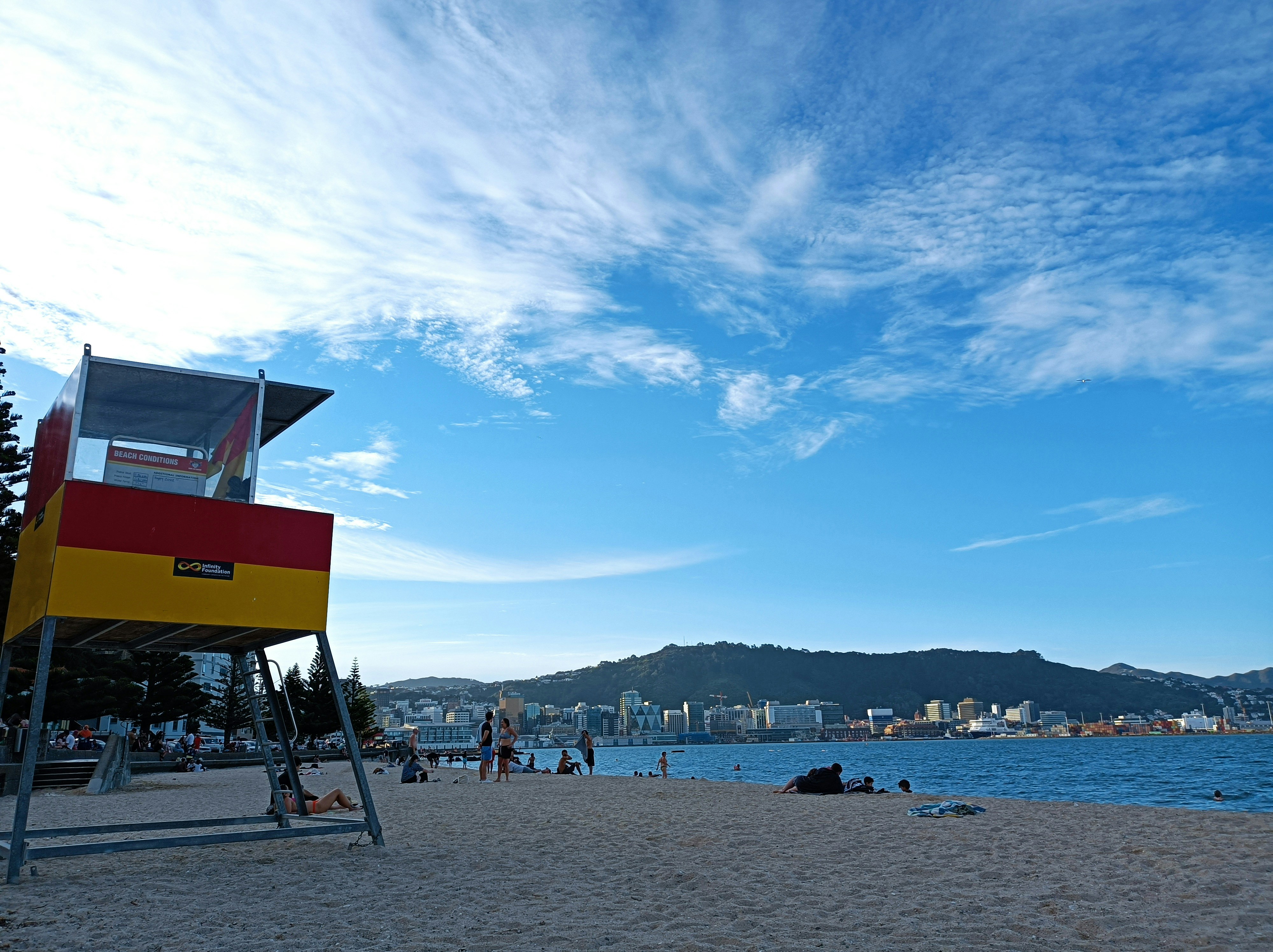
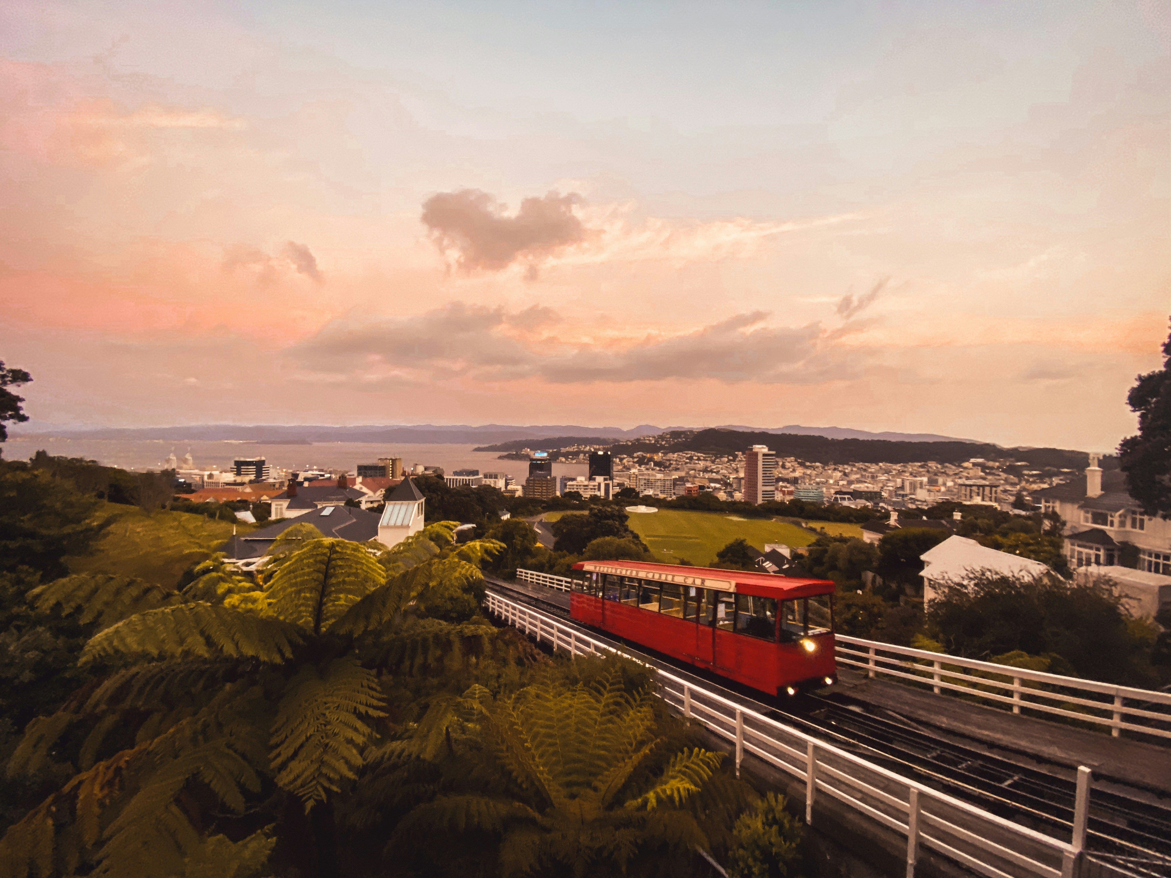
About Wellington
New Zealand's capital is, arguably, the country's most cosmopolitan metropolis. It's world-class Te Papa Tongarewa-Museum of New Zealand is a don't-miss attraction, and the burgeoning film industry led, of course, by the Lord of the Rings extravaganzas has injected new life into the local arts scene. Attractive and compact enough to be explored easily on foot, Wellington is a booming destination. Modern high-rise buildings gaze over Port Nicholson, surely one of the finest natural anchorages in the world. Known to local Māori as The Great Harbor of Tara, its two massive arms form the jaws of the fish of Maui from Māori legend. Sometimes referred to as the windy city, Wellington has been the seat of New Zealand's government since 1865.


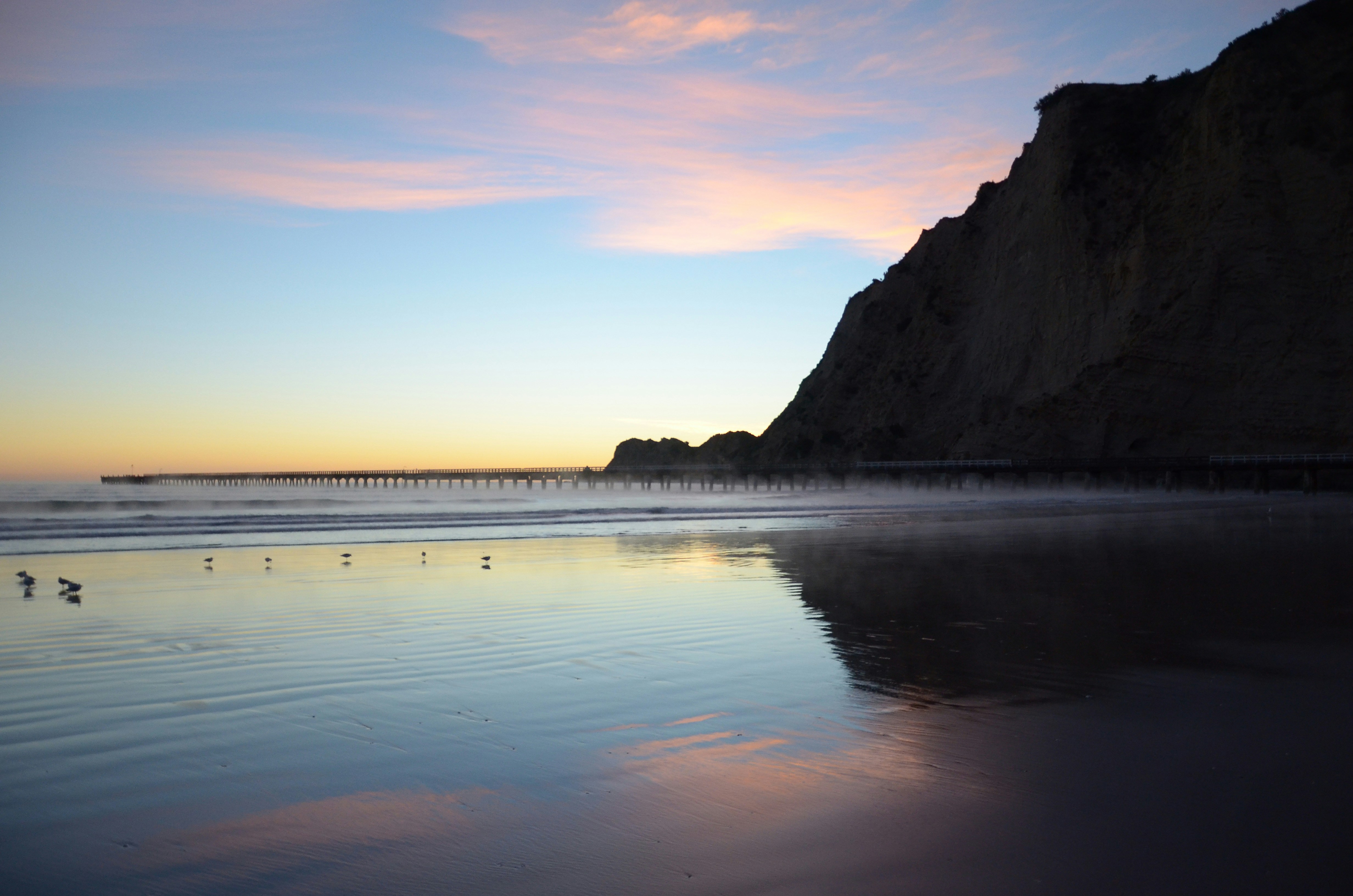
About Napier
The earthquake that struck Napier at 10:46 am on February 3, 1931, was—at 7.8 on the Richter scale—the largest quake ever recorded in New Zealand. The coastline was wrenched upward several feet. Almost all the town's brick buildings collapsed; many people were killed on the footpaths as they rushed outside. The quake triggered fires throughout town, and with water mains shattered, little could be done to stop the blazes that devoured the remaining wooden structures. Only a few buildings survived (the Public Service Building with its neoclassical pillars is one), and the death toll was well over 100.The surviving townspeople set up tents and cookhouses in Nelson Park, and then tackled the city's reconstruction at a remarkable pace. In the rush to rebuild, Napier went mad for art deco, the bold, geometric style that had burst on the global design scene in 1925. Now a walk through the art deco district, concentrated between Emerson, Herschell, Dalton, and Browning streets, is a stylistic immersion. The decorative elements are often above the ground floors, so keep your eyes up.
About Gisborne
With a population of around 35,000 and located on the north island, Gisborne exudes history at every turn. Maori for “Great standing place of Kiwa”, Kiwa was a leading figure aboard the Maori ancestral canoe, Takitimu, which ran aground in Gisborne around 1450 AD. After landing, Kiwa became a coastal guardian, eventually marrying Parawhenuamea, the keeper of the streams. The union point of three rivers and the first place to see the sun, the city is filled with light and laugher and gracefully squeezes surfer’s beaches with the district’s colonial past. Captain Cook made his first landfall here, John Harris set up his first trading station in the then village and today, Gisborn is the major centre of Maori cultural life.Suffice to say then that the city is a watery wonderland. With its picture perfect beaches, what savvy traveller does not want to add being among the first people in the world to say they have watched the sky change colour as the sun bursts from out of the sea. A place of nature, spectacular beach cliff views are all just part and parcel of everyday life here, and easy walks from the centre of town to the Titirangi Reserve will award you with yet more unbelievable 180˚ vistas from Poverty Bay to Gisborne City; stretch your eyes with the panorama, while stretching your legs on one of the many enjoyable walks.A perfect place to stroll, amble and wander, like much of New Zealand Gisborne keeps a healthy respect for history and nature and enjoys a very laid back feel.
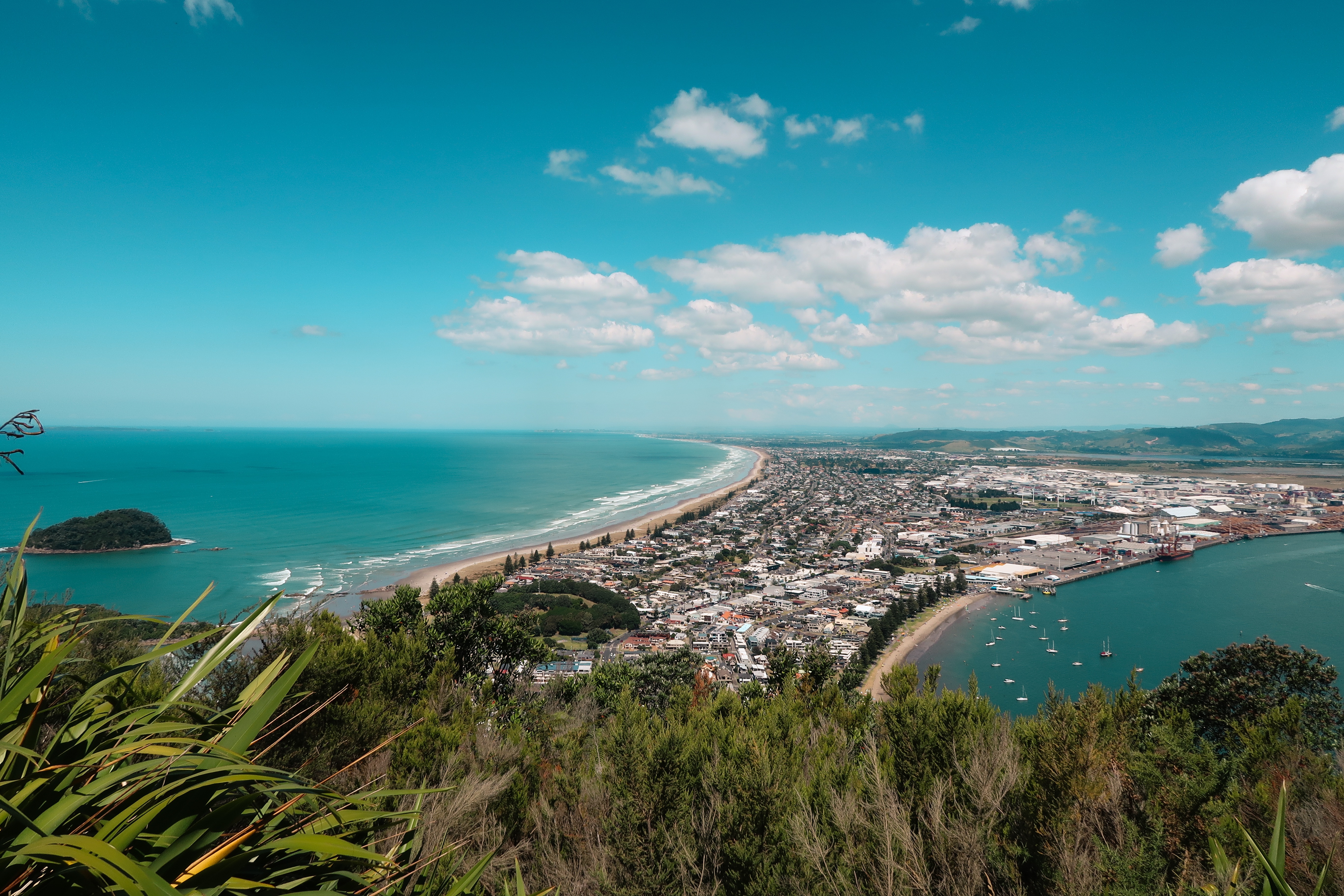
About Tauranga
The population center of the Bay of Plenty, Tauranga is one of New Zealand's fastest-growing cities. Along with its neighbor, Whakatane, this seaside city claims to be one of the country's sunniest towns. Unlike most local towns, Tauranga doesn't grind to a halt in the off-season, because it has one of the busiest ports in the country, and the excellent waves at the neighboring beach resort of Mount Maunganui—just across Tauranga's harbor bridge—always draw surfers and holiday folk.
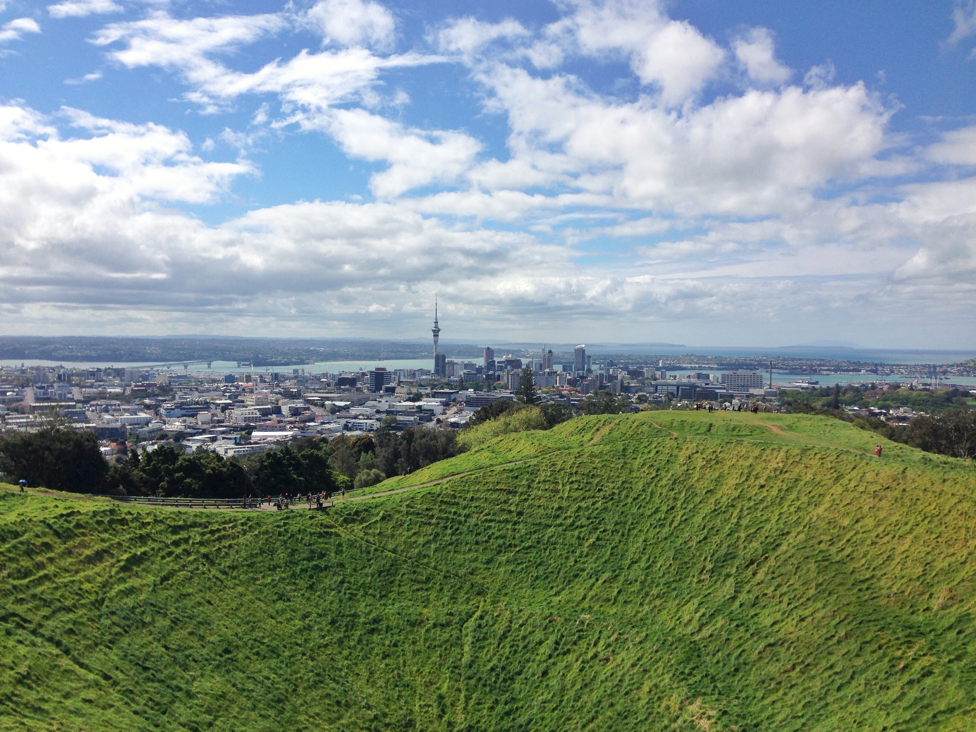
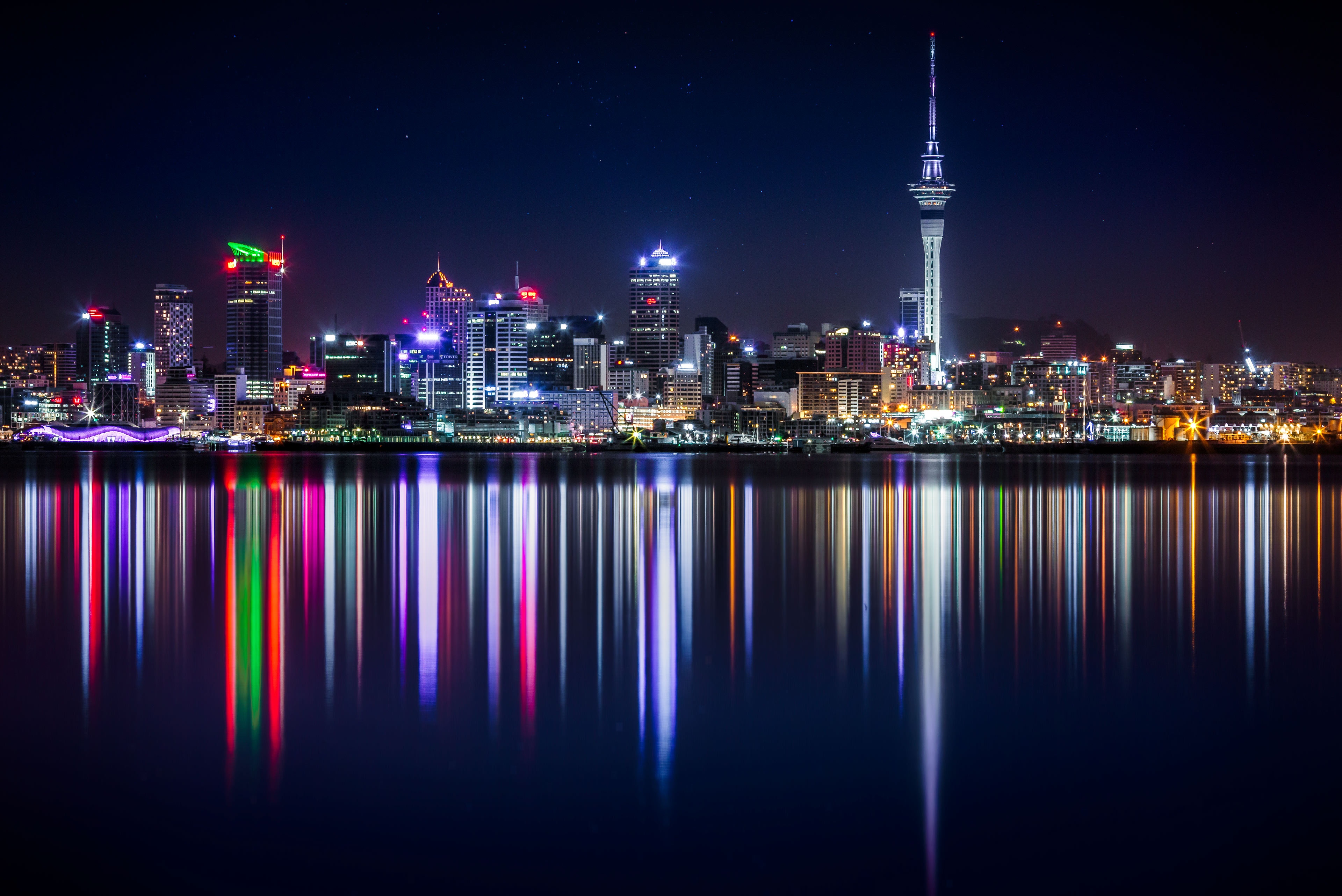
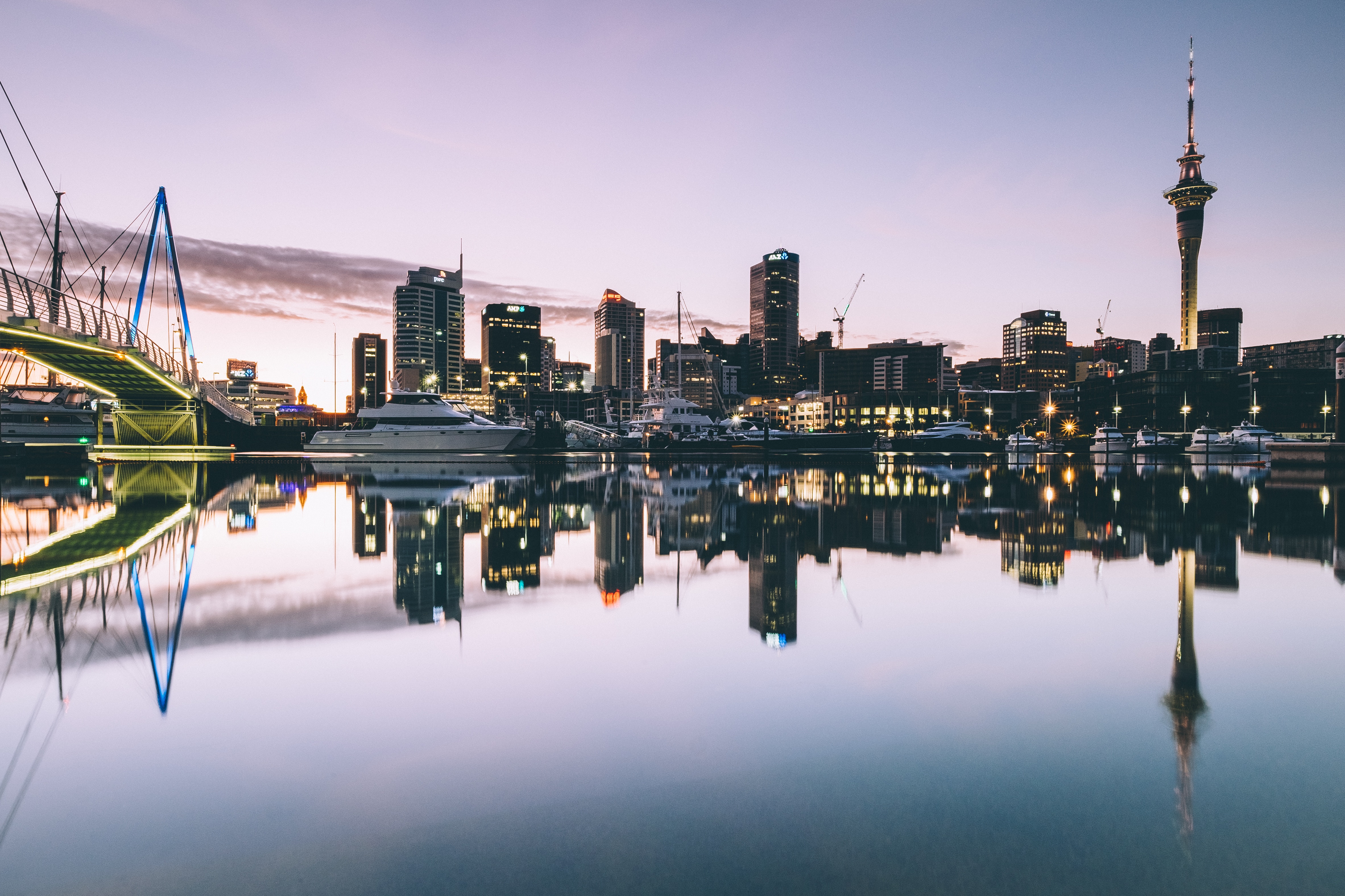
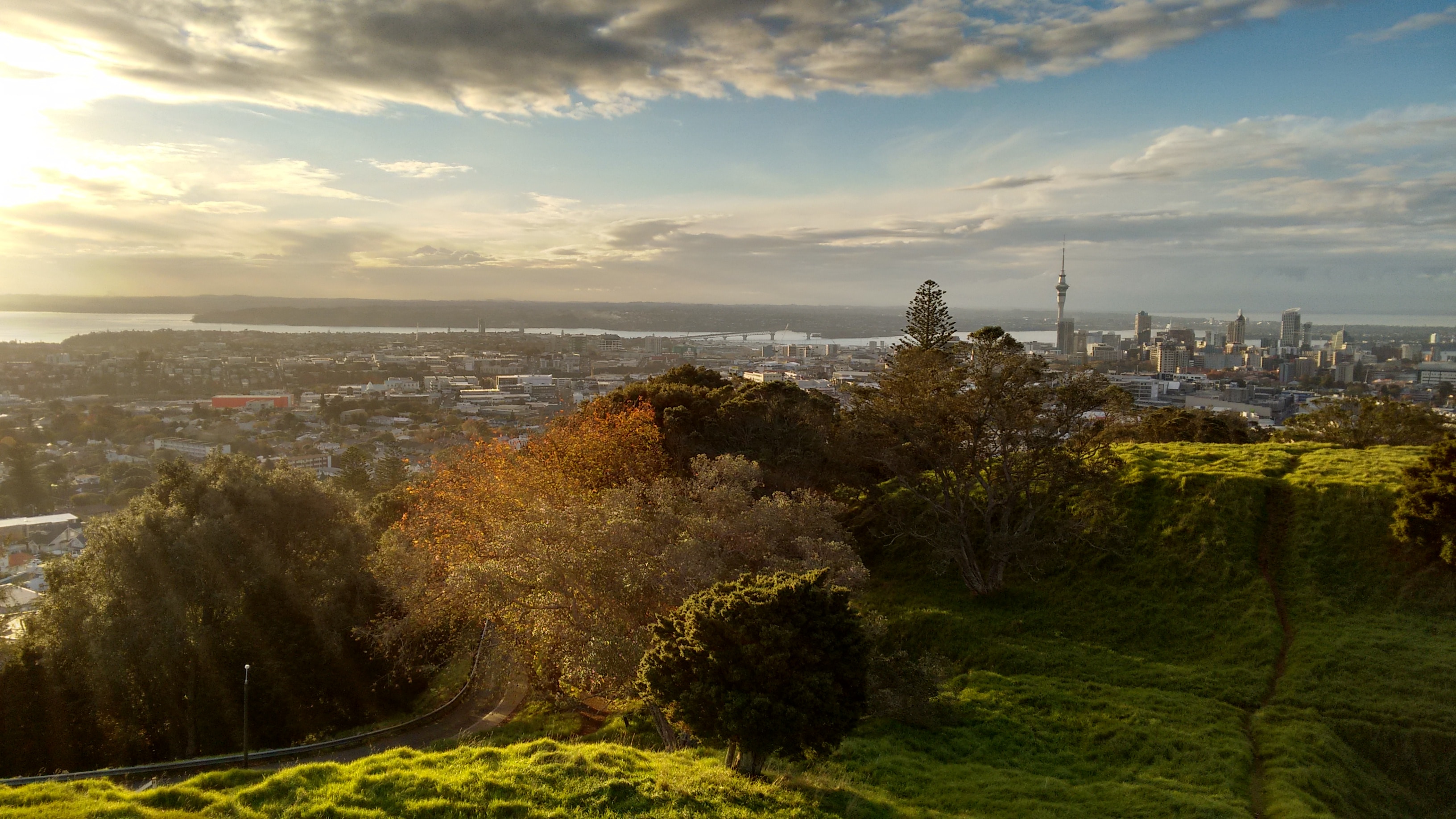
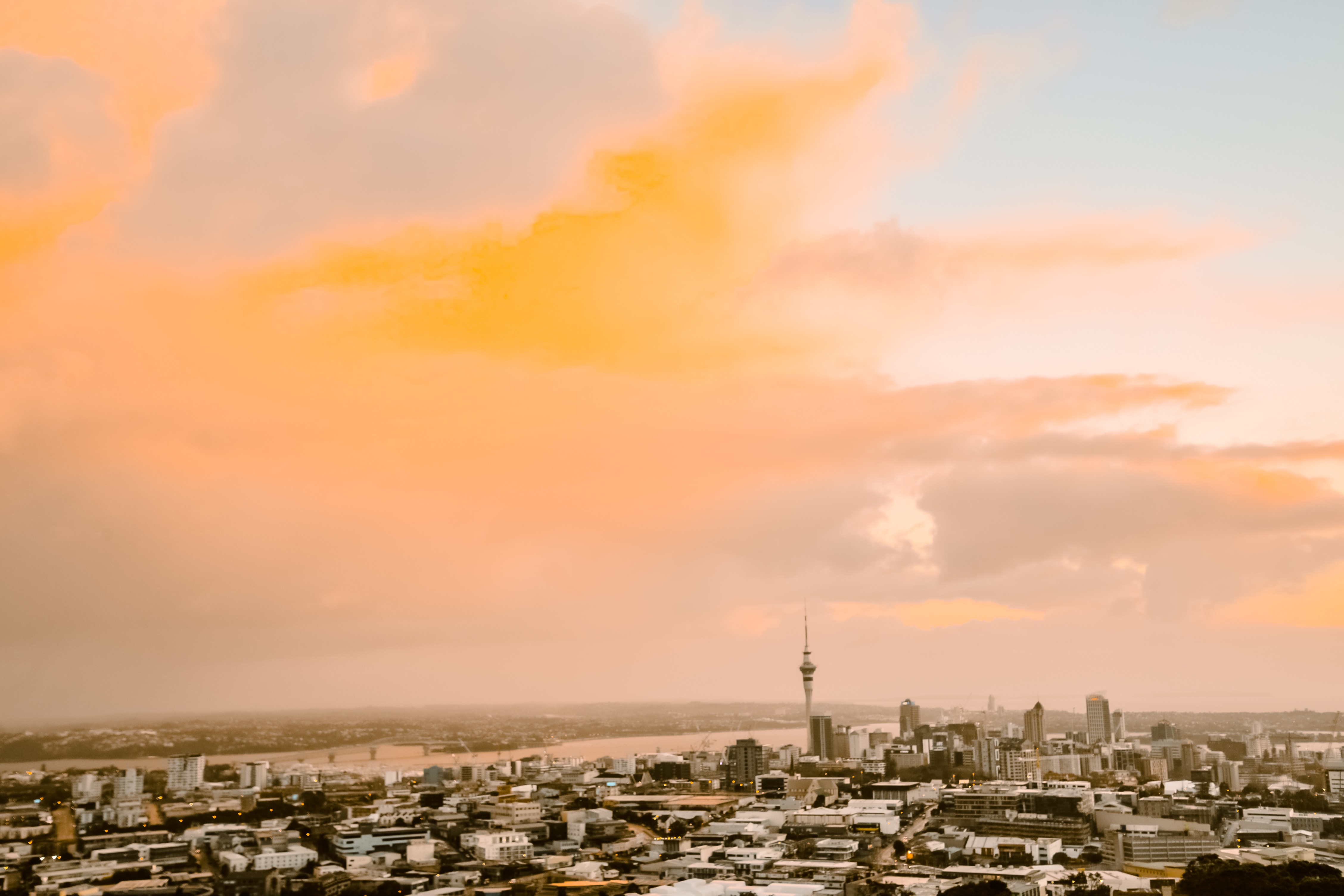
About Auckland
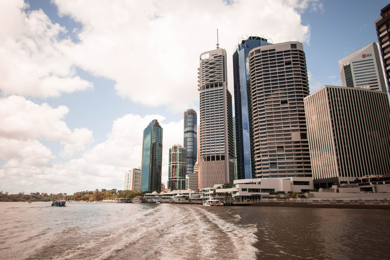
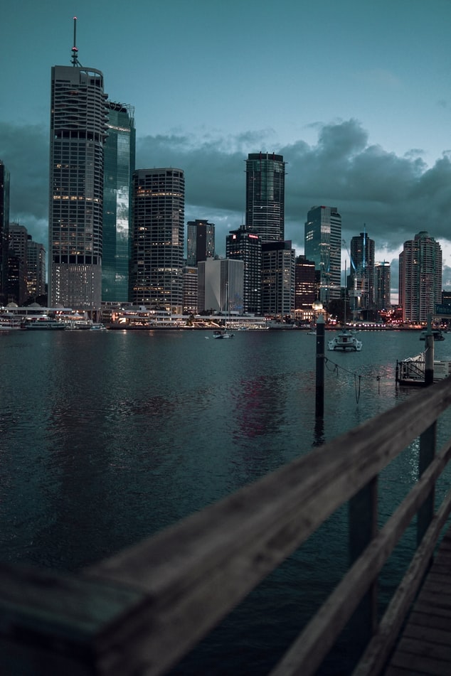
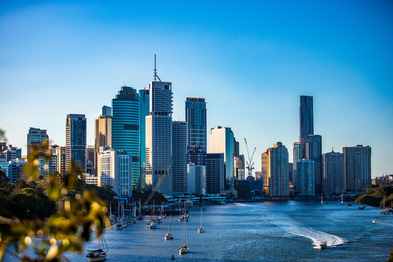
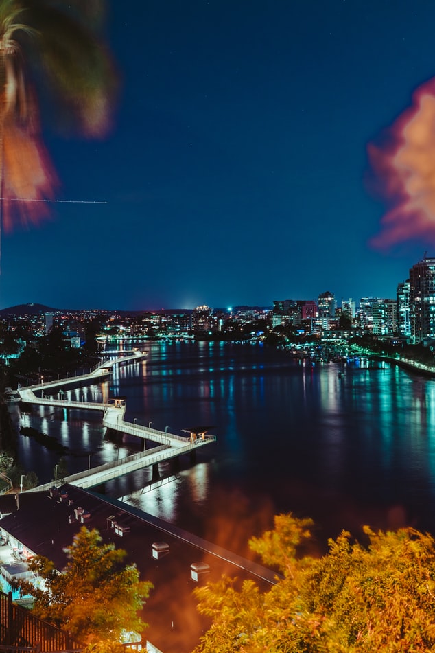
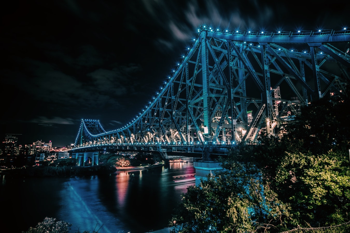
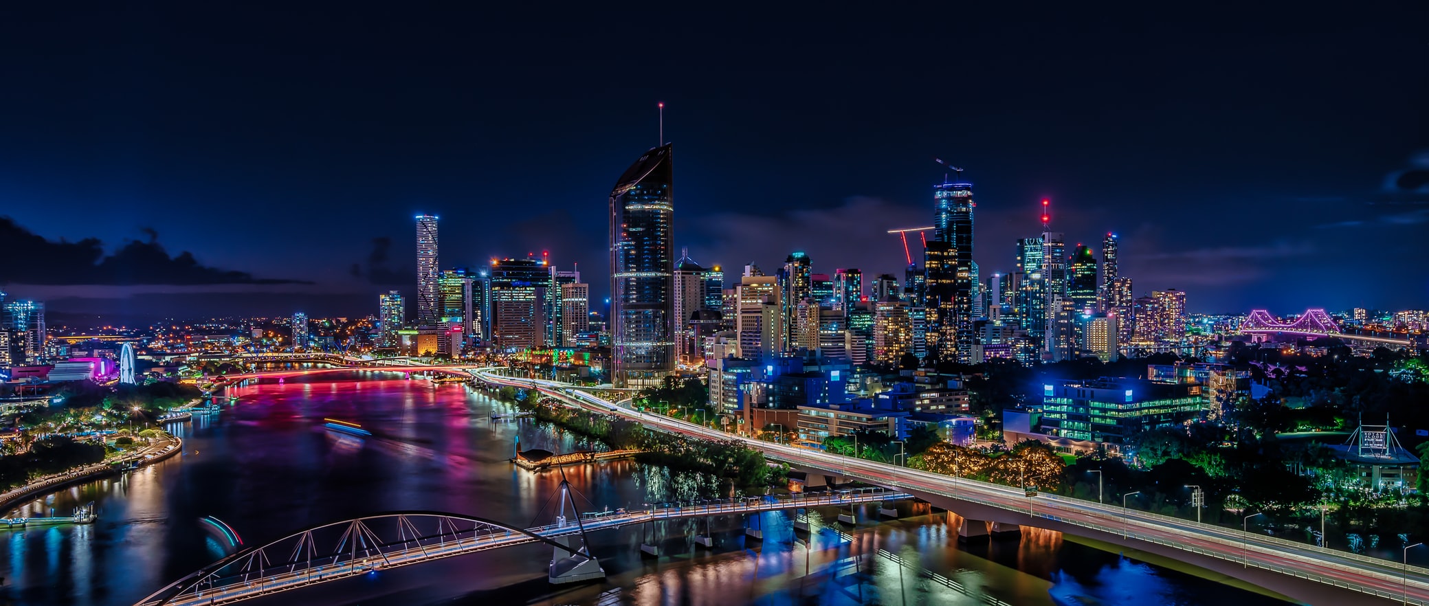
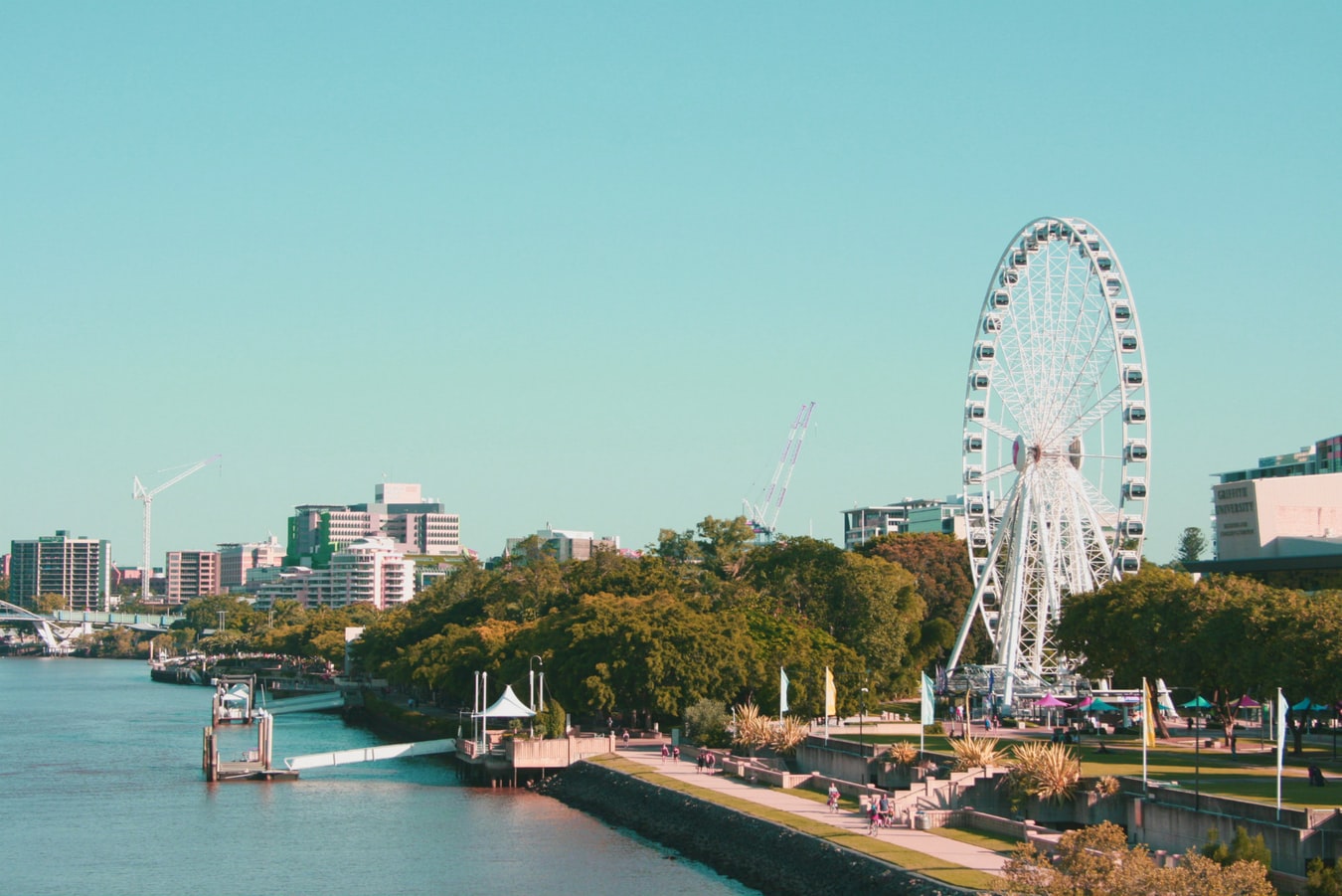
About Brisbane, Queensland
Founded in 1824 on the banks of the wide, meandering Brisbane River, the former penal colony of Brisbane was for many years regarded as just a big country town. Many beautiful timber Queenslander homes, built in the 1800s, still dot the riverbanks and inner suburbs, and in spring the city's numerous parks erupt in a riot of colorful jacaranda, poinciana, and bougainvillea blossoms. Today the Queensland capital is one of Australia's most up-and-coming cities: glittering high-rises mark its polished business center, slick fashion boutiques and restaurants abound, and numerous outdoor attractions beckon. In summer, temperatures here are broilingly hot and days are often humid, a reminder that this city is part of a subtropical region. Wear SPF 30-plus sunscreen and a broad-brimmed hat outdoors, even on overcast days.Brisbane's inner suburbs, a 5- to 10-minute drive or 15- to 20-minute walk from the city center, have a mix of intriguing eateries and quiet accommodations. Fortitude Valley combines Chinatown with a cosmopolitan mix of clubs, cafés, and boutiques. Spring Hill has several high-quality hotels, and Paddington, New Farm, Petrie Terrace, West End, and Woolloongabba are full of an eclectic mix of restaurants and bars. Brisbane is also a convenient base for trips to the Sunshine and Gold coasts, the mountainous hinterlands, and the Moreton Bay islands.
About Airlie Beach
About Cairns, Queensland
Tourism is the lifeblood of Cairns (pronounced Caans). The city makes a good base for exploring the wild top half of Queensland, and tens of thousands of international travelers use it as a jumping-off point for activities such as scuba diving and snorkeling trips to the Barrier Reef, as well as boating, fishing, parasailing, scenic flights, and rain-forest treks.It's a tough environment, with intense heat and fierce wildlife. Along with wallabies and grey kangaroos in the savannah and tree kangaroos in the rain forest, you'll find stealthy saltwater crocodiles, venomous snakes, and jellyfish so deadly they put the region’s stunning beaches off- limits to swimmers for nearly half the year. Yet despite this formidable setting, Cairns and tropical North Queensland are far from intimidating places. The people are warm and friendly, the sights spectacular, and—at the right time of year—the beachside lounging is world-class.
About Cooktown, Queensland
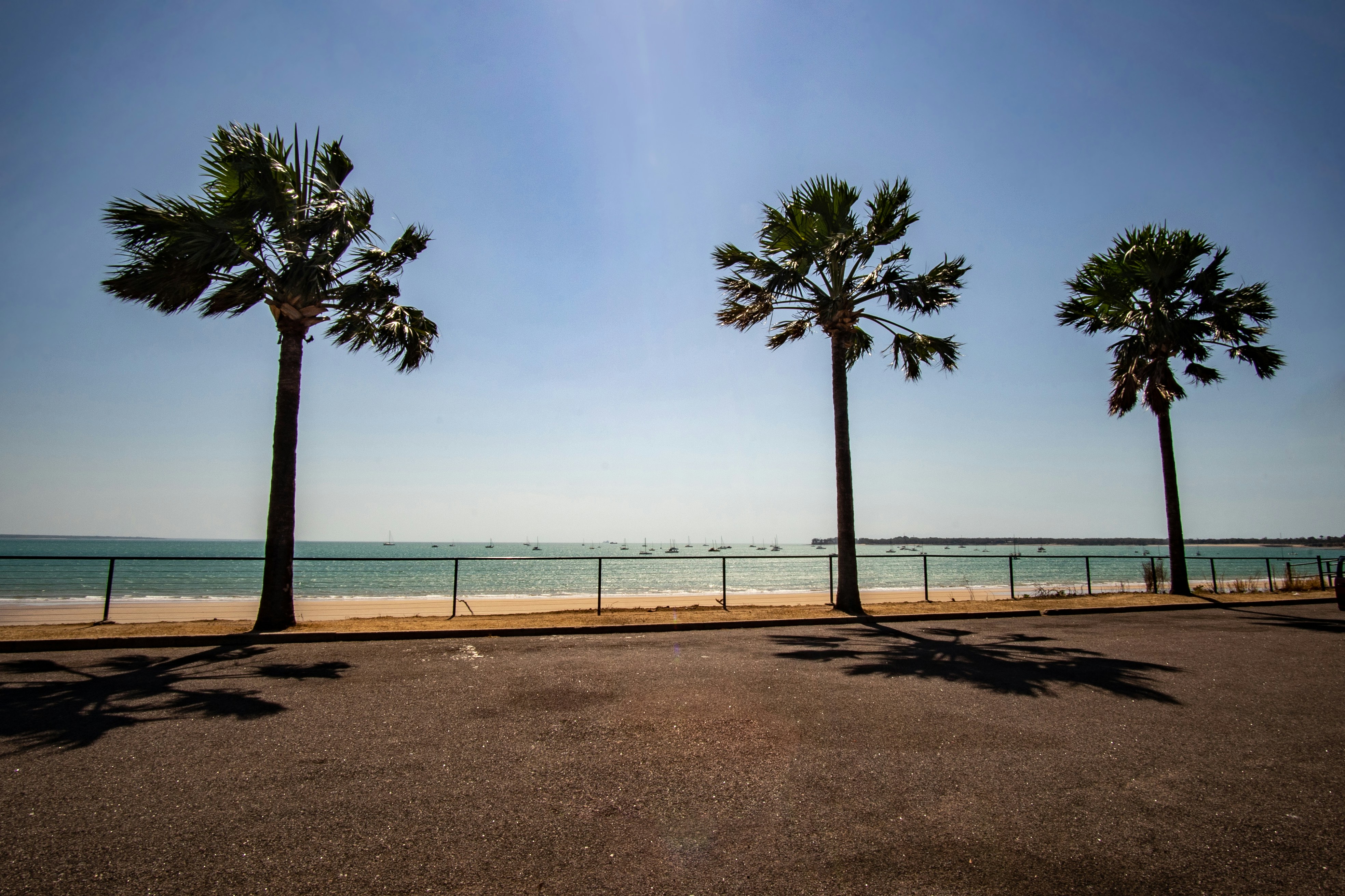
About Darwin, Northern Territory
Darwin is Australia's most colorful, and exotic, capital city. Surrounded on three sides by the turquoise waters of the Timor Sea, the streets are lined with tropical flowers and trees. Warm and dry in winter, hot and steamy in summer, it's a relaxed and casual place, as well as a beguiling blend of tropical frontier outpost and Outback hardiness. Thanks to its close proximity to Southeast Asia and its multicultural population it also seems more like Asia than the rest of Australia. Darwin is a city that has always had to fight for its survival. The seductiveness of contemporary Darwin lifestyles belies a history of failed attempts that date from 1824 when Europeans attempted to establish an enclave in this harsh, unyielding climate. The original 1869 settlement, called Palmerston, was built on a parcel of mangrove wetlands and scrub forest that had changed little in 15 million years. It was not until 1911, after it had already weathered the disastrous cyclones of 1878, 1882, and 1897, that the town was named after the scientist who had visited Australia's shores aboard the Beagle in 1839. During World War II it was bombed more than 60 times, as the harbor full of warships was a prime target for the Japanese war planes. Then, on the night of Christmas Eve 1974, the city was almost completely destroyed by Cyclone Tracy, Australia’s greatest natural disaster. It's a tribute to those who stayed and to those who have come to live here after Tracy that the rebuilt city now thrives as an administrative and commercial center for northern Australia. Old Darwin has been replaced by something of an edifice complex—such buildings as Parliament House and the Supreme Court all seem very grand for such a small city, especially one that prides itself on its casual, outdoor-centric lifestyle. Today Darwin is the best place from which to explore Australia's Top End, with its wonders of Kakadu and the Kimberley region.
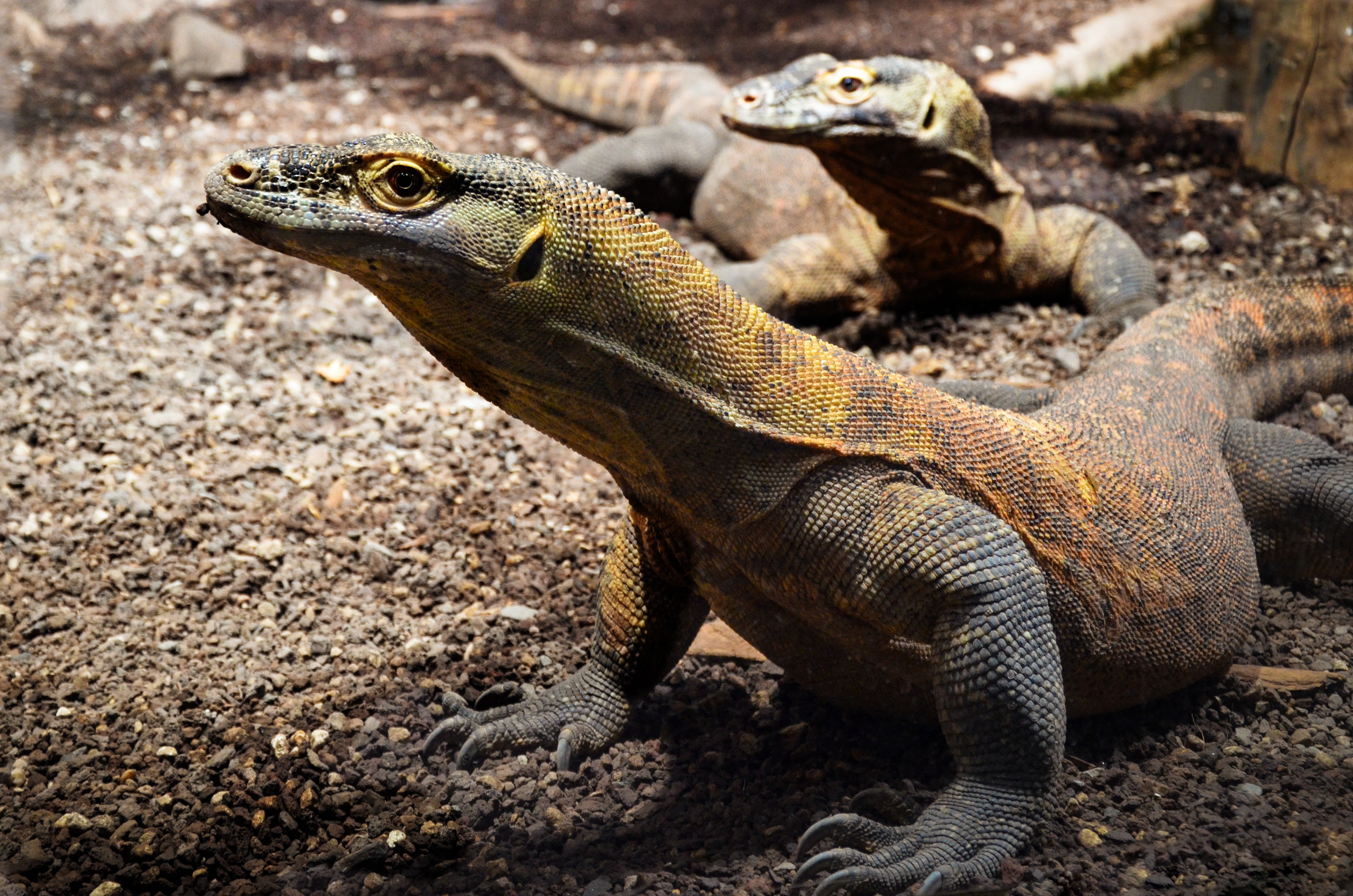
About Komodo Island
Pink Beach earned its name for the way the beach can appear to have a rosy hue in certain lights. The color comes from small flecks of red coral mixed in with the fine white reef sand. With a few trees along the beach for shade, this stretch of coast makes a fine place to relax or enjoy a snorkel or dive in the crystal clear waters. It is possible to spot a striped clown fish nestled among the protective tentacles of its sea anemone host, or to see a grouper lazily swimming by a flamboyant soft coral. The reef here is now protected by law and the maturing corals are a joy to behold.
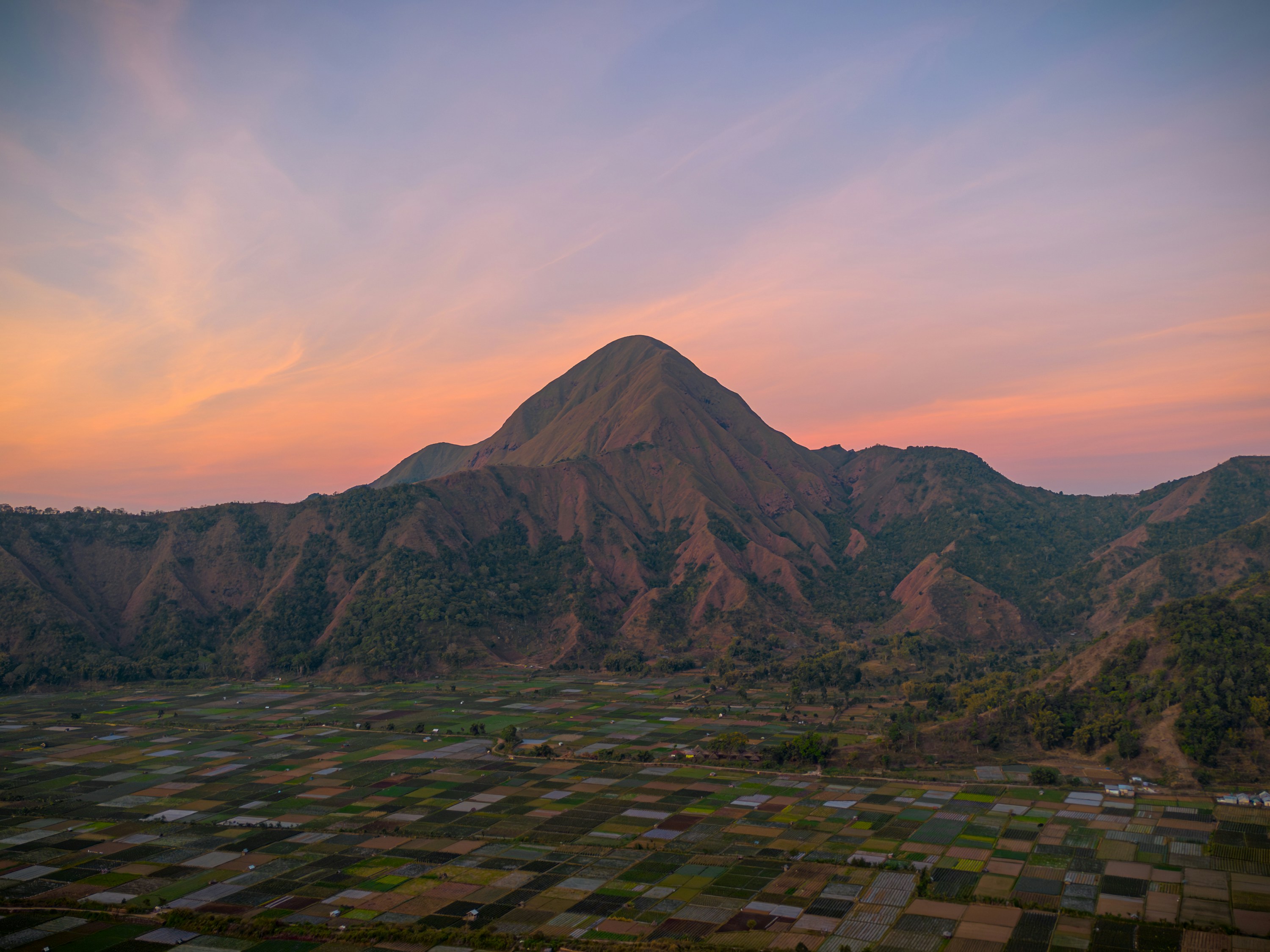
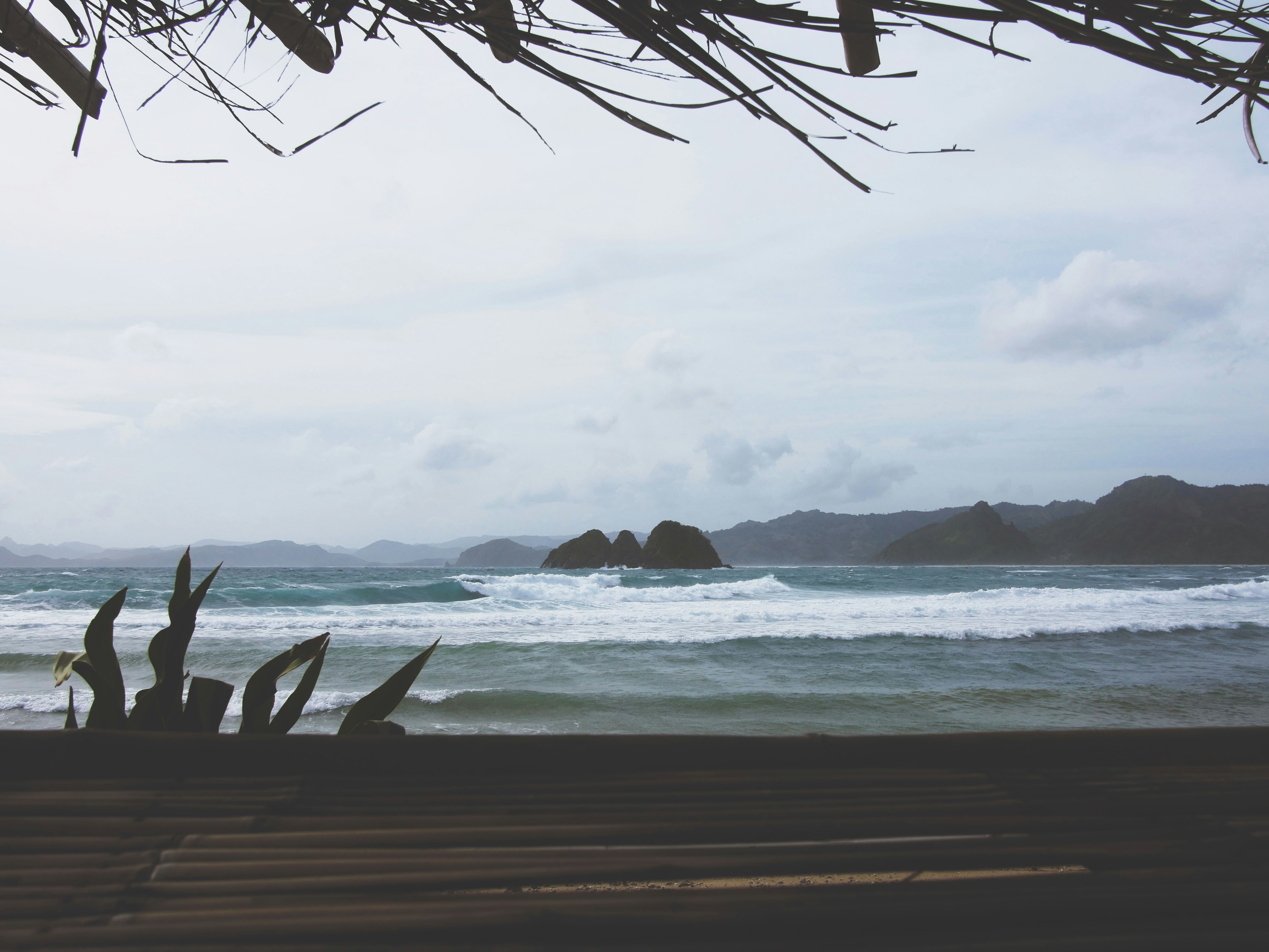
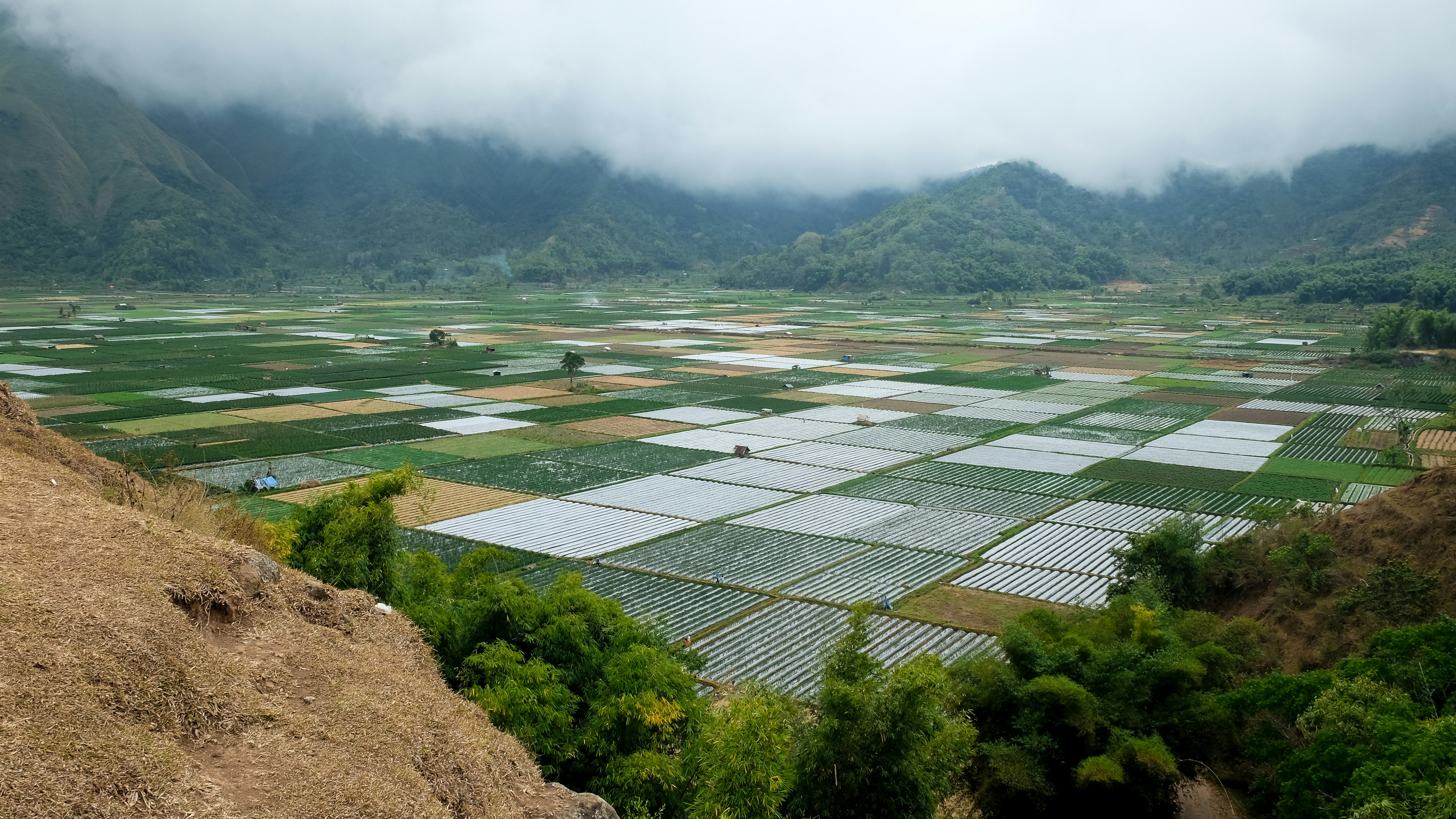
About Lombok
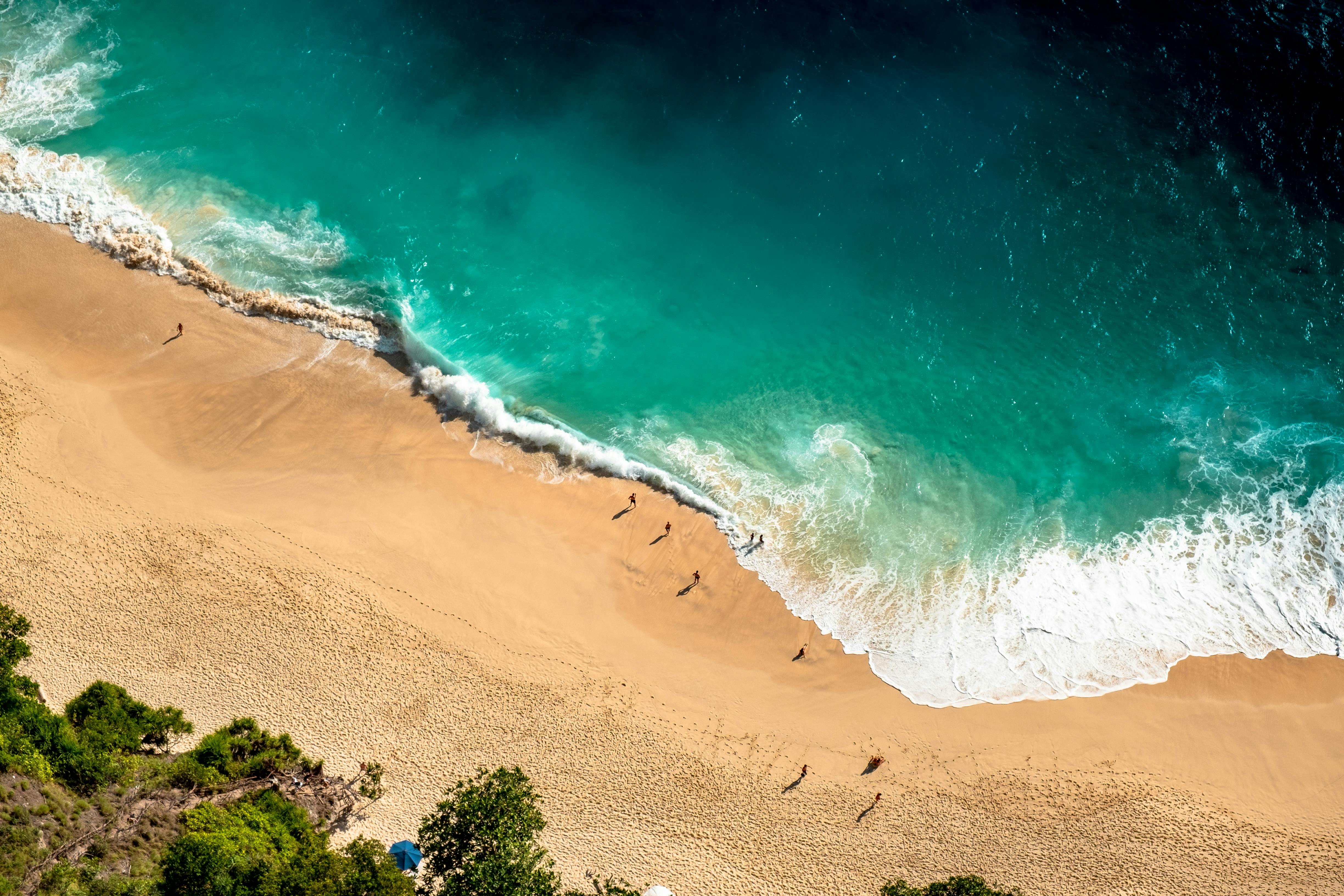
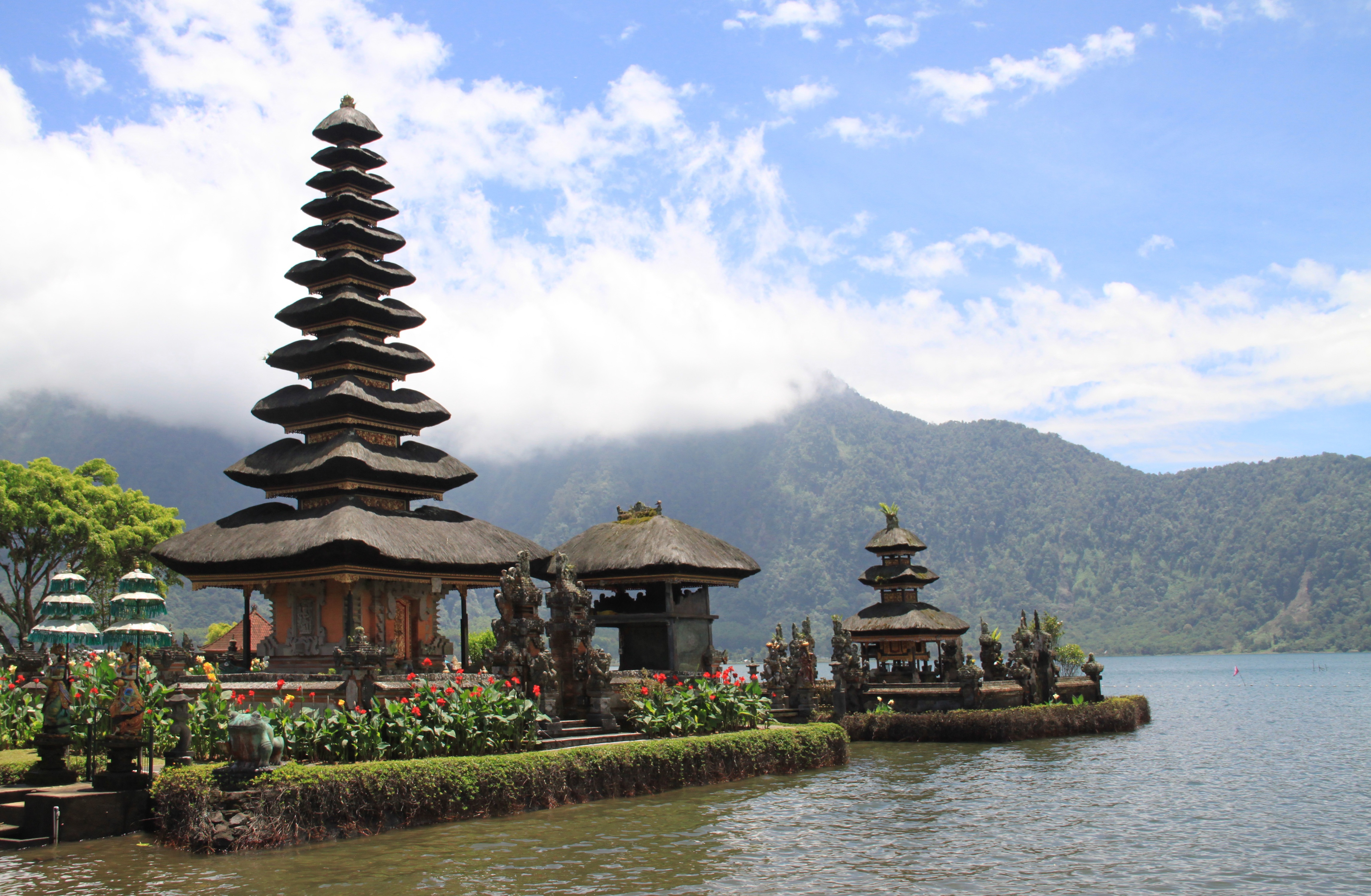
About Benoa, Bali
Bali really is as alluring as everyone says. This island, slightly bigger than Delaware, has it all: beaches, volcanoes, terraced rice fields, forests, renowned resorts, surfing, golf, and world-class dive sites. But what sets Bali apart from other nearby tropical destinations is Balinese tradition, and villagers dedicated to celebrating it. The hundreds of temples, dances, rituals, and crafts linked to their ancient Hindu faith aren't a show for tourists, but a living, breathing culture in which visitors are warmly received by the Balinese, who cherish their own identities.
About Celukan Bawang, Bali
About Surabaya
About Semarang
Semarang is one of the oldest cities in Indonesia, situated on Java's north coast between the shore of the Java Sea and a small ridge of mountains. Ceded to the Dutch West India Company in 1677 by King Amangkurat I in payment of his debts, it became their headquarters and the seat of the Dutch governor of the northeast provinces. Semarang's usefulness as a port waned due to the gradual silting up of the harbor; by the 19th century, Surabaya had eclipsed Semarang as Java's premier port. With a population of over one million, a third of whom are thought to be of Chinese extraction, Semarang is the largest city in Central Java and its administrative capital. The city consists of two parts: the coastal lowland where most of the commercial activities are found; and the hilly residential area. Although more a business center than a city for tourists, Semarang serves as a popular gateway to the mountainous interior of Central Java and to fabled Borobudur.
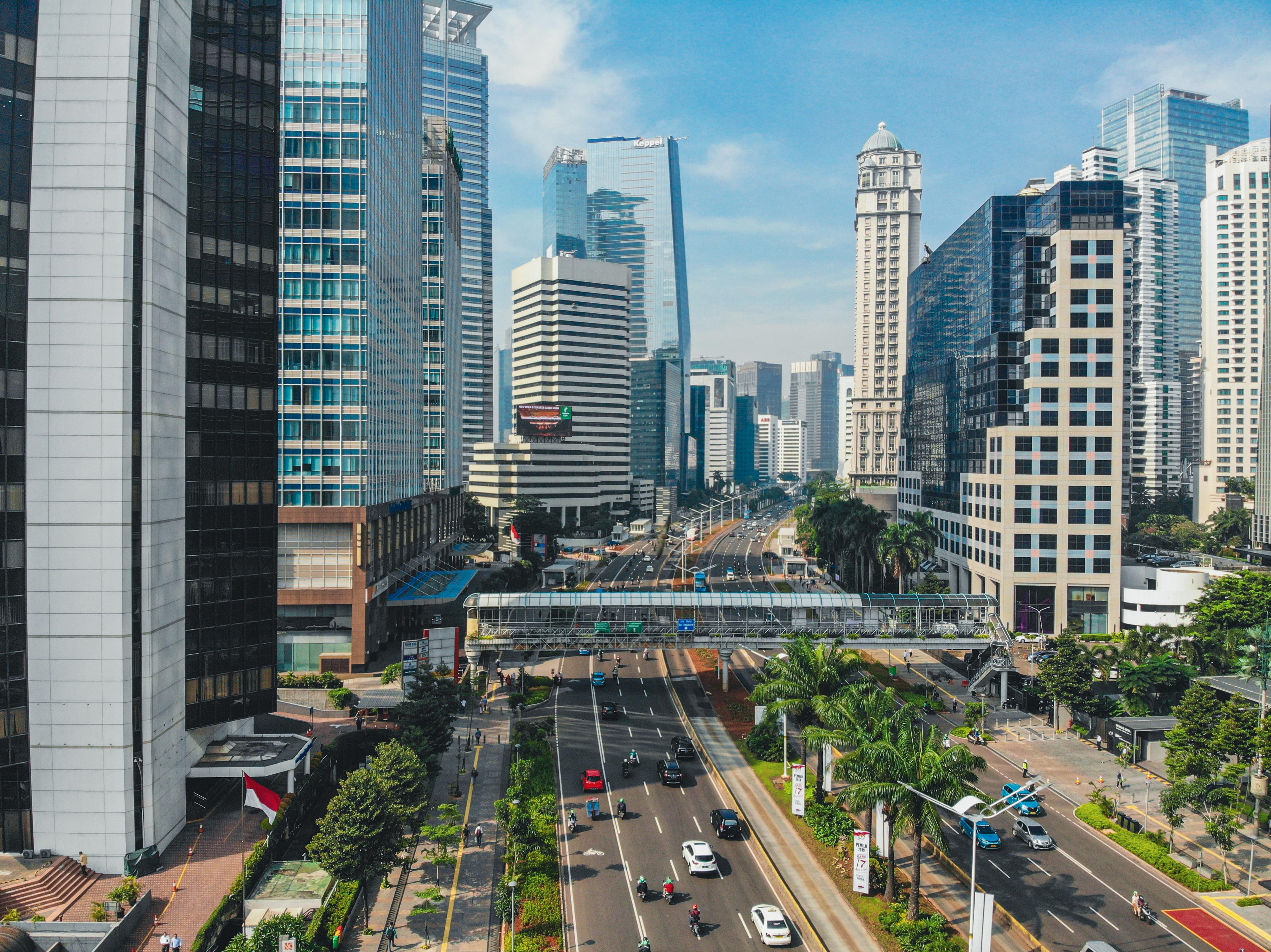
About Jakarta
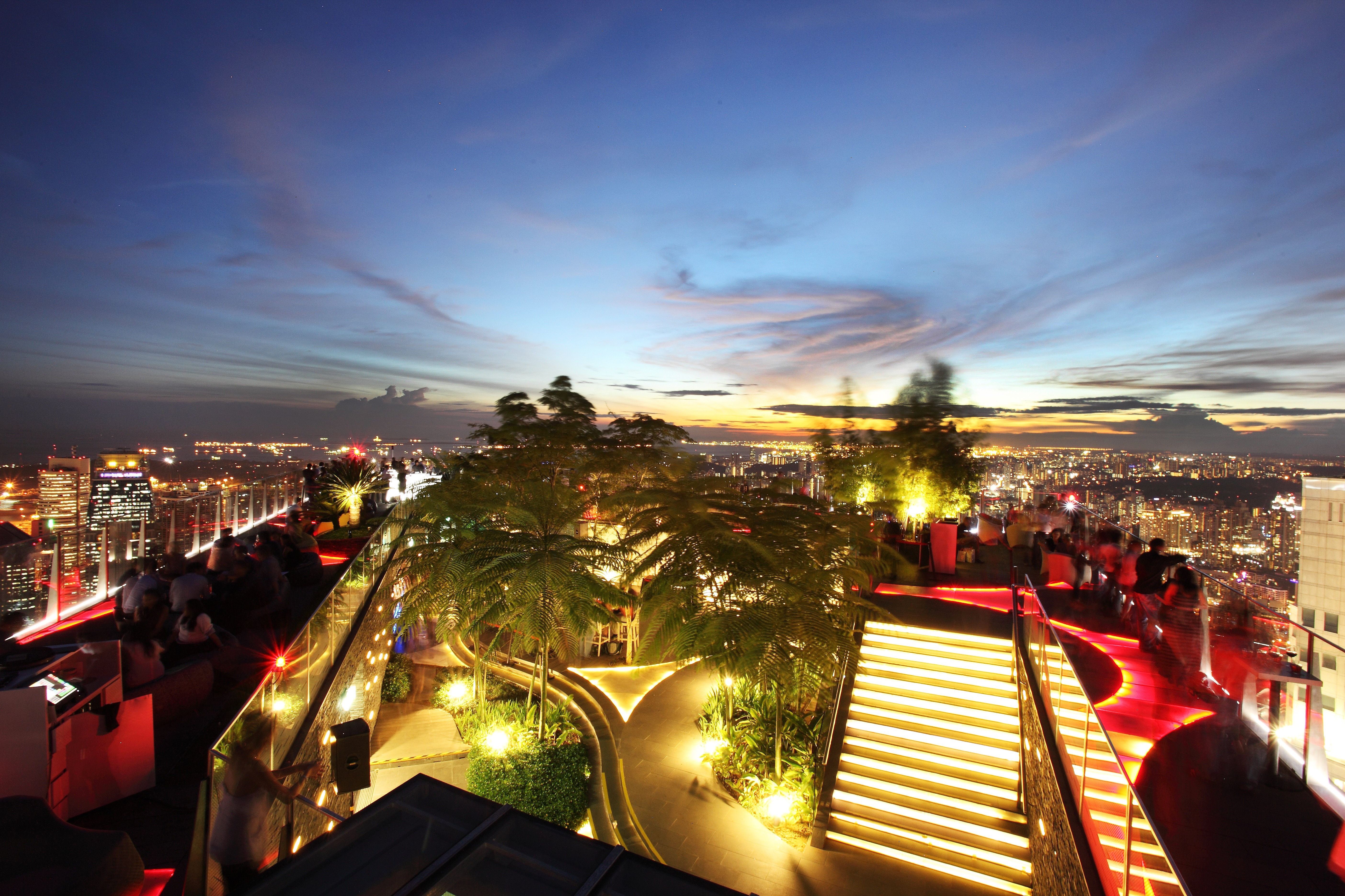
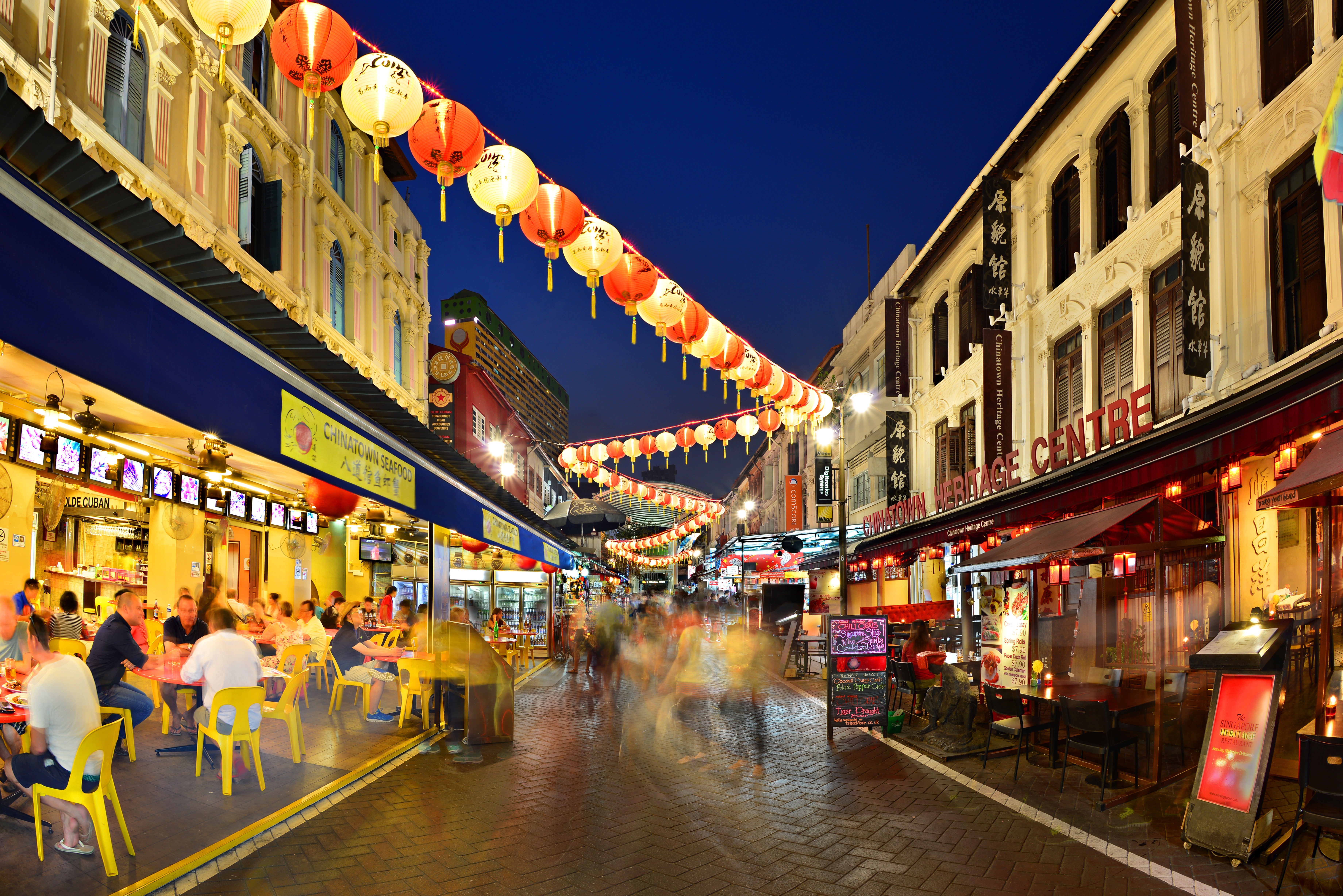
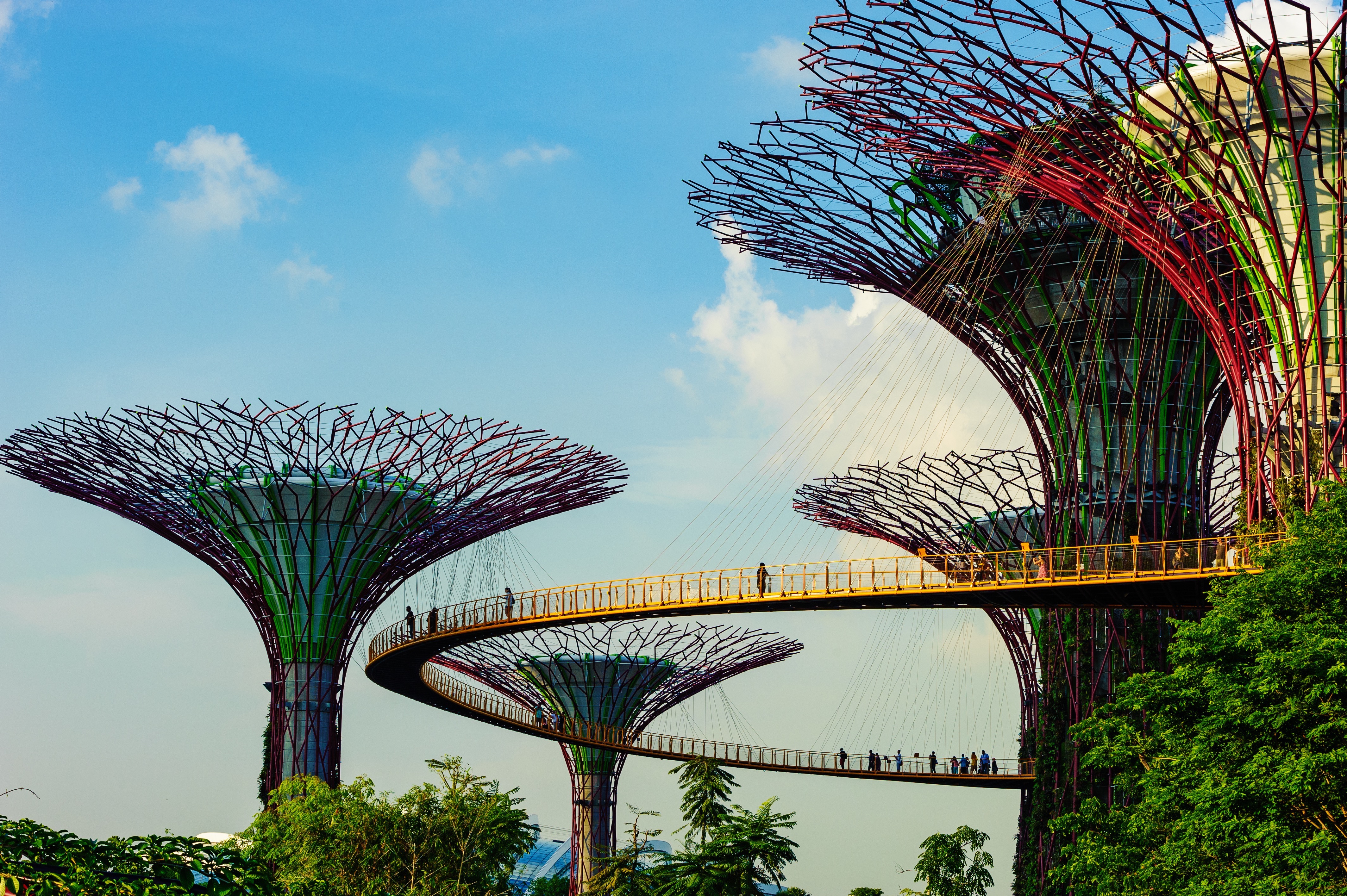
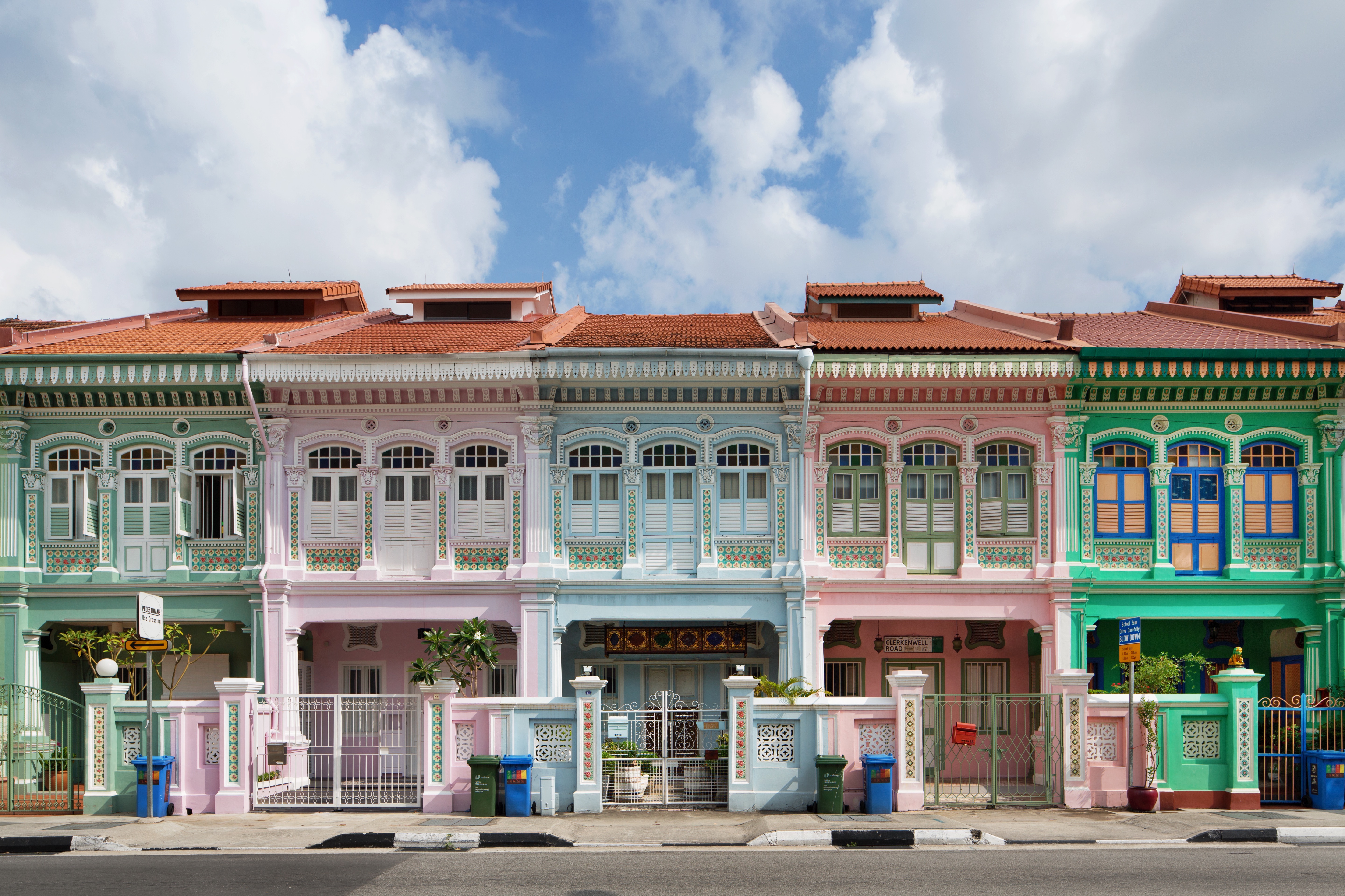
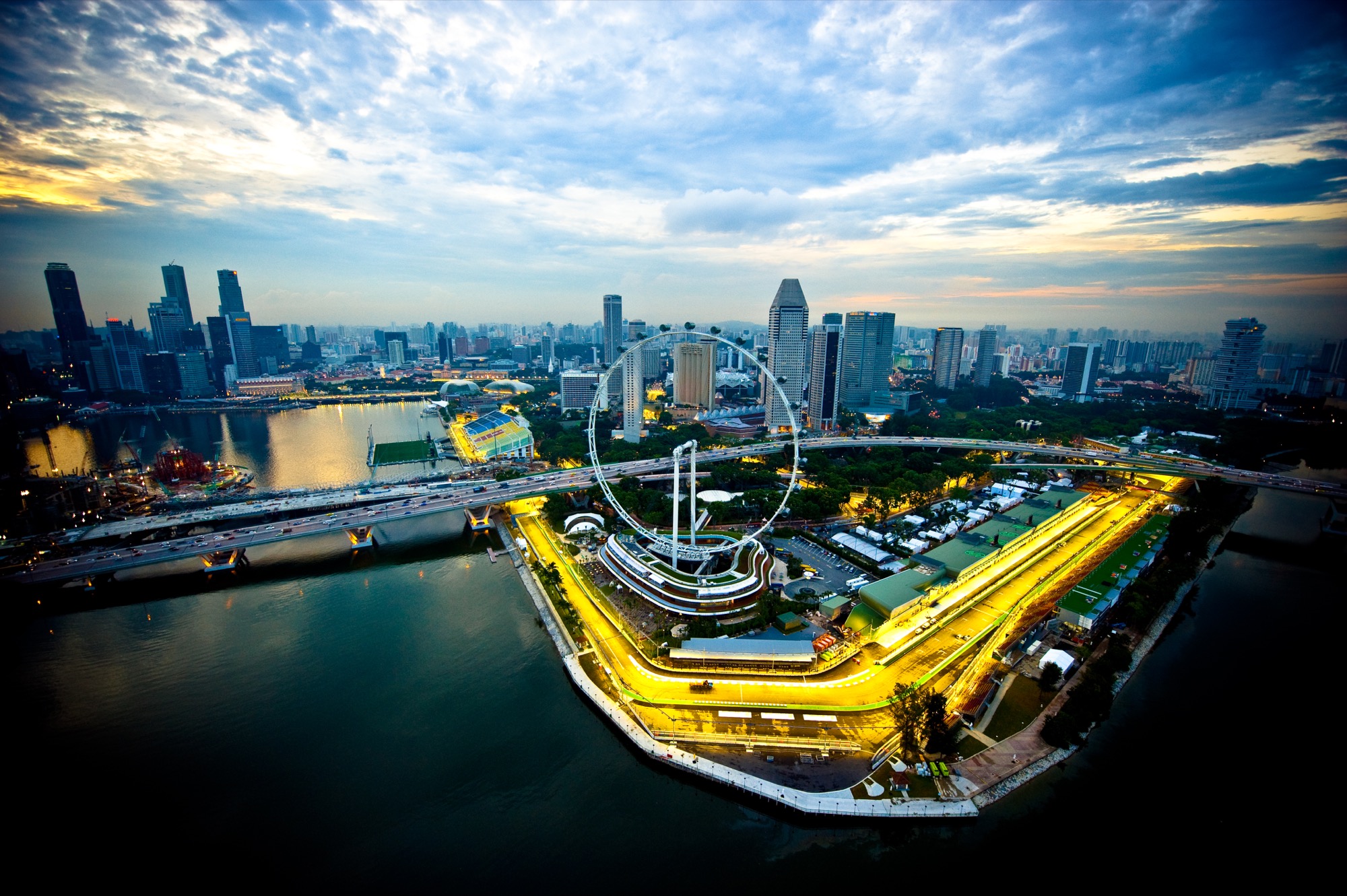
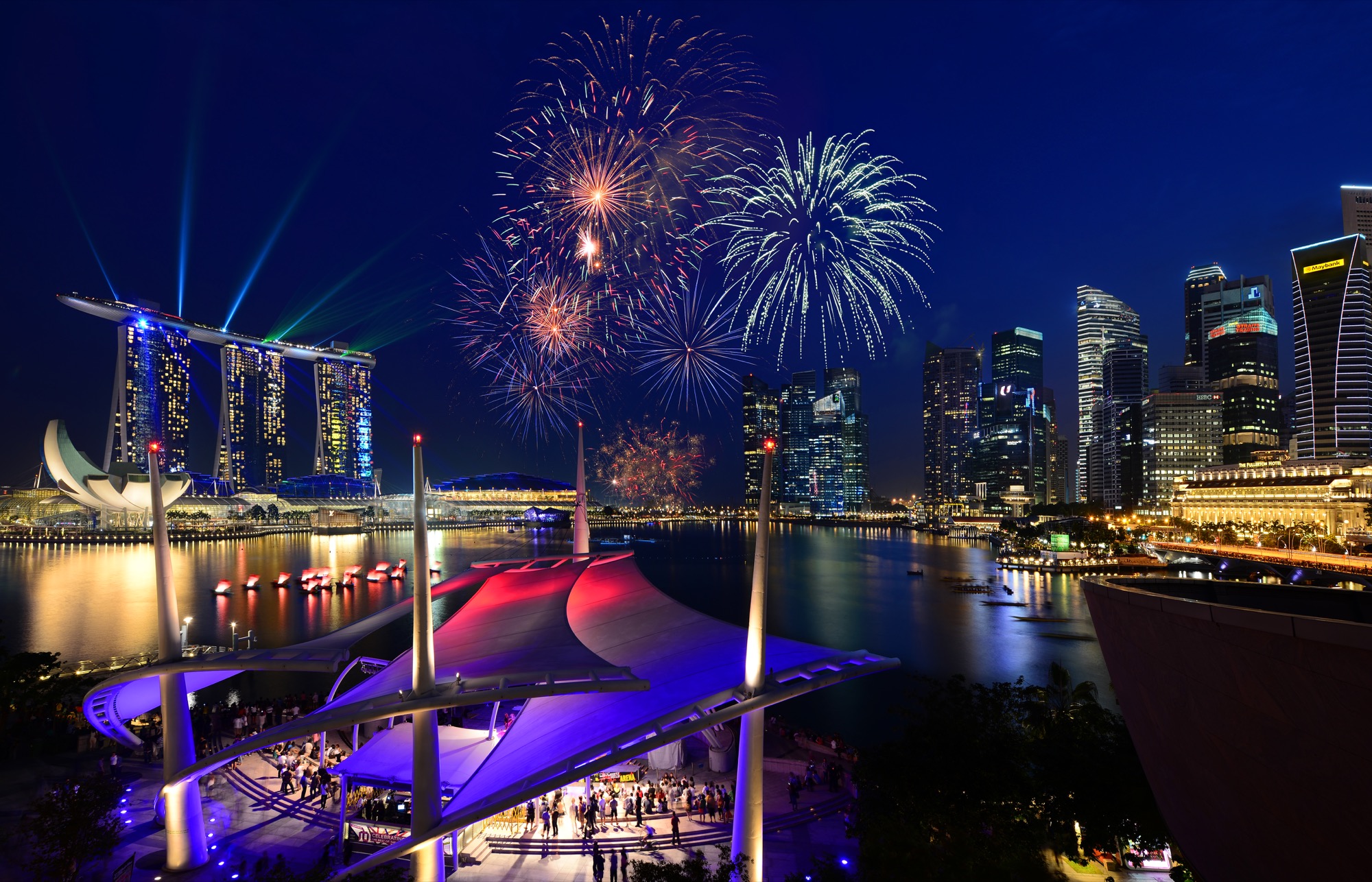
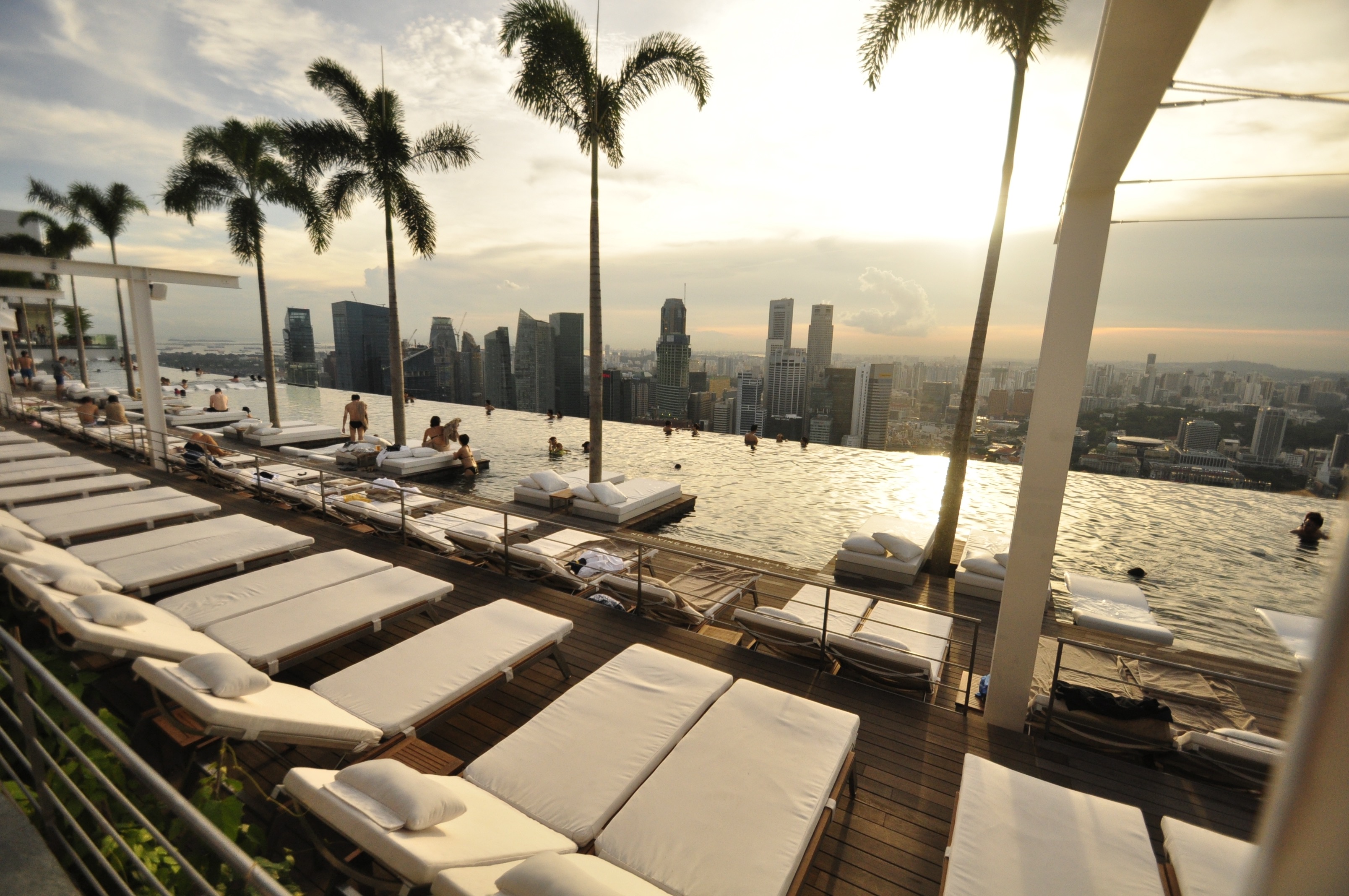
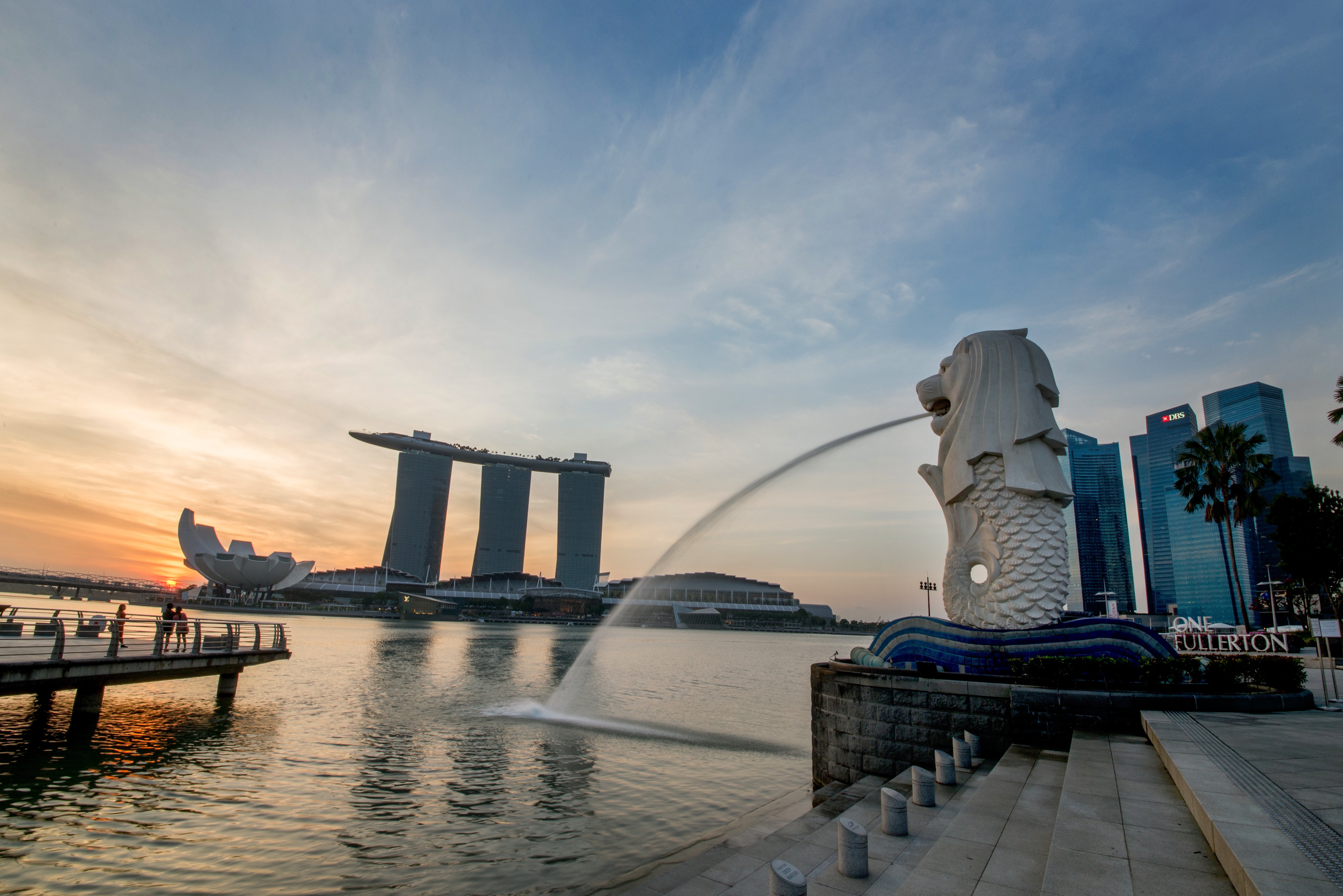
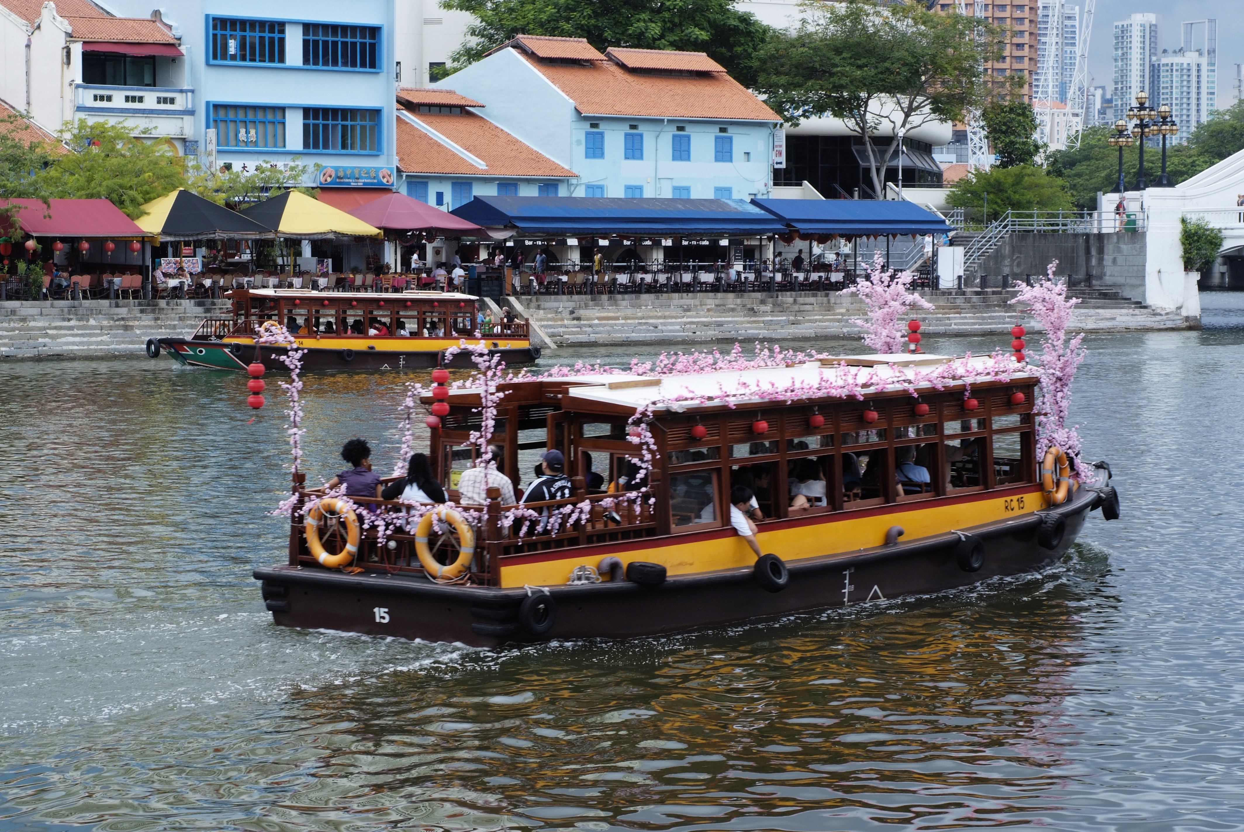
About Singapore
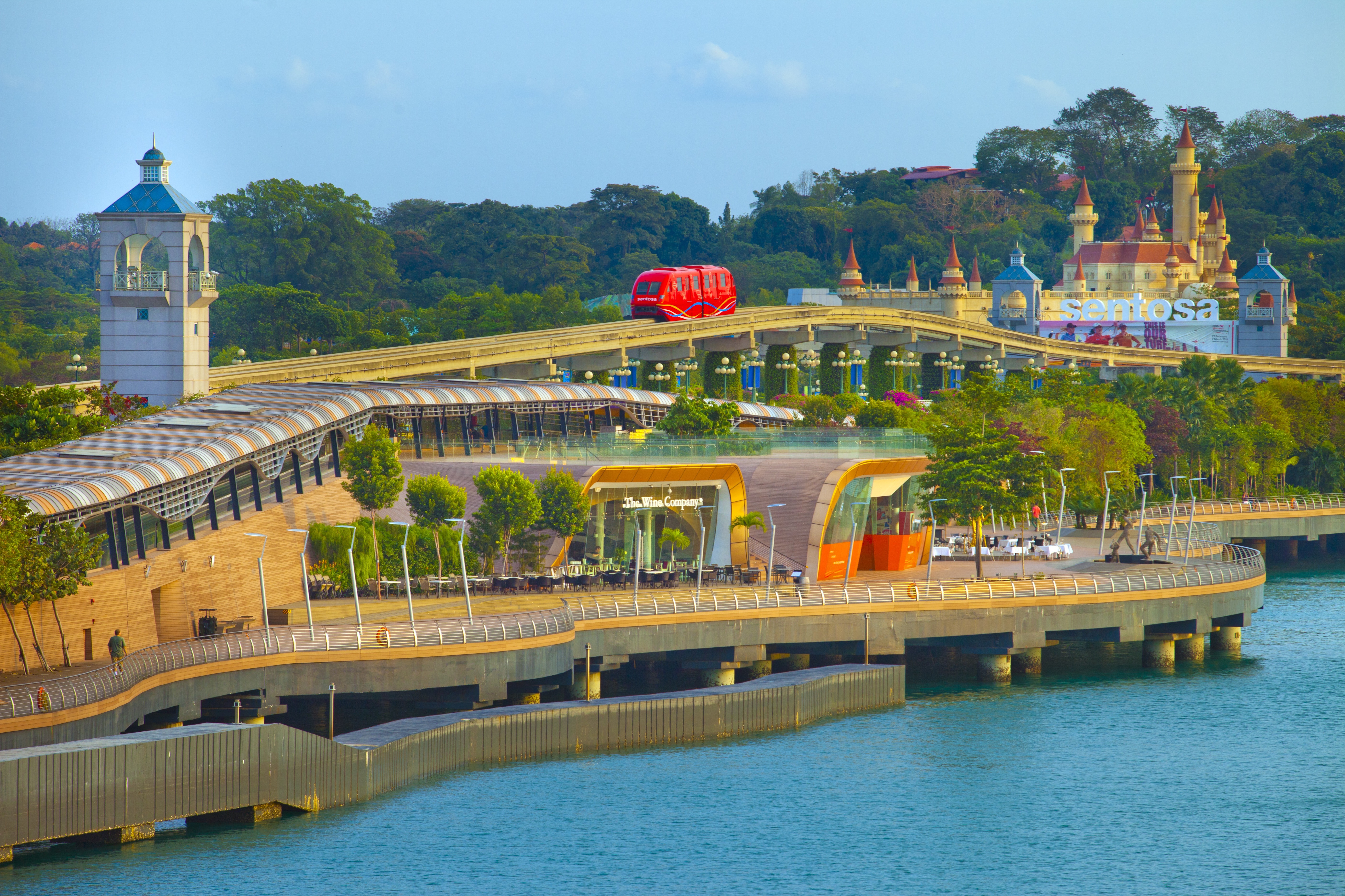
The main island of Singapore is shaped like a flattened diamond, 42 km (26 miles) east to west and 23 km (14 miles) north to south. Near the northern peak is the causeway leading to West Malaysia—Kuala Lumpur is less than four hours away by car. It is at the southern foot where you will find most of the city-state’s action, with its gleaming office towers, working docks, and futuristic "supertrees," which are solar-powered and serve as vertical gardens. Offshore are Sentosa and over 60 smaller islands, most uninhabited, that serve as bases for oil refining or as playgrounds and beach escapes from the city. To the east is Changi International Airport, connected to the city by metro, bus, and a tree-lined parkway. Of the island's total land area, more than half is built up, with the balance made up of parkland, farmland, plantations, swamp areas, and rain forest. Well-paved roads connect all parts of the island, and Singapore city has an excellent, and constantly expanding, public transportation system. The heart of Singapore's history and its modern wealth are in and around the Central Business District. The area includes the skyscrapers in the Central Business District, the 19th-century Raffles Hotel, the convention centers of Marina Square, on up to the top of Ft. Canning. Although most of old Singapore has been knocked down to make way for the modern city, most colonial landmarks have been preserved in the CBD, including early-19th-century buildings designed by the Irish architect George Coleman.
About Singapore
The main island of Singapore is shaped like a flattened diamond, 42 km (26 miles) east to west and 23 km (14 miles) north to south. Near the northern peak is the causeway leading to West Malaysia—Kuala Lumpur is less than four hours away by car. It is at the southern foot where you will find most of the city-state’s action, with its gleaming office towers, working docks, and futuristic "supertrees," which are solar-powered and serve as vertical gardens. Offshore are Sentosa and over 60 smaller islands, most uninhabited, that serve as bases for oil refining or as playgrounds and beach escapes from the city. To the east is Changi International Airport, connected to the city by metro, bus, and a tree-lined parkway. Of the island's total land area, more than half is built up, with the balance made up of parkland, farmland, plantations, swamp areas, and rain forest. Well-paved roads connect all parts of the island, and Singapore city has an excellent, and constantly expanding, public transportation system. The heart of Singapore's history and its modern wealth are in and around the Central Business District. The area includes the skyscrapers in the Central Business District, the 19th-century Raffles Hotel, the convention centers of Marina Square, on up to the top of Ft. Canning. Although most of old Singapore has been knocked down to make way for the modern city, most colonial landmarks have been preserved in the CBD, including early-19th-century buildings designed by the Irish architect George Coleman.
About Port Klang
Kuala Lumpur, or KL as locals refer to it, intrigues visitors with its diversity and multicultural character. The city's old quarter features stretches of shop houses that hint at its colonial past, while modern buildings—including the iconic Petronas Towers—give a glimpse of its modern financial ambitions. The city is filled with culturally colorful quarters dedicated to Chinese, Malay, and Indian communities. New shopping malls with designer labels, five-star hotels, and top-notch restaurants also proliferate in this bustling city of 1.6 million.
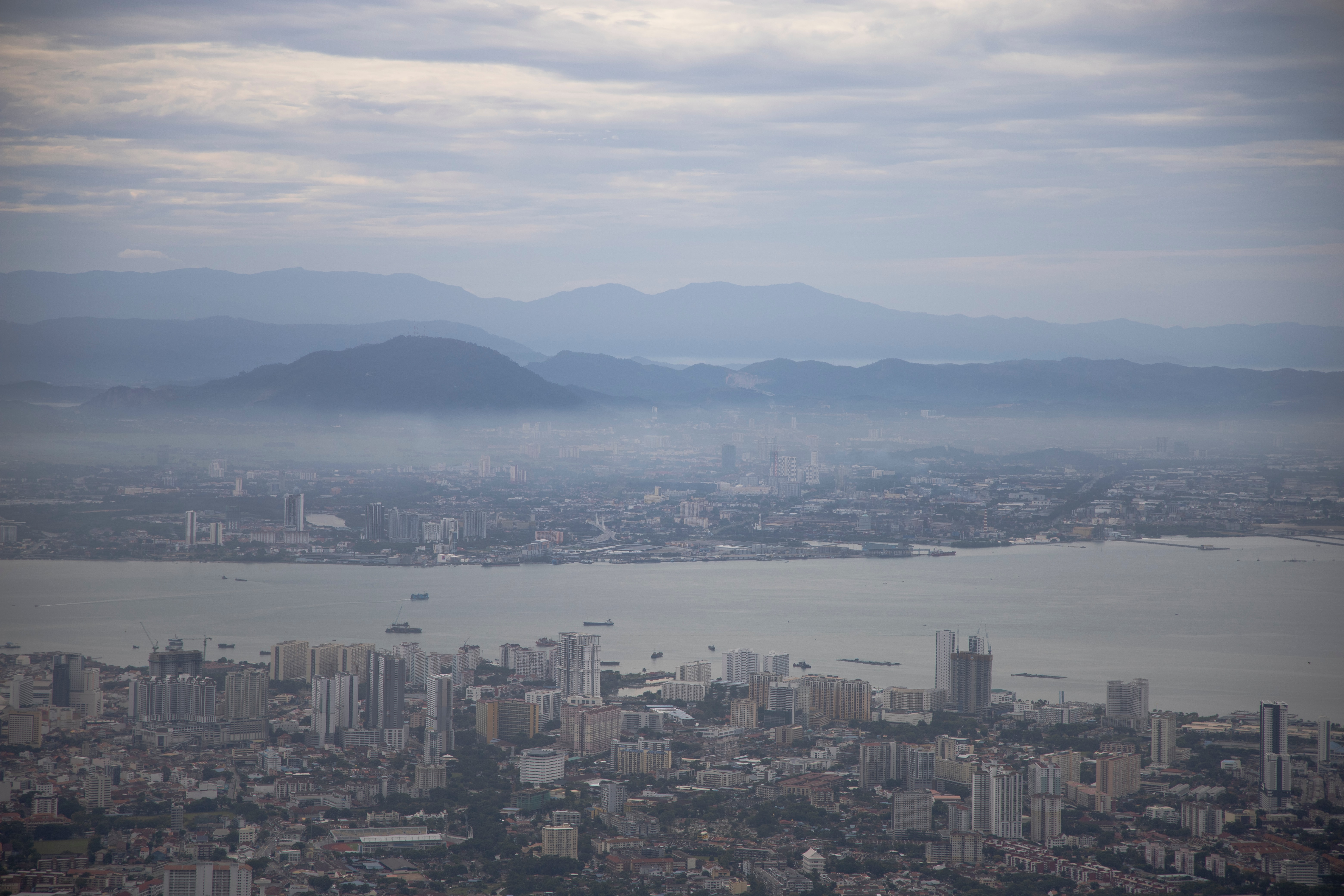
About Georgetown, Penang
An island off the northwest coast of peninsular Malaysia, Penang is blessed with a multicultural history that's led to a fascinating fusion of East and West. Claimed by the British East India Company in 1786, the island's city center of Georgetown—listed as a UNESCO World Heritage Site—is filled with colonial architecture, temples, and museums. The island has also attracted many Chinese immigrants, who now make up the majority of the population. On Penang you'll find an exciting mix of jungle, coast, farmland, and fishing villages, along with the country's largest Buddhist temple.

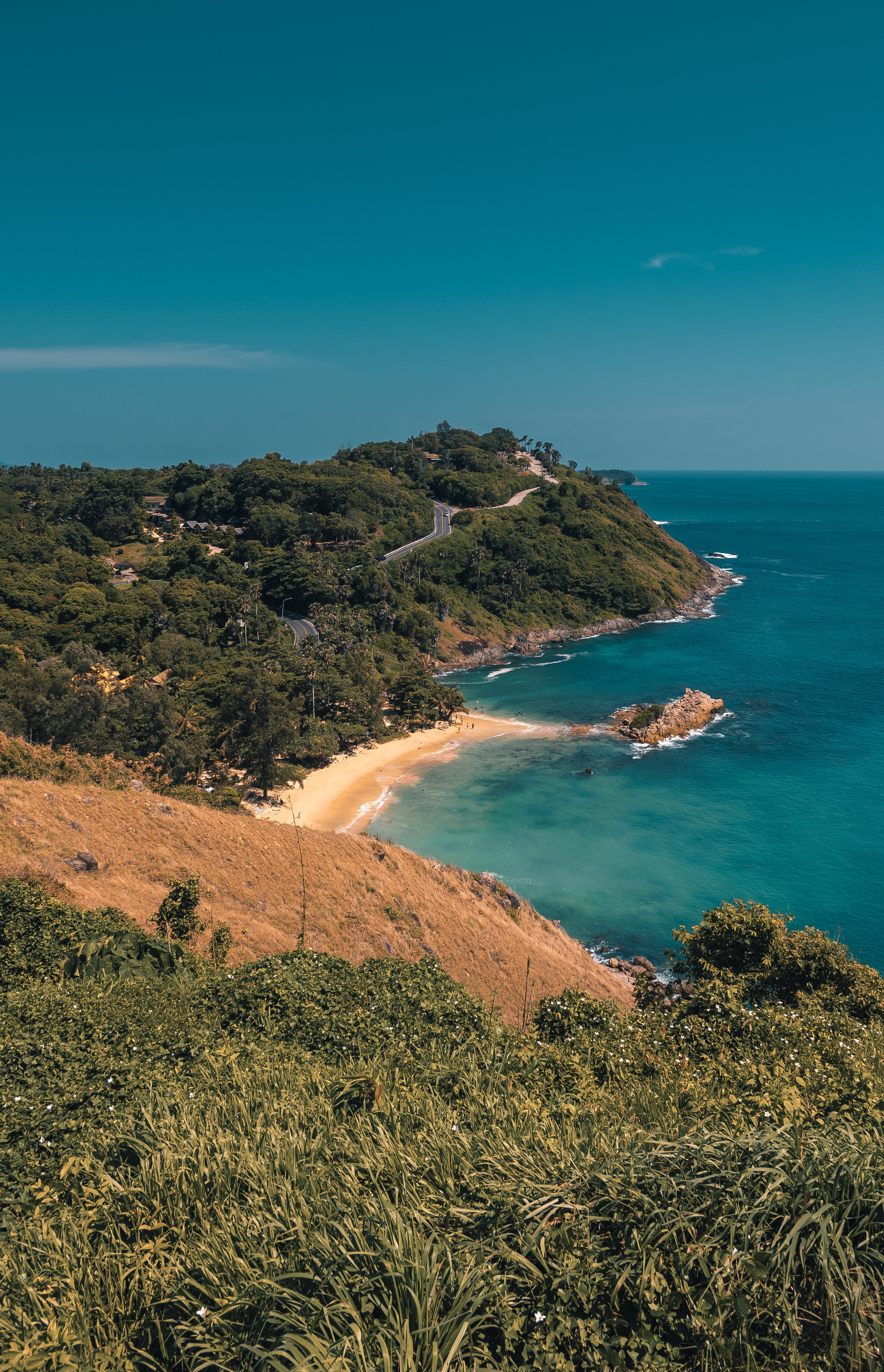
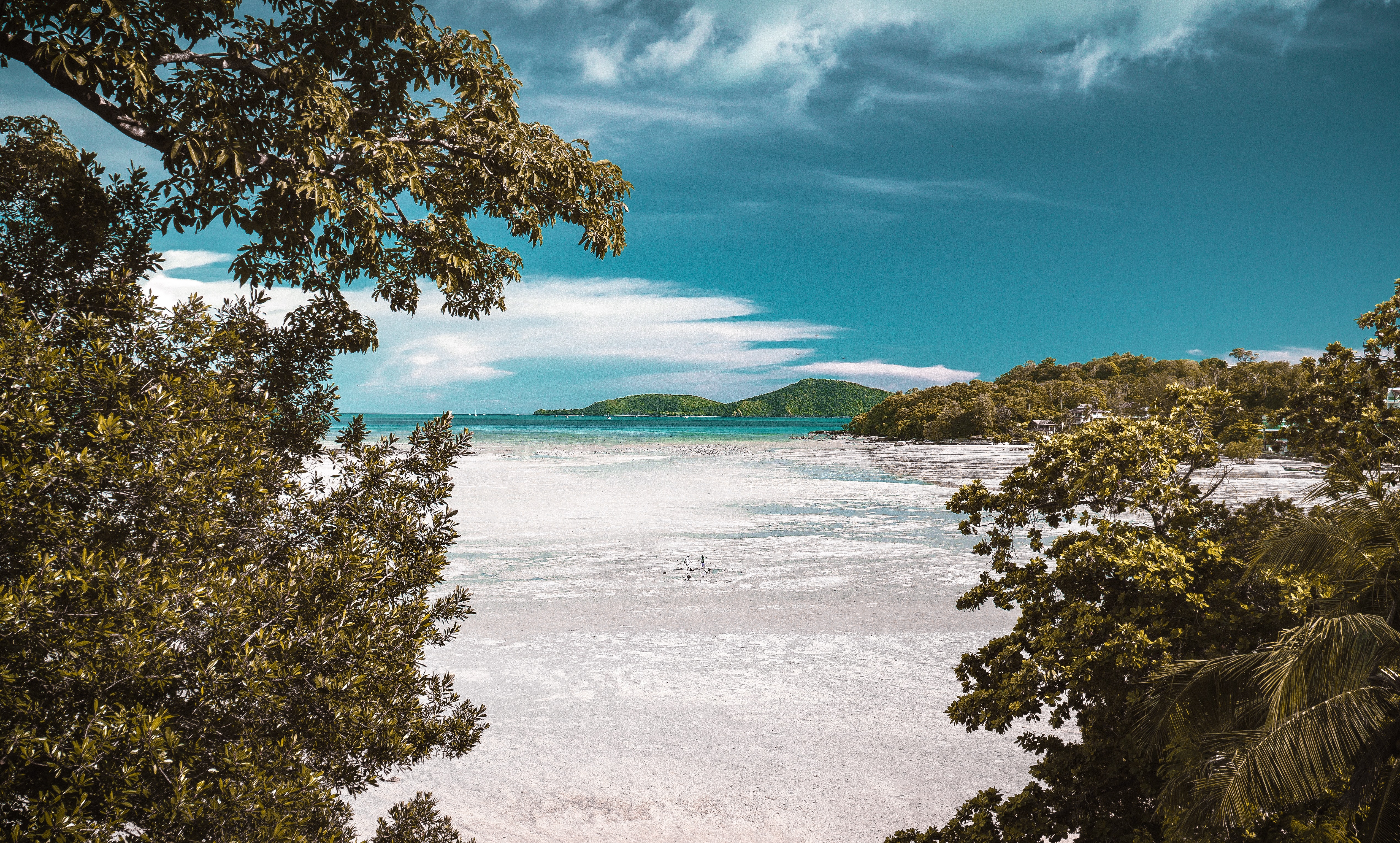
About Phuket
Though few tourists linger here, Phuket Town, the provincial capital, is one of the more culturally interesting places on the island to spend half a day. About one-third of the island's population lives here, and the town is an intriguing mix of old Sino-Portuguese architecture and the influences of the Chinese, Muslims, and Thais that inhabit it. The old Chinese quarter along Talang Street is especially good for a stroll, as its history has not yet been replaced by modern concrete and tile. And this same area has a variety of antiques shops, art studios, and trendy cafés. Besides Talang, the major thoroughfares are Ratsada, Phuket, and Ranong roads. Ratsada connects Phuket Road (where you'll find the Tourism Authority of Thailand office) to Ranong Road, where there's an aromatic local market filled with fruits, vegetables, spices, and meats.
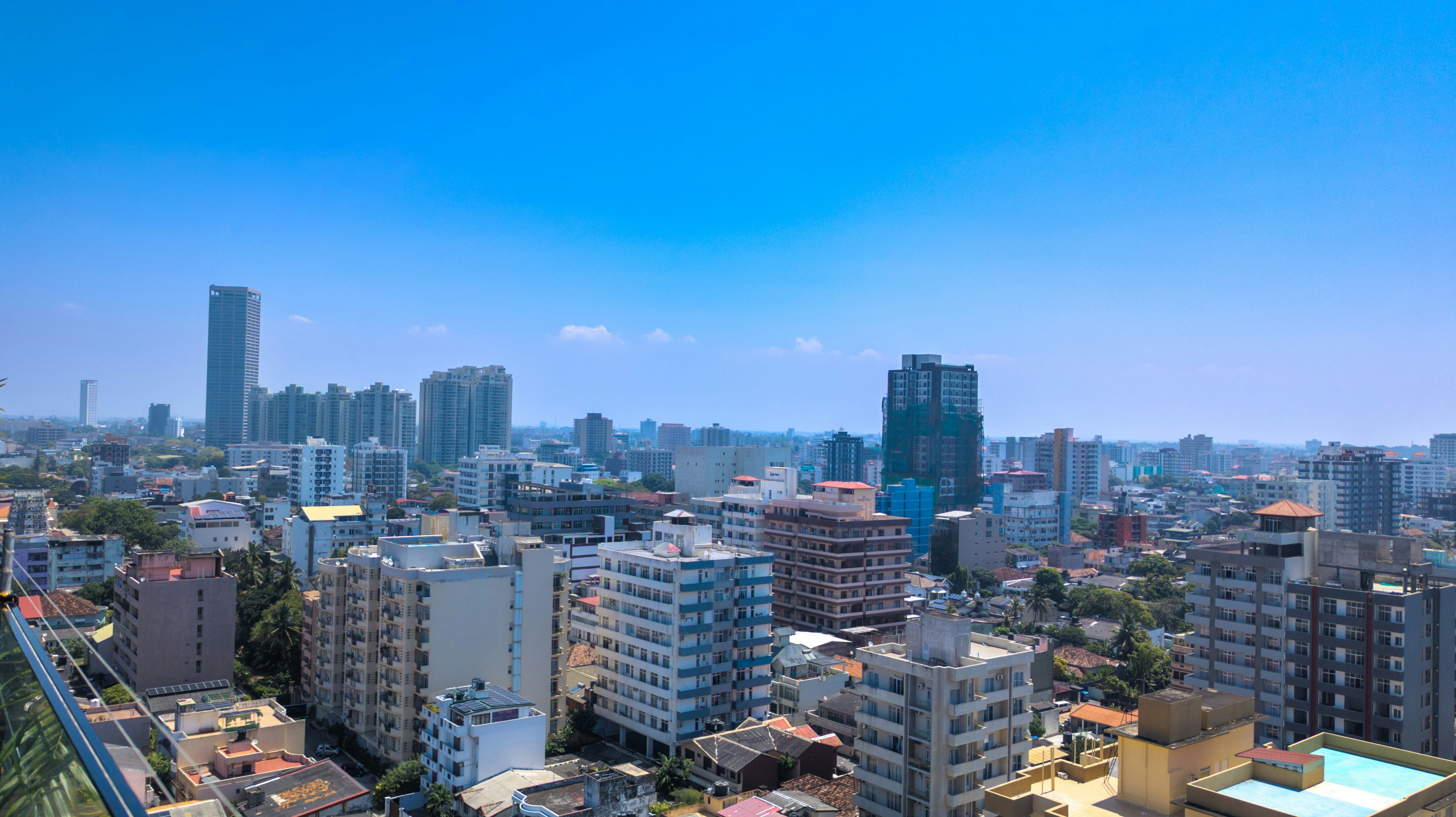
About Colombo
Sri Lanka's capital and largest city, Colombo offers fine restaurants, a buzzing nightlife scene, and good museums, parks, and beautiful Buddhist temples that are all worth visiting. The beach resort of Mt. Lavinia is only a short taxi ride from the downtown area and offers a golden, sandy beach and sunset views to die for. As an exciting blur of colors and cultures, Colombo presents a neatly packaged microcosm of this island nation.
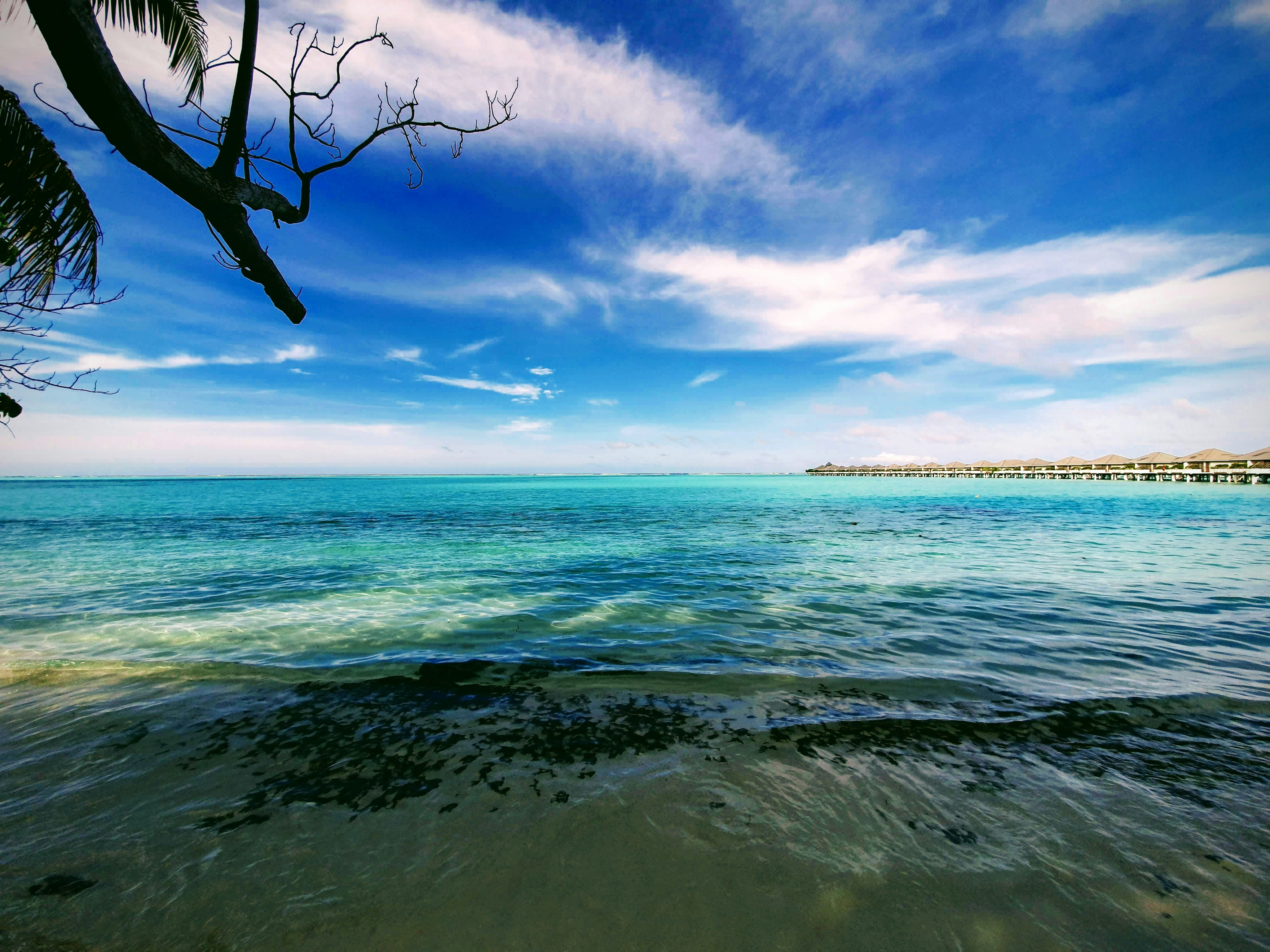
About Male
There are many nations around the world with bragging rights to miles of pristine white coral sand and balmy turquoise seas but few can take it to the same level as the Maldives. Its 1,200 islands are spread out over 26 coral atolls; the combined land of all the islands is little more than 100 square miles. That means you are rarely more than a few steps from the beach. Many of the villas are actually built on stilts out over the water, so you may actually have to walk onshore in order to get to the beach. Besides curling your toes in the sand, many people come here to sample the Maldives enviable world-class dive spots. Others simply snorkel among the endless coral reefs. There are so many coral atolls here that our English word derives from the Maldivian name atholhu.
About Mahé
Like jade-coloured jewels in the Indian Ocean, the more than 100 Seychelles Islands are often regarded as the Garden of Eden. Lying just four degrees south of the equator, the Seychelles are some 1,000 miles (1,610 km) from the nearest mainland Africa. Little more than 200 years ago, all 115 islands were uninhabited. Then in 1742 a French ship dispatched from Mauritius sailed into one of the small bays. Captain Lazare Picault was the first to explore these unnamed islands. He encountered breathtaking vistas of rugged mountains, lagoons, coral atolls, splendid beaches and secluded coves. After Picault sailed away, the islands remained untouched for the next 14 years. Then France took possession of the seven islands in the Mahé group. During an expedition Captain Morphey named them the Sechelles, in honour of Vicomte Moreau de Sechelles. This name was later anglicised to Seychelles. The first settlers arrived at St. Anne’s Island in 1770; 15 years later the population of Mahé consisted of seven Europeans and 123 slaves. Today there are about 80,000 Seychellois, the majority of whom live on Mahé; the rest are scattered in small communities throughout the archipelago. The people are a fusion of three continents - Africa, Asia and Europe. This has created a unique culture and the use of three languages - Creole, French and English. Mahé is the largest island in the archipelago and the location of the capital, Victoria. Ringed by steep, magnificent mountains, few capitals can claim a more beautiful backdrop. The town features a mixture of modern and indigenous architecture; it is the centre of business and commerce thanks to the extensive port facilities. Noteworthy sites in Victoria are the museum, cathedral, government house, clock tower, botanical gardens and an open-air market. The major attractions are found outside of town where the island’s quiet, lazy atmosphere delights visitors. With 68 pristine, white sand beaches, Mahé boasts more beaches and tourist facilities than any of the other Seychelles Islands. Beautiful and remote Mahé with its green-clad mountains and palm-fringed beaches is indeed an island of abundance; pleasant surprises are around every bend in the trail. Come ashore and discover for yourself this marvellous island paradise.


About Antsiranana
About Port Louis
Mauritius’ largest city, Port Louis is a vibrant and exciting place whose culture is a mix of African, Chinese and Indian influences. There are activities and sights to keep you busy and explore the different aspects of the city.
About Port Louis
Mauritius’ largest city, Port Louis is a vibrant and exciting place whose culture is a mix of African, Chinese and Indian influences. There are activities and sights to keep you busy and explore the different aspects of the city.
About Pointe des Galets
About Nosy Bé
Nosy Bé, meaning Big Island in the Malagasy language, lies just a stone's throw off Madagascar's northwest coast. It is a remote and exotic destination. With its deserted beaches, rustic hotels and unhurried pace, it attracts travellers looking for a laid-back vacation. The fertile island is the centre for the production of perfume essence from the ylang-ylang trees. The heady scent of their flowers gave Nosy Bé the name "Perfumed Isle." Other local products include sugar cane, coffee, vanilla and pepper; they are grown for export in large plantations. Hellville, the island’s main town and port, is situated in a sheltered bay. It is named after a former French governor, Admiral de Hell. The town features a few old colonial buildings, a busy market, some small boutiques and tourist shops along the busy main street. At the quayside, vendors display embroidered linens, wood carvings and straw articles. Trips into the lush countryside may include a ride up to Mt. Passot. At 950 feet (285 metres), this is the highest point on the island. The view from the top offers an extensive panorama of crater lakes nestled between verdant hills. Most visitors make the boat trip to Nosy Komba. The tiny island is known for its lemur reserve. These arboreal primates, with their large eyes, soft fur and long curling tails, have lived unharmed for centuries in the forest behind Ampangorina village. The lemurs are a popular tourist attraction and a profitable source of income to the small local community.
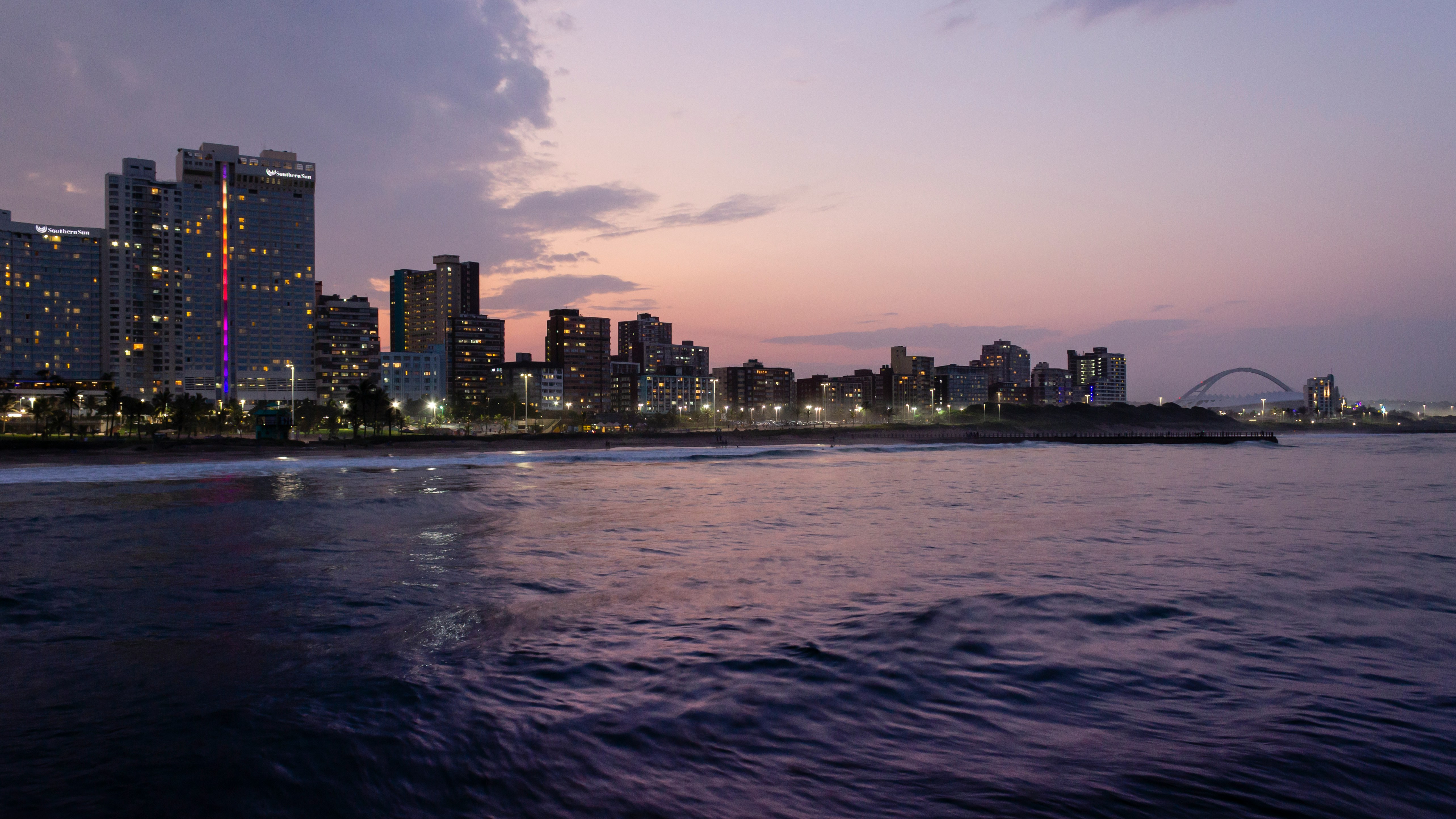
About Durban
Durban, a glistening jewel on the south-east coast of Africa, is the third largest city in South Africa and the major city of KwaZulu-Natal. It has been a centre of sea trade since before colonisation and now has a flourishing artistic centre, which perfectly complements the vibrant markets and rich cultures of the city. Durban’s port is a natural half-moon harbour lined with white sand and azure water, punctuated by the port’s many piers which reach into the water like the leaves of a fan. The beaches of Durban’s famous Golden Mile stretch along the harbour and are popular all year round, as travellers and locals alike enjoy Durban’s warm, humid summers and mild, dry winters.
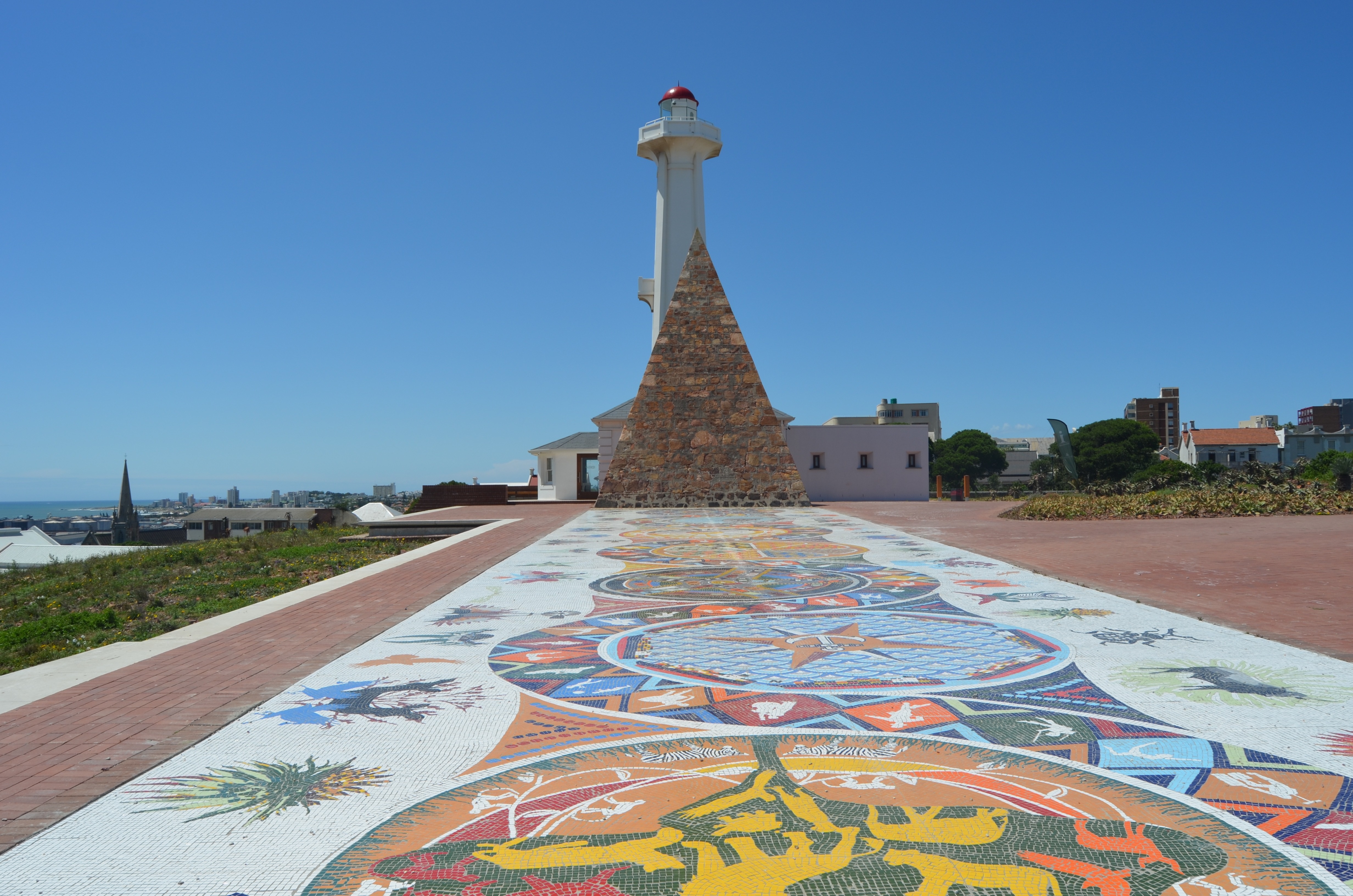
About Gqeberha (ex Port Elizabeth)
Originally the home of the San and Khoisan people and later the Xhosa tribe, the area now known as Gqeberha (previously Port Elizabeth) became a landing place for passing European ships after Portuguese navigator Bartolomew Diaz arrived in Algoa Bay in 1488. As part of the Cape Colony, the British occupied the area during the Napoleonic Wars and it was they who built Fort Frederick here in 1799. Twenty-one years later 4,000 settlers arrived, becoming the first permanent British residents of South Africa and Gqeberha. Sir Rufane Donkin, Acting Governor of the Cape Colony, founded Port Elizabeth, naming the settlement after his late wife. The town underwent rapid growth after 1873 following the construction of the railway to Kimberley, and is now one of the country’s major seaports. Like most South African cities, miles of beautiful coastline surround Gqeberha. Algoa Bay combines warm water and fair breezes, making it a mecca for swimmers and water sports enthusiasts. Those interested in history can follow the Donkin Heritage Trail, past a succession of Victorian and Edwardian town houses, trim gardens and neo-Gothic churches. Just outside the town are a number of game reserves, including the famous Addo Elephant National Park.
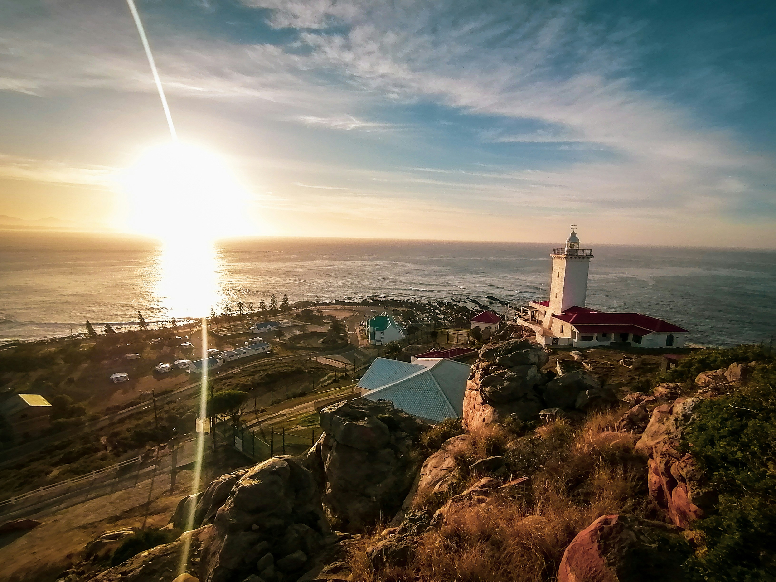
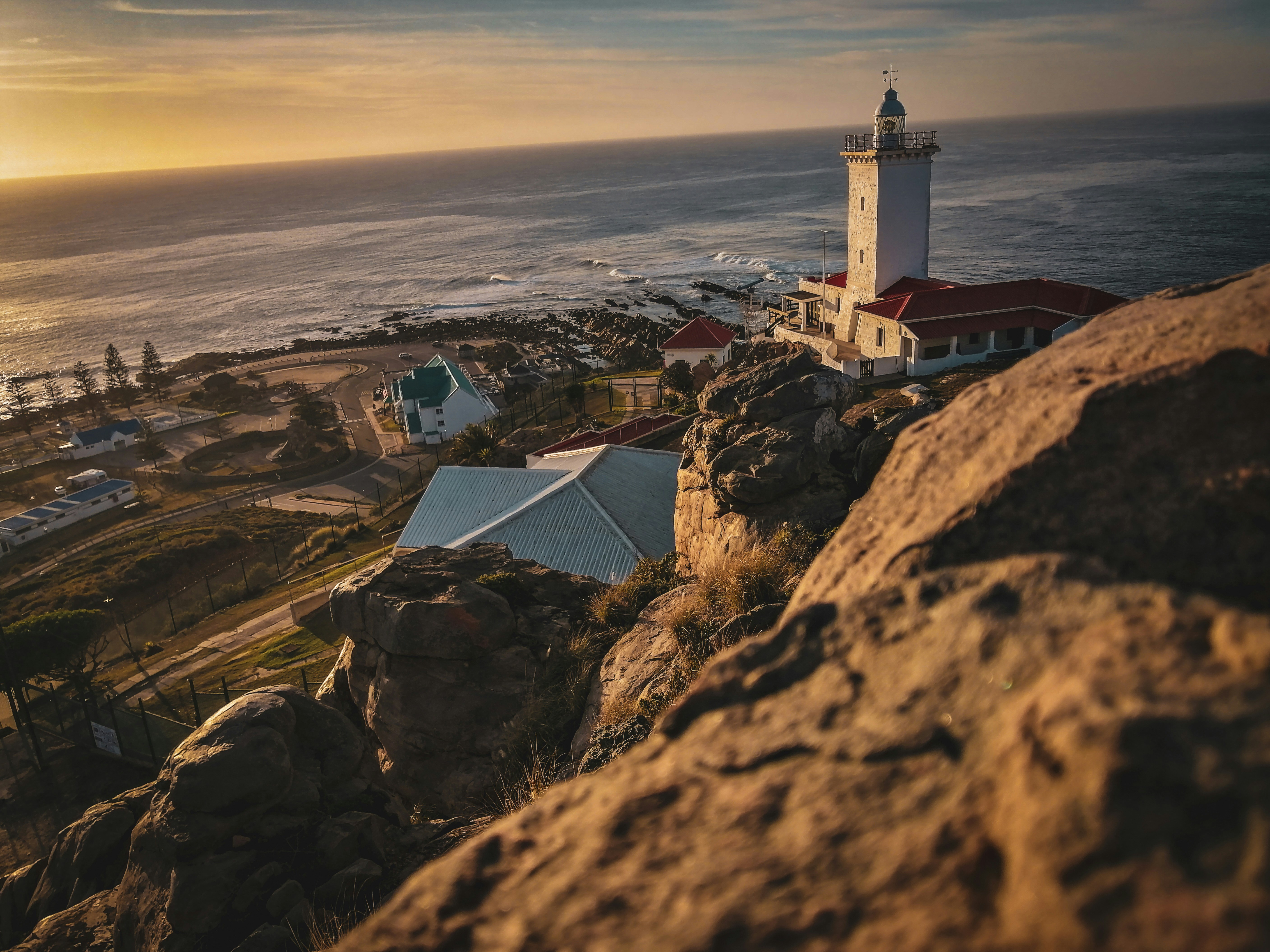
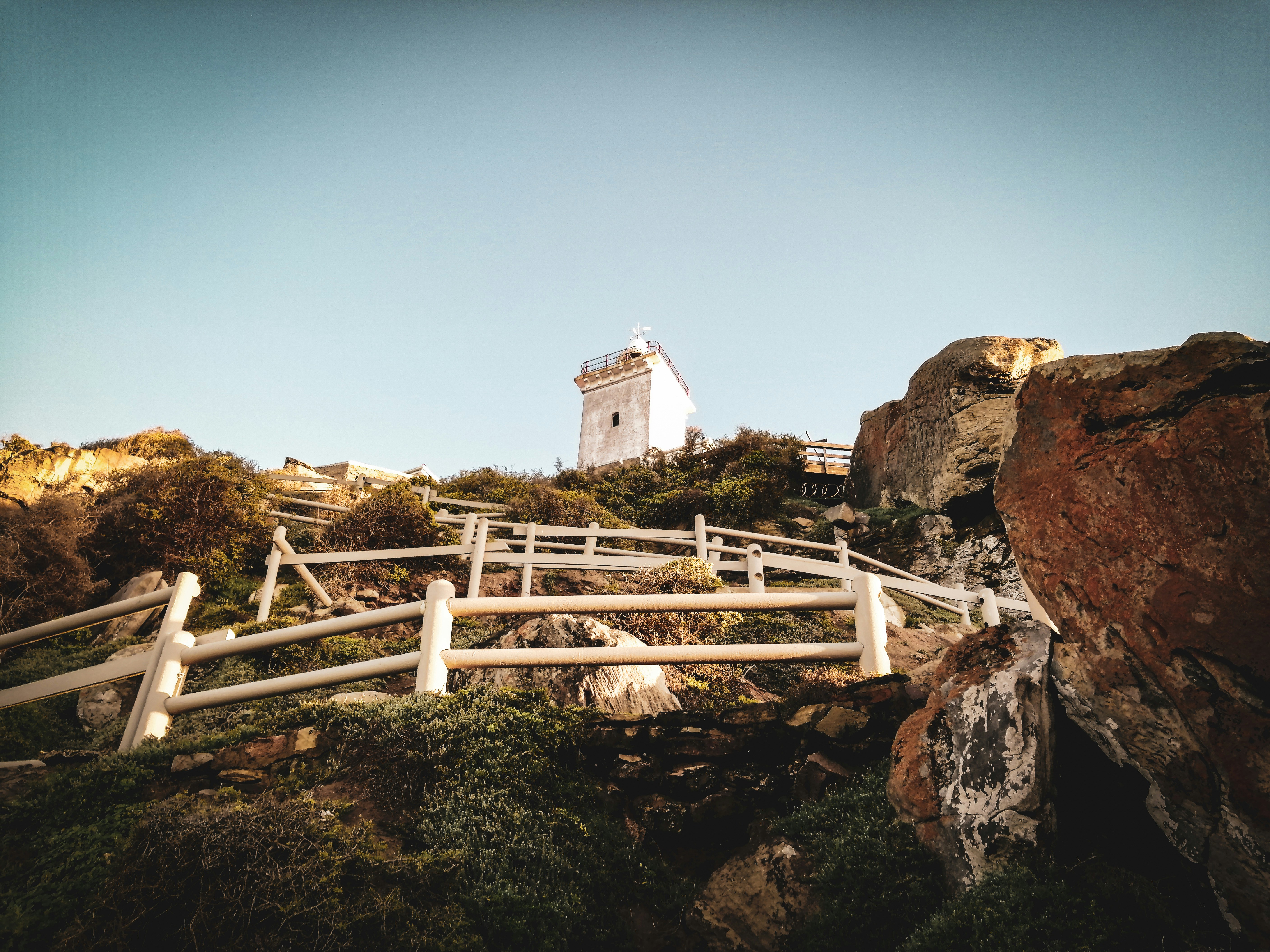
About Mossel Bay

About Cape Town
Sometimes referred to as the Mother City, Cape Town is the most famous port in South Africa and is influenced by many different cultures, including Dutch, British and Malay. The port was founded in 1652 by Dutch explorer Jan Van Riebeeck, and evidence of Dutch colonial rule remains throughout the region. The port is located on one of the world's most important trade routes, and is mainly a container port and handler of fresh fruit. Fishing is another vital industry, with large Asian fishing fleets using Cape Town as a logistical repair base for much of the year. The region is famous for its natural beauty, with the imposing Table Mountain and Lions Head, as well as the many nature reserves and botanical gardens such as Kirstenbosch which boasts an extensive range of indigenous plant life, including proteas and ferns. Cape Town's weather is mercurial, and can change from beautiful sunshine to dramatic thunderstorms within a short period. A local adage is that in Cape Town you can experience four seasons in one day.
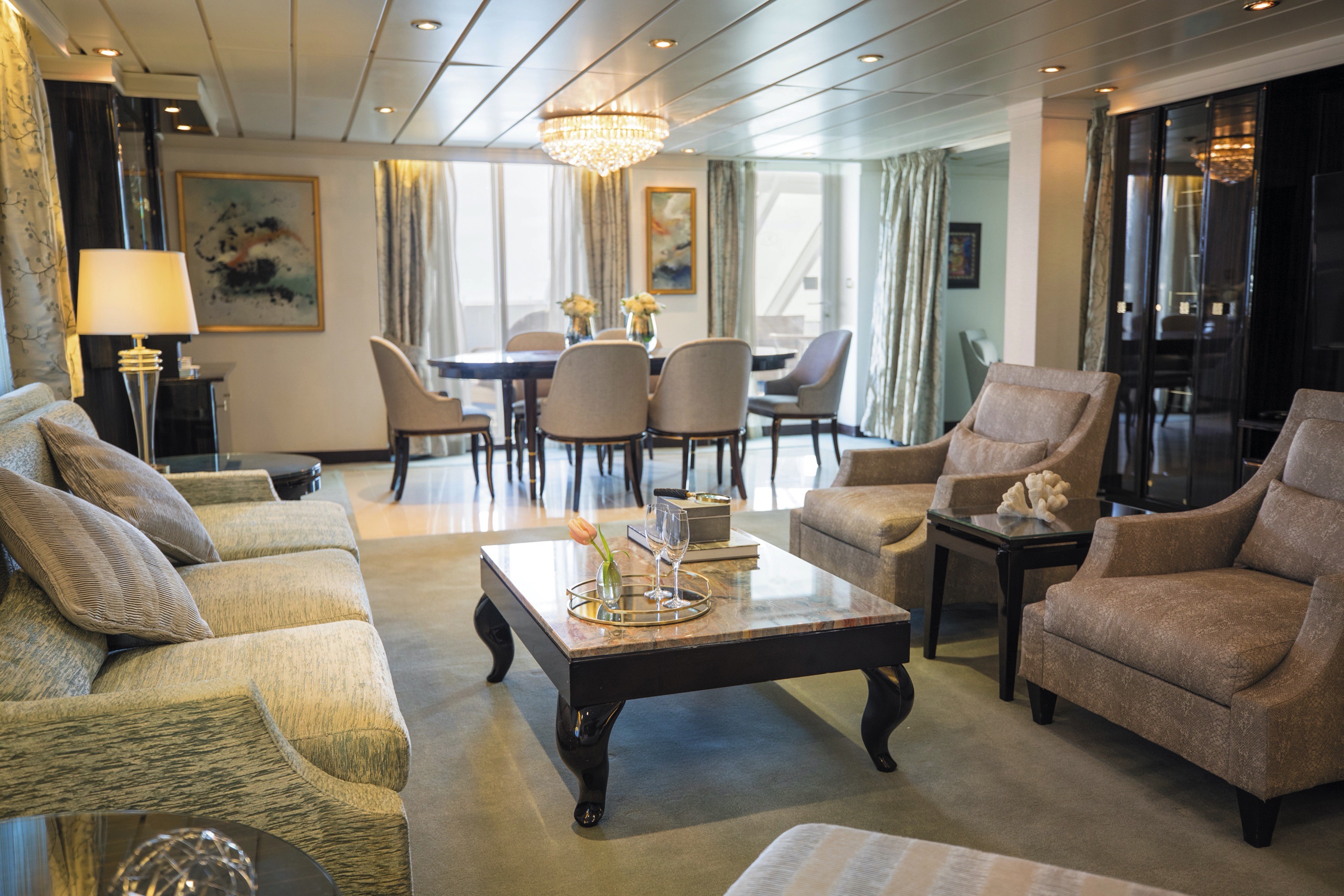
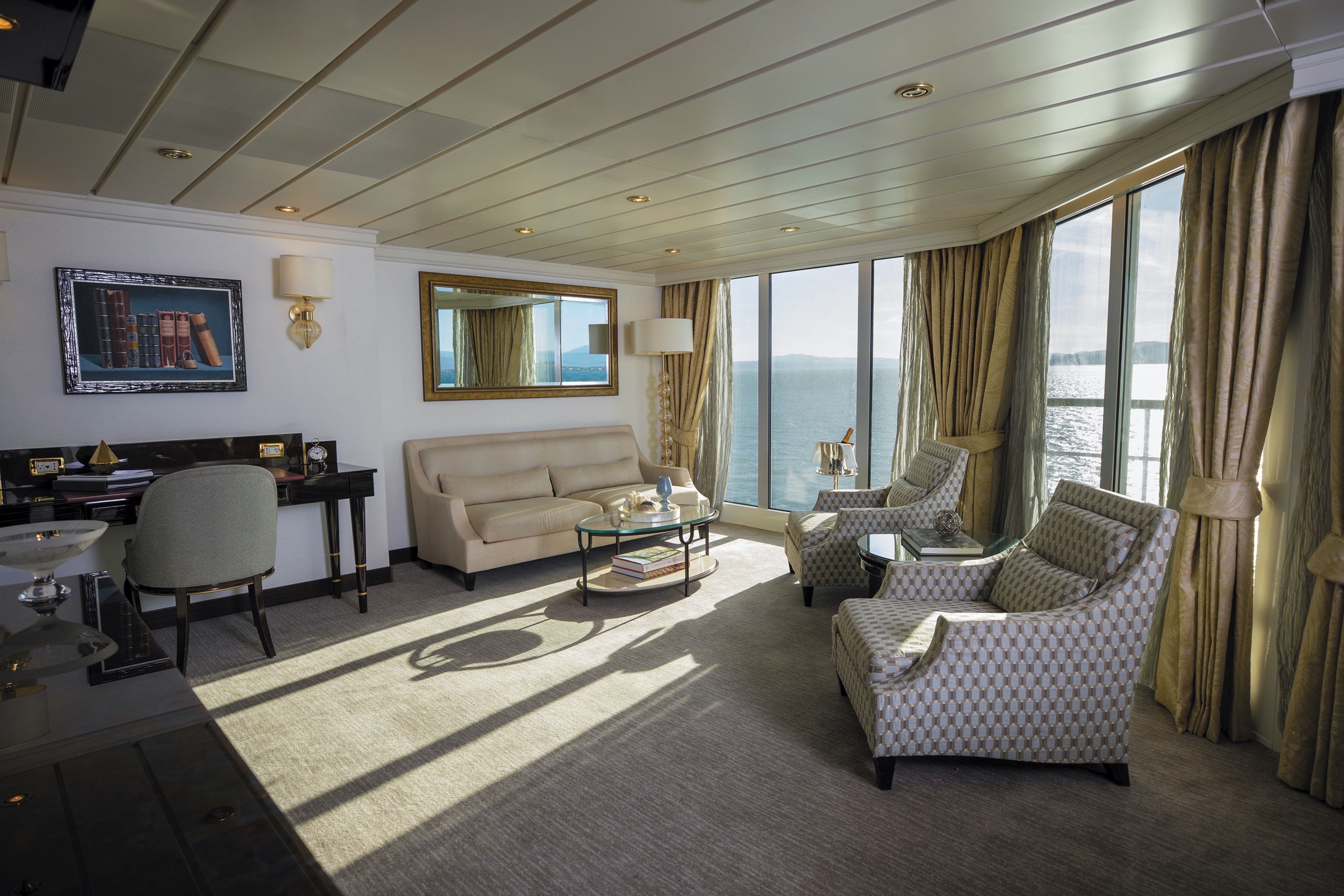
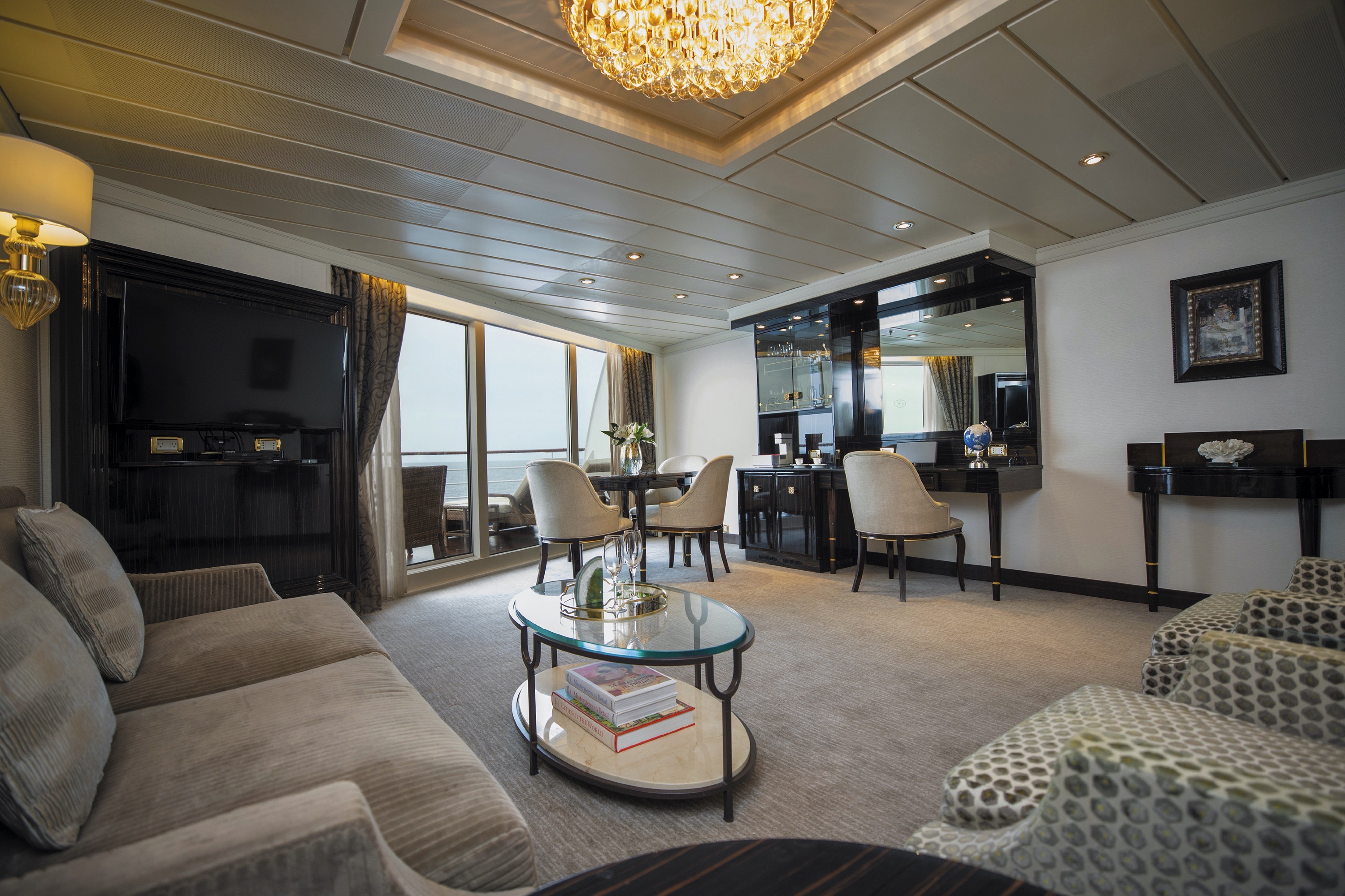
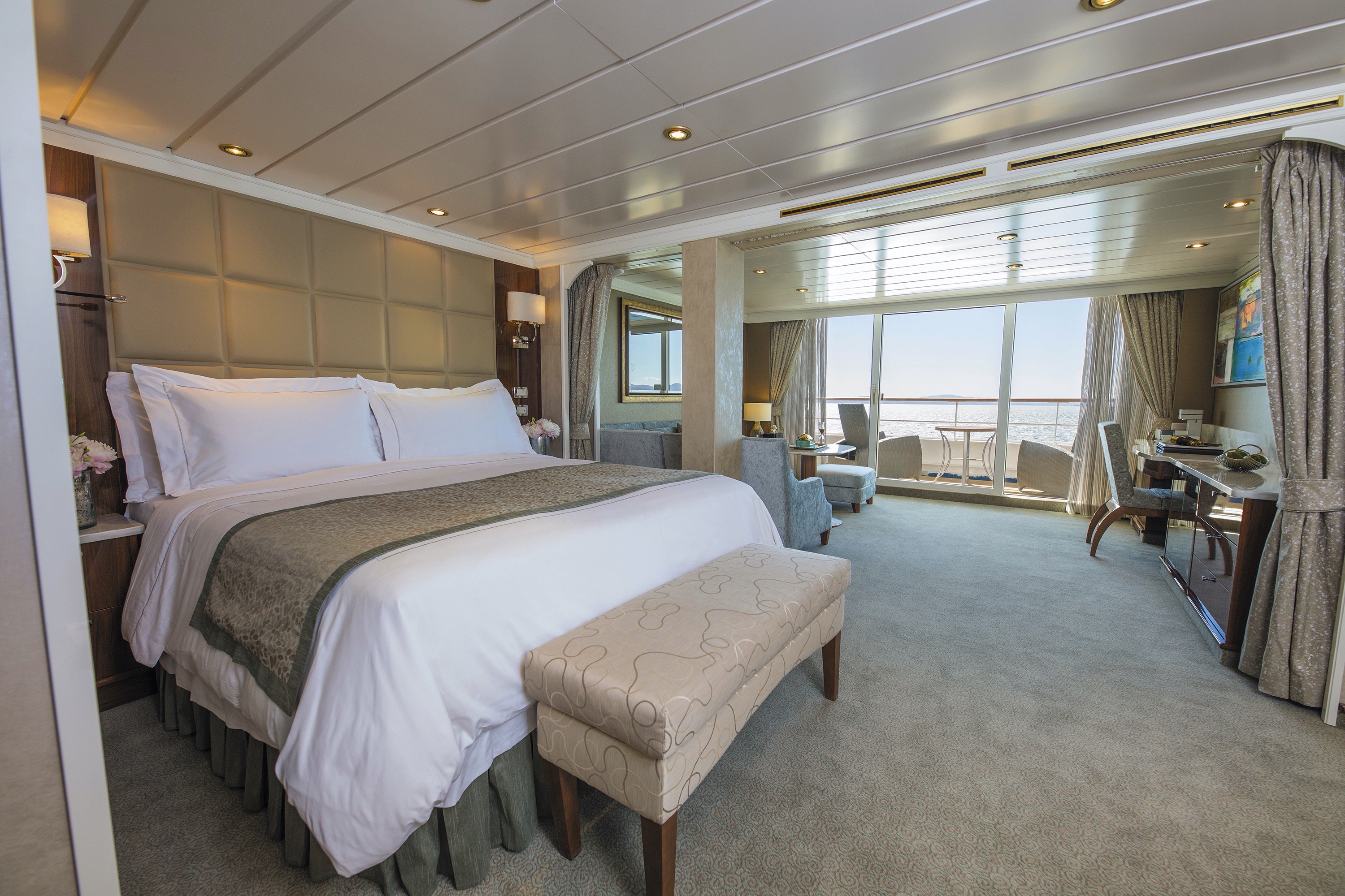
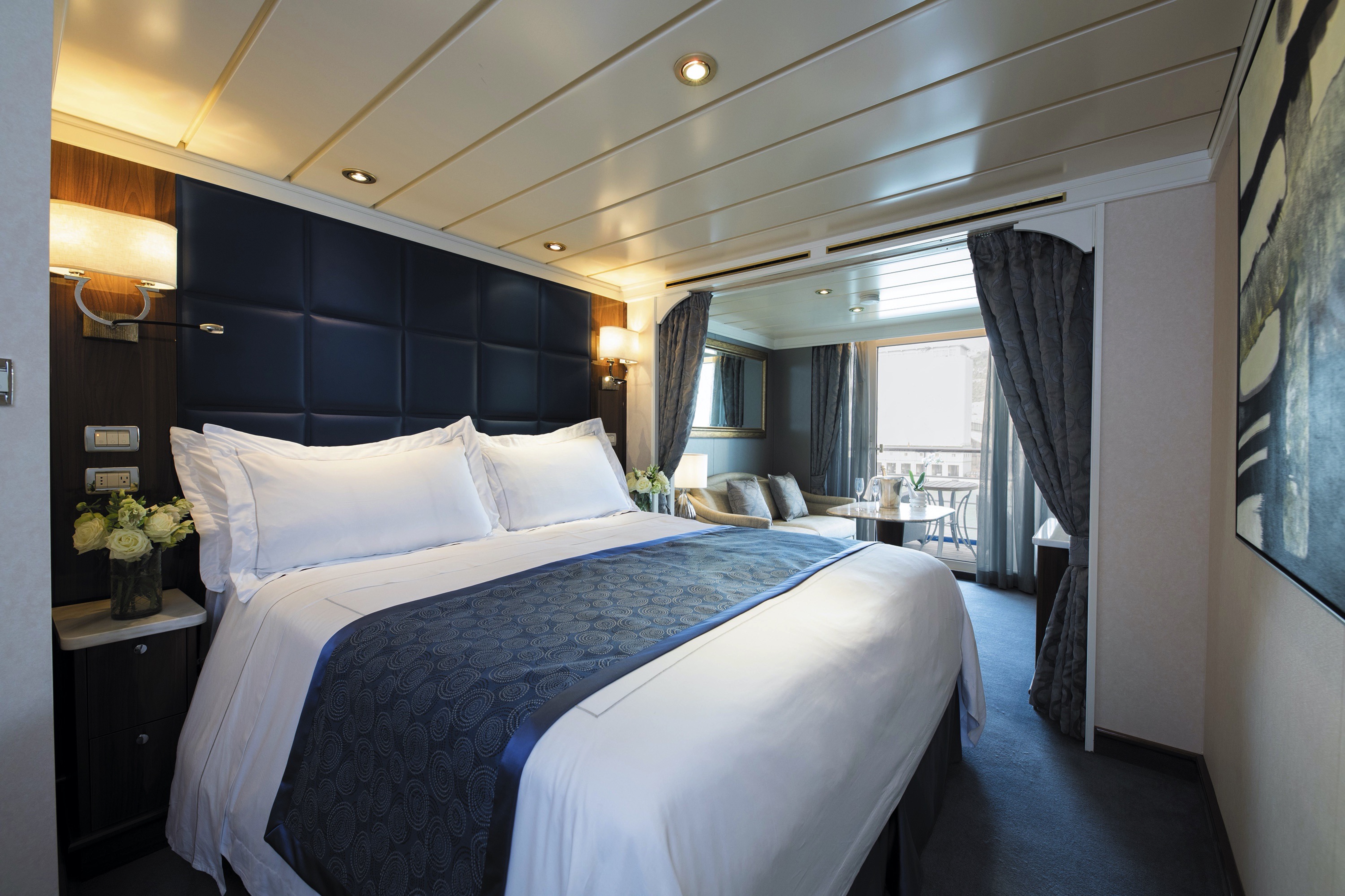
You'll find Park Avenue chic onboard Seven Seas Mariner® in this spectacular suite. Elegant rosewood furniture, luxe fabrics and a crystal chandelier create sophisticated comfort, while a personal butler is available to fulfil whatever requests you may have. With two bedrooms, two-and-a-half baths, a large living room and two private balconies, this sublime suite is perfect for hosting new friends in luxury.
Layout
- 2 Spacious Bedroom with a European King-Size Elite Slumber® Bed (*Bed in primary bedroom cannot be converted into two beds.)
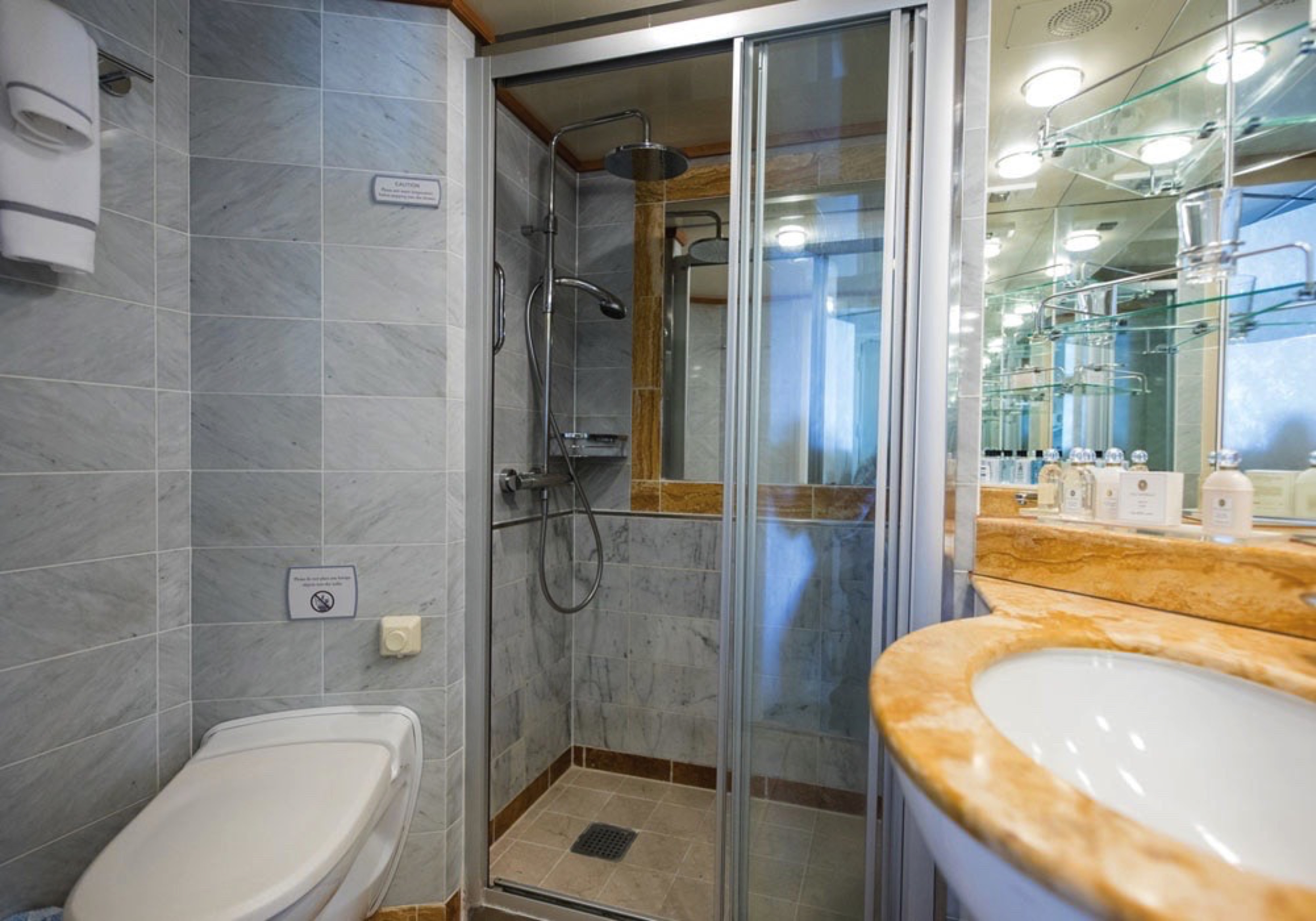
- 2 1/2 Marble & Stone Detailed Bathrooms
- 2 Private Balconies
- Sitting Area
- Walk-In Closet with Safe
- Includes Up To 6 Guests
The suite pictured may differ from the suite booked, as layouts and designs vary by ship, deck, and suite location.
Amenities
- 1-Night Pre-Cruise: Hotel Package Including:
- - Ground Transfers
- - Breakfast
- - Porterage
- Unlimited WiFi and Streaming Package for up to Four Devices
- Valet Laundry Service
- 24-hour In-Suite Dining
- Fresh Orchid Arrangement
- L'Occitane® Jasmin & Bergamot Bath Amenities
- Regent Plush Bathrobe & Slippers
- Interactive Flat-Screen Television & Direct-Dial Satellite Phone
- Priority Access to Online Shore Excursion Reservations
- Priority Access to Online Dining Reservations
- Binoculars
- illy® Espresso Maker
- Cashmere Blankets
- Regent Special Gift
- Vanity & Hair Dryer
- Shoe Shine Service
- Additional Discounts:
- - 10% Discount on Ultra Premium Wine and Liquor
- - 5% Savings on Pre- or Post-Cruise Hotel or Land Programs
- - 5% Savings on Regent Choice Shore Excursions
Additional Signature Suite Amenities:
- Guaranteed Reservation Each Night in Specialty Restaurant of Your Choice
- Welcome Letter from the President and General Manager
- Personal Butler for an Elevated In-suite Experience
- - In-Suite Dining Menu Including Specialty Restaurant Selections During Dining Hours
- Priority Boarding on Embarkation Day with Suite Access at Noon
- Welcome Bottle of Premium Champagne
- Personalized In-Suite Full-Liquor Bar Set-Up
- A Sumptuous In-Suite Caviar Service Once During Cruises
- Complimentary In-Suite Cocktail Party for 8
- Complimentary 25-Minute Personal Fitness Session at the Serene Spa & Wellness™ Fitness Center
- Daily Canapés
- Tea Forté Set-Up
- Luxe Fruit Arrangement with Chocolate Leonidas
- Luxurious Designer Bath Amenities & Men's Unscented Shaving Kit
- Hairdryer
- Selection of Fig & Tea Leaves Bath Salts
- Guerlain Bath Amenities & Men's Unscented Shaving Kit
- Bath Scale Setup
- Bose® SoundLink Mini II Bluetooth Speaker
- Selection of Bed Pillow Styles
- Complimentary Garment Pressing on First Night
- Personalized Stationery upon request
- Elegant Weather Clock
- Excursion Bag
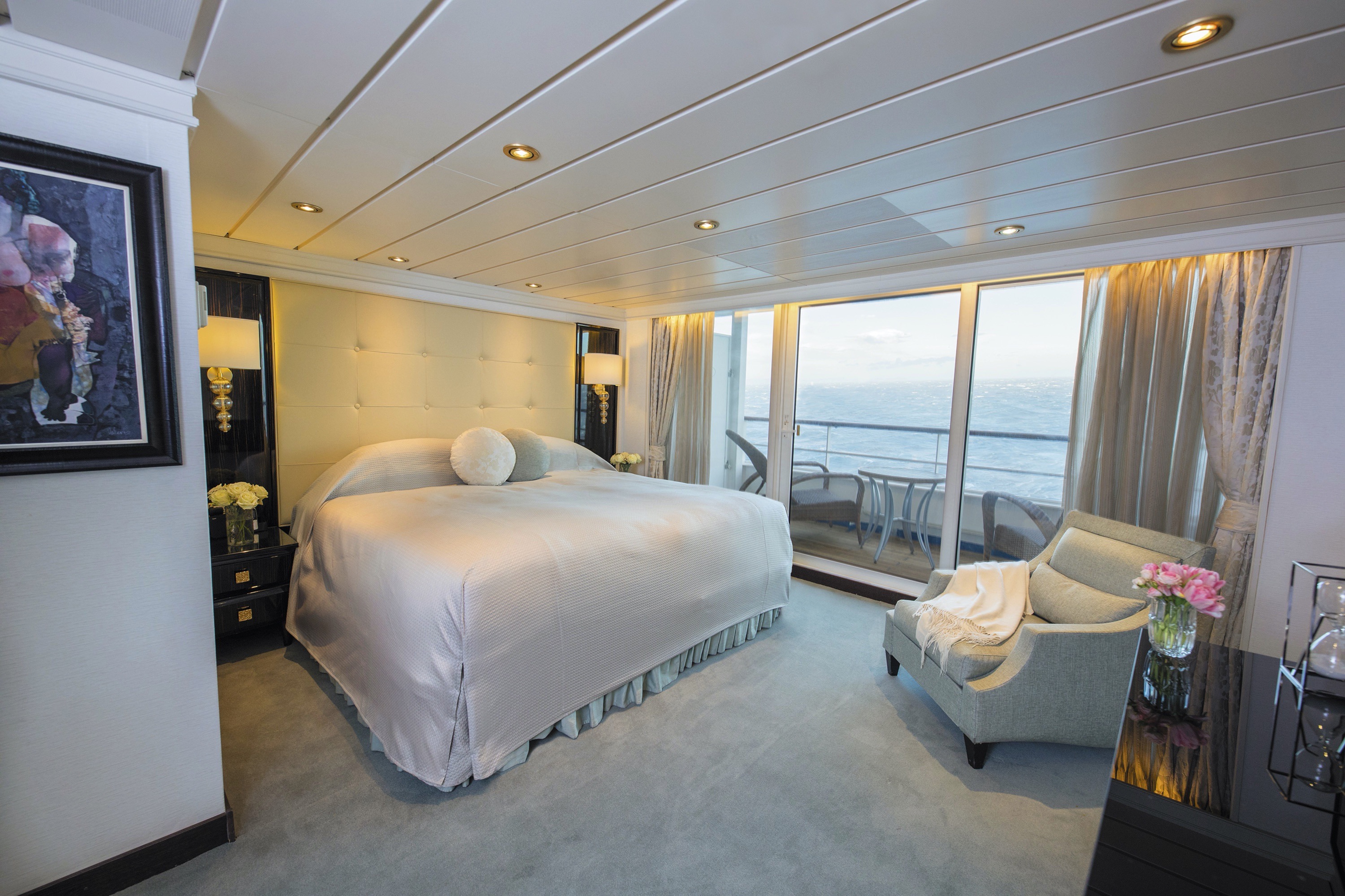
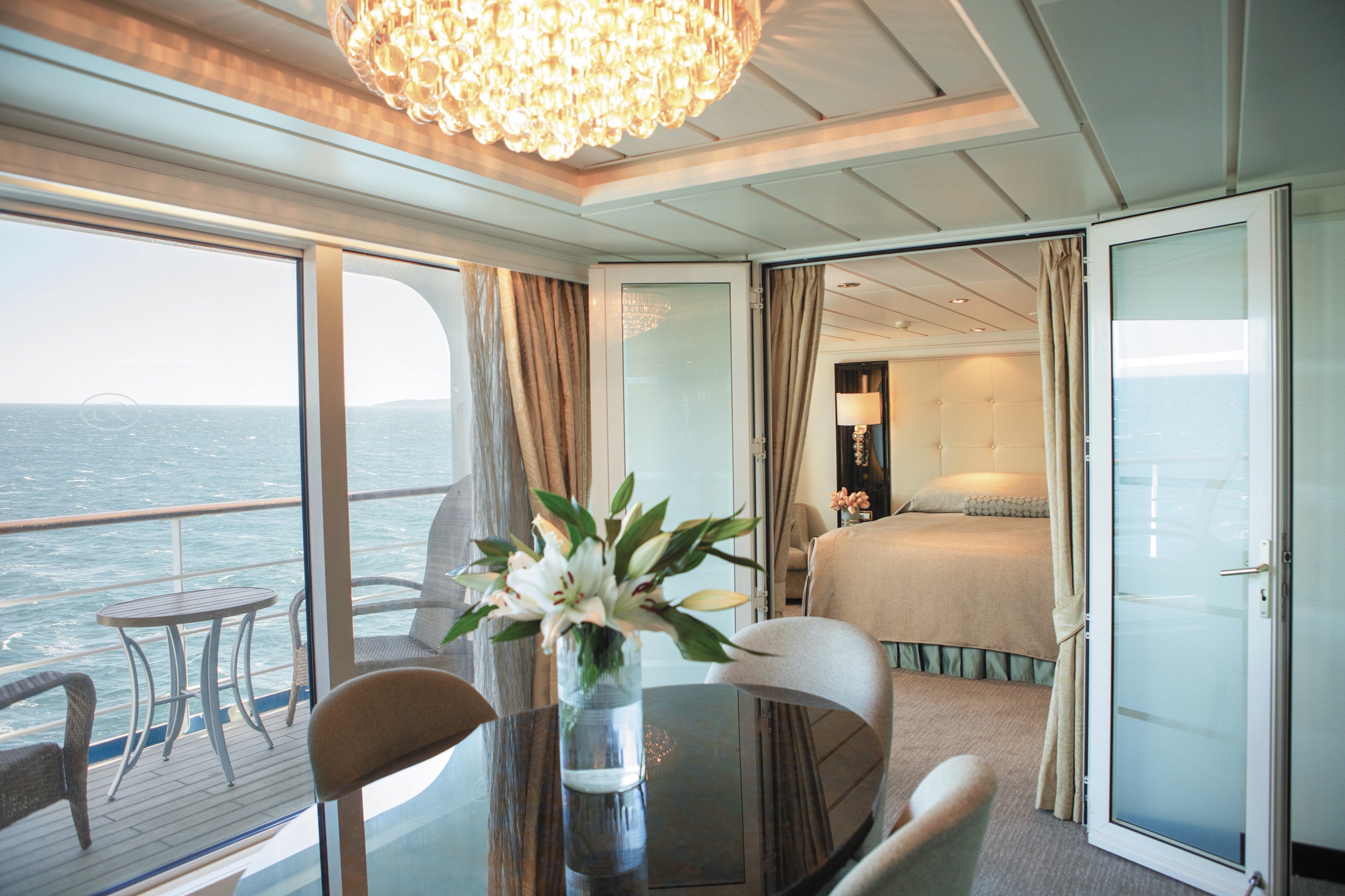
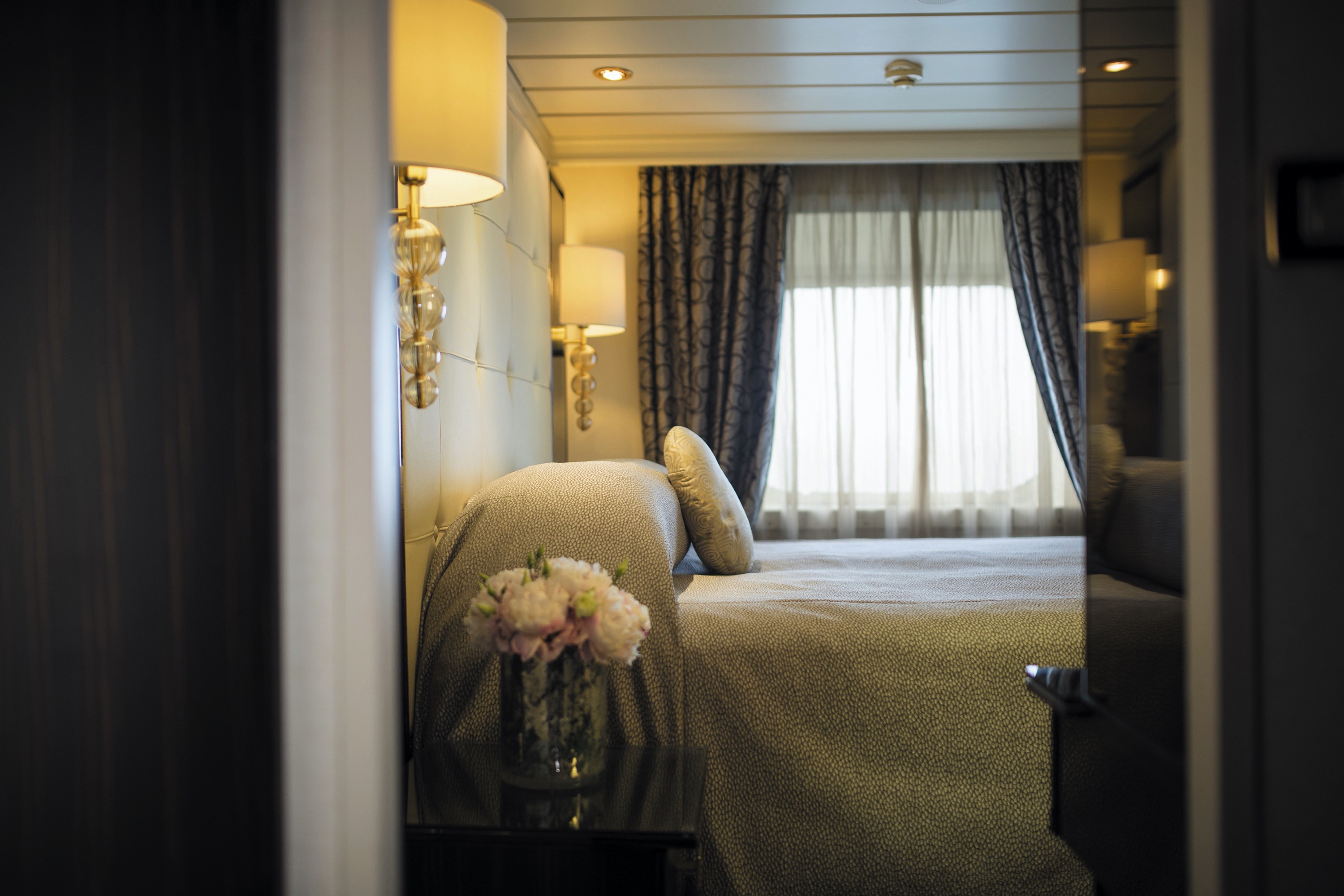
Step into the richness of a dining area perfectly ensconced within a spacious, art-filled living room. Just outside is a private balcony with a table and chairs just right for in-suite breakfast. The private bedroom is large and inviting, its soothing color palette conducive to a peaceful night’s rest on your King-Sized Elite Slumber™ Bed. Two full baths and luxurious bath products invite you to indulge in unbridled ‘me time’.
Layout
- 1 Spacious Bedroom with a European King-Size Elite Slumber® Bed (*Bed cannot be converted into two beds.)
- 2 Marble & Stone Detailed Bathrooms
- Private Balcony
- Sitting Area
- Walk-In Closet with Safe
- Accommodates Up To 3 Guests
The suite pictured may differ from the suite booked, as layouts and designs vary by ship, deck, and suite location.
Amenities
- 1-Night Pre-Cruise: Hotel Package Including:
- - Ground Transfers
- - Breakfast
- - Porterage
- Unlimited WiFi Includes up to Four Logins, Four Devices, per Suite
- Valet Laundry Service
- 24-hour In-Suite Dining
- Fresh Orchid Arrangement
- L'Occitane® Jasmin & Bergamot Bath Amenities
- Regent Plush Bathrobe & Slippers
- Interactive Flat-Screen Television & Direct-Dial Satellite Phone
- Priority Access to Online Shore Excursion Reservations
- Priority Access to Online Dining Reservations
- Binoculars
- illy® Espresso Maker
- Cashmere Blankets
- Regent Special Gift
- Vanity & Hair Dryer
- Shoe Shine Service
- Additional Discounts:
- - 10% Discount on Ultra Premium Wine and Liquor
- - 5% Savings on Pre- or Post-Cruise Hotel or Land Programs
- - 5% Savings on Regent Choice Shore Excursions
Additional Grand Suite Amenities:
- Guaranteed Reservation Each Night in Specialty Restaurant of Your Choice
- Welcome Letter from the President and General Manager
- Personal Butler for an Elevated In-suite Experience
- - In-Suite Dining Menu Including Specialty Restaurant Selections During Dining Hours
- Priority Boarding on Embarkation Day with Suite Access at Noon
- Welcome Bottle of Premium Champagne
- Personalized In-Suite Full-Liquor Bar Set-Up
- A Sumptuous In-Suite Caviar Service Once During Cruises
- Complimentary In-Suite Cocktail Party for 8
- Complimentary 25-Minute Personal Fitness Session at the Serene Spa & Wellness™ Fitness Center
- Daily Canapés
- Tea Forté Set-Up
- Luxe Fruit Arrangement with Chocolate Leonidas
- Luxurious Designer Bath Amenities & Men's Unscented Shaving Kit
- Hairdryer
- Selection of Fig & Tea Leaves Bath Salts
- Guerlain Bath Amenities & Men's Unscented Shaving Kit
- Bath Scale Setup
- Bose® SoundLink Mini II Bluetooth Speaker
- Selection of Bed Pillow Styles
- Complimentary Garment Pressing on First Night
- Personalized Stationery upon request
- Elegant Weather Clock
- Excursion Bag
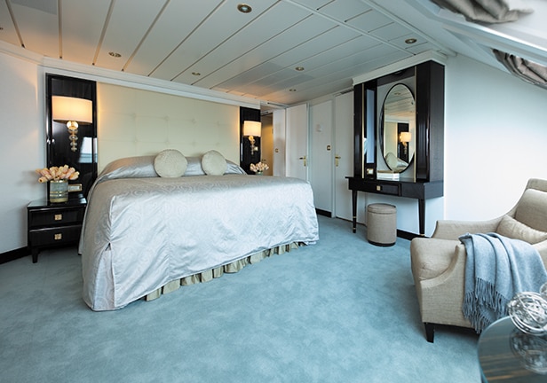
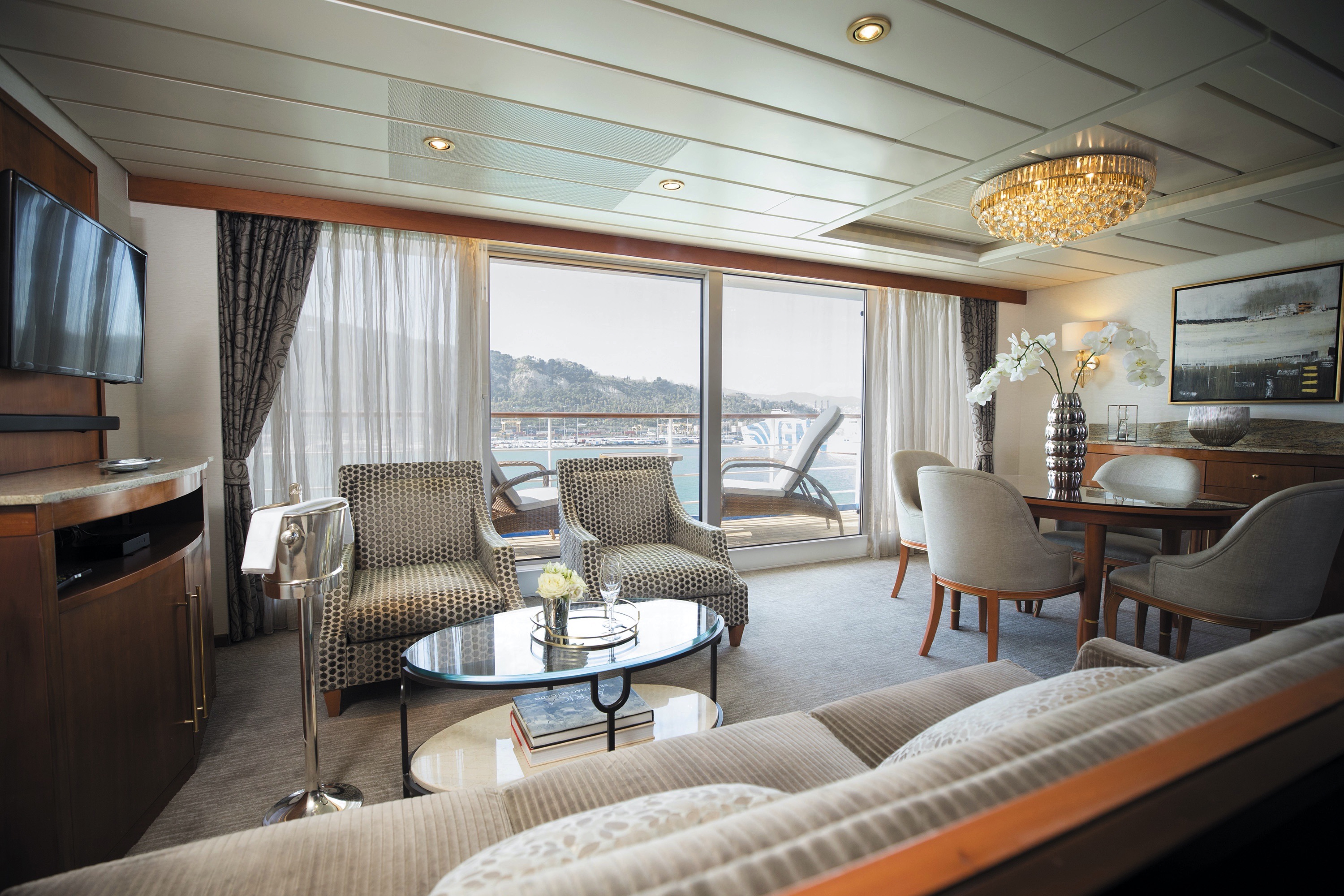
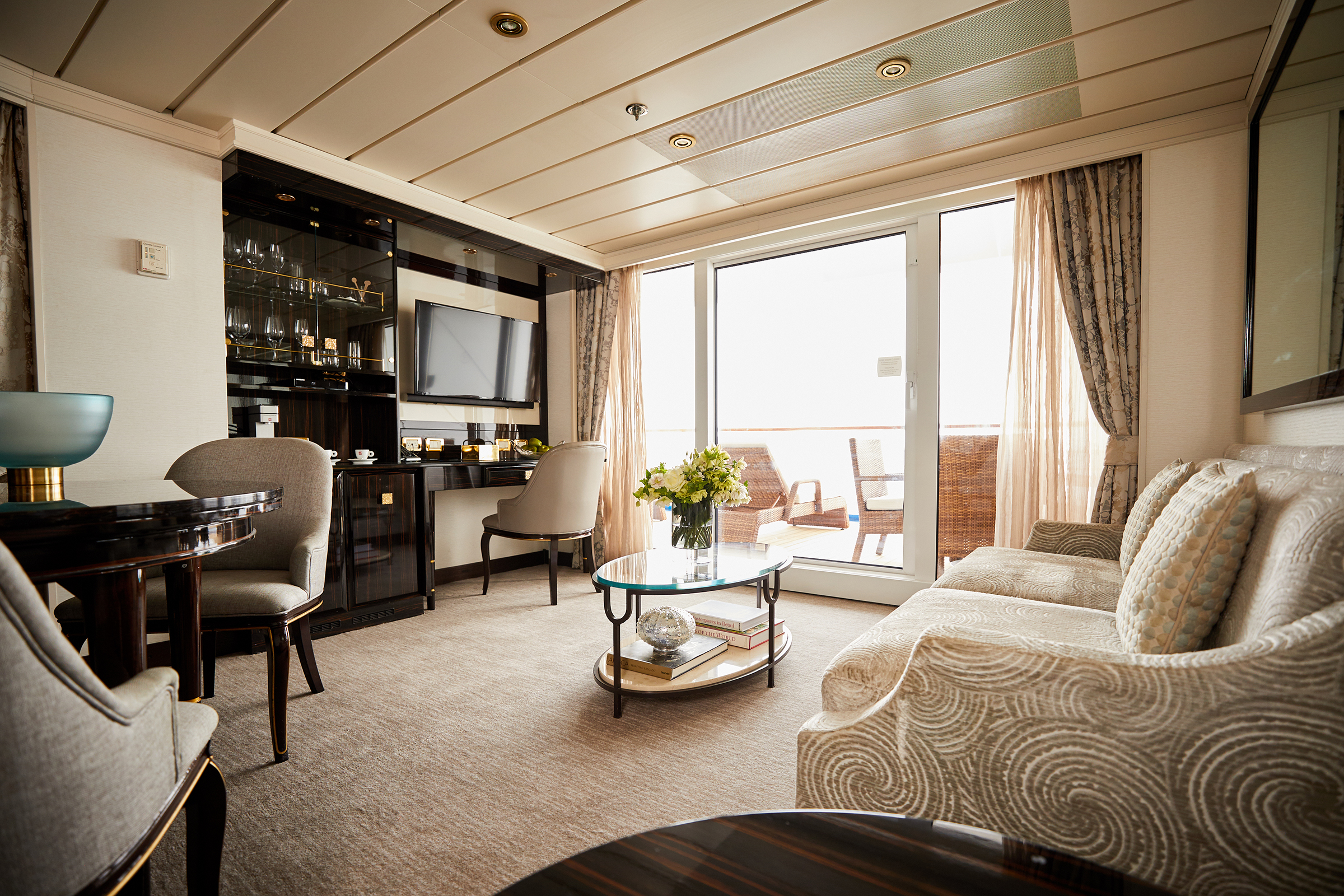
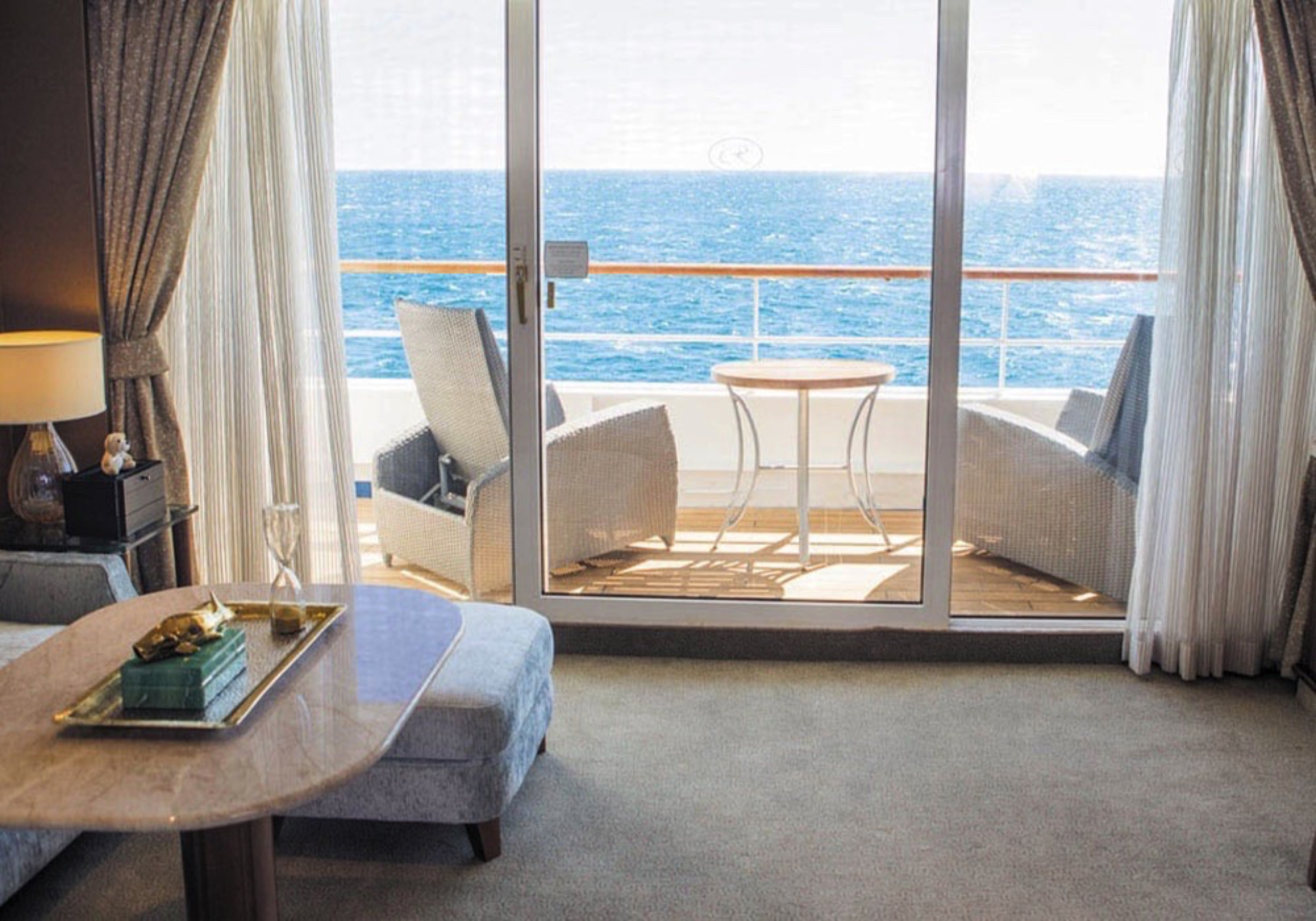
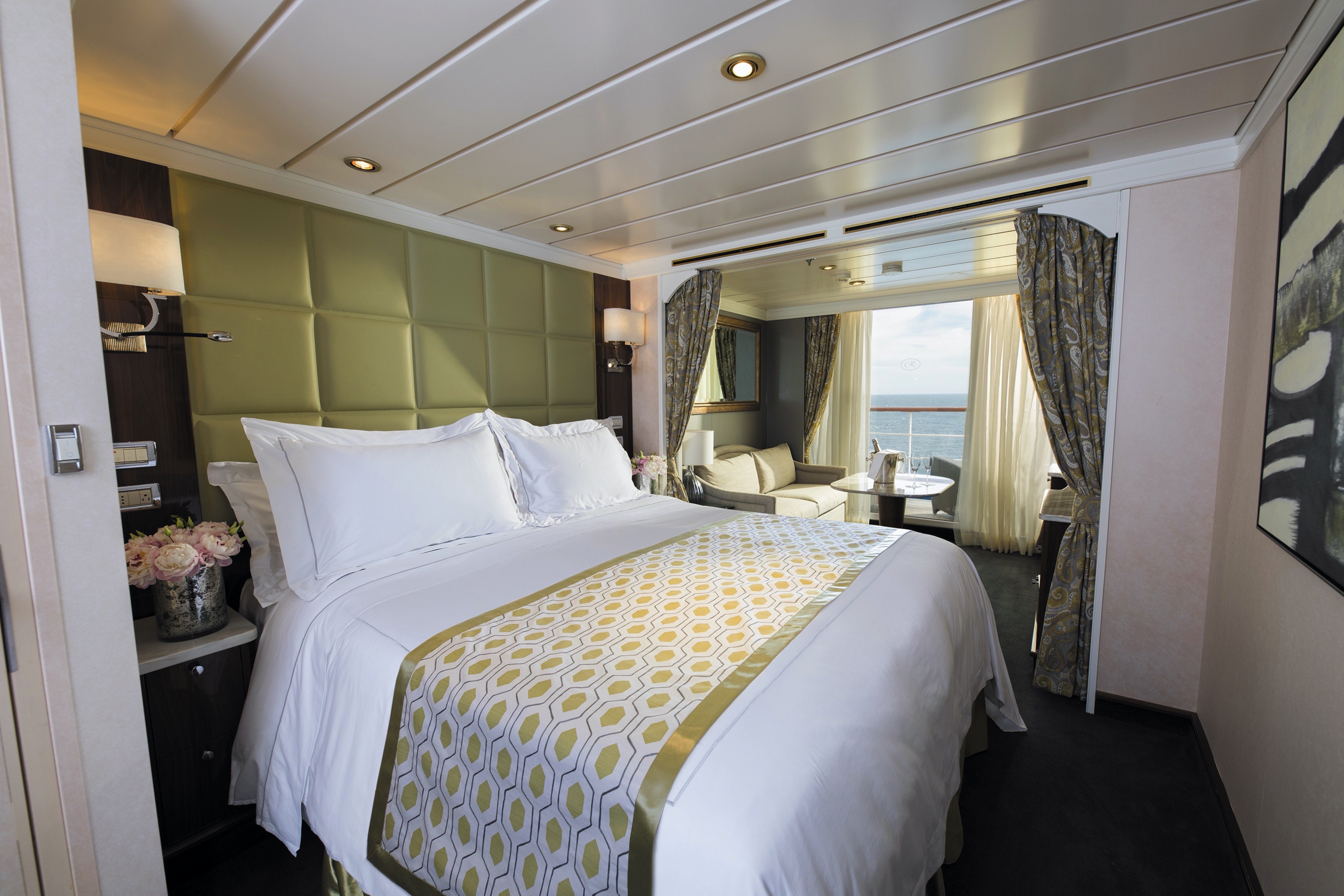
Spectacular panoramic views will seem to have been created just for you when you relax on your suite’s private balcony. Comfortably located mid-ship, this suite has a spacious separate bedroom with a European king-sized Elite Slumber™ bed and one-and-a-half baths. This suite features a spacious walk-in closet with drawers as well. To elevate your experience even more, a personal butler will be on call to help make your onboard wishes come true.
Layout
- 1 Spacious Bedroom with a European King-Size Elite Slumber® Bed
- 1 1/2 Marble & Stone Detailed Bathrooms
- Private Balcony
- Sitting Area
- Walk-In Closet with Safe
- Accommodates Up To 4 Guests
The suite pictured may differ from the suite booked, as layouts and designs vary by ship, deck, and suite location.
Amenities
- 1-Night Pre-Cruise: Hotel Package Including:
- - Ground Transfers
- - Breakfast
- - Porterage
- Unlimited WiFi Includes up to Four Logins, Four Devices, per Suite
- Valet Laundry Service
- 24-hour In-Suite Dining
- Fresh Orchid Arrangement
- L'Occitane® Jasmin & Bergamot Bath Amenities
- Regent Plush Bathrobe & Slippers
- Interactive Flat-Screen Television & Direct-Dial Satellite Phone
- Priority Access to Online Shore Excursion Reservations
- Priority Access to Online Dining Reservations
- Binoculars
- illy® Espresso Maker
- Cashmere Blankets
- Regent Special Gift
- Vanity & Hair Dryer
- Shoe Shine Service
- Additional Discounts:
- - 10% Discount on Ultra Premium Wine and Liquor
- - 5% Savings on Pre- or Post-Cruise Hotel or Land Programs
- - 5% Savings on Regent Choice Shore Excursions
Additional Mariner Suite Amenities:
- Welcome Letter from the President and General Manager
- Personal Butler for an Elevated In-suite Experience
- - In-Suite Dining from Compass Rose
- Priority Boarding on Embarkation Day with Suite Access at 1pm
- Welcome Bottle of Premium Champagne
- Personalized In-Suite Full-Liquor Bar Set-Up
- A Sumptuous In-Suite Caviar Service Once During Cruises
- Daily Canapés
- Luxe Fruit Arrangement
- Luxurious Designer Bath Amenities & Men's Unscented Shaving Kit
- Selection of Fig & Tea Leaves Bath Salts
- Guerlain Bath Amenities & Men's Unscented Shaving Kit
- Bath Scale Setup
- Bose® SoundLink Mini II Bluetooth Speaker
- Selection of Bed Pillow Styles
- Complimentary Garment Pressing on First Night
- Personalized Stationery upon request
- Elegant Weather Clock
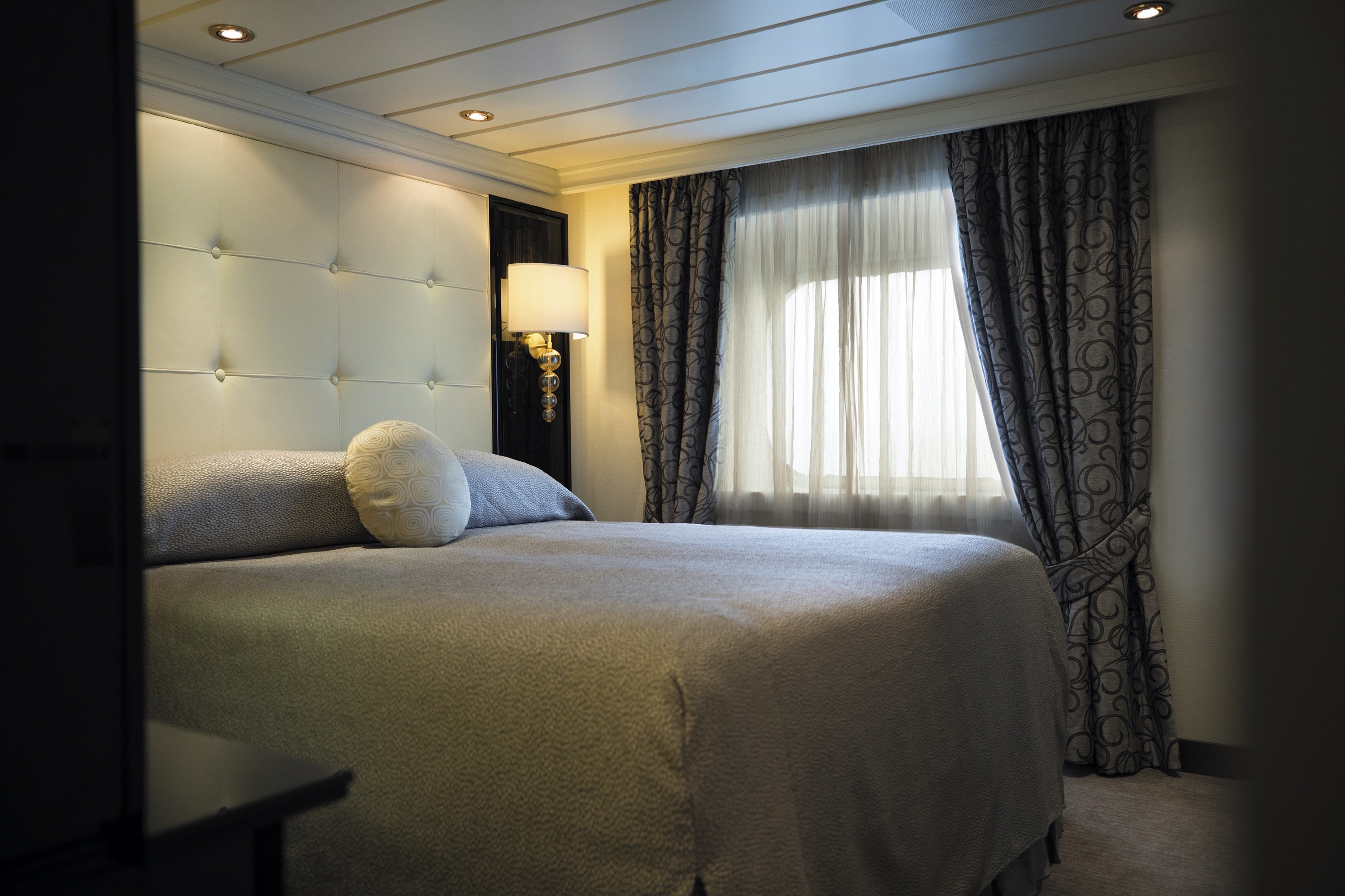
This suite welcomes you with soothing colors, pleasing artwork and comfortable furnishings. Relax in the sitting area after an exciting day ashore and enjoy the selection of fresh canapés delivered by your personal butler. Then retreat to your private balcony to watch the ever-changing vistas and ponder your next destination. Up to one-and-a-half baths feature fine marble accents and a tub or walk-in shower.
Layout
- 1 Spacious Bedroom with a European King-Size Elite Slumber® Bed
- 1 1/2 Marble & Stone Detailed Bathrooms
- Private Balcony
- Sitting Area
- Walk-In Closet with Safe
- Accommodates Up To 3 Guests
The suite pictured may differ from the suite booked, as layouts and designs vary by ship, deck, and suite location.
Amenities
- 1-Night Pre-Cruise: Hotel Package Including:
- - Ground Transfers
- - Breakfast
- - Porterage
- Unlimited WiFi Includes up to Four Logins, Four Devices, per Suite
- Valet Laundry Service
- Customizable In-Suite Mini Bar Replenished Daily with Your Preferences
- 24-hour In-Suite Dining
- Fresh Orchid Arrangement
- L'Occitane® Jasmin & Bergamot Bath Amenities
- Regent Plush Bathrobe & Slippers
- Interactive Flat-Screen Television & Direct-Dial Satellite Phone
- Priority Access to Online Shore Excursion Reservations
- Priority Access to Online Dining Reservations
- Binoculars
- illy® Espresso Maker
- Cashmere Blankets
- Regent Special Gift
- Vanity & Hair Dryer
- Shoe Shine Service
- Additional Discounts:
- - 10% Discount on Ultra Premium Wine and Liquor
- - 5% Savings on Pre- or Post-Cruise Hotel or Land Programs
- - 5% Savings on Regent Choice Shore Excursions
Additional Seven Seas Suites Amenitie:
- Personal Butler for an Elevated In-suite Experience
- - In-Suite Dining from Compass Rose
- Priority Boarding on Embarkation Day with Suite Access at 1pm
- Daily Canapés
- Luxe Fruit Arrangement
- Luxurious Designer Bath Amenities & Men's Unscented Shaving Kit
- Selection of Fig & Tea Leaves Bath Salts
- Guerlain Bath Amenities & Men's Unscented Shaving Kit
- Bose® SoundLink Mini II Bluetooth Speaker
- Selection of Bed Pillow Styles
- Complimentary Garment Pressing on First Night
- Personalized Stationery upon request
- Elegant Weather Clock
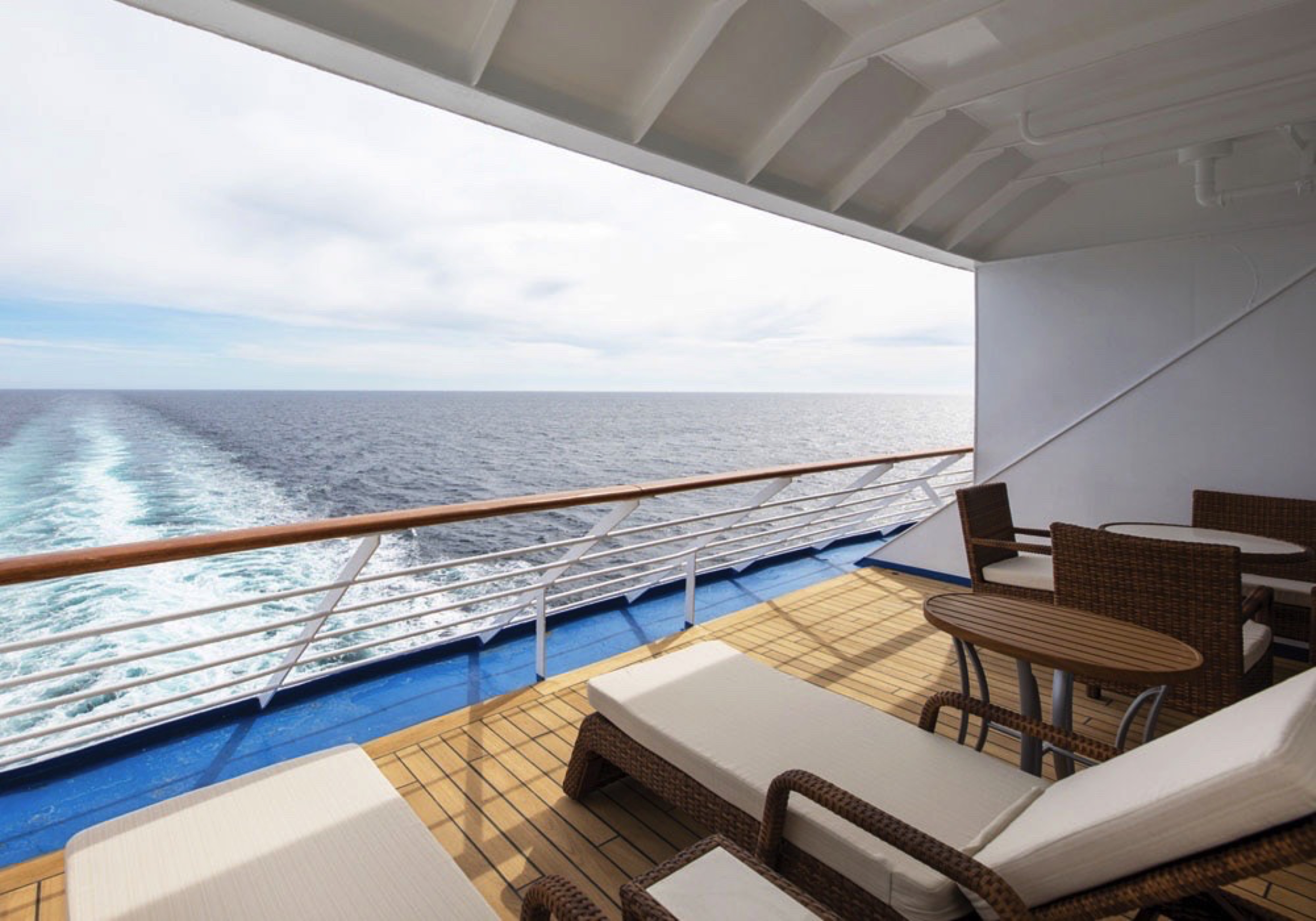
Located along the stern of Seven Seas Mariner®, this suite offers a panoramic vista and expansive balcony that is large enough for two cushioned chaises, two chairs and a table. Inside, the bed alcove is separated from a beautifully appointed sitting area by curtains, allowing you to control how much sunlight greets you each morning. You’ll also have a personal butler attending to your needs and a bevy of luxurious amenities.
Layout
- 1 Spacious Bedroom with a European King-Size Elite Slumber® Bed
- 1 Marble & Stone Detailed Bathroom
- Private Balcony
- Sitting Area
- Walk-In Closet with Safe
- Accommodates Up To 3 Guests
The suite pictured may differ from the suite booked, as layouts and designs vary by ship, deck, and suite location.
Amenities
- 1-Night Pre-Cruise: Hotel Package Including:
- - Ground Transfers
- - Breakfast
- - Porterage
- Unlimited WiFi Includes up to Four Logins, Four Devices, per Suite
- Valet Laundry Service
- Customizable In-Suite Mini Bar Replenished Daily with Your Preferences
- 24-hour In-Suite Dining
- Fresh Orchid Arrangement
- L'Occitane® Jasmin & Bergamot Bath Amenities
- Regent Plush Bathrobe & Slippers
- Interactive Flat-Screen Television & Direct-Dial Satellite Phone
- Priority Access to Online Shore Excursion Reservations
- Priority Access to Online Dining Reservations
- Binoculars
- illy® Espresso Maker
- Cashmere Blankets
- Regent Special Gift
- Vanity & Hair Dryer
- Shoe Shine Service
- Additional Discounts:
- - 10% Discount on Ultra Premium Wine and Liquor
- - 5% Savings on Pre- or Post-Cruise Hotel or Land Programs
- - 5% Savings on Regent Choice Shore Excursions
Additional Horizon View Suite Amenities:
- Personal Butler for an Elevated In-suite Experience
- - In-Suite Dining from Compass Rose
- Priority Boarding on Embarkation Day with Suite Access at 1pm
- Daily Canapés
- Luxe Fruit Arrangement
- Luxurious Designer Bath Amenities & Men's Unscented Shaving Kit
- Guerlain Bath Amenities & Men's Unscented Shaving Kit
- Bose® SoundLink Mini II Bluetooth Speaker
- Selection of Bed Pillow Styles
- Complimentary Garment Pressing on First Night
- Personalized Stationery upon request
- Elegant Weather Clock
The luxurious suite has been carefully designed to maximize space and comfort. Relax on your private balcony and indulge in your lavish bath amenities as you recharge and ready yourself for new adventures in the next port of call. This suite also includes priority online reservations for shore excursions and dining, and you’re encouraged to call on the services of a personal butler for special requests.
Layout
- Private Balcony
- Sitting Area
- Marble & Stone Detailed Bathroom
- European King-Size Elite Slumber® Bed
- Walk-In Closet with Safe
- Accommodates Up To 3 Guests
The suite pictured may differ from the suite booked, as layouts and designs vary by ship, deck, and suite location.
Amenities
- 1-Night Pre-Cruise: Hotel Package Including:
- - Ground Transfers
- - Breakfast
- - Porterage
- Unlimited WiFi Includes up to Four Logins, Four Devices, per Suite
- Valet Laundry Service
- Customizable In-Suite Mini Bar Replenished Daily with Your Preferences
- Welcome Bottle of Champagne & Fresh Fruit
- 24-hour In-Suite Dining
- Fresh Orchid Arrangement
- L'Occitane® Jasmin & Bergamot Bath Amenities
- Regent Plush Bathrobe & Slippers
- Interactive Flat-Screen Television & Direct-Dial Satellite Phone
- Priority Access to Online Shore Excursion Reservations
- Priority Access to Online Dining Reservations
- Binoculars
- illy® Espresso Maker
- Cashmere Blankets
- Regent Special Gift
- Vanity & Hair Dryer
- Shoe Shine Service
- Additional Discounts:
- - 10% Discount on Ultra Premium Wine and Liquor
- - 5% Savings on Pre- or Post-Cruise Hotel or Land Programs
- - 5% Savings on Regent Choice Shore Excursions
Additional Penthouse Suite Amenities:
- Personal Butler for an Elevated In-suite Experience
- - In-Suite Dining from Compass Rose
- Daily Canapés
- Luxurious Designer Bath Amenities & Men's Unscented Shaving Kit
- Guerlain Bath Amenities & Men's Unscented Shaving Kit
- Bose® SoundLink Mini II Bluetooth Speaker
- Selection of Bed Pillow Styles
- Complimentary Garment Pressing on First Night
- Personalized Stationery upon request
In this superbly designed suite, you enjoy the comfort of richly furnished accommodations as well as exclusive luxuries available only in suites at the Concierge level and higher. Your suite includes amenities such as an illy® espresso maker and cashmere blankets, perfect for use in the morning when you wish to sip coffee and enjoy an in-suite breakfast on your private balcony. Take advantage of 24-hour room service when the mood strikes.
Layout
- Private Balcony
- Sitting Area
- Marble & Stone Detailed Bathroom
- European King-Size Elite Slumber® Bed
- Walk-In Closet with Safe
- Accommodates Up To 3 Guests
- This category includes Accessibility Options in suites 1012 and 1013. For more information about accessible suites click here.
The suite pictured may differ from the suite booked, as layouts and designs vary by ship, deck, and suite location
Amenities
- 1-Night Pre-Cruise: Hotel Package Including:
- - Ground Transfers
- - Breakfast
- - Porterage
- Unlimited WiFi Includes up to Four Logins, Four Devices, per Suite
- Valet Laundry Service
- Customizable In-Suite Mini Bar Replenished Daily with Your Preferences
- Welcome Bottle of Champagne & Fresh Fruit
- 24-hour In-Suite Dining
- Fresh Orchid Arrangement
- L'Occitane® Jasmin & Bergamot Bath Amenities
- Regent Plush Bathrobe & Slippers
- Interactive Flat-Screen Television & Direct-Dial Satellite Phone
- Priority Access to Online Shore Excursion Reservations
- Priority Access to Online Dining Reservations
- Binoculars
- illy® Espresso Maker
- Cashmere Blankets
- Regent Special Gift
- Vanity & Hair Dryer
- Shoe Shine Service
- Additional Discounts:
- - 10% Discount on Ultra Premium Wine and Liquor
- - 5% Savings on Pre- or Post-Cruise Hotel or Land Programs
- - 5% Savings on Regent Choice Shore Excursions
Every inch of this suite has been thoughtfully designed to maximize interior space and embrace the magnificent scenery outdoors. From the sitting area, admire the ocean views through the floor-to-ceiling windows, or better yet, take a seat outside on your private balcony to watch the world go by. Elegant finishes such as luxurious bedding and beautiful marble detailing in the bath further enhance your comfort.
Layout
- Private Balcony
- Sitting Area
- Marble & Stone Detailed Bathroom
- European King-Size Elite Slumber® Bed
- Walk-In Closet with Safe
- Accommodates Up To 3 Guests
- This category includes Accessibility Options in suites 828 and 829. For more information about accessible suites click here.
The suite pictured may differ from the suite booked, as layouts and designs vary by ship, deck, and suite location.
Amenities
- Unlimited WiFi Includes Two Logins, Two Devices, per Suite
- Valet Laundry Service
- Customizable In-Suite Mini Bar Replenished Daily with Your Preferences
- Welcome Bottle of Champagne & Fresh Fruit
- 24-hour In-Suite Dining
- Fresh Orchid Arrangement
- L'Occitane® Jasmin & Bergamot Bath Amenities
- Regent Plush Bathrobe & Slippers
- Interactive Flat-Screen Television & Direct-Dial Satellite Phone
- Vanity & Hair Dryer
- Shoe Shine Service
Seven Seas Mariner
Seven Seas Mariner® exudes class, from the delectable offerings of Chartreuse to the debonair atmosphere of the Connoisseur Club.
Attention to detail distinguishes Regent Seven Sea Cruises™ and the exceptional suites on Seven Seas Mariner®. With our all-inclusive fares, every guest enjoys spacious closets, well-appointed bathrooms and a private balcony with views of the shimmering sea.
Soothing colors accented by appealing patterns and textures dominate the interiors of Seven Seas Mariner®. The common spaces offer everything from wide-open views on the upper deck to intimate tables for bridge in the Card Room.
Ship Facts
| Launch Year | 2001 | ||||
| Refit Year | 2018 | ||||
| Language | en | ||||
| Gross Tonnage | 48075 | ||||
| Length | 216 | ||||
| Width | 28 | ||||
| Currency | USD | ||||
| Speed | 20 | ||||
| Capacity | 700 | ||||
| Crew Count | 459 | ||||
| Deck Count | 8 | ||||
| Cabin Count | 350 | ||||
| Large Cabin Count | 61 | ||||
| Wheelchair Cabin Count | 6 | ||||
| Electrical Plugs |
|
Deck 12
- Paddle Tennis
- Golf Nets
- Putting Green
- Bocce Court
- Shuffleboard
- Jogging Track
- Observation Lounge

Deck 11
- Atrium
- La Veranda
- Sette Mari at La Veranda
- Pool Grill
- Pool Bar
- Pool Deck
- Pool
- Whirlpools
- Penthouse Suites
- Grand Suites

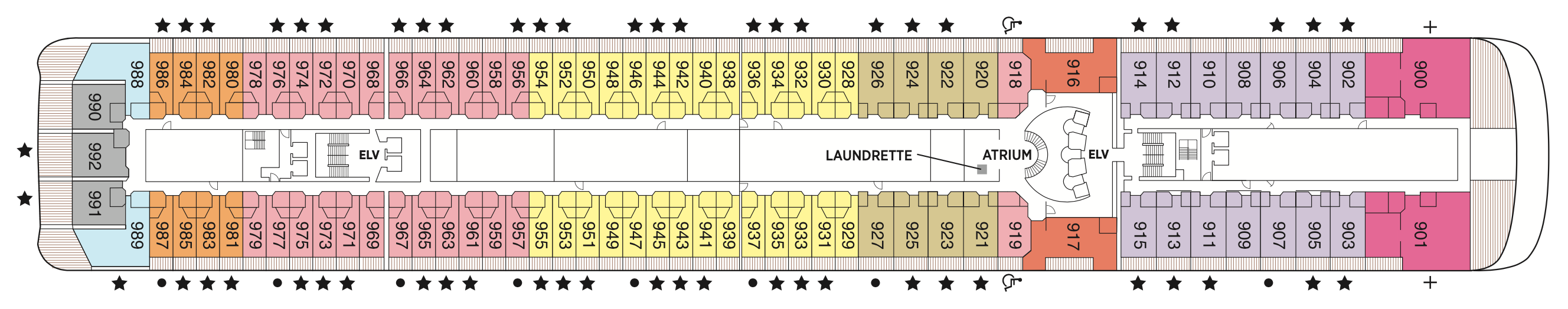
Deck 10
- Atrium
- Laundrette
- Horizon View Suites
- Seven Seas Suites
- Concierge Suites
- Penthouse Suites
- Mariner Suites

Deck 9
- Atrium
- Laundrette
- Signature Suite
- Deluxe Veranda Suites
- Horizon View Suites
- Seven Seas Suites
- Concierge Suites
- Penthouse Suites
- Mariner Suites
Deck 8
- Atrium
- Laundrette
- Horizon View Suites
- Seven Seas Suites
- Deluxe Veranda Suites
- Concierge Suites
- Penthouse Suites
- Mariner Suites
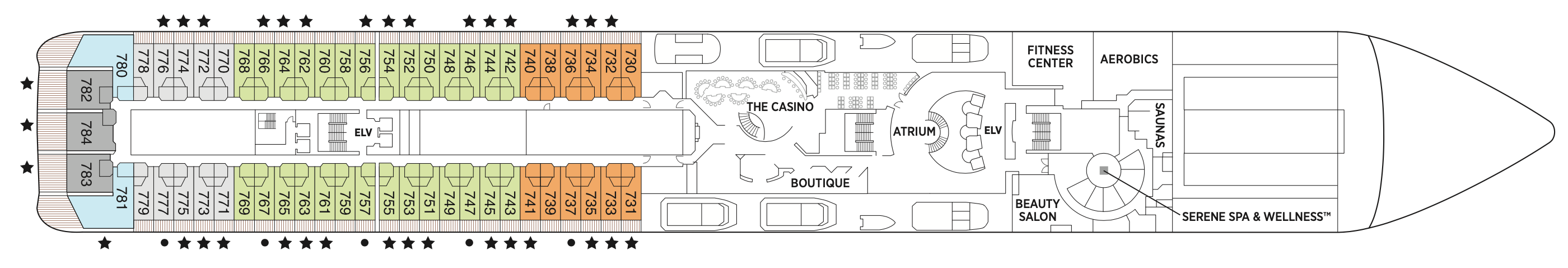
Deck 7
- Atrium
- Boutiques
- Fitness Centre
- Serene Spa & Wellness™
- The Casino
- Seven Seas Suites
- Horizon View Suites
- Deluxe Veranda Suites
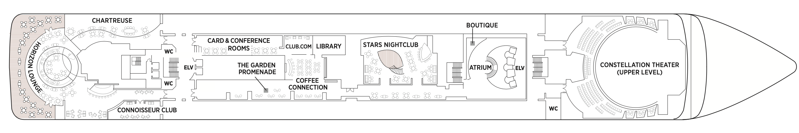
Deck 6
- Atrium
- Boutiques
- Card & Conference Room
- Chartreuse
- Club.com
- Coffee Connection
- Connoisseur Club
- Constellation Theatre
- Horizon Lounge
- Stars Lounge
- Stars Night Club
- Library
- The Garden Promenade
- Horizon Lounge
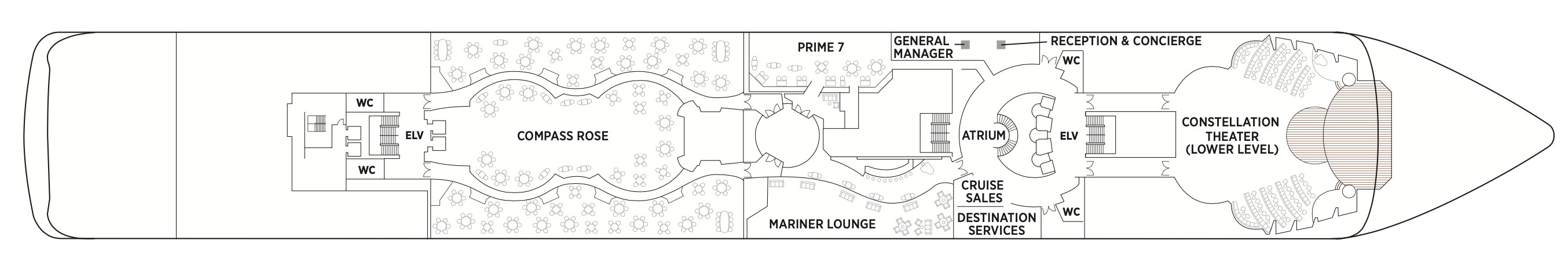
Deck 5
- Atrium
- Compass Rose
- Constellation Theatre
- Mariner Lounge
- Prime 7
- Destination Services
- Reception & Concierge
Regent Seven Seas Cruises® takes pride in creating dining experiences that are simply superb. From succulent lobster to the perfect burger and shake, you’ll find an array of refined flavors and refreshments from which to choose.
Compass Rose
Whether you arrive for breakfast, lunch or dinner, you can look forward to European-inspired Continental cuisine served in a beautifully refined atmosphere decorated in blues and silvers with stunning Versace tableware.
We are pleased to re-introduce the elegantly enhanced Compass Rose, the largest specialty restaurant across our fleet. Ensuring a tantalizing mix of new and familiar items on every visit, the new lunch and dinner menus offer a vast selection to meet your discerning tastes. Exclusively aboard Seven Seas Mariner®, Seven Seas Voyager®, and Seven Seas Navigator® for lunch, you may choose from a robust list of appetizers and main courses from our specialty restaurants. And across our fleet for dinner, you have the unique ability to design your very own entrée from preferred sides, sauces, pastas and main features of beef, poultry and fish. This is in addition to sinfully indulgent desserts made by talented bakers and pastry chefs. With daily changing menus, the refreshed Compass Rose offers more choices than ever before.
La Veranda
La Veranda features quiet alcoves, made-to-order omelettes and tasty lunch buffets that include hot carving stations, an authentic pizzeria and regional specialties that reflect cuisines of the region you’re visiting.
Take in stunning ocean views while enjoying elegant breakfast and lunch buffets in the chic indoor dining room or al fresco on the shaded, open-air deck. Breakfasts include traditional favorites, as well as a made-to-order omelet station, a variety of fresh fruits and pastries, along with daily specials, like fluffy Belgian waffles with fresh blueberry compote. For lunch indulge in an array of choices from a bountiful salad bar, gourmet sandwiches, hot carving stations and delicious desserts.
Prime 7
Vibrant blue colours and white-leather chairs heighten the senses as you enter this elegantly intimate, art-filled and luxurious setting to enjoy classic American steakhouse cuisine with a modern flair. Open for dinner only.
A true classic in every sense, Prime 7 sets a new standard in steakhouse fare with its contemporary interpretation of an American classic. Handsomely decorated with supple leather wing-back chairs, burnished woods and rich earth-toned fabrics, Prime 7 exudes a distinct, intimate elegance. This is sophistication redefined, a luxurious setting to enjoy classic steakhouse cuisine with a modern flair.
All the traditional starters are here, including Jumbo Lump Crab Cakes, Classic Steak Tartare, and Clam Chowder. Of course, beef is the undisputed star, and it is aged for a minimum of 40 days to ensure the ultimate tenderness and juiciness. New York Strip, Porterhouse Steak and succulent Filet Mignon only touch upon the selections. Mouthwatering alternatives include Applewood Smoked Salmon and Dover Sole.
Reservations Required
Sette Mari at La Veranda
Each evening, La Veranda transforms into Sette Mari at La Veranda, a casual, intimate dining experience. Enjoy an extensive menu of authentic antipasti and Italian specialties served á la carte and paired with fine Italian wines — complimentary of course.
Each evening, La Veranda transforms into Sette Mari at La Veranda, a casual, intimate dining experience. Enjoy an extensive menu of authentic antipasti and Italian specialties served á la carte and paired with fine Italian wines — complimentary of course. Delectable dishes are prepared á la minute by our talented chefs using only the freshest gourmet ingredients and served by our attentive waiters. Sette Mari at La Veranda is open for dinner only.
Chartreuse
A restaurant with a modern French menu and attention to detail you'll notice in its Parisian décor, expertly prepared dishes and wait staff. About the closest thing to a Parisian culinary gem on the high seas.
Chartreuse evokes memories of a chic Parisian fine dining restaurant discovered during an evening stroll. Wherever you are seated in this regal restaurant, you will be treated to a succulent dinner while enjoying incredible ocean views. The restaurant ambiance is complemented by a menu that features modern French dishes. Available on Seven Seas Grandeur™, Seven Seas Splendor®, Seven Seas Explorer®, Seven Seas Mariner® and Seven Seas Voyager® with reservations each evening for dinner, and open for lunch on Seven Seas Explorer on alternate port days. French bistro style food is offered.
Reservations Required
Pool Grill
After sunbathing or swimming in the pool, you may be in the mood for grilled-to-order burgers, seafood, sandwiches, even hand-dipped ice cream with sprinkles. Our Pool Grill will satisfy your comfort food cravings.
The Pool Grill is truly a come-as-you-are venue. Enjoy this casual dining experience whether you’re getting a bite after sunbathing or swimming in the pool. The Pool Grill is open-air, yet abundantly shaded for comfortable dining at lunch or dinner. Enjoy grilled-to-order burgers, grilled seafood, sandwiches, and fresh salads. Treat yourself to milkshakes and malts or an old-fashioned hand-dipped ice cream dessert with toppings.
Coffee Connection
Enjoy barista-made Illy® coffees, delicious pastries, gourmet sandwiches and homemade cookies at Coffee Connection. Peruse thousands of publications using our complimentary PressReader app or strike up a conversation with new friends.
Your informal destination to relax, meet fellow guests and enjoy coffee and snacks throughout the day. Hungry? Cereals, fruits, pastries and bagels are available every morning. Lunch includes cold cuts, cheeses, assorted rolls and cookies. Sandwiches, fruit and fresh cookies and cakes are available all day. While snacking, international newspapers are available for your perusal.
Room Service
Knowing that guests sometimes prefer to simply dine in the comfort of their suites, we offer room service around the clock. Select from an extensive room service menu and the wait staff will promptly serve your order in the comfort of your suite. During normal dining hours, guests may also order from the Compass Rose menu, which changes daily and features Continental, vegetarian, and kosher cuisines. Dinners will be graciously served course-by-course.
Daytime Enrichment
You’ll find time spent on board the ship to be just as enriching as time ashore. Relax by the pool, compete in a friendly game of trivia or bocce ball, indulge in treats at afternoon tea and gain insight from an expert lecturer.
Evening Entertainment
Evenings on board are filled with music and fun. Enjoy a rousing cabaret show, test your luck at the Casino, step onto the stage for karaoke or simply find a quiet place on deck to revel in the symphony of stars.
Boutiques and More
Browse a well-curated selection of duty-free designer clothes, jewelry, perfume and more at the onboard boutiques. Then fuel up with an espresso from an onboard café or unwind at a wine tasting in one of the lounges.
Constellation Theatre
Take in lavishly staged, high-energy shows created and produced by our own team of Broadway choreographers and directors in our delightful hall. So grand it needs two decks, it offers plush seating and surroundings.
Smartly tiered for pleasing sightlines and decked out with delightfully plush seating, our Constellation Theatre is an intimate venue without a bad seat in the house. Settle in, admire the grand surroundings, and be prepared to witness phenomenal performances that vary from full-scale musical revues to rousing singalongs, all backed by our incredible, five-piece Regent Signature Orchestra.
This two-deck high, state-of-the-art show lounge has perfect sight-lines, as well as comfortable banquettes and chairs making every seat, the best seat in the house.
Observation Lounge
As indicated by its name, the Observation Lounge offers a wonderful vantage point to enjoy staggering views as your glorious ship enters and leaves ports of call. Live music adds to the serene vibe.
A chic yet comfortable space to read, relax and enjoy a cocktail while admiring the spectacular views offered every time Seven Seas Mariner® enters and leaves one of its worldwide ports of call. Live music is played throughout the day, making this another inviting onboard destination to to unwind with afternoon tea, pre-dinner cocktails or a satisfying nightcap.
Atrium
Simply put, the Atrium is the very heart of Seven Seas Mariner®. With natural light shining from above, it’s a natural hub for guests to rendezvous or gather for organised activities.
Often described as the crossroads of the ship, our Atrium is an inspiring testament to the grandeur of luxury ocean travel. Winding staircases wrap down several decks before meeting in the Atrium, which is a work of art itself. A glittering, modern, glass sculpture rises up the inside of the Atrium, reaching all the way to the open decks.
Mariner Lounge
You'll find our popular Mariner Lounge tough to resist. It’s an inviting spot to chat with new friends over cocktails before a delicious dinner, and an exciting space to dance the night away afterwards.
Discover for yourself why the Mariner Lounge and nightclub is the perfect venue to meet new friends for a pre-dinner cocktail. As the night progresses, the spectacularly designed space turns into a nightclub where night owls gather to dance into the night or maybe sing along in a karaoke competition. Musicians entertain nightly, and during the late hours on selected nights a DJ spins records and takes requests.
Connoisseur Club
Engage in spirited conversation with new friends in an elegant hideaway that calls to mind gentleman's clubs of old. An elegant throwback where cigars are savoured, you'll take to like a favourite cardigan.
Maybe it's the deep blue walls that give the Connoisseur Club such a gentile, old-fashioned feel. Or maybe it’s the collection of impossible comfortable leather armchairs. Whatever it is, this is a relaxing spot for you and new friends to enjoy a fine cigar and sip cognac (both are available for purchase) in classic gentleman’s club environs. Smoking is permitted in the club.
Library
Browse a vast collection of volumes, from destination-specific guide books to best-selling mysteries to classics of literature, upon a variety of comfortable chairs in our cozy Library.
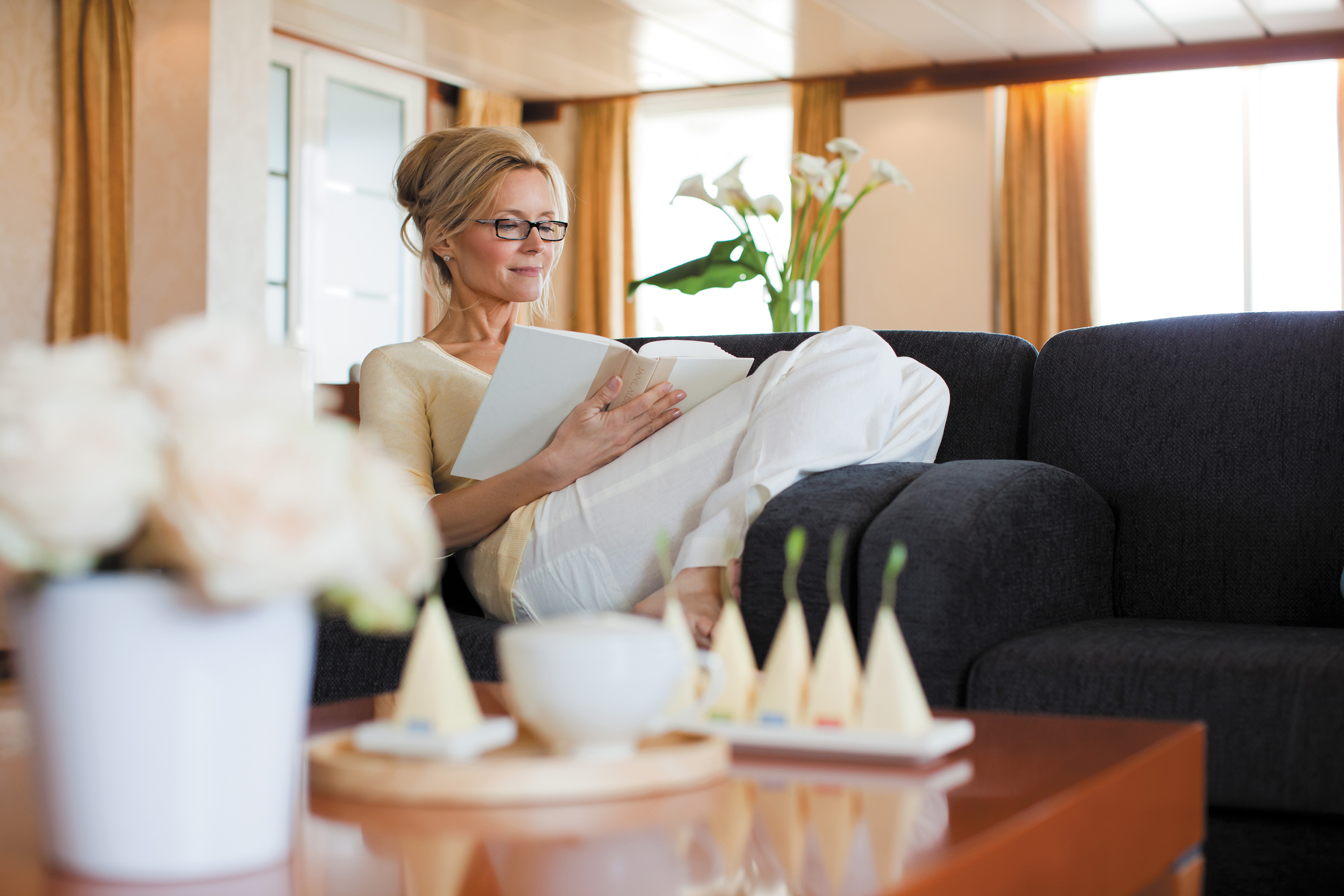
Well-stocked and offering comfort for the body and mind, you'll discover our Library is a most civil setting for reading and relaxing. Curl up with a classic novel or best-selling mystery, play a strategic game of chess or simply soak up the ambience of a sumptuous reading room. Regardless of what brings you here, our library is a welcoming, low-key treasure you just may find hard to leave.
Stars Lounge & Night Club
Encircling a glistening stairwell that leads to the Casino, the Stars Lounge is a throwback nightspot that draws fun-loving crowds for after-dinner drinks and late-night cocktails. A favourite with night owls.
High-backed velvet chairs and a shimmering bar are highlights of this popular spot for after-dinner drinks and late-night cocktails, but it's a glistening stairwell to the upstairs Casino that gives Stars Lounge a certain throwback appeal. A long-time guest favourite, this arty lounge has a circular dance floor that beckons night owls to dance into the wee hours or partake in karaoke competitions.
Horizon Lounge
A alluring destination for informal drinks in an elegant setting. With live music throughout the day and expertly poured cocktails only a request away, the Horizon Lounge is a natural spot to rendezvous with fellow travellers.
The Horizon Lounge is an ideal destination for classic cocktails or to simply relax and engage in conversation with new friends. Resident musicians play familiar tunes throughout the day as well as before and after dinner, making it ideal for informal plans. Game shows, night entertainment and live musical events are featured regularly.
Boutiques
Whether it’s designer evening wear, handbags, fragrances or a smart gift, our boutique items are carefully selected and of the highest quality. The same may be said of our personable staff.
Stop into our boutiques and browse a wide range of items – upscale handbags to exclusive fragrances to fine jewellery – in an intimate and unhurried setting. You’ll also find a variety of clothes, Regent Seven Seas Cruises® logo wear and gift items to share with friends and family. Our boutiques are staffed by friendly salespeople. Opening hours vary and are printed in the Passages daily newsletter.
The Casino
Glass doors lead to an elegant setting bustling with games of chance that include Blackjack, roulette, poker and slot machines. The Casino is open every day at sea when not restricted by territorial border limits.
If you're in the gaming mood, head to our elegantly appointed Casino for a few hands of blackjack or to try your luck at roulette, poker, the craps table or slot machines. Whether you're a player or spectator, the excitement is contagious, the drinks delightful and the staff welcoming. Our stylish Casino is open every day at sea when not restricted by territorial border limits.
Internet Café & Club.com
For those who've chosen to leave their laptops at home, desktop computers are available at our staffed Internet Cafe. Of course, you may access WiFi without charge throughout the entirety of the ship.
It's easy to stay connected, even while sailing the seven seas. Our ships have WiFi throughout for guests with their own laptops, and there are plenty of computers in the staffed Internet Café, which is open round the clock. Printers, e-mails, Internet access and Wireless access throughout the ship are all available for a nominal fee.
Pool Bar
Very few things equate to a pure vacation activity more than sitting at our Pool Bar. Make new friends while sipping a cocktail or frozen drink in the most laid-back atmosphere imaginable.
When you envision an activity you’re only likely to do while on vacation, sipping a frozen drink at a pool bar onboard a glorious cruise ship is probably near the top of the list. You can tick that box at our Pool Bar, where you and new friends can enjoy leisurely conversation over cocktails and frozen drinks in a delightfully relaxed atmosphere.
Card & Conference Room
Gather your favourite teammates in the Card Room for a lively afternoon or evening of cards, board games or a social game of Bridge. The spaces, which may be combined, are also designed to host conferences.
Two complete Card and Conference Rooms can be used for everything from bridge lectures and tournaments to corporate meetings and special events. Gather with a few friends for an afternoon or evening of fun competition with board games, cards and more. Larger groups may increase space by removing the dividing door and combining both rooms.
Pool Deck
For those days when nothing but sitting poolside will do, head to our Pool Deck. You'll be greeted by an expansive space with unforgettable views, teak accents and an amiable crew offering cold drinks and lounge chairs.
Our Pool Deck is one of the most expansive at sea and features a large heated pool, two whirlpools and table tennis. Surrounded by luxurious teak accents, you’ll be consistently awestruck by the pool’s magnificent vistas high upon Seven Seas Mariner®. You’ll also be impressed by our amiable and dedicated crew, who stand at the ready to provide refreshing beverages and comfortable lounge chairs.
Destination Services
Whether you’re interested in a tour from our FREE Unlimited Shore Excursion menu or a unique, small-group Regent Choice Shore Excursion, our staff at Destination Services is ready to assist.
If the road to a richer life is paved with the lessons of new discoveries, our Destination Services is a great place to start. Learn about the adventures available to suit every taste and comfort level during your voyage from our dedicated staff. They can arrange unique shore excursions designed for smaller groups or assist with tailor-made pre-and post-cruise programs, from a simple stay in a luxurious hotel to a 3-night extension in a remote locale.
Reception & Concierge
Our knowledgeable Reception staff is available around the clock to answer your questions and ensure your pleasure with your Seven Seas Mariner® voyage. Reception is also where you may contact the ship’s Concierge.
Our welcoming Reception Desk is open 24 hours a day and staffed by personable, knowledgeable men and women who are happy to answer your questions and provide any general assistance you may need. Reception is also where you may contact the ship’s Concierge. Postcards and letters may be dropped off here as well; they’ll be delivered to the postal service at the next port of call.
GENERAL MANAGER
While cruise-related issues are first submitted to Reception/Concierge, you can be assured that a General Manager is on hand to resolve issues to your satisfaction.