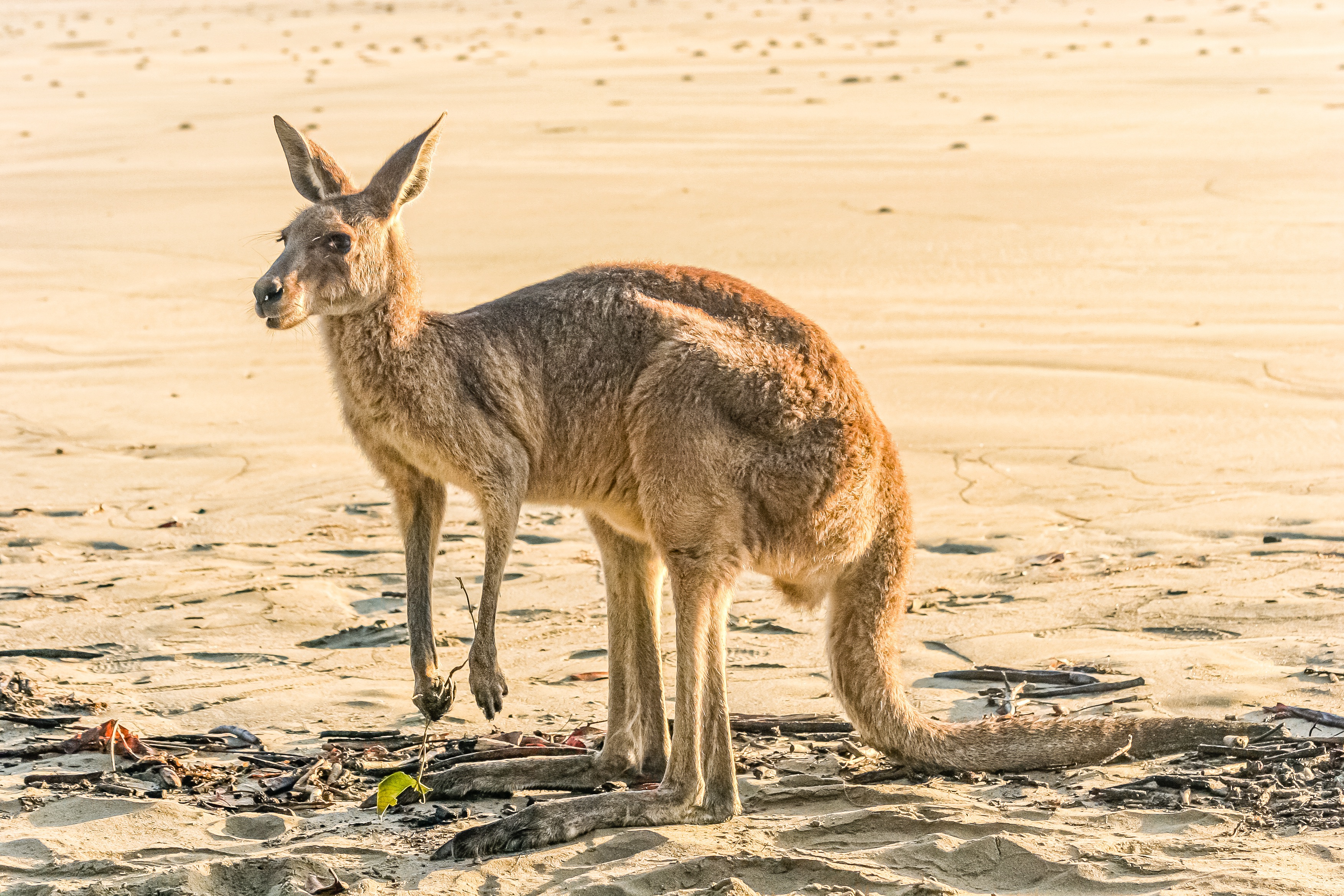
Down Under Australia
Down Under Australia
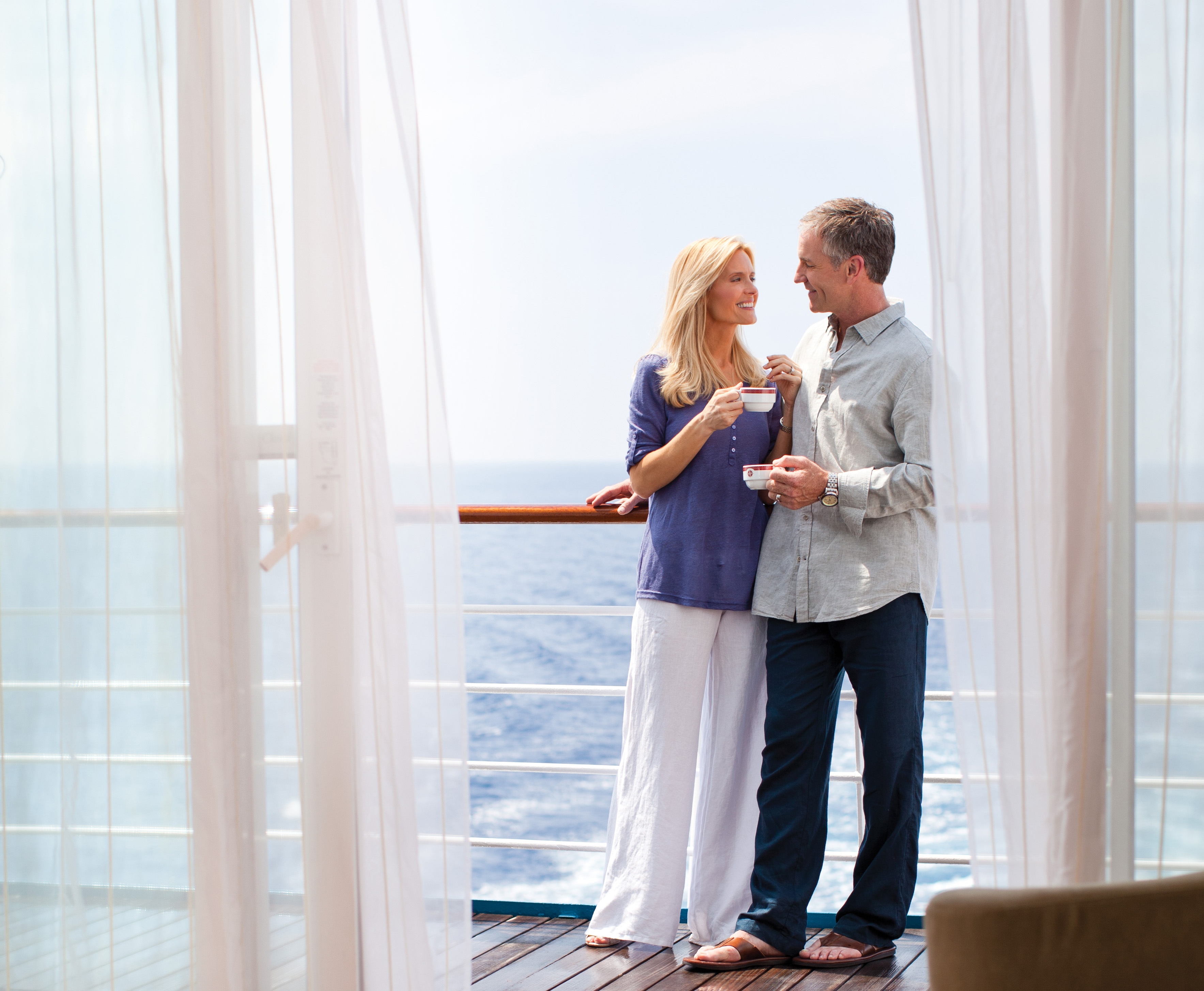
Cruise overview
WHY BOOK WITH US?
- ✔ The Deluxe Cruises’ team has extensive experience in ultra-luxury cruising.
- ✔ Call now to speak to our helpful and experienced Cruise Concierge team.
- ✔ Enjoy our Unique Deluxe Cruises Bonus for substantial savings.
- ✔ Our team will tailor your holiday to your exacting requirements.
- ✔ As agents, we work under the protection of each cruise lines ABTA / ATOL licences
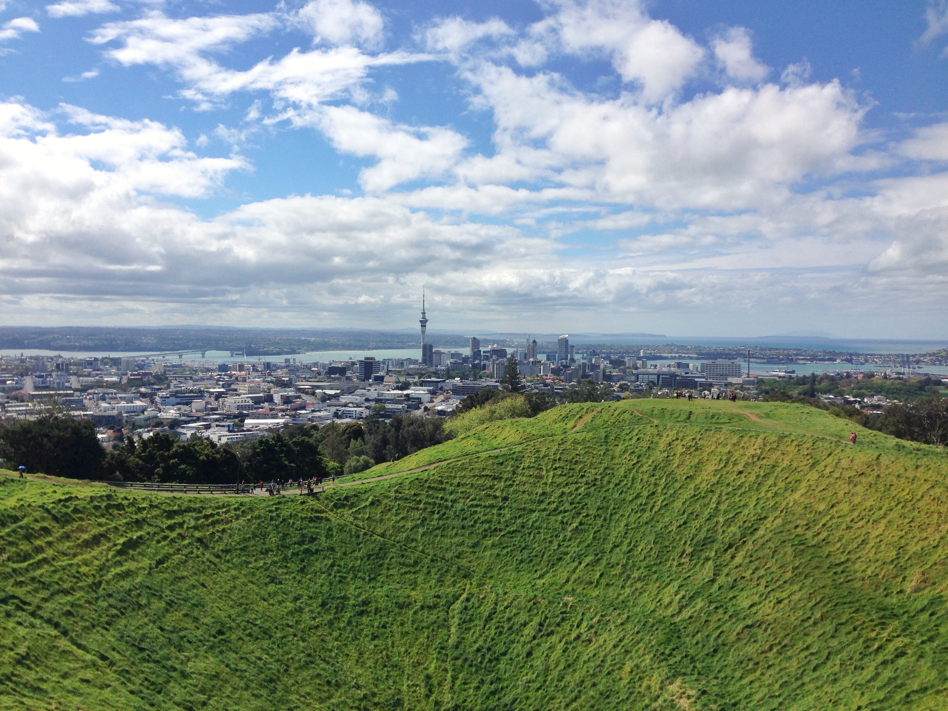
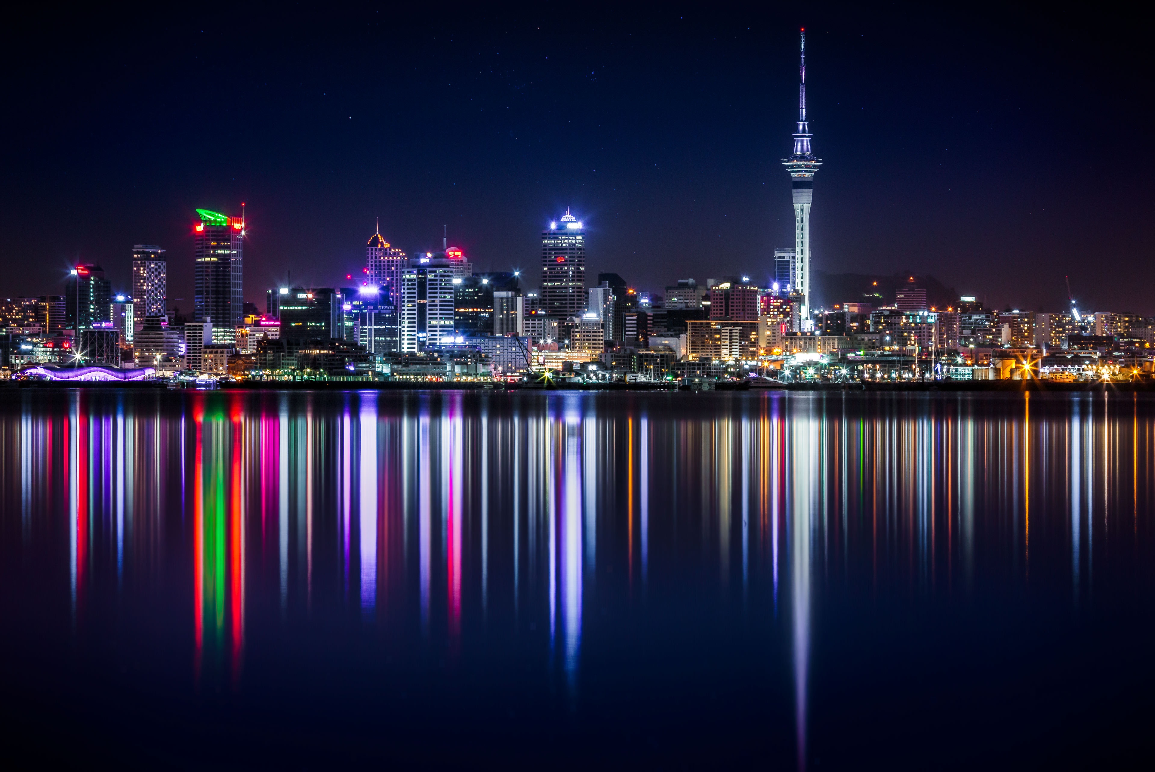
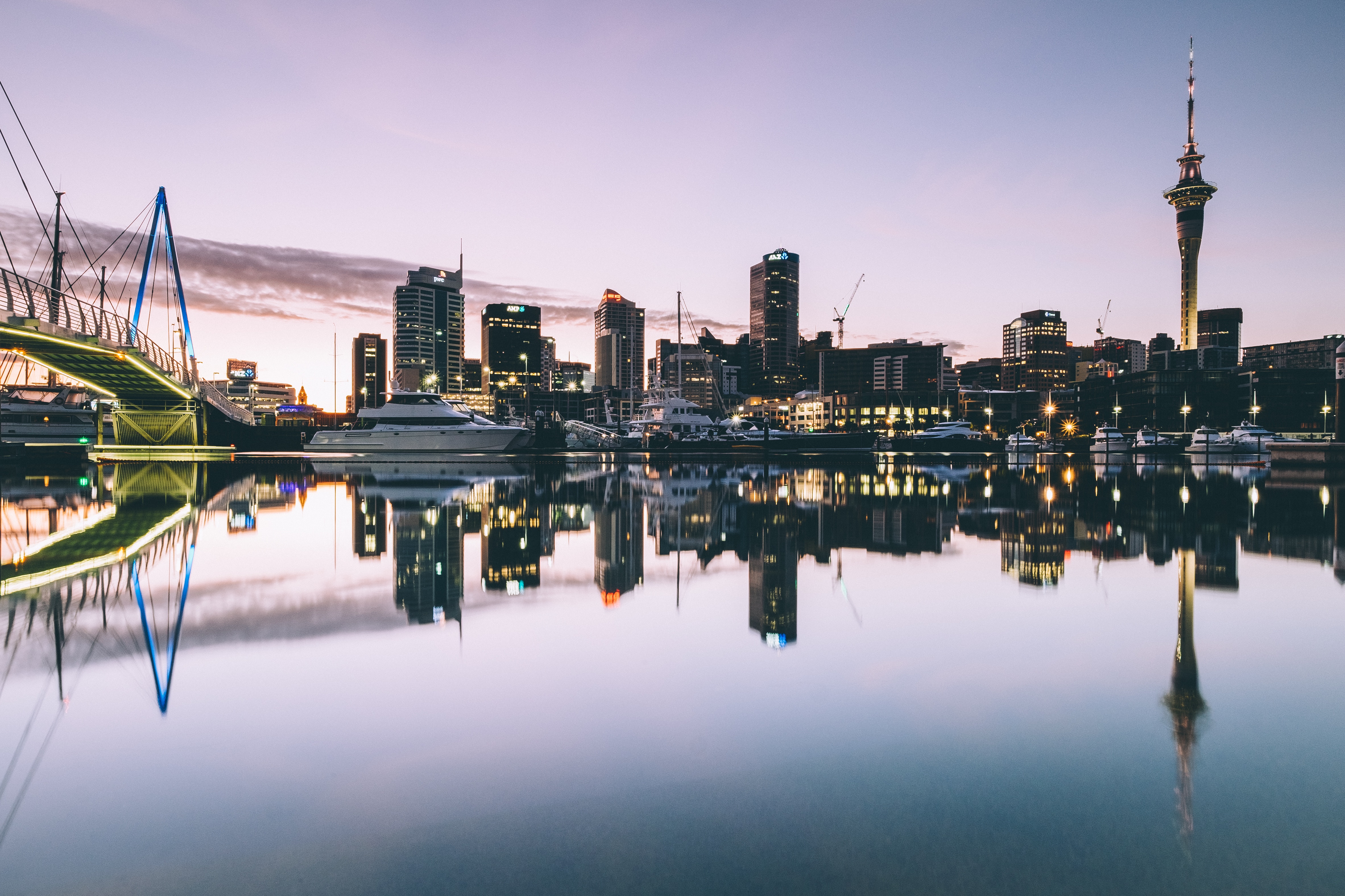
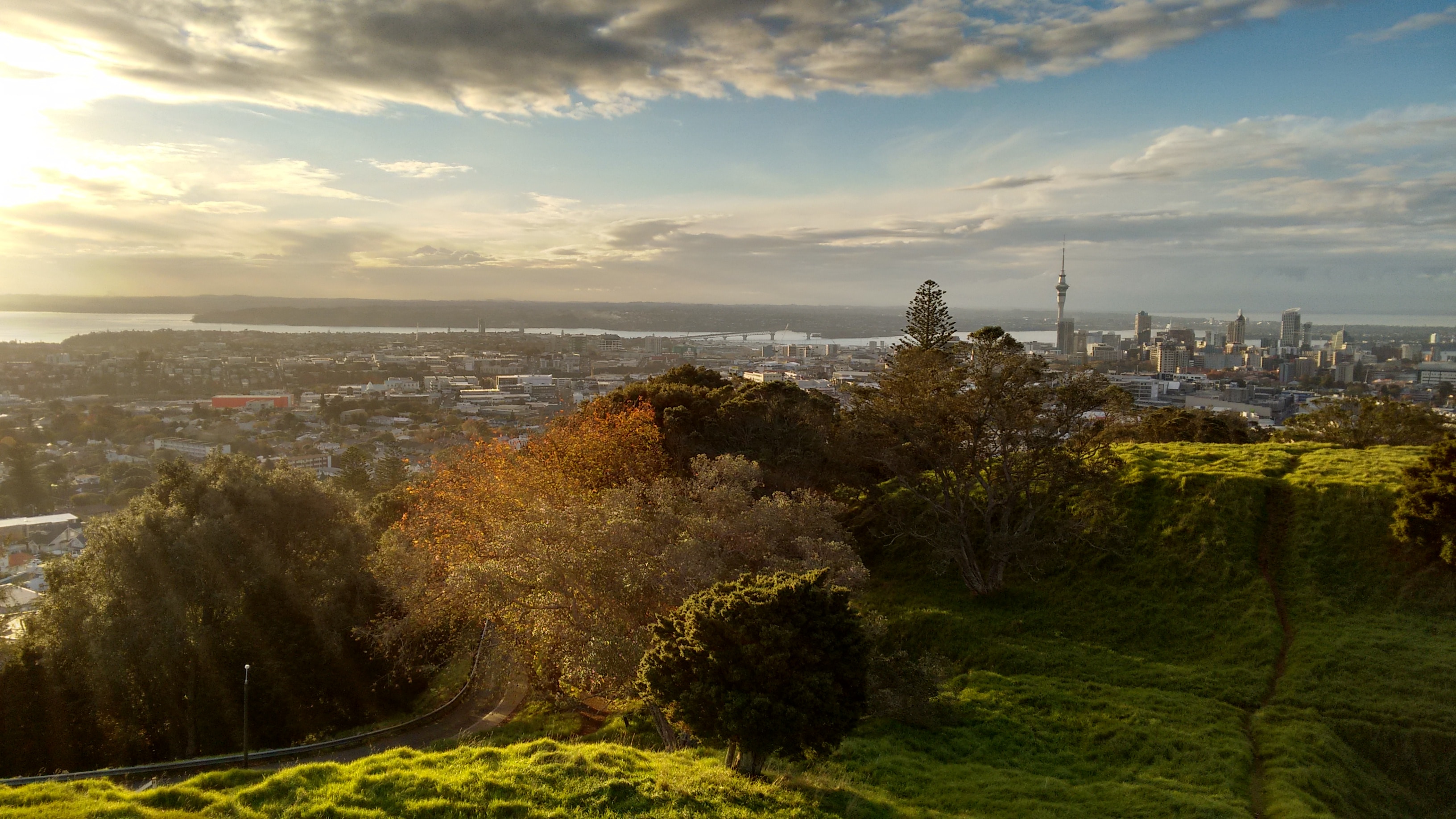
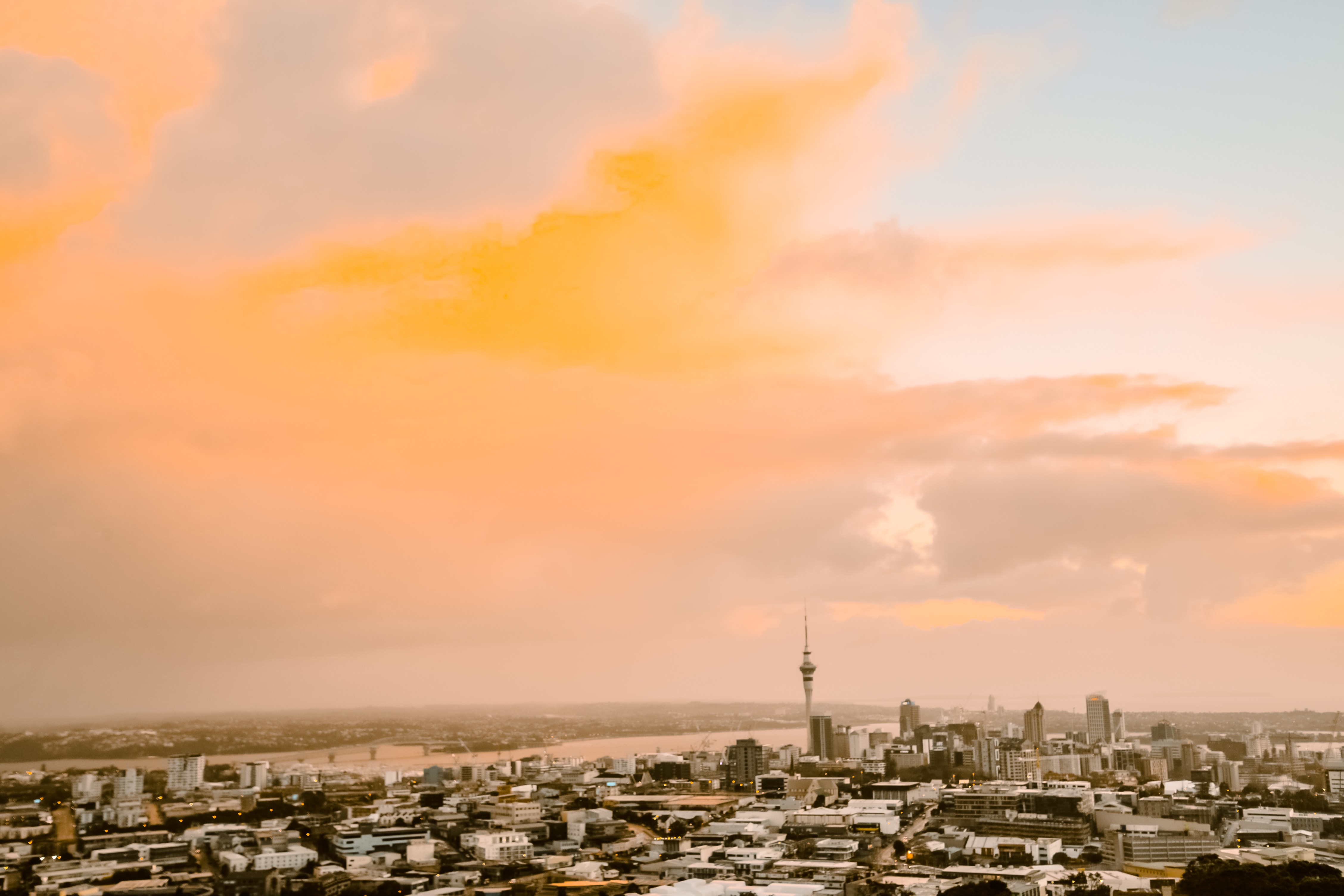
About Auckland
Auckland is called the City of Sails, and visitors flying in will see why. On the East Coast is the Waitemata Harbour—a Māori word meaning sparkling waters—which is bordered by the Hauraki Gulf, an aquatic playground peppered with small islands where many Aucklanders can be found "mucking around in boats."Not surprisingly, Auckland has some 70,000 boats. About one in four households in Auckland has a seacraft of some kind, and there are 102 beaches within an hour's drive; during the week many are quite empty. Even the airport is by the water; it borders the Manukau Harbour, which also takes its name from the Māori language and means solitary bird.According to Māori tradition, the Auckland isthmus was originally peopled by a race of giants and fairy folk. When Europeans arrived in the early 19th century, however, the Ngāti-Whātua tribe was firmly in control of the region. The British began negotiations with the Ngāti-Whātua in 1840 to purchase the isthmus and establish the colony's first capital. In September of that year the British flag was hoisted to mark the township's foundation, and Auckland remained the capital until 1865, when the seat of government was moved to Wellington. Aucklanders expected to suffer from the shift; it hurt their pride but not their pockets. As the terminal for the South Sea shipping routes, Auckland was already an established commercial center. Since then the urban sprawl has made this city of approximately 1.3 million people one of the world's largest geographically.A couple of days in the city will reveal just how developed and sophisticated Auckland is—the Mercer City Survey 2012 saw it ranked as the third-highest city for quality of life—though those seeking a New York in the South Pacific will be disappointed. Auckland is more get-up and go-outside than get-dressed-up and go-out. That said, most shops are open daily, central bars and a few nightclubs buzz well into the wee hours, especially Thursday through Saturday, and a mix of Māori, Pacific people, Asians, and Europeans contributes to the cultural milieu. Auckland has the world's largest single population of Pacific Islanders living outside their home countries, though many of them live outside the central parts of the city and in Manukau to the south. The Samoan language is the second most spoken in New Zealand. Most Pacific people came to New Zealand seeking a better life. When the plentiful, low-skilled work that attracted them dried up, the dream soured, and the population has suffered with poor health and education. Luckily, policies are now addressing that, and change is slowly coming. The Pacifica Festival in March is the region's biggest cultural event, attracting thousands to Western Springs. The annual Pacific Island Secondary Schools’ Competition, also in March, sees young Pacific Islander and Asian students compete in traditional dance, drumming, and singing. This event is open to the public.At the geographical center of Auckland city is the 1,082-foot Sky Tower, a convenient landmark for those exploring on foot and some say a visible sign of the city's naked aspiration. It has earned nicknames like the Needle and the Big Penis—a counterpoint to a poem by acclaimed New Zealand poet James K. Baxter, which refers to Rangitoto Island as a clitoris in the harbor.The Waitemata Harbour has become better known since New Zealand staged its first defense of the America's Cup in 2000 and the successful Louis Vuitton Pacific Series in early 2009. The first regatta saw major redevelopment of the waterfront. The area, where many of the city's most popular bars, cafés, and restaurants are located, is now known as Viaduct Basin or, more commonly, the Viaduct. A recent expansion has created another area, Wynyard Quarter, which is slowly adding restaurants.These days, Auckland is still considered too bold and brash for its own good by many Kiwis who live "south of the Bombay Hills," the geographical divide between Auckland and the rest of New Zealand (barring Northland). "Jafa," an acronym for "just another f—ing Aucklander," has entered the local lexicon; there's even a book out called Way of the Jafa: A Guide to Surviving Auckland and Aucklanders. A common complaint is that Auckland absorbs the wealth from the hard work of the rest of the country. Most Aucklanders, on the other hand, still try to shrug and see it as the parochial envy of those who live in small towns. But these internal identity squabbles aren't your problem. You can enjoy a well-made coffee in almost any café, or take a walk on a beach—knowing that within 30 minutes' driving time you could be cruising the spectacular harbor, playing a round at a public golf course, or even walking in subtropical forest while listening to the song of a native tûî bird.
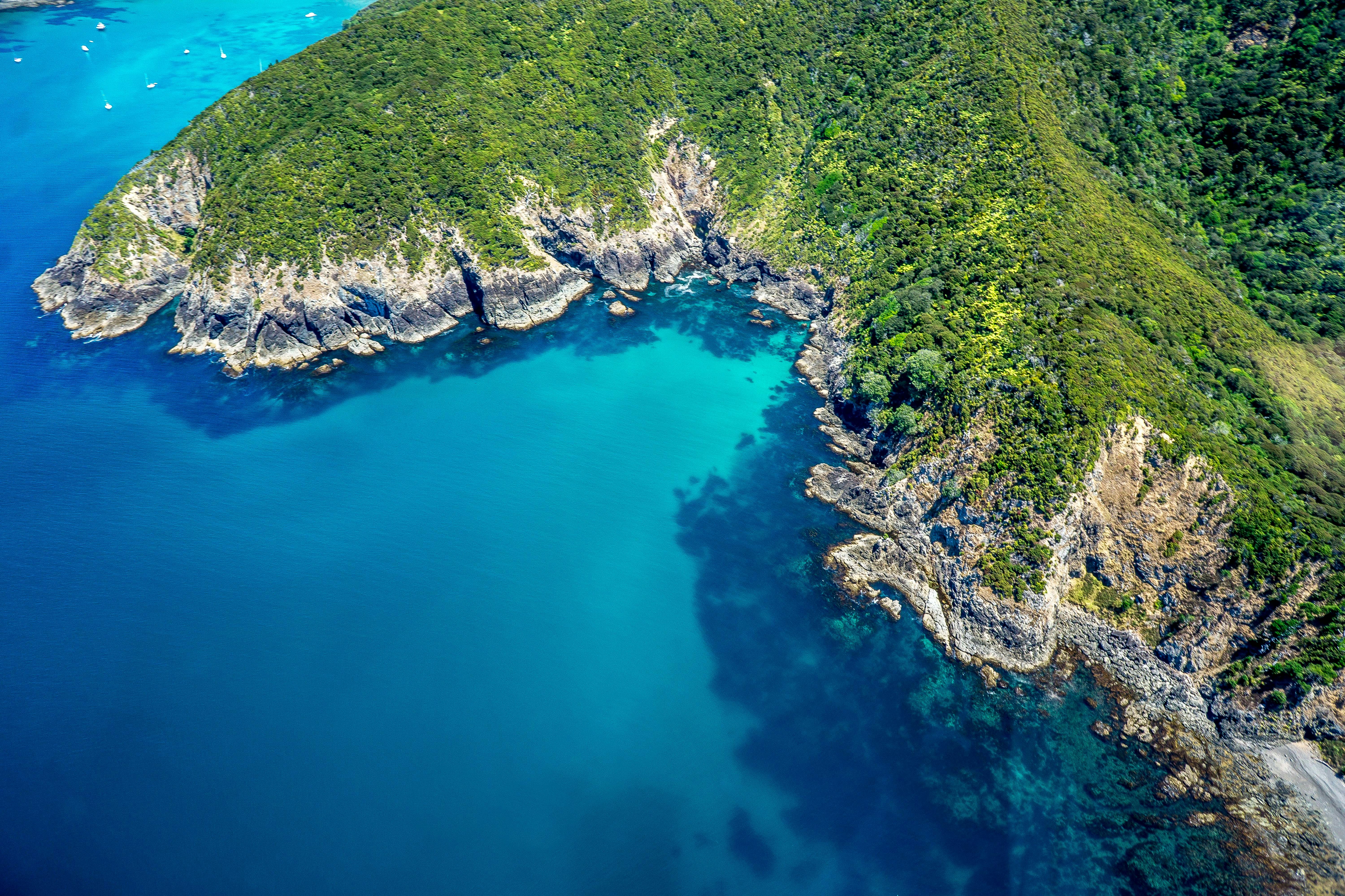
About Bay of Islands
The Tasman Sea on the west and the Pacific Ocean on the east meet at thetop of North Island at Cape Reinga. No matter what route you take, you'll passfarms and forests, marvellous beaches, and great open spaces. The East Coast,up to the Bay of Islands, is Northland's most densely populated, often withrefugees from bigger cities—looking for a more relaxed life—clustered aroundbreathtaking beaches. The first decision on the drive north comes at the footof the Brynderwyn Hills. Turning left will take you up the West Coast throughareas once covered with forests and now used for either agricultural orhorticulture. Driving over "the Brynderwyns," as they are known,takes you to Whangarei, the only city in Northland. If you're in the mood for adiversion, you can slip to the beautiful coastline and take in Waipu Cove, anarea settled by Scots, and Laings Beach, where million-dollar homes sit next tosmall Kiwi beach houses.An hour's drive farther north is the Bay of Islands, known all over theworld for its beauty. There you will find lush forests, splendid beaches, andshimmering harbors. The Treaty of Waitangi was signed here in 1840 betweenMāoriand the British Crown, establishing the basis for the modern New Zealandstate. Every year on February 6, the extremely beautiful Waitangi Treaty Ground(the name means weeping waters) is the sight of a celebration of the treaty andprotests by Māori unhappy with it. Continuing north on the East Coast, theagricultural backbone of the region is even more evident and a series ofwinding loop roads off the main highway will take you to beaches that are bothbeautiful and isolated where you can swim, dive, picnic, or just laze. .The West Coast is even less populated, and the coastline is rugged andwindswept. In the Waipoua Forest, you will find some of New Zealand's oldestand largest kauri trees; the winding road will also take you past mangroveswamps. Crowning the region is the spiritually significant Cape Reinga, theheadland at the top of the vast stretch of 90 Mile Beach, where it's believedMāori souls depart after death. Today Māori make up roughly a quarter of thearea's population (compared with the national average of about 15%). The legendaryMāori navigator Kupe was said to have landed on the shores of Hokianga Harbour,where the first arrivals made their home. Many different wi (tribes) livedthroughout Northland, including Ngapuhi (the largest), Te Roroa, Ngati Wai,Ngati Kuri, Te Aupouri, Ngaitakoto, Ngati Kahu, and Te Rarawa. Many Māoriherecan trace their ancestry to the earliest inhabitants
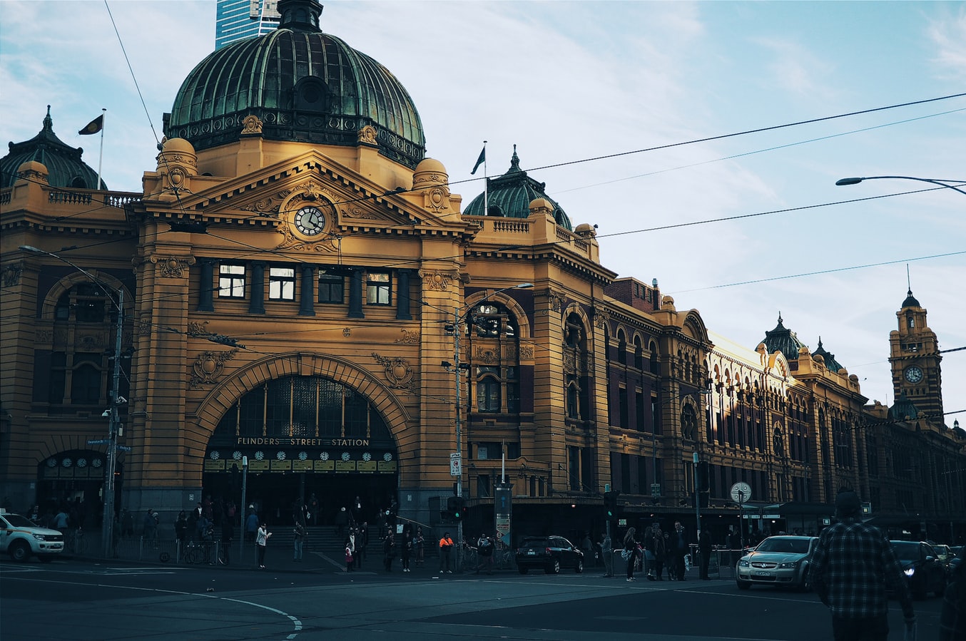
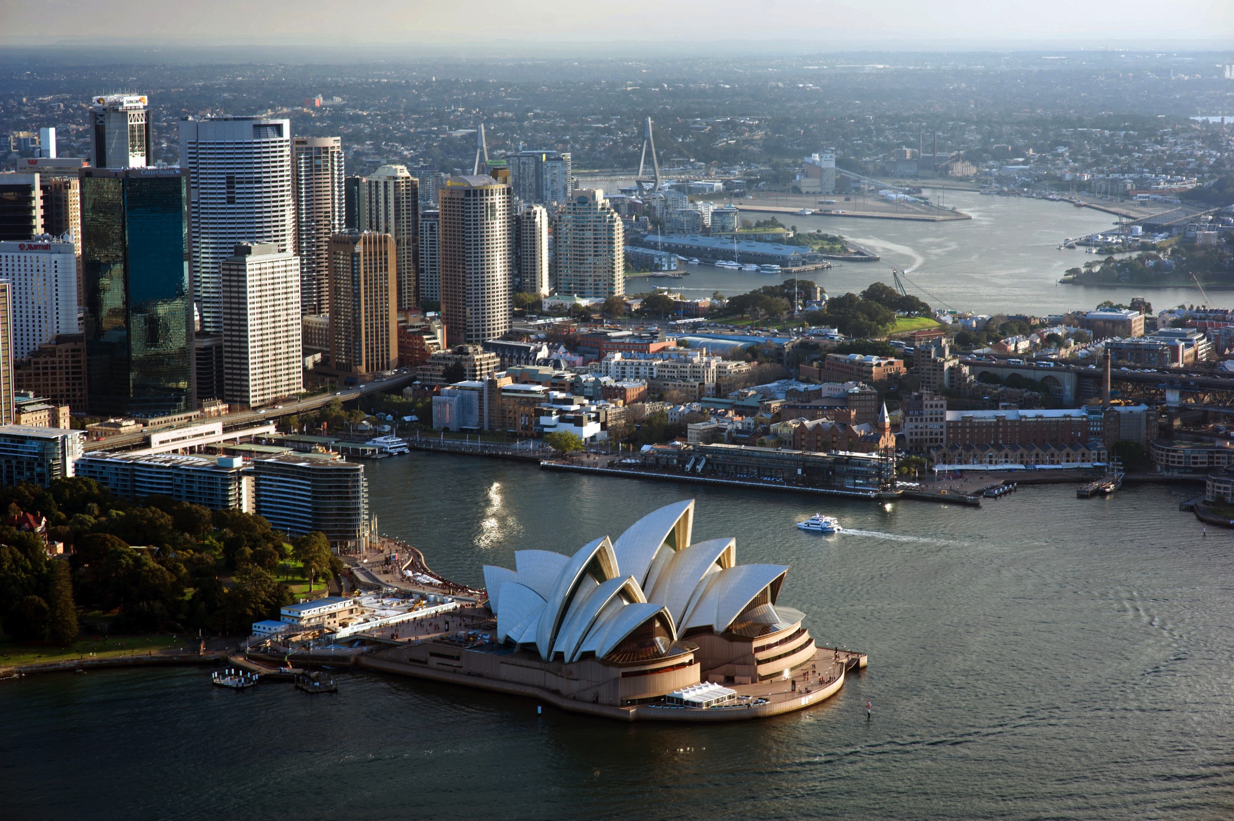
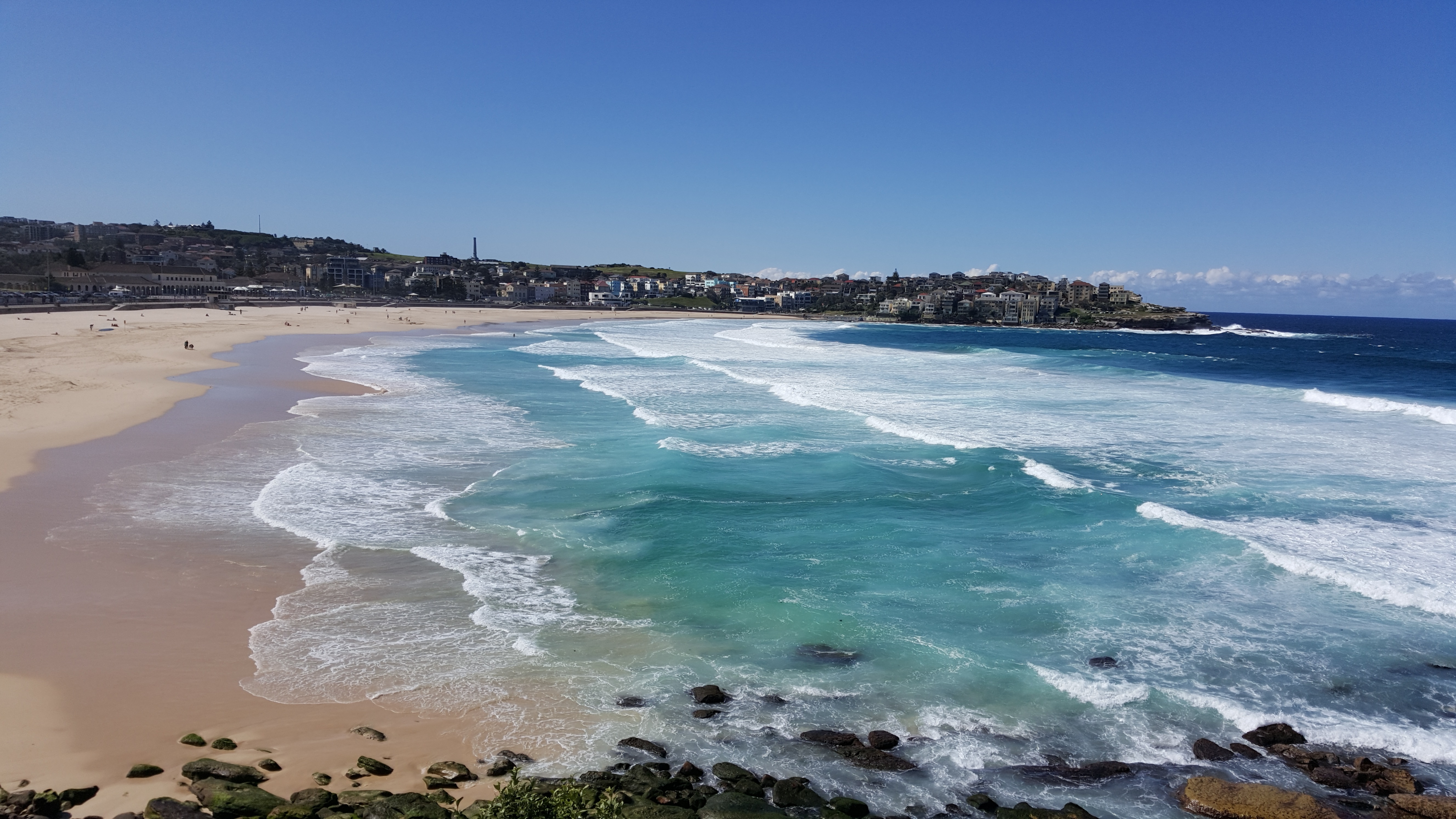
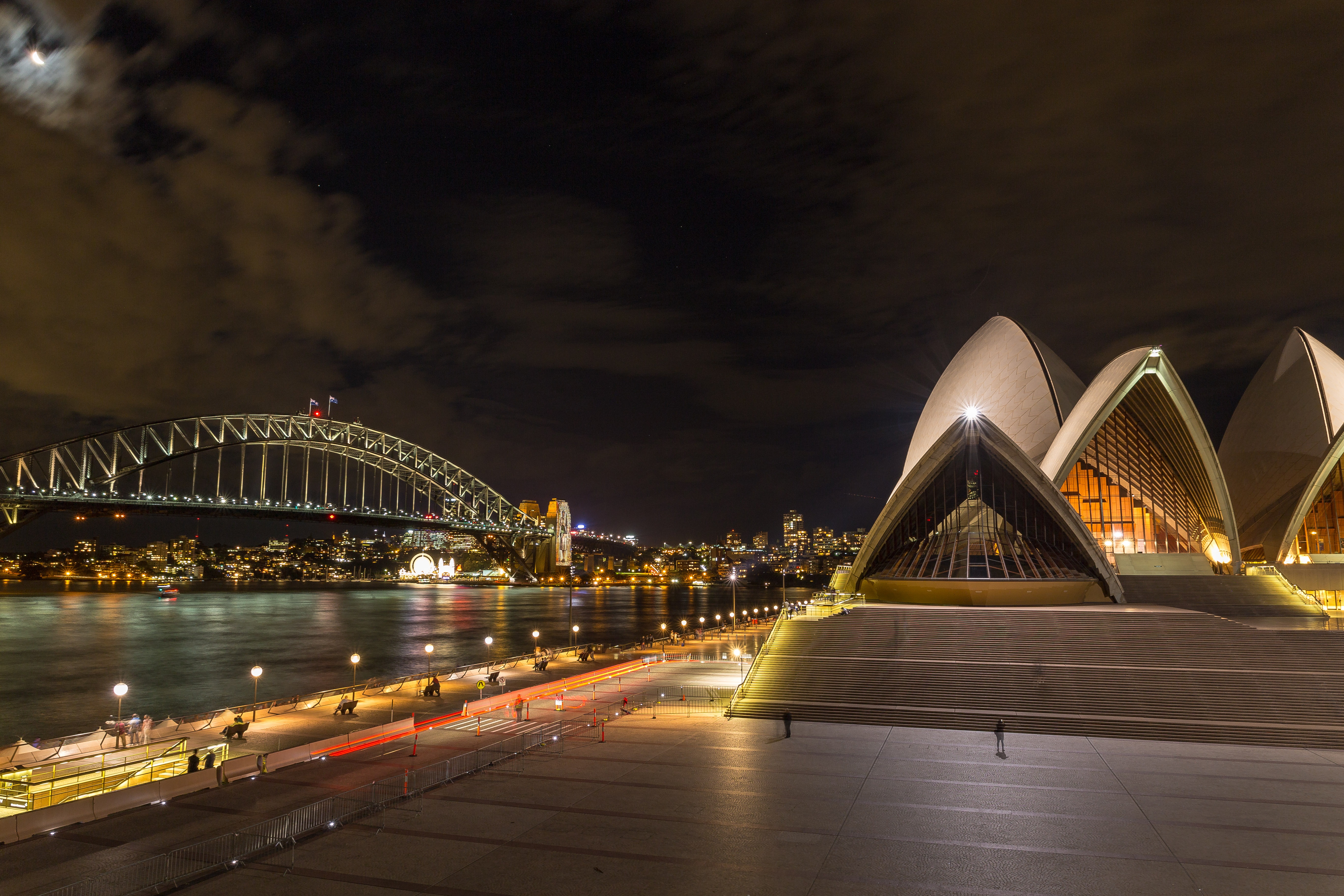
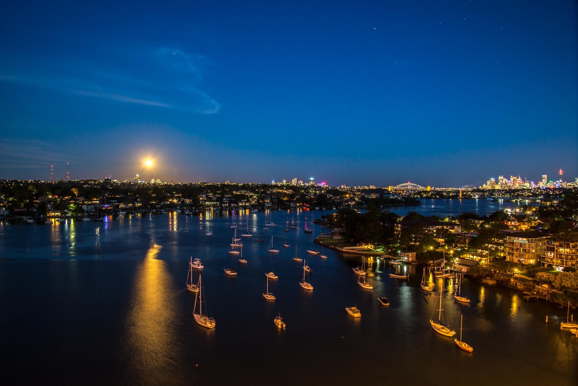
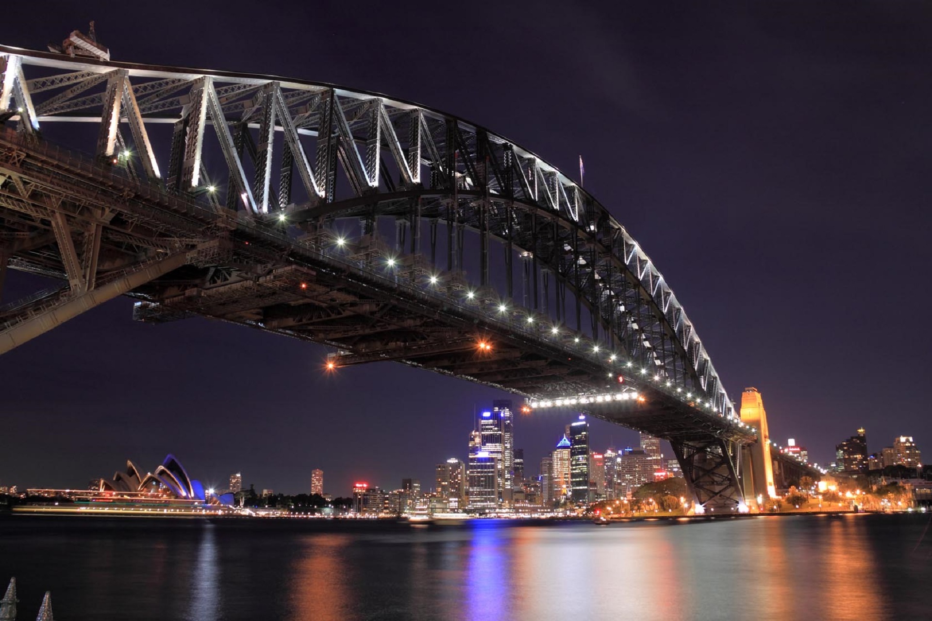
About Sydney, New South Wales
Sydney belongs to the exclusive club of cities that generate excitement. At the end of a marathon flight there's renewed vitality in the cabin as the plane circles the city, where thousands of yachts are suspended on the dark water and the sails of the Opera House glisten in the distance. Blessed with dazzling beaches and a sunny climate, Sydney is among the most beautiful cities on the planet.With 4.6 million people, Sydney is the biggest and most cosmopolitan city in Australia. A wave of immigration from the 1950s has seen the Anglo-Irish immigrants who made up the city's original population joined by Italians, Greeks, Turks, Lebanese, Chinese, Vietnamese, Thais, and Indonesians. This intermingling has created a cultural vibrancy and energy—and a culinary repertoire—that was missing only a generation ago.Sydneysiders embrace their harbor with a passion. Indented with numerous bays and beaches, Sydney Harbour is the presiding icon for the city, and urban Australia. Captain Arthur Phillip, commander of the 11-ship First Fleet, wrote in his diary when he first set eyes on the harbor on January 26, 1788: "We had the satisfaction of finding the finest harbor in the world."Although a visit to Sydney is an essential part of an Australian experience, the city is no more representative of Australia than Los Angeles is of the United States. Sydney has joined the ranks of the great cities whose characters are essentially international. What Sydney offers is style, sophistication, and great looks—an exhilarating prelude to the continent at its back door.
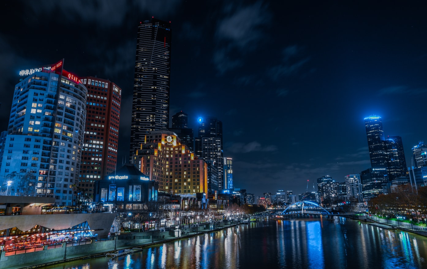
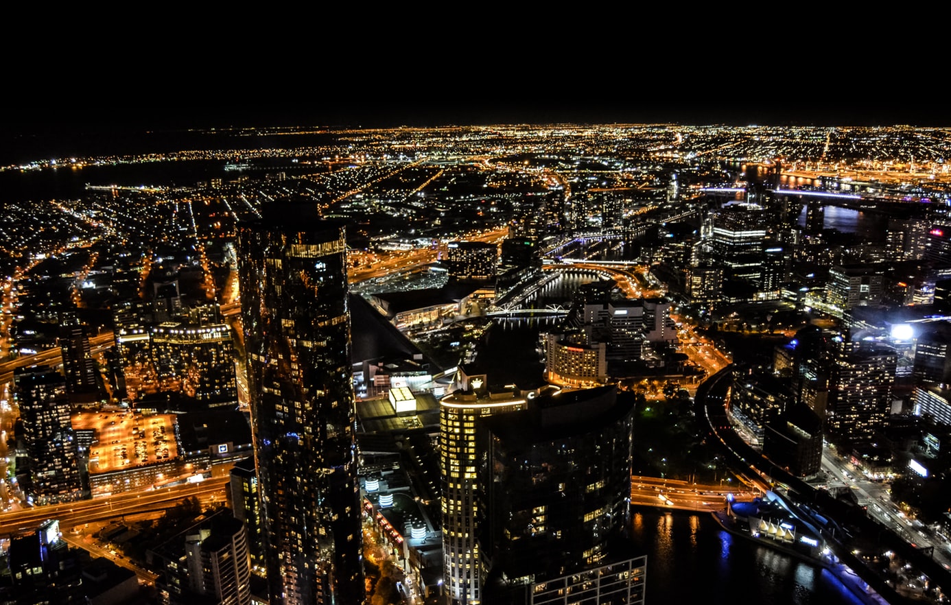
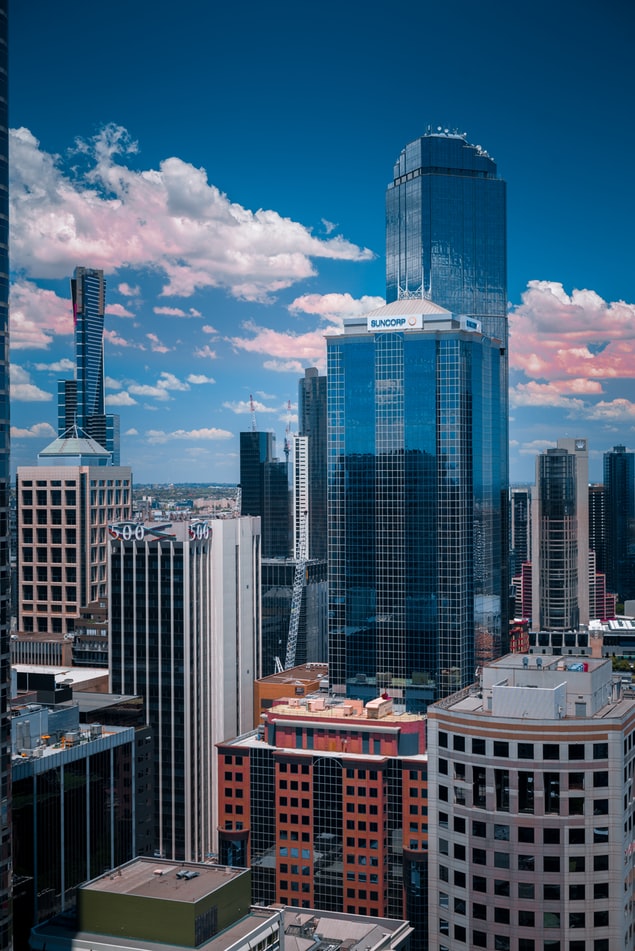
About Melbourne, Victoria
Consistently rated among the "world's most livable cities" in quality-of-life surveys, Melbourne is built on a coastal plain at the top of the giant horseshoe of Port Phillip Bay. The city center is an orderly grid of streets where the state parliament, banks, multinational corporations, and splendid Victorian buildings that sprang up in the wake of the gold rush now stand. This is Melbourne's heart, which you can explore at a leisurely pace in a couple of days.In Southbank, one of the newer precincts south of the city center, the Southgate development of bars, restaurants, and shops has refocused Melbourne's vision on the Yarra River. Once a blighted stretch of factories and run-down warehouses, the southern bank of the river is now a vibrant, exciting part of the city, and the river itself is finally taking its rightful place in Melbourne's psyche.Just a hop away, Federation Square—with its host of galleries—has become a civic landmark for Melburnians. Stroll along the Esplanade in the suburb of St. Kilda, amble past the elegant houses of East Melbourne, enjoy the shops and cafés in Fitzroy or Carlton, rub shoulders with locals at the Victoria Market, nip into the Windsor for afternoon tea, or rent a canoe at Studley Park to paddle along one of the prettiest stretches of the Yarra—and you may discover Melbourne's soul as well as its heart.
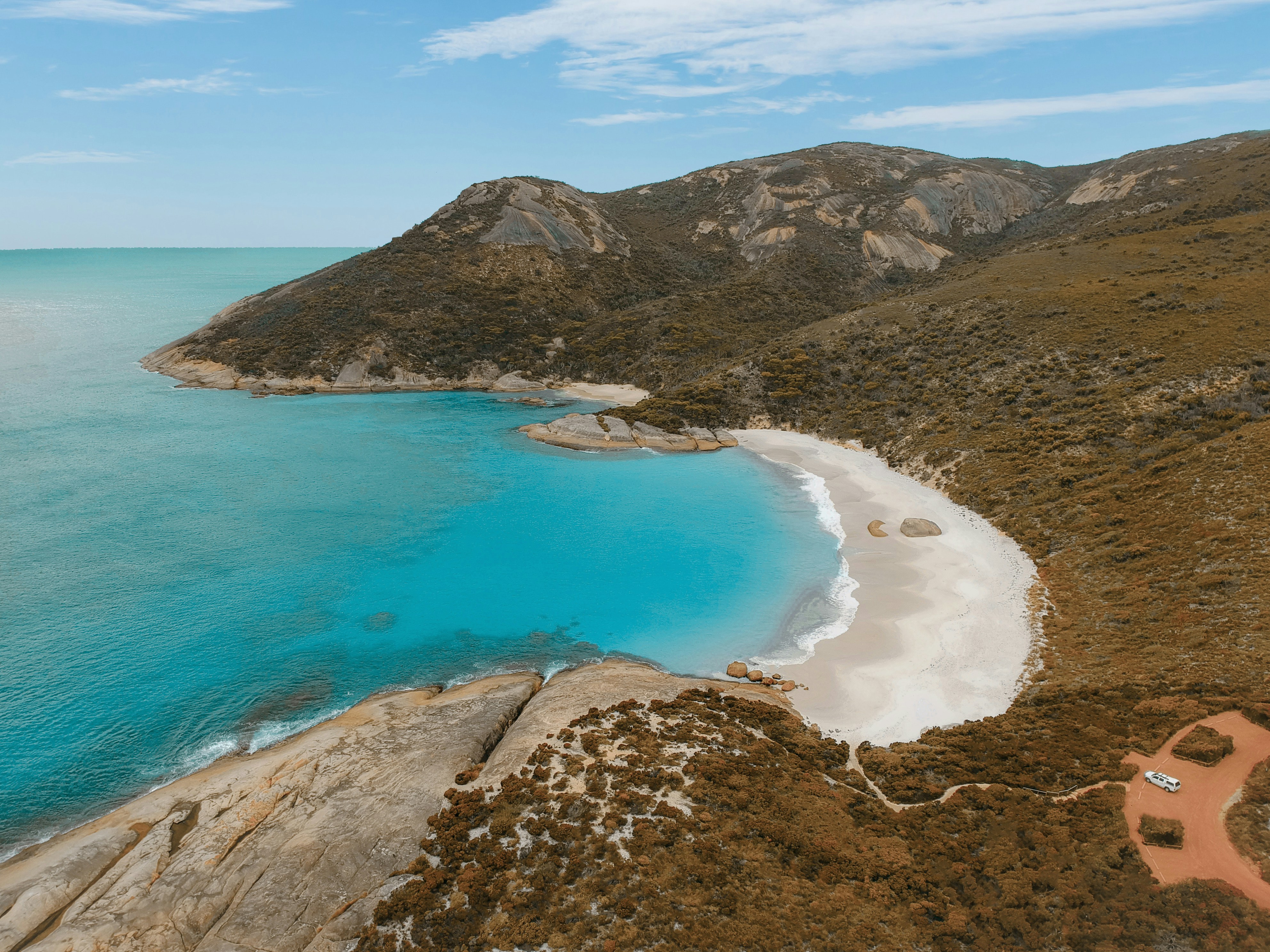
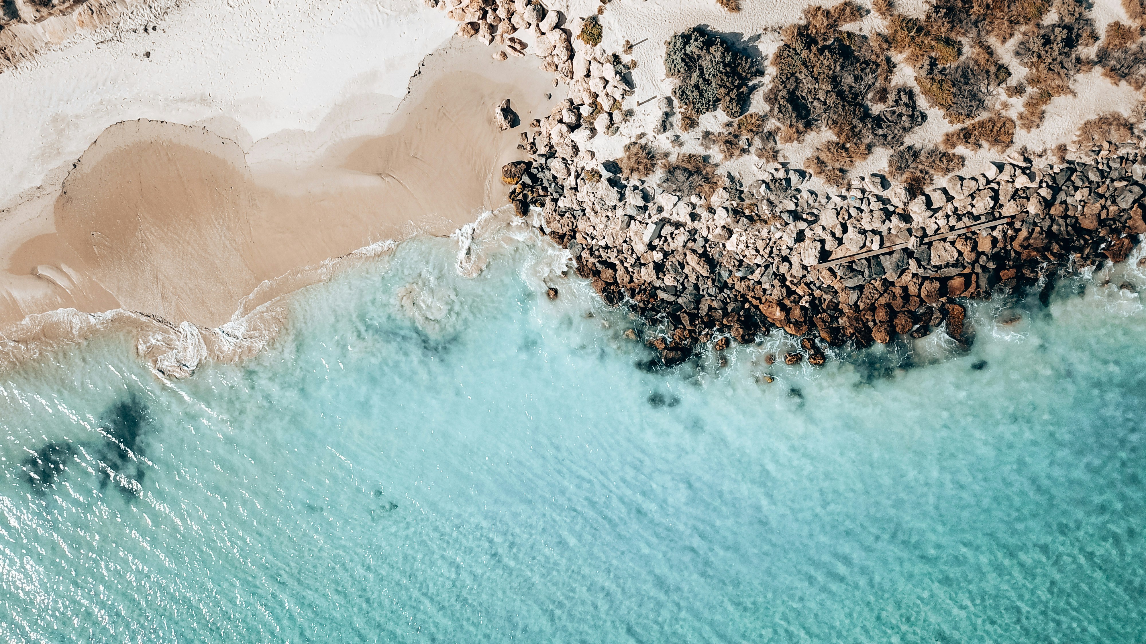
About Esperance, Western Australia
About Albany, Western Australia
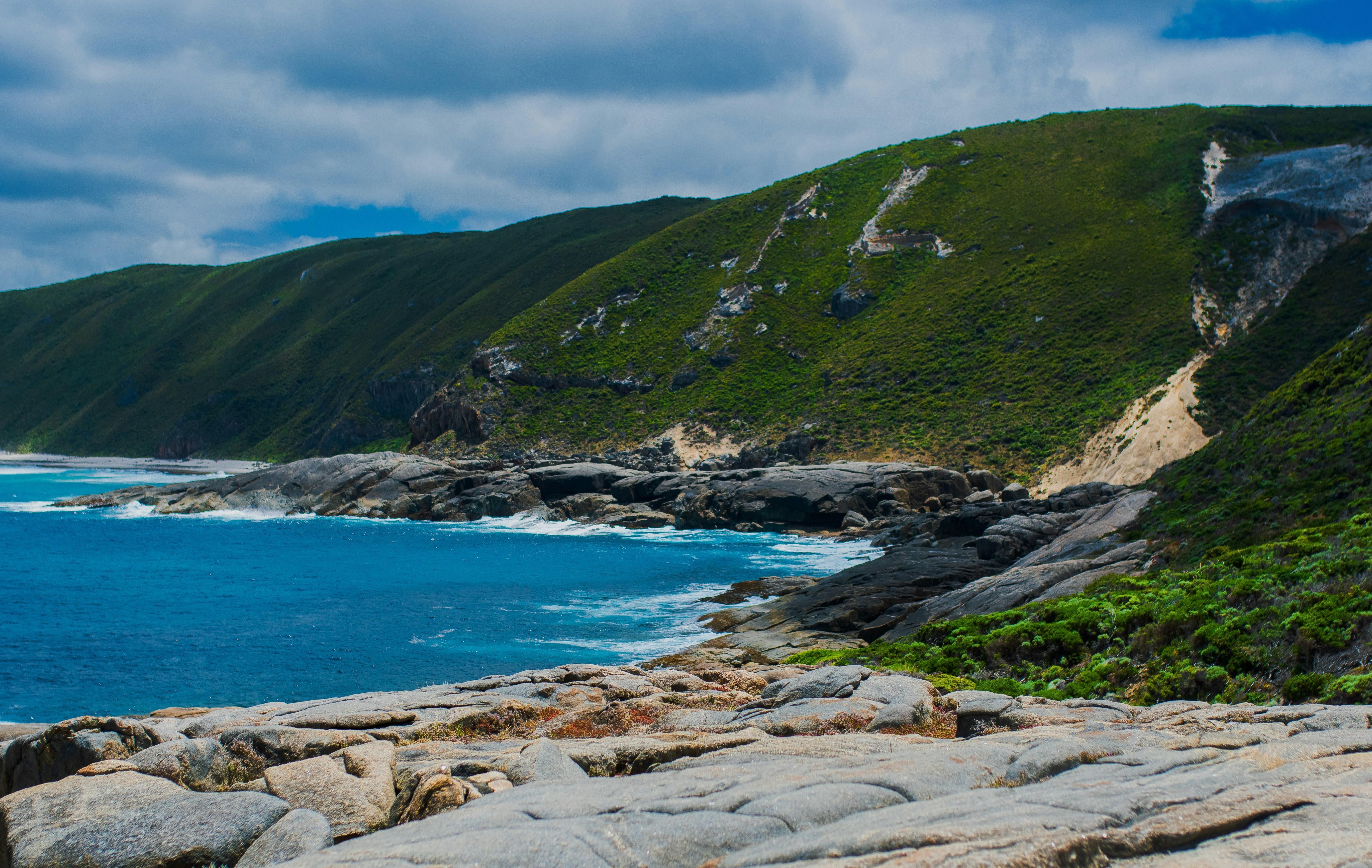
Proclaimed a city on July 1, 1998, Albany with a population of 28,000 is rapidly expanding. It is the commercial center of Western Australia's southern region and the oldest settlement in the state, established in 1826. Boasting an excellent harbor on King George Sound led to Albany becoming a thriving whaling port. Later, when steam ships started traveling between England and Australia, Albany was an important coaling station and served as a penal and a military outpost. The coastline offers some of Australia's most rugged and spectacular scenery. At certain times of the year, whales can be spotted off the coast. Among the city's attractions are some fine old colonial buildings that reflect Albany's Victorian heritage. Various lookout points offer stunning vistas.
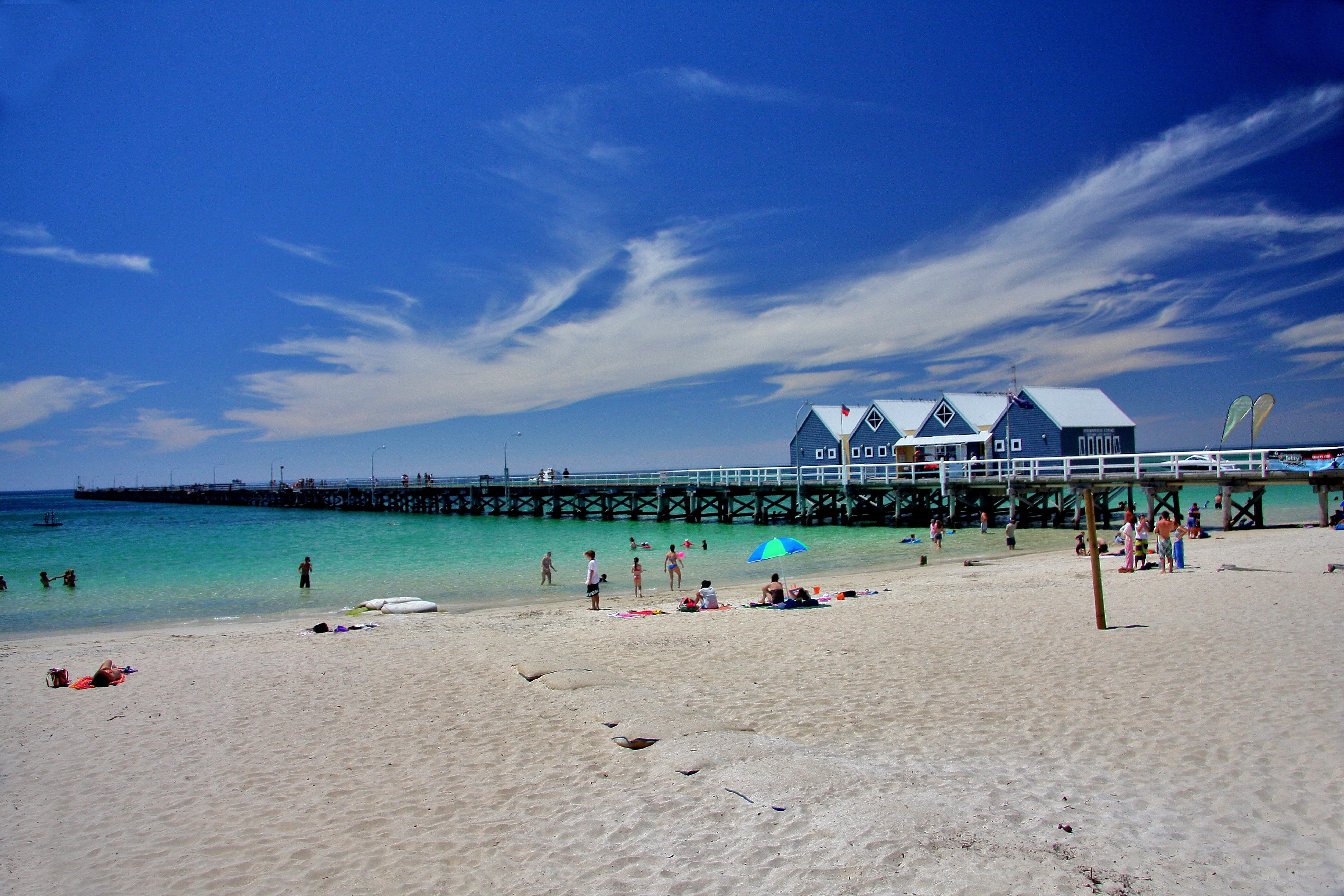
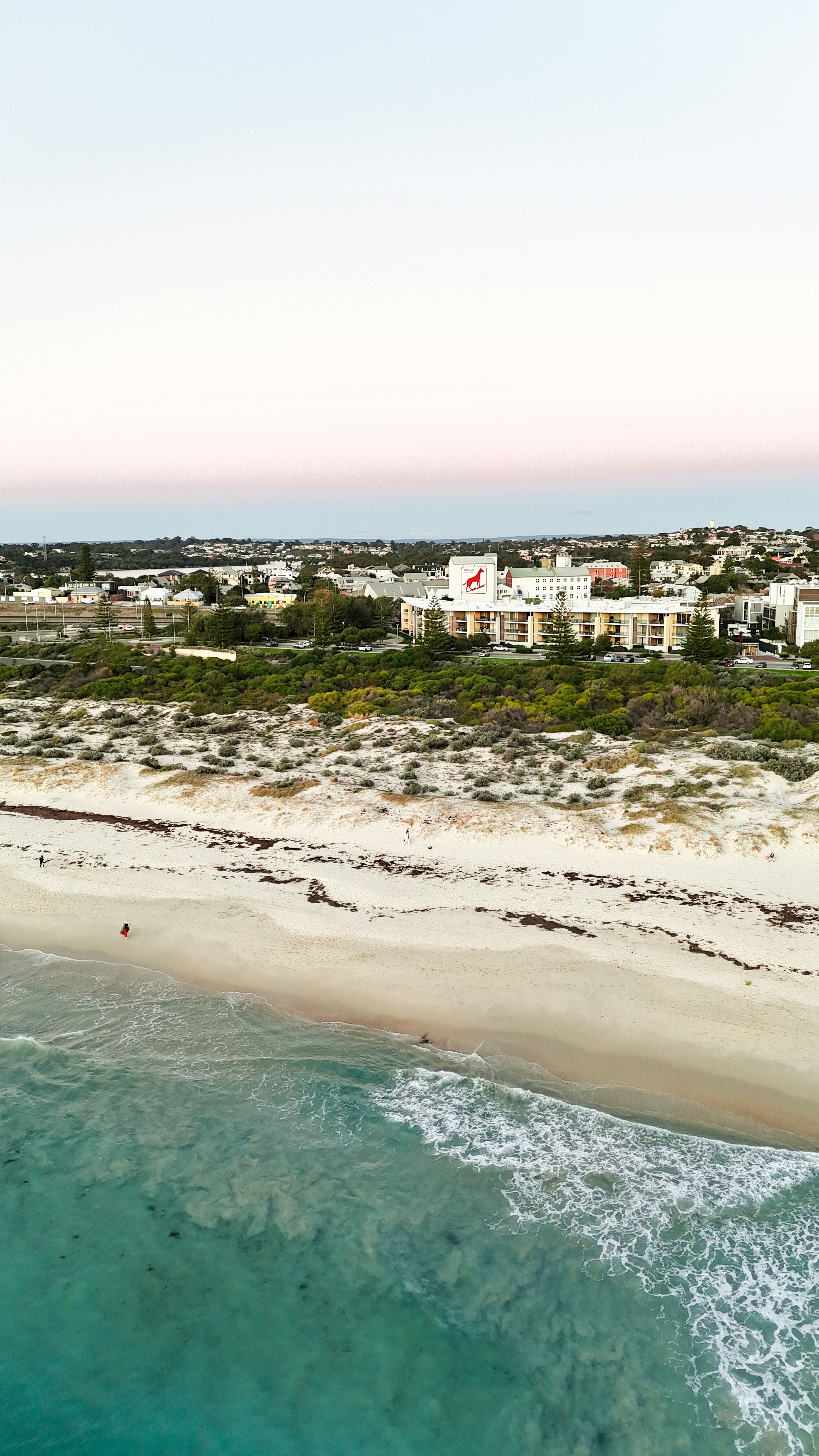
About Busselton, Western Australia
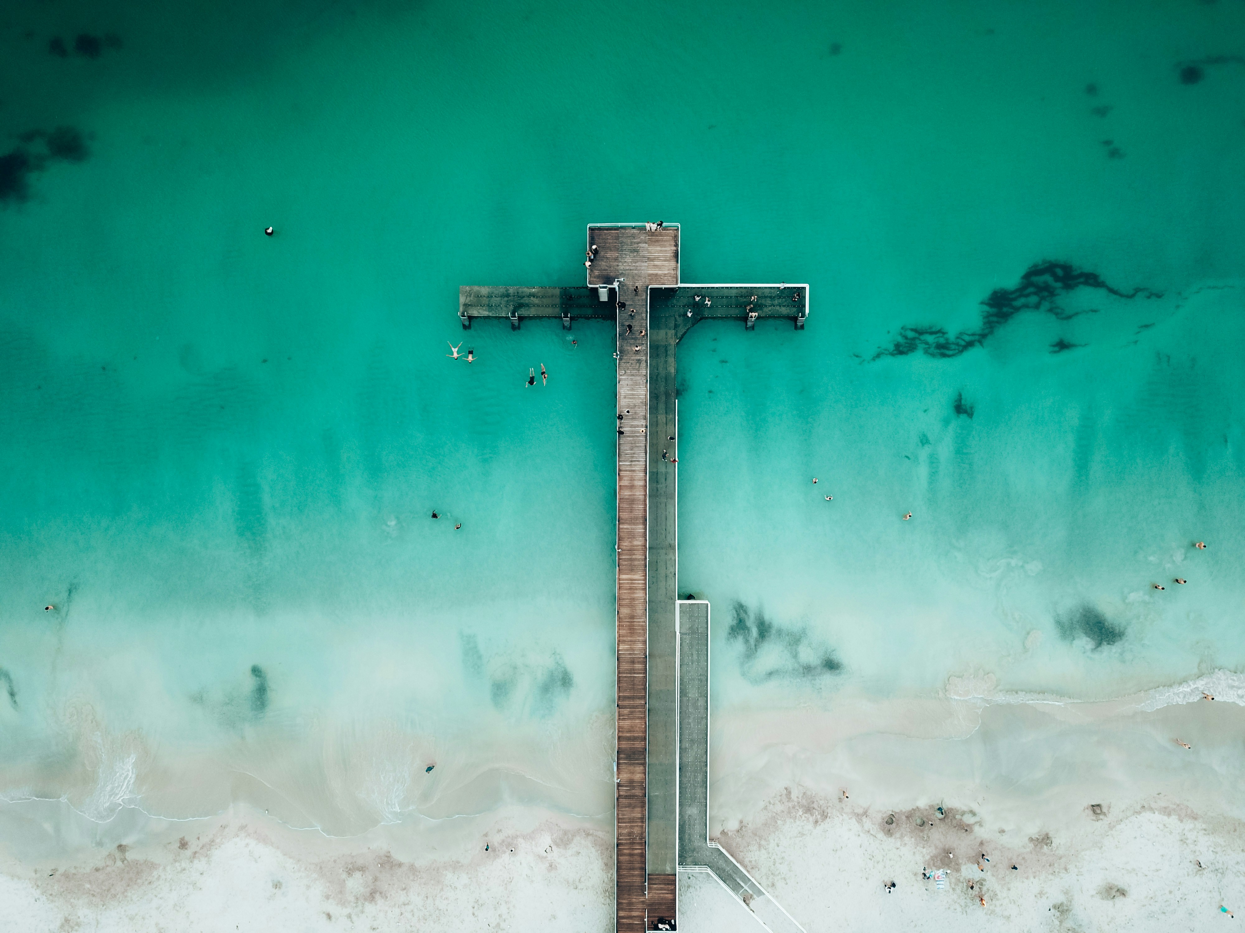
About Fremantle, Western Australia
The port city of Fremantle is a jewel in Western Australia's crown, largely because of its colonial architectural heritage and hippy vibe. Freo (as the locals call it) is a city of largely friendly, interesting, and sometimes eccentric residents supportive of busking, street art, and alfresco dining. Like all great port cities, Freo is cosmopolitan, with mariners from all parts of the world strolling the streets—including thousands of U.S. Navy personnel on rest and recreation throughout the year. It's also a good jumping-off point for a day trip to Rottnest Island, where lovely beaches, rocky coves, and unique wallaby-like inhabitants called quokkas set the scene.Modern Fremantle is a far cry from the barren, sandy plain that greeted the first wave of English settlers back in 1829 at the newly constituted Swan River Colony. Most were city dwellers, and after five months at sea in sailing ships they landed on salt-marsh flats that sorely tested their fortitude. Living in tents with packing cases for chairs, they found no edible crops, and the nearest freshwater was a distant 51 km (32 miles)—and a tortuous trip up the waters of the Swan. As a result they soon moved the settlement upriver to the vicinity of present-day Perth.Fremantle remained the principal port, and many attractive limestone buildings were built to service the port traders. Australia's 1987 defense of the America's Cup—held in waters off Fremantle—triggered a major restoration of the colonial streetscapes. In the leafy suburbs nearly every other house is a restored 19th-century gem.
About Komodo Island
Pink Beach earned its name for the way the beach can appear to have a rosy hue in certain lights. The color comes from small flecks of red coral mixed in with the fine white reef sand. With a few trees along the beach for shade, this stretch of coast makes a fine place to relax or enjoy a snorkel or dive in the crystal clear waters. It is possible to spot a striped clown fish nestled among the protective tentacles of its sea anemone host, or to see a grouper lazily swimming by a flamboyant soft coral. The reef here is now protected by law and the maturing corals are a joy to behold.

About Benoa, Bali
Bali really is as alluring as everyone says. This island, slightly bigger than Delaware, has it all: beaches, volcanoes, terraced rice fields, forests, renowned resorts, surfing, golf, and world-class dive sites. But what sets Bali apart from other nearby tropical destinations is Balinese tradition, and villagers dedicated to celebrating it. The hundreds of temples, dances, rituals, and crafts linked to their ancient Hindu faith aren't a show for tourists, but a living, breathing culture in which visitors are warmly received by the Balinese, who cherish their own identities.
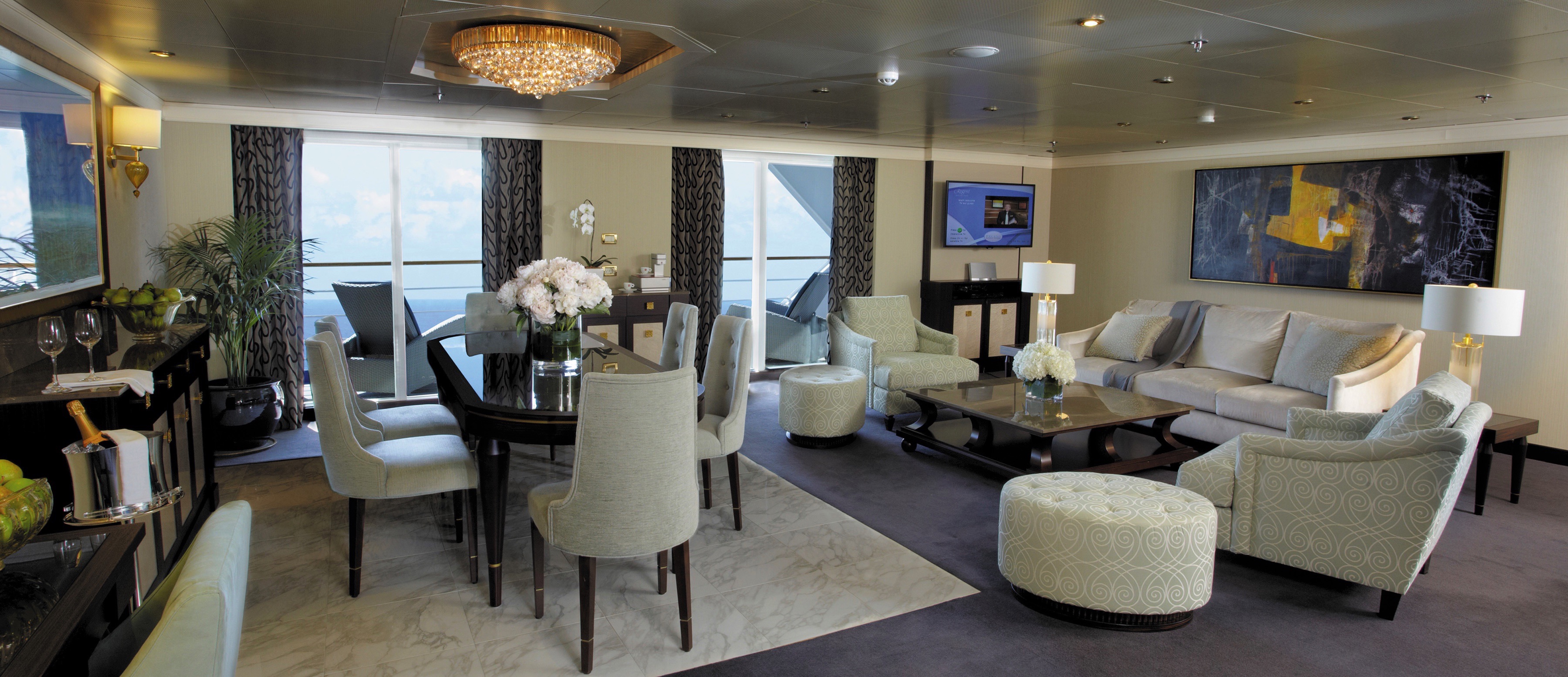
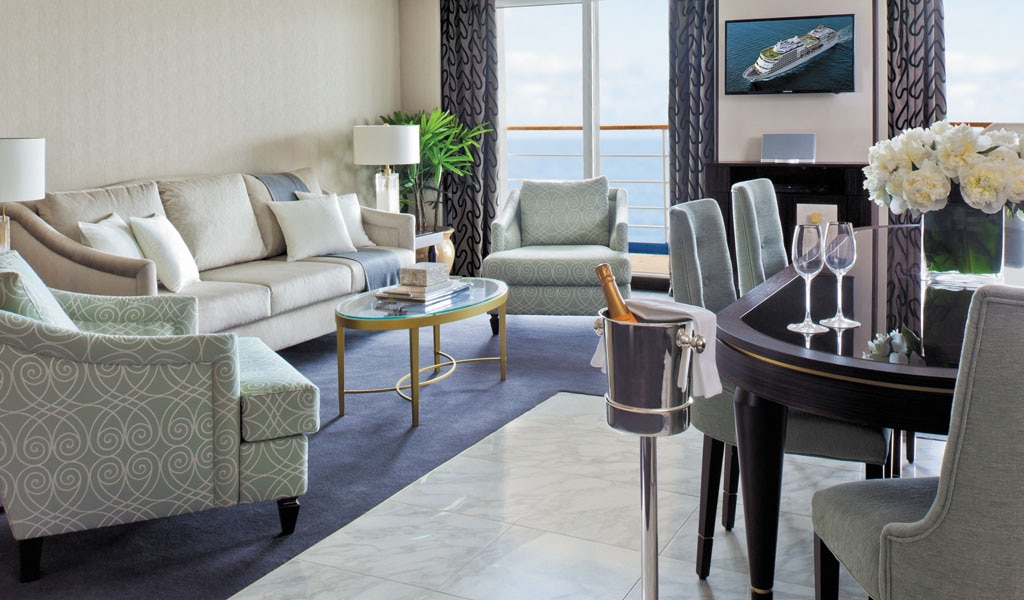
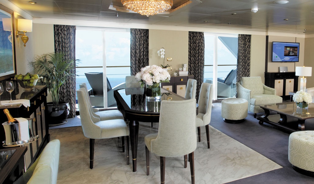
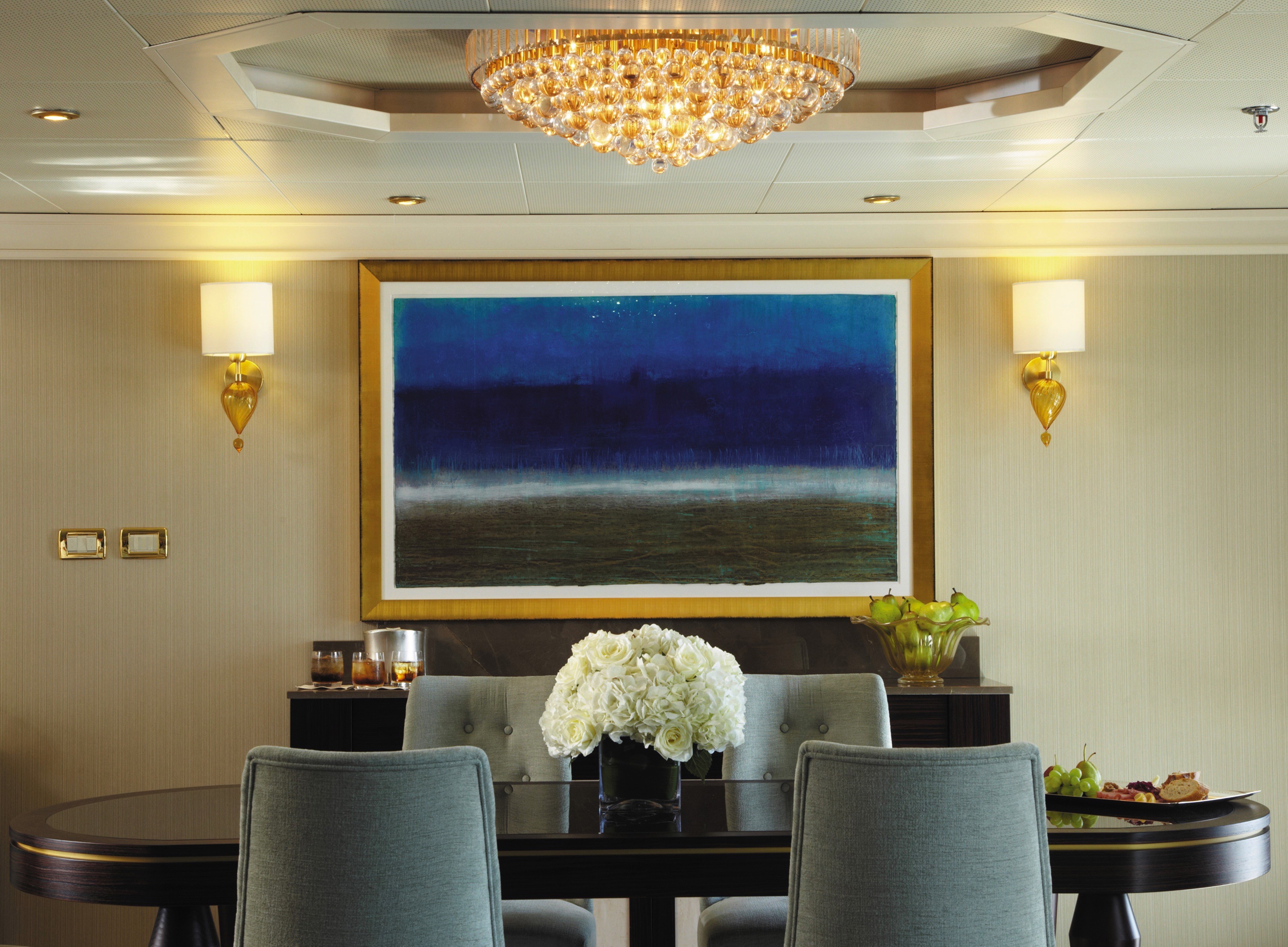
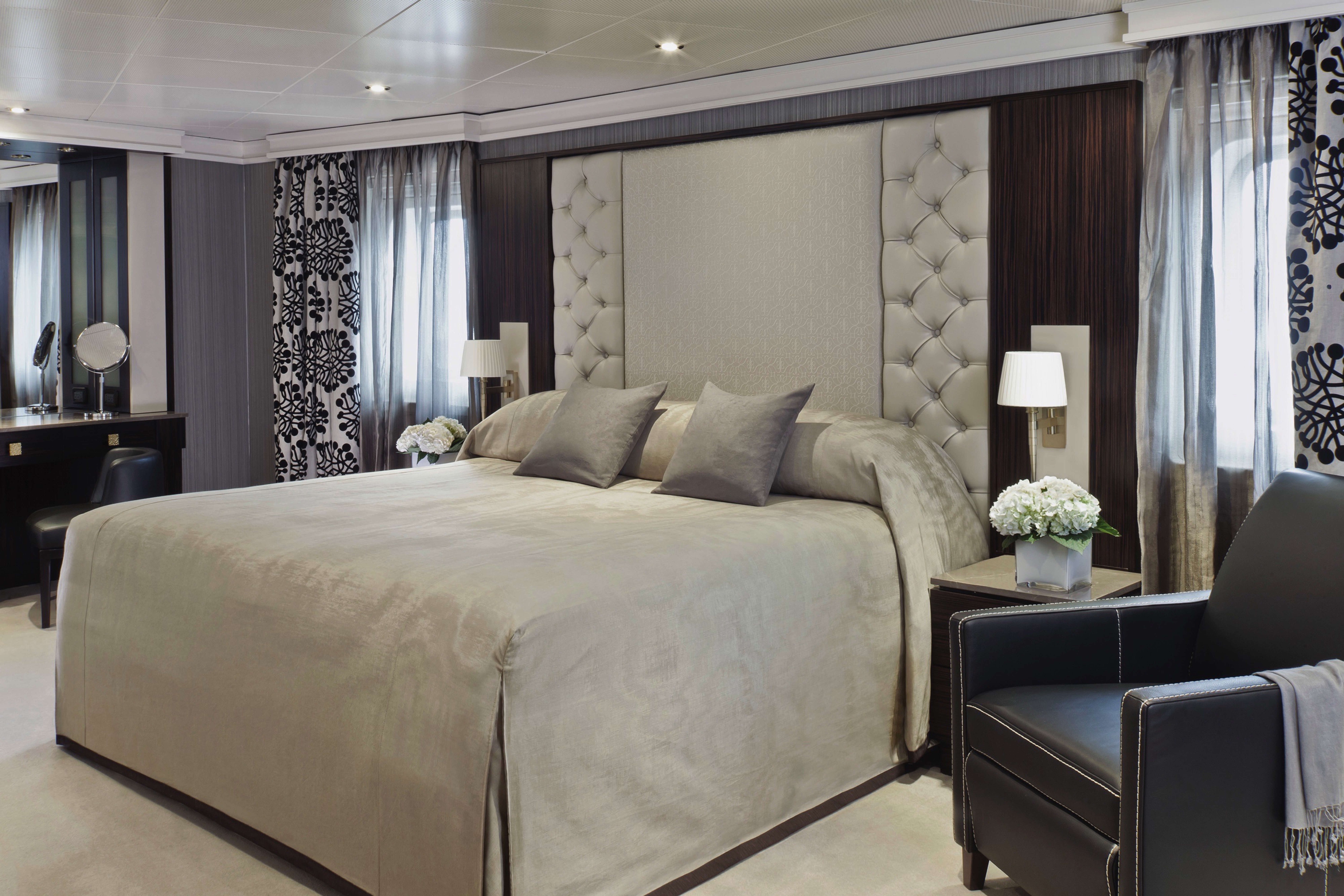
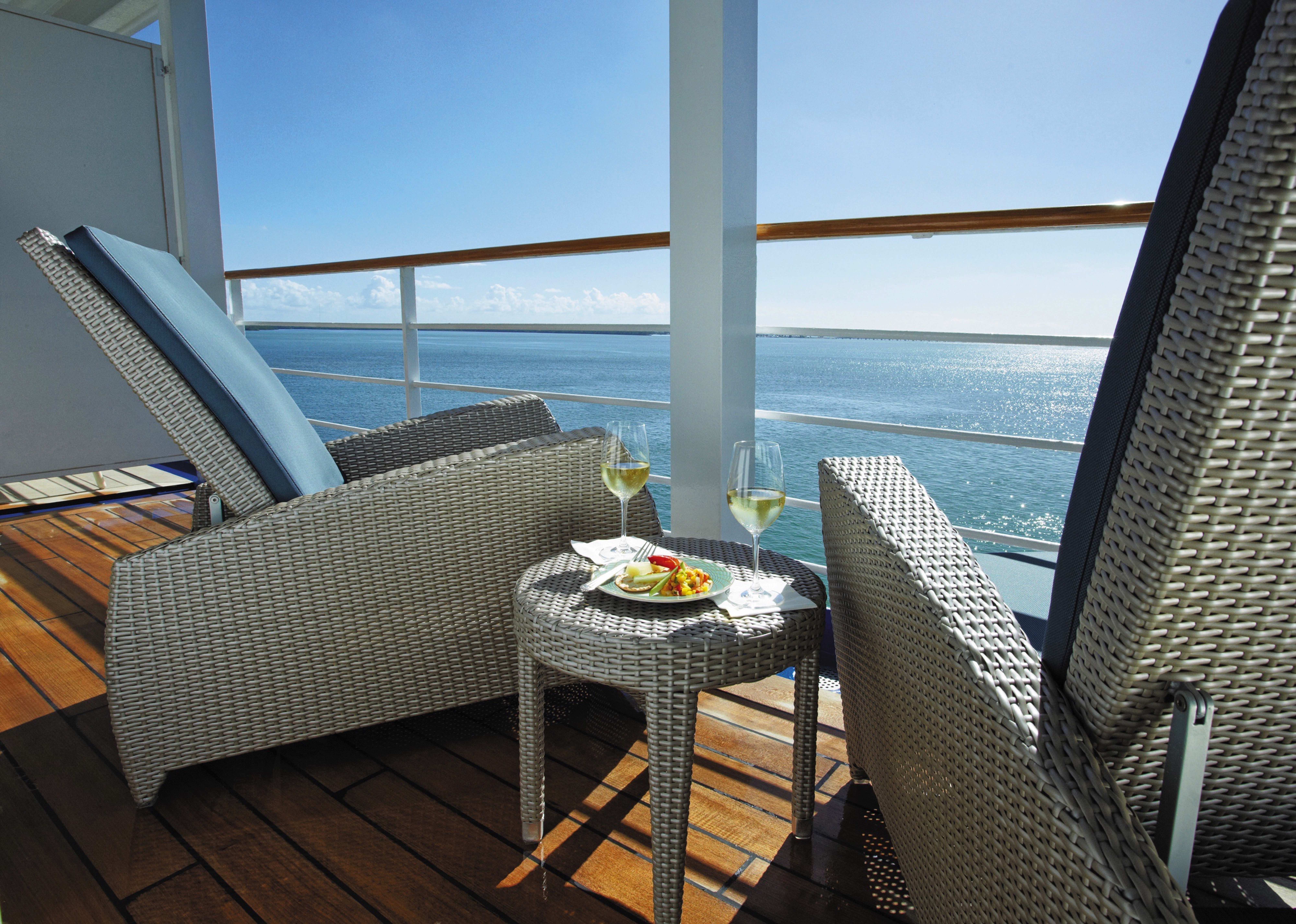
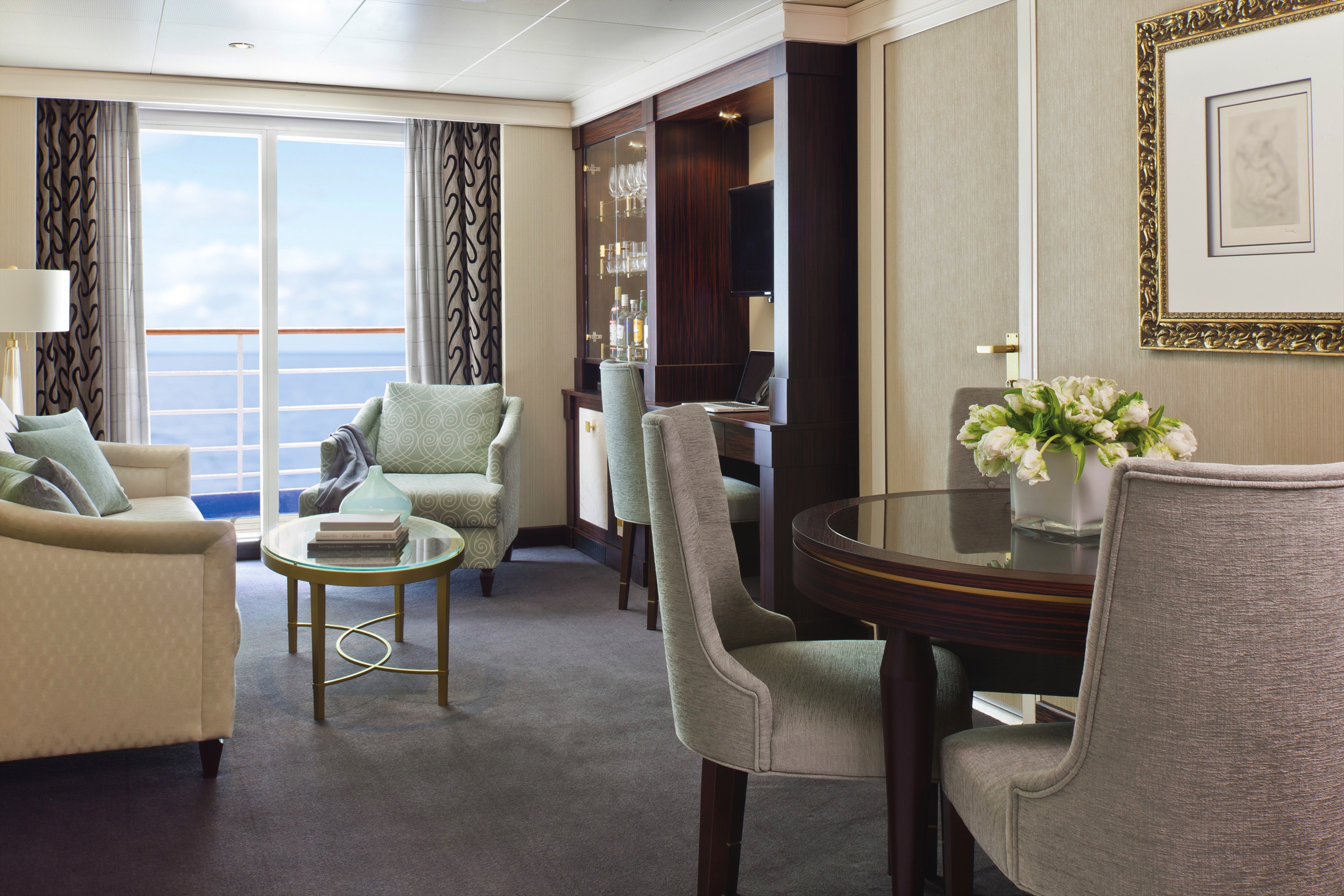
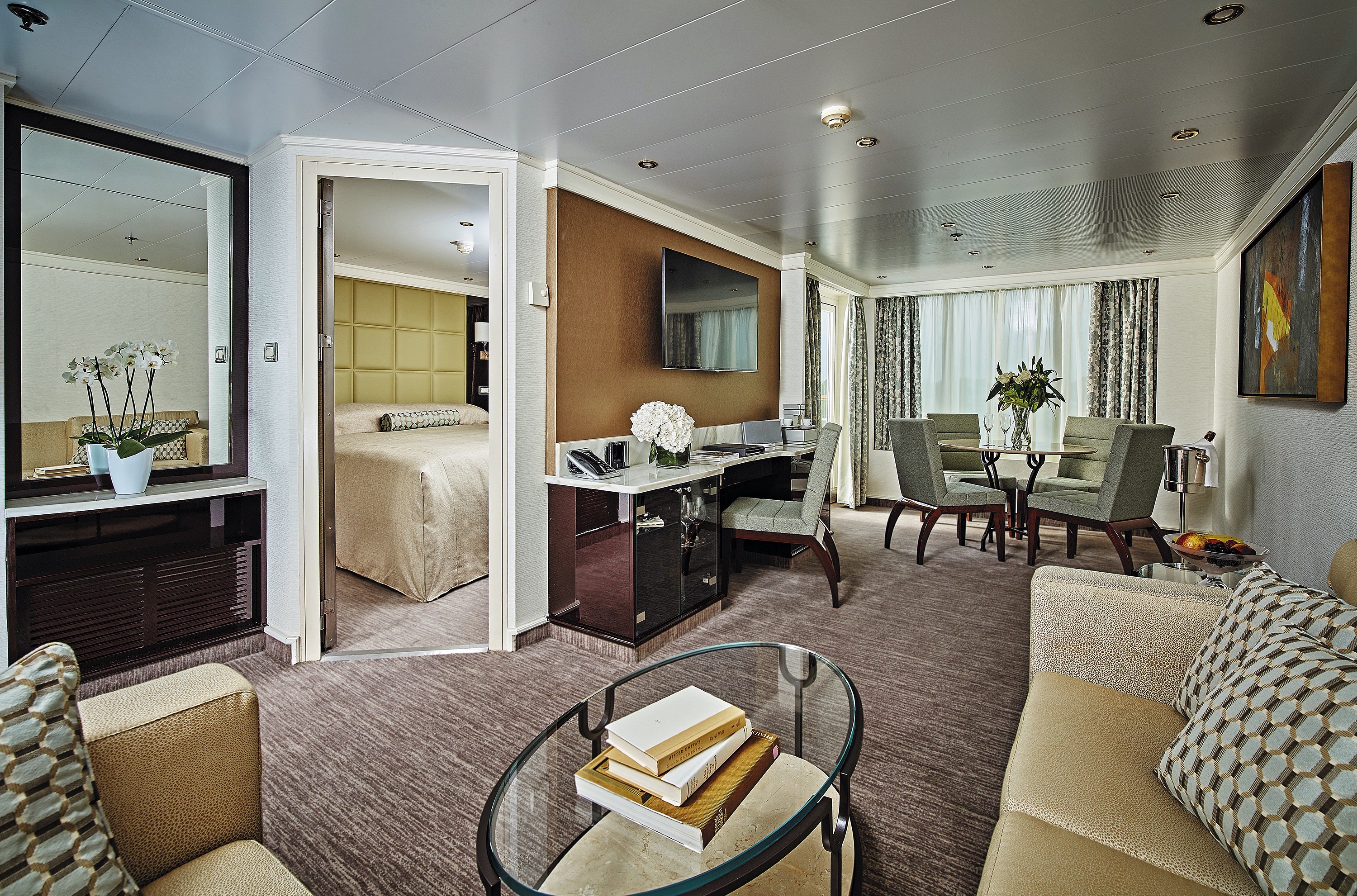
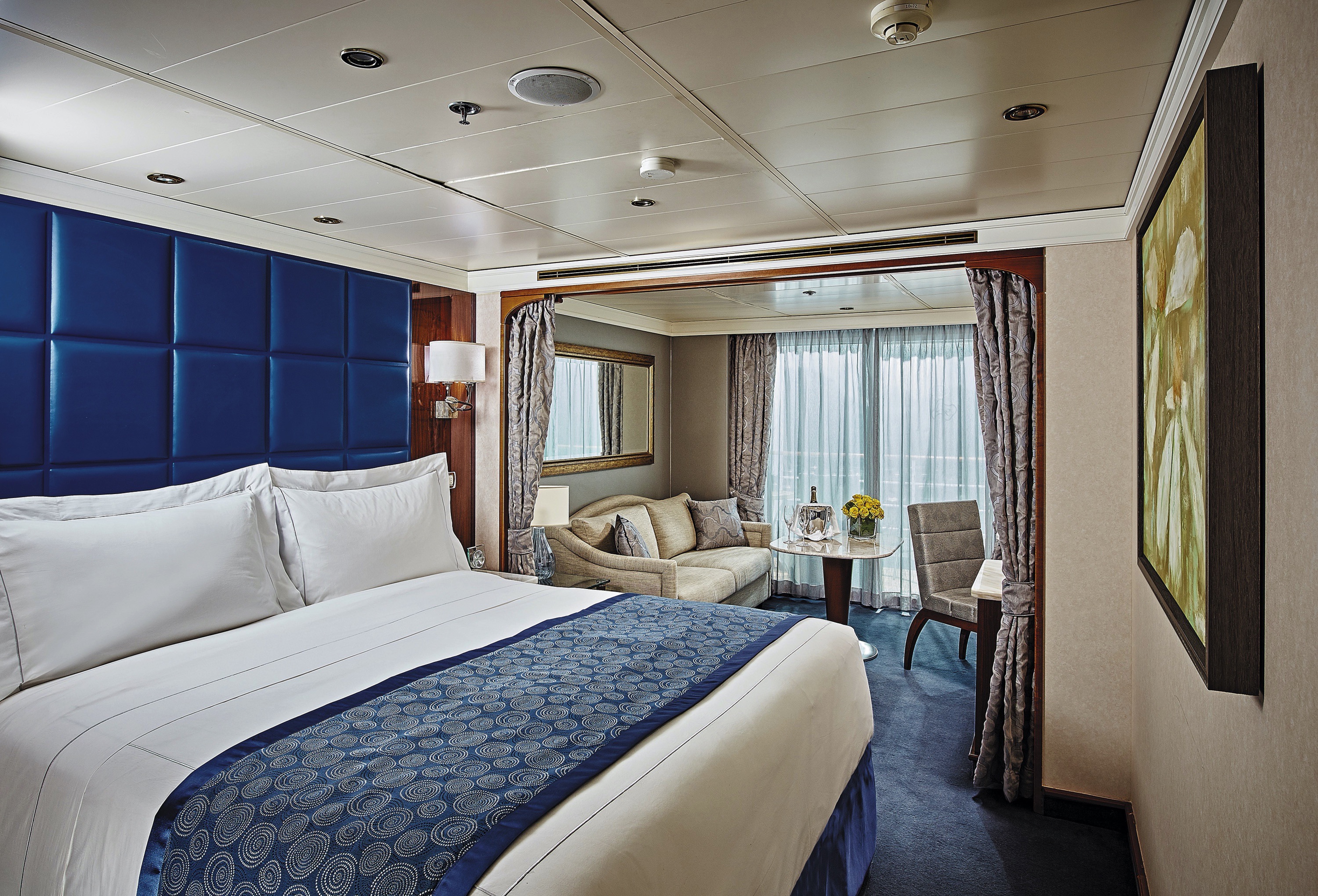
You'll find Park Avenue chic onboard Seven Seas Navigator® in this spectacular suite. Elegant rosewood furniture, luxe fabrics and a crystal chandelier create sophisticated comfort, while a personal butler is available to fulfil whatever requests you may have. With one bedroom, two-and-a-half baths, a large living room and two private balconies, this sublime suite is perfect for hosting new friends in luxury.
The suite pictured may differ from the suite booked, as layouts and designs vary by ship, deck, and suite location.
Layout
- 1 Spacious Bedroom with a European King-Size Elite Slumber® Bed
- 1 1/2 Marble & Stone Detailed Bathrooms
- Private Balcony*
- Sitting Area
- Walk-In Closet with Safe
- Includes Up To 6 Guests
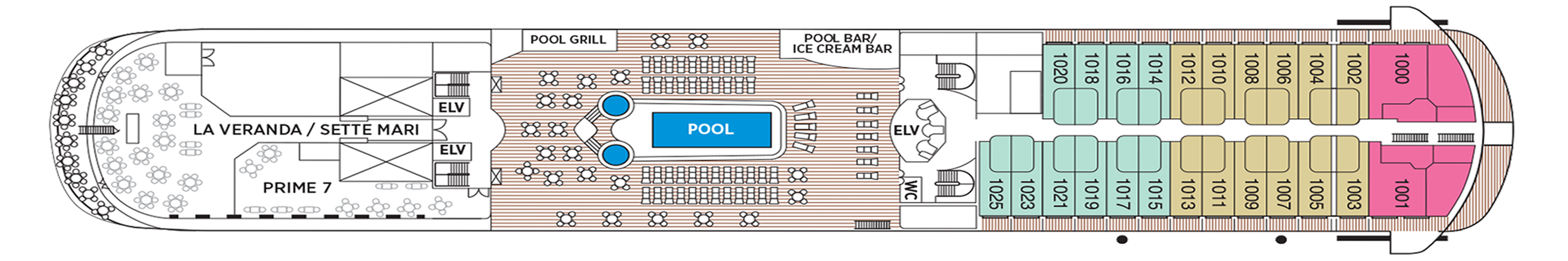
- *1000 & 1001: full wraparound balconies - 900 & 901: Side balconies only
The suite pictured may differ from the suite booked, as layouts and designs vary by ship, deck, and suite location.
Amenities
- 1-Night Pre-Cruise: Hotel Package Including:
- - Ground Transfers
- - Breakfast
- - Porterage
- Unlimited WiFi and Streaming Package for up to Four Devices
- Valet Laundry Service
- 24-hour In-Suite Dining
- Fresh Orchid Arrangement
- L'Occitane® Jasmin & Bergamot Bath Amenities
- Regent Plush Bathrobe & Slippers
- Interactive Flat-Screen Television & Direct-Dial Satellite Phone
- Priority Access to Online Shore Excursion Reservations
- Priority Access to Online Dining Reservations
- Binoculars
- illy® Espresso Maker
- Cashmere Blankets
- Regent Special Gift
- Vanity & Hair Dryer
- Shoe Shine Service
- Additional Discounts:
- - 10% Discount on Ultra Premium Wine and Liquor
- - 5% Savings on Pre- or Post-Cruise Hotel or Land Programs
- - 5% Savings on Regent Choice Shore Excursions
Additional Signature Suite Amenities:
- Guaranteed Reservation Each Night in Specialty Restaurant of Your Choice
- Welcome Letter from the President and General Manager
- Personal Butler for an Elevated In-suite Experience
- - In-Suite Dining Menu Including Specialty Restaurant Selections During Dining Hours
- Priority Boarding on Embarkation Day with Suite Access at Noon
- Welcome Bottle of Premium Champagne
- Personalized In-Suite Full-Liquor Bar Set-Up
- A Sumptuous In-Suite Caviar Service Once During Cruises
- Complimentary In-Suite Cocktail Party for 8
- Complimentary 25-Minute Personal Fitness Session at the Serene Spa & Wellness™ Fitness Center
- Onboard Press Reader App Access
- Daily Canapés
- Tea Forté Set-Up
- Luxe Fruit Arrangement with Chocolate Leonidas
- Luxurious Designer Bath Amenities & Men's Unscented Shaving Kit
- Hairdryer
- Selection of Fig & Tea Leaves Bath Salts
- Guerlain Bath Amenities & Men's Unscented Shaving Kit
- Bath Scale Setup
- Bose® SoundLink Mini II Bluetooth Speaker
- Selection of Bed Pillow Styles
- Complimentary Garment Pressing on First Night
- Personalized Stationery upon request
- Elegant Weather Clock
- Excursion Bag

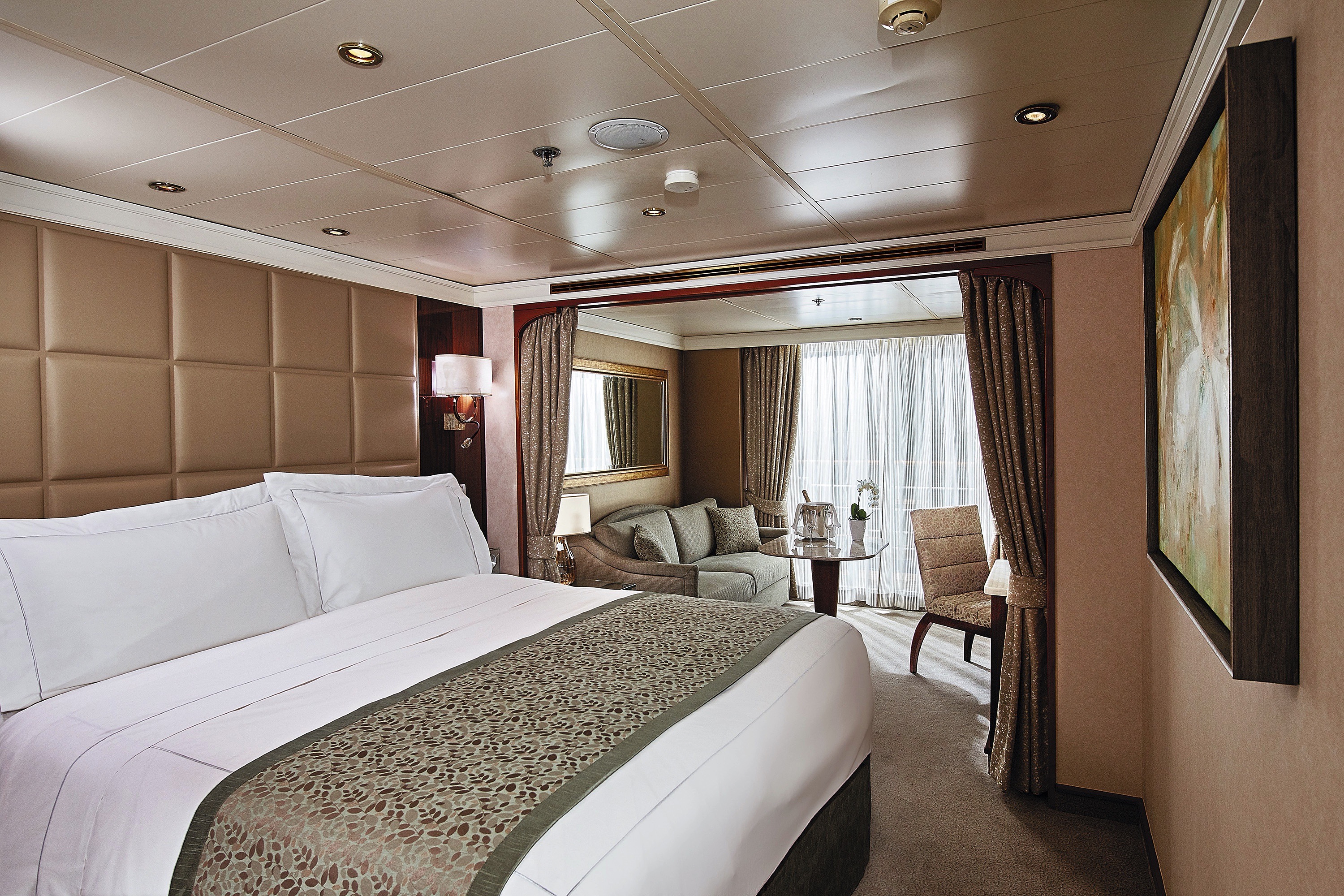
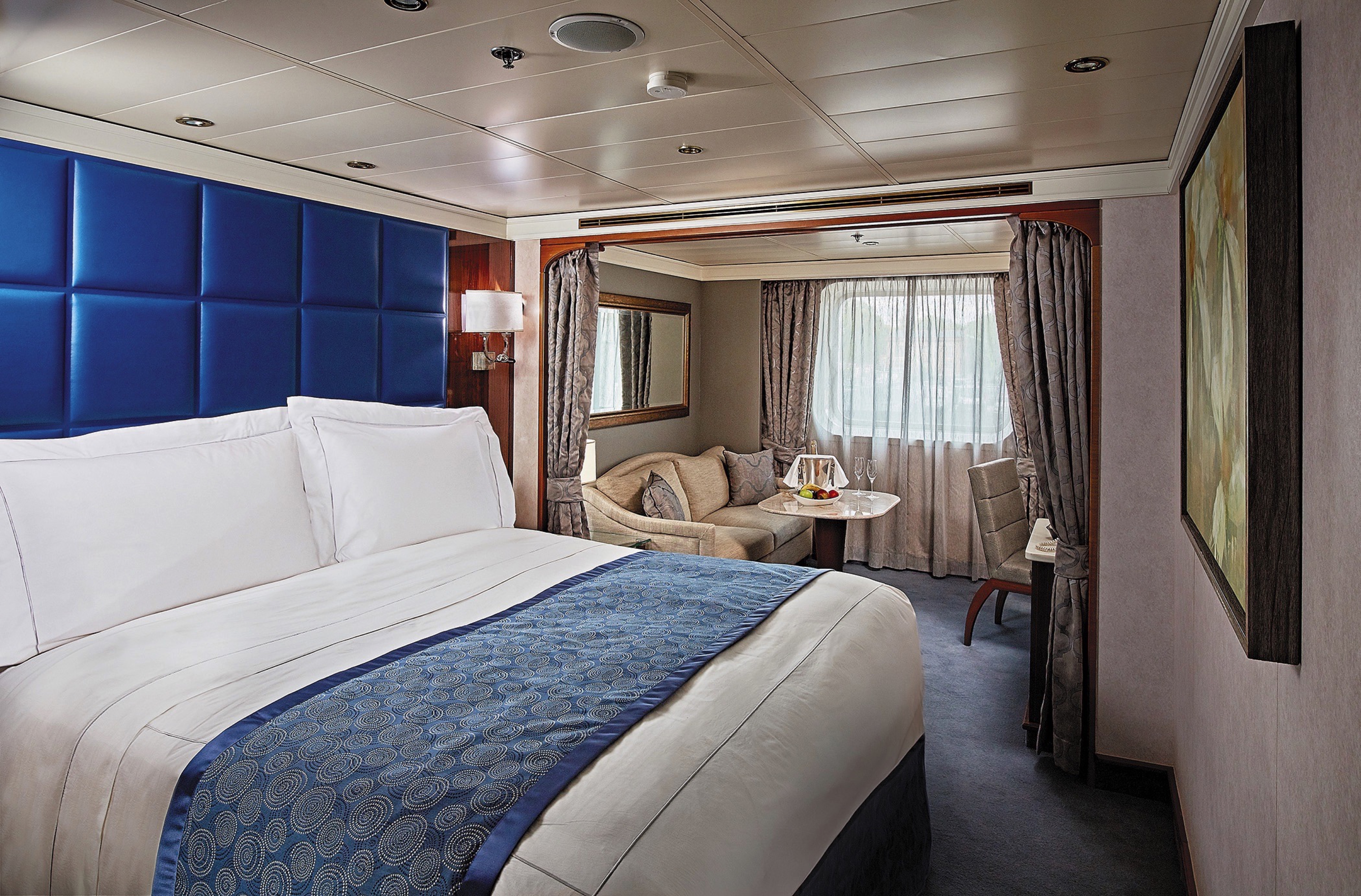
Step into the richness of a dining area perfectly ensconced within a spacious, art-filled living room. Just outside is a private balcony with a table and chairs just right for in-suite breakfast. The private bedroom is large and inviting, its soothing color palette conducive to a peaceful night's rest on your King-Sized Elite Slumber™ Bed. Two full baths and luxurious bath products invite you to indulge in unrushed 'me time'.
Layout
- 1 Spacious Bedroom with European King-Sized Elite Slumber™ Bed
- 1 1/2 Marble Bathrooms
- Private Balcony
- Walk-in Closet With Safe
- Accommodates Up To 4 Guests
Amenities
- 1-Night Pre-Cruise Hotel Package Including:- Ground Transfers- Breakfast- Porterage
- Unlimited WiFi includes up to four per suite
- 15 Minutes of Ship-to-Shore Phone Time
- Valet Laundry Service
- Choice of Guerlain, Acqua di Parma and L'Occitane® Jasmin & Bergamot Soaps, Shampoos and Lotions
- Guerlain Fragrance and Spongelle Buffer
- Personal Butler
- Priority Check-in on embarkation day with suite access at Noon
- Welcome Bottle of Premium Champagne
- Complimentary Pressing on First Night
- VIP Status to Include Dinner with a Senior Officer
- Welcome Letter from President and General Manager
- Complimentary Cocktail Party for 8
- Personalized In-Suite Full-Liquor Bar Set-Up
- 1 Sumptuous In-Suite Caviar Service
- Guaranteed Reservation Each Night in Specialty Restaurant of Your Choice†
- Complimentary 25-Minute Personal Fitness Session at the Serene Spa & Wellness™ Fitness Center
- 24-Hour Room Service with Specialty Restaurant Selections During Dining Hours
- Priority Online Shore Excursions and Dining Reservations
- 10% Discount on Premium Wine and Liquor
- 5% savings on Pre- or Post-Cruise Hotel or Land Programs
- 5% savings on Regent Choice Shore Excursions
- Selection of Bed Pillow Styles
- Selection of Fig and Tea Leaves Bath Salts
- Regent Plush Bathrobes and Slippers
- Daily Canapés
- Luxe Fruit Arrangement and Chocolate Leonidas
- Tea Forte Set-Up
- Personalized Stationery
- BOSE® SoundLink Mini II Bluetooth Speaker
- Delivery of Up to Three Daily Newspapers
- World Atlas and Elegant Weather Clock
- Binoculars, illy® Espresso Maker and Cashmere Blankets
- Bath Scale
- Vanity and Hair Dryer
- Interactive Flat-Screen Television With Extensive Media Library, Complimentary Movies-on-Demand
- Direct Dial Satellite Phone
- Shoe Shine Service
- Essentials Including Men’s Unscented Shaving Kit, Facial Wipes, Sewing Kit, Emory Board, Stain Remover, Hand Sanitizer and Dental Care
- Complimentary Tote Bag
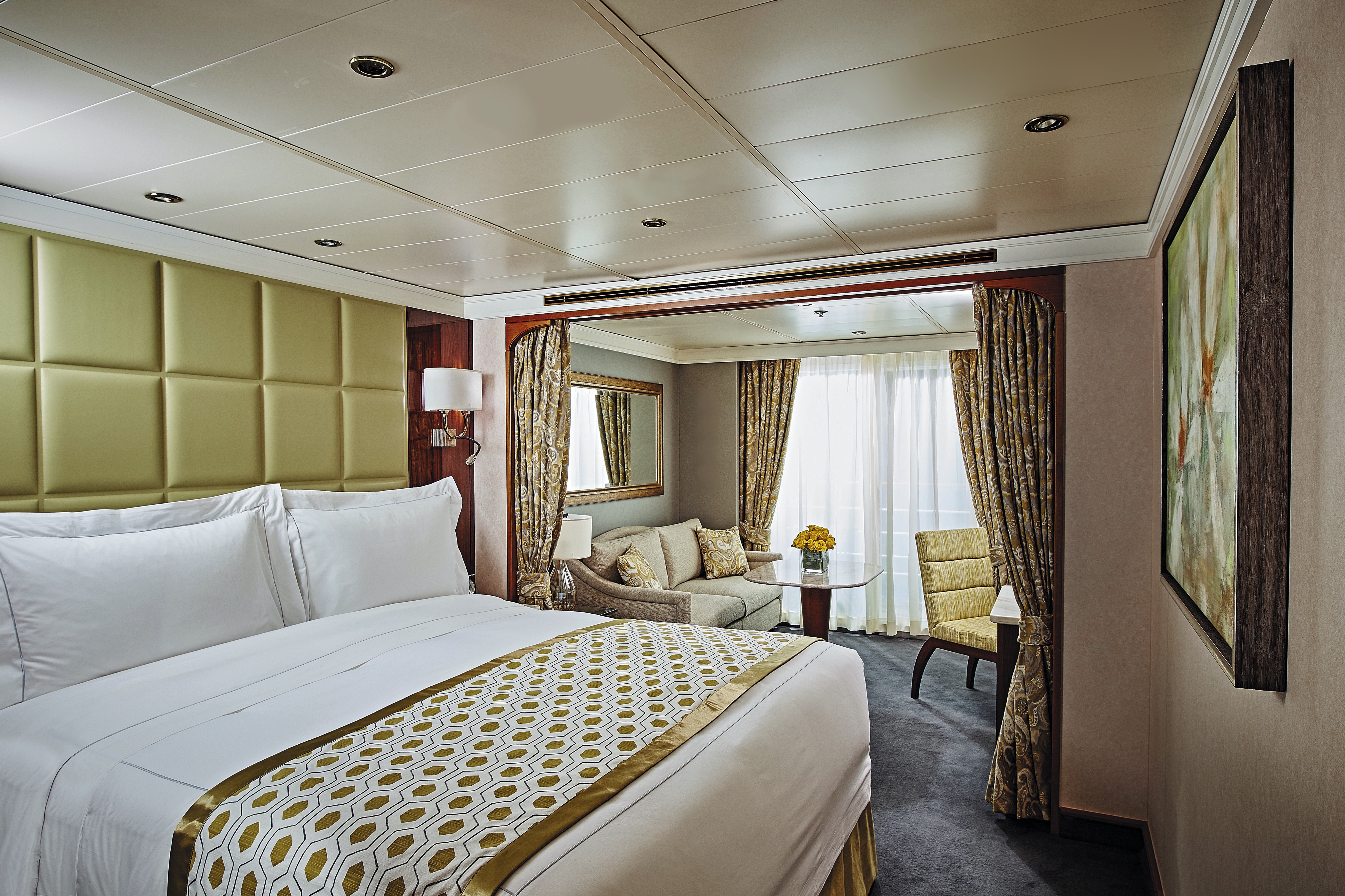
Spoiled for choice will describe your time in this suite. Do you stretch out on a couch in the living room or a lounge on your private balcony? Do you enjoy in-suite breakfast on the balcony or at your inside table? Its spaciousness extends to a large bedroom with a king-sized bed, roomy walk-in closet and a gleaming, gorgeous bath. You’re also encouraged to use the services of a personal butler, making every moment in your suite magical.
Layout
- 1 Spacious Bedroom with a European King-Size Elite Slumber® Bed
- 1 Marble & Stone Detailed Bathroom
- Private Balcony
- Sitting Area
- Walk-In Closet with Safe
- Accommodates Up To 3 Guests
The suite pictured may differ from the suite booked, as layouts and designs vary by ship, deck, and suite location.
Amenities
- 1-Night Pre-Cruise: Hotel Package Including:
- - Ground Transfers
- - Breakfast
- - Porterage
- Unlimited WiFi Includes up to Four Logins, Four Devices, per Suite
- Valet Laundry Service
- 24-hour In-Suite Dining
- Fresh Orchid Arrangement
- L'Occitane® Jasmin & Bergamot Bath Amenities
- Regent Plush Bathrobe & Slippers
- Interactive Flat-Screen Television & Direct-Dial Satellite Phone
- Priority Access to Online Shore Excursion Reservations
- Priority Access to Online Dining Reservations
- Binoculars
- illy® Espresso Maker
- Cashmere Blankets
- Regent Special Gift
- Vanity & Hair Dryer
- Shoe Shine Service
- Additional Discounts:
- - 10% Discount on Ultra Premium Wine and Liquor
- - 5% Savings on Pre- or Post-Cruise Hotel or Land Programs
- - 5% Savings on Regent Choice Shore Excursions
Additional Navigator Suite Amenities:
- Welcome Letter from the President and General Manager
- Personal Butler for an Elevated In-suite Experience
- - In-Suite Dining from Compass Rose
- Priority Boarding on Embarkation Day with Suite Access at 1pm
- Welcome Bottle of Premium Champagne
- Personalized In-Suite Full-Liquor Bar Set-Up
- A Sumptuous In-Suite Caviar Service Once During Cruises
- Daily Canapés
- Luxe Fruit Arrangement
- Luxurious Designer Bath Amenities & Men's Unscented Shaving Kit
- Selection of Fig & Tea Leaves Bath Salts
- Guerlain Bath Amenities & Men's Unscented Shaving Kit
- Bath Scale Setup
- Bose® SoundLink Mini II Bluetooth Speaker
- Selection of Bed Pillow Styles
- Complimentary Garment Pressing on First Night
- Personalized Stationery upon request
- Elegant Weather Clock
The luxurious suite has been carefully designed to maximize space and comfort. Relax on your private balcony and indulge in your lavish bath amenities as you recharge and ready yourself for new adventures in the next port of call. This suite also includes priority online reservations for shore excursions and dining, and you’re encouraged to call on the services of a personal butler for special requests.Layout
- Private Balcony
- Sitting Area
- Marble & Stone Detailed Bathroom
- European King-Size Elite Slumber® Bed
- Walk-In Closet with Safe
- Accommodates Up To 3 Guests
The suite pictured may differ from the suite booked, as layouts and designs vary by ship, deck, and suite location.
Amenities
- 1-Night Pre-Cruise: Hotel Package Including:
- - Ground Transfers
- - Breakfast
- - Porterage
- Unlimited WiFi Includes up to Four Logins, Four Devices, per Suite
- Valet Laundry Service
- Customizable In-Suite Mini Bar Replenished Daily with Your Preferences
- Welcome Bottle of Champagne & Fresh Fruit
- 24-hour In-Suite Dining
- Fresh Orchid Arrangement
- L'Occitane® Jasmin & Bergamot Bath Amenities
- Regent Plush Bathrobe & Slippers
- Interactive Flat-Screen Television & Direct-Dial Satellite Phone
- Priority Access to Online Shore Excursion Reservations
- Priority Access to Online Dining Reservations
- Binoculars
- illy® Espresso Maker
- Cashmere Blankets
- Regent Special Gift
- Vanity & Hair Dryer
- Shoe Shine Service
- Additional Discounts:
- - 10% Discount on Ultra Premium Wine and Liquor
- - 5% Savings on Pre- or Post-Cruise Hotel or Land Programs
- - 5% Savings on Regent Choice Shore Excursions
Additional Penthouse Suite Amenities:
- Personal Butler for an Elevated In-suite Experience
- - In-Suite Dining from Compass Rose
- Daily Canapés
- Luxurious Designer Bath Amenities & Men's Unscented Shaving Kit
- Guerlain Bath Amenities & Men's Unscented Shaving Kit
- Bose® SoundLink Mini II Bluetooth Speaker
- Selection of Bed Pillow Styles
- Complimentary Garment Pressing on First Night
- Personalized Stationery upon request
In this superbly designed suite, you enjoy the comfort of richly furnished accommodations as well as exclusive luxuries available only in suites at the Concierge level and higher. Your suite includes amenities such as an illy® espresso maker and cashmere blankets, perfect for use in the morning when you wish to sip coffee and enjoy an in-suite breakfast on your private balcony. Take advantage of 24-hour room service when the mood strikes.
Layout
- Private Balcony
- Sitting Area
- Marble & Stone Detailed Bathroom
- European King-Size Elite Slumber® Bed
- Walk-In Closet with Safe
- Accommodates Up To 3 Guests
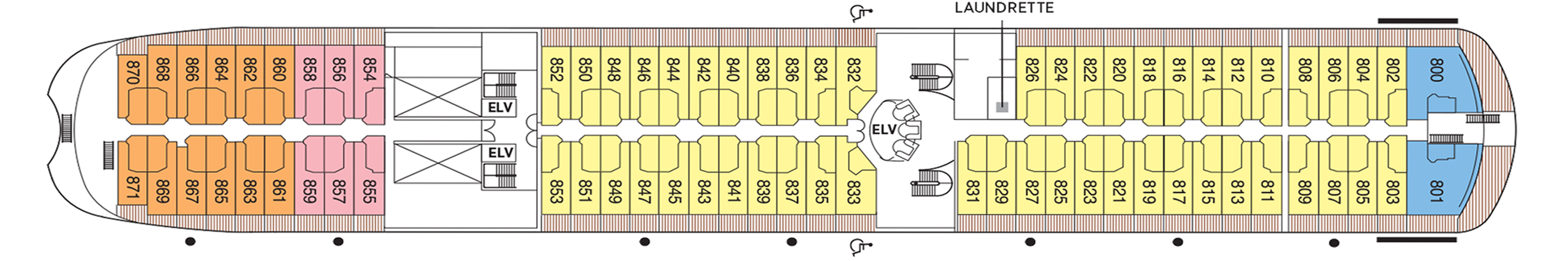
- This category includes Accessibility Options in suites 832 and 833. For more information about accessible suites click here.
The suite pictured may differ from the suite booked, as layouts and designs vary by ship, deck, and suite location.
Amenities
- 1-Night Pre-Cruise: Hotel Package Including:
- - Ground Transfers
- - Breakfast
- - Porterage
- Unlimited WiFi Includes up to Four Logins, Four Devices, per Suite
- Valet Laundry Service
- Customizable In-Suite Mini Bar Replenished Daily with Your Preferences
- Welcome Bottle of Champagne & Fresh Fruit
- 24-hour In-Suite Dining
- Fresh Orchid Arrangement
- L'Occitane® Jasmin & Bergamot Bath Amenities
- Regent Plush Bathrobe & Slippers
- Interactive Flat-Screen Television & Direct-Dial Satellite Phone
- Priority Access to Online Shore Excursion Reservations
- Priority Access to Online Dining Reservations
- Binoculars
- illy® Espresso Maker
- Cashmere Blankets
- Regent Special Gift
- Vanity & Hair Dryer
- Shoe Shine Service
- Additional Discounts:- 10% Discount on Ultra Premium Wine and Liquor- 5% Savings on Pre- or Post-Cruise Hotel or Land Programs- 5% Savings on Regent Choice Shore Excursions
Every inch of this suite has been thoughtfully designed to maximize interior space and embrace the magnificent scenery outdoors. From the sitting area, admire the ocean views through the floor-to-ceiling windows, or better yet, take a seat outside on your private balcony to watch the world go by. Elegant finishes such as luxurious bedding and beautiful marble detailing in the bath further enhance your comfort.
Layout
- Private Balcony
- Sitting Area
- Marble & Stone Detailed Bathroom
- European King-Size Elite Slumber® Bed
- Walk-In Closet with Safe
- Accommodates Up To 3 Guests
The suite pictured may differ from the suite booked, as layouts and designs vary by ship, deck, and suite location.
Amenities
- Unlimited WiFi Includes Two Logins, Two Devices, per Suite
- Valet Laundry Service
- Customizable In-Suite Mini Bar Replenished Daily with Your Preferences
- Welcome Bottle of Champagne & Fresh Fruit
- 24-hour In-Suite Dining
- Fresh Orchid Arrangement
- L'Occitane® Jasmin & Bergamot Bath Amenities
- Regent Plush Bathrobe & Slippers
- Interactive Flat-Screen Television & Direct-Dial Satellite Phone
- Vanity & Hair Dryer
- Shoe Shine Service
Even the smaller suites on Seven Seas Navigator® are spacious, smartly designed and luxuriously furnished. This suite offers a large picture window that lets you rejoice in magnificent ocean views and plenty of natural light. Settle into your cozy surroundings, pamper yourself with lavish bath products, wrap yourself in a plush bathrobe and uncork your welcome bottle of Champagne as your ship heads out to sea.
Layout
- Sitting Area
- Marble & Stone Detailed Bathroom
- European King-Size Elite Slumber® Bed
- Walk-In Closet with Safe
- Accommodates Up To 3 Guests
The suite pictured may differ from the suite booked, as layouts and designs vary by ship, deck, and suite location.
Amenities- Unlimited WiFi Includes Two Logins, Two Devices, per Suite
- Valet Laundry Service
- Customizable In-Suite Mini Bar Replenished Daily with Your Preferences
- Welcome Bottle of Champagne & Fresh Fruit
- 24-hour In-Suite Dining
- Fresh Orchid Arrangement
- L'Occitane® Jasmin & Bergamot Bath Amenities
- Regent Plush Bathrobe & Slippers
- Interactive Flat-Screen Television & Direct-Dial Satellite Phone
- Vanity & Hair Dryer
- Shoe Shine Service
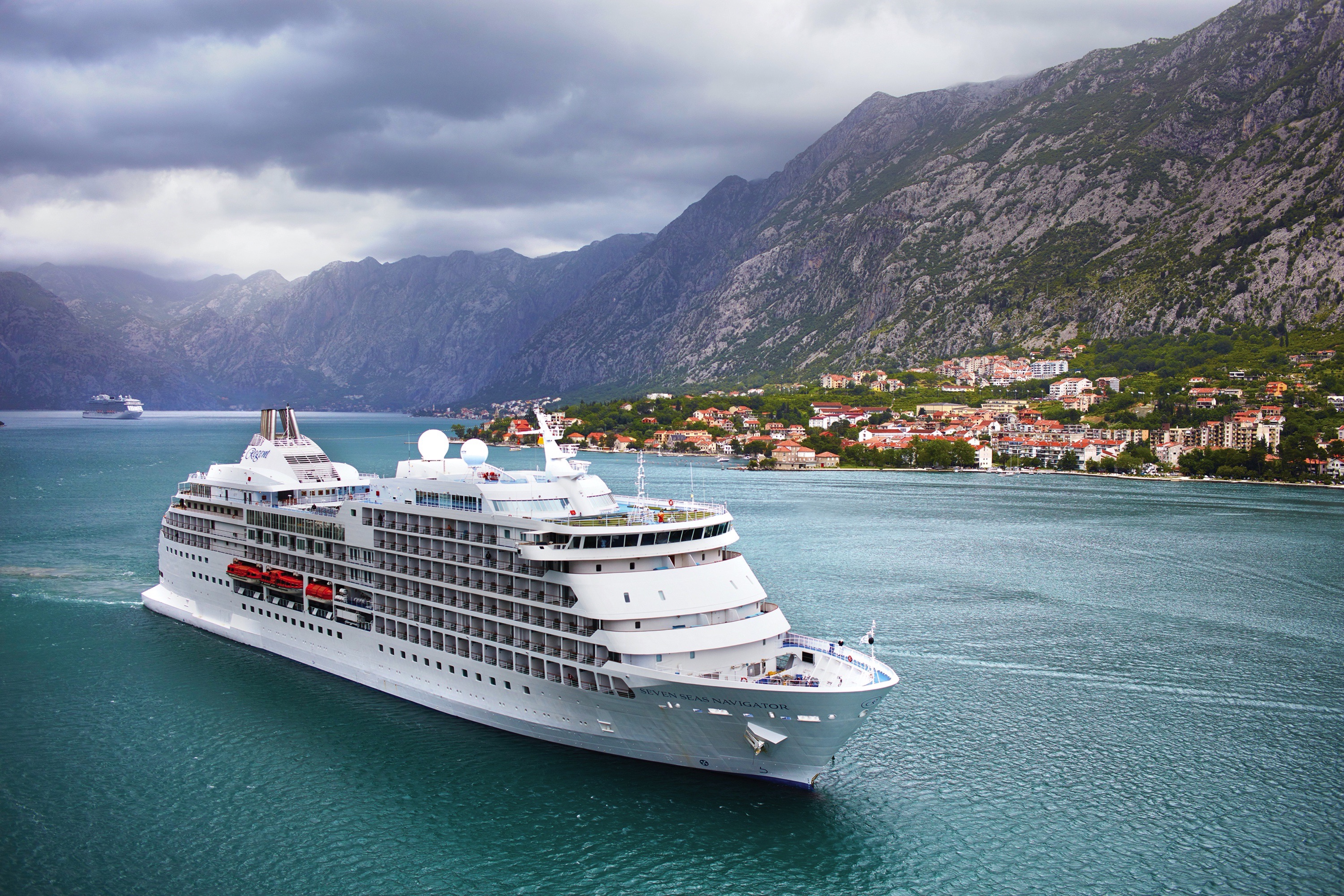
Seven Seas Navigator
As you gaze at Seven Seas Navigator®, imagine what you’ll hear as well. Listen for sounds of happiness like forks clicking on Versace dinnerware, a ball clacking on a roulette wheel, and a martini being shaken to icy perfection.
Serene ocean views enhance the soothing color palette in each Seven Seas Navigator® suite. You’ll also find luxurious bath amenities, a cozy robe and our superior Elite Slumber™ beds to ensure a relaxing and revitalizing all-inclusive luxury voyage.
Chat up like-minded travellers over a cocktail at Stars Lounge on Deck 6, find your Zen at a yoga class on Deck 12 or update your wardrobe at the boutiques on Deck 7. Do it all on the luxurious decks of Seven Seas Navigator®
Ship Facts
| Launch Year | 1999 | ||||||||
| Refit Year | 2016 | ||||||||
| Language | en | ||||||||
| Gross Tonnage | 28803 | ||||||||
| Length | 173 | ||||||||
| Width | 25 | ||||||||
| Currency | USD | ||||||||
| Speed | 20 | ||||||||
| Capacity | 496 | ||||||||
| Crew Count | 365 | ||||||||
| Deck Count | 8 | ||||||||
| Cabin Count | 248 | ||||||||
| Large Cabin Count | 30 | ||||||||
| Wheelchair Cabin Count | 4 | ||||||||
| Electrical Plugs |
|
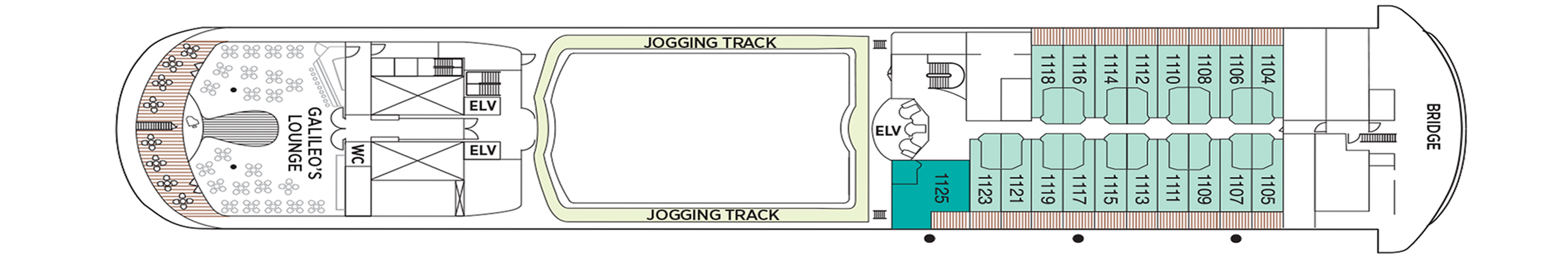
Deck 12
- Mini Golf
- Fitness Centre
- Shuffleboard
- Serene Spa & Wellness™

Deck 11
- Galileo's Lounge
- Laundrette
- Jogging Track
- Penthouse Suites
- Navigator Suite
Deck 10
- Pool Bar
- Pool Grill
- Prime 7
- La Veranda
- Sette Mari at La Veranda
- Pool Deck
- Launderette
- Signature Suites
- Penthouse Suites
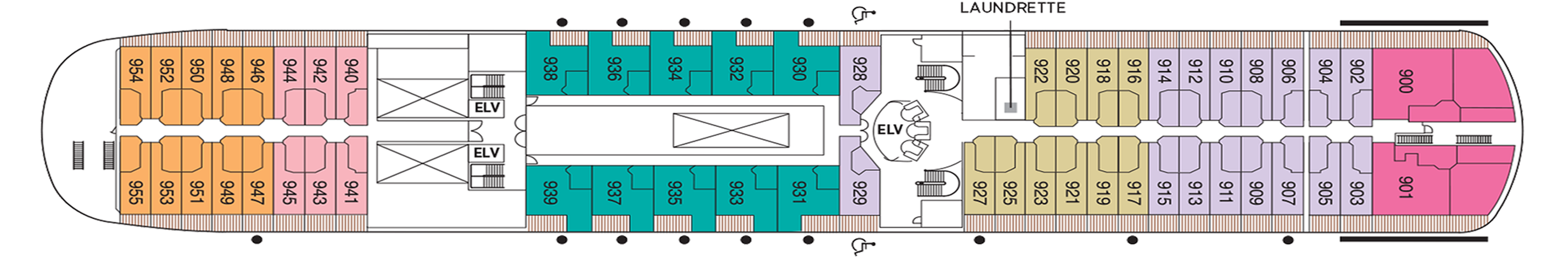
Deck 9
- Signature Suites
- Penthouse Suites
- Navigator Suites
- Deluxe Veranda Suites
- Launderette
Deck 8
- Grand Suites
- Concierge Suites
- Deluxe Veranda Suites
- Launderette
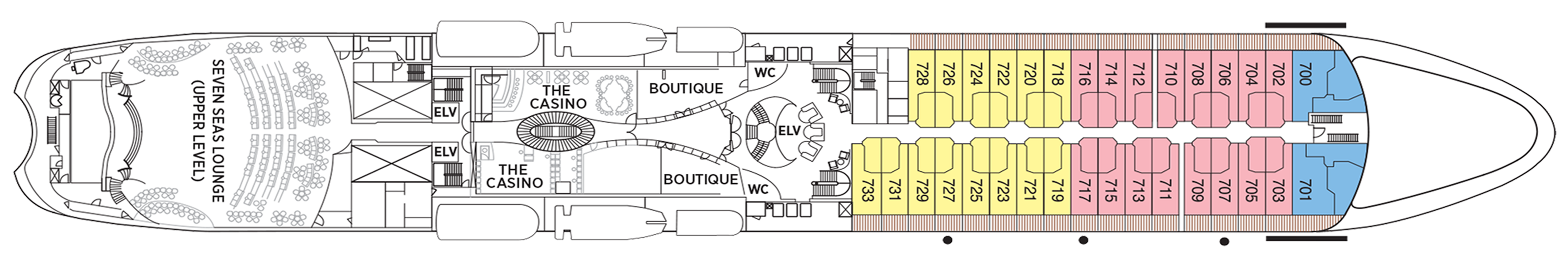
Deck 7
- Boutiques
- The Casino
- Seven Seas Lounge (Upper Level)
- Grand Suite
- Concierge Suite
- Deluxe Veranda Suite
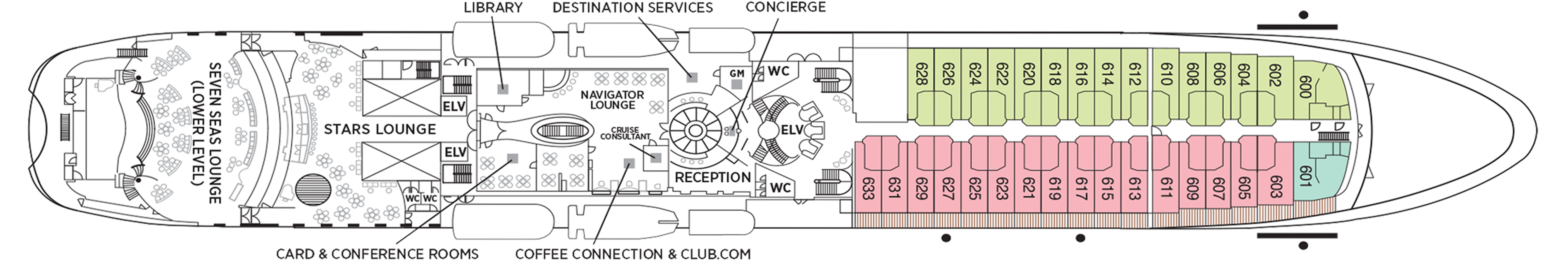
Deck 6
- Destination Services
- Reception
- Navigator Lounge
- Coffee Connection & Club.com
- Library
- Card & Conference Room
- Stars Lounge
- Seven Seas Lounge (Lower Level)
- Penthouse Suite
- Deluxe Veranda Suite
- Deluxe Window Suite
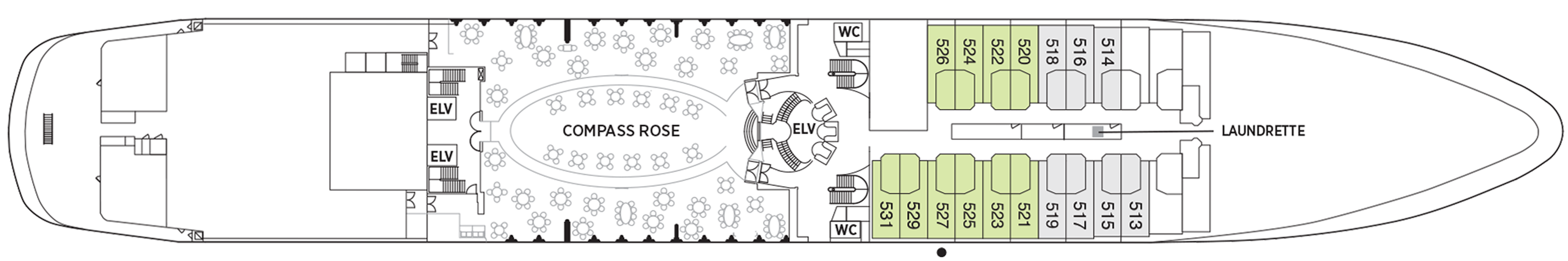
Deck 5
- Compass Rose
- Launderette
- Deluxe Window Suites
Regent Seven Seas Cruises® takes pride in creating dining experiences that are simply superb. From succulent lobster to the perfect burger and shake, you’ll find an array of refined flavors and refreshments from which to choose.
Prime 7
From perfectly aged prime New York strip, porterhouse and succulent filet mignon to smoked salmon with a phenomenal tamarind-whiskey sauce, Prime 7 is a contemporary American steakhouse done right.
A true classic in every sense, the newly refurbished Prime 7 on Seven Seas Navigator® is the epitome of luxury dining. Dark imperial blue walls accented with gold, light leather chairs and rich wood finishes provide a refined and elegant backdrop for prime steaks and seafood. Large artwork, marble sculptures and intricately patterned floors enhance the décor. Enjoy a cocktail at the bar before savouring a succulent filet mignon or côte de boeuf.
Compass Rose
Whether you arrive for breakfast, lunch or dinner, you can look forward to European-inspired Continental cuisine served in a beautifully refined atmosphere decorated in blues and silvers with stunning Versace tableware.
As the flagship restaurant aboard each of our ships, the wonderfully spacious Compass Rose serves breakfast, lunch and dinner and features an exceptional variety of European-inspired Continental cuisine, as well as flavourful vegetarian and kosher dishes. Elegantly decorated in blues and silvers with stunning Versace tableware, Compass Rose delights with a beautifully refined atmosphere bathed in natural light during the day.
La Veranda
Greet your days on the high seas with sumptuous breakfasts and shimmering ocean views. La Veranda features quiet alcoves, made-to-order omelettes and, for late risers, tasty lunch buffets that include hot carving stations.
Begin your day with breakfast at La Veranda and you’ll forever believe it really is the most important meal of the day. Take in gorgeous ocean views from quiet alcoves jutting out over an iridescent sea while savouring made-to-order omelettes and other specialties. Late risers can tuck into enhanced lunch buffets indoors or al fresco on a shaded, open-air deck. Lunches feature a variety of delectable selections, including hot carving stations.
Sette Mari at La Veranda
Enjoy an extensive menu of authentic antipasti and Italian specialties served á la carte and paired with fine Italian wines. All dishes are prepared with the freshest gourmet ingredients and served by our attentive waiters.
Pool Grill
After sunbathing or swimming in the pool, you may be in the mood for grilled-to-order burgers, seafood, sandwiches, even hand-dipped ice cream with sprinkles. Our Pool Grill will satisfy your comfort food cravings.
The Pool Grill is truly a come-as-you-are venue. Enjoy this casual dining experience whether you're getting a bite after sunbathing or swimming in the pool. The Pool Grill is open-air, yet abundantly shaded for comfortable dining at lunch or dinner. Enjoy grilled-to-order burgers, grilled seafood, sandwiches, and fresh salads. Treat yourself to milkshakes and malts or an old-fashioned hand-dipped ice cream dessert with toppings.
Coffee Connection & Club.com
Grab an expertly made coffee, check the headlines of international newspapers or enjoy handmade pastries in our cozy café which is open throughout the day.
Enjoy complimentary coffee drinks prepared by our baristas, as well as delicious pastries, gourmet sandwiches and homemade cookies. Whether perusing international newspapers or simply taking in an always spectacular view, our café is the perfect place to relax, converse and enjoy coffee and snacks throughout the day.
Room Service
Enjoy delectable appetisers, main courses and desserts in your suite 24 hours a day. During dinner hours, delight in ordering dishes made to your exact taste from the expansive Compass Rose menu.
Daytime Enrichment
You’ll find time spent on board the ship to be just as enriching as time ashore. Relax by the pool, compete in a friendly game of trivia or bocce ball, indulge in treats at afternoon tea and gain insight from an expert lecturer.
Evening Entertainment
Evenings on board are filled with music and fun. Enjoy a rousing cabaret show, test your luck at the Casino, step onto the stage for karaoke or simply find a quiet place on deck to revel in the symphony of stars.
Boutiques and More
Browse a well-curated selection of duty-free designer clothes, jewelry, perfume and more at the onboard boutiques. Then fuel up with an espresso from an onboard café or unwind at a wine tasting in one of the lounges.
Stars Lounge
A popular meeting place throughout the day, Stars Lounge is also the perfect spot to grab a cocktail before or after taking in another jaw-dropping evening performance at the nearby Seven Seas Lounge.
Completely reimagined in light dusty rose and champagne tones highlighted with gold, Stars Lounge is a stellar place to meet new friends. Marble tables glimmer beneath evening dance floor lights where guests can enjoy cocktails and dancing before dinner. The lounge is a popular spot for theatregoers to celebrate the excitement generated by that night’s performance at the nearby Constellation Theatre.
Navigator Lounge
Now with additional space to enjoy barista-made coffee during the day and expertly poured cocktails later on, this centrally located lounge is a popular spot to rendezvous with friends and fellow travelers.
Galileo's
Discover why this charming lounge has been a long-time favorite with guests. With its spectacular aft views and celestial-inspired interior, Galileo’s is perfect for relaxing with a cocktail and singing along to favorite songs.
An ideal spot for cocktails or to simply relax and unwind with an after-dinner drink, Galileo's pulls you in with a shimmering, blue-themed interior. Resident musicians entertain with familiar tunes in the afternoon as well as before and after dinner, and the dance floor comes alive when the night sky fills with stars outside. Game shows, night entertainment and live musical events are featured regularly.
Seven Seas Lounge
Perfectly tiered for unobstructed viewing and furnished with plush seating, the main show lounge is an intimate venue without a bad seat in the house. The phenomenal entertainment performed here varies from full-scale musical revues to rousing cabaret shows, all backed by our incredible, five-piece Regent Signature Orchestra.
The Casino
Enjoy the elegance and excitement of a Monte Carlo-style casino. Stride through the Casino's glass doors to an elegant setting abuzz with Blackjack, roulette, poker, and a full craps table, as well as slot machines.
Get a taste of Monte Carlo excitement at our Casino directly across from the equally inspiring Explorer Lounge. Walk through glass doors into an elegant setting bustling with games of chance that include Blackjack, roulette, poker, and a full craps table, as well as slot machines. The Casino is open every day at sea when not restricted by territorial border limits.
Library
Browse a vast collection of volumes, from destination-specific guide books to best-selling mysteries to classics of literature, upon a variety of comfortable chairs in our cozy Library.
Well-stocked and offering comfort for the body and mind, you’ll discover our Library is a most elegant setting for reading and relaxing. Curl up with a classic novel or best-selling mystery, play a strategic game of chess or simply soak up the ambience of a sumptuous reading room. Regardless of what brings you here, our library is a welcoming, low-key treasure you just may find hard to leave.
Boutiques
Whether it's designer evening wear, handbags, fragrances or a smart gift, our boutique items are carefully selected and of the highest quality. The same may be said of our personable staff.
Stop into our boutiques and browse a wide range of items — upscale handbags to exclusive fragrances to fine jewellery — in an intimate and unhurried setting. You'll also find clothing, Regent Seven Seas Cruises® logo wear and gift items to share with friends and family. Our boutiques are staffed by friendly salespeople. Opening hours vary and are printed in the Passages daily newsletter.\
Pool Bar
Very few things equate to a pure vacation activity more than sitting at our Pool Bar. Make new friends while sipping a cocktail or frozen drink in the most laid-back atmosphere imaginable.
When you envision an activity you're only likely to do while on vacation, sipping a frozen drink at a pool bar onboard a glorious cruise ship is probably near the top of the list. You can tick that box at our Pool Bar, where you and new friends can enjoy leisurely conversation over cocktails and frozen drinks in a delightfully relaxed atmosphere.
Card & Conference Room
Gather your favourite teammates in the Card Room for a lively afternoon or evening of cards, board games or a social game of Bridge. The spaces, which may be combined, are also designed to host conferences.
Two complete Card and Conference Rooms can be used for everything from bridge lectures and tournaments to corporate meetings and special events. Gather with a few friends for an afternoon or evening of fun competition with board games, cards and more. Larger groups may increase space by removing the dividing door and combining both rooms.
Reception & Concierge
Our knowledgeable Reception staff is available around the clock to answer your questions and ensure your pleasure with your Seven Seas Navigator® voyage. Reception is also where you may contact the ship's Concierge.
Our welcoming Reception Desk is open 24 hours a day and staffed by personable, knowledgeable men and women who are happy to answer your questions and provide any general assistance you may need. Reception is also where you may contact the ship's Concierge. Postcards and letters may be dropped off here as well; they’ll be delivered to the postal service at the next port of call.
Destination Services
Whether you’re interested in a tour from our FREE Unlimited Shore Excursion menu or a unique, small-group Regent Choice Shore Excursion, our staff at Destination Services is ready to assist.
If the road to a richer life is paved with the lessons of new discoveries, our Destination Services is a great place to start. Learn about the adventures available to suit every taste and comfort level during your voyage from our dedicated staff. They can arrange unique shore excursions designed for smaller groups or assist with tailor-made pre-and post-cruise programs, from a simple stay in a luxurious hotel to a 3-night extension in a remote locale.