
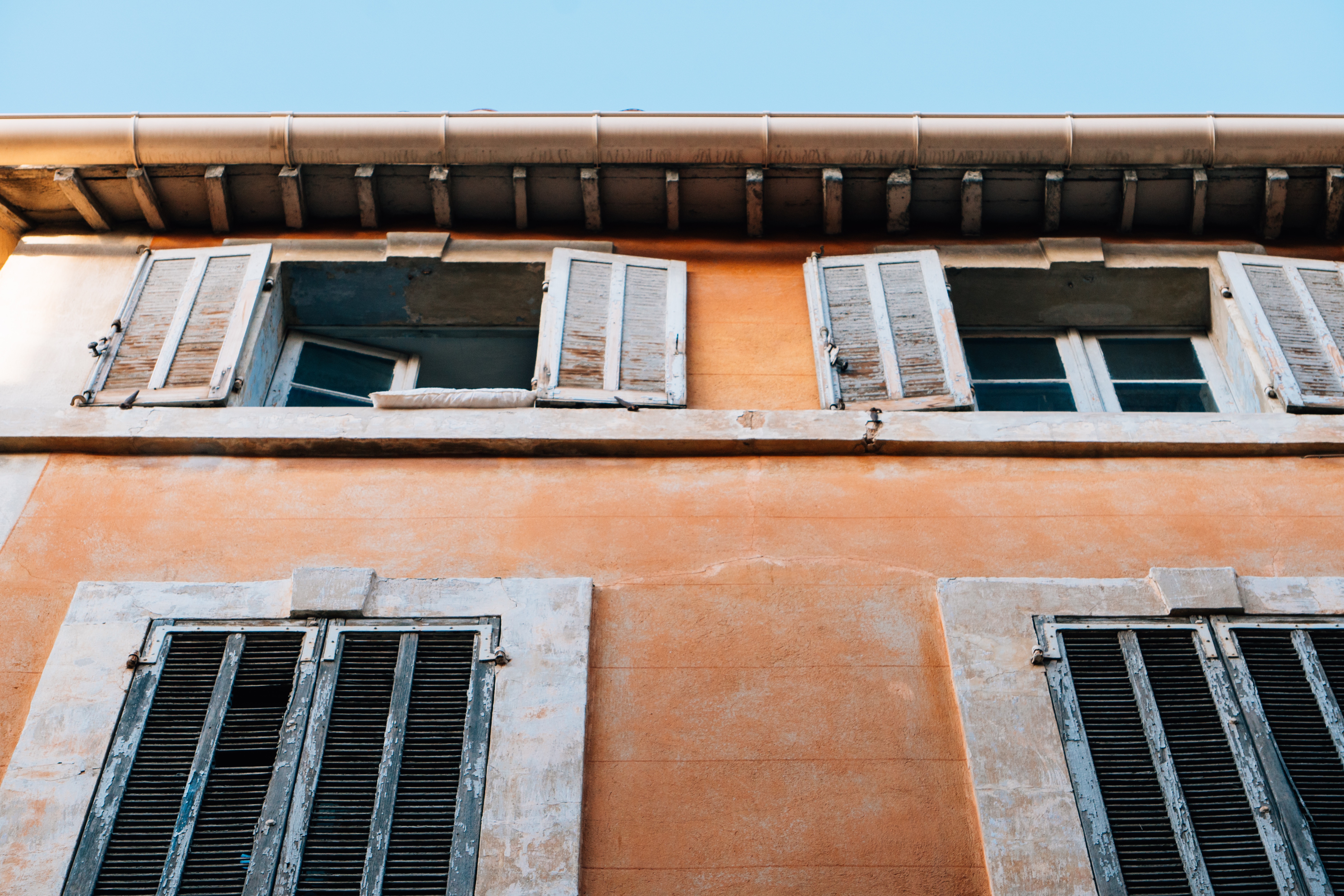
Mediterranean Mystique
Mediterranean Mystique
Cruise overview
WHY BOOK WITH US?
- ✔ The Deluxe Cruises’ team has extensive experience in ultra-luxury cruising.
- ✔ Call now to speak to our helpful and experienced Cruise Concierge team.
- ✔ Enjoy our Unique Deluxe Cruises Bonus for substantial savings.
- ✔ Our team will tailor your holiday to your exacting requirements.
- ✔ As agents, we work under the protection of each cruise lines ABTA / ATOL licences
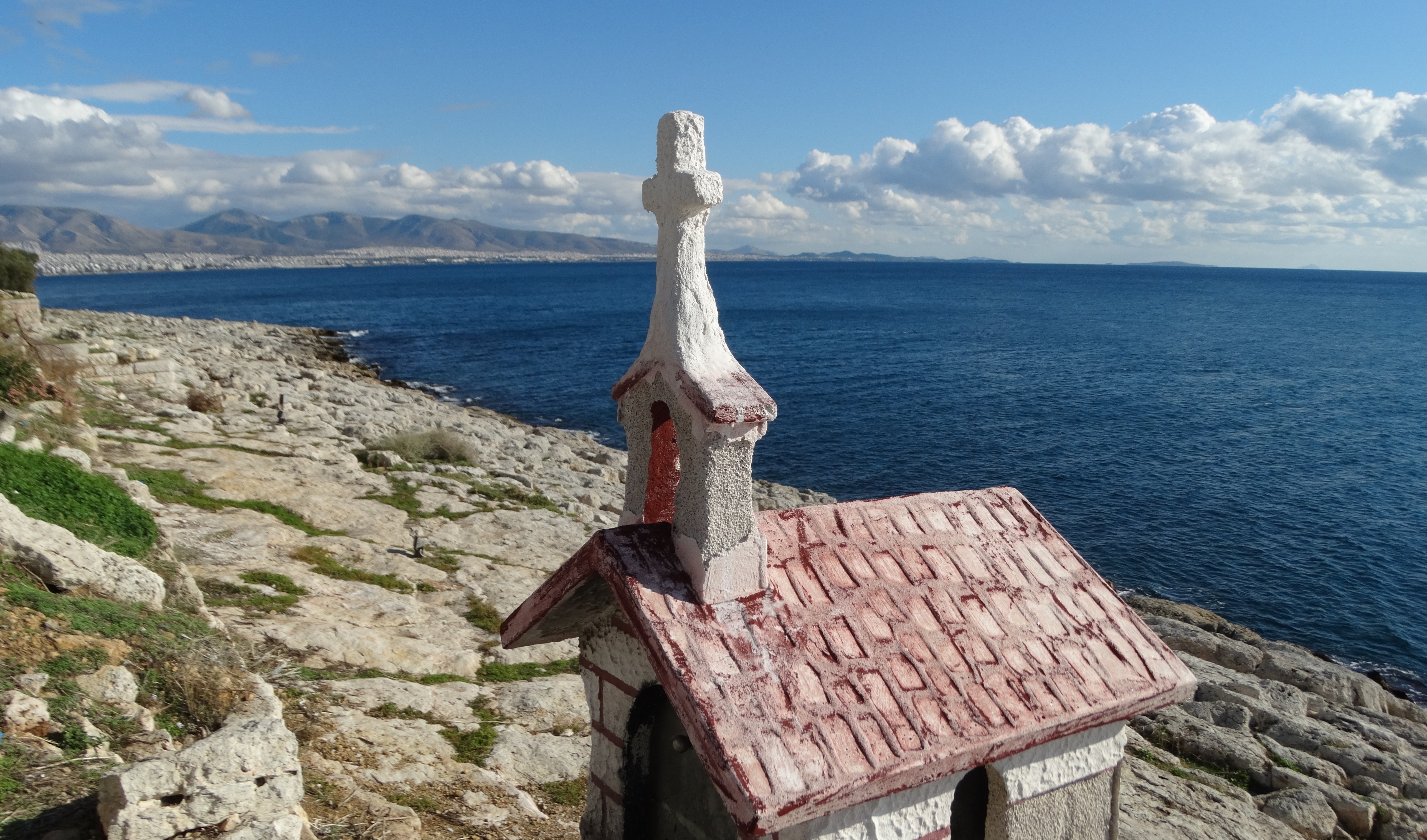
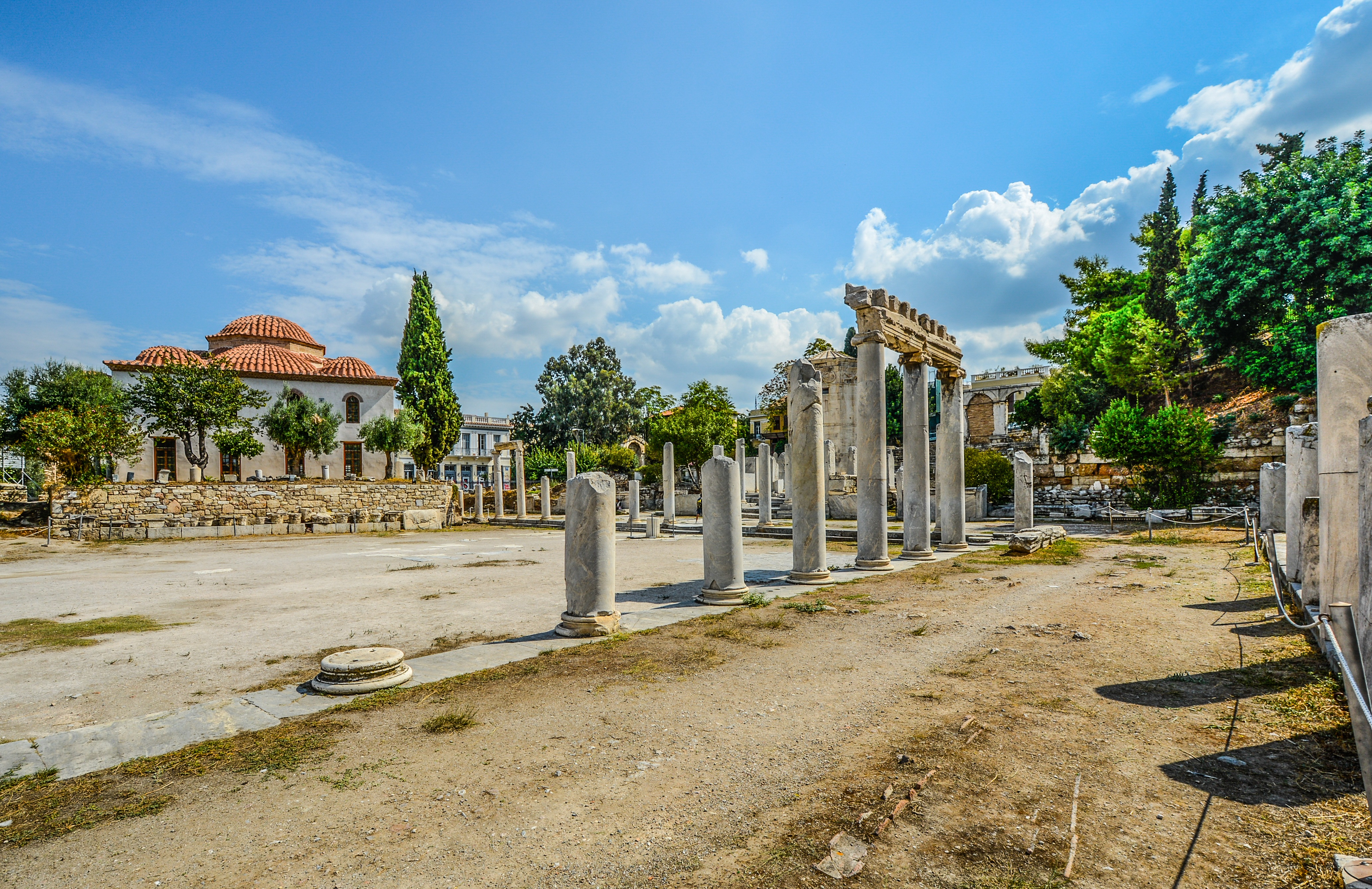
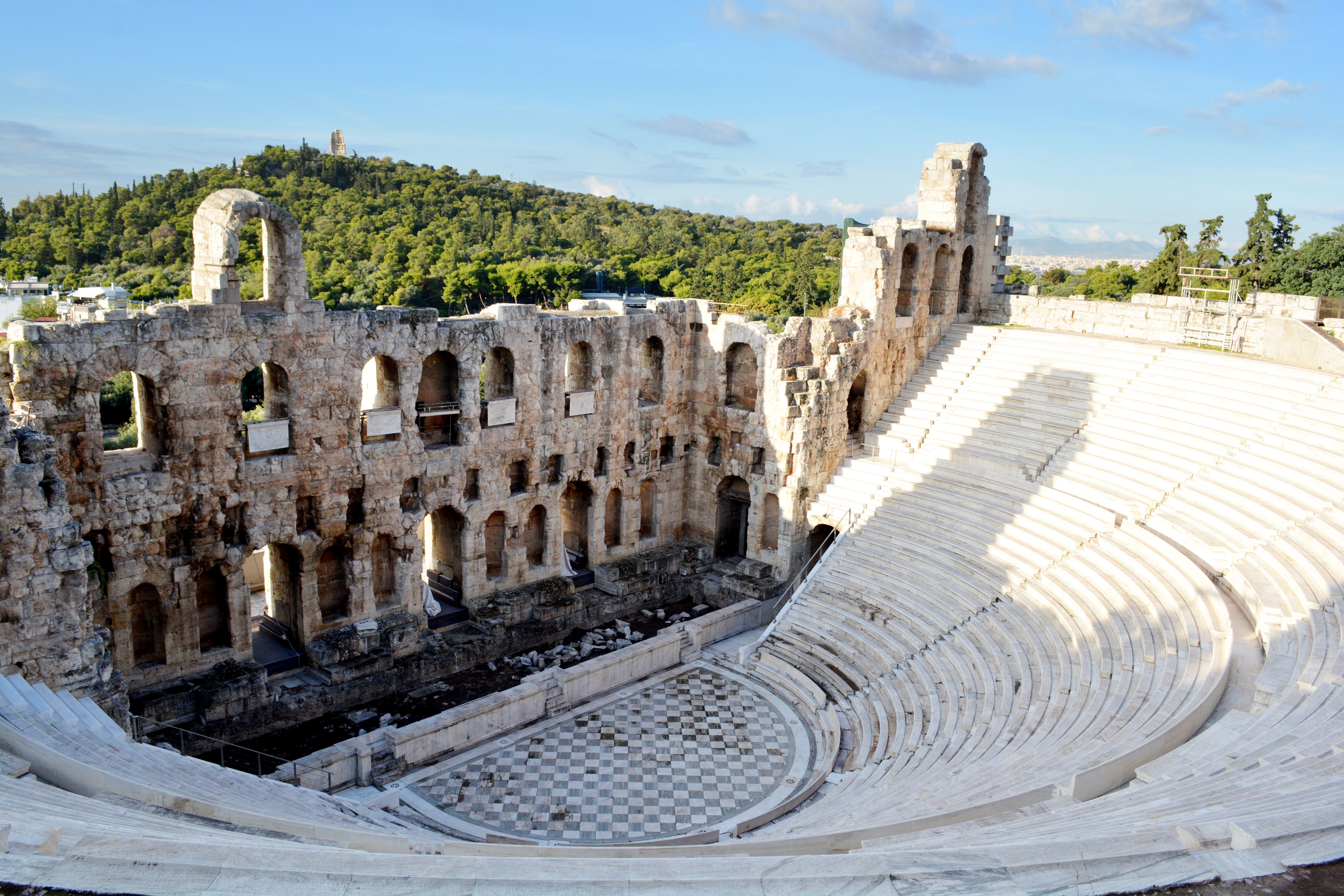
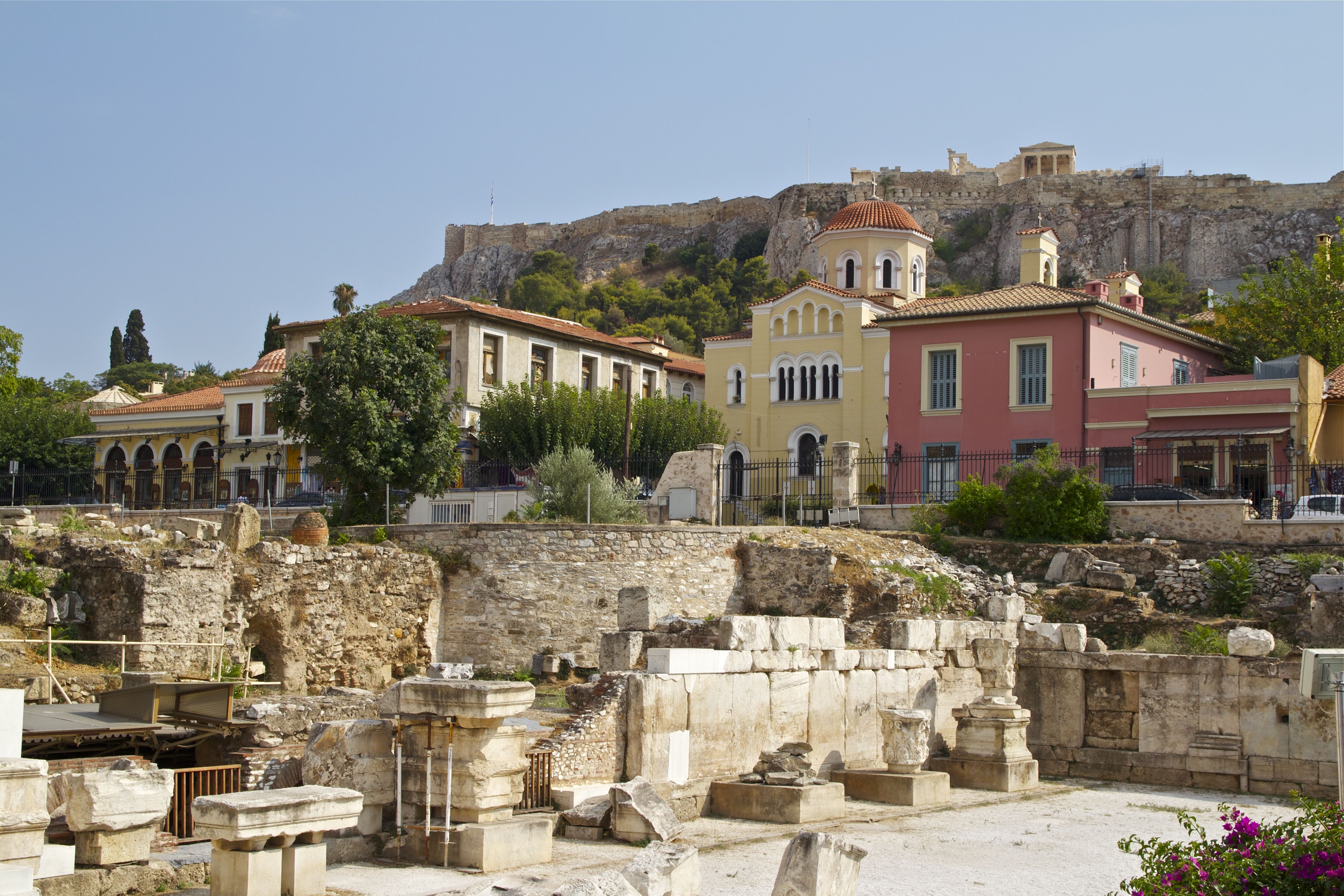
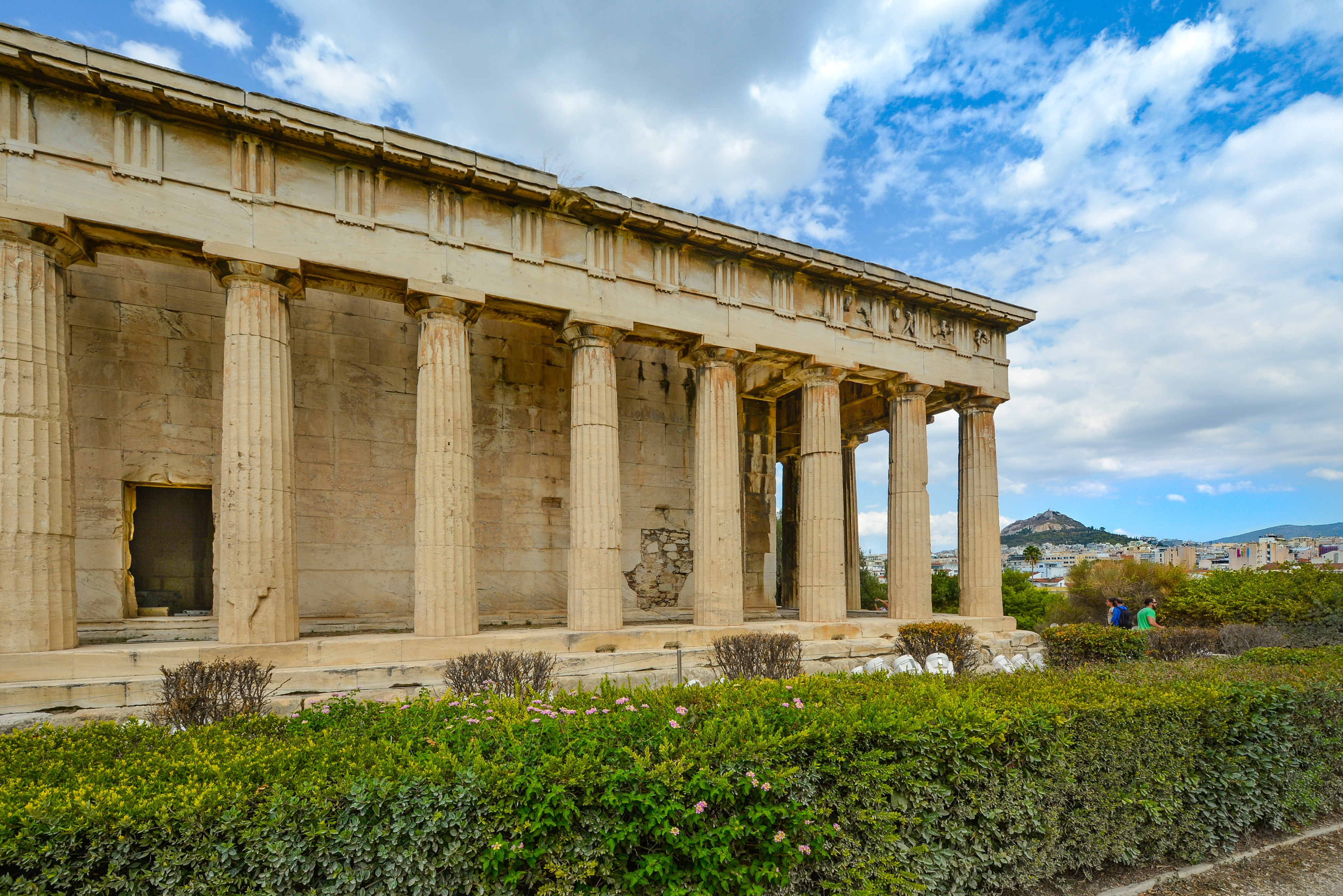
About Piraeus
It's no wonder that all roads lead to the fascinating and maddening metropolis of Athens. Lift your eyes 200 feet above the city to the Parthenon, its honey-color marble columns rising from a massive limestone base, and you behold architectural perfection that has not been surpassed in 2,500 years. But, today, this shrine of classical form dominates a 21st-century boomtown. To experience Athens—Athína in Greek—fully is to understand the essence of Greece: ancient monuments surviving in a sea of cement, startling beauty amid the squalor, tradition juxtaposed with modernity. Locals depend on humor and flexibility to deal with the chaos; you should do the same. The rewards are immense. Although Athens covers a huge area, the major landmarks of the ancient Greek, Roman, and Byzantine periods are close to the modern city center. You can easily walk from the Acropolis to many other key sites, taking time to browse in shops and relax in cafés and tavernas along the way. From many quarters of the city you can glimpse "the glory that was Greece" in the form of the Acropolis looming above the horizon, but only by actually climbing that rocky precipice can you feel the impact of the ancient settlement. The Acropolis and Filopappou, two craggy hills sitting side by side; the ancient Agora (marketplace); and Kerameikos, the first cemetery, form the core of ancient and Roman Athens. Along the Unification of Archaeological Sites promenade, you can follow stone-paved, tree-lined walkways from site to site, undisturbed by traffic. Cars have also been banned or reduced in other streets in the historical center. In the National Archaeological Museum, vast numbers of artifacts illustrate the many millennia of Greek civilization; smaller museums such as the Goulandris Museum of Cycladic Art Museum and the Byzantine and Christian Museum illuminate the history of particular regions or periods. Athens may seem like one huge city, but it is really a conglomeration of neighborhoods with distinctive characters. The Eastern influences that prevailed during the 400-year rule of the Ottoman Empire are still evident in Monastiraki, the bazaar area near the foot of the Acropolis. On the northern slope of the Acropolis, stroll through Plaka (if possible by moonlight), an area of tranquil streets lined with renovated mansions, to get the flavor of the 19th-century's gracious lifestyle. The narrow lanes of Anafiotika, a section of Plaka, thread past tiny churches and small, color-washed houses with wooden upper stories, recalling a Cycladic island village. In this maze of winding streets, vestiges of the older city are everywhere: crumbling stairways lined with festive tavernas; dank cellars filled with wine vats; occasionally a court or diminutive garden, enclosed within high walls and filled with magnolia trees and the flaming trumpet-shaped flowers of hibiscus bushes. Formerly run-down old quarters, such as Thission, Gazi and Psirri, popular nightlife areas filled with bars and mezedopoleia (similar to tapas bars), are now in the process of gentrification, although they still retain much of their original charm, as does the colorful produce and meat market on Athinas. The area around Syntagma Square, the tourist hub, and Omonia Square, the commercial heart of the city about 1 km (½ mi) northwest, is distinctly European, having been designed by the court architects of King Otho, a Bavarian, in the 19th century. The chic shops and bistros of ritzy Kolonaki nestle at the foot of Mt. Lycabettus, Athens's highest hill (909 feet). Each of Athens's outlying suburbs has a distinctive character: in the north is wealthy, tree-lined Kifissia, once a summer resort for aristocratic Athenians, and in the south and southeast lie Glyfada, Voula, and Vouliagmeni, with their sandy beaches, seaside bars, and lively summer nightlife. Just beyond the city's southern fringes is Piraeus, a bustling port city of waterside fish tavernas and Saronic Gulf views.

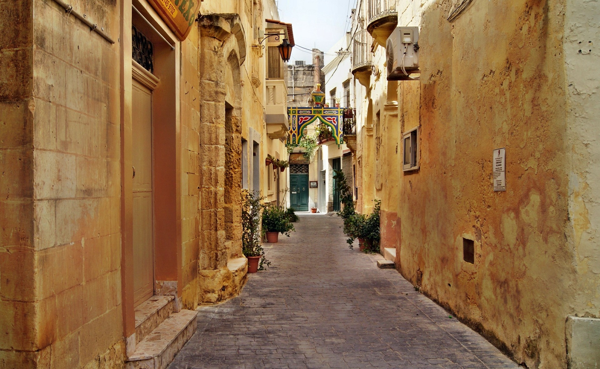
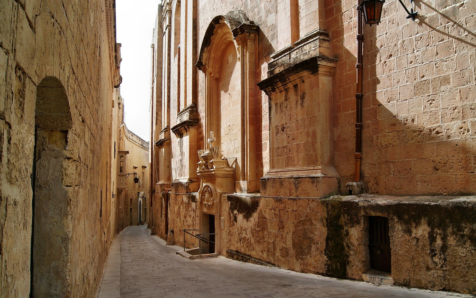
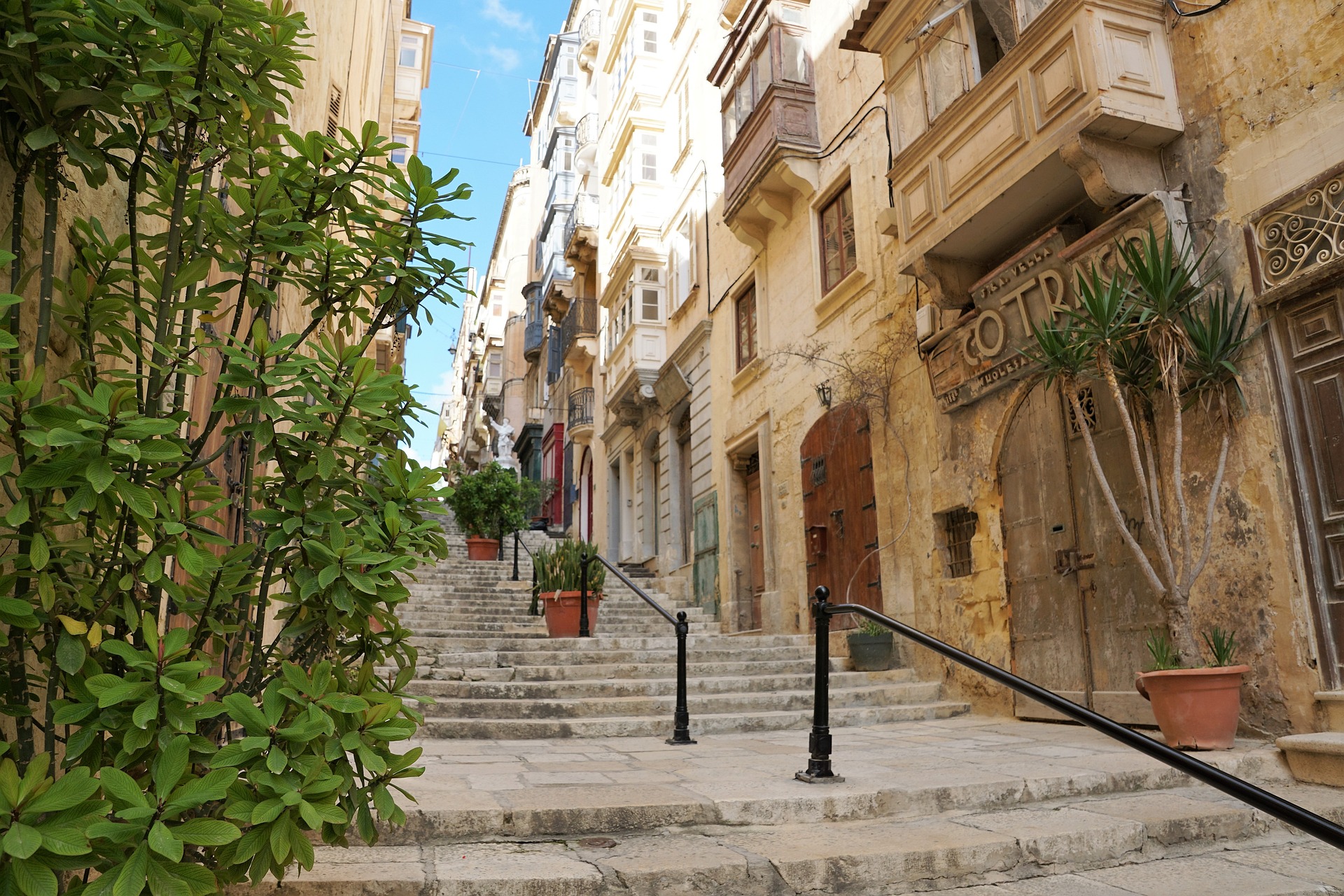
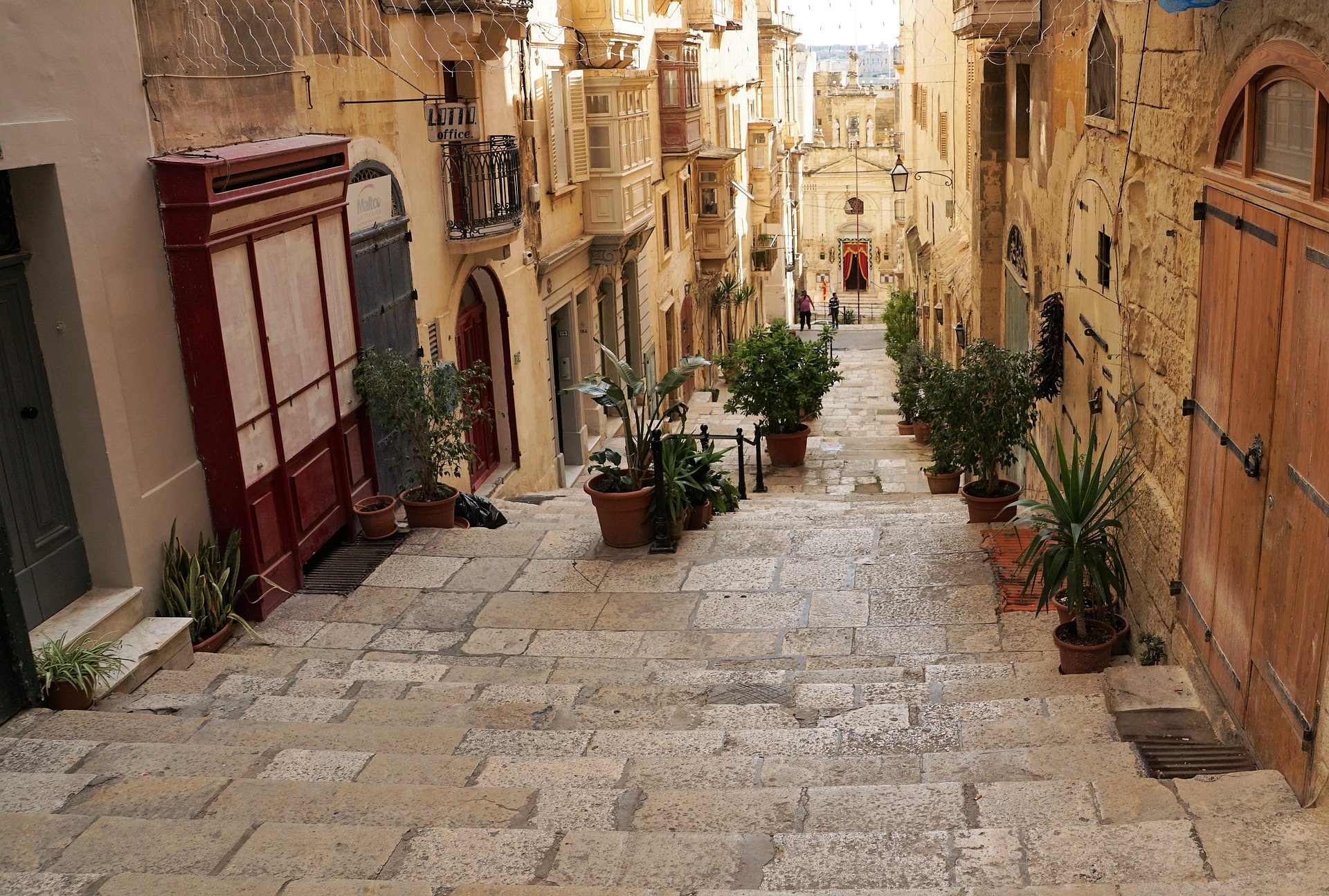
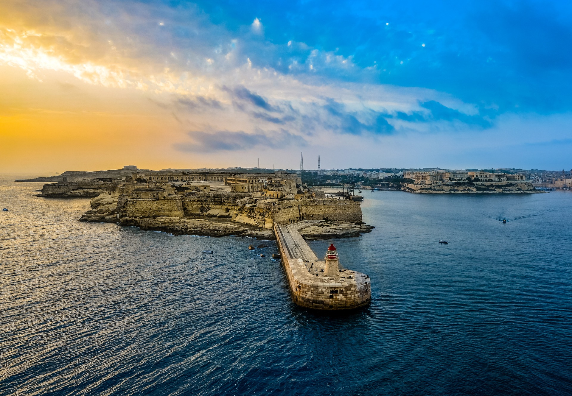
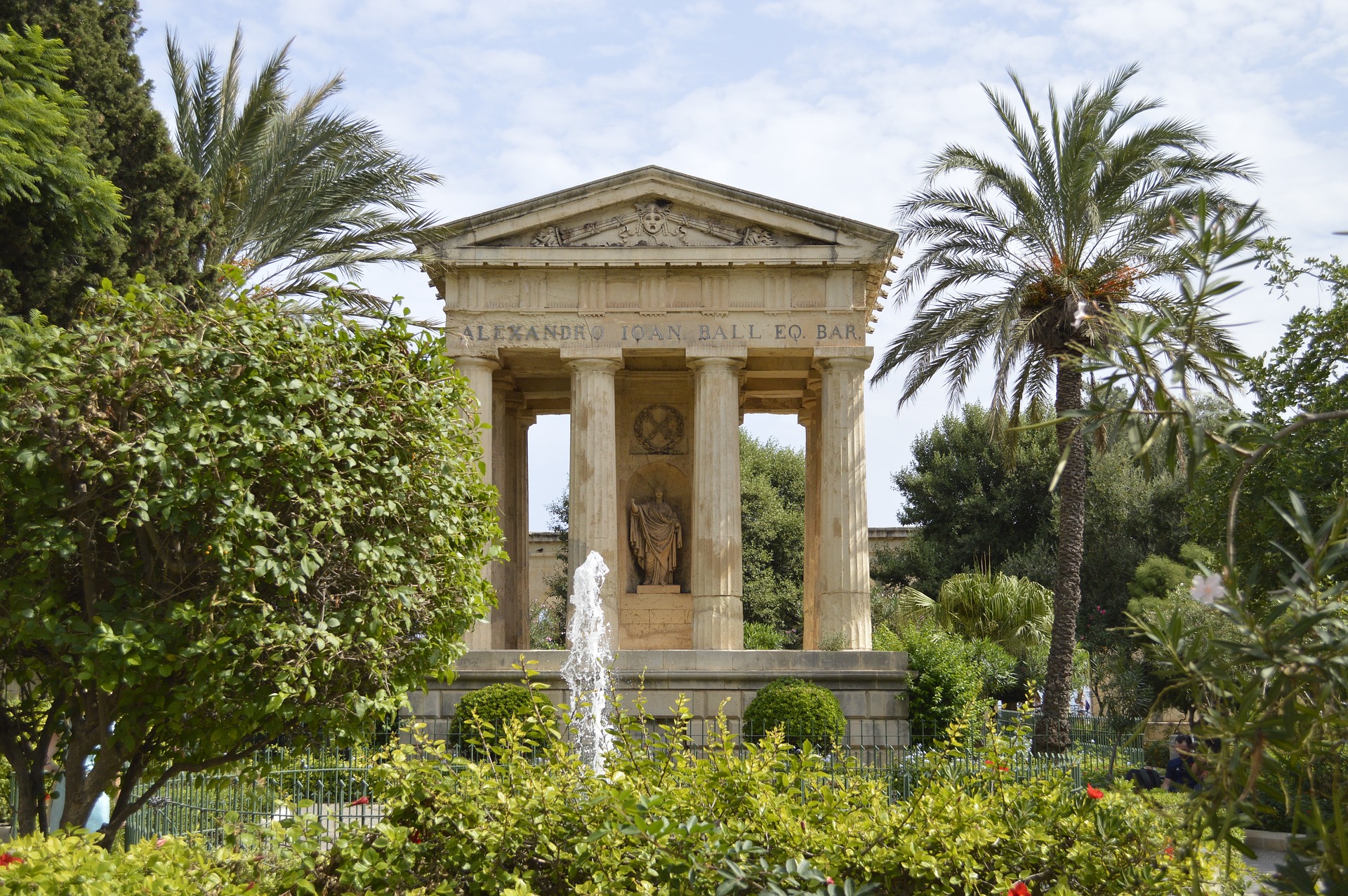
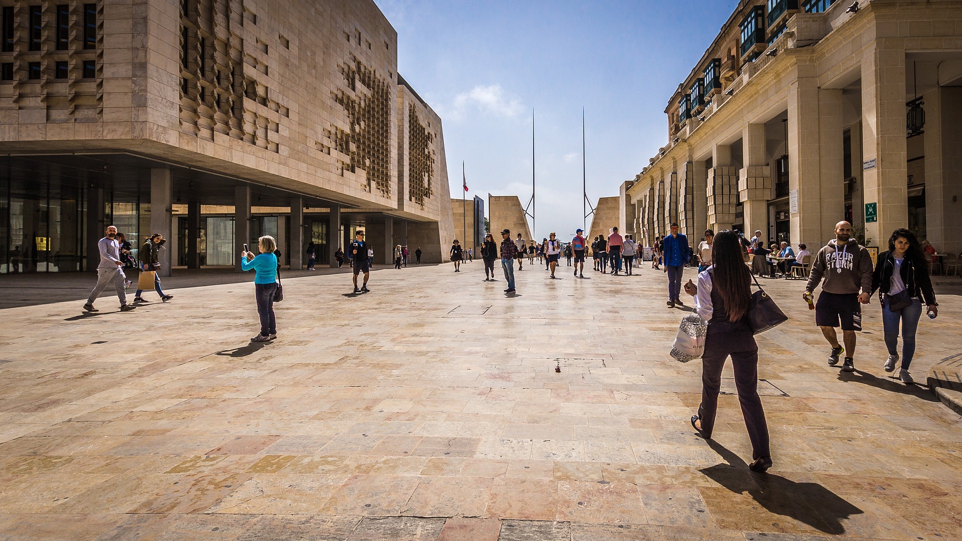
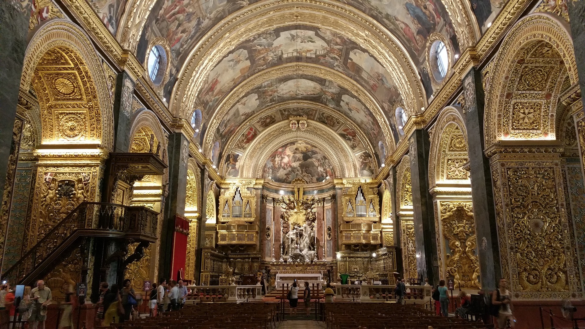
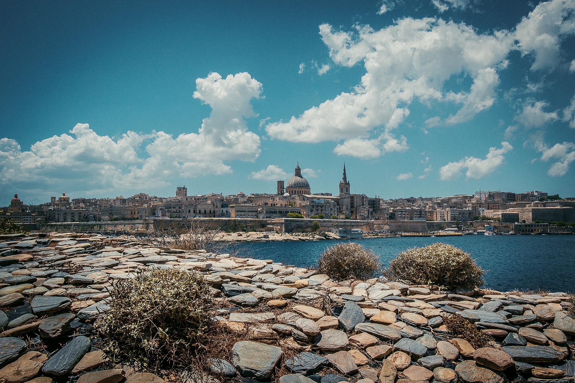
About Valletta
Malta's capital, the minicity of Valletta, has ornate palaces and museums protected by massive fortifications of honey-color limestone. Houses along the narrow streets have overhanging wooden balconies for people-watching from indoors. Generations ago they gave housebound women a window on the world of the street. The main entrance to town is through the City Gate (where all bus routes end), which leads onto Triq Repubblika (Republic Street), the spine of the grid-pattern city and the main shopping street. Triq Mercante (Merchant Street) parallels Repubblika to the east and is also good for strolling. From these two streets, cross streets descend toward the water; some are stepped. Valletta's compactness makes it ideal to explore on foot. City Gate and the upper part of Valletta are experiencing vast redevelopment that includes a new Parliament Building and open-air performance venue. The complex, completed mid-2013, has numerous pedestrian detours in place along with building noise and dust. Before setting out along Republic Street, stop at the tourist information office on Merchant Street for maps and brochures.
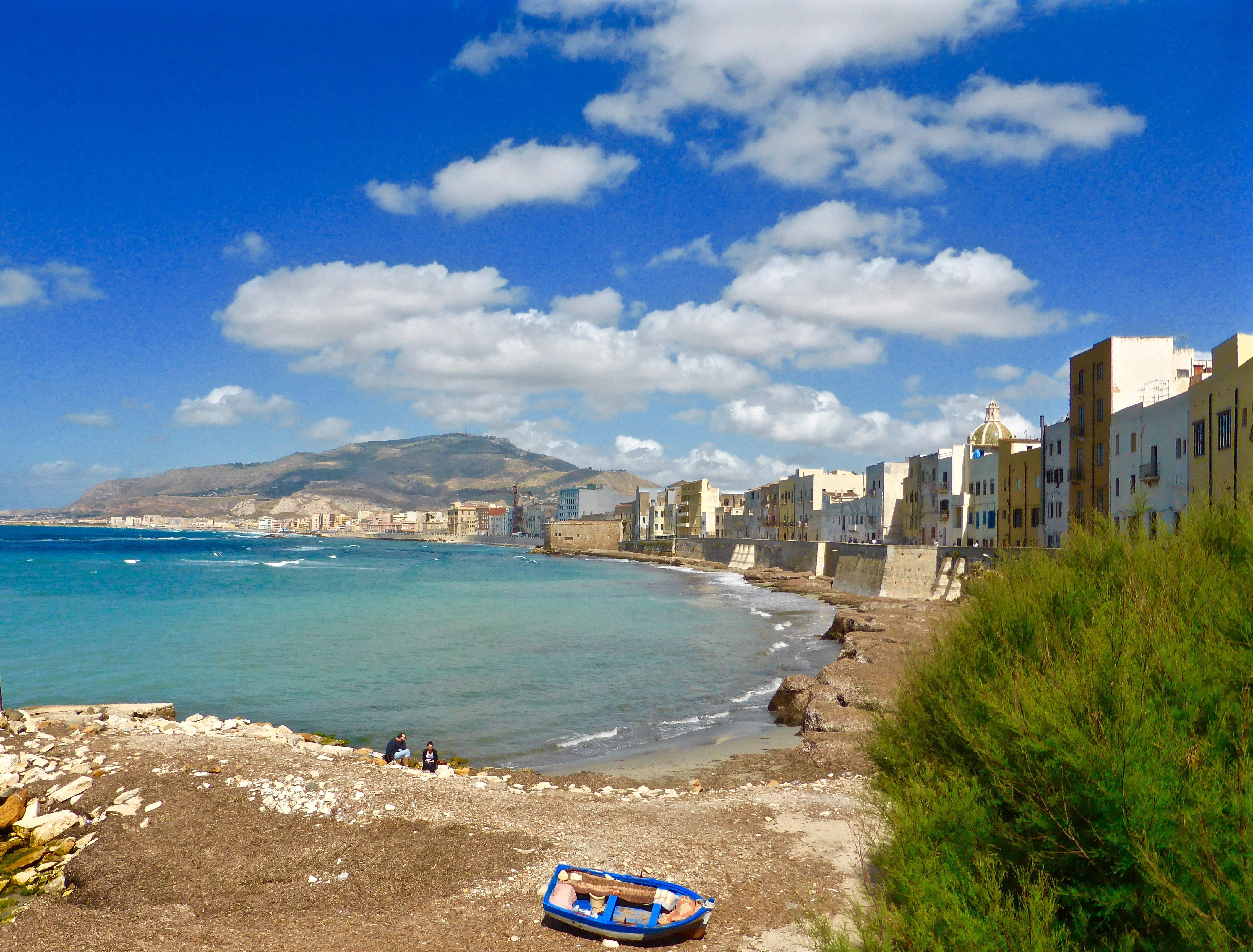
About Trapani, Sicily
Trapani, the most important town on Sicily’s west coast, lies below the headland of Mount Erice and offers stunning views of the Egadi Islands on a clear day. Trapani’s Old District occupies a scimitarshaped promontory between the open sea on the north and the salt marshes to the south. The ancient industry of extracting salt from the marshes has recently been revived, and it is documented in the Museo delle Saline. In addition to the salt marshes,Trapani’s other interesting environs include the beautiful little hill town of Erice, the promontory of Capo San Vito stretching north beyond the splendid headland of Monte Cofano, the lovely island of Motya and the town of Marsala. Trips farther afield will take you to the magnificent site of Segesta or the Egadi Islands, reached by boat or hydrofoil from Trapani Port.
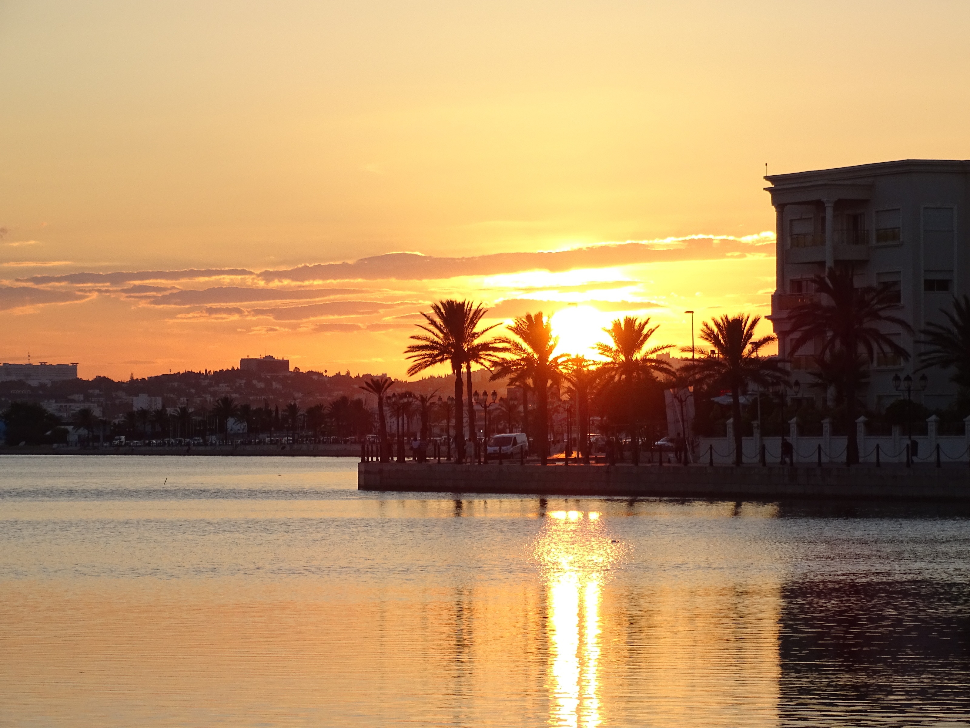
About La Goulette
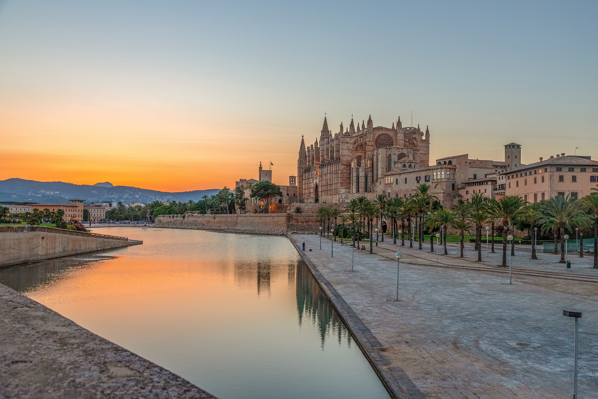
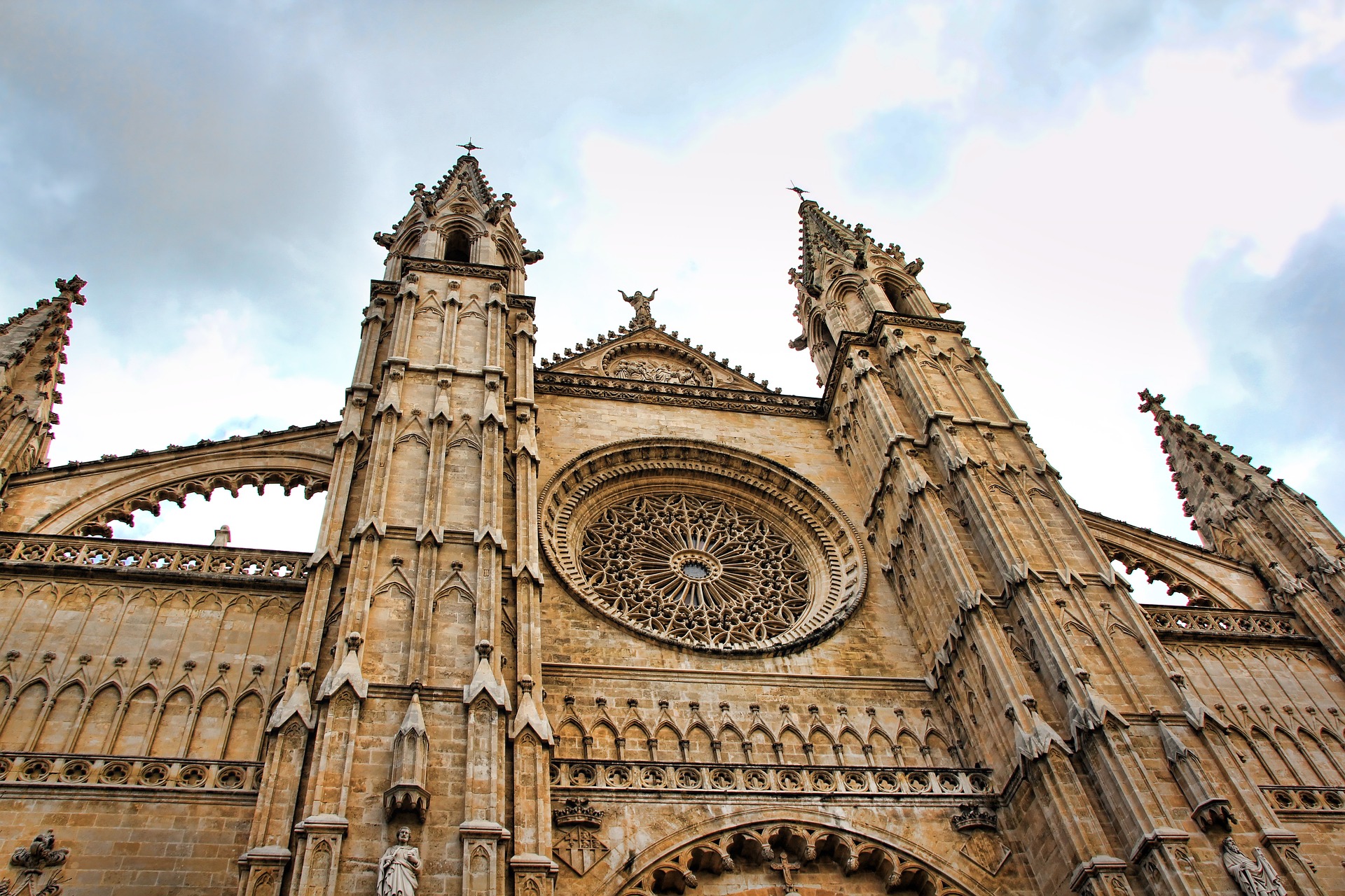
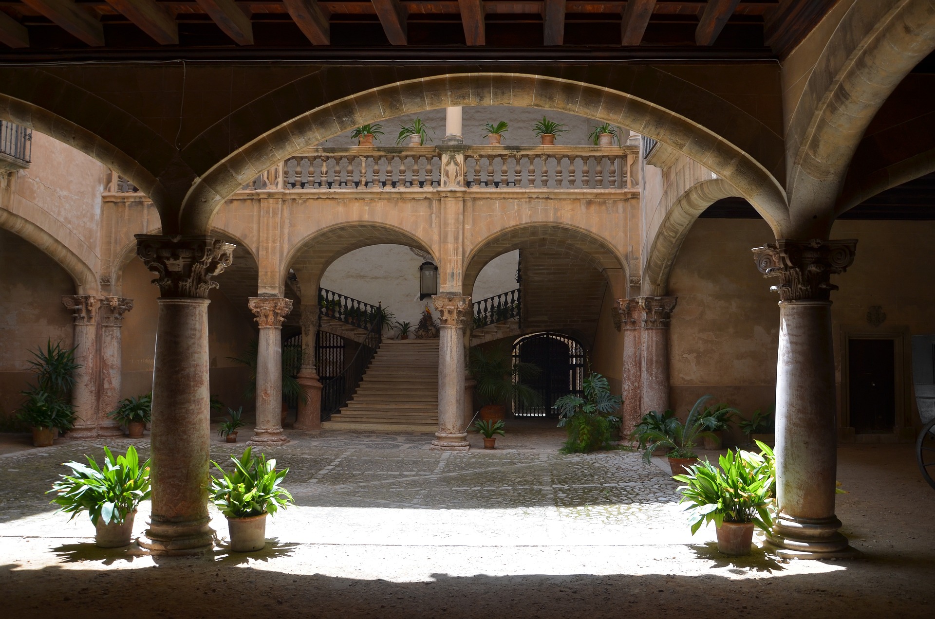
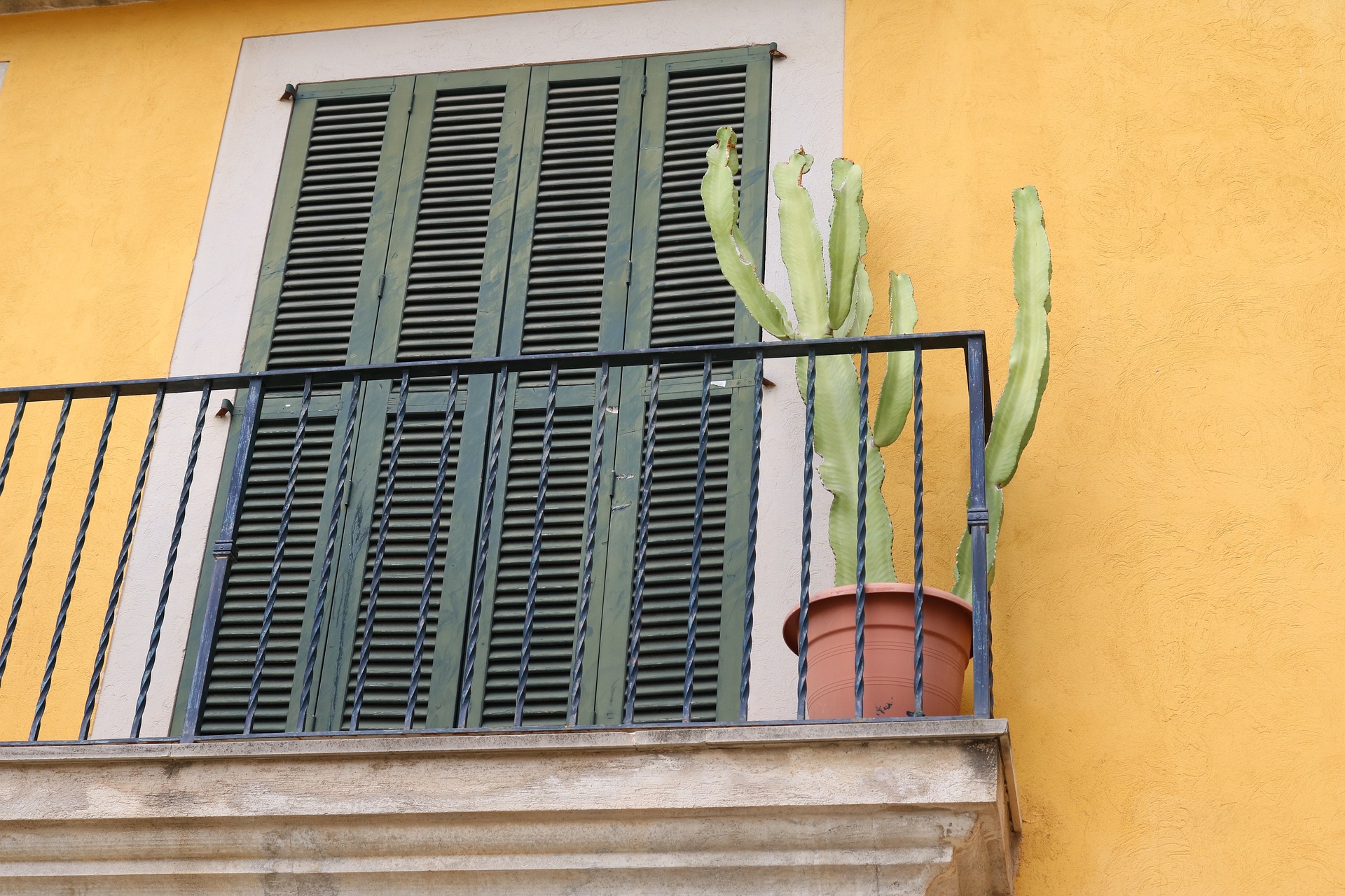
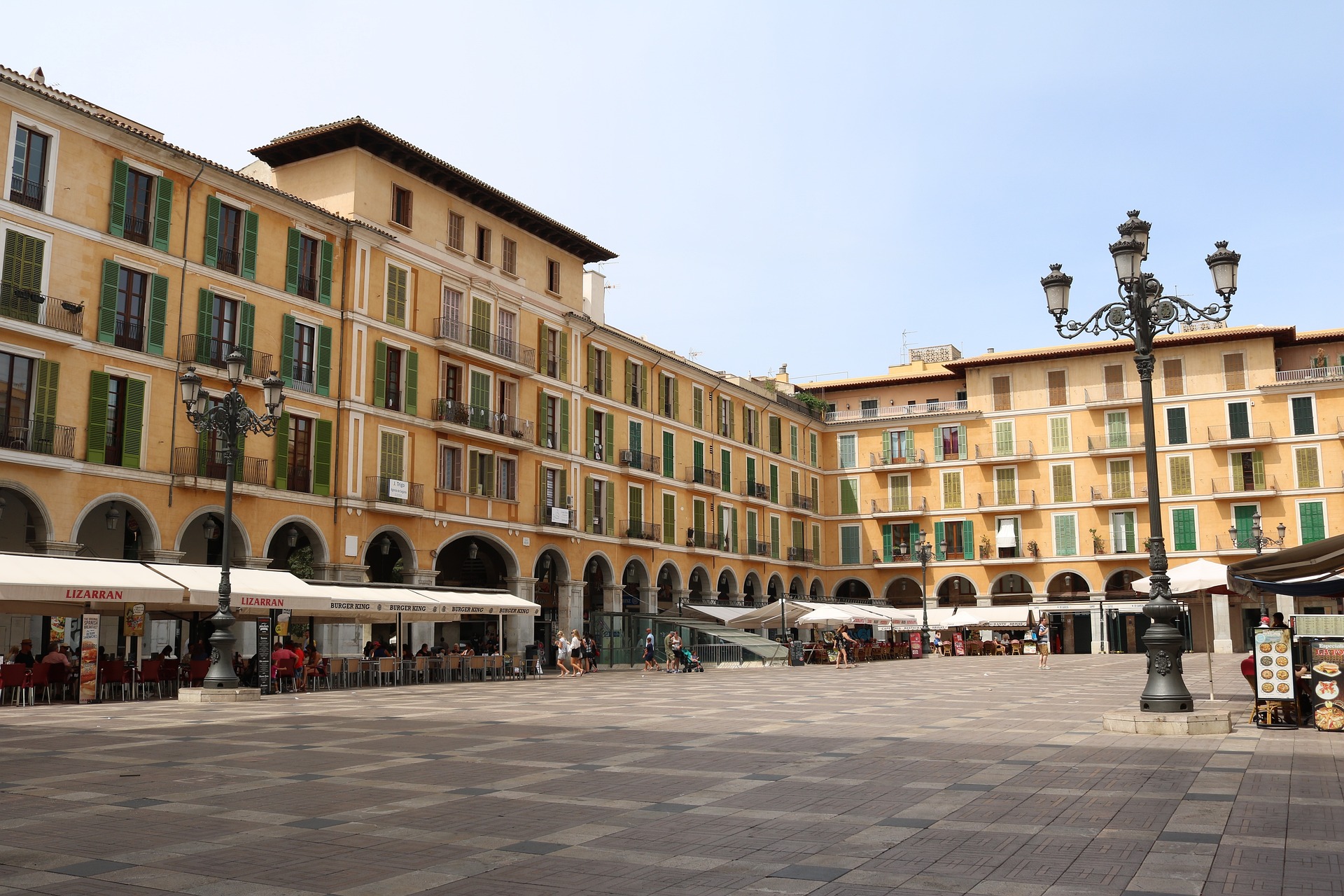
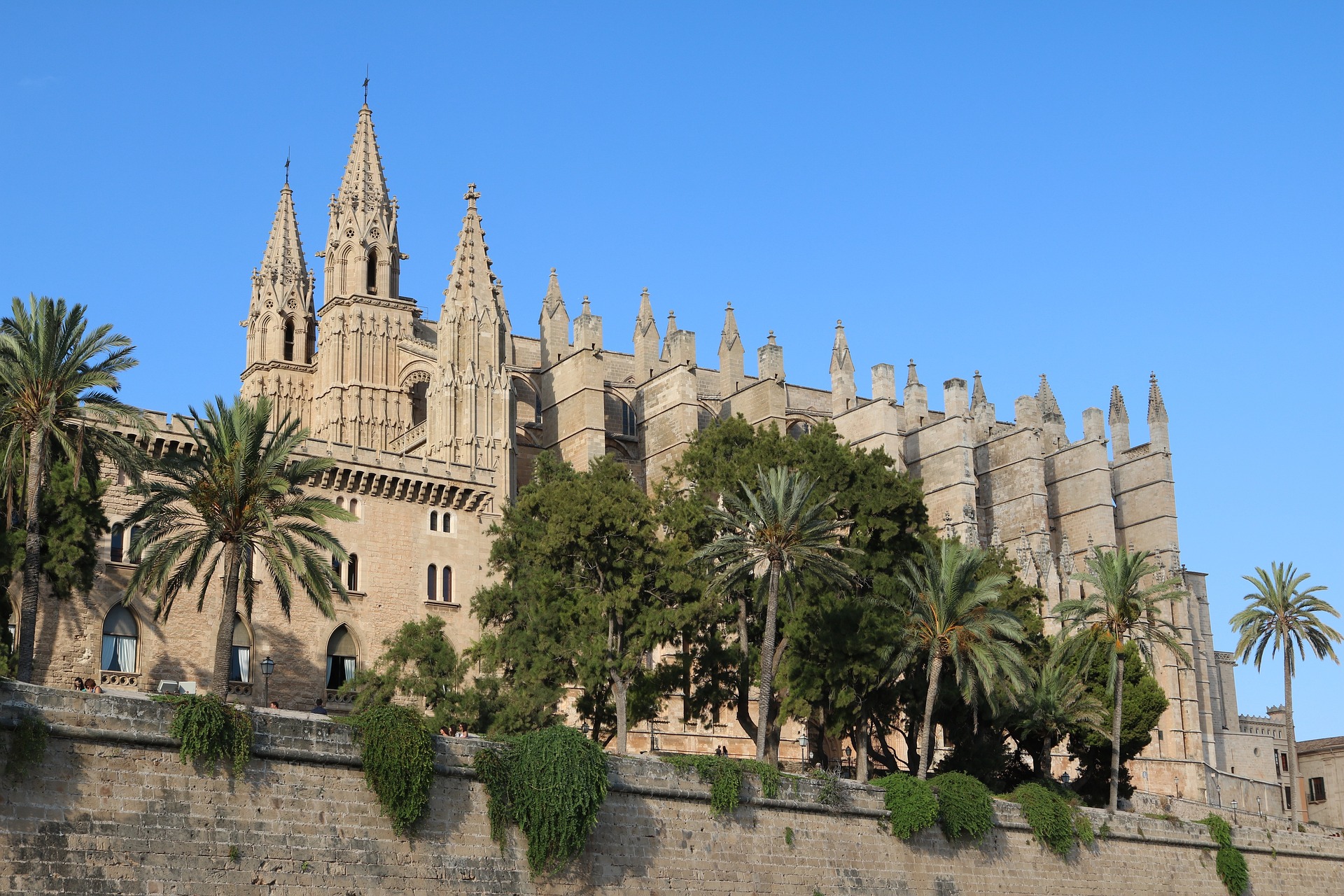
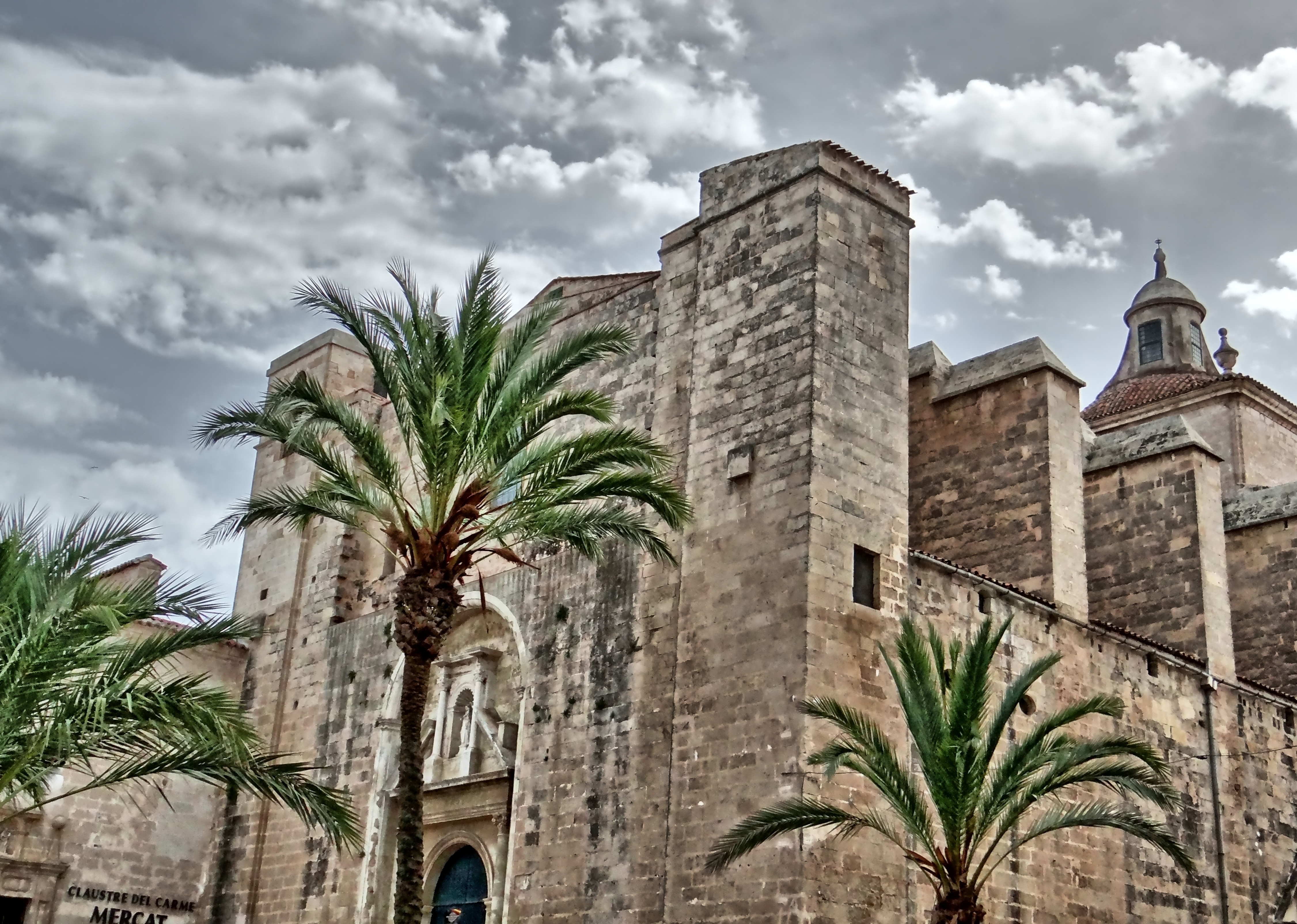
About Palma de Mallorca
If you look north of the cathedral (La Seu, or the seat of the bishopric, to Mallorcans) on a map of the city of Palma, you can see around the Plaça Santa Eulàlia a jumble of tiny streets that made up the earliest settlement. Farther out, a ring of wide boulevards traces the fortifications built by the Moors to defend the larger city that emerged by the 12th century. The zigzags mark the bastions that jutted out at regular intervals. By the end of the 19th century, most of the walls had been demolished; the only place where you can still see the massive defenses is at Ses Voltes, along the seafront west of the cathedral.A torrent (streambed) used to run through the middle of the old city, dry for most of the year but often a raging flood in the rainy season. In the 17th century it was diverted to the east, along the moat that ran outside the city walls. Two of Palma's main arteries, La Rambla and the Passeig d'es Born, now follow the stream's natural course. The traditional evening paseo (promenade) takes place on the Born.If you come to Palma by car, park in the garage beneath the Parc de la Mar (the ramp is just off the highway from the airport, as you reach the cathedral) and stroll along the park. Beside it run the huge bastions guarding the Almudaina Palace; the cathedral, golden and massive, rises beyond. Where you exit the garage, there's a ceramic mural by the late Catalan artist and Mallorca resident Joan Miró, facing the cathedral across the pool that runs the length of the park.If you begin early enough, a walk along the ramparts at Ses Voltes from the mirador beside the cathedral is spectacular. The first rays of the sun turn the upper pinnacles of La Seu bright gold and then begin to work their way down the sandstone walls. From the Parc de la Mar, follow Avinguda Antoni Maura past the steps to the palace. Just below the Plaça de la Reina, where the Passeig d'es Born begins, turn left on Carrer de la Boteria into the Plaça de la Llotja (if the Llotja itself is open, don't miss a chance to visit—it's the Mediterranean's finest Gothic-style civic building). From there stroll through the Plaça Drassana to the Museu d'Es Baluard, at the end of Carrer Sant Pere. Retrace your steps to Avinguda Antoni Maura. Walk up the Passeig d'es Born to Plaça Joan Carles I, then right on Avenida de La Unió.

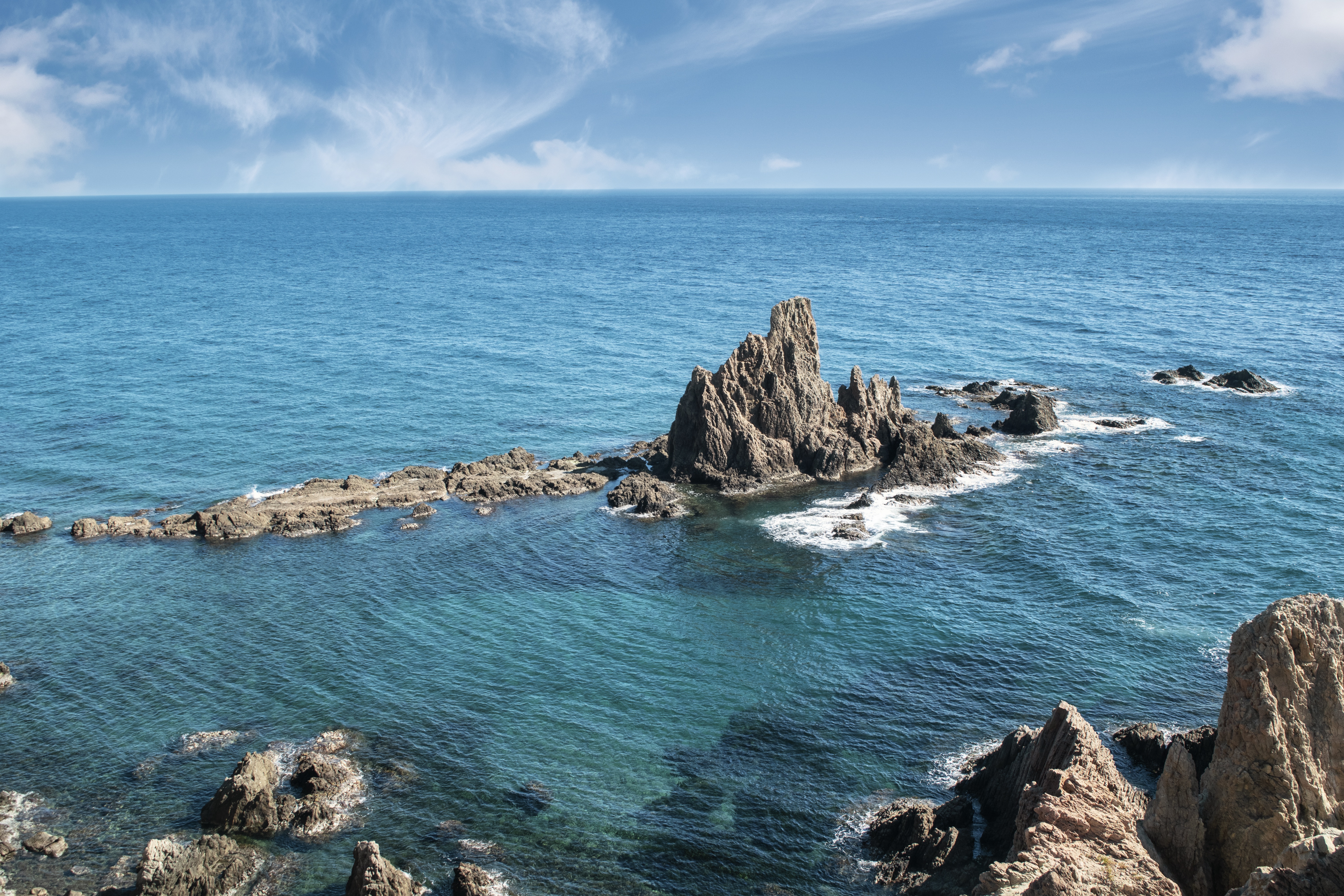
About Almería
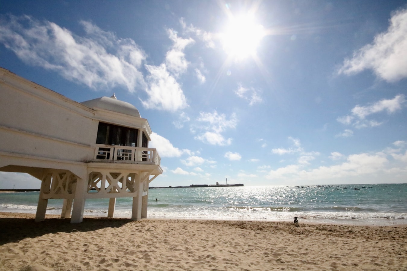
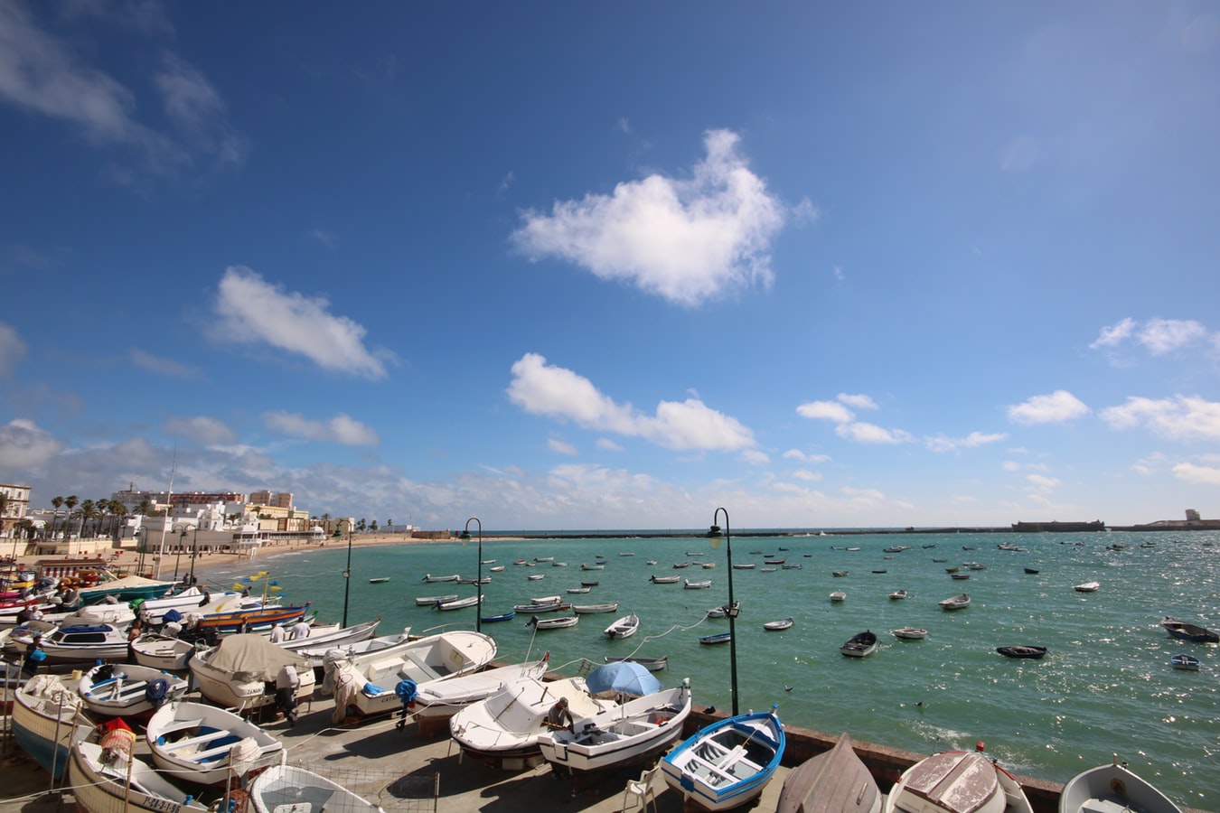
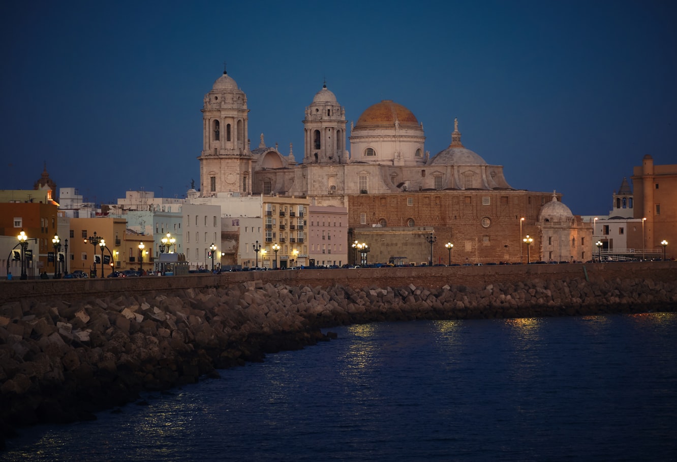
About Cádiz
Believed to be the oldest town on the Iberian Peninsula, the Andalusian port of Cádiz enjoys a stunning location at the edge of a six-mile promontory. The town itself, with 3,000 years of history, is characterised by pretty white houses with balconies often adorned with colourful flowers. As you wander around be sure to take a stroll through the sizeable Plaza de Espãna, with its large monument dedicated to the first Spanish constitution, which was signed here in 1812. Cádiz has two pleasant seafront promenades which boast fine views of the Atlantic Ocean, and has a lovely park, the Parque Genoves, located close to the sea with an open-air theatre and attractive palm garden. Also notable is the neo-Classical cathedral, capped by a golden dome.
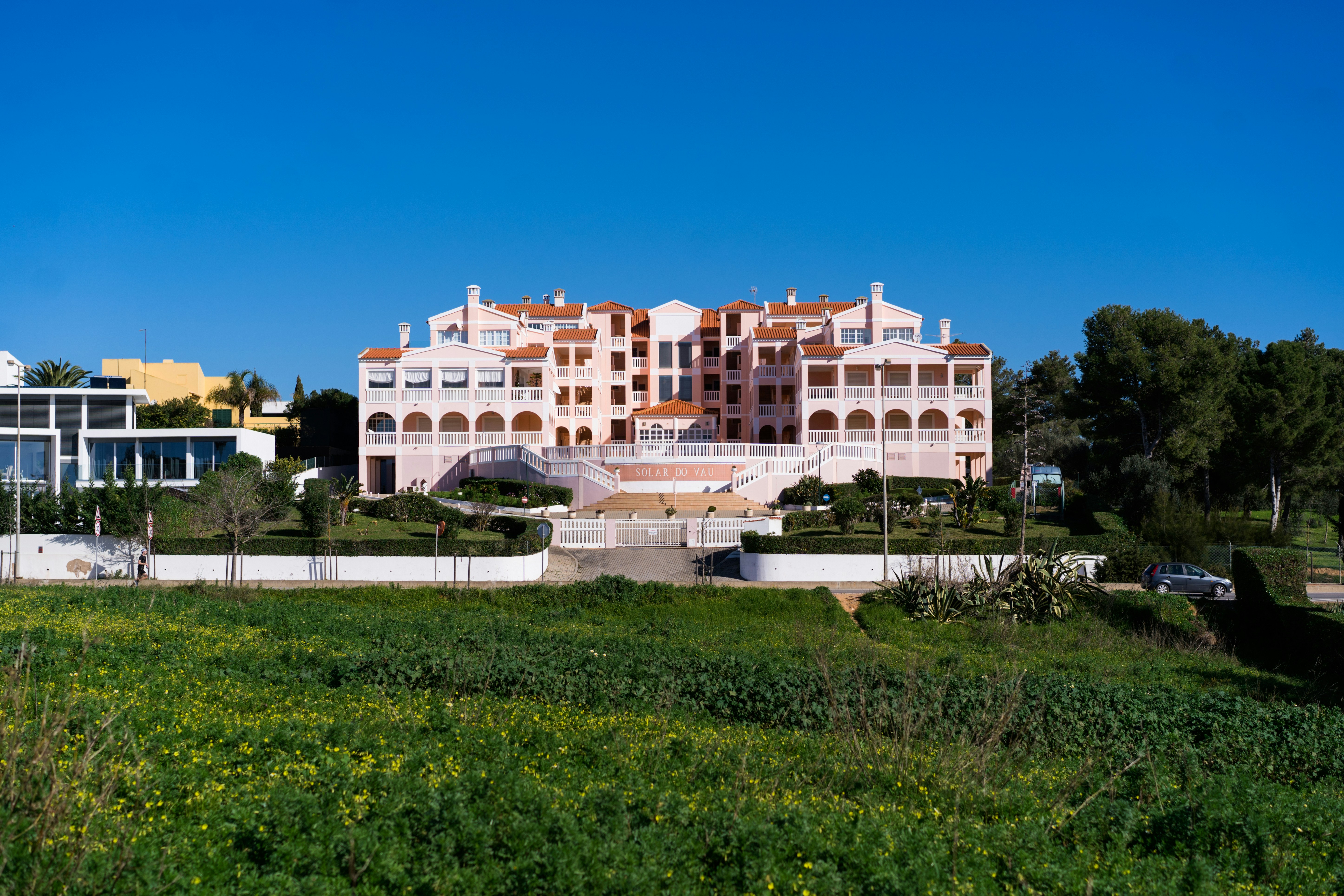
About Portimão
Portimão is a major fishing port, and significant investment has been poured into transforming it into an attractive cruise port as well. The city itself is spacious and has several good shopping streets—though sadly many of the more traditional retailers have closed in the wake of the global economic crisis. There is also a lovely riverside area that just begs to be strolled (lots of the coastal cruises depart from here). Don’t leave without stopping for an alfresco lunch at the Doca da Sardinha ("sardine dock") between the old bridge and the railway bridge. You can sit at one of many inexpensive establishments, eating charcoal-grilled sardines (a local specialty) accompanied by chewy fresh bread, simple salads, and local wine.

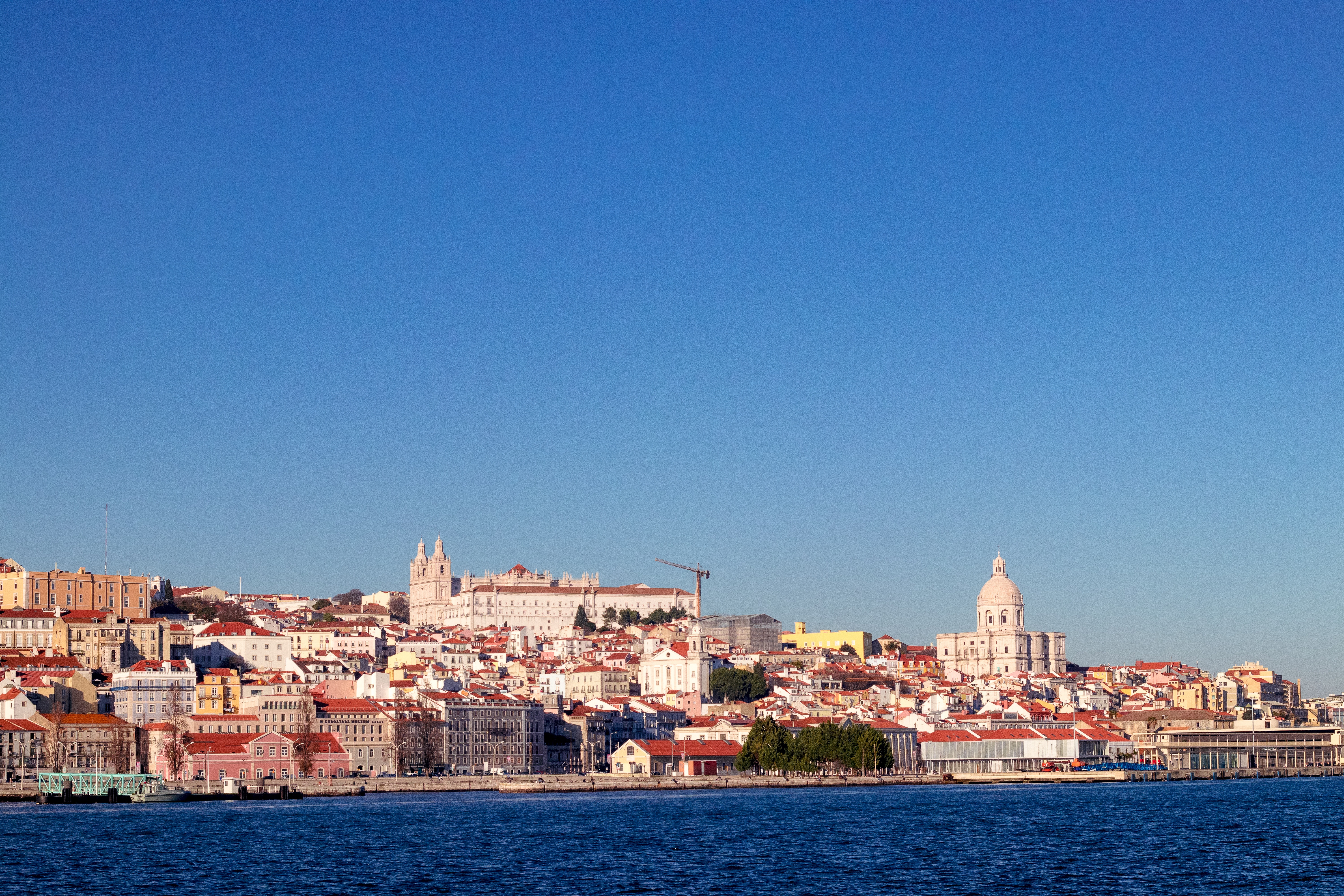
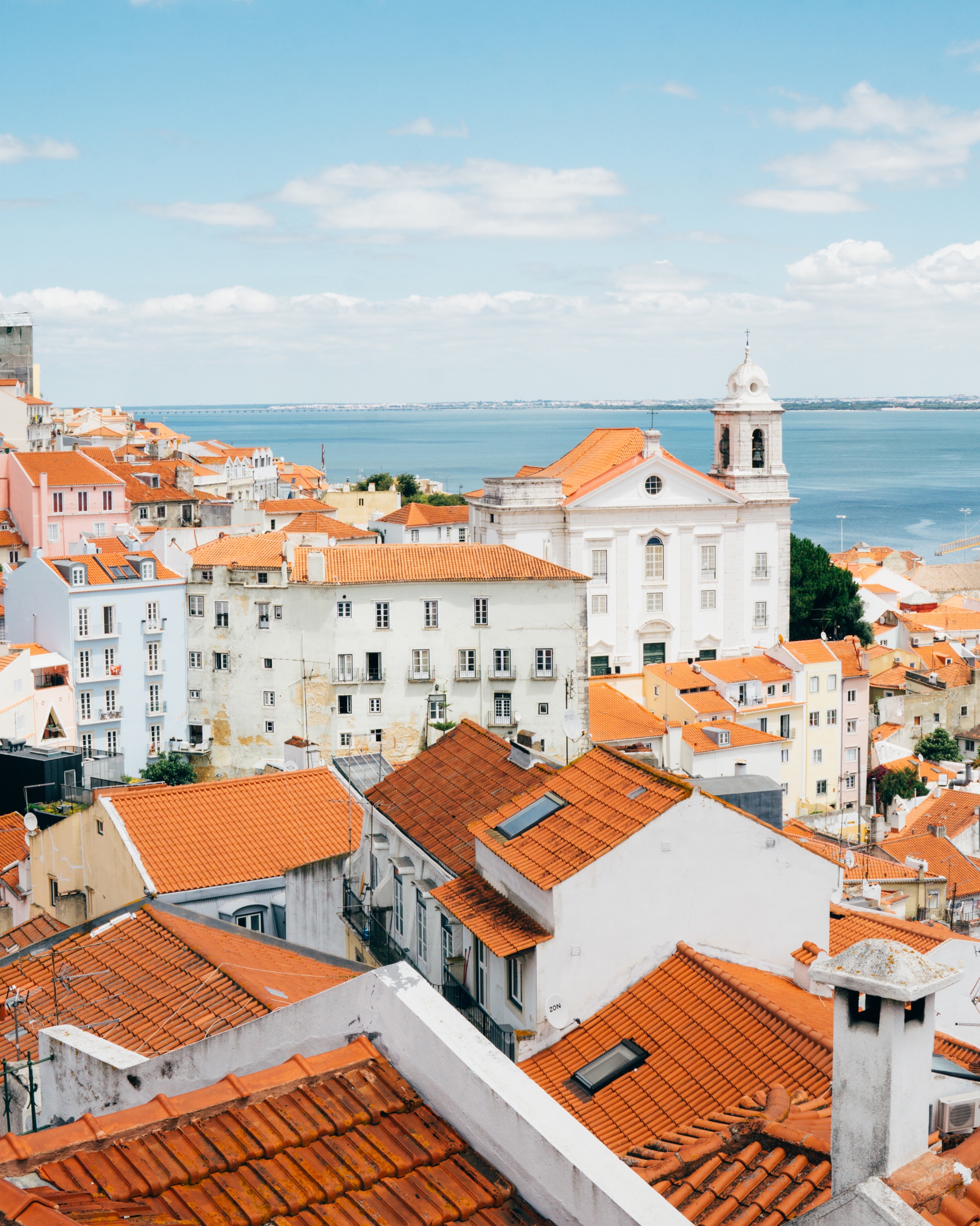
About Lisbon
Set on seven hills on the banks of the River Tagus, Lisbon has been the capital of Portugal since the 13th century. It is a city famous for its majestic architecture, old wooden trams, Moorish features and more than twenty centuries of history. Following disastrous earthquakes in the 18th century, Lisbon was rebuilt by the Marques de Pombal who created an elegant city with wide boulevards and a great riverfront and square, Praça do Comércio. Today there are distinct modern and ancient sections, combining great shopping with culture and sightseeing in the Old Town, built on the city's terraced hillsides. The distance between the ship and your tour vehicle may vary. This distance is not included in the excursion grades.

About Cádiz
Believed to be the oldest town on the Iberian Peninsula, the Andalusian port of Cádiz enjoys a stunning location at the edge of a six-mile promontory. The town itself, with 3,000 years of history, is characterised by pretty white houses with balconies often adorned with colourful flowers. As you wander around be sure to take a stroll through the sizeable Plaza de Espãna, with its large monument dedicated to the first Spanish constitution, which was signed here in 1812. Cádiz has two pleasant seafront promenades which boast fine views of the Atlantic Ocean, and has a lovely park, the Parque Genoves, located close to the sea with an open-air theatre and attractive palm garden. Also notable is the neo-Classical cathedral, capped by a golden dome.
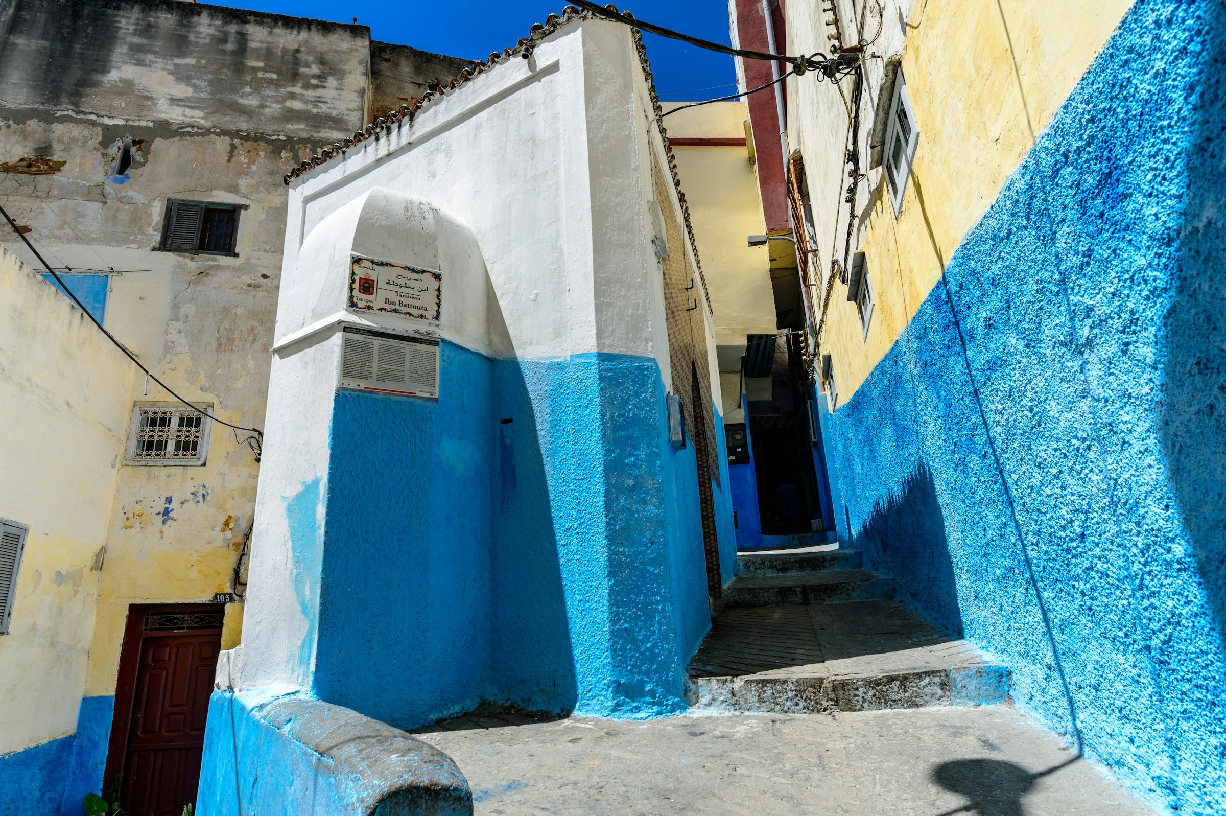
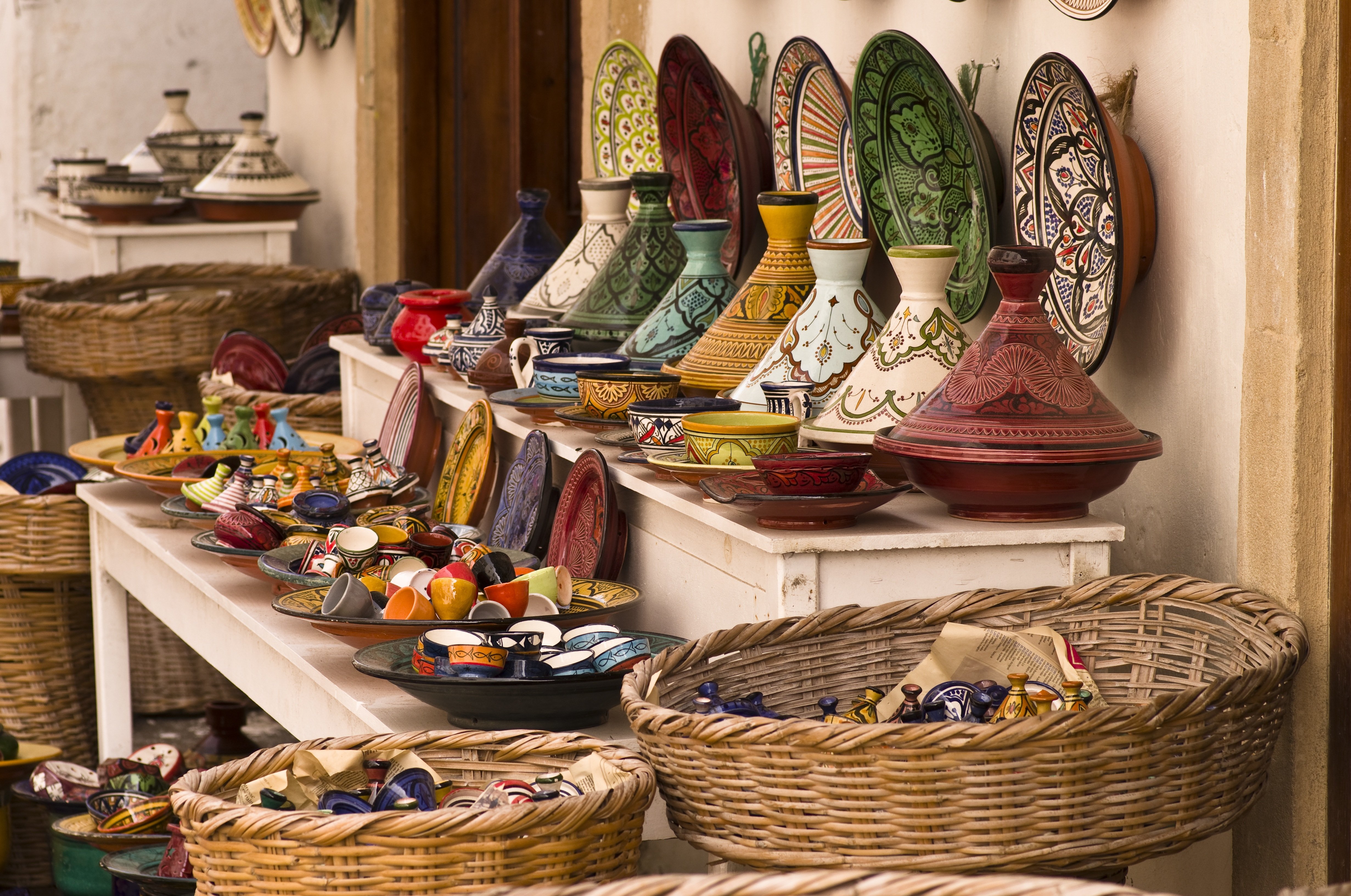
About Tangier
Tangier can trace its origins back to the Phoenicians and ancient Greeks. It was named after Tinge, the mother of Hercules’ son, and its beginnings are embedded in mythology. It was subsequently a Roman province, and after Vandal and Byzantine influences, was occupied by the Arabs with Spain, Portugal, France and England also playing a part in the city’s history. With such a diverse past it is perhaps not surprising that Tangier is such an individual city. Overlooking the Straits of Gibraltar, the city lies on a bay between two promontories. With its old Kasbah, panoramic views, elegant buildings, squares and places of interest, there is much to discover in both the new and old parts of the city.
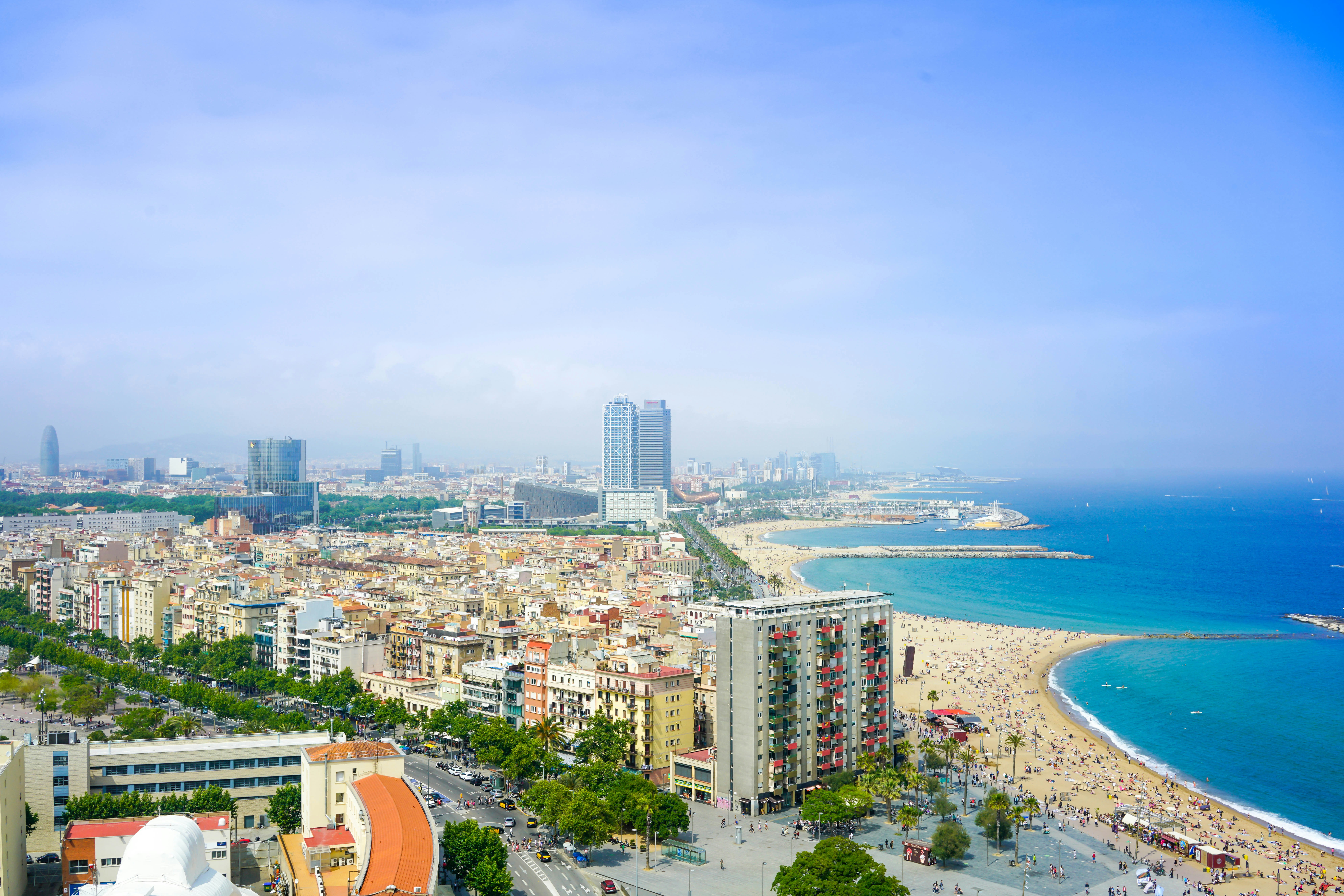
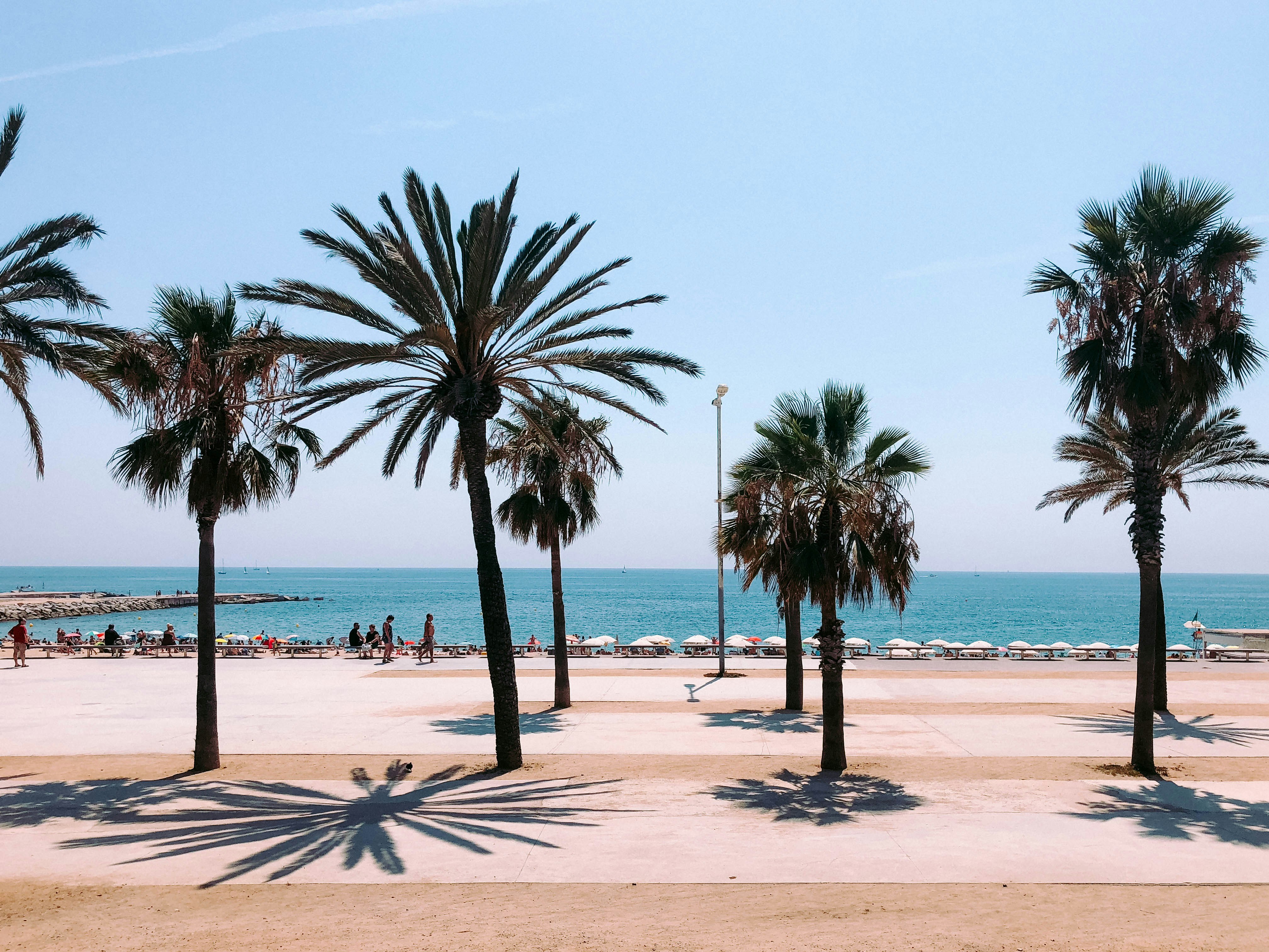
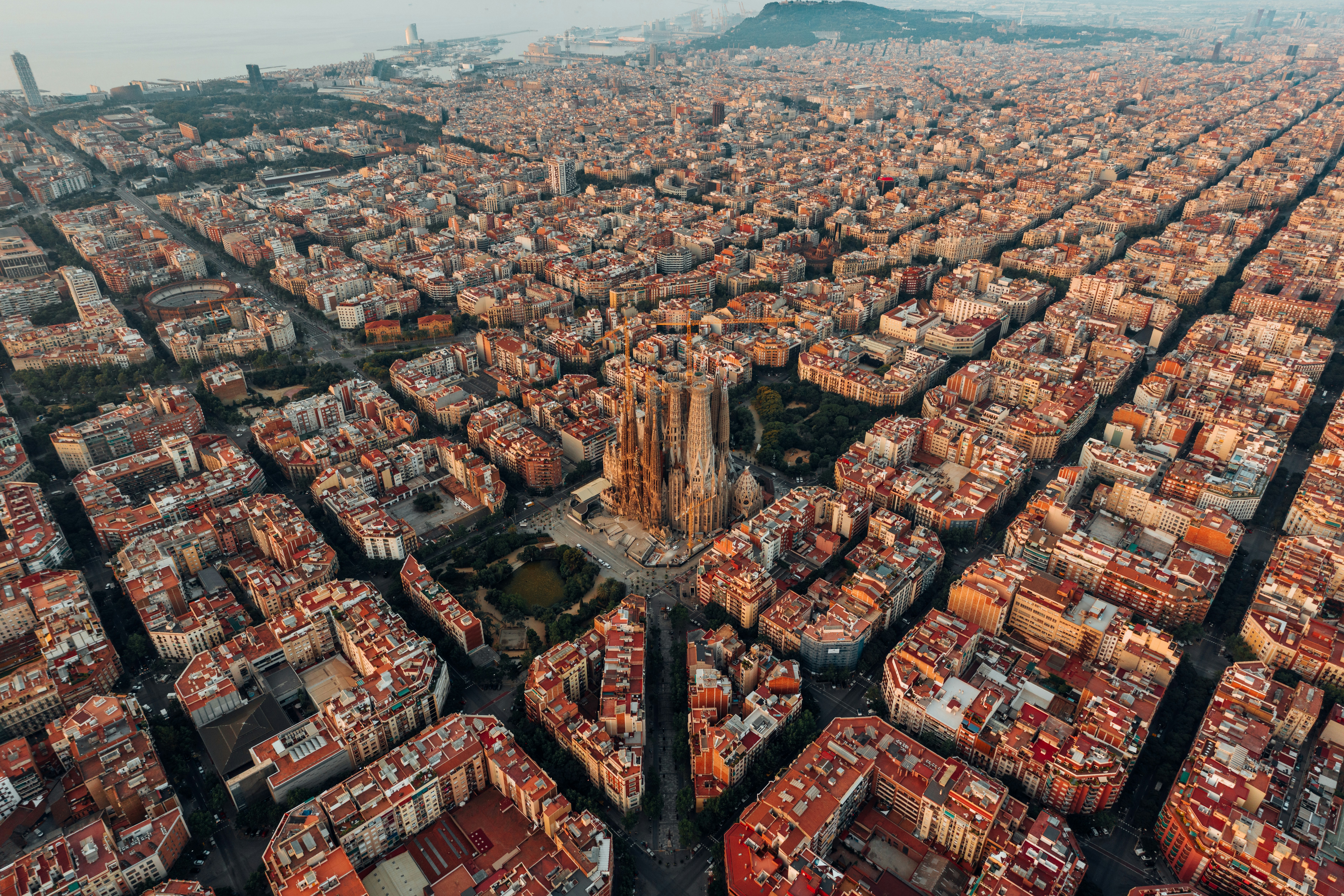
About Barcelona
The infinite variety of street life, the nooks and crannies of the medieval Barri Gòtic, the ceramic tile and stained glass of Art Nouveau facades, the art and music, the throb of street life, the food (ah, the food!)—one way or another, Barcelona will find a way to get your full attention. The capital of Catalonia is a banquet for the senses, with its beguiling mix of ancient and modern architecture, tempting cafés and markets, and sun-drenched Mediterranean beaches. A stroll along La Rambla and through waterfront Barceloneta, as well as a tour of Gaudí's majestic Sagrada Famíliaand his other unique creations, are part of a visit to Spain's second-largest city. Modern art museums and chic shops call for attention, too. Barcelona's vibe stays lively well into the night, when you can linger over regional wine and cuisine at buzzing tapas bars.

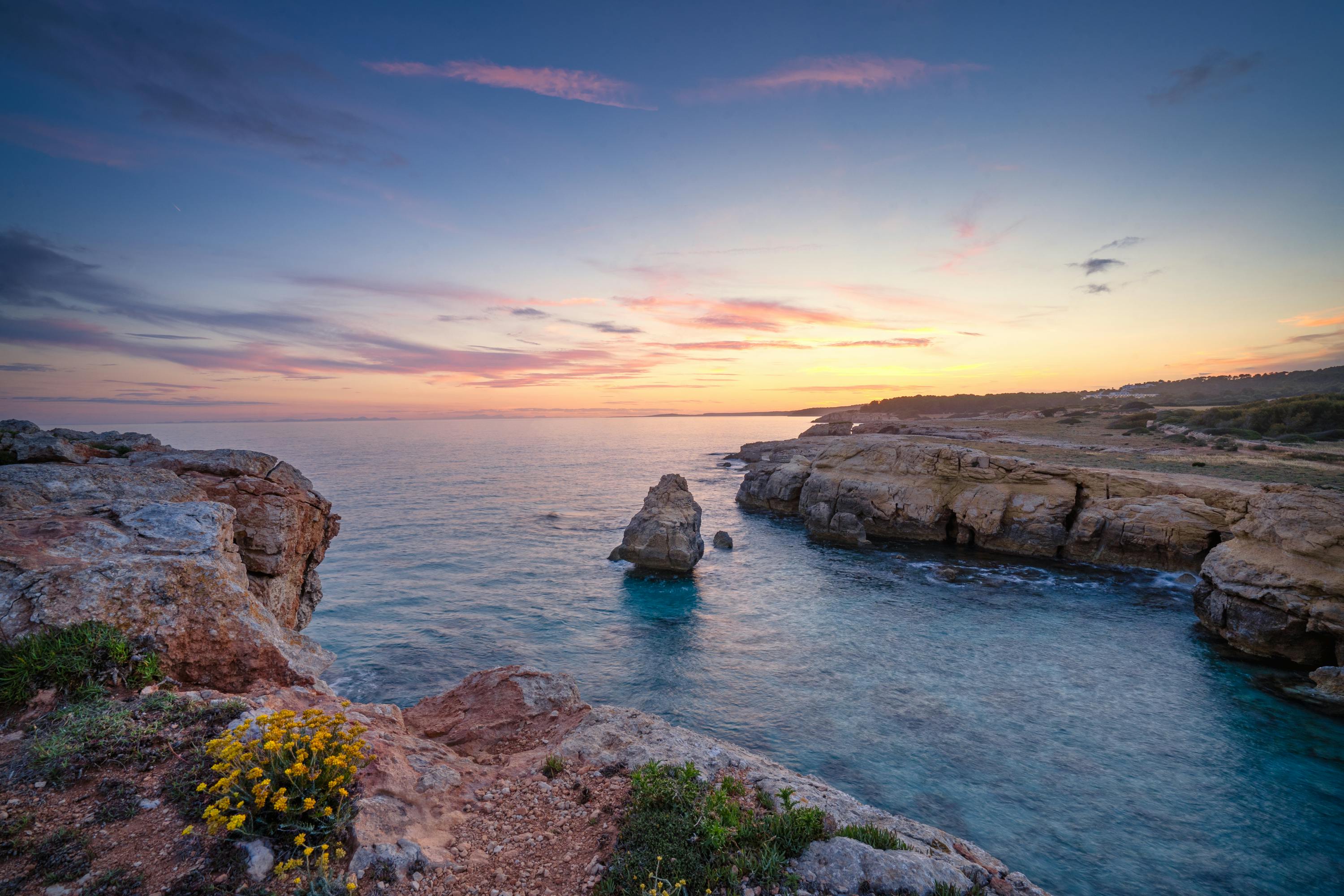
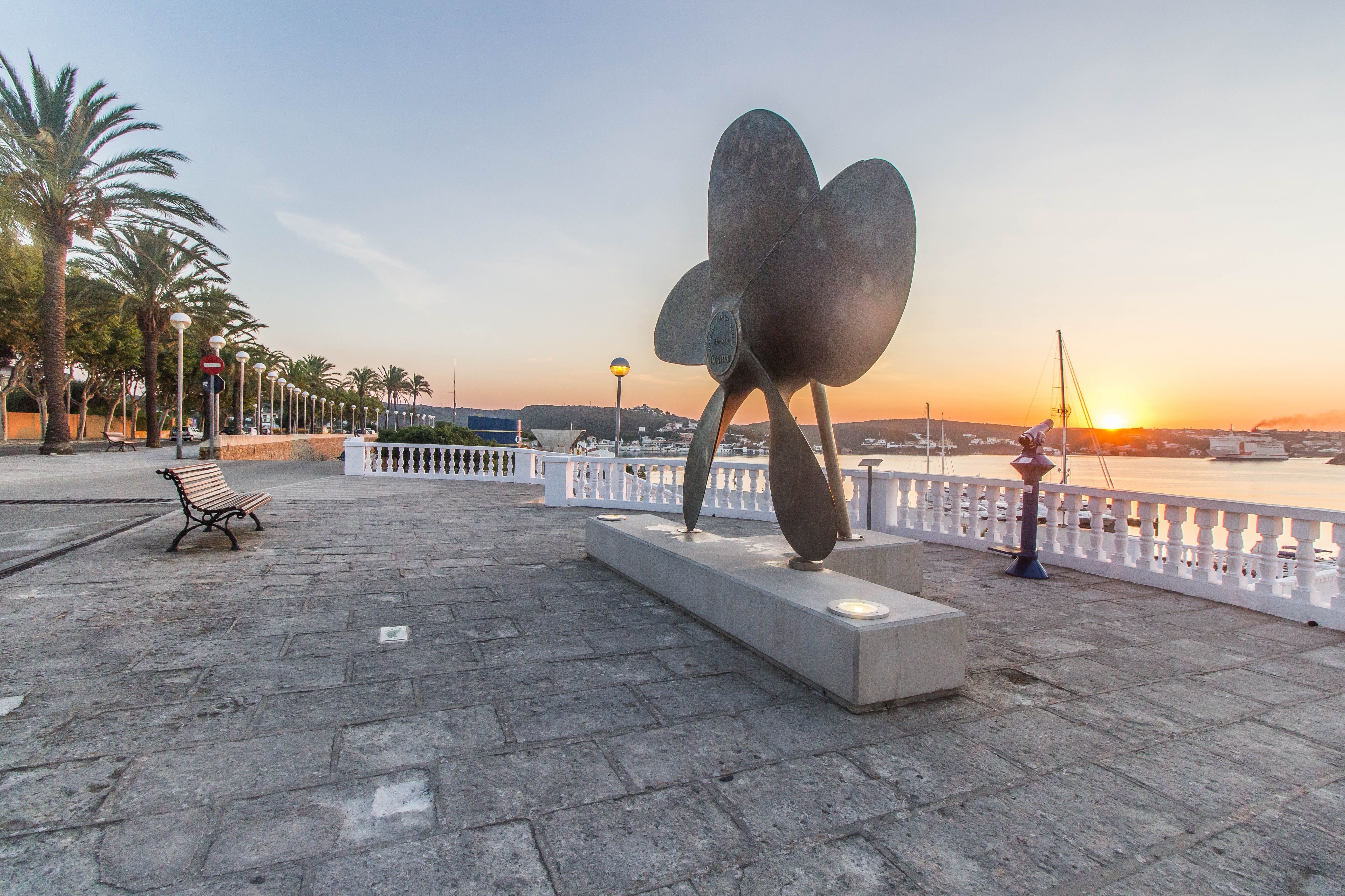
About Mahón, Menorca
The capital of Menorca since 1721, Mahon has a impressive natural deep water harbour, which is one of the largest in the world. This, coupled with its strategic location, has made it a stronghold for many nations throughout history. Mahon has an abundance of historical buildings, the oldest being the Arch of Saint Roc which is all that remains of the wall that once encircled the whole town. The island was occupied by the British during the 18th century and Lord Nelson is thought to have stayed there. Indeed, San Antoni Mansion, located on the north side of the harbour, houses a collection of Nelson memorabilia. The legacy of colonial rule can be seen in the muted Georgian style of some of the buildings, but Mahon still boasts attractive examples of neo-Classical, Baroque and Romanesque architecture. With narrow streets to explore, pleasant shaded squares and welcoming pavement cafés, there is something for everyone to enjoy. Please be aware that most shops in town close for a siesta between 1330 and 1730.

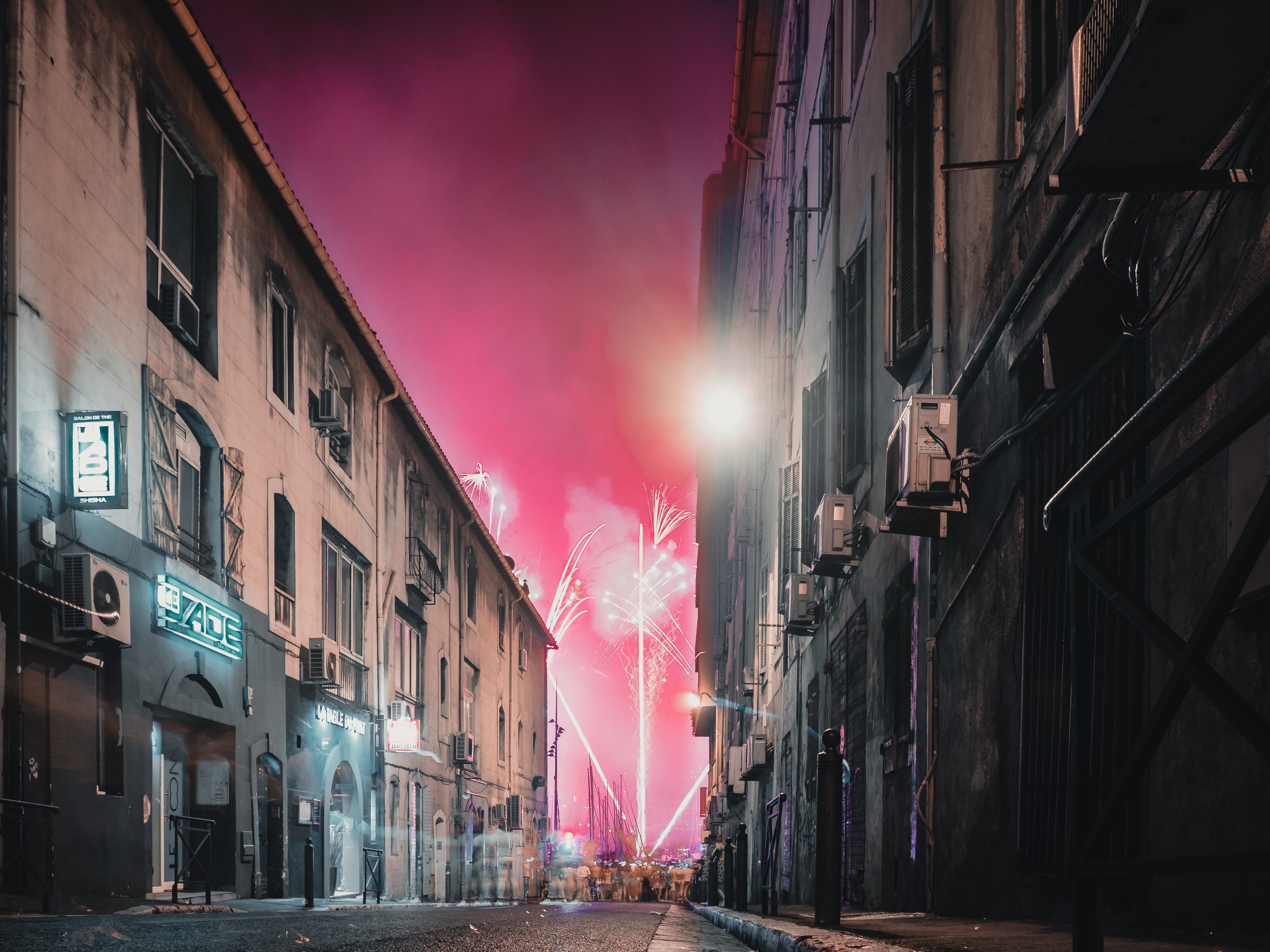
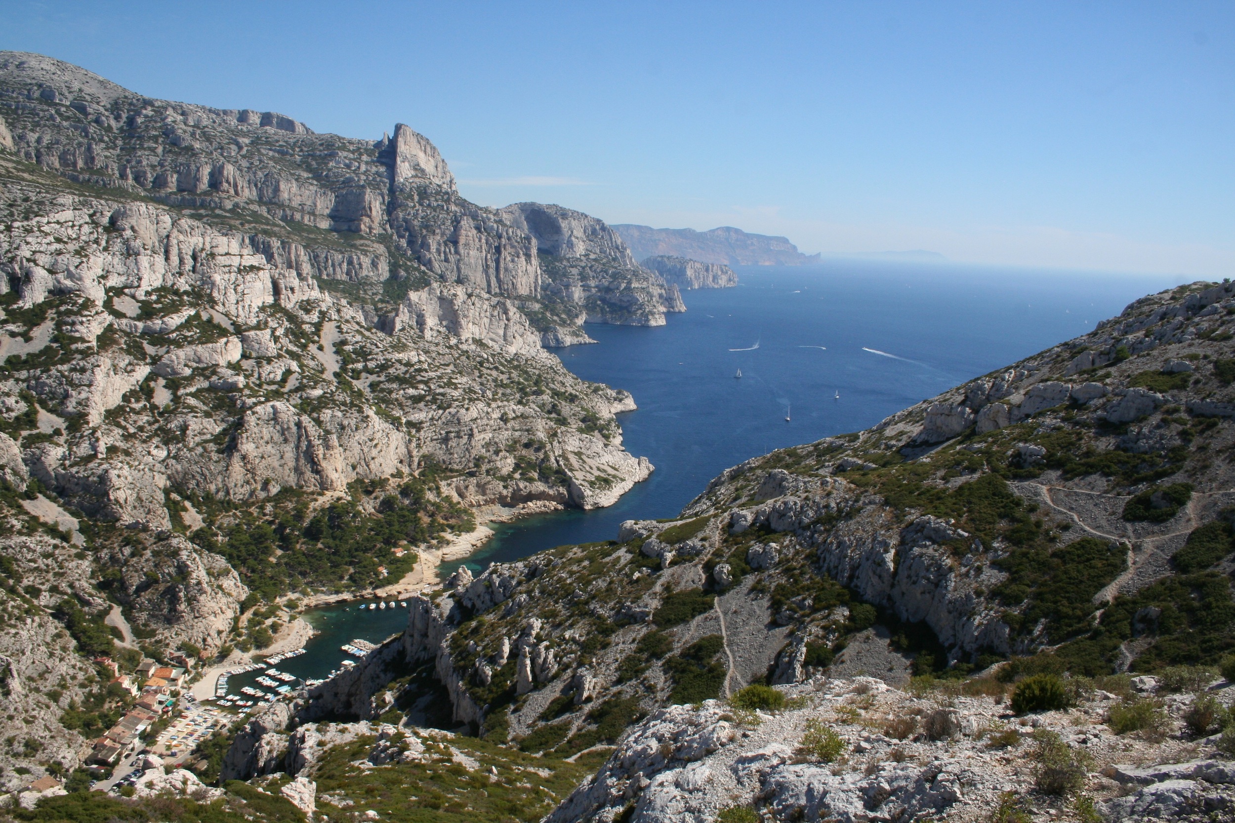
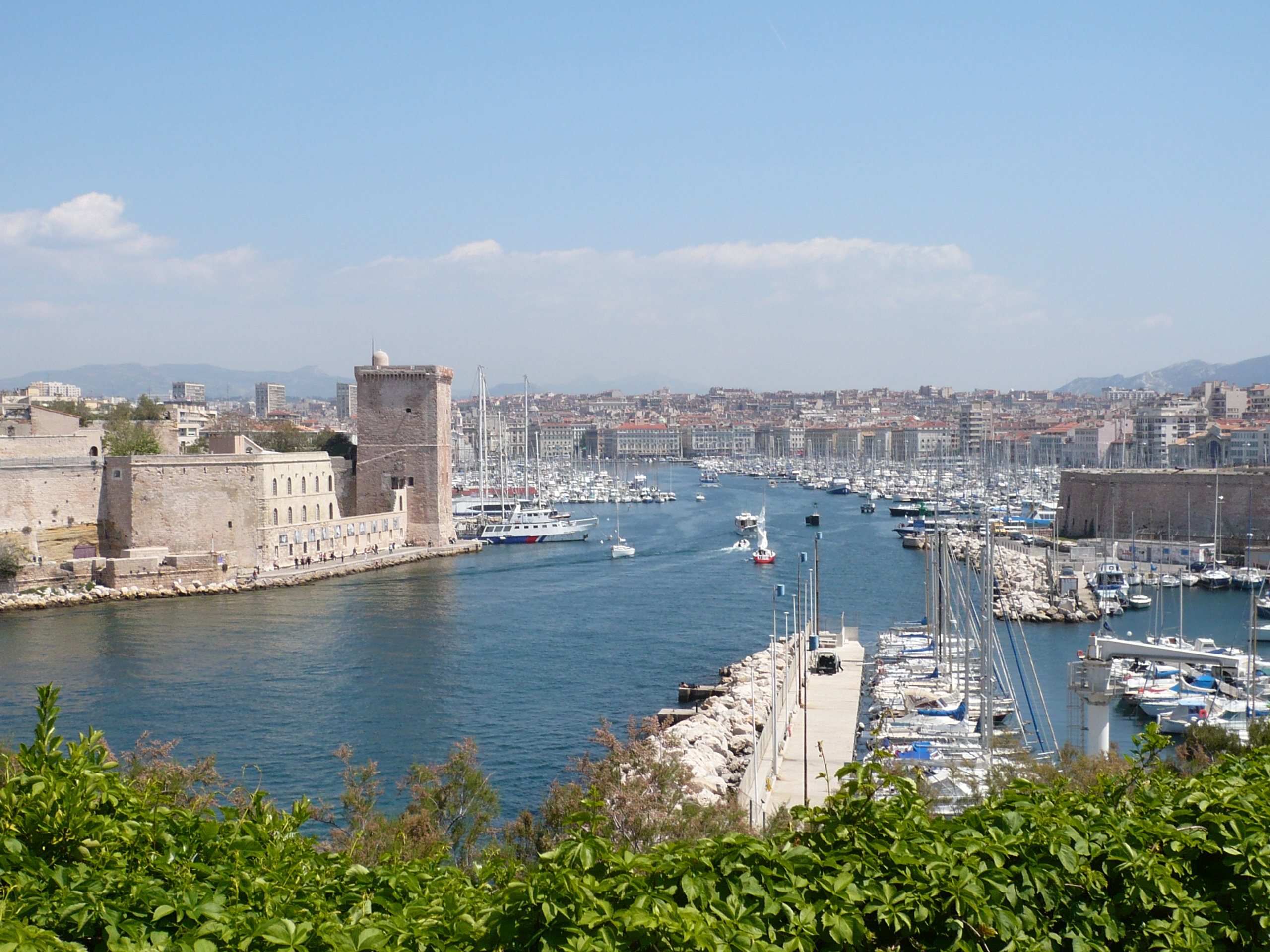
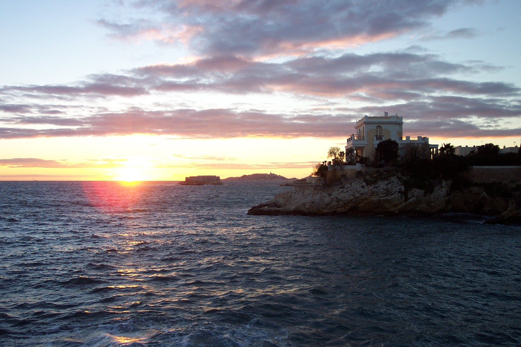
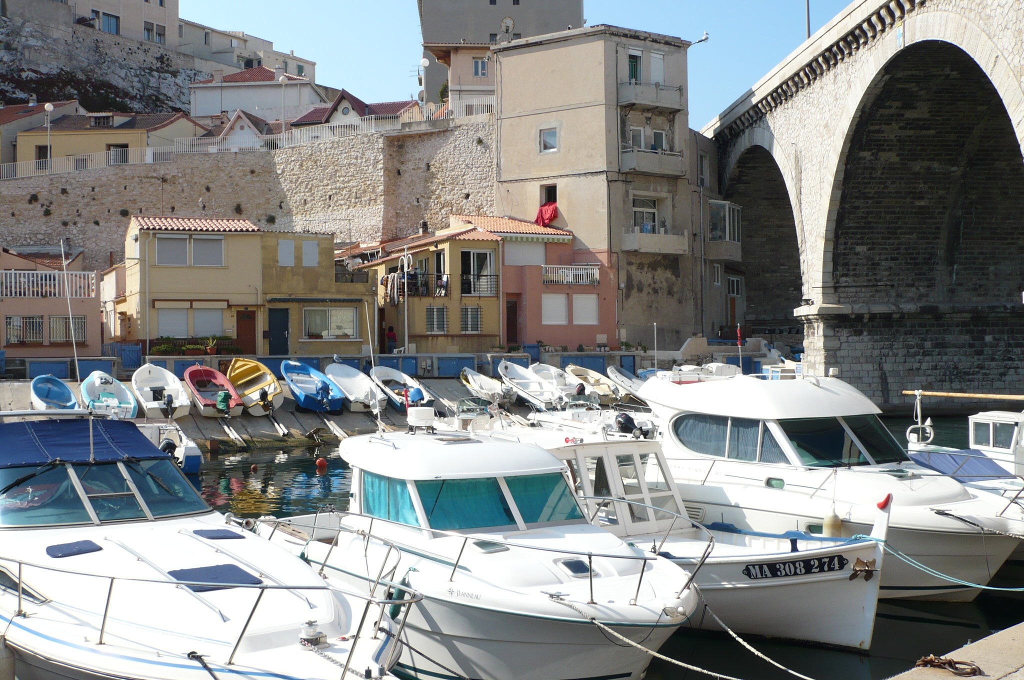
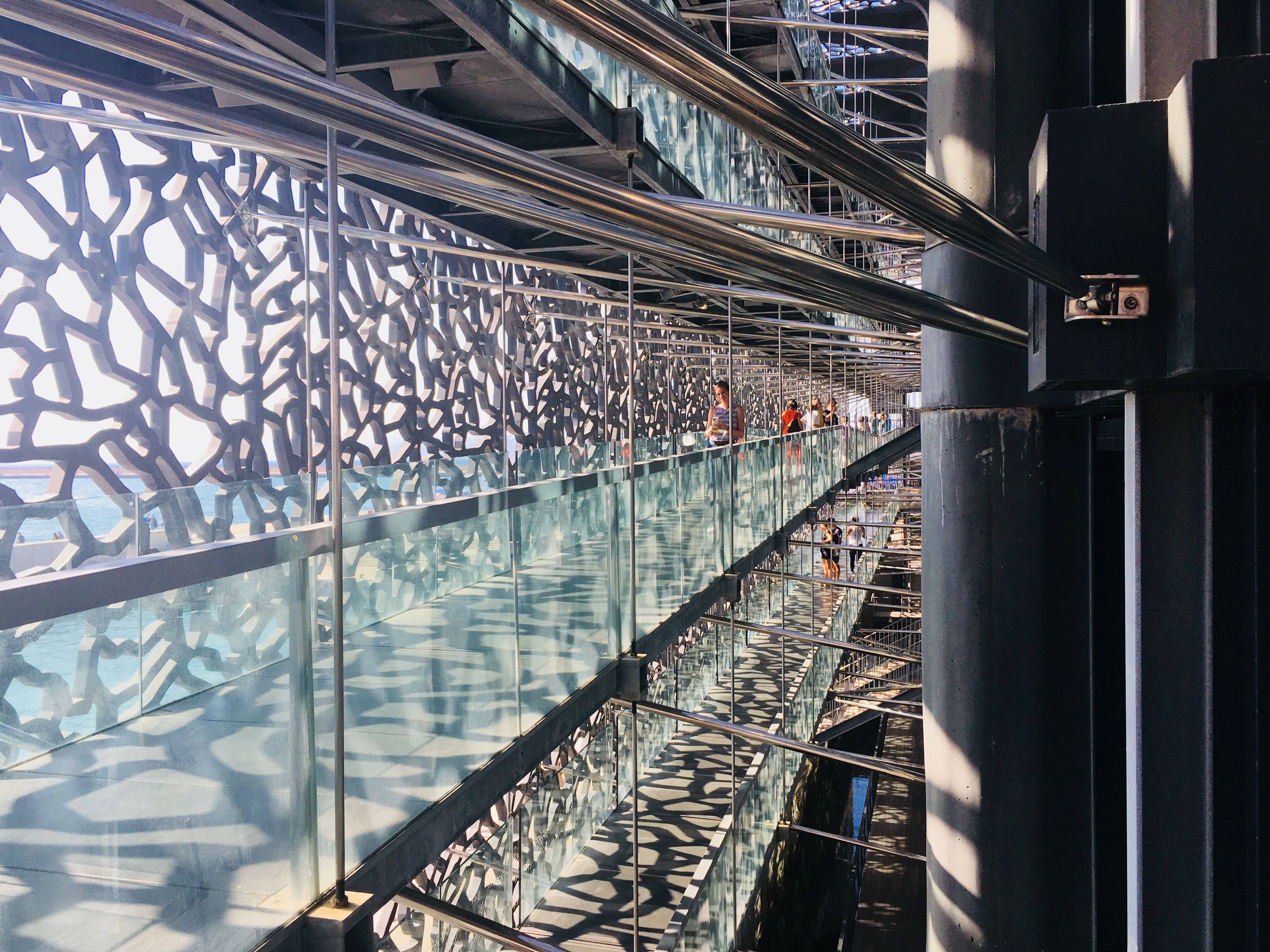
About Marseille
Since being designated a European Capital of Culture for 2013, with an estimated €660 million of funding in the bargain, Marseille has been in the throes of an extraordinary transformation, with no fewer than five major new arts centers, a beautifully refurbished port, revitalized neighborhoods, and a slew of new shops and restaurants. Once the underdog, this time-burnished city is now welcoming an influx of weekend tourists who have colonized entire neighborhoods and transformed them into elegant pieds-à-terre (or should we say, mer). The second-largest city in France, Marseille is one of Europe's most vibrant destinations. Feisty and fond of broad gestures, it is also as complicated and as cosmopolitan now as it was when a band of Phoenician Greeks first sailed into the harbor that is today's Vieux Port in 600 BC. Legend has it that on that same day a local chieftain's daughter, Gyptis, needed to choose a husband, and her wandering eyes settled on the Greeks' handsome commander Protis. Her dowry brought land near the mouth of the Rhône, where the Greeks founded Massalia, the most important Continental shipping port in antiquity. The port flourished for some 500 years as a typical Greek city, enjoying the full flush of classical culture, its gods, its democratic political system, its sports and theater, and its naval prowess. Caesar changed all that, besieging the city in 49 BC and seizing most of its colonies. In 1214 Marseille was seized again, this time by Charles d'Anjou, and was later annexed to France by Henri IV in 1481, but it was not until Louis XIV took the throne that the biggest transformations of the port began; he pulled down the city walls in 1666 and expanded the port to the Rive Neuve (New Riverbank). The city was devastated by plague in 1720, losing more than half its population. By the time of the Revolution, Marseille was on the rebound once again, with industries of soap manufacturing and oil processing flourishing, encouraging a wave of immigration from Provence and Italy. With the opening of the Suez Canal in 1869, Marseille became the greatest boomtown in 19th-century Europe. With a large influx of immigrants from areas as exotic as Tangiers, the city quickly acquired the multicultural population it maintains to this day.

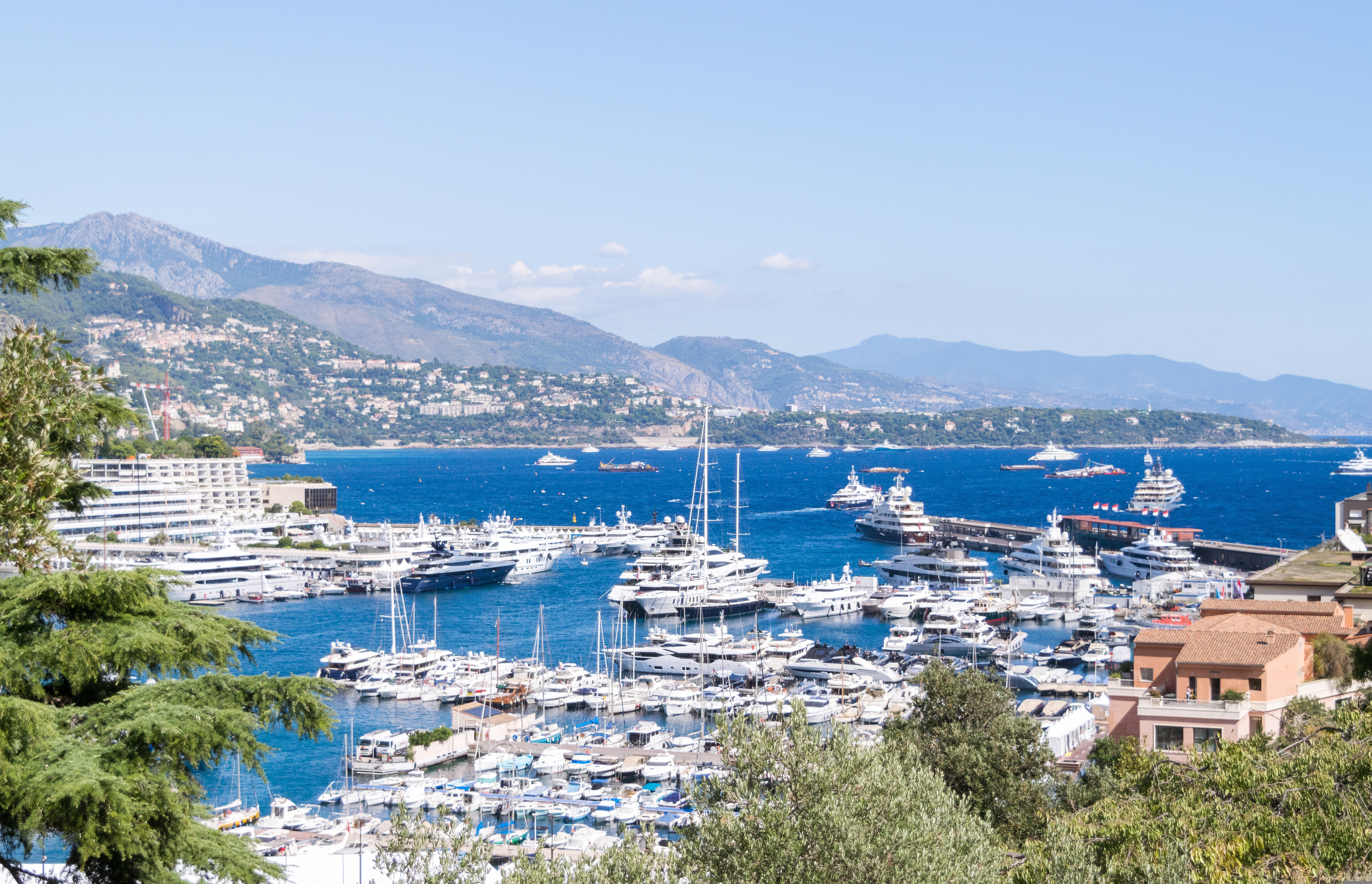
About Monaco
The 202-hectare Principality of Monaco is located east of France’s Mediterranean coast. Known for its royal family, especially Prince Albert of Monaco, its casinos and racetracks and for being a wealthy state with no applied taxes. Monaco is reachable by air through the French airport of Nice Côte d'Azur, located approximately 16 miles from the principality.
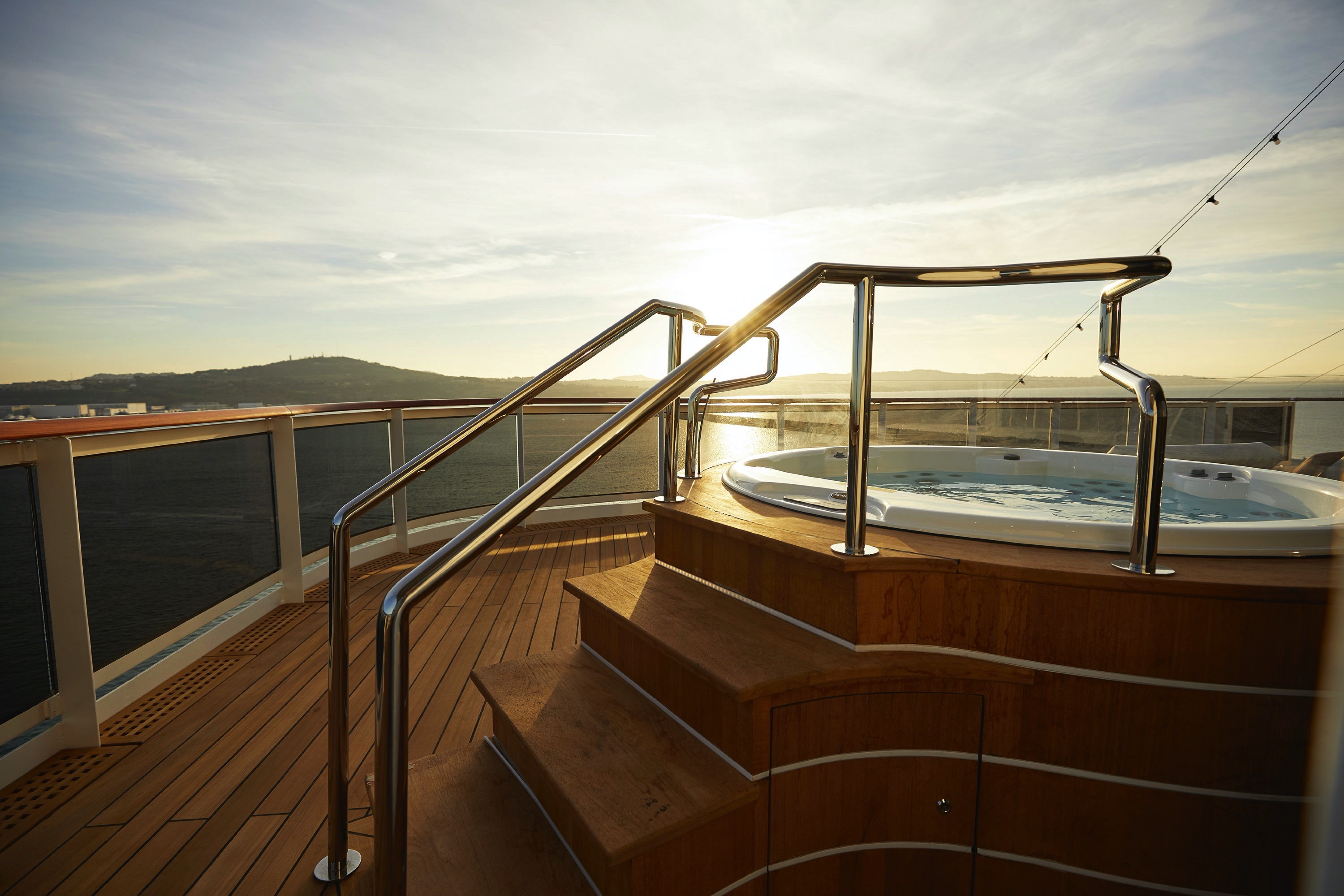
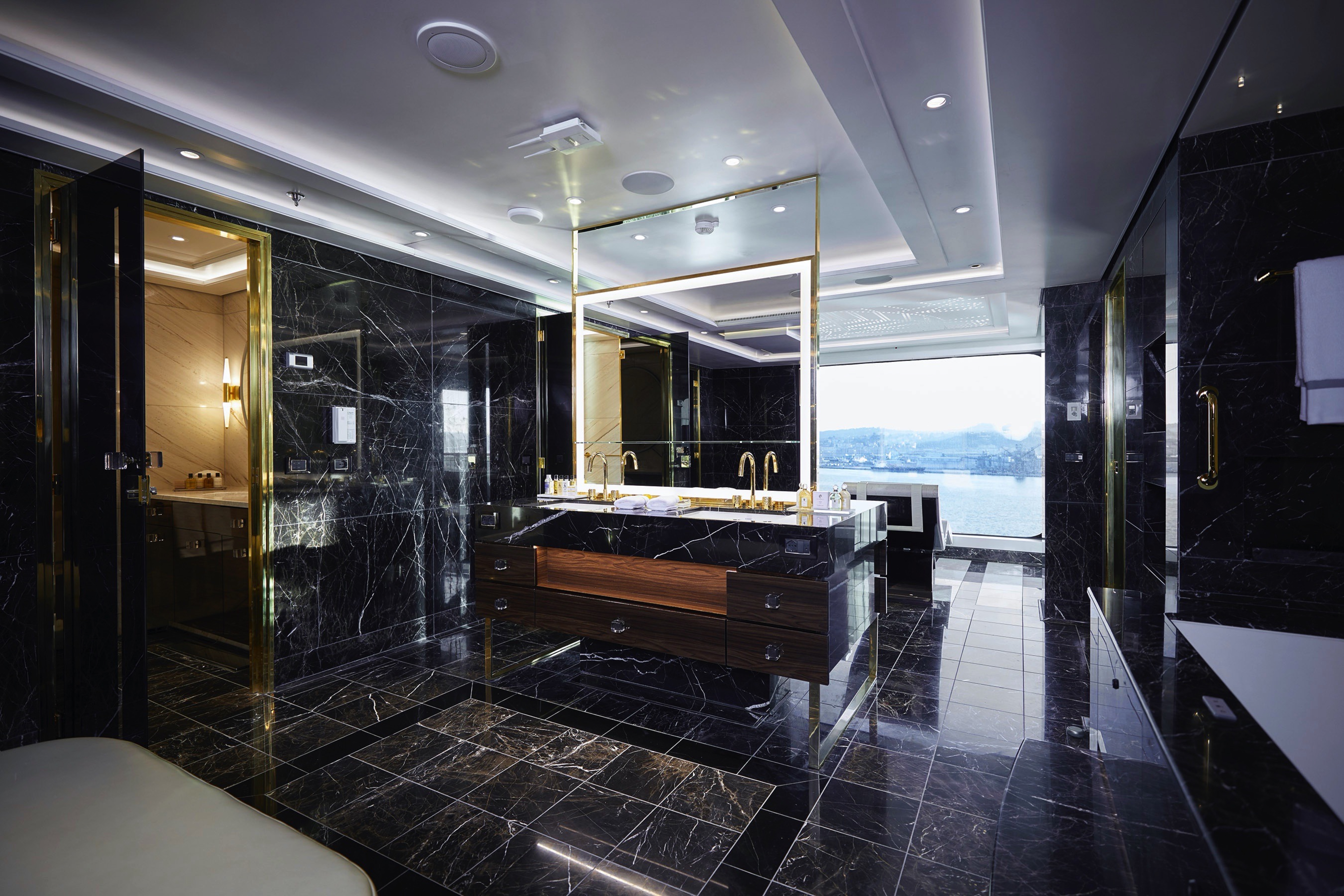
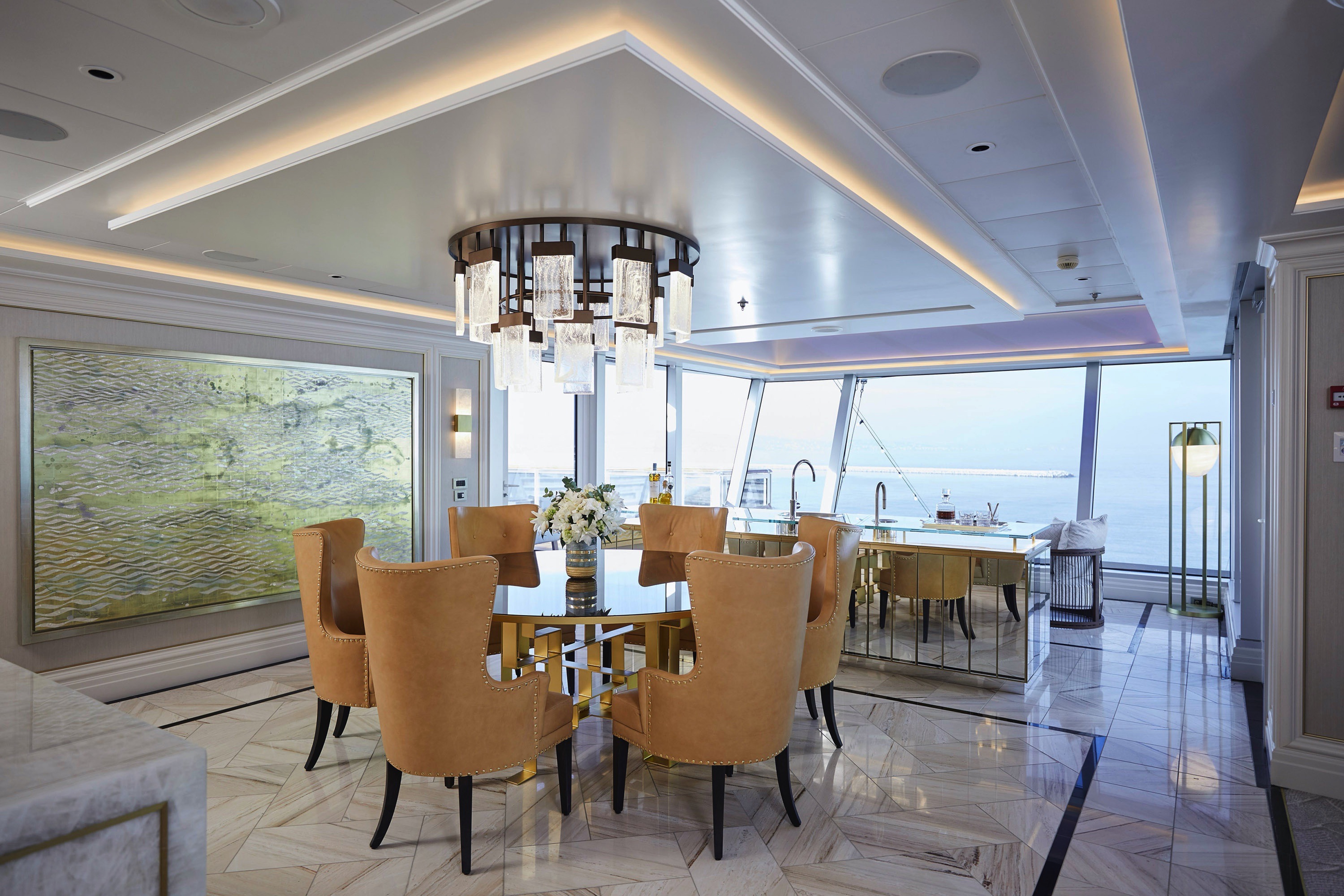
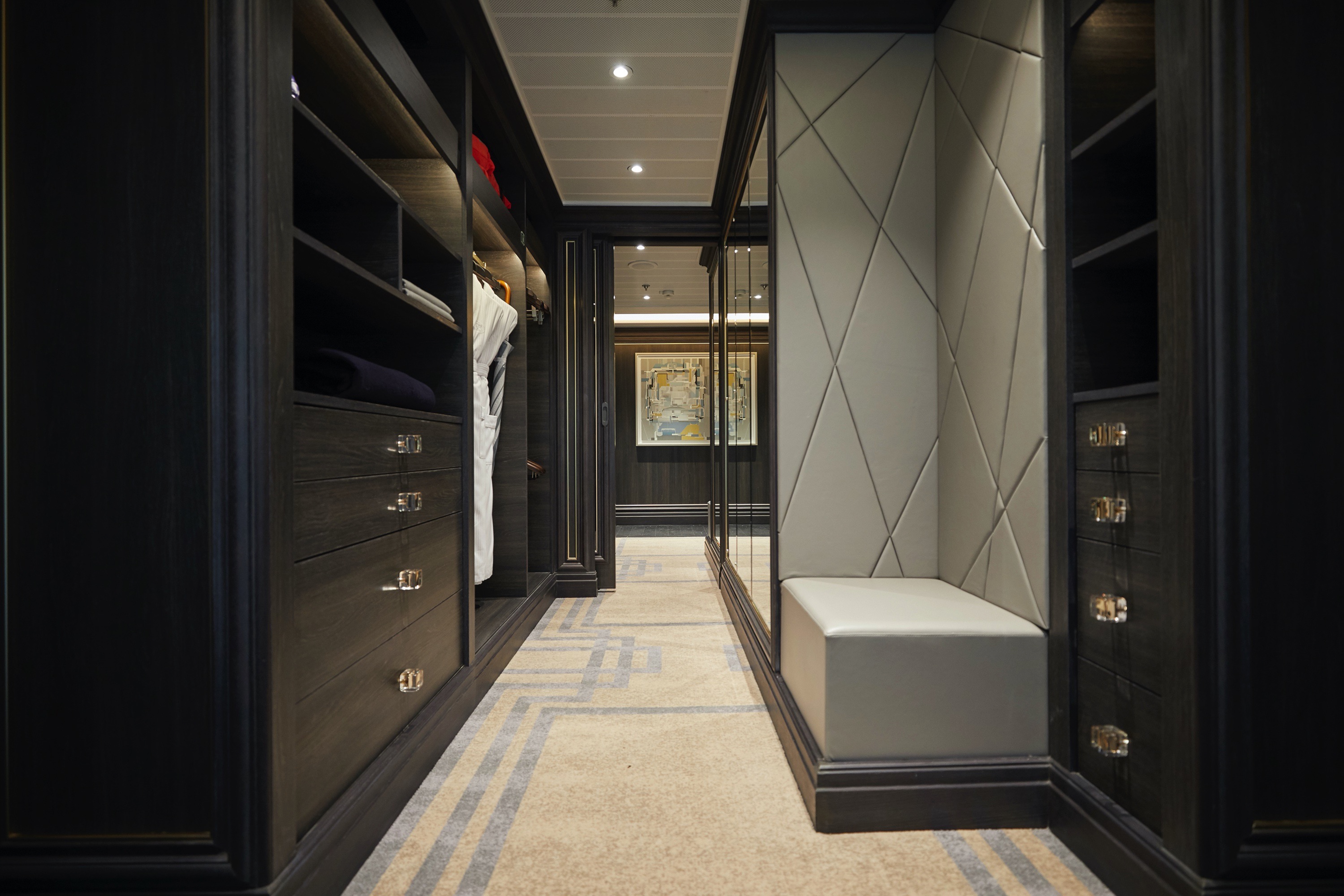
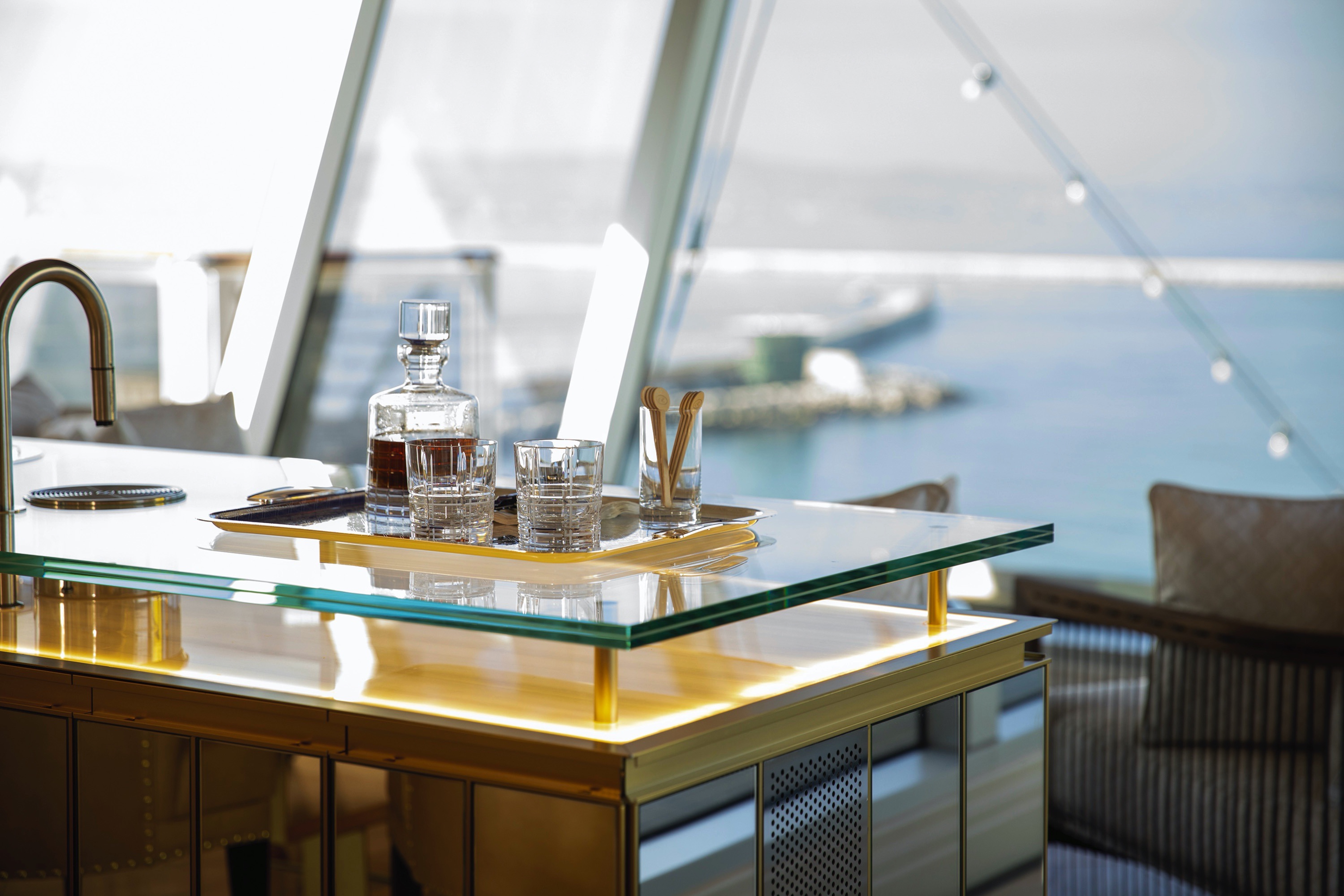
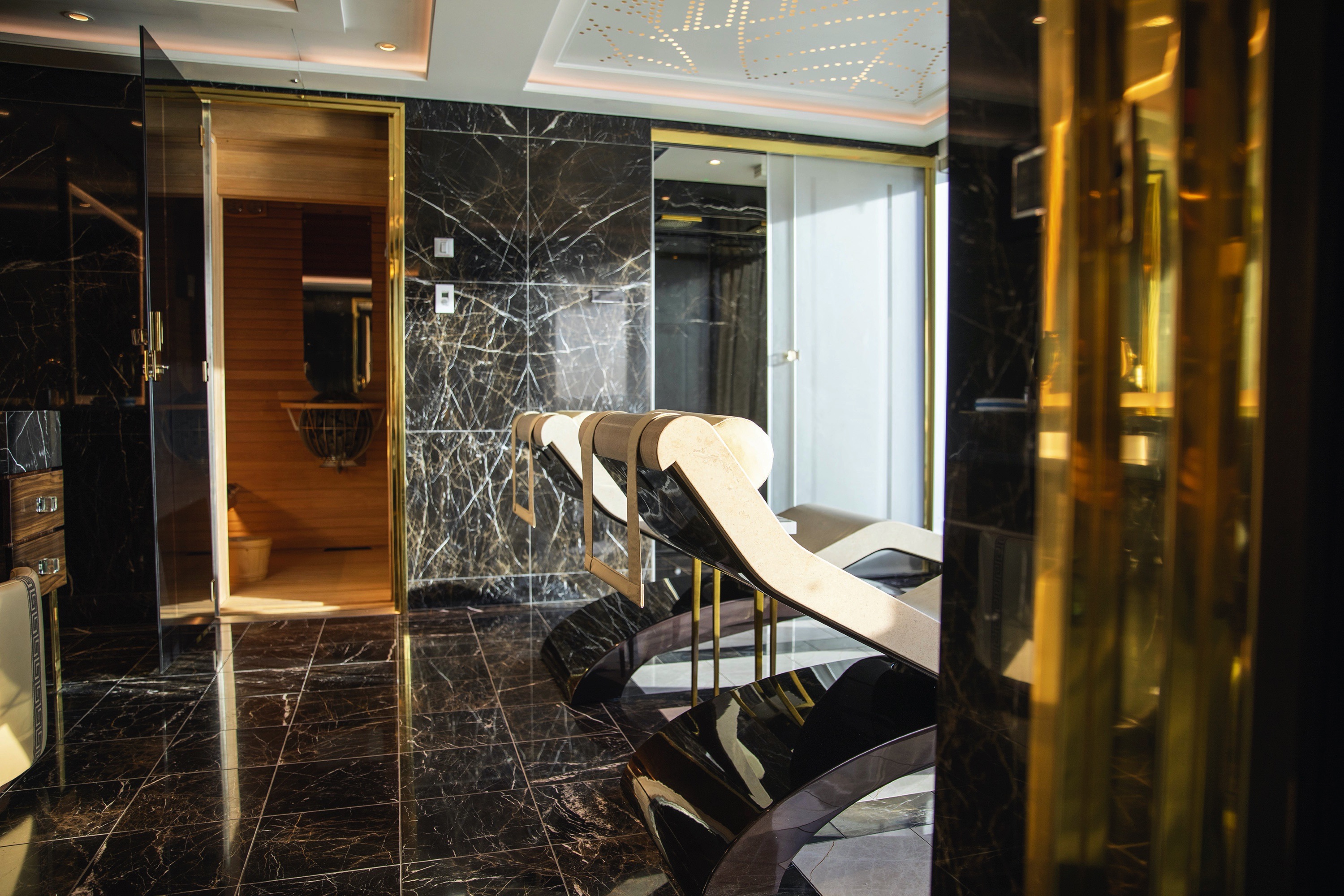
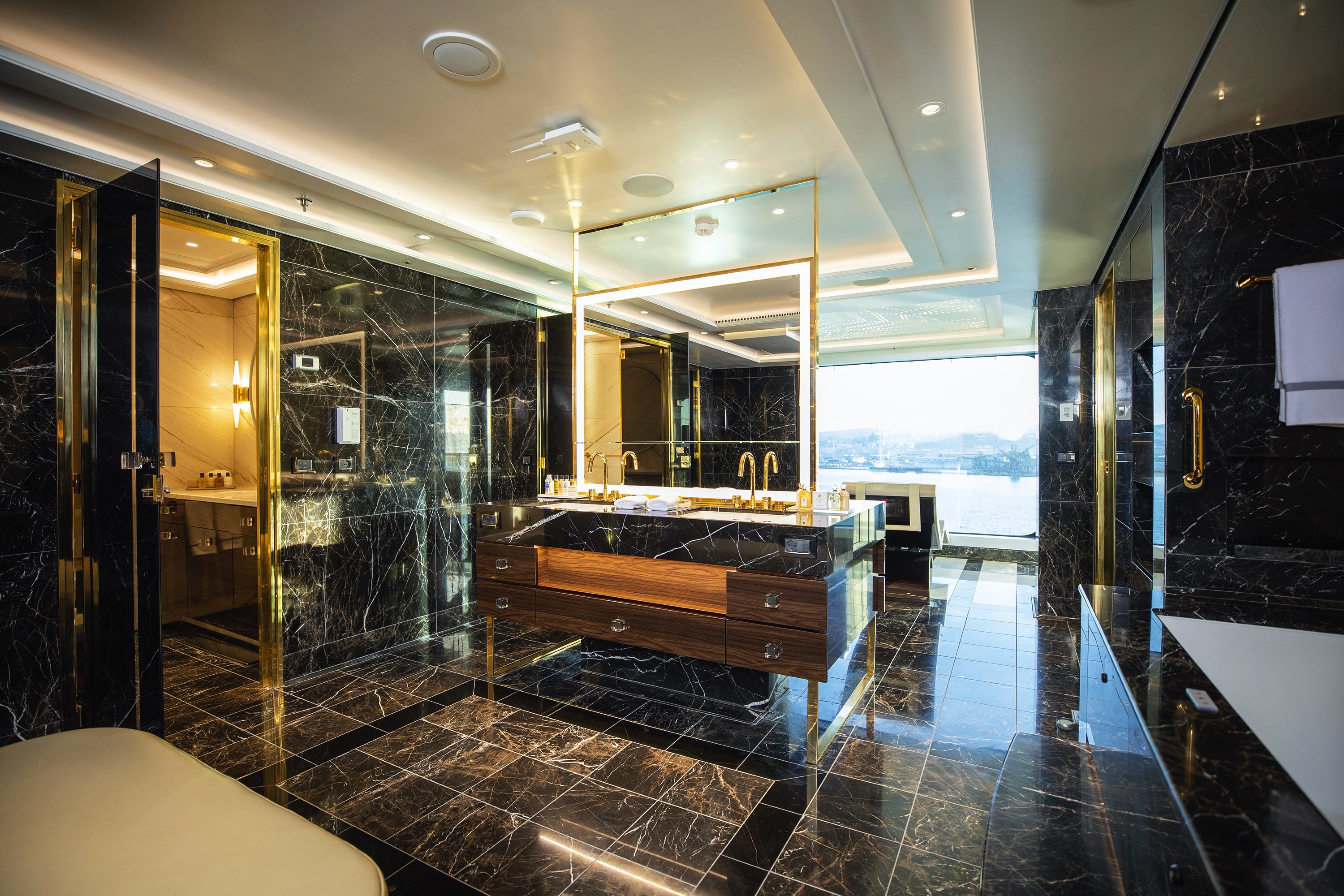
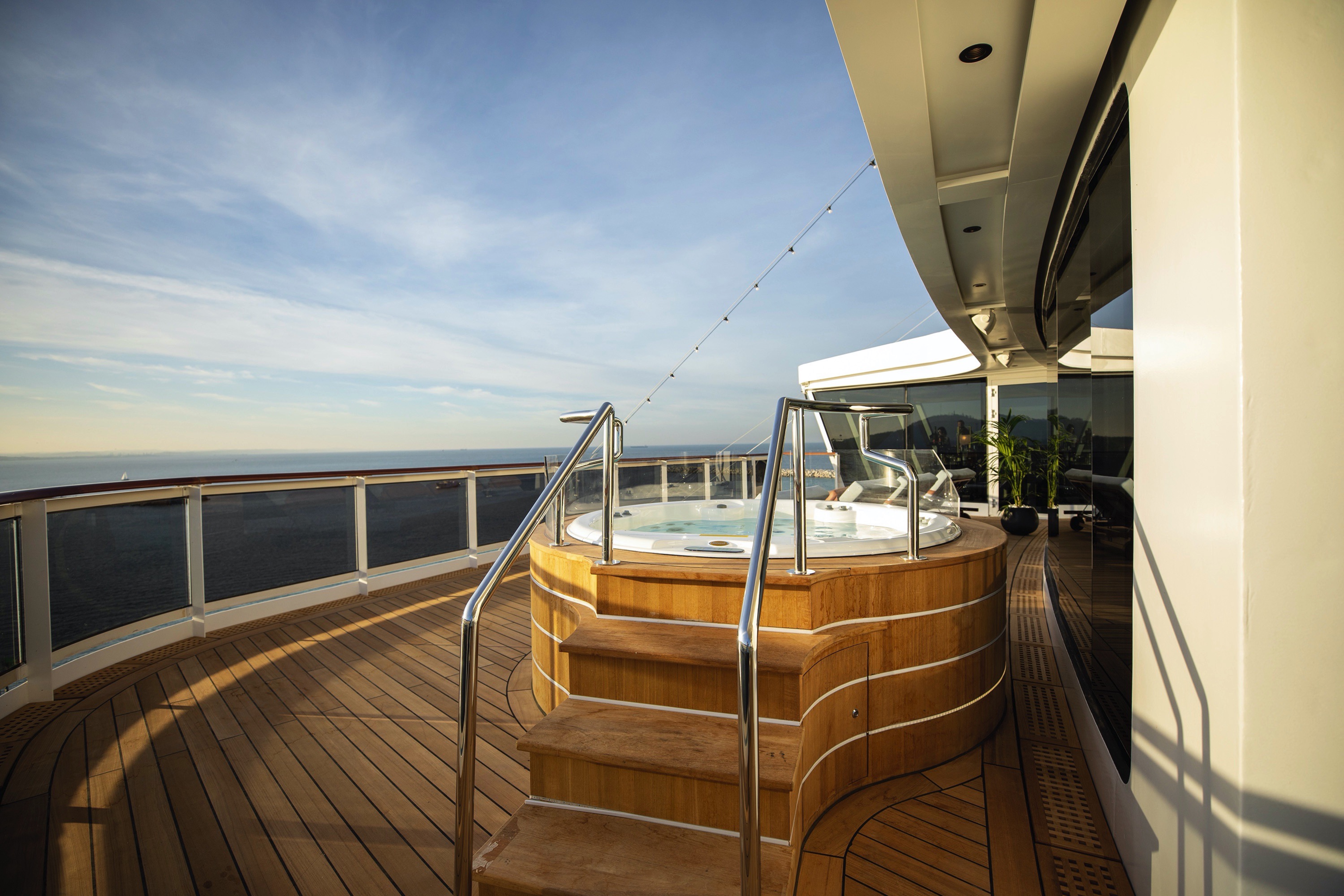
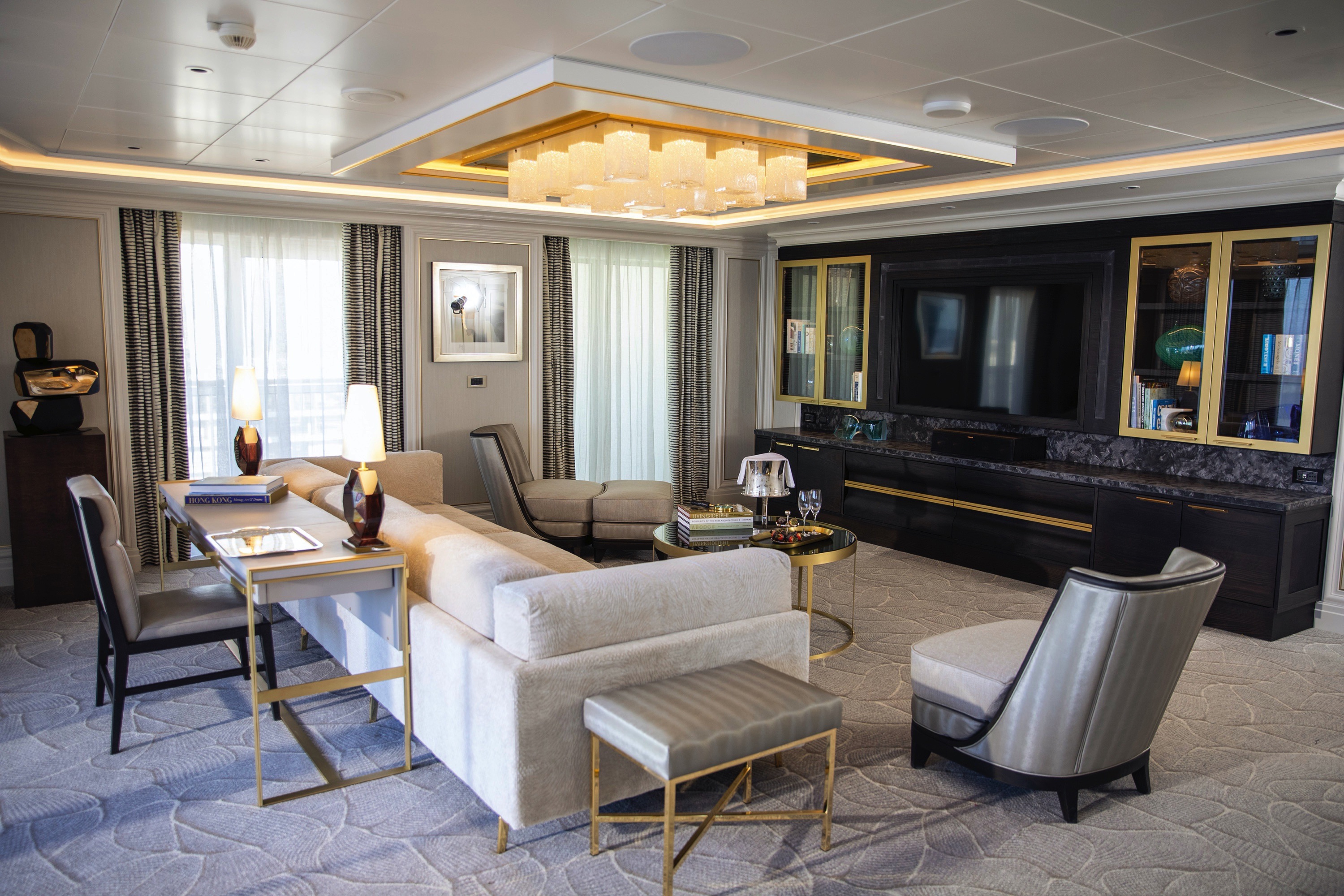
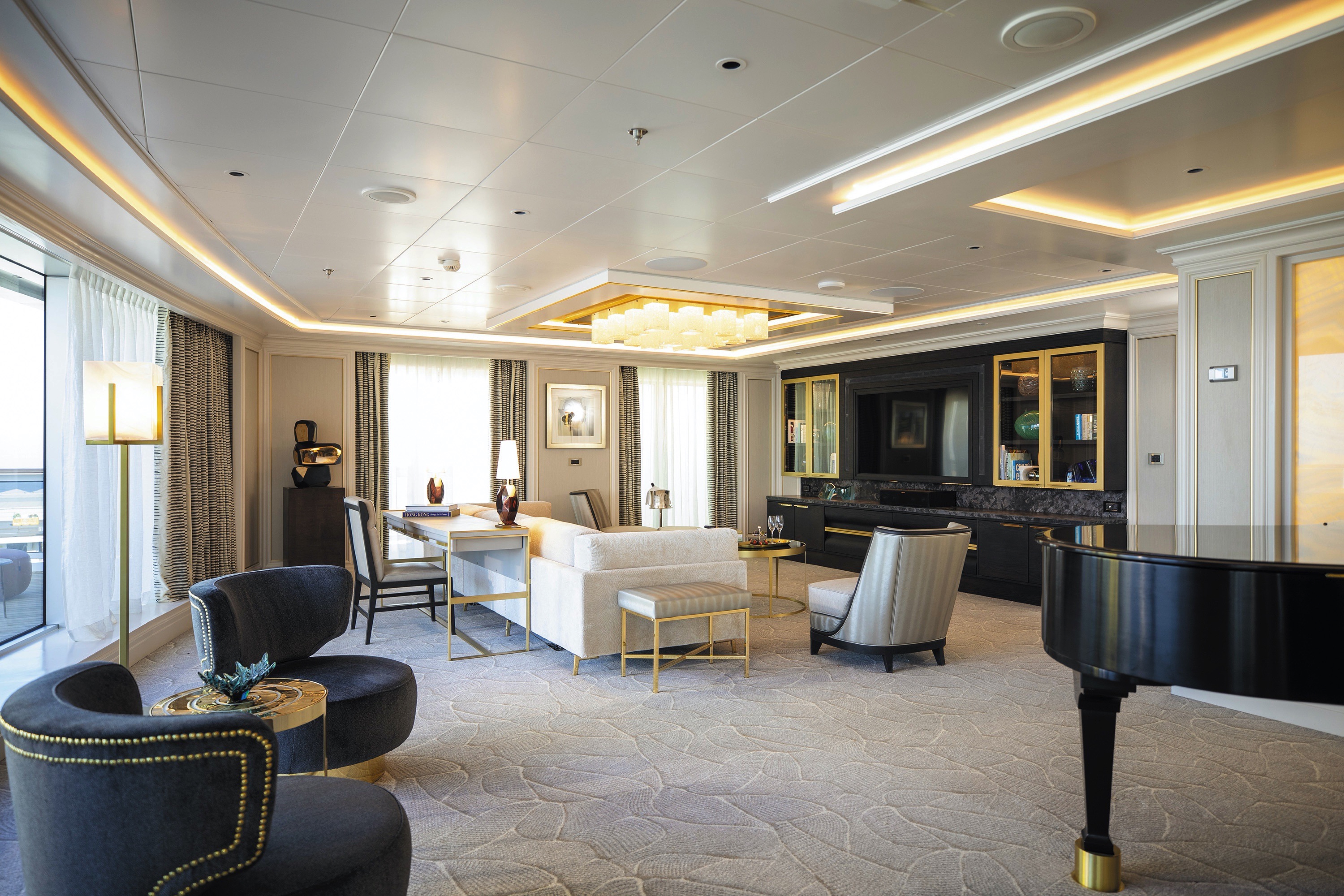
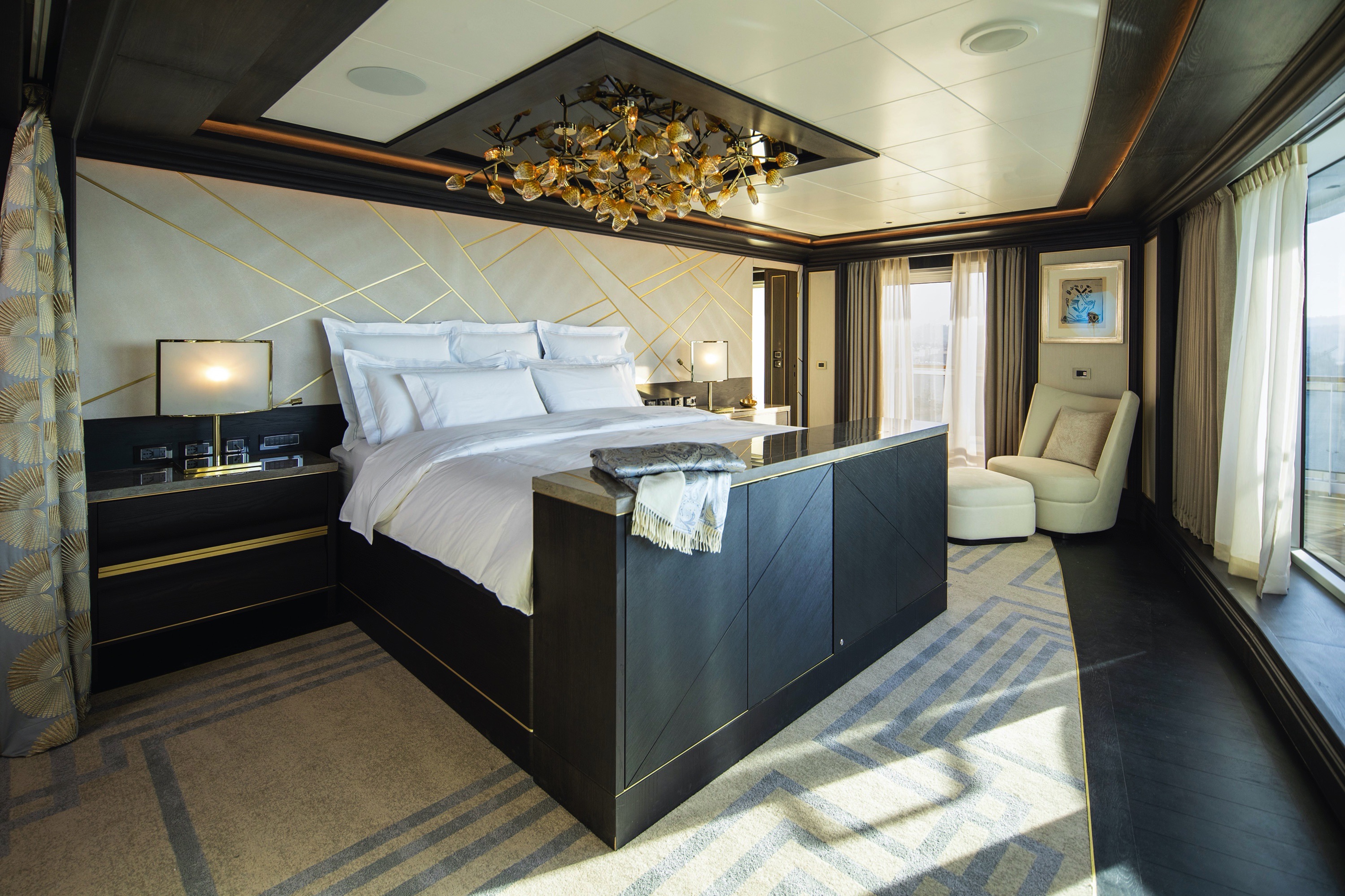
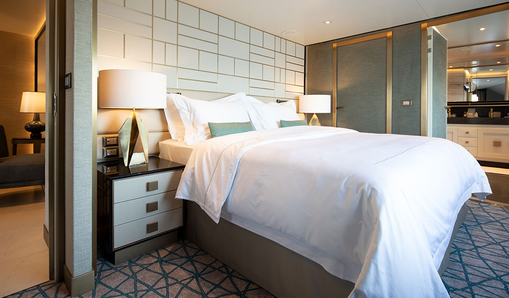
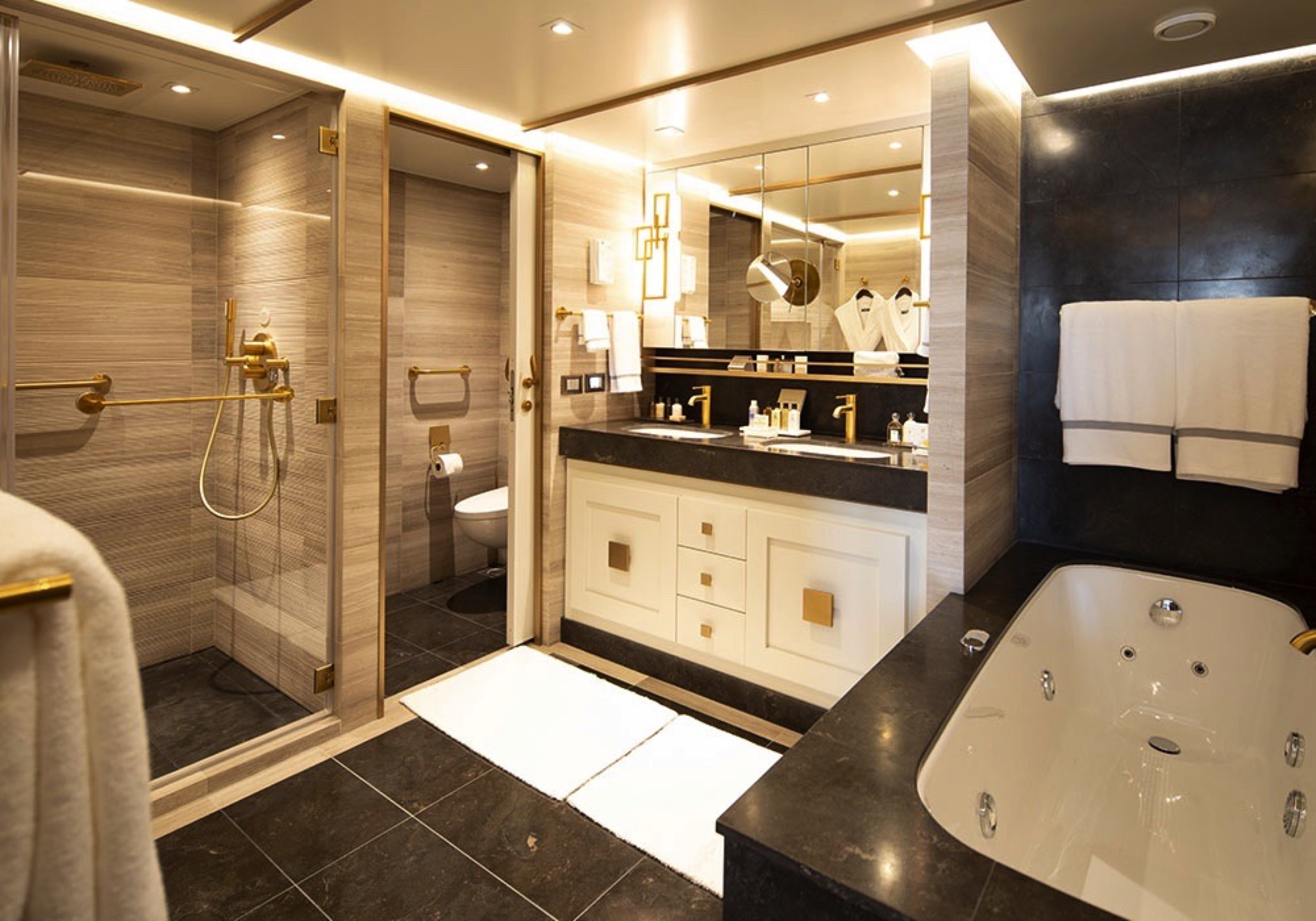
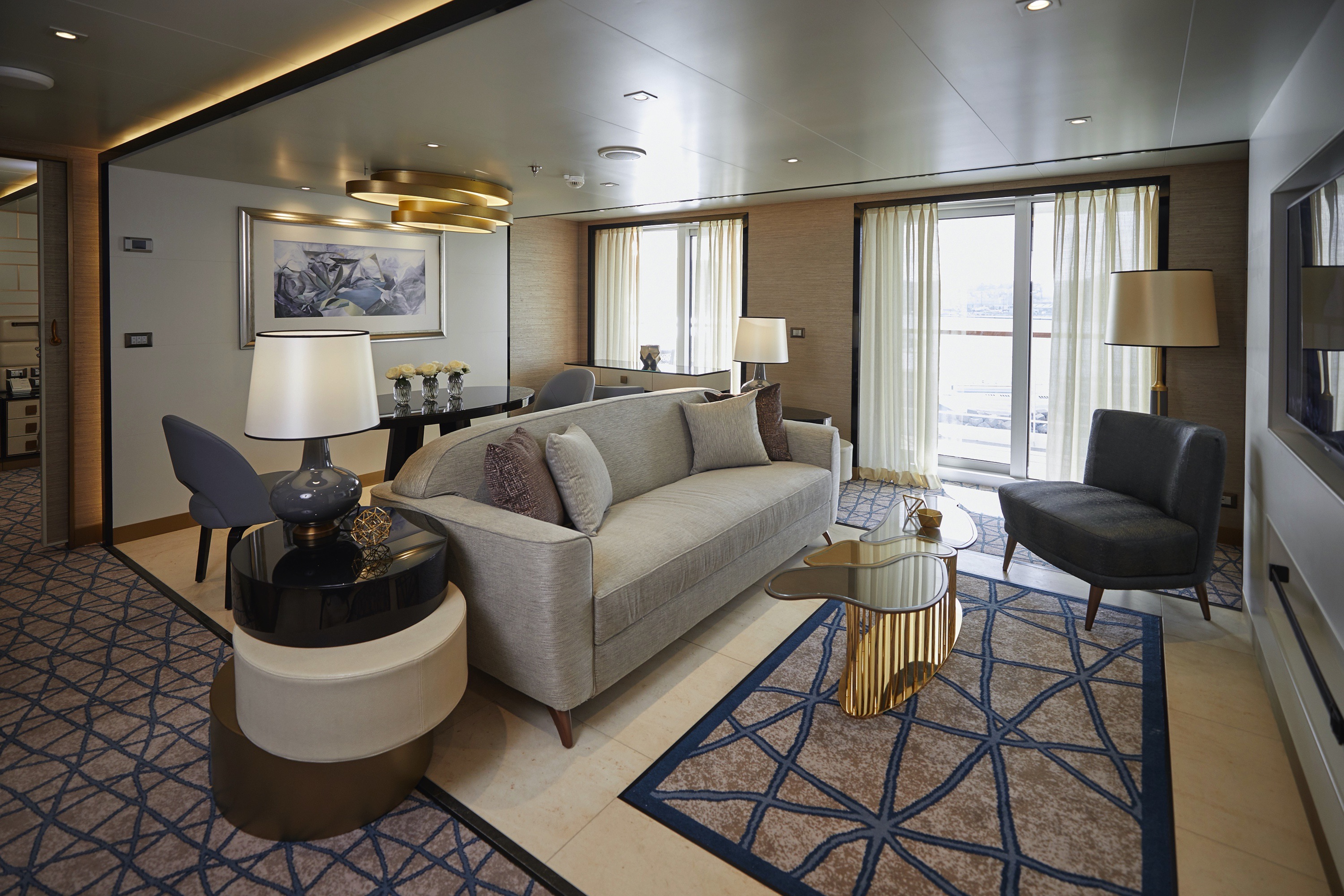
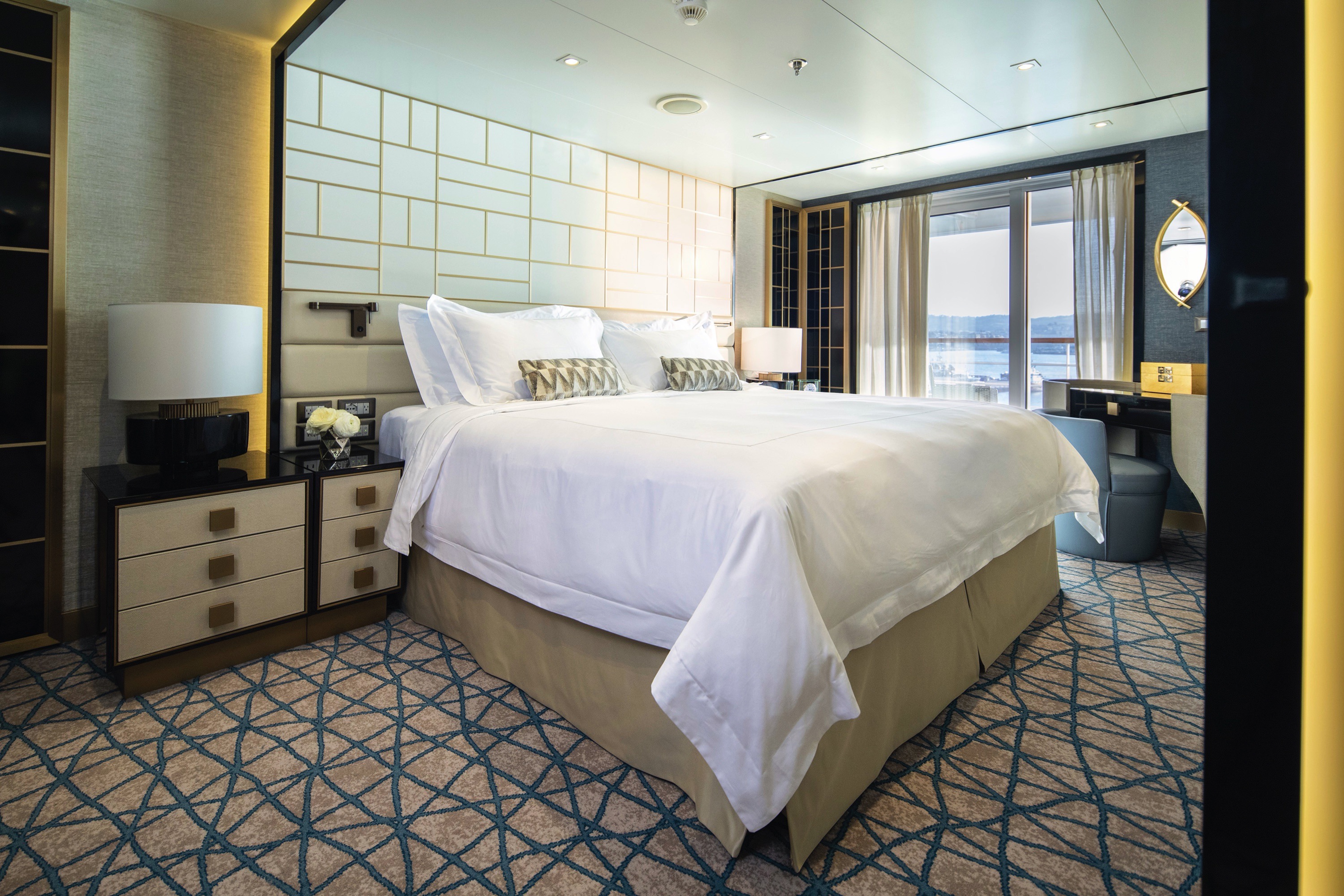
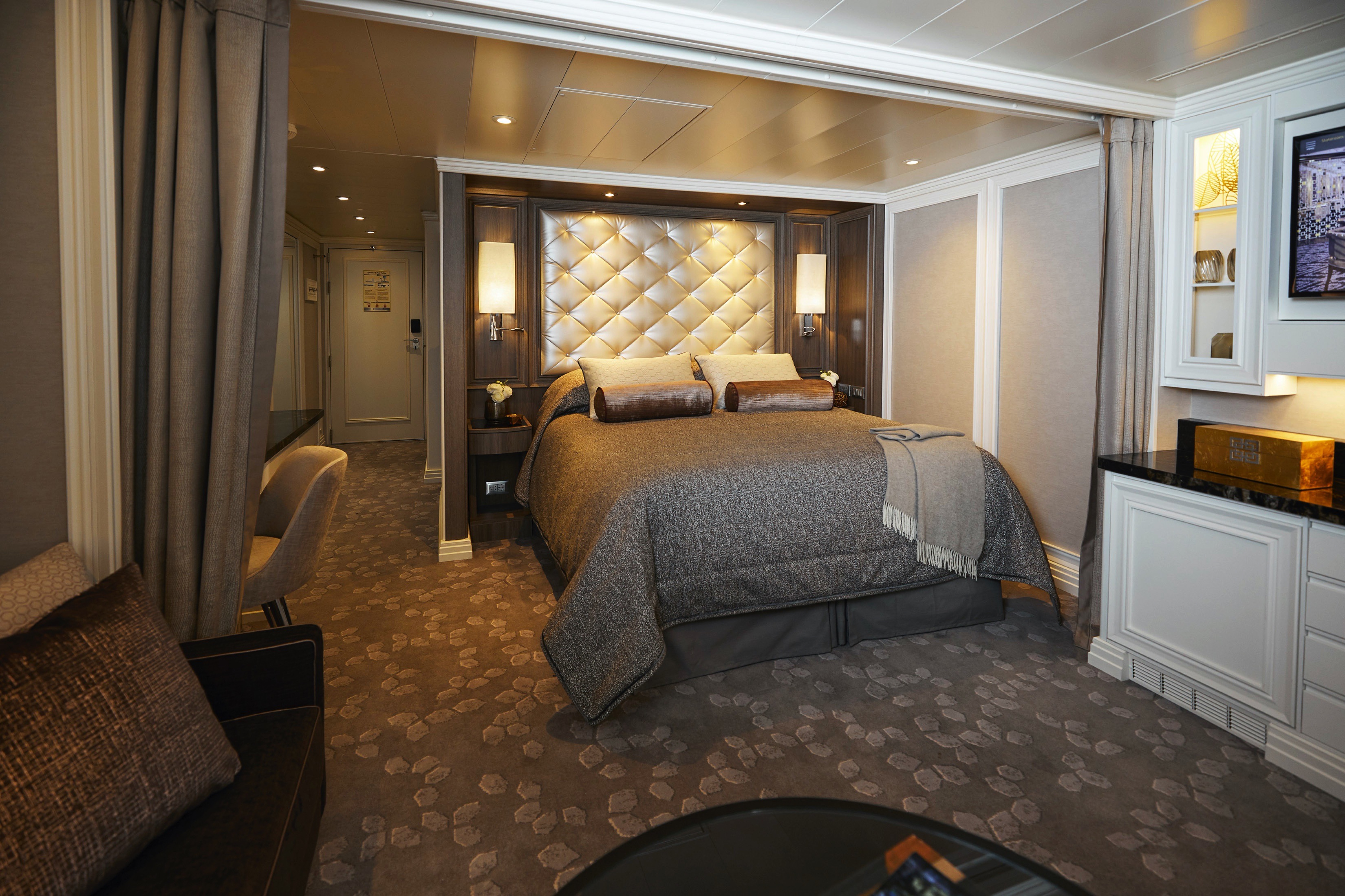
High atop the ship, this suite of more than 4,000 square feet (372 meters) rises above everything else at sea. Incomparable craftsmanship and meticulous attention to detail are evident in everything from the unique design choices, such as rare works of art, to grand features like an in-suite spa retreat — a first for any cruise ship. The only thing to rival the luxurious interior is the spectacular ocean view from the private balconies.
Layout
- 2 Spacious Bedrooms with King-Size Ḧastens Vividus Bed in Primary Bedroom (*Bed in primary bedroom cannot be converted into two beds.)
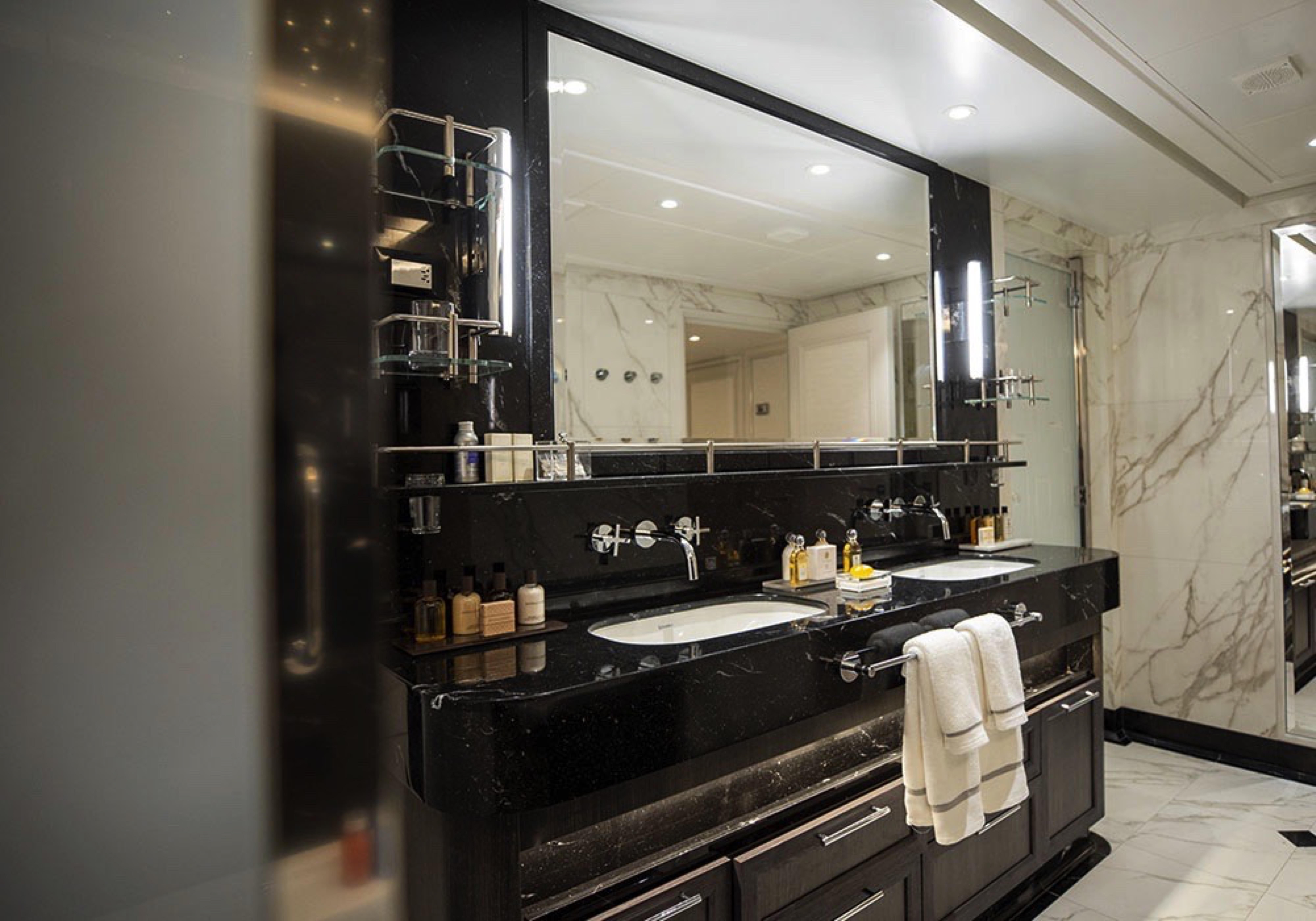
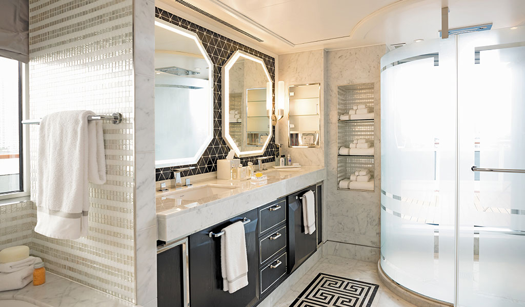
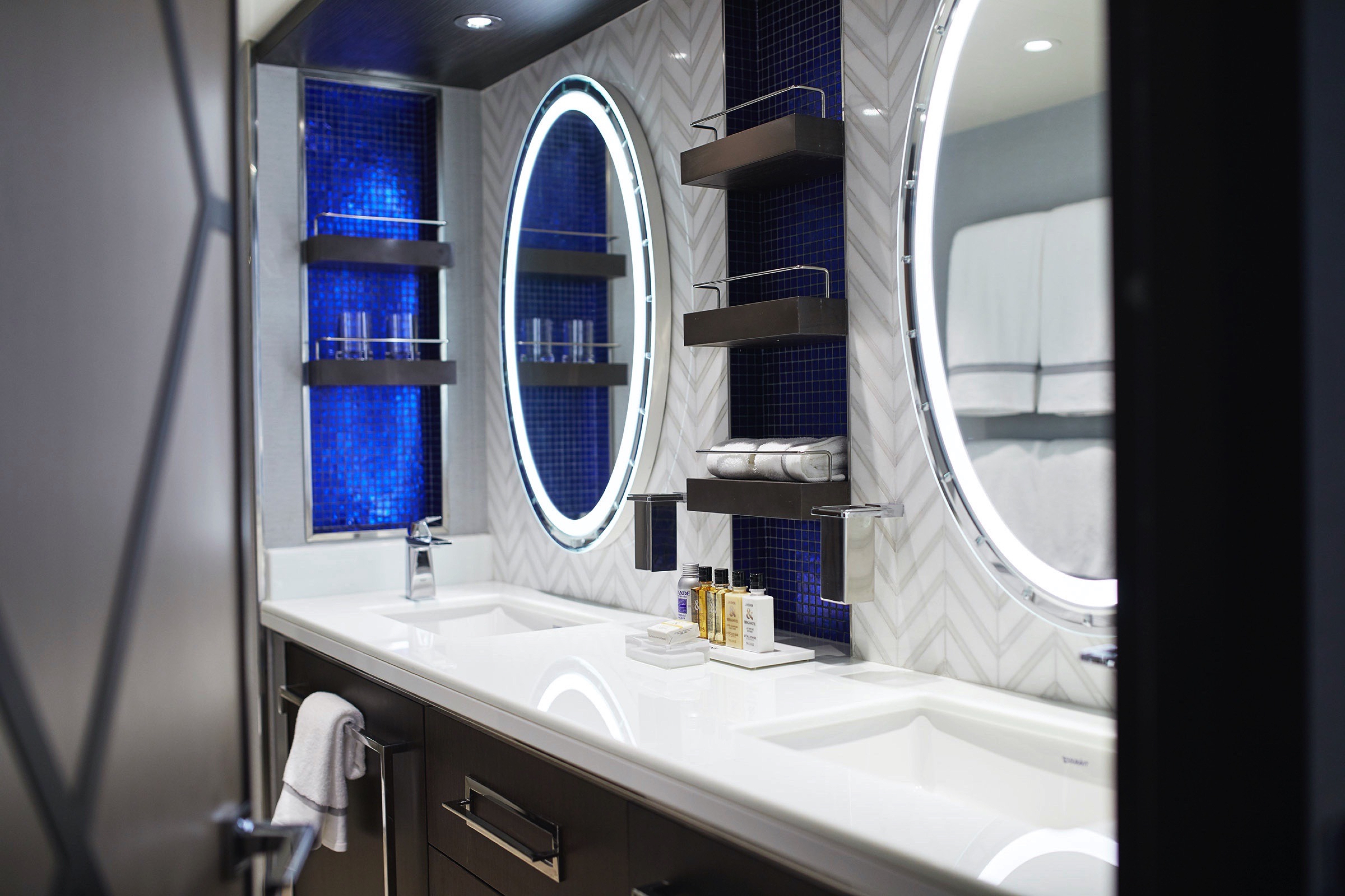
- 2 1/2 Marble & Stone Detailed Bathrooms, 1 with Jetted Tub
- 2 Private Balconies with Heated Minipool Spa
- Private In-Suite Spa with Sauna, Steam Room & Jacuzzi
- Spacious Living Room
- Panoramic Ocean-View Bar
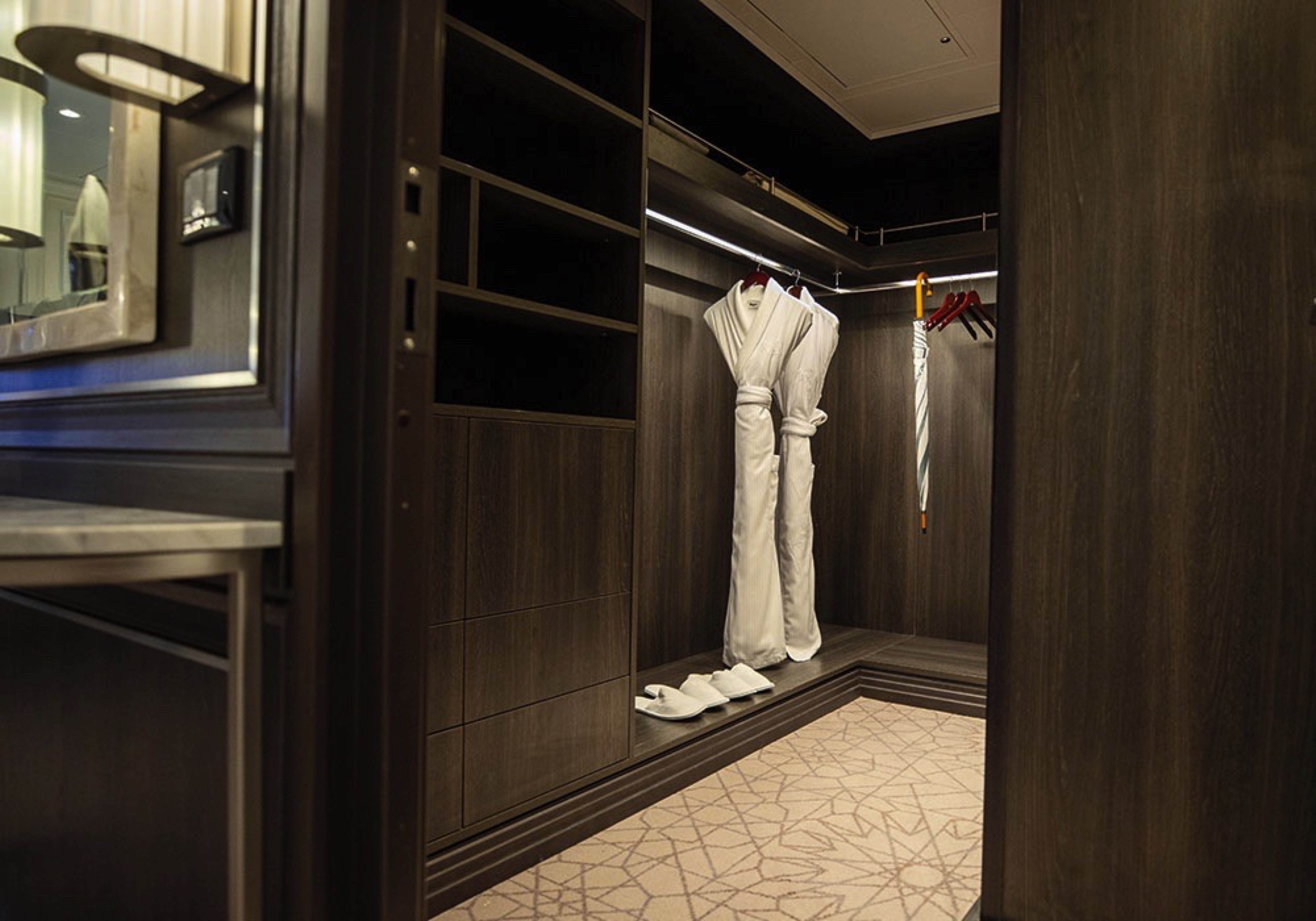
- 3 Walk-In Closets with 2 Safes
- Glass-Enclosed, Ocean-View Shower & Spa
- Private, Separately Located Dining Room for Up to 12 Guests
- Includes Up To 6 Guests
The suite pictured may differ from the suite booked, as layouts and designs vary by ship, deck, and suite location.
Amenities
- 1-Night Pre-Cruise: Hotel Package Including:
- - Ground Transfers
- - Breakfast
- - Porterage
- Unlimited WiFi and Streaming Package for up to Four Devices
- Valet Laundry Service
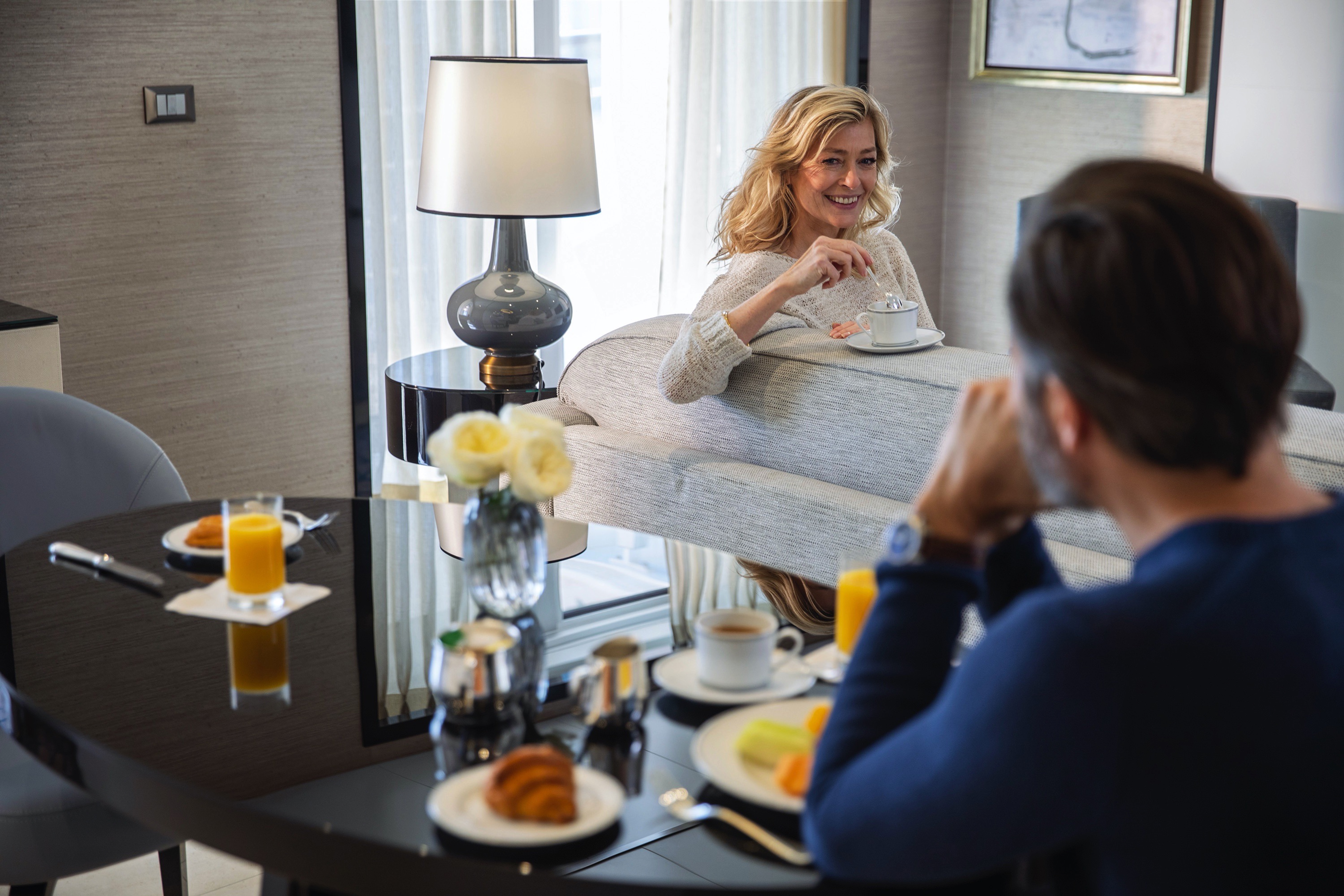
- 24-hour In-Suite Dining
- Fresh Orchid Arrangement
- L'Occitane® Jasmin & Bergamot Bath Amenities
- Regent Plush Bathrobe & Slippers
- Interactive Flat-Screen Television & Direct-Dial Satellite Phone
- Priority Access to Online Shore Excursion Reservations
- Priority Access to Online Dining Reservations
- Binoculars
- illy® Espresso Maker
- Cashmere Blankets
- Regent Special Gift
- Vanity & Hair Dryer
- Shoe Shine Service
- Additional Discounts:
- - 10% Discount on Ultra Premium Wine and Liquor
- - 5% Savings on Pre- or Post-Cruise Hotel or Land Programs
- - 5% Savings on Regent Choice Shore Excursions
- Additional Regent Suites Amenities:
- Personal Car & Guide to Explore Ashore
- Daily Serene Spa & Wellness™ Services with Priority Reservations
- Access to The Study, a Private Dining Room for up to 12 Guests
- Unlimited Dry Cleaning
- Guaranteed Reservation Each Night in Specialty Restaurant of Your Choice
- Welcome Letter from the President and General Manager
- Personal Butler for an Elevated In-suite Experience
- - In-Suite Dining Menu Including Specialty Restaurant Selections During Dining Hours
- Priority Boarding on Embarkation Day with Suite Access at Noon
- Marzotto Cristallo Silk & Cashmere with Fringe Throw
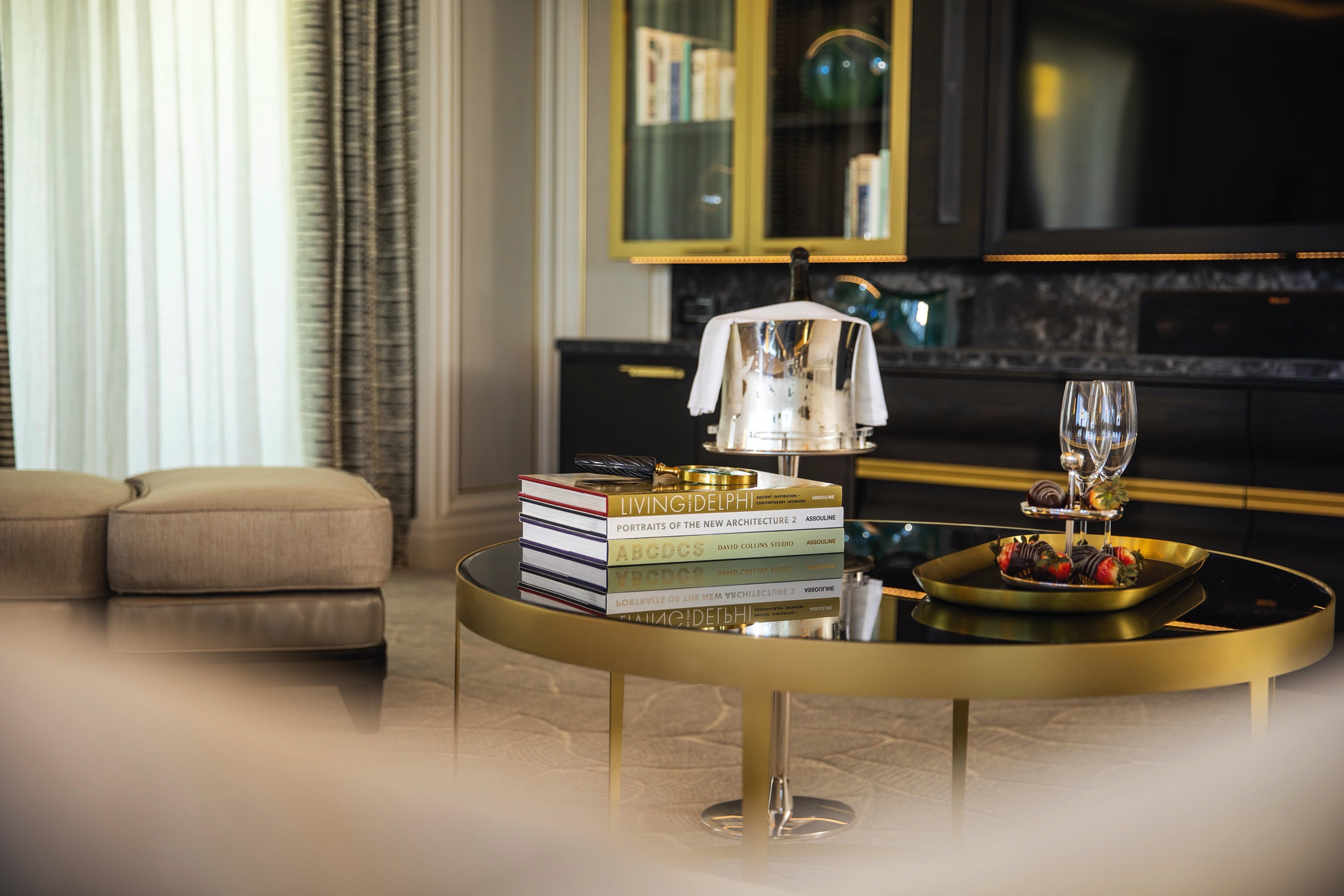
- Welcome Bottle of Dom Pérignon Champagne
- Remy Martin Louis XIII Cognac 50ml
- Personalized In-Suite Full-Liquor Bar Set-Up
- A Sumptuous In-Suite Caviar Service Once During Cruises
- Complimentary In-Suite Cocktail Party for 8
- Complimentary 25-Minute Personal Fitness Session at the Serene Spa & Wellness™ Fitness Center
- Daily Canapés
- Tea Forté Set-Up
- Luxe Fruit Arrangement with Chocolate Leonidas
- Choice of Luxurious Designer Bath Amenities
- Spa Accessories & Spongology Collection
- Dyson Hairdryer
- Selection of Fig & Tea Leaves Bath Salts
- Guerlain Bath Amenities & Men's Unscented Shaving Kit
- Bath Scale Setup
- Wallet Make Up Brush Set / Hairbrush & Combo Set
- Bose® SoundLink Mini II Bluetooth Speaker
- Selection of Bed Pillow Styles
- Linen Menu
- Complimentary Garment Pressing on First Night
- Personalized Stationery upon request
- Elegant Weather Clock
- Excursion Bag
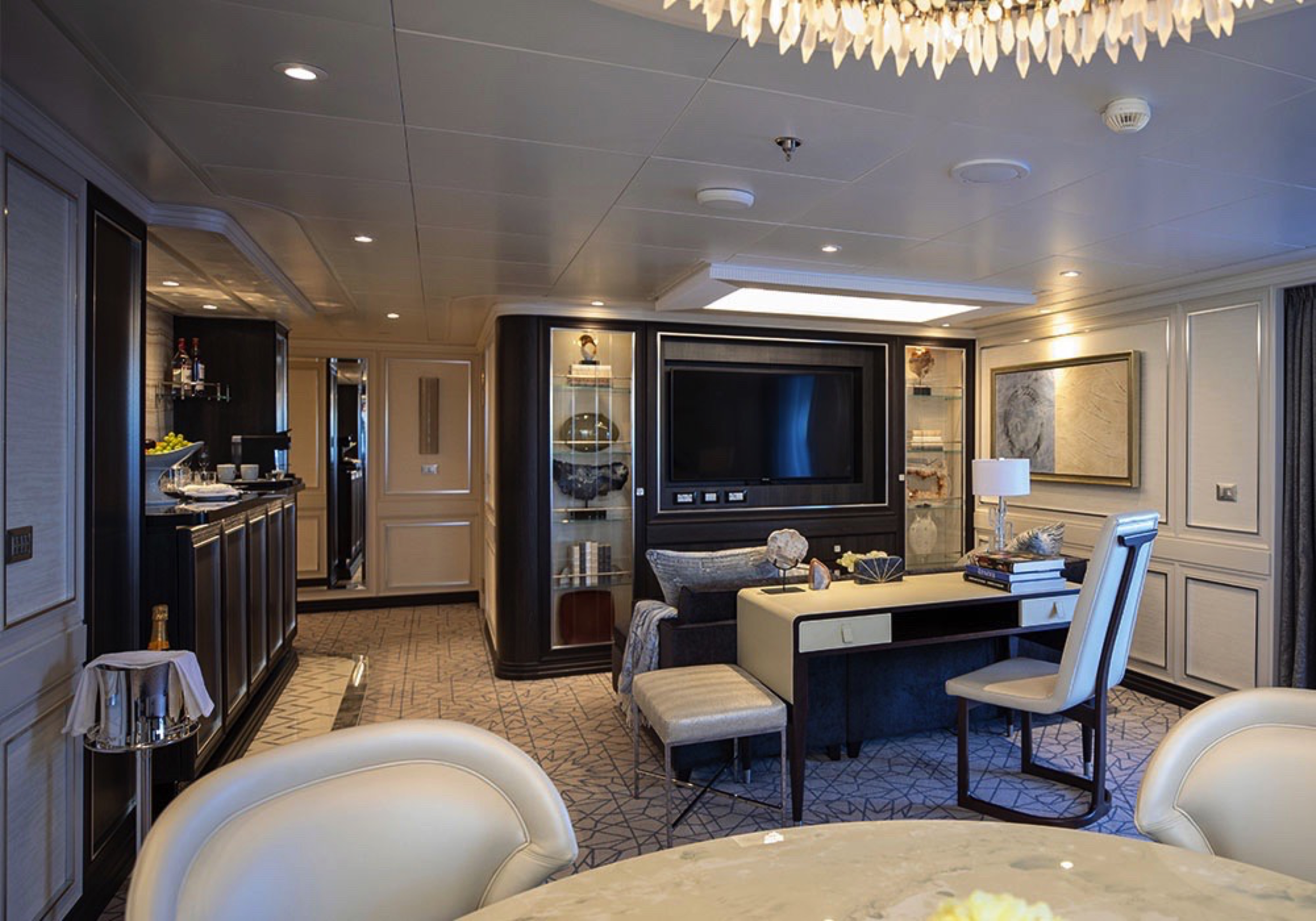
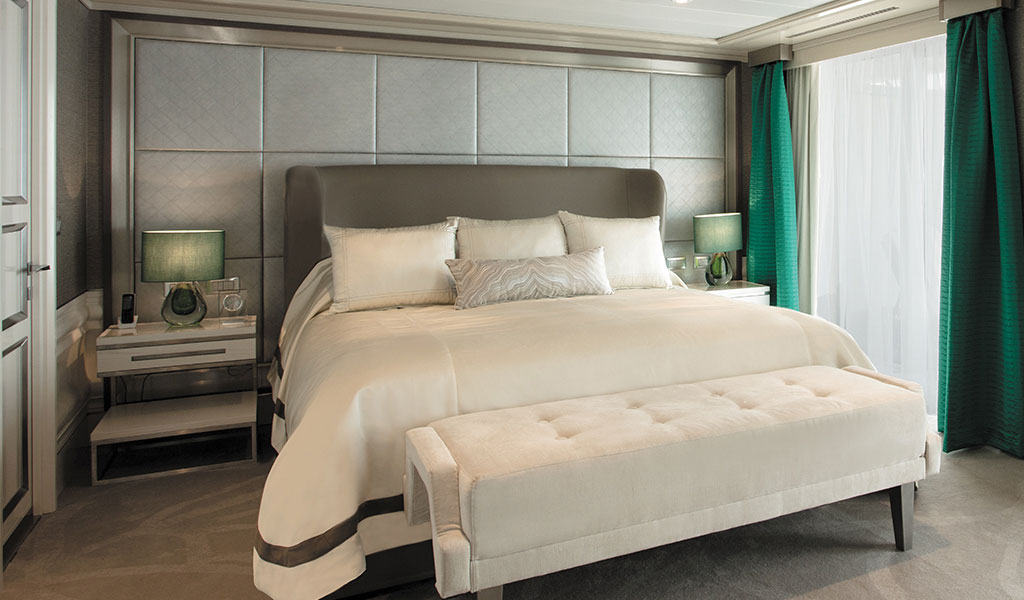
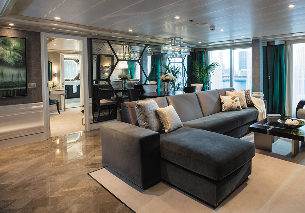
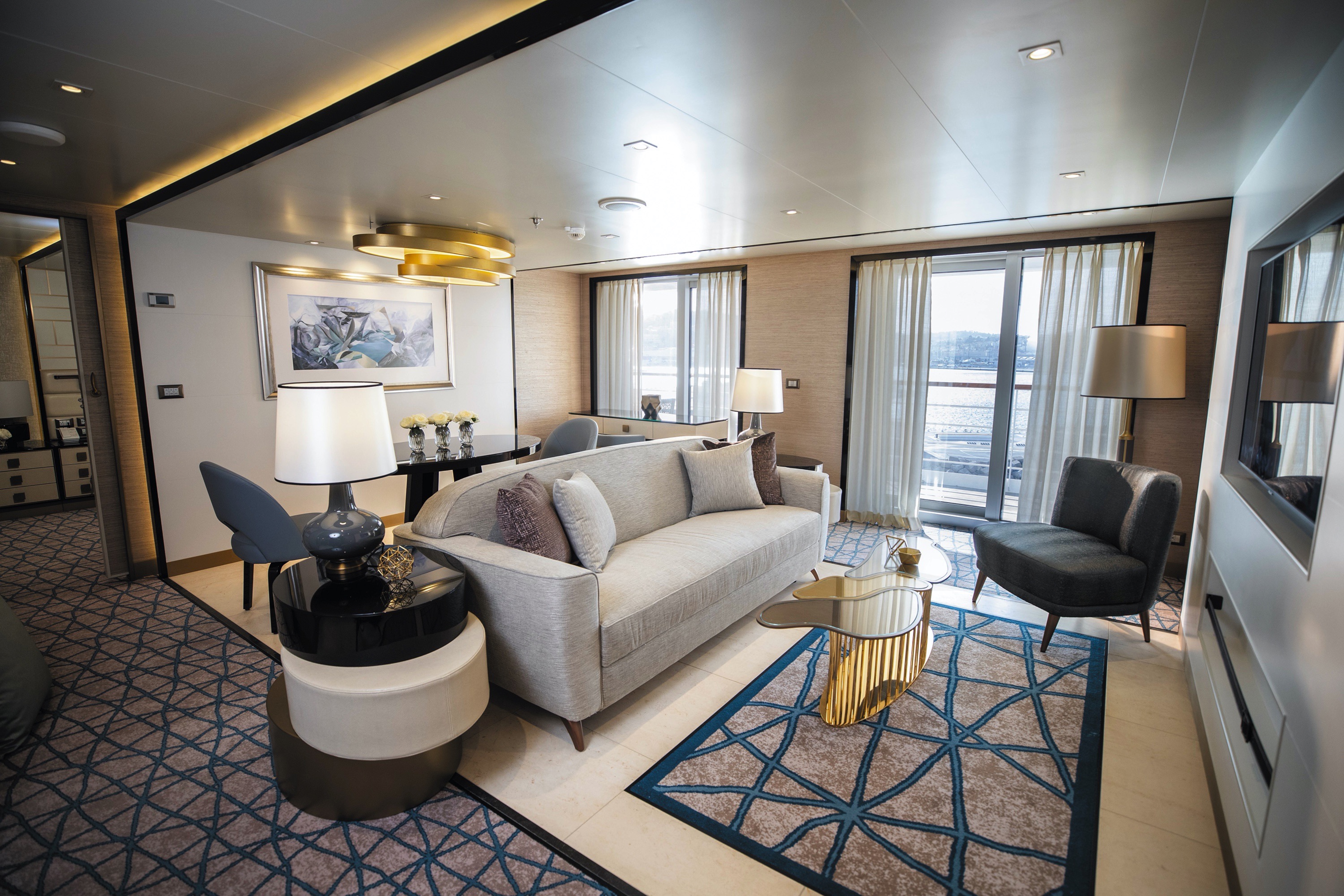
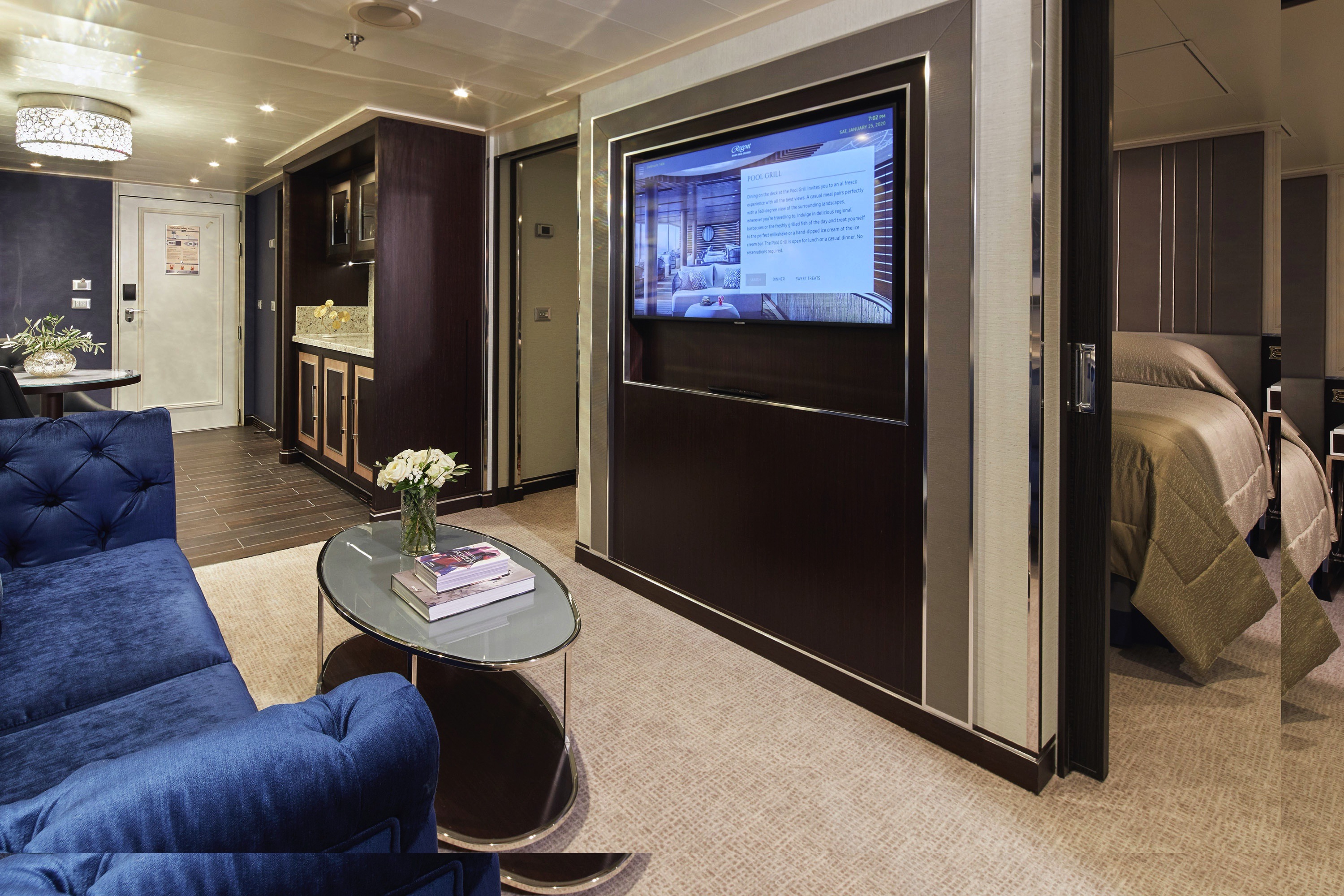
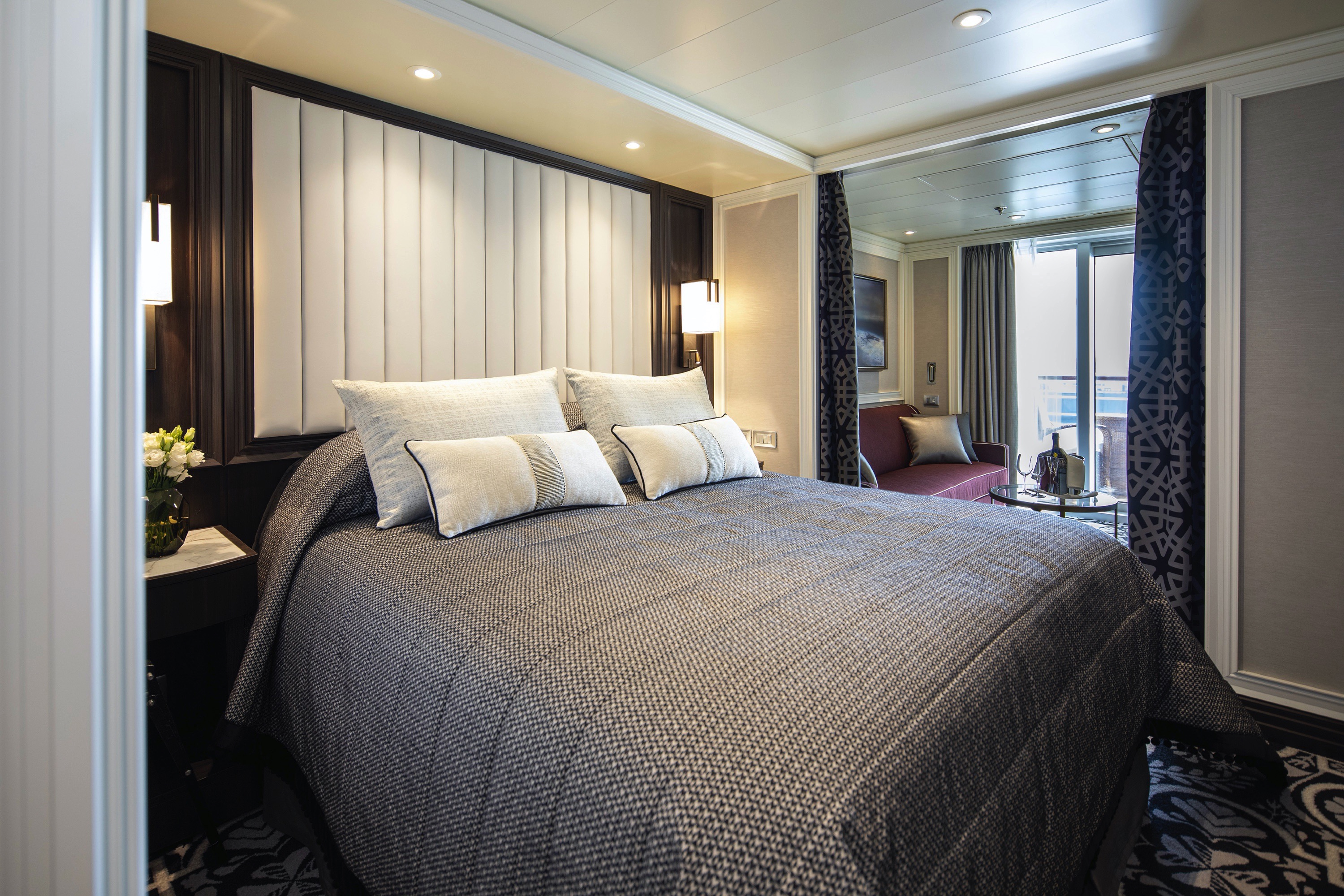
You'll find Park Avenue chic onboard Seven Sea Splendor® in this extravagant, stylish suite. A rich color palette, the finest fabrics and a grand piano create sophisticated comfort, while a personal butler will happily assist with both ordinary and special requests. With two spacious bedrooms, two-and-a-half baths, a large living room and a wrap-around private balcony, this suite is perfectly suited to host gatherings of new friends.
Layout
- 2 Spacious Bedroom with a European King-Size Elite Slumber® Bed (*Bed in primary bedroom cannot be converted into two beds.)
- 2 Marble & Stone Detailed Bathrooms
- Private Balcony
- Sitting Area
- Walk-In Closet with Safe
- Includes Up To 6 Guests
The suite pictured may differ from the suite booked, as layouts and designs vary by ship, deck, and suite location.
Amenities
- 1-Night Pre-Cruise: Hotel Package Including:
- - Ground Transfers
- - Breakfast
- - Porterage
- Unlimited WiFi and Streaming Package for up to Four Devices
- Valet Laundry Service
- 24-hour In-Suite Dining
- Fresh Orchid Arrangement
- L'Occitane® Jasmin & Bergamot Bath Amenities
- Regent Plush Bathrobe & Slippers
- Interactive Flat-Screen Television & Direct-Dial Satellite Phone
- Priority Access to Online Shore Excursion Reservations
- Priority Access to Online Dining Reservations
- Binoculars
- illy® Espresso Maker
- Cashmere Blankets
- Regent Special Gift
- Vanity & Hair Dryer
- Shoe Shine Service
- Additional Discounts:
- - 10% Discount on Ultra Premium Wine and Liquor
- - 5% Savings on Pre- or Post-Cruise Hotel or Land Programs
- - 5% Savings on Regent Choice Shore Excursions
Additional Signature Suite Amenities:
- Guaranteed Reservation Each Night in Specialty Restaurant of Your Choice
- Welcome Letter from the President and General Manager
- Personal Butler for an Elevated In-suite Experience
- - In-Suite Dining Menu Including Specialty Restaurant Selections During Dining Hours
- Priority Boarding on Embarkation Day with Suite Access at Noon
- Marzotto Cristallo Silk & Cashmere with Fringe Throw
- Welcome Bottle of Premium Champagne
- Personalized In-Suite Full-Liquor Bar Set-Up
- A Sumptuous In-Suite Caviar Service Once During Cruises
- Complimentary In-Suite Cocktail Party for 8
- Complimentary 25-Minute Personal Fitness Session at the Serene Spa & Wellness™ Fitness Center
- Daily Canapés
- Tea Forté Set-Up
- Luxe Fruit Arrangement with Chocolate Leonidas
- Luxurious Designer Bath Amenities & Men's Unscented Shaving Kit
- Dyson Hairdryer
- Selection of Fig & Tea Leaves Bath Salts
- Guerlain Bath Amenities & Men's Unscented Shaving Kit
- Bath Scale Setup
- Bose® SoundLink Mini II Bluetooth Speaker
- Selection of Bed Pillow Styles
- Complimentary Garment Pressing on First Night
- Personalized Stationery upon request
- Elegant Weather Clock
- Excursion Bag
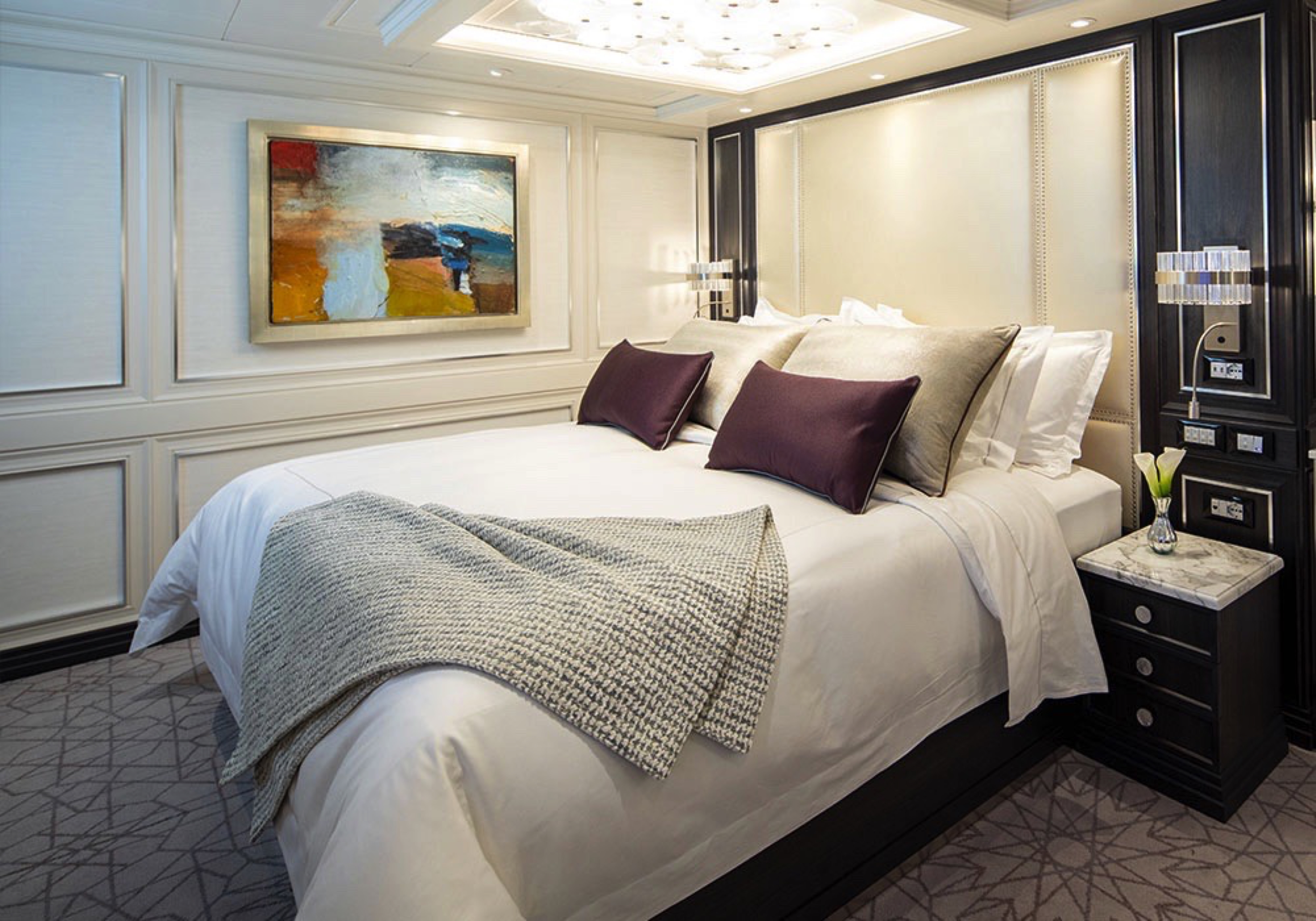
Step into the richness of an emerald green dining area perfectly ensconced within a spacious, sumptuous living room. Just outside is a private balcony with a table and chairs, perfect for in-suite breakfast. The private bedroom is large and inviting, its soothing color palette perfect for a peaceful night’s rest on your King-Size Elite Slumber™ Bed. Two full baths make it a perfect space for entertaining new friends on the high seas.
The suite pictured may differ from the suite booked, as layouts and designs vary by ship, deck, and suite location.
Layout
- 1 Spacious Bedroom with a European King-Size Elite Slumber® Bed (*Bed cannot be converted into two beds.)
- 2 Marble & Stone Detailed Bathrooms
- Private Balcony
- Sitting Area
- Walk-In Closet with Safe
- Accommodates Up To 3 Guests
The suite pictured may differ from the suite booked, as layouts and designs vary by ship, deck, and suite location.
Amenities
- 1-Night Pre-Cruise: Hotel Package Including:
- - Ground Transfers
- - Breakfast
- - Porterage
- Unlimited WiFi Includes up to Four Logins, Four Devices, per Suite
- Valet Laundry Service
- 24-hour In-Suite Dining
- Fresh Orchid Arrangement
- L'Occitane® Jasmin & Bergamot Bath Amenities
- Regent Plush Bathrobe & Slippers
- Interactive Flat-Screen Television & Direct-Dial Satellite Phone
- Priority Access to Online Shore Excursion Reservations
- Priority Access to Online Dining Reservations
- Binoculars
- illy® Espresso Maker
- Cashmere Blankets
- Regent Special Gift
- Vanity & Hair Dryer
- Shoe Shine Service
- Additional Discounts:
- - 10% Discount on Ultra Premium Wine and Liquor
- - 5% Savings on Pre- or Post-Cruise Hotel or Land Programs
- - 5% Savings on Regent Choice Shore Excursions
Additional Grand Suite Amenities:
- Guaranteed Reservation Each Night in Specialty Restaurant of Your Choice
- Welcome Letter from the President and General Manager
- Personal Butler for an Elevated In-suite Experience
- - In-Suite Dining Menu Including Specialty Restaurant Selections During Dining Hours
- Priority Boarding on Embarkation Day with Suite Access at Noon
- Marzotto Cristallo Silk & Cashmere with Fringe Throw
- Welcome Bottle of Premium Champagne
- Personalized In-Suite Full-Liquor Bar Set-Up
- A Sumptuous In-Suite Caviar Service Once During Cruises
- Complimentary In-Suite Cocktail Party for 8
- Complimentary 25-Minute Personal Fitness Session at the Serene Spa & Wellness™ Fitness Center
- Daily Canapés
- Tea Forté Set-Up
- Luxe Fruit Arrangement with Chocolate Leonidas
- Luxurious Designer Bath Amenities & Men's Unscented Shaving Kit
- Dyson Hairdryer
- Selection of Fig & Tea Leaves Bath Salts
- Guerlain Bath Amenities & Men's Unscented Shaving Kit
- Bath Scale Setup
- Bose® SoundLink Mini II Bluetooth Speaker
- Selection of Bed Pillow Styles
- Complimentary Garment Pressing on First Night
- Personalized Stationery upon request
- Elegant Weather Clock
- Excursion Bag
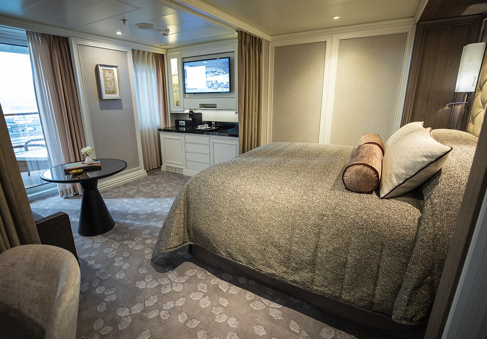
This home away from home is larger than some penthouse apartments, with more than 900 square feet (274.3 meters) of living space that includes a large private balcony. The sleek design provides ample space for relaxing or entertaining, and the walk-in closet comfortably stores your belongings. As if having a personal butler and daily canapés weren’t enough, you’ll also enjoy a personalized full-liquor bar set-up and a sumptuous in-suite caviar service.
Layout
- 1 Spacious Bedroom with a European King-Size Elite Slumber® Bed
- 1 1/2 Marble & Stone Detailed Bathrooms
- Private Balcony
- Sitting Area
- Walk-In Closet with Safe
- Accommodates Up To 3 Guests
The suite pictured may differ from the suite booked, as layouts and designs vary by ship, deck, and suite location.
Amenities
- 1-Night Pre-Cruise: Hotel Package Including:
- - Ground Transfers
- - Breakfast
- - Porterage
- Unlimited WiFi Includes up to Four Logins, Four Devices, per Suite
- Valet Laundry Service
- 24-hour In-Suite Dining
- Fresh Orchid Arrangement
- L'Occitane® Jasmin & Bergamot Bath Amenities
- Regent Plush Bathrobe & Slippers
- Interactive Flat-Screen Television & Direct-Dial Satellite Phone
- Priority Access to Online Shore Excursion Reservations
- Priority Access to Online Dining Reservations
- Binoculars
- illy® Espresso Maker
- Cashmere Blankets
- Regent Special Gift
- Vanity & Hair Dryer
- Shoe Shine Service
- Additional Discounts:
- - 10% Discount on Ultra Premium Wine and Liquor
- - 5% Savings on Pre- or Post-Cruise Hotel or Land Programs
- - 5% Savings on Regent Choice Shore Excursions
Additional Splendor Suite Amenities:
- Welcome Letter from the President and General Manager
- Personal Butler for an Elevated In-suite Experience
- - In-Suite Dining from Compass Rose
- Priority Boarding on Embarkation Day with Suite Access at 1pm
- Welcome Bottle of Premium Champagne
- Personalized In-Suite Full-Liquor Bar Set-Up
- A Sumptuous In-Suite Caviar Service Once During Cruises
- Daily Canapés
- Luxe Fruit Arrangement
- Luxurious Designer Bath Amenities & Men's Unscented Shaving Kit
- Selection of Fig & Tea Leaves Bath Salts
- Guerlain Bath Amenities & Men's Unscented Shaving Kit
- Bath Scale Setup
- Bose® SoundLink Mini II Bluetooth Speaker
- Selection of Bed Pillow Styles
- Complimentary Garment Pressing on First Night
- Personalized Stationery upon request
- Elegant Weather Clock
This suite is decorated with soothing colors, pleasing artwork and comfortable furnishings. Relax in the sitting area after an exciting day ashore and enjoy the selection of fresh canapés delivered by your personal butler. Then retreat to your private balcony to watch the ever-changing vistas.
Layout
- 1 Spacious Bedroom with a European King-Size Elite Slumber® Bed
- 1 Marble & Stone Detailed Bathroom
- Private Balcony
- Sitting Area
- Walk-In Closet with Safe
- Accommodates Up To 3 Guests
The suite pictured may differ from the suite booked, as layouts and designs vary by ship, deck, and suite location.
Amenities
- 1-Night Pre-Cruise: Hotel Package Including:
- - Ground Transfers
- - Breakfast
- - Porterage
- Unlimited WiFi Includes up to Four Logins, Four Devices, per Suite
- Valet Laundry Service
- Customizable In-Suite Mini Bar Replenished Daily with Your Preferences
- 24-hour In-Suite Dining
- Fresh Orchid Arrangement
- Luxurious Bath Amenities & Men's Unscented Shaving Kit
- Regent Plush Bathrobe & Slippers
- Interactive Flat-Screen Television & Direct-Dial Satellite Phone
- Priority Access to Online Shore Excursion Reservations
- Priority Access to Online Dining Reservations
- Binoculars
- illy® Espresso Maker
- Cashmere Blankets
- Regent Special Gift
- Vanity & Hair Dryer
- Shoe Shine Service
- Additional Discounts:
- - 10% Discount on Ultra Premium Wine and Liquor
- - 5% Savings on Pre- or Post-Cruise Hotel or Land Programs
- - 5% Savings on Regent Choice Shore Excursions
Additional Seven Seas Suites Amenitie:
- Personal Butler for an Elevated In-suite Experience
- - In-Suite Dining from Compass Rose
- Priority Boarding on Embarkation Day with Suite Access at 1pm
- Daily Canapés
- Luxe Fruit Arrangement
- Luxurious Bath Amenities & Men's Unscented Shaving Kit
- Selection of Fig & Tea Leaves Bath Salts
- Bose® SoundLink Mini II Bluetooth Speaker
- Selection of Bed Pillow Styles
- Complimentary Garment Pressing on First Night
- Personalized Stationery upon request
- Elegant Weather Clock

Your personal haven at the end of each day, this luxurious suite has been carefully designed to maximize space and comfort. Relax on your private balcony and indulge in your lavish bath amenities as you recharge and ready yourself for a new adventure in the next port of call. This suite also features a spacious walk-through closet and separated living and bedroom areas that can be closed with pocket doors for privacy.
Layout
- Private Balcony
- Sitting Area
- Marble & Stone Detailed Bathroom Features a Glass-Enclosed Shower Instead of Bathtub
- European King-Size Elite Slumber® Bed
- Walk-In Closet with Safe
- Accommodates Up To 3 Guests
The suite pictured may differ from the suite booked, as layouts and designs vary by ship, deck, and suite location.
Amenities
- 1-Night Pre-Cruise: Hotel Package Including:
- - Ground Transfers
- - Breakfast
- - Porterage
- Unlimited WiFi Includes up to Four Logins, Four Devices, per Suite
- Valet Laundry Service
- Customizable In-Suite Mini Bar Replenished Daily with Your Preferences
- Welcome Bottle of Champagne & Fresh Fruit
- 24-hour In-Suite Dining
- Fresh Orchid Arrangement
- L'Occitane® Jasmin & Bergamot Bath Amenities
- Regent Plush Bathrobe & Slippers
- Interactive Flat-Screen Television & Direct-Dial Satellite Phone
- Priority Access to Online Shore Excursion Reservations
- Priority Access to Online Dining Reservations
- Binoculars
- illy® Espresso Maker
- Cashmere Blankets
- Regent Special Gift
- Vanity & Hair Dryer
- Shoe Shine Service
- Additional Discounts:
- - 10% Discount on Ultra Premium Wine and Liquor
- - 5% Savings on Pre- or Post-Cruise Hotel or Land Programs
- - 5% Savings on Regent Choice Shore Excursions
Additional Penthouse Suite Amenities:
- Personal Butler for an Elevated In-suite Experience
- - In-Suite Dining from Compass Rose
- Daily Canapés
- Luxurious Designer Bath Amenities & Men's Unscented Shaving Kit
- Guerlain Bath Amenities & Men's Unscented Shaving Kit
- Bose® SoundLink Mini II Bluetooth Speaker
- Selection of Bed Pillow Styles
- Complimentary Garment Pressing on First Night
- Personalized Stationery upon request
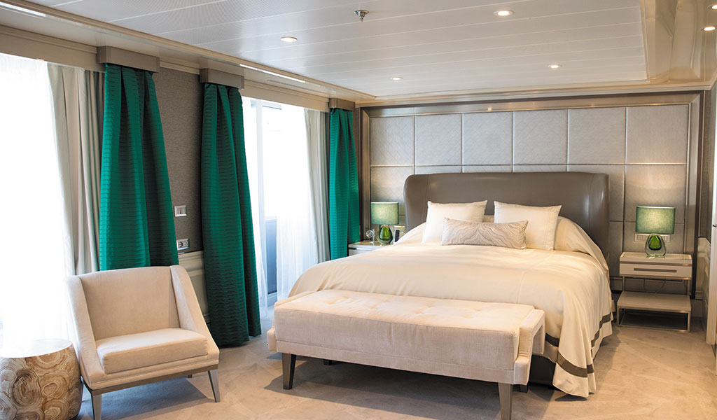
In this superbly designed suite, enjoy once-in-a-lifetime views of the horizon from the comfort of your King-Sized Elite Slumber™ Bed as well as exclusive luxuries available only in suites at the Concierge level and higher. Your suite includes amenities such as an illy® espresso maker and cashmere blankets, perfect for use in the morning when you wish to sip coffee and enjoy an in-suite breakfast on your private balcony.
Layout
- Private Balcony
- Sitting Area
- Marble & Stone Detailed Bathroom
- European King-Size Elite Slumber® Bed
- Walk-In Closet with Safe
- Accommodates Up To 3 Guests
- This category includes Accessibility Options in suites 822 and 823. For more information about accessible suites click here.
The suite pictured may differ from the suite booked, as layouts and designs vary by ship, deck, and suite location.
Amenities
- 1-Night Pre-Cruise: Hotel Package Including:
- - Ground Transfers
- - Breakfast
- - Porterage
- Unlimited WiFi Includes up to Four Logins, Four Devices, per Suite
- Valet Laundry Service
- Customizable In-Suite Mini Bar Replenished Daily with Your Preferences
- Welcome Bottle of Champagne & Fresh Fruit
- 24-hour In-Suite Dining
- Fresh Orchid Arrangement
- L'Occitane® Jasmin & Bergamot Bath Amenities
- Regent Plush Bathrobe & Slippers
- Interactive Flat-Screen Television & Direct-Dial Satellite Phone
- Priority Access to Online Shore Excursion Reservations
- Priority Access to Online Dining Reservations
- Binoculars
- illy® Espresso Maker
- Cashmere Blankets
- Regent Special Gift
- Vanity & Hair Dryer
- Shoe Shine Service
- Additional Discounts:
- - 10% Discount on Ultra Premium Wine and Liquor
- - 5% Savings on Pre- or Post-Cruise Hotel or Land Programs
- - 5% Savings on Regent Choice Shore Excursions
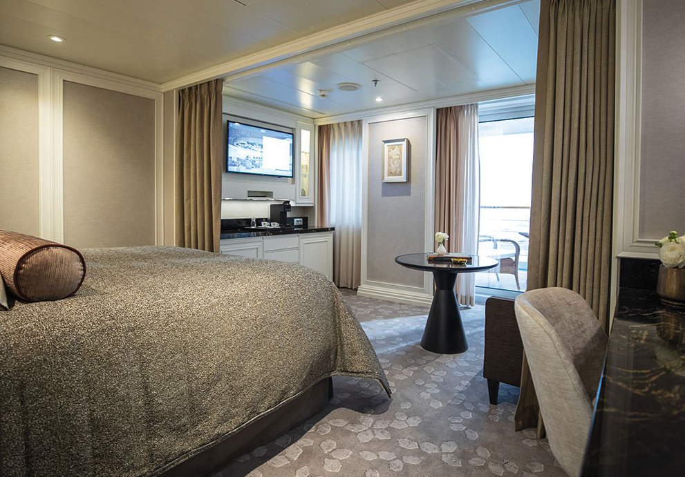
With more than 400 square feet of space including a private balcony, this suite is an excellent choice if you want a little extra room. Even your sleeping accommodations are spacious, as the Elite Slumber™ bed is a European king-size and faces floor-to-ceiling windows that provide ocean views from your bed. A walk-in closet, dual sinks in the bathroom and wonderful bath amenities make it a pleasure to prepare for your day’s adventures.
Layout
- Private Balcony
- Sitting Area
- Marble & Stone Detailed Bathroom
- European King-Size Elite Slumber® Bed
- Walk-In Closet with Safe
- Accommodates Up To 3 Guests
The suite pictured may differ from the suite booked, as layouts and designs vary by ship, deck, and suite location.
Amenities
- Unlimited WiFi Includes Two Logins, Two Devices, per Suite
- Valet Laundry Service
- Customizable In-Suite Mini Bar Replenished Daily with Your Preferences
- Welcome Bottle of Champagne & Fresh Fruit
- 24-hour In-Suite Dining
- Fresh Orchid Arrangement
- L'Occitane® Jasmin & Bergamot Bath Amenities
- Regent Plush Bathrobe & Slippers
- Interactive Flat-Screen Television & Direct-Dial Satellite Phone
- Vanity & Hair Dryer
- Shoe Shine Service
Every inch of this suite has been thoughtfully designed to maximize interior space and embrace the magnificent scenery outdoors. From the sitting area, admire the ocean views through the floor-to-ceiling windows, or better yet, take a seat outside on your private balcony to watch the world go by. Elegant finishes such as luxurious bedding and beautiful marble detailing in the bath further enhance your comfort.
Layout
- Private Balcony
- Sitting Area
- Marble & Stone Detailed Bathroom Features a Glass-Enclosed Shower Instead of Bathtub
- European Queen-Size Elite Slumber® Bed
- Walk-In Closet with Safe
- Accommodates Up To 2 Guests
The suite pictured may differ from the suite booked, as layouts and designs vary by ship, deck, and suite location.
Amenities
- Unlimited WiFi Includes Two Logins, Two Devices, per Suite
- Valet Laundry Service
- Customizable In-Suite Mini Bar Replenished Daily with Your Preferences
- Welcome Bottle of Champagne & Fresh Fruit
- 24-hour In-Suite Dining
- Fresh Orchid Arrangement
- L'Occitane® Jasmin & Bergamot Bath Amenities
- Regent Plush Bathrobe & Slippers
- Interactive Flat-Screen Television & Direct-Dial Satellite Phone
- Vanity & Hair Dryer
- Shoe Shine Service
A wonderfully cozy retreat that includes a private balcony. In addition to a signature European Queen Size Elite Slumber™ bed, you’ll enjoy amenities such as lavish bath products, an interactive flat-screen television and a plush bathrobe and slippers. The intimate sitting area includes a table that is the perfect size for breakfast for two or a couple of glasses and a bottle of celebratory Champagne.
Layout
- Private Balcony
- Sitting Area
- Marble & Stone Detailed Bathroom Features a Glass-Enclosed Shower Instead of Bathtub
- European Queen-Size Elite Slumber® Bed
- Built-In Closet with Safe
- Accommodates Up To 2 Guests
The suite pictured may differ from the suite booked, as layouts and designs vary by ship, deck, and suite location.
Amenities
- Unlimited WiFi Includes Two Logins, Two Devices, per Suite
- Valet Laundry Service
- Customizable In-Suite Mini Bar Replenished Daily with Your Preferences
- Welcome Bottle of Champagne & Fresh Fruit
- 24-hour In-Suite Dining
- Fresh Orchid Arrangement
- L'Occitane® Jasmin & Bergamot Bath Amenities
- Regent Plush Bathrobe & Slippers
- Interactive Flat-Screen Television & Direct-Dial Satellite Phone
- Vanity & Hair Dryer
- Shoe Shine Service
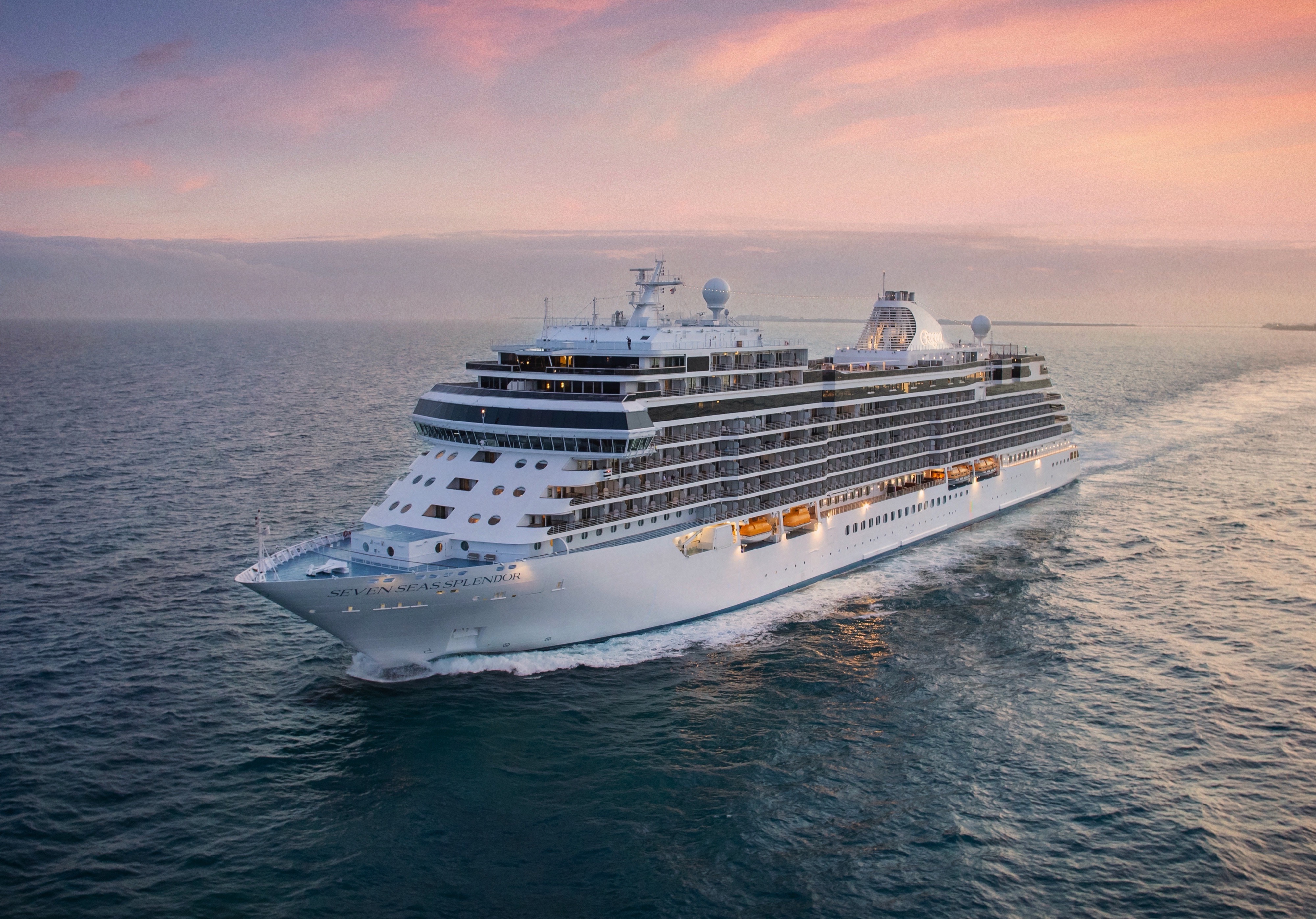
Seven Seas Splendor
Seven Seas Splendor® is luxury perfected. From her elegant décor to the crowning Regent Suite, every space is elevated to the utmost.
Perfection is in the details. Discover the intricate beauty and marvellous design of Seven Seas Splendor® as we unveil some of the refinements and wonders that went into creating luxury perfected. From her grand social spaces to the private balconies adorning every suite, Seven Seas Splendor is a work of art from bow to stern.
Your time on board Seven Seas Splendor® will be just as rewarding as your time spent ashore. Check out the deck plans to discover where to take enrichment classes, do some shopping, enjoy a cocktail and savor a fine meal.
Ship Facts
| Launch Year | 2020 | ||||
| Refit Year | |||||
| Language | en | ||||
| Gross Tonnage | 55498 | ||||
| Length | 224 | ||||
| Width | 31 | ||||
| Currency | USD | ||||
| Speed | 19 | ||||
| Capacity | 746 | ||||
| Crew Count | 548 | ||||
| Deck Count | 10 | ||||
| Cabin Count | 373 | ||||
| Large Cabin Count | 5 | ||||
| Wheelchair Cabin Count | 2 | ||||
| Electrical Plugs |
|
Deck 14
- Regent Suite
- Penthouse Suites
- Concierge Suites

Deck 12
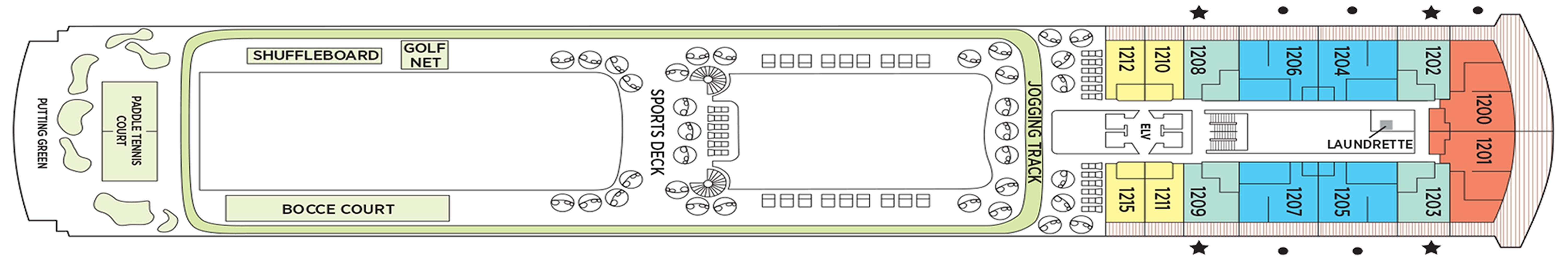
- Putting Green
- Paddle Tennis Court
- Bocce Court
- Shuffleboard
- Golf Net
- Sports Deck
- Jogging Track
- Grand Suites
- Splendor Suites
- Penthouse Suites
- Concierge Suites
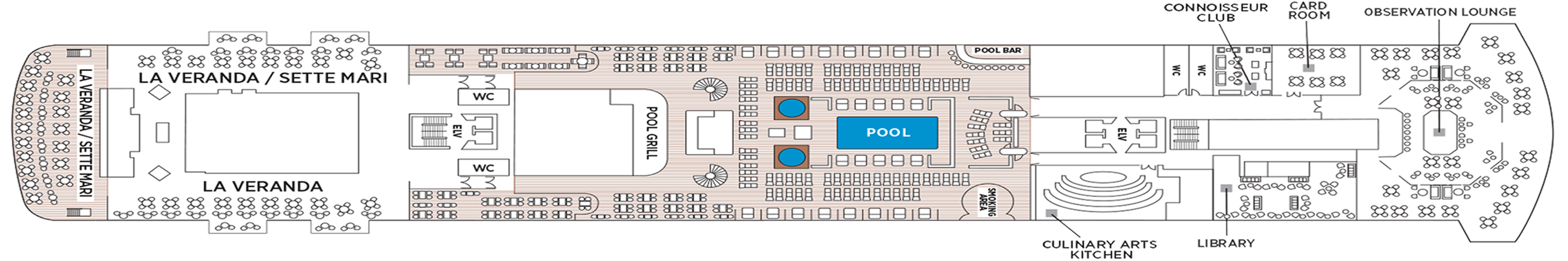
Deck 11
- La Veranda
- Sette Mari at La Veranda
- Pool Bar
- Pool Grill
- Pool
- Culinary Arts Kitchen
- Library
- Connoisseur Club
- Card Room
- Observation Lounge
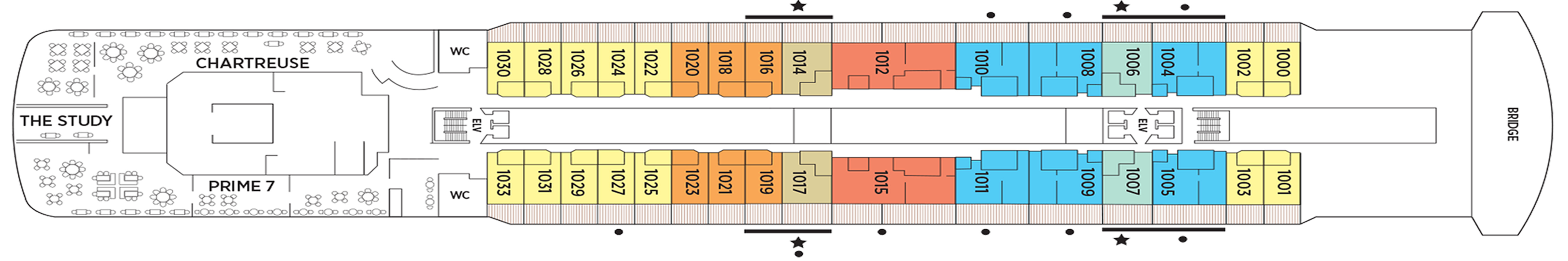
Deck 10
- The Study
- Prime 7
- Chartreuse
- Bridge
- Grand Suites
- Concierge Suites
- Splendor Suites
- Penthouse Suites
- Serenity Suites
Deck 9
- Serenity Suites
- Grand Suites
- Splendor Suites
- Penthouse Suites
- Concierge Suites
- Signature Suites
- Deluxe Veranda Suites
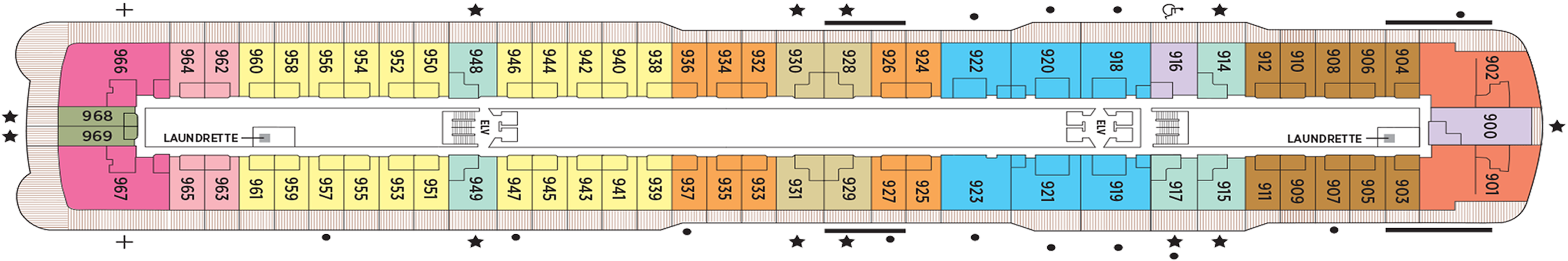
- Launderettes
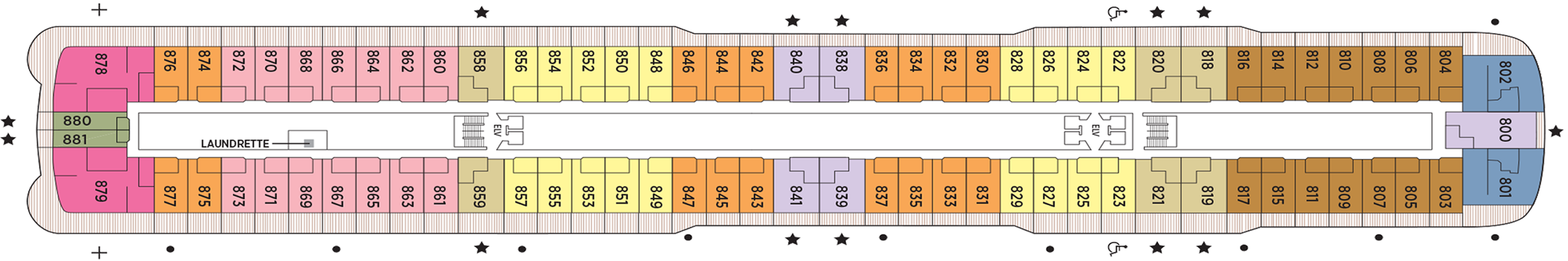
Deck 8
- Serenity Suites
- Seven Seas Suites
- Penthouse Suites
- Concierge Suites
- Superior Suites
- Deluxe Veranda Suites
- Signature Suites
- Launderette
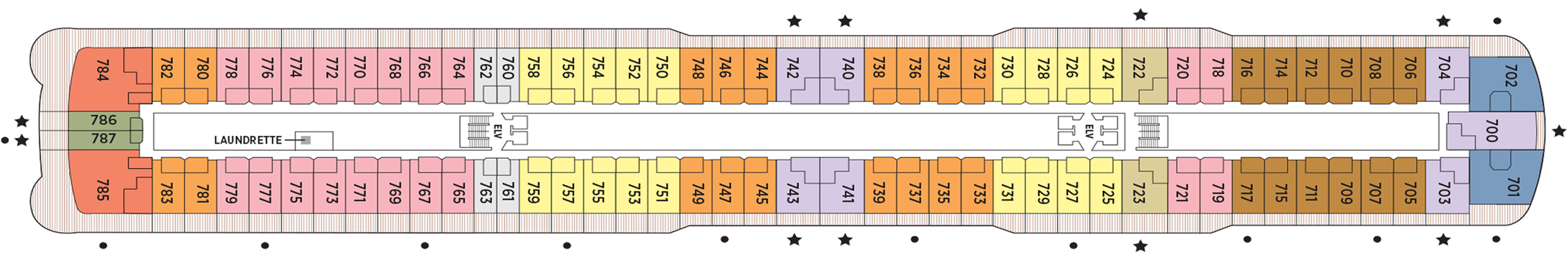
Deck 7
- Grand Suites
- Seven Seas Suites
- Penthouse Suites
- Concierge Suites
- Superior Suites
- Veranda Suites
- Deluxe Veranda Suites
Deck 6
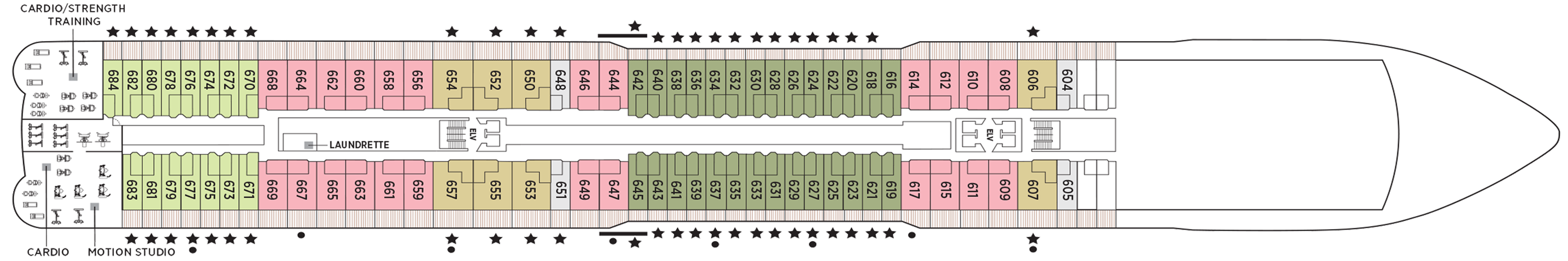
- Fitness Centre
- Concierge Suites
- Penthouse Suites
- Deluxe Veranda Suites
- Veranda Suites
- Launderette
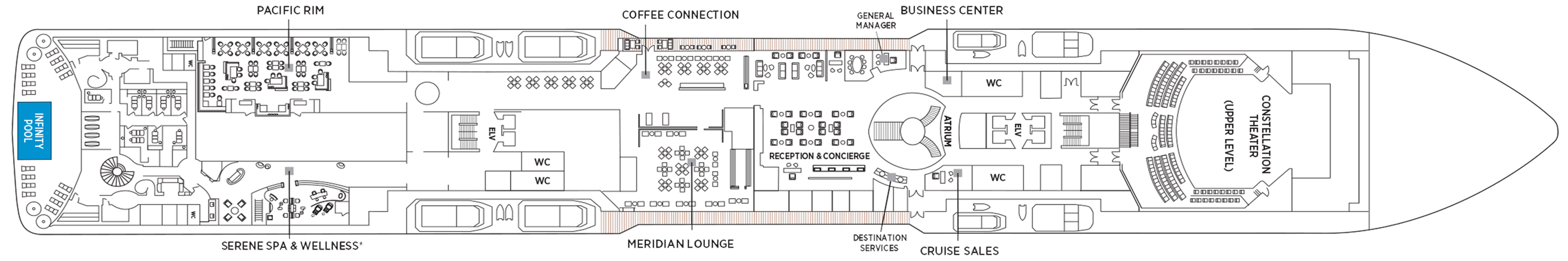
Deck 5
- Atrium
- Coffee Connection
- Constellation Theater
- Infinity-Edge Plunge Pool
- Meridian Lounge
- Pacific Rim
- Serene Spa & Wellness
- Destination Services
- Reception & Concierge
- Business Centre
- General Manager
Deck 4
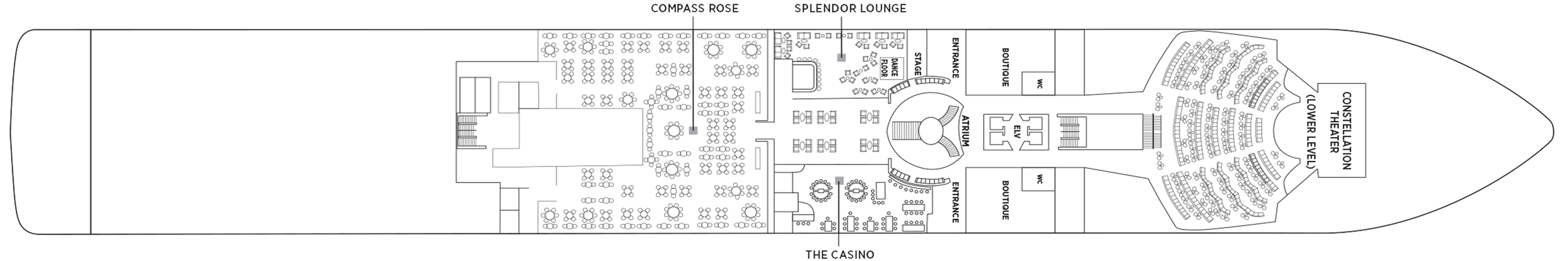
- Atrium
- Boutiques
- The Casino
- Compass Rose
- Constellation Theatre
- Splendor Lounge
The detail attended to and the artistry displayed in every meal echoes the excellence achieved aboard Seven Seas Splendor®. Our chefs will amaze you as they put their hearts and souls into creating each masterpiece of epicurean delight.
Coffee Connection
So much more than a great spot for coffee – this specially designed Coffee Connection is a chic metropolitan café with an ocean view that’s impossible to beat.
Sitting and chatting with newfound friends over barista-made coffee has long been a favourite pastime for our guests. Aboard Seven Seas Splendor™ you can now do so in an expanded outdoor section. Our chic metropolitan café with an elegant interior of muted pastels and crisp whites now seamlessly transitions to trendy al fresco seating, where you can sit and chat with clear views of the shimmering sea.
Prime 7
From perfectly aged prime New York strip, porterhouse and succulent filet mignon to smoked salmon with a phenomenal tamarind-whiskey sauce, Prime 7 elevates classic American fare to lofty heights.
A true classic in every sense, Prime 7 sets a new standard in steakhouse fare with its contemporary interpretation of an American classic. Handsomely decorated with supple leather wing-back chairs, burnished woods and rich earth-toned fabrics, Prime 7 exudes a distinct, intimate elegance. This is sophistication redefined, a luxurious setting to enjoy classic steakhouse cuisine with a modern flair.
All the traditional starters are here, including Jumbo Lump Crab Cakes, Classic Steak Tartare, and Clam Chowder. Of course, beef is the undisputed star, and it is aged for a minimum of 40 days to ensure the ultimate tenderness and juiciness. New York Strip, Porterhouse Steak and succulent Filet Mignon only touch upon the selections. Mouthwatering alternatives include Applewood Smoked Salmon and Dover Sole.
Reservations Required
Chartreuse
Classic French fare with a modern twist – and glorious ocean views. If Chartreuse seems familiar, you may have once stumbled upon a chic, fine-dining restaurant on a Champs-Elysees sidestreet. A fantasy you can taste.
Chartreuse evokes memories of a chic Parisian fine dining restaurant discovered during an evening stroll. Wherever you are seated in this regal restaurant, you will be treated to a succulent dinner while enjoying incredible ocean views. The restaurant ambiance is complemented by a menu that features modern French dishes. Available on Seven Seas Grandeur™, Seven Seas Splendor®, Seven Seas Explorer®, Seven Seas Mariner® and Seven Seas Voyager® with reservations each evening for dinner, and open for lunch on Seven Seas Explorer on alternate port days. French bistro style food is offered.
Reservations Required
La Veranda
Greet your days on the high seas with sumptuous breakfasts and shimmering ocean views. La Veranda features quiet alcoves, made-to-order omelettes and, for late risers, tasty lunch buffets that include hot carving stations.
Take in stunning ocean views while enjoying elegant breakfast and lunch buffets in the chic indoor dining room or al fresco on the shaded, open-air deck. Breakfasts include traditional favorites, as well as a made-to-order omelet station, a variety of fresh fruits and pastries, along with daily specials, like fluffy Belgian waffles with fresh blueberry compote. For lunch indulge in an array of choices from a bountiful salad bar, gourmet sandwiches, hot carving stations and delicious desserts.
Pacific RIm
Prepare to be delighted by a perfect balance of delicious flavours and Zen-like ambiance. Amid dimly lit architectural details and lotus-shaped windows, dine Pan-Asian creations like Korean barbecue lamb chops and wok-fried beans.
Discover and devour Pan-Asian culinary traditions. Featuring intricate architectural details, wood carvings and an immense art installation of a mythical dragon, Pacific Rim will delight with a perfect balance of flavours and Zen-like ambiance. The menu brings life to rich culinary traditions, from the enhanced smoking presentation of dry ice sashimi and the sweet and spicy medley of sauces with a re-imagined duck spring roll.
Compass Rose
Our largest specialty restaurant on a ship full of spectacular dining options. Design your very own entrée from preferred sides, sauces, pastas and main features of beef, poultry and fish. Dessert? Decadent, of course.
We are pleased to re-introduce the elegantly enhanced Compass Rose, the largest specialty restaurant across our fleet. Ensuring a tantalizing mix of new and familiar items on every visit, the new lunch and dinner menus offer a vast selection to meet your discerning tastes. Exclusively aboard Seven Seas Mariner®, Seven Seas Voyager®, and Seven Seas Navigator® for lunch, you may choose from a robust list of appetizers and main courses from our specialty restaurants. And across our fleet for dinner, you have the unique ability to design your very own entrée from preferred sides, sauces, pastas and main features of beef, poultry and fish. This is in addition to sinfully indulgent desserts made by talented bakers and pastry chefs. With daily changing menus, the refreshed Compass Rose offers more choices than ever before.
Pool Grill
Al fresco dining with views of the world’s best-loved landscapes. Be inspired by the environs around Seven Seas Splendor™ while enjoying cuisines that include regional barbecues and old-fashioned desserts.
The Pool Grill is truly a come-as-you-are venue. Enjoy this casual dining experience whether you’re getting a bite after sunbathing or swimming in the pool. The Pool Grill is open-air, yet abundantly shaded for comfortable dining at lunch or dinner. Enjoy grilled-to-order burgers, grilled seafood, sandwiches, and fresh salads. Treat yourself to milkshakes and malts or an old-fashioned hand-dipped ice cream dessert with toppings.
Room Service
Knowing that guests sometimes prefer to simply dine in the comfort of their suites, we offer room service around the clock. Select from an extensive room service menu and the wait staff will promptly serve your order in the comfort of your suite. During normal dining hours, guests may also order from the Compass Rose menu, which changes daily and features Continental, vegetarian, and kosher cuisines. Dinners will be graciously served course-by-course.
Sette Mari at La Veranda
Settle into cozy, over-water alcoves for classic Italian specialties made with care. From old-school classics to modern cuisine, your Sette Mari meal will linger long as a perfect combination of atmosphere and flavour.
Wherever you’re voyaging, you’ll never be far from enjoying perfectly prepared Italian dishes in stunning, over-water alcoves. Choose from authentic Italian specialties inspired by family recipes that span generations, or opt for something with a modern twist like a spice-crusted tuna steak with braised endive, polenta and salmoriglio. Savour it all with a perfectly paired Tuscan wine as you watch stars shine on the ocean below.
The Study
Guests of the most luxurious suite on the high seas — the Regent Suite on Seven Seas Splendor® — have exclusive access to The Study, a private, ornately decorated dining room that seats up to 12 guests.
In an atmosphere that’s reminiscent of a personal library in an elegant, stately home, Regent Suite guests may gather in The Study to privately dine on meals from the adjacent Chartreuse and Prime 7 restaurants. Such an exclusive opportunity further establishes the Regent Suite on Seven Seas Splendor™ as the pre-eminent luxury accommodation on the high seas.
Daytime Enrichment
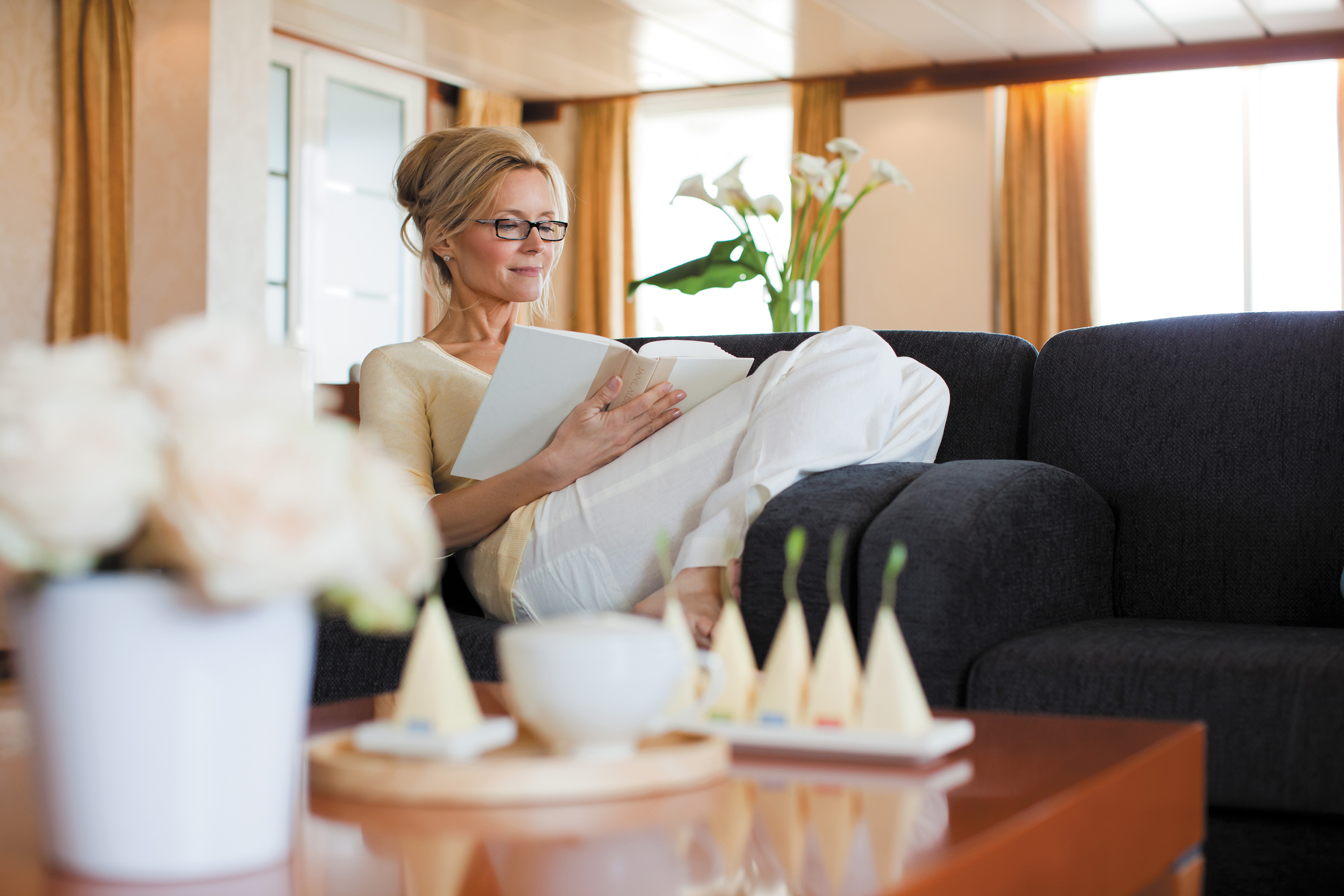
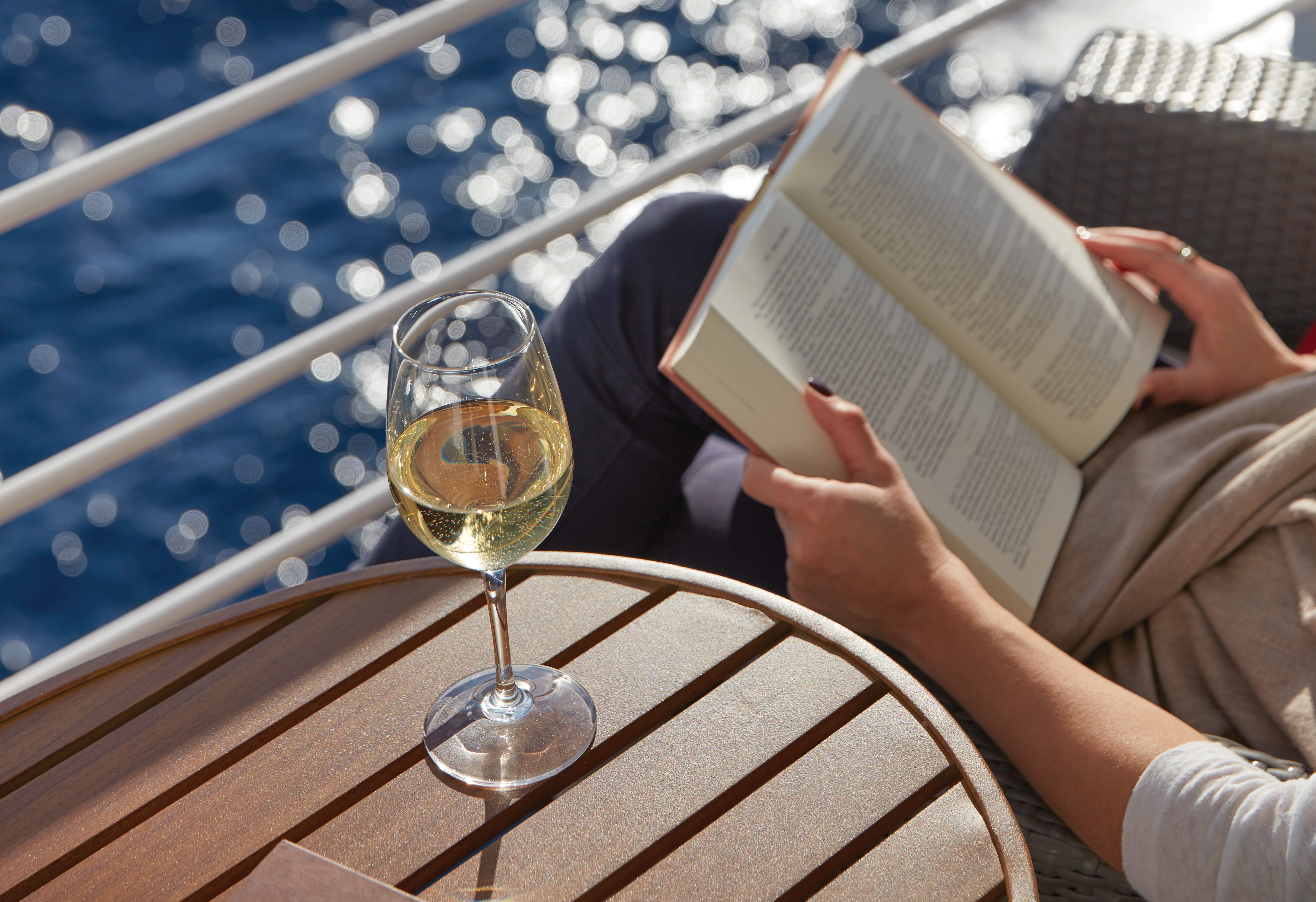
You’ll find time spent on board the ship to be just as enriching as time ashore. Relax by the pool, compete in a friendly game of trivia or bocce ball, indulge in treats at afternoon tea and gain insight from an expert lecturer.
Evening Entertainment
Evenings on board are filled with music and fun. Enjoy a rousing cabaret show, test your luck at the Casino, step onto the stage for karaoke or simply find a quiet place on deck to revel in the symphony of stars.
Boutiques
Browse a well-curated selection of duty-free designer clothes, jewelry, perfume and more at the onboard boutiques. Then fuel up with an espresso from an onboard café or unwind at a wine tasting in one of the lounges.
Meridian Lounge
With an expansive bar and relaxed armchairs, this is an ideal spot to gather with new friends for a cocktail, especially after an exciting theatre performance that simply must be discussed at length.
Elegantly appointed and comfortably furnished, this sleek lounge is a showstopper, with an expansive bar serving your favourite cocktails. Warm lighting and sophisticated ambiance are integral to its charm, but its vibe is the intangible draw. Meet for a drink before a show at the Constellation Theatre or to continue your unforgettable evening with performances by resident musicians afterwards.
General Manager, Reception & Concierge
Our welcoming Reception Desk is open 24 hours a day and our staff is happy to answer your questions and provide any general assistance you may need.
Have your every wish, whim and want fulfilled at our welcoming Reception Desk. Our office staff is available 24 hours a day to answer your questions – the ship's Concierge may be contacted at the Reception Desk as well. He or she is eager to provide you with general assistance and help you make the most of your voyage.
While cruise-related issues are first submitted to Reception/Concierge, you can be assured that a General Manager is on hand to resolve issues to your satisfaction.
Accountability is a critical aspect of providing you with an unrivalled experience on Regent Seven Seas Cruises®. As a guest you’ll always know where to find our General Manager, whose sole responsibility is making sure things are running as they should – and that includes providing you with superior customer service.
Destination Services
The place for you to arrange onshore activities, whether one of our FREE Unlimited Shore Excursions or a unique, small-group Regent Choice Shore Excursion. All staff are eager to provide the assistance you need.
Whether it’s a tour from our FREE Unlimited Shore Excursion menu or a unique, small-group Regent Choice Shore Excursion, Destination Services on is the place for you to arrange onshore activities. Our helpful office staff can also assist with tailor-made pre-and post-cruise programs, from a simple stay in a luxurious hotel to a 3-night extension that includes private tours of coveted destinations.
Atrium
Simply put, the Atrium is the very heart of Seven Seas Splendor®. With a magnificent chandelier above, the grand staircase descends to Compass Rose, our signature restaurant, creating a grand entrance.
Often described as the crossroads of the ship, our Atrium is an inspiring testament to the grandeur of luxury ocean travel. A cascading stairwell makes it a natural gathering place for guests, and on Seven Seas Splendor® it opens upon Compass Rose, our signature restaurant, to create a dazzling foyer. You’ll surely find yourself in the Atrium many times throughout your voyage, surrounded by magnificent art pieces and a dazzling chandelier.
Observation Lounge
As indicated by its name, this feast for the eyes is a wonderful vantage point to enjoy staggering views as Seven Seas Splendor® enters and leaves ports of call. A whimsical chandelier and live music add to the serenity.
Our fleet abounds with spectacular suites, restaurants, and lounges, but the Observation Lounge on Seven Seas Splendor® is truly magical. It offers staggering views as the ship enters and leaves ports of call, but its interior is lush with upholsteries inspired by the fluidity of flower petals, giving it the feel of a sunlit English garden. At night, a whimsical chandelier and hand-painted glass screens work in tandem with a cocktail pianist to perfect the scene.
Splendor Lounge
There’s no better way to whet your appetite for dinner than at this ship’s namesake lounge. Its elegant design will coax you into a state of relaxed bliss over signature cocktails and soulful sounds.
A magical place to laugh and unwind. Enjoy signature cocktails in a space designed to arouse the senses, from soulful sounds floating on ocean breezes to plush chairs cradling you in comfort to a lounge so spectacularly designed it will dazzle from every angle. What better way to prepare for a delicious dinner than chatting with fellow guests while musicians perform on an intimate stage beneath a grand proscenium?
Constellation Theatre
Thrill to nightly performances in our glorious, two-deck-high theatre. Plush seating and pleasing sightlines free you to focus on our lavishly staged, high-energy shows produced by our own team of Broadway professionals.
Plush seating and pleasing sightlines make every seat a great seat in our state-of-the-art show hall. Stretching two decks, the Constellation Theater boasts lavishly staged, high-energy shows created and produced by our own team of Broadway choreographers and directors. Sit in comfort or get up and dance to stories brimming with romance, intrigue, singalongs – even a tear-jerking tribute to the days of disco.
Card Room
Seeking friendly competition? This jovial room has a clubby charm that’s both inviting and tranquil. Gather some friends for board games or Bridge, or maybe a tournament.
The beautifully decorated space is an inviting and tranquil oasis for friendly competition. Gather your favourite teammates for a lively afternoon or evening of board games, enjoy a social game of Bridge or participate in an ACBL Tournament on select voyages.
The Casino
Step into an intimate, sophisticated environment filled with fun and excitement. Challenge friends at the poker table, take on the house in a thrilling game of blackjack or sip a cocktail and watch the action unfold.
Inspired by the iconic gaming halls of Las Vegas and Monte Carlo, our Casino is an elegant and exciting destination unto itself. Whether you’re a player or spectator, the excitement is contagious, the drinks are delightful and the staff is welcoming. Challenge friends to poker and blackjack or cheer on your number at the roulette wheel. Find your way to our Casino through stylish glass doors – and may Lady Luck treat you kindly.
Boutiques
Browse designer garments, upscale handbags, exclusive fragrances and fine jewellery in an intimate and unhurried setting. A bit of shopping bliss, whether buying items for yourself or friends and family back home.
It could be a shimmering piece of evening wear you can’t wait to show off at dinner or something perfect for someone back home. Our shops sparkle with carefully picked selections of designer garments, fashionable accessories and smart gifts. Stop in and be enticed by a wide range of items – from upscale handbags to exclusive fragrances to fine jewellery – in an unhurried setting.
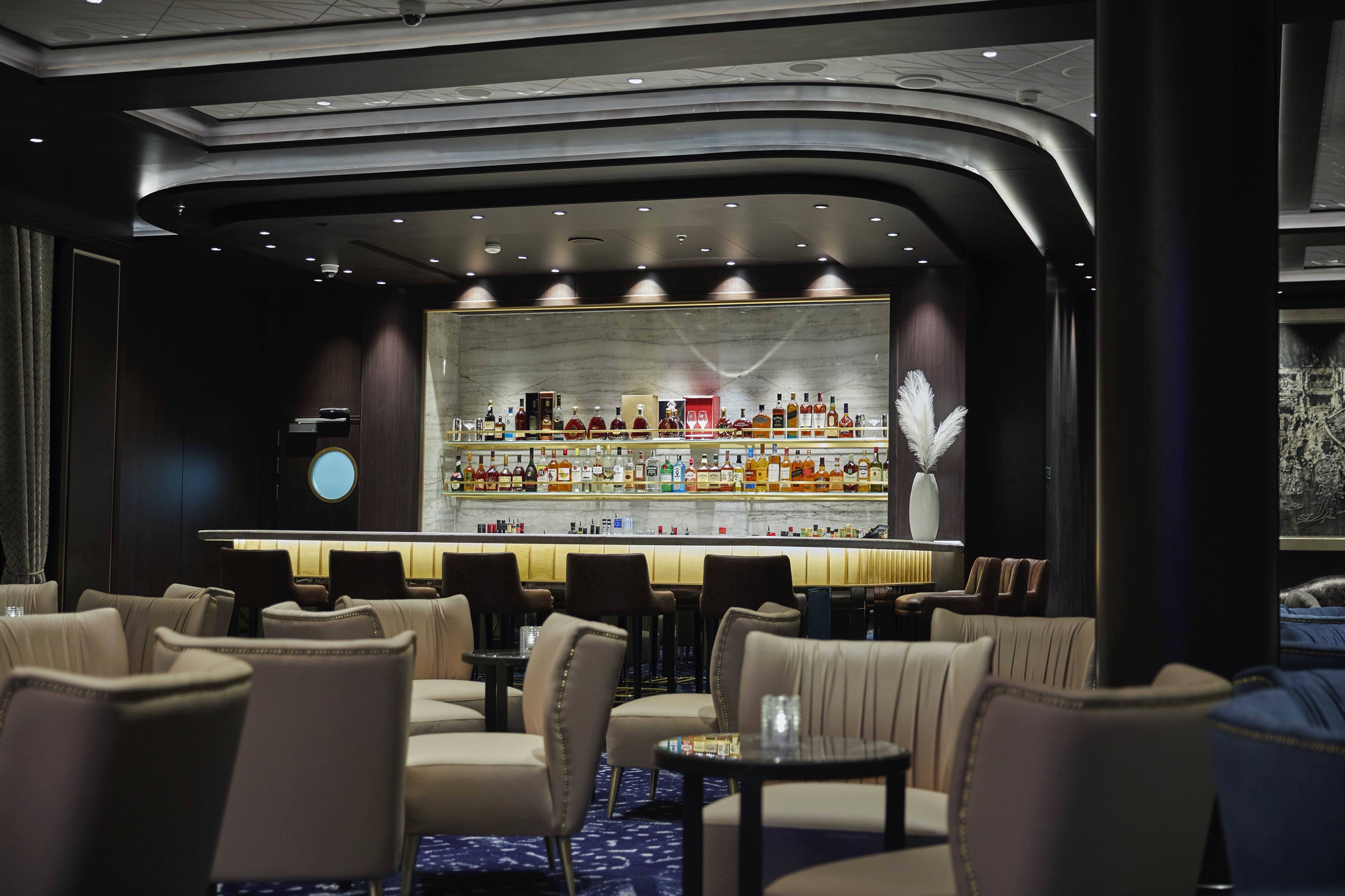
Connoisseur Club
A very modern space with oversize leather armchairs and signature works of art, this guest favourite is more than its décor. You’ll immediately take to its low-key elegance, perhaps over a fine cigar and meaningful conversation.
This guest favourite is many things: a hallmark, a much-loved hideaway, an elegant gathering place for good conversation and bonhomie. Aboard Seven Seas Splendor™ it’s also a modern space with oversize leather armchairs and signature works of art placed tastefully throughout. Stop in and test the conversational waters over a fine cigar or fine cognac, both available for purchase. As you would guess, smoking is permitted here.
Pool Deck
Teak accents and tasteful design make this a stylish oasis to soak up sun or go for a swim. Our Pool Deck features a lavish pool, two whirlpools and a crew dedicated to delivering refreshing drinks and comfy towels.
If it’s a day by the pool you desire, our Pool Deck is one of the most elegant at sea. Outfitted in teak accents, it features a lavish pool and two whirlpools in a blissful setting. Lounge the day away under the warm sun or read a book in a shady nook with an amiable and dedicated crew on-hand to bring refreshing beverages and plush towels.
Pool Bar
Very few things equate to a pure vacation activity more than sitting at our Pool Bar. Make new friends while sipping a cocktail or frozen drink in the most laid-back atmosphere imaginable.
When you envision the type of activity you’re only likely to do while on vacation, sipping a frozen drink at a pool bar onboard a glorious cruise ship is probably near the top of the list. You can tick that box at our Pool Bar, where you and new friends can enjoy leisurely conversation over cocktails and frozen drinks in a delightfully relaxed atmosphere.
Business Centre
For those who’ve chosen to leave their laptops at home, desktop computers are available at our staffed Business Centre. Of course, you may access WiFi without charge throughout the entirety of Seven Seas Splendor®.
If you prefer to travel without a laptop, our staffed Business Centre offers desktop computers that allow you to access your emails and browse the Internet. Printer access is available for a nominal fee. Seven Seas Splendor™ provides WiFi access throughout the ship, allowing you to connect to the Internet with whatever device you’ve brought on board.