Northern Elegance, Southern Glamour
Northern Elegance, Southern Glamour
Cruise overview
WHY BOOK WITH US?
- ✔ The Deluxe Cruises’ team has extensive experience in ultra-luxury cruising.
- ✔ Call now to speak to our helpful and experienced Cruise Concierge team.
- ✔ Enjoy our Unique Deluxe Cruises Bonus for substantial savings.
- ✔ Our team will tailor your holiday to your exacting requirements.
- ✔ As agents, we work under the protection of each cruise lines ABTA / ATOL licences
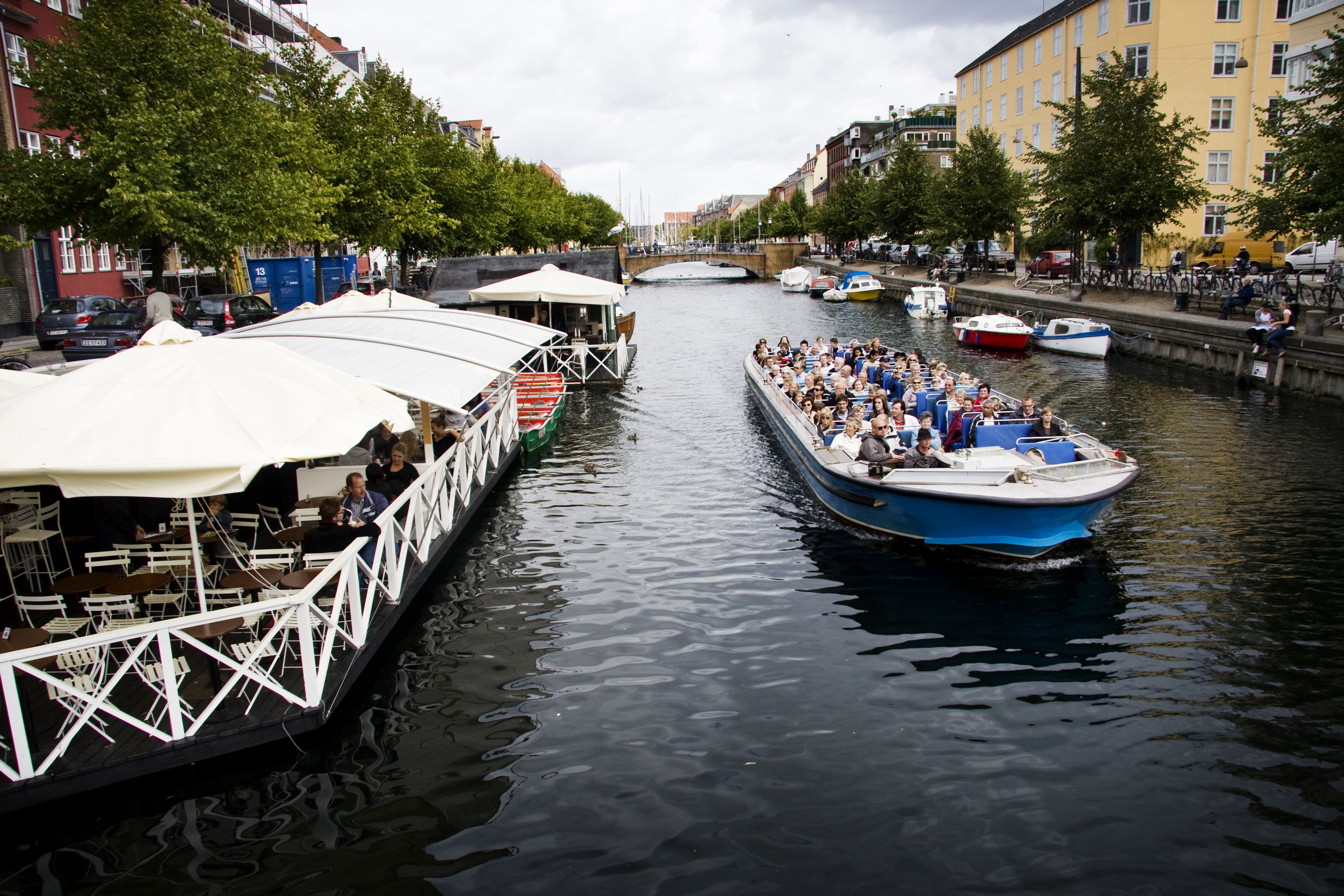
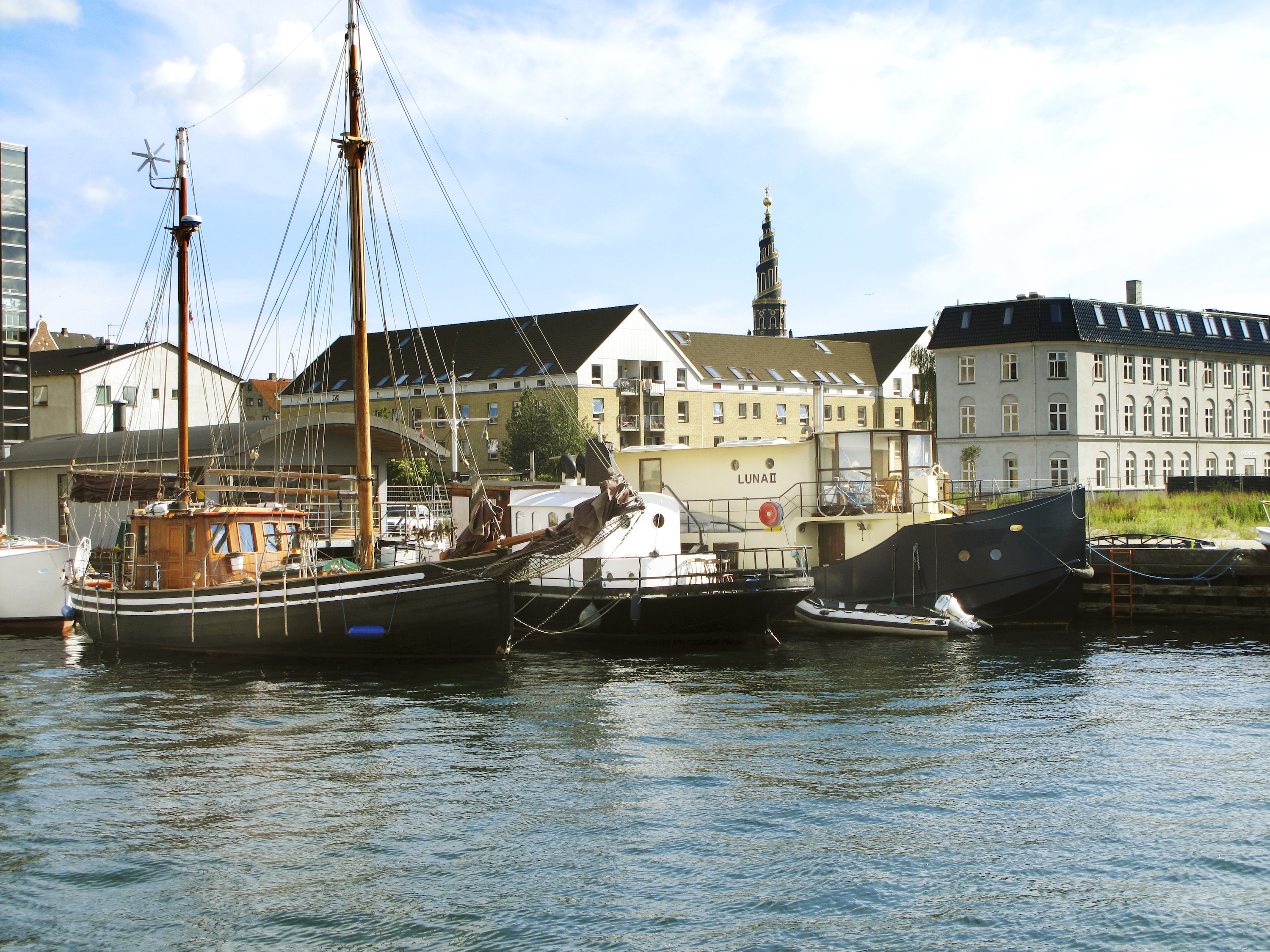
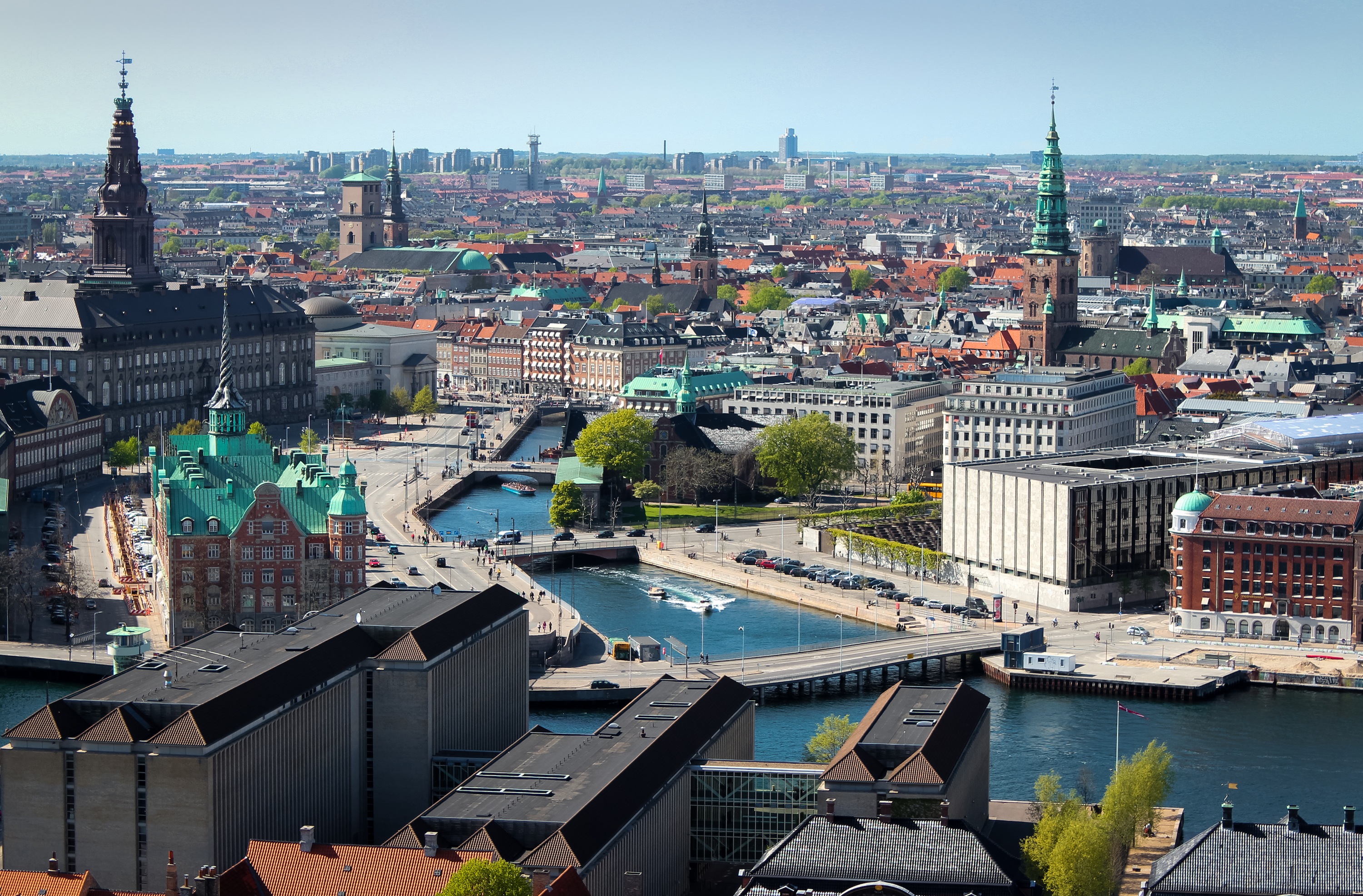
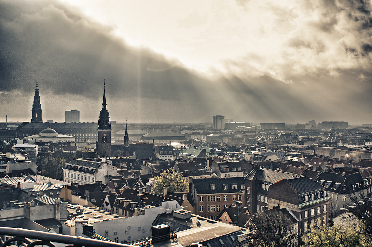
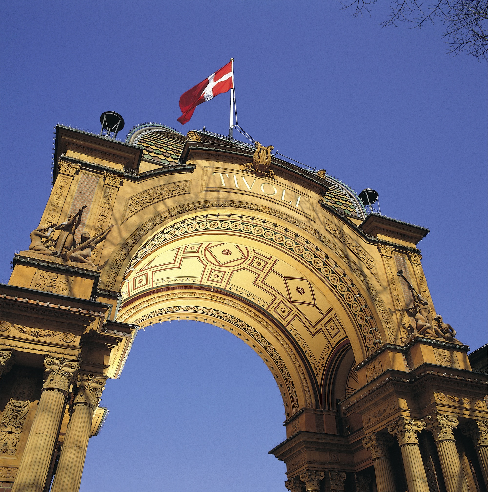
About Copenhagen
By the 11th century, Copenhagen was already an important trading and fishing centre and today you will find an attractive city which, although the largest in Scandinavia, has managed to retain its low-level skyline. Discover some of the famous attractions including Gefion Fountain and Amalienborg Palace, perhaps cruise the city’s waterways, visit Rosenborg Castle or explore the medieval fishing village of Dragoer. Once the home of Hans Christian Andersen, Copenhagen features many reminders of its fairytale heritage and lives up to the reputation immortalised in the famous song ‘Wonderful Copenhagen’.
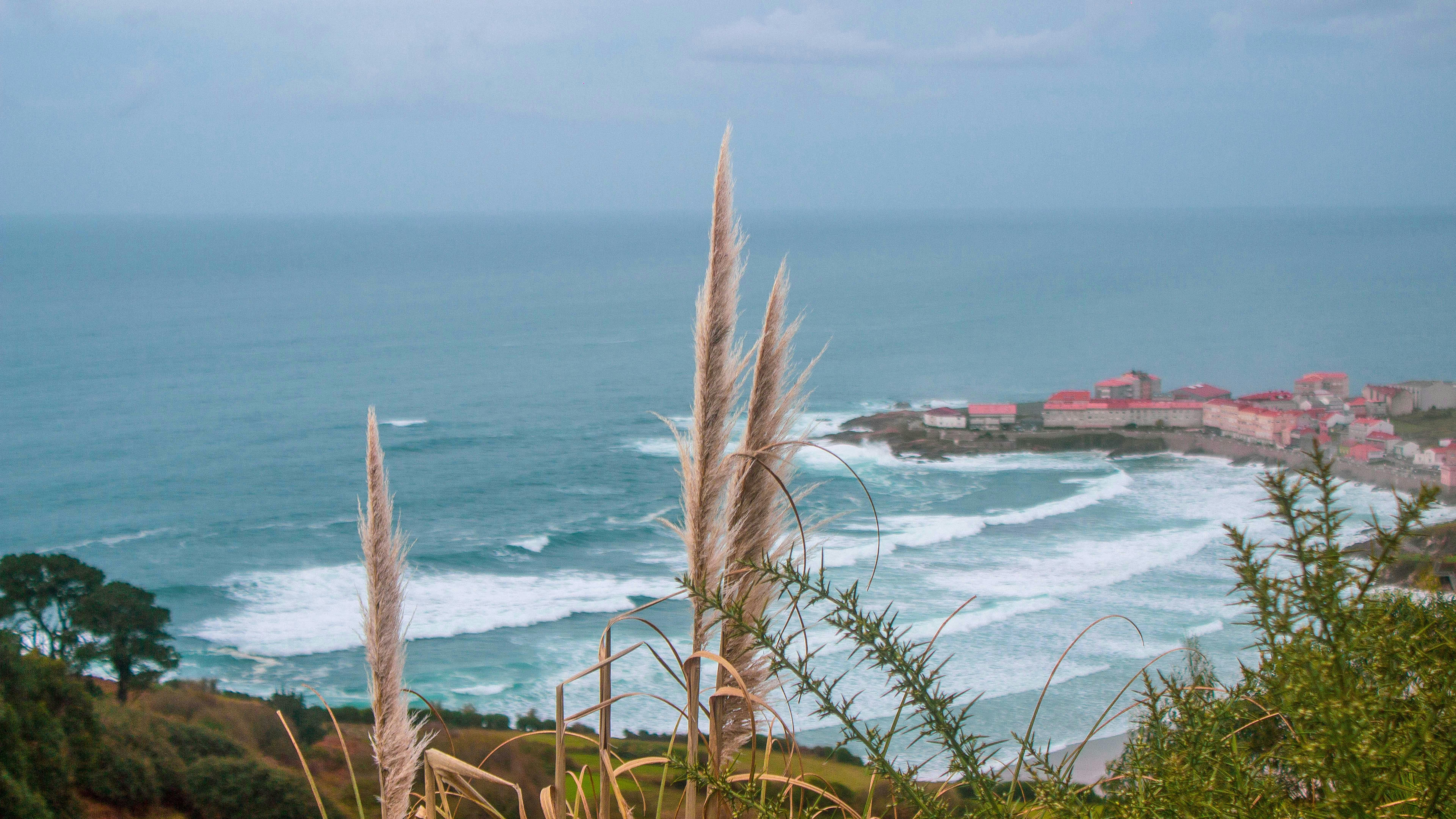
About Lysekil

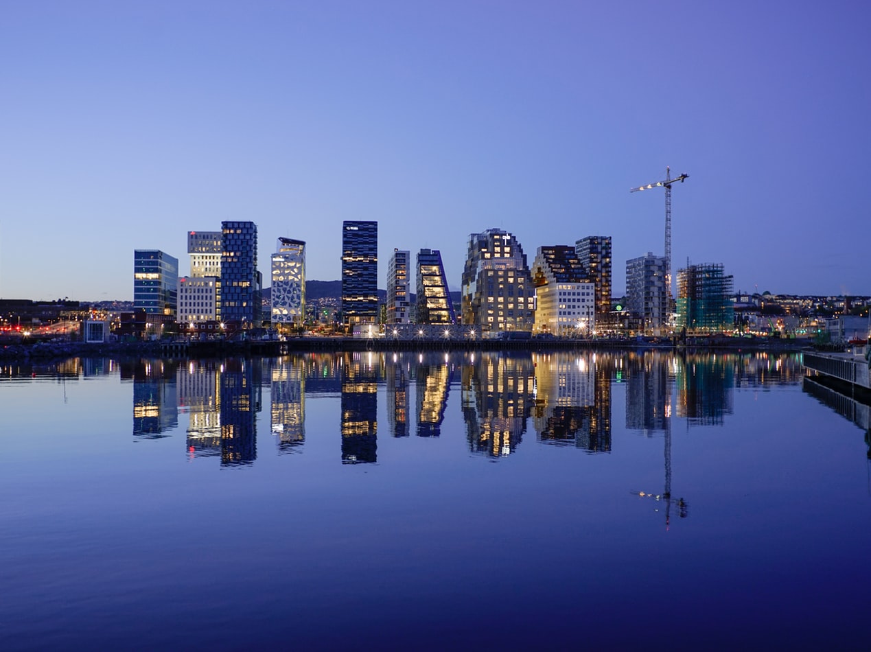
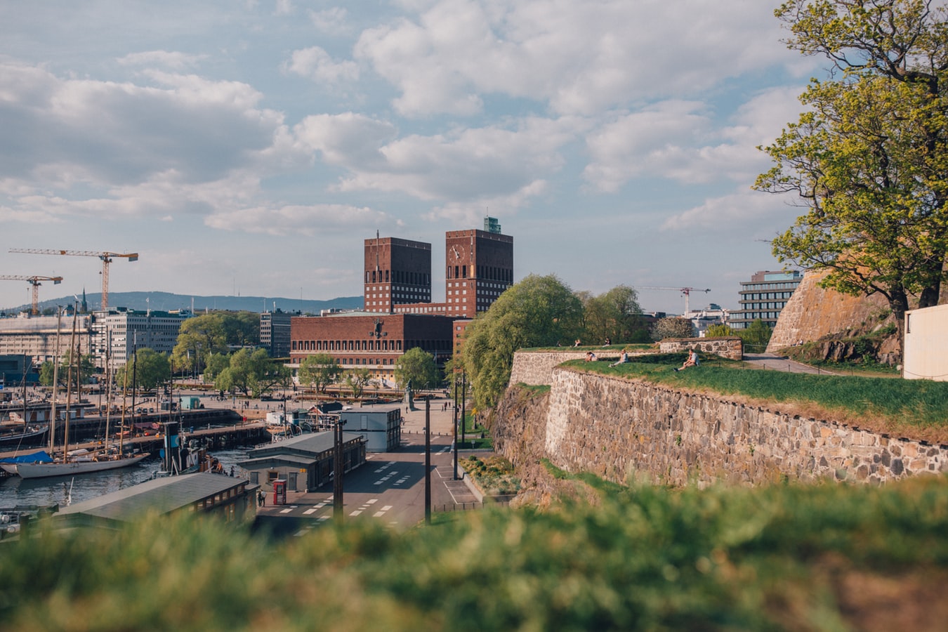
About Oslo
Oslo is the capital of Norway and is also its largest city, situated at the head of Oslo Fjord and surrounded by hills and forests. Home to some 50 museums and full of galleries, cafés, a sculpture park and the Royal Palace, this vibrant city with its handsome 19th-century buildings and wide streets has much to offer. Its history dates back 1,000 years, and includes a rich seafaring heritage that ranges from the Viking era to Thor Heyerdahl’s Kon Tiki expedition. Discover more about this exciting city on our varied selection of excursions.

About Mandal
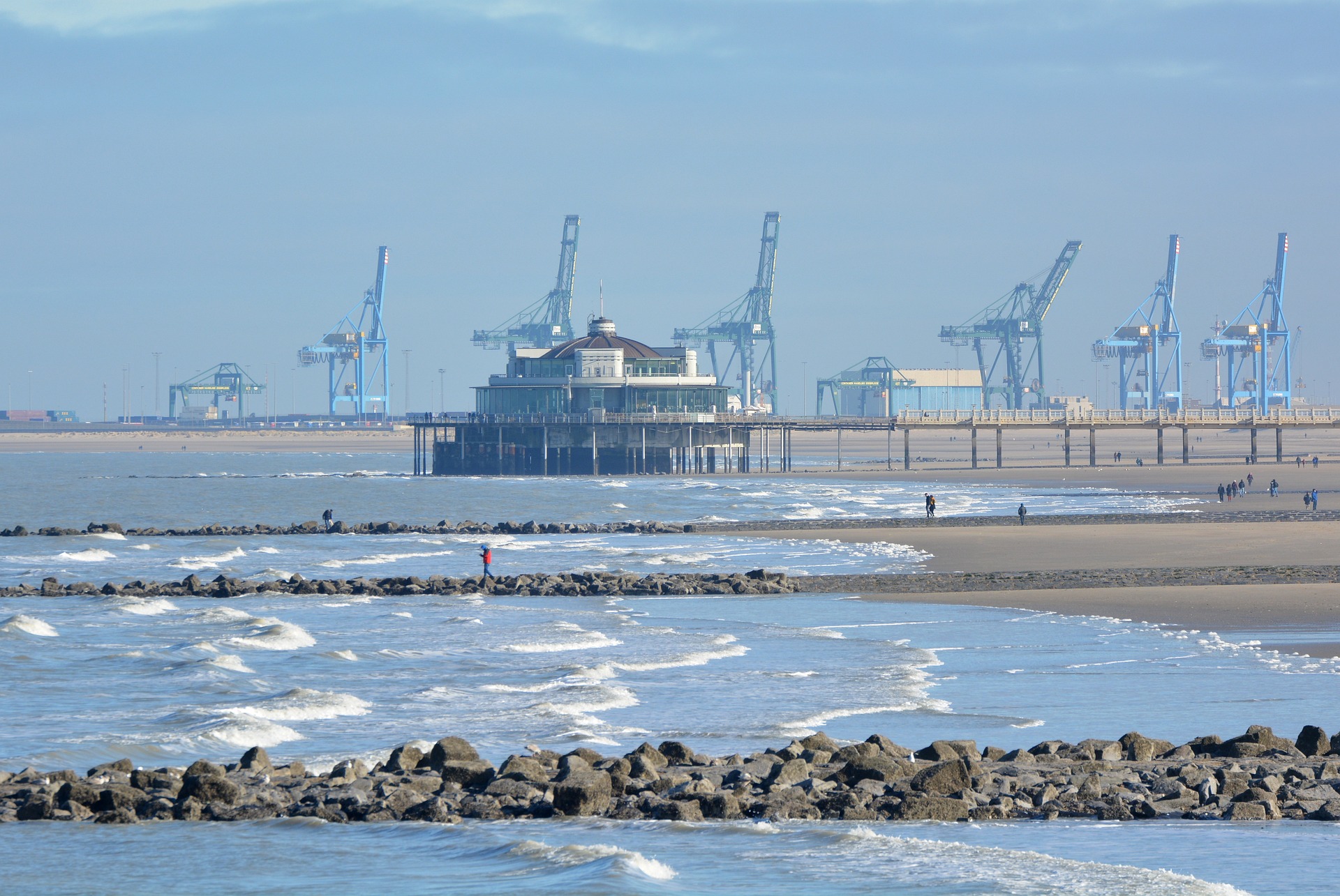
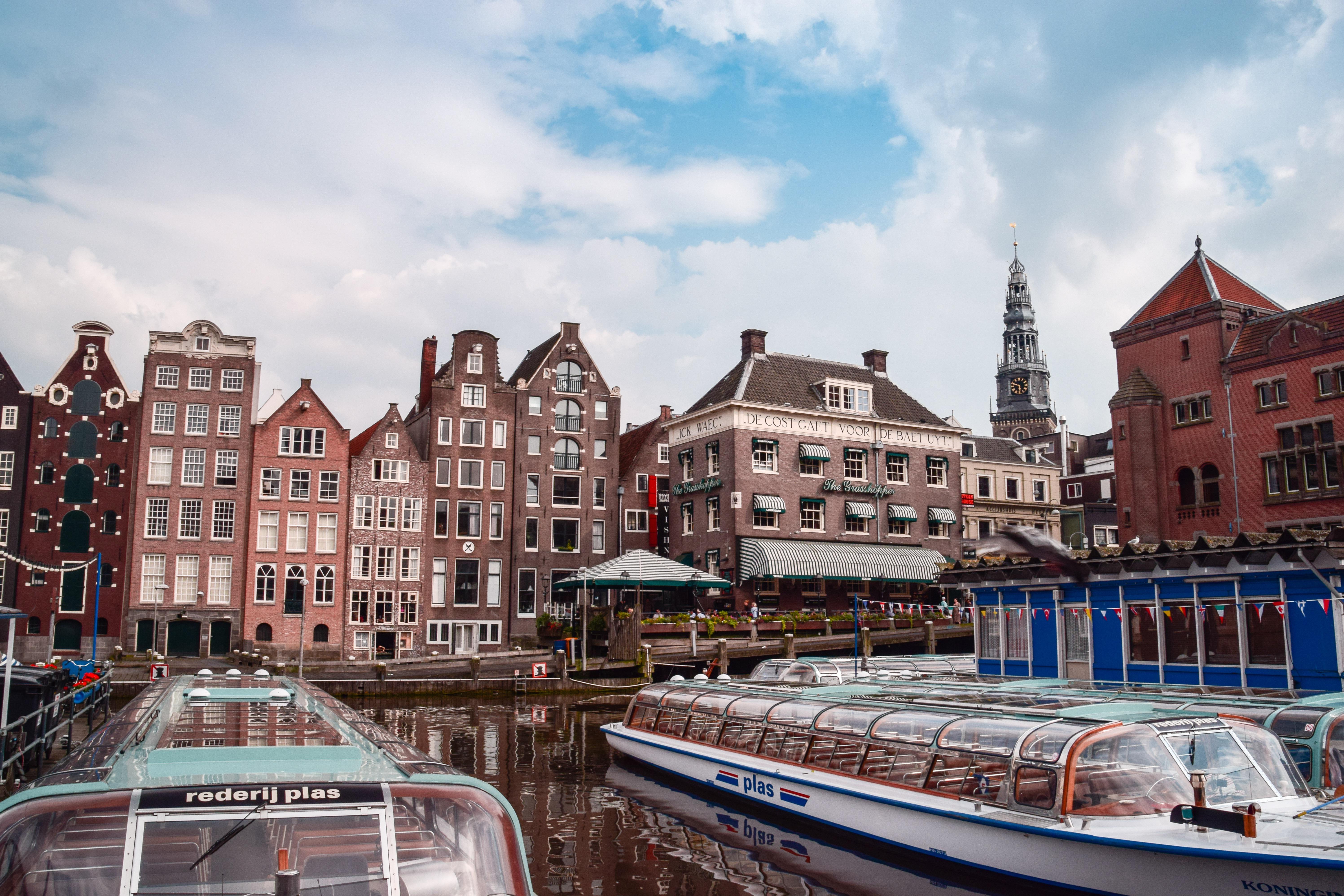
About IJmuiden
North Holland’s ‘Gate to the North Sea’, IJmuiden has four harbours: the Vissershaven, Haringhaven, IJmondhaven and the Seaport Marina - the latter used by pleasure craft. It is the largest Dutch fishing port, but is a relatively young town: it grew up in the 1870s when the North Sea Canal was opened. During World War II, the German Navy demolished much of the town and built huge fortified concrete bunkers for their torpedo boats and submarines. After 1945, the town was rebuilt by the architect Willem Marinus Dudok. He designed IJmuiden’s most impressive building, the Stadhuis van Velsen, which houses local government offices. For cruise passengers IJmuiden is the gateway to Amsterdam, the Dutch capital and one of Europe’s truly great cities, where elegant canals are lined by old brick gabled houses, and superb art galleries and museums are home to some of the world’s best-known paintings. Please note that complimentary shuttle buses operate from the port to the centre of IJmuiden, not to Amsterdam.
About Tilbury
Just 22 nautical miles down river from the Tower Bridge in London, Tilbury is a popular turnaround port for cruises visiting Baltic and Northern European destinations.
About Zeebrugge
In 1895 work began to construct a new seaport and harbour next to the tiny village of Zeebrugge, situated on the North Sea coast. Today the fast-expanding port of Zeebrugge is one of the busiest in Europe and its marina is Belgium’s most important fishing port. Many attempts were made to destroy this important port during both World Wars. Zeebrugge is ideally located for discovering the historic city of Bruges, and delightful seaside resorts with long sandy beaches can be visited by using the trams that run the whole length of the Belgian coast. Please note that no food may be taken ashore in Belgium. We shall not be offering shuttle buses to Bruges, but you may visit the city on an optional excursion: those visiting Bruges should note that there may be quite a long walk from the coach to the town centre.
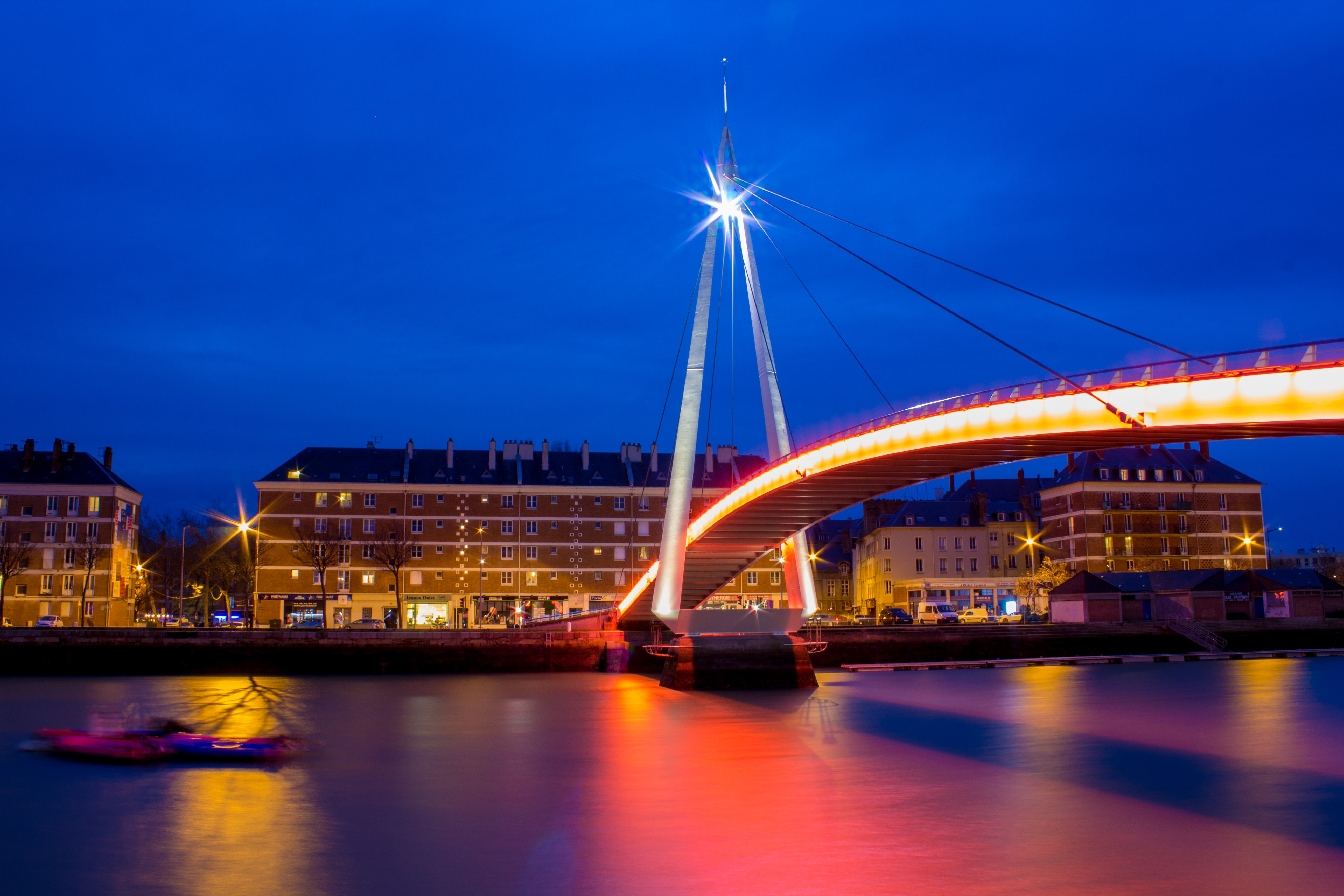
About Le Havre
Le Havre, founded by King Francis I of France in 1517, is located inUpper Normandy on the north bank of the mouth of the River Seine, which isconsidered the most frequented waterway in the world. Its port is ranked thesecond largest in France. The city was originally built on marshland andmudflats that were drained in the 1500’s. During WWII most of Le Havre wasdestroyed by Allied bombing raids. Post war rebuilding of the city followed thedevelopment plans of the well-known Belgian architect Auguste Perre. Thereconstruction was so unique that the entire city was listed as a UNESCO WorldHeritage Site in 2005.
About La Coruña
La Coruña, the largest city in Spain's Galicia region, is among the country's busiest ports. The remote Galicia area is tucked into the northwest corner of the Iberian Peninsula, surprising visitors with its green and misty countryside that is so much unlike other parts of Spain. The name "Galicia" is Celtic in origin, for it was the Celts who occupied the region around the 6th-century BC and erected fortifications. La Coruña was already considered an important port under the Romans. They were followed by an invasion of Suevians, Visigoths and, much later in 730, the Moors. It was after Galicia was incorporated into the Kingdom of Asturias that the epic saga of the Pilgrimage to Santiago (St. James) began. From the 15th century, overseas trade developed rapidly; in 1720, La Coruña was granted the privilege of trading with America - a right previously only held by Cadiz and Seville. This was the great era when adventurous men voyaged to the colonies and returned with vast riches. Today, the city's significant expansion is evident in three distinct quarters: the town centre located along the isthmus; the business and commercial centre with wide avenues and shopping streets; and the "Ensanche" to the south, occupied by warehouses and factories. Many of the buildings in the old section feature the characteristic glazed façades that have earned La Coruña the name "City of Crystal." Plaza Maria Pita, the beautiful main square, is named after the local heroine who saved the town in 1589 when she seized the English standard from the beacon and gave the alarm, warning her fellow townsmen of the English attack.
About Lisbon
Set on seven hills on the banks of the River Tagus, Lisbon has been the capital of Portugal since the 13th century. It is a city famous for its majestic architecture, old wooden trams, Moorish features and more than twenty centuries of history. Following disastrous earthquakes in the 18th century, Lisbon was rebuilt by the Marques de Pombal who created an elegant city with wide boulevards and a great riverfront and square, Praça do Comércio. Today there are distinct modern and ancient sections, combining great shopping with culture and sightseeing in the Old Town, built on the city's terraced hillsides. The distance between the ship and your tour vehicle may vary. This distance is not included in the excursion grades.
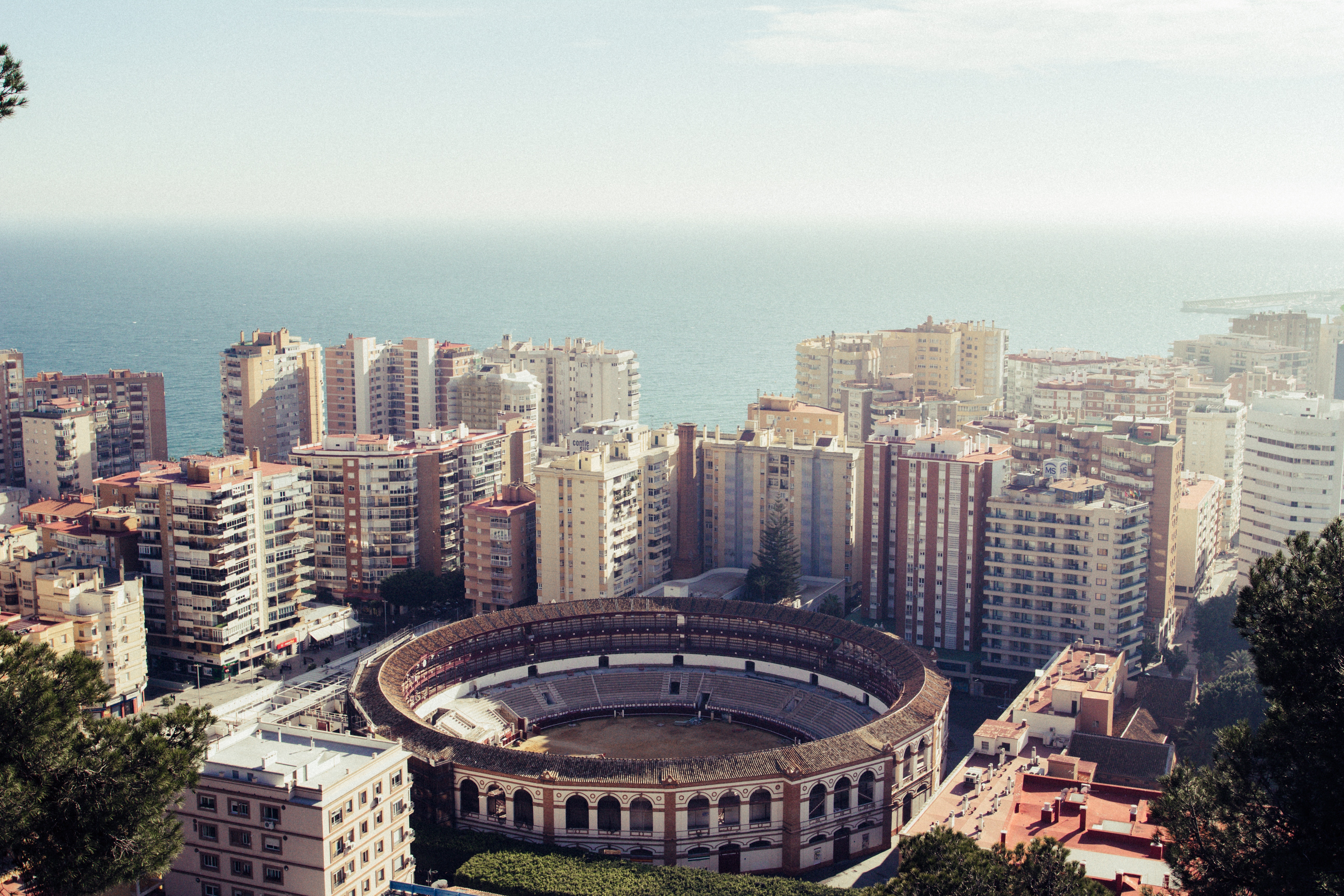
About Málaga
As you sail into Malaga you will notice what an idyllic setting the city enjoys on the famous Costa del Sol. To the east of this provincial capital, the coast along the region of La Axarqua is scattered with villages, farmland and sleepy fishing hamlets - the epitome of traditional rural Spain. To the west stretches a continuous city where the razzmatazz and bustle creates a colourful contrast that is easily recognisable as the Costa del Sol. Surrounding the region, the Penibéetica Mountains provide an attractive backdrop overlooking the lower terraced slopes which yield olives and almonds. This spectacular mountain chain shelters the province from cold northerly winds, giving it a reputation as a therapeutic and exotic place in which to escape from cold northern climes. Malaga is also the gateway to many of Andalusia's enchanting historic villages, towns and cities.
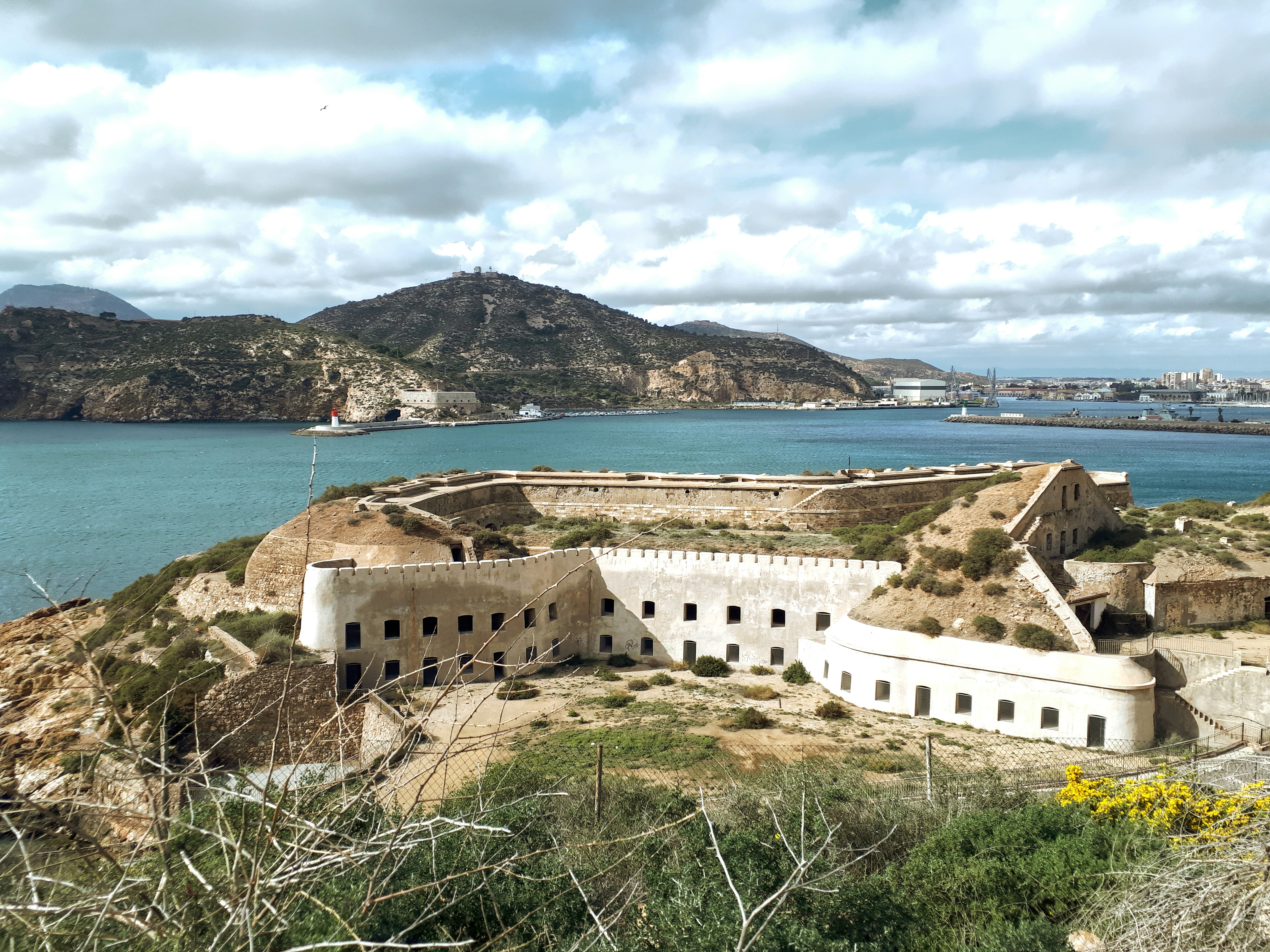
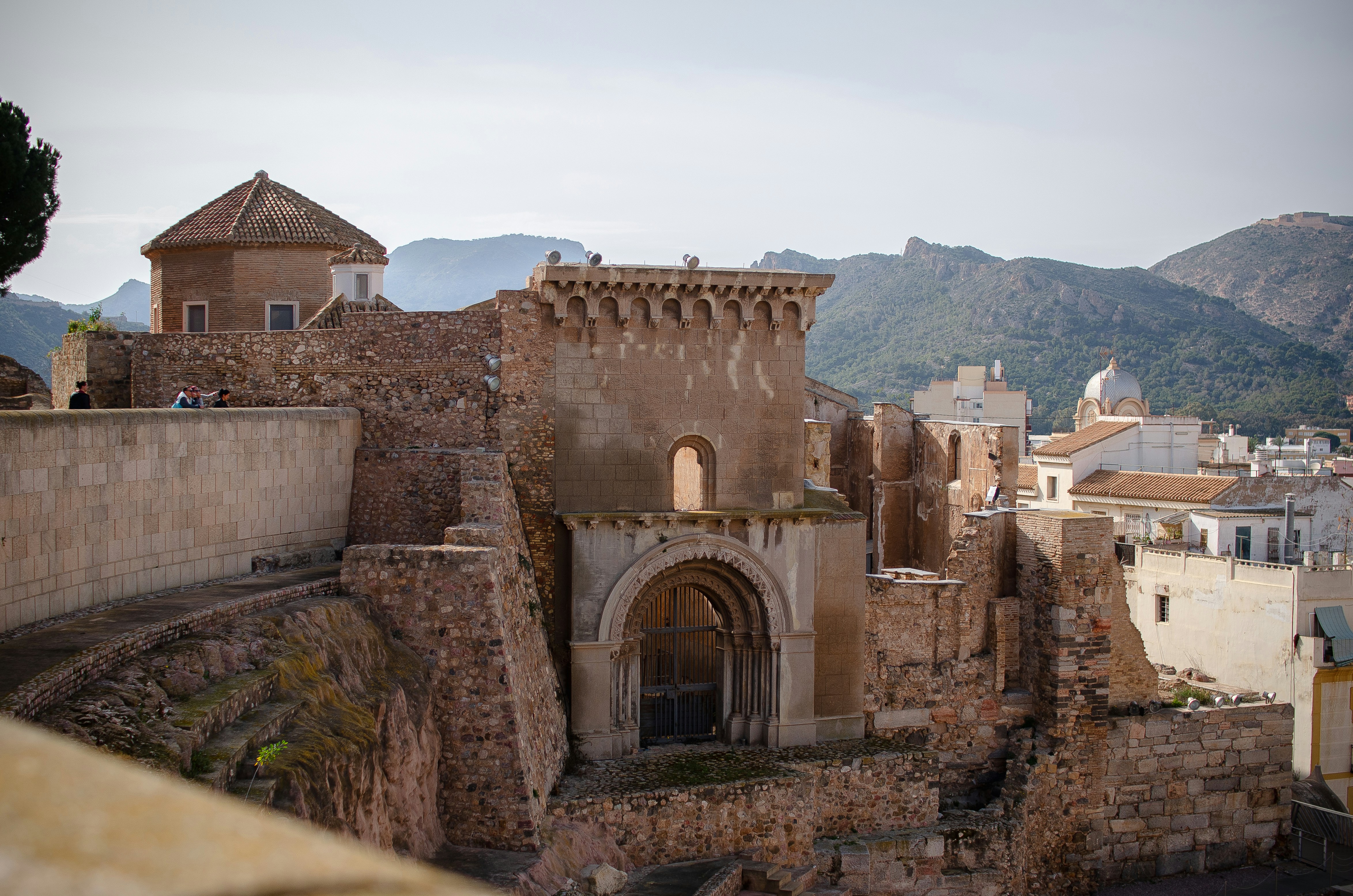
About Cartagena
A Mediterranean city and naval station located in the Region of Murcia, southeastern Spain, Cartagena’s sheltered bay has attracted sailors for centuries. The Carthaginians founded the city in 223BC and named it Cartago Nova; it later became a prosperous Roman colony, and a Byzantine trading centre. The city has been the main Spanish Mediterranean naval base since the reign of King Philip II, and is still surrounded by walls built during this period. Cartagena’s importance grew with the arrival of the Spanish Bourbons in the 18th century, when the Navidad Fortress was constructed to protect the harbour. In recent years, traces of the city’s fascinating past have been brought to light: a well-preserved Roman Theatre was discovered in 1988, and this has now been restored and opened to the public. During your free time, you may like to take a mini-cruise around Cartagena's historic harbour: these operate several times a day, take approximately 40 minutes and do not need to be booked in advance. Full details will be available at the port.
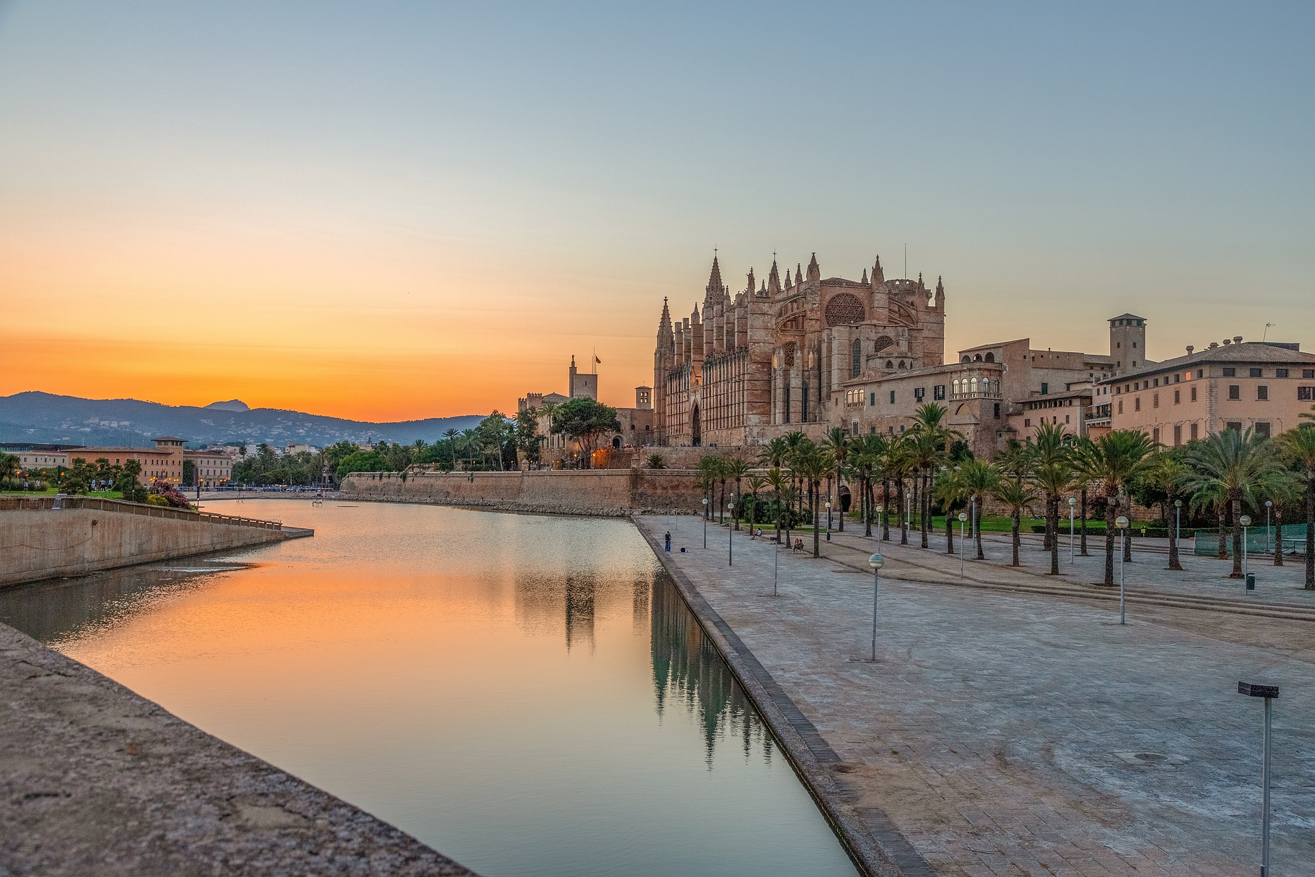
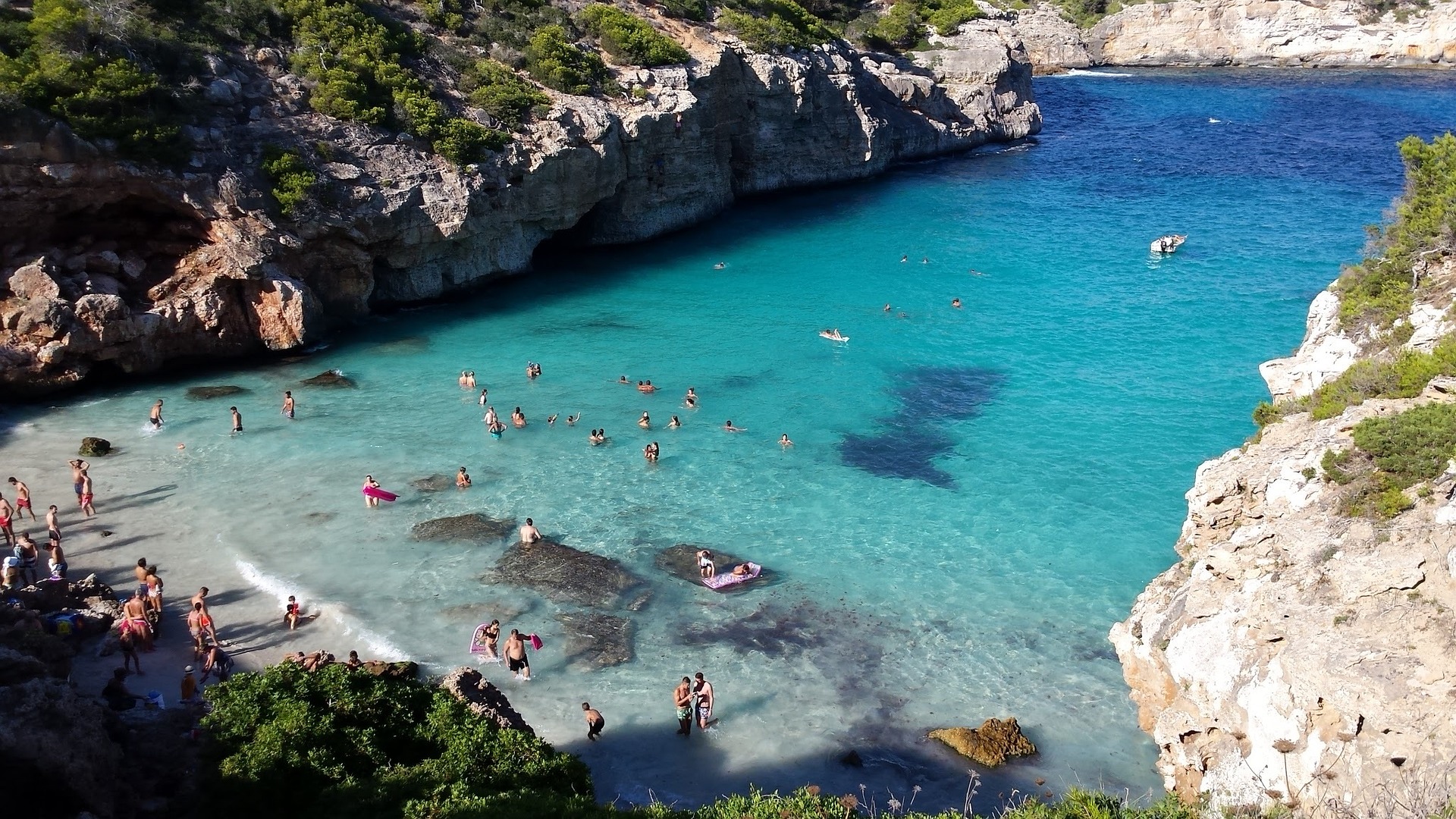
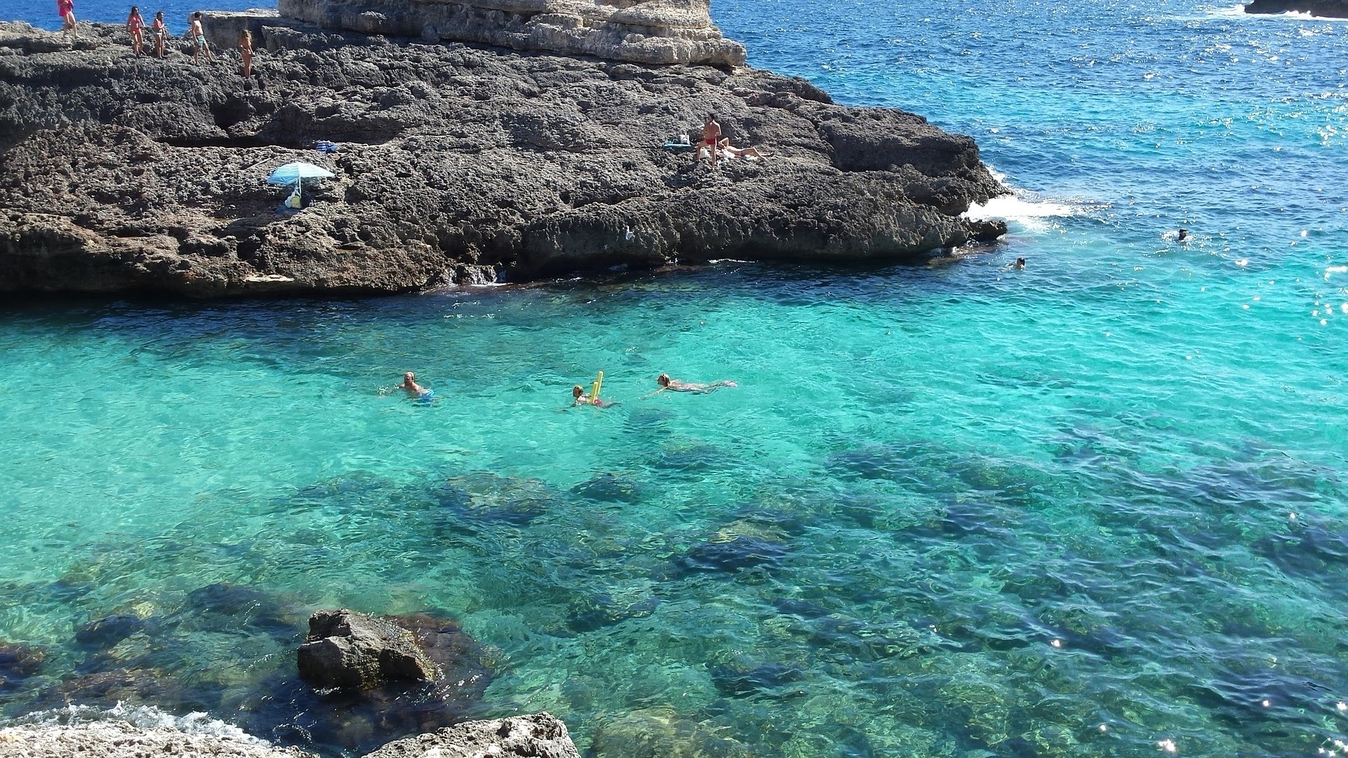
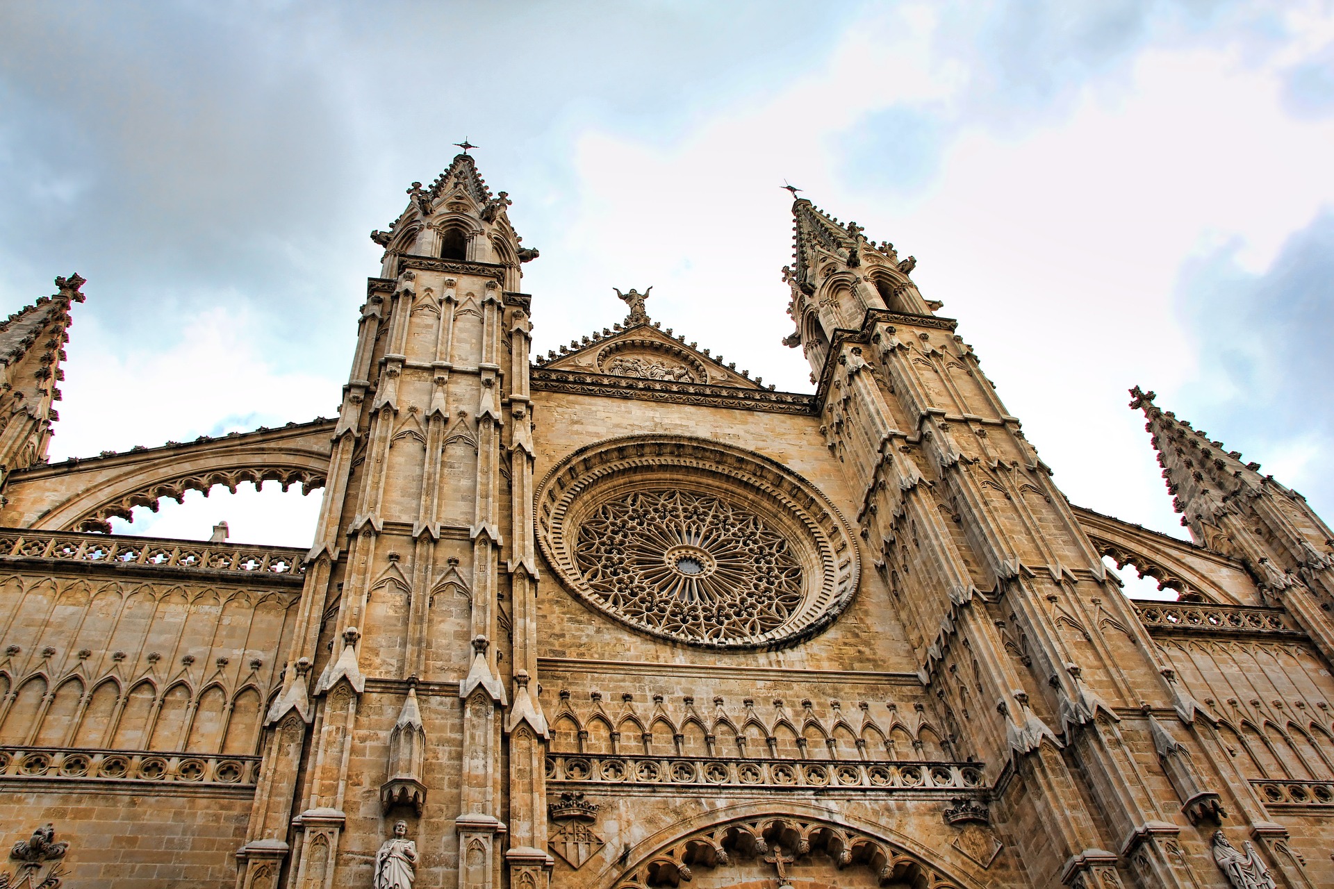
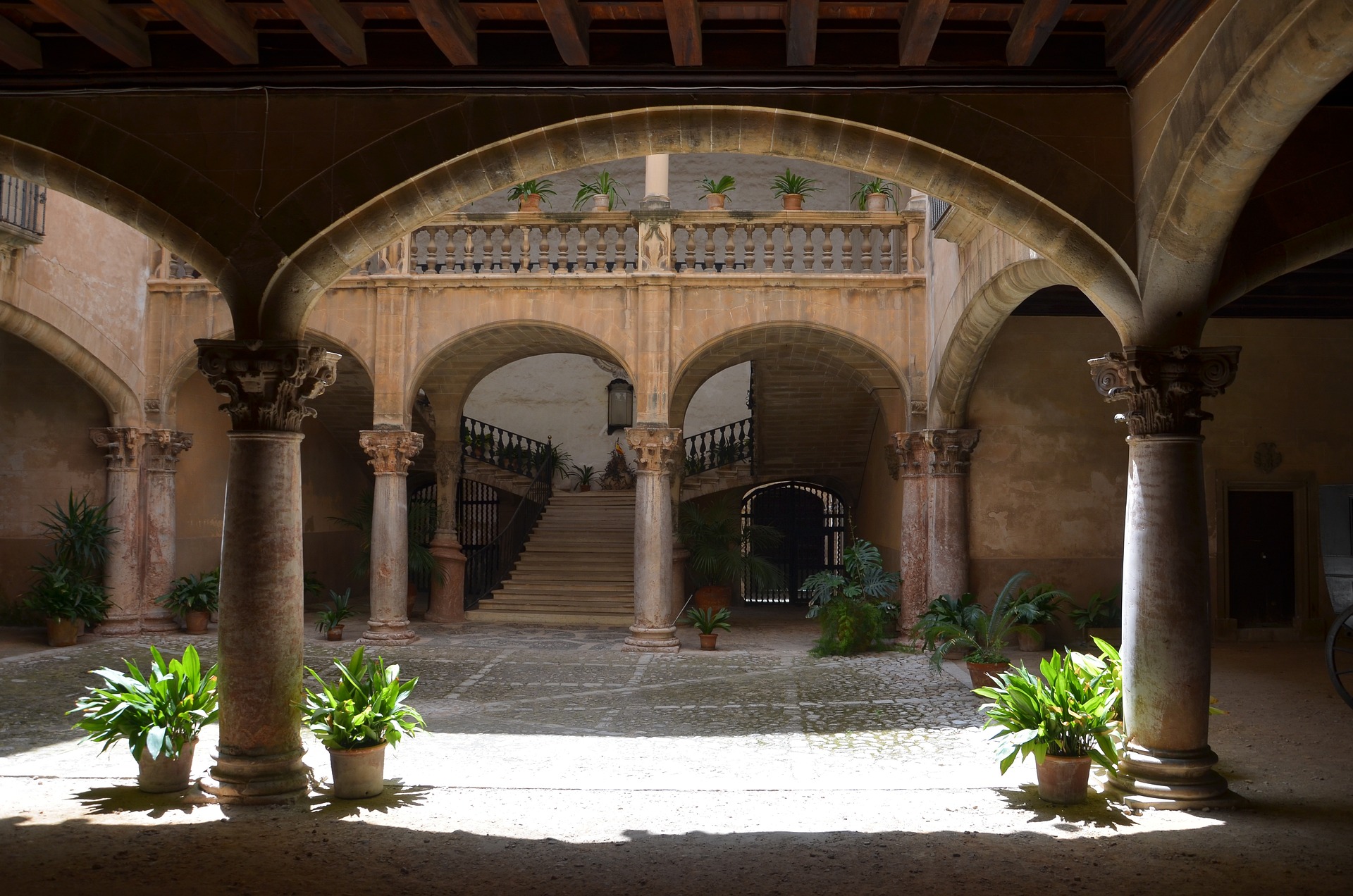
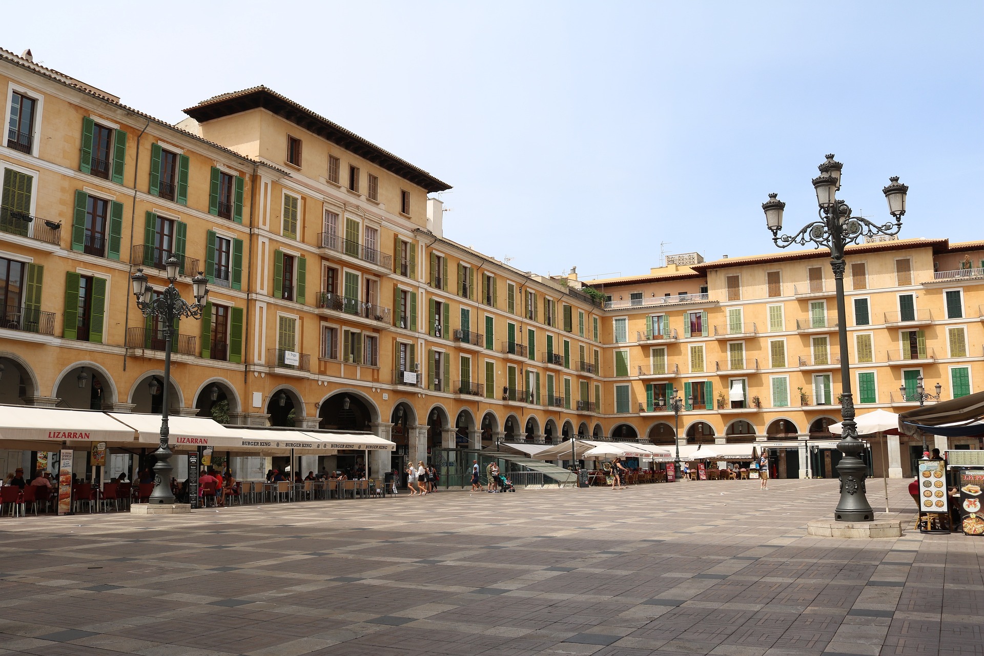
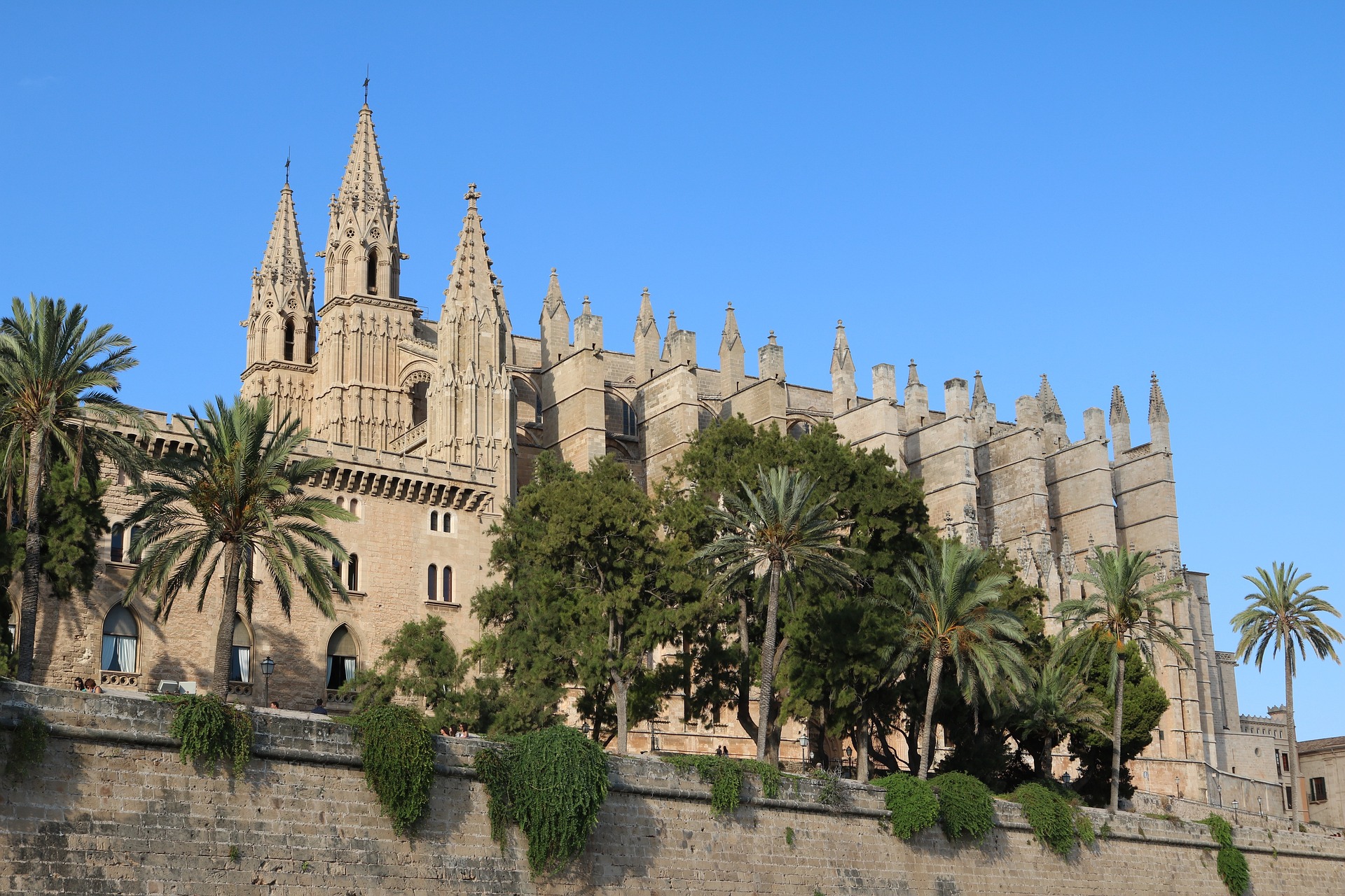
About Palma de Mallorca
If you look north of the cathedral (La Seu, or the seat of the bishopric, to Mallorcans) on a map of the city of Palma, you can see around the Plaça Santa Eulàlia a jumble of tiny streets that made up the earliest settlement. Farther out, a ring of wide boulevards traces the fortifications built by the Moors to defend the larger city that emerged by the 12th century. The zigzags mark the bastions that jutted out at regular intervals. By the end of the 19th century, most of the walls had been demolished; the only place where you can still see the massive defenses is at Ses Voltes, along the seafront west of the cathedral.A torrent (streambed) used to run through the middle of the old city, dry for most of the year but often a raging flood in the rainy season. In the 17th century it was diverted to the east, along the moat that ran outside the city walls. Two of Palma's main arteries, La Rambla and the Passeig d'es Born, now follow the stream's natural course. The traditional evening paseo (promenade) takes place on the Born.If you come to Palma by car, park in the garage beneath the Parc de la Mar (the ramp is just off the highway from the airport, as you reach the cathedral) and stroll along the park. Beside it run the huge bastions guarding the Almudaina Palace; the cathedral, golden and massive, rises beyond. Where you exit the garage, there's a ceramic mural by the late Catalan artist and Mallorca resident Joan Miró, facing the cathedral across the pool that runs the length of the park.If you begin early enough, a walk along the ramparts at Ses Voltes from the mirador beside the cathedral is spectacular. The first rays of the sun turn the upper pinnacles of La Seu bright gold and then begin to work their way down the sandstone walls. From the Parc de la Mar, follow Avinguda Antoni Maura past the steps to the palace. Just below the Plaça de la Reina, where the Passeig d'es Born begins, turn left on Carrer de la Boteria into the Plaça de la Llotja (if the Llotja itself is open, don't miss a chance to visit—it's the Mediterranean's finest Gothic-style civic building). From there stroll through the Plaça Drassana to the Museu d'Es Baluard, at the end of Carrer Sant Pere. Retrace your steps to Avinguda Antoni Maura. Walk up the Passeig d'es Born to Plaça Joan Carles I, then right on Avenida de La Unió.

About Barcelona
The infinite variety of street life, the nooks and crannies of the medieval Barri Gòtic, the ceramic tile and stained glass of Art Nouveau facades, the art and music, the throb of street life, the food (ah, the food!)—one way or another, Barcelona will find a way to get your full attention. The capital of Catalonia is a banquet for the senses, with its beguiling mix of ancient and modern architecture, tempting cafés and markets, and sun-drenched Mediterranean beaches. A stroll along La Rambla and through waterfront Barceloneta, as well as a tour of Gaudí's majestic Sagrada Famíliaand his other unique creations, are part of a visit to Spain's second-largest city. Modern art museums and chic shops call for attention, too. Barcelona's vibe stays lively well into the night, when you can linger over regional wine and cuisine at buzzing tapas bars.

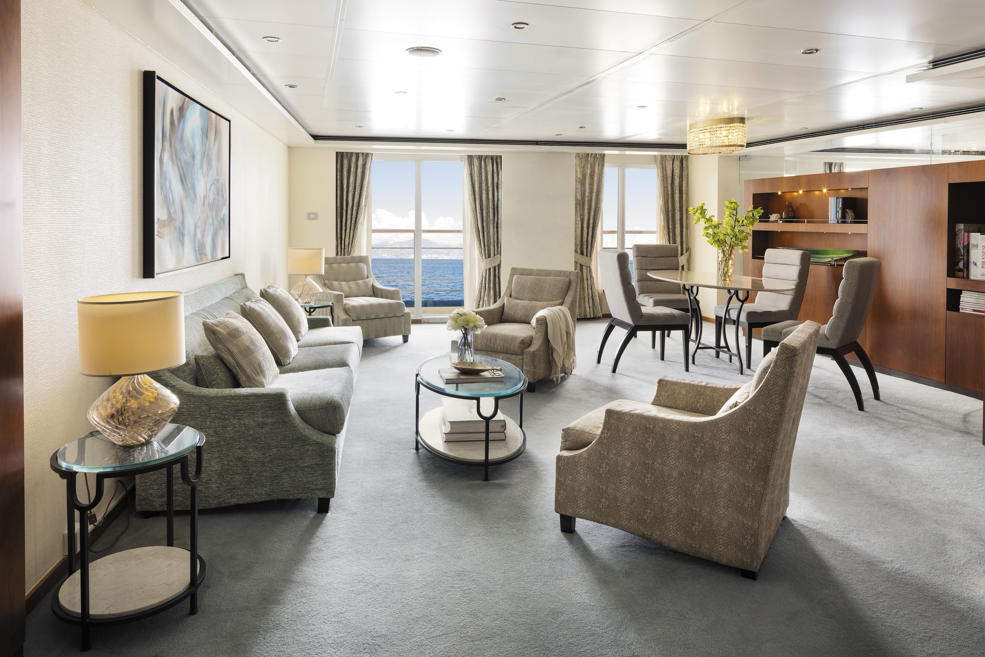
Enter and be enveloped by the sophisticated comfort of rosewood furniture, luxe fabrics and a crystal chandelier. A pair of private balconies make this spacious, elegant suite a natural for entertaining.
You’ll find Park Avenue chic onboard Seven Seas Voyager® in this spectacular suite. Elegant rosewood furniture, luxe fabrics and a crystal chandelier create sophisticated comfort, while a personal butler is available to fulfil whatever requests you may have. With two bedrooms, two-and-a-half baths, a large living room and two private balconies, this sublime suite is perfect for hosting new friends in luxury.
Layout
- 2 Spacious Bedroom with a European King-Size Elite Slumber® Bed
- 2 1/2 Marble & Stone Detailed Bathrooms
- Private Balcony
- Sitting Area
- Walk-In Closet with Safe
- Includes Up To 6 Guests
The suite pictured may differ from the suite booked, as layouts and designs vary by ship, deck, and suite location.
Amenities
1-Night Pre-Cruise: Hotel Package Including:
- - Breakfast
- - Porterage
- Unlimited WiFi* and Streaming Package for up to Four Devices
- Valet Laundry Service
- 24-hour In-Suite Dining
- Fresh Orchid Arrangement
- Regent Plush Bathrobe & Slippers
- Interactive Flat-Screen Television & Direct-Dial Satellite Phone
- Priority Access to Online Shore Excursion Reservations
- Priority Access to Online Dining Reservations
- Binoculars
- illy® Espresso Maker
- Cashmere Blankets
- Regent Special Gift
- Vanity & Hair Dryer
- Shoe Shine Service
Additional Discounts:
- - 10% Discount on Ultra Premium Wine and Liquor
- - 5% Savings on Pre- or Post-Cruise Hotel or Land Programs
- - 5% Savings on Regent Choice Shore Excursions
Additional Signature Suite Amenities:
- Guaranteed Reservation Each Night in Specialty Restaurant of Your Choice
- Welcome Letter from the President and General Manager
- Personal Butler for an Elevated In-suite Experience
- - In-Suite Dining Menu Including Specialty Restaurant Selections During Dining Hours
- Priority Boarding on Embarkation Day with Suite Access at Noon
- Welcome Bottle of Premium Champagne
- Personalized In-Suite Full-Liquor Bar Set-Up
- A Sumptuous In-Suite Caviar Service Once During Cruises
- Complimentary In-Suite Cocktail Party for 8
- Complimentary 25-Minute Personal Fitness Session at the Serene Spa & Wellness™ Fitness Center
- Onboard Press Reader App Access
- Daily Canapés
- Tea Forté Set-Up
- Luxe Fruit Arrangement with Chocolate Leonidas
- Luxurious Designer Bath Amenities & Men's Unscented Shaving Kit
- Hairdryer
- Selection of Fig & Tea Leaves Bath Salts
- Bath Scale Setup
- Bose® SoundLink Mini II Bluetooth Speaker
- Selection of Bed Pillow Styles
- Complimentary Garment Pressing on First Night
- Personalized Stationery upon request
- Elegant Weather Clock
- Excursion Bag
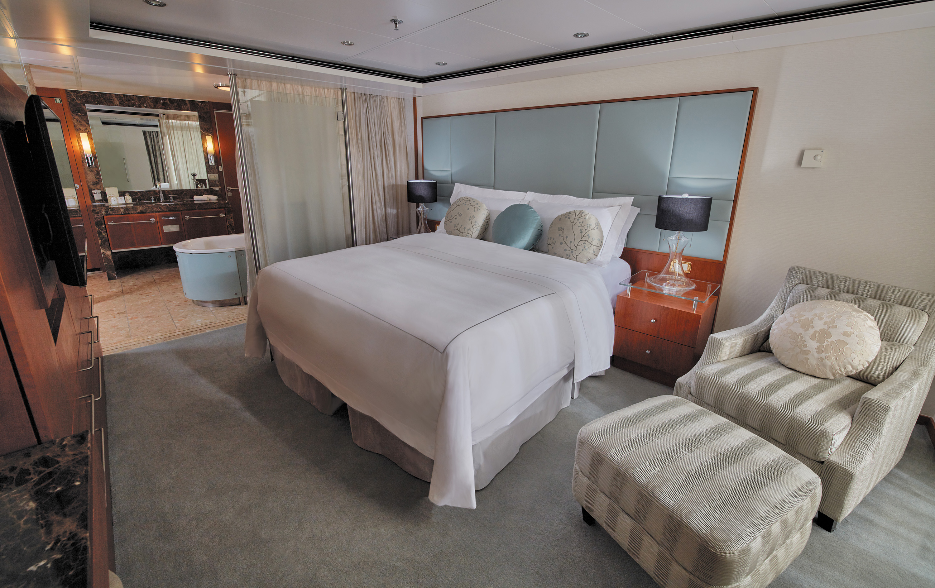
This immense suite features a living area with a couch and two comfortable chairs, a full dining table, writing table, even a leather chaise lounge beside a jacuzzi in a bedroom alcove. Simply spectacular accommodation.
A suite so large it has two entrances, this suite delights the senses with rich mosaics, exotic woods and luxurious touches. A living area with a couch and two comfortable chairs, a full dining table and large writing table make you feel right at home. A large private balcony lets you welcome friends for a quiet dinner, and a personal butler helps make life at sea a breeze.
Layout
1 Spacious Bedroom with a European King-Size Elite Slumber® Bed
- 1 1/2 Marble & Stone Detailed Bathrooms
- Private Balcony
- Sitting Area
- Walk-In Closet with Safe
- Accommodates Up To 3 Guests
The suite pictured may differ from the suite booked, as layouts and designs vary by ship, deck, and suite location.
Amenities
- 1-Night Pre-Cruise: Hotel Package Including:
- - Breakfast
- - Porterage
- Unlimited WiFi* Includes up to Four Logins, Four Devices, per Suite
- Valet Laundry Service
- 24-hour In-Suite Dining
- Fresh Orchid Arrangement
- Regent Plush Bathrobe & Slippers
- Interactive Flat-Screen Television & Direct-Dial Satellite Phone
- Priority Access to Online Shore Excursion Reservations
- Priority Access to Online Dining Reservations
- Binoculars
- illy® Espresso Maker
- Cashmere Blankets
- Regent Special Gift
- Vanity & Hair Dryer
- Shoe Shine Service
Additional Discounts:
- - 10% Discount on Ultra Premium Wine and Liquor
- - 5% Savings on Pre- or Post-Cruise Hotel or Land Programs
- - 5% Savings on Regent Choice Shore Excursions
Additional Grand Suite Amenities:
- Guaranteed Reservation Each Night in Specialty Restaurant of Your Choice
- Welcome Letter from the President and General Manager
- Personal Butler for an Elevated In-suite Experience
- - In-Suite Dining Menu Including Specialty Restaurant Selections During Dining Hours
- Priority Boarding on Embarkation Day with Suite Access at Noon
- Welcome Bottle of Premium Champagne
- Personalized In-Suite Full-Liquor Bar Set-Up
- A Sumptuous In-Suite Caviar Service Once During Cruises
- Complimentary In-Suite Cocktail Party for 8
- Complimentary 25-Minute Personal Fitness Session at the Serene Spa & Wellness™ Fitness Center
- Onboard Press Reader App Access
- Daily Canapés
- Tea Forté Set-Up
- Luxe Fruit Arrangement with Chocolate Leonidas
- Luxurious Designer Bath Amenities & Men's Unscented Shaving Kit
- Hairdryer
- Selection of Fig & Tea Leaves Bath Salts
- Bath Scale Setup
- Bose® SoundLink Mini II Bluetooth Speaker
- Selection of Bed Pillow Styles
- Complimentary Garment Pressing on First Night
- Personalized Stationery upon request
- Elegant Weather Clock
- Excursion Bag
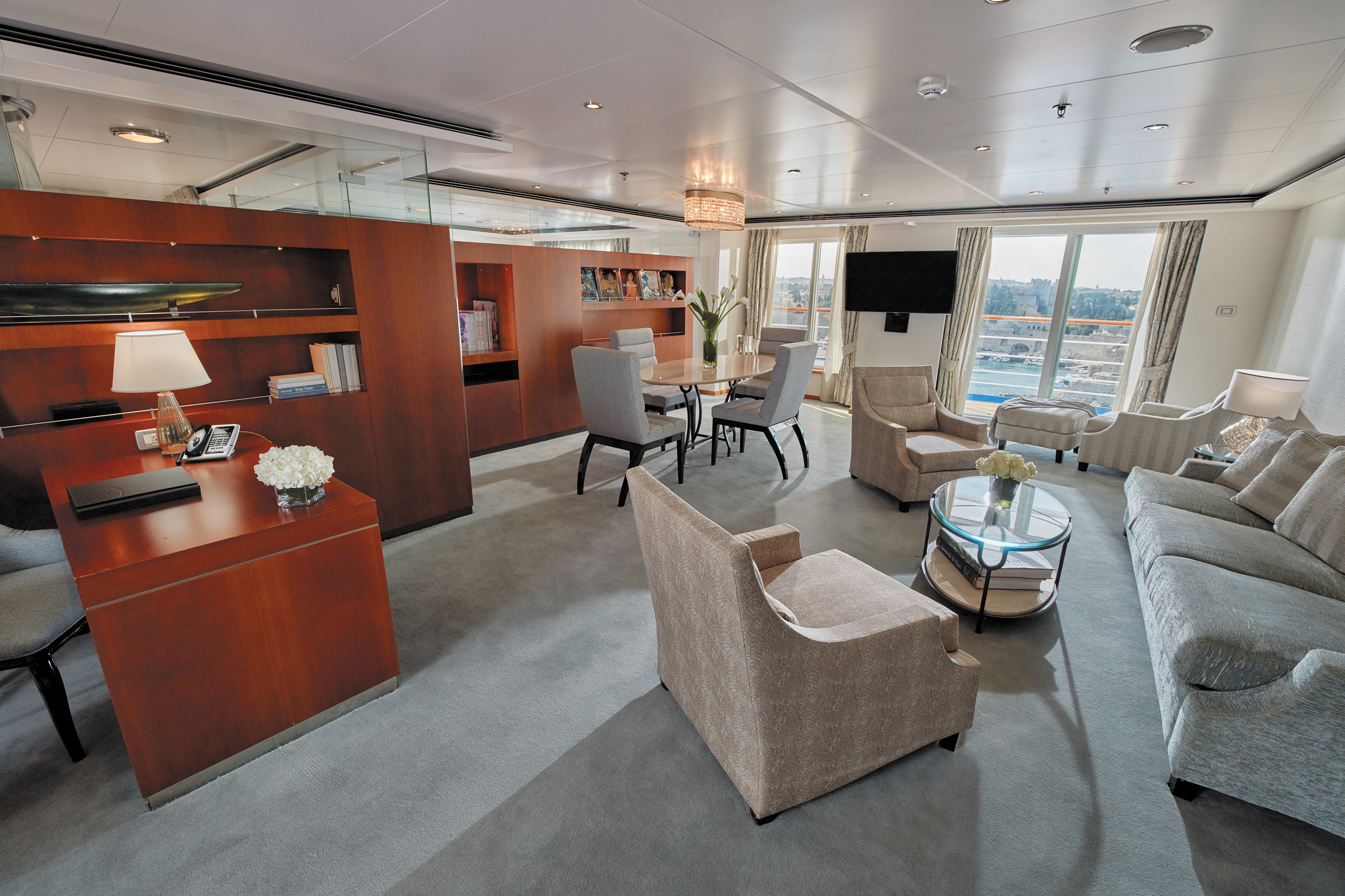
You enter this suite via a hallway that opens up to an elegant and spacious living area. Your private balcony awaits exploration outside and a bedroom with a dreamy décor is as soothing as a sunlit meadow.
Treat yourself to the welcoming luxury of a suite where elegance and comfort beckon in every nook. Open the sliding doors to your private balcony and inhale the fresh sea air. Enjoy your morning coffee at a cozy dining table or put your feet up in a soothing living room. Call on the services of a personal butler to assist with any needs and ensure that each moment of your journey exceeds your expectations.
Layout
1 Spacious Bedroom with a European King-Size Elite Slumber® Bed
- 1 1/2 Marble & Stone Detailed Bathrooms
- Private Balcony
- Sitting Area
- Walk-In Closet with Safe
- Accommodates Up To 4 Guests
The suite pictured may differ from the suite booked, as layouts and designs vary by ship, deck, and suite location.
Amenities
- 1-Night Pre-Cruise: Hotel Package Including:
- - Breakfast
- - Porterage
- Unlimited WiFi* Includes up to Four Logins, Four Devices, per Suite
- Valet Laundry Service
- 24-hour In-Suite Dining
- Fresh Orchid Arrangement
- Regent Plush Bathrobe & Slippers
- Interactive Flat-Screen Television & Direct-Dial Satellite Phone
- Priority Access to Online Shore Excursion Reservations
- Priority Access to Online Dining Reservations
- Binoculars
- illy® Espresso Maker
- Cashmere Blankets
- Regent Special Gift
- Vanity & Hair Dryer
- Shoe Shine Service
Additional Discounts:
- - 10% Discount on Ultra Premium Wine and Liquor
- - 5% Savings on Pre- or Post-Cruise Hotel or Land Programs
- - 5% Savings on Regent Choice Shore Excursions
Additional Voyager Suite Amenities:
- Welcome Letter from the President and General Manager
- Personal Butler for an Elevated In-suite Experience
- - In-Suite Dining from Compass Rose
- Priority Boarding on Embarkation Day with Suite Access at 1pm
- Welcome Bottle of Premium Champagne
- Personalized In-Suite Full-Liquor Bar Set-Up
- A Sumptuous In-Suite Caviar Service Once During Cruises
- Daily Canapés
- Luxe Fruit Arrangement
- Luxurious Designer Bath Amenities & Men's Unscented Shaving Kit
- Selection of Fig & Tea Leaves Bath Salts
- Bath Scale Setup
- Bose® SoundLink Mini II Bluetooth Speaker
- Selection of Bed Pillow Styles
- Complimentary Garment Pressing on First Night
- Personalized Stationery upon request
- Elegant Weather Clock
Take it all in — the gorgeous artwork, a writing desk, wraparound couch, dining table — and settle into your home on the high seas. Step out onto your private balcony, a glass of Champagne in hand, and savor the moment.
This suite is decorated with soothing colors, pleasing artwork and comfortable furnishings. Relax in the sitting area after an exciting day ashore and enjoy the selection of fresh canapés delivered by your personal butler. Then retreat to your private balcony to watch the ever-changing vistas. In your glistening bathroom, marvel at the assortment of luxury bath soaps and shampoos as you ponder whether to use your tub or walk-in shower.
Layout
1 Spacious Bedroom with a European King-Size Elite Slumber® Bed
- 1 Marble & Stone Detailed Bathroom
- Private Balcony
- Sitting Area
- Walk-In Closet with Safe
- Accommodates Up To 3 Guests
The suite pictured may differ from the suite booked, as layouts and designs vary by ship, deck, and suite location.
Amenities
1-Night Pre-Cruise: Hotel Package Including:
- - Breakfast
- - Porterage
- Unlimited WiFi* Includes up to Four Logins, Four Devices, per Suite
- Valet Laundry Service
- Customizable In-Suite Mini Bar Replenished Daily with Your Preferences
- 24-hour In-Suite Dining
- Fresh Orchid Arrangement
- Regent Plush Bathrobe & Slippers
- Interactive Flat-Screen Television & Direct-Dial Satellite Phone
- Priority Access to Online Shore Excursion Reservations
- Priority Access to Online Dining Reservations
- Binoculars
- illy® Espresso Maker
- Cashmere Blankets
- Regent Special Gift
- Vanity & Hair Dryer
- Shoe Shine Service
Additional Discounts:
- - 10% Discount on Ultra Premium Wine and Liquor
- - 5% Savings on Pre- or Post-Cruise Hotel or Land Programs
- - 5% Savings on Regent Choice Shore Excursions
Additional Seven Seas Suites Amenities:
- Personal Butler for an Elevated In-suite Experience
- - In-Suite Dining from Compass Rose
- Priority Boarding on Embarkation Day with Suite Access at 1pm
- Daily Canapés
- Luxe Fruit Arrangement
- Luxurious Designer Bath Amenities & Men's Unscented Shaving Kit
- Selection of Fig & Tea Leaves Bath Salts
- Bose® SoundLink Mini II Bluetooth Speaker
- Selection of Bed Pillow Styles
- Complimentary Garment Pressing on First Night
- Personalized Stationery upon request
- Elegant Weather Clock
With plush sofas in an inviting living area, high-count bed linens on a king-sized bed, luxe recliners on your private balcony and lavish bath products in your marble bathroom, this suite will coddle you in comfort and style.
The luxurious suite has been carefully designed to maximize space and comfort. Relax on your private balcony and indulge in your lavish bath amenities as you recharge and ready yourself for new adventures in the next port of call. This suite also includes priority online reservations for shore excursions and dining, and you’re encouraged to call on the services of a personal butler for special requests.
Layout
- Private Balcony
- Sitting Area
- Marble & Stone Detailed Bathroom
- European King-Size Elite Slumber® Bed
- Walk-In Closet with Safe
- Accommodates Up To 3 Guests
- This category includes Accessibility Options in suites 859 and 860. For more information about accessible suites click here.
The suite pictured may differ from the suite booked, as layouts and designs vary by ship, deck, and suite location.
Amenities
- 1-Night Pre-Cruise: Hotel Package Including:- Ground Transfers- Breakfast- Porterage
- Unlimited WiFi Includes up to Four Logins, Four Devices, per Suite
- Valet Laundry Service
- Customizable In-Suite Mini Bar Replenished Daily with Your Preferences
- Welcome Bottle of Champagne & Fresh Fruit
- 24-hour In-Suite Dining
- Fresh Orchid Arrangement
- L'Occitane® Jasmin & Bergamot Bath Amenities
- Regent Plush Bathrobe & Slippers
- Interactive Flat-Screen Television & Direct-Dial Satellite Phone
- Priority Access to Online Shore Excursion Reservations
- Priority Access to Online Dining Reservations
- Binoculars
- illy® Espresso Maker
- Cashmere Blankets
- Regent Special Gift
- Vanity & Hair Dryer
- Shoe Shine Service
Additional Discounts:
- 10% Discount on Ultra Premium Wine and Liquor
- 5% Savings on Pre- or Post-Cruise Hotel or Land Programs
- 5% Savings on Regent Choice Shore Excursions
Additional Penthouse Suite Amenities:
- Personal Butler for an Elevated In-suite Experience- In-Suite Dining from Compass Rose
- Daily Canapés
- Luxurious Designer Bath Amenities & Men's Unscented Shaving Kit
- Guerlain Bath Amenities & Men's Unscented Shaving Kit
- Bose® SoundLink Mini II Bluetooth Speaker
- Selection of Bed Pillow Styles
- Complimentary Garment Pressing on First Night
- Personalized Stationery upon request

Step out onto your private balcony with a freshly made cup of coffee and take in the grandeur of ocean travel. This suite is packed with stylish comfort, including a king-sized bed, walk-in closet and 24-hour room service.
In this superbly designed suite, you enjoy the comfort of richly furnished accommodations as well as exclusive luxuries available only in suites at the Concierge level and higher. Your suite includes amenities such as an illy® espresso maker and cashmere blankets, perfect for use in the morning when you wish to sip coffee and enjoy an in-suite breakfast on your private balcony. Take advantage of 24-hour room service when the mood strikes.
Layout
- Private Balcony
- Sitting Area
- Marble & Stone Detailed Bathroom
- European King-Size Elite Slumber® Bed
- Walk-In Closet with Safe
- Accommodates Up To 3 Guests
- This category includes Accessibility Options in suites 761 and 862. For more information about accessible suites click here.
The suite pictured may differ from the suite booked, as layouts and designs vary by ship, deck, and suite location.
Amenities
- 1-Night Pre-Cruise: Hotel Package Including:- Ground Transfers- Breakfast- Porterage
- Unlimited WiFi Includes up to Four Logins, Four Devices, per Suite
- Valet Laundry Service
- Customizable In-Suite Mini Bar Replenished Daily with Your Preferences
- Welcome Bottle of Champagne & Fresh Fruit
- 24-hour In-Suite Dining
- Fresh Orchid Arrangement
- L'Occitane® Jasmin & Bergamot Bath Amenities
- Regent Plush Bathrobe & Slippers
- Interactive Flat-Screen Television & Direct-Dial Satellite Phone
- Priority Access to Online Shore Excursion Reservations
- Priority Access to Online Dining Reservations
- Binoculars
- illy® Espresso Maker
- Cashmere Blankets
- Regent Special Gift
- Vanity & Hair Dryer
- Shoe Shine Service
Additional Discounts:
- - 10% Discount on Ultra Premium Wine and Liquor
- - 5% Savings on Pre- or Post-Cruise Hotel or Land Programs
- - 5% Savings on Regent Choice Shore Excursions

First, the view — soak in the entirety of your ocean-going adventure out on your private balcony, or get cozy in your floor-to-ceiling-windowed sitting area. Inside is perfectly designed for maximum elegance and comfort.
Every inch of this suite has been thoughtfully designed to maximise interior space and embrace the magnificent scenery outdoors. From the sitting area, admire the ocean views through the floor-to-ceiling windows, or better yet, take a seat outside on your private balcony to watch the world go by. Elegant finishes such as luxurious bedding and beautiful marble detailing in the bath further enhance your comfort.
Layout
- Private Balcony
- Sitting Area
- Marble & Stone Detailed Bathroom
- European King-Size Elite Slumber® Bed
- Walk-In Closet with Safe
- Accommodates Up To 3 Guests
The suite pictured may differ from the suite booked, as layouts and designs vary by ship, deck, and suite location.
Amenities
- Unlimited WiFi Includes Two Logins, Two Devices, per Suite
- Valet Laundry Service
- Customizable In-Suite Mini Bar Replenished Daily with Your Preferences
- Welcome Bottle of Champagne & Fresh Fruit
- 24-hour In-Suite Dining
- Fresh Orchid Arrangement
- L'Occitane® Jasmin & Bergamot Bath Amenities
- Regent Plush Bathrobe & Slippers
- Interactive Flat-Screen Television & Direct-Dial Satellite Phone
- Vanity & Hair Dryer
- Shoe Shine Service

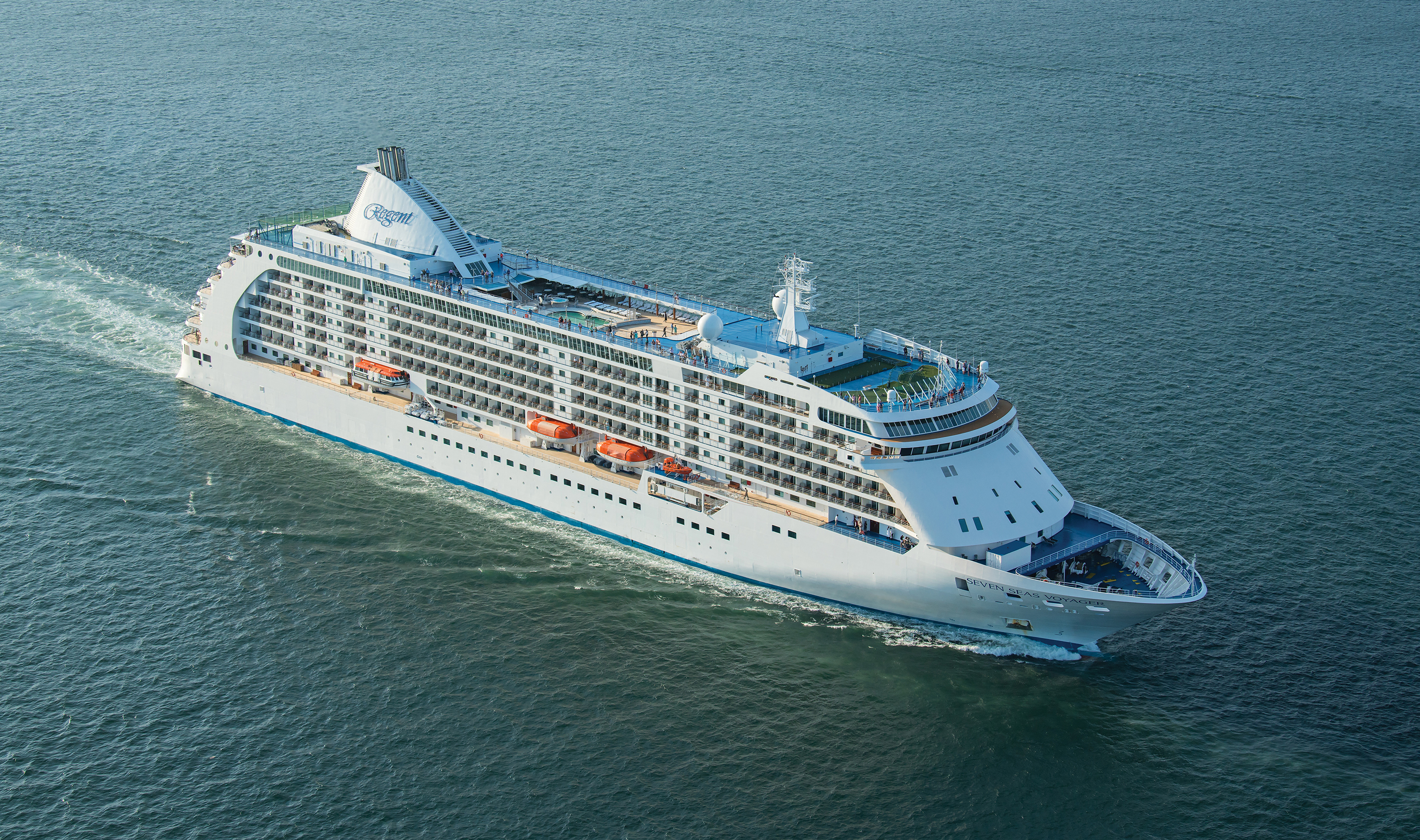
Seven Seas Voyager
Every suite on Seven Seas Voyager® has a private balcony along with marble bath accents and roomy closets. Sip a cup of coffee or glass of wine and dine alfresco on room service as you take in the endless views and fresh sea air.
Seven Seas Voyager® is designed for a holistic experience that makes the most of our all-inclusive fares and every luxury they include. Enjoy every space, from an elegant dining room to the quiet comfort of your private balcony.
Ship Facts
| Launch Year | 2003 | ||||
| Refit Year | 2016 | ||||
| Language | en | ||||
| Gross Tonnage | 42363 | ||||
| Length | 204 | ||||
| Width | 29 | ||||
| Currency | USD | ||||
| Speed | 20 | ||||
| Capacity | 698 | ||||
| Crew Count | 455 | ||||
| Deck Count | 9 | ||||
| Cabin Count | 349 | ||||
| Large Cabin Count | 52 | ||||
| Wheelchair Cabin Count | 4 | ||||
| Electrical Plugs |
|
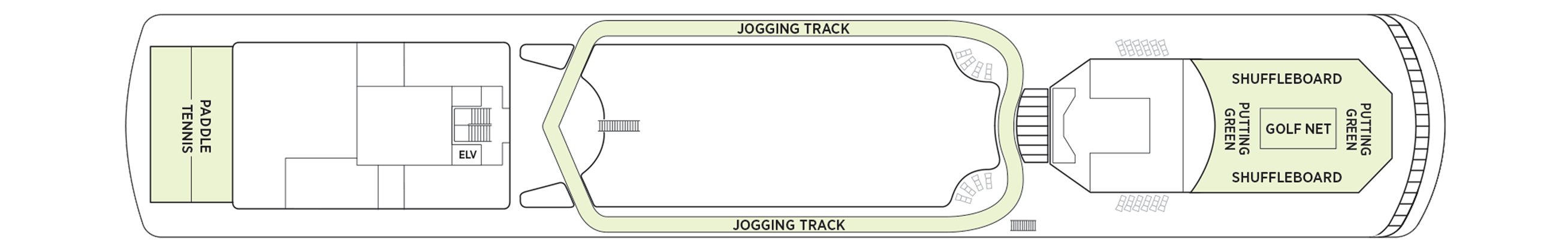
Deck 12
- Putting Green
- Shuffleboard
- Golf Net
- Jogging Track
- Paddle Tennis Court
- Sports Deck
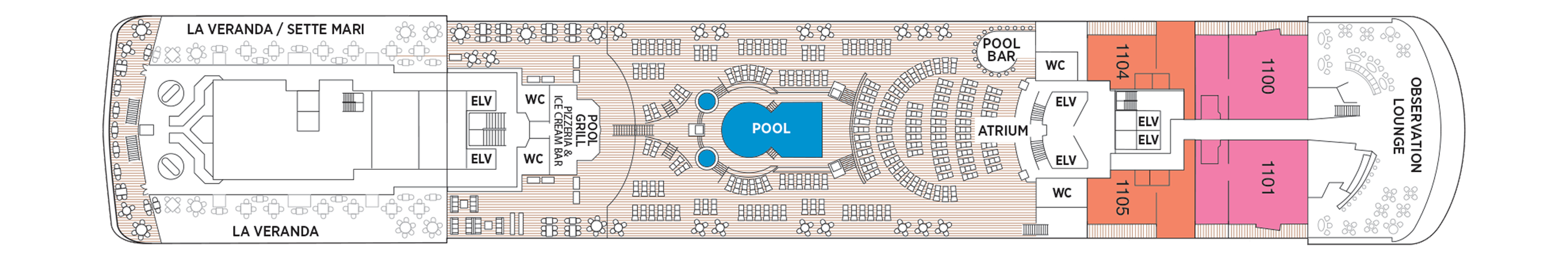
Deck 11
- Observation Lounge
- Pool Bar
- Atrium
- Pool Deck
- Pool Grill Pizzeria & Ice Cream Bar
- La Veranda
- La Veranda/Sette Mari
- Signature Suite
- Grand Suite
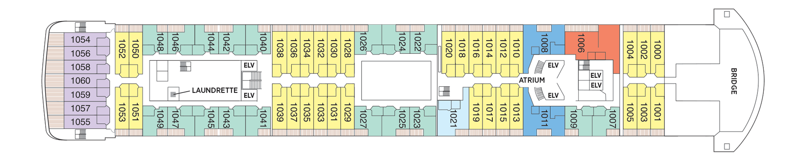
Deck 10
- Atrium
- Bridge
- Launderette
- Concierge Suites
- Grand Suites
- Voyager Suites
- Seven Seas Suites
- Penthouse Suites
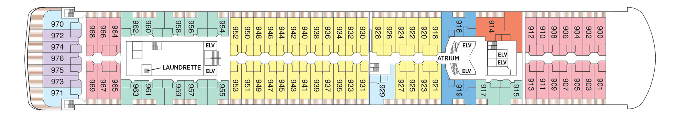
Deck 9
- Atrium
- Launderette
- Concierge Suites
- Grand Suites
- Penthouse Suites
- Seven Seas Suites
- Voyager Suites
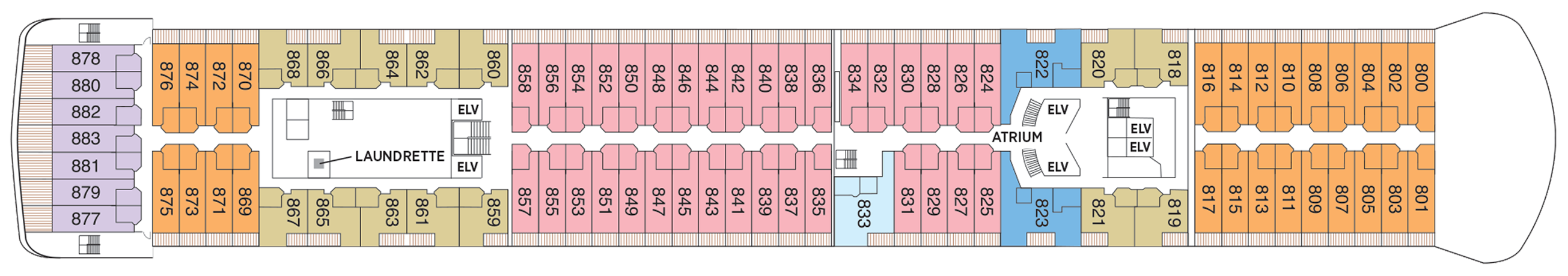
Deck 8
- Atrium
- Deluxe Veranda Suites
- Penthouse Suites
- Voyager Suites
- Seven Seas Suites
- Concierge Suites
- Launderette
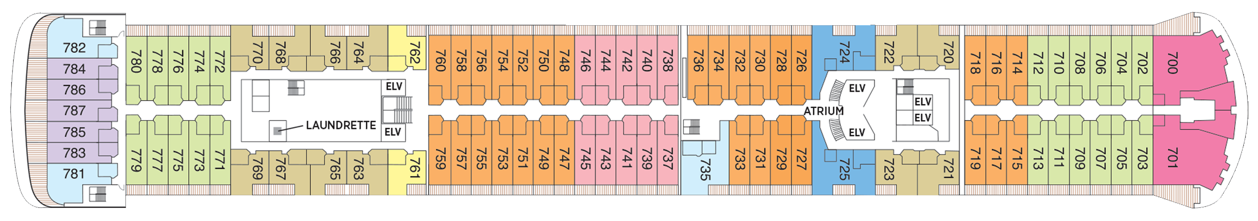
Deck 7
- Atrium
- Launderette
- Signature Suites
- Deluxe Veranda Suites
- Penthouse Suites
- Voyager Suites
- Seven Seas Suites
- Concierge Suites
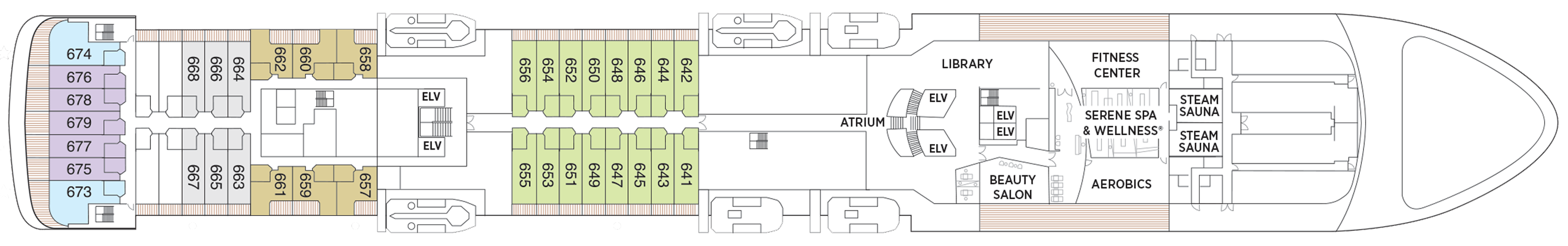
Deck 6
- Atrium
- Fitness Center
- Library
- Steam Sauna
- Beauty Salon
- Aerobics
- Serene Spa & Wellness™
- Deluxe Veranda Suites
- Penthouse Suites
- Seven Seas Suites
Deck 5
- Atrium
- Boutiques
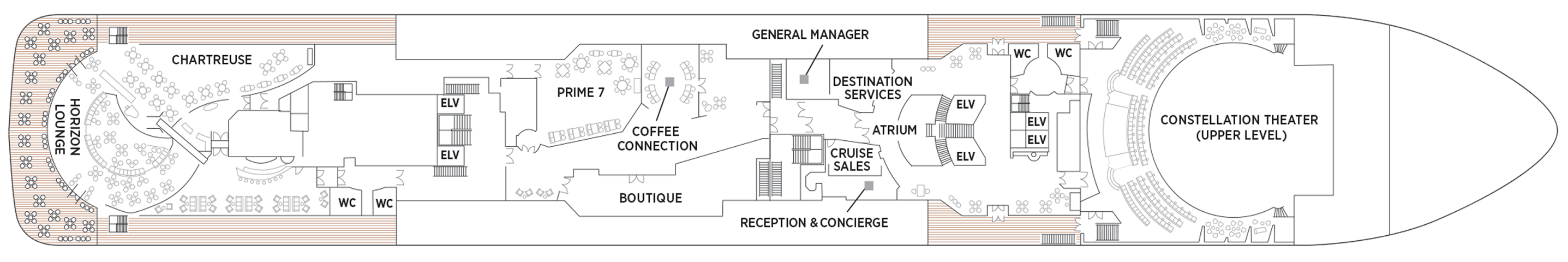
- Chartreuse
- Coffee Connection
- Constellation Theatre (Upper Level)
- Horizon Lounge
- Prime 7
- Destination Services
- General Manager
- Cruise Sales
- Reception & Concierge
Deck 4
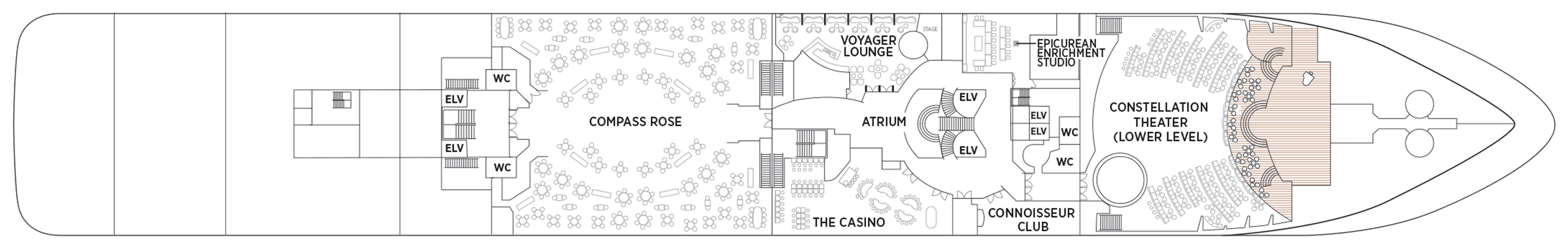
- Atrium
- The Casino
- Compass Rose
- Connoisseur Club
- Constellation Theatre
- Voyager Lounge
- Card & Conference Room
Epicurean Enrichment Studio
Regent Seven Seas Cruises® takes pride in creating dining experiences that are simply superb. From succulent lobster to the perfect burger and shake, you’ll find an array of refined flavors and refreshments from which to choose.
Compass Rose
Whether you arrive for breakfast, lunch or dinner, you can look forward to European-inspired Continental cuisine served in a beautifully refined atmosphere decorated in blues and silvers with stunning Versace tableware.
We are pleased to re-introduce the elegantly enhanced Compass Rose, the largest specialty restaurant across our fleet. Ensuring a tantalizing mix of new and familiar items on every visit, the new lunch and dinner menus offer a vast selection to meet your discerning tastes. Exclusively aboard Seven Seas Mariner®, Seven Seas Voyager®, and Seven Seas Navigator® for lunch, you may choose from a robust list of appetizers and main courses from our specialty restaurants. And across our fleet for dinner, you have the unique ability to design your very own entrée from preferred sides, sauces, pastas and main features of beef, poultry and fish. This is in addition to sinfully indulgent desserts made by talented bakers and pastry chefs. With daily changing menus, the refreshed Compass Rose offers more choices than ever before.
Chartreuse
A restaurant with a modern French menu and attention to detail you’ll notice in its Parisian décor, expertly prepared dishes and wait staff. About the closest thing to a Parisian culinary gem on the high seas.
Chartreuse evokes memories of a chic Parisian fine dining restaurant discovered during an evening stroll. Wherever you are seated in this regal restaurant, you will be treated to a succulent dinner while enjoying incredible ocean views. The restaurant ambiance is complemented by a menu that features modern French dishes. Available on Seven Seas Grandeur™, Seven Seas Splendor®, Seven Seas Explorer®, Seven Seas Mariner® and Seven Seas Voyager® with reservations each evening for dinner, and open for lunch on Seven Seas Explorer on alternate port days. French bistro style food is offered.
Reservations Required
Coffee Connection
Enjoy barista-made coffees, delicious pastries, gourmet sandwiches and homemade cookies at Coffee Connection. Peruse international newspapers and news magazines or strike up a conversation with new friends.
Your informal destination to relax, meet fellow guests and enjoy coffee and snacks throughout the day. Hungry? Cereals, fruits, pastries and bagels are available every morning. Lunch includes cold cuts, cheeses, assorted rolls and cookies. Sandwiches, fruit and fresh cookies and cakes are available all day. While snacking, international newspapers and news magazines are available for your perusal.
Prime 7
An elegantly intimate, art-filled and luxurious setting to enjoy classic American steakhouse cuisine with a modern flair. A handsome bar is a relaxing destination if you arrive early.
A true classic in every sense, Prime 7 sets a new standard in steakhouse fare with its contemporary interpretation of an American classic. Handsomely decorated with supple leather wing-back chairs, burnished woods and rich earth-toned fabrics, Prime 7 exudes a distinct, intimate elegance. This is sophistication redefined, a luxurious setting to enjoy classic steakhouse cuisine with a modern flair.
All the traditional starters are here, including Jumbo Lump Crab Cakes, Classic Steak Tartare, and Clam Chowder. Of course, beef is the undisputed star, and it is aged for a minimum of 40 days to ensure the ultimate tenderness and juiciness. New York Strip, Porterhouse Steak and succulent Filet Mignon only touch upon the selections. Mouthwatering alternatives include Applewood Smoked Salmon and Dover Sole.
Reservations Required
La Veranda
La Veranda features quiet alcoves, made-to-order omelets and tasty lunch buffets that include hot carving stations, an authentic pizzeria and regional specialties that reflect cuisines of the region you’re visiting.
Take in stunning ocean views while enjoying elegant breakfast and lunch buffets in the chic indoor dining room or al fresco on the shaded, open-air deck. Breakfasts include traditional favorites, as well as a made-to-order omelet station, a variety of fresh fruits and pastries, along with daily specials, like fluffy Belgian waffles with fresh blueberry compote. For lunch indulge in an array of choices from a bountiful salad bar, gourmet sandwiches, hot carving stations and delicious desserts.
Sette Mari at La Veranda
Enjoy an extensive menu of authentic antipasti and Italian specialties served á la carte and paired with fine Italian wines. All dishes are prepared with the freshest gourmet ingredients and served by our attentive waiters.
Each evening, La Veranda transforms into Sette Mari at La Veranda, a casual, intimate dining experience. Choose from authentic Italian specialties inspired by family recipes that span generations, or opt for something with a modern twist like a spice-crusted tuna steak with braised endive, polenta and salmoriglio. Savour it all with a perfectly paired Tuscan wine. Sette Mari at La Veranda is open for dinner only.
Pool Grill
After sunbathing or swimming in the pool, you may be in the mood for grilled-to-order burgers, seafood, sandwiches, even hand-dipped ice cream with sprinkles. Our Pool Grill will satisfy your comfort food cravings.
The Pool Grill is truly a come-as-you-are venue. Enjoy this casual dining experience whether you’re getting a bite after sunbathing or swimming in the pool. The Pool Grill is open-air, yet abundantly shaded for comfortable dining at lunch or dinner. Enjoy grilled-to-order burgers, grilled seafood, sandwiches, and fresh salads. Treat yourself to milkshakes and malts or an old-fashioned hand-dipped ice cream dessert with toppings.
Room Service
Knowing that guests sometimes prefer to simply dine in the comfort of their suites, we offer room service around the clock. Select from an extensive room service menu and the wait staff will promptly serve your order in the comfort of your suite. During normal dining hours, guests may also order from the Compass Rose menu, which changes daily and features Continental, vegetarian, and kosher cuisines. Dinners will be graciously served course-by-course.
Daytime Enrichment
You’ll find time spent on board the ship to be just as enriching as time ashore. Relax by the pool, compete in a friendly game of trivia or bocce ball, indulge in treats at afternoon tea and gain insight from an expert lecturer.
Evening Entertainment
Evenings on board are filled with music and fun. Enjoy a rousing cabaret show, test your luck at the Casino, step onto the stage for karaoke or simply find a quiet place on deck to revel in the symphony of stars.
Boutiques and More
Browse a well-curated selection of duty-free designer clothes, jewelry, perfume and more at the onboard boutiques. Then fuel up with an espresso from an onboard café or unwind at a wine tasting in one of the lounges.
Atrium
Simply put, the Atrium is the very heart of Seven Seas Voyager®. Natural light cascades from far above while a glistening sculpture seems to reach up and capture it.
At the hub of the ship, our Atrium is an inspiring testament to the grandeur of luxury ocean travel. Center staircases connect conveniences on Deck 5 to the social spaces of the Voyager lounge and Casino, as well as Compass Rose on Deck 4. This makes it a natural gathering place for guests, signified by a beautiful compass-shaped tile floor at the landing.
The Casino
Glass doors lead to an elegant setting bustling with games of chance that include Blackjack, roulette, poker and slot machines. The Casino is open every day at sea when not restricted by territorial border limits.
If you’re in the gaming mood, head to our elegantly appointed Casino for a few hands of blackjack or to try your luck at roulette, poker, the craps table or slot machines. Whether you’re a player or spectator, the excitement is contagious, the drinks delightful and the staff welcoming. Our stylish Casino is open every day at sea when not restricted by territorial border limits.
Connoisseur Club
The place to go to enjoy a fine cigar and sip cognac (both available for purchase) in classic gentleman’s club environs. This popular gathering spot is dedicated to low-key elegance and camaraderie.
The very popular Connoisseur Club is where you can order a rare vintage cognac or port and pick a fabulous cigar (both are available for purchase). This elegant hideaway is guaranteed to envelop you in comfortable leather armchairs and a club-like atmosphere that gives rise to good conversation and bonhomie. As you’d guess, smoking is permitted in this gathering place.
Constellation Theatre
Take in lavishly staged, high-energy shows created and produced by our own team of Broadway choreographers and directors in our show hall. So grand it needs two decks, it offers plush seating and surroundings.
Smartly tiered for pleasing sightlines and decked out with delightfully plush seating, our Constellation Theater is an intimate venue without a bad seat in the house. Settle in, admire the grand surroundings, and be prepared to witness phenomenal performances that vary from full-scale musical revues to rousing singalongs, all backed by our incredible, five-piece Regent Signature Orchestra.
Pool Deck
For those days when nothing but sitting poolside will do, head to our Pool Deck. You’ll be greeted by an expansive space with unforgettable views, teak accents and an amiable crew offering cold drinks and plush towels.
Our Pool Deck is one of the most expansive at sea and features a large heated pool, two whirlpools and table tennis. Surrounded by luxurious teak accents, you’ll be consistently awestruck by the pool’s magnificent vistas high upon Seven Seas Voyager®. You’ll also be impressed by our amiable and dedicated crew, who stand at the ready to provide refreshing beverages and plush towels.
Horizon Lounge
A perfect spot for informal drinks in an elegant setting. With live music throughout the day and expertly poured cocktails only a request away, the Horizon Lounge is a great place to rendezvous with fellow travellers.
The Horizon Lounge is an ideal destination for classic cocktails or to simply relax and engage in conversation with new friends. Resident musicians play familiar tunes throughout the day as well as before and after dinner, making it ideal for informal plans. Game shows, night entertainment and live musical events are featured regularly.
Observation Lounge
As indicated by its name, the Observation Lounge offers a wonderful vantage point to enjoy staggering views as your ship enters and leaves ports of call. Live music adds to the serene vibe.
The Observation Lounge is a chic yet comfortable space to read, relax and enjoy a cocktail while admiring the spectacular views offered every time Seven Seas Voyager® enters and leaves one of its worldwide ports of call. Live music is played throughout the day, making this another inviting onboard destination to to unwind with afternoon tea, pre-dinner cocktails or a satisfying nightcap.
Voyager Lounge
You’ll find this smartly designed space tough to resist. Its sophisticated yet casual vibe invites conversation with new friends over pre-dinner cocktails, while its dance floor offers a night of dancing into the wee hours.
Discover for yourself why the Voyager Lounge and nightclub is the perfect venue to meet new friends for a pre-dinner cocktail. As the night progresses, the spectacularly designed space turns into a nightclub where night owls gather to dance into the night or maybe sing along in a karaoke competition. Musicians entertain nightly, and during the late hours on selected nights a DJ spins records and takes requests.
Boutiques
Whether it’s designer evening wear, handbags, fragrances or a smart gift, our boutique items are carefully selected and of the highest quality. The same may be said of our personable staff.
Stop into our boutiques and browse a wide range of items – upscale handbags to exclusive fragrances to fine jewellery – in an intimate and unhurried setting. You’ll also find swim wear, Regent Seven Seas Cruises® logo wear and gift items to share with friends and family. Our boutiques are staffed by friendly salespeople. Opening hours vary and are printed in the Passages daily newsletter.
Pool Bar
Very few things equate to a pure vacation activity more than sitting at our Pool Bar. Make new friends while sipping a cocktail or frozen drink in the most laid-back atmosphere imaginable.
When you envision the type of activity you’re only likely to do while on vacation, sipping a frozen drink at a pool bar onboard a glorious cruise ship is probably near the top of the list. You can tick that box at our Pool Bar, where you and new friends can enjoy leisurely conversation over cocktails and frozen drinks in a delightfully relaxed atmosphere.
Library
Browse a vast collection of volumes, from destination-specific guide books to best-selling mysteries to classics of literature, upon a variety of comfortable chairs in our cozy Library.
Well-stocked and offering comfort for the body and mind, you’ll discover our Library is a most civil setting for reading and relaxing. Curl up with a classic novel or best-selling mystery, play a strategic game of chess or simply soak up the ambience of a sumptuous reading room. Whatever draws you here, you’ll find our library to be a welcoming, low-key treasure you just may find hard to leave.
Card & Conference Room
Gather your favourite teammates here for a lively afternoon or evening of cards, board games or a social game of Bridge. The spaces, which may be combined, are also designed to host conferences.
Two complete Card and Conference Rooms can be used for everything from bridge lectures and tournaments to corporate meetings and special events. Gather with a few friends for an afternoon or evening of fun competition with board games, cards and more. Larger groups may increase space by removing the dividing door and combining both rooms.
Destination Services
Whether you’re interested in a tour from our FREE Unlimited Shore Excursion menu or a unique, small-group Regent Choice Shore Excursion, our staff at Destination Services is ready to make it happen.
If the road to a richer life is paved with the lessons of new discoveries, our Destination Services is a great place to start. Learn about the adventures available to suit every taste and comfort level during your voyage from our dedicated staff. They can arrange unique shore excursions designed for smaller groups or assist with tailor-made pre-and post-cruise programs, from a simple stay in a luxurious hotel to a 3-night extension in a remote locale.
Reception, Concierge & General Manager
Our knowledgeable Reception staff is available around the clock to answer your questions and ensure your voyage is as pleasurable as possible. Reception is also where you may contact the ship’s Concierge.
Our welcoming Reception Desk is open 24 hours a day and staffed by personable, knowledgeable men and women who are happy to answer your questions and provide any general assistance you may need. Reception is also where you may contact the ship’s Concierge. Postcards and letters may be dropped off here as well; they’ll be delivered to the postal service at the next port of call.
General Manager
While cruise-related issues are first submitted to Reception/Concierge, you can be assured that a General Manager is on hand to resolve issues to your satisfaction.
Accountability is a critical aspect of providing you with an unrivalled experience on Regent Seven Seas Cruises®. As a guest you’ll always know where to find our General Manager, whose sole responsibility is making sure things are running as they should – and that includes providing you with superior customer service.
Internet Cafe
It’s easy to stay connected, even while sailing the seven seas. Our ships have WiFi throughout for guests with their own laptops, and there are plenty of computers in the staffed Internet Café, which is open round the clock. Printers, e-mails, Internet access and Wireless access throughout the ship are all available for a nominal fee.
For those who’ve chosen to leave their laptops at home, desktop computers are available at our staffed Internet Cafe. Of course, you may access WiFi without charge throughout the entirety of Seven Seas Voyager®.