
Souks To Sorrento
Souks To Sorrento
Cruise overview
WHY BOOK WITH US?
- ✔ The Deluxe Cruises’ team has extensive experience in ultra-luxury cruising.
- ✔ Call now to speak to our helpful and experienced Cruise Concierge team.
- ✔ Enjoy our Unique Deluxe Cruises Bonus for substantial savings.
- ✔ Our team will tailor your holiday to your exacting requirements.
- ✔ As agents, we work under the protection of each cruise lines ABTA / ATOL licences
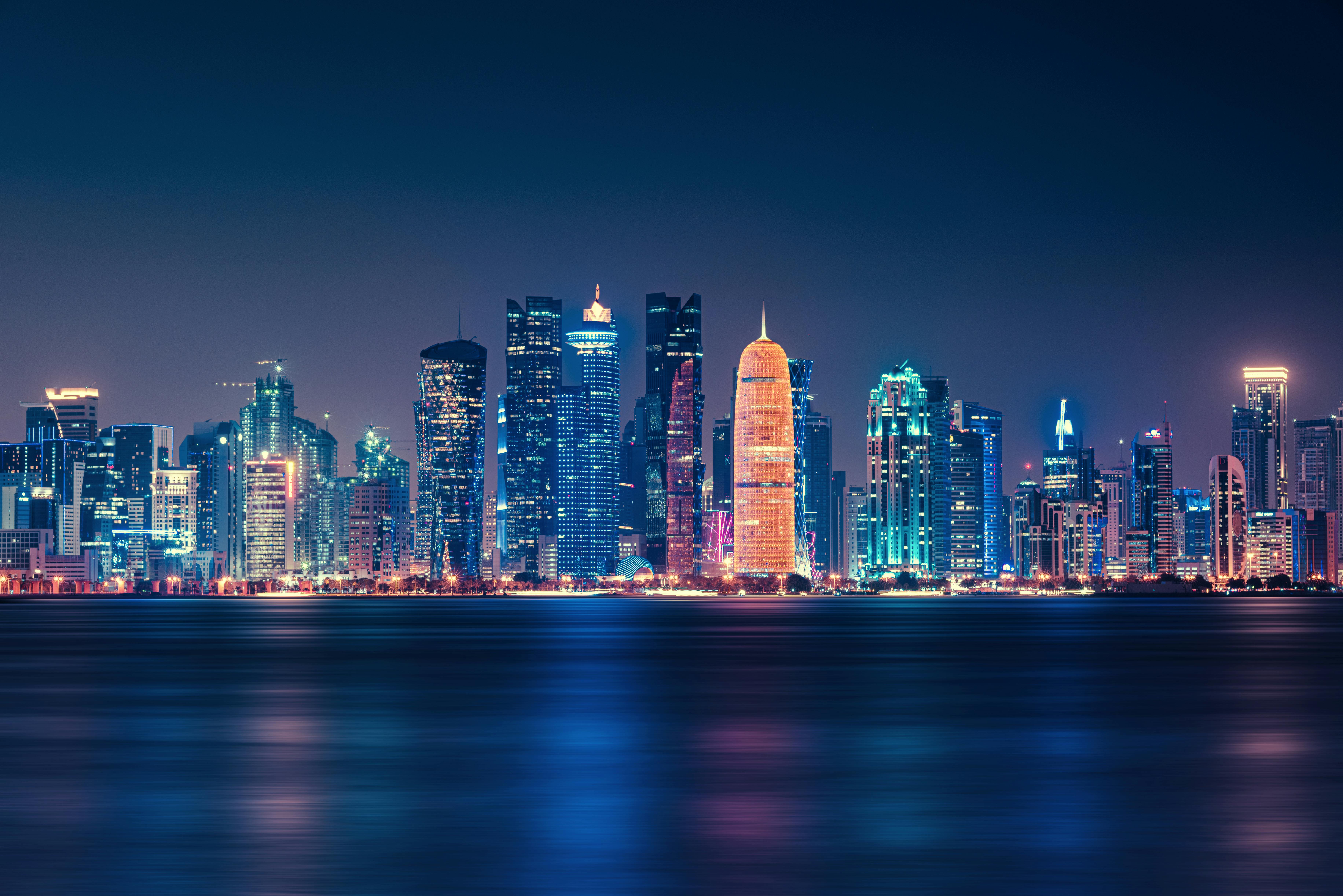
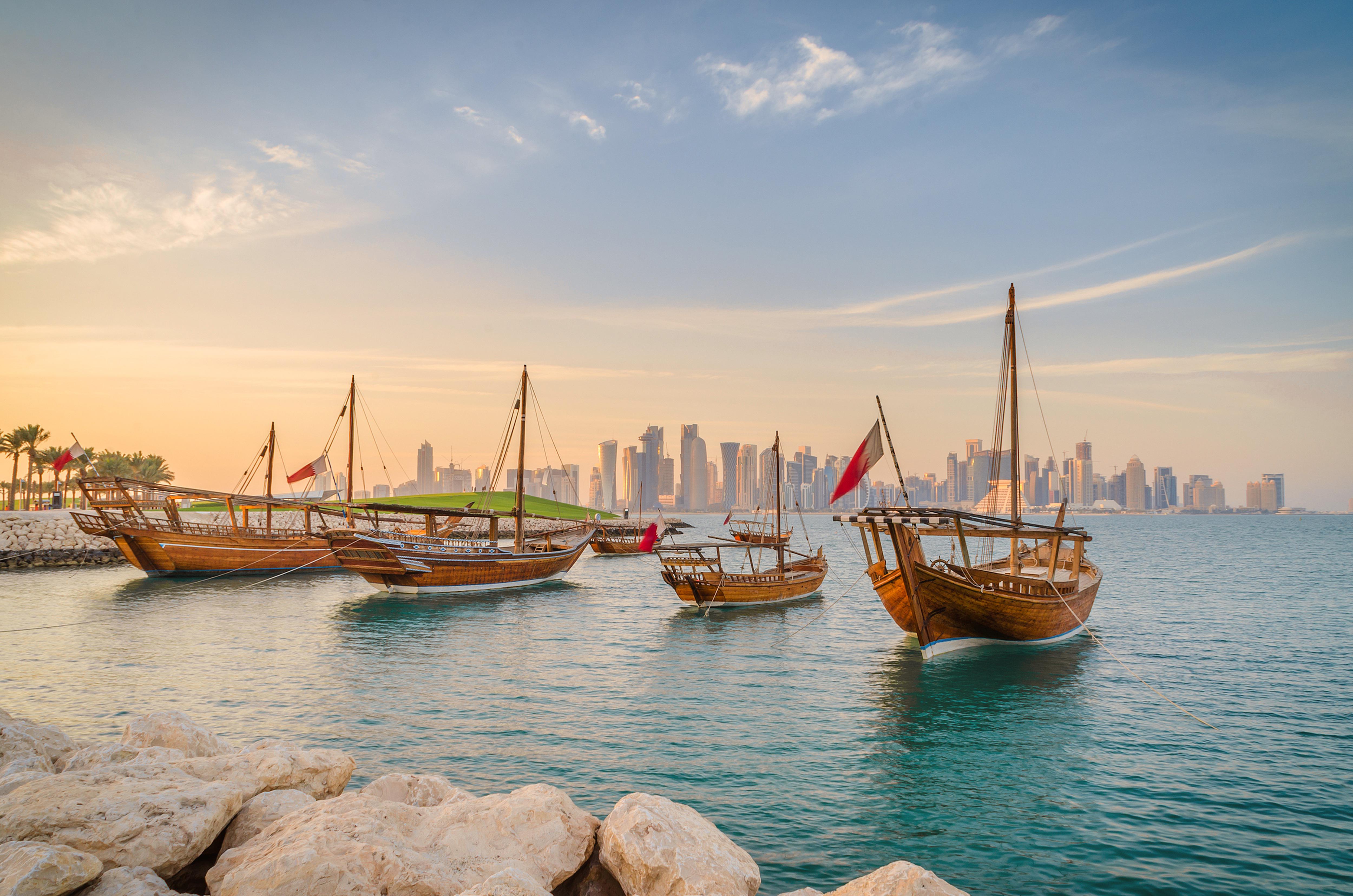
About Doha
Doha (population 700,000) is the capital of the State of Qatar, an emirate occupying the small Qatar Peninsula bordered by Saudi Arabia to the south and otherwise surrounded by the Persian Gulf. Qatar was ruled by many different powers through the centuries, in fact historians have traced human habitation dating back 5000 years. From its earliest history, Qatar was a very important trade route connecting Mesopotamia and the Indus Valley. Among its occupiers were the Portuguese, the Ottomans and finally the British during the turbulent years of the 20th century. Qatar gained independence in 1971, and with resources from oil exportation, His Highness Sheikh Khalifa Bin Hamad made improvements in social programmes including education, health and housing. In 1995, his son, His Highness Sheikh Hamad Bin Khalifa Al-Thani assumed the throne and brought with him a modern and progressive approach that quickly transformed the country. Doha, home to 80 percent of the country’s population, was founded under the name of Al-Bida in 1850. It became the capital of the British protectorate of Qatar in 1916. When the nation gained its independence, Doha remained the capital. During the early 20th century, much of Qatar’s economy depended on fishing and pearling. But after the introduction of Japanese cultured pearls, Doha and the whole region suffered a decline. Only when oil was discovered, prosperity returned following World War II. Today, the country produces over 800,000 barrels of oil daily. Doha is situated halfway down the east coast of the peninsula. It is an intriguing mixture of old and new, with ultra modern architecture next to traditional souqs and historic forts. It boasts a university and the Qatar National Museum (currently closed for renovation), which opened 1975 in what was originally the ruler’s palace. As the country’s cultural and commercial centre, Doha enjoys excellent communications with the outside world through its modern seaport, airport and telephone links. The Al Jazeera Arabic satellite television news channel began broadcasting in 1996 with its headquarters in Doha. While Arabic is the official language, English is widely spoken. Please Note: Conservative dress is required when going ashore. As a rule, women should not wear miniskirts, shorts or sleeveless tops and men should always wear a shirt in public. Please do not photograph people without their permission, especially women.You may not take pictures of government buildings, embassies or anything military in nature, including airports.
About Abu Dhabi
Just a few decades ago, Abu Dhabi, the island capital of the United Arab Emirates, was a small fishing village with houses made of mud-brick and palm fronds. Today, as a result of revenue from oil, Abu Dhabi is one of the world's richest cities, with wide, tree-lined okulevards, lush green parks, gushing fountains and imposing skyscrapers. Somewhat of a dichotomy, Abu Dhabi is a combination of ultra-modern sophistication and Arab mystique, with friendly and hospitable people offering a warm welcome to visitors. Abu Dhabi's history originated in the 18th century, when, according to legend, a group of tribesmen pursuing a gazelle came upon a freshwater well which they named Abu Dhabi, or "Father of the Gazelle". In the 19th century, the first fort was built over this well by a sheikh of the Al-Nahyan dynasty. The fort's name is Al Husn Palace, also known as Old or White Fort, and it is one of the few buildings in Abu Dhabi that is more than 25 years old. Its whitewashed walls are eye-catching amid the backdrop of today's skyscrapers. Presently, it is home to the Cultural Foundation and serves as a documents centre. Abu Dhabi had little significance until the discovery of vast oil reserves in the late 1950s and early 1960s. In the years following, the city's economy and infrastructure developed rapidly and changed Abu Dhabi beyond recognition.


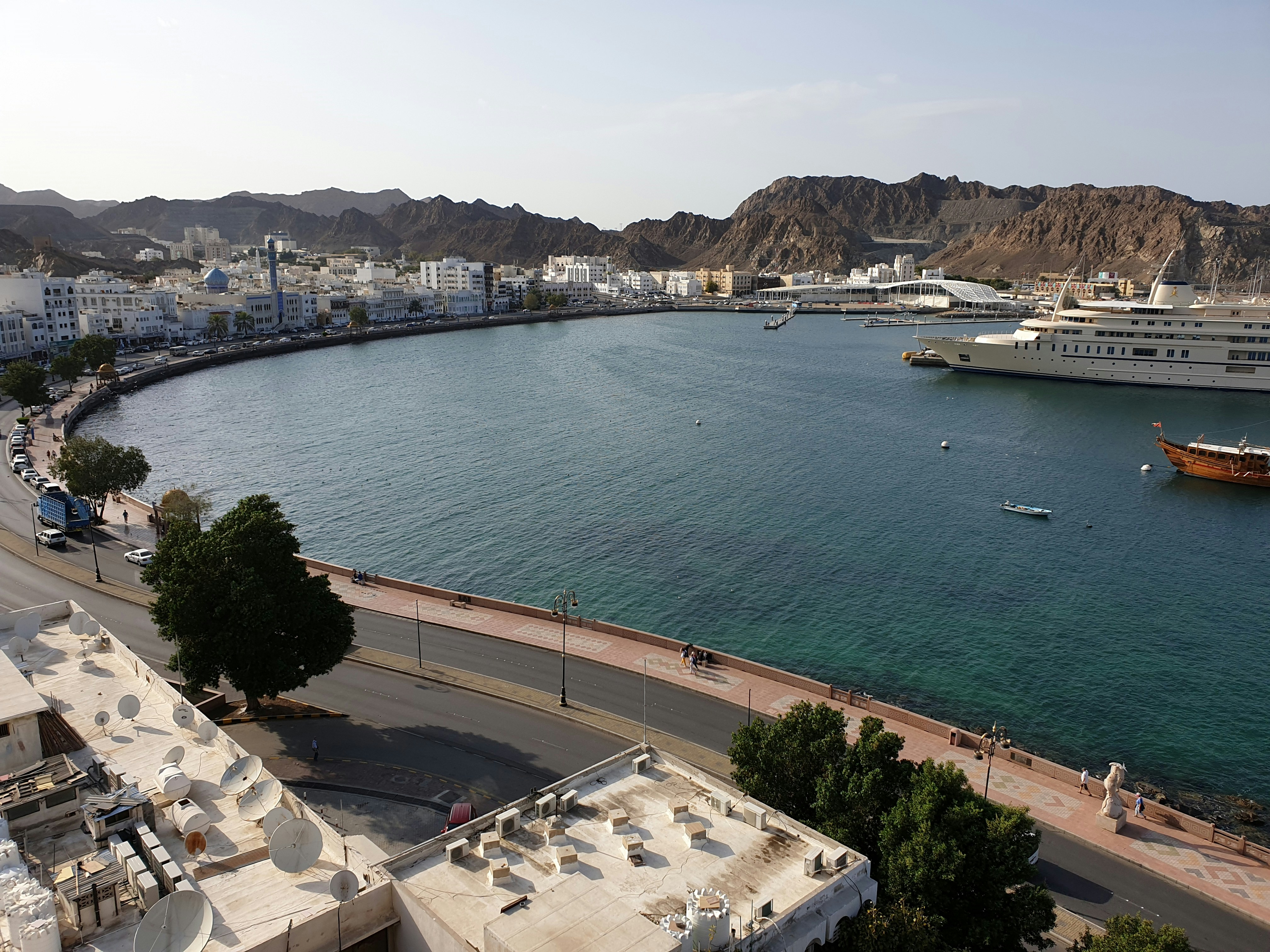
About Muscat
Oman's capital city is hemmed in on one side by spectacular jagged-peaked mountains and on the other by royal blue sea. The architecture is a traditional, sophisticated arabesque blend of white-washed, low-rise buildings surrounded by manicured palms, intricately designed domes set atop the minarets of the mosques, sand-colored villas, a surprising blend of modern art installations, like a giant incense burner that towers over the Corniche, and ancient forts set in the rocky hills. Though tradition abounds, from distinct, local cuisine to the widely worn national dress, the dishdasha, Muscat is a completely modern city, featuring opulent luxury hotels, international restaurants, excellent cellular and data service, sprawling shopping malls, pristine beaches, lively nightlife, world-class performing arts, and a highly educated population, most of whom speak English, Arabic, and often Hindi. Muscat is the ideal base for exploring other areas of the country since many of the most desirable destinations are within a few hours' drive.

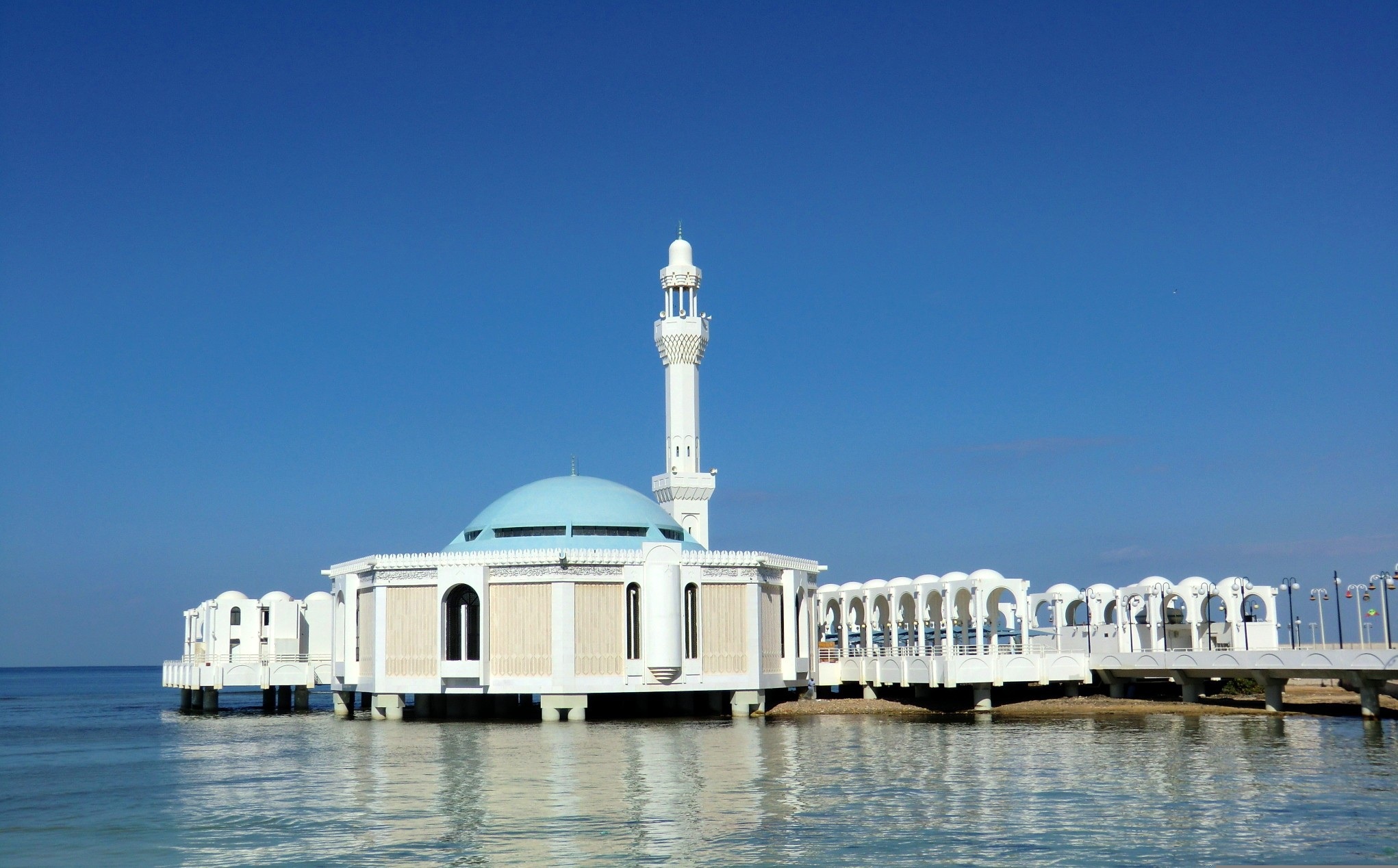
About Jeddah
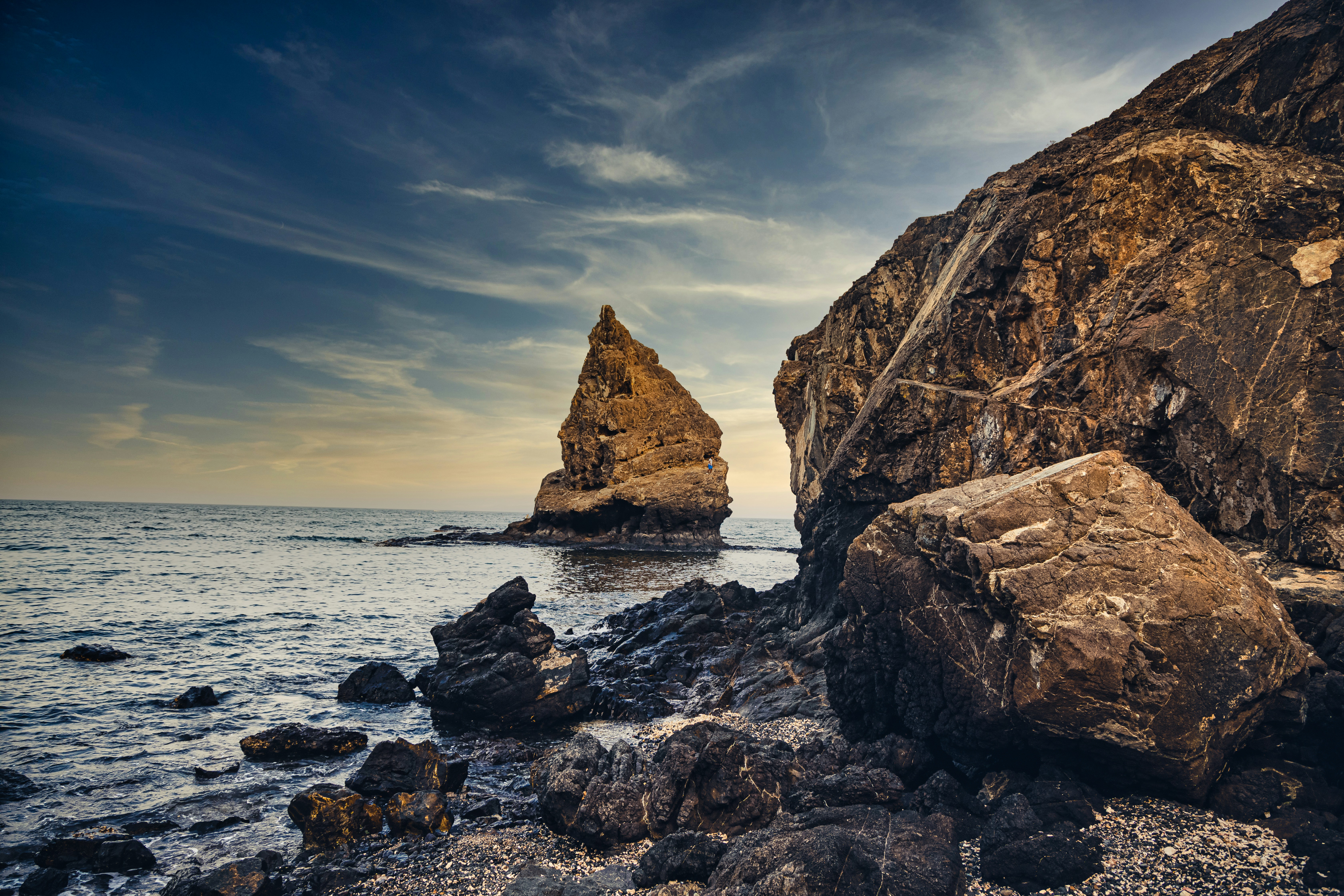
About 'Aqaba
The resort town of Aqaba, on the Red Sea at the southern end of Jordan, is a popular spot for divers with some of the best coral reefs in the world. Snorkeling and other water sports are popular, and it's easy to hire a boat for a day or half-day, including lunch.Aqaba has become quite a bustling destination, with several large luxury hotels and a large shopping area. There are many jewelry stores selling pearls, gem stones, and gold and silver jewelry. It's worth noting that although it's an international beach resort, Aqaba is quite conservative—certainly much more so than Amman—and North Americans tend to be more comfortable at the private hotel beaches.

About Safaga
Port Safago has been undergoing a transformation, slowly metamorphosing into a holiday rsort. Like other cities on the Red Sea, the commercial port town sits close to great offshore dive sites. Unlike others, however, tourist development hasn't taken off in a meaningful way. But if the mass tourism in Hurghada is a turnoff, Safaga offers a small-scale and much more low-key alternative, though the best dive sites can still be seen on a day trip from Hurghada. Safaga is also the closest beach resort to Luxor and the Valley of the Kings, which lies 200 km (124 mi) to the southwest; when cruise ships offer land excursions to Luxor, they often do so through Safaga.
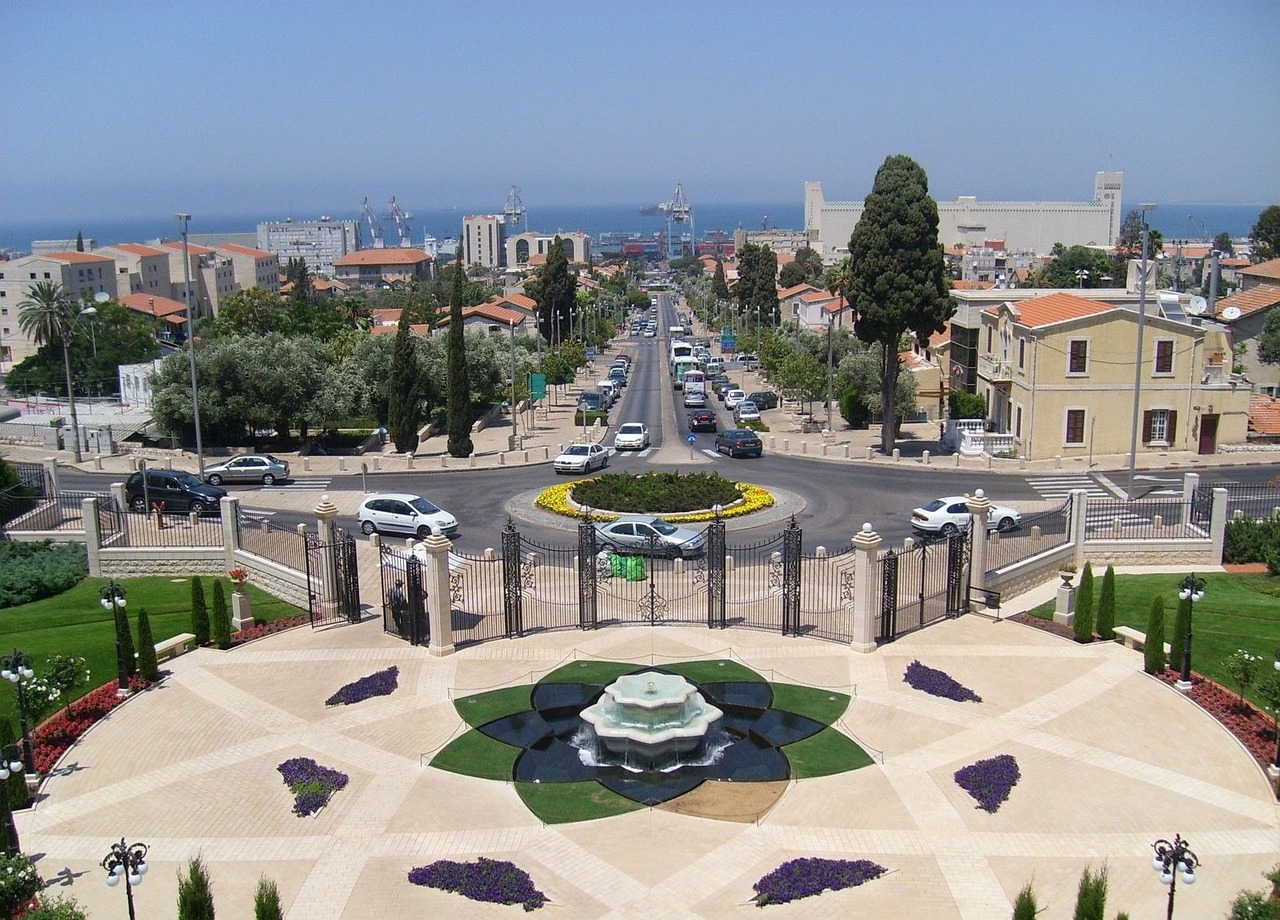
About Haifa
Spilling down from the pine-covered heights of Mount Carmel, Haifa is a city with a vertiginous setting that has led to comparisons with San Francisco. The most striking landmark on the mountainside is the gleaming golden dome of the Baha'i Shrine, set amid utterly beautiful garden terraces. The city is the world center for the Baha'i faith, and its members provide informative walking tours of the flower-edged 100-acre spot, a UNESCO World Heritage Site. At the top of the hill are some small but interesting museums, the larger hotels, and two major universities. At the bottom is the lovingly restored German Colony, a perfect area for strolling.Israel's largest port and third-largest city, Haifa was ruled for four centuries by the Ottomans and gradually spread its tendrils up the mountainside into a cosmopolitan city whose port served the entire Middle East. The climate is gentle, the beaches beautiful, and the locals friendly.You don't see the religious garb of Jerusalem or the tattoos and piercings of Tel Aviv in this diverse but fairly conservative city. In fact, you can't always tell at a glance who is part of an Arab or Jewish Israeli family, or if someone is a more recent immigrant from the former Soviet Union.
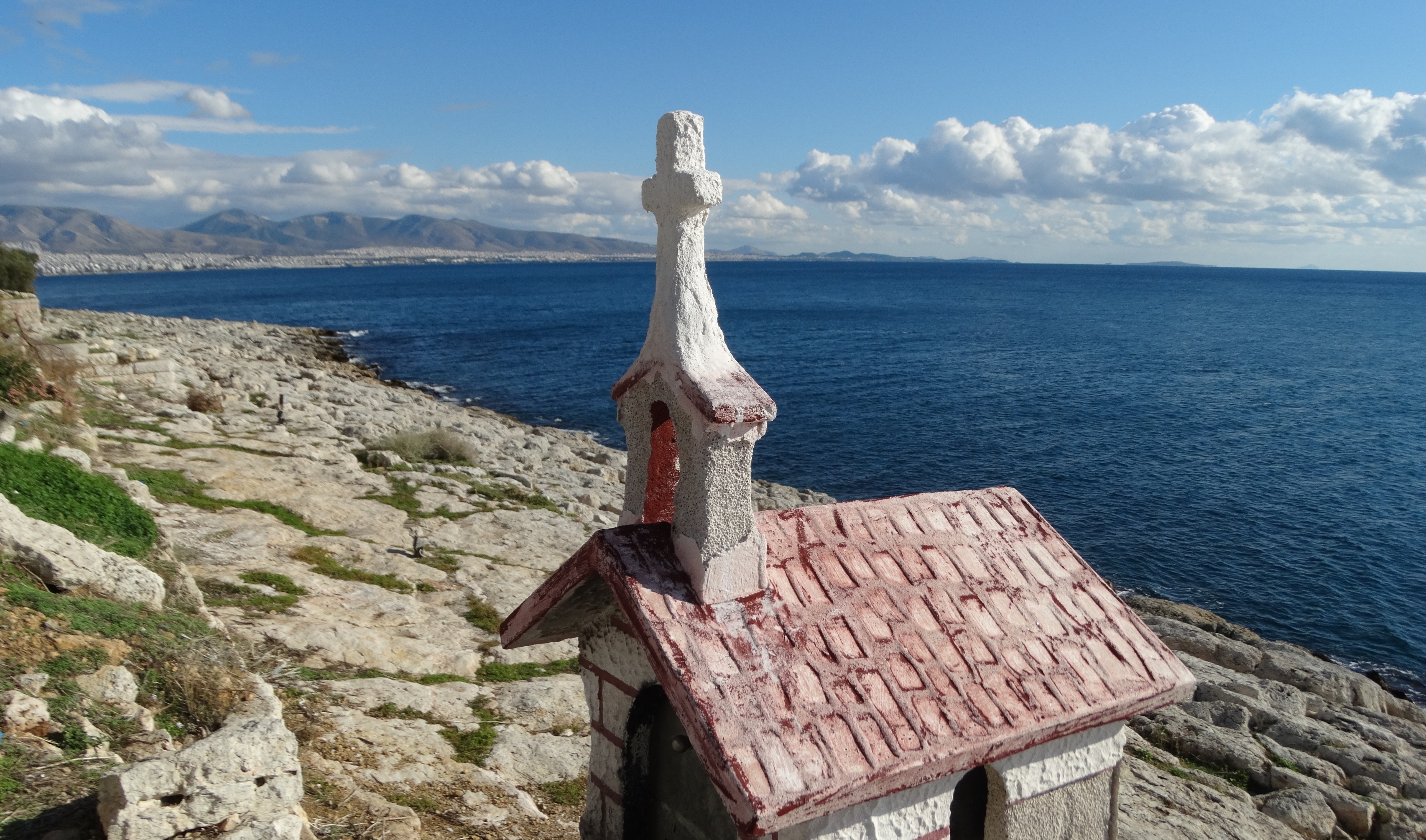
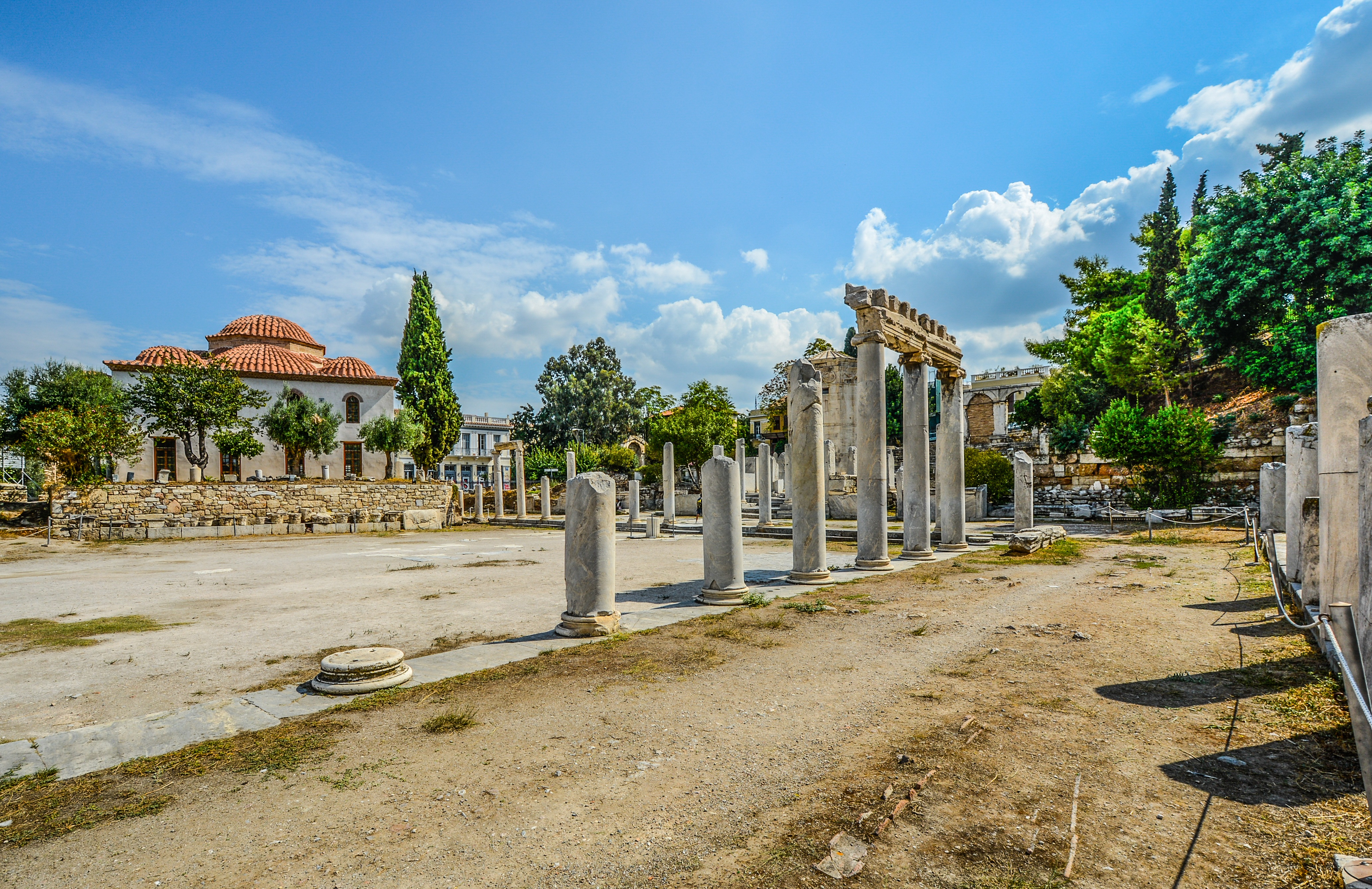
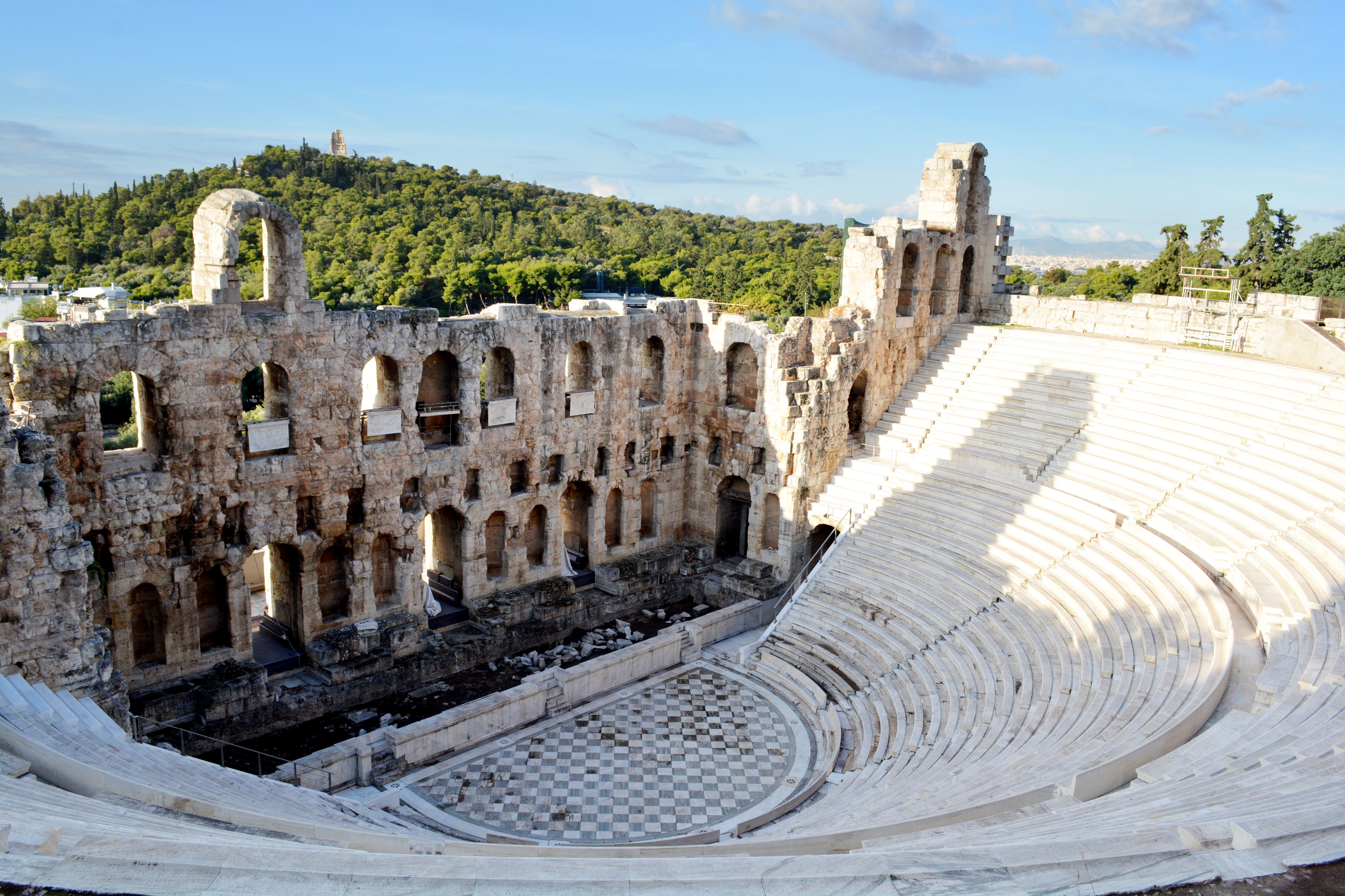
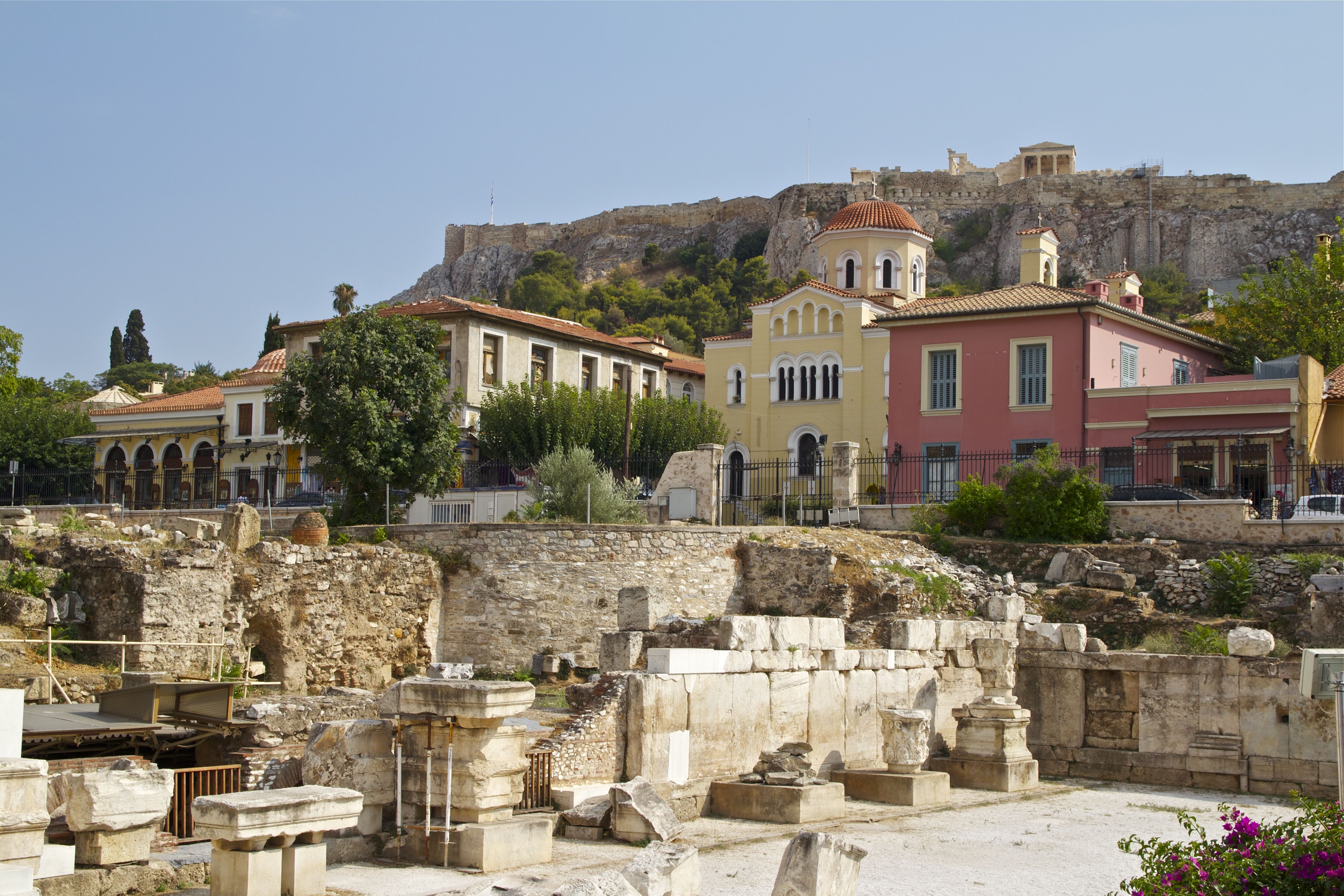
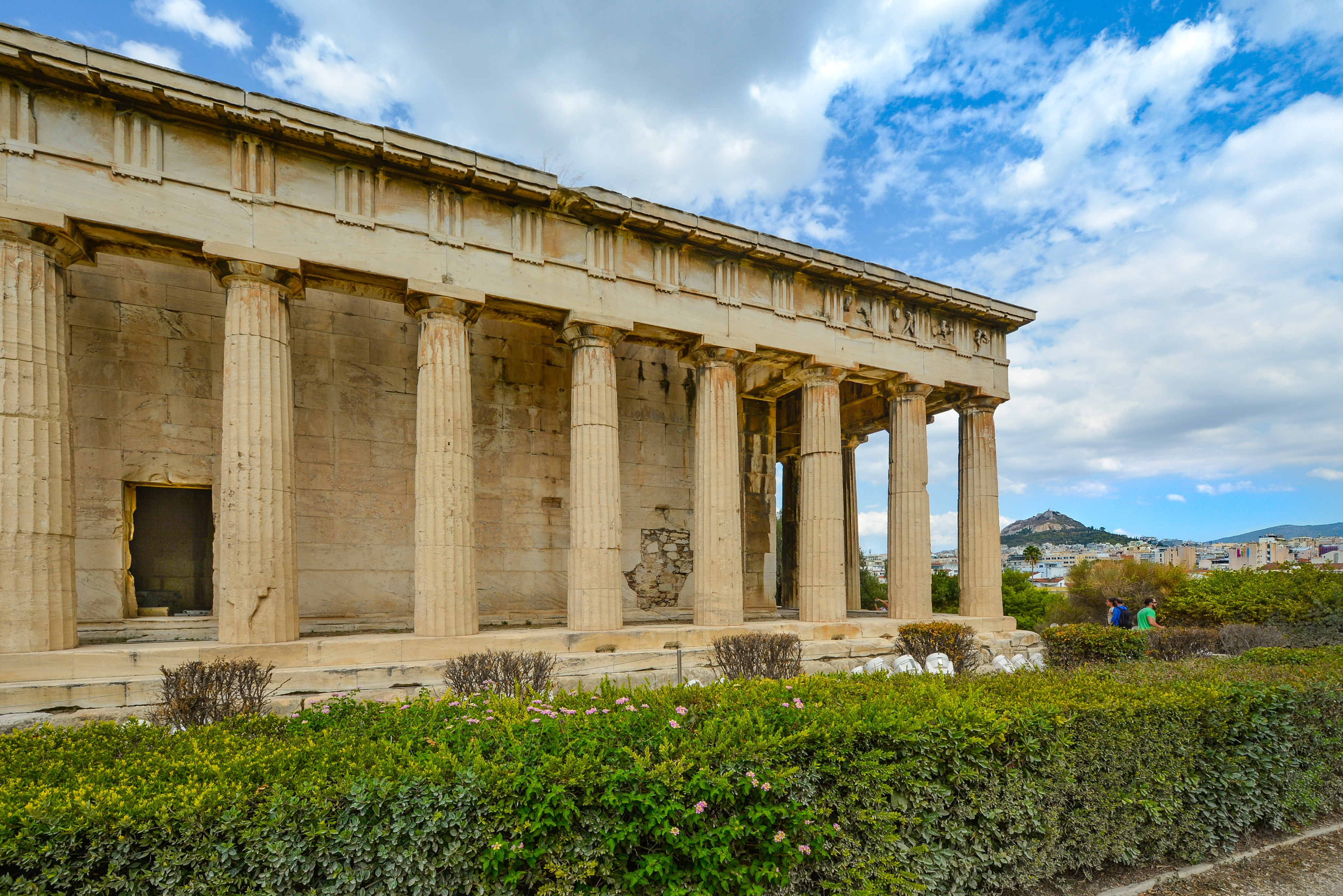
About Piraeus
It's no wonder that all roads lead to the fascinating and maddening metropolis of Athens. Lift your eyes 200 feet above the city to the Parthenon, its honey-color marble columns rising from a massive limestone base, and you behold architectural perfection that has not been surpassed in 2,500 years. But, today, this shrine of classical form dominates a 21st-century boomtown. To experience Athens—Athína in Greek—fully is to understand the essence of Greece: ancient monuments surviving in a sea of cement, startling beauty amid the squalor, tradition juxtaposed with modernity. Locals depend on humor and flexibility to deal with the chaos; you should do the same. The rewards are immense. Although Athens covers a huge area, the major landmarks of the ancient Greek, Roman, and Byzantine periods are close to the modern city center. You can easily walk from the Acropolis to many other key sites, taking time to browse in shops and relax in cafés and tavernas along the way. From many quarters of the city you can glimpse "the glory that was Greece" in the form of the Acropolis looming above the horizon, but only by actually climbing that rocky precipice can you feel the impact of the ancient settlement. The Acropolis and Filopappou, two craggy hills sitting side by side; the ancient Agora (marketplace); and Kerameikos, the first cemetery, form the core of ancient and Roman Athens. Along the Unification of Archaeological Sites promenade, you can follow stone-paved, tree-lined walkways from site to site, undisturbed by traffic. Cars have also been banned or reduced in other streets in the historical center. In the National Archaeological Museum, vast numbers of artifacts illustrate the many millennia of Greek civilization; smaller museums such as the Goulandris Museum of Cycladic Art Museum and the Byzantine and Christian Museum illuminate the history of particular regions or periods. Athens may seem like one huge city, but it is really a conglomeration of neighborhoods with distinctive characters. The Eastern influences that prevailed during the 400-year rule of the Ottoman Empire are still evident in Monastiraki, the bazaar area near the foot of the Acropolis. On the northern slope of the Acropolis, stroll through Plaka (if possible by moonlight), an area of tranquil streets lined with renovated mansions, to get the flavor of the 19th-century's gracious lifestyle. The narrow lanes of Anafiotika, a section of Plaka, thread past tiny churches and small, color-washed houses with wooden upper stories, recalling a Cycladic island village. In this maze of winding streets, vestiges of the older city are everywhere: crumbling stairways lined with festive tavernas; dank cellars filled with wine vats; occasionally a court or diminutive garden, enclosed within high walls and filled with magnolia trees and the flaming trumpet-shaped flowers of hibiscus bushes. Formerly run-down old quarters, such as Thission, Gazi and Psirri, popular nightlife areas filled with bars and mezedopoleia (similar to tapas bars), are now in the process of gentrification, although they still retain much of their original charm, as does the colorful produce and meat market on Athinas. The area around Syntagma Square, the tourist hub, and Omonia Square, the commercial heart of the city about 1 km (½ mi) northwest, is distinctly European, having been designed by the court architects of King Otho, a Bavarian, in the 19th century. The chic shops and bistros of ritzy Kolonaki nestle at the foot of Mt. Lycabettus, Athens's highest hill (909 feet). Each of Athens's outlying suburbs has a distinctive character: in the north is wealthy, tree-lined Kifissia, once a summer resort for aristocratic Athenians, and in the south and southeast lie Glyfada, Voula, and Vouliagmeni, with their sandy beaches, seaside bars, and lively summer nightlife. Just beyond the city's southern fringes is Piraeus, a bustling port city of waterside fish tavernas and Saronic Gulf views.


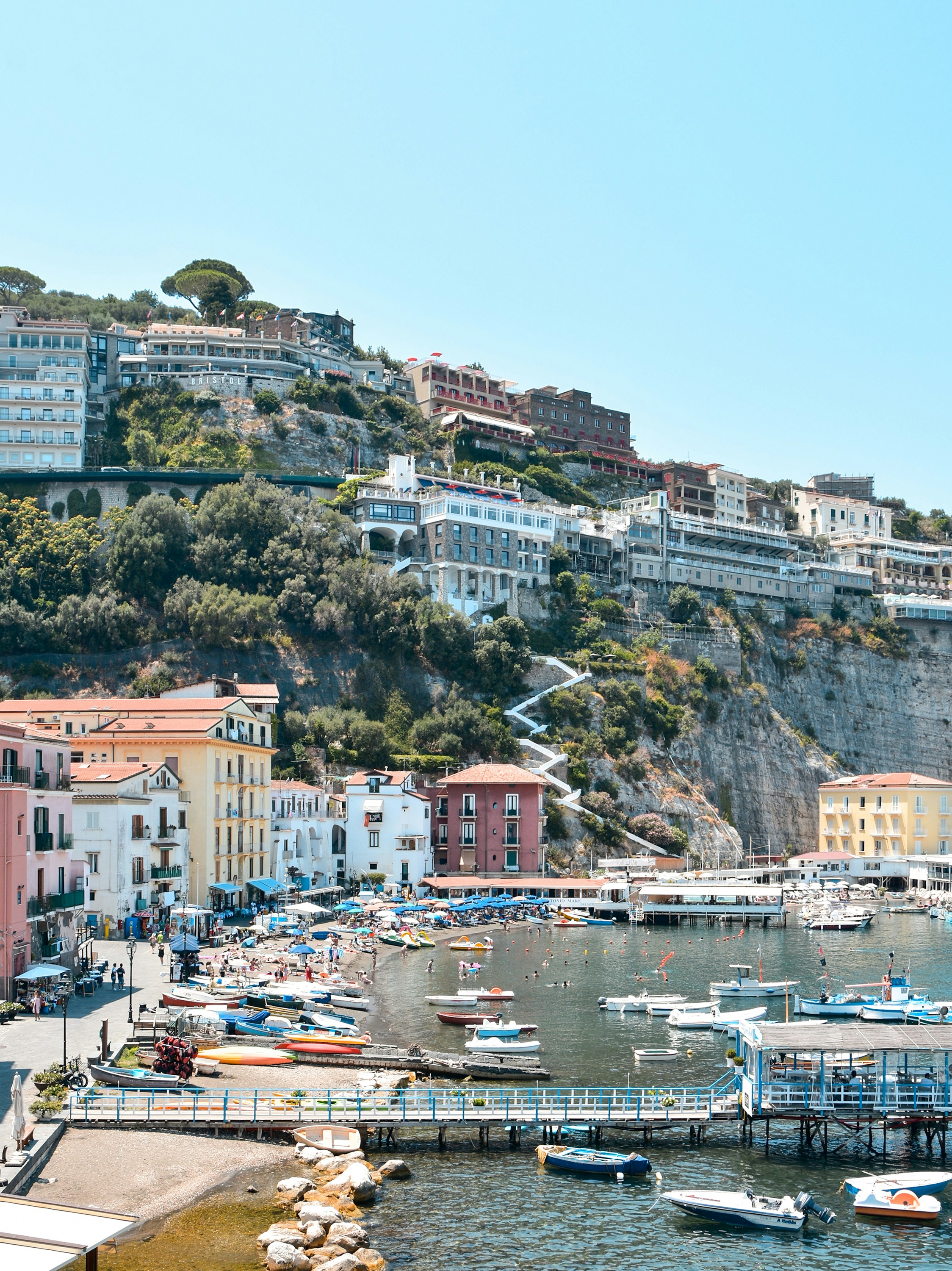
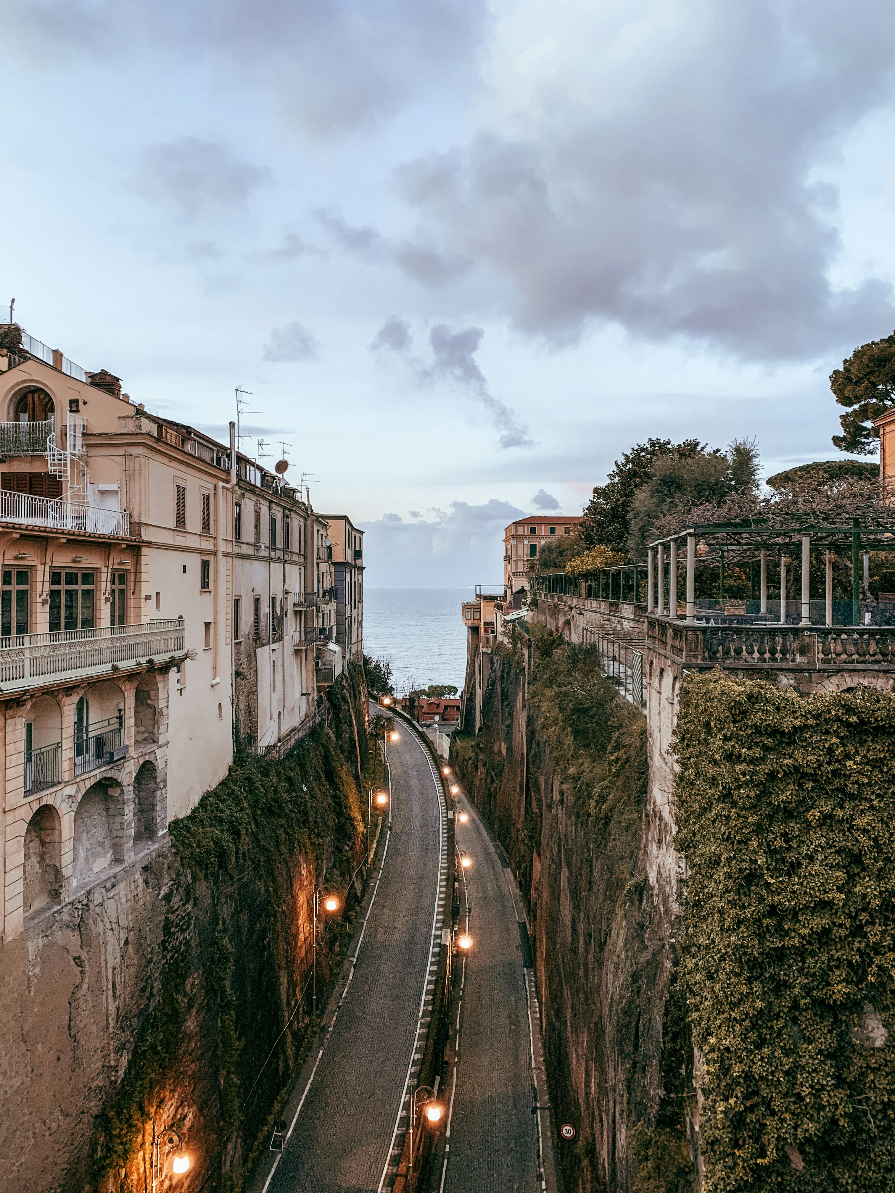
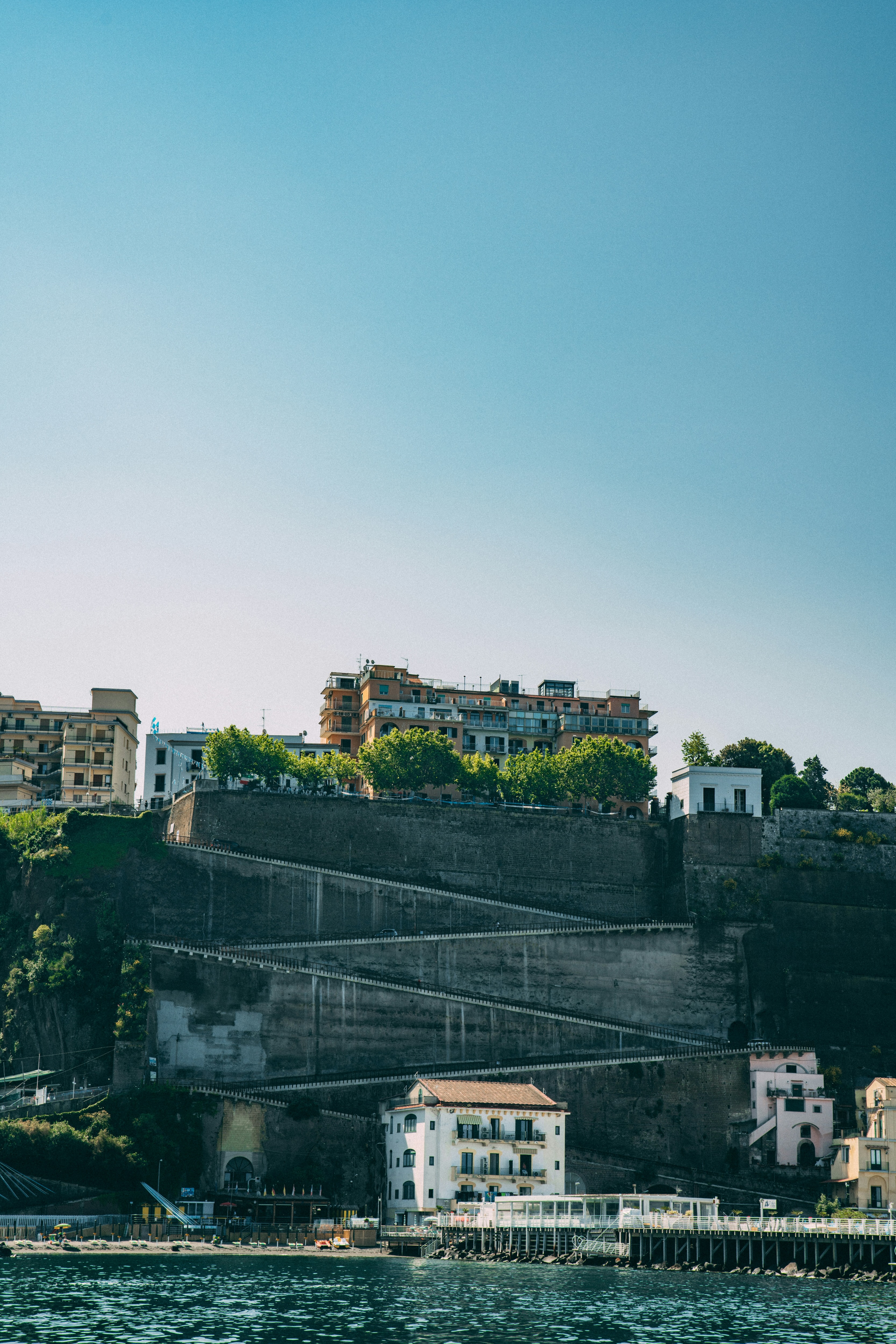
About Sorrento
Sorrento may have become a jumping-off point for visitors to Pompeii, Capri, and Amalfi, but you can find countless reasons to love it for itself. The Sorrentine people are fair-minded and hardworking, bubbling with life and warmth. The tuff cliff on which the town rests is spread over the bay, absorbing sunlight, while orange and lemon trees waft their perfume in spring. Winding along a cliff above a small beach and two harbors, the town is split in two by a narrow ravine formed by a former mountain stream. To the east, dozens of hotels line busy Via Correale along the cliff—many have "grand" included in their names, and some indeed still are. To the west, however, is the historic sector, which still enchants. It's a relatively flat area, with winding, stone-paved lanes bordered by balconied buildings, some joined by medieval stone arches. The central piazza is named after the poet Torquato Tasso, born here in 1544. This part of town is a delightful place to walk through. Craftspeople are often at work in their stalls and shops and are happy to let you watch; in fact, that's the point. Music spots and bars cluster in the side streets near Piazza Tasso.
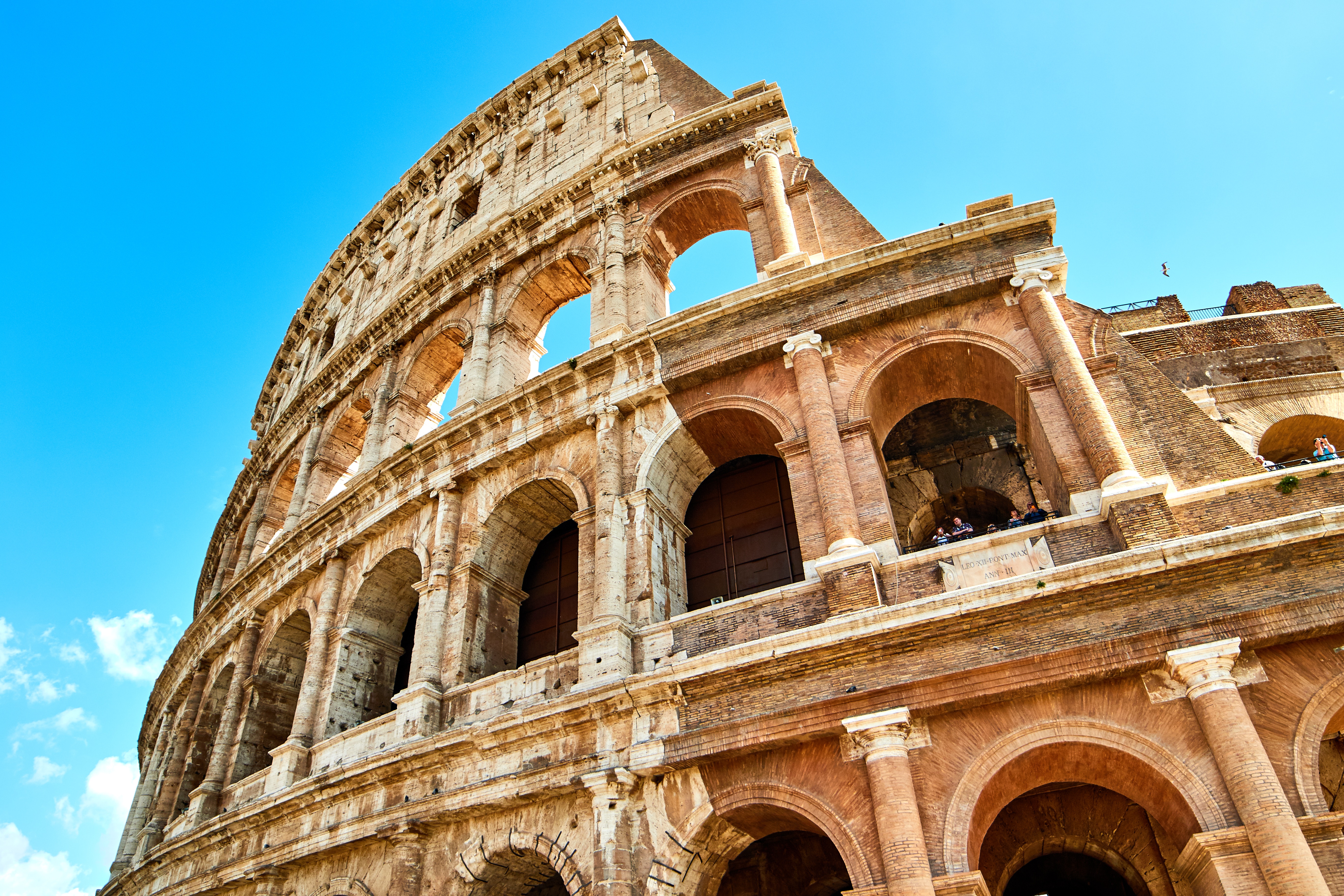
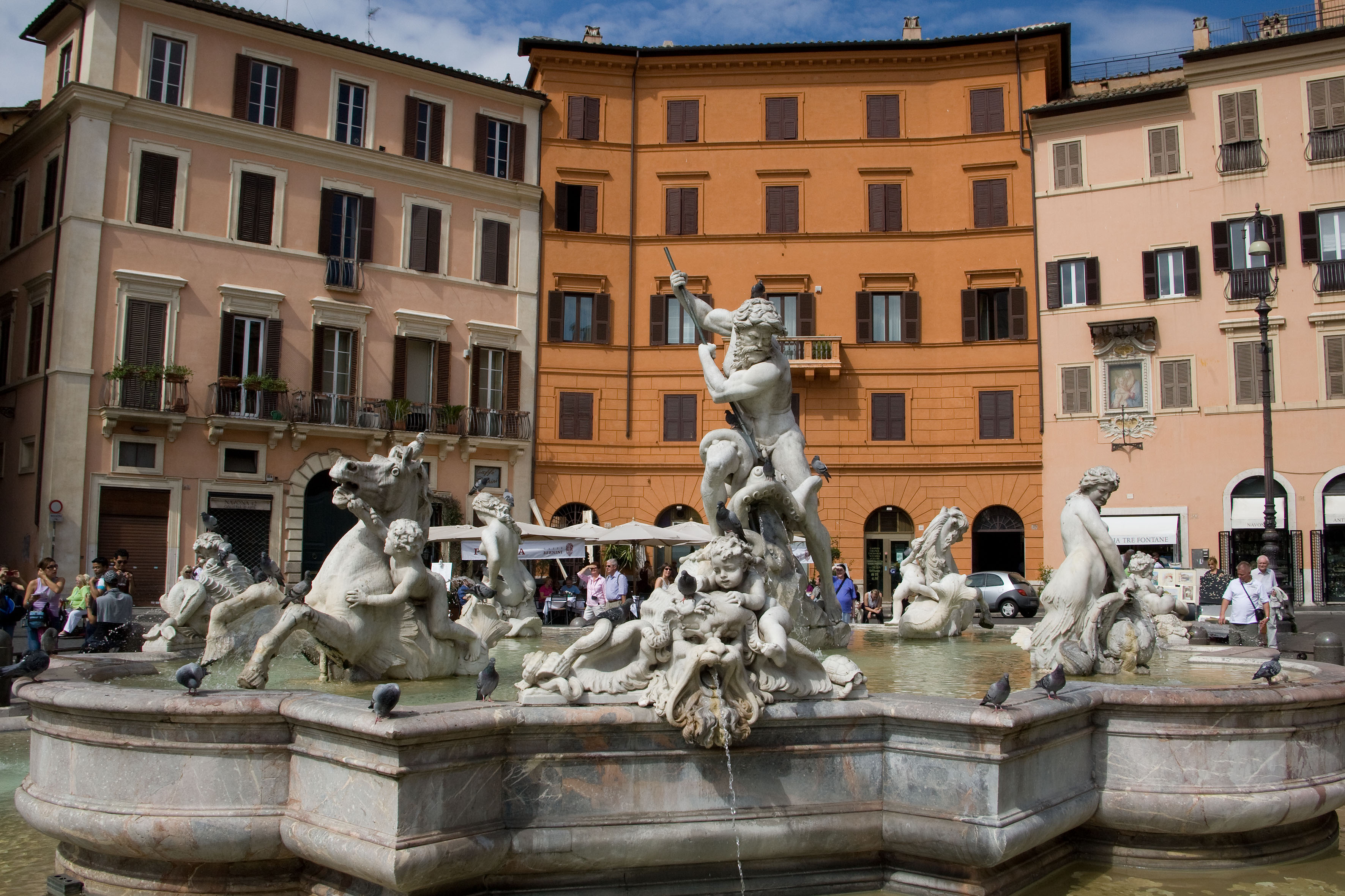
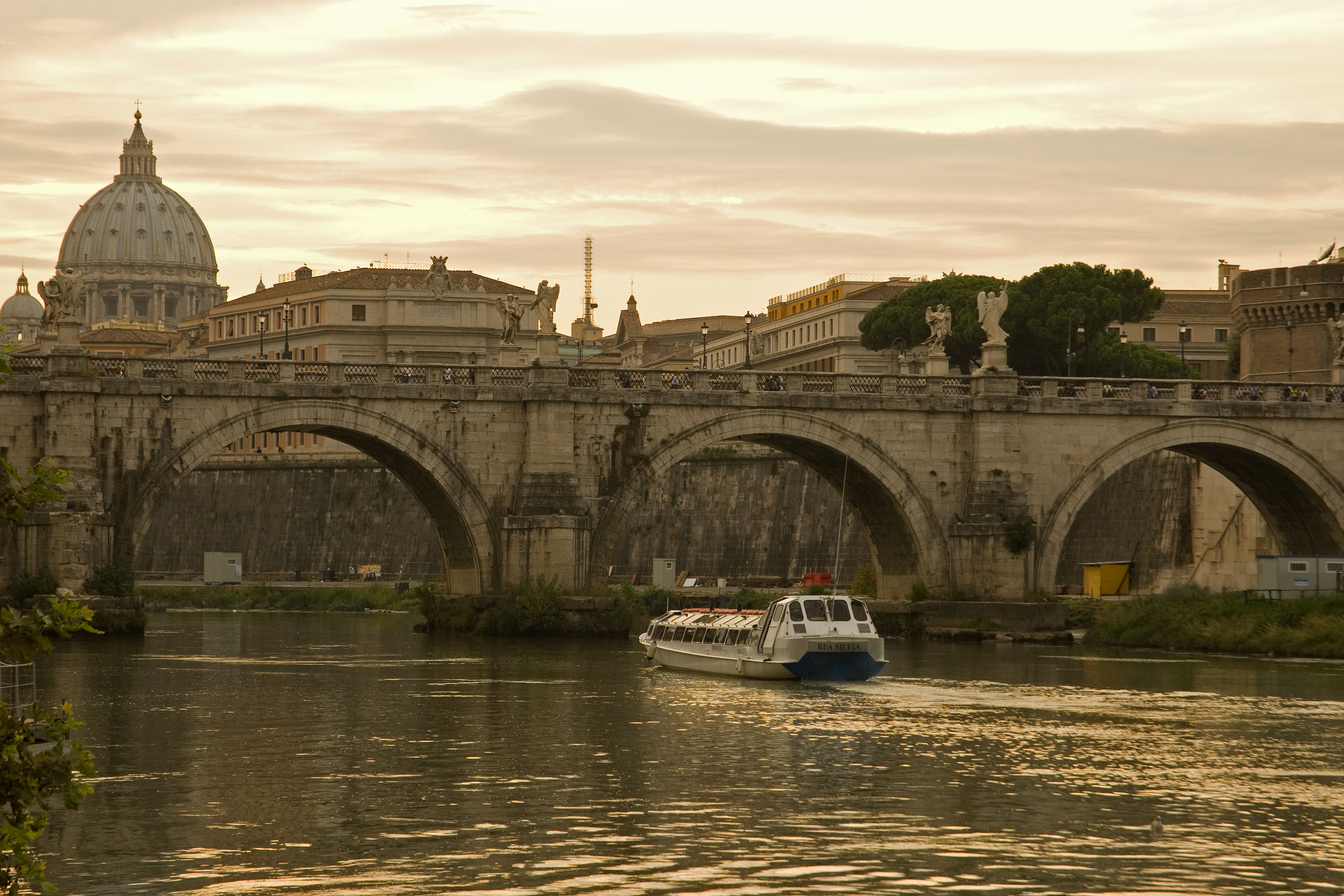
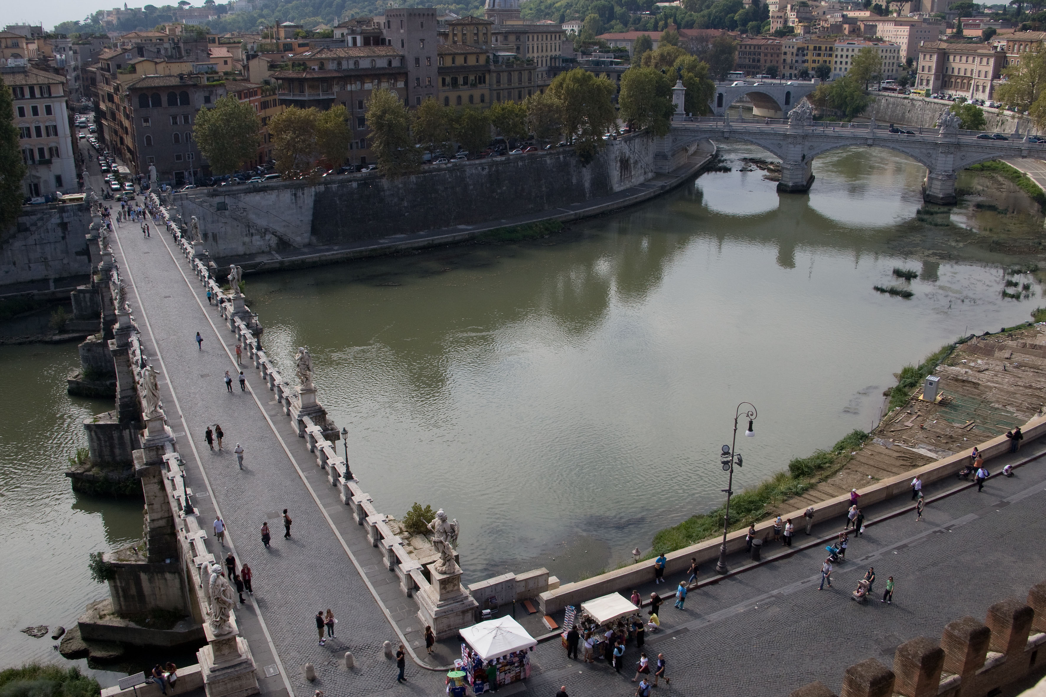
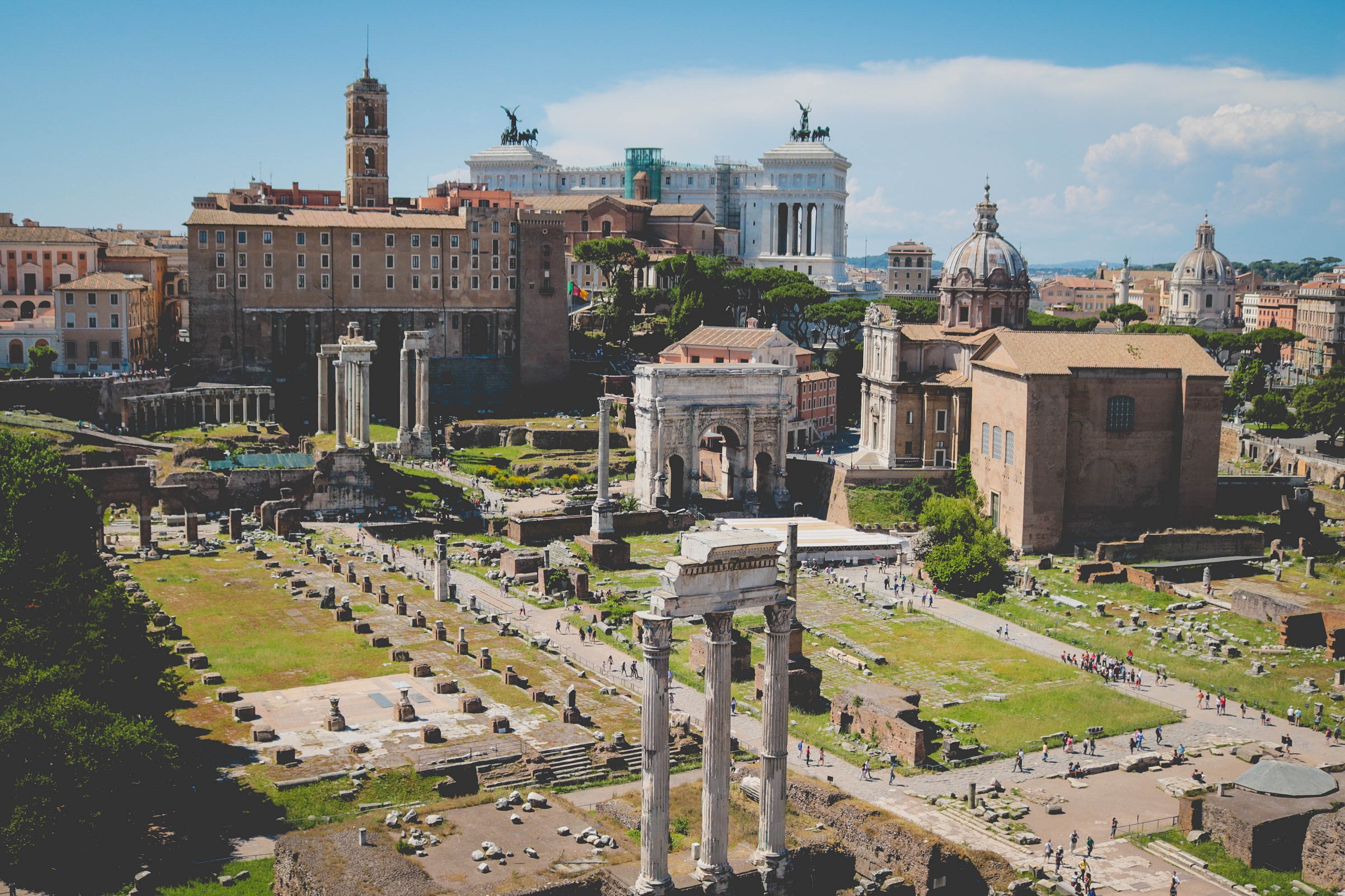
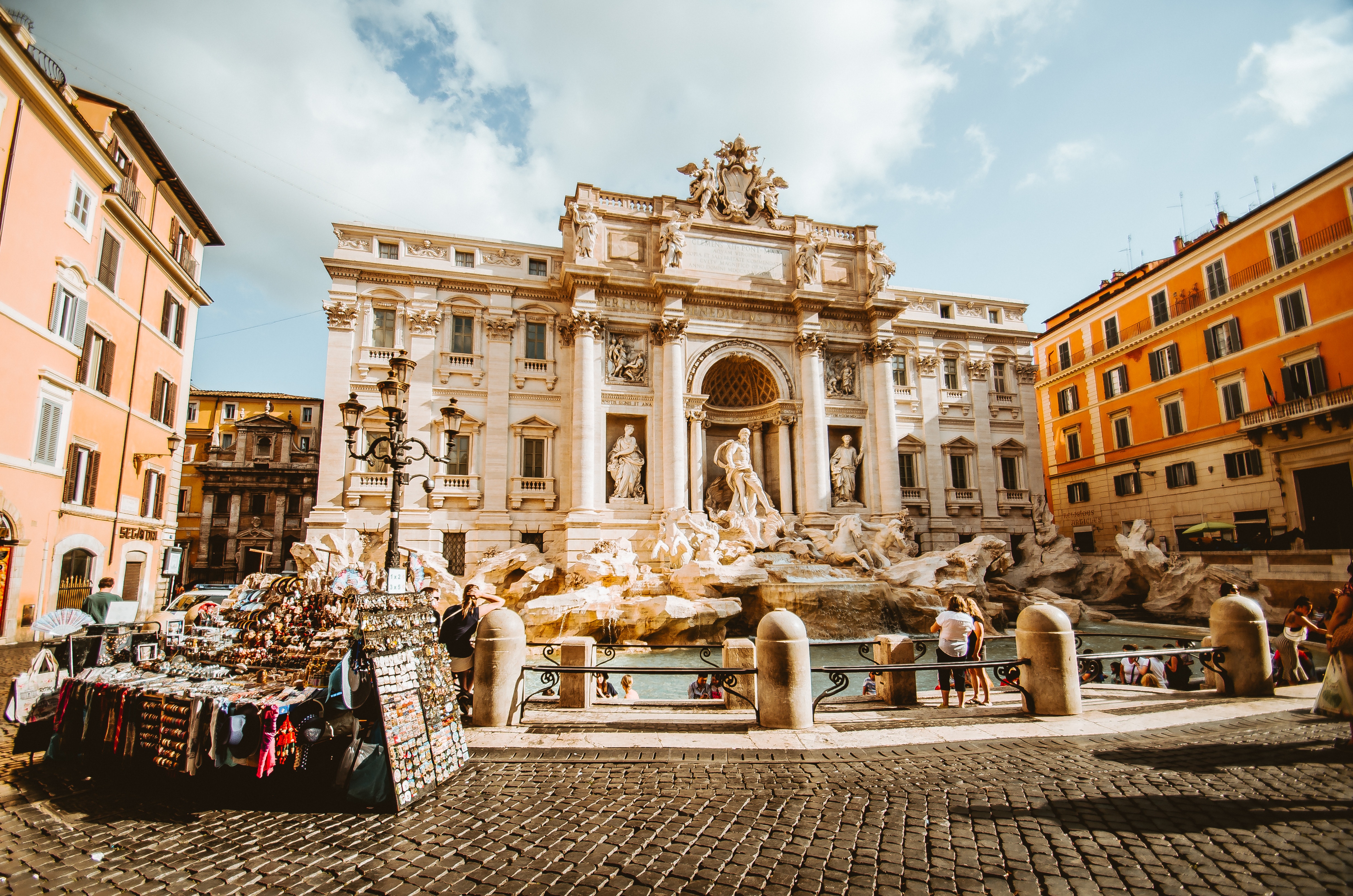
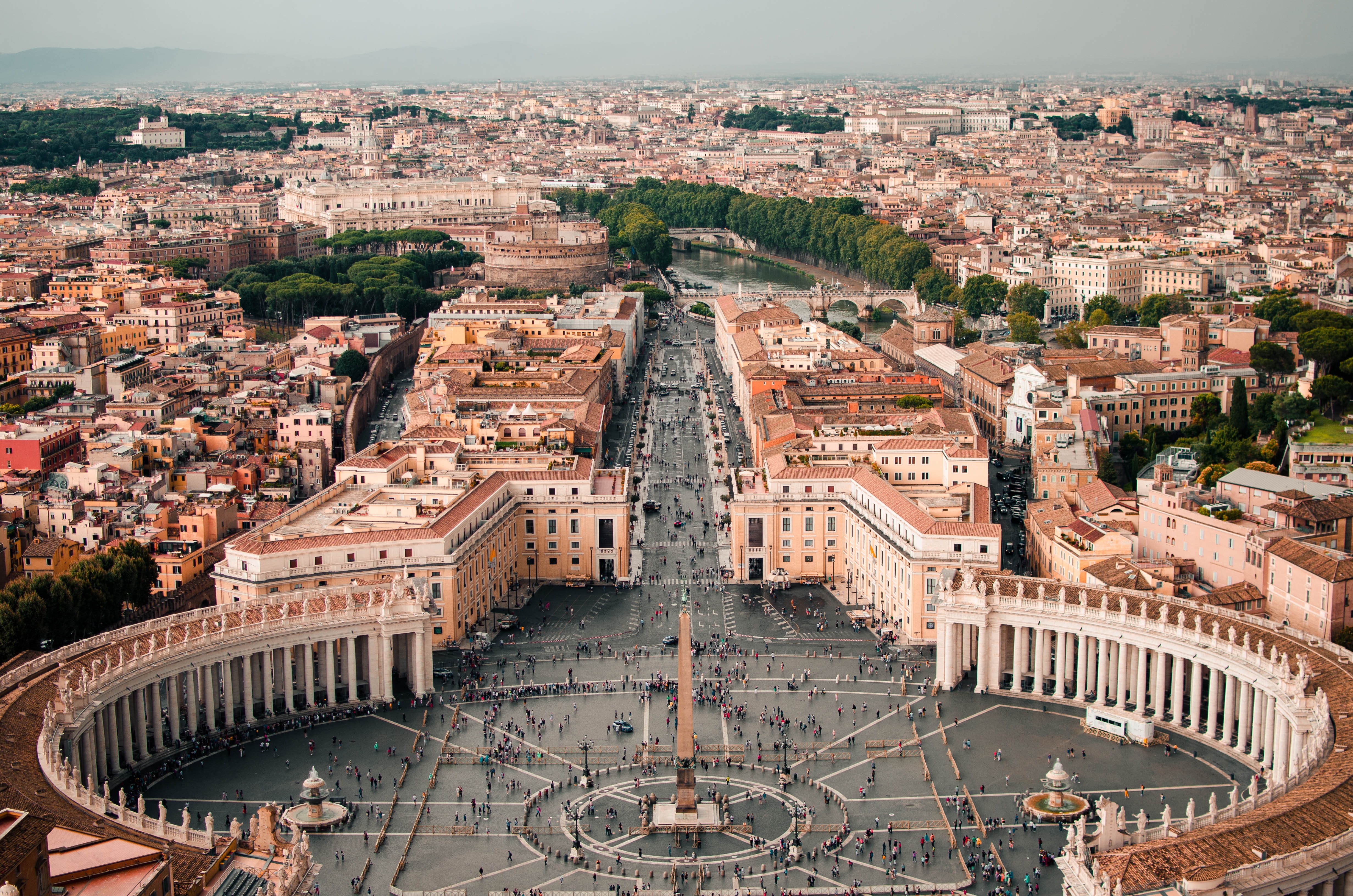
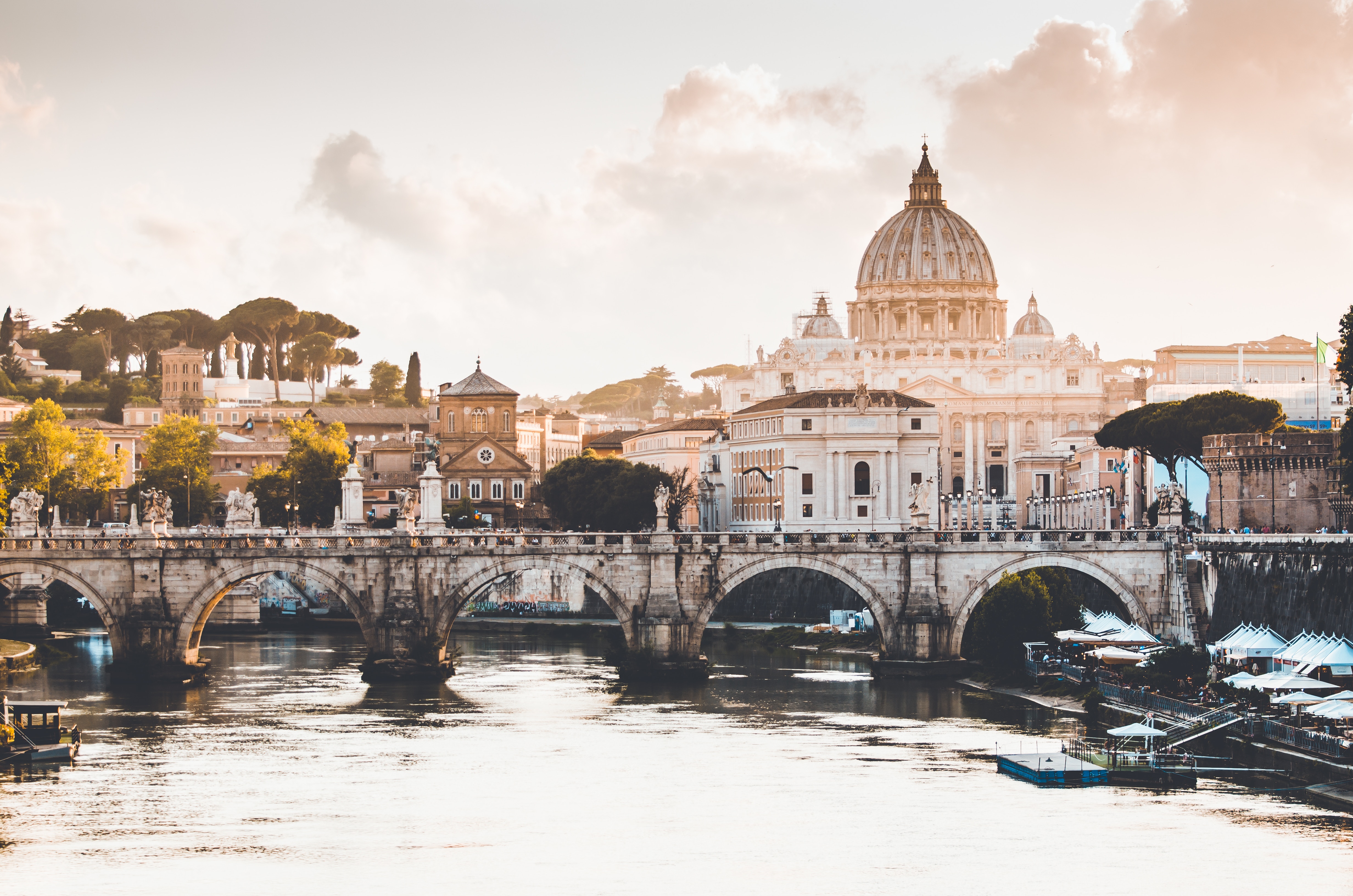
About Civitavecchia
Italy's vibrant capital lives in the present, but no other city on earth evokes its past so powerfully. For over 2,500 years, emperors, popes, artists, and common citizens have left their mark here. Archaeological remains from ancient Rome, art-stuffed churches, and the treasures of Vatican City vie for your attention, but Rome is also a wonderful place to practice the Italian-perfected il dolce far niente, the sweet art of idleness. Your most memorable experiences may include sitting at a caffè in the Campo de' Fiori or strolling in a beguiling piazza.
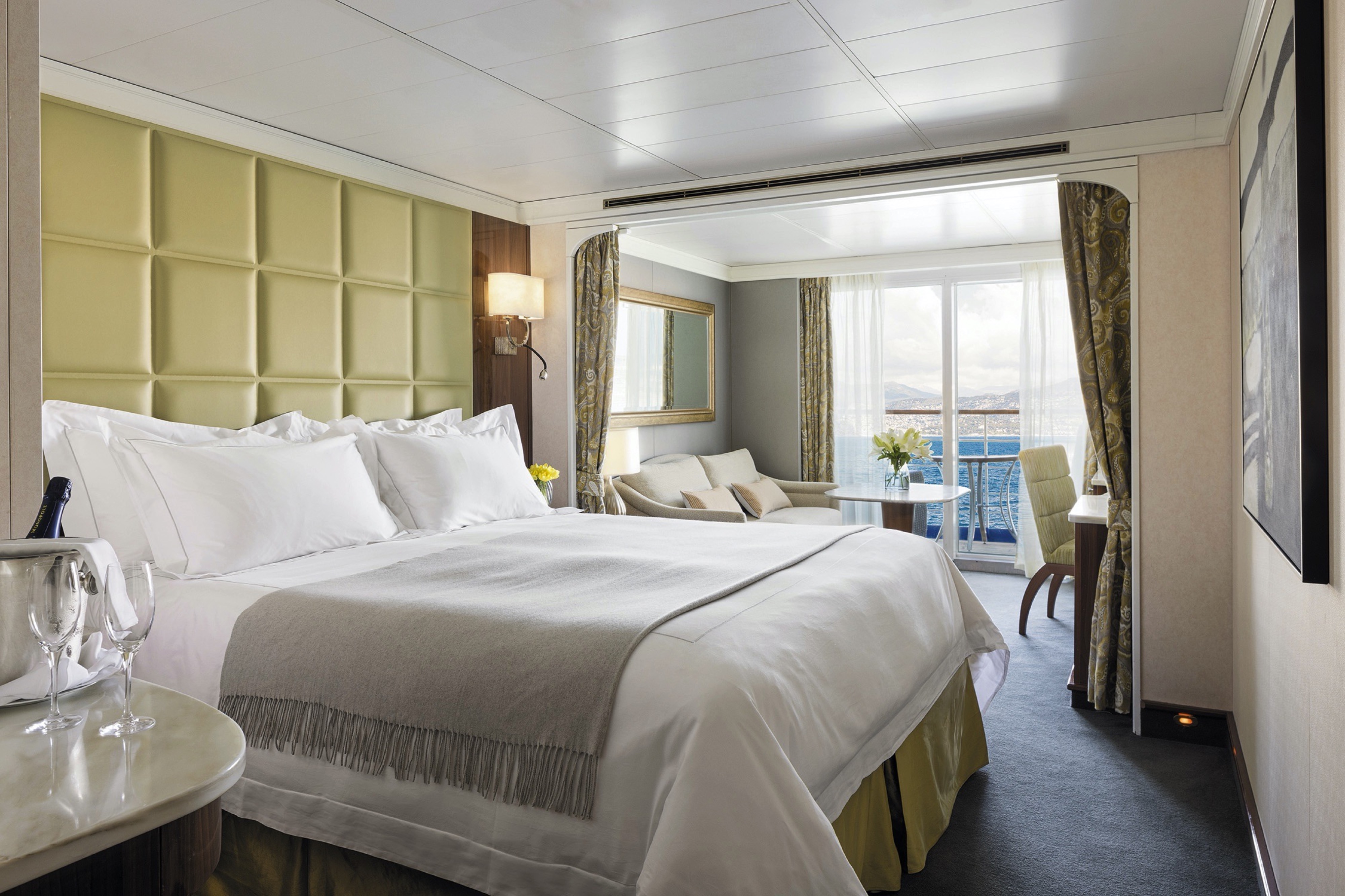
Enter and be enveloped by the sophisticated comfort of rosewood furniture, luxe fabrics and a crystal chandelier. A pair of private balconies make this spacious, elegant suite a natural for entertaining.
You’ll find Park Avenue chic onboard Seven Seas Voyager® in this spectacular suite. Elegant rosewood furniture, luxe fabrics and a crystal chandelier create sophisticated comfort, while a personal butler is available to fulfil whatever requests you may have. With two bedrooms, two-and-a-half baths, a large living room and two private balconies, this sublime suite is perfect for hosting new friends in luxury.
Layout
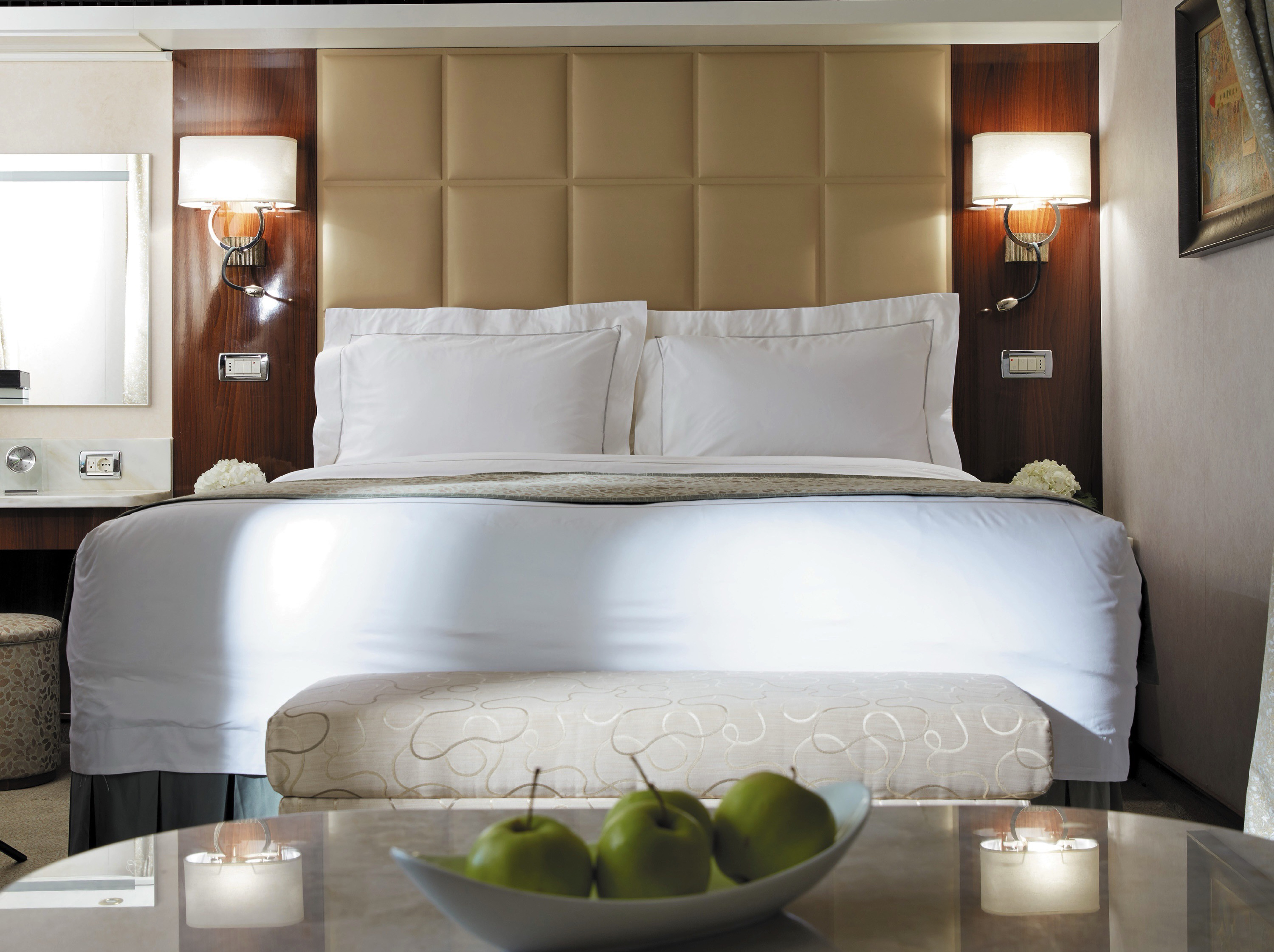
- 2 Spacious Bedroom with a European King-Size Elite Slumber® Bed
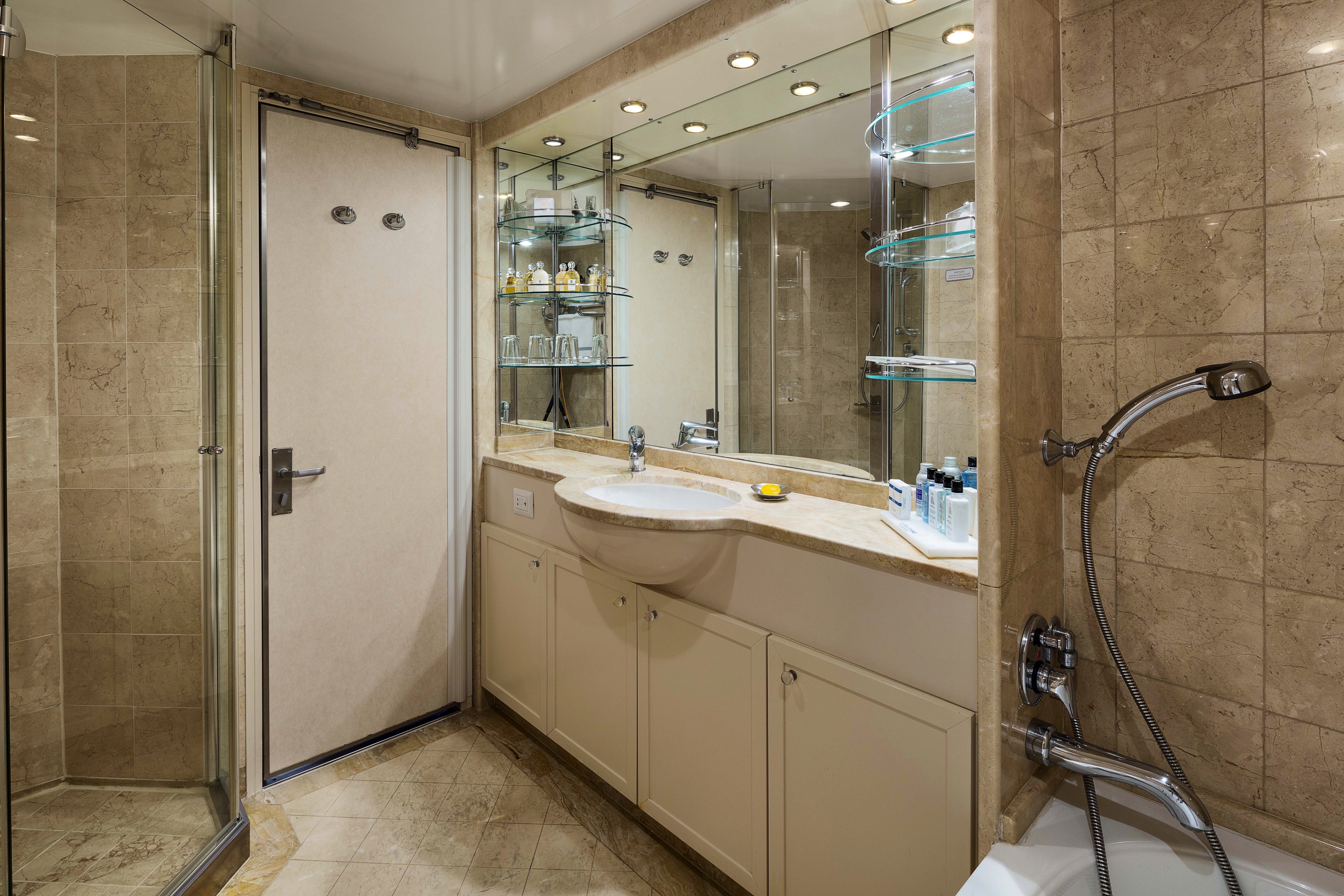
- 2 1/2 Marble & Stone Detailed Bathrooms
- Private Balcony
- Sitting Area
- Walk-In Closet with Safe
- Includes Up To 6 Guests
The suite pictured may differ from the suite booked, as layouts and designs vary by ship, deck, and suite location.
Amenities
1-Night Pre-Cruise: Hotel Package Including:
- - Breakfast
- - Porterage
- Unlimited WiFi* and Streaming Package for up to Four Devices
- Valet Laundry Service
- 24-hour In-Suite Dining
- Fresh Orchid Arrangement
- Regent Plush Bathrobe & Slippers
- Interactive Flat-Screen Television & Direct-Dial Satellite Phone
- Priority Access to Online Shore Excursion Reservations
- Priority Access to Online Dining Reservations
- Binoculars
- illy® Espresso Maker
- Cashmere Blankets
- Regent Special Gift
- Vanity & Hair Dryer
- Shoe Shine Service
Additional Discounts:
- - 10% Discount on Ultra Premium Wine and Liquor
- - 5% Savings on Pre- or Post-Cruise Hotel or Land Programs
- - 5% Savings on Regent Choice Shore Excursions
Additional Signature Suite Amenities:
- Guaranteed Reservation Each Night in Specialty Restaurant of Your Choice
- Welcome Letter from the President and General Manager
- Personal Butler for an Elevated In-suite Experience
- - In-Suite Dining Menu Including Specialty Restaurant Selections During Dining Hours
- Priority Boarding on Embarkation Day with Suite Access at Noon
- Welcome Bottle of Premium Champagne
- Personalized In-Suite Full-Liquor Bar Set-Up
- A Sumptuous In-Suite Caviar Service Once During Cruises
- Complimentary In-Suite Cocktail Party for 8
- Complimentary 25-Minute Personal Fitness Session at the Serene Spa & Wellness™ Fitness Center
- Onboard Press Reader App Access
- Daily Canapés
- Tea Forté Set-Up
- Luxe Fruit Arrangement with Chocolate Leonidas
- Luxurious Designer Bath Amenities & Men's Unscented Shaving Kit
- Hairdryer
- Selection of Fig & Tea Leaves Bath Salts
- Bath Scale Setup
- Bose® SoundLink Mini II Bluetooth Speaker
- Selection of Bed Pillow Styles
- Complimentary Garment Pressing on First Night
- Personalized Stationery upon request
- Elegant Weather Clock
- Excursion Bag
This immense suite features a living area with a couch and two comfortable chairs, a full dining table, writing table, even a leather chaise lounge beside a jacuzzi in a bedroom alcove. Simply spectacular accommodation.
A suite so large it has two entrances, this suite delights the senses with rich mosaics, exotic woods and luxurious touches. A living area with a couch and two comfortable chairs, a full dining table and large writing table make you feel right at home. A large private balcony lets you welcome friends for a quiet dinner, and a personal butler helps make life at sea a breeze.
Layout
1 Spacious Bedroom with a European King-Size Elite Slumber® Bed
- 1 1/2 Marble & Stone Detailed Bathrooms
- Private Balcony
- Sitting Area
- Walk-In Closet with Safe
- Accommodates Up To 3 Guests
The suite pictured may differ from the suite booked, as layouts and designs vary by ship, deck, and suite location.
Amenities
- 1-Night Pre-Cruise: Hotel Package Including:
- - Breakfast
- - Porterage
- Unlimited WiFi* Includes up to Four Logins, Four Devices, per Suite
- Valet Laundry Service
- 24-hour In-Suite Dining
- Fresh Orchid Arrangement
- Regent Plush Bathrobe & Slippers
- Interactive Flat-Screen Television & Direct-Dial Satellite Phone
- Priority Access to Online Shore Excursion Reservations
- Priority Access to Online Dining Reservations
- Binoculars
- illy® Espresso Maker
- Cashmere Blankets
- Regent Special Gift
- Vanity & Hair Dryer
- Shoe Shine Service
Additional Discounts:
- - 10% Discount on Ultra Premium Wine and Liquor
- - 5% Savings on Pre- or Post-Cruise Hotel or Land Programs
- - 5% Savings on Regent Choice Shore Excursions
Additional Grand Suite Amenities:
- Guaranteed Reservation Each Night in Specialty Restaurant of Your Choice
- Welcome Letter from the President and General Manager
- Personal Butler for an Elevated In-suite Experience
- - In-Suite Dining Menu Including Specialty Restaurant Selections During Dining Hours
- Priority Boarding on Embarkation Day with Suite Access at Noon
- Welcome Bottle of Premium Champagne
- Personalized In-Suite Full-Liquor Bar Set-Up
- A Sumptuous In-Suite Caviar Service Once During Cruises
- Complimentary In-Suite Cocktail Party for 8
- Complimentary 25-Minute Personal Fitness Session at the Serene Spa & Wellness™ Fitness Center
- Onboard Press Reader App Access
- Daily Canapés
- Tea Forté Set-Up
- Luxe Fruit Arrangement with Chocolate Leonidas
- Luxurious Designer Bath Amenities & Men's Unscented Shaving Kit
- Hairdryer
- Selection of Fig & Tea Leaves Bath Salts
- Bath Scale Setup
- Bose® SoundLink Mini II Bluetooth Speaker
- Selection of Bed Pillow Styles
- Complimentary Garment Pressing on First Night
- Personalized Stationery upon request
- Elegant Weather Clock
- Excursion Bag
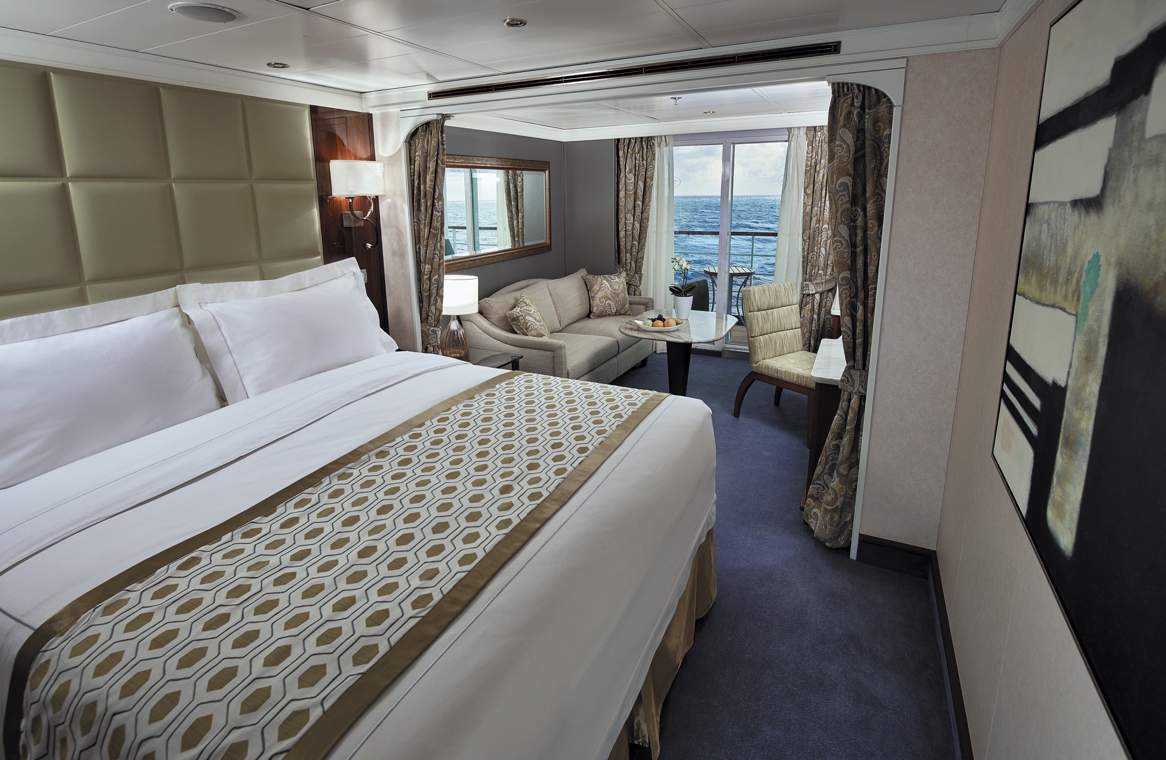
You enter this suite via a hallway that opens up to an elegant and spacious living area. Your private balcony awaits exploration outside and a bedroom with a dreamy décor is as soothing as a sunlit meadow.
Treat yourself to the welcoming luxury of a suite where elegance and comfort beckon in every nook. Open the sliding doors to your private balcony and inhale the fresh sea air. Enjoy your morning coffee at a cozy dining table or put your feet up in a soothing living room. Call on the services of a personal butler to assist with any needs and ensure that each moment of your journey exceeds your expectations.
Layout
1 Spacious Bedroom with a European King-Size Elite Slumber® Bed
- 1 1/2 Marble & Stone Detailed Bathrooms
- Private Balcony
- Sitting Area
- Walk-In Closet with Safe
- Accommodates Up To 4 Guests
The suite pictured may differ from the suite booked, as layouts and designs vary by ship, deck, and suite location.
Amenities
- 1-Night Pre-Cruise: Hotel Package Including:
- - Breakfast
- - Porterage
- Unlimited WiFi* Includes up to Four Logins, Four Devices, per Suite
- Valet Laundry Service
- 24-hour In-Suite Dining
- Fresh Orchid Arrangement
- Regent Plush Bathrobe & Slippers
- Interactive Flat-Screen Television & Direct-Dial Satellite Phone
- Priority Access to Online Shore Excursion Reservations
- Priority Access to Online Dining Reservations
- Binoculars
- illy® Espresso Maker
- Cashmere Blankets
- Regent Special Gift
- Vanity & Hair Dryer
- Shoe Shine Service
Additional Discounts:
- - 10% Discount on Ultra Premium Wine and Liquor
- - 5% Savings on Pre- or Post-Cruise Hotel or Land Programs
- - 5% Savings on Regent Choice Shore Excursions
Additional Voyager Suite Amenities:
- Welcome Letter from the President and General Manager
- Personal Butler for an Elevated In-suite Experience
- - In-Suite Dining from Compass Rose
- Priority Boarding on Embarkation Day with Suite Access at 1pm
- Welcome Bottle of Premium Champagne
- Personalized In-Suite Full-Liquor Bar Set-Up
- A Sumptuous In-Suite Caviar Service Once During Cruises
- Daily Canapés
- Luxe Fruit Arrangement
- Luxurious Designer Bath Amenities & Men's Unscented Shaving Kit
- Selection of Fig & Tea Leaves Bath Salts
- Bath Scale Setup
- Bose® SoundLink Mini II Bluetooth Speaker
- Selection of Bed Pillow Styles
- Complimentary Garment Pressing on First Night
- Personalized Stationery upon request
- Elegant Weather Clock
Take it all in — the gorgeous artwork, a writing desk, wraparound couch, dining table — and settle into your home on the high seas. Step out onto your private balcony, a glass of Champagne in hand, and savor the moment.
This suite is decorated with soothing colors, pleasing artwork and comfortable furnishings. Relax in the sitting area after an exciting day ashore and enjoy the selection of fresh canapés delivered by your personal butler. Then retreat to your private balcony to watch the ever-changing vistas. In your glistening bathroom, marvel at the assortment of luxury bath soaps and shampoos as you ponder whether to use your tub or walk-in shower.
Layout
1 Spacious Bedroom with a European King-Size Elite Slumber® Bed
- 1 Marble & Stone Detailed Bathroom
- Private Balcony
- Sitting Area
- Walk-In Closet with Safe
- Accommodates Up To 3 Guests
The suite pictured may differ from the suite booked, as layouts and designs vary by ship, deck, and suite location.
Amenities
1-Night Pre-Cruise: Hotel Package Including:
- - Breakfast
- - Porterage
- Unlimited WiFi* Includes up to Four Logins, Four Devices, per Suite
- Valet Laundry Service
- Customizable In-Suite Mini Bar Replenished Daily with Your Preferences
- 24-hour In-Suite Dining
- Fresh Orchid Arrangement
- Regent Plush Bathrobe & Slippers
- Interactive Flat-Screen Television & Direct-Dial Satellite Phone
- Priority Access to Online Shore Excursion Reservations
- Priority Access to Online Dining Reservations
- Binoculars
- illy® Espresso Maker
- Cashmere Blankets
- Regent Special Gift
- Vanity & Hair Dryer
- Shoe Shine Service
Additional Discounts:
- - 10% Discount on Ultra Premium Wine and Liquor
- - 5% Savings on Pre- or Post-Cruise Hotel or Land Programs
- - 5% Savings on Regent Choice Shore Excursions
Additional Seven Seas Suites Amenities:
- Personal Butler for an Elevated In-suite Experience
- - In-Suite Dining from Compass Rose
- Priority Boarding on Embarkation Day with Suite Access at 1pm
- Daily Canapés
- Luxe Fruit Arrangement
- Luxurious Designer Bath Amenities & Men's Unscented Shaving Kit
- Selection of Fig & Tea Leaves Bath Salts
- Bose® SoundLink Mini II Bluetooth Speaker
- Selection of Bed Pillow Styles
- Complimentary Garment Pressing on First Night
- Personalized Stationery upon request
- Elegant Weather Clock
With plush sofas in an inviting living area, high-count bed linens on a king-sized bed, luxe recliners on your private balcony and lavish bath products in your marble bathroom, this suite will coddle you in comfort and style.
The luxurious suite has been carefully designed to maximize space and comfort. Relax on your private balcony and indulge in your lavish bath amenities as you recharge and ready yourself for new adventures in the next port of call. This suite also includes priority online reservations for shore excursions and dining, and you’re encouraged to call on the services of a personal butler for special requests.
Layout
- Private Balcony
- Sitting Area
- Marble & Stone Detailed Bathroom
- European King-Size Elite Slumber® Bed
- Walk-In Closet with Safe
- Accommodates Up To 3 Guests
- This category includes Accessibility Options in suites 859 and 860. For more information about accessible suites click here.
The suite pictured may differ from the suite booked, as layouts and designs vary by ship, deck, and suite location.
Amenities
- 1-Night Pre-Cruise: Hotel Package Including:- Ground Transfers- Breakfast- Porterage
- Unlimited WiFi Includes up to Four Logins, Four Devices, per Suite
- Valet Laundry Service
- Customizable In-Suite Mini Bar Replenished Daily with Your Preferences
- Welcome Bottle of Champagne & Fresh Fruit
- 24-hour In-Suite Dining
- Fresh Orchid Arrangement
- L'Occitane® Jasmin & Bergamot Bath Amenities
- Regent Plush Bathrobe & Slippers
- Interactive Flat-Screen Television & Direct-Dial Satellite Phone
- Priority Access to Online Shore Excursion Reservations
- Priority Access to Online Dining Reservations
- Binoculars
- illy® Espresso Maker
- Cashmere Blankets
- Regent Special Gift
- Vanity & Hair Dryer
- Shoe Shine Service
Additional Discounts:
- 10% Discount on Ultra Premium Wine and Liquor
- 5% Savings on Pre- or Post-Cruise Hotel or Land Programs
- 5% Savings on Regent Choice Shore Excursions
Additional Penthouse Suite Amenities:
- Personal Butler for an Elevated In-suite Experience- In-Suite Dining from Compass Rose
- Daily Canapés
- Luxurious Designer Bath Amenities & Men's Unscented Shaving Kit
- Guerlain Bath Amenities & Men's Unscented Shaving Kit
- Bose® SoundLink Mini II Bluetooth Speaker
- Selection of Bed Pillow Styles
- Complimentary Garment Pressing on First Night
- Personalized Stationery upon request

Step out onto your private balcony with a freshly made cup of coffee and take in the grandeur of ocean travel. This suite is packed with stylish comfort, including a king-sized bed, walk-in closet and 24-hour room service.
In this superbly designed suite, you enjoy the comfort of richly furnished accommodations as well as exclusive luxuries available only in suites at the Concierge level and higher. Your suite includes amenities such as an illy® espresso maker and cashmere blankets, perfect for use in the morning when you wish to sip coffee and enjoy an in-suite breakfast on your private balcony. Take advantage of 24-hour room service when the mood strikes.
Layout
- Private Balcony
- Sitting Area
- Marble & Stone Detailed Bathroom
- European King-Size Elite Slumber® Bed
- Walk-In Closet with Safe
- Accommodates Up To 3 Guests
- This category includes Accessibility Options in suites 761 and 862. For more information about accessible suites click here.
The suite pictured may differ from the suite booked, as layouts and designs vary by ship, deck, and suite location.
Amenities
- 1-Night Pre-Cruise: Hotel Package Including:- Ground Transfers- Breakfast- Porterage
- Unlimited WiFi Includes up to Four Logins, Four Devices, per Suite
- Valet Laundry Service
- Customizable In-Suite Mini Bar Replenished Daily with Your Preferences
- Welcome Bottle of Champagne & Fresh Fruit
- 24-hour In-Suite Dining
- Fresh Orchid Arrangement
- L'Occitane® Jasmin & Bergamot Bath Amenities
- Regent Plush Bathrobe & Slippers
- Interactive Flat-Screen Television & Direct-Dial Satellite Phone
- Priority Access to Online Shore Excursion Reservations
- Priority Access to Online Dining Reservations
- Binoculars
- illy® Espresso Maker
- Cashmere Blankets
- Regent Special Gift
- Vanity & Hair Dryer
- Shoe Shine Service
Additional Discounts:
- - 10% Discount on Ultra Premium Wine and Liquor
- - 5% Savings on Pre- or Post-Cruise Hotel or Land Programs
- - 5% Savings on Regent Choice Shore Excursions

First, the view — soak in the entirety of your ocean-going adventure out on your private balcony, or get cozy in your floor-to-ceiling-windowed sitting area. Inside is perfectly designed for maximum elegance and comfort.
Every inch of this suite has been thoughtfully designed to maximise interior space and embrace the magnificent scenery outdoors. From the sitting area, admire the ocean views through the floor-to-ceiling windows, or better yet, take a seat outside on your private balcony to watch the world go by. Elegant finishes such as luxurious bedding and beautiful marble detailing in the bath further enhance your comfort.
Layout
- Private Balcony
- Sitting Area
- Marble & Stone Detailed Bathroom
- European King-Size Elite Slumber® Bed
- Walk-In Closet with Safe
- Accommodates Up To 3 Guests
The suite pictured may differ from the suite booked, as layouts and designs vary by ship, deck, and suite location.
Amenities
- Unlimited WiFi Includes Two Logins, Two Devices, per Suite
- Valet Laundry Service
- Customizable In-Suite Mini Bar Replenished Daily with Your Preferences
- Welcome Bottle of Champagne & Fresh Fruit
- 24-hour In-Suite Dining
- Fresh Orchid Arrangement
- L'Occitane® Jasmin & Bergamot Bath Amenities
- Regent Plush Bathrobe & Slippers
- Interactive Flat-Screen Television & Direct-Dial Satellite Phone
- Vanity & Hair Dryer
- Shoe Shine Service

Seven Seas Voyager
Every suite on Seven Seas Voyager® has a private balcony along with marble bath accents and roomy closets. Sip a cup of coffee or glass of wine and dine alfresco on room service as you take in the endless views and fresh sea air.
Seven Seas Voyager® is designed for a holistic experience that makes the most of our all-inclusive fares and every luxury they include. Enjoy every space, from an elegant dining room to the quiet comfort of your private balcony.
Ship Facts
| Launch Year | 2003 | ||||
| Refit Year | 2016 | ||||
| Language | en | ||||
| Gross Tonnage | 42363 | ||||
| Length | 204 | ||||
| Width | 29 | ||||
| Currency | USD | ||||
| Speed | 20 | ||||
| Capacity | 698 | ||||
| Crew Count | 455 | ||||
| Deck Count | 9 | ||||
| Cabin Count | 349 | ||||
| Large Cabin Count | 52 | ||||
| Wheelchair Cabin Count | 4 | ||||
| Electrical Plugs |
|
Deck 12
- Putting Green
- Shuffleboard
- Golf Net
- Jogging Track
- Paddle Tennis Court
- Sports Deck
Deck 11
- Observation Lounge
- Pool Bar
- Atrium
- Pool Deck
- Pool Grill Pizzeria & Ice Cream Bar
- La Veranda
- La Veranda/Sette Mari
- Signature Suite
- Grand Suite
Deck 10
- Atrium
- Bridge
- Launderette
- Concierge Suites
- Grand Suites
- Voyager Suites
- Seven Seas Suites
- Penthouse Suites
Deck 9
- Atrium
- Launderette
- Concierge Suites
- Grand Suites
- Penthouse Suites
- Seven Seas Suites
- Voyager Suites
Deck 8
- Atrium
- Deluxe Veranda Suites
- Penthouse Suites
- Voyager Suites
- Seven Seas Suites
- Concierge Suites
- Launderette
Deck 7
- Atrium
- Launderette
- Signature Suites
- Deluxe Veranda Suites
- Penthouse Suites
- Voyager Suites
- Seven Seas Suites
- Concierge Suites
Deck 6
- Atrium
- Fitness Center
- Library
- Steam Sauna
- Beauty Salon
- Aerobics
- Serene Spa & Wellness™
- Deluxe Veranda Suites
- Penthouse Suites
- Seven Seas Suites
Deck 5
- Atrium
- Boutiques
- Chartreuse
- Coffee Connection
- Constellation Theatre (Upper Level)
- Horizon Lounge
- Prime 7
- Destination Services
- General Manager
- Cruise Sales
- Reception & Concierge
Deck 4
- Atrium
- The Casino
- Compass Rose
- Connoisseur Club
- Constellation Theatre
- Voyager Lounge
- Card & Conference Room
Epicurean Enrichment Studio
Regent Seven Seas Cruises® takes pride in creating dining experiences that are simply superb. From succulent lobster to the perfect burger and shake, you’ll find an array of refined flavors and refreshments from which to choose.
Compass Rose
Whether you arrive for breakfast, lunch or dinner, you can look forward to European-inspired Continental cuisine served in a beautifully refined atmosphere decorated in blues and silvers with stunning Versace tableware.
We are pleased to re-introduce the elegantly enhanced Compass Rose, the largest specialty restaurant across our fleet. Ensuring a tantalizing mix of new and familiar items on every visit, the new lunch and dinner menus offer a vast selection to meet your discerning tastes. Exclusively aboard Seven Seas Mariner®, Seven Seas Voyager®, and Seven Seas Navigator® for lunch, you may choose from a robust list of appetizers and main courses from our specialty restaurants. And across our fleet for dinner, you have the unique ability to design your very own entrée from preferred sides, sauces, pastas and main features of beef, poultry and fish. This is in addition to sinfully indulgent desserts made by talented bakers and pastry chefs. With daily changing menus, the refreshed Compass Rose offers more choices than ever before.
Chartreuse
A restaurant with a modern French menu and attention to detail you’ll notice in its Parisian décor, expertly prepared dishes and wait staff. About the closest thing to a Parisian culinary gem on the high seas.
Chartreuse evokes memories of a chic Parisian fine dining restaurant discovered during an evening stroll. Wherever you are seated in this regal restaurant, you will be treated to a succulent dinner while enjoying incredible ocean views. The restaurant ambiance is complemented by a menu that features modern French dishes. Available on Seven Seas Grandeur™, Seven Seas Splendor®, Seven Seas Explorer®, Seven Seas Mariner® and Seven Seas Voyager® with reservations each evening for dinner, and open for lunch on Seven Seas Explorer on alternate port days. French bistro style food is offered.
Reservations Required
Coffee Connection
Enjoy barista-made coffees, delicious pastries, gourmet sandwiches and homemade cookies at Coffee Connection. Peruse international newspapers and news magazines or strike up a conversation with new friends.
Your informal destination to relax, meet fellow guests and enjoy coffee and snacks throughout the day. Hungry? Cereals, fruits, pastries and bagels are available every morning. Lunch includes cold cuts, cheeses, assorted rolls and cookies. Sandwiches, fruit and fresh cookies and cakes are available all day. While snacking, international newspapers and news magazines are available for your perusal.
Prime 7
An elegantly intimate, art-filled and luxurious setting to enjoy classic American steakhouse cuisine with a modern flair. A handsome bar is a relaxing destination if you arrive early.
A true classic in every sense, Prime 7 sets a new standard in steakhouse fare with its contemporary interpretation of an American classic. Handsomely decorated with supple leather wing-back chairs, burnished woods and rich earth-toned fabrics, Prime 7 exudes a distinct, intimate elegance. This is sophistication redefined, a luxurious setting to enjoy classic steakhouse cuisine with a modern flair.
All the traditional starters are here, including Jumbo Lump Crab Cakes, Classic Steak Tartare, and Clam Chowder. Of course, beef is the undisputed star, and it is aged for a minimum of 40 days to ensure the ultimate tenderness and juiciness. New York Strip, Porterhouse Steak and succulent Filet Mignon only touch upon the selections. Mouthwatering alternatives include Applewood Smoked Salmon and Dover Sole.
Reservations Required
La Veranda
La Veranda features quiet alcoves, made-to-order omelets and tasty lunch buffets that include hot carving stations, an authentic pizzeria and regional specialties that reflect cuisines of the region you’re visiting.
Take in stunning ocean views while enjoying elegant breakfast and lunch buffets in the chic indoor dining room or al fresco on the shaded, open-air deck. Breakfasts include traditional favorites, as well as a made-to-order omelet station, a variety of fresh fruits and pastries, along with daily specials, like fluffy Belgian waffles with fresh blueberry compote. For lunch indulge in an array of choices from a bountiful salad bar, gourmet sandwiches, hot carving stations and delicious desserts.
Sette Mari at La Veranda
Enjoy an extensive menu of authentic antipasti and Italian specialties served á la carte and paired with fine Italian wines. All dishes are prepared with the freshest gourmet ingredients and served by our attentive waiters.
Each evening, La Veranda transforms into Sette Mari at La Veranda, a casual, intimate dining experience. Choose from authentic Italian specialties inspired by family recipes that span generations, or opt for something with a modern twist like a spice-crusted tuna steak with braised endive, polenta and salmoriglio. Savour it all with a perfectly paired Tuscan wine. Sette Mari at La Veranda is open for dinner only.
Pool Grill
After sunbathing or swimming in the pool, you may be in the mood for grilled-to-order burgers, seafood, sandwiches, even hand-dipped ice cream with sprinkles. Our Pool Grill will satisfy your comfort food cravings.
The Pool Grill is truly a come-as-you-are venue. Enjoy this casual dining experience whether you’re getting a bite after sunbathing or swimming in the pool. The Pool Grill is open-air, yet abundantly shaded for comfortable dining at lunch or dinner. Enjoy grilled-to-order burgers, grilled seafood, sandwiches, and fresh salads. Treat yourself to milkshakes and malts or an old-fashioned hand-dipped ice cream dessert with toppings.
Room Service
Knowing that guests sometimes prefer to simply dine in the comfort of their suites, we offer room service around the clock. Select from an extensive room service menu and the wait staff will promptly serve your order in the comfort of your suite. During normal dining hours, guests may also order from the Compass Rose menu, which changes daily and features Continental, vegetarian, and kosher cuisines. Dinners will be graciously served course-by-course.
Daytime Enrichment
You’ll find time spent on board the ship to be just as enriching as time ashore. Relax by the pool, compete in a friendly game of trivia or bocce ball, indulge in treats at afternoon tea and gain insight from an expert lecturer.
Evening Entertainment
Evenings on board are filled with music and fun. Enjoy a rousing cabaret show, test your luck at the Casino, step onto the stage for karaoke or simply find a quiet place on deck to revel in the symphony of stars.
Boutiques and More
Browse a well-curated selection of duty-free designer clothes, jewelry, perfume and more at the onboard boutiques. Then fuel up with an espresso from an onboard café or unwind at a wine tasting in one of the lounges.
Atrium
Simply put, the Atrium is the very heart of Seven Seas Voyager®. Natural light cascades from far above while a glistening sculpture seems to reach up and capture it.
At the hub of the ship, our Atrium is an inspiring testament to the grandeur of luxury ocean travel. Center staircases connect conveniences on Deck 5 to the social spaces of the Voyager lounge and Casino, as well as Compass Rose on Deck 4. This makes it a natural gathering place for guests, signified by a beautiful compass-shaped tile floor at the landing.
The Casino
Glass doors lead to an elegant setting bustling with games of chance that include Blackjack, roulette, poker and slot machines. The Casino is open every day at sea when not restricted by territorial border limits.
If you’re in the gaming mood, head to our elegantly appointed Casino for a few hands of blackjack or to try your luck at roulette, poker, the craps table or slot machines. Whether you’re a player or spectator, the excitement is contagious, the drinks delightful and the staff welcoming. Our stylish Casino is open every day at sea when not restricted by territorial border limits.
Connoisseur Club
The place to go to enjoy a fine cigar and sip cognac (both available for purchase) in classic gentleman’s club environs. This popular gathering spot is dedicated to low-key elegance and camaraderie.
The very popular Connoisseur Club is where you can order a rare vintage cognac or port and pick a fabulous cigar (both are available for purchase). This elegant hideaway is guaranteed to envelop you in comfortable leather armchairs and a club-like atmosphere that gives rise to good conversation and bonhomie. As you’d guess, smoking is permitted in this gathering place.
Constellation Theatre
Take in lavishly staged, high-energy shows created and produced by our own team of Broadway choreographers and directors in our show hall. So grand it needs two decks, it offers plush seating and surroundings.
Smartly tiered for pleasing sightlines and decked out with delightfully plush seating, our Constellation Theater is an intimate venue without a bad seat in the house. Settle in, admire the grand surroundings, and be prepared to witness phenomenal performances that vary from full-scale musical revues to rousing singalongs, all backed by our incredible, five-piece Regent Signature Orchestra.
Pool Deck
For those days when nothing but sitting poolside will do, head to our Pool Deck. You’ll be greeted by an expansive space with unforgettable views, teak accents and an amiable crew offering cold drinks and plush towels.
Our Pool Deck is one of the most expansive at sea and features a large heated pool, two whirlpools and table tennis. Surrounded by luxurious teak accents, you’ll be consistently awestruck by the pool’s magnificent vistas high upon Seven Seas Voyager®. You’ll also be impressed by our amiable and dedicated crew, who stand at the ready to provide refreshing beverages and plush towels.
Horizon Lounge
A perfect spot for informal drinks in an elegant setting. With live music throughout the day and expertly poured cocktails only a request away, the Horizon Lounge is a great place to rendezvous with fellow travellers.
The Horizon Lounge is an ideal destination for classic cocktails or to simply relax and engage in conversation with new friends. Resident musicians play familiar tunes throughout the day as well as before and after dinner, making it ideal for informal plans. Game shows, night entertainment and live musical events are featured regularly.
Observation Lounge
As indicated by its name, the Observation Lounge offers a wonderful vantage point to enjoy staggering views as your ship enters and leaves ports of call. Live music adds to the serene vibe.
The Observation Lounge is a chic yet comfortable space to read, relax and enjoy a cocktail while admiring the spectacular views offered every time Seven Seas Voyager® enters and leaves one of its worldwide ports of call. Live music is played throughout the day, making this another inviting onboard destination to to unwind with afternoon tea, pre-dinner cocktails or a satisfying nightcap.
Voyager Lounge
You’ll find this smartly designed space tough to resist. Its sophisticated yet casual vibe invites conversation with new friends over pre-dinner cocktails, while its dance floor offers a night of dancing into the wee hours.
Discover for yourself why the Voyager Lounge and nightclub is the perfect venue to meet new friends for a pre-dinner cocktail. As the night progresses, the spectacularly designed space turns into a nightclub where night owls gather to dance into the night or maybe sing along in a karaoke competition. Musicians entertain nightly, and during the late hours on selected nights a DJ spins records and takes requests.
Boutiques
Whether it’s designer evening wear, handbags, fragrances or a smart gift, our boutique items are carefully selected and of the highest quality. The same may be said of our personable staff.
Stop into our boutiques and browse a wide range of items – upscale handbags to exclusive fragrances to fine jewellery – in an intimate and unhurried setting. You’ll also find swim wear, Regent Seven Seas Cruises® logo wear and gift items to share with friends and family. Our boutiques are staffed by friendly salespeople. Opening hours vary and are printed in the Passages daily newsletter.
Pool Bar
Very few things equate to a pure vacation activity more than sitting at our Pool Bar. Make new friends while sipping a cocktail or frozen drink in the most laid-back atmosphere imaginable.
When you envision the type of activity you’re only likely to do while on vacation, sipping a frozen drink at a pool bar onboard a glorious cruise ship is probably near the top of the list. You can tick that box at our Pool Bar, where you and new friends can enjoy leisurely conversation over cocktails and frozen drinks in a delightfully relaxed atmosphere.
Library
Browse a vast collection of volumes, from destination-specific guide books to best-selling mysteries to classics of literature, upon a variety of comfortable chairs in our cozy Library.
Well-stocked and offering comfort for the body and mind, you’ll discover our Library is a most civil setting for reading and relaxing. Curl up with a classic novel or best-selling mystery, play a strategic game of chess or simply soak up the ambience of a sumptuous reading room. Whatever draws you here, you’ll find our library to be a welcoming, low-key treasure you just may find hard to leave.
Card & Conference Room
Gather your favourite teammates here for a lively afternoon or evening of cards, board games or a social game of Bridge. The spaces, which may be combined, are also designed to host conferences.
Two complete Card and Conference Rooms can be used for everything from bridge lectures and tournaments to corporate meetings and special events. Gather with a few friends for an afternoon or evening of fun competition with board games, cards and more. Larger groups may increase space by removing the dividing door and combining both rooms.
Destination Services
Whether you’re interested in a tour from our FREE Unlimited Shore Excursion menu or a unique, small-group Regent Choice Shore Excursion, our staff at Destination Services is ready to make it happen.
If the road to a richer life is paved with the lessons of new discoveries, our Destination Services is a great place to start. Learn about the adventures available to suit every taste and comfort level during your voyage from our dedicated staff. They can arrange unique shore excursions designed for smaller groups or assist with tailor-made pre-and post-cruise programs, from a simple stay in a luxurious hotel to a 3-night extension in a remote locale.
Reception, Concierge & General Manager
Our knowledgeable Reception staff is available around the clock to answer your questions and ensure your voyage is as pleasurable as possible. Reception is also where you may contact the ship’s Concierge.
Our welcoming Reception Desk is open 24 hours a day and staffed by personable, knowledgeable men and women who are happy to answer your questions and provide any general assistance you may need. Reception is also where you may contact the ship’s Concierge. Postcards and letters may be dropped off here as well; they’ll be delivered to the postal service at the next port of call.
General Manager
While cruise-related issues are first submitted to Reception/Concierge, you can be assured that a General Manager is on hand to resolve issues to your satisfaction.
Accountability is a critical aspect of providing you with an unrivalled experience on Regent Seven Seas Cruises®. As a guest you’ll always know where to find our General Manager, whose sole responsibility is making sure things are running as they should – and that includes providing you with superior customer service.
Internet Cafe
It’s easy to stay connected, even while sailing the seven seas. Our ships have WiFi throughout for guests with their own laptops, and there are plenty of computers in the staffed Internet Café, which is open round the clock. Printers, e-mails, Internet access and Wireless access throughout the ship are all available for a nominal fee.
For those who’ve chosen to leave their laptops at home, desktop computers are available at our staffed Internet Cafe. Of course, you may access WiFi without charge throughout the entirety of Seven Seas Voyager®.