
Lavrion Roundtrip
Lavrion Roundtrip
Cruise overview
WHY BOOK WITH US?
- ✔ The Deluxe Cruises’ team has extensive experience in ultra-luxury cruising.
- ✔ Call now to speak to our helpful and experienced Cruise Concierge team.
- ✔ Enjoy our Unique Deluxe Cruises Bonus for substantial savings.
- ✔ Our team will tailor your holiday to your exacting requirements.
- ✔ As agents, we work under the protection of each cruise lines ABTA / ATOL licences
About Lavrion

About Hydra
Rising from the turquoise expanse of the sunny Mediterranean, Hydra is the counterpoint of choice for Athenians - who can swap the city chaos for blissful relaxation with an hour’s boat journey. Known for its inspiring celebrity appeal - Leonard Cohen bought a house here in the 60s - Hydra is a pretty island of rising streets, whitewash mansions, and carefree clamour. Located a stone's throw from the Greek mainland, the authorities have resisted the temptation to cash in, meaning Hydra remains an endearing time-warp, which revels in life in the slow lane. With cars and new building developments banned – discover an island of donkeys plodding cobbled streets, and fishing boats undulating gently on the harbour’s waves.


About Amorgós

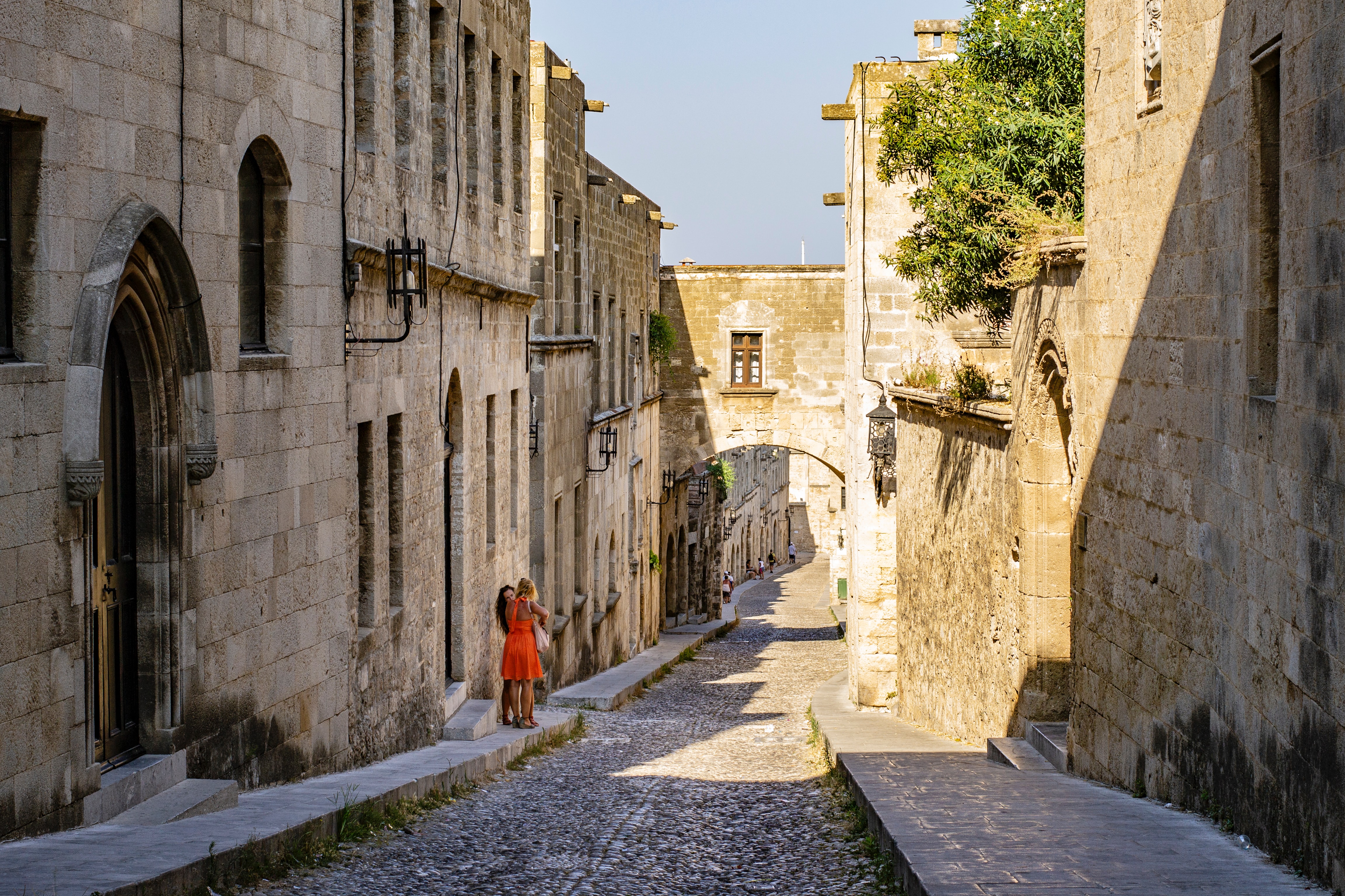
About Rhodes
Early travelers described Rhodes as a town of two parts: a castle or high town (Collachium) and a lower city. Today Rhodes town—sometimes referred to as Ródos town—is still a city of two parts: the Old Town, a UNESCO World Heritage site that incorporates the high town and lower city, and the modern metropolis, or New Town, spreading away from the walls that encircle the Old Town. The narrow streets of the Old Town are for the most part closed to cars and are lined with Orthodox and Catholic churches, Turkish houses (some of which follow the ancient orthogonal plan), and medieval public buildings with exterior staircases and facades elegantly constructed of well-cut limestone from Lindos. Careful reconstruction in recent years has enhanced the harmonious effect.


About Bodrum

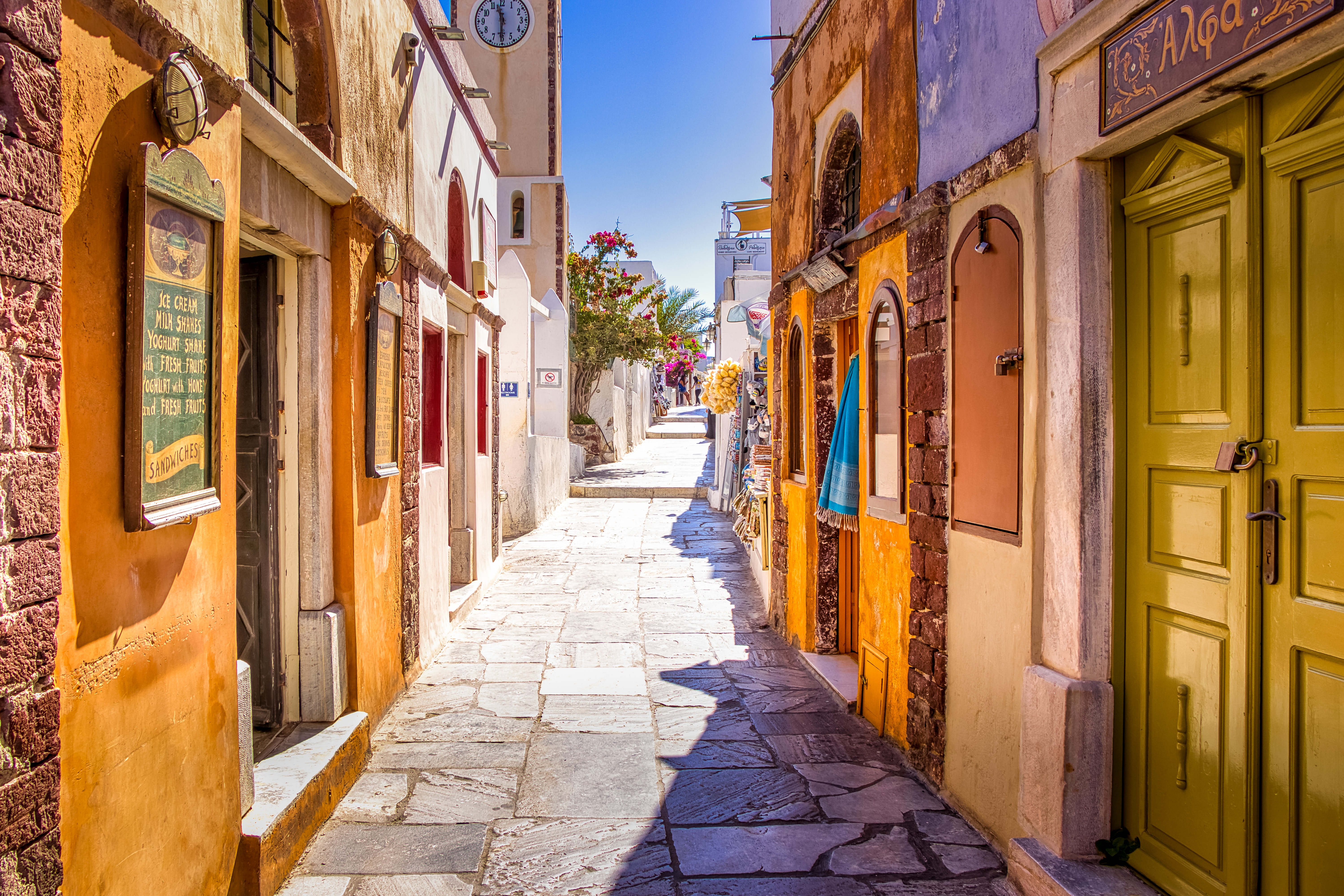
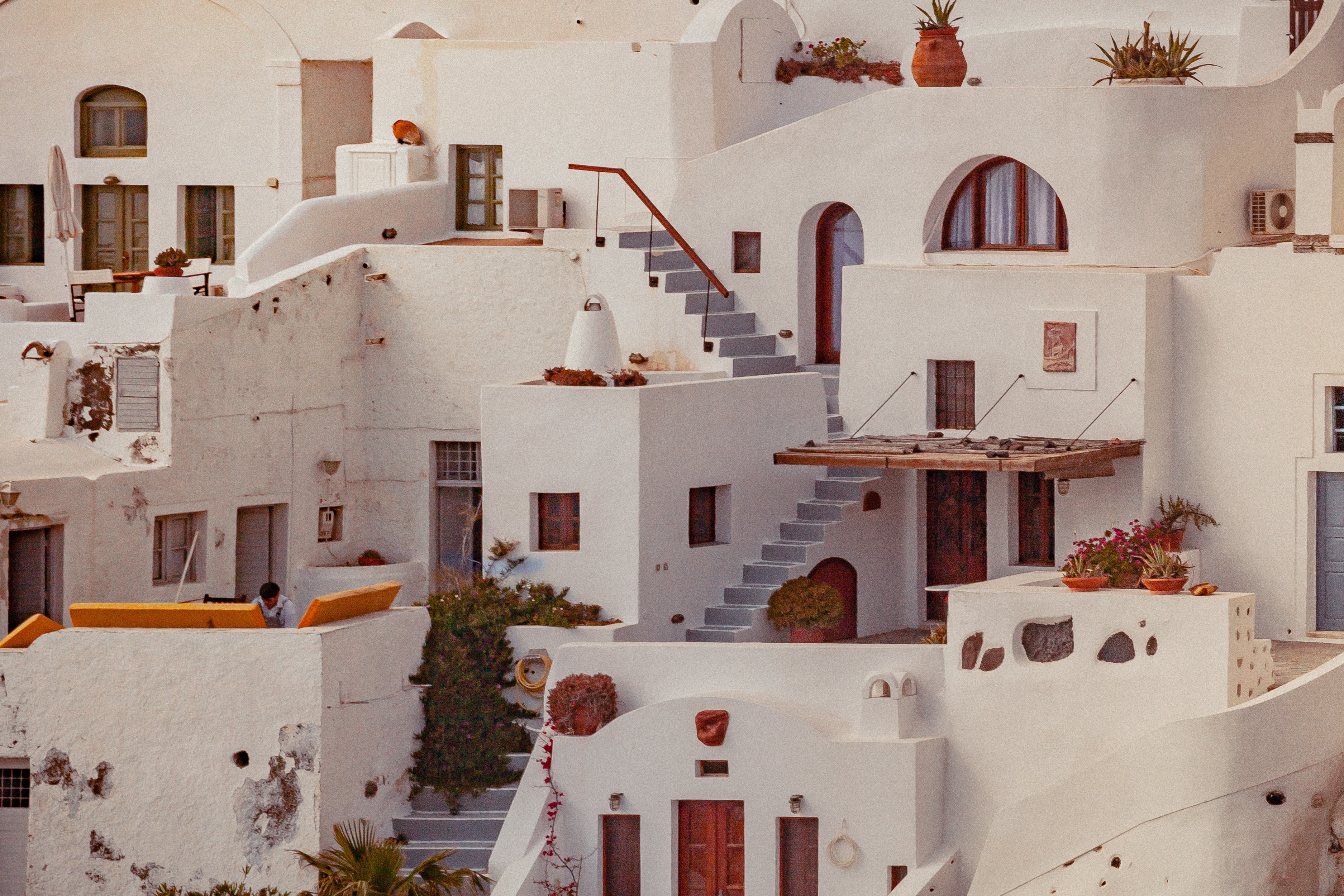
About Santorini
Undoubtedly the most extraordinary island in the Aegean, crescent-shape Santorini remains a mandatory stop on the Cycladic tourist route—even if it's necessary to enjoy the sensational sunsets from Ia, the fascinating excavations, and the dazzling white towns with a million other travelers. Called Kállisti (the "Loveliest") when first settled, the island has now reverted to its subsequent name of Thira, after the 9th-century-BC Dorian colonizer Thiras. The place is better known, however, these days as Santorini, a name derived from its patroness, St. Irene of Thessaloniki, the Byzantine empress who restored icons to Orthodoxy and died in 802. You can fly conveniently to Santorini, but to enjoy a true Santorini rite of passage, opt instead for the boat trip here, which provides a spectacular introduction. After the boat sails between Sikinos and Ios, your deck-side perch approaches two close islands with a passage between them. The bigger one on the left is Santorini, and the smaller on the right is Thirassia. Passing between them, you see the village of Ia adorning Santorini's northernmost cliff like a white geometric beehive. You are in the caldera (volcanic crater), one of the world's truly breathtaking sights: a demilune of cliffs rising 1,100 feet, with the white clusters of the towns of Fira and Ia perched along the top. The bay, once the high center of the island, is 1,300 feet in some places, so deep that when boats dock in Santorini's shabby little port of Athinios, they do not drop anchor. The encircling cliffs are the ancient rim of a still-active volcano, and you are sailing east across its flooded caldera. On your right are the Burnt isles, the White isle, and other volcanic remnants, all lined up as if some outsize display in a geology museum. Hephaestus's subterranean fires smolder still—the volcano erupted in 198 BC, about 735, and there was an earthquake in 1956. Indeed, Santorini and its four neighboring islets are the fragmentary remains of a larger landmass that exploded about 1600 BC: the volcano's core blew sky high, and the sea rushed into the abyss to create the great bay, which measures 10 km by 7 km (6 mi by 4½ mi) and is 1,292 feet deep. The other pieces of the rim, which broke off in later eruptions, are Thirassia, where a few hundred people live, and deserted little Aspronissi ("White isle"). In the center of the bay, black and uninhabited, two cones, the Burnt Isles of Palea Kameni and Nea Kameni, appeared between 1573 and 1925. There has been too much speculation about the identification of Santorini with the mythical Atlantis, mentioned in Egyptian papyri and by Plato (who says it's in the Atlantic), but myths are hard to pin down. This is not true of old arguments about whether tidal waves from Santorini's cataclysmic explosion destroyed Minoan civilization on Crete, 113 km (70 mi) away. The latest carbon-dating evidence, which points to a few years before 1600 BC for the eruption, clearly indicates that the Minoans outlasted the eruption by a couple of hundred years, but most probably in a weakened state. In fact, the island still endures hardships: since antiquity, Santorini has depended on rain collected in cisterns for drinking and irrigating—the well water is often brackish—and the serious shortage is alleviated by the importation of water. However, the volcanic soil also yields riches: small, intense tomatoes with tough skins used for tomato paste (good restaurants here serve them); the famous Santorini fava beans, which have a light, fresh taste; barley; wheat; and white-skin eggplants.


About Milos
Milos or Melos is a volcanic Greek island in the Aegean Sea, just north of the Sea of Crete. Milos is the southwesternmost island in the Cyclades group. The Venus de Milo and the Asclepius of Milos were both found on the island, as were a Poseidon and an archaic Apollo now in Athens.


About Lavrion


Where You'll Go


