San Juan (Puerto Rico) Roundtrip
San Juan (Puerto Rico) Roundtrip
Cruise overview
WHY BOOK WITH US?
- ✔ The Deluxe Cruises’ team has extensive experience in ultra-luxury cruising.
- ✔ Call now to speak to our helpful and experienced Cruise Concierge team.
- ✔ Enjoy our Unique Deluxe Cruises Bonus for substantial savings.
- ✔ Our team will tailor your holiday to your exacting requirements.
- ✔ As agents, we work under the protection of each cruise lines ABTA / ATOL licences
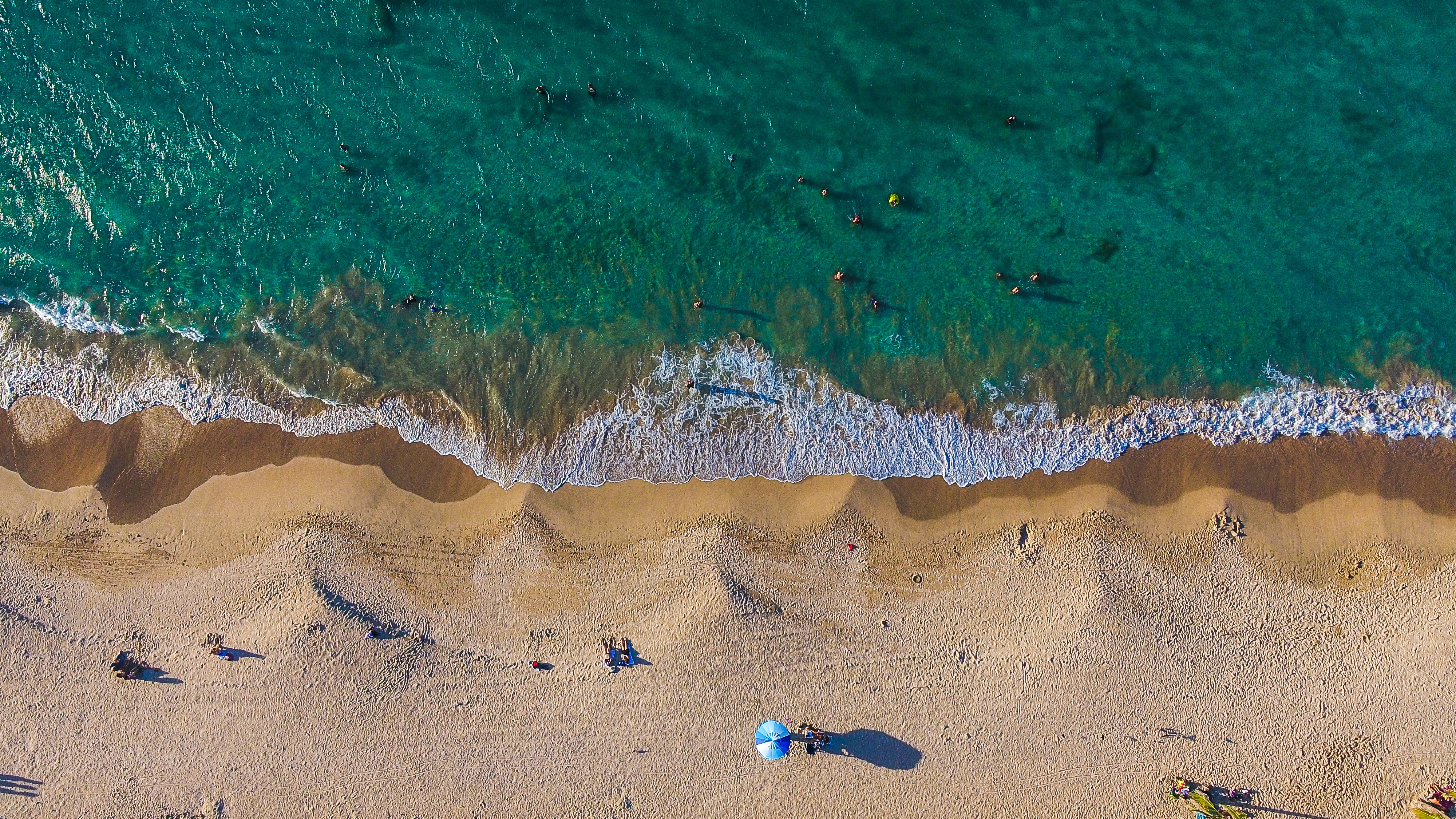
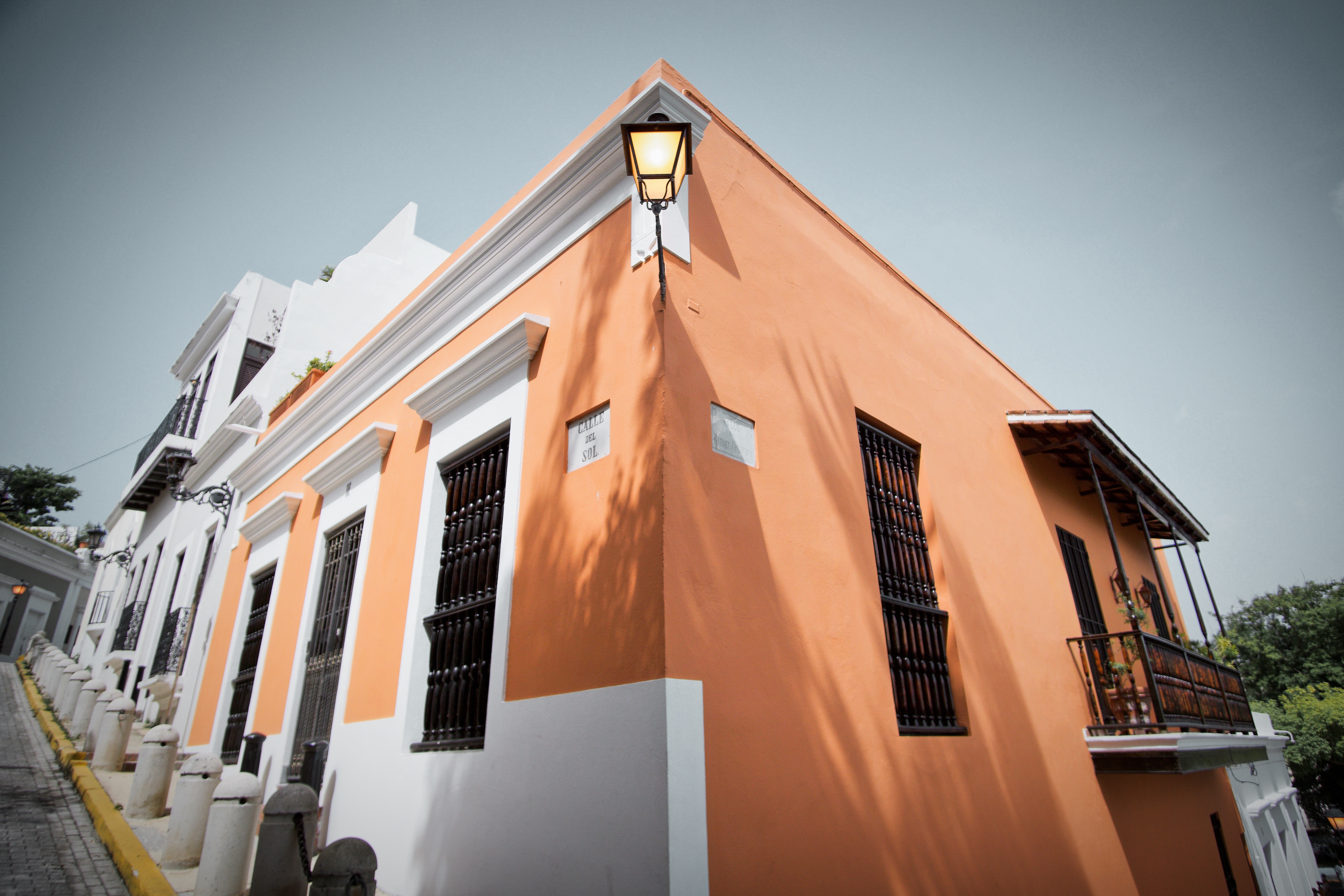
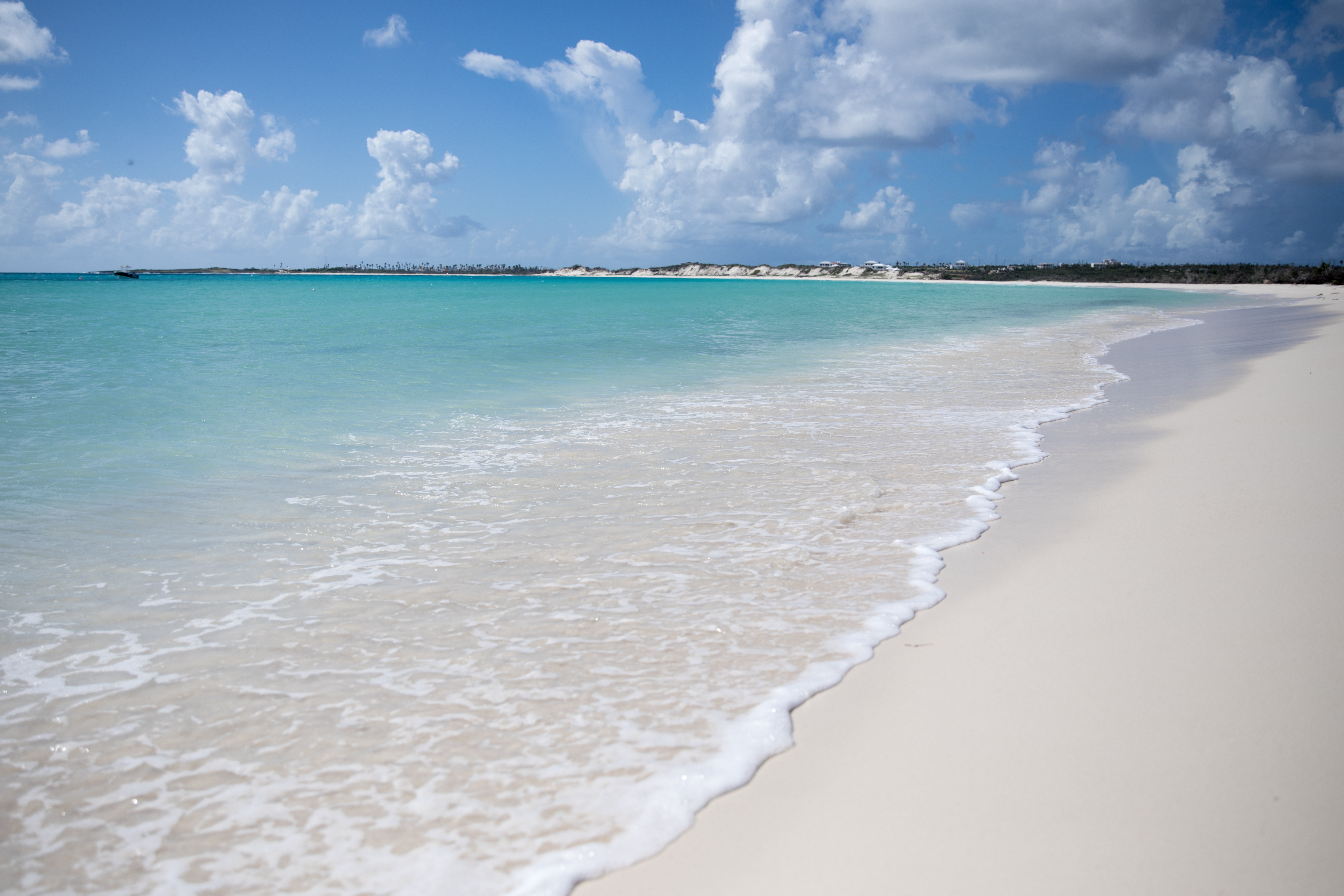
About San Juan (Puerto Rico)
If you associate Puerto Rico's capital with the colonial streets of Old San Juan, then you know only part of the picture. San Juan is a major metropolis, radiating out from the bay on the Atlantic Ocean that was discovered by Juan Ponce de León. More than a third of the island's nearly 4 million citizens proudly call themselves sanjuaneros. The city may be rooted in the past, but it has its eye on the future. Locals go about their business surrounded by colonial architecture and towering modern structures.By 1508 the explorer Juan Ponce de León had established a colony in an area now known as Caparra, southeast of present-day San Juan. He later moved the settlement north to a more hospitable peninsular location. In 1521, after he became the first colonial governor, Ponce de León switched the name of the island—which was then called San Juan Bautista in honor of St. John the Baptist—with that of the settlement of Puerto Rico ("rich port").Defended by the imposing Castillo San Felipe del Morro (El Morro) and Castillo San Cristóbal, Puerto Rico's administrative and population center remained firmly in Spain's hands until 1898, when it came under U.S. control after the Spanish-American War. Centuries of Spanish rule left an indelible imprint on the city, particularly in the walled area now known as Old San Juan. The area is filled with cobblestone streets and brightly painted, colonial-era structures, and its fortifications have been designated a UNESCO World Heritage Site.Old San Juan is a monument to the past, but most of the rest of the city is planted firmly in the 21st century and draws migrants island-wide and from farther afield to jobs in its businesses and industries. The city captivates residents and visitors alike with its vibrant lifestyle as well as its balmy beaches, pulsing nightclubs, globe-spanning restaurants, and world-class museums. Once you set foot in this city, you may never want to leave.

About Marigot
French and Dutch have lived side by side on St. Maarten/St. Martin for hundreds of years—with no border patrols or customs between them. The French side has a more genteel ambience, more fashionable shopping, and a Continental flair. The Dutch tends to be less expensive, has casino hotels, and more nightlife. Water sports abound all over—diving, snorkeling, sailing, and windsurfing are all top draws. And it's easy to while away the day relaxing on one of the 37 beaches, strolling the boardwalk of Dutch-side Philipsburg, and exploring the very French town of Marigot. Although luck is an important commodity at St. Maarten's 13 casinos, chance plays no part in finding a good meal at the island’s excellent eateries. The best way to explore St. Maarten/St. Martin is by car. Though often congested, especially around Philipsburg and Marigot, the roads are fairly good, though narrow and winding, with some speed bumps, potholes, roundabouts, and an occasional wandering goat herd. Few roads are marked with their names, but destination signs are common. Besides, the island is so small that it's hard to get really lost—at least that is what locals tell you. If you’re spending a few days, get to know the area with a scenic "loop" around the island. Be sure to pack a towel and some water shoes, a hat, sunglasses, and sunblock. Head up the east shoreline from Philipsburg, and follow the signs to Dawn Beach and Oyster Pond. The road winds past soaring hills, turquoise waters, quaint West Indian houses, and wonderful views of St. Barth. As you cross over to the French side, turn into Le Galion for a stop at the calm sheltered beach, the stables, the butterflies, or the windsurfing school, then keep following the road toward Orient Bay, the St-Tropez of the Caribbean. Continue to Anse Marcel, Grand Case, Marigot, and Sandy Ground. From Marigot, the flat island of Anguilla is visible. Completing the loop brings you past Cupecoy Beach, through Maho and Simpson Bay, where Saba looms in the horizon, and back over the mountain road into Philipsburg.
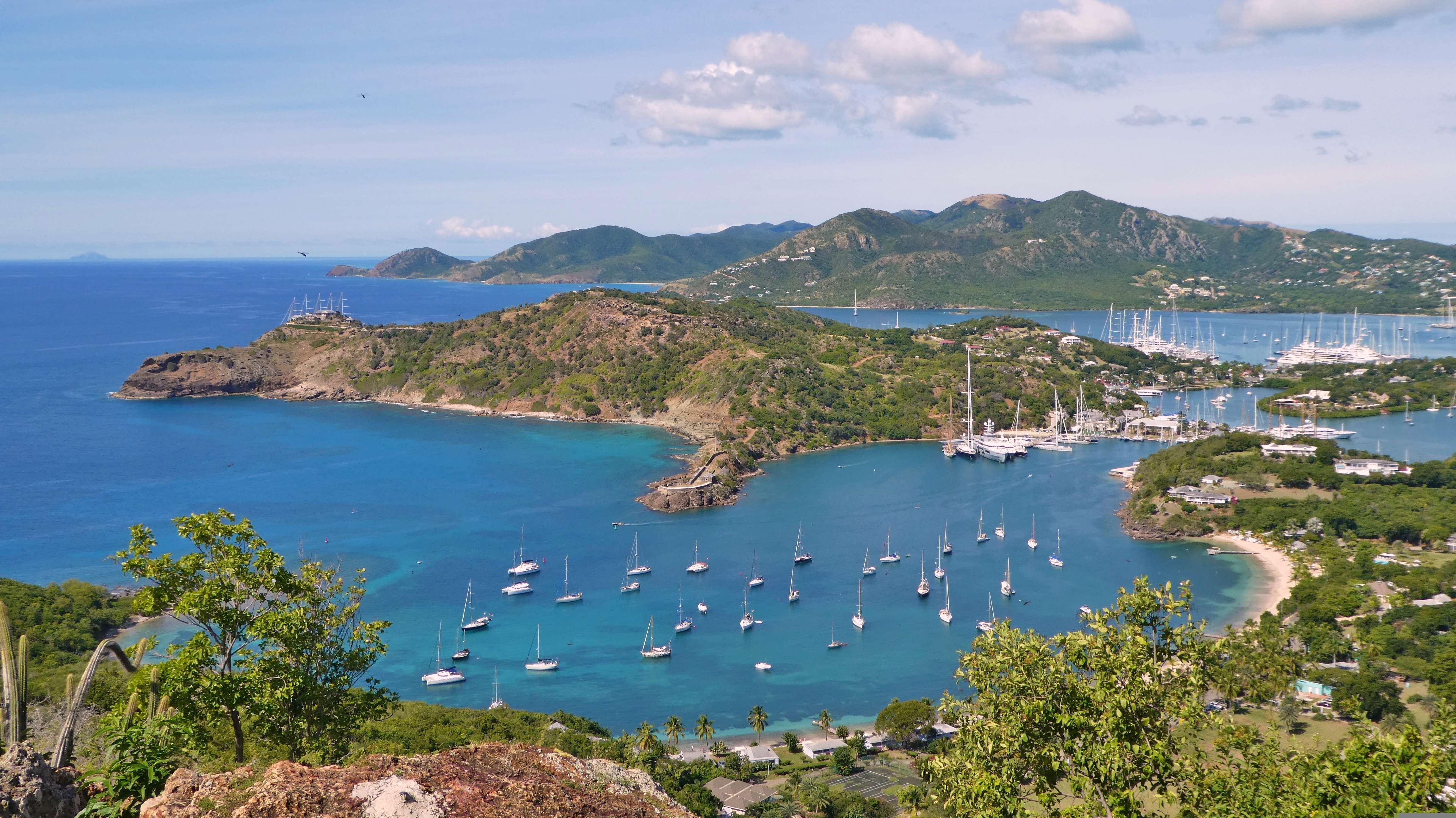
About Falmouth
The British colonial influence is everywhere in pretty English Harbour. And yet, located on Antigua’s south coast, you are just minutes away from some of the loveliest beaches in the Caribbean. With its long ribbons of white sandy shores including the superbly named Rendez-Vous Bay Beach, the cold English drizzle and chimes of big ben have never been farther away! English Harbour is how the Caribbean is meant to be. Beautifully restored, the area still retains much in the way of its rich historic past. Nelson’s dockyard is absolutely not to be missed; a working dockyard that dates from the 18th century, this is part of a larger UNESCO World Heritage Site (Nelson’s Dockyard and National Park) which also contains Clarence House and Shirley Heights. Perhaps one of the best examples of British colonial development, the dockyard is named after the famous Admiral who lived on the island in the 1780’s. The fascinating naval history is palpable in all the buildings of this historic site and just a little further along you find beautifully restored warehouses that are now home to enchanting restaurants, art galleries, boutiques and hotels, all proudly stating their historic credentials on prominent, easy to read signs. Venturing beyond the “town” and you’ll find nature trails for all levels of fitness. Famous for having 365 different beaches, it is unsurprising then that a lot of Antiguan life takes place on its sandy shores. Beaches here offer all things to everyone so whether you want to rekindle the romance, indulge in some adrenaline fueled water sports, swim, snorkel or sail your way around the island, you’re sure to find you’re your own personal paradise here.
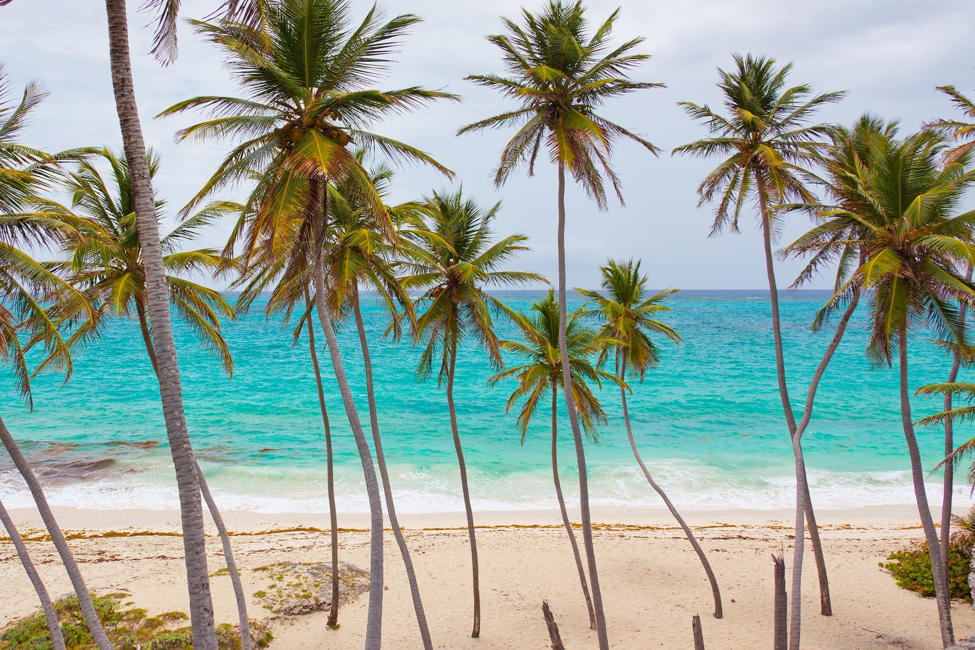
About Sandy Ground
Sandy Ground is a village beach on the island of Anguilla, located in the British West Indies. It benefits from a tropical climate and the warm Caribbean waters and is popular with tourists looking for a relaxing beach holiday. Sandy Ground is known by its long curved white sandy beach set against the backdrop of high cliff and a disused salt pond. It is the main port for the small island of Anguilla and its beach is popular with boat racing, beach bars, barbecues and dancing. The island of Anguilla is easy to explore with one main road running through the middle and plenty of beaches and bays to be discovered. The romantic Little Bay offers secluded coves, Junk’s Hole is home to the notorious Palm Grove barbeque, Island Harbour boasts bright coloured working fishing boats and the sands of Meads Bay host hotels for the elegant dining experience. At sunset, head to Crocus Bay and the coral cliffs for the best location on the island to watch the day’s end.
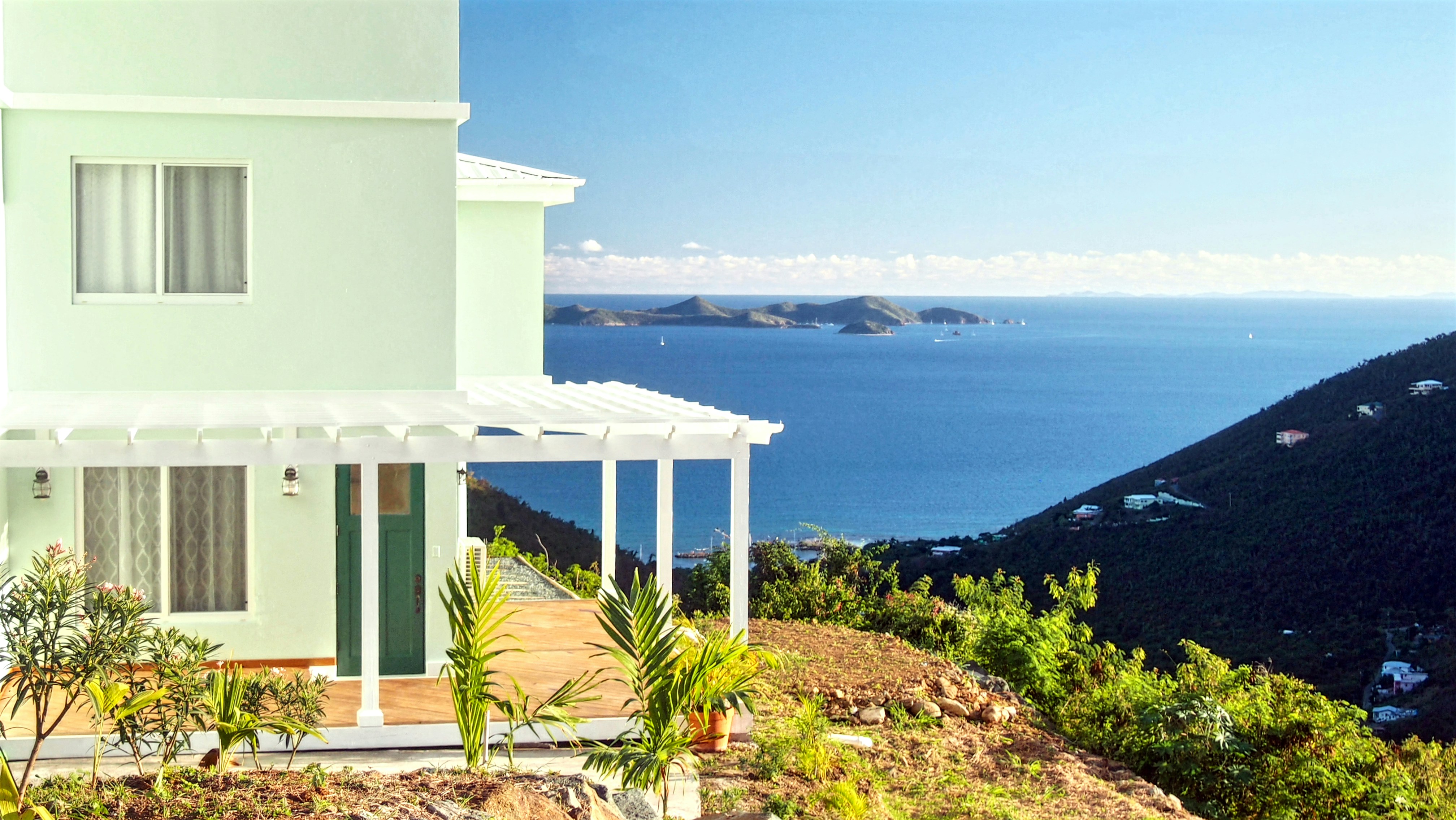
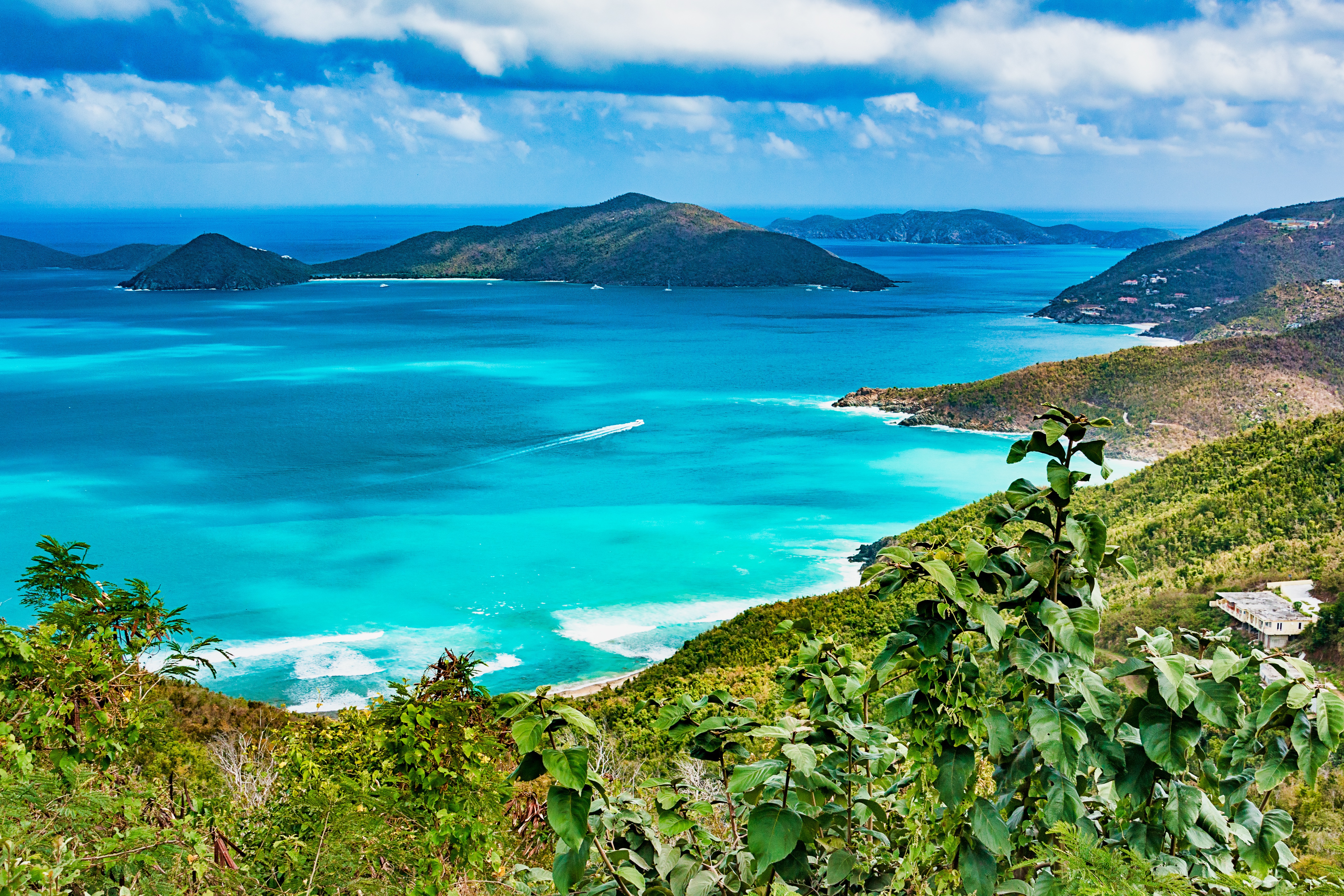
About Road Town, Tortola
About Saint John Island
St. John, the smallest most idyllic of the three United States Virgin Islands, is best known for its dozens of post card perfect white sand beaches, turquoise bays abounding in colourful corals & rainbows of tropical fish endless vistas of green velvet hills. Only nine miles long (14.5 kilometres) and three miles (4.8 kilometres) wide, two thirds of the island is the Virgin Islands National Park, so its spectacular beaches & untouched forests will remain that way for generations to come and remain accessible to all. There are tours of the National Park by Jeep or safari bus and hikes on spectacular trails led by Park Rangers who enrich the experience with talks on the island's history and geology as well as its flora & fauna. While it is only twenty minutes from St. Thomas by convenient hourly ferry, St. John is the peaceful, uncommercialised paradise of island fantasies. It has no high-rise buildings, cruise ship docks or airport. Visitors can obtain discounted air fares to St. Thomas. Despite its unspoiled atmosphere, it offers every facility and amenity found at major resorts.
About San Juan (Puerto Rico)
If you associate Puerto Rico's capital with the colonial streets of Old San Juan, then you know only part of the picture. San Juan is a major metropolis, radiating out from the bay on the Atlantic Ocean that was discovered by Juan Ponce de León. More than a third of the island's nearly 4 million citizens proudly call themselves sanjuaneros. The city may be rooted in the past, but it has its eye on the future. Locals go about their business surrounded by colonial architecture and towering modern structures.By 1508 the explorer Juan Ponce de León had established a colony in an area now known as Caparra, southeast of present-day San Juan. He later moved the settlement north to a more hospitable peninsular location. In 1521, after he became the first colonial governor, Ponce de León switched the name of the island—which was then called San Juan Bautista in honor of St. John the Baptist—with that of the settlement of Puerto Rico ("rich port").Defended by the imposing Castillo San Felipe del Morro (El Morro) and Castillo San Cristóbal, Puerto Rico's administrative and population center remained firmly in Spain's hands until 1898, when it came under U.S. control after the Spanish-American War. Centuries of Spanish rule left an indelible imprint on the city, particularly in the walled area now known as Old San Juan. The area is filled with cobblestone streets and brightly painted, colonial-era structures, and its fortifications have been designated a UNESCO World Heritage Site.Old San Juan is a monument to the past, but most of the rest of the city is planted firmly in the 21st century and draws migrants island-wide and from farther afield to jobs in its businesses and industries. The city captivates residents and visitors alike with its vibrant lifestyle as well as its balmy beaches, pulsing nightclubs, globe-spanning restaurants, and world-class museums. Once you set foot in this city, you may never want to leave.
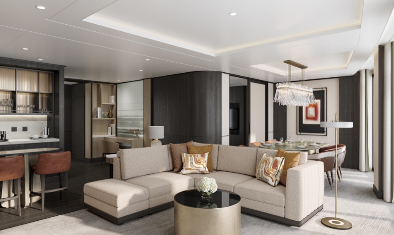
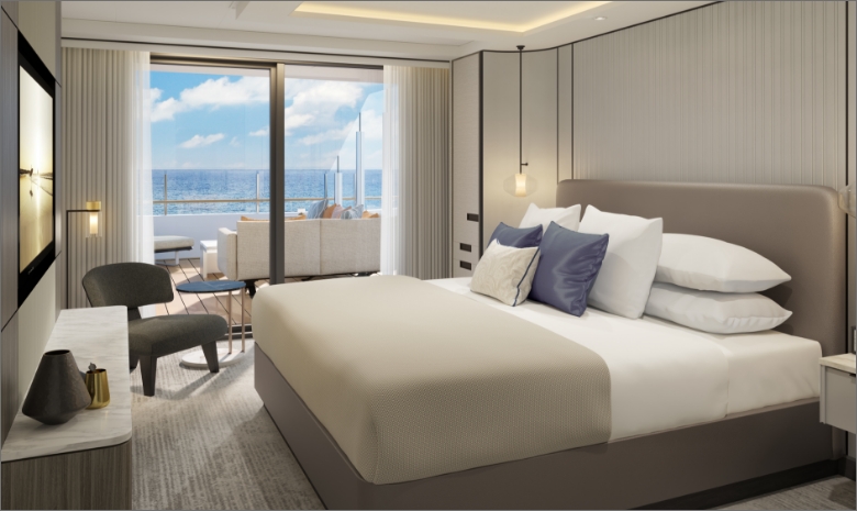
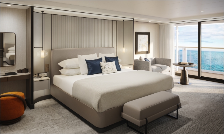
Natural light streams through the floor-to-ceiling windows of the Owner’s Suite, illuminating the interior of up to 1,033 square feet. The contemporary living area includes an in-suite bar for hosting cocktail hour before enjoying dinner with friends in the dining area — or alfresco on the expansive private terrace. After sunset, unwind under the stars in the terrace’s whirlpool spa and indulge in a soothing outdoor shower before heading inside to retire. The bedroom welcomes you to a sanctum of repose, complete with a custom king bed and spacious walk-in wardrobe, and the marble bath includes a modern shower, soaking tub, double vanity and a powder room that can be accessed conveniently from the foyer.
OWNERS SUITE
MAGNIFICENT OCEAN VIEWS
- Private, spacious terrace overlooking the ocean, with private whirlpool and outdoor shower
SPACIOUS SUITE ACCOMMODATIONS
- Luxurious and modern living and dining area
- Luxury custom king bed sleep system
- Double vanity bathroom with modern soaking tub and separate shower
PERSONALIZED SERVICE AND AMENITIES
- The Personal Concierge is your single onboard touch point to ensure a flawless, seamless journey from beginning to end
- 24-hour in-suite dining, espresso machine, complimentary coffee and teas and a mini-bar provisioned to your preferences, upon request once on board
ACCOMMODATIONS
Bed & Bath
- Luxury custom king bed sleep system
- Double vanity bathroom with modern soaking tub and separate shower
- Second powder room in select suites
- Custom luxury bed and bath linens
Suite Features
- Private, spacious terrace overlooking the ocean with private whirlpool and outdoor shower
- Luxurious and modern living and dining area
- Walk-in wardrobe
- Convertible sleep sofa
Size
- Suite: 732 – 1033 SQ FT | 68 – 96 SQ M
- Terrace: 581 – 721 SQ FT | 54 – 67 SQ M
SERVICES AND AMENITIES
- 24-hour in-suite dining
- Luxury bath amenities & individual robe and slippers
- Premium Wi-Fi, supporting browsing, social media, streaming services, video calls and VPN services
- Complimentary chilled bottle of champagne upon arrival
- Espresso machine with complimentary coffee and teas
- Digital flat screen television
- In-suite safe
- Vanity mirror
- Hair dryer
- Hypoallergenic pillows, upon request
- 230v and 120v outlets, as well as USB charging capabilities
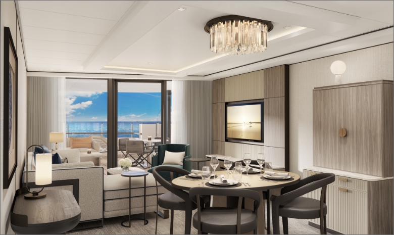
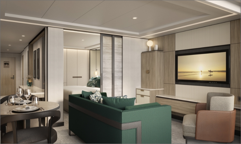
Spacious indoors and out, the Concierge Suite offers up to 786 square feet of interior area and a private terrace of up to 409 square feet. The bedroom includes a generous walk-in wardrobe and dressing area as well as a marble bath with a double vanity, walk-in shower, soaking tub and an enclosed powder room accessible from the foyer. Sunlight casts a warm glow through the floor-to-ceiling glass in the bedroom and living room, which both open onto the terrace so you can step out to take in the views. The interior and outdoor spaces each feature an elegant dining area and a comfortable living area with a plush sofa, perfect for entertaining guests or enjoying a romantic evening for two.
CONCIERGE SUITE
MAGNIFICENT OCEAN VIEWS
- Private, spacious terrace overlooking the ocean, with entry from living area and bedroom
SPACIOUS SUITE ACCOMMODATIONS
- Luxurious and modern living and dining area
- Luxury custom king bed sleep system
- Double vanity bathroom with modern soaking tub and separate shower
PERSONALIZED SERVICE AND AMENITIES
- The Personal Concierge is your single onboard touch point to ensure a flawless, seamless journey from beginning to end
- 24-hour in-suite dining, espresso machine, complimentary coffee and teas and a mini-bar provisioned to your preferences, upon request once on board
ACCOMMODATIONS
Bed & Bath
- Luxury custom king bed sleep system
- Double vanity bathroom with modern soaking tub and separate shower
- Custom luxury bed and bath linens
Suite Features
- Private, spacious terrace overlooking the ocean
- Luxurious and modern living and dining area
- Walk-in wardrobe
- Convertible sleep sofa
Size
- Suite: 689 – 785 SQ FT | 64 – 73 SQ M
- Terrace: 355 – 409 SQ FT | 33 – 38 SQ M
SERVICES AND AMENITIES
- 24-hour in-suite dining
- Luxury bath amenities & individual robe and slippers
- Premium Wi-Fi, supporting browsing, social media, streaming services, video calls and VPN services
- Complimentary chilled bottle of champagne upon arrival
- Espresso machine with complimentary coffee and teas
- Digital flat screen television
- In-suite safe
- Vanity mirror
- Hair dryer
- Hypoallergenic pillows, upon request
- 230v and 120v outlets, as well as USB charging capabilities
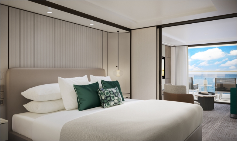
The Ilma Suite embraces the ever-changing vistas along the horizon with an expansive private terrace of 291 to 301 square feet. Sunbathe with a traveling companion on the dual chaise lounges or curl up with a bestseller on the comfortable outdoor sofa. Host friends for dinner with a seaside harbor as a backdrop when you dine alfresco on the terrace or view the tableau through the floor-to-ceiling windows of the indoor dining area. Within up to 657 square feet of interior space, the cozy bedroom retreat features a luxurious king bed, spacious closets, and a modern shower system in the bath, which may also include a separate soaking tub.
ILMA SUITE
MAGNIFICENT OCEAN VIEWS
- Private, spacious terrace overlooking the ocean
SPACIOUS SUITE ACCOMMODATIONS
- Luxurious and modern living and dining area
- Luxury custom king bed sleep system
- Double vanity bathroom with modern soaking tub and separate shower
PERSONALIZED SERVICE AND AMENITIES
- The Personal Concierge is your single onboard touch point to ensure a flawless, seamless journey from beginning to end
- 24-hour in-suite dining, espresso machine, complimentary coffee and teas and a mini-bar provisioned to your preferences, upon request once on board
ACCOMMODATIONS
Bed & Bath
- Luxury custom king bed sleep system
- Double vanity bathroom with modern soaking tub and separate shower
- Custom luxury bed and bath linens
Suite Features
- Private, spacious terrace overlooking the ocean
- Luxurious and modern living and dining area
- Walk-in wardrobe
- Convertible sleep sofa
Size
- Suite: 506 – 657 SQ FT | 47 – 61 SQ M
- Terrace: 291 – 301 SQ FT | 27 – 28 SQ M
SERVICES AND AMENITIES
- 24-hour in-suite dining
- Luxury bath amenities & individual robe and slippers
- Premium Wi-Fi, supporting browsing, social media, streaming services, video calls and VPN services
- Complimentary chilled bottle of champagne upon arrival
- Espresso machine with complimentary coffee and teas
- Digital flat screen television
- In-suite safe
- Vanity mirror
- Hair dryer
- Hypoallergenic pillows, upon request
- 230v and 120v outlets, as well as USB charging capabilities
Within the View Suite interiors of up to 689 square feet, dramatic floor-to-ceiling windows in the living area and bedroom connect you to the surrounding seascapes. Step from the bedroom onto your private terrace of up to 205 square feet, where fresh sea breezes and scenic views await. After an alfresco breakfast, prepare for your day in the spacious marble bath featuring a double vanity, modern soaking tub and separate shower. The walk-in wardrobe and dressing area in the bedroom provide ample space to ready yourself for the day’s exploration. When evening comes, invite friends to join you in the dining area of your suite, which may also include a separate powder room for your guests.
VIEW SUITE
MAGNIFICENT OCEAN VIEWS
- Private, spacious terrace overlooking the ocean
- SPACIOUS SUITE ACCOMMODATIONS
- Luxurious and modern living and dining area
- Luxury custom king bed sleep system
- Double vanity bathroom with modern soaking tub and separate shower
PERSONALIZED SERVICE AND AMENITIES
- The Personal Concierge is your single onboard touch point to ensure a flawless, seamless journey from beginning to end
- 24-hour in-suite dining, espresso machine, complimentary coffee and teas and a mini-bar provisioned to your preferences, upon request once on board
ACCOMMODATIONS
Bed & Bath
- Luxury custom king bed sleep system
- Double vanity bathroom with modern soaking tub and separate shower
- Custom luxury bed and bath linens
- Powder room in select suites
Suite Features
- Private, spacious terrace overlooking the ocean
- Luxurious and modern living and dining area
- Walk-in wardrobe
- Convertible sleep sofa
Size
- Suite: 517 – 689 SQ FT | 48 – 64 SQ M
- Terrace: 108 – 205 SQ FT | 10 – 19 SQ M
SERVICES AND AMENITIES
- 24-hour in-suite dining
- Luxury bath amenities & individual robe and slippers
- Premium Wi-Fi, supporting browsing, social media, streaming services, video calls and VPN services
- Complimentary chilled bottle of champagne upon arrival
- Espresso machine with complimentary coffee and teas
- Digital flat screen television
- In-suite safe
- Vanity mirror
- Hair dryer
- Hypoallergenic pillows, upon request
- 230v and 120v outlets, as well as USB charging capabilities
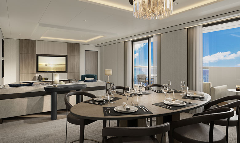
With 560 square feet of interior luxury plus a private terrace of up to 199 square feet, the Grand Suite has all the comforts of home and then some. Host friends for dinner at the stylish dining table for four and enjoy after-dinner drinks and conversation in the spacious living area. When it’s time to retire, open the double doors onto your bedroom retreat, which includes dual walk-in wardrobes, and enjoy a relaxing soak in the marble-clad tub before drifting off in the comfort of the custom king bed. Each morning, sip an espresso on your terrace as you take in the view of the enchanting destination you’re about to explore.
GRAND SUITE
MAGNIFICENT OCEAN VIEWS
- Private, spacious terrace overlooking the ocean
SPACIOUS SUITE ACCOMMODATIONS
- Luxurious and modern living and dining area
- Luxury custom king bed sleep system
- Double vanity bathroom with modern soaking tub and separate shower
PERSONALIZED SERVICE AND AMENITIES
- The Personal Concierge is your single onboard touch point to ensure a flawless, seamless journey from beginning to end
- 24-hour in-suite dining, espresso machine, complimentary coffee and teas and a mini-bar provisioned to your preferences, upon request once on board
ACCOMMODATIONS
Bed & Bath
- Luxury custom king bed sleep system
- Double vanity bathroom with modern soaking tub and separate shower
- Custom luxury bed and bath linens
Suite Features
- Private, spacious terrace overlooking the ocean
- Luxurious and modern living and dining area
- Dual walk-in wardrobe
- Convertible sleep sofa
Size
- Suite: 560 SQ FT | 52 SQ M
- Terrace*: 90 – 199 SQ FT | 8.4 – 18.5 SQ M
- *Expanded terrace on Deck 6
SERVICES AND AMENITIES
- 24-hour in-suite dining
- Luxury bath amenities & individual robe and slippers
- Premium Wi-Fi, supporting browsing, social media, streaming services, video calls and VPN services
- Complimentary chilled bottle of champagne upon arrival
- Espresso machine with complimentary coffee and teas
- Digital flat screen television
- In-suite safe
- Vanity mirror
- Hair dryer
- Hypoallergenic pillows, upon request
- 230v and 120v outlets, as well as USB charging capabilities
The welcoming entry corridor of the Signature Suite leads to an intimate dining area for two, where you can enjoy a delicious meal at any time of day or night. Then take in a movie from the plush sofa in the living area, or from the custom king bed in the spacious bedroom that features a second television. The bath offers the convenience of a double vanity for couples, a walk-in shower and a soaking tub, perfect for unwinding after adventures ashore. The ample 409 square feet of interior space is complemented by a private outdoor terrace of up to 151 square feet, where a comfortable lounger is equally suited to sunbathing or stargazing.
SIGNATURE SUITE
MAGNIFICENT OCEAN VIEWS
- Private, spacious terrace overlooking the ocean
SPACIOUS SUITE ACCOMMODATIONS
- Luxurious and modern living and dining area
- Luxury custom king bed sleep system
- Double vanity bathroom with modern soaking tub and separate shower
PERSONALIZED SERVICE AND AMENITIES
- The Personal Concierge is your single onboard touch point to ensure a flawless, seamless journey from beginning to end
- 24-hour in-suite dining, espresso machine, complimentary coffee and teas and a mini-bar provisioned to your preferences, upon request once on board
ACCOMMODATIONS
Bed & Bath
- Luxury custom king bed sleep system
- Double vanity bathroom with modern soaking tub and separate shower
- Custom luxury bed and bath linens
Suite Features
- Private, spacious terrace overlooking the ocean
- Luxurious and modern living and dining area
- Convertible sleep sofa
Size
- Suite: 409 SQ FT | 38 SQ M
- Terrace*: 71 – 151 SQ FT | 6.6 – 14 SQ M
- *Expanded terrace on Deck 6
SERVICES AND AMENITIES
- 24-hour in-suite dining
- Luxury bath amenities & individual robe and slippers
- Premium Wi-Fi, supporting browsing, social media, streaming services, video calls and VPN services
- Complimentary chilled bottle of champagne upon arrival
- Espresso machine with complimentary coffee and teas
- Digital flat screen television
- In-suite safe
- Vanity mirror
- Hair dryer
- Hypoallergenic pillows, upon request
- 230v and 120v outlets, as well as USB charging capabilities
The airy interiors of the Terrace Suite offer 294 square feet of comfort, and just beyond the floor-to-ceiling windows, the namesake private terrace provides up to 108 square feet overlooking the sea.
This personal oasis includes a custom king bed, an ample wardrobe and a separate sitting area for curling up with a good book. The marble bath features luxurious amenities by Diptyque Paris, a modern shower system and a double vanity — ideal when sharing the space with a companion. Wake each morning to fresh coffee from the in-suite espresso machine and conclude each day with a nightcap from the mini-bar, while a Suite Ambassador attends to your wishes in the moments in between.
TERRACE SUITE
MAGNIFICENT OCEAN VIEWS
- Private, spacious terrace overlooking the ocean
SPACIOUS SUITE ACCOMMODATIONS
- Luxury custom king bed sleep system
- Double vanity bathroom with modern shower system
PERSONALIZED SERVICE AND AMENITIES
- The Personal Concierge is your single onboard touch point to ensure a flawless, seamless journey from beginning to end
- 24-hour in-suite dining, espresso machine, complimentary coffee and teas and a mini-bar provisioned to your preferences, upon request once on board
ACCOMMODATIONS
Bed & Bath
- Luxury custom king bed sleep system
- Double vanity bathroom with modern shower system
- Custom luxury bed and bath linens
Suite Features
- Private, spacious terrace overlooking the ocean
Size
- Suite: 294 SQ FT | 27.3 SQ M
- Terrace*: 52 – 108 SQ FT| 4.8 – 10 SQ M
- ADA
- Suite: 452 SQ FT | 42 SQ M
- Terrace*: 73 – 161 SQ FT | 6.8 – 15 SQ M
- *Expanded terrace on Decks 5 and 6
SERVICES AND AMENITIES
- 24-hour in-suite dining
- Luxury bath amenities & individual robe and slippers
- Premium Wi-Fi, supporting browsing, social media, streaming services, video calls and VPN services
- Complimentary chilled bottle of champagne upon arrival
- Espresso machine with complimentary coffee and teas
- Digital flat screen television
- In-suite safe
- Vanity mirror
- Hair dryer
- Hypoallergenic pillows, upon request
- 230v and 120v outlets, as well as USB charging capabilities
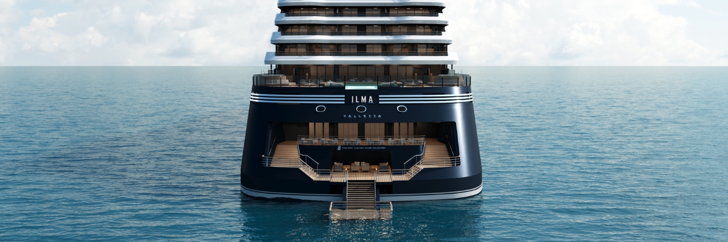
Ilma
Meaning “water” in Maltese, Ilma pays homage to the sea – the scenic pathway that carries you to the world’s celebrated yachting destinations. Spacious suites with private terraces, open-air lounges and an aft Marina right on the water are all designed to connect you with the seascapes you sail and the seaside harbors you discover. The freedom of the yachting lifestyle invites you to relax in an atmosphere of casual elegance, savor multiple dining experiences, and indulge in rejuvenating treatments at The Ritz-Carlton Spa.
Ship Facts
| Launch Year | 2024 | ||||||||||
| Refit Year | |||||||||||
| Language | en | ||||||||||
| Gross Tonnage | 46750 | ||||||||||
| Length | 241 | ||||||||||
| Width | 29 | ||||||||||
| Currency | USD | ||||||||||
| Speed | 18 | ||||||||||
| Capacity | 448 | ||||||||||
| Crew Count | 374 | ||||||||||
| Deck Count | 8 | ||||||||||
| Cabin Count | 224 | ||||||||||
| Large Cabin Count | N/A | ||||||||||
| Wheelchair Cabin Count | N/A | ||||||||||
| Electrical Plugs |
|
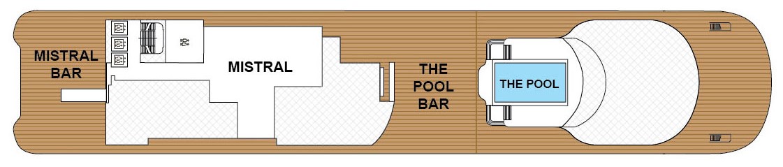
Deck 10
- Minstral
- The Main Pool
- The Main Pool Bar
- Mistral Bar
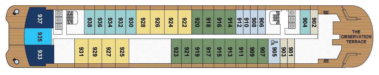
Deck 9
- The Observation Terrace
- The Owner's Suite
- The Concierge Suite
- The Grand Suites
- The Signature Mid Suites
- The Signature Suites
- The Terrace Mid Suites
- The Terrace Suites
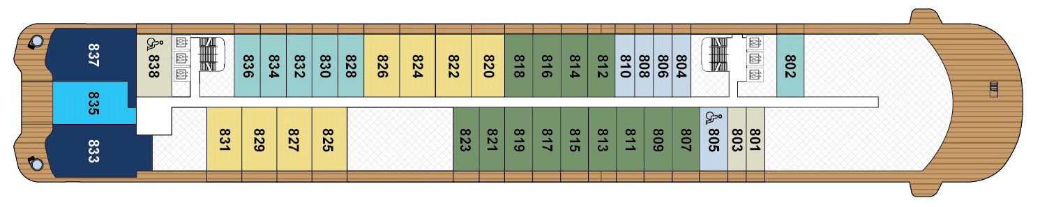
Deck 8
- The Owners Suites
- The Concierge Suites
- The Grand Suites
- The Signature Mid Suites
- The Signature Suites
- The Terrace Mid Suites
- The Terrace Suites
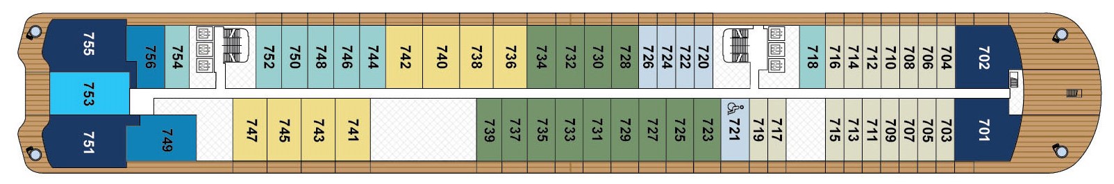
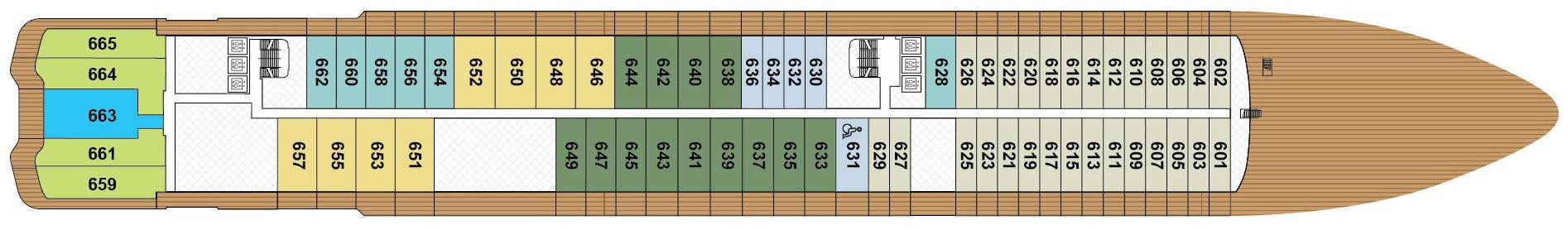
Deck 7
- The Owner's Suites
- The Concierge Suites
- The View Suites
- The Grand Suites
- The Signature Mid Suites
- The Signature Suites
- The Terrace Mid Suites
- The Terrace Suites
Deck 6
- The Concierge Suites
- The Ilma Suites
- The Grand Suites
- The Signature Mid Suites
- The Signature Suites
- The Terrace Mid Suites
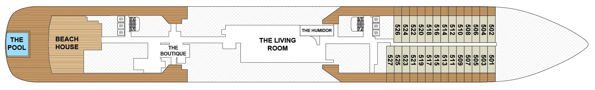
Deck 5
- The Living Room
- Beach House
- Infinity Pool
- The Humidor
- The Boutique
- Suites 501-527
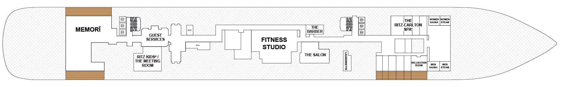
Deck 4
- The Ritz-Carlton Spa
- Memori
- The Fitness Studio
- Ritz Kids®
- Women Steam & Sauna
- Men Steam & Sauna
- Relaxation Room
- Launderette
- The Barber
- The Salon
- Guest Services
- Ritz Kids / Meeting Room
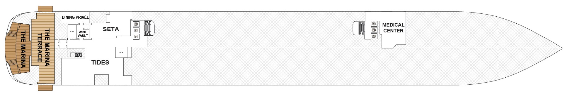
Deck 3
- The Marina Terrace
- The Marina
- Tides
- Dining Privee
- SETA
- Medical Centre
- Wine Vault
From elegant specialty restaurants to casual poolside eateries, the dining venues on board Ilma are sure to please every palate. Innovative menus are inspired by local cuisines from around the world, so your taste buds can travel from the Mediterranean to Southeast America without ever leaving the yacht. Contemporary interiors welcome you to dine in an ambiance of understated luxury, while alfresco spaces embrace the fresh sea air and panoramic views.
New highlights include our collaboration with two award-winning chefs. At the Beach House on board, James Beard Award winner Chef Michael Mina offers menus inspired by the bold flavors of Latin America and the Caribbean, while Chef Fabio Trabocchi of the Michelin-starred restaurant Fiola brings his expertise to contemporary interpretations of Italian cuisine in Seta su Ilma. Explore our collection of restaurants that are redefining dining at sea.
Tides
The thoughtful design of the spacious main restaurant creates a warm, welcoming ambiance that balances a sense of privacy with the desire for social connection. Both traditional and innovative, the breakfast, lunch and dinner dishes showcase the fresh local ingredients and seasonal cuisines of the destinations that Ilma explores, with menus ever changing like the tides of the sea.
Dining Privée
Join friends at a private enclave within Tides for an exclusive dining experience. The stylish and inviting ambiance of Dining Privée provides the perfect setting for celebratory dinners and other special events. Reservations are required, and an additional fee applies.
Seta Su Ilma
In collaboration with Chef Fabio Trabocchi, Seta Su Ilma, named after the Italian word for “silk,” offers a contemporary interpretation of Italian cuisine, nodding to regional flavors. Savor fresh seafood, perfectly grilled steak and handmade pasta — each course impeccably paired with a fine wine. Accompaniments like freshly baked bread, cold-pressed olive oils, and seasonal truffles complete an elegant Italian dining experience worthy of a Michelin star. Reservations are required, and an additional fee applies.
Memorī
From sashimi to tempura to Wagyu beef dishes, Memorī offers contemporary interpretations of authentic Japanese cuisine. With sleek angles and textural accents, the vibrant space centers around the sushi bar at the heart of the restaurant, while also offering ample seating at comfortable tables indoors and alfresco.
The Living Room
Comfortable and stylish, The Living Room greets you with fresh coffee, tea, pastries and other sweet and savory treats each morning. As the day progresses, the bar pours premium cocktails, fine wines and champagne, and a live pianist sets the mood. Each evening this becomes the perfect spot to enjoy canapés and an aperitif before dinner — and then return afterward for late-night dancing.
In-Suite Dining
When you wish to dine in the comfort of your suite or on your private terrace, our All-Day Dining menu offers a variety of selections from the onboard restaurants. Later in the evening, a Late-Night Dining menu is available.
Beach House
At the Beach House, bright, airy interiors flow into an expansive outdoor pool deck, creating an effervescent setting for enjoying Pan-Latin cuisine alongside craft beers, bold wines, and an elevated tequila selection. The menu, developed in collaboration with James Beard Award-winning chef Michael Mina, is inspired by the bold, fire-born flavors of South and Central America while highlighting ingredients from the Caribbean with light, refreshing shareable bites, such as grilled meats, seafood, and ceviche. Located on Deck 5.
THE LUXURY OF SPACE AND TIME.
With the highest ratio of space per guest at sea, Ilma evokes the feeling of your own personal superyacht, and the onboard experience reflects the freedom and flexibility of the yachting lifestyle. Stylish and refined, yet relaxed and casual, onboard spaces embrace the natural surroundings that Ilma explores. Fresh sea breezes flow through the open-air terraces, and indoor venues are flush with light from floor-to-ceiling windows.
Ilma invites you to go wherever the day takes you. Indulge in a rejuvenating treatment at The Ritz-Carlton Spa or relax at the Main Pool on Deck 10. When at anchor, step from the yacht’s Marina into the sea for snorkeling, kayaking and paddle boarding. Come evening, sip on a fine wine or handcrafted cocktail in one of the plush lounges as a classical pianist or jazz musician entertains you.
The Boutique
From exclusive sportswear and branded apparel to jewelry and leather goods, The Boutique offers enticing options to shoppers. In select ports, your shopping experience is further enhanced by collaborations with local artisans who come on board to showcase their bespoke offerings.
The Observation Terrace
A tranquil open-air retreat on Deck 9 forward, The Observation Terrace offers comfortable chaises and sofas for sunbathing or socializing while taking in the panoramic views. Cool off with a frozen cocktail, spritzer or ice cream treat from the bar, and enjoy attentive deck service offering chilled misting and iced towels.
The Humidor
A softly lit enclave furnished in rich leathers and dark walnut timbers, this cozy lounge is named for its state-of-the-art humidor showcasing fine tobaccos that include an exceptional collection of hand-rolled cigars by Davidoff. Settle into a plush armchair and sip a premium cognac or a well-aged Macallan single-malt whisky.
Marina and Marina Terrace
Right at the water’s edge, the Marina offers space for lounging as well as direct access to the sea for kayaking, paddle boarding and other watersports. Just steps above, the expansive Marina Terrace serves cool refreshments, such as handcrafted cocktails, frozen sorbet and chilled fruit brochettes, with a backdrop of dramatic seascapes.