
42-Day Panama Canal & Hawaiian Holiday
42-Day Panama Canal & Hawaiian Holiday
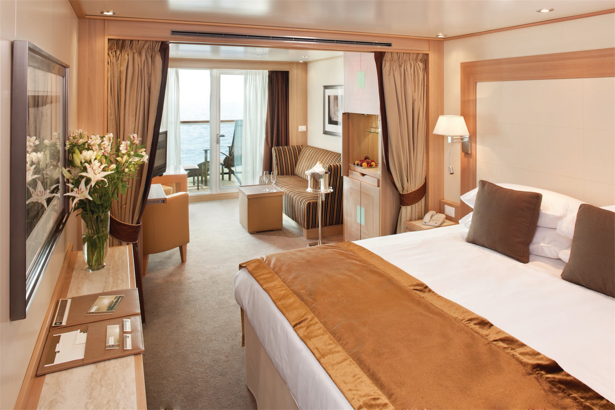
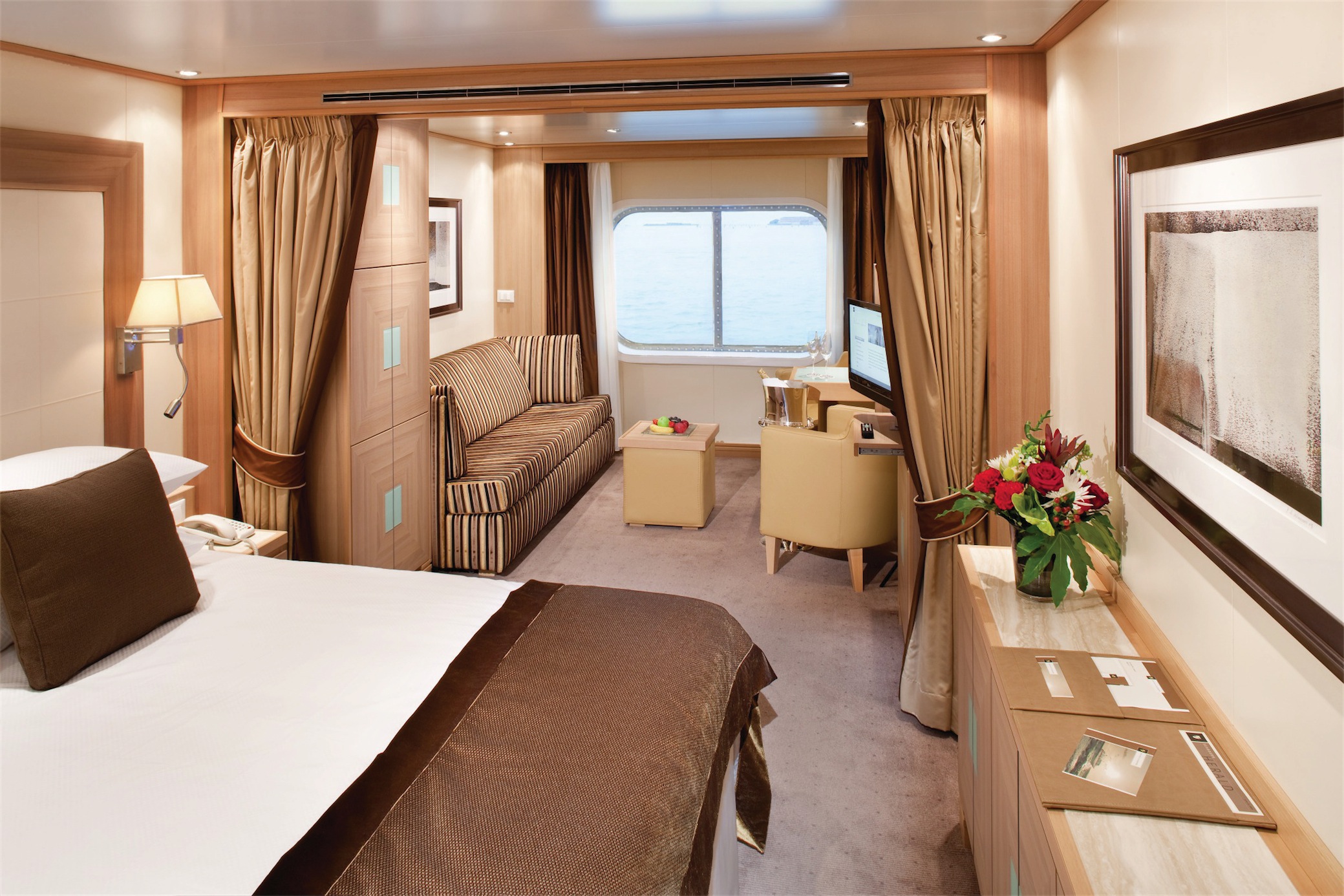
Cruise overview
WHY BOOK WITH US?
- ✔ The Deluxe Cruises’ team has extensive experience in ultra-luxury cruising.
- ✔ Call now to speak to our helpful and experienced Cruise Concierge team.
- ✔ Enjoy our Unique Deluxe Cruises Bonus for substantial savings.
- ✔ Our team will tailor your holiday to your exacting requirements.
- ✔ As agents, we work under the protection of each cruise lines ABTA / ATOL licences
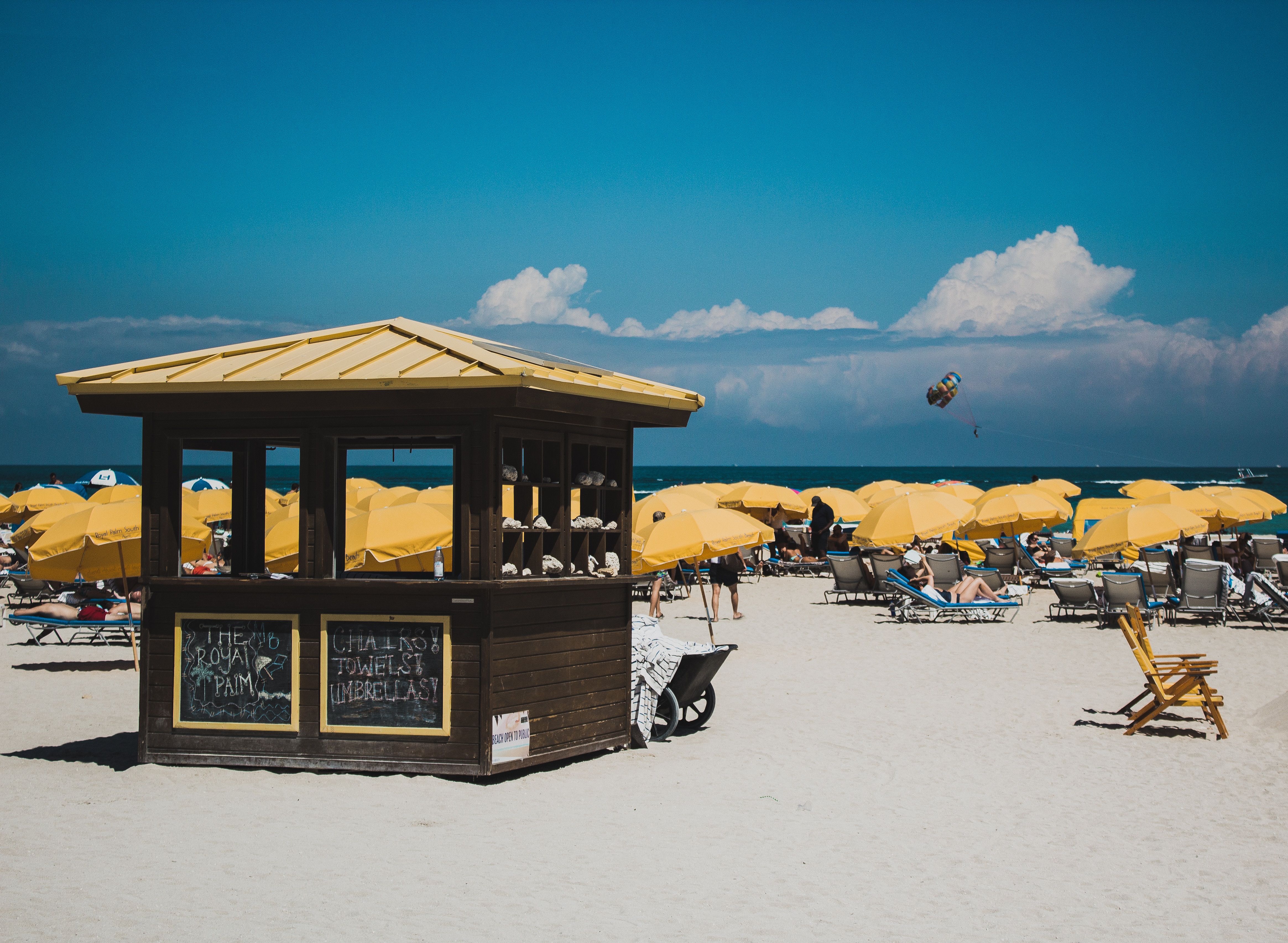
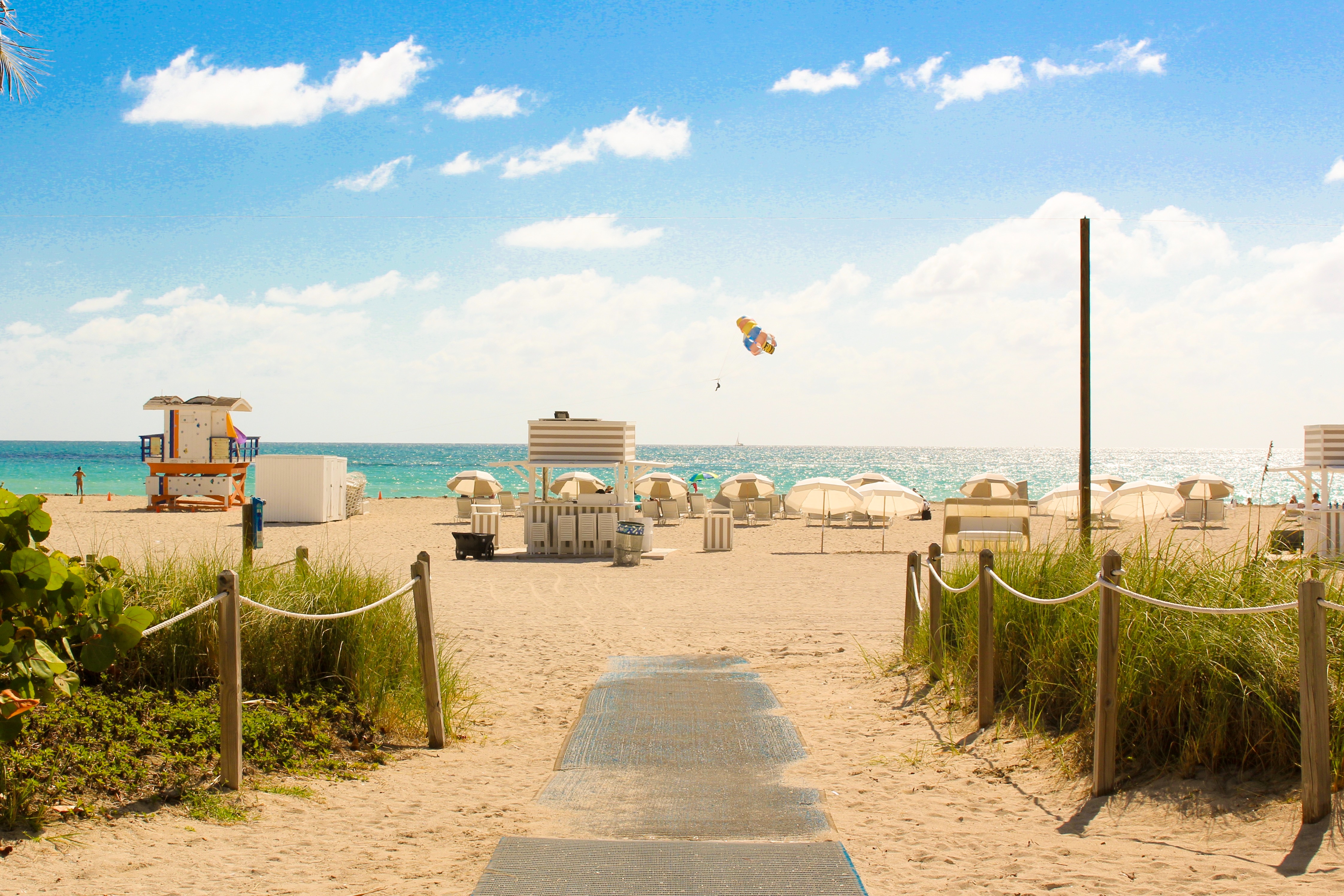
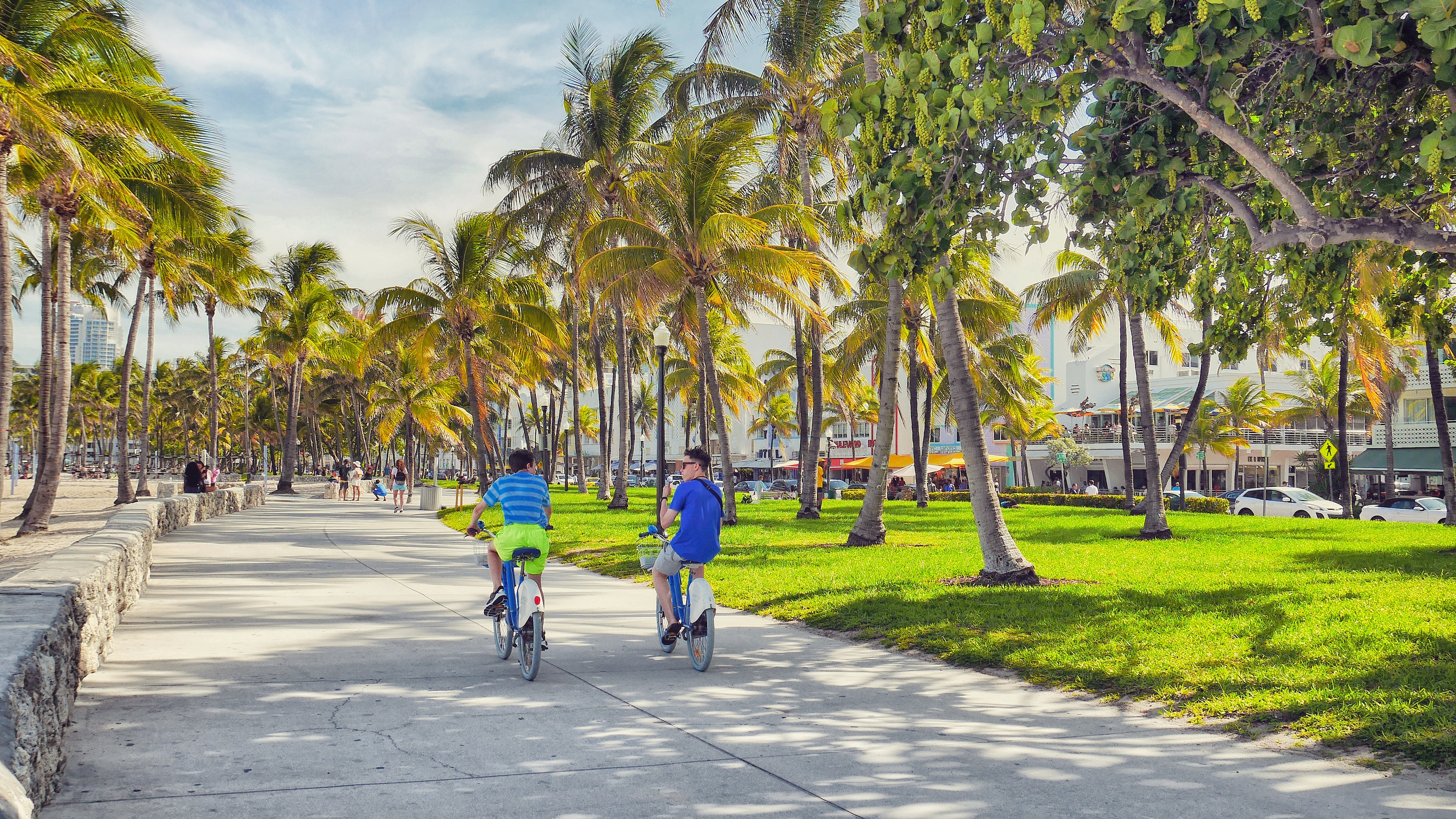
About Miami, Florida
Miami is one of the world’s most popular holiday spots. It has so much to offer; from its countless beach areas, to culture and museums, from spa and shopping days out, to endless cuban restaurants and cafes. Miami is a multicultural city that has something to offer to everyone.


About Catalina Island

About Curaçao


About Santa Marta

About Golfito
Golfito, is situated along a small inlet of Golfo Dulce. This small port city is a narrow strip along Golfito Bay backed against steep green hills covered with pristine rainforest, with the Golfo Dulce seaward outside Golfito Bay. Surrounded by tropical rainforest, Golfito provides an ideal location to escape from your hectic schedule and enjoy some of the most beautiful beaches in Costa Rica with a stunning backdrop of verdant hills and lush rainforest. Follow a trail through the densely forested Golfito National Wildlife Refuge to observe rare flora and fauna, and emerge at a scenic outlook with views of the ocean, also the city has a variety of hotels and restaurants, many of which now provide free wireless Internet service for customers. Golfito was the main port on the South Pacific Coast of Costa Rica in the days when there was little except for the huge banana plantations. To help remedy the resulting economy decrease of the region, the government established a duty-free zone, support and impulse the touristic development.
About Puntarenas
This town is not on the Nicoya Peninsula, but rather on Costa Rica's mainland. It is best known as a cruise-ship port and launching pad for ferries heading southeast to the coast of the Nicoya Peninsula and for cruises sailing out on the Gulf of Nicoya. Puntarenas is also a major fishing port with a lively fish market. The town’s reputation suffers from the unimpressive parts you see from your car as you roll through town on the way to the ferry dock. But the town has a lot of character off the main drag, thanks to its illustrious past as an affluent port town and principal vacation spot for San José's wealthy, who arrived by train in the last century. Once the port was moved and roads opened to other beaches, Puntarenas's economy crashed, but it's making a comeback. Sitting on a narrow spit of sand—punta de arenas literally means "point of sand"—that protrudes into the Gulf of Nicoya, the town boasts a beautifully groomed, wide Blue Flag beach with views of the Nicoya Peninsula and spectacular sunsets, along with a public swimming pool, the San Lucas Beach Club, and a marine-life museum. Ticos arrive by bus and car to enjoy the beach and stroll the Paseo de los Turistas, a beachfront promenade lined with tree-shaded concrete benches and seafood restaurants. Crowds of locals, called porteños, cruise by on bicycles, the town’s most popular form of transport.

About Puerto Quetzal
Puerto Quetzal is Guatemala's largest Pacific Ocean port. It is important for both cargo traffic and as a stop-off point for cruise liners

About Puerto Chiapas

About Huatulco (Santa María Huatulco)


About Cabo San Lucas
Cabo San Lucas, a resort city on the southern tip of Mexico’s Baja California peninsula, is known for its beaches, water-based activities and nightlife. Playa El Médano is Cabo’s main beach, with outdoor restaurants and numerous bars. Past the marina is Land's End promontory, site of Playa del Amor (Lover's Beach) and El Arco, a natural archway in the seacliffs.


About Long Beach, California

About Honolulu, Hawaii
Capital of Hawaii, and a popular tourist destination, Honolulu is known for surfing and water sports. However, there's more to the city than surfing; with museums, the only royal palace in the country, and a mall, there's bound to be something of interest for any visitor.

About Honolulu, Hawaii
Capital of Hawaii, and a popular tourist destination, Honolulu is known for surfing and water sports. However, there's more to the city than surfing; with museums, the only royal palace in the country, and a mall, there's bound to be something of interest for any visitor.
About Hilo, Hawaii


About Kahului-Maui, Hawaii


About Lihue, Kauai Island, Hawaii

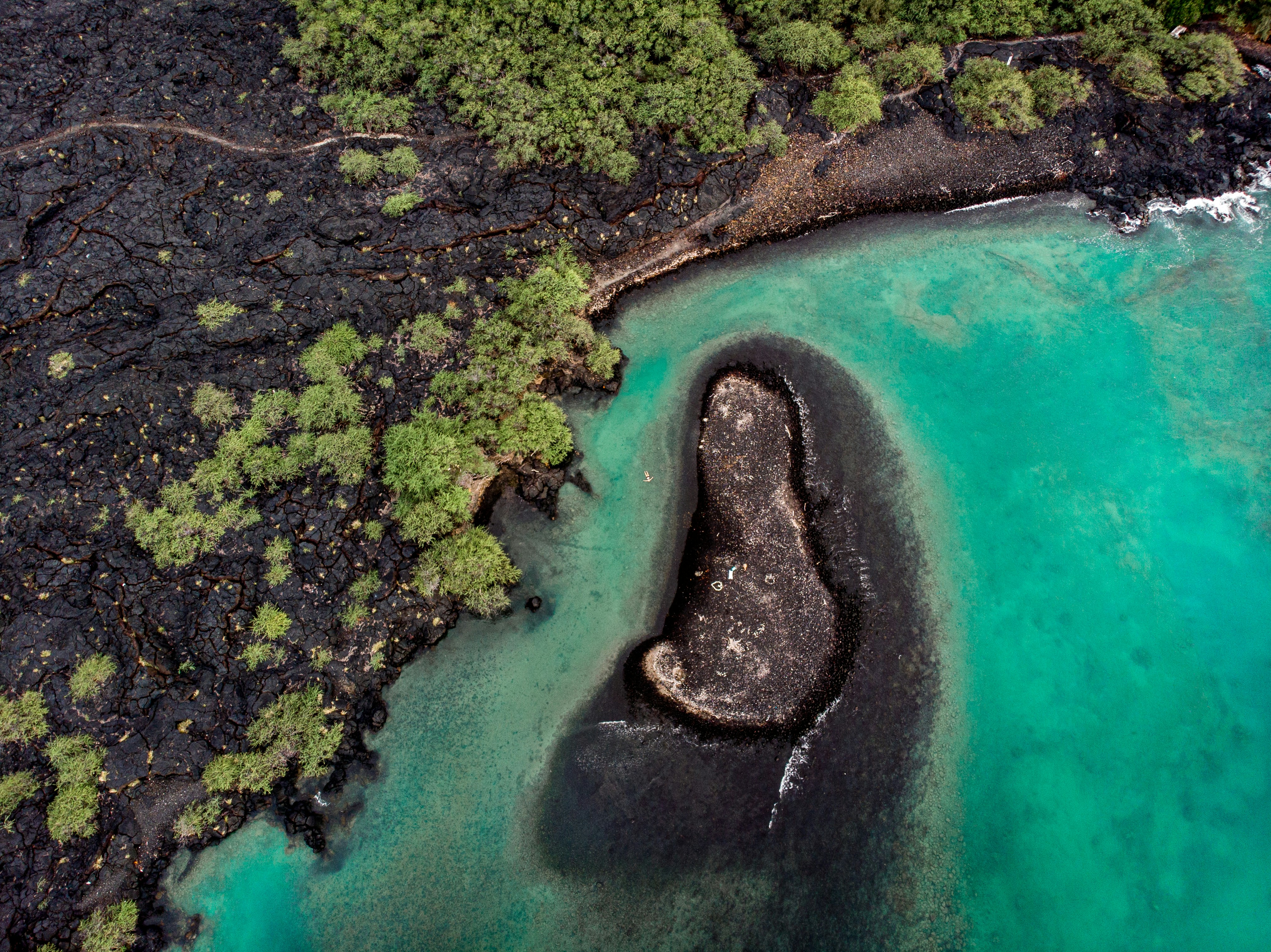
About Kailua-Kona, Hawaii
Kailua-Kona is a town on the west coast of Hawaii Island (the Big Island). Hulihee Palace is a former royal vacation home dating from 1838. Mokuaikaua Church, from the 1800s, is Hawaii’s oldest Christian church. On Kailua Bay, reconstructed thatched houses at Kamakahonu National Historic Landmark mark King Kamehameha I’s residence. Colorful coral lies off Kamakahonu Beach. Kailua Pier has boat moorings.


About Ensenada
Ensenada is a port city on the Pacific coast of Mexico’s Baja California peninsula. At its heart is the harbor and waterfront area with the Malecón promenade. Once a casino, the Riviera de Ensenada is now a cultural center. The nearby Museum of History and the Regional Historical Museum trace the area’s people and past. Migrating gray whales visit the waters offshore. Southwest of the city is La Bufadora blowhole.

About Long Beach, California


Where You'll Go


