24-Day Panama Canal Passage
24-Day Panama Canal Passage
Cruise overview
WHY BOOK WITH US?
- ✔ The Deluxe Cruises’ team has extensive experience in ultra-luxury cruising.
- ✔ Call now to speak to our helpful and experienced Cruise Concierge team.
- ✔ Enjoy our Unique Deluxe Cruises Bonus for substantial savings.
- ✔ Our team will tailor your holiday to your exacting requirements.
- ✔ As agents, we work under the protection of each cruise lines ABTA / ATOL licences
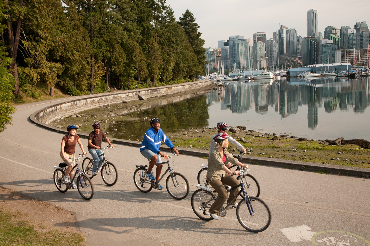
About Vancouver, British Columbia
Vancouver is a delicious juxtaposition of urban sophistication and on-your-doorstep wilderness adventure. The mountains and seascape make the city an outdoor playground for hiking, skiing, kayaking, cycling, and sailing—and so much more—while the cuisine and arts scenes are equally diverse, reflecting the makeup of Vancouver's ethnic (predominantly Asian) mosaic. Vancouver is consistently ranked as one of the world's most livable cities, and it's easy for visitors to see why. It's beautiful, it's outdoorsy, and there's a laidback West Coast vibe. On the one hand, there's easy access to a variety of outdoor activities, a fabulous variety of beaches, and amazing parks. At the same time, the city has a multicultural vitality and cosmopolitan flair. The attraction is as much in the range of food choices—the fresh seafood and local produce are some of North America's best—as it is in the museums, shopping, and nightlife.Vancouver's landscaping also adds to the city's walking appeal. In spring, flowerbeds spill over with tulips and daffodils while sea breezes scatter scented cherry blossoms throughout Downtown; in summer office workers take to the beaches, parks, and urban courtyards for picnic lunches and laptop meetings. More than 8 million visitors each year come to Vancouver, Canada's third-largest metropolitan area. Because of its peninsula location, traffic flow is a contentious issue. Thankfully, Vancouver is wonderfully walkable, especially in the downtown core. The North Shore is a scoot across the harbor, and the rapid-transit system to Richmond and the airport means that staying in the more affordable ’burbs doesn't have to be synonymous with sacrificing convenience. The mild climate, exquisite natural scenery, and relaxed outdoor lifestyle keep attracting residents, and the number of visitors is increasing for the same reasons. People often get their first glimpse of Vancouver when catching an Alaskan cruise, and many return at some point to spend more time here.

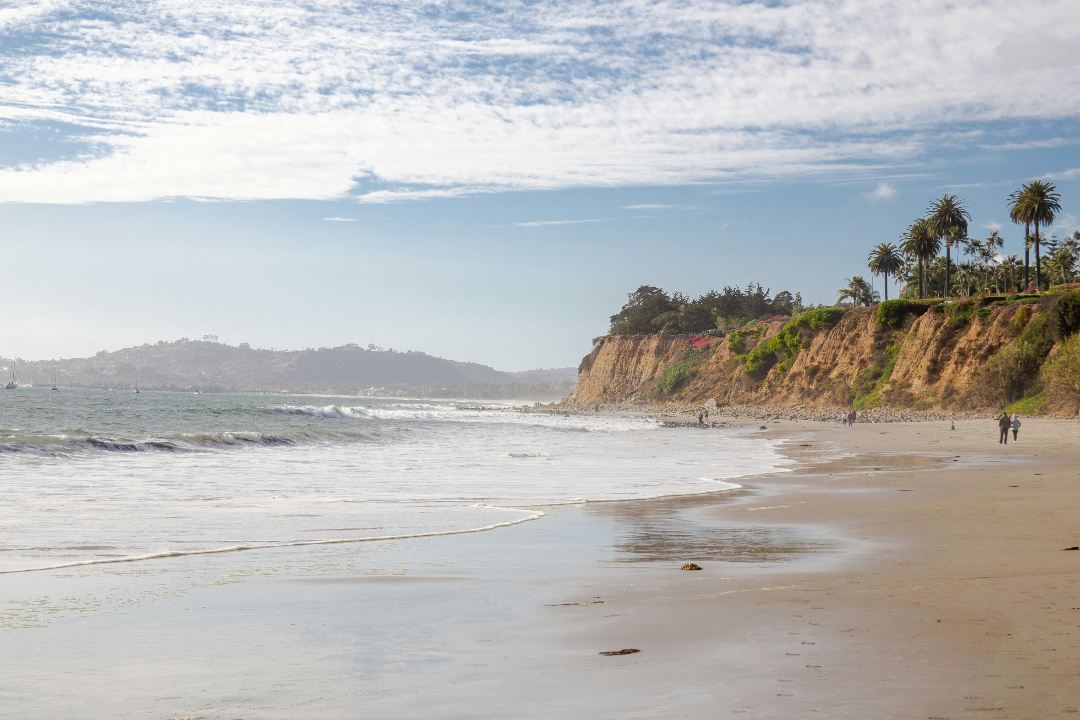
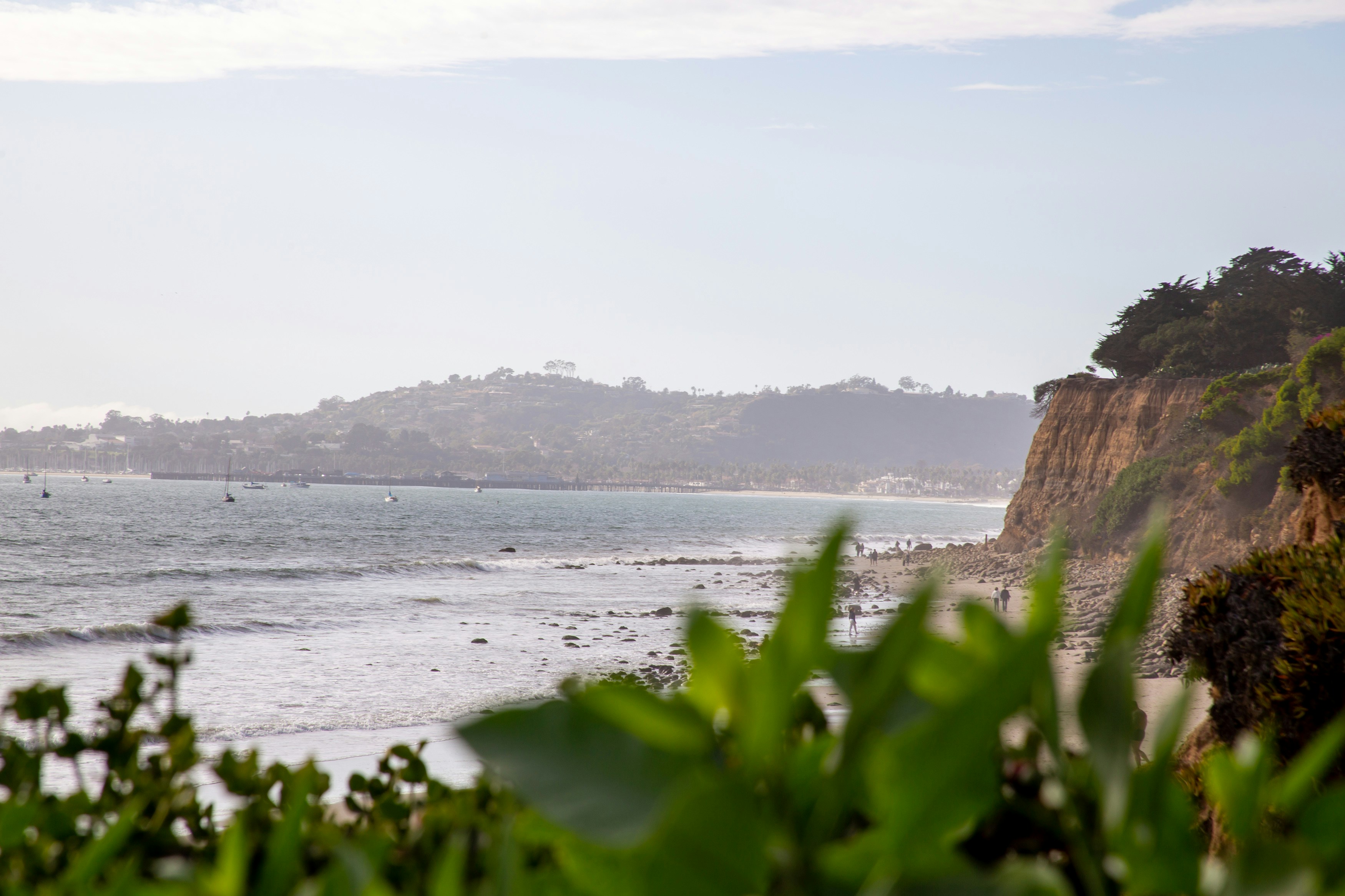
About Santa Barbara, California
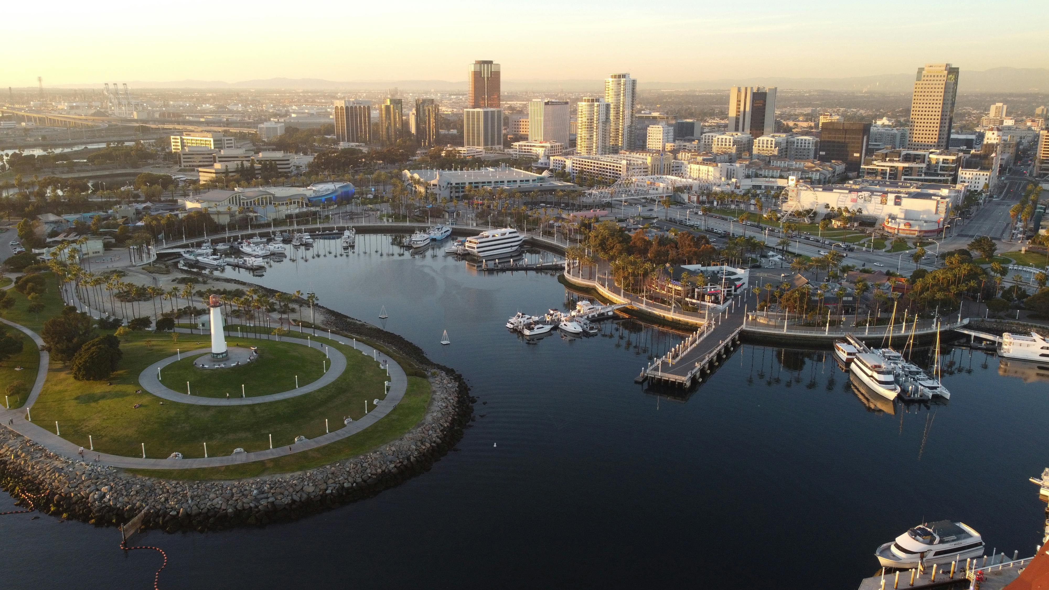
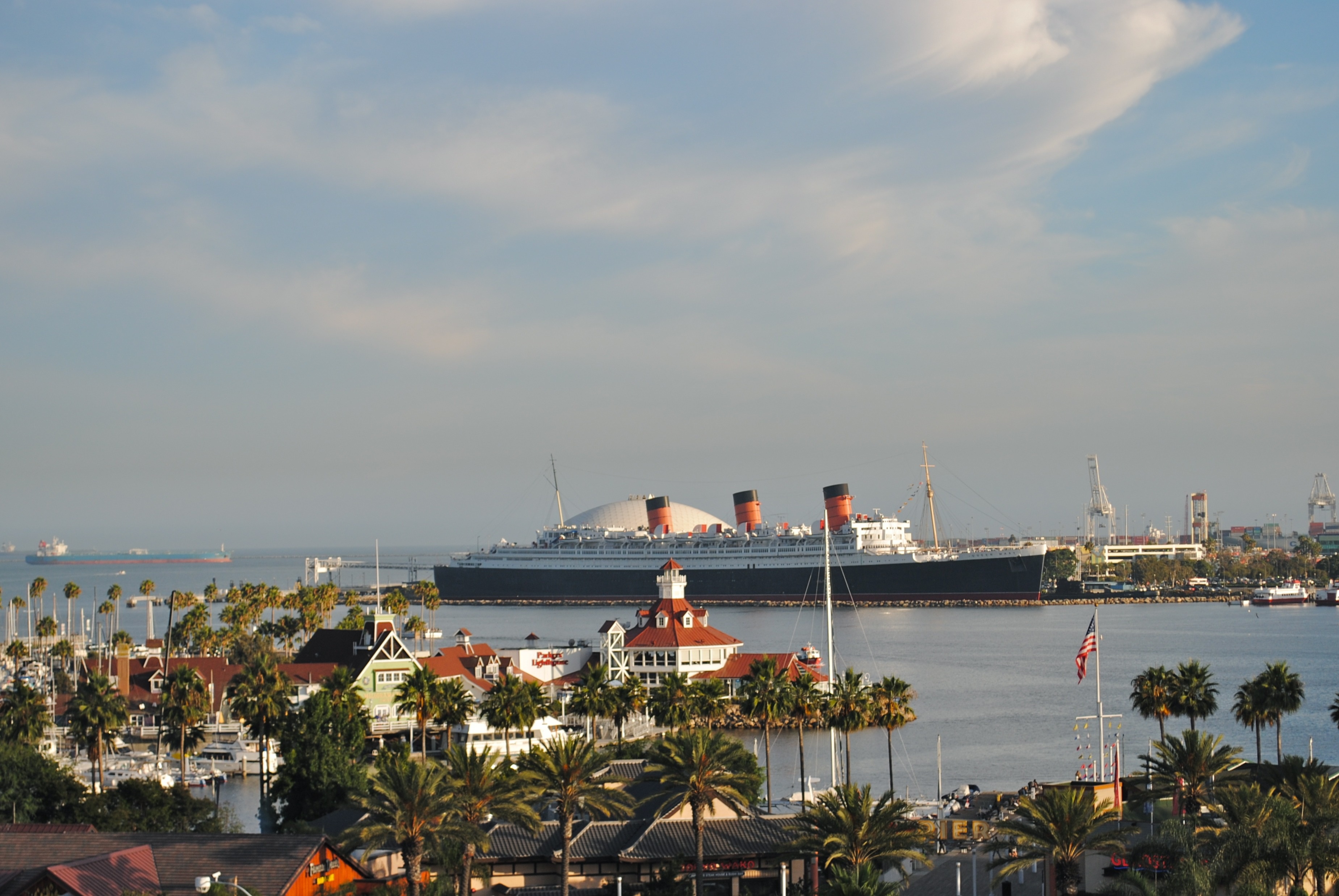
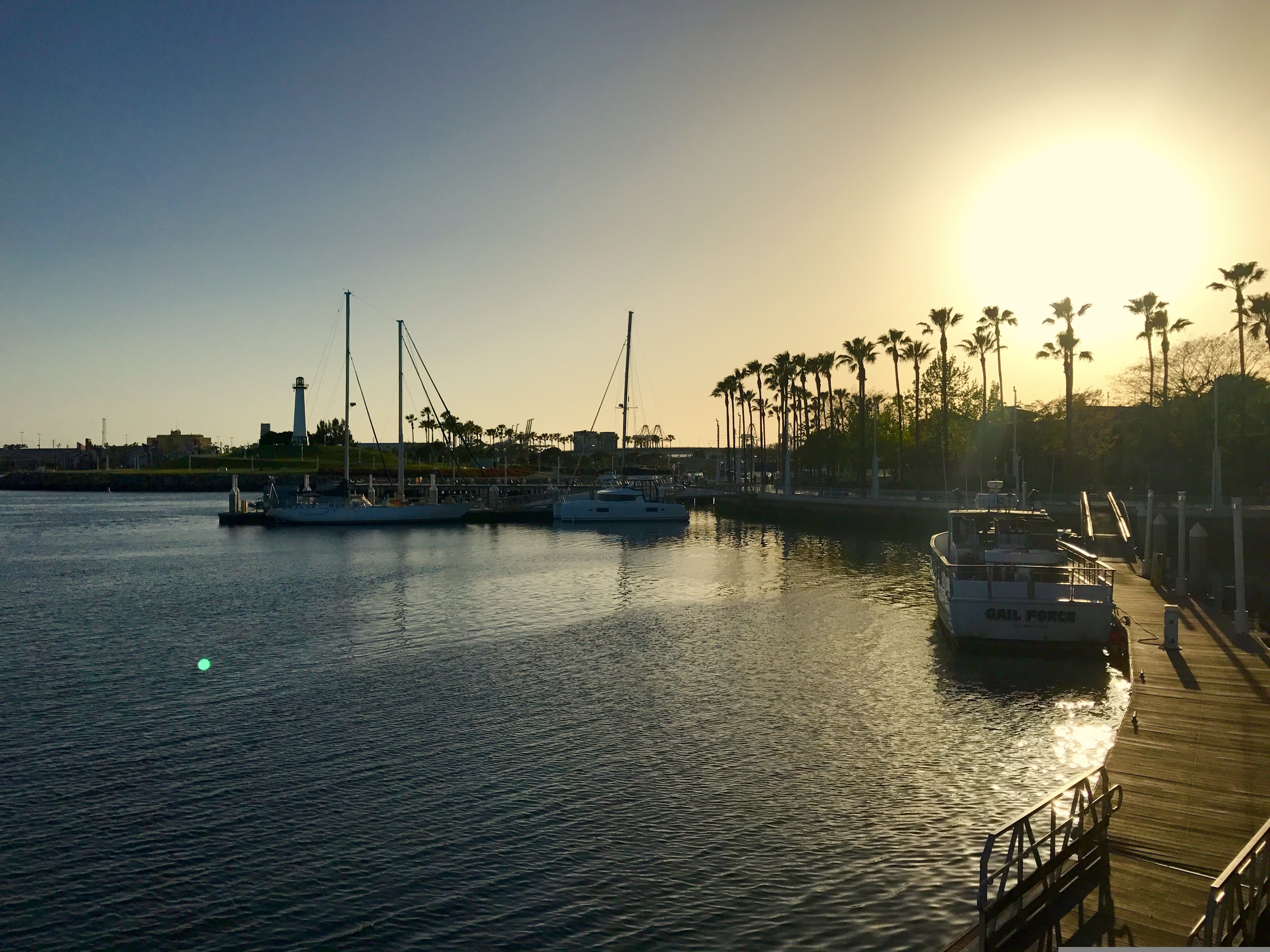
About Long Beach, California
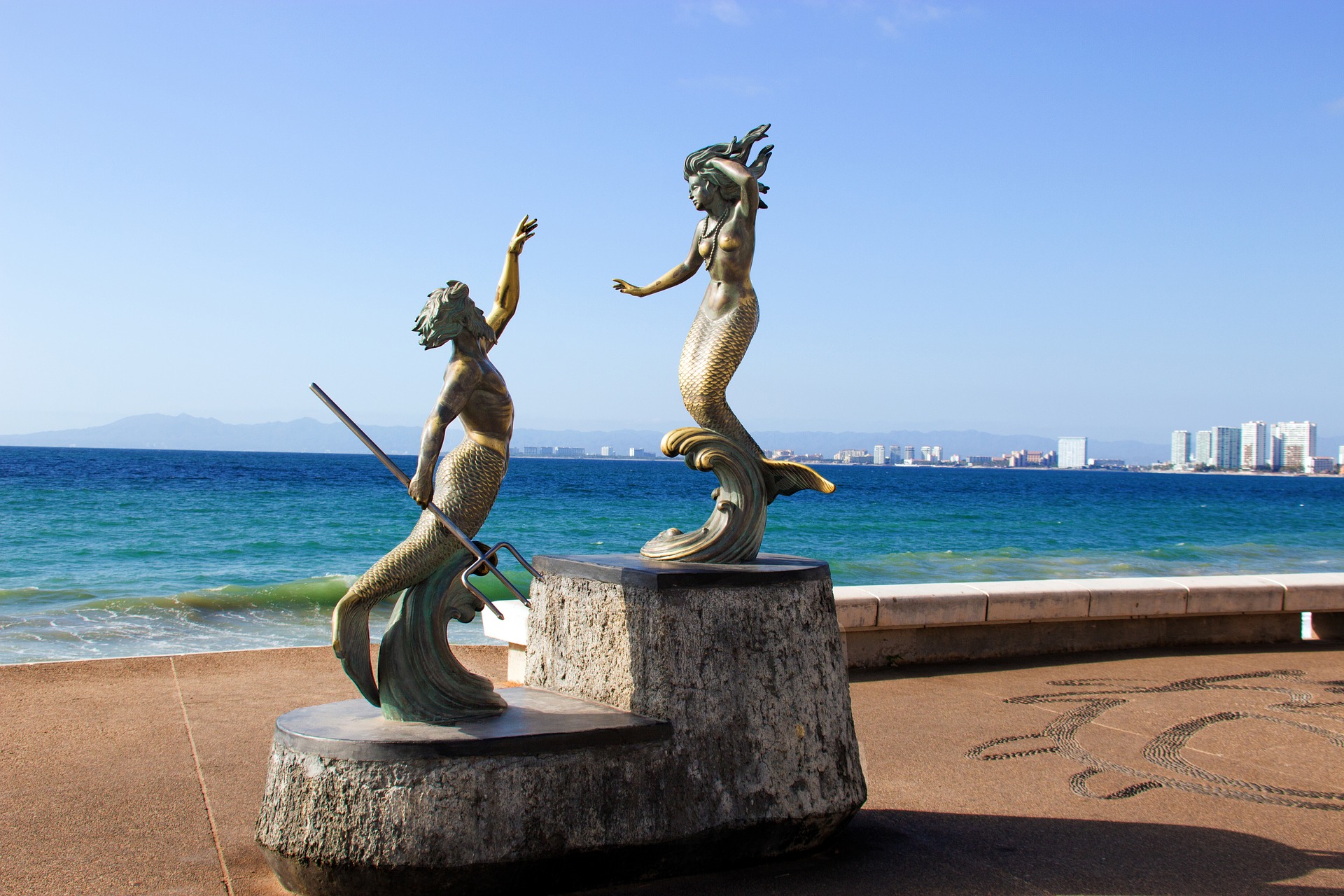
About Puerto Vallarta
Puerto Vallarta is a resort town on Mexico’s Pacific coast, in Jalisco state. It is known for its beaches, water sports and nightlife scene. Its cobblestone center is home to the ornate Nuestra Señora de Guadalupe church, boutique shops and a range of restaurants and bars. El Malecón is a beachside promenade with contemporary sculptures, as well as bars, lounges and nightclubs.
About Huatulco (Santa María Huatulco)
About Puerto Chiapas

About Puerto Quetzal
Puerto Quetzal is Guatemala's largest Pacific Ocean port. It is important for both cargo traffic and as a stop-off point for cruise liners

About Puntarenas
This town is not on the Nicoya Peninsula, but rather on Costa Rica's mainland. It is best known as a cruise-ship port and launching pad for ferries heading southeast to the coast of the Nicoya Peninsula and for cruises sailing out on the Gulf of Nicoya. Puntarenas is also a major fishing port with a lively fish market. The town’s reputation suffers from the unimpressive parts you see from your car as you roll through town on the way to the ferry dock. But the town has a lot of character off the main drag, thanks to its illustrious past as an affluent port town and principal vacation spot for San José's wealthy, who arrived by train in the last century. Once the port was moved and roads opened to other beaches, Puntarenas's economy crashed, but it's making a comeback. Sitting on a narrow spit of sand—punta de arenas literally means "point of sand"—that protrudes into the Gulf of Nicoya, the town boasts a beautifully groomed, wide Blue Flag beach with views of the Nicoya Peninsula and spectacular sunsets, along with a public swimming pool, the San Lucas Beach Club, and a marine-life museum. Ticos arrive by bus and car to enjoy the beach and stroll the Paseo de los Turistas, a beachfront promenade lined with tree-shaded concrete benches and seafood restaurants. Crowds of locals, called porteños, cruise by on bicycles, the town’s most popular form of transport.

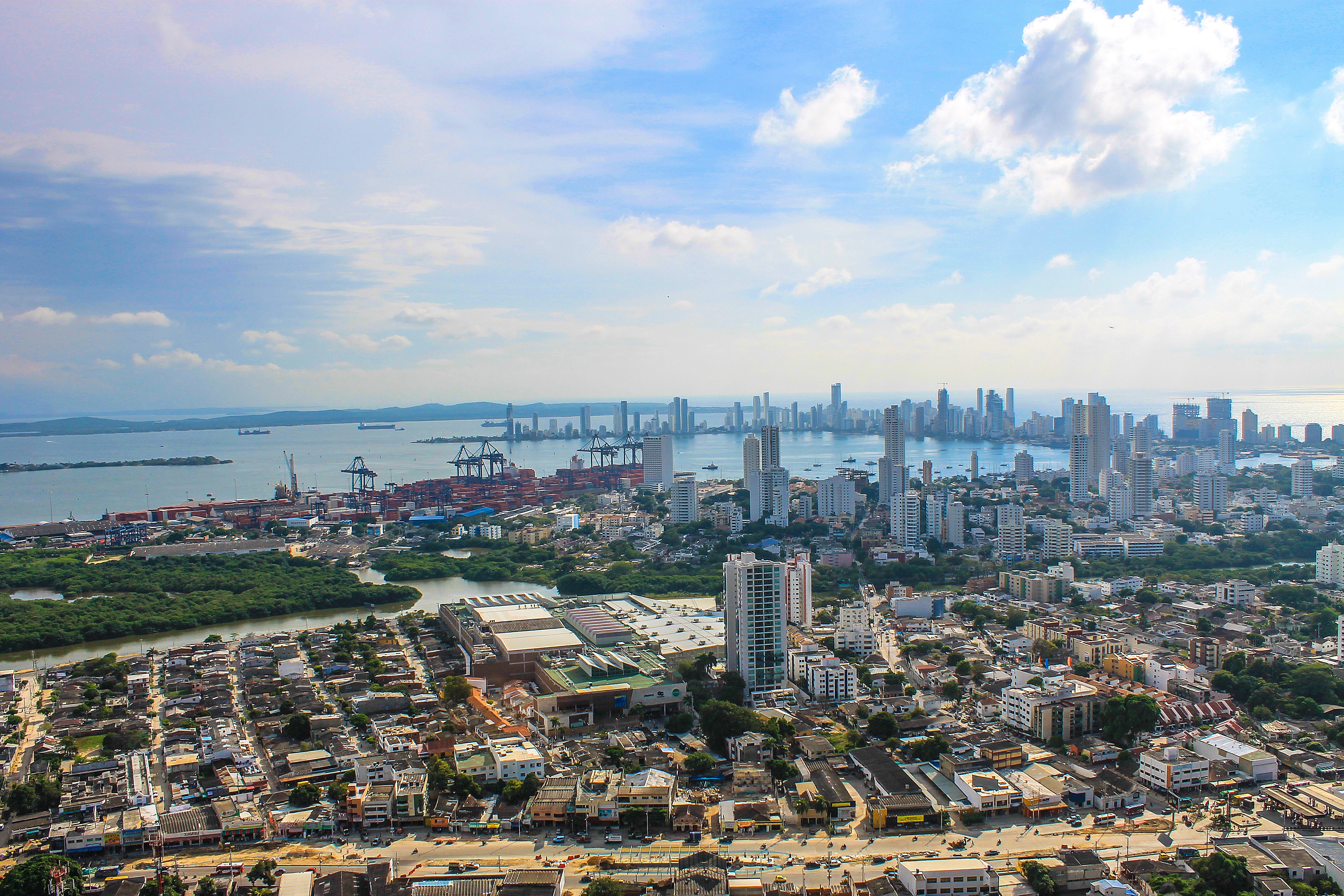
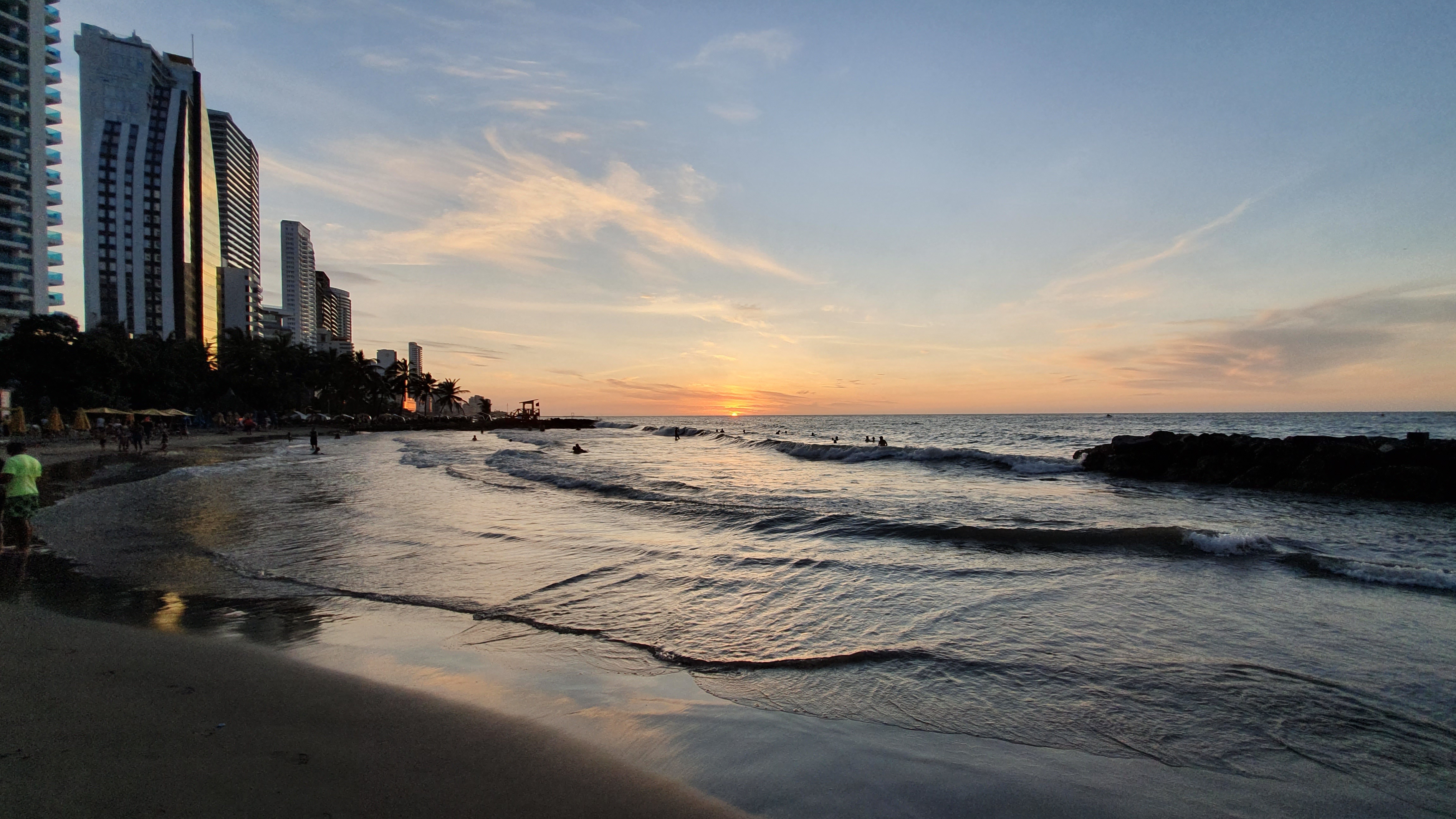
About Cartagena
Cartagena's magnificent city walls and fortresses, now a UNESCO World Heritage Site, enclose a well-restored historic center (the Cuidad Amurallada, or walled city) with plazas, churches, museums, and shops that have made it a lively coastal vacation spot for South Americans and others. New hotels and restaurants make the walled city a desirable place to stay, and the formerly down-at-the-heels Getsemaní neighborhood attracts those seeking a bohemian buzz. The historic center is a small section of Cartagena; many hotels are in the Bocagrande district, an elongated peninsula where high-rise hotels overlook a long, gray-sand beach.When it was founded in 1533 by Spanish conquistador Pedro de Heredia, Cartagena was the only port on the South American mainland. Gold and silver looted from indigenous peoples passed through here en route to Spain and attracted pirates, including Sir Francis Drake, who in 1586 torched 200 buildings. Cartagena's walls protected the city's riches as well as the New World's most important African slave market.
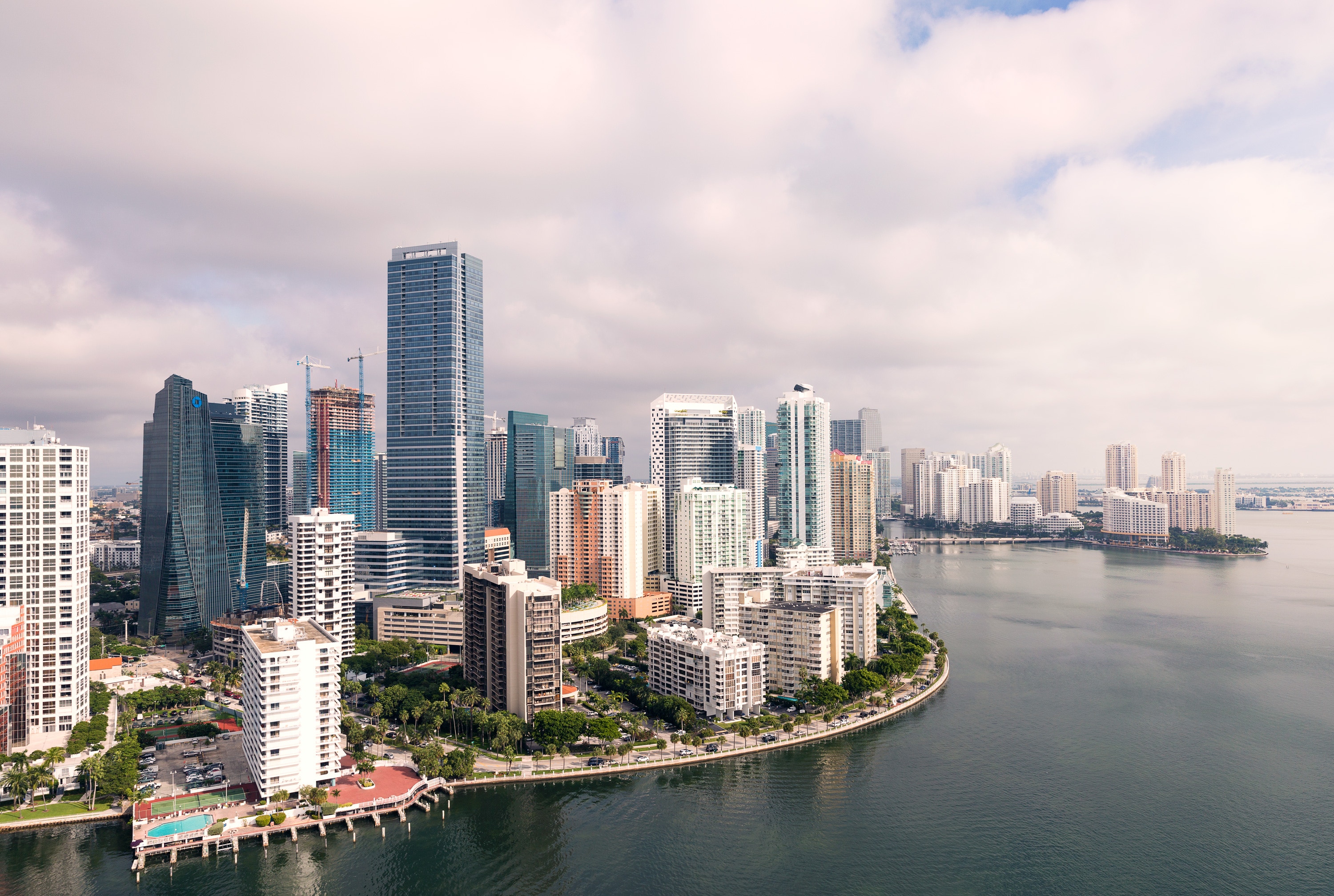
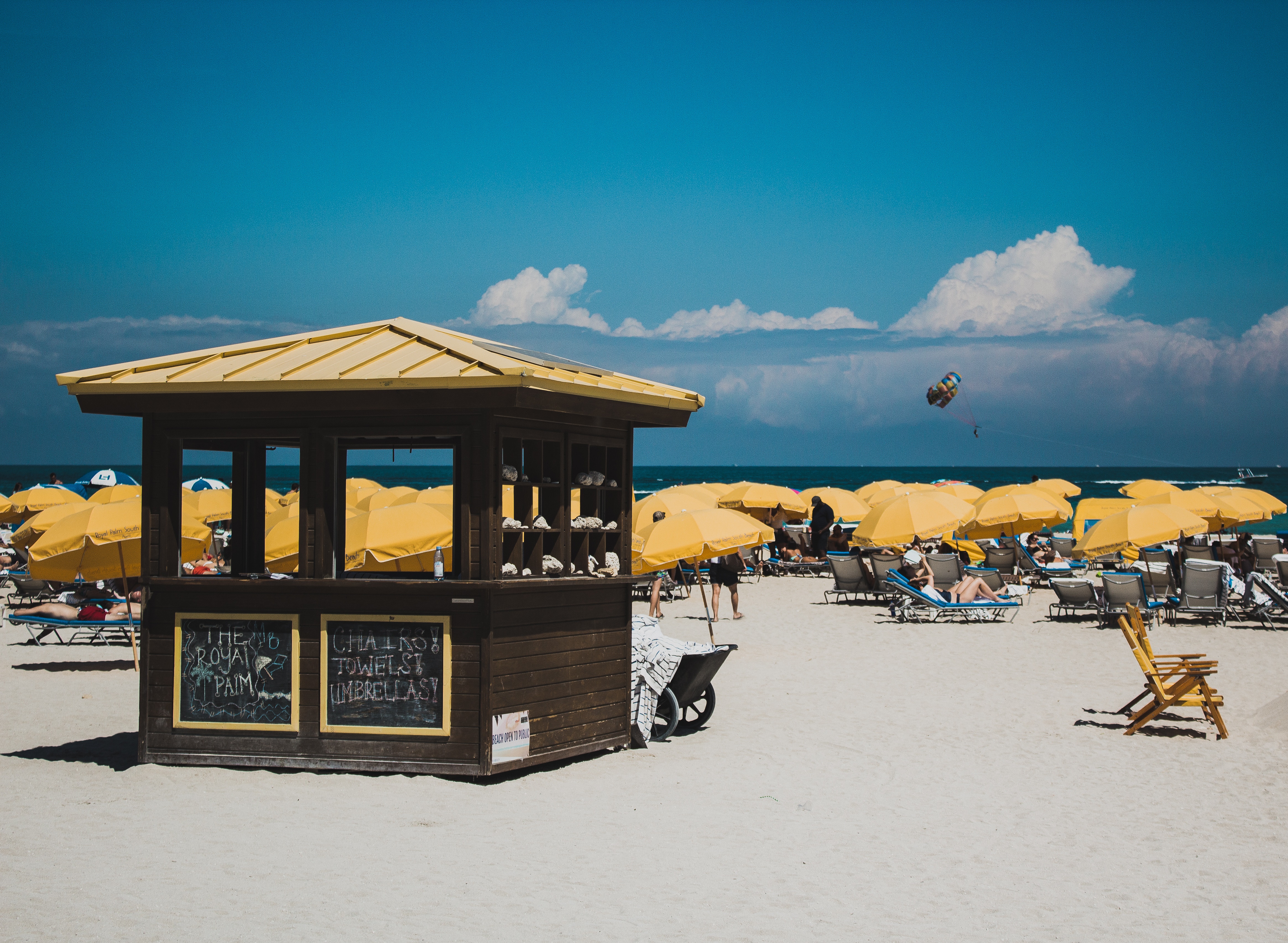
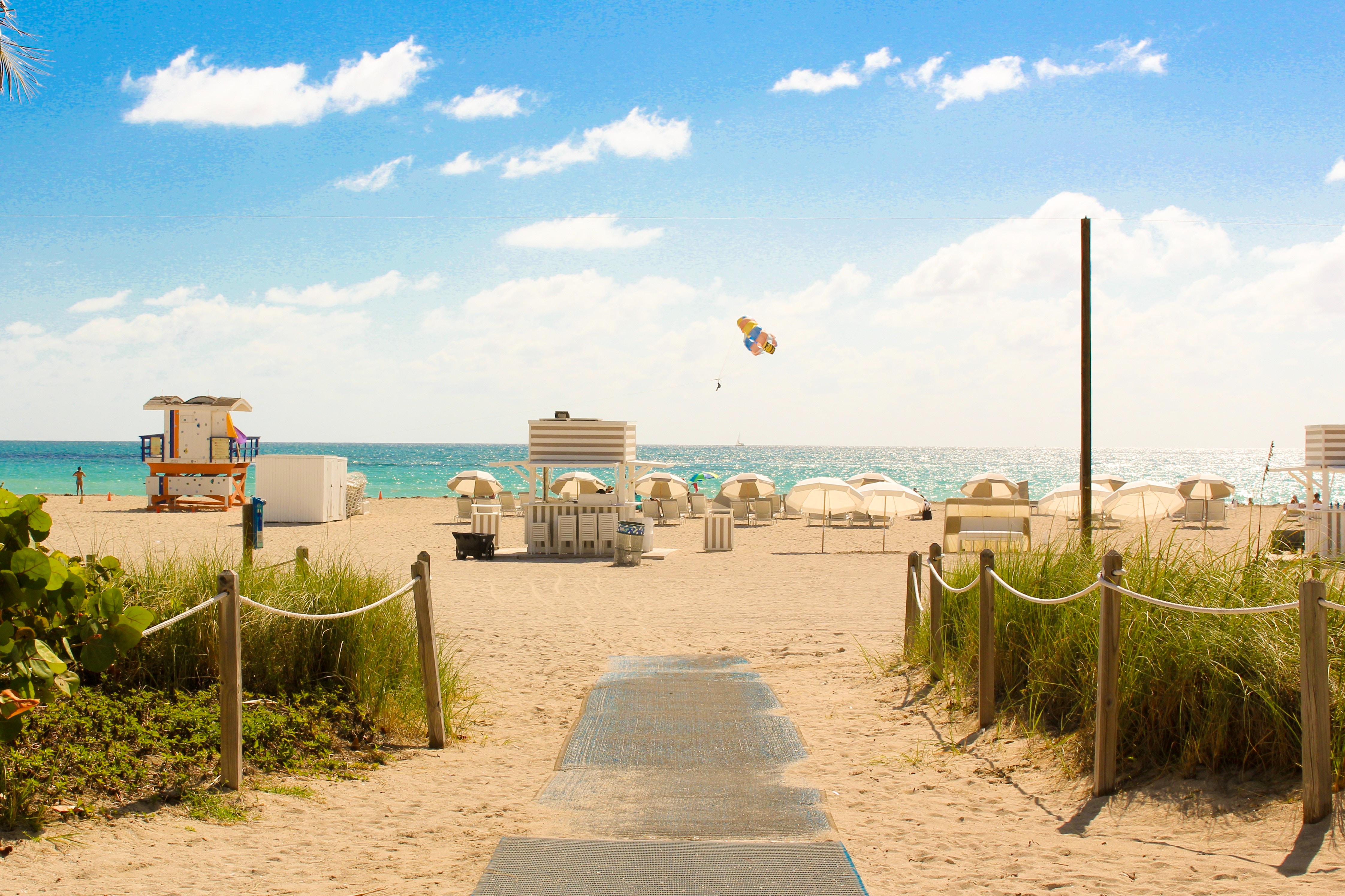
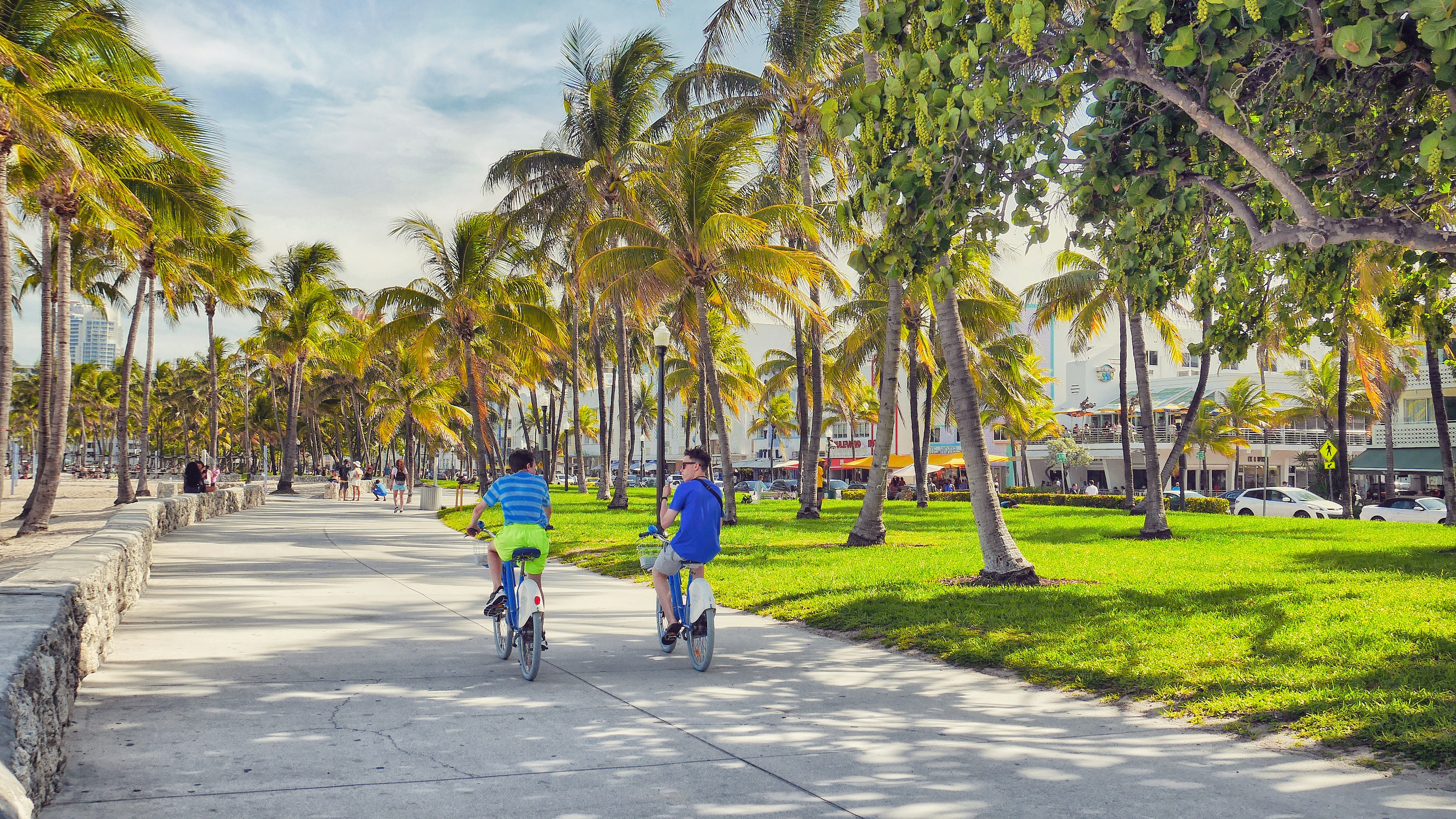
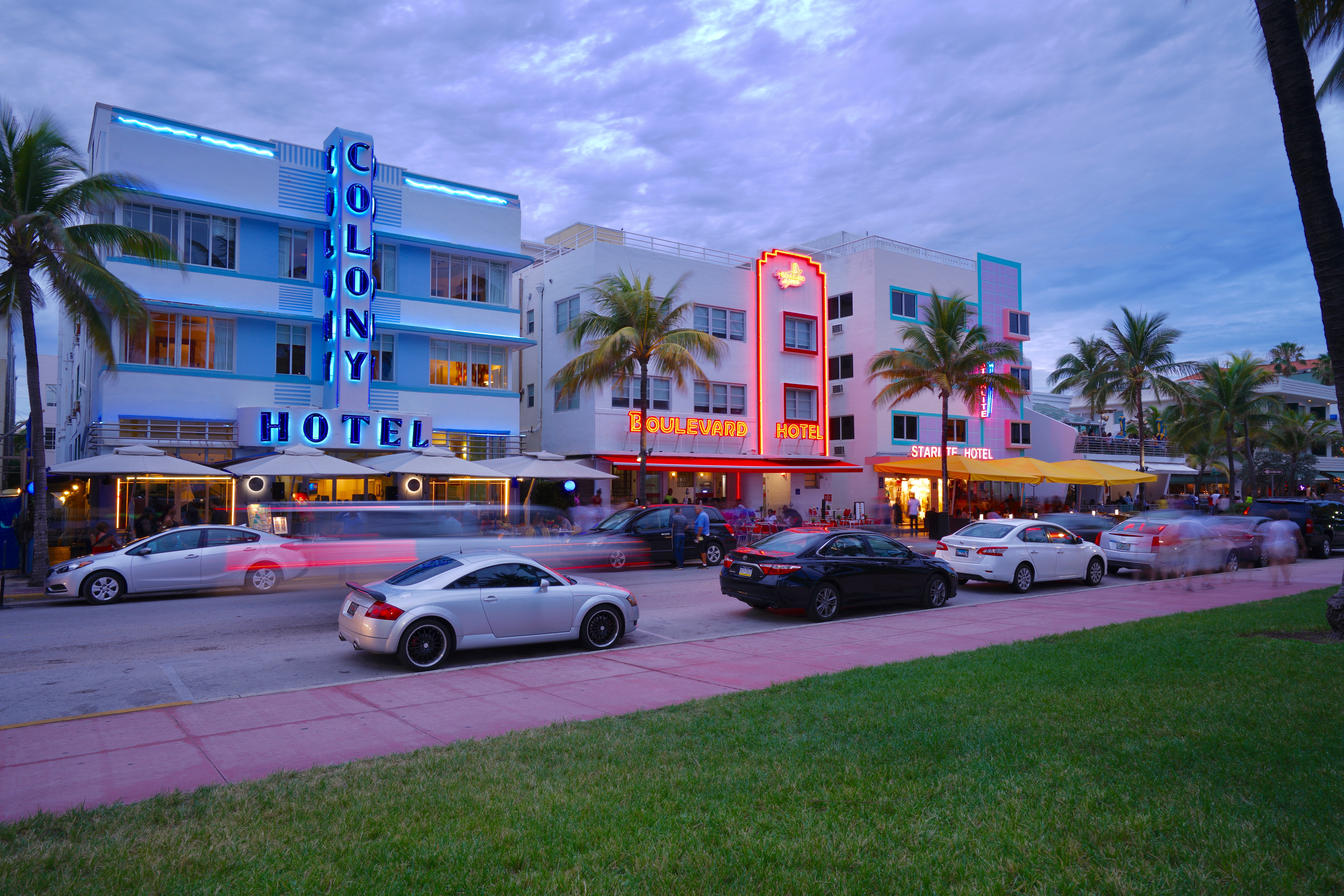
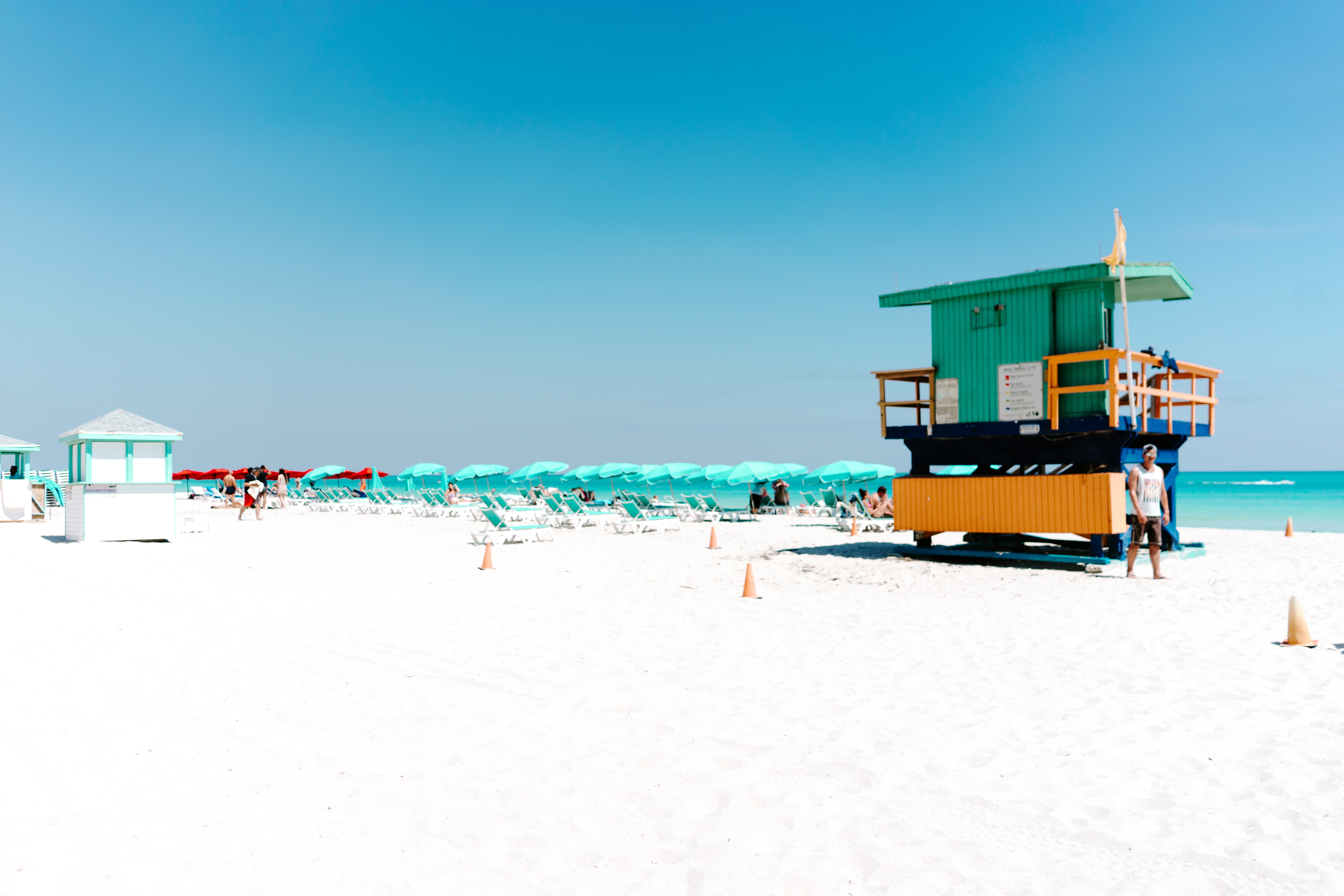
About Miami, Florida
Miami is one of the world’s most popular holiday spots. It has so much to offer; from its countless beach areas, to culture and museums, from spa and shopping days out, to endless cuban restaurants and cafes. Miami is a multicultural city that has something to offer to everyone.
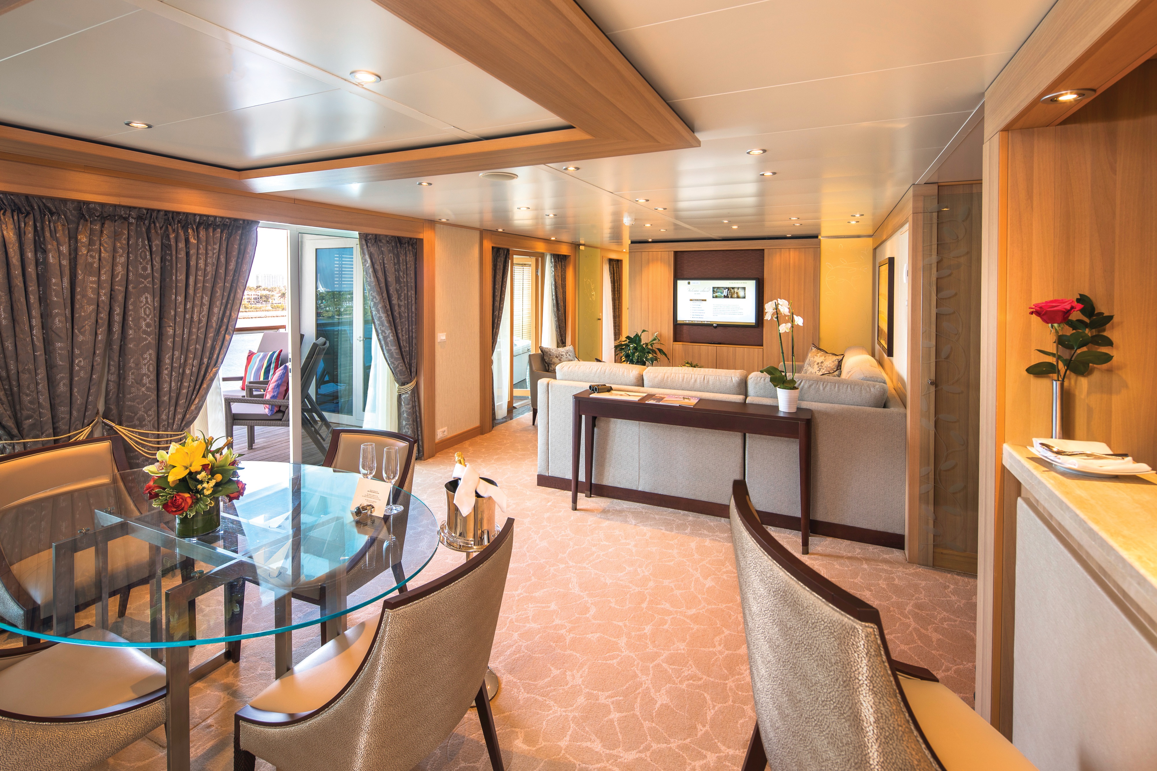
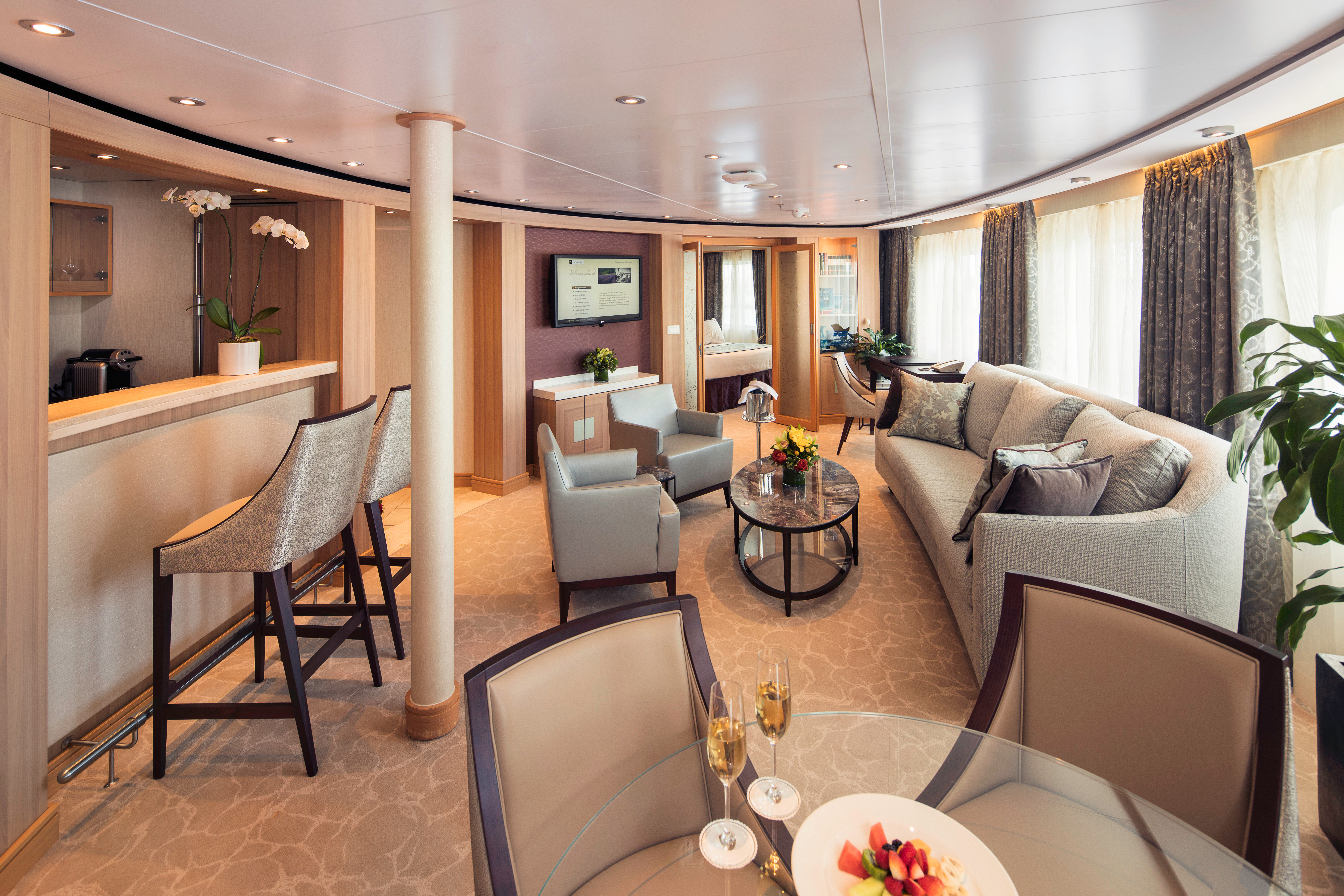
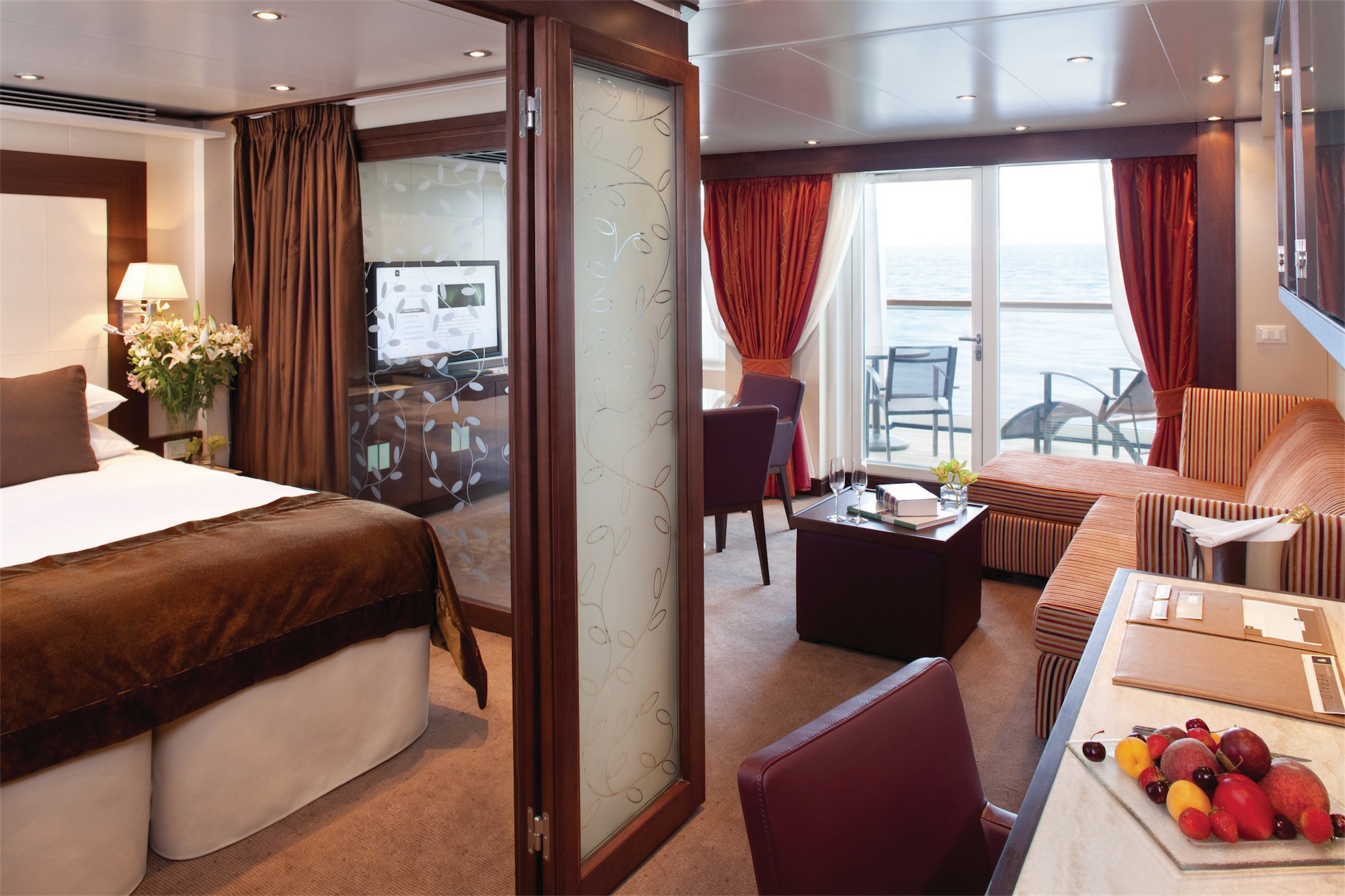
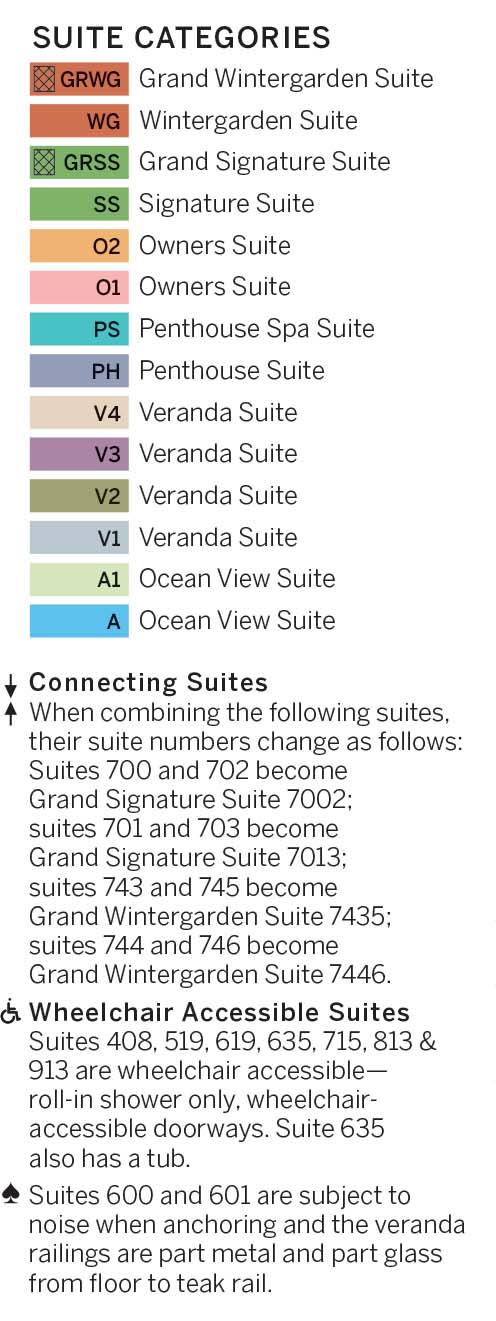
Suites on board feature a comfortable living area, private veranda, queen-size-bed or two twin beds; walk-in closet with personal safe, interactive flat-screen TV with music and movies, fully stocked bar and refrigerator, writing desk with personalized stationary, makeup vanity, spacious bathroom with separate tub and shower, plush robes, slippers hair dryer and 110/220V AC outlets.
Grand Wintergarden Suite feature
- Large windows
- Dining for four
- Glass-enclosed solarium with tub and day bed
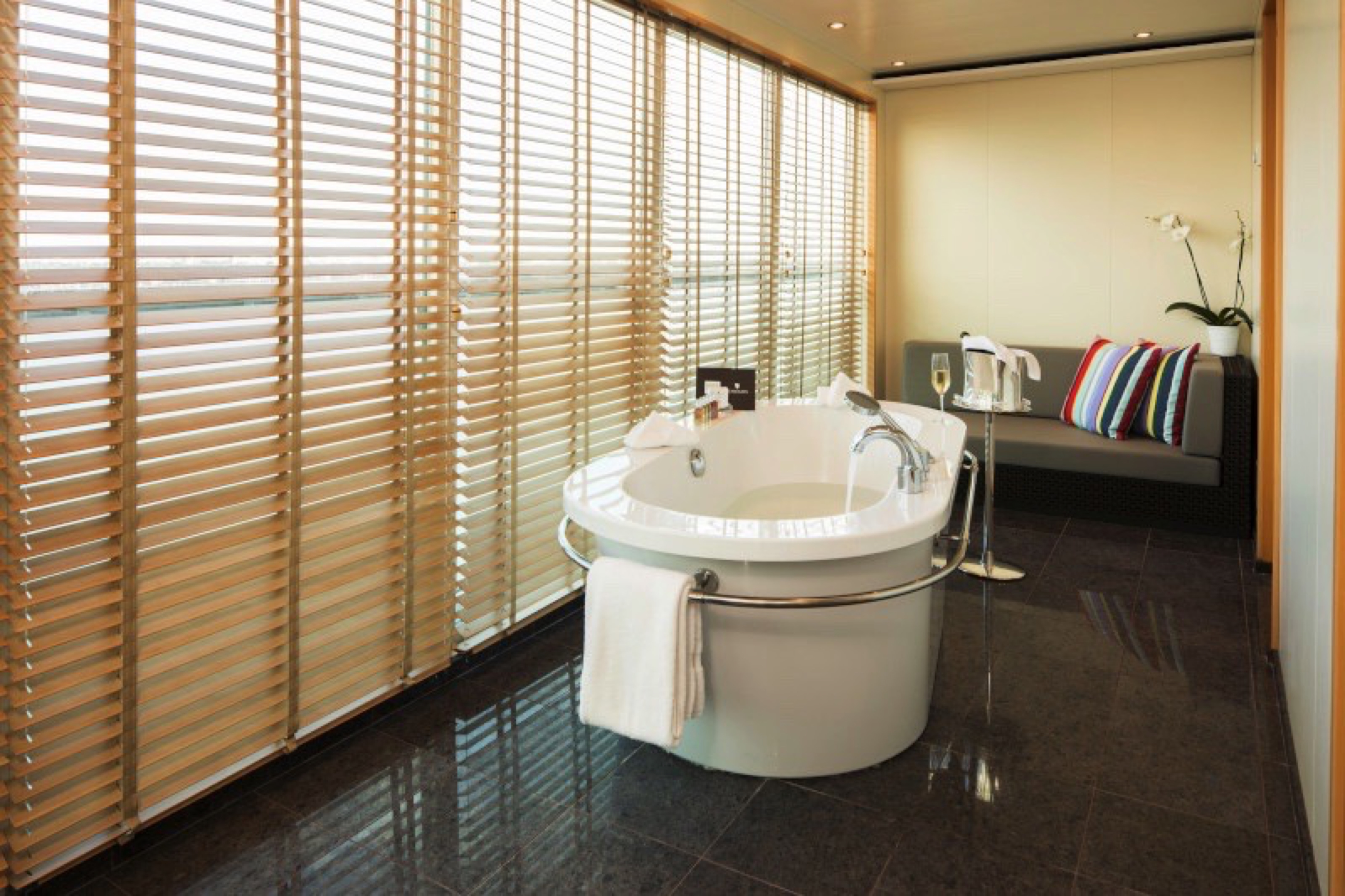
- Bathroom with whirlpool bathtub
- Guest bath
- Two bedrooms
- Convertible sofa bed for one
- Pantry with wet bar
- Two flat-screen TVs
- Complimentary Internet/Wi-Fi service
Suites on board feature a comfortable living area, private veranda, queen-size-bed or two twin beds; walk-in closet with personal safe, interactive flat-screen TV with music and movies, fully stocked bar and refrigerator, writing desk with personalized stationary, makeup vanity, spacious bathroom with separate tub and shower, plush robes, slippers hair dryer and 110/220V AC outlets.
Wintergarden Suite features
- Large windows
- Dining for four
- Bathroom with whirlpool bathtub
- Guest bath
- Convertible sofa bed for one
- Pantry with wet bar
- Glass-enclosed solarium with tub and day bed
- Two closets
- Two flat-screen TVs
- Complimentary Internet/Wi-Fi service
Suites on board feature a comfortable living area, private veranda, queen-size-bed or two twin beds; walk-in closet with personal safe, interactive flat-screen TV with music and movies, fully stocked bar and refrigerator, writing desk with personalized stationary, makeup vanity, spacious bathroom with separate tub and shower, plush robes, slippers hair dryer and 110/220V AC outlets.
Signature Suites features:
- Expansive ocean views
- Glass door to private veranda
- Comfortable living area
- Separate bedroom
- Queen-size bed or two twin beds
- Walk-in closet
- Dining for four
- Pantry with wet bar
- Two flat-screen TVs
- Complimentary Internet/Wi-Fi service.
- Guest bath
- Makeup vanity
- Bathroom with whirlpool bathtub
*Wheelchair accessible suites are roll-in shower only.
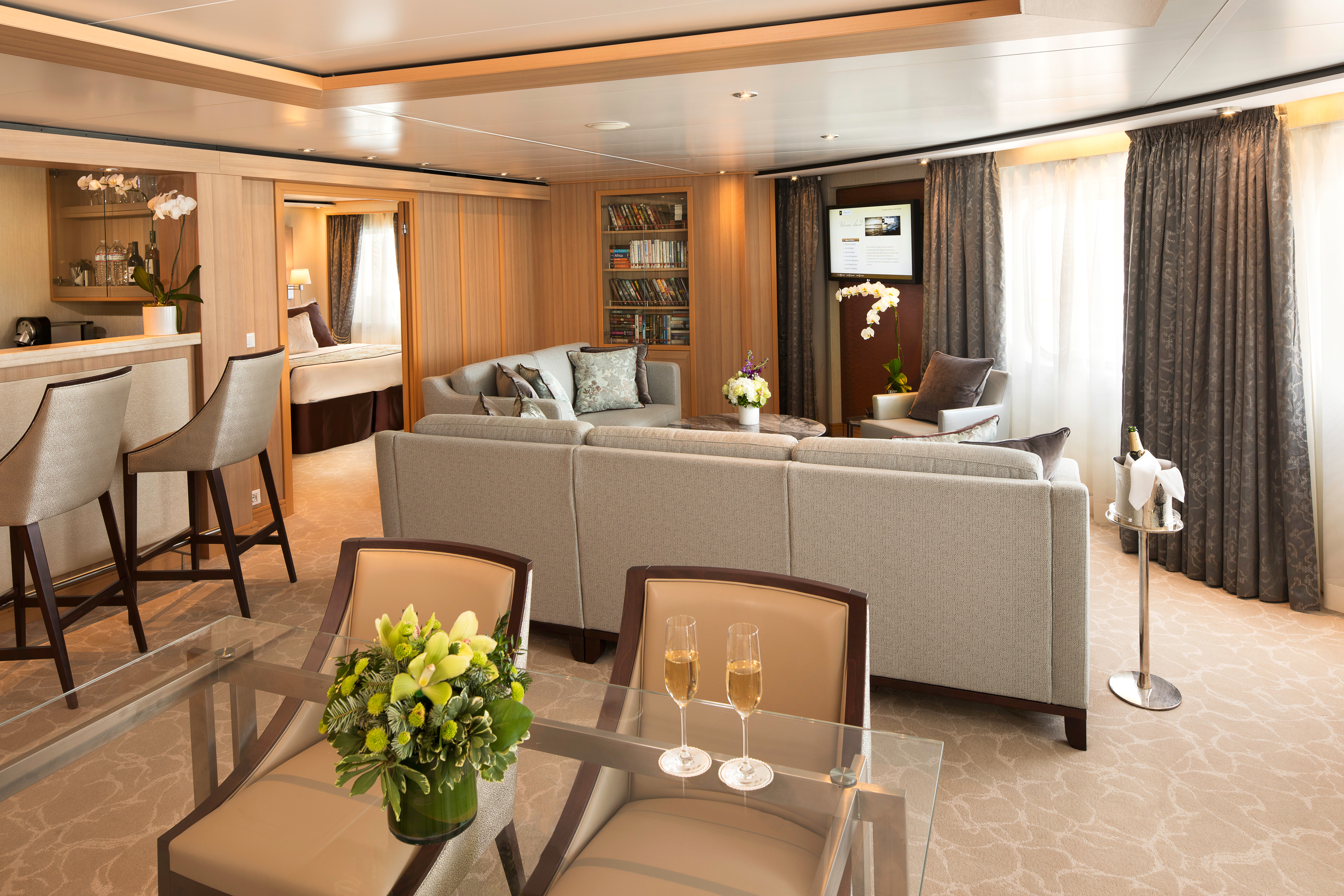
Suites on board feature a comfortable living area, private veranda, queen-size-bed or two twin beds; walk-in closet with personal safe, interactive flat-screen TV with music and movies, fully stocked bar and refrigerator, writing desk with personalized stationary, makeup vanity, spacious bathroom with separate tub and shower, plush robes, slippers hair dryer and 110/220V AC outlets.Owner's Suite feature:
- Expansive ocean views
- Glass door to private veranda
- Comfortable living area
- Separate bedroom
- Queen-size bed or two twin beds
- Walk-in closet
- Dining for four
- Pantry with wet bar
- Two flat-screen TVs
- Complimentary Internet/Wi-Fi service.
- Guest bath
- Makeup vanity
- Bathroom with whirlpool bathtub
*Wheelchair accessible suites are roll-in shower only.
All Penthouse Suites on board feature a comfortable living area, glass door to private veranda, queen-size-bed or two twin beds; walk-in closet with personal safe, two flat-screen TV with music and movies, fully stocked bar and refrigerator, writing desk with personalized stationary, makeup vanity, spacious bathroom with separate tub and shower, plush robes, slippers hair dryer and 110/220V AC outlets.Penthouse Spa Suite feature
- A full-length window
- Glass door to private veranda
- Comfortable living area
- Separate bedroom
- Queen-size bed or two twin beds
- Dining table for two to four
- Walk-in closet
- Two flat-screen TVs
- Fully stocked bar and refrigerator
- Makeup vanity
- Spacious bathroom with separate tub and shower
*Wheelchair accessible suites are roll-in shower only.
All Penthouse Suites on board feature a comfortable living area, glass door to private veranda, queen-size-bed or two twin beds; walk-in closet with personal safe, two flat-screen TV with music and movies, fully stocked bar and refrigerator, writing desk with personalized stationary, makeup vanity, spacious bathroom with separate tub and shower, plush robes, slippers hair dryer and 110/220V AC outlets.
All Penthouse Suite feature:
- Dining table for two to four
- Separate bedroom
- Glass door to veranda
- Two flat-screen TVs
- Fully stocked bar
- Spacious bathroom with tub, shower and large vanity.
All Penthouse Suites on board feature a comfortable living area, glass door to private veranda, queen-size-bed or two twin beds; walk-in closet with personal safe, two flat-screen TV with music and movies, fully stocked bar and refrigerator, writing desk with personalized stationary, makeup vanity, spacious bathroom with separate tub and shower, plush robes, slippers hair dryer and 110/220V AC outlets.
Guaranteed Suite: For this option we select the location and specific suite for you, and notify you prior to departure. Guests are guaranteed to be assigned a suite in the category selected or higher.
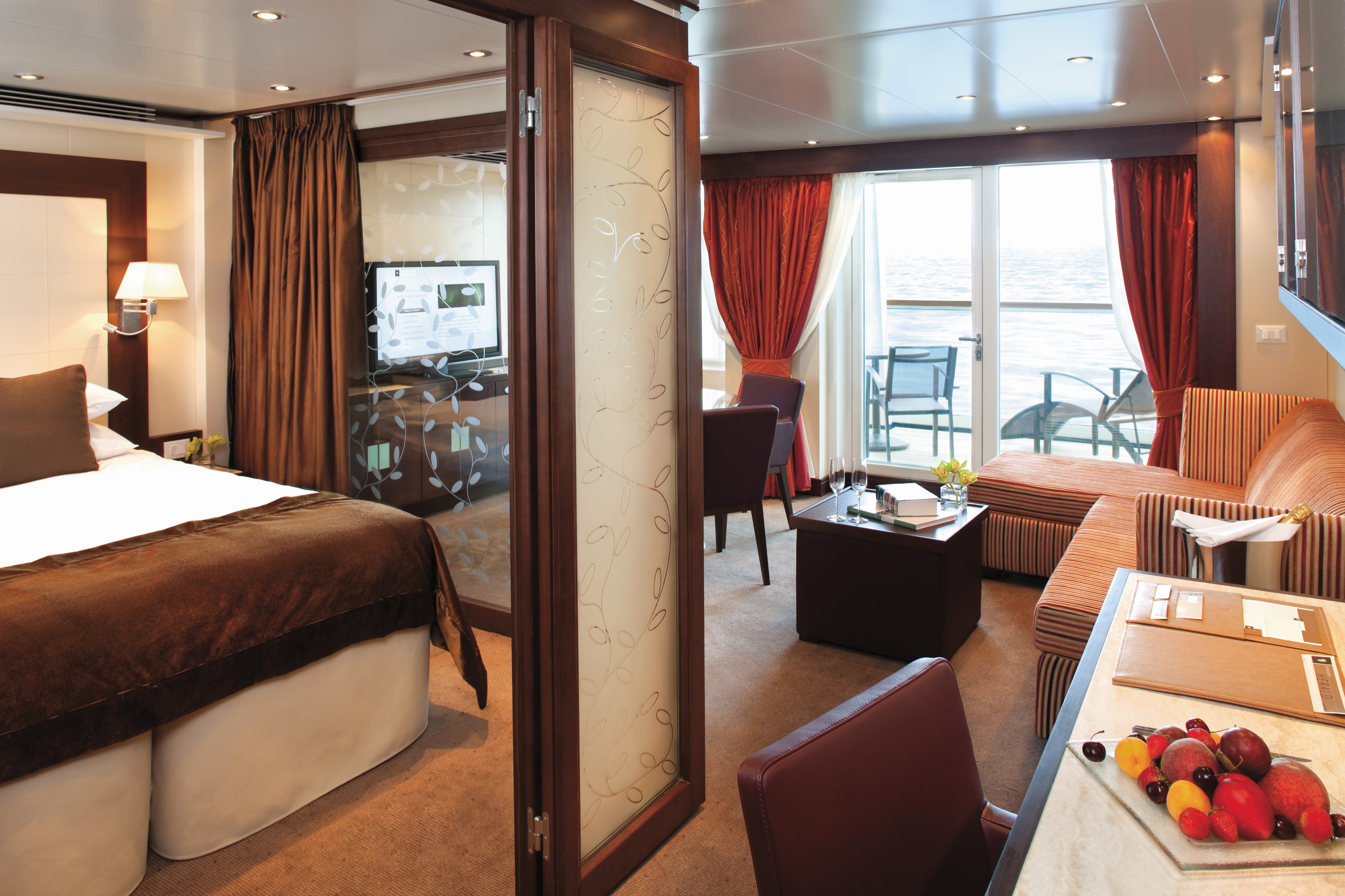
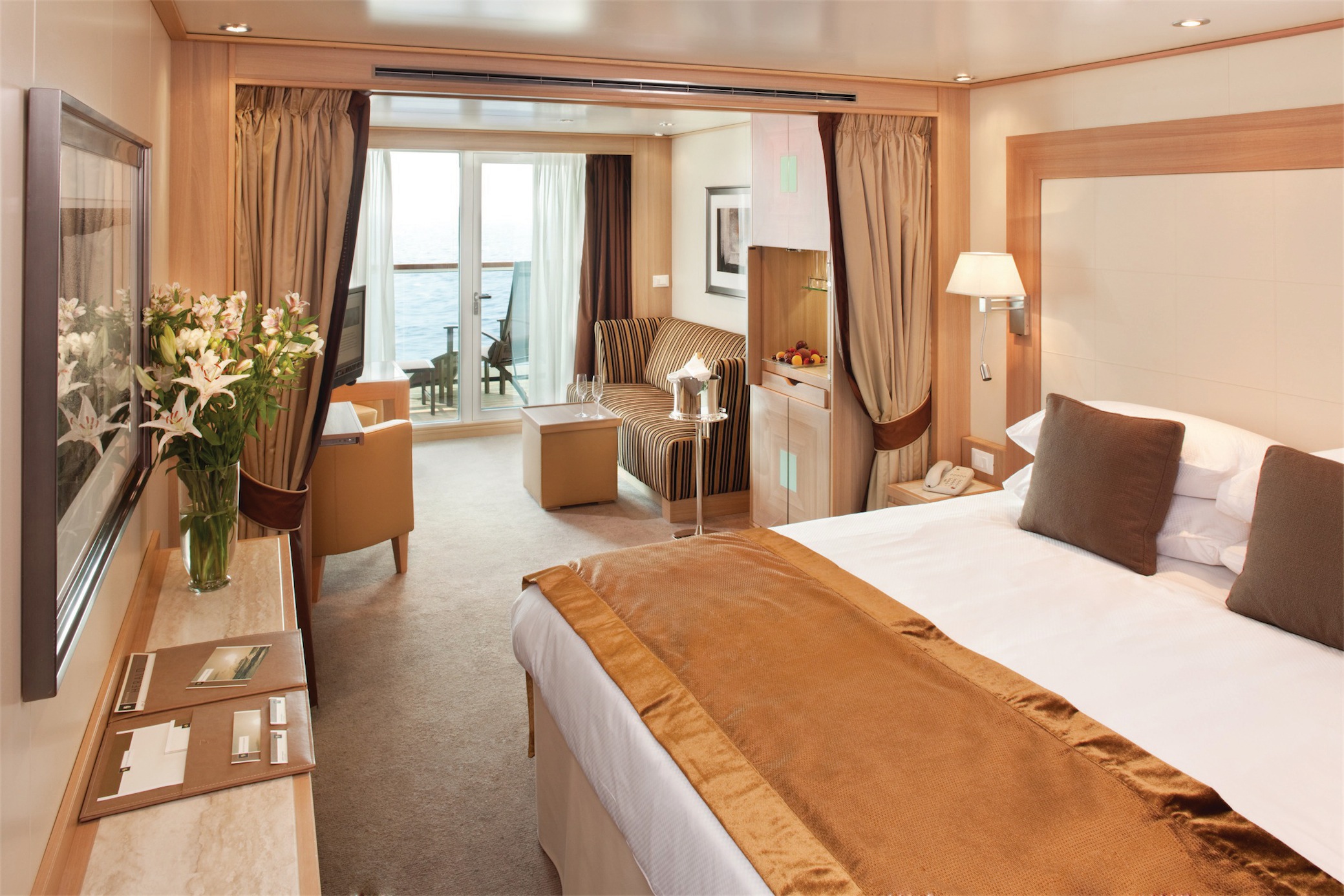
All Veranda Suites feature a full-length window and glass door to private veranda, comfortable living area, queen-size bed or two twin beds, dining table for two, walk-in closet, interactive flat-screen television with music and movies, fully stocked bar and refrigerator, makeup vanity, spacious bathroom with separate tub and shower.
Veranda Suite feature:
- A full-length window
- Glass door to private veranda
- Comfortable living area
- Queen-size bed or two twin beds
- Dining table for two
- Walk-in closet
- Interactive flat-screen television with music and movies
- Fully stocked bar and refrigerator
- Makeup vanity
- Spacious bathroom with separate tub and shower
*Wheelchair accessible suites are roll-in shower only.
All Veranda Suites feature a full-length window and glass door to private veranda, comfortable living area, queen-size bed or two twin beds, dining table for two, walk-in closet, interactive flat-screen television with music and movies, fully stocked bar and refrigerator, makeup vanity, spacious bathroom with separate tub and shower.
Guaranteed Suite: For this option we select the location and specific suite for you, and notify you prior to departure. Guests are guaranteed to be assigned a suite in the category selected or higher.
All Ocean View Suites feature a large picture window, comfortable living area, queen-size bed or two twin beds, dining table for two, walk-in closet, interactive flat-screen television with music and movies, fully stocked bar and refrigerator, makeup vanity, spacious bathroom with separate tub and shower. Approximately 295 sq. ft. (28 sq.m.) of inside space
Ocean View Suite feature:
- A large picture window
- Comfortable living area
- Queen-size bed or two twin beds
- Dining table for two
- Walk-in closet
- Interactive flat-screen television with music and movies
- Fully stocked bar and refrigerator
- Makeup vanity
- Spacious bathroom with separate tub and shower
*Wheelchair accessible suites are roll-in shower only.
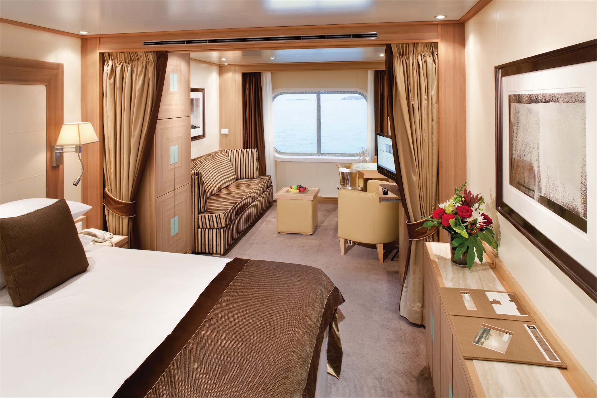
All Ocean View Suites feature a large picture window, comfortable living area, queen-size bed or two twin beds, dining table for two, walk-in closet, interactive flat-screen television with music and movies, fully stocked bar and refrigerator, makeup vanity, spacious bathroom with separate tub and shower. Approximately 295 sq. ft. (28 sq.m.) of inside space
Guaranteed Suite: For this option we select the location and specific suite for you, and notify you prior to departure. Guests are guaranteed to be assigned a suite in the category selected or higher.
Guaranteed Suite: For this option we select the location and specific suite for you, and notify you prior to departure. Guests are guaranteed to be assigned a suite in the category selected or higher.

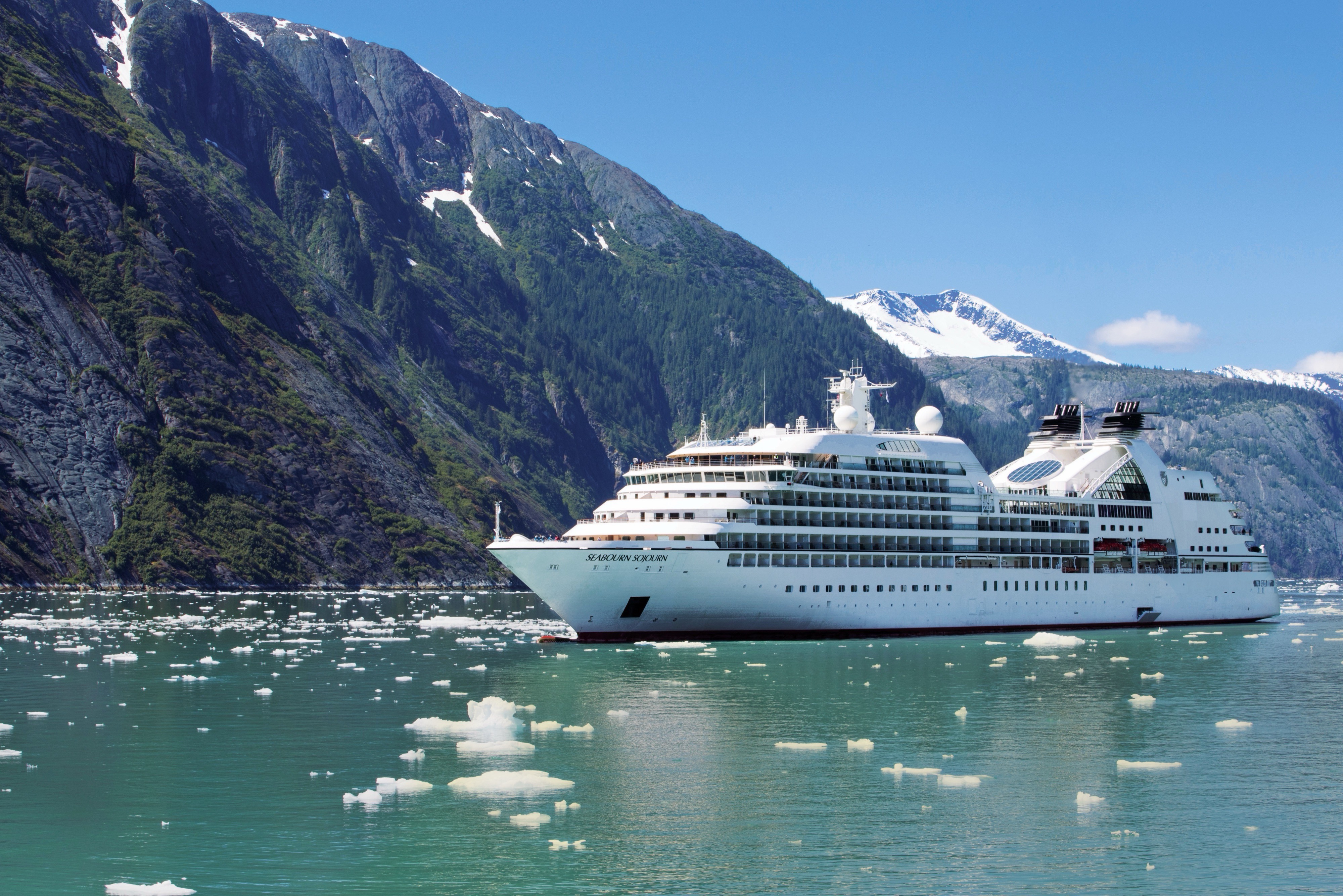
Seabourn Sojourn
Seabourn Sojourn enchants her guests with an array of public areas scaled to encourage a relaxed sociability. One of the most unusual features of Seabourn Sojourn and her sisters is Seabourn Square, an ingenious "living room" that replaces the traditional cruise ship lobby with a welcoming lounge filled with easy chairs, sofas and cocktail tables; making it more inviting and relaxing on a small ship cruise. An enclave in its center houses knowledgeable concierges discreetly seated at individual desks.
Experience Seabourn Sojourn
Seabourn Sojourn (launched 2010), an oceangoing ship with a passenger capacity of just 458 guests, offers spacious accommodations spanning categories ranging in size from 295 to 1,182 square feet of indoor space. Verandas add an additional 65 to 558 square feet of outdoor living area spacious enough for private al fresco dining. All suites feature a comfortable living area, walk-in closet, fully stocked bar and refrigerator filled with seaside favorites. Expansive ocean views are framed by either a picture window or the glass doors of the veranda.
Ship Facts
| Launch Year | 2010 | ||||||||
| Refit Year | 2018 | ||||||||
| Language | en | ||||||||
| Gross Tonnage | 32000 | ||||||||
| Length | 198 | ||||||||
| Width | 25.6 | ||||||||
| Currency | USD | ||||||||
| Speed | 19 | ||||||||
| Capacity | 458 | ||||||||
| Crew Count | 330 | ||||||||
| Deck Count | 10 | ||||||||
| Cabin Count | 229 | ||||||||
| Large Cabin Count | 10 | ||||||||
| Wheelchair Cabin Count | 7 | ||||||||
| Electrical Plugs |
|
To see the legend for these deck plans, please hover your mouse over the images below
To toggle the legend for these deck plans, please tap on any of the images below
Deck 11
- Sun Terrace
- The Retreat

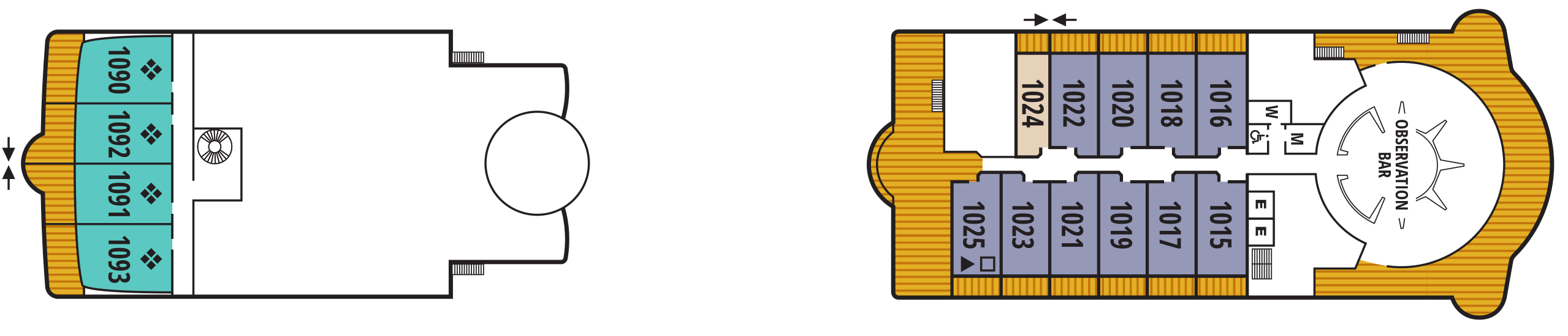
Deck 10
- Observation Bar
- Penthouse Suites
- Veranda Suite
- Penthouse Spa Suite
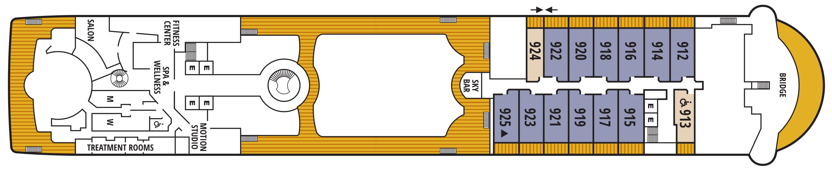
Deck 9
Bridge
- Sky Bar
- Fitness Centre
- Motion Studio
- Spa & Wellness Area
- Salon
- Treatment Rooms
- Penthouse Suites
- Veranda Suites (x1 Accessible Suite)
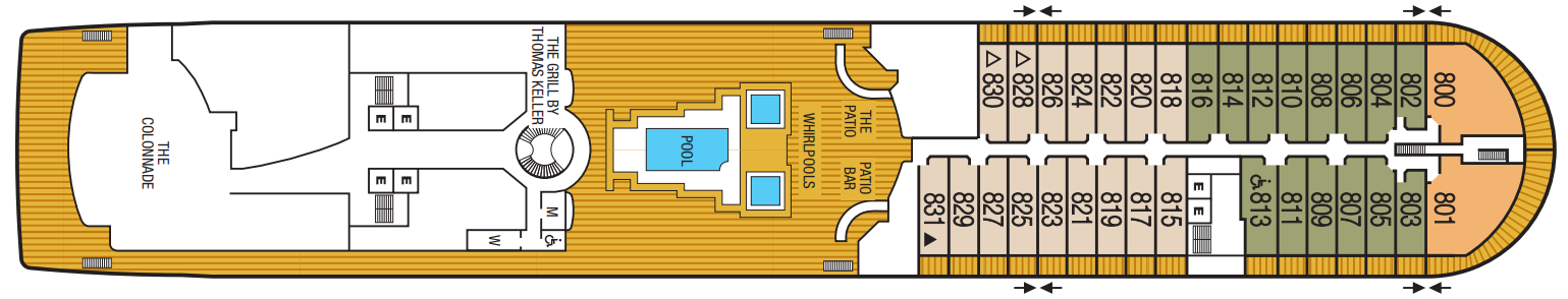
Deck 8
The Patio
- Patio Bar
- Whirlpools
- Pool
- Solis
- The Colonnade
- Owner's Suites
- Veranda Suites (x1 Accessible Suite)
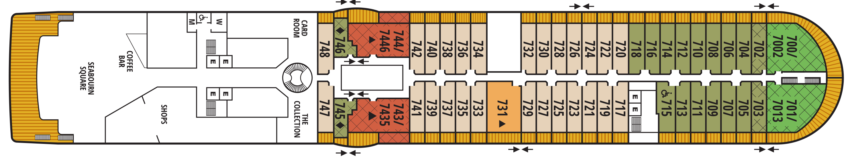
Deck 7
Card Room
- The Collection
- Shops
- Coffee Bar
- Seabourn Square
- Grand Wintergarden Suite
- Wintergarden Suite
- Grand Signature Suites
- Signature Suites
- Owner's Suites
- Veranda Suites (x1 Accessible Suite)
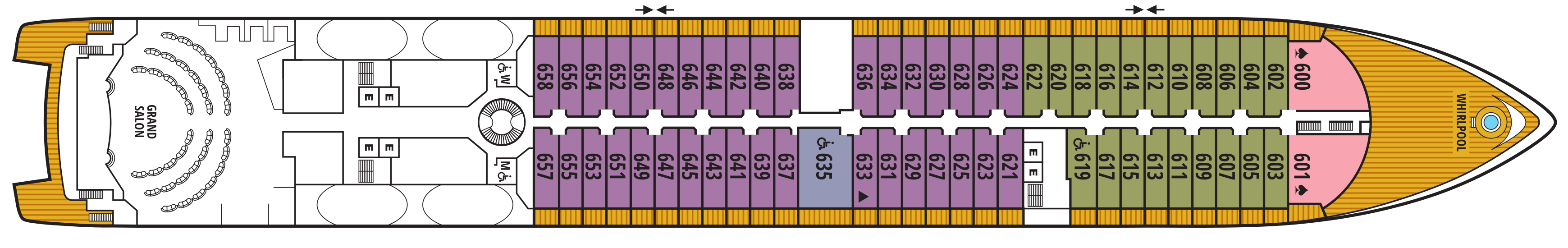
Deck 6
Whirlpool
- Grand Salon
- Owner's Suites
- Veranda Suites
- Penthouse Suite (x1 Accessible Suite)
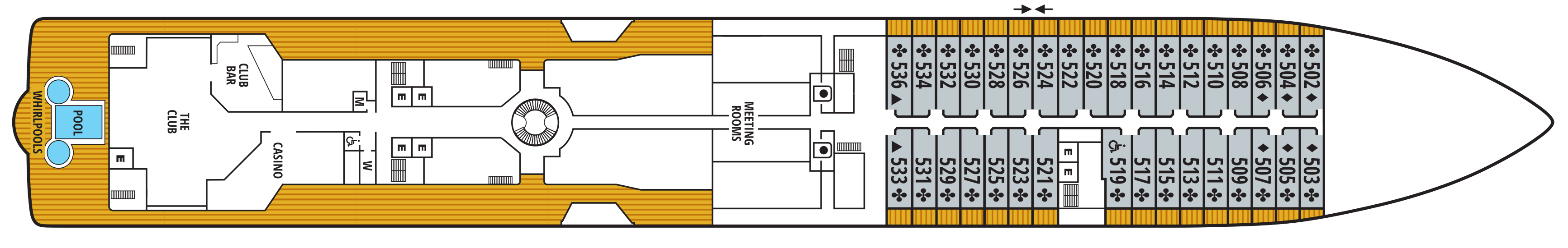
Deck 5
- Meeting Rooms
- Casino
- Club Bar
- The Club
- Pool
- Whirlpools
- Veranda Suites (x1 Accessible Suite)
Deck 4
- The Restaurant
- Galley
- Ocean View Suites (x1 Accessible Suite)

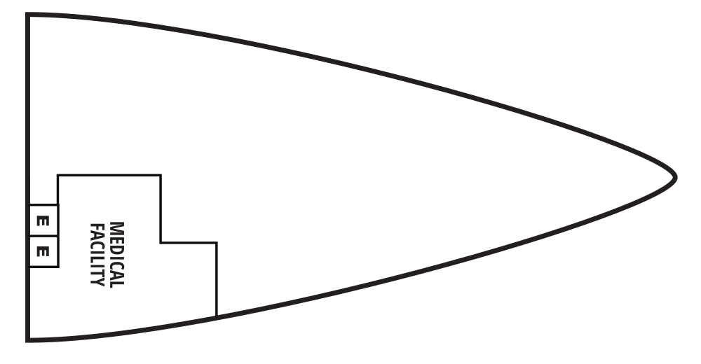
Deck 3
- Medical Facility
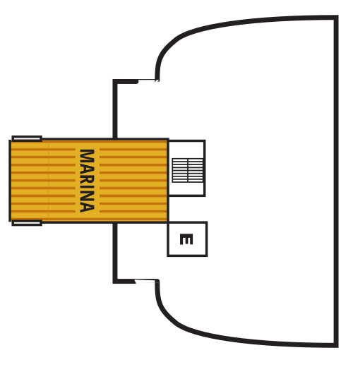
Deck 2
- Marina
Seabourn’s award-winning cuisine starts with the finest quality ingredients, infused with authentic regional flavors, prepared á la minute by our skilled chefs and served with pride. Each Seabourn ship offers a choice of dining venues to suit your mood of the moment, and nearly all are open-seating, inviting you to dine where, when and with whom you wish. Complimentary fine wines are poured with lunch and dinner, and there is never an extra charge for any dining choice. You can even enjoy a meal in your suite or on your veranda, with our compliments. Seabourn is a proud member of Chaîne des Rôtisseurs, one of the world’s most prestigious gastronomic societies devoted to the art of fine dining.
The Restaurant
Before Seabourn, open-seating dining on a cruise ship was unheard of. Come when you like, with whom you please, and be seated as you wish. The room is beautiful, the cuisine is exquisite, and the service is simultaneously flawless, friendly and fun.
The Colonnade
Our more casual, indoor/outdoor alternative, features an open kitchen, lavish buffets or table service for breakfasts and lunch, and serves regionally themed, bistro-style dinners with table service nightly.
Solis
Offering light, modern Mediterranean cuisine bursting with color and character, prepared fresh and entirely from scratch.
Solis will showcase a vibrant, chic atmosphere with feel-good background music and a menu reminiscent of our favorite travel memories. Solis was developed in collaboration with longtime Seabourn partners, Master Chef and Culinary Partner Chef Anton Egger, and Senior Corporate Chef Franck Salein. Chef Egger and Chef Salein are the culinary masterminds behind two of Seabourn’s most popular dining concepts – Earth & Ocean and Sushi.
Beyond the culinary, guests will be able to indulge in a truly sophisticated experience with Seabourn’s newly presented, refined vintage cocktail menu, featuring an allure of classic cocktails crafted to perfection. From classics such as the Kir Royale or Mauresco to the always — and most popular — Aperol Spritz, our team of talented mixologists have meticulously curated this menu to ensure that every drink is a masterpiece of flavors and aesthetics.
An evening at Solis is designed to delight our guests and leave them with lasting Seabourn Moments.
The Patio
Relaxed poolside dining offering luncheon buffets, salads, soups, grilled specialties and freshly baked pizza. Dinners feature a full menu in an alfresco setting.
In-Suite Dining
Seabourn is pleased to offer a varied menu available around the clock for service in your suite. You may also order dinner from The Restaurant menu and have your meal served, course by course, in your suite or on your veranda.
Earth & Ocean
Each evening, our skilled Earth & Ocean chefs create an imaginative array of fresh, inventive dishes—a sophisticated menu celebrating eclectic traditional flavors from around the world, served in a relaxed setting under the stars for a distinctive dining experience unlike any other on board.
Sushi
Seabourn researched the best ingredients and developed a menu that is a perfect blend of authenticity to maintain the root of the cuisine, and a twist of Seabourn’s culinary expertise. The sushi concept is a modern line that is steeped in tradition using the finest ingredients. Hamachi, tuna, shrimp and other fresh fish products will be shipped from Japan to Sushi and served à la carte for dinner. The menu features caviar and small plates, along with a selection of maki rolls, sushi and sashimi, and salads. In addition, the restaurant will feature three varieties of bento boxes for lunch: meat, seafood and vegetarian.
The Seabourn sushi experience is available in our traditional sushi restaurant aboard Seabourn Ovation and Seabourn Encore.
Seabourn Sojourn, Seabourn Quest, Seabourn Venture, and Seabourn Pursuit offer Sushi in The Club, serving a variety of light sushi bites freshly made to order each evening.
Seabourn Sojourn features a range of entertainment facilities, including lounges, bars and a casino, as well as a choice of daytime activities. Some of the ship's more unique activities are Evening Under the Stars and Movie Under the Stars, which are Seabourn's signature on deck entertainment.
Grand Salon
The ship’s main showroom can accommodate all guests, though it seldom does because of the variety available. Lectures, cooking demonstrations, movies and other gatherings are held here in the daytime. In the evenings, live music for dancing before dinner gives way to vocal production shows, cabaret performances, comedy, and classical recitals, as well as more dancing later.
Observation Bar
Guests find coffee and tea in this ship-top location and many return for an elegant afternoon Tea Time*, evening tapas, and cocktails.
Tea Time is offered on select days during your cruise or expedition.
Not available on board Seabourn Venture and Seabourn Pursuit
Sun Terrace
The Sun Terrace features double sun loungers. Slow things down and soak up the sun as you relax on a luxurious lounger.
Seabourn Square
Whether you're looking for a place to enjoy your newspaper in the morning or want to socialize with your fellow passengers, Seabourn Square is what you're looking for. This inviting lounge offers plush seating, cocktail tables, a library, computer terminals, a coffee bar, and Guest Services staff.
Seabourn Square is the true ‘living room’ of the ships. An inviting sociable space where guests will find a charming European style coffee bar, Seabourn Square has been designed as an open, comfortable environment for guests to interact with onboard officers and the expedition team and engage in conversation with family and new friends. The space is also home to the highly-trained Guest Services staff, who provide a range of concierge services such as general ship information, assistance with special service requests, port and travel information, and more.
A selection of coffees are prepared by the skilled onboard baristas some using beans roasted in Seabourn Square. For those feeling a bit hungry, Seabourn Square offers freshly made pastries and other on-the-go breakfast items in the morning, as well as an assortment of light sandwiches and desserts later in the day, along with a selection of artisanal gelati made on board. Guests will also find a wide range of books in the adjoining library, with a host of titles on subjects such as adventure, expeditions and other topics of interest to enjoy while onboard. Staying current with the news is made easy with tablets featuring the Press Reader news application available to browse each day.
Sky Bar
The Sky Bar is a place to enjoy a refreshing tropical beverage during the day, or an evening cocktail under the stars.
Casino
World's Finest Ultra-Luxury Cruise Line™
The Seabourn casino offers a handsome, well-appointed enclave for those attracted to games of chance and skill. Relax and test the odds on various mechanical games or pit your skills against personable, professional dealers at blackjack or poker tables.
Coffee Bar
Enjoy a specialty crafted espresso just the way you like it.
The Club
Open for afternoon tea then transforms into a dance club in the evening. Socialise while enjoying cocktails, live music, and great company.
The Retreat
A tranquil setting housed in a distinctive flower-shaped canopy that shields guests from sun and wind, The Retreat is ringed with 15 private cabanas designed as individual luxury living rooms that each feature a large HD flat screen television and a refrigerator stocked with a personalized selection of beverages. An additional Spa Treatment Cabana is also available for guests to enjoy personalized spa services, subject to availability. For additional details or reservation, log in and customize your itinerary.
The Retreat is located around a central whirlpool with step-up access to water maintained at an inviting temperature. Up to 28 guests can stretch out on comfortable sun loungers; pull up a bar stool or take a table seat for champagne and cocktails custom created by Seabourn mixologists; or enjoy a selection of bites from a healthy spa menu. A selection of amenities include fresh fruit baskets, premium sun lotions, Evian mist spray, plush towels and personalized bathrobes, while a dedicated Retreat Concierge will be available to satisfy guest requests.
Cabanas at The Retreat will be available daily and may be reserved for a full day via the Guest Service Specialists at Seabourn Square.
Evenings Under The Stars
One of the most FUN evenings during any cruise, Evenings Under the Stars is a night where guests can let their hair down and simply be in the moment. Enjoy Let’s Dance! with great live music, interact with fellow travelers and be spoiled in true Seabourn style by our food and beverage team with Desserts Under the Stars. A signature event, this dance party has been a part of the line’s rich culture, and a Seabourn cruise is not complete without Let’s Dance! and Desserts Under The Stars.
Weather permitting, this high-energy dance party is hosted poolside and under the stars by the entire entertainment team, featuring performances by The Band, vocalists and dancers. There is even the possibility your Cruise Director and Assistant Cruise Director might jump on stage to perform, as well! Guests can expect music that appeals to everyone’s taste with a great mix of hit songs. It’s a real treat and guests LOVE Evenings Under the Stars!
Card Room
Many veteran cruisers specifically choose cruises that provide at least a few days at sea. The Card Room is a great choice for the sea-loving cruiser who craves that languorous feeling of lazy leisure. There will be loads of on board activities during those days, including a great game of bridge.
Onboard Shopping
Whether you're buying souvenirs for your friends at home or want a memento of your vacation, our Shops will have what you need. Shop for fashion and cosmetics at The Boutique, jewelry and fine watches at The Collection, or logo cruisewear at the Shop.
Zero @ Sea
A Zero-proof cocktail experience featuring a unique array of non-alcoholic cocktails
Zero @ Sea offers an inventive menu of mixology cocktails, with ingredients and flavors free of alcohol, such as elderflower, bursts of fresh citrus, botanical spirits, and more.
Zero @ Sea cocktails are available fleetwide in all bars and lounges aboard the ships together with an upgraded selection of nonalcoholic wines, sparkling wines, and beers.
The new cocktails were developed by Seabourn’s expert culinary and beverage team, led by Michael Simon, senior manager of restaurant and bar operations, and Francisco Fernandes, corporate manager service operations.
An Evening With Tim Rice
Seabourn is proud to have an exclusive partnership with Tim Rice, the acclaimed English musical theatre lyricist of Broadway, West End and film, winner of three Oscars, three Tonys, three Golden Globes and several Grammys. In addition, we are pleased to present his successful production, “An Evening with Tim Rice,” is now playing on all Seabourn ships. The show, in association with Belinda King Creative Productions and directed by Belinda King, first debuted in January 2017 on the inaugural voyage of Seabourn Encore and is now part of the evening entertainment repertoire on board Seabourn Sojourn and Seabourn Quest.
“An Evening with Tim Rice” is a concert-style presentation narrated via video by Rice to highlight some of his most loved work – from Jesus Christ Superstar to Aladdin and The Lion King . The show also includes a number from Chess called “One Night in Bangkok,” and a broad “Circle of Life” finale. The production is enhanced through anecdotes and visuals from Rice’s personal archive, and audiences will learn how each song came to life as they are drawn into the mind of one of the world’s most iconic songwriters.
Additional cast members have joined the show during the rollout, many of whom have extensive professional experience performing on Broadway and the West End theaters. They include Dayle Hodge, who just finished playing Frankie Valli in the hit West End musical, Jersey Boys; JC McCann, who starred as Joseph in Jersey Boys on the Broadway tour; Rachel Jerram, who appeared in Avenue Q in both the West End and U.K. tour; Matias Polar; who appeared in FAME on the U.S. tour; and Ellie Ann, who performed in Saturday Night Fever in the U.K. national tour.
Tim’s much-loved work has given pleasure to millions around the world: Joseph and the Amazing Technicolour Dreamcoat; Jesus Christ Superstar and Evita (with Andrew Lloyd Webber); Chess (with Bjorn Ulvaeus and Benny Andersson of ABBA); Aladdin and Beauty and the Beast (with Alan Menken) and The Lion King (with Elton John) - to name a few. In 1994 Tim was knighted by Her Majesty Queen Elizabeth II for services to music and in 2008 his star joined the Hollywood Walk of Fame. ‘An Evening with Tim Rice’ will be a concert-style presentation narrated throughout by Tim himself taking us on a musical journey through some of his best-known work.
The production features the four Seabourn Encore Singers and includes anecdotes and visuals from his personal archive. Audiences in the Grand Salon on board every ship will learn how each song came to life as they are drawn into the mind of one of the world’s most respected and iconic songwriters. “This is a first for me, it’s been an amazing experience, looking back over my career and the friendships that shaped it,” said Tim Rice. “The result is a show that you won’t find anywhere else. I’ve been lucky that my work has been shown around the world, so I love the idea of this production circumnavigating the globe on the high seas on board Seabourn’s beautiful ships.”
Produced by Belinda King Creative Productions ‘An Evening with Tim Rice’ will be enhanced with exclusive photos from Tim’s private collection and fascinating dialogue. His presence will be brilliantly brought to life through state-of-the-art technology on screens around the stage. During the show’s run, he will make a select number of personal appearances on every Seabourn ship. A cast of singers and live musicians will draw the audience into his very special world, bringing the glamour and buzz of the West End and Broadway to every Seabourn sailing.