35-Day World Cruise: Panama Canal Crossing & Polynesia
35-Day World Cruise: Panama Canal Crossing & Polynesia
Cruise overview
WHY BOOK WITH US?
- ✔ The Deluxe Cruises’ team has extensive experience in ultra-luxury cruising.
- ✔ Call now to speak to our helpful and experienced Cruise Concierge team.
- ✔ Enjoy our Unique Deluxe Cruises Bonus for substantial savings.
- ✔ Our team will tailor your holiday to your exacting requirements.
- ✔ As agents, we work under the protection of each cruise lines ABTA / ATOL licences
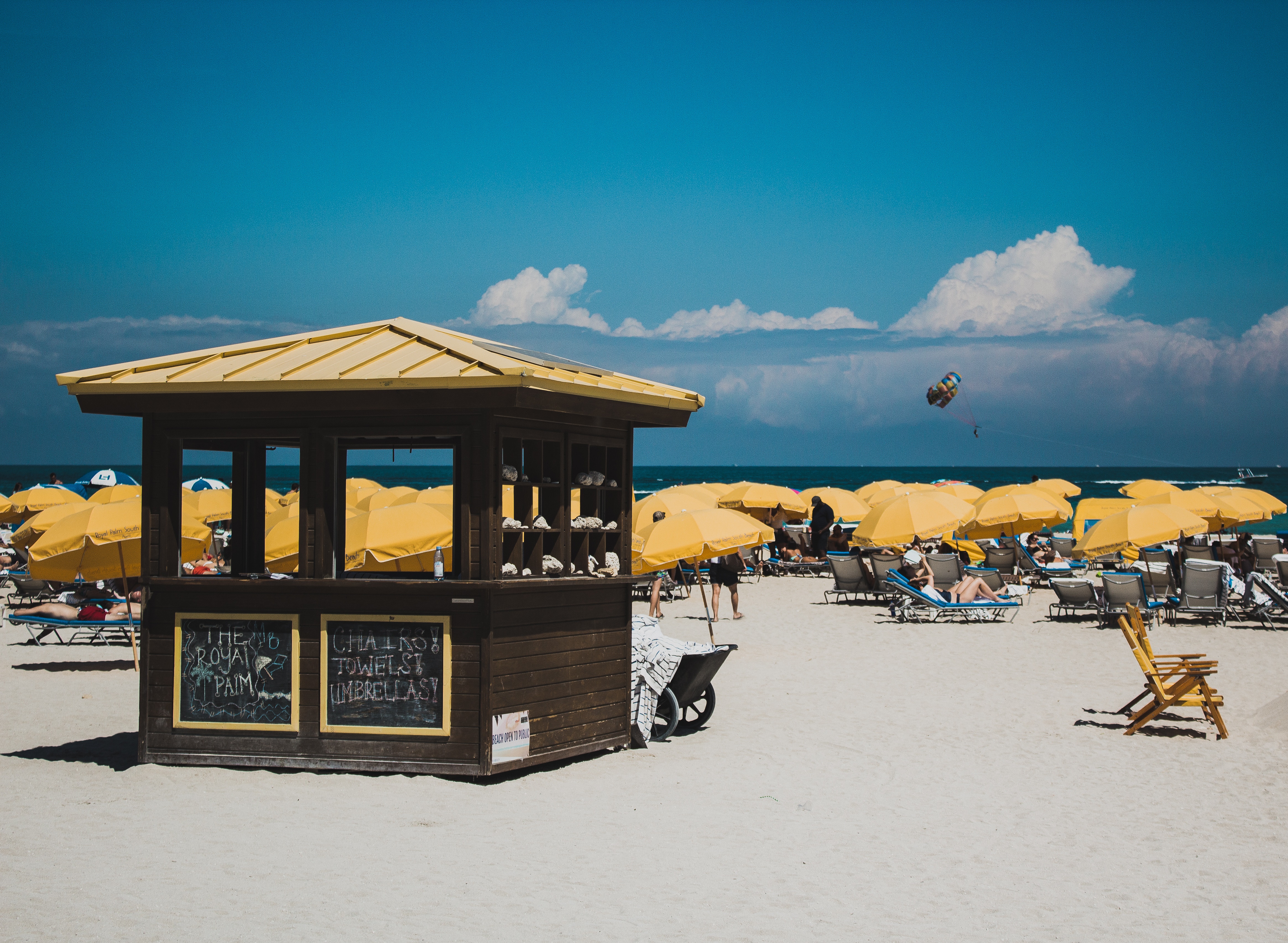
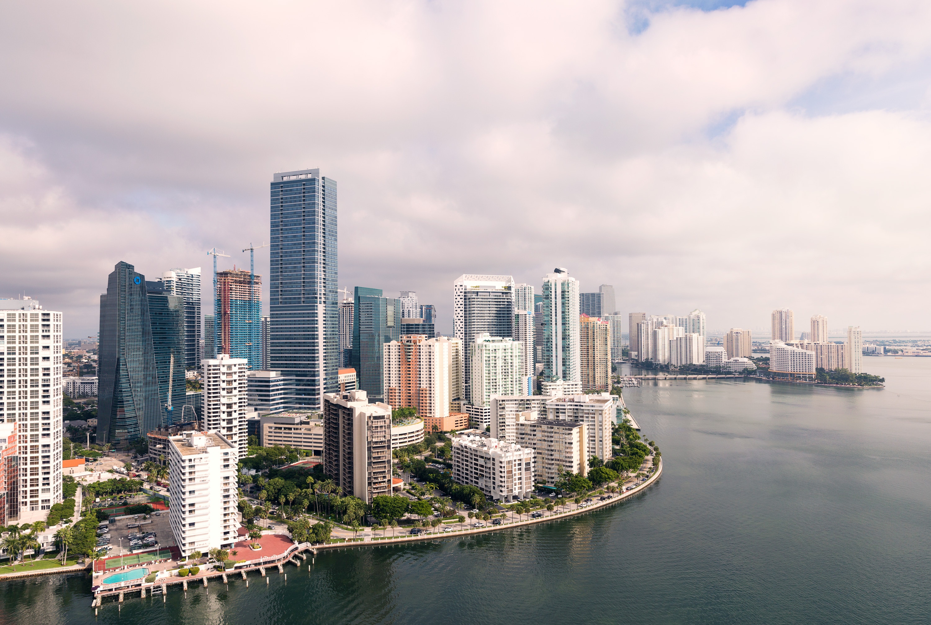
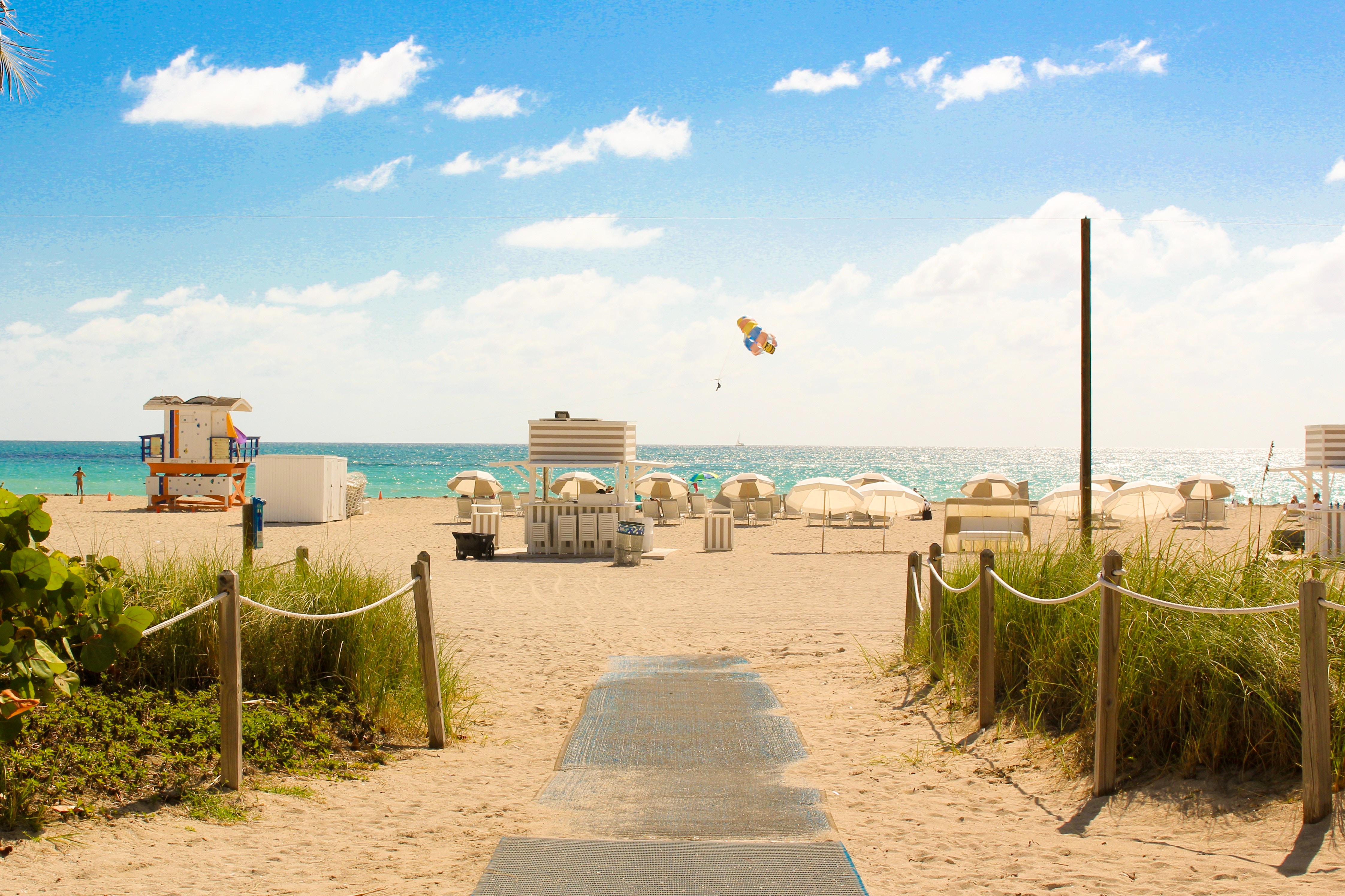
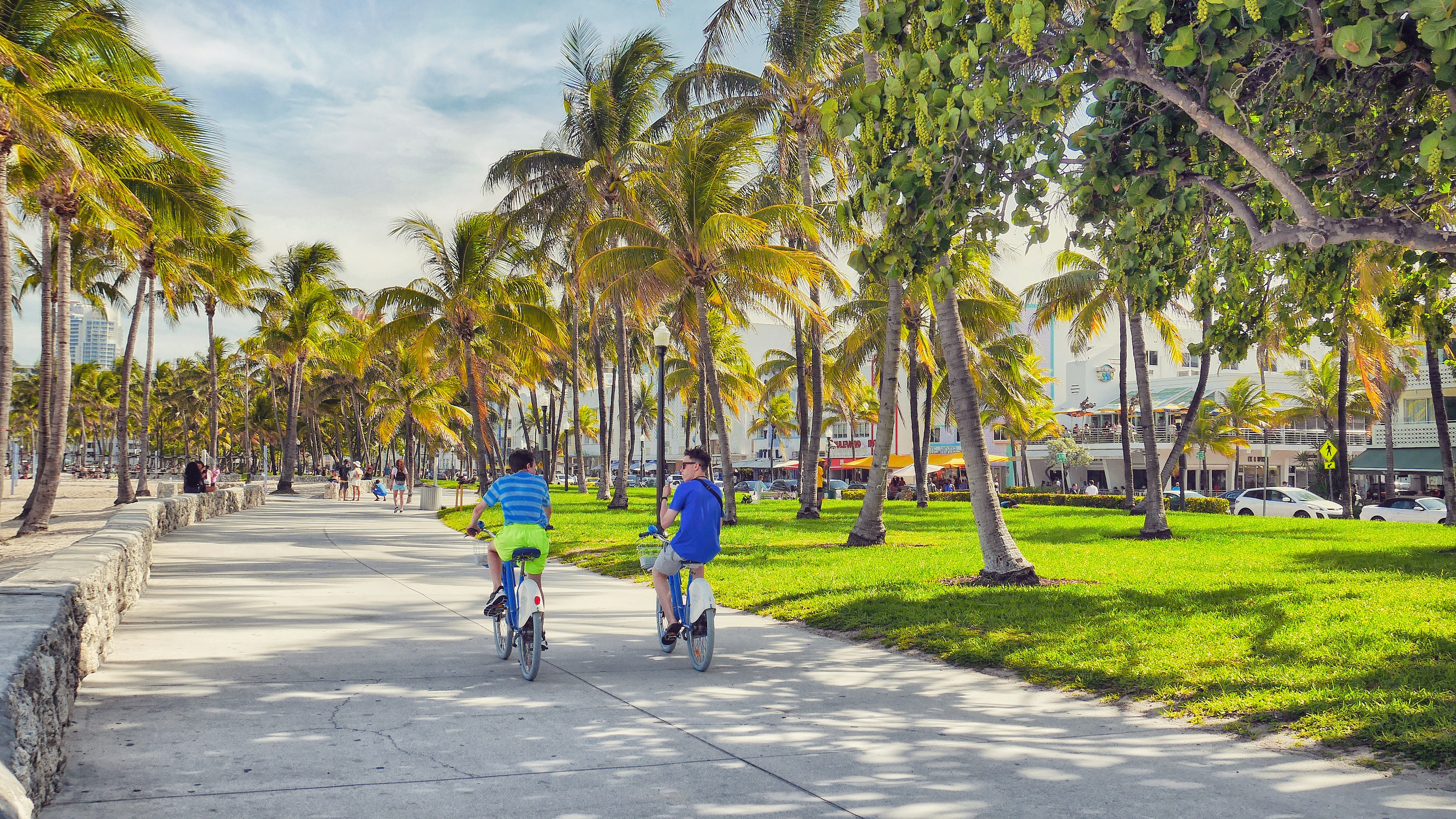
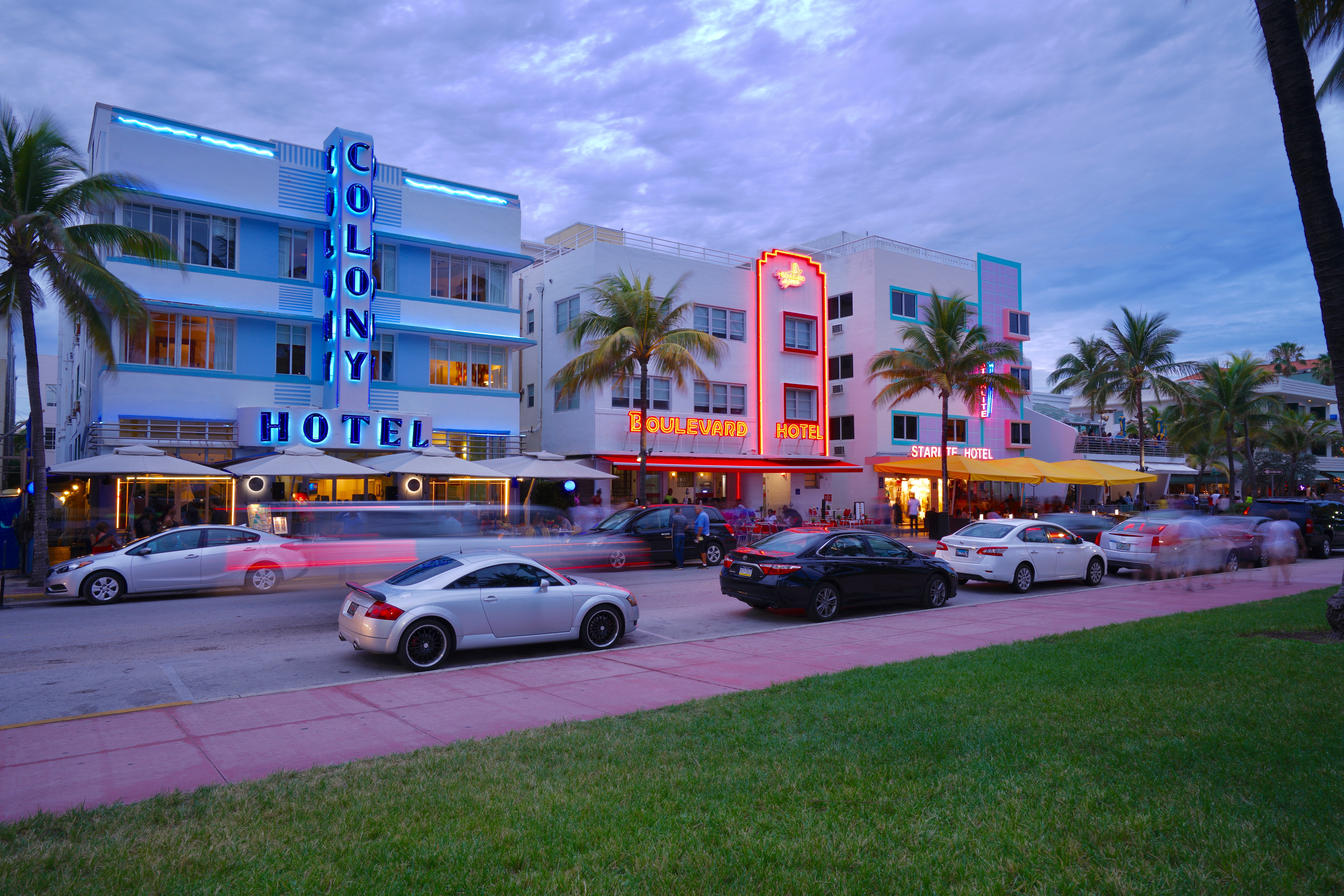
About Miami, Florida
Miami is one of the world’s most popular holiday spots. It has so much to offer; from its countless beach areas, to culture and museums, from spa and shopping days out, to endless cuban restaurants and cafes. Miami is a multicultural city that has something to offer to everyone.
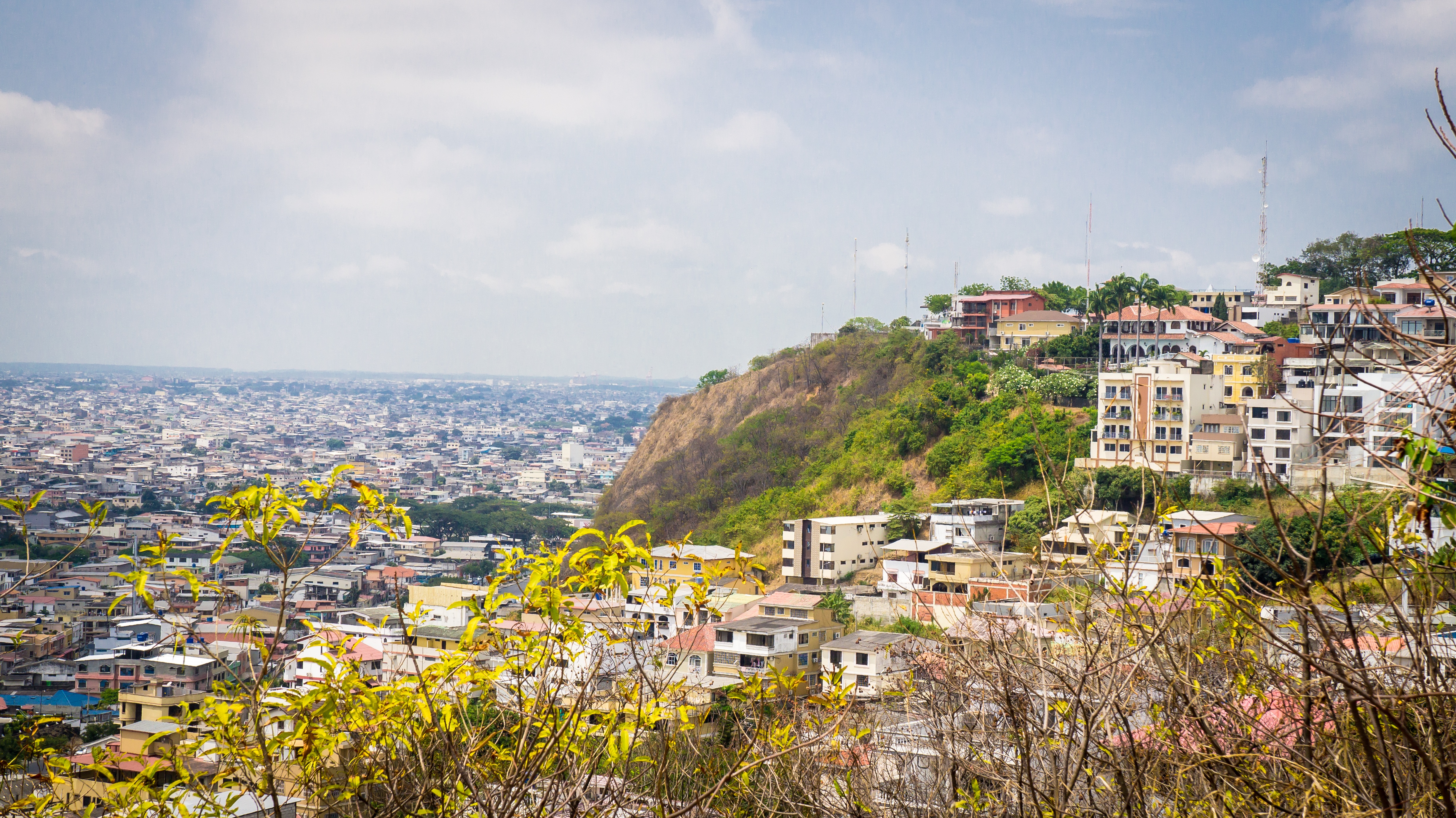
About Guayaquil
The second major jumping off point for the Galapagos Islands after Quito, this is a little city with a big heart. A sea port first and foremost, the city’s personality has been founded on that, and all the better it is for it too. Almost Caribbean in feeling, the clement climate coupled with the intermingling rhythms floating from the windows and abundance of fresh seafood make this a very tropical destination. Once not even considered by the travel books as a potential destination in its own right, the city has undergone something of a resurgence in the past few years. Proud Guayaquileños will not hestitate to point out the Malecón or the exciting new riverfront promenade, once a no-go area after dark, now happily (and hippily) lined with museums, restaurants, shops, and ongoing entertainment. The new airport and urban transportation network are also lauded to the happy tourists who find themselves here. As the largest and most populous city in Ecuador as well as being the commercial centre, it would only be natural that the city would have some kind of modern architecture, but it is the colourful favelas, or to use their real name guasmos, that cling to the side of the hillside like limpets that really catch your eye. A blend of old and new, the first inhabitants can be traced back to 1948 when the government cleared the area for affordable housing, these shanty towns are witness to the social and political particularities that Guayaquil has faced in the past.
About Machala
Several National Sanctuaries and Ecological Reserves found near Machala boast sun-drenched beaches and mangrove forests. Pelicans, frigatebirds, and egrets nest nearby as Blue-footed Boobies dive for fish further out to sea. Whales and dolphins can occasionally be seen in the vicinity. Machala, with a population of approximately 250,000 inhabitants, is moreover known for traditional Latin American foods from shrimp ceviche to fried bananas. In fact, bananas feature heavily in the culture as the city is also known as the “Capital of the Banana.” During the third week of September the ‘World Fair of the Banana’ is held here and producers and buyers from Perú, Costa Rica, Colombia, Venezuela, México, Paraguay, Uruguay, Bolivia, Argentina, Guatemala, Panamá, República Dominicana, El Salvado, Honduras and Ecuador attend the event.
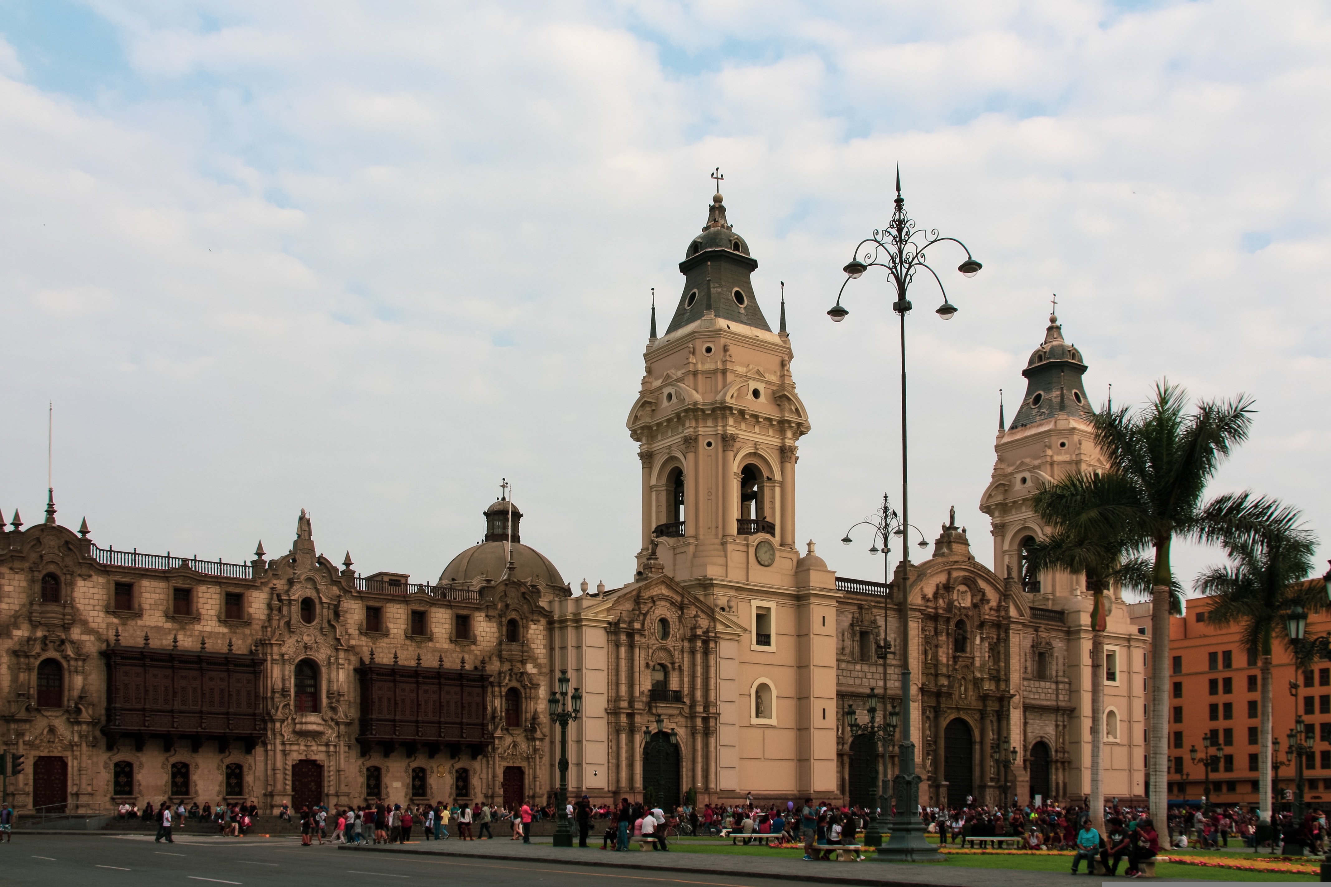
About Callao
When people discuss great South American cities, Lima is often overlooked. But Peru's capital can hold its own against its neighbors. It has an oceanfront setting, colonial-era splendor, sophisticated dining, and nonstop nightlife.It's true that the city—clogged with traffic and choked with fumes—doesn't make a good first impression, especially since the airport is in an industrial neighborhood. But wander around the regal edifices surrounding the Plaza de Armas, among the gnarled olive trees of San Isidro's Parque El Olivar, or along the winding lanes in the coastal community of Barranco, and you'll find yourself charmed.In 1535 Francisco Pizarro found the perfect place for the capital of Spain's colonial empire. On a natural port, the so-called Ciudad de los Reyes (City of Kings) allowed Spain to ship home all the gold the conquistador plundered from the Inca. Lima served as the capital of Spain's South American empire for 300 years, and it's safe to say that no other colonial city enjoyed such power and prestige during this period.When Peru declared its independence from Spain in 1821, the declaration was read in the square that Pizarro had so carefully designed. Many of the colonial-era buildings around the Plaza de Armas are standing today. Walk a few blocks in any direction for churches and elegant houses that reveal just how wealthy this city once was. But the poor state of most buildings attests to the fact that the country's wealthy families have moved to neighborhoods to the south over the past century.The walls that surrounded the city were demolished in 1870, making way for unprecedented growth. A former hacienda became the graceful residential neighborhood of San Isidro. In the early 1920s the construction of tree-lined Avenida Arequipa heralded the development of neighborhoods such as bustling Miraflores and bohemian Barranco.Almost a third of the country's population of 29 million lives in the metropolitan area, many of them in relatively poor conos: newer neighborhoods on the outskirts of the city. Most residents of those neighborhoods moved there from mountain villages during the political violence and poverty that marked the 1980s and ’90s, when crime increased dramatically. During the past decade the country has enjoyed peace and steady economic growth, which have been accompanied by many improvements and refurbishment in the city. Residents who used to steer clear of the historic center now stroll along its streets. And many travelers who once would have avoided the city altogether now plan to spend a day here and end up staying two or three.
About General San Martin
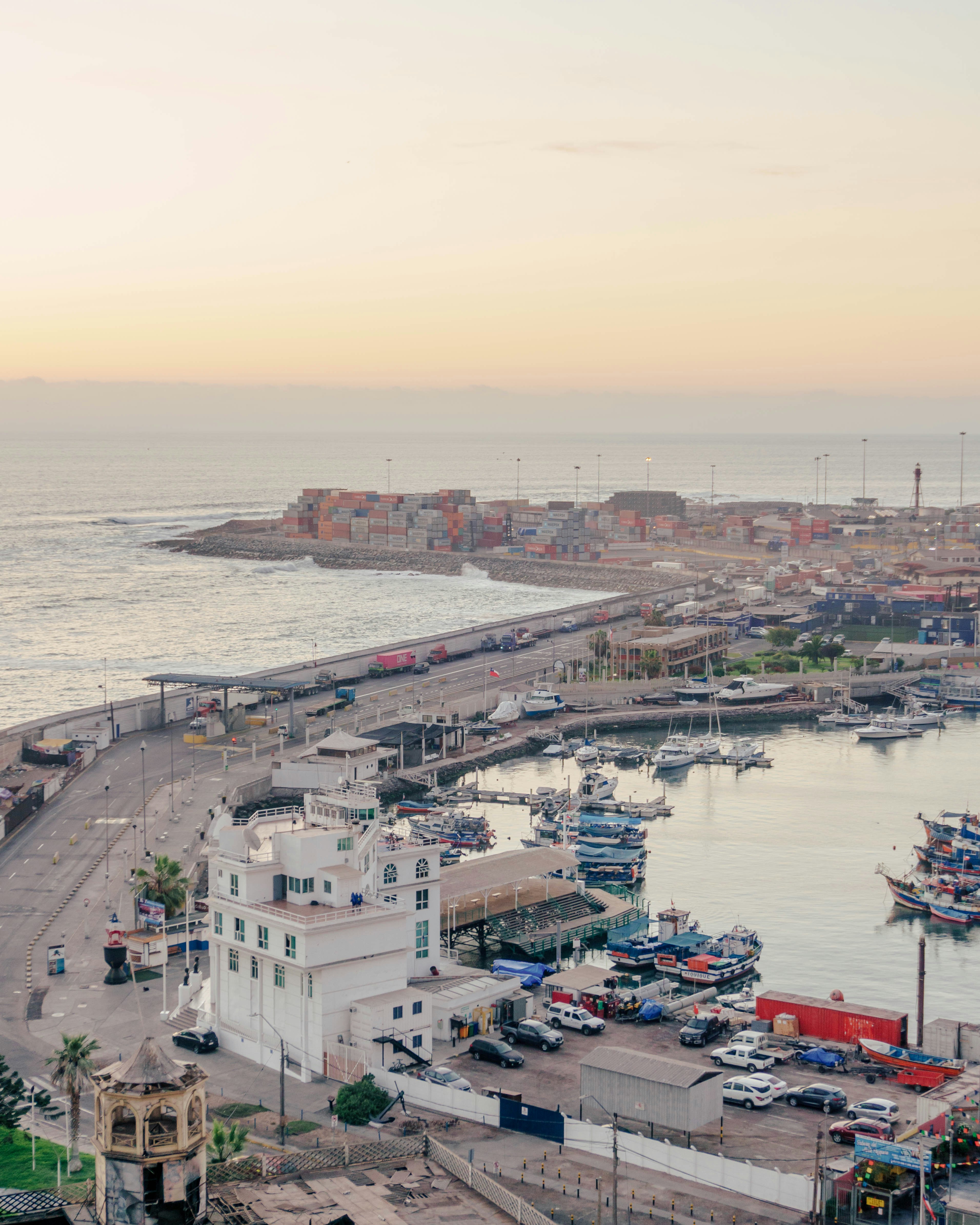
About Iquique
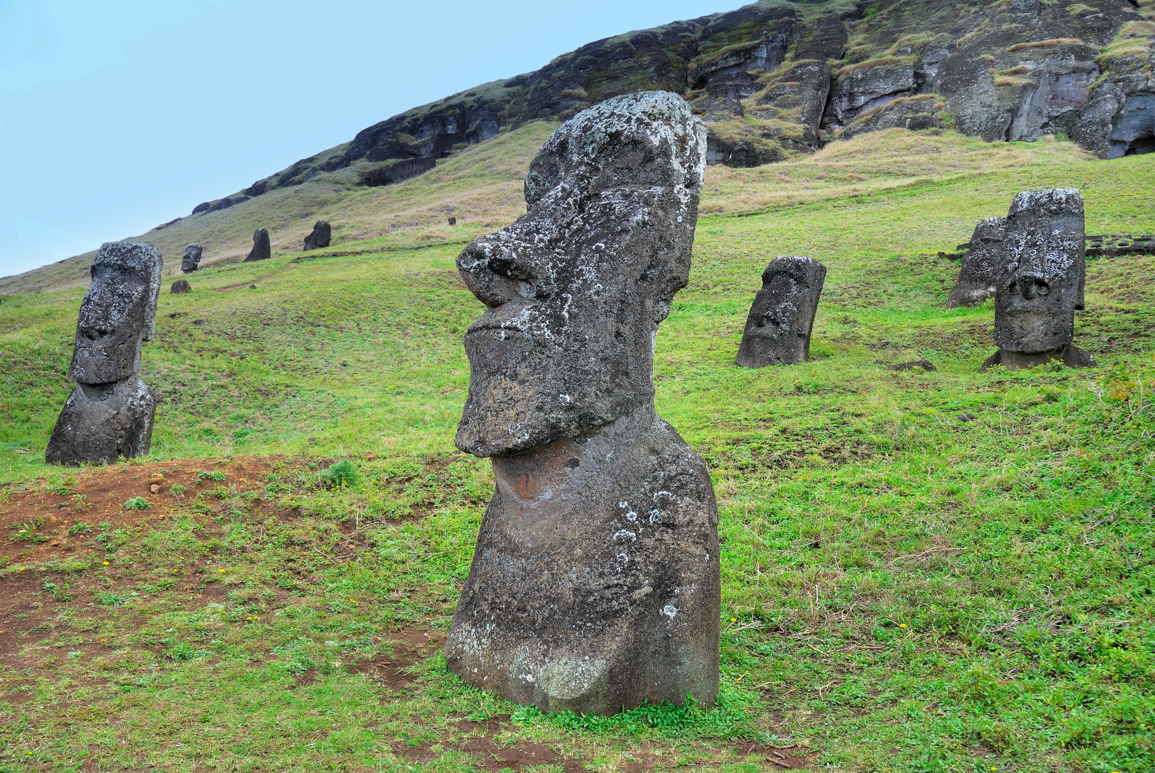
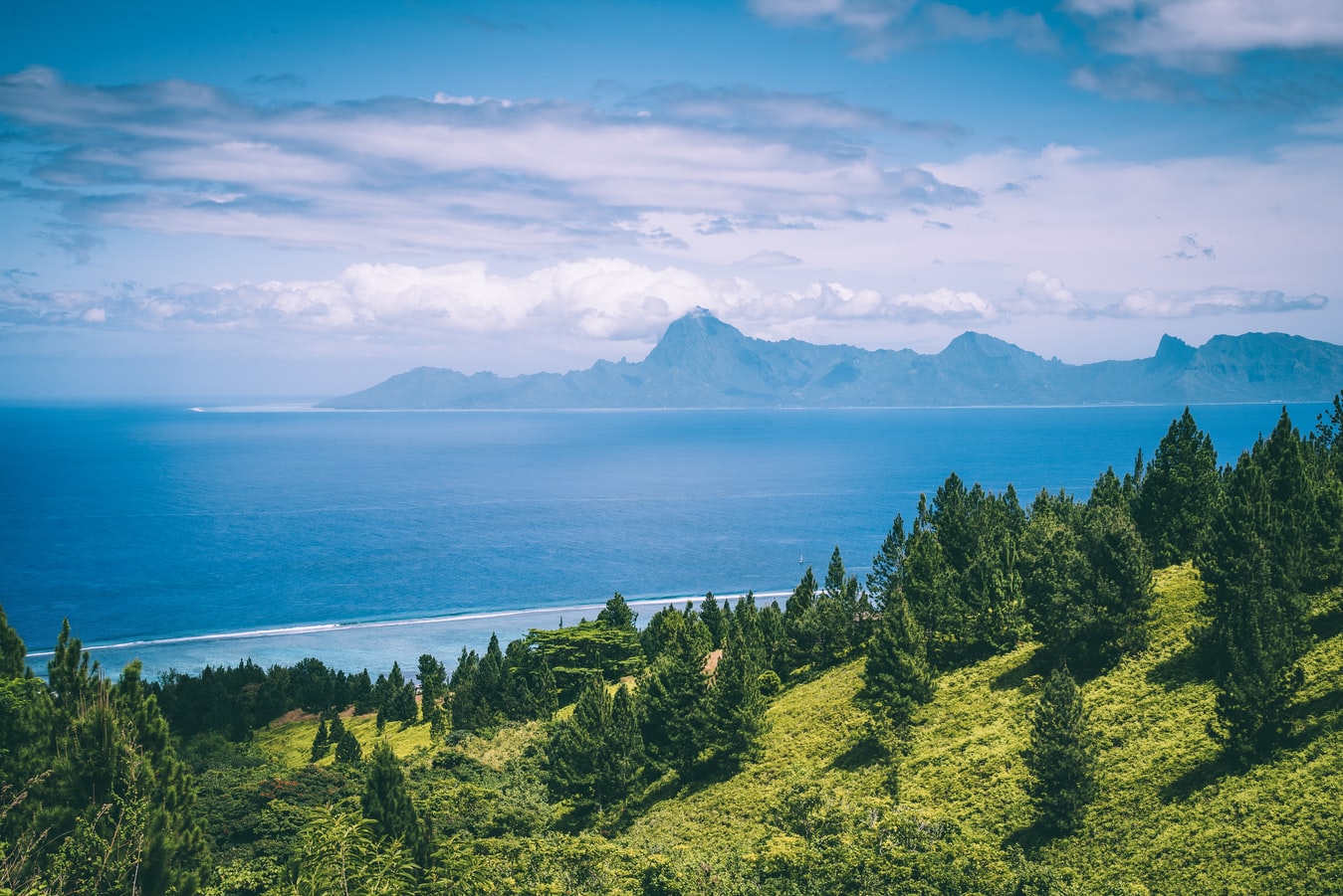
About Hangaroa, Easter Island
Discovered (by the Western world) on Easter Sunday, 1722, Easter Island is a UNESCO World Heritage Site and one of the most isolated places on the face of the Earth, some 2,300 miles from the Chilean mainland. Although more Polynesian than South American in character, the 64-square mile island was annexed by Chile in 1888, and is now famous as the world’s largest ‘open air museum’ on account of the Moai, or human-like stone statues, that can be found on the island. The Moai remain very much a mystery, which archaeologists are still trying to unlock by interpreting an ancient language of the Rapa Nui, which is the key to understanding this culture, and is written on the so called ‘rongo rongo tablets’. The island owes its origin to three volcanoes which erupted some three million years ago: Poike, Rano Kau and Maunga Terevaka. It is not known when or how the island was first populated, but the most credible theory suggests that the Rapa Nui people came from other Pacific islands in the 4th century AD. In addition to the cultural and archaeological interest, there are the beautiful beaches, transparent waters, and coral reefs that might be expected of a Pacific Island.
About Nuku Hiva Island
About Hiva Oa Island
About Fakarava
About Rangiroa
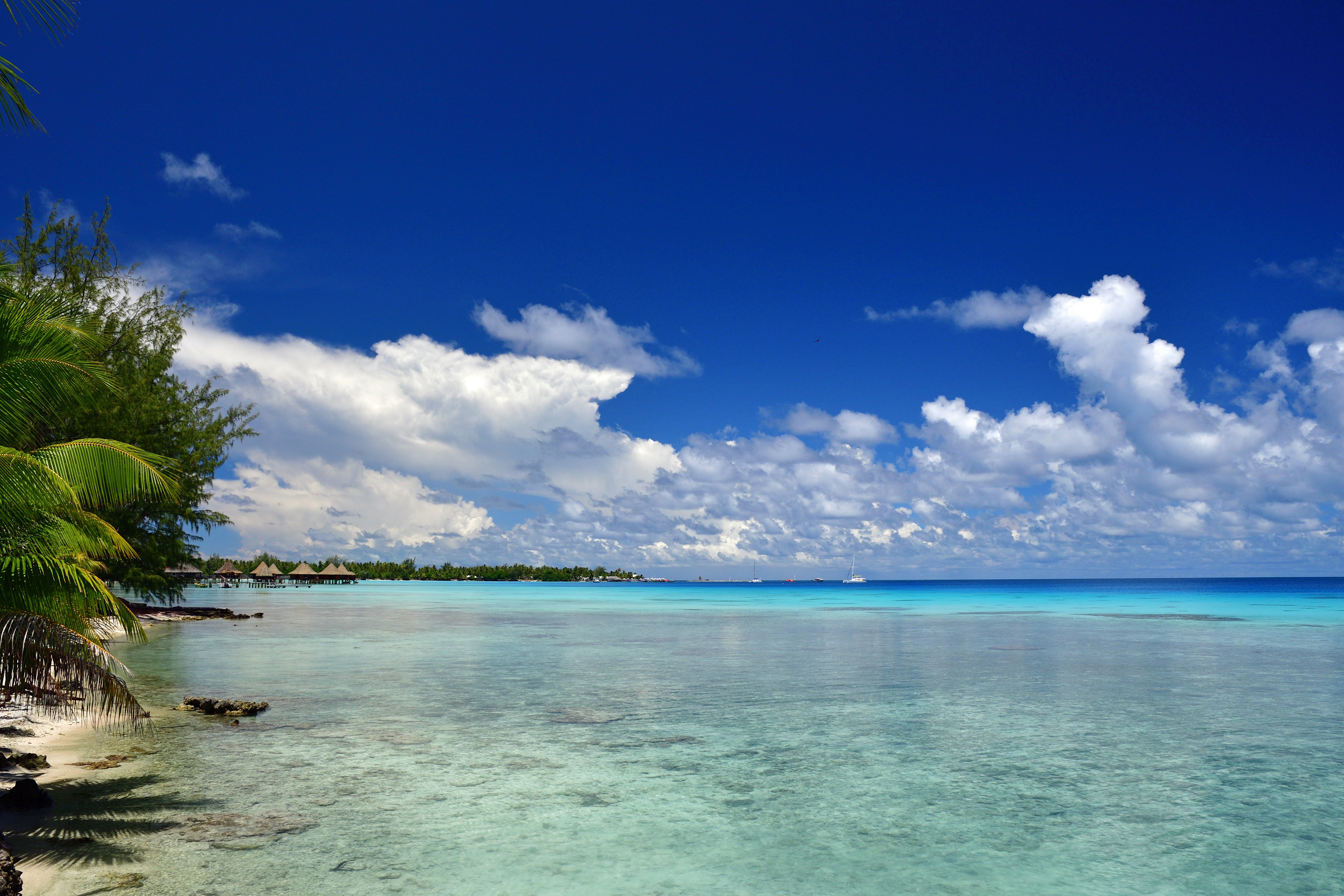
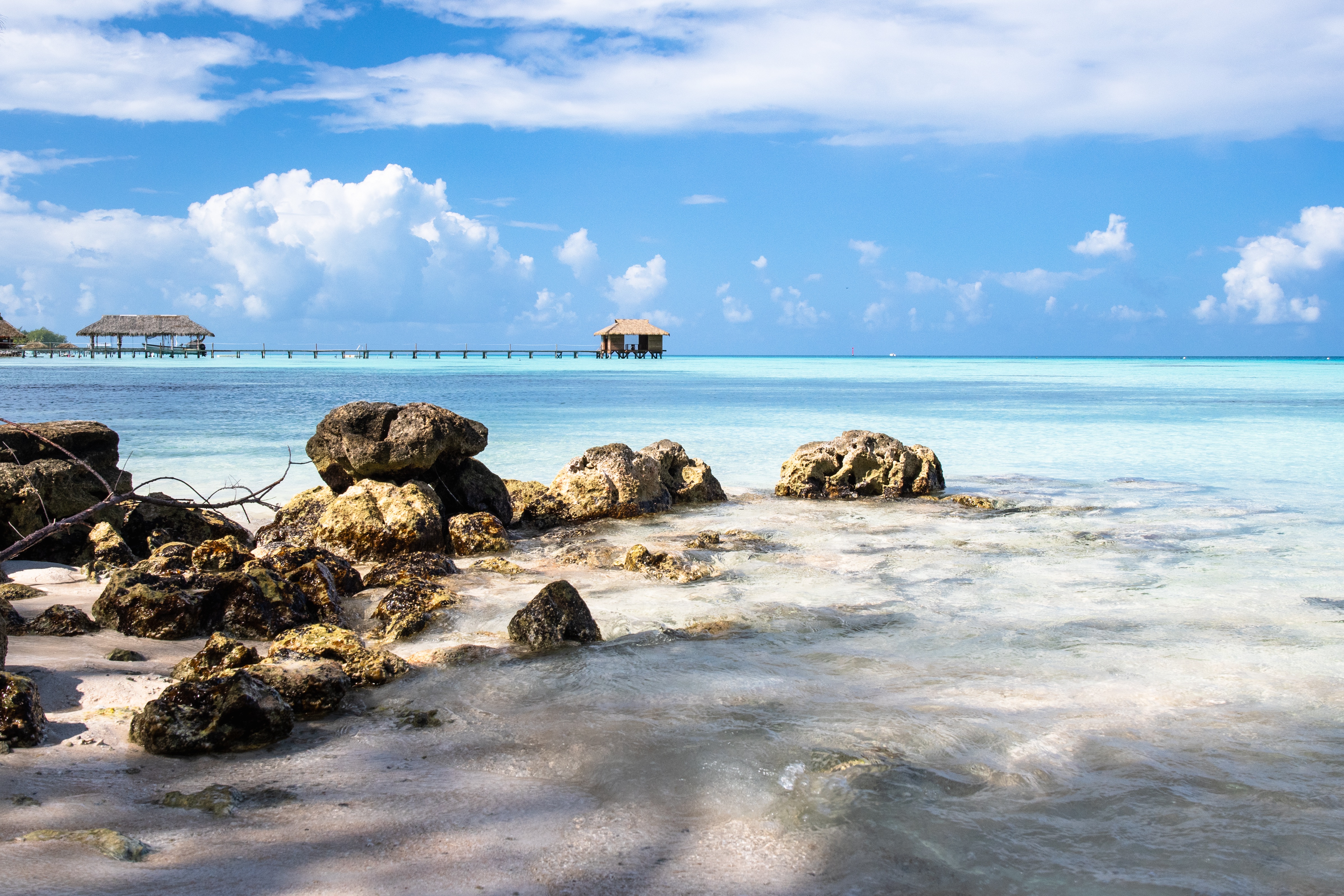
About Papeete, Tahiti
Papeete will be your gateway to the tropical paradise of French Polynesia, where islands fringed with gorgeous beaches and turquoise ocean await to soothe the soul. This spirited city is the capital of French Polynesia, and serves as a superb base for onward exploration of Tahiti – an island of breathtaking landscapes and oceanic vistas. Wonderful lagoons of crisp, clear water beg to be snorkelled, stunning black beaches and blowholes pay tribute to the island's volcanic heritage, and lush green mountains beckon you inland on adventures, as you explore extraordinary Tahiti. Visit to relax inside picturesque stilted huts, which stand out over shimmering water, as you settle into the intoxicating rhythm of life, in this Polynesian paradise.
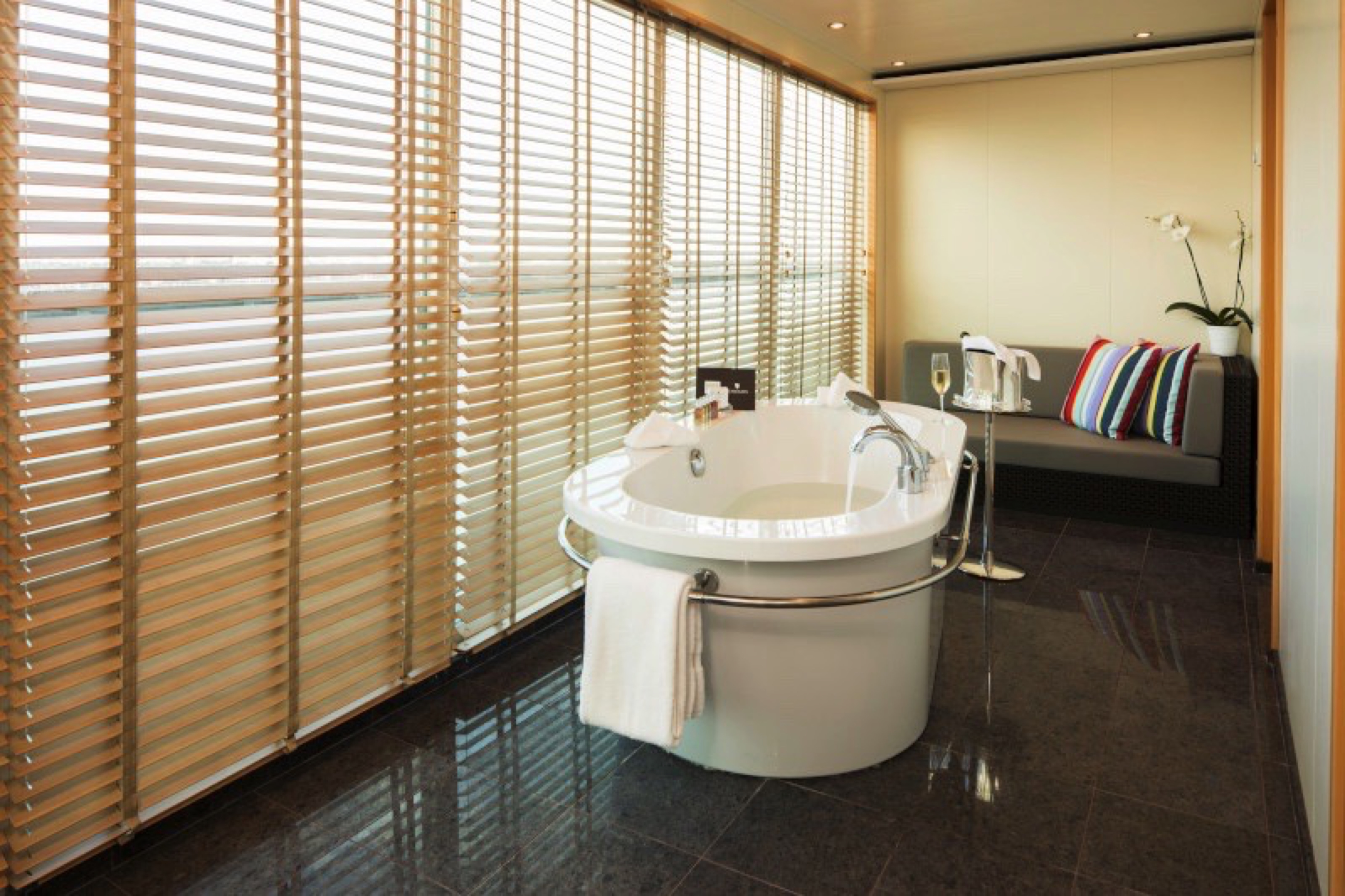
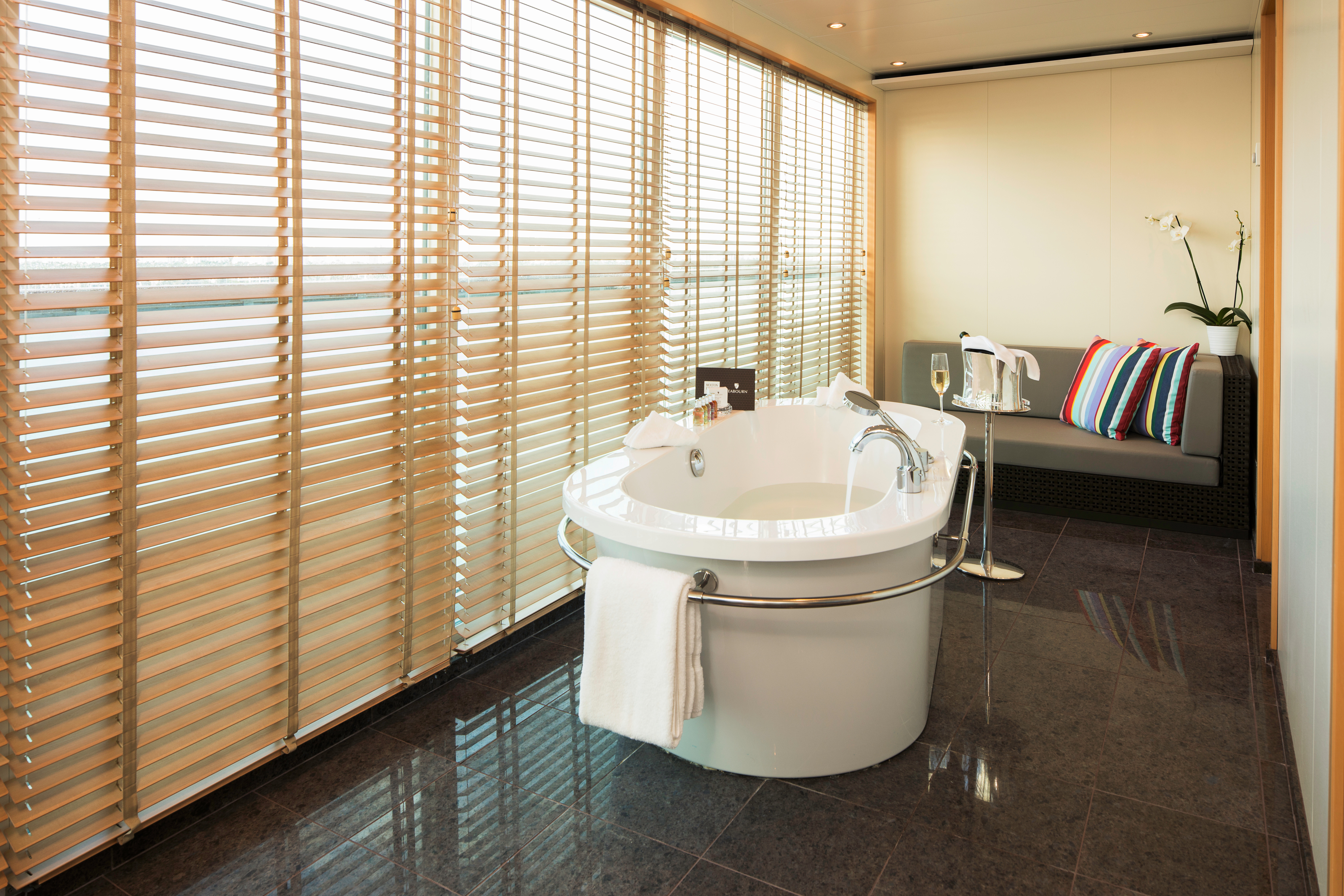
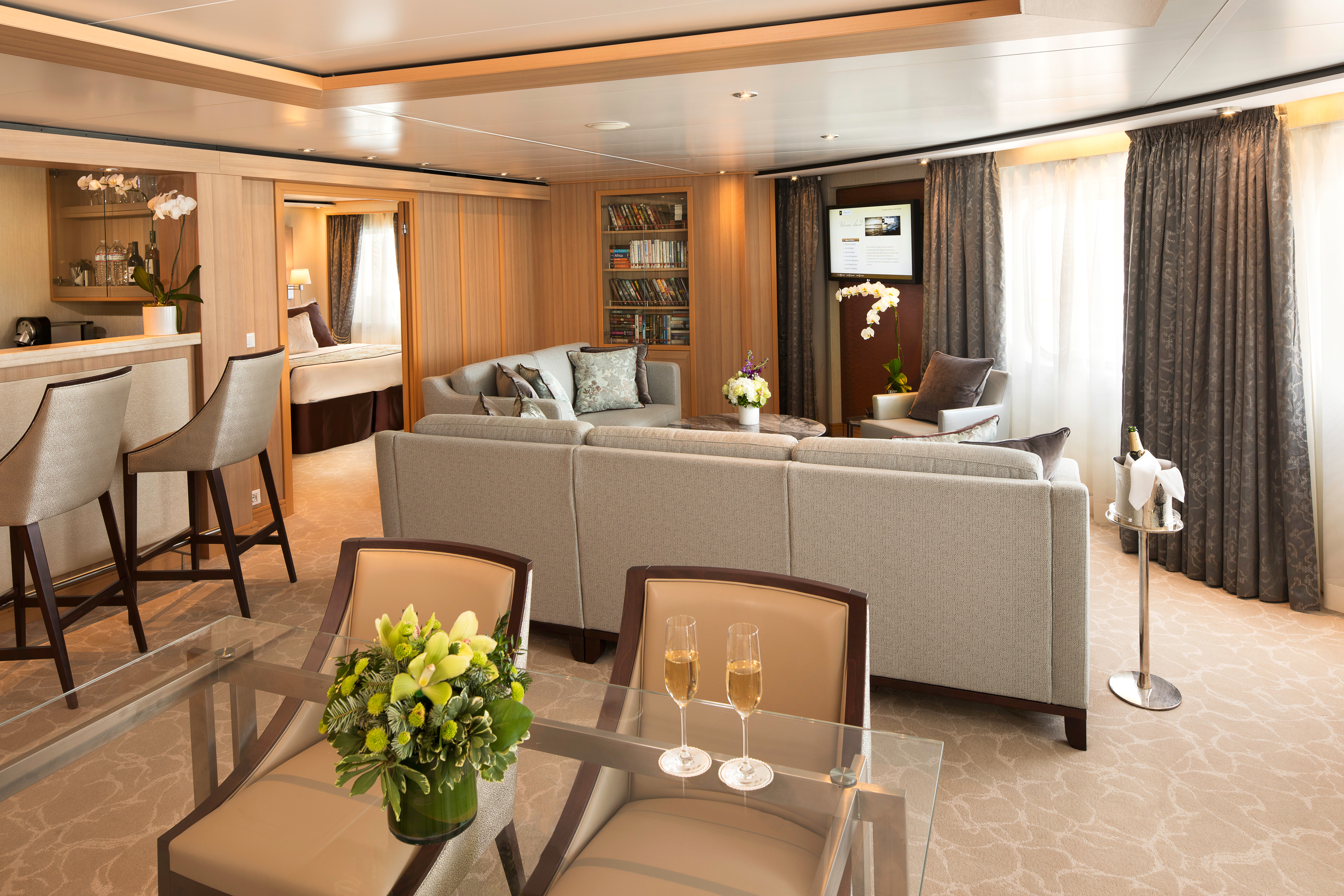
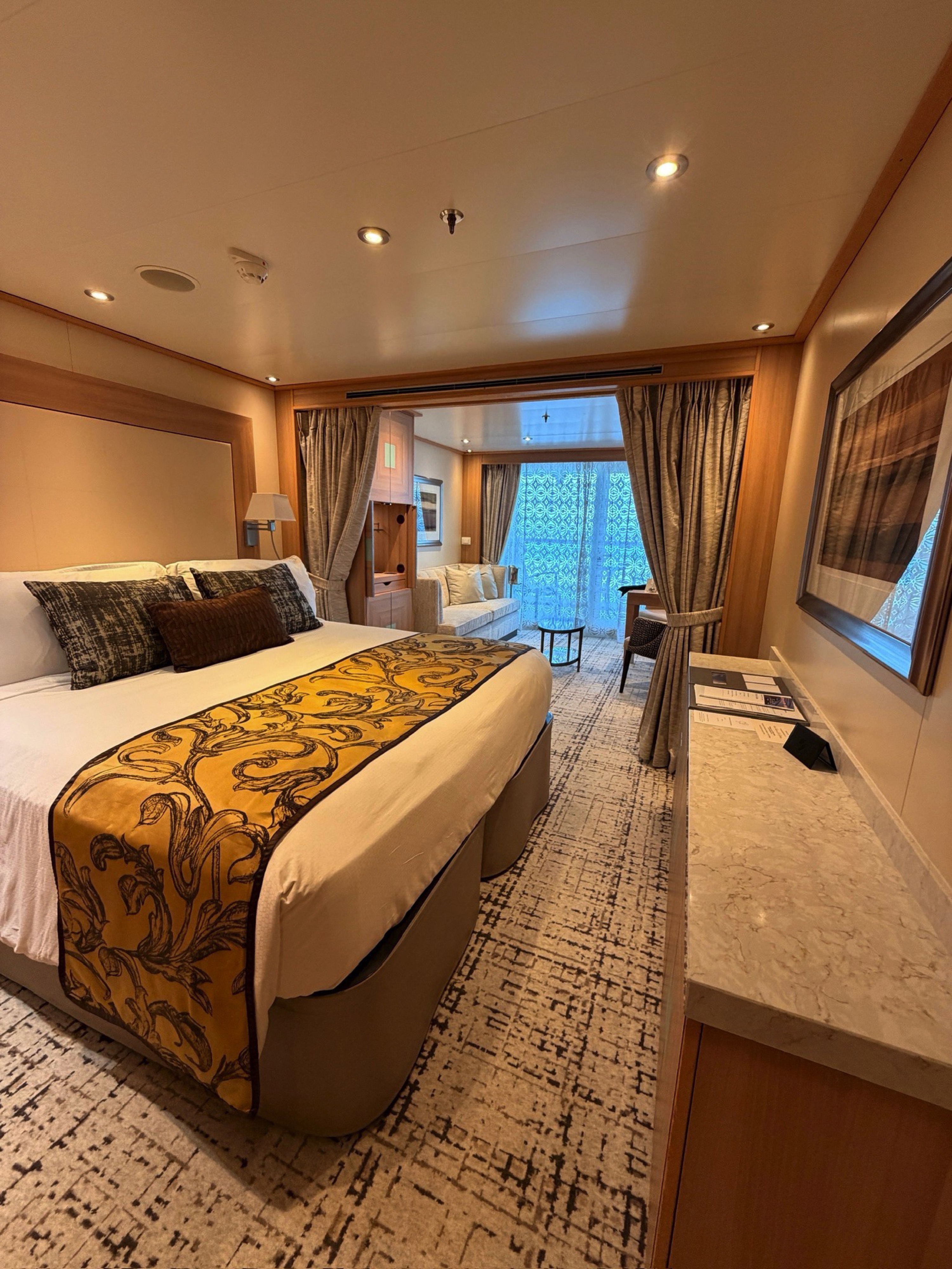
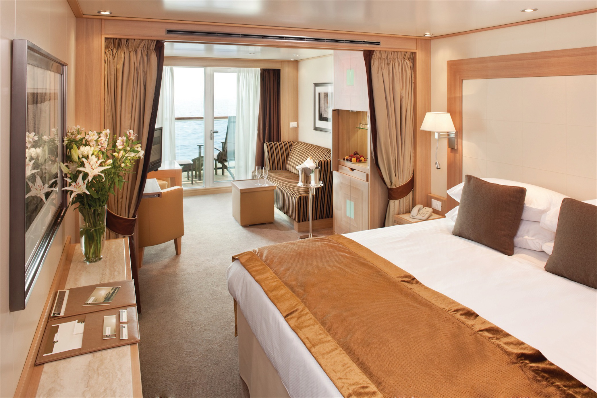
Suites on board feature a comfortable living area, private veranda, queen-size-bed or two twin beds; walk-in closet with personal safe, interactive flat-screen TV with music and movies, fully stocked bar and refrigerator, writing desk with personalized stationary, makeup vanity, spacious bathroom with separate tub and shower, plush robes, slippers hair dryer and 110/220V AC outlets.
Grand Wintergarden Suites feature:
- Large windows
- Dining for four
- Glass-enclosed solarium with tub and day bed
- Bathroom with whirlpool bathtub
- Guest bath
- Two bedrooms
- Convertible sofa bed for one
- Pantry with wet bar
- Two flat-screen TVs
- Complimentary Internet/Wi-Fi service
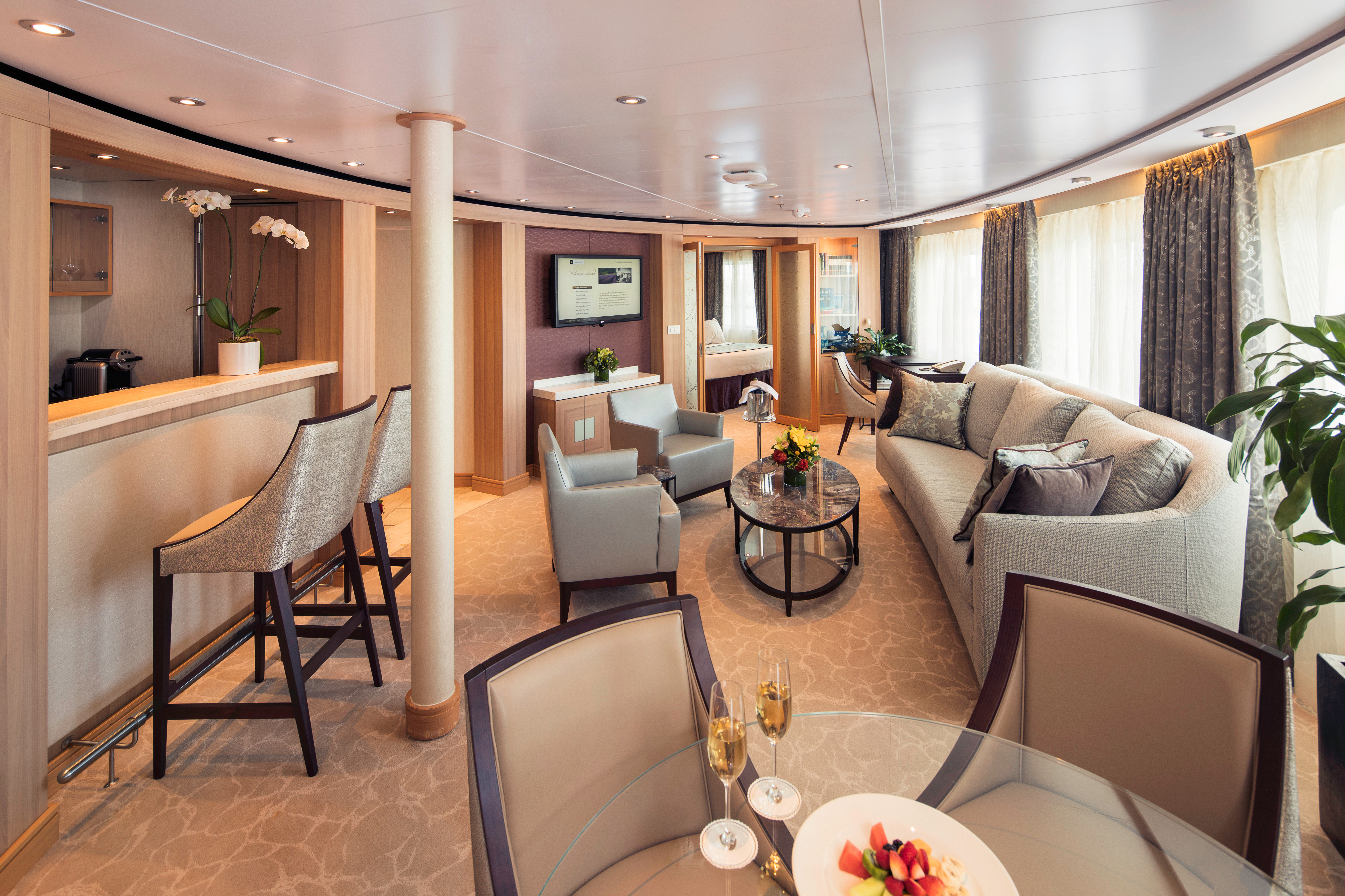
Suites on board feature a comfortable living area, private veranda, queen-size-bed or two twin beds; walk-in closet with personal safe, interactive flat-screen TV with music and movies, fully stocked bar and refrigerator, writing desk with personalized stationary, makeup vanity, spacious bathroom with separate tub and shower, plush robes, slippers hair dryer and 110/220V AC outlets.
Wintergarden Suites feature:
- Large windows
- Dining for four
- Bathroom with whirlpool bathtub
- Guest bath
- Convertible sofa bed for one
- Pantry with wet bar
- Glass-enclosed solarium with tub and day bed
- Two closets
- Two flat-screen TVs
- Complimentary Internet/Wi-Fi service
Suites on board feature a comfortable living area, private veranda, queen-size-bed or two twin beds; walk-in closet with personal safe, interactive flat-screen TV with music and movies, fully stocked bar and refrigerator, writing desk with personalized stationary, makeup vanity, spacious bathroom with separate tub and shower, plush robes, slippers hair dryer and 110/220V AC outlets.
Signature Suites feature:
- Expansive ocean views
- Forward-facing windows
- Dining for four to six
- Bathroom with whirlpool bathtub
- Guest bath
- Pantry with wet bar
- Two flat-screen TVs
- Complimentary Internet/Wi-Fi service
Suites on board feature a comfortable living area, private veranda, queen-size-bed or two twin beds; walk-in closet with personal safe, interactive flat-screen TV with music and movies, fully stocked bar and refrigerator, writing desk with personalized stationary, makeup vanity, spacious bathroom with separate tub and shower, plush robes, slippers hair dryer and 110/220V AC outlets.Owner's Suite features
- Expansive ocean views
- Glass door to private veranda
- Comfortable living area
- Separate bedroom
- Queen-size bed or two twin beds
- Walk-in closet
- Dining for four
- Pantry with wet bar
- Two flat-screen TVs
- Complimentary Internet/Wi-Fi service.
- Guest bath
- Makeup vanity
- Bathroom with whirlpool bathtub
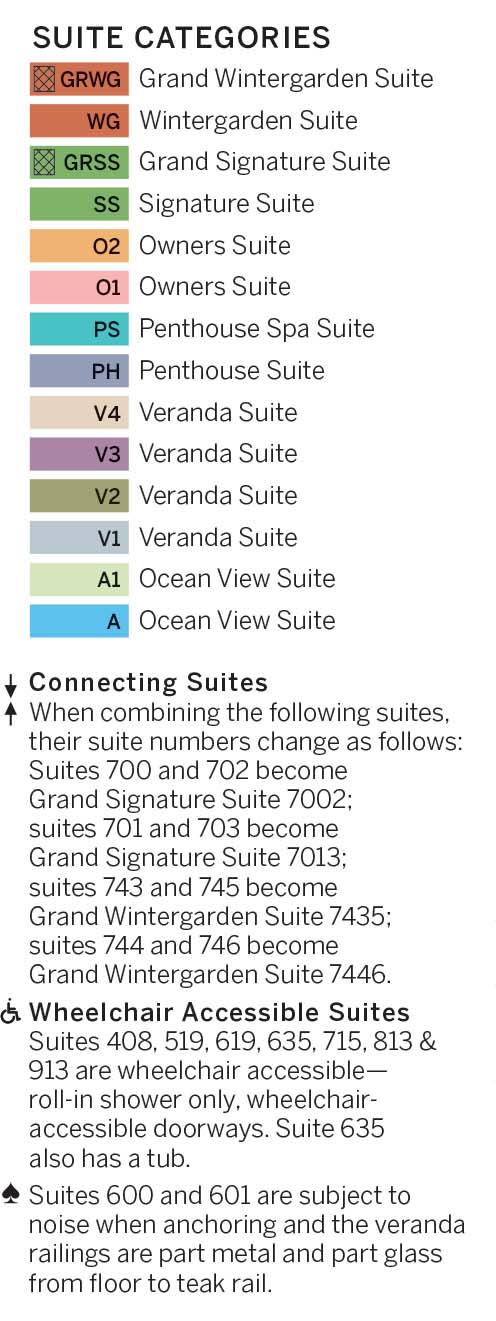
*Wheelchair accessible suites are roll-in shower only.
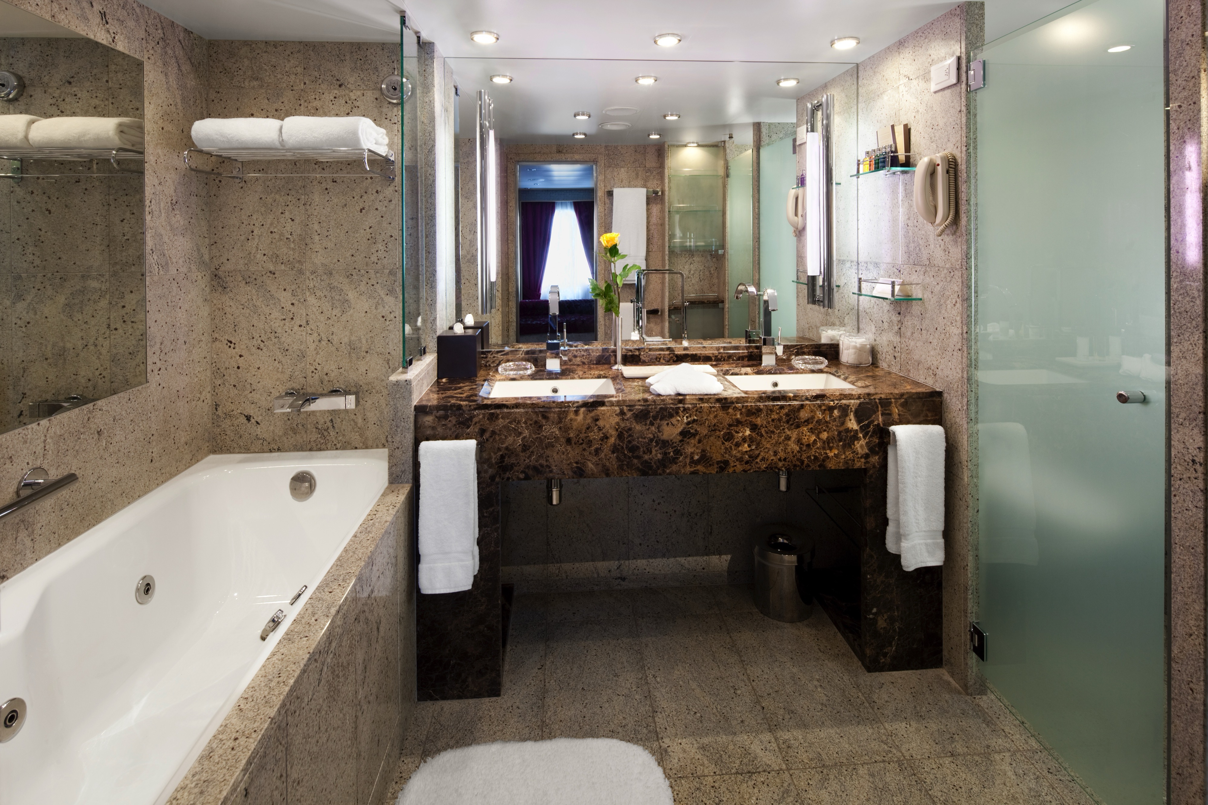
Suites on board feature a comfortable living area, private veranda, queen-size-bed or two twin beds; walk-in closet with personal safe, interactive flat-screen TV with music and movies, fully stocked bar and refrigerator, writing desk with personalized stationary, makeup vanity, spacious bathroom with separate tub and shower, plush robes, slippers hair dryer and 110/220V AC outlets.
All Penthouse Spa Suite feature:
- A full-length window
- Glass door to private veranda
- Comfortable living area
- Separate bedroom
- Queen-size bed or two twin beds
- Dining table for two to four
- Walk-in closet
- Two flat-screen TVs
- Fully stocked bar and refrigerator
- Makeup vanity
- Spacious bathroom with separate tub and shower
*Wheelchair accessible suites are roll-in shower only.
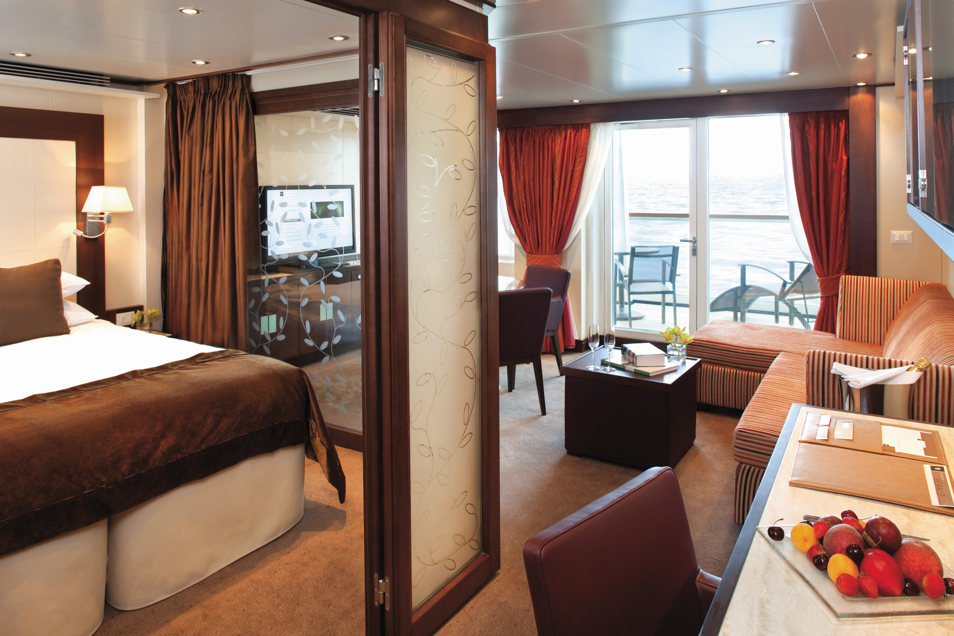
All Penthouse Suites on board feature a comfortable living area, glass door to private veranda, queen-size-bed or two twin beds; walk-in closet with personal safe, two flat-screen TV with music and movies, fully stocked bar and refrigerator, writing desk with personalized stationary, makeup vanity, spacious bathroom with separate tub and shower, plush robes, slippers hair dryer and 110/220V AC outlets
All Penthouse Suite feature
- Dining table for two to four
- Separate bedroom
- Glass door to veranda
- Two flat-screen TVs
- Fully stocked bar
- Spacious bathroom with tub, shower and large vanity
Approximately 436 square feet (41 square meters) of inside space, plus one veranda of 98 square feet (9 square meters)
Guaranteed Suite: For this option we select the location and specific suite for you, and notify you prior to departure. Guests are guaranteed to be assigned a suite in the category selected or higher.
All Penthouse Suite feature:
- Dining table for two to four
- Separate bedroom
- Glass door to veranda
- Two flat-screen TVs
- Fully stocked bar
- Spacious bathroom with tub, shower and large vanity
All Veranda Suites feature a full-length window and glass door to private veranda, comfortable living area, queen-size bed or two twin beds, dining table for two, walk-in closet, interactive flat-screen television with music and movies, fully stocked bar and refrigerator, makeup vanity, spacious bathroom with separate tub and shower.
All Veranda Suites feature:
- A full-length window
- Glass door to private veranda
- Comfortable living area
- Queen-size bed or two twin beds
- Dining table for two
- Walk-in closet
- Interactive flat-screen television with music and movies
- Fully stocked bar
- Makeup vanity
- Spacious bathroom with separate tub and shower
*Wheelchair accessible suites are roll-in shower only.
All Veranda Suites feature a full-length window and glass door to private veranda, comfortable living area, queen-size bed or two twin beds, dining table for two, walk-in closet, interactive flat-screen television with music and movies, fully stocked bar and refrigerator, makeup vanity, spacious bathroom with separate tub and shower.
Guaranteed Suite: For this option we select the location and specific suite for you, and notify you prior to departure. Guests are guaranteed to be assigned a suite in the category selected or higher.
All Ocean View Suites feature a large picture window, comfortable living area, queen-size bed or two twin beds, dining table for two, walk-in closet, interactive flat-screen television with music and movies, fully stocked bar and refrigerator, makeup vanity, spacious bathroom with separate tub and shower. Approximately 295 sq. ft. (28 sq.m.) of inside space
- A large picture window
- Comfortable living area
- Queen-size bed or two twin beds
- Dining table for two
- Walk-in closet
- Interactive flat-screen television with music and movies
- Fully stocked bar and refrigerator
- Makeup vanity, spacious bathroom with separate tub and shower
*Wheelchair accessible suites are roll-in shower only.
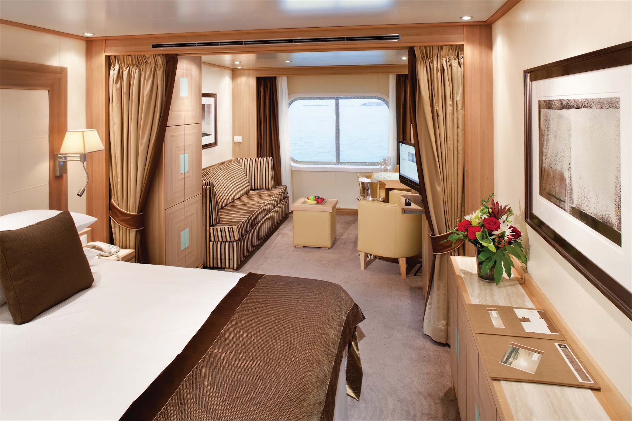
All Ocean View Suites feature a large picture window, comfortable living area, queen-size bed or two twin beds, dining table for two, walk-in closet, interactive flat-screen television with music and movies, fully stocked bar and refrigerator, makeup vanity, spacious bathroom with separate tub and shower. Approximately 295 sq. ft. (28 sq.m.) of inside space
Guaranteed Suite: For this option we select the location and specific suite for you, and notify you prior to departure. Guests are guaranteed to be assigned a suite in the category selected or higher.
Guaranteed Suite: For this option we select the location and specific suite for you, and notify you prior to departure. Guests are guaranteed to be assigned a suite in the category selected or higher.
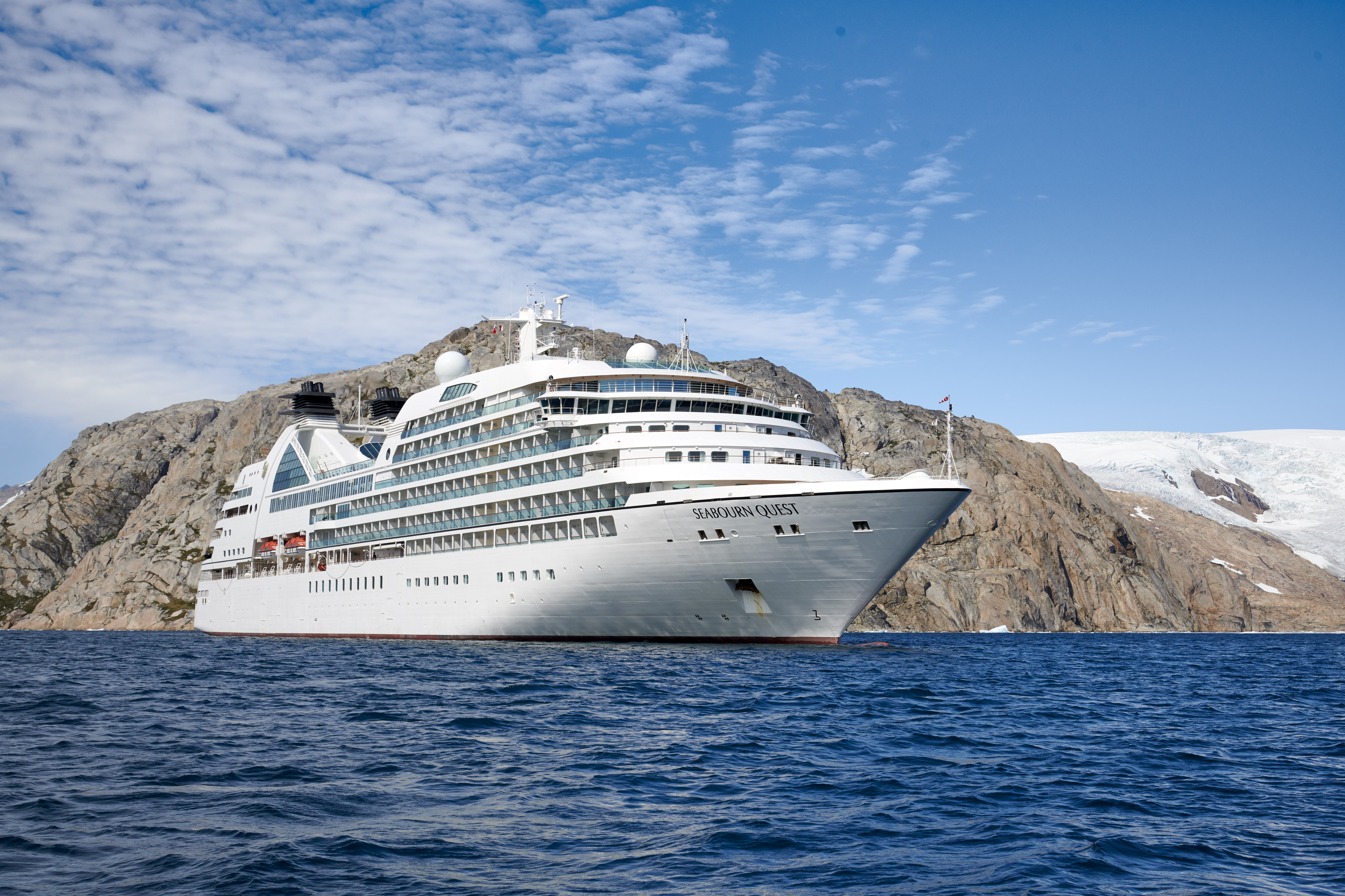
Seabourn Quest
Seabourn Quest is the third iteration of the vessel design that has been called “a game-changer for the luxury segment.” True to her Seabourn bloodlines, wherever she sails around the world Seabourn Quest carries with her a bevy of award-winning dining venues that are comparable to the finest restaurants to be found anywhere. Seabourn Quest offers a variety of dining options to suit every taste and every mood with never an extra charge.
Experience Seabourn Quest
Seabourn Quest (launched 2011), an oceangoing ship with a passenger capacity of just 458 guests, offers spacious accommodations spanning categories ranging in size from 295 to 1,182 square feet of indoor space. Verandas add an additional 65 to 558 square feet of outdoor living area spacious enough for private al fresco dining. All suites feature a comfortable living area, walk-in closet, fully stocked bar and refrigerator filled with seaside favorites. Expansive ocean views are framed by either a picture window or the glass doors of the veranda.
Ship Facts
| Launch Year | 2011 | ||||||||
| Refit Year | 2026 | ||||||||
| Language | en | ||||||||
| Gross Tonnage | 32000 | ||||||||
| Length | 198 | ||||||||
| Width | 26 | ||||||||
| Currency | USD | ||||||||
| Speed | 19 | ||||||||
| Capacity | 458 | ||||||||
| Crew Count | 330 | ||||||||
| Deck Count | 10 | ||||||||
| Cabin Count | 229 | ||||||||
| Large Cabin Count | 10 | ||||||||
| Wheelchair Cabin Count | 7 | ||||||||
| Electrical Plugs |
|
To see the legend for these deck plans, please hover your mouse over the images below
To toggle the legend for these deck plans, please tap on any of the images below
Deck 11
- The Retreat
- Sun Terrace

Deck 10
- Observation Bar
- Penthouse Suite
- Veranda Suite
- Penthouse Spa Suite

Deck 9
- Bridge
- Sky Bar
- Fitness Centre
- Motion Studio
- Spa & Wellness Area
- Salon
- Treatment Rooms
- Penthouse Suites
- Veranda Suites (x1 Accessible Suite)

Deck 8
- The Patio
- Patio Bar
- Whirlpools
- Pool
- The Grill by Thomas Keller
- The Colonnade
- Owner's Suites
- Veranda Suites (x1 Accessible Suite)

Deck 7
- Card Room
- The Collection
- Shops
- Coffee Bar
- Seabourn Square
- Grand Wintergarden Suite
- Wintergarden Suite
- Grand Signature Suites
- Signature Suites
- Owner's Suites
- Veranda Suites (x1 Accessible Suite)

Deck 6
- Whirlpool
- Grand Salon
- Owner's Suites
- Veranda Suites
- Penthouse Suite (x1 Accessible Suite)

Deck 5
- Meeting Rooms
- Casino
- Club Bar
- The Club
- Pool
- Whirlpools
- Veranda Suites (x1 Accessible Suite)

Deck 4
- The Restaurant
- Galley
- Ocean View Suites (x1 Accessible Suite)

Deck 3
- Medical Facility

Deck 2
- Marina

Seabourn’s award-winning cuisine starts with the finest quality ingredients, infused with authentic regional flavors, prepared á la minute by our skilled chefs and served with pride. Each Seabourn ship offers a choice of dining venues to suit your mood of the moment, and nearly all are open-seating, inviting you to dine where, when and with whom you wish. Complimentary fine wines are poured with lunch and dinner, and there is never an extra charge for any dining choice. You can even enjoy a meal in your suite or on your veranda, with our compliments. Seabourn is a proud member of Chaîne des Rôtisseurs, one of the world’s most prestigious gastronomic societies devoted to the art of fine dining.
The Patio
Relaxed poolside dining offering luncheon buffets, salads, soups, grilled specialties and freshly baked pizza. Dinners feature a full menu in an alfresco setting.
Solis
Offering light, modern Mediterranean cuisine bursting with color and character, prepared fresh and entirely from scratch.
Solis will showcase a vibrant, chic atmosphere with feel-good background music and a menu reminiscent of our favorite travel memories. Solis was developed in collaboration with longtime Seabourn partners, Master Chef and Culinary Partner Chef Anton Egger, and Senior Corporate Chef Franck Salein. Chef Egger and Chef Salein are the culinary masterminds behind two of Seabourn’s most popular dining concepts – Earth & Ocean and Sushi.
Beyond the culinary, guests will be able to indulge in a truly sophisticated experience with Seabourn’s newly presented, refined vintage cocktail menu, featuring an allure of classic cocktails crafted to perfection. From classics such as the Kir Royale or Mauresco to the always — and most popular — Aperol Spritz, our team of talented mixologists have meticulously curated this menu to ensure that every drink is a masterpiece of flavors and aesthetics.
An evening at Solis is designed to delight our guests and leave them with lasting Seabourn Moments.
The Restaurant
Before Seabourn, open-seating dining on a cruise ship was unheard of. Come when you like, with whom you please, and be seated as you wish. The room is beautiful, the cuisine is exquisite, and the service is simultaneously flawless, friendly and fun.
The Colonnade
Our more casual, indoor/outdoor alternative, features an open kitchen, lavish buffets or table service for breakfasts and lunch, and serves regionally themed, bistro-style dinners with table service nightly.
In-Suite Dining
Seabourn is pleased to offer a varied menu available around the clock for service in your suite. You may also order dinner from The Restaurant menu and have your meal served, course by course, in your suite or on your veranda.
Earth & Ocean
Each evening, our skilled Earth & Ocean chefs create an imaginative array of fresh, inventive dishes—a sophisticated menu celebrating eclectic traditional flavors from around the world, served in a relaxed setting under the stars for a distinctive dining experience unlike any other on board.
Sushi
Seabourn researched the best ingredients and developed a menu that is a perfect blend of authenticity to maintain the root of the cuisine, and a twist of Seabourn’s culinary expertise. The sushi concept is a modern line that is steeped in tradition using the finest ingredients. Hamachi, tuna, shrimp and other fresh fish products will be shipped from Japan to Sushi and served à la carte for dinner. The menu features caviar and small plates, along with a selection of maki rolls, sushi and sashimi, and salads. In addition, the restaurant will feature three varieties of bento boxes for lunch: meat, seafood and vegetarian.
The Seabourn sushi experience is available in our traditional sushi restaurant aboard Seabourn Ovation and Seabourn Encore.
Seabourn Sojourn, Seabourn Quest, Seabourn Venture, and Seabourn Pursuit offer Sushi in The Club, serving a variety of light sushi bites freshly made to order each evening.
Explore Seabourn's diverse array of onboard experiences. Whether you seek indulgent afternoon pastimes, social hubs perfected for meeting new friends, or intriguing presentations with captivating people... we can't wait to welcome you onboard.
Make yourself at home with delightful daily diversions that add to our fleet’s private yacht-like atmosphere. Connect with fellow travelers in Seabourn Square or rise to the challenge in a game of trivia. Embrace this moment and indulge– spending the day pampering yourself in the spa or sipping your favorite cocktail poolside. Dress for a night out and enjoy evenings of fine dining, socializing in the club, and dancing under the stars.
Seabourn Square
Whether you're looking for a place to enjoy your newspaper in the morning or want to socialize with your fellow passengers, Seabourn Square is what you're looking for. This inviting lounge offers plush seating, cocktail tables, a library, computer terminals, a coffee bar, and Guest Services staff.
Seabourn Square is the true ‘living room’ of the ships. An inviting sociable space where guests will find a charming European style coffee bar, Seabourn Square has been designed as an open, comfortable environment for guests to interact with onboard officers and the expedition team and engage in conversation with family and new friends. The space is also home to the highly-trained Guest Services staff, who provide a range of concierge services such as general ship information, assistance with special service requests, port and travel information, and more.
A selection of coffees are prepared by the skilled onboard baristas some using beans roasted in Seabourn Square. For those feeling a bit hungry, Seabourn Square offers freshly made pastries and other on-the-go breakfast items in the morning, as well as an assortment of light sandwiches and desserts later in the day, along with a selection of artisanal gelati made on board. Guests will also find a wide range of books in the adjoining library, with a host of titles on subjects such as adventure, expeditions and other topics of interest to enjoy while onboard. Staying current with the news is made easy with tablets featuring the Press Reader news application available to browse each day.
The Retreat
A tranquil setting housed in a distinctive flower-shaped canopy that shields guests from sun and wind, The Retreat is ringed with 15 private cabanas designed as individual luxury living rooms that each feature a large HD flat screen television and a refrigerator stocked with a personalized selection of beverages. An additional Spa Treatment Cabana is also available for guests to enjoy personalized spa services, subject to availability. For additional details or reservation, log in and customize your itinerary.
The Retreat is located around a central whirlpool with step-up access to water maintained at an inviting temperature. Up to 28 guests can stretch out on comfortable sun loungers; pull up a bar stool or take a table seat for champagne and cocktails custom created by Seabourn mixologists; or enjoy a selection of bites from a healthy spa menu. A selection of amenities include fresh fruit baskets, plush towels and personalized bathrobes, while a dedicated Retreat Concierge will be available to satisfy guest requests.
Cabanas at The Retreat will be available daily and may be reserved for a full day via the Guest Service Specialists at Seabourn Square.
Sun Terrace
The Sun Terrace features double sun loungers. Slow things down and soak up the sun as you relax on a luxurious lounger.
Grand Salon
The ship’s main showroom can accommodate all guests, though it seldom does because of the variety available. Lectures, cooking demonstrations, movies and other gatherings are held here in the daytime. In the evenings, live music for dancing before dinner gives way to vocal production shows, cabaret performances, comedy, and classical recitals, as well as more dancing later.
Casino
World's Finest Ultra-Luxury Cruise Line™
The Seabourn casino offers a handsome, well-appointed enclave for those attracted to games of chance and skill. Relax and test the odds on various mechanical games or pit your skills against personable, professional dealers at blackjack or poker tables.
Evenings Under The Stars
One of the most FUN evenings during any cruise, Evenings Under the Stars is a night where guests can let their hair down and simply be in the moment. Enjoy Let’s Dance! with great live music, interact with fellow travelers and be spoiled in true Seabourn style by our food and beverage team with Desserts Under the Stars. A signature event, this dance party has been a part of the line’s rich culture, and a Seabourn cruise is not complete without Let’s Dance! and Desserts Under The Stars.
Weather permitting, this high-energy dance party is hosted poolside and under the stars by the entire entertainment team, featuring performances by The Band, vocalists and dancers. There is even the possibility your Cruise Director and Assistant Cruise Director might jump on stage to perform, as well! Guests can expect music that appeals to everyone’s taste with a great mix of hit songs. It’s a real treat and guests LOVE Evenings Under the Stars!
Observation Bar
Guests find coffee and tea in this ship-top location and many return for an elegant afternoon Tea Time*, evening tapas, and cocktails.
Tea Time is offered on select days during your cruise or expedition.
Not available on board Seabourn Venture and Seabourn Pursuit
Sky Bar
The Sky Bar on our expedition ships is a place to enjoy a refreshing tropical beverage during the day, or an evening cocktail under the stars. Two small whirlpool spas bracket the open terrace.
Card Room
Many veteran cruisers specifically choose cruises that provide at least a few days at sea. The Card Room is a great choice for the sea-loving cruiser who craves that languorous feeling of lazy leisure. There will be loads of on board activities during those days, including a great game of bridge.
Coffee Bar
Enjoy a specialty crafted espresso just the way you like it.
The Club
The liveliest lounge on board is a popular spot for pre-dinner drinks and dancing to live music. After dinner, the dancing music continues, and later a DJ spins dance music until late at night. Another terrace of open deck aft of The Club boasts the Sky Bar and two small whirlpool spas.
Seabourn Venture and Seabourn Pursuit also offer Sushi in The Club serving a variety of light sushi bites freshly made to order each evening.
Onboard Shopping
Whether you're buying souvenirs for your friends at home or want a memento of your vacation, our Shops will have what you need. Shop for fashion and cosmetics at The Boutique, jewelry and fine watches at The Collection, or logo cruisewear at the Shop.
Zero @ Sea
A Zero-proof cocktail experience featuring a unique array of non-alcoholic cocktails
Zero @ Sea offers an inventive menu of mixology cocktails, with ingredients and flavors free of alcohol, such as elderflower, bursts of fresh citrus, botanical spirits, and more.
Zero @ Sea cocktails are available fleetwide in all bars and lounges aboard the ships together with an upgraded selection of nonalcoholic wines, sparkling wines, and beers.
The new cocktails were developed by Seabourn’s expert culinary and beverage team, led by Michael Simon, senior manager of restaurant and bar operations, and Francisco Fernandes, corporate manager service operations.
An Evening With Tim Rice
Seabourn is proud to have an exclusive partnership with Tim Rice, the acclaimed English musical theatre lyricist of Broadway, West End and film, winner of three Oscars, three Tonys, three Golden Globes and several Grammys. In addition, we are pleased to present his successful production, “An Evening with Tim Rice,” is now playing on all Seabourn ships. The show, in association with Belinda King Creative Productions and directed by Belinda King, first debuted in January 2017 on the inaugural voyage of Seabourn Encore and is now part of the evening entertainment repertoire on board Seabourn Sojourn and Seabourn Quest.
“An Evening with Tim Rice” is a concert-style presentation narrated via video by Rice to highlight some of his most loved work – from Jesus Christ Superstar to Aladdin and The Lion King . The show also includes a number from Chess called “One Night in Bangkok,” and a broad “Circle of Life” finale. The production is enhanced through anecdotes and visuals from Rice’s personal archive, and audiences will learn how each song came to life as they are drawn into the mind of one of the world’s most iconic songwriters.
Additional cast members have joined the show during the rollout, many of whom have extensive professional experience performing on Broadway and the West End theaters. They include Dayle Hodge, who just finished playing Frankie Valli in the hit West End musical, Jersey Boys; JC McCann, who starred as Joseph in Jersey Boys on the Broadway tour; Rachel Jerram, who appeared in Avenue Q in both the West End and U.K. tour; Matias Polar; who appeared in FAME on the U.S. tour; and Ellie Ann, who performed in Saturday Night Fever in the U.K. national tour.
Tim’s much-loved work has given pleasure to millions around the world: Joseph and the Amazing Technicolour Dreamcoat; Jesus Christ Superstar and Evita (with Andrew Lloyd Webber); Chess (with Bjorn Ulvaeus and Benny Andersson of ABBA); Aladdin and Beauty and the Beast (with Alan Menken) and The Lion King (with Elton John) - to name a few. In 1994 Tim was knighted by Her Majesty Queen Elizabeth II for services to music and in 2008 his star joined the Hollywood Walk of Fame. ‘An Evening with Tim Rice’ will be a concert-style presentation narrated throughout by Tim himself taking us on a musical journey through some of his best-known work.
The production features the four Seabourn Encore Singers and includes anecdotes and visuals from his personal archive. Audiences in the Grand Salon on board every ship will learn how each song came to life as they are drawn into the mind of one of the world’s most respected and iconic songwriters. “This is a first for me, it’s been an amazing experience, looking back over my career and the friendships that shaped it,” said Tim Rice. “The result is a show that you won’t find anywhere else. I’ve been lucky that my work has been shown around the world, so I love the idea of this production circumnavigating the globe on the high seas on board Seabourn’s beautiful ships.”
Produced by Belinda King Creative Productions ‘An Evening with Tim Rice’ will be enhanced with exclusive photos from Tim’s private collection and fascinating dialogue. His presence will be brilliantly brought to life through state-of-the-art technology on screens around the stage. During the show’s run, he will make a select number of personal appearances on every Seabourn ship. A cast of singers and live musicians will draw the audience into his very special world, bringing the glamour and buzz of the West End and Broadway to every Seabourn sailing.