21-Day Pacific Passage & Jewels Of Japan
21-Day Pacific Passage & Jewels Of Japan
Cruise overview
WHY BOOK WITH US?
- ✔ The Deluxe Cruises’ team has extensive experience in ultra-luxury cruising.
- ✔ Call now to speak to our helpful and experienced Cruise Concierge team.
- ✔ Enjoy our Unique Deluxe Cruises Bonus for substantial savings.
- ✔ Our team will tailor your holiday to your exacting requirements.
- ✔ As agents, we work under the protection of each cruise lines ABTA / ATOL licences
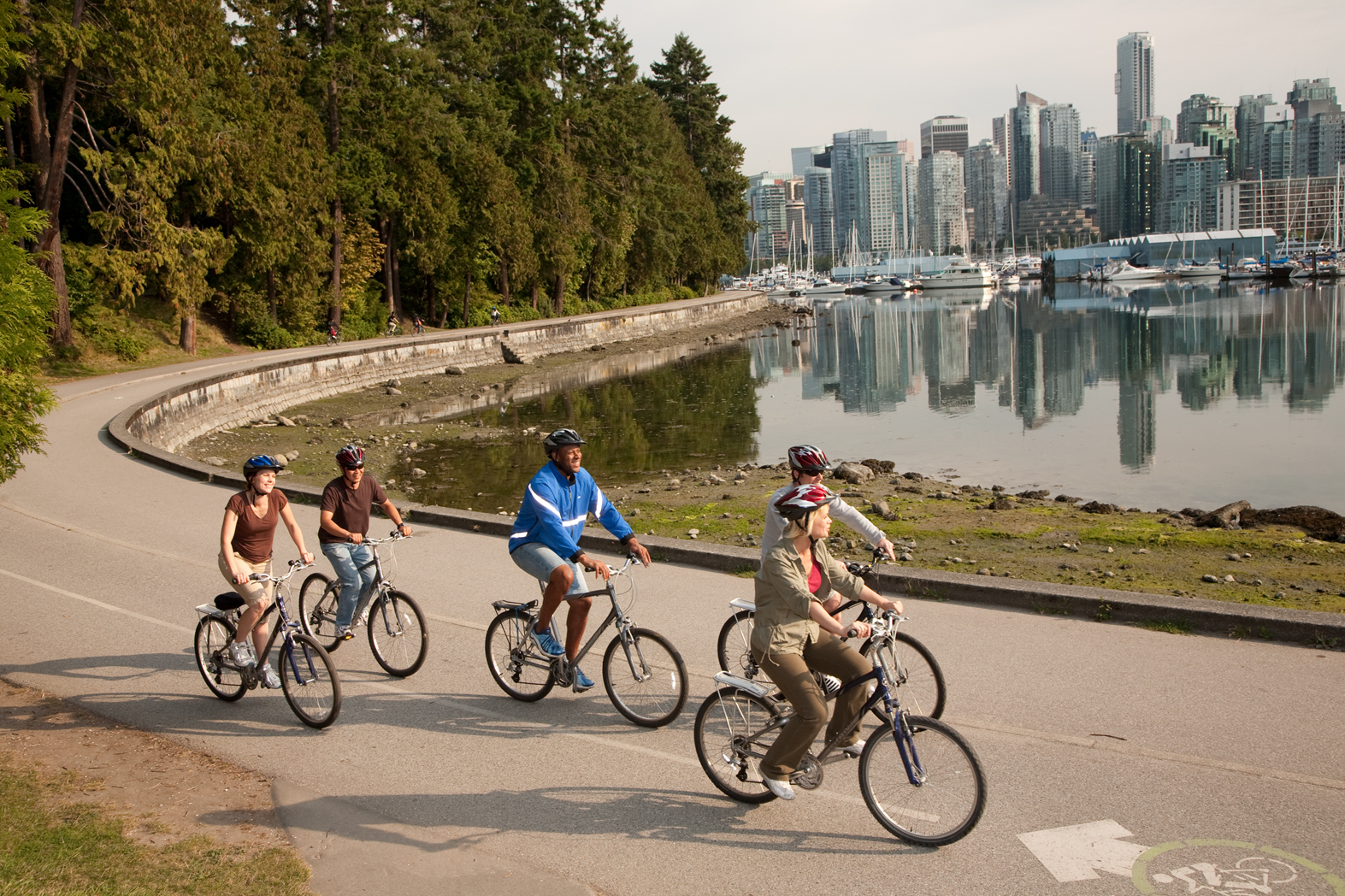
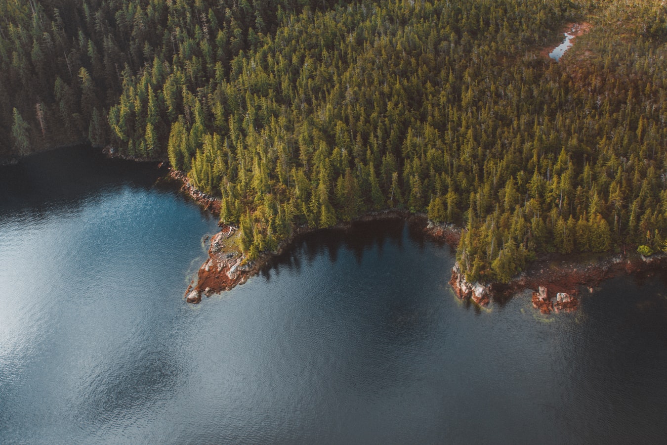
About Vancouver, British Columbia
Vancouver is a delicious juxtaposition of urban sophistication and on-your-doorstep wilderness adventure. The mountains and seascape make the city an outdoor playground for hiking, skiing, kayaking, cycling, and sailing—and so much more—while the cuisine and arts scenes are equally diverse, reflecting the makeup of Vancouver's ethnic (predominantly Asian) mosaic. Vancouver is consistently ranked as one of the world's most livable cities, and it's easy for visitors to see why. It's beautiful, it's outdoorsy, and there's a laidback West Coast vibe. On the one hand, there's easy access to a variety of outdoor activities, a fabulous variety of beaches, and amazing parks. At the same time, the city has a multicultural vitality and cosmopolitan flair. The attraction is as much in the range of food choices—the fresh seafood and local produce are some of North America's best—as it is in the museums, shopping, and nightlife.Vancouver's landscaping also adds to the city's walking appeal. In spring, flowerbeds spill over with tulips and daffodils while sea breezes scatter scented cherry blossoms throughout Downtown; in summer office workers take to the beaches, parks, and urban courtyards for picnic lunches and laptop meetings. More than 8 million visitors each year come to Vancouver, Canada's third-largest metropolitan area. Because of its peninsula location, traffic flow is a contentious issue. Thankfully, Vancouver is wonderfully walkable, especially in the downtown core. The North Shore is a scoot across the harbor, and the rapid-transit system to Richmond and the airport means that staying in the more affordable ’burbs doesn't have to be synonymous with sacrificing convenience. The mild climate, exquisite natural scenery, and relaxed outdoor lifestyle keep attracting residents, and the number of visitors is increasing for the same reasons. People often get their first glimpse of Vancouver when catching an Alaskan cruise, and many return at some point to spend more time here.

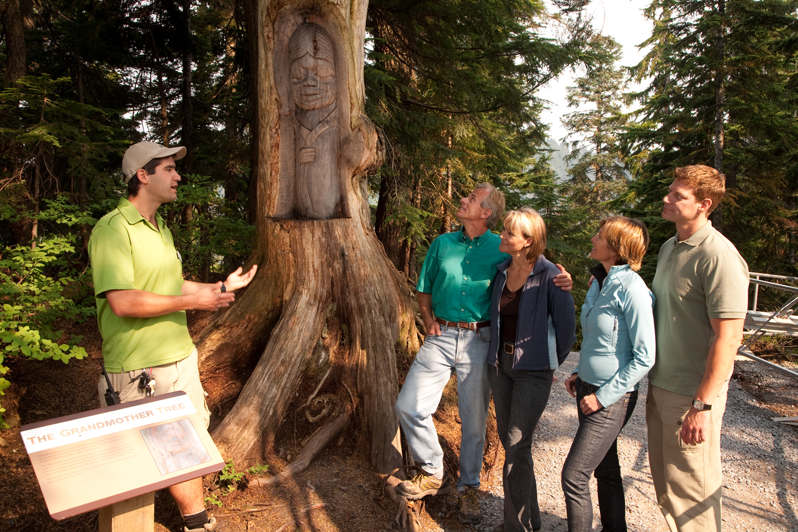
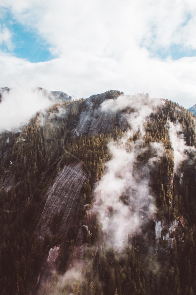
About Ketchikan, Alaska
Ketchikan is famous for its colorful totem poles, rainy skies, steep–as–San Francisco streets, and lush island setting. Some 13,500 people call the town home, and, in the summer, cruise ships crowd the shoreline, floatplanes depart noisily for Misty Fiords National Monument, and salmon-laden commercial fishing boats motor through Tongass Narrows. In the last decade Ketchikan's rowdy, blue-collar heritage of logging and fishing has been softened by the loss of many timber-industry jobs and the dramatic rise of cruise-ship tourism. With some effort, though, visitors can still glimpse the rugged frontier spirit that once permeated this hardscrabble cannery town. Art lovers should make a beeline for Ketchikan: the arts community here is very active. Travelers in search of the perfect piece of Alaska art will find an incredible range of pieces to choose from.The town is at the foot of 3,000-foot Deer Mountain, near the southeastern corner of Revillagigedo (locals shorten it to Revilla) Island. Prior to the arrival of white miners and fishermen in 1885, the Tlingit used the site at the mouth of Ketchikan Creek as a summer fish camp. Gold discoveries just before the turn of the 20th century brought more immigrants, and valuable timber and commercial fishing resources spurred new industries. By the 1930s the town bragged that it was the "salmon-canning capital of the world." You will still find some of Southeast's best salmon fishing around here. Ketchikan is the first bite of Alaska that many travelers taste. Despite its imposing backdrop, hillside homes, and many staircases, the town is relatively easy to walk through. Favorite downtown stops include the Spruce Mill Development shops and Creek Street. A bit farther away you'll find the Totem Heritage Center. Out of town (but included on most bus tours) are two longtime favorites: Totem Bight State Historical Park to the north and Saxman Totem Park to the south.
About Klawock, Alaska
Klawock is a city in Prince of Wales–Hyder Census Area, in the U.S. state of Alaska, on the west coast of Prince of Wales Island, on Klawock Inlet, across from Klawock Island. The population was 755 at the 2010 census, down from 854 in 2000.
About Sitka, Alaska
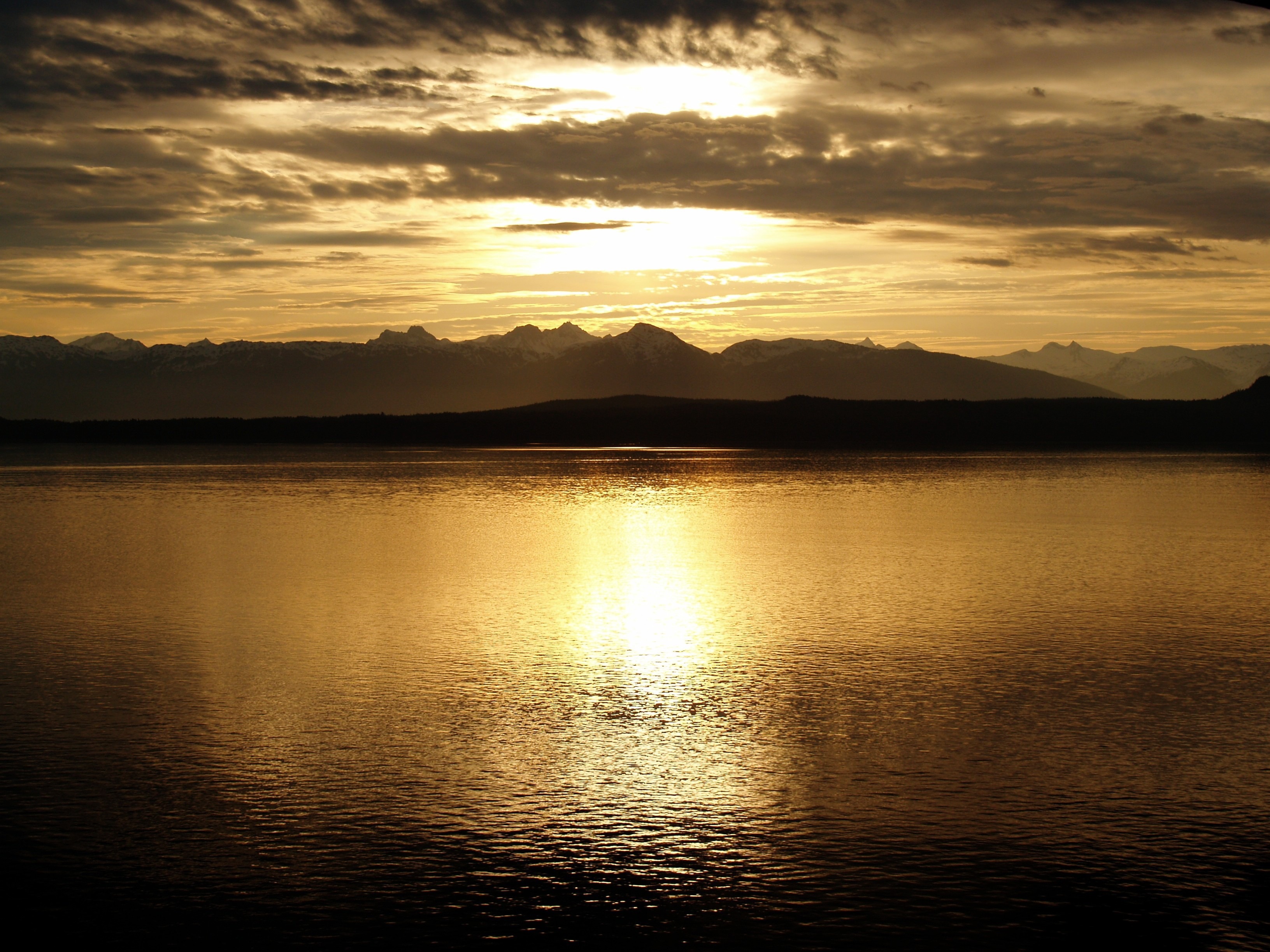
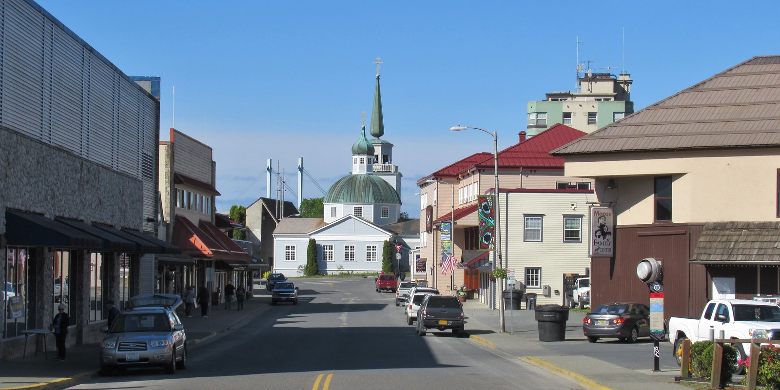
It's hard not to like Sitka, with its eclectic blend of Alaska Native, Russian, and American history and its dramatic and beautiful open-ocean setting. This is one of the best Inside Passage towns to explore on foot, with St. Michael's Cathedral, Sheldon Jackson Museum, Castle Hill, Sitka National Historical Park, and the Alaska Raptor Center topping the must-see list.Sitka was home to the Kiksádi clan of the Tlingit people for centuries prior to the 18th-century arrival of the Russians under the direction of territorial governor Alexander Baranof, who believed the region was ideal for the fur trade. The governor also coveted the Sitka site for its beauty, mild climate, and economic potential; in the island's massive timber forests he saw raw materials for shipbuilding. Its location offered trading routes as far west as Asia and as far south as California and Hawaii. In 1799 Baranof built St. Michael Archangel—a wooden fort and trading post 6 miles north of the present town.Strong disagreements arose shortly after the settlement. The Tlingits attacked the settlers and burned their buildings in 1802. Baranof, however, was away in Kodiak at the time. He returned in 1804 with a formidable force—including shipboard cannons—and attacked the Tlingits at their fort near Indian River, site of the present-day 105-acre Sitka National Historical Park, forcing many of them north to Chichagof Island.By 1821 the Tlingits had reached an accord with the Russians, who were happy to benefit from the tribe's hunting skills. Under Baranof and succeeding managers, the Russian-American Company and the town prospered, becoming known as the Paris of the Pacific. The community built a major shipbuilding and repair facility, sawmills, and forges, and even initiated an ice industry, shipping blocks of ice from nearby Swan Lake to the booming San Francisco market. The settlement that was the site of the 1802 conflict is now called Old Sitka. It is a state park and listed as a National Historic Landmark.The town declined after its 1867 transfer from Russia to the United States, but it became prosperous again during World War II, when it served as a base for the U.S. effort to drive the Japanese from the Aleutian Islands. Today its most important industries are fishing, government, and tourism.
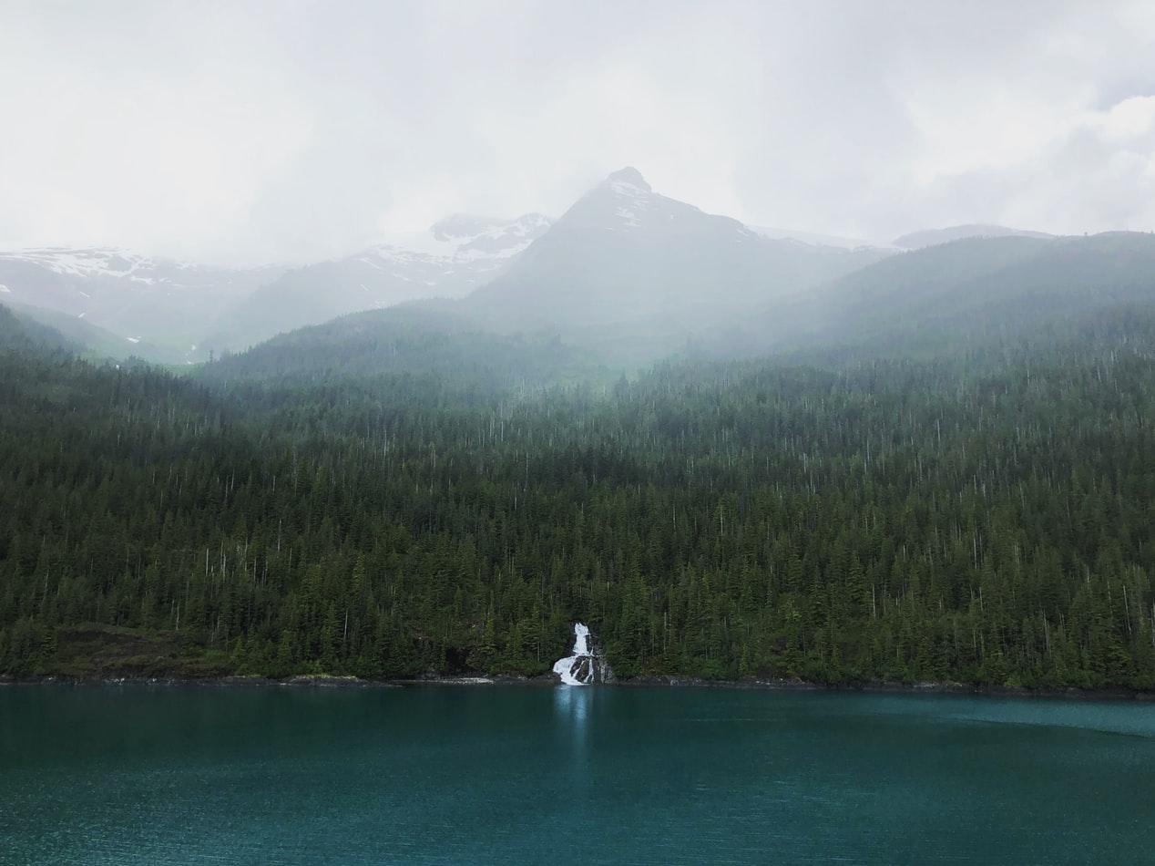
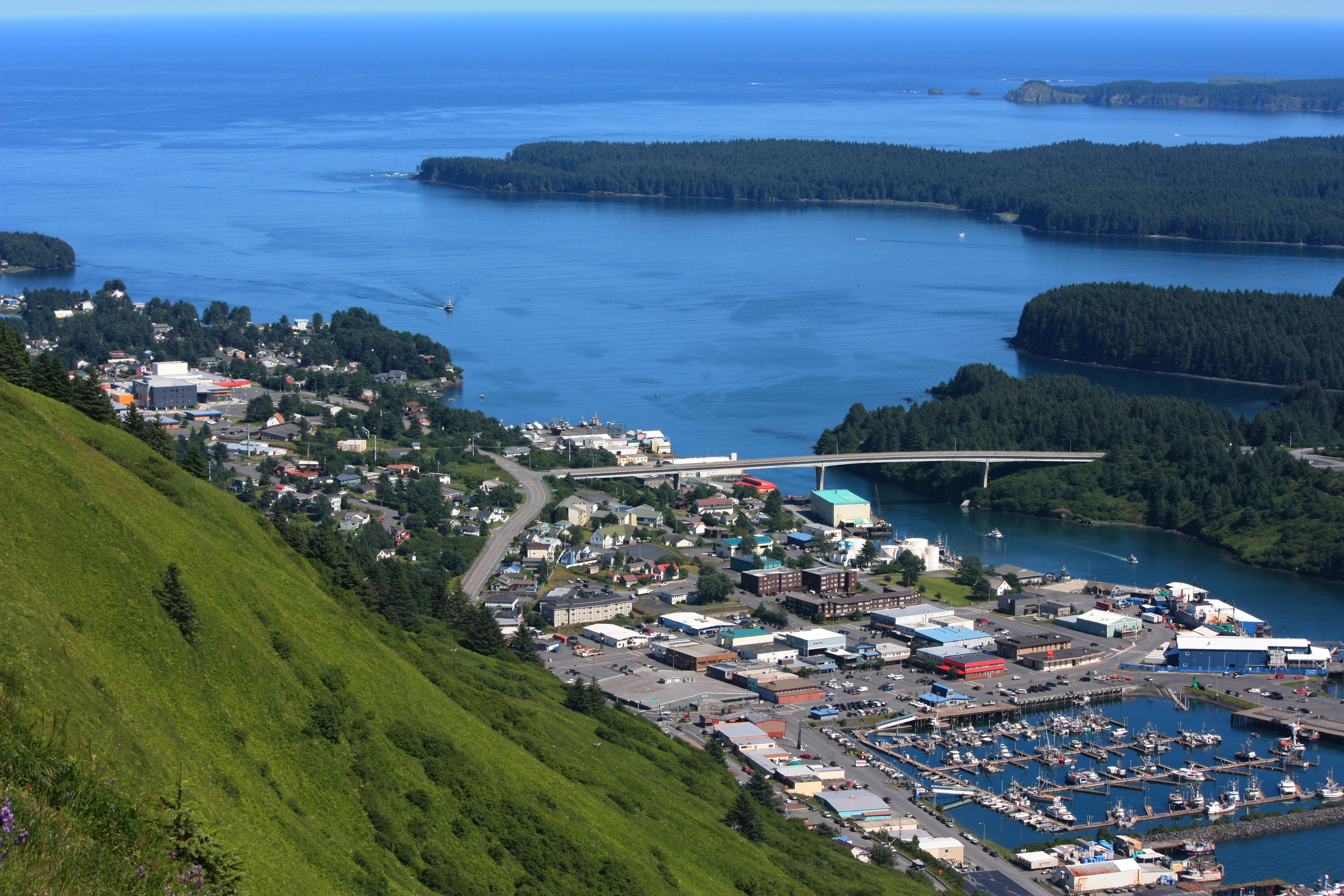
About Kodiak, Alaska
Today, commercial fishing is king in Kodiak. Despite its small population—about 6,475 people scattered among the several islands in the Kodiak group—the city is among the busiest fishing ports in the United States. The harbor is also an important supply point for small communities on the Aleutian Islands and the Alaska Peninsula.Visitors to the island tend to follow one of two agendas: either immediately fly out to a remote lodge for fishing, kayaking, or bear viewing; or stay in town and access whatever pursuits they can reach from the limited road system. If the former is too pricey an option, consider combining the two: drive the road system to see what can be seen inexpensively, then add a fly-out or charter-boat excursion to a remote lodge or wilderness access point.Floatplane and boat charters are available from Kodiak to many remote attractions, chief among them the Kodiak National Wildlife Refuge , which covers four islands in the Gulf of Alaska: Kodiak, Afognak, Ban, and Uganik.
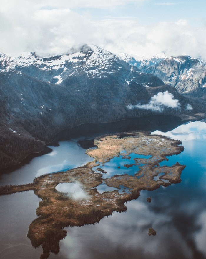
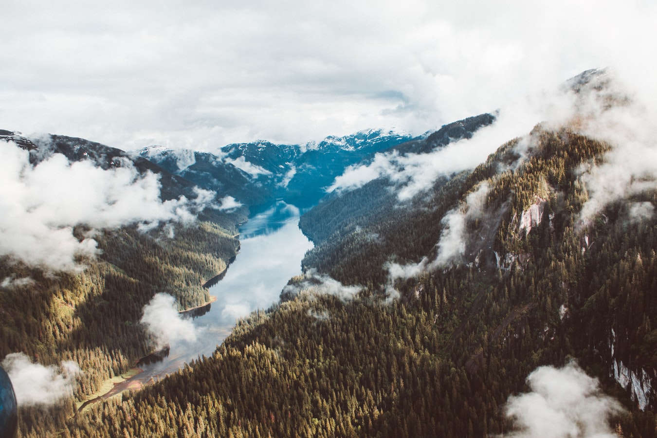
About Dutch Harbor, Alaska
The crumpled peaks, and tranquil scenery, of Dutch Harbor belies its history as one of the few places on American soil to have been directly attacked by the Japanese - who bombed the significant US military base here during the Second World War. Located on a string of islands, which loops down into the Pacific from Alaska, a visit to this Aleutian Island destination offers comprehensive military history, and extraordinary ocean scenery. Hike the volcanic, gloriously green landscapes, and look out for wonderful wildlife, like bald eagles, as they survey the surroundings. You can also watch on in awe, as incredible marine mammals crash through the waves just offshore.Dutch Harbor, gives you the chance to sample some of the rich local fishing heritage. Why not book yourself onto a voyage aboard a working fishing boat, to see for yourself how richly filled the waters of the Bering Sea are, as the hard-working fishermen pull bountiful supplies of cod and pollock from the water? The fish plucked from the Bering Sea are shipped to dining tables across America, and you’ll quickly see why Dutch Harbor is one of the US's most important fishing locations

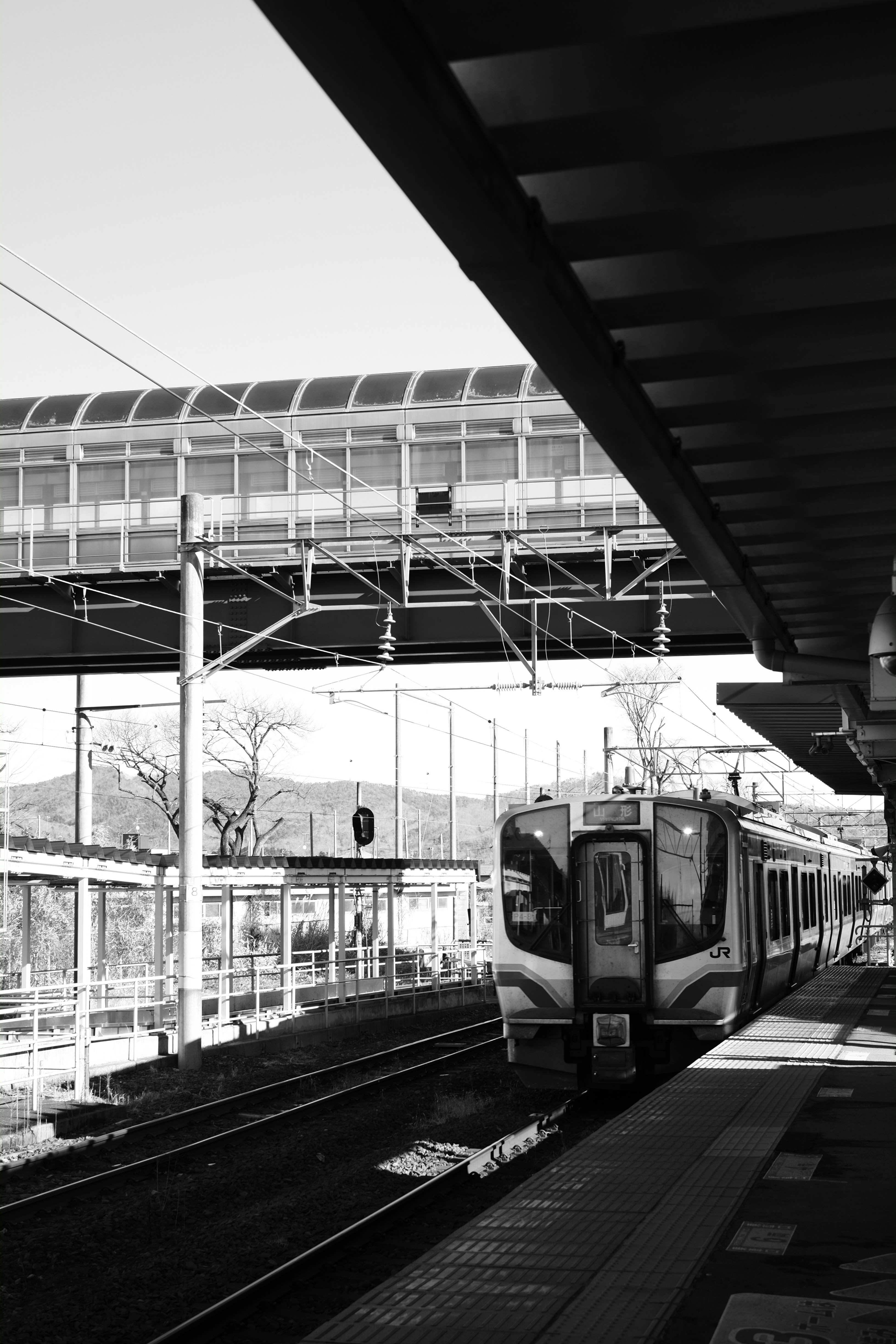
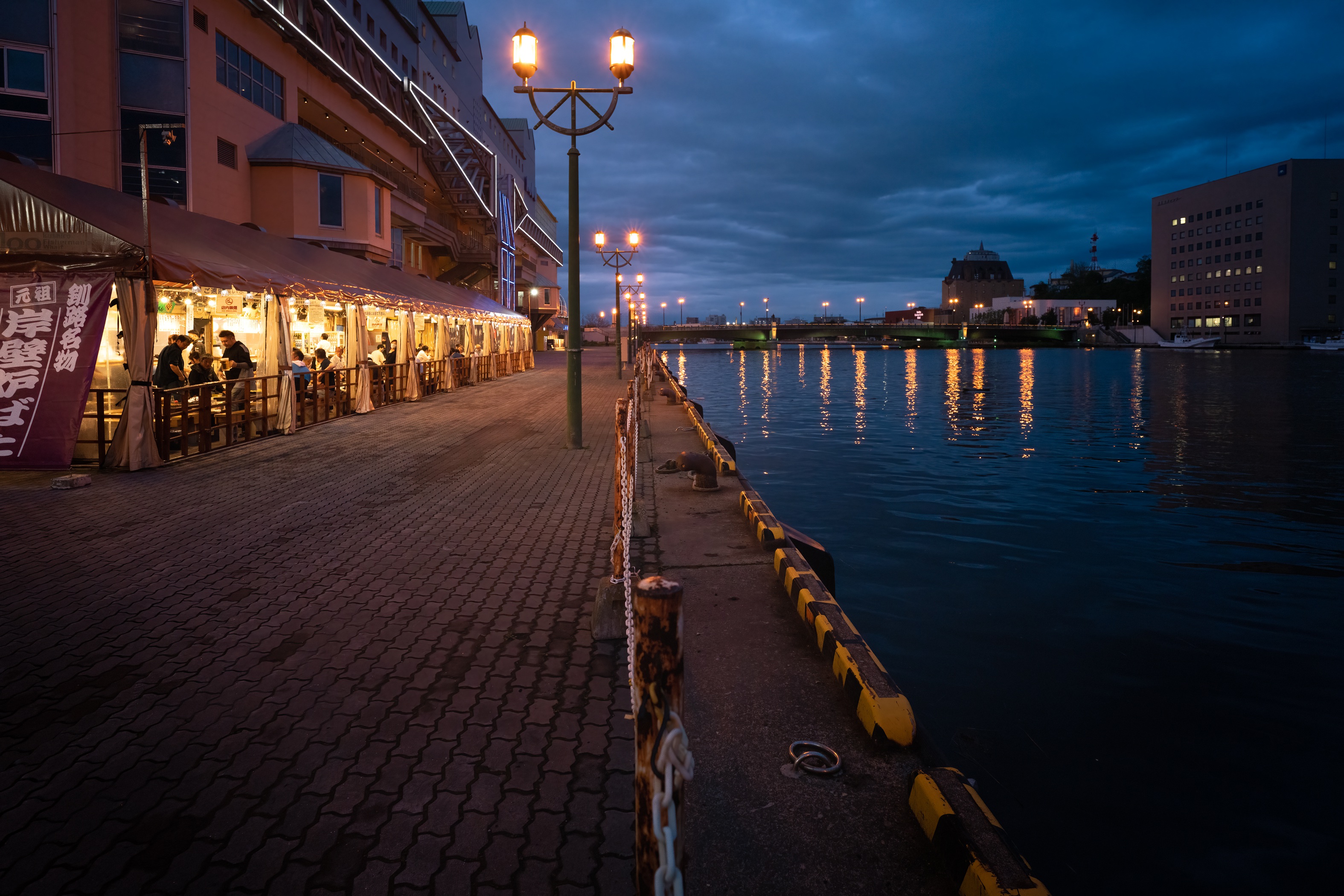
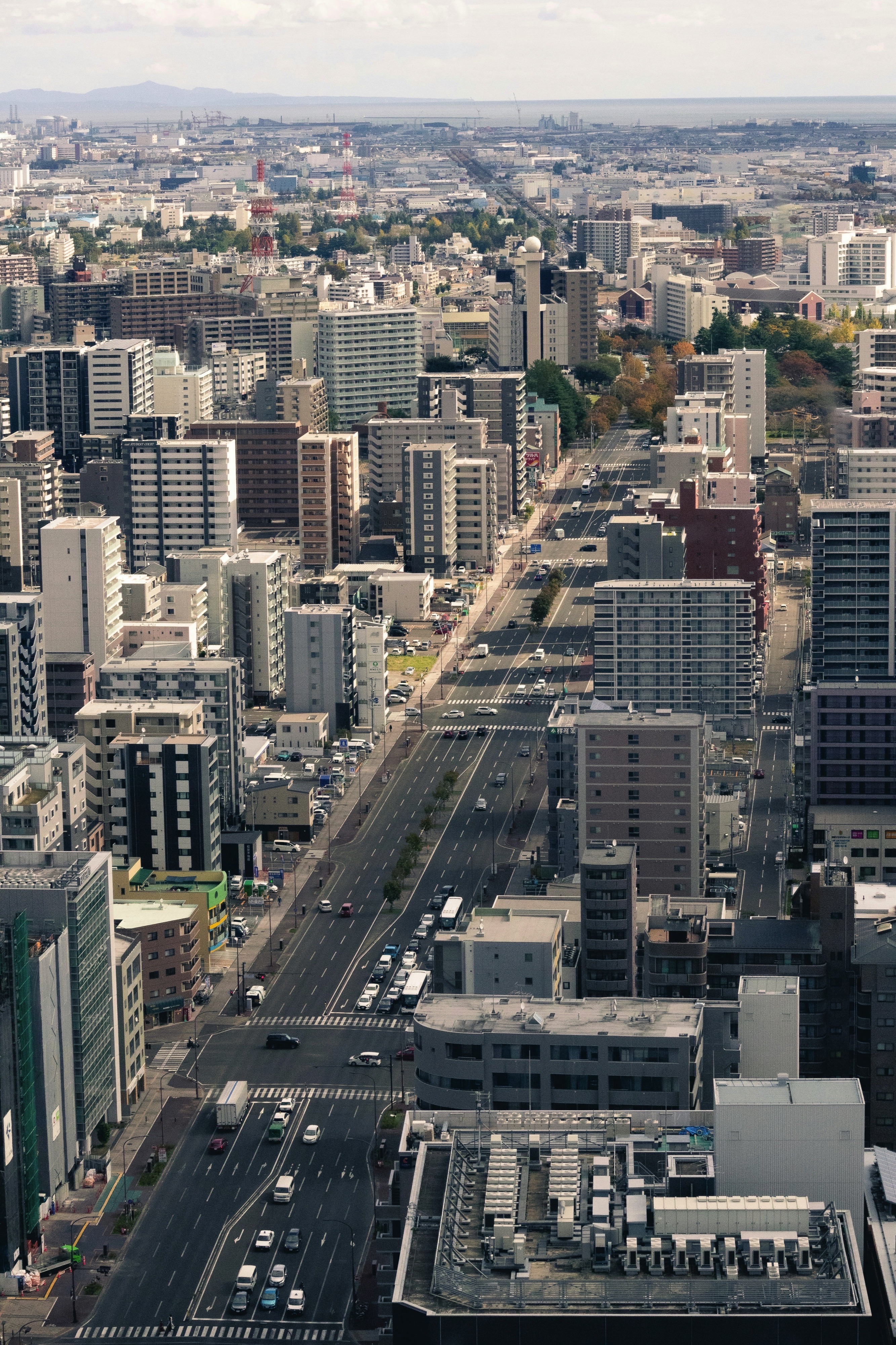
About Kushiro
Kushiro, known as the "town of mist", is situated in the south eastern part of Hokkaido. With about 200,000 inhabitants, it is the largest city in the region and the base for deep-sea fishing. The marine products industry of Kushiro has flourished since the early 20 th century and many streets of this port town retain features of this era. Thanks to its strategic location on Hokkaido's Eastern Pacific seaboard and the area's only ice free port, Kushiro is experiencing steady growth as an important economic, social and cultural centre. A literary atmosphere can be attributed to the poet and novelist Takuboku Ishikawa, who lived here in the early 20th century. To the north of Kushiro lies one of its most renowned attractions, the Kushiro Shitsugen, Japan's largest marshland. Stretching out over the majority of the Kushiro Plain, it accounts for 60 percent of Japan's wetland and was designated to become the country's 28th National Park in 1987. As the marsh is considered one of the greatest treasure houses of flora and fauna in Japan, its protection, preservation and wise use are promoted by a national agreement. Equally famous is the marshland as the habitat of the Tancho (Japanese Crane). At one time, it could be seen in many places in Japan, but their numbers dwindled in the Meiji Era due to over hunting and environmental changes. In the late 19 th century, the cranes were thought to be almost extinct. Then several dozens cranes were discovered in the depths of the Kushiro Shitsugen, and after establishing special crane reserves, the birds rehabilitation has succeeded.
About Miyako, Iwate
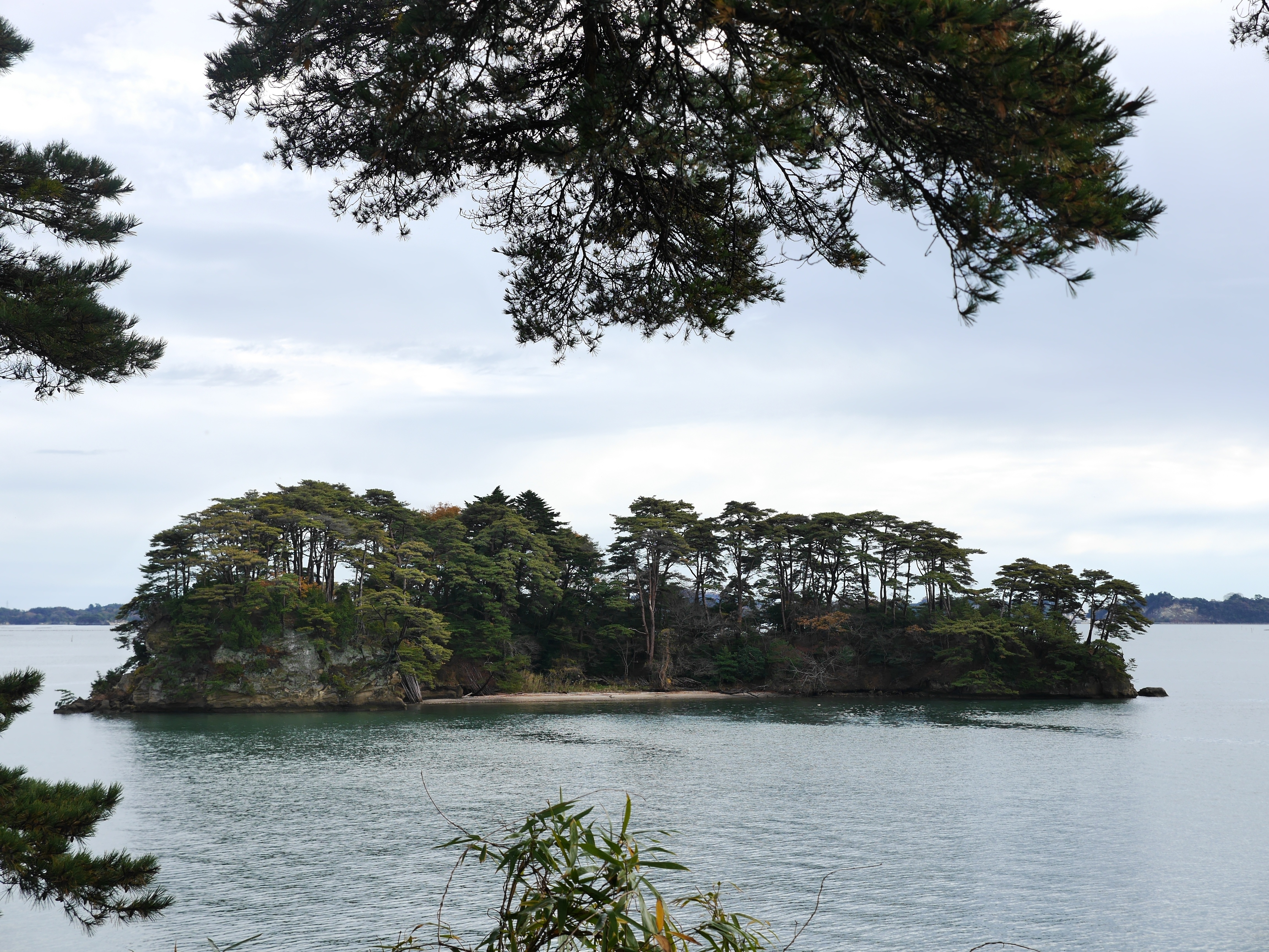
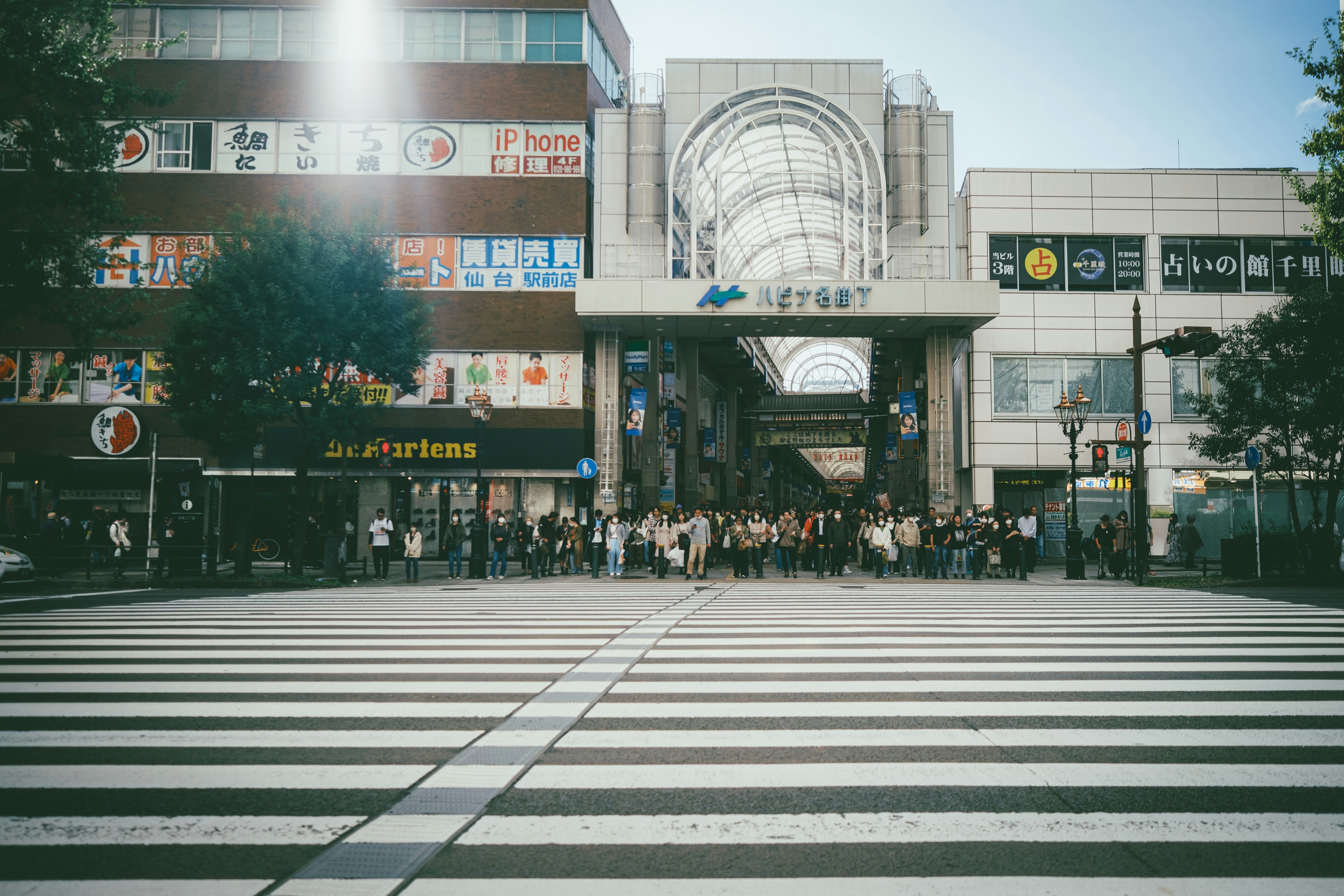
About Sendai

About Hitachinaka
About Shimizu
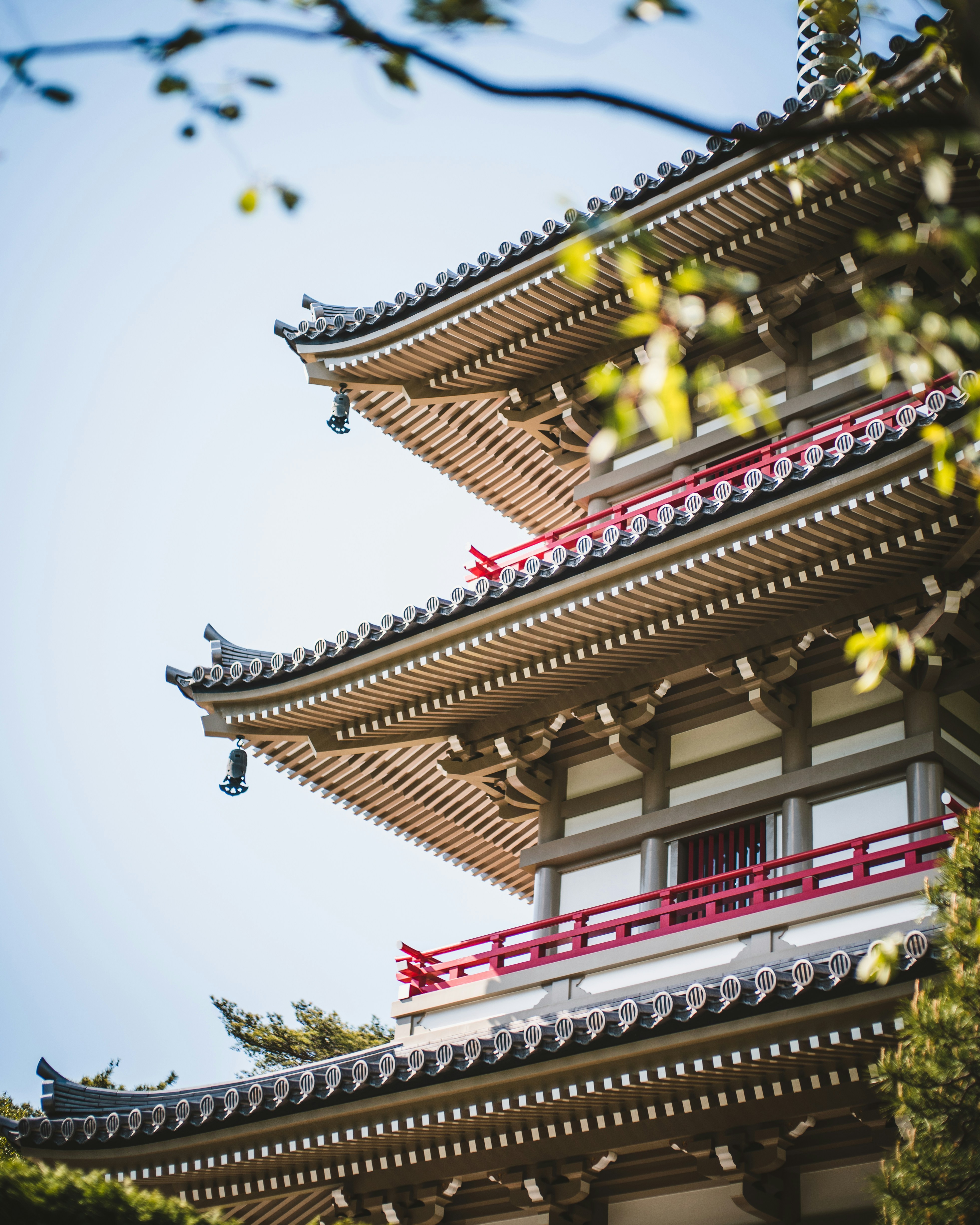
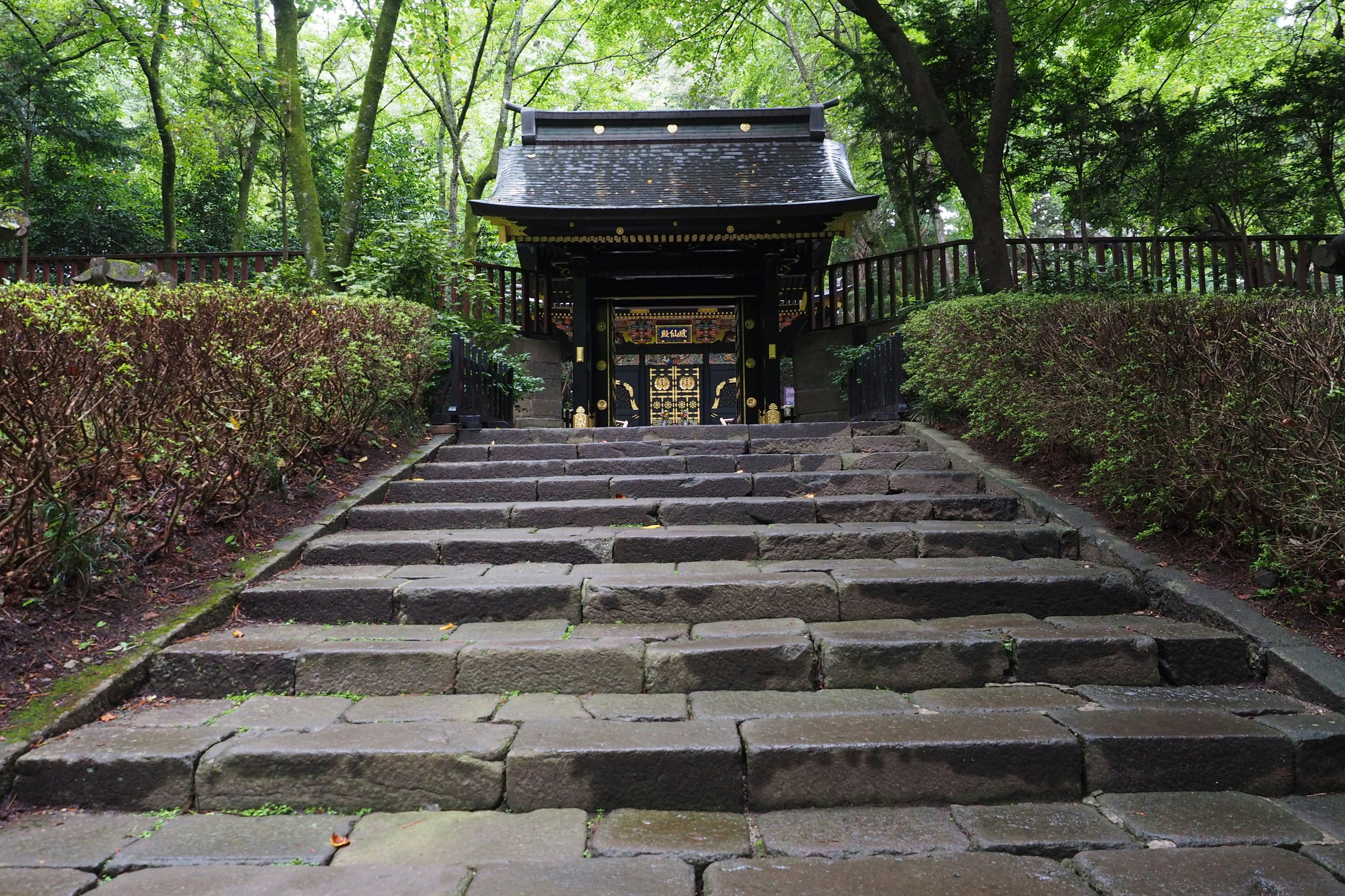
The salt and pepper cone of Japan's most famous natural landmark won’t fail to take your breath away, as it soars into the sky in a vision of spectacular symmetry. Make sure your camera is fully prepared before you dock in Shimizu’s port, where unparalleled views of the extraordinary Mount Fuji’s dramatic peak await. Take your time to soak up one of Japan's most iconic views, before dipping your toes into the rest of what this destination of tranquil temples has to offer. While there’s a bustling fish market, and a charming amusement park waiting close to the port, most new arrivals immediately set off in pursuit of the best views of Mount Fuji, or to see the stunning panorama on offer from the heights of the Kunozan Toshogu Shrine. Take the cable car up to the top, to experience the tranquillity around the forested shrine, and to enjoy its stunning architecture of deep scarlets and gleaming golds. You can also enjoy heart-stopping views out over the Bay of Suruga, and the tea plantations below.
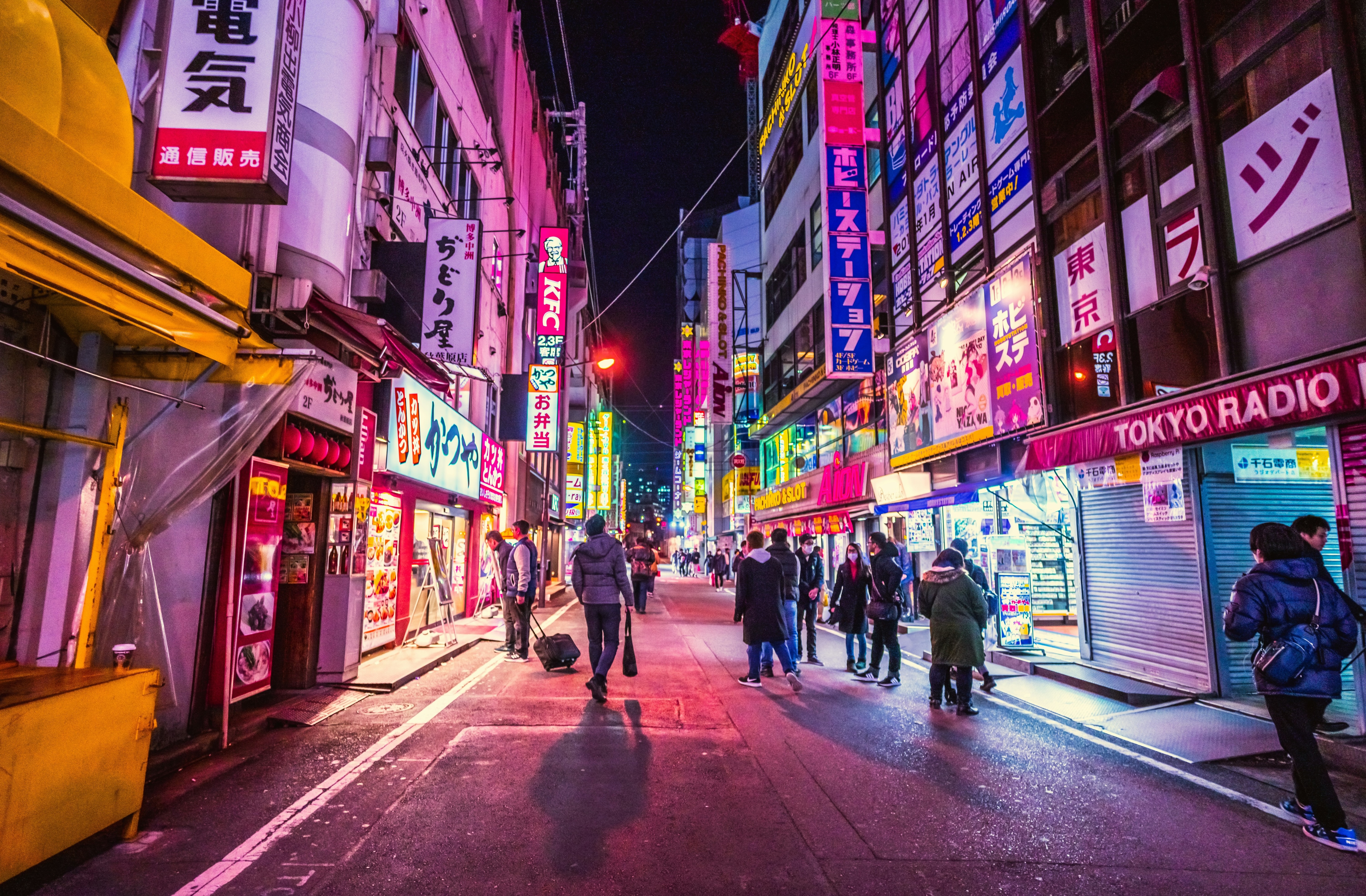
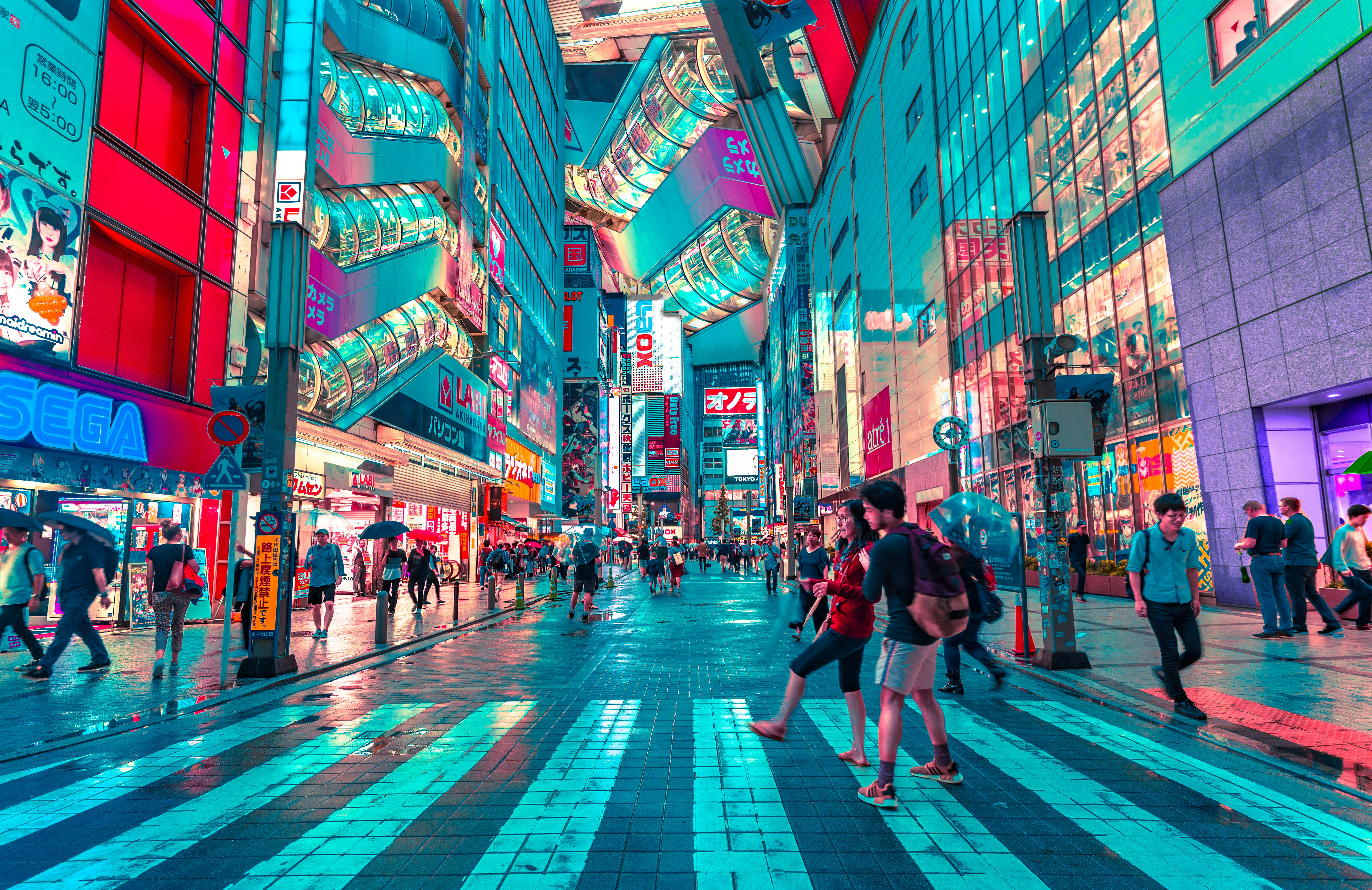
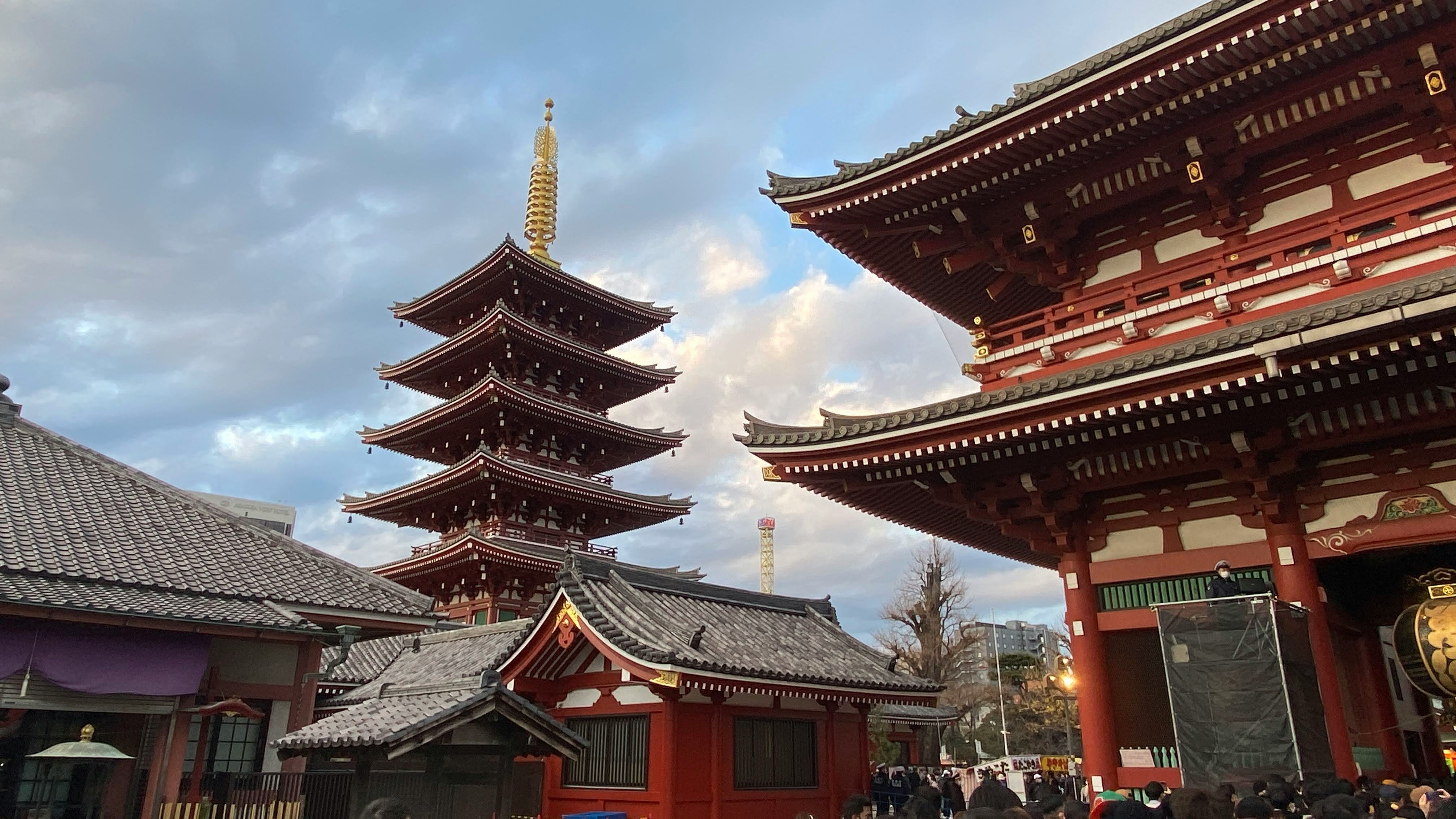
About Tokyo
Lights, sushi, manga! Sprawling, frenetic, and endlessly fascinating, Japan’s capital is a city of contrasts. Shrines and gardens are pockets of calm between famously crowded streets and soaring office buildings. Mom-and-pop noodle houses share street space with Western-style chain restaurants and exquisite fine dining. Shopping yields lovely folk arts as well as the newest electronics. And nightlife kicks off with karaoke or sake and continues with techno clubs and more. Whether you seek the traditional or the cutting edge, Tokyo will provide it.
Located on Deck 8; Combine mid-ship suites 849 and 851 for suite 8491 or suites 846 and 848 for suite 8468 for a total inside space of 1,292 square feet (120 square meters) plus two verandas totalling 244 square feet (23 square meters)
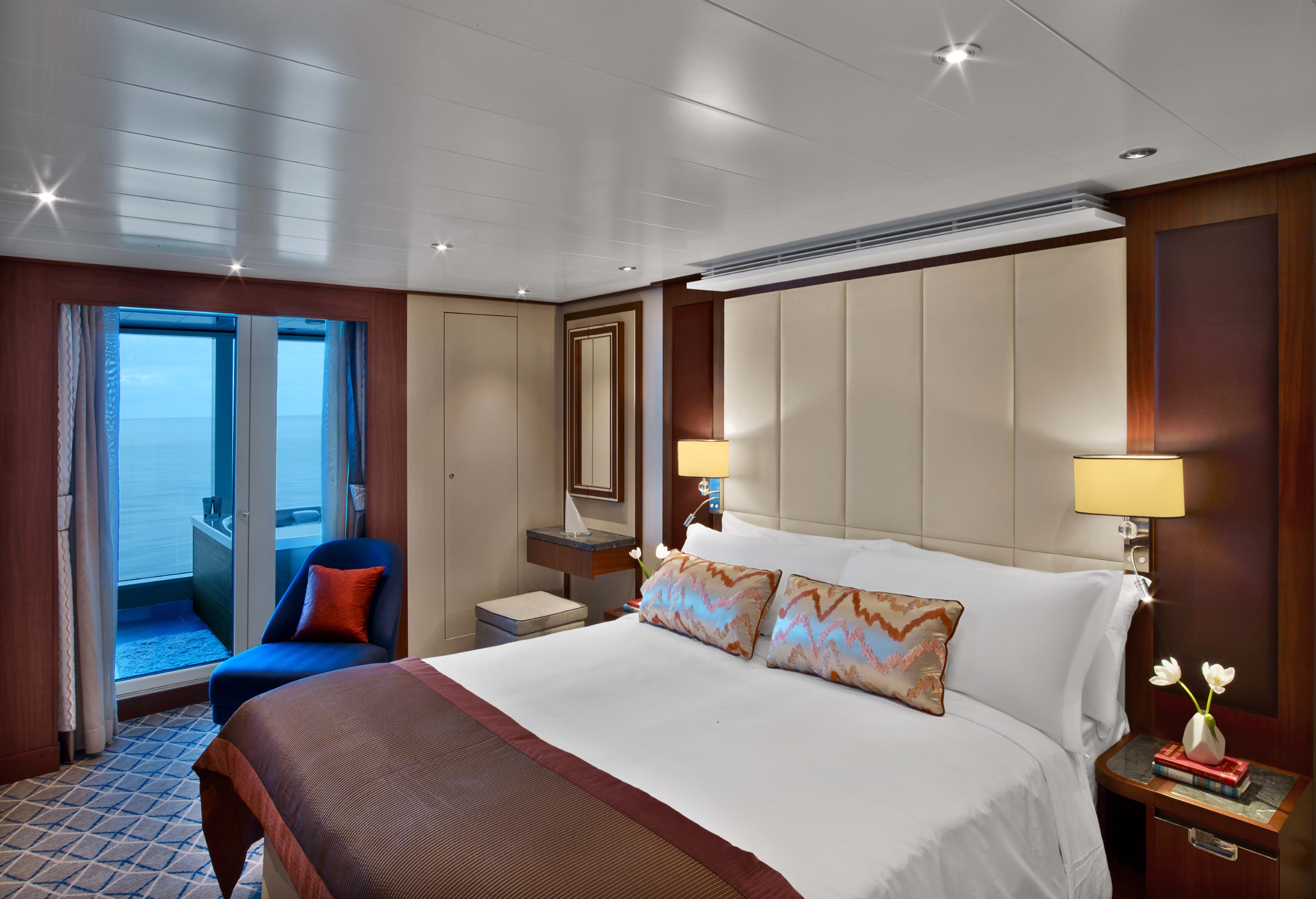
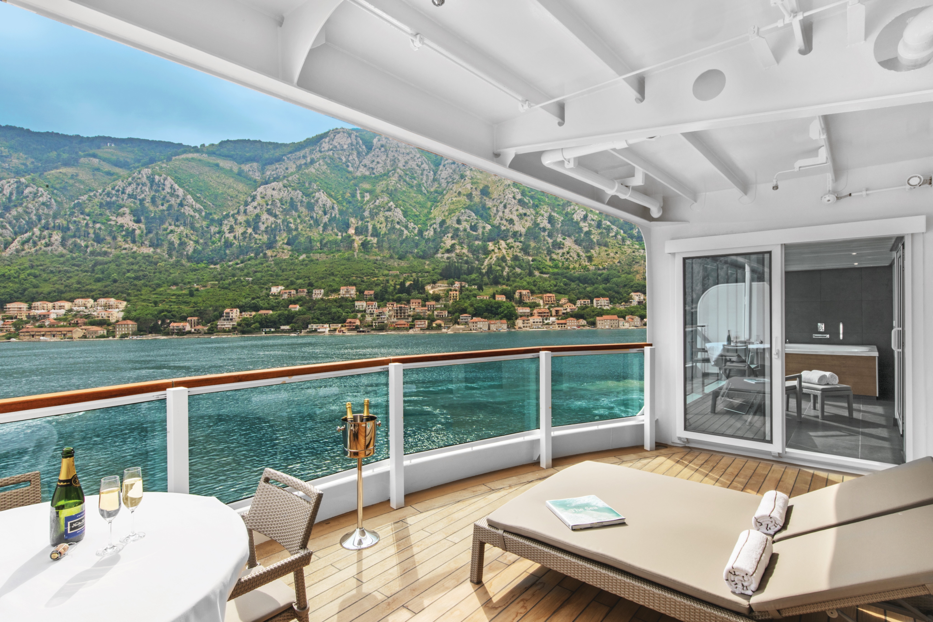
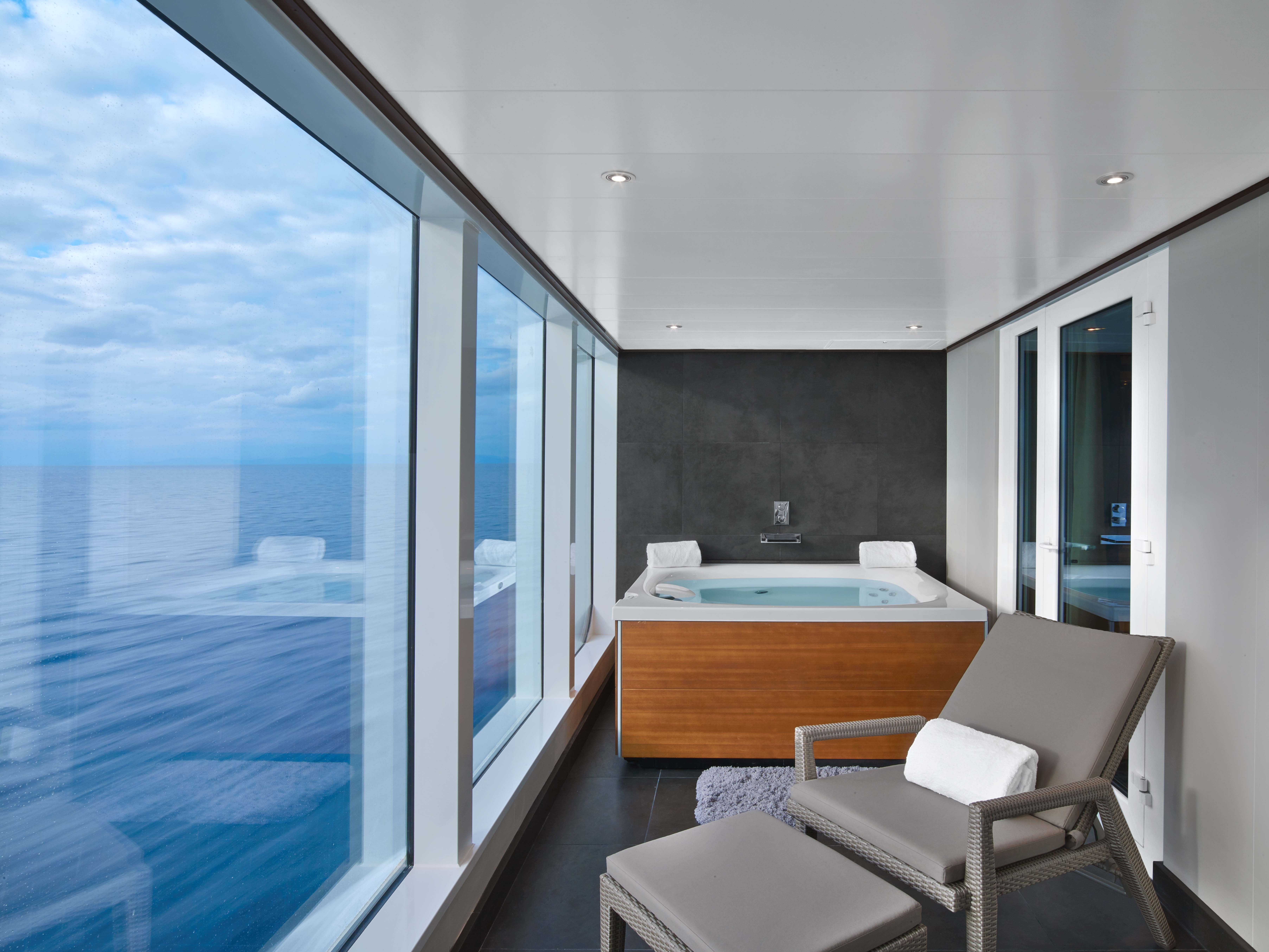
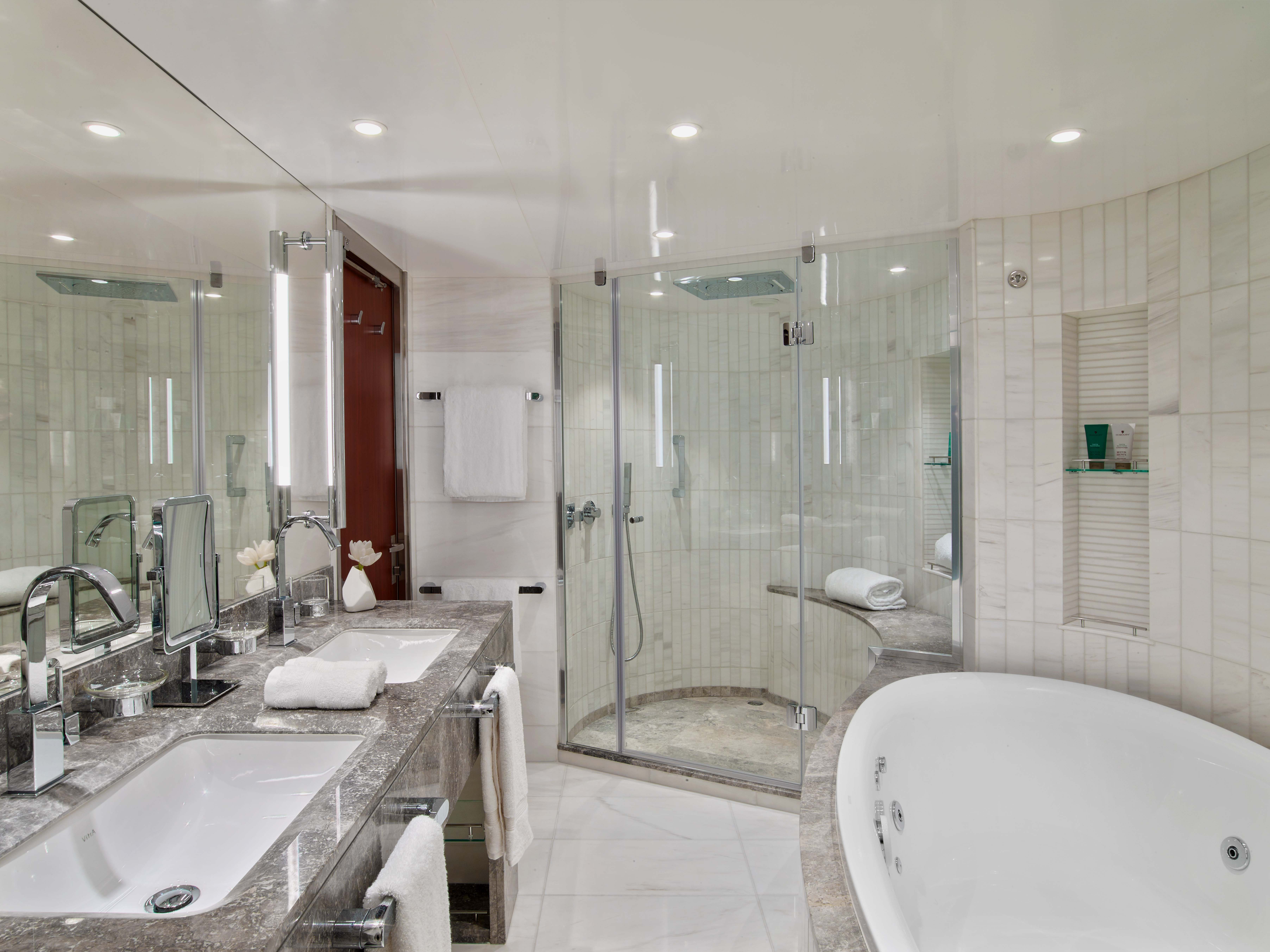
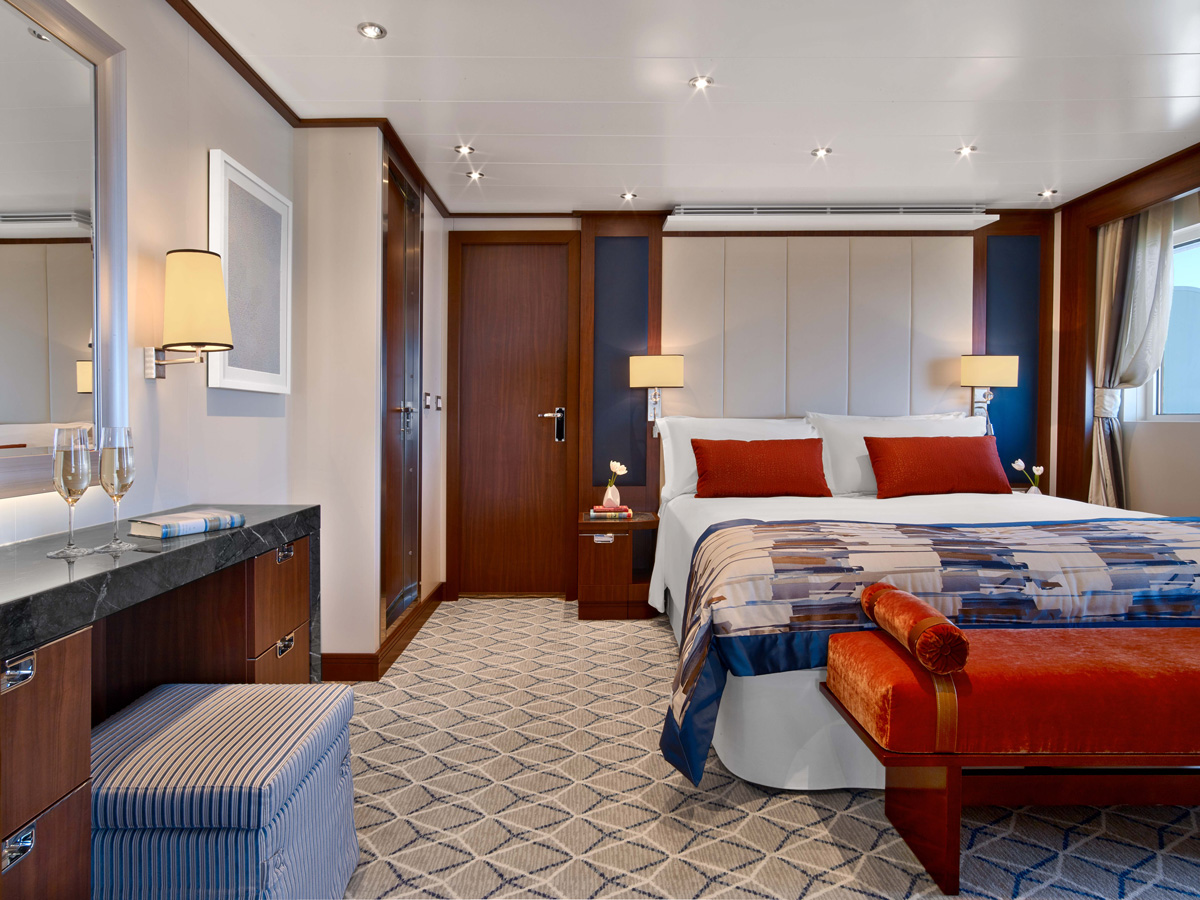
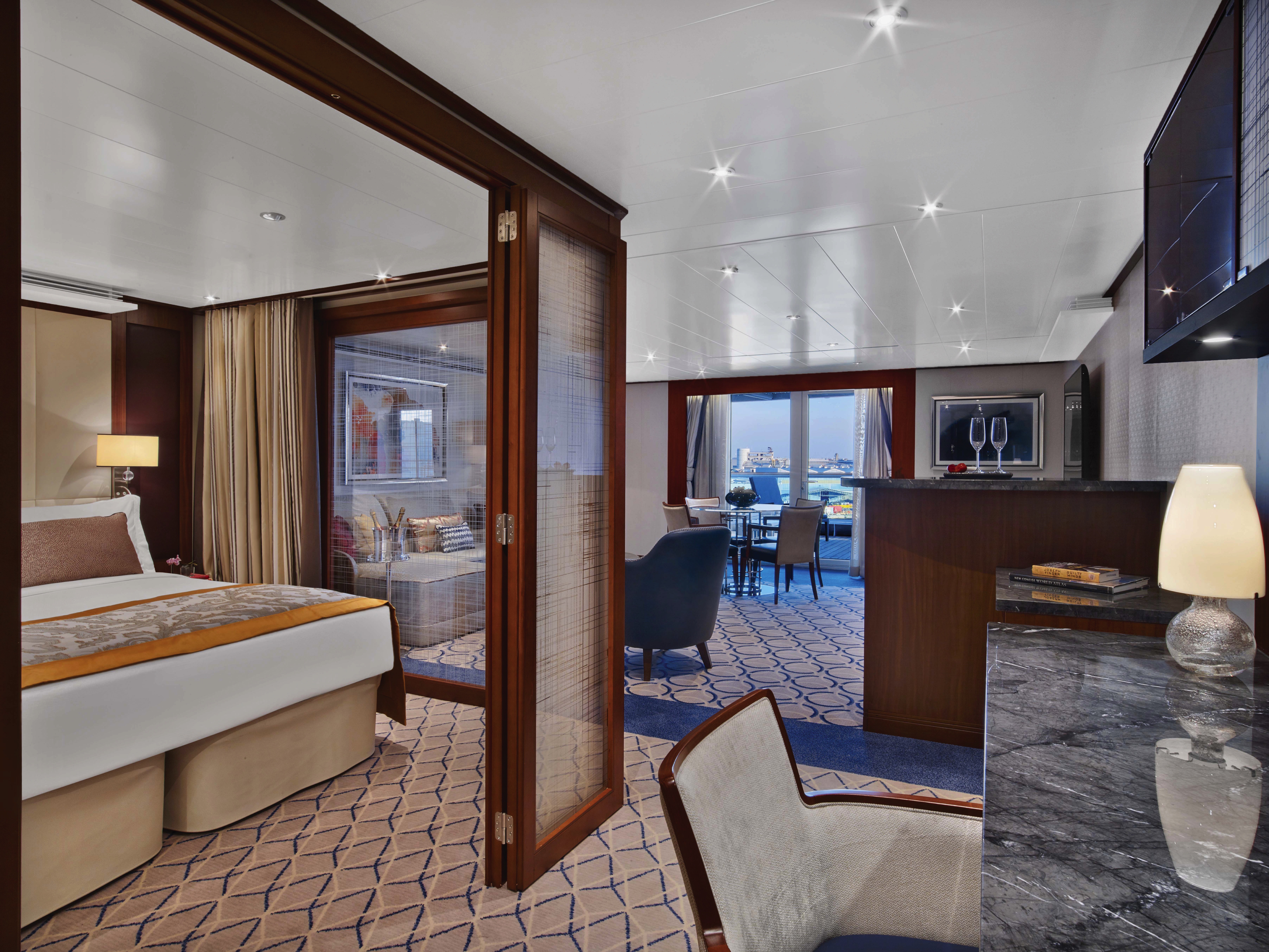
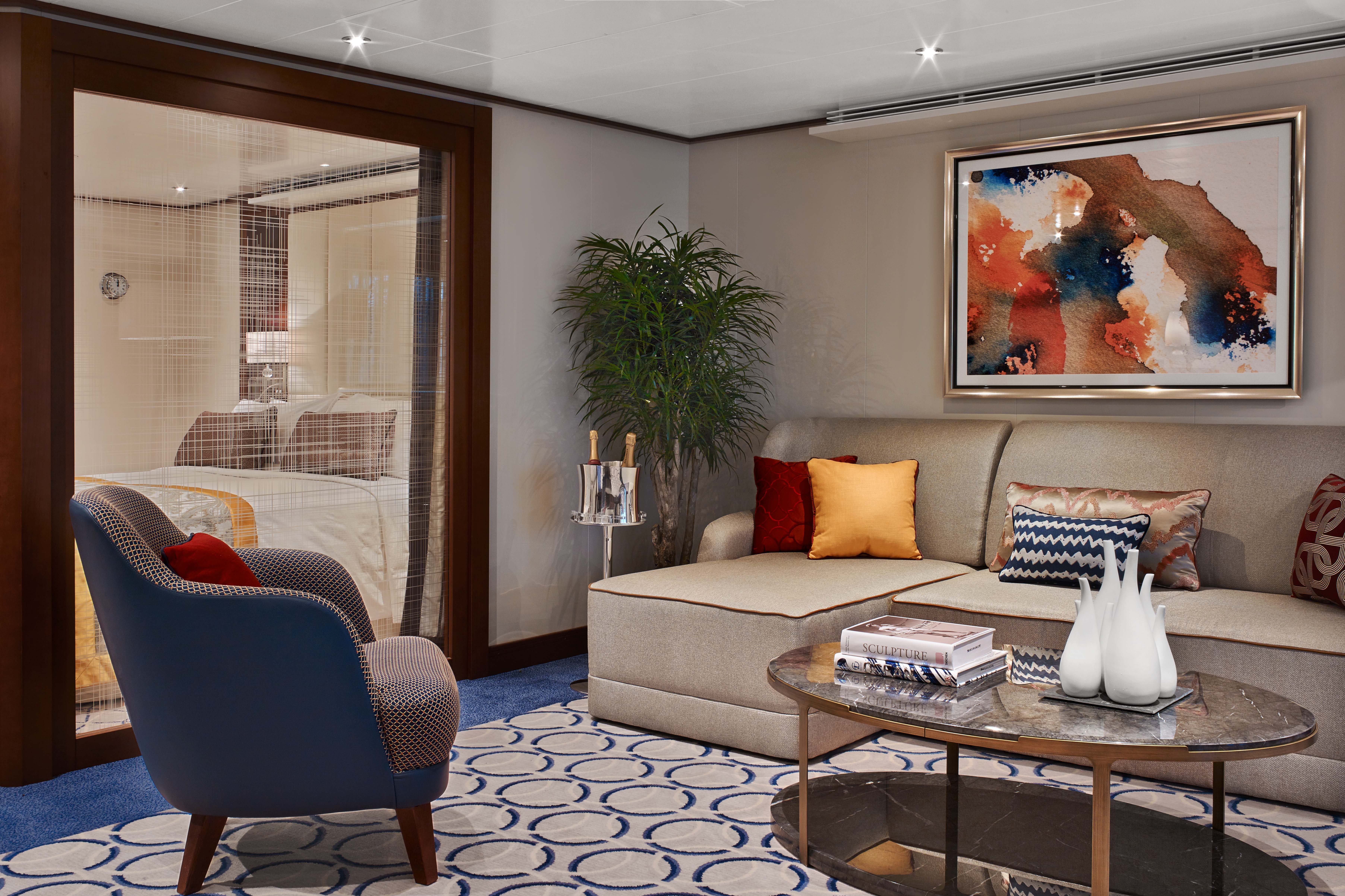
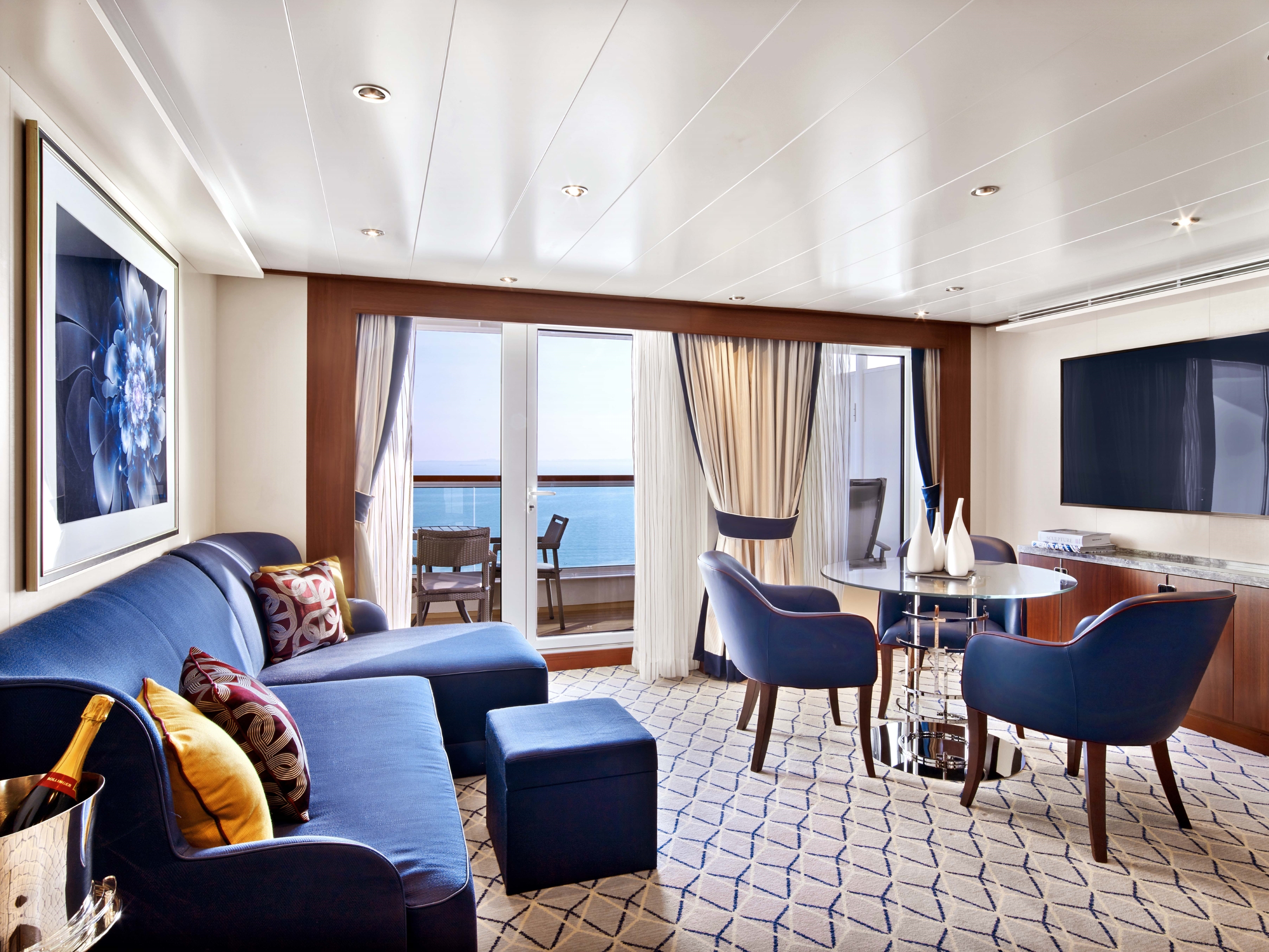
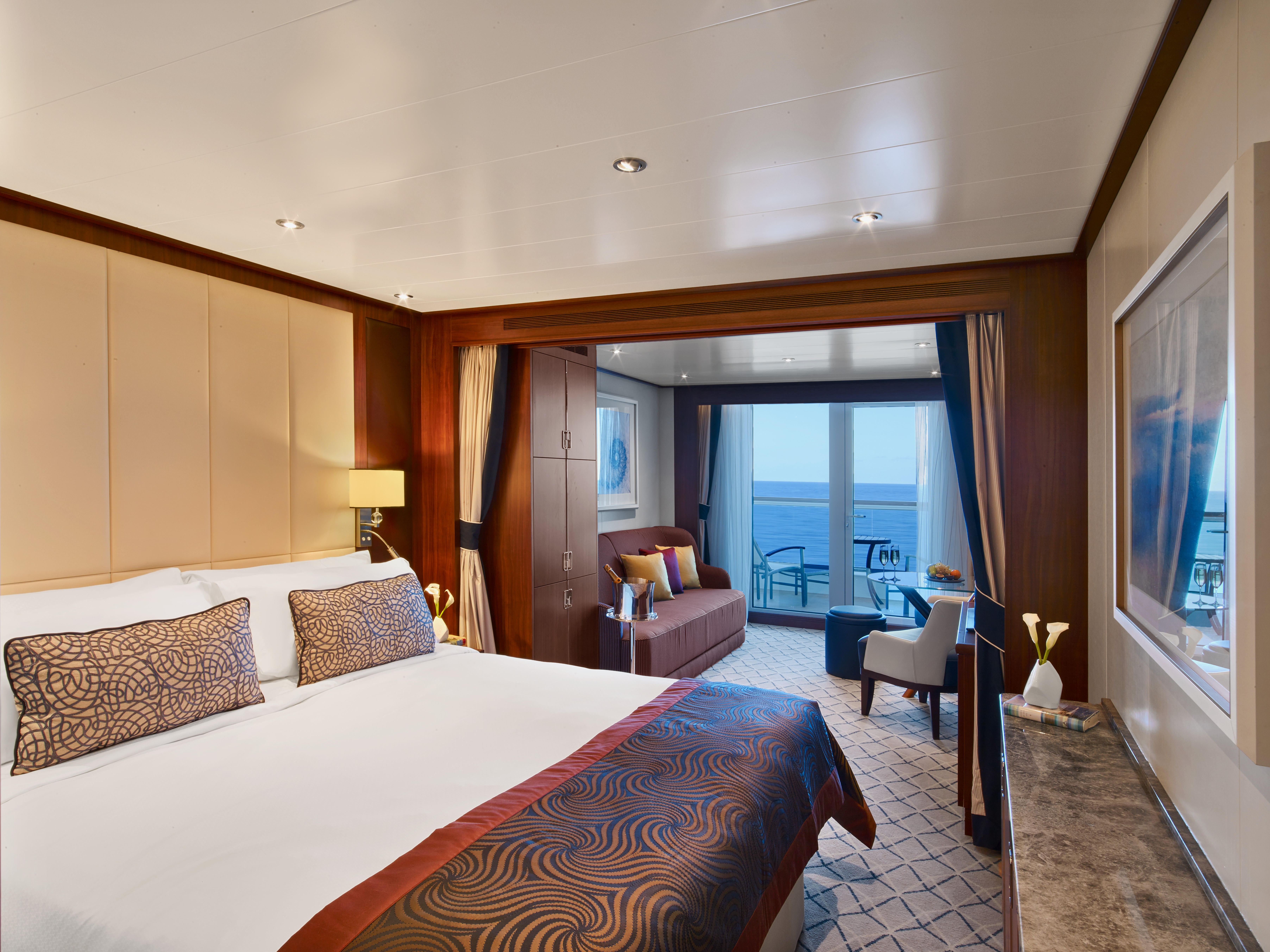
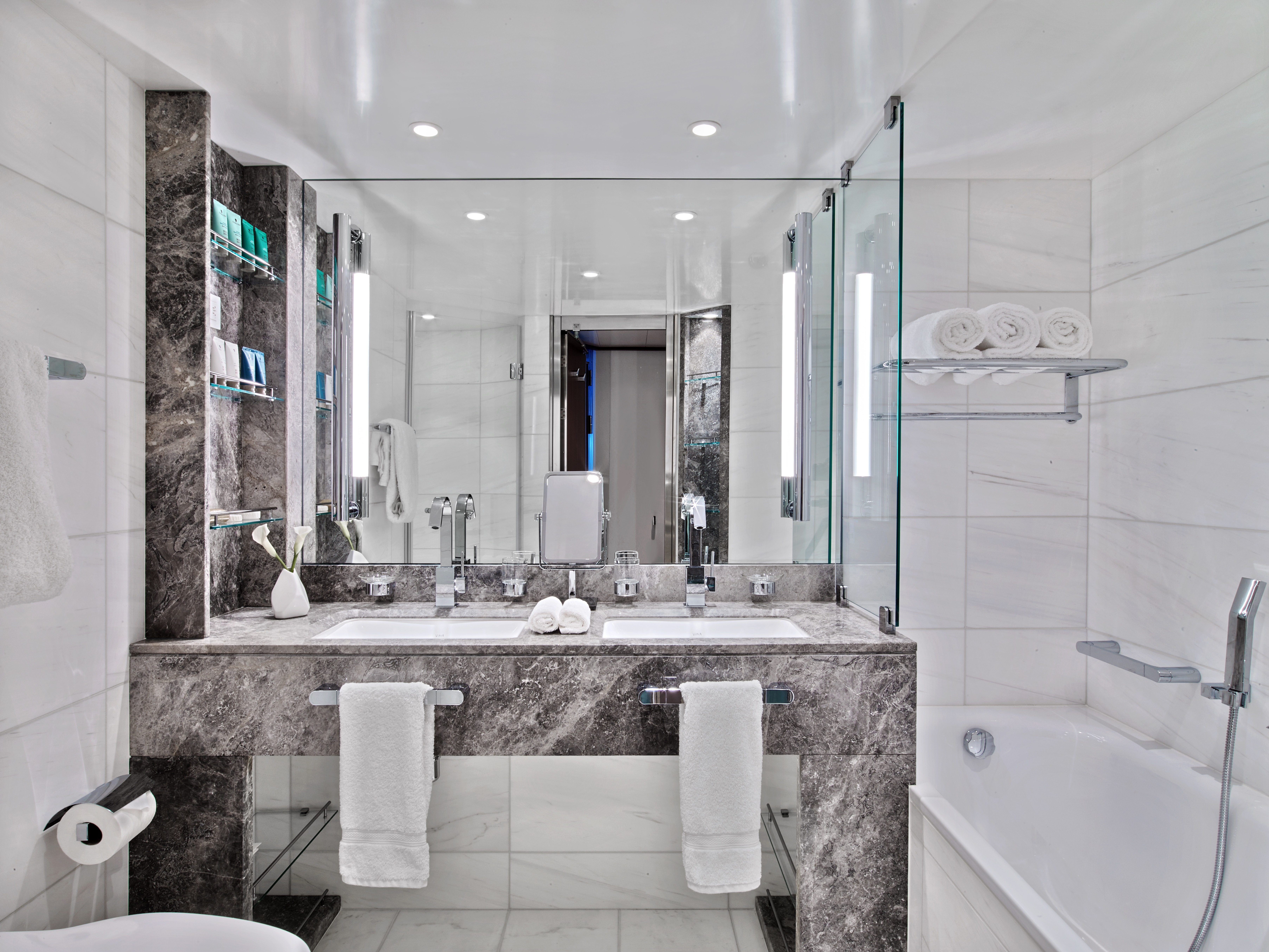
Suites on board feature a comfortable living area, private veranda, queen-size-bed or two twin beds; walk-in closet with personal safe, interactive flat-screen TV with music and movies, fully stocked bar and refrigerator, writing desk with personalized stationary, makeup vanity, spacious bathroom with separate tub and shower, plush robes, slippers hair dryer and 110/220V AC outlets.
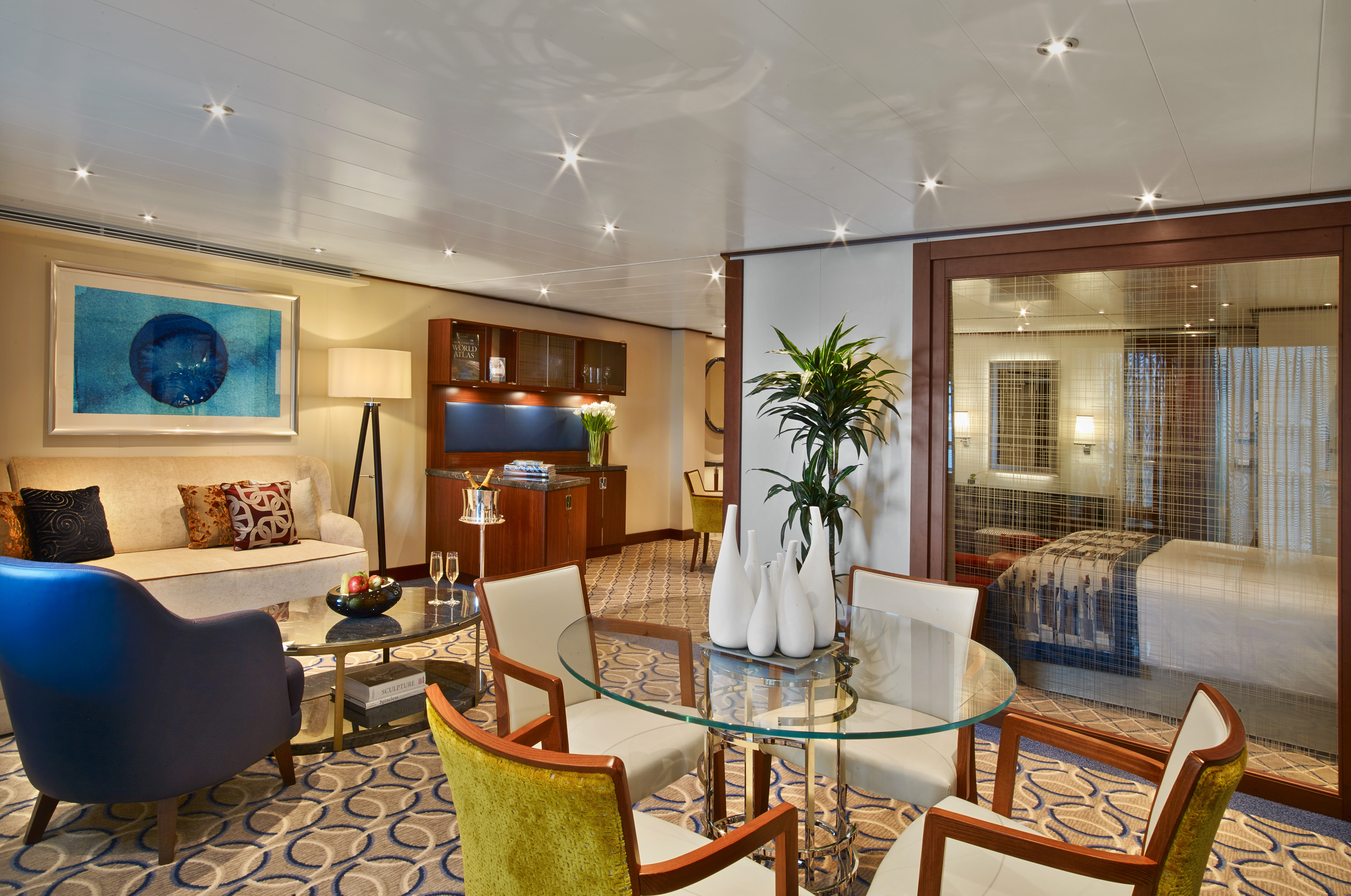
Grand Wintergarden Suites features
- Large windows
- Dining for six
- Whirlpool bathtub,
- Guest bath,
- Convertible sofa bed for one
- Pantry with wet bar
- Glass-enclosed solarium with tub and day bed
- Two closets and two flat-screen TVs.
- Complimentary Internet/Wi-Fi service.

Located on Deck 8; mid-ship suites 846 and 849 inside space of 989 square feet (92 square meters) plus one veranda of 197 square feet (18 square meters)
Suites on board feature a comfortable living area, private veranda, queen-size-bed or two twin beds; walk-in closet with personal safe, interactive flat-screen TV with music and movies, fully stocked bar and refrigerator, writing desk with personalized stationary, makeup vanity, spacious bathroom with separate tub and shower, plush robes, slippers hair dryer and 110/220V AC outlets.
Wintergarden Suites Features- Large windows
- Dining for six
- Whirlpool bathtub,
- Guest bath,
- Convertible sofa bed for one
- Pantry with wet bar
- Glass-enclosed solarium with tub and day bed
- Two closets and two flat-screen TVs.
- Complimentary Internet/Wi-Fi service.
Located on Deck 8; forward suites 800 and 801 inside space of approximately 977 square feet of inside space (90 square meters), plus one veranda of 960 square feet (89 square meters).
Suites on board feature a comfortable living area, private veranda, queen-size-bed or two twin beds; walk-in closet with personal safe, interactive flat-screen TV with music and movies, fully stocked bar and refrigerator, writing desk with personalized stationary, makeup vanity, spacious bathroom with separate tub and shower, plush robes, slippers hair dryer and 110/220V AC outlets.
Signature Suites Features
- Forward-facing windows
- Dining for four to six
- Bathroom with whirlpool bathtub
- Guest bath
- Pantry with wet bar
- Two flat-screen TVs.
- Complimentary Internet/Wi-Fi service.
Located on Deck 7, 8, 9 and 10; total inside space of between 576 and 597 square feet (54 and 55 square meters) plus veranda of between 142 and 778 square feet (13 and 72 square meters).
Suites on board feature a comfortable living area, private veranda, queen-size-bed or two twin beds; walk-in closet with personal safe, interactive flat-screen TV with music and movies, fully stocked bar and refrigerator, writing desk with personalized stationary, makeup vanity, spacious bathroom with separate tub and shower, plush robes, slippers hair dryer and 110/220V AC outlets.
Owner's Suites Feature
- Expansive ocean views
- Forward-facing windows
- Dining for four to six
- Bathroom with whirlpool bathtub
- Guest bath
- Pantry with wet bar
- Two flat-screen TVs.
- Complimentary Internet/Wi-Fi service.
All Penthouse Suites on board feature a comfortable living area, glass door to private veranda, queen-size-bed or two twin beds; walk-in closet with personal safe, two flat-screen TV with music and movies, fully stocked bar and refrigerator, writing desk with personalized stationary, makeup vanity, spacious bathroom with separate tub and shower, plush robes, slippers hair dryer and 110/220V AC outlets.Penthouse Spa Suites Features
- Comfortable living area
- Glass door to private veranda
- Queen-size-bed or two twin beds
- Walk-in closet with personal safe
- Interactive flat-screen TV
- Fully stocked bar and refrigerator
- Spacious marble bath with double vanities.
All Penthouse Suites on board feature a comfortable living area, glass door to private veranda, queen-size-bed or two twin beds; walk-in closet with personal safe, two flat-screen TV with music and movies, fully stocked bar and refrigerator, writing desk with personalized stationary, makeup vanity, spacious bathroom with separate tub and shower, plush robes, slippers hair dryer and 110/220V AC outlets.
Penthouse Suites Features:
- Comfortable living area
- Glass door to private veranda
- Queen-size-bed or two twin beds
- Walk-in closet with personal safe
- Interactive flat-screen TV
- Fully stocked bar and refrigerator
- Spacious marble bath with double vanities.
- Dining table for two to four
- Separate bedroom
- Glass door to veranda
- Two flat-screen TVs
- Fully stocked bar
- Spacious bathroom with tub, shower and large vanity

All Veranda Suites feature a full-length window and glass door to private veranda, comfortable living area, queen-size bed or two twin beds, dining table for two, walk-in closet, interactive flat-screen television with music and movies, fully stocked bar and refrigerator, makeup vanity, spacious bathroom with separate tub and shower.
All Veranda Suites feature:
- A full-length window
- Glass door to private veranda
- Comfortable living area
- Queen-size bed or two twin beds
- Dining table for two
- Walk-in closet
- Interactive flat-screen television with music and movies
- Fully stocked bar and refrigerator
- Makeup vanity
- Spacious bathroom with separate tub and shower
*Wheelchair accessible suites are roll-in shower only.
All Veranda Suites feature a full-length window and glass door to private veranda, comfortable living area, queen-size bed or two twin beds, dining table for two, walk-in closet, interactive flat-screen television with music and movies, fully stocked bar and refrigerator, makeup vanity, spacious bathroom with separate tub and shower.
Guaranteed Suite: For this option we select the location and specific suite for you, and notify you prior to departure. Guests are guaranteed to be assigned a suite in the category selected or higher.
More information coming soon.

More information coming soon.
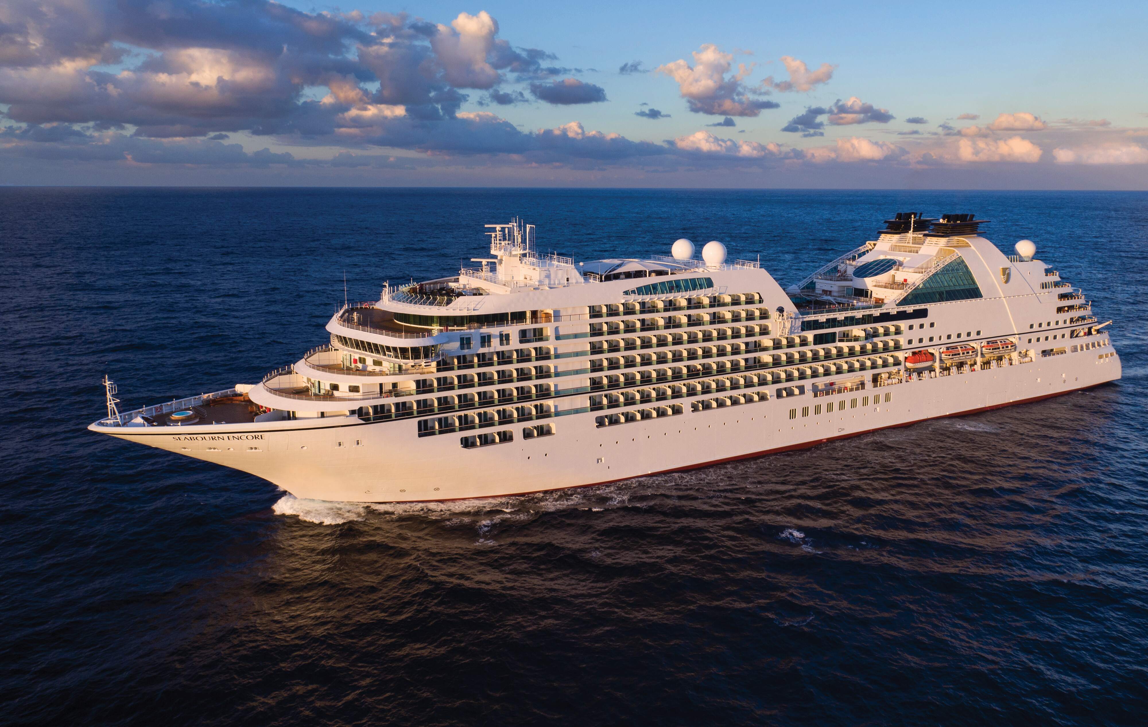
Seabourn Encore
Seabourn Encore is as strikingly beautiful and as excitingly innovative as any Seabourn has ever debuted. She crowns a fleet of luxury cruise ships that is already the newest, most modern and most acclaimed in the ultra-luxury segment. Modeled on the award-winning trio of ships that came before her, Seabourn Encore represents another welcome stage in the evolution of small ship cruising, which Seabourn pioneered and has consistently expanded and enriched for all of our small ship cruises.
Ship Facts
| Launch Year | 2016 | ||||||||
| Refit Year | |||||||||
| Language | en | ||||||||
| Gross Tonnage | 40350 | ||||||||
| Length | 210 | ||||||||
| Width | 28 | ||||||||
| Currency | USD | ||||||||
| Speed | 19 | ||||||||
| Capacity | 600 | ||||||||
| Crew Count | 330 | ||||||||
| Deck Count | 12 | ||||||||
| Cabin Count | 300 | ||||||||
| Large Cabin Count | 33 | ||||||||
| Wheelchair Cabin Count | 9 | ||||||||
| Electrical Plugs |
|
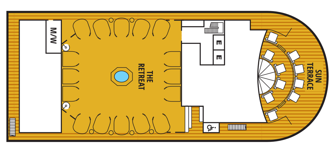
Deck 12
- Sun Terrace
- The Retreat
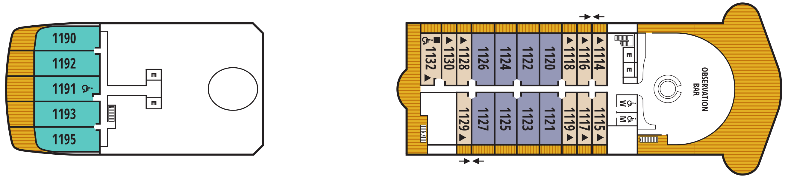
Deck 11
- Observation Bar
- Veranda Suite (x1 Accessible room)
- Penthouse Spa Suite (x1 Accessible room)
- Penthouse Suite
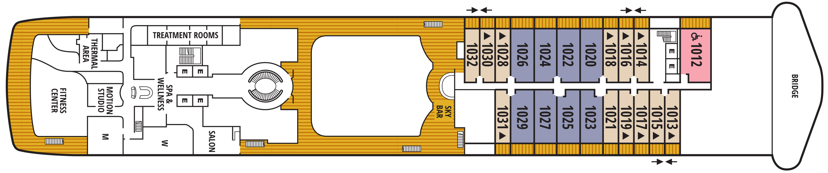
Deck 10
- Bridge
- Sky Bar
- Treatment Rooms
- Salin
- Spa & Wellness Area
- Thermal Area
- Motion Studio
- Fitness Centre
- Penthouse Suite
- Veranda Suite
- Owner's Suite (x1 Accessible room)
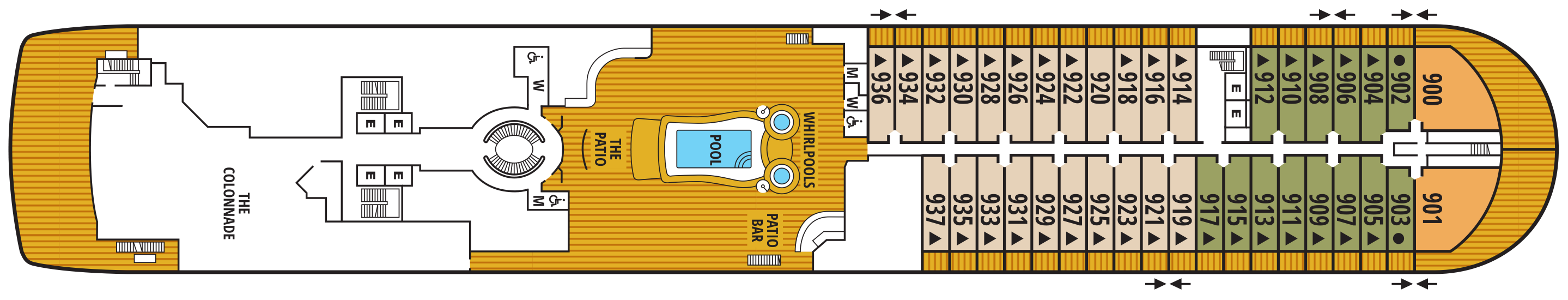
Deck 9
- Whirlpools
- Pool
- The Patio
- Patio Bar
- The Colonnade
- Owner's Suite
- Veranda Suite
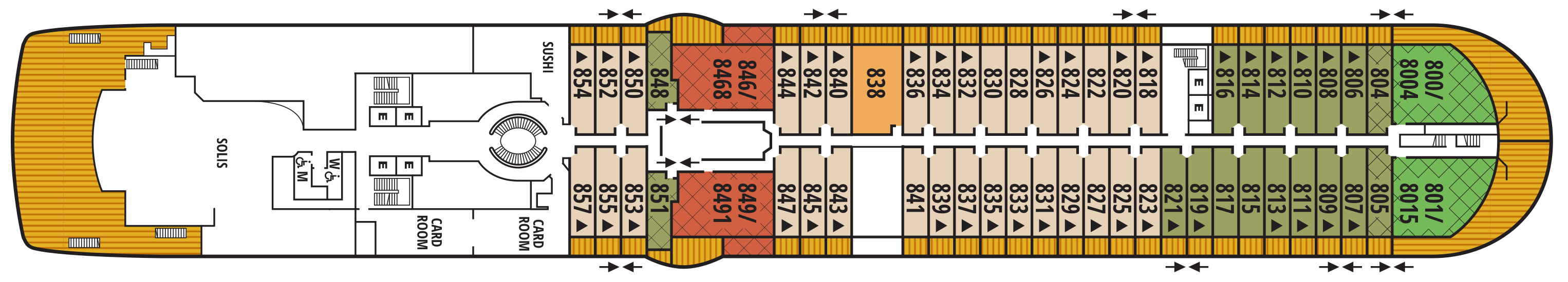
Deck 8
- Sushi
- Card Room
- Solis
- Wintergarden Suite
- Signature Suite
- Owner's Suite
- Veranda Suite
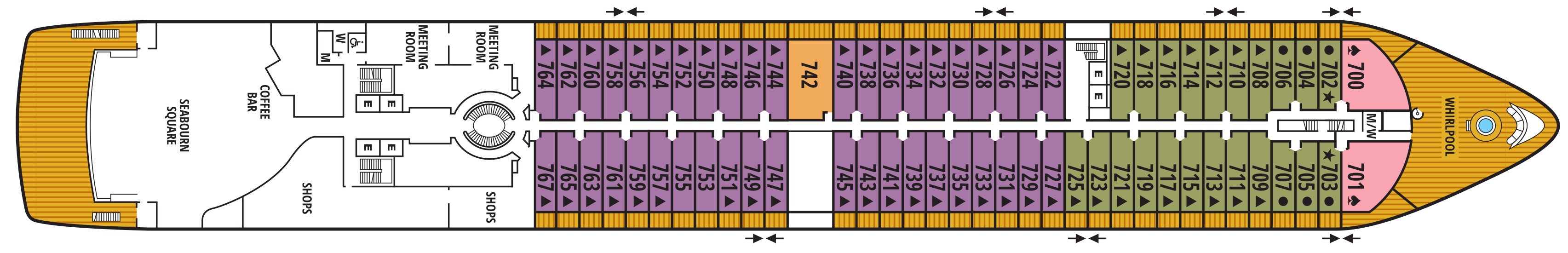
Deck 7
- Whirlpool
- Meeting Rooms
- Shops
- Coffee Bar
- Seabourn Square
- Owner's Suite
- Veranda Suite
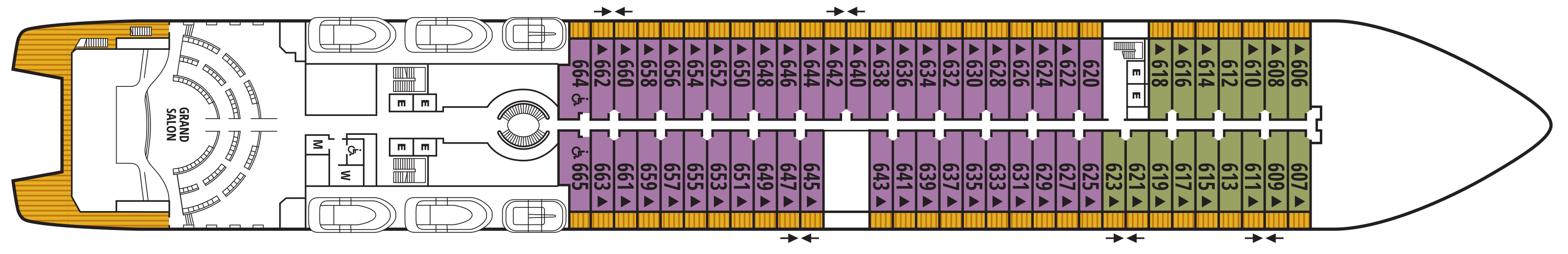
Deck 6
- Grand Salon
- Veranda Suites (x2 Accessible room)
Deck 5
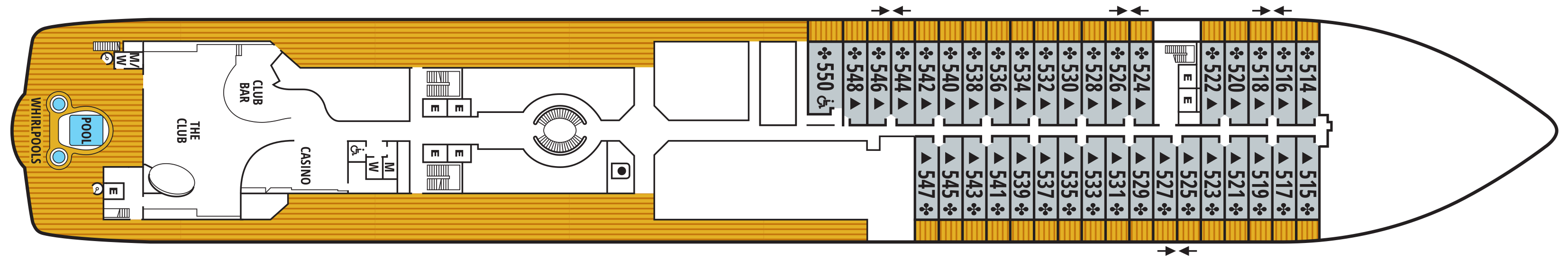
- Casino
- The Club
- Club Bar
- Pool
- Whirlpools
- Veranda Suites (x1 Accessible room)
Deck 4
- Medical Facility
- The Restaurant
- Galley

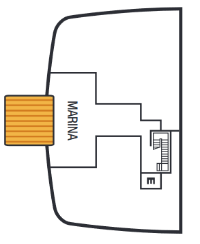
Deck 3
- Marina
Our world-class dining and culinary experiences rival the finest restaurants around the globe - even when we sail in the most remote destinations.
Each Seabourn ship offers a choice of dining venues to suit your mood of the moment. All dining venues are complimentary, and nearly all are open-seating, inviting you to dine where, when, and with whom you wish.
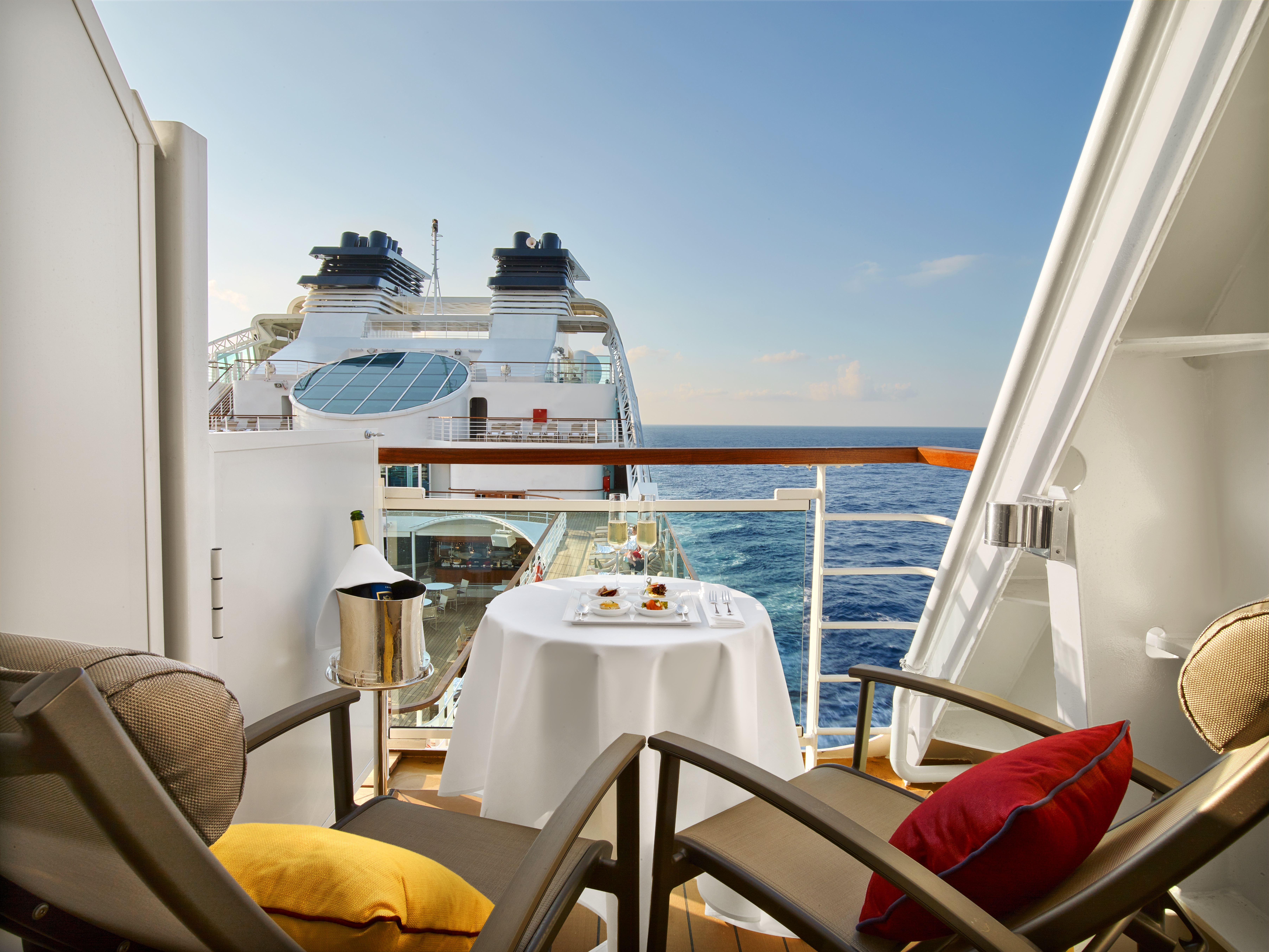
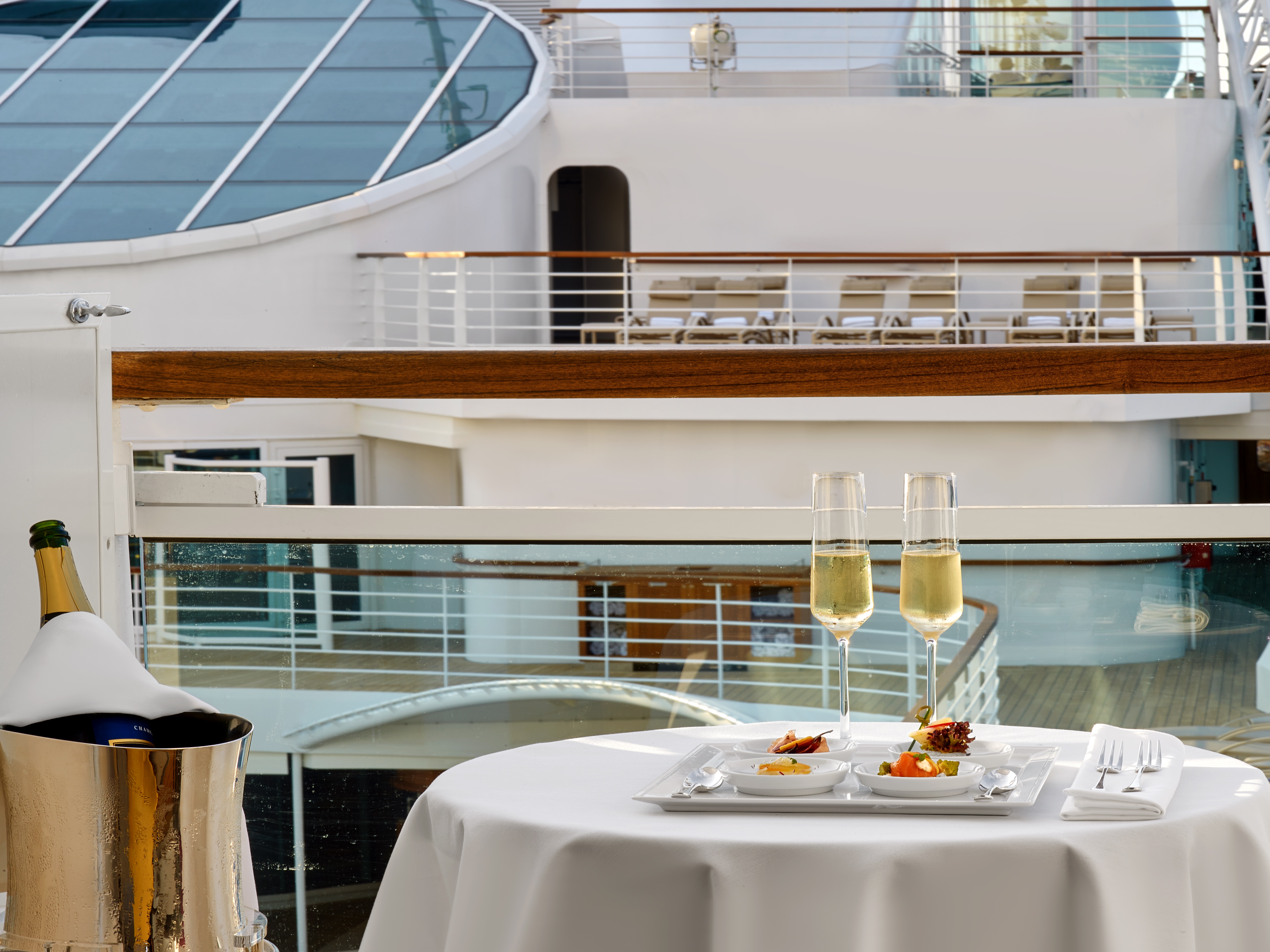
Complimentary fine wines are poured with lunch and dinner, and there is never an extra charge for any dining choice. You can even enjoy a meal in your suite or on your veranda.
The Restaurant
Before Seabourn, open-seating dining on a cruise ship was unheard of. Come when you like, with whom you please, and be seated as you wish. The room is beautiful, the cuisine is exquisite, and the service is simultaneously flawless, friendly and fun.
Sushi
Seabourn researched the best ingredients and developed a menu that is a perfect blend of authenticity to maintain the root of the cuisine, and a twist of Seabourn’s culinary expertise. The sushi concept is a modern line that is steeped in tradition using the finest ingredients. Hamachi, tuna, shrimp and other fresh fish products will be shipped from Japan to Sushi and served à la carte for dinner. The menu features caviar and small plates, along with a selection of maki rolls, sushi and sashimi, and salads. In addition, the restaurant will feature three varieties of bento boxes for lunch: meat, seafood and vegetarian.
The Seabourn sushi experience is available in our traditional sushi restaurant aboard Seabourn Ovation and Seabourn Encore.
Solis
Offering light, modern Mediterranean cuisine bursting with color and character, prepared fresh and entirely from scratch.
Solis will showcase a vibrant, chic atmosphere with feel-good background music and a menu reminiscent of our favorite travel memories. Solis was developed in collaboration with longtime Seabourn partners, Master Chef and Culinary Partner Chef Anton Egger, and Senior Corporate Chef Franck Salein. Chef Egger and Chef Salein are the culinary masterminds behind two of Seabourn’s most popular dining concepts – Earth & Ocean and Sushi.
Beyond the culinary, guests will be able to indulge in a truly sophisticated experience with Seabourn’s newly presented, refined vintage cocktail menu, featuring an allure of classic cocktails crafted to perfection. From classics such as the Kir Royale or Mauresco to the always — and most popular — Aperol Spritz, our team of talented mixologists have meticulously curated this menu to ensure that every drink is a masterpiece of flavors and aesthetics.
An evening at Solis is designed to delight our guests and leave them with lasting Seabourn Moments.
The Colonnade
Our more casual, indoor/outdoor alternative, features an open kitchen, lavish buffets or table service for breakfasts and lunch, and serves regionally themed, bistro-style dinners with table service nightly.
The Patio
Relaxed poolside dining offering luncheon buffets, salads, soups, grilled specialties and freshly baked pizza. Dinners feature a full menu in an alfresco setting.
In-Suite Dining
Seabourn is pleased to offer a varied menu available around the clock for service in your suite. You may also order dinner from The Restaurant menu and have your meal served, course by course, in your suite or on your veranda.
Featuring a newly enhanced menu, including a delightful variety of vegan and vegetarian options.
Earth & Ocean
Each evening, our skilled Earth & Ocean chefs create an imaginative array of fresh, inventive dishes—a sophisticated menu celebrating eclectic traditional flavors from around the world, served in a relaxed setting under the stars for a distinctive dining experience unlike any other on board.
Each day on board offers delicious dining options, world-class entertainment and enriching activities.
Share the journey with a daring explorer or celebrated performer as part of Seabourn Conversations, where experts don’t just lecture, they are part of the daily social scene. Complete your day at sea with world-class fine dining, exclusive entertainment, and an evening of dancing under the stars.
Make yourself at home with delightful daily diversions that add to our fleet’s private yacht-like atmosphere. Connect with fellow travelers in Seabourn Square or rise to the challenge in a game of trivia.
Sun Terrace
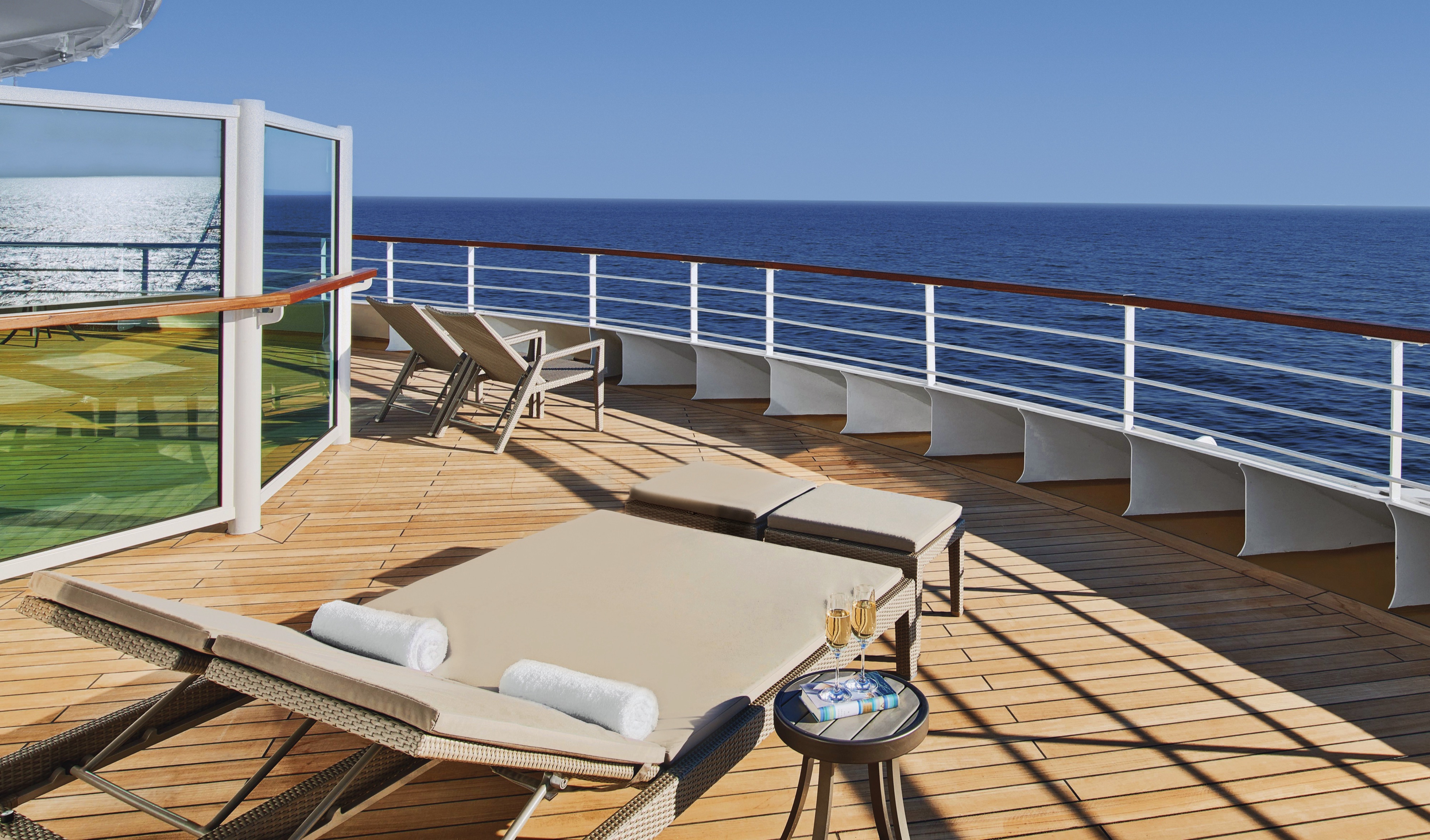
Slow things down and soak up the sun as you relax on a luxurious lounger.
Seabourn Square
Seabourn Square is the true ‘living room’ of the ships. An inviting sociable space where guests will find a charming European style coffee bar, Seabourn Square has been designed as an open, comfortable environment for guests to interact with onboard officers and the expedition team and engage in conversation with family and new friends. The space is also home to the highly-trained Guest Services staff, who provide a range of concierge services such as general ship information, assistance with special service requests, port and travel information, and more.
A selection of coffees are prepared by the skilled onboard baristas some using beans roasted in Seabourn Square. For those feeling a bit hungry, Seabourn Square offers freshly made pastries and other on-the-go breakfast items in the morning, as well as an assortment of light sandwiches and desserts later in the day, along with a selection of artisanal gelati made on board. Guests will also find a wide range of books in the adjoining library, with a host of titles on subjects such as adventure, expeditions and other topics of interest to enjoy while onboard. Staying current with the news is made easy with tablets featuring the Press Reader news application available to browse each day.
Grand Salon
The ship’s main showroom can accommodate all guests, though it seldom does because of the variety available. Lectures, cooking demonstrations, movies and other gatherings are held here in the daytime. In the evenings, live music for dancing before dinner gives way to vocal production shows, cabaret performances, comedy, and classical recitals, as well as more dancing later.
Observation Bar
Guests find coffee and tea in this ship-top location and many return for an elegant afternoon Tea Time*, evening tapas, and cocktails.
Tea Time is offered on select days during your cruise or expedition.
Not available on board Seabourn Venture and Seabourn Pursuit
The Retreat
A tranquil setting housed in a distinctive flower-shaped canopy that shields guests from sun and wind, The Retreat is ringed with 15 private cabanas designed as individual luxury living rooms that each feature a large HD flat screen television and a refrigerator stocked with a personalized selection of beverages. An additional Spa Treatment Cabana is also available for guests to enjoy personalized spa services, subject to availability. For additional details or reservation, log in and customize your itinerary.
The Retreat is located around a central whirlpool with step-up access to water maintained at an inviting temperature. Up to 28 guests can stretch out on comfortable sun loungers; pull up a bar stool or take a table seat for champagne and cocktails custom created by Seabourn mixologists; or enjoy a selection of bites from a healthy spa menu. A selection of amenities include fresh fruit baskets, plush towels and personalized bathrobes, while a dedicated Retreat Concierge will be available to satisfy guest requests.
Cabanas at The Retreat will be available daily and may be reserved for a full day via the Guest Service Specialists at Seabourn Square. The Retreat is only available on Seabourn Ovation and Seabourn Encore.
Casino
The Seabourn casino offers a handsome, well-appointed enclave for those attracted to games of chance and skill. Relax and test the odds on various mechanical games or pit your skills against personable, professional dealers at blackjack or poker tables.
Sky Bar
The Sky Bar on our expedition ships is a place to enjoy a refreshing tropical beverage during the day, or an evening cocktail under the stars. Two small whirlpool spas bracket the open terrace.
Evenings Under the Stars®
One of the most FUN evenings during any cruise, Evenings Under the Stars is a night where guests can let their hair down and simply be in the moment. Enjoy Let’s Dance! with great live music, interact with fellow travelers and be spoiled in true Seabourn style by our food and beverage team with Desserts Under the Stars. A signature event, this dance party has been a part of the line’s rich culture, and a Seabourn cruise is not complete without Let’s Dance! and Desserts Under The Stars.
Weather permitting, this high-energy dance party is hosted poolside and under the stars by the entire entertainment team, featuring performances by The Band, vocalists and dancers. There is even the possibility your Cruise Director and Assistant Cruise Director might jump on stage to perform, as well! Guests can expect music that appeals to everyone’s taste with a great mix of hit songs. It’s a real treat and guests LOVE Evenings Under the Stars!
Patio Bar
Enjoy a drink at the Patio Bar and unwind in the perfect setting for a sunny afternoon. The nearby swimming pool is surrounded by a sundeck with chaise lounges, shaded seating, two large whirlpool spas, and is within steps of the Patio dining offerings on our ocean ships and the Colonnade on our Expedition vessels.
The Club
The liveliest lounge on board is the scene of daily afternoon tea service. It is a popular spot for pre-dinner drinks and dancing to live music. After dinner, the dancing music continues, and later a DJ spins dance music until late at night. Another terrace of open deck aft of The Club boasts a plunge pool and two small whirlpool spas.
Zero @ Sea
A Zero-proof cocktail experience featuring a unique array of non-alcoholic cocktails
Zero @ Sea offers an inventive menu of mixology cocktails, with ingredients and flavors free of alcohol, such as elderflower, bursts of fresh citrus, botanical spirits, and more.
Zero @ Sea cocktails are available fleetwide in all bars and lounges aboard the ships together with an upgraded selection of nonalcoholic wines, sparkling wines, and beers.
The new cocktails were developed by Seabourn’s expert culinary and beverage team, led by Michael Simon, senior manager of restaurant and bar operations, and Francisco Fernandes, corporate manager service operations.
Card Room
Many veteran cruisers specifically choose cruises that provide at least a few days at sea. The Card Room is a great choice for the sea-loving cruiser who craves that languorous feeling of lazy leisure. There will be loads of on board activities during those days, including a great game of bridge.
Shops
Whether you're buying souvenirs for your friends at home or want a memento of your vacation, our Shops will have what you need. Shop for fashion and cosmetics at The Boutique, jewelry and fine watches at The Collection, or logo cruisewear at the Shop.