14-Day West Ireland Gems & Solar Eclipse
14-Day West Ireland Gems & Solar Eclipse
Cruise overview
WHY BOOK WITH US?
- ✔ The Deluxe Cruises’ team has extensive experience in ultra-luxury cruising.
- ✔ Call now to speak to our helpful and experienced Cruise Concierge team.
- ✔ Enjoy our Unique Deluxe Cruises Bonus for substantial savings.
- ✔ Our team will tailor your holiday to your exacting requirements.
- ✔ As agents, we work under the protection of each cruise lines ABTA / ATOL licences
About Dover
Known as the gateway of England, Dover welcomes millions of visitors from all over the globe each year in its role as the ferry capital of the world and the second busiest cruise port in the UK. The White Cliffs Country has a rich heritage. Within the walls of the town’s iconic castle, over 2,000 years of history waits to be explored, whilst the town’s museum is home to the Dover Bronze Age Boat, the world’s oldest known seagoing vessel. The town’s cliffs that are a welcome sight for today's cross-channel travellers also served as the control centre for the Dunkirk evacuation in 1940.
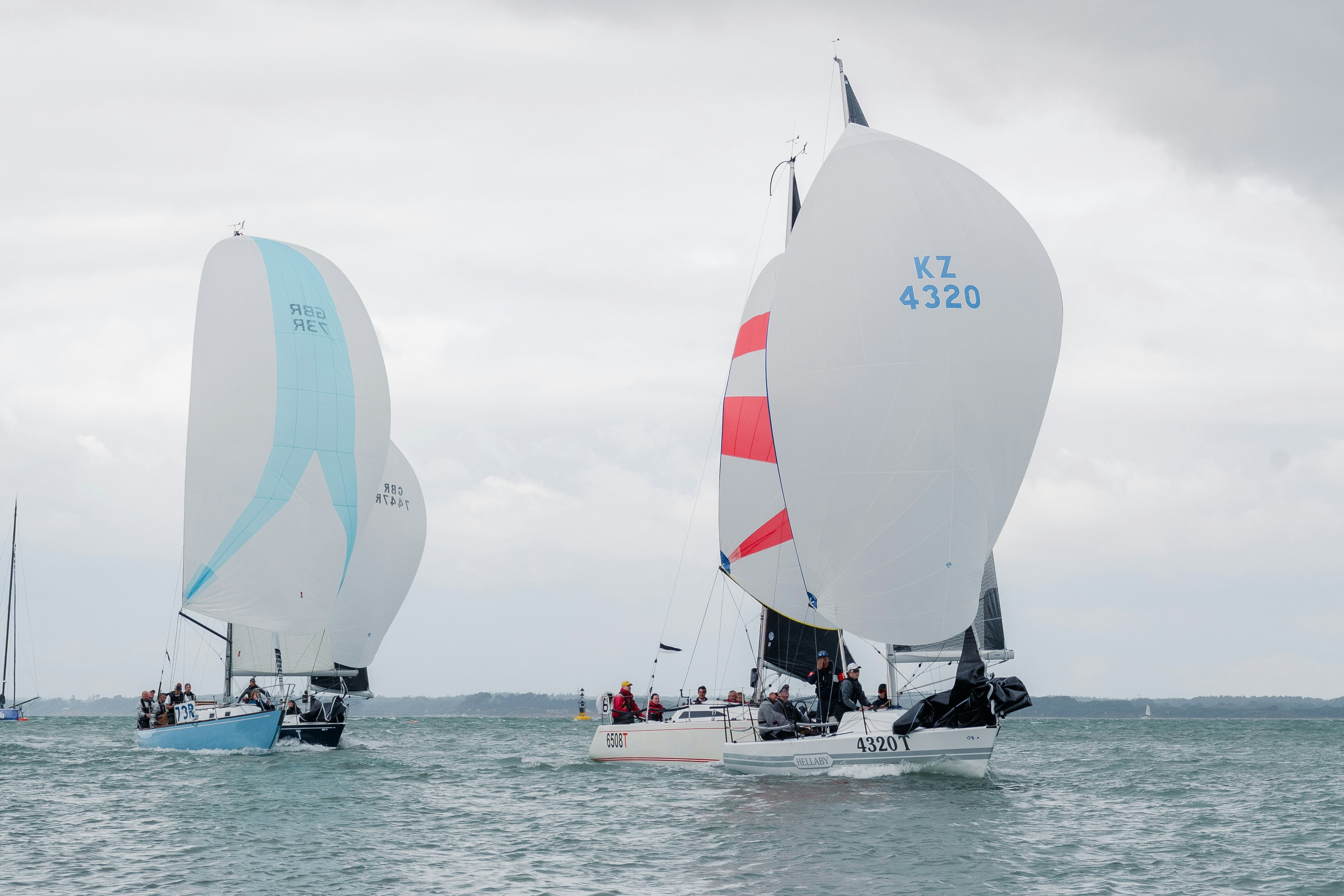
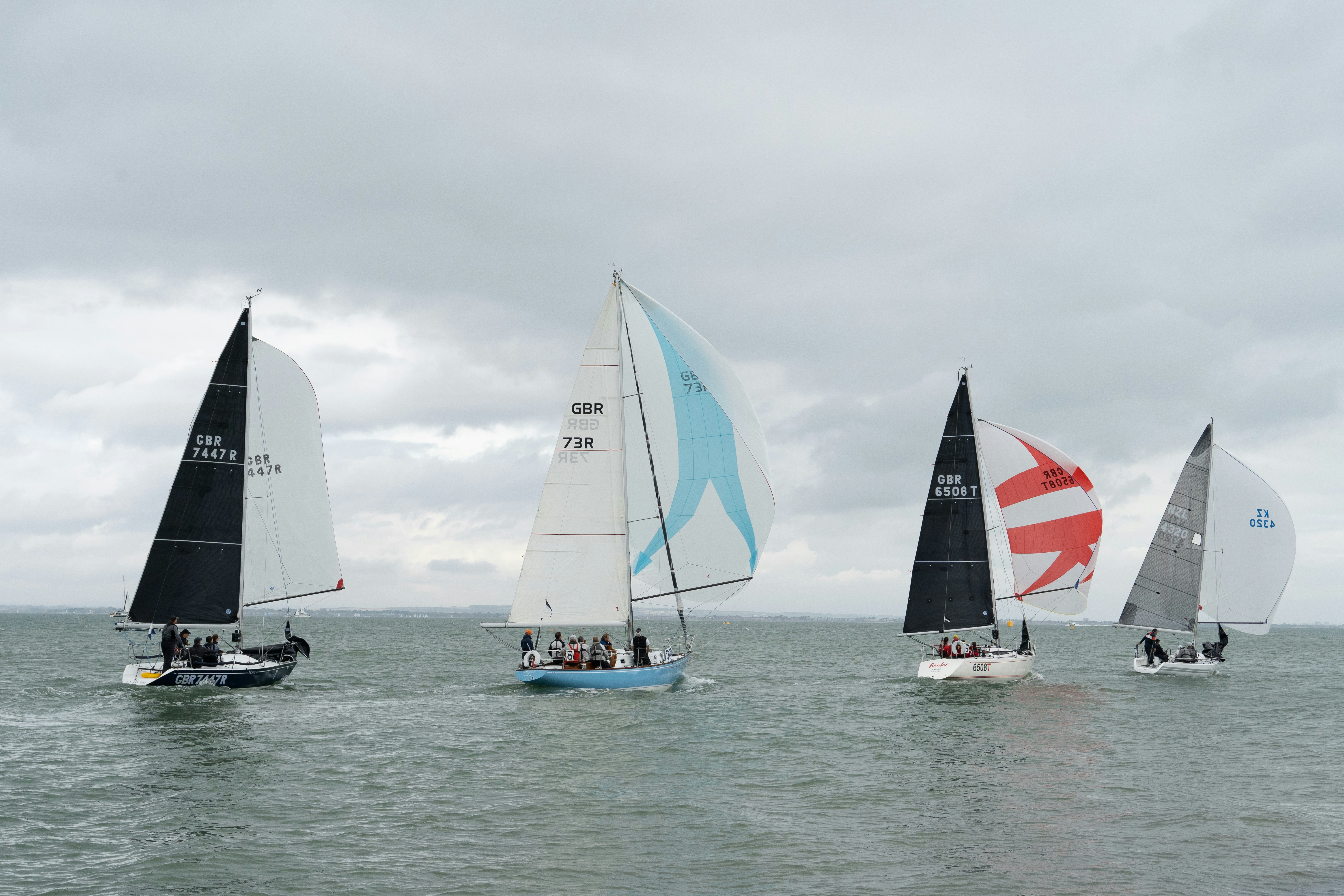
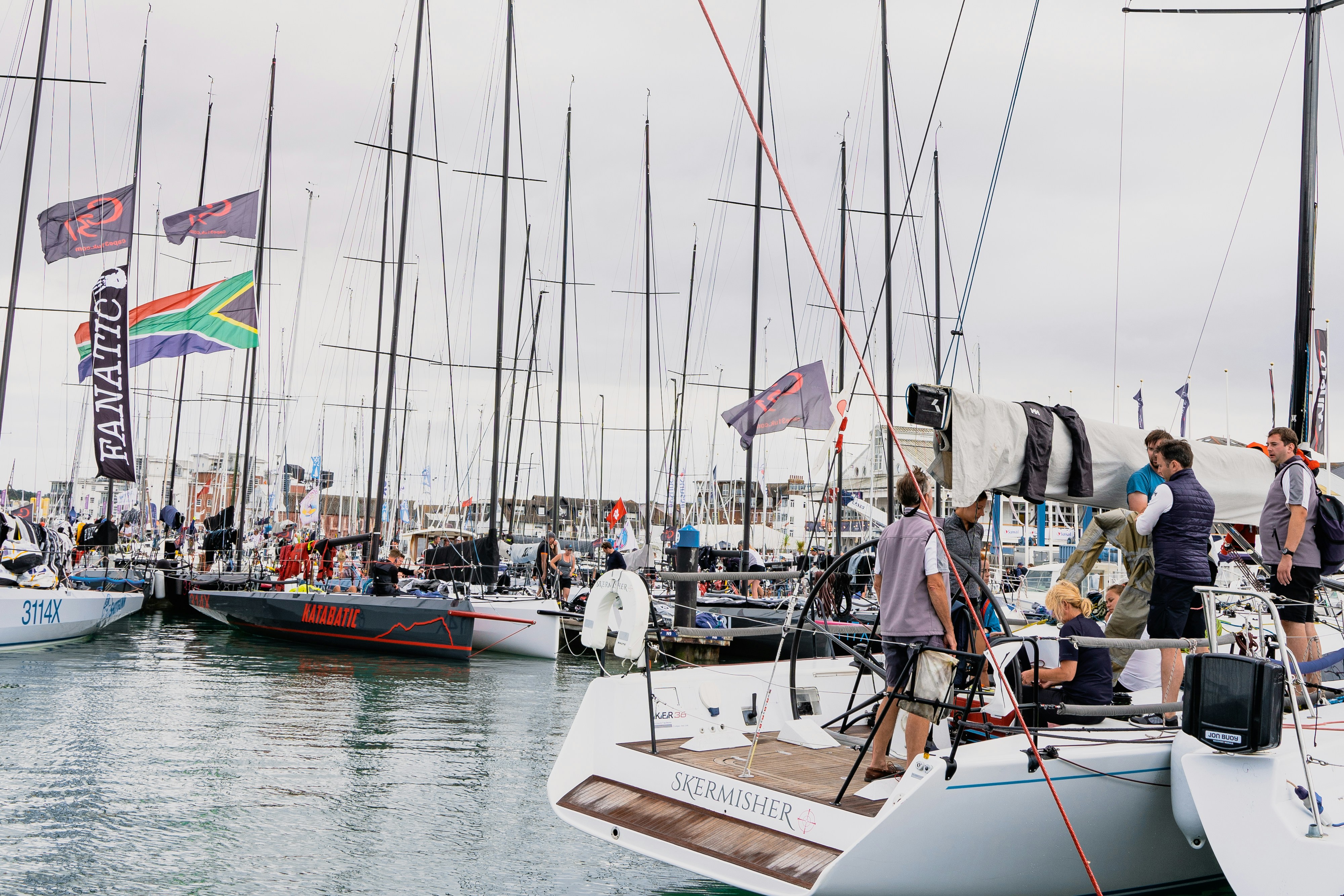
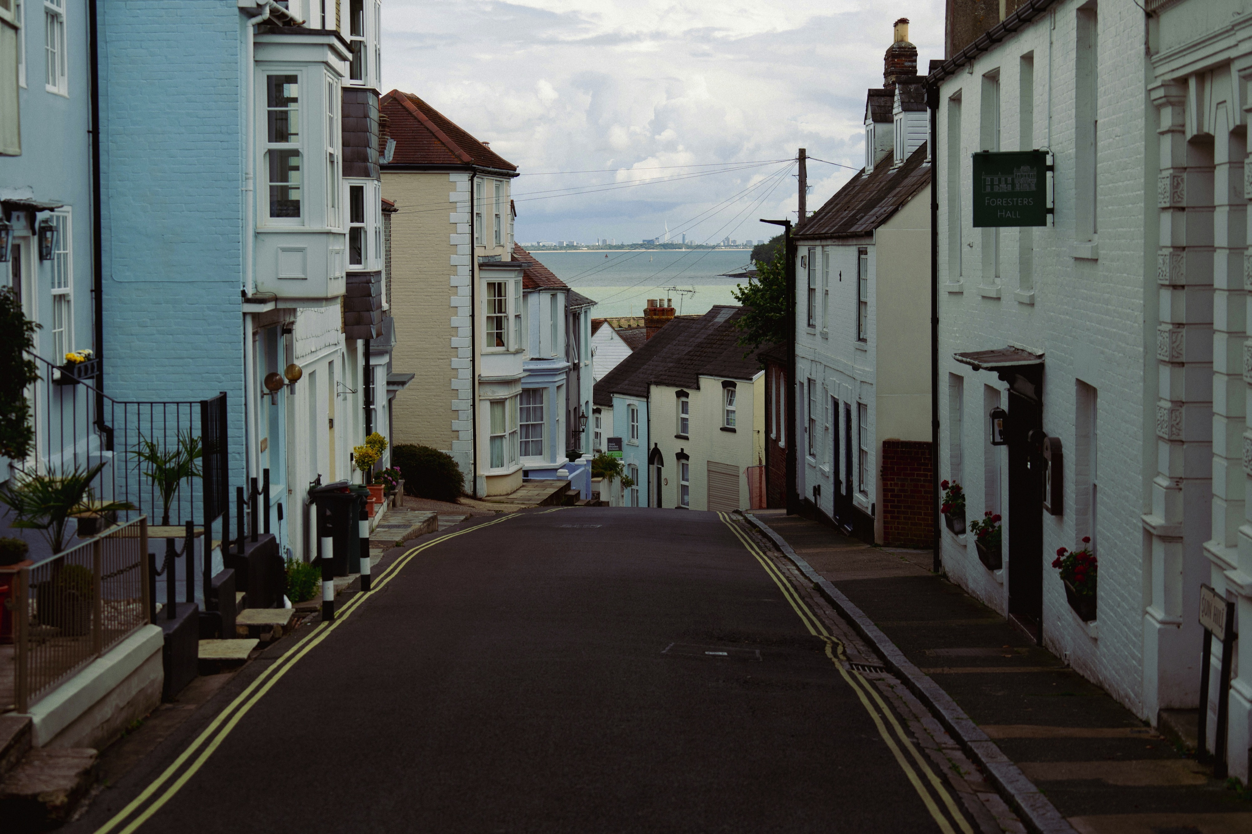
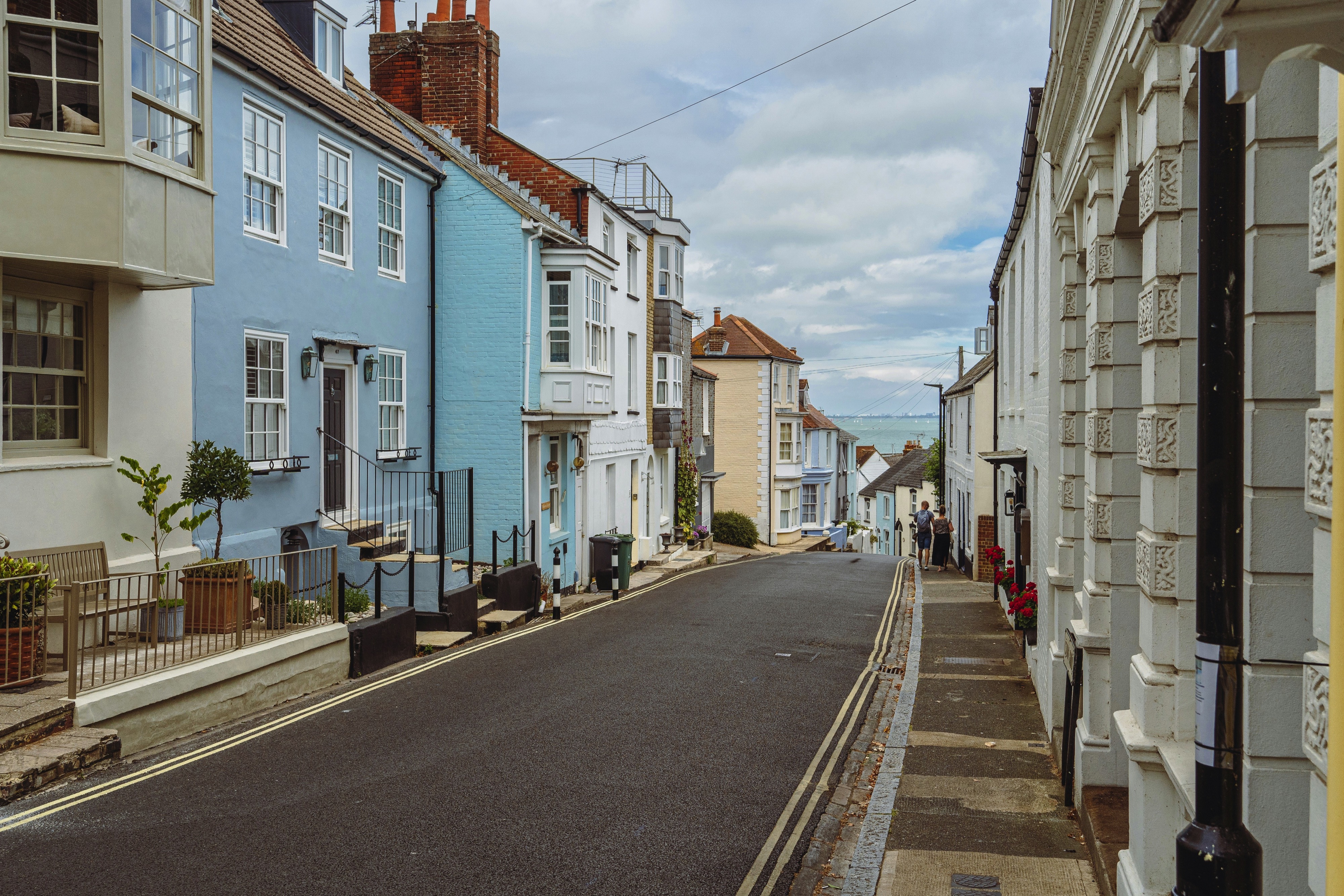
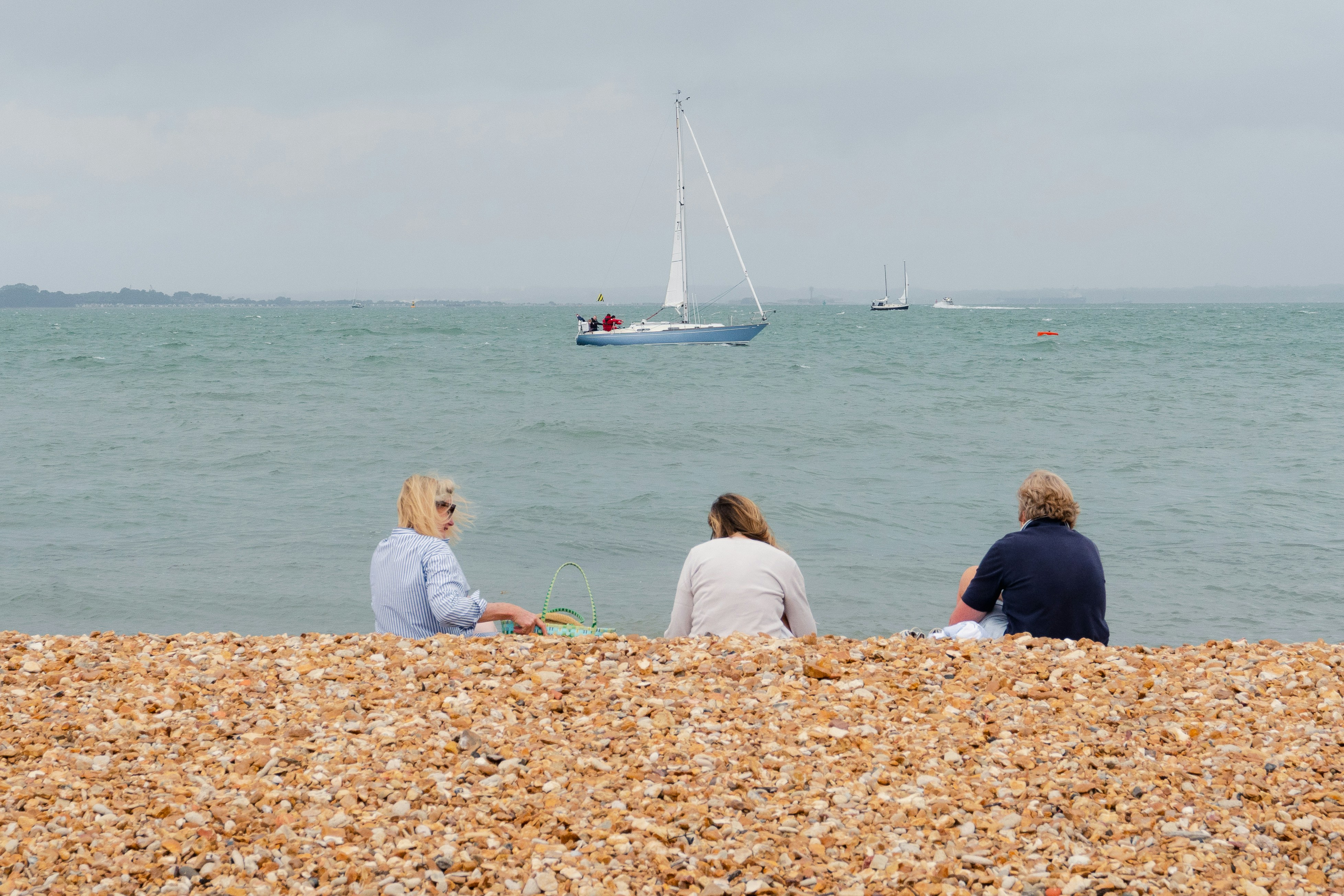
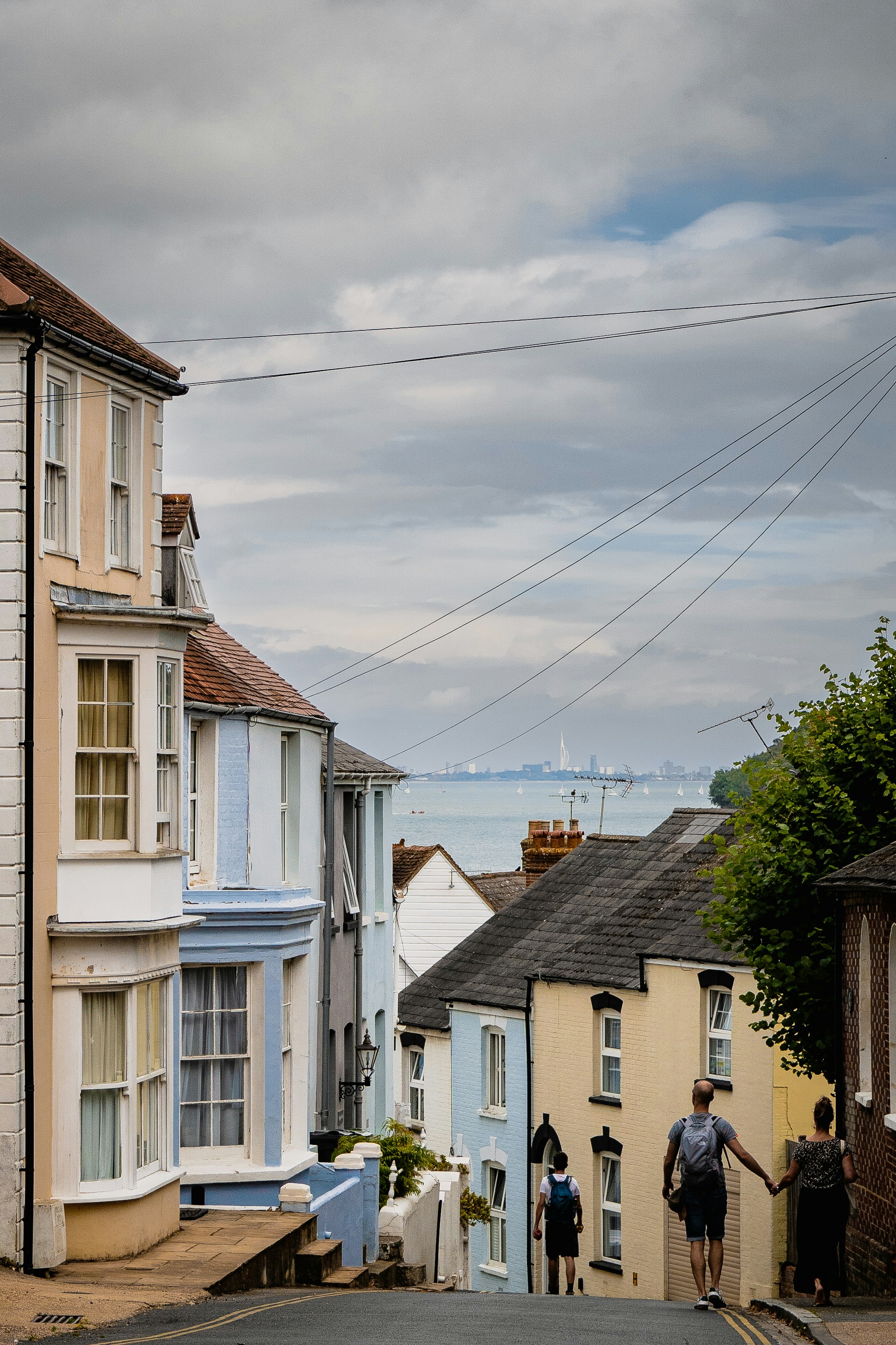
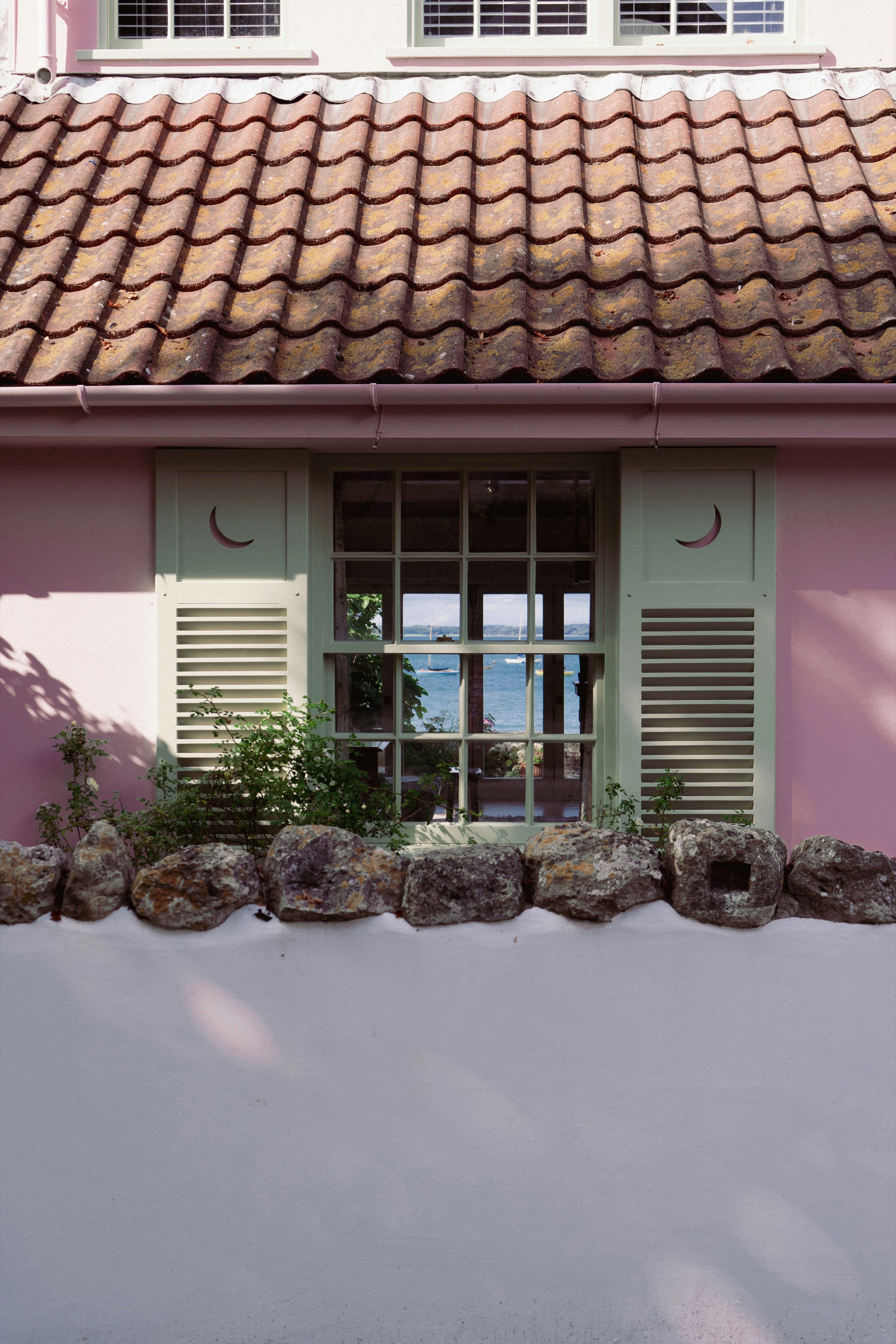
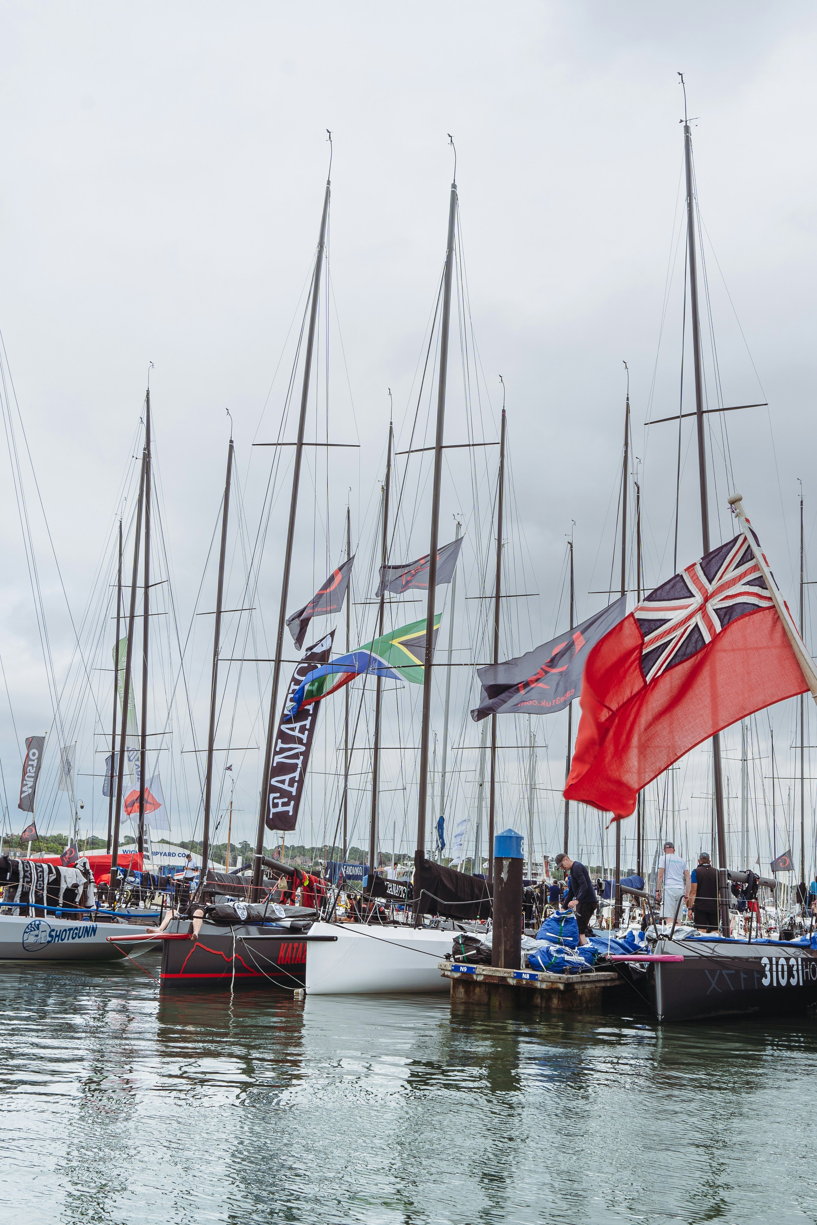
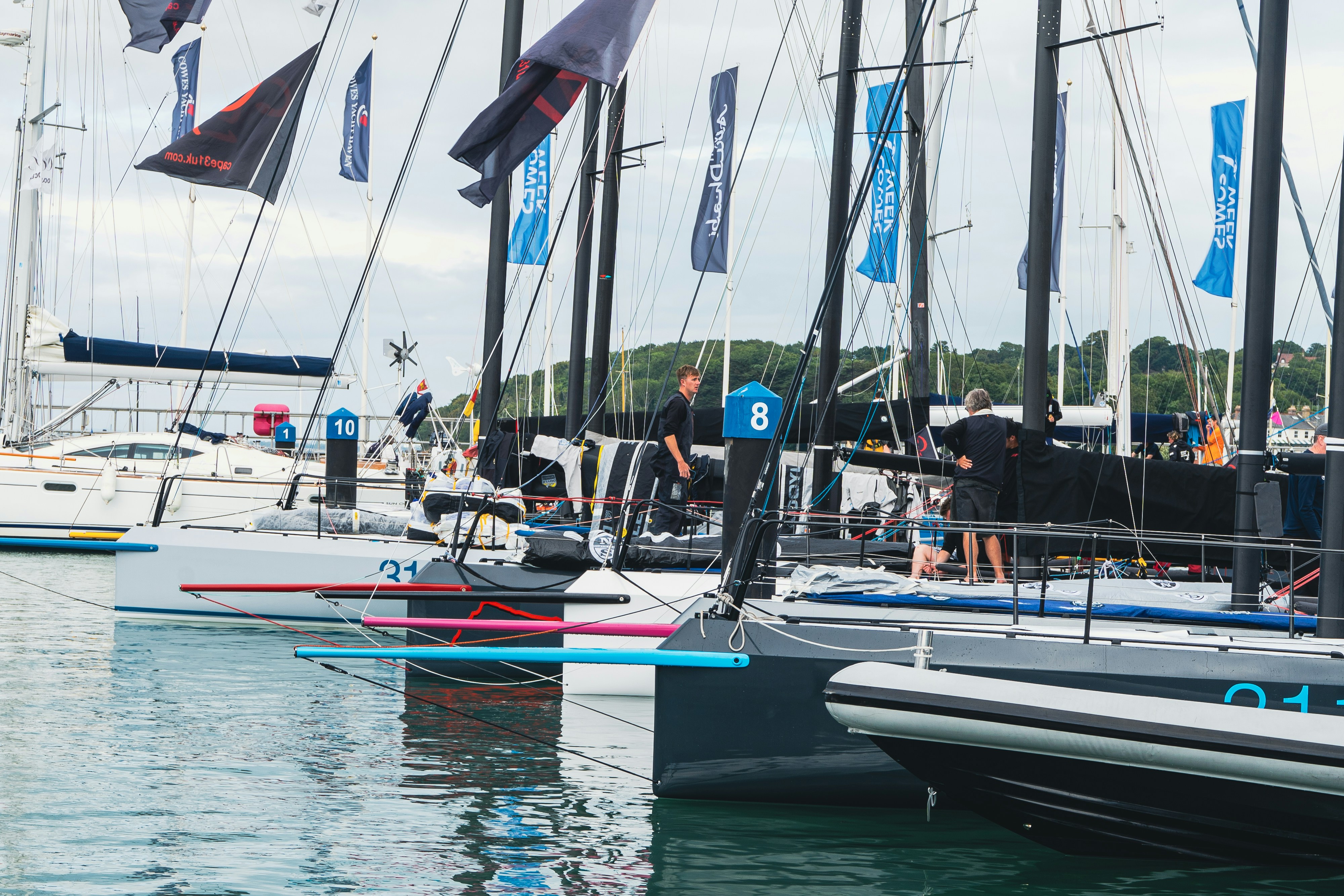
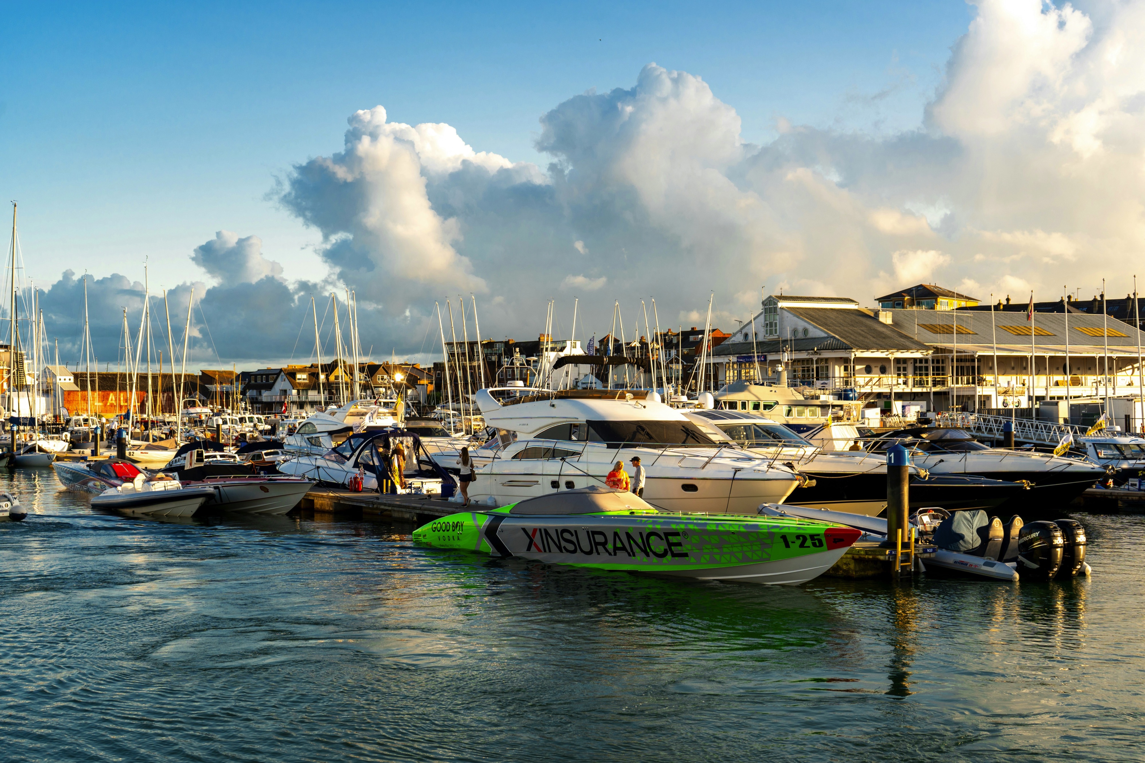
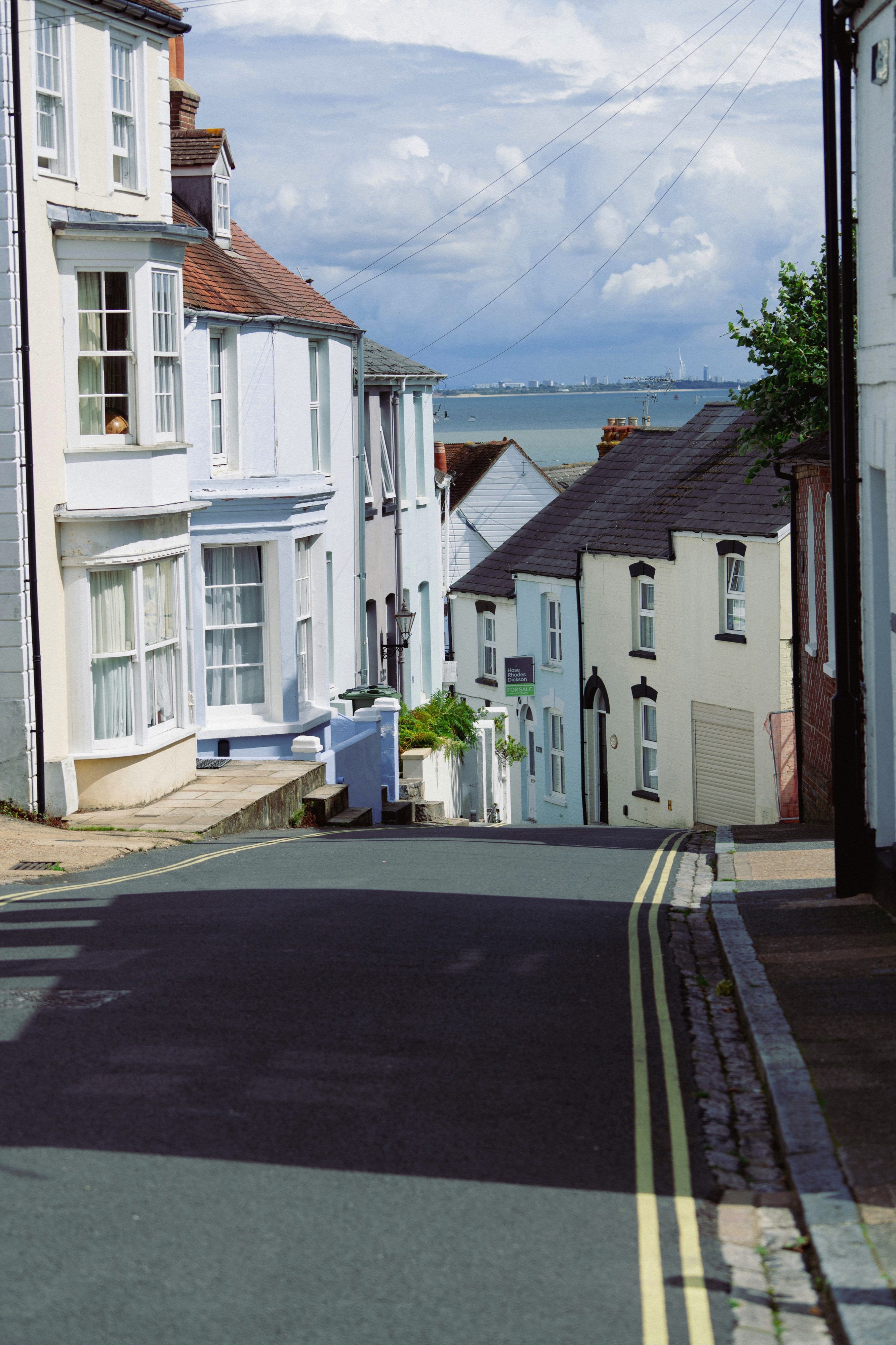
About Cowes, Isle of Wight
The 147-square-mile island with its pretty bays and thatched villages is like a miniature England. A well-preserved Victorian character dates from no other than Queen Victoria herself, who favored the island as her summer residence and made it her permanent home after the death of her husband, Prince Albert. Several other great names have close associations with the Isle of Wight, such as Tennyson, Dickens and Keats. The small port of Cowes at the northern tip of the island hosts every year in August Britain’s most prestigious sailing event – Cowes Week, often called “the yachtsman’s Ascot.”This is when the cozy and laid-back island bursts with visitors from all over, who fill the ranks of the island’s retired folk. Apart from being a haven for sailing craft, the world’s first hovercraft made its test runs here in the 1950s. For a place of relatively small size, the Isle of Wight packs a startling variety of landscapes and coastal scenery, ranging from a terrain of low-lying woodland and pasture to open chalky downland fringed by high cliffs. In addition, there are a number of historic buildings and a splendid array of well-preserved Victoriana. The town of Cowes is bisected by the Medina River, with West Cowes near the harbor being the old, pretty part, while East Cowes is more industrialized. Outside the suburbs stands Osborne House, Queen Victoria’s favorite residence. The grand mansion was largely designed by Albert, and the interior has been left very much as it was in the Queen’s lifetime. Around the island, some of the highlights include the Needles, three tall chalk stacks beneath the cliffs at the far west end of the island. The small village of Shanklin is known for its golden cliffs and a scenic steep ravine whose mossy, fern-filled woods have been embellished with tiny lights and thatched tea shops. The port of Yarmouth features an attractive fortress and quaint pubs in the main square. Pier Information The ship is scheduled to anchor off Cowes. Guests will be taken ashore via ship’s tender. Walking distance to the town center is approximately 5 minutes. Taxis are generally available for trips around the island. Shopping Shops in the town center of Cowes carry maritime items and yachting attire, local glassware and the famous Isle of Wight colored sand. Normal opening times are from 9:00 a.m. to 5:00 p.m. The local currency is the pound. Cuisine Not surprisingly, seafood is a good choice as well as other popular English fare. If you fancy lunch ashore, you may want to give the Amadeus Restaurant in Cowes a try, or stop in one of the local pubs for a quick meal and a cold beer. Other Sites Most of the island’s sights are covered in the organized excursions. Additionally, at the far west end of the island is the site of The Needles, a cluster of three tall chalk stacks beneath steep cliffs. The drive there takes about 45 minutes each way. Nearby is Alum Bay. The oxidized sandstone cliffs are popular for their multicolored sands, which are collected and arranged in diverse glass bottles, making popular souvenirs. Private arrangements are not encouraged in this port.
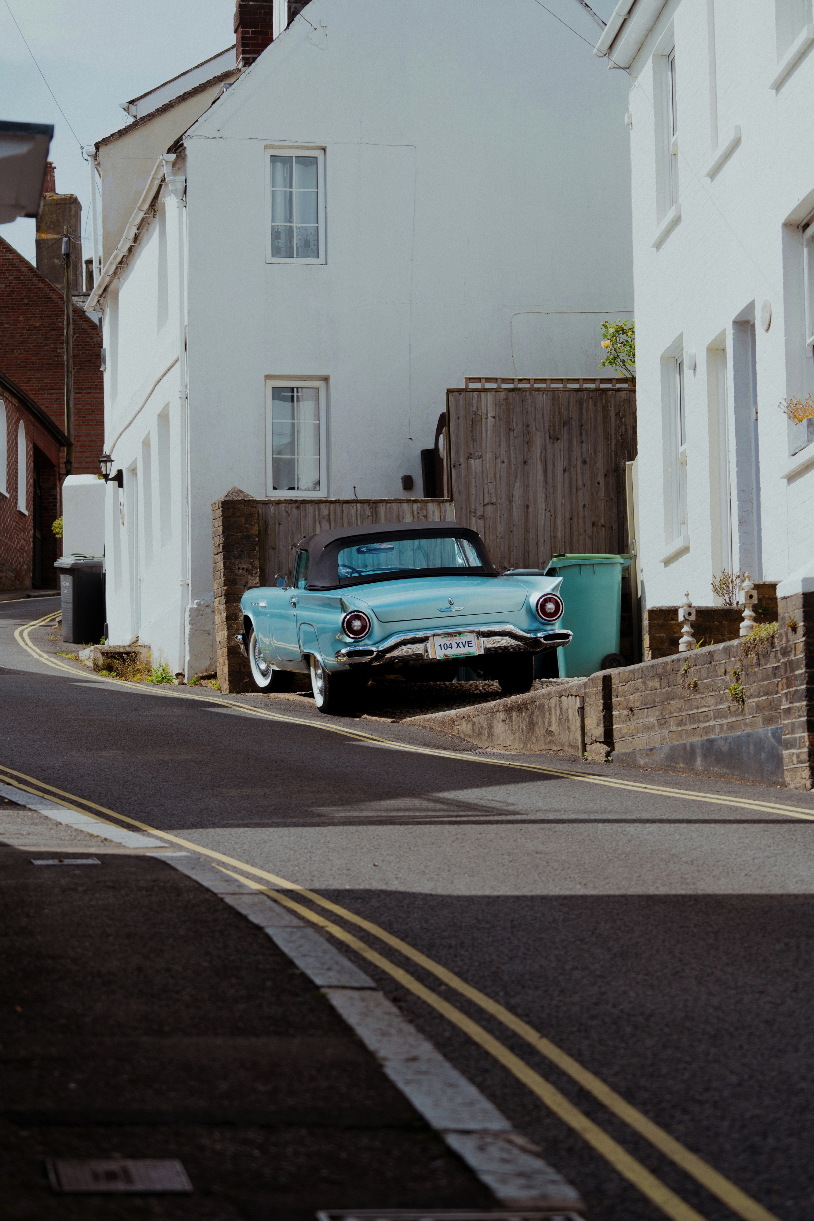
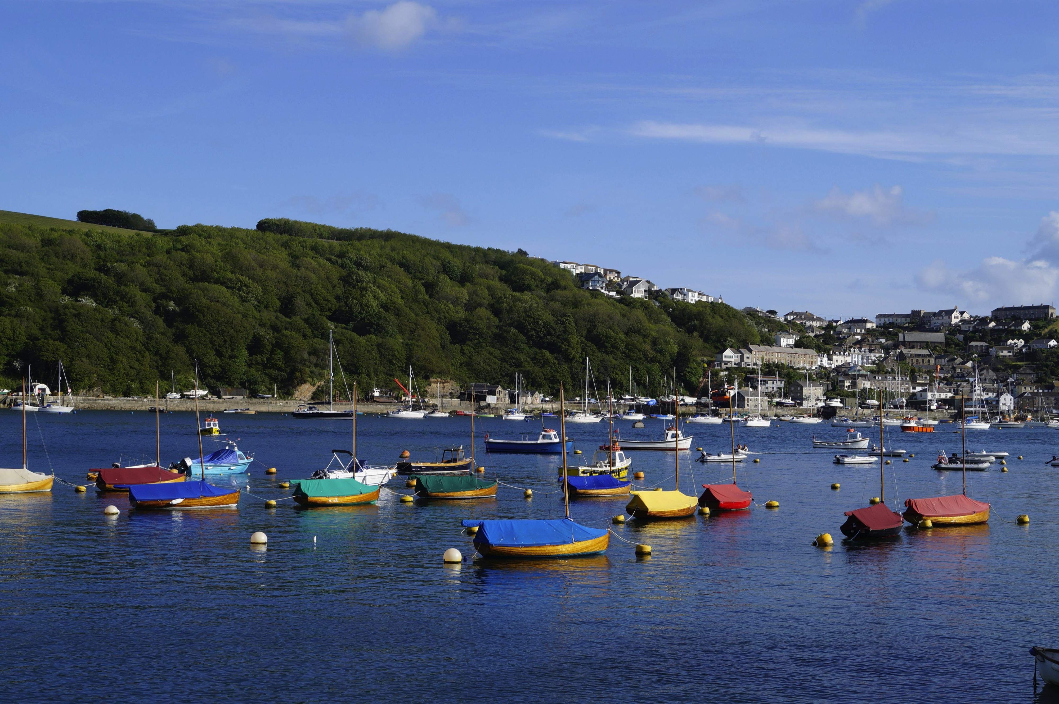
About Fowey
Nestled in the mouth of a wooded estuary, Fowey (pronounced Foy) is still very much a working china-clay port as well as a focal point for the sailing fraternity. Increasingly, it's also a favored home of the rich and famous. Good and varied dining and lodging options abound; these are most in demand during Regatta Week in mid- to late August and the annual Fowey Festival of Words and Music in mid-May. The Bodinnick and Polruan ferries take cars as well as foot passengers across the river for the coast road on to Looe.A few miles west of Fowey are a pair of very different gardens: the Eden Project, a futuristic display of plants from around the world, and the Lost Gardens of Heligan, a revitalized reminder of the Victorian age.
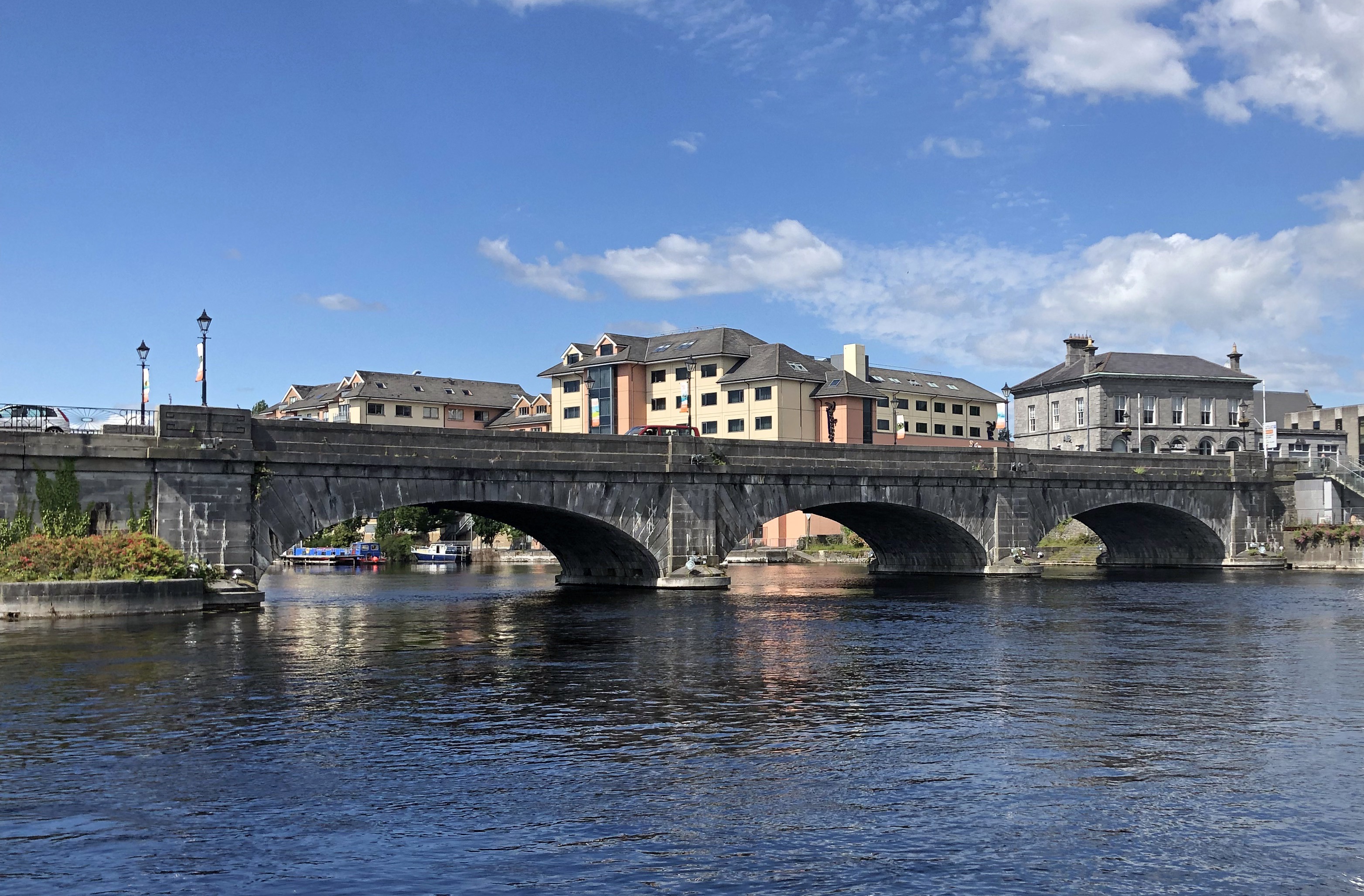
About Galway
Galway is a city in the West of Ireland in the province of Connacht. It lies on the River Corrib between Lough Corrib and Galway Bay and is surrounded by County Galway. It is the fourth most populous urban area in the Republic of Ireland and the sixth most populous city in the island of Ireland. It is both a picturesque and lively city with a wonderful avant-garde culture and a fascinating mixture of locally owned speciality shops, often featuring locally made crafts. Indeed local handcrafts are a feature of the entire region including hand knits, pottery, glass, jewellery and woodwork. The city’s hub is 18th-century Eyre Square, a popular meeting spot surrounded by shops, and traditional pubs that often offer live Irish folk music. Nearby, stone-clad cafes, boutiques and art galleries line the winding lanes of the Latin Quarter, which retains portions of the medieval city walls. The city bears the nickname "The City of the Tribes" because "fourteen tribes" of merchant families led the city in its Hiberno-Norman period. The merchants would have seen themselves as Irish gentry and loyal to the King. They later adopted the term as a badge of honour and pride in defiance of the town's Cromwellian occupier.
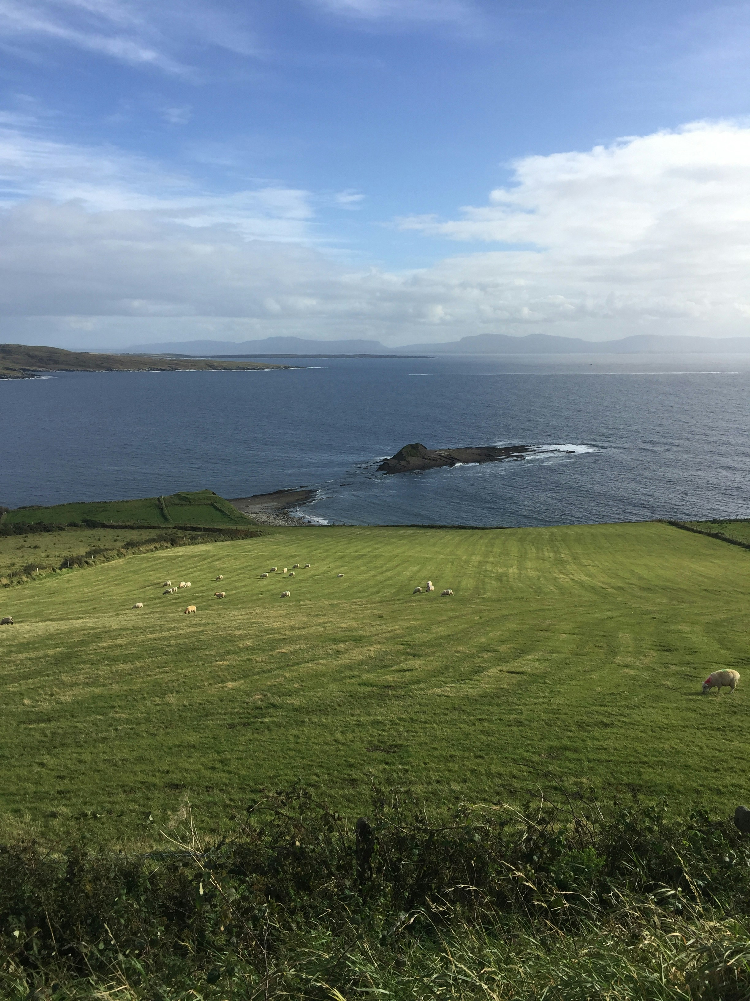
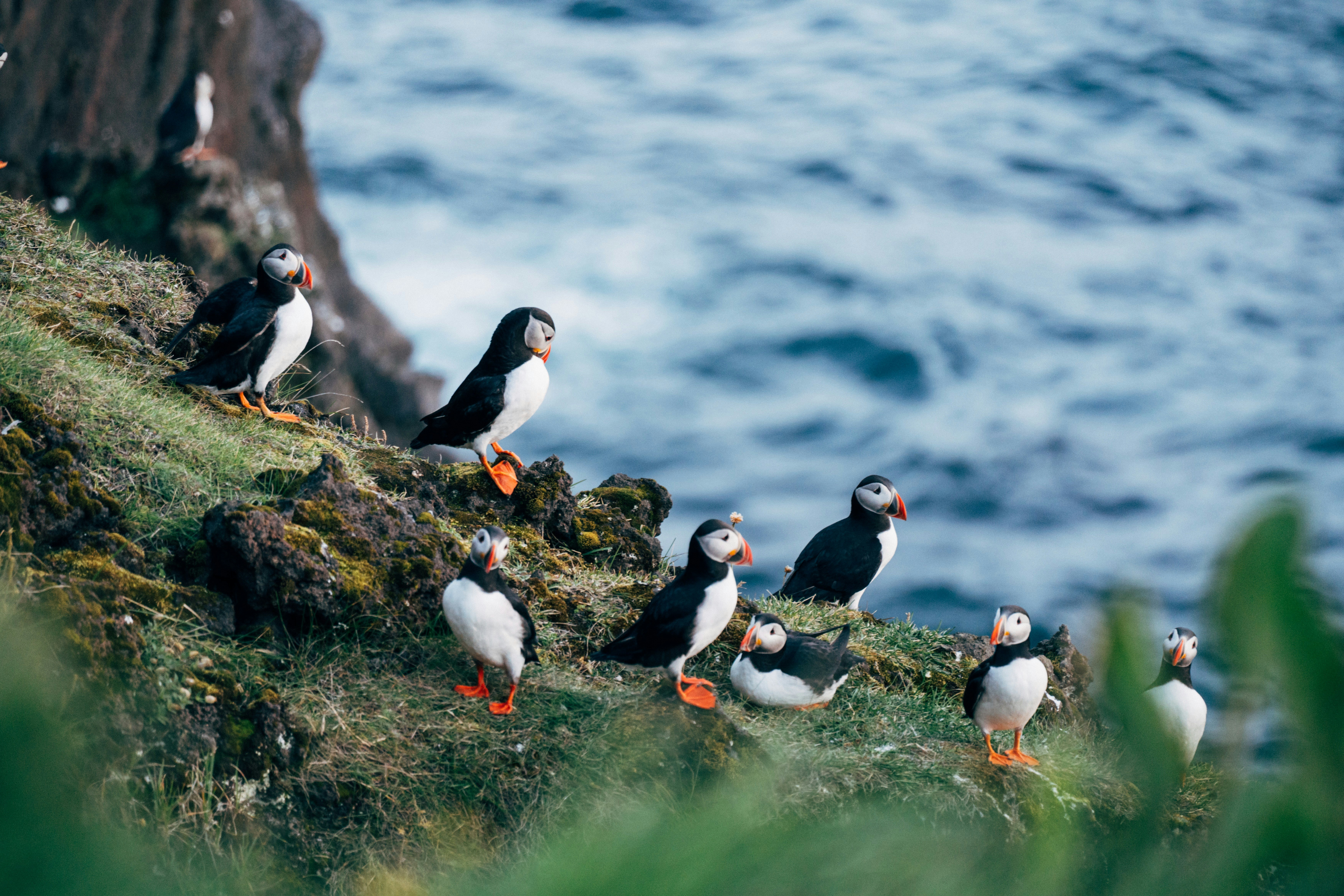
About Killybegs
Killybegs The days start early in Killybegs, as this quiet fishing town rumbles to life, and ships with red and blue paint peeling from their hulls quietly depart, ready for a morning's hard work at sea. Located in a scenic part of County Donegal, Killybegs is Ireland's fishing capital, and the salty breeze and pretty streets serve as a revitalising medicine for visitors. The town is also your gateway to some of the country's most majestic coastal scenery, which is dotted with flashing white lighthouses, keeping watch over invigorating seascapes. Killybegs enjoys a privileged position on the coast of north west of Ireland, close to the spectacular Slieve League - a titanic mountain, which explodes upwards from frothing ocean. Walk as close as you dare to the coastline’s sheer drops, or admire the folding cliffs from the best vantage point, down on the water.
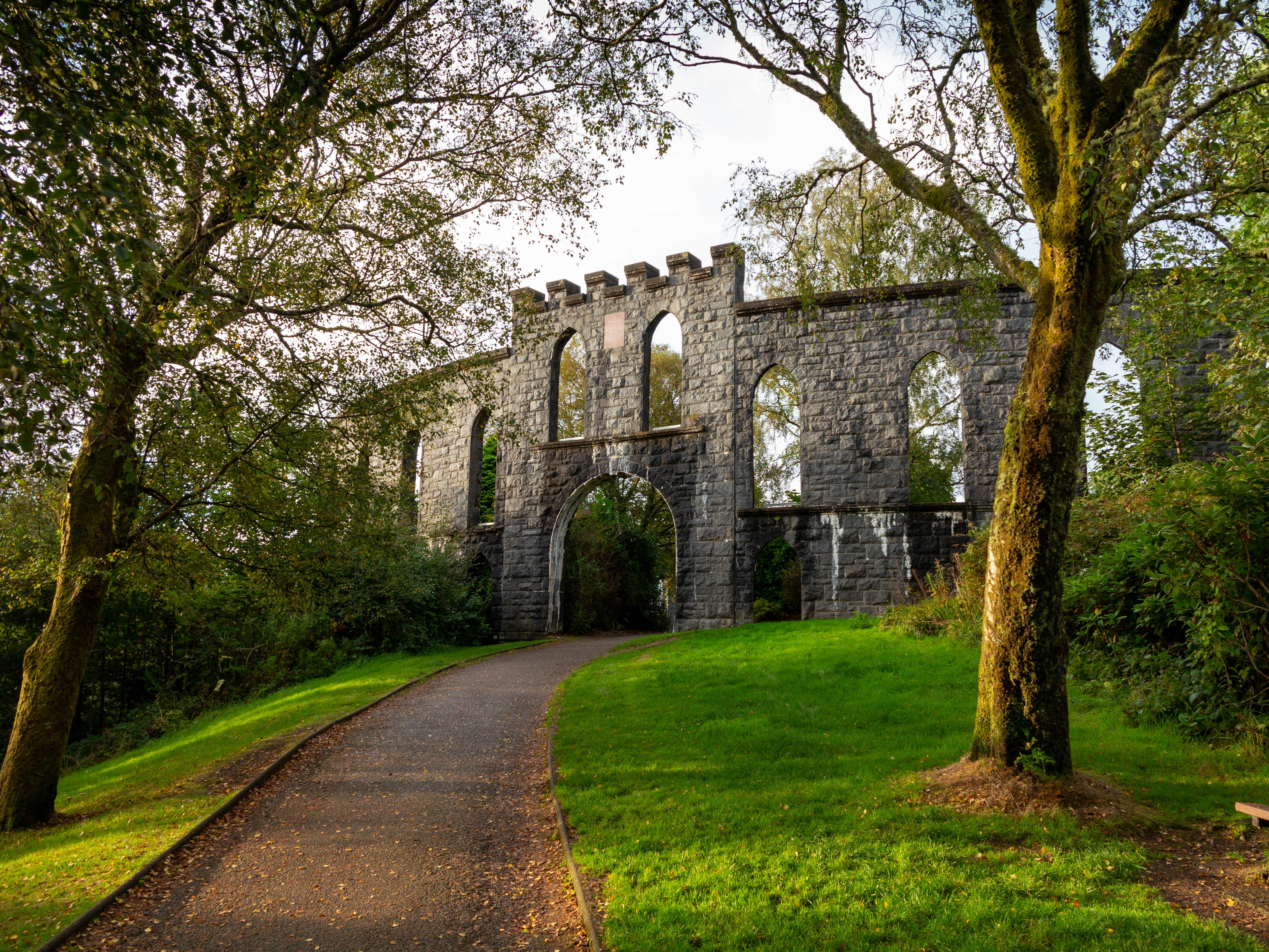
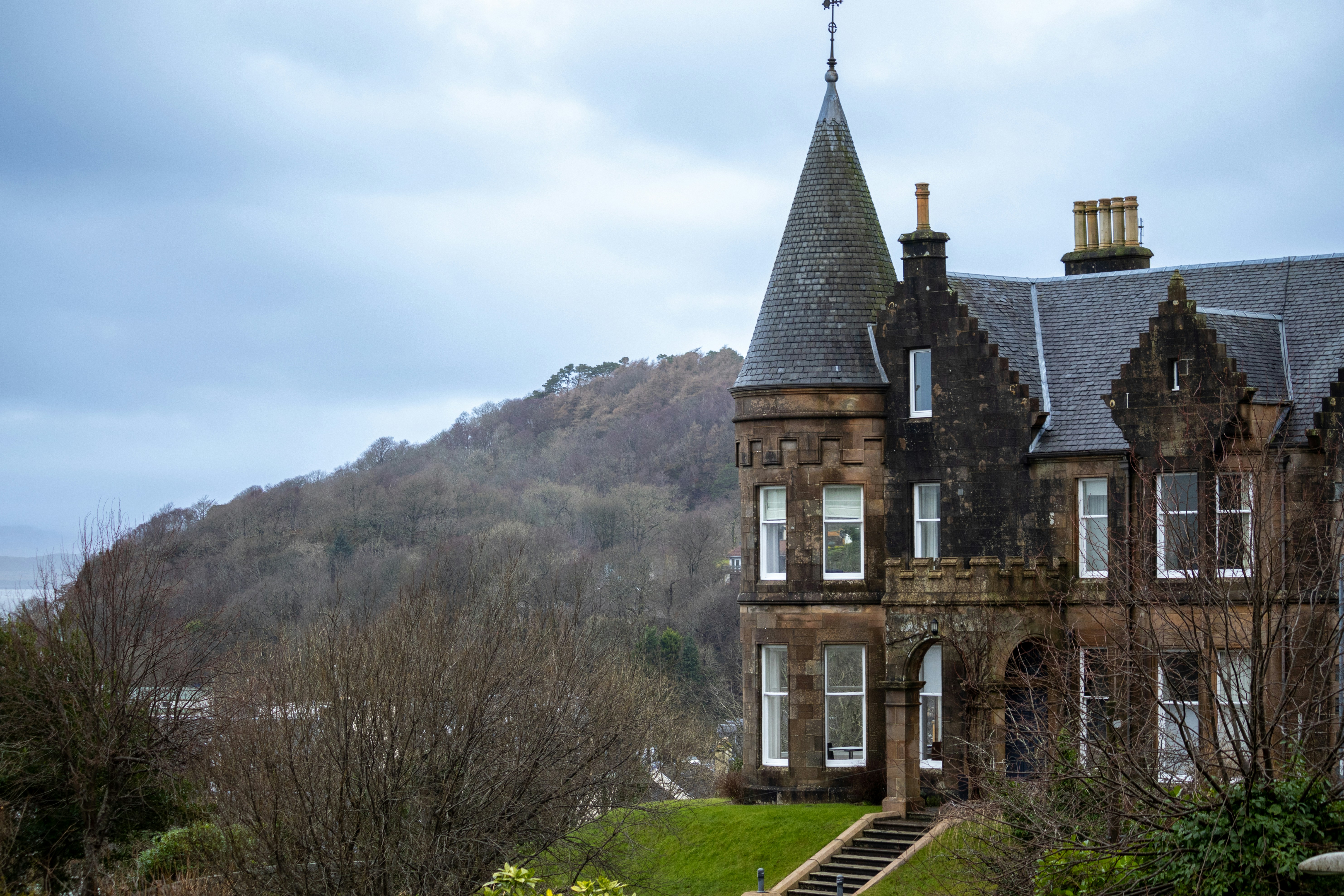
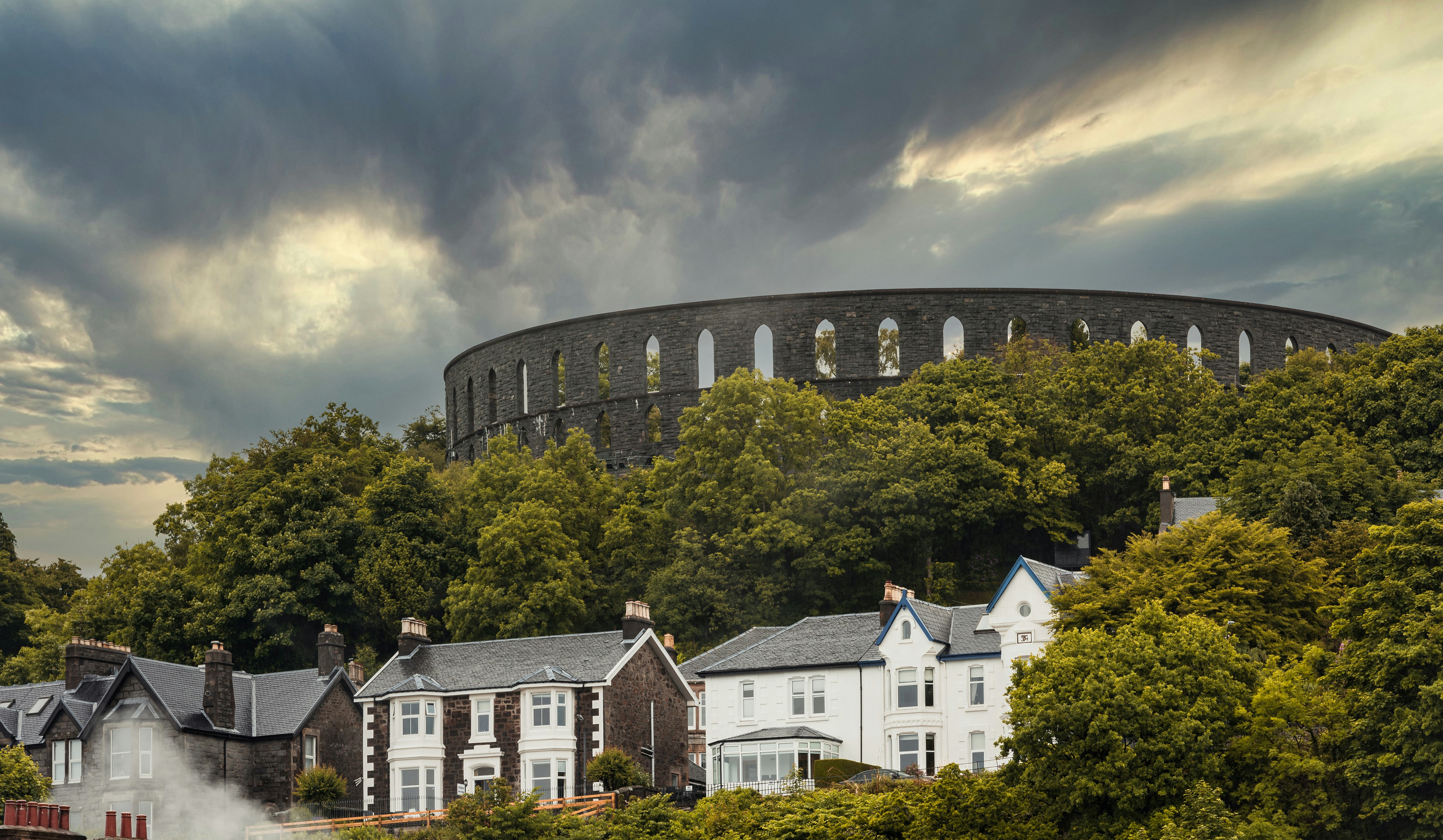
About Oban
Oban, "little bay" in Gaelic, today has a resident population of 8,500 and is the unofficial capital of the West Highlands - the "Gateway to the Isles." The panoramic views of the mountains, lochs and islands which have captivated artists, authors, composers, and poets for centuries are as striking now as they were when Dunollie Castle, a ruined keep which has stood sentinel over the narrow entrance to the sheltered bay for around six hundred years, was the northern outpost of the Dalriadic Scots. It is no surprise to find Oban in the 21st-century remains a magnet for travellers from all over the world. The town's present day popularity owes much to the Victorians, and as early as 1812, when the Comet steamship linked Oban with Glasgow, the town played host to intrepid travellers touring Staffa - the inspiration for Mendelssohn's Hebridean Overture - and Iona - home of Scottish Christianity since St Columba stepped ashore in AD563. Indeed once Oban had the royal seal of approval from Queen Victoria, who called it "one of the finest spots we have seen," the town's destiny as an endearingly enchanting holiday destination was as firmly set as the lava columns of Fingal's Cave in Oban is justifiably known as the “gateway to the Isles.” The town's south pier is the embarkation point for car ferries to Mull, Coll, Tiree, Barra, South Uist, Colonsay, Lismore and Islay. From these islands you can travel further a field to Iona, Staffa and to many of the smaller less well known isles.

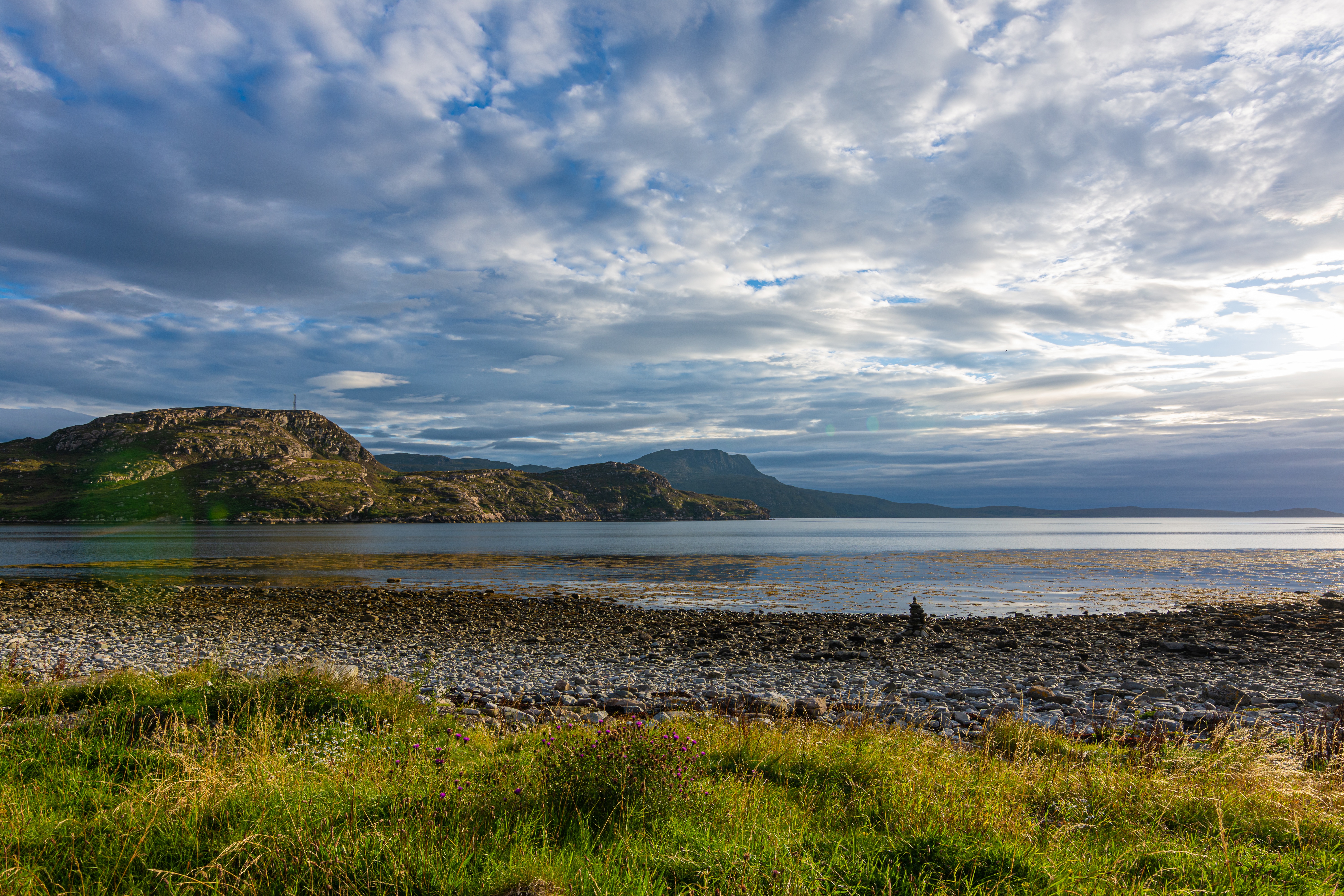
About Ullapool
Ullapool is an ideal base for hiking throughout Sutherland and taking wildlife and nature cruises, especially to the Summer Isles. By the shores of salty Loch Broom, the town was founded in 1788 as a fishing station to exploit the local herring stocks. There's still a smattering of fishing vessels, as well as visiting yachts and foreign ships. When their crews fill the pubs, Ullapool has a cosmopolitan feel. The harbor area comes to life when the Lewis ferry arrives and departs.
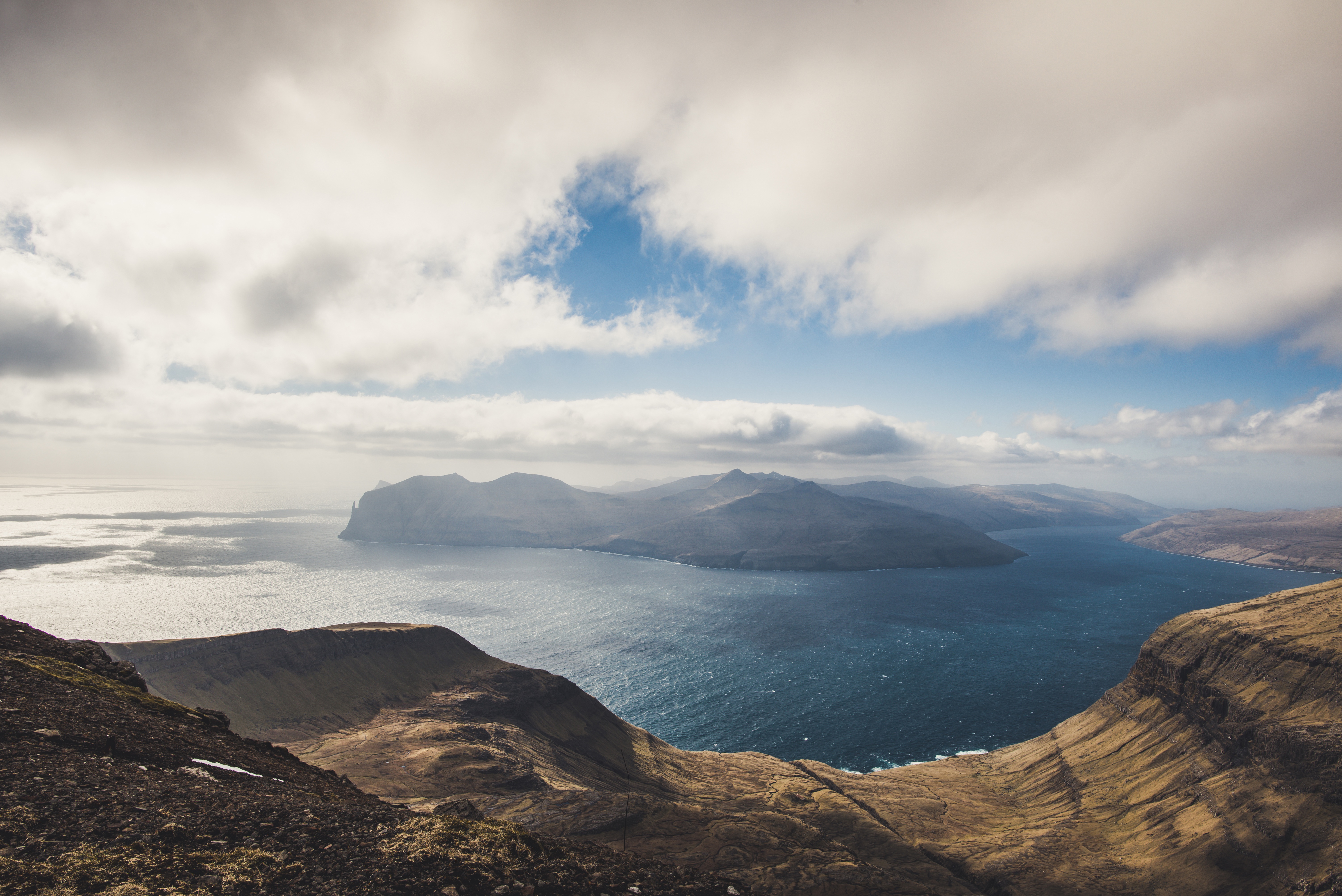
About Tórshavn
About Heimaey Island
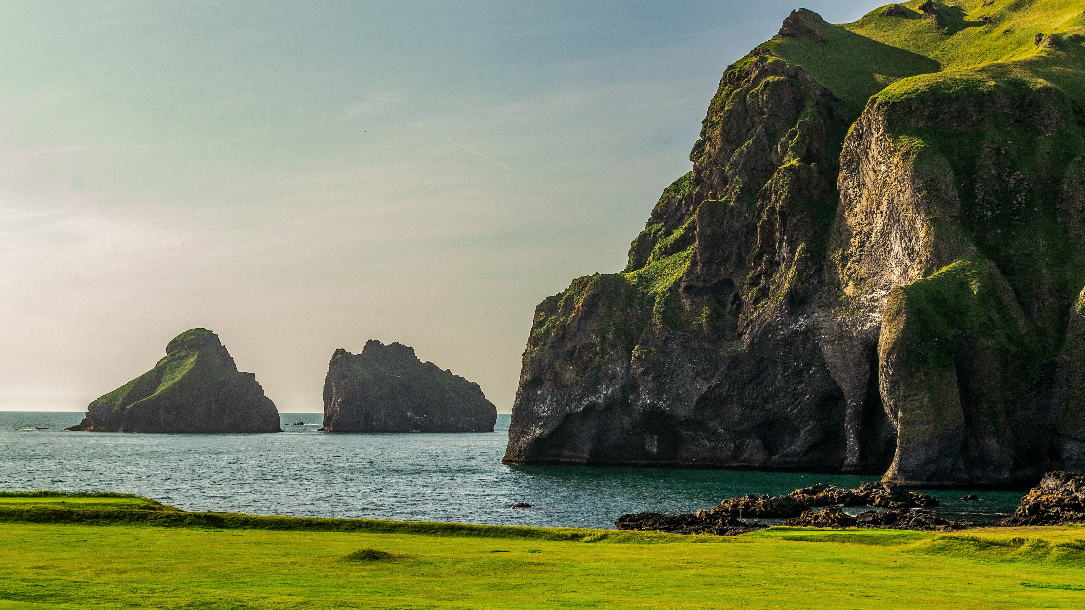
It’s hard to imagine, as you stroll Heimaey’s idyllic streets of white wooden houses, that this island was literally torn apart by a spectacular volcanic eruption, just over 40 years ago. The fact that you can visit incredible Heimaey at all is something of a miracle – because the oozing lava of the Eldfell volcano threatened to seal the harbour off completely. Fortunately, its advance was halted by gallons of seawater, pumped onto it by the plucky islanders, who saved their fishing industry in the process. Iceland's famous for its scenery, and the huge castles of volcanic rock that rise out of the sea's waves here are some of the country's most dramatic.
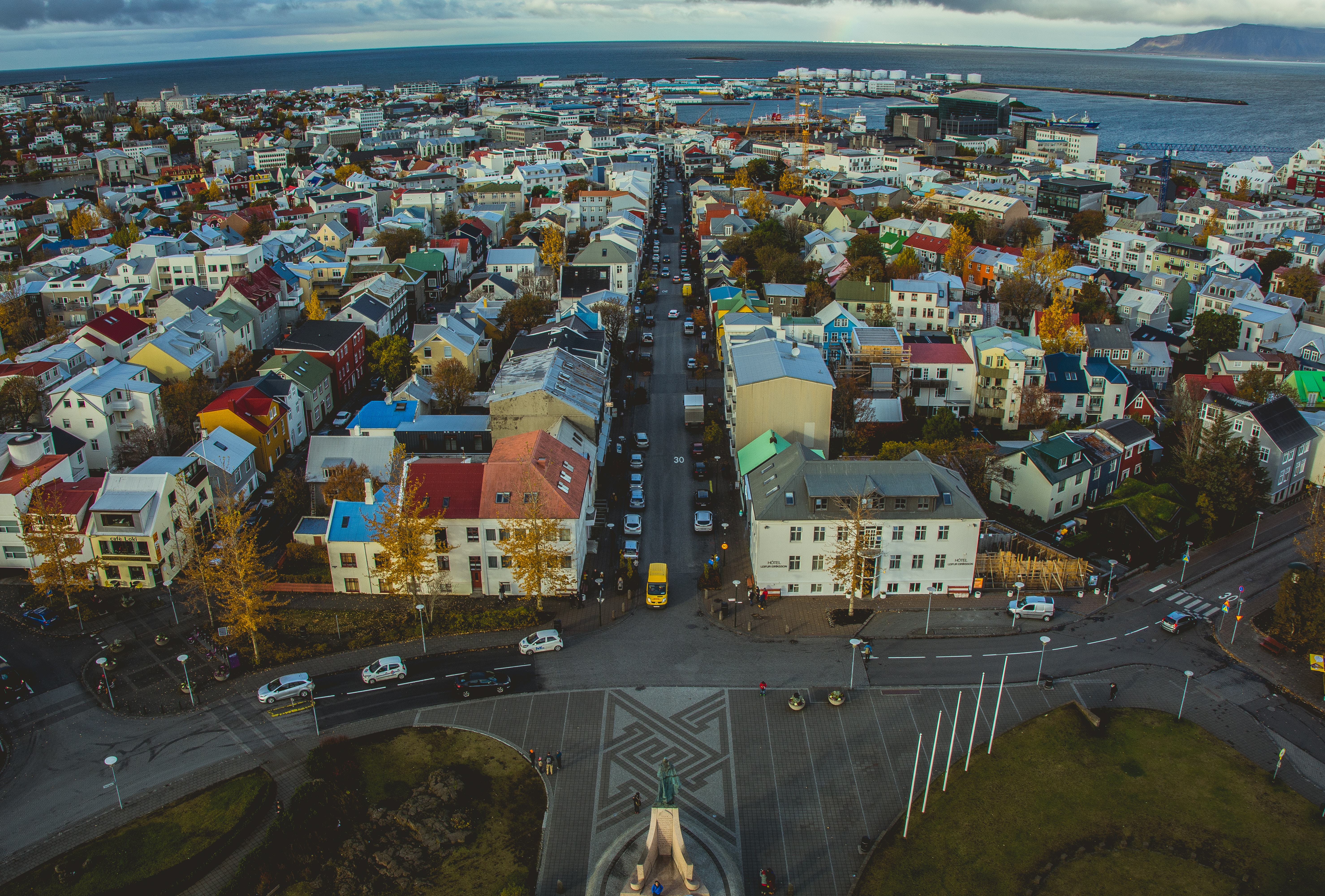
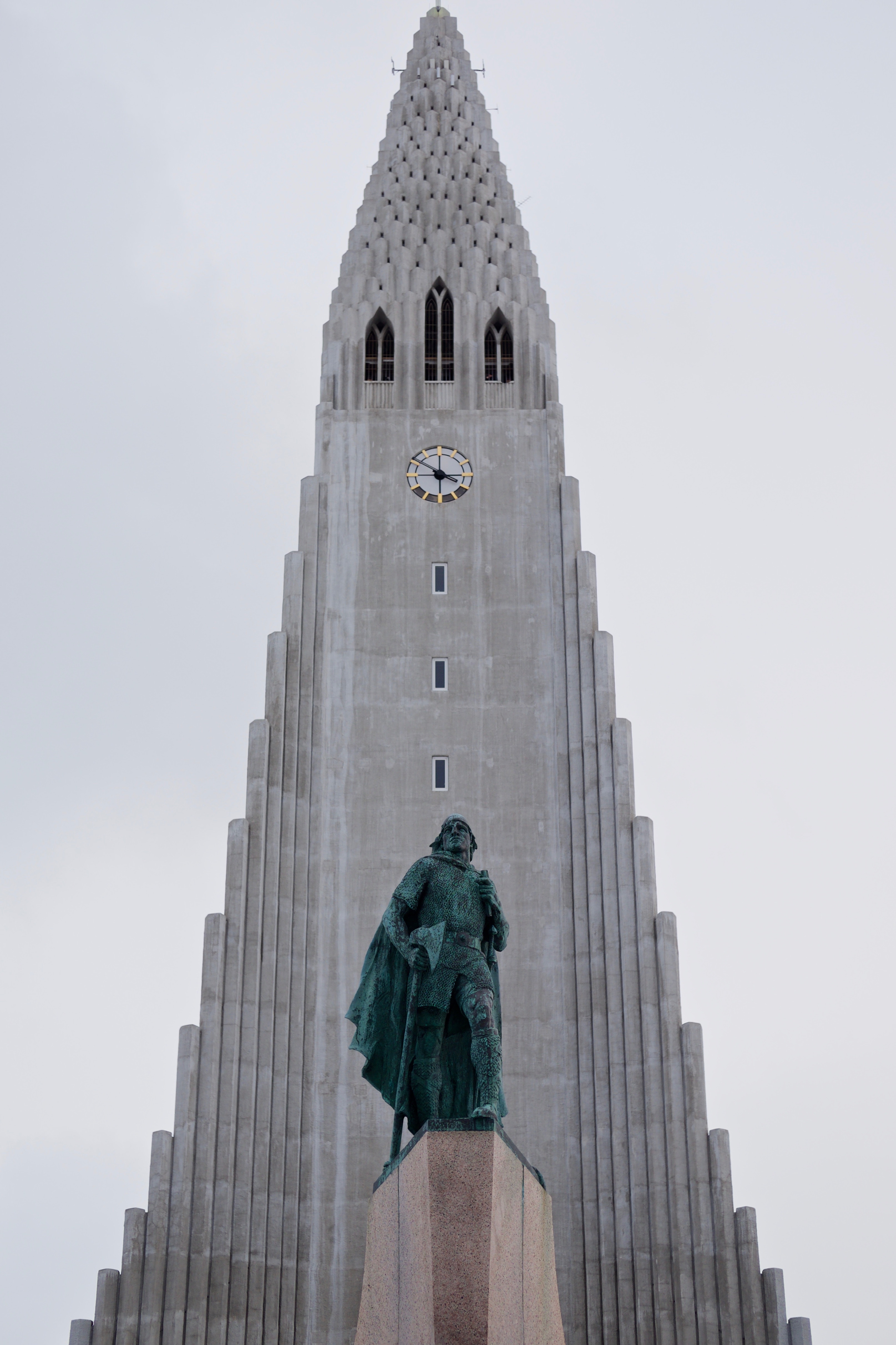
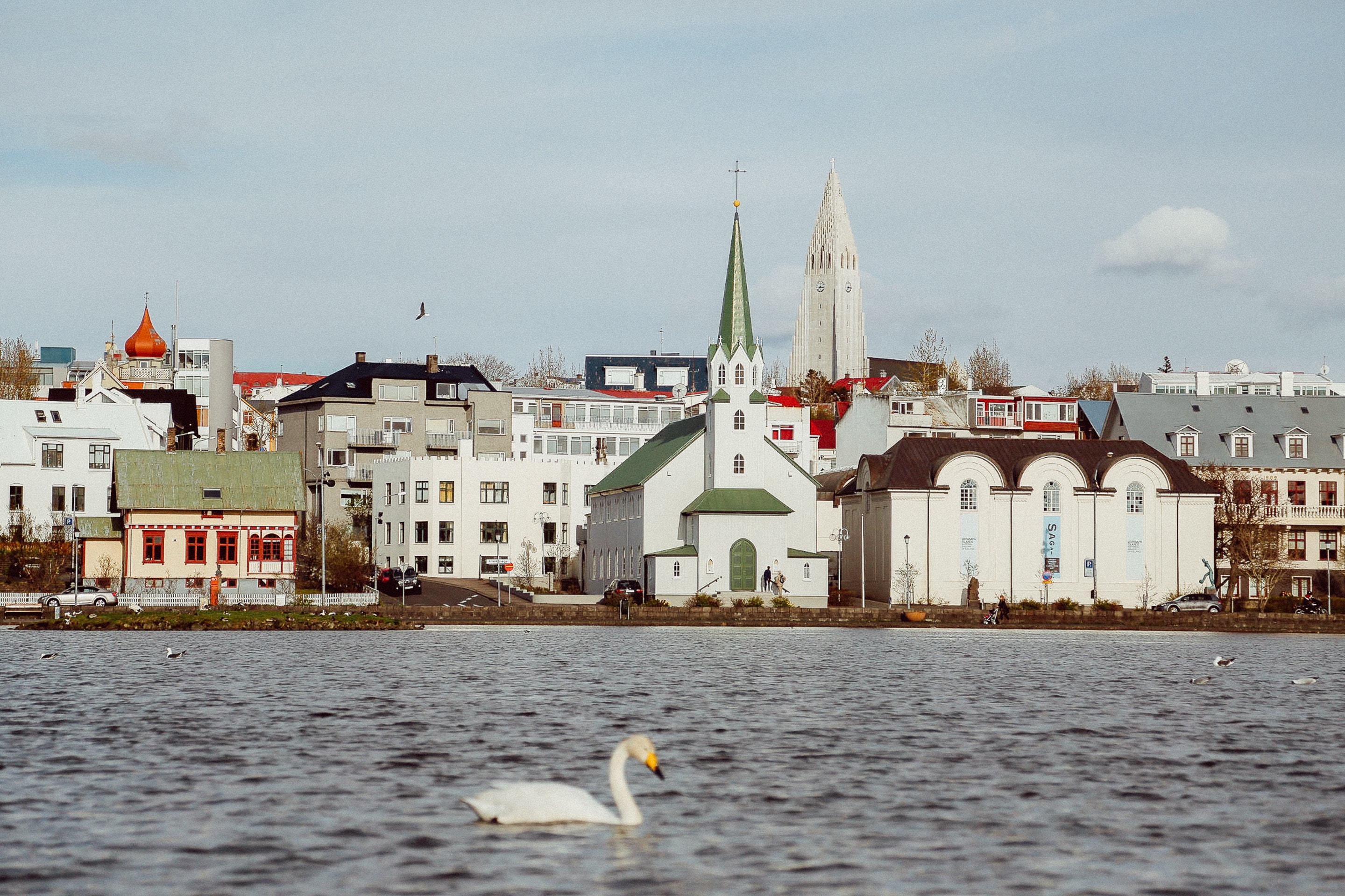
About Reykjavík
Sprawling Reykjavík, the nation's nerve center and government seat, is home to half the island's population. On a bay overlooked by proud Mt. Esja (pronounced eh-shyuh), with its ever-changing hues, Reykjavík presents a colorful sight, its concrete houses painted in light colors and topped by vibrant red, blue, and green roofs. In contrast to the almost treeless countryside, Reykjavík has many tall, native birches, rowans, and willows, as well as imported aspen, pines, and spruces.Reykjavík's name comes from the Icelandic words for smoke, reykur, and bay, vík. In AD 874, Norseman Ingólfur Arnarson saw Iceland rising out of the misty sea and came ashore at a bay eerily shrouded with plumes of steam from nearby hot springs. Today most of the houses in Reykjavík are heated by near-boiling water from the hot springs. Natural heating avoids air pollution; there's no smoke around. You may notice, however, that the hot water brings a slight sulfur smell to the bathroom.Prices are easily on a par with other major European cities. A practical option is to purchase a Reykjavík City Card at the Tourist Information Center or at the Reykjavík Youth Hostel. This card permits unlimited bus usage and admission to any of the city's seven pools, the Family Park and Zoo, and city museums. The cards are valid for one (ISK 3,300), two (ISK 4,400), or three days (ISK 4,900), and they pay for themselves after three or four uses a day. Even lacking the City Card, paying admission (ISK 500, or ISK 250 for seniors and people with disabilities) to one of the city art museums (Hafnarhús, Kjarvalsstaðir, or Ásmundarsafn) gets you free same-day admission to the other two.
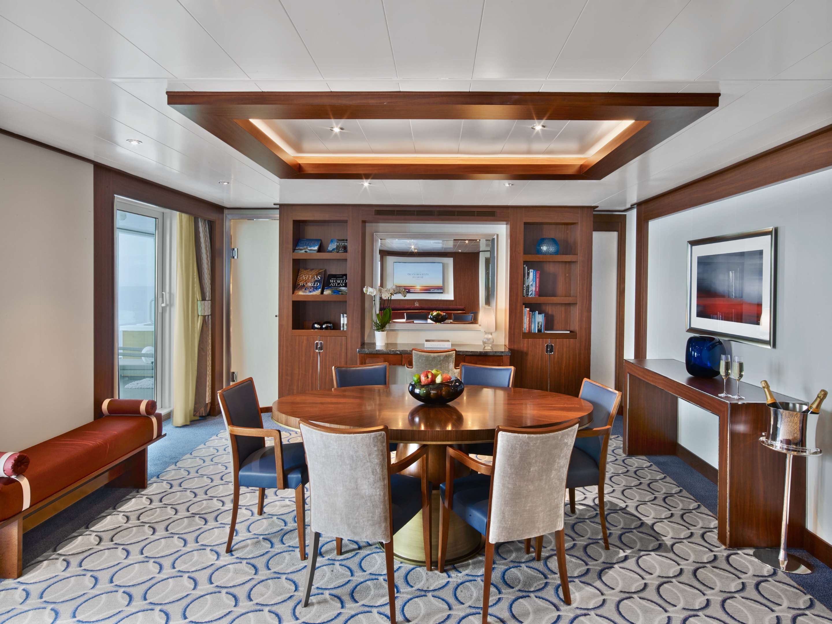
Located on Deck 8; Combine mid-ship suites 849 and 851 for suite 8491 or suites 846 and 848 for suite 8468 for a total inside space of 1,292 square feet (120 square meters) plus two verandas totaling 244 square feet (23 square meters)
Grand Wintergarden Suites feature:
- Large windows
- Dining for six
- Glass-enclosed solarium with tub and day bed
- Bathroom with whirlpool bathtub
- Two bedrooms
- Two bathrooms (one whirlpool)
- Convertible sofa bed for one
- Pantry with wet bar
- Two flat-screen TVs
- Complimentary Internet/Wi-Fi service

989 SQUARE FEET (92 SQUARE METERS) OF INSIDE SPACE, PLUS ONE VERANDA OF 197 SQUARE FEET (18 SQUARE METERS)
Wintergarden Suites feature:
- Large windows
- Dining for six
- Whirlpool bathtub
- Guest bath
- Convertible sofa bed for one
- Pantry with wet bar
- Glass-enclosed solarium with tub and day bed
- Two closets
- Two flat-screen TVs
- Complimentary Internet/Wi-Fi service
859 SQUARE FEET (80 SQUARE METERS) OF INSIDE SPACE, PLUS ONE VERANDA OF 493 SQUARE FEET (46 SQUARE METERS)
Signature Suites Feature:
- Expansive ocean views
- Forward-facing windows
- Dining for four to six
- Bathroom with whirlpool bathtub
- Guest bath
- Pantry with wet bar
- Two flat-screen TVs
- Complimentary Internet/Wi-Fi service


526 & 593 SQUARE FEET (49 TO 55 SQUARE METERS) OF INSIDE SPACE, PLUS ONE VERANDA OF 133 & 354 SQUARE FEET (12 TO 33 SQUARE METERS)
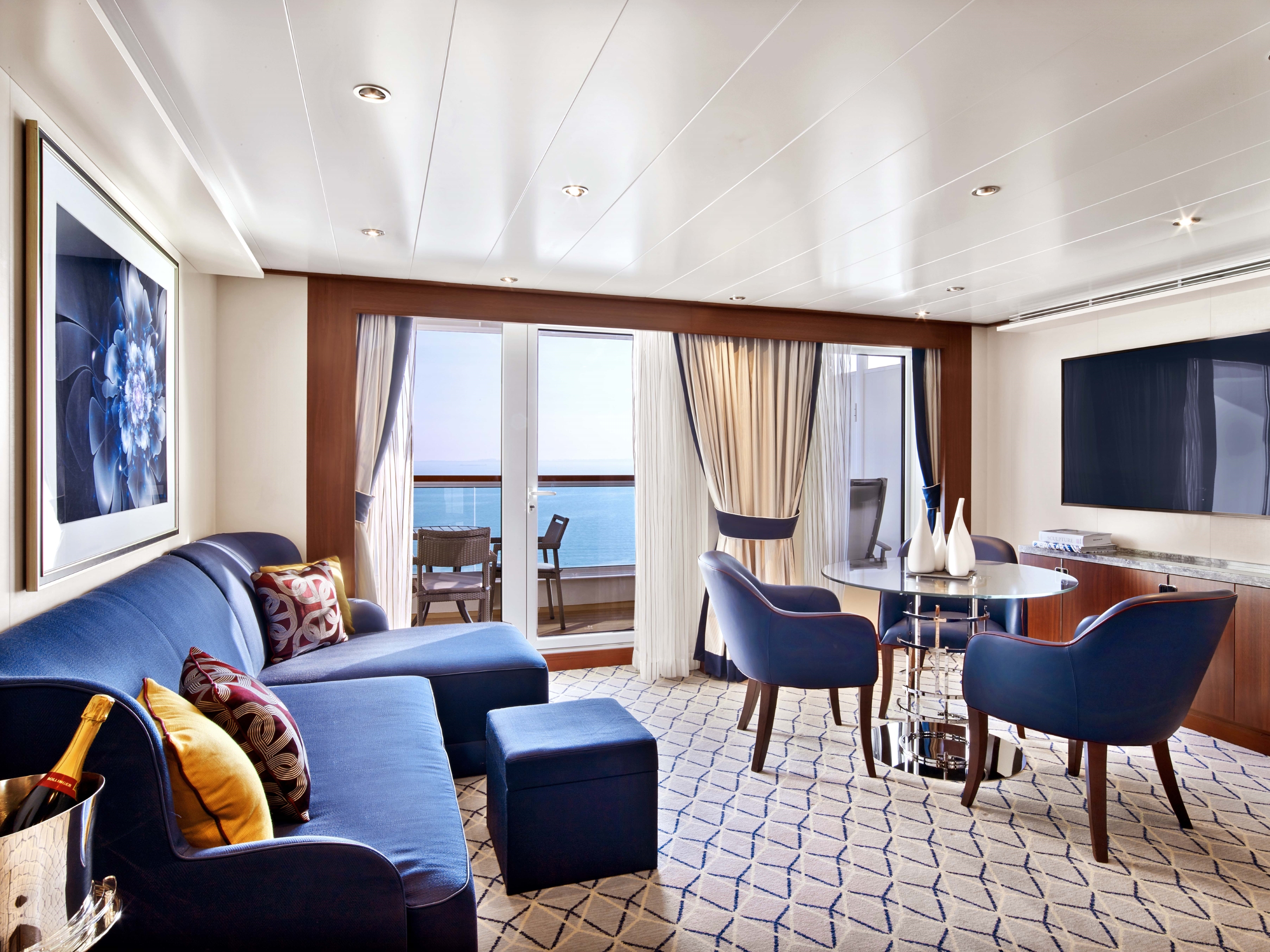
Owner's Suites Feature:
- Expansive ocean views
- Forward-facing windows
- Dining for four to six
- Bathroom with whirlpool bathtub
- Guest bath
- Pantry with wet bar
- Two flat-screen TV
- Complimentary Internet/Wi-Fi service
*Wheelchair accessible suites are roll-in shower only.
More information coming soon...
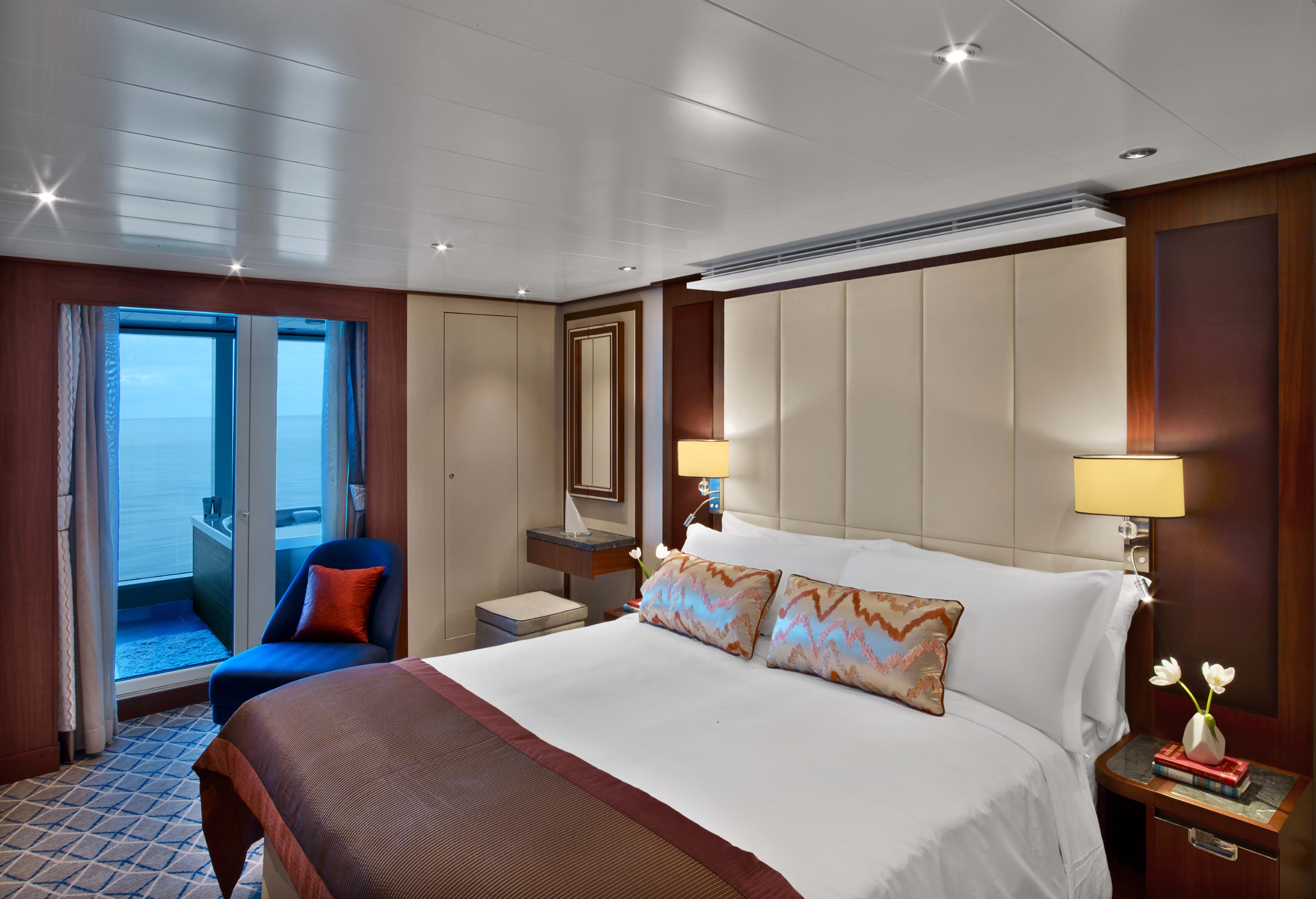
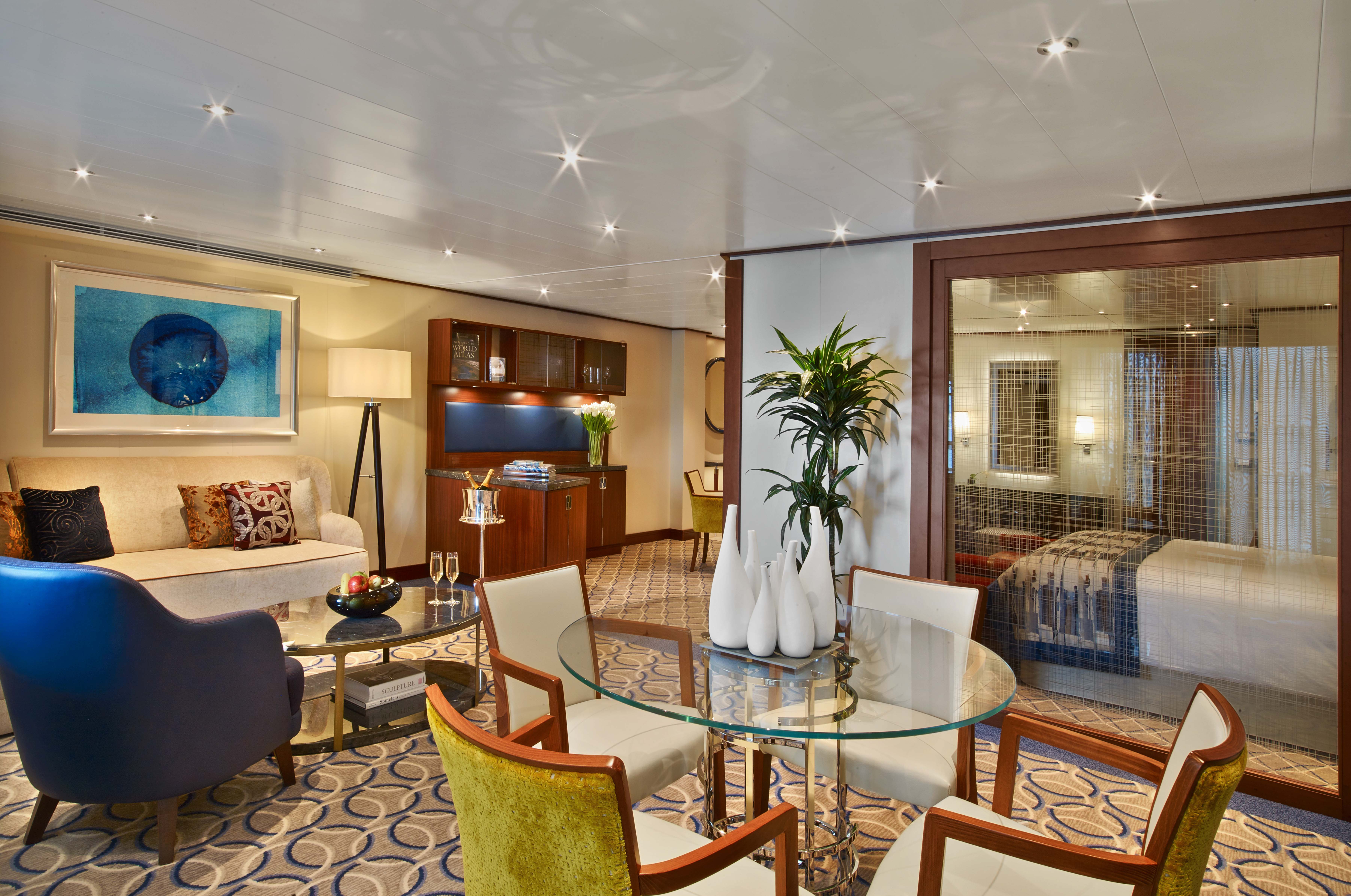
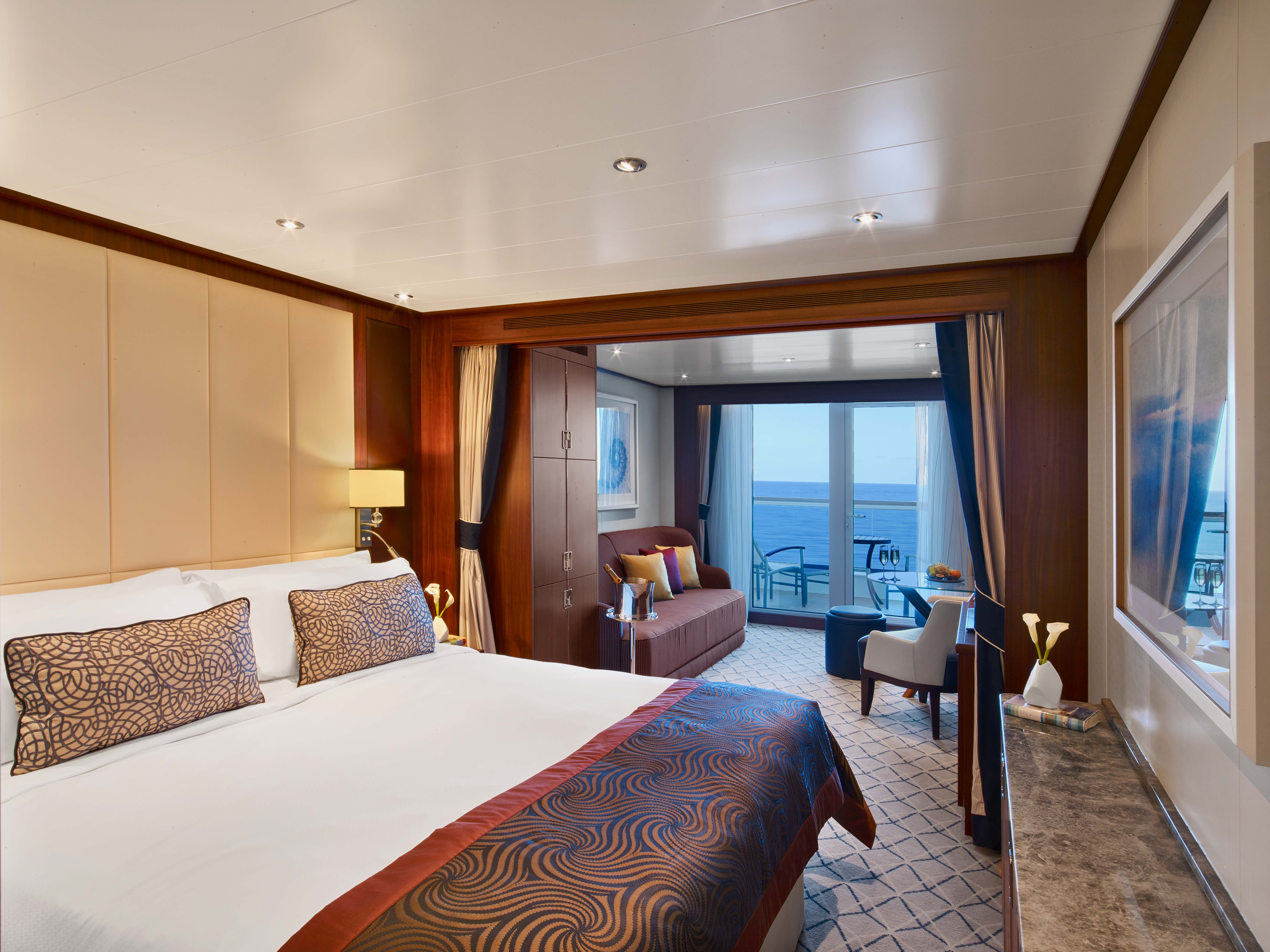
All Penthouse Suites on board feature a comfortable living area, glass door to private veranda, queen-size-bed or two twin beds; walk-in closet with personal safe, two flat-screen TV with music and movies, fully stocked bar and refrigerator, writing desk with personalized stationary, makeup vanity, spacious bathroom with separate tub and shower, plush robes, slippers hair dryer and 110/220V AC outlets.
- Glass door to private veranda
- Comfortable living area
- Separate bedroom
- Dining table for two to four
- Walk-in closet
- Two flat-screen TVs
- Fully stocked bar and refrigerator
- Makeup vanity
- Oversize Spa shower with rainfall shower head
- Bathroom with whirlpool bathtub
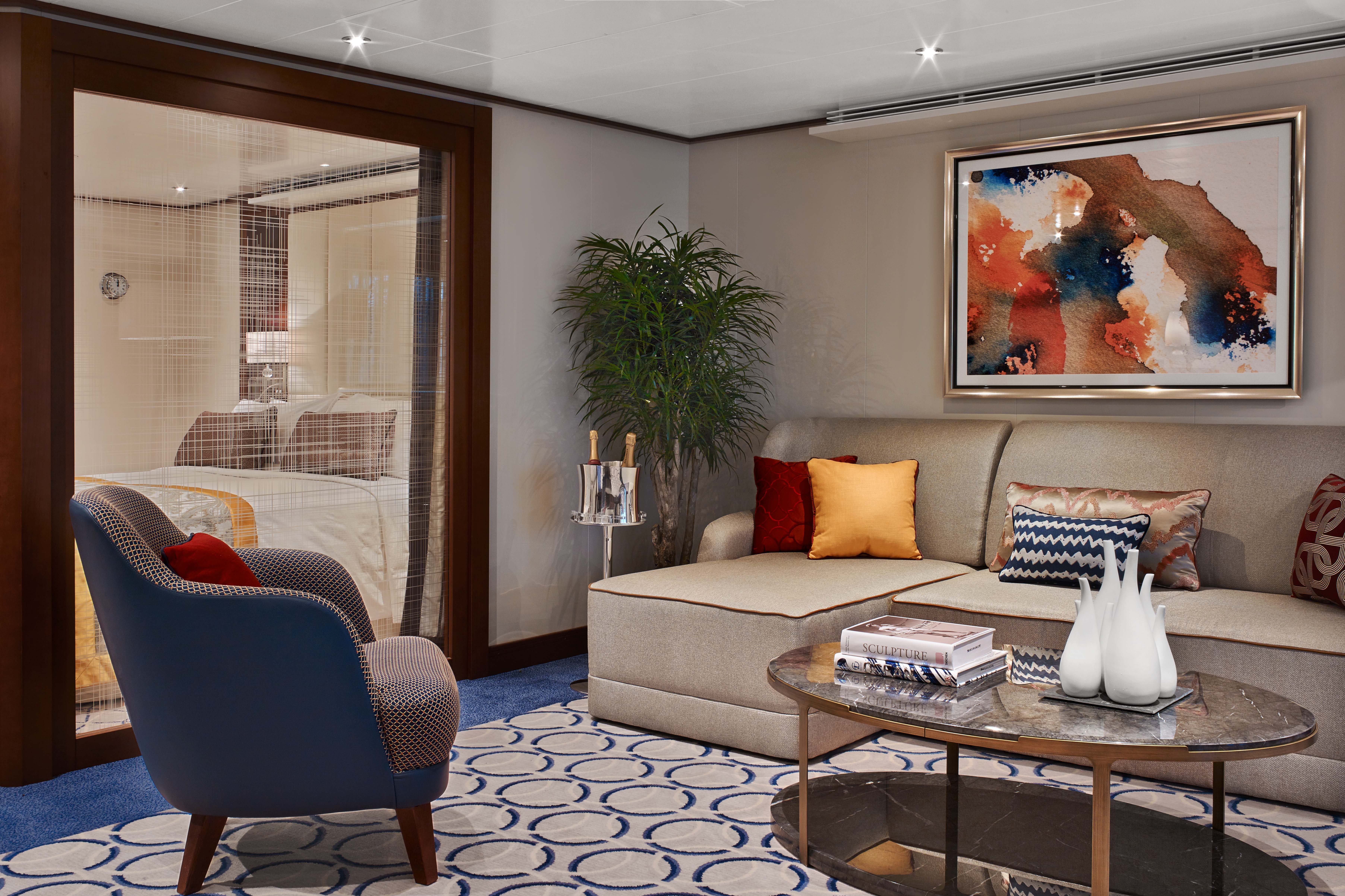
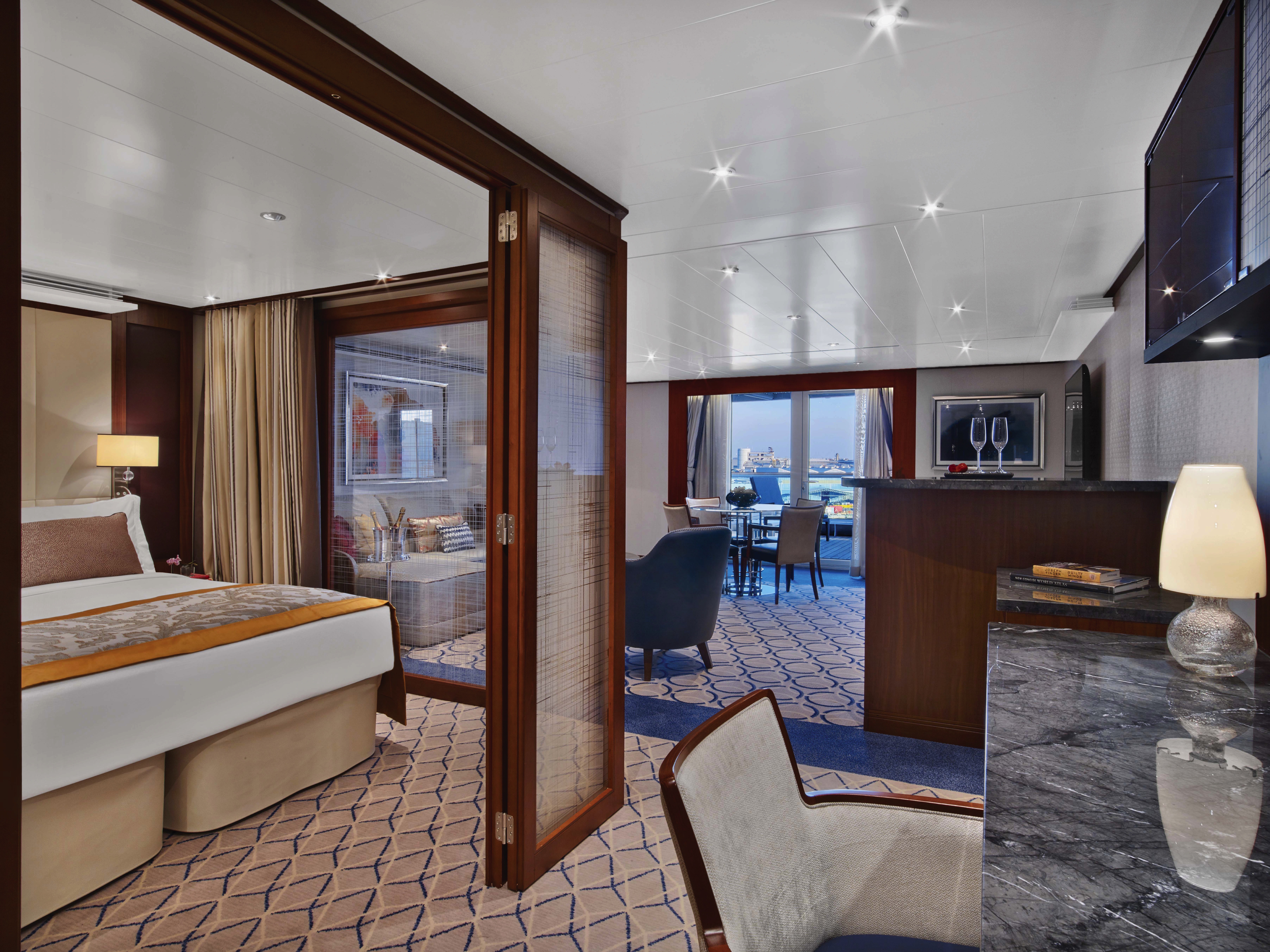
All Penthouse Suites on board feature a comfortable living area, glass door to private veranda, queen-size-bed or two twin beds; walk-in closet with personal safe, two flat-screen TV with music and movies, fully stocked bar and refrigerator, writing desk with personalized stationary, makeup vanity, spacious bathroom with separate tub and shower, plush robes, slippers hair dryer and 110/220V AC outlets.
- Dining table for two to four
- Separate bedroom
- Glass door to veranda
- Two flat-screen TVs
- Fully stocked bar
- Spacious bathroom with tub
- Shower and large vanity

- Dining table for two to four
- Separate bedroom
- Glass door to veranda
- Two flat-screen TVs
- Fully stocked bar
- Spacious bathroom with tub, shower and large vanit
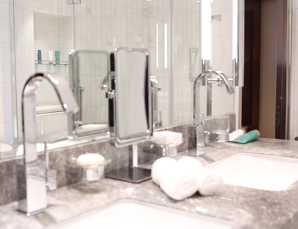
All Veranda Suites feature a full-length window and glass door to private veranda, comfortable living area, queen-size bed or two twin beds, dining table for two, walk-in closet, interactive flat-screen television with music and movies, fully stocked bar and refrigerator, makeup vanity, spacious bathroom with separate tub and shower.
- A full-length window
- Glass door to private veranda
- Comfortable living area
- Queen-size bed or two twin beds
- Dining table for two
- Walk-in closet
- Interactive flat-screen television with music and movies
- Fully stocked bar and refrigerator
- Makeup vanity
- Spacious bathroom with separate tub and shower
*Wheelchair accessible suites are roll-in shower only.
All Veranda Suites feature a full-length window and glass door to private veranda, comfortable living area, queen-size bed or two twin beds, dining table for two, walk-in closet, interactive flat-screen television with music and movies, fully stocked bar and refrigerator, makeup vanity, spacious bathroom with separate tub and shower.
Guaranteed Suite: For this option we select the location and specific suite for you, and notify you prior to departure. Guests are guaranteed to be assigned a suite in the category selected or higher.
More information coming soon...

Seabourn Ovation
Introducing Seabourn Ovation, the sister-ship to the prestigious Seabourn Encore. Seabourn Ovation represents another stage in the evolution of small ship cruising, which Seabourn pioneered and has consistently expanded and enriched. Both ships deliver a wealth of new concepts, a fresh vision and a host of illuminating ideas to delight the world's most discerning travelers.
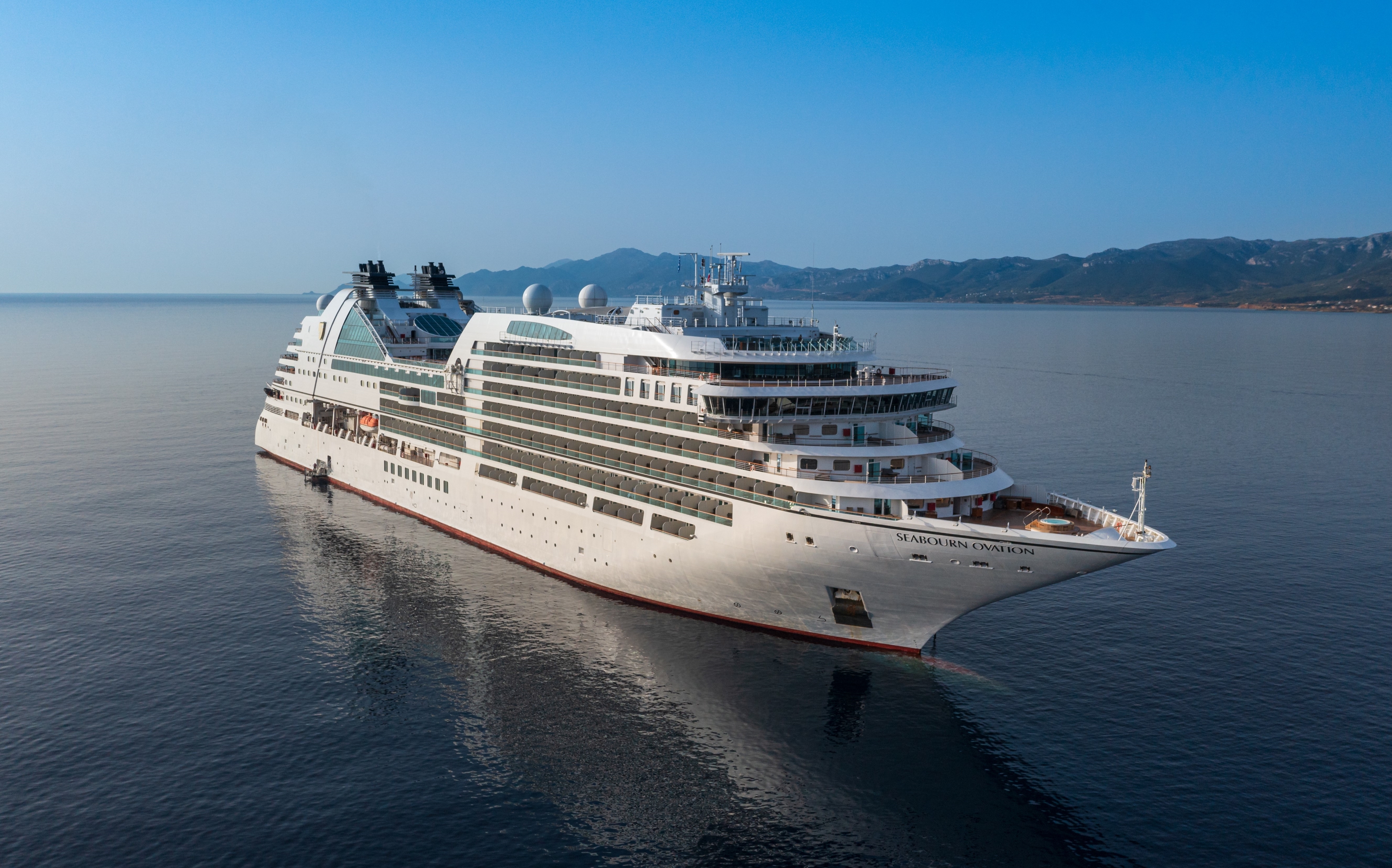
Ship Facts
| Launch Year | 2018 | ||||||||
| Refit Year | |||||||||
| Language | en | ||||||||
| Gross Tonnage | 40350 | ||||||||
| Length | 210 | ||||||||
| Width | 28 | ||||||||
| Currency | USD | ||||||||
| Speed | 19 | ||||||||
| Capacity | 600 | ||||||||
| Crew Count | 330 | ||||||||
| Deck Count | 12 | ||||||||
| Cabin Count | 300 | ||||||||
| Large Cabin Count | 33 | ||||||||
| Wheelchair Cabin Count | 9 | ||||||||
| Electrical Plugs |
|
To see the legend for these deck plans, please hover your mouse over the images below
To toggle the legend for these deck plans, please tap on any of the images below
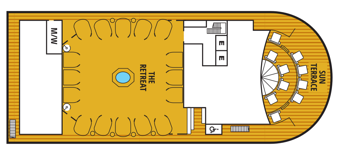
Deck 12
- Sun Terrace
- The Retreat
Deck 11
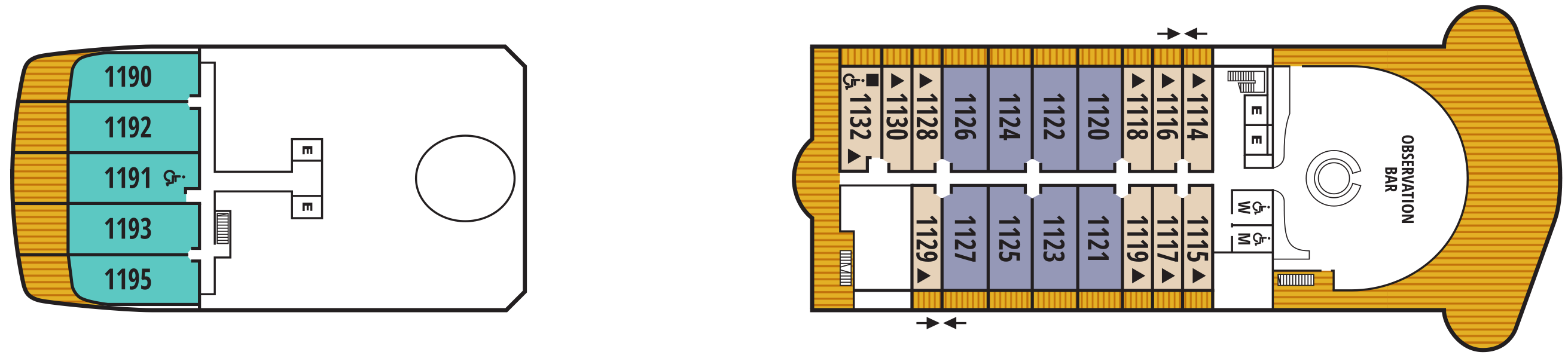
- Observation Lounge
- Veranda Suite
- Penthouse Spa Suite
- Penthouse Suite
Deck 10
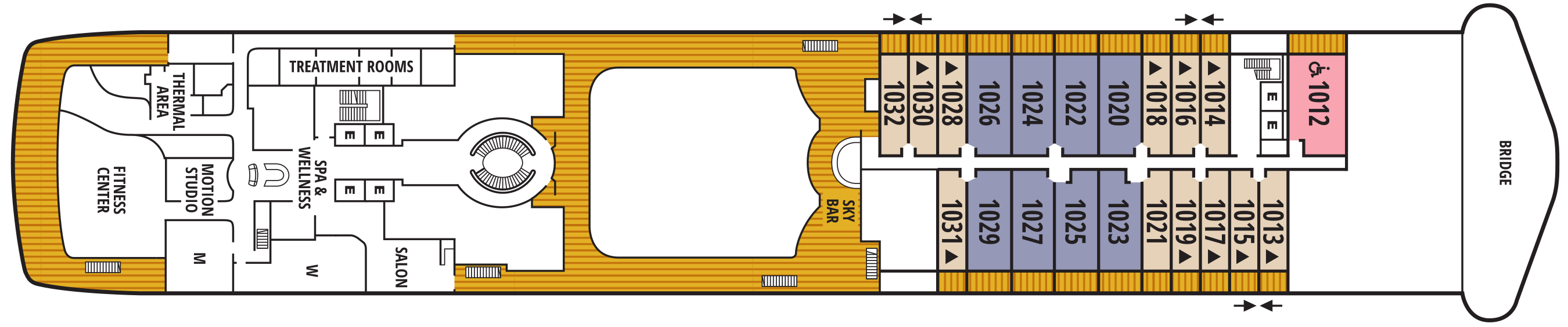
- Bridge
- Sky Bar
- Salon
- Treatment Rooms
- Thermal Area
- Spa & Wellness Area
- Motion Studio
- Fitness Centre
- Veranda Suite
- Owner's Suite
- Penthouse Suite
Deck 9
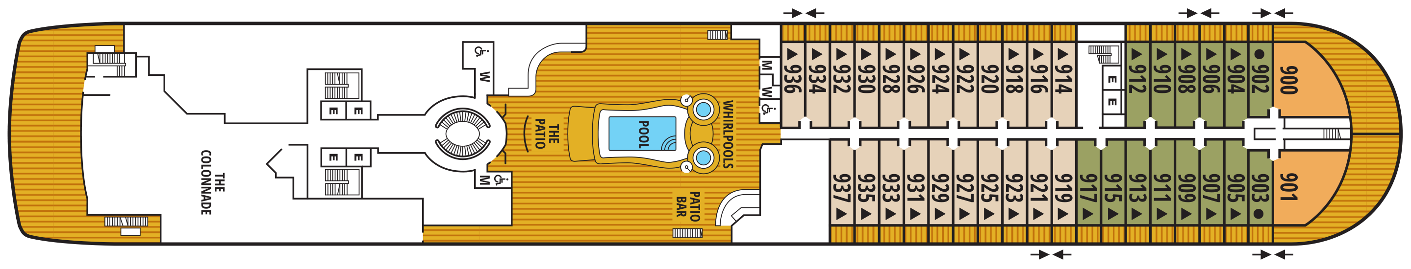
- Whirlpools
- Pool
- The Patio
- Patio Bar
- The Colonnade
- Veranda Suite
- Owner Suite
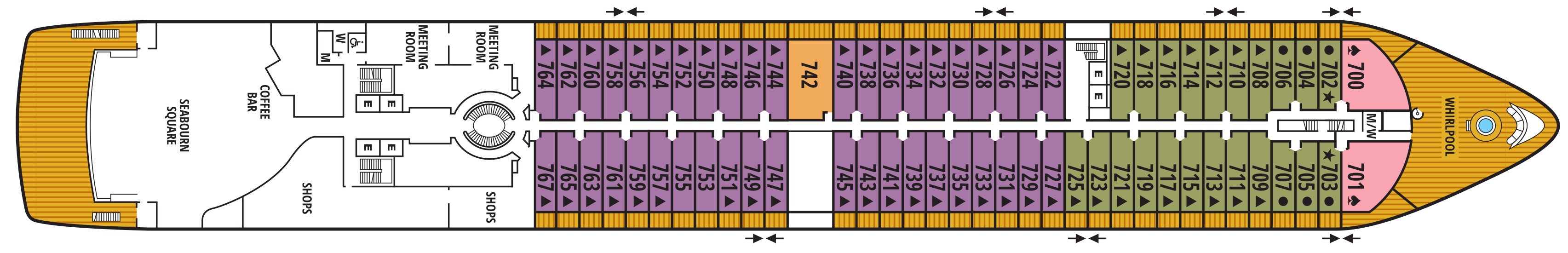
Deck 8
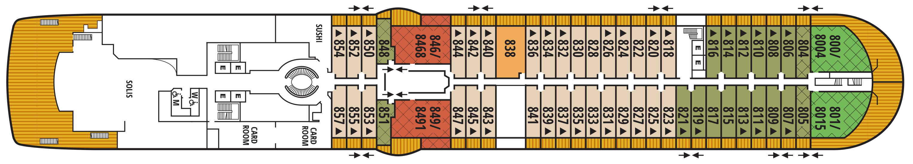
- Sushi
- Solis
- Card Room
- Grand Wintergarden Suite
- Wintergarden Suite
- Signature Suite
- Owner's Suite
- Veranda Suite
Deck 7
- Whirlpool
- Meeting Rooms
- Shops
- Coffee Bar
- Seabourn Square
- Owner's Suites
- Veranda Suites
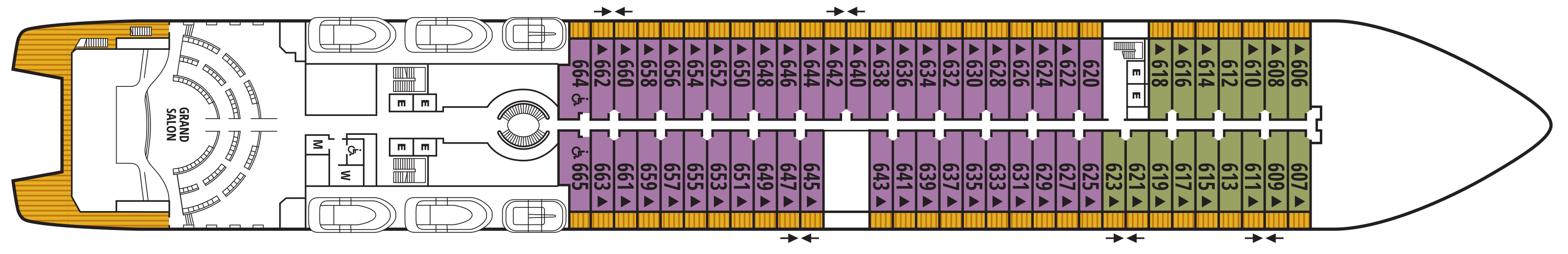
Deck 6
- Grand Salon
- Veranda Suites
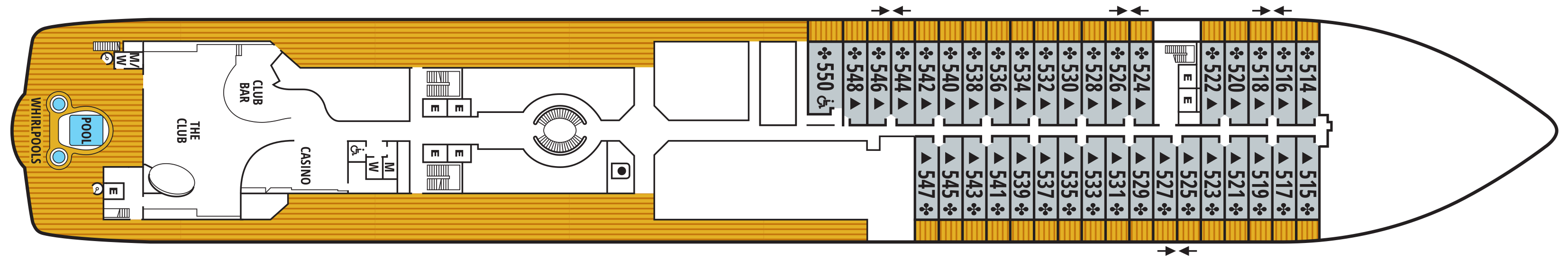
Deck 5
- Casino
- The Club
- Club Bar
- Pool
- Whirlpools
- Veranda Suites
Deck 4
- Medical Facility
- The Restaurant
- Galley

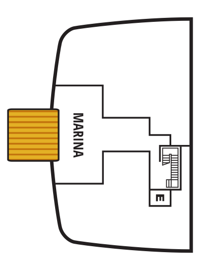
Deck 3
- Marina

Our world-class dining and culinary experiences rival the finest restaurants around the globe - even when we sail in the most remote destinations.
Each Seabourn ship offers a choice of dining venues to suit your mood of the moment. All dining venues are complimentary, and nearly all are open-seating, inviting you to dine where, when, and with whom you wish.
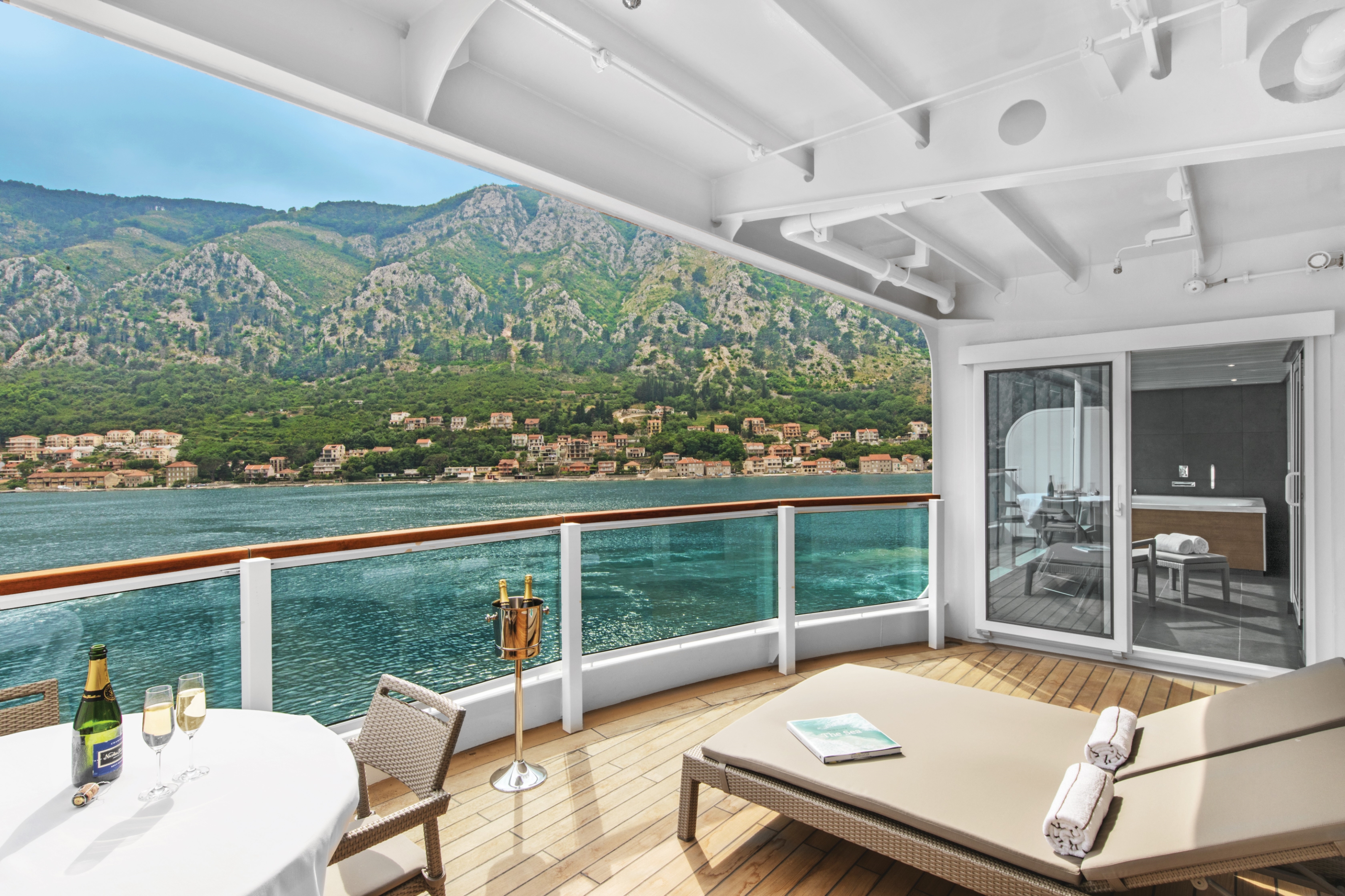
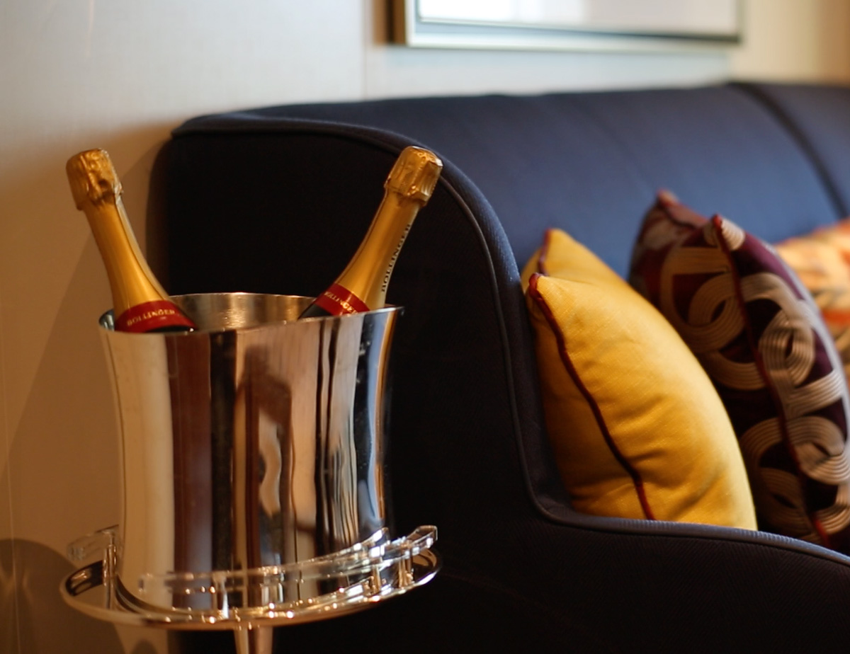
Complimentary fine wines are poured with lunch and dinner, and there is never an extra charge for any dining choice. You can even enjoy a meal in your suite or on your veranda.
The Restaurant
Before Seabourn, open-seating dining on a cruise ship was unheard of. Come when you like, with whom you please, and be seated as you wish. The room is beautiful, the cuisine is exquisite, and the service is simultaneously flawless, friendly and fun.
The Colonnade
Our more casual, indoor/outdoor alternative, features an open kitchen, lavish buffets or table service for breakfasts and lunch, and serves regionally themed, bistro-style dinners with table service nightly.
The Patio
Relaxed poolside dining offering luncheon buffets, salads, soups, grilled specialties and freshly baked pizza. Dinners feature a full menu in an alfresco setting.
Sushi
Seabourn researched the best ingredients and developed a menu that is a perfect blend of authenticity to maintain the root of the cuisine, and a twist of Seabourn’s culinary expertise. The sushi concept is a modern line that is steeped in tradition using the finest ingredients. Hamachi, tuna, shrimp and other fresh fish products will be shipped from Japan to Sushi and served à la carte for dinner. The menu features caviar and small plates, along with a selection of maki rolls, sushi and sashimi, and salads. In addition, the restaurant will feature three varieties of bento boxes for lunch: meat, seafood and vegetarian.
The Seabourn sushi experience is available in our traditional sushi restaurant aboard Seabourn Ovation and Seabourn Encore.
Seabourn Sojourn, Seabourn Quest, Seabourn Venture, and Seabourn Pursuit offer Sushi in The Club, serving a variety of light sushi bites freshly made to order each evening.
Solis
Offering light, modern Mediterranean cuisine bursting with color and character, prepared fresh and entirely from scratch.
Solis will showcase a vibrant, chic atmosphere with feel-good background music and a menu reminiscent of our favorite travel memories. Solis was developed in collaboration with longtime Seabourn partners, Master Chef and Culinary Partner Chef Anton Egger, and Senior Corporate Chef Franck Salein. Chef Egger and Chef Salein are the culinary masterminds behind two of Seabourn’s most popular dining concepts – Earth & Ocean and Sushi.
Beyond the culinary, guests will be able to indulge in a truly sophisticated experience with Seabourn’s newly presented, refined vintage cocktail menu, featuring an allure of classic cocktails crafted to perfection. From classics such as the Kir Royale or Mauresco to the always — and most popular — Aperol Spritz, our team of talented mixologists have meticulously curated this menu to ensure that every drink is a masterpiece of flavors and aesthetics.
An evening at Solis is designed to delight our guests and leave them with lasting Seabourn Moments.
In-Suite Dining
Seabourn is pleased to offer a varied menu available around the clock for service in your suite. You may also order dinner from The Restaurant menu and have your meal served, course by course, in your suite or on your veranda.
Featuring a newly enhanced menu, including a delightful variety of vegan and vegetarian options.
Earth & Ocean
Each evening, our skilled Earth & Ocean chefs create an imaginative array of fresh, inventive dishes—a sophisticated menu celebrating eclectic traditional flavors from around the world, served in a relaxed setting under the stars for a distinctive dining experience unlike any other on board.
Each day on board offers delicious dining options, world-class entertainment and enriching activities.
Share the journey with a daring explorer or celebrated performer as part of Seabourn Conversations, where experts don’t just lecture, they are part of the daily social scene. Complete your day at sea with world-class fine dining, exclusive entertainment, and an evening of dancing under the stars.
Make yourself at home with delightful daily diversions that add to our fleet’s private yacht-like atmosphere. Connect with fellow travelers in Seabourn Square or rise to the challenge in a game of trivia.
Sun Terrace
Slow things down and soak up the sun as you relax on a luxurious lounger.
Seabourn Square
Whether you're looking for a place to enjoy your newspaper in the morning or want to socialize with your fellow passengers, Seabourn Square is what you're looking for. This inviting lounge offers plush seating, cocktail tables, a library, computer terminals, a coffee bar, and Guest Services staff.
Seabourn Square is the true ‘living room’ of the ships. An inviting sociable space where guests will find a charming European style coffee bar, Seabourn Square has been designed as an open, comfortable environment for guests to interact with onboard officers and the expedition team and engage in conversation with family and new friends. The space is also home to the highly-trained Guest Services staff, who provide a range of concierge services such as general ship information, assistance with special service requests, port and travel information, and more.
A selection of coffees are prepared by the skilled onboard baristas some using beans roasted in Seabourn Square. For those feeling a bit hungry, Seabourn Square offers freshly made pastries and other on-the-go breakfast items in the morning, as well as an assortment of light sandwiches and desserts later in the day, along with a selection of artisanal gelati made on board. Guests will also find a wide range of books in the adjoining library, with a host of titles on subjects such as adventure, expeditions and other topics of interest to enjoy while onboard. Staying current with the news is made easy with tablets featuring the Press Reader news application available to browse each day.
Grand Salon
The ship’s main showroom can accommodate all guests, though it seldom does because of the variety available. Lectures, cooking demonstrations, movies and other gatherings are held here in the daytime. In the evenings, live music for dancing before dinner gives way to vocal production shows, cabaret performances, comedy, and classical recitals, as well as more dancing later.
The Retreat
A tranquil setting housed in a distinctive flower-shaped canopy that shields guests from sun and wind, The Retreat is ringed with 15 private cabanas designed as individual luxury living rooms that each feature a large HD flat screen television and a refrigerator stocked with a personalized selection of beverages. An additional Spa Treatment Cabana is also available for guests to enjoy personalized spa services, subject to availability. For additional details or reservation, log in and customize your itinerary.
The Retreat is located around a central whirlpool with step-up access to water maintained at an inviting temperature. Up to 28 guests can stretch out on comfortable sun loungers; pull up a bar stool or take a table seat for champagne and cocktails custom created by Seabourn mixologists; or enjoy a selection of bites from a healthy spa menu. A selection of amenities include fresh fruit baskets, plush towels and personalized bathrobes, while a dedicated Retreat Concierge will be available to satisfy guest requests.
Cabanas at The Retreat will be available daily and may be reserved for a full day via the Guest Service Specialists at Seabourn Square. The Retreat is only available on Seabourn Ovation and Seabourn Encore.
The Club
The liveliest lounge on board is the scene of daily afternoon tea service. It is a popular spot for pre-dinner drinks and dancing to live music. After dinner, the dancing music continues, and later a DJ spins dance music until late at night. Another terrace of open deck aft of The Club boasts a plunge pool and two small whirlpool spas.
Casino
The Seabourn casino offers a handsome, well-appointed enclave for those attracted to games of chance and skill. Relax and test the odds on various mechanical games or pit your skills against personable, professional dealers at blackjack or poker tables.
Evening Under the Stars®
One of the most FUN evenings during any cruise, Evenings Under the Stars is a night where guests can let their hair down and simply be in the moment. Enjoy Let’s Dance! with great live music, interact with fellow travelers and be spoiled in true Seabourn style by our food and beverage team with Desserts Under the Stars. A signature event, this dance party has been a part of the line’s rich culture, and a Seabourn cruise is not complete without Let’s Dance! and Desserts Under The Stars.
Weather permitting, this high-energy dance party is hosted poolside and under the stars by the entire entertainment team, featuring performances by The Band, vocalists and dancers. There is even the possibility your Cruise Director and Assistant Cruise Director might jump on stage to perform, as well! Guests can expect music that appeals to everyone’s taste with a great mix of hit songs. It’s a real treat and guests LOVE Evenings Under the Stars!
Sky Bar
The Sky Bar on our expedition ships is a place to enjoy a refreshing tropical beverage during the day, or an evening cocktail under the stars. Two small whirlpool spas bracket the open terrace.
Observation Bar
Enjoy this stunning lounge with a bar and panoramic views. Enjoy coffee and tea served every morning, and drinks before or after dinner.
Patio Bar
Enjoy a drink at the Patio Bar and unwind in the perfect setting for a sunny afternoon. The nearby swimming pool is surrounded by a sundeck with chaise lounges, shaded seating, two large whirlpool spas, and is within steps of the Patio dining offerings on our ocean ships and the Colonnade on our Expedition vessels.
The Shops at Seabourn
Whether you're buying souvenirs for your friends at home or want a memento of your vacation, our Shops will have what you need. Shop for fashion and cosmetics at The Boutique, jewellery and fine watches at The Collection, or logo cruisewear at the Shop.
Card Room
Many veteran cruisers specifically choose cruises that provide at least a few days at sea. The Card Room is a great choice for the sea-loving cruiser who craves that languorous feeling of lazy leisure. There will be loads of on board activities during those days, including a great game of bridge.
Zero @ Sea
A Zero-proof cocktail experience featuring a unique array of non-alcoholic cocktails
Zero @ Sea offers an inventive menu of mixology cocktails, with ingredients and flavors free of alcohol, such as elderflower, bursts of fresh citrus, botanical spirits, and more.
Zero @ Sea cocktails are available fleetwide in all bars and lounges aboard the ships together with an upgraded selection of nonalcoholic wines, sparkling wines, and beers.
The new cocktails were developed by Seabourn’s expert culinary and beverage team, led by Michael Simon, senior manager of restaurant and bar operations, and Francisco Fernandes, corporate manager service operations.