20-Day Antarctica, South Georgia & Falkland Islands
20-Day Antarctica, South Georgia & Falkland Islands
Cruise overview
WHY BOOK WITH US?
- ✔ The Deluxe Cruises’ team has extensive experience in ultra-luxury cruising.
- ✔ Call now to speak to our helpful and experienced Cruise Concierge team.
- ✔ Enjoy our Unique Deluxe Cruises Bonus for substantial savings.
- ✔ Our team will tailor your holiday to your exacting requirements.
- ✔ As agents, we work under the protection of each cruise lines ABTA / ATOL licences
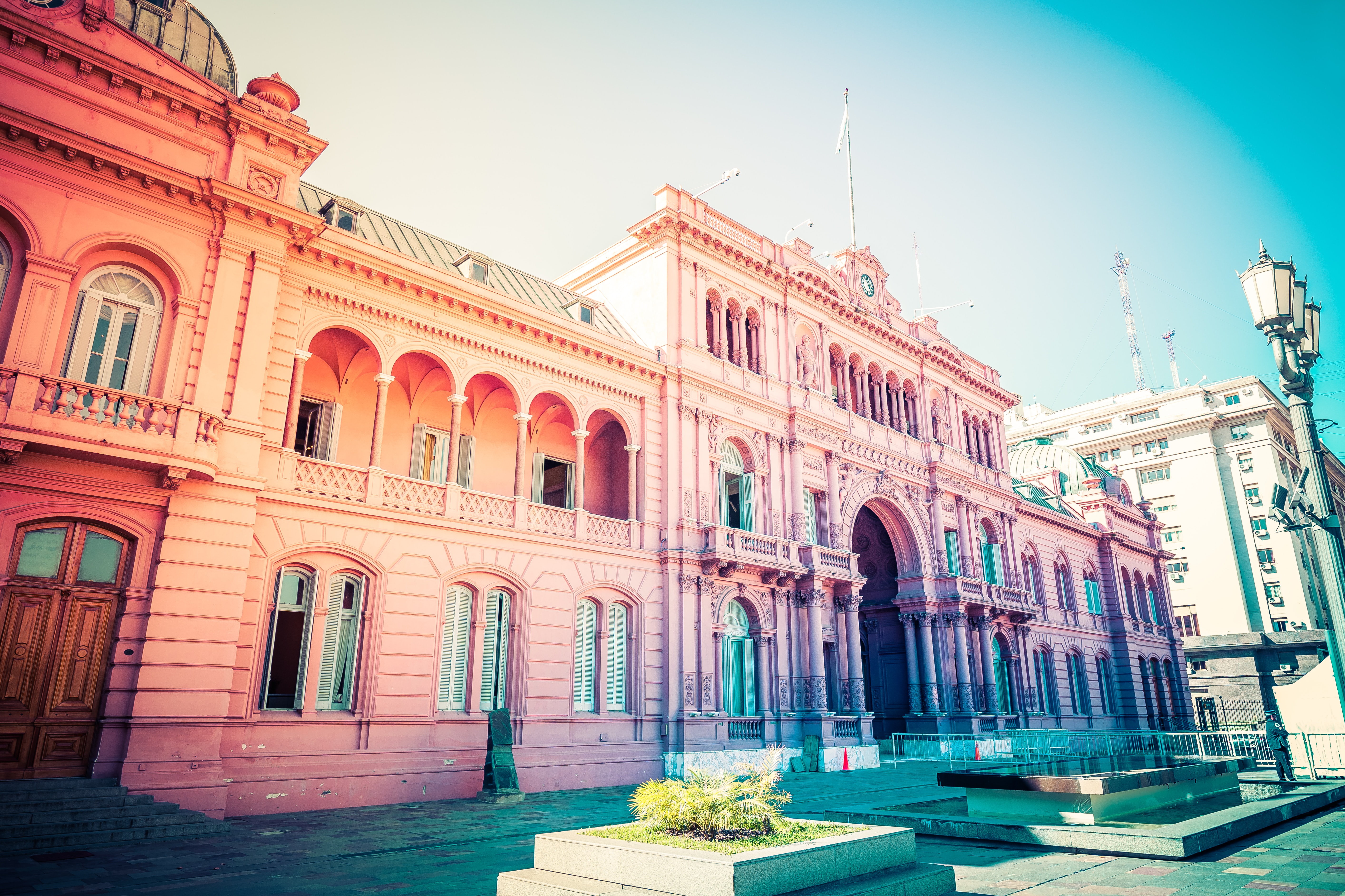
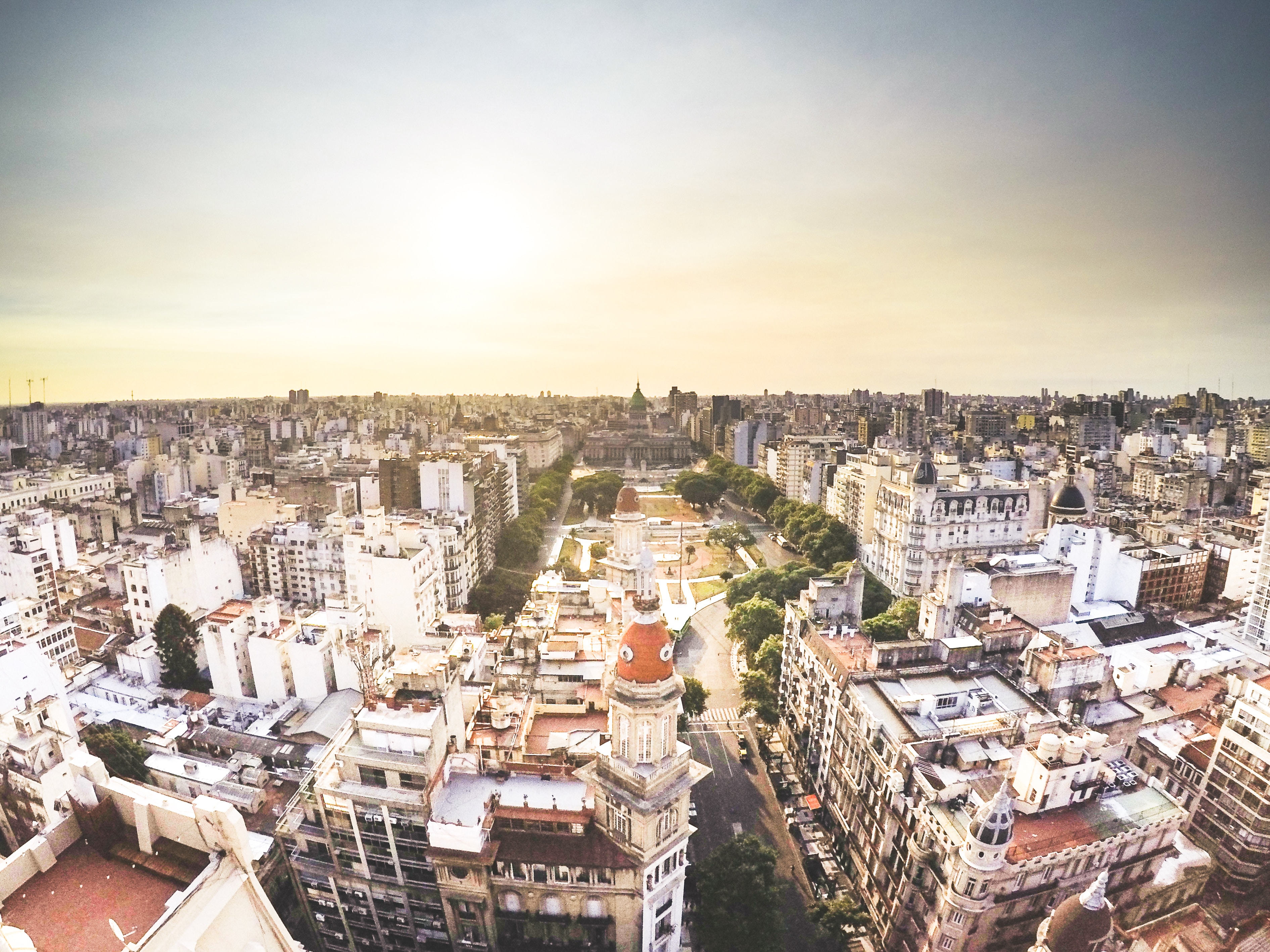
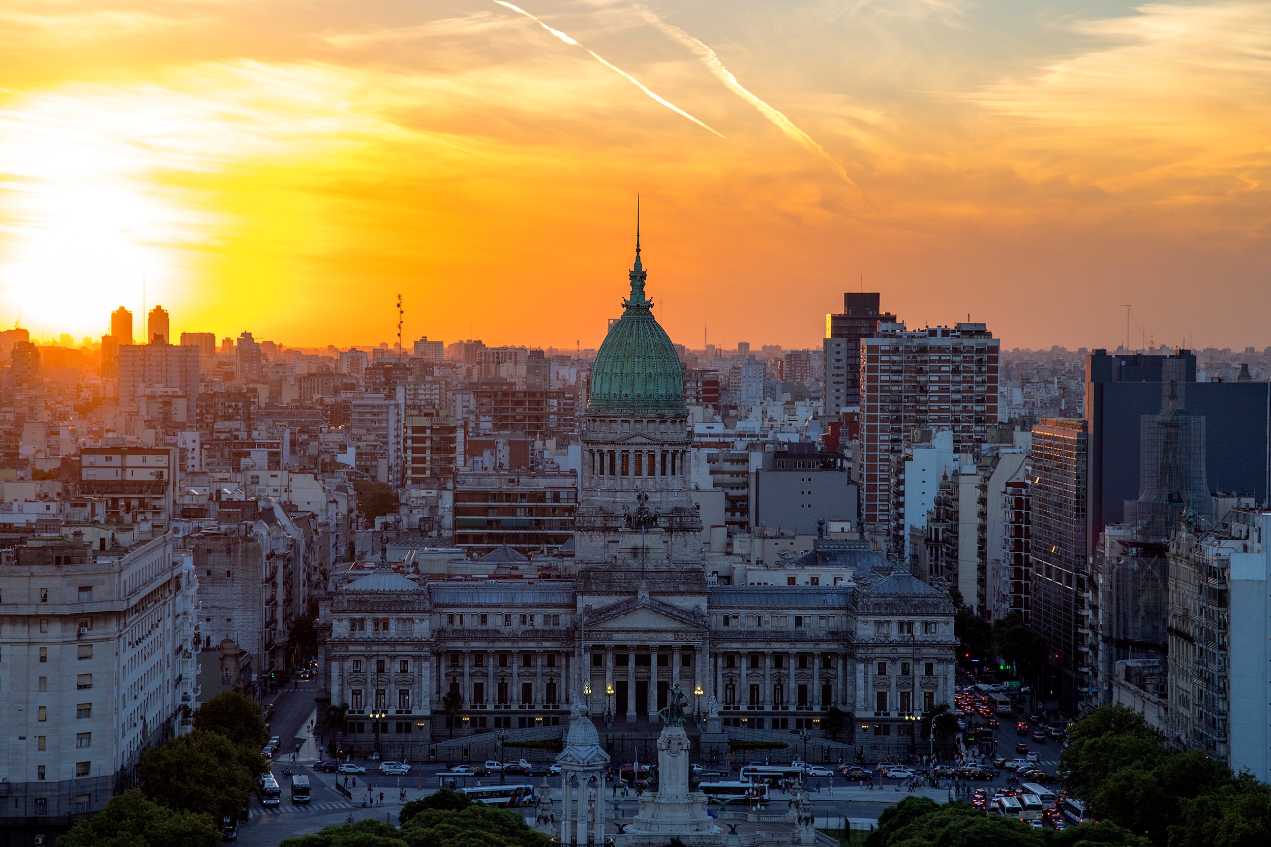
About Buenos Aires
Glamorous and gritty, Buenos Aires is two cities in one. What makes Argentina's capital so fascinating is its dual heritage—part European, part Latin American. Plaza de Mayo resembles a grand square in Madrid, and the ornate Teatro Colón would not be out of place in Vienna. But you’ll know you’re in South America by the leather shoes for sale on cobbled streets and impromptu parades of triumphant soccer fans. Limited-production wines, juicy steaks, and ice cream in countless flavors are among the old-world imports the city has perfected.
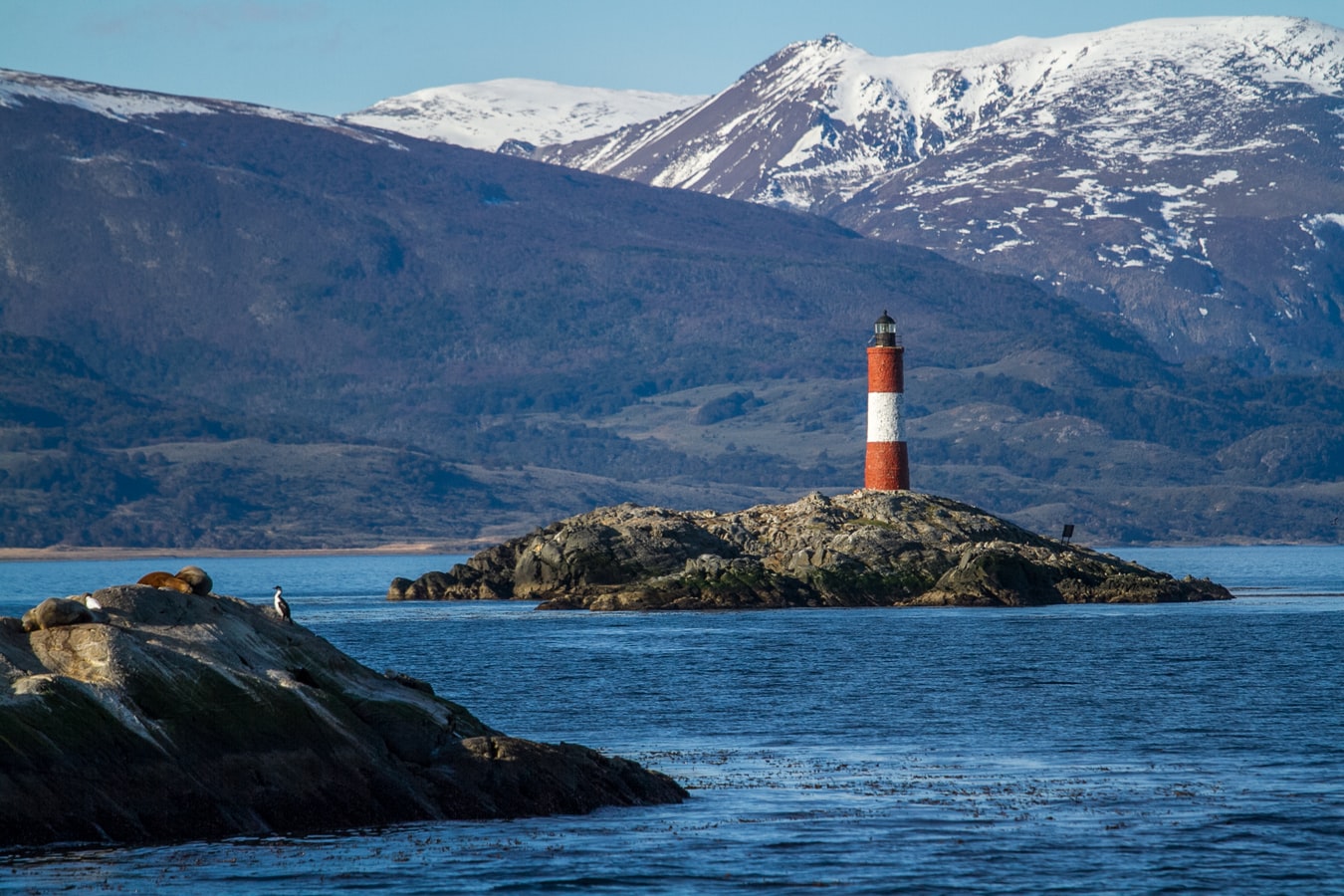
About Ushuaia
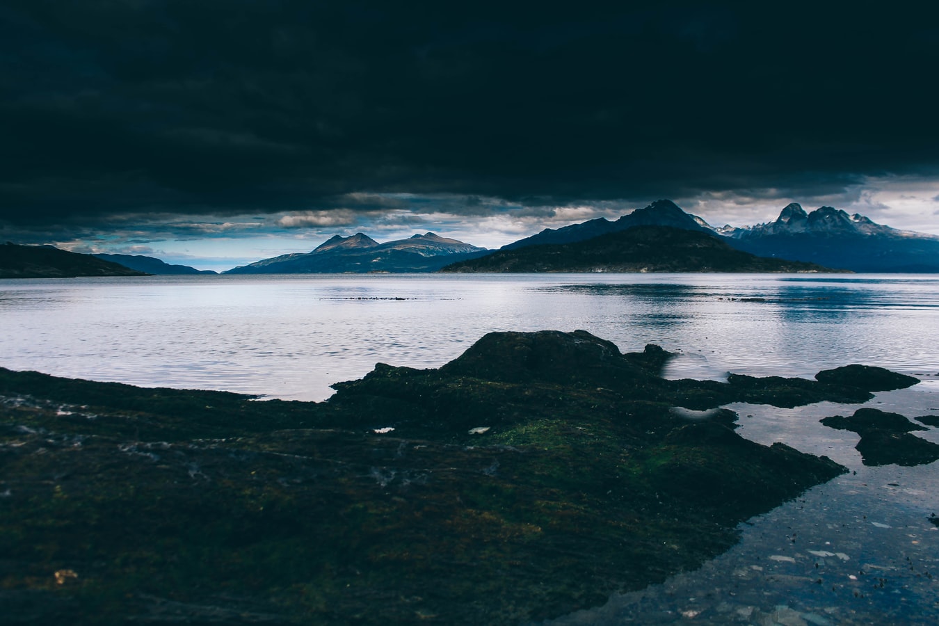
At 55 degrees latitude south, Ushuaia (pronounced oo-swy-ah) is closer to the South Pole than to Argentina's northern border with Bolivia. It is the capital and tourism base for Tierra del Fuego, the island at the southernmost tip of Argentina.Although its stark physical beauty is striking, Tierra del Fuego's historical allure is based more on its mythical past than on rugged reality. The island was inhabited for 6,000 years by Yámana, Haush, Selk'nam, and Alakaluf Indians. But in 1902 Argentina, eager to populate Patagonia to bolster its territorial claims, moved to initiate an Ushuaian penal colony, establishing the permanent settlement of its most southern territories and, by implication, everything in between.When the prison closed in 1947, Ushuaia had a population of about 3,000, made up mainly of former inmates and prison staff. Today the Indians of Darwin's "missing link" theory are long gone—wiped out by diseases brought by settlers and by indifference to their plight—and the 60,000 residents of Ushuaia are hitching their star to tourism.The city rightly (if perhaps too loudly) promotes itself as the southernmost city in the world (Puerto Williams, a few miles south on the Chilean side of the Beagle Channel, is a small town). You can make your way to the tourism office to get your clichéd, but oh-so-necessary, "Southernmost City in the World" passport stamp. Ushuaia feels like a frontier boomtown, at heart still a rugged, weather-beaten fishing village, but exhibiting the frayed edges of a city that quadrupled in size in the '70s and '80s and just keeps growing. Unpaved portions of Ruta 3, the last stretch of the Pan-American Highway, which connects Alaska to Tierra del Fuego, are finally being paved. The summer months (December through March) draw more than 120,000 visitors, and dozens of cruise ships. The city is trying to extend those visits with events like March's Marathon at the End of the World and by increasing the gamut of winter activities buoyed by the excellent snow conditions.A terrific trail winds through the town up to the Martial Glacier, where a ski lift can help cut down a steep kilometer of your journey. The chaotic and contradictory urban landscape includes a handful of luxury hotels amid the concrete of public housing projects. Scores of "sled houses" (wooden shacks) sit precariously on upright piers, ready for speedy displacement to a different site. But there are also many small, picturesque homes with tiny, carefully tended gardens. Many of the newer homes are built in a Swiss-chalet style, reinforcing the idea that this is a town into which tourism has breathed new life. At the same time, the weather-worn pastel colors that dominate the town's landscape remind you that Ushuaia was once just a tiny fishing village, snuggled at the end of the Earth.As you stand on the banks of the Canal Beagle (Beagle Channel) near Ushuaia, the spirit of the farthest corner of the world takes hold. What stands out is the light: at sundown the landscape is cast in a subdued, sensual tone; everything feels closer, softer, and more human in dimension despite the vastness of the setting. The snowcapped mountains reflect the setting sun back onto a stream rolling into the channel, as nearby peaks echo their image—on a windless day—in the still waters.Above the city rise the last mountains of the Andean Cordillera, and just south and west of Ushuaia they finally vanish into the often-stormy sea. Snow whitens the peaks well into summer. Nature is the principal attraction here, with trekking, fishing, horseback riding, wildlife spotting, and sailing among the most rewarding activities, especially in the Parque Nacional Tierra del Fuego (Tierra del Fuego National Park).
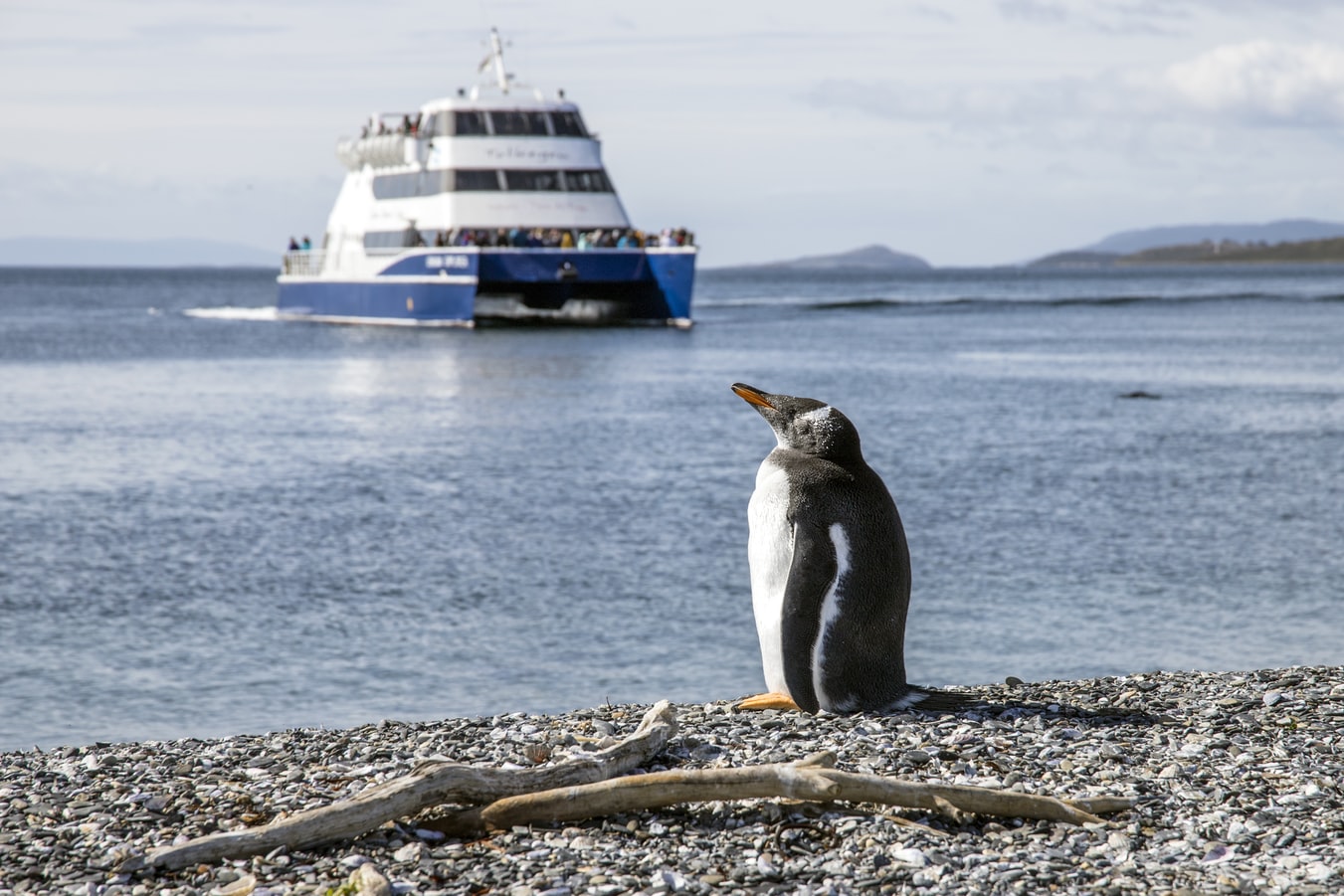
About New Island
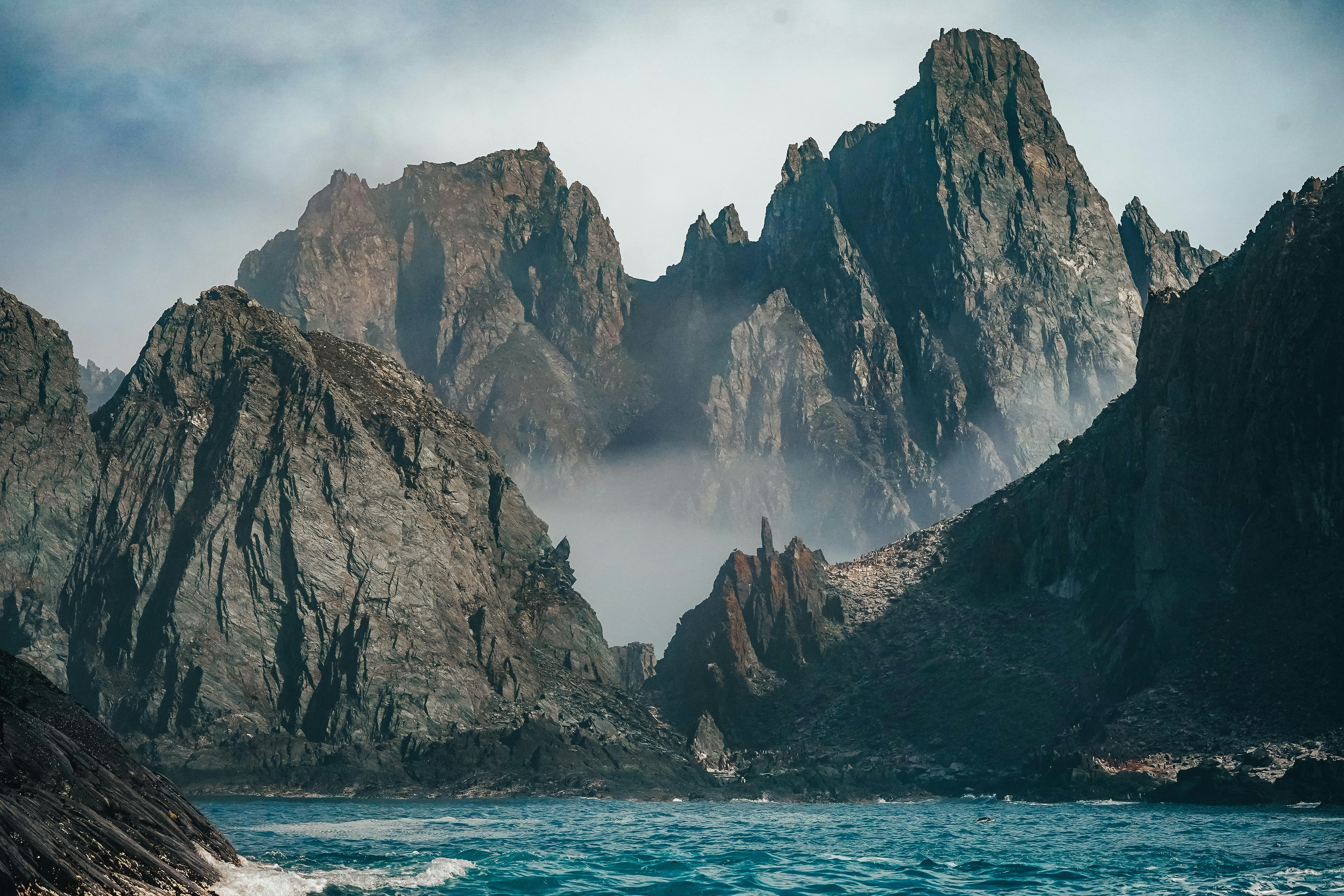
The remarkable beauty of the remote Falkland Islands can best be seen on New Island. The westernmost of the inhabited islands of the archipelago, it is a wildlife and nature reserve, and an environmental conservation group protects its many birds and animals. There are rookeries where Rockhopper Penguins and Blue-eyed Shags share the same nesting area. Black-browed Albatrosses can be seen going about their daily routines and it is easy to spot Upland Geese. More than 40 species of birds breed on the island. Near the landing site is ‘Barnard’s barn’ — a restored stone structure going back to the early 19th century. Lying in the sandy shallows in front of the barn is the wreck of Protector III, an old minesweeper used for seal hunting.

About West Point Island
Located slightly northwest of West Falkland, West Point Island is used for sheep farming and nature observations. Peale’s dolphins and the distinctive black and white markings of the Commerson’s dolphin can usually be seen in the waters around West Point Island. Rolling moorland and steep cliffs make for great photographic opportunities, but the main attraction is the Devil’s Nose, a cliffside colony of Black-browed Albatrosses nesting side-by-side with feisty Rockhopper Penguins. Magellanic Penguins and Magellanic Cormorants can also be found on the island.

About Carcass Island

About Saunders Island
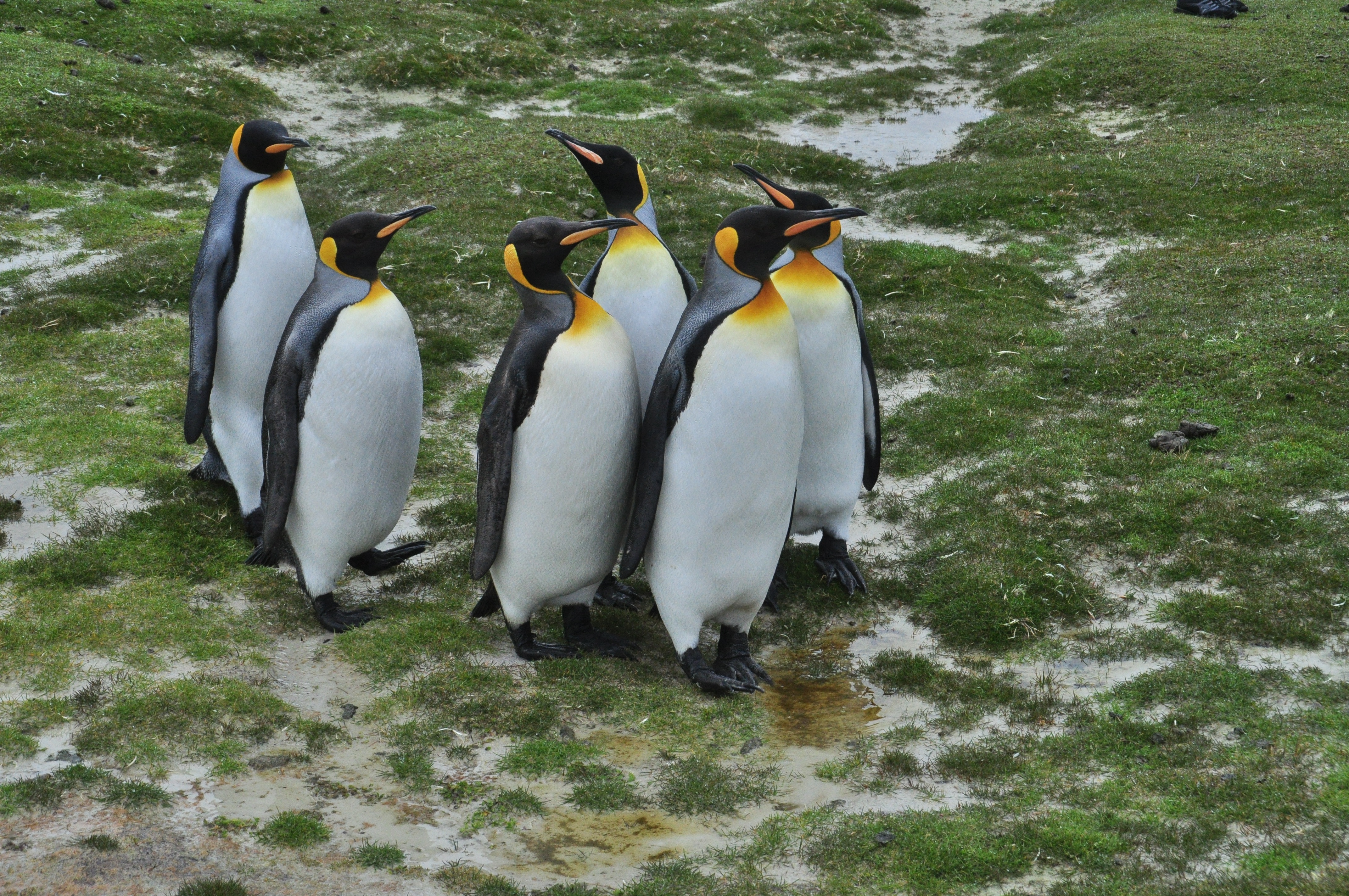
Saunders Island is the fourth-largest of the Falkland Islands in the western portion of the archipelago. The island’s topography is unusual, being made up of three peninsulas linked by narrow necks, and three big upland areas. Today the island is run as a sheep farm, but has historical importance as the location of the first British settlement in the Falklands. Saunders’ wildlife is also impressively varied. It is possible to see Gentoo and King Penguins in the open dune and sand-flat area, while Rockhopper Penguins (with the odd pair of Macaroni Penguins in between them), Imperial Shags and Black-browed Albatrosses frequent Mount Richards, the highest point on the island at 457 m (1500 feet). Other key bird species are the Black–throated Finch, Ruddy-headed Goose and Falkland Steamer Duck.
About Port Stanley
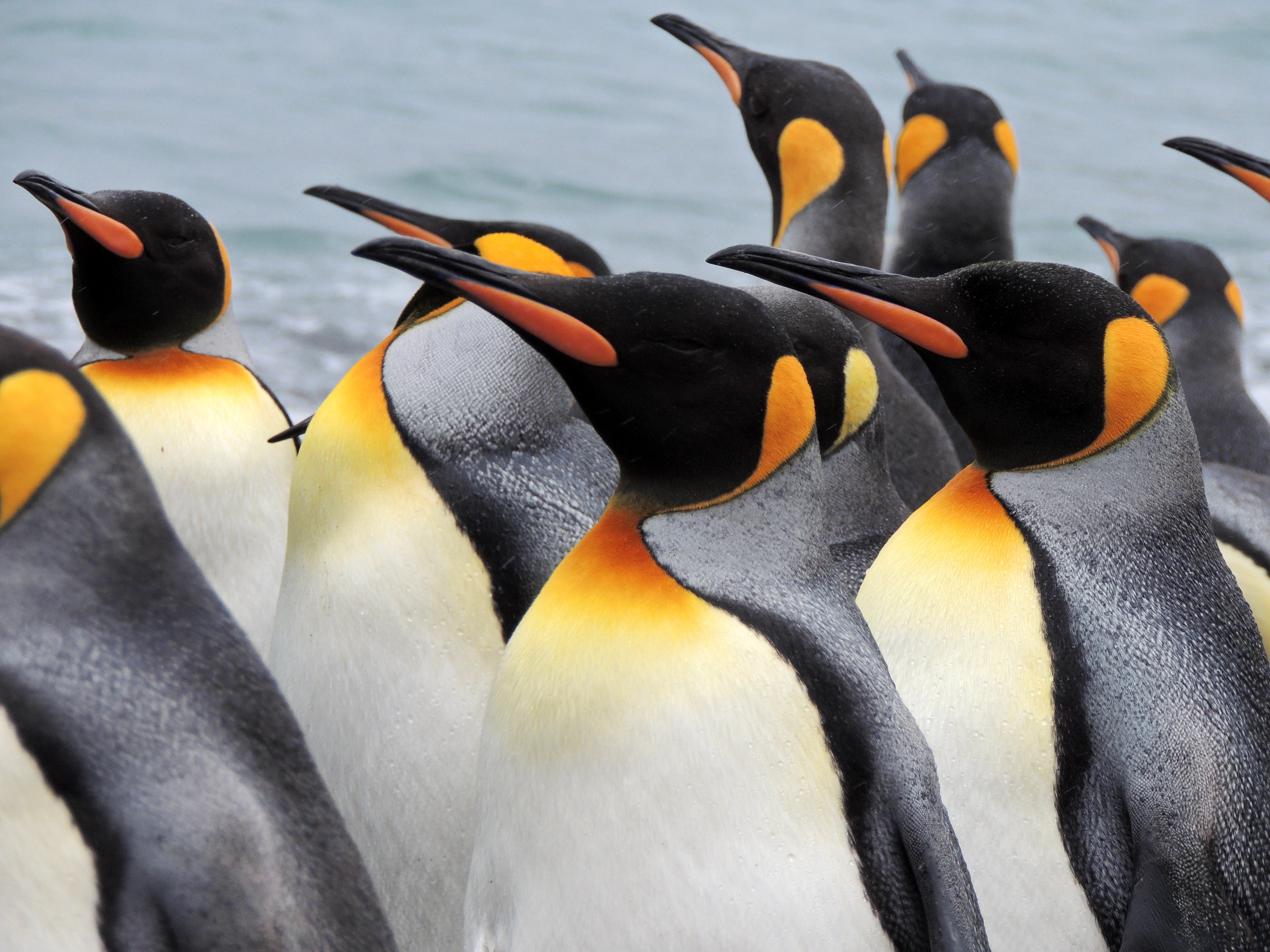
Tiny Stanley, capital of the Falklands, seems in many ways like a British village fallen out of the sky. Many homes are painted in bright colours, adding visual appeal to this distant outpost. Not far offshore, the wreck of the Lady Elizabeth, is one of the many vessels remaining as a silent testimonial to the region's frequent harsh weather conditions.The islands, also known by their Spanish name of Islas Malvinas, are home to arguably more tuxedo-clad inhabitants of the penguin variety than human residents. Various species, such as Gentoo, Magellanic and the more elusive King penguins, either live here permanently or use the Falklands as a stopover on their migration route. Darwin found the islands' flora and fauna fascinating - no doubt you will, too.
About South Georgia Experience
About South Georgia Experience
About South Georgia Experience
About Antarctic Experience


About Antarctic Experience
About Antarctic Experience
About Antarctic Experience
About Antarctic Experience
About Antarctic Experience
About Ushuaia
At 55 degrees latitude south, Ushuaia (pronounced oo-swy-ah) is closer to the South Pole than to Argentina's northern border with Bolivia. It is the capital and tourism base for Tierra del Fuego, the island at the southernmost tip of Argentina.Although its stark physical beauty is striking, Tierra del Fuego's historical allure is based more on its mythical past than on rugged reality. The island was inhabited for 6,000 years by Yámana, Haush, Selk'nam, and Alakaluf Indians. But in 1902 Argentina, eager to populate Patagonia to bolster its territorial claims, moved to initiate an Ushuaian penal colony, establishing the permanent settlement of its most southern territories and, by implication, everything in between.When the prison closed in 1947, Ushuaia had a population of about 3,000, made up mainly of former inmates and prison staff. Today the Indians of Darwin's "missing link" theory are long gone—wiped out by diseases brought by settlers and by indifference to their plight—and the 60,000 residents of Ushuaia are hitching their star to tourism.The city rightly (if perhaps too loudly) promotes itself as the southernmost city in the world (Puerto Williams, a few miles south on the Chilean side of the Beagle Channel, is a small town). You can make your way to the tourism office to get your clichéd, but oh-so-necessary, "Southernmost City in the World" passport stamp. Ushuaia feels like a frontier boomtown, at heart still a rugged, weather-beaten fishing village, but exhibiting the frayed edges of a city that quadrupled in size in the '70s and '80s and just keeps growing. Unpaved portions of Ruta 3, the last stretch of the Pan-American Highway, which connects Alaska to Tierra del Fuego, are finally being paved. The summer months (December through March) draw more than 120,000 visitors, and dozens of cruise ships. The city is trying to extend those visits with events like March's Marathon at the End of the World and by increasing the gamut of winter activities buoyed by the excellent snow conditions.A terrific trail winds through the town up to the Martial Glacier, where a ski lift can help cut down a steep kilometer of your journey. The chaotic and contradictory urban landscape includes a handful of luxury hotels amid the concrete of public housing projects. Scores of "sled houses" (wooden shacks) sit precariously on upright piers, ready for speedy displacement to a different site. But there are also many small, picturesque homes with tiny, carefully tended gardens. Many of the newer homes are built in a Swiss-chalet style, reinforcing the idea that this is a town into which tourism has breathed new life. At the same time, the weather-worn pastel colors that dominate the town's landscape remind you that Ushuaia was once just a tiny fishing village, snuggled at the end of the Earth.As you stand on the banks of the Canal Beagle (Beagle Channel) near Ushuaia, the spirit of the farthest corner of the world takes hold. What stands out is the light: at sundown the landscape is cast in a subdued, sensual tone; everything feels closer, softer, and more human in dimension despite the vastness of the setting. The snowcapped mountains reflect the setting sun back onto a stream rolling into the channel, as nearby peaks echo their image—on a windless day—in the still waters.Above the city rise the last mountains of the Andean Cordillera, and just south and west of Ushuaia they finally vanish into the often-stormy sea. Snow whitens the peaks well into summer. Nature is the principal attraction here, with trekking, fishing, horseback riding, wildlife spotting, and sailing among the most rewarding activities, especially in the Parque Nacional Tierra del Fuego (Tierra del Fuego National Park).
About Buenos Aires
Glamorous and gritty, Buenos Aires is two cities in one. What makes Argentina's capital so fascinating is its dual heritage—part European, part Latin American. Plaza de Mayo resembles a grand square in Madrid, and the ornate Teatro Colón would not be out of place in Vienna. But you’ll know you’re in South America by the leather shoes for sale on cobbled streets and impromptu parades of triumphant soccer fans. Limited-production wines, juicy steaks, and ice cream in countless flavors are among the old-world imports the city has perfected.
- Large windows
- Dining for four
- Bathroom with whirlpool bathtub
- Guest bath
- Convertible sofa bed for one
- Large windows
- Dining for four
- Bathroom with whirlpool bathtub
- Guest bath
- Convertible sofa bed for one
- Pantry with wet bar
- Glass-enclosed solarium with tub and day bed
- Two closets
- Two flat-screen TVs
- Complimentary Internet/Wi-Fi service.
- Expansive ocean views
- Forward-facing windows
- Dining for four to six
- Bathroom with whirlpool bathtub
- Guest bath
- Pantry with wet bar
- Two flat-screen TVs
- Complimentary Internet/Wi-Fi service.
- Expansive ocean views
- Forward-facing windows
- Dining for four to six
- Bathroom with whirlpool bathtub
- Guest bath
- Pantry with wet bar
- Two flat-screen TVs
- Complimentary Internet/Wi-Fi service.
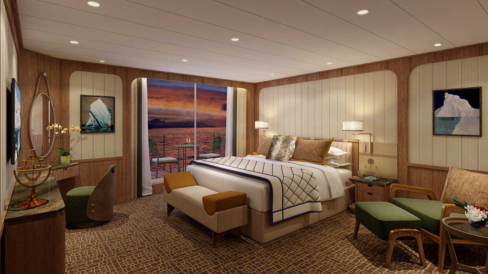
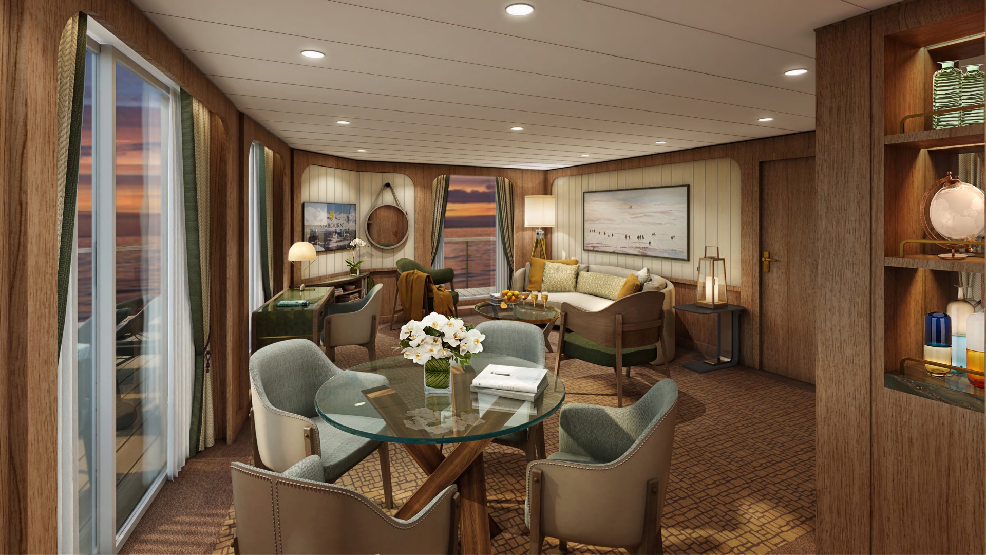
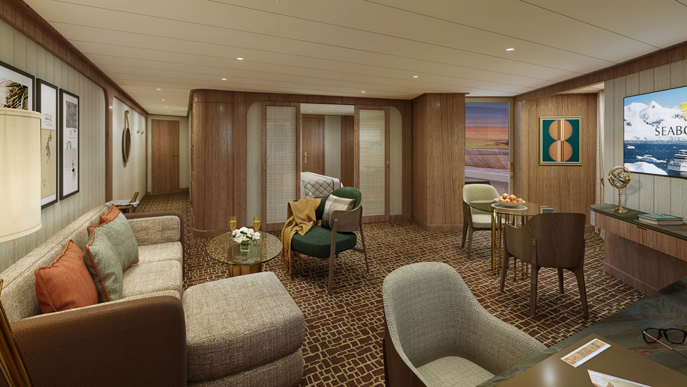
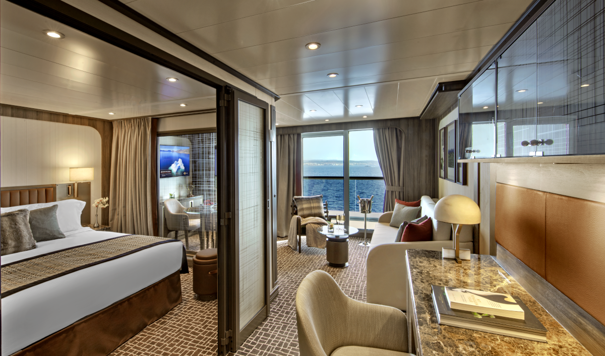
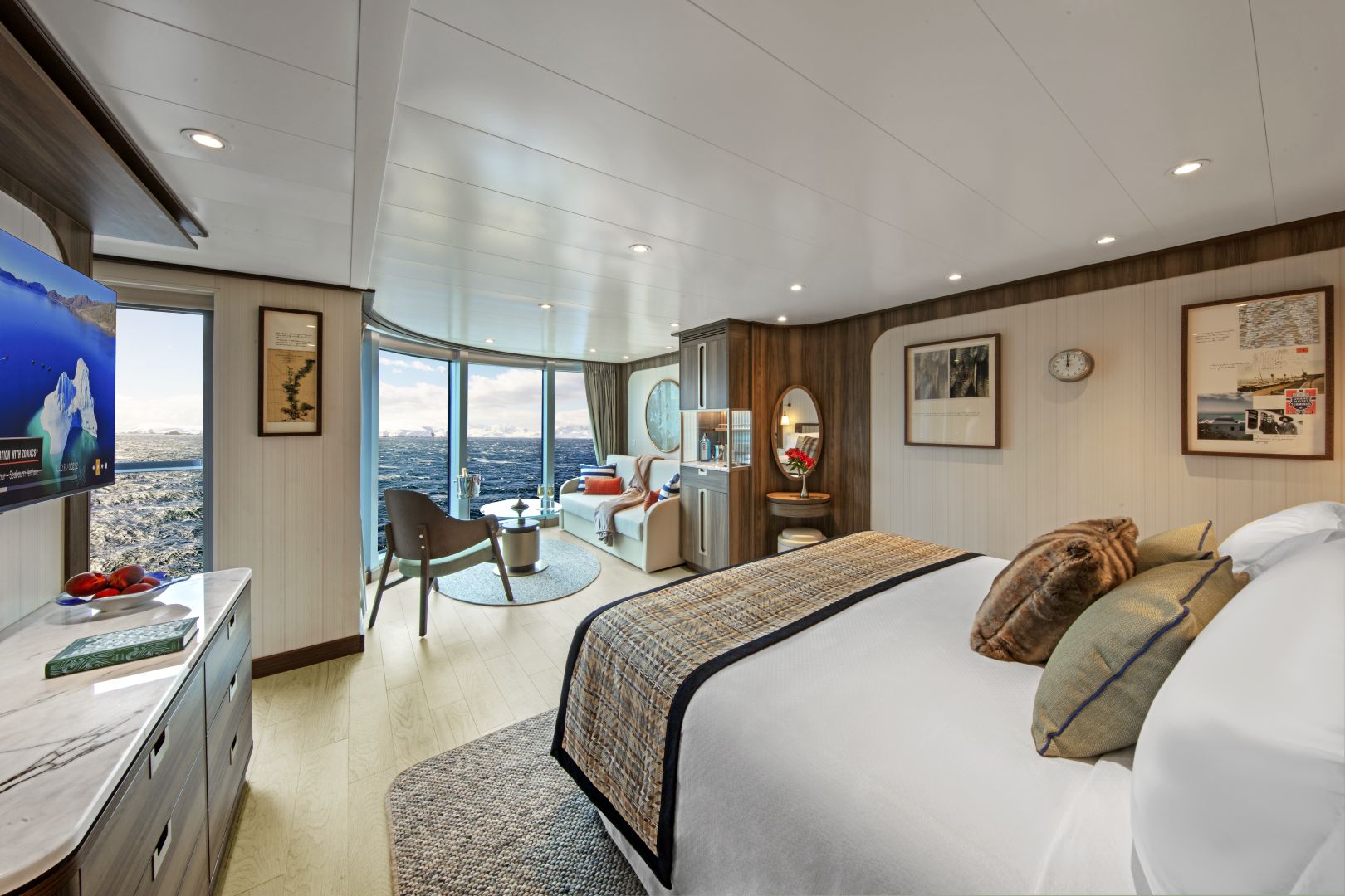
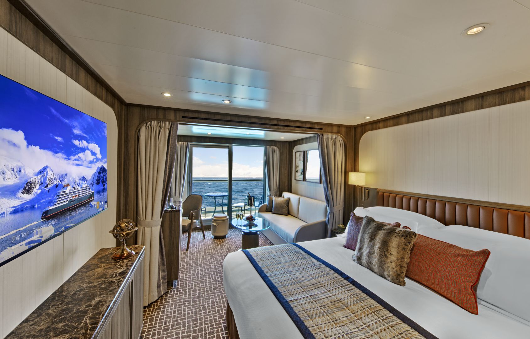
Owner's Suites on feature a comfortable living area; private veranda; queen-size bed or two twin beds; extra-large walk-in closet for expedition gear; personal safe; interactive flat-screen TV with music and movies; fully stocked bar and refrigerator; writing desk with personalized stationery; makeup vanity; spacious bathroom with double vanities, tub and shower, plush robes, slippers, hairdryer and 110/220V AC outlets.
All Penthouse Spa Suites onboard Seabourn Venture feature a comfortable living area; private veranda; queen-size bed or two twin beds; walk-in closet; personal safe; interactive TV with music and movies; fully stocked bar and refrigerator; writing desk with personalised stationery; makeup vanity; spacious bathroom, separate tub and shower, plush robes, slippers, luxury health and beauty products, hairdryer and 110/220V AC outlets.
Deck 7 Suite 739; Approximate total space: 527 sq. ft. (49 sq. m.) including veranda of 97 sq. ft. (9 sq. m.)
- Dining table for two to four
- Separate bedroom
- Glass door to veranda
- Two flat-screen TVs
- Fully stocked bar
- Spacious bathroom with tub, shower and large vanity
Suites 513-516, 611-614, 711-714, 802-805; Total space: 417 sq. ft. (39 sq. m.) incl. veranda of 85 sq. ft. (8 sq. m.) All Panorama Veranda Suites feature a comfortable living area; private veranda; queen-size bed or two twin beds; walk-in closet; personal safe; interactive TV with music and movies; fully stocked bar and refrigerator; writing desk with personalized stationery; makeup vanity; spacious bathroom, separate tub and shower, plush robes, slippers, luxury health and beauty products, hairdryer and 110/220V AC outlets. *Some veranda sizes vary.
- Dining table for two to four
- Separate bedroom
- Glass door to veranda
- Two flat-screen TVs
- Fully stocked bar
- Spacious bathroom with tub, shower and large vanity
Approximate total space: 527 sq. ft. (49 sq. m.) including veranda of 97 sq. ft. (9 sq. m.) All Penthouse Suites feature a comfortable living area; private veranda; queen-size bed or two twin beds; walk-in closet; personal safe; interactive TV with music and movies; fully stocked bar and refrigerator; writing desk with personalized stationery; makeup vanity; spacious bathroom, separate tub and shower, plush robes, slippers, luxury health and beauty products, hairdryer and 110/220V AC outlets.
- Dining table for two to four
- Separate bedroom
- Glass door to veranda
- Two flat-screen TVs
- Fully stocked bar
- Spacious bathroom with tub, shower and large vanity
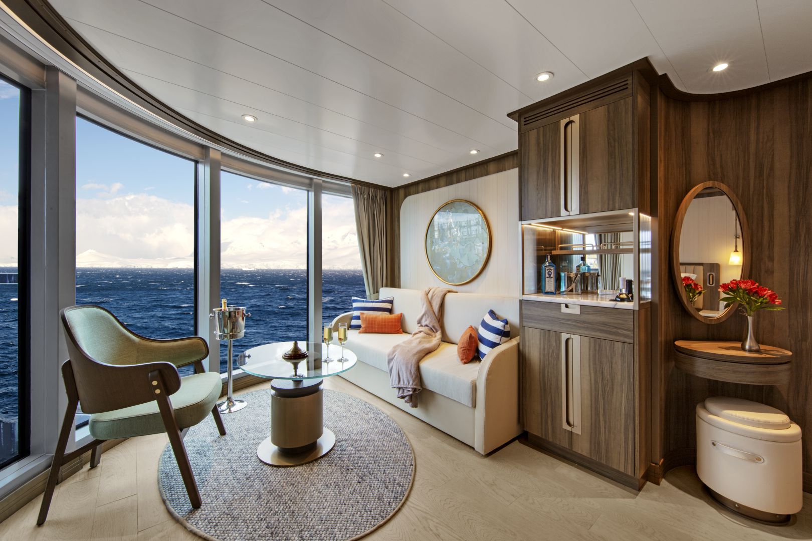
- A large picture window
- Comfortable living area
- Queen-size bed or two twin beds
- Walk-in closet
- Interactive flat-screen television with music and movies
- Fully stocked bar and refrigerator
Approximate total space: 355 sq. ft. (33 sq. m.) including veranda of 75 sq. ft. (7 sq. m.)* Suites on Seabourn Venture feature a comfortable living area; private veranda; queen-size bed or two twin beds; extra-large walk-in closet for expedition gear; personal safe; interactive flat-screen TV with music and movies; fully stocked bar and refrigerator; writing desk with personalized stationery; makeup vanity; spacious bathroom with double vanities, tub and shower, plush robes, slippers, hairdryer and 110/220V AC outlets.
All Veranda Spa Suites onboard Seabourn Venture feature a comfortable living area; private veranda; queen-size bed or two twin beds; walk-in closet; personal safe; interactive TV with music and movies; fully stocked bar and refrigerator; writing desk with personalised stationery; makeup vanity; spacious bathroom, separate tub and shower, plush robes, slippers, luxury health and beauty products, hairdryer and 110/220V AC outlets.Deck 7 Suites 741, 743; Approximate total space: 355 sq. ft. (33 sq. m.) including veranda of 75 sq. ft. (7 sq. m.)
Approximate total space: 355 sq. ft. (33 sq. m.) including veranda of 75 sq. ft. (7 sq. m.)* Suites on Seabourn Venture feature a comfortable living area; private veranda; queen-size bed or two twin beds; extra-large walk-in closet for expedition gear; personal safe; interactive flat-screen TV with music and movies; fully stocked bar and refrigerator; writing desk with personalized stationery; makeup vanity; spacious bathroom with double vanities, tub and shower, plush robes, slippers, hairdryer and 110/220V AC outlets.
More information coming soon..

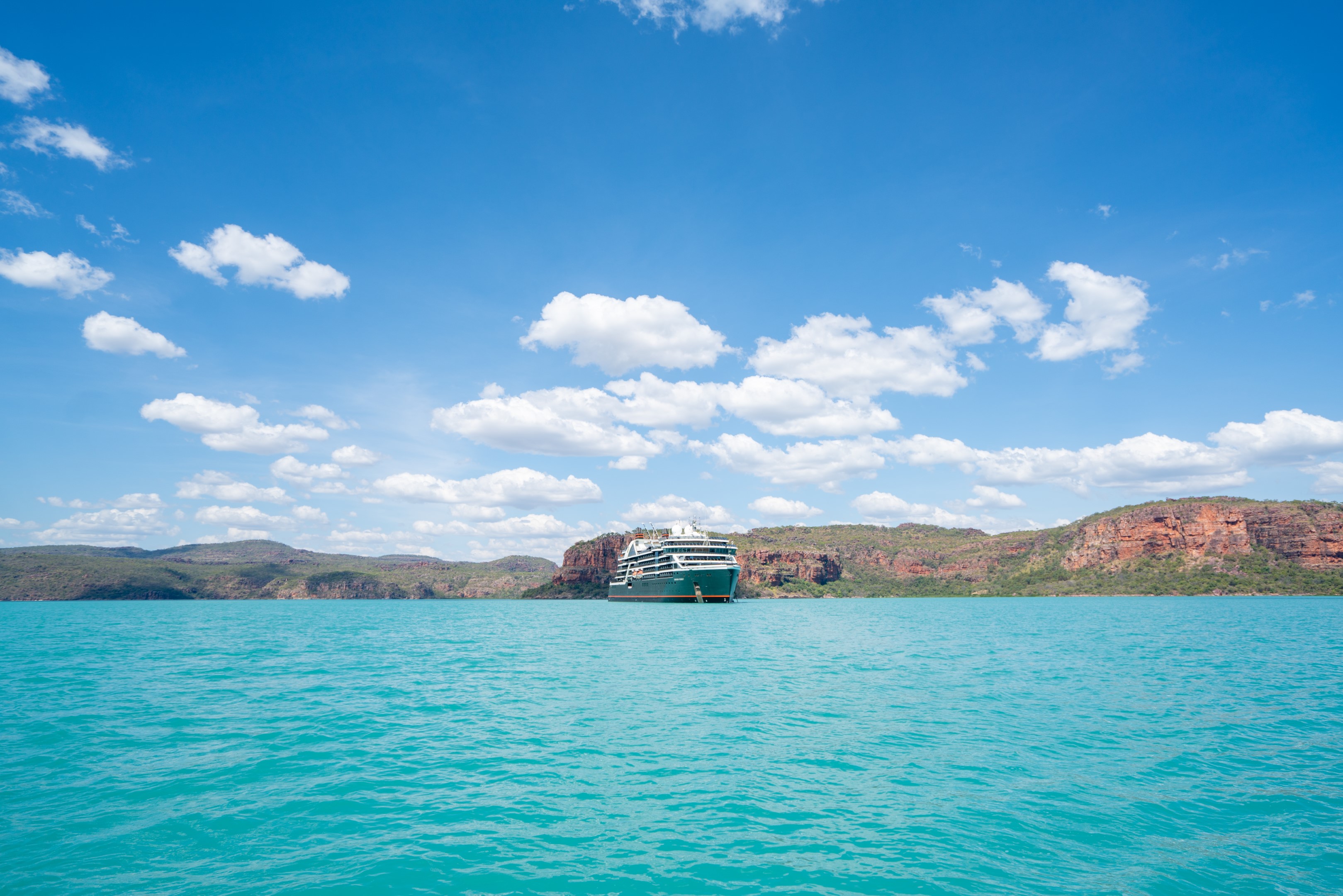
Seabourn Pursuit
To reach some of the most coveted, remote destinations in the world, Seabourn Pursuit is constructed with the hardware and technology necessary to operate capably while delivering a guest experience filled with luxury comforts that leave travelers wanting for nothing.
Explore New Worlds
Visit some of the world's most remote locations, inaccessible to most larger cruise ships but ideal for Seabourn's ultra-luxury yacht-like smaller ships. Journey to Antarctica, the South Pacific or the Kimberley region for the ultimate in bucket-list travel.
Ship Facts
| Launch Year | 2023 | ||||||||
| Refit Year | |||||||||
| Language | en | ||||||||
| Gross Tonnage | 23615 | ||||||||
| Length | 170 | ||||||||
| Width | 24 | ||||||||
| Currency | USD | ||||||||
| Speed | 22 | ||||||||
| Capacity | 317 | ||||||||
| Crew Count | 120 | ||||||||
| Deck Count | 8 | ||||||||
| Cabin Count | 132 | ||||||||
| Large Cabin Count | N/A | ||||||||
| Wheelchair Cabin Count | 3 | ||||||||
| Electrical Plugs |
|
To see the legend for these deck plans, please hover your mouse over the images below
To toggle the legend for these deck plans, please tap on any of the images below
Deck 10
- Sun Deck

Deck 9
- Constellation Lounge
- The Club

Deck 8
- Bridge
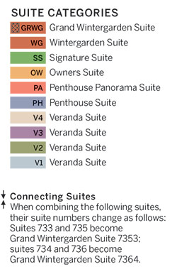
- Signature Suites
- Penthouse Suites
- Panorama Veranda Suites
- Veranda Suites (x1 Accessible suite available)

Deck 7
- Fitness Centre
- Treatment Rooms
- Spa & Wellness
- Penthouse Spa Suites
- Veranda Spa Suites
- Wintergarden Suites
- Panorama Veranda Suites
- Veranda Suites (x2 Accessible suites available)
- Owner's Suites

Deck 6
- Seabourn Square
- Bow Lounge
- Veranda Suite
- Panorama Veranda Suite

Deck 5
- The Colonnade
- Meeting Room
- Infinity Pool
- The Patio
- Veranda Suite
- Panorama Veranda Suite

Deck 4
- The Restaurant
- Expedition Lounge
- Shop
- Discovery Centre
- The Studio

Deck 3
- Zodiac Embark
- Landing Zone
- Medical Facility

At Seabourn, we pride ourselves in delivering the finest culinary experiences that rival the best restaurants in the world. Our Michelin-level Chefs bring their skills, passion, and their personal travel inspiration to life for our guests on all of our ships. Explore all eight dining venues on Seabourn Pursuit and get a virtual taste of our culinary world.
Colonnade
Our more casual, indoor/outdoor alternative, features an open kitchen, lavish buffets or table service for breakfasts and lunch, and serves regionally themed, bistro-style dinners with table service nightly.
The Restaurant
Before Seabourn, open-seating dining on a cruise ship was unheard of. Come when you like, with whom you please, and be seated as you wish. The room is beautiful, the cuisine is exquisite, and the service is simultaneously flawless, friendly and fun.
Earth & Ocean
Each evening, our skilled Earth & Ocean chefs create an imaginative array of fresh, inventive dishes—a sophisticated menu celebrating eclectic traditional flavors from around the world, served in a relaxed setting under the stars for a distinctive dining experience unlike any other on board.
In-Suite Dining
Seabourn is pleased to offer a varied menu available around the clock for service in your suite. You may also order dinner from The Restaurant menu and have your meal served, course by course, in your suite or on your veranda.
The Patio
Relaxed poolside dining offering luncheon buffets, salads, soups, grilled specialties and freshly baked pizza. Dinners feature a full menu in an alfresco setting. For The Patio, Chef Keller has developed exclusively for us, a signature Napa burger, as well as an artisanal hot dog dubbed the Yountwurst, named for the hometown of The French Laundry, Ad Hoc, and the original Bouchon and Bouchon Bakery.
Every day on board offers delicious dining options, world-class entertainment and enriching activities.
Seabourn Square
A place to enjoy some light reading or to socialize with your fellow passengers, Seabourn Square is what you're looking for. Seabourn Square is the true ‘living room’ of the ships. An inviting sociable space where guests will find a charming European style coffee bar, Seabourn Square has been designed as an open, comfortable environment for guests to interact with onboard officers and the expedition team and engage in conversation with family and new friends. The space is also home to the highly-trained Guest Services staff, who provide a range of concierge services such as general ship information, assistance with special service requests, port and travel information, and more.
A selection of coffees are prepared by the skilled onboard baristas some using beans roasted in Seabourn Square. For those feeling a bit hungry, Seabourn Square offers freshly made pastries and other on-the-go breakfast items in the morning, as well as an assortment of light sandwiches and desserts later in the day, along with a selection of artisanal gelati made on board. Guests will also find a wide range of books in the adjoining library, with a host of titles on subjects such as adventure, expeditions and other topics of interest to enjoy while onboard. Staying current with the news is made easy with tablets featuring the Press Reader news application available to browse each day.
Expedition Lounge
The Expedition Lounge, located on Deck 4, is the heart of the ship. A gathering place for the curious, guests are invited to relax or linger with a complimentary cocktail or glass of fine wine from the bar as they share photos and stories from the day with their fellow travelers and the onboard staff. The Expedition Lounge will be central to the Seabourn expedition operation where guests convene before and after expeditions each day.
Custom furniture designed in a variety of warm, natural materials creates an inviting, tactile atmosphere. An ode to the adventurous, the Expedition Lounge features an etched glass partition displaying a vintage map of Antarctica and vitrines showcasing intricate tools and devices of the trade. Two large touchscreens will also display a wealth of information including photos, navigational charts, weather charts, and maps.
Bow Lounge
Located on Deck 6, at the forward-most part of the vessel, the Bow Lounge provides the closest access to water level via the foredeck, making it the perfect spot for guests to spend some time watching for marine life. Within a few steps, guests can be outside, with a vantage point that is ideal to watch the ship’s course, spot wildlife, or take in the beautiful natural scenery.
The Bow Lounge introduces some technological enhancements, providing guests with a first for Seabourn with touch screens showing the ship’s plotted location, as well as navigational charts and scientific information used to help guide the ship on its journey. Large screens project live footage from mounted cameras outside the ship, and from a drone when conditions permit, while the touch screen monitors invite guests to explore on their own with a live map, weather information, and notes detailing upcoming expeditions. Expedition Team members will be available within the Lounge throughout the day to interact with guests, answer questions, provide interpretation and aid in spotting wildlife.
The space provides direct access to the Bow Sprit on Deck 6 forward (when conditions permit) to give guests the sensation of standing in front of the ship and views of waves parting and ice sloughing off the bow at the waterline.
Atrium
Designed by hospitality design icon Adam D. Tihany, the ship’s public spaces exude casual elegance at every turn, from the soaring sky-lit Atrium, to the inviting Expedition Lounge and into each guest suite. Rich textures and first-rate materials take shape in modern-yet-timeless settings that are made for socializing, relaxing, learning and exploring.
Evenings Under The Stars
One of the most FUN evenings during any cruise, Evenings Under the Stars is a night where guests can let their hair down and simply be in the moment. Enjoy Let’s Dance! with great live music, interact with fellow travelers and be spoiled in true Seabourn style by our food and beverage team with Desserts Under the Stars. A signature event, this dance party has been a part of the line’s rich culture, and a Seabourn cruise is not complete without Let’s Dance! and Desserts Under The Stars.
Weather permitting, this high-energy dance party is hosted poolside and under the stars by the entire entertainment team, featuring performances by The Band, vocalists and dancers. There is even the possibility your Cruise Director and Assistant Cruise Director might jump on stage to perform, as well! Guests can expect music that appeals to everyone’s taste with a great mix of hit songs. It’s a real treat and guests LOVE Evenings Under the Stars!
Sky Bar
Overlooking the beautiful Pool Patio, the open-air Sky Bar presents you with a gorgeous setting to take a break from the afternoon sun while enjoying a refreshing tropical beverage, or spend the evening enjoying a few social cocktails under the stars.
Constellation Lounge
The Constellation Lounge is the highest indoor viewing point on each ship. Floor-to-ceiling glass walls wrap around the space, offering guests stunning 270-degree, outward-facing views as far as their eyes can see, heightening their expeditionary spirit while bringing them closer to wildlife and wonders at sea and in port.
In addition, the expedition team will be in the lounge regularly to help identify points of interest, wildlife and geological wonders. Imagine glimpsing killer whales, waddling penguins, and sea lions in Antarctica; sleepy-eyed sloths, sprightly monkeys, and colorful parrots in the rainforests of South and Central America; and icebergs bobbing in the seas and waterfalls rushing over cliffs in the far reaches of the Arctic and Northern Europe – all from the comfort of the Constellation Lounge.
The Constellation Lounge offers Seabourn’s popular Early Morning Riser continental breakfast, while afternoons features the line’s popular and recently enhanced Afternoon Tea service. Steeped in the tradition of proper English tea service, yet as fresh and memorable as a newly brewed pot, the elegant daily tea service incorporates the finest luxury tea brand TWG Tea. As the sun dips and the night sky lights up, live piano entertainment delights guests as cocktails and tapas are served both before and after dinner.
Shops
Whether you're buying souvenirs for your friends at home or want a memento of your vacation, our Shops will have what you need. Shop for fashion and cosmetics at The Boutique, jewelry and fine watches at The Collection, or logo cruisewear at the Shop.
The Club
The liveliest lounge on board is the scene of daily afternoon tea service. It is a popular spot for pre-dinner drinks and dancing to live music. After dinner, the dancing music continues, and later a DJ spins dance music until late at night. Another terrace of open deck aft of The Club boasts a plunge pool and two small whirlpool spas.
Card Room
Many veteran cruisers specifically choose cruises that provide at least a few days at sea. The Card Room is a great choice for the sea-loving cruiser who craves that languorous feeling of lazy leisure. There will be loads of on board activities during those days, including a great game of bridge.
Meeting Rooms
For meetings and gatherings, our ships offer meeting rooms that can accommodate up to 40 guests. The meeting rooms can be arranged to guests’ specifications including theater-style or with tables; and each of the rooms have large-screen TVs for presentations. Guests may also reserve the Card Room when available. Our crew members are happy to assist guests with meeting room reservations and setup.