
64-Day Kimberley Expedition & Islands Of The Pacific
64-Day Kimberley Expedition & Islands Of The Pacific
Cruise overview
WHY BOOK WITH US?
- ✔ The Deluxe Cruises’ team has extensive experience in ultra-luxury cruising.
- ✔ Call now to speak to our helpful and experienced Cruise Concierge team.
- ✔ Enjoy our Unique Deluxe Cruises Bonus for substantial savings.
- ✔ Our team will tailor your holiday to your exacting requirements.
- ✔ As agents, we work under the protection of each cruise lines ABTA / ATOL licences
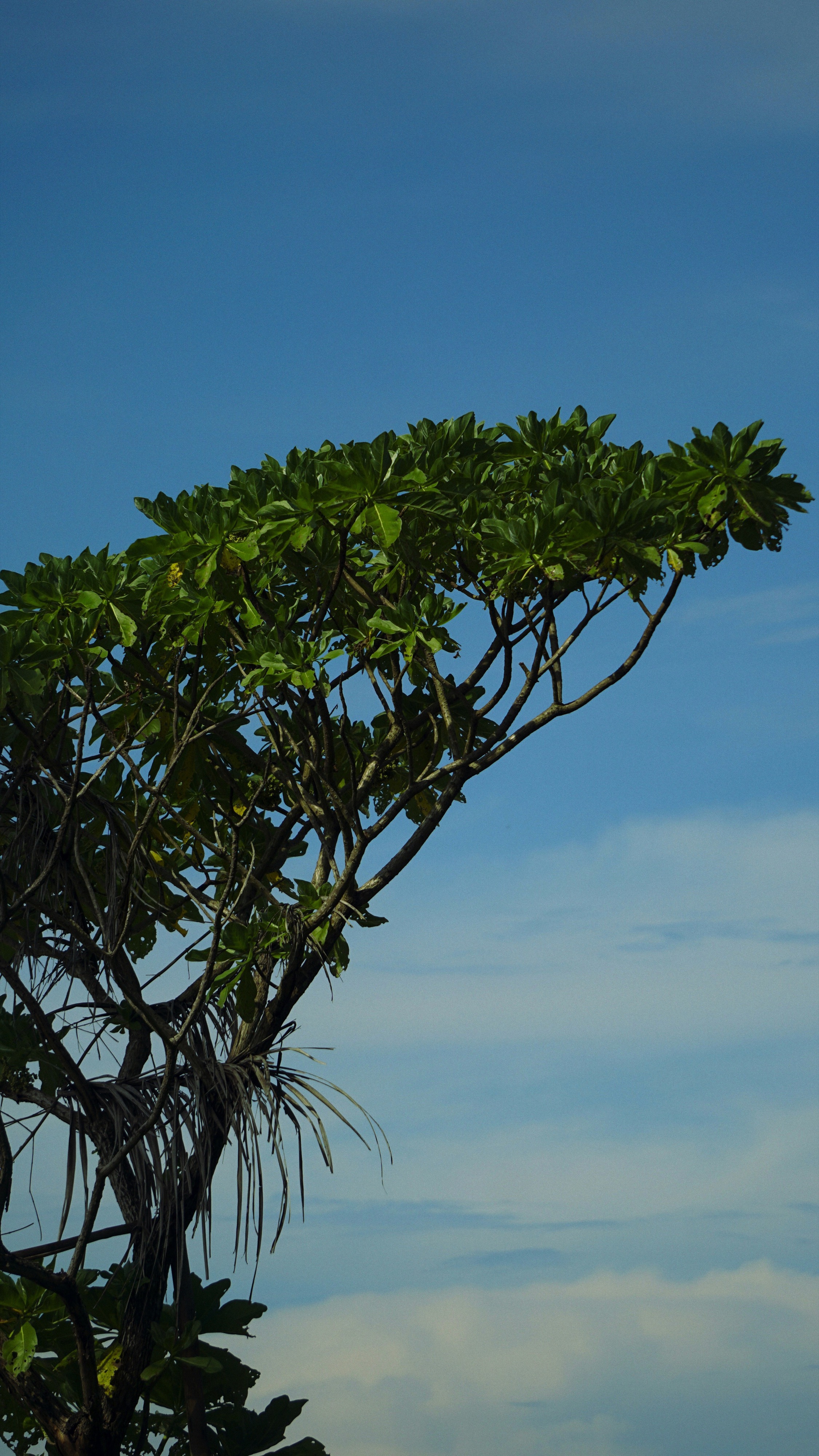
About Broome, Western Australia
Broome, a coastal town in Western Australia, is famous for its stunning beaches, rich history, and vibrant culture. Located on the Indian Ocean, it boasts Cable Beach, known for its white sand, turquoise waters, and iconic camel rides at sunset. Once a pearling hub, Broome retains its multicultural heritage, reflected in its cuisine and architecture. The town is also the gateway to the Kimberley region, offering breathtaking landscapes and unique natural attractions like the Staircase to the Moon. With warm weather year-round and a laid-back atmosphere, Broome is a perfect destination for adventure, relaxation, and cultural experiences.
About Yampi, Western Australia
About Talbot Bay, Western Australia
About Talbot Bay, Western Australia
About Montgomery Reef, Western Australia
About Freshwater Cove
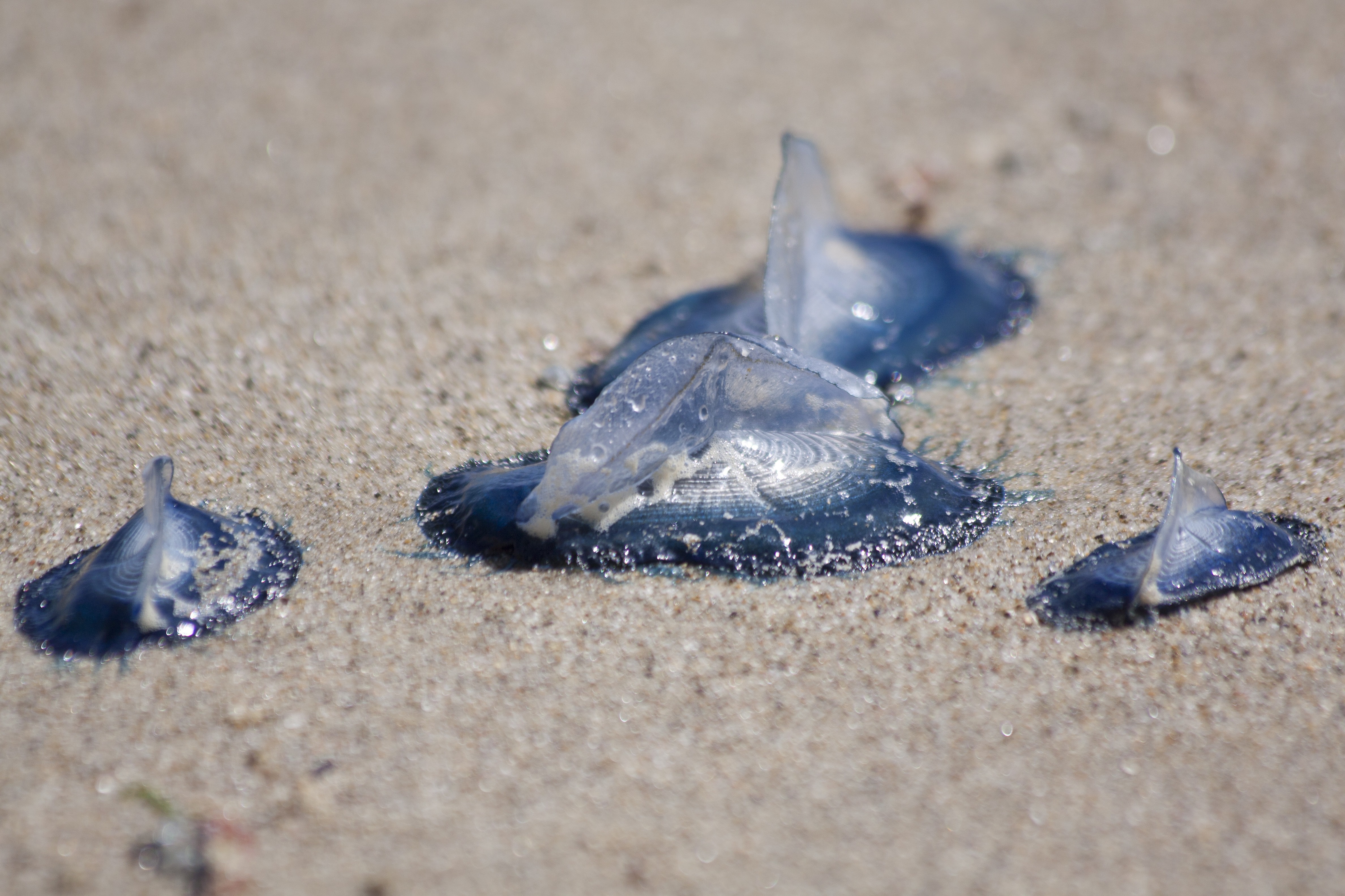
About Swift Bay, Western Australia
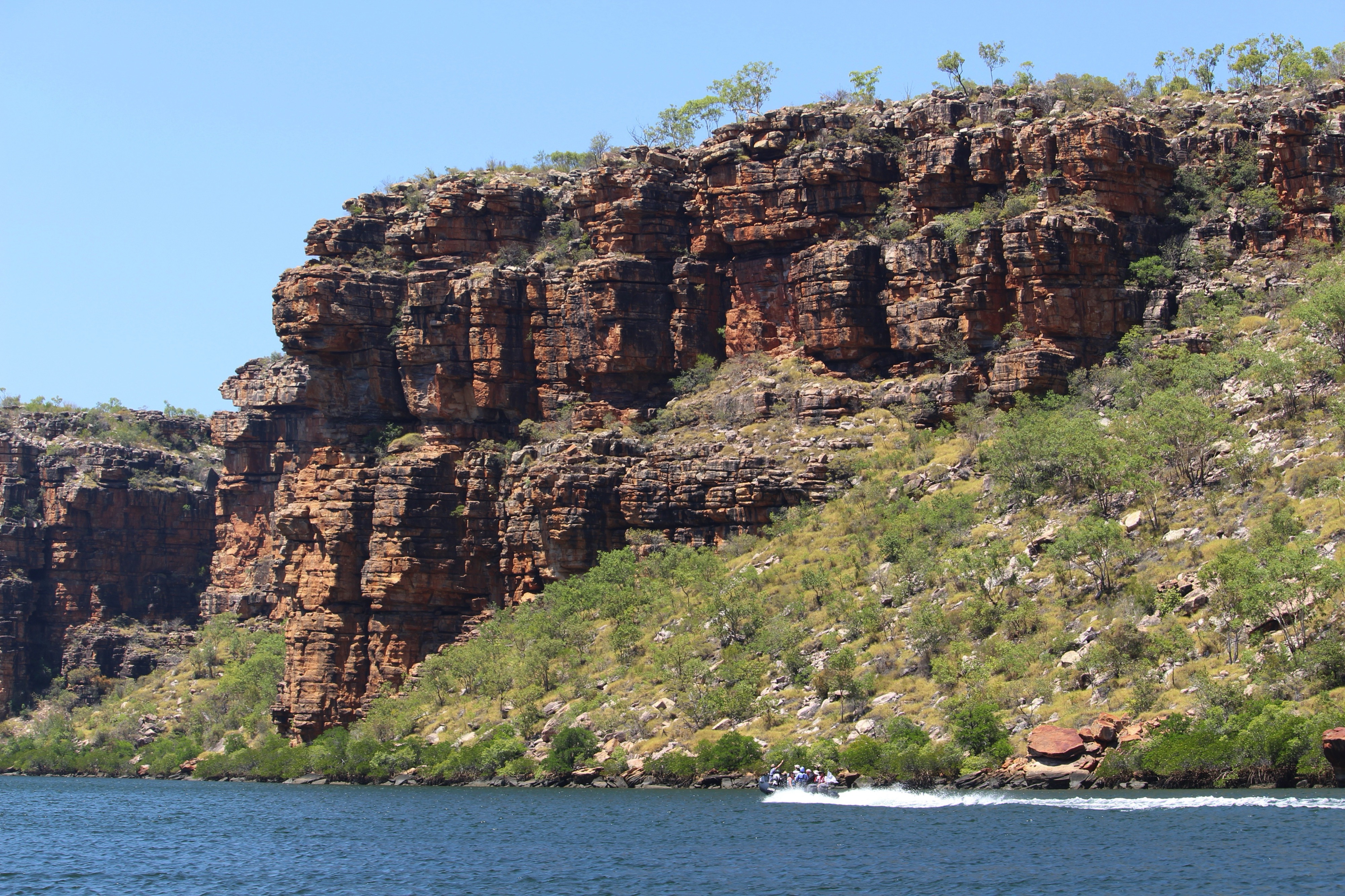
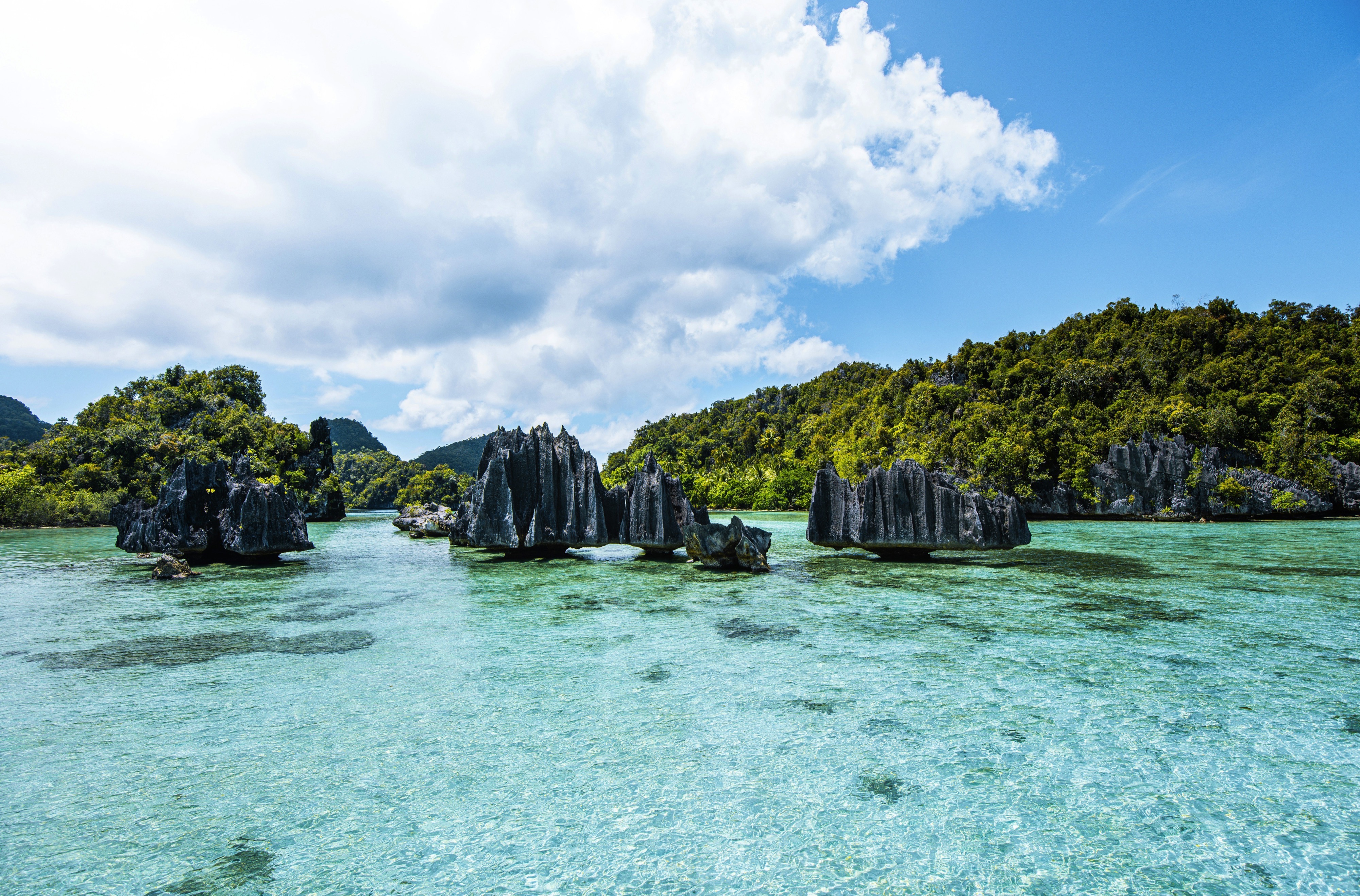
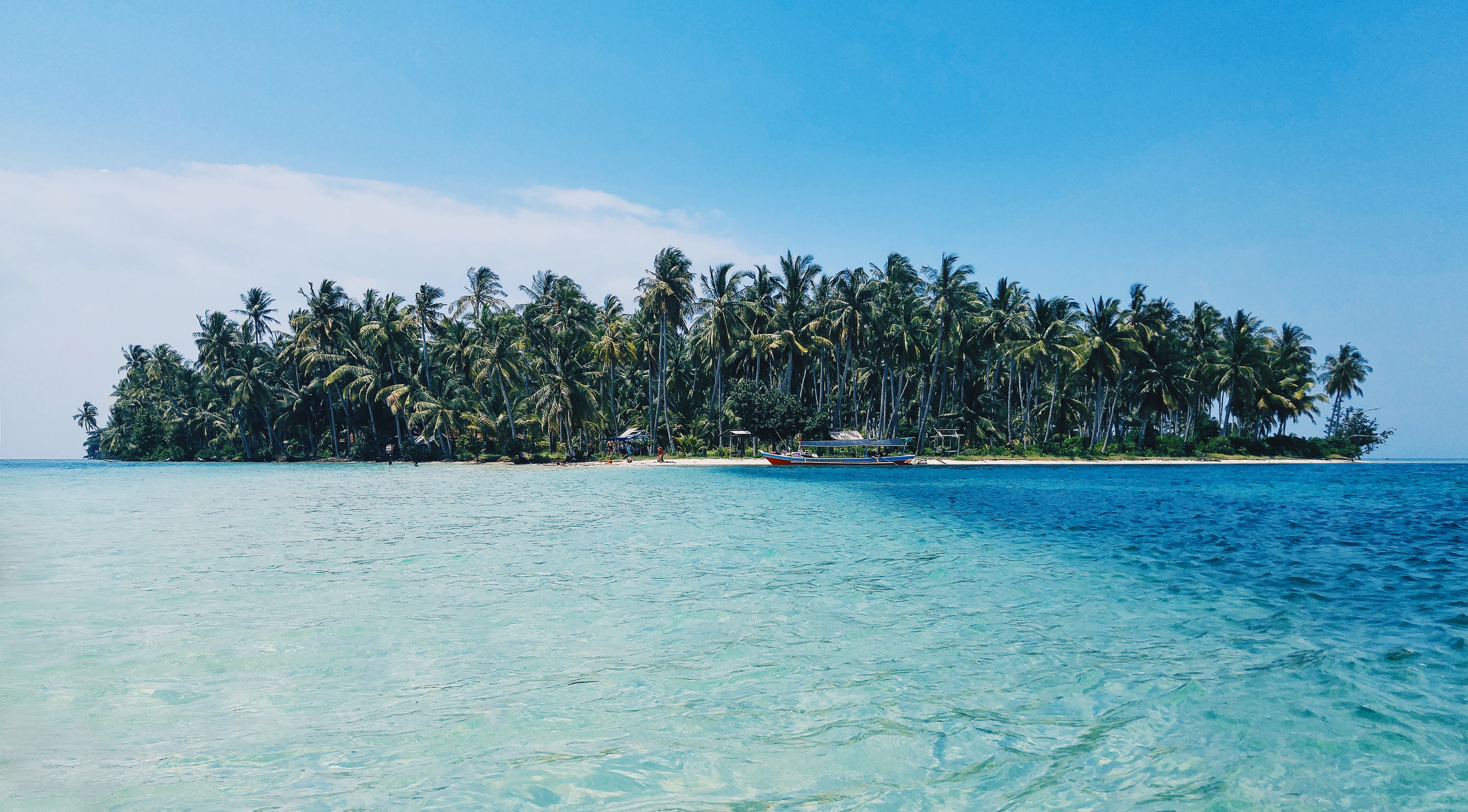
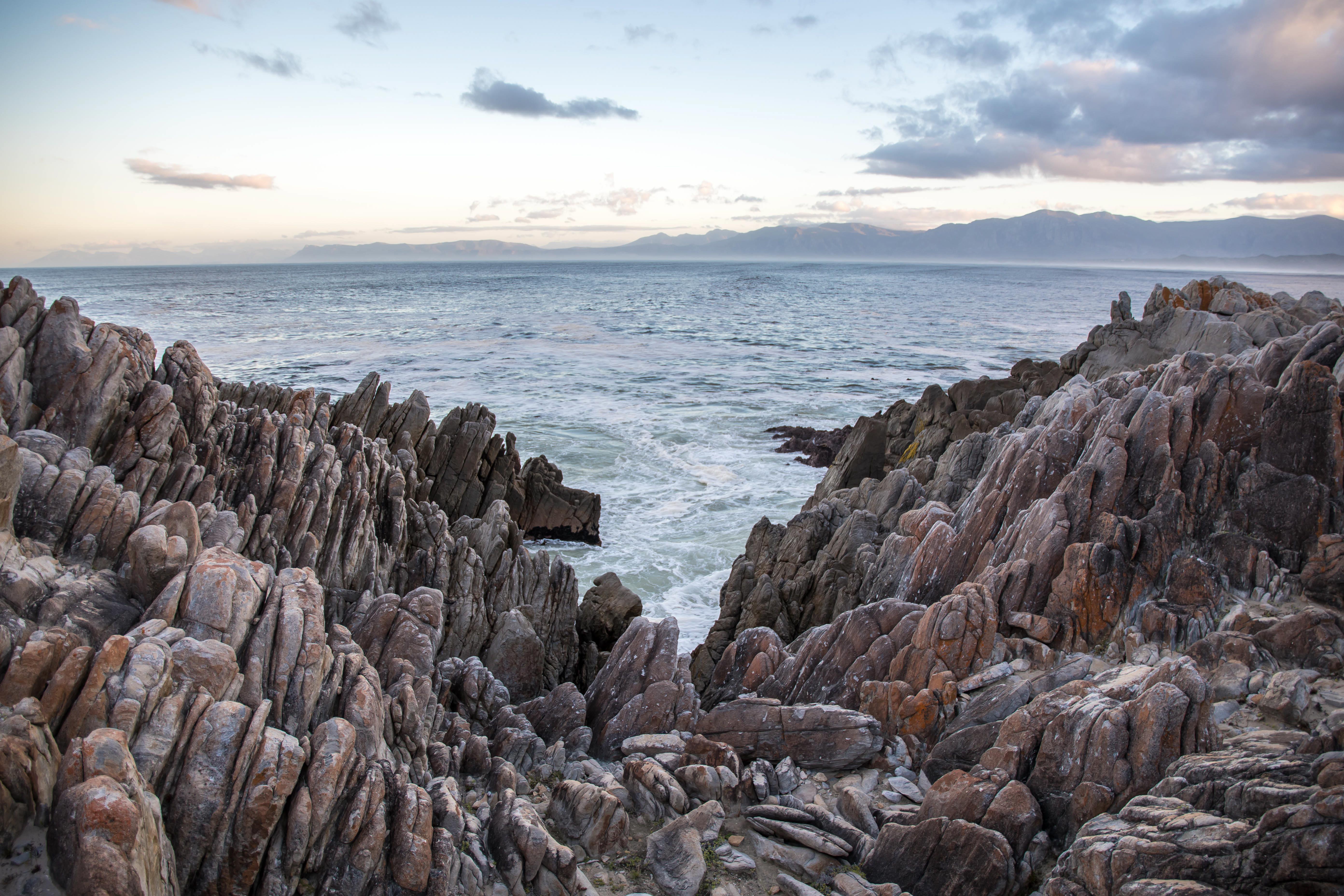
The Bonaparte Archipelago is a rugged maze of islands that stretch almost 150km along Western Australia’s remote Kimberley coast. Remaining relatively unspoilt and remarkably pristine, Swift Bay is landscaped by heavily fractured sandstone providing an abundance of rock shelters. On the walls of these shelters are examples of both Wandjina and Gwion Gwion style rock art. Join your expedition team ashore for a guided walk to a number of rock art galleries depicting these unique rock art styles.
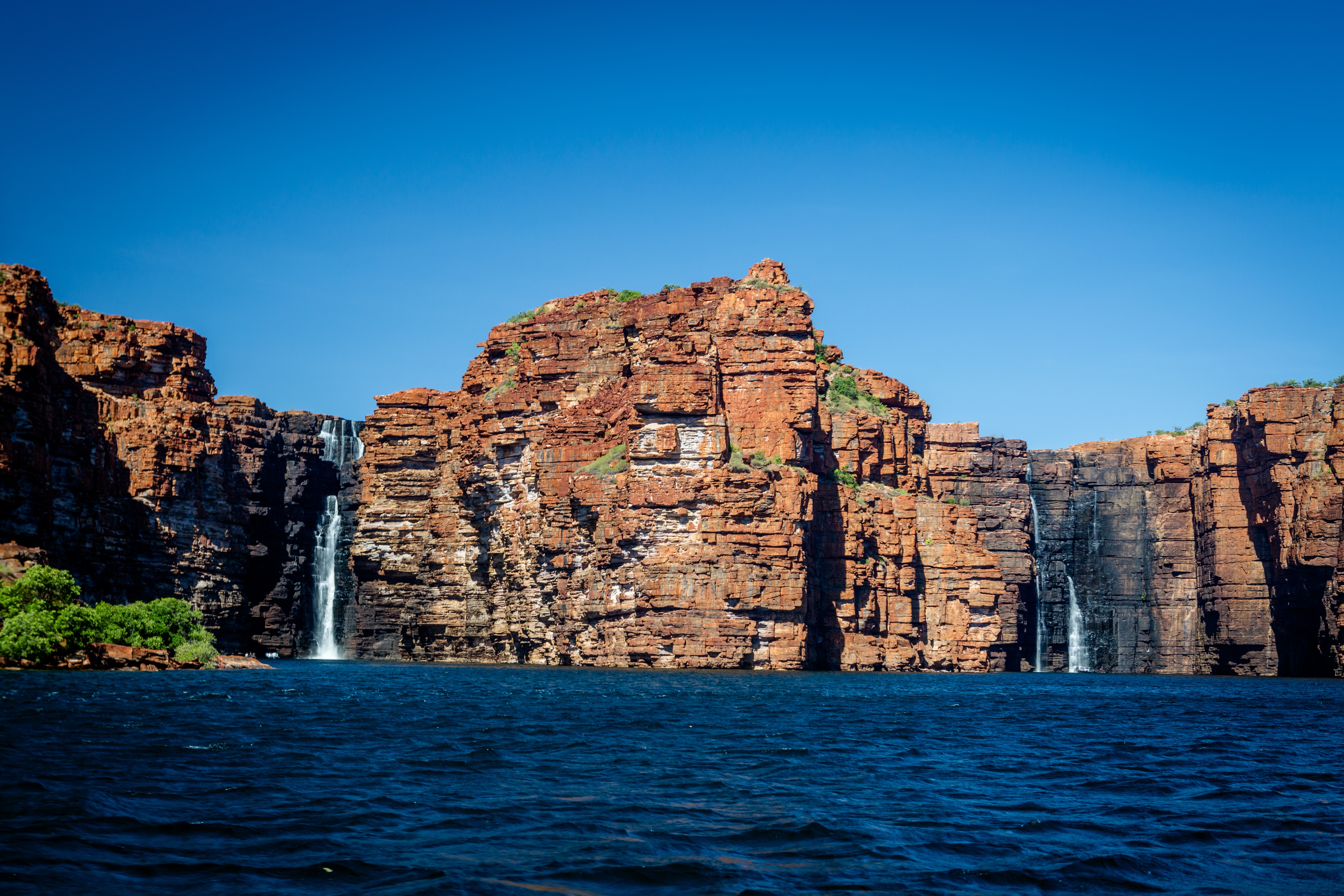
About Hunter River & Mitchell Falls, Western Australia
About Ashmore and Cartier Islands
Ashmore Reef is a sanctuary for seabirds, shorebirds, marine turtles, dugongs, and many other marine species. Each year around 100,000 seabirds breed on Ashmore Reef including great knots, crested terns and white-tailed tropicbirds. The sanctuary zone provides the highest level of protection for wildlife.
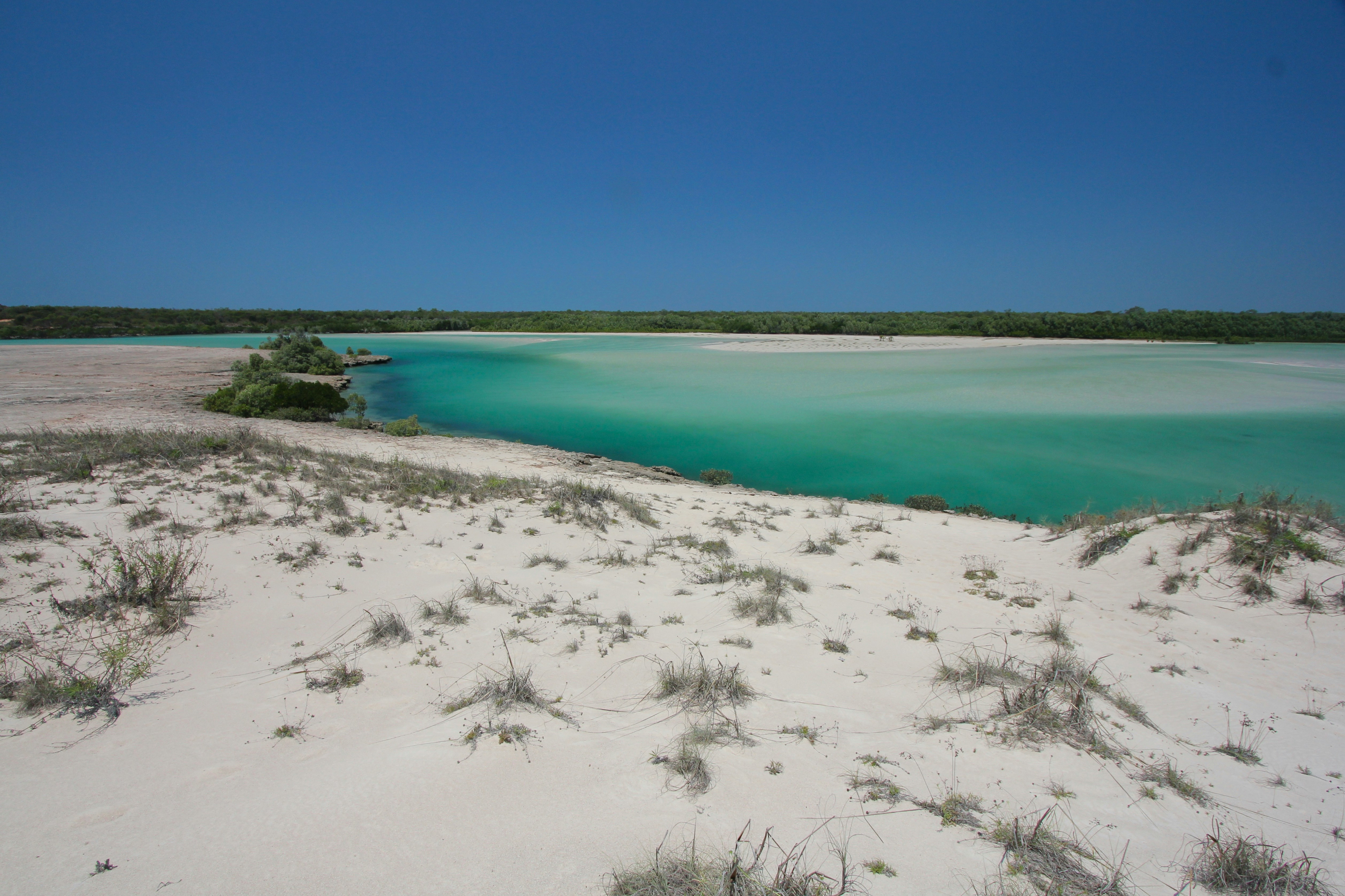
About Vansittart Bay, Western Australia
Vansittart Bay is a beautifully protected large bay with several islands and coves. Jar Island contains ancient rock art galleries depicting the Gwion Gwion style unique to the Kimberley region. Mainly neglected by, or unknown to, the early European researchers of Aboriginal culture in the Kimberley in favour of the dominant & more dramatic Wandjina art, Gwion Gwion art has in recent years gained world prominence. Join your Expedition Team ashore for a short walk, past some fascinating rock formations, to the site of the Gwion Gwion art galleries.
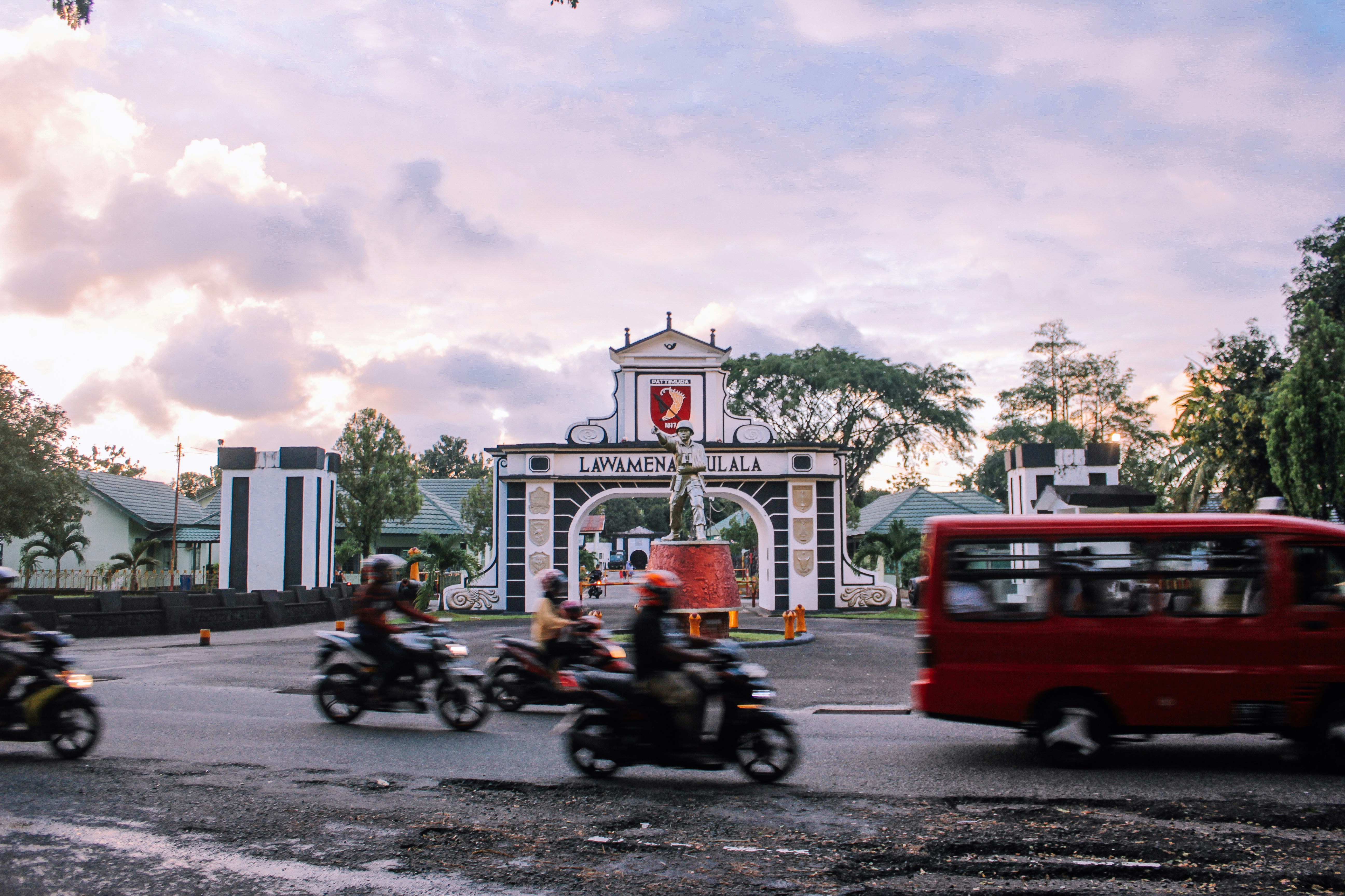
About Darwin, Northern Territory
Darwin is Australia's most colorful, and exotic, capital city. Surrounded on three sides by the turquoise waters of the Timor Sea, the streets are lined with tropical flowers and trees. Warm and dry in winter, hot and steamy in summer, it's a relaxed and casual place, as well as a beguiling blend of tropical frontier outpost and Outback hardiness. Thanks to its close proximity to Southeast Asia and its multicultural population it also seems more like Asia than the rest of Australia. Darwin is a city that has always had to fight for its survival. The seductiveness of contemporary Darwin lifestyles belies a history of failed attempts that date from 1824 when Europeans attempted to establish an enclave in this harsh, unyielding climate. The original 1869 settlement, called Palmerston, was built on a parcel of mangrove wetlands and scrub forest that had changed little in 15 million years. It was not until 1911, after it had already weathered the disastrous cyclones of 1878, 1882, and 1897, that the town was named after the scientist who had visited Australia's shores aboard the Beagle in 1839. During World War II it was bombed more than 60 times, as the harbor full of warships was a prime target for the Japanese war planes. Then, on the night of Christmas Eve 1974, the city was almost completely destroyed by Cyclone Tracy, Australia’s greatest natural disaster. It's a tribute to those who stayed and to those who have come to live here after Tracy that the rebuilt city now thrives as an administrative and commercial center for northern Australia. Old Darwin has been replaced by something of an edifice complex—such buildings as Parliament House and the Supreme Court all seem very grand for such a small city, especially one that prides itself on its casual, outdoor-centric lifestyle. Today Darwin is the best place from which to explore Australia's Top End, with its wonders of Kakadu and the Kimberley region.
About Ambon Island

About Kokas
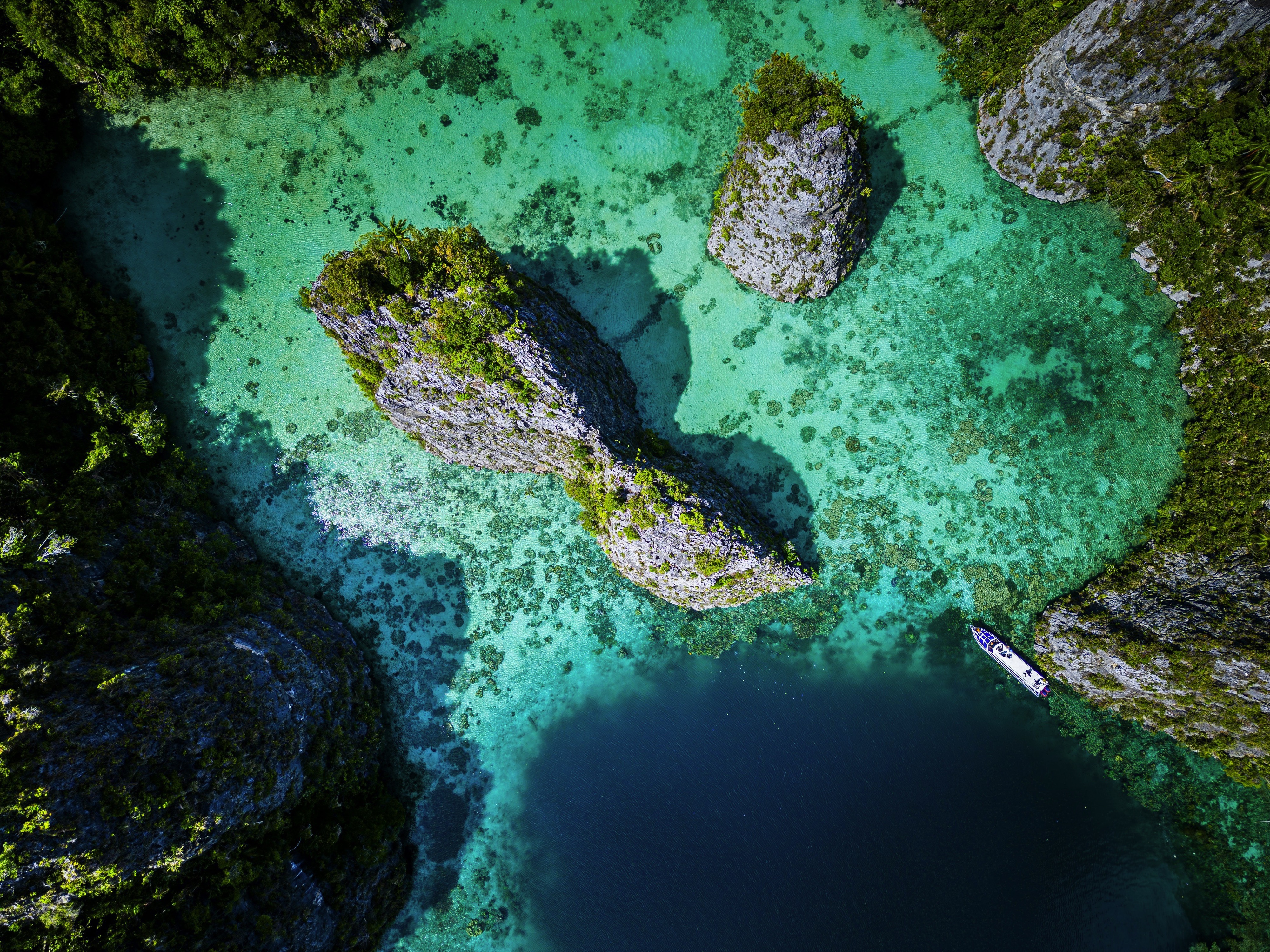
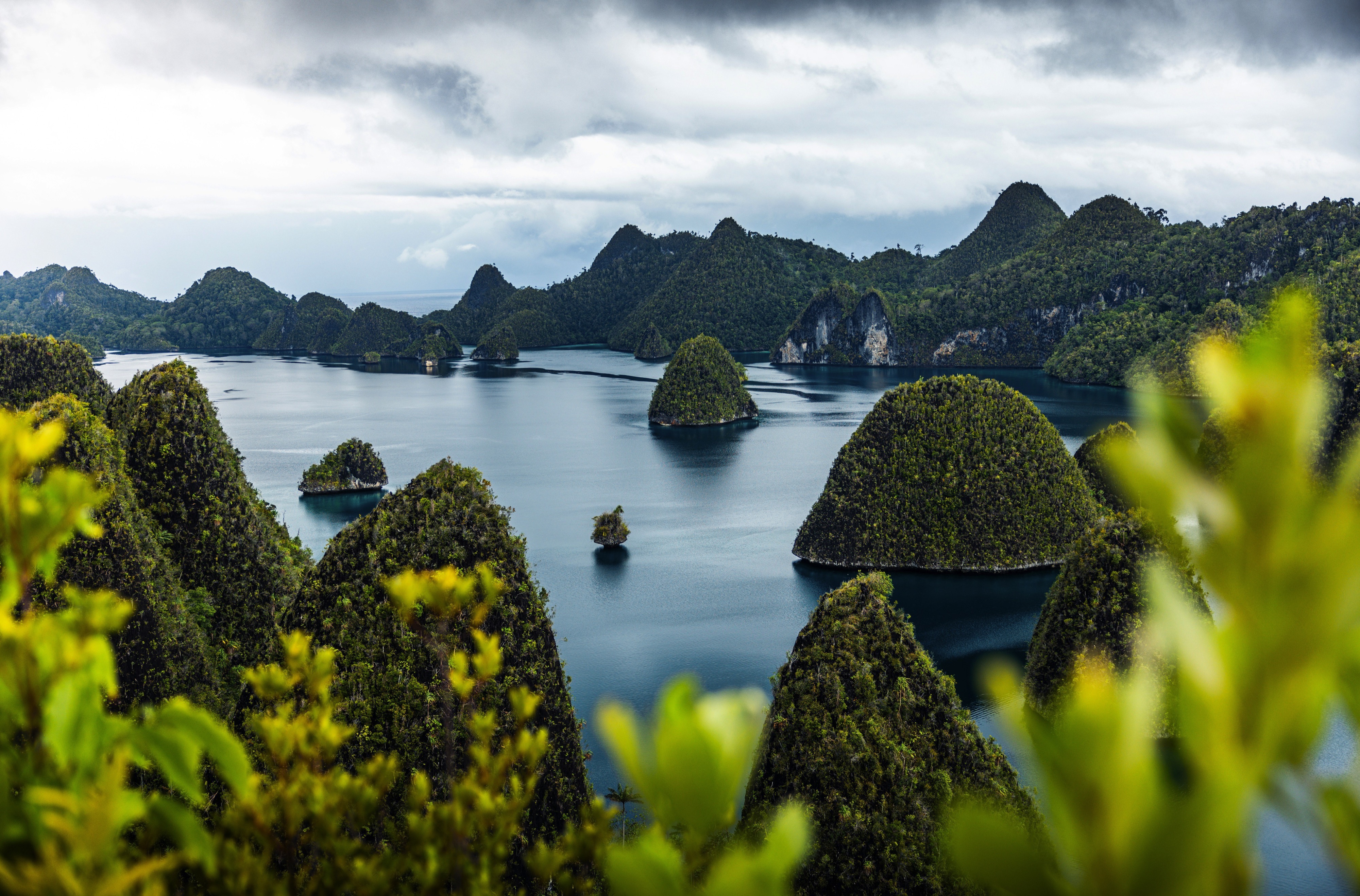
About Misool, Raja Ampat


About Yenwaoupnor
About Mansuar Island
About Manokwari, Irian Jaya
About Cenderawasih Bay
About Cenderawasih Bay
About Jayapura, Irian Jaya
About Vanimo
About Garove Island
About Duke of York Island
About Rabaul, Bismarck Archipelago
Rabaul, the former provincial capital, has quite a remarkable location. The town is inside the flooded caldera of a giant volcano and several sub-vents are still quite active today! The fumes of the volcano Tavurvur can be seen continually and the town suffered greatly during the last major eruption of 1994 when some 80% of the houses collapsed due to the ash raining down onto their roofs. Rabaul has a Volcano Observatory sitting atop the town’s center, monitoring the 14 active and 23 dormant volcanoes in Papua New Guinea. A small museum opposite the bunker used by Yamamoto during World War II shows exhibits relating to Rabaul’s local, German, Australian and Japanese past from the 19th century to Papua New Guinea’s independence in the 1970s.
About Gizo
About Honiara, Guadalcanal Island
Honiara is the capital city of the Solomon Islands on the north-western coast of Guadalcanal Island. It is the hub of all activity in the archipelago which has recently undergone an ‘urban boom’. Discover the cities beautiful landscapes and the significance of the city in the World War II.
About Vanikoro Island
About Ambrym
Unlike Espiritu Santo with its raised coral reefs and white sand, Ambrym is a volcanically active island with dark sand beaches. Ambrym is known as the island of magic and is the source of five local languages that all evolved on Ambrym. This handful of languages contributes to the well over 100 languages of Vanuatu. Some of Ambrym’s magic takes place in the lush greenery of the local community of Ranon. Here the people perform a very special and traditional ‘Rom’ dance. Participants prepare their masks and costumes in secrecy and the dance is reserved for special occasions.
About Lautoka
North of Nadi through sugarcane plantations and past the Sabeto Mountains is Lautoka, nicknamed the Sugar City for the local agriculture and its big processing mill. With a population of around 50,000, it's the only city besides Suva and, like the capital, has a pleasant waterfront. It's the sailing point for Blue Lagoon and Beachcomber Cruises but is otherwise unremarkable for tourists, itself having few hotels and fewer good restaurants. Locals recommend the city as a less-expensive place to shop for clothing, but note that it can take as long as 45 minutes to drive here. Legend has it that Lautoka acquired its name when two chiefs engaged in combat and one hit the other with a spear. He proclaimed "lau toka" (spear hit) and thus the future town was named.
About Kadavu Island
About Fulaga Island

About Neiafu
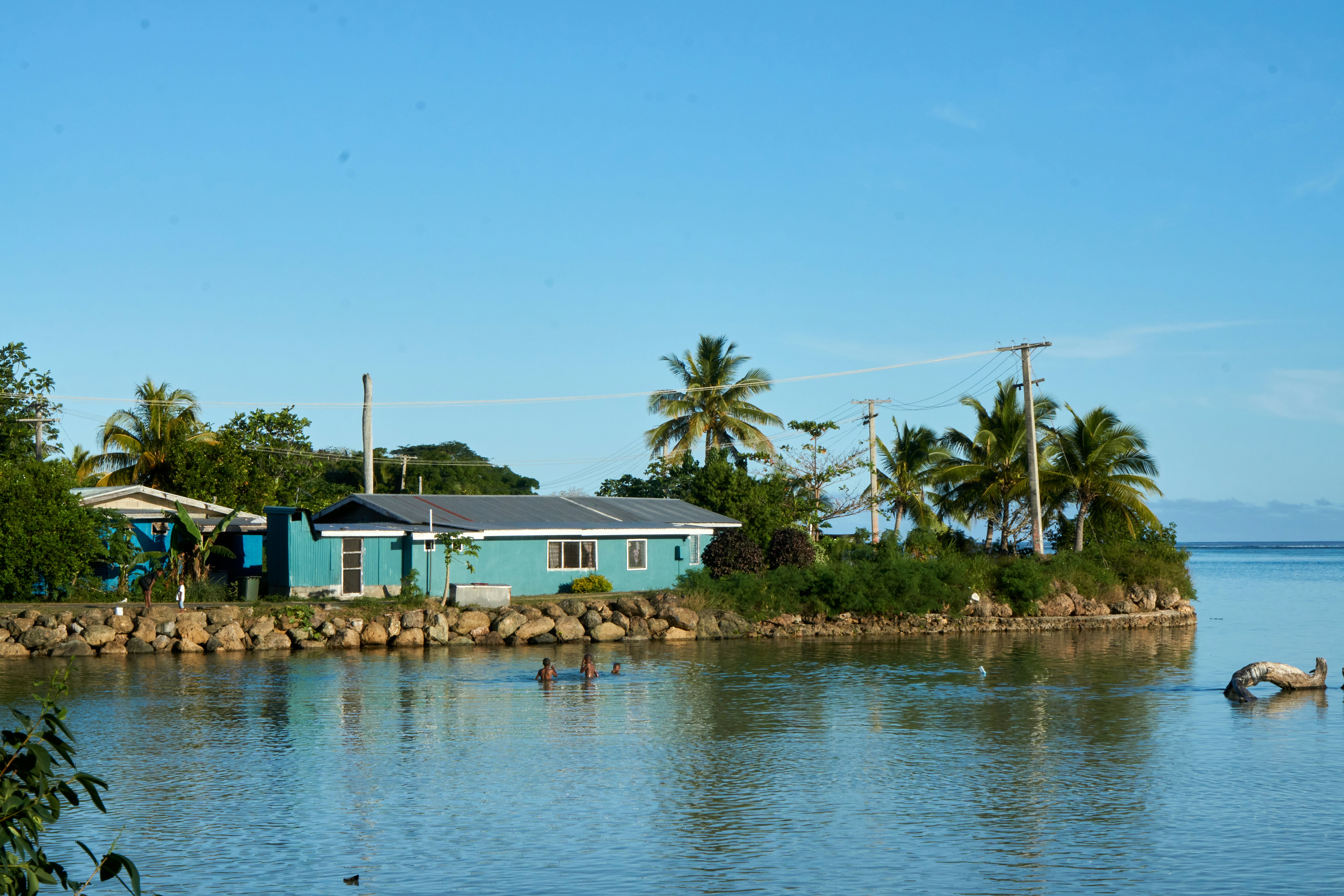
With a population of 6,000, Neiafu is the capital city and the second largest municipality in the Polynesian nation of Tonga (a 169-island archipelago in the South Pacific). The city is situated in a deep- water harbor (Port of Refuge) on the south coast of Vava͛u, the main island of the Vava͛u archipelago in northern Tonga. The waters of this region are known for their clarity and beauty, and the area attracts many humpback whales between June and November. A popular destination in Neiafu is the Ene͛io Botanical Garden, a bird sanctuary that promotes the survival of exotic and native bird species as well as supports and conserves a diverse array of plant life. The island's city life can be experienced at the numerous cafes and restaurants that welcome visitors.
About Nukupule
About Apia
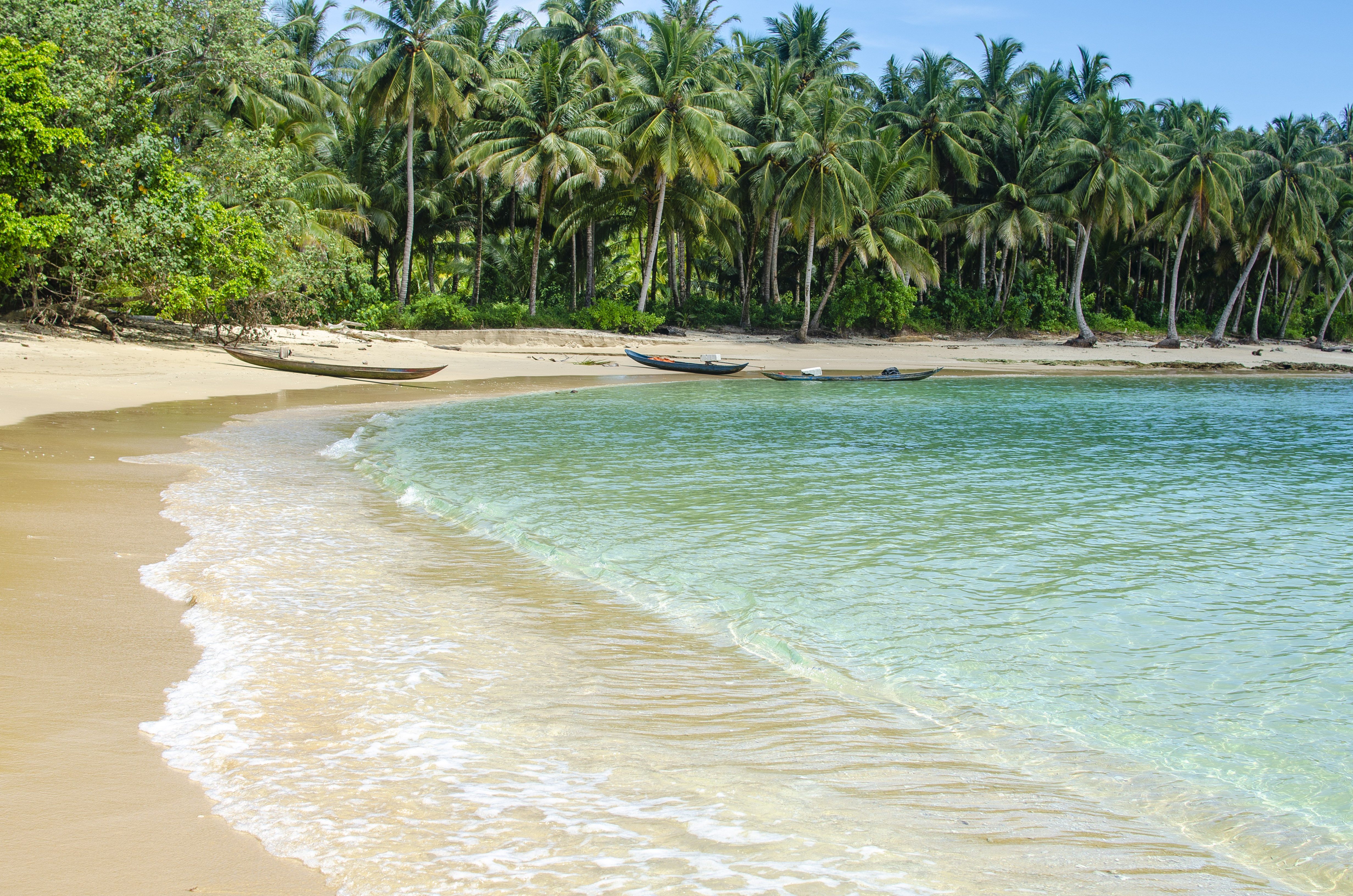
Samoa is a group of ten islands located in the South Pacific. The tropical climate and volcanic landscape create a picturesque location for visitors to explore, together with the experience of Fa'a Samoa, the three thousand year old way of life on Samoa.
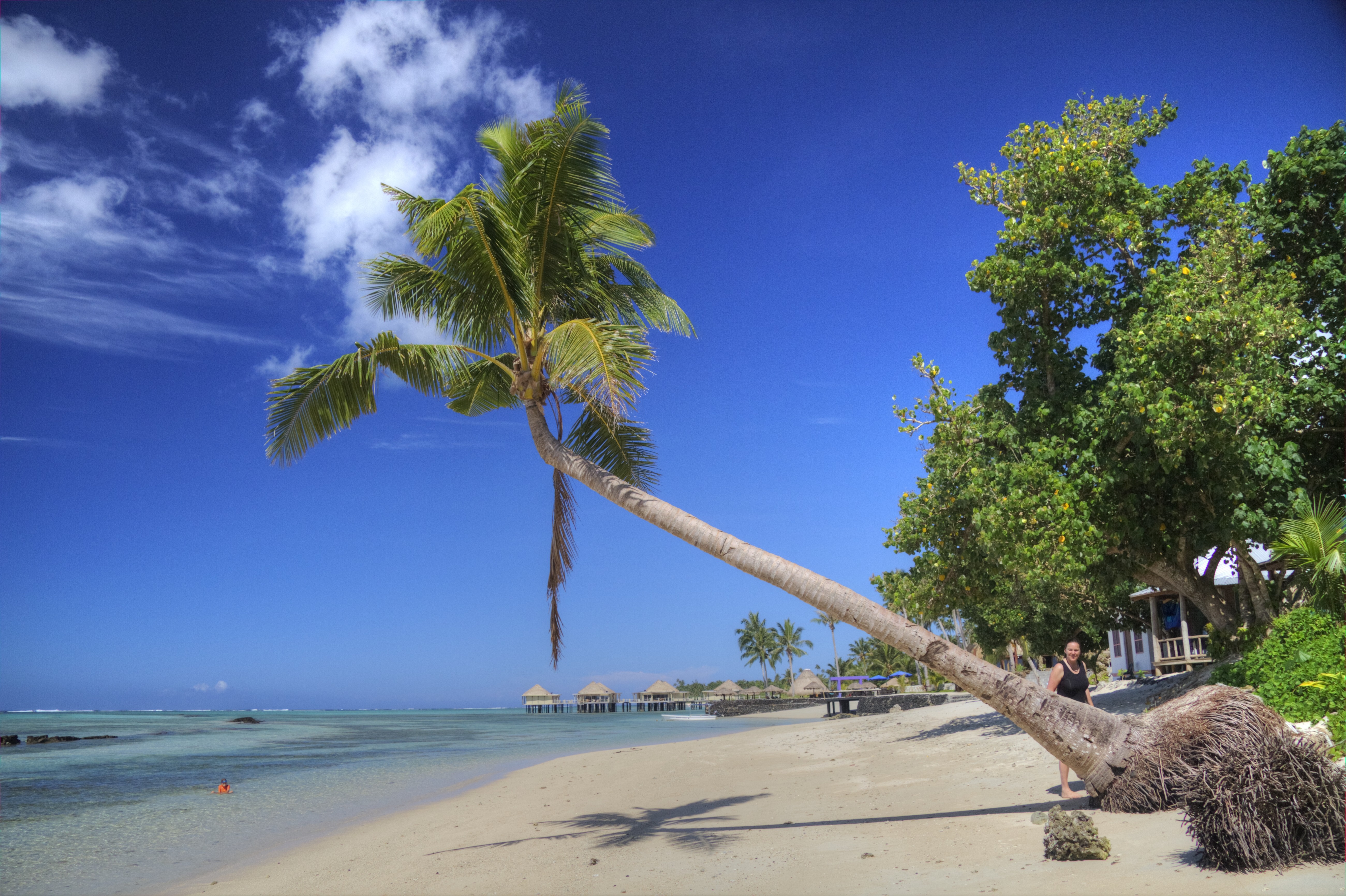
About Aitutaki
Even high praise like the 'world's most beautiful island' from Lonely Planet's co-founder, Tony Wheeler, won't prepare you for the intoxicating intensity of the coal blue ocean, the glow of the pure white sand, and the soothing ripple of the palm-tree forests at incredible Aitutaki. Breathless romance hangs thick in the air here, especially when a riot of purples, reds and oranges are spreading across the sky, accompanying the sun's descent each evening. It wasn't until 1789 that Europeans discovered this island haven, with the HMS Bounty's crew arriving, just a few weeks before a mutiny tore them apart. The Europeans were beaten to the islands, however, by the streamlined wooden canoes of the Polynesian settlers, who arrived around 900AD. While Western missionaries would eventually visit to spread Christianity to the island - evidenced by the white, coral-encrusted walls of the many churches - their efforts to repress the people’s deep love of communal singing and dancing ultimately failed, and music forms a key component of the islanders' culture to this day.The beaches here are flawless, and swaying in a hammock, suspended between leaning palm trees, as the ocean gently ruffles the sand nearby, feels gloriously indulgent. Aitutaki Lagoon is a huge aquamarine pool of water, alive with a kaleidoscopic swirl of tropical fish, which lurk just below the surface. You may even be lucky enough to spot turtles padding across the sand, scraping themselves towards the open ocean.The snorkelling opportunities here, and on One Foot Island - where you'll want to acquire the badge of honour of having your passport stamped with the island's iconic huge footprint - are sublime. Don't miss the tiny island of Moturakau either, which is crammed full of exotic birds and crabs, who have dominion over the island's tangled, jungle terrain.
About Raiatea
About Huahine


About Papeete, Tahiti
Papeete will be your gateway to the tropical paradise of French Polynesia, where islands fringed with gorgeous beaches and turquoise ocean await to soothe the soul. This spirited city is the capital of French Polynesia, and serves as a superb base for onward exploration of Tahiti – an island of breathtaking landscapes and oceanic vistas. Wonderful lagoons of crisp, clear water beg to be snorkelled, stunning black beaches and blowholes pay tribute to the island's volcanic heritage, and lush green mountains beckon you inland on adventures, as you explore extraordinary Tahiti. Visit to relax inside picturesque stilted huts, which stand out over shimmering water, as you settle into the intoxicating rhythm of life, in this Polynesian paradise.
About Anaa
About Rangiroa
About Pitcairn Island
With a total of 56 residents on the island, Adamstown is the capital of the Pitcairn Islands and the only populated settlement, as all of the other Pitcairn Islands are uninhabited (although were populated by Polynesians in the 11th through 15th centuries). Halfway between Peru and New Zealand, Pitcairn was the perfect hiding spot for the famed HMS Bounty mutineers and their Tahitian wives. Not only had the island been misplaced on early maps of the region, but it can also be very difficult to come ashore as large breakers tend to build up just in front of the small harbour of Bounty Bay. On shore visit the local museum that houses the HMS Bounty Bible, the historic Adamstown Church, view Fletcher Christian’s cave, or keep an eye out for the Pitcairn Reed Warbler.
About Ducie Island
Discovered in 1606 by a Portuguese explorer, Ducie is a small isolated atoll and is the easternmost of the Pitcairn Islands. The island’s most prominent bit of history is the 1881 wreckage of the mail ship Acadia, which ran aground on the island when the lookout mistook the island for a cloud due to its white beaches. Ducie is a mere speck in the surrounding expanse of ocean, uninhabited except for the estimated 500,000 nesting seabirds that reside among the two plant species (Beach Heliotrope and at least one specimen of Pemphis) that grow over seventy percent of the island. Bird species that visitors may be able to see include Murphy's Petrels, White Terns, Great Frigate birds and Masked Boobies. Snorkelers love to visit the top of the wreck of the Acadia or in the atoll’s lagoon waters.
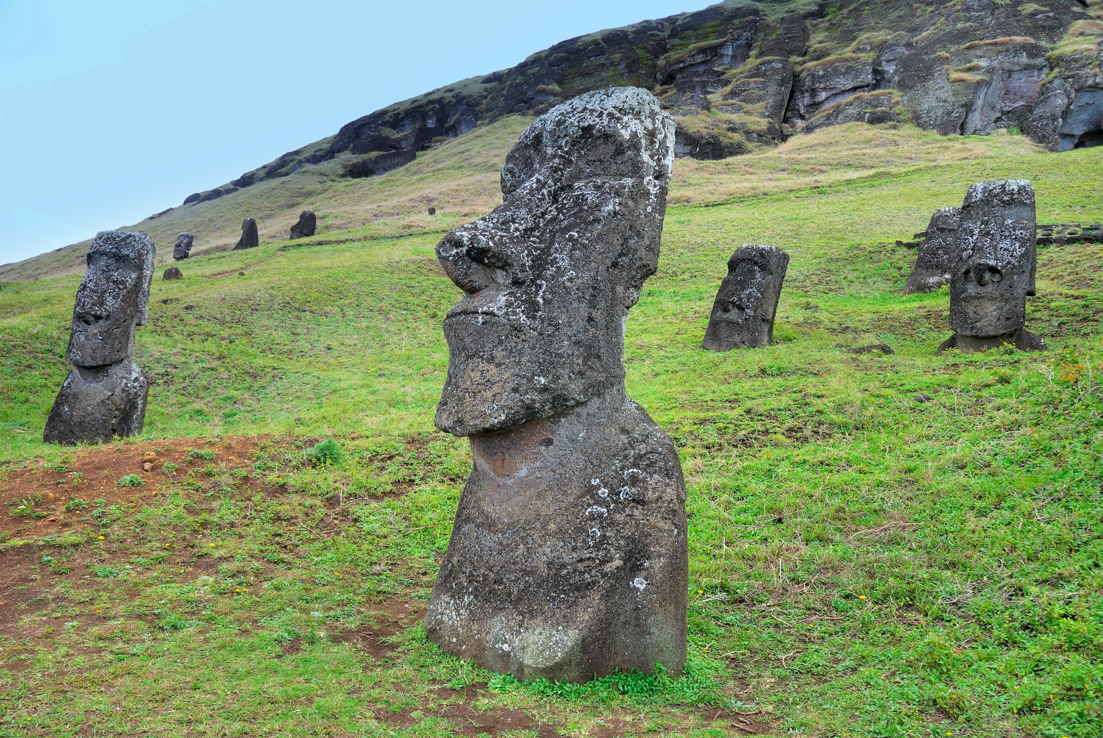
About Hangaroa, Easter Island
Discovered (by the Western world) on Easter Sunday, 1722, Easter Island is a UNESCO World Heritage Site and one of the most isolated places on the face of the Earth, some 2,300 miles from the Chilean mainland. Although more Polynesian than South American in character, the 64-square mile island was annexed by Chile in 1888, and is now famous as the world’s largest ‘open air museum’ on account of the Moai, or human-like stone statues, that can be found on the island. The Moai remain very much a mystery, which archaeologists are still trying to unlock by interpreting an ancient language of the Rapa Nui, which is the key to understanding this culture, and is written on the so called ‘rongo rongo tablets’. The island owes its origin to three volcanoes which erupted some three million years ago: Poike, Rano Kau and Maunga Terevaka. It is not known when or how the island was first populated, but the most credible theory suggests that the Rapa Nui people came from other Pacific islands in the 4th century AD. In addition to the cultural and archaeological interest, there are the beautiful beaches, transparent waters, and coral reefs that might be expected of a Pacific Island.
About Juan Fernández Island
About Juan Fernández Island
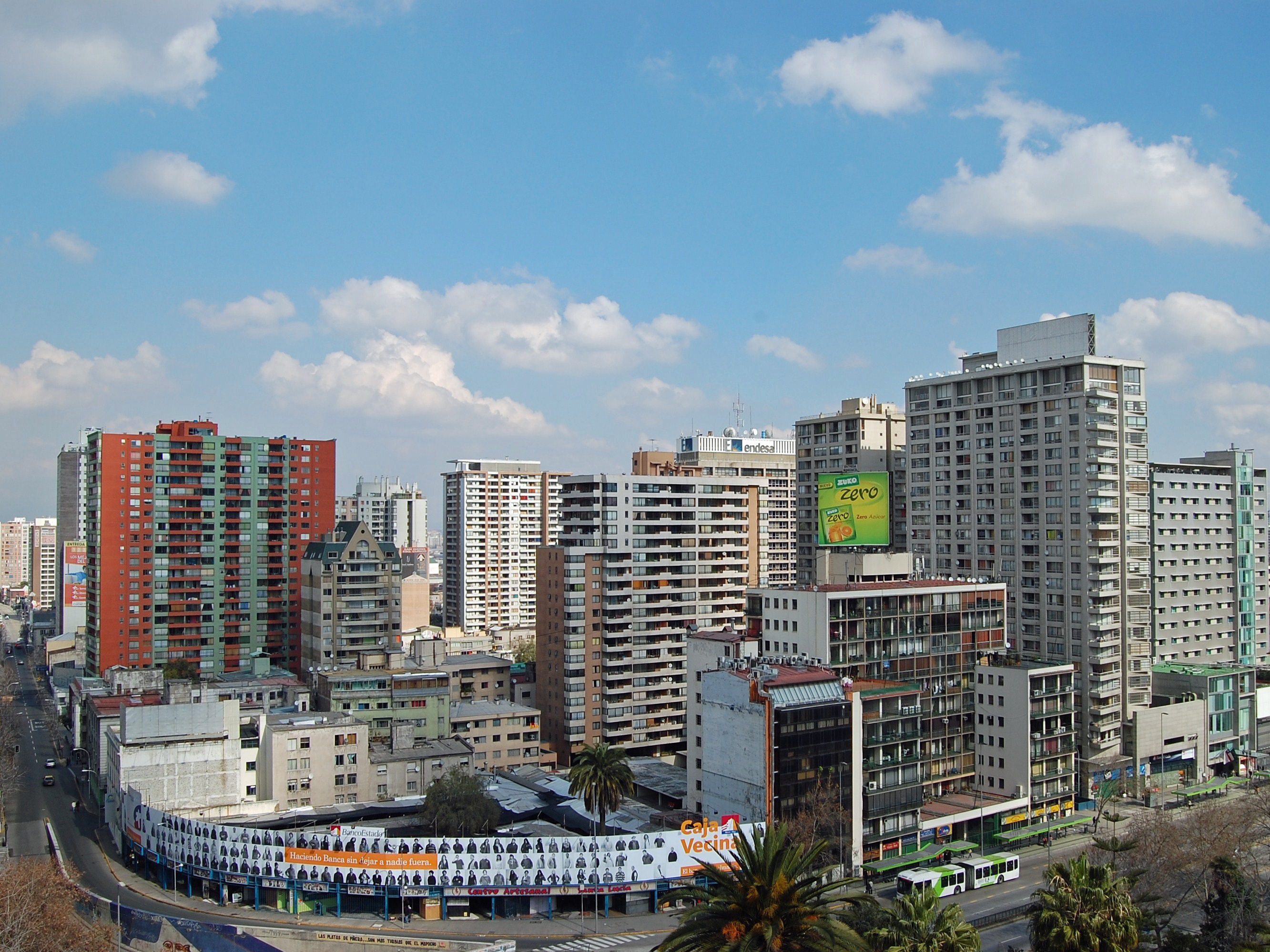
About San Antonio
Grand Wintergarden Suites feature:
- Large windows
- Dining for six
- Glass-enclosed solarium with tub and day bed
- Bathroom with whirlpool bathtub
- Two bedrooms
- Two bathrooms (one whirlpool)
- Convertible sofa bed for one
- Pantry with wet bar
- Two flat-screen TVs
- Complimentary Internet/Wi-Fi service
Wintergarden Suites feature large windows, dining for six, whirlpool bathtub, guest bath, convertible sofa bed for one, pantry with wet bar, glass-enclosed solarium with tub and day bed, two closets and two flat-screen TVs. Complimentary Internet/Wi-Fi service.
Wintergarden Suite Features
- Large windows
- Glass door to private veranda
- Comfortable living area
- Dining for four
- Separate bedroom
- Queen-size bed or two twin beds
- Walk-in closet
- Two flat-screen TVs
- Complimentary Internet/Wi-Fi service.
- Fully stocked bar and refrigerator
- Makeup vanity
- Guest bath
- Bathroom with whirlpool bathtub
Signature Suite Features
- Expansive ocean views
- Forward-facing windows
- Dining for four to six
- Bathroom with whirlpool bathtub
- Guest bath
- Pantry with wet bar
- Two flat-screen TVs
- Complimentary Internet/Wi-Fi service.
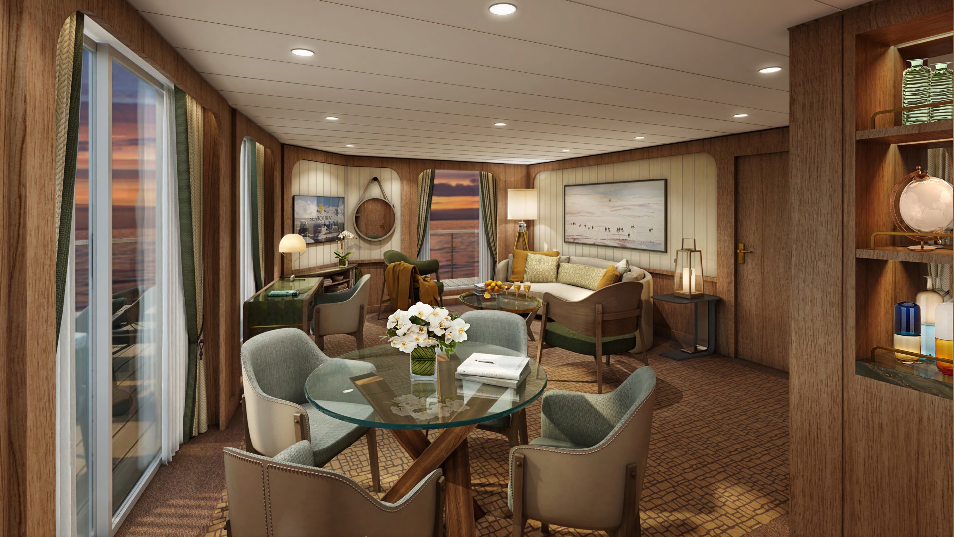
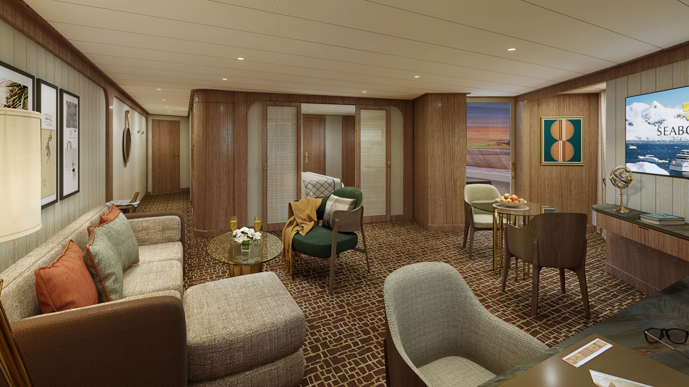
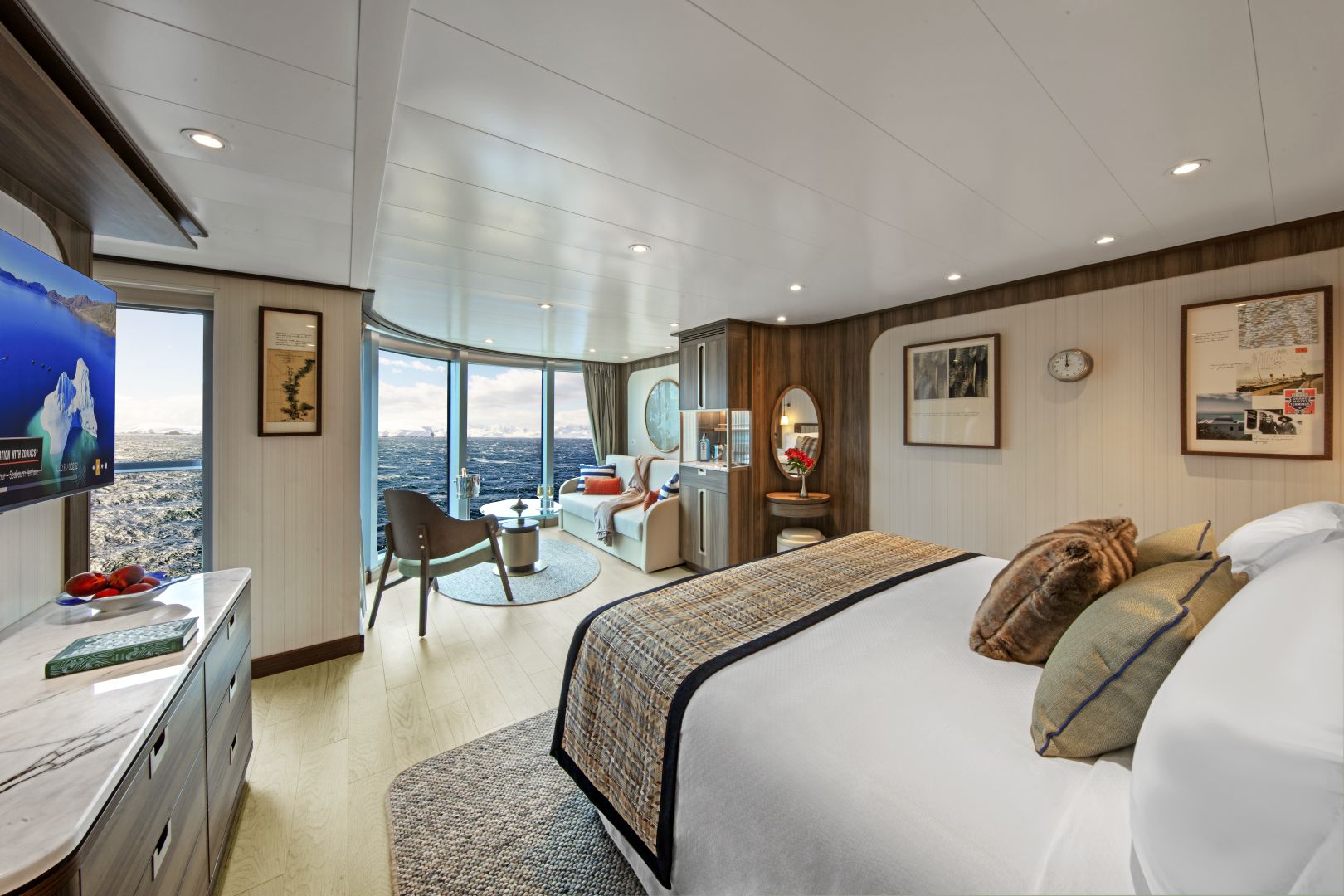
Owner's Suites on feature a comfortable living area; private veranda; queen-size bed or two twin beds; extra-large walk-in closet for expedition gear; personal safe; interactive flat-screen TV with music and movies; fully stocked bar and refrigerator; writing desk with personalized stationery; makeup vanity; spacious bathroom with double vanities, tub and shower, plush robes, slippers, hairdryer and 110/220V AC outlets.
Owners Suite Features
- Expansive ocean views
- Forward-facing windows
- Dining for four to six
- Bathroom with whirlpool bathtub
- Guest bath
- Pantry with wet bar
- Two flat-screen TVs
- Complimentary Internet/Wi-Fi service.
Penthouse Spa Suites on board feature a comfortable living area, glass door to private veranda, queen-size-bed or two twin beds; walk-in closet with personal safe, interactive flat-screen TV, fully stocked bar and refrigerator and spacious marble bath with double vanities.
Penthouse Spa Suite
- Large windows
- Glass door to private veranda
- Comfortable living area
- Large windows
- Glass door to private veranda
- Comfortable living area
- Dining table for two
- Breathtaking ocean views right from your bed
- Queen-size bed or two twin beds
- Walk-in closet
- Two flat-screen TVs
- Fully stocked bar and refrigerator
- Makeup vanity
- Spacious bathroom with separate tub and shower
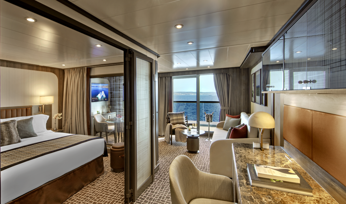
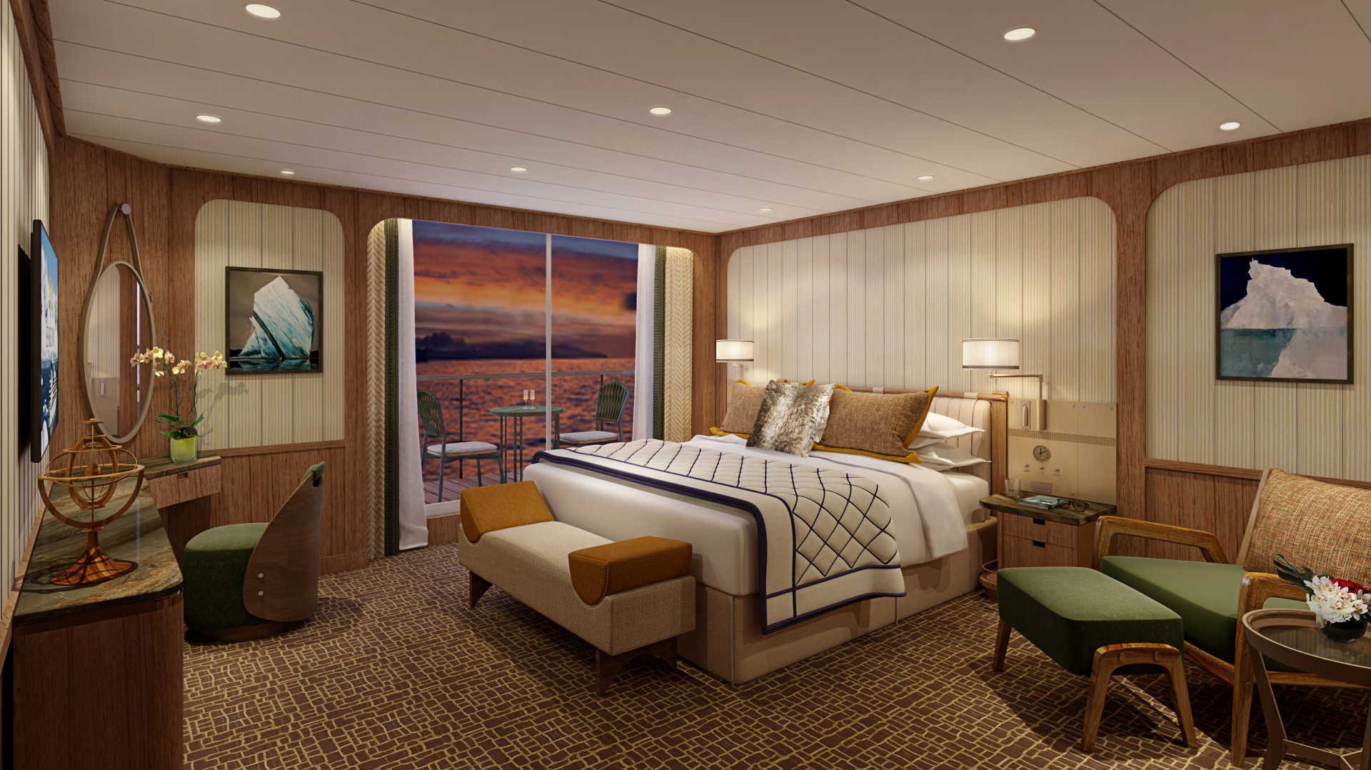
Suites 513-516, 611-614, 711-714, 802-805; Total space: 417 sq. ft. (39 sq. m.) incl. veranda of 85 sq. ft. (8 sq. m.) All Panorama Veranda Suites feature a comfortable living area; private veranda; queen-size bed or two twin beds; walk-in closet; personal safe; interactive TV with music and movies; fully stocked bar and refrigerator; writing desk with personalized stationery; makeup vanity; spacious bathroom, separate tub and shower, plush robes, slippers, luxury health and beauty products, hairdryer and 110/220V AC outlets. *Some veranda sizes vary.
Panorama Penthouse Suite Features
- Large windows
- Glass door to private veranda
- Comfortable living area
- Large windows
- Glass door to private veranda
- Comfortable living area
- Dining table for two
- Breathtaking ocean views right from your bed
- Queen-size bed or two twin beds
- Walk-in closet
- Two flat-screen TVs
- Fully stocked bar and refrigerator
- Makeup vanity
- Spacious bathroom with separate tub and shower
*Wheelchair accessible suites are roll-in shower only.
Approximate total space: 527 sq. ft. (49 sq. m.) including veranda of 97 sq. ft. (9 sq. m.) All Penthouse Suites feature a comfortable living area; private veranda; queen-size bed or two twin beds; walk-in closet; personal safe; interactive TV with music and movies; fully stocked bar and refrigerator; writing desk with personalized stationery; makeup vanity; spacious bathroom, separate tub and shower, plush robes, slippers, luxury health and beauty products, hairdryer and 110/220V AC outlets.
Penthouse Suite Feautures
- Dining table for two to four
- Separate bedroom
- Glass door to veranda
- Two flat-screen TVs
- Fully stocked bar
- Spacious bathroom with tub, shower and large vanity
- Dining table for two to four
- Separate bedroom
- Glass door to veranda
- Two flat-screen TVs
- Fully stocked bar
- Spacious bathroom with tub, shower and large vanity
Veranda Suite Features
A large picture window
- Glass door to private veranda
- Comfortable living area
- Dining table for two to four
- Queen-size bed or two twin beds
- Walk-in closet
- Interactive flat-screen television with music and movies
- Fully stocked bar and refrigerator
- Makeup vanity
- Spacious bathroom with separate tub and shower
*Wheelchair accessible suites are roll-in shower only.
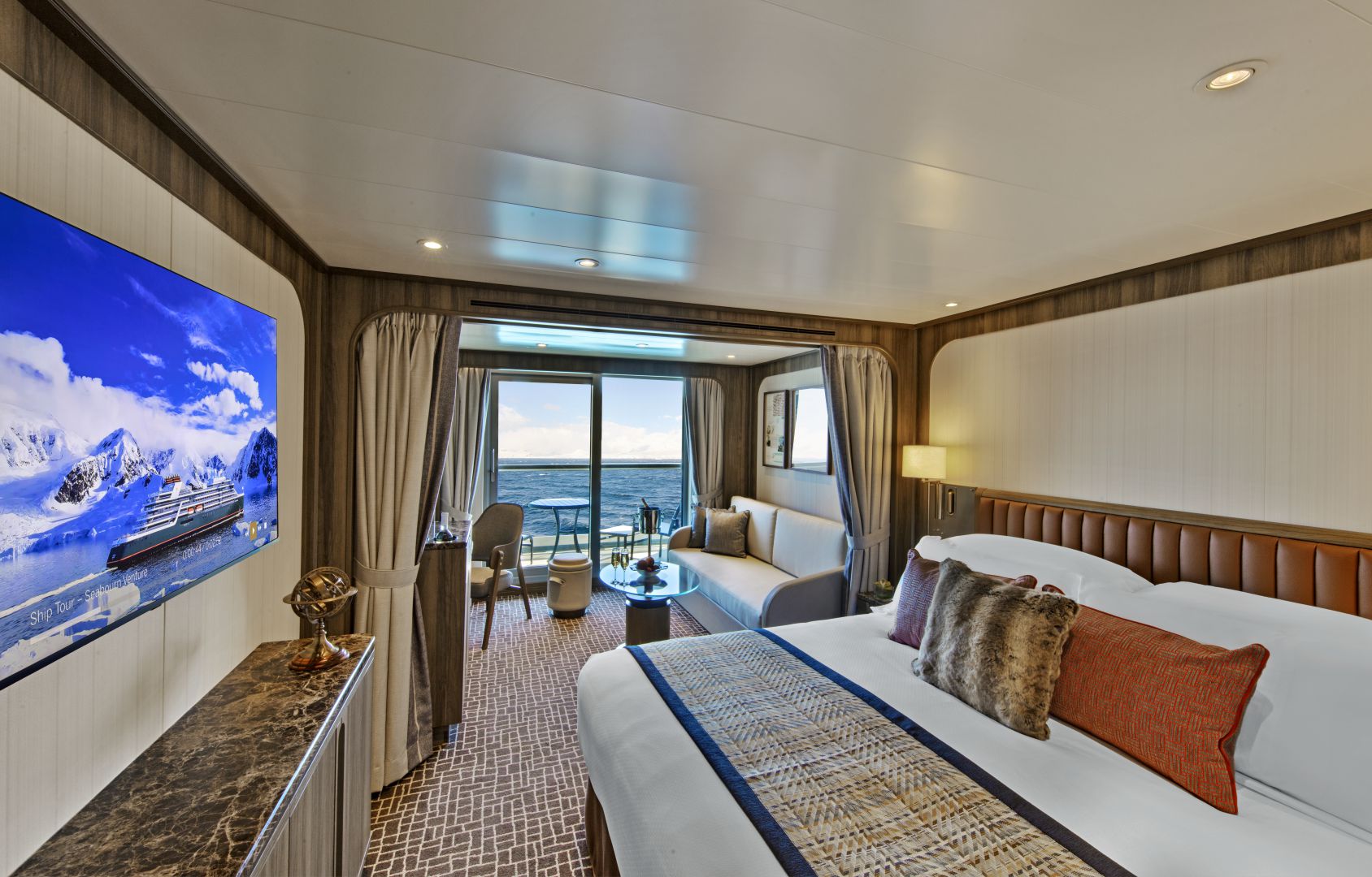
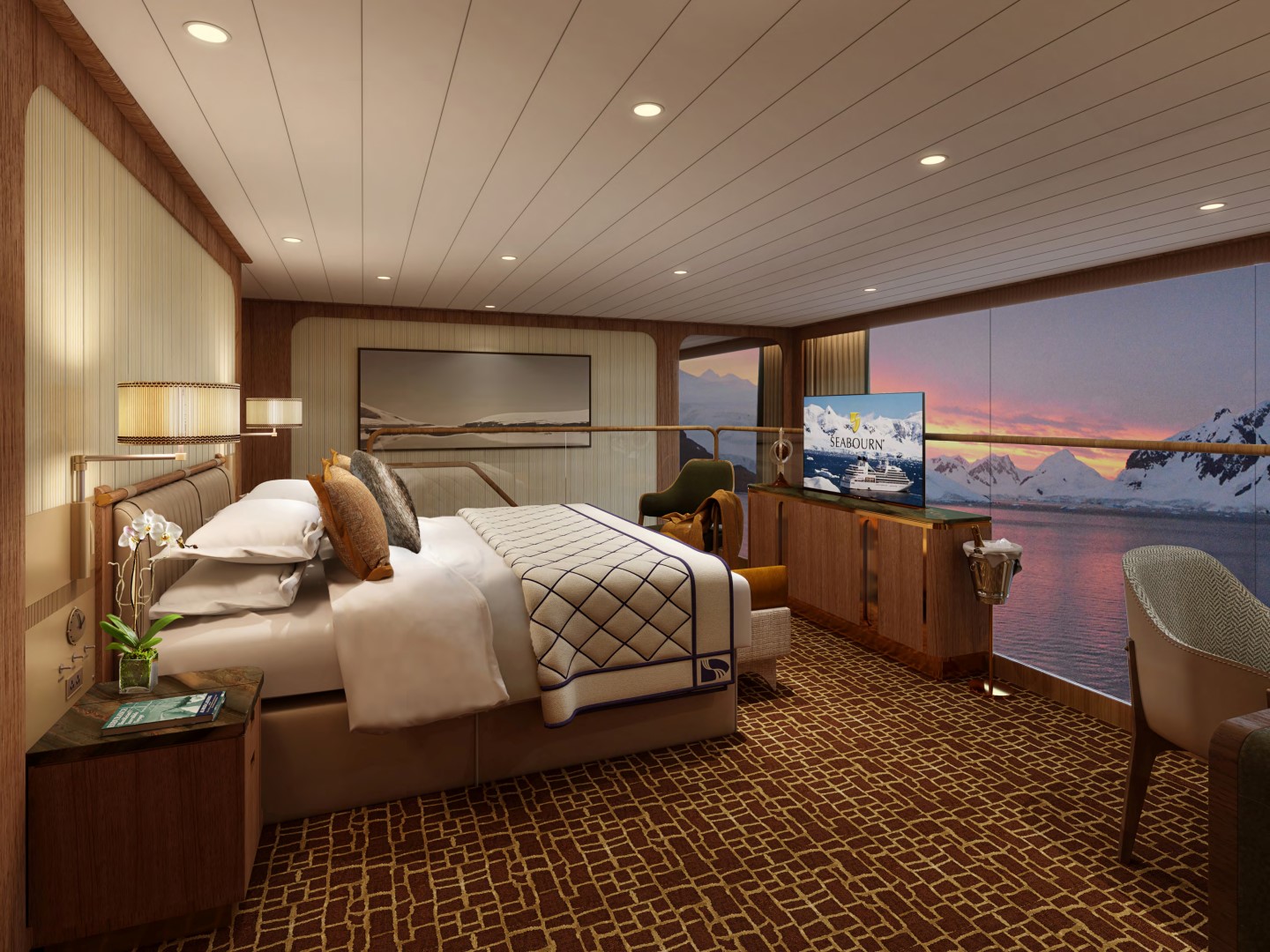
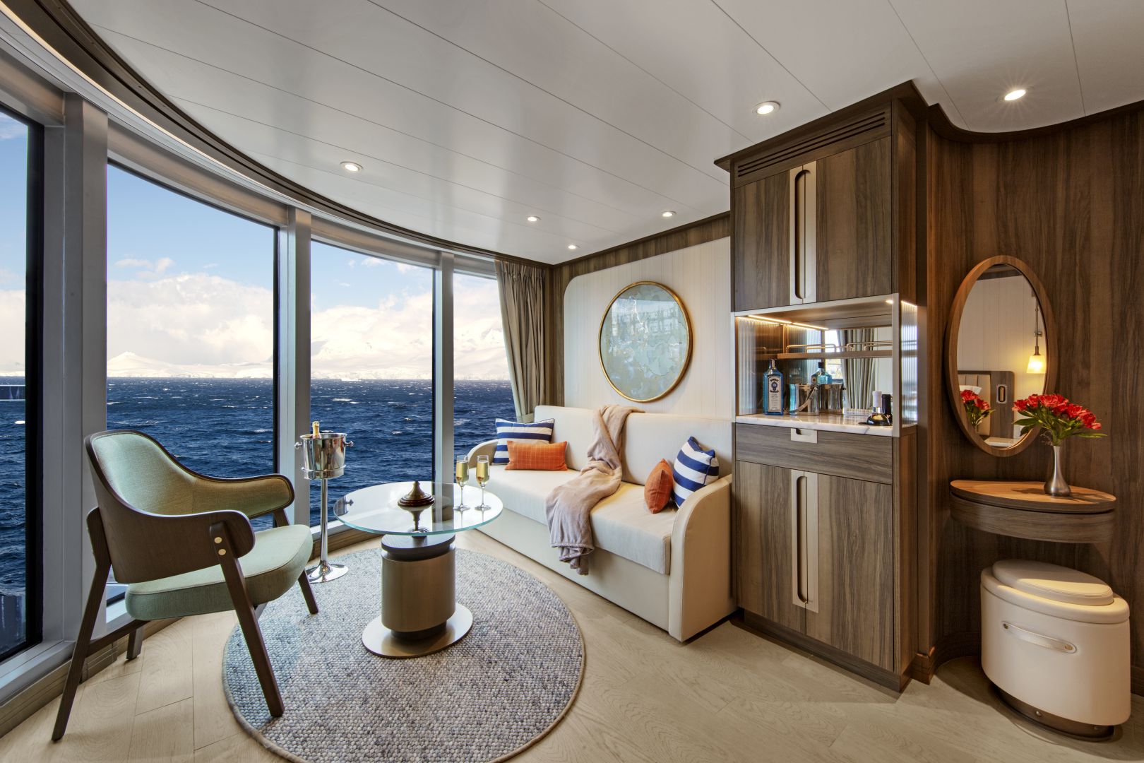
All Veranda Spa Suites onboard Seabourn Pursuit feature a comfortable living area; private veranda; queen-size bed or two twin beds; walk-in closet; personal safe; interactive TV with music and movies; fully stocked bar and refrigerator; writing desk with personalised stationery; makeup vanity; spacious bathroom, separate tub and shower, plush robes, slippers, luxury health and beauty products, hairdryer and 110/220V AC outlets.Veranda Spa Suite Feautures
- A large picture window
- Glass door to private veranda
- Comfortable living area
- Dining table for two to four
- Queen-size bed or two twin beds
- Walk-in closet
- Interactive flat-screen television with music and movies
- Fully stocked bar and refrigerator
- Makeup vanity
- Spacious bathroom with separate tub and shower
*Wheelchair accessible suites are roll-in shower only.
Approximate total space: 355 sq. ft. (33 sq. m.) including veranda of 75 sq. ft. (7 sq. m.)* Suites on Seabourn Pursuit feature a comfortable living area; private veranda; queen-size bed or two twin beds; extra-large walk-in closet for expedition gear; personal safe; interactive flat-screen TV with music and movies; fully stocked bar and refrigerator; writing desk with personalized stationery; makeup vanity; spacious bathroom with double vanities, tub and shower, plush robes, slippers, hairdryer and 110/220V AC outlets.
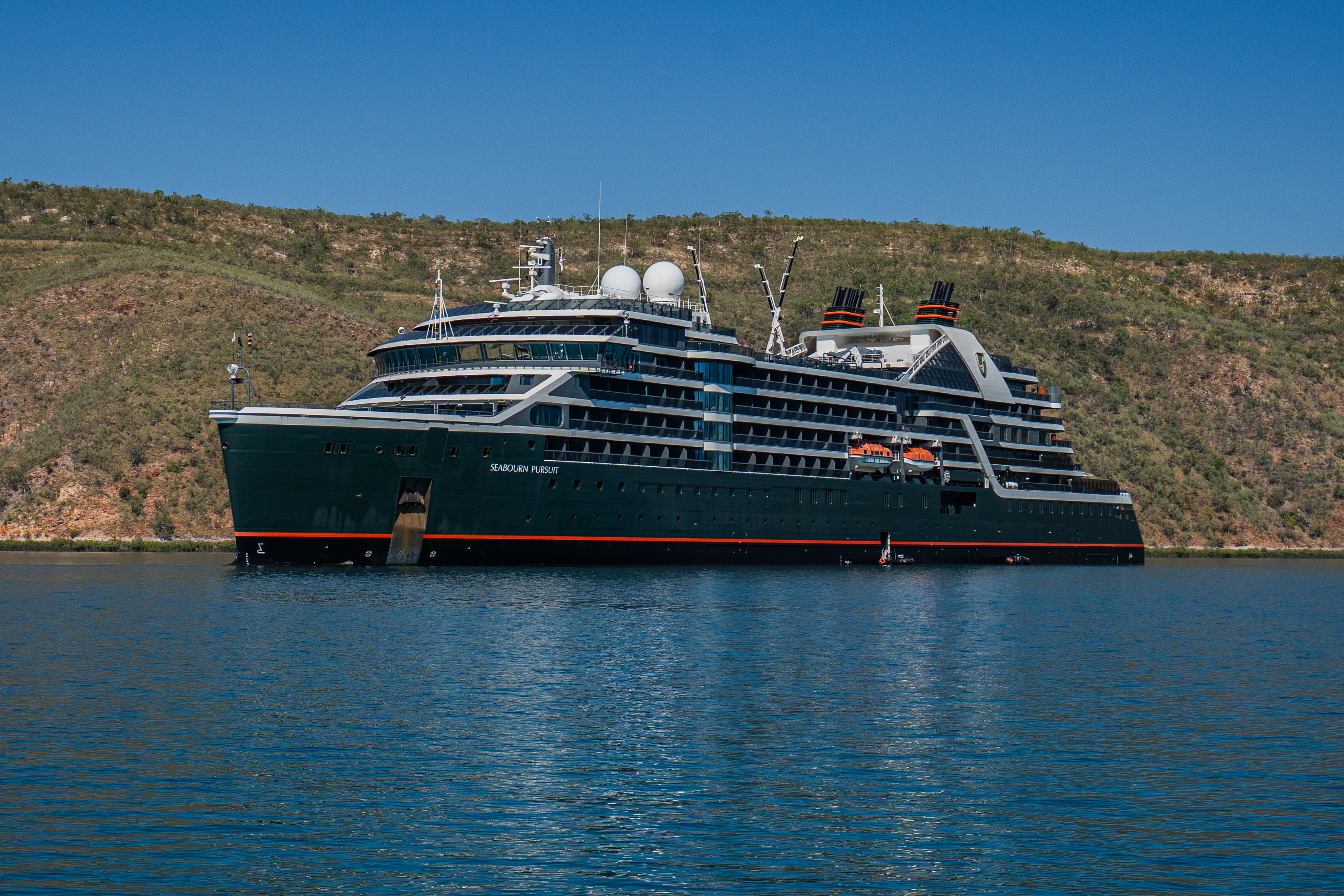
Seabourn Pursuit
To reach some of the most coveted, remote destinations in the world, Seabourn Pursuit is constructed with the hardware and technology necessary to operate capably while delivering a guest experience filled with luxury comforts that leave travelers wanting for nothing.
Explore New Worlds
Visit some of the world's most remote locations, inaccessible to most larger cruise ships but ideal for Seabourn's ultra-luxury yacht-like smaller ships. Journey to Antarctica, the South Pacific or the Kimberley region for the ultimate in bucket-list travel.
Learn more about Seabourn's newest purpose-built, ultra-luxury Expedition ship. She is truly a state-of-the-art vessel, with a yacht-like atmosphere, and incredible design details that stimulate all the senses and seamlessly blend the worlds of luxury with exploration and discovery. No compromises – now you can have it all!
Ship Facts
| Launch Year | 2023 | ||||||||
| Refit Year | |||||||||
| Language | en | ||||||||
| Gross Tonnage | 23615 | ||||||||
| Length | 170 | ||||||||
| Width | 24 | ||||||||
| Currency | USD | ||||||||
| Speed | 22 | ||||||||
| Capacity | 264 | ||||||||
| Crew Count | 120 | ||||||||
| Deck Count | 8 | ||||||||
| Cabin Count | 132 | ||||||||
| Large Cabin Count | N/A | ||||||||
| Wheelchair Cabin Count | 3 | ||||||||
| Electrical Plugs |
|
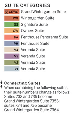
To see the legend for these deck plans, please hover your mouse over the images below
To toggle the legend for these deck plans, please tap on any of the images below
Deck 10
- Sun Deck

Deck 9
- Constellation Lounge
- The Club

Deck 8
- Bridge
- Signature Suites
- Penthouse Suites
- Panorama Veranda Suites
- Veranda Suites (x1 Accessible suite available)

Deck 7
- Fitness Centre
- Treatment Rooms
- Spa & Wellness
- Penthouse Spa Suites
- Veranda Spa Suites
- Wintergarden Suites
- Panorama Veranda Suites
- Veranda Suites (x2 Accessible suites available)
- Owner's Suites

Deck 6
- Seabourn Square
- Bow Lounge
- Veranda Suite
- Panorama Veranda Suite

Deck 5
- The Colonnade
- Meeting Room
- Infinity Pool
- The Patio
- Veranda Suite
- Panorama Veranda Suite

Deck 4
- The Restaurant
- Expedition Lounge
- Shop
- Discovery Centre
- The Studio

Deck 3
- Zodiac Embark
- Landing Zone
- Medical Facility

Our world-class dining and culinary experiences rival the finest restaurants around the globe - even when we sail in the most remote destinations.
Each Seabourn ship offers a choice of dining venues to suit your mood of the moment. All dining venues are complimentary, and nearly all are open-seating, inviting you to dine where, when, and with whom you wish.
Complimentary fine wines are poured with lunch and dinner, and there is never an extra charge for any dining choice. You can even enjoy a meal in your suite or on your veranda.
The Restaurant
Before Seabourn, open-seating dining on a cruise ship was unheard of. Come when you like, with whom you please, and be seated as you wish. The room is beautiful, the cuisine is exquisite, and the service is simultaneously flawless, friendly and fun.
Colonnade
Our more casual, indoor/outdoor alternative, features an open kitchen, lavish buffets or table service for breakfasts and lunch, and serves regionally themed, bistro-style dinners with table service nightly.
The Patio
Relaxed poolside dining offering luncheon buffets, salads, soups, grilled specialties and freshly baked pizza. Dinners feature a full menu in an alfresco setting. For The Patio, Chef Keller has developed exclusively for us, a signature Napa burger, as well as an artisanal hot dog dubbed the Yountwurst, named for the hometown of The French Laundry, Ad Hoc, and the original Bouchon and Bouchon Bakery.
Earth & Ocean
Each evening, our skilled Earth & Ocean chefs create an imaginative array of fresh, inventive dishes—a sophisticated menu celebrating eclectic traditional flavors from around the world, served in a relaxed setting under the stars for a distinctive dining experience unlike any other on board.
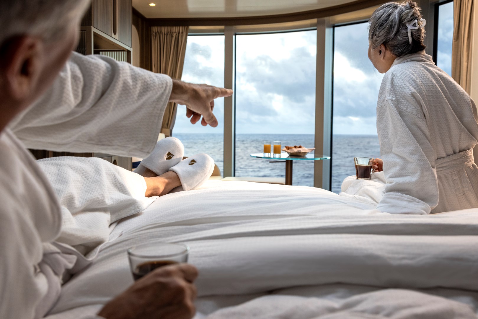
In-Suite Dining
Seabourn is pleased to offer a varied menu available around the clock for service in your suite. You may also order dinner from The Restaurant menu and have your meal served, course by course, in your suite or on your veranda.
Featuring a newly enhanced menu, including a delightful variety of vegan and vegetarian options.
Each day on board offers delicious dining options, world-class entertainment and enriching activities.
Share the journey with a daring explorer or celebrated performer as part of Seabourn Conversations, where experts don’t just lecture, they are part of the daily social scene. Complete your day at sea with world-class fine dining, exclusive entertainment, and an evening of dancing under the stars.
Make yourself at home with delightful daily diversions that add to our fleet’s private yacht-like atmosphere. Connect with fellow travelers in Seabourn Square or rise to the challenge in a game of trivia.
Seabourn Square
A place to enjoy some light reading or to socialize with your fellow passengers, Seabourn Square is what you're looking for. Seabourn Square is the true ‘living room’ of the ships. An inviting sociable space where guests will find a charming European style coffee bar, Seabourn Square has been designed as an open, comfortable environment for guests to interact with onboard officers and the expedition team and engage in conversation with family and new friends. The space is also home to the highly-trained Guest Services staff, who provide a range of concierge services such as general ship information, assistance with special service requests, port and travel information, and more.
A selection of coffees are prepared by the skilled onboard baristas some using beans roasted in Seabourn Square. For those feeling a bit hungry, Seabourn Square offers freshly made pastries and other on-the-go breakfast items in the morning, as well as an assortment of light sandwiches and desserts later in the day, along with a selection of artisanal gelati made on board. Guests will also find a wide range of books in the adjoining library, with a host of titles on subjects such as adventure, expeditions and other topics of interest to enjoy while onboard. Staying current with the news is made easy with tablets featuring the Press Reader news application available to browse each day.
Expedition Lounge
The Expedition Lounge, located on Deck 4, is the heart of the ship. A gathering place for the curious, guests are invited to relax or linger with a complimentary cocktail or glass of fine wine from the bar as they share photos and stories from the day with their fellow travelers and the onboard staff. The Expedition Lounge will be central to the Seabourn expedition operation where guests convene before and after expeditions each day.
Custom furniture designed in a variety of warm, natural materials creates an inviting, tactile atmosphere. An ode to the adventurous, the Expedition Lounge features an etched glass partition displaying a vintage map of Antarctica and vitrines showcasing intricate tools and devices of the trade. Two large touchscreens will also display a wealth of information including photos, navigational charts, weather charts, and maps.
Bow Lounge
Located on Deck 6, at the forward-most part of the vessel, the Bow Lounge provides the closest access to water level via the foredeck, making it the perfect spot for guests to spend some time watching for marine life. Within a few steps, guests can be outside, with a vantage point that is ideal to watch the ship’s course, spot wildlife, or take in the beautiful natural scenery.
The Bow Lounge introduces some technological enhancements, providing guests with a first for Seabourn with touch screens showing the ship’s plotted location, as well as navigational charts and scientific information used to help guide the ship on its journey. Large screens project live footage from mounted cameras outside the ship, and from a drone when conditions permit, while the touch screen monitors invite guests to explore on their own with a live map, weather information, and notes detailing upcoming expeditions. Expedition Team members will be available within the Lounge throughout the day to interact with guests, answer questions, provide interpretation and aid in spotting wildlife.
The space provides direct access to the Bow Sprit on Deck 6 forward (when conditions permit) to give guests the sensation of standing in front of the ship and views of waves parting and ice sloughing off the bow at the waterline.
Atrium
Designed by hospitality design icon Adam D. Tihany, the ship’s public spaces exude casual elegance at every turn, from the soaring sky-lit Atrium, to the inviting Expedition Lounge and into each guest suite. Rich textures and first-rate materials take shape in modern-yet-timeless settings that are made for socializing, relaxing, learning and exploring.
Sky Bar
Overlooking the beautiful Pool Patio, the open-air Sky Bar presents you with a gorgeous setting to take a break from the afternoon sun while enjoying a refreshing tropical beverage, or spend the evening enjoying a few social cocktails under the stars.
Constellation Lounge
The Constellation Lounge is the highest indoor viewing point on each ship. Floor-to-ceiling glass walls wrap around the space, offering guests stunning 270-degree, outward-facing views as far as their eyes can see, heightening their expeditionary spirit while bringing them closer to wildlife and wonders at sea and in port.
In addition, the expedition team will be in the lounge regularly to help identify points of interest, wildlife and geological wonders. Imagine glimpsing killer whales, waddling penguins, and sea lions in Antarctica; sleepy-eyed sloths, sprightly monkeys, and colorful parrots in the rainforests of South and Central America; and icebergs bobbing in the seas and waterfalls rushing over cliffs in the far reaches of the Arctic and Northern Europe – all from the comfort of the Constellation Lounge.
The Constellation Lounge offers Seabourn’s popular Early Morning Riser continental breakfast, while afternoons features the line’s popular and recently enhanced Afternoon Tea service. Steeped in the tradition of proper English tea service, yet as fresh and memorable as a newly brewed pot, the elegant daily tea service incorporates the finest luxury tea brand TWG Tea. As the sun dips and the night sky lights up, live piano entertainment delights guests as cocktails and tapas are served both before and after dinner.
Evenings Under The Stars
One of the most FUN evenings during any cruise, Evenings Under the Stars is a night where guests can let their hair down and simply be in the moment. Enjoy Let’s Dance! with great live music, interact with fellow travelers and be spoiled in true Seabourn style by our food and beverage team with Desserts Under the Stars. A signature event, this dance party has been a part of the line’s rich culture, and a Seabourn cruise is not complete without Let’s Dance! and Desserts Under The Stars.
Weather permitting, this high-energy dance party is hosted poolside and under the stars by the entire entertainment team, featuring performances by The Band, vocalists and dancers. There is even the possibility your Cruise Director and Assistant Cruise Director might jump on stage to perform, as well! Guests can expect music that appeals to everyone’s taste with a great mix of hit songs. It’s a real treat and guests LOVE Evenings Under the Stars!
The Club
The liveliest lounge on board is the scene of daily afternoon tea service. It is a popular spot for pre-dinner drinks and dancing to live music. After dinner, the dancing music continues, and later a DJ spins dance music until late at night. Another terrace of open deck aft of The Club boasts a plunge pool and two small whirlpool spas.
Card Room
Many veteran cruisers specifically choose cruises that provide at least a few days at sea. The Card Room is a great choice for the sea-loving cruiser who craves that languorous feeling of lazy leisure. There will be loads of on board activities during those days, including a great game of bridge.
Meeting Rooms
For meetings and gatherings, our ships offer meeting rooms that can accommodate up to 40 guests. The meeting rooms can be arranged to guests’ specifications including theater-style or with tables; and each of the rooms have large-screen TVs for presentations. Guests may also reserve the Card Room when available. Our crew members are happy to assist guests with meeting room reservations and setup.
Shops
Whether you're buying souvenirs for your friends at home or want a memento of your vacation, our Shops will have what you need. Shop for fashion and cosmetics at The Boutique, jewelry and fine watches at The Collection, or logo cruisewear at the Shop.
Zero @ Sea
A Zero-proof cocktail experience featuring a unique array of non-alcoholic cocktails
Zero @ Sea offers an inventive menu of mixology cocktails, with ingredients and flavors free of alcohol, such as elderflower, bursts of fresh citrus, botanical spirits, and more.
Zero @ Sea cocktails are available fleetwide in all bars and lounges aboard the ships together with an upgraded selection of nonalcoholic wines, sparkling wines, and beers.
The new cocktails were developed by Seabourn’s expert culinary and beverage team, led by Michael Simon, senior manager of restaurant and bar operations, and Francisco Fernandes, corporate manager service operations.