
Natural Treasures of Indonesia, Borneo & Taiwan
Natural Treasures of Indonesia, Borneo & Taiwan
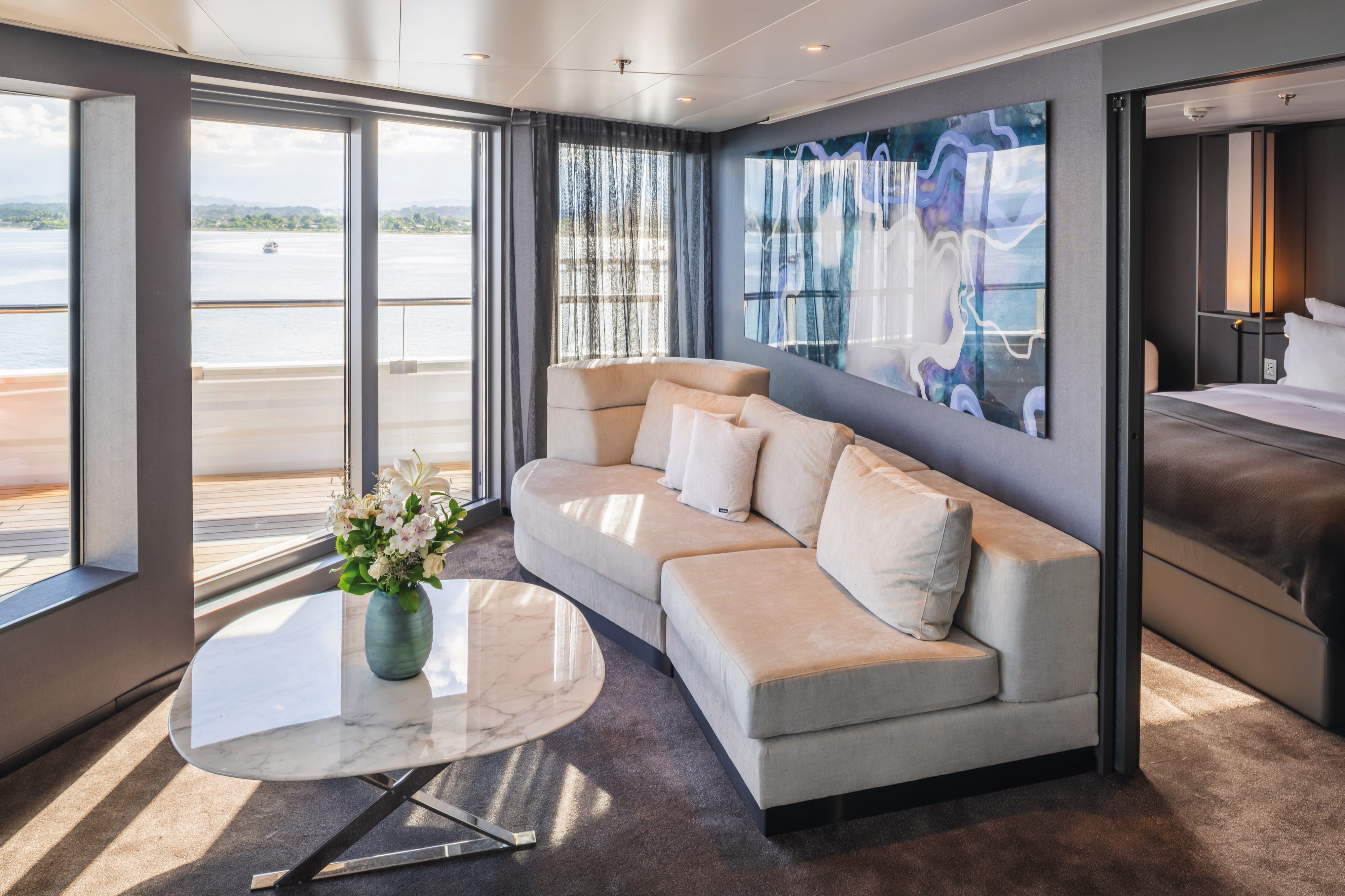
Cruise overview
WHY BOOK WITH US?
- ✔ The Deluxe Cruises’ team has extensive experience in ultra-luxury cruising.
- ✔ Call now to speak to our helpful and experienced Cruise Concierge team.
- ✔ Enjoy our Unique Deluxe Cruises Bonus for substantial savings.
- ✔ Our team will tailor your holiday to your exacting requirements.
- ✔ As agents, we work under the protection of each cruise lines ABTA / ATOL licences
About Benoa, Bali
Bali really is as alluring as everyone says. This island, slightly bigger than Delaware, has it all: beaches, volcanoes, terraced rice fields, forests, renowned resorts, surfing, golf, and world-class dive sites. But what sets Bali apart from other nearby tropical destinations is Balinese tradition, and villagers dedicated to celebrating it. The hundreds of temples, dances, rituals, and crafts linked to their ancient Hindu faith aren't a show for tourists, but a living, breathing culture in which visitors are warmly received by the Balinese, who cherish their own identities.

About Badas Port
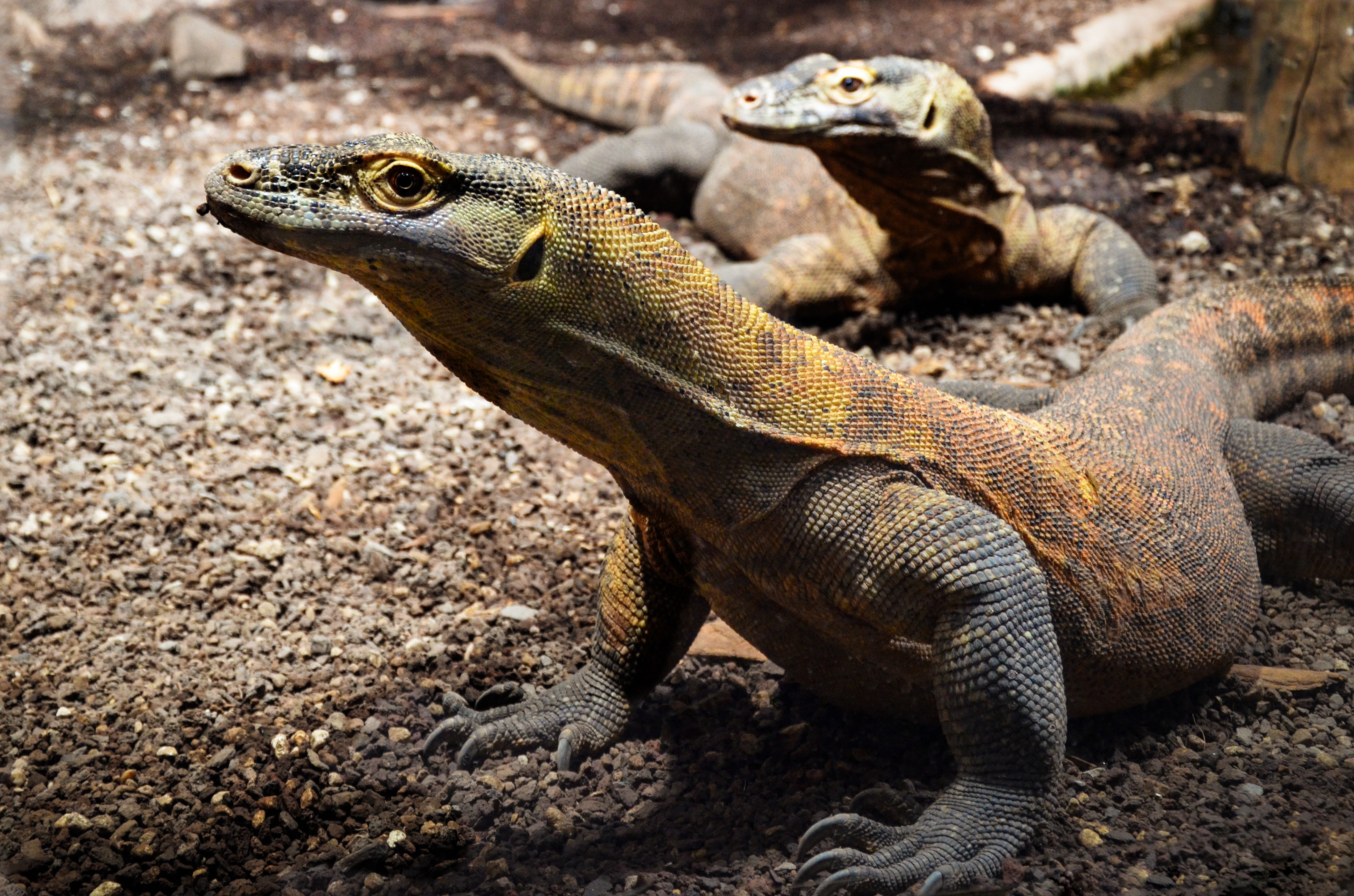
About Komodo Island
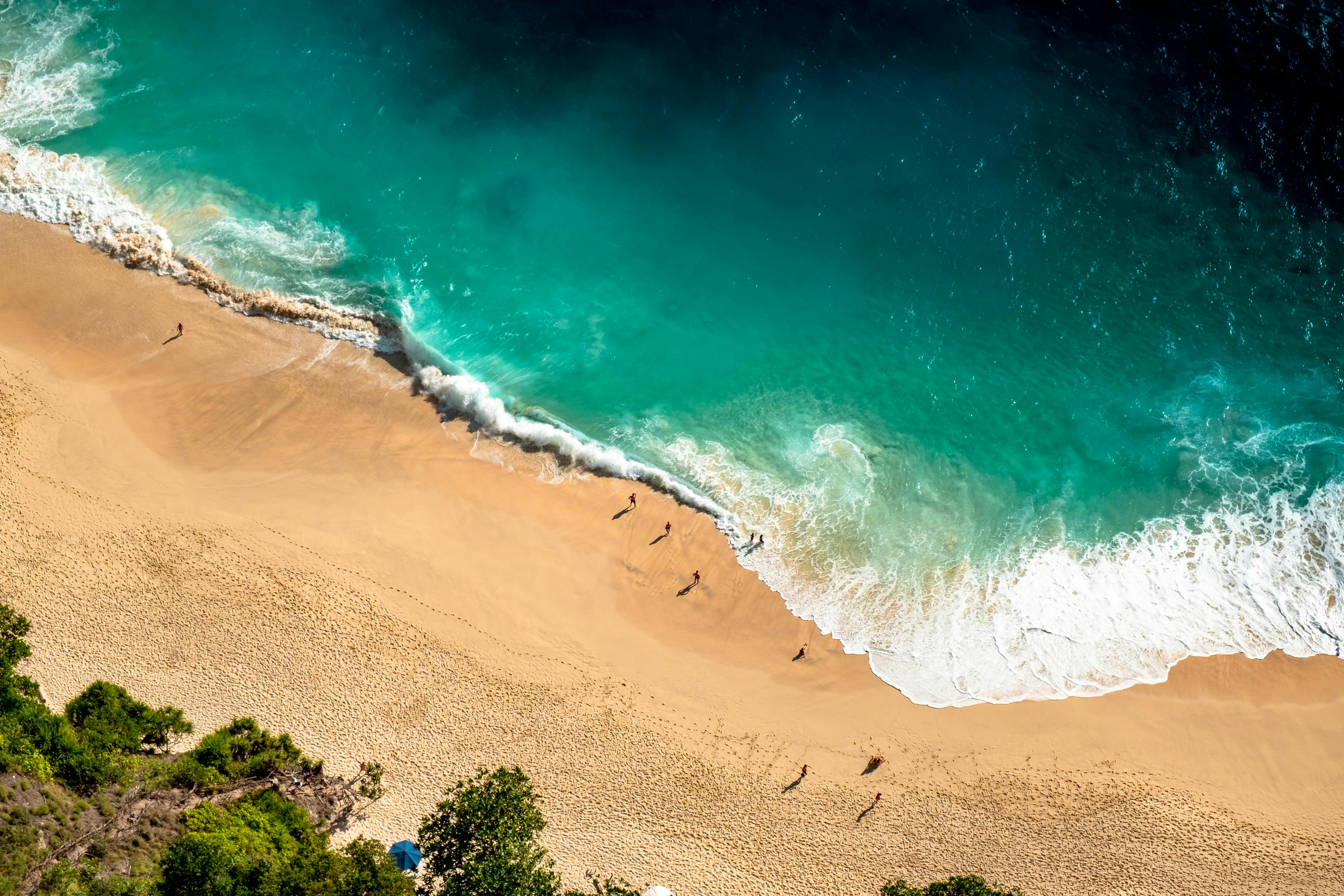
Pink Beach earned its name for the way the beach can appear to have a rosy hue in certain lights. The color comes from small flecks of red coral mixed in with the fine white reef sand. With a few trees along the beach for shade, this stretch of coast makes a fine place to relax or enjoy a snorkel or dive in the crystal clear waters. It is possible to spot a striped clown fish nestled among the protective tentacles of its sea anemone host, or to see a grouper lazily swimming by a flamboyant soft coral. The reef here is now protected by law and the maturing corals are a joy to behold.
About Pulau Jinatu
About Palopo
Palopo is a town of roughly 150,000 inhabitants. Founded at the northeastern end of the Gulf of Boni in the early 17th century, the town has always been a link for the Toraja people in the highlands of Sulawesi. A pleasant temperature and little rain during most of the year are only changed by the west monsoon from December to March when heavy rain and high humidity arrives. Near Palopo are clear rivers and small waterfalls. Surrounding Palopo and leading into the highlands are small plantations of mango, durian and rambutan. Because open and flat spaces are limited, on many occasions the locals use the roads to dry coffee beans in the bright sunshine.
About Makassar
About Pulau Kakaban
About Sandakan, Sabah
Borneo's forbidding interior made it less attractive to early traders and explorers than neighboring areas, so what is now the state of Sabah remained unexploited by the British until the late 19th century, although traders long visited for exotic items such as bird's nests (for the celebrated Chinese soup). In 1963, Sabah joined Sarawak, Malaya, and Singapore (which later seceded) in forming the Federation of Malaysia. Known as the "Land Below the Wind" because it's south of the typhoon belt, Sabah occupies Borneo's northern tip. It shares its southwestern border with Sarawak and the rest of its southern border with the Indonesian province of East Kalimantan. Today vast tracts of forest have been replaced by oil-palm plantations, and a sizable portion of remaining forest land is protected in national parks or conservation areas.On the shore of a deep bay, Sandakan was the capital of British North Borneo and one of the most important towns in Southeast Asia from the 1880s through the 1930s. But Japanese occupation during World War II and allied bombing virtually destroyed the town, and the capital was transferred to Jesselton (now Kota Kinabalu) in 1946. Sandakan enjoyed a revival in the 1970s as the center of the region's logging industry. Logging has since declined, but Sandakan is still worth visiting for its rich history and proximity to some of Borneo's most accessible wildlife attractions. Sandakan's downtown, much of it built on landfill, is squeezed between a steep promontory and Sandakan Bay. In recent years, this city of 450,000 (counting its extensive suburbs) has begun redeveloping its downtown waterfront into a shopping and nightlife hub. Its working harbor area for passengers and cargo is 6 km (4 miles) west of downtown.
About El Nido/Puerto Princesa
About Manila
MANILA, the capital city of the Philippines, was founded in, 1571 by Spanish conquistador Miguel López de Legazpi. It is one of the oldest cities in the country and was the seat of power for most of the colonial rules of the Philippines. It is situated on the eastern shore of Manila Bay and contains a multitude of landmarks, some of which date back to the 16th century. It is home to the baroque 16th-century San Agustin Church as well as Fort Santiago, a storied citadel and military prison. In the 19th century Manila became one of the most modern cities in Asia. Before the Spanish–American War, Manila saw the rise of the Philippine Revolution. Under the American rule following the Spanish-American War, the United States changed the official language from Spanish to English. Towards the end of World War II, during the Battle of Manila, most of the city was flattened by intensive aerial bombardment. Today, tourism is a vital industry in Manila. Major shopping malls and bazaars thrive around Manila.
About Hualien
One of the world’s biggest producers of marble, Hualin is the largest city on the east coast of Taiwan. Sitting on the mountain-fringed plains just south of the Taroko Gorge, it is a great location from which to explore Taroko National Park.

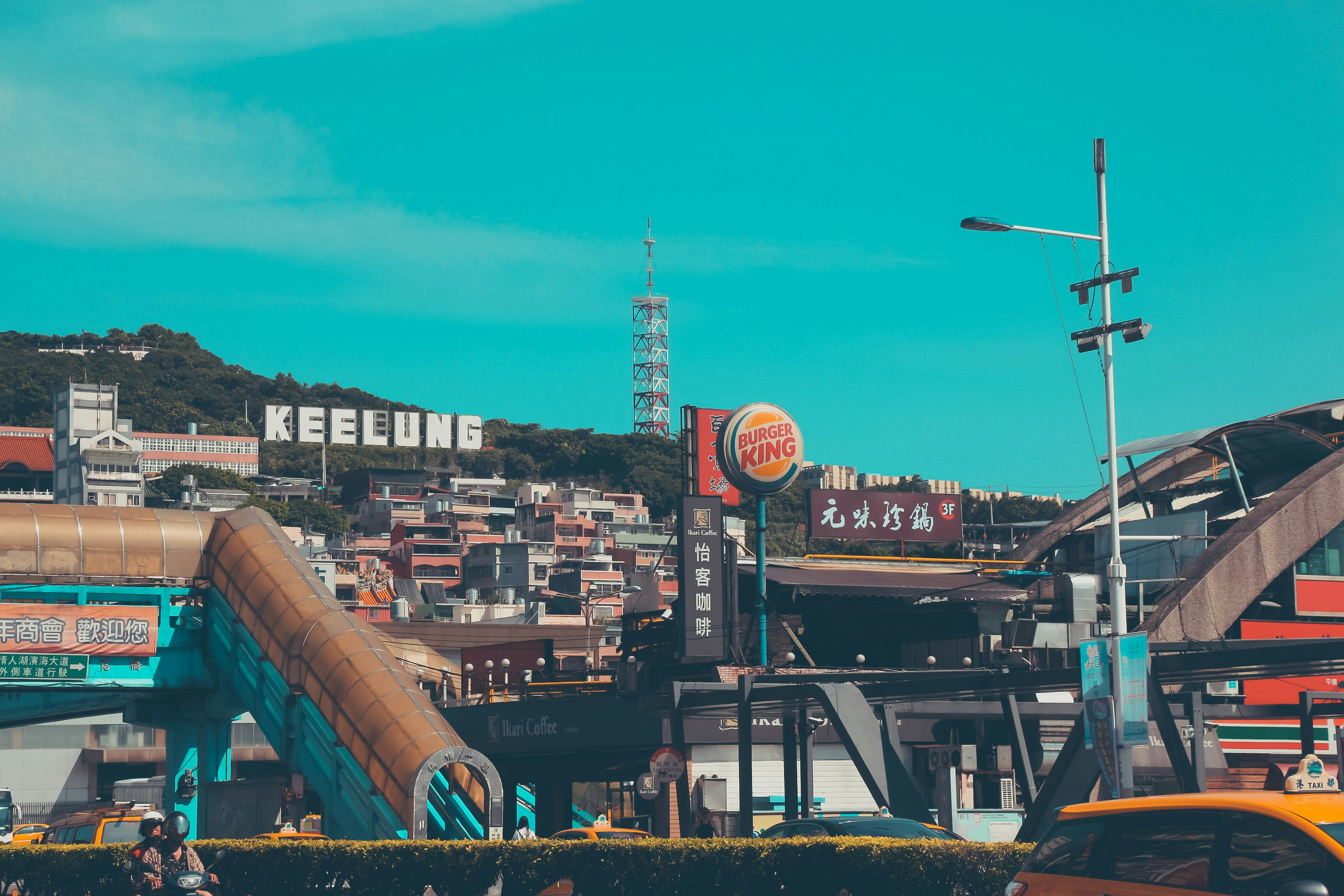
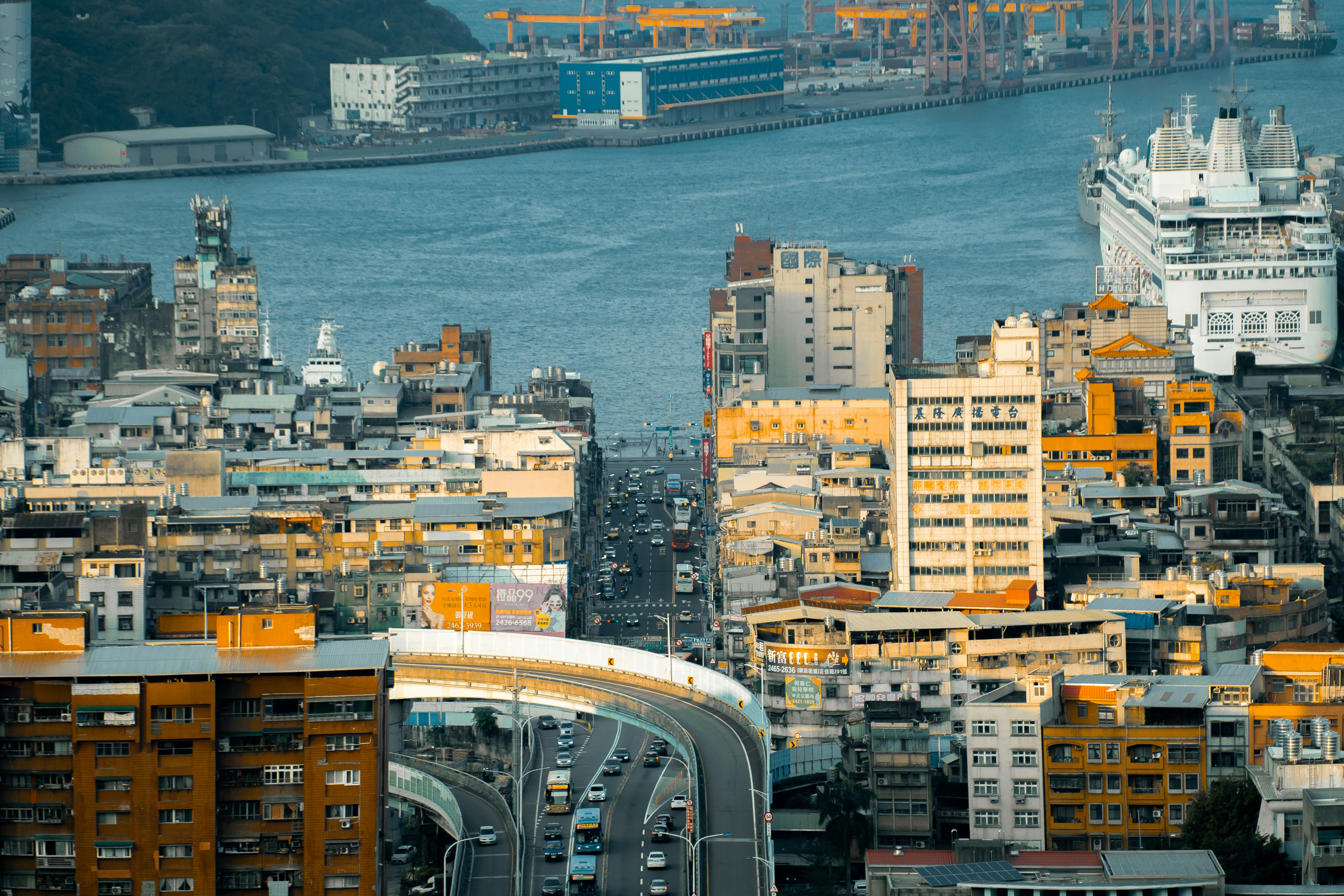
About Keelung (Chilung)
With the glittering lights of Taipei - a futuristic metropolis of culture and ideas - sparkling nearby, Keelung is the first calling point for many visitors arriving in Taiwan. While this port city essentially serves as Taipei's ocean gateway, you shouldn’t be too hasty in dashing off to Taipei's neon-lit magic – first it’s well worth spending some time exploring the famous glowing night market, which hums with life each evening and is famous for its local seafood.


Where You'll Go


