Ultimate Viking Discovery: Iceland to Greenland
Ultimate Viking Discovery: Iceland to Greenland
Cruise overview
WHY BOOK WITH US?
- ✔ The Deluxe Cruises’ team has extensive experience in ultra-luxury cruising.
- ✔ Call now to speak to our helpful and experienced Cruise Concierge team.
- ✔ Enjoy our Unique Deluxe Cruises Bonus for substantial savings.
- ✔ Our team will tailor your holiday to your exacting requirements.
- ✔ As agents, we work under the protection of each cruise lines ABTA / ATOL licences
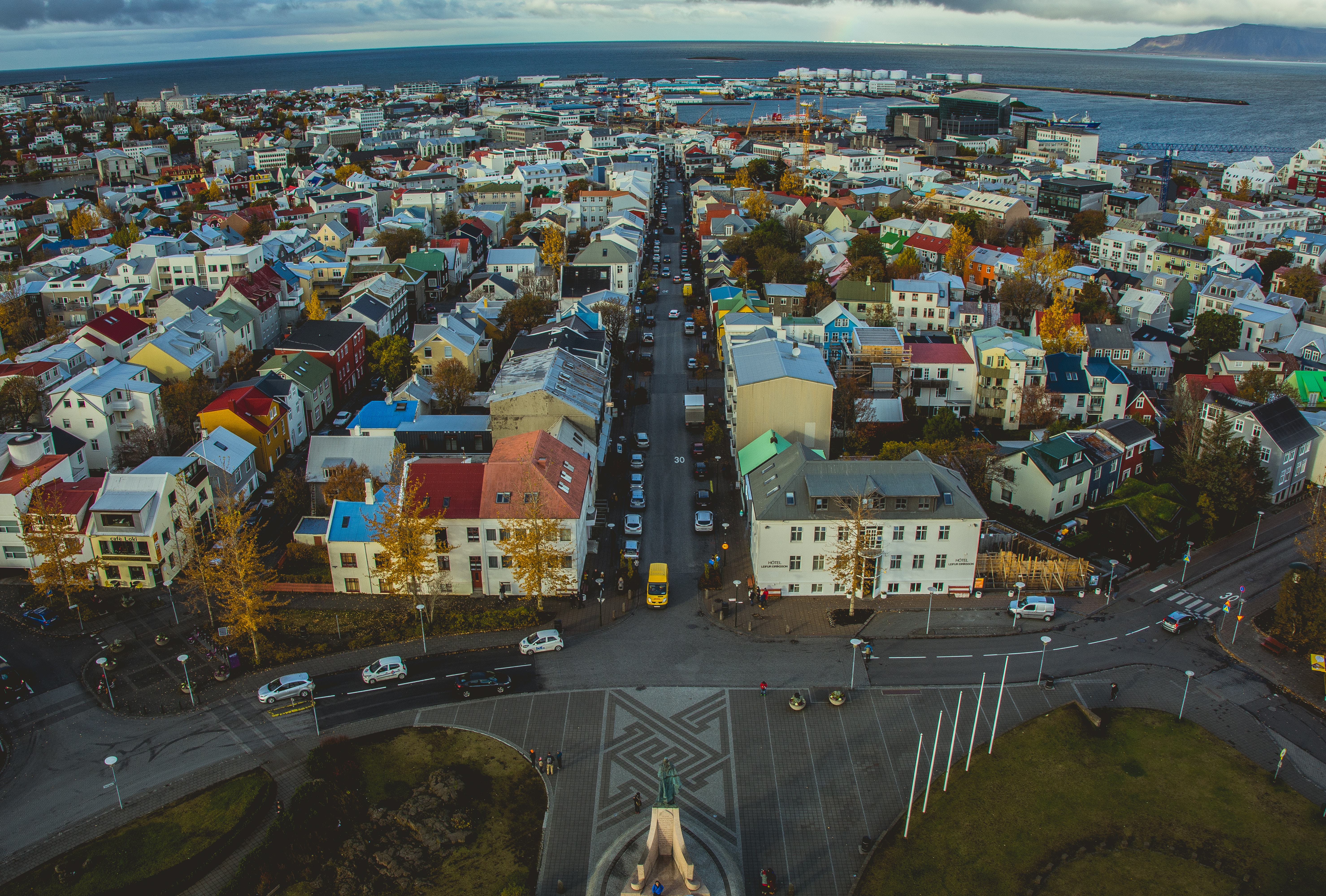
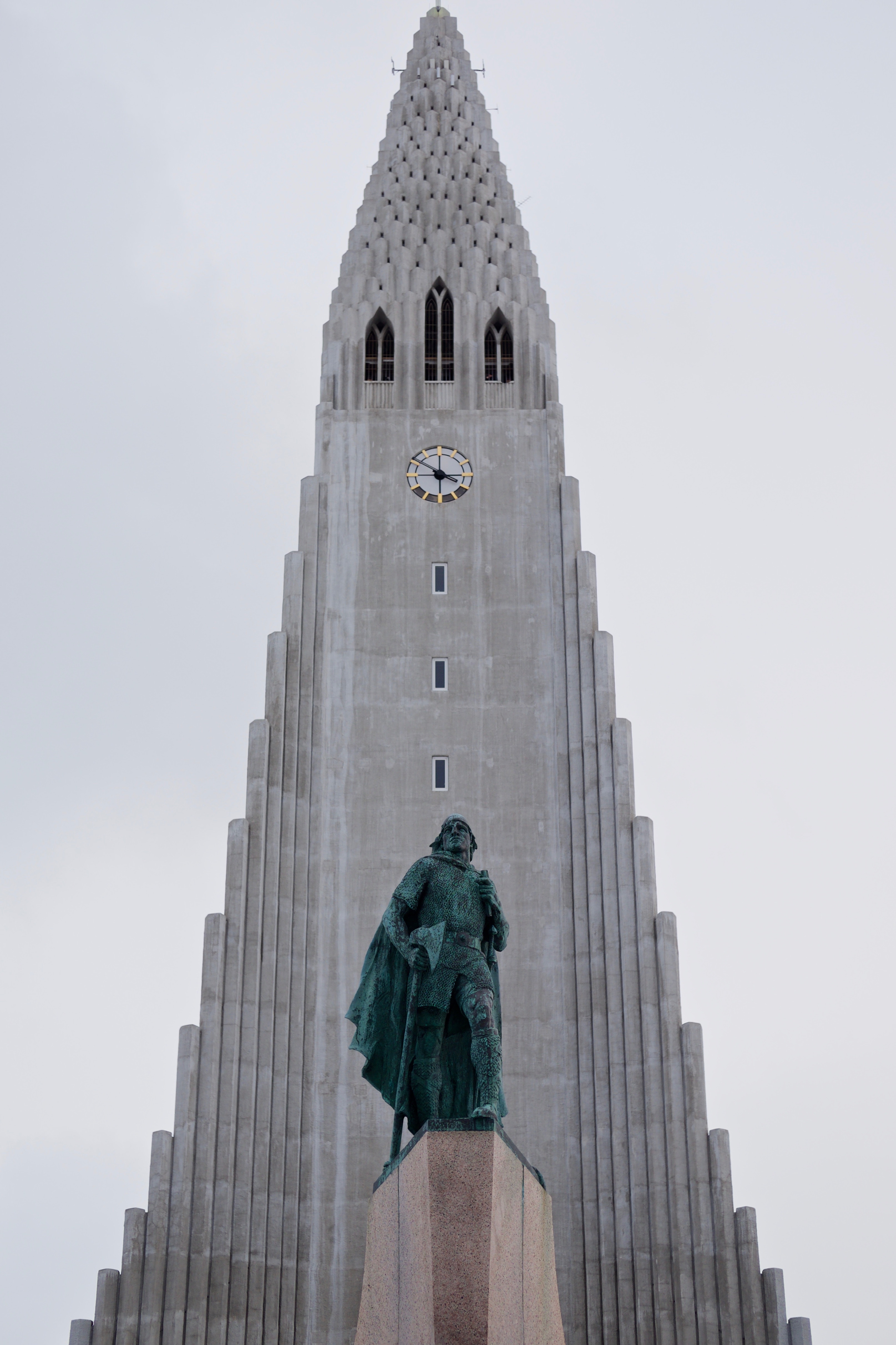
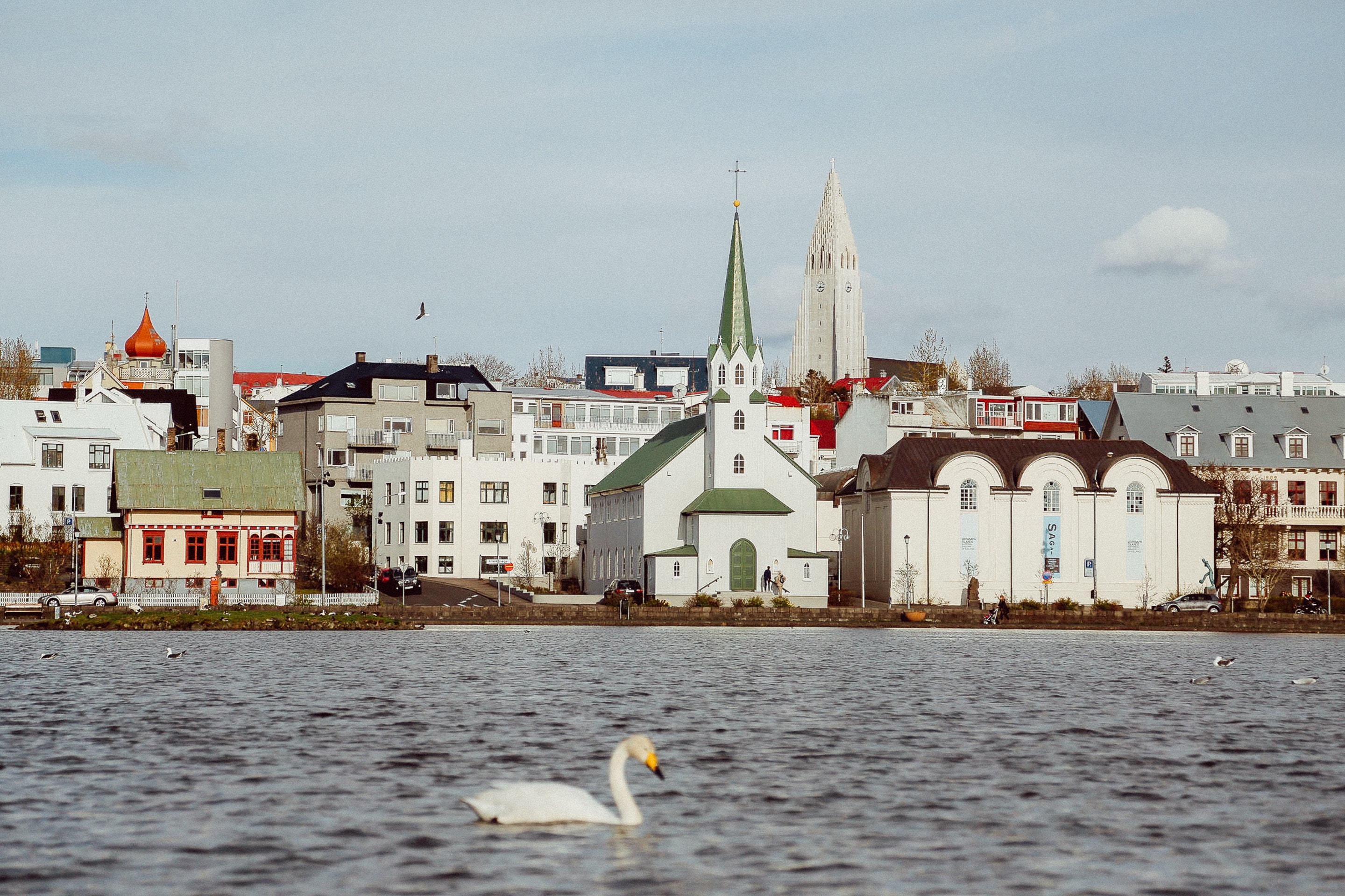
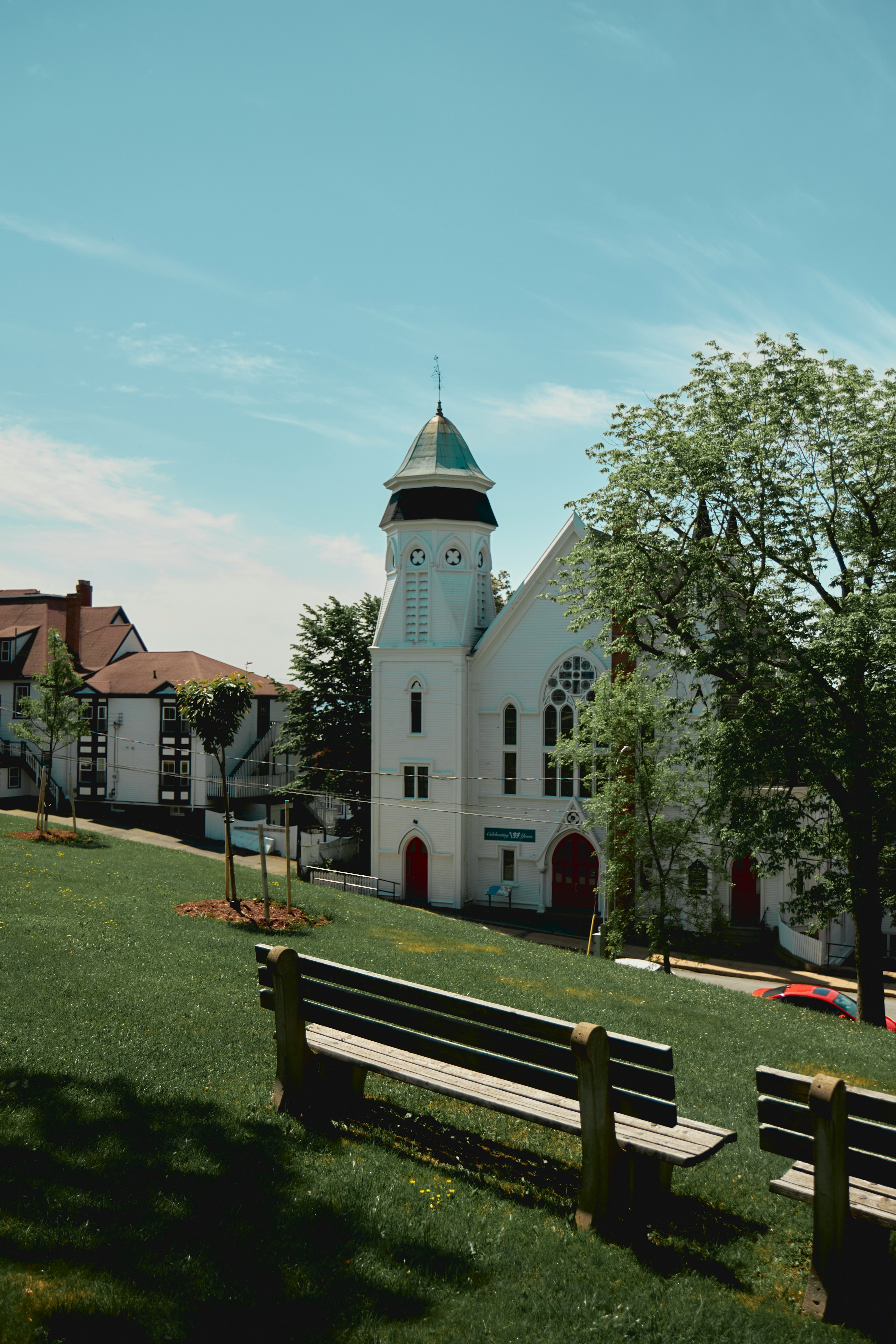
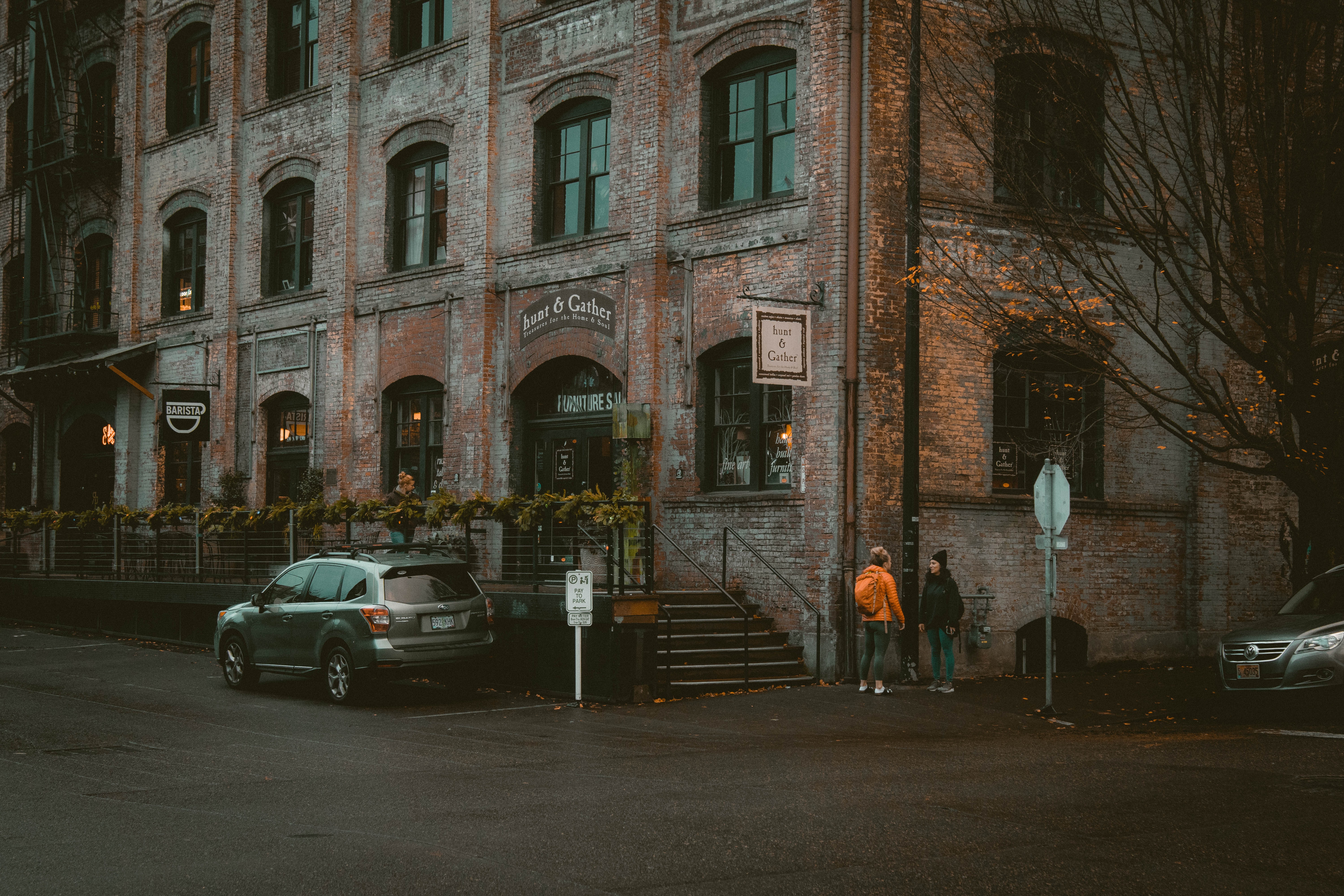
About Reykjavík
Sprawling Reykjavík, the nation's nerve center and government seat, is home to half the island's population. On a bay overlooked by proud Mt. Esja (pronounced eh-shyuh), with its ever-changing hues, Reykjavík presents a colorful sight, its concrete houses painted in light colors and topped by vibrant red, blue, and green roofs. In contrast to the almost treeless countryside, Reykjavík has many tall, native birches, rowans, and willows, as well as imported aspen, pines, and spruces.Reykjavík's name comes from the Icelandic words for smoke, reykur, and bay, vík. In AD 874, Norseman Ingólfur Arnarson saw Iceland rising out of the misty sea and came ashore at a bay eerily shrouded with plumes of steam from nearby hot springs. Today most of the houses in Reykjavík are heated by near-boiling water from the hot springs. Natural heating avoids air pollution; there's no smoke around. You may notice, however, that the hot water brings a slight sulfur smell to the bathroom.Prices are easily on a par with other major European cities. A practical option is to purchase a Reykjavík City Card at the Tourist Information Center or at the Reykjavík Youth Hostel. This card permits unlimited bus usage and admission to any of the city's seven pools, the Family Park and Zoo, and city museums. The cards are valid for one (ISK 3,300), two (ISK 4,400), or three days (ISK 4,900), and they pay for themselves after three or four uses a day. Even lacking the City Card, paying admission (ISK 500, or ISK 250 for seniors and people with disabilities) to one of the city art museums (Hafnarhús, Kjarvalsstaðir, or Ásmundarsafn) gets you free same-day admission to the other two.
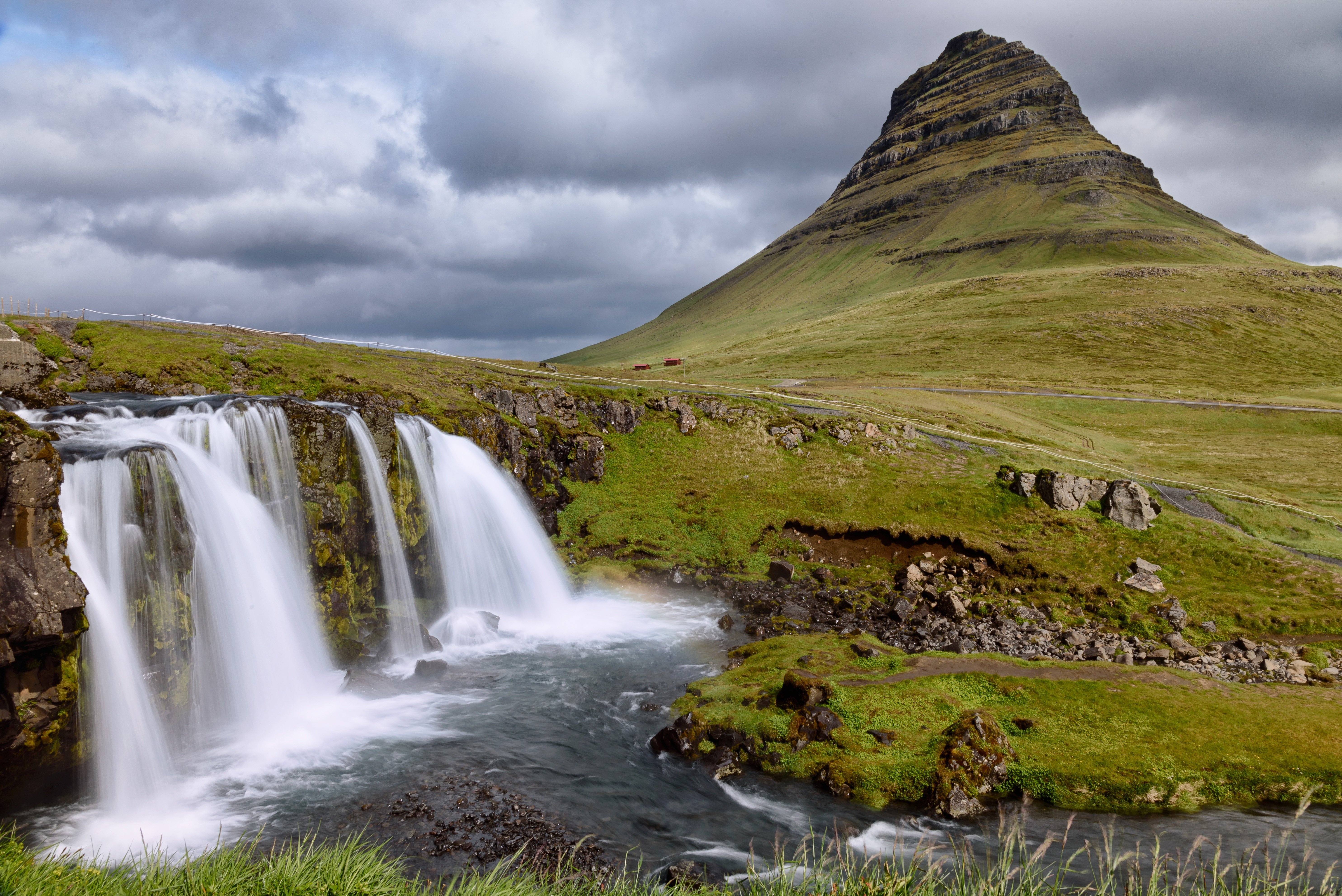
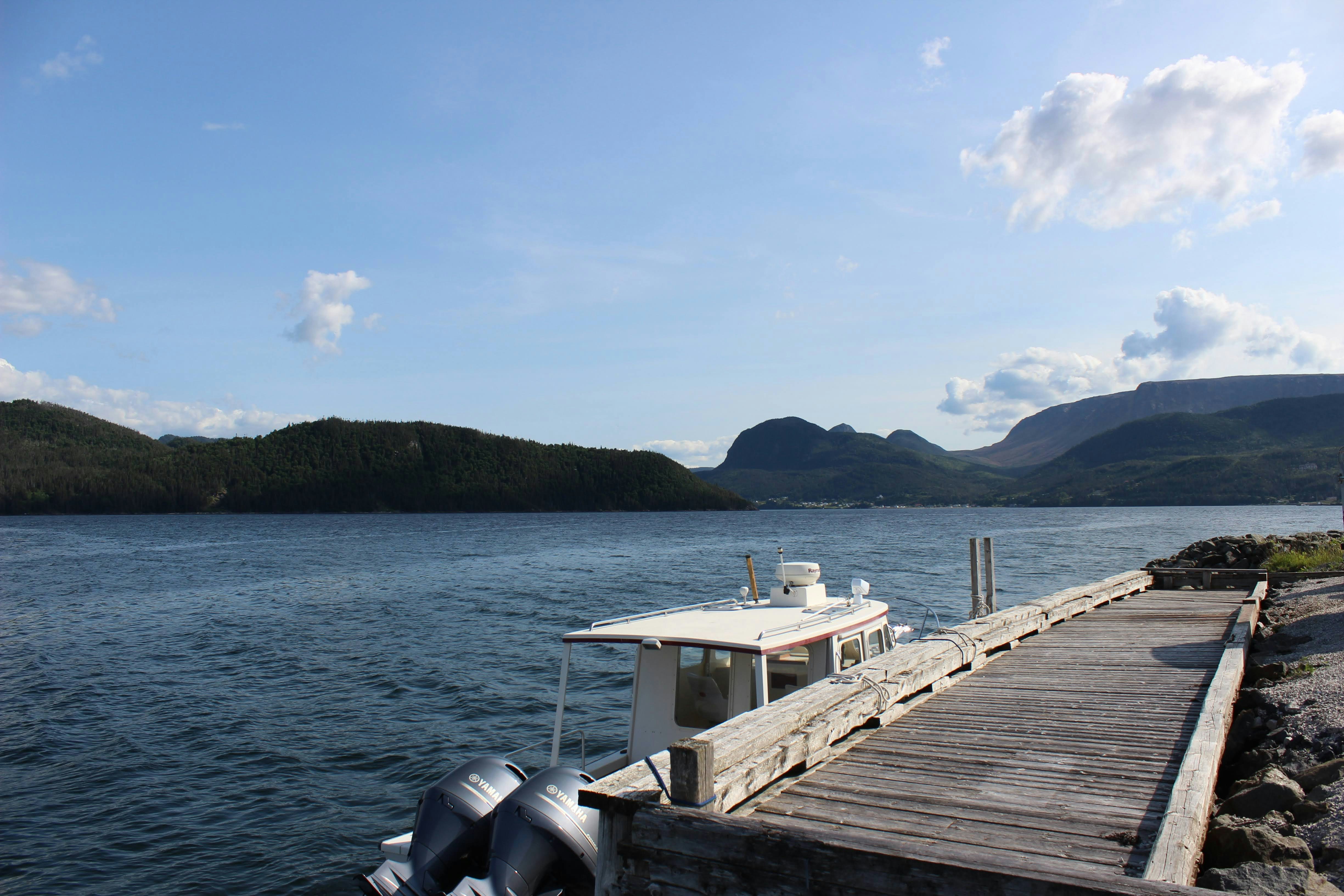
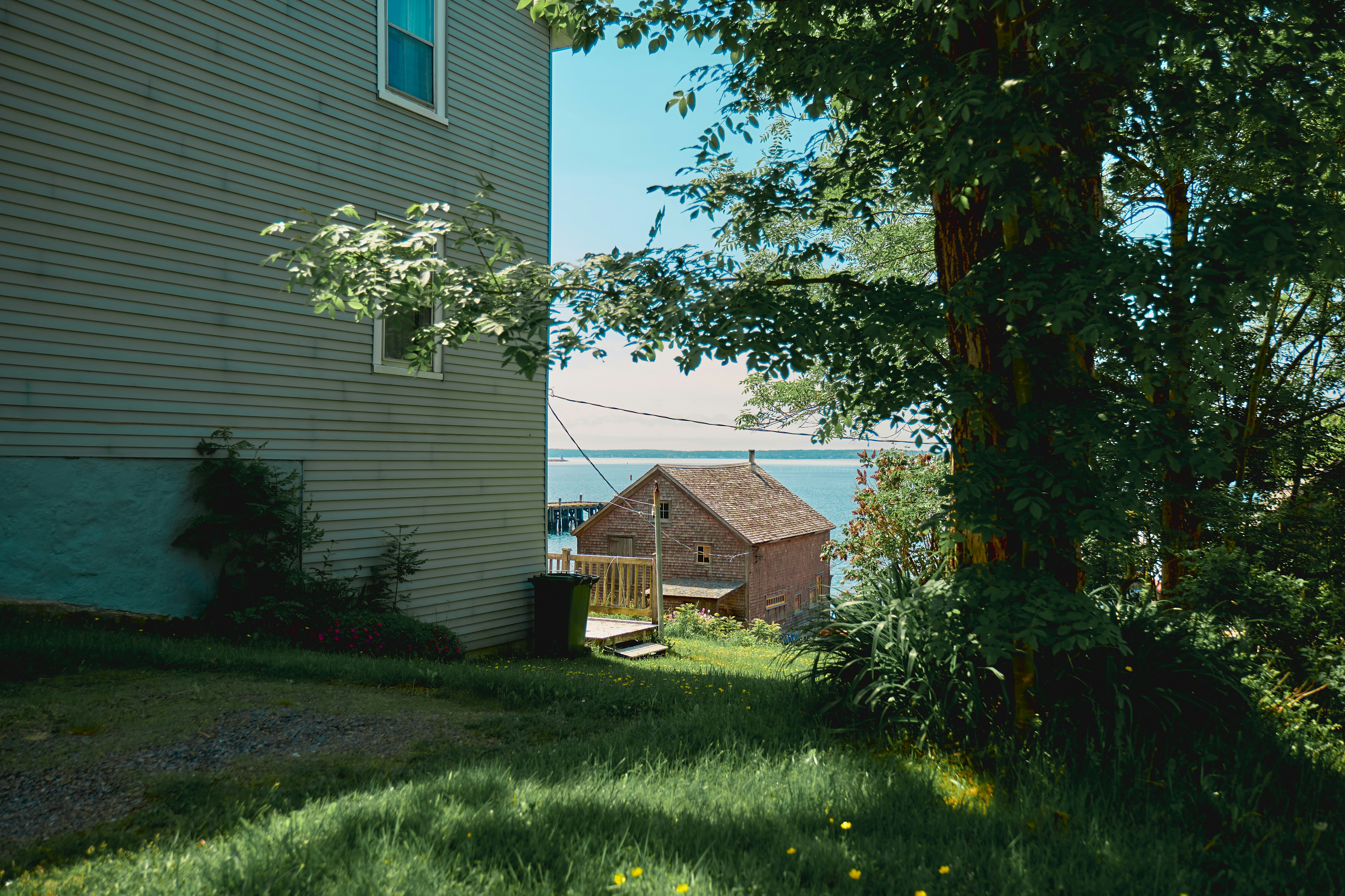
About Grundarfjørdur
About Fridtjof Nansen Halvo
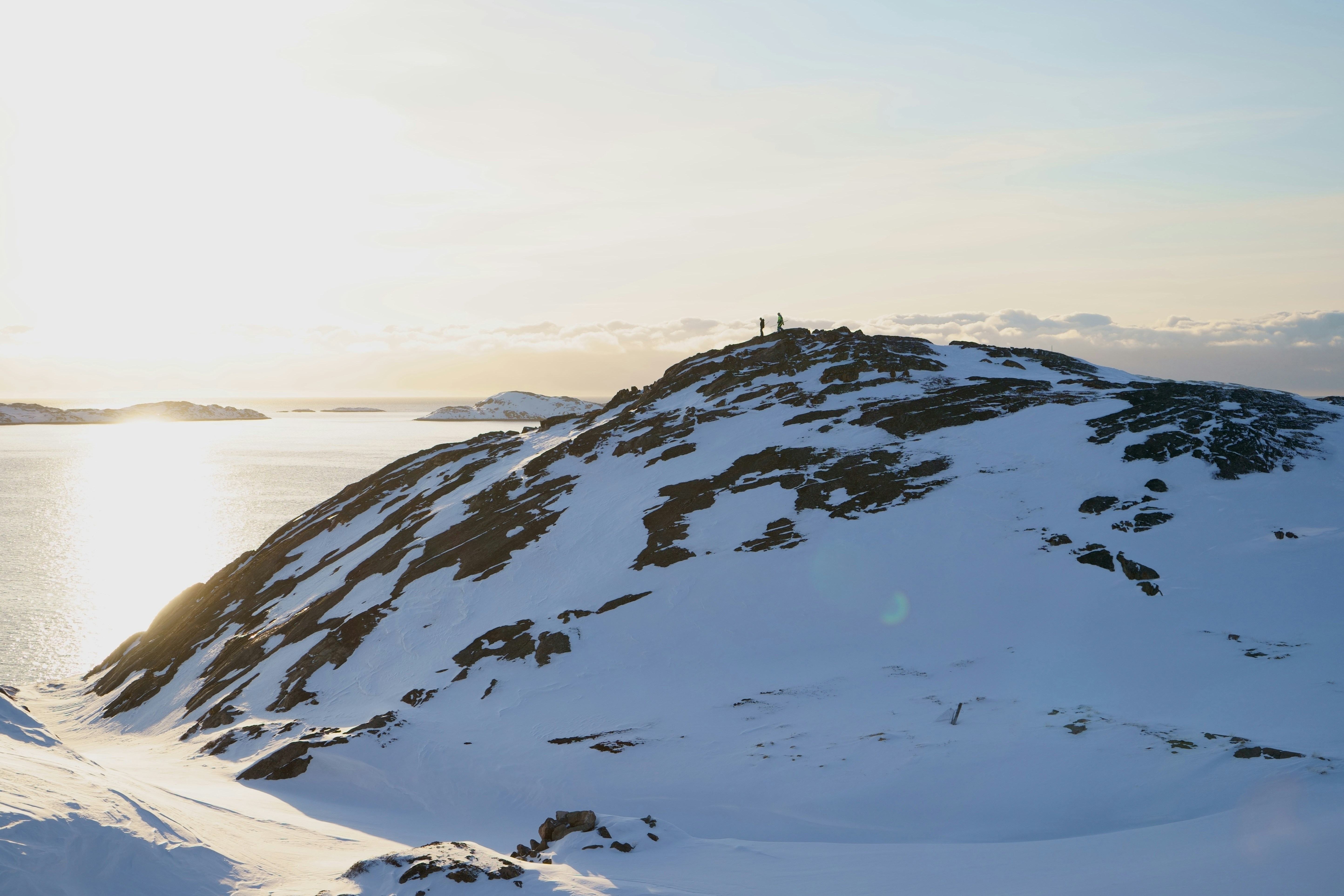
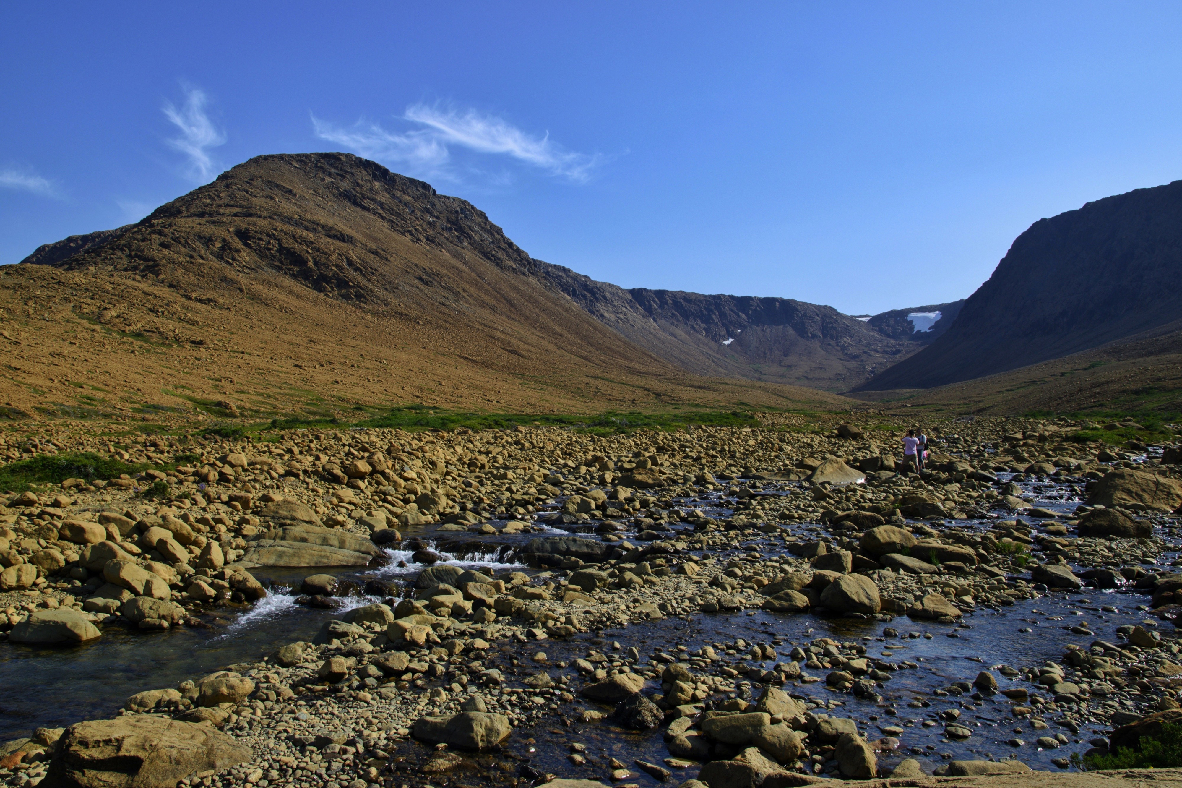
About Prince Christian Sound
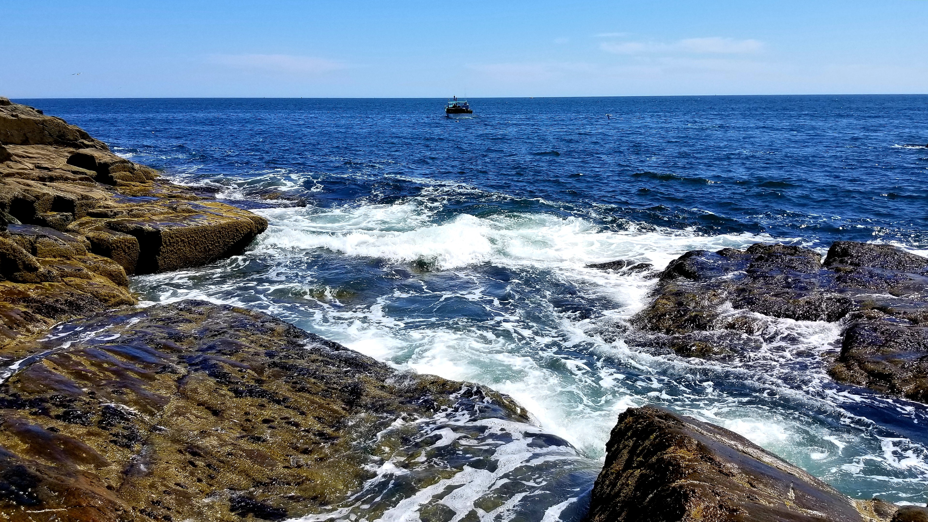
The transit through the Sound is one of this voyage’s highlights. Connecting the Labrador Sea with the Irminger Seat, Prince Christian Sound or “Prins Christian Sund” in Danish is named after Prince (later King) Christian VII (1749-1808). 100 km (60 miles ), long and at times just 500 m (1500 ft) wide, this majestic and spectacular fiord throws you back into a Viking era – flanked by soaring snow-topped mountains, rock-strewn cliffs and rolling hills, it is as if time has stood still and one easily forgets that this is the 21st century. As you marvel at the sheer size of the mountains that surround you, with the Arctic waters lapping deceptively at the hull, revel in the silence enveloping you. Icebergs float serenely by, carrying with them the ages of time. Be sure to wear warm clothing as this is one spectacle that you do not want to miss.
About Herjolfsnes
About Narsaq
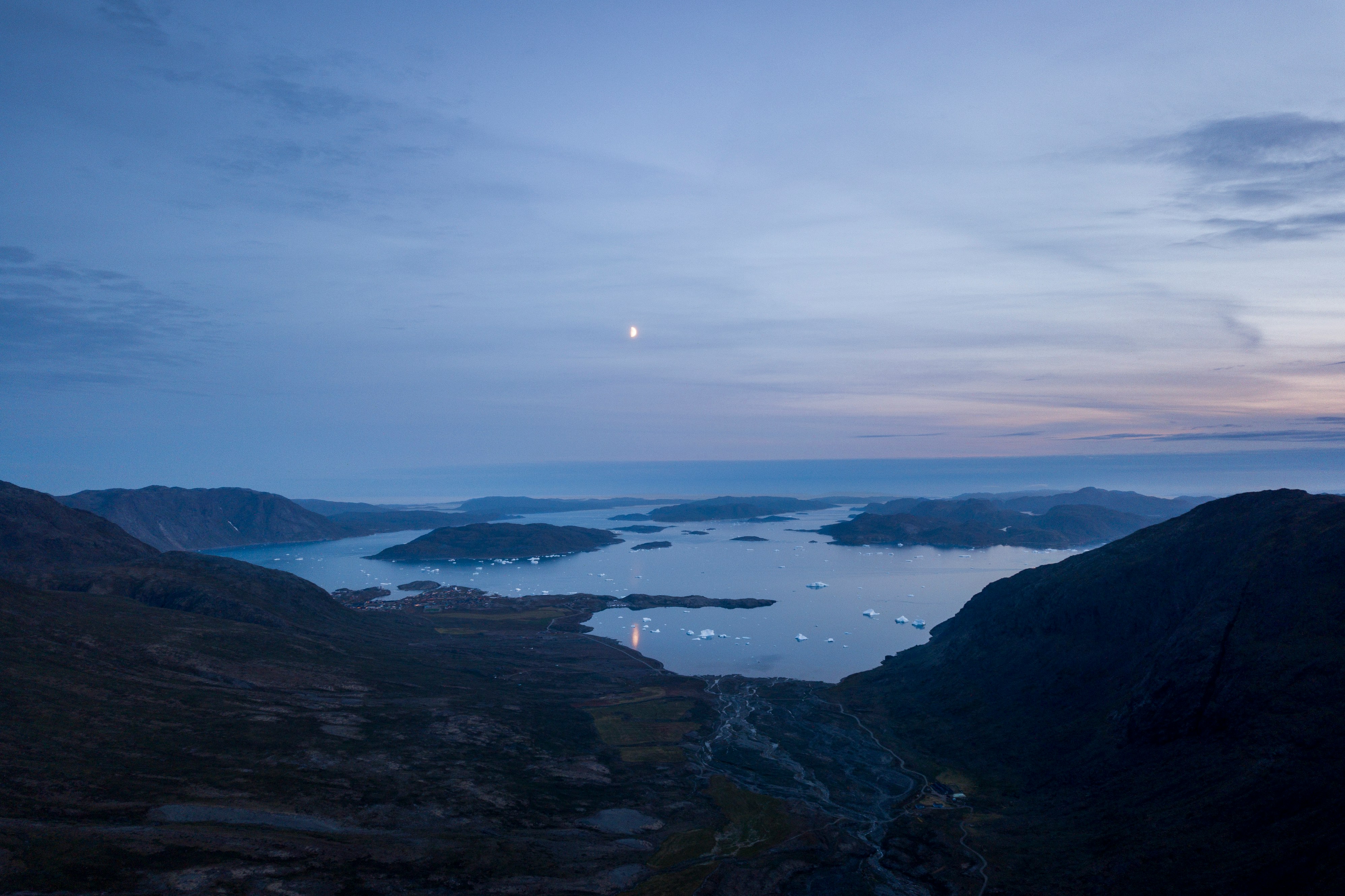
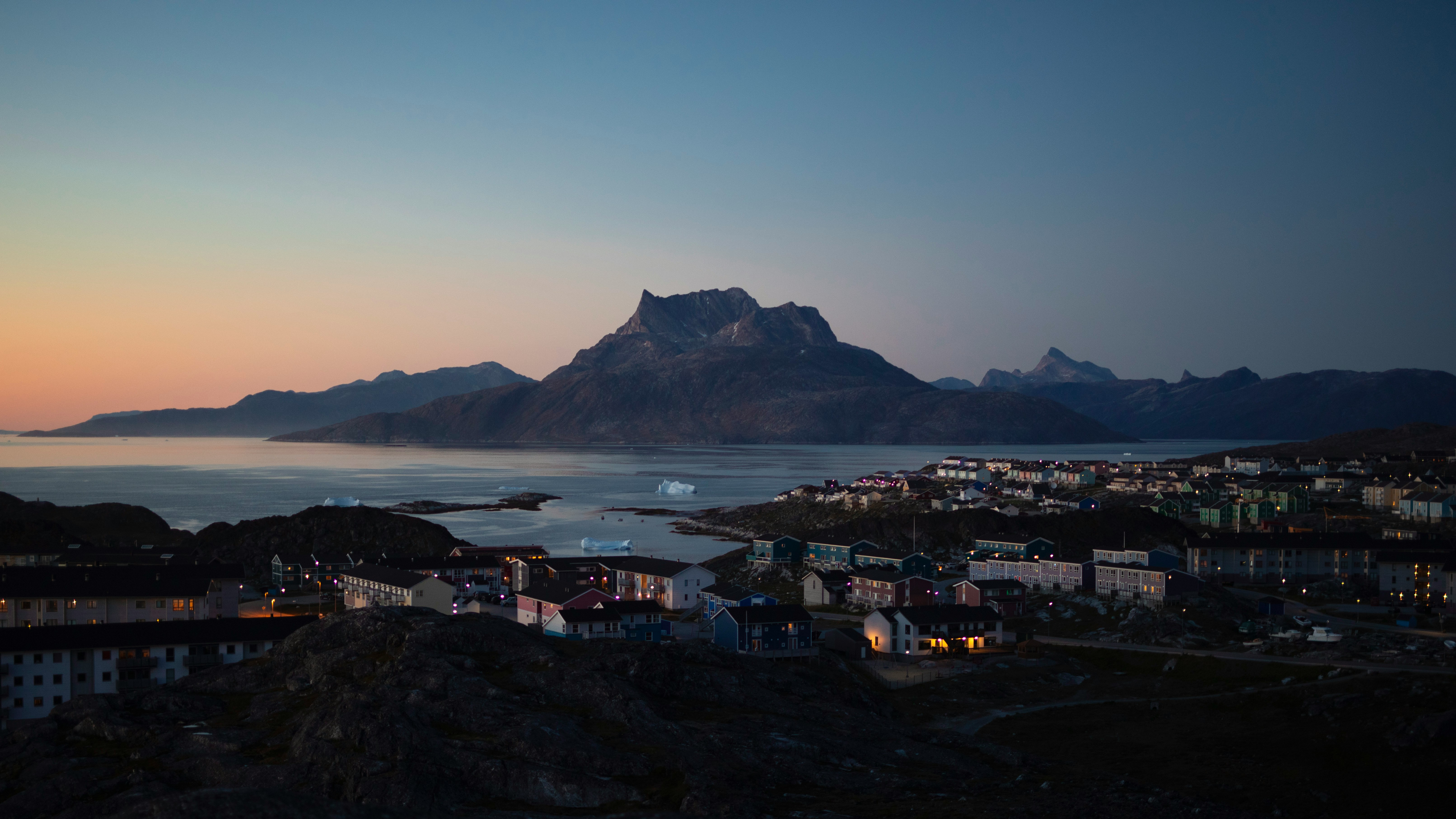
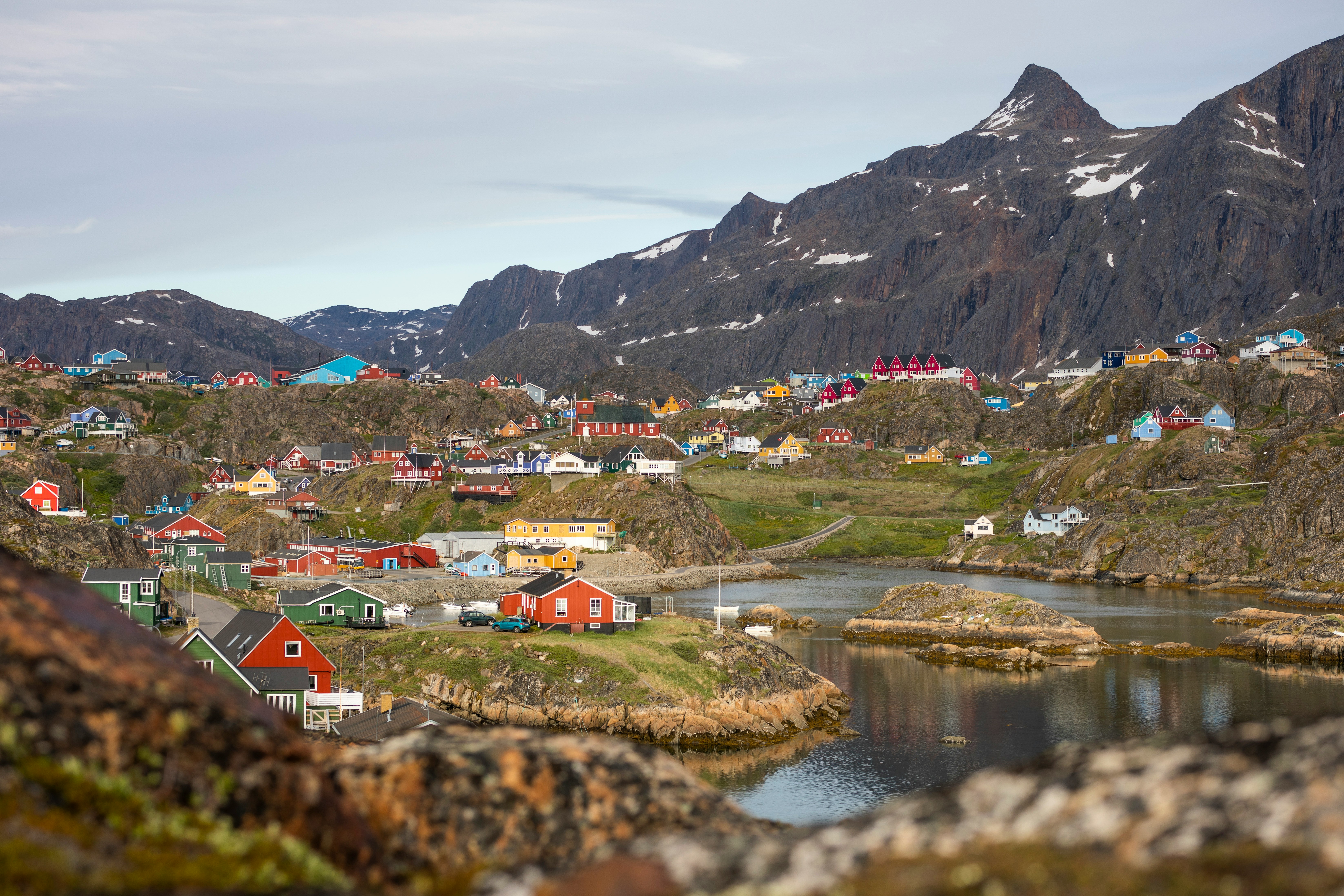
About Nuuk (Godthaab)
Nuuk, meaning “the cape”, was Greenland’s first town (1728). Started as a fort and later mission and trading post some 240 kilometers south of the Arctic Circle, it is the current capital. Almost 30% of Greenland’s population lives in the town. Not only does Nuuk have great natural beauty in its vicinity, but there are Inuit ruins, Hans Egede’s home, the parliament, and the Church of our Saviour as well. The Greenlandic National Museum has an outstanding collection of Greenlandic traditional dresses, as well as the famous Qilakitsoq mummies. The Katuaq Cultural Center’s building was inspired by the undulating Northern Lights and can house 10% of Nuuk’s inhabitants.
About Evighedsfjorden
About Ilulissat (Jakobshavn)
Known as the birthplace of icebergs, the Ilulissat Icefjord produces nearly 20 million tons of ice each day. In fact, the word Ilulissat means “icebergs” in the Kalaallisut language. The town of Ilulissat is known for its long periods of calm and settled weather, but the climate tends to be cold due to its proximity to the fjord. Approximately 4,500 people live in Ilulissat, the third-largest town in Greenland after Nuuk and Sisimiut. Some people here estimate that there are nearly as many sled dogs as human beings living in the town that also boasts a local history museum located in the former home of Greenlandic folk hero and famed polar explorer Knud Rasmussen.
About Kangerlussuaq Havn
The name Kangerlussuaq means "Big Fjord" in the local Kalaallisut language. The settlement of about 500 people is located in western Greenland on flat land at the head of a fjord with the same name. Kangerlussuaq is the site of Greenland's largest commercial airport and most of the economy here is dependent on the air transportation hub and tourism. The rugged lands around the settlement support terrestrial Arctic fauna including muskoxen, caribou, and Gyrfalcons.
About Ilulissat (Jakobshavn)
Known as the birthplace of icebergs, the Ilulissat Icefjord produces nearly 20 million tons of ice each day. In fact, the word Ilulissat means “icebergs” in the Kalaallisut language. The town of Ilulissat is known for its long periods of calm and settled weather, but the climate tends to be cold due to its proximity to the fjord. Approximately 4,500 people live in Ilulissat, the third-largest town in Greenland after Nuuk and Sisimiut. Some people here estimate that there are nearly as many sled dogs as human beings living in the town that also boasts a local history museum located in the former home of Greenlandic folk hero and famed polar explorer Knud Rasmussen.
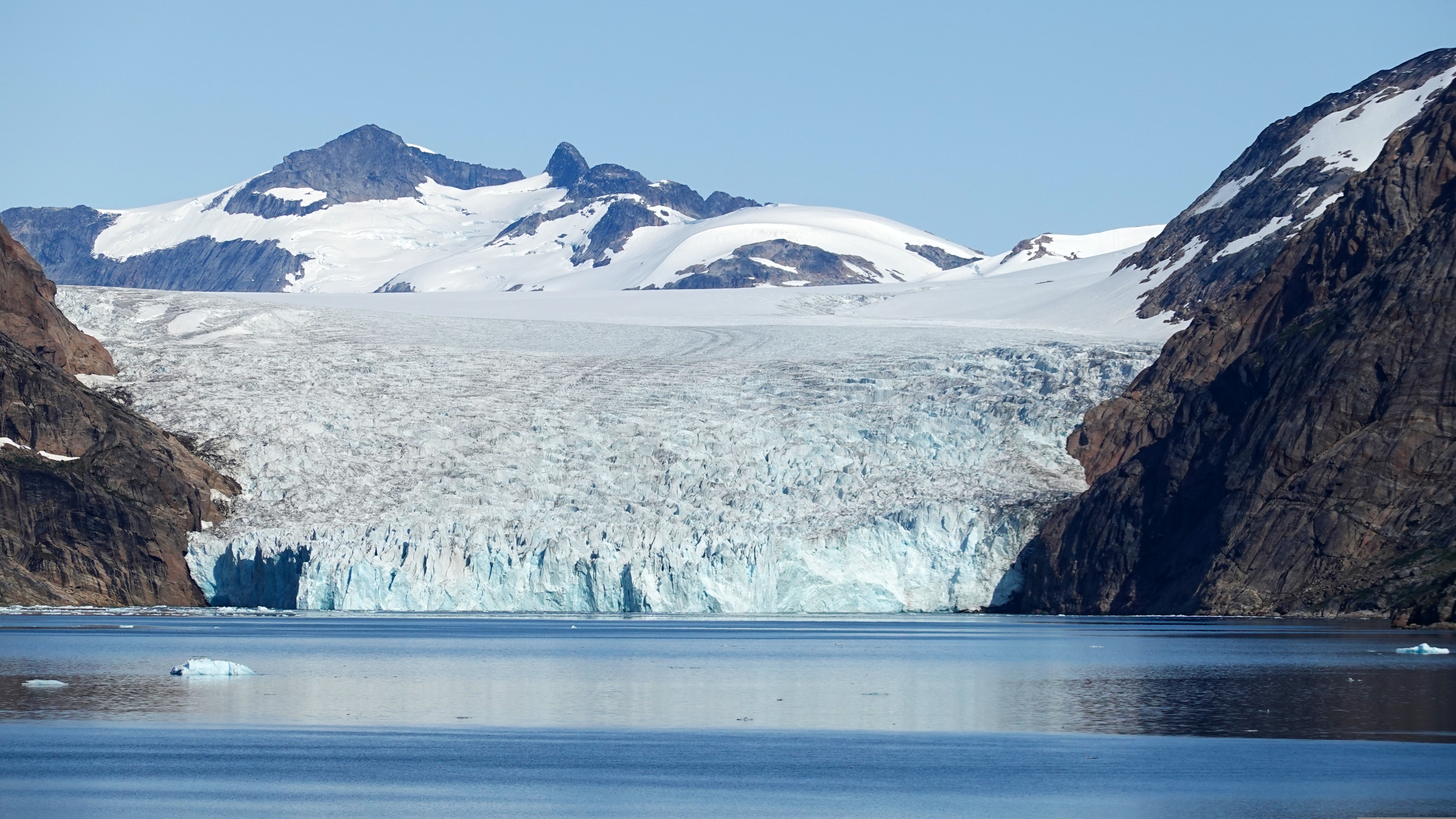
About Eqip Sermia Glacier
About Sisimiut (Holsteinsborg)
Located just north of the Arctic Circle, Sisimiut is the northernmost town in Greenland where the port remains free of ice in the winter. Yet it is also the southernmost town where there is enough snow and ice to drive a dogsled in winter and spring. In Sisimiut, travelling by sled has been the primary means of winter transportation for centuries. In fact, the area has been inhabited for approximately 4,500 years. Modern Sisimiut is the largest business center in the north of Greenland, and is one of the fastest growing Greenlandic cities. Commercial fishing is the lead economy in the town‘s thriving industrial base.
About Evighedsfjorden
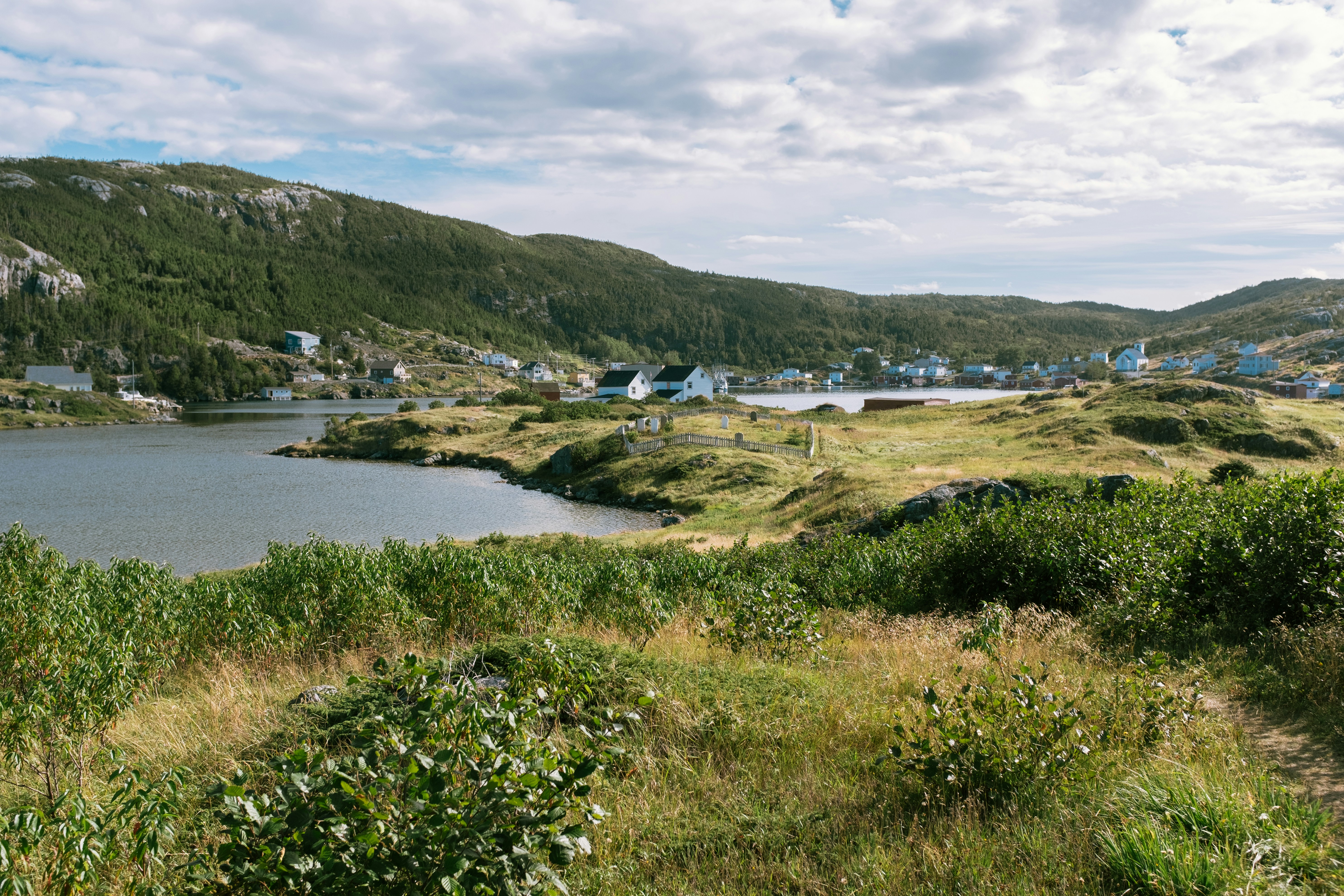
About L'Anse aux Meadows, Newfoundland and Labrador
Around the year 1000, Vikings from Greenland and Iceland founded the first European settlement in North America, near the northern tip of Newfoundland. They arrived in the New World 500 years before Columbus but stayed only a few years and were forgotten for centuries. Since the settlement's rediscovery in the last century, the archaeological site has brought tourism to the area. Viking themes abound but so do views, whales, icebergs, fun dining experiences, and outdoor activities. L'Anse Aux Meadows on the northern tip of the island of Newfoundland is a remote community of just 40 people, with St Anthony, 40 minutes away, having a population of only 3,500. The region is locally famous for springtime polar bears, nesting eider ducks, the northern extreme of the Appalachians at nearby Belle Isle, numerous spring and summer icebergs, and a rich ocean fishery. L’Anse Aux Meadows National Historic Site is the UNESCO World Heritage Site that tells the story of Leif Erickson and the first Europeans in the new world. This site is often the keystone attraction for cruises themed around the Vikings. Discovered in 1960, it is the site of a Norse village, the only known one in North America outside of Greenland. The site remains the only widely-accepted instance of pre-Columbian trans-oceanic contact, and is notable for possible connections with the attempted colony of Vinland established by Leif Ericson around 1003, or more broadly with Norse exploration of the Americas. The root of the name "L'Anse aux Meadows" is believed to have originated with French fishermen in the area during the nineteenth and twentieth centuries, who named the site L'Anse aux Meduses, meaning 'Jellyfish Bay'.
About Bonne Bay Canada, Newfoundland and Labrador
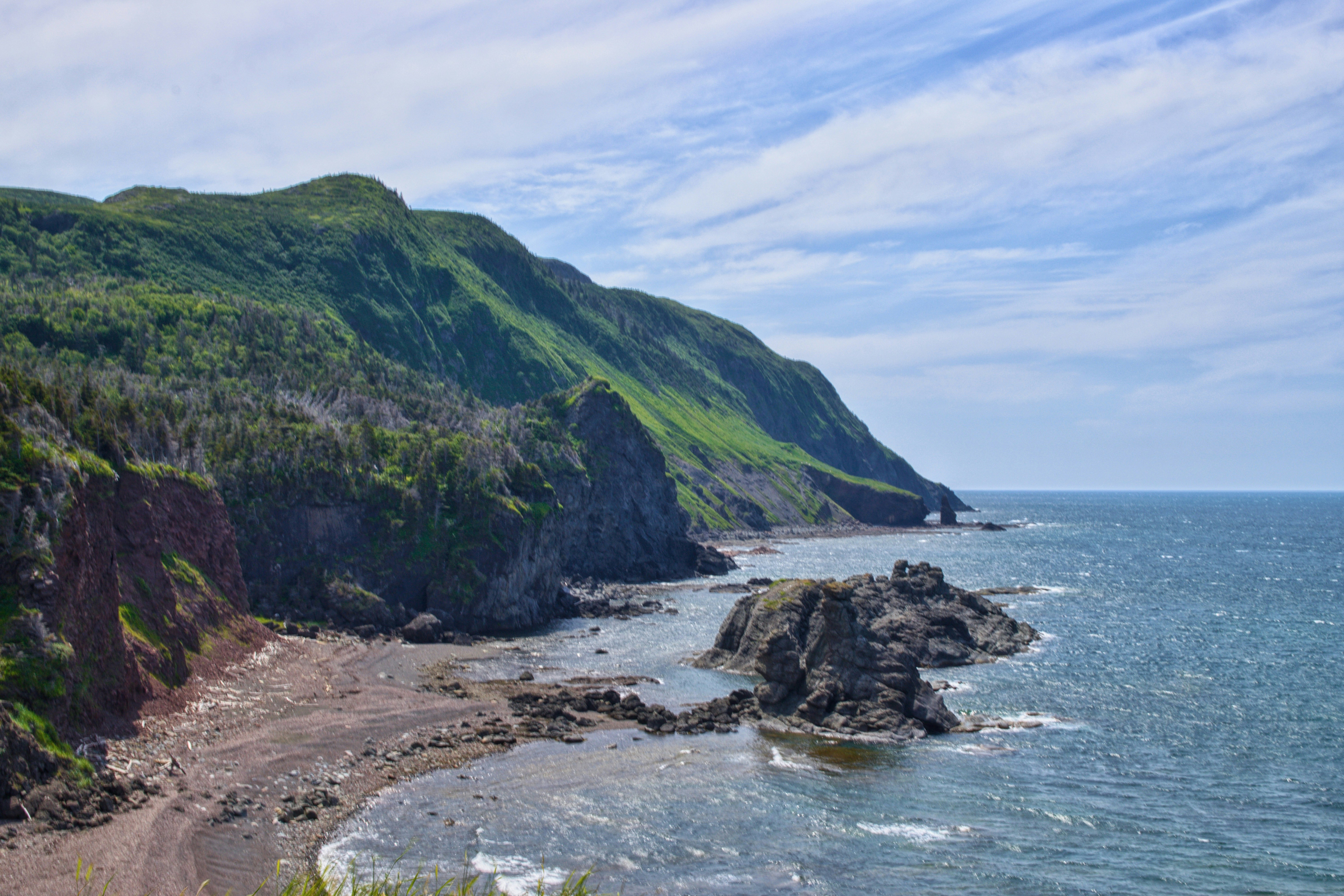
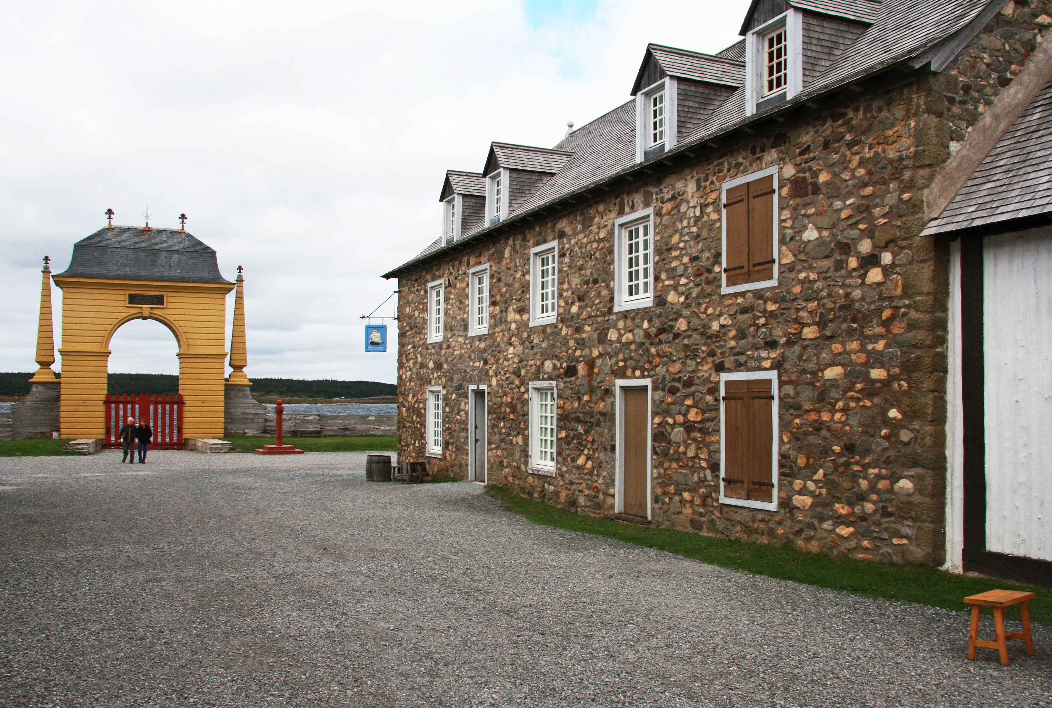
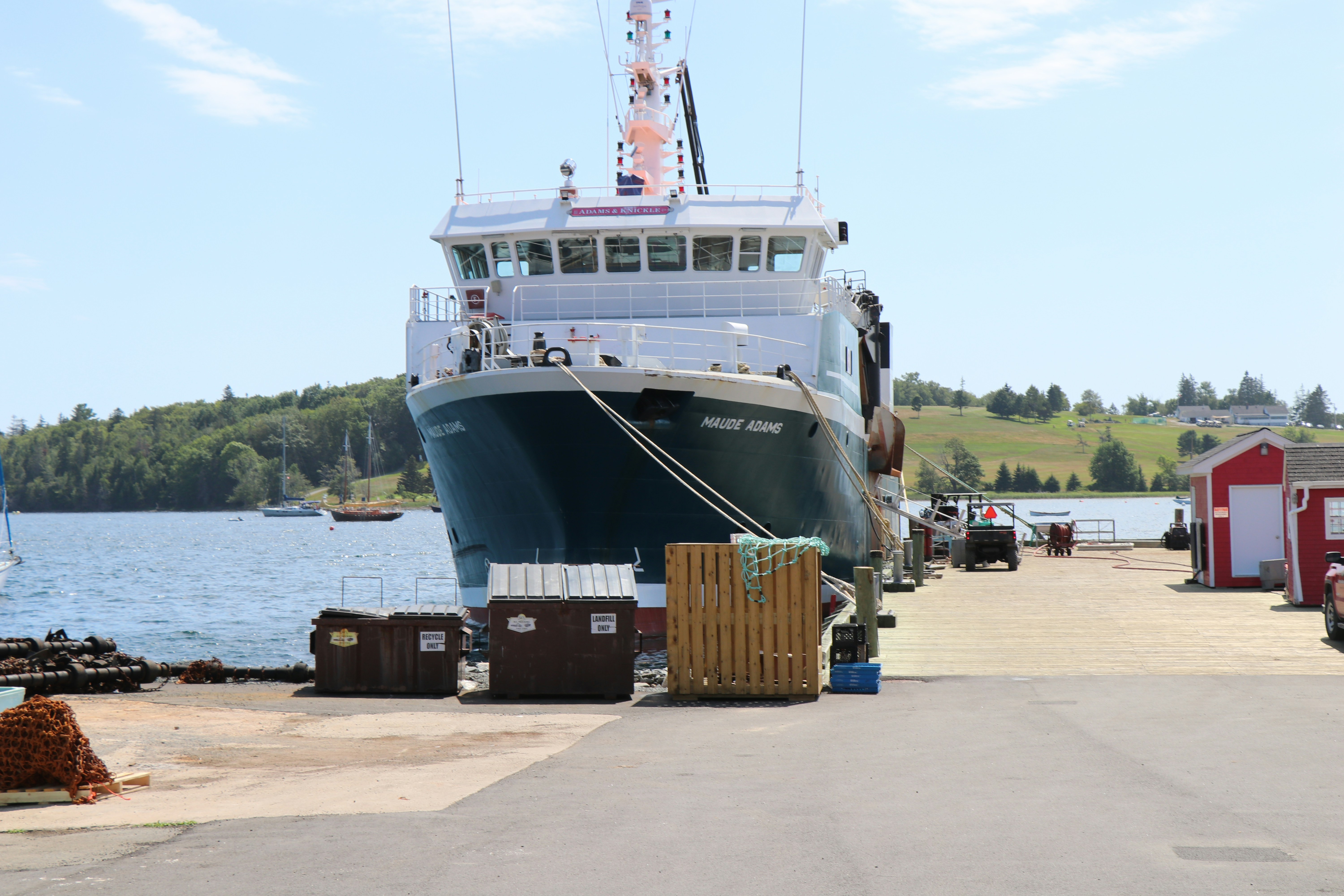
About Louisbourg, Nova Scotia
Louisbourg, Nova Scotia, is a thriving seaport located on the eastern tip of Cape Breton Island. French settlers first arrived in Louisbourg in 1713, using the island as a base for their lucrative cod fishery. Soon, the town became one of the busiest harbours in North America and an important trading outpost and military hub. They named it Louisbourg, in honour of King Louis XIV. The fortress was built to defend against the threat of a British invasion. After two major attacks, the fortress was destroyed in the 1760’s. In 1961 the Canadian Government commenced a $25 million reconstruction project to restore portions of the fortress to its pre-siege glory of the 1740’s. It was the largest reconstruction project in North America. The lighthouse was Canada’s first, constructed in 1734, but was severely damaged during the last siege and was abandoned in 1758. The existing lighthouse was built in 1923.
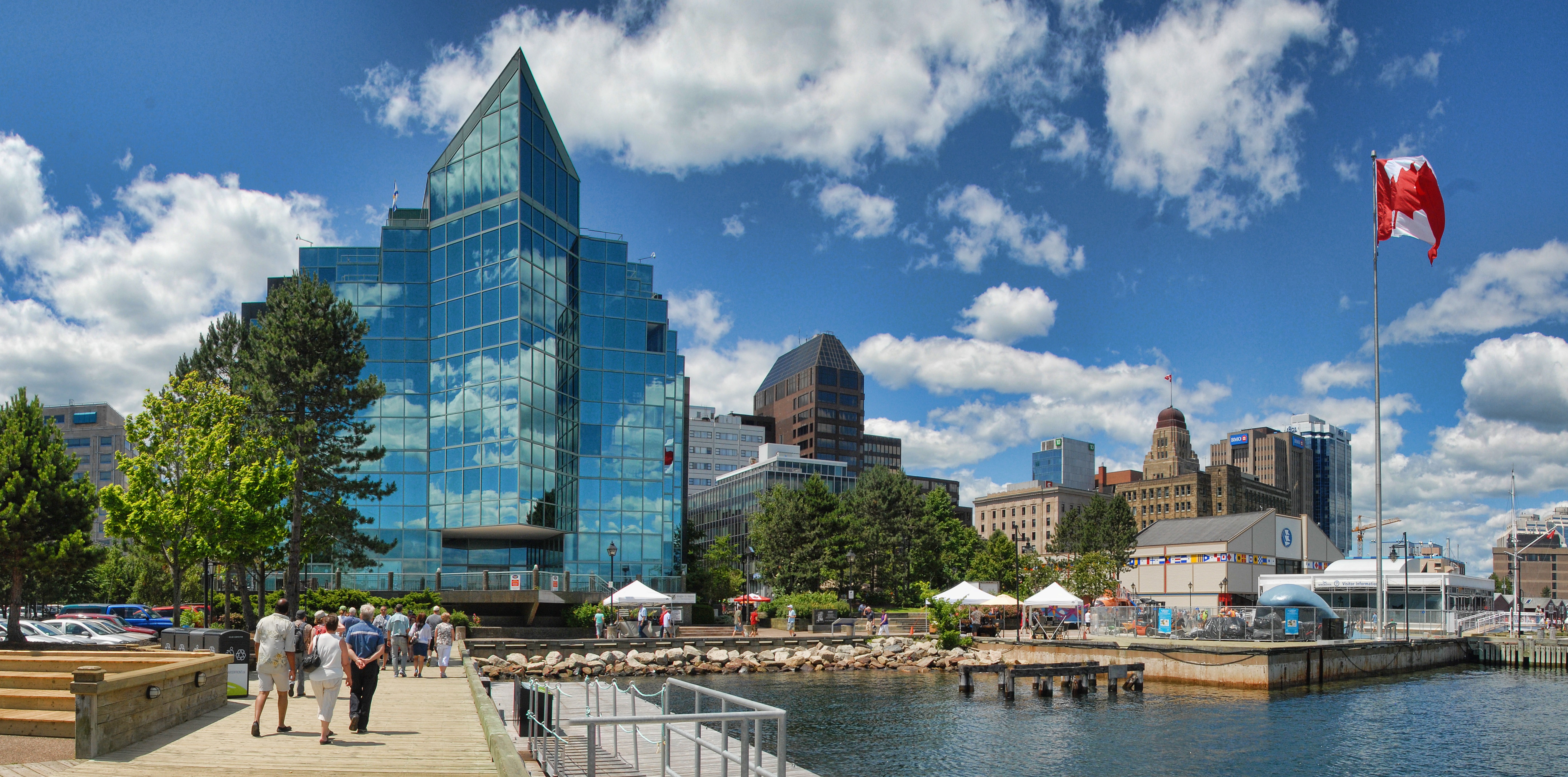
About Halifax, Nova Scotia
Surrounded by natural treasures and glorious seascapes, Halifax is an attractive and vibrant hub with noteworthy historic and modern architecture, great dining and shopping, and a lively nightlife and festival scene. The old city manages to feel both hip and historic. Previous generations had the foresight to preserve the cultural and architectural integrity of the city, yet students from five local universities keep it lively and current. It's a perfect starting point to any tour of the Atlantic provinces, but even if you don't venture beyond its boundaries, you will get a real taste of the region.It was Halifax’s natural harbor—the second largest in the world after Sydney, Australia’s—that first drew the British here in 1749, and today most major sites are conveniently located either along it or on the Citadel-crowned hill overlooking it. That’s good news for visitors because this city actually covers quite a bit of ground.Since amalgamating with Dartmouth (directly across the harbor) and several suburbs in 1996, Halifax has been absorbed into the Halifax Regional Municipality, and the HRM, as it is known, has around 415,000 residents. That may not sound like a lot by U.S. standards, but it makes Nova Scotia’s capital the most significant Canadian urban center east of Montréal.There's easy access to the water, and despite being the focal point of a busy commercial port, Halifax Harbour doubles as a playground, with one of the world's longest downtown boardwalks. It's a place where container ships, commuter ferries, cruise ships, and tour boats compete for space, and where workaday tugs and fishing vessels tie up beside glitzy yachts. Like Halifax as a whole, the harbor represents a blend of the traditional and the contemporary.
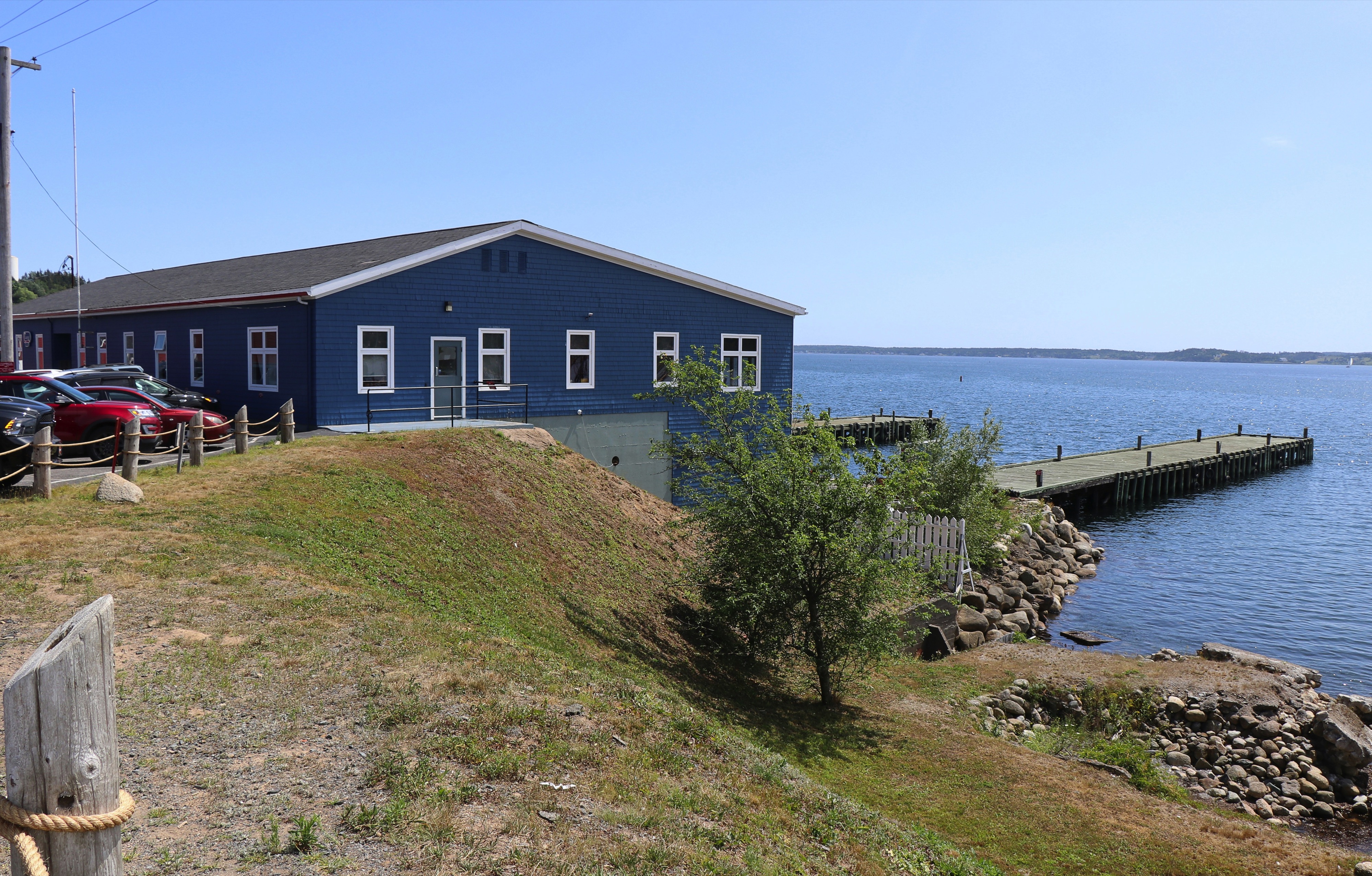
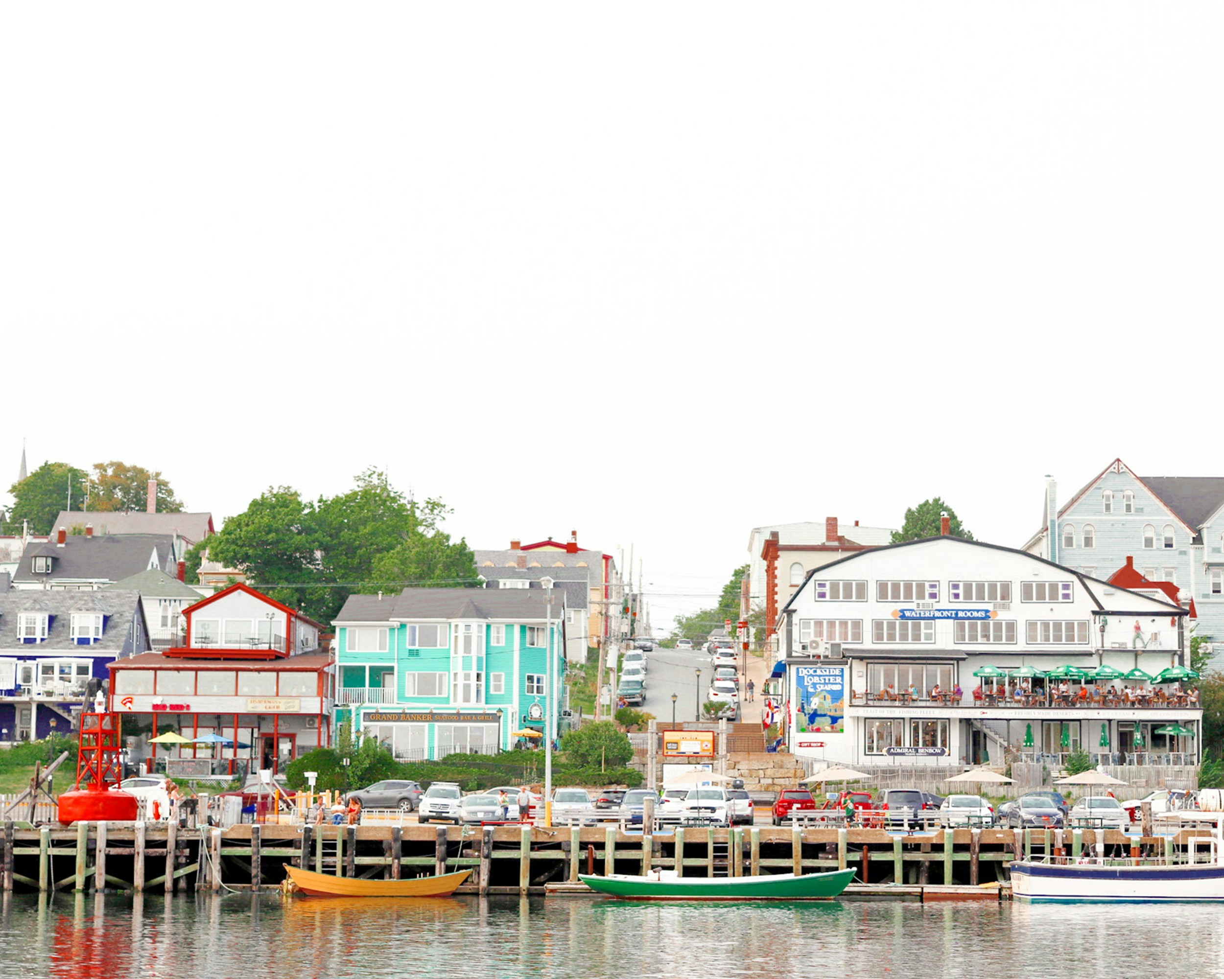
About Lunenburg, Nova Scotia
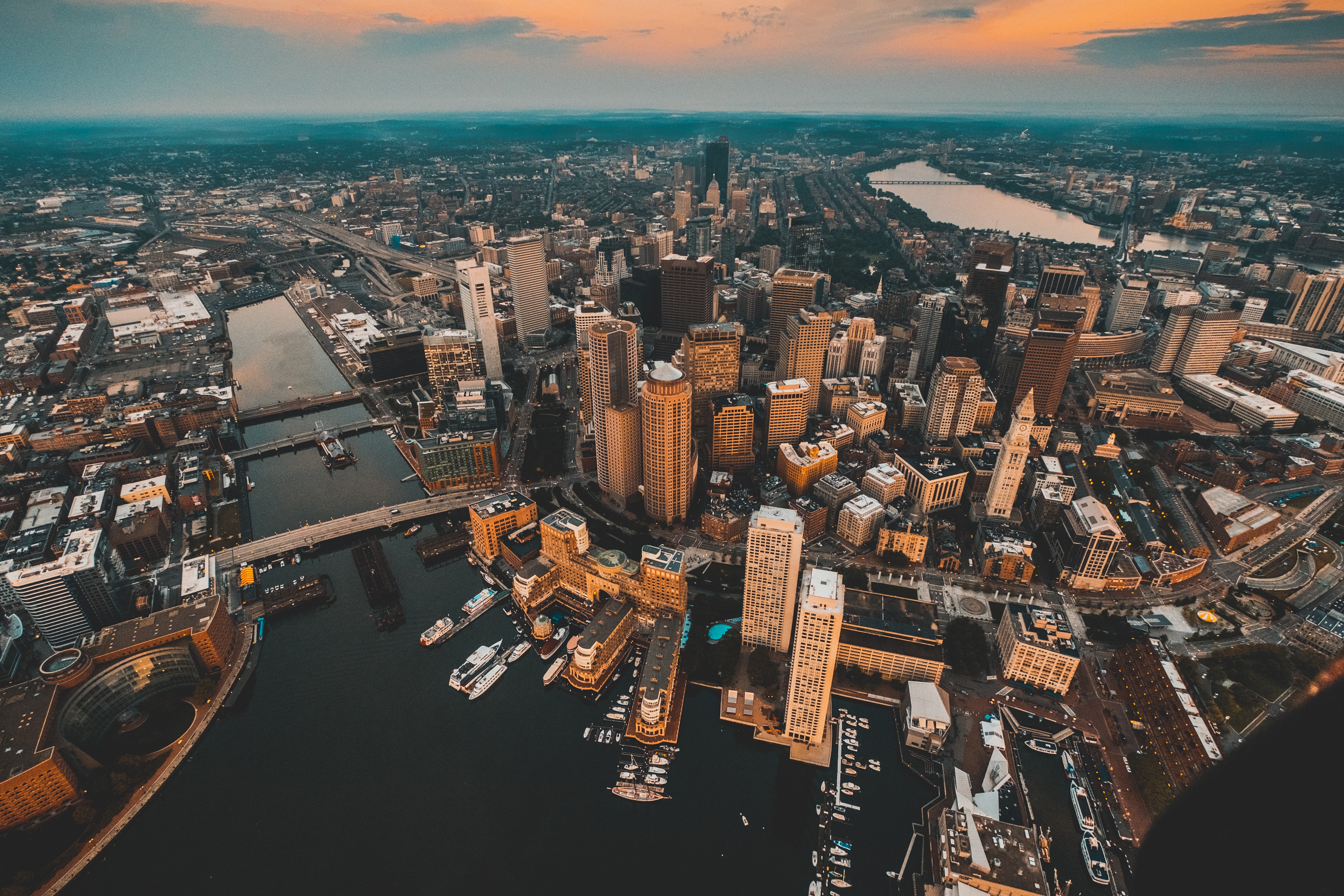
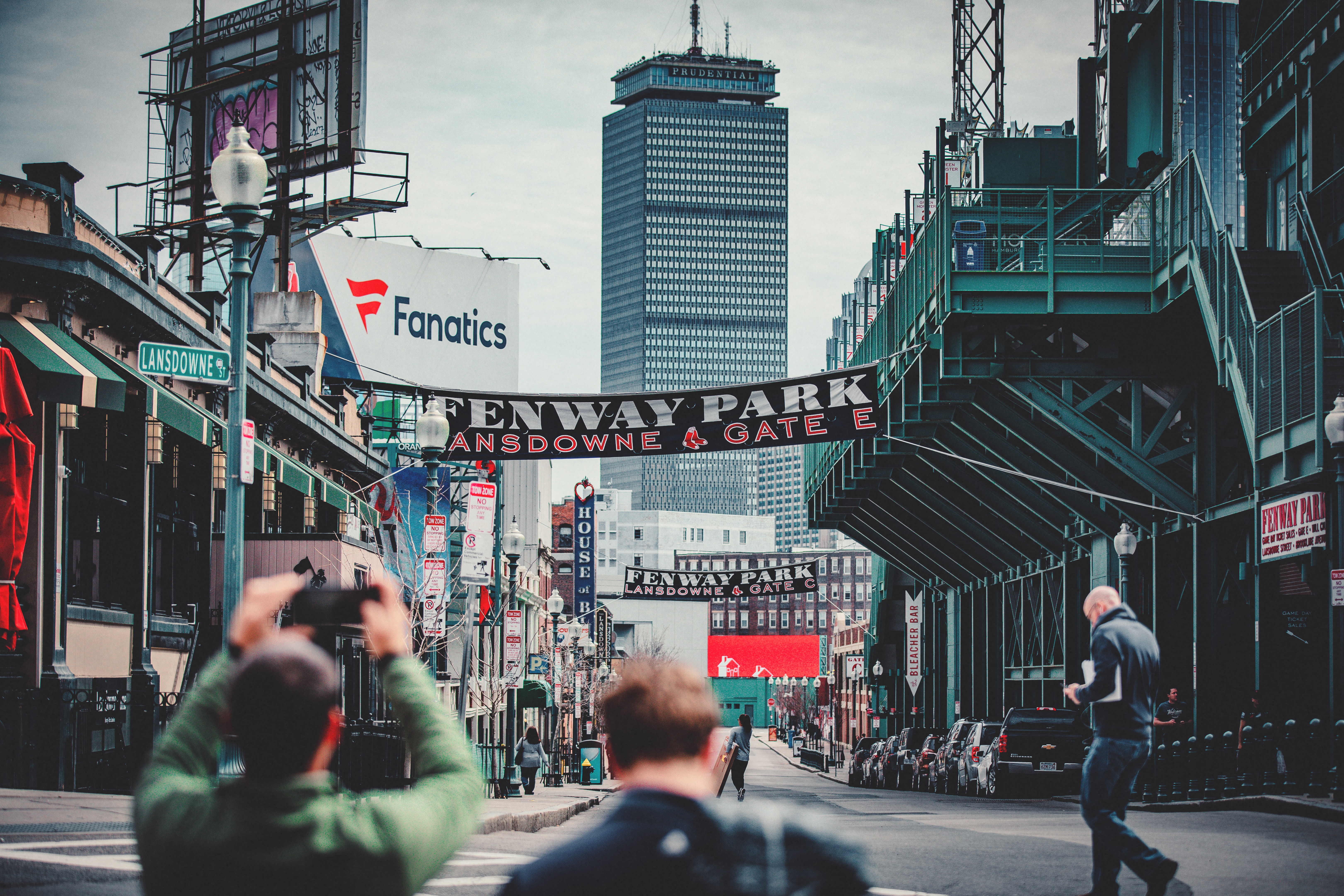
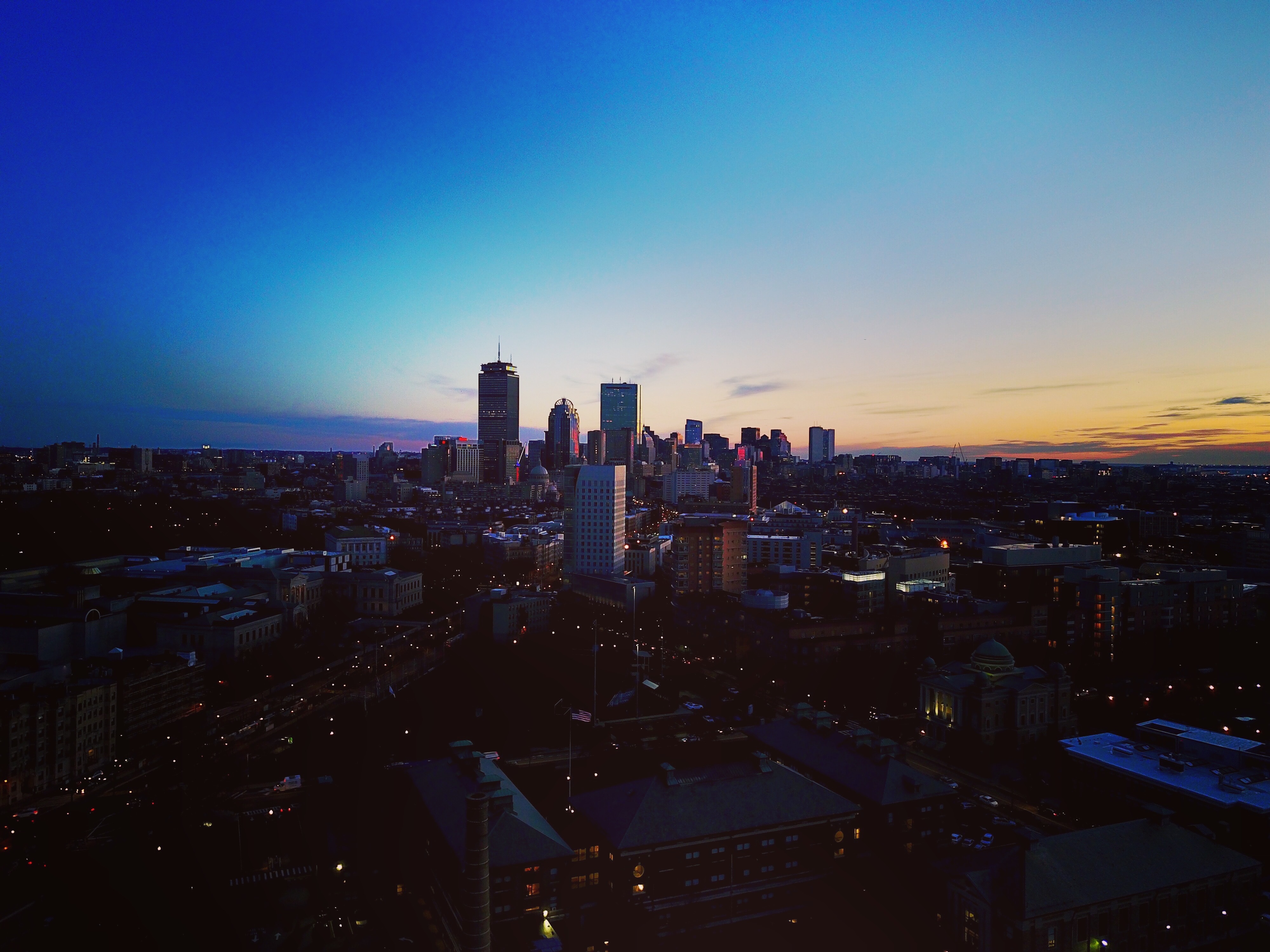
About Boston, Massachusetts
There’s history and culture around every bend in Boston—skyscrapers nestle next to historic hotels while modern marketplaces line the antique cobblestone streets. But to Bostonians, living in a city that blends yesterday and today is just another day in beloved Beantown.
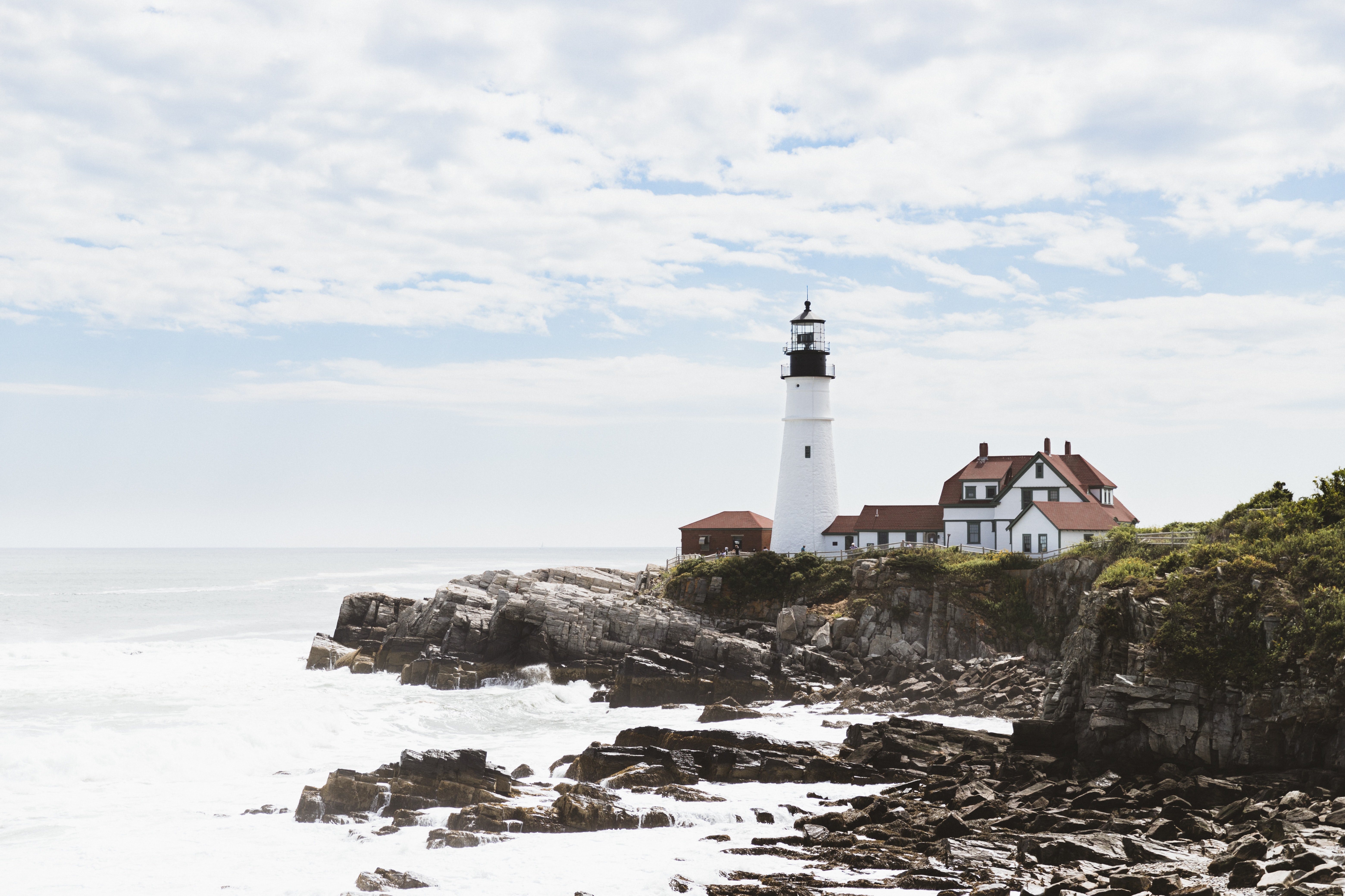
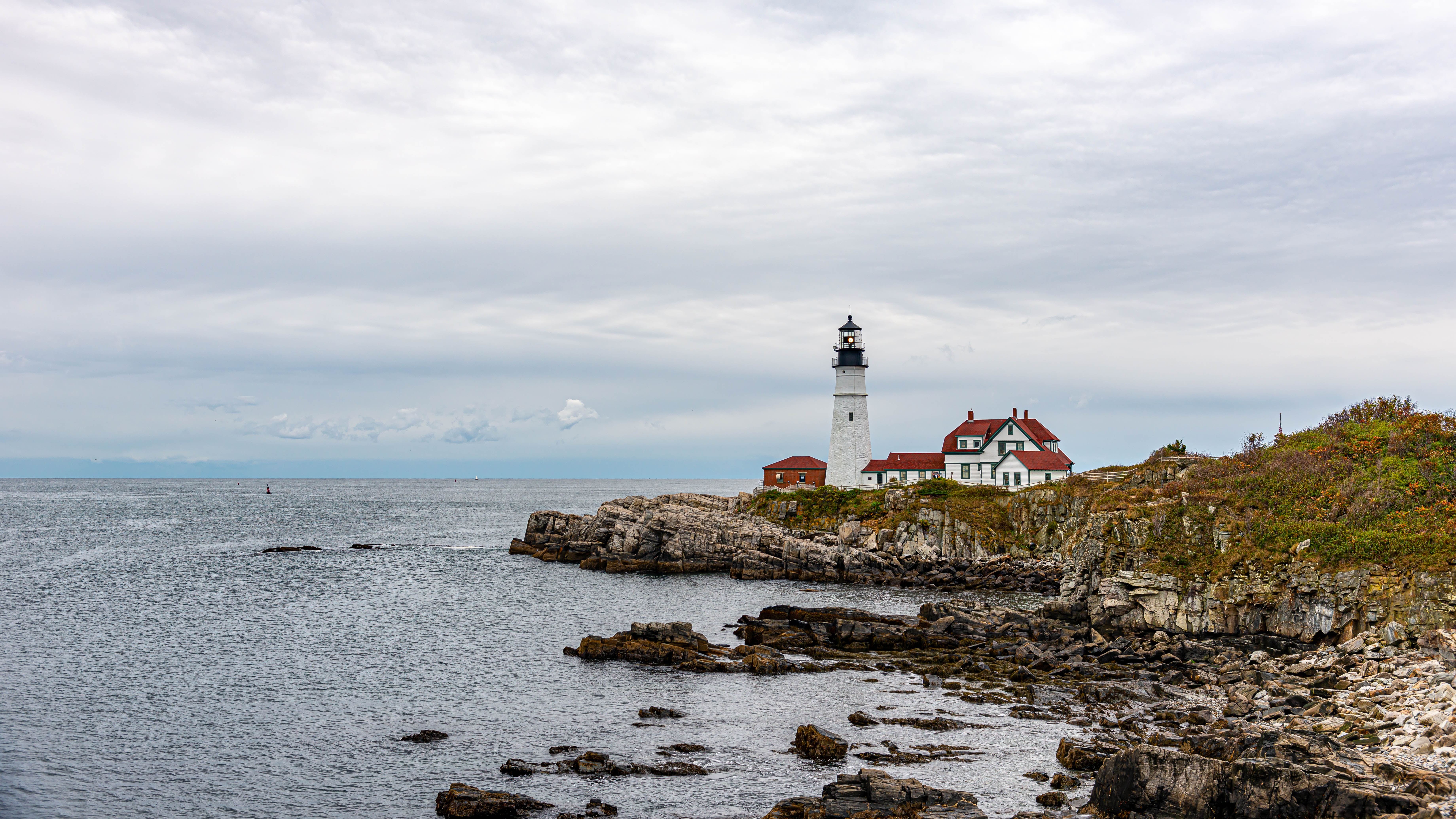
About Portland, Maine
Portland, Maine The largest city in Maine, Portland was founded in 1632 on the Casco Bay Peninsula. It quickly prospered through shipbuilding and the export of inland pines which made excellent masts. A long line of wooden wharves stretched along the seafront, with the merchants' houses on the hillside above. From the earliest days it was a cosmopolitan city. When the railroads came, the Canada Trunk Line had its terminal right on Portland's quayside, bringing the produce of Canada and the Great Plains one hundred miles closer to Europe than any other major U.S. port. Some of the wharves are now occupied by new condominium developments, with the exception of the Customs House Wharf, which remains much as it used to be. Grand Trunk Station was torn down in 1966 and a revitalization program of this historic section was spearheaded by a group of committed residents. The result was the revival of the Old Port Exchange District with its redbrick streets built in the 1860s following a disastrous fire. The area today features a wide variety of restaurants, specialty and antique shops, and makes for a pleasant place for a stroll. Congress Street and its many side streets are an engaging mixture of culture, commerce and history. Art is everywhere, from the Portland Museum of Art to the many statues and monuments throughout the city. Other points of interest include the Portland Observatory, Henry Wadsworth Longfellow's childhood home, several colonial mansions and Fort Williams Park, with the adjacent Portland Head Light. Farther afield one can visit the charming yachting and fishing village of Kennebunkport, also noted as the locale of the home and summer White House of former President George Bush. Going Ashore in Portland Pier Information The ship is scheduled to dock at the Portland Ocean Terminal, a very easy walk to the Old Port District located about two blocks away. Taxis are available at the pier. Shopping A wide range of Maine-made clothing, crafts and imported items can be found in shops along the cobblestone streets of the quaint Old Port Exchange. Small boutiques and numerous art galleries feature everything from paintings, crafts and furniture to prints and photographs. Antique lovers will enjoy browsing through area shops. Bargain hunters may want to visit the designer factory outlet shops in Freeport. On Sundays, most shops are open from 12:00 noon to 5:00-6:00 p.m. The local currency is the dollar. Cuisine Portland has the most restaurants per capita, second only to San Francisco. Eating establishments are as diverse as the menus they offer. The fresh catch of the day can be found on most menus, but seafood is only one of many culinary delights. From specialty coffee houses and ethnic restaurants to chowder and lobster houses to elegant dining rooms, Portland makes it easy to please every palate. Other Sights Longfellow's "City by the Sea" Portland is a walkable city, and a good place to start exploring is at the Old Port with its striking buildings comprising a bevy of architectural styles, ranging from Italianate to Mansard, Queen Anne to Greek Revival. The charming streets house an amazing collection of shops, galleries, bookstores and restaurants. Congress Street and the Arts District reflect the changes of 350 years of history, boasting an engaging mixture of culture and commerce. Portland Museum of Art The museum's award-winning building is a blend of 1911 Beaux Arts and 1983 post-modernism. It houses one of New England's finest art collections. Don't miss the museum's indoor Sculpture Garden. Portland Observatory Built in 1807, this is a rare example of a signal tower from which signal flags would be flown to identify incoming vessels. Factory Outlets of Freeport About a 25-minute drive north of Portland (approximately $35 one way for a taxi), this shopping mecca is crammed with serious shoppers who come from as far away as New York. Private arrangements for independent sightseeing may be requested through the Tour Office on board.
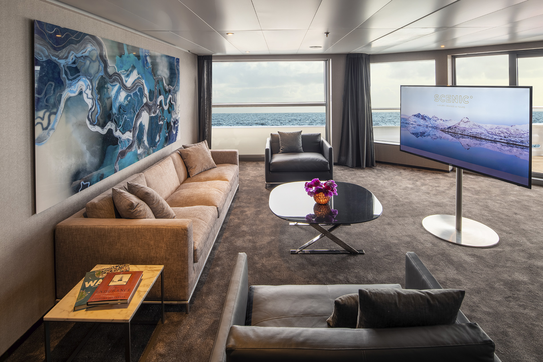
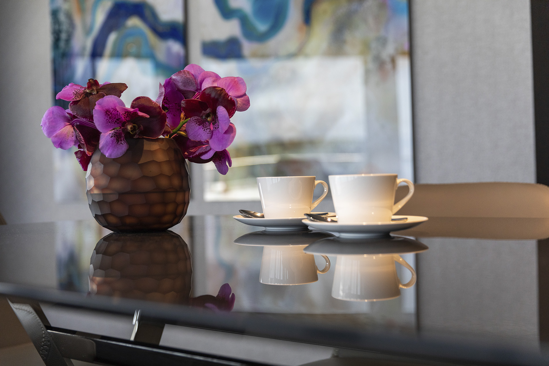
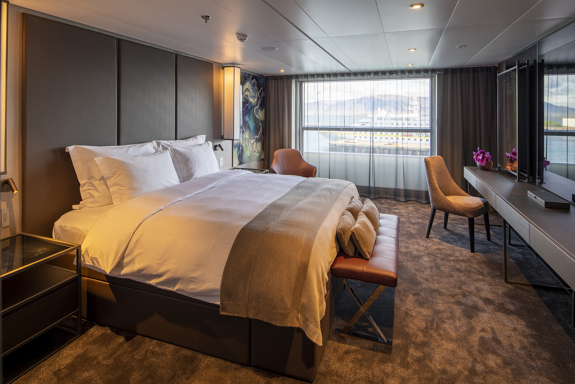
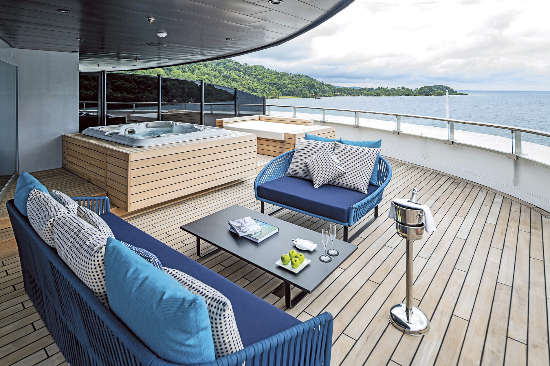
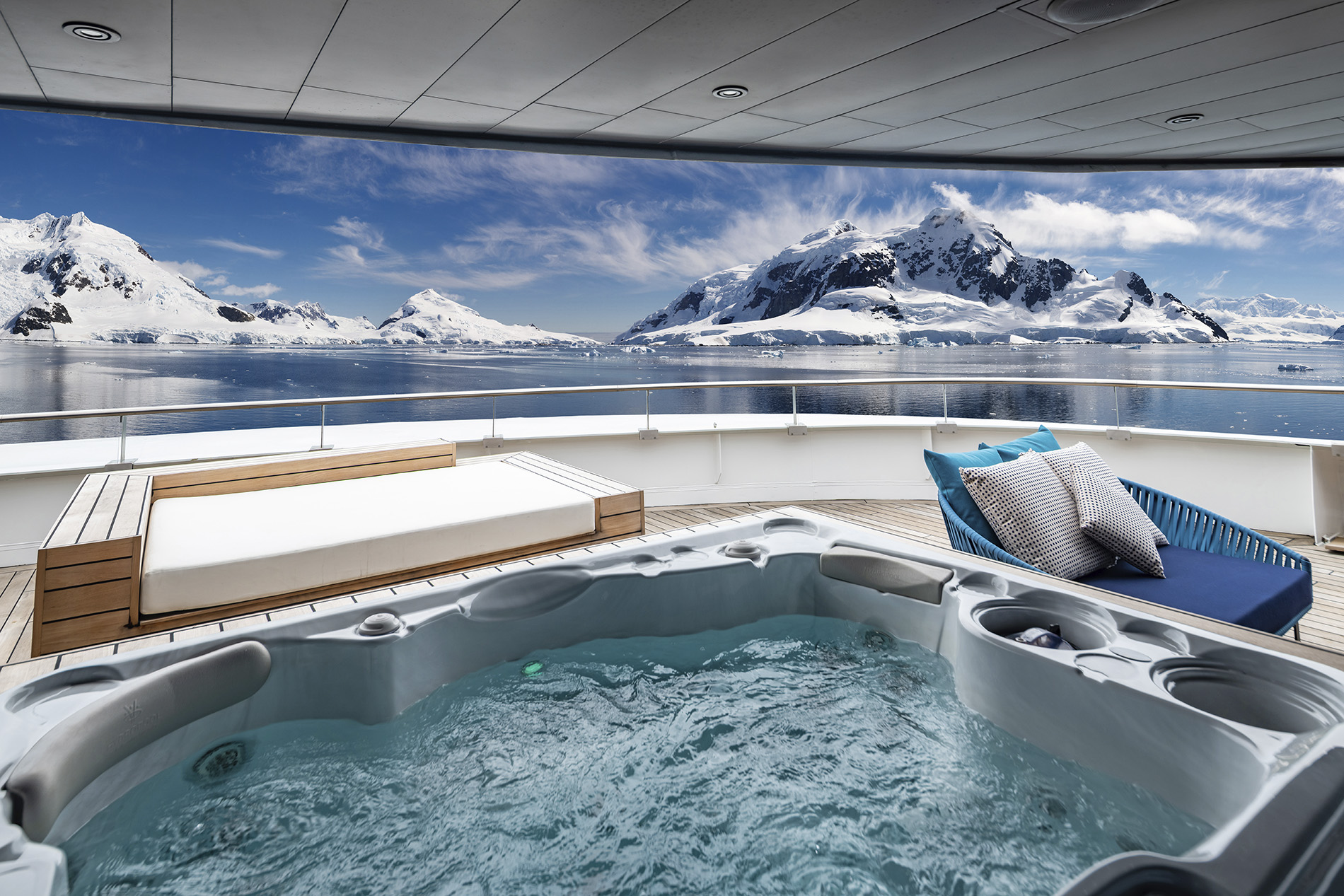
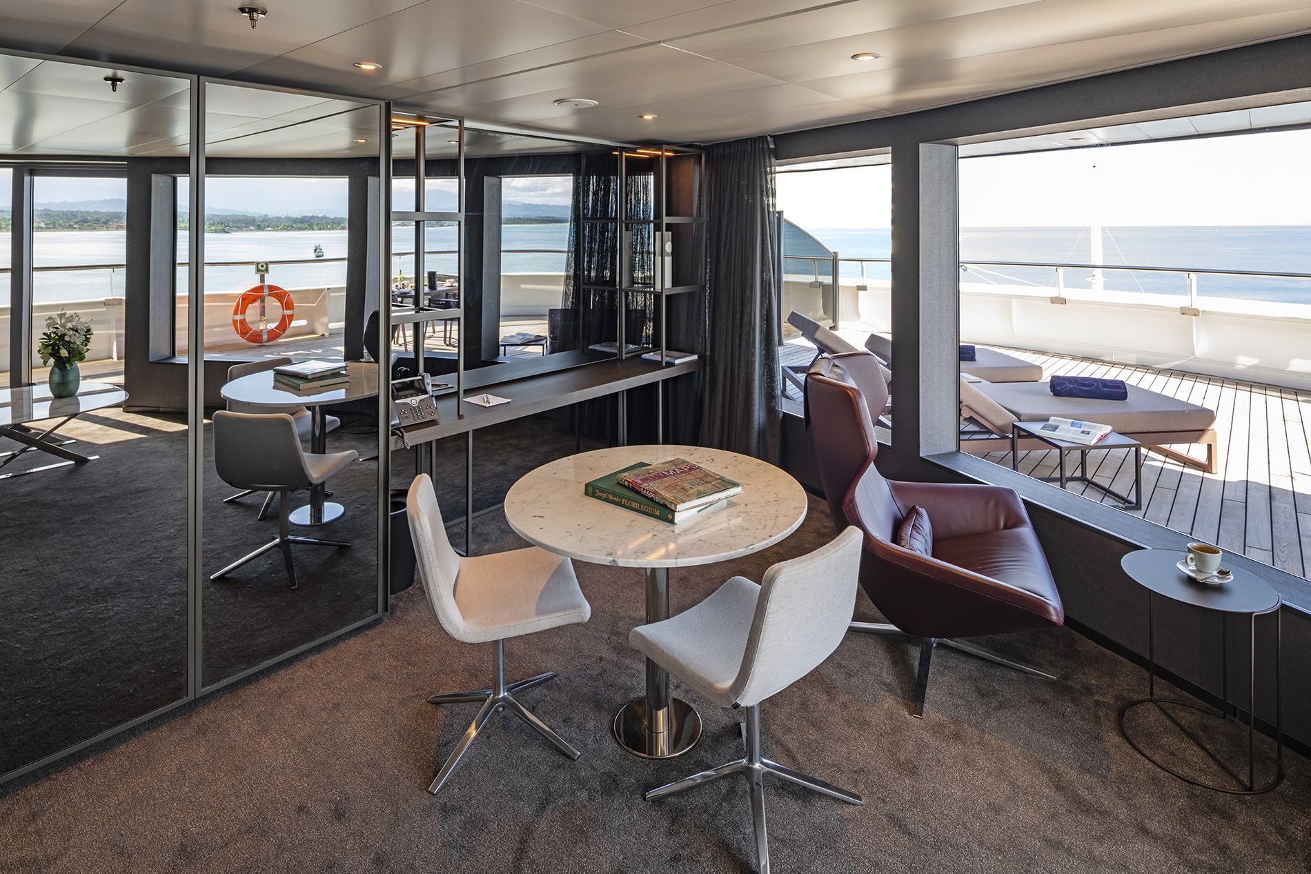
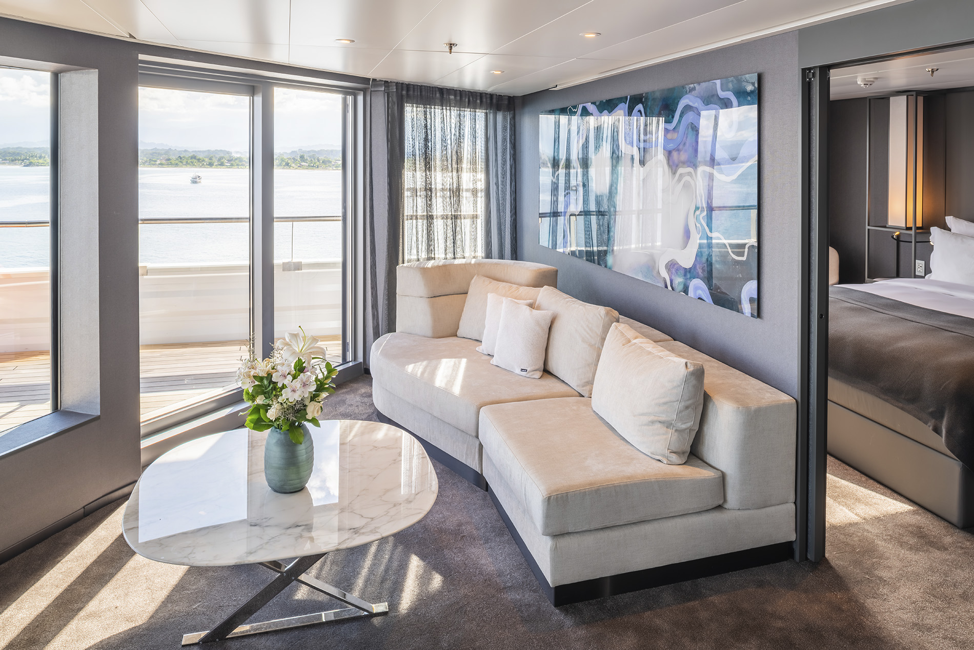
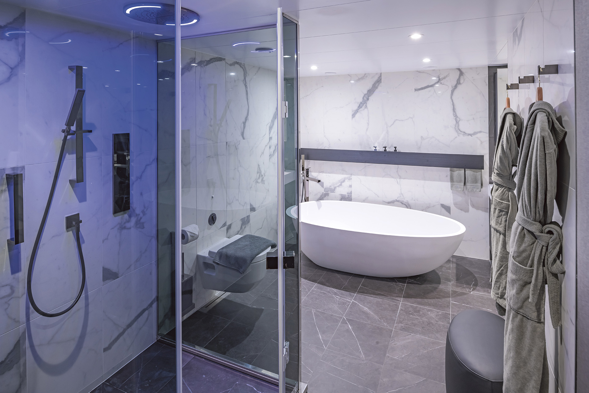
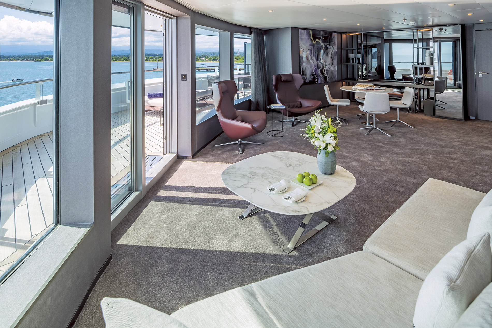
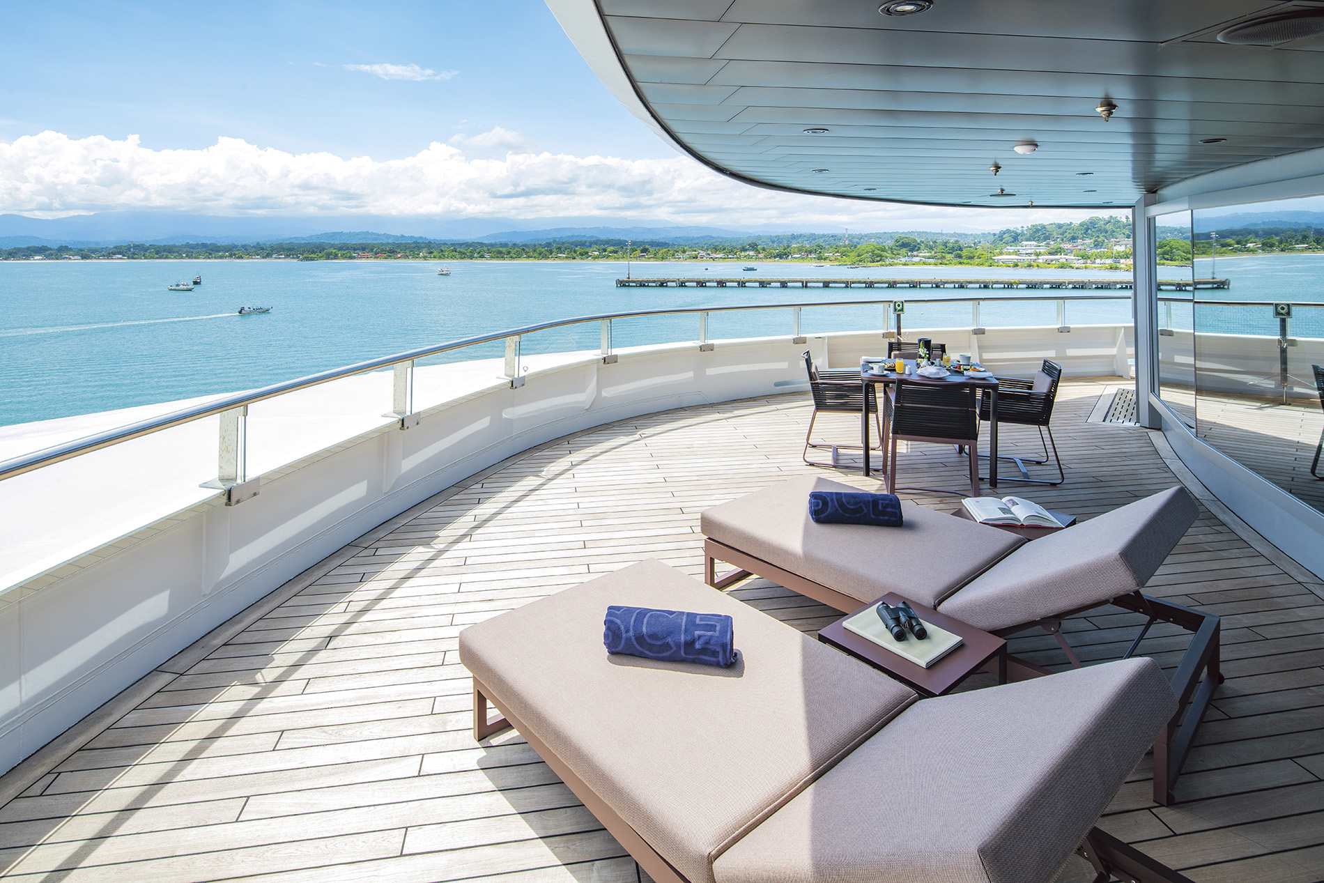
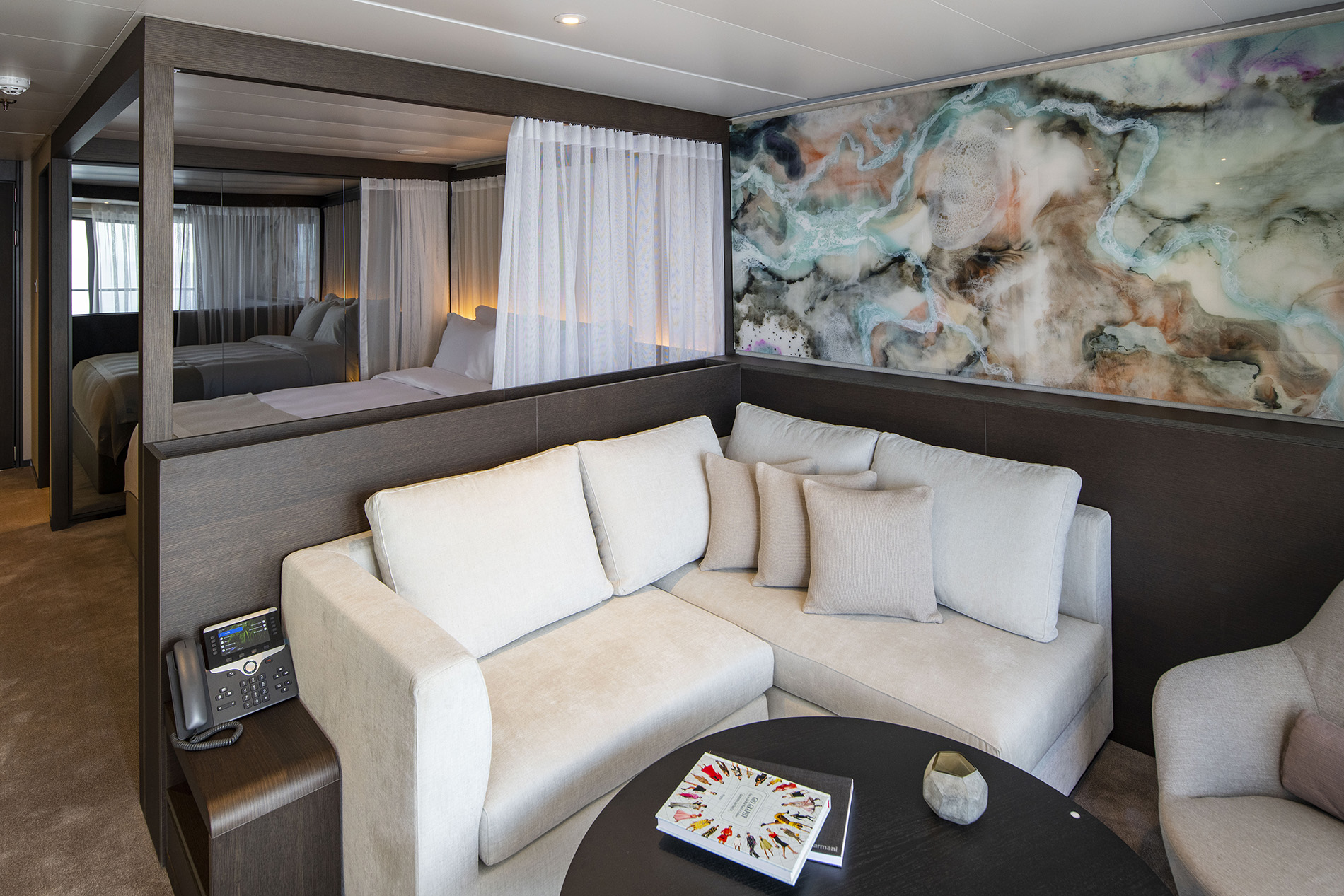
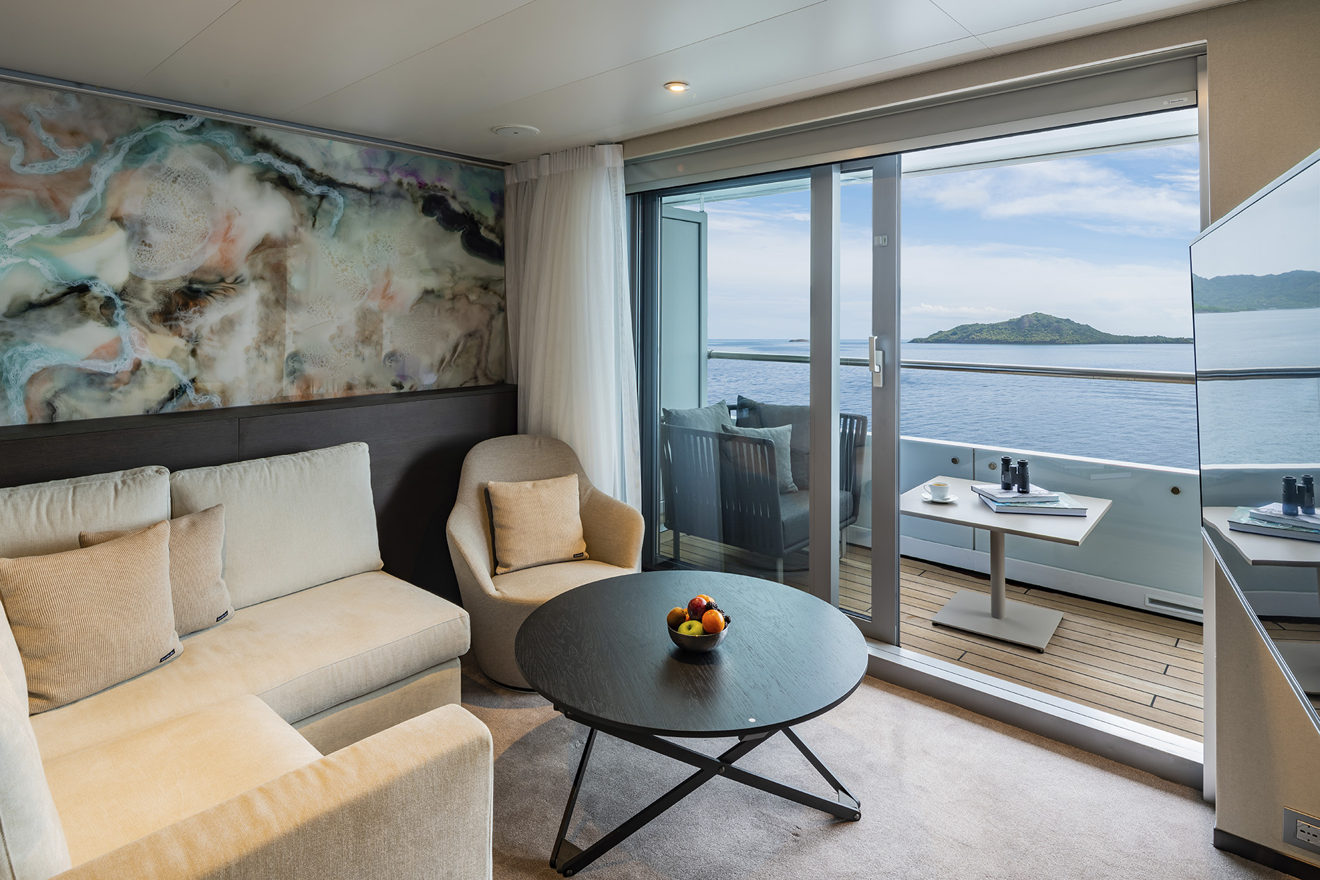
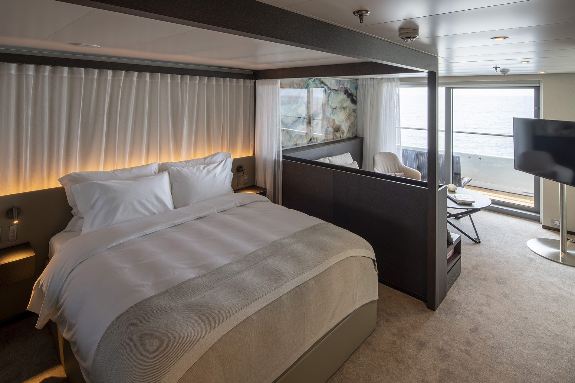
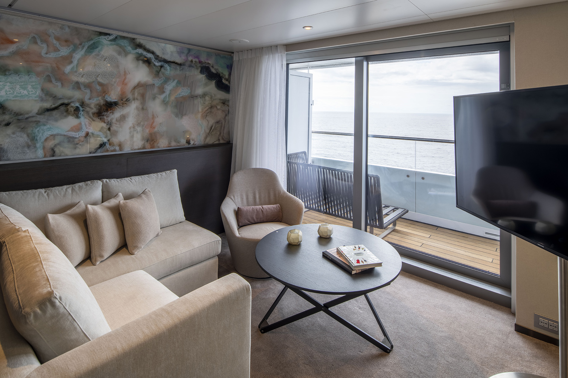
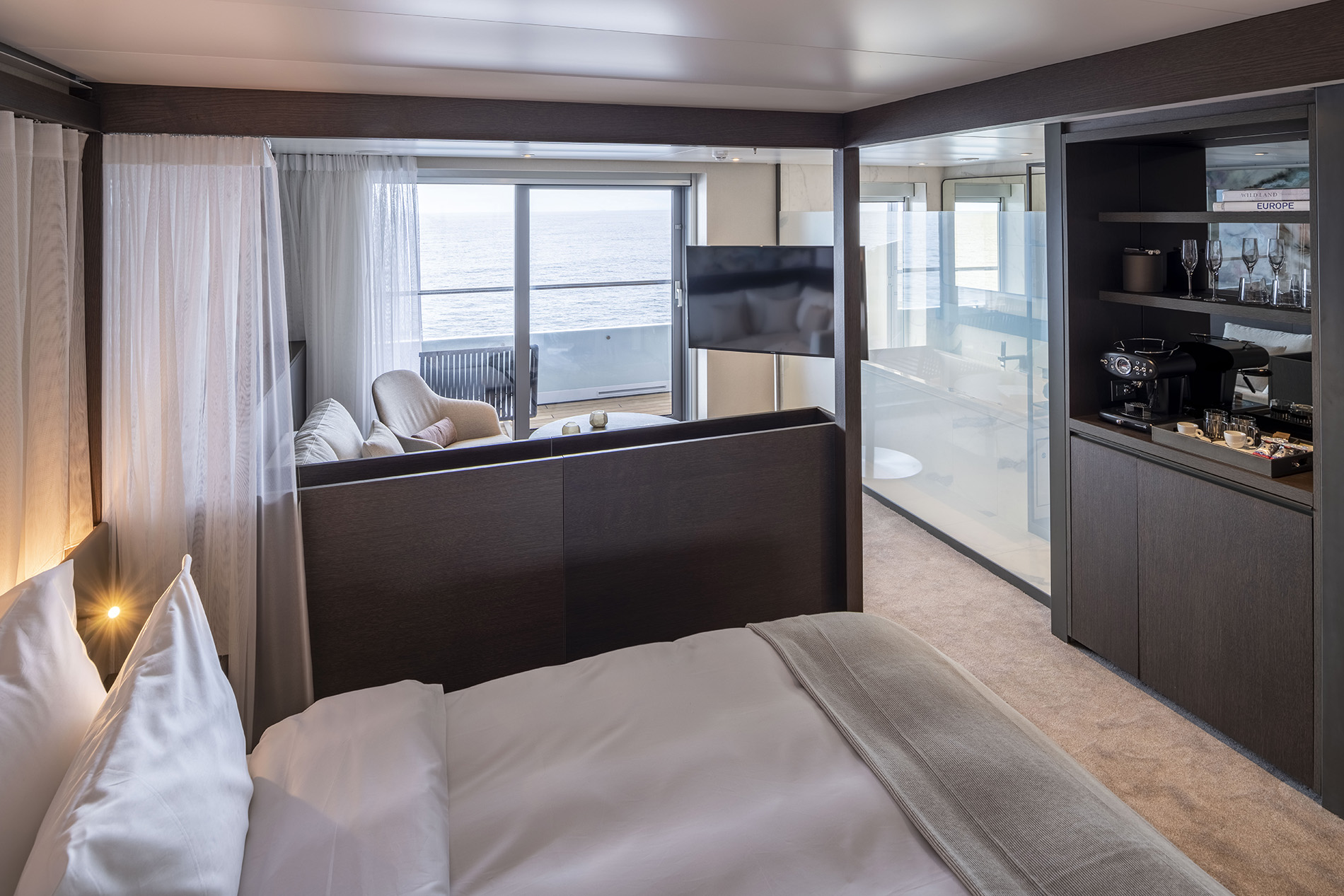
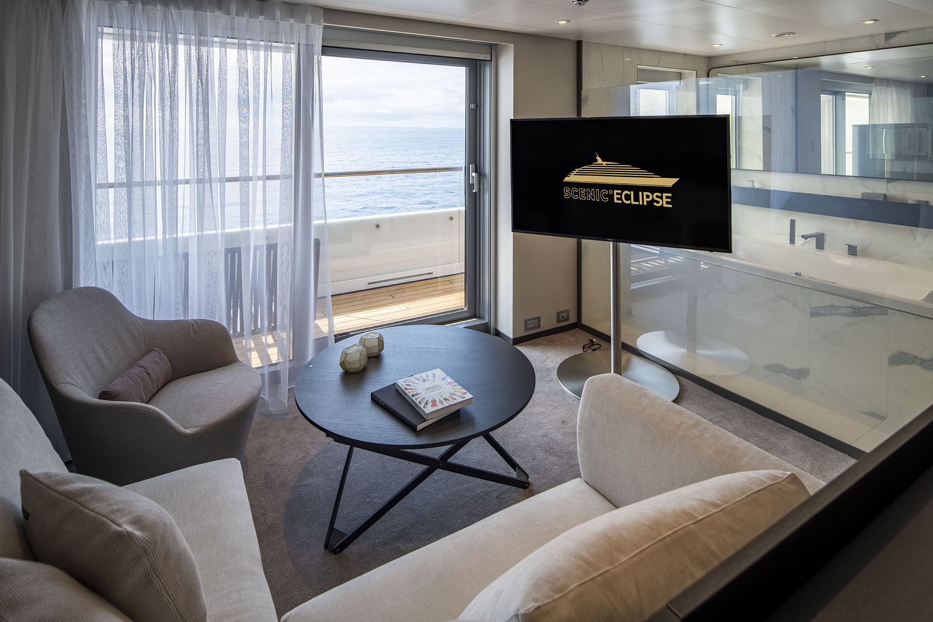
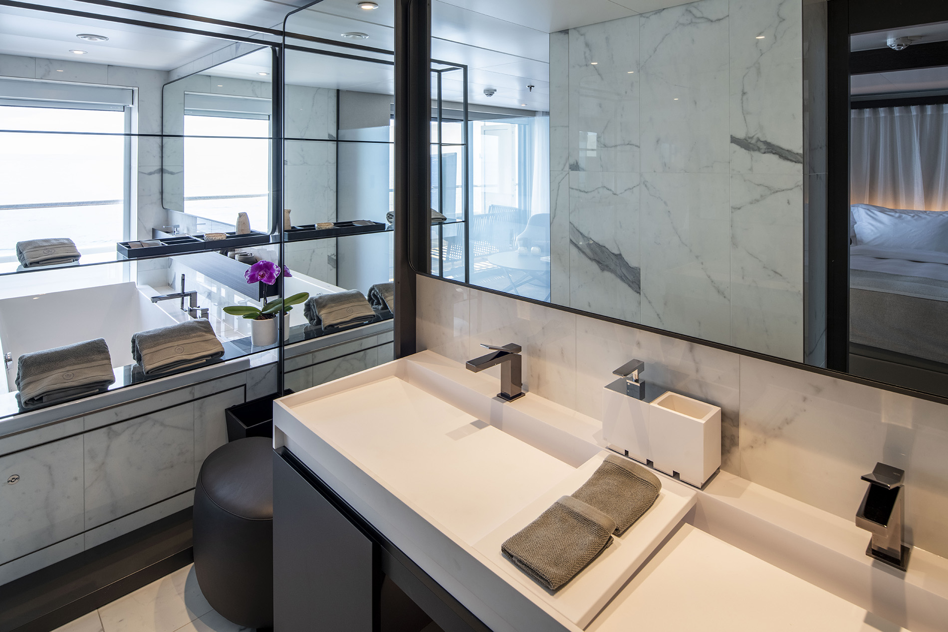
Handcrafted and extraordinary in every way, our Owner’s Penthouse Suites are the ultimate indulgence. Boasting the best views on board, a private spa pool on the spacious terrace, dedicated lounge and dining area, a super-sized bathroom with dual vitality mist showers, and a personalised butler service, it’s a once-in-a-lifetime experience.
Suite Features
At an enormous 195m² in size, the Owner’s Penthouse Suites are located on Deck 9. Suite names and amenities are the same across both Scenic Eclipse and Scenic Eclipse II, however, both have been thoughtfully curated to suit the cruising experience of these ships.
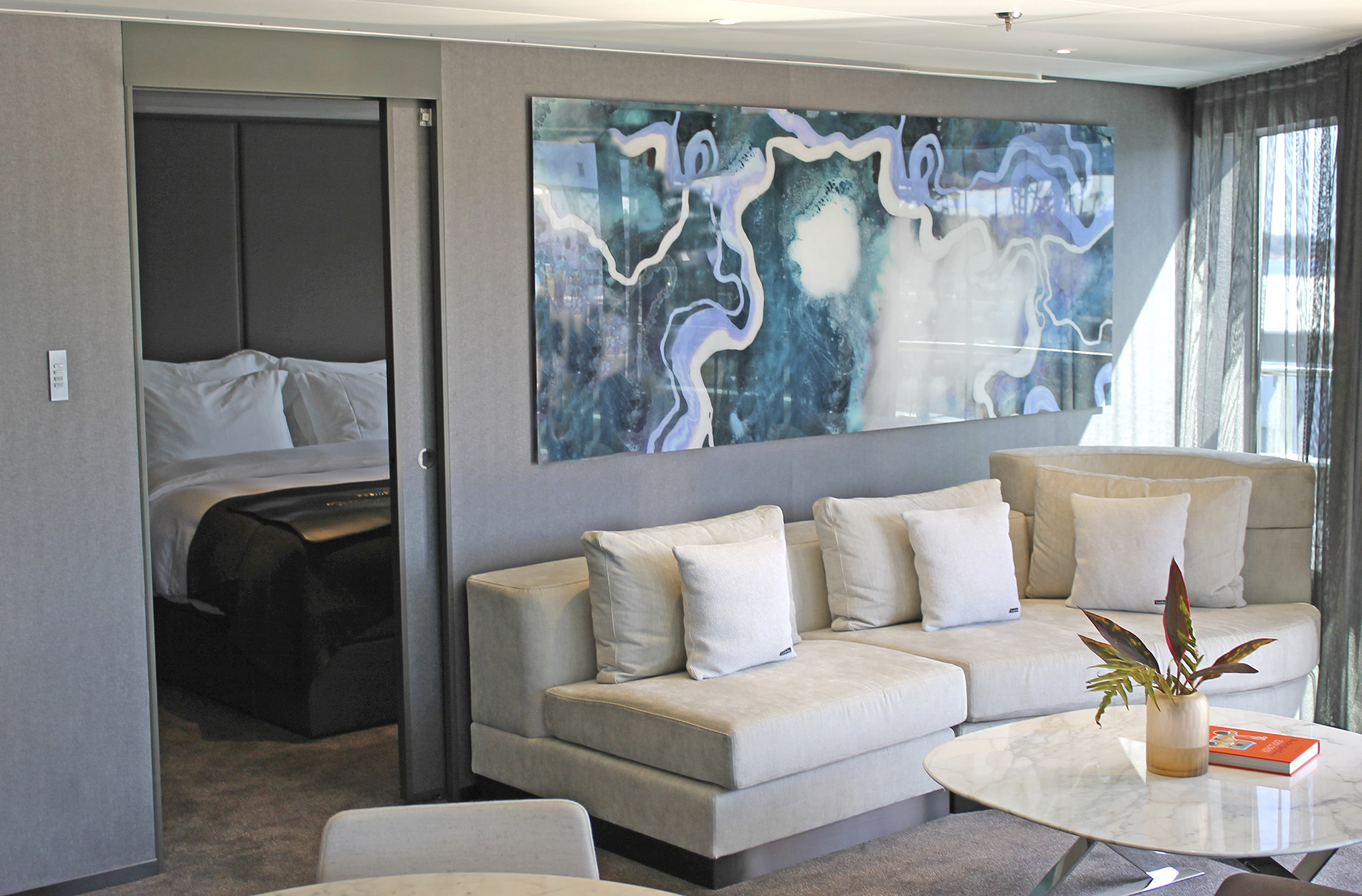
Separate Lounge & Bedrooom
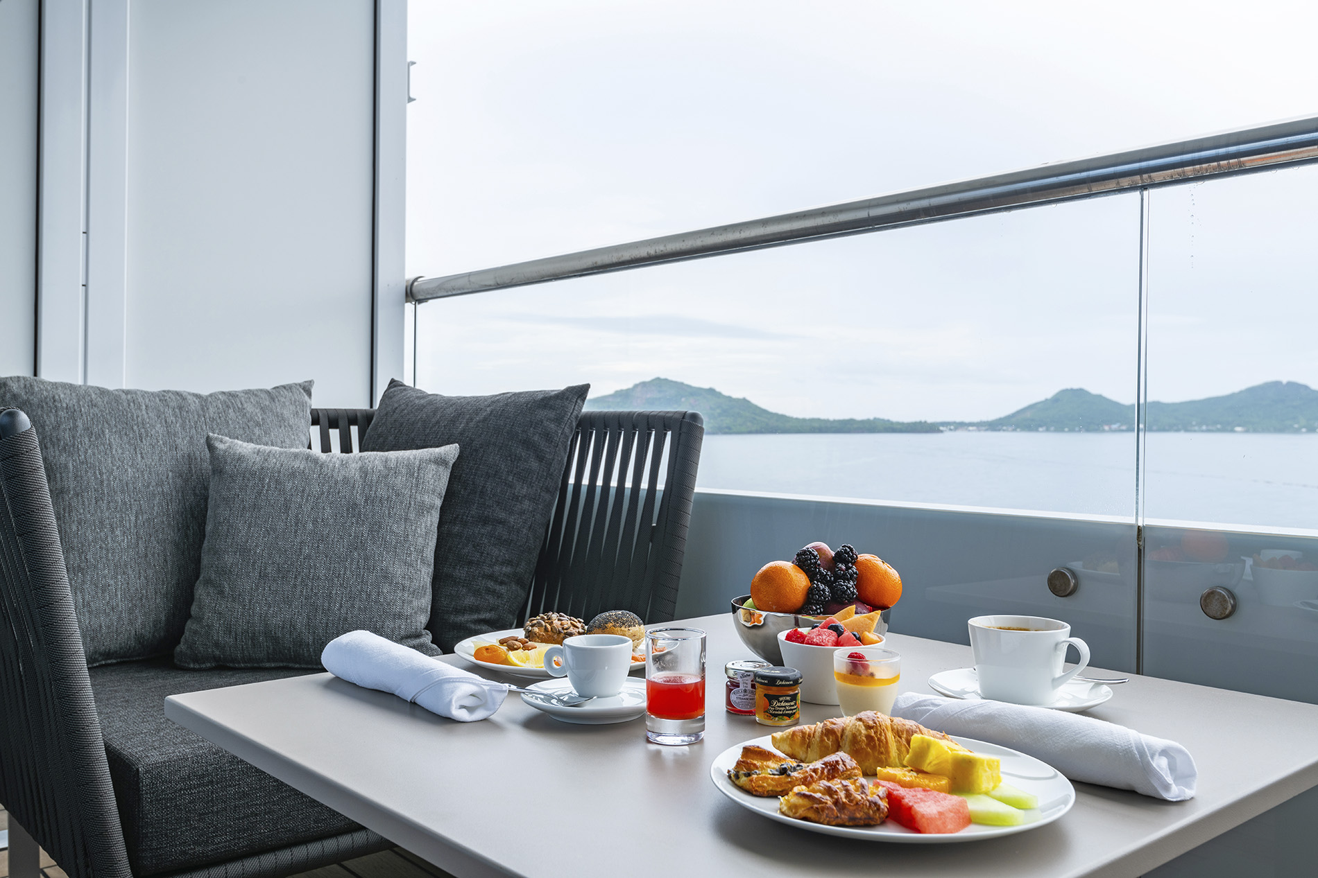
Staying in one of only two Owner’s Penthouse Suites is the ultimate indulgence. Your home away from home is located at the bow of the yacht, on Deck 9, boasting the best views on board. With a private dining area that can comfortably seat up to eight guests, you'll never want to leave.
For a once-in-a-lifetime cruising experience, combine the Owner’s Penthouse Suites with a Spa Suite to create a lavish Two-Bedroom Penthouse Suite – an incredible 245m² of unsurpassed ultra-luxury and opulence.
Spacious Terrace & Pool
Your curved terrace, complete with a personal private spa pool and sun loungers, is the perfect place to indulge in ultra-luxury relaxation.
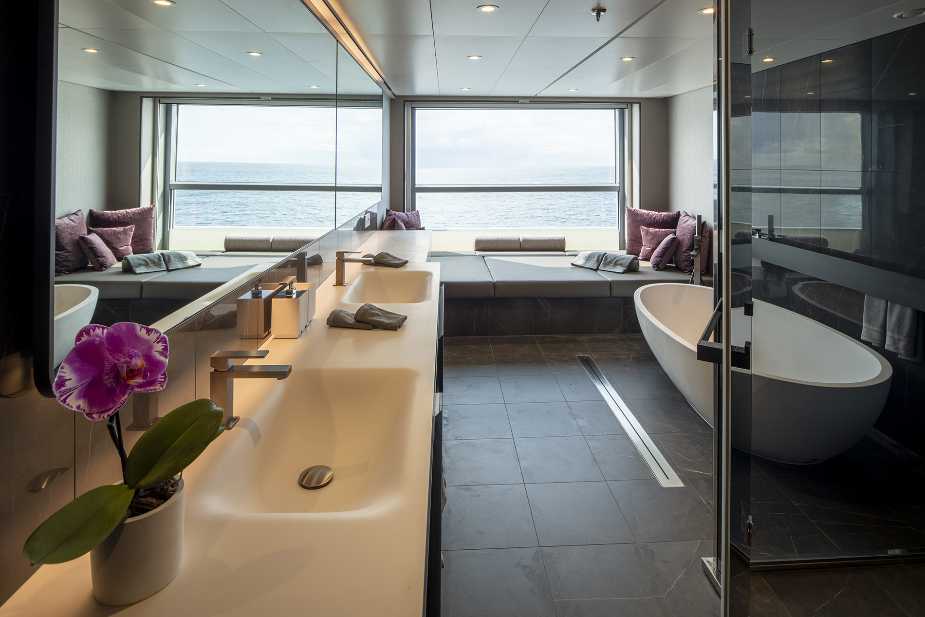
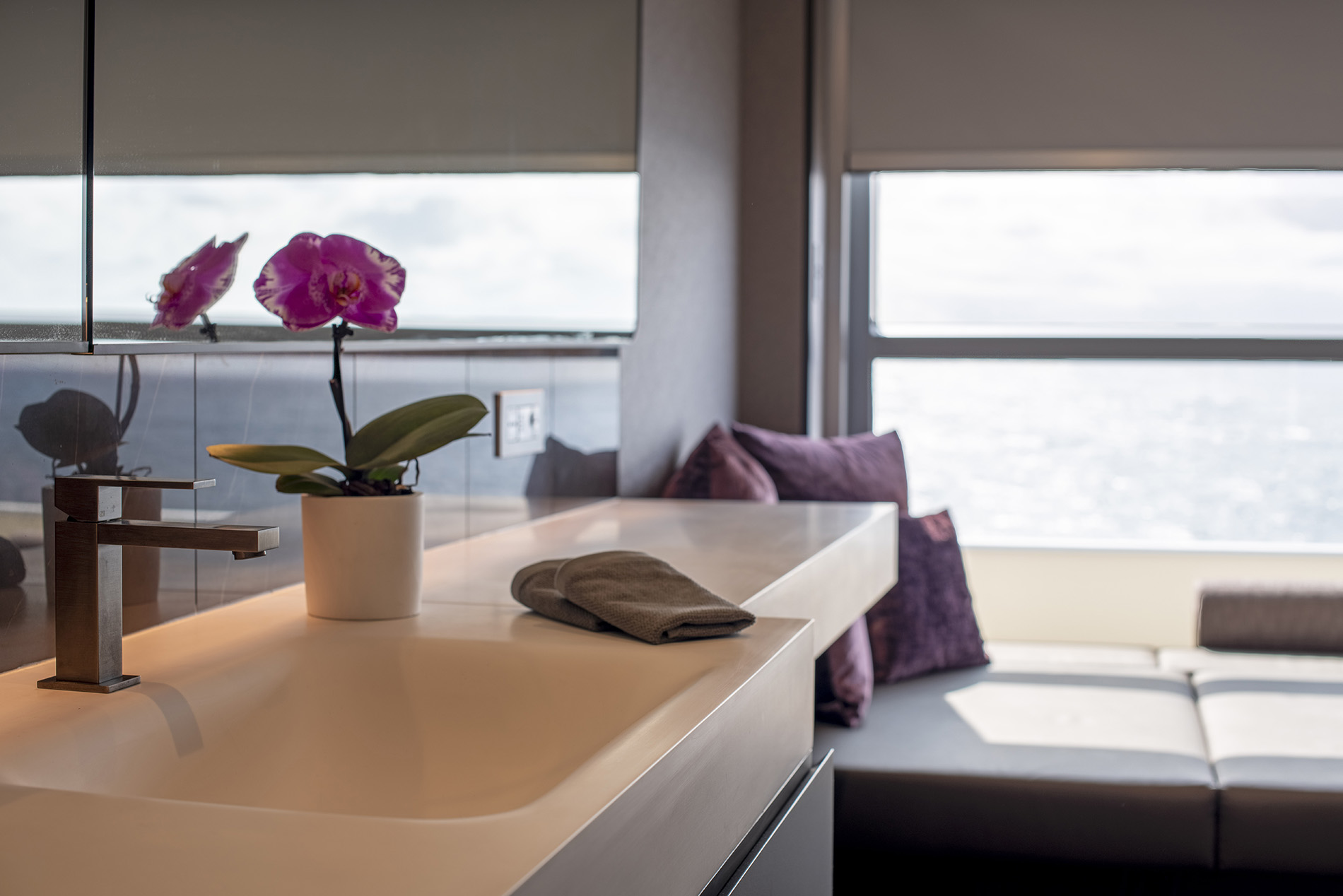
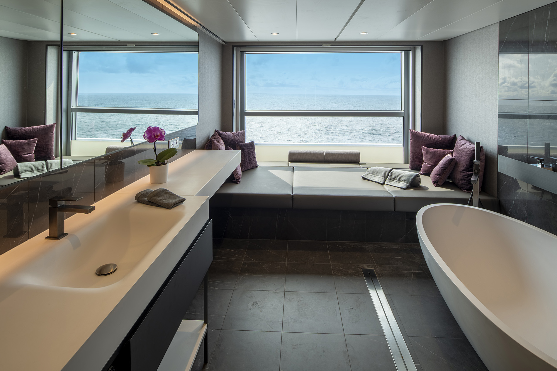
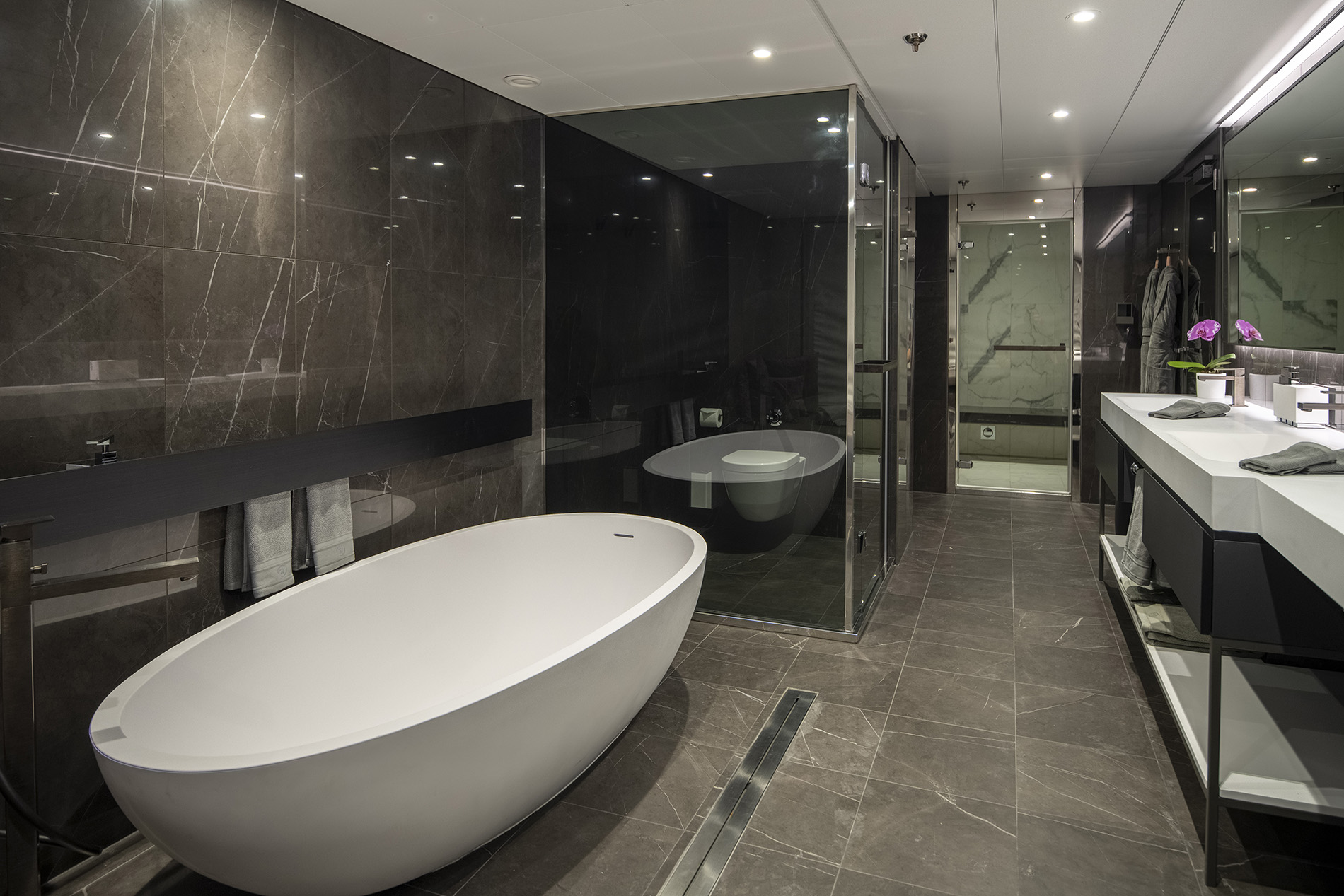
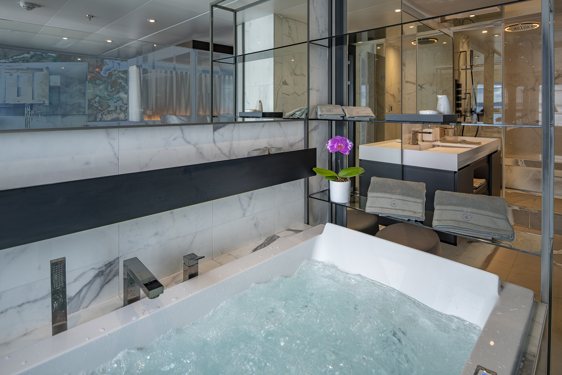
Super-sized Bathroom
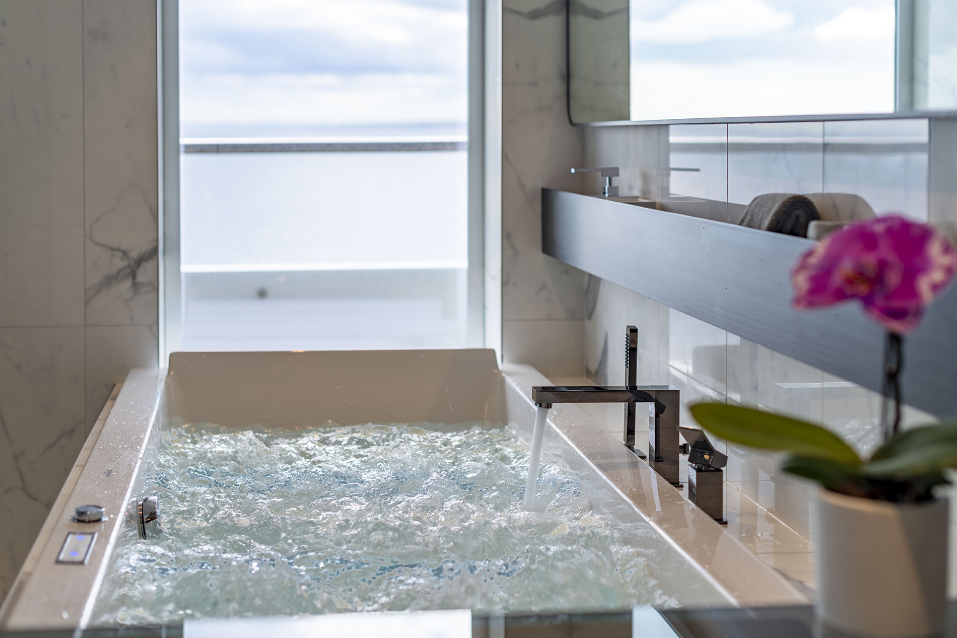
Featuring a super-sized bathroom, your relaxation and comfort are enhanced with a dual steam shower, therapeutic spa bath and guest powder room with dual vanity.
Priority Reservations & Embarkation
Guests in our Owner’s Penthouse Suite will enjoy the privilege of priority dining in the specialty restaurants as well as priority choice of Scenic Freechoice, Scenic Discovery, helicopter^ and submersible^ excursions. VIP embarkation and disembarkation are standard inclusions at the start and finish of your cruise.
Amenities & Features
- Spacious terrace with lounge area, sun loungers and private spa pool
- Spa Day Bed - transforming for in-suite private spa experience
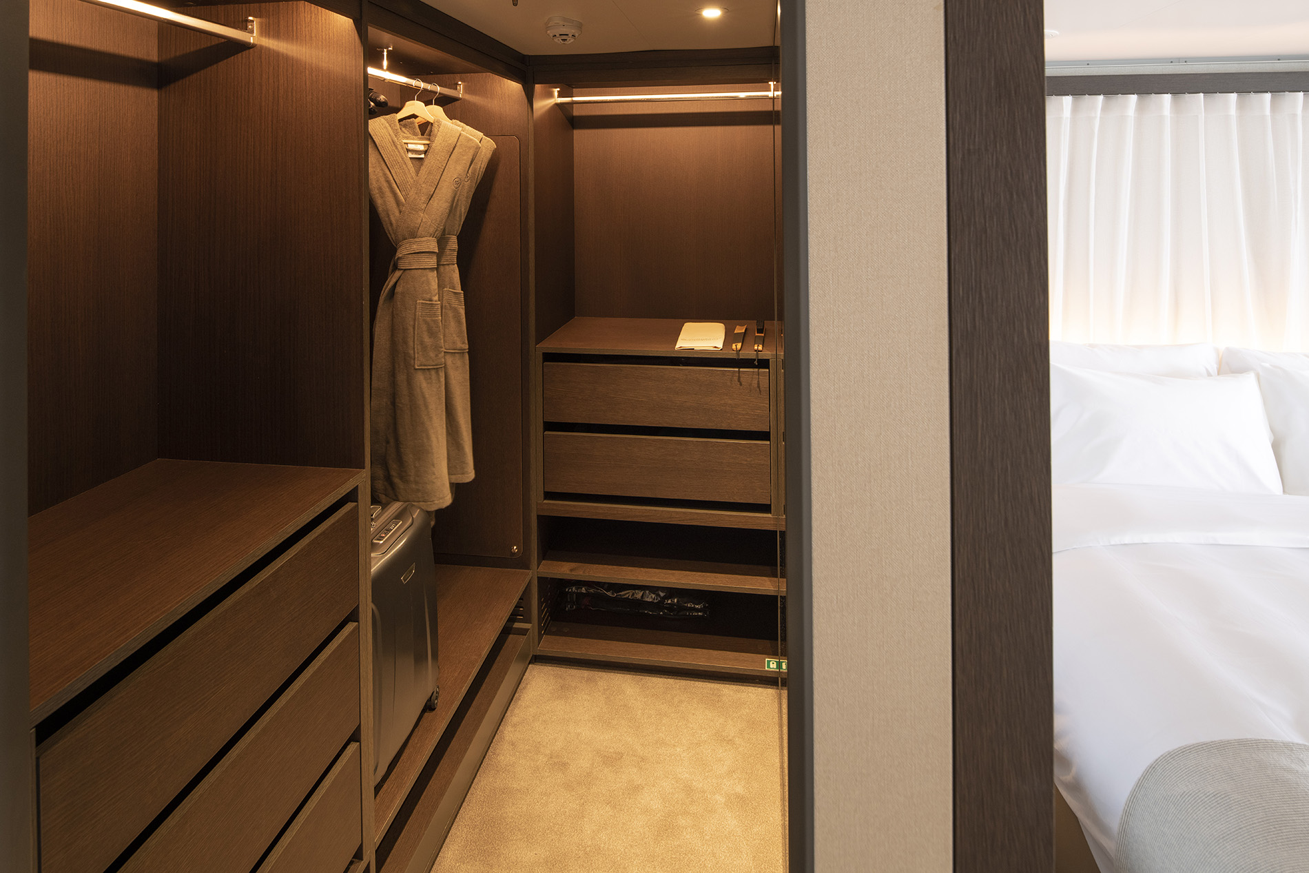
- A separate bedroom with luxury king-size Scenic Slumber Bed and his and hers walk-in wardrobe
- Personalised butler service
- Therapeutic spa bath
- Dual vitality mist shower with colour light therapy
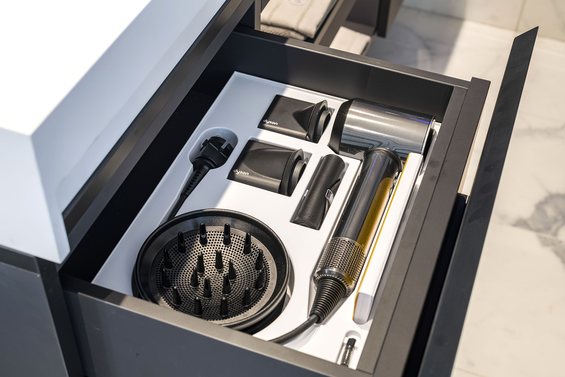
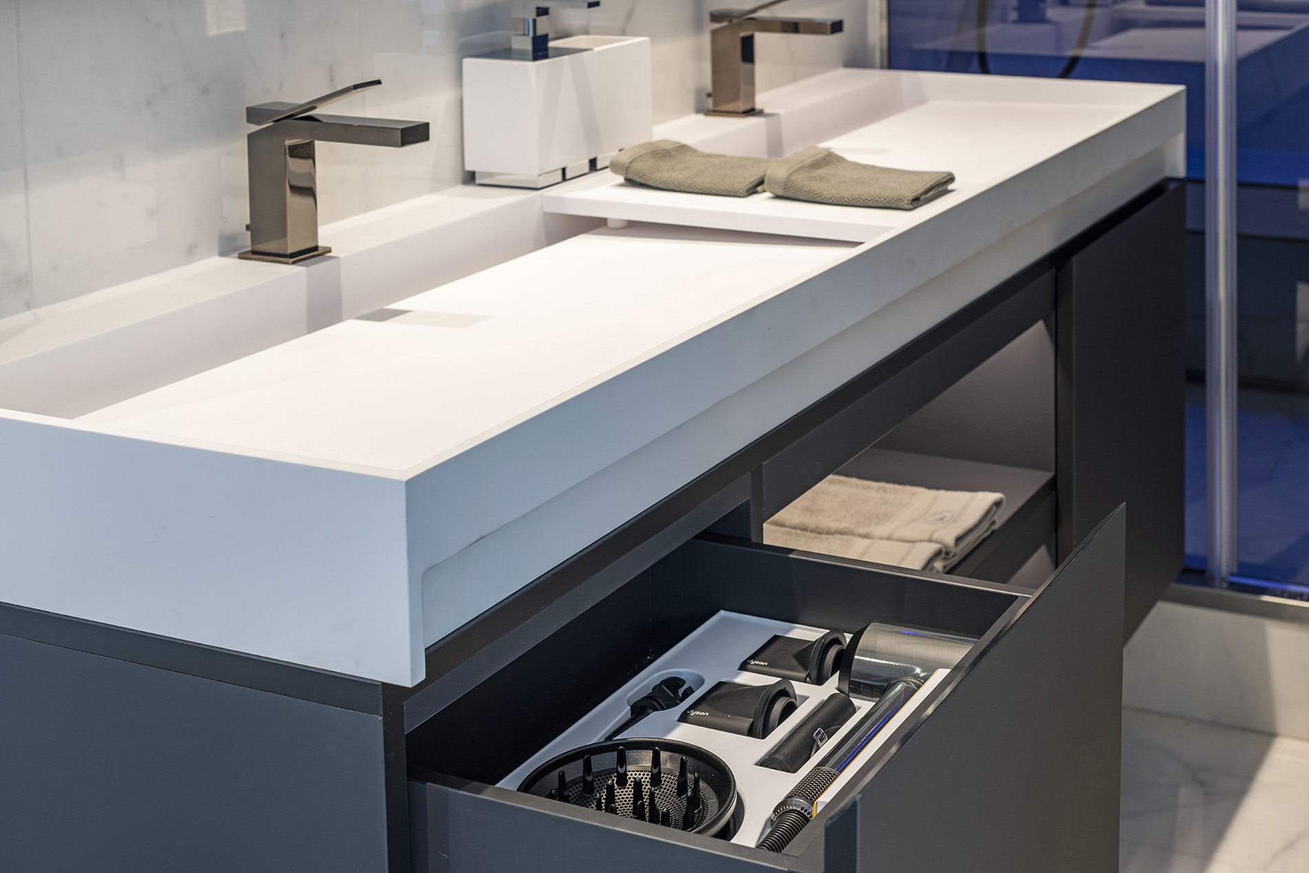
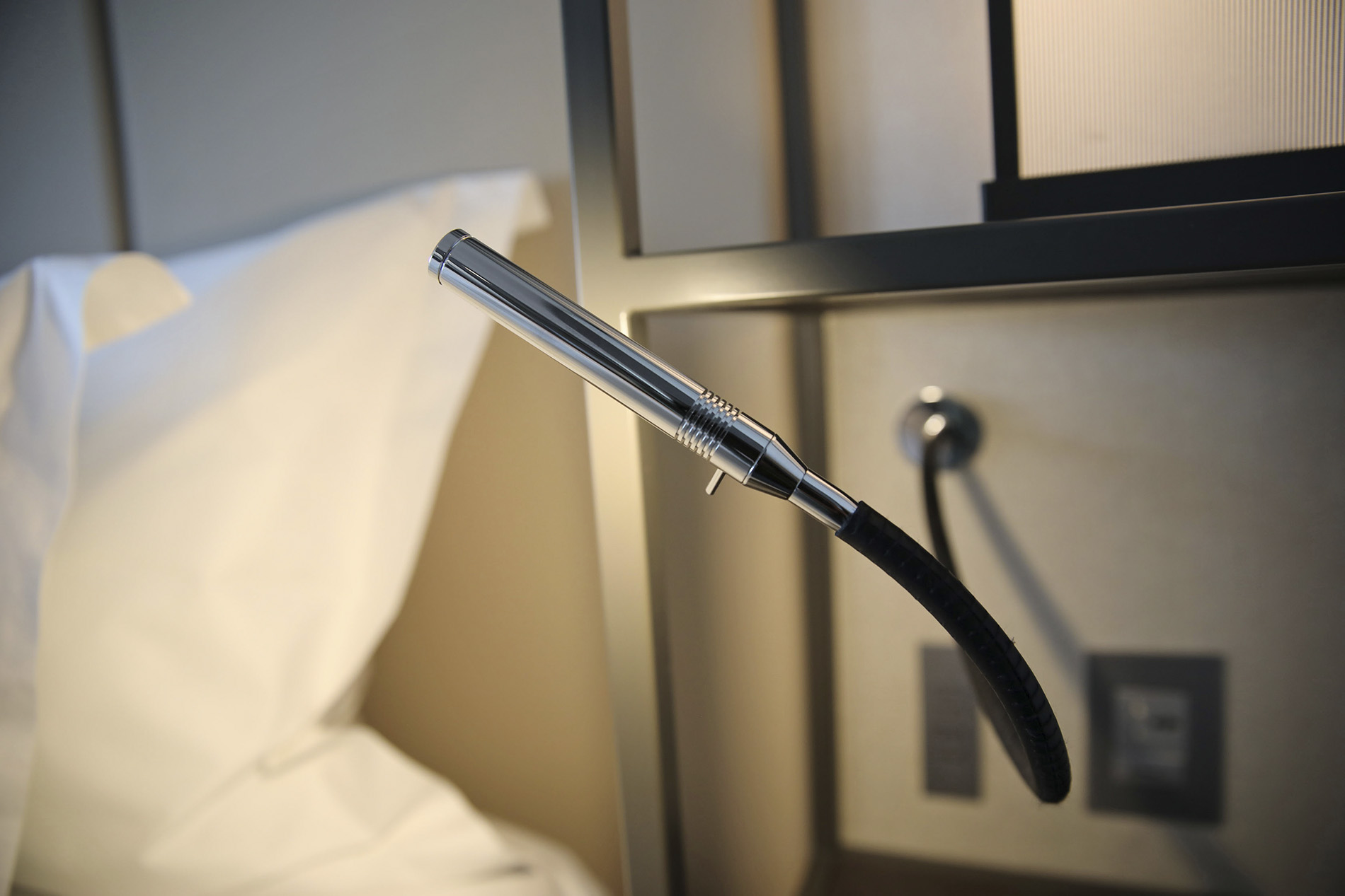
- Guest powder room, dual vanity, VIP amenities and Dyson hairdryer
- Walk-in robe
- In-suite dining with seating for up to eight guests
- A full complimentary mini-bar stocked with wines, Champagnes and spirits personalised to your preference, including illy coffee and specialty teas re-stocked daily
- Canapes and petite fours delivered to your suite
- Complimentary laundry service~
- Guaranteed dining reservations
- Priority choice of shore excursions
- VIP embarkation and disembarkation
- Advanced Heating, Ventilation and Air-Conditioning system (HVAC) provides 100% fresh air
- The highest sound insulation as per the marine class society Bureau Veritas

Marvel at incredible panoramic seascapes from the front of Scenic Eclipse as you relax on your spacious terrace in our luxurious Panorama Suites.
Located on Deck 6 and 8 at the front of the Discovery Yacht and overlooking the bow, these remarkable suites feature a spacious curved terrace, perfect for marvelling at incredible wildlife and landscapes.
Suite Features
Ranging in size from 105-110m², grandeur and style are taken to a whole new level in our Panorama and Grand Panorama Suites.
Suite names and amenities are the same across both Scenic Eclipse and Scenic Eclipse II, however, both have been thoughtfully curated to suit the cruising experience of these ships.
Separate Lounge & Bedroom
These grand suites include a host of special features and services. Curl up in your lounge with a kindle e-book from your in-suite library and sip your favourite aperitif, personally delivered by your butler. All before enjoying an intimate dining experience, in the plush and private surroundings of your suite. Even from the comfort of your bedroom, you’ll never miss a photo opportunity – accessing the outside world through your drop-down balcony window, with the gentle touch of a button, and with your in-suite binoculars.
Spacious Terrace
Your curved terrace is the perfect place to relax on a sun lounger and be the first to spot wildlife and incredible landscapes.
Luxurious Bathroom
The luxurious Panorama Suite bathrooms feature a vitality mist shower with colour light therapy, full bath, dual vanity, VIP amenities and Dyson hairdryer.
Priority Reservations & Embarkation
Guests in our Panorama Suites will enjoy the privilege of priority dining in the specialty restaurants as well as priority choice of Scenic Freechoice, Scenic Discovery, helicopter^ and submersible^ excursions. VIP embarkation and disembarkation are standard inclusions at the start and finish of your cruise.
Amenities & Features
- Spacious terrace with sun loungers and in-suite binoculars for optimal viewing
- Bedroom suite with luxury king size Scenic Slumber Bed, reading alcove, walk-in robe, desk, ambient lighting options and HDTV
- Spacious bathroom with vitality mist shower with colour light therapy, full bath, dual vanity, VIP amenities and Dyson hairdryer
- Personalised butler service, in-suite beverage and dining service
- Separate lounge and dining area with a four-seat dining table, cinema surround HDTV with Bose® speakers
- A full complementary mini-bar stocked with wines, Champagne and spirits personalised to your preference, including illy coffee and specialty teas re-stocked daily
- Complimentary laundry service~
- Priority dining in specialty restaurants and guaranteed dining reservations
- Priority choice of shore excursions
- VIP embarkation and disembarkation
- Advanced Heating, Ventilation and Air-Conditioning system (HVAC) provides 100% fresh air
- The highest sound insulation as per the marine class society Bureau Veritas
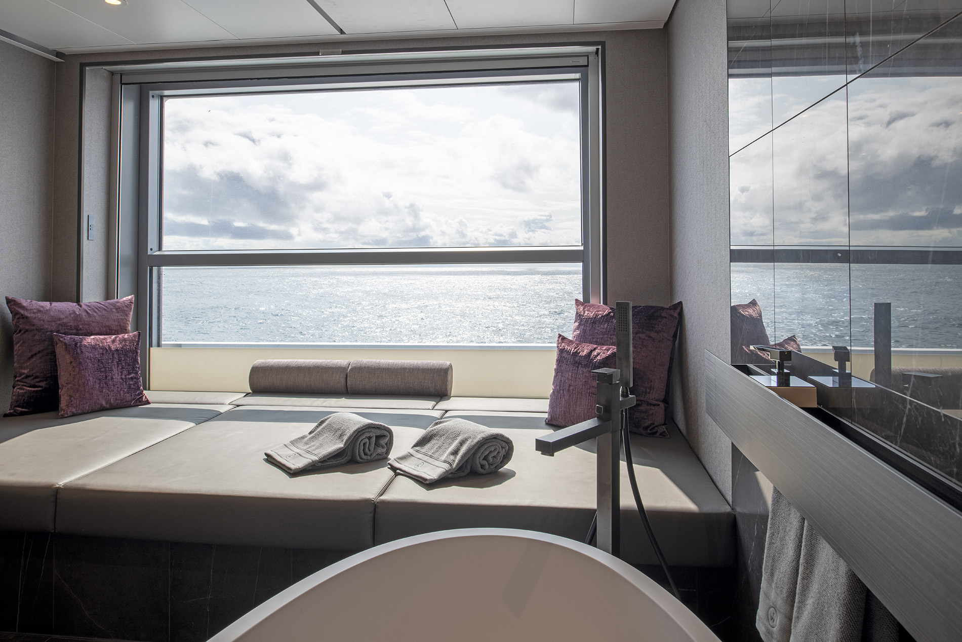
Imagine returning from an exhilarating day of all-inclusive excursions to your private hideaway and relaxing in your luxurious spa bath. Our indulgent Spa Suites will provide the ultimate rejuvenation.
Suite Features
Ranging in size from 46-50m², our Spa Suites are located on Deck 8 and 9.
Suite names and amenities are the same across both Scenic Eclipse and Scenic Eclipse II, however, both have been thoughtfully curated to suit the cruising experience of these ships.
Lounge and Sleeping Area
With a premier location on the higher Decks 8 and 9 and an impressive 46-50m2 in size, our opulent Spa Suites provide the most inviting of ultra-luxury retreats. Featuring a separate sleep zone with a four-poster king-size Scenic Slumber Bed, a lounge area as well as a private verandah, they are the perfect retreat after a day of discovery.
Luxurious Spa
Step into the private sanctuary of your Spa Suite and soak in a steaming bath drawn by your butler. Gaze out over your verandah to the vistas beyond and sip on a glass of Champagne – heaven.
Scenic Eclipse I features the signature double-sized Philippe Starck-designed spa bath, while Scenic Eclipse II offers a luxurious circular spa bath overlooking your verandah. Exclusive to these suites, the baths provide the perfect way to rejuvenate after your day of activities.
There are variations between the Spa Suite configurations on Scenic Eclipse I and II, and these distinctions are subject to the respective ship's specifications and design.
Private Verandah
Your private verandah is the perfect place to unwind. Be immersed in the tranquillity of the sea or be the first to catch sight of wildlife and breathtaking landscapes.
Amenities & Features
- Luxury king-size Scenic Slumber Bed, separate sleeping zone and lounge area with reading chair
- An expansive bathroom with a rectangular spa bath on Scenic Eclipse I and circular spa bath on Scenic Eclipse II
- A steam shower, with oversized head and soothing light therapy
- Dual vanity basins, luxurious amenities and Dyson hairdryer
- Walk-in robe
- A full complimentary mini-bar stocked with wines, Champagnes and spirits personalised to your preference, including illy coffee and specialty teas re-stoked daily.
- Personalised butler service
- Complimentary laundry service~
- Guaranteed dining reservations
- Priority choice of shore excursions
- VIP embarkation and disembarkation
- Advanced Heating, Ventilation and Air-Conditioning system (HVAC) provides 100% fresh air
- The highest sound insulation as per the marine class society Bureau Veritas
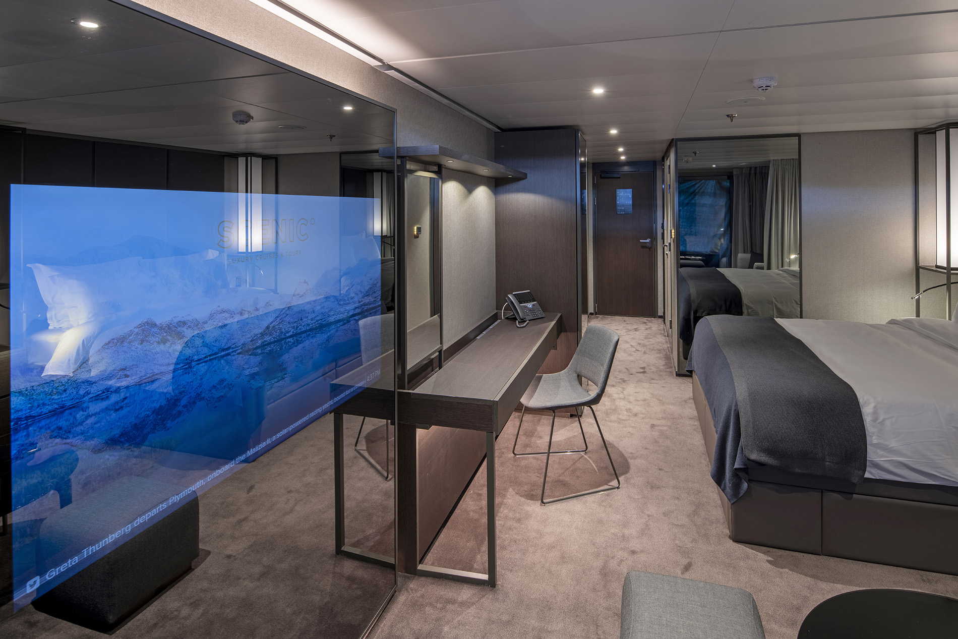
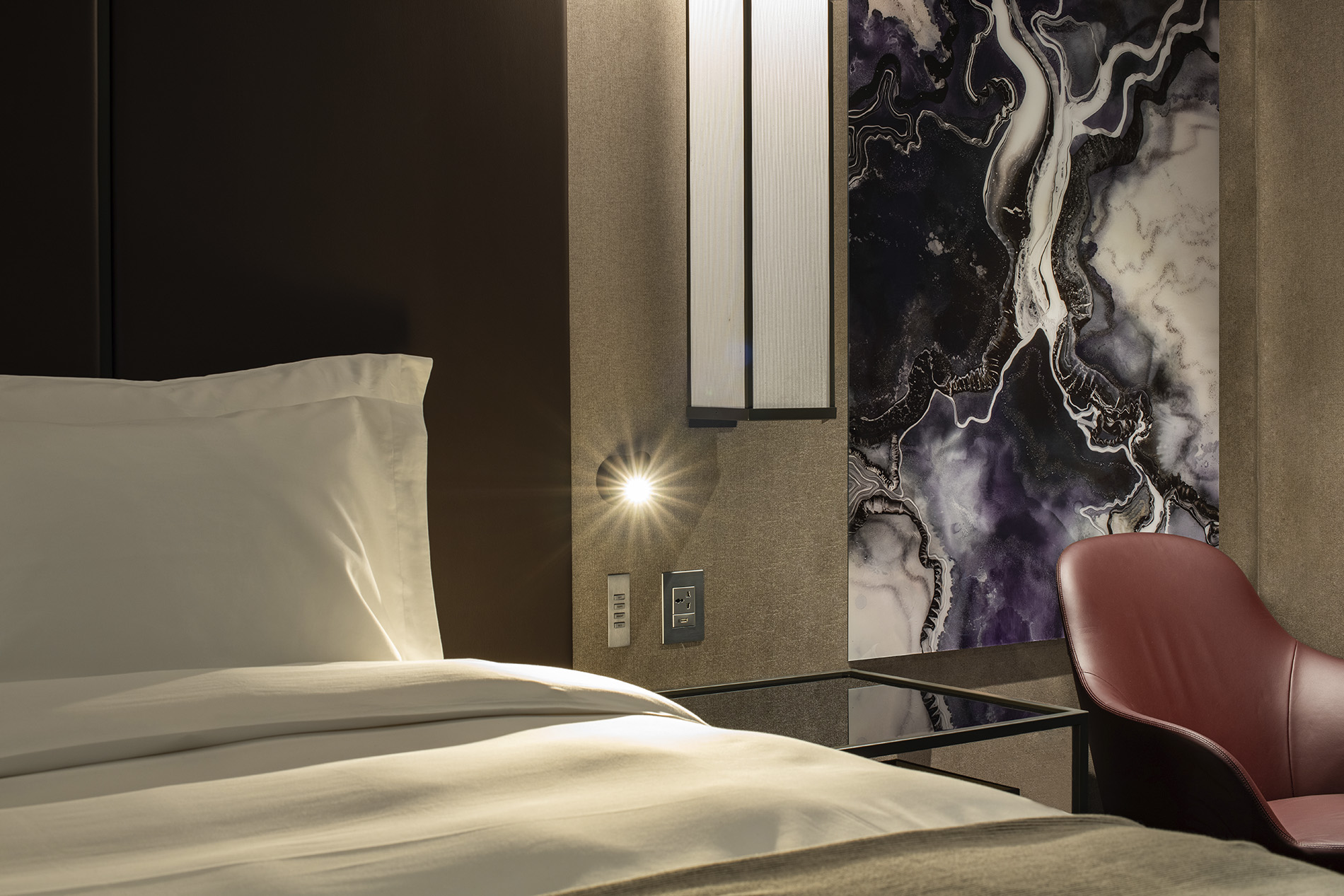
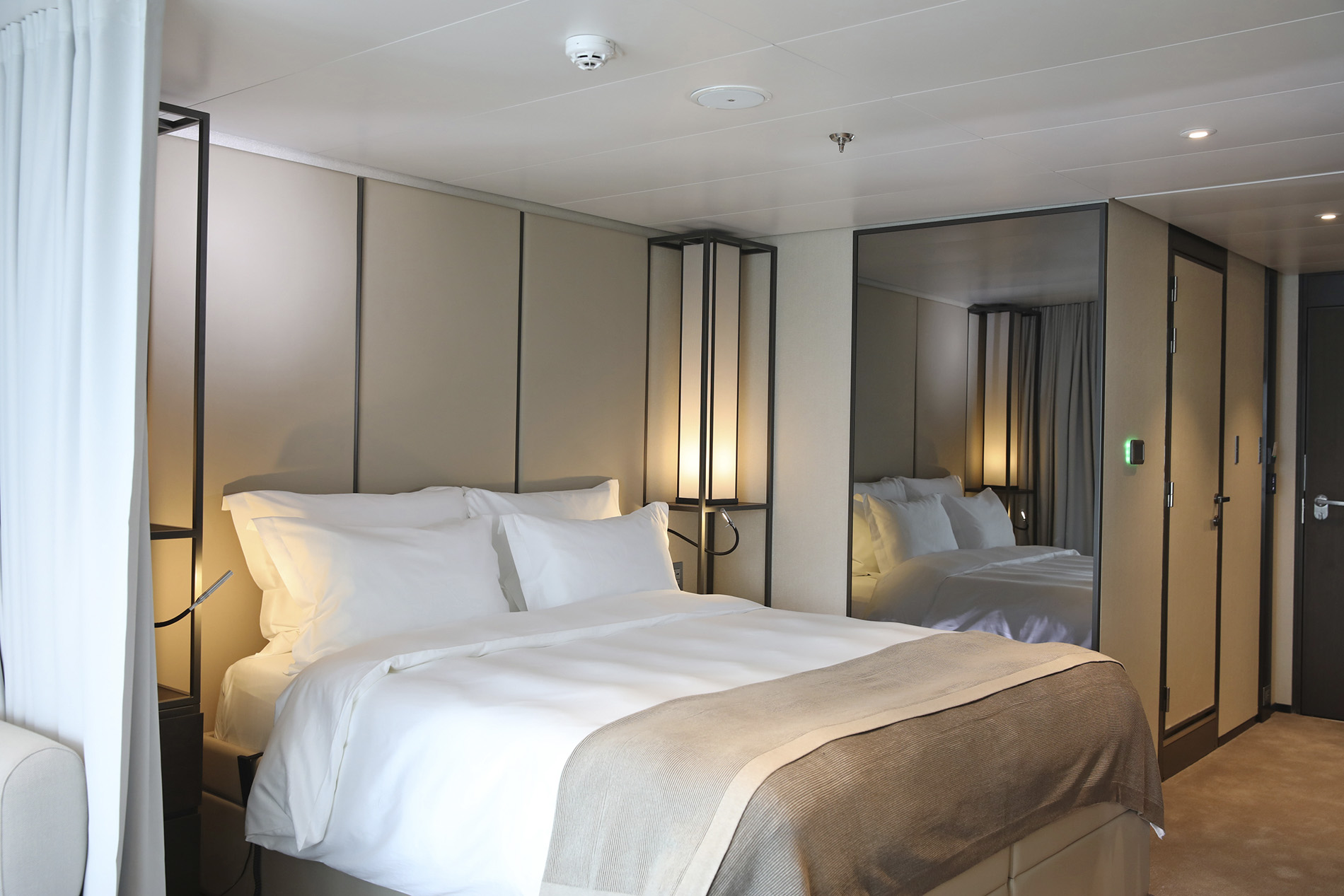
Our generously-sized Grand Deluxe Verandah Suites are your own private hideaway, furnished with the finest ultra-luxury amenities, including a plush king-size bed, pillow menu, walk-in wardrobe and a lounge area to relax in after a day of discovery.
Suite Features
Ranging in size from 32 - 34m², located on Deck 5 to 8, each suite includes:
Lounge & Sleeping Area
Your private hideaway is furnished with the finest ultra-luxury amenities, including plush king-size bed, pillow menu and a lounge area where you can relax after a day of discovery.
Private Verandah
Admire your window to the world. These incredibly spacious and thoughtfully designed suites feature floor-to-ceiling sliding glass doors that open onto sprawling vistas, spectacular seascapes and marvellous marine life. Your private verandah or terrace is the perfect place to unwind as a new world of wonder moves by.
Amenities & Features
- A private verandah with in-suite binoculars for optimal viewing
- Luxury king-size Scenic Slumber Bed
- Separate sleeping zone and lounge area
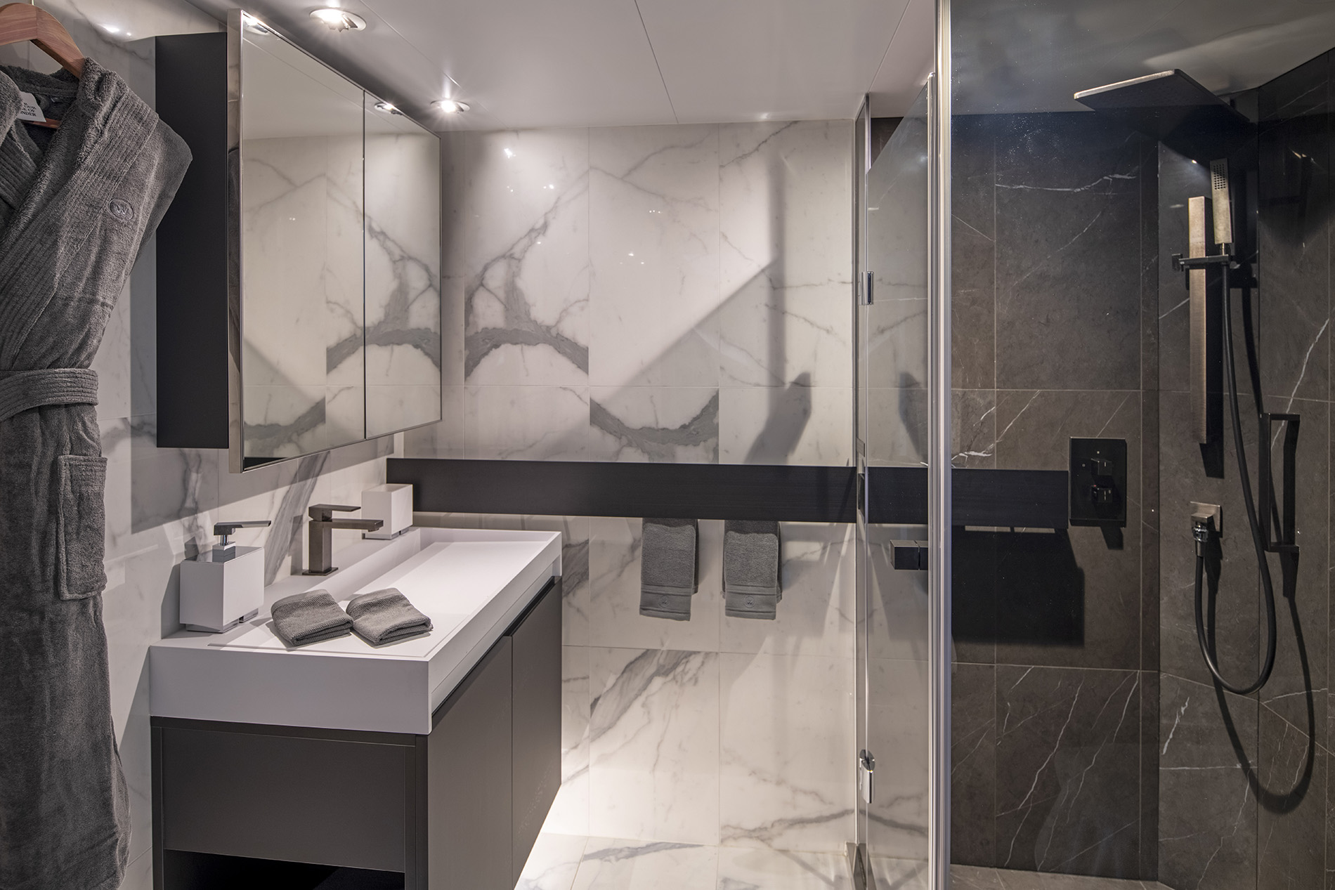
- En-suite bathroom with shower and vanity
- Luxury bathroom amenities and Dyson hairdryer
- Ambient lighting options
- Personalised butler service
- A full complimentary mini-bar stocked with wines, Champagne and spirits personalised to your preference, including illy coffee and specialty teas re-stocked daily
- In-suite beverage and dining service
- HDTV entertainment system and Bose® speakers
- Advanced Heating, Ventilation and Air-Conditioning system (HVAC) provides 100% fresh air
- The highest sound insulation as per the marine class society Bureau Veritas
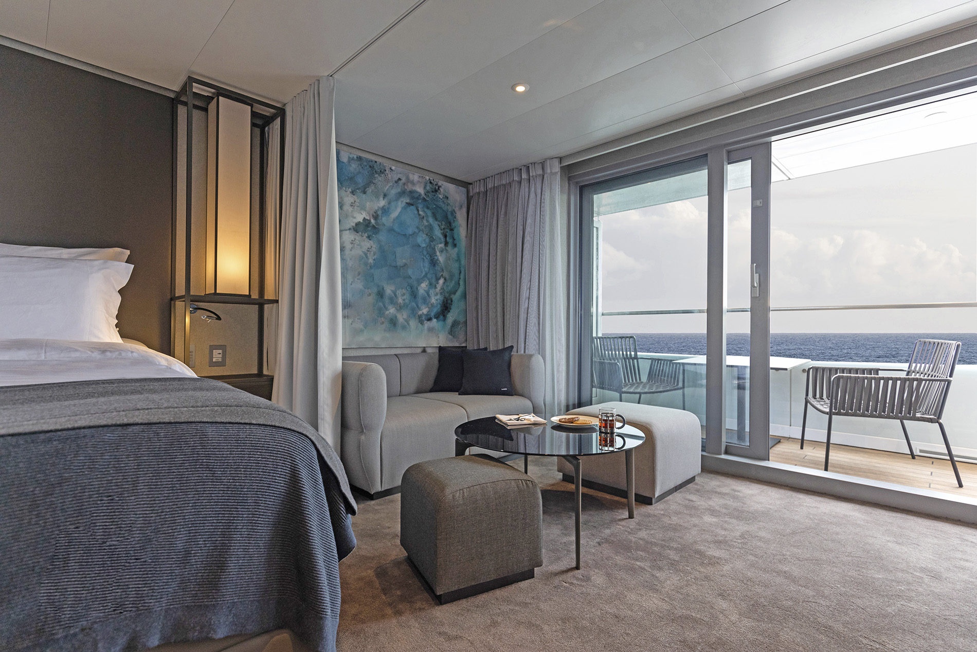
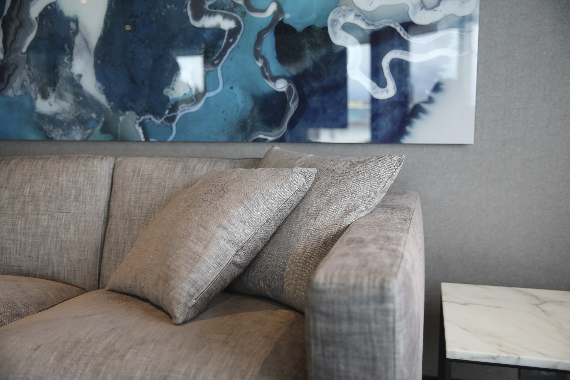
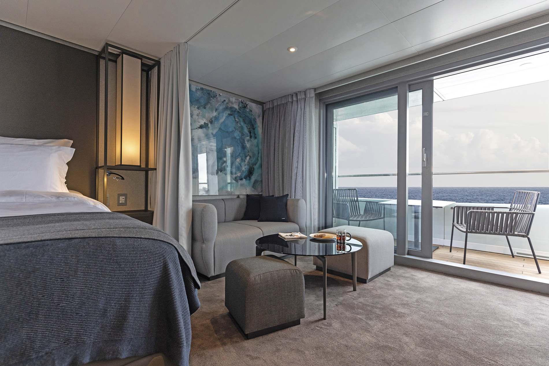
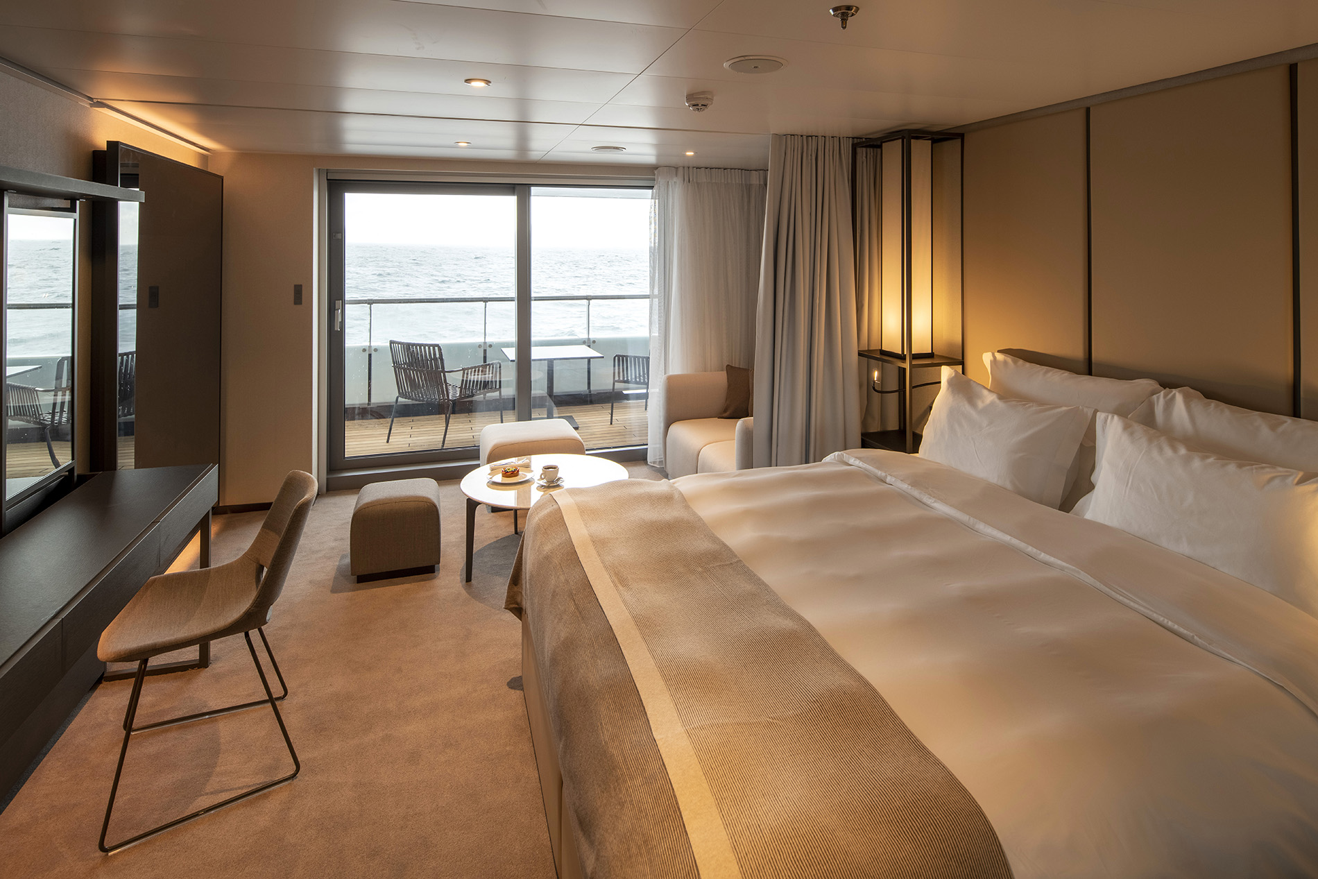
Our spacious Verandah & Deluxe Verandah Suites are thoughtfully designed with floor-to-ceiling sliding glass doors that open onto a private verandah or terrace. Enjoy unwinding in the separate lounge area with your choice of refreshment.
Suite Features
Ranging in size from 32 - 34m², located on Deck 5 to 8, each suite includes:
Lounge & Sleeping Area
Your private hideaway is furnished with the finest ultra-luxury amenities, including plush king-size bed, pillow menu and a lounge area where you can relax after a day of discovery.
Private Verandah
Admire your window to the world. These incredibly spacious and thoughtfully designed suites feature floor-to-ceiling sliding glass doors that open onto sprawling vistas, spectacular seascapes and marvellous marine life. Your private verandah or terrace is the perfect place to unwind as a new world of wonder moves by.
Amenities & Features
- A private verandah with in-suite binoculars for optimal viewing
- Luxury king-size Scenic Slumber Bed
- Separate sleeping zone and lounge area
- En-suite bathroom with shower and vanity
- Luxury bathroom amenities and Dyson hairdryer
- Ambient lighting options
- Personalised butler service
- A full complimentary mini-bar stocked with wines, Champagne and spirits personalised to your preference, including illy coffee and specialty teas re-stocked daily
- In-suite beverage and dining service
- HDTV entertainment system and Bose® speakers
- Advanced Heating, Ventilation and Air-Conditioning system (HVAC) provides 100% fresh air
- The highest sound insulation as per the marine class society Bureau Veritas

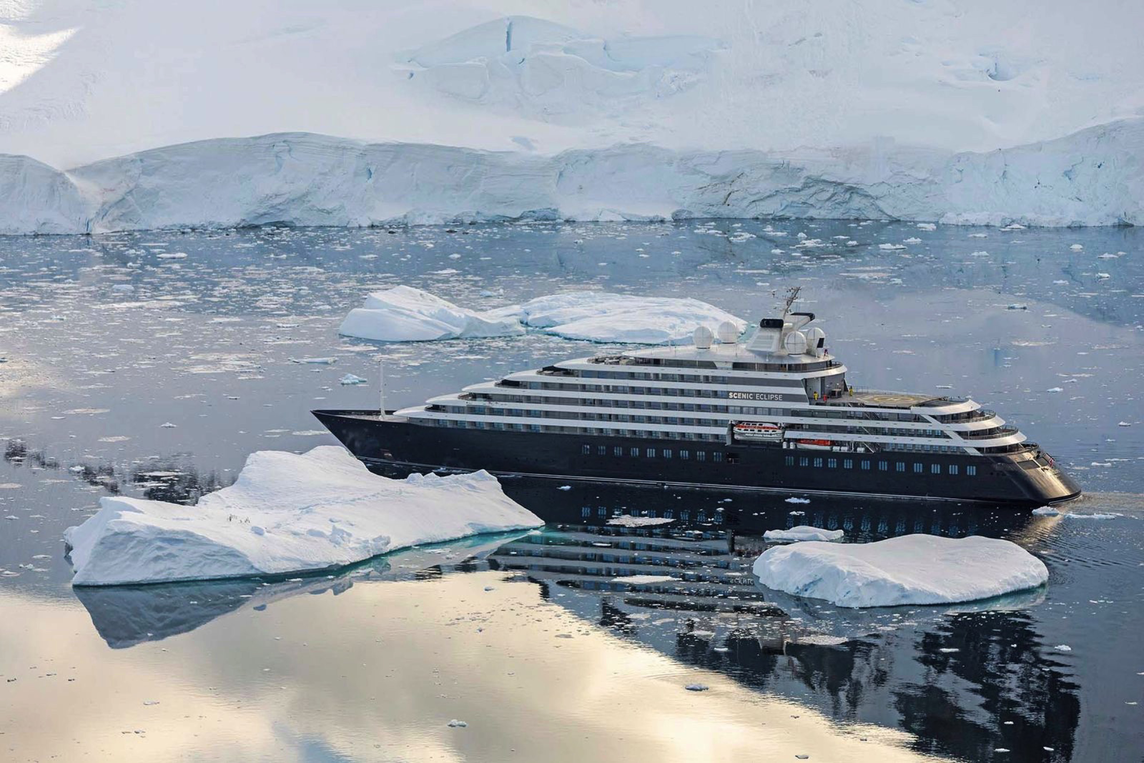
Scenic Eclipse
Scenic Eclipse set the benchmark for ultra-luxury ocean cruising. The Discovery Yacht sails between the Antarctic Peninsula and Arctic each year with voyages also sailing in the Mediterranean, Europe, and Americas. Be immersed in rich history, vibrant cultures, pristine beaches, breathtaking polar landscapes, and unforgettable wildlife encounters.
Inspired by the sleek contours of a sailing yacht, Scenic Eclipse set the benchmark in ultra-luxury ocean cruising. Whether it’s spontaneously stopping at a secluded beach, accessing unique ports in Europe, or crossing the polar regions, The World’s First Discovery Yacht™ will take you further than others in safety and comfort.
Catering for only up to 228 guests, Scenic Eclipse combines the sleek design of a super yacht with industry leading technology. Since it’s launch in 2019 The World’s First Discovery Yacht has been further enhanced, with new features including a Salt Therapy Lounge in the Senses Spa and the addition of the Sky Deck bar.
Ship Facts
| Launch Year | 2019 | ||||||||||
| Refit Year | 2024 | ||||||||||
| Language | en-US | ||||||||||
| Gross Tonnage | 17545 | ||||||||||
| Length | 168 | ||||||||||
| Width | 22 | ||||||||||
| Currency | USD | ||||||||||
| Speed | 17 | ||||||||||
| Capacity | 228 | ||||||||||
| Crew Count | 176 | ||||||||||
| Deck Count | 8 | ||||||||||
| Cabin Count | 114 | ||||||||||
| Large Cabin Count | 0 | ||||||||||
| Wheelchair Cabin Count | 0 | ||||||||||
| Electrical Plugs |
|
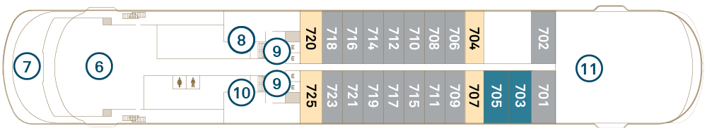
Deck 10
- Sky Bar
- Sky Deck Vitality Pool
- Cabanas
- Elevator

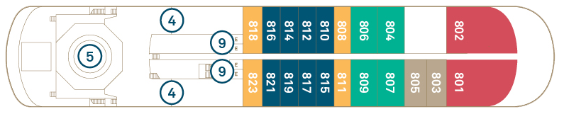
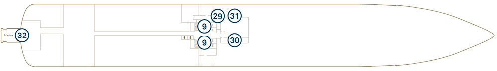
Deck 9
- Owner's Penthouse Suite
- Two bedroom Penthouse Suite
- Spa Suite
- Elevator
- Helicopter Hangars
- Helipad

Deck 8
- Panorama Suite
- Spa Suite
- Grand Deluxe Verandah Suite
- Deluxe Verandah Suite
- Verandah Suite
- Helicopter Hangars
- Helipad
- Elevator
Deck 7
- Grand Deluxe Verandah Suite
- Deluxe Verandah Suite
- Verandah Suite
- Yacht Club
- Hanging Chairs
- Elevator
- Yoga & Pilates Room
- Gym & Fitness Area
- Wheelhouse
Deck 6
- Grand Panorama Suite
- Grand Deluxe Verandah Suite
- Deluxe Verandah Suite
- Verandah Suite
- Elevator
- Spa Vitality Pool
- Senses Spa
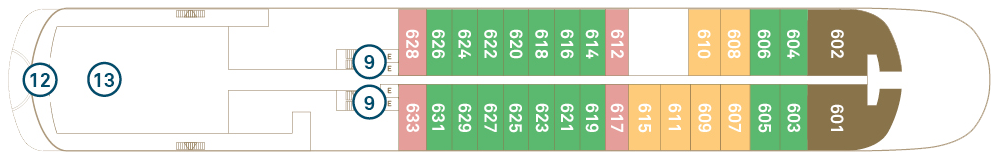
Deck 5
- Grand Deluxe Verandah Suite
- Deluxe Verandah Suite
- Verandah Suite
- Elevator
- Lumière
- Azure Bar & Café
- Scenic Épicure
- Observation Lounge & Library
- Observation Terrace
- Marina Entrance
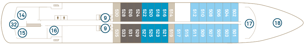
Deck 4
- Elevator
- Koko's
- Sushi & Sake Bar
- Chef's Table
- Elements
- Guest Services
- Scenic Lounge & Bar
- Boutique
- Theatre
- Discovery Lounge
Deck 3
- Elevator
- Marina Entrance
- Guest Laundry
- Medical Centre
- Discovery Centre
- Tender Area
With an unrivalled range of dining experiences, be immersed in a multicultural culinary adventure. The impressive selection of cuisines and dining venues offer you a variety of choices that will satisfy everyone’s palate. Open galleys invite you to see first-hand the passion and expertise that goes into preparing every meal.
"Scenic Eclipse is the only ship to offer such an extensive à la carte spectrum, with so much flexibility and variety. Our menus reflect the talents of our chefs and the destinations we visit, and that’s really 100% unique." - Tom Goetter, VP Oceans Hotel Operations for Scenic Group.With up to 10 unique dining experiences featuring a range of flavours and cuisines, you can pick the setting to match your mood.
Dining and beverages curated to your tastes
- Culinary team of over 38 chefs from 15 countries
- More than 3,000 recipes in the menu repertoire curated to reflect the regions we sail in
- Locally sourced produce
- Delectable options to suit all dietary requirements - from gluten-free to vegetarian, vegan and more
- Premium selection of beverages available all day
- A range of over 100 premium Champagne, sparkling, red, white, rosé and dessert wines, with daily selections inspired by your destination
Elements
Elements is the main restaurant featuring Italian, steak and seafood from an à la carte menu. Located on Deck 4, it’s a relaxed dining option for dinner. Dine solo, with your travel partner or join friends on larger tables. Enjoy premium beverages from Elements Bar, hosting with fine wines matched to the daily menu and broad selection of international cheeses.
Chef's Table @ Elements
Located within Elements, dining at Chef’s Table is an exclusive, by invitation-only degustation experience. Accommodating a group of just 10 guests, this 11-course degustation meal is paired with premium beverages. The Executive Chef and the culinary team will enthral you as they present each dish, explaining the world-class techniques and ingredient origins used in each creation.
Koko's Asian Fusion
Enjoy contemporary Asian fusion in a vibrant ambience. Traditional ingredients and innovative techniques interweave to celebrate the diverse flavours of Asia. Up to 26 guests can be seated for dinner service at either regular tables or sunken seating inspired by traditional Japanese dining practices. Sample from share plates to discover new flavours as you enjoy the luxurious atmosphere.
Sushi & Sake Bar @ Koko's
Indulge in a genuine culinary experience as skilled chefs handcraft the freshest sushi, including exquisite options with vegan salmon and tuna. Catering for up to 18 guests, you can dine along the ocean view benchtop or at the bar, watching as your chefs hand-make your meal.
Night Market @ Koko’s
Savour the excitement of an interactive dining experience as our expert chefs craft dishes inspired by the lively markets of Asia, India and the Middle East before your eyes. For only eight guests in each seating, this exclusive Teppanyaki grill experience will be a highlight of your culinary journey.
Azure Bar & Café
Visit the Azure Bar & Café for relaxed, all-day grazing. Take in the spectacular views from the indoor or outdoor terrace seating. Delight your tastebuds with a variety of pizzas, salads, snacks and healthy meals, coupled with barista-made coffee and beverages. Enjoy after-dinner treats, such as macaroons, biscotti and chocolates with a brandy, port, or tea. This relaxed café has a serene and laid-back feeling with inside and outside seating.
Lumière Restaurant & Champagne Bar
Indulge in contemporary French cuisine and Champagne. This fine dining restaurant has an elegant and modern atmosphere. Enjoy a pre-dinner drink, fried oysters and caviar before you are seated for an evening of world-class cuisine, with the option of a set degustation menu.
Yacht Club
Relax in the Yacht Club grill restaurant and bar for breakfast, lunch and special themed dinners. This casual dining experience is fitted with food islands, outdoor and lounge seating. Come to dine, mingle, relax in swing chairs overlooking the view, or taste our freshly-made gelato.
Chef's Garden @ Épicure
Be immersed in the gastronomical delights of local cuisine and wines with dedicated masterclasses led by our expert chefs and sommelier. Book in to see the chef create an array of authentic dishes from the regions you’re cruising through. Located on Deck 5 with a special cooking station and large TV screen, you’ll catch every detail.
Private Dining Experiences
There are many intimate and relaxed venues which provide the option of private dining at no additional cost.
Groups can dine at a restaurant of their choice or in the privacy of their suite. Night Market @ Koko’s offers private dining for up to eight guests and Chef’s Table is the ultimate degustation dining by invitation-only experience for 10 guests.
In-Suite Dining
When the mood strikes to dine in the privacy of your suite, your personal butler can arrange everything. Choose from the 24-hour in-suite dining and beverage menus. Your butler will also ensure your in-suite mini-bar is re-stocked daily to your liking. With an in-suite espresso machine, savour your morning coffee in the solitude of your suite or soak up the sunlight on your verandah or terrace.
Scenic Eclipse takes ocean cruising to a whole new level of luxury and elegance. Your time on board will be one of world-class indulgence and absolute discovery. From the ultimate spa experience to the spacious lounges and bars, outdoor terraces, pool and jacuzzis, not to mention the theatre and of course your own private verandah, the luxurious wonders on board Scenic Eclipse never cease.
An Unrivalled Selection
Our expert bartenders are well-versed and equipped to mix up a variety of cocktails, from a traditional dry martini (shaken, not stirred if you wish) through to the latest trending concoctions. A comprehensive wine list has been curated by Master of Wine, Keith Isaac and sourced from around the world, representing a number of viticultural regions and wine styles. Equally, there is a thorough selection of top-shelf spirits, allowing you to choose your favourite gin, saké or from more than 100 varieties of whiskey. Relax and order from a wide range of truly all-inclusive beverages according to your mood and tastes.*
Freshly squeezed fruit juices, soft drinks and nonalcoholic beers are also included. Enjoy your favourite mocktail or sip on a warming brew from a range of specialty teas and illy coffees, all available whenever you please.
Settle in at any one of the nine spacious bars and lounges to enjoy your beverage of choice. Relish French champagne at Lumière’s Champagne Bar, indulge in an aged whiskey at the Scenic Lounge Bar, sip on a cocktail in your cabana near the Panorama Bar, or unwind in the Observation Lounge with a specialty tea. Fancy an aperitif as you admire the views from your private verandah, or a pinot noir with dinner? Complimentary beverages*, including those stocked in your mini-bar, are all part of our signature truly all-inclusive promise.
This impressive selection is available all day, every day – ensuring that a 6-star, ultra-luxury voyage on board Scenic Eclipse really is in a class of its own.
Scenic Lounge
The Scenic Lounge Bar is the main bar and heart of the yacht located next to Reception. The mixology cocktail program and whiskey bar for connoisseurs and aficionados are key attractions. You will also be entertained by the resident entertainer throughout the night.
Let our bartenders guide you towards your premium beverage of choice, be it Champagne, wine, whiskey, cocktails, an afternoon espresso or an after-dinner liqueur whilst the on board musician sets the scene with live music.
State-of-the-Art Theatre
Gain insights into the regions you’re visiting during regular lectures and information sessions, hosted by expert Discovery Team members, Captain and crew in the world-class theatre. Here, guests can also enjoy nightly musical performances spanning a range of genres.
Theatre Bar
The Theatre Lounge is the venue for screening of presentations, lectures and shows. During the day, it is supported with a self-service beverage station whilst is a full service bar during the entertainment program. The Theatre Bar is only available on Scenic Eclipse I.
Observation Lounge
The Observation Lounge & Library is a serene haven for guests seeking a peaceful retreat to read and observe the world. While we don't serve food in this tranquil space, you can still enjoy a variety of beverages as you unwind and watch the world go by.
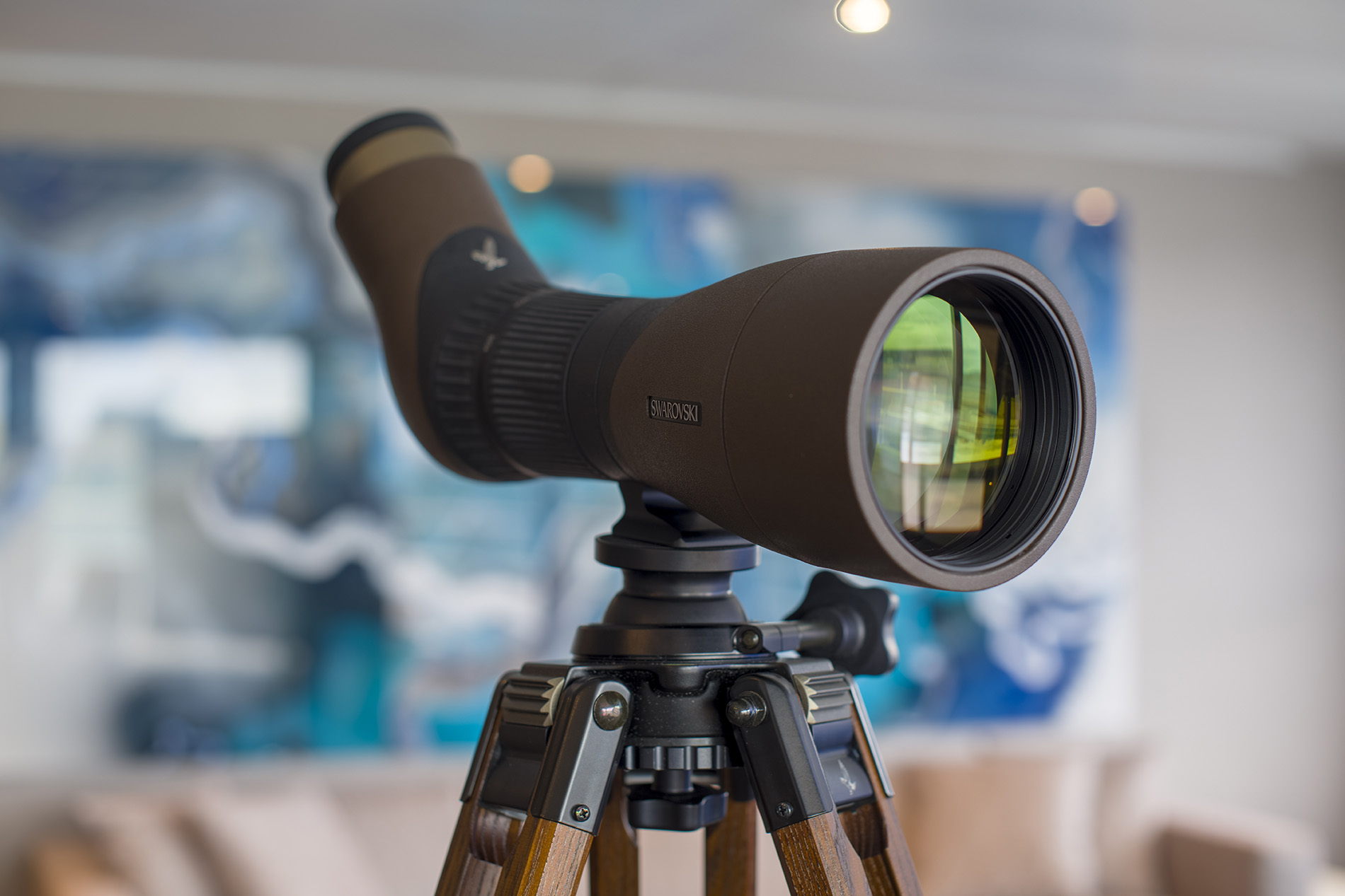
You can recline into plush seating and read a book or play board games as you enjoy a specialty tea or coffee. Take a closer look at landscapes and wildlife as you pass them through the Swarovski telescopes.
Reception
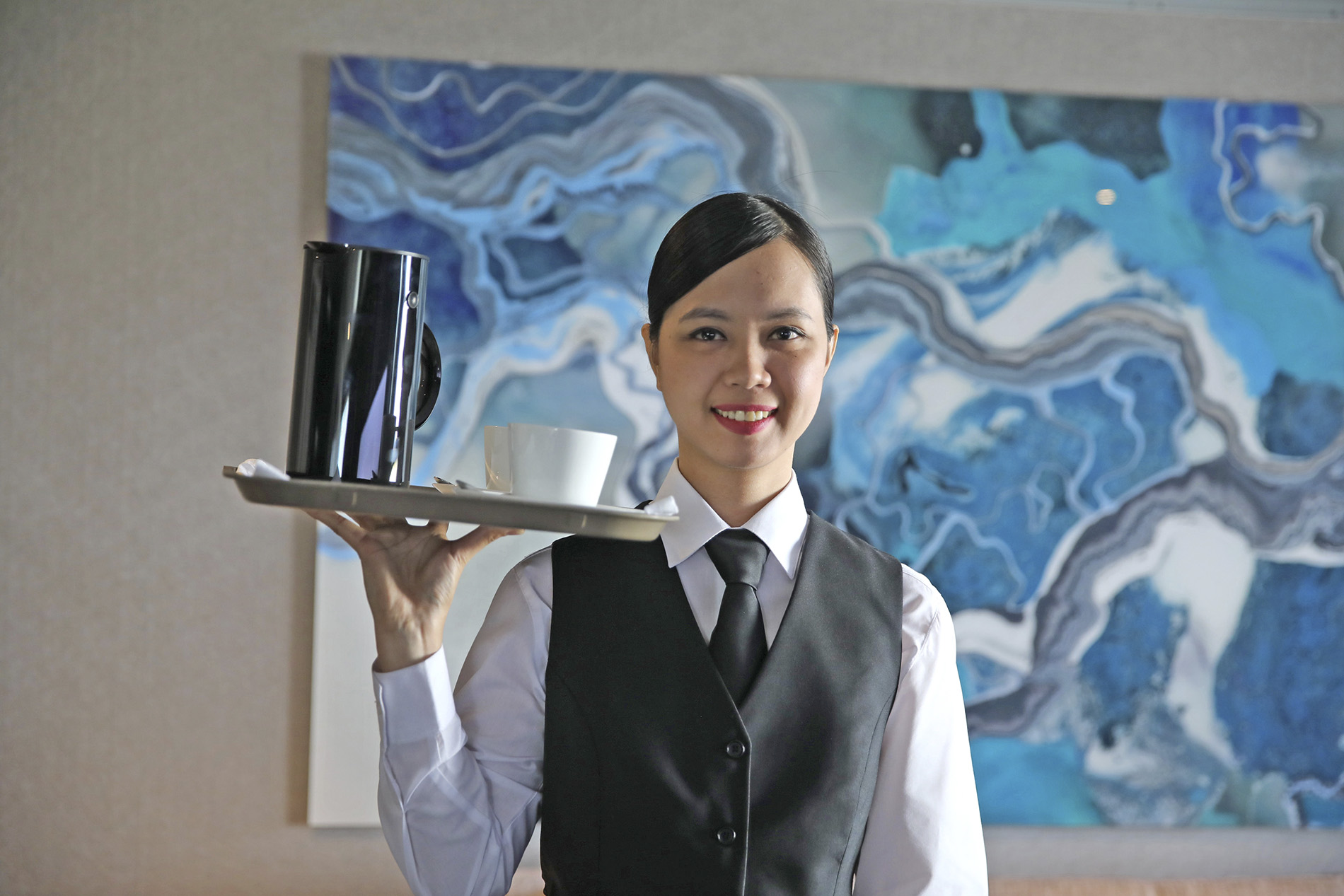
Our expert team on board Scenic Eclipse are the finest in their field and deliver an unrivalled level of service.
Yacht Club
Relax in the Yacht Club grill restaurant and bar for breakfast, lunch and special themed dinners. This casual dining experience is fitted with food islands, outdoor and lounge seating. Come to dine, mingle, relax in swing chairs overlooking the view, or taste our freshly-made gelato.
Observation Deck
Boutique
The Boutique can be found on Deck 4.
Open Bridge
Venture to the bridge and see Scenic Eclipse in full operation. The unique policy provides guests access to one of the best viewing areas on the ship, as well as the opportunity to learn about the technical capabilities of The World’s First Discovery YachtsTM.
Panorama Bar, Cabanas & Vitality Pools
Elements Wine Bar
Elements Bar is your gateway to global cheese exploration, featuring a meticulously curated selection of international cheeses. Indulge in an array of textures and flavours, expertly paired with complementary accompaniments for a truly memorable tasting experience.
Lumière Champagne Bar
Elevate your celebration with our carefully curated range of exquisite Champagne at the dedicated bar at Lumiére.